Planning and Development
Committee
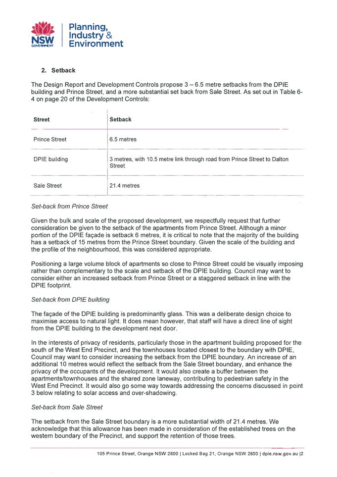
Agenda
6 April 2021
Notice is hereby given, in
accordance with the provisions of the Local Government Act 1993 that a Planning and Development Committee meeting of ORANGE CITY COUNCIL
will be held in the Council Chamber,
Civic Centre, Byng Street, Orange on Tuesday, 6 April 2021.
David
Waddell
Chief Executive Officer
For apologies please
contact Administration on 6393 8218.
1 Introduction
1.1 Declaration
of pecuniary interests, significant non-pecuniary interests and less than
significant non-pecuniary interests
The
provisions of Chapter 14 of the Local Government Act, 1993 (the Act)
regulate the way in which Councillors and designated staff of Council conduct
themselves to ensure that there is no conflict between their private interests
and their public role.
The
Act prescribes that where a member of Council (or a Committee of Council) has a
direct or indirect financial (pecuniary) interest in a matter to be considered
at a meeting of the Council (or Committee), that interest must be disclosed as
soon as practicable after the start of the meeting and the reasons given for
declaring such interest.
As
members are aware, the provisions of the Local Government Act restrict any
member who has declared a pecuniary interest in any matter from participating
in the discussion or voting on that matter, and requires that member to vacate
the Chamber.
Council’s Code of Conduct provides that if members
have a non-pecuniary conflict of interest, the nature of the conflict must be
disclosed. The Code of Conduct also provides for a number of ways in which a
member may manage non pecuniary conflicts of interest.
|
Recommendation
It is recommended that Committee Members now disclose any
conflicts of interest in matters under consideration by the Planning and Development
Committee at this meeting.
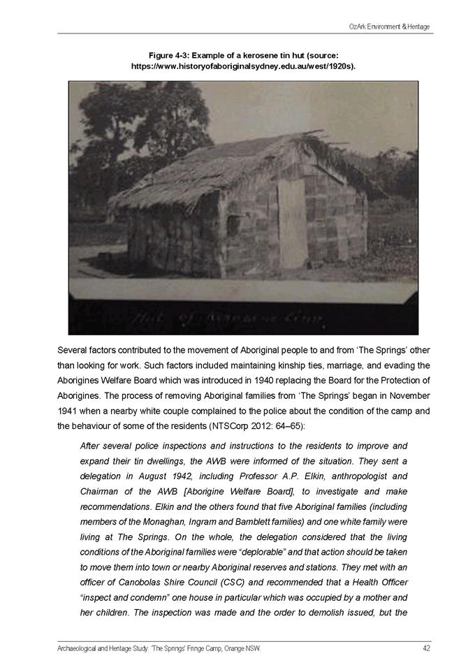
|
2 General
Reports
2.1 Items
Approved Under the Delegated Authority of Council
RECORD
NUMBER: 2021/325
AUTHOR: Paul
Johnston, Manager Development Assessments
EXECUTIVE Summary
Following is a list of more
significant development applications approved by the Chief Executive Officer
under the delegated authority of Council. Not included in this list are
residential scale development applications that have also been determined by
staff under the delegated authority of Council (see last paragraph of this
report for those figures).
Link To Delivery/OPerational Plan
The recommendation in this report
relates to the Delivery/Operational Plan strategy “7.1 Preserve - Engage
with the community to develop plans for growth and development that value the
local environment”.
Financial Implications
Nil
Policy and Governance Implications
Nil
|
Recommendation
That Council resolves to
acknowledge the information provided in the report by the Manager Development
Assessments on Items Approved Under the Delegated Authority of Council.
|
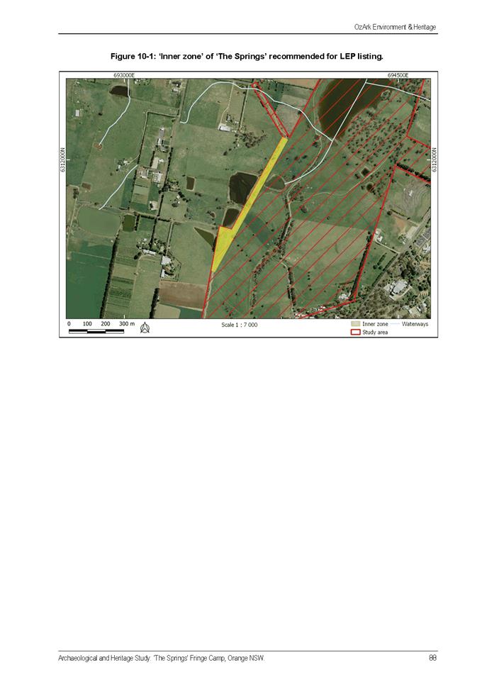
further considerations
Consideration has been given to the
recommendation’s impact on Council’s service delivery; image and
reputation; political; environmental; health and safety; employees;
stakeholders and project management; and no further implications or risks have
been identified.
|
Reference:
|
DA
129/2018(2)
|
Determination
Date
|
18
March 2021
|
|
PR
Number
|
PR1164
|
|
Applicant/s:
|
Mr A
and Mrs D Harvey
|
|
Owner/s:
|
Mr
MF and Mrs JM Rangott
|
|
Location:
|
Lots
43 and 44 DP 608334 and Lot 42 DP 532439 – 1, 5 and 7 Barrett Street,
Orange
|
|
Proposal:
|
Modification
of development consent - demolition (existing former industrial building and
trees), subdivision (boundary adjustment), subdivision (three lot Torrens)
and dwelling houses (two dwellings). The modification involved:
· altering the staging of the development to defer
demolition of the former industrial building at the Racecourse Road frontage,
via re-ordering of Conditions
· reducing noise attenuation measures to the Rangott
Mineral Exploration (RME) industrial shed at the site frontage, by amending
Condition 20
· deleting requirements for a BCA compliance report
relating to boundary setbacks for the RME industrial shed at the rear of the
site, by deleting Condition 18.
|
|
Value:
|
$0
|
|
Reference:
|
DA
225/2019(2)
|
Determination
Date
|
16
February 2021
|
|
PR
Number
|
PR8324
|
|
Applicant/s:
|
AT
& PL Swain Holdings Pty Ltd
|
|
Owner/s:
|
AT
& PL Swain Holdings Pty Ltd
|
|
Location:
|
Lot
50 DP 595199 - 25-27 McNamara Street, Orange
|
|
Proposal:
|
Modification
of development consent - office premises (alterations and additions to
existing building). The modification sought to regularise changes that have
been undertaken within the building that did not reflect the original
approval. The modification involved a revised lift location, minor changes to
partitions on the ground and first floors of the building, altered toilet
arrangements, and minor changes to the front entry door width and glazing.
|
|
Value:
|
$0
|
|
Reference:
|
DA
396/2019(2)
|
Determination
Date
|
19
February 2021
|
|
PR
Number
|
PR14629
|
|
Applicant/s:
|
Orange
Pre-School Kindergarten Ltd
|
|
Owner/s:
|
Orange
City Council (lessee Orange Preschool Kindergarten Ltd)
|
|
Location:
|
Lots
2 and 3 DP 237232 - 13 Moad Street, Orange
|
|
Proposal:
|
Modification
of development consent -centre-based child care facility (alterations and
additions to existing building). The modified proposal involved:
· Internal reconfiguration of spaces and facilities;
· Removal of enclosed verandah at rear and replacement
with a new addition; and
· Deletion of conditional development contributions as
they relate to water and sewer ETs (Condition 8).
|
|
Value:
|
$0
|
|
Reference:
|
DA
14/2020(1)
|
Determination
Date
|
16
February 2021
|
|
PR
Number
|
PR11580
|
|
Applicant/s:
|
Alceon
Group Pty Ltd
|
|
Owner/s:
|
Alceon
Group Pty Ltd
|
|
Location:
|
Lot
564 DP 776383 - 212-220 Summer Street, Orange
|
|
Proposal:
|
Business
premises (change of use and fit-out) and business identification signage
|
|
Value:
|
$120,000
|
|
Reference:
|
DA
224/2020(1)
|
Determination
Date
|
4
February 2021
|
|
PR
Number
|
PR25598
|
|
Applicant/s:
|
Mr T
and Mrs C Carroll
|
|
Owner/s:
|
Mr
TJ and Mrs CA Carroll
|
|
Location:
|
Lots
200 and 201 DP 1172126 – 55 and 57 Dalton Street, Orange
|
|
Proposal:
|
Centre-based
child care facility (alterations and additions)
|
|
Value:
|
$655,000
|
|
Reference:
|
DA
324/2020(2)
|
Determination
Date
|
3
March 2021
|
|
PR
Number
|
PR11579
|
|
Applicant/s:
|
Helix
Architects Pty Ltd
|
|
Owner/s:
|
Australian
Postal Corporation
|
|
Location:
|
Lot
11 Sec 40 DP 758817 – 222-224 Summer Street, Orange and
Lot
22 Sec 40 DP 758817 - Colvin Lane, Orange
|
|
Proposal:
|
Modification
of development consent - business premises (alterations and additions and
upgrade of works). The land is identified as a Heritage Item under the Orange
LEP and on the State Heritage Register, and under the original development
application the development was classified as a nominated integrated
development. As this application is for a Section 4.55 (1a), it is not
integrated development.
|
|
Value:
|
$55,000
|
|
Reference:
|
DA
346/2020(1)
|
Determination
Date
|
16
February 2021
|
|
PR
Number
|
PR28492
|
|
Applicant/s:
|
Hibbards
Pty Ltd
|
|
Owner/s:
|
Hibbards
Pty Ltd
|
|
Location:
|
Lot
4 DP 1259318 - 11 Bluebell Way, Orange
|
|
Proposal:
|
Multi
dwelling housing (three dwellings) and subdivision (three Strata lots and
common property)
|
|
Value:
|
$750,000
|
|
Reference:
|
DA
403/2020(1)
|
Determination
Date
|
25
February 2021
|
|
PR
Number
|
PR9700
|
|
Applicant/s:
|
Golder
Associates Pty Ltd
|
|
Owner/s:
|
Golder
Associates Pty Ltd
|
|
Location:
|
Lot
10 DP 18989, Lots 8 and 9 DP 18703, Lot 12 Sec 42 DP 758817 – 273‑285 Peisley
Street and 155 March Street, Orange
|
|
Proposal:
|
Demolition
(all buildings) and site remediation
|
|
Value:
|
$880,000
|
|
Reference:
|
DA
415/2020(1)
|
Determination
Date
|
25
February 2021
|
|
PR
Number
|
PR25746
|
|
Applicant/s:
|
The
Anglican Schools Corporation
|
|
Owner/s:
|
Anglican
Schools Corporation
|
|
Location:
|
Lot
100 DP 1174806 - 7 Murphy Lane, Orange
|
|
Proposal:
|
School
(alterations to existing school building and conversion to new prep facility)
|
|
Value:
|
$477,000
|
|
Reference:
|
DA
419/2020(1)
|
Determination
Date
|
20
January 2021
|
|
PR
Number
|
PR28592
and PR28593
|
|
Applicant/s:
|
Contemporary
Homes Pty Ltd
|
|
Owner/s:
|
Divlist
Pty Limited and Mikell Investments Pty Limited
|
|
Location:
|
Lots
135 and 136 DP1260733 - 128 and 130 Shiralee Road, Orange
|
|
Proposal:
|
Exhibition
village (change of use of two dwellings to exhibition homes) and business
identification signage
|
|
Value:
|
$15,000
|
|
Reference:
|
DA
432/2020(1)
|
Determination
Date
|
10
March 2021
|
|
PR
Number
|
PR12273
|
|
Applicant/s:
|
Mr S
Kidd
|
|
Owner/s:
|
Mr
SB Kidd and Ms AJ Newsom
|
|
Location:
|
Lot
11 Sec 2 DP 2986 - 37 Wakeford Street, Orange
|
|
Proposal:
|
Dual
occupancy and subdivision (two lot residential)
|
|
Value:
|
$270,000
|
|
Reference:
|
DA
446/2020(1)
|
Determination
Date
|
9
March 2021
|
|
PR
Number
|
PR11517
and PR11518
|
|
Applicant/s:
|
Mr N
Kelly
|
|
Owner/s:
|
Ms V
Kourtis and Mrs M Pertsoulis
|
|
Location:
|
Lot
10 DP 203590, Lot 351 DP 625439
249
Summer Street and 251-257 Summer Street, Orange
|
|
Proposal:
|
Pub
(alterations and additions to existing building)
|
|
Value:
|
$650,000
|
|
Reference:
|
DA
457/2020(1)
|
Determination
Date
|
5
March 2020
|
|
PR
Number
|
PR11368
|
|
Applicant/s:
|
Mr JA Granger
|
|
Owner/s:
|
Mrs JM Granger
|
|
Location:
|
Lot 1 DP 199569 - 56-58 Spring Street, Orange
|
|
Proposal:
|
Subdivision (two lot Torrens), subdivision (five lot
Community), demolition (outbuilding) and dwelling houses (four dwellings)
|
|
Value:
|
$1,300,000.00
|
|
Reference:
|
DA
465/2020(1)
|
Determination
Date
|
16
February 2021
|
|
PR
Number
|
PR22176
|
|
Applicant/s:
|
Source
Architects
|
|
Owner/s:
|
Mrs
JM Granger
|
|
Location:
|
Lot
42 DP 1109880 - 22 Hale Street, Orange
|
|
Proposal:
|
Subdivision
(two lot residential) and two dwellings (one per lot)
|
|
Value:
|
$460,000
|
|
Reference:
|
DA
469/2020(1)
|
Determination
Date
|
25
February 2021
|
|
PR
Number
|
PR6929
|
|
Applicant/s:
|
Benedict
Design
|
|
Owner/s:
|
Formdell
Pty Limited
|
|
Location:
|
Lot
59 DP 736583 - 173 Lords Place, Orange
|
|
Proposal:
|
Office
premises (fitout of first floor)
|
|
Value:
|
$250,000
|
|
Reference:
|
DA
476/2020(1)
|
Determination
Date
|
4
March 2021
|
|
PR
Number
|
PR18521
|
|
Applicant/s:
|
PW
Studio
|
|
Owner/s:
|
Fitz’s
Land Co Pty Ltd
|
|
Location:
|
Lot
100 DP 1040962 – 234 Canobolas Road, Canobolas
|
|
Proposal:
|
Farm
stay accommodation (x 2 buildings) and associated services
|
|
Value:
|
$500,000
|
|
Reference:
|
DA
477/2020(1)
|
Determination
Date
|
9
March 2021
|
|
PR
Number
|
PR11547
|
|
Applicant/s:
|
Mr A
Nguyen
|
|
Owner/s:
|
Anandmahi
Pty Ltd
|
|
Location:
|
Lot
4 DP 576169 - 312-324 Summer Street, Orange
|
|
Proposal:
|
Electricity
generating works (roof-top solar panels)
|
|
Value:
|
$29,662
|
|
Reference:
|
DA
480/2020(1)
|
Determination
Date
|
11
March 2021
|
|
PR
Number
|
PR10533
|
|
Applicant/s:
|
Byng
Administration Services Pty Ltd
|
|
Owner/s:
|
Byng
Administration Services Pty Ltd
|
|
Location:
|
Lot
2 Sec E DP18064, Lot 16 DP 1120534 – 23 Rowan Street and Woodward
Street, Orange
|
|
Proposal:
|
Subdivision
(two lot boundary adjustment)
|
|
Value:
|
$0
|
|
Reference:
|
DA
483/2020(1)
|
Determination
Date
|
12
March 2021
|
|
PR
Number
|
PR10266
|
|
Applicant/s:
|
Mr
MA McClure
|
|
Owner/s:
|
Mr
MA McClure
|
|
Location:
|
Lot
A DP 153201, 22 Prince Street, Orange
|
|
Proposal:
|
Demolition
(existing carport, garden sheds and tree removal), garage
(new construction) and subdivision (two lot residential)
|
|
Value:
|
$10,000
|
|
Reference:
|
DA
509/2020(1)
|
Determination
Date
|
10
March 2021
|
|
PR
Number
|
PR21017
|
|
Applicant/s:
|
The
Hub Orange Pty Ltd
|
|
Owner/s:
|
The
Hub Orange Pty Ltd
|
|
Location:
|
Lot
50 DP 1099901 - 2-10 McNeilly Avenue, Orange
|
|
Proposal:
|
Subdivision
(four lot industrial)
|
|
Value:
|
$0
|
|
Reference:
|
DA
5/2021(1)
|
Determination
Date
|
8
March 2021
|
|
PR
Number
|
PR17508
|
|
Applicant/s:
|
David
G Evans Architect
|
|
Owner/s:
|
Orange
Vision Pty Ltd
|
|
Location:
|
Lot
1 DP 1010563 - 59 Lords Place, Orange
|
|
Proposal:
|
General
industry (alterations and additions to existing building)
|
|
Value:
|
$625,000
|
|
Reference:
|
DA
23/2021(1)
|
Determination
Date
|
18
February 2021
|
|
PR
Number
|
PR9460
|
|
Applicant/s:
|
Orange
Aboriginal Medical Service
|
|
Owner/s:
|
NSW
Land and Housing Corporation
|
|
Location:
|
Lot
13 DP 807799 - 8 Oxley Place, Orange
|
|
Proposal:
|
Community
facility (alterations and additions to existing building)
|
|
Value:
|
$60,000
|
|
Reference:
|
DA
30/2021
|
Determination
Date
|
11
March 2021
|
|
PR
Number
|
PR27990
|
|
Applicant/s:
|
Stay
Upright
|
|
Owner/s:
|
Orange
City Council
|
|
Location:
|
Lot
807 DP 1240445 - 16 Elwin Drive, Orange
|
|
Proposal:
|
Rider
training facility, site works and business identification signage (INNOMINATE
USE)
|
|
Value:
|
$580,000
|
|
Reference:
|
DA 33/2021(1)
|
Determination
Date
|
18
February 2021
|
|
PR
Number
|
PR11580
|
|
Applicant/s:
|
CPRAM
Investments Pty Ltd
|
|
Owner/s:
|
Alceon
Group Pty Limited
|
|
Location:
|
Lot
564 DP 776383 - Tenancy 36 - 212 220 Summer Street, Orange
|
|
Proposal:
|
Business
premises (first use, shop front, internal fit-out and internal signage)
(Tenancy 36)
|
|
Value:
|
$70,000
|
|
Reference:
|
DA
38/2021(1)
|
Determination
Date
|
11
March 2021
|
|
PR
Number
|
PR4193
|
|
Applicant/s:
|
Mr
TS Figuero
|
|
Owner/s:
|
Mr
TS and Mrs IL Figuero
|
|
Location:
|
Lot
A DP 371431 - 25 Franklin Road, Orange
|
|
Proposal:
|
Dwelling
alterations and additions, secondary dwelling and attached garage and shed
(detached)
|
|
Value:
|
$400,000
|
|
Reference:
|
DA
43/2021(1)
|
Determination
Date
|
11
March 2021
|
|
PR
Number
|
PR11630
|
|
Applicant/s:
|
Food
Week Committee
|
|
Owner/s:
|
Orange
City Council
|
|
Location:
|
Sampson
Street, between Summer and Byng Streets, Orange
|
|
Proposal:
|
Temporary
use of land (FOOD week luncheon) (Sampson Street)
|
|
Value:
|
$0
|
TOTAL NET* VALUE OF
DEVELOPMENTS APPROVED BY THE CEO UNDER DELEGATED AUTHORITY IN THIS PERIOD: $8,156,662.00
* Net
value relates to the value of modifications. If modifications are the same
value as the original DA, then nil is added. If there is a plus/minus
difference, this difference is added or taken out.
Additionally, since the
March 2021 meeting report periods (19 February to 24 March 2021), another 13
development applications were determined under delegated authority by other
Council staff with a combined value of $1,702,021.
2.2 Orange
LEP 2011 - Amendment 24 Status Update
RECORD
NUMBER: 2021/497
AUTHOR: Craig
Mortell, Senior Planner
EXECUTIVE Summary
Amendment 24 to the Orange LEP comprised an administrative
or housekeeping amendment to the LEP encompassing a wide range of matters
including: Flood planning controls, Heritage updates, Mapping updates, Minor
changes to clauses to improve clarity and intent, Subdivision of split-zoned
land, Minor spot re-zonings, Two Additional Permitted Uses (APU’s), and
Updates to land use tables.
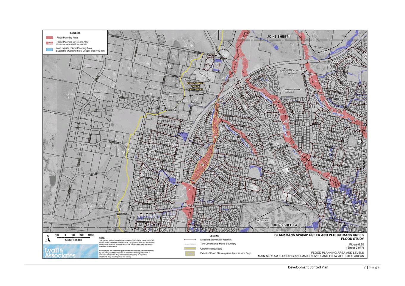
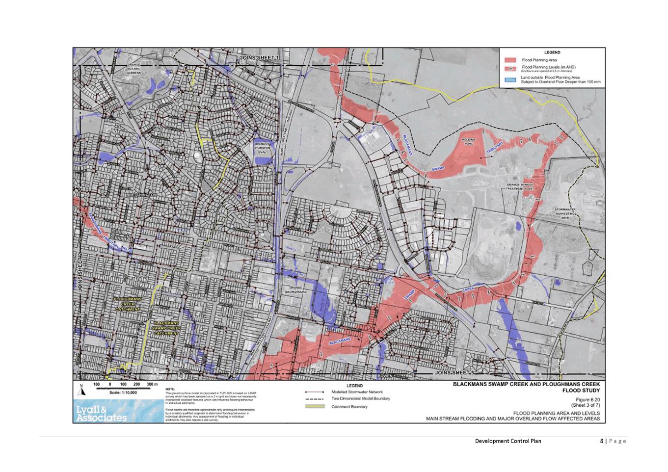
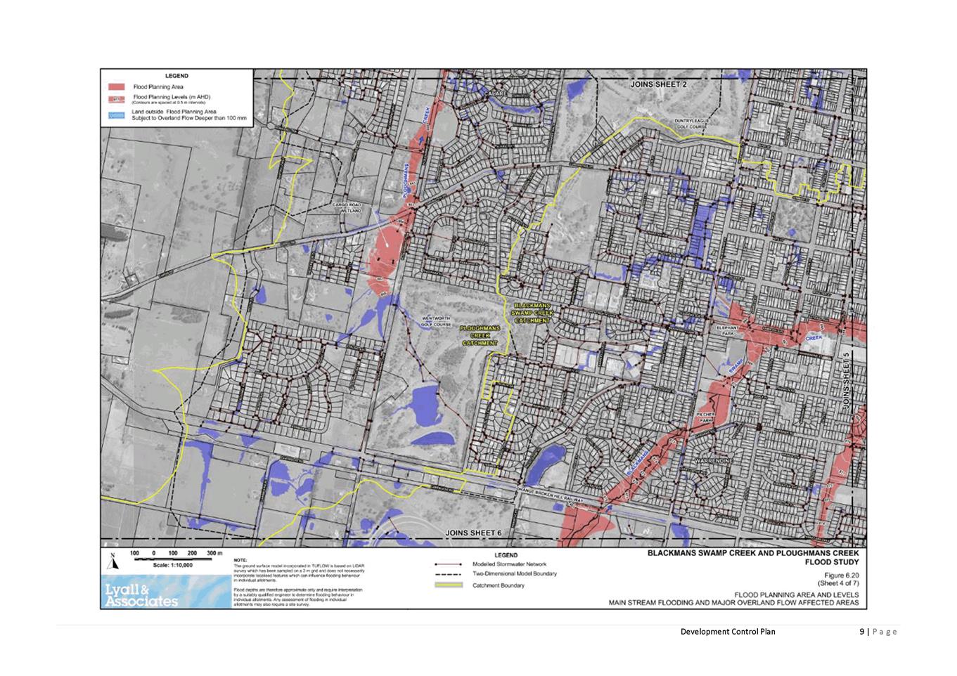
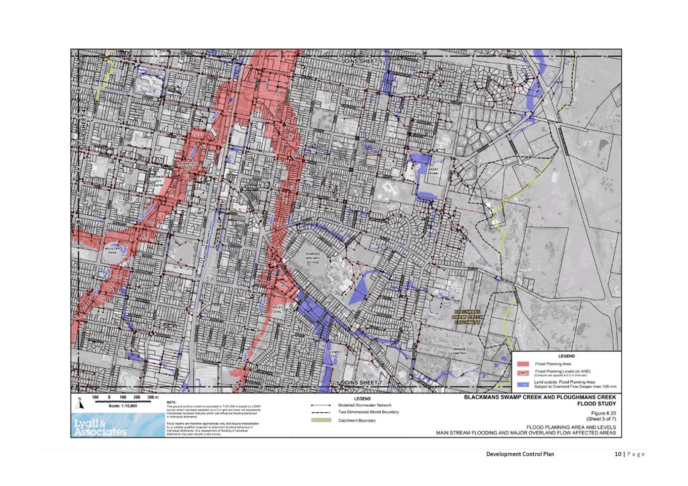
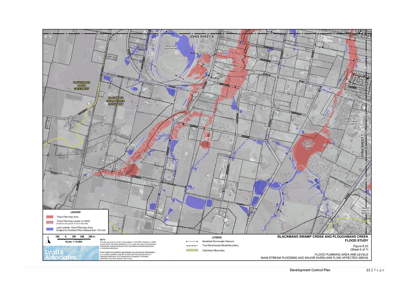
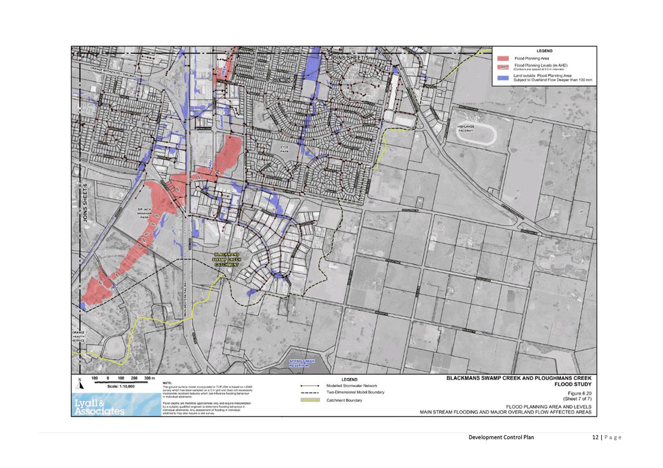
After a lengthy process Amendment 24 was successfully
gazetted on 5 March 2021 and is now in effect. A separate but closely related
project was the Blackmans Swamp Creek and Ploughmans Creek Floodplain Risk
Management Study and Plan that was reported to Council by Technical
Services at the 1 December 2020 meeting. At that time Council resolved:
That Council adopt the
Blackmans Swamp Creek and Ploughmans Creek Floodplain Risk Management Study and
Plan, October 2020 but defer the planning and development controls shown
in Section 5.9 of the report until such time that the Department of Planning
Industry and Environment allows flood controls on land above the 1% flood. (emphasis
added)
With the gazettal of Amendment 24 the approach of the LEP,
with respect to flooding, has now changed as detailed in this report.
Essentially flood controls now apply to the flood planning level, which in turn
is defined by the relevant flood study. Additionally, flood planning maps are
no longer directly referenced by clause 7.2 of the LEP and instead the reader
is directed to the flood study.
Council therefore needs to reinstate the planning and
development controls to ensure that development assessments, planning
certificates and general planning advice to the public accurately reflects the
extent of the hazard.
Link To Delivery/OPerational Plan
The recommendation in this report relates to the
Delivery/Operational Plan strategy “7.1 Preserve - Engage with the
community to develop plans for growth and development that value the local
environment”.
Financial Implications
Nil
Policy and Governance Implications
Nil
|
Recommendation
That Council note the gazettal of Amendment 24 to the
LEP and confirm the adoption of the amendment to Orange Development Control
Plan 2004 relating to flood controls to be known as chapter 4A Flood Affected
Land.
|
further considerations
Consideration has been given to the recommendation’s
impact on Council’s service delivery; image and reputation; political;
environmental; health and safety; employees; stakeholders and project
management; and no further implications or risks have been identified.
SUPPORTING
INFORMATION
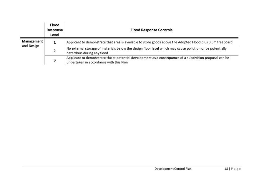
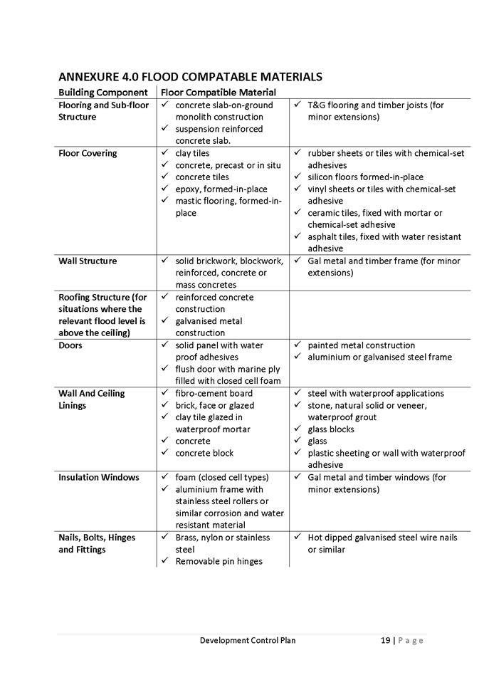
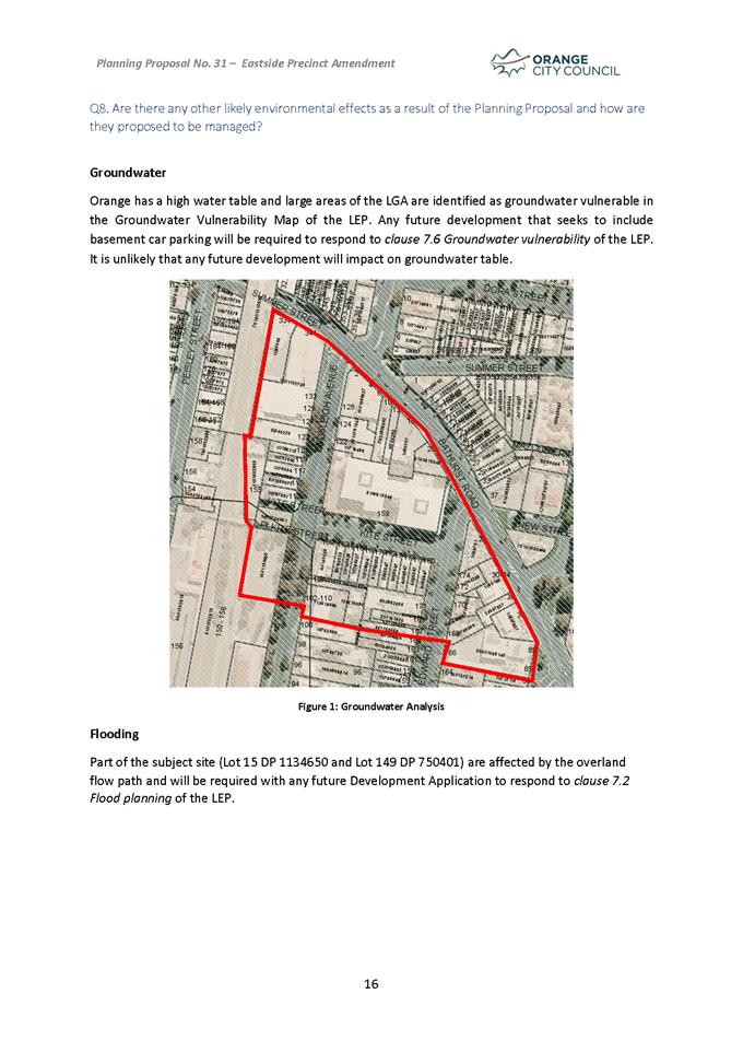
Flood planning controls,
Clause 7.2 Flood Planning has been
amended to remove the definition of flood planning level, this is now located
in the Dictionary and reads as:
flood planning level means
the level of a 1% AEP (annual exceedance probability) flood event plus 0.5
metre freeboard, or other freeboard determined by an adopted floodplain risk
management plan adopted by the Council.
The second part of the definition
means that the freeboard established in the flood study will have effect, or if
no freeboard were stated then it would default to 0.5m.
Clause 7.2A Floodplain Risk
Management has been adopted as a new clause and requires that a range of uses
not be permitted on land between the Flood Planning Level (FPL) and the
Probable Maximum Flood (PMF) unless Council is satisfied the development will
not, in flood events exceeding the FPL affect the safe occupation of, and
evacuation from, the land.
These matters are addressed through
the draft Development Control Plan controls previously exhibited as part of the
Amendment 24 process. However the deferral of these controls arising from the 1
December 2020 resolution now needs to be concluded and the DCP adoption
confirmed so as to ensure that flood affected development can be assessed in an
orderly manner.
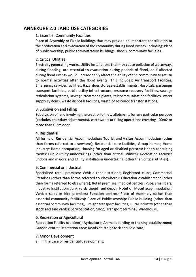
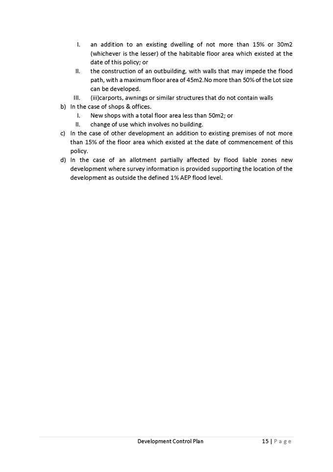
Summary of other amendments
permitted under Amendment No 24 to Orange LEP 2011
1 Heritage
updates
· Minor changes to
the heritage map and associated schedule 5 to correct errata and update lot and
DP references where a subdivision had altered the formal title. No new listings
involved were created.
2 Mapping
updates
· Water catchment
boundary map adjustments, including the adoption of the map for tile 12 which
had previously been omitted in error, and
· Minor adjustment
to the water catchment boundary on land at Shadforth. The Shadforth landowner
supplied more detailed survey information to allow the catchment to be refined
on their land, this may allow built form to be better positioned on the site
than previously.
· Airport obstacle
limitation surface map changes, to reflect the extension of the runway several
years ago.
3 Minor
changes to clauses to improve clarity and intent
· Clause 4.1C:
Removal of the phrase “multi dwelling housing” from subclause
4.1C(2)(b)(ii). Multi dwelling housing is not permissible in the zone and the
previous wording could create confusion.
· Adoption of clause
4.1D to allow subdivision of split-zoned land, to allow the orderly development
of rezoned land where a residue portion of the land is to remain in the
original zone.
· Adoption of clause
4.2C to allow subdivision of land in the E3 zone for primary production
provided it does not establish a new dwelling entitlement,
4 Minor
spot rezonings
· Industrial
land at Narrambla - To reflect changes to the cadastre from past subdivisions
· Adjustment
to the RE1 zone boundaries along Teamsters Walkway-To remove the RE1 zone from
parts of neighbouring residential lots
· Amend
the SP2 zone applying to the Rural Fire Service site in Forest Road -To better
describe the intended use of the zone.
· Part
of 1 Barrett Street to convert surplus industrial land to residential - Affects
a small area to the rear of the existing industrial shed, this area relates to
a DA for the neighbouring land that may be able to acquire the area and use for
alternative access to residential units.
· Change
the designation of Jack Brabham Park from RE2 Private Recreation to RE1 Public
Recreation to better reflect the status and intent of the park.
· Change
the zone of land in Eyles Street (orange function centre) from R1 General
Residential to B6 Enterprise Corridor to better reflect the status and use of
the function centre.
· Minor
adjustments to zones and Min Lot sizes in Shiralee to reflect the approved
layout of approved DA’s
· Neighbourhood
shops in East Orange (around the East Orange post office) - To reflect the
cluster of neighbourhood scale commercial uses in the area and facilitate
future change of uses – not anticipated to increase the scale or
intensity of the site.
5 Two
Additional Permitted Uses (APU’s)
· The creation of
item 3 to allow for small scale cafés and restaurants in the R1 zone
provided they do not involve drive through service and of a limited scale.
· The creation of
item 4 to provide a dwelling entitlement in relation to 120 Calton Road
6 Minor
updates to land use tables
· Added
“Bee keeping” to RU5 Village, R1 General Residential and R2 Low
Density Residential zones
· Added
“Secondary Dwellings” to R2 Low Density Residential zone. This
resolves a conflict with a SEPP in relation to the size limit for secondary
dwellings.
· Added
“Extensive Agriculture” to R5 Large Lot Residential Zone. While
lifestyle blocks are not likely to support a full time income from agriculture
the change will enable these lots to adopt aspects of extensive agriculture and
it is anticipated this would reduce the likelihood of land use conflicts with
neighbouring farms.
· Changed
“Dual Occupancies (Attached)” in the E3 Environmental Management
zone to just “Dual Occupancies” this enables the use without the
need for physical or structural attachment. The attached requirement was
imposing additional costs for structures, such as covered walkways, purely to
satisfy the definition. The change removes this requirement and staff can still
assess whether the dwellings are appropriately clustered on the site.
Attachments
1 DRAFT
- DCP chapter for Flood Affected Land - Rev November 2019, D19/67268⇩
Attachment 1 DRAFT -
DCP chapter for Flood Affected Land - Rev November 2019

2.3 Planning
Proposal to Amend the Orange Local Environmental Plan 2011 - Eastside Precinct
RECORD
NUMBER: 2021/535
AUTHOR: Alison
Phillips, Town Planner (Strategic)
EXECUTIVE Summary
This report commences the process to amend the Orange Local
Environmental Plan (LEP) in regards to the Eastside Precinct Plan and Site
Specific Controls as considered by Council 2 February 2021.
The Planning Proposal (Attachment 1) has been drafted
that reflects the Eastside Precinct Plan and Site Specific Controls (2020) (Attachment
2 & 3) which identifies amending the LEP to include additional
permitted uses and increase the height of building in the precinct to
incentivise renewal of the area. The Planning Proposal seeks to:
a) Amend
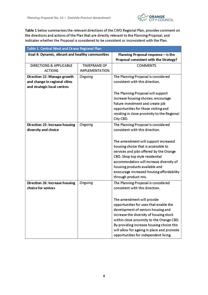
Schedule 1 - Additional Permitted Uses to support Multi dwelling housing,
Residential flat buildings, Attached dwellings, Secondary dwellings, Seniors
housing and Centre-based child care
facilities and include a new Additional Permitted Uses map
b) Amend
the Height of Building map from 12m to 16m for part of the Eastside Precinct
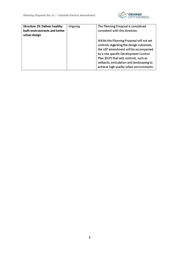
These matters are outlined in the attached draft Planning
Proposal which will form the basis for the amendment and public exhibition
process. Formal LEP maps, where relevant, will be prepared prior to public
exhibition.
Link To Delivery/OPerational Plan
The recommendation in this report relates to the
Delivery/Operational Plan strategy “7.1 Preserve - Engage with the
community to develop plans for growth and development that value the local
environment”.
Financial Implications
Nil
Policy and Governance Implications
Nil
|
Recommendation
That Council resolves:
1 To
endorse the attached scope of the Planning Proposal for the Eastside Precinct
to amend the Orange Local Environmental Plan 2011.
2 Submit
the attached Planning Proposal to the NSW Department of Planning and
Environment to seek a Gateway Determination in accordance with Section 3.34
of the Environmental Planning and Assessment Act 1979.
3 That
staff proceed to address any conditions or requirements of the
Gateway Determination and then place the draft Planning
Proposal on public exhibition in accordance with the Gateway determination.
|
further considerations
Consideration has been given to the recommendation’s
impact on Council’s service delivery; image and reputation; political;
environmental; health and safety; employees; stakeholders and project
management; and no further implications or risks have been identified.
SUPPORTING INFORMATION
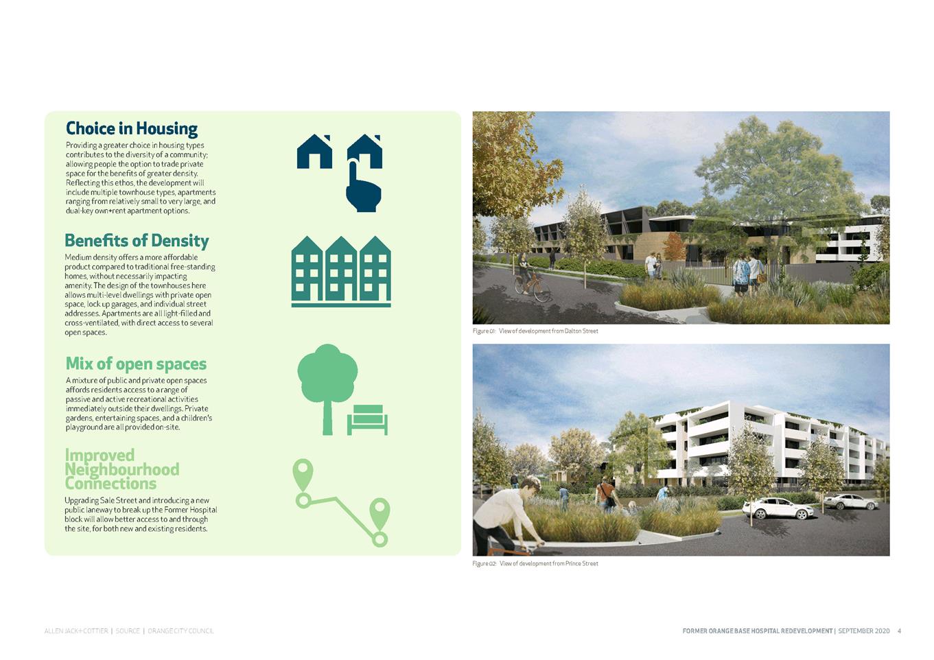
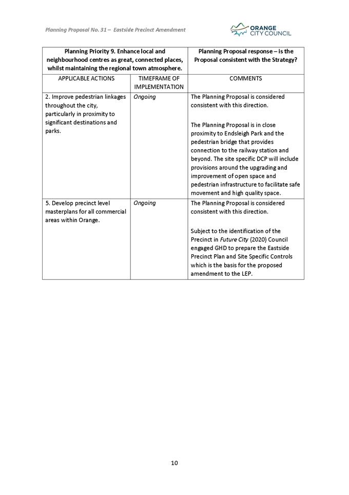
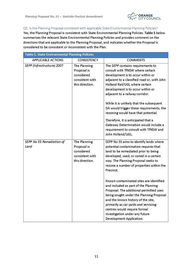
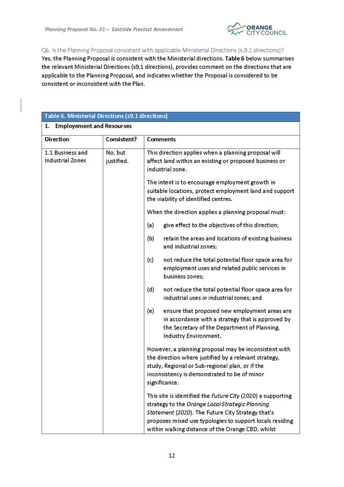
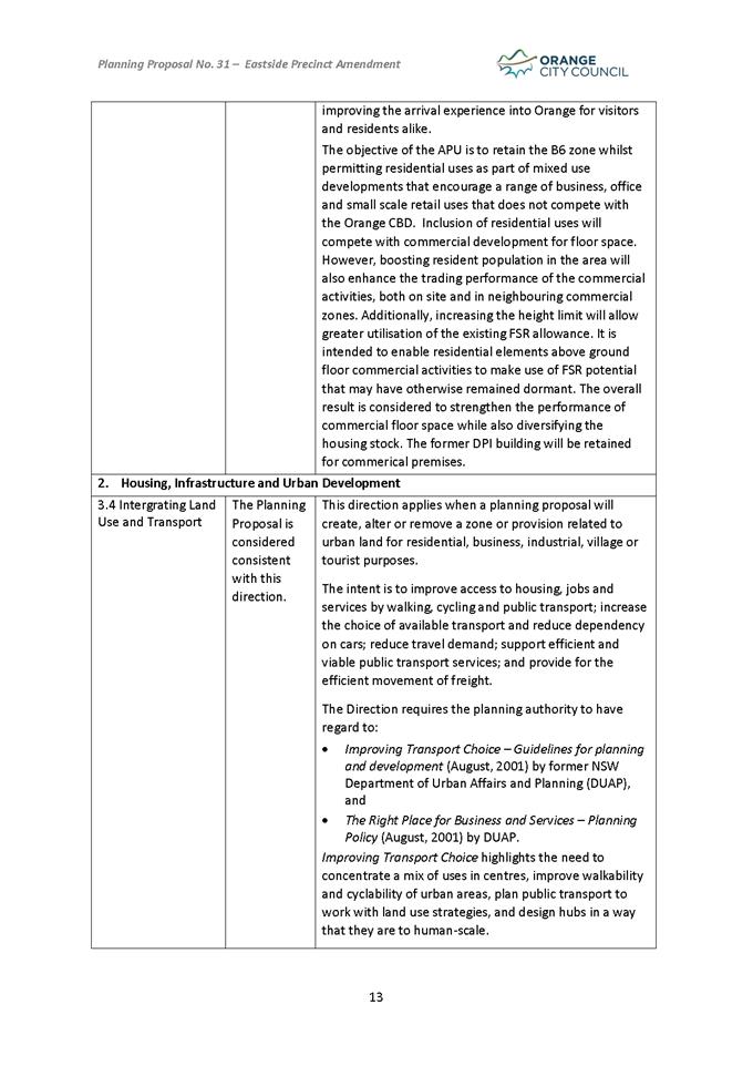
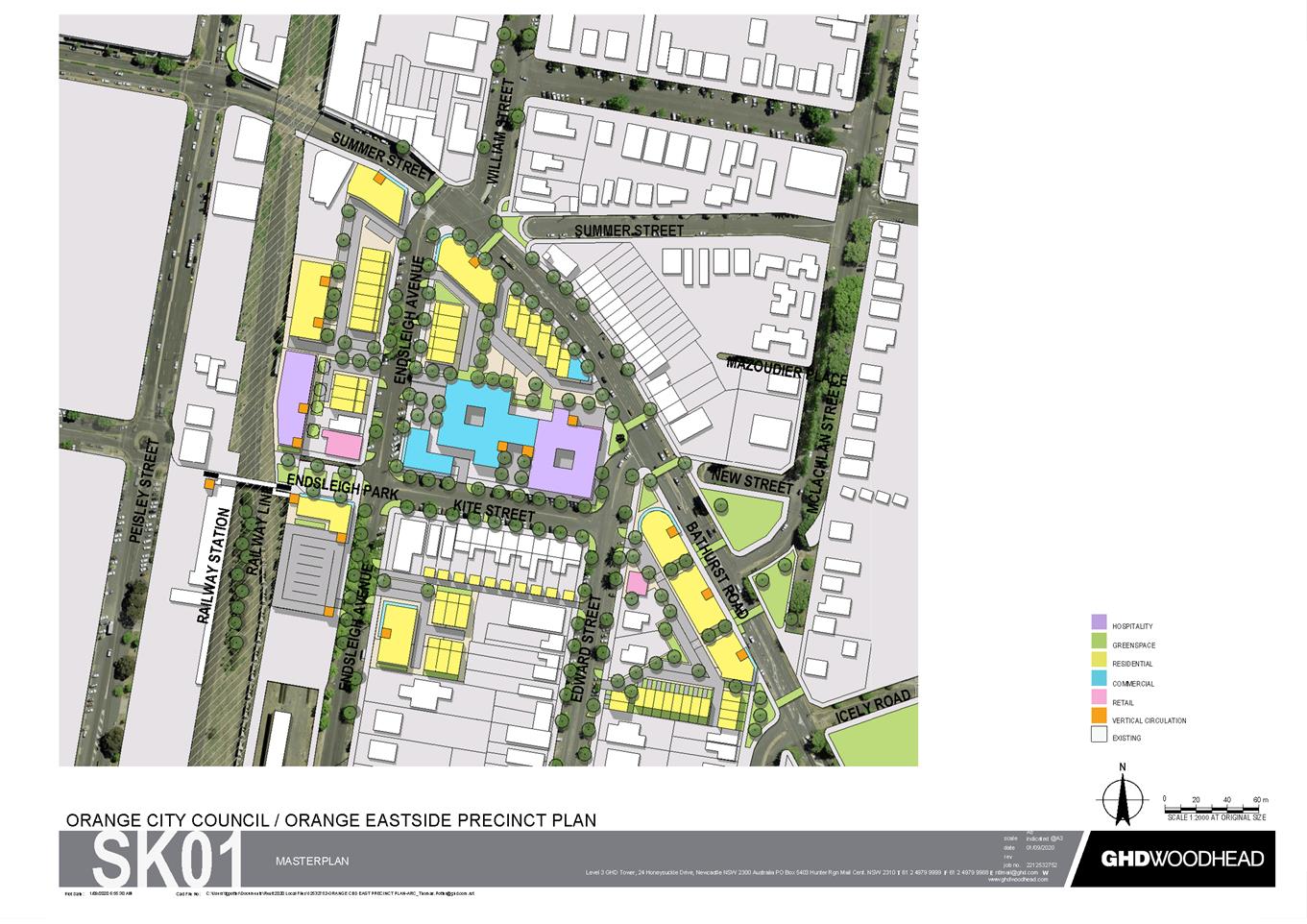
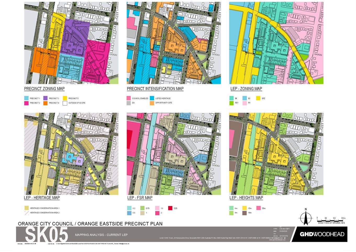
The Orange Future City (May 2020) project identified
a wide range of projects, concepts and opportunities to guide the development
and growth of the central business district over the next several years. Within
Future City the overall CBD area was divided into a series of precincts
with recommendations for each.
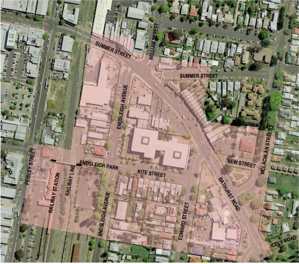
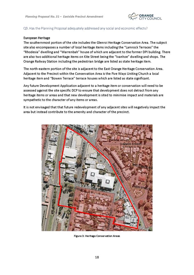
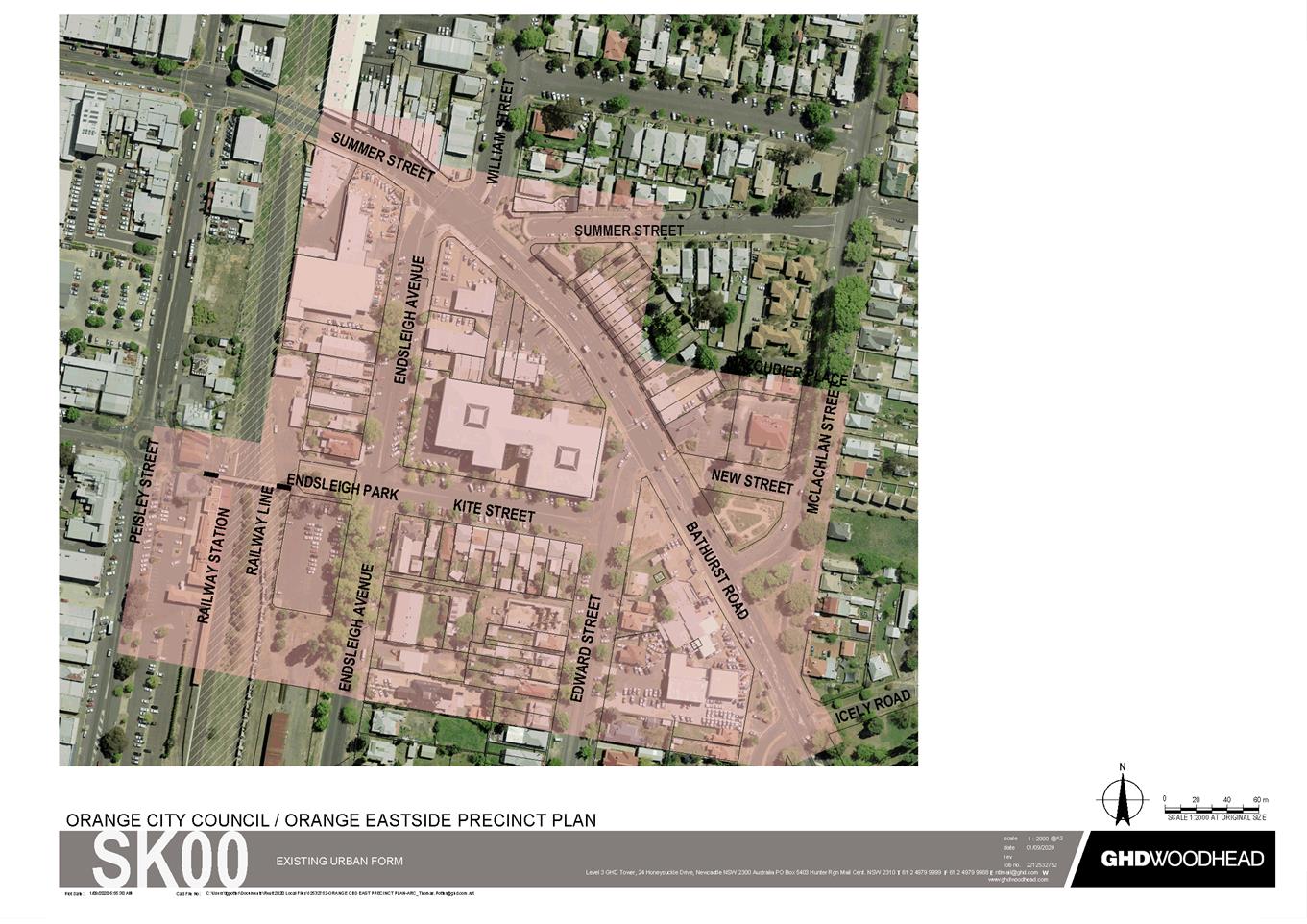
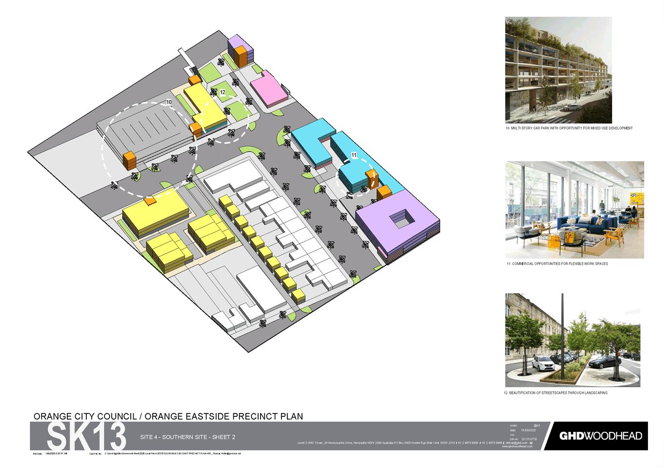
Figure 1. Location Plan – Eastside Precinct
Comprising an area east of the railway line and south of
Bathurst Road, this area was selected for the first CBD precinct plan due to
significant changes occurring in the area. The Planning Proposal seeks to amend
the Orange LEP to facilitate the renewal of the Eastside Precinct and encourage
compatible uses that will support commercial activity and residential living
the in the Orange CBD. The Eastside Precinct Plan aims to attract residents,
workers and visitors to the precinct and define its future role, function and
composition within the Orange CBD and forms the basis for the Planning
Proposal.
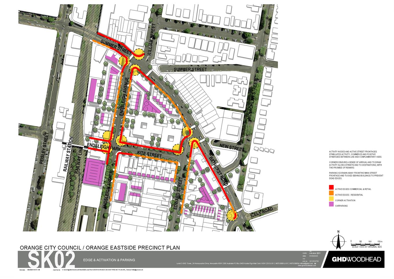
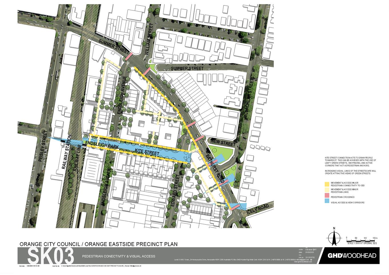
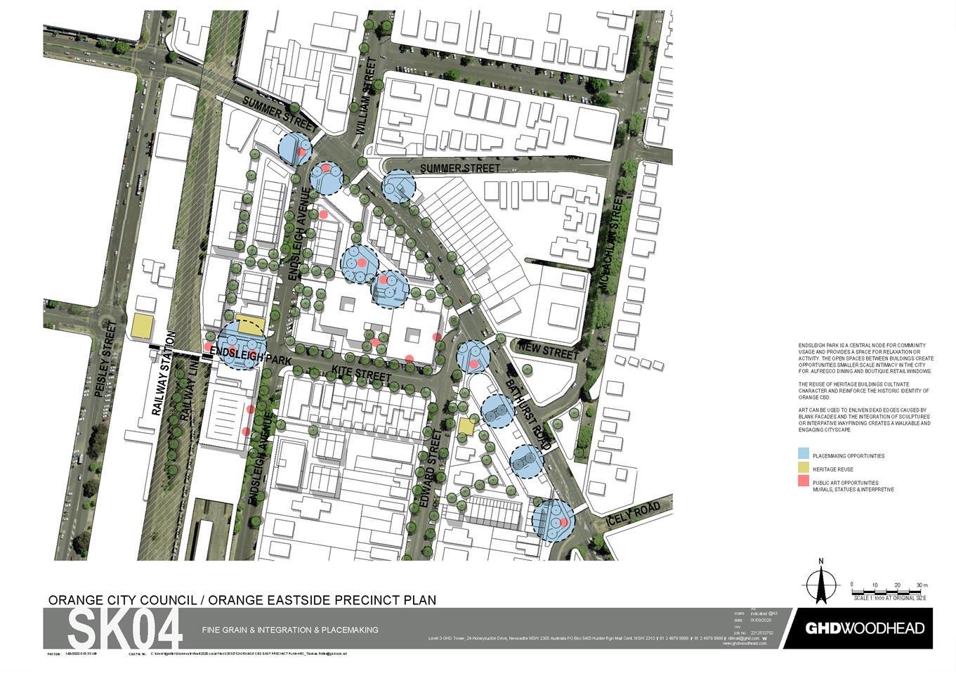
This includes the following recommended amendments:
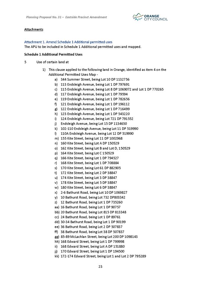
1. AMEND SCHEDULE 1 ADDITIONAL
PERMITTED USES
The APU to be included in
Schedule 1 Additional permitted uses and mapped.
Schedule 1 Additional
Permitted Uses
5 Use of
certain land at
1) This clause applied to the following land in
Orange, identified as item 4 on the Additional Permitted Uses Map -
a) 344 Summer Street, being Lot 10 DP 1132756
b) 113 Endsleigh Avenue, being Lot 1 DP 797691
c) 115 Endsleigh Avenue, being Lot 8 DP 1069072
and Lot 1 DP 770265
d) 117 Endsleigh Avenue, being Lot 1 DP 79594
e) 119 Endsleigh Avenue, being Lot 1 DP 782656
f) 121 Endsleigh Avenue, being Lot 1 DP
196112
g) 122 Endsleigh Avenue, being Lot 1 DP 716499
h) 123 Endsleigh Avenue, being Lot 1 DP 543220
i) 124 Endsleigh Avenue, being Lot 721 DP
791552
j) Endsleigh Avenue, being Lot 15 DP
1134650
k) 102-110 Endsleigh Avenue, being Lot 11 DP
519990
l) 110A Endsleigh Avenue, being Lot 12 DP
519990
m) 155 Kite Street, being Lot 11 DP 1002968
n) 160 Kite Street, being Lot A DP 150529
o) 162 Kite Street, being Lot B and Lot D, 150529
p) 164 Kite Street, being Lot C 150529
q) 166 Kite Street, being Lot 1 DP 794527
r) 168 Kite Street, being Lot 1 DP 708884
s) 170 Kite Street, being Lot 61 DP 882905
t) 172 Kite Street, being Lot 2 DP 38847
u) 174 Kite Street, being Lot 3 DP 38847
v) 178 Kite Street, being Lot 5 DP 38847
w) 180 Kite Street, being Lot 6 DP 38847
x) 2-6 Bathurst Road, being Lot 10 DP 1069827
y) 10 Bathurst Road, being Lot 732 DP803342
z) 12 Bathurst Road, being Lot 1 DP 735260
aa) 16 Bathurst Road, being Lot 1 DP 90757
bb) 20 Bathurst Road, being Lot 815 DP 813348
cc) 24 Bathurst Road, being Lot 1 DP 89761
dd) 30-34 Bathurst Road, being Lot 1 DP 90199
ee) 36 Bathurst Road, being Lot 2 DP 507837
ff) 38 Bathurst Road, being Lot 38 DP 507837
gg) 85-89 McLachlan Street, being Lot 200 DP 1098143
hh) 168 Edward Street, being Lot 1 DP 799998
ii) 168 Edward Street, being Lot A DP 151880
jj) 170 Edward Street, being Lot 1 DP 194500
kk) 172-174 Edward Street, being
Lot 1 and Lot 2 DP 795289
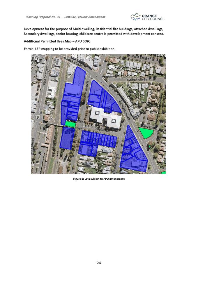
Development for the purpose of
Multi dwelling, Residential flat buildings, Attached dwellings, Secondary
dwellings, Seniors housing and Childcare centres is permitted with development
consent.
Other
approaches have been explored within the Planning Proposal pathway, such as
amending the zoning to B4 Mixed Use as part of the Planning Proposal instead of
perusing additional permitted uses. However, Councils’ role in supporting
the Orange CBD as the core retail centre have historically not considered
expanding blanket retail uses beyond the immediate retail area to ensure the
economic functioning of the CBD is protected. Additionally to make the B4
Mixed Use zone fit the intention for the site would require altering the land
use table which would then have implications for other areas of B4 Mixed Use.
Additional Permitted Uses Map
– APU 008C
Formal LEP mapping to be provided
prior to public exhibition.
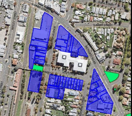
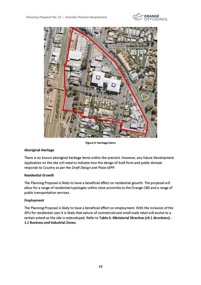
Figure 2. Lots subject to APU amendment
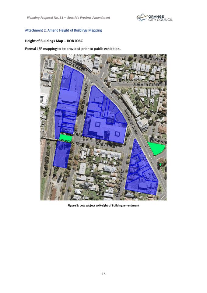
2. AMEND
HEIGHT OF BUILDINGS MAPPING
Height of Buildings Map
– HOB 008C
Formal LEP mapping to be provided
prior to public exhibition.
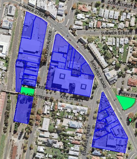
Figure 3. Lots subject to Height of Building amendment
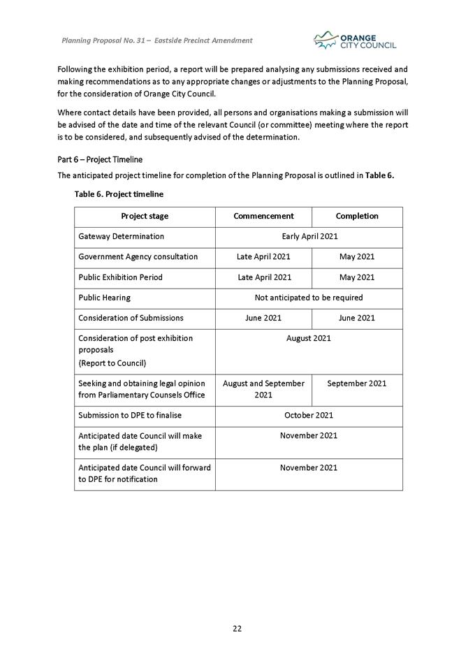
Anticipated Timeline and Next Steps
Gateway Process
Should Council resolve to proceed, the planning proposal and
associated documents will be supplied to the Department of Planning, Industry
and Environment for evaluation under the Gateway process. This typically takes
4–8 weeks, but can vary considerably in both direction. Once issued the
Gateway Determination will outline the remainder of the process. This typically
includes:
· Whether the Minister
will delegate the power to make the plan to Council or withhold such delegation
(typically in cases where the Council has a direct interest in the site or
matter concerned).
· Any additional
information or changes to the planning proposal required before consultation
and exhibition can proceed.
· A list of government
departments and agencies that are to be consulted.
· The public consultation
and exhibition periods (typically 28 days).
· Whether a public hearing
is required (typically only applies to reclassification of Council owned or
controlled land under the Local Government Act 1993).
· Formal drafting of the
amendment through Parliamentary Counsel.
· Finalisation of the
amendment by publishing the change on the legislation website.
Preparation of a Site Specific
Development Control Plan
Council staff are preparing a site
specific Development Control Plan that will guide any future development that
occurs within the precinct. A draft will be provided to Council and once
endorsed for exhibition the Development Control Plan will proceed to public
exhibition alongside the Planning Proposal.
Agency Consultation
Given the site location and nature of the planning proposal,
it is anticipated that the Gateway Determination may require consultation with
Transport for NSW and John Holland Rail/UGL railway.
Community Consultation
Typically a 28 day public exhibition period is required. All
materials will be made available on Council’s website, and at the Civic
centre for inspection during the required period, including a fact sheet that
provides additional information for the community regarding heritage items and
conservation areas. Notification of the public exhibition period will also be
provided in the local newspaper.
Subject to the terms of the Gateway Determination and
consistent with a standing resolution of Council a community information
session is intended midway during the exhibition period.
Directly affected landowners will also be advised in writing
of the commencement of the exhibition period. This will include properties
within the new and expanded conservation areas, new heritage item listings as
well as properties affected by correction of anomalies.
Note: Most of the affected landowners will have already been
consulted during the heritage study and review process, but some properties may
have changed ownership in the interim.
Post Exhibition Evaluation
Once the exhibition period has concluded, all submissions
received (from both the community and agencies) will be collated and reviewed.
Issues identified in the submissions are then evaluated for significance, and
where appropriate the Council will respond, which may include relevant changes.
Attachments
1 Planning
Proposal Amendment 31 - Eastside Precinct, D21/15952⇩
2 Eastside
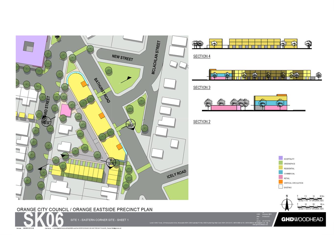
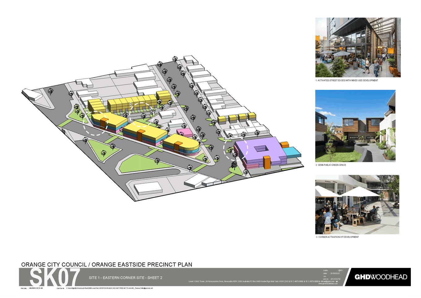
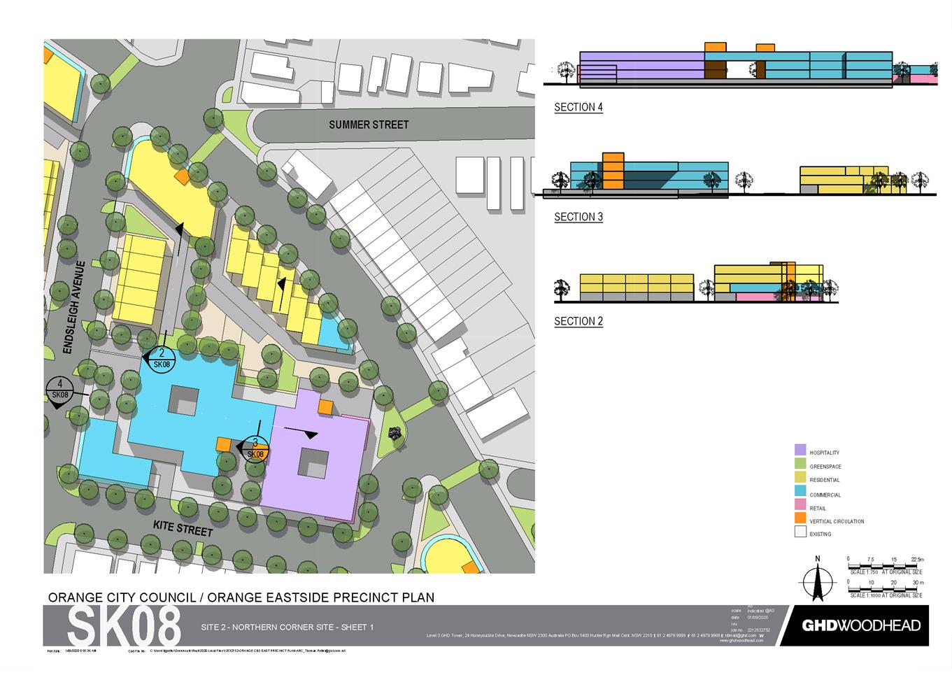
Precinct Plan and Site Specific Controls (2020), D21/15240⇩
3 Eastside
Precinct Plan Set (2020), D21/15238⇩
Planning
and Development Committee
6 April 2021
Attachment 1 Planning
Proposal Amendment 31 - Eastside Precinct
Planning and Development Committee
6 April 2021
Attachment 2 Eastside
Precinct Plan and Site Specific Controls (2020)

Planning and Development Committee
6 April 2021
Attachment 3 Eastside
Precinct Plan Set (2020)
2.4 Development
Application DA 10/2021(1) - 298 Clergate Road
RECORD
NUMBER: 2021/553
AUTHOR: Rishelle
Kent, Senior Planner
EXECUTIVE
Summary
|
Application
lodged
|
11
January 2021
|
|
Applicant/s
|
Orange
City Council
|
|
Owner/s
|
Orange
City Council
|
|
Land
description
|
Lot 1 DP
1085646 - 298 Clergate Road, Orange
|
|
Proposed
land use
|
Subdivision (46 lots –
comprising 43 industrial lots, two lots for stormwater management and
one public reserve lot)
|
|
Value of
proposed development
|
Not
applicable
|
Council's consent is sought for a 46 lot industrial
subdivision of land at 298 Clergate Road, Orange, described as Lot 1 DP 1085646
(refer to Figure 1).
The proposal comprises 43 industrial allotments, two lots
for stormwater, and a reserve for vegetation. The lots will be created with a
minimum lot size of 4,000m² as required by Orange Local Environmental
Plan 2011. The industrial lots will have access to a public road,
reticulated sewer and water.
The site contains approximately 4.29ha of native vegetation
with the dominant species identified as Yellow Box – Blakely’s Red
Gum grassy woodland (Plant Community Type 1330). The PCT 1330 community is
listed as a Critically Endangered Ecological Community under Schedule 2 of the Biodiversity
Conservation Act 2016. The subdivision will result in the loss of 2.93ha of
native vegetation for the construction of roads, provision of services and
allowance for future industrial development on each new lot. The loss of native
vegetation carries an offset obligation under the Biodiversity Conservation
Act 2016 and NSW Biodiversity Offset scheme. The proponent (OCC) will
be required to discharge the credit liability via the mechanisms provided by
the NSW Biodiversity Offset scheme. The subdivision layout does, however,
set aside one lot of 2.21ha as a reserve to protect a 1.36ha patch of
remnant vegetation PCT 1330. In addition, all isolated native trees that are
outside of the disturbance footprint for roads, services or earthworks will
remain.
The application has been accompanied by a Biodiversity
Development Assessment Report (BDAR) pursuant to the requirements of the Biodiversity
Conservation Act 2016. In the case of threatened species development,
the application was required to be advertised for a period of 28 days. No
submissions were received.
Conditions of consent have been specifically recommended to
alleviate potential noise conflicts with residential receivers to the west.
The proposal is consistent with the zone objectives and
controls in Orange Local Environmental Plan 2011. Further,
Council’s Declaration of Planning Procedures and Protocols requires the
determination of the application to be made by Council for ‘any significant
Council development where Council will be financial beneficiary’.
Approval of the application is recommended subject to
conditions of consent in the attached Notice of Determination.
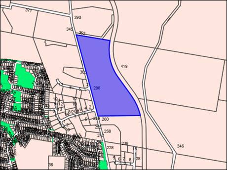
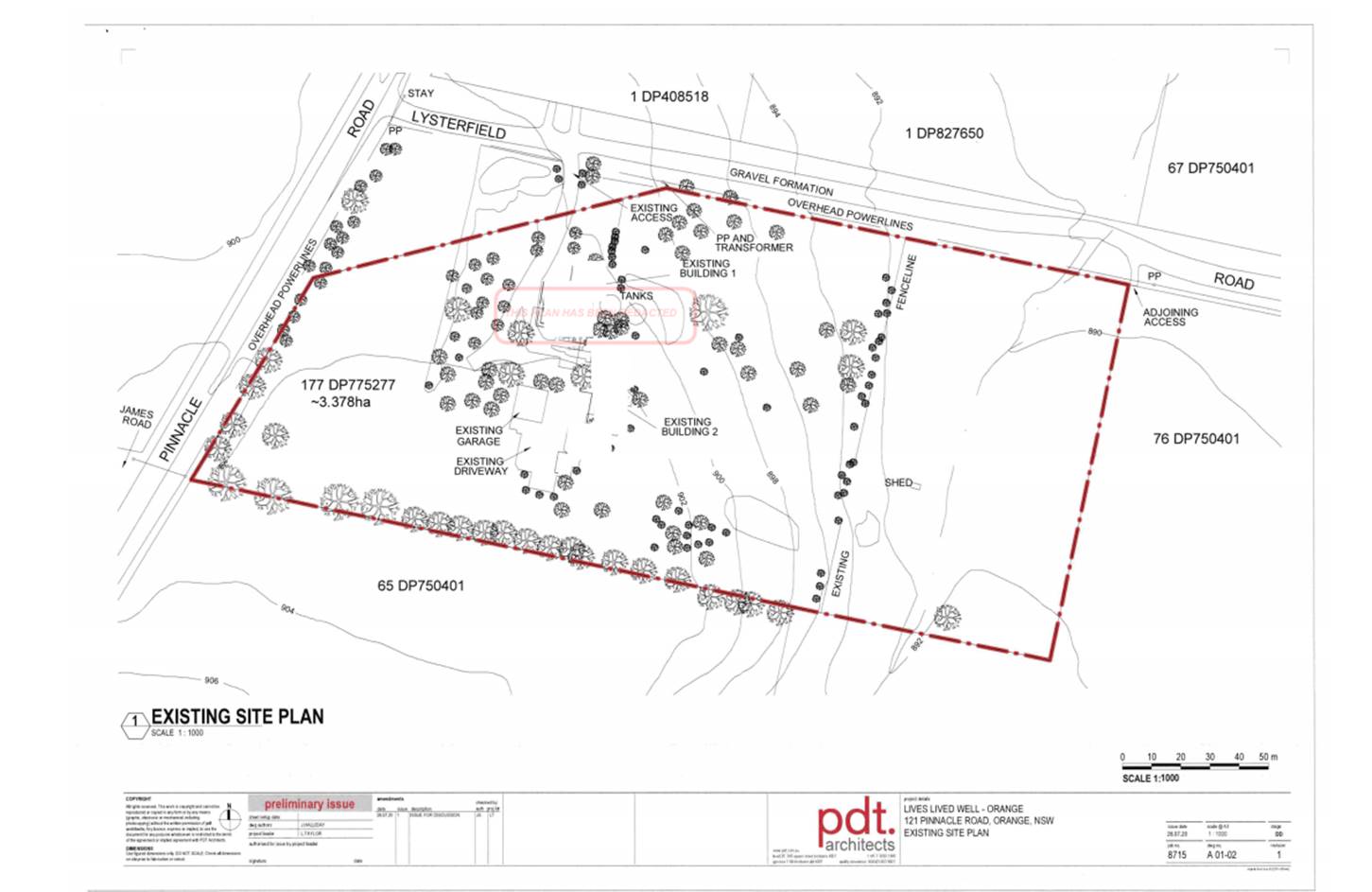
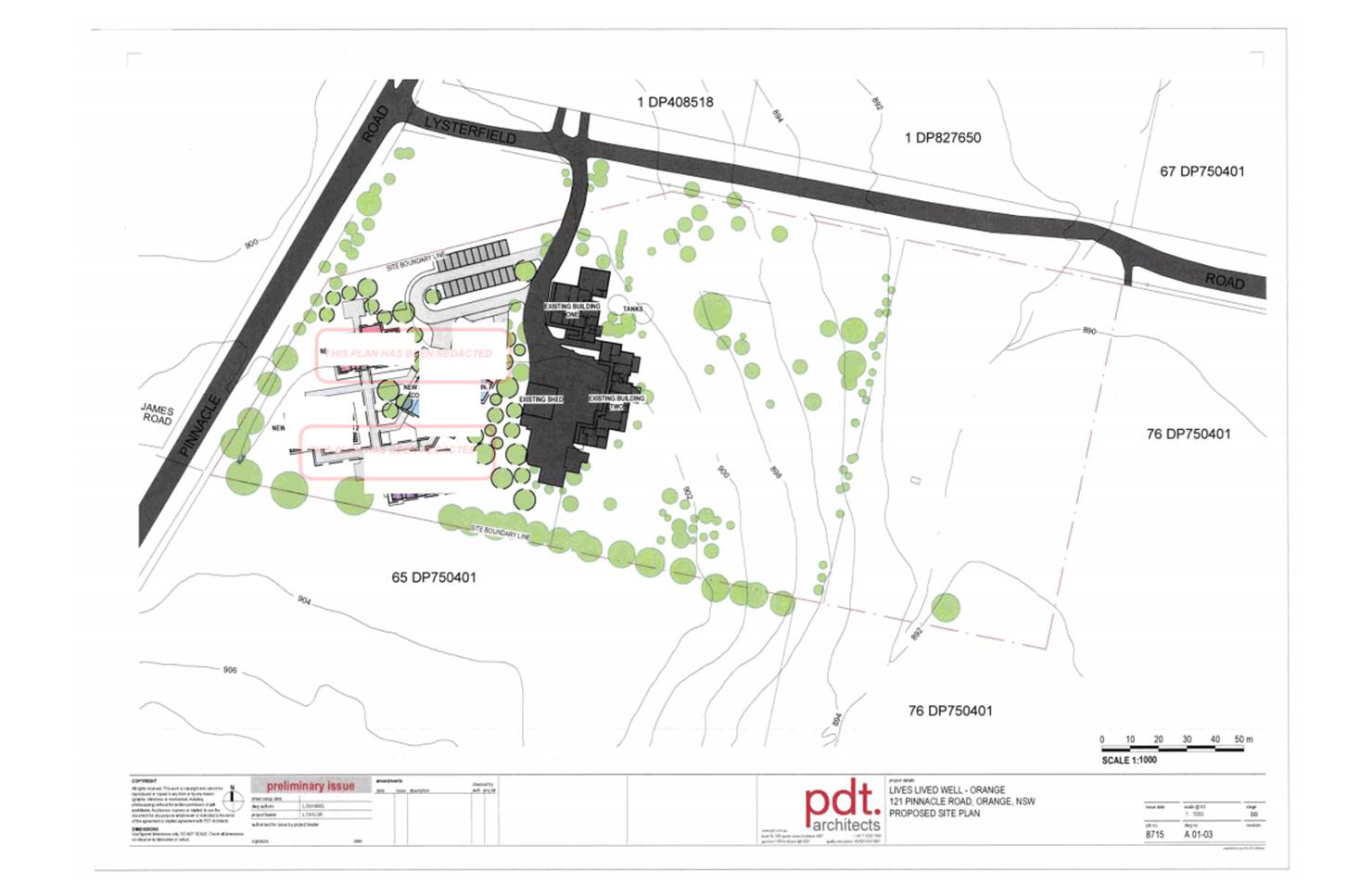
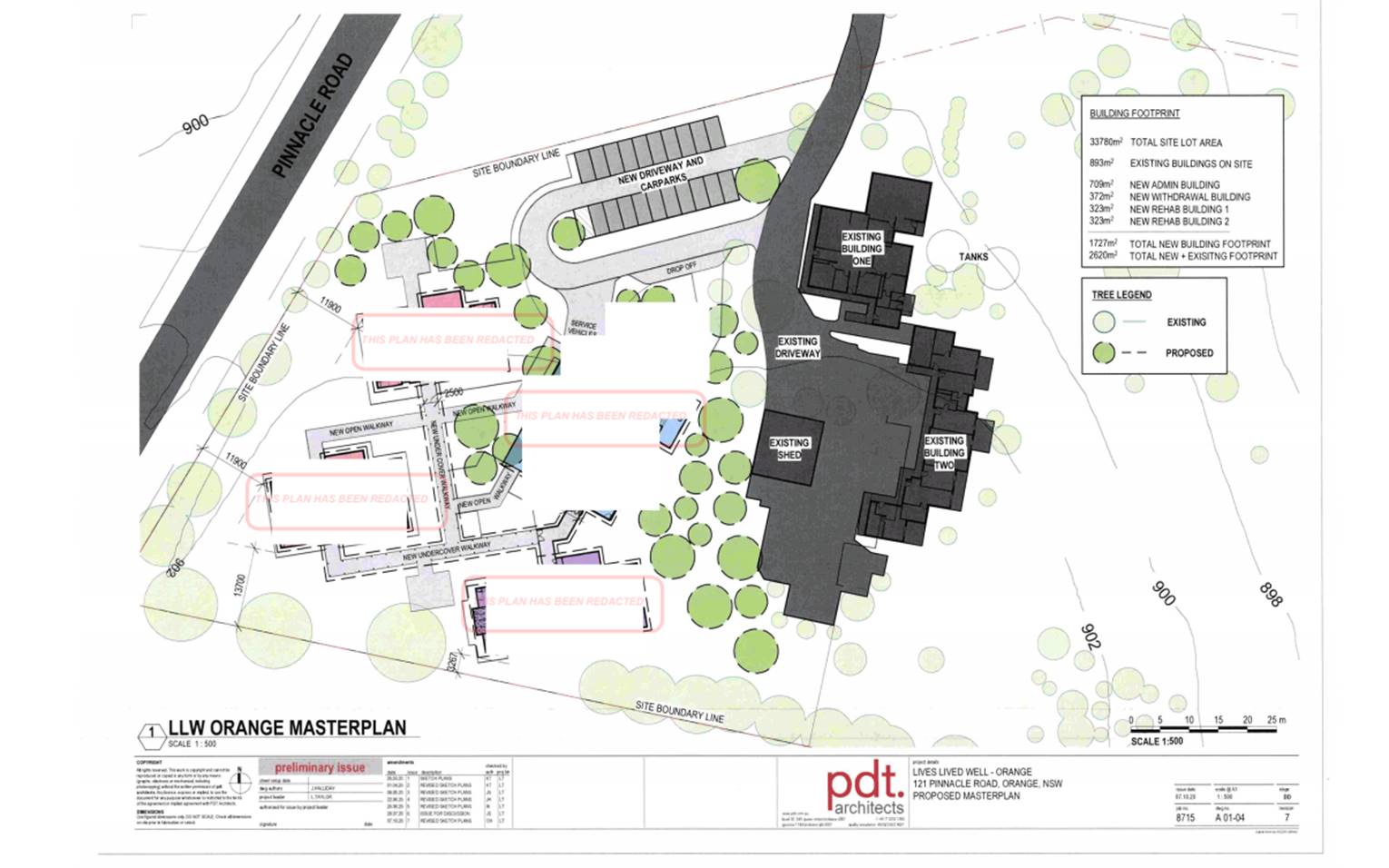
Figure 1 – Locality and Site Context Plan
DECISION FRAMEWORK
Development in Orange is governed by two key documents
Orange Local Environment Plan 2011 and Orange Development Control Plan 2004.
Orange Local Environment Plan 2011 – The
provisions of the LEP must be considered by the Council in determining the
application. LEPs govern the types of development that are permissible or
prohibited in different parts of the City and also provide some assessment
criteria in specific circumstances. Uses are either permissible or not. The
objectives of each zoning and indeed the aims of the LEP itself are also to be
considered and can be used to guide decision making around appropriateness of
development.
Orange Development Control Plan 2004 – the DCP
provides guidelines for development. In general it is a performance based
document rather than prescriptive in nature. For each planning element there
are often guidelines used. These guidelines indicate ways of achieving the
planning outcomes. It is thus recognised that there may also be other solutions
of merit. All design solutions are considered on merit by planning and building
staff. Applications should clearly demonstrate how the planning outcomes are being
met where alternative design solutions are proposed. The DCP enables developers
and architects to use design to achieve the planning outcomes in alternative
ways.
DIRECTOR’S COMMENT
The proposed development involves an industrial subdivision
comprising 43 lots having a minimum area of 4,000m², two drainage lots and
one lot that will be set aside as a reserve. Careful consideration has been
given in the design and assessment of the application to ensure that future
industrial development can occur in a manner that will not adversely impact
upon the EEC. The proposed industrial development is in accordance with local
and regional planning objectives. The recommendation that Council
approves the development application is supported.
Link To Delivery/OPerational Plan
The recommendation in this report relates to the
Delivery/Operational Plan strategy “10.1 Preserve - Engage with the
community to ensure plans for growth and development are respectful of our
heritage”.
Financial Implications
Nil
Policy and Governance Implications
Nil
|
Recommendation
That Council consents to
development application DA10/2021(1)
for Subdivision (46 lots – comprising 43 industrial lots, two
lots for stormwater management and one public reserve lot) at Lot 1 DP 1085646 - 298 Clergate Road, Orange pursuant to the conditions of consent in the attached
Notice of Determination.
|
further considerations
Consideration has been given to the recommendation’s
impact on Council’s service delivery; image and reputation; political; environmental;
health and safety; employees; stakeholders and project management; and no
further implications or risks have been identified.
SUPPORTING INFORMATION
The proposal involves the creation of 43 industrial lots in
three stages, together with two lots for stormwater management and one lot for
vegetation preservation. Reticulated services will be provided to all
industrial lots. All lots will be accessed via a new, internal road (excepting
a temporary access for Lot 1). Staging is to be carried out as follows:
· Stage 1A – Lot 1
with an area of 1.874ha including servicing.
· Stage 1B – Lots 33
– 42 (10 lots) with roads and servicing as required.
· Stage 3 – Lots 2
to 32, and 43 (33 lots) with roads and servicing as required, and stormwater
detention basins.
The proposed staging is shown in Figure 2 below.
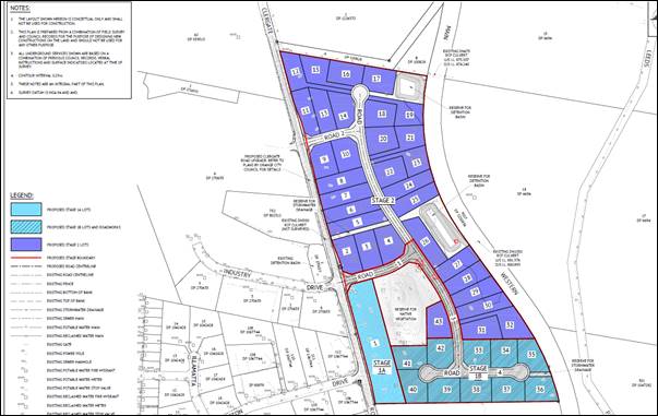
Figure 2 – Subdivision Staging Plan
ENVIRONMENTAL PLANNING
ASSESSMENT
Section 1.7 - Application of
Part 7 of the Biodiversity Conservation Act 2016 and Part 7A of the
Fisheries Management Act 1994
Section 1.7 of the EP&A Act identifies that Part 7 of
the Biodiversity Conservation Act 2016 (BC Act) and Part 7A of
the Fisheries Management Act 1994 have effect in connection with
terrestrial and aquatic environments.
Biodiversity Conservation Act 2016 and Regulation 2017
The Biodiversity Conservation Act 2016, together with
the Biodiversity Conservation Regulation 2017, outlines the framework
for addressing impacts on biodiversity from development and clearing. It
establishes a framework to avoid, minimise and offset impacts on biodiversity
from development through the Biodiversity Offsets Scheme.
There are four thresholds known to insert a development into
the Biodiversity Offset Scheme (ie the need for a BDAR to be submitted with a
DA). If any of these thresholds are exceeded, the Biodiversity Offset Scheme
applies to the proposed development, including biodiversity impacts prescribed
by clause 6.1 of the Biodiversity Regulation 2017.
· Threshold 1:
development occurs in land mapped on the Biodiversity Values Map (OEH)
(clause 7.1 of BC Regulation 2017); or
· Threshold 2:
development involves clearing/disturbance of native vegetation above a certain
area threshold (clauses 7.1 and 7.2 of BC Regulation 2017); or
· Threshold
3: development is otherwise likely to significantly affect threatened
species (clauses 7.2 and 7.3 of BC Act 2016).
The fourth threshold (development
proposed to occur in an Area of Outstanding Biodiversity Value (clause 7.2 of
BC Act 2016) is generally not applicable to the Orange LGA as no such
areas are known to occur in the LGA. No further comments will be made against
the fourth threshold.
Threshold 1 (Vegetation
Mapping)
The site is not mapped on the
Biodiversity Value (BV) Map published by the Office of Environment and Heritage.
However, it must be noted that the BV map is not a comprehensive vegetation
mapping tool and does not map all native vegetation in NSW. Where an area
of impact occurs with no vegetation mapping available published by the Environment Agency Head,
Council’s vegetation mapping should be used in conjunction with site
surveys. In this regard, the site is mapped as containing ‘High
Sensitivity’ Terrestrial Biodiversity under Orange Local Environmental
Plan 2011, and flora surveys undertaken by Premise Pty Ltd confirm that the
site contains 4.29ha of native vegetation comprising pockets of remnant Yellow Box – Blakely’s Red Gum grassy woodland
( PCT 1330) along with isolated native paddock trees and derived grassland
(Figure 3). The PCT 1330 community is listed as a
Critically Endangered Ecological Community under Schedule 2 of the Biodiversity
Conservation Act 2016. In addition, targeted
fauna surveys undertaken by Premise Pty Ltd recorded twenty (20) native
bird species (including one threatened species), eight (8) native bat species
(including one threatened species) and one (1) native frog species and
associated faunal habitat at the site.

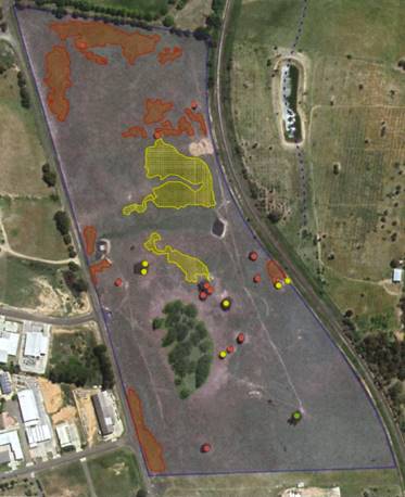
Figure 3 – Vegetation Mapping (Premise)
Threshold 2 (Clearing
Thresholds)
The site
is zoned IN1 General Industrial and carries a minimum lot size of 4,000m2
under Orange Local Environmental Plan 2011. Pursuant to Clause 7.2 of the Biodiversity Conservation Regulation 2017, the
prescribed native vegetation clearing threshold for lot sizes less than 1ha is
0.25ha:
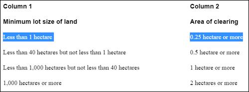
Figure 4 – Clearing thresholds (C7.2 BC Reg
2017)
The proposed subdivision will result in the clearing of
23.98ha of vegetation, including 2.93ha of native vegetation which exceeds
the area clearing threshold established under the Biodiversity Conservation
Regulations 2017 and triggers the entry of the proposal into the Biodiversity Offset Scheme (BOS). In this regard, a
Biodiversity Development Assessment Report (BDAR) has been prepared by Premise
Pty Ltd (accredited assessor Dr Colin Bower BAAS18048) to identify the
biodiversity value of the site, means to minimise and or manage impacts of the
proposal, and to outline biodiversity offset liability for those impacts.
The BDAR specifically identifies that the clearing will
involve the removal of 1.16ha of good quality PCT 1330, 1.77ha of poor quality
PCT 1330, eight (8) isolated paddock trees and numerous Blakely’s Red Gum
saplings. The Biodiversity Assessment Method
Calculator (BAMC) values the vegetation loss at 43 credits ($396,001.76).
A breakdown of the biodiversity credits is provided below. The proponent
(Orange City Council) will be required to discharge the credit liability via
the mechanisms provided by the NSW Biodiversity Offset scheme; ie
contribution to the Biodiversity Trust Fund, purchase of existing credits on
the market, funding biodiversity conservation action or retirement of
biodiversity credits. This matter has been addressed via a condition of
development consent.
Threshold 3 (Threatened
Species)
If a BDAR has been triggered under any of the foregoing
tests, impact assessments for threatened species must also be undertaken in
accordance with the Biodiversity Assessment Method (BAM).
Database/literature searches were used to determine
threatened flora and fauna that may potentially occur on the subject site, and
targeted onsite flora and fauna surveys were undertaken to verify the presence
of any threatened species. The BDAR prepared by Premise Pty Ltd confirms that
22 threatened fauna species and two threatened flora were identified as
potentially occurring on the site and were considered in the assessment.
No flora species from
database/literature searches were identified/recorded during vegetation surveys
(18 August and 17 November 2020) and considered absent based on habitat
degradation.
In terms of threatened fauna species, the Superb Parrot and
Yellow-bellied Sheathtail Bat were confirmed on the study area during fauna
surveys undertaken by Premise between 2‑5 and 16-19 November 2020.
No other threatened fauna species were identified during the targeted surveys
and considered absent based on habitat constraints. The Superb Parrot was
observed flying over the study area and was considered likely to utilise native
grassland for foraging. The Superb Parrot is hollow dependent for breeding.
Vegetation surveys confirmed that the site contained only one hollow bearing
tree which will be retained, and therefore there is no offset obligation. The
Yellow-bellied Sheathtail Bat was included in the BAMC as an ecosystem
species (ie included in vegetation loss offset obligation).
Other BDAR Considerations
The biodiversity assessment method also outlines other key
matters which need to be considered in a BDAR including:
(a) assessment
against the prescribed biodiversity impacts, direct and indirect impacts and
cumulative impacts (c6.1 BC Regulation 2017);
(b) effect
of serious and irreversible impacts on biodiversity values (c6.7 BC Regulation
2017); and
(c) measures
to avoid and minimise impacts.
In consideration of these matters, the BDAR provides the
following:
Prescribed
Biodiversity Impacts
No
significant geological features or rocky areas occur within the study area. The
only scattered rocks occur in the woodland area which is to be retained as part
of a native vegetation reserve. There are two man made dams that will be
removed and replaced by two larger stormwater detention areas to manage
drainage from the created lots. Most of the study area is exotic dominated
grassland which provides foraging habitat for birds, reptiles and mammals.
There were two threatened species identified on the study area which have been
accounted for in the Biodiversity Offset Scheme. The loss of 21.89ha of exotic
dominated grassland is not significant in the context of the surrounding
landscape, which includes over 500 ha of agricultural land, industrial and
residential subdivisions and major infrastructure corridors such as Clergate
Road and the Main Western Railway line.
Direct
Impacts
The direct
impacts of the subdivision include the removal of 1.16ha of good quality and
1.77 ha of low quality native grassland derived from PCT 1330 and 21.89ha of
exotic dominated grassland, as well as eight individual paddock trees. The loss
of native vegetation has been accounted for with an offset obligation using the
BAM Calculator.
Indirect
Impacts
Indirect
impacts of the subdivision include the temporary disruption to species in the
remnant vegetation preserved on the study area during construction. Impacts
include increased noise, dust and light spill. There may be increased
competition for habitat resources with the loss of the eight paddock trees,
however some of the material will be relocated to the woodland area to reduce
this possibility.
Cumulative
Impacts
The
cumulative impact of native vegetation loss in an already highly cleared
landscape is potentially significant, however the loss represents 0.0096% of
the total vegetation in the Mullion Slopes Landscape, and the loss will be
offset in accordance with the Biodiversity Offset Scheme.
Measures
to Avoid and Minimise Impacts
The
subdivision layout has been modified during the planning phase of the project
to exclude the 2.21ha remnant of native vegetation and to avoid scattered
paddock trees having to be cleared in the lot design. Management during
construction will avoid and minimise impacts during site development.
Serious
and Irreversible Impacts
No threatened
ecological communities, populations, flora or fauna species meet the criteria
for Serious and Irreversible Impacts as a result of the subdivision. No threatened
ecological communities, populations, flora or fauna species meet the criteria
for Serious and Irreversible Impacts as a result of the subdivision proposal
(DPIE, 2019) (Sections 2.2 and 2.3).
Summary
The Yellow Box – Blakely’s Red Gum grassy woodland
recorded within the survey area occur as disjunct remnant patches of highly
modified vegetation scattered across a fragmented landscape and of varying
quality. The community including faunal habitat has been degraded through
ongoing agricultural land use practices and historical land clearing. Given the
fragmented and degraded nature of the native vegetation and faunal habitat on
the site, the use of biodiversity offsets is a suitable mitigation strategy to
minimise impacts to acceptable levels. The offset obligation for the proposal
is as follows:
· 37 Ecosystem
Credits ($340,745.70) for 2.93ha of PCT 1330; and
· Six
Ecosystem Credits ($55,256.06) for five Blakely's Red Gum and two Yellow Box
trees from PCT 1330 (note eight isolated trees will be removed but only trees
with DBH of 20cm are considered in the tree module BAMC for PCT 1330); and
· Zero Species
Credits for Superb Parrot (based on zero breeding habitat loss).
Conditions of consent will be
imposed to ensure ecosystems credits are offset in accordance with the Biodiversity
Conservation Act 2016 requirements.
Section 4.15 of the
Environmental Planning and Assessment Act 1979
Section 4.15 of the Environmental
Planning and Assessment Act 1979 requires Council to consider various
matters, of which those pertaining to the application are listed below.
PROVISIONS OF ANY ENVIRONMENTAL
PLANNING INSTRUMENT s4.15(1)(a)(i)
Orange Local Environmental Plan 2011
Clause 1.2 - Aims of Plan
The
broad aims of the LEP are set out under Subclause 2. Those relevant to the
application are as follows:
(a) to encourage development which complements
and enhances the unique character of Orange as a major regional centre boasting
a diverse economy and offering an attractive regional lifestyle,
(b) to provide for a range of development
opportunities that contribute to the social, economic and environmental
resources of Orange in a way that allows present and future generations to meet
their needs by implementing the principles for ecologically sustainable
development,
The application is considered to be consistent with the aims
of the LEP as addressed in the following report. The proposal will provide
additional industrial land to complement Orange as a regional centre and to
contribute to economic sustainability. The environmental resources of the site
will be protected to allow for ecologically sustainable development of the
site.
Clause 1.6 - Consent Authority
This clause establishes that, subject to the Act, Council is
the consent authority for applications made under the LEP.
Clause 1.7 - Mapping
The subject site is identified
on the LEP maps in the following manner:
|
Land Zoning Map:
|
Land zoned IN1 General Industry
|
|
Lot Size Map:
|
Minimum Lot Size 4000m2
|
|
Heritage Map:
|
Not a heritage item or conservation
area
|
|
Height of Buildings Map:
|
No building height limit
|
|
Floor Space Ratio Map:
|
No floor space limit
|
|
Terrestrial Biodiversity Map:
|
High biodiversity sensitivity on
the site
|
|
Groundwater Vulnerability Map:
|
Groundwater vulnerable
|
|
Drinking Water Catchment Map:
|
Not within the drinking water
catchment
|
|
Watercourse Map:
|
Not within or affecting a defined
watercourse
|
|
Urban Release Area Map:
|
Not within an urban release area
|
|
Obstacle Limitation Surface Map:
|
No restriction on building siting
or construction
|
|
Additional Permitted Uses Map:
|
No additional permitted use applies
|
|
Flood Planning Map:
|
Not within a flood planning area
|
Those matters that are of relevance are addressed in detail
in the body of this report.
Clause 1.9A - Suspension of
Covenants, Agreements and Instruments
This clause provides that covenants, agreements and other
instruments which seek to restrict the carrying out of development do not apply
with the following exceptions:
(a) to
a covenant imposed by the Council or that the Council requires to be imposed,
or
(b) to
any relevant instrument under Section 13.4 of the Crown Land Management Act
2016, or
(c) to
any conservation agreement under the National Parks and Wildlife Act 1974, or
(d) to
any Trust agreement under the Nature Conservation Trust Act 2001, or
(e) to
any property vegetation plan under the Native Vegetation Act 2003, or
(f) to
any biobanking agreement under Part 7A of the Threatened Species Conservation
Act 1995, or
(g) to
any planning agreement under Subdivision 2 of Division 7.1 of the Environmental
Planning and Assessment Act 1979.
Council staff are not aware of the title of the subject
property being affected by any of the above.
Part 2 - Permitted or Prohibited Development
Clause
2.1 - Land Use Zones and Clause 2.3 - Zone Objectives and Land Use Table
The subject site is located within the IN1 General Industry zone. Pursuant to Clause 6.2 of the
Environmental Planning and Assessment Act 1979, the development is defined as:
· Subdivision which means the
division of land into two or more parts that, after the division, would be
obviously adapted for separate occupation, use or disposition.
The development also includes the construction of roads,
defined as:
· Road means a public road
or a private road within the meaning of the Roads Act 1993, and includes a classified
road.
The proposed development is
permitted with consent in this zone.
1 -
Objectives of the IN1 General Industrial Zone
· To provide a wide
range of industrial and warehouse land uses.
· To encourage
employment opportunities.
· To minimise any
adverse effect of industry on other land uses.
· To support and
protect industrial land for industrial uses.
· To ensure development
along the Southern Link Road has an alternative access.
The development is considered to
be consistent with the objectives of the IN1 General Industrial Zone. In this
regard:
· The
subdivision will create 43 industrial lots for future industrial and warehouse
land uses.
· The future
development of the lots will allow for future employment opportunities.
· Consideration
has been given to noise upon residential receivers as a result of the proposed
development (discussed later in the report).
· The land is
zoned for industrial use, and thus can be used for that purpose.
· The
development has nil impact upon the Southern Link Road.
Clause 2.6 - Subdivision -
Consent Requirements
This clause triggers the need for development consent for
the subdivision of land. Development consent is sought by this application.
Clause 4.1 - Minimum Subdivision Lot Size
This
clause requires the subdivision of land to be equal to or greater than the size
nominated for the land under the Minimum Lot Size Map.
In relation to this site, the
map nominates a minimum lot size of 4,000m². The smallest lot proposed by
the application is 4,000m² (Lot 43).
Clause 7.1 - Earthworks
This
clause establishes a range of matters that must be considered prior to granting
development consent for any application involving earthworks, such as:
(a) the likely disruption of, or any
detrimental effect on, existing drainage patterns and soil stability in the
locality of the development
(b) the effect of the development on the
likely future use or redevelopment of the land
(c) the quality of the fill or the soil to be
excavated, or both
(d) the effect of the development on the
existing and likely amenity of adjoining properties
(e) the source of any fill material and the
destination of any excavated material
(f) the likelihood of disturbing relics
(g) the proximity to and potential for adverse
impacts on any waterway, drinking water catchment or environmentally sensitive
area
(h) any measures proposed to minimise or
mitigate the impacts referred to in Paragraph (g).
The earthworks proposed in the
application are limited to the extent of construction of roads, stormwater
management and installation of services. The extent of disruption to the
drainage of the site is considered to be minor and will not detrimentally
affect adjoining properties or receiving waterways.
The extent of the earthworks
will not materially affect the potential future use or redevelopment of the
site that may occur at the end of the proposed development's lifespan.
The site is not known to be
contaminated and conditions may be imposed requiring the use of verified clean
fill only. Excavated materials will be reused onsite as far as possible and
conditions may be imposed to require that surplus materials will disposed of to
an appropriate destination.
The earthworks
will be appropriately supported onsite and the change in ground level is not
substantial. Therefore, the effect on the amenity of adjoining properties is
considered to be minor.
Investigations
with respect to heritage have not identified any likelihood of the site
containing any items of Aboriginal or non-Aboriginal heritage.
The site is not
in proximity to any waterway, drinking water catchment or sensitive area.
Conditions may be imposed to require a sediment control plan, including silt
traps and other protective measures, to ensure that loose dirt and sediment
does not escape the site boundaries.
7.3 - Stormwater Management
This clause
applies to all industrial, commercial and residential zones and requires that
Council be satisfied that the proposal:
(a) is designed to maximise the use of water
permeable surfaces on the land having regard to the soil characteristics
affecting onsite infiltration of water
(b) includes, where practical, onsite
stormwater retention for use as an alternative supply to mains water,
groundwater or river water; and
(c) avoids any significant impacts of
stormwater runoff on adjoining downstream properties, native bushland and
receiving waters, or if that impact cannot be reasonably avoided, minimises and
mitigates the impact.
Stormwater design is to include stormwater detention within
the development, with stormwater from the detention basins to be piped to the
adjacent natural watercourse/overland flow path. The proposed design is to
replicate the existing natural drainage system in terms of outflow volumes and
broadly dispersed flow. Two lots for stormwater detention have been identified.
Clause
7.4 - Terrestrial Biodiversity
This clause seeks to maintain terrestrial biodiversity and
requires that consent must not be issued unless the application demonstrates
whether or not the proposal:
(a) is likely to have any adverse impact on
the condition, ecological value and significance of the fauna and flora on the
land
(b) is likely to have any adverse impact on
the importance of the vegetation on the land to the habitat and survival of
native fauna
(c) has any potential to fragment, disturb or
diminish the biodiversity structure, function and composition of the land, and
(d) is likely to have any adverse impact on
the habitat elements providing connectivity on the land.
Additionally,
this clause prevents consent being granted unless Council is satisfied that:
(a) the development is designed, sited and
will be managed to avoid any significant adverse environmental impact, or
(b) if that impact cannot be reasonably
avoided - the development is designed, sited and will be managed to minimise
that impact, or
(c) if that impact cannot be minimised - the
development will be managed to mitigate that impact.
The proposal is
located on land that has been identified on the Terrestrial Biodiversity Map as
partially comprising “High Biodiversity Sensitivity” land
containing Yellow Box – Blakely’s Red Gum grassy woodland (Figure
5). This community is listed as a Critically Endangered Ecological Community
under Schedule 2 of the Biodiversity Conservation Act 2016.
The subdivision layout has been
designed to avoid the woodland and some isolated paddock trees where possible;
however, the derived grasslands and eight isolated paddock trees will require
removal to facilitate the proposal. The vegetation community including faunal
habitat has been degraded through ongoing agricultural land use practices and
historical land clearing.
The proposed
clearing has been supported by a Biodiversity Development Assessment Report and
the removal of native vegetation is considered acceptable in the context of the
Biodiversity Conservation Act 2016 subject to discharging the identified
credit liability. Management of the proposal can be conditioned to further
protect the environmental functions and values of the land.
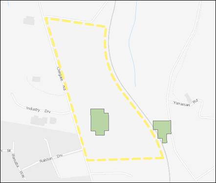
Figure 5 – LEP Biodiversity Map Extract
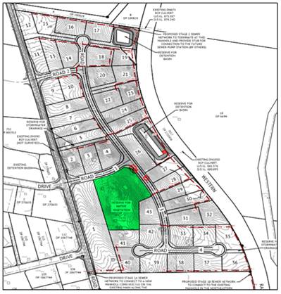
Figure 6 – Subdivision Layout (note native
vegetation reserve in green)
Clause 7.6 - Groundwater Vulnerability
The proposal is not anticipated
to involve the discharge of toxic or noxious substances and is therefore
unlikely to contaminate the groundwater or related ecosystems. The proposal
does not involve extraction of groundwater and will therefore not contribute to
groundwater depletion. The design of the proposal avoids impacts on groundwater
and is therefore considered acceptable.
Clause 7.11 - Essential Services
Clause 7.11 applies and states:
Development
consent must not be granted to development unless the consent authority is
satisfied that any of the following services that are essential for the
proposed development are available or that adequate arrangements have been made
to make them available when required:
(a) the
supply of water,
(b) the
supply of electricity,
(c) the
disposal and management of sewage,
(d) storm
water drainage or onsite conservation,
(e) suitable
road access.
In consideration of this clause, all utility services will
be provided to the site and adequate for the proposal. Conditions of consent
are recommended in this regard.
STATE ENVIRONMENTAL PLANNING
POLICIES
State Environmental Planning Policy 55 Remediation of
Land
State Environmental Planning Policy 55 - Remediation of
Land (SEPP 55) is applicable. Pursuant to Clause 7 Contamination and
remediation to be considered in determining development application:
(1) A
consent authority must not consent to the carrying out of any development on
land unless:
(a) it
has considered whether the land is contaminated, and
(b) if
the land is contaminated, it is satisfied that the land is suitable in its
contaminated state (or will be suitable, after remediation) for the purpose for
which the development is proposed to be carried out, and
(c) if
the land requires remediation to be made suitable for the purpose for which the
development is proposed to be carried out, it is satisfied that the land will
be remediated before the land is used for that purpose.
A Preliminary Contamination Investigation prepared by
Premise Pty Ltd dated 23 December 2020 was submitted in support of the proposed
development. The report provides the following conclusions and recommendations:
1. The area comprising the site,
consisting of Lot 1 in DP 1085646 appears to have predominantly been
historically utilised for rural/ agricultural purposes.
2. Based on known activities at or in
the vicinity of the site, and observations during the inspection in August
2020, no significant routes of exposure by receptors (current or future) to
potential contamination sources have been identified, due to negligible impacts
present. The potential risk of any residual contamination impacts, if present,
would be minor in scale and may be adequately managed by conducting works in
accordance with appropriate construction industry standards.
3. Based on the findings of this
preliminary site investigation, Premise considers that required remediation at
the site is limited to removal of wastes placed at the site, which includes
tyres, scrap metals, abandoned vehicles and soil stockpiles.
An assessment by Council’s Environmental Health
Officer concurs with the report, and advises that no further investigation is
warranted at this stage.
State Environmental
Planning Policy (Infrastructure) 2007
Clause 86(2) of the SEPP requires the consent authority to
give written notice to the rail authority where excavation occurs within 25m of
a rail corridor. As such, referral was provided to Transport for NSW (TfNSW).
TfNSW have responded and there requirements have been included in the attached
Notice of Determination accordingly.
State Environmental Planning
Policy (Vegetation in Non-Rural Areas) 2017
SEPP (Vegetation in Non-Rural Areas) 2017 is applicable to
the proposal.
Pursuant to Clause 7(1):
A person must not clear
vegetation in any non-rural area of the State… without the authority
conferred by a permit granted by the council…
Clause 9(2) further requires that:
A development control plan may make the declaration in any
manner, including by reference to any of the following:
(a) the species of vegetation,
(b) the size of vegetation,
(c) the
location of vegetation (including by reference to any vegetation in an area
shown on a map or in any specified zone),
(d) the
presence of vegetation in an ecological community or in the habitat of a
threatened species.
In consideration of the requirements of the SEPP, the
proposal involves removal of a number of trees/tree groups from the subject
land. Pursuant to Orange DCP 2004-0.4-2 Interim Planning Outcomes-
Tree Preservation, Council’s approval is required for removal of
trees of a certain prescribed species and size.
The site contains approximately 4.29ha of native vegetation
with the dominant species identified as Yellow Box – Blakely’s Red
Gum grassy woodland (Plant Community Type 1330). The application was
supported by a Biodiversity Development Assessment Report. The PCT 1330
community is listed as a Critically Endangered Ecological Community under
Schedule 2 of the Biodiversity Conservation Act 2016. The subdivision
will result in the loss of 2.93ha of native vegetation (trees and grassland)
for the construction of roads, provision of services and allowance for future
industrial development on each new lot. The loss of native vegetation carries
an offset obligation under the Biodiversity Conservation Act 2016 and
NSW Biodiversity Offset scheme. The proponent (OCC) will be required to
discharge the credit liability via the mechanisms provided by the NSW
Biodiversity Offset scheme. The subdivision layout does, however, set aside one
lot of 2.21ha as a reserve to protect a 1.36ha patch of remnant vegetation
PCT 1330. In addition, all isolated native trees that are outside of the
disturbance footprint for roads, services or earthworks will remain. Tree
removal has been further assessed in the proceeding parts of this report.
The proposal was also referred to Council’s Manager
City Presentation (MCP) for review. MCP considers it is suitable to remove the
identified tree/s. The land is zoned for industrial purposes. MCP
conditions are included on the attached Notice of Approval in relation tree
protection measures for retained trees across the site, management of trees to
be removed from the site and enhancement of the proposed reserve area within
the subdivision.
It is acknowledged that development of the land and
including tree removal will alter the landscape character of the site and
setting. Notwithstanding, it is a reasonable expectation that the industrial
parcel be developed for industrial purposes.
PROVISIONS OF ANY DRAFT
ENVIRONMENTAL PLANNING INSTRUMENT THAT HAS BEEN PLACED ON EXHIBITION
4.15(1)(a)(ii)
Not applicable.
DESIGNATED OR INTEGRATED
DEVELOPMENT
The proposed development is not designated or integrated
development.
PROVISIONS OF ANY DEVELOPMENT
CONTROL PLAN s4.15(1)(a)(iii)
Development Control Plan 2004
Development Control Plan 2004 (“the DCP”)
applies to the subject land. The relevant chapters are:
· Part 0.2 (General
Translation of Zones) establishes the interim provisions that link
DCP 2004 to LEP 2011, and further establishes the equivalent zones of the
new LEP.
· Part 0.4-2
(Interim Planning Outcomes – Tree Preservation) applies to the request
for removal of four trees.
· Part 2 (Natural
Resource Management) has relevance with regard to stormwater quality, soil
resource management, vegetation management, and flora and fauna management.
· Part 3 (General
Considerations) has relevance with respect to cumulative impacts and scenic landscape
issues.
· Part 4 (Special
Environmental Considerations) has relevance with regard to possible site
contamination.
· Part 9
(Industrial Subdivision) is relevant as it establishes the urban design
principles on which to assess the layout of the proposed subdivision.
The relevant Planning Outcomes requiring further comment are
detailed below:
DCP 2004 - 0.4 Tree
Preservation
Four gum trees are proposed to be removed as a result of the
road design, as indicated in red on Plan C004 Rev G. The removal of these trees
is supported by Council’s Manager City Presentation. Specific conditions
of consent have been included to require the relocation of the tree barrel,
crown and exposed rock formation to the “reserve for native
vegetation”; among other requirements.
DCP 2004 - Part 2 Natural
Resource Management
Stormwater disposal and onsite detention will be conditioned
to be carried out in accordance with Council’s Development and
Subdivision Code.
PO 2.3 Vegetation and PO 2.4 Flora and Fauna, Biodiversity have
been previously addressed within this report.
DCP 2004 - Part 3.1.1
Cumulative Impact
The DCP sets the following Planning Outcomes in regard to
Cumulative Impact:
· Applications for
development demonstrate how the development relates to the character and use of
the land in the vicinity.
· The introduction of
new development into a locality maintains environmental impacts within existing
or community-accepted levels.
· Water conservation
measures are implemented.
In this instance there is a mixed
character for the locality. To the west there is industrial land which borders
residential development 300m from the subject site. Land to the north and south
is zoned industrial. Land to the east is zoned B7 Business Park. Rural land is
the predominant land use to the north and east. To the south and west, the land
is more fully urban.
With regard to the above Planning Outcomes, the proposed
subdivision is consistent with the intended future land use of the zone and
acts as a natural extension to the developed industrial land to the south and
east, and to the Business Park to the west. The subdivision will not create any
adverse environmental impacts that cannot be managed through conditions of
consent.
Relevant Planning Outcomes also require that new development
maintains environmental impacts within existing or community accepted levels,
and lastly, that water conservation measures are implemented. It is considered
that appropriate conditions can be imposed that will satisfactorily address
these matters.
DCP 2004 - Part 4 Special Environmental Considerations
· Development within
the urban area of Orange as defined above is connected to sewerage facilities
Sewer mains shall be constructed from Council’s
existing sewer network to serve the proposed lots. A sewer pump station will be
required for Stage 2 works.
· Development
applications indicate measures proposed with development on land within the
hatched area to minimise associated impacts.
The development is located to the south of the former
Canobolas Wool Topmaking site and Orange Abattoir. As the proposed development
is for industrial purposes, there is no land use conflict with the former
industrial uses, or permissible future uses, of these sites.
Matters in relation to biodiversity, land shaping and contaminated
land have been previously considered within the report.
DCP 2004 - Part 9 Industrial Subdivision
· The subdivision
provides for a range of lot sizes consistent with the existing or proposed
character of the industrial locality.
The
DCP requires serviced lots with access via a road other than Clergate road to
have a minimum area of 4000m². The DCP also permits 1ha lots with direct
access to Clergate Road. Subdivision design comprises a range of allotment
sizes ranging from 4,000m² to 1.874ha in compliance with the
requirements of the DCP.
· Lots have a regular
shape to facilitate the establishment of large, open industrial buildings.
All
lots are generally of a shape and size to accommodate the needs of further
industrial development. Smaller lots have been provided with adequate width and
depth to facilitate a 10m front setback. The DCP controls will have
setback requirements for both front and back on those lots that have dual
frontages to both the proposed internal road and Clergate Road. The lot size
and shape of these parcels are considered to be of sufficient size to ensure
suitable design outcomes in the future.
· The subdivision is
designed and constructed according to the Development and Subdivision Code.
· The land is
adequately serviced for industrial development.
· New roads are
constructed with kerb and gutter and associated drainage structures.
· Clergate Road is
upgrades to a to a Rural Collector Road with a formed pavement width of 9
metres (sealed carriageway of 7 metres)
Council’s
Technical Services Department have raised no objections to matters in relation
to servicing. Attached are conditions of consent to address the servicing
requirements of the development.
Section 64 Water and Sewer Headworks Charges
Pursuant
to Section 64 of the Local Government Act 1993, water and sewer
headworks charges are applicable to the development, being 43 industrial lots.
Such
charges are calculated at the time of release of a Subdivision Certificate.
Relevant conditions have been included in the Notice of Approval, and may be
subject to the proposed staging of the development.
PROVISIONS PRESCRIBED BY THE
REGULATIONS s4.15(1)(a)(iv)
The Regulations have been considered and do not apply to the
subject works.
THE LIKELY IMPACTS OF THE
DEVELOPMENT s4.15(1)(b)
Context and Setting
The site is subject to agricultural grazing landuse, with an
industrial zoning pertaining to the land. Industrial zoning also extends over
the land to the north, south and west, with Business Park zoning to the east.
Residential urbanisation occurs 300m to the west, with established dwellings in
Illamatta Way.
The development is consistent with the predominant
development pattern that has occurred recently and is not incongruous with the
expected context of the area.
It is not anticipated that the development will create any
significant adverse impacts on the neighbourhood amenity of the area to the
west due to the recommended conditions of consent relating to noise (discussed
below). The proposed lots will all be of a size, shape and slope capable of
providing a reasonable standard for future industrial development.
Traffic and Transport Impacts
Access to the proposed lots will be via the construction of
four new roads, with two new roads intersecting with Clergate Road. The roads
shall be constructed to full urban 22m industrial standard within the
development site. Vehicular access is to be denied to Clergate Road for Lots 1,
2, 5, 6, 7, 8, 9, 11 and 12 via an 88B instrument.
The development will result in additional traffic in the
locality; however, the surrounding street network will be capable of serving
the additional traffic load. Concrete footpaths are to be constructed on both
sides of all streets, to a minimum width of 1.2m. The development is
considered satisfactory in regards to traffic impacts.
Flora and Fauna
The proposed subdivision involves the clearing of 2.93ha of
native vegetation, including the abovementioned threatened species. A
Biodiversity Development Assessment Report (BDAR) has been prepared by
Premise Pty Ltd, dated 16 December 2020 and submitted with the DA to address
the requirements of Clause 7.4 Terrestrial Biodiversity of Orange Local
Environmental 2011 and the Biodiversity Conservation Act 2016. The
information in support of the DA has identified threatened species of flora and
fauna that will be impacted by the proposal. PCT 1330 consists throughout the
subject site in both woodland and derived grassland formations. The Biodiversity
Conservation Act 2016 lists Yellow Box – Blakely’s Red Gum
grassy woodland as Critically Endangered Ecological Community.
The proposed clearing has also triggered the Biodiversity
Offsets Scheme and will require offsetting a total of 43 credits as a result of
clearing PCT 1330 species (Yellow Box – Blakely’s Red Gum grassy
woodland). Conditions of consent will be imposed to ensure ecosystems credits
are offset in accordance with the Biodiversity Conservation Act 2016
requirements. Given the fragmented and degraded nature of the native vegetation
on the site, the use of biodiversity offsets is a suitable mitigation strategy
to minimise impacts to acceptable levels. It must also be noted that the
subdivision layout has been designed to avoid a 1.36ha patch of PCT 1330 and
some isolated paddock trees where possible.
Cumulative Impacts
There is an obvious cumulative impact arising from the
ongoing urbanisation of the locality as the remaining stocks of rural land are
subdivided and developed for urban purposes. For this site there are also
issues relating to slope, tree retention and view lines that have been
elsewhere assessed.
The proposed subdivision is considered to be largely
consistent with the surrounding development pattern and acts as a natural
continuation of industrial land. The cumulative impacts of the proposed
development have been considered throughout the foregoing report and are
considered to be acceptable, with measures to be augmented and perpetuated by
the recommended conditions included in the attached Notice of Approval.
Noise Impacts
Residential receivers are located approximately 400m to the
west of the subject site. The land immediately surrounding the subject land is
zoned IN1 Industrial under the current provisions of the LEP. That land is
largely undeveloped at this time. Initial consideration was given to whether or
not a restriction should be placed on the title of each lot that requires the
submission of a noise report to accompany any application for future
development within each of the newly created lots to ensure that future
development is compliant with the NSW EPA’s Noise Policy for Industry.
Given the separation distance between the subject land and
the nearest anticipated dwelling permitted under the current provisions of the
LEP and the fact that other industrial development will occur between this site
and the residential receivers in the future (of which the buildings will
provide shielding to residences) the requirement for this restriction is not
recommended. This position has been discussed with the Director of Development
Services who has indicated that a requirement for a Restriction of the type
described above is not necessary.
THE SUITABILITY OF THE SITE
s4.15(1)(c)
The proposed development is located in the IN1 General
Industrial zone and is permissible with the consent of Council. The suitability
of the site has been addressed in the above sections of the report.
The subject land is considered to be suitable to undertake
the proposed development due to the following:
· The development is
permissible and compliant with the relevant provisions of the LEP.
· The development is
considered to be satisfactory in regard to s4.15 of the Environmental
Planning and Assessment Act 1979.
· The potential impacts of
the development can be managed appropriately through the conditions of consent.
· The development of the
site will not create significant adverse impacts on the context and setting of
the area.
· The development of the
site will not detrimentally affect adjoining land and is unlikely to lead to
land use conflicts with the imposition of suitable conditions of consent.
· All utility services are
or can be made available, including suitable road access.
ANY SUBMISSIONS MADE IN
ACCORDANCE WITH THE ACT s4.15(1)(d)
The proposed development is defined as "advertised
development" under the provisions of the Act. The application was
advertised for the prescribed period of 28 days and at the end of that period
no submissions were received.
PUBLIC INTEREST
s4.15(1)(e)
The proposed development is considered to be of minor
interest to the wider public due to the relatively localised nature of
potential impacts. The proposal is not inconsistent with any relevant policy
statements, planning studies, guidelines etc that have not been considered in
this assessment.
SUMMARY
As discussed in the body of this
report a key consideration for this application relates to the potential impact
that the development will have on Native vegetation. The site contains
approximately 4.29ha of native vegetation with the dominant species identified
as Yellow Box – Blakely’s Red Gum grassy woodland (Plant
Community Type 1330) which is listed as a Critically Endangered Ecological
Community under Schedule 2 of the Biodiversity Conservation Act 2016.
The subdivision will result in the loss of 2.93ha of native vegetation for the
construction of roads, provision of services and allowance for future
industrial development on each new lot. The loss of native vegetation carries
an offset obligation under the Biodiversity Conservation Act 2016 and
NSW Biodiversity Offset scheme.
The proposed industrial subdivision is permissible
development subject to receiving the development consent of Council. The
applicant has suitably demonstrated that the design of the development complies
with the requirements of the Biodiversity Conservation Act 2016, the
Environmental Planning and Assessment Act 1979, relevant SEPP’s, Orange
LEP 2011 and Council’s DCP for this precinct.
A Section 4.15 evaluation of the
proposed development has been undertaken which demonstrates that the proposal
is acceptable. Attached is a Notice of Determination containing conditions that
are considered appropriate for the development. It is recommended that Council
supports the subject development.
COMMENTS
The requirements of the Environmental Health and Building
Surveyor, Environmental Health Officer, Engineering Development Section and
City Presentation Manager are included in the attached Notice of Approval.
Attachments
1 Notice
of Approval, D21/16548⇩
2 Plans,
D21/15472⇩
Planning
and Development Committee
6 April 2021
Attachment 1 Notice
of Approval
Planning and Development Committee
6 April 2021
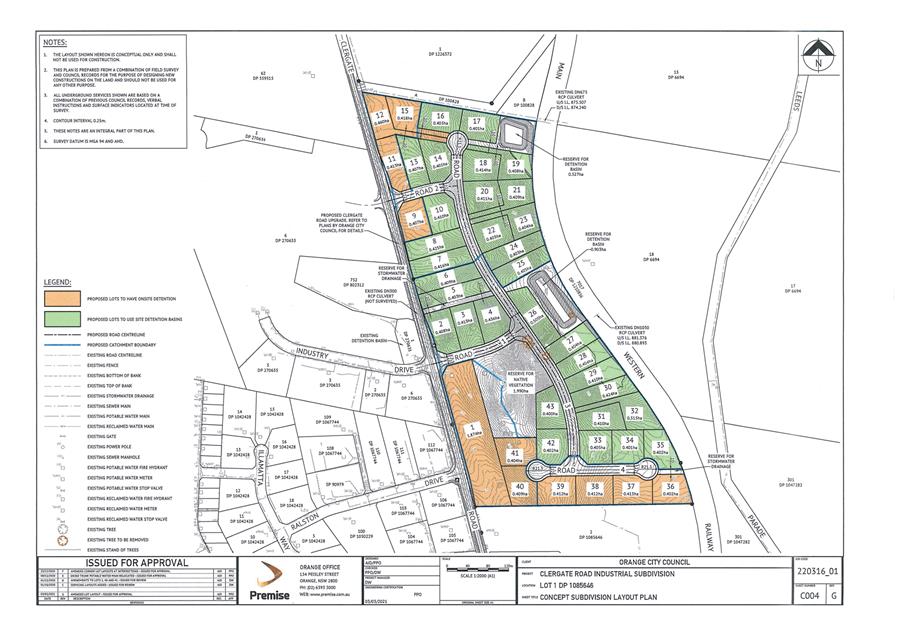
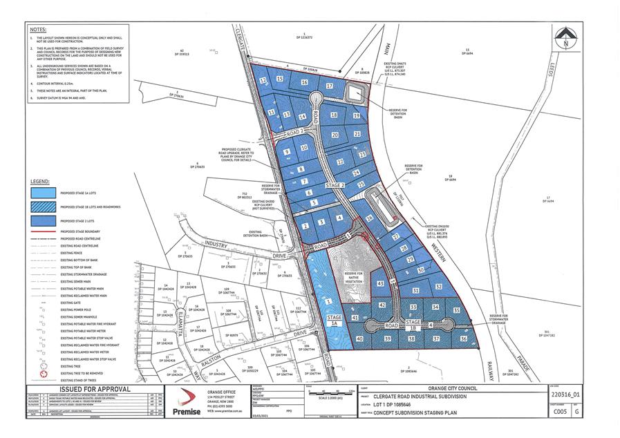
2.5 Development
Application DA 424/2020(1) - 14 Nyrang Road
RECORD
NUMBER: 2021/554
AUTHOR: Kelly
Walker, Senior Planner
EXECUTIVE Summary
|
Application
lodged
|
04
November 2020
|
|
Applicant/s
|
Pinchgut
Pty Limited
|
|
Owner/s
|
Pinchgut
Pty Limited
|
|
Land description
|
Lot 131
Pce SC DP 241292 - 14 Nyrang Road, Orange
|
|
Proposed
land use
|
Boarding
House
|
|
Value of
proposed development
|
$280,000
|
Council's consent is sought to construct a new six (6) room
‘boarding house’ at 14 Nyrang Road, Orange (see Figure 1). The site
is currently vacant, where the previous dwelling was burnt down, and the land
was subsequently cleared.
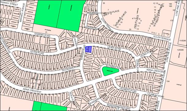
Figure 1 - locality plan
The proposed development involves
the construction of a new building to contain six (6) self-contained boarding house
rooms, each with its own kitchen and bathroom; as well as a communal room with
kitchen facilities. External works include two (2) open car parking spaces
(accessed from a new driveway off Leura Road), one (1) open accessible car
parking space (via an enlarged driveway off Nyrang Road), motorcycle parking
(two spaces) landscaping, waste storage area, bicycle parking (two
spaces), drying area, and communal outdoor space. With regards to occupancy it
is assumed the rooms could be doubles or singles, capable of being occupied by
up to two persons each, being a total of twelve (12) residents.
The proposal comprises a
‘boarding house’ pursuant to the Orange Local Environmental Plan
2011 (LEP). Boarding houses provide a form of low-cost rental accommodation
for a wide range of tenants, typically singles, retirees, students, and young
couples.
The boarding house development
standards set out State Environmental Planning Policy (Affordable Rental
Housing) 2009 (hereafter referred to as the ‘ARHSEPP’) only
apply within the R2 zone if the land is within close proximity to a local
centre. The subject land does not meet this requirement, and as such, all
matters in relation to character, appearance, amenity, parking, etc. in
relation to the development, as well as impacts on surrounding residential
dwellings, relies on the provisions of the Orange Development Control Plan
2004 (DCP).
Concerns have been raised by
Council staff in relation to the proposed development, including:
- Building
design and siting is inconsistent with the established neighbourhood character,
which will adversely impact on the surrounds, streetscape, and neighbouring
dwellings.
- Insufficient
building setbacks and excessive bulk and scale which are out of keeping with
the low-density setting, and will adversely impact on the streetscape,
neighbourhood, and adjacent neighbours.
- Building
over the sewer, sewer main, and stormwater overland flow areas will adversely
impact on Council’s infrastructure and adjacent/downstream neighbouring
properties.
- Insufficient
number of car parking spaces on the site will adversely impact on the
surrounding road network and amenity of neighbouring dwellings.
- Inadequate
vehicle manoeuvring on and off the site will adversely impact on traffic and
pedestrian safety.
- Possible
overshadowing impacts to the adjacent southern neighbour.
- Likely
adverse acoustic privacy impacts to neighbouring dwellings due to unacceptable
site layout.
- Unacceptable
level of amenity for future residents of the boarding house including lack of
daylighting, open space, car parking, and security.
- Insufficient
investigation as to the contamination status of the site, where Council cannot
be satisfied that the land is suitable for the proposed use in its current
state.
The proposal comprises advertised
development pursuant to the Orange Community Participation Plan (CPP).
At the completion of the exhibition period two (2) submissions were received
from external agencies raising concerns about the proposal. Essential Energy
notes that the new driveway is too close to existing electricity
infrastructure; and the NSW Police have safety and siting concerns and do
not support the proposal as submitted.
It is considered that the principle
of a new boarding house on the site is supported in this location, and
permitted with consent, however is not acceptable in its current proposed form.
Council staff consider that the proposal could be significantly improved
through better site layout and improved building design. Amendments to the development
would improve the amenity of the site, streetscape, and neighbourhood; mitigate
impacts on adjacent residential neighbours; as well as address the other
concerns raised in relation to infrastructure, servicing, and security.
The proponent undertook pre-lodgement
discussions in relation to this proposal, where Council’s senior staff
indicated on many occasions that the proposal was not capable of support in
this form and required amendments to overcome the identified issues.
In particular, the site layout and
building design need reconsideration, and additional car parking would be
required with adequate manoeuvring on the site to provide safe egress. This
application has been lodged with all of the issues outstanding, as set out in
brief above, and in detail in the main body of this report. Council staff have
again recommended an amendment to the proposal to address the issues, however
the proponent has declined, seeking an assessment of the proposal as submitted.
Overall, it is considered that the design and siting of the
proposal will not harmonise with the low-density character of the local area,
and will adversely impact on neighbourhood character, neighbouring amenity,
traffic and pedestrian safety, and Council’s sewer and stormwater infrastructure.
The proposal is thus contrary to Section 4.15 of the Environmental
Planning and Assessment Act 1979, and relevant provisions of
the LEP and DCP as discussed in detail in the main body of this report.
As such, it is recommended that Council does not support the
proposal in its current form, and refuses the application. Attached is a draft
Notice of Refusal.
DECISION FRAMEWORK
Development in Orange is governed by two key documents Orange
Local Environment Plan 2011 (LEP) and Orange Development Control Plan
2004 (DCP).
Orange Local Environment Plan
2011 – The provisions of the LEP must be considered by the Council in
determining the application. LEPs govern the types of development that are
permissible or prohibited in different parts of the City and also provide some
assessment criteria in specific circumstances. Uses are either permissible or
not. The objectives of each zoning and indeed the aims of the LEP itself are
also to be considered and can be used to guide decision making around
appropriateness of development.
Orange Development Control Plan
2004 – the DCP provides guidelines for development. In general
it is a performance based document rather than prescriptive in nature. For each
planning element there are often guidelines used. These guidelines indicate
ways of achieving the planning outcomes. It is thus recognised that there may
also be other solutions of merit. All design solutions are considered on merit
by planning and building staff. Applications should clearly demonstrate how the
planning outcomes are being met where alternative design solutions are
proposed. The DCP enables developers and architects to use design to achieve
the planning outcomes in alternative ways.
DIRECTOR’S COMMENT
It is considered that the boarding house would adversely
impact on the Nyrang Road and Leura Road area due to the proposal’s poor
design in terms of streetscape, character, car parking, infrastructure, scale,
amenity and security.
The applicant has been requested to
modify the proposal on a number of occasions. To date only minor changes were
made that have not adequately minimised the impacts of the development.
Due to the likely impacts that would
arise from this development and the applicant’s unwillingness to modify
the proposal, staff have no choice but to recommend refusal.
Link To Delivery/OPerational Plan
The recommendation in this report relates to the
Delivery/Operational Plan strategy “10.1
Preserve - Engage with the community to ensure plans for growth and development
are respectful of our heritage”.
Financial Implications
Nil
Policy and Governance Implications
Nil
|
Recommendation
That Council refuses
development application DA 424/2020(1)
for Boarding House at Lot 131 Pce SC DP 241292 - 14 Nyrang
Road, Orange pursuant to the reasons set out in the
attached Notice of Refusal.
|
further considerations
Consideration has been given to the recommendation’s
impact on Council’s service delivery; image and reputation; political;
environmental; health and safety; employees; stakeholders and project management;
and no further implications or risks have been identified.
SUPPORTING INFORMATION
The proposal involves the
construction of a new building to contain six (6) self-contained boarding house
rooms, each with its own kitchen and bathroom. A communal room with kitchen is
also proposed, as well as a cleaner’s room with separate toilet and hand
basin. It is unclear if any laundry facilities are to be provided on the
site, such as within the rooms or communally (no details provided on plans or
within the application). With regards to occupancy it is assumed the rooms
could be doubles or singles, capable of being occupied by up to two persons
each, being a total of twelve residents. Pedestrian access to the site and
building is proposed from both frontages. The layout of the development is
shown in Figure 2 below.

Figure 2 – proposed layout plan (from submitted
drawing number DA-02)
The building is proposed to be
in face brick, with Colorbond roofing, and aluminium framed windows (see Figure
3).
Figure 3 – artists impression (from submitted
‘Materials and Finishes’ drawing number DA-06)
Site works, set out in Figure 2, include:
- two
(2) open car parking spaces accessed from a new driveway off Leura Road
- one
(1) open accessible car parking space via an enlarged driveway off Nyrang Road
- two
(2) motorcycle parking spaces off the main parking/entry area
- waste
storage, bicycle parking (two spaces), drying area, and communal outdoor space
to the Nyrang Road side the building, running along the southern boundary
- -
landscaping to the site frontage and around the parking and waste storage
areas.
MATTERS FOR CONSIDERATION
Environmental Planning and
Assessment Act 1979
Section 1.7 - Application of Part
7 of the Biodiversity Conservation Act 2016 and Part 7A of the Fisheries
Management Act 1994
Section 1.7 of the EP&A Act identifies that Part 7 of
the Biodiversity Conservation Act 2016 (BC Act) and Part 7A of
the Fisheries Management Act 1994 have effect in connection with
terrestrial and aquatic environments.
There are four triggers known to insert a development into
the ‘Biodiversity Offset Scheme’ (i.e. the need for a
Biodiversity Development Assessment Report to be submitted with a DA):
· Trigger 1:
development occurs in land mapped on the Biodiversity Values Map (OEH)
(clause 7.1 of BC Regulation 2017).
· Trigger 2:
development involves clearing/disturbance of native vegetation above a certain
area threshold (clauses 7.1 and 7.2 of BC Regulation 2017).
· Trigger 3:
development is otherwise likely to significantly affect threatened species
(clauses 7.2 and 7.3 of BC Act 2016).
· Trigger 4:
development proposed to occur in an Area of Outstanding Biodiversity Value
(clause 7.2 of BC Act 2016).
In consideration of Triggers 1 and 4, the site is not within
land mapped on the Biodiversity Values Map or LEP Biodiversity Map, or in an
Area of Outstanding Biodiversity Value. In consideration of Trigger 2, the
proposal does not involve the clearing of any vegetation, where the subject
site is already clear of trees, and does not contain any native grasses.
Overall, and in regards to Trigger 3, it is considered that the development is
unlikely to significantly affect any threatened species or communities.
Section 4.15 - Evaluation
Section 4.15 of the Environmental Planning and Assessment
Act 1979 requires Council to consider various matters, of which those
pertaining to the application are listed below.
PROVISIONS OF ANY ENVIRONMENTAL
PLANNING INSTRUMENT s4.15(1)(a)(i)
Orange Local Environmental Plan
2011
Part 1 - Preliminary
Clause 1.2 - Aims of Plan
The
broad aims of the LEP are set out under subclause 2. Those relevant to the
application are as follows:
(a) to encourage development which complements
and enhances the unique character of Orange as a major regional centre boasting
a diverse economy and offering an attractive regional lifestyle,
(b) to provide for a range of development
opportunities that contribute to the social, economic and environmental
resources of Orange in a way that allows present and future generations to meet
their needs by implementing the principles for ecologically sustainable
development,
(e) to
provide a range of housing choices in planned urban and rural locations to meet
population growth,
(f) to recognise and manage valued environmental
heritage, landscape and scenic features of Orange.
The application is considered to be relatively consistent
with the relevant aims above, particularly as it provides for affordable
housing choices. Notwithstanding this, the following assessment demonstrates
that the site layout and built form of the proposed development are
inconsistent with the character of the surrounding area, which are addressed in
the body of this report.
Clause 1.6 - Consent Authority
This clause establishes that, subject to the Act, Council is
the consent authority for applications made under the LEP.
Clause 1.7 - Mapping
The subject site is identified
on the LEP maps in the following manner:
|
Land Zoning Map:
|
Land zoned R2 Low Density
Residential
|
|
Lot Size Map:
|
No Minimum Lot Size
|
|
Heritage Map:
|
Not a heritage item or conservation
area
|
|
Height of Buildings Map:
|
No building height limit
|
|
Floor Space Ratio Map:
|
No floor space limit
|
|
Terrestrial Biodiversity Map:
|
No biodiversity sensitivity on the
site
|
|
Groundwater Vulnerability Map:
|
Groundwater vulnerable
|
|
Drinking Water Catchment Map:
|
Not within the drinking water
catchment
|
|
Watercourse Map:
|
Not within or affecting a defined
watercourse
|
|
Urban Release Area Map:
|
Not within an urban release area
|
|
Obstacle Limitation Surface Map:
|
No restriction on building siting
or construction
|
|
Additional Permitted Uses Map:
|
No additional permitted use applies
|
|
Flood Planning Map:
|
Not within a flood planning area
|
Those matters that are of relevance are addressed in detail
in the body of this report.
Clause 1.9A - Suspension of
Covenants, Agreements and Instruments
This clause provides that covenants, agreements and other
instruments which seek to restrict the carrying out of development do not apply
with the following exceptions:
(a) to
a covenant imposed by the Council or that the Council requires to be imposed,
or
(b) to
any relevant instrument under Section 13.4 of the Crown Land Management Act
2016, or
(c) to
any conservation agreement under the National Parks and Wildlife Act 1974, or
(d) to
any Trust agreement under the Nature Conservation Trust Act 2001, or
(e) to
any property vegetation plan under the Native Vegetation Act 2003, or
(f) to
any biobanking agreement under Part 7A of the Threatened Species Conservation
Act 1995, or
(g) to
any planning agreement under Subdivision 2 of Division 7.1 of the Environmental
Planning and Assessment Act 1979.
Council staff are not aware of
the title of the subject property being affected by any of the above instruments.
It is noted that there is a drainage easement running directly adjacent to the
eastern boundary (see Figure 4) for overland flows, and the proposal has not
taken this situation into account. This matter is discussed in greater detail
in LEP Part 7 assessment.


Figure 4 – Deposited Plan showing legal
boundaries and easements
(subject lot shown in orange and drainage easement
shown in red)
Part 2 - Permitted or Prohibited Development
Clause
2.1 - Land Use Zones
The subject site is located within the R2 Low Density
Residential zone. The proposed development is defined as “boarding
house” pursuant to the LEP Dictionary as follows:
Boarding house
means a building that:
(a) is
wholly or partly let in lodgings, and
(b) provides
lodgers with a principal place of residence for 3 months or more, and
(c) may
have shared facilities, such as a communal living room, bathroom, kitchen or
laundry, and
(d) has
rooms, some or all of which may have private kitchen and bathroom facilities
that accommodate one or more lodgers
but does
not include backpackers’ accommodation, a group home, hotel or motel
accommodation, seniors housing or a serviced apartment.
Note—
Boarding houses are a type of “residential accommodation”
Boarding houses are permitted with consent in the R2 zone.
Clause 2.3 – Zone Objectives
The
objectives for land zoned R2 Low Density Residential are as follows:
· To provide for the housing needs of the community within a
low density residential environment.
· To enable other land uses that provide facilities or
services to meet the day to day needs of residents.
· To ensure development is ordered in such a way as to
maximise public transport patronage and encourage walking and cycling in close
proximity to settlement.
· To ensure that development along the Southern Link Road has
an alternative access.
The proposal will provide an
affordable rental housing option to supplement housing needs in the community,
which will contribute to the variety of housing types and densities in the
neighbourhood. Notwithstanding this, Council staff have concerns that the
siting, bulk and scale of the proposed building does not harmonise with the
neighbourhood character of the surrounding area. These R2 zone objectives seek
to provide for housing development that fits within the low density residential
environment, and it is considered that the proposal in its current form does
not meet this objective. This matter is discussed in greater detail later in
this report.
The subject land is located near
to a public bus route, and is not within proximity to the Southern Link Road.
Part 3 - Exempt and Complying Development
The application is not exempt or complying development.
Part 4 - Principal Development Standards
The principal development standards of the LEP are not relevant
to this application.
Part 5 - Miscellaneous Provisions
The LEP miscellaneous provisions are not relevant to this
application.
Part 6 - Urban Release Area
Not relevant to the application, as the subject site is not
located in an Urban Release Area.
Part 7 - Additional Local Provisions
7.1
- Earthworks
This
clause establishes a range of matters that must be considered prior to granting
development consent for any application involving earthworks, such as:
(a) the likely disruption of, or any detrimental
effect on, existing drainage patterns and soil stability in the locality of the
development
(b) the effect of the development on the
likely future use or redevelopment of the land
(c) the quality of the fill or the soil to be
excavated, or both
(d) the effect of the development on the
existing and likely amenity of adjoining properties
(e) the source of any fill material and the
destination of any excavated material
(f) the likelihood of disturbing relics
(g) the proximity to and potential for adverse
impacts on any waterway, drinking water catchment or environmentally sensitive
area
(h) any measures proposed to minimise or
mitigate the impacts referred to in paragraph (g).
The subject land is relatively
flat, and earthworks will be limited to minor cutting required for the proposed
buildings, car parking areas, and services. The earthworks could be
appropriately supported onsite, and the change in ground level is not
substantial. The site is not in proximity to any waterway, drinking water
catchment or sensitive area, however a sediment control plan would be required
to ensure lose soil and sediment does not escape the site boundaries.
Notwithstanding these comments,
it is noted that the site layout does not adequately take the existing sewer
and stormwater arrangements into account, and impacts of the earthworks
required for servicing and the siting of the building are likely to have
adverse impacts on this infrastructure. This is discussed in greater detail in
the following LEP Clauses.
The site is not known to be
contaminated. The site is not known to contain any Aboriginal, European or
Archaeological relics. Previous known uses of the site do not suggest that any
relics are likely to be uncovered.
7.3
- Stormwater Management
This clause applies to all
industrial, commercial and residential zones and requires that Council be
satisfied that the proposal:
(a) is designed to maximise the use of water
permeable surfaces on the land having regard to the soil characteristics
affecting onsite infiltration of water
(b) includes, where practical, onsite
stormwater retention for use as an alternative supply to mains water,
groundwater or river water; and
(c) avoids any significant impacts of
stormwater runoff on adjoining downstream properties, native bushland and
receiving waters, or if that impact cannot be reasonably avoided, minimises and
mitigates the impact.
The proposed development will increase stormwater runoff
from the site, as it involves a large new building, driveways, pathways, and
car parking areas on an existing large grassed area of land. The proposed
buildings and hard-standing areas will be much greater in extent compared to
the previous dwelling on the land.
Council’s Development Engineers have reviewed the
proposal in regards to stormwater and make the following comments:
- The
proposed development is located adjacent to a 600mm trunk stormwater line along
the eastern boundary.
- The
existing stormwater pipe is located within an easement on number 36 Leura Road
(adjacent property to the east).
- Allowance
will need to be made for protection from overland flows from the adjoining
property (e.g. a masonry retaining wall on the subject land finishing 200mm
above NGL).
The proponent has submitted a draft
stormwater management plan, however this has not been reviewed in detail due to
the numerous issues relating to the siting and design of the proposed
development. It is likely that the proposed development is capable of achieving
the LEP stormwater provisions, subject to amendments to ensure downstream
properties are not adversely impacted. In its current form however, the
proposed development is contrary to LEP Clause 7.3.
7.6
- Groundwater Vulnerability
This
clause seeks to protect hydrological functions of groundwater systems and
protect resources from both depletion and contamination. Orange has a high
water table and large areas of the LGA, including the subject site, are
identified with “Groundwater Vulnerability” on the Groundwater
Vulnerability Map. This requires that Council consider:
(a) whether or not the development (including
any onsite storage or disposal of solid or liquid waste and chemicals) is
likely to cause any groundwater contamination or have any adverse effect on
groundwater dependent ecosystems, and
(b) the cumulative impact (including the
impact on nearby groundwater extraction for potable water supply or stock water
supply) of the development and any other existing development on groundwater.
Furthermore, consent may not be granted unless Council is satisfied that:
(a) the development is designed, sited and
will be managed to avoid any significant adverse environmental impact, or
(b) if that impact cannot be reasonably
avoided - the development is designed, sited and will be managed to minimise
that impact,
(c) if that impact cannot be minimised - the
development will be managed to mitigate that impact.
In consideration of Clause 7.6,
there are no aspects of the proposed development that will impact on
groundwater and related ecosystems.
Clause 7.11 - Essential Services
Clause 7.11 applies and states:
Development consent must not be
granted to development unless the consent authority is satisfied that any of
the following services that are essential for the proposed development are
available or that adequate arrangements have been made to make them available
when required:
(a) the
supply of water,
(b) the
supply of electricity,
(c) the
disposal and management of sewage,
(d) storm
water drainage or onsite conservation,
(e) suitable
road access.
In
consideration of this clause, the site is, or can be, connected to the existing
town water supply, an electricity supply (which may need to be upgraded to suit
the development), and the existing reticulated sewerage system. It is
likely stormwater detention can be achieved on the site before entering
Council’s existing system.
Notwithstanding
these comments, Council’s Development Engineers have issues with the
proposed development intending to be built too near to the existing overland
flow paths, and over the existing sewer main that runs through the site. In
addition to the stormwater comments already discussed in LEP Clause 7.3 above,
the following comments are made in regards to the sewer:
- The
proposed development is located over an existing sewer main (running along the
eastern boundary).
- The
sewer main can’t be relocated clear of the proposed building footprint,
as the main is immediately adjacent to the eastern boundary and an existing
stormwater line.
- The
sewer main also includes a junction for the adjoining property (number 36 Leura
Road).
- The building will need to be redesigned to be located clear of the sewer
main.
A new
road access/crossover is proposed off Leura Road (double width driveway to
access two (2) x car parking spaces and two (2) x motorcycle spaces), as
well as a widened access off Nyrang Road (for one (1) x accessible parking
space and two (2) x bicycle parking). Council’s Development Engineers
have safety concerns about the proposed arrangements, and make the following
comments:
- Proposed
vehicle spaces D1 and D2 are not provided with a manoeuvring area to enable
entry and exit in a forward direction from the street.
- Council’s
DCP requires development with three or more units to provide onsite manoeuvring
to relevant Australian Standards. As such, a concrete manoeuvring space/area
needs to be provided within the site.
- The
single accessible parking space accessed from Nyrang Road can remain as a
reverse exit with onsite manoeuvring (as per previous dwelling on the land).
Furthermore,
the proposed parking provisions and arrangements do not meet the requirements
of the DCP car parking requirements, which is discussed in greater detail later
in this report. Essential Energy raises concerns about the proximity of the new
driveway/access to existing electricity infrastructure, which is discussed in
greater detail below.
STATE ENVIRONMENTAL PLANNING
POLICIES
State Environmental Planning Policy (Affordable Rental
Housing) 2009
The ARHSEPP applies to boarding houses in the R2 Low Density
Residential zone if they are in accessible areas. Pursuant to the ARHSEPP, an
accessible area is land “within 400m walking distance of land within
Zone B2 Local Centre or Zone B4 Mixed Use or within a land use zone that is
equivalent to any of those zones”. The subject land is not within
close proximity to any such zones or their equivalents. As such, the ARHSEPP
development standards do not apply to this application (i.e. height, open
space, parking, accommodation size, provisions, etc.).
Clause 30(AA) of the ARHSEPP limits boarding houses in the
R2 zone to a maximum of twelve (12) bedrooms. The proposal involves six (6)
bedrooms, therefore is consistent with this clause.
Notwithstanding these comments, a
Draft State Environmental Planning Policy (Housing Diversity) 2020 (hereafter
referred to as ‘Housing Diversity SEPP’) has been publicly
exhibited and partly implemented, which will soon replace the ARHSEPP. The
draft SEPP is of relevance in relation to the subject application and this
assessment, and is considered in detail later in this report under the heading
“PROVISIONS OF ANY DRAFT ENVIRONMENTAL PLANNING INSTRUMENT”.
State Environmental Planning
Policy (Infrastructure) 2007
Division 5 - Subdivision 2 – Development likely to
affect an electricity transmission or distribution network
The subject land is directly adjacent to electricity
infrastructure, being overhead electricity power lines and electricity
distribution poles within Leura Road. Pursuant to Clause 45 of State
Environmental Planning Policy (Infrastructure) 2007, the penetration of
ground within 2m of an electricity distribution pole, and development carried
out within 5m of an exposed overhead power line both trigger the need to refer
the application to the electricity supply authority.
Council referred the application to Essential Energy, who
responded that they have no comments to make in regards to potential safety
risks, but make general comments in relation to the application and proposal.
Of particular note, issues have been raised about safety clearance, and Essential
Energy requires any driveway access/crossover to be at least 3m from the
adjacent power pole at all times, with the intention of protecting existing and
future infrastructure. The proposed new driveway off Leura Road is located
approximately 1.2m from the nearest pole (measured from the splay). As such,
the site layout needs to be amended to take this requirement into account
(amongst other issues discussed elsewhere in this report). This matter was
raised with the proponent, who has declined to make any changes to the proposed
development.
State Environmental Planning
Policy 55 - Remediation of Land
State Environmental Planning Policy 55 - Remediation of
Land (SEPP 55) is applicable. Pursuant to Clause 7 Contamination and
remediation to be considered in determining development application:
(1) A consent authority must not consent to
the carrying out of any development on land unless:
(a) it
has considered whether the land is contaminated, and
(b) if
the land is contaminated, it is satisfied that the land is suitable in its
contaminated state (or will be suitable, after remediation) for the purpose for
which the development is proposed to be carried out, and
(c) if
the land requires remediation to be made suitable for the purpose for which the
development is proposed to be carried out, it is satisfied that the land will
be remediated before the land is used for that purpose.
The site has a longstanding history of residential use.
Notwithstanding this, the previous dwelling house on the land was burnt down in
recent years, and has since been demolished. Documentation was not supplied to
Council in regards to the demolition and clearing of the site, including manner
of waste disposal, whether there was any asbestos present, etc.
As such, it is not clear whether
the land is presently contaminated or not, or whether the land is suitable in
its present state for the purposes of the proposed boarding house. The
proponent has not provided sufficient information in regards to this matter.
Overall, Council staff do not consider that Clause 7 of SEPP 55 has been
satisfied, and further site investigation is necessary in this regard.
State Environmental Planning
Policy (Building Sustainability Index: BASIX) 2004
The BASIX SEPP is applicable to this proposal as boarding
houses are a form of residential accommodation. The proponent has submitted a
multi-dwelling BASIX Certificate which demonstrates that the proposal
meets the NSW Government’s requirements for sustainability (water,
thermal comfort, and energy).
PROVISIONS OF ANY DRAFT
ENVIRONMENTAL PLANNING INSTRUMENT THAT HAS BEEN PLACED ON EXHIBITION
4.15(1)(a)(ii)
Draft
State Environmental Planning Policy (Housing Diversity) 2020
Between 29 July and 9 September
2020, the Department of Planning exhibited a proposed new ‘Housing
Diversity SEPP’ that intends to consolidate the current ARHSEPP with State
Environmental Planning Policy (Housing for Seniors and People with a
Disability) 2004 and State Environmental Planning Policy No 70 –
Affordable Housing (Revised Schemes).
The draft Housing Diversity SEPP
proposed to introduce new definitions and housing types, and amend certain
provisions to meet the changing housing needs in NSW. Of particular relevance
is requiring boarding houses to be “affordable”, and removing the
requirement to mandate boarding houses in the R2 zone. It is also proposed to
introduce ‘Co-living’ accommodation, otherwise known as “new
generation” boarding houses, which are not currently provided for within
the existing framework.
The proponent indicates that the
subject application is for a type of “new generation” development,
where each boarding house room is like a small self-contained dwelling.
However, the subject proposal does not meet the criteria for co-living
accommodation under the draft Housing Diversity SEPP, which is for larger
developments of ten (10) or more rooms, requiring onsite management, and to be
carried out only in higher density areas such as the R3, R4, and B4 zones.
Furthermore, the draft Housing
Diversity SEPP also proposes that boarding houses must be managed by
not-for-profit community housing providers (CHP) so to remain affordable,
opposed to private developers/owners as proposed in this application. As such,
the application as submitted would not be permissible under the new SEPP
boarding house criteria.
The public exhibition period for
the draft SEPP has already been carried out, and some of the changes have
already been implemented, with Phase one adopted on 18 December 2020, and Phase
2 adopted in February 2021. The Department of Planning indicates that the
remaining draft changes will be introduced after March 2021. As such, weight
needs to be given to this draft SEPP, even though the particular changes
relevant to this application have not yet been adopted.
Based on the requirements of the
draft Housing Diversity SEPP, the proposal as submitted would not be
permissible, as it does not meet the criteria to be “new
generation” co-living accommodation, nor is the boarding house proposed
by a CHP.
Draft
State Environmental Planning Policy Remediation of Land
The Draft Remediation of Land SEPP is applicable, and
requires in part that consideration be given to potential contamination on
nearby or neighbouring properties and groundwater. Land adjoining the site is
not identified or considered to be contaminated. The contamination status
of neighbouring residential lands is unlikely to impact on the proposed
development. As noted in the SEPP 55 assessment above, the provisions for
ensuring the subject land is not contaminated or is suitable for use have not
been met.
DESIGNATED DEVELOPMENT
The proposed development is not designated development.
INTEGRATED DEVELOPMENT
The proposed development is not integrated development.
PROVISIONS OF ANY DEVELOPMENT
CONTROL PLAN s4.15(1)(a)(iii)
Development Control Plan 2004
The following parts of DCP 2004 are
applicable to the proposed development:
· Part 2 - Natural
Resource Management (biodiversity, stormwater and drainage).
· Part 3 - General
Considerations (cumulative impacts, energy efficiency).
· Part 4 - Special
Environmental Considerations (contamination, sewerage, land shaping).
· Part 5 - General
Considerations for Zones and Development (advertised development).
· Part 7 –
Development in Residential Zones.
· Part 15 –
Car Parking.
The relevant matters in DCP Parts 2, 3 and 4 were considered
in the foregoing EP&A Act Section 1.7, SEPP55, and LEP assessments earlier
in this report, and/or in the Regulations assessment and “LIKELY
IMPACTS” section later in this report.
The relevant matters in DCP Part 5
are addressed below in the “ANY SUBMISSIONS” section of this
report.
The relevant matters in DCP
Parts 7 and 15 are considered below.
DCP Part 7 - Development in
Residential Zones
A ‘boarding house’ is considered to be a form of
‘residential accommodation’ (pursuant to the LEP), thus Part 7 of
the DCP applies to this development. While many of the standards set out in
Part 7 are geared towards the assessment of a new dwelling house, the overall
objectives are relevant to any type of development within a residential zone.
Furthermore, the standards for new dwellings can be used as a guide to
establish whether a development in a residential zone harmonizes with the
existing neighbourhood character, whether suitable amenity will be afforded to
future occupants of the development, as well as the extent of potential impacts
to neighbouring residential dwellings with respect to visual amenity, privacy,
noise, daylight, etc.
Of utmost importance is that Council
be flexible in applying the DCP provisions, and to allow reasonable alternative
solutions that achieve the overall objectives of those standards in
relation to the subject development (pursuant to Section 4.15(3)(A) of the
EP&A Act).
With regard to the above comments, the following Part 7
Planning Outcomes are considered relevant to the proposed boarding house:
Neighbourhood Character (PO 7.7-1):
· Site layout and
building design enables the:
- creation
of attractive residential environments with clear character and identity
- use
of site features such as views, aspect, existing vegetation and landmarks.
· Buildings are
designed to complement the relevant features and built form that are identified
as part of the desired neighbourhood character.
· The streetscape
is designed to encourage pedestrian access and use.
The proposed development intends to provide for a
continuation of residential landuse by providing an affordable rental housing
option to supplement housing needs in the community, which will contribute to
the variety of housing types and densities in the neighbourhood. Pedestrian
access is encouraged though the design of the building, with an identifiable
front entry off Leura Road, and a secondary entry off Nyrang Road. However,
there are issues in regards to the safety of vehicular access to the site,
which may compromise pedestrian and traffic safety. This matter is discussed in
greater detail later in this DCP assessment and under the heading “LIKELY
IMPACTS”.
In order to consider the effect the proposed site layout and
building design has on the established neighbourhood character, a
‘character assessment’ needs to be undertaken, and is set out
below.
Character of the Local Area
In
defining the relevant character of the local area, reference tools include
the LEP, DCP, ‘Design in Context’
(NSW Heritage Office and Royal Australian Institute of Architects, 2005), and
relevant Case Law.
‘Design
in Context’ states that character is
defined by the combination of the particular characteristics or qualities of a
place, and the qualitative interplay of many factors including:
· The underlying natural landform and topographic
characteristics.
· Distinctive landscape elements and vegetation, especially
trees and other significant foliage.
· The date and style of the buildings, including materials,
colours, building techniques, detailing etc.
· The scale and form of the buildings, including proportions
of openings.
· Street and subdivision patterns, including setbacks, building
to space pattern of buildings, curtilage, fencing, landscaping, servicing etc.
· Fabric.
· Views, vistas, and skylines.
It is considered that the local character of the
surrounding area is made up of the following elements:
· Generally level topography.
· Mature vegetation in tree lined streets, established public
and private grassed frontages, and some hedging and ground level plantings in
front, side, and rear gardens.
· Open vistas to the sky.
· Surrounding suburban area has a low density context
comprising a generally unified pattern of development and character of
traditional, detached single storey dwellings, incorporating:
- predominately hipped tiled
roofs
- a mix of external finishes
including face brick, fibro cladding, and grooved cladding, with most dwellings
having a brick base and steps to front porch and door
- generous side setbacks, and
dwelling curtilages with view corridors to sides and rear of each lot
- generous and uniform front
setbacks with small front plantings
- predominately open car
parking spaces accessed via small side driveways, with very few carports
(garages are rare)
- some low open style front
fences, but predominately open
- low height side boundary
fences in metal/Colorbond finish
- colours of buildings are predominately
reds, greens, and creams.
· Some areas of
public open space for recreation purposes in the nearby surrounds. Other uses
in the immediate surrounding area are rear.
An
assessment of character also needs to take into account the “desired
future character” of the neighbourhood. As the zoning of the area is R2
Low Density Residential, and made up predominately of dwelling houses, it is
expected that the surrounds will continue to be of this character for some
time. It is expected that some complementary uses may be included in the area
in the near future, including educational facilities (e.g. child care, schools,
etc.), health care facilities (e.g. medical centres etc.), community
facilities, neighbourhood shops, and places of public worship (i.e. churches
etc.), which are all currently permitted with consent under the LEP or relevant
State policies. More intensified residential land uses are also permitted, such
as dual occupancies on larger lots, group homes, serviced apartments and the
likes, however they may only be carried out in a manner that is consistent with
the established and desired future character.
Character
as Applied by the Court
Relevant
case law as to whether a development is ‘compatible with the character of
the local area’ includes Stebbing & Anor v Byron Shire Council
[2012] NSWLEC 1129, which provides authority that a development can be refused
where the bulk and scale of a building, its siting on the land, and appearance
will result in discordant elements in the local area. This case also introduces
adverse amenity impacts as an element of character, in terms of noise and
overlooking neighbours.
Project Venture Developments v Pittwater Council [2005] NSWLEC 191 establishes that the compatibility of a
proposal with surrounding development means that the proposal is capable of
existing together in ‘harmony’, not ‘sameness’ with
surrounding developments, and that consideration also needs to be given to the
physical impacts a development has on the surrounding environment.
Character
Assessment of the Proposed Boarding House
Infill
buildings should aim to provide continuity in the built form, and make
reference to the established setting by responding to its context through an
understanding and informed analysis of its character and quality, including
elements such as its grain, existing patterns of development, important views,
scale, materials and building methods. ‘Design in Context’ states
that to achieve a successful infill design the following design criteria
applies:
· character - new buildings must harmonise with their
surroundings
· scale - size in relation to surrounding buildings or
landscape
· form - overall shape and volume, and the arrangement of its
parts
· siting - should add sympathetically to the local
streetscape and the grain of the area
· materials and colour - should recognise characteristic
materials, textures and colours used locally and in adjacent buildings
· detailing - common details that contribute to the special
character of an area should be identified, and inform or inspire design.
In its
current form, it is considered that the proposed scale, form, bulk, siting and
detailing of the building is inconsistent with the surrounding built form, and
is inconsistent with the established character of the local area for the
following reasons:
- Neighbouring dwellings are
modest in size, averaging 122m2 in floor area, with a site coverage
averaging 17.6%. In comparison, the proposed development has a floor area of
235m2 and site coverage of 33.6%, both nearly double the size of the
average neighbouring house. The proposal is completely inconsistent with the
established pattern of development in this regard.
- The front/street setbacks
are also discordant with the pattern of the surrounding area. The average front
setback in the immediate surrounds is 10m, and the proposed development
proposes 4.5m setback to Leura Road, and a 3m setback to Nyrang Road, both of
which are substantially less than the established setbacks in the area.
- The siting, setbacks, and
areas of open space are lacking in comparison to the surrounding low density
and open nature which characterises the area, in particular vistas/view
corridors, openings, spacing, patterns, etc.
- Further, the ancillary
components required for the development, including driveways, parking spaces,
waste storage, etc. are much greater in scale compared with the surrounding
dwellings, and have not been designed sympathetically to fit in with the
surrounds, nor with regard to the impacts these will have on the amenity of immediately
adjacent neighbours.
- Proposed building scale,
form, and fenestrations do not suitably recognise or interpret the
characteristic elements of the surrounding built form, resulting in a
discordant visual appearance with the surrounds. In particular the overall
volume of the building, placement of openings, lack of eaves, lack of
fenestration, and roof proportions, are all out of keeping with neighbouring
dwellings and the overall neighbourhood.
- Specific details of
proposed plantings and landscaping have not been provided with the application,
however based on the rough details shown on submitted plans, it appears the
plantings have not given any regard to the context of the surrounding
neighbourhood character.
- Inconsistent siting, spacing,
and scale will result in adverse residential amenity impacts on both
immediately adjacent and wider surrounding neighbours (discussed in greater
detail in later DCP assessment sections of this report).
The
combination of excessive building bulk/volume and lack of setbacks will result
in the proposed building projecting forward of all building lines in the
street. A comparable scale with neighbouring dwellings has not been achieved,
therefore the development will significantly dominate the streetscape, especially
given its corner location, and when viewed from surrounding properties.
It is
considered that the proposal has not adequately considered the character of the
area, and is inconsistent with the immediate and wider low density context. In
its current form the proposal has little opportunity to improve setbacks, bulk,
and spacing. Council staff recommended that
the applicant amend the existing proposal in terms of site layout, building
design, and landscaping to addresses these issues. In particular, a reduced
bulk through varied roof forms and appropriate fenestrations and detailing,
varied and stepped setbacks to reduce the scale and presentation of the large
expansive building to the street and neighbours, suitable treatment of the
unbuilt areas to complement the character of the open nature of the setting,
and further consideration of landscaping placement and species choice. It is
considered that the proposal could be significantly improved by utilising
better building design techniques as well as more suitable siting of the
building and associated aspects on the land. As previously discussed, the
proponent has declined to make any changes to the proposal.
Overall, it is considered that the proposed development will
result in adverse impacts to the streetscape and neighbouring dwellings. The current
proposal would result in a character which is not consistent with the character
of the immediate context and setting, and is contrary to the DCP planning
outcomes and objectives set out for neighbourhood character.
Building Appearance (PO 7.7-2):
· The building
design, detailing and finishes relate to the desired neighbourhood character,
complement the residential scale of the area, and add visual interest to the
street.
· The frontages
of buildings and their entries face the street.
· Garages and car
parks are sited and designed so that they do not dominate the street frontage.
As considered in the character
assessment above, the building design, form, scale and fenestrations of the
proposed boarding house are incompatible with the character of the local area.
Generally speaking, the materials and colour selection are reasonably suitable
to use on an amended building design, however the common elements of the
surrounding dwellings should be used to guide future choices in this regard,
such as the common use of a brick base, front entry porches, permeable vs
hardstanding areas, planting locations, etc. Reconsideration needs to be given
to parking arrangements as previously discussed, and as covered in greater
detail later in the car parking section of the DCP assessment.
The building has been designed to front both of the street
frontages, and the open vehicle parking areas have been set back from the
street, with landscaping to soften the expanse of these hardstanding areas.
While this approach is commended, and consistent with car parking for other
dwellings in the area, there are issues with security, and insufficient car
parking availability and manoeuvring on the site, which renders the development
unacceptable. This is discussed in more detail in later sections of the DCP
assessment.
Overall, it is considered that the building appearance of
the current proposal is inadequate and will result in adverse impacts on the
neighbourhood, contrary to these planning outcomes and objectives.
Setbacks (PO 7.7-4):
· Street setbacks
contribute to the desired neighbourhood character, assist with the integration
of new development and make efficient use of the site.
· Street setbacks
create an appropriate scale for the street considering all other streetscape
components.
Setbacks have been discussed extensively in the character
assessment above. It is considered that the setbacks do not contribute to the
desired neighbourhood character, do not create an appropriate scale for the
street, and will not assist in integrating the development into the surrounds,
where the building will ‘stick out’ due to it being set forward of
all neighbouring buildings and the established setbacks, inconsistent with the
surrounding pattern of development. The proposal is thus inconsistent with the
DCP setback objectives.
Visual Bulk (PO 7.7-6):
· Built form
accords with the desired neighbourhood character of the area with:
- side
and rear setbacks progressively increased to reduce bulk and overshadowing
- site
coverage that retains the relatively low density landscaped character of
residential areas
- building
form and siting that relates to landform, with minimal land shaping (cut and
fill)
- building
height at the street frontage that maintains a comparable scale with the
predominant adjacent development form
- building
to the boundary where appropriate.
As discussed in the character
assessment above, the visual bulk of the proposal is inconsistent with the
character of the local area, where site coverage is not in keeping with the low
density character of the surrounds, the scale and form at the street frontages
are excessive due to inappropriate building design/volume and lack of setbacks,
and will not maintain a comparable scale with neighbouring dwellings. Side and
rear setbacks are inconsistent with the neighbours and surrounds, and have not
been progressively set back/stepped in to reduce bulk.
The proponent argues that the visual bulk envelope standards
set out in the DCP can be met in this regard (i.e. 45 degree angle measured at
the boundary). However, these prescriptive standards are intended to be a
guideline for new dwelling houses, and it is necessary that a development meets
the overall DCP objectives (as required by the DCP and EP&A Act). In
this case, those objectives have not been met.
It is considered that the inappropriate siting and excessive
bulk and scale of the building will result in adverse amenity impacts to the
neighbourhood, the streetscape, and adjacent dwellings, and that the proposal
is contrary to the DCP planning outcome and objectives for visual bulk.
Daylight and Sunlight
The DCP sets the following Planning Outcome in regard to
Daylight and Sunlight (PO 7.7-8):
· Buildings are
sited and designed to ensure:
- daylight
to habitable rooms in adjacent dwellings is not significantly reduced
- overshadowing
of neighbouring secluded open spaces or main living area windows is not
significantly increased
- consideration
of Council’s Energy Efficiency Code.
Shadow diagrams have been submitted in support of the
proposal, however there are some inconsistencies in the diagrams in terms of
shadow angles, lengths, structure locations, etc. Furthermore, the shadow view
diagrams looking at the southern neighbour, who will be most affected by the
proposed development, do not show the northern window openings, which is the
aspect that needs to be given most consideration (i.e. daylighting to
neighbour’s windows). Calculations demonstrating the extent of
overshadowing to areas of private open space or northern windows have not been
provided.
The proponent argues that as a single storey building, there
will be no overshadowing impacts. This is an incorrect assumption, where any
solid structure creates a shadow, and any buildings and walls near to
boundaries, including new higher boundary fencing, will create shadowing on
neighbouring properties. Based on the information submitted with the
application, it is unclear whether compliance can be achieved in regards to
daylight and sunlight, particularly in relation to the southern neighbour. It
is likely the eastern neighbour will not be adversely impacted due to the
orientation of the lots, while the southern neighbour is likely to be adversely
impacted.
Diagrams and calculations in regards to daylight and
sunlight afforded to the boarding house and its residents have also not been
provided in the application. The proponent has relied on the ARHSEPP standards
in regards to this matter, however, these standards are not relevant to this application
as previously discussed.
Given the orientation of the building
on the site in relation to boundaries, and the arrangement of internal rooms,
it is likely that the proposed eastern Rooms 2 and 3 will not receive much
daylight into these spaces. Overall, the provision of windows to most rooms are
lacking, and it is recommended this matter is reconsidered through amendments
to the proposal. The communal room will receive some northern daylight,
although it is recommended that the proposed small front windows are
reconsidered to provide for improved internal amenity for residents.
Overall, boarding house residents and the southern
neighbouring property are unlikely to receive adequate daylighting, contrary to
the DCP daylight and sunlight objectives.
Visual Privacy
The DCP sets the following Planning Outcome in regard to
Visual Privacy (PO 7.7-4):
· Direct
overlooking of principal living areas and private open spaces of other
dwellings is minimised firstly by:
- building
siting and layout
- location
of windows and balconies
and secondly by:
- design
of windows or use of screening devices and landscaping.
The proposed building has been sited with windows and door
openings not directly facing the windows of neighbouring dwellings. However,
the building is sited close to the side and rear boundaries, and some of the
rooms contain doors facing the area of open space of the adjacent eastern
neighbour. A new boundary fence is proposed, but details have not been provided
in the application or on submitted drawings. While new 1.8m high fences along
the eastern and southern boundaries would be required to maintain sufficient
privacy between the development and neighbours, fencing of that scale would
differ from existing fencing in the area, which is all lower in scale and used
sparingly in the neighbourhood. This adds to the disparity between the design
of the proposal and the character of the surrounds. It is considered that
amended setbacks and spacing as discussed previously could assist in improving
this issue, while also mitigating potential privacy impacts.
Overall, the proposed site layout and building design are
only capable of achieving reasonable visual privacy for the proposed
development and adjoining dwellings in accordance with these DCP objectives if
higher but out-of-character fencing is located along the side/rear boundaries.
Amendments are recommended in this regard.
Acoustic Privacy
The DCP sets the following Planning Outcome in regard to
Acoustic Privacy (PO 7.7-11):
· Site layout and
building design:
- protect
habitable rooms from excessively high levels of external noise
- minimise
the entry of external noise to private open space for dwellings close to major
noise sources
- minimise
transmission of sound through a building to affect other dwellings.
While the proposal involves an
intensified use of the site, it is unlikely that the noise generated by the
boarding house itself will be significantly over and above the existing
situation. Notwithstanding this, the most common source of noise generation is
likely to be from vehicles coming and going from the site, as well as the noise
from waste bins, including residents using the bins, and contractors collecting
waste each week. It is considered that the proposal has not properly taken
acoustic impacts into account, where these aspects of the development are
located directly next to boundaries and neighbouring dwelling houses. Further,
motorcycle parking directly adjacent to a boarding house room is not ideal with
regard to acoustic privacy for that future resident. An improved site layout
could alleviate potential impacts to residents and neighbours, particularly the
immediately adjacent neighbours to the south and east.
Overall it is considered that the proposal does not meet the
DCP acoustic privacy objectives in its current form.
Security
The DCP sets the following Planning Outcomes in regard to
Security (PO 7.7-12):
· The site layout
enhances personal safety and minimises the potential for crime, vandalism and
fear.
· The design of
dwellings enables residents to survey streets, communal areas and approaches to
dwelling entrances.
The NSW Police have reviewed the application, and have
commented that they not support the application given it is not compatible with
the character of the area, and is not located near to any services, commercial
properties, or local centre. Particular issues raised include the high crime
risk in the area (namely malicious damage, assault, stealing from motor
vehicles, and stealing motor vehicles) and the lack of crime prevention
treatments and security precautions being incorporated into the proposal.
The NSW Police recommend that Council refuses the
application in its current form; and makes suggestions with regards to security
measures that could be put in place to ameliorate crime risks in an amended
application, including:
- Installation of
quality CCTV that is supported by lighting to allow the capture and
identification of offenders, witnesses and victims of crime (and be recorded
digitally, be reviewable onsite, appropriately trained staff should be
available onsite, and recordings kept for a minimum of 28 days).
- The Owner/Operator
to register the property on the Boarding House Register with NSW Fair Trading.
Unregistered boarding houses are not inspected for fire and safety compliance
and present dangers to the residents and the local community.
- Resident areas
should be secured with quality locks on doors and windows, and access keys
should be registered, coded, and accounted for with each tenant’s entrance
and exit of the facility.
- The public areas
should be adequately lit during hours of darkness to prevent concealment
opportunities.
- Vegetation should
be maintained regularly to prevent concealment and fire opportunities.
Overall, the proposal does not
include any specific security measures, and it is considered that the general
site layout, building, and landscaping have not been designed in a way to meet
the objectives of the DCP with regards to security.
Circulation Design
The DCP sets the following Planning Outcome in regard to
Circulation Design (PO 7.7-14):
· Accessways and
parking areas are designed to manage stormwater.
· Accessways,
driveways and open parking areas are suitably landscaped to enhance amenity
while providing security and accessibility to residents and visitors.
· The site layout
allows people with a disability to travel to and within the site between car
parks, buildings and communal open space.
The site layout and building design will facilitate the
movement of people with a disability between the accessible parking space and
adjacent accessible room.
As previously discussed, concerns have been raised by
Council staff and external agencies in regards to stormwater, driveways, access
arrangements, and security. While the proposed landscaping around car parking
areas will soften the hardstand areas into the setting, the plantings will
create issues with security, lack of sightlines/passive surveillance, etc.
Furthermore, there is insufficient car parking and manoeuvring on the site
(discussed below), which renders the development unacceptable overall. It is
considered that the proposal needs to be amended to deal with these issues, and
work towards meeting the above DCP objectives in relation to circulation
design.
Car Parking
The DCP sets the following Planning Outcomes in regard to
Car Parking (PO 7.7-15):
· Parking
facilities are provided, designed and located to:
- enable
the efficient and convenient use of car spaces and accessways within the site
- reduce
the visual dominance of car parking areas and accessways.
· Car parking is
provided with regard to the:
- the
number and size of proposed dwellings
- requirements
of people with limited mobility or disabilities.
Parts 7 and 15 of the DCP set out car parking standards for development,
however do not provide specifically for boarding houses. Given the site is
separated from the CBD and local centres, Council staff expect that the
residential unit rate should be applied to this specific development, being one
(1) space for every one (1) bedroom unit. It is noted that the RTA Guide to
Traffic Generating Development (2002) does not provide a rate for boarding
houses either, with the closest similar use being medium density residential
flat buildings (i.e. building containing at least two (2) but no more than
20 dwellings). This rate is also one (1) space for each one (1) bed unit.
Given the proposal involves six (6) bedrooms, both the DCP and RTA rates would
generate a demand of 6 car parking spaces.
The proponent has applied the ARHSEPP
car parking provisions to the proposed development, and proposes three (3) car
parking spaces, one of which will be an accessible space. A Traffic Report by
Transport and Traffic Planning Associates (dated 22 September 2020) has been
submitted to support the application, which argues the following:
- other
regional Council’s apply a rate of one (1) space for every two or three
boarding house rooms (or one (1) space per four beds), and that a similar rate
should be applied in this case
- ARHSEPP
0.5 space rate should be applied in this case because the proposal has less
than twelve rooms in accordance with the policy, and given the low car
ownership circumstances of residents that live in boarding houses
- the
site is located some 150m from regular bus services
- the
site is accessible to the town centre via walking, motorcycle or bicycle
- the
site is conveniently located in relation to retail services
- the
site is located in close walking distances from for workers to schools,
Council’s Works Depot, Bloomfield Hospital, TAFE, Orange Homemakers
Centre, and the South Industrial Area (i.e. Leewood estate)
- the
design of the vehicle access and parking provisions comply with the relevant
Standards thus there will be no adverse traffic implications.
Council staff do not agree with the
above arguments for the following reasons:
· The ARHSEPP
provides for car parking dispensations (50%) for boarding houses in
R2 zones that are located near to local centres (i.e. within 400m). The
intention of this reduced rate is that boarding houses located in areas within
easy walking distance from local services (such as medical facilities, shops,
and the likes), are less likely to need/rely on a car to access day-to-day
needs, thus the demand for car parking is likely to be reduced. It also acts as
an incentive to reduce car ownership/use in accessible areas.
· ARHSEPP Clause
27(3) states that its car parking standards do not apply unless the site is
located within 400m from a local centre. If the policy’s intention was to
provide this car parking rate for all boarding houses, it would not explicitly
exclude less accessible locations. These provisions do not apply in this case
given the site is separated from local centres and services, and as such, Council
should not apply the reduced rate.
· The circumstances
and reasons of the other regional Council area’s boarding house rates are
not provided or known, therefore it is not reasonable to argue their rates
should also apply to Orange without determining whether there are any
similarities in regards to distances to local centres, locations of day-to-day
services, public transport availability, car ownership rates, etc.
· The subject site
is not in proximity to local services in the nearby surrounds. In particular,
the site is located some walking distance from services as follows (according
to Google Maps fastest walking routes):
o 3km/36mins from the CBD (Central
Post Office)
o 3.8km/46mins from Council’s
Works Depot
o 3.4km/43mins from Orange/Bloomfield Hospital
o 2.5km/32mins from TAFE rural skills
centre (i.e. not the main campus, which is 3.6kms/44mins away)
o 1.8km/22mins from nearest medical
centre and 1.3km/17mins to Orange Aboriginal Medical Service
o 700m/9mins from the Homemaker
Centre, which provides large scale bulky goods retail, rather than day-to-day
retail/services (it is possible that some future residents may work in this
precinct)
o 2.1km/26mins from the Leewood
Industrial area (which may also provide employment to future residents)
o 1.4km/17mins from Glenroi shops
(service station, fast food/takeaways, pub, bottle shop, laundromat).
· There is one bus
route servicing the area, with bus stops located nearby to the site, providing
some connection to the CBD during core weekly business hours, and with reduced
Saturday hours (no Sunday service).
· The Traffic Report
claims car ownership rates are lower for boarding house occupants, however car
ownership rates in Orange are some of the highest in the State. Census data
from the Australian Bureau of Statistics (2016) demonstrates that the
percentage of dwellings in Orange with no motor vehicles is only 7.2%, lower
than both the NSW and Australian averages.
· As set out
previously in this report, Council staff do not consider the proposed access arrangements
to be suitable or safe given the intensity of the use of the site. Reverse
egress is generally only considered suitable for single dwelling houses (i.e. a
single household), and Council’s policies require more intensive
developments to provide onsite manoeuvring so that vehicles can enter and leave
the site in a forward gear for traffic and pedestrian safety.
While Part 15 of the DCP allows for
proponents to offer alternative car parking rates that may be more appropriate
for a development, the Traffic Report submitted with the application has not
provided suitable justification and evidence in this regard.
As the subject site is isolated
from local centres and day-to-day services, and public transport options are
limited, it is likely that most residents will own a vehicle. Another boarding
house in Orange that is located near to local shops, but away from the main
centre, has high car ownership and its parking overflows into the street. As
the proposed boarding house rooms are capable of housing two residents each,
the worse‑case scenario would be that every resident has a vehicle, being
twelve (12) cars/vehicles. With only three (3) car parking spaces being
proposed on the site, there could be up to nine (9) resident cars parked on the
street surrounding the site. Visitors to the site would generate further
parking demand, although it is not considered necessary to apply a car parking
rate for visitors in this case, where they could rely on on-street car parking
availability.
Given the site size and proposed
site layout, additional car parking spaces for boarding house residents cannot
be provided to meet the DCP car parking rate of one (1) space for each
bedroom/unit.
While there is on-street car parking
availability in the surrounds, parking overflows will extend well past the site
itself, where residents will need to park up and down the streets in front of
neighbouring houses on a regular basis. The impacts arising from the lack of
parking on the site will be increased traffic intensity and movements on the
local road, visual dominance impacts affecting the streetscape and
neighbourhood character, and reduced amenity for neighbouring properties and
boarding house residents.
It is noted that increased car
parking spaces and manoeuvring areas provided on the site would also cause
adverse impacts to neighbourhood character, streetscape amenity, amenity of
neighbouring dwellings, etc. where the site would be out of keeping with the
surrounds (i.e. high amount of hardstanding areas, increased stormwater run-off
etc.). Notwithstanding this, it is considered that these impacts would be more
localised to the site compared with parking spread out into the streets as
discussed above, and improved amenity would be provided to the boarding house
residents.
Overall, it is considered that the
site is not suitable for the intensity of use proposed in this application,
where a sufficient number of parking spaces cannot be provided on the site,
suitable manoeuvring cannot be provided on and off the site, and the bulk and
scale of the building is too large for the site and setting. It is recommended
that the proposal be reconsidered in light of all of the issues discussed here
and in the other assessment sections of this report. It is also recommended
that further traffic studies are carried out, looking at real traffic
volumes/movements and car parking demand for similar proposals in
Regional NSW, which may justify a different parking rate than the DCP/RTA
rate than that applied in this assessment.
The proposal in its current form
does not achieve the planning outcomes and objectives for car parking within
Chapters 7 or 15 of the DCP.
Private Open Space
The DCP sets the following Planning Outcomes in regard to
Private Open Space (PO 7.7-16):
· Private open
space is clearly defined for private use.
· Private open
space areas are of a size, shape and slope to suit the reasonable requirements
of residents including some outdoor recreational needs and service functions.
· Private open
space is:
- capable
of being an extension of the dwelling for outdoor living, entertainment and
recreation
- accessible
from a living area of the dwelling
- located
to take advantage of outlooks; and to reduce adverse impacts of overshadowing
or privacy from adjoining buildings
- Orientated
to optimise year round use.
These DCP provisions are geared towards dwelling houses
having their own areas of private open space for each household. This is not
considered reasonable for a boarding house, and it is expected that a communal
space is provided on the site that is private from neighbours and the street.
The proposal includes one communal
area of 44m2 which Council staff consider to be of a poor standard
with regards to its lack of size (area), narrow unusable width (less than 3m
wide, reduced to 2m with landscaping planted), lack of daylight
(south facing), lack of outlook, and inappropriate location directly
adjacent to habitable rooms of the southern neighbour. The small areas of open
space adjacent to Rooms 1-4 are not considered acceptable or functional areas
of private open space given their orientation and size, and are likely to cause
adverse impacts to the eastern neighbour’s amenity.
It is considered that the proposal
is contrary to the DCP objectives for private open space, and will have adverse
impacts on future residents of the boarding house, as well as neighbouring
properties.
Open Space and Landscaping
The DCP sets the following Planning
Outcomes in regard to Open Space and Landscaping (PO 7.7-17):
· The site layout
provides open space and landscaped areas which:
- contribute
to the character of the development by providing buildings in a landscaped
setting
- provide
for a range of uses and activities including stormwater management
- allow
cost effective management.
· The landscape
design specifies landscape themes consistent with the desired neighbourhood
character; vegetation types and location, paving and lighting provided for
access and security.
· Major existing
trees are retained and protected in a viable condition whenever practicable
through appropriate siting of buildings, accessways and parking areas.
· Paving is
applied sparingly and integrated in the landscape design.
A landscaping plan has not been submitted with proposal.
Based on the rough sketches on the submitted plans, it appears that landscaping
is proposed around the driveway and parking areas, along the street-facing
elevations of the building, and within the area of open space. Details of plant
species, pot sizes, mature heights, etc. have not been provided. It is expected
that a proposed development of this scale provides adequate landscaping and
plantings on the site to meet the above DCP objectives. In particular,
plantings should assist in integrating the development into the surrounds,
taking into account the established neighbourhood character. As noted in the
previous character assessment, the proposed site layout, spacing, setbacks etc.
have not taken the neighbourhood character into account in this regard.
Overall, the planning outcomes relating to open space and
landscaping have not been achieved, and it is recommended that a qualified
landscape architect be involved to assist in amending the proposal.
Stormwater
The DCP sets the following Planning
Outcomes in regard to Stormwater (PO 7.7-18):
· Onsite drainage
systems are designed to consider:
- downstream
capacity and need for onsite retention, detention and re-use
- scope for onsite infiltration of
water
- safety
and convenience of pedestrians and vehicles
- overland
flow paths.
· Provision is
made for onsite drainage which does not cause damage or nuisance flows to
adjoining properties.
As noted previously, there are stormwater issues in relation
to the proposal. These objectives are not met based on the proposal in its
current form.
Erosion and Sedimentation
The DCP sets the following Planning Outcome in regard to
Erosion and Sedimentation (PO 7.7-19):
· Measures
implemented during construction to ensure that the landform is stabilised and
erosion is controlled.
Adequate sediment and erosion control could be implemented
during construction, in accordance with this planning outcome.
DCP Part 15 – Car
Parking
Car parking has been addressed in
the Part 7 provisions above, where it is considered that the development does
not provide sufficient number of onsite car parking spaces, and the proposed
reverse egress directly onto the road from the proposed spaces is not
considered acceptable based on pedestrian and traffic safety implications.
DEVELOPMENT CONTRIBUTIONS
Orange Development Contributions Plan 2017
The Orange Development Contributions Plan 2017
provides for the levying of development contributions for ‘residential
accommodation’, which includes boarding houses. Given the proposed
development is not considered acceptable in its current form, contributions
have not been calculated at this stage.
WATER AND SEWER HEADWORKS
CHARGES
Headwork charges are also applicable pursuant to Section 64
of the Local Government Act 1993. Likewise, these contributions
have not been calculated for the purposes of this application given the number
of outstanding issues, including those related to sewer and stormwater
arrangements.
PROVISIONS PRESCRIBED BY THE
REGULATIONS s4.15(1)(a)(iv)
Environmental Planning and Assessment Regulation 2000
Demolition of a Building (clause 92)
The proposal does not involve the demolition of a building.
Fire Safety Considerations (clause 93) and Buildings to
be Upgraded (clause 94)
Council’s Environmental Health and Building officers
have not reviewed the proposal in regards to these clauses of the Regulations
due to the many issues raised about the development in its current form, and
the amendments that are considered necessary.
BASIX Commitments (clause 97A)
As discussed earlier in this report, a BASIX Certificate has
been submitted in support of the proposed development which demonstrates
compliance with the NSW Government’s requirements for sustainability in
terms of water, thermal comfort, and energy.
THE LIKELY IMPACTS OF THE
DEVELOPMENT s4.15(1)(b)
Impacts on Neighbourhood
Character
As considered in the DCP character
assessment, the site layout and building design and siting for the proposed
boarding house are incompatible with the low density character of the local
area. Visual impacts associated with siting, spacing, setbacks, massing/bulk,
form, and landscaping will adversely impact on the neighbourhood setting,
streetscape, and on neighbouring residential properties. It is considered these
impacts cannot be adequately mitigated based on the current design of the
proposal.
Overall, adverse visual and neighbourhood character impacts
are likely.
Residential Amenity
As discussed in the DCP assessment, a reasonable standard of
residential amenity cannot be provided to residents of the proposed boarding
house, including inadequate daylight, inadequate areas of open space, lack of
security, poor circulation design, and inadequate and unsafe car parking
provisions.
Impacts of the development on the amenity of adjoining
dwellings in terms of excessive visual bulk, lack of setbacks, overshadowing,
lack of acoustic privacy, and lack of security are not considered to be within
reasonable limit based on the current site layout and building form of the
proposal.
Overall, adverse residential impacts are considered likely.
Crime and Safety Impacts
As discussed in the main body of this report, the NSW Police
do not support the proposal given it is not compatible with the character of
the area, is not located near to any services, and does not incorporate any
crime prevention treatments or security precautions.
Overall, crime and security impacts cannot be adequately
mitigated based on the current proposal, and adverse impacts are likely.
Traffic and Parking Impacts
As discussed previously, the proposal is considered to be
unsatisfactory in terms of traffic and parking due lack of sufficient car
parking on the site, lack of safe manoeuvring on and off the site, overflow
parking impacts on the street, and increased traffic movements on the local
road. Further, Essential Energy raises concerns in regards to the proximity of
the new driveway to existing infrastructure (i.e. too close).
Overall, adverse traffic and parking impacts are likely.
Waste Impacts
The application has not provided sufficient details of
expected occupancy rates of the boarding house, and the waste storage area does
not appear to have been designed with any specific intention in mind with
regards to bin numbers, collection arrangements, etc.
As such, the anticipated number
of waste bins required for the development cannot be calculated by Council
staff. A shared waste bin arrangement is considered acceptable in principle for
this type of development, however it is unclear if a sufficient number of bins
can be provided in the storage area proposed. The site needs to accommodate a
suitable number of shared garbage, recycling, and organic waste bins; and
additional capacity should be provided in the storage area in case future needs
increase. It is likely that waste collection needs to be carried out by a
run-cost agreement with a private contractor, and the location of the waste storage
area needs to give this further consideration.
The proposed waste bin storage area will give rise to
adverse noise and odour impacts on the immediate adjacent neighbour to the
south, as it has been located directly adjacent to the shared boundary and
neighbouring dwelling. It is considered that siting and layout needs to be
given reconsideration in this regard, as well as mitigation measures to reduce
impacts to a reasonable level.
Overall, adverse waste impacts are considered likely.
Environmental Impacts
The previous dwelling house on the subject land that burnt
down has since been demolished, and as previously discussed, Council hold no
records as to whether appropriate waste management, including asbestos
management, was carried out. As no further information been provided with this
application, Council cannot be satisfied that the land is not contaminated, or
be satisfied that the site is suitable for the proposed use in its current form
(pursuant to SEPP55).
Significant vegetation, threatened species or ecological
endangered communities or their habitats are unlikely to be present. The site
is not in proximity to any waterway, drinking water catchment or sensitive
area.
As detailed in the main body of this report, issues have
been raised in regards to sewer and stormwater arrangements, including adjacent
overland flows. It is considered the proposal in its current form is likely to
adversely impact on Council’s infrastructure and downstream neighbouring
properties.
Overall, adverse environmental impacts are likely.
Cumulative Impacts
In determining development applications, Council needs to
consider not only the direct impacts of a particular development, but also
whether the development, when carried out in conjunction with other development
in the locality, has a more significant environmental impact. For example, in
urban areas, the amenity of a residential area may be affected by a
concentration of non-residential uses. To avoid this from occurring, all
development in a residential area should be located and designed in a way that
fits in with the predominant density and character of the particular
residential area.
A character assessment has previously been carried out
earlier in this report, where it is considered that the siting and design of the
proposed development does not relate to the character of the surrounding
neighbourhood. Setting a precedence for this scale of development in the R2 Low
Density Residential zone would be considered detrimental, and would likely
result in significant adverse cumulative impacts on both the immediate
surrounds, and the wider City of Orange.
THE SUITABILITY OF THE SITE
s4.15(1)(c)
The site is not considered suitable for the proposed
development in its current form for the following reasons:
· the proposed site
layout and building design do not fit within the character of the area,
impacting adversely on neighbourhood character
· the proposal will
adversely impact on neighbouring residential amenity, and mitigation is not
possible based on the current site layout and building design
· the proposal does
not afford suitable amenity to future residents of the boarding house
· sufficient onsite
vehicle parking cannot be provided, and the proposed access and manoeuvring
arrangements are unacceptable
· the contamination
status of the land is unknown, and as such, Council cannot be satisfied that
the land is suitable for the proposed use in its current condition
· existing
infrastructure and services will be impacted with regards to sewer and
stormwater, and downstream properties will be affected by overland flows.
While it is considered that the subject land may be suitable
for a boarding house use (providing there is no contamination present or the
land can be suitably remediated for this use), the proposed development in its
current form is not suitable for the site pursuant to Section 4.15(1)(c) of the
EP&A Act as set out above and in the main body of this report.
ANY SUBMISSIONS MADE IN
ACCORDANCE WITH THE ACT s4.15(1)(d)
The proposed development is defined as "advertised
development" under the provisions of the CPP. The application was
advertised for the prescribed period of 14 days and at the end of that period
two (2) submissions were received from external agencies. Both submissions
raised issues with the proposed development, as set out below and previously in
this report.
NSW Police – comments provided by the Central
West Police District were discussed in the “LIKELY IMPACTS” section
of this report.
Staff comments: Crime prevention measures need to be given greater
consideration in any amendments to the proposal, as recommended by the Police.
Essential Energy – comments and issues raised
by Essential Energy were discussed in the Infrastructure SEPP assessment
earlier in this report.
Staff comments: The proposal requires amending to ensure
that existing electricity infrastructure is not affected by the development, as
previously discussed.
It is noted that no submissions were received by
neighbouring properties, most of which are owned by NSW Housing. Tenants/occupants
were not expressly notified by Council. No feedback or submission was
received from NSW Housing in regards to the proposal.
PUBLIC INTEREST
s4.15(1)(e)
The proposed development is considered to be of minor
interest to the wider public due to the relatively localised nature of
potential impacts. The proposal is not inconsistent with any relevant policy
statements, planning studies, guidelines, etc that have not been considered in
this assessment.
SUMMARY
Council’s consent is sought for development of land at
14 Nyrang Road, Orange, for the purposes of boarding house, pursuant to the
LEP. ‘Boarding houses’ provide a form of low-cost rental
accommodation for a wide range of tenants, typically singles, retirees,
students and young couples. The ARHSEPP boarding house development standards do
not apply to the subject application as the site is not located near to a local
centre (within 400m).
Council staff do not support the proposal on the grounds
that:
· The site layout
and building design of the proposed boarding house is incompatible with the low
density character of the local area, and will result in adverse visual bulk and
character impacts on the neighbourhood, streetscape, and neighbouring
properties.
· The proposed
boarding house will result in adverse impacts to Council’s sewer and
stormwater infrastructure, as well as adversely impact on neighbouring
properties downstream of the site.
· The proposed
boarding house will result in adverse amenity impacts on neighbouring
residential properties with regard to visual bulk, setbacks, daylighting,
acoustic privacy, and security; and does not provide a suitable standard of
residential amenity for future residents of the boarding house with regard to
daylighting, security, circulation design, car parking, and open space.
· The proposed
boarding house does not provide sufficient car parking arrangements or safe
manoeuvring on and off the site, resulting in adverse traffic, parking, and
neighbourhood amenity impacts, as well as potential impacts to existing
electricity infrastructure directly adjacent to the site.
· The proposed
development does not satisfy the requirements of State Environmental
Planning Policy 55 – Remediation of Land, where Council cannot be
satisfied that the land is not contaminated or in a suitable state for the
proposed development.
Council staff have attempted to work with the proponent
during pre-lodgement stages and during the processing of this development
application to achieve a better outcome. It is disappointing that the proponent
is not willing to make further amendments to overcome the above issues and to
render the proposal acceptable.
In conclusion, the proposal is likely to result in
significant adverse environmental impacts and does not meet the objectives and
provisions of relevant Council policies. The development in its current
form is contrary to Section 4.15(1)(b) of the Environmental Planning
and Assessment Act 1979, Orange Local Environmental Plan 2011, Orange
Development Control Plan 2004, and Council’s Development and
Subdivision Code.
Further, the proposal is also contrary to the draft Housing
Diversity SEPP which will soon be implemented by the State, where the policy
will no longer consider boarding houses by private developers/owners to be
“affordable”.
It is recommended that Council does not support the proposal
in its current form and refuses the application. Attached is a draft Notice of
Refusal.
Attachments
1 Notice
of Refusal, D21/16159⇩
2 Plans,
D21/16161⇩
3 Submissions,
D21/16165⇩
Planning
and Development Committee
6 April 2021
Attachment 1 Notice
of Refusal
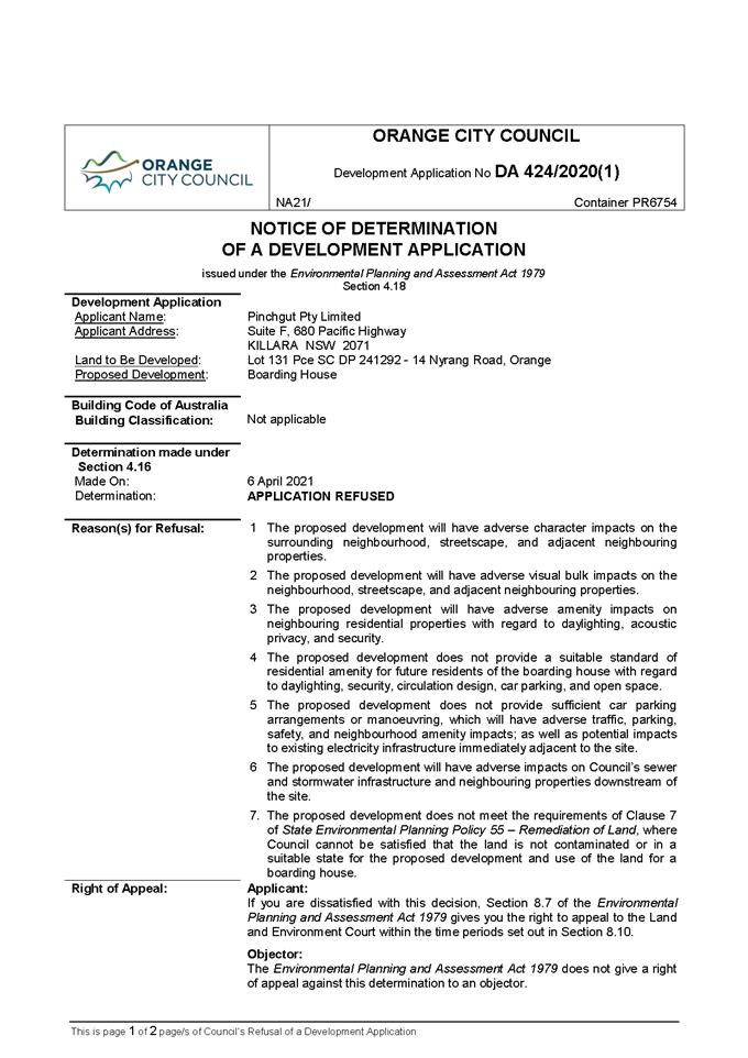

Planning and Development Committee
6 April 2021
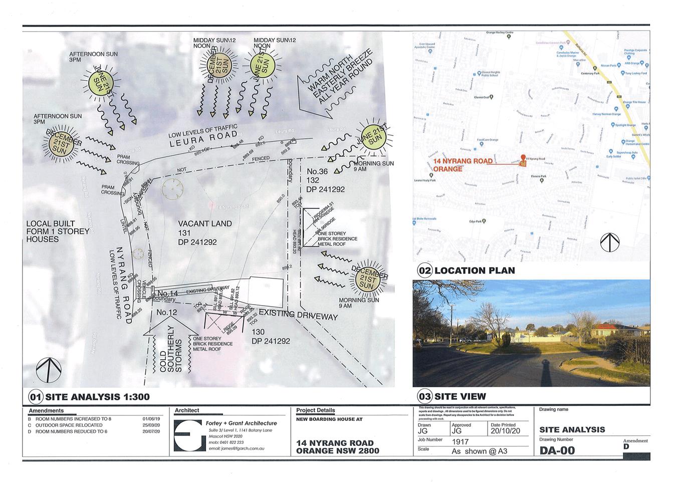
Planning
and Development Committee
6 April 2021
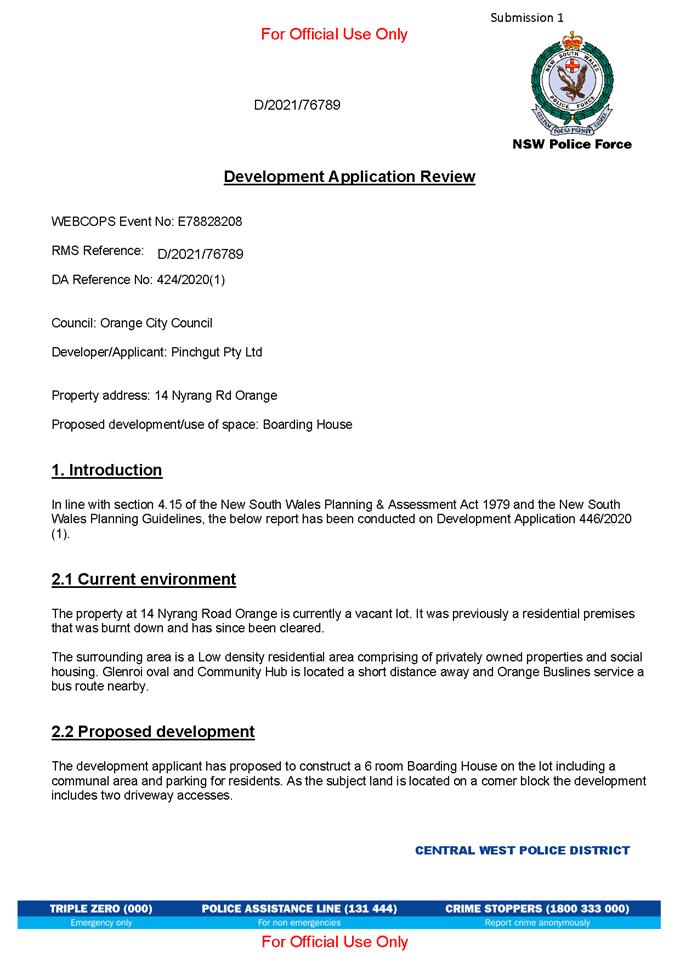
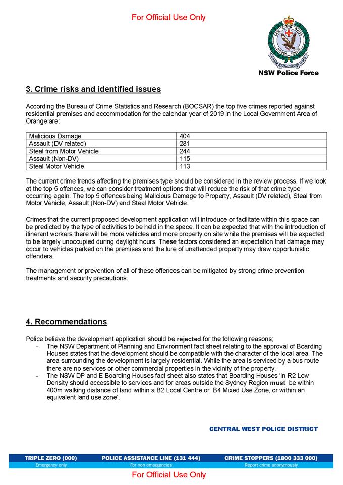

2.6 Orange
Development Control Plan 2004 - Former Orange Base Hospital - West End Precinct
RECORD
NUMBER: 2021/573
AUTHOR: Craig
Mortell, Senior Planner
EXECUTIVE Summary
At its meeting of 2 February 2021 Council considered a
report on the Former Orange Base Hospital (FOBH) site. That report presented a
draft development control plan for the West End Precinct. The draft DCP was
informed by the Allen Jack + Cottier design report that recommended design
strategies and development options within the existing planning controls and
context. On 2 February 2021 Council resolved:
1 That
Council acknowledge the attached site specific development controls and resolve
to place the controls on public exhibition for a period of 28 days.
2 That
staff draft an amendment the Orange Development Control Plan 2004 to:
· Insert reference
to the attached Site Specific Controls under chapter DCP 07 Residential Areas -
7.17 West End Precinct
· Insert the DCP 17
Site Specific Controls – West End Precinct as an attachment
3 That
post exhibition the matter return to Council for consideration of submissions
with a view to amending the Orange Development Control Plan 2004.
Accordingly the draft DCP was placed on public exhibition
for 28 days concluding 12 March 2021. An information session was held on Monday
8 March 2021 which was well attended and allowed staff to present the design
report and development controls to a variety of people. It is understood this
session helped resolve some confusion around a submission that had by then been
published in the Central Western Daily.
By the end of the exhibition period a total of 14
submissions were received which are discussed in the body of this report.
The opinions expressed within the submissions are varied in
their respective focus and some of the submissions appear to be a response to
an alternative design contained within one of the submissions that was reported
on by the Central Western Daily (i.e. not the materials exhibited by Council).
Overall there appears to be a general acceptance and
consensus that the site should be developed and that there is potential for the
site to provide substantial benefits to the City and locality. The various
issues raised in submissions are detailed below however it is considered the
DCP as exhibited appears to have struck the right balance overall and so
minimal changes are recommended.
Staff will now commence the sale of the property in line
with previous Council resolutions. The framework of planning controls
within the DCP will apply to the site.
Link To Delivery/OPerational Plan
The recommendation in this report relates to the
Delivery/Operational Plan strategy “7.1 Preserve - Engage with the
community to develop plans for growth and development that value the local
environment”.
Financial Implications
Council is the current owner of the subject site. When
Council proceeds to sell the site the framework of planning controls will apply
to the site.
Policy and Governance Implications
The FOBH Design Report and associated development controls
will guide the future direction of this precinct.
|
Recommendation
That Council note the contents of this report,
including the matters raised in submissions, and resolve to adopt the West
End Precinct Development Control Plan, as exhibited, to become a chapter in
Orange Development Control Plan 2004.
|
further considerations
The recommendation of this report has been assessed against
Council’s other key risk categories and the following comments are
provided:
|
|
|
|
|
Service/Project Delivery
|
Council acquired the Former Orange
Base Hospital site to ensure an appropriate redevelopment would occur. Site
specific planning controls will de-risk the ultimate sale and development of
the site.
|
|
|
Financial
|
Adoption of site specific planning
controls will affect the market value of the site and any ultimate sale
price.
|
|
|
Reputation
|
As both the current site owner and
the relevant planning authority there is potential for a conflict of interest
to be perceived by the community.
|
|
SUPPORTING INFORMATION
The exhibition of the West End Development Control Plan
attracted a significant amount of interest, although interestingly there has
been no specific theme emerging from the submissions. Some are clearly in favour,
some opposed and many have focussed on specific issues or concerns that they
feel should be addressed either in the DCP itself or during the assessment of a
future DA. Some submissions have argued for an increase in density and scale
over that presented in Councils concept, while others appear to be suggesting
the scale could be reduced. Overall there appears to be a general acceptance
and consensus that the site should be developed and that there is potential for
the site to provide substantial benefits to the City and locality. The various
issues raised in submissions are detailed below however it is considered the
DCP as exhibited appears to have struck the right balance overall and so
minimal changes are recommended.
Submissions
One early submission (submission 4) included a detailed
alternative concept for the site with significantly greater density, building
height, minimal to zero setbacks and advocating the closure of Sale Street
between Dalton Street and Prince Street to be converted into public open space.
This submission, which requested the alternative design be treated as
confidential, was subsequently published in the Central Western Daily. It
is understood that the submission was published on the authors Facebook page
and reprinted in the CWD.
The CWD article has in turn lead to
some submissions that appear to have assumed the alternative concept was being
proposed by Council. Despite this confusion the issues raised in those
submissions have been considered in this report as they still illustrate the
concerns likely to be encountered from more ambitious designs or concepts that
may emerge at the DA stage. For clarity, this report references the formally
exhibited version as the ‘Council’ concept and the
‘alternative’ concept refers to the submission reported on by the
CWD.
Supportive comments
Housing variety
The concept for the site can
contribute to housing variety, noting that there is minimal stock suitable for
young single professionals moving to Orange. A separate submission calls for a
greater mix in the unit and town house sizes and avoid a concentration of units
with the same number of bedrooms.
Comment:
The imbalance in the Orange housing
stock, compared to household composition has been recognised by Council. This
site is considered to provide an important opportunity to demonstrate how
apartment style living can be developed in Orange while respecting the general
character and amenity of the City.
Social housing
A submission noted that development
of the site has potential to include, or be required to include, a proportion
of social housing units.
Comment:
Within Orange social and affordable
housing are typically provided by community housing providers in conjunction
with the State government. At present the primary intention for the site is to
demonstrate to the community and the broader housing market that apartment
style accommodation is viable and desirable in the local context. The private
sector has been somewhat risk averse in this regard and as a result there is a
considerable mismatch between the composition of housing stock and households
in Orange, which in turn is likely to be compounding issues of housing
affordability. Social housing plays an important safety net role in this
regard, however encouraging the market to diversify its offering is likely to
have a greater long term effect.
Accessible housing
A submission encourages Council to
introduce planning controls in regards to accessible housing, noting that many
people would prefer to ‘age in place’ instead of needing to sell
and move into more appropriate housing when health and mobility issues arise.
Designing for accessibility from the beginning can reduce or avoid costs
associated with retrofitting homes that did not consider this future need.
Comment:
Accessible housing, also known as
universal design, is a concept that has broad support and has many benefits. In
addition to aging in place the concept promotes adaptive re-use of built form
as the retrofitting costs are no longer seen as a barrier. This reduces the
incidence of demolition and rebuild projects that can be wasteful of building
materials for buildings that still have ample structural life remaining. It is
considered that universal design principles should not be limited to this
specific site and can be investigated for adoption in the main Orange DCP. The
National Construction Code requires some of the units to be accessible.
General comments
Transparency
One submission wanted to clarify some
elements of the proposal, namely 1) who owns the site? 2) will the site be sold
for the DCP concept to proceed? and 3) does OCC envisage social housing for
this site as part of the Local Housing Strategy (LHS)?
Comment:
(1) The
site is owned by Orange City Council – having been acquired from NSW
Health Infrastructure a number of years ago with the intention of redevelopment
of the site so that the former hospital building would not be left in a
perpetual state of disrepair. Consideration was given to retrofitting the
former building but proved to be unviable.
(2) The
intention is to sell the site for development to be broadly in accordance with
the DCP concept.
(3) The
LHS is currently being developed and is examining a broad range of issues,
including social and affordable housing. However it is not anticipated that
this site would be explicitly developed for those purposes.
Council as developer
One submission believes that Council
should develop the site to ensure that the site is appropriate developed and
that Council would then be able to ensure that as much of the work as possible
was sub-contracted to local trades and businesses supporting the local economy.
Comment:
Orange City Council has not
historically been involved in property development other than some industrial
subdivision projects. When Council acquired the site there was a clear intent
to deal with the former base hospital building and return the site to the open
market, which is best placed to take on such a large development.
Crime Prevention
A submission asked whether cameras or
surveillance systems would be installed to promote safety.
Comment:
The concept of Crime Prevention
Through Environmental Design (CPTED) is a well‑established field within
urban planning. CPTED principles, such as activation and passive surveillance
would be relevant factors during the DA assessment process.
Walkability
Walkability through the grid streets
of Orange is not ideal and a submission nominates reducing the speed limit to
40kph in town, narrowing streets to two lanes to allow more mid-block
‘wombat’ crossings. A wombat crossing is a pedestrian crossing
placed on a flat top road hump, an example of which is located in Anson Street
in front of the Woolworths store. Another submission requests that Council
construct cycle paths and footpaths to improve walkability.
Comment:
The Orange FutureCity project has
identified making improvements to the walkability of the CBD as a priority.
This will entail a range of measures and is expected to include mid-block
crossing points, although the exact design of such crossings will be a matter
to be considered on a case by case basis.
Density
A view that additional density could
be achieved by reducing setbacks and reconfiguring the distribution of open
space within the site. Another submission is concerned that the development be
contained within the boundaries of the site.
Comment:
While changes to the Council concept
could enable greater density and more housing on the site, it is considered
important to balance this desire for yield against urban design outcomes as
well as ensuring an appropriate level of residential amenity is maintained for
both existing neighbours as well as future residents within the site itself.
Accordingly the balance between built form and open space needs to be
maintained and any reconfiguration should be expected to demonstrate that the
open space itself remains of a useful size and dimension and not be regarded as
an afterthought.
Building height
A submission argues that buildings be
limited to 5 storeys in height so as to avoid overshadowing of footpaths.
Comment:
This would primarily relate to the
Prince Street frontage as built form on Dalton Street would cast shadows
internally. Shadow diagrams provided as part of the alternative design
submission indicate that in midwinter shadows from the Council concept may extend
to the TAFE property boundary, whereas the alternative concept would see
shadows extend several meters into the TAFE campus.
Overshadowing of the footpath along the northern side of
Prince Street would persist through most of the year from either concept, while
impacts to the southern side of Prince Street would be relatively short lived
for the Council concept lasting a few weeks either side of the winter solstice,
whereas the alternative concept – being taller and casting longer shadows
would see this impact extend for a longer timeframe.
As the land use to the south is non-residential the massing
of built form along Prince Street, from either concept, would not impact on
neighbouring residents and while preserving solar access into the public realm is
desirable it may be regarded as a lesser concern in general terms.
Streetscape
A submission requests that
development be modern in design and blend with the surrounds.
Comment:
This may be in relation to the
alternative design, which did not appear to relate well to the neighbouring
DPIE building or other built form in the area. Streetscape and neighbourhood
compatibility are matters that would be considered through the normal DA
processes.
Residential amenity
A concern that lighting should be
designed to minimise glare to residential neighbours and also that any public
park should be an alcohol free zone.
Comment:
These matters would be assessed
through the DA process and potentially via conditions of consent if required.
Non-residential uses
One submission seeks to ensure that
commercial and retail activities are kept to a minimum.
Comment:
The concern is acknowledged,
particularly in relation to the Dalton Street and Sale Street frontages,
however the block to the south of the site consists of the TAFE campus and as
such the Prince Street frontage should not be regarded as having a residential
character. Non-residential uses on Dalton Street and Sale Street should
therefore be expected to have a higher regard for resident amenity with more
latitude allowed in Prince Street.
Tree retention or removal
Submissions sought to ensure that
tree removal is avoided or minimised. Another submission noted that the
remaining trees on the site, along with bench seats underneath them are only
remaining elements of the old base hospital and that from a heritage
perspective Council should seek to retain these where possible.
Comment:
This matter would be assessed through
the DA process and potentially via conditions of consent if required. Tree
removal would be considered as a last resort option only and developers would
largely be expected to design around tree retention. However should removal
occur compensatory planting at an appropriate ratio could be required.
Traffic
A submission seeks to ensure that the
development should not require Council to reconstruct Dalton Street or Prince
Street to accommodate traffic flow.
Comment:
The comment in the submission could
be concerned with either the cost to ratepayers of such changes and/or the
potential disruption to surrounding properties from prolonged roadworks.
It is not anticipated that a development would require
reconstruction of surrounding streets. It should be noted that the former base
hospital located on the site was a use with a relatively high level of traffic
generation. The surrounding local street network is therefore likely to be able
to accommodate the traffic flow attributable to this site. However should
issues emerge in relation traffic flow the wide road reserves in the area do
allow for a range of design responses and council staff would seek to ensure
that any such works were undertaken in the least disruptive way possible.
Parking
Development of the site needs to
ensure that adequate parking is provided so the residents and visitors do not
park on the street and cause congestion.
A specialist medical practice has also expressed concern
that the development may lead to more timed parking limits being introduced in
the area, and that this would further impact on patients attending the practice
as session lengths can be prolonged. They also note that students at the TAFE
campus require long stay parking.
Another submission questions the car parking rates used by
Council, noting that Orange has one of the highest rates of car ownership in
NSW. The submission notes parking ratios appear to be based on car ownership
levels from the 1996 census – the submission also noted there appears to
be ample space on the site for additional parking if required.
Comment:
Parking arrangements and restrictions
for on-street parking need to consider a wide range of competing interests. The
balance between timed and untimed parking supply is a matter that is considered
via Councils Traffic Committee and seeks to respond to the aggregated needs of
nearby properties rather than any one specific property.
The site is outside of the car parking contributions area
and as such development of the site will be expected to provide on-site parking
commensurate with the scale and intensity of the development, in accordance
with the DCP. The parking rates within the DCP for this style of development
have been based on the recommendations made by Transport for NSW. These
provisions are considered to be appropriate assessment measure for residential
development.
Staging - marketability
A submission expressed concern that
such a large project might prove difficult for a developer to undertake as a
single project, given that banks and lenders typically require a level of
pre-sales to demonstrate viability before agreeing to finance a project of this
nature. The submission suggests dividing the site into a series of smaller
parcels to allow development to test the waters in this regard and that this
may also lead to the site hosting a collection of buildings with distinct forms
and facades rather than a single building mass which might dominate the
streetscape.
Comment:
The staging of a project is largely a
matter for the developer to consider. At the DA stage an applicant can opt to
stage a project in any range of different ways, and financing arrangements are
frequently a factor in this regard. For this reason it is generally
inappropriate for the planning framework to speculatively impose a staging
pattern onto a site that may have little relationship to the markets actual
requirements.
With regard to the side effect of breaking up the mass of
the built form into multiple smaller and distinctive buildings, this does
relate to urban design concepts. However it is not clear that this block,
particularly as viewed from Prince Street, should be expected to mimic
surrounding residential streets where the pattern of smaller individual
building masses is evident. The block of Prince Street between Sale Street and
Anson Street consists of a single TAFE campus to the south, the large DPIE
office building to the east and the subject site.
Providing the site as a consolidated whole, is considered to
allow a more consistent approach that is likely to deliver the best possible
configuration and relationship between the public and private realm. Whereas
dividing the site into smaller pockets is likely to somewhat fragment the park
area and may not deliver the best outcome.
Relationship to DPIE building
A submission was received from the
Department of Planning Industry and Environment (DPIE) that focussed on the relationship
between the subject site and their office complex adjoining the site to the
east. The submission raises 4 specific issues, namely 1) linkage to the DPIE
site, 2) setbacks, 3) potential for overshadowing, and 4) Subdivision and
staging.
(1) Linkage
to the DPIE site
The submission affirms support for the
public open space within the concept plan but equally stresses that the DPIE
buildings and complex are managed as a secure site and as such there will be no
public access provided from the DPIE site into the public space.
Comment:
The operational requirements of DPIE
are recognised and respected. The suggestion within the design report and
development controls of a linkage through to the DPIE site should be viewed as
illustrating a future potential link, rather than any specific requirement. In
other words, the concept recognises that built form tends to persist for longer
than any given occupancy and at some future point the current DPIE buildings
could have a change of tenancy that may benefit from activating such a link.
The concept plan therefore is primarily concerned with ensuring that the
potential link is not built out such that this future potential is forever
obstructed.
(2) Setbacks
The submission compares the setbacks
of the DPIE building with that proposed in the design report and development
controls. The submission suggests that given the scale of building envisaged
the setbacks proposed on the site may not complement the scale and context of
the DPIE building. The submission notes that the DPIE building has a primarily
glazed exterior which could raise privacy concerns for residents of any new
building located in close proximity. As such the submissions suggests Council
consider a bigger setback from the DPIE building.
Comment:
The built form of the DPIE building
presents as a staggered form with the tallest 4 storey portion of DPIE has a
setback of 6 meters, while another module of the building is set further back
at some 13m and is also a storey lower, finally the former ambulance station
building is 2 storey’s and has a zero setback from Prince Street.
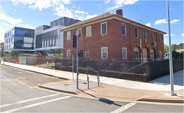
Figure 1. View of Prince Street from corner of Anson Street.
While the setback of the
ambulance station is largely a legacy and restricted to the eastern corner of
the DPIE site it illustrates that redevelopment of this block of Prince Street
is observing a varied and staggered approach to built form, setbacks and
massing.
(3) Overshadowing
The submission states that the DPIE
building has been designed to achieve a 5 star Green Star rating and 5 star
NABERS which could be compromised if the built form to the west of the site is
able to cast significant shadowing onto the DPIE site.
Comment:
The western façade of the DPIE
building is shown in figure 2. Afternoon shadow casts from building mass on the
subject site are likely to be cast onto this face. It should be noted that the
FSR and height limit of the subject site were established prior to the
development of the DPIE building. As such it should always have been
anticipated that a significant amount built form to the west was likely to
occur.
The Adaptive Architect
submission has illustrated that the design report and development controls are
in no way seeking to maximise the allowable FSR on the site. It is apparent
that a bolder design such as that illustrated in the Adaptive Architect
submission would have a far more pronounced overshadowing effect.
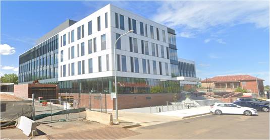
Figure 2. view of DPIE site from west back towards former Ambulance
Station
(4) Subdivision
and staging
The submission notes that Council
views this project as a proof of concept to test the market and demonstrate
that there is an unmet demand for medium density housing. From this the
submission extrapolates that it may be prudent to offer the site as separate
lots that would split the large volume apartment block into two separate
constructions – noting that this was suggested by a community member
during the information session.
Comment:
As noted in response to another submission the staging and
financing of a development of this scale are not typically considered to be
planning matters. In essence there is nothing in the DCP that would prevent
Council from undertaking a subdivision of the site if there is found to be no
or little interest in taking on the whole site. Conversely, if the site were
subdivided first and part of it taken up this would then prevent the
possibility for a more consolidated approach. As it stands Council has options
to deliver the site to market as-is and can adapt if needed.
Opposing comments
Landuse conflicts (noise)
A view was expressed that a pub
should not be located in a residential area.
Comment:
This appears to be a response to the
CWD article, and illustrates the potential for land use conflict between noise
generating pubs and surrounding residential lands. It should be noted that the
block to the south of the site consists of the TAFE campus and to the east is
the DPIE office building. Therefore should a noisy activity be contemplated for
the site it would be preferable for it to be positioned to the south-eastern
corner of the site as this would minimise impacts to existing residents.
However such a proposal would still need to demonstrate how the acoustic
amenity of new residents would be protected.
Submission 4
While this report has looked at the submissions on an issue
by issue basis, one submission was accompanied by an alternative concept design
that is substantially more ambitious than that publicly exhibited. It can
therefore serve as an illustration of the scale of development and its
associated impacts that could emerge in the absence prescriptive controls.
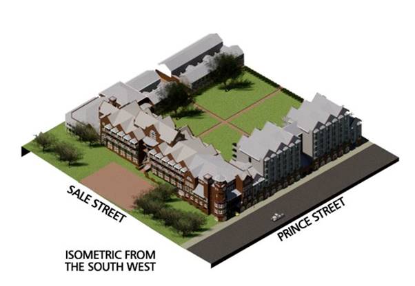
Figure 3. isometric view
of the alternative concept submitted – submission 4
The submission notes that although the LEP has allowed an
FSR of 1.8:1 the DCP has effectively demonstrated an FSR of approximately 0.8:1
while the submitted concept would be an FSR of 1.5:1
At this level the alternative concept includes a large
hotel, corner pub, traditional terraces and up to 7 storeys of apartments along
Prince Street. The design seeks to remove setbacks from the street boundaries
entirely. The design consists of a horseshoe shape of built form around an
expanded centralised open space being open only toward the eastern boundary
with DPIE. This configuration is suggestive of the central open space being
semi-private and may discourage local residents from making full usage of the
area. Instead it suggests closing Sale Street between Prince Street and Dalton
Street to reinstate a more public open space.
The zero setback approach would maximise solar access into
the central open space this comes at the expense of disregarding the scale of
surrounding development and street frontages, particularly in Prince Street
where a 7 storey façade would be positioned directly adjacent to the footpath.
While Orange does need to embrace a more vertical pattern of
development, particularly in proximity to the CBD, it is considered that this
concept may be somewhat jarring experience. Even in the CBD itself where zero
setbacks for shopfronts are well established upper floors would typically be
expected to be recessed so as to avoid the feeling of a being at the bottom of
a canyon.
The suggestion of a pub in a residential area has been
touched on in the general submissions and while non-residential uses can be
considered it would be preferable for a noise generating activity to be
positioned away from existing residential properties as far as practicable,
such as the south eastern corner of the site adjacent to the DPIE building. The
location nominated in the alternative design is instead positioned to the
north-western corner.
The façade aesthetic presented in the alternative
concept, while purely for illustrative purposes, does not respond well to
either the existing DPIE building – of which the submission is critical,
nor does it relate well to the streetscape of Sale Street, primarily due to the
difference in scale. The aesthetic of the hotel façade along Sale Street
may be attempting to respond to the presentation of Caldwell House but is likely
to overpower the heritage item. The lesser scale along the Dalton Street
frontage allows for a more or less coherent relationship with the bungalow
style buildings to the north.
To be fair the vision provided by the submission is only
conceptual and it would be likely to evolve significantly before being
presented as a final design. Nonetheless the submission was provided to Council
for analysis to demonstrate an alternative approach and potential for the site.
In this context, the primary concern with the alternative is not related to any
particular design element but in relation to the overall scale upon which the
concept is predicated.
Ultimately the alternative has served to underscore the need
for appropriate development controls to ensure that development of the site
does not overpower the neighbourhood which will be required to live with the
end product.
Attachments
1 The
West End - Former Orange Base Hospital Site Design Report, D20/75247⇩
2 Draft
DCP Controls, D21/3129⇩
3 Submissions,
D21/16784⇩
Planning
and Development Committee
6 April 2021
Attachment 1 The
West End - Former Orange Base Hospital Site Design Report
Planning
and Development Committee
6 April 2021
Attachment 2 Draft
DCP Controls
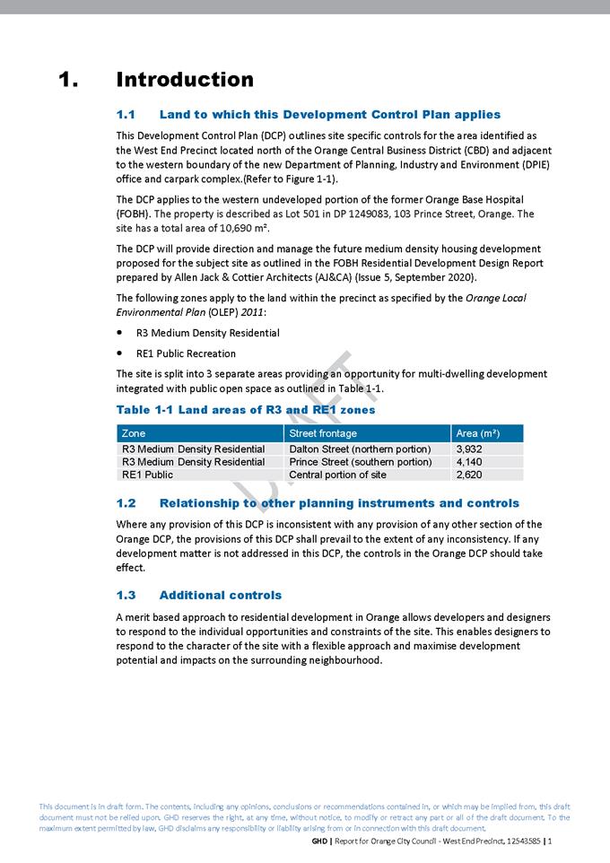
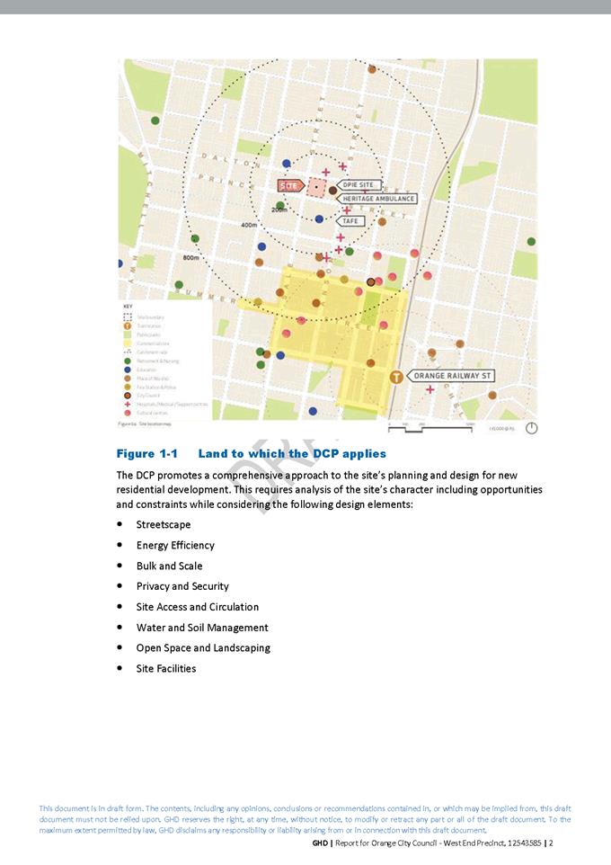
Planning and Development Committee
6 April 2021

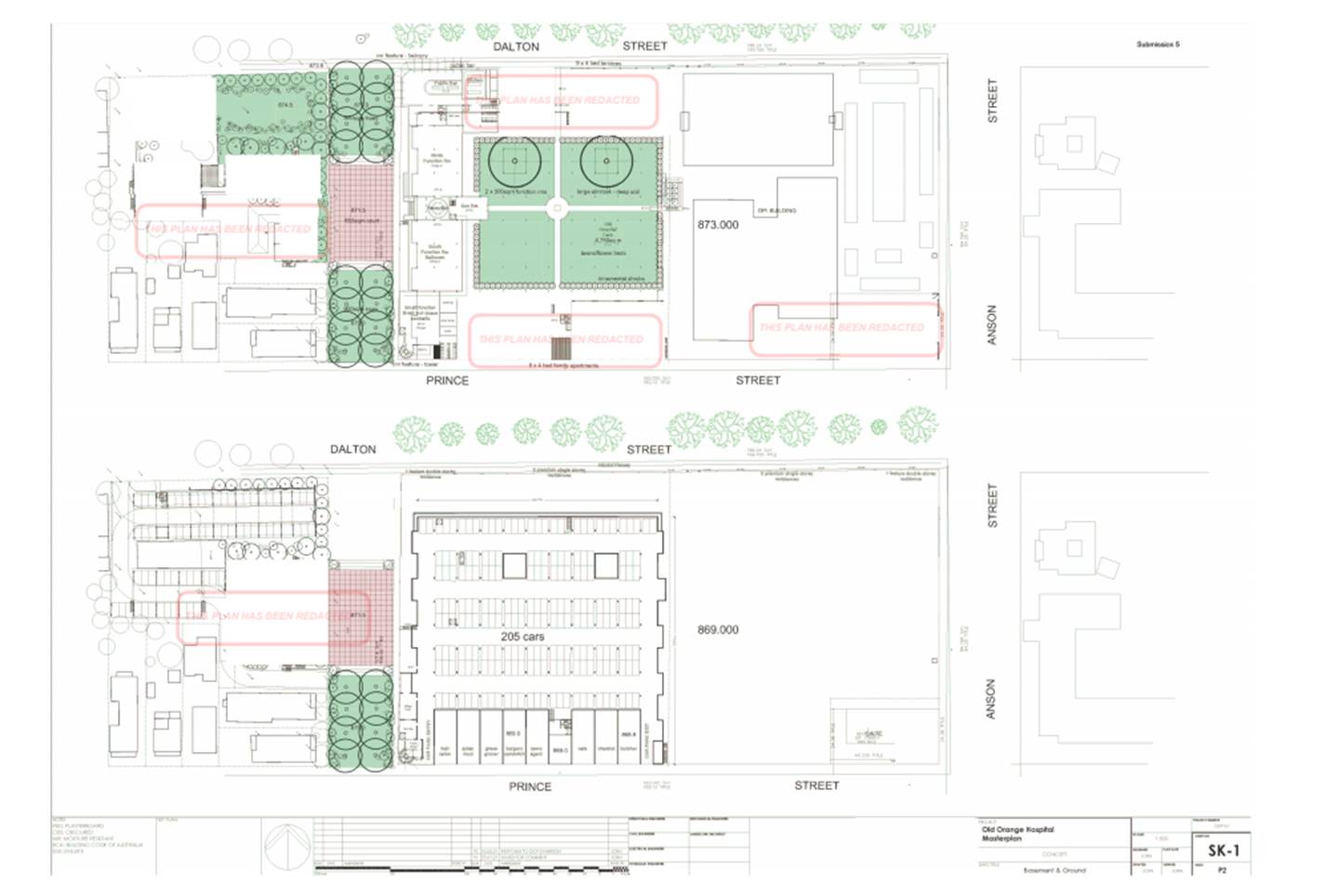
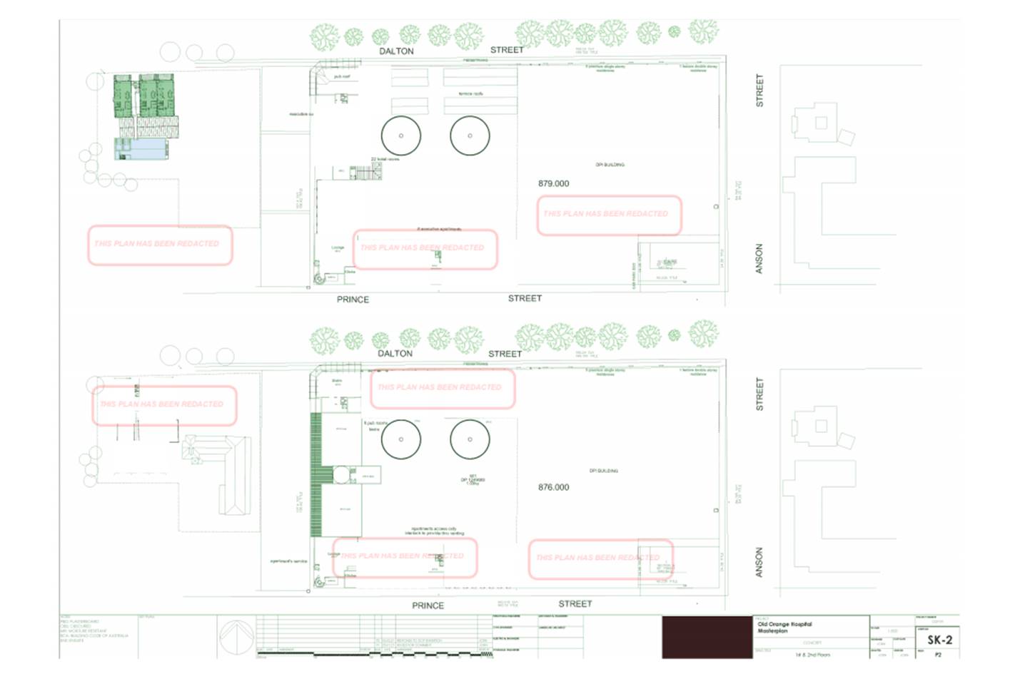
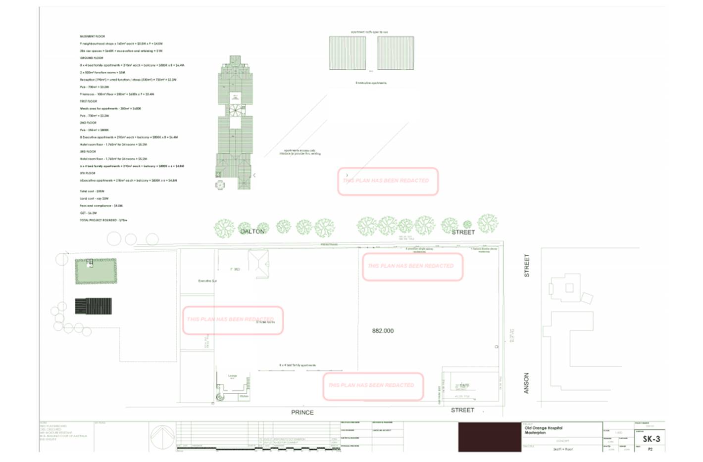
2.7 Orange
Local Environmental Plan 2011 - Planning Proposal for a Heritage Amendment
RECORD
NUMBER: 2021/580
AUTHOR: Alison
Phillips, Town Planner (Strategic)
EXECUTIVE Summary
This report commences the process to amend the Orange Local
Environmental Plan (LEP) in regards to heritage matters considered by Council
in 2020. To this end, a Planning Proposal has been drafted that reflects
Council’s resolutions for new Heritage Conservation Areas (HCAs),
extensions of the existing HCAs, including their renaming, and also the
inclusions of a number of properties to be adopted as Local Heritage Items
within the Orange Local Government Area (Attachments 2 and 3). In
addition, the Planning Proposal seeks to correct several heritage anomalies
that have been identified in Council’s resolution of 2 December 2020.
The proposal has also been drafted to include the area of
‘The Springs‘ in the Shiralee area south of the City, for the
purposes of heritage listing in accordance with actions detailed within the Springs
Archaeological Assessment and Heritage Study, Conservation Management Plan and
the Heritage Landscape Plan that Council adopted on 7 July 2020 (Attachment
1).
These matters are outlined in the attached draft Planning
Proposal (Attachment 4) and attached draft Inventory Sheets (Attachment
5) which will form the basis for the amendment and public exhibition
process. Formal LEP maps, where relevant, will be prepared prior to public
exhibition.
This matter was originally reported to the 2 February 2020
Planning and Development Committee and the item was deferred pending a
Councillor Briefing. The briefing was held 2 March 2020, where the community
consultation process was largely discussed and further commentary around the
consultation process is outlined in Supporting Information – Community
Consultation.
Link To Delivery/OPerational Plan
The recommendation in this report relates to the
Delivery/Operational Plan strategy “7.1 Preserve - Engage with the
community to develop plans for growth and development that value the local
environment”.
Financial Implications
Nil
Policy and Governance Implications
Nil
|
Recommendation
That Council resolves:
1 To
endorse the attached Planning Proposal relating to the Heritage Amendment to
the Orange Local Environmental Plan 2011
2 That
staff finalise inventory sheets before seeking a Gateway Determination
3 To
submit the Planning Proposal to the NSW Department of Planning and
Environment to seek a Gateway Determination in accordance with Section 3.34
of the Environmental Planning and Assessment Act 1979
4 That
staff proceed to address any conditions or requirements of the Gateway
Determination and then place the draft Planning Proposal on public exhibition
in accordance with the Gateway determination
|
further considerations
Consideration has been given to the recommendation’s
impact on Council’s service delivery; image and reputation; political;
environmental; health and safety; employees; stakeholders and project
management; and no further implications or risks have been identified.
SUPPORTING INFORMATION
Following on from the work undertaken in the Springs
Archaeological Assessment and Heritage Study, Conservation Management Plan and
the Heritage Landscape Plan and also the major works recently undertaken
with the Heritage Conservation Area Review, a draft Planning Proposal
has been prepared to give effect to this work via amendments to the Orange
Local Environmental Plan 2011.
This includes the following recommended amendments:
· Amend Schedule 5 -
Environmental heritage – Part 1 to correct several anomalies that have
been identified.
· Amend Schedule 5
Environmental heritage – Part 1 and maps to include The Springs
Travelling Stock Reserve (TSR), as described in the Springs Archaeological
Assessment and Heritage Study, Conservation Management Plan and the Heritage
Landscape Plan (December 2019).
· Amend Schedule 5
Environmental heritage – Part 1 and maps for the Former Bluestone
Quarry (Bluestone lakes) to reflect the recent subdivision pattern.
· Amend Schedule
5 Environmental heritage – Part 2 Heritage Conservation Areas
and maps to include the Bletchington, Newman Park and Blackman’s Swamp
HCAs as described in the Heritage Conservation Area Review (November
2020)
· Amend Schedule
5 Environmental heritage – Part 2 Heritage Conservation Areas
and maps to include the extension to the existing Central, Duration Cottages
and Glenroi HCAs as described in the Heritage Conservation Area Review
(November 2020)
· Amend Schedule
5 Environmental heritage – Part 2 Heritage Conservation Areas
to rename the following:
- The
Heritage Conservation Area known as Central Heritage Conservation Area, be
renamed Dalton Central Heritage Conservation Area
- The
Heritage Conservation Area known as the Duration Cottages Heritage Conservation
Area be renamed Glenroi Duration Cottages Heritage Conservation Area
- The
Heritage Conservation Area known as Glenroi Heritage Conservation Area be
renamed Endsleigh Heritage Conservation Area
- The
Heritage Conservation Area known as East Orange Heritage Conservation Area be
renamed Bowen Heritage Conservation Area.
· Amend Schedule
5 Environmental heritage – Part 1 Heritage Items and maps to include
numerous properties as Local Heritage Items as described in the Heritage
Conservation Area Review (November 2020)
1 Correction
of several anomalies
Amend Schedule 5 - Environmental
Heritage
1a Correction
of missing Heritage Conservation Area under Schedule 5 – Part 2 Heritage
conservation areas
Correction:
|
Glenroi
|
Glenroi Duration Cottages Heritage
Conservation Area
|
Local
|
C6
|
1b “Emmaville”
Cottage is to be removed from Schedule 5 Environmental heritage – Part 1
Heritage items to reflect the relocation of the cottage.
Remove
|
Orange
|
“Emmaville”
|
34 Telopea Way
|
Lot 31, DP 1215943
|
Local
|
I308
|
2 The
Springs Travelling Stock Reserve (TSR)
Amend Schedule 5 Environmental heritage – Part 1 and
maps.
|
Shiralee
|
‘The Springs’ Traveling
Stock Reserve (TSR)
|
Located
between Forest Road, Shiralee Road, Hawke Lane and Rifle Range Road
|
Lot 114
DP 750401 Lot 115 DP 750401 Lot 116 DP 750401 Lot 117 DP 750401 Lot 118 DP
750401 Lot 119 DP 750401
Lot 125
DP 750401 Lot 126 DP 750401 Lot 127 DP 750401 Lot 128 DP 750401
|
Local
|
TBC
|
3 The
Former Bluestone Quarry (Bluestone lakes) to reflect the recent subdivision
Amend Schedule 5 Environmental heritage – Part 1 and
maps
|
Calare
|
CSR Readymix site (Bluestone
quarry)
|
Laurel Street, off Racecourse Road
|
Lot 10, DP 112243; Lots
167–174, DP 979328
|
State
|
I58
|
Amendment:
|
Calare
|
CSR Readymix site (Bluestone
quarry)
|
Cedar Street, Laurel Street, off
Racecourse Road
|
Lot 1, DP 271090
|
State
|
I58
|
4 Inclusion
of the new Bletchington, Newman Park and Blackman’s Swamp HCAs
Amend Schedule 5 Environmental heritage – Part
2 Heritage conservation areas and maps
|
Orange
|
Bletchington Heritage Conservation
Area
|
Local
|
C7
|
|
Orange
|
Newman Park Heritage Conservation
Area
|
Local
|
C8
|
|
Orange
|
Blackman’s Swamp Heritage
Conservation Area
|
Local
|
C9
|
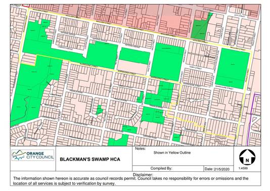
5 Amend
maps to include the extension of the existing HCAs.
5a The
Heritage Conservation Area known as Central Orange Heritage Conservation Area
mapped to show extension
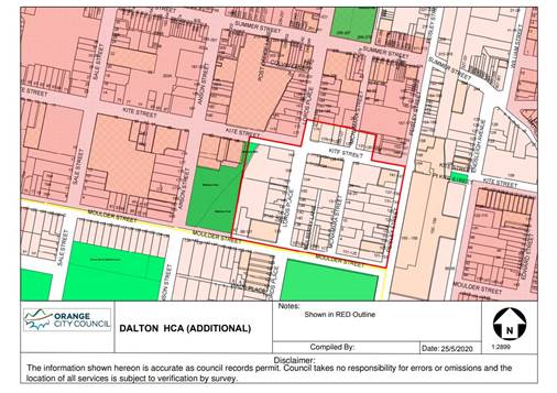
5b The
Heritage Conservation Area known as the Duration Cottages Heritage Conservation
Area mapped to show extension
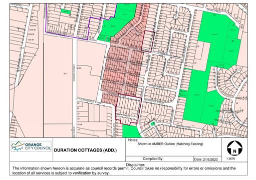
5c The
Heritage Conservation Area known as Glenroi Heritage Conservation Area mapped
to show extension
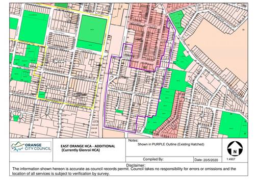
6 Renaming
of Central, Duration Cottages and Glenroi HCAs
Amend Schedule
5 Environmental heritage –
Part 2 Heritage conservation areas and maps
6a The
Heritage Conservation Area known as Central Orange Heritage Conservation Area,
be renamed Dalton Central Heritage Conservation Area
|
Orange
|
Central Orange Heritage Conservation Area
|
Local
|
C1
|
Amendment:
|
Orange
|
Dalton Central Heritage Conservation Area
|
Local
|
C1
|
6b The
Heritage Conservation Area known as the Duration Cottages Heritage Conservation
Area (LEP) be renamed Glenroi Duration Cottages Heritage Conservation Area.
Note: Duration Cottages Heritage Conservation Area is not included in Schedule
5 but is mapped. This is to be rectified in through the addition of the Glenroi
Duration Cottages Heritage Conservation Area.
Amendment:
|
Orange
|
Glenroi Duration Cottages Heritage Conservation Area
|
Local
|
C6
|
6c The
Heritage Conservation Area known as Glenroi Heritage Conservation Area be
renamed Endsleigh Heritage Conservation Area
|
Orange
|
Glenroi Heritage Conservation Area
|
Local
|
C3
|
Amendment:
|
Orange
|
Endsleigh Heritage Conservation
Area
|
Local
|
C3
|
6d The
Heritage Conservation Area known as East Orange Heritage Conservation Area be
renamed Bowen Heritage Conservation Area
|
Orange
|
East Orange Heritage Conservation
Area
|
Local
|
C2
|
Amendment:
|
Orange
|
Bowen Heritage Conservation Area
|
Local
|
C2
|
7 Include
a number of properties as Local Heritage Items
Amending Schedule
5 Environmental heritage – Part 1 Heritage Items and
maps
|
Suburb
|
Item
name
|
Address
|
Property
description
|
Significance
|
Item No (TBC)
|
|
Orange
|
Dwelling
|
117
Sampson Street
|
Lot 8 DP 6662
|
Local
|
|
|
Orange
|
Dwelling
|
49 Prince
Street
|
Lot 21 DP1249171
|
Local
|
|
|
Bowen
|
Dwelling
|
5 Hawkins
Lane
|
Lot 14 DP 36258
|
Local
|
|
|
Bowen
|
Dwelling
|
9 Hawkins
Lane
|
Lot 1 DP 997995
|
Local
|
|
|
Bowen
|
Dwelling
|
11
Hawkins Lane
|
Lot 1 DP 194886
|
Local
|
|
|
Bowen
|
Dwelling
|
3 Hawkins
Lane
|
Lot 1 DP 711668
|
Local
|
|
|
Bowen
|
Dwelling
|
6 Hawkins
Lane
|
Lot 1 DP 996035
|
Local
|
|
|
Bowen
|
Dwelling
|
4 Hawkins
Lane
|
Lot B DP 154127
|
Local
|
|
|
Bowen
|
Dwelling
|
2 Hawkins
Lane
|
Lot A DP 154127
|
Local
|
|
|
Bowen
|
Dwelling
|
20 Nile
Street
|
Lot 1 DP 780854
|
Local
|
|
|
Bowen
|
Dwelling
|
22 Nile
Street
|
Lot 11 DP 1086301
|
Local
|
|
|
Bowen
|
Dwelling
|
24 Nile
Street
|
Lot 1 DP 797882
|
Local
|
|
|
Bowen
|
Dwelling
|
26 Nile
Street
|
Lot 1 DP 738846
|
Local
|
|
|
Bletchington
|
Dwelling
|
171
Margaret Street
|
Lot 20 DP 507333
|
Local
|
|
|
Bletchington
|
Dwelling
|
110
Matthews Avenue
|
Lot 23 DP 36258
|
Local
|
|
|
Orange
|
|
125 Prince
Street
|
Lot B DP 345070
|
Local
|
|
|
Suburb
|
Item
name
|
Address
|
Property
description
|
Significance
|
Item No (TBC)
|
|
Bletchington
|
‘Former
Railway Level Crossing Keepers Cottage’
|
125
Dalton Street
|
Lot 2 DP 1038981
|
Local
|
|
|
Bowen
|
|
112
Dalton Street
|
Lot 1 DP 744247
|
Local
|
|
|
Orange
|
Dwelling
|
121
Gardiner Road
|
Lot 105 DP 831875
|
Local
|
|
|
Orange
|
Dwelling
|
123
Gardiner Road
|
Lot B DP 363624
|
Local
|
|
|
Orange
|
Dwelling
|
102
Gardiner Road
|
Lot 112 DP 456165
|
Local
|
|
|
Orange
|
Dwelling
|
106
Gardiner Road
|
Lot 121 DP 561111
|
Local
|
|
|
Orange
|
Dwelling
|
108
Gardiner Road
|
Lot 2 DP 220822
|
Local
|
|
|
Bowen
|
Dwelling
|
105
Spring Street
|
Lot 1 DP 371538
|
Local
|
|
|
Huntley
|
‘Former
Butter Factory’ Dwelling
|
15 Capps
Lane
|
Lot 452 DP 810173
|
Local
|
|
|
Huntley
|
‘Waverton’
and the former Dairy buildings
|
76 Blunt
Road
|
Lot 2 DP 1038589
|
Local
|
|
|
Huntley
|
‘Homeleigh’
dwelling
|
359
Phoenix Mine Road
|
Lot 56 DP
750387
|
Local
|
|
Curtilage mapping for ‘Waverton’ 76 Blunt Road,
Huntley as described in the Heritage Conservation Area Review (November
2020)
Anticipated Timeline and Next Steps
Gateway Process
Should Council resolve to proceed, the planning proposal and
associated documents will be supplied to the Department of Planning, Industry
and Environment for evaluation under the Gateway process. This typically takes
4–8 weeks, but can vary considerably in both direction. Once issued the
Gateway Determination will outline the remainder of the process. This typically
includes:
· Whether the Minister
will delegate the power to make the plan to Council or withhold such delegation
(typically in cases where the Council has a direct interest in the site or
matter concerned).
· Any additional
information or changes to the planning proposal required before consultation
and exhibition can proceed.
· A list of government
departments and agencies that are to be consulted.
· The public consultation
and exhibition periods (typically 28 days).
· Whether a public hearing
is required (typically only applies to reclassification of Council owned or
controlled land under the Local Government Act 1993).
· Formal drafting of the
amendment through Parliamentary Counsel.
· Finalisation of the
amendment by publishing the change on the legislation website.
Agency Consultation
Given the site location and nature of the planning proposal,
it is anticipated that the Gateway Determination may require consultation with
Heritage NSW.
Community Consultation
Typically a 28 day public exhibition period is required. All
materials will be made available on Council’s website, and at the Civic
centre for inspection during the required period, including a fact sheet that
provides additional information for the community regarding heritage items and
conservation areas. Notification of the public exhibition period will also be
provided in the local newspaper.
Subject to the terms of the Gateway Determination and
consistent with a standing resolution of Council a community information
session is intended midway during the exhibition period.
Directly affected landowners will also be advised in writing
of the commencement of the exhibition period. This will include properties
within the new and expanded conservation areas, new heritage item listings as
well as properties affected by correction of anomalies.
Note: Most of the affected landowners will have already been
consulted during the heritage study and review process, but some properties may
have changed ownership in the interim.
Post Exhibition Evaluation
Once the exhibition period has concluded, all submissions
received (from both the community and agencies) will be collated and reviewed.
Issues identified in the submissions are then evaluated for significance, and
where appropriate the proponent will be invited to respond, which may include
relevant changes.
Report and Finalisation
Once all submissions have been reviewed, a further report to
Council will be prepared to outline the response of agencies and the community,
as well as any suggested adjustments. Council retains the option to reject a
planning proposal at any time up to and including the final report. However, if
endorsed the matter is then finalised, either by the CEO under delegation from
Council or by the Department of Planning, Industry and Environment in cases
where the Gateway Determination withheld delegations from Council.
Attachments
1 The
Springs Archaeology and Heritage Study, D21/3734⇩
2 Heritage
Study Review, D21/16962⇩
3 Heritage
Study Review - HCA maps, D20/71786⇩
4 Planning
Proposal Amendment 28 - Heritage Amendment, D21/2441⇩
5 Draft
Inventory Sheets, D21/2442⇩
Planning
and Development Committee
6 April 2021
Attachment 1 The
Springs Archaeology and Heritage Study

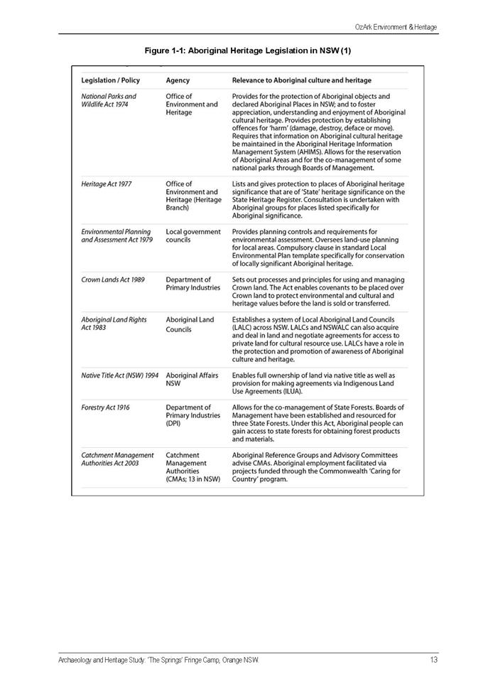
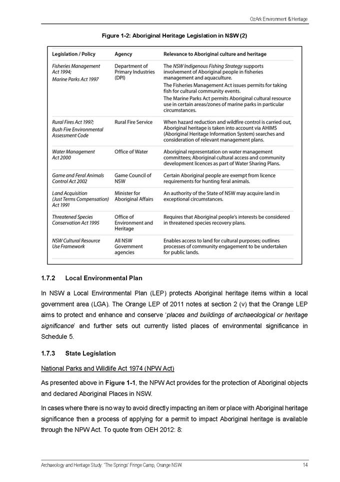
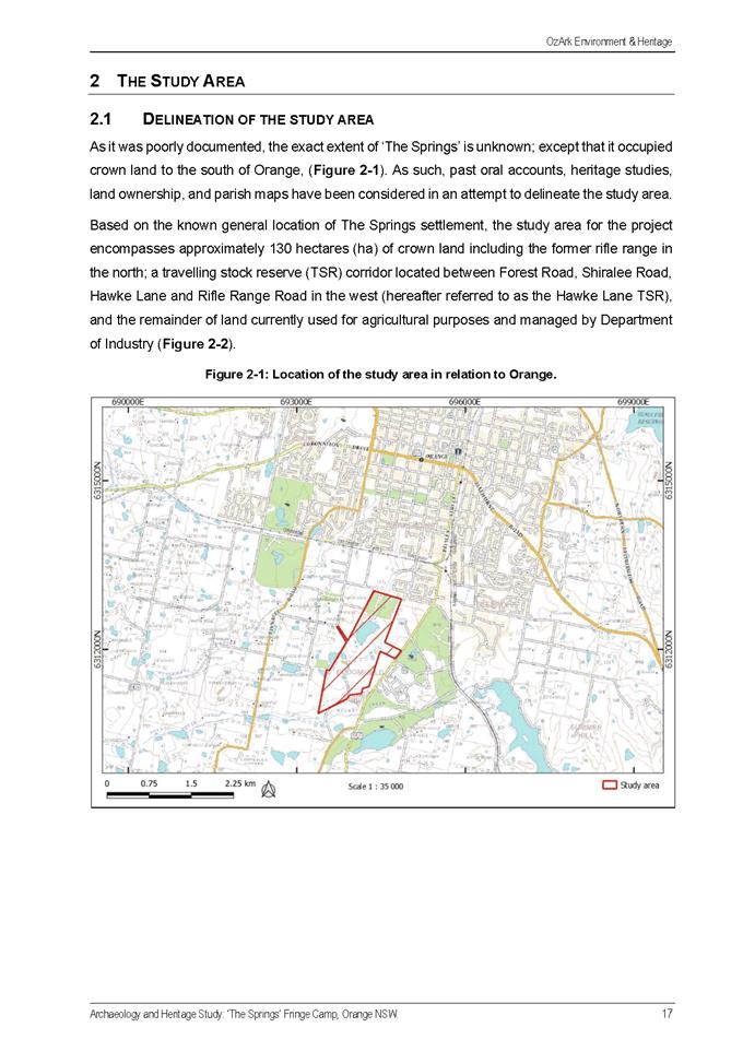
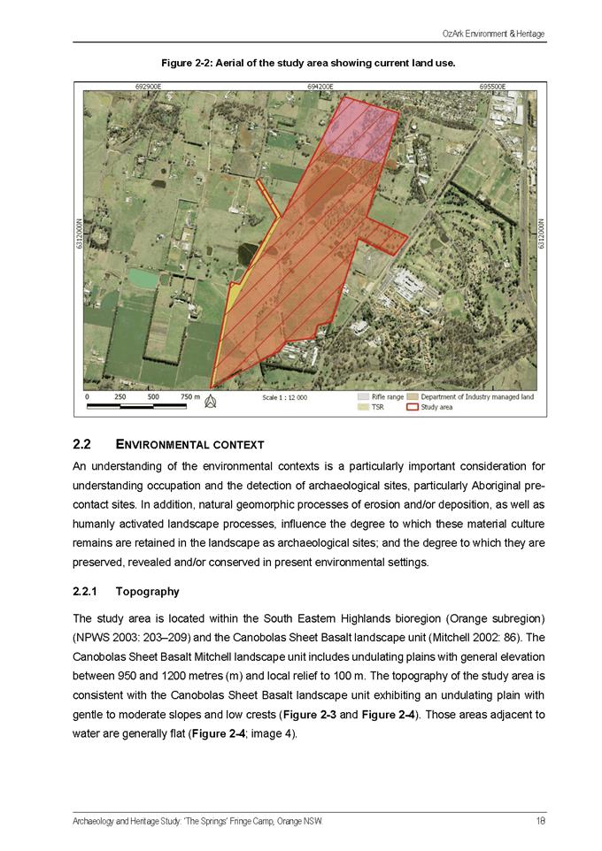
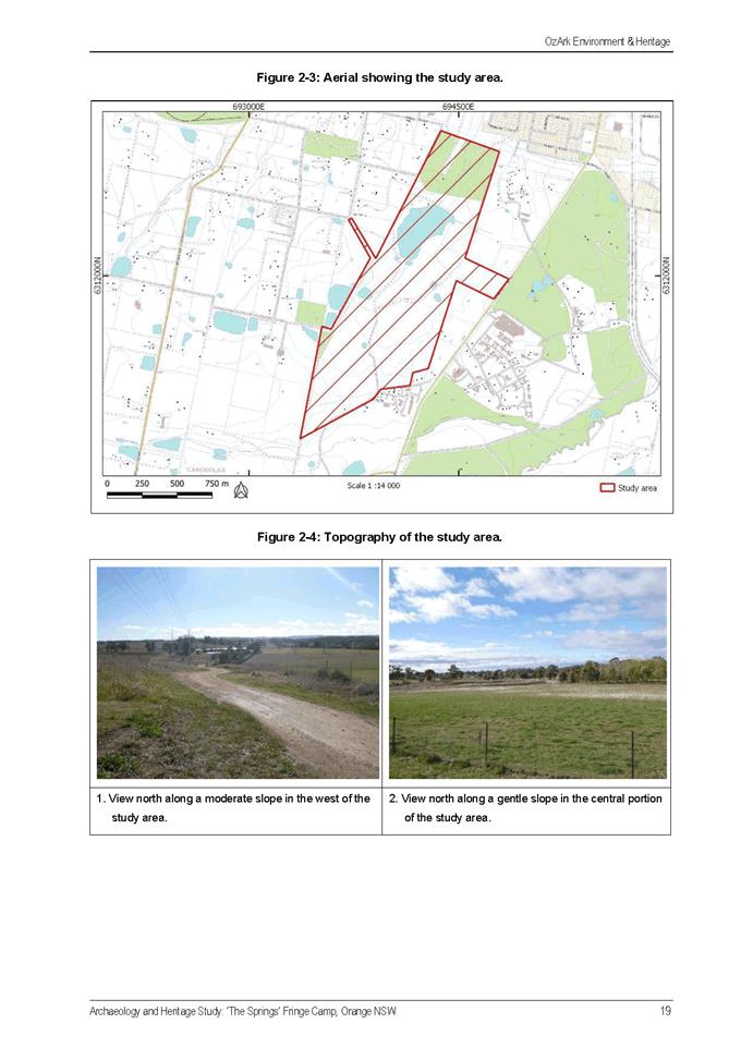
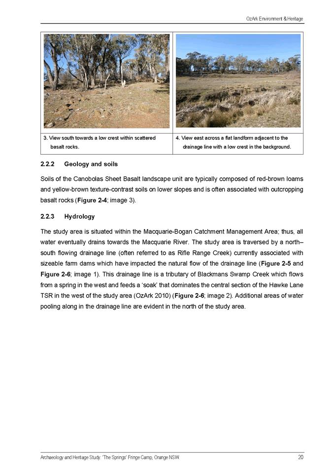
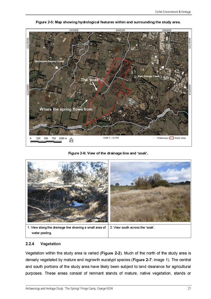
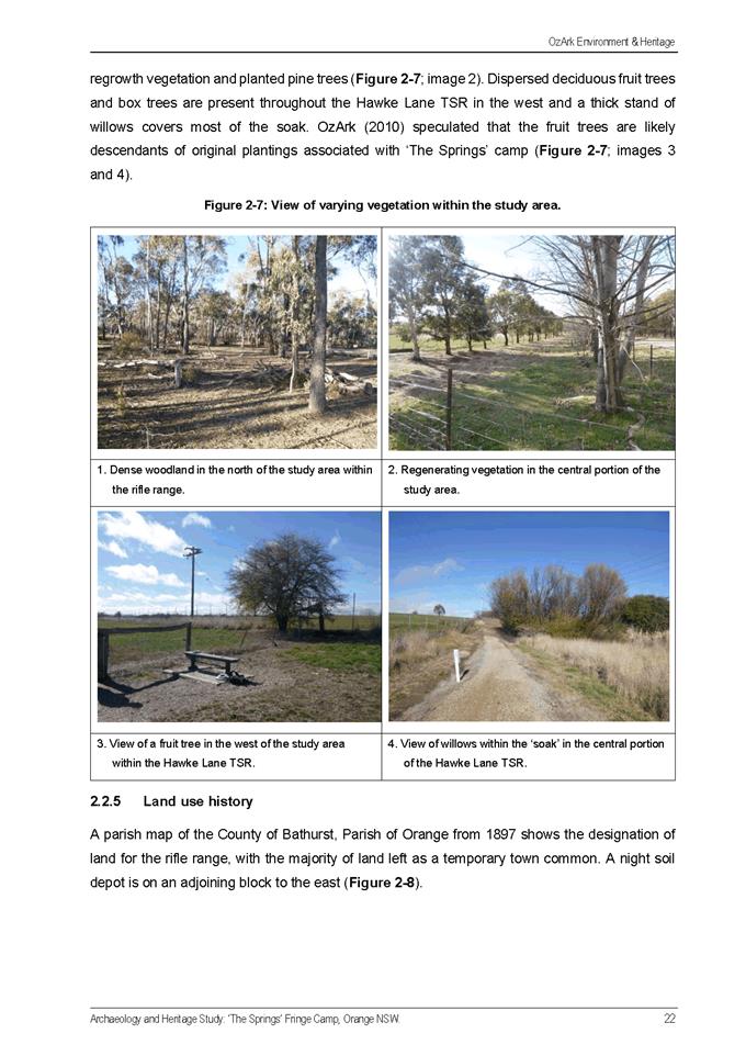
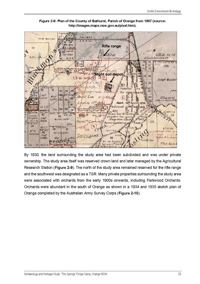
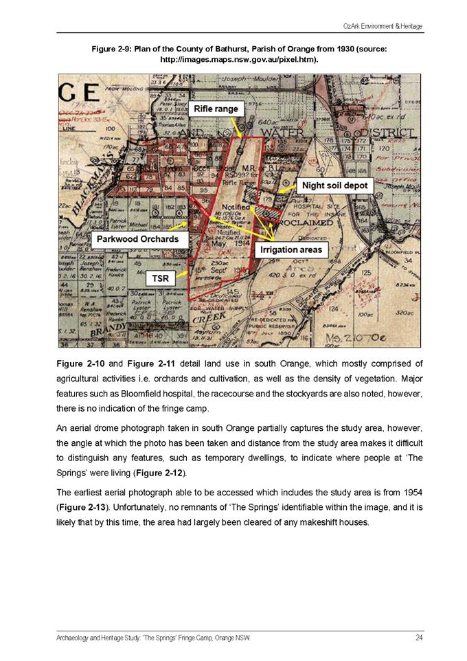
Planning and Development Committee
6 April 2021
Attachment 2 Heritage
Study Review
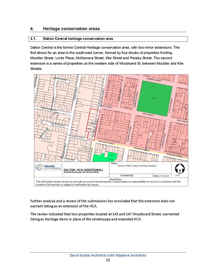
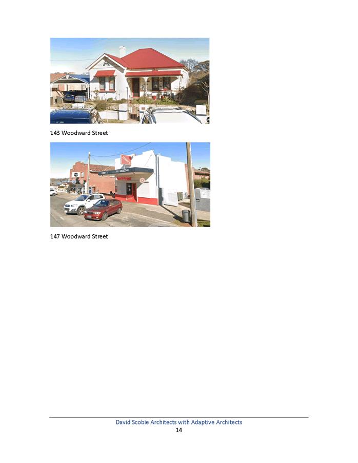
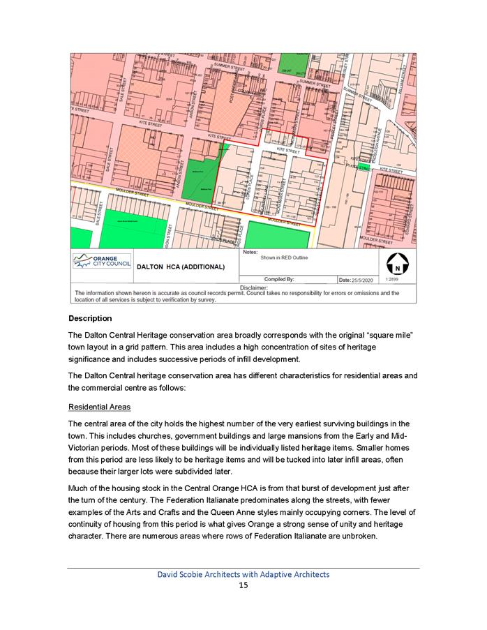
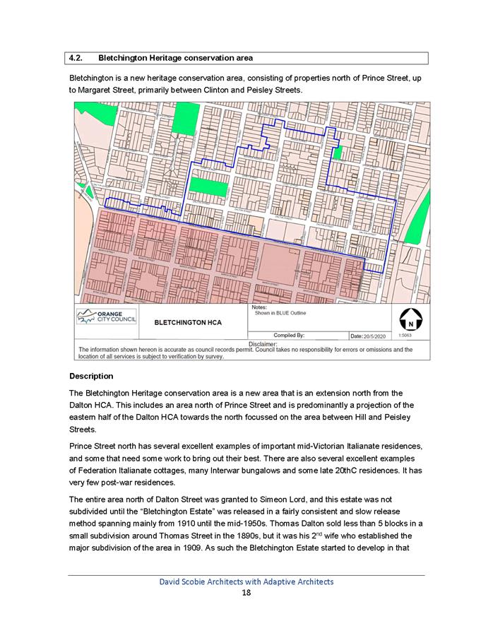
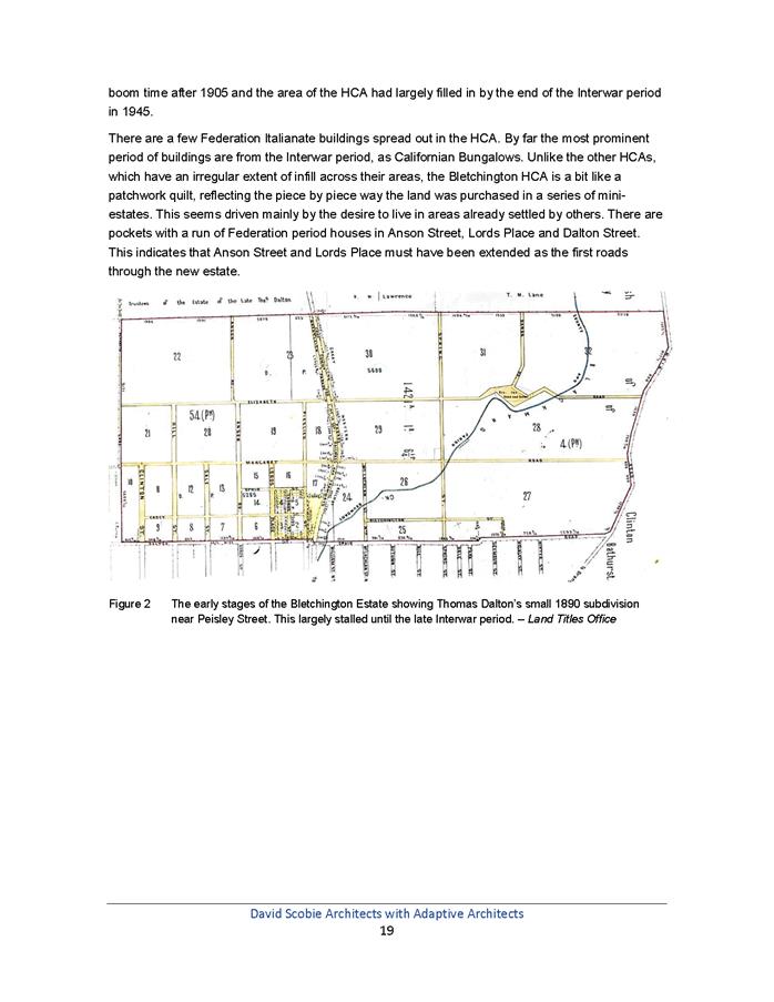
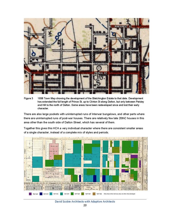
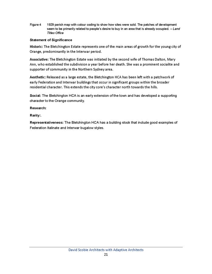
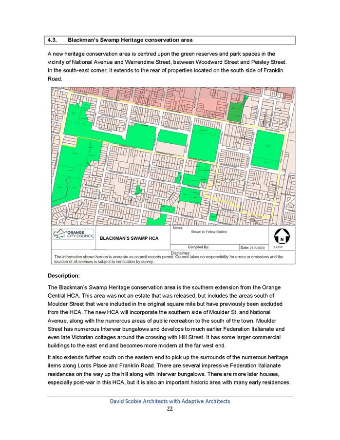
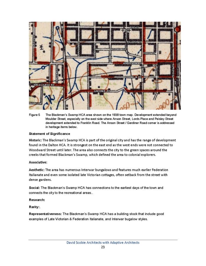
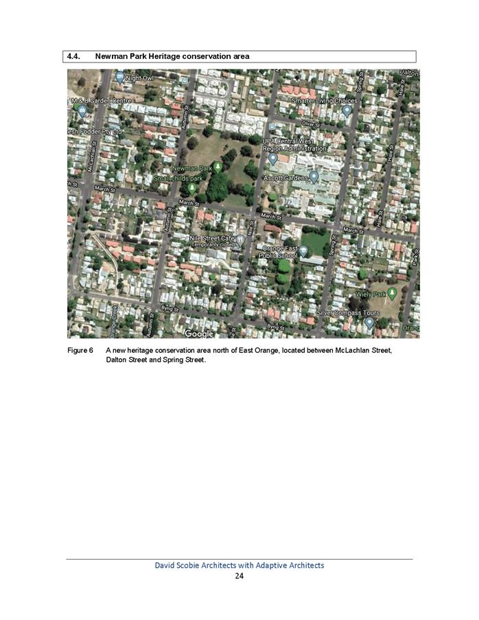
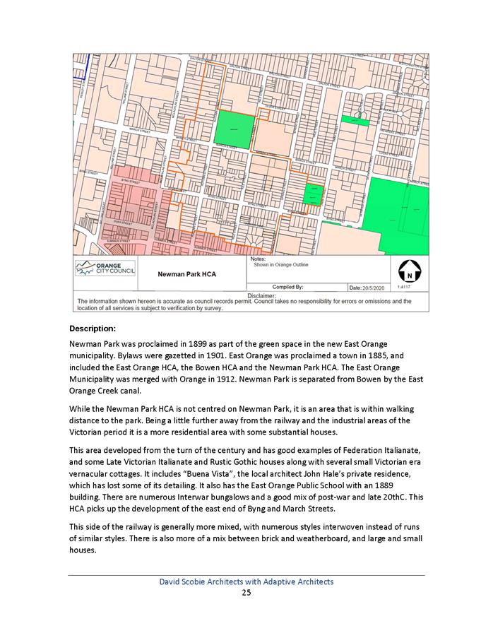
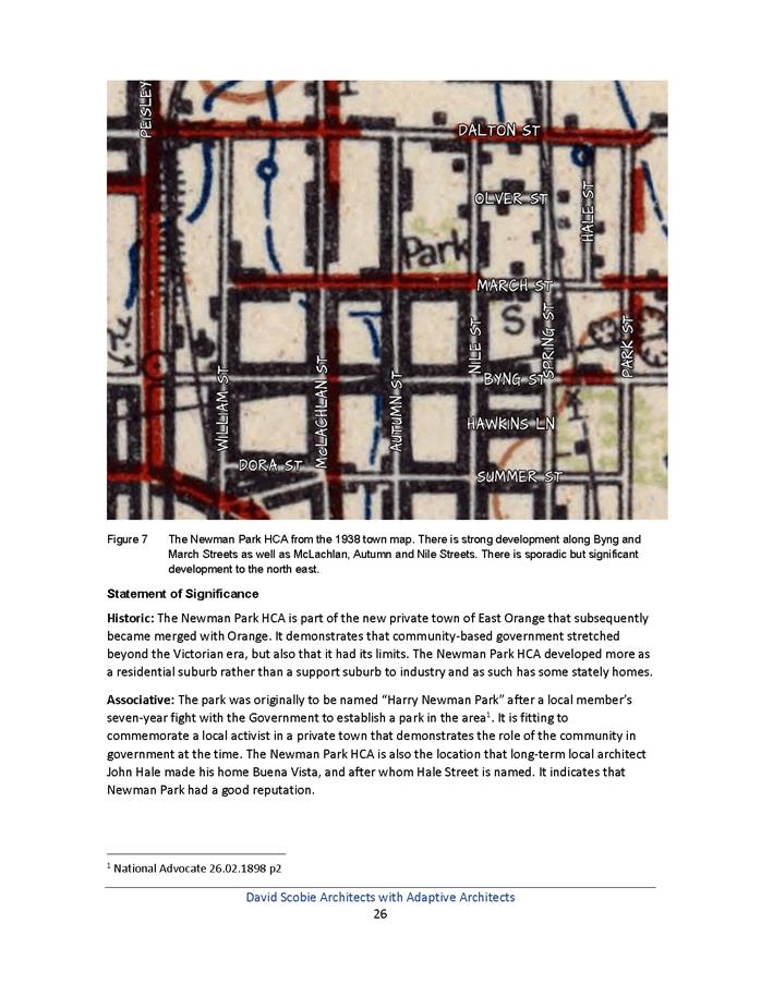

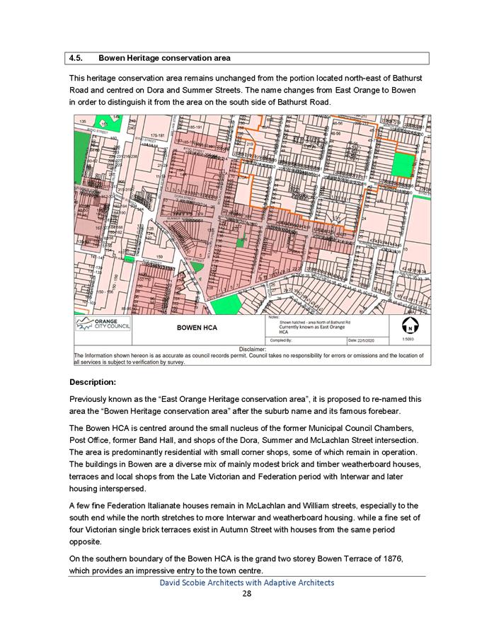
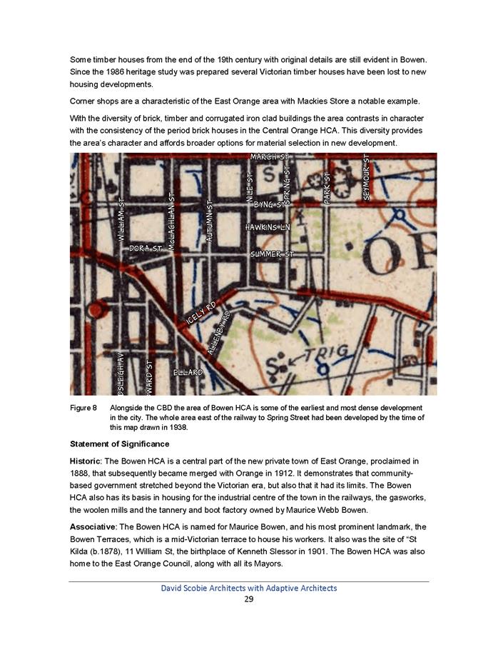
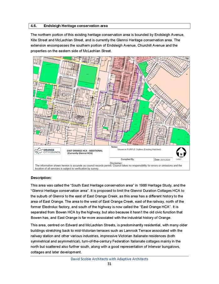
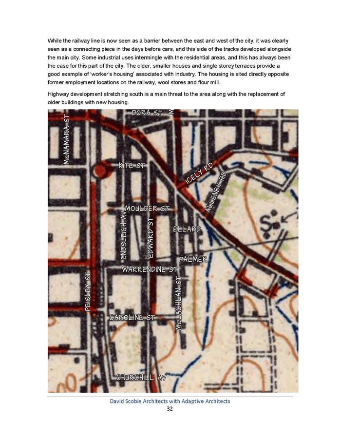
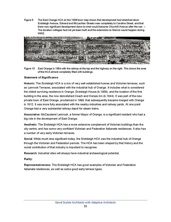
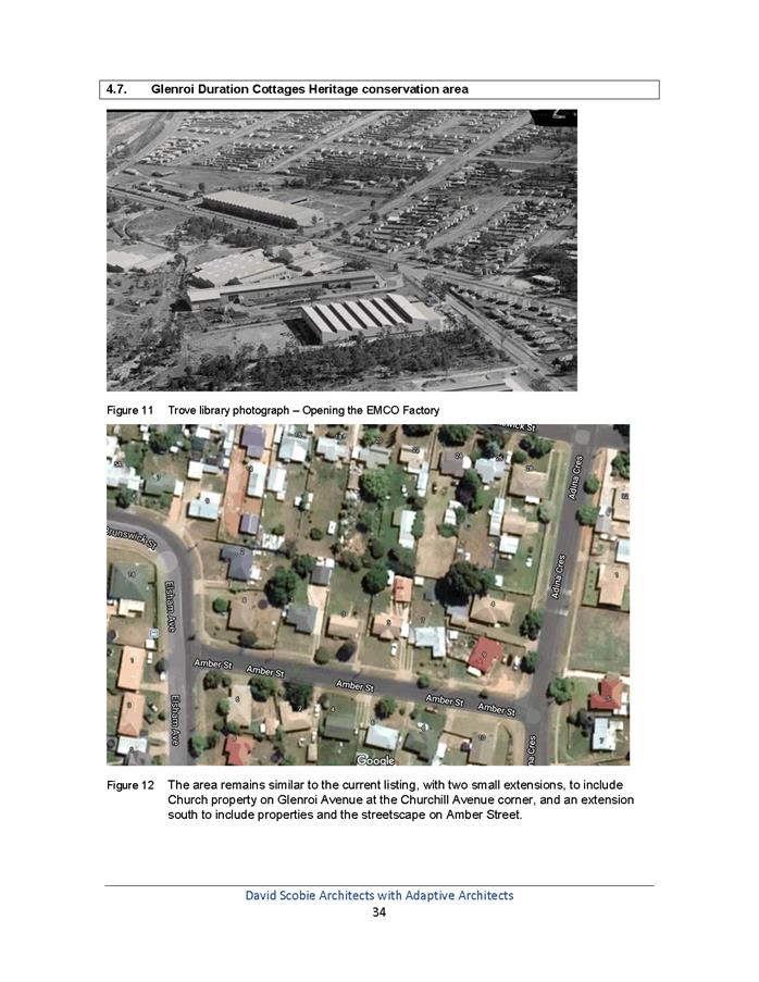
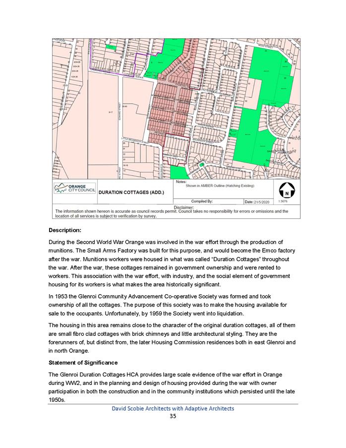
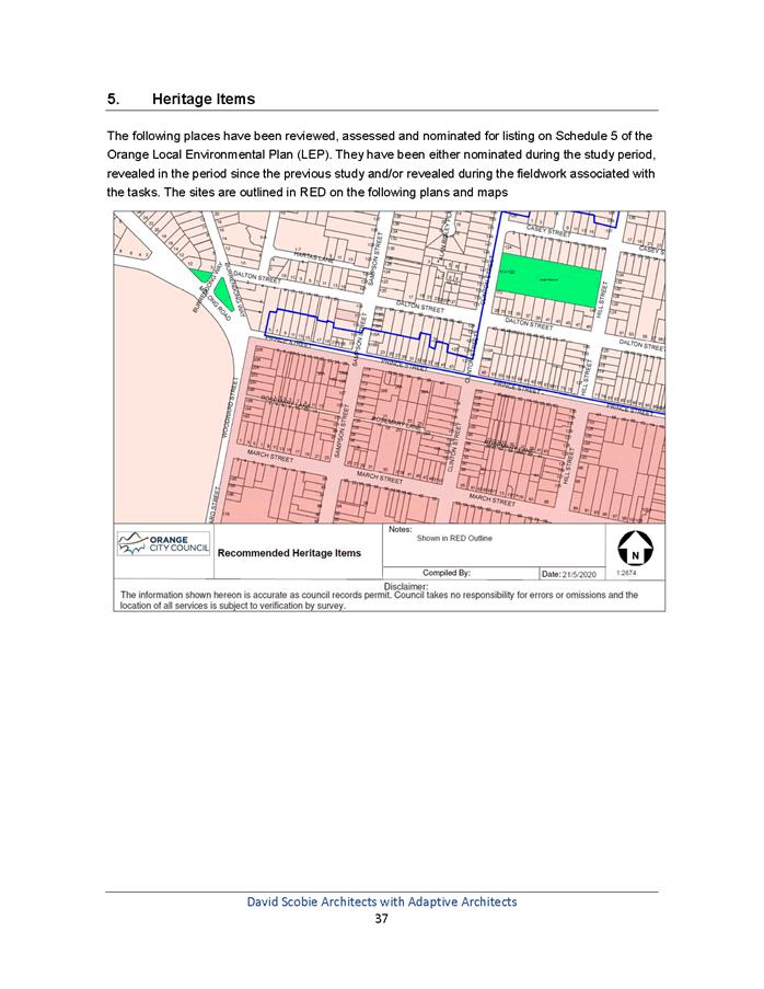
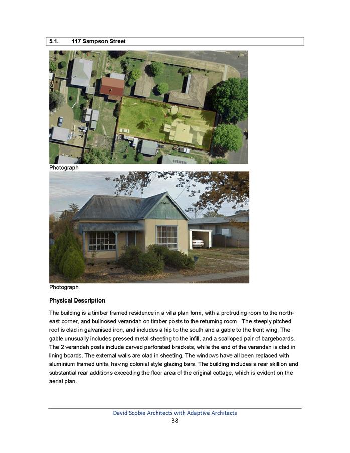
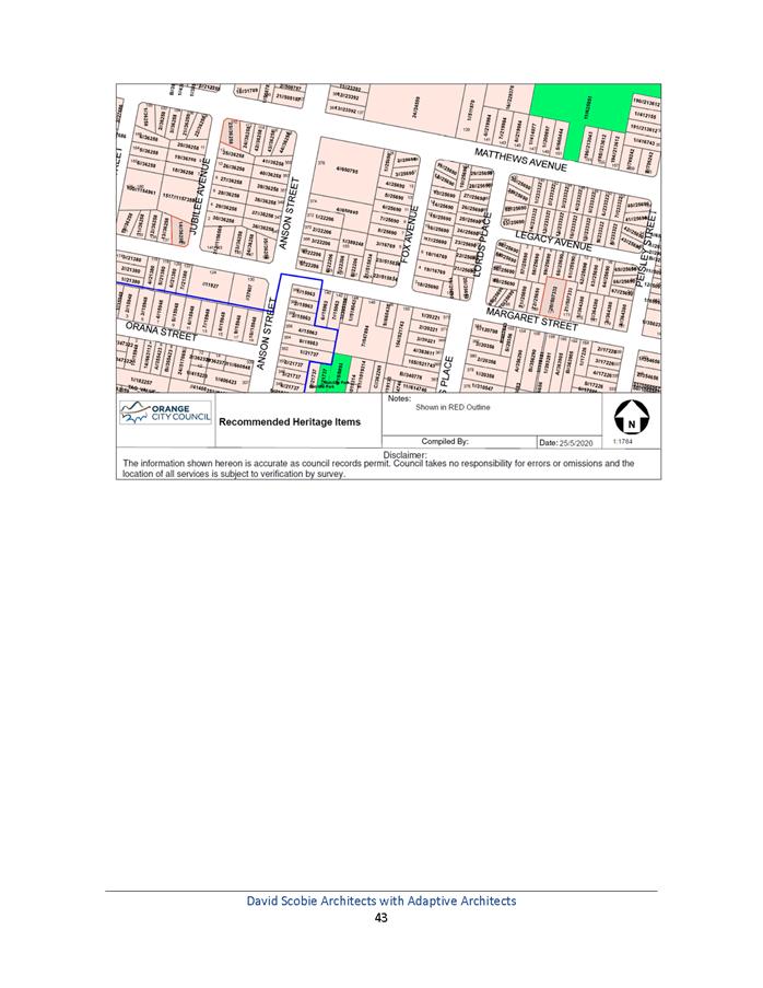
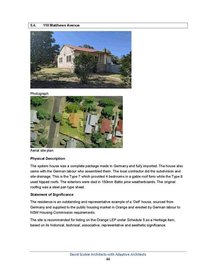
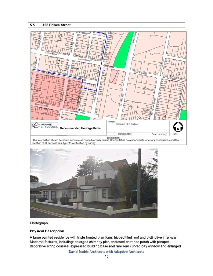
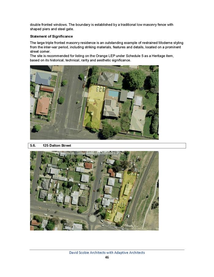
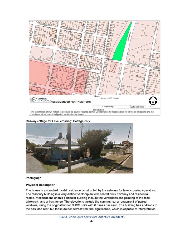
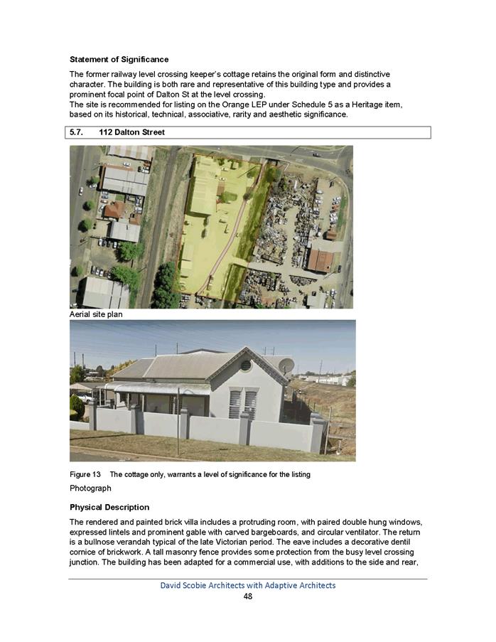
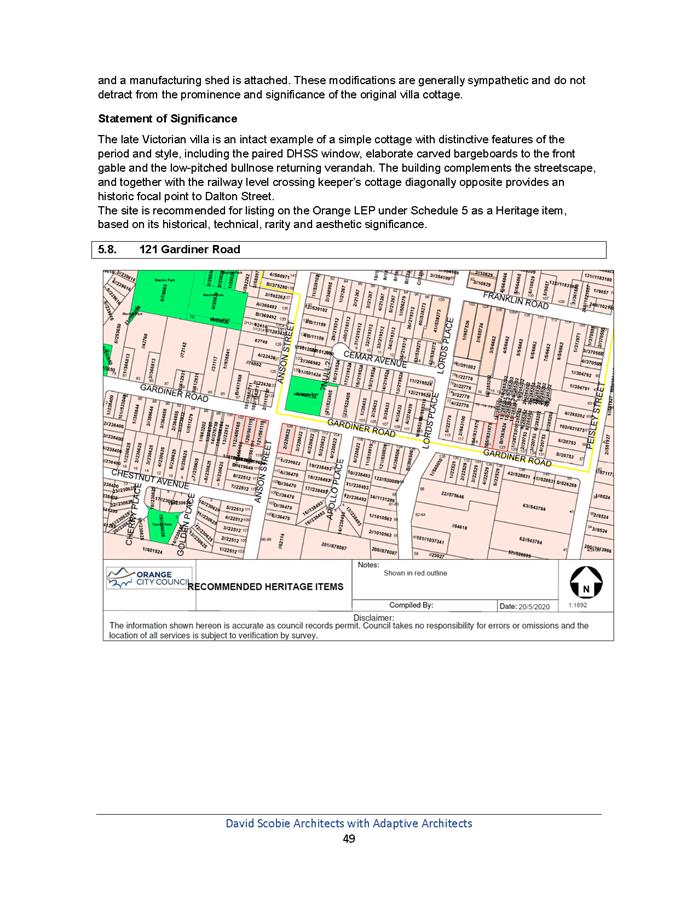
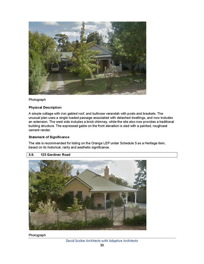
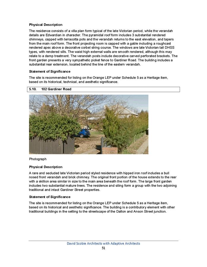
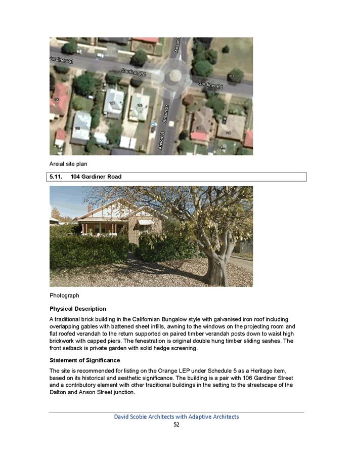
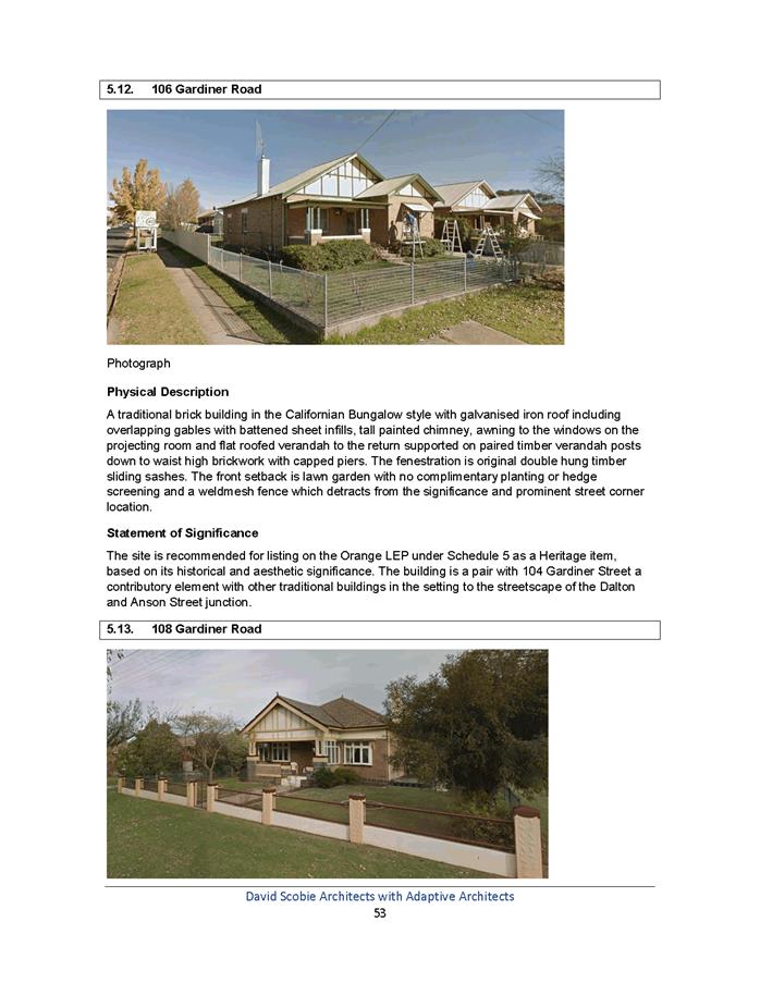
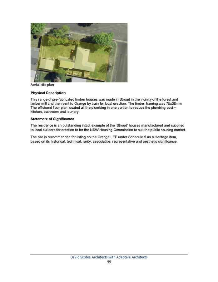
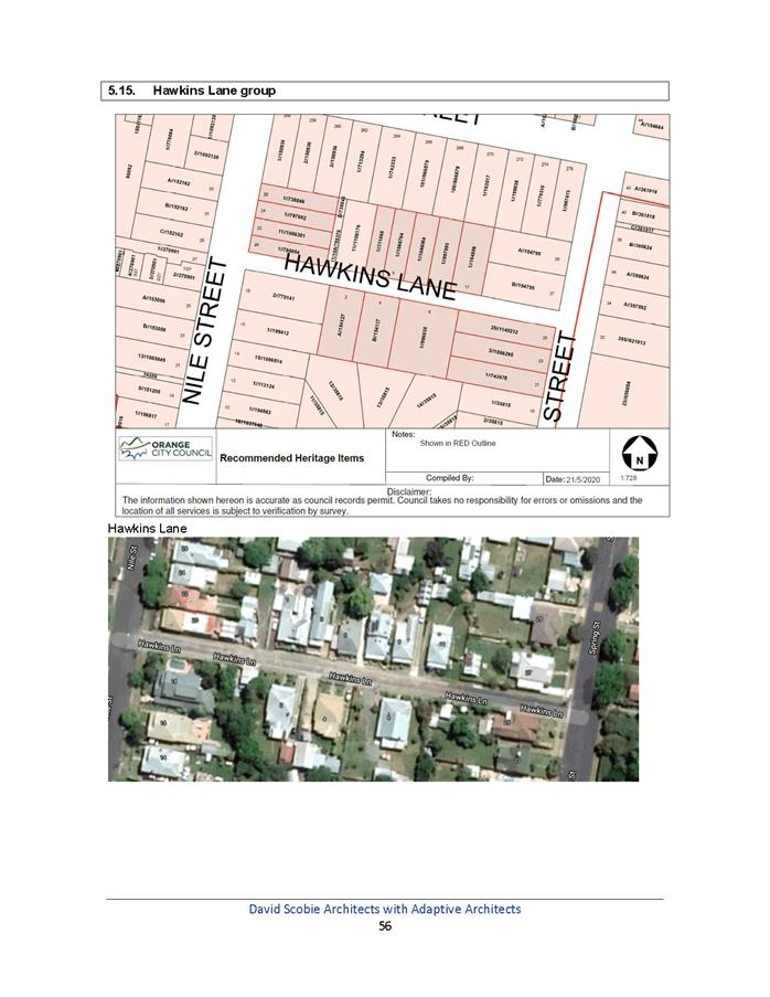
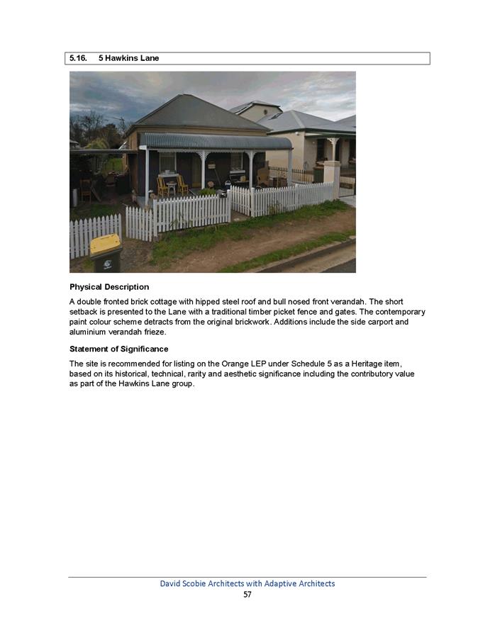
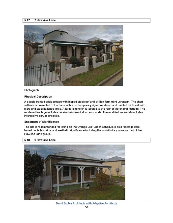
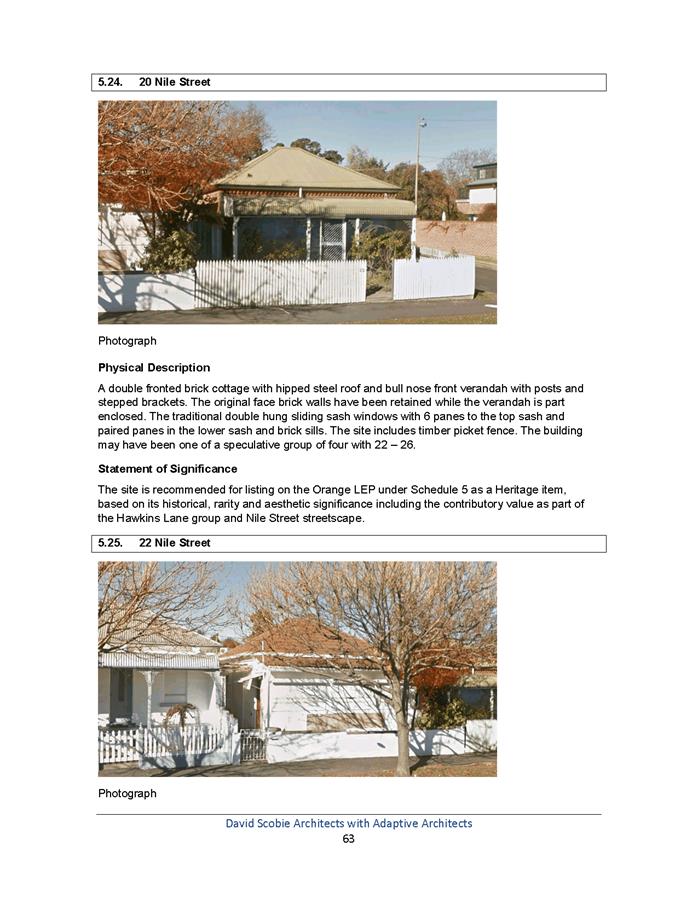
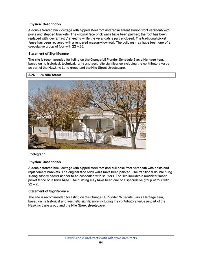
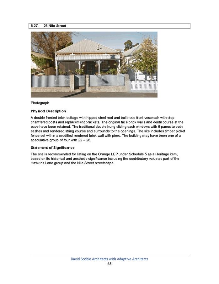

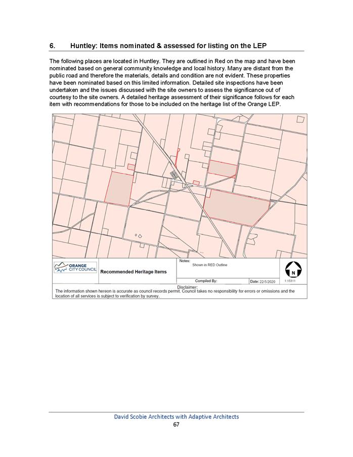
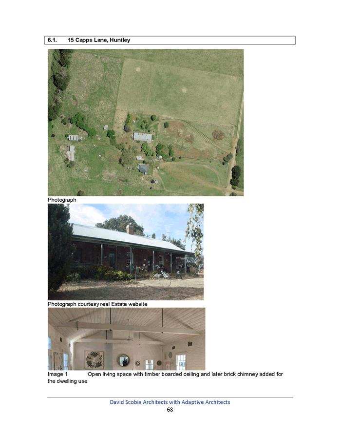
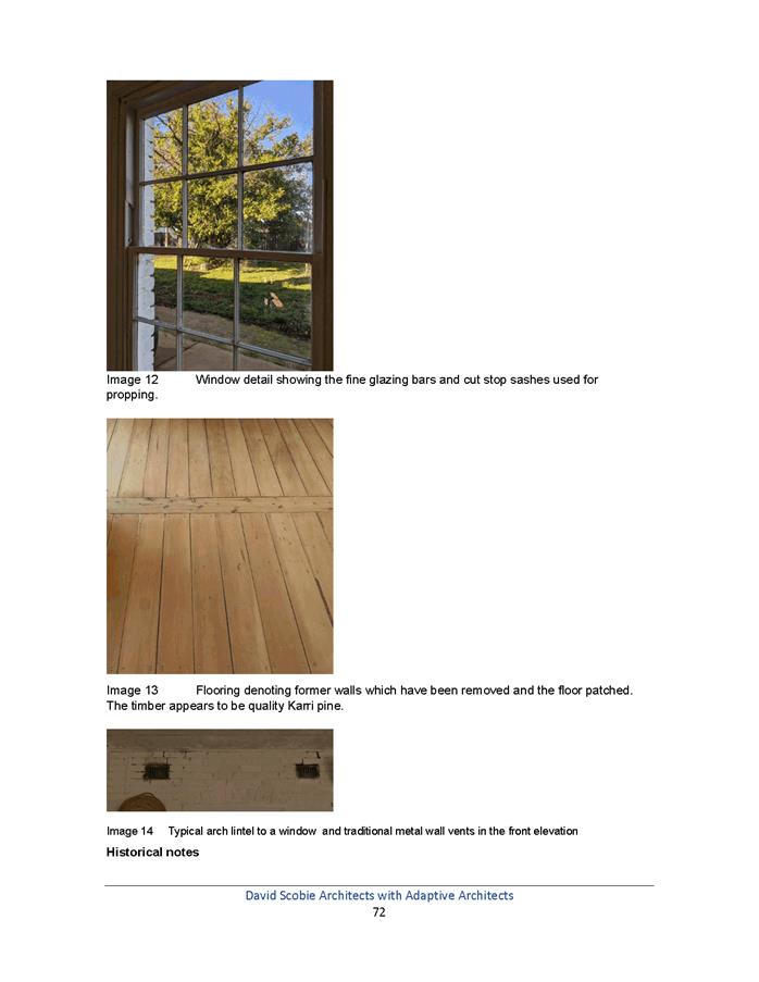
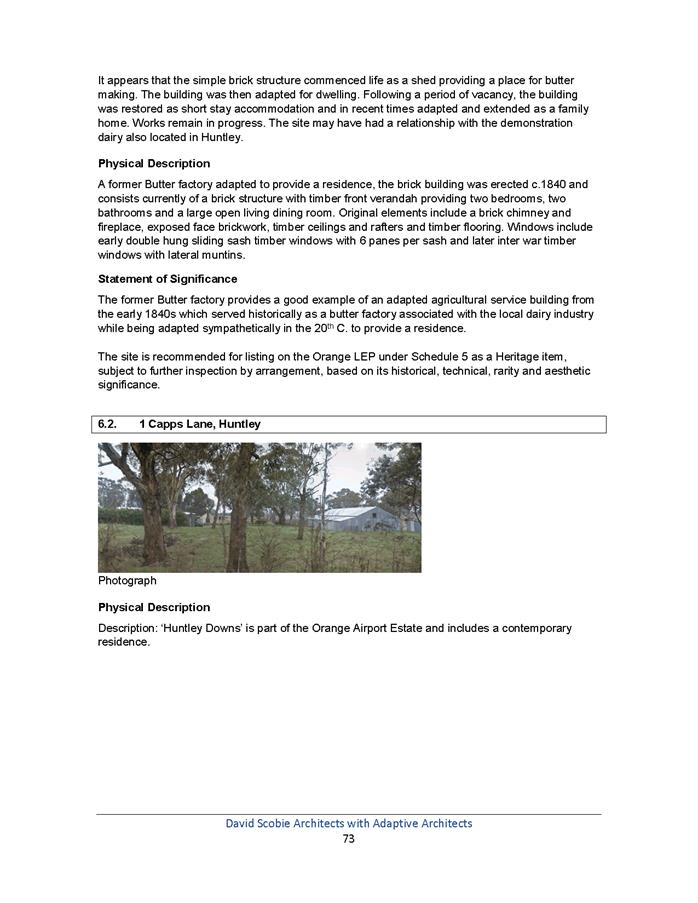
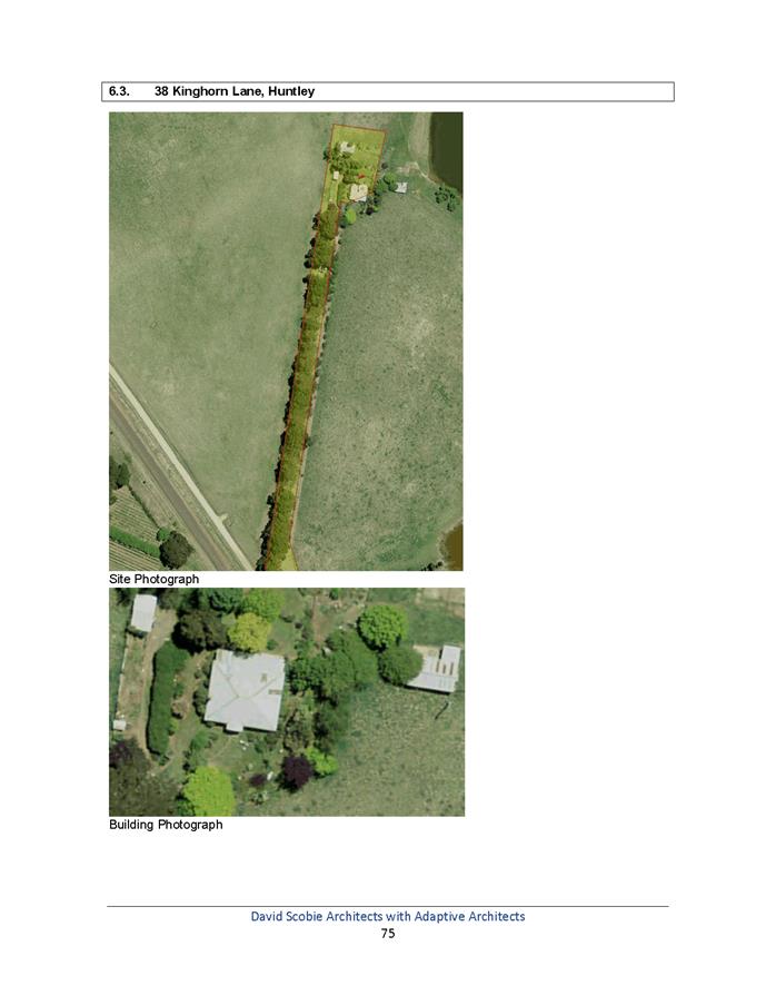
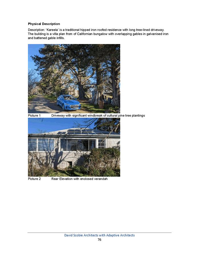
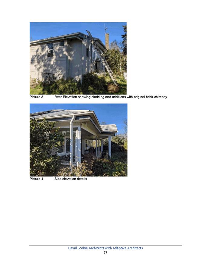
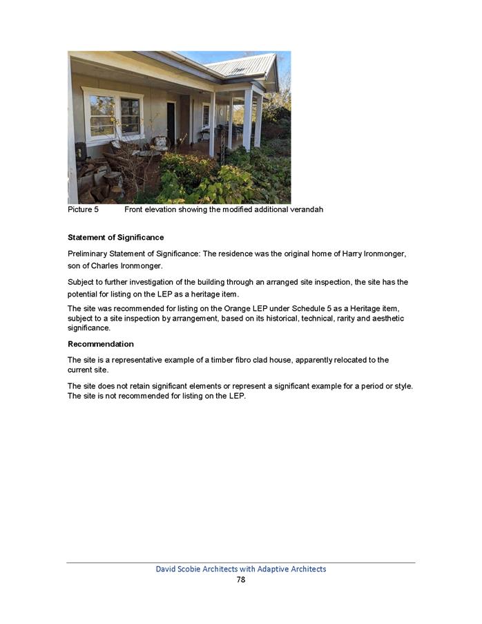
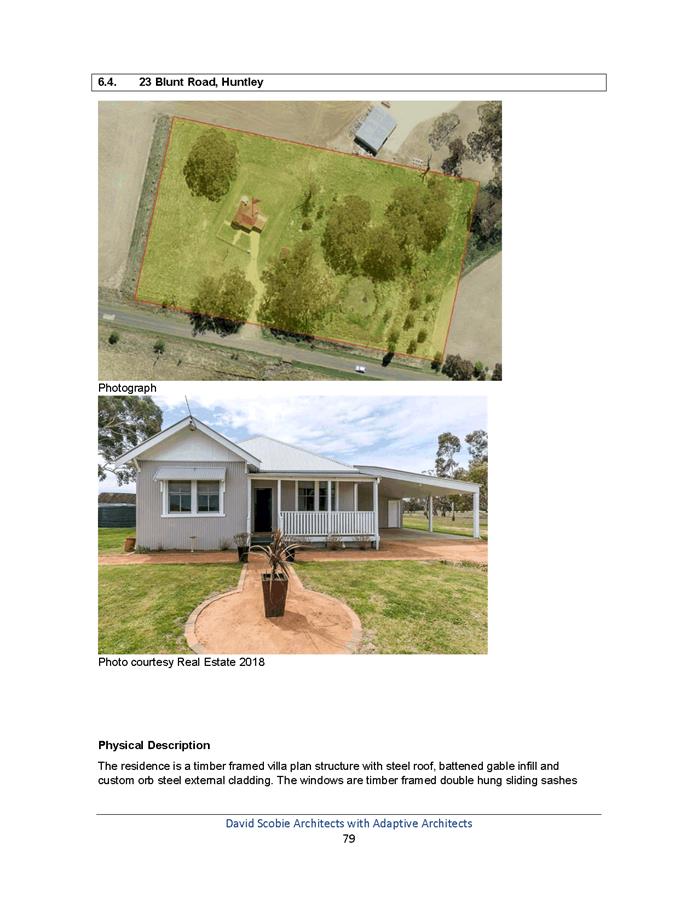
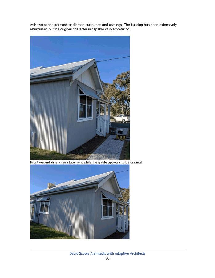
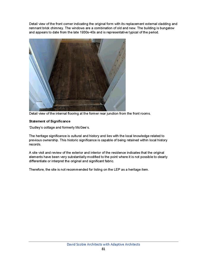
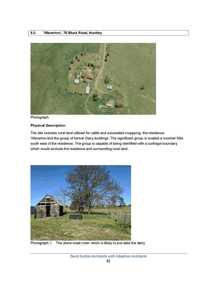
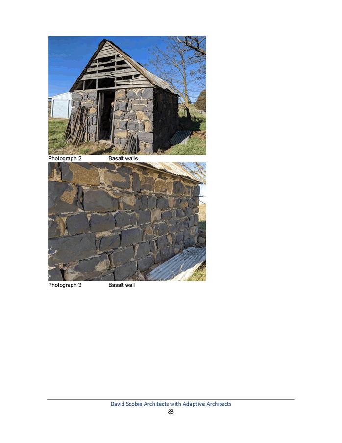
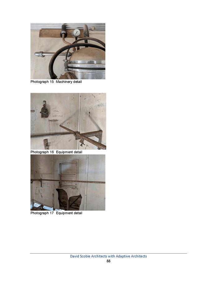
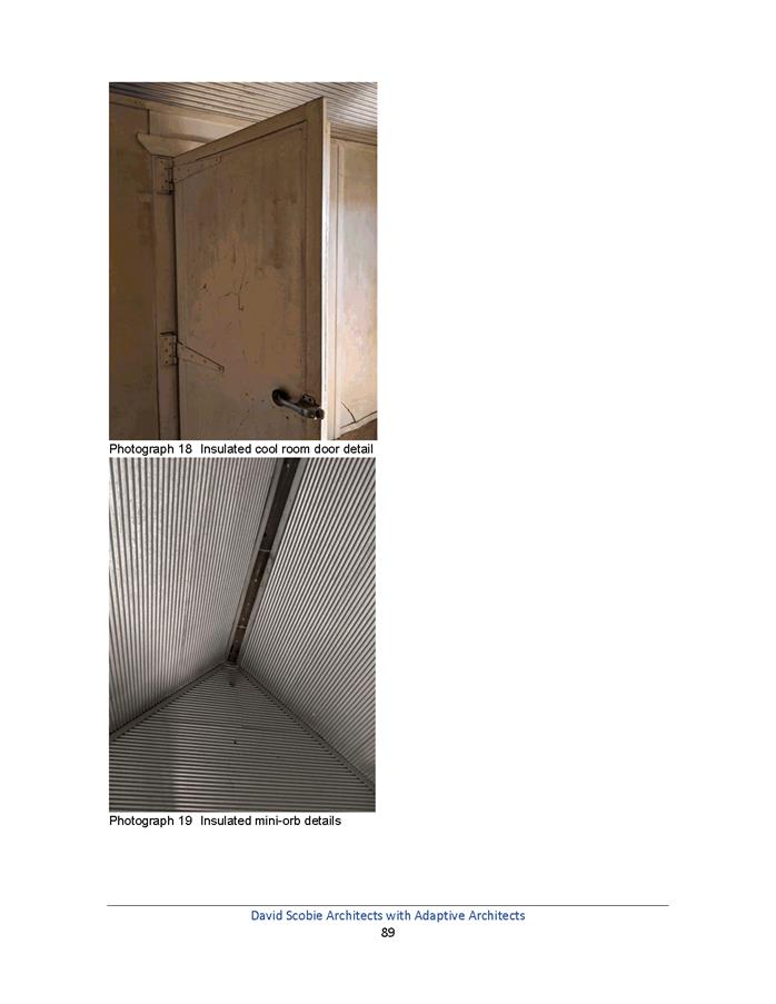
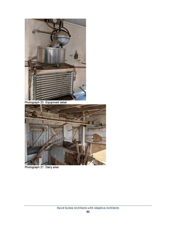
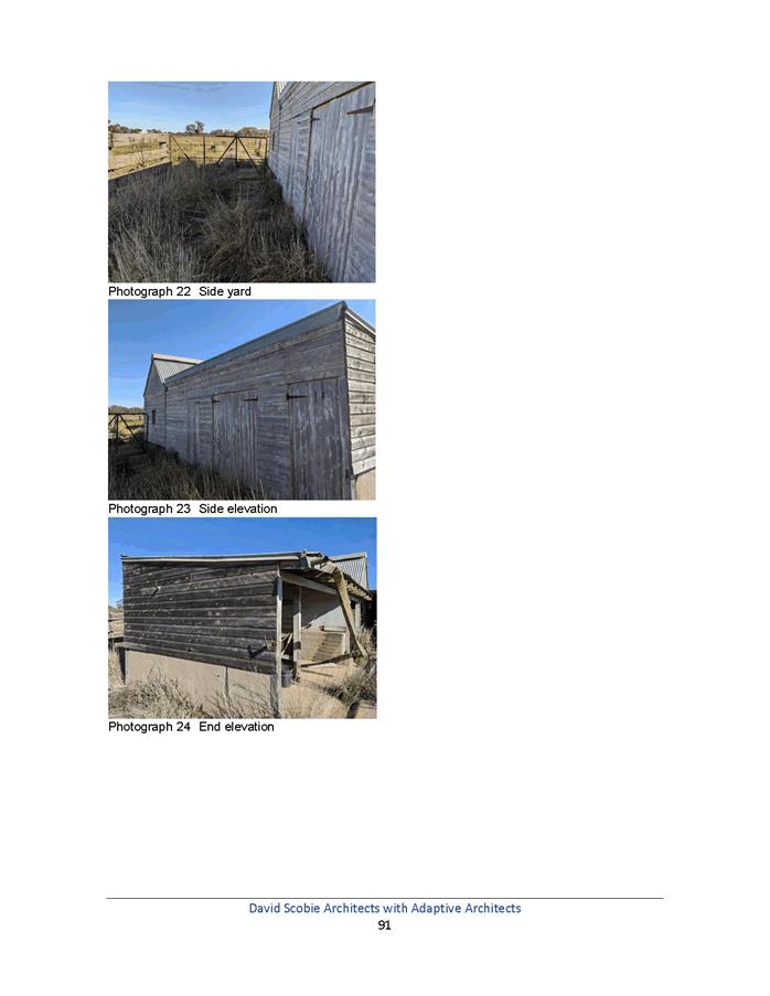
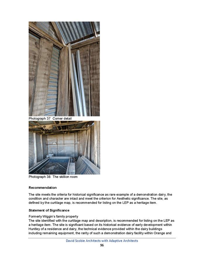
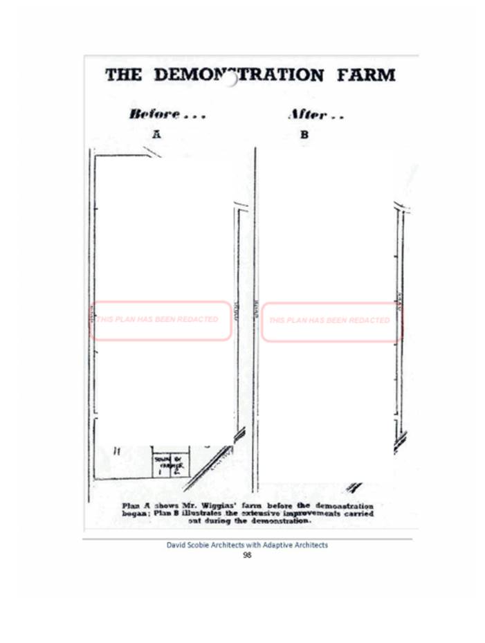
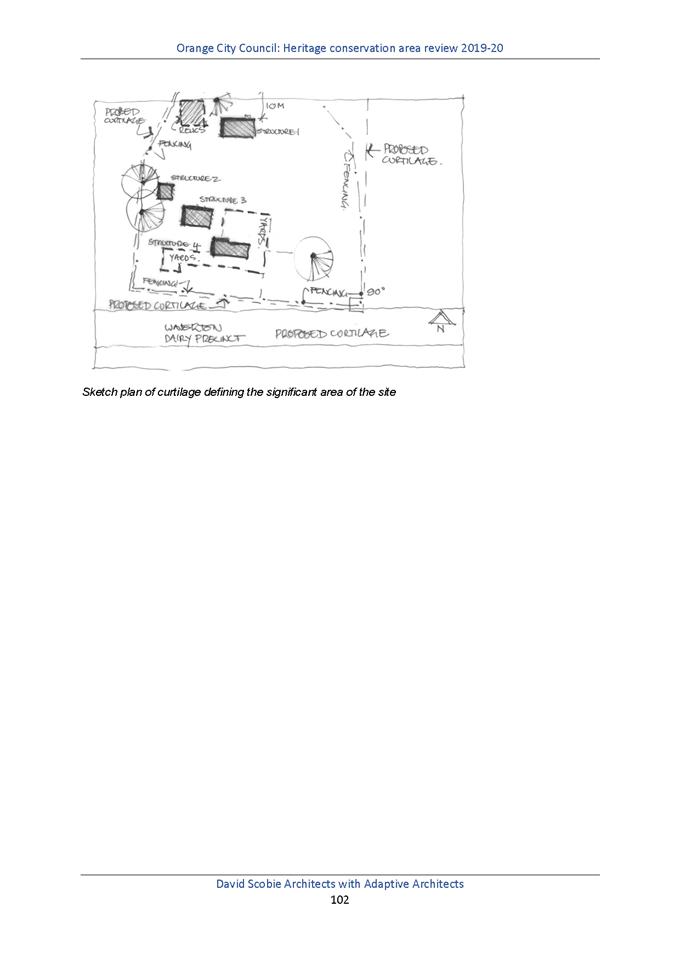
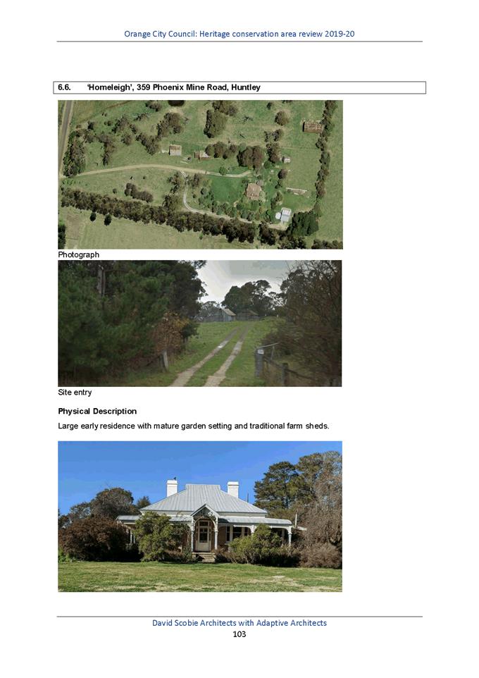

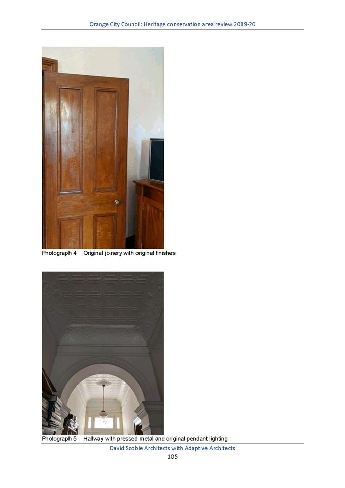
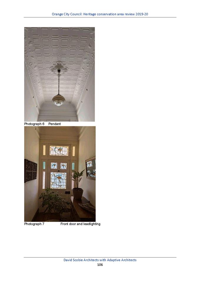
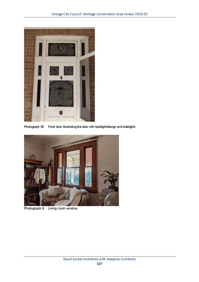
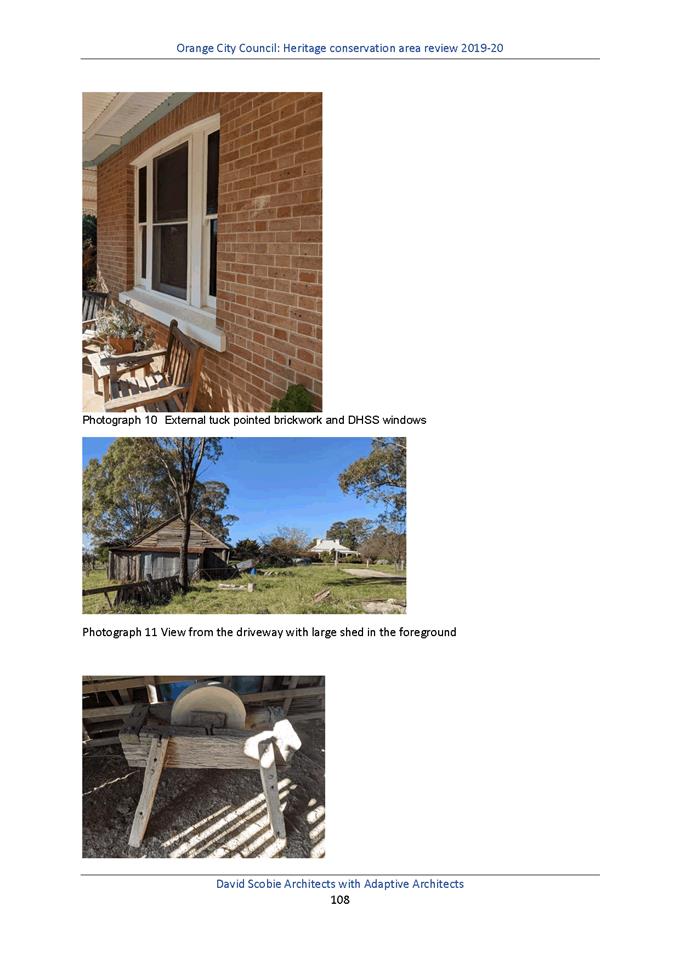
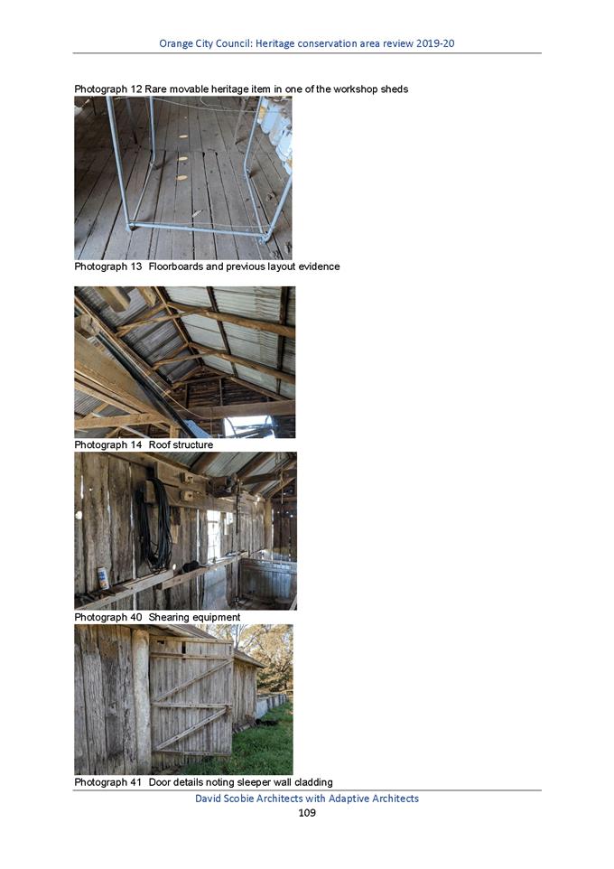
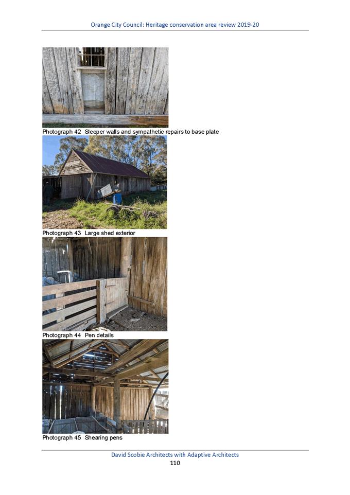
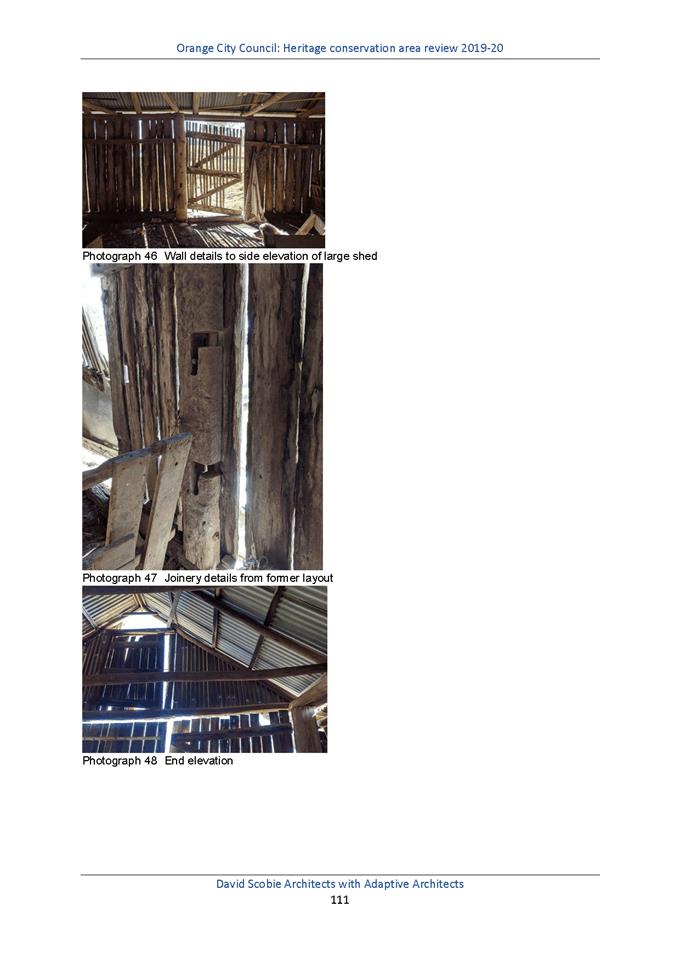
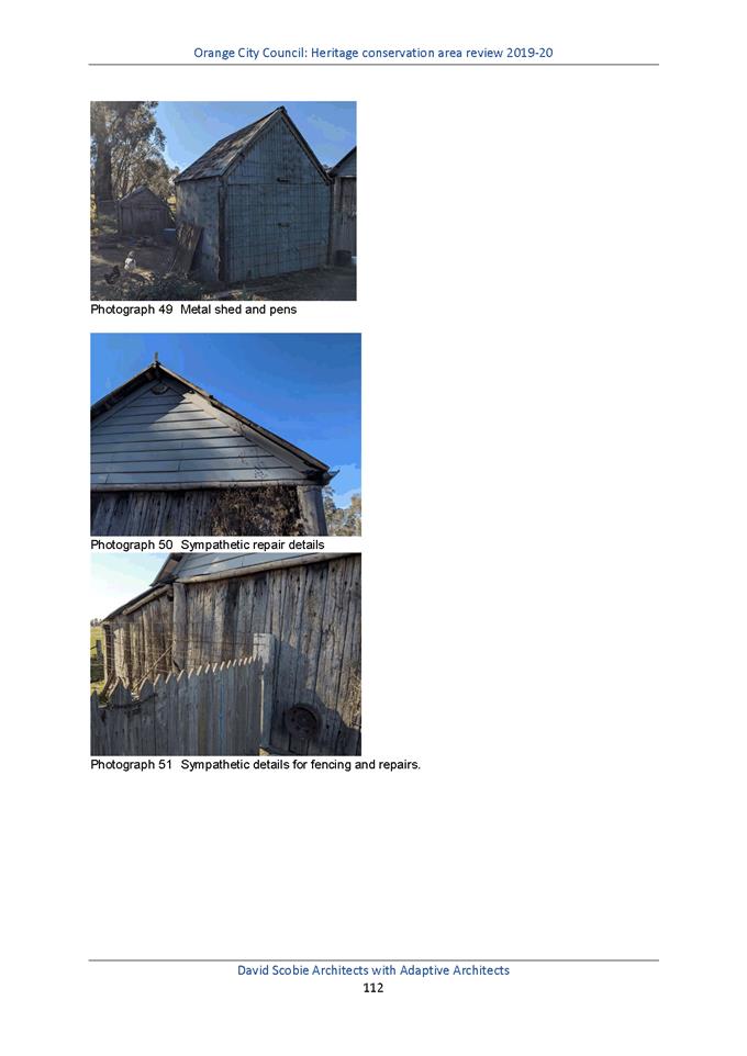
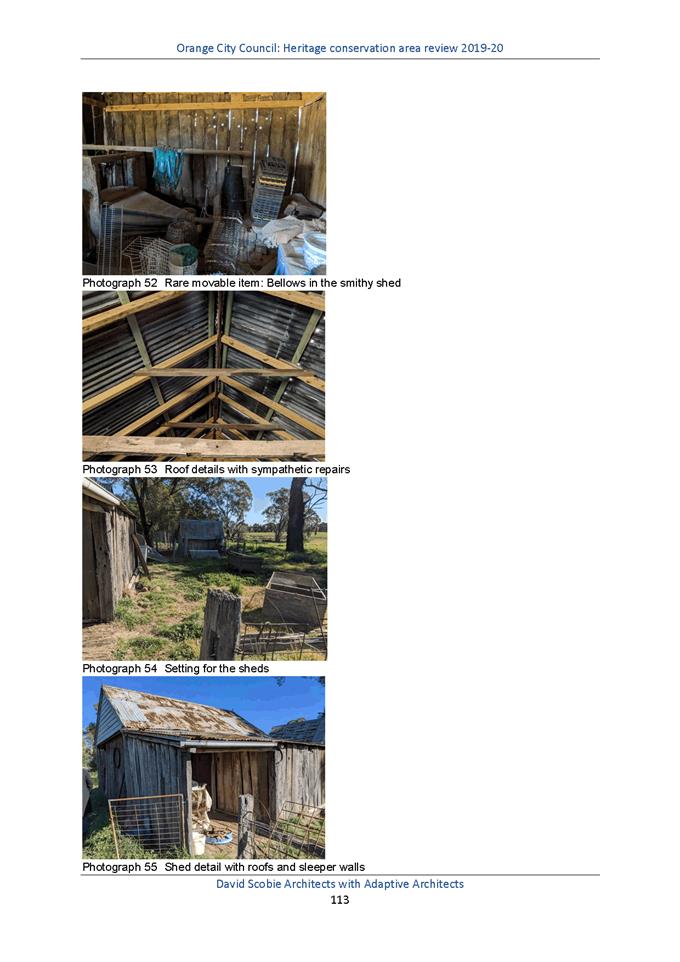
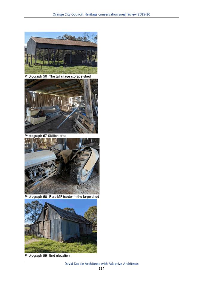
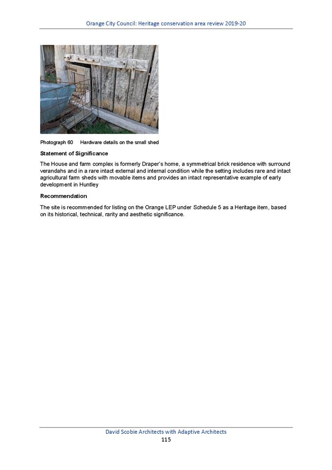
Planning and Development Committee
6 April 2021
Attachment 3 Heritage
Study Review - HCA maps
Planning
and Development Committee
6 April 2021
Attachment 4 Planning
Proposal Amendment 28 - Heritage Amendment
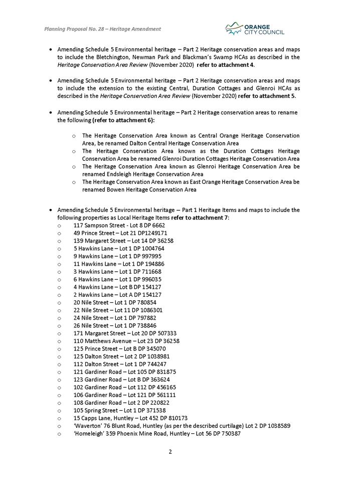
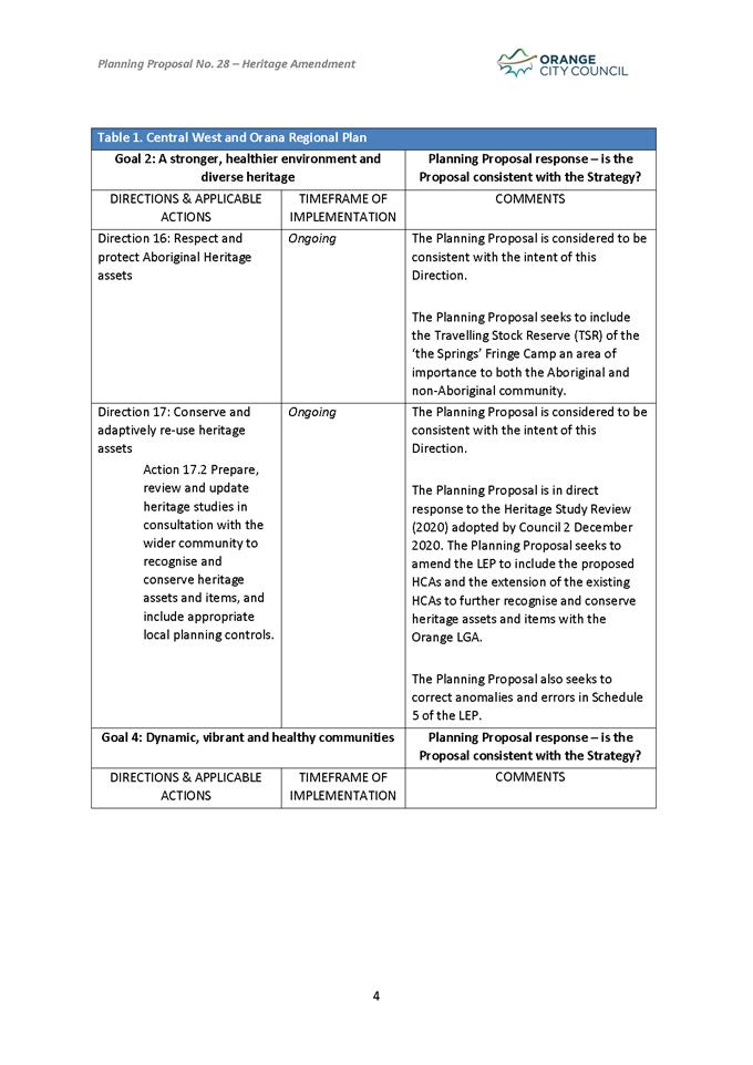
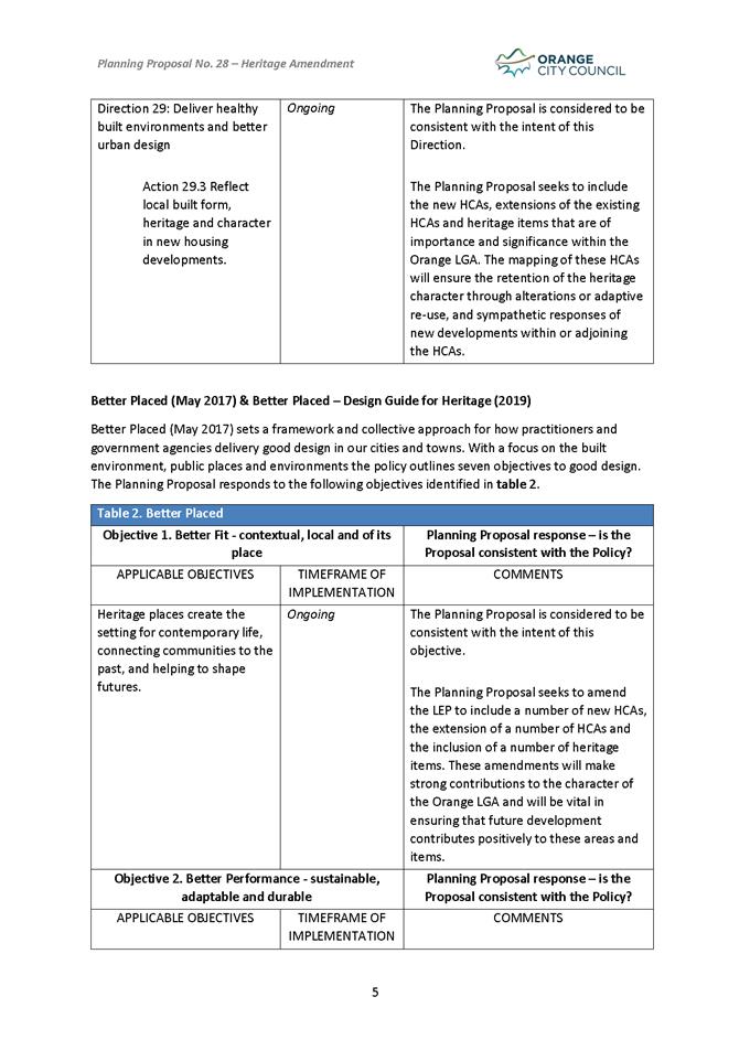
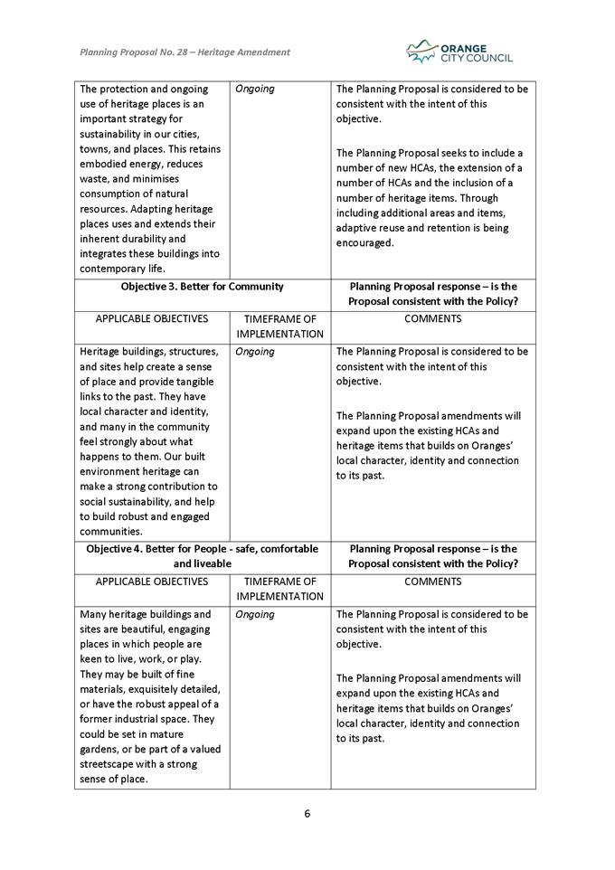
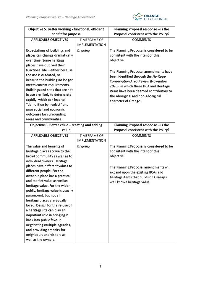
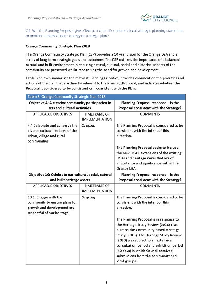
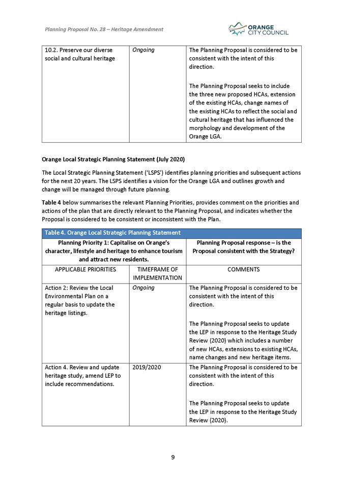
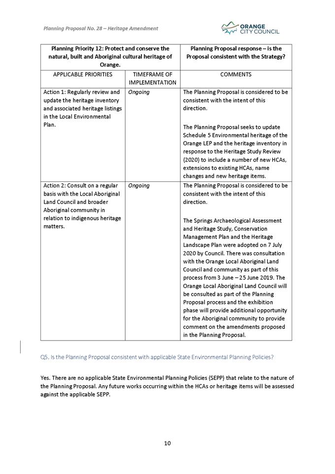
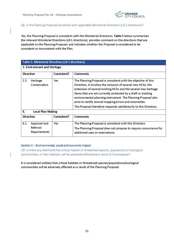
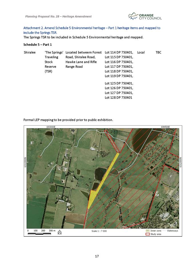
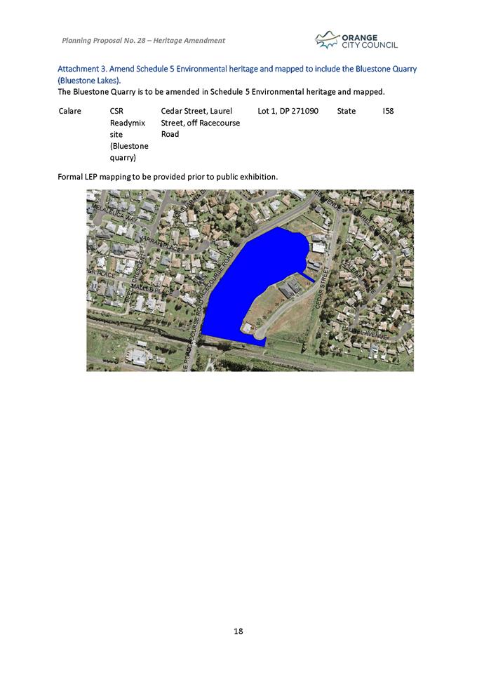
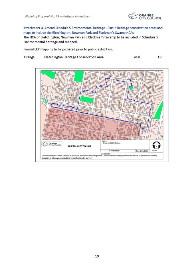
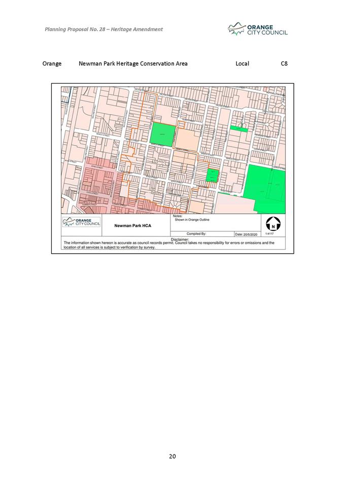
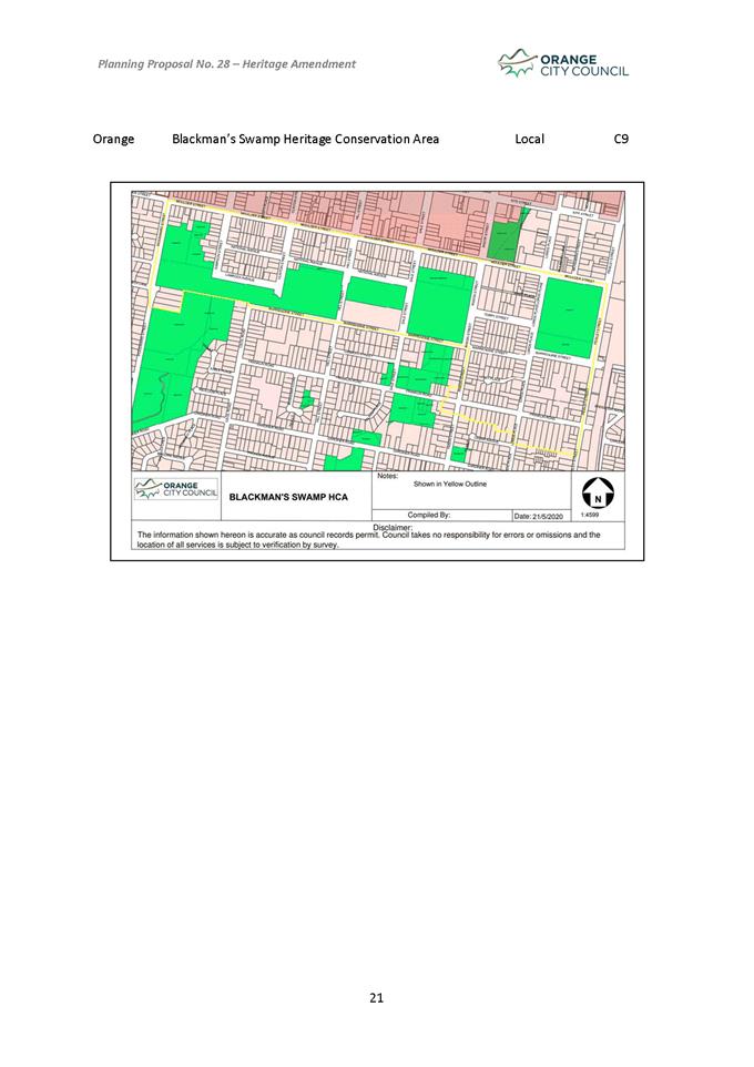
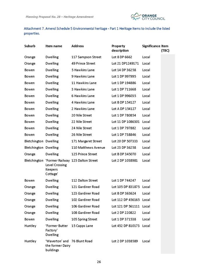
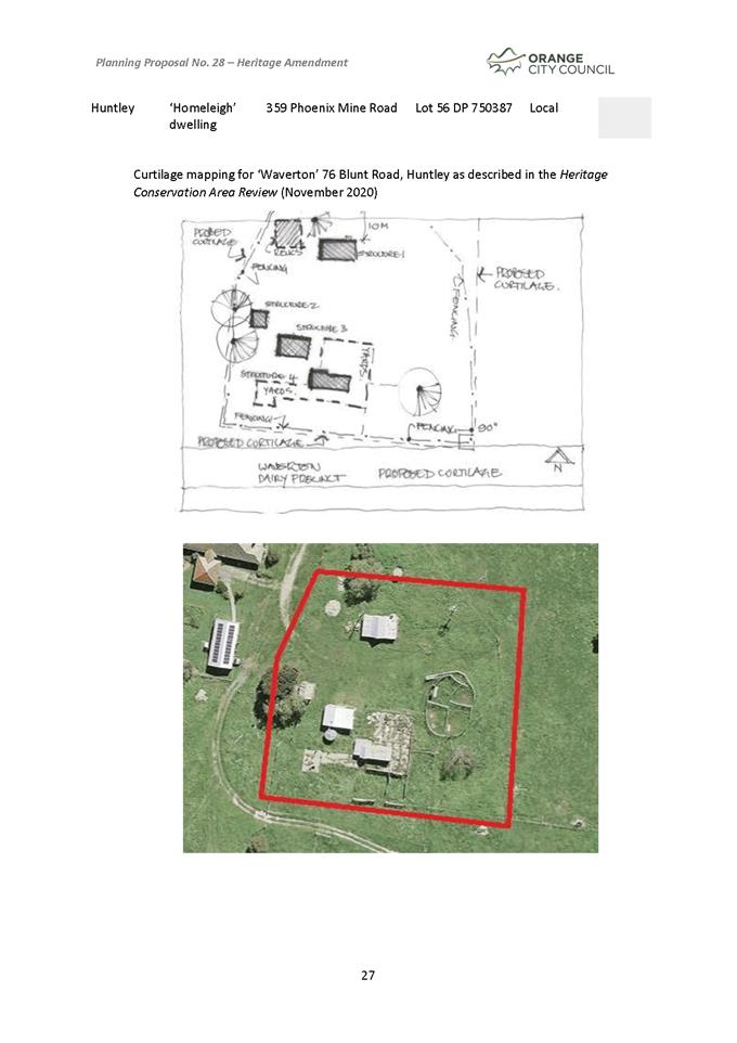
Planning and Development Committee
6 April 2021
Attachment 5 Draft
Inventory Sheets
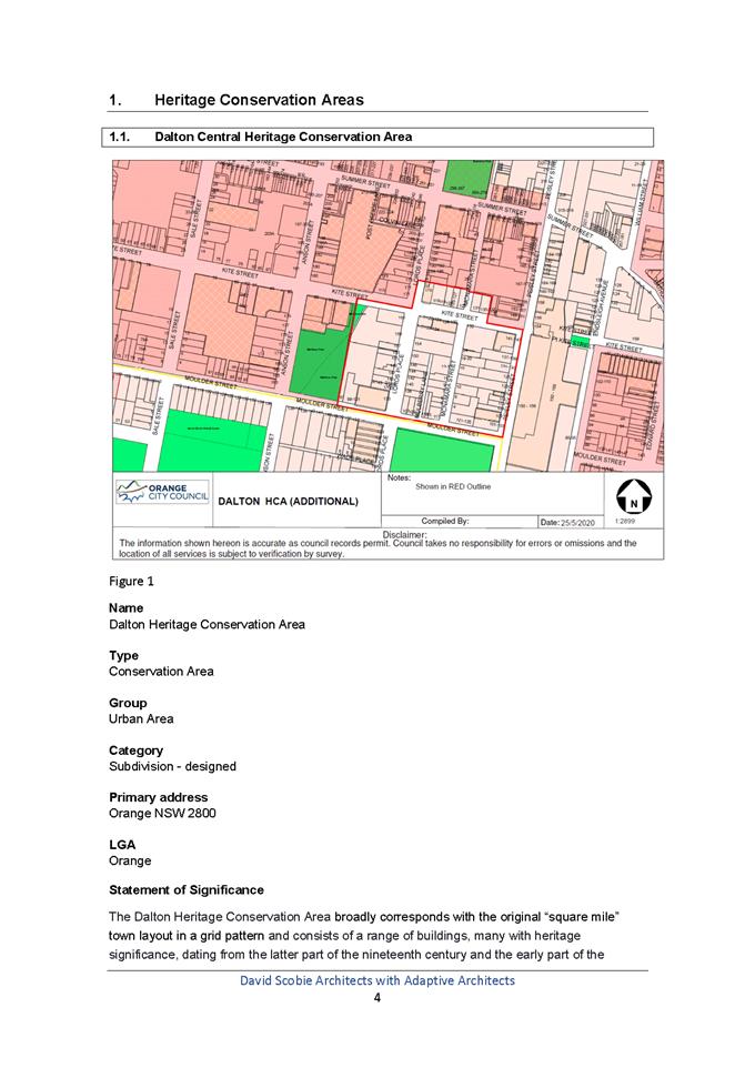
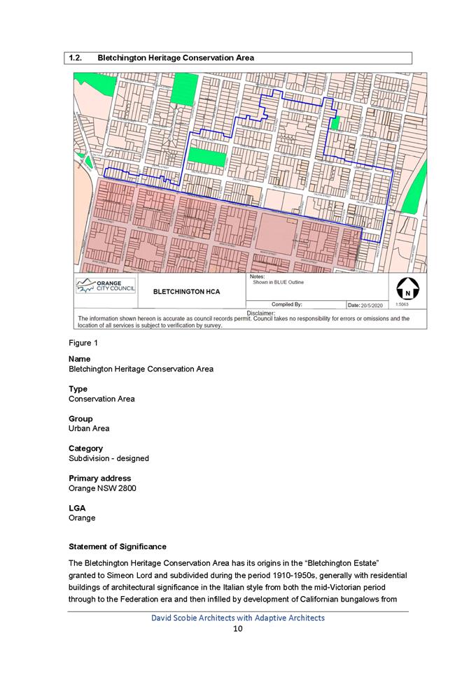
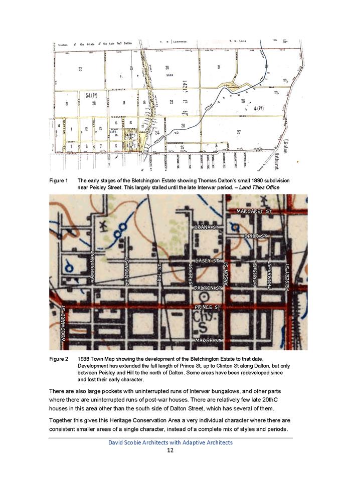
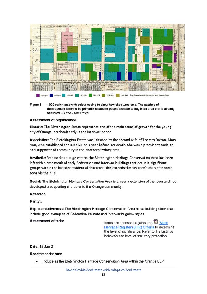
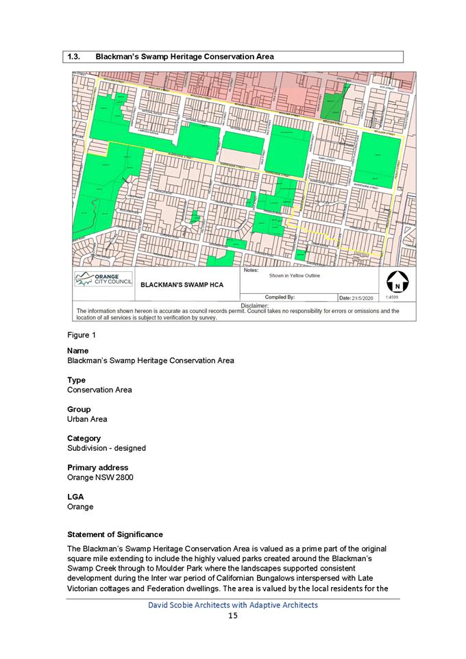
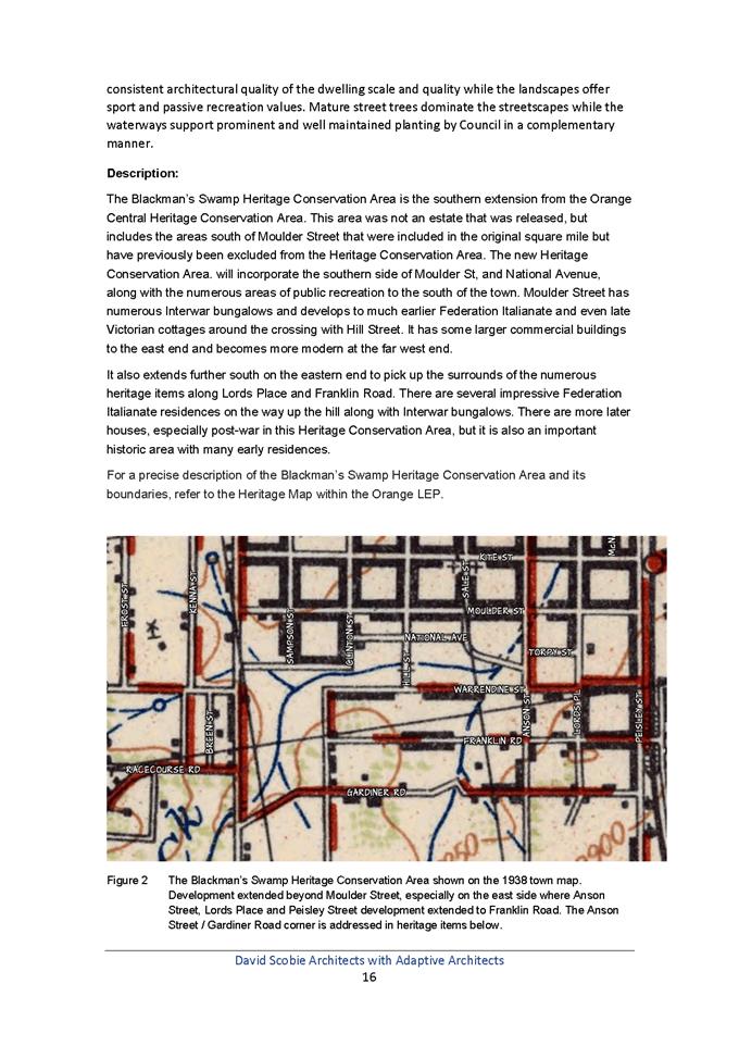
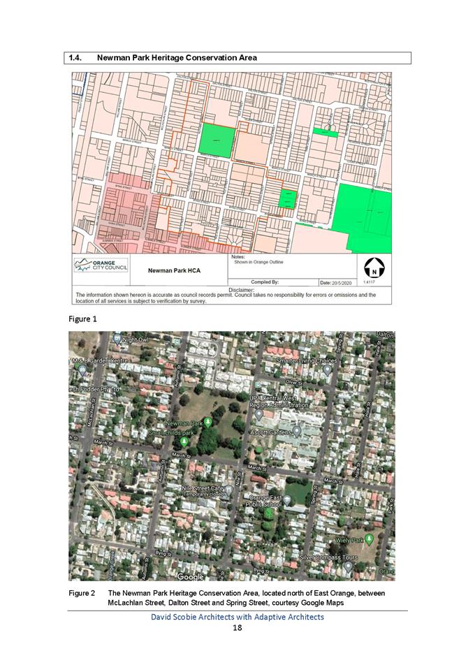
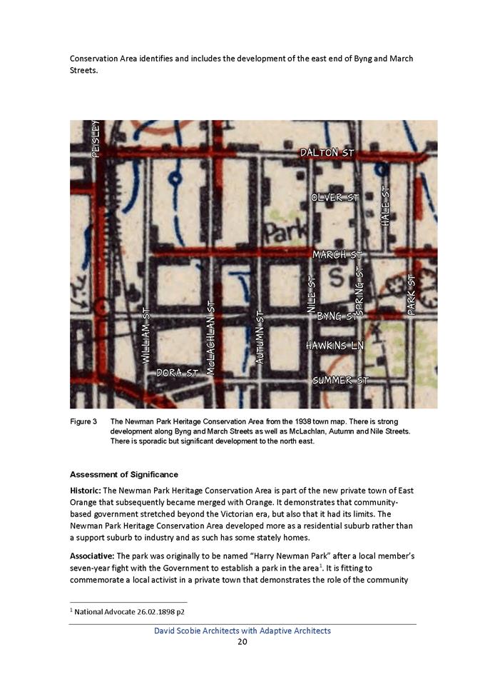
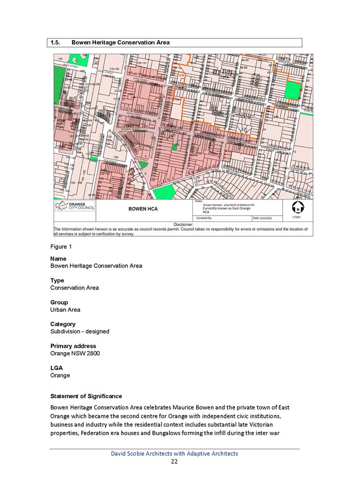
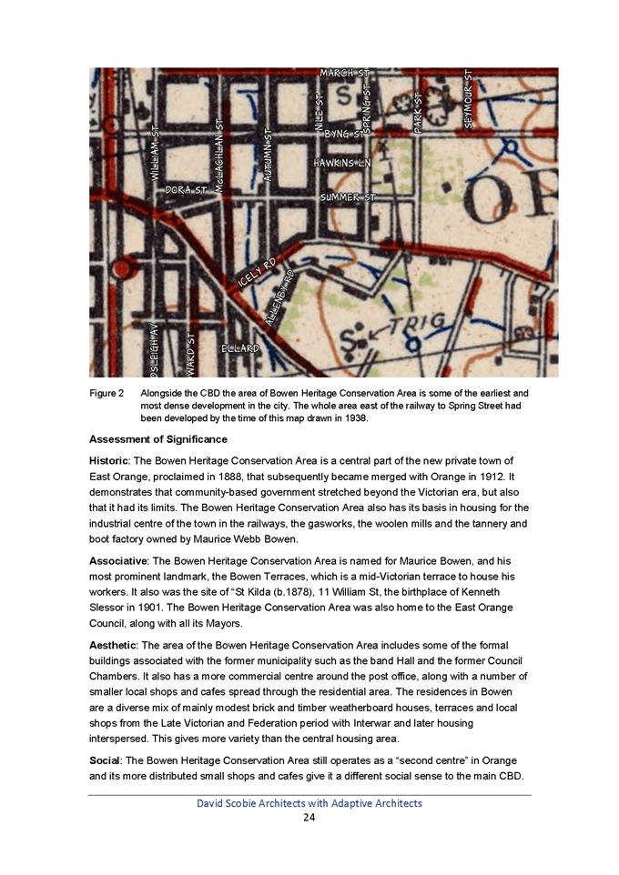
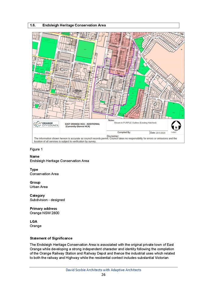
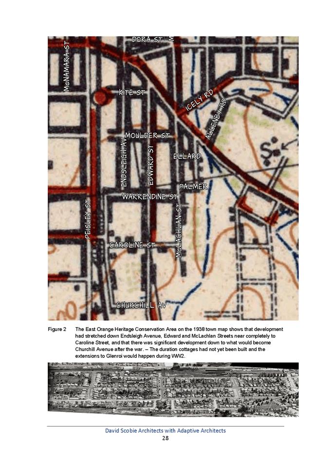
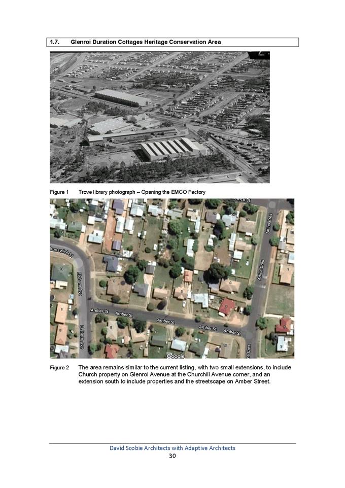
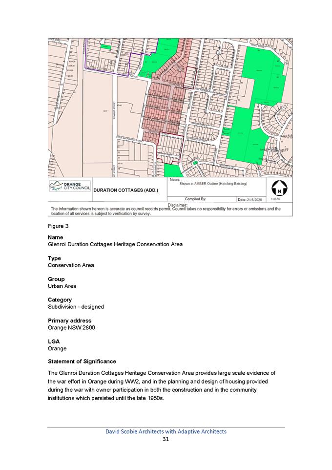

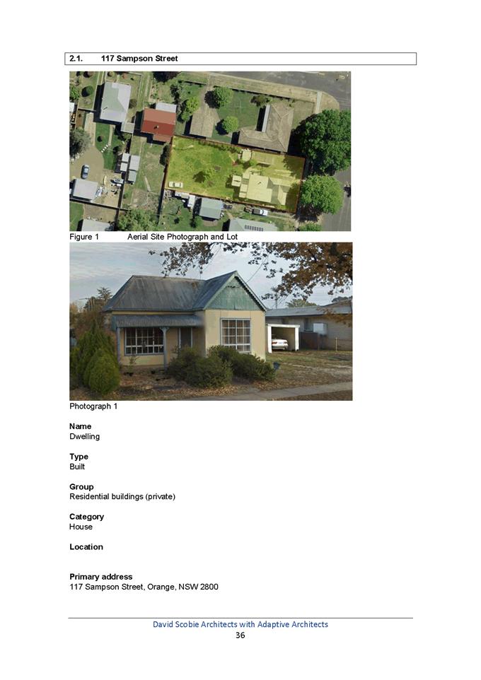
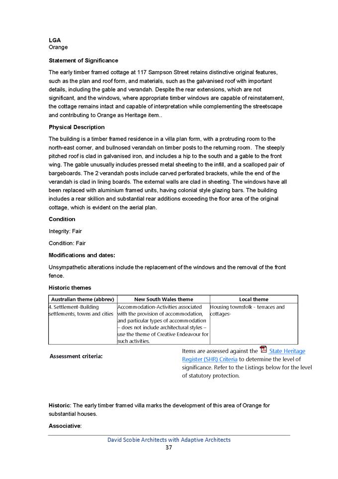
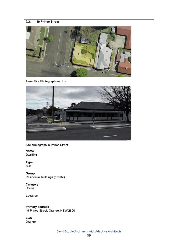
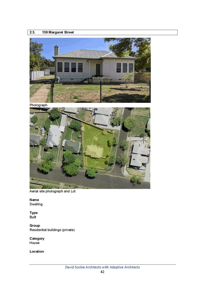
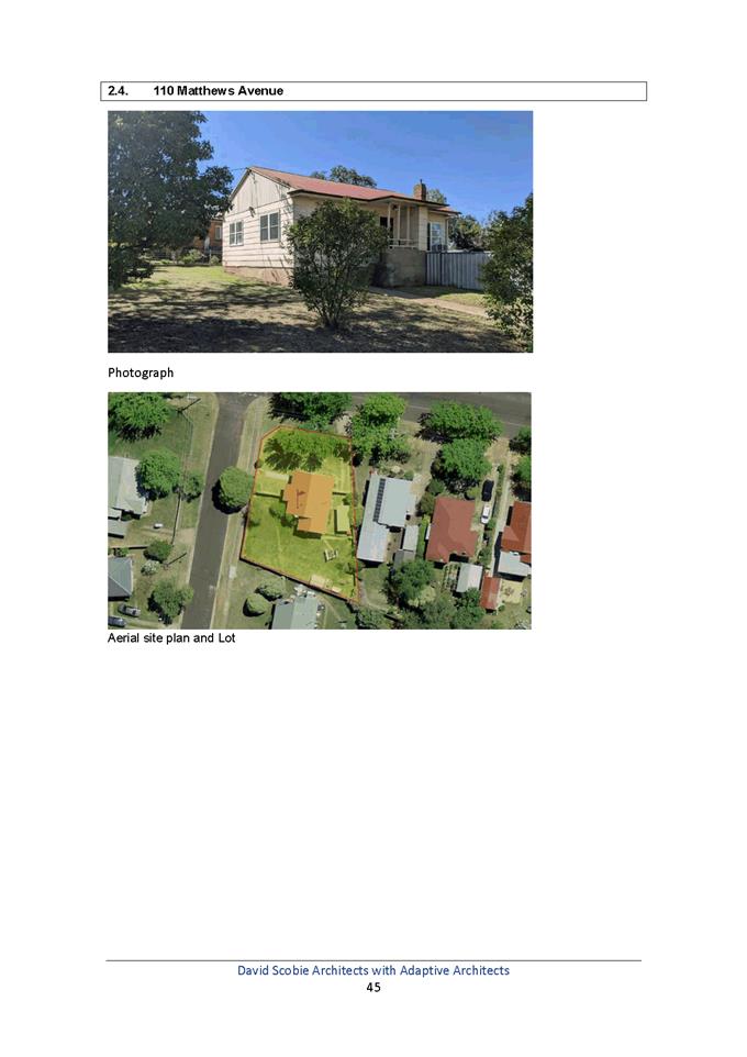
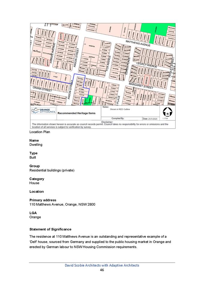
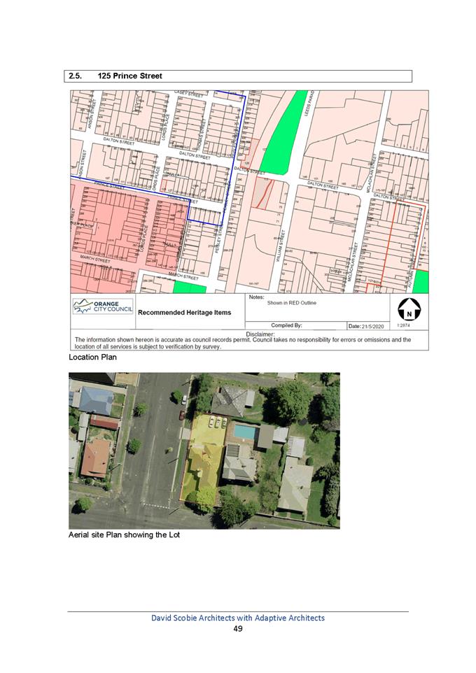
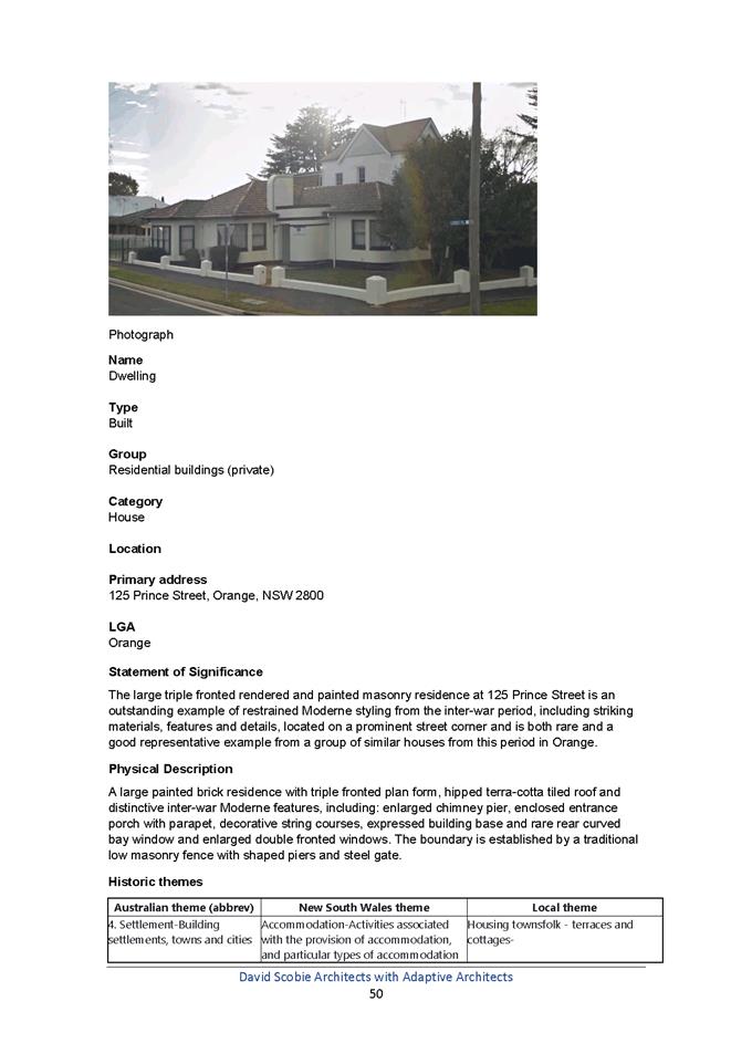
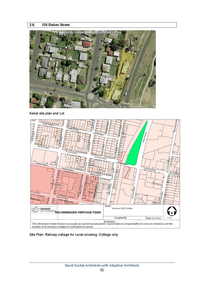
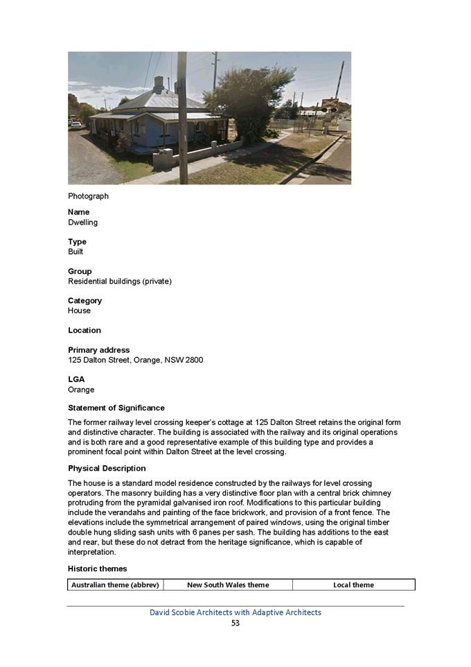
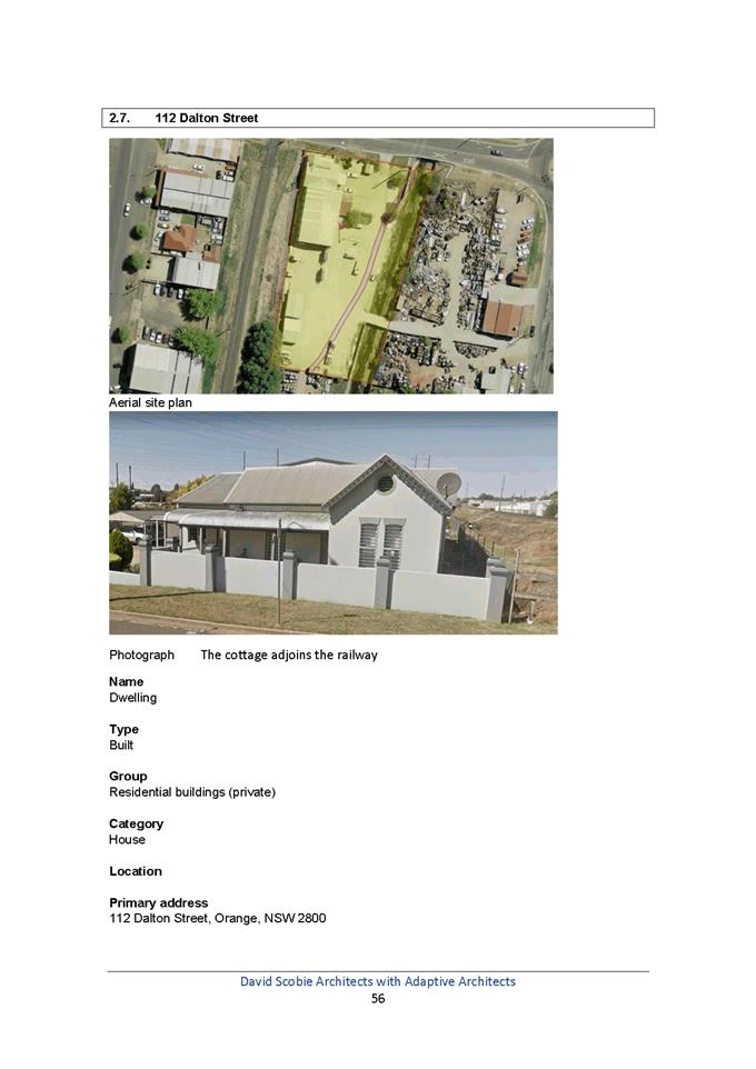
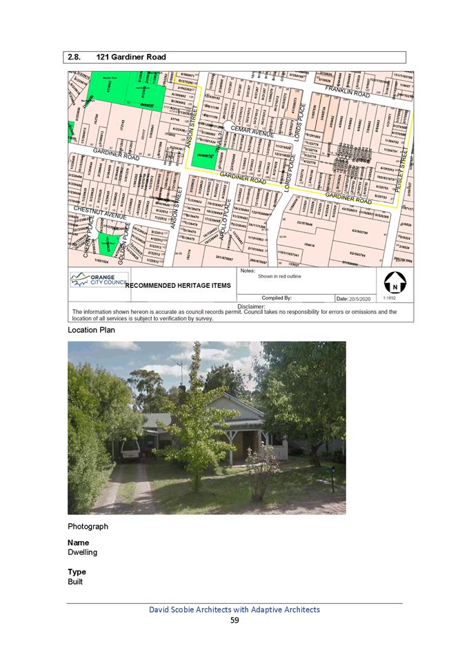
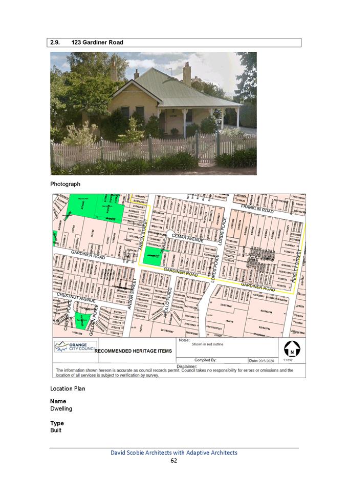
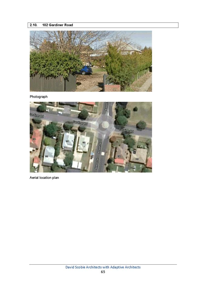

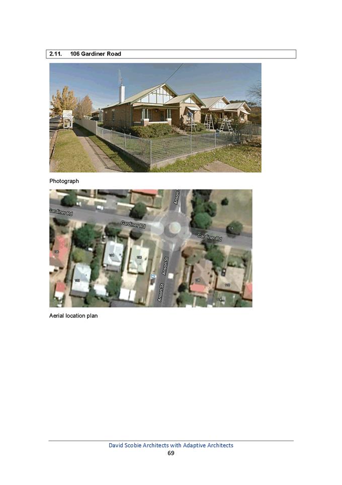
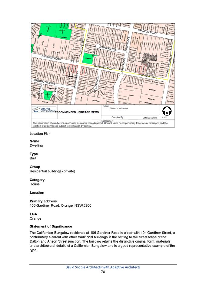
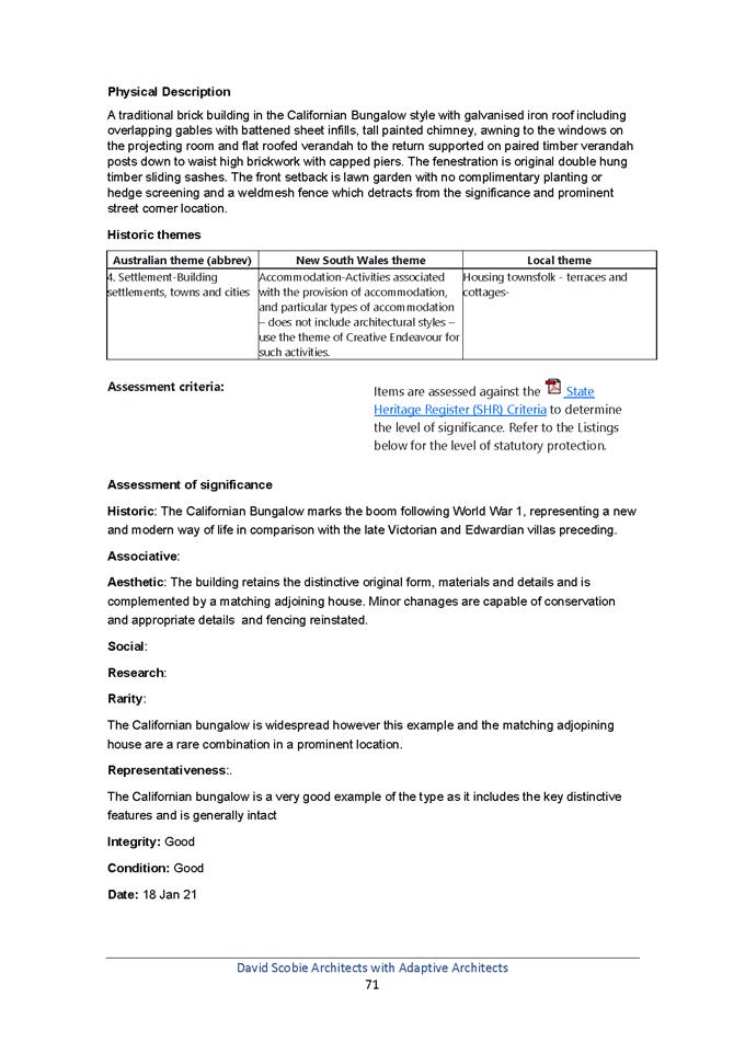
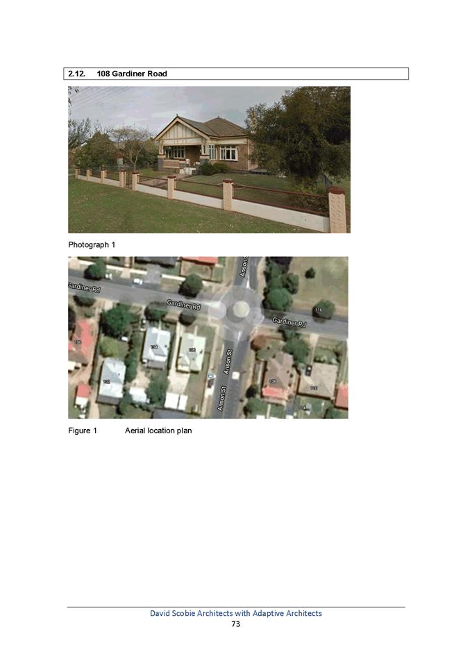
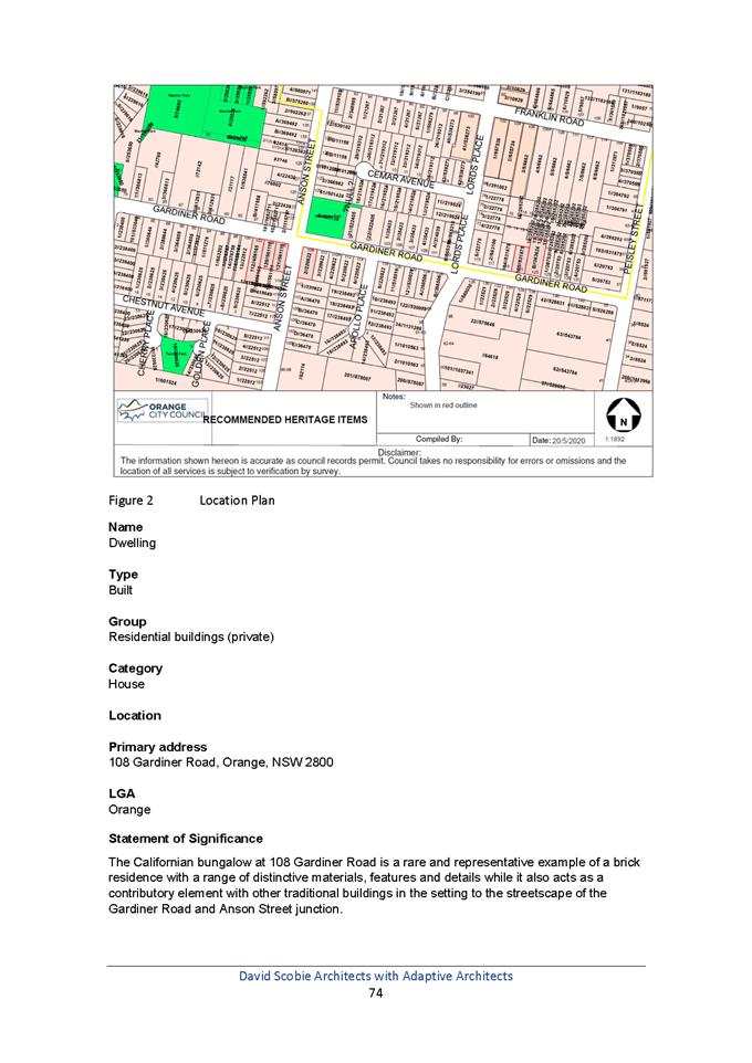
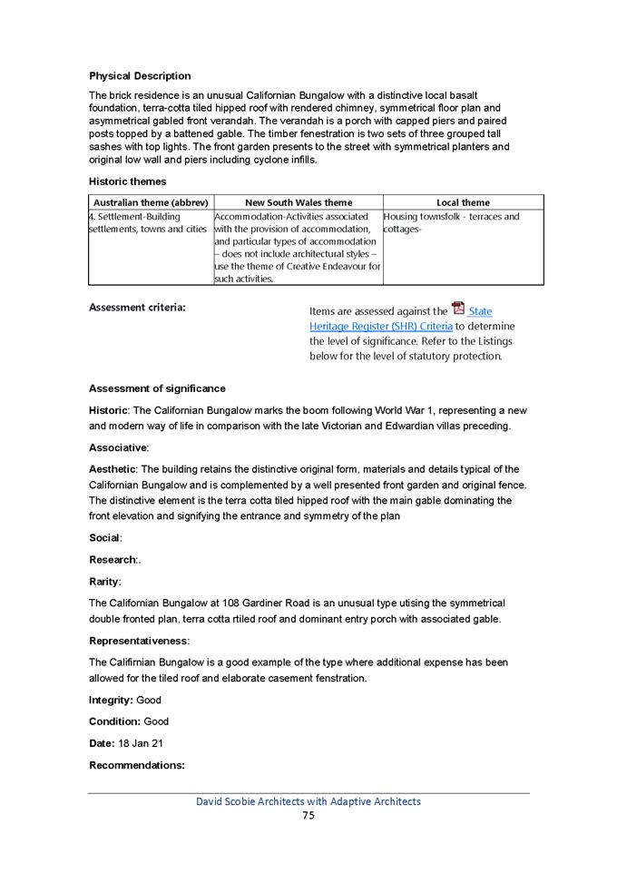
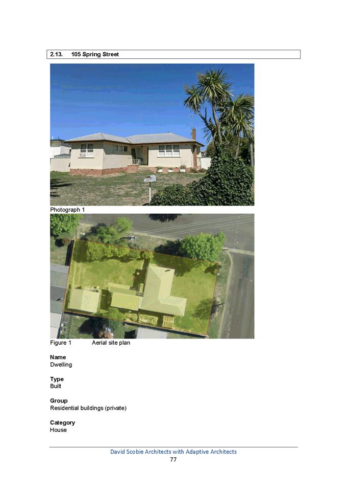
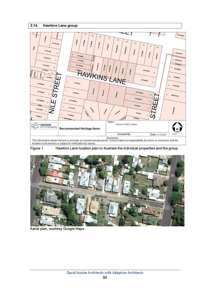
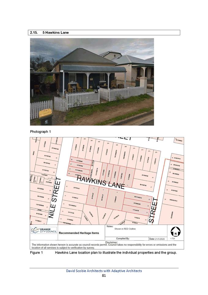
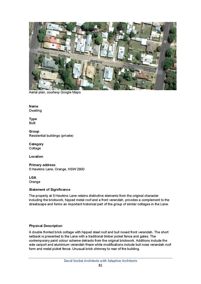
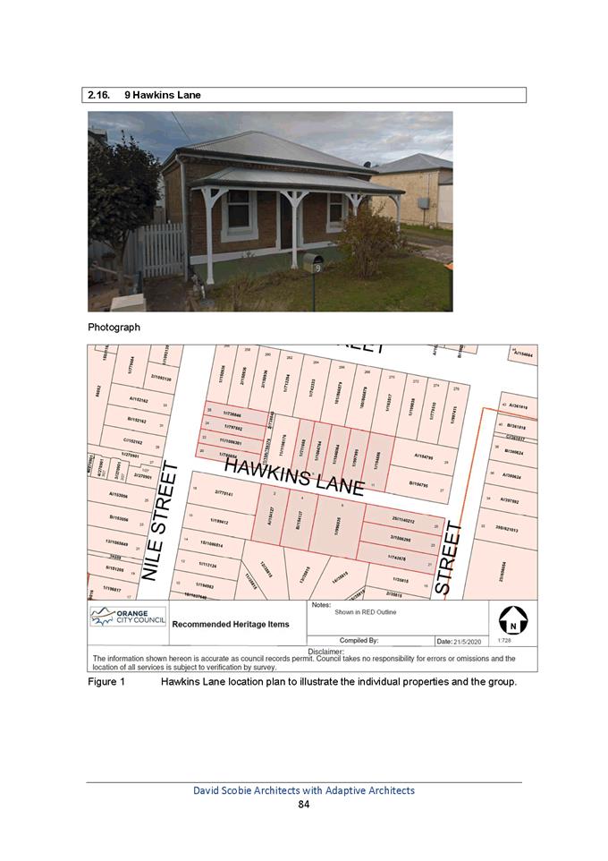
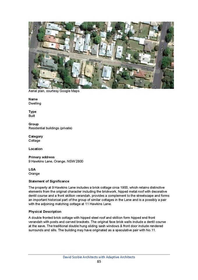

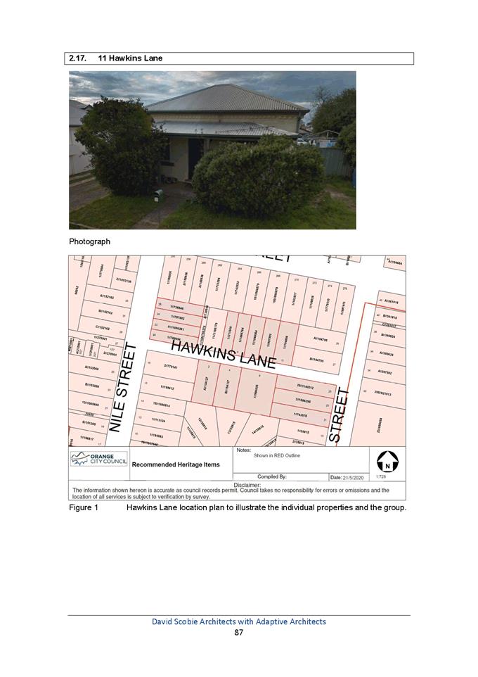
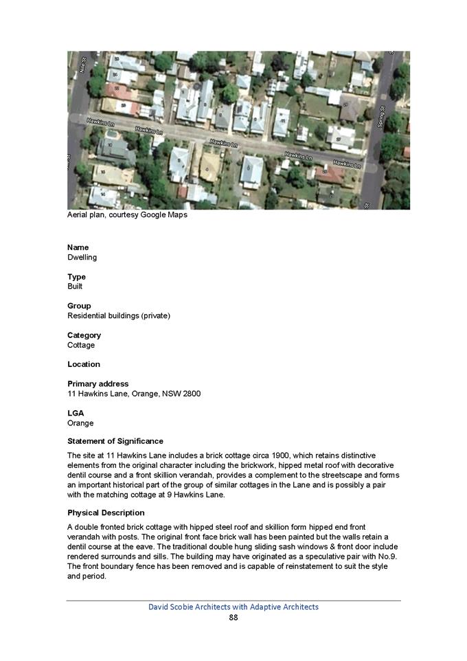
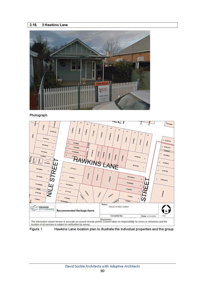
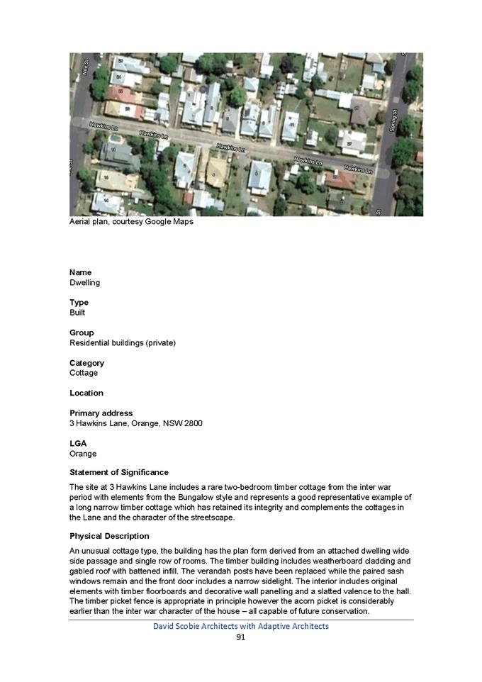
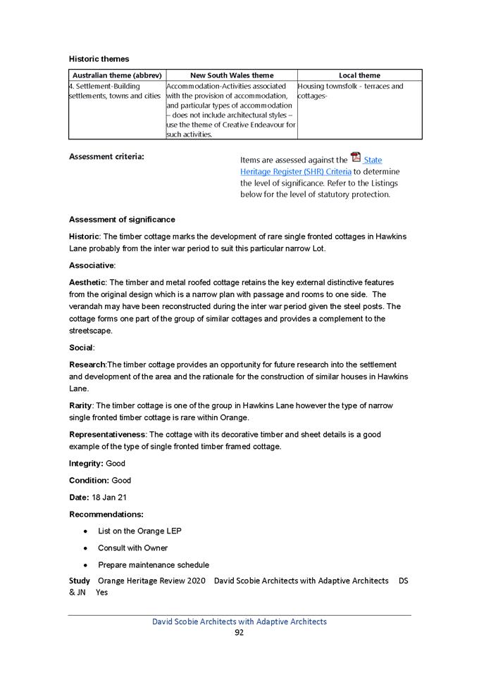
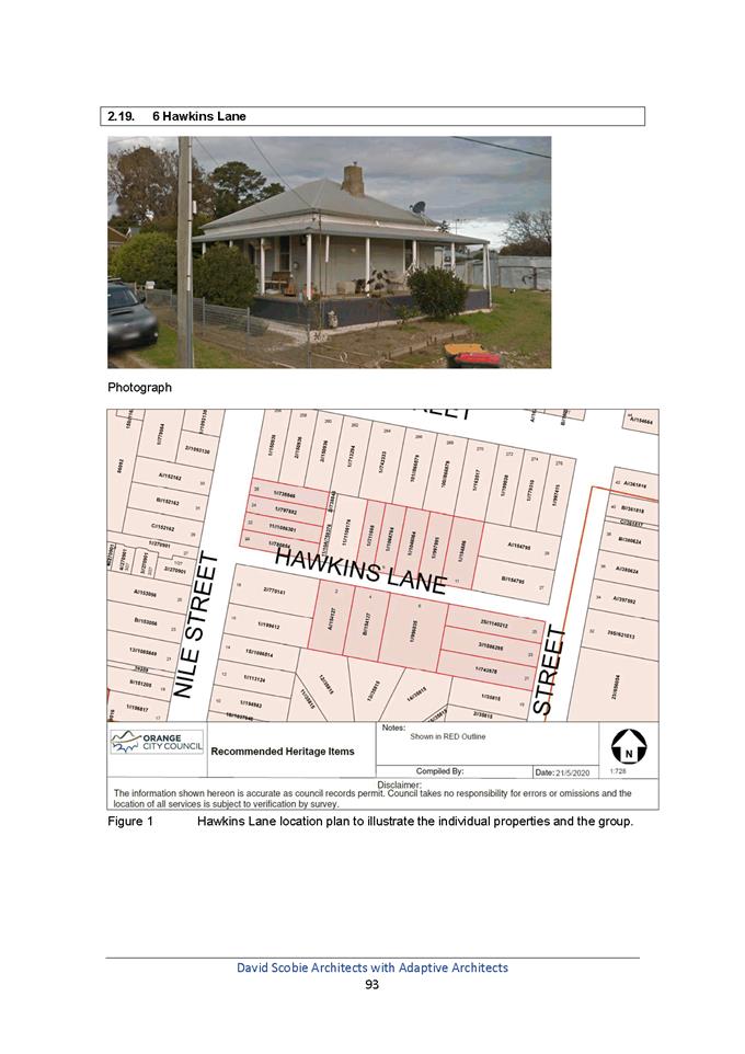
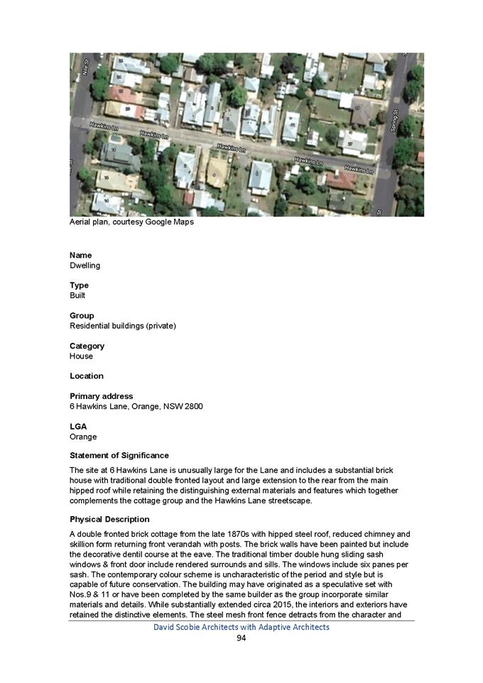
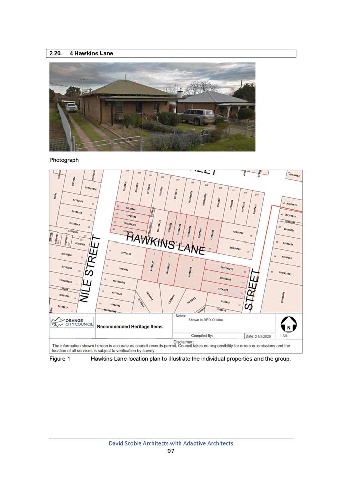

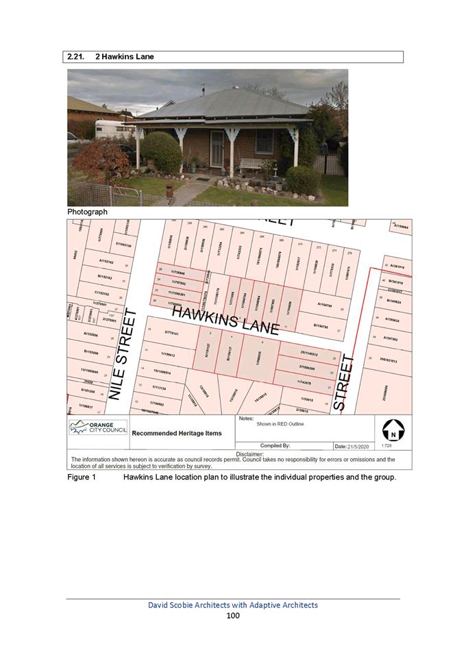

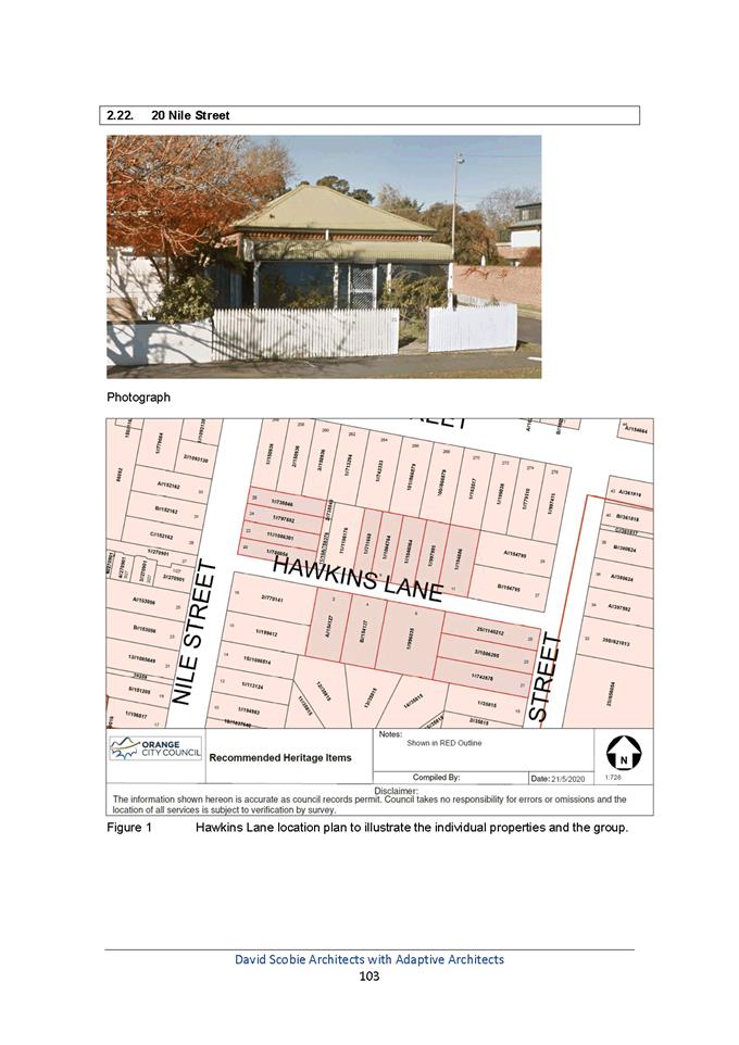


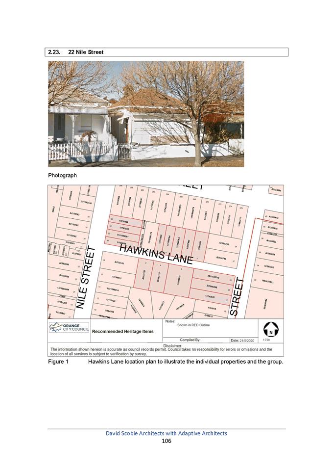
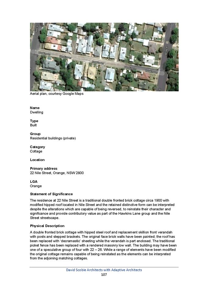
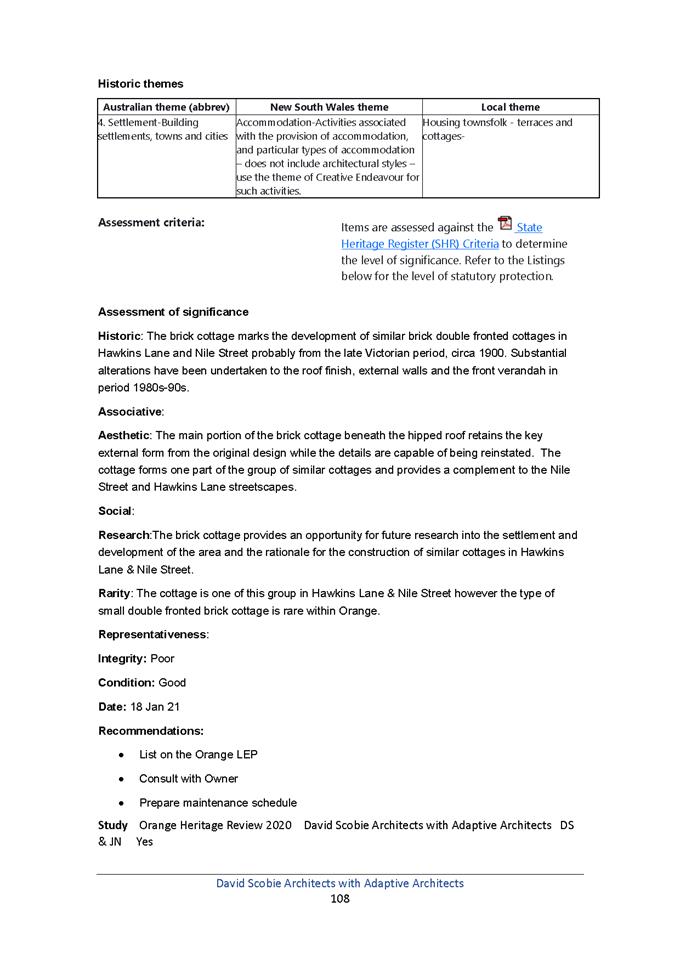
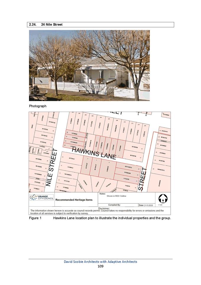


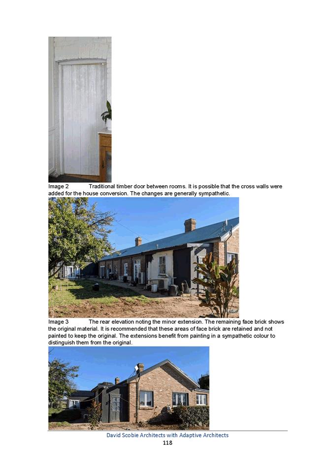
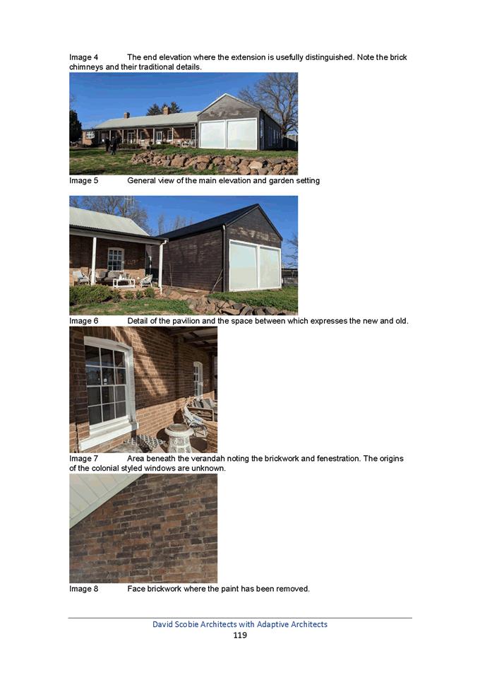
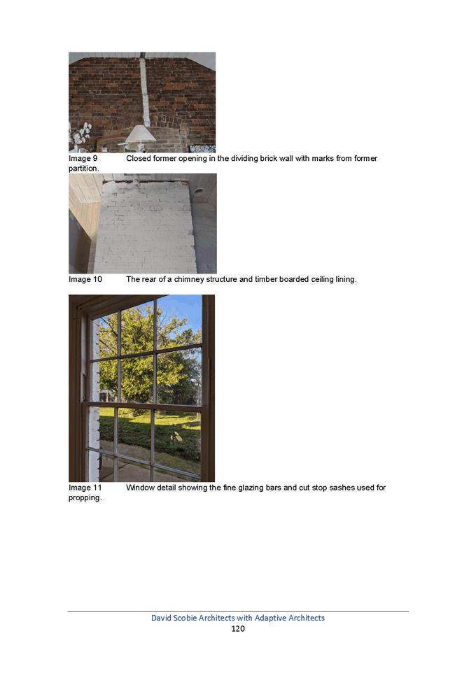
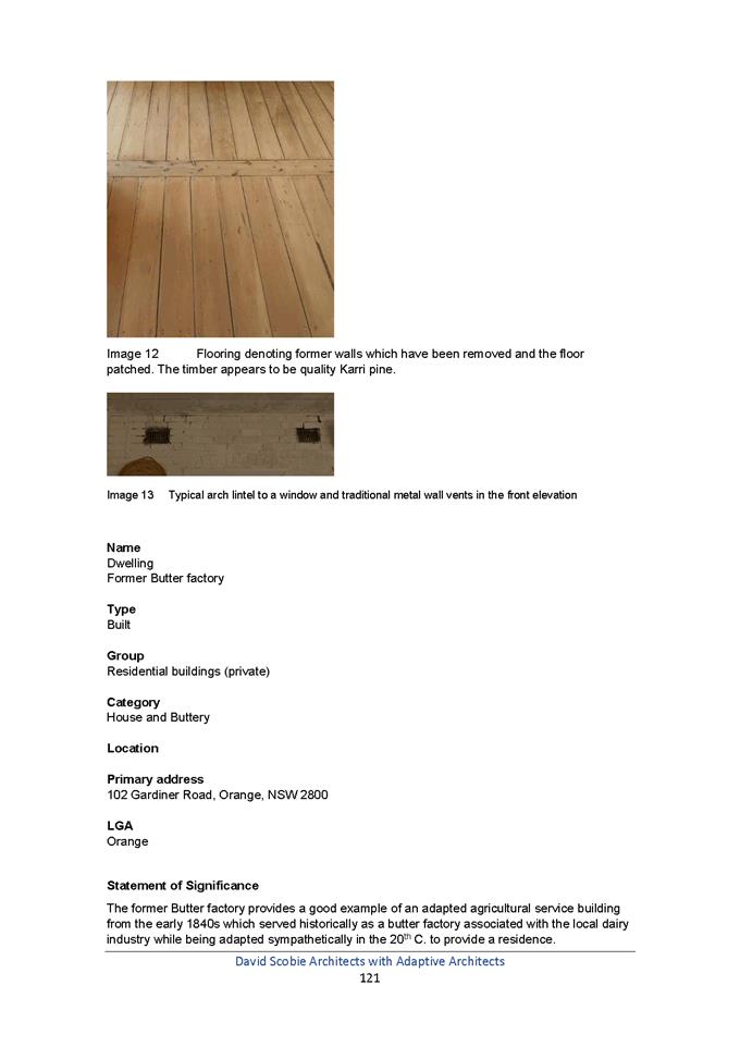
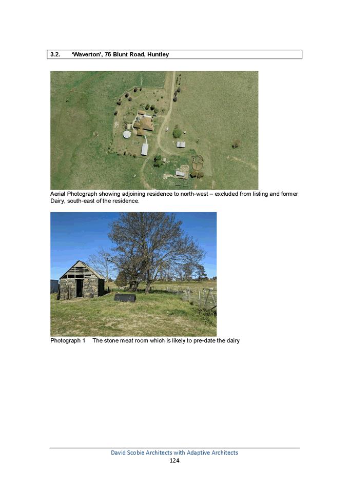
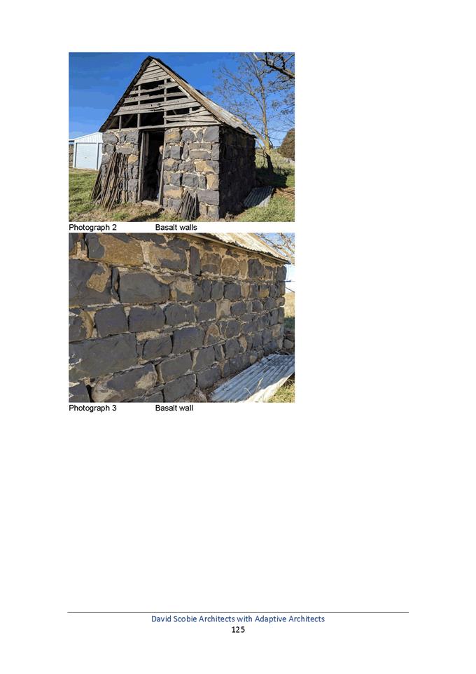
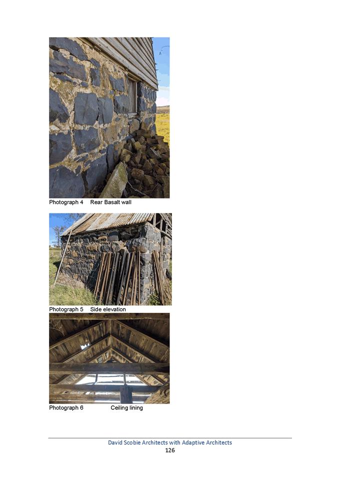
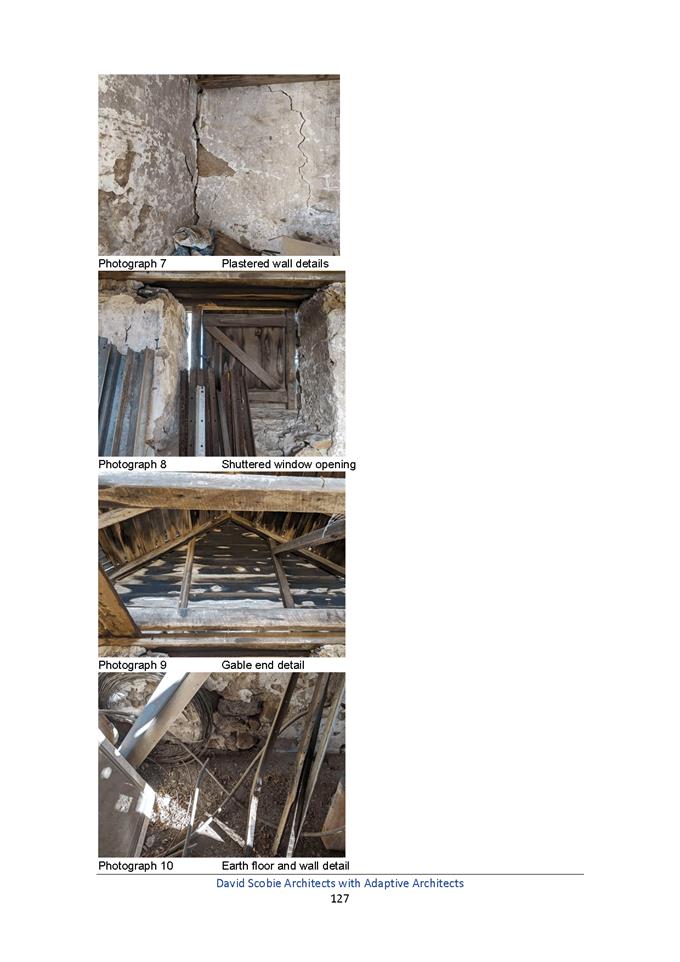
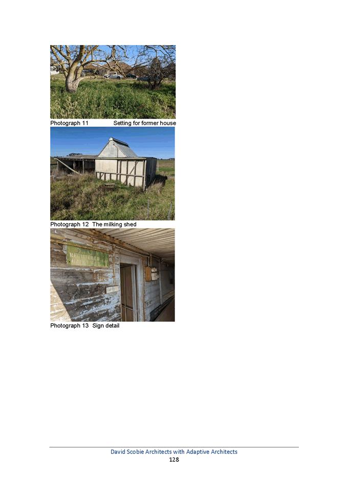
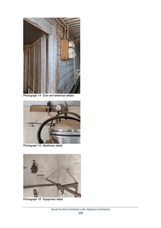
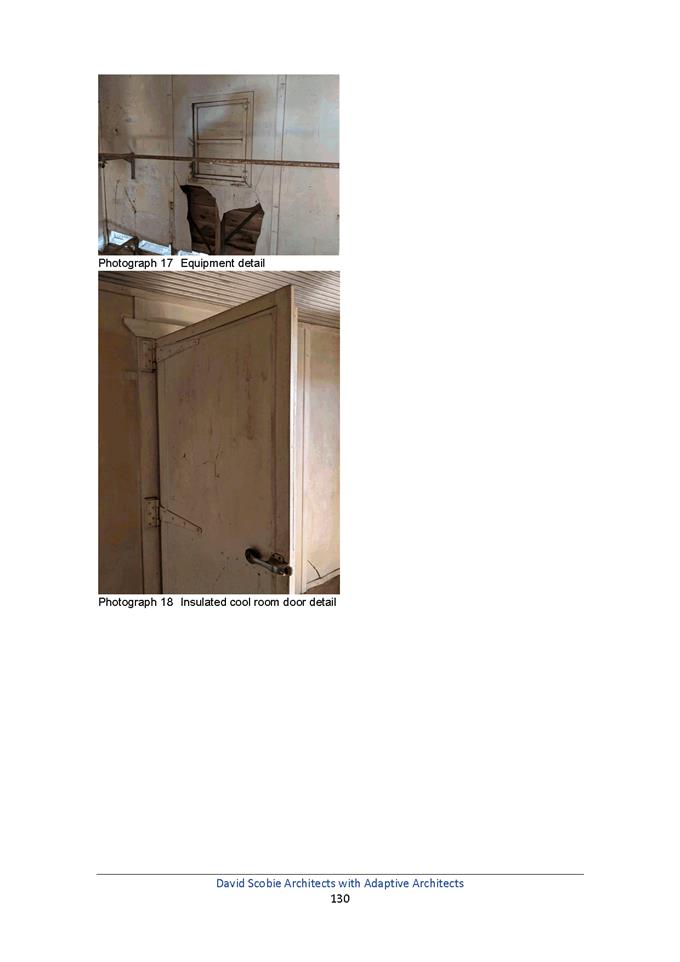
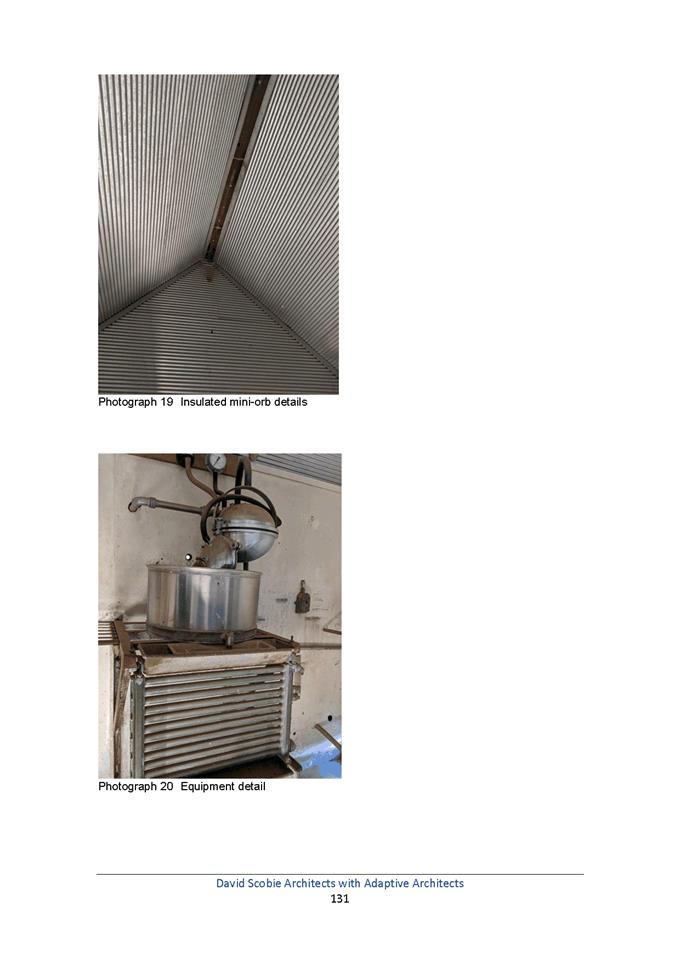
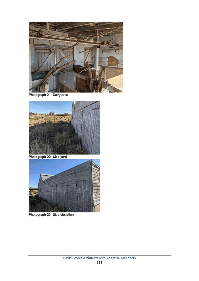
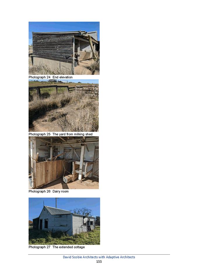
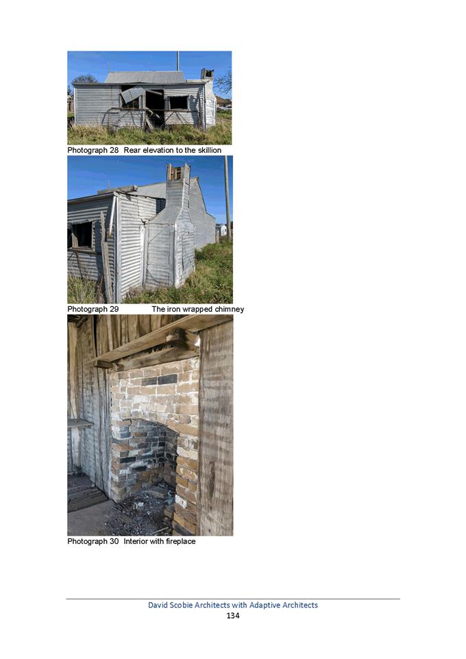
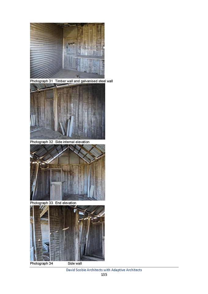
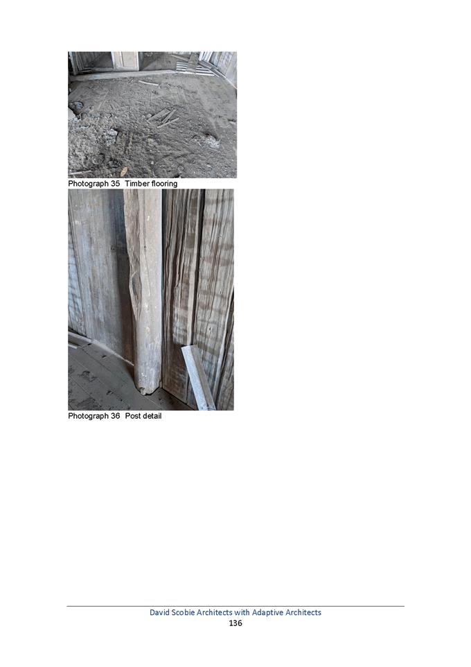
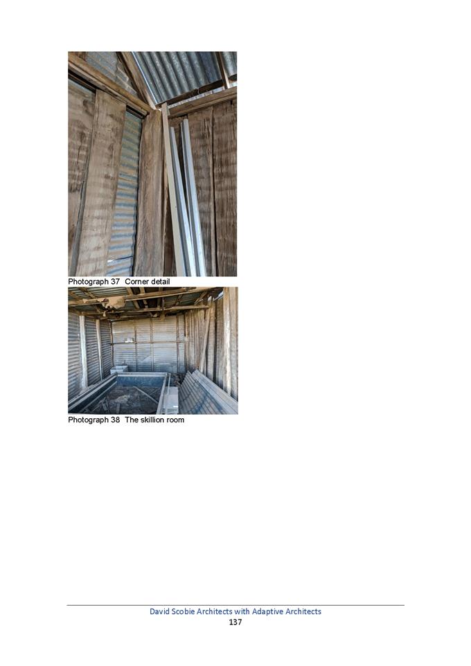
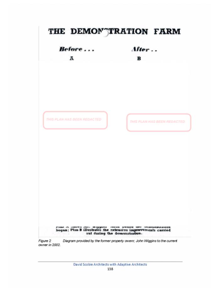
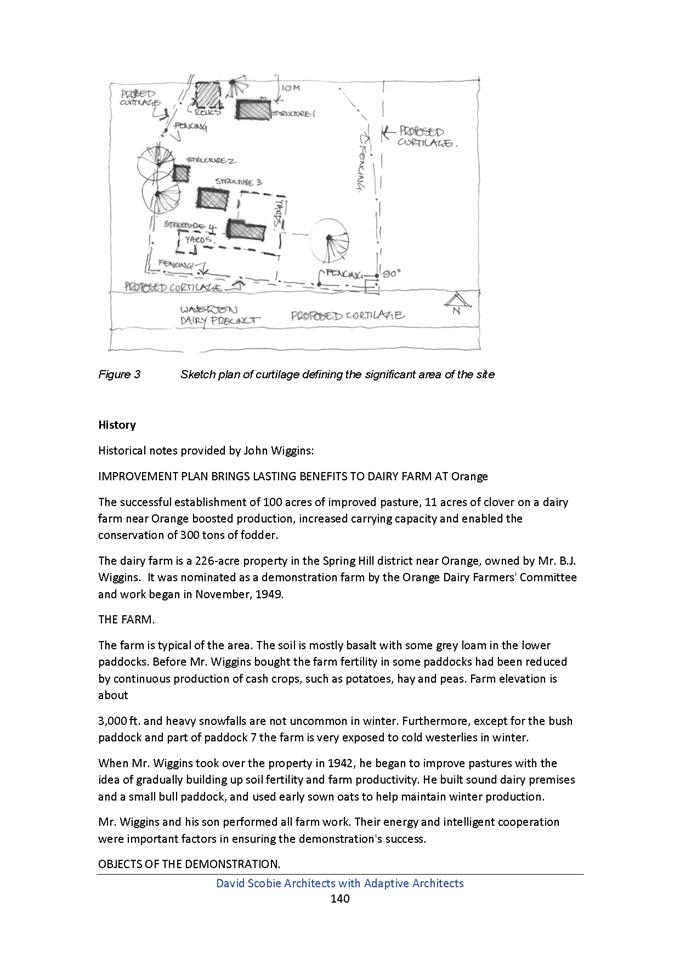
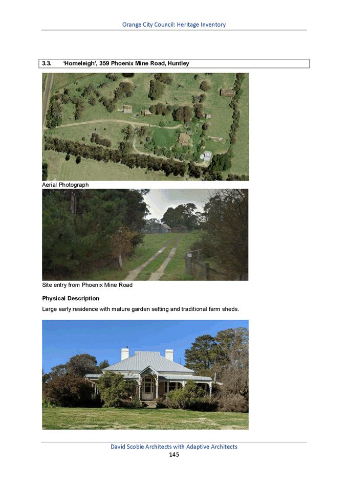
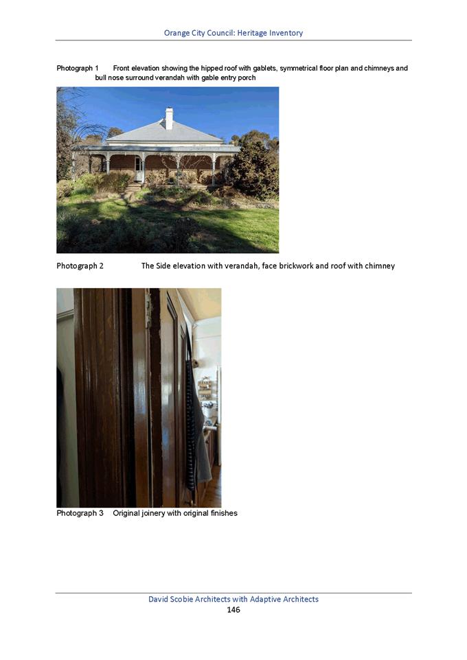
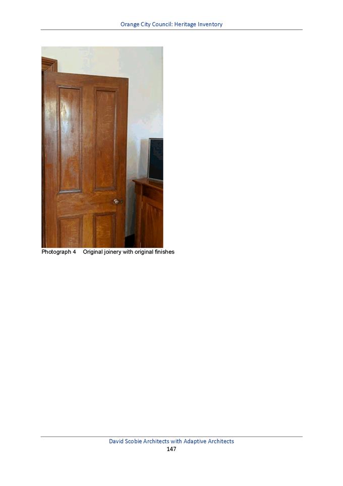
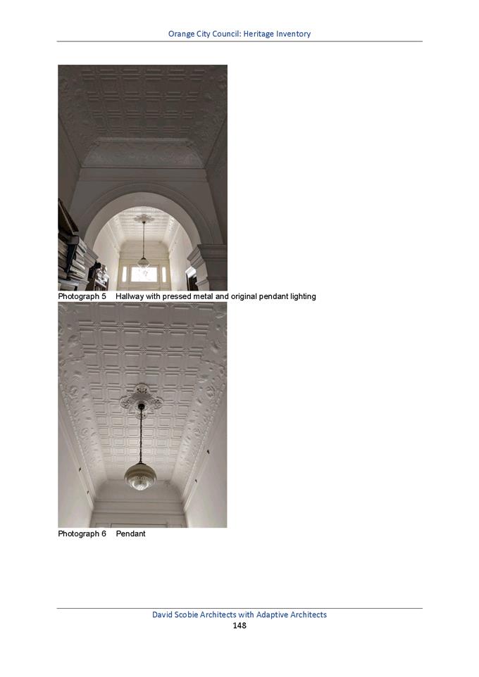
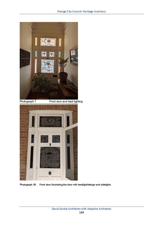
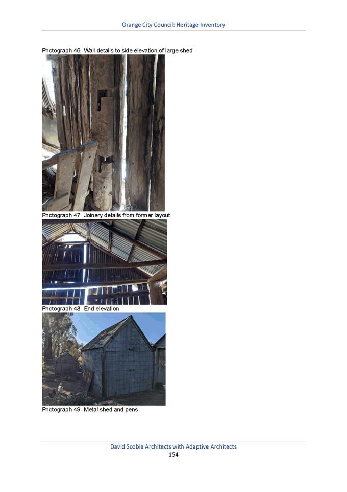
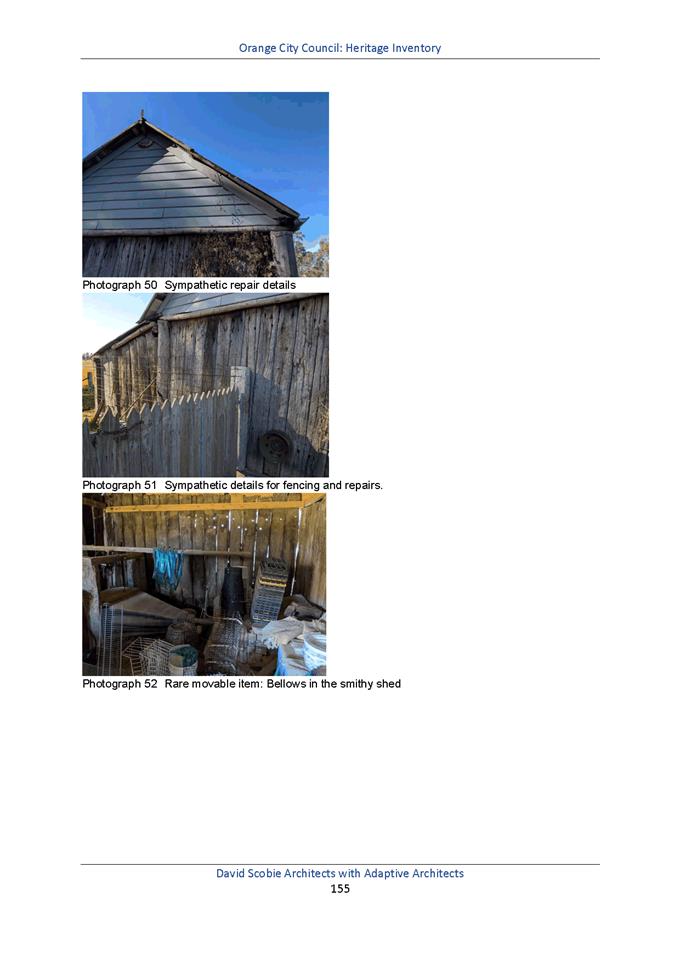
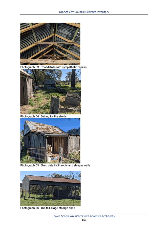
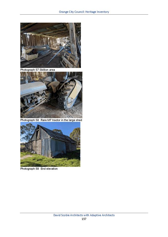
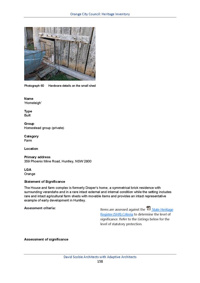
2.8 Development
Application DA 111/2020(1) - 12 Green Lane
RECORD
NUMBER: 2021/590
AUTHOR: Summer
Commins, Senior Planner
EXECUTIVE Summary
|
Application
lodged
|
19 March
2020 (amended plans submitted 22 January 2021)
|
|
Applicant/s
|
Bassmann
Drafting Services
|
|
Owner/s
|
Mr MJ
and Mrs JE Truloff
|
|
Land
description
|
Lot 2 DP
413484 - 12 Green Lane, Orange
|
|
Proposed
land use
|
Dwelling
(two storey), Attached Garage, Retaining Walls and Tree Removal
|
|
Value of
proposed development
|
$850,000.00
|
Council’s consent is sought for a proposed dwelling
house and associated site works at 12 Green Lane. The proposal involves
development of vacant land for a two-storey dwelling house with attached double
garage. Earthworks and tree removal will be required in conjunction with
dwelling construction.
The development application has been subject to a lengthy
assessment process, which has involved:
· Various design
negotiations between staff and proponent.
· Submission of
amended plans thrice.
· Neighbour
notification of original and amended drawings.
· Receipt and
consideration of public submissions objecting to the proposal.
· Deferral by the
Planning and Development Committee on 2 February 2021; and
· Councillors’
site inspection.
Notable planning matters for the proposed development
include:
· The privacy and
visual bulk encroachment impacts for the adjoining dwelling to north.
· The impacts on the
landscape setting associated with tree removal and dwelling construction; and
· The suitability of
the building design in this streetscape.
This report provides a consolidated assessment of the
proposed development. As outlined, the proposal is considered to reasonably
satisfy the Local and State planning controls that apply to the subject land
and particular landuse. Furthermore, the proposal accords with relevant
Planning Principles of the Land and Environment Court.
Impacts of the development are considered to be within
reasonable limit, subject to mitigation conditions. Approval of the application
is recommended.
Figure 1 - locality plan
DECISION FRAMEWORK
Development in Orange is governed by two key documents
Orange Local Environment Plan 2011 and Orange Development Control Plan 2004. In
addition the Infill Guidelines are used to guide development, particularly in
the heritage conservation areas and around heritage items.
Orange Local Environment Plan 2011 – The
provisions of the LEP must be considered by the Council in determining the
application. LEPs govern the types of development that are permissible or
prohibited in different parts of the City and also provide some assessment
criteria in specific circumstances. Uses are either permissible or not. The
objectives of each zoning and indeed the aims of the LEP itself are also to be
considered and can be used to guide decision making around appropriateness of
development.
Orange Development Control Plan 2004 – the DCP
provides guidelines for development. In general it is a performance based
document rather than prescriptive in nature. For each planning element there
are often guidelines used. These guidelines indicate ways of achieving the
planning outcomes. It is thus recognised that there may also be other solutions
of merit. All design solutions are considered on merit by planning and building
staff. Applications should clearly demonstrate how the planning outcomes are
being met where alternative design solutions are proposed. The DCP enables
developers and architects to use design to achieve the planning outcomes in
alternative ways.
DIRECTOR’S COMMENT (in
this case from MDA Johnston)
The topography and slenderness of this site makes it a
difficult site to develop. Whilst it has taken the applicant a
considerable time to amend plans adequately since lodgement so this application
may progress, amendments are considered to have taken into account concerns of
the neighbours. The site due to its significant slope to the rear
provides significant challenges.
The proposed two storey dwelling with a lower ground floor
is not unlike other dwellings in the area that have taken advantage of the
slope to provide a lower ground floor. The final design, whilst providing
a building that will certainly be prominent, especially when viewed from the
neighbour to the north, takes into account the challenges of the site’s
topography; the northern sunlight opportunities, neighbours privacy, bulk,
scale and existing vegetation to a level that achieves compliance with Council’s
planning controls. It is noted that the neighbours continue to express
significant objection, however given the proposals compliance with planning
controls (see detailed assessment of DCP planning outcomes and Land and
Environment Planning Principles), the recommendation of approval of this
application is supported.
Link To Delivery/OPerational Plan
The recommendation in this report
relates to the Delivery/Operational Plan strategy “10.1 Preserve - Engage
with the community to ensure plans for growth and development are respectful of
our heritage”.
Financial Implications
Nil
Policy and Governance Implications
Nil
|
Recommendation
That
Council consents to development application DA 111/2020(1) for Dwelling (two storey), Attached Garage,
Retaining Walls and Tree Removal at Lot 2 DP 413484 –
12 Green Lane, Orange, pursuant to the
conditions of consent in the attached Notice of Approval
|
further considerations
Consideration has been given to the
recommendation’s impact on Council’s service delivery; image and reputation;
political; environmental; health and safety; employees; stakeholders and
project management; and no further implications or risks have been identified.
SUPPORTING INFORMATION
Processing of the subject DA has
proceeded thus:
· The application was
lodged on 23 March 2020.
· The DA was placed
on public notification between 30 April and 14 May 2020. One (1) submission was
received from the adjoining resident to the north. The submission raised
concerns in relation to tree removal; visual and acoustic privacy; and visual
bulk.
· The DA was the
subject of ongoing and favourable negotiations between assessment staff and the
proponent. The negotiations sought to resolve issues raised in the public
submission; and address minor non-compliances with the applicable planning
controls.
· Amended plans were
subsequently submitted thrice (August 2020; October 2020; and January 2021).
Amendments made to the building design include a reduction in building height
by 500mm; altered windows to the master suite; redesigned alfresco elevated
deck; and installation of privacy screens to northern openings and deck.
· The DA was
reported to the Planning and Development Committee on 2 February 2021. The
Committee resolved to defer consideration of the DA, pending site inspection by
Councillors and staff. The site inspection was undertaken on 18 February 2021.
· The DA (amended
plans) was placed on public re-notification between 17 February and 2 March
2021. Three (3) submissions were received in response to the public re‑notification
period. The submissions raised concerns in relation to building design; site
area; traffic amenity; tree removal; visual and acoustic privacy; visual bulk;
and DA processing errors.
· Plans exhibited
during the re-notification period of 17 February – 2 March 2021 were a
superseded plan set (i.e. drawings submitted in October 2020). To correct this
processing error, it was necessary for the DA to be placed on public
notification again, in order to notify the drawings submitted in January 2021.
· The DA was placed
on public re-notification between 4 and 18 March 2021. Two (2) submissions were
received in response to the public re-notification period. The submissions
raised concerns in relation to building design; site area; traffic amenity;
tree removal; visual and acoustic privacy; visual bulk; and DA processing
errors.
· Amended plans (to
clarify levels) and BASIX certificate were submitted during drafting of this
report, and form attachments to this report. Further notification of the
amended details was not required pursuant to Council’s Community
Participation Plan 2019.
· This report
provides a consolidated assessment of the proposed development to inform the
decision of the Planning and Development Committee.
THE SUBJECT LAND
The subject land is known as 12 Green Lane and described as
Lot 2 DP 413484.
The parcel comprises site area of 1,057.38m2. The
land was created as a residential allotment when the Green Lane precinct was
subdivided in the 1950s (see Deposited Plan at Figure 2 below).
The land is undeveloped and has historically provided an
extension of the garden for the adjoining parcel at 10 Green Lane.
Notwithstanding, the development site has existed as a residential lot in the
current cadastre with associated permissible development entitlements since the
1950s.
The development site is located on the west side of Green
Lane. It has frontage to the public road of 20.14m; and a depth of 60.57m along
the southern boundary, and 67.7m along the northern boundary. The parcel
contains extensive vegetation, including a significant remnant Eucalyptus
viminalis (Ribbon Gum) at the site frontage.
The site slopes towards the rear and away from the public
road, with overall cross fall in the order of 8m.
The neighbourhood and streetscape is comprised of detached,
split level and two-storey dwellings circa 1955. The residential setting has
been subject to redevelopment in recent years, including replacement dwellings
circa 2015-2020; and renovation and modernisation of original dwellings.
Figure 2 – Deposited Plan 413484
As a matter arising, the boundaries of adjoining 10 Green
Lane and 22 Wirruna Avenue have recently been adjusted pursuant to DA
300/2014(1). This subdivision did not relate to the development site.
The ‘proposed drainage
easement’ through the subject land noted in the DP 413484 at Figure 2
above does not exist. Numbers 10 Green Lane and 22 Wirruna Avenue are burdened
by an easement for stormwater drainage, in favour of the development site
(see Figure 3 below).
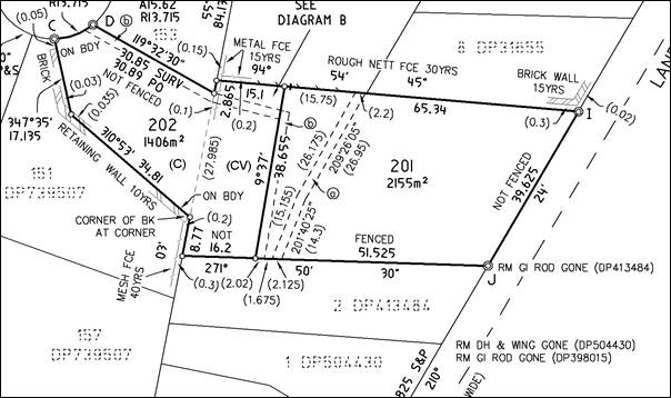
Figure 3 - extract DP 1208068 –
Recent subdivision of 10 Green Lane and 22 Wirruna
Avenue, easement for sewer denoted “b”
THE PROPOSAL
The proposal involves construction of a dwelling house on
the subject land. The dwelling will be two-storey, though will present a
single-storey structure at street level.
Accommodation at street level/first floor will comprise
attached double garage, master suite, open plan living zones and alfresco deck.
Lower-level accommodation will comprise three bedrooms, rumpus room, bathroom
and laundry.
The dwelling will be of contemporary design and detailing,
with rectangular building form, flat roof profile with clerestory, mixed wall
finishes (timber, stone, cladding and blockwork) and extensive glazing.
The proposed building design is depicted below (see Figures
below).
Figure 4 – front (east) elevation; presentation
to Green Lane
Figure 5 – side (north) elevation –
presentation to adjoining 10 Green Lane
The proposal involves earthworks including site filling for
access and driveway, and site excavation for the dwelling towards the rear.
Retaining walls will be required on the north side of the driveway in the front
setback, and adjacent the southern boundary.
The proposed development involves removal of a number of
trees and shrubs from the subject land to accommodate the building footprint
and driveway (noted in red in Figure 6 below).
Two (2) trees proposed for removal are subject to Tree
Preservation Orders pursuant to Orange Development Control Plan (DCP) 2004 (see
following sections of this report). The affected trees are circled in blue
below and include commonly named Eucalyptus Ribbon Gum and Nootka Cypress.
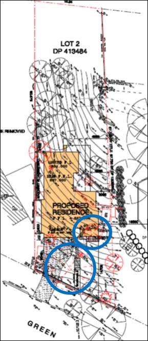
Figure 6 – vegetation to be removed outlined in
red; TPO trees to be removed circled in blue
MATTERS FOR CONSIDERATION UNDER
THE ENVIRONMENTAL PLANNING AND ASSESSMENT ACT 1979
Section 1.7 Application of
Part 7 of the Biodiversity Conservation Act 2016 and Part 7A of the
Fisheries Management Act 1994
Pursuant to Clause 1.7:
This
Act has effect subject to the provisions of Part 7 of the Biodiversity Conservation Act 2016 and Part 7A of the Fisheries Management Act 1994 that relate to the operation of this Act in connection
with the terrestrial and aquatic environment.
In consideration of this section, the
proposed development is not likely to significantly affect a threatened
species:
· The subject and
adjoining lands are not identified as biodiversity sensitive on the Orange LEP
2011 Terrestrial Biodiversity Map.
· The proposal
involves removal of a number of trees and shrubs from the subject land,
including two trees covered by Tree Preservation Order pursuant to Orange DCP
2004. Vegetation removal from the subject land will not exceed clearing
thresholds prescribed by regulation.
· The site is
contained within an established urban area and has been highly modified by the
urban landuse pattern. The subject land does not contain known threatened species
or ecological communities.
Based on the foregoing consideration, a Biodiversity
Assessment Report is not required and the proposal suitably satisfies the
relevant matters at Clause 1.7.
Section
4.15 Evaluation
Provisions of any
Environmental Planning Instrument S4.15(1)(A)(I)
Orange Local Environmental Plan
2011
Part 1 - Preliminary
Clause 1.2 Aims of Plan
The
particular aims of Orange LEP 2011 relevant to the proposal include:
(b) to provide for a range of development
opportunities that contribute to the social, economic and environmental
resources of Orange in a way that allows present and future generations to meet
their needs by implementing the principles for ecologically sustainable
development,
(e) to provide a range of housing choices in
planned urban and rural locations to meet population growth,
(f) to recognise and manage valued
environmental heritage, landscape and scenic features of Orange.
The proposed development will not be contrary to the
above-listed Aims, as outlined in this report.
Clause 1.6 Consent Authority
Clause 1.6 is applicable and states:
The consent authority for the
purposes of this Plan is (subject to the Act) the Council.
Clause 1.7 Mapping
The subject site is identified
on the LEP maps in the following manner:
|
Land Zoning Map:
|
Land zoned R2 Low Density
Residential
|
|
Lot Size Map:
|
No minimum lot size
|
|
Heritage Map:
|
Not a heritage item or conservation
area
|
|
Height of Buildings Map:
|
No building height limit
|
|
Floor Space Ratio Map:
|
No floor space limit
|
|
Terrestrial Biodiversity Map:
|
No biodiversity sensitivity on the
site
|
|
Groundwater Vulnerability Map:
|
Groundwater vulnerable
|
|
Drinking Water Catchment Map:
|
Not within the drinking water
catchment
|
|
Watercourse Map:
|
Not within or affecting a defined watercourse
|
|
Urban Release Area Map:
|
Not within an urban release area
|
|
Obstacle Limitation Surface Map:
|
No restriction on building siting
or construction
|
|
Additional Permitted Uses Map:
|
No additional permitted use applies
|
|
Flood Planning Map:
|
Not within a flood planning area
|
Those matters that are of relevance are addressed in detail
in the body of this report.
Clause 1.9A Suspension of
Covenants, Agreements and Instruments
Clause 1.9A is applicable and states in part:
(1) For the purpose of enabling development
on land in any zone to be carried out in accordance with this Plan or with a
consent granted under the Act, any agreement, covenant or other similar
instrument that restricts the carrying out of that development does not apply
to the extent necessary to serve that purpose.
(2) This
clause does not apply:
(a) to a covenant
imposed by the Council or that the Council requires to be imposed, or
(b) to
any prescribed instrument within the meaning of section 183A of the Crown Lands Act 1989, or
(c) to
any conservation agreement within the meaning of the National Parks and Wildlife Act 1974,
or
(d) to
any Trust agreement within the meaning of the Nature Conservation Trust Act 2001, or
(e) to
any property vegetation plan within the meaning of the Native Vegetation Act 2003, or
(f) to
any biobanking agreement within the meaning of Part 7A of the Threatened Species Conservation Act 1995,
or
(g) to
any planning agreement within the meaning of Division 6 of Part 4 of the Act.
In
consideration of this clause, Council staff are not aware of the title of the
subject property being affected by any of the above.
Part 2 - Permitted or Prohibited Development
Clause 2.1 Land Use Zones
The
subject land is zoned R2 Low Density Residential.
The
proposal is defined as a dwelling house.
The
proposal is permitted with consent in the R2 zone.
Clause 2.3 Zone Objectives
The
objectives of the R2 Low Density Residential zone are:
· To provide for
the housing needs of the community within a low density residential
environment.
· To enable other
land uses that provide facilities or services to meet the day to day needs of
residents.
· To ensure development
is ordered in such a way as to maximise public transport patronage and
encourage walking and cycling in close proximity to settlement.
· To ensure that
development along the Southern Link Road has an alternative access.
The proposed development is not
contrary to the relevant zone objectives. Development of the land for a
dwelling house is a reasonable outcome for a long-established residential
allotment, in a low density residential setting.
Part 3 - Exempt and Complying Development
The application is not exempt or complying development.
Part 4 - Principal Development Standards
The
Part 4 Development Standards do not relate to the subject land or proposed
development.
Part 5 - Miscellaneous Provisions
The
Part 5 Provisions are not applicable to the proposal.
Part 6 - Urban Release Area
The subject site is not located in an Urban Release Area and
Part 6 does not apply.
Part 7 - Additional Local Provisions
Clause
7.1 Earthworks
Clause
7.1 applies. This clause states in part:
(3) Before granting development
consent for earthworks, the consent authority must consider the following
matters:
(a) the likely disruption of, or
any detrimental effect on, existing drainage patterns and soil stability in the
locality of the development,
(b) the effect of the development
on the likely future use or redevelopment of the land,
(c) the quality of the fill or the
soil to be excavated, or both,
(d) the effect of the development
on the existing and likely amenity of adjoining properties,
(e) the source of any fill material
and the destination of any excavated material,
(f) the likelihood of
disturbing relics,
(g) the proximity to and potential
for adverse impacts on any waterway, drinking water catchment or
environmentally sensitive area,
(h) any measures proposed to
minimise or mitigate the impacts referred to in paragraph (g).
The
proposal is considered to be acceptable in the context of requirements at
Clause 7.1.
The
site slopes towards the rear and away from the public road, with overall cross
fall in the order of 8m. Vehicular access to the site is not available at
present and is constrained by terrain and vegetation. Site filling will be
required to provide appropriate levels for the proposed driveway adjacent to
the southern boundary. The extent of raised and compacted fill will be subject
to civil engineering design and held in place by a retaining wall. It is
intended to utilise existing fill from the subject land, associated with site
excavation for the dwelling.
Finished
levels for the proposed dwelling will relate to natural ground level or be cut
into the site by up to 1.8m. A retaining wall will be required on the
part-southern boundary adjacent to the largest cut.
The extent of fill (for the driveway) and excavation (for
the dwelling) is depicted in elevation drawings on the east and south (see
Figures below), with the dashed line depicted existing natural ground level.
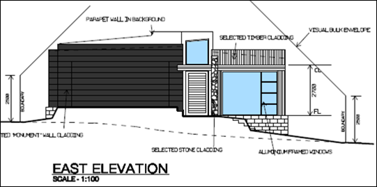
Figure 7 – earthworks for driveway
filling on the east elevation
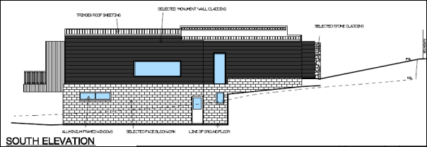
Figure 8 – earthworks for dwelling
excavation on the south elevation
Appropriate
drainage infrastructure is available within the subject land (see Clause 7.3
below) to ensure earthworks and finished levels will not impact on adjoining
properties or receiving waterways.
The site is not known to be
contaminated, nor is the site known to contain any Aboriginal, European or
archaeological relics. The site is not in proximity to any waterway, drinking
water catchment or sensitive area. Conditions are imposed that require sediment
control measures to be implemented onsite prior to works commencing.
Clause 7.3 Stormwater Management
Clause 7.3 is
applicable. This clause states in part:
(3) Development
consent must not be granted to development on land to which this clause applies
unless the consent authority is satisfied that the development:
(a) is
designed to maximise the use of water permeable surfaces on the land having
regard to the soil characteristics affecting onsite infiltration of water, and
(b) includes,
where practical, onsite stormwater retention for use as an alternative supply
to mains water, groundwater or river water, and
(c) avoids
any significant impacts of stormwater runoff on adjoining downstream
properties, native bushland and receiving waters, or if that impact cannot be
reasonably avoided, minimises and mitigates the impact.
Stormwater
within the development will be directed to the stormwater pit adjacent the
northern site boundary, and discharged to Wirruna Avenue via stormwater
infrastructure and easement through 12 Green Lane and 22 Wirruna Avenue (see
Figure 9 below). The proposed development will satisfy the requirements of
Clause 7.3.

Figure 9 - extract DP 1208068, easement for sewer
denoted “b”
Clause 7.6 Groundwater Vulnerability
The subject land is identified as Groundwater Vulnerable on
the Groundwater Vulnerability Map. Clause 7.6 applies. This clause
states in part:
(3) Before
determining a development application for development on land to which this
clause applies, the consent authority must consider:
(a) whether
or not the development (including any onsite storage or disposal of solid or
liquid waste and chemicals) is likely to cause any groundwater contamination or
have any adverse effect on groundwater dependent ecosystems, and
(b) the
cumulative impact (including the impact on nearby groundwater extraction for
potable water supply or stock water supply) of the development and any other
existing development on groundwater.
In
consideration of Clause 7.6, there are no aspects of the proposal will not impact on groundwater and related ecosystems.
Clause 7.11 Essential Services
Clause 7.11 applies and states in part:
(3) Development
consent must not be granted to development unless the consent authority is
satisfied that any of the following services that are essential for the
proposed development are available or that adequate arrangements have been made
to make them available when required:
(a) the
supply of water,
(b) the
supply of electricity,
(c) the
disposal and management of sewage,
(d) storm
water drainage or onsite conservation,
(e) suitable
road access.
In consideration of this clause, listed utility services are
available to the land and adequate for the proposal. In relation to (e) above,
a Road Opening Permit will be required in relation to the proposed driveway
access and associated site filling via Green Lane. It is noted that the
proposed driveway location will enable retention of the established street tree
at the site frontage.
State Environmental Planning Policy 55 Remediation of
Land
SEPP 55 Remediation of Land is applicable. Clause 7 states
in part:
(1) A consent authority must not consent to
the carrying out of any development on land unless:
(a) it
has considered whether the land is contaminated, and
In consideration of this clause,
it is unlikely that the subject land is contaminated. The land has longstanding
residential zoning (circa 1955). Since its creation as a residential allotment,
the site has remained undeveloped and has provided a landscaped garden for
adjoining parcels.
The site is not contained within
an investigation area; and is not known to have been used for a Table 1 purpose
to the contamination land planning guidelines. Site inspection does not reveal
any areas of concern. Further contamination investigation is considered
unnecessary in support of the proposal. The land is considered to be suitable
for residential landuse from a contamination perspective.
State Environmental Planning
Policy (Vegetation in Non-Rural Areas) 2017
SEPP (Vegetation in Non-Rural Areas) 2017 is applicable to
the proposal.
Pursuant to Clause 7(1):
A person must not clear
vegetation in any non-rural area of the State… without the authority
conferred by a permit granted by the council…
Clause 9(2) further requires that:
A development control plan may make the declaration in any
manner, including by reference to any of the following:
(a) the species of
vegetation,
(b) the
size of vegetation,
(c) the
location of vegetation (including by reference to any vegetation in an area
shown on a map or in any specified zone),
(d) the
presence of vegetation in an ecological community or in the habitat of a
threatened species.
In consideration of the requirements of the SEPP, the
proposal involves removal of a number of trees/tree groups from the subject
land. Pursuant to Orange DCP 2004-0.4-2 Interim Planning Outcomes- Tree
Preservation, Council’s approval is required for removal of trees of
a certain prescribed species and size.
An arborist report was submitted in
support of the proposal (The Tree Surgeon 5 March 2020). Two (2) trees identified
for removal are subject to Tree Preservation Order under the DCP (see Figure 5
above), and consent is required for their removal.
The subject trees include commonly named Eucalyptus Ribbon
Gum at the site frontage, and Nootka Cypress within the building envelope.
While both trees are considered by the arborist to be significant and in
reasonable health, tree removal is required to facilitate the development.
The proposed tree removal was referred to Council’s
Manager City Presentation (MCP) for review. MCP considers it is suitable to
remove the tree/s. The land is zoned for residential purposes (rather than
public recreation or environmental protection), and the Ribbon Gum particularly
is an unsuitable specimen in an urban residential setting. MCP advises:
· ‘The site
is residential land and to enable the site to be developed, some tree loss
would be required.
· Any development
of the subject site would impact on the remnant Ribbon Gum. Development works
will compromise the tree’s health and vigour.
· Dwelling
construction nearby the Ribbon Gum is not recommended due to the likelihood of
limb failure. A house built on the block is at risk of damage should the tree
be retained.
· The land is a
residential block to be developed. The tree can only be protected if the block
stays undeveloped. This is neither practical nor foreseeable.
· Unfortunately,
a remnant Ribbon Gum of some 100 + years of age is not a suitable tree in an
urban landscape, where modifications have been made in the time that the tree has
been at a mature age.
· An urban block
with a dwelling placed upon it with such a tree is a risk that Council would
not wish to have granted approval for.
· Alternative
methods of driveway construction were discussed with the proponent and it was
also identified that piering to support a suspended driveway would have some
impact on the root system of the Ribbon Gum, and over time will lead to a loss
of functionality of root system covered by a suspended driveway.
MCP conditions are included on the attached Notice of
Approval in relation tree protection measures for retained trees across the
site; and installation of nesting boxes in retained trees for locally occurring
arboreal mammals.
Furthermore, MCP has included a special condition requiring
the proponent liaise with Council prior to removal of the Ribbon Gum, to ‘determine
whether there is an ecological use for the subject tree in a local park.’
It is acknowledged that development of the land and
including tree removal will alter the landscape character of the site and
setting. Notwithstanding, it is a reasonable expectation that the residential
parcel be developed for a dwelling house. The land does not comprise public
open space or have particular environmental values. Development of the land as proposed
will complement the streetscape built from and private landscape setting.
State Environmental Planning
Policy (Building Sustainability Index: BASIX) 2004
The BASIX SEPP is applicable. Pursuant to Clause 6:
(1) This
Policy applies to buildings arising from the following development:
(a) proposed BASIX affected development
for which the regulations under the Act require a BASIX certificate to
accompany a development application or an application for a complying
development certificate or construction certificate,
In consideration of this clause, the proposed dwelling house
comprises BASIX affected development. A BASIX Certificate was submitted in
support of the amended proposal (latest plan set). The proposed dwelling will
comply with the provisions of BASIX is respect of water, thermal comfort and
energy.
Provisions
of any Draft Environmental Planning Instrument that has been Placed on
Exhibition 4.15(1)(a)(ii)
Draft Orange Local Environmental Plan 2011 (Amendment 25)
Draft Orange LEP 2011 Amendment 25 has recently completed
public exhibition (August 2020). The Draft Plan relates to land at 1
Leewood Drive and has no effect for the proposed development.
Draft Orange Local Environmental Plan 2011 (Amendment 26)
Draft Orange LEP 2011 Amendment 26 will be re-exhibited
(December 2020-January 2021). The Draft plan relates to land at 1521 Forest
Road and has no effect for the proposed development.
Draft State
Environmental Planning Policy Remediation of Land
Draft Remediation of Land SEPP is applicable. The Draft SEPP
requires in part that consideration be given to potential contamination on
nearby or neighbouring properties and groundwater. The adjoining lands have
longstanding residential use and are unlikely to be contaminated, with nil
effect for the proposed development.
Draft State Environmental Planning Policy Design
and Place
Draft Design and Place SEPP is currently on public
exhibition. The Draft SEPP will (in part) repeal and replace SEPP No 65 –
Design Quality of Residential Apartment Development and SEPP (Building
Sustainability Index: BASIX) 2004. The proposed development will not be
contrary to any matter contained in the Draft SEPP.
Provisions of any
Development Control Plan S4.15(1)(a)(iii)
Development Control Plan 2004
DCP 2004 - 0 Tree Preservation
The relevant matters in this part were considered in the
foregoing assessment under SEPP (Vegetation in Non-Rural Areas) 2017.
DCP 2004 – 7 Development
in Residential Zones
The proposed development will
reasonably satisfy the relevant planning outcomes in Part 7 as outlined in the
following assessment.
7.5 Merit-based Approach to
Residential Development in Orange
7.6 Site Analysis
New Dwellings
The DCP sets the following Planning Outcomes in regard to
New Dwellings:
· All residential
development demonstrate that the principles and objectives of each design
element as outlined in Section 7.7 are achieved.
· Development
applications for two-storey houses or houses proposing encroachments within
usual setbacks include site analyses and supporting information showing how
design element outcomes have been addressed in the design in accordance with
Section 7.6 and 7.7.
As outlined in the following sections of this report, the
proposed dwelling will reasonably satisfy the design element outcomes. A site
analysis was submitted in support of the proposal in the form of the Site Plan
(Drawing No. 05 Issue D). The site plan includes DCP-listed details for the
site and surrounding area, sufficient to inform the proposed dwelling design
and siting.
7.7 Design Elements for Residential Development
Neighbourhood Character
The DCP sets the following Planning Outcomes in regard to
Neighbourhood Character:
Site layout and building design
enables the:
· creation of
attractive residential environments with clear character and identity
· use of site
features such as views, aspect, existing vegetation and landmarks
· buildings are
designed to complement the relevant features and built form that are identified
as part of the desired neighbourhood character
· the streetscape
is designed to encourage pedestrian access and use.
The Green Lane neighbourhood and streetscape are comprised
of substantial, detached and split-level dwellings on separate lots, circa
1955. The residential setting has been subject to gentrification in recent
years, including replacement dwellings circa 2015-2020; and renovation and
modernisation of original dwellings.
The proposed dwelling will adopt a building form and finish
typical to the neighbourhood, with use of design elements consistent with the
prevailing development form including:
· split level /
two-storey height relating to landform
· rectangular forms
· flat roof
· parapet walls
· mixed finishes
· extensive glazing
· front elevation
garage and dwelling entrance
· landscaped front
setback.
It is considered that the development
will be sited and designed to suitably integrate in this setting and will
complement the established neighbourhood character.
The proposal will not adversely impact on pedestrian access
associated with the residential street. The finished driveway levels and sight
lines within Green Lane are appropriate to avoid conflict with pedestrians.
Building Appearance
The DCP sets the following Planning Outcomes in regard to
Building Appearance:
· the building design,
detailing and finishes relate to the desired neighbourhood character,
complement the residential scale of the area, and add visual interest to the
street
· the frontages
of buildings and their entries face the street
· garages and car
parks are sited and designed so that they do not dominate the street frontage.
As outlined above, the proposed dwelling will relate to the
established neighbourhood character in design, detailing and massing.
Contemporary form and finishes will complement original and updated dwellings
in the streetscape and add visual interest. The proposed dwelling and its
entrance will address Green Lane and provide an active frontage consistent with
adjoining dwellings. The front elevation garage will satisfy the DCP Guidelines
in respect of design, siting and width.
Setbacks
The DCP sets the following Planning Outcomes in regard to
Setbacks:
· street setbacks
contribute to the desired neighbourhood character, assist with the integration
of new development and make efficient use of the site
· street setbacks
create an appropriate scale for the street considering all other streetscape
components.
The proposed dwelling will be sited 8.3m – 14.7m from
the front boundary to Green Lane. The proposed front setback will complement
generous front setbacks for adjoining dwellings to the north and south at 10
and 14 Green Lane. The street setback will achieve appropriate infill and
integration in the developed streetscape building line. The dwelling siting
will minimise earthworks and tree removal over the land.
Site boundary setbacks will be 1.5m to the south; and
minimum 3m to the north. The northern setback will progressively increase. The
setbacks are considered typical of a suburban setting, and generous for the
subject narrow allotment (noting 0.9m is typical and a zero-boundary setback is
permitted). As outlined in this report, the proposed side setbacks will not
result in unreasonable visual bulk encroachment or privacy impacts.
Front Fences and Walls
The DCP sets the following Planning Outcomes in regard to
Fences and Walls:
· Front fences
and walls:
- assist in
highlighting entrances and creating a sense of identity within the streetscape
- are
constructed of materials compatible with associated housing and with fences
visible from the site that positively contribute to the streetscape
- provide for
facilities in the street frontage area such as mail boxes.
The proposal does not involve the erection of a front fence
to Green Lane.
Visual Bulk
The DCP sets the following Planning Outcome in regard to
Visual Bulk:
· Built form
accords with the desired neighbourhood character of the area with:
- side and rear
setbacks progressively increased to reduce bulk and overshadowing
- site coverage
that retains the relatively low density landscaped character of residential
areas
- building form
and siting that relates to landform, with minimal land shaping (cut and fill)
- building
height at the street frontage that maintains a comparable scale with the
predominant adjacent development form
- building to
the boundary where appropriate.
The
visual bulk associated with the proposed development will be suitable as
considered below:
· Building massing
and scale will be consistent with the prevailing built form in Green Lane, ie.
multi-level dwellings that relate to natural ground level. The proposed
dwelling will present a single-storey structure at street level and take a
two-storey form at the rear as the land slopes away.
· The building bulk
will achieve appropriate infill in the streetscape building line. The height
and massing of the dwelling will integrate with the higher dwelling and
landform to the south at 14 Green Lane; and lower dwelling and landform to the
north at 10 Green Lane.
· The proposed
dwelling will have a maximum height of 4.7m at the site frontage and 7.0m to
top of the parapet at the rear façade (measured from natural ground
level on the north elevation). Building height will be consistent with the
height of adjoining dwellings, and others nearby in the street.
It is noted that the roof
structure includes a 1.6m wide clerestory (depicted in Figure 10 as the white
element). This glazed element will add an additional 0.9m to the height of the
dwelling. The clerestory will not contribute to visual bulk or massing, due to
its narrow configuration, location in the centre of the roof structure, and
associated setback from side boundaries. Indeed, the clerestory glazed element
will not be visible at ground level.
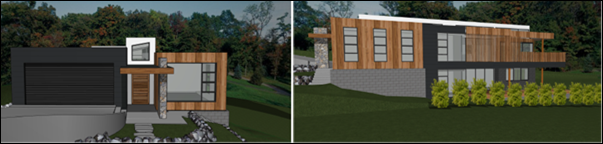
Figure 10 – clerestory, shown white
· Finished floor
levels will relate to existing natural ground level, however earthworks (cut)
will be undertaken to reduce the dwelling massing. A cut of 0.7m-1.8m will be
undertaken for the lower level on the southern elevation.
· The proposed
dwelling will comprise a footprint of 267.8m2. Based onsite area of
1,057m2, the proposal will have site coverage of some 25%, in
compliance with the maximum 60% prescribed in the DCP.
· At
street view (east elevation), the proposed dwelling will be contained within
the DCP-prescribed visual bulk envelope plane (VBE) (see Figure 11).
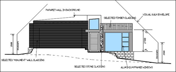
Figure 11 – VBE east front elevation
· The proposed
dwelling will encroach within the VBE on the western (rear) elevation, when
projected from the northern boundary (see Figure 12). (It is noted that the
gutter encroachment within the VBE from the southern boundary is considered to
be minor and within reasonable limit).
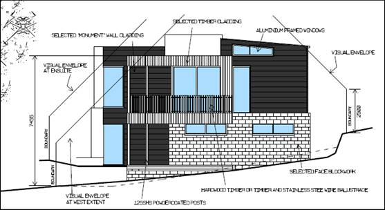
Figure 12 – VBE west rear elevation
The encroachment within the VBE relates to part of
the northern building façade, and not the entire façade, as
suggested by the architectural drawings. 3D modelling of the envelope plane has
been submitted in support of the non-compliance. The modelling
demonstrates the building will encroach the plane for part master suite and
ensuite wall (see Figures 13, 14 and 15 below).
Figure 13 – Modelled VBE east front elevation
Figure 14 – Modelled VBE north side elevation
Figure 15 – VBE encroachment on north
façade shown as red hatching
Notwithstanding the encroachments
of the northern façade within the prescribed envelope plane, visual bulk
encroachment impacts are not anticipated for the adjoining northern dwelling at
10 Green Lane due to the following:
- The
encroachment relates to a 4.2m2 or 3.5% of the northern building façade,
being a minor proportion of that façade.
- The
master suite encroachment will be set back 3.0 - 3.9m from the common boundary;
18.5m from the adjoining northern dwelling at 10 Green Lane; and 9m from the
nominated private open space area at 10 Green Lane.
- The
separation is considered suitable to limit visual bulk encroachment impacts on
the adjoining northern dwelling.
- Established
landscaping of the intervening area between the dwellings will soften the built
form, and interrupt direct views of the encroachments.
- A
condition is included on the attached Notice of Approval requiring preparation
and implementation of a landscape plan for the northern setback area, with
plantings to soften and screen the building bulk.
The proposed development is
considered to be an appropriate design response to manage visual bulk, in the
context of the particular site constraints and residential setting generally.
The flat roof, earthworks (excavation) and generous setback to the northern
boundary will assist to minimise encroachments within the envelope plane. It is
reasonably extrapolated that VBE encroachments are common in the streetscape,
as a consequence of building design relating to landform (although existing
dwellings generally predate this planning control).
· Visual bulk
impacts are not anticipated for the nearest dwelling at 14 Green Lane on the
adjoining southern parcel. Notwithstanding a separation of 3m – 8.5m
between the dwellings, there is negligible relationship between the dwellings
due to site topography. Internal and external habitable spaces will be oriented
to the north for both dwellings and will not be directly opposing.
· As outlined above,
the proposed dwelling front setback to Green Lane will relate to the siting of
adjoining dwellings and will not visually encroach on the streetscape. Side and
rear setbacks will be typical of a suburban setting, and generous for the
subject narrow allotment (noting 0.9m is typical and a zero-boundary setback is
permitted).
· The Land and
Environment Court has established the following applicable Planning Principles
in the Assessment of Height and Bulk (Veloshin V Randwick Council
[2007] NSWLEC 428):
- Are
the impacts consistent with impacts that may reasonably be expected under the
controls? (For non-complying proposals the question cannot be answered unless
the difference between the impacts of a complying and non-complying development
is quantified)
- How
does the proposal’s height and bulk relate to the height and bulk desired
under the relevant controls?
- Does
the area have a predominant existing character and are the planning controls
likely to maintain it?
- Does
the proposal fit into the existing character of the area?
With regard to the Planning
Principles, the proposed development is considered to be satisfactory:
· The proposed
dwelling will encroach the prescribed envelope plane on the north elevation.
The non-compliance is quantified to be 3.5% of the northern building
façade. The arising visual bulk impacts for such a minor variation will
be imperceptible and negligible when compared with a complying proposal.
· The height and
bulk of the proposal will satisfy the DCP Controls/Planning Outcomes for Visual
Bulk. Relevantly:
- A
minimum 3m setback will be provided from the northern boundary adjacent the VBE
encroachment; and side setbacks to the northern boundary will progressively
increase.
- Building
height and bulk will be consistent with the prevailing built form in Green
Lane, ie. multi-level dwellings that relate to natural ground level. The
proposed dwelling will present a single-storey structure at street level and
take a two-storey form at the rear as the land slopes away.
- The
building bulk will achieve appropriate infill in the streetscape building line.
The height and massing of the dwelling will integrate with the higher dwelling
and landform to the south at 14 Green Lane; and lower dwelling and landform to
the north at 10 Green Lane.
· Existing planning
controls are considered suitable to maintain the character of the Green Lane
residential neighbourhood, as they relate to height and bulk. Furthermore, the
proposed dwelling will complement this established character.
Walls
and Boundaries
The DCP sets the following Planning
Outcome in regard to Walls and Boundaries:
· Building to the
boundary is undertaken to provide for efficient use of the site taking into
account:
- the privacy of
neighbouring dwellings and private open space
- the access to
daylight reaching adjoining properties
- the impact of
boundary walls on neighbours.
The proposal does not involve
building to any boundary. As outlined in this report, it is considered that the
site layout and building design will not adversely impact on adjoining
dwellings in respect of privacy, solar access or visual bulk.
Daylight
and Sunlight
The DCP sets the following Planning
Outcome in regard to Daylight and Sunlight:
· Buildings are
sited and designed to ensure:
- daylight to
habitable rooms in adjacent dwellings is not significantly reduced
- overshadowing
of neighbouring secluded open spaces or main living area windows is not
significantly increased
- consideration
of Council’s Energy Efficiency Code.
Internal and external solar access will be provided to the
proposed dwelling in accordance with the DCP Guidelines. Living rooms and
outdoor living areas will be north-facing and provided with northern sunlight
for the prescribed intervals and extents.
The proposed dwelling will maintain solar access to the
adjoining southern dwelling at 14 Green Lane. Existing ground and floor
levels at 14 Green Lane are higher than the finished levels proposed in the
development.
The proposed dwelling will have nil
impact on solar access for the adjoining dwelling to the north at 10 Green
Lane.
Views
The DCP sets the following Planning
Outcomes in regard to Views:
· building form
and design allow for residents from adjacent properties to share prominent
views where possible
· views including
vistas of heritage items or landmarks are not substantially affected by the
bulk and scale of the new development.
Retention of the street trees at
the site frontage will assist to maintain the streetscape view corridor along
Green Lane.
Views of the site from adjoining
dwellings will be altered by the proposed development, associated with
vegetation removal and dwelling construction. The Land and Environment Court
has established the following applicable Planning Principles in the assessment
of View Sharing (Tenacity Consulting v Waringah [2004] NSWLEC 140):
- The
assessment of views to be affected
- From
what part of the property the views are obtained
- The
extent of the impact for the whole of the property
- The
reasonableness of the proposal that is causing the impact.
In consideration of the LEC Planning Principles:
· The existing view
of the development site comprises an established private landscaped garden in a
residential setting. While valued in this context, the development site is not
located within an important view corridor, nor contain important landmarks.
· Views of the
parcel are obtained by dwellings opposite the site on the east side of Green
Lane; and from the adjoining parcel to the north at 10 Green Lane.
· View loss of the
landscape setting will be “severe” from the east, associated with
dwelling and driveway construction.
· View loss will be
“moderate” from the north, with some 50% of the site to be retained
as landscaped open space for the dwelling.
· It is a reasonable
expectation that a residential parcel be developed for a dwelling house. As
variously outlined in this assessment, the dwelling will suitably integrate in
the streetscape in terms of height, bulk, siting and design.
Visual Privacy
The DCP sets the following Planning Outcome in regard to
Visual Privacy:
· Direct
overlooking of principal living areas and private open spaces of other
dwellings is minimised firstly by:
- building
siting and layout
- location of
windows and balconies
and secondly
by:
- design of
windows or use of screening devices and landscaping.
The DCP sets the following Visual Privacy Guidelines as a
means to achieve the above Planning Outcomes:
(a) Site
and building layout ensures windows do not provide direct and close views into
the windows, balconies or private open spaces of adjoining dwellings.
(b) Habitable
room windows on upper-floor level (ie. floor level greater than 1.5, above
development ground level) within 9m from windows of living areas of adjacent
dwellings:
a. Are
off-set sufficient distance to limit direct views; or
b. Include
measures to screen or obscure views between the dwellings (curtains are not
sufficient for screening).
(c) Balconies
of an upper floor level (as defined above) within 9m of habitable rooms or
private open space area permanently screened to reasonably obscure direct views
to adjacent rooms and private open space.
It is assessed that the proposed development will maintain
acceptable visual privacy for adjoining dwellings, including the nearest
adjoining / opposing dwelling to the north at 10 Green Lane.
Privacy Impacts for the Dwelling at 10 Green Lane
The potential for overlooking of the dwelling at 10
Green Lane is considered to be within reasonable limit as follows:
· North elevation
windows for the proposed dwelling (in the eastern extent) will comprise master
bed, dressing room and ensuite. The subject windows will not be associated with
habitable spaces and will not present overlooking impacts to the north.
Notwithstanding, these windows will be set back 3m from the northern boundary,
and 18.5m from the dwelling at 10 Green Lane.
· The balance of the
north façade will comprise upper-level living and dining room windows
and deck. The windows will have a setback from the northern boundary by 6.2m
(living) and 8m (kitchen). The boundary setbacks are considered generous for
the site and setting. The habitable openings will not oppose windows at 10
Green Lane, as the dwellings will be offset on the parcels. To this end, a
diagonal separation of some 25m will be provided between the habitable windows
and dwelling at 10 Green Lane.
· A full height
louvered timber privacy screen will be installed to the alfresco adjacent the
kitchen windows. The privacy screen will prevent views to the north-east of the
adjoining dwelling, with louvers oriented to address the north-west.
· The
elevated deck will comprise alfresco space to the north; walkway; and rear
(west) deck. The upper-level deck will have a minimum setback from the northern
boundary of 4.9m. As noted above, a 1.8m high louvered timber privacy screen
will be installed to the alfresco space and part of the walkway. As considered
for openings above, the side setback is considered generous for the site and
setting. The privacy screen will shield the more-active alfresco space to the
north, being the space nearest the dwelling at 10 Green Lane.
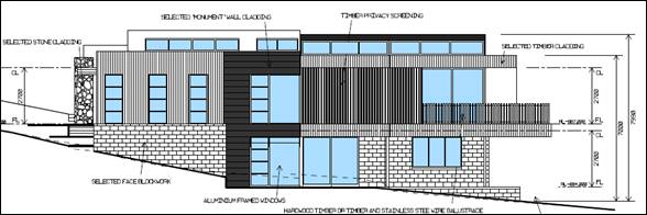
Figure 16 – north façade openings,
privacy screen and elevated deck
· Unscreened
habitable openings and spaces within the proposed development will thereby
comprise part of the dining room window; part of the connecting deck walkway;
and the rear deck (see Figure below). There will be a separation of some 25m
between the unscreened habitable openings and spaces and the adjoining
dwelling. This separation greatly exceeds the 9m separation prescribed in
the DCP. The rear deck will be located on the west façade and removed
from the northern dwelling.
Figure 17 – unscreened habitable openings and
spaces
· The
proposed dwelling will not overlook living room windows in the adjoining
northern dwelling. The south elevation of 10 Green Lane contains habitable
spaces in the form of breakfast room and kitchen (pursuant to BA 129/61). The
proposed dwelling and adjoining dwelling will not be opposing, as the dwellings
will be offset on the parcels as demonstrated in the site analysis (see Figure
18 below).
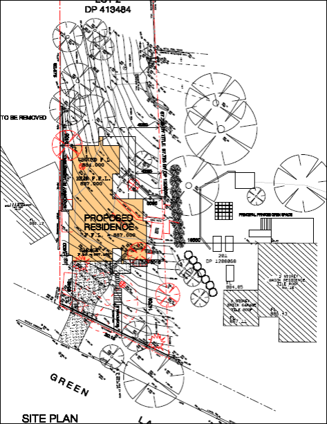
Figure 18 – dwellings offset on the adjoining
parcels
· Landscaping and
fencing (existing and conditional) of the intervening area between the
dwellings will interrupt the view corridors between the buildings.
Privacy Impacts of the Private
Open Space Area at 10 Green Lane
The potential for overlooking of
the private open space area associated with the dwelling at 10
Green Lane is considered to be within reasonable limit as follows:
· The adjoining
parcel at 10 Green Lane contains multiple private open space areas.
· DCP 2004 provides
parameters relating to private open space, but does not define private open
space per se. As such, the DCP relies upon common or plain English
interpretations of open space. In this regard:
- “Open
space” includes all outdoor areas that are not wholly enclosed by built
form.
- “Private
open space” includes outdoor areas associated with, and accessed by a
dwelling, that are afforded some privacy by virtue of siting or fencing.
- “Principal
private open space” is defined in SEPP (Exempt and Complying Development
Codes) 2008 as an area outside a dwelling that is directly accessible from,
and adjacent to, a habitable room in the dwelling, other than a bedroom. The concept
of ‘principal private open space’ acknowledges that some properties
will have multiple private open spaces, and priority should be given to
protecting the main areas.
· Based
on the definitions and DCP parameters, the principal private open space
area for the dwelling at 10 Green Lane would be located on the north side
of the dwelling, accessible via the dining, lounge and family rooms (pursuant
to BA 129/61) (see Figure 19 below). The proposed development will
therefore not result in any overlooking of the principal private open space
area for the dwelling at 10 Green Lane. Existing residential amenity afforded
to this space will be retained in its current form.
Figure 19 – 12 Green Lane – approved site
plan and principal private open space area
· An additional private
open space area is located at the rear of the dwelling, as noted on the
site analysis plan. This space provides outdoor recreational needs and service
functions associated with the dwelling. There will be a separation of at least
12m between the private open space area and unscreened upper-level habitable
openings/spaces in the proposed dwelling. This distance will exceed the 9m
separation prescribed in the DCP.
[It is noted that this space is
visible from the footpath at the site frontage and does not afford a high level
of privacy].
· The rear garden
provides an extensive open space area for the dwelling at 10
Green Lane. Overlooking of this open space area from the rear deck is
considered to be within reasonable limit. The deck will be sited a minimum 4.9m
from the northern boundary and will not overlook active recreational or service
zones at 10 Green Lane. Established trees at 10 Green Lane will interrupt views
of the adjoining parcel from the elevated deck. Views from the deck will be
directed to the north-west, which is a more valued and interesting view
corridor.
Privacy Impacts for other Adjoining Dwellings
The proposed dwelling will not impact on visual privacy for
the adjoining dwellings to the south at 14 Green Lane, or west in Wirruna
Avenue and Panpande Crescent. Topography, finished levels, dwelling siting and
existing landscaping will circumvent overlooking between the parcels.
Planning Principles
The Land and Environment Court has established Planning
Principles for the Protection of Visual Privacy (Meriton v Sydney City Council [2004]
NSWLEC 313). The relevant matters include:
- When
visual privacy is referred to in the context of residential design, it means
the freedom of one dwelling and its private open space from being overlooked by
another dwelling and its private open space.
- Numerical
guidelines for the separation of dwellings exist in the Australia-wide
guideline, AMCORD… AMCORD recommends a separation of 9m between habitable
rooms.
- The
ease with which privacy can be protected is inversely proportional to the
density of development.
- At
low-densities there is a reasonable expectation that a dwelling and some of its
private open space will remain private.
- Privacy
can be achieved by separation. The required distance depends upon density and
whether windows are at the same level and directly facing each other. Privacy
is hardest to achieve in developments that face each other at the same level.
In a low-density area, the objective should be to achieve separation between
windows that exceed the numerical standards above.
- The
use of a space determines the importance of its privacy. Within a dwelling, the
privacy of living areas, including kitchens, is more important than that of
bedrooms. Conversely, overlooking from a living area is more objectionable than
overlooking from a bedroom where people tend to spend less waking time.
- Where
the whole or most of a private open space cannot be protected from overlooking,
the part adjoining the living area of a dwelling should be given the highest
level of protection.
- Apart
from adequate separation, the most effective way to protect privacy is by the
skewed arrangement of windows and the use of devices such as fixed louvres,
high and/or deep sills and planter boxes. The use of obscure glass and privacy
screens, while sometimes being the only solution, is less desirable.
- Landscaping
should not be relied on as the sole protection against overlooking. While
existing dense vegetation within a development is valuable, planting proposed
in a landscaping plan should be given little weight.
As outlined in the foregoing
assessment, the proposed design response to protect visual privacy for the
adjoining northern dwelling will be wholly consistent with the LEC planning
principles. The use of spaces, window placement, separation, screening devices,
landscaping and perimeter fencing will assist to protect visual privacy for the
dwelling at 10 Green Lane. Principal private open space and other private open
spaces will be reasonably protected, noting that the LEC Principles do not
require the whole or most of a private open space be protected from
overlooking.
Acoustic Privacy
The DCP sets the following Planning Outcome in regard to
Acoustic Privacy:
· Site layout and
building design:
- protect
habitable rooms from excessively high levels of external noise
- minimise the
entry of external noise to private open space for dwellings close to major
noise sources
- minimise
transmission of sound through a building to affect other dwellings.
The subject land is contained in a residential area, where
ambient noise levels are low. Residential landuse is not noise-generating.
Residential use of the land will be consistent with the existing acoustic
environment for the adjoining dwellings.
Security
The DCP sets the following Planning Outcomes in regard to
Security:
· the site layout
enhances personal safety and minimises the potential for crime, vandalism and
fear
· the design of
dwellings enables residents to survey streets, communal areas and approaches to
dwelling entrances.
The proposal is considered acceptable in regard to safety
and security as follows:
· Openings in the
dwelling will provide for surveillance of Green Lane, the driveway and rear
yard.
· The landscape
design will not restrict sight lines.
· The dwelling will
have internal access via the garage.
Circulation and
Design
The DCP sets the following Planning Outcome in regard to
Circulation and Design:
· accessways and
parking areas are designed to manage stormwater
· accessways,
driveways and open parking areas are suitably landscaped to enhance amenity
while providing security and accessibility to residents and visitors
· the site layout
allows people with a disability to travel to and within the site between car
parks, buildings and communal open space.
The proposal involves layback, crossover
and driveway construction via Green Lane. Reverse egress to Green Lane will be
required for the proposed dwelling, consistent with adjoining dwellings in the
street. Onsite vehicle circulation is not required for single dwellings.
The local road network will be of sufficient capacity to accommodate
traffic volumes associated with the proposed dwelling.
Car Parking
The DCP sets the following Planning
Outcomes in regard to Car Parking:
· Parking
facilities are provided, designed and located to:
- enable the
efficient and convenient use of car spaces and access ways within the site
- reduce the
visual dominance of car parking areas and access ways.
· Car parking is
provided with regard to the:
- the number and
size of proposed dwellings
- requirements
of people with limited mobility or disabilities.
Pursuant to DCP 2004, onsite
parking is required for 3+ bedroom dwellings at a rate of 1.5 spaces per
dwelling. An attached double garage will be provided for the proposed dwelling
in compliance with the DCP.
Private Open Space
The DCP sets the following Planning
Outcomes in regard to Private Open Space:
Private open space is clearly
defined for private use.
· Private open
space areas are of a size, shape and slope to suit the reasonable requirements
of residents including some outdoor recreational needs and service functions.
· Private open
space is:
- capable of
being an extension of the dwelling for outdoor living, entertainment and
recreation
- accessible
from a living area of the dwelling
- located to
take advantage of outlooks; and to reduce adverse impacts of overshadowing or
privacy from adjoining buildings
- orientated to
optimise year round use.
Private open space for the proposed
dwelling will comply with the DCP Guidelines in relation to minimum area,
dimension, orientation, solar access and connectivity. A condition is included
on the attached Notice of Approval requiring perimeter fencing to be installed
to the part/northern boundary to ensure privacy to the ground level private
open space area.
Open Space and Landscaping
The DCP sets the following Planning
Outcomes in regard to Open Space and Landscaping:
· the site layout
provides open space and landscaped areas which:
- contribute to
the character of the development by providing buildings in a landscaped setting
- provide for a
range of uses and activities including stormwater management
- allow cost
effective management.
· the landscape
design specifies landscape themes consistent with the desired neighbourhood
character; vegetation types and location, paving and lighting provided for
access and security
· major existing
trees are retained and protected in a viable condition whenever practicable
through appropriate siting of buildings, access ways and parking areas
· paving is
applied sparingly and integrated in the landscape design.
As variously outlined in this report, the proposal involves
removal of trees and vegetation over the site to facilitate the proposed
development. It is accepted by assessment staff and external consultants that
tree removal is suitable and practical to enable development of a residential
lot for a dwelling house. A remnant Ribbon Gum is not a suitable tree in an
urban residential landscape. Conditions are included on the attached Notice of
Approval requiring tree protection for retained trees; and preparation and
implementation of a landscape plan.
Stormwater
The DCP sets the following Planning Outcomes in regard to
Stormwater:
· Onsite drainage
systems are designed to consider:
- downstream
capacity and need for onsite retention, detention and re-use
- scope for
onsite infiltration of water
- safety and
convenience of pedestrians and vehicles
- overland flow
paths.
· Provision is
made for onsite drainage which does not cause damage or nuisance flows to
adjoining properties.
Stormwater within the development
will be directed to the stormwater pit adjacent the northern site boundary and
discharged to Wirruna Avenue via stormwater infrastructure and easement through
12 Green Lane and 22 Wirruna Avenue.
Erosion and Sedimentation
The DCP sets the following Planning Outcome in regard to
Erosion and Sedimentation:
· Measures
implemented during construction to ensure that the landform is stabilised and
erosion is controlled.
Conditions are included on the attached Notice of Approval
requiring sediment and erosion controls be installed and maintained during
construction.
Provisions Prescribed By The
Regulations S4.15(1)(A)(Iv)
Demolition of a Building (clause 92)
The proposal does not involve the demolition of a building.
Fire Safety Considerations
(clause 93)
The proposal does not involve a change of building use for
an existing building.
Buildings to be Upgraded (clause
94)
The proposal does not involve the rebuilding, alteration,
enlargement or extension of an existing building.
BASIX Commitments (clause 97A)
A BASIX Certificate has been submitted in support of the
proposed development. The proposed dwelling house will satisfy the
provisions of BASIX in respect of water, thermal comfort and energy.
The Likely Impacts of the
Development S4.15(1)(B)
The impacts of the proposed development have been considered
in the foregoing sections of this report and include:
· Setting and
context
o neighbourhood character
o landscape character
o public domain
o landuse
o interface
o presentation
· Visual impacts
o neighbourhood character
o streetscape presentation
o building design and
detailing
o building bulk, height
and siting
o landscape character
· Residential
amenity
o visual privacy
o visual bulk encroachment
o acoustic privacy
o solar access
· Traffic matters
o site access
o onsite manoeuvring
o car parking
o traffic generation
o network capacity
· Environmental
impacts
o sediment and erosion
control
o biodiversity
o groundwater
o stormwater management
o tree removal
o contamination.
The impacts of the development are considered to be within
reasonable limit. Conditions are included on the attached Notice of approval to
mitigate and managing arising impacts.
The Suitability Of The Site
S4.15(1)(c)
The subject land is considered to be suitable for the
proposed development due to the following:
· The proposal is
permitted on the subject land zoning.
· The land comprises
an undeveloped residential parcel in an established residential neighbourhood.
· The site is of
suitable area and dimensions for residential landuse.
· Utility services
are available and adequate.
· The land has
suitable road access.
· The local road
network is of sufficient capacity.
· The land is not
subject to known technological or natural hazards.
· The site has no
particular environmental values.
Any Submissions Made In
Accordance With The Act S4.15(1)(d)
The proposed development is defined as Notified Development
pursuant to Council’s Community Participation Plan 2019. The application
was publicly exhibited on three occasions. The key issues raised in the
submissions have been considered in the foregoing assessment and are reiterated
or clarified below.
EXHIBITION 1: 30 APRIL – 14 MAY 2020
Submission 1
· The remnant
Ribbon Gum should be retained.
Tree removal is necessary to facilitate the proposal.
Council’s MCP considers it is suitable to remove the tree. The land is
zoned for residential purposes (rather than public recreation or environmental
protection), and the Ribbon Gum is an unsuitable specimen in an urban
residential setting.
· Alternative
driveway access should be provided to the site to retain the Ribbon Gum.
Alternative driveway access to the development site would
necessitate removal of a street tree. This is not a preferred outcome.
Council’s MCP advises alternative driveway construction such as piering
and suspension would adversely impact on the root system of the Ribbon Gum, and
integrity of the tree.
· The proposed
dwelling will overlook the private open space area at 10 Green Lane.
It is considered that the building design (final amended plans)
will not result in unreasonable overlooking of the private open space areas at
10 Green Lane.
· The proposed
dwelling will visually encroach upon the dwelling and rear yard at 10 Green
Lane.
It is considered that the building design (final amended plans)
will not result in unreasonable visual bulk encroachment impacts for the
adjoining dwelling at 10 Green Lane. The building encroachment within the
prescribed envelope plane will be minor and within reasonable limit.
EXHIBITION 2: 17 FEBRUARY
– 2 MARCH 2021
Submission 1
· The dwelling
design will not complement the streetscape character.
The Green Lane residential neighbourhood has been subject to
gentrification in recent years, including replacement dwellings circa
2015-2020; and renovation and modernisation of original dwellings. The proposed
dwelling will relate to the established neighbourhood character in design,
detailing and massing. Contemporary form and finishes will complement original
and updated dwellings in the streetscape and add visual interest.
· The parcel
is too small to accommodate a dwelling house.
The subject land comprises site area of 1,057.38m2.
The development site has existed as a residential lot in the current cadastre
with associated permissible development entitlements since the 1950s. It is
noted that controls in DCP 2004 and Shiralee DCP 2015 permit dwelling
construction on parcels with areas of 250m2.
· The Green
Lane road formation is too narrow to accommodate site access and on street car
parking.
Onsite car parking will be provided for the proposed
dwelling in accordance with the DCP requirements. Council’s Assistant
Development Engineer raises no objection to access driveway location or design.
The Green Lane road formation was constructed in the 1950s
in accordance with applicable engineering standards at that time. The road has
a width-to-width kerb of 9m and would comprise an Urban Local Access Road
pursuant to the operative Orange City Development and Subdivision Code. The
road operates at a low-speed environment and will accommodate two-way traffic
flows and on-street parking. Council’s Assistant Development Engineer
advises that Green Lane has sufficient capacity to accommodate traffic
generation associated with dwelling construction on the existing residential
lot.
· Garage
siting and presentation will have adverse visual impacts in the street.
The front elevation and attached double garage will satisfy
the DCP Guidelines in respect of design, siting and width. It is noted that
detached and/or prominent garages are a feature in this streetscape. The
proposed garage siting and presentation will be an improved design response to
adjoining improvements.
· Tree removal
will alter the landscape character of the site and setting, and impact on local
fauna.
It is concurred that the landscape character of the site
will be altered by the proposal. Notwithstanding, it is a reasonable
expectation that the residential parcel be developed for a dwelling house. The
land does not comprise public open space or have particular environmental
values. MCP conditions are included on the attached Notice of Approval in
relation to tree protection measures for retained trees across the site; and
installation of nesting boxes in retained trees for locally occurring arboreal
mammals.
Submission 2
· The remnant
Ribbon Gum should be retained; removal of the tree cannot be justified.
Tree removal is necessary to facilitate the proposal.
Council’s MCP considers it is suitable to remove the tree. The land is
zoned for residential purposes (rather than public recreation or environmental
protection), and the Ribbon Gum is an unsuitable specimen in an urban
residential setting.
· The access
and driveway should be repositioned or redesigned to eliminate earthworks that
will impact the tree.
Alternative driveway access to the development site would
necessitate removal of a street tree. This is not a preferred outcome.
Council’s MCP advises alternative driveway construction such as piering
and suspension would adversely impact on the root system of the Ribbon Gum, and
integrity of the tree.
· The proposal
will adversely impact on visual privacy for the dwelling at 10 Green Lane.
It is considered that the building design (final amended
plans) will not adversely impact on visual privacy for the dwelling at 10 Green
Lane. The design response to address visual privacy will be consistent with the
DCP controls and LEC Planning Principles.
Submission 3
The application has not been
correctly notified
Plans exhibited during the re-notification period of 17
February – 2 March 2021 were a superseded plan set (ie. drawings
submitted in October 2020). To correct this processing error, it was necessary
for the DA to be placed on public notification again, in order to notify the
drawings submitted in January 2021. The DA was placed on public re-notification
between 4 and 18 March 2021.
· A Site
Analysis plan was not provided in support of the DA, as required under the DCP.
A Site Analysis was submitted in support of the proposal in
the form of the Site Plan (Drawing No. 05). The site plan includes DCP-listed
details for the site and surrounding area, sufficient to inform the proposed
dwelling design and siting.
· The proposal
will adversely impact on visual privacy for the dwelling at 10 Green Lane and
be contrary to DCP controls and LEC Planning Principles.
It is considered that the building design (final amended
plans) will not adversely impact on visual privacy for the dwelling at 10 Green
Lane. The design response to address visual privacy will be consistent with the
DCP controls and LEC Planning Principles.
· The proposal
will have unacceptable visual bulk impacts for the dwelling at 10 Green Lane
and be contrary to DCP controls and LEC Planning Principles.
It is considered that the building design (final amended
plans) will not result in unreasonable visual bulk encroachment impacts for the
adjoining dwelling at 10 Green Lane. The building encroachment within the
prescribed envelope plane will be minor and within reasonable limit. The
assessment of bulk impacts demonstrates compliance with LEC Planning
Principles.
· The proposal
will adversely impact on acoustic privacy for the dwelling at 10 Green Lane and
be contrary to DCP controls.
Habitable spaces in the proposed dwelling will be suitably
removed from the adjoining dwelling house and private open spaces at 10 Green
Land. Residential landuse is not noise-generating. Residential use of the land
will be consistent with the existing acoustic environment for the adjoining
dwellings.
· The remnant
Ribbon Gum should be retained; removal of the tree cannot be justified; tree
removal is contrary to DCP controls
Tree removal is necessary to facilitate the proposal.
Council’s MCP considers it is suitable to remove the tree. The land is
zoned for residential purposes (rather than public recreation or environmental
protection), and the Ribbon Gum is an unsuitable specimen in an urban
residential setting.
· The access
and driveway should be repositioned or redesigned to eliminate earthworks that
will impact the tree.
Alternative driveway access to the development site would
necessitate removal of a street tree. This is not a preferred outcome.
Council’s MCP advises alternative driveway construction such as piering
and suspension would adversely impact on the root system of the Ribbon Gum, and
integrity of the tree.
· The DA plans
and supporting documents are contrary to legislation.
Council staff are satisfied that details submitted in
support of the DA satisfy the requirements of the Environmental Planning and
Assessment Regulation 2000 Schedule 1 Part 1 Development Applications.
· The DA plans
do not correctly plot existing grounds levels on the bulk controls, resulting
in an incorrect assessment as to the extent of non-compliance
The proponent’s building designer was requested to
confirm existing ground levels noted on the elevation drawings; and review the
extent of dwelling encroachment within the prescribed envelope plane.
The building designer has confirmed that the envelope plane
was projected from ground levels as set by Registered Surveyor Craig Jaques,
pursuant to Sketch Showing Partial Stake Out of Building Corners, dated
17/2/21 (see Figure 20 below).
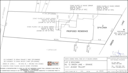
Figure 20 – partial set out sketch
The encroachment of the proposed dwelling within the
envelope plane is depicted in 3D modelling and elevation plan view, as
considered above and repeated below for convenience (see Figures). The VBE
encroachment of 3.5% of the north building façade is considered to be
minor and within reasonable limit.
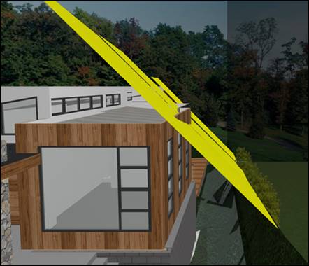
Figure 21 – 3D modelling of VBE plane
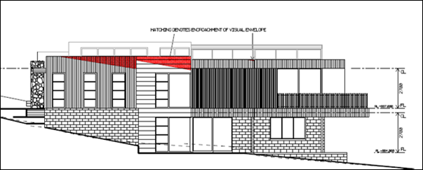
Figure 22 – dwelling encroachment within VBE
plane shown red hatching
· The previous
assessment report did not consider relevant environmental planning instruments
or development control plan
This report provides a consolidated assessment of the
proposed development, consistent with Section 4.15 of the Environmental
Planning and Assessment Act (EPAA) 1979.
EXHIBITION 3: 4 - 18 MARCH 2021
Submission 1
The same submission as considered above.
Submission 2
· A Site
Analysis plan was not provided in support of the DA, as required under the DCP.
A Site Analysis was submitted in support of the proposal in
the form of the Site Plan (Drawing No. 05). The site plan includes DCP-listed
details for the site and surrounding area, sufficient to inform the proposed
dwelling design and siting.
· The proposal
will adversely impact on visual privacy for the dwelling at 10 Green Lane and
be contrary to DCP controls and LEC Planning Principles.
It is considered that the building design (final amended
plans) will not adversely impact on visual privacy for the dwelling at 10 Green
Lane. The design response to address visual privacy will be consistent with the
DCP controls and LEC Planning Principles.
· The proposal
will have unacceptable visual bulk impacts for the dwelling at 10 Green Lane
and be contrary to DCP controls and LEC Planning Principles.
It is considered that the building design (final amended
plans) will not result in unreasonable visual bulk encroachment impacts for the
adjoining dwelling at 10 Green Lane. The building encroachment within the
prescribed envelope plane will be minor and within reasonable limit. The
assessment of bulk impacts demonstrates compliance with LEP Planning
Principles.
· The proposal
will adversely impact on acoustic privacy for the dwelling at 10 Green Lane and
be contrary to DCP controls.
Habitable spaces in the proposed dwelling will be suitably
removed from the adjoining dwelling house and private open spaces at 10 Green
Land. Residential landuse is not noise-generating. Residential use of the land
will be consistent with the existing acoustic environment for the adjoining
dwellings.
· The remnant
Ribbon Gum should be retained; removal of the tree cannot be justified; tree
removal is contrary to DCP controls
Tree removal is necessary to facilitate the proposal.
Council’s MCP considers it is suitable to remove the tree. The land is
zoned for residential purposes (rather than public recreation or environmental
protection), and the Ribbon Gum is an unsuitable specimen in an urban
residential setting.
· The access
and driveway should be repositioned or redesigned to eliminate earthworks that
will impact the tree.
Alternative driveway access to the development site would
necessitate removal of a street tree. This is not a preferred outcome.
Council’s MCP advises alternative driveway construction such as piering
and suspension would adversely impact on the root system of the Ribbon Gum, and
integrity of the tree.
· Insufficient
information was lodged with the DA and Council’s assessment is flawed
Assessment staff are satisfied that plans and supporting
information lodged in support of the DA are consistent with EPAA 2000 Schedule
1 Part 1. This report provides a consolidated assessment of the proposed
development, consistent with Section 4.15 EPAA 1979.
Public Interest
S4.15(1)(e)
The proposal is not inconsistent with any relevant policy
statements, planning studies, guidelines etc that have not been considered in
this assessment.
The proposal involves development of residential land for a
dwelling house. The proposal is not adverse to the public interest.
SUMMARY
Consent is sought for construction of a dwelling house and
associated site works at 12 Green Lane.
The land is undeveloped and has historically provided an extension
of the garden for the adjoining parcel at 10 Green Lane. As such, the landscape
values of the site are highly valued by adjoining residents. Notwithstanding,
the development site has existed as a residential lot in the current cadastre
with associated permissible development entitlements since the 1950s.
Public submissions were received in response to notification
of the application. The submissions generally raised concerns in relation
to visual privacy, visual bulk and tree removal.
The proposed development is
considered to be an appropriate design response for the site and setting. It is
assessed that the development will reasonably comply with the planning controls
that apply to the site, and accord with relevant Planning Principles of the Land
and Environment Court. Impacts of the development are considered to be within
reasonable limit.
Approval of the application is recommended.
Attachments
1 Notice
of Approval, D21/16574⇩
2 Plans,
D21/16335⇩
3 Submission
- Notification Period 1, D21/16701⇩
4 Submissions
- Exhibition Period 2, D21/16696⇩
5 Submissions
- Exhibition Period 3, D21/16743⇩
Planning
and Development Committee
6 April 2021
Attachment 1 Notice
of Approval
|

|
ORANGE CITY COUNCIL
Development
Application No DA
111/2020(1)
NA21/ Container
PR4818
|
NOTICE OF DETERMINATION
OF A DEVELOPMENT
APPLICATION
issued under the Environmental
Planning and Assessment Act 1979
Section 4.18
|
Development
Application
|
|
|
Applicant
Name:
|
Bassmann Drafting
Services
|
|
Applicant
Address:
|
25-27 McNamara Lane
ORANGE
NSW 2800
|
|
Owner’s
Name:
|
Mr M J and Mrs J E
Truloff
|
|
Land
to Be Developed:
|
Lot 2 DP 413484 - 12
Green Lane, Orange
|
|
Proposed
Development:
|
Dwelling (two
storey), Attached Garage, Retaining Walls and Tree Removal
|
|
|
|
|
Building Code of
Australia
building
classification:
|
Class - as determined
by Certifier
|
|
|
|
|
Determination made
under
Section 4.16
|
|
|
Made
On:
|
6 April 2021
|
|
Determination:
|
CONSENT GRANTED
SUBJECT TO CONDITIONS DESCRIBED BELOW:
|
|
|
|
|
Consent to Operate
From:
|
7 April 2021
|
|
Consent to Lapse On:
|
7 April 2021
|
Terms
of Approval
The reasons for the imposition of conditions are:
(1) To ensure a quality
urban design for the development which complements the surrounding environment.
(2) To maintain
neighbourhood amenity and character.
(3) To ensure compliance
with relevant statutory requirements.
(4) To ensure the utility services
are available to the site and adequate for the development.
(5) To prevent the proposed
development having a detrimental effect on adjoining land uses.
Conditions
(1) The development must be
carried out in accordance with:
(a) Drawings
by Bassmann Drafting Services, Job No. 18.108, Drawing Nos. 00(B); 01(B);
02(B); 03(B); 04(C); 05(D); 06(B) (7 sheets)
(b) statements
of environmental effects or other similar associated documents that form part
of the approval
as amended in
accordance with any conditions of this consent.
(2) All building work must
be carried out in accordance with the provisions of the Building Code of
Australia.
(3) A sign is to be erected
in a prominent position on any site on which building work, subdivision work or
demolition work is being carried out:
(a) showing
the name, address and telephone number of the principal certifying authority
for the work, and
(b) showing
the name of the principal contractor (if any) for any building work and a telephone
number on which that person may be contacted outside working hours, and
(c) stating
that unauthorised entry to the site is prohibited.
Any such sign is to be maintained while the
building work, subdivision work or demolition work is being carried out.
(4) In
the case of residential building work for which the Home Building Act 1989
requires there to be a contract of insurance in force in accordance with Part 6
of the Act, evidence that such a contract of insurance is in force is to be
provided to the Principal Certifying Authority before any building work
authorised to be carried out by the consent commences.
(5) Residential
building work within the meaning of the Home Building Act 1989 must not
be carried out unless the principal certifying authority for the development to
which the work relates (not being the council) has given the council written
notice of the following information:
(a) in
the case of work for which a principal contractor is required to be appointed:
(i) the
name and the licence number of the principal contractor, and
(ii) the
name of the insurer by which the work is insured under Part 6 of that Act,
(b) in
the case of work to be done by an owner-builder:
(i) the
name of the owner-builder, and
(ii) if
the owner-builder is required to hold an owner-builder permit under that Act,
the number of the owner-builder permit.
If arrangements for doing the residential
building work are changed while the work is in progress so that the information
under this condition becomes out of date, further work must not be carried out
unless the principal certifying authority for the development to which the work
relates (not being the council) has given the council written notice of the
updated information.
(6) Where any excavation
work on the site extends below the level of the base of the footings of a
building on adjoining land, the person having the benefit of the development
consent must, at the person’s own expense:
(a) protect
and support the adjoining premises from possible damage from the excavation,
and
(b) where
necessary, underpin the adjoining premises to prevent any such damage.
Note: This
condition does not apply if the person having the benefit of the development
consent owns the adjoining land or the owner of the adjoining land has given
consent in writing to this condition not applying.
|
PRIOR TO THE ISSUE OF A CONSTRUCTION
CERTIFICATE
|
(7) A
landscaping plan shall be submitted to Council for approval of the Manager City
Presentation. The plan shall relate to that part of the site between the
northern dwelling façade and northern boundary. The landscape plan
shall include species of a type, number and size suitable to provide
intermittent screening of the proposed dwelling. Plantings shall complement
private landscaping in the neighbourhood.
(8) Details
of fencing to the northern boundary of the site shall be submitted to Council
for approval of the Manager Development Assessments. Fencing shall have a
height of 1.8m from the highest finished ground level adjacent to that fence. Fencing
shall be of solid construction, such as timber or brick. Open style
fencing is not permitted.
(9) A
Road Opening Permit in accordance with Section 138 of the Roads Act 1993
must be approved by Council prior to a Construction Certificate being issued
or any intrusive works being carried out within the public road or footpath
reserve.
|
PRIOR TO WORKS COMMENCING
|
(10) A
Construction Certificate application is required to be submitted to, and issued
by Council/Accredited Certifier prior to any excavation or building works being
carried out onsite.
(11) A
temporary onsite toilet is to be provided and must remain throughout the
project or until an alternative facility meeting Council’s requirements
is available onsite.
(12) The
location and depth of the sewer junction/connection to Council’s sewerage
system is to be determined to ensure that adequate fall to the sewer is
available.
(13) Soil
erosion control measures shall be implemented on the site.
(14) Prior
to removal of the Ribbon Gum, the proponent shall liaise with Council’s
Manager City Presentation, to determine whether there is an ecological use for
the subject tree in a local park.
(15) Three
(3) nesting boxes for locally
occurring arboreal mammals shall be provided in trees to retained on the
subject property. The nesting boxes shall be retained on the subject land
for the duration of construction works.
(16) Tree
protection zones (TPZ) (protective fencing) shall be installed in accordance
with AS 4373-2009 – Protection of Trees on Development Sites, for
the tree located between the alfresco area and the northern boundary, and the
large gum tree at the rear of the dwelling.
Protective fencing shall be installed prior to
site works commencing and must remain intact until completion of all works.
Fencing must not be altered or removed without approval of a project arborist.
If access is required or minor activities are
to be undertaken within the TPZ, it must be approved by the project arborist.
No routing of services, parking of vehicles, stacking of builder’s
materials / equipment, is to occur within the TPZ.
The protective fence is to be constructed from
ridged chain wire mesh panels (or similar), 1.8m in height, and securely
anchored without penetrating the ground. Signs identifying the TPZ should be
placed on the fencing and be visible from within the development site on all
angles.
The root zone within the TPZ is to be mulched
with tree chip to a depth of 75mm. Soil moisture levels is to be
regularly monitored during dry periods by the project arborist. Temporary
irrigation may be
(17) Should
the root system of the protected trees be disturbed or exposed during the
excavation for any reason the following treatment must be adhered to;
· With a root diameter
more than 20mm in diameter are to be dealt with in accordance with AS4373-2007
· With a root diameter
more than 20mm – 100mm in diameter are to be dealt with in accordance
with AS4373-2007 and
· Any root diameter
greater than 100mm requires advice from a qualified arborist prior to pruning
If unsure the builder is to contact a qualified
arborist to seek advice so as to reduce disturbance of the tree root system.
|
DURING CONSTRUCTION/SITEWORKS
|
(18) All
construction/demolition work on the site is to be carried out between the hours
of 7.00 am and 6.00 pm Monday to Friday inclusive, 7.00 am to
5.00 pm Saturdays and 8.00 am to 5.00 pm Sundays and Public
Holidays. Written approval must be obtained from the General Manager of Orange
City Council to vary these hours.
(19) A
Registered Surveyor’s certificate identifying the location of the
building on the site must be submitted to the Principal Certifying Authority.
(20) All
construction works are to be strictly in accordance with the Reduced Levels
(RLs) as shown on the approved plans.
(21) All materials on site
or being delivered to the site are to be contained within the site. The
requirements of the Protection of the Environment Operations Act 1997
are to be complied with when placing/stockpiling loose material or when
disposing of waste products or during any other activities likely to pollute
drains or watercourses.
(22) No portion of the
building - including footings, eaves, overhang and service pipes - shall
encroach into any easement.
|
PRIOR TO THE ISSUE OF AN OCCUPATION
CERTIFICATE
|
(23) Landscaping
shall be installed in accordance with the approved plan.
(24) Fencing
to the northern boundary shall be erected in accordance with the approved plan.
(25) No
person is to use or occupy the building or alteration that is the subject of
this approval without the prior issuing of an Occupation Certificate.
(26) Finished
ground levels are to be graded away from the buildings and adjoining properties
and must achieve natural drainage. The concentrated flows are to be dispersed
down slope or collected and discharged to the stormwater drainage system.
(27) Where
Orange City Council is not the Principal Certifying Authority, a final
inspection of water connection, sewer and stormwater drainage shall be
undertaken by Orange City Council and a Final Notice of Inspection issued,
prior to the issue of either an interim or a final Occupation Certificate.
(28) The
cut and fill is to be retained and/or adequately battered and stabilised
(within the allotment) prior to the issue of an Occupation Certificate.
(29) A
Road Opening Permit Certificate of Compliance is to be issued for the works by
Council prior to any Occupation/Final Certificate being issued for the
development.
(29) All
of the foregoing conditions are to be at the full cost of the developer and to
the requirements and standards of the Orange City Council Development and
Subdivision Code, unless specifically stated otherwise. All work required by
the foregoing conditions is to be completed prior to the issuing of an
Occupation Certificate, unless stated otherwise.
Other
Approvals
(1) Local
Government Act 1993 approvals granted under Section 68.
Water, Sewer and Stormwater
(2) General
terms of other approvals integrated as part of this consent.
(a) All plumbing and
drainage (water supply, sanitary plumbing and drainage, stormwater drainage and
hot water supply) is to comply with the Local Government (Water, Sewerage
and Drainage) Regulation 1998, the Plumbing Code of
Australia 2016 - Plumbing & Drainage and Australian
Standard AS3500 - National Plumbing and Drainage Code. Such work is to be
installed by a licensed plumber and is to be inspected and approved by Council
prior to concealment.
(b) Orange
City Council is the Water and Sewer Authority for the Orange City Council area.
Therefore all water and sewer works must be inspected by Council. These inspections
CANNOT be carried out by a private certifier.
(c) The following
inspections are required to be carried out by Council as the Water and Sewer
Authority:
- internal
sewer
- hot
and cold water installation
- external
sewer
- stormwater
drainage
- final
on water, sewer and stormwater drainage and Council services.
(d) Hot
water shall be stored at a minimum of 60OC and be delivered to all
sanitary fixtures used for personal hygiene (bathrooms/ensuites) at a
temperature not exceeding 50oC. Where tempering valves are
installed, a sign is to be permanently fixed on the hot water heater adjacent
to the tempering valve (clearly visible) indicating:
“A tempering valve has been installed to
prevent scalding. This valve is to be renewed at intervals as recommended by
the manufacturer.”
(e) The
location and depth of the sewer junction/connection to Council’s sewerage
system is to be determined to ensure adequate fall to the sewer is available.
(f) All services (water,
sewer and stormwater) shall be laid outside the easement unless there is a
direct connection to the main within that easement.
(g) All
stormwater is to be disposed of in a manner suitable to the site.
Right
of Appeal
If you are dissatisfied with this decision,
Section 8.7 of the Environmental Planning and Assessment Act 1979
gives you the right to appeal to the Land and Environment Court. Pursuant to
Section 8.10, an applicant may only appeal within 6 months after the date the
decision is notified.
|
Disability
Discrimination Act 1992:
|
This application has been assessed in
accordance with the Environmental Planning and Assessment Act 1979. No
guarantee is given that the proposal complies with the Disability
Discrimination Act 1992.
The applicant/owner is responsible to ensure
compliance with this and other anti-discrimination legislation.
The Disability Discrimination Act
covers disabilities not catered for in the minimum standards called up in the
Building Code of Australia which references AS1428.1 - "Design for
Access and Mobility". AS1428 Parts 2, 3 and 4 provides the most
comprehensive technical guidance under the Disability Discrimination Act
currently available in Australia.
|
|
Disclaimer
- S88B of the Conveyancing Act 1919 - Restrictions on the Use of
Land:
|
The applicant should note that there could be
covenants in favour of persons other than Council restricting what may be
built or done upon the subject land. The applicant is advised to check the
position before commencing any work.
|
|
|
|
|
Signed:
|
On behalf of the consent authority ORANGE
CITY COUNCIL
|
|
Signature:
|
|
|
Name:
|
PAUL JOHNSON - MANAGER DEVELOPMENT
ASSESSMENTS
|
|
Date:
|
7 April 2021
|
Planning and Development Committee
6 April 2021
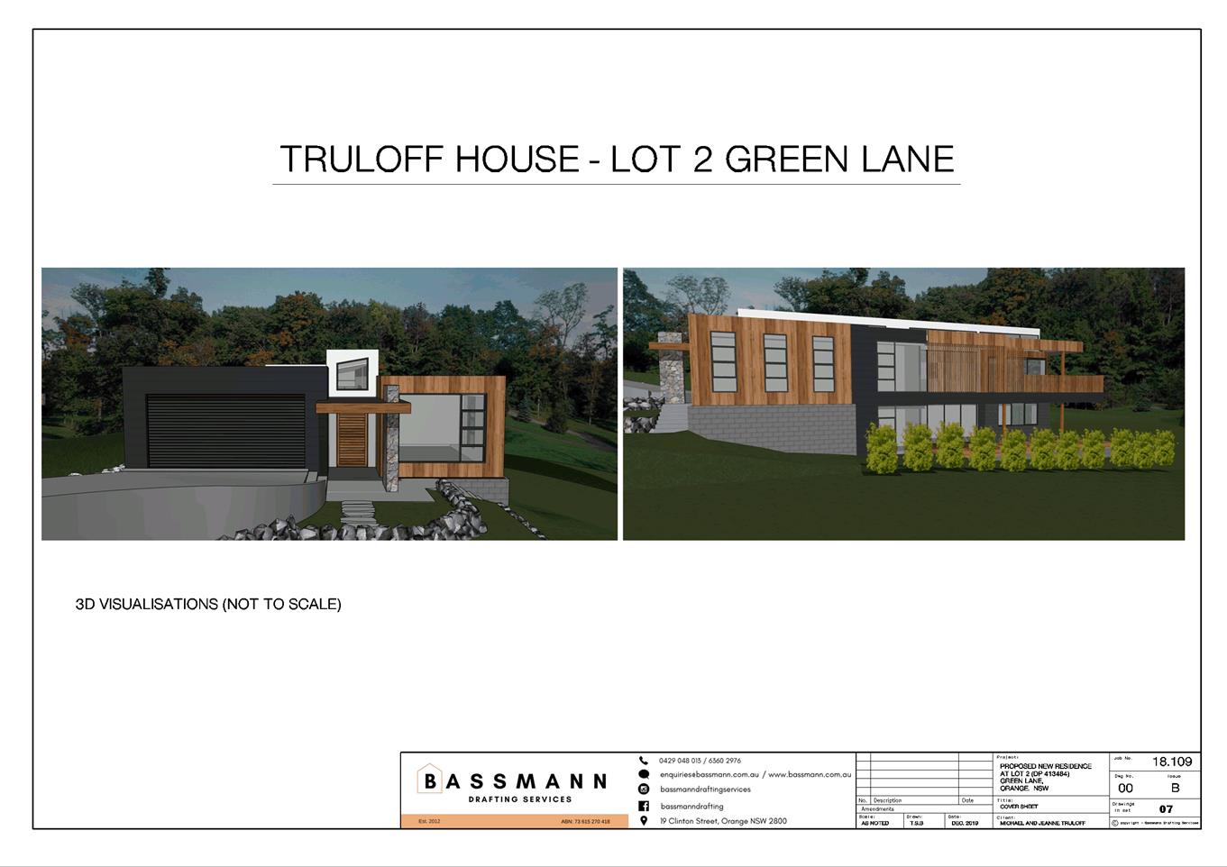
Planning
and Development Committee
6 April 2021
Attachment 3 Submission
- Notification Period 1
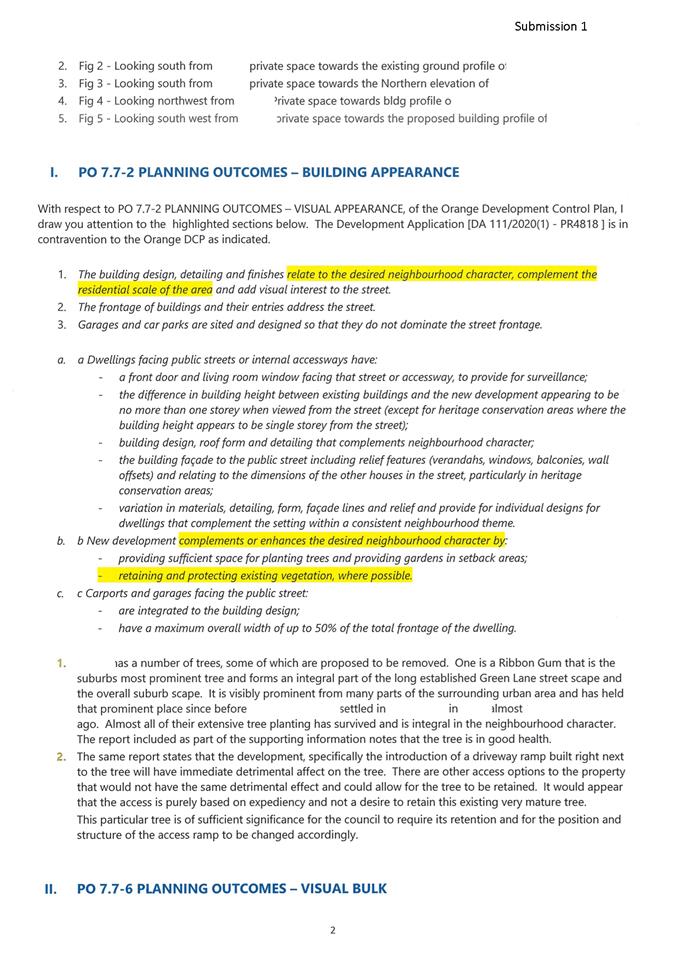
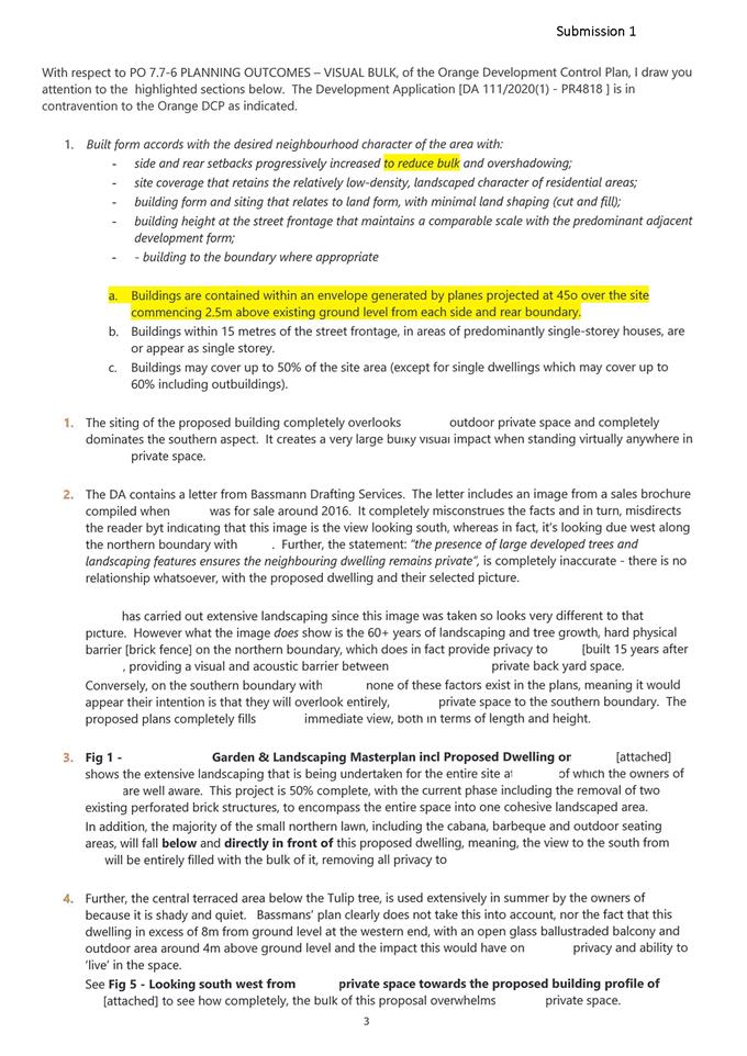
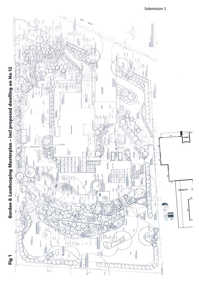
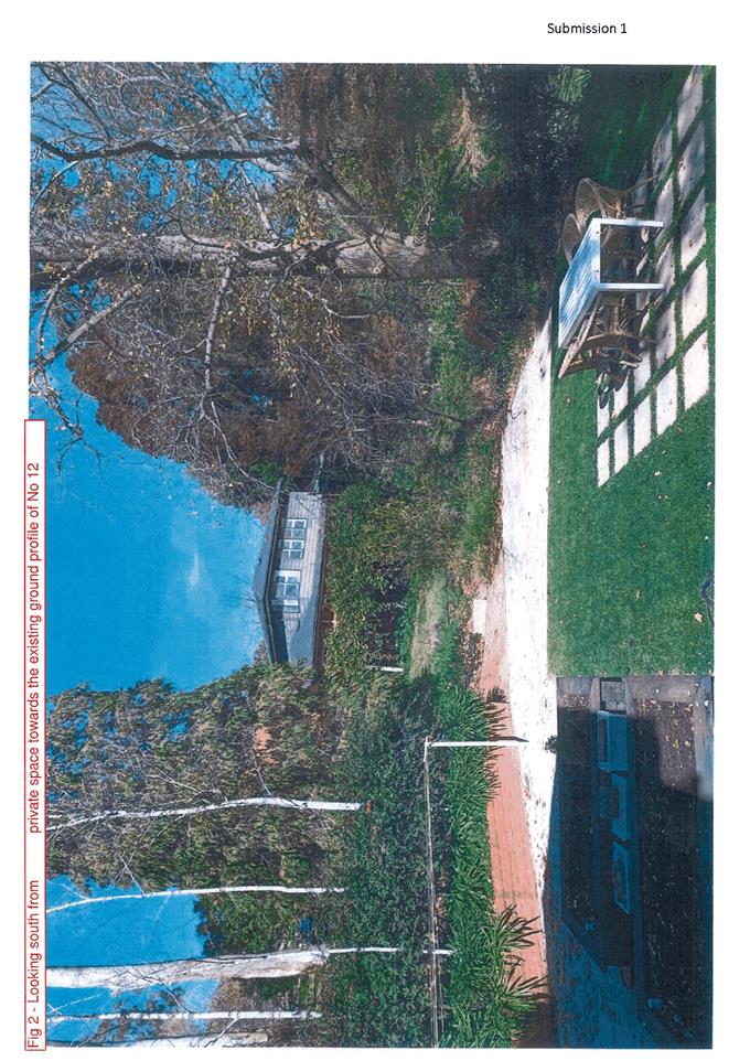
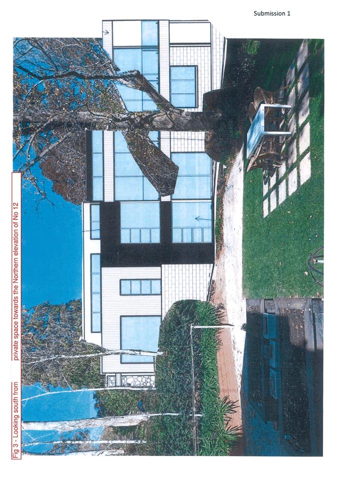
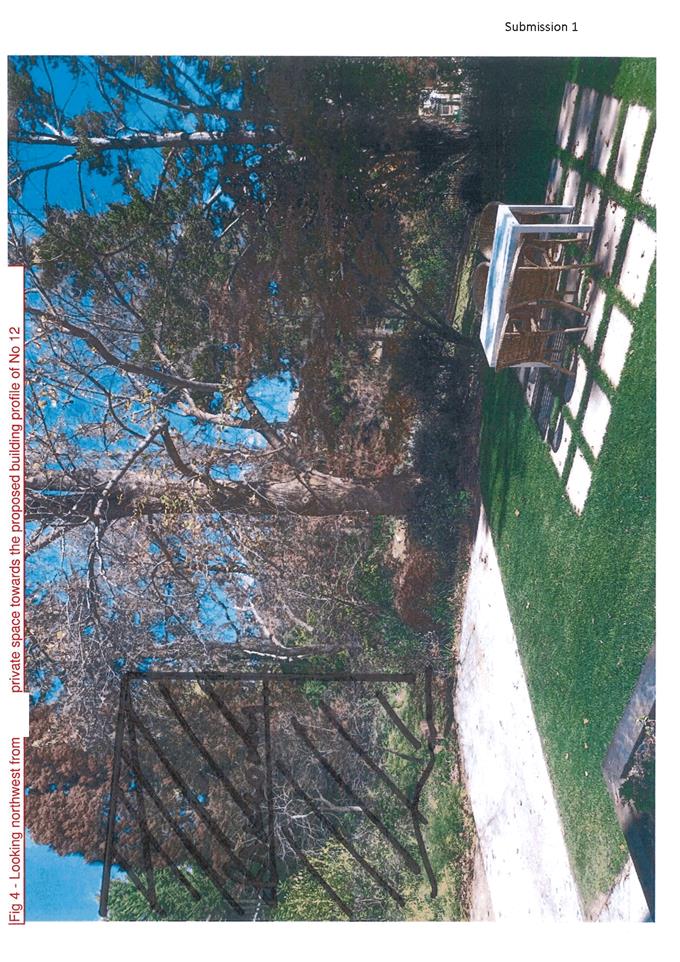
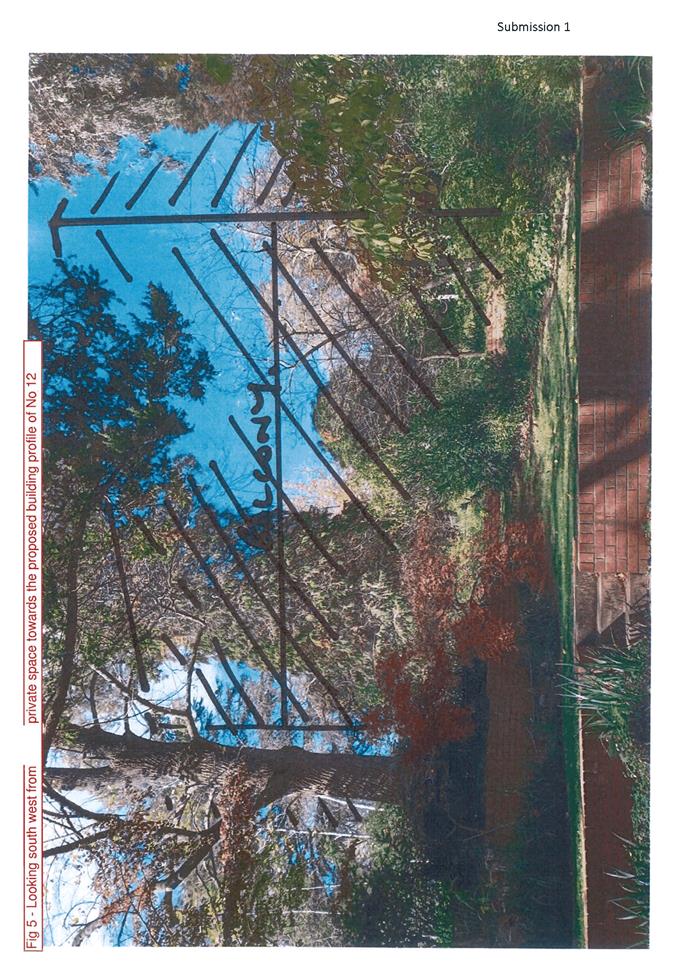
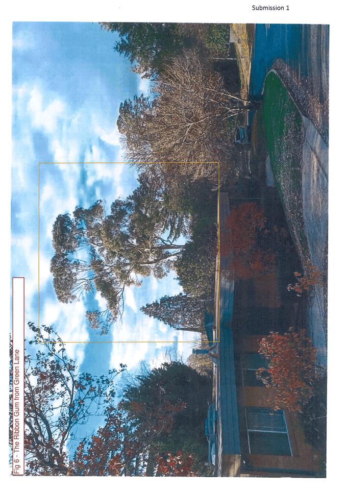
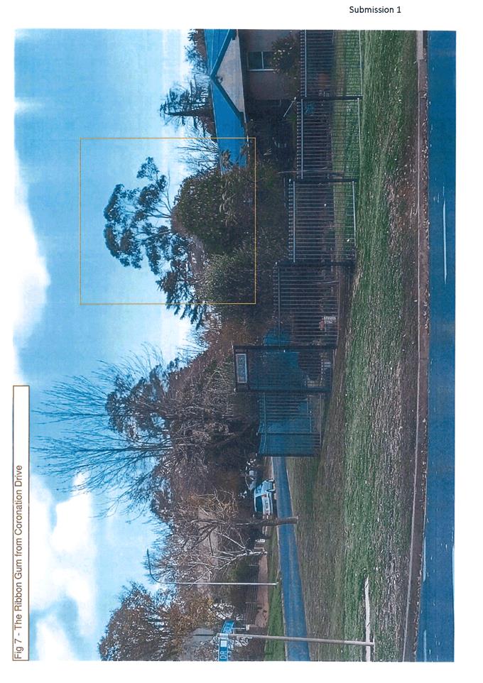
Planning and Development Committee
6 April 2021
Attachment 4 Submissions
- Exhibition Period 2
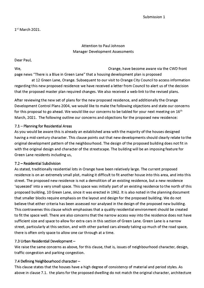
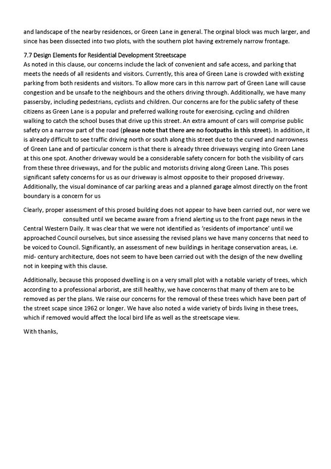
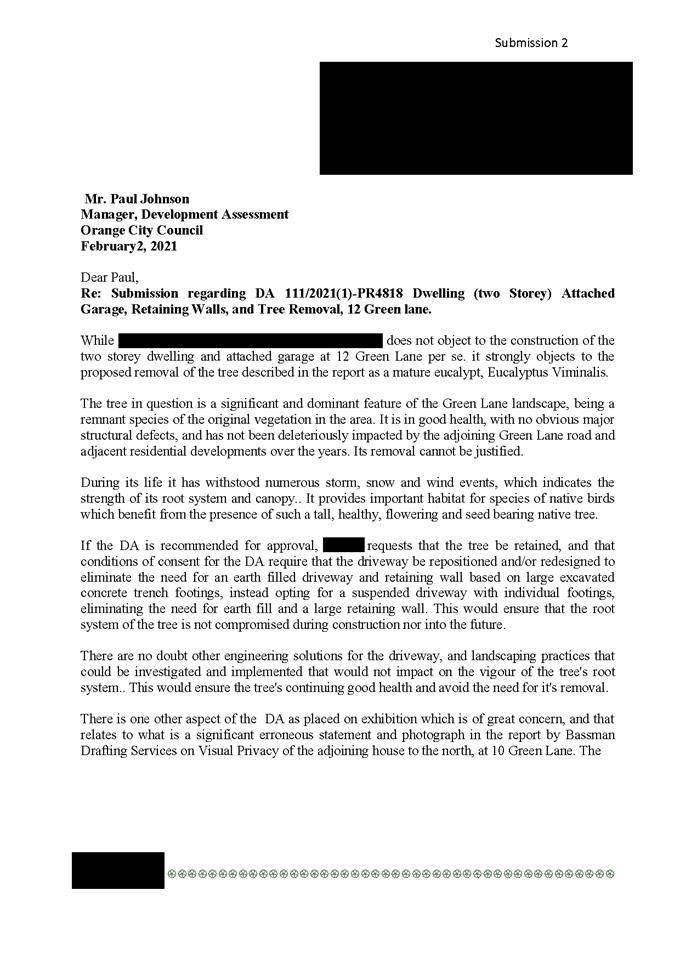
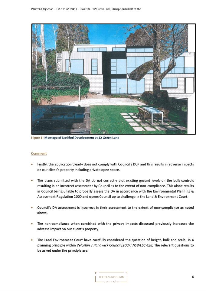
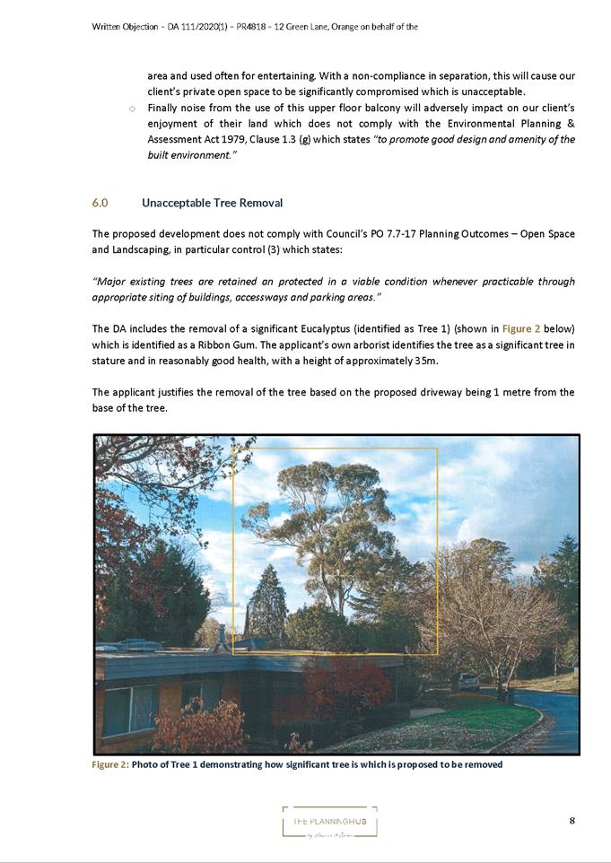
Planning and Development Committee
6 April 2021
Attachment 5 Submissions
- Exhibition Period 3
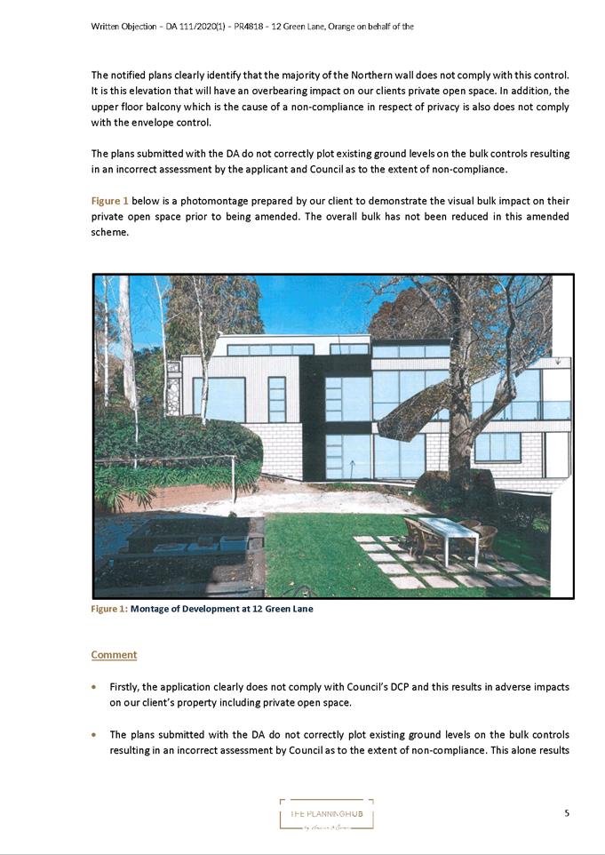
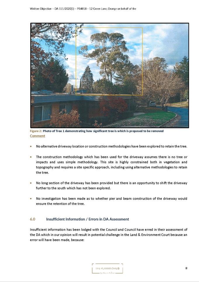
2.9 Development
Application DA 4/2021(1) - 49 Hill Street, Orange
RECORD
NUMBER: 2021/592
AUTHOR: Summer
Commins, Senior Planner
EXECUTIVE Summary
|
Application
lodged
|
6
January 2021
Additional
information submitted 23 March 2021
36 STOP
days
|
|
Applicant/s
|
Gowrie
NSW
|
|
Owner/s
|
Newstead
Property Nominees Pty Ltd
|
|
Land
description
|
Lot 101
DP 1252700 - 49 Hill Street, Orange
|
|
Proposed
land use
|
Centre-based
Child Care Facility (change of use and alterations and additions)
|
|
Value of
proposed development
|
$2,310,000
|
Council's consent is sought for proposed centre-based
child care facility (change of use and alterations and additions) at 49
Hill Street, Orange. The application relates to the heritage-listed building
and site known as the former Newstead Bowling Club. Proposed works include:
· demolition of later and
unsympathetic additions to the original building;
· internal alterations to
reconfigure existing rooms; and create learning rooms, reception and offices,
kitchen, stores and amenities;
· a building addition to
the north comprising new amenities;
· construction of an
onsite car park via Kite Street containing 20 parking spaces; and
· alterations to
landscaped areas to form outdoor play spaces at the Hill Street frontage.
The proposed child care facility will provide 92 child care
places, and operate between the hours of 6.30am to 6.30pm Monday to Friday.
Notable planning matters for the proposed development
include:
· the impact on the
heritage significance of the building and site;
· the suitability of
the proposed car parking arrangements;
· the impact on
local traffic amenity; and
· the
proposal’s compliance with the Child Care Planning Guideline.
The proposed development comprises advertised development
pursuant to Council’s Community Participation Plan 2019. At the
completion of the public notice and exhibition period, 7 submissions had been
received in relation to the proposed development. The issues raised in the
submissions relate to heritage significance, tree protection, car parking and
traffic amenity.
As outlined in this report, the proposed development is
considered to reasonably satisfy the Local and State planning controls that
apply to the subject and particular landuse. Impacts of the development will be
within acceptable limit, subject to mitigation conditions. Approval of the
application is recommended.
 Figure 1 - locality plan
DECISION FRAMEWORK
Development in Orange is governed by two key documents
Orange Local Environment Plan 2011 and Orange Development Control Plan 2004. In
addition the Infill Guidelines are used to guide development, particularly in
the heritage conservation areas and around heritage items.
Orange Local Environment Plan 2011 – The
provisions of the LEP must be considered by the Council in determining the
application. LEPs govern the types of development that are permissible or
prohibited in different parts of the City and also provide some assessment
criteria in specific circumstances. Uses are either permissible or not. The
objectives of each zoning and indeed the aims of the LEP itself are also to be
considered and can be used to guide decision making around appropriateness of
development.
Orange Development Control Plan 2004 – the DCP
provides guidelines for development. In general it is a performance based
document rather than prescriptive in nature. For each planning element there
are often guidelines used. These guidelines indicate ways of achieving the
planning outcomes. It is thus recognised that there may also be other solutions
of merit. All design solutions are considered on merit by planning and building
staff. Applications should clearly demonstrate how the planning outcomes are
being met where alternative design solutions are proposed. The DCP enables
developers and architects to use design to achieve the planning outcomes in
alternative ways.
DIRECTOR’S COMMENT
The development proposal to change the former Newstead
Bowling Club building and surrounding gardens is not without its challenges.
The Heritage listing of the building highlights the importance of this site to
the community. This interest is reflected in the receipt of seven submissions
regarding the proposal. The applicant has worked with staff and our Heritage
Advisor to present a development that provides a good reuse of this special
building. Some flexibility has to be given with such a reuse. A major
consideration of childcare centres is parking. The proposal does have a
shortfall of 2 spaces (when parking credits are considered); in balancing off
the adverse impacts a larger carpark would have on the site’s gardens,
this is considered acceptable. The contribution is recommended to deal with the
shortfall of parking in this case. A traffic study was provided with the DA
that suggests that the development would not adversely impact on the
surrounding streets. The proposal is considered to provide a good balance of
heritage, safety, traffic and amenity. The staff recommendation of Approval is
supported.
Link To Delivery/OPerational Plan
The recommendation in this report relates to the
Delivery/Operational Plan strategy “10.1 Preserve - Engage with the
community to ensure plans for growth and development are respectful of our
heritage”.
Financial Implications
Nil
Policy and Governance Implications
Nil
|
Recommendation
That Council consents to
development application DA 4/2021(1)
for Centre-based Child Care Facility (change of use and alterations and
additions) at Lot 101 DP 1252700 - 49 Hill Street, Orange, pursuant to the conditions of consent in the attached
Notice of Approval.
|
further considerations
Consideration has been given to the recommendation’s
impact on Council’s service delivery; image and reputation; political;
environmental; health and safety; employees; stakeholders and project
management; and no further implications or risks have been identified.
SUPPORTING INFORMATION
THE PROPOSAL
The proposal involves redevelopment of the former Newstead
Bowling Club for a centre-based child care facility.
Proposed building works to facilitate the change of
use to child care facility include:
· Demolition of later and unsympathetic
additions to the original building on the south and west elevations.
· Construction of a ramp
and accessible entry on the southern elevation.
· Internal alterations to
reconfigure existing rooms and create learning rooms, reception and offices,
kitchen, stores and amenities.
· A building addition
(approx. 4m x 3m) on the northern elevation comprising new amenities.
· Construction of a ramp
and entry deck on the northern elevation.
· Verandah upgrading of
the original building on the eastern elevation, including replacement doors,
floorboards, glazed balustrade, staircase and handrails.
· Retention of original
heritage fabric including cornices, architraves, tiled entry and stained glass.
Proposed site works include:
· Removal of the existing car
park surface and small tree at the Kite Street frontage.
· Construction of a new
onsite car park containing 13 parent spaces and 7 staff spaces. The new car
park will be located at the Kite Street frontage and rear (west) of the
building, and accessed via existing footpath crossings.
· Establishment of outdoor
play spaces at the Hill Street frontage.
· Installation of 1.8m
high black palisade fencing inside the site boundaries to Hill and Kite Streets
to enclose outdoor play areas.
· Site landscaping including
retention of existing established trees.
· Placement of business
identification signage as follows:
- a
pylon sign between the site accesses on Kite Street, with signage panel of 1.8m
x 0.6m, and overall height of 1.8m; and
- a
wall sign on the southern elevation nearby the building entry, of dimensions
1.8m x 0.6m.
Extracts from the supporting plans are depicted below:
Figure 2 – proposed site plan
Figure 3 – proposed floor plan
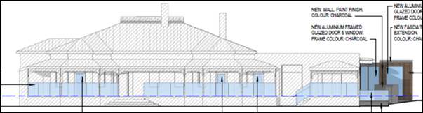
Figure 4 – proposed Hill Street elevation
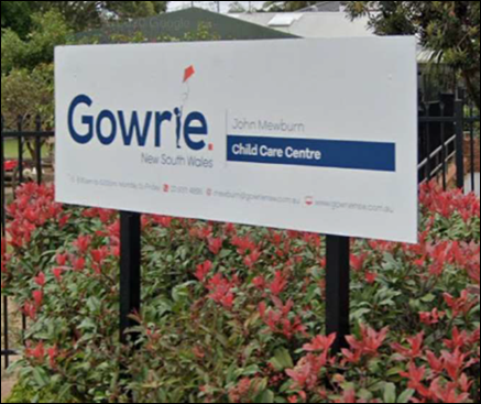
Figure 5 – indicative signage
The proposed child care facility will provide 92 child care
places and operate between the hours of 6.30am to 6.30pm Monday to Friday.
MATTERS FOR CONSIDERATION UNDER
THE ENVIRONMENTAL PLANNING AND ASSESSMENT ACT 1979
Section 1.7 - Application of
Part 7 of the Biodiversity Conservation Act 2016 and Part 7A of the
Fisheries Management Act 1994
Pursuant to Clause 1.7:
This
Act has effect subject to the provisions of Part 7 of the Biodiversity Conservation Act 2016 and Part 7A of the Fisheries Management Act 1994 that relate to the operation of this Act in connection
with the terrestrial and aquatic environment.
In consideration of this section, the proposed development
is not likely to significantly affect a threatened species.
· The subject and
adjoining lands are not identified as biodiversity sensitive on the Orange LEP
2011 Terrestrial Biodiversity Map.
· The site is not a
dedicated area of outstanding biodiversity value.
· The proposal does
not involve clearing above thresholds prescribed by regulation.
· The land is a
highly disturbed urban environment and contains predominantly exotic species.
The development is unlikely to give rise to significant impact upon any
endangered ecologically communities, threatened species or their habitat.
Based on the foregoing consideration, a Biodiversity
Assessment Report is not required, and the proposal suitably satisfies the
relevant matters at Clause 1.7.
Section 4.15 Evaluation
Provisions of any Environmental Planning Instrument
S4.15(1)(A)(I)
Orange Local Environmental Plan 2011
Part 1 - Preliminary
Clause 1.2 Aims of Plan
The
particular aims of Orange LEP 2011 relevant to the proposal include:
(a) to encourage development which complements
and enhances the unique character of Orange as a major regional centre boasting
a diverse economy and offering an attractive regional lifestyle,
(b) to provide for a range of development
opportunities that contribute to the social, economic and environmental
resources of Orange in a way that allows present and future generations to meet
their needs by implementing the principles for ecologically sustainable
development,
(f) to recognise and manage valued
environmental heritage, landscape and scenic features of Orange.
The application is considered to be consistent with the
above-listed Aims, as outlined in this report.
Clause 1.6 Consent Authority
Clause 1.6 is applicable and
states:
The consent authority for the
purposes of this Plan is (subject to the Act) the Council.
Clause 1.7 Mapping
The subject site is identified
on the LEP maps in the following manner:
|
Land Zoning Map:
|
Land zoned B4 Mixed Use
|
|
Lot Size Map:
|
No minimum lot size
|
|
Heritage Map:
|
Contains a heritage item; and
located within a heritage conservation area
|
|
Height of Buildings Map:
|
Building height limit – 9m
|
|
Floor Space Ratio Map:
|
Floor space limit – 0.5
|
|
Terrestrial Biodiversity Map:
|
No biodiversity sensitivity on the
site
|
|
Groundwater Vulnerability Map:
|
Groundwater vulnerable
|
|
Drinking Water Catchment Map:
|
Not within the drinking water
catchment
|
|
Watercourse Map:
|
Not within or affecting a defined
watercourse
|
|
Urban Release Area Map:
|
Not within an urban release area
|
|
Obstacle Limitation Surface Map:
|
No restriction on building siting
or construction
|
|
Additional Permitted Uses Map:
|
No additional permitted use applies
|
|
Flood Planning Map:
|
Not within a flood planning area
|
Those matters that are of relevance are addressed in detail
in the body of this report.
Clause 1.9A Suspension of
Covenants, Agreements and Instruments
Clause 1.9A is applicable and states in part:
(1) For the purpose of enabling
development on land in any zone to be carried out in accordance with this Plan
or with a consent granted under the Act, any agreement, covenant or other
similar instrument that restricts the carrying out of that development does not
apply to the extent necessary to serve that purpose.
(2) This clause does not apply:
(a) to a covenant
imposed by the Council or that the Council requires to be imposed, or
(b) to
any prescribed instrument within the meaning of Section 183A of the Crown Lands Act 1989, or
(c) to
any conservation agreement within the meaning of the National Parks and Wildlife Act 1974, or
(d) to
any Trust agreement within the meaning of the Nature
Conservation Trust Act 2001, or
(e) to
any property vegetation plan within the meaning of the Native Vegetation Act 2003, or
(f) to
any biobanking agreement within the meaning of Part 7A of the Threatened Species Conservation Act 1995, or
(g) to
any planning agreement within the meaning of Division 6 of Part 4 of the Act.
In
consideration of this clause, Council staff are not aware of the title of the
subject property being affected by any of the above.
Part 2 - Permitted or Prohibited Development
Clause
2.1 Land Use Zones
The
subject land is zoned B4 Mixed Use. The proposed development is defined as centre-based
child care facility and is permitted with consent in the B4 Mixed Use zone.
Clause 2.3 Land Use Table
The
objectives for land zoned B4 Mixed Use are:
· To provide a
mixture of compatible land uses.
· To integrate suitable
business, office, residential, retail and other development in accessible
locations so as to maximise public transport patronage and encourage walking
and cycling.
· To promote
where possible, the retention and reuse of heritage items as well as the
retention of established buildings that contribute positively to the heritage
or cultural values of the land in the zone.
· To promote
development that supports the role of Orange CBD as the primary retail and
business centre in the region.
The proposed development is
consistent with the B4 zone objectives. The proposed child care facility is a
permitted and compatible use in the zone and will contribute to the mix of
landuses in the setting. The site is located in proximity to the CBD, and
accessible via public transport. The proposal involves
‘well-considered’ design and adaptive reuse of a Local heritage
item.
Clause 2.7 Demolition Requires
Development Consent
Clause 2.7 is applicable and states:
The demolition of a building or work may be carried out only
with development consent.
Consent is sought for minor internal and external demolition
works and tree removal in accordance with this clause. Elements to be
demolished are depicted in red in Figure 6 below.
Council’s Manager City
Presentation raised no objection to tree removal to facilitate car park
construction. Council’s Environmental Health and Building Inspector has
included conditions on the attached Notice of Approval in relation to waste
management.
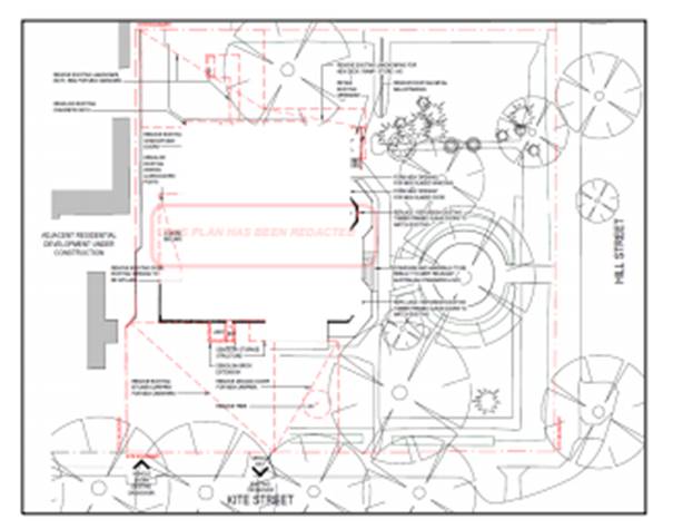
Figure 6 – demolition works
Part 3 - Exempt and Complying Development
The application is not exempt or complying development.
Part 4 - Principal Development Standards
Clause
4.3 Height of Buildings
Clause
4.3 is applicable and states in part:
(2) The height of a
building on any land is not to exceed the maximum height shown for the land on
the Height of Buildings Map.
The Height
of Buildings Map prescribes a maximum height of 9m for the subject land.
The proposal will not alter the height of the existing building, which is
approximately 7m. The development will not be contrary to this clause.
Clause
4.4 Floor Space Ratio
Clause
4.4 is applicable and states in part:
(2) The maximum
floor space ratio for a building on any land is not to exceed the floor space
ratio shown for the land on the Floor Space Ratio Map.
The
Floor Space Ratio Map prescribes a maximum FSR of 0.5 for the subject land.
Based on site area of 3,525m2 and proposed gross floor area of
681.2m2, the development will have FSR of 0.2. The development
will not be contrary to this clause.
Part 5 - Miscellaneous Provisions
Clause 5.10 Heritage Conservation
The development site and building comprise a Local heritage
item: Item 25 - Newstead Club (former mansion). Furthermore, the subject
land is located within the Central Orange Heritage Conservation Area, and
nearby to other Local heritage items.
Clause 5.10 is applicable and states in part:
(4) The
consent authority must, before granting consent under this clause in respect of
a heritage item or heritage conservation area, consider the effect of the
proposed development on the heritage significance of the item or area
concerned…
In consideration of Clause 5.10(4), a Heritage Impact
Statement (HIS) was submitted in support of the proposal (Urbis December 2020).
The HIS considers the impact of the proposed development on the heritage
significance of the site, conservation area and proximate listed items.
The HIS assessment is based on local planning controls, the
site-specific Conservation Management Strategy (Peter Basha 2019) and NSW
Heritage Office Guidelines. The HIS concludes:
· The existing Newstead
Mansion would be retained. The proposal would have no impact on the
presentation of the site to Hill Street.
· Almost all fabric to
be removed constitutes later addition to the place, which are of no
significance. Only minor interventions are proposed to original fabric. The
interventions are subject to [recommendations from Council’s Heritage
Advisor], however it is generally noted that they would not result in a
detrimental heritage impact to the place overall.
· Key later fabric
which detracts from the original presentation of the place would be removed
including the laundry and storage extensions to the south façade and
ancillary structure to the north extension.
· All mature
landscaping within the front setback would be retained and protected and new
appropriate landscaping would be implemented appropriately such that the
mansion remains legible as one in a garden setting.
In accordance with the above,
the proposed works are supported from a heritage perspective.
The
proposal and supporting HIS were referred to Council’s Heritage Advisor
for consideration and comment. The Heritage Advisor concurs with the
conclusions and recommendations of the submitted HIS and advises ‘the
applicant is to be congratulated as the scheme is well considered.’
The Heritage Advisor has recommended minor amendments to detailing, including
but not limited to the following:
· retention of internal nib walls
· restoration of original windows
· staircase reconstruction to a traditional stair for the
period
· steel balustrades to the
front verandah
· restoration of
tessellate tiling to entry hall
· reinstate the original
colour scheme
· palisade fence to
playground to be coloured Woodland Grey or Mangrove
· northern addition to be
Woodland Grey
· sandpit to be relocated
to the northern playground.
Conditions
are included on the attached Notice of Approval to reflect the specific
requirements of the Heritage Advisor, as they relate to materials, colours,
finishes and landscaping.
Part 6 - Urban Release Area
The subject land is not located in an Urban Release Area,
and the Part 6 provisions are not applicable.
Part 7 - Additional Local Provisions
Clause 7.3 Stormwater Management
Clause 7.3 is
applicable. This clause states in part:
(3) Development
consent must not be granted to development on land to which this clause applies
unless the consent authority is satisfied that the development:
(a) is
designed to maximise the use of water permeable surfaces on the land having
regard to the soil characteristics affecting onsite infiltration of water, and
(b) includes,
where practical, onsite stormwater retention for use as an alternative supply
to mains water, groundwater or river water, and
(c) avoids
any significant impacts of stormwater runoff on adjoining downstream
properties, native bushland and receiving waters, or if that impact cannot be
reasonably avoided, minimises and mitigates the impact.
Conditions are included on the
attached Notice of Approval requiring drainage works including stormwater
detention within the proposed car park. Stormwater shall be collected in pits
located across the carpark and piped to the kerb and gutter in Kite Street. Compliance
with conditions will ensure that stormwater runoff will not adversely impact on
adjoining properties.
Clause 7.6 Groundwater
Vulnerability
The
subject land is identified as ‘Groundwater Vulnerable’ on the Groundwater
Vulnerability Map. Clause 7.6 applies. This clause states in part:
(3) Before
determining a development application for development on land to which this
clause applies, the consent authority must consider:
(a) whether or not the development (including
any onsite storage or disposal of solid or liquid waste and chemicals) is
likely to cause any groundwater contamination or have any adverse effect on
groundwater dependent ecosystems, and
(b) the cumulative impact (including the
impact on nearby groundwater extraction for potable water supply or stock water
supply) of the development and any other existing development on groundwater.
In consideration of Clause 7.6,
there are no aspects of the proposed development that will impact on
groundwater and related ecosystems. The site is connected to Council’s
reticulated sewerage system.
Clause 7.11 Essential Services
Clause 7.11 applies and states:
Development consent must not be
granted to development unless the consent authority is satisfied that any of
the following services that are essential for the proposed development are
available or that adequate arrangements have been made to make them available
when required:
(a) the
supply of water,
(b) the
supply of electricity,
(c) the
disposal and management of sewage,
(d) storm
water drainage or onsite conservation,
(e) suitable
road access.
In
consideration of this clause, the listed utility services are available to the
land and adequate for the proposal, as follows:
· the land is connected to
reticulated water supply
· electricity and
telecommunications are available
· the land is serviced by
Council’s reticulated sewerage system
· stormwater detention
will be provided onsite
· the site has direct
frontage and access to Kite Street
· waste collection will be
provided by private contractor.
STATE ENVIRONMENTAL PLANNING
POLICIES
State Environmental Planning Policy 55 Remediation of
Land
SEPP
55 is applicable and states in part:
(1) A
consent authority must not consent to the carrying out of any development on
land unless (a) it has considered whether the land is contaminated.
(2) Before
determining an application for consent to carry out development that would
involve a change of use on any of the land specified in Subclause (4), the
consent authority must consider a report specifying the findings of a
preliminary investigation of the land concerned carried out in accordance with
the contaminated land planning guidelines.
(4) The land concerned is:
(c) to
the extent to which it is proposed to carry out development on it for
residential, educational, recreational or child care purposes, or for the
purposes of a hospital—land:
(i) in
relation to which there is no knowledge (or incomplete knowledge) as to whether
development for a purpose referred to in Table 1 to the contaminated land
planning guidelines has been carried out, and
(ii) on
which it would have been lawful to carry out such development during any period
in respect of which there is no knowledge (or incomplete knowledge).
The
proposal involves change of use of the subject land from recreation facility
(bowling club) to centre-based child care facility.
Pursuant
to Clauses 2 and 4, a Preliminary Contamination Investigation was submitted in
support of the proposal (Envirowest Consulting 10/12/2020). The Investigation
concludes:
‘The
site is expected to be suitable for the proposed child care centre, following
removal of an asbestos impacted stockpile,’ being waste material from the adjoining building
site.
The
asbestos impacted stockpile has seen been removed from the subject land. A
Clearance Certificate was provided in support of the DA to confirm same
(Envirowest Consulting 18/12/20).
Council’s
Environmental Health Officer has reviewed the submitted contamination details.
Further investigation will not be required. The contamination status of the
subject land will be suitable for the proposed development. A recommended
condition is included on the attached Notice of Approval requiring
implementation of ‘unexpected finds’ procedure during construction
works.
State Environmental Planning
Policy 64 Advertising and Signage
SEPP 64 Advertising and Signage is applicable and states in
part:
3 Aims,
Objectives etc
(1) This
Policy aims:
(a) to
ensure that signage (including advertising):
(i) is
compatible with the desired amenity and visual character of an area, and
(ii) provides
effective communication in suitable locations, and
(iii) is
of high quality design and finish, and
(8) Granting of
Consent to Signage
A consent authority must not
grant development consent to an application to display signage unless the
consent authority is satisfied:
(a) that
the signage is consistent with the objectives of this Policy as set out in
Clause 3 (1) (a), and
(b) that
the signage the subject of the application satisfies the assessment criteria
specified in Schedule 1.
Schedule 1 Assessment
Criteria
1 -
Character of the Area
· Is the
proposal compatible with the existing or desired future character of the area
or locality in which it is proposed to be located?
· Is
the proposal consistent with a particular theme for outdoor advertising in the
area or locality?
2 - Special Areas
· Does
the proposal detract from the amenity or visual quality of any environmentally
sensitive areas, heritage areas, natural or other conservation areas, open
space areas, waterways, rural landscapes or residential areas?
3 - Views and Vistas
· Does
the proposal obscure or compromise important views?
· Does
the proposal dominate the skyline and reduce the quality of vistas?
· Does
the proposal respect the viewing rights of other advertisers?
4 - Streetscape, Setting or Landscape
· Is
the scale, proportion and form of the proposal appropriate for the streetscape,
setting or landscape?
· Does
the proposal contribute to the visual interest of the streetscape, setting or
landscape?
· Does
the proposal reduce clutter by rationalising and simplifying existing advertising?
· Does
the proposal screen unsightliness?
· Does
the proposal protrude above buildings, structures or tree canopies in the area
or locality?
· Does
the proposal require ongoing vegetation management?
5 - Site and Building
· Is
the proposal compatible with the scale, proportion and other characteristics of
the site or building, or both, on which the proposed signage is to be located?
· Does
the proposal respect important features of the site or building, or both?
· Does
the proposal show innovation and imagination in its relationship to the site or
building, or both?
6 - Associated Devices and Logos With Advertisements and
Advertising Structures
· Have
any safety devices, platforms, lighting devices or logos been designed as an
integral part of the signage or structure on which it is to be displayed?
7 - Illumination
· Would
illumination result in unacceptable glare?
· Would
illumination affect safety for pedestrians, vehicles or aircraft?
· Would
illumination detract from the amenity of any residence or other form of
accommodation?
· Can
the intensity of the illumination be adjusted, if necessary?
· Is
the illumination subject to a curfew?
8 - Safety
· Would
the proposal reduce the safety for any public road?
· Would
the proposal reduce the safety for pedestrians or bicyclists?
· Would
the proposal reduce the safety for pedestrians, particularly children, by
obscuring sightlines from public areas?
It is considered that the proposed business identification
signs will be consistent with the relevant matters in the SEPP, as follows:
- The
restrained signage scheme (in form and content) will be compatible with the
residential character of Kite Street (west of Hill Street). There is no
particular theme for outdoor advertising in this streetscape.
- Signage
will be sited on the Kite Street secondary frontage and will have no impact on
the presentation of the original heritage building and site from Hill Street.
The proposed signs will not adversely impact on heritage values.
- Advertising
content will comprise business identification only, consistent with controls in
conservation areas.
- The
signs will not interrupt the skyline, reduce views, or compromise the viewing
rights of other advertisers nearby the site. The proposed pylon sign at the
site frontage will be at a human scale, and the wall sign will be wholly
located within the building facade.
- The
proposed signage will be suitable in the streetscape view corridor. The pylon
sign will be centrally located between the access driveways and contained
within a low landscaped bed. Wall signage will be well-removed from the site
frontage.
- The
proposed signs are expected visual elements associated with use of the land as
a child care facility.
- The
proposed signs demonstrate a restrained signage scheme for the site and
building and will not result in visual clutter.
- The
signage will not necessitate safety devices, nor be illuminated.
- There
is no aspect of the signage scheme that will adversely impact on vehicle or
pedestrian safety.
State Environmental Planning
Policy (Educational Establishments and Child Care Facilities) 2017
SEPP (Educational Establishments and Child Care Facilities)
2017 is applicable. The relevant provisions of the SEPP are considered below.
Clause 5 - Interpretation
The proposed development is defined as a “centre-based
child care facility” pursuant to Clause 5.
Clause 22 - Centre-based
child care facility - concurrence of Regulatory Authority required for certain
development
Indoor unencumbered floor
space of 299m2 is required (based on 3.25m2 x 92
children). Floor space of 356.8m2 will be provided over 6 learning
rooms.
Outdoor unencumbered floor
space of 644m2 is required (based on 7m2 x 92 children).
Floor space of 1,351m2 will be provided in outdoor play areas.
Based on the compliance with the
Regulations for indoor and outdoor unencumbered floor space, notice to and
concurrence of the Regulatory Authority for NSW under the Children (Education
and Care Services) National Law (NSW) is not required for the proposed development.
Clause 23 - Centre-based
child care facility - matters for consideration by consent authorities
The proposed development complies with the applicable
provisions of the Child Care Planning Guideline (Department of Planning and
Environment 2017) pursuant to Clause 23, as demonstrated below.
CHILD CARE PLANNING GUIDELINE
Part 2 - Design Quality Principles
Principle 1 – Context
The development context is defined by mixed landuses in a
heritage setting. The proposed child care facility is a permitted and
compatible use in the zone and will contribute to the mix of landuses in the
setting. The site is located in proximity to the CBD, and accessible via public
transport. The proposal involves adaptive reuse of a Local heritage item, and a
well‑considered design response.
Principle 2 - Built Form
The proposal relates to a Local heritage item. As outlined
in the foregoing sections of this report, the original building will be
retained, unsympathetic and later elements removed, and original fabric maintained
and restored. The contribution of the building to the streetscape and
conservation area will be enhanced.
Principle 3 - Adaptive Learning
Spaces
The proposal will provide purpose-built indoor learning
spaces that are ‘fit-for-purpose, enjoyable and easy to use.’
Outdoor play spaces will be immediately adjacent and accessible via indoor play
rooms. Age-specific internal playrooms will be provided to cater for various
ages and abilities. Indoor and outdoor play spaces will provide various
settings and facilities for interaction.
Principle 4 - Sustainability
The proposed adapted building will incorporate energy
efficient influences in the design.
Principle 5 - Landscape
The proposed development is supported by a landscape design
concept that involves retention of mature trees and substantive landscape
elements; and new plantings to complement the garden setting for the heritage
building. A variety of hard and soft landscaping elements will be provided in
outdoor play spaces.
Principle 6 - Amenity
The proposed child care centre will provide a high standard
of amenity for users. Learning spaces will be efficient and functional, with
direct access to bathrooms, sleep rooms, stores and service areas. Indoor
playrooms will provide ideal learning and play environments, with generous
natural light, ventilation and outlook. Outdoor play spaces will be immediately
adjacent and accessible via indoor playrooms.
The proposed child care facility will not adversely impact
on residential amenity for adjoining dwellings in Kite and Hill Streets (as
outlined in the following sections of this report).
Principle 7 - Safety
The adapted building design and site works will satisfy the
principles of Crime Prevention Through Environmental Design. The
proposed development was referred to the Crime Prevention Officer at Central
West Police District. The Crime Prevention Officer raised no objection to the
proposal and did not provide specific recommendations/conditions of consent.
Part 3 - Matters for
Consideration
3.1 - Site Selection and Location
Objective: To ensure that appropriate zone
conditions are assessed when selecting a site
Noise
A Noise Impact Assessment was submitted in support of the
proposal (RWDI Pty Ltd December 2020).
Noise associated with the proposed child care facility will
be generated by outdoor play, mechanical plant, traffic noise in the car park,
and traffic noise in local streets generated by vehicles associated with the
facility.
Residential properties
potentially impacted by noise emissions from the proposed development are shown
below (see Figure 7).
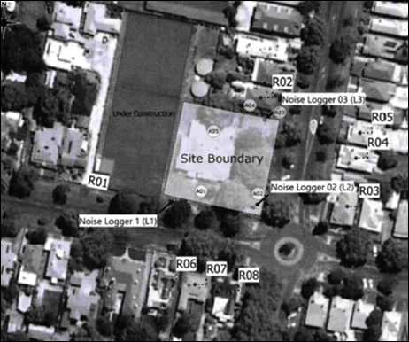
Figure 7 – noise ‘receiver
locations’
Noise impacts for the residential receivers will comply with
noise criteria contained in the Noise Policy for Industry 2017, excepting
receiver R02 at 51 Hill Street. Outdoor play activities will result in an
exceedance of noise criteria at the adjoining northern parcel.
Mitigation measures will be required to minimise noise
impacts to 51 Hill Street and comply with relevant criteria. The Noise Impact
Assessment recommends mitigation comprise a 1.8m high solid fence on the
part-northern boundary as depicted below (see Figure 8).
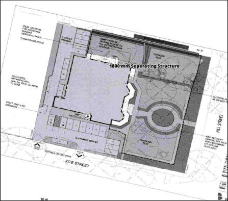
Figure 8 – solid wall on part northern boundary
Council’s Environmental Health Officer has reviewed
the submitted Noise Impact Assessment and concurs with the findings and
recommendations. Conditions are included on the attached Notice of Approval
requiring the construction of the mitigative solid wall on the northern
boundary. Furthermore, details of mechanical plant will be required for
approval at Construction Certificate stage to manage noise emissions generated
by same.
Visual Privacy
The proposed site layout and building design will not
adversely impact on visual privacy for adjoining dwellings to the north (51
Hill Street) and west (47-49 Kite Street):
- Outdoor
play space will be located at the Hill Street frontage and will not oppose
dwellings on Kite Street.
- The
northern outdoor play area will adjoin the dwelling at 51 Hill Street. This
part of the play area may be less active/utilised due to the tree and store.
Notwithstanding, solid fencing will be required on the northern boundary as
considered in the noise assessment above.
- Perimeter
fencing will be installed to the northern and western boundaries.
- Playroom
openings will generally overlook the adjoining outdoor play spaces and be well
removed from opposing residential boundaries.
- The
staff carpark will adjoin the western boundary and adjoining dwellings. This
part of the site does not comprise an active space that would impact on
privacy.
- Landscaping
will be provided to the site perimeters.
Odour
A waste storage area will be located to the north of the
facility, adjacent to staff car parking (see Figure 9). Waste will be collected
by a private contractor who will attend the site outside of operating hours.
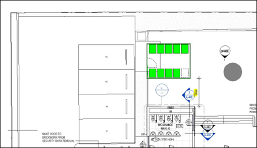
Figure 9 – part site plan – waste storage
area
The bin bay will be located some 6-7m from dwellings on
adjoining parcels to the north and west. Odour impacts for adjoining properties
should be negligible. Perimeter fencing will be installed, and the waste
storage area will be a screened enclosure. Conditions are included on the
attached Notice of Approval requiring details of the enclosed waste storage
area to be provided to Council prior to issue of a Construction Certificate,
and the waste storage area to be operated and maintained to prevent odour
emissions for adjoining dwellings.
Lighting
Based on the long-day operation of
the proposed facility, car park lighting (and other external lighting) will be
required. A recommended condition of consent is included on the attached Notice
of Approval requiring outdoor lighting to comply with AS
4282:1997 Control of the obtrusive effects of outdoor lighting.
Traffic Matters
A Traffic and Parking Impact Statement was submitted in
support of the proposal (Traffic Solutions Pty Ltd, December 2020). The
Assessment concludes:
a. The
access driveways proposed to serve the development are suitably located and
will provide good sight distance in both directions along Kearneys Drive.
b. The
proposed development satisfies the related geometric design specification
contained in the Australian Standards for off-street parking and vehicular
access. It is recommended that the existing landscaping be trimmed / removed to
provide the 2.0m x 2.5m pedestrian sight line splay required on both sides of
the exit driveway.
c. The
off-street parking provided in the proposed development is 3 car spaces short
of the requirements specified by RMS and Council’s Development Control
Plan, however, sufficient on street frontage is available directly in front of
the site to cater for this shortfall, without impacting upon the amenity of
surrounding residential properties.
d. The
proposal has a potential increase in estimated peak hour traffic flows in the
order of 74 vehicle trips in the morning and 64 vehicle trips in the evening
peak hours respectively, which will not have a noticeable or detrimental effect
upon Kite Street or the surrounding road network.
The above conclusions are considered in the following
assessment.
Access
Access to the subject land will be
via existing footpath crossings and driveways to Kite Street. Council’s
Assistant Development Engineer concurs that reasonable sight distances will be
afforded along Kite Street to the east and west. Consistent with
recommendations above, a condition is included on the attached Notice of
Approval requiring the landscape design concept to be
amended to provide pedestrian sight line splays.
Car Parking
Pursuant to DCP 2004, onsite car
parking is required for child care centres at a rate of one space for
every four children in attendance. Based on 92 places, 23 onsite car
parking spaces are required for the proposed development. A total of 20 spaces
will be provided onsite (see Figure 10).
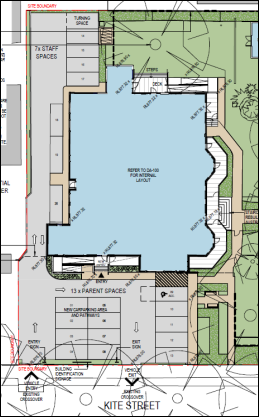
Figure 10 – part site plan – proposed car
parking layout
It has been previously assessed
that the development site has one (1) car parking credit, associated with the
original residential use of the Newstead building (pursuant to DA 350/2016(2)).
(This DA involved subdivision of the Newstead site to excise the heritage
building, and create an adjoining vacant lot for multi dwelling housing-
presently under construction).
As such, 21 car parking spaces will
be attributed to the proposed development via physical provision of spaces (20)
and available parking credits (1). The development will therefore have a
car parking deficit of 2 spaces.
The subject land is located within
the Car Parking Contributions Catchment pursuant to the Orange Car Parking
Development Contributions Plan 2015. A development contribution is
applicable in lieu of the physical provision of car parking spaces. Rate (b)
will apply, as the development involves a change of use and will not result
in the creation of net additional gross floor area, as follows:
2
spaces @ $7630.73 = $15,261.46.
A condition is included on
the attached Notice of Approval requiring payment of the car parking
development contribution prior to issue of a Construction Certificate.
The car parking shortfall is
considered to be suitable for the following reasons:
· The car park layout is
informed by the existing site layout and building footprint.
· The car park could be
extended in an easterly direction to comply with the DCP. This however, would
encroach the curtilage of the original building, interrupt views of the
important front façade, and adversely impact on heritage significance.
Council’s Heritage Advisor did not support an eastern extension to the
proposed car park at pre‑lodgement stage.
· Sufficient on-street
carparking capacity is available at the site frontages to accommodate overflow
demands, pursuant to the submitted Traffic and Parking Statement.
It is acknowledged that differentiating staff and parent car
spaces and providing parallel car spaces (numbered 18-20) would not usually be
supported by assessment staff. Notwithstanding, the adaptive reuse of the
original building affords some concessions, providing arising impacts are
within reasonable limit. To this end and despite the parking shortfall, it is
considered that the proposed car park will operate with a high level of traffic
amenity. In this regard:
· The car park layout will
comply with AS 2890.1 Off-street Car Parking.
· Site ingress and egress
via Kite Street is a longstanding feature of the local road network.
· Submitted swept paths
demonstrate functional onsite manoeuvring.
· All vehicles will enter
and exit the site in a forward direction.
· Traffic
control/way-finding signage will be erected to direct vehicles to staff or
parent spaces.
C. Traffic Generation and
Network Capacity
Council’s Assistant Development Engineer raised no
objection to the proposal in relation to traffic generation and network
capacity. The anticipated traffic volume increase is well within the existing
road capacity of Kite Street and will not impact on pedestrian safety. The
existing road network has sufficient capacity to cater for the identified AM
and PM traffic peaks.
Objective: To
ensure that the site selected for a proposed child care facility is suitable
for the use
It is considered that the subject land will be suitable for
use as a centre-based child care facility due to the following:
· The car park layout will
comply with AS 2890.1 Off-street Car Parking.
· The proposal is a permitted
and compatible use in the zone and will contribute to the mix of landuses in
the setting.
· The development site is
not subject to environmental risks such as flooding, landslip or bushfires.
· The site is free from
contaminants and suitable for child care use.
· Lot size, configuration,
dimensions and frontage are suitable for the adapted building and outdoor play
spaces.
· The development site has
shared boundaries with residential properties to the north and west. The
interface between the development and adjoining dwellings is considered
satisfactory (as considered above).
· There are no
incompatible social activities and users in the vicinity of the development
site.
· The proposal involves
adaptive reuse of a Local heritage item.
Objective: To
ensure that sites for child care facilities are appropriately located
The site is well located to attract facility users in
surrounding residential neighbourhoods. The site is located in proximity to the
CBD, and accessible via public transport.
Objective: To
ensure that sites for child care facilities do not incur risks from
environmental, health or safety hazards
The subject land is not in proximity to land uses with
arising adverse environmental conditions prescribed in the Guideline. The site does
not contain any known environmental hazard or risk. The site is free from
contamination and suitable for child care use.
3.2 - Local Character,
Streetscape and the Public Domain Interface
Objective: To
ensure that the child care facility is compatible with the local character and
surrounding streetscape
The proposal involves adaptive reuse of a Local heritage
item. As outlined in the foregoing sections of this report, the original
building will be retained, unsympathetic and later elements removed, and
original fabric maintained and restored. The contribution of the building to
the streetscape and conservation area will be enhanced.
Objective: To ensure
clear delineation between the child care facility and public spaces
Existing traditional fencing and gates to the site perimeter
will be retained. An additional fence line will be installed 3-4m inside the
site boundaries to Hill and Kite Street to enclose the outdoor play areas. The
play area fencing will comprise 1.8m high palisade fencing in Woodland Grey
colour (as required by conditions).
The siting and style of the additional fence line will allow
the new fence to visually recede, and thereby maintain views and appreciation
of the traditional fencing and gates. Council’s Heritage Advisor raised no
objection to site fencing arrangements. Together with the proposed fencing,
existing and new landscaping in the front setback will establish an effective
transition between child care spaces and the public domain. Alterations to the
building will maintain passive surveillance and connectivity with the public
domain.
Objective: To
ensure that front fences and retaining walls respond to and complement the
context and character of the area and do not dominate the public domain
As considered above, the proposal involves retention of the
existing traditional fencing and gates to Hill and Kite Streets. Similarly,
existing landscaping at the site frontages will be retained and new landscaping
established to reinforce the garden setting. The contribution of the building
and site to the streetscape and public domain will be retained and improved by
the proposed works.
3.3 - Building Orientation,
Envelope and Design
Objective: To
respond to the streetscape and site, while optimising solar access and
opportunities for shade
The adapted building will not alter internal or external
solar access to dwellings adjoining the site. Five (5) of the 6 learning rooms
and the outdoor play areas will have access to northern and eastern sunlight.
Objective: To
ensure that the scale of the child care facility is compatible with adjoining
development and the impact on adjoining buildings is minimised
The proposal involves new use of an existing building. The
interface between the adapted building and adjoining dwellings will be altered
to a nil-negligible extent.
Objective: To
ensure that setbacks from the boundary of a child care facility are consistent
with the predominant development within the immediate context
The proposal will not alter the primary and secondary
building lines for the existing building.
Objective: To
ensure that the built form, articulation and scale of development relates to
its context and buildings are well designed to contribute to an area’s
character
As variously outlined in this report, the proposal will have
positive impacts on the heritage significance of the site and setting. The
original building will be retained, unsympathetic and later elements removed
and original fabric maintained and restored.
Objective: To ensure
that buildings ae designed to create safe environments for all users
The proposed development will achieve ease of access and
secure entry to the building. Crime prevention measures are included in the
site layout and building design. The proposed development was referred to the
Crime Prevention Officer at Central West Police District. The Crime Prevention
Officer raised no objection to the proposal and did not provide specific
recommendations/conditions of consent.
Objective: To
ensure that child care facilities are designed to be accessible by all
potential users
Accessible design will be achieved via accessibility to and
within the facility, ramped pathways to key areas, and continuous paths of
travel to and within the building.
3.4 - Landscaping
Objective: To provide landscape design that
contributes to the streetscape and amenity
A landscape plan was submitted in support of the proposal
(see Figure 11). Key landscape concepts include:
· Retention of the
established trees, perimeter plantings to Hill and Kite Streets, and formal
circular garden at the Hill Street frontage.
· New plantings to
existing garden beds and additional garden beds.
· New low plantings to
Kite Street adjacent to the site accesses.
· Hard landscaping
elements including paths, seating benches, sandpits and shade sail.
· Open
lawn areas.
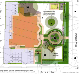
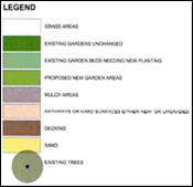
Figure 11 – proposed landscape design
The proposed landscaping will maintain and reinforce the
garden setting for the heritage building. Council’s Manager City
Presentation supports the proposed landscape design concept for the site. The
plant pallet selection will be acceptable for both climatic appropriateness and
asthma awareness for a child care centre. Conditions are included on the
attached Notice of Approval to require tree protection
measures for advanced trees during construction works.
3.5 -
Visual and Acoustic Privacy
Objective: To protect the privacy and security
of children attending the facility
Outdoor play spaces will be located in the front setback to
Hill Street and be visible from the public domain. Notwithstanding, reasonable
privacy and security will be afforded to outdoor play areas due to original
fencing on the site boundaries, additional recessed fencing, and existing and
new landscaping screening. Setbacks from boundaries will preclude views of
internal learning rooms from the public domain.
Objective: To minimise
impacts on privacy of adjoining properties
As outlined previously, the development will provide
acceptable privacy for adjoining dwellings (with reference to setbacks of the
existing building, boundary fencing, landscaping and interface with opposing
landuses).
Objective: To
minimise the impact of child care facilities on the acoustic privacy of
neighbouring residential developments
As outlined previously, subject to migration conditions (ie
solid fencing on the part-northern boundary), noise emissions from the proposed
centre will comply with the relevant criteria.
3.6 - Noise and Air Pollution
Objective: To
ensure that outside noise levels on the facility are minimised to accepted
levels
The subject site is not located in the vicinity of noise
generating infrastructure or land uses prescribed in the Guideline.
3.7 - Hours of Operation
Objective: To
minimise the impact of the child care facility on the amenity of neighbouring
residential developments
A condition is included on the attached Notice of Approval
requiring that hours of operation are not to exceed 6.30am
to 6.30pm Monday to Friday, consistent with the assessment in the submitted
acoustic report.
3.8 - Traffic, Parking and
Pedestrian Circulation
Objective: To
provide parking that satisfies the needs of users and demand generated by the
centre
As considered in foregoing sections
of this report, the proposed parking arrangements for the development are
considered to be satisfactory.
Objective:
To provide vehicle access from the street in a safe environment that does not
disrupt traffic flows
As outlined in foregoing sections of this report, the
proposal will not alter existing accesses to the subject land via Kite Street.
The vehicle arrangements proposed for the development will not adversely impact
on local traffic amenity.
Objective:
To provide a safe and connected environment for pedestrians both on and around
the site
The proposed development will adopt the following design
solutions to provide a safe environment for pedestrians:
· A car park layout that
will allow vehicles to enter and exit the site in a forward direction.
· Fencing to separate
vehicle areas from outdoor play spaces.
· Provision of an
accessible parking space.
· Onsite pathways between
the footpath and building entrance.
Part 4 - Applying the National
Regulations to Development Proposals
The proposed development will satisfy the National
Regulations:
· Regulation 104 - Fencing
or barrier that encloses outdoor spaces
· Regulation 106 - Laundry
and hygiene facilities
· Regulation 107 -
Unencumbered indoor space
· Regulation 108 -
Unencumbered outdoor space
· Regulation 109 - Toilet
and hygiene facilities
· Regulation 110 -
Ventilation and natural light
· Regulation 111 -
Administrative space
· Regulation 112 - Nappy
change facilities
· Regulation 113 - Outdoor
space - natural environment
· Regulation 114 - Outdoor
space - shade
· Regulation 115 -
Premises designed to facilitate supervision
A condition is included on the attached Notice of Approval
requiring a compliance schedule to be included on the
Construction Certificate drawings.
Clause 26 - Centre-based
child care facility - development control plans
DCP 2004 does not contain prescribed provisions for
centre-based child care facilities (including operational or management plans,
the demonstrated need for child care services, proximity to other facilities,
design considerations etc). Notwithstanding, such provisions would not apply to
the proposed development pursuant to Clause 26.
Provisions of any Draft
Environmental Planning Instrument that has been Placed on Exhibition
4.15(1)(A)(Ii)
Draft Orange Local Environmental Plan 2011 (Amendment 25)
Draft Orange LEP 2011 Amendment 25 has recently completed
public exhibition (August 2020). The Draft Plan relates to land at 1
Leewood Drive and has no effect for the proposed development.
Draft Orange Local
Environmental Plan 2011 (Amendment 26)
Draft Orange LEP 2011 Amendment 26 will be re-exhibited
(December 2020-January 2021). The Draft plan relates to land at 1521 Forest
Road and has no effect for the proposed development.
Draft State Environmental
Planning Policy Design and Place
Draft Design and Place SEPP is currently on public exhibition.
The Draft SEPP will (in part) repeal and replace SEPP No 65 – Design
Quality of Residential Apartment Development and SEPP (Building
Sustainability Index: BASIX) 2004. The proposed development will not be
contrary to any matter contained in the Draft SEPP.
Draft State Environmental
Planning Policy Remediation of Land
Draft Remediation of Land SEPP is applicable. The Draft SEPP
requires in part that consideration be given to potential contamination on
nearby or neighbouring properties and groundwater. Land adjoining the site is
not identified or considered to be contaminated. The contamination status of
neighbouring residential lands will not impact on the proposed development.
Draft State Environmental
Planning Policy Educational Establishments and Child Care Facilities
The Draft Education SEPP is currently on public exhibition.
The Draft Plan proposes in part to introduce
provisions to prevent child care centres within close proximity of each other
in low density residential zones (R2). A separation distance of 200m between
child care centres is being considered. The amendment seeks to address concerns
raised about amenity impacts, such as noise and traffic, arising from
child-care centres being in close proximity to one another.
The subject land is zoned B4
Mixed Use. The proposal will not be contrary to any matter in the Draft Plan.
Provisions of any
Development Control Plan S4.15(1)(A)(Iii)
Development Control Plan 2004
DCP 2004 – 2 Natural Resource Management
The relevant matters in this part were considered in the
foregoing assessment under Orange LEP 2011.
DCP 2004 – 3 General
Considerations
The relevant matters in this part were considered in the
foregoing assessment under Orange LEP 2011.
DCP 2004 - 5 General
Considerations for Zones and Development
The relevant matters in Part 5 are addressed in the
following sections of this report (refer Any Submissions).
DCP 2004 – 8 Development
in Business Zones
The relevant matters in Part 8 were considered in the
foregoing assessment under Child Care Planning Guideline.
DCP 2004 – 13
Heritage
The relevant matters in Part 13 were considered in the
foregoing assessment under Orange LEP 2011 Clause 5.10.
DCP 2004 – 14 Advertising
The relevant matters in Part 14 were considered in the
foregoing assessment under SEPP 64.
DCP 2004 – 15 Car Parking
The relevant matters in Part 15 were considered in the
foregoing assessment under Child Care Planning Guideline.
DEVELOPMENT CONTRIBUTIONS
Development contributions for water, sewer and drainage
works are applicable to the proposed development. Contributions are calculated
as follows:
Water: 92 children x
0.06 ETs = 5.52 ETs less 1 credit = 4.52ETs
Sewer: 92 children x
0.1 ETs = 9.2 ET less 1 credit = 8.2ETs.
Conditions are included on the attached Notice of Approval
requiring payment of applicable headworks contributions.
Provisions Prescribed by the
Regulations S4.15(1)(A)(Iv)
Demolition of a Building (clause 92)
The proposed development involves minor internal demolition
works. Conditions are included on the attached Notice of Approval requiring
demolition works consistent with applicable standards, and appropriate waste
management.
Fire Safety Considerations
(clause 93) and Buildings to be Upgraded (Clause 94)
The proposal involves a change of building use for an
existing building, including alterations and additions. Council’s EHBS
advises:
“A fire safety audit
upgrade report has been submitted with the application. The report indicates
that the building can be brought into partial compliance with the current BCA
which will improve the life safety of the occupants of the building. A
condition has been included requiring the CC plans to be amended to reflect the
recommendations of the fire safety audit upgrade report.”
BASIX Commitments (clause 97A)
BASIX is not applicable to the proposed development.
The Likely Impacts Of The
Development S4.15(1)(B)
The impacts of the proposed development have been considered
in the foregoing sections of this report and include:
· Heritage Values
- impact
on significance
- building
works
- site
works
· Setting and context
- public
domain
- landuse
- interface
- presentation
· Visual impacts
- neighbourhood
character
- streetscape
presentation
- building
design and detailing
- signage
design, detailing and siting
- landscape
character
· Neighbourhood amenity
- acoustic
privacy
- visual
privacy
- solar
access
- external
lighting
- crime
prevention
- odour
emissions
- hours
of operation
· Operational amenity
- acoustic
privacy
- visual
privacy
- solar
access
- safety
and security
- traffic
arrangements
- functional
learning spaces
· Traffic matters
- site
access
- onsite
manoeuvring
- car
parking
- traffic
generation
- network
capacity
· Environmental impacts
- waste
management
- sediment
and erosion control
- biodiversity
- groundwater
- stormwater
management
- tree
removal
- cultural
values
- contamination.
It is considered that the impacts of the proposed
development will be within reasonable limit. Conditions are included on the
attached Notice of Approval to mitigate and manage arising impacts.
The Suitability Of The Site
S4.15(1)(C)
· The proposal is
permitted on the subject land zoning.
· The site has direct
frontage and access to Kite Street.
· The local road network
has sufficient capacity to accommodate any additional traffic volumes.
· There is no known
contamination on the land.
· All utility services are
available and adequate.
· The site is not subject
to natural hazards.
· The subject land has no
particular environmental values.
Any Submissions Made In
Accordance With The Act S4.15(1)(d)
The proposed development is defined as "advertised
development" pursuant to Council’s Community Participation Plan
2019. Written and public notice of the application was given for the prescribed
period. At the end of that period, seven submissions had been received.
The issues raised in the submissions are outlined below. The
issues have been considered in the foregoing assessment and are reiterated or
clarified below.
The following aspects of the
proposal are unsuitable for the heritage building:
· Change to
commercial landuse
· Retention of the
later addition on the north side
· Building addition
on the north side
· The glass
balustrade to the verandah
· Hard landscaping
elements in the front setback
· Siting the playground
in the front setback
· Black palisade
fencing to the playground in the front setback.
The subject land has longstanding commercial use (circa
1955). A child care facility is a permitted and compatible use in the zone.
Council’s Heritage Advisor considers that the proposed
works are a ‘well-considered’ design response and will not
adversely impact on heritage significance. Minor design amendments are
recommended via conditions of consent including, relevantly, a metal balustrade
to the front verandah, and relocating hard landscaping elements to the northern
playground area. The playground in the front setback will activate the space
while maintaining an open space and traditional layout. Playground fencing will
be recessive due to siting and colour.
The Heritage Impact Statement submitted in support of the
proposal provides that the development will accommodate local planning
controls, the site-specific Conservation Management Strategy (Peter Basha 2019)
and NSW Heritage Office Guidelines.
The proposed car park design
and layout will not be functional.
It is considered that the proposed car park will operate
with a high level of traffic amenity. In this regard:
· The car park layout will
comply with AS 2890.1 Off-street Car Parking.
· Site ingress and egress
via Kite Street is a longstanding feature of the local road network.
· Submitted swept paths
demonstrate functional onsite manoeuvring.
· All vehicles will enter
and exit the site in a forward direction.
· Traffic
control/way-finding signage will be erected to direct vehicles to staff or
parent spaces.
On-street parking to
accommodate the parking shortfall is unsuitable.
It is considered that a parking shortfall of 2 spaces is
reasonable, based on constraints imposed by the existing site layout and
building design, and in order to protect the curtilage and views of the
heritage building. Potential on-street parking congestion could be alleviated
by linemarking on-street parking spaces, subject to the approval of
Council’s Traffic Committee. A contribution for car parking
development contributions is included on the attached Notice of Approval.
Traffic generation
associated with the development will impact on local traffic amenity; traffic
controls/calming is required.
Council’s Assistant Development Engineer concurs with
the submitted Traffic and Parking Statement. Traffic generation associated with
the development will be well within the existing road capacity of Kite Street
and will not impact on pedestrian safety. The existing road network has
sufficient capacity to cater for the identified AM and PM traffic peaks.
Traffic controls/calming will not be required to cater for traffic associated
with the development. This matter can be reviewed at any time in conjunction
with Council’s Traffic Committee.
The building addition on the
north side will impact on the tree.
The proponent was requested to amend the building addition
to provide clearance from the Himalayan Cedar (Cedar Deodara) in the northern
portion of the site. The proponent was amenable to this request. Negotiations
were held between the proponent and Council’s Manager City Presentation
in relation to suitable construction methods within the tree protection zone.
The following notation is provided on the planset and is also included as a
condition on the attached Notice of Approval:
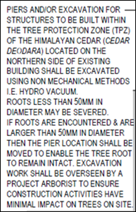
Figure 12 – tree protection plan notation and
condition of consent
Falling pine cones from the
Bunya pine in the playground will be hazardous for children
It is acknowledged that there is potential for the Bunya
pine to drop cones in outdoor play spaces. The matter was referred to
Council’s Manager City Presentation. He suggests that annual inspection
and maintenance of the tree by an arborist should be suitable to minimise
risks. A condition is included on the attached Notice of Approval to this
effect.
The proposal will have
adverse noise impacts for adjoining dwellings
Subject to an acoustic wall on the part-northern boundary,
noise emissions from the proposed child care facility will not exceed noise criteria
pursuant to the Noise Policy for Industry 2017.
The CBD is not a suitable
location for a child care facility
A child care facility is suitably located in the CBD,
pursuant to Local and State planning controls.
Public Interest
S4.15(1)(E)
The proposal is not inconsistent with any relevant policy
statements, planning studies, guidelines etc that have not been considered in
this assessment. The proposal involves adaptive reuse of a Local heritage item
for provision of child care services and is considered to be in the public
interest.
SUMMARY
Council's consent is sought for a proposed centre-based
child care facility at 49 Hill Street, Orange, being the heritage listed former
Newstead bowling club. Notable planning matters include the impact of the proposal
on the heritage significance of the site, and the traffic arrangements
associated with the proposal. Seven (7) submissions were received objecting to
the proposal. The development is considered to reasonably satisfy the Local and
State planning controls that apply to the subject land and particular landuse.
The proposal involves adaptive reuse of a significant heritage building for the
city. The design response is well-considered and accords with site-specific,
Local and State heritage controls. Impacts of the development will be within
acceptable limit, subject to mitigation conditions. Approval of the application
is recommended.
COMMENTS
The requirements of the following experts are included in
the attached Notice of Approval:
· Environmental Health
and Building Inspector
· Assistant
Development Engineer
· Environmental
Health Officer
· Manager City
Presentation
· Heritage Advisor
· Senior Planner
– Development Assessment
Attachments
1 Notice
of Approval, D21/17229⇩
2 Plans,
D21/16627⇩
3 Submissions,
D21/16960⇩
Planning
and Development Committee
6 April 2021
Attachment 1 Notice
of Approval
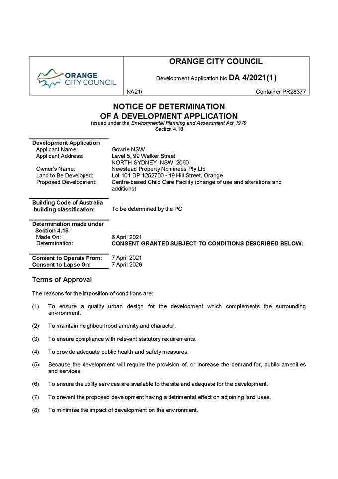
Planning and Development Committee
6 April 2021

Planning
and Development Committee
6 April 2021
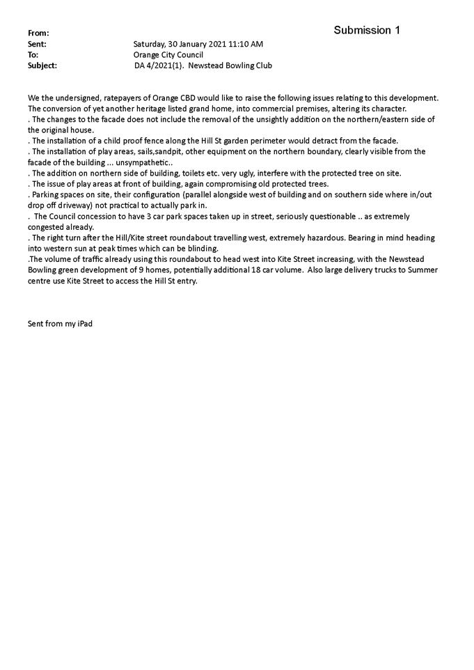
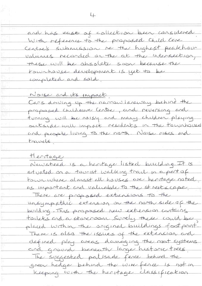
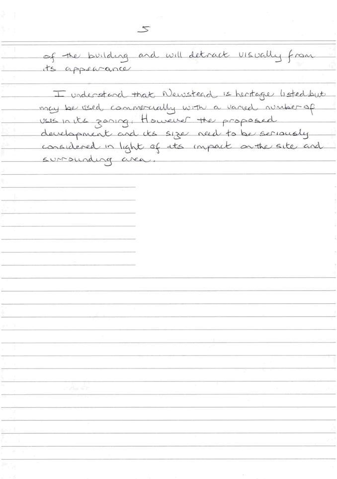
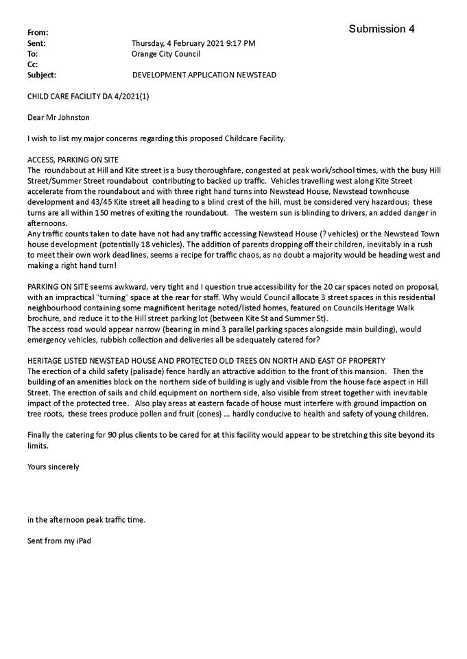
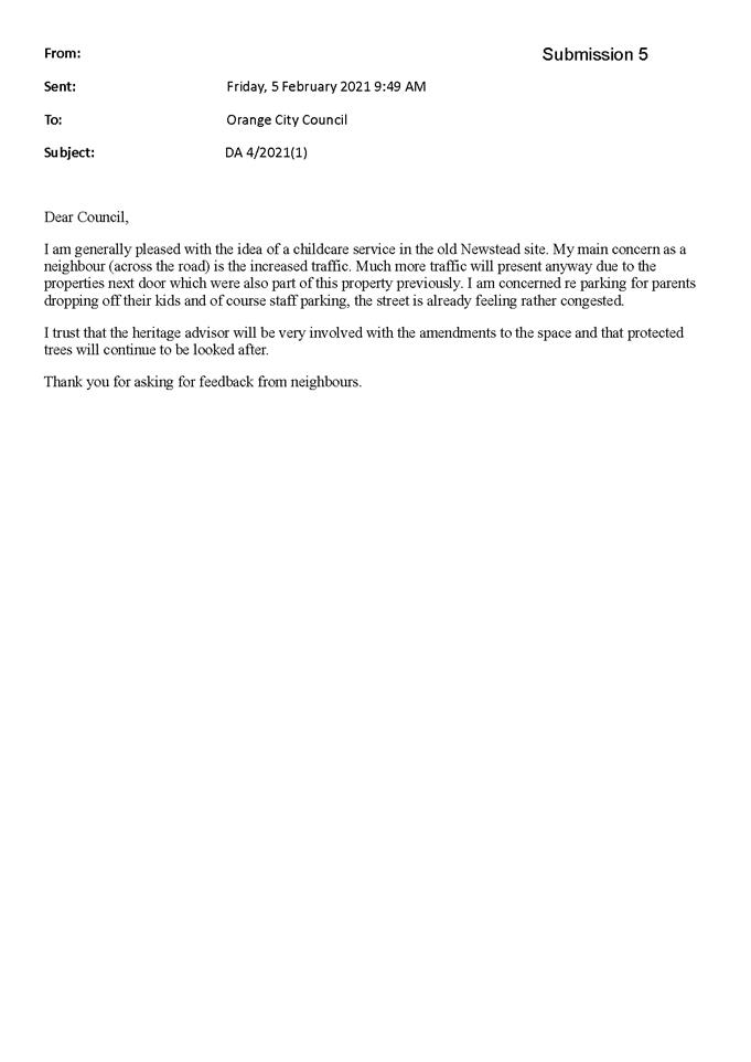
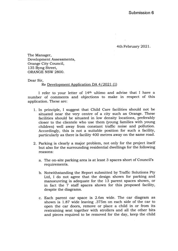
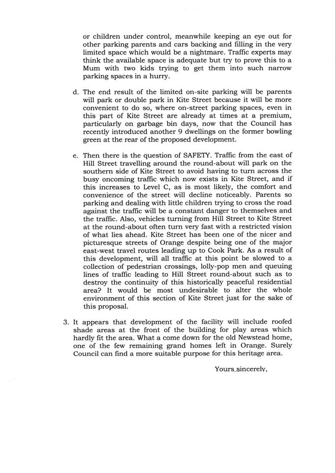
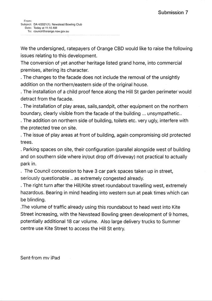
2.10 Development
Application DA 494/2020(1) - 6 Lysterfield Road
RECORD
NUMBER: 2021/547
AUTHOR: Kelly
Walker, Senior Planner
|
Development
Application
|
DA
494/2020(1)
|
|
Applicant/Owner
|
Lives
Lived Well Limited
|
|
Land
description
|
Lot 177
Pce C DP 775277 - 6 Lysterfield Road, Orange
|
|
Proposed
land use
|
Health
Services Facility (hospital)
|
|
Value of
proposed development
|
$5,500,000
|
|
Consent
authority
|
Western
Regional Planning Panel
|
EXECUTIVE Summary
Council is advised that the abovementioned development
application is being tabled for the determination of the Western Regional
Planning Panel (WRPP). The proposal comprises “Regionally Significant
Development” under the provisions of State Environmental Planning
Policy (State and Regional Development) 2011. The development application
seeks consent for a Health Service Facility (Hospital) for the purposes of drug
and alcohol rehabilitation, located at 6 Lysterfield Road, Orange. Staff
assessment of the development application has been completed and forwarded to
the WRPP. Council may make a written submission to the WRPP on the proposed
development. A formal date for the consideration of this matter by the WRPP is
not known at this time.
Financial AND POLICY Implications
The Shiralee Development Control Plan 2015 anticipates
12 additional residential lots to be developed on the subject land in the
future, which would require the payment of development contributions, as well
as water and sewer headworks contributions. The proposed hospital does not
necessitate the payment of development contributions, which are only payable
for new residential development. The proposed development does not preclude future
development of these additional lots, where the proposed hospital is located on
a different part of the site.
Water and sewer headworks contributions are payable under
Section 64 of the Local Government Act 1993, which seek to recover
part of the infrastructure costs incurred in servicing new development or
additions and changes to existing development. It is noted this does not cover
the costs of the developer connecting into and/or extending the existing
infrastructure, which is in addition to the contributions payable. This matter
is discussed in greater detail in the attached planning report.
Overall, consideration has been given to the
recommendation’s impact on Council’s service delivery; image and
reputation; political; environmental; health and safety; employees;
stakeholders and project management; and no further implications or risks have
been identified.
|
Recommendation
That Council resolves:
1 That
the information contained in the report for development application
DA 494/2020(1) for Health Services Facility
(Hospital) Lot 177 Pce C DP 775277 – 6 Lysterfield Road,
Orange, be acknowledged.
2 That
Council determine whether or not it makes a submission on the application to
the Western Regional Planning Panel.
|
DIRECTOR’S NOTE
The WRPP is the determining authority for this development,
as the proposal comprises Regionally Significant Development
State Environmental Planning Policy (State and Regional Development) 2011.
Attached to this report is a copy of the planning assessment report for the
subject development. A copy of this report has been sent through to the WRPP.
Council’s role in this matter is to review the assessment report, and
determine whether or not it wishes to prepare a written submission to the WRPP
on the development. Should Council wish to make a submission to the WRPP,
Council will need to nominate specific planning issues to be addressed so that
arrangements may be made for a letter to be tabled for the consideration of the
WRPP. A formal date for the consideration of this matter by the WRPP is not
known at this time.
SUPPORTING INFORMATION
The proposed involves the construction of four (4) new
buildings, including one (1) administration building, one (1) withdrawal
unit building, and two (2) rehabilitation unit buildings, connected by open and
covered walkways (see Figure 2). A new car parking area to provide for 20
additional spaces on the site is proposed, as well as vehicle drop-off area and
service vehicle area. Removal of approximately 22 trees is required to
facilitate the development. New landscaping is proposed, including replacement
trees, low level gardens, grassed areas, and concrete and gravel pathways.
The facility is to be used for residential treatment for
drug and alcohol problems (29 beds), including withdrawal support, therapy, and
mental health management. Treatment programs run between 6-12 weeks, where
clients are admitted and stay on site 24 hours a day for the duration of their
treatment.
A group home is currently being run on the site for drug and
alcohol rehabilitation (10 beds). It is proposed to run the existing and
proposed facilities as separate services with regards to staffing, client/bed
numbers, etc., although administration and management support will be
integrated.
The proposal comprises “Regionally Significant
Development” under the provisions of State Environmental Planning
Policy (State and Regional Development) 2011, where the proposal involves a
health services facility with a capital investment value over $5 million.
As such the Western Regional Planning Panel is the consent authority for
this development application.
The proposal comprises “advertised development”
pursuant to Council’s Community Participation Plan 2019 (CPP).
Public and written notice of the application was given, and at the completion
of the exhibition period, two (2) submissions were received.
One submission raises no objections, while the other raises
issues in relation to security. These matters are discussed in greater detail
in the attached planning report.
Attached for Council’s information is a copy of the
planning assessment report, supporting plans, draft Notice of Approval, and
public submissions received. As outlined in the
assessment report, the proposed development is considered to reasonably satisfy
the Local and State planning controls that apply to the subject land and
particular land use. Impacts of the development will be within acceptable
limit, subject to mitigation conditions.
Council may make a submission on a
development application that is to be determined by a Western Regional Planning
Panel.
Attachments
1 Planning
Report, D21/16413⇩
2 Notice
of Approval, D21/16429⇩
3 Plans,
D21/16461⇩
4 Submissions,
D21/16478⇩
Planning
and Development Committee
6 April 2021
Attachment 1 Planning
Report
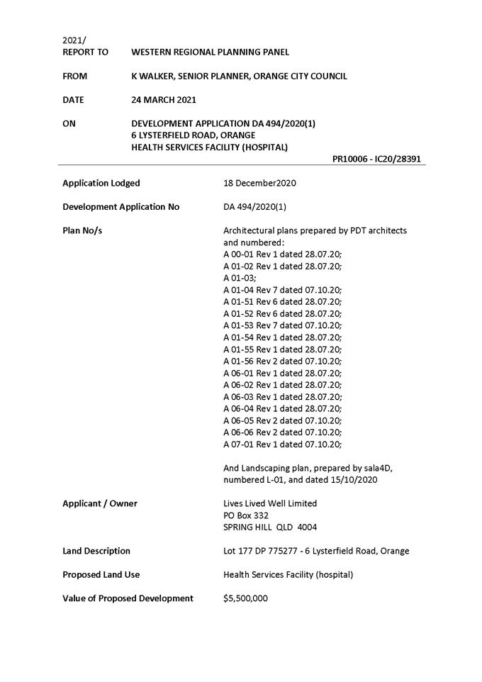

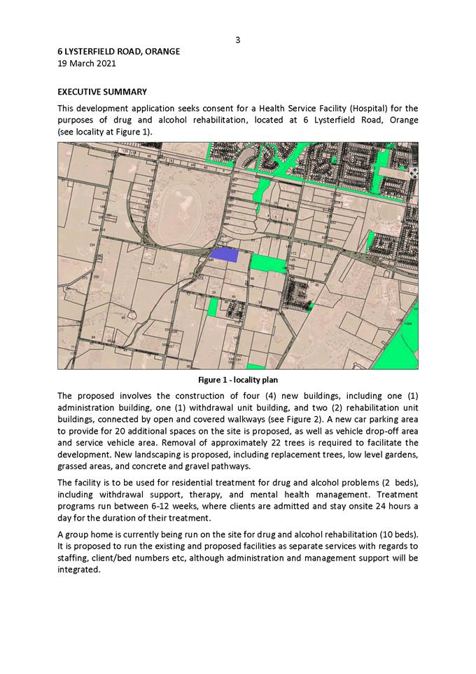
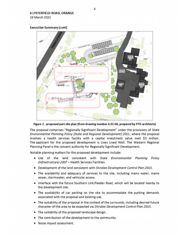
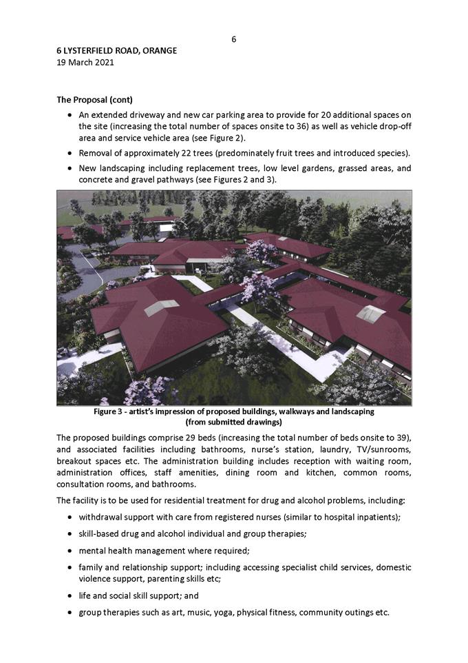
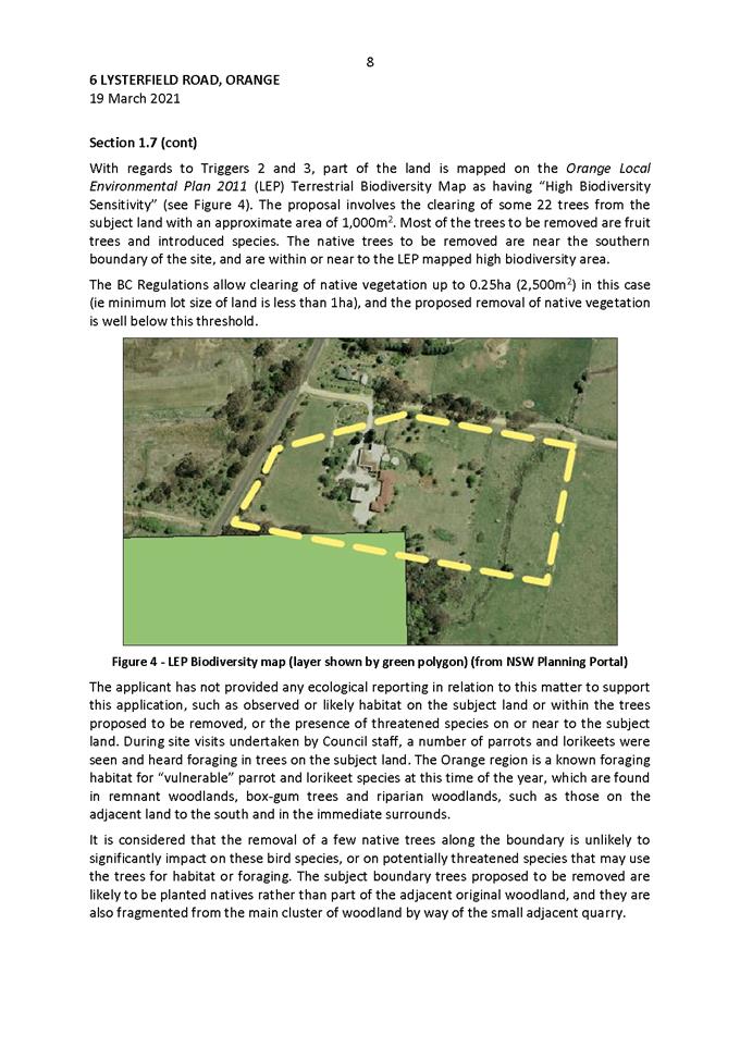
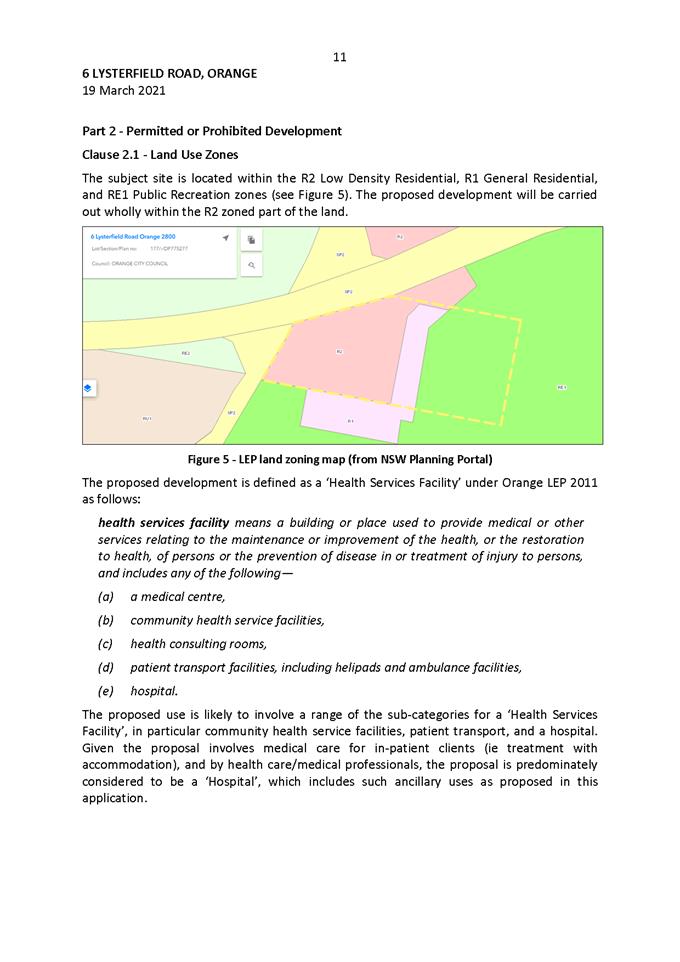
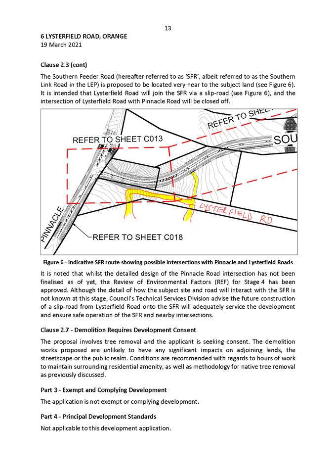
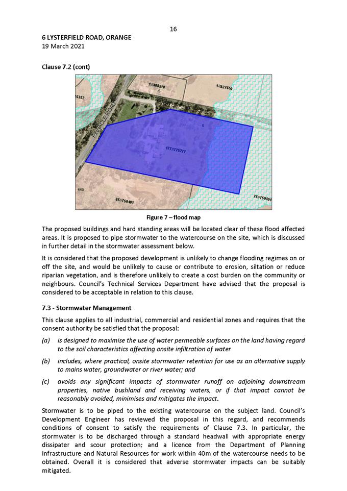
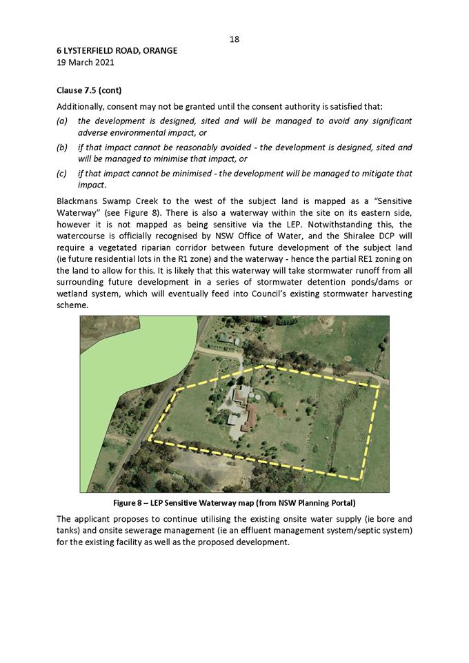
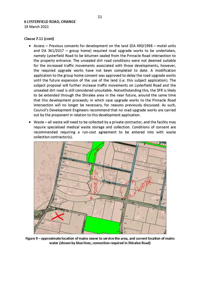
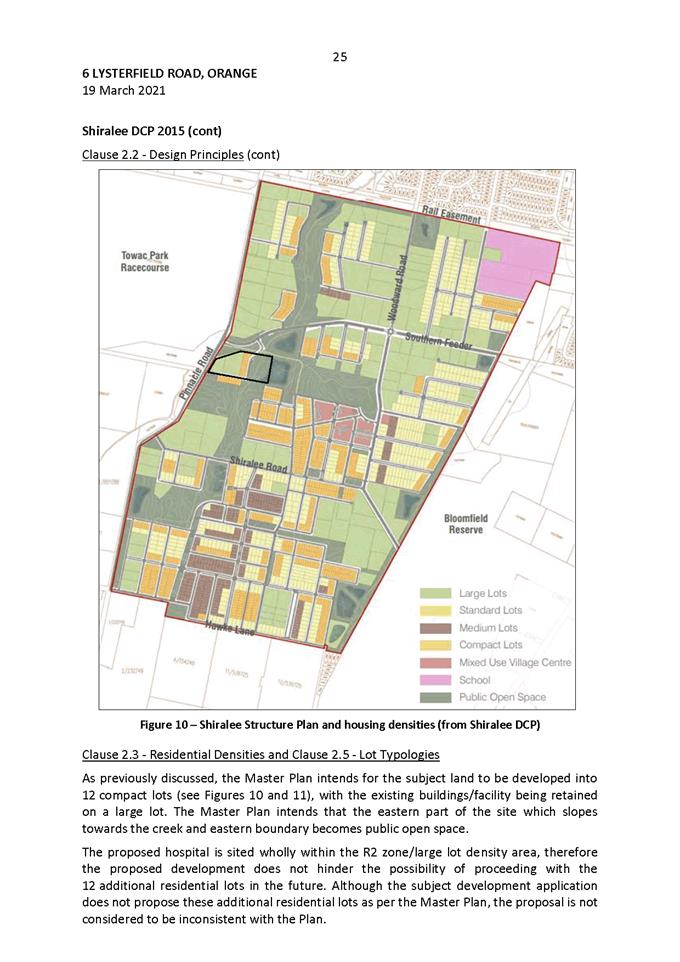
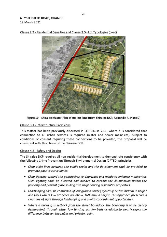
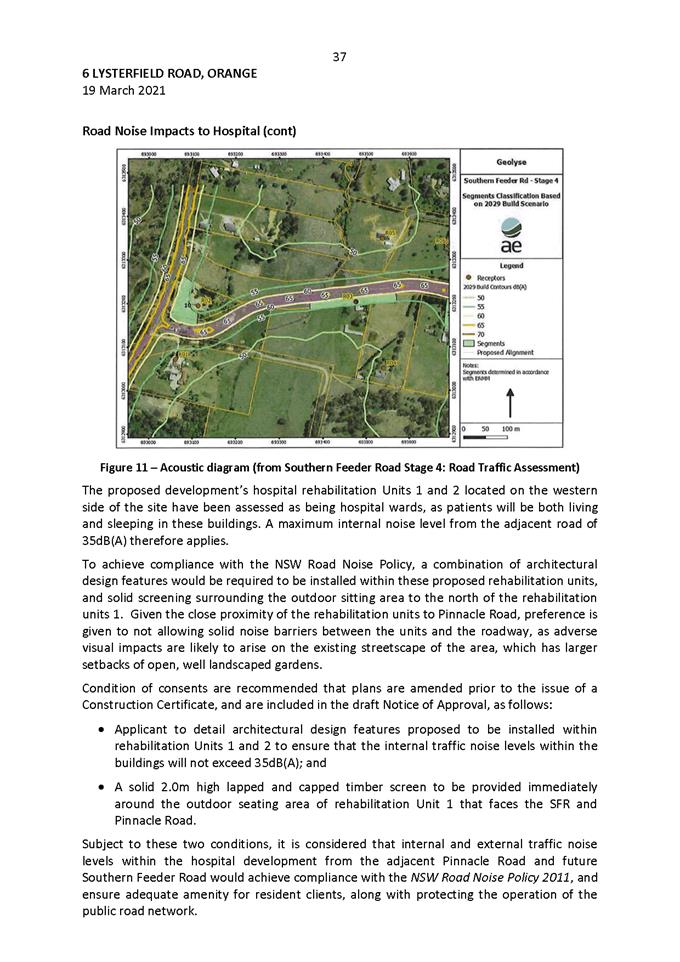
Planning and Development Committee
6 April 2021
Attachment 2 Notice
of Approval
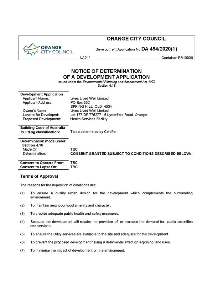
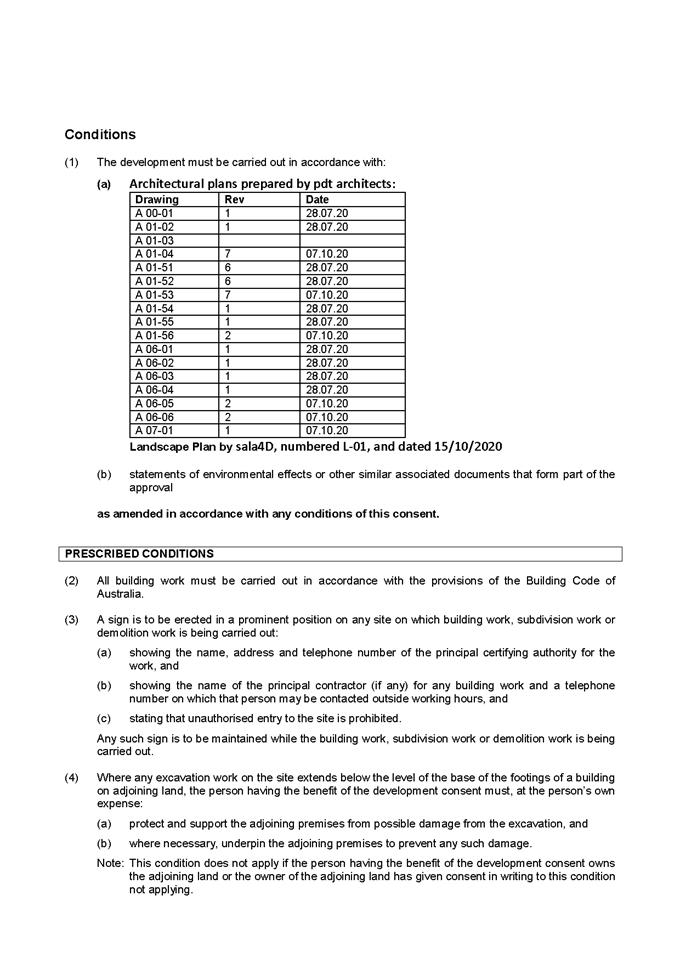
Planning and Development Committee
6 April 2021
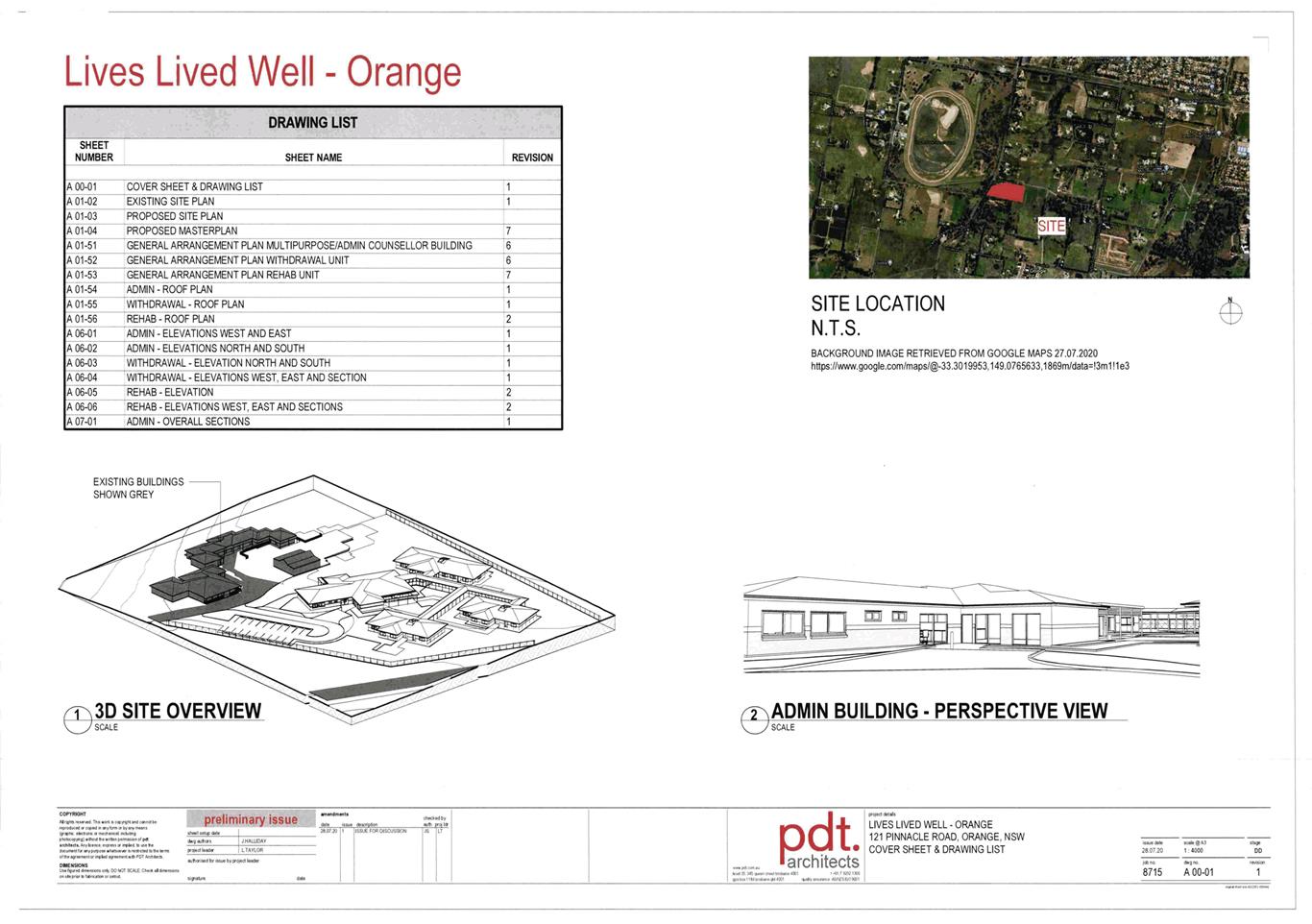
Planning
and Development Committee
6 April 2021