Planning and Development
Committee
Agenda
2 February 2021
Notice is hereby given, in
accordance with the provisions of the Local Government Act 1993 that a Planning and Development Committee meeting of ORANGE CITY COUNCIL
will be held in the Council Chamber,
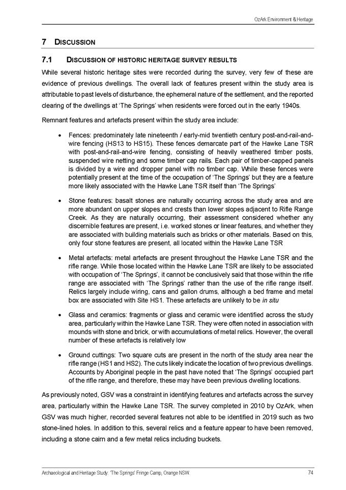
Civic Centre, Byng Street, Orange WITH
AN OPTION OF ONLINE CONFERENCING PLATFORM ZOOM DUE TO COVID-19 REQUIREMENTS
on Tuesday, 2 February 2021.
David
Waddell
Chief Executive Officer
For apologies please
contact Administration on 6393 8218.
1 Introduction
1.1 Declaration
of pecuniary interests, significant non-pecuniary interests and less than
significant non-pecuniary interests
The
provisions of Chapter 14 of the Local Government Act, 1993 (the Act)
regulate the way in which Councillors and designated staff of Council conduct
themselves to ensure that there is no conflict between their private interests
and their public role.
The
Act prescribes that where a member of Council (or a Committee of Council) has a
direct or indirect financial (pecuniary) interest in a matter to be considered
at a meeting of the Council (or Committee), that interest must be disclosed as
soon as practicable after the start of the meeting and the reasons given for declaring
such interest.
As
members are aware, the provisions of the Local Government Act restrict any
member who has declared a pecuniary interest in any matter from participating
in the discussion or voting on that matter, and requires that member to vacate
the Chamber.
Council’s Code of Conduct provides that if members
have a non-pecuniary conflict of interest, the nature of the conflict must be
disclosed. The Code of Conduct also provides for a number of ways in which a
member may manage non pecuniary conflicts of interest.
|
Recommendation
It is recommended that Committee Members now disclose any
conflicts of interest in matters under consideration by the Planning and
Development Committee at this meeting.
|
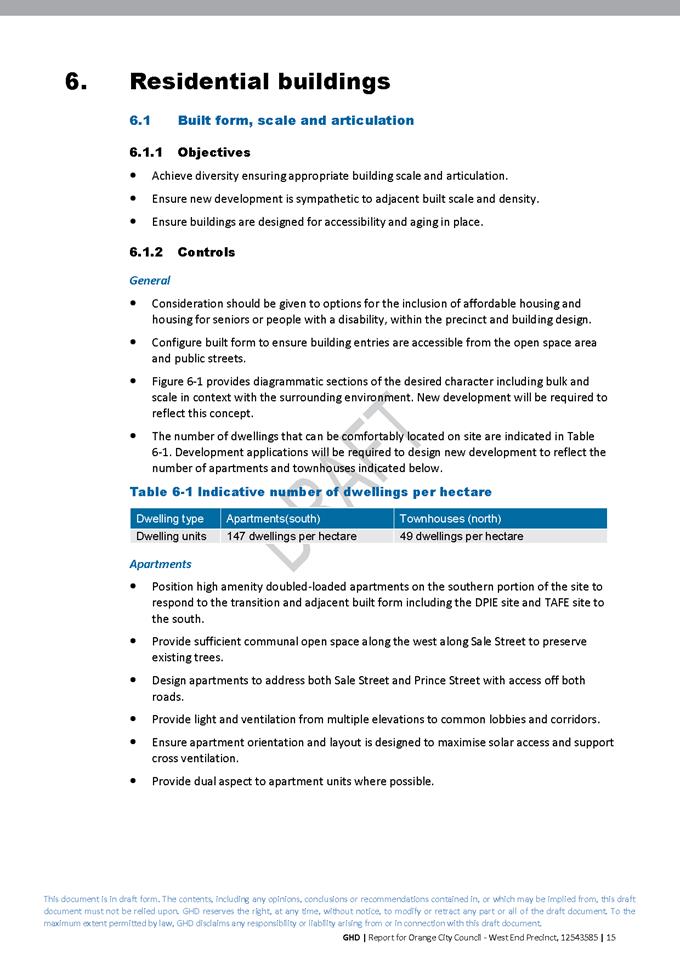
2 General
Reports
2.1 Items
Approved Under the Delegated Authority of Council
RECORD
NUMBER: 2020/2492
AUTHOR: Paul
Johnston, Manager Development Assessments
EXECUTIVE Summary
Following is a list of more
significant development applications approved by the Chief Executive Officer
under the delegated authority of Council and the Western Regional Planning
Panel. Not included in this list are residential scale development applications
that have also been determined by staff under the delegated authority of
Council (see last paragraph of this report for those figures).
Link To Delivery/OPerational Plan
The recommendation in this report
relates to the Delivery/Operational Plan strategy “7.1 Preserve - Engage
with the community to develop plans for growth and development that value the
local environment”.
Financial Implications
Nil
Policy and Governance Implications
Nil
|
Recommendation
That Council resolves to
acknowledge the information provided in the report by the Manager Development
Assessments on Items Approved Under the Delegated Authority of Council.
|
further considerations
Consideration has been given to the
recommendation’s impact on Council’s service delivery; image and
reputation; political; environmental; health and safety; employees;
stakeholders and project management; and no further implications or risks have
been identified.
|
Reference:
|
DA
342/2013(4)
|
Determination
Date
|
25
November 2020
|
|
PR
Number
|
PR28557
|
|
Applicant/s:
|
Wakehurst Ashurst Developments Pty Limited
|
|
Owner/s:
|
Northern Managers and Construction Pty Ltd
and Wakefield Ashurst Developments Pty Ltd
|
|
Location:
|
Lot 230 DP 1260406 - Hallaran Way, Orange
(formerly known as Lot 1 DP 833569 - 74 Beer Road,
Orange)
|
|
Proposal:
|
Modification
of development consent - subdivision (114 lot residential and three public
reserve lots) and demolition (ancillary structures). The applicant sought to hold
on to a small slither of land on the northern side of Buckland Drive, rather
than dedicate it as public reserve, pending the outcomes of the housing
strategy that is currently in train. The housing strategy could potentially
rezone the land to the north residential.
|
|
Value:
|
Not
applicable
|
|
Reference:
|
DA
342/2013(5)
|
Determination
Date
|
8
January 2021
|
|
PR
Number
|
PR28557
|
|
Applicant/s:
|
Wakehurst Ashurst Developments Pty Limited
|
|
Owner/s:
|
Northern Managers and Construction Pty Ltd
and Wakefield Ashurst Developments Pty Ltd
|
|
Location:
|
Lot 230 DP 1260406 - Hallaran Way, Orange
(formerly known as Lot 1 DP 833569 - 74 Beer Road,
Orange)
|
|
Proposal:
|
Modification
of development consent - subdivision (114 lot residential and three public
reserve lots) and demolition (ancillary structures). The modification
involved a correction of a miscalculation of development contributions and
open space credits.
|
|
Value:
|
Not
applicable
|
|
Reference:
|
DA
407/2013(4)
|
Determination
Date
|
1
December 2020
|
|
PR
Number
|
PR22203
|
|
Applicant/s:
|
Statspan Pty Ltd
|
|
Owner/s:
|
Statspan Pty Ltd
|
|
Location:
|
Lot 1 DP 1109351 - 120-122 Summer Street, Orange
|
|
Proposal:
|
Modification
of development consent - food and drink premises, retail premises and
demolition (minor). The modified proposal involved modification and extension
to the outdoor dining.
|
|
Value:
|
Not
applicable
|
|
Reference:
|
DA
247/2017(4)
|
Determination
Date
|
16
November 2020
|
|
PR
Number
|
PR13530
|
|
Applicant/s:
|
Hibbards Pty Ltd
|
|
Owner/s:
|
Forest Knoll Pty Limited
|
|
Location:
|
Lot 15 DP 1255866 - 30 Tarawell Crescent, Orange
|
|
Proposal:
|
Modification
of development consent - subdivision (29 lot residential)
(bulk earthworks and retaining walls). The modification involved
carrying out earthworks and retaining walls to create level building pads for
future development of the residential allotments.
|
|
Value:
|
$150,000
|
|
Reference:
|
DA
259/2019(2)
|
Determination
Date
|
18
January 2021
|
|
PR
Number
|
PR18317
|
|
Applicant/s:
|
Adam Grant Constructions Pty Ltd
|
|
Owner/s:
|
Mr MC and Mrs LE Hansen
|
|
Location:
|
Lot 3 DP 1036031 – 448 Escort Way, Orange
|
|
Proposal:
|
Modification
of development consent - subdivision (37 lot residential and one drainage
reserve). The modified development will alter the approved subdivision as
follows:
· deletion of Road 2
· Lots 4 and 6 would be created as battle axe
allotments and increased in land size
· the land size and configuration of Lots 3 and 7 will
also be altered slightly as a result of the removal of Road 2
· the number of approved lots will be remain the same.
|
|
Value:
|
Not
applicable
|
|
Reference:
|
DA
372/2019(2)
|
Determination
Date
|
24
December 2020
|
|
PR
Number
|
PR2785
|
|
Applicant/s:
|
Mr RA and Mrs J Cutler
|
|
Owner/s:
|
Mr RA and Mrs J Cutler
|
|
Location:
|
Lot B DP 377280, Lot 1 DP 158411, Lot 2
DP 514361 - 40 Clinton Street, Orange
|
|
Proposal:
|
Modification
of development consent - demolition, subdivision, dwelling (alterations and
additions). The modification involved amending the development staging and
concurrent conditions of consent.
|
|
Value:
|
Not
applicable
|
|
Reference:
|
DA 403/2019(2)
|
Determination
Date
|
12
January 2021
|
|
PR
Number
|
PR26330
|
|
Applicant/s:
|
Orange
Ex-Services Club Limited
|
|
Owner/s:
|
Orange
Ex-Services Club Limited
|
|
Location:
|
Lot
200 DP 1191450 - 225-243 Anson Street, Orange
|
|
Proposal:
|
Modification
of development consent - registered club (alterations and additions to
existing building). The modification involved changes to the ground floor
entry off the existing car park, and enclosing additional floor area and
creating a mechanical plant enclosure in the outdoor garden area of the
Greenhouse restaurant, and its resulting minor roof reconfiguration.
|
|
Value:
|
Not
applicable
|
|
Reference:
|
DA
33/2020(2)
|
Determination
Date
|
23
November 2020
|
|
PR
Number
|
PR28519
|
|
Applicant/s:
|
James
Richmark Pty Ltd
|
|
Owner/s:
|
The
Proprietors of Strata Plan 100937. James Richmark Pty Ltd
|
|
Location:
|
Lots
1, 5 and 7 SP 100937. Common Property SP 100937. Community Property
Lot 1 DP 271257. Lot 4 DP 271257 (formerly described as Lot 1 DP
1258217) – 1521 Forest Road, Orange
|
|
Proposal:
|
Modification
of development consent - hospital (fit out works relating to existing
building: operating theatres, associated support areas and facilities - Level
4, ground level and rooftop). The modification involved modifying the
consent to:
· enlarge the hospital’s mechanical plant area
on the rooftop of the building
· increase the size of the medical gas compound
structure at ground level.
The
modification application was made pursuant to Section 4.55(1A) of the
Environmental Planning and Assessment Act 1979. The modified development
satisfies the Local and State planning controls applicable to the subject
land and particular land use.
|
|
Value:
|
Not
applicable
|
|
Reference:
|
DA
263/2020(1)
|
Determination
Date
|
5
December 2020
|
|
PR
Number
|
PR6012
|
|
Applicant/s:
|
Mrs
AB Burton
|
|
Owner/s:
|
Mrs
AB Burton
|
|
Location:
|
Lot
20 DP 234780 - 32 Kenna Street, Orange
|
|
Proposal:
|
Secondary
dwelling and associated parking
|
|
Value:
|
$125,000
|
|
Reference:
|
DA
277/2020(1)
|
Determination
Date
|
21
December 2020
|
|
PR
Number
|
PR28520
|
|
Applicant/s:
|
Universal
Property Group Pty Limited
|
|
Owner/s:
|
Mrs
CM Barbagallo and Mrs KL Stevenson
|
|
Location:
|
Lot
200 DP 1258673 and Lot 84 DP 750401 – 91 and 131 Shiralee Road, Orange
|
|
Proposal:
|
Demolition
(two dwellings and trees) and subdivision (105 lot residential)
|
|
Value:
|
$4,359,820.83
|
|
Reference:
|
DA
289/2020(1)
|
Determination
Date
|
17
December 2020
|
|
PR
Number
|
PR9813
|
|
Applicant/s:
|
Health-X
Pty Ltd
|
|
Owner/s:
|
Health-X
Pty Ltd
|
|
Location:
|
Lot
11 DP 800314 – 86-88 Peisley Street, Orange
|
|
Proposal:
|
Mixed
use development (medical centre and office premises) and business
identification signage
|
|
Value:
|
$760,000
|
|
Reference:
|
DA
324/2020(1)
|
Determination
Date
|
18
December 2020
|
|
PR
Number
|
PR11579
|
|
Applicant/s:
|
Helix
Architects Pty Ltd
|
|
Owner/s:
|
Australian
Postal Corporation
|
|
Location:
|
Lot
11 Sec 40 DP 758817 – 222-224 Summer Street, Orange
Lot
22 Sec 40 DP758817 – Colvin Lane, Orange
|
|
Proposal:
|
Business
premises (alterations and additions, and upgrade works)
|
|
Value:
|
$165,000
|
|
Reference:
|
DA
363/2020(1)
|
Determination
Date
|
11 November
2020
|
|
PR
Number
|
PR26594
|
|
Applicant/s:
|
Eastern Developments (NSW) Pty Ltd
|
|
Owner/s:
|
Mr SAJ Lane and Mrs KP Johnston
|
|
Location:
|
Lot 100 DP 1198640 - 345 Ophir Road, Orange
|
|
Proposal:
|
Subdivision (three lot englobo)
|
|
Value:
|
Not
applicable
|
|
Reference:
|
DA
369/2020(1)
|
Determination
Date
|
24
November 2020
|
|
PR
Number
|
PR17580
|
|
Applicant/s:
|
Orange
City Council
|
|
Owner/s:
|
Orange
City Council
|
|
Location:
|
Lot
16 Sec 29 DP 5600 - Leeds Parade, Orange
|
|
Proposal:
|
Recreation
facility (additions to pavilion for public toilets and canteen)
|
|
Value:
|
$750,000
|
|
Reference:
|
DA
382/2020(1)
|
Determination
Date
|
5
January 2021
|
|
PR
Number
|
PR26334
|
|
Applicant/s:
|
Lindfield
Family Trust
|
|
Owner/s:
|
MLPL
Investments Pty Ltd
|
|
Location:
|
Lot
202 DP 1190831 – 7 McNamara Street, Orange
|
|
Proposal:
|
Retail
premises and shop top housing
|
|
Value:
|
$1,100,000
|
|
Reference:
|
DA
383/2020(1)
|
Determination
Date
|
11
January 2021
|
|
PR
Number
|
PR20440
|
|
Applicant/s:
|
Mr
BA and Mrs RR Westgeest
|
|
Owner/s:
|
Mr
BA and Mrs RR Westgeest
|
|
Location:
|
Lot
DP 1083040 - 176 Clergate Road, Orange
|
|
Proposal:
|
Dwelling
house (minor demolition works, alterations and additions) and carport
|
|
Value:
|
$150,000
|
|
Reference:
|
DA
384/2020(1)
|
Determination
Date
|
22
December 2020
|
|
PR
Number
|
PR10479
|
|
Applicant/s:
|
Landorange
Partnership
|
|
Owner/s:
|
LJ
and GM Dwyer, R Coulson, M Sharkey and GE and EJ Saunders
|
|
Location:
|
Lot
11 DP 750401 – 41 Park Road, Orange
Lot
86 DP 750401 – 23 Park Road, Orange
Lot
88 DP 750401 – 55 Rifle Range Road, Orange
Lot
89 DP 750401 – Rifle Range Road, Orange
Lot
91 DP 750401 – 158 Shiralee Road, Orange
|
|
Proposal:
|
Demolition
(existing dwelling), boundary adjustment and subdivision (85 lot residential)
|
|
Value:
|
$0
|
|
Reference:
|
DA
385/2020(1)
|
Determination
Date
|
4
January 2021
|
|
PR
Number
|
PR2492
|
|
Applicant/s:
|
Moolah
Way Pty Limited
|
|
Owner/s:
|
Moolah
Way Pty Limited
|
|
Location:
|
Lot
27 DP 241304 - 22 Cecil Road, Orange
|
|
Proposal:
|
Demolition
(existing dwelling), dual occupancy, subdivision (two lot Torrens title
subdivision)
|
|
Value:
|
$750,000
|
|
Reference:
|
DA
387/2020(1)
|
Determination
Date
|
24
November 2020
|
|
PR
Number
|
PR27081
|
|
Applicant/s:
|
Mr
SR and Mrs KA Northam
|
|
Owner/s:
|
Mr
SR and Mrs KA Northam
|
|
Location:
|
Lot
131 DP 1207360 - 100 Dean Drive, Orange
|
|
Proposal:
|
Secondary
dwelling
|
|
Value:
|
$120,000
|
|
Reference:
|
DA
388/2020(1)
|
Determination
Date
|
4
January 2021
|
|
PR
Number
|
PR22862
|
|
Applicant/s:
|
Mr
TJ and Mrs M Wise
|
|
Owner/s:
|
Mr
TJ and Mrs MA Wise
|
|
Location:
|
Lot
101 DP 1123499 – 37 Beaumah Road, Spring Hill
|
|
Proposal:
|
Dual
occupancy (replacement of one dwelling in an existing dual occupancy with new
dwelling housing, garage, swimming pool (indoor and in ground) and rainwater
tank (90,000L))
|
|
Value:
|
$450,000
|
|
Reference:
|
DA
396/2020(1)
|
Determination
Date
|
23
November 2020
|
|
PR
Number
|
PR16102
|
|
Applicant/s:
|
Mr DG Martin
|
|
Owner/s:
|
Mr DG and Mrs DA Martin
|
|
Location:
|
Lot 11 DP851657, 4 Melaleuca Way, Orange
|
|
Proposal:
|
Secondary dwelling
|
|
Value:
|
$105,000
|
|
Reference:
|
DA
408/2020(1)
|
Determination
Date
|
24
November 2020
|
|
PR
Number
|
PR28654
|
|
Applicant/s:
|
James
Richmark Pty Ltd
|
|
Owner/s:
|
James
Richmark Pty Ltd
|
|
Location:
|
Lot
7 SP 100937 - 1521 Forest Road, Orange
|
|
Proposal:
|
Business
identification signage
|
|
Value:
|
Not
applicable
|
|
Reference:
|
DA
411/2020(1)
|
Determination
Date
|
22
December 2020
|
|
PR
Number
|
PR15721
|
|
Applicant/s:
|
Mr J
Buchanan
|
|
Owner/s:
|
Mr
MF and Mrs JM Rangott
|
|
Location:
|
Lot
5 DP 285202 - 1/63-65 Peisley Street, Orange
|
|
Proposal:
|
Subdivision
(two lot residential)
|
|
Value:
|
Not
applicable
|
|
Reference:
|
DA
419/2020(1)
|
Determination
Date
|
20 January
2021
|
|
PR
Numbers
|
PR28592
and PR28593
|
|
Applicant/s:
|
Contemporary
Homes Pty Ltd
|
|
Owner/s:
|
Divlist
Pty Limited
and
Mikell Investments Pty Limited
|
|
Location:
|
Lots
135 and 136 DP1260733
128
and 130 Shiralee Road, Orange
|
|
Proposal:
|
Exhibition
village (change of use of two dwellings to exhibition homes) and business
identification signage
|
|
Value:
|
$15,000
|
|
Reference:
|
DA
429/2020(1)
|
Determination
Date
|
14
December 2020
|
|
PR
Number
|
PR25394
|
|
Applicant/s:
|
Ms J
Hines
|
|
Owner/s:
|
Ms M
Doueihi and Mrs EJ Doueihi
|
|
Location:
|
Lot
206 DP 1157955 - 22 Robinson Court, Orange
|
|
Proposal:
|
Home
business
|
|
Value:
|
Not
applicable
|
|
Reference:
|
DA
433/2020(1)
|
Determination
Date
|
22
December 2020
|
|
PR
Number
|
PR27531
|
|
Applicant/s:
|
Eastern
Developments (NSW) Pty Ltd
|
|
Owner/s:
|
Eastern
Developments Pty Ltd
|
|
Location:
|
Lot
200 DP 1225088 – 4/132 Kite Street, Orange
|
|
Proposal:
|
Office
premises (change of use from retail premises and associated fit out)
|
|
Value:
|
$30,000
|
|
Reference:
|
DA
437/2020(1)
|
Determination
Date
|
8
December 2020
|
|
PR
Number
|
PR18435
|
|
Applicant/s:
|
Mr
YS Choi
|
|
Owner/s:
|
Mr
YS and Mrs RJ Choi
|
|
Location:
|
Lot
2 DP 1038469 - 1349 Millthorpe Road, Millthorpe
|
|
Proposal:
|
Recreation
facility (outdoor) (tennis court with lighting)
|
|
Value:
|
$100,000
|
|
Reference:
|
DA
462/2020(1)
|
Determination
Date
|
3
December 2020
|
|
PR
Number
|
PR27808
|
|
Applicant/s:
|
Saran
Holdings Pty Ltd
|
|
Owner/s:
|
Northern
Managers and Construction Pty Limited
and
Wakefield Ashurst Developments Pty Limited
|
|
Location:
|
Lot
10 DP 1234801 - 270 McLachlan Street, Orange
|
|
Proposal:
|
Depot
(alterations and additions) and signage
|
|
Value:
|
$750,000
|
|
Reference:
|
DA
463/2020(1)
|
Determination
Date
|
4
January 2021
|
|
PR
Number
|
PR4193
|
|
Applicant/s:
|
Designs@m
|
|
Owner/s:
|
Mr
TS and Mrs I L Figuero
|
|
Location:
|
Lot
A DP 371431 - 25 Franklin Road, Orange
|
|
Proposal:
|
Secondary
dwelling and attached garage, dwelling alterations and additions, and
rainwater tanks (3 x 4,000L)
|
|
Value:
|
$400,000
|
|
Reference:
|
DA
466/2020(1)
|
Determination
Date
|
22
December 2020
|
|
PR
Number
|
PR18664
|
|
Applicant/s:
|
DDM (NSW)
Pty Ltd
|
|
Owner/s:
|
Rossi
Orchards Pty Ltd
|
|
Location:
|
Lot
1 DP 1048249 – 121-125 Moulder Street, Orange
|
|
Proposal:
|
Office
premises (change of use from shop)
|
|
Value:
|
$56,000
|
|
Reference:
|
DA
468/2020(1)
|
Determination
Date
|
12
January 2021
|
|
PR
Number
|
PR22640
|
|
Applicant/s:
|
Newcrest
Mining Ltd
|
|
Owner/s:
|
Fawcett
Ridge Pty Limited
|
|
Location:
|
Lot
502 DP 1122616 - 30-44 Edward Street, Orange
|
|
Proposal:
|
General
industry (temporary) and storage premises (change of use from recreation
facility)
|
|
Value:
|
Not
applicable
|
TOTAL NET* VALUE OF
DEVELOPMENTS APPROVED BY THE CEO UNDER DELEGATED AUTHORITY IN THIS PERIOD: $10,335,820.83
* Net
value relates to the value of modifications. If modifications are the same
value as the original DA, then nil is added. If there is a plus/minus
difference, this difference is added or taken out.
Additionally, since the
December 2020 meeting report periods (19 November 2020 to 20 January 2021),
another 46 development applications were determined under delegated authority
by other Council staff with a combined value of $4,759,014.
ITEMS
APPROVED BY THE WESTERN REGIONAL PLANNING PANEL
|
Reference:
|
DA
423/2019(1)
|
Determination
Date
|
8
December 2020
|
|
PR
Number
|
PR26437
|
|
Applicant/s:
|
ITP
Development Pty Ltd
|
|
Owner/s:
|
Mr A
and Mrs EB Ruggiero
|
|
Location:
|
Lot
200 DP 1194585 - 643 Mitchell Highway, Orange
|
|
Proposal:
|
Electricity
generating works (solar farm)
|
|
Value:
|
$8,965,861
(exc GST)
|
|
Reference:
|
DA
259/2020(1)
|
Determination
Date
|
13
December 2020
|
|
PR
Number
|
PR7567
|
|
Applicant/s:
|
Orange
City Council
|
|
Owner/s:
|
Crown,
March Street
|
|
Location:
|
Lots
7 and 8 DP 820905 – March and Peisley Streets, Orange
|
|
Proposal:
|
Mixed
use development (community facility (conservatorium) and information and
education facility (planetarium))
|
|
Value:
|
$20,000,000
|
TOTAL NET* VALUE OF
DEVELOPMENTS APPROVED BY THE WESTERN REGIONAL PLANNING PANEL IN THIS PERIOD: $28,965,861.00
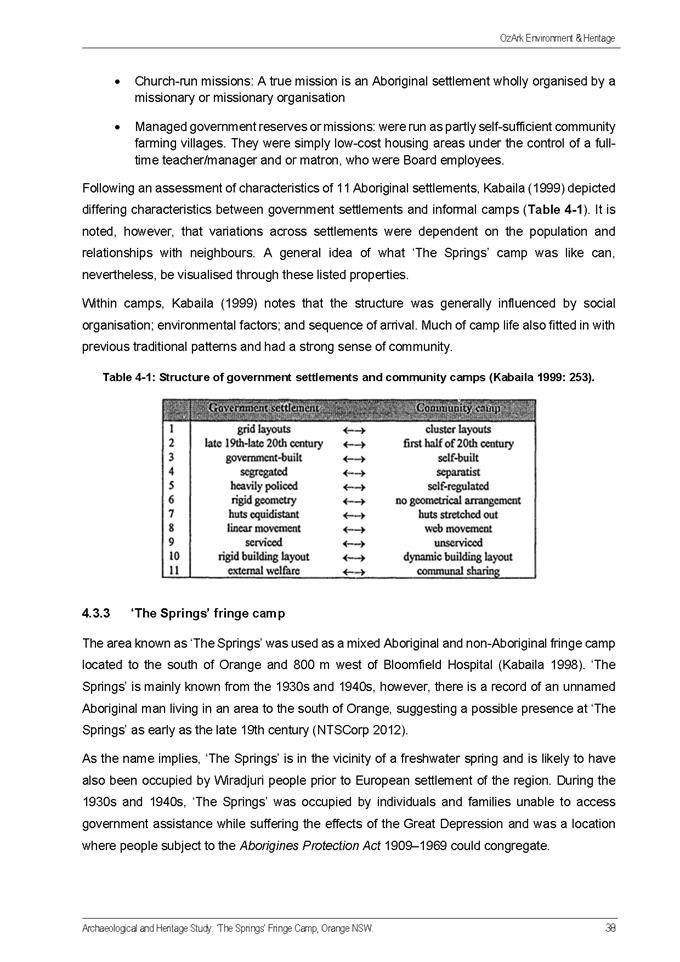
2.2 Development
Application DA 111/2020(1) - 12 Green Lane
RECORD
NUMBER: 2020/2332
AUTHOR: Melissa
Maccallum, Manager Building and Environment
EXECUTIVE
Summary
|
Application
lodged
|
19 May
2020
|
|
Applicant/s
|
Bassmann
Drafting Services
|
|
Owner/s
|
Mr MJ
and Mrs JE Truloff
|
|
Land
description
|
Lot 2 DP
413484 - 12 Green Lane, Orange
|
|
Proposed
land use
|
Dwelling
(two storey), Attached Garage, Retaining Walls and Tree Removal
|
|
Value of
proposed development
|
$850,000
|
EXECUTIVE SUMMARY
Council's consent is sought for a new double storey dwelling
with an attached double car garage, retaining walls and vegetation removal for
a well-established neighbourhood of Orange City, namely Green Lane.
This neighbourhood is characterised with a mixture of size
and designs for residential development but generally of quality design and
construction for their period.
The streetscape character along this section of Green Lane
is also categorized by sloped topography, with multilevel houses arising from
the fall of each parcel to the west. The natural slope of the subject lot
is 8m fall from East to West.
Historically the site was part of the garden for the
neighbouring property (10 Green Lane) so is extensively landscaped as a garden
extension of the neighbouring property. The site was subdivided in
2015.
Currently a vacant subject lot with a generous amount of
vegetation and shrubbery, accompanied by a number of small ancillary structures
such as a retaining wall, garden shed and patio. A significant Eucalyptus
viminalis tree stands towards the front boundary along other trees at the
rear of the site.
Detailed description of the proposal
The proposed development is a contemporary mixed cladded
(timber, stone, blockwork and glass) design of a two storey dwelling with an
attached double spaced garage.
The proposed house frontage would have a single storey
appearance when viewed from the street but maintains similar level throughout
whilst incorporating a lower ground floor as the building footprint extends
westerly.
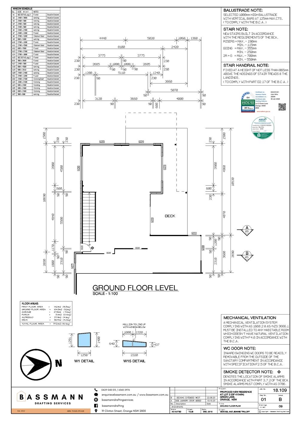
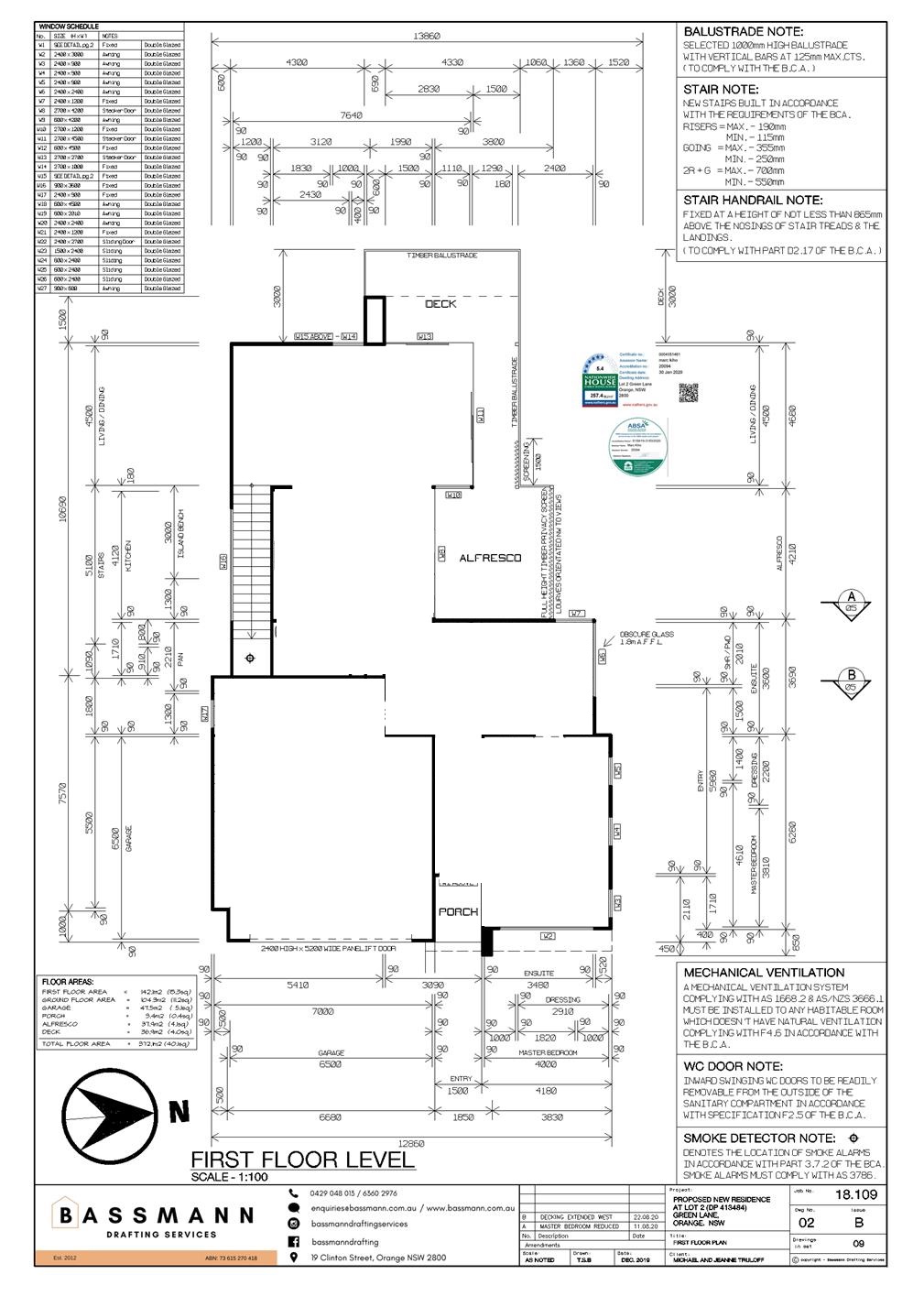
The Floor Plan itself can be best described in two parts
distinguished between the two floors.
Part 1 (First Floor) – contains
comprises of the main section of the dwelling, being the garage, master
bedroom, kitchen, dining/living room that leads to an upper floor alfresco area
that extends around the North to North-Western end of the building.
Part 2 (Ground Floor) – consists of a
laundry, Children’s Activities Room, Bedrooms and a ground floor deck
area.
The proposal includes the removal of the Eucalyptus
viminalis, several small trees and shrubbery. The proposed vegetation
removal is supported by the submission of an external Arborist Report.
Objections were received to both
the original design and amended designs. The proposal is considered to be
complaint with Council’s development controls.
Background of the Proposal
The original development application was lodged with Council
in March 2020. The proposed development was not compliant with several
planning guidelines expressed in the Orange Development Control Plan (2004) for
Visual bulk, Daylight and Sunlight (overshadowing), Visual/Acoustic Privacy and
Open Space and Landscaping.
Neighbours were notified in April 2020. One submission
was received.
During the Neighbour Notification exhibition period, a
submission was received that also identified the issues already raised in the
current assessment.
Staff have been in regular contact with the applicant
negotiating amendments to the design to address matters of compliance and
objections raised.
Three amendments have been submitted by the applicant to
address the issues raised in the initial assessment and the objection.
Amendments made to the proposal reduced the height of the
building by 500mm; altered windows within the main bedroom; redesigned the size
and shape of the balcony; and provided privacy screens to the balcony.
Staff met with the submitter on site and advised them of the
final amendments to the plan that were made by the applicant in an attempt to
address their concerns. Verbally the submitter raised the same concerns to the
amended designs during this onsite meeting. To date no written comment
has been received to reflect the verbal objections.
This report includes detailed information gathered during
the assessment of the final design that has led to the recommendation for
approval to Council’s Planning and Development Committee.
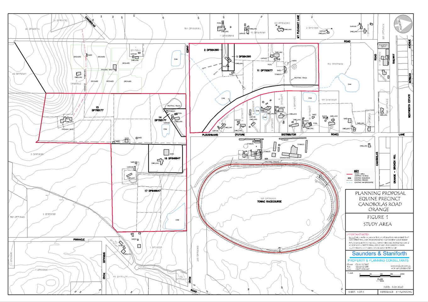
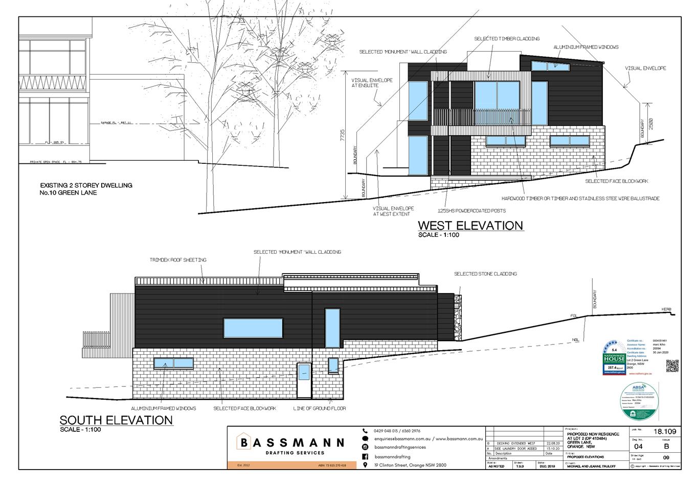
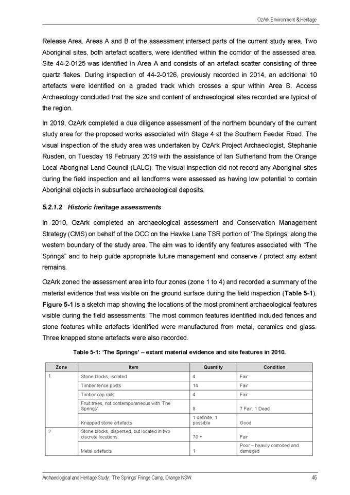
LOCALITY AND SITE CONTEXT MAP
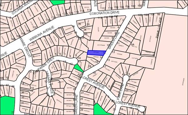
Figure 1 - locality plan
SITE INSPECTION
Date: 1 April 2020
- A
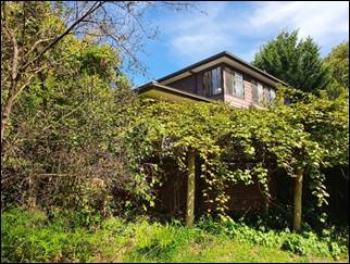
tight and narrow allotment sandwiched between two existing and well established
residentially developed lots.
- Natural
slope from East to West. Front boundary has an existing 2m high brick retaining
wall. The side southern boundary has another existing retaining wall of
approximately 1.4m.
- The
lot filled with several trees and shrubbery that may need clearing, especially
around the proposed building footprint. A large Eucalyptus tree near the front
boundary.
- The
shape and slope of the lot leaves minimal room for a generic dwelling design
but requires one that suits and complements the ‘lay of the land’
in order to minimise impacts on the existing adjoining properties.
- Number
10 Green Lane has significant landscaping to its rear and side yard that has
extended onto the subject lot, in a green belt flow appearance with landscaping
features and small retaining walls on the edge of the dividing boundary line.
Development in Orange is governed by two key documents
Orange Local Environment Plan 2011 and Orange Development Control Plan 2004. In
addition the Infill Guidelines are used to guide development, particularly in
the heritage conservation areas and around heritage items.
Orange Local Environment Plan 2011 – The
provisions of the LEP must be considered by the Council in determining the
application. LEPs govern the types of development that are permissible or
prohibited in different parts of the City and also provide some assessment
criteria in specific circumstances. Uses are either permissible or not. The
objectives of each zoning and indeed the aims of the LEP itself are also to be
considered and can be used to guide decision making around appropriateness of
development.
Orange Development Control Plan 2004 – the DCP
provides guidelines for development. In general it is a performance based
document rather than prescriptive in nature. For each planning element there
are often guidelines used. These guidelines indicate ways of achieving the
planning outcomes. It is thus recognised that there may also be other solutions
of merit. All design solutions are considered on merit by planning and building
staff. Applications should clearly demonstrate how the planning outcomes are
being met where alternative design solutions are proposed. The DCP enables
developers and architects to use design to achieve the planning outcomes in
alternative ways.
DIRECTOR’S COMMENTS (in
this case from MDA Johnston)
The topography and slenderness of this site makes it a
difficult site to develop. Whilst it has taken the applicant a
considerable time to amend plans adequately since lodgement so that this
application may progress, amendments are considered to have taken into account
concerns of the neighbours. Due to the significant slope to the rear,
this site provides significant challenges for development. The proposed
two storey dwelling is not unlike other dwellings in the area that have taken
advantage of the slope to provide a lower ground floor.
The final design, whilst providing a
building that will certainly be prominent, especially when viewed from the
neighbour to the north, takes into account the challenges of the site’s
topography; the northern sunlight opportunities, neighbours privacy, bulk,
scale and the existing vegetation to a level that achieves compliance with
Council’s planning controls. It is noted that the submitter
continue to express significant objection, however given the proposals
compliance with planning controls, the recommendation of approval of this application
is supported.
Financial Implications
Nil
Policy and Governance Implications
Nil
|
Recommendation
That Council consents to
development application DA 111/2020(1)
for Dwelling (two storey), Attached Garage, Retaining Walls and Tree
Removal at Lot 2 DP 413484 – 12 Green Lane, Orange pursuant to the attached Notice of Approval.
|
MATTERS FOR CONSIDERATION
Section 1.7 - Application of
Part 7 of the Biodiversity Conservation Act 2016 and Part 7A of the
Fisheries Management Act 1994
Section 1.7 of the EP&A Act identifies that Part 7 of
the Biodiversity Conservation Act 2016 (BC Act) and Part 7A of the
Fisheries Management Act 1994 have effect in connection with terrestrial and
aquatic environments.
There are four triggers known to insert a development into
the Biodiversity Offset Scheme (ie the need for a BDAR to be submitted
with a DA):
· Trigger
1: development occurs in land mapped on the Biodiversity Values
Map (OEH) (clause 7.1 of BC Regulation 2017);
· Trigger
2: development involves clearing/disturbance of native vegetation above a
certain area threshold (clauses 7.1 and 7.2 of BC Regulation 2017); or
· Trigger
3: development is otherwise likely to significantly affect threatened
species (clauses 7.2 and 7.3 of BC Act 2016).
The fourth trigger (development proposed to occur in an Area
of Outstanding Biodiversity Value (clause 7.2 of BC Act 2016) is generally not
applicable to the Orange LGA; as no such areas are known to occur in the LGA.
No further comments will be made against the fourth trigger.
Trigger 1
Site does not occur within land mapped on the Biodiversity
Values Map (https://www.lmbc.nsw.gov.au/Maps/index.html?viewer=BOSETMap).
Trigger 2
No major clearing/disturbance associated with this proposal.
Even with the proposed tree removals for the building footprint and associated
works, the threshold for the site is not exceeded. An Arborist Report and
advice from OCC Manager of City Presentation has clearly identified that in
order for the development to proceed, it subsequently needs to remove the
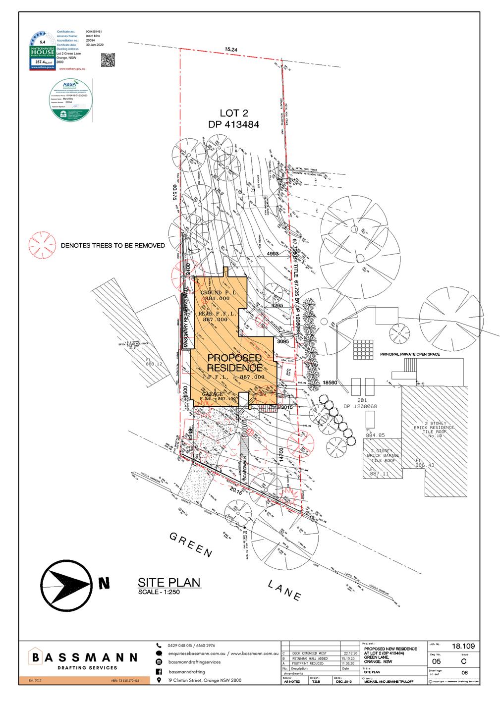
earmarked trees in the lot. (See site plan).
Trigger 3
With regard to the third trigger, the test for determining
whether proposed development is otherwise likely to significantly affect
threatened species is listed in the BC Act 2016, under s7.3:
(a) in
the case of a threatened species, whether the proposed development or activity
is likely to have an adverse effect on the life cycle of the species such that a
viable local population of the species is likely to be placed at risk of
extinction,
(b) in
the case of an endangered ecological community or critically endangered
ecological community, whether the proposed development or activity:
(i) is
likely to have an adverse effect on the extent of the ecological community such
that its local occurrence is likely to be placed at risk of extinction, or
(ii) is
likely to substantially and adversely modify the composition of the ecological
community such that its local occurrence is likely to be placed at risk of
extinction,
(c) in
relation to the habitat of a threatened species or ecological community:
(i) the
extent to which habitat is likely to be removed or modified as a result of the
proposed development or activity, and
(ii) whether
an area of habitat is likely to become fragmented or isolated from other areas
of habitat as a result of the proposed development or activity, and
(iii) the
importance of the habitat to be removed, modified, fragmented or isolated to the
long-term survival of the species or ecological community in the locality,
(d) whether
the proposed development or activity is likely to have an adverse effect on any
declared area of outstanding biodiversity value (either directly or
indirectly),
(e) whether
the proposed development or activity is or is part of a key threatening process
or is likely to increase the impact of a key threatening process.
The subject lot is not mapped in the OLEP 2011 Biodiversity
layer. Also mentioned above in Trigger 2 – it is not mapped in the
Biodiversity Values Map.
There are no known native fauna species/habitats within the
subject site or any known potential linkages to any close Biogeographic
sensitive areas.
An external Arborist Report was submitted to support the proposal and allow for the removal of
smaller trees (many less than the required 300mm trunk width), shrubbery and
one substantial native Eucalyptus tree. The Arborist Report provided evidence
that the Eucalypt has recently dropped large limbs, appears to be damaged, and
is now out of balance thus presents a significant safety risk.
Orange City Council’s Manager of City Presentation has
also given advice for the tree removal, along with comments on the Arborist
Report.
The removal of vegetation on this site was always likely to
permit the construction of a house following the site’s subdivision in
2015. The dwelling design does all it can to maintain trees in the rear
of the site. The removal of the vegetation proposed, including the Eucalypt
that is unsafe, is supported.
Section 4.15
Section 4.15 of the Environmental Planning and Assessment
Act 1979 requires Council to consider various matters, of which those
pertaining to the application are listed below.
PROVISIONS OF ANY ENVIRONMENTAL
PLANNING INSTRUMENT s4.15(1)(a)(i)
Orange Local Environmental Plan
2011
Part 1 - Preliminary
Clause 1.2 - Aims of Plan
The
broad aims of the LEP are set out under Subclause 2. Those relevant to the
application are as follows:
(a) to encourage development which complements and
enhances the unique character of Orange as a major regional centre boasting a
diverse economy and offering an attractive regional lifestyle,
(b) to provide for a range of development opportunities
that contribute to the social, economic and environmental resources of Orange
in a way that allows present and future generations to meet their needs by
implementing the principles for ecologically sustainable development,
(c) to conserve and enhance the water resources on which
Orange depends, particularly water supply catchments,
(d) to manage rural land as an environmental resource that
provides economic and social benefits for Orange,
(e) to provide a range of housing choices in planned urban
and rural locations to meet population growth,
(f) to recognise and manage valued environmental
heritage, landscape and scenic features of Orange.
The application is considered to be
consistent with the objectives of the Orange Local Environmental Plan 2011.
Clause 1.6 - Consent Authority
This clause establishes that, subject to the Act, Council is
the consent authority for applications made under the LEP.
Clause 1.7 - Mapping
The subject site is identified
on the LEP maps in the following manner:
|
Land Zoning Map:
|
R1 General Residential
|
|
Lot Size Map:
|
No Minimum Lot Size
|
|
Heritage Map:
|
Not a heritage item or conservation area
|
|
Height of Buildings Map:
|
No building height limit
|
|
Floor Space Ratio Map:
|
No floor space limit
|
|
Terrestrial Biodiversity Map:
|
Not in a biodiversity sensitive area but removal of 1
Eucalyptus tree and a few trees/shrubbery.
|
|
Groundwater Vulnerability Map:
|
Groundwater vulnerable
|
|
Drinking Water Catchment Map:
|
Not within the drinking water catchment
|
|
Watercourse Map:
|
Not within or affecting a defined watercourse
|
|
Urban Release Area Map:
|
Not within an urban release area
|
|
Obstacle Limitation Surface Map:
|
No restriction on building siting or construction
|
|
Additional Permitted Uses Map:
|
No additional permitted use applies
|
|
Flood Planning Map:
|
Not within a flood planning area
|
Those matters that are of relevance are addressed in detail
in the body of this report.
Clause 1.9A - Suspension of
Covenants, Agreements and Instruments
This clause provides that covenants, agreements and other
instruments which seek to restrict the carrying out of development do not apply
with the following exceptions:
(a) to
a covenant imposed by the Council or that the Council requires to be imposed,
or
(b) to
any relevant instrument under Section 13.4 of the Crown Land Management Act
2016, or
(c) to
any conservation agreement under the National Parks and Wildlife Act 1974, or
(d) to
any Trust agreement under the Nature Conservation Trust Act 2001, or
(e) to
any property vegetation plan under the Native Vegetation Act 2003, or
(f) to
any biobanking agreement under Part 7A of the Threatened Species Conservation
Act 1995, or
(g) to
any planning agreement under Subdivision 2 of Division 7.1 of the Environmental
Planning and Assessment Act 1979.
Council staff are not aware of the title of the subject
property being affected by any of the above.
Part 2 - Permitted or Prohibited Development
Clause 2.1 - Land Use Zones and Clause 2.3 - Zone
Objectives and Land Use Table
The subject site is located within
the R2 Low Density Residential zone. The
proposed development is defined as a new two storey dwelling with an attached
garage, retaining walls and a tree removal under OLEP 2011 and is permitted
with consent for this zone. This application is seeking consent.
Clause
2.3 of LEP 2011 references the Land Use
Table and Objectives for each zone in LEP 2011. These objectives for land
zoned R2 Low Density Residential are as
follows:
· To
provide for the housing needs of the community within a low density residential
environment.
· To
enable other land uses that provide facilities or services to meet the day to
day needs of residents.
· To
ensure development is ordered in such a way as to maximise public transport
patronage and encourage walking and cycling in close proximity to settlement.
· To
ensure that development along the Southern Link Road has an alternative access.
The proposal is consistent with
the objectives of the R2 zone. The proposal will continue to provide a housing
type which will accommodate the needs of the community and maintain the nature
of streetscape. The subject land is accessible to public transport routes. The
site does not have access or frontage to the Southern Link Road.
Part 3 - Exempt and Complying Development
The application is not exempt or complying development.
Part 4 - Principal Development Standards
Part
5 - Miscellaneous Provisions
Nil
Part 7
- Additional Local Provisions
|
Clause
|
Comment
|
|
Clause 7.1 - Earthworks
|
Not applicable.
|
|
Clause
7.2 - Flood Planning
|
Not applicable.
|
|
Clause 7.3 – Stormwater
Management
|
The proposal has been designed to include permeable
surfaces and includes onsite retention of stormwater through the use of detention
basins/easement pits. It is therefore considered
that the post development runoff levels will not excessively exceed the predevelopment levels.
|
|
Clause 7.4 -
Terrestrial Biodiversity
|
Not mapped in the OLEP 2011 Biodiversity layer but
application for the removal of a native tree is supported by an Arborist
Report.
|
|
Clause 7.5 -
Riparian Land and Watercourses
|
Not applicable.
|
|
Clause 7.6 -
Groundwater Vulnerability
|
The installation of the signage is not anticipated to
involve the discharge of toxic or noxious substances and is therefore
unlikely to contaminate the groundwater or related ecosystems. The proposal
does not involve extraction of groundwater and will therefore not contribute
to groundwater depletion. The design and siting of the proposal avoids
impacts on groundwater and is therefore considered acceptable.
|
|
Clause 7.7 -
Drinking Water Catchments
|
Not applicable.
|
|
Clause 7.8 -
Salinity
|
Not applicable.
|
|
Clause 7.9 -
Airspace Operations
|
Not applicable.
|
|
Clause 7.10
Development in areas subject to aircraft noise
|
Not applicable.
|
|
Clause 7.11 -
Essential Services
|
All utility services are available to the subject lot.
|
STATE ENVIRONMENTAL PLANNING
POLICIES
There are no SEPPs or REPs which
relate to the proposed development.
DESIGNATED
DEVELOPMENT
The proposed development is not designated development.
INTEGRATED DEVELOPMENT
The proposed development is not integrated development.
PROVISIONS OF ANY DEVELOPMENT
CONTROL PLAN s4.15(1)(a)(iii)
Development Control Plan 2004
Development Control Plan 2004 (“the DCP”)
applies to the subject land. An assessment of the proposed development against
the relevant Planning Outcomes will be undertaken. Pursuant to Orange DCP
2004 Part 7.7 – Development in Residential Areas- Design Elements for
Residential Development Streetscape is considered below:
It is important to note that the below planning guidelines
are inter-related and that triggered impacts may overlap.
PO 7.7-1 –
Neighbourhood Character
The site layout of the proposed dwelling allows for the
maintenance of the majority of existing vegetation. Extensive vegetated areas
are part of the characteristic of the neighbourhood. The setout of the dwelling
on the site does requires the removal of several trees. The removal of the
native tree in the frontage is for safety of the proposed residence and an
Arborist report recommending removal has been provided. Councils City
Presentation Manager has also supported that the damaged large tree is not
suitable for the residential area. An established pine is also indicated for
removal. The removal of these trees in the frontage will reduce the density of
the plantings across the street frontage. This is considered as acceptable due
to the existing dense plantings and the proposed approved use of this lot for
residential development.
The dwelling will appear as single storey from the street
and increases to two storey as the lot falls away to the west. This is
considered similar to the character of other dwellings within the street due to
the gradient of the land.
The modern style design with flat roof and clean lines is
emerging as the neighbourhood character as the older homes are renovated and
rebuilt.
It is considered that the design of the dwelling adequately
deals with the site constraints of the vegetation and the gradient of the site
and will maintain the character of the neighbourhood.
PO 7.7-2 – Building Appearance
The modern style dwelling with mixed external cladding and
finishes is emerging as the neighbourhood character. The mainly 60s/70s style
of the dwelling within the street are being modernised with the renovation of
several dwellings within the neighbourhood. The adjoining residence to the
north is an older style two storey red brick and is an original dwelling set on
a larger allotment.
The dwelling to the south is and older style brick dwelling
with a hardi plank clad upper storey extension. The proposal is relatively
different in character to these adjoining dwellings. However, the proposed
dwelling is still considered as suitable in appearance and of appropriate scale
due to the modern style of the design and the constraints of the lot.
Existing vegetation is being maintained where possible. Two
mature trees are proposed for removal at the frontage and one towards the rear.
Due to the dense plantings on this lot the removal of these trees and
protections of the remaining trees will be conditioned.
The frontage of the dwelling has been raised to provide
compliant vehicle access to a double garage and pedestrian access. The garage
FFL is below the street level and with the mix of cladding materials along the
frontage and the 8.3m front boundary setback the extent of the double garage
door is minimised.
It is considered that the proposed dwelling achieves the
outcomes of the DCP
PO 7.7-4 – Setbacks
The street is splayed at the frontage of the proposed
dwelling and garage. Therefore the setback increases from the garage –
8.349m to 14.7m at the northern side of the dwelling. The proposal is setback
further than the adjoining dwelling to the north and south. This assists with
the integration and prominence of the proposed dwelling. The setback allows for
the front garden with substantial trees to remain.
This is considered as appropriate for the Green Lane
streetscape.
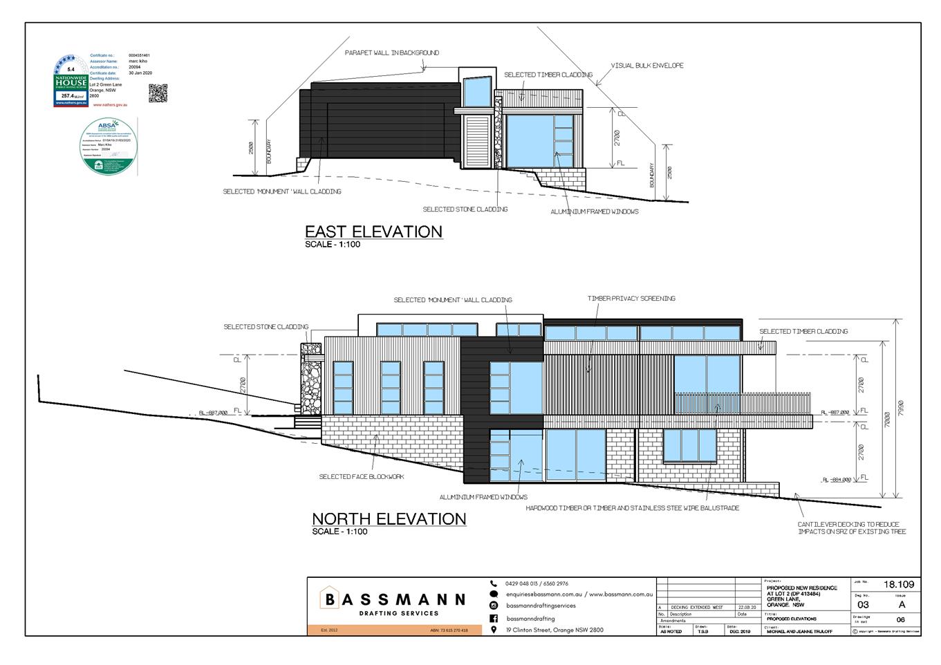
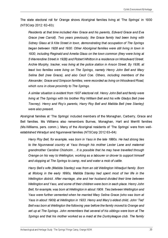
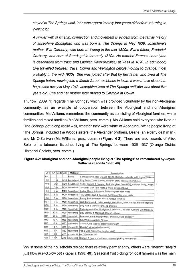
PO 7.7-6 – Visual Bulk
A small portion of the proposed dwelling’s ensuite and
balcony roof/parapet is slightly outside the bulk and scale envelope along the
northern elevation. These encroachments are considered as acceptable due to the
nature of the lot; articulation of the dwelling design; the encroachment would
not result in impacts on neighbours such as overshadowing; and general design compliance.
The centre section of the dwelling has a departure of 1.0m
outside the envelope while the rear of the dwelling has a 1.2m encroachment.
Both encroachment are described as being the roof cladding of the
façade.
This encroachment has been reduced by the applicant with the
lowering of the dwelling and increasing the distance of the dwelling from the
northern side boundary.
The side walls of the proposed
dwelling are articulated and provide increased side boundary setbacks for
living areas towards the rear. The progressive narrowing of the dwelling and
the increase in side boundary setbacks towards the rear of the lot reduces the
visual bulk of the dwelling when viewed from the neighbouring properties.
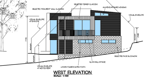
Figure 2 – Western elevation of the proposal
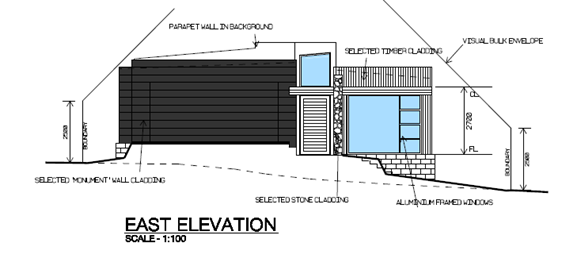
Figure 3 – Eastern elevation of the proposal
The dwelling is designed to the fall of the lot with single
storey to the street and two storey at the rear. At the access road of Green
Lane the dwelling will maintain a suitable height in relation to the street and
adjoining neighbours This is a common feature of the Green Lane properties and
is considered as appropriate for this site.
PO 7.7-7 – Walls to
Boundaries
The dwelling is indicated to have a minimum side boundary
setback to the southern boundary ranging 1.5mm at the front to 2.1m at the
rear. Privacy of the southern adjoining premises is considered to be maintained
due to any glazed openings being to service areas and the existing landscaping.
On the northern boundary the setback is 3m at the front to
4.9m to the rear elevated deck. The glazed openings to the northern side of the
proposed dwelling may appear close to the adjoining southern property as there
is currently a well-established vacant landscaped site that the southern
dwelling currently overlooks.
The existing dwelling on the northern boundary will view the
complete proposed dwelling from the southern side of their dwelling/site. Due
to the slope of the lot the proposed dwelling will have some impact on the
adjoining open space.
The applicant has made concessions to the design and this
has provided increased privacy measures.
The potential loss of the existing landscaped area and the
scale of the development will have some visual impact on the northern
neighbour, however it is considered that this impact would not be adverse and
is therefore acceptable. It is accepted that the construction of any
dwelling on this infill site would create some impact.
The proposed development achieves compliance with the DCP
Planning Guidelines (7.7-7) for setback of walls and roofed structures to the
boundaries. The dwelling is positioned to retain the majority of the
mature vegetation on the site, thus contributing to the amenity of the area.
PO 7.7-9 – Views
The existing residential garden views of the surrounding
lots in Green Lane will be moderately impacted by the loss of three mature
trees required for removal, to allow for the proposed development.
However, the shared general garden and residential views
will not be impeded.
The minor visual impact of the proposed dwelling from the
adjoining southern property is mainly due to the existence of a large deck
constructed to the common boundary. The southern property has enjoyed the views
of this landscaped vacant allotment for some year and it is considered that any
construction on this adjoining lot would cause some impact on the residential
views.
The impact to the existing adjoining dwellings is considered
as acceptable and remain as shared residential views. There are no highly
valued views, as defined in DCP2004, available from this lot.
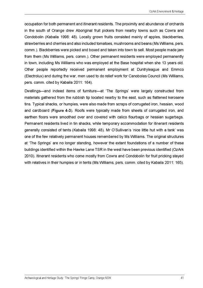
PO 7.7-10 – Visual
Privacy
The final submitted plans significantly improve the impact
on the privacy of the residence to the northern boundary.
The modified plans have increased the dwellings northern
boundary setbacks by, on average by >1m.
In addition, the north open
deck has been re-designed and relocated to the western end of the dwelling
increasing the distance from the open deck to the private open space of the
northern boundary neighbour. The alfresco area along the northern side of the
proposed dwelling has substantial screening enclosing the outdoor area and
reducing the impact of overlooking of the adjoining neighbour.
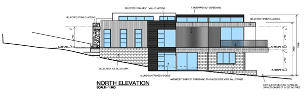
Figure 4 – Northern elevation of the proposal
A walkway provides access from the
screened alfresco area to the rear deck. The proposal indicates stacking
sliding opening doors from the dining area to the walkway, therefore a min
height 1.6m privacy screen is to be conditioned on the consent to extend
partially along the walkway edge from the alfresco room to the open deck. Thus
restricting direct view from the internal habitable rooms to the adjoining
neighbours open space.
The open deck at the western end of the dwelling is 4.993m
from the northern boundary and is greater than 9m from any habitable rooms and
the main private open space in the adjoining northern residence.
The 9m setback described in the guidelines of the DCP notes
that an off-set sufficient distance with limited direct views is and acceptable
outcome and this is achieved by the use of the screens and the location of the
upper floor living areas in relation to the adjoining private open space.
The windows in the northern wall of the front bedroom is
considered as having minimal impact on the adjoining neighbours privacy.
Although habitable, the windows are narrow and being a bedroom would not be
considered as a daily living area of the dwelling. Other windows on the
northern side, with floor levels above 1.5m is a bathroom area with opaque
glazing.
Given the topography of this site, it is considered as
unreasonable for the adjoining neighbours to have expectations of 100% privacy
on the whole of the rear yard (as open space) on a large residential lot. The
area directly alongside the northern dwelling has been considered as the
private open space.
A condition will be placed on the consent to ensure that the
privacy screen along the walkway is extended to increase the direct overlooking
from the dining area.
With the addition of the walkway screening the dwelling is
considered to achieve compliance with the guidelines of the DCP.
PO 7.7-11 – Acoustic Privacy
It is considered that the future noise/sounds emitted from
the proposal would have a minimal impact to the Northern adjoining property,
mainly due to the normal domestic noise expectations of a residential
development.
PO 7.7- 17 – Private Open Space
The lot has private open space to the rear of the proposed
dwelling at ground level.
A screened alfresco area and open deck accessed from the
living areas on the upper floor also provides adequate private open space for
outdoor living. Any adverse impacts of privacy from adjoining residences is
reduced with the use of screening.
The private open space for the proposed dwelling is
considered as meeting the requirements of the DCP for Private open space.
PO 7.7- 17 – Open
Space and Landscaping
Subject lot is not mapped in the OLEP 2011 Biodiversity
Area.
The site is currently landscaped with extensive mature
planting. The applicant has applied for the removal of some trees and shrubs to
allow for the construction of the dwelling.
A substantial Eucalyptus tree, near the street frontage, and
a few smaller trees and some shrubbery is required for removal.
An external Arborist’s Report identifies that the
Eucalyptus tree cannot be maintained along with the build and the Manager of
City Presentation, although questioning the ambiguity of the report in terms of
the Eucalyptus tree’s exact significance to the subject area and the
community, confirms that the vegetation needs to be removed for the purpose of
the development or keeping the vegetation renders the proposal unfeasible.
All trees not applied for removal are to be protected during
construction.
Conditions are to be placed on a consent requiring TPZs
around in particular, the large native gum at the rear of the proposed dwelling
and the medium tree located between the walkway decking and the northern
boundary.
In consideration of the guidelines set in the ODCP 2004 for
Open Space and Landscaping, this proposal is considered to be acceptable due to
the need to remove vegetation for the required build.
INFILL GUIDELINES
The proposed development is consistent with the provisions
of Council’s Infill Guidelines.
PROVISIONS PRESCRIBED BY THE
REGULATIONS s4.15(1)(a)(iv)
Demolition of a Building (clause 92)
The proposal does not involve the demolition of a building.
Fire Safety Considerations
(clause 93)
The proposal does not involve a change of building use for
an existing building.
Buildings to be Upgraded
(clause 94)
The proposal does not involve the rebuilding, alteration,
enlargement or extension of an existing building.
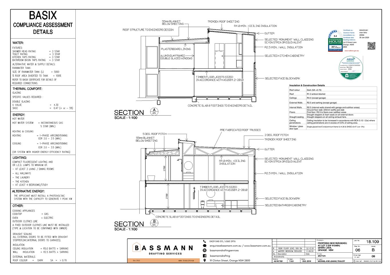
BASIX Commitments (clause 97A)
A BASIX Certificate has been submitted in support of the
proposed development.
THE LIKELY IMPACTS OF THE
DEVELOPMENT s4.15(1)(b)
Generally:
The
proposed development is unlikely to generate any more than minor, short-term
environmental impacts and it is considered that environmental issues have been
addressed by the applicant (reduced energy and water demand) and through the
application of conditions of consent (demolition/noise etc).
Visual
impact:
It is considered that the Dwelling (two storey), Attached
Garage, Retaining Walls and Tree Removal would not adversely affect the
quality of the existing streetscape.
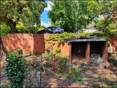
Figures 5 and 6 - view of the front
boundary
Traffic impacts:
The
proposed Dwelling (two storey), Attached Garage, Retaining Walls and Tree
Removal would have minimal impact on the future traffic levels associated with
the local road network. If approved, the traffic movements would be congested
due to the increase in building work vehicles during the construction phase on
the narrow lanes on this section of Green Lane.
Water
quality:
Due to
the natural steep slope of the subject site, the overland flow path runs East
to West.
Presence
of substantial vegetation on the site assists in the adsorption of water.
Off-site
sediment and erosion impacts are likely if the proposal is allowed and soil
erosion control would be required prior to works and during the construction
phase.
Impacts
on adjoining development:
Development in the locality generally consists of
residential properties and associated dwellings. The proposed Dwelling (two
storey), Attached Garage, Retaining Walls and Tree Removal will not interfere
with or be affected by adjoining residential properties, as already discussed
in this report.
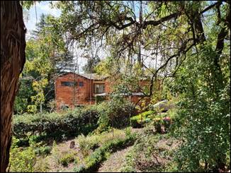
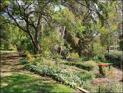
Figures 7 and 8 – view of the
adjoining properties from within sections of the site
Landscaping and preservation of trees:
The
proposed Dwelling (two storey), Attached Garage and Retaining Walls would require removal of a native Eucalyptus tree, several
smaller trees and shrubbery. An Arborist Report is accompanying this proposal.
Substantial
landscaping of the neighbouring properties has formed a neighbourhood character
for adequate and well planned landscaping to this section of Green Lane.
Soil
erosion:
The
proposed Dwelling (two storey), Attached Garage, Retaining Walls and Tree
Removal does involve major earthworks in the form of fill for the formation of
the building footprint and associated works. Soil erosion measures are expected
if approval is given by the committee
Existing
and future amenity of the neighbourhood:
The existing amenity of the neighbourhood is typical of a
residential area with low ambient noise and pollution levels.
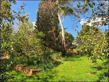
Figure 9 – view of the Eucalyptus tree from
within the lot
THE SUITABILITY OF THE SITE
s4.15(1)(c)
It is considered that the site of the proposed development
is suitable for the right design and positioning of a similar development to
the current proposal. The site is appropriately serviced and but there are
known physical attributes such as topography, shape and size of the subject lot
which constrain the site. This needs to be addressed through adequate and
appropriate design.
Availability of Utility Services:
Electricity and telephone services are available to the
site. The scale of the development does not require upgrading of any existing
services.
ANY SUBMISSIONS MADE IN
ACCORDANCE WITH THE ACT s4.15(1)(d)
The proposed development is defined as "advertised
development" under the provisions of the LEP. The application was
advertised for the prescribed period of 14 days and at the end of that period.
One submission had been received
in relation to this application. The applicant was given the opportunity to
respond to the matters raised in the objection. The issues and the responses
can be summarised as follows:
· All
planning matters expressed in the submission are discussed thoroughly in this
report.
· The
submission was generally against the proposal.
· Objecting
to the proposal via the PO 7.7 – 2 – Building Appearance:
Particularly
for the removal of vegetation, building design, visual bulky appearance due to
minimal setbacks.
Comment
– This concern is considered in more detail in this report. The
design, height and positioning of this two storey proposal is considered as
acceptable with increased setback being part of amended plans. The tree removal
is necessary for the access to the site and the building platform.
· Objecting
to the proposal via the PO 7.7 – 6 – Visual Bulk
In
particular for - the proposal is out of the bulk and scale envelope, the
setback of the upper balcony and height from NGL increases direct overlooking,
visually bulky design is considered intrusive to adjoining properties.
Comment
– This concern is considered in more detail in this report. The dwelling
height and design has been amended since the objection has been received. This
has reduced the impact to an acceptable level.
· Objecting
to the proposal via PO 7.7-7 – Walls and Boundaries
In
particular for the proximity of the proposal to the Northern boundary lessens
the privacy to and from the Northern neighbour. No physical dividing features
to indicate perimeters of the subject lot and the Northern adjoining property.
Comment
– the design and location of the proposal is and
are considered as acceptable with regard to the positioning of the dwelling on
the site. This concern was discussed in this report.
· Objecting
to the proposal via PO 7.7-10 – Visual Privacy
In
particular for concerns of direct overlooking and visual privacy infringements
due to the minimal setback and the height/location of the upper floor alfresco
area.
Comment
– amendments to the original plans have been considered in the final
assessment and are considered as acceptable with regard to any visual privacy
to and from the proposal to the adjoining properties. This concern was
conversed in more detail in this report.
· Objecting
to the proposal via PO 7.7-11 – Acoustic Privacy
In
particular for the 4m setback and the positioning of the proposal’s upper
floor living spaces.
Comment
– residential noise is expected from the property. This
concern was discussed in more detail of this report.
PUBLIC INTEREST
s4.15(1)(e)
The proposed development is considered to be not in the
interest of the wider public due to the in-compliance of the proposal to the
localised potential planning impacts expressed in this report. The proposal is
not consistent with any relevant policy statements, planning studies, and
guidelines etc. that have been considered in this assessment.
SUMMARY
The proposed development is recommended for approval and is
seeking a final decision on the consent from the Planning and Development
Committee. The proposed development does not comply with the relevant
aims, objectives and provisions of Orange LEP 2011 (as amended) and
DCP 2004. A Section 4.15 assessment of the development indicates that the
development is not acceptable in this instance. Attached is a draft Notice of
Approval with an option for re- design.
COMMENTS
The requirements of the Environmental Health and Building
Surveyor and the Engineering Development Section are included in the attached
Notice of Approval.
Attachments
1 Notice
of Approval, D21/3596⇩
2 Plans,
D21/3595⇩
3 Arborist
Report, D20/70307⇩
4 Submission,
D20/70283⇩
5 Applicant
response to submission, D20/70542⇩
Attachment 1 Notice
of Approval
|

|
ORANGE CITY COUNCIL
Development
Application No DA
111/2020(1)
NA21/ Container
PR4818
|
NOTICE OF DETERMINATION
OF A DEVELOPMENT
APPLICATION
issued under the Environmental
Planning and Assessment Act 1979
Section 4.18
|
Development
Application
|
|
|
Applicant
Name:
|
Bassmann Drafting
Services
|
|
Applicant
Address:
|
25-27 McNamara Lane
ORANGE
NSW 2800
|
|
Owner’s
Name:
|
Mr MJ and Mrs J E
Truloff
|
|
Land
to Be Developed:
|
Lot 2 DP 413484 - 12
Green Lane, Orange
|
|
Proposed
Development:
|
Dwelling (two
storey), Attached Garage, Retaining Walls and Tree Removal
|
|
|
|
|
Building Code of
Australia
building
classification:
|
Class - as determined
by Certifier
|
|
|
|
|
Determination made
under
Section 4.16
|
|
|
Made
On:
|
2 February 2021
|
|
Determination:
|
CONSENT GRANTED
SUBJECT TO CONDITIONS DESCRIBED BELOW:
|
|
|
|
|
Consent to Operate
From:
|
3 February 2021
|
|
Consent to Lapse On:
|
3 February 2026
|
Terms
of Approval
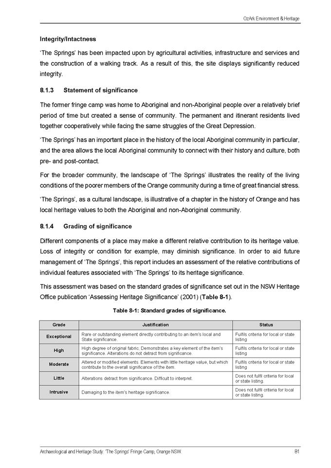
The reasons for the imposition of conditions
are:
(1) To ensure a quality
urban design for the development which complements the surrounding environment.
(2) To maintain
neighbourhood amenity and character.
(3) To ensure compliance
with relevant statutory requirements.
(4) To ensure the utility
services are available to the site and adequate for the development.
(5) To prevent the proposed
development having a detrimental effect on adjoining land uses.
Conditions
(1) The development must be
carried out in accordance with:
(a) Plans
numbered: Bassman Drafting 18.109 Drwg 00 issue B, 01 issue B, 02 issue B,
03 Issue A04 issue B, 05 Issue C, 06 issue B, BASIX Cert 1025036S
(b) statements
of environmental effects or other similar associated documents that form part
of the approval
as amended in
accordance with any conditions of this consent.
(2) All building work must
be carried out in accordance with the provisions of the Building Code of
Australia.
(3) A sign is to be erected
in a prominent position on any site on which building work, subdivision work or
demolition work is being carried out:
(a) showing
the name, address and telephone number of the principal certifying authority
for the work, and
(b) showing
the name of the principal contractor (if any) for any building work and a
telephone number on which that person may be contacted outside working hours,
and
(c) stating
that unauthorised entry to the site is prohibited.
Any such sign is to be maintained while the
building work, subdivision work or demolition work is being carried out.
(4) In
the case of residential building work for which the Home Building Act 1989
requires there to be a contract of insurance in force in accordance with Part 6
of the Act, evidence that such a contract of insurance is in force is to be
provided to the Principal Certifying Authority before any building work
authorised to be carried out by the consent commences.
(5) Residential
building work within the meaning of the Home Building Act 1989 must not
be carried out unless the principal certifying authority for the development to
which the work relates (not being the council) has given the council written
notice of the following information:
(a) in
the case of work for which a principal contractor is required to be appointed:
(i) the
name and the licence number of the principal contractor, and
(ii) the
name of the insurer by which the work is insured under Part 6 of that Act,
(b) in
the case of work to be done by an owner-builder:
(i) the
name of the owner-builder, and
(ii) if
the owner-builder is required to hold an owner-builder permit under that Act,
the number of the owner-builder permit.
If arrangements for doing the residential
building work are changed while the work is in progress so that the information
under this condition becomes out of date, further work must not be carried out
unless the principal certifying authority for the development to which the work
relates (not being the council) has given the council written notice of the
updated information.
(6) Where any excavation
work on the site extends below the level of the base of the footings of a
building on adjoining land, the person having the benefit of the development
consent must, at the person’s own expense:
(a) protect
and support the adjoining premises from possible damage from the excavation,
and
(b) where
necessary, underpin the adjoining premises to prevent any such damage.
Note: This
condition does not apply if the person having the benefit of the development
consent owns the adjoining land or the owner of the adjoining land has given
consent in writing to this condition not applying.
|
PRIOR TO THE ISSUE OF A CONSTRUCTION
CERTIFICATE
|
(7) A
Road Opening Permit in accordance with Section 138 of the Roads Act 1993
must be approved by Council prior to a Construction Certificate being issued
or any intrusive works being carried out within the public road or footpath
reserve.
|
PRIOR TO WORKS COMMENCING
|
(8) A
Construction Certificate application is required to be submitted to, and issued
by Council/Accredited Certifier prior to any excavation or building works being
carried out onsite.
(9) A
temporary onsite toilet is to be provided and must remain throughout the
project or until an alternative facility meeting Council’s requirements
is available onsite.
(10) The
location and depth of the sewer junction/connection to Council’s sewerage
system is to be determined to ensure that adequate fall to the sewer is
available.
(11) Soil
erosion control measures shall be implemented on the site.
|
DURING CONSTRUCTION/SITEWORKS
|
(12) All
construction/demolition work on the site is to be carried out between the hours
of 7.00 am and 6.00 pm Monday to Friday inclusive, 7.00 am to
5.00 pm Saturdays and 8.00 am to 5.00 pm Sundays and Public
Holidays. Written approval must be obtained from the General Manager of Orange
City Council to vary these hours.
(13) A
Registered Surveyor’s certificate identifying the location of the
building on the site must be submitted to the Principal Certifying Authority.
(14) All
construction works are to be strictly in accordance with the Reduced Levels
(RLs) as shown on the approved plans.
(15) All materials on site
or being delivered to the site are to be contained within the site. The
requirements of the Protection of the Environment Operations Act 1997
are to be complied with when placing/stockpiling loose material or when
disposing of waste products or during any other activities likely to pollute
drains or watercourses.
(16) No portion of the
building - including footings, eaves, overhang and service pipes - shall
encroach into any easement.
(17) Should
the root system of the protected trees be disturbed or exposed during the
excavation for any reason the following treatment must be adheard to;
· With a root diameter
more than 20mm in diameter are to be dealt with in accordance with AS4373-2007
· With a root diameter
more than 20mm – 100mm in diameter are to be dealt with in accordance
with AS4373-2007 and
· Any root diameter
greater than 100mm requires advice from a qualified arborist prior to pruning
If unsure the builder is to contact a qualified
arborist to seek advice so as to reduce disturbance of the tree root system.
(18) A
TPZ (restricted area) is to be installed and delineated by a protective fence
around the tree located between the proposed alfresco area and the northern
boundary, and the large native Gum located to the rear of the dwelling. This
fence is to be installed prior to site works commencing and must remain in-tact
until completion of all works. The fence must not be altered or removed without
approval of a project arborist.
If access is required or minor activities are
to be undertaken within the TPZ, it must be approved by the project arborist.
No routing of services, parking of vehicles, stacking of builder’s
materials / equipment, is to occur within the TPZ.
The protective fence is to be constructed from
ridged chain wire mesh panels (or similar), 1.8m in height, and securely
anchored without penetrating the ground. Signs identifying the TPZ should be
placed on the fencing and be visible from within the development site on all
angles.
The root zone within the TPZ is to be mulched
with tree chip to a depth of 75mm.
Soil moisture levels is to be regularly
monitored during dry periods by the project arborist. Temporary irrigation may
be installed.
An example of the above is available in
AS4970-2009.
|
PRIOR TO THE ISSUE OF AN OCCUPATION
CERTIFICATE
|
(19) No
person is to use or occupy the building or alteration that is the subject of
this approval without the prior issuing of an Occupation Certificate.
(20) Finished
ground levels are to be graded away from the buildings and adjoining properties
and must achieve natural drainage. The concentrated flows are to be dispersed
down slope or collected and discharged to the stormwater drainage system.
(21) Where
Orange City Council is not the Principal Certifying Authority, a final
inspection of water connection, sewer and stormwater drainage shall be
undertaken by Orange City Council and a Final Notice of Inspection issued,
prior to the issue of either an interim or a final Occupation Certificate.
(22) The cut and fill is to
be retained and/or adequately battered and stabilised (within the allotment)
prior to the issue of an Occupation Certificate.
(23) A
Road Opening Permit Certificate of Compliance is to be issued for the works by
Council prior to any Occupation/Final Certificate being issued for the
development.
(24) All
of the foregoing conditions are to be at the full cost of the developer and to
the requirements and standards of the Orange City Council Development and
Subdivision Code, unless specifically stated otherwise. All work required by
the foregoing conditions is to be completed prior to the issuing of an
Occupation Certificate, unless stated otherwise.
Other
Approvals
(1) Local
Government Act 1993 approvals granted under Section 68.
Water, Sewer and Stormwater
(2) General
terms of other approvals integrated as part of this consent.
(a) All plumbing and
drainage (water supply, sanitary plumbing and drainage, stormwater drainage and
hot water supply) is to comply with the Local Government (Water, Sewerage
and Drainage) Regulation 1998, the Plumbing Code of
Australia 2016 - Plumbing & Drainage and Australian
Standard AS3500 - National Plumbing and Drainage Code. Such work is to be
installed by a licensed plumber and is to be inspected and approved by Council
prior to concealment.
(b) Orange
City Council is the Water and Sewer Authority for the Orange City Council area.
Therefore all water and sewer works must be inspected by Council. These
inspections CANNOT be carried out by a private certifier.
(c) The following inspections
are required to be carried out by Council as the Water and Sewer Authority:
- internal
sewer
- hot
and cold water installation
- external
sewer
- stormwater
drainage
- final
on water, sewer and stormwater drainage and Council services.
(d) Hot
water shall be stored at a minimum of 60OC and be delivered to all
sanitary fixtures used for personal hygiene (bathrooms/ensuites) at a
temperature not exceeding 50oC. Where tempering valves are
installed, a sign is to be permanently fixed on the hot water heater adjacent
to the tempering valve (clearly visible) indicating:
“A tempering valve has been installed to
prevent scalding. This valve is to be renewed at intervals as recommended by
the manufacturer.”
(e) The
location and depth of the sewer junction/connection to Council’s sewerage
system is to be determined to ensure adequate fall to the sewer is available.
(f) All services (water,
sewer and stormwater) shall be laid outside the easement unless there is a
direct connection to the main within that easement.
(g) All
stormwater is to be disposed of in a manner suitable to the site.
Right
of Appeal
If
you are dissatisfied with this decision, Section 8.7 of the Environmental
Planning and Assessment Act 1979 gives you the right to appeal to the
Land and Environment Court. Pursuant to Section 8.10, an applicant may only
appeal within 6 months after the date the decision is notified.
|
Disability
Discrimination Act 1992:
|
This application has been assessed in
accordance with the Environmental Planning and Assessment Act 1979. No
guarantee is given that the proposal complies with the Disability
Discrimination Act 1992.
The applicant/owner is responsible to ensure
compliance with this and other anti-discrimination legislation.
The Disability Discrimination Act
covers disabilities not catered for in the minimum standards called up in the
Building Code of Australia which references AS1428.1 - "Design for
Access and Mobility". AS1428 Parts 2, 3 and 4 provides the most
comprehensive technical guidance under the Disability Discrimination Act
currently available in Australia.
|
|
|
|
|
Disclaimer
- S88B of the Conveyancing Act 1919 - Restrictions on the Use of
Land:
|
The applicant should note that there could be
covenants in favour of persons other than Council restricting what may be
built or done upon the subject land. The applicant is advised to check the
position before commencing any work.
|
|
|
|
|
Signed:
|
On behalf of the consent authority ORANGE
CITY COUNCIL
|
|
Signature:
|
|
|
Name:
|
PAUL JOHNSTON – MANAGER DEVELOPMENT
ASSESSMENTS
|
|
Date:
|
3 February 2021
|
Planning and Development Committee
2 February 2021
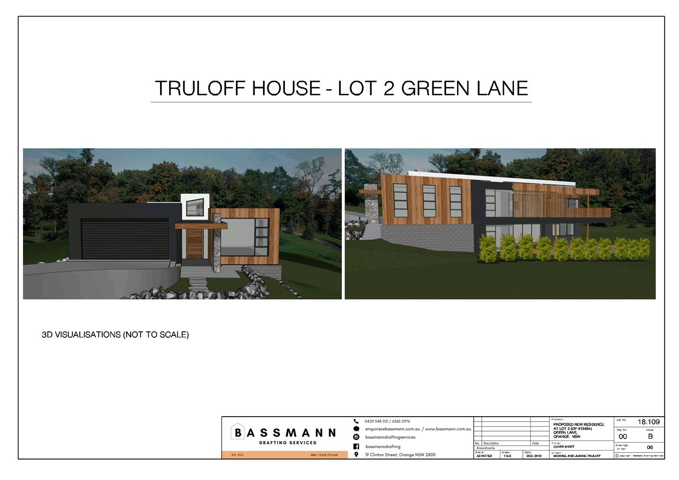
Planning
and Development Committee
2 February 2021
Attachment 3 Arborist
Report
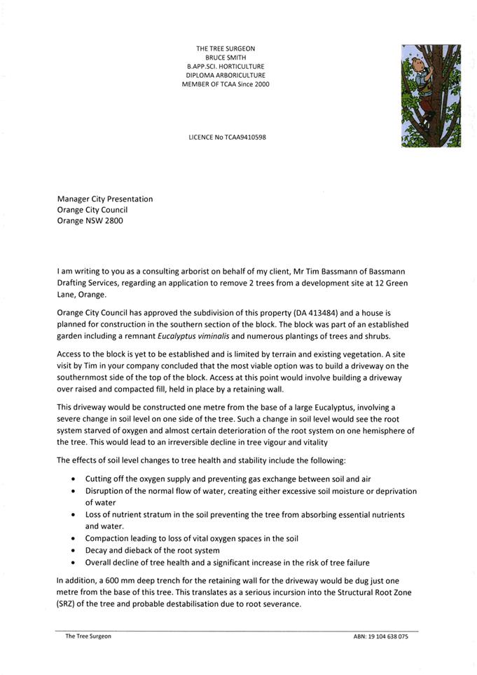
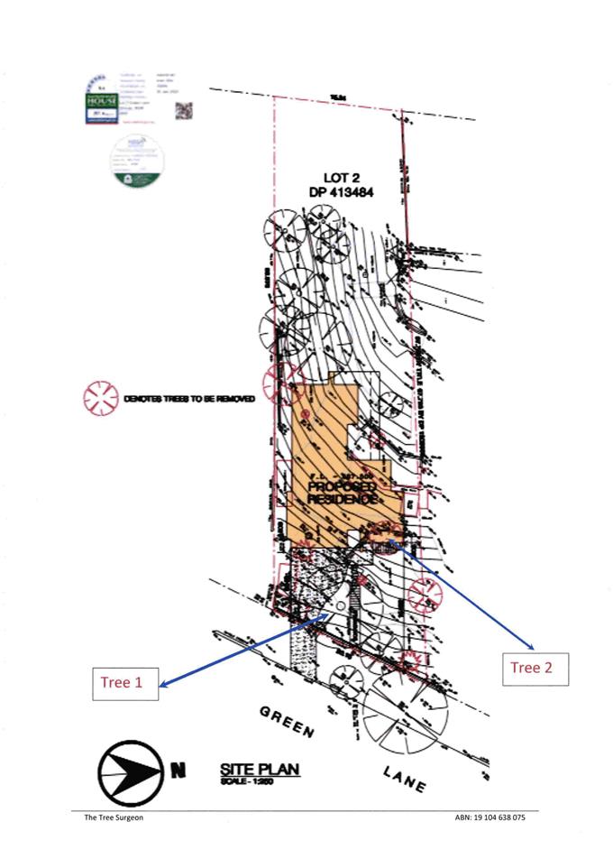
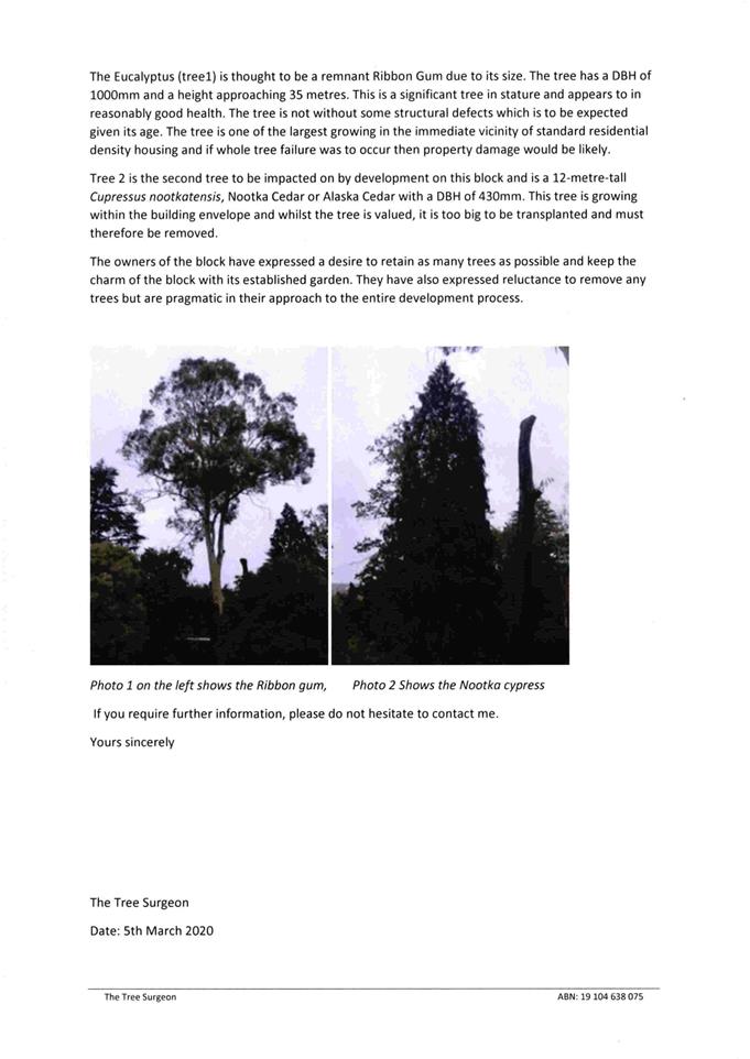
Planning and Development Committee
2 February 2021
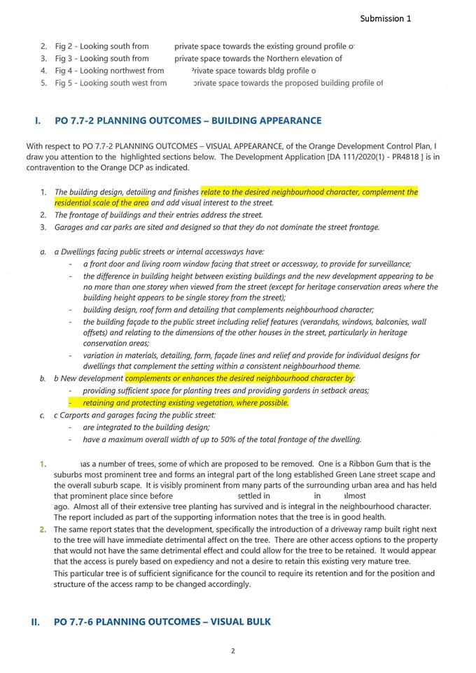
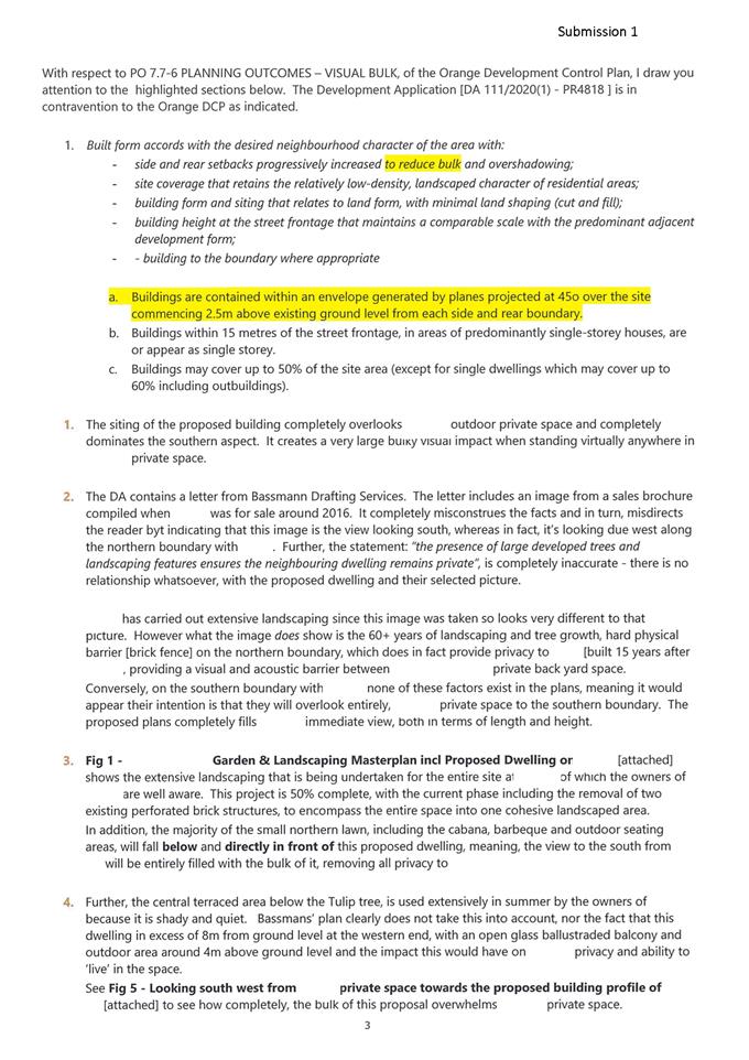
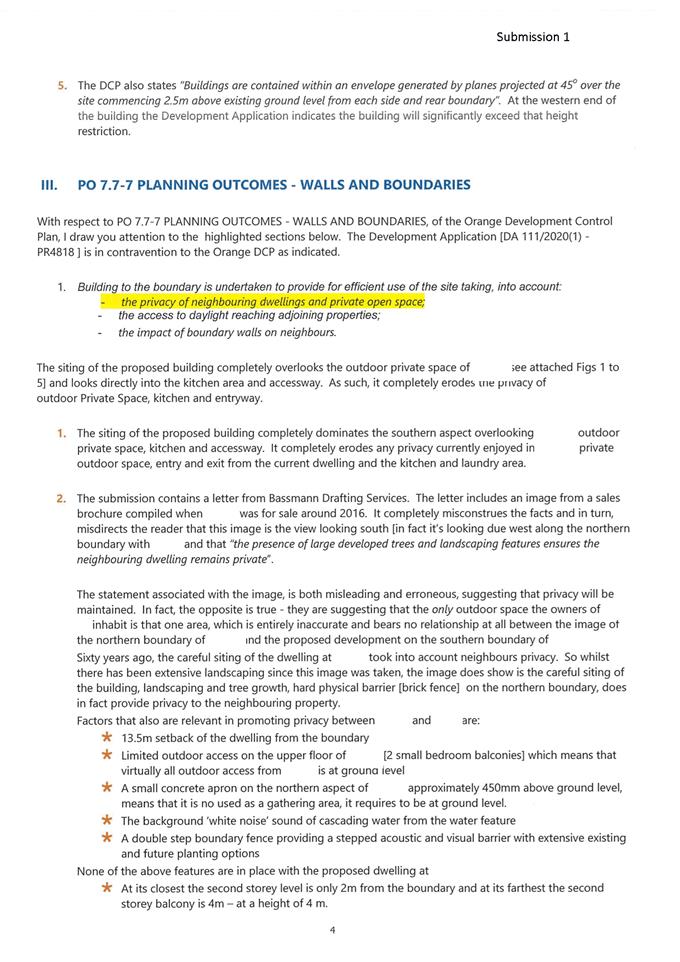
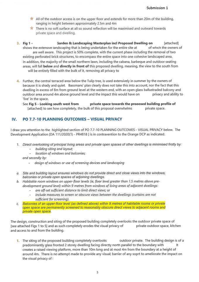
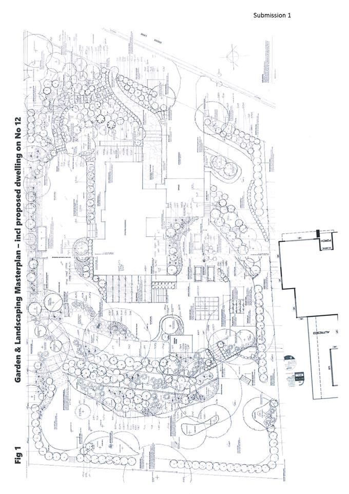
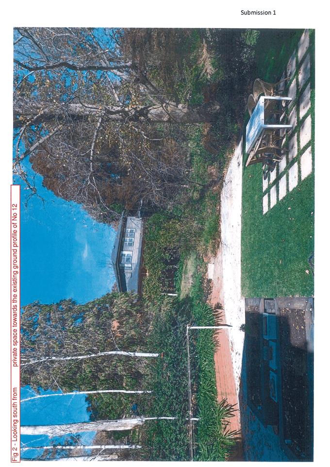
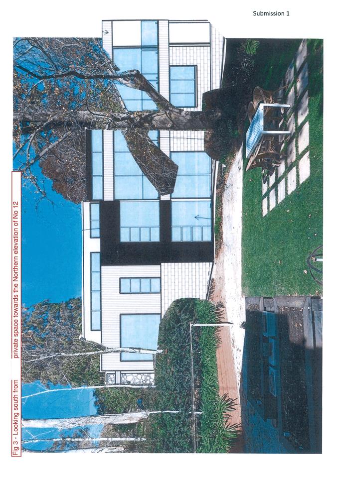
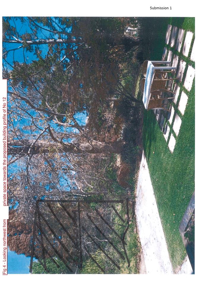
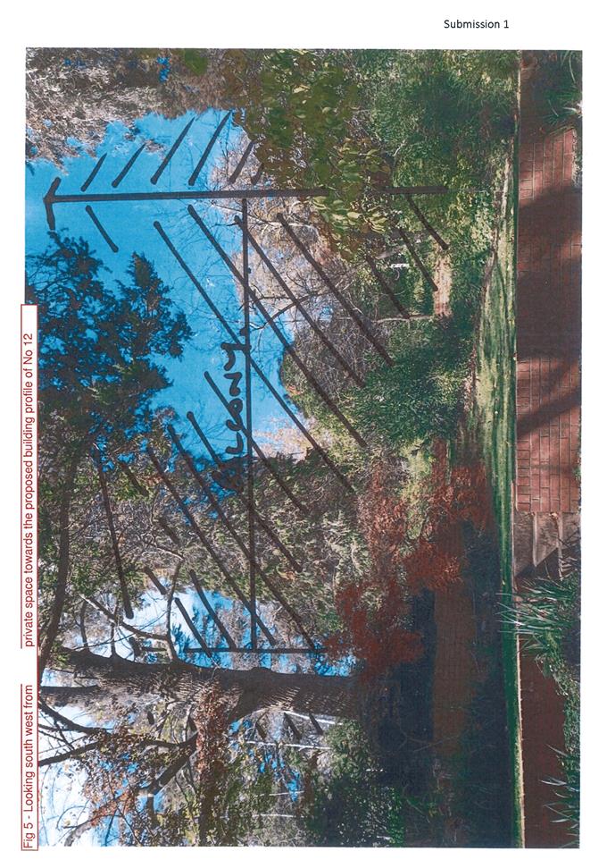
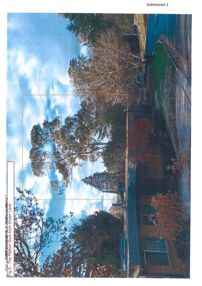
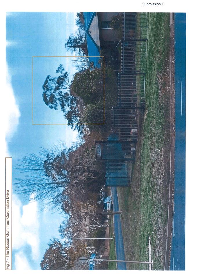
Planning and Development Committee
2 February 2021
Attachment 5 Applicant
response to submission
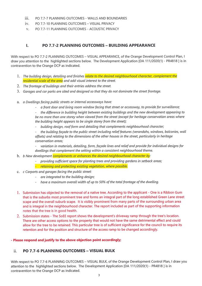
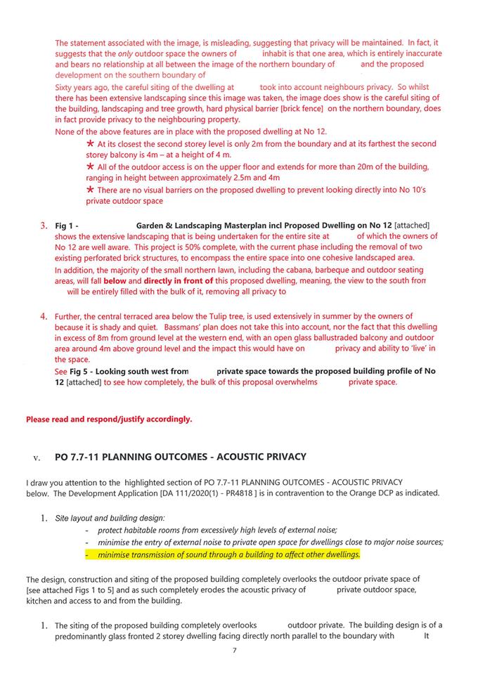
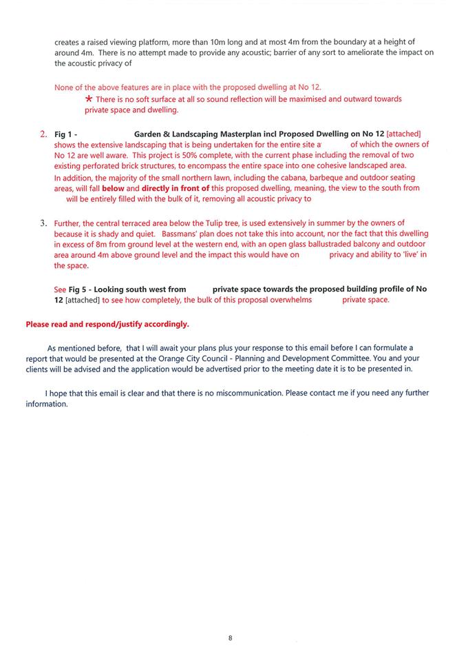
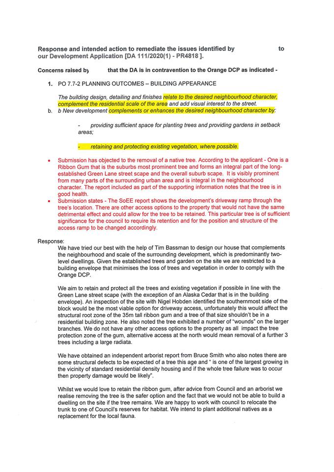
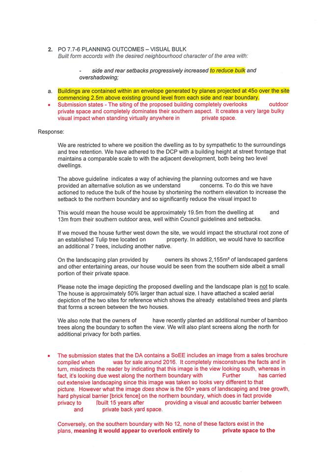
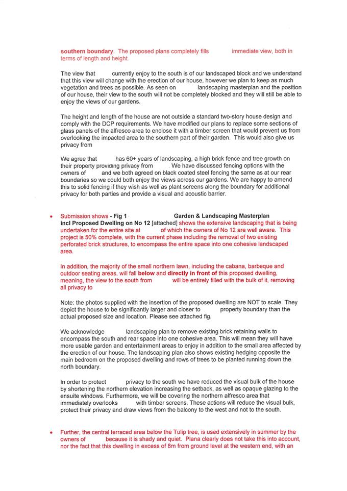
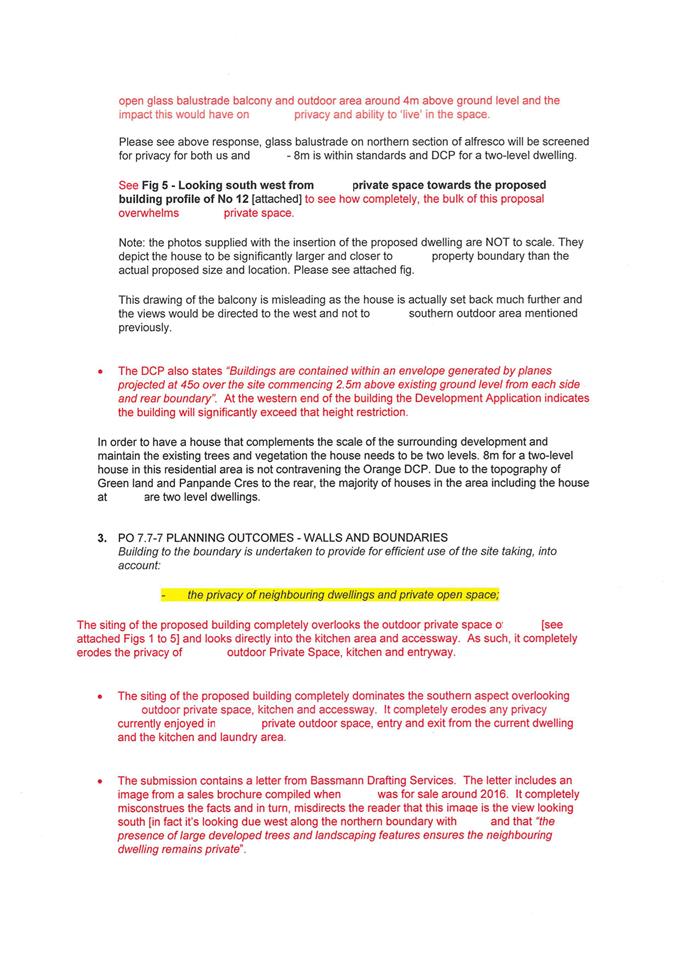
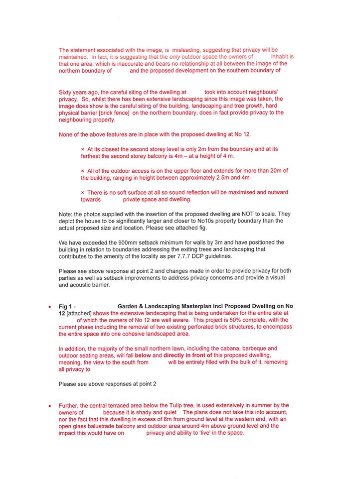
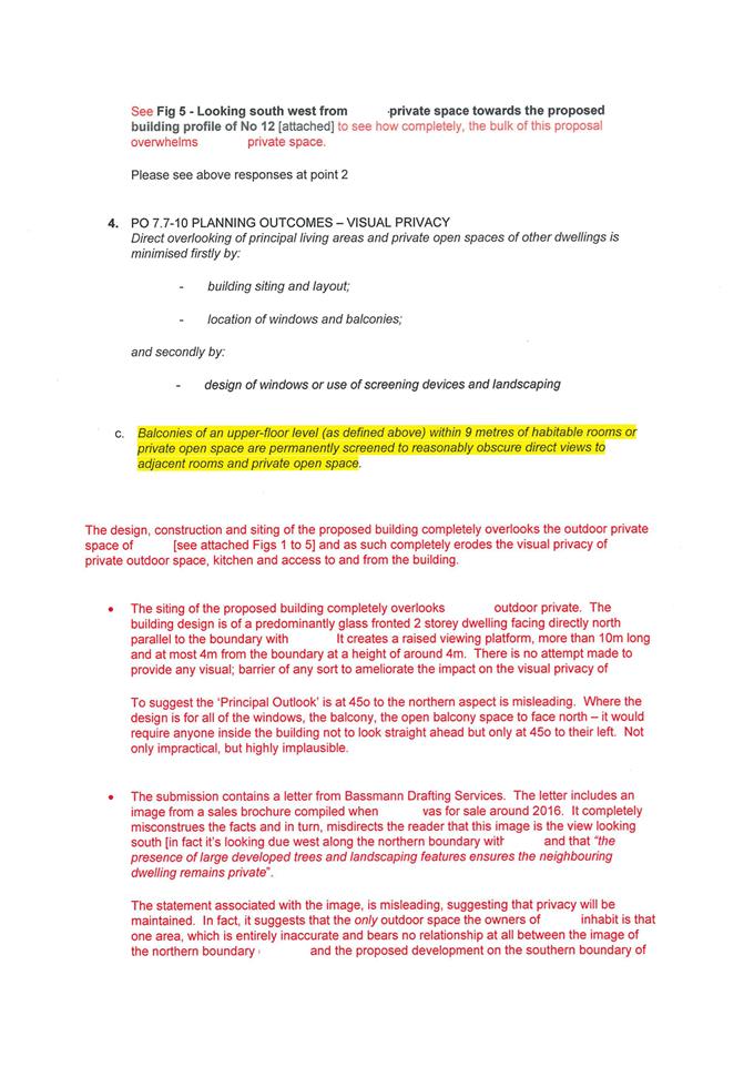
2.3 Development
Application DA 328/2020(1) - 13-29 Torulosa Way
RECORD
NUMBER: 2021/44
AUTHOR: Rishelle
Kent, Senior Planner
EXECUTIVE
Summary
|
Land
description
|
Lot 16
DP 258976 - 13-29 Torulosa Way, Orange
|
|
Proposed
land use
|
Subdivision
(33 lot residential)
|
|
Value of
proposed development
|
Not
applicable
|
Council's consent is sought to
undertake a subdivision of residential land at 13–29 Torulosa Way. The
land is described as Lot 16 DP 258976. A Locality Plan is provided below.
Figure 1 – Locality Plan
The proposal comprises 33
residential lots, the construction of a new ring road and a detention basin in
the north-eastern corner. The design of the subdivision is shown below in Figure
2.
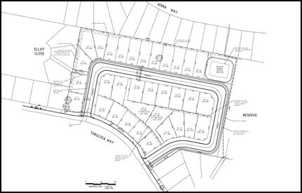
Figure 2 – Subdivision Plan
The size, shape and orientation of
the proposed lots; along the gentle sloping nature of the parent parcel, will
result in parcels of land suitable for the construction of future dwellings
once the lots are created.
The proposed new road will not cause any unreasonable
impacts in terms of traffic.
The subdivision, during both construction and ongoing phases
of the development is not expected to give rise to any unsatisfactory
environmental impacts in the locality.
Two existing mature eucalyptus trees in the south-western
corner of the site will be retained and protected, both during construction and
future residential development.
The application is consistent with Council’s relevant
planning controls and policies and is recommended for approval subject to
necessary conditions of consent.
DECISION FRAMEWORK
Development in Orange is governed by two key documents
Orange Local Environment Plan 2011 and Orange Development Control Plan 2004. In
addition the Infill Guidelines are used to guide development, particularly in
the heritage conservation areas and around heritage items.
Orange Local Environment Plan 2011 – The
provisions of the LEP must be considered by the Council in determining the
application. LEPs govern the types of development that are permissible or
prohibited in different parts of the City and also provide some assessment
criteria in specific circumstances. Uses are either permissible or not. The
objectives of each zoning and indeed the aims of the LEP itself are also to be
considered and can be used to guide decision making around appropriateness of
development.
Orange Development Control Plan 2004 – the DCP
provides guidelines for development. In general it is a performance based
document rather than prescriptive in nature. For each planning element there
are often guidelines used. These guidelines indicate ways of achieving the
planning outcomes. It is thus recognised that there may also be other solutions
of merit. All design solutions are considered on merit by planning and building
staff. Applications should clearly demonstrate how the planning outcomes are
being met where alternative design solutions are proposed. The DCP enables
developers and architects to use design to achieve the planning outcomes in
alternative ways.
DIRECTOR’S COMMENT
The proposal involves a 33 lot Torrens subdivision of land within an
established residential neighbourhood. The proposed subdivision complies with the LEP
and DCP objectives.
The land has been vacant for some considerable time. The
design of the subdivision is consistent with the established
urban area and will be a welcomed development to the neighbourhood. The
development of this vacant land would be positive for this area of the
City. It is recommended that Council
supports the proposal.
Link To Delivery/OPerational Plan
The recommendation in this report relates to the
Delivery/Operational Plan strategy “10.1 Preserve - Engage with the
community to ensure plans for growth and development are respectful of our
heritage”.
Financial Implications
Nil
Policy and Governance Implications
Nil
|
Recommendation
That
Council consents to development application DA 328/2020(1) for Subdivision (33 lot residential) at Lot
16 DP 258976 - 13-29 Torulosa Way, Orange
pursuant to the conditions of consent in the attached Notice of Approval.
|
further considerations
Consideration has been given to the
recommendation’s impact on Council’s service delivery; image and
reputation; political; environmental; health and safety; employees;
stakeholders and project management; and no further implications or risks have
been identified.
SUPPORTING INFORMATION
The land is a large irregular
shaped parcel of land in an established residential neighbourhood. The land has
a curved frontage to Torulosa Way and is bound by existing residential
dwellings on the western, northern and south eastern boundaries. The land
shares a boundary to the east with Eyde Park, an area of passive recreational
open space.
THE APPLICATION
Council's consent is sought for a
33 lot residential subdivision of an existing 5.59ha parcel of land in Torulosa
Way. The proposal also includes a new ring road, footpaths and a detention
basin. The applicant and owner is Tangarra Holdings Pty Ltd.
MATTERS FOR CONSIDERATION
Section 1.7 - Application of Part
7 of the Biodiversity Conservation Act 2016 and Part 7A of the Fisheries
Management Act 1994
Pursuant to Clause 1.7:
This
Act has effect subject to the provisions of Part 7 of the Biodiversity Conservation Act 2016 and Part 7A of the Fisheries Management Act 1994 that relate to the operation of this Act in connection
with the terrestrial and aquatic environment.
In consideration of this section,
the proposed development is not likely to significantly affect a threatened
species:
· The
subject and adjoining lands are not identified as biodiversity sensitive on the
Orange LEP 2011 Terrestrial Biodiversity Map.
· The
proposal does not involve clearing or disturbance of native vegetation;
clearing thresholds prescribed by regulation do not apply.
· The
site is contained within a developed urban area and has been highly modified by
the urban land use pattern. The subject land does not contain known threatened
species or ecological communities.
Based on the foregoing
consideration, a Biodiversity Assessment Report is not required and the
proposal suitably satisfies the relevant matters at Clause 1.7.
Section 4.15
Section 4.15 of the Environmental
Planning and Assessment Act 1979 requires Council to consider various
matters, of which those pertaining to the application are listed below.
PROVISIONS OF ANY ENVIRONMENTAL
PLANNING INSTRUMENT s4.15(1)(a)(i)
Orange Local Environmental Plan
2011
Part 1 - Preliminary
Clause 1.2 - Aims of Plan
The broad aims of the LEP are set out under Subclause 2.
Those relevant to the application are as follows:
(a) to encourage development which complements and
enhances the unique character of Orange as a major regional centre boasting a
diverse economy and offering an attractive regional lifestyle,
(b) to provide for a range of development opportunities
that contribute to the social, economic and environmental resources of Orange
in a way that allows present and future generations to meet their needs by
implementing the principles for ecologically sustainable development,
(c) to conserve and enhance the water resources on which
Orange depends, particularly water supply catchments,
(e) to provide a range of housing choices in planned urban
and rural locations to meet population growth,
The application is considered to be
consistent with aims (a), (b), (c) and (e) as listed above.
Clause 1.6 - Consent Authority
This clause establishes that,
subject to the Act, Council is the consent authority for applications made
under the LEP.
Clause 1.7 - Mapping
The subject site is identified on the LEP maps in the
following manner:
|
Land Zoning Map:
|
Land zoned R1 General
Residential
|
|
Lot Size Map:
|
No Minimum Lot Size
|
|
Heritage Map:
|
Not a heritage item or conservation
area
|
|
Height of Buildings Map:
|
No building height limit
|
|
Floor Space Ratio Map:
|
No floor space limit
|
|
Terrestrial Biodiversity Map:
|
No biodiversity sensitivity on the
site
|
|
Groundwater Vulnerability Map:
|
Groundwater vulnerable
|
|
Drinking Water Catchment Map:
|
Not within the drinking water
catchment
|
|
Watercourse Map:
|
Not within or affecting a defined
watercourse
|
|
Urban Release Area Map:
|
Not within an urban release area
|
|
Obstacle Limitation Surface Map:
|
No restriction on building siting
or construction
|
|
Additional Permitted Uses Map:
|
No additional permitted use applies
|
|
Flood Planning Map:
|
Not within a flood planning area
|
Those matters that are of relevance
are addressed in detail in the body of this report.
Clause 1.9A - Suspension of
Covenants, Agreements and Instruments
This clause provides that covenants, agreements and other
instruments which seek to restrict the carrying out of development do not apply
with the following exceptions.
(a) to
a covenant imposed by the Council or that the Council requires to be imposed,
or
(b) to
any relevant instrument under Section 13.4 of the Crown Land Management Act
2016, or
(c) to
any conservation agreement under the National Parks and Wildlife Act 1974, or
(d) to
any Trust agreement under the Nature Conservation Trust Act 2001, or
(e) to
any property vegetation plan under the Native Vegetation Act 2003, or
(f) to
any biobanking agreement under Part 7A of the Threatened Species Conservation
Act 1995, or
(g) to
any planning agreement under Subdivision 2 of Division 7.1 of the Environmental
Planning and Assessment Act 1979.
Council staff are not aware of the title of the subject
property being affected by any of the above.
Part 2 -
Permitted or Prohibited Development
Clause 2.1 -
Land Use Zones and Clause 2.3 - Zone Objectives and Land Use Table
The subject site is located within the R1 General
Residential zone. The proposed development is characterised as a subdivision
under the LEP.
Relevantly the EPA Act defines subdivision as the division of land into two or more parts that,
after the division, would be obviously adapted for separate occupation, use or
disposition.
Pursuant to Clause 2.6 of
Orange LEP 2011, subdivision is permissible in any zone with consent which the
applicant is seeking.
Clause 2.3 of LEP 2011
references the Objectives for each zone in LEP 2011. The objectives for
land zoned R1 General Residential are as follows:
1 -
Objectives of the R1 General Residential Zone
· To
provide for the housing needs of the community.
· To
provide for a variety of housing types and densities.
· To
enable other land uses that provide facilities or services to meet the day to
day needs of residents.
· To
ensure development is ordered in such a way as to maximise public transport
patronage and encourage walking and cycling in close proximity to settlement.
· To
ensure that development along the Southern Link Road has an alternative access.
The development is not contrary to the objects of the zone;
the development will provide for additional housing stock within the
south-eastern part of the city. The lots will vary in sizes from 508m2
to 843m2 allowing a mix of lot sizes whilst maintaining a
subdivision design commensurate with the broader subdivision pattern.
The subdivision will allow for
appropriate non-residential facilities and services that are permitted in the
R1 zone.
Future occupants of dwellings on the resultant lots will
benefit from existing transport links. The final objective is not relevant.
Clause 2.6 - Subdivision -
Consent Requirements
This clause triggers the need for development consent for
the subdivision of land which the applicant has sought through the lodgement of
this application.
Clause
7.1 - Earthworks
This
clause establishes a range of matters that must be considered prior to granting
development consent for any application involving earthworks, such as:
(a) the likely disruption of, or any detrimental effect
on, existing drainage patterns and soil stability in the locality of the
development
(b) the effect of the development on the likely future use
or redevelopment of the land
(c) the quality of the fill or the soil to be excavated,
or both
(d) the effect of the development on the existing and
likely amenity of adjoining properties
(e) the source of any fill material and the destination of
any excavated material
(f) the likelihood of disturbing relics
(g) the proximity to and potential for adverse impacts on
any waterway, drinking water catchment or environmentally sensitive area
(h) any measures proposed to minimise or mitigate the
impacts referred to in paragraph (g).
The earthworks proposed in the
application are limited to the extent of bulk earthworks necessary to achieve
road surface levels and service gradients. The extent of earthworks is shown on
the below excavation map.
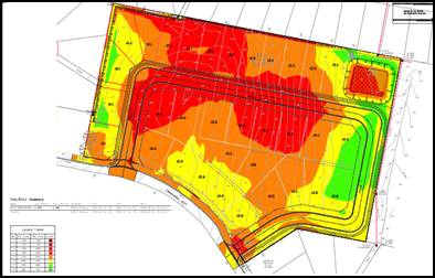
Figure 3 - Bulk Excavation Plan
NB: dark red through to orange is cut; and yellow and
green are areas of fill. Maximum cut (dark red) is approximately 1.2m, and
maximum areas of fill (green areas) are approximately 800mm.
The extent of
disruption to the drainage of the site is considered to be minor and will not
detrimentally affect adjoining properties or receiving waterways.
The extent of the earthworks
will not materially affect the potential future use or redevelopment of the
site that may occur at the end of the proposed development's lifespan.
The site is not known to be
contaminated as demonstrated by the submitted preliminary contamination
investigation. Notwithstanding this, in line with Council’s standard
procedures a precautionary condition is recommended in relation to an
unexpected finds protocol. Excavated materials will be reused onsite as far as
possible.
The earthworks will be
appropriately supported onsite and the change in ground level is not
substantial. Therefore the effect on the amenity of adjoining properties is
considered to be minor.
The site is not known to contain
any Aboriginal, European or Archaeological relics as confirmed by an AHIMS
search. Previous known uses of the site do not suggest that any relics are
likely to be uncovered. However, standard conditions are imposed to ensure that
should site works uncover a potential relic or artefact, works will be halted
to enable proper investigation by relevant authorities and the proponent
required to seek relevant permits to either destroy or relocate the findings.
The site is not in proximity to
any waterway, drinking water catchment or sensitive area. Notwithstanding this,
conditions are imposed to require a sediment control plan, including silt traps
and other protective measures, to ensure that loose dirt and sediment does not
escape the site boundaries.
7.3 -
Stormwater Management
This clause applies to all
industrial, commercial and residential zones and requires that Council be
satisfied that the proposal:
(a) is designed to maximise the use of water permeable
surfaces on the land having regard to the soil characteristics affecting onsite
infiltration of water
(b) includes, where practical, onsite stormwater retention
for use as an alternative supply to mains water, groundwater or river water;
and
(c) avoids any significant impacts of stormwater runoff on
adjoining downstream properties, native bushland and receiving waters, or if
that impact cannot be reasonably avoided, minimises and mitigates the impact.
Council’s
Technical Services staff advise the following with respect to stormwater:
The applicant will be required
to construct an onsite stormwater system for the development. Preliminary
engineering design indicates that a basin can be accommodated in the NE corner.
Relevant
conditions are attached to the notice of approval accompanying this report.
7.6 - Groundwater Vulnerability
This
clause seeks to protect hydrological functions of groundwater systems and
protect resources from both depletion and contamination. Orange has a high
water table and large areas of the LGA, including the subject site, are
identified with “Groundwater Vulnerability” on the Groundwater
Vulnerability Map. This requires that Council consider:
(a) whether or not the development (including any onsite
storage or disposal of solid or liquid waste and chemicals) is likely to cause
any groundwater contamination or have any adverse effect on groundwater
dependent ecosystems, and
(b) the cumulative impact (including the impact on nearby
groundwater extraction for potable water supply or stock water supply) of the
development and any other existing development on groundwater.
Furthermore, consent may not be granted unless Council is satisfied that:
(a) the development is designed, sited and will be managed
to avoid any significant adverse environmental impact, or
(b) if that impact cannot be reasonably avoided - the
development is designed, sited and will be managed to minimise that impact,
(c) if that impact cannot be minimised - the development
will be managed to mitigate that impact.
The proposal is not anticipated
to involve the discharge of toxic or noxious substances and is therefore
unlikely to contaminate the groundwater or related ecosystems. The proposal
does not involve extraction of groundwater and will therefore not contribute to
groundwater depletion. The design and siting of the proposal avoids impacts on
groundwater and is therefore considered acceptable.
Clause 7.11 - Essential Services
Clause 7.11 applies and states:
Development consent must not be
granted to development unless the consent authority is satisfied that any of
the following services that are essential for the proposed development are
available or that adequate arrangements have been made to make them available
when required:
(a) the
supply of water,
(b) the
supply of electricity,
(c) the
disposal and management of sewage,
(d) storm
water drainage or onsite conservation,
(e) suitable
road access.
In consideration of this clause, the listed utility
services are available and suitable subject to augmentation. Council’s
Assistant Development Engineer has included conditions
on the
attached Notice of Approval in relation to reticulated dual water; reticulated sewer; stormwater detention; and road and footpath construction.
STATE ENVIRONMENTAL PLANNING
POLICIES
State Environmental Planning
Policy 55 Remediation of Land
State Environmental Planning
Policy 55 - Remediation of Land (SEPP 55) is applicable. Pursuant to Clause
7 Contamination and remediation to be considered in determining development
application:
(1) A
consent authority must not consent to the carrying out of any development on
land unless:
(a) it
has considered whether the land is contaminated, and
(b) if
the land is contaminated, it is satisfied that the land is suitable in its
contaminated state (or will be suitable, after remediation) for the purpose for
which the development is proposed to be carried out, and
(c) if
the land requires remediation to be made suitable for the purpose for which the
development is proposed to be carried out, it is satisfied that the land will
be remediated before the land is used for that purpose.
In respect of the above clause, a preliminary
contamination investigation has been submitted in support the proposal.
The report, whilst identifying
elevated levels of copper within the soil and refuse on the surface of the soil
within the site, concludes that the level of copper is below relevant
thresholds and thus can be used for residential purposes. The report recommends
the refuse be removed from an amenity point of view and does not suggest it
causing a contamination problem. As such, the report finds “the
investigation area is suitable for proposed residential land-use following
removal of refuse.”
Notwithstanding this, in line with
standard procedure a precautionary unexpected finds condition is recommended.
PROVISIONS OF ANY DRAFT
ENVIRONMENTAL PLANNING INSTRUMENT THAT HAS BEEN PLACED ON EXHIBITION
4.15(1)(a)(ii)
Draft Orange Local Environmental Plan 2011 (Amendment 24)
Council staff are awaiting the
imminent gazettal of an LEP Housekeeping amendment known as Amendment 24. The
amendment deals with a variety of changes to the LEP, including the adoption of
the new flood study. It is noted that the subject land is affected by the
mapped overland flows within the new flood study which correlates with the
location of the onsite stormwater detention basin. Council’s Technical Services
staff have not raised any objection to the development.
There are no other aspects of the subject amendment of
relevance to the assessment of this application.
State Environmental Planning Policy Draft Remediation of Land
Draft Remediation of Land SEPP is
applicable. The
Draft SEPP requires in part that consideration be given to potential contamination on nearby or neighbouring properties
and
groundwater. Land
adjoining the site
has
an established landuse history of
residential development.
The contaminated status of adjoining residential lands
will not impact on the proposed development.
DESIGNATED AND INTEGRATED
DEVELOPMENT
The proposed development is not
designated or integrated development.
PROVISIONS OF ANY DEVELOPMENT
CONTROL PLAN s4.15(1)(a)(iii)
Development Control Plan 2004
Development Control Plan 2004
(“the DCP”) applies to the subject land (Part 7 –
Development in Residential Areas). An assessment of the proposed
development against the relevant Planning Outcomes will be undertaken below.
Pursuant to Planning Outcome 0.2-1 Interim Planning Outcomes
- Conversion of Zones:
· Throughout
this Plan, any reference to a zone in Orange LEP 2000 is to be taken to be a
reference to the corresponding zone(s) in the zone conversion table.
The corresponding zone to zone 2a urban (Orange LEP 2000) is
zone R1 – General Residential (Orange LEP 2011). As such, Orange DCP
2004 - 7 is relevant to this proposal and is considered below.
PLANNING OUTCOMES FOR URBAN
RESIDENTIAL SUBDIVISION
· Subdivision
layouts in areas zoned Urban Residential prior to this plan are generally in
accordance with the applicable plan maps in Appendix 1.
Not applicable. The development is located in an established
area. There are no indicative lot layouts for this site.
· Lots
are orientated to optimise energy-efficiency principles.
Whilst the lot layout is largely driven by the curve in
Torulosa Way, the majority of lots are orientated in a way that will allow
reasonable sunlight for future occupants.
· New
roads are planned according to modified grid layouts with restrained use of
cul-de-sac roads in new developments according to the UDAS Urban Form
principles for Orange.
No cul-de-sacs are proposed.
It is noted that existing pedestrian links within the
vicinity of the development are appropriately maintained with practical
links/extensions provided within the development.
· Local
open space is provided along creek corridors to create open space linkages for
environmental conservation and social interaction. Release areas removed from creeks
provide for open-space links incorporating substantial stands of native
vegetation.
Not applicable.
· Release
areas indicate trunk cycle and pedestrian ways that link the area to major open
space networks and activity centres (schools, shopping centres and employment
areas).
Council’s Technical Services staff have requested
footpaths be provided along one side of the new road as well as along the
entire frontage of the development.
· Lots
below 500m2 indicate a mandatory side setback to provide for solar
access and privacy.
Not applicable.
· Lots
below 350m2 indicate existing or planned house layouts, which
identify how privacy, solar access, vehicular access and private open-space
needs are to be achieved.
Not applicable.
· Up
to 25% of new subdivisions comprise small lots in dispersed locations.
The development
provides a range of lot sizes the smallest being 508m2.
· Lots
are fully serviced and have direct frontage/access to a public road.
All lots will comply with this planning outcome.
· Design
and construction complies with the Orange Development and Subdivision Code.
Relevant conditions are attached to ensure compliance with
Orange development and Subdivision Code.
· Corner
lots provide for a house to front one street.
The arrangement of the proposed road and its relationship
with the existing Torulosa Way will create corner lots with acceptable width to
depth ratios and thus allow a future dwelling to front one street.
· Battleaxe
lots provide an adequate access way width for the number of dwellings proposed
to be served in order to allow for vehicle and pedestrian access and location
of services.
There are two battle-axe lots proposed and both provide a
4.5m wide access handle. This is sufficient to accommodate a single dwelling on
the land.
· Lots
proposed to be used specifically for dual occupancy or units in new residential
areas are identified on development application plans to inform prospective
purchasers of the mixed residential form of the area and measures are outlined
on how prospective residents are to be informed of these identified sites prior
to purchasing land.
The applicant has not nominated any dual occupancy sites. It
is noted that only one lot is above the development standard for dual occupancy
(800m2 minimum lot size) being Lot 21 which is a battle-axe lot.
However, the access handle for this lot is 4.5m and thereby not considered wide
enough to support a dual occupancy development. A note to applicant will advise
of such.
Section 7.11 - Development Contributions
In accordance with Section 7.11 of
the Environmental Planning and Assessment Act 1979 and Orange
Development Contributions Plan 2017 (Remainder LGA) a contribution towards the
provision of the following public facilities is required:
|
Open
Space and Recreation
|
@
4,106.71 x 32 additional lots
|
131,414.72
|
|
Community
and Cultural
|
@
1,109.93 x 32 additional lots
|
38,109.76
|
|
Roads
and Traffic Management Facilities
|
@
5,420.71 x 32 additional lots
|
173,462.72
|
|
Local
Area Facilities
|
--
|
--
|
|
Plan
Preparation and Administration
|
@ 321.55
x 32 additional lots
|
10,289.60
|
|
TOTAL:
|
|
$353,276.80
|
The development has been charged
for 32 lots, comprising a credit for the existing lot. The contribution
will be indexed quarterly in accordance with the Orange Development
Contributions Plan 2017 (Remainder LGA).
A condition is included on the attached Notice of Approval
requiring payment of the contributions prior to issue of a Subdivision
Certificate.
Section 64 Water and Sewer Headworks Charges
Section 64 water and sewer headwork charges are applicable to
the proposed development.
The
contributions for water, sewer and drainage works are based on 32 lots for water
supply headworks and 32
lots for sewerage headworks pursuant to calculations by
Council’s Assistant Development Engineer.
Conditions are recommended requiring payment of contributions prior to issue of a Subdivision Certificate.
PROVISIONS PRESCRIBED BY THE
REGULATIONS s4.15(1)(a)(iv)
The proposed development
is not
contrary to any matter prescribed by Regulation.
THE LIKELY IMPACTS OF THE
DEVELOPMENT s4.15(1)(b)
Context and Setting
The subject
land is contained within
an established residential area. The proposed subdivision layout generally accords with the established subdivision pattern of the
locality. Pedestrian linkages will be provided to Elliot Close to the west and Eyde
Park to the east, as well as a continuation of dwellings facing Torulosa Way to
the south.
Visual Impacts
The subdivision itself will have limited visual impacts. Visual
impacts associated with the
future development will relate to
the frontages of subsequent dwellings and private landscaping of the proposed
lots fronting the public road. The subdivision design as initially
submitted proposed the new road along existing side and rear fences which would
negatively impact upon the streetscape presentation of the locality. As such,
Council staff requested redesign for a more appropriate streetscape outcome.
The amended design now achieves a suitable interface between public roads
and the frontages of dwellings, whilst also providing visual and pedestrian links
to the public open spaces.
Subsequent dwelling construction and private landscaping on the
proposed lots will complement the neighbourhood character, with positive visual impacts for the setting.
Traffic Impacts
The proposed subdivision is considered satisfactory in regard to traffic impacts. As such:
· All
lots will have access to a public road.
· All
lots will have frontage to a public road, excepting Lots 21 and 29 which
comprise battle-axe lots.
· The
proposed road layout is satisfactory.
· The development
will result in additional traffic in the locality given the increases in
residential density at the completion of the subdivision. Notwithstanding this,
the surrounding street network will be capable of serving the additional
traffic load.
· The
access handle of Lots 21 and 29 are 4.5m in width, which does not cater for a
dual occupancy development upon these sites. This was raised with the
applicant, who did not wish to increase the width of the access handle to 6m to
cater for more intensive residential development. As such, a note to applicant
has been attached to the draft Notice advising of such.
· A
nudge rail fence with pedestrian openings shall be constructed along the
eastern side of the new road fronting Eyde Park to ensure all construction
related movements are undertaken via the street and not through Council’s
Park.
These requirements have been
conditioned accordingly.
Biodiversity
The proposed subdivision is unlikely to impact on localised biodiversity values. The subject
and
adjoining lands have been highly modified by the existing
and intensifying
residential
land
use pattern. The site is not identified as ‘biodiversity sensitive’ on the Orange LEP 2011
Terrestrial Biodiversity
Map.
Tree
Protection zones are to be established on Lot 1 in accordance with AS4970-2009
in order to protect two eucalypts trees from development activities.
Furthermore, each lot will require a street tree to be planted and maintained
for twelve months. These requirements have been conditioned accordingly.
Cultural Values
The proposed subdivision is unlikely to impact on cultural values. The site is not known
to contain any Aboriginal, European or archaeological relics.
Residential Amenity
The proposed lots
will be subsequently developed for dwelling houses. The lots
will be of area, dimension, orientation and gradient sufficient to provide
a high standard of residential
amenity. The lots will accommodate dwellings with setback restrictions
to
the public
roads,
and
remove the dwellings
from road traffic noise.
THE SUITABILITY OF THE SITE
s4.15(1)(c)
The site is a large underutilised
parcel of residential land; this application will see the land being used for
its intended purpose. The site is not known to be contaminated, nor are there
any known physical, technological or natural hazards effecting the land. All
necessary services are available in close proximity of the site.
The site is thus suitable for
residential subdivision.
ANY SUBMISSIONS MADE IN ACCORDANCE
WITH THE ACT s4.15(1)(d)
The proposed development is defined as "advertised
development" under the provisions of the LEP. The application was
advertised for the prescribed period of 14 days and at the end of that period
four (4) submissions were received from three parties. Their concerns have been
summarised below:
Submission 1 and 4
· Will
measures be taken to ensure dust does not become an issue during construction?
Conditions of consent have been
placed on the development to ensure construction works do not interfere with
residential amenity.
· Is
there a height restriction for future buildings?
There are no specific height controls
that apply in this locality. The Complying development planning provisions
contained with the State Environmental Planning Policy advocates a maximum
height of two stories. In addition Council has a performance based DCP
containing controls in relation to future residential development in the event
that development exceeds the complying development controls. These controls
include consideration of neighbourhood character, building materials and bulk
and scale of development to name a few so as to ensure that future development
matches as close as possible to the height and density of development observed
in this locality. The specific height of buildings will therefore be assessed
at such time that applications are received.
· Will
my fence be replaced and if so, to what height? Will it follow the fall of the
land to prevent pets escaping?
The provision of fencing is a matter
that would ordinarily be determined between future property owners of the land.
Council does not specifically require fencing to be provided on an application
for subdivision. In the event of a dispute between property owners, over the
height style, colour etc. of a fence the matter may be determined by a local
magistrate under the Dividing Fences legislation.
Submission 2
· The
existing easement on the western boundary has no fencing to stop motor
vehicles.
The 4m wide public pathway will be
continued from Elliot Close through to the new road to provide pedestrian
linkages throughout the neighbourhood.
· Lots
21 and 29 should be deleted and other lots increased in size.
Battle-axe lots are not prohibited,
and have been designed to provide an adequate size and shape for residential
use.
· The
lots adjoining Adina Crescent should be increased in size to match the existing
lot sizes.
There are no minimum allotment sizes
specified for subdivision in this locality. Whilst there is no formal master
plan concept for this site the design and shape of the proposed lots is
considered acceptable to support residential development in a manner that is
not inconsistent with neighbourhood character. The subdivision design complies
with the requirements of Council’s DCP and does not require amendment to
lot sizes.
Submission 3
· Will
side access still be available to our land?
Given the side boundary of the
property will now front a public road and not private property, side access may
be possible as a result of the development. Any new access to an allotment
would be subject to a separate approval by Council’s Technical Services
Department.
· Will
there be speed humps on the new road?
A development of this nature does not
trigger the need for trafficable speed humps to be required or conditioned.
· Will
all properties in Torulosa Way have a footpath?
Council’s works programs
indicates the demand and timing for the provision of footpaths across the LGA.
Footpaths on one side of the proposed new road will be required.
· Will
the developer go halves in the cost of the fence?
The Dividing Fences Act determines
cost sharing for neighbours. Council is not authorised to be involved in these
arrangements.
· Will
the future development be single storey or double storey?
This will be determined when
approvals are sought for future dwellings. It should be noted that double
storey dwellings are not precluded as a result of this development.
· We
have concerns about possible damage to our house during the excavation and construction
stage.
All subdivision construction works
are required to be undertaken in accordance with safe work practices in place
and be sympathetic to the surrounding existing dwellings.
PUBLIC INTEREST
s4.15(1)(e)
The proposed development is considered to be of minor
interest to the wider public due to the relatively localised nature of
potential impacts. The proposal is not inconsistent with any relevant policy
statements, planning studies, guidelines etc. that have not been considered in
this assessment.
COMMENTS
The requirements of the Environmental Health and Building
Surveyor and the Engineering Development Section are included in the attached
Notice of Approval.
Attachments
1 Notice
of Approval, D21/3569⇩
2 Plan,
D21/3571⇩
3 Submissions,
D21/3257⇩
Planning
and Development Committee
2 February 2021
Attachment 1 Notice
of Approval
|

|
ORANGE CITY COUNCIL
Development
Application No DA
328/2020(1)
NA21/ Container
PR12072
|
NOTICE OF DETERMINATION
OF A DEVELOPMENT
APPLICATION
issued under the Environmental
Planning and Assessment Act 1979
Section 4.18
|
Development
Application
|
|
|
Applicant
Name:
|
Tangarra Holdings Pty
Ltd
|
|
Applicant
Address:
|
Suite 706, Level 7,
109 Pitt St
SYDNEY
NSW 2000
|
|
Owner’s
Name:
|
Tangarra Holdings Pty
Ltd
|
|
Land
to Be Developed:
|
Lot 16 DP 258976 -
13-29 Torulosa Way, Orange
|
|
Proposed
Development:
|
Subdivision (33 lot
residential)
|
|
|
|
|
Building Code of
Australia
building
classification:
|
Class not applicable
|
|
|
|
|
Determination made
under
Section 4.16
|
|
|
Made
On:
|
2 February 2021
|
|
Determination:
|
CONSENT GRANTED
SUBJECT TO CONDITIONS DESCRIBED BELOW:
|
|
|
|
|
Consent to Operate
From:
|
3 February 2021
|
|
Consent to Lapse On:
|
3 February 2026
|
Terms
of Approval
The reasons for the imposition of conditions
are:
(1) To ensure a quality
urban design for the development which complements the surrounding environment.
(2) To maintain
neighbourhood amenity and character.
(3) To ensure compliance
with relevant statutory requirements.
(4) To provide adequate
public health and safety measures.
(5) Because the development
will require the provision of, or increase the demand for, public amenities and
services.
(6) To ensure the utility
services are available to the site and adequate for the development.
(7) To prevent the proposed
development having a detrimental effect on adjoining land uses.
(8) To minimise the impact
of development on the environment.
Conditions
(1) The development must be
carried out in accordance with:
(a) Plan
numbered: Platform
Architects DA 01 E (1 sheet)
(b) statements
of environmental effects or other similar associated documents that form part
of the approval
as amended in
accordance with any conditions of this consent.
(2) All building work must
be carried out in accordance with the provisions of the Building Code of
Australia.
|
PRIOR TO THE ISSUE OF A CONSTRUCTION
CERTIFICATE
|
(3) A street tree plan
shall be submitted and approved by Council’s Manager Development
Assessments prior to the issue of a Construction Certificate. The street
tree plan shall indicate 1 tree outside each lot (excepting battleaxe lots), of
minimum 45litre container size, and of species approved by Council’s
Manager City Presentation.
(4) Engineering
plans, showing details of all proposed work and adhering to any engineering
conditions of development consent, are to be submitted to, and approved by,
Orange City Council or an Accredited Certifier (Categories B1, C3, C4, C6)
prior to the issuing of a Construction Certificate.
The following Orange City Council engineering
design and construction requirements shall be used in addition to, or taking
precedence over, the Orange City Council Development and Subdivision
Code:-
- Council
requires elastic rebound deflection testing carried out on road base material
prior to the placement of any asphalt to determine maximum deflection in
accordance with RMS Test Method T160 utilising the Benkelman Beam or
equivalent;
- All
road reserves between the back of kerb and property boundary, and areas of
public land shall be either hydro mulched or turfed prior to the issue of a
Subdivision Certificate. All allotments shall be spread with topsoil and seed;
- Asphaltic cement wearing
surface shall not be included in road pavement depth calculations;
- A 10 day soaked CBR test shall
be used for road subgrade pavement evaluations;
- All stormwater drainage design
shall be based on ARR2016 calculations allowing +20% for climate change factor.
(5) A Soil and Water
Management Plan (SWMP) is to be submitted to Orange City Council or an
Accredited Certifier (Categories B1, C3, C4, C6) for approval prior to the
issuing of a Construction Certificate. The control plan is to be in accordance
with the Orange City Council Development and Subdivision Code and the Landcom,
Managing Urban Stormwater; Soils and Construction Handbook.
(6) The development’s
stormwater design is to include stormwater detention within the development,
designed to limit peak outflows from the land to the pre-existing natural
outflows up to the 100 year ARI frequency, with sufficient allowance in
overflow spillway design capacity to safely pass flows of lower frequency (that
is, a rarer event) without damage to downstream developments. Where
appropriate, the spillway design capacity is to be determined in accordance
with the requirements of the Dam Safety Committee.
The design of the detention storage is to be
undertaken using the DRAINS rainfall-runoff hydrologic model or an approved
equivalent capable of assessing runoff volumes and their temporal distribution
as well as peak flow rates. The model is to be used to calculate the flow rates
for the existing and post-development conditions. The developed flows are to be
routed through the proposed storage within the model so that the outflows
obtained are no greater than the flows obtained for the pre-existing natural
flows. A report detailing the results of the analysis, which includes:
· catchment plan showing
sub-catchments under existing and developed conditions;
· schematic diagram of
the catchment model showing sub areas and linkages;
· tabulation detailing
the elevation, storage volume and discharge relationships; and
· tabulation for the
range of frequencies analysed, the inflows, outflows and peak storage levels
for both existing and developed conditions;
together with copies of the data files for the
model and engineering design plans of the required drainage system are to be
submitted to Orange City Council upon application for a Construction
Certificate.
(7) Proposed lots are to be
provided with interlot stormwater drainage, including those lots abutting
public land, where the surface of the entire lot cannot be drained to the kerb
and gutter at the lot frontage. A grated concrete stormwater pit is to be
constructed within each lot provided with interlot stormwater drainage.
Engineering plans for this drainage system are to be approved by Orange City
Council or an Accredited Certifier (Categories B1, C3, C4, C6) prior to the
issuing of a Construction Certificate.
(8) A 150mm-diameter sewer
main is to be constructed from Council’s existing main to serve the
proposed lots. Prior to a Construction Certificate being issued engineering
plans for this sewerage system are to be submitted to and approved by Orange
City Council.
(9) A water reticulation
analysis is to be carried out by Orange City Council on any proposed water
reticulation system for the development. Engineering plans are to be
submitted to and approved by Orange City Council prior to the issue of a
Construction Certificate.
The reticulation system is to be designed to
supply a peak instantaneous demand by gravity of 0.15 L/s/tenement at a
minimum residual head of 200kPa.
(10) Prior to the issuing of
a Construction Certificate, a Road Naming Application form is to be completed
and submitted with a plan of the whole development defining the stage being
released.
(11) All
services and access shall be wholly within the Land to be developed. If
services and access is to be provided over adjoining properties then, prior to the issue of a
Construction Certificate, evidence of the registration of any required
easements and rights of way over adjoining properties for the provision of
services and access shall be provided to the Principal Certifier.
|
PRIOR TO WORKS COMMENCING
|
(12) That a
Council-specified nudge rail fence, with 2 pedestrian openings of 1000mm in
width (locations to be determined in consultation with Council’s Manager
City Presentation) be constructed along the eastern side of the new road
fronting Edye Park prior to site establishment (this will comprise
approximately 135 lineal metres of fence from the rear boundary of 3 Willow
Place to the rear boundary fence of 52 Adina Crescent). This is to ensure
that all construction activities and trade related vehicle movements are
undertaken via the street frontage and not through Edye Park.
(13) Tree Protection Zones
are to be established on Lot 1 in accordance with AS4970-2009 to protect the
two Eucalypts from development activities. TPZ’s are to be
established prior to site occupancy and shall remain until subdivision
construction is complete.
(14) A
temporary onsite toilet is to be provided and must remain throughout the
project or until an alternative facility meeting Council’s requirements
is available onsite.
(15) Soil
erosion control measures shall be implemented on the site.
(16) An
application for a Subdivision Works Certificate is required to be submitted to,
and a Certificate issued by Council/Accredited Certifier prior to any
excavation or works being carried out onsite.
(17) The
approved Soil
and Water Management Plan (SWMP) shall be implemented prior to construction work
commencing.
|
DURING CONSTRUCTION/SITEWORKS
|
(18) In the event of an unexpected find during site works such as (but not
limited to) the presence of undocumented waste, odorous or stained soil,
asbestos, structures such as underground storage tanks, slabs, or any
contaminated or suspect material, all work on site must cease immediately.
The beneficiary of the consent must discuss with Council the appropriate
process that should be followed therein. Works on site must not resume unless
the express permission of the Director Development Services is obtained in
writing.
(19) If Aboriginal objects,
relics, or other historical items or the like are located during development
works, all works in the area of the identified object, relic or item shall
cease, and the NSW Office of Environment and Heritage (OEH), and
representatives from the Orange Local Aboriginal Land Council shall be notified.
Where required, further archaeological investigation shall be undertaken.
Development works in the area of the find(s) may recommence if and when
outlined by the management strategy, developed in consultation with and
approved by the OEH.
(20) All
construction/demolition work on the site is to be carried out between the hours
of 7.00 am and 6.00 pm Monday to Friday inclusive, 7.00 am to
5.00 pm Saturdays and 8.00 am to 5.00 pm Sundays and Public
Holidays. Written approval must be obtained from the General Manager of Orange
City Council to vary these hours.
(21) All materials on site
or being delivered to the site are to be contained within the site. The
requirements of the Protection of the Environment Operations Act 1997
are to be complied with when placing/stockpiling loose material or when
disposing of waste products or during any other activities likely to pollute
drains or watercourses.
(22) Any adjustments to
existing utility services that are made necessary by this development
proceeding are to be at the full cost of the developer.
(23) The provisions and
requirements of the Orange City Council Development and Subdivision Code are to
be applied to this application and all work constructed within the development
is to be in accordance with that Code.
The developer is to be entirely responsible for
the provision of water, sewerage and drainage facilities capable of servicing
all the lots from Council’s existing infrastructure. The developer is to
be responsible for gaining access over adjoining land for services where
necessary and easements are to be created about all water, sewer and drainage
mains within and outside the lots they serve.
(24) Council
requires elastic rebound deflection testing carried out on road base material
prior to the placement of any asphalt to determine maximum deflection in
accordance with RMS Test Method T160 utilising the Benkelman Beam or
equivalent.
(25) Proposed Road 1 shall
be constructed full width as an 18.0m urban local access road and tie into the
existing Torulosa Way road formation. This work is to include road pavement and
pavement surfacing, kerb and gutter construction and earth-formed footpath on
both sides of the road. Where the road adjoins Edye Park road surface levels
shall be adjusted and the footpath reserve battered to Council requirements.
Retaining walls shall not be used within or adjoining the road reserve.
(26) For all single access
battle-axe blocks, a concrete kerb layback and footpath crossing is to be
constructed to a minimum width of 3.0m and to the requirements and standards of
the Orange City Council Development and Subdivision Code.
(27) A concrete pathway
shall be constructed to connect to the existing pathway in Maxime Place.
The pathway shall be constructed to the widths and standards stated in the
Orange City Council Development and Subdivision Code.
(28) All proposed
residential lots adjacent to the stormwater detention basin or any overland
flow paths, are to have a minimum freeboard above the 1-in-100-year flood level
in accordance with the Orange City Council Development and Subdivision Code and
the Floodplain Risk Management Plan.
(29) A water service and
sewer junction shall be provided to every lot in the proposed residential
subdivision in accordance with the Orange City Council Development and
Subdivision Code.
(30) All services are to be
contained within the allotment that they serve.
(31) Concrete footpaths, a
minimum of 1.2m wide, shall be constructed on one side of proposed Road 1
and the full frontage of the development to Torulosa Way.
Construction work is to be to the requirements
and standards of the Orange City Council Development and Subdivision Code.
|
PRIOR TO THE ISSUE OF A SUBDIVISION
CERTIFICATE
|
(32) The payment of $353,276.80 is to be made
to Council in accordance with Section 7.11 of the Act and the Orange
Development Contributions Plan 2017 (Remainder of LGA) towards the provision of
the following public facilities:
|
Open Space and
Recreation
|
@ 4,106.71 x 32
additional lots
|
131,414.72
|
|
Community and
Cultural
|
@ 1,109.93 x 32
additional lots
|
38,109.76
|
|
Roads and Traffic
Management Facilities
|
@ 5,420.71 x 32
additional lots
|
173,462.72
|
|
Local Area Facilities
|
--
|
--
|
|
Plan Preparation
& Administration
|
@ 321.55 x 32
additional lots
|
10,289.60
|
|
TOTAL:
|
|
$353,276.80
|
The contribution will be indexed quarterly in
accordance with the Orange Development Contributions Plan 2017 (remainder of
LGA). This Plan can be inspected at the Orange Civic Centre, Byng Street,
Orange.
(33) All street trees must
be planted, at a minimum 45L pot size, and protected with a suitably approved
tree guard, prior to the issue of the Subdivision Certificate.
(34) Application
shall be made for a Subdivision Certificate under Section 6.3(1)(d) of the Act.
(35) Payment
of contributions for water, sewer and drainage works is required to be made
at the contribution rate applicable at the time that the payment is made.
The contributions are based on 32 ETs for water supply headworks and 32
ETs for sewerage headworks. A Certificate of Compliance, from Orange City
Council in accordance with the Water Management Act 2000, will be issued
upon payment of the contributions.
This Certificate of Compliance is to be
submitted to the Principal Certifying Authority prior to the issuing of a
Subdivision Certificate.
(36) Evidence from a
registered NATA laboratory is to be submitted prior to the issuing of a
Subdivision Certificate stating that the filling of all dams and low-lying
areas has been carried out in accordance with Australian Standard 3798-2007.
(37) Application is to be
made to Telstra/NBN for infrastructure to be made available to each individual
lot within the development. Either a Telecommunications Infrastructure
Provisioning Confirmation or Certificate of Practical Completion is to be
submitted to the Principal Certifying Authority confirming that the specified
lots have been declared ready for service prior to the issue of a Subdivision
Certificate.
(38) A Notice of Arrangement
from Essential Energy stating arrangements have been made for the provision of
electricity supply to the development, is to be submitted to the Principal
Certifying Authority prior to the issue of a Subdivision Certificate.
(39) An easement to drain
sewage and to provide Council access for maintenance of sewerage works a
minimum of 2.0m wide is to be created over the proposed sewerage works. The
Principal Certifying Authority is to certify that the easement is in accordance
with the Orange City Council Development and Subdivision Code prior to the
issuing of a Subdivision Certificate.
(40) All services are to be
contained within the allotment that they serve. A Statement of Compliance, from
a Registered Surveyor, is to be submitted to the Principal Certifying Authority
prior to the issuing of a Subdivision Certificate.
(41) A Certificate of
Compliance, from a Qualified Engineer, stating that the stormwater detention
basin comply with the approved engineering plans is to be submitted to the
Principal Certifying Authority prior to the issuing of a Subdivision
Certificate.
(42) A
Maintenance Security Deposit, in accordance with the provisions and
requirements of the Orange City Council Development and Subdivision Code, is to
be provided to Orange City Council prior to the issuing of a Subdivision
Certificate.
A Certificate of Compliance, from Orange City
Council, certifying that the maintenance security deposit has been paid, is to
be submitted to the Principal Certifying Authority prior to the issuing of a
Subdivision Certificate.
(43) Where stormwater
crosses land outside the lot it favours, an easement to drain water is to be
created over the works. A Restriction-as-to-User under section 88B of the NSW
Conveyancing Act 1919 is to be created on the title of the burdened lot
requiring that no structures are to be placed on the site, or landscaping or
site works carried out on the site, in a manner that affects the continued
operation of the interlot drainage system. The minimum width of the easement is
to be as required in the Orange City Council Development and Subdivision Code.
(44) Certification from
Orange City Council is required to be submitted to the Principal Certifying
Authority prior to the issue of a Subdivision Certificate stating that all
works relating to connection of the development to Council assets, works on
public land, works on public roads, stormwater, sewer and water reticulation
mains and footpaths have been carried out in accordance with the Orange City
Council Development and Subdivision Code and the foregoing conditions, and that
Council will take ownership of the infrastructure assets.
(45) All
of the foregoing conditions are to be at the full cost of the developer and to
the requirements and standards of the Orange City Council Development and
Subdivision Code, unless specifically stated otherwise. All work required by
the foregoing conditions is to be completed prior to the issuing of an
Occupation Certificate, unless stated otherwise.
|
MATTERS FOR THE ONGOING PERFORMANCE AND
OPERATION OF THE DEVELOPMENT
|
(46) Street trees are to be
maintained by the proponent for an establishment period of minimum 12 months
from issue of Subdivision Certificate. Should any tree fail during this
period, it shall be replaced on a like for like basis at the cost of the proponent.
(1) Given
the proposed width of access for both battle-axe shaped allotments 21 and 29,
future development within each allotment shall be limited to a single dwelling
and associated outbuildings only.
Other
Approvals
(1) Local
Government Act 1993 approvals granted under Section 68.
Nil
(2) General
terms of other approvals integrated as part of this consent.
Nil
Right
of Appeal
If you are dissatisfied with this decision,
Section 8.7 of the Environmental Planning and Assessment Act 1979
gives you the right to appeal to the Land and Environment Court. Pursuant to
Section 8.10, an applicant may only appeal within 6 months after the date the
decision is notified.
|
Disability
Discrimination Act 1992:
|
This application has been assessed in
accordance with the Environmental Planning and Assessment Act 1979. No
guarantee is given that the proposal complies with the Disability
Discrimination Act 1992.
The applicant/owner is responsible to ensure
compliance with this and other anti-discrimination legislation.
The Disability Discrimination Act
covers disabilities not catered for in the minimum standards called up in the
Building Code of Australia which references AS1428.1 - "Design for
Access and Mobility". AS1428 Parts 2, 3 and 4 provides the most
comprehensive technical guidance under the Disability Discrimination Act
currently available in Australia.
|
|
|
|
|
Disclaimer
- S88B of the Conveyancing Act 1919 - Restrictions on the Use of
Land:
|
The applicant should note that there could be
covenants in favour of persons other than Council restricting what may be
built or done upon the subject land. The applicant is advised to check the
position before commencing any work.
|
|
|
|
|
Signed:
|
On behalf of the consent authority ORANGE
CITY COUNCIL
|
|
Signature:
|
|
|
Name:
|
PAUL JOHNSTON - MANAGER DEVELOPMENT
ASSESSMENTS
|
|
Date:
|
3 February 2021
|
Planning and Development Committee
2 February 2021
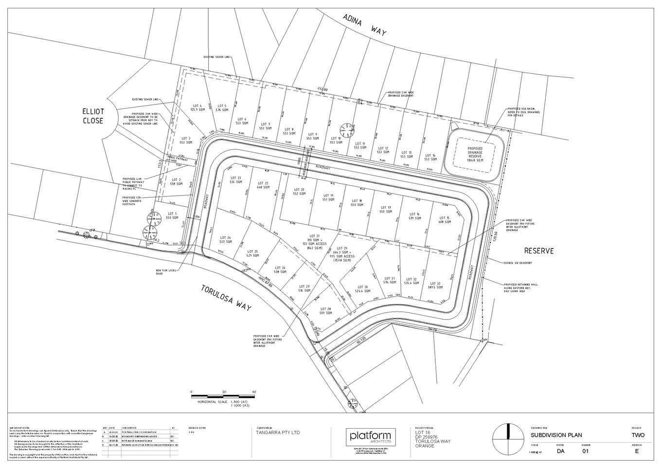
Planning
and Development Committee
2 February 2021
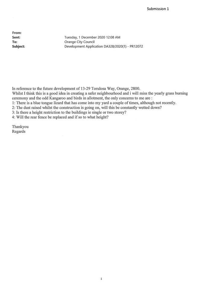
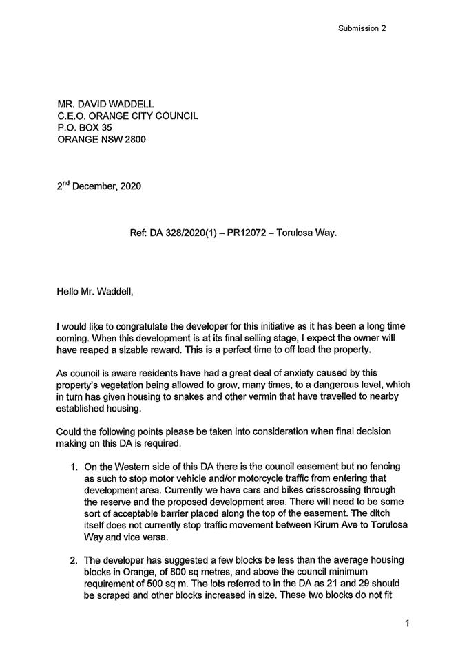
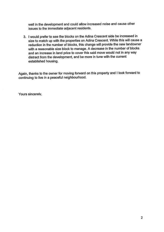
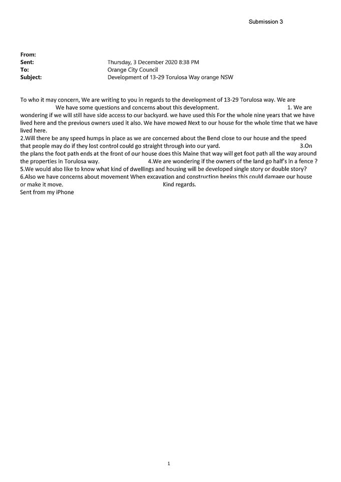
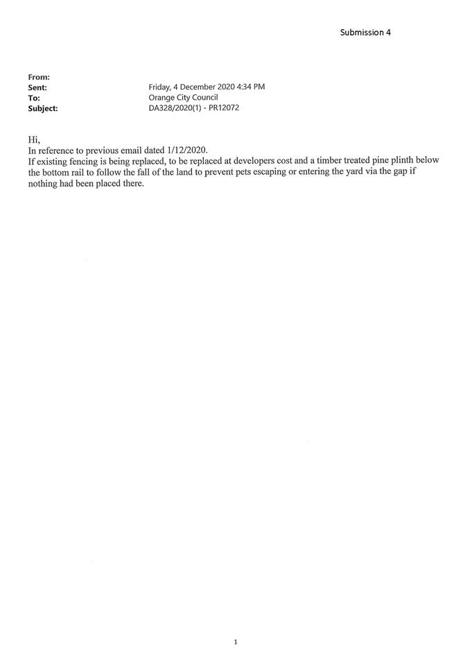
2.4 Orange
Local Environmental Plan 2011 - Planning Proposal for a Heritage Amendment
RECORD
NUMBER: 2020/2553
AUTHOR: Alison
Phillips, Town Planner ( Strategic)
EXECUTIVE Summary
This report commences the process to amend the Orange Local
Environmental Plan (LEP) in regards to heritage matters considered by Council
in 2020. To this end, a Planning Proposal has been drafted that reflects
Council’s resolutions for new Heritage Conservation Areas (HCAs),
extensions of the existing HCAs, including their renaming, and also the
inclusions of a number of properties to be adopted as Local Heritage Items
within the Orange Local Government Area. (Attachments 2 and 3). In
addition, the Planning Proposal seeks to correct several heritage anomalies
that have been identified in Council’s resolution of 2 December 2020.
The proposal has also been drafted to include the area of
‘The Springs‘ in the Shiralee area south of the City, for the
purposes of heritage listing in accordance with actions detailed within the Springs
Archaeological Assessment and Heritage Study, Conservation Management Plan and
the Heritage Landscape Plan that Council adopted on 7 July 2020 (Attachment
1).
These matters are outlined in the attached draft Planning
Proposal which will form the basis for the amendment and public exhibition
process. Formal LEP maps, where relevant, will be prepared prior to public
exhibition.
Link To Delivery/OPerational Plan
The recommendation in this report relates to the
Delivery/Operational Plan strategy “7.1 Preserve - Engage with the
community to develop plans for growth and development that value the local
environment”.
Financial Implications
Nil
Policy and Governance Implications
Nil
|
Recommendation
That Council resolves:
1 To
endorse the attached scope of the Heritage Amendment to the Orange Local
Environmental Plan 2011
2 That
staff prepare a formal Planning Proposal accordance with Section 3.33 of the Environmental
Planning and Assessment Act 1979
3 That
staff finalise inventory sheets before seeking a Gateway Determination
4 To
send the Planning Proposal to the NSW Department of Planning and Environment
to seek a Gateway Determination in accordance with Section 3.34 of the Environmental
Planning and Assessment Act 1979
5 That
staff proceed to address any conditions or requirements of the Gateway
Determination and then place the draft Planning Proposal on public exhibition
in accordance with the Gateway determination
|
further considerations
Consideration has been given to the recommendation’s
impact on Council’s service delivery; image and reputation; political;
environmental; health and safety; employees; stakeholders and project
management; and no further implications or risks have been identified.
SUPPORTING INFORMATION
Following on from the work undertaken in the Springs
Archaeological Assessment and Heritage Study, Conservation Management Plan and
the Heritage Landscape Plan and also the major works recently undertaken
with the Heritage Conservation Area Review, a draft Planning Proposal
has been prepared to give effect to this work via amendments to the Orange
Local Environmental Plan 2011.
This includes the following recommended amendments:
· Amend
Schedule 5 - Environmental heritage – Part 1 to correct several anomalies
that have been identified.
· Amend
Schedule 5 Environmental heritage – Part 1 and maps to include The
Springs Travelling Stock Reserve (TSR), as described in the Springs
Archaeological Assessment and Heritage Study, Conservation Management Plan and
the Heritage Landscape Plan (December 2019).
· Amend
Schedule 5 Environmental heritage – Part 1 and maps for the Former
Bluestone Quarry (Bluestone lakes) to reflect the recent subdivision
pattern.
· Amend
Schedule 5 Environmental heritage – Part 2 Heritage
Conservation Areas and maps to include the Bletchington, Newman Park and
Blackman’s Swamp HCAs as described in the Heritage Conservation Area
Review (November 2020)
· Amend
Schedule 5 Environmental heritage – Part 2 Heritage
Conservation Areas and maps to include the extension to the existing Central,
Duration Cottages and Glenroi HCAs as described in the Heritage
Conservation Area Review (November 2020)
· Amend
Schedule 5 Environmental heritage – Part 2 Heritage
Conservation Areas to rename the following:
- The
Heritage Conservation Area known as Central Heritage Conservation Area, be
renamed Dalton Central Heritage Conservation Area
- The
Heritage Conservation Area known as the Duration Cottages Heritage Conservation
Area be renamed Glenroi Duration Cottages Heritage Conservation Area
- The
Heritage Conservation Area known as Glenroi Heritage Conservation Area be
renamed Endsleigh Heritage Conservation Area
- The
Heritage Conservation Area known as East Orange Heritage Conservation Area be
renamed Bowen Heritage Conservation Area.
· Amend
Schedule 5 Environmental heritage – Part 1 Heritage Items and maps
to include numerous properties as Local Heritage Items as described in the Heritage
Conservation Area Review (November 2020)
1 Correction
of several anomalies
Amend Schedule 5 - Environmental
Heritage – Part 1
1a Correction
of misspelt address under Schedule 5 – Environmental Heritage as shown
below.
|
Calare
|
Dwelling
|
545 Frost Street
|
Lot 3, DP 36132
|
Local
|
I181
|
Correction:
|
Calare
|
Dwelling
|
54 Frost Street
|
Lot 3, DP 36132
|
Local
|
I181
|
1b Correction
of misspelt address and incorrect Lot and DP under Schedule 5 –
Environmental Heritage as shown below.
|
Huntley
|
“Carramar” dwelling
|
148
Shiralee Road (corner of Rifle Range Road)
|
Lot 92, DP 750401
|
Local
|
I285
|
Correction:
|
Huntley
|
“Carramar” dwelling
|
26
Kinghorn Lane (note there are two 26 Kinghorn lanes)
|
Lot 2, DP 828893
|
Local
|
I285
|
1c Correction
of missing Heritage Conservation Area under Schedule 5 – Part 2 Heritage
conservation areas
Correction:
|
Glenroi
|
Glenroi Duration Cottages Heritage
Conservation Area
|
Local
|
C6
|
2 The
Springs Travelling Stock Reserve (TSR)
Amend Schedule 5 Environmental heritage – Part 1 and
maps.
|
Shiralee
|
‘The Springs’ Traveling
Stock Reserve (TSR)
|
Located
between Forest Road, Shiralee Road, Hawke Lane and Rifle Range Road
|
Lot 114
DP 750401 Lot 115 DP 750401 Lot 116 DP 750401 Lot 117 DP 750401 Lot 118 DP
750401 Lot 119 DP 750401
Lot 125
DP 750401 Lot 126 DP 750401 Lot 127 DP 750401 Lot 128 DP 750401
|
Local
|
TBC
|
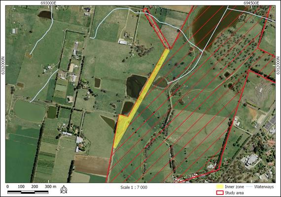
3 The
Former Bluestone Quarry (Bluestone lakes) to reflect the recent subdivision
Amend Schedule 5 Environmental heritage – Part 1 and
maps
|
Calare
|
CSR Readymix site (Bluestone quarry)
|
Laurel Street, off Racecourse Road
|
Lot 10, DP 112243; Lots
167–174, DP 979328
|
State
|
I58
|
Amendment:
|
Calare
|
CSR Readymix site (Bluestone
quarry)
|
Cedar Street, Laurel Street, off
Racecourse Road
|
Lot 1, DP 271090
|
State
|
I58
|
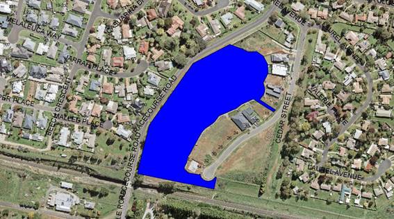
4 Inclusion
of the new Bletchington, Newman Park and Blackman’s Swamp HCAs
Amend Schedule 5 Environmental heritage – Part
2 Heritage conservation areas and maps
|
Orange
|
Bletchington Heritage Conservation
Area
|
Local
|
C7
|
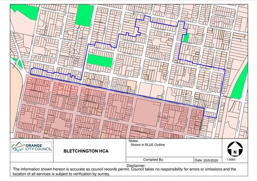
|
Orange
|
Newman Park Heritage Conservation
Area
|
Local
|
C8
|
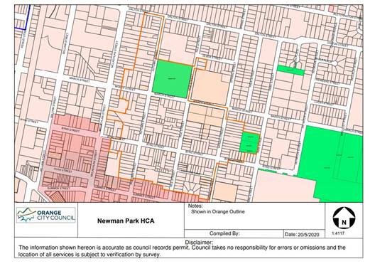
|
Orange
|
Blackman’s Swamp Heritage
Conservation Area
|
Local
|
C9
|
5 Extension
of the existing Central, Duration Cottages and Glenroi HCAs
Amend Schedule
5 Environmental heritage –
Part 2 Heritage conservation areas and maps
5a The
Heritage Conservation Area known as Central Orange Heritage Conservation Area,
be renamed Dalton Central Heritage Conservation Area
|
Orange
|
Central Orange Heritage Conservation Area
|
Local
|
C1
|
Amendment:
|
Orange
|
Dalton Central Heritage Conservation Area
|
Local
|
C1
|
5b The
Heritage Conservation Area known as the Duration Cottages Heritage Conservation
Area (LEP) be renamed Glenroi Duration Cottages Heritage Conservation Area.
Note: Duration Cottages Heritage Conservation Area is not included in Schedule
5 but is mapped. This is to be rectified in through the addition of the Glenroi
Duration Cottages Heritage Conservation Area.
Amendment:
|
Orange
|
Glenroi Duration Cottages Heritage Conservation Area
|
Local
|
C6
|

5c The
Heritage Conservation Area known as Glenroi Heritage Conservation Area be
renamed Endsleigh Heritage Conservation Area
|
Orange
|
Glenroi Heritage Conservation Area
|
Local
|
C3
|
Amendment:
|
Orange
|
Endsleigh Heritage Conservation
Area
|
Local
|
C3
|
5d The
Heritage Conservation Area known as East Orange Heritage Conservation Area be
renamed Bowen Heritage Conservation Area
|
Orange
|
East Orange Heritage Conservation
Area
|
Local
|
C2
|
Amendment:
|
Orange
|
Bowen Heritage Conservation Area
|
Local
|
C2
|
6 Include
a number of properties as Local Heritage Items
Amending Schedule
5 Environmental heritage – Part 1 Heritage Items and
maps
|
Suburb
|
Item
name
|
Address
|
Property
description
|
Significance
|
Item No (TBC)
|
|
Orange
|
Dwelling
|
117
Sampson Street
|
Lot 8 DP 6662
|
Local
|
|
|
Orange
|
Dwelling
|
49 Prince
Street
|
Lot 21 DP1249171
|
Local
|
|
|
Bowen
|
Dwelling
|
5 Hawkins
Lane
|
Lot 14 DP 36258
|
Local
|
|
|
Bowen
|
Dwelling
|
9 Hawkins
Lane
|
Lot 1 DP 997995
|
Local
|
|
|
Bowen
|
Dwelling
|
11
Hawkins Lane
|
Lot 1 DP 194886
|
Local
|
|
|
Bowen
|
Dwelling
|
3 Hawkins
Lane
|
Lot 1 DP 711668
|
Local
|
|
|
Bowen
|
Dwelling
|
6 Hawkins
Lane
|
Lot 1 DP 996035
|
Local
|
|
|
Bowen
|
Dwelling
|
4 Hawkins
Lane
|
Lot B DP 154127
|
Local
|
|
|
Bowen
|
Dwelling
|
2 Hawkins
Lane
|
Lot A DP 154127
|
Local
|
|
|
Bowen
|
Dwelling
|
20 Nile
Street
|
Lot 1 DP 780854
|
Local
|
|
|
Bowen
|
Dwelling
|
22 Nile
Street
|
Lot 11 DP 1086301
|
Local
|
|
|
Bowen
|
Dwelling
|
24 Nile
Street
|
Lot 1 DP 797882
|
Local
|
|
|
Bowen
|
Dwelling
|
26 Nile
Street
|
Lot 1 DP 738846
|
Local
|
|
|
Bletchington
|
Dwelling
|
171
Margaret Street
|
Lot 20 DP 507333
|
Local
|
|
|
Bletchington
|
Dwelling
|
110
Matthews Avenue
|
Lot 23 DP 36258
|
Local
|
|
|
Orange
|
|
125 Prince
Street
|
Lot B DP 345070
|
Local
|
|
|
Suburb
|
Item
name
|
Address
|
Property
description
|
Significance
|
Item No (TBC)
|
|
Bletchington
|
‘Former
Railway Level Crossing Keepers Cottage’
|
125
Dalton Street
|
Lot 2 DP 1038981
|
Local
|
|
|
Bowen
|
|
112
Dalton Street
|
Lot 1 DP 744247
|
Local
|
|
|
Orange
|
Dwelling
|
121
Gardiner Road
|
Lot 105 DP 831875
|
Local
|
|
|
Orange
|
Dwelling
|
123
Gardiner Road
|
Lot B DP 363624
|
Local
|
|
|
Orange
|
Dwelling
|
102
Gardiner Road
|
Lot 112 DP 456165
|
Local
|
|
|
Orange
|
Dwelling
|
106
Gardiner Road
|
Lot 121 DP 561111
|
Local
|
|
|
Orange
|
Dwelling
|
108
Gardiner Road
|
Lot 2 DP 220822
|
Local
|
|
|
Bowen
|
Dwelling
|
105
Spring Street
|
Lot 1 DP 371538
|
Local
|
|
|
Huntley
|
‘Former
Butter Factory’ Dwelling
|
15 Capps
Lane
|
Lot 452 DP 810173
|
Local
|
|
|
Huntley
|
‘Waverton’
and the former Dairy buildings
|
76 Blunt
Road
|
Lot 2 DP 1038589
|
Local
|
|
|
Huntley
|
‘Homeleigh’
dwelling
|
359
Phoenix Mine Road
|
Lot 56 DP
750387
|
Local
|
|
Curtilage mapping for ‘Waverton’ 76 Blunt Road,
Huntley as described in the Heritage Conservation Area Review (November
2020)

Anticipated Timeline and Next Steps
Gateway Process
Should Council resolve to proceed, the planning proposal and
associated documents will be supplied to the Department of Planning, Industry
and Environment for evaluation under the Gateway process. This typically takes
4–8 weeks, but can vary considerably in both direction. Once issued the
Gateway Determination will outline the remainder of the process. This typically
includes:
· Whether
the Minister will delegate the power to make the plan to Council or withhold
such delegation (typically in cases where the Council has a direct interest in
the site or matter concerned).
· Any
additional information or changes to the planning proposal required before
consultation and exhibition can proceed.
· A list
of government departments and agencies that are to be consulted.
· The
public consultation and exhibition periods (typically 28 days).
· Whether
a public hearing is required (typically only applies to reclassification of
Council owned or controlled land under the Local Government Act 1993).
· Formal
drafting of the amendment through Parliamentary Counsel.
· Finalisation
of the amendment by publishing the change on the legislation website.
Agency Consultation
Given the site location and nature of the planning proposal,
it is anticipated that the Gateway Determination may require consultation with
Heritage NSW.
Community Consultation
Typically a 28 day public exhibition period is required. All
materials will be made available on Council’s website and at the Civic
centre for inspection during the required period.
Subject to the terms of the Gateway Determination and
consistent with a standing resolution of Council a community information
session is intended midway during the exhibition period.
Directly affected landowners will also be advised in writing
of the commencement of the exhibition period. This will include properties
within the new and expanded conservation areas, new heritage item listings as
well as properties affected by correction of anomalies.
Note: Most of the affected landowners will have already been
consulted during the heritage study and review process, but some properties may
have changed ownership in the interim.
Post Exhibition Evaluation
Once the exhibition period has concluded, all submissions received
(from both the community and agencies) will be collated and reviewed. Issues
identified in the submissions are then evaluated for significance, and where
appropriate the proponent will be invited to respond, which may include
relevant changes.
Report and Finalisation
Once all submissions have been reviewed, a further report to
Council will be prepared to outline the response of agencies and the community,
as well as any suggested adjustments. Council retains the option to reject a
planning proposal at any time up to and including the final report. However, if
endorsed the matter is then finalised, either by the CEO under delegation from
Council or by the Department of Planning, Industry and Environment in cases
where the Gateway Determination withheld delegations from Council.
Attachments
1 The
Springs Archeology and Heritage Study, D21/3734⇩
2 Heritage
Study Review November 2020, D20/71784⇩
3 Heritage
Study Review - HCA maps November 2020, D20/71786⇩
4 Planning
Proposal Amendment 28 - Heritage Amendment, D21/2441⇩
5 Draft
Inventory Sheets, D21/2442⇩
Planning
and Development Committee
2 February 2021
Attachment 1 The
Springs Archeology and Heritage Study
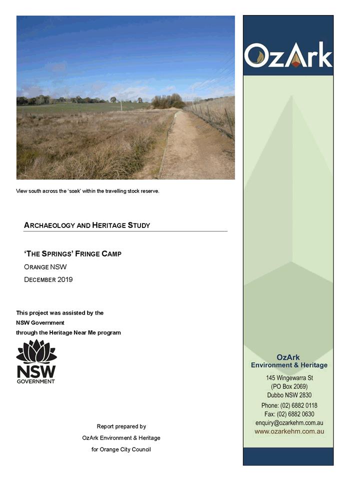

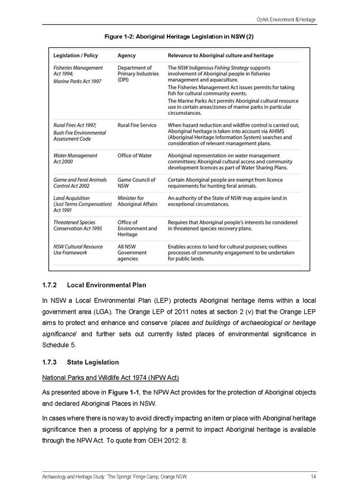
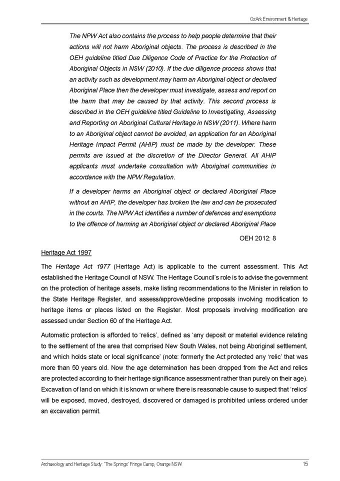
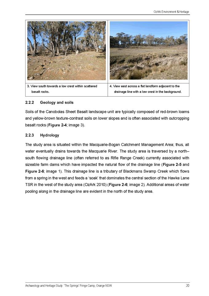
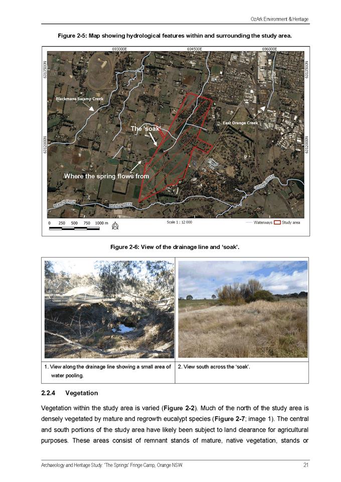
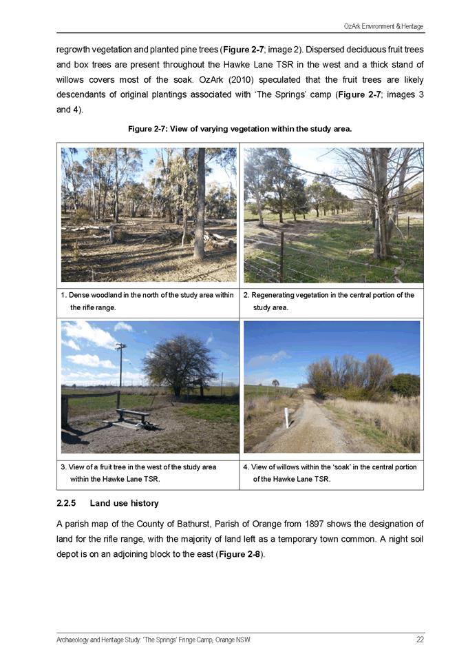
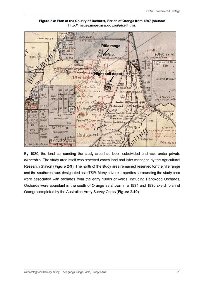
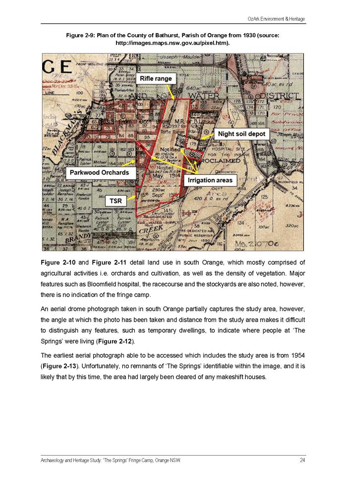
Planning and Development Committee
2 February 2021
Attachment 2 Heritage
Study Review November 2020
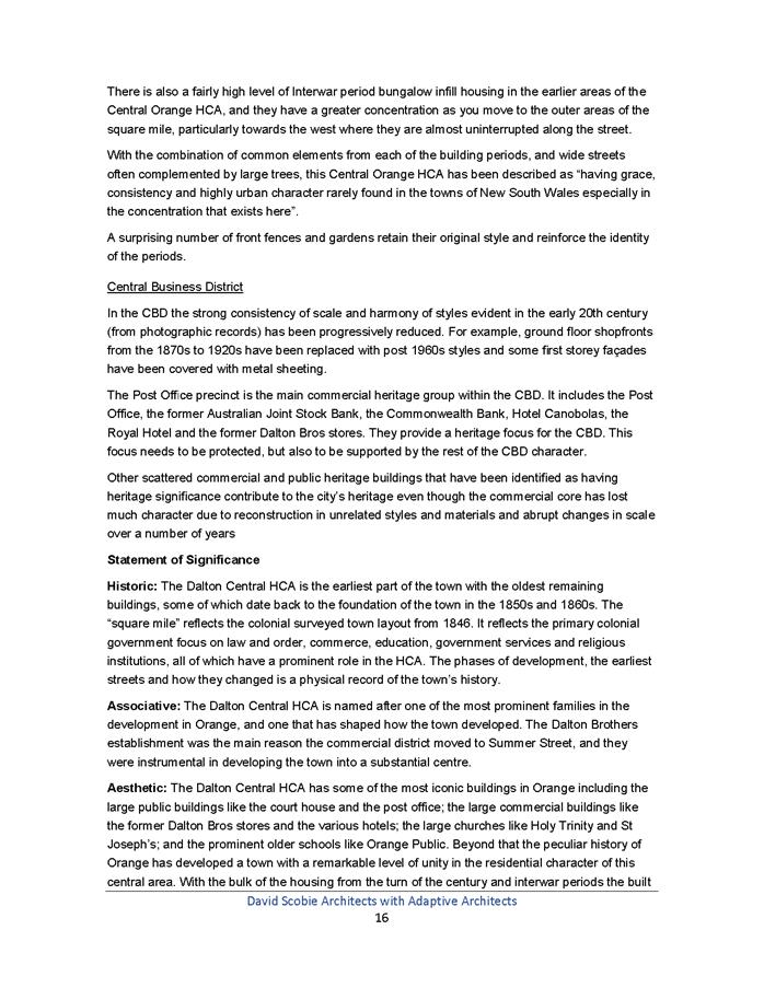
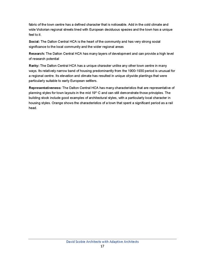
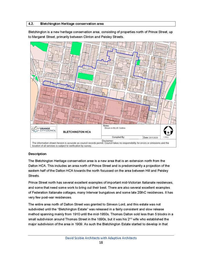
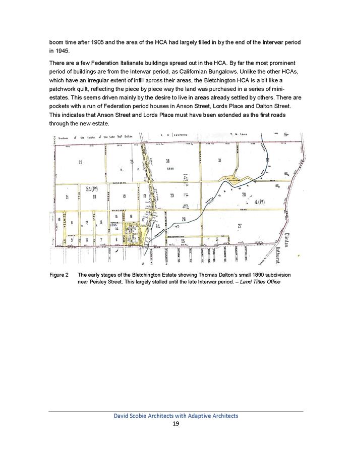
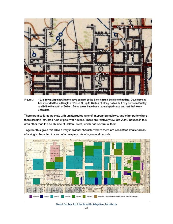
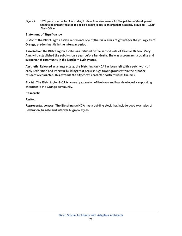
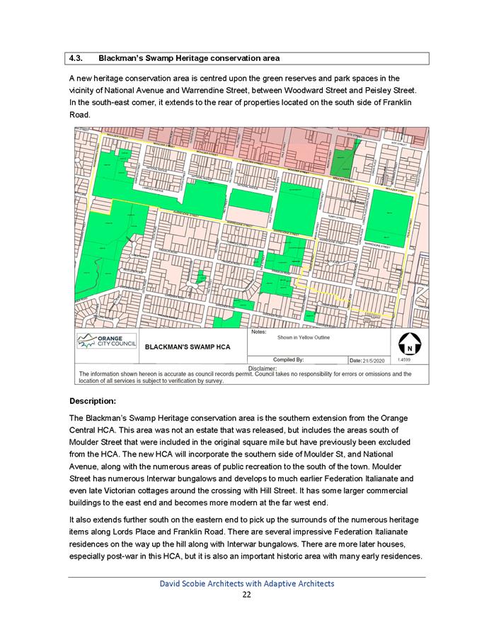
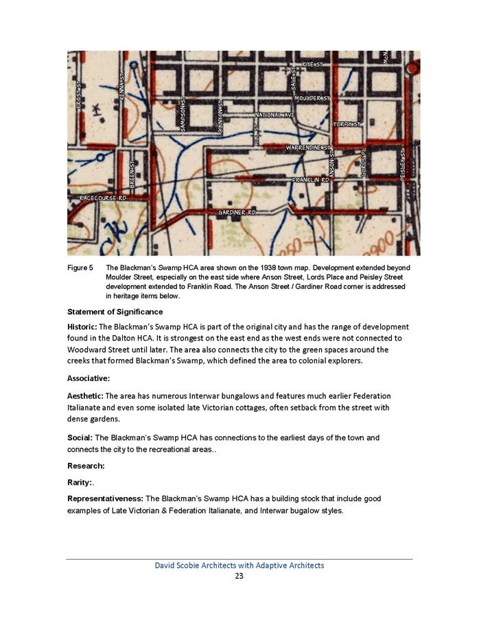
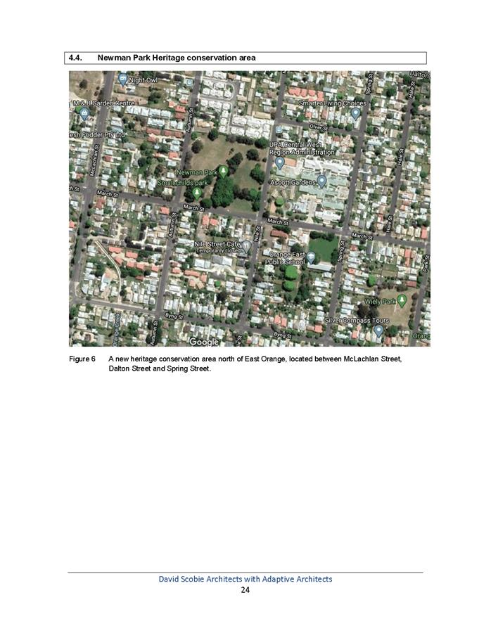
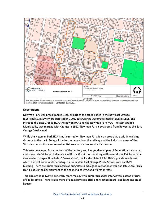
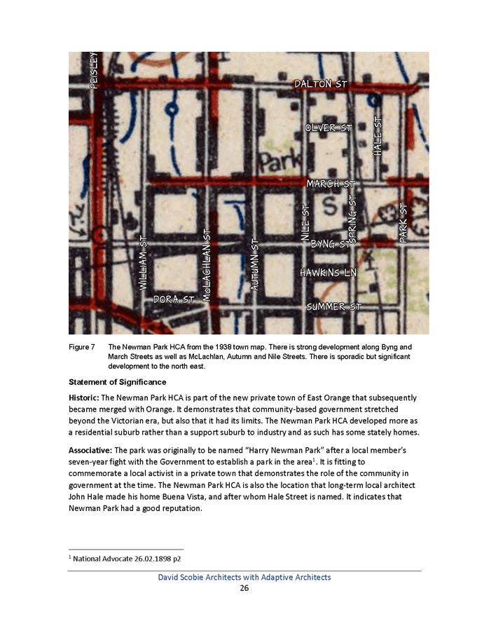

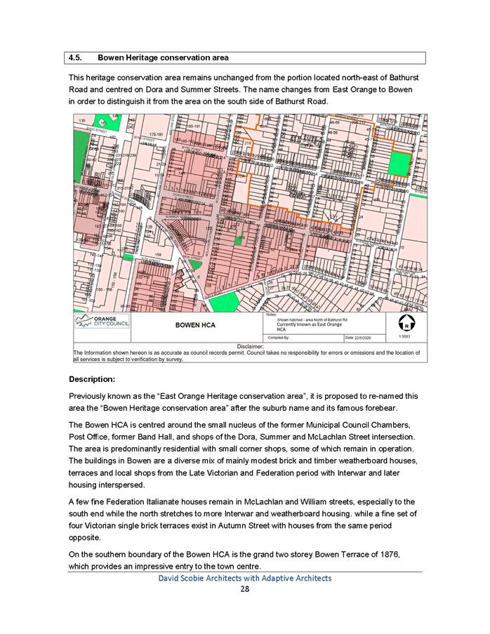
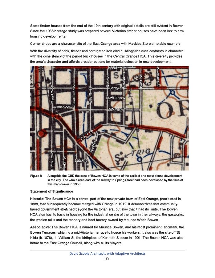
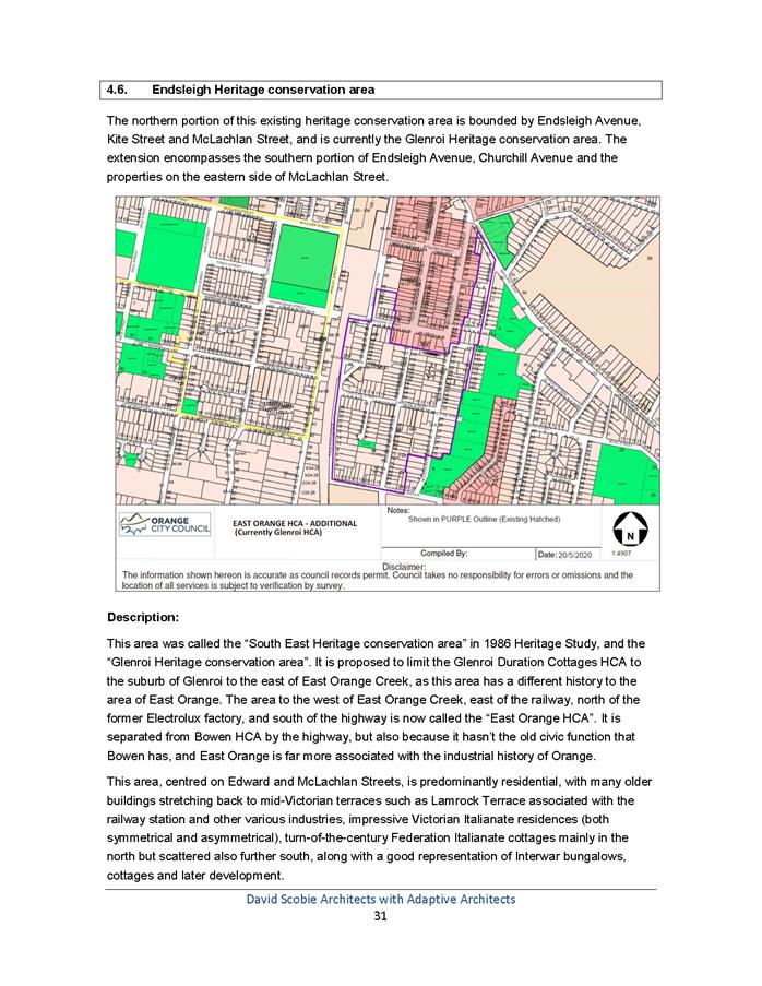
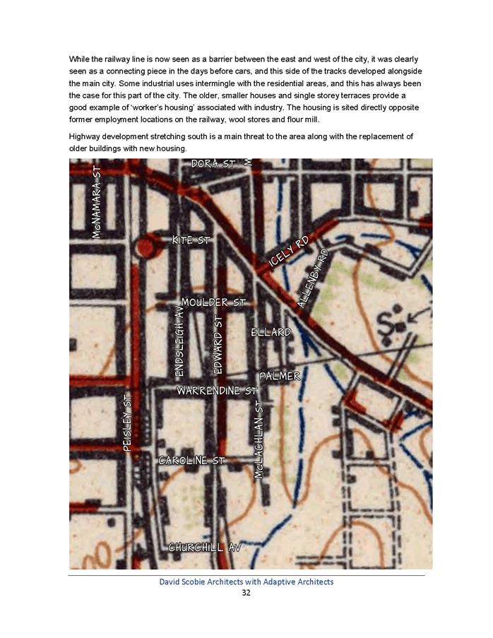
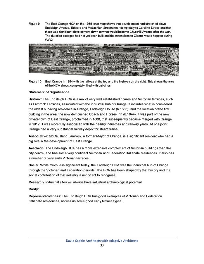
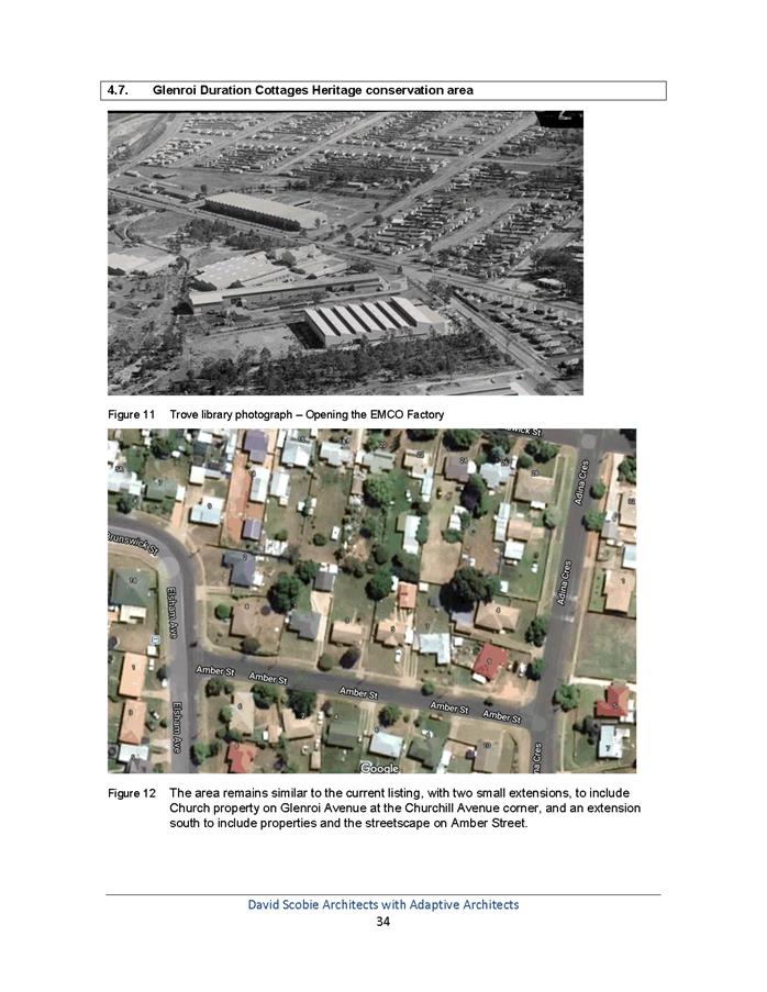
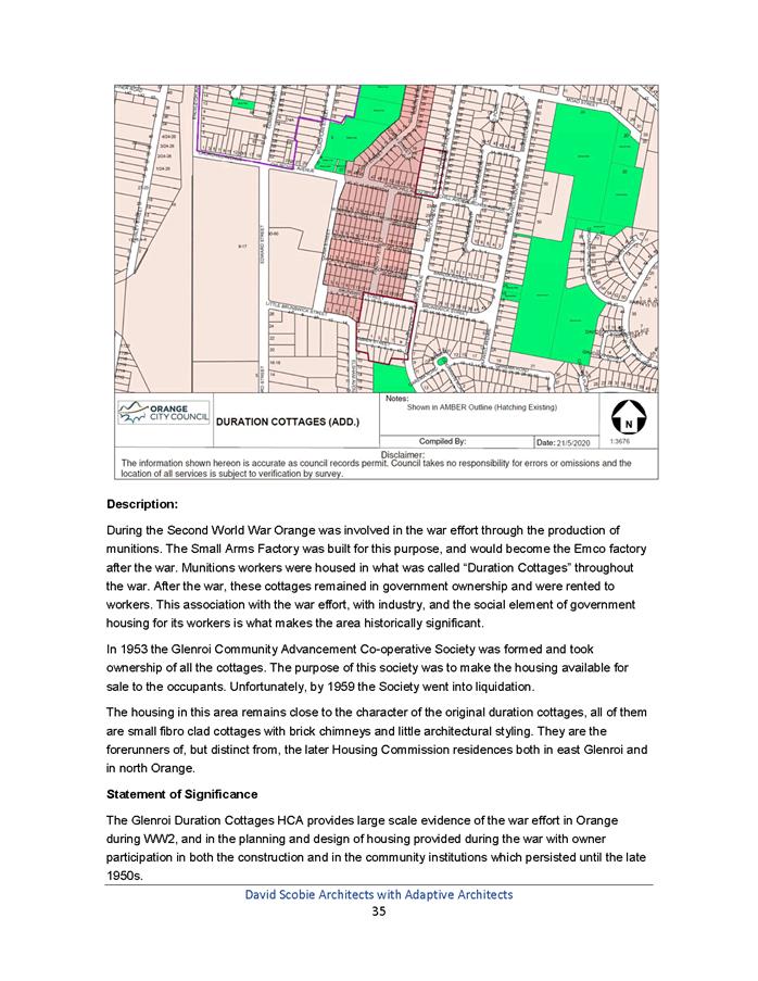
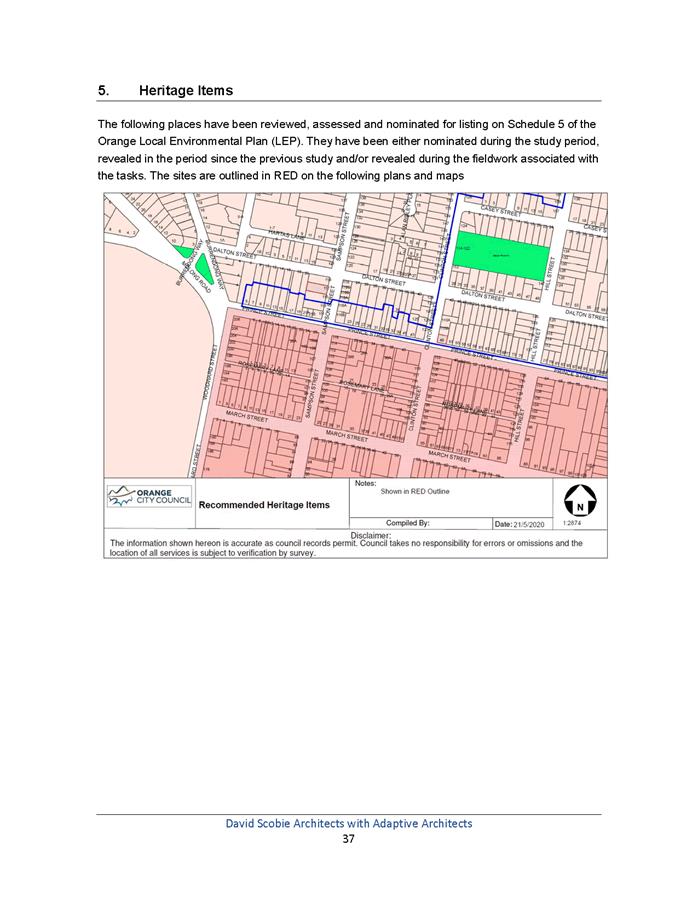
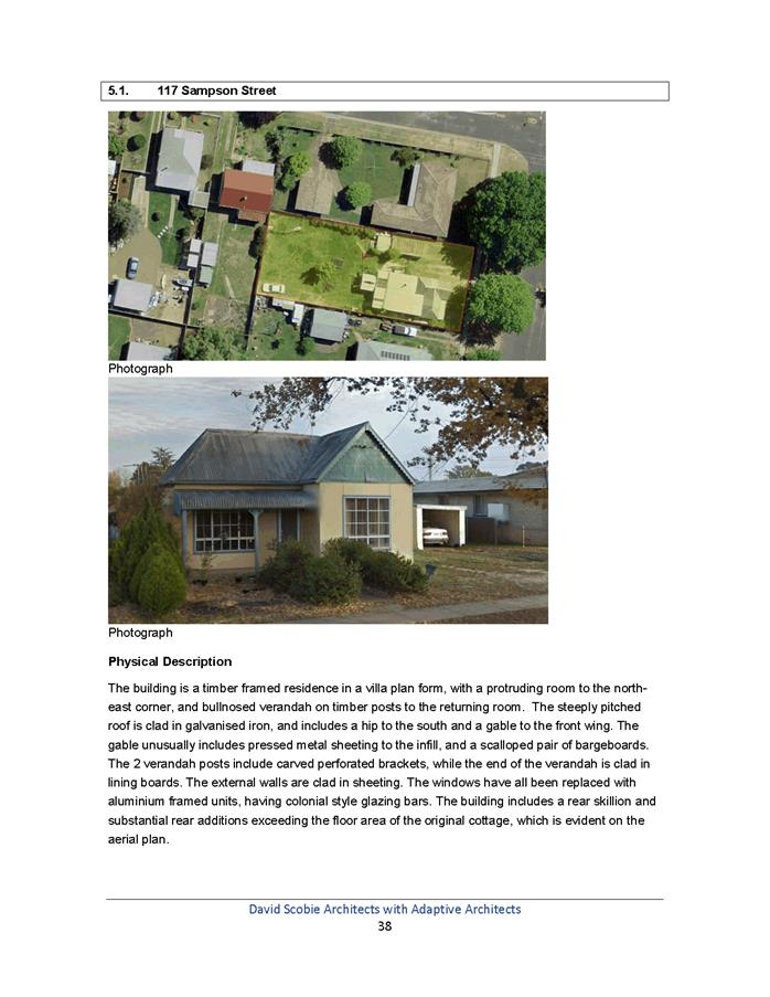
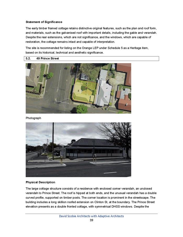
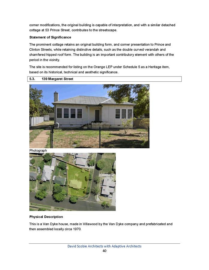
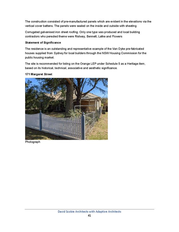
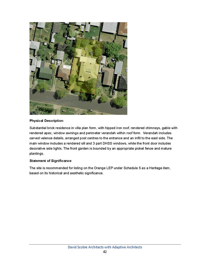
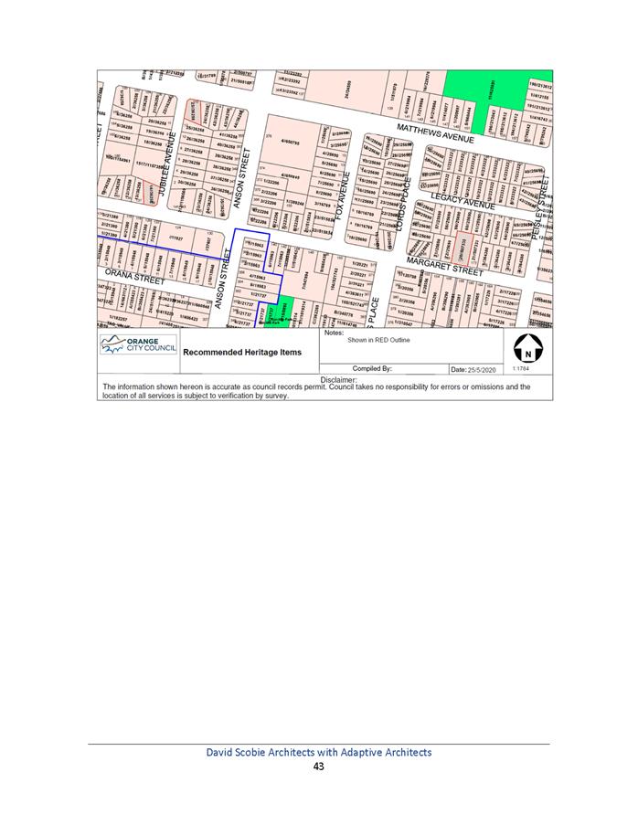
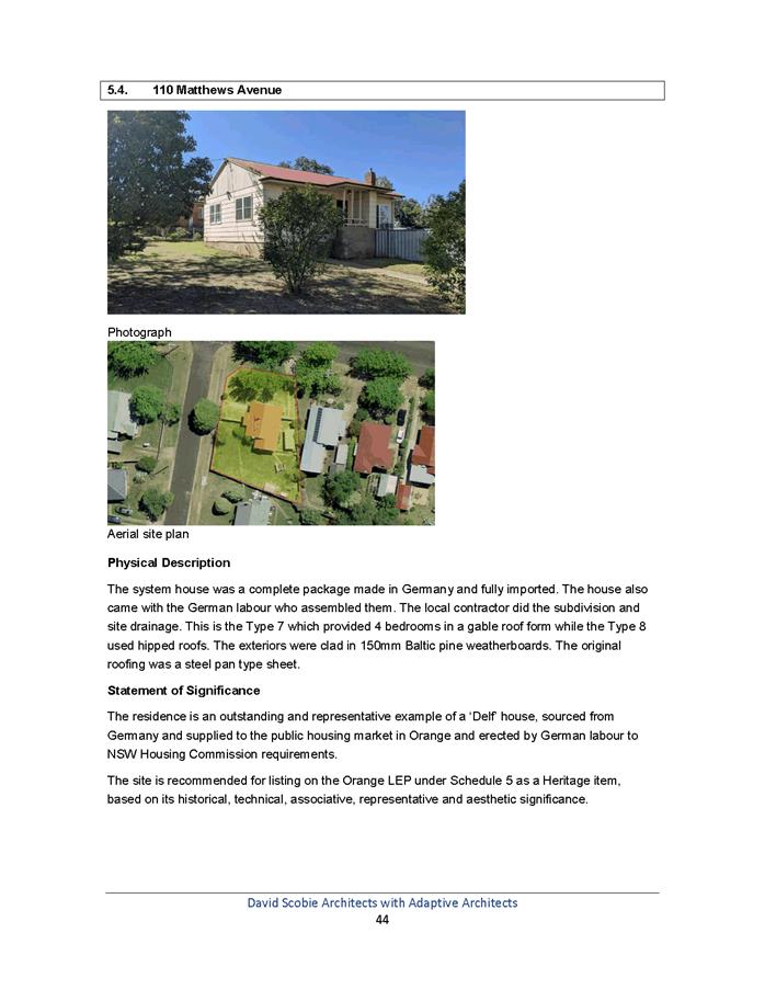
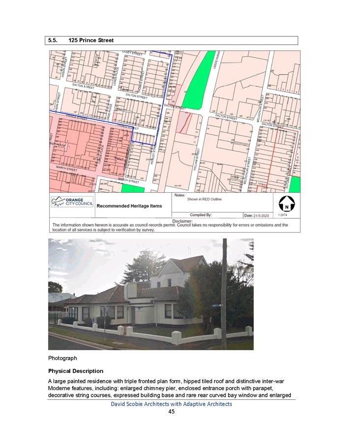
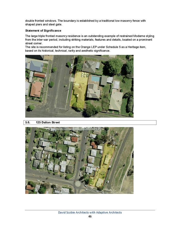
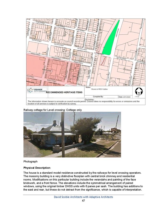
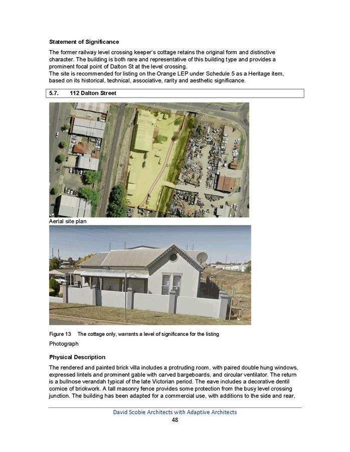
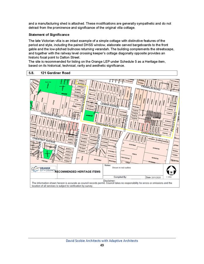
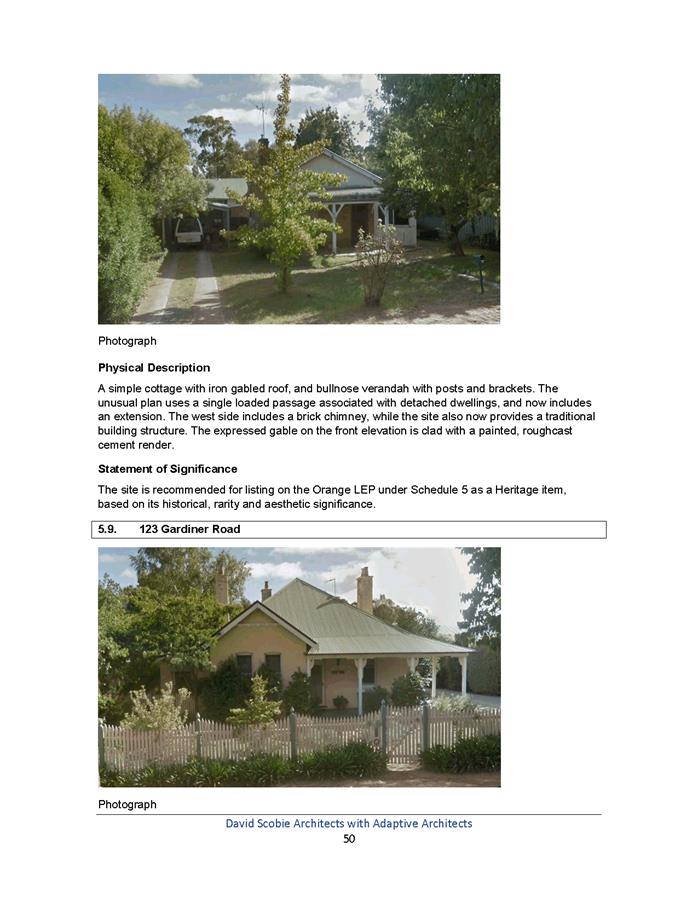
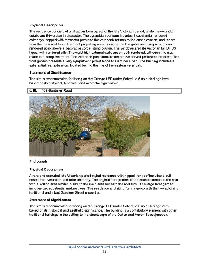
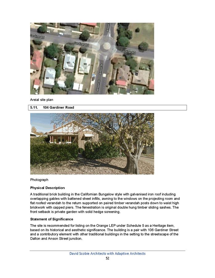
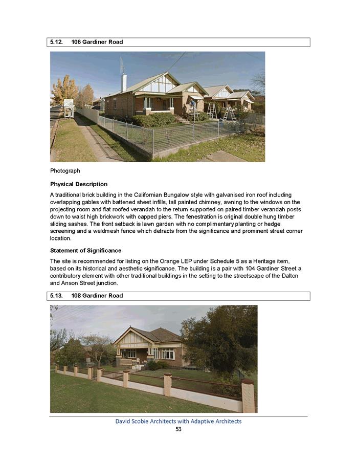
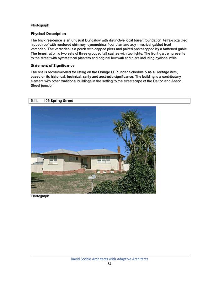
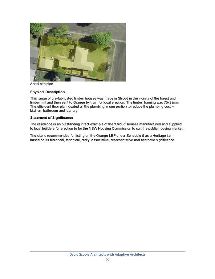
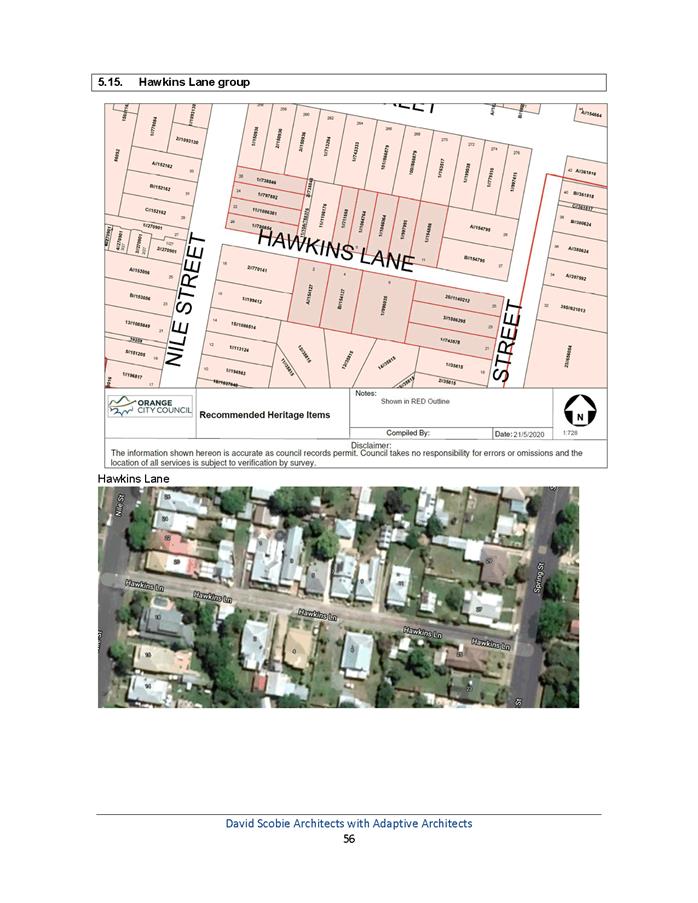
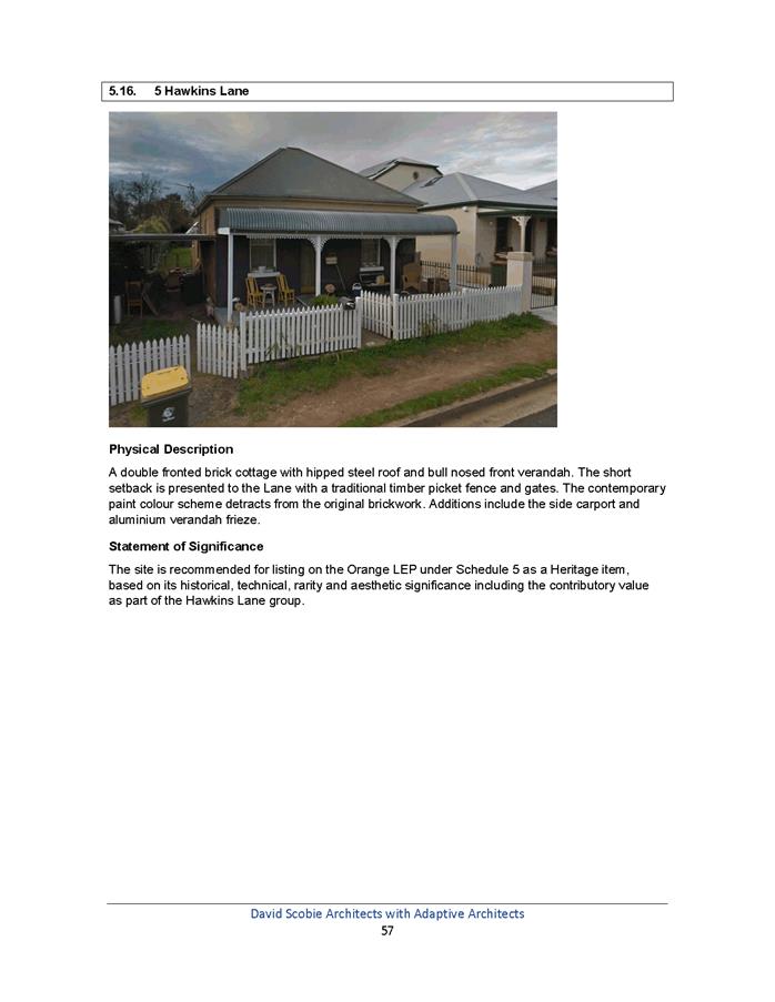
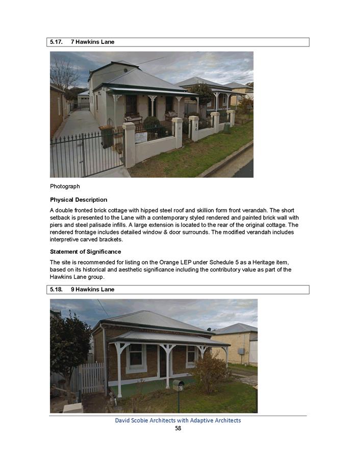
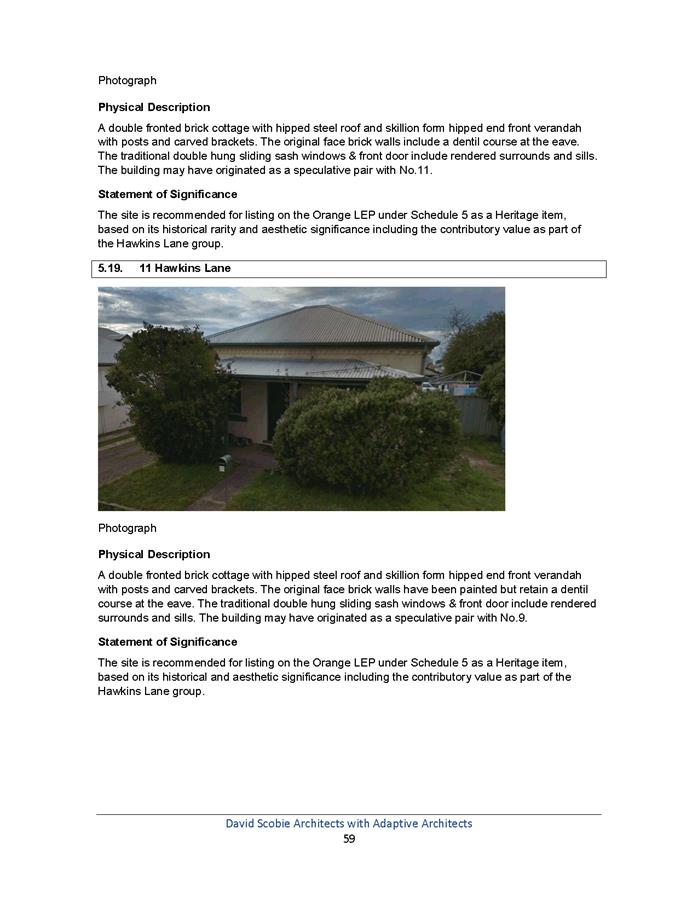
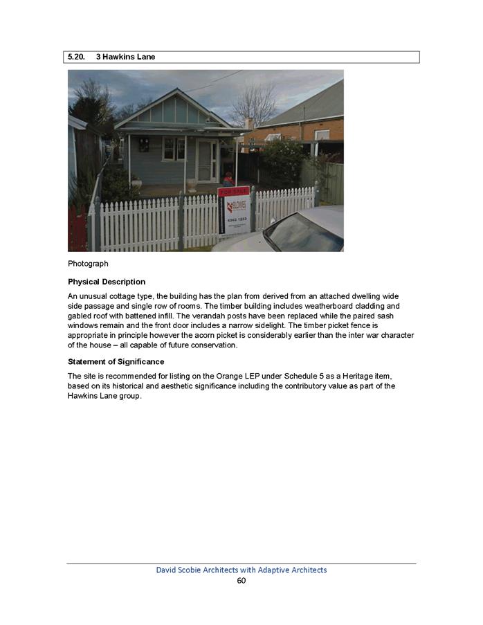
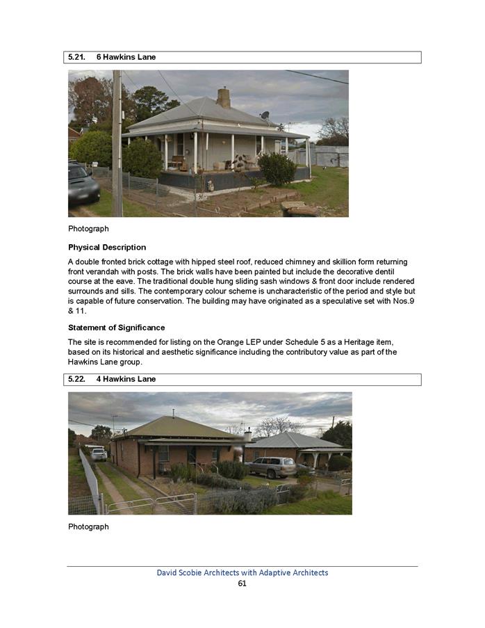
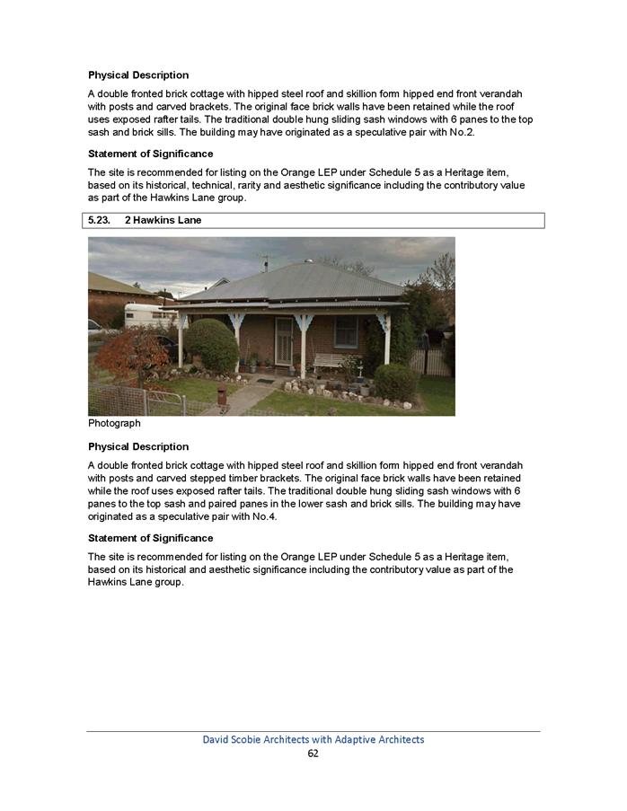
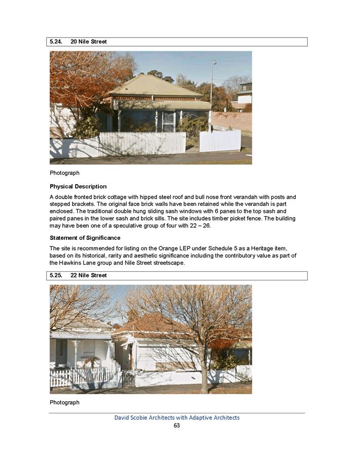
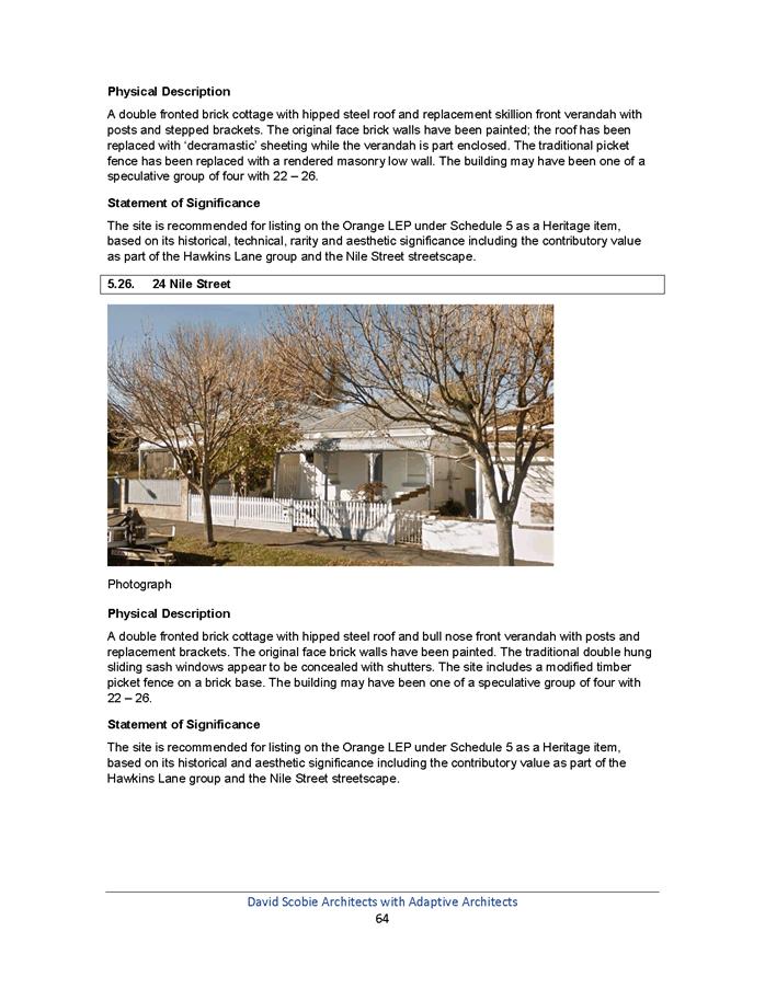


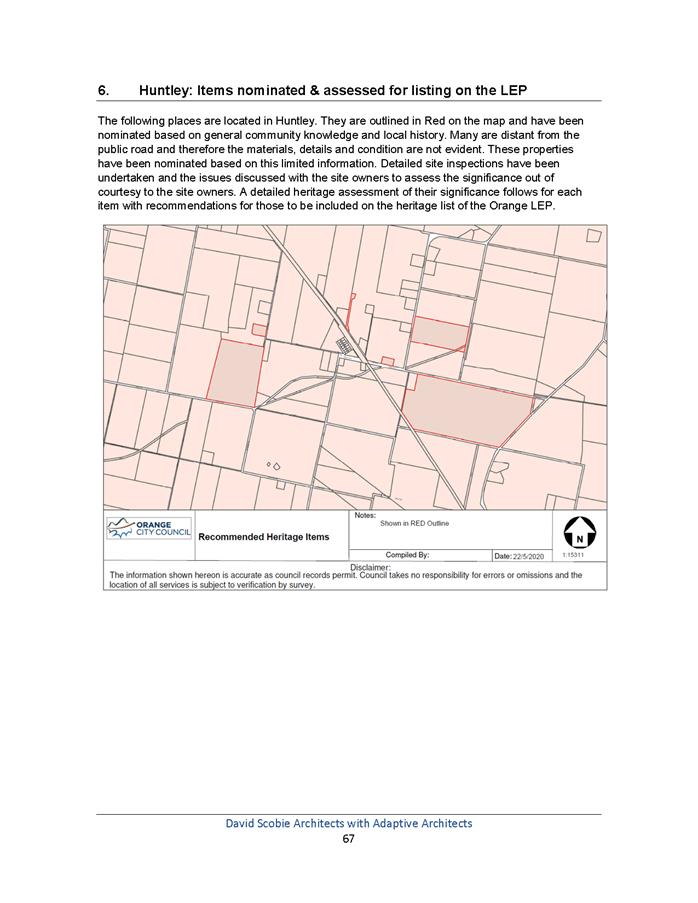
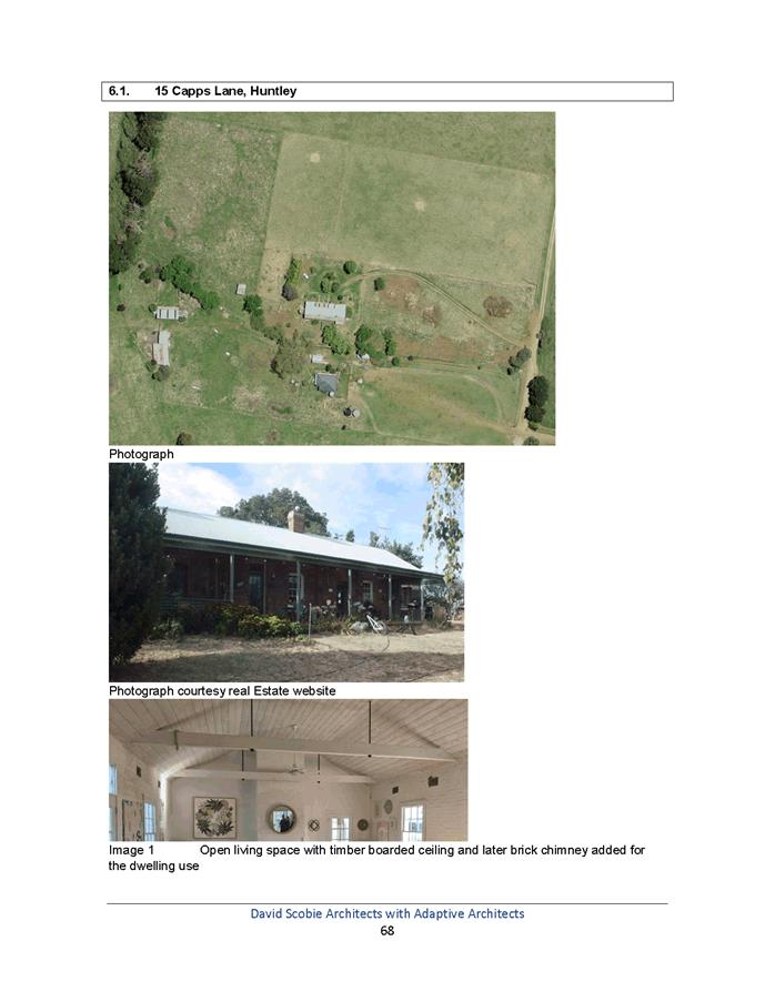
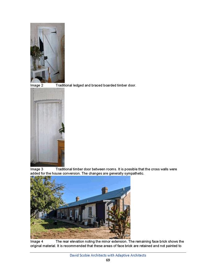
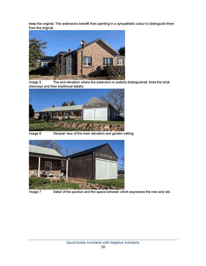
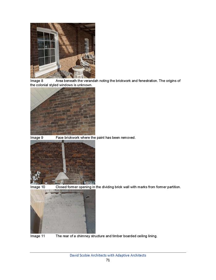
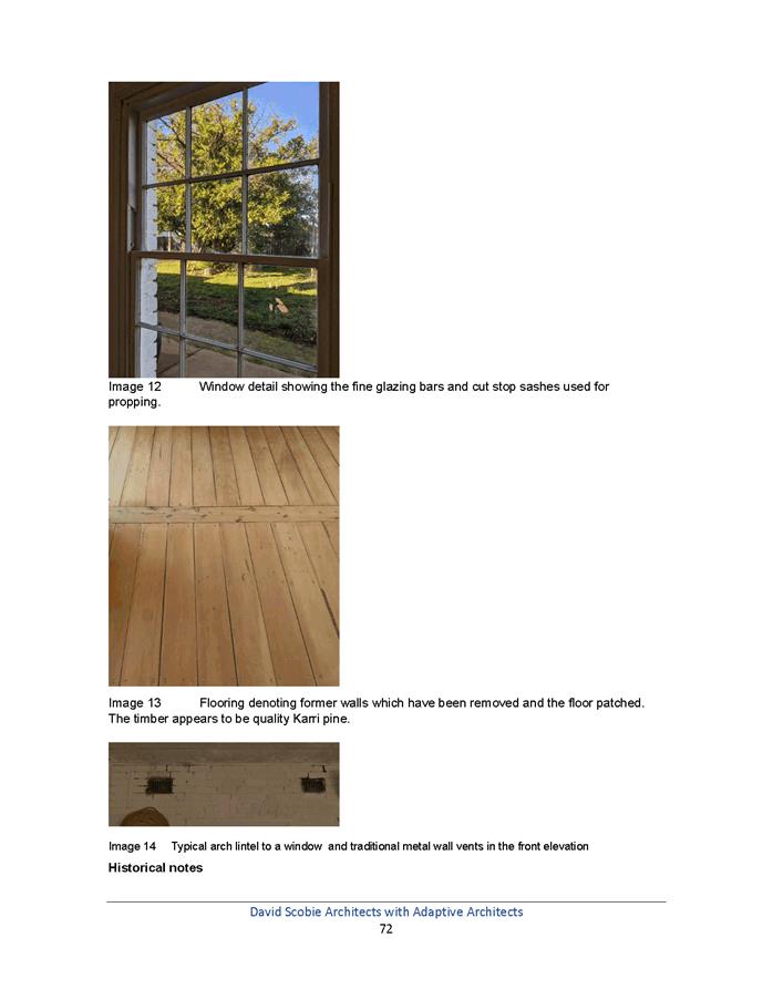
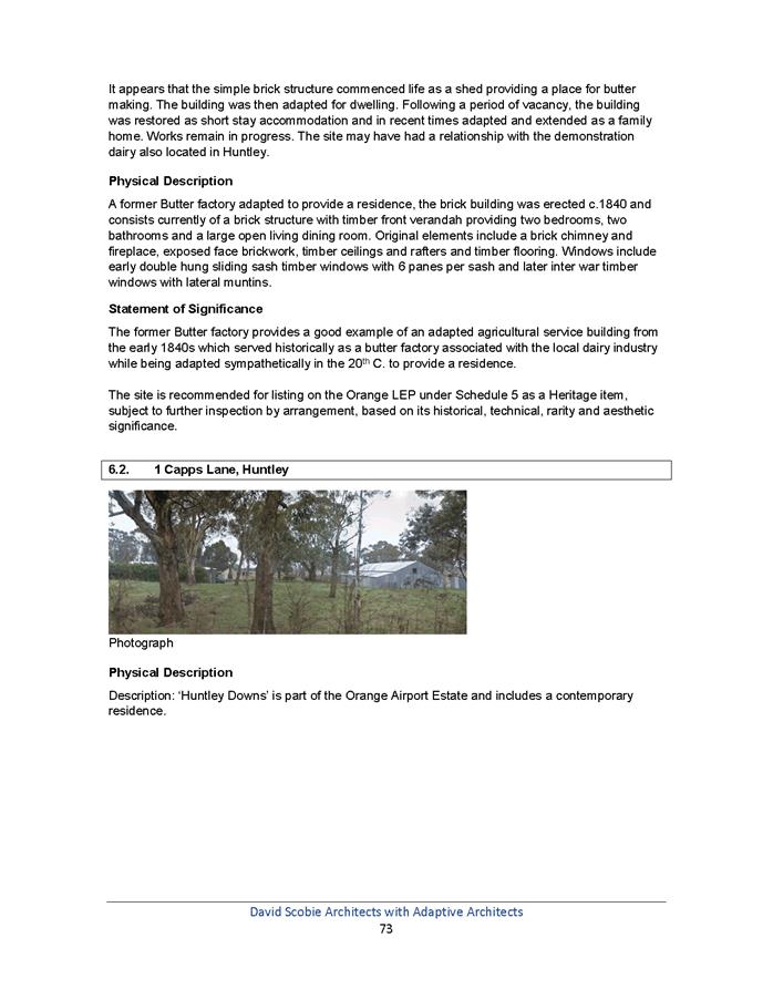
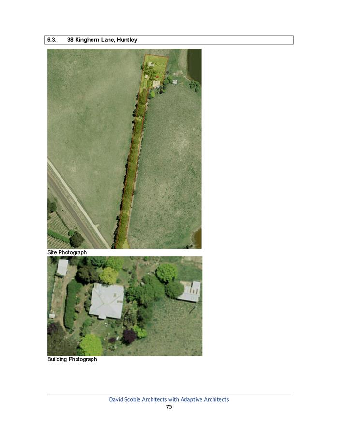
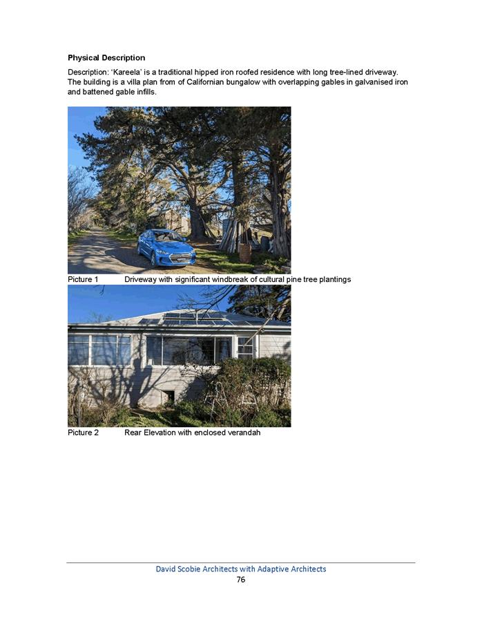
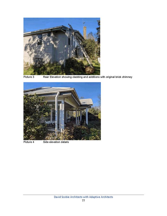
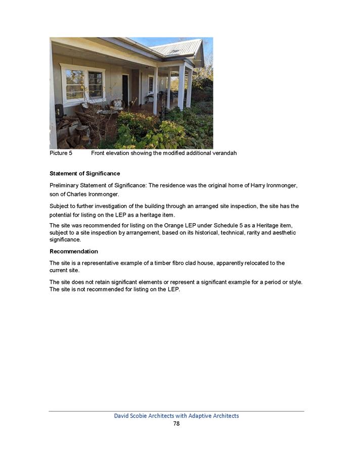
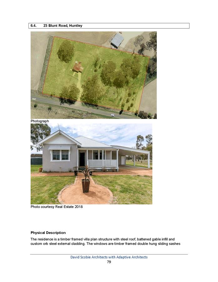
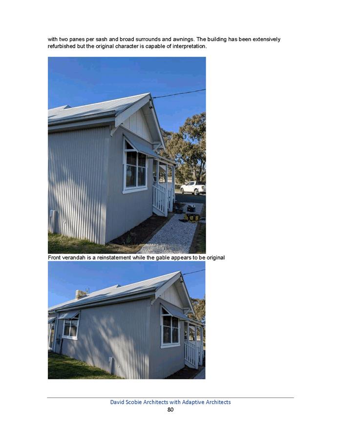
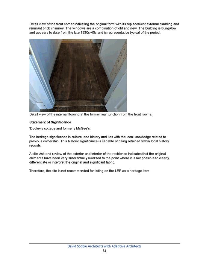
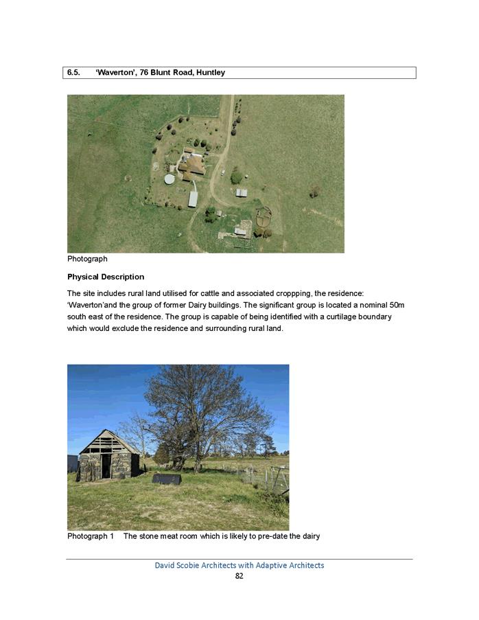
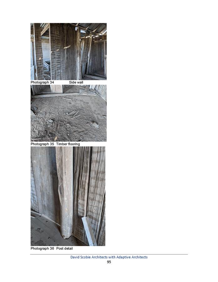
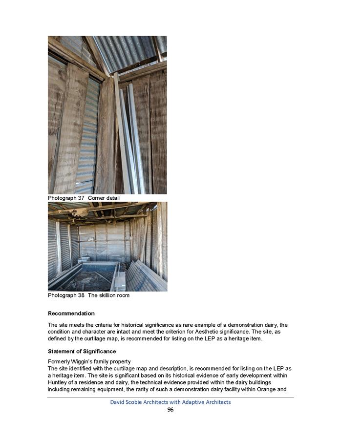
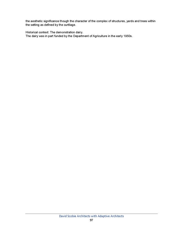
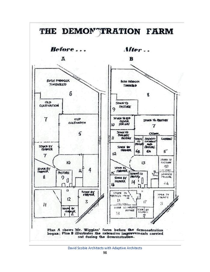
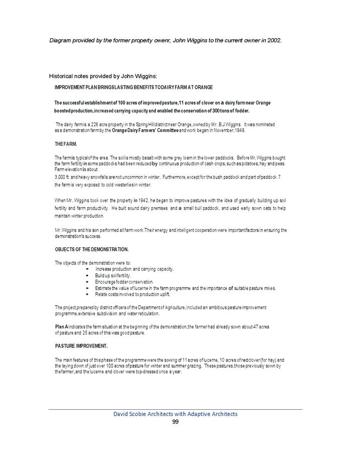
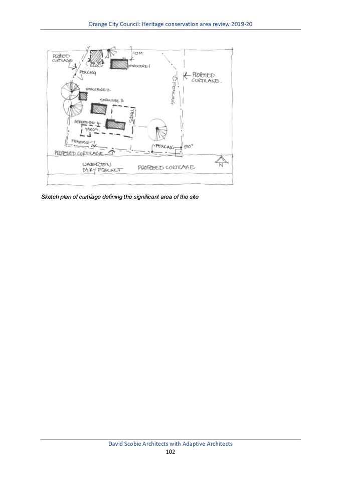

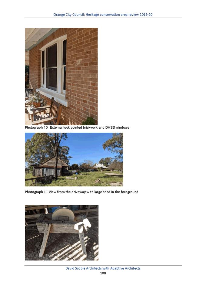
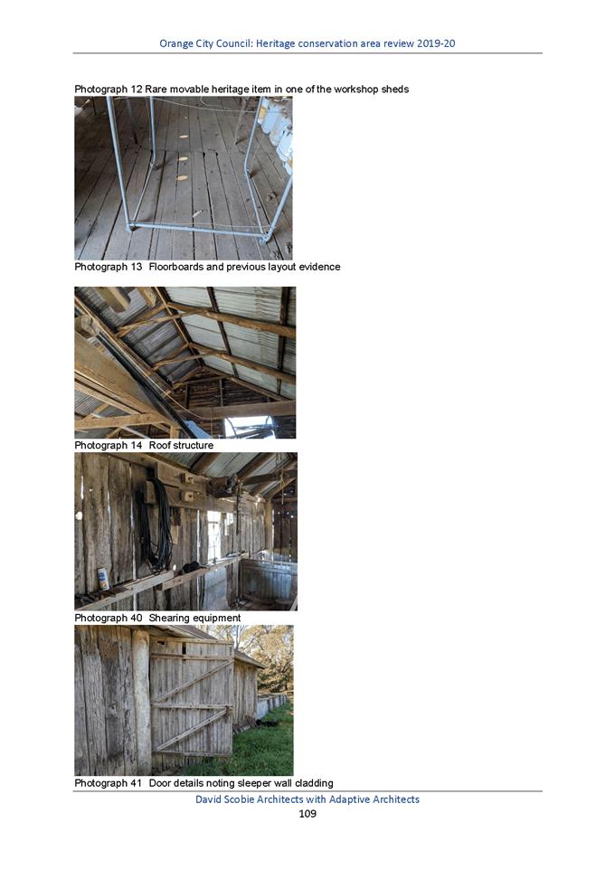
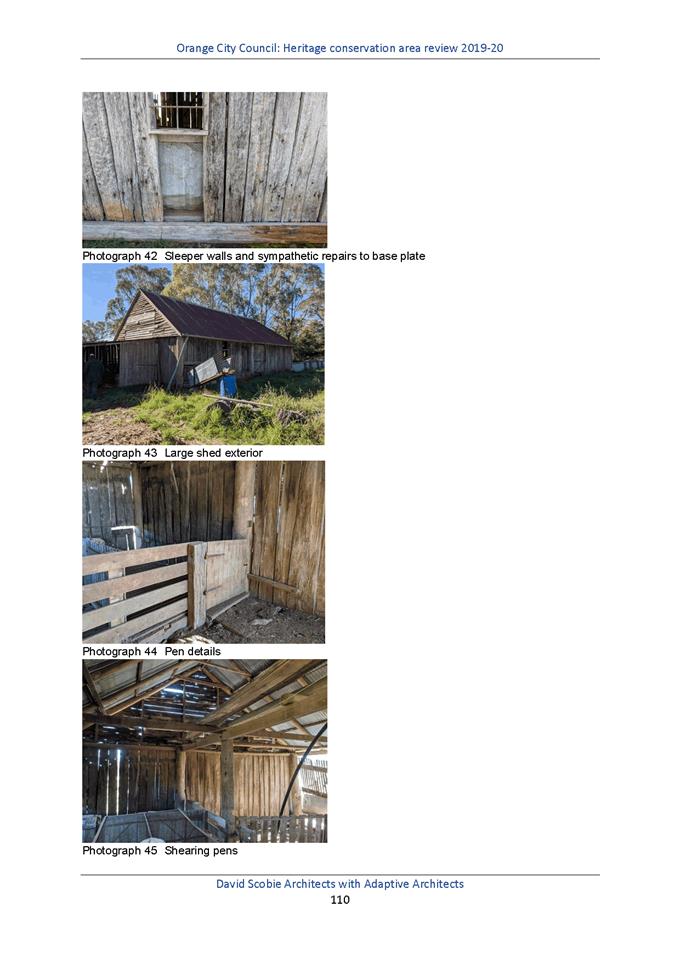

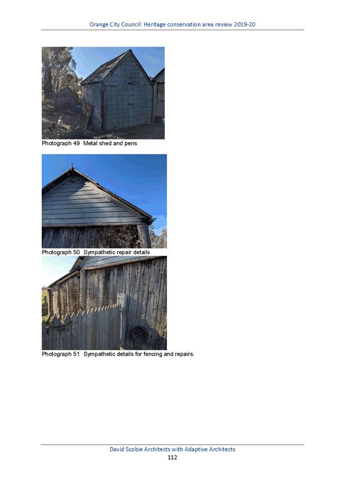
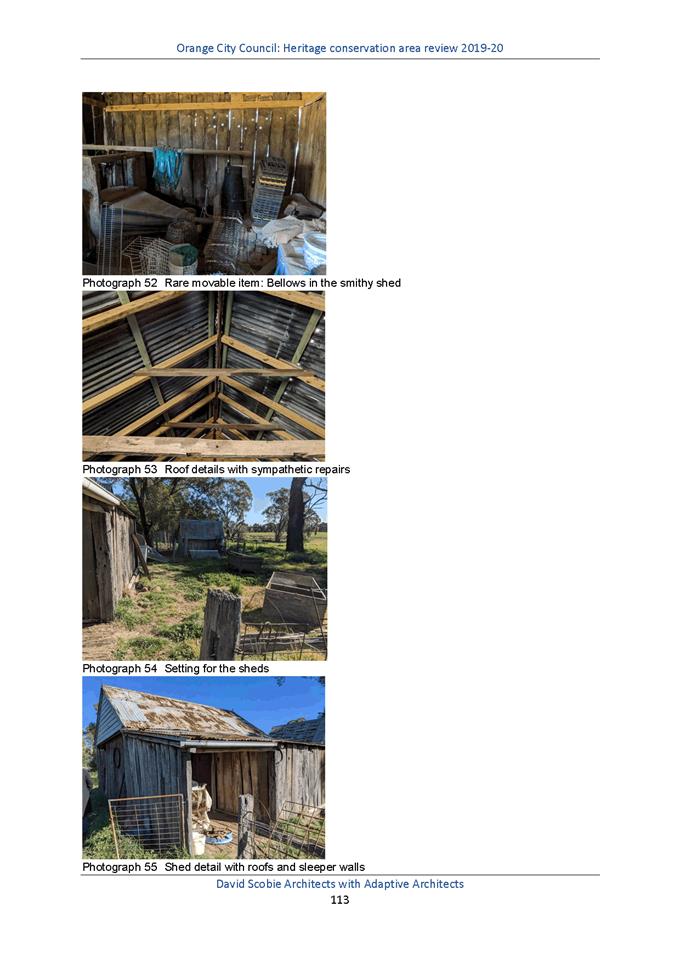
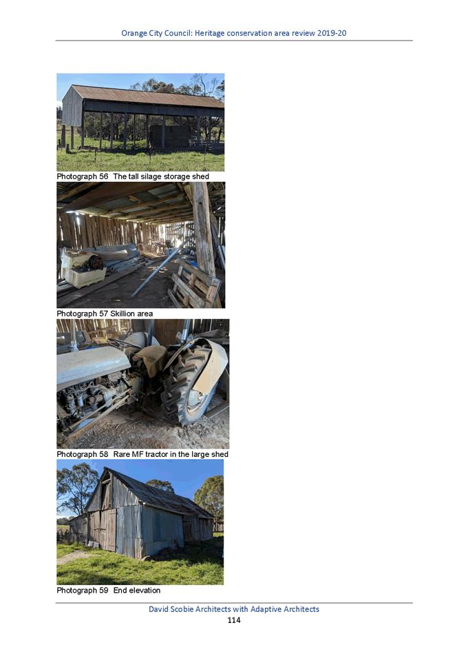
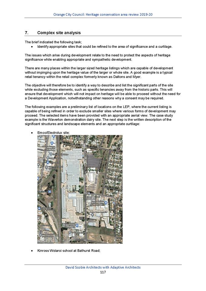
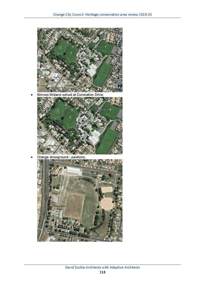
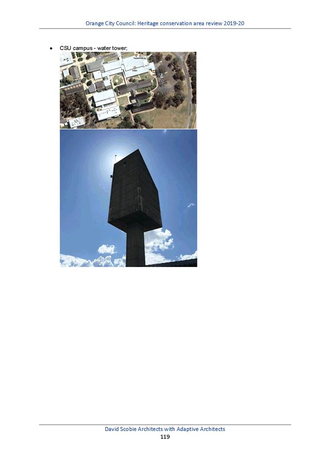

Planning and Development Committee
2 February 2021
Attachment 3 Heritage
Study Review - HCA maps November 2020
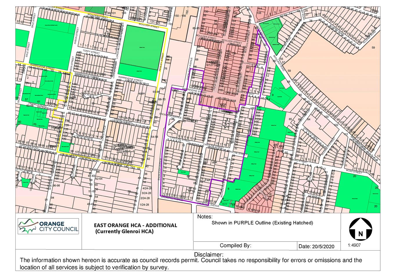
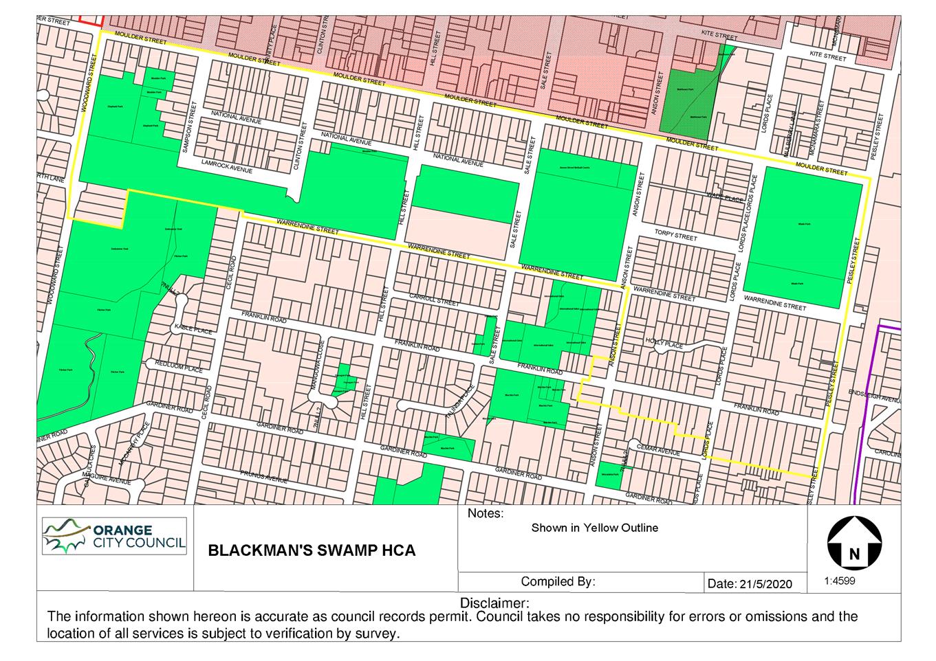
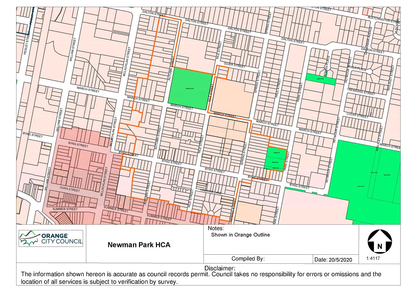
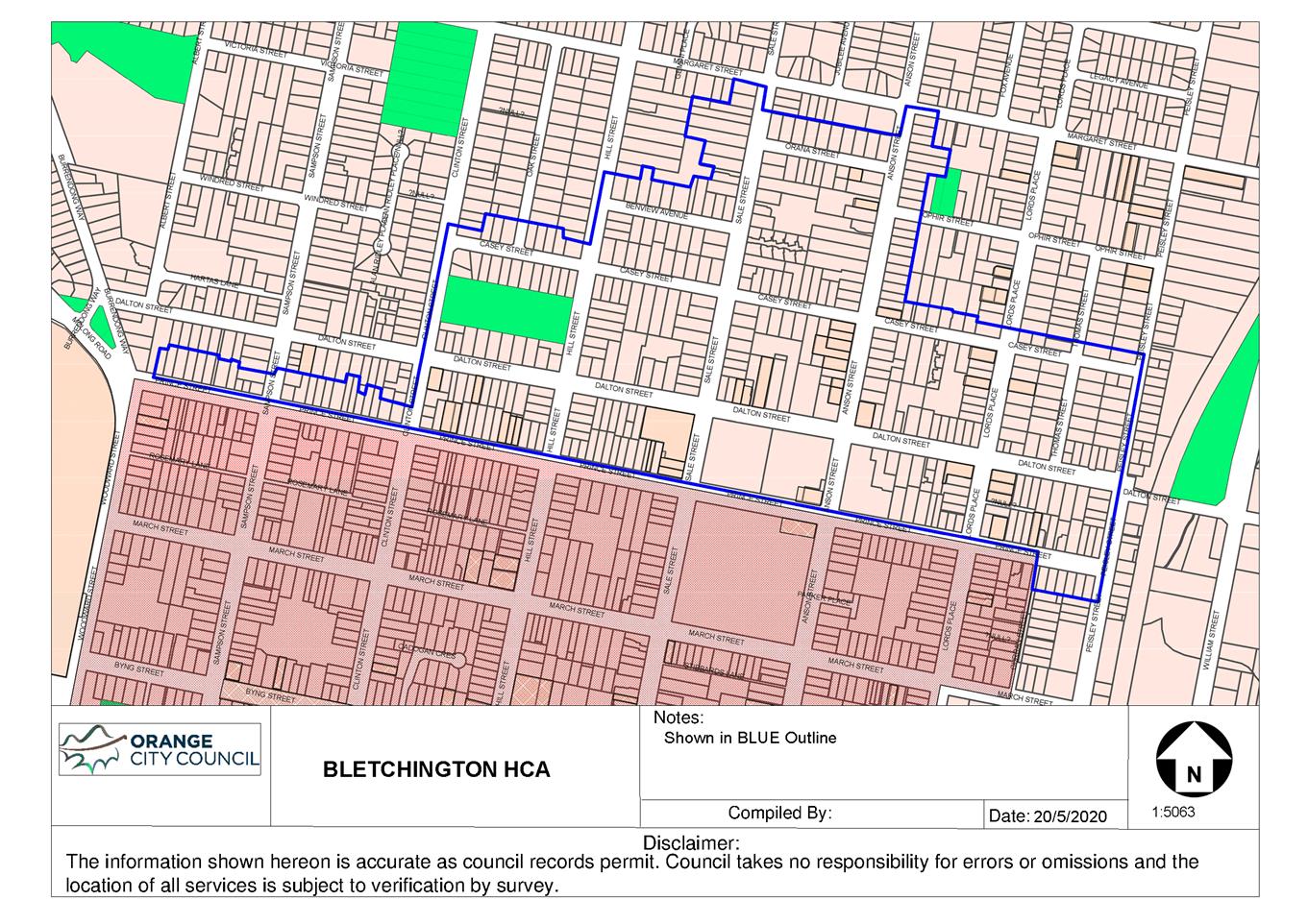
Planning
and Development Committee
2 February 2021
Attachment 4 Planning
Proposal Amendment 28 - Heritage Amendment
Introduction
Orange City Council, as the Planning
Proposal authority, has prepared this Planning Proposal describes a proposed
amendment to the Orange Local Environmental Plan 2011 (‘the LEP’).
The Planning Proposal has been prepared in accordance with Division 3.4 of the Environmental
Planning and Assessment Act 1979 (‘EP&A Act’), A Guide
to Preparing Planning Proposals (December 2018) and A Guide to
Preparing Local Environmental Plans (December 2018) issued by the NSW
Department of Planning, Industry and Environment (DPIE).
The Planning Proposal seeks to
include the Springs; a former non-indigenous and indigenous fringe camp on the
outskirts of south Orange during the 1930s – 40s, new Heritage
Conservation Areas (‘HCAs’), extensions of existing HCAs, including
renaming, and the inclusions of a number of properties to be adopted as Local
Heritage Items within the Orange Local Government Area (‘LGA’).
This is in response to the Springs Archaeological Assessment and Heritage
Study, Conservation Management Plan and the Heritage Landscape Plan (revision
4 August 2020) adopted 7 July 2020 and the Heritage Conservation Area Review
(November 2020) and maps adopted 2 December 2020
Further commentary on these matters
can be found in the report, including under Part
2 – Explanation of Provisions.
Part 1 –
Objectives and intended outcomes
The objectives of this Planning
Proposal are to:
· To amend the LEP in response to the Springs Archaeological
Assessment and Heritage Study, Conservation Management Plan and the Heritage
Landscape Plan (August 2020) and the Heritage Conservation Area
Review (November 2020)
· To expand the HCAs that had been identified by Council, the
community and the community based Heritage Study (2013)
· To clearly identify HCA within their particular settings and
in the context of the local history
Part 2 –
Explanation of Provisions
The objective of this Planning
Proposal will be achieved by:
· Amending Schedule 5 - Environmental Heritage correct
several anomalies that have been identified and are outlined in attachment 1.
· Amending Schedule 5 Environmental heritage –
Part 1 and maps to include The Springs
Travelling Stock Reserve (TSR), as described in the Springs Archaeological Assessment and Heritage Study,
Conservation Management Plan and the Heritage Landscape Plan (August 2020) outlined in attachment 2.
· Amending Schedule 5 Environmental heritage –
Part 1 and maps for the Former Bluestone Quarry (Bluestone lakes) to reflect
the recent subdivision and new housing outlined in attachment 3.
· Amending Schedule 5 Environmental heritage – Part 2 Heritage
conservation areas and maps to include the Bletchington, Newman Park and
Blackman’s Swamp HCAs as described in the Heritage Conservation Area
Review (November 2020) refer to attachment 4.
· Amending Schedule 5 Environmental heritage – Part 2 Heritage
conservation areas and maps to include the extension to the existing Central,
Duration Cottages and Glenroi HCAs as described in the Heritage Conservation
Area Review (November 2020) refer to attachment 5.
· Amending Schedule 5 Environmental heritage – Part 2 Heritage
conservation areas to rename the following (refer to attachment 6):
o The
Heritage Conservation Area known as Central Orange Heritage Conservation Area,
be renamed Dalton Central Heritage Conservation Area
o The
Heritage Conservation Area known as the Duration Cottages Heritage Conservation
Area be renamed Glenroi Duration Cottages Heritage Conservation Area
o The
Heritage Conservation Area known as Glenroi Heritage Conservation Area be
renamed Endsleigh Heritage Conservation Area
o The
Heritage Conservation Area known as East Orange Heritage Conservation Area be
renamed Bowen Heritage Conservation Area
· Amending Schedule 5 Environmental heritage – Part
1 Heritage Items and maps to include the following properties as Local Heritage
Items refer to attachment 7:
o 117 Sampson Street - Lot 8 DP 6662
o 49 Prince Street – Lot 21 DP1249171
o 139 Margaret Street – Lot 14 DP 36258
o 5 Hawkins Lane –
Lot 1 DP 1004764
o 9 Hawkins Lane – Lot 1 DP 997995
o 11 Hawkins Lane – Lot 1 DP 194886
o 3 Hawkins Lane – Lot 1 DP 711668
o 6 Hawkins Lane – Lot 1 DP 996035
o 4 Hawkins Lane – Lot B DP 154127
o 2 Hawkins Lane – Lot A DP 154127
o 20 Nile Street – Lot 1 DP 780854
o 22 Nile Street – Lot 11 DP 1086301
o 24 Nile Street – Lot 1 DP 797882
o 26 Nile Street – Lot 1 DP 738846
o 171 Margaret Street – Lot 20 DP 507333
o 110 Matthews Avenue – Lot 23 DP 36258
o 125 Prince Street – Lot B DP 345070
o 125 Dalton Street – Lot 2 DP 1038981
o 112 Dalton Street – Lot 1 DP 744247
o 121 Gardiner Road – Lot 105 DP 831875
o 123 Gardiner Road – Lot B DP 363624
o 102 Gardiner Road – Lot 112 DP 456165
o 106 Gardiner Road – Lot 121 DP 561111
o 108 Gardiner Road – Lot 2 DP 220822
o 105 Spring Street – Lot 1 DP 371538
o 15 Capps Lane, Huntley – Lot 452 DP 810173
o ‘Waverton’ 76 Blunt Road, Huntley (as per
the described curtilage) Lot 2 DP 1038589
o ‘Homeleigh’ 359 Phoenix Mine Road, Huntley
– Lot 56 DP 750387
Part 3 –
Justification
Section
A - Need for the Planning Proposal
Q1. Is
the Planning Proposal a result of an endorsed local strategic planning
statement, strategic study or report?
The Planning Proposal is a result of the Heritage Conservation Area Review
(November 2020) adopted by Council 2 December 2020.
Q2. Is
the Planning Proposal the best means of achieving the objectives or intended
outcomes, or is there a better way?
The Planning Proposal intends to update the Schedule 5
Environmental heritage and mapping. Due to the administrative nature of the
Planning Proposal and its response to the Heritage Study Review (2020) and
housekeeping amendments the Planning Proposal is the only possible response to
amend the LEP.
Section
B – Relationship to strategic planning framework.
Q3. Will
the Planning Proposal give effect to the objectives and actions of the
applicable regional, or district plan or strategy (including any exhibited
draft plans or strategies)?
The Central West and Orana Regional
Plan 2036
The Central West and Orana
Regional Plan 2036 (‘CWO Regional Plan’) (June 2017) by DPIE
will guide the NSW Government’s land use planning priorities and
decisions in the region up to 2036. The CWO Regional Plan provides an
overarching framework to guide subsequent and more detailed land use plans, development
proposals and infrastructure funding decisions and is accompanied by an
Implementation Plan. The goals of the CWO Regional Plan are:
· The most diverse regional economy in NSW
· A stronger, healthier environment and diverse heritage
· Quality freight, transport and infrastructure networks
· Dynamic, vibrant and healthy communities
For each goal, the CWO Regional Plan
identifies directions and associated actions to assist in achieving the goal.
Table 1 below summarises the relevant
directions of the CWO Regional Plan, provides comment on the directions and
actions of the Plan that are directly relevant to the Planning Proposal, and
indicates whether the Proposal is considered to be consistent or inconsistent
with the Plan.
|
Table 1. Central
West and Orana Regional Plan
|
|
Goal 2: A stronger, healthier
environment and diverse heritage
|
Planning Proposal response –
is the Proposal consistent with the Strategy?
|
|
DIRECTIONS & APPLICABLE ACTIONS
|
TIMEFRAME OF IMPLEMENTATION
|
COMMENTS
|
|
Direction 16: Respect and protect
Aboriginal Heritage assets
|
Ongoing
|
The Planning Proposal is considered
to be consistent with the intent of this Direction.
The Planning Proposal seeks to
include the Travelling Stock Reserve (TSR) of the ‘the Springs’ Fringe
Camp an area of importance to both the Aboriginal and non-Aboriginal
community.
|
|
Direction 17: Conserve and
adaptively re-use heritage assets
Action 17.2 Prepare, review and update heritage
studies in consultation with the wider community to recognise and conserve
heritage assets and items, and include appropriate local planning controls.
|
Ongoing
|
The Planning Proposal is considered
to be consistent with the intent of this Direction.
The Planning Proposal is in direct
response to the Heritage
Study Review (2020) adopted by Council 2 December 2020. The Planning Proposal
seeks to amend the LEP to include the proposed HCAs and the extension of the
existing HCAs to further recognise and conserve heritage assets and items
with the Orange LGA.
The Planning Proposal also seeks to
correct anomalies and errors in Schedule 5 of the LEP.
|
|
Goal 4: Dynamic, vibrant and
healthy communities
|
Planning Proposal response –
is the Proposal consistent with the Strategy?
|
|
DIRECTIONS & APPLICABLE ACTIONS
|
TIMEFRAME OF IMPLEMENTATION
|
COMMENTS
|
|
Direction 29: Deliver healthy built
environments and better urban design
Action 29.3 Reflect local built form, heritage
and character in new housing developments.
|
Ongoing
|
The Planning Proposal is considered
to be consistent with the intent of this Direction.
The Planning Proposal seeks to
include the new HCAs, extensions of the existing HCAs and heritage items that
are of importance and significance within the Orange LGA. The mapping of
these HCAs will ensure the retention of the heritage character through
alterations or adaptive re-use, and sympathetic responses of new developments
within or adjoining the HCAs.
|
Better Placed (May 2017) & Better Placed – Design
Guide for Heritage (2019)
Better Placed (May 2017) sets a
framework and collective approach for how practitioners and government agencies
delivery good design in our cities and towns. With a focus on the built
environment, public places and environments the policy outlines seven objectives
to good design. The Planning Proposal responds to the following objectives
identified in table 2.
|
Table 2. Better
Placed
|
|
Objective 1. Better Fit - contextual, local and of its place
|
Planning Proposal response –
is the Proposal consistent with the Policy?
|
|
APPLICABLE OBJECTIVES
|
TIMEFRAME OF IMPLEMENTATION
|
COMMENTS
|
|
Heritage places create the setting
for contemporary life, connecting communities to the past, and helping to
shape futures.
|
Ongoing
|
The Planning Proposal is considered
to be consistent with the intent of this objective.
The Planning Proposal seeks to
amend the LEP to include a number of new HCAs, the extension of a number of
HCAs and the inclusion of a number of heritage items. These amendments will
make strong contributions to the character of the Orange LGA and will be
vital in ensuring that future development contributes positively to these
areas and items.
|
|
Objective 2. Better Performance - sustainable, adaptable and durable
|
Planning Proposal response –
is the Proposal consistent with the Policy?
|
|
APPLICABLE OBJECTIVES
|
TIMEFRAME OF IMPLEMENTATION
|
COMMENTS
|
|
The protection and ongoing use of
heritage places is an important strategy for sustainability in our cities,
towns, and places. This retains embodied energy, reduces waste, and minimises
consumption of natural resources. Adapting heritage places uses and extends
their inherent durability and integrates these buildings into contemporary
life.
|
Ongoing
|
The Planning Proposal is considered
to be consistent with the intent of this objective.
The Planning Proposal seeks to
include a number of new HCAs, the extension of a number of HCAs and the
inclusion of a number of heritage items. Through including additional areas
and items, adaptive reuse and retention is being encouraged.
|
|
Objective 3. Better for Community
|
Planning Proposal response –
is the Proposal consistent with the Policy?
|
|
APPLICABLE OBJECTIVES
|
TIMEFRAME OF IMPLEMENTATION
|
COMMENTS
|
|
Heritage buildings, structures, and
sites help create a sense of place and provide tangible links to the past.
They have local character and identity, and many in the community feel
strongly about what happens to them. Our built environment heritage can make
a strong contribution to social sustainability, and help to build robust and
engaged communities.
|
Ongoing
|
The Planning Proposal is considered
to be consistent with the intent of this objective.
The Planning Proposal amendments
will expand upon the existing HCAs and heritage items that builds on
Oranges’ local character, identity and connection to its past.
|
|
Objective 4. Better for People - safe, comfortable and liveable
|
Planning Proposal response –
is the Proposal consistent with the Policy?
|
|
APPLICABLE OBJECTIVES
|
TIMEFRAME OF IMPLEMENTATION
|
COMMENTS
|
|
Many heritage buildings and sites
are beautiful, engaging places in which people are keen to live, work, or
play. They may be built of fine materials, exquisitely detailed, or have the
robust appeal of a former industrial space. They could be set in mature
gardens, or be part of a valued streetscape with a strong sense of place.
|
Ongoing
|
The Planning Proposal is considered
to be consistent with the intent of this objective.
The Planning Proposal amendments
will expand upon the existing HCAs and heritage items that builds on
Oranges’ local character, identity and connection to its past.
|
|
Objective 5. Better working - functional, efficient and fit for
purpose
|
Planning Proposal response –
is the Proposal consistent with the Policy?
|
|
APPLICABLE OBJECTIVES
|
TIMEFRAME OF IMPLEMENTATION
|
COMMENTS
|
|
Expectations of buildings and
places can change dramatically over time. Some heritage places have outlived
their functional life – either because the use is outdated, or because
the building no longer meets current requirements. Buildings and sites that
are not in use are likely to deteriorate rapidly, which can lead to
“demolition by neglect” and poor social and economic outcomes for
surrounding areas and communities.
|
Ongoing
|
The Planning Proposal is considered
to be consistent with the intent of this objective.
The Planning Proposal amendments
have been identified through the Heritage Conservation Area Review (November 2020), in which these
HCA and Heritage items have been deemed contributory to the Aboriginal and
non-Aboriginal character of Orange.
|
|
Objective 6. Better value –
creating and adding value
|
Planning Proposal response –
is the Proposal consistent with the Policy?
|
|
APPLICABLE OBJECTIVES
|
TIMEFRAME OF IMPLEMENTATION
|
COMMENTS
|
|
The value and benefits of heritage
places accrue to the broad community as well as to individual owners.
Heritage places have different values to different people. For the owner, a
place has a practical and market value as well as heritage value. For the
wider public, heritage value is usually paramount, but not all heritage
places are equally loved. Design for the re-use of a heritage site can play
an important role in bringing it back into public favour, negotiating
multiple agendas, and providing amenity for neighbours and visitors as
well as the owners.
|
Ongoing
|
The Planning Proposal is considered
to be consistent with the intent of this objective.
The Planning Proposal amendments
will expand upon the existing HCAs and heritage items that builds on
Oranges’ well known heritage value.
|
Q4. Will
the Planning Proposal give effect to a council’s endorsed local strategic
planning statement, or another endorsed local strategy or strategic plan?
Orange Community Strategic Plan 2018
The Orange Community Strategic Plan
(CSP) provides a 10 year vision for the Orange LGA and a series of long-term
strategic goals and outcomes. The CSP outlines the importance of a balanced
natural and built environment in ensuring natural, cultural, social and
historical aspects of the community are preserved whilst recognising the need
for growth and development.
Table 3 below summarises the relevant
Planning Priorities, provides comment on the priorities and actions of the plan
that are directly relevant to the Planning Proposal, and indicates whether the
Proposal is considered to be consistent or inconsistent with the Plan.
|
Table 3. Orange Community Strategic
Plan 2018
|
|
Objective 4: A creative community
participation in arts and cultural activities.
|
Planning Proposal response –
is the Proposal consistent with the Strategy?
|
|
APPLICABLE ACTIONS
|
TIMEFRAME OF IMPLEMENTATION
|
COMMENTS
|
|
4.4 Celebrate and conserve the
diverse cultural heritage of the urban, village and rural communities
|
Ongoing
|
The Planning Proposal is considered
to be consistent with the intent of this direction.
The Planning Proposal seeks to
include the new HCAs, extensions of the existing HCAs and heritage items that
are of importance and significance within the Orange LGA.
|
|
Objective 10: Celebrate our
cultural, social, natural and built heritage assets
|
Planning Proposal response –
is the Proposal consistent with the Strategy?
|
|
APPLICABLE ACTIONS
|
TIMEFRAME OF IMPLEMENTATION
|
COMMENTS
|
|
10.1. Engage with the community to
ensure plans for growth and development are respectful of our heritage
|
Ongoing
|
The Planning Proposal is considered
to be consistent with the intent of this direction.
The Planning Proposal is in
response to the Heritage Study Review (2020) that built on the Community based
Heritage Study (2013). The Heritage Study Review (2020) was subject to an
extensive consultation period and exhibition period (40 days) in which
Council received submissions from the community and local groups.
|
|
10.2. Preserve our diverse social
and cultural heritage
|
Ongoing
|
The Planning Proposal is considered
to be consistent with the intent of this direction.
The Planning Proposal seeks to
include the three new proposed HCAs, extension of the existing HCAs, change
names of the existing HCAs to reflect the social and cultural heritage that
has influenced the morphology and development of the Orange LGA.
|
Orange Local Strategic Planning
Statement (July 2020)
The Local Strategic Planning
Statement (‘LSPS’) identifies planning priorities and subsequent
actions for the next 20 years. The LSPS identifies a vision for the Orange LGA
and outlines growth and change will be managed through future planning.
Table 4 below summarises the relevant
Planning Priorities, provides comment on the priorities and actions of the plan
that are directly relevant to the Planning Proposal, and indicates whether the
Proposal is considered to be consistent or inconsistent with the Plan.
|
Table 4. Orange
Local Strategic Planning Statement
|
|
Planning Priority 1: Capitalise on
Orange’s character, lifestyle and heritage to enhance tourism and
attract new residents.
|
Planning Proposal response –
is the Proposal consistent with the Strategy?
|
|
APPLICABLE ACTIONS
|
TIMEFRAME OF IMPLEMENTATION
|
COMMENTS
|
|
Action 2: Review the Local Environmental Plan
on a regular basis to update the heritage listings.
|
Ongoing
|
The Planning Proposal is considered
to be consistent with the intent of this direction.
The Planning Proposal seeks to
update the LEP in response to the Heritage Study Review (2020) which includes
a number of new HCAs, extensions to existing HCAs, name changes and new
heritage items.
|
|
Action 4. Review and update
heritage study, amend LEP to include recommendations.
|
2019/2020
|
The Planning Proposal is considered
to be consistent with the intent of this direction.
The Planning Proposal seeks to
update the LEP in response to the Heritage Study Review (2020).
|
|
Planning Priority 12: Protect and conserve the natural,
built and Aboriginal cultural heritage of Orange.
|
Planning Proposal response –
is the Proposal consistent with the Strategy?
|
|
APPLICABLE ACTIONS
|
TIMEFRAME OF IMPLEMENTATION
|
COMMENTS
|
|
Action 1: Regularly review and update the
heritage inventory and associated heritage listings in the Local
Environmental Plan.
|
Ongoing
|
The Planning Proposal is considered
to be consistent with the intent of this direction.
The Planning Proposal seeks to
update Schedule
5 Environmental heritage of the Orange LEP and the heritage inventory in response to the Heritage Study Review (2020) to include
a number of new HCAs, extensions to existing HCAs, name changes and new
heritage items.
|
|
Action 2: Consult on a regular
basis with the Local Aboriginal Land Council and broader Aboriginal community
in relation to indigenous heritage matters.
|
Ongoing
|
The Planning Proposal is considered
to be consistent with the intent of this direction.
The Springs Archaeological Assessment and
Heritage Study, Conservation Management Plan and the Heritage Landscape Plan were adopted on 7 July 2020 by
Council. There was consultation with the Orange Local Aboriginal Land Council
and community as part of this process from 3 June – 25 June 2019. The
Orange Local Aboriginal Land Council will be consulted as part of the
Planning Proposal process and the exhibition phase will provide additional
opportunity for the Aboriginal community to provide comment on the amendments
proposed in the Planning Proposal.
|
Q5. Is
the Planning Proposal consistent with applicable State Environmental Planning
Policies?
Yes. There are no applicable State
Environmental Planning Policies (SEPP) that relate to the nature of the
Planning Proposal. Any future works occurring within the HCAs or heritage items
will be assessed against the applicable SEPP.
Q6. Is
the Planning Proposal consistent with applicable Ministerial Directions (s.9.1
directions)?
Yes, the Planning Proposal is
consistent with the Ministerial directions. Table
5 below summarises the relevant Ministerial Directions (s9.1
directions), provides comment on the directions that are applicable to the
Planning Proposal, and indicates whether the Proposal is considered to be
consistent or inconsistent with the Plan.
|
Table 5. Ministerial
Directions (s9.1 directions)
|
|
2. Environment and Heritage
|
|
Direction
|
Consistent?
|
Comments
|
|
2.3 Heritage
Conservation
|
Yes
|
The Planning Proposal is consistent
with the objective of this Direction, it involves
the inclusion of several new HCAs, the extension of several existing HCAs and
the several new heritage items that are not currently protected by a draft or
existing environmental planning instrument. The Planning Proposal also aims
to rectify several mapping errors and anomalies.
The Proposal therefore responds
satisfactorily to this Direction.
|
|
6. Local
Plan Making
|
|
Direction
|
Consistent?
|
Comments
|
|
6.1 Approval
and Referral Requirements
|
Yes
|
The Planning Proposal is consistent
with this Direction.
The Planning Proposal does not
propose to require concurrence for additional uses or reservations.
|
Section
C – Environmental, social and economic impact
Q7. Is
there any likelihood that critical habitat or threatened species, populations
or ecological communities, or their habitats, will be adversely affected as a
result of the proposal?
It is considered
unlikely that critical habitats or threatened species/populations/ecological
communities will be adversely affected as a result of the Planning Proposal.
Q8. Are
there any other likely environmental effects as a result of the Planning
Proposal and how are they proposed to be managed?
Groundwater
Orange has a high water table and
large areas of the LGA are identified as groundwater vulnerable in the
Groundwater Vulnerability Map of the LEP.
None of the amendments to Schedule 5
– Environmental Heritage or mapping, or other matters in the Planning
Proposal are considered to effect groundwater.
Flooding
Parts of the Orange LGA are flood
affected, due to Ploughmans Creek, Blackmans Swamp Creek, and their
tributaries. Council is in the process of undertaking a new Floodplain Risk
Management Study and Plan.
None of the amendments to Schedule 5
– Environmental Heritage or mapping, or other matters in the Planning
Proposal are considered to impact flood affect land.
The Planning Proposal
does not seek to materially alter the development potential of any land.
Theoretically the Planning Proposal will increase the number of properties that
could seek a non-conforming land use via the conservation incentives of clause
5.10(10), however it is considered that this potential would be unlikely to
result in new, or exacerbate existing, adverse environmental effects.
Q9. Has
the Planning Proposal adequately addressed any social and economic effects?
European and Aboriginal Heritage
The Planning Proposal will have a
positive impact on Aboriginal and European heritage items and conservation
areas. The Springs has been identified as an area of heritage significance to
the Aboriginal and non-Aboriginal community. A number of HCAs and heritage
items have been identified in this Planning Proposal that will contribute to
the retention of Oranges’ European heritage. Additionally, a number of
mapping and schedule errors have been identified and will be rectified through
this Planning Proposal.
Residential Growth
The Planning Proposal will have
negligible-to-minimal impact on residential growth.
Employment
The Planning Proposal will have
little impact on employment within the Orange LGA. A
heritage listing enables consideration of non-conforming land uses under clause
5.10(10) of the LEP where it is demonstrated to result in positive heritage
outcomes, such uses are often of a commercial nature and as such may marginally
enhance employment opportunities. Clause 5.10(10) does not negate the need for
all other matters to be satisfactorily addressed.
Social Infrastructure
The Planning Proposal will have
negligible-to minimal impact on social infrastructure.
Retail Centres
The Planning Proposal will have
negligible-to minimal impact on retail centres. A
heritage listing enables consideration of non-conforming land uses under clause
5.10(10) of the LEP where it is demonstrated to result in positive heritage
outcomes, such uses could include an element of retail activity but this is
unlikely to significantly impact upon the Orange retail hierarchy. Clause
5.10(10) does not negate the need for all other matters to be satisfactorily
addressed.
Tourism
The Planning Proposal will likely
have a positive impact on the tourism related industry. Orange is highly valued
for its heritage character which will be maintained and further expanded
through this Planning Proposal.
Section
D – State and Commonwealth interests
Q10. Is
there adequate public infrastructure for the Planning Proposal?
Utilities
The Planning Proposal is likely to
have a negligible-to-minimal impact on the utilities network.
Water/sewer
The Planning Proposal is likely to
have a negligible-to-minimal impact on the water and sewer service network.
Public Transport
The planning proposal is not
anticipated to unduly impact on the operation of transport services.
Roads
The Planning Proposal is likely to
have a negligible-to-minimal impact on roads.
Waste Management and Recycling
Services
The Planning Proposal is likely to
have a negligible-to-minimal impact on waste management and recycling services.
Encouraging the adaptive re-use of buildings, and the
avoidance of demolition, may minimally reduce the amount of material going to
landfill.
Emergency Services Provision
The Planning Proposal is likely to
have a negligible-to-minimal impact on emergency services provisions. Heritage status does not preclude the ability or
requirement for buildings to include appropriate safety measures such as smoke
alarms, sprinkler systems or the like.
Q11.
What are the views of state and Commonwealth public authorities consulted in
accordance with the Gateway determination?
Preliminary views of State or Commonwealth public authorities have not been
obtained prior to preparing this Planning Proposal. Having regard to the
Ministerial Directions and overall scope of the Planning Proposal, no
recommendations are made as to agencies that should be consulted in connection
with progressing the Proposal. The Gateway Determination may stipulate
additional consultation requirements in the planning proposal process.
Part 4 – Mapping
The Planning Proposal seeks to amend
the LEP maps including:
· Amendment to the Heritage map to include ‘the
Springs’ TSR as identified in attachment 2.
· Amendment to the Heritage item the bluestone quarry as
identified in attachment 3.
· Amendment to the Heritage map to include the proposed HCAs
identified in attachment 4.
· Amendment to the Heritage map to include the proposed
Heritage items identified in attachment 6.
Part 5 –
Community Consultation
Community consultation
will be undertaken in accordance with the requirements of the Gateway
Determination. It is, however, anticipated that an exhibition period of 28 days
will be required per the default in Schedule 1 of EP&A Act 1979.
Consultation will
commence by giving notice of the Planning Proposal via:
• an advertisement
in a local newspaper,
• a notification on
the Orange City Council website (www.orange.nsw.gov.au), and
• social media.
All forms of the notice
will include:
• a brief description
of the objectives and intended outcomes of the Planning Proposal,
• an indication of
the land affected by the Planning Proposal,
• the location and
dates where the Planning Proposal may be inspected,
• the
contact name and address at Orange City Council where submissions may be
directed, and
• the closing date
of the submission process.
During the exhibition
period, the following materials will be made freely available for public
inspection:
• the Planning
Proposal, in the form approved for community consultation by DPE,
• the Gateway
Determination, and
• any
studies and supporting material relied upon by the Planning Proposal. This will
primarily be the Heritage Conservation Area Review.
Following the exhibition
period, a report will be prepared analysing any submissions received and making
recommendations as to any appropriate changes or adjustments to the Planning
Proposal, for the consideration of Orange City Council.
Where contact details
have been provided, all persons and organisations making a submission will be
advised of the date and time of the relevant Council (or committee) meeting
where the report is to be considered, and subsequently advised of the
determination.
Part 6 – Project
Timeline
The anticipated project timeline for
completion of the Planning Proposal is outlined in Table
6.
Table 6. Project timeline
|
Project stage
|
Commencement
|
Completion
|
|
Gateway Determination
|
Early 2021
|
|
Government Agency consultation
|
March 2021
|
March 2021
|
|
Public Exhibition Period
|
Feb 2021
|
March 2021
|
|
Public Hearing
|
Not anticipated to be
required
|
|
Consideration of Submissions
|
March 2021
|
March 2021
|
|
Consideration of post exhibition
proposals
(Report to Council)
|
May 2021
|
|
Seeking and obtaining legal opinion
from Parliamentary Counsels Office
|
May and June 2021
|
May and June 2021
|
|
Submission to DPE to finalise
|
July 2021
|
|
Anticipated date Council will make
the plan (if delegated)
|
August 2021
|
|
Anticipated date Council will
forward to DPE for notification
|
August 2021
|
Attachments
Attachment
1. Amend Schedule 5 Environmental heritage to correct several anomalies that
have been identified.
1a. Correction of miss spelt address
under Schedule 5 – Environmental Heritage as shown below.
|
Calare
|
Dwelling
|
545 Frost Street
|
Lot 3, DP 36132
|
Local
|
I181
|
Correction:
|
Calare
|
Dwelling
|
54 Frost Street
|
Lot 3, DP 36132
|
Local
|
I181
|
1b. Correction of miss spelt address
and error in Lot and DP under Schedule 5 – Environmental Heritage as
shown below.
|
Huntley
|
“Carramar”
dwelling
|
148 Shiralee Road (corner of Rifle
Range Road)
|
Lot 92, DP 750401
|
Local
|
I285
|
Correction:
|
Huntley
|
“Carramar”
dwelling
|
26 Kinghorn Lane (note there are
two 26 Kinghorn lanes )
|
Lot 2, DP 828893
|
Local
|
I285
|
1c.
Correction of missing Heritage Conservation Area under Schedule 5 – Part
2 Heritage conservation areas
Correction:
|
Glenroi
|
Glenroi Duration
Cottages Heritage Conservation Area
|
Local
|
C6
|
Attachment
2. Amend Schedule 5 Environmental heritage – Part 1 heritage items and
mapped to include the Springs TSR.
The Springs TSR to be included in
Schedule 5 Environmental heritage and mapped.
Schedule 5 – Part 1
|
Shiralee
|
‘The Springs’ Traveling
Stock Reserve (TSR)
|
Located between Forest Road,
Shiralee Road, Hawke Lane and Rifle Range Road
|
Lot 114 DP 750401, Lot 115 DP
750401, Lot 116 DP 750401, Lot 117 DP 750401, Lot 118 DP 750401, Lot 119 DP
750401,
Lot 125 DP 750401, Lot 126 DP
750401, Lot 127 DP 750401, Lot 128 DP 750401
|
Local
|
TBC
|
Formal LEP mapping to be provided
prior to public exhibition.
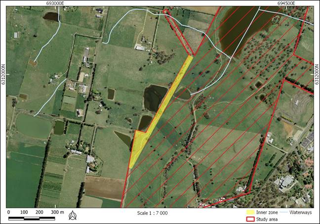
Attachment
3. Amend Schedule 5 Environmental heritage and mapped to include the Bluestone
Quarry (Bluestone Lakes).
The Bluestone Quarry is to be amended
in Schedule 5 Environmental heritage and mapped.
|
Calare
|
CSR Readymix site (Bluestone
quarry)
|
Cedar Street, Laurel Street, off
Racecourse Road
|
Lot 1, DP 271090
|
State
|
I58
|
Formal LEP mapping to be provided
prior to public exhibition.
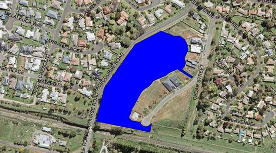
Attachment
4. Amend Schedule 5 Environmental heritage - Part 2 Heritage conservation
areas and maps to include the Bletchington, Newman Park and Blackman’s
Swamp HCAs
The HCA of Bletchington, Newman Park
and Blackman’s Swamp to be included in Schedule 5 Environmental heritage
and mapped.
Formal LEP mapping to be provided
prior to public exhibition.
|
Orange
|
Bletchington Heritage Conservation Area
|
Local
|
C7
|

|
Orange
|
Newman Park Heritage Conservation Area
|
Local
|
C8
|

|
Orange
|
Blackman’s Swamp Heritage Conservation Area
|
Local
|
C9
|

Attachment
5. Amend Schedule 5 Environmental heritage - Part 2 Heritage conservation
areas to rename the existing HCAs.
5a. The Heritage Conservation
Area known as Central Orange Heritage Conservation Area, be renamed Dalton
Central Heritage Conservation Area
|
Orange
|
Central Orange Heritage Conservation
Area
|
Local
|
C1
|
Amendment:
|
Orange
|
Dalton Central Heritage Conservation Area
|
Local
|
C1
|

5b. The Heritage Conservation
Area known as the Duration Cottages Heritage Conservation Area (LEP) be renamed
Glenroi Duration Cottages Heritage Conservation Area. Note: Duration Cottages
Heritage Conservation Area is not included in Schedule 5 but is mapped. These
anomalies are to be rectified through the addition of the Glenroi Duration
Cottages Heritage Conservation Area.
Amendment:
|
Orange
|
Glenroi Duration Cottages Heritage Conservation Area
|
Local
|
C6
|
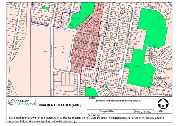
5c. The Heritage Conservation
Area known as Glenroi Heritage Conservation Area be renamed Endsleigh Heritage
Conservation Area
|
Orange
|
Glenroi Heritage Conservation Area
|
Local
|
C3
|
Amendment:
|
Orange
|
Endsleigh Heritage Conservation Area
|
Local
|
C3
|
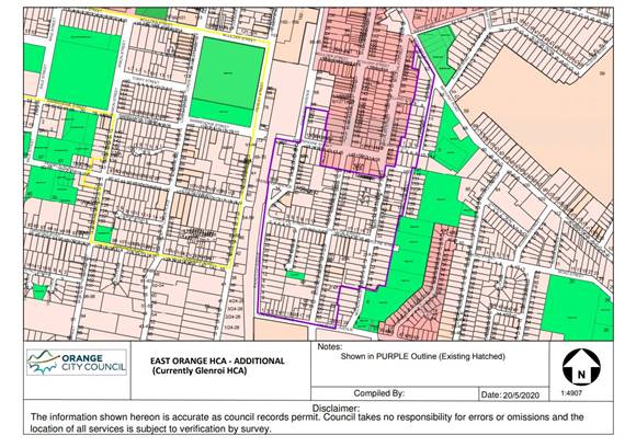
5d. The Heritage Conservation Area
known as East Orange Heritage Conservation Area be renamed Bowen Heritage
Conservation Area
|
Orange
|
East Orange Heritage Conservation Area
|
Local
|
C2
|
Amendment:
|
Orange
|
Bowen Heritage Conservation Area
|
Local
|
C2
|
Attachment
6. Amend Schedule 5 Environmental heritage - Part 1 Heritage Items to
include the following properties.
|
Suburb
|
Item name
|
Address
|
Property description
|
Significance
|
Item (TBC)
|
|
Orange
|
Dwelling
|
117 Sampson Street
|
Lot 8 DP 6662
|
Local
|
|
|
Orange
|
Dwelling
|
49 Prince Street
|
Lot 21 DP1249171
|
Local
|
|
|
Bowen
|
Dwelling
|
5 Hawkins Lane
|
Lot 14 DP 36258
|
Local
|
|
|
Bowen
|
Dwelling
|
9 Hawkins Lane
|
Lot 1 DP 997995
|
Local
|
|
|
Bowen
|
Dwelling
|
11 Hawkins Lane
|
Lot 1 DP 194886
|
Local
|
|
|
Bowen
|
Dwelling
|
3 Hawkins Lane
|
Lot 1 DP 711668
|
Local
|
|
|
Bowen
|
Dwelling
|
6 Hawkins Lane
|
Lot 1 DP 996035
|
Local
|
|
|
Bowen
|
Dwelling
|
4 Hawkins Lane
|
Lot B DP 154127
|
Local
|
|
|
Bowen
|
Dwelling
|
2 Hawkins Lane
|
Lot A DP 154127
|
Local
|
|
|
Bowen
|
Dwelling
|
20 Nile Street
|
Lot 1 DP 780854
|
Local
|
|
|
Bowen
|
Dwelling
|
22 Nile Street
|
Lot 11 DP 1086301
|
Local
|
|
|
Bowen
|
Dwelling
|
24 Nile Street
|
Lot 1 DP 797882
|
Local
|
|
|
Bowen
|
Dwelling
|
26 Nile Street
|
Lot 1 DP 738846
|
Local
|
|
|
Bletchington
|
Dwelling
|
171 Margaret Street
|
Lot 20 DP 507333
|
Local
|
|
|
Bletchington
|
Dwelling
|
110 Matthews Avenue
|
Lot 23 DP 36258
|
Local
|
|
|
Orange
|
Dwelling
|
125 Prince Street
|
Lot B DP 345070
|
Local
|
|
|
Bletchington
|
‘Former Railway Level Crossing Keepers
Cottage’
|
125 Dalton Street
|
Lot 2 DP 1038981
|
Local
|
|
|
Bowen
|
Dwelling
|
112 Dalton Street
|
Lot 1 DP 744247
|
Local
|
|
|
Orange
|
Dwelling
|
121 Gardiner Road
|
Lot 105 DP 831875
|
Local
|
|
|
Orange
|
Dwelling
|
123 Gardiner Road
|
Lot B DP 363624
|
Local
|
|
|
Orange
|
Dwelling
|
102 Gardiner Road
|
Lot 112 DP 456165
|
Local
|
|
|
Orange
|
Dwelling
|
106 Gardiner Road
|
Lot 121 DP 561111
|
Local
|
|
|
Orange
|
Dwelling
|
108 Gardiner Road
|
Lot 2 DP 220822
|
Local
|
|
|
Bowen
|
Dwelling
|
105 Spring Street
|
Lot 1 DP 371538
|
Local
|
|
|
Huntley
|
‘Former Butter Factory’ Dwelling
|
15 Capps Lane
|
Lot 452 DP 810173
|
Local
|
|
|
Huntley
|
‘Waverton’ and the former Dairy buildings
|
76 Blunt Road
|
Lot 2 DP 1038589
|
Local
|
|
|
Huntley
|
‘Homeleigh’ dwelling
|
359 Phoenix Mine Road
|
Lot 56 DP 750387
|
Local
|
|
Curtilage mapping for
‘Waverton’ 76 Blunt Road, Huntley as described in the Heritage
Conservation Area Review (November 2020)
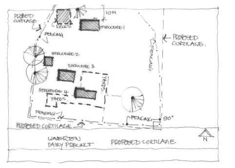
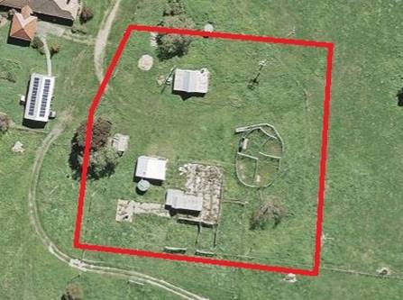
Planning and Development Committee
2 February 2021
Attachment 5 Draft
Inventory Sheets
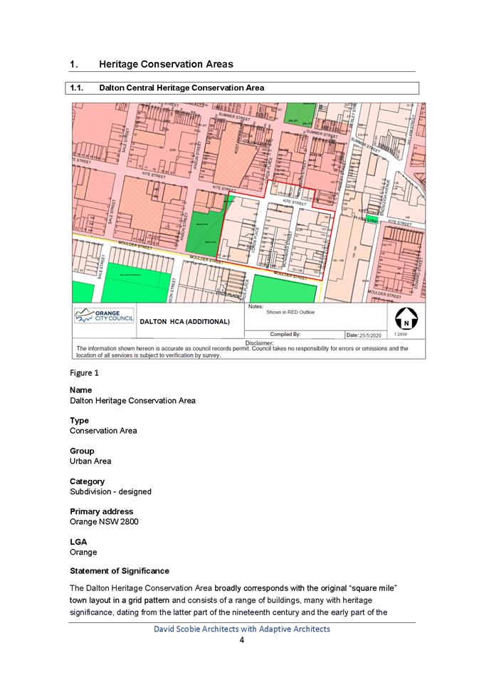
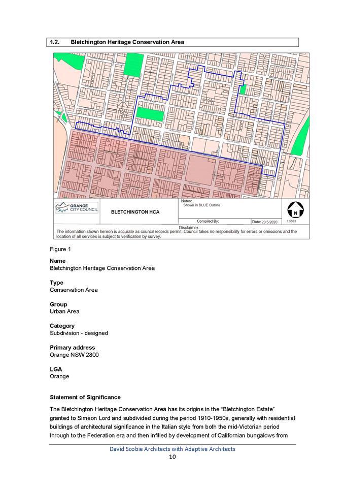
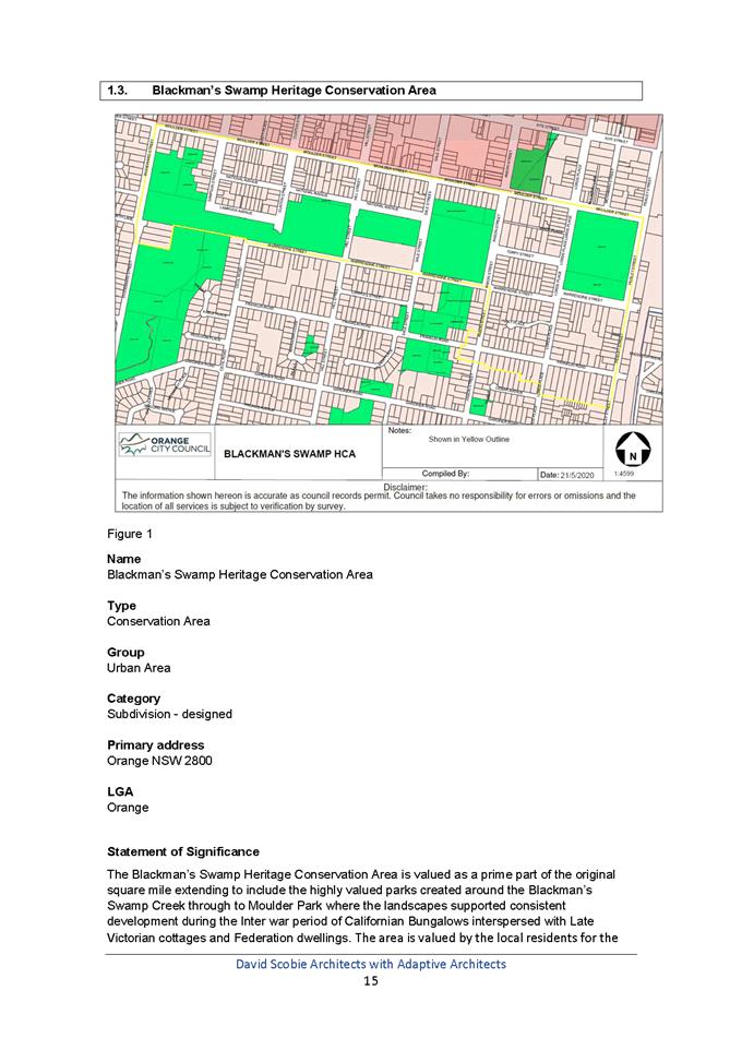
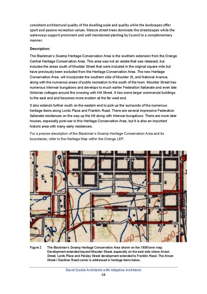
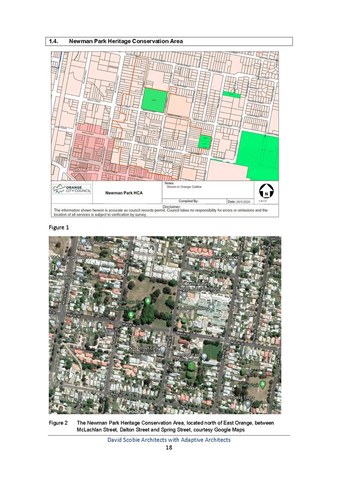
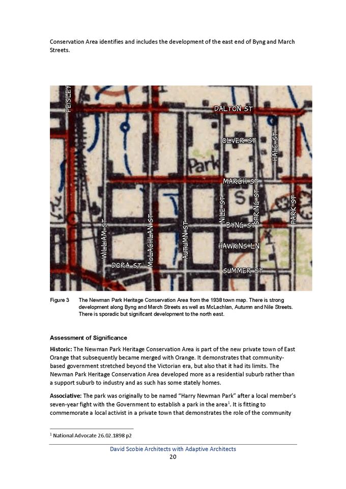
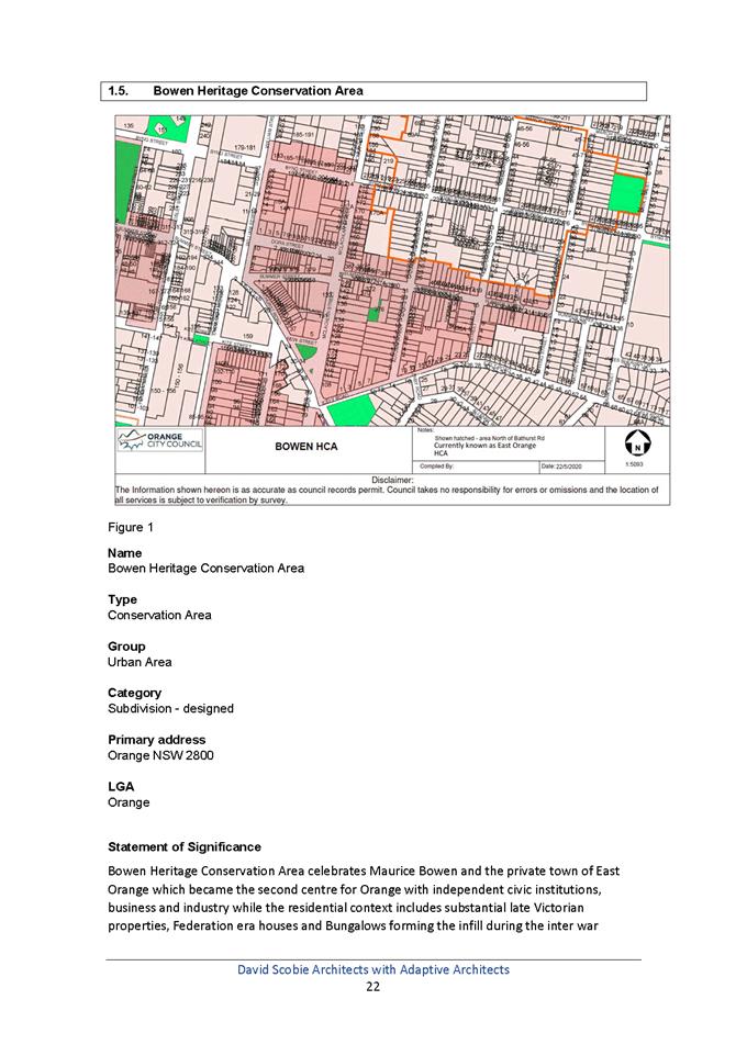
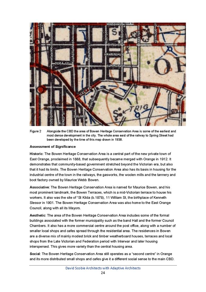
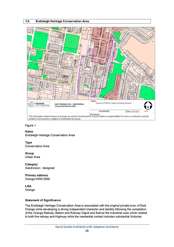
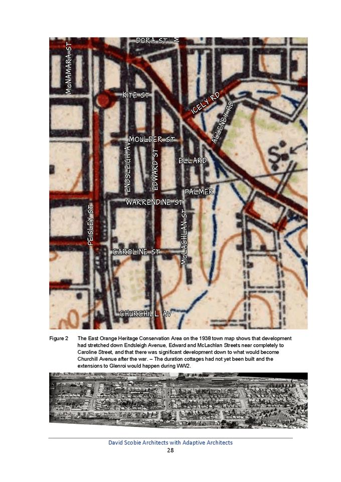
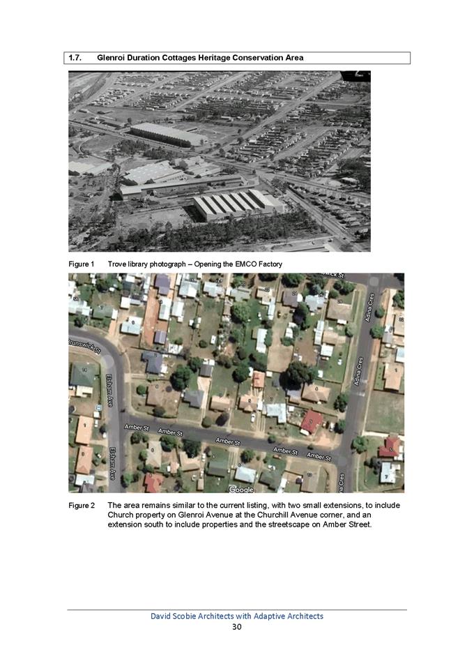
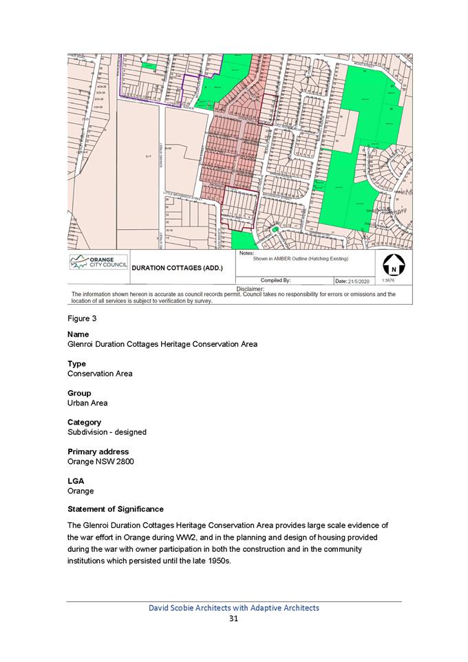

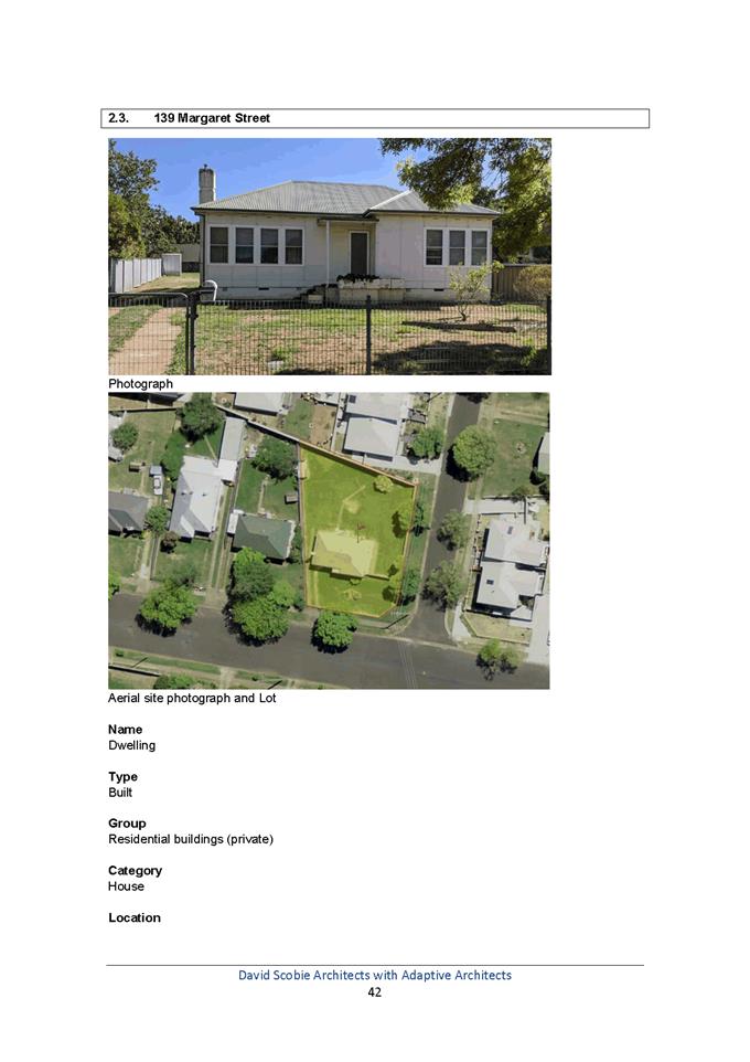
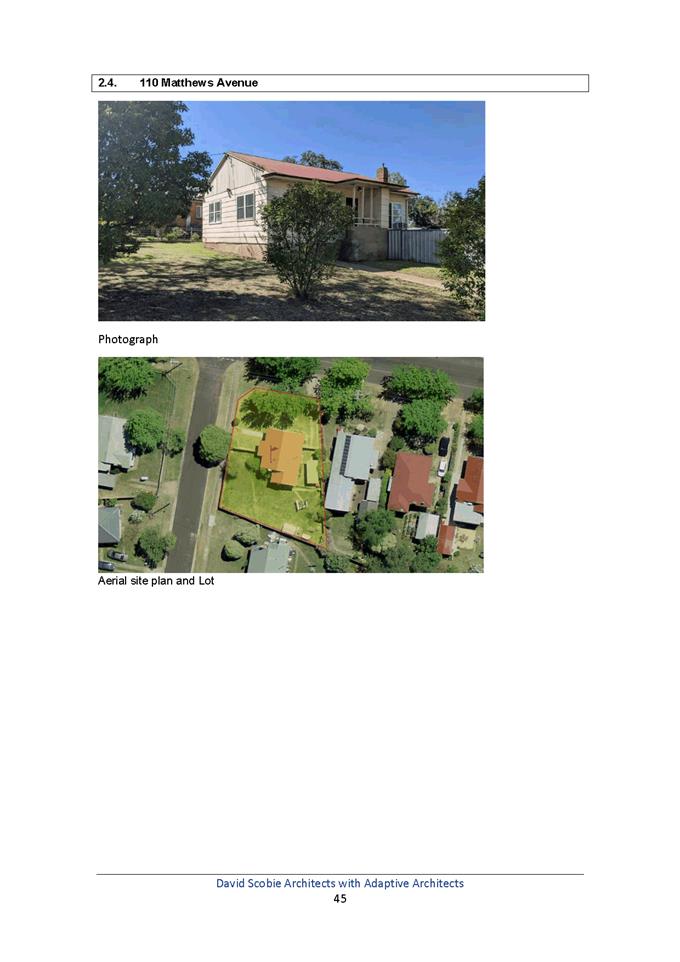
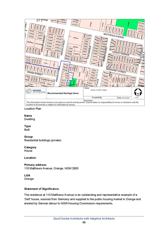
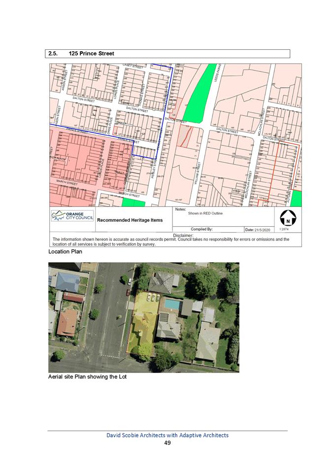
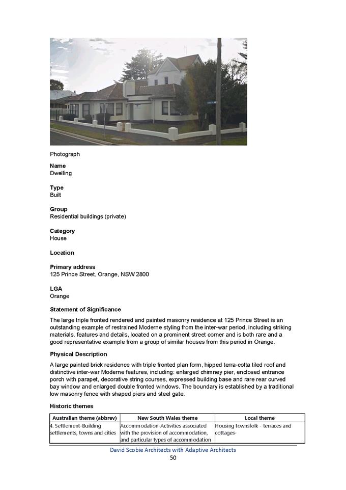
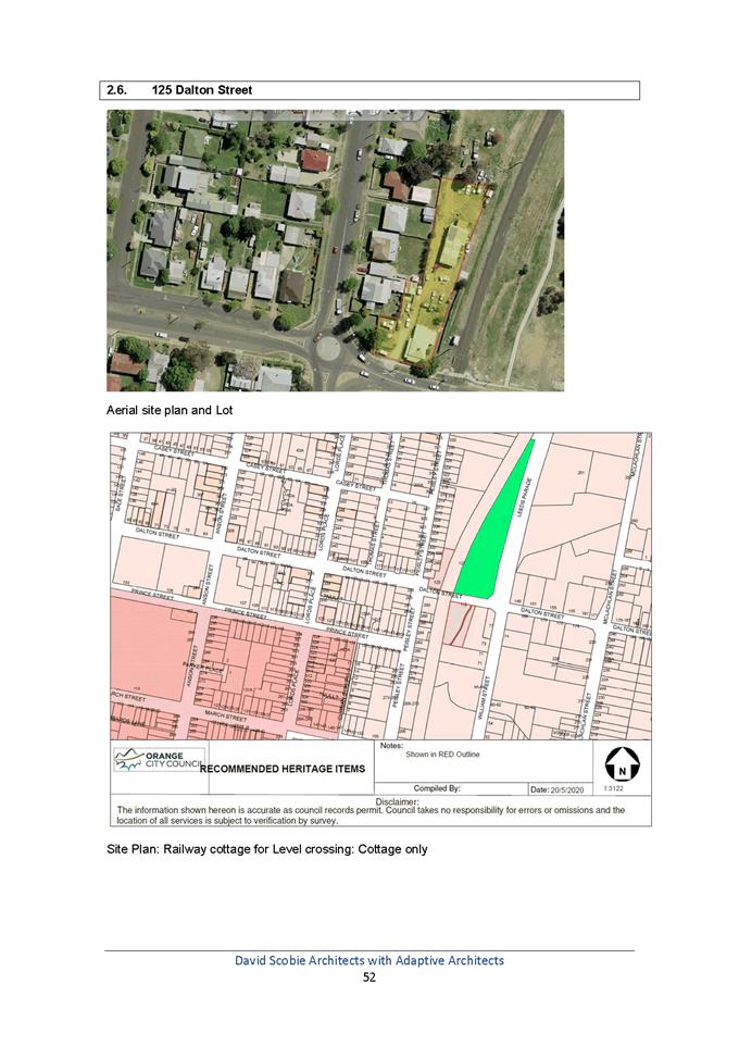
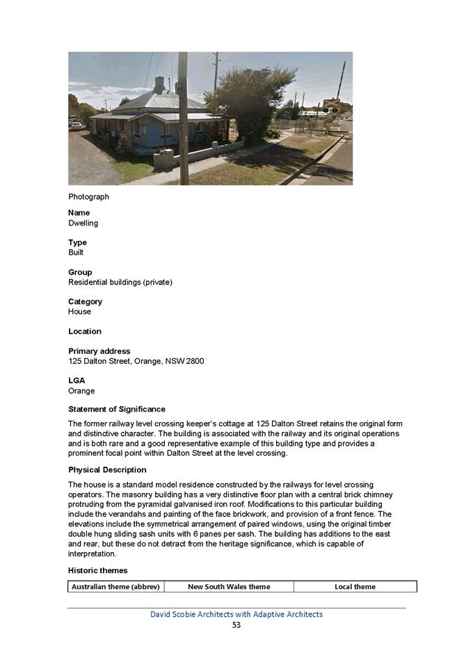
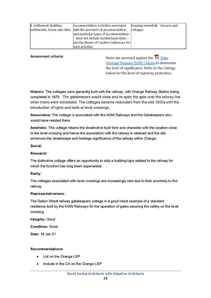
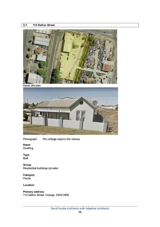
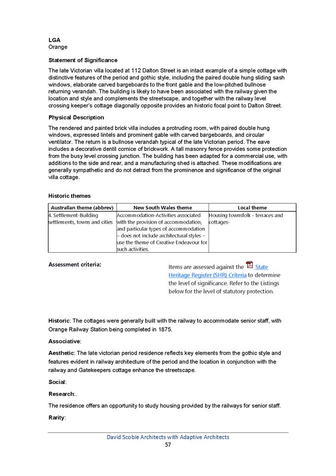
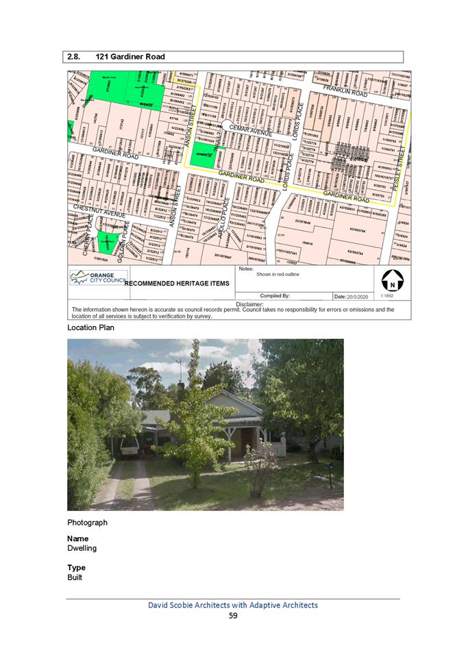
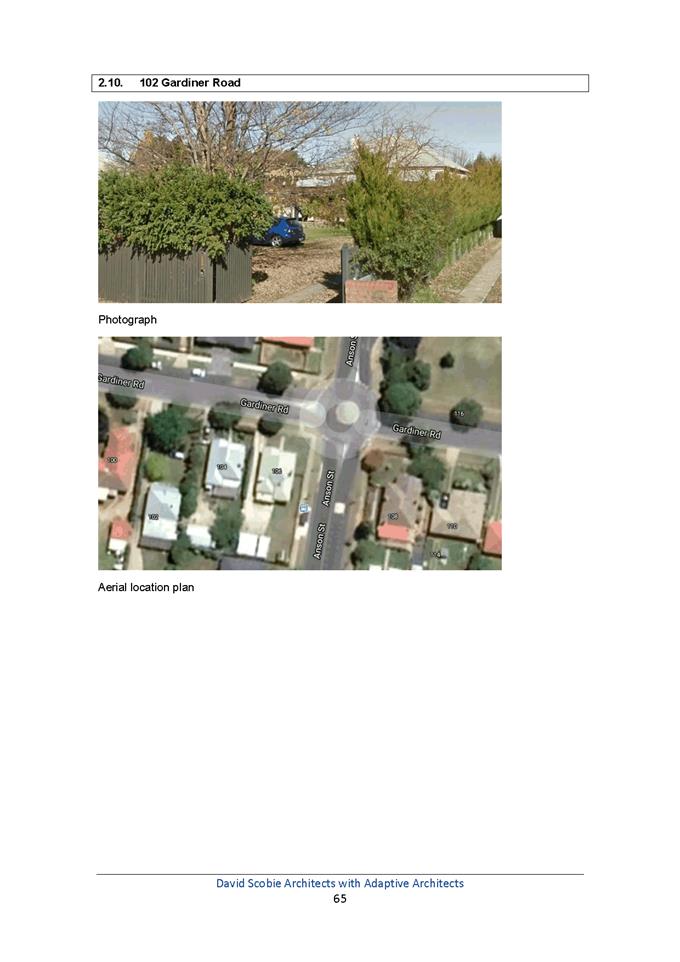
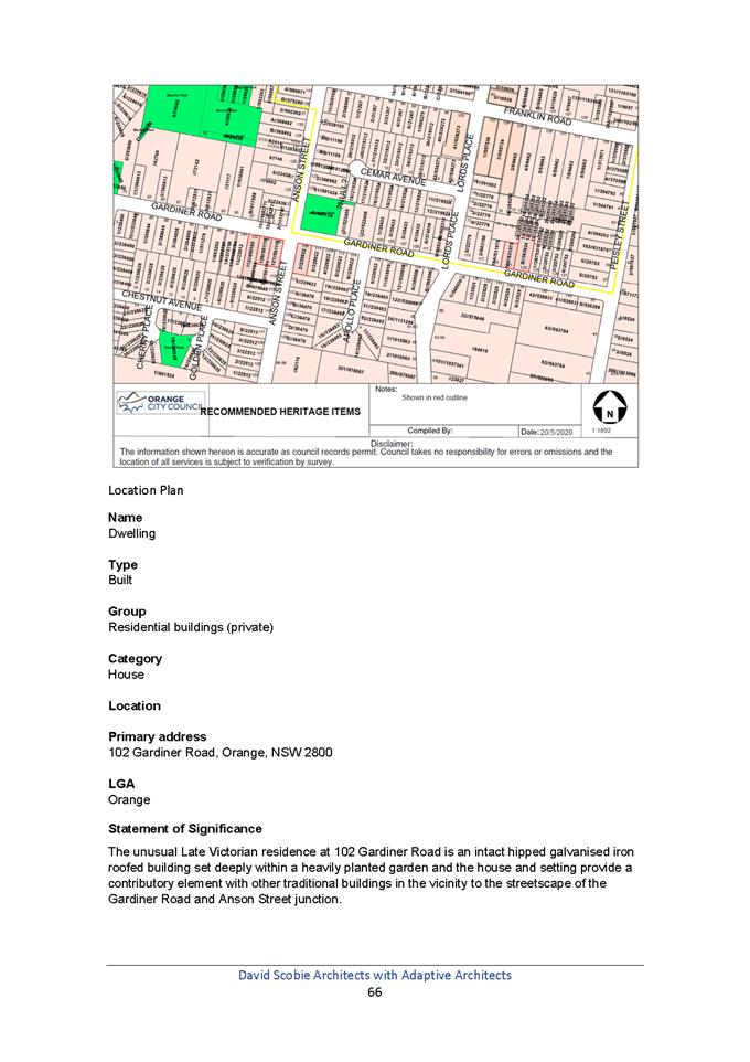
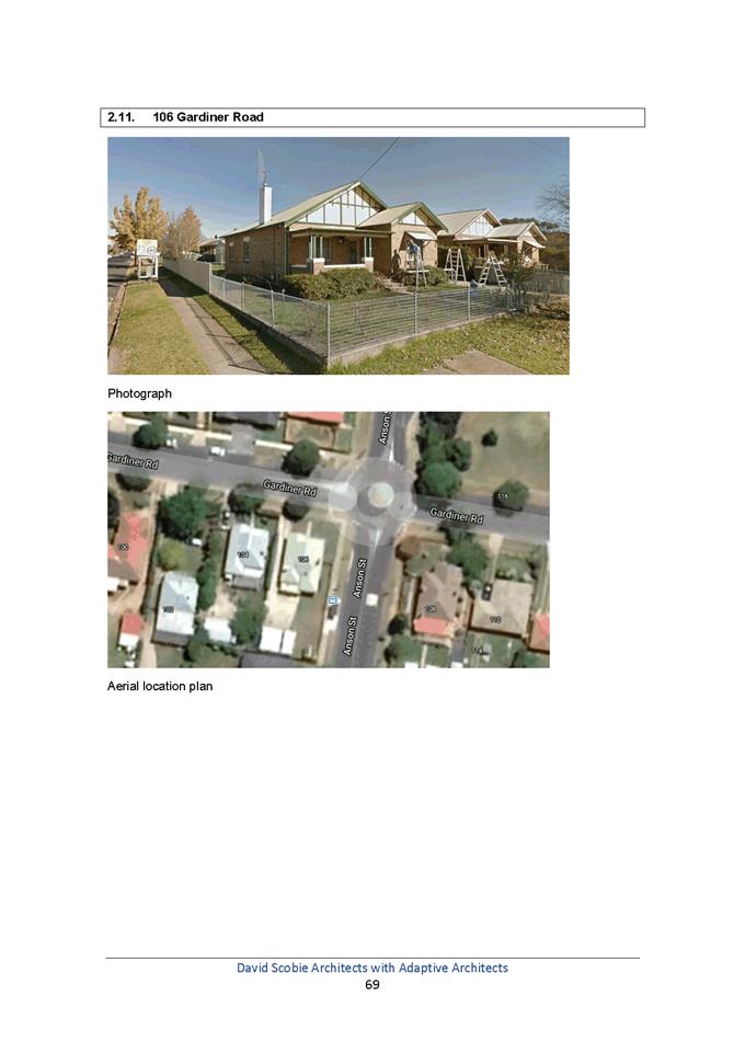
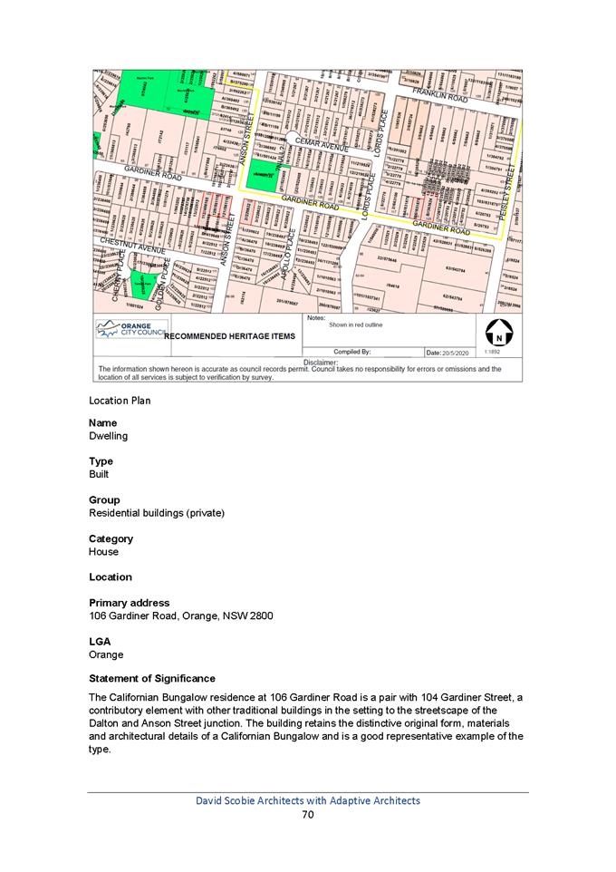
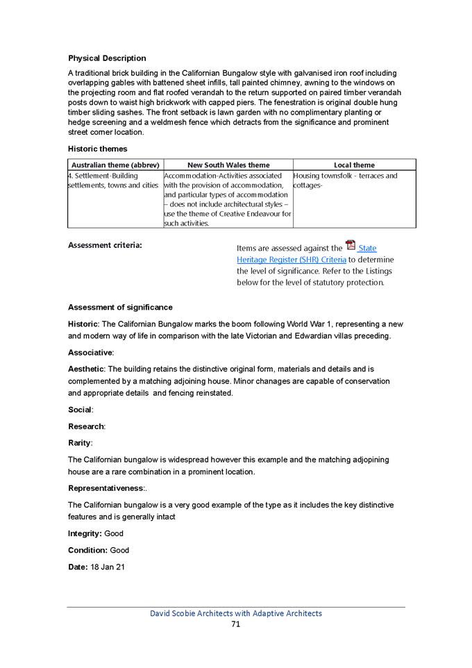
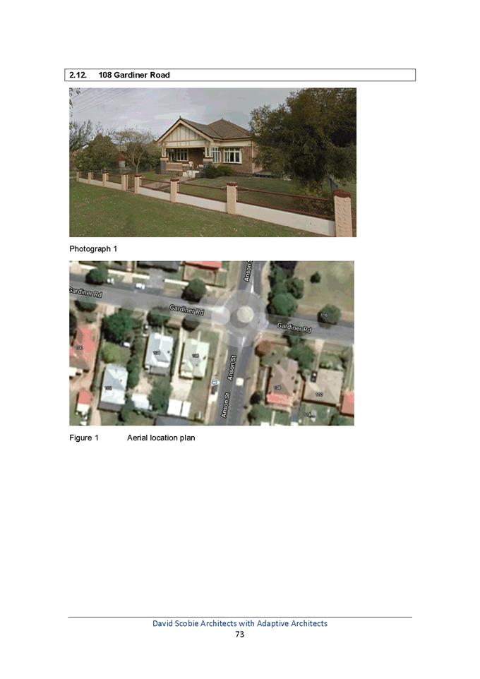
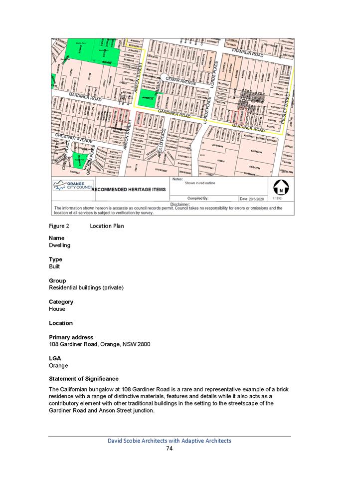
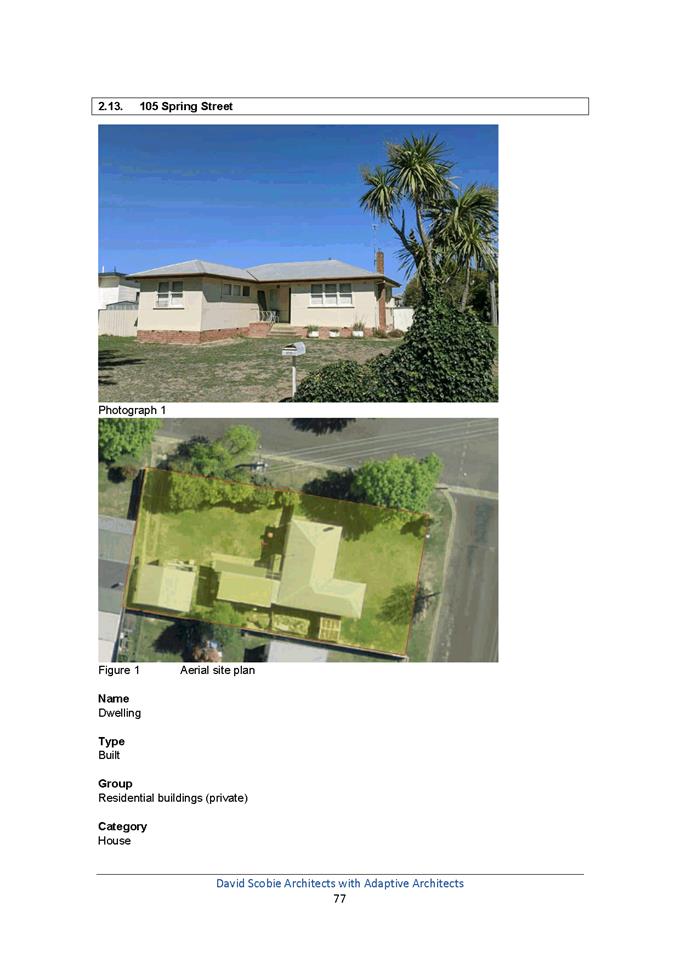
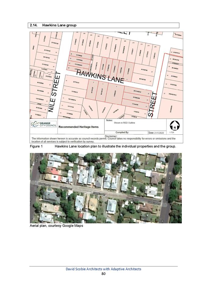
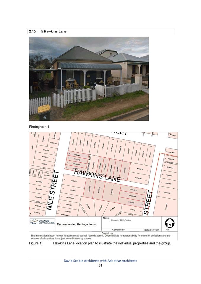
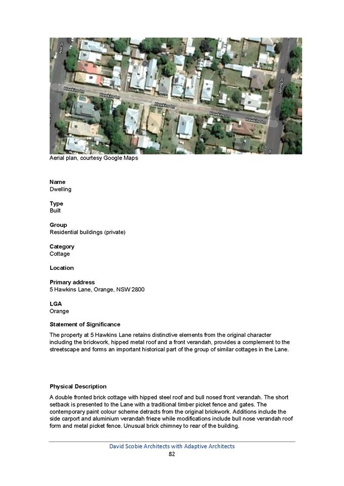

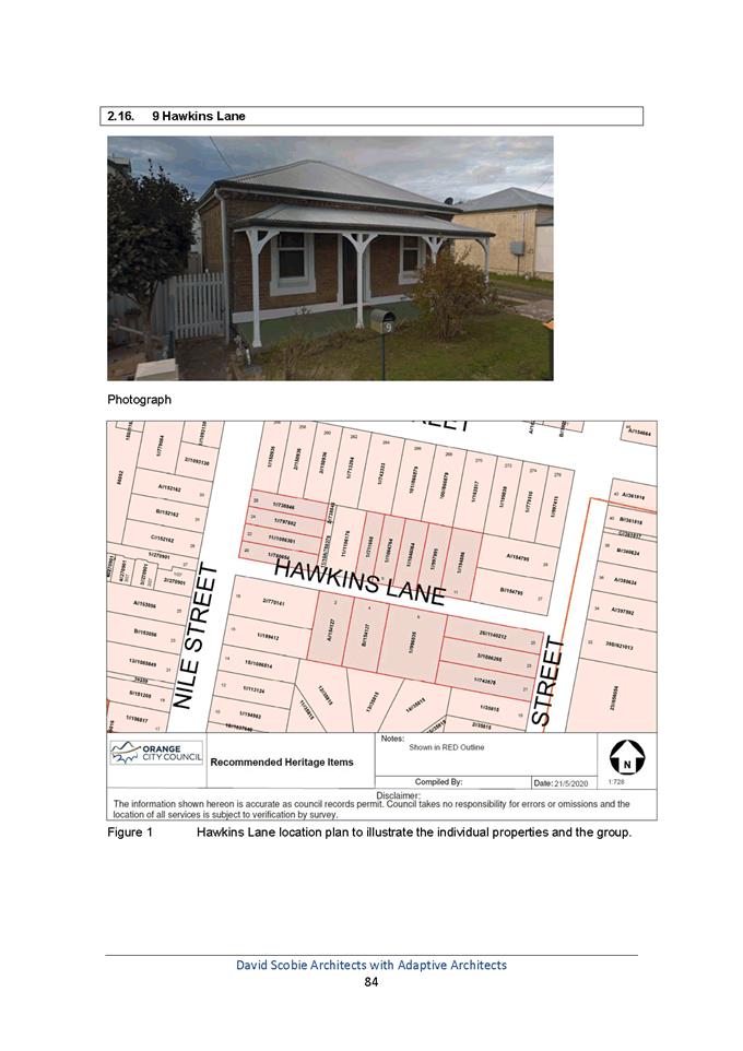


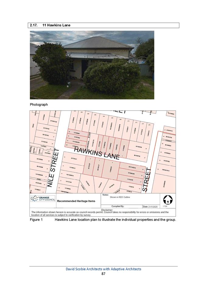
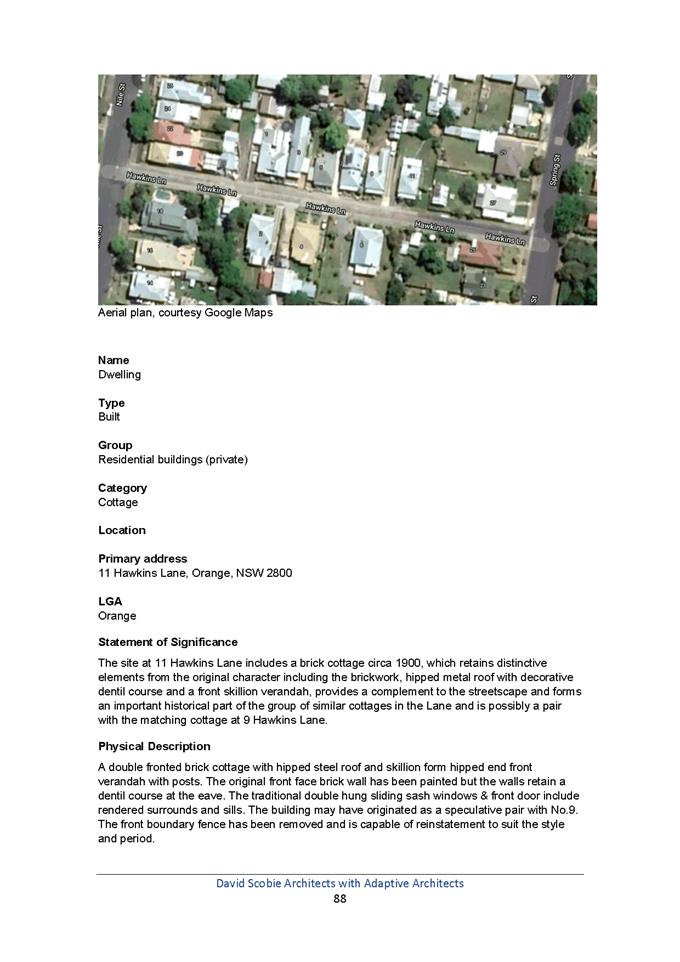
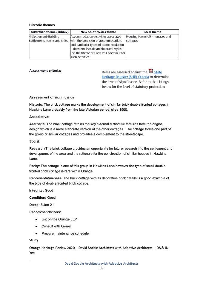
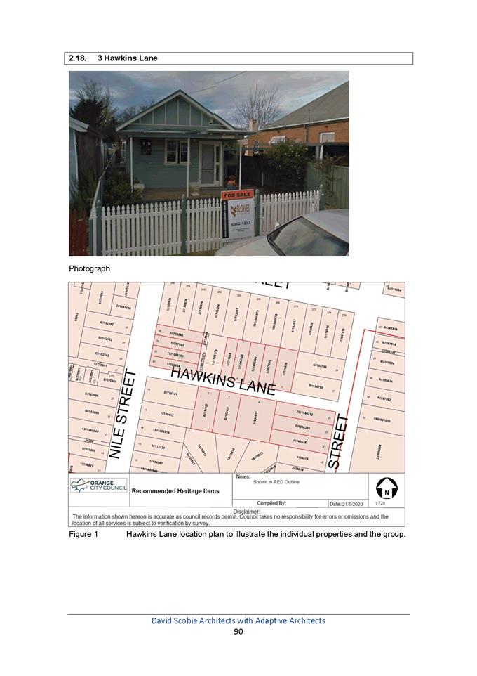
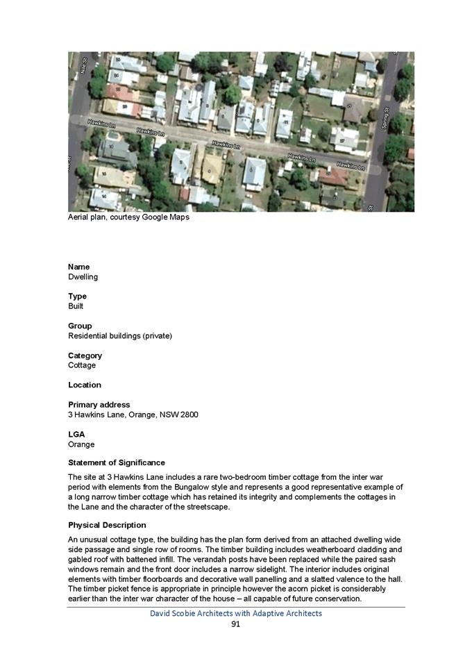
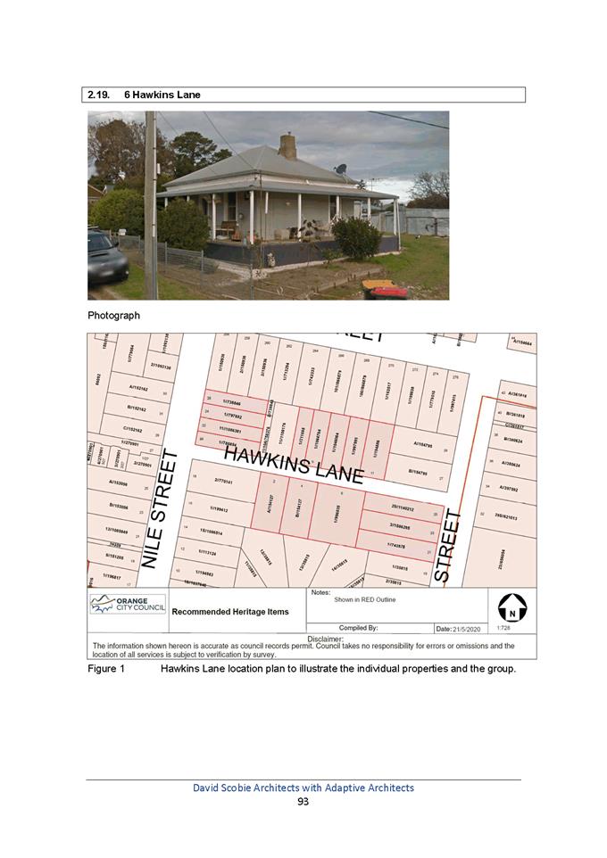

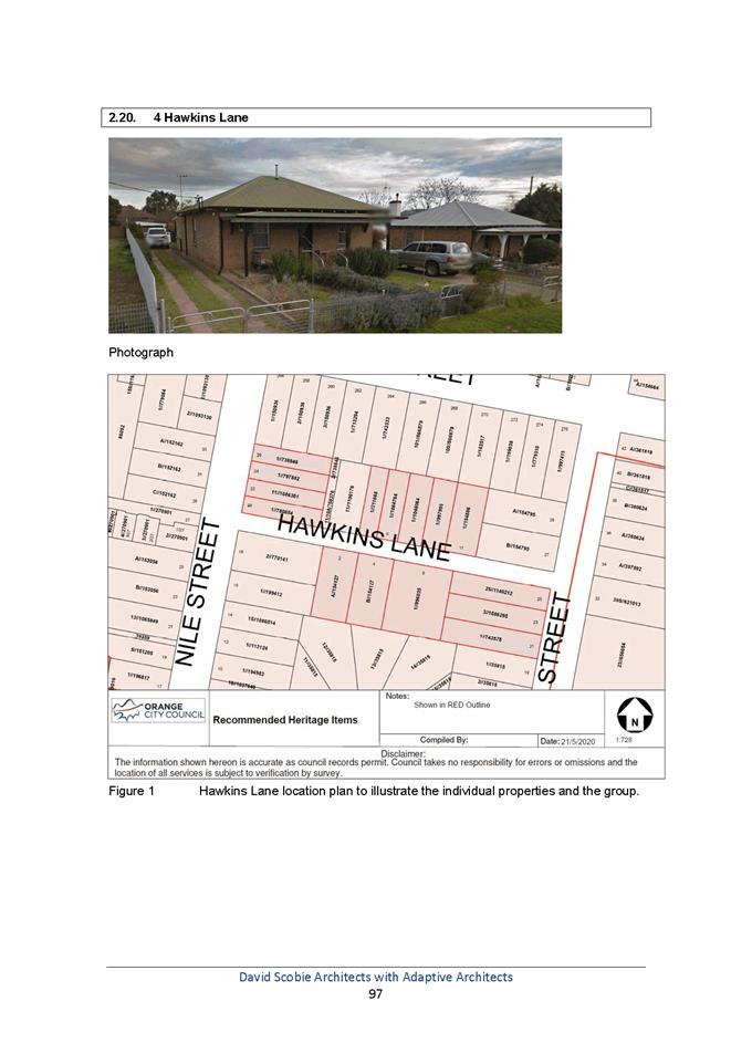

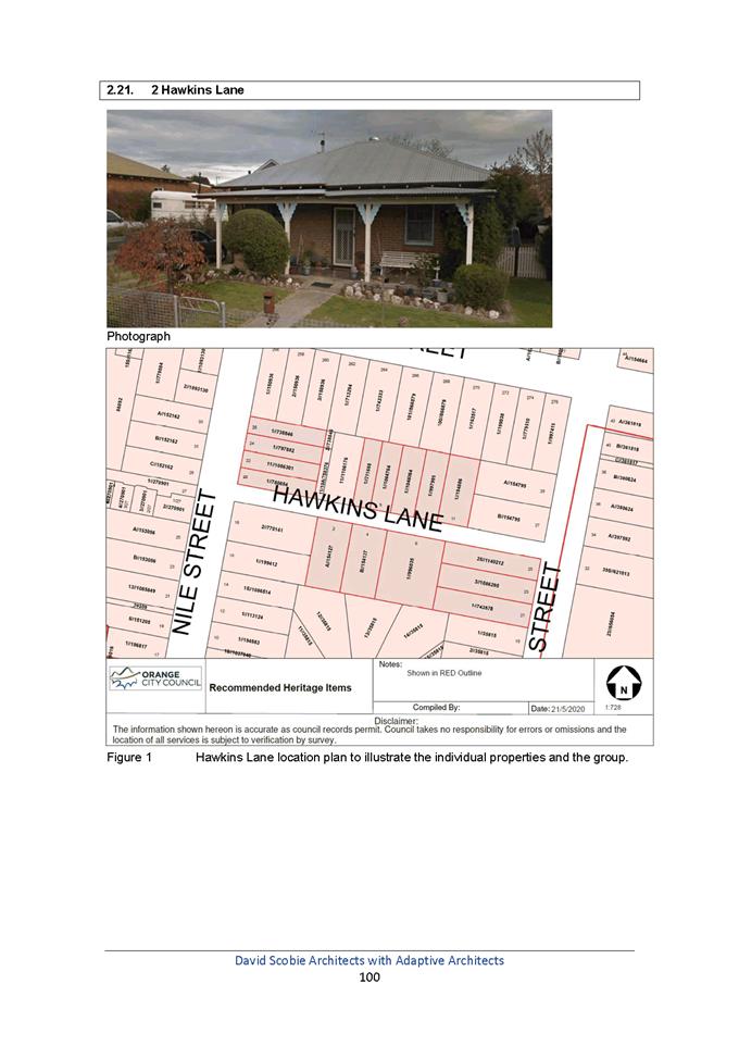


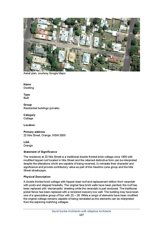
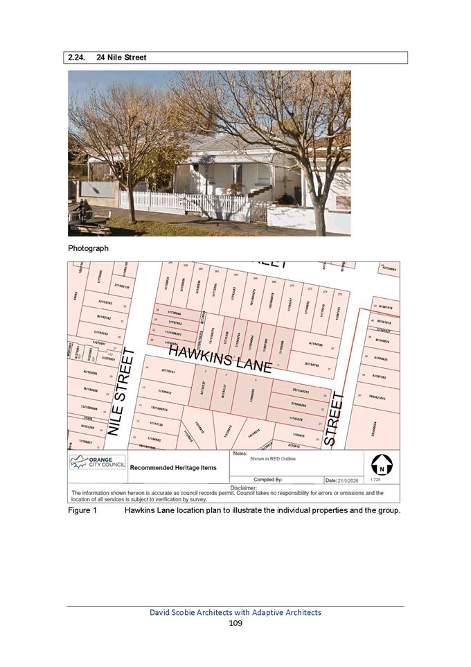
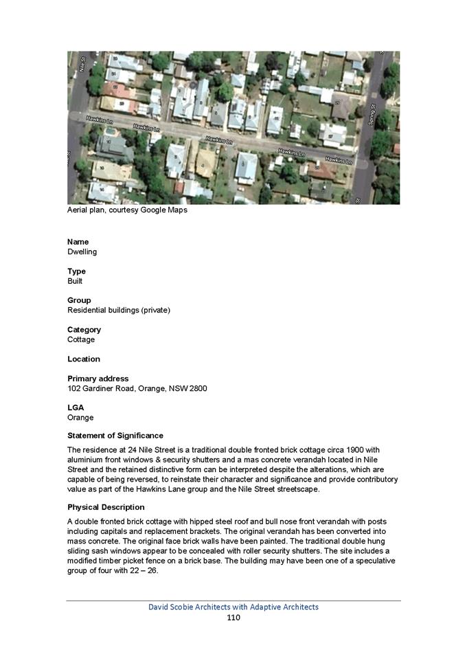


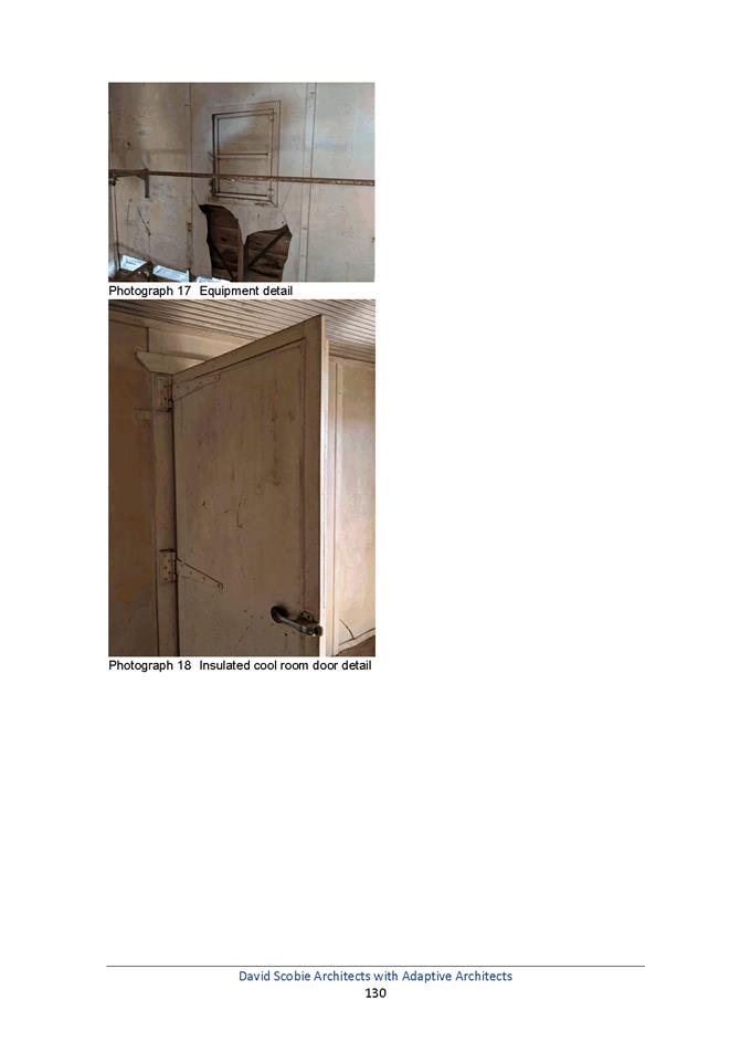
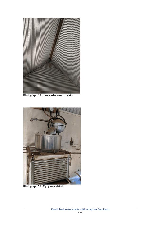
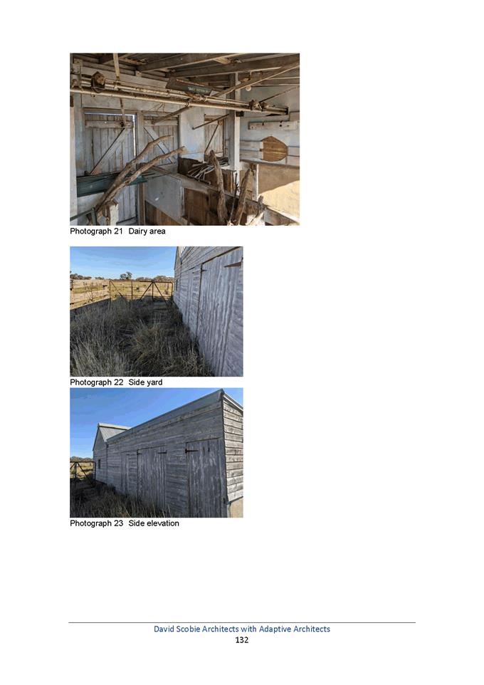
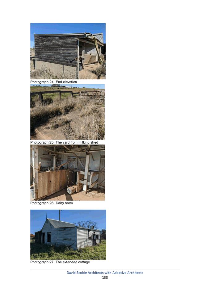
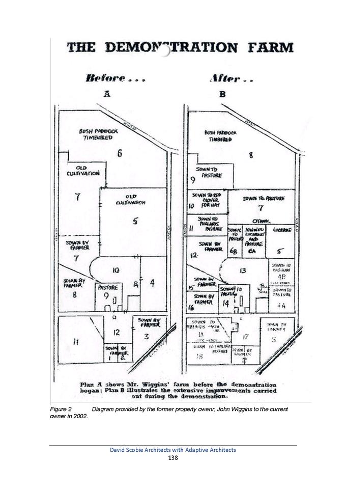
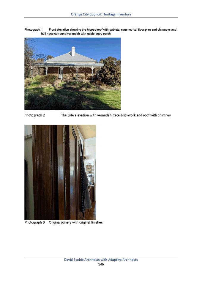
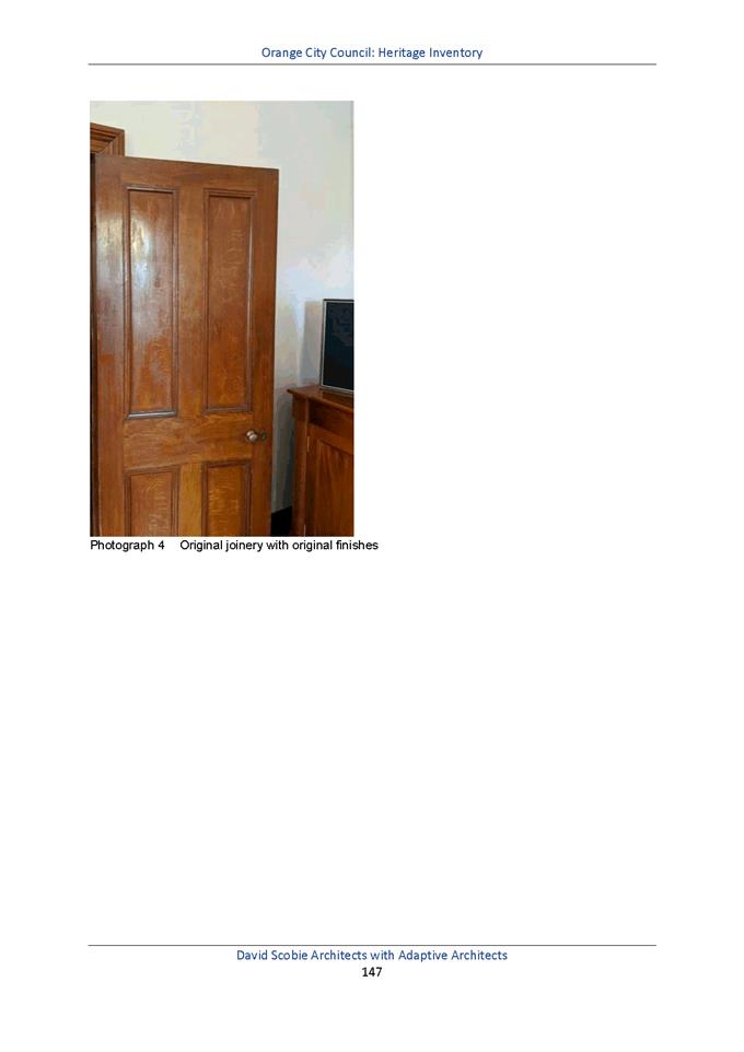
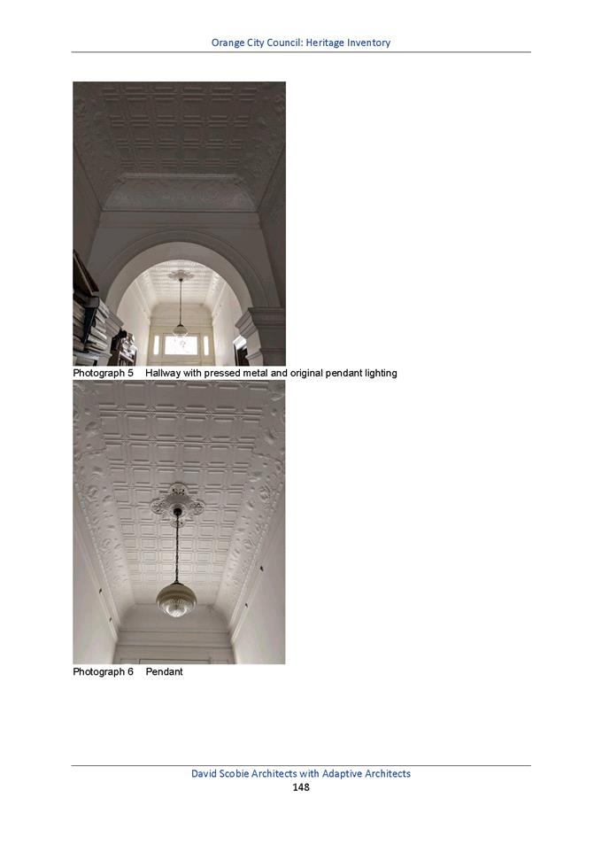
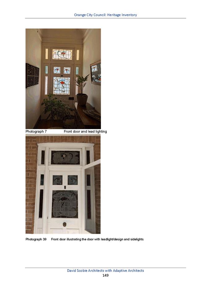
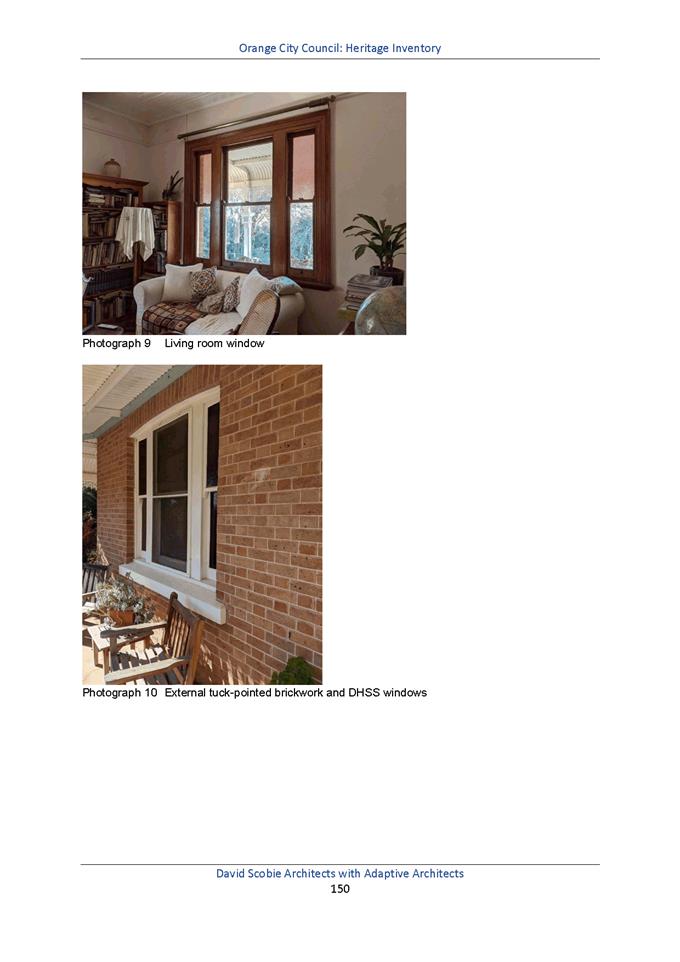
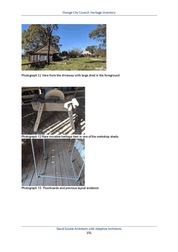
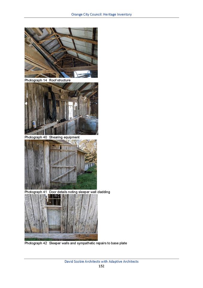
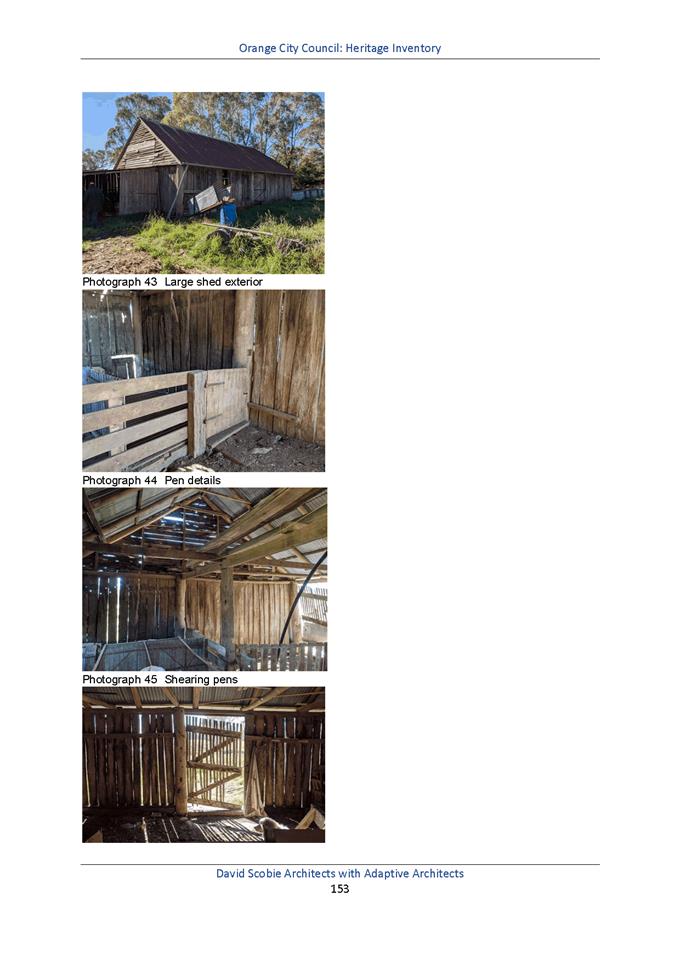
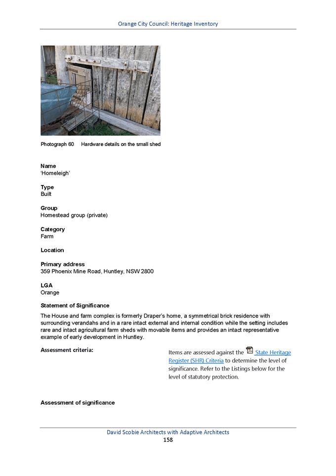
2.5 Development
Control Plan - Orange Eastside Precinct Plan - Post Exhibition Report
RECORD
NUMBER: 2021/2
AUTHOR: Alison
Phillips, Town Planner ( Strategic)
EXECUTIVE Summary
The Orange Future City (May 2020) project identified
a wide range of projects, concepts and opportunities to guide the development
and growth of the central business district over the next several years. Within
Future City the overall CBD area was divided into a series of precincts
with recommendations for each.
Figure 1. Location Plan
– Eastside Precinct
Comprising an area east of the railway line and south of
Bathurst Road, this area was selected for the first CBD precinct plan due to
significant changes occurring in the area. With the DPI headquarters
relocated and a number of car yards moving or considering a move to other parts
of Orange it was recognised that Council has an opportunity to put in place a
framework to help guide the precinct as it adapts to this generational change.
The Draft Orange Eastside Precinct Plan and Site Specific
Controls (Precinct Plan) (Attachments 1 and 2) identifies that Council
investigate alternative zones or consider additional permitted uses within the
current zone, and change the height of building in part of the precinct to
achieve the Precinct Plan. In order to reflect these recommendations, subject
to adopting the Precinct Plan, a planning proposal and site specific
development control plan, to be derived from the site specific controls, would
need to be developed.
The Precinct Plan was placed on exhibition between the 27
October 2020 and 30 November 2020 for a period of 28 days. During the
exhibition period, in accordance with Council‘s resolution to provide
public information sessions on major planning matters, a public forum that was
attended by approximately 6 or 8 residents. A total of 7 submissions were
received during the exhibition period (Attachment 3). Submissions
received were generally supportive of the Precinct Plan with site specific
considerations being raised in regards to pedestrian amenity, building siting,
design, bulk and scale, land use, relationship to railway infrastructure and
commercial operations.
Link To Delivery/OPerational Plan
The recommendation in this report relates to the
Delivery/Operational Plan strategy “7.1 Preserve - Engage with the
community to develop plans for growth and development that value the local
environment”.
Financial Implications
Nil
Policy and Governance Implications
Nil
|
Recommendation
That
Council resolves:
1 That
Council note the contents of this report and attached submissions and adopt
the Draft Orange Eastside Precinct Plan and Site Specific Controls.
2 That
a draft Planning Proposal to amend the Orange Local Environmental Plan 2011
and Development Control Plan with site specific controls be prepared, and
reported back to Council.
|
further considerations
Consideration has been given to the recommendation’s
impact on Council’s service delivery; image and reputation; political;
environmental; health and safety; employees; stakeholders and project
management; and no further implications or risks have been identified.
SUPPORTING INFORMATION
SUBMISSIONS
A total of 7 submissions were received during the exhibition
period. Submissions primarily were supportive of the Orange Eastside Precinct
Plan. Submissions were focused on the key themes of pedestrian movement, bulk,
scale and overshadowing of the built form, less prescriptive controls, B6
zoning and permitted uses and railway infrastructure. Submissions noted
objection to the Precinct Plan due to concerns relating to amalgamation,
current ownership, economic impacts of rezoning to residential, and the
interface with the surrounding area.
Pedestrian
Movement and Prioritisation
One submission noted general concern with lack of
pedestrian amenity and priority within the Town Centre. The submission noted
support for the four new pedestrian crossings at Bathurst Road. The submission
noted the following as dangerous and time consuming crossings:
· Bathurst
Rd/McLachlan Street intersection is not easy to cross for pedestrians
· Edward
Street lights do not feature a pedestrian crossing on the East side
· Peisley/Franklin
intersection is time consuming
· Footbridge
(over the railway line at Endsleigh Park) terminates Kite and Peisley, noted as
a dangerous intersection
Comment: Future City identifies a number of
initiatives for improving pedestrian amenity and priority across the CBD. It
further identifies area requiring streetscape improvement and improved fine
grain pedestrian connections at Bathurst Road/McLachlan Street, Edward Street
and Kite and Peisley Street is identified as an active transport route. Whilst
these do not have any identified works these will be continued to be focused on
as improvements required under Future City. It is noted that the
submission raising concerns with the Peisley/Franklin intersection timing,
however this is beyond the scope of works considered by the project.
2 Strategic
Intent and Representation
One submission objected to the Draft Orange Eastside
Precinct Plan and Site Specific Controls (the ‘Precinct Plan’),
however does note support for the broader objectives including increasing
activity and vibrancy across the CBD. The submission noted concerns regarding
DA approvals that are closer to the CBD and negate any proposed changes at the
subject site, limiting the success of the Draft Eastside Precinct Plan.
Comment: Future City incorporates the
Orange CBD and surrounds. It sets the strategic intent for how various
precincts interlink and support the imperatives of attracting, compacting and
making the Centre a safe and attractive place for visitors and residents to
walk around. The Orange Eastside Precinct, included in Future City as
the Enterprise Corridor Precinct is part of a broader strategic intent to
enhance Orange as a regional destination that is connected and liveable. The
Enterprise Corridor provides opportunities for the site to support the retail
and commercial functioning of the Orange CBD through residential and
accommodation opportunities.
The Precinct Plan as part of this investigation derives from
these principles, and whilst existing approvals may not have been subject to
scrutiny against these documents, any upgrades to the public domain and
assessment of any future DA’s against this intent will support the
implementation of Future City and the success of the Precincts.
Submission: Concerns
were raised regarding the prescribed land uses and envelopes requesting these
be removed and that a principle-based structure plan is applied to the precinct.
Comment: The concerns raised through this
submission are understood, and it is noted that the Precinct Plan is aiming to
identify possible urban outcomes that may be possible for the site. From the
Precinct Plan a set of land use controls can be derived that identify
opportunities for open space and public domain opportunities. Staff will
continue to develop these plans to ensure these are responding to the site and
not restricting future outcomes.
Built form controls, i.e. setbacks and building design
controls are identified to ensure amenable outcomes are achieved. It is
important to note that the Precinct Plan does not dictate the final urban form,
however provides a basis for which site specific controls for a Development
Control Plan can be derived.
3 Built
form (siting, bulk, scale, interface and overshadowing)
One submission noted a lack of information and potential
consideration for the siting of buildings in relation to prevailing winds in
winter.
Comment: These concerns are noted and any
DA will be assessed against such issues through building siting, setbacks and
building design reflect the site conditions.
Submission: Concerns
were raised by submissions regarding the potential overshadowing of existing
properties from the proposed built form in the Precinct Plan.
Comment: Any new residential
development or development affecting existing residential development will be
subject to DA assessment that will require accordance with section 07
Development in Residential Areas:
Planning Outcomes 7.7-6 –
Visual Bulk: Built form accords with the desired neighbourhood character
of the area with: - side and rear setbacks progressively increased to reduce
bulk and overshadowing;
Planning Outcomes 7.7-7 - Walls
and Boundaries: Building to the boundary is undertaken to provide for efficient
use of the site taking, into account:
· the
access to daylight reaching adjoining properties;
Planning Outcomes 7.7-8 -
Daylight and Sunlight: Buildings are sited and designed to ensure:
· daylight
to habitable rooms in adjacent dwellings is not significantly reduced;
· overshadowing
of neighbouring secluded open spaces or main living-area windows is not
significantly increased;
Submission: One
submission also expresses concern with the interface to adjoining properties
regarding the bulk and scale of the building, stating further work should be
completed on the envelopes presented in the draft.
Comment: As previously mentioned, any
development will be subject to DA assessment that will require accordance with
the controls proposed within the draft Orange Eastside Precinct Plan and Site
Specific Controls.
It was noted that there is an error in drawing SK09 with the
shadows, staff are liaising with the consultant to rectify this error.
4 Land
use
One submission
requested that the existing permitted uses within the B6 zone are retained:
· Residential
use, including shop top housing, multi-dwelling housing
· Educational
establishments
· Restaurants
and cafes, and
· Hotel
and motel accommodation
In addition the submission requested the following uses are
considered for the B6 zone:
· Seniors
living
· Retail
premises, and
· Other
types of residential accommodation currently prohibited such as residential
flat buildings
Comment: Any consideration for additional
permitted uses on site would be subject to a planning proposal to rezone the
land. Consideration will also be given as to whether alternative zones would be
compatible with the objectives of Future City and the Orange Eastside Precinct
Plan and Site Specific Controls.
Submission: One
submission also noted the rezoning of land to residential stating that this
would impact on commercial development and leasing, decreasing land value, loss
of income to commercial owners due to zoning if developers do not decide to
build residential developments.
Comment: There is no evidence provided to
suggest that residential development rezoning would decrease land value.
The concerns by the submitter are noted and new proposals
regarding changes in use can create some uncertainty. Any new development would
be subject to landowners either selling or redeveloping their land.
It is noted that additional land is available throughout
Orange for commercial development and that the Orange Eastside Precinct Plan
and Site Specific Controls are proposing uses that are aligned with the
strategic intent of Future City. Ultimately the zone selection can be
reviewed further during preparation of the Planning Proposal, which will go
through a public exhibition process in due course.
5 Surrounding
Rail Infrastructure
One submission states that the railway corridor and its
associated infrastructure should be further recognised as a strategic anchor
within the precinct with potential to expand. The submissions refers to NSW Future
Transport 2056 identifying the 2023 Regional Fleet and Main Western Line
upgrades.
Comment: The railway station itself is
outside of the study area of this precinct plan. However, Future City
recognises the importance of the railway station identifying the site for
public domain upgrades, active transport routes to and from and is identified
in the Special Project - McNamara Street South Precinct 2. The Precinct
Plan under section 11. Local infrastructure and public domain identifies
improved equitable access to the railway line from the precinct as part of the
precinct upgrades.
6 Ownership
and Amalgamation
Concerns were raised regarding current land ownership and
site amalgamation for redevelopment being unlikely given the ownership patterns
and feasibility.
Comment: The Precinct Plan identifies options
that could occur as staged outcomes. The Precinct Plan is also focused on the
redevelopment potential of the precinct, and in particular illustrating what
can be achieved when landowners coordinate with neighbours rather than strictly
limiting their focus to developing in isolation. The majority of concepts in
the Precinct Plan are therefore focused on larger lots within the precinct
which would be more likely to be amalgamated and developed, which is common
practice in urban planning particularly when the planning framework provides
support for bolder initiatives.
ZONE
ANALYSIS AND HEIGHT OF BUILDING
The
Precinct Plan recommends the consideration of Additional Permitted Uses through
a Planning Proposal to include:
· Multi
dwelling
· Residential
flat buildings
· Attached
dwellings
· Secondary
dwellings
· Seniors
housing
However, staff have identified that the best practice
approach may be to change the zone, from B6 Enterprise Corridor to B4 Mixed
Use, to reflect the objectives of the Precinct Plan and ensure the above uses
are permitted with consent in the zone. An analysis of the zones has been
undertaken is provided in Table 1 – Zone Analysis. The below table
indicates the differences between the B6 Enterprise Corridor and B4 Mixed Use
land use zoning. The bold entries are unique to that zone, and therefore
these are the uses that would be applicable to the site depending on the zone
chosen. Uses not indicated in bold are the same across both land
use zones.
Table
1 – Zone Analysis
|
B6 Enterprise Corridor
|
B4 Mixed Use
|
|
Objectives
of zone
• To promote businesses along main
roads and to encourage a mix of compatible uses.
• To provide a range of employment
uses (including business, office, retail and light industrial uses).
• To maintain the economic strength of
centres by limiting retailing activity.
• To provide for residential uses, but
only as part of a mixed use development.
|
Objectives
of zone
• To
provide a mixture of compatible land uses.
• To
integrate suitable business, office, residential, retail and other
development in accessible locations so as to maximise public transport
patronage and encourage walking and cycling.
• To
promote, where possible, the retention and reuse of heritage items as well as
the retention of established buildings that contribute positively to the
heritage or cultural values of the land in the zone.
• To
promote development that supports the role of Orange CBD as the primary
retail and business centre in the region.
|
|
Permitted
with consent
Business
premises; Community facilities; Garden centres; Hardware and building
supplies; Hotel or motel accommodation; Kiosks; Landscaping material
supplies; Light industries; Multi dwelling housing; Neighbourhood shops; Oyster
aquaculture; Passenger transport facilities; Plant nurseries;
Restaurants or cafes; Roads; Rural supplies; Self-storage units;
Shop top housing; Take away food and drink premises; Tank-based
aquaculture; Timber yards; Tourist and visitor accommodation; Vehicle
sales or hire premises; Warehouse or distribution centres; Any other
development not specified in item 2 or 4
|
Permitted
with consent
Artisan
food and drink industries; Boarding houses; Centre-based child care
facilities; Commercial premises; Community facilities; Educational
establishments; Entertainment facilities; Function centres; Home industries;
Hotel or motel accommodation; Information and education facilities;
Medical centres; Oyster aquaculture; Passenger transport facilities;
Recreation facilities (indoor); Registered clubs; Residential
accommodation; Respite day care centres; Restricted premises;
Roads; Seniors housing; Shop top housing; Tank-based aquaculture; Any
other development not specified in item 2 or 4
|
|
Prohibited
Agriculture;
Air transport facilities; Airstrips; Amusement centres; Animal boarding or
training establishments; Boat building and repair facilities; Boat launching
ramps; Boat sheds; Camping grounds; Car parks; Caravan parks;
Cemeteries; Centre-based child care facilities; Charter and tourism
boating facilities; Correctional centres; Crematoria; Depots;
Eco-tourist facilities; Entertainment facilities; Exhibition homes;
Exhibition villages; Extractive industries; Farm buildings; Forestry;
Heavy industrial storage establishments; Helipads; Highway service centres;
Home occupations (sex services); Industrial training facilities; Industries;
Jetties; Marinas; Mooring pens; Moorings; Open cut mining; Pond-based
aquaculture Registered clubs; Research stations; Residential
accommodation; Resource recovery facilities; Respite day care centres;
Retail premises; Rural industries; Rural workers’ dwellings; Sex
services premises; Storage premises; Truck depots; Vehicle body repair
workshops; Waste disposal facilities; Water recreation structures
|
Prohibited
Agriculture;
Air transport facilities; Airstrips; Amusement centres; Animal boarding or
training establishments; Boat building and repair facilities; Boat launching
ramps; Boat sheds; Camping grounds; Caravan parks; Cemeteries; Charter and
tourism boating facilities; Correctional centres; Crematoria; Eco-tourist
facilities; Exhibition homes; Exhibition villages; Extractive industries;
Forestry; Freight transport facilities; Heavy industrial storage
establishments; Helipads; Highway service centres; Home occupations (sex
services); Industrial retail outlets; Industrial training facilities;
Industries; Jetties; Marinas; Mooring pens; Moorings; Open cut mining;
Pond-based aquaculture Recreation facilities (major); Research
stations; Resource recovery facilities; Rural industries; Rural
workers’ dwellings; Sex services premises; Storage premises; Transport
depots; Truck depots; Warehouse or distribution centres; Waste
disposal facilities; Water recreation structures
|
The Precinct Plan also nominates an increase in building
height from 12 metres to 14 metres to allow for commercial uses at ground level
and three levels of residential development above where appropriate.
The above recommendations would be subject to detailed
analysis as part of the planning proposal process.
PROCESS
Should Council adopt Eastside Precinct Plan and accompanying
Site Specific Development Controls the next steps in the process are:
1 Preparation
of a detailed Planning Proposal to amend the LEP consistent with the Eastside
Precinct Plan – this involves zone selection, building height limits,
floor space ratio controls and the like.
2 Additionally
preparation of a draft Development Control Plan, largely derived from the Site
Specific Development Controls.
3 Both
the Planning Proposal and Draft DCP would return to Council to confirm support
for the direction taken.
4 If
supported by Council a Gateway Determination would be sought, any requirements
of which would be addressed to allow public exhibition of both the Planning
Proposal and the draft DCP.
5 Post
exhibition both the Planning Proposal and DCP would be reported back to Council
addressing any matters raised by the public or relevant government agencies.
Attachments
1 OCC
Eastside Precinct Plan - Site Specific Development Controls (17 Sept 2020),
D20/58454⇩
2 OCC
Eastside Precinct Plan Set (17 Sept 2020), D20/58452⇩
3 Submissions,
D21/3235⇩
Planning
and Development Committee
2 February 2021
Attachment 1 OCC
Eastside Precinct Plan - Site Specific Development Controls (17 Sept 2020)
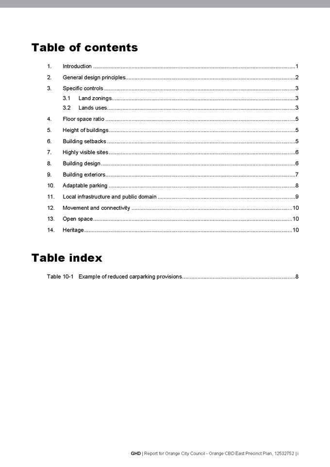
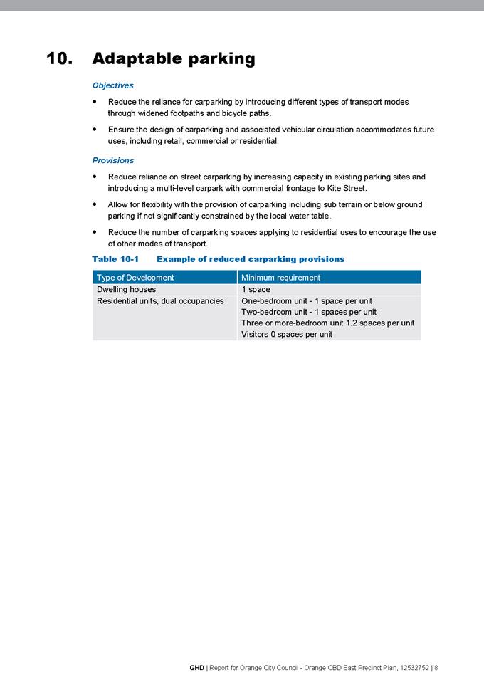

Planning and Development Committee
2 February 2021
Attachment 2 OCC
Eastside Precinct Plan Set (17 Sept 2020)
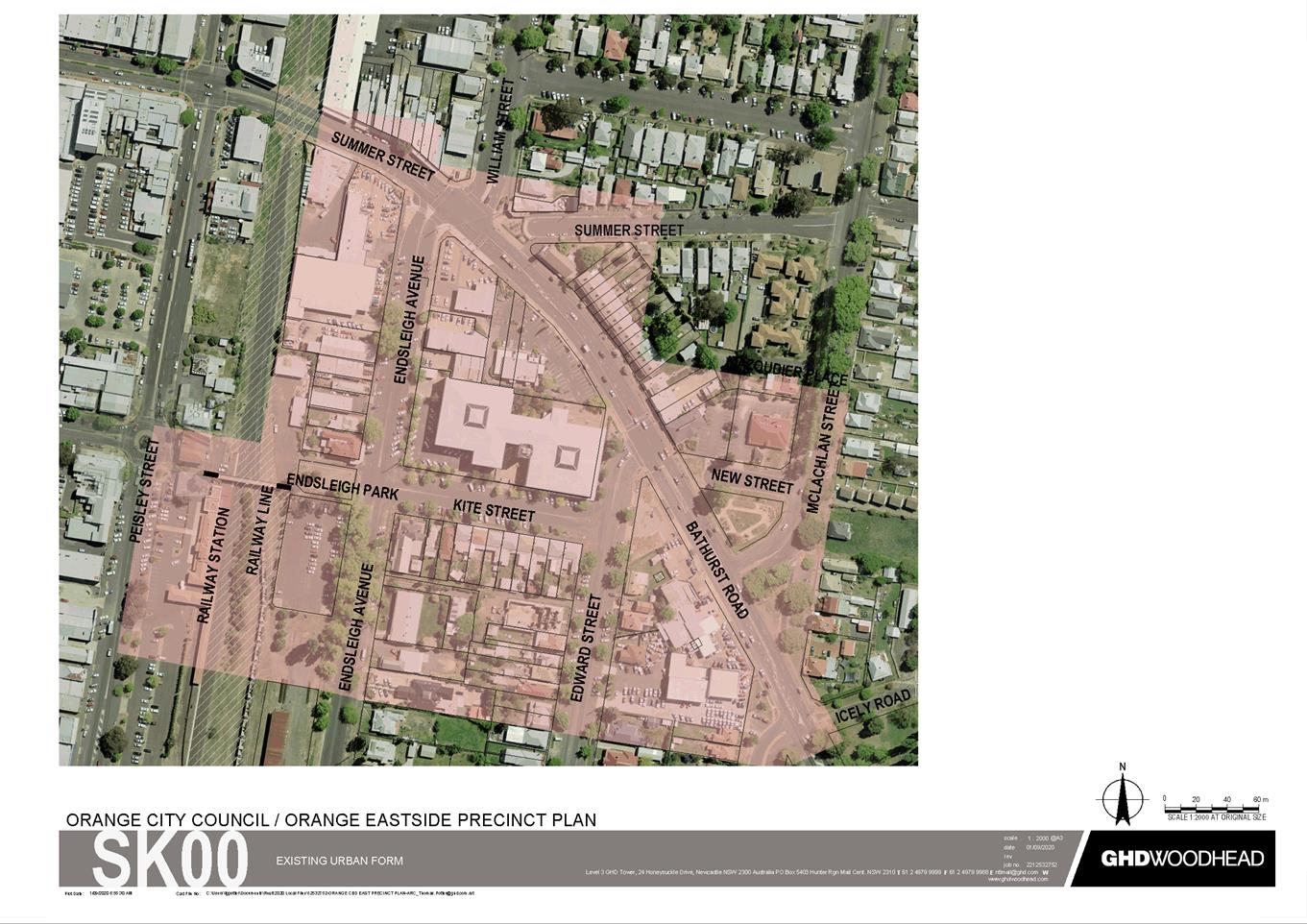
Planning
and Development Committee
2 February 2021

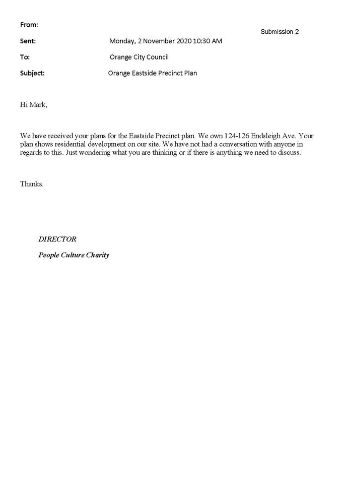
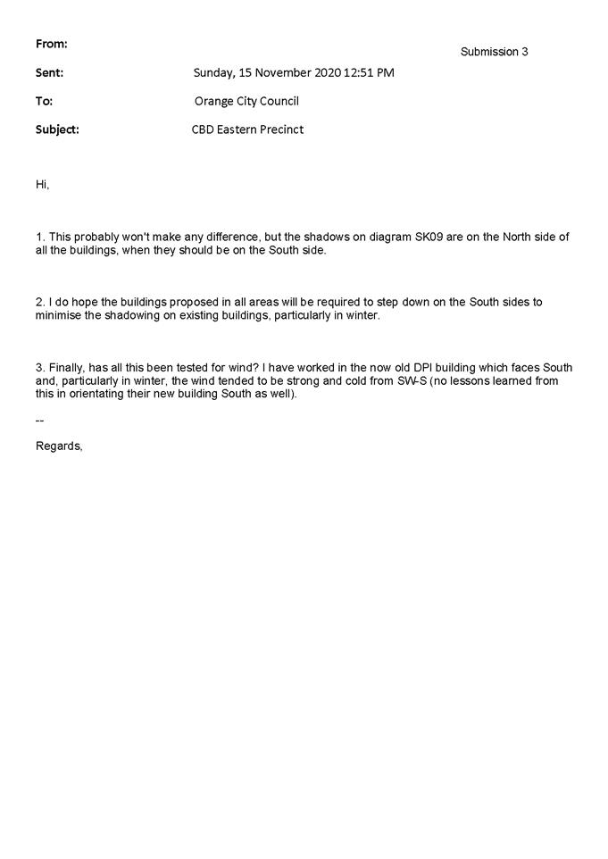
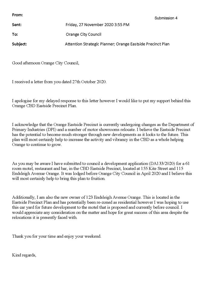
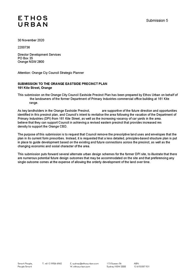
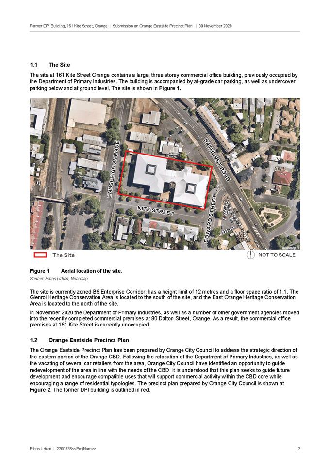
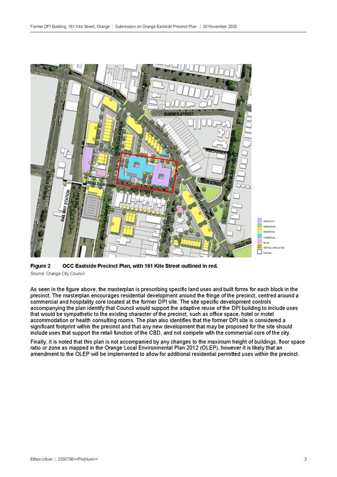
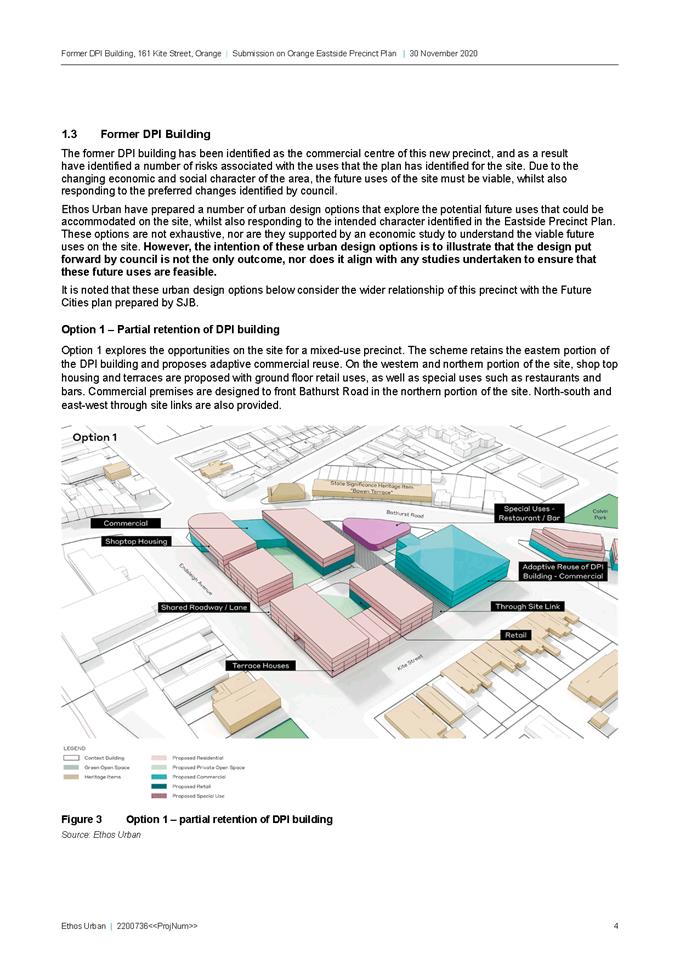
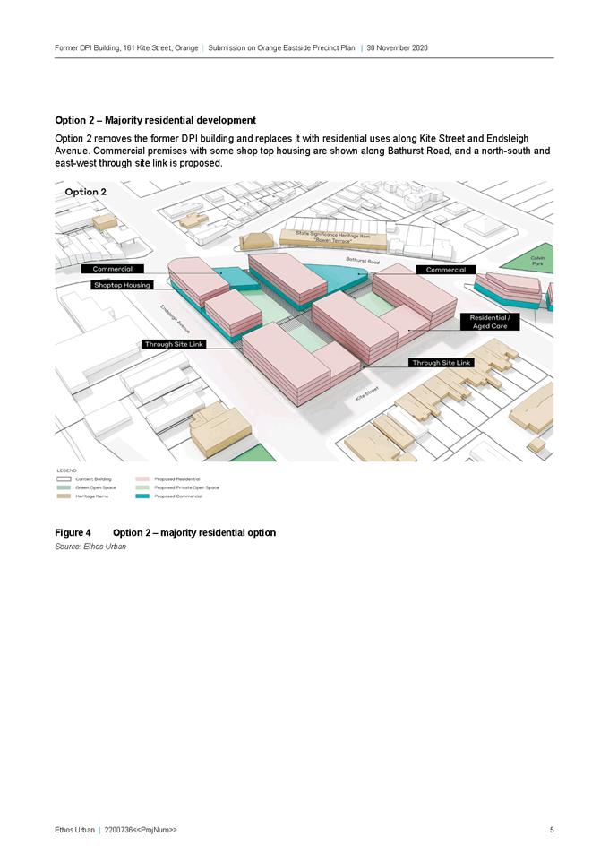
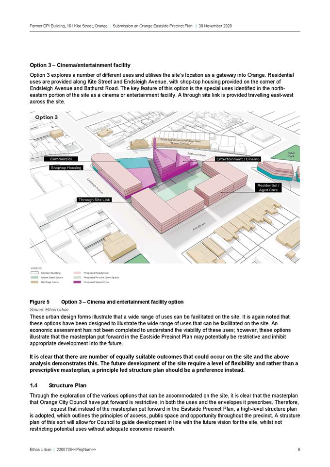
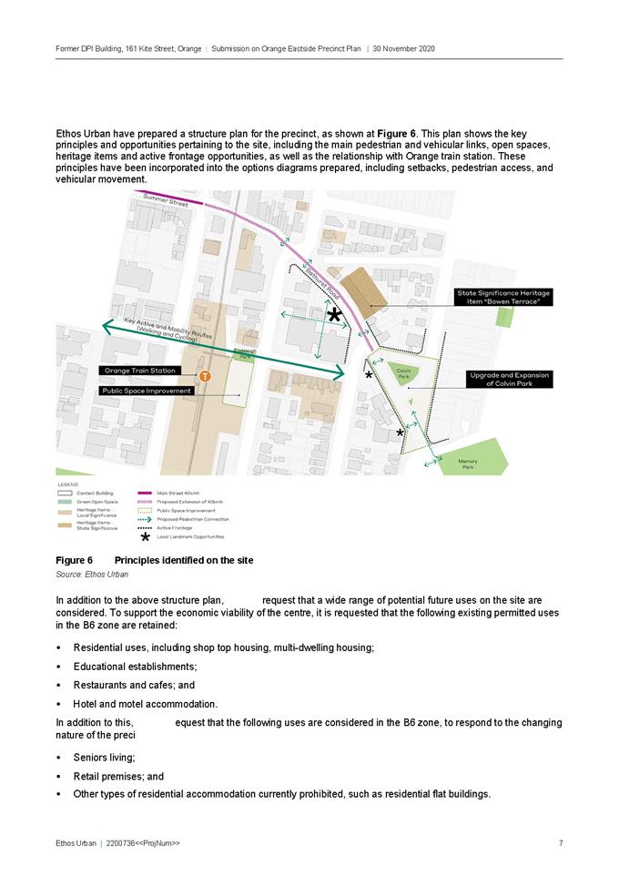
2.6 Esso
Park - Options Testing
RECORD
NUMBER: 2021/5
AUTHOR: Alison
Phillips, Town Planner ( Strategic)
EXECUTIVE Summary
At the Council Meeting 3 November 2020 a notice of motion
was passed requiring Council staff to investigate the potential for the
relocation of a portion of Esso Park to the corner of Woodward Street and
Summer Street, and explore the potential of residential options for a section
of the park fronting Hamer Street (Attachment 1).
Analysis of the proposal has been undertaken and options
developed for the relocation and change of use of land front Hamer Street are
detailed below.
Link To Delivery/OPerational Plan
The recommendation in this report relates to the
Delivery/Operational Plan strategy “7.1 Preserve - Engage with the
community to develop plans for growth and development that value the local
environment”.
Financial Implications
Nil
Policy and Governance Implications
Nil
|
Recommendation
1 That
Council note the contents of this report and the attached options.
2 That
Council determine whether or not it wishes to continue to further investigate
any options for the use of Esso Park.
|
further considerations
The recommendation of this report has been assessed against
Council’s other key risk categories and the following comments are
provided:
|
Image
and Reputation
|
Consideration should be given to
the potential publicity that may arise with such a proposal. It is common
that the rezoning of public land for residential purpose can draw significant
attention.
|
|
Political
|
Council should have consideration
for the public’s reaction regarding reclassification and rezoning of
public land for housing purposes.
|
SUPPORTING INFORMATION
1. Background
Esso
Park is located within the Orange Town Centre bordering the suburb of Calare.
The Park is approximately a 15 minute walk from the Orange CBD. The Park is
located across from Orange High School and provides 7,864m2 of
passive recreation space. Esso Park has two frontages, Hamer Street (approx. 82
meters in length) and Woodward Street (approx. 69.8 meters in length).
2. Analysis
Zoning
Esso
Park is currently zoned RE1 Public Recreation with the surrounding residential
area zoned R1 General Residential.
Access and Egress
The Park is
primarily accessed from Hamer Street when walking from the Orange CBD or the
pedestrian crossing at Woodward Street providing access to and from the suburb
of Calare and Orange High School. The Hamer Street frontage is fenced and
provides one access point to the north-eastern most corner of the site.
Amenity and
Safety
Esso Park provides a
range of opportunities for shade given the number of mature trees across the
site. The trees also act as a buffer to traffic noise from Woodward Street and
enhance the visual appeal of the Park. The Park lacks clear signage and direct
routes of access across that may have an impact on the passive surveillance
opportunities.
Use
The Park contains
some seating areas and a small swing set with the majority of the park grassed.
The hardscape section of Esso Park is used for informal parking at the High School
at pick up and drop off times. The park does not appear to have significant
usage.
Tree Planting
The East most
portion of the park contains majority of mature trees ranging in health and
condition. The following tree species are located in the Eastern portion of the
park subject to this investigation are:
· Golden Elm
· Beech
· Tulip Tree
· Liquid Amber
· Deodara
· Prunus
· Conifer
spruce
· Tulip tree
1 Summer Street & 160 Woodward
Street
1 Summer Street and 160 Woodward
Street are two parcels owned by Council and adjoining Esso Park. The parcels
are irregular in shape and have a total area of 2080m2.
The parcels have a majority of the
frontage along Woodward Street (approx. 72.3 meters in length) and a small
frontage along Summer Street (approx. 16.2 meters in length). The lots recesses
approximately 16 metres on the southern lot and 49 meters back into the site on
the northern lot which adjoins Esso Park.
Refer to Attachment 2 for the
analysis drawing.
3. Option
Testing
The
following three options explore the subdivision of Esso Park to relocate the
east most portion of the Park to 1 Summer Street and 160 Woodward Street. The
total area of Esso Park under the following options is 7,864m2. The
options identify the subdivision area as 2,610 m2 which includes
residential frontages ranging from 10 – 15 meters, with a lot depth of 36
meters, consistent with the surrounding lot sizes and urban fabric. All options
have varied impact on the existing trees in this portion of Esso Park however impact
could be negated following further resolution of the subdivision layout and
detailed design solutions.
Whilst
the options provided within this report certainly provide an indication of
basic options for the site, it is important to note that the options were
initially developed leading into a site meeting with residents and represent
only early conceptual ideas for discussion. Were there to be support for
further investigations, option details would need to be considered in more
detail at a later date.
Option 01
Option 01 proposes a central through
site link of 6 meters wide. This link provides direct connection to the
pedestrian crossing and clear visual sightlines. The proposal includes 6 lots
including:
· 3 x 360m2
lots
· 1 x 450m2
lot
· 2 x 540m2
lots
This option would likely result in the
removal of at least 4 trees, however would require further investigation.
Please refer to Attachment 3
for the subdivision plan.
Option 02
Option 02 proposes a meandering
through site link of 6 meters wide. This link connects to the pedestrian
crossing and provides access and egress at the southernmost corner of the site.
The proposal includes 5 lots including:
· 1 x 450m2
lot
· 4 x 540m2
lots
This option would likely result in the
removal of at least 3 trees, however would require further investigation.
Please refer to Attachment 4
for the subdivision plan.
Option 03
Option 03 retains the existing through
site link. The proposal includes 6 lots including:
· 3 x 360m2
lots
· 1 x 450m2
lot
· 2 x 540m2
lots
This option would likely result in the
removal of at least 3 trees, however would require further investigation.
Please refer to Attachment 5
for the subdivision plan.
Option 04
Option 04 is to retain the uses of the
existing parcels and Council to investigate development/divestment options for
1 Summer Street and 160 Woodward Street. This option would retain Esso Park as
a consolidated parcel of land which can be more broadly utilised for a range of
passive and active recreation activities by the public.
Generally, sites that are irregular
and located along major roads are not considered appropriate for public
recreation due to safety and amenity issues that arise from the layout and
location.
Option 04 would maintain the current
amenity shared by the residents directly across from the Park that have been
enjoyed since the dedication of the area as a Park in the 1980’s.
There has been some interest to
purchase the site and if this option was preferred an expression of interest
process would commence.
4. Reclassification
Process
If
Council were to proceed with subdivision of the site, Council must resolve
under the Local Government Act 1993, Section 30 to reclassify the land
from community land to operational land.
This
would require Planning Proposal to be prepared by Council staff as per
Division 3.4 Environmental Planning Instruments – LEPs of the
Environmental Planning and Assessment Act 1979 (EP&A Act) to amend the Orange
Local Environmental Plan 2011 (the LEP), to include the site in Schedule
4 Classification and reclassification of Public Land, Part 2 Land classified,
or reclassified, as operational land – interest changed.
The
Planning Proposal would need to also include the rezoning of the subject land
from RE1 Public Recreation to R1 General Residential, and 1 Summer Street and
160 Woodward Street from R1 General Residential RE1 Public Recreation. This
would also likely require a site specific Development Control Plan/Masterplan.
In
addition to the standard exhibition period under Schedule 1 (4)
of the EP&A Act, Council must also arrange a public hearing as per Section
29 Public Hearing into Reclassification of the Local Government Act 1993.
This is a process that occurs after the formal exhibition period is completed.
Attachments
1 Attachment
1 - CCL 3 November 2020 Notice Of Motion - Esso Park, D21/3753⇩
2 Attachment
2 - Analysis Diagram - Esso Park, D21/3770⇩
3 Attachment
3 - Option 01 - Esso Park, D21/3771⇩
4 Attachment
4 - Option 02 - Esso Park, D21/3772⇩
5 Attachment
5 - Option 03 - Esso Park, D21/3774⇩
Planning
and Development Committee
2 February 2021
Attachment 1 Attachment
1 - CCL 3 November 2020 Notice Of Motion - Esso Park
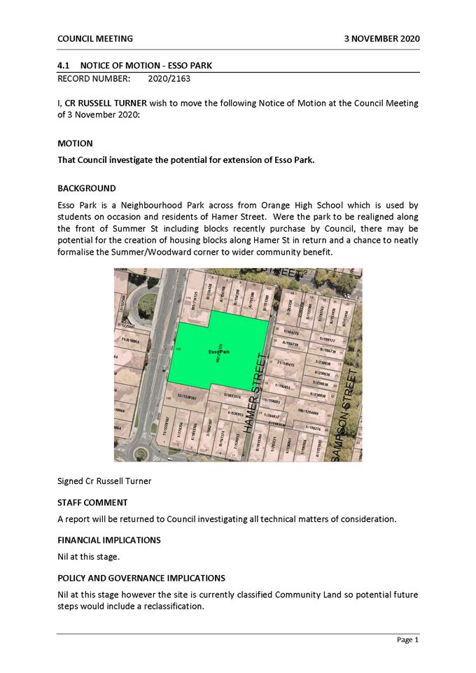
Planning
and Development Committee
2 February 2021
Attachment 2 Attachment
2 - Analysis Diagram - Esso Park
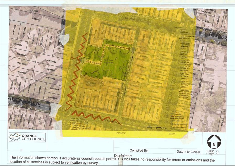
Planning
and Development Committee
2 February 2021
Attachment 3 Attachment
3 - Option 01 - Esso Park
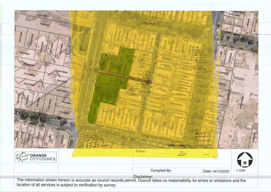
Planning
and Development Committee
2 February 2021
Attachment 4 Attachment
4 - Option 02 - Esso Park
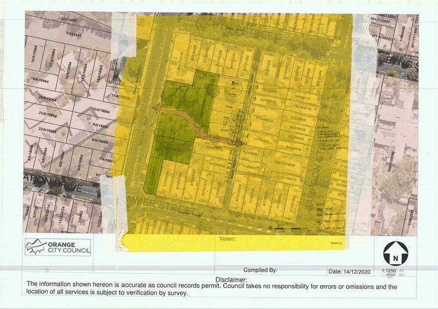
Planning
and Development Committee
2 February 2021
Attachment 5 Attachment
5 - Option 03 - Esso Park
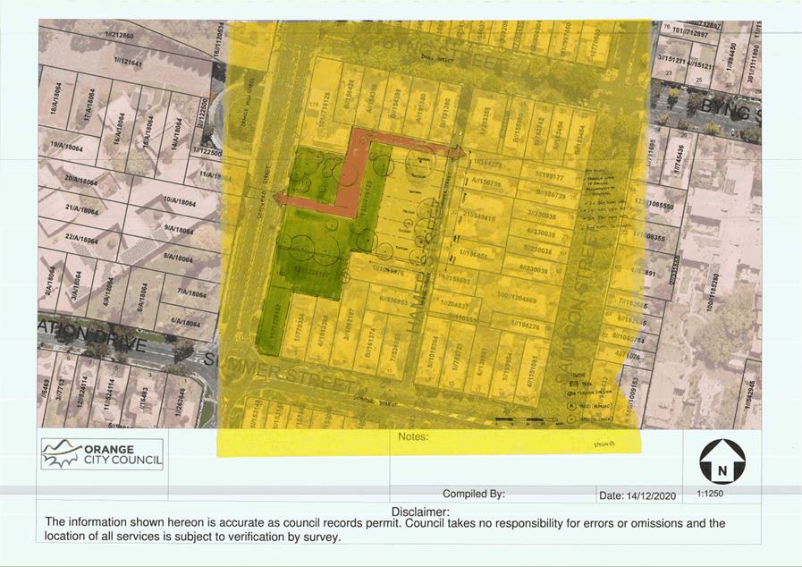
2.7 Development
Control Plan - West End Precinct
RECORD
NUMBER: 2021/39
AUTHOR: Alison
Phillips, Town Planner ( Strategic)
EXECUTIVE Summary
The Former Orange Base Hospital (FOBH) Design Report (Attachment
1) was prepared by Allen Jack + Cottier, and recommends design strategies
and development options within the existing planning controls and context.
Council resolved at 3 November 2020 Council meeting to prepare a Development
Control Plan in line with the FOBH Design Report. Council staff subsequently
engaged consultants, GHD, to prepare the Development Controls (Attachment 2)
that form the basis of an amendment of the Orange Development Control
Plan 2004.
Link To Delivery/OPerational Plan
The recommendation in this report relates to the
Delivery/Operational Plan strategy “7.1 Preserve - Engage with the
community to develop plans for growth and development that value the local
environment”.
Financial Implications
Nil
Policy and Governance Implications
The FOBH Design Report and associated development controls
will guide the future direction of this precinct.
|
Recommendation
1 That
Council acknowledge the attached site specific development controls and
resolve to place the controls on public exhibition for a period of 28 days.
2 That
staff draft an amendment the Orange Development Control Plan 2004 to:
· Insert reference to
the attached Site Specific Controls under chapter DCP 07 Residential Areas
- 7.17 West End Precinct
· Insert the DCP
17 Site Specific Controls – West End Precinct as an attachment
3 That
post exhibition the matter return to Council for consideration of submissions
with a view to amending the Orange Development Control Plan 2004.
|
further considerations
Consideration has been given to the recommendation’s
impact on Council’s service delivery; image and reputation; political;
environmental; health and safety; employees; stakeholders and project
management; and no further implications or risks have been identified.
SUPPORTING INFORMATION
The FOBH site has been subject to a masterplan in 2012 and
has subsequently been updated to be consistent with the rezoning in 2017 and
the DPIE development. The FOBH Design Report identifies a set of principles and
design options that respond to the existing planning controls, opportunities
and constraints of the site. These principles and design outcomes have been
translated into a Development Control Plan to be attached to the Orange
DCP 2004.
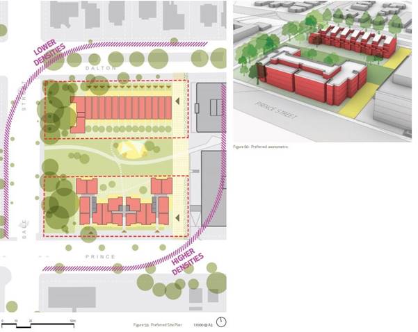
Figure
1: Indicative Structure Plan – AJ+C FOBH Design Report
Key themes considered within the draft controls includes the
existing and desired future character, built form typologies, building
setbacks, landscaping requirements, access and movement outcomes, public domain
considerations, and sustainable and efficient design and management.
The draft controls aim to provide design guidance beyond
what is considered in the Apartment Design Guide (State Environmental
Planning Policy 65 – Design Quality of Residential Apartment Development)
for apartment buildings. Design criteria, objectives and controls have also
been developed for the townhouse typology. Key objectives are to facilitate
high quality medium density housing that exhibits design excellence and
innovation in Regional Cities, high quality public and private open space and
equitable, clear access to the site for those living and working in the area.
Additionally, the draft DCP controls set objectives and
controls regarding the public park in the centre of the site. The park will
provide key linkages from the DPIE site and acts as an extension of the natural
buffer to the west of the site. Opportunities for passive recreation use and
play areas will be provided for use by community and DPIE workers.
The draft controls attached have been reviewed by staff and
it is recommended that the following section be included within chapter DCP
07 in Residential Areas:
7.17 West End
Precinct
The West End
Precinct is located north of the Orange Central Business District (CBD) and is
positioned adjacent Department of Planning, Industry and Environment (DPIE)
office and car park complex.
The objective of
the West Precinct is to provide a quality urban outcome consistent with the
Former Orange Base Hospital Residential Development Design Report (2020) by
Allen Jack + Cottier.
Site specific
controls pertaining to this site are provided in the chapter DCP 17 Site
Specific Controls –West End Precinct.
NEXT STEPS
The draft controls are a clear translation of the FOBH
design report and are to be presented to the public for comment. Public
submissions will be reviewed by Council and responded to through a
post-exhibition report to Council. Once adopted Council staff will amend the Orange
Development Control Plan 2004.
Attachments
1 The
West End - Former Orange Base Hospital Site Design Report, D20/75247⇩
2 Draft
DCP Controls, D21/3129⇩
Planning
and Development Committee
2 February 2021
Attachment 1 The
West End - Former Orange Base Hospital Site Design Report
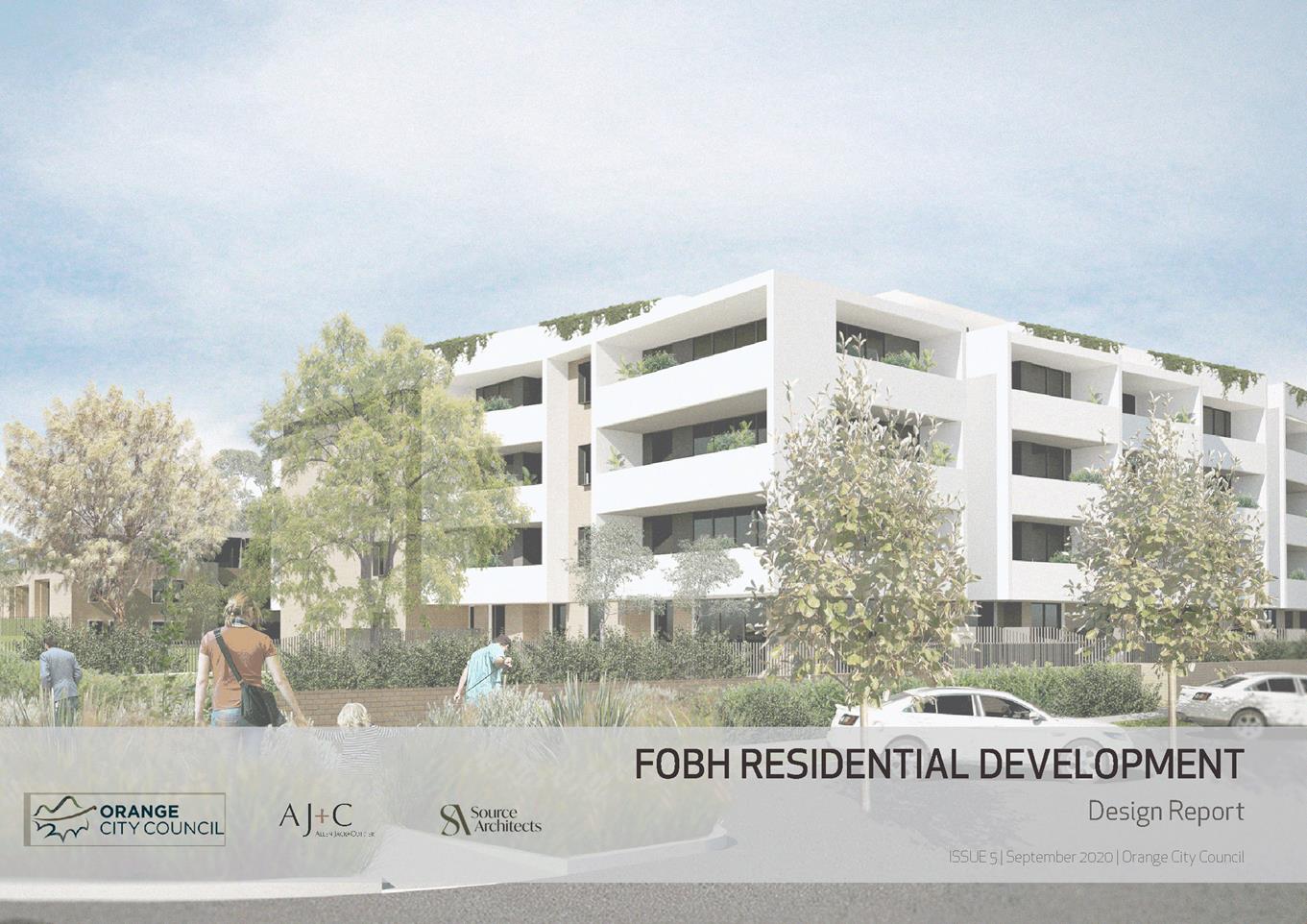
Planning
and Development Committee
2 February 2021
Attachment 2 Draft DCP
Controls
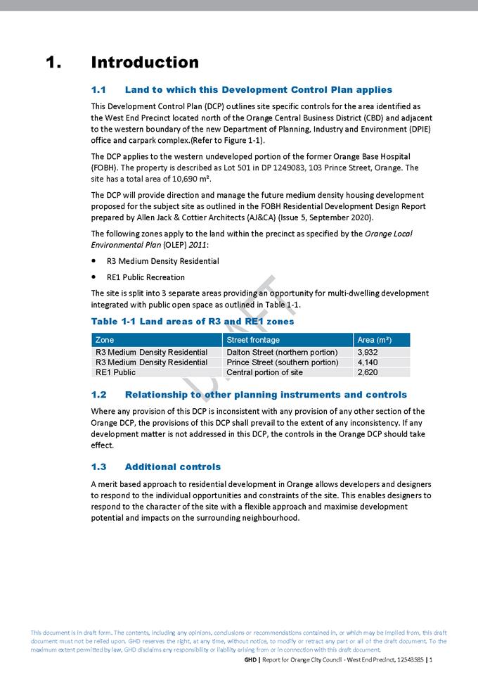
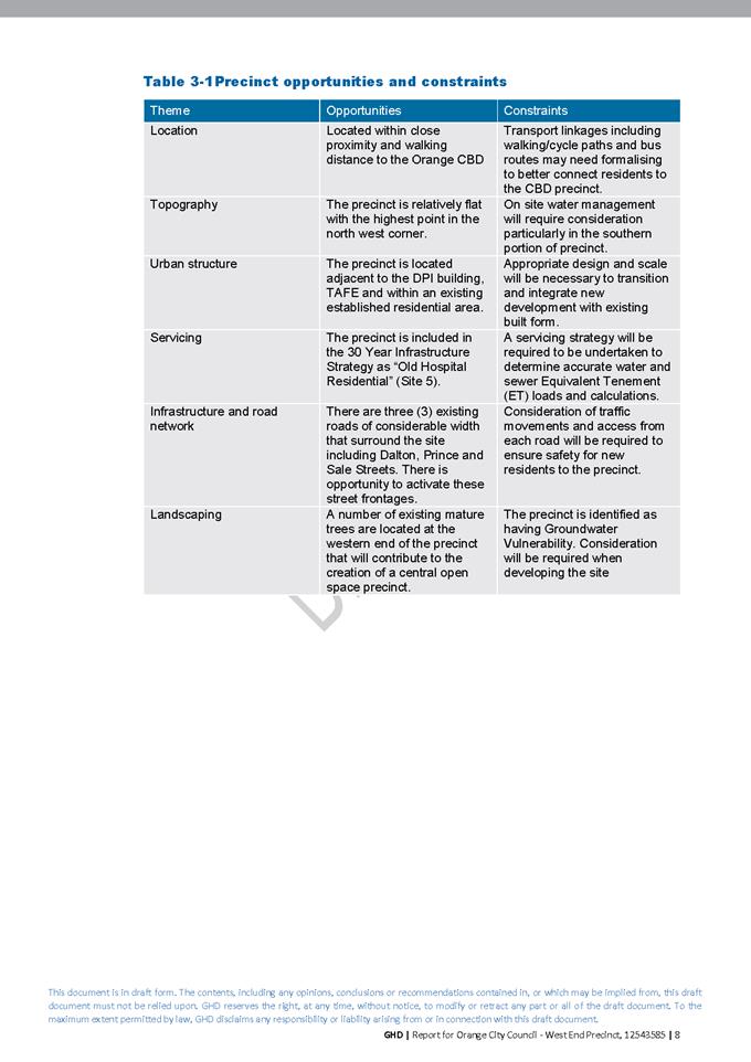
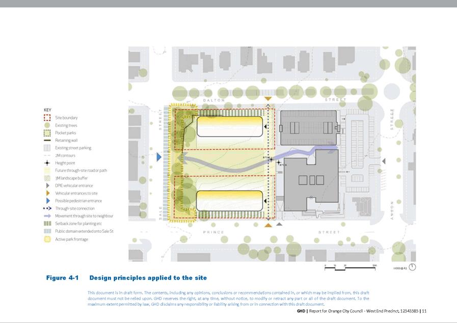
2.8 Orange
LEP 2011 - Amendment 17 status update
RECORD
NUMBER: 2021/43
AUTHOR: Craig
Mortell, Senior Planner
EXECUTIVE Summary
Amendment 17 to the Orange LEP relates to the creation of
the Towac Equine Precinct. This was previously considered by Council at the 17
September 2020 meeting, where Council resolved:
1 Note
that items 2, 3 below will override items 1 and 3 of the resolution of 17 March
2020 in relation to Towac Equine Precinct.
2 Instruct
the Chief Executive Officer to place the Planning Agreement on public
exhibition for 28 days.
3 Subject
to there being no objections to the planning agreement, authorise the Chief
Executive Officer to enter into the planning agreement and pursue finalisation
of Amendment 17 with the Department of Planning, Industry and Environment.
The remaining item from the 17 March 2020 resolution was:
2 Endorse
and adopt the draft Development Control Plan provisions, to be known as chapter
6A of Orange DCP 2004.
The planning agreement was completed and entered into in
accordance with the resolution of 17 September 2020. Council has now been advised
of the agreement being registered on all relevant titles and will proceed to
seek final gazettal of the amendment through the Department of Planning,
Industry and Environment.
In reviewing this matter it has been noted that clause 21 of
the Environmental Planning and Assessment Regulation 2000 requires the adoption
of Development Control Plans be publicly notified within 28 days of the
resolution. Due to the delay generated by switching from a contributions cap
variation to a Planning Agreement and the time required to negotiate that
agreement the adoption of the DCP on 17 March 2020 now needs to be reaffirmed
to confirm its validity.
Link To Delivery/OPerational Plan
The recommendation in this report relates to the
Delivery/Operational Plan strategy “7.1 Preserve - Engage with the
community to develop plans for growth and development that value the local
environment”.
Financial Implications
Nil
Policy and Governance Implications
Nil
|
Recommendation
1. That
Council endorse and adopt the attached draft Development Control Plan
provisions, to be known as chapter 6A of Orange DCP 2004.
2. That
Council adopt the attached Towac Precinct Concept Plan to be the formal
Equine Precinct Map as defined in the draft chapter 6A
|
further considerations
Consideration has been given to the recommendation’s
impact on Council’s service delivery; image and reputation; political;
environmental; health and safety; employees; stakeholders and project
management; and no further implications or risks have been identified.
SUPPORTING INFORMATION
At the time of the 17 March 2020 meeting it was anticipated
that a variation to the contributions cap would have resolved the outstanding
issue of funding the horse and rider underpass and that this would occur
relatively quickly. However, advice from the Department of Planning Industry
and Environment necessitated a change in approach to use a Planning Agreement,
as reported to Council 17 September 2020.
This created an unforeseeable delay and the window of time
to publicly notify the adoption of the DCP provisions, to be known as chapter
6A of DCP 2004, has now expired. Council may reaffirm this earlier decision
enabling public notification of the DCP adoption. A copy of the DCP provisions
is attached.
On 20 January 2021, council was advised that the planning
agreement has now been registered on all relevant titles. With this now
confirmed staff are proceeding to instruct DPIE to pursue finalisation of the
amendment. It is therefore important to ensure that the DCP provisions are in
place to provide the assessment framework for any relevant development
applications.
Attachments
1 Towac
Equine Precinct Draft DCP (chapter 6A), D20/12168⇩
2 Towac
Precinct Concept Plan, D20/54555⇩
Planning
and Development Committee
2 February 2021
Attachment 1 Towac
Equine Precinct Draft DCP (chapter 6A)
ORANGE DCP 2004 Amendment
6.13
ANIMAL BOARDING OR TRAINING ESTABLISHMENTS
HORSE
BREEDING OR TRAINING ESTABLISHMENTS
6.13.1
General
1. “Animal
boarding or training establishment” means a building or place used for
the breeding, boarding, training, keeping or caring of animals for commercial
purposes (other than for the agistment of horses) and includes any associated
riding school or ancillary veterinary hospital.”
2. This
part of the DCP applies to all Animal Boarding or Training Establishments used
for the purposes of keeping, breeding or training horses.
6.13.2
Minimum Site Area
Objective
(a) To
permit horse breeding or training establishments upon certain sized rural and
non-urban landholdings, to minimise potential land use conflicts with rural
residential and other rural land uses in a particular locality.
Development Controls
1. The
minimum site area for any horse breeding or training establishment shall be 2
hectares.
2. Notwithstanding
this, the minimum site area for any horse breeding or training facility within
the landholdings known as Lots 192 and 144, DP 750401, and lot 1 DP310621 bounded
by James road and Pinnacle Road may be a minimum of 1 hectare provided the
facility is operated by the occupants of each rural residential dwelling only,
for their own private recreation purposes.
6.13.3
Maximum Number of Horses – Towac Equestrian
Estate
Objective
(a) To
restrict the number of horses within any horse boarding, breeding or training
establishment within the Towac Equestrian Estate, in order to maintain the
amenity of the locality and in the interests of animal welfare.
Development Controls
1. The
maximum number of horses for any animal boarding, breeding or training
establishment within the Towac Equestrian Estate shall be restricted to a rate
of not more than 1 horse per 4,000m2 of the site area. Veterinary
hospitals may exceed this rate where the horses are kept on premises
temporarily for treatment or examination.
6.13.4 Minimum
Setback Requirements for Horse Stables & Shelters
Objective
(a) To ensure horse stables and
shelters are appropriately setback from common property boundaries, in order to
maintain the amenity and character of the surrounding locality.
Development Controls
1. Any
horse stable or horse shelter shall be setback from property boundaries and
adjoining land uses in accordance with Table 4 below.
Minimum
Setback Requirements for Horse Stables & Shelters
Land
Use Minimum
Setback Requirement
|
Front
Building Line Setback to Primary Road
|
Behind
the building line of the associated dwelling
|
|
Secondary
Road Frontage
|
10
metres
|
|
Side
and Rear Building Line Setback
|
20
metres
|
|
Adjoining
Dwelling not associated with the facility
|
20
metres
|
2. Within
the setback areas stated in the table above a 5m wide landscaped area is to be
included along the relevant boundary, comprising trees that mature to between 4
– 8 metres in height and spaced so that at maturity the drip lines of
foliage connect to form a continuous vegetative screen.
3. Trees
planted as part of the vegetative screen required by control 2 are to be
protected from grazing during establishment with tree guards or similar devices
until the trees achieve a minimum height of 1.5m.
6.13.5 Horse
Stable, Exercise Yard & Shelter Requirements
Note: According to the RSPCA
an average 500kg (approx. 15hh) horse drinks around 30 – 50 litres a day.
This amount can increase based on hot weather, dry feed or being heavily
worked/exercised. Additionally, a mare with foal can need between 1.8 to 2.5
times as much water as normal. For this reason it is highly recommended that
the yard and shelter be designed to provide ample shade and placement of
watering troughs in shaded areas to limit evaporation is also preferred.
Consider including rainwater tanks to collect runoff from stables and shade
structures as a way to help reduce overall water consumption.
Objectives
(a) To ensure horse stables and
shelters are well designed and constructed to provide suitable all weather
protection for horses.
(b) To ensure horse stables and
shelters are sympathetic to the rural landscape and the scenic environmental
amenity of the locality.
(c) To ensure horse breeding and
training establishments provide suitable exercise training yards.
Development Controls
1. Each
horse should be provided with a suitable horse stable and exercise training
yard.
2. The
minimum size for any horse stable should be 3.7 metres wide and 3.7 metres
deep. The height of any horse stable should be a minimum of 2.75 metres up to
3.4 metres, depending upon the height of the horse.
3. The
roof of the stable shall provide all weather protection and should incorporate
appropriate guttering and down pipes to convey stormwater into rainwater tanks
and into appropriately designed stormwater drainage systems or drinking
troughs.
4. The
walls of the horse stable should be of a masonry construction for a height of
at least 1.2 metres with either masonry or solid galvanised iron sheeting
provided for the upper wall panelling. Any concrete masonry blocks should be
reinforced with vertical steel rods and the cores filled with concrete. Some
form of window or air passage between the roof and the walls is needed for
cross-ventilation purposes.
5. The
wall height shall range between 2.75 metres up to 3.4 metres high, depending
upon the height of the intended horse. The external walls of the stable shall
be appropriately sealed and waterproofed. The internal walls of the stable
should be lined with plywood sheeting or rubber material to prevent injury to
horses and to also protect the walls from pawing or kicking.
6. The
doors of any horse stable shall be at least 1.2 metres wide and 2.4 metres high
with no protrusions which may cause potential injury to the horse. Any latches
to the doors should be strong and have no protrusions which may injure the
horse.
7. The
floor of any horse stable must be constructed of an impervious material which
is graded towards the doorway to permit drainage and with no low spots where
urine can collect.
8. A
100mm thick reinforced concrete slab is the preferred flooring method. Clean
bedding such as straw or sawdust should be provided daily to prevent any foot
or leg problems caused by the horse standing on concrete.
9. Feeders
and water troughs should be raised to a height of 1.05 metres aboveground and
placed within a corner of the stable. The feeders and water troughs should be smooth
finished and free of any protrusions.
10. Any
horse shelters shall be constructed to fulfil the same requirements as a horse
stable regarding walls, floor and roofing but should be provided without any
doors, in order to allow free passage of horses to / from the shelter, at all
times.
11. The
external finishes of any horse stable or horse stable shall be painted in a
muted green, light brown or grey colour, in order to maintain the rural
character of the surrounding locality.
6.13.6 Horse
Paddocks
Objectives
(a) To ensure horse paddocks are of
a sufficient size and are provided with appropriate feed and shade trees.
(b) To ensure horse paddocks are
properly fenced (both internally and externally) to minimise any injury to
horses and to encourage rotational grazing of the paddocks.
Development Controls
1. The
minimum paddock size for each horse should be 3,000m2 with a
preferable size of 1 hectare or more.
2. Any
horse paddock must contain a horse shelter as well as shade trees.
3. Horse
paddocks should be internally fenced, wherever possible to allow for the
rotational use of the grazing area, in order to minimise any potential
overgrazing.
4. Supplementary
feed must be provided, where necessary.
5. Post
and rail fencing for horse paddocks is preferred. The use of wire or barb wire
is not recommended because of its tendency to cause injury to horses. Electric
fences are suitable but should be supported with some type of sight barrier (eg
a painted tin lid) attached to the electric wire, in order to improve the
visibility of the electric fence.
6.13.7
Liquid & Solid Waste Collection and Treatment
Objective
(a) To ensure all horse boarding,
breeding or training establishments have appropriate liquid and solid waste
collection and treatment systems.
Development Controls
1. All
liquid wastes are to be led to a settling pond area, prior to discharge into
any watercourse, stormwater drainage system or Sydney Water Corporation
sewerage system. The settling pond area shall have a minimum capacity of 1.5%
of the total site area with a maximum depth of 1.2 metres. Any pond overflow
shall meet the water quality criteria set out in the ANZECC guidelines for the
particular receiving waterway.
2. All
solid manure should be removed regularly and placed in a suitable waste storage
bin. The solid waste storage bin should be a large metal bin with a
flanged-fitting metal lid which is waterproof and prevents access to flies and
/ or vermin. This bin should be emptied and disinfected weekly.
3. The
full details of the proposed liquid and solid waste treatment process including
the settling pond area are to be submitted with the Development Application for
an animal boarding or training establishment.
4. In
the event that the proposal is ultimately supported, a condition of consent may
be imposed requiring an appropriate water sampling program to be implemented to
monitor the water quality of any waters discharging from the settling pond.
5. The
sampling regime is likely to involve quarterly sampling and sampling after each
heavy rainfall event.
The sampling of the water at a registered
NATA laboratory should include the following parameters:-
(a) pH;
(b) Suspended
solids;
(c) Dissolved Oxygen;
(d) Total
Phosphorous;
(e) Ammonia;
(f) Total Nitrogen; and
(g) Faecal
Coliforms.
6. The
preparation of an annual environmental management plan may also be required for
any approved horse boarding, breeding or training facility which outlines the
performance of the settling pond bearing in mind the sampling regime.
6.13.8 Equine
Precinct Subdivision
Objective
(a) To provide and preserve
opportunities for the keeping of horses and related activities in a residential
context within specific locations.
Development Controls
1. This
section of the DCP applies to land within the Towac Equine Precinct, as defined
in the Equine Precinct Map.
2. Subdivision
of land within an Equine Precinct is to identify and include on all newly
created lots a restriction as to user under Section 88B of the Conveyancing Act
1919 that:
a. Nominates
an area of land within the lot suitable for the erection of a stable and
exercise yard, sufficient for the keeping of at least 1 horse.
b. The
area of land nominated must be consistent with the setbacks and other controls
in this part of the DCP.
c. The
area of land nominated is to be restricted so as to prevent the erection or
maintenance of any buildings other than a horse stable and associated tack
room.
3. Subdivision
of land within an Equine Precinct shall be required to undertake post-and-rail
fencing of the area nominated in the restriction as to user required above.
Planning and Development Committee
2 February 2021
Attachment 2 Towac
Precinct Concept Plan