Planning and Development
Committee
Agenda
1 December 2020
Notice is hereby given, in
accordance with the provisions of the Local Government Act 1993 that a Planning and Development Committee meeting of ORANGE CITY COUNCIL
will be held in the COUNCIL CHAMBER,
CIVIC CENTRE, and BYNG STREET, ORANGE WITH AN OPTION OF ONLINE CONFERENCING
PLATFORM ZOOM DUE TO COVID-19 REQUIREMENTS on Tuesday, 1 December
2020.
David
Waddell
Chief Executive Officer
For apologies please
contact Administration on 6393 8218.
1 Introduction
1.1 Declaration
of pecuniary interests, significant non-pecuniary interests and less than
significant non-pecuniary interests
The
provisions of Chapter 14 of the Local Government Act, 1993 (the Act)
regulate the way in which Councillors and designated staff of Council conduct
themselves to ensure that there is no conflict between their private interests
and their public role.
The
Act prescribes that where a member of Council (or a Committee of Council) has a
direct or indirect financial (pecuniary) interest in a matter to be considered
at a meeting of the Council (or Committee), that interest must be disclosed as
soon as practicable after the start of the meeting and the reasons given for
declaring such interest.
As
members are aware, the provisions of the Local Government Act restrict any
member who has declared a pecuniary interest in any matter from participating
in the discussion or voting on that matter, and requires that member to vacate
the Chamber.
Council’s Code of Conduct provides that if members
have a non-pecuniary conflict of interest, the nature of the conflict must be
disclosed. The Code of Conduct also provides for a number of ways in which a
member may manage non pecuniary conflicts of interest.
|
Recommendation
It is recommended that Committee Members now disclose any
conflicts of interest in matters under consideration by the Planning and
Development Committee at this meeting.
|
2 General
Reports
2.1 Items
Approved Under the Delegated Authority of Council
RECORD
NUMBER: 2020/2190
AUTHOR: Paul
Johnston, Manager Development Assessments
EXECUTIVE Summary
Following is a list of more
significant development applications approved by the Chief Executive Officer
under the delegated authority of Council. Not included in this list are
residential scale development applications that have also been determined by
staff under the delegated authority of Council (see last paragraph of this
report for those figures).
Link To Delivery/OPerational Plan
The recommendation in this report
relates to the Delivery/Operational Plan strategy “7.1 Preserve - Engage
with the community to develop plans for growth and development that value the
local environment”.
Financial Implications
Nil
Policy and Governance Implications
Nil
|
Recommendation
That Council resolves to
acknowledge the information provided in the report by the Manager Development
Assessments on Items Approved Under the Delegated Authority of Council.
|
further considerations
Consideration has been given to the
recommendation’s impact on Council’s service delivery; image and
reputation; political; environmental; health and safety; employees;
stakeholders and project management; and no further implications or risks have
been identified.
|
Reference:
|
DA
362/2017(2)
|
Determination
Date
|
18
November 2020
|
|
PR
Number
|
PR7095
|
|
Applicant/s:
|
Orange
City Council
|
|
Owner/s:
|
Orange
City Council
|
|
Location:
|
Lot
701 DP 1001618 – Wade Park, Lords Place, Orange
|
|
Proposal:
|
Modification
of development consent - recreation facility (indoor) in association with the
existing recreation facility (major) and demolition. The modification sought
to alter and reduce the level of plantings and delay the installation of
required onsite landscaping; delay the installation of disabled and bicycle
parking on the site, provide disabled parking on Lords Place instead; and
alter the stormwater detention basin arrangements.
|
|
Value:
|
$0
|
|
Reference:
|
DA
376/2019(2)
|
Determination
Date
|
4
November 2020
|
|
PR
Number
|
PR28331
|
|
Applicant/s:
|
Mr J
Simpson
|
|
Owner/s:
|
Keronga
Developments Pty Limited
|
|
Location:
|
Lot
20 DP 271090 - Cedar Street, Orange
|
|
Proposal:
|
Modification
of development consent - subdivision (eight lot Community title residential).
The modified proposal will remove the originally proposed retaining wall. The
applicant proposed to remove the retaining wall due to the significant cost
associated with its construction and certification. The proposed retaining
wall was originally included for the purpose of landscaping, however, it has
no benefit to any of the adjacent lots or services other than aesthetics, and
therefore its removal will not burden or compromise any of the adjacent lots
or services.
|
|
Value:
|
$0
|
|
Reference:
|
DA
427/2019(1)
|
Determination
Date
|
30
October 2020
|
|
PR
Number
|
PR27304
|
|
Applicant/s:
|
Mr A
Grant
|
|
Owner/s:
|
Mrs
F Grant
|
|
Location:
|
Lot
413 DP 1218556 - 25 Hughes Street, Orange
|
|
Proposal:
|
Demolition
(tree removal), earthworks, subdivision (four lot community title), dwellings
(three), and outbuildings (two detached sheds)
|
|
Value:
|
$1,050,000
|
|
Reference:
|
DA
173/2020(1)
|
Determination
Date
|
19
October 2020
|
|
PR
Number
|
PR10021
|
|
Applicant/s:
|
Mr
MA Lindfield
|
|
Owner/s:
|
Mr
MA Lindfield
|
|
Location:
|
Lot
12 DP 210766 - 753 Pinnacle Road, Canobolas
|
|
Proposal:
|
Mixed
use development (kiosk, information and education facility and roadside
stall) and demolition (tree removal)
|
|
Value:
|
$380,000
|
|
Reference:
|
DA
276/2020(1)
|
Determination
Date
|
25
September 2020
|
|
PR
Number
|
PR14995
|
|
Applicant/s:
|
Mr
NS and Mrs MY Thornton
|
|
Owner/s:
|
Mr
NS and Mrs MY Thornton
|
|
Location:
|
Lots
57 and 222 DP 750360 – 676 Cadia Road, Orange
|
|
Proposal:
|
Farm
stay accommodation
|
|
Value:
|
$200,000
|
|
Reference:
|
DA
306/2020(1)
|
Determination
Date
|
28
October 2020
|
|
PR
Number
|
PR83
|
|
Applicant/s:
|
Orange
City Council
|
|
Owner/s:
|
Orange
City Council
|
|
Location:
|
Lot
1 DP 723218 - 4631 Mitchell Highway, Lucknow
|
|
Proposal:
|
Community
facility (restoration of fire damaged building)
|
|
Value:
|
$230,000
|
|
Reference:
|
DA
331/2020(1)
|
Determination
Date
|
27
October 2020
|
|
PR
Number
|
PR25817
|
|
Applicant/s:
|
Peter
Basha Planning & Development
|
|
Owner/s:
|
Mrs
KA Tilston
|
|
Location:
|
Lot
13 DP 1176470 – 6 Atlas Place, Orange
|
|
Proposal:
|
General
industry and depots, and business identification signage
|
|
Value:
|
$1,200,000
|
|
Reference:
|
DA 332/2020(1)
|
Determination
Date
|
19
October 2020
|
|
PR
Number
|
PR26464
|
|
Applicant/s:
|
AR
Design Studio
|
|
Owner/s:
|
Orange
City Council
|
|
Location:
|
Lot
200 DP 1195298 - 136 Aerodrome Road, Huntley
|
|
Proposal:
|
Air
transport facility (hangar)
|
|
Value:
|
$250,000
|
|
Reference:
|
DA
334/2020(1)
|
Determination
Date
|
5
November 2020
|
|
PR
Number
|
PR25982
|
|
Applicant/s:
|
Kueb
Pty Ltd
|
|
Owner/s:
|
Mr
IG, Mr GC, Mr RK and Mr WD McDonald
|
|
Location:
|
Lot
2 DP 1180945 - 4 Hamer Street, Orange
|
|
Proposal:
|
Demolition
(former service station) and Category 1 Remediation
|
|
Value:
|
$30,000
|
|
Reference:
|
DA
360/2020(1)
|
Determination
Date
|
27
October 2020
|
|
PR
Number
|
PR1945
|
|
Applicant/s:
|
Mr I
and Mrs HS Britton
|
|
Owner/s:
|
Mrs
HS Britton
|
|
Location:
|
Lot
1 DP 770751 - 65 Byng Street, Orange
|
|
Proposal:
|
Demolition
(tree removal)
|
|
Value:
|
$0
|
|
Reference:
|
DA
367/2020(1)
|
Determination
Date
|
26
October 2020
|
|
PR
Number
|
PR27531
|
|
Applicant/s:
|
Titung
N Rumba Pty Ltd
|
|
Owner/s:
|
Eastern
Developments Pty Ltd
|
|
Location:
|
Lot
200 DP1225088, 2/132 Kite Street, Orange
|
|
Proposal:
|
Restaurant
or cafe and business identification signage
|
|
Value:
|
$300,000
|
|
Reference:
|
DA
378/2020(1)
|
Determination
Date
|
19
October 2020
|
|
PR
Number
|
PR27987
|
|
Applicant/s:
|
Orange
City Council
|
|
Owner/s:
|
Orange
City Council
|
|
Location:
|
Lot
804 DP1240445 - 36 Astill Drive, Orange
|
|
Proposal:
|
Animal
shelter (ancillary kennels)
|
|
Value:
|
$10,000
|
|
Reference:
|
DA
386/2020(1)
|
Determination
Date
|
5
November 2020
|
|
PR
Number
|
PR28631
|
|
Applicant/s:
|
James
Richmark Pty Ltd
|
|
Owner/s:
|
Community
Association - Deposited Plan 271257
|
|
Location:
|
Lot
1 and Common Property SP 100937
Lot
1 DP 271257 - 1521 Forest Road, Orange
|
|
Proposal:
|
Hospital
(alterations and additions to ancillary cafe)
|
|
Value:
|
$15,000
|
TOTAL NET* VALUE OF
DEVELOPMENTS APPROVED BY THE CEO UNDER DELEGATED AUTHORITY IN THIS PERIOD: $3,665,000
* Net value relates
to the value of modifications. If modifications are the same value as the
original DA, then nil is added. If there is a plus/minus difference, this
difference is added or taken out.
Additionally, since the
November PDC meeting report periods (23 October to 18 November 2020), another
22 development applications were determined under delegated authority by other
Council staff with a combined value of $4,903,723.
2.2 Development
Application DA 402/2020(1) - 114 Moulder Street
RECORD
NUMBER: 2020/2329
AUTHOR: Summer
Commins, Senior Planner
EXECUTIVE
Summary
|
Application
lodged
|
20
October 2020
|
|
Applicant/s
|
Ms JM
McRae and Ms HM Cameron
|
|
Owner/s
|
Ms JM
McRae and Ms HM Cameron
|
|
Land
description
|
Lot 2 DP
13567 - 114 Moulder Street, Orange
|
|
Proposed
land use
|
Dwelling
House (part demolition, alterations and additions (two storey))
|
|
Value of
proposed development
|
$500,000
|
Council's consent is sought for proposed dwelling additions
at 114 Moulder Street, Orange (see locality at Figure 1). The proposal
involves part demolition of the rear of the dwelling; and a new addition
comprising ground level living spaces, first floor master bedroom and ensuite,
attached double garage and outdoor terrace.
The proposed development will
comply with the planning controls applicable to the subject land and particular
landuse. Impacts of the development will be within reasonable limit, subject to
mitigation conditions. Approval of the application is recommended.
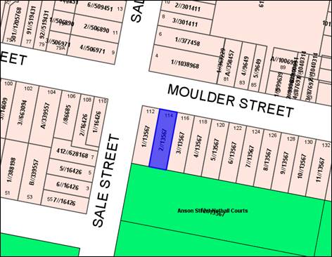
Figure 1 - locality plan
DECISION FRAMEWORK
Development in Orange is governed by two key documents
Orange Local Environment Plan 2011 and Orange Development Control Plan 2004. In
addition the Infill Guidelines are used to guide development, particularly in
the heritage conservation areas and around heritage items.
Orange Local Environment Plan 2011
– The provisions of the LEP must be considered by the Council in
determining the application. LEPs govern the types of development that are
permissible or prohibited in different parts of the City and also provide some
assessment criteria in specific circumstances. Uses are either permissible or
not. The objectives of each zoning and indeed the aims of the LEP itself are
also to be considered and can be used to guide decision making around
appropriateness of development.
Orange Development Control Plan 2004 – the DCP
provides guidelines for development. In general it is a performance based
document rather than prescriptive in nature. For each planning element there
are often guidelines used. These guidelines indicate ways of achieving the
planning outcomes. It is thus recognised that there may also be other solutions
of merit. All design solutions are considered on merit by planning and building
staff. Applications should clearly demonstrate how the planning outcomes are
being met where alternative design solutions are proposed. The DCP enables
developers and architects to use design to achieve the planning outcomes in
alternative ways.
DIRECTOR’S
COMMENT
This Development Application is for a two storey addition to
the rear of the existing dwelling at 114 Moulder Street. The proposal is
architecturally designed and achieves compliance with the planning controls of
the City. This Development Application is referred to the PDC for determination
as per Council’s Planning Protocols as one of the applicants is a
Councillor. Approval of the Development Application is recommended.
Link To Delivery/OPerational Plan
The recommendation in this report relates to the
Delivery/Operational Plan strategy “10.1 Preserve - Engage with the
community to ensure plans for growth and development are respectful of our
heritage”.
Financial Implications
Nil
Policy and Governance Implications
Nil
|
Recommendation
That Council consents to
development application DA 402/2020(1)
for Dwelling House (part demolition, alterations and additions (two
storey)) at Lot 2 DP 13567 – 114 Moulder Street, Orange
pursuant to the conditions of consent in the
attached Notice of Approval.
|
further considerations
Consideration has been given to the recommendation’s
impact on Council’s service delivery; image and reputation; political;
environmental; health and safety; employees; stakeholders and project
management; and no further implications or risks have been identified.
SUPPORTING INFORMATION
The proposal involves alterations and additions to the
existing dwelling house. Proposed works include:
· Demolition
of a modern addition at the rear of the existing dwelling comprising living
room, bedroom and attached garage.
· Minor
internal alterations to the original dwelling.
· Construction
of a rear addition comprising living spaces at ground level, and master bedroom
and ensuite at first floor.
· Construction
of an attached double garage and store, and outdoor terrace.
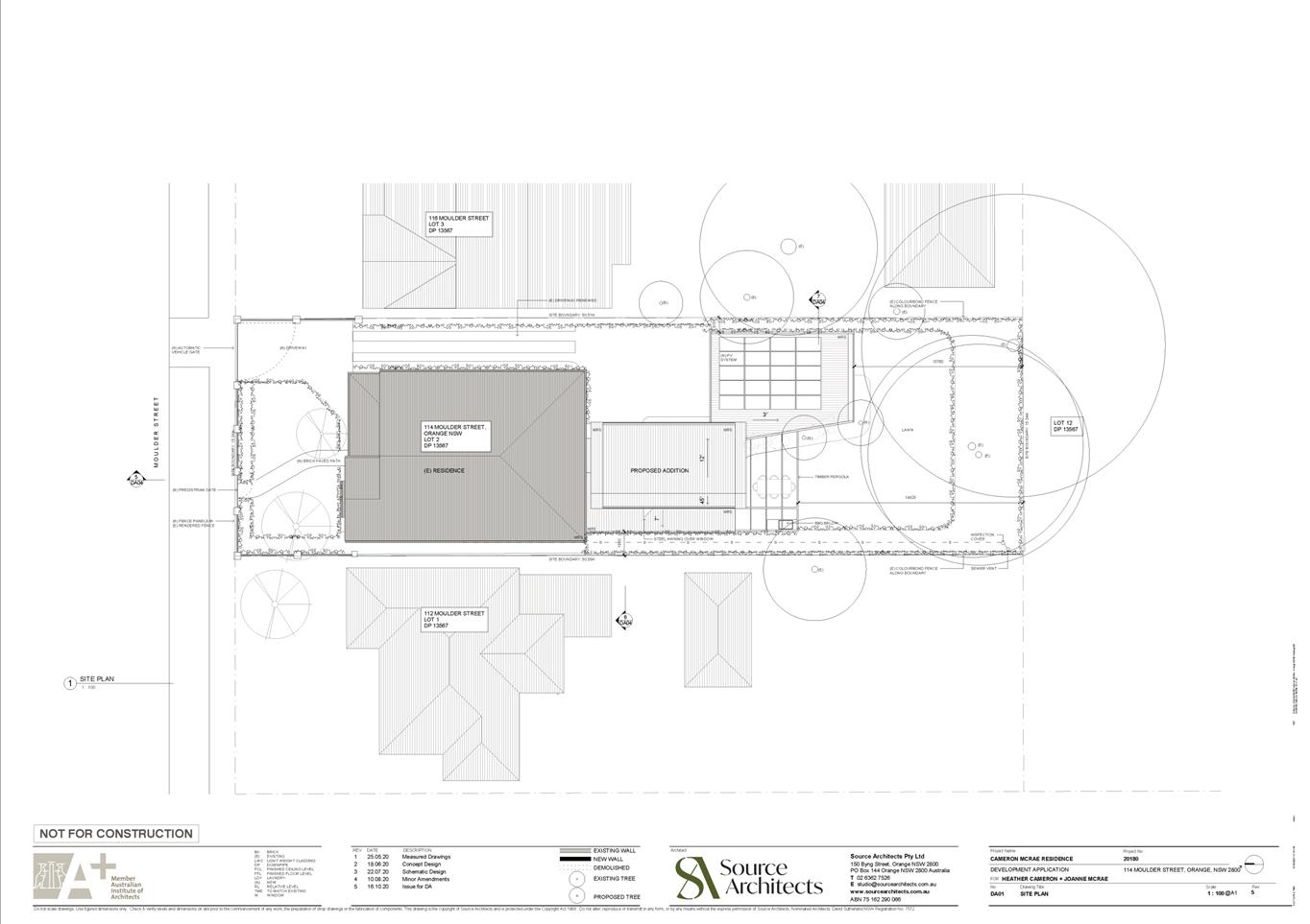
The proposed site layout and
building design are depicted below.
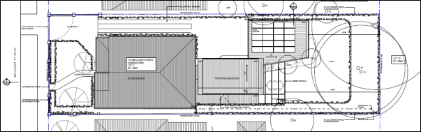
Figure 2 – proposed site layout
Figure 3 – Western elevation section
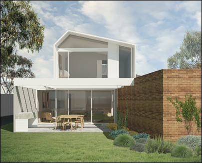
Figure 4 – view of proposed addition facing north
from backyard
MATTERS FOR CONSIDERATION UNDER
THE ENVIRONMENTAL PLANNING AND ASSESSMENT ACT 1979
Section 1.7 Application of
Part 7 of the Biodiversity Conservation Act 2016 and Part 7A of the
Fisheries Management Act 1994
Pursuant to Clause 1.7:
This
Act has effect subject to the provisions of Part 7 of the Biodiversity Conservation Act 2016 and Part 7A of the Fisheries Management Act 1994 that relate to the operation of this Act in connection
with the terrestrial and aquatic environment.
In consideration of this section, the proposed development
is not likely to significantly affect a threatened species:
· The
subject and adjoining lands are not identified as biodiversity sensitive on the
Orange LEP 2011 Terrestrial Biodiversity Map.
· The
proposal does not involve tree removal. Clearing thresholds prescribed by
regulation are not applicable.
· The
site is contained within an established urban area and has been highly modified
by the urban landuse pattern. The subject land does not contain known
threatened species or ecological communities.
Based on the foregoing consideration, a Biodiversity
Assessment Report is not required and the proposal suitably satisfies the
relevant matters at Clause 1.7.
Section 4.15 Evaluation
Provisions of any Environmental Planning Instrument
S4.15(1)(A)(I)
Orange Local Environmental Plan 2011
Part 1 - Preliminary
Clause 1.2 Aims of Plan
The
particular aims of Orange LEP 2011 relevant to the proposal include:
(b) to provide for a range of development opportunities
that contribute to the social, economic and environmental resources of Orange
in a way that allows present and future generations to meet their needs by
implementing the principles for ecologically sustainable development,
(e) to provide a range of housing choices in planned urban
and rural locations to meet population growth.
The proposed development will not be contrary to the
above-listed Aims, as outlined in this report.
Clause 1.6 Consent Authority
Clause 1.6 is applicable and states:
The
consent authority for the purposes of this Plan is (subject to the Act) the
Council.
Clause 1.7 Mapping
The subject site is identified
on the LEP maps in the following manner:
|
Land Zoning Map:
|
Land zoned R1 General Residential
|
|
Lot Size Map:
|
No minimum lot size
|
|
Heritage Map:
|
Not a heritage item or conservation
area; opposite the Central Orange HCA.
|
|
Height of Buildings Map:
|
No building height limit
|
|
Floor Space Ratio Map:
|
No floor space limit
|
|
Terrestrial Biodiversity Map:
|
No biodiversity sensitivity on the
site
|
|
Groundwater Vulnerability Map:
|
Groundwater vulnerable
|
|
Drinking Water Catchment Map:
|
Not within the drinking water
catchment
|
|
Watercourse Map:
|
Not within or affecting a defined
watercourse
|
|
Urban Release Area Map:
|
Not within an urban release area
|
|
Obstacle Limitation Surface Map:
|
No restriction on building siting
or construction
|
|
Additional Permitted Uses Map:
|
No additional permitted use applies
|
|
Flood Planning Map:
|
Not within a flood planning area
|
Those matters that are of relevance are addressed in detail
in the body of this report.
Clause 1.9A Suspension of
Covenants, Agreements and Instruments
Clause 1.9A is applicable and states in part:
(1) For the purpose of enabling
development on land in any zone to be carried out in accordance with this Plan
or with a consent granted under the Act, any agreement, covenant or other
similar instrument that restricts the carrying out of that development does not
apply to the extent necessary to serve that purpose.
(2) This clause does not apply:
(a) to a covenant
imposed by the Council or that the Council requires to be imposed, or
(b) to
any prescribed instrument within the meaning of section 183A of the Crown Lands Act 1989, or
(c) to
any conservation agreement within the meaning of the National Parks and Wildlife Act 1974,
or
(d) to
any Trust agreement within the meaning of the Nature Conservation Trust Act 2001, or
(e) to
any property vegetation plan within the meaning of the Native Vegetation Act 2003, or
(f) to
any biobanking agreement within the meaning of Part 7A of the Threatened Species Conservation Act 1995,
or
(g) to
any planning agreement within the meaning of Division 6 of Part 4 of the Act.
In
consideration of this clause, Council staff are not aware of the title of the
subject property being affected by any of the above.
Part 2 - Permitted or Prohibited Development
Clause 2.1 Land Use Zones
The
subject land is zoned R1 General Residential.
The
proposal is defined as a dwelling house (alterations and additions).
The
proposal is permitted with consent in the R1 zone.
Clause 2.3 Zone Objectives
The
objectives of the R1 General Residential zone are:
· To
provide for the housing needs of the community.
· To
provide for a variety of housing types and densities.
· To
enable other land uses that provide facilities or services to meet the day to
day needs of residents.
· To
ensure development is ordered in such a way as to maximise public transport
patronage and encourage walking and cycling in close proximity to settlement.
· To
ensure that development along the Southern Link Road has an alternative access.
The proposed development is not
contrary to the relevant zone objectives.
Clause 2.7 Demolition Requires
Development Consent
Clause 2.7 is applicable and states:
The demolition of a building or
work may be carried out only with development consent.
Consent is sought for demolition of a modern addition at the
rear of the original dwelling in accordance with this clause.
Part 3 - Exempt and Complying Development
The application is not exempt or complying development.
Part 4 - Principal Development Standards
The
Part 4 Standards do not relate to the subject land or proposed development.
Part 5 - Miscellaneous Provisions
Clause 5.10 Heritage Conservation
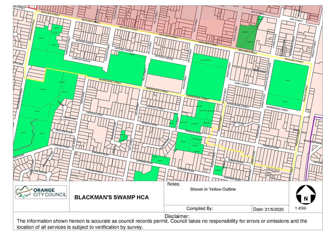
The Heritage Conservation Area (HCA) is located opposite the
site on the north side of Moulder Street. It
is noted that the land is included in the proposed Blackman’s Swamp Creek
HCA.
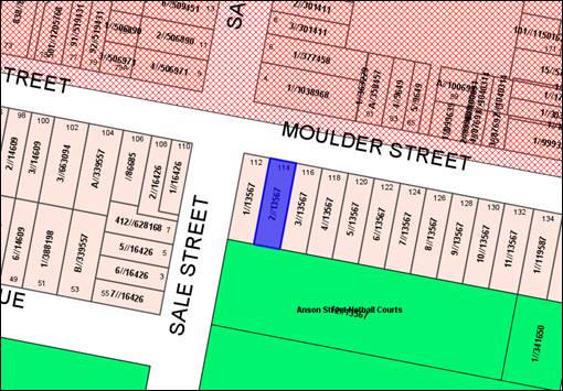
Figure 5 – HCA in red hatching
Clause 5.10 is applicable and states in part:
(4) Effect of Proposed Development on
Heritage Significance
The consent authority must,
before granting consent under this clause in respect of a heritage item or
heritage conservation area, consider the effect of the proposed development on
the heritage significance of the item or area concerned.
In consideration of this clause, the
proposed development will not have adverse impact on the significance of the
nearby HCA:
· The
original dwelling (circa 1920) will be retained.
· The
proposal will remove a modern and unsympathetic building addition.
· The
proposed addition will be located at the rear of the original dwelling, with
nil impact on the streetscape presentation of the site or dwelling.
· The
design, detailing and massing of the contemporary addition will relate to the
original dwelling.
· The
prominence and profile of the original dwelling will be maintained.
· The
proposal will have nil impact on views along Moulder Street.
Part 6 - Urban Release Area
Not relevant to the application.
The subject site is not located in an Urban Release Area.
Part 7 - Additional Local Provisions
Clause
7.3 Stormwater Management
Clause 7.3 is
applicable. This clause states in part:
(3) Development
consent must not be granted to development on land to which this clause applies
unless the consent authority is satisfied that the development:
(a) is
designed to maximise the use of water permeable surfaces on the land having
regard to the soil characteristics affecting onsite infiltration of water, and
(b) includes,
where practical, onsite stormwater retention for use as an alternative supply
to mains water, groundwater or river water, and
(c) avoids
any significant impacts of stormwater runoff on adjoining downstream
properties, native bushland and receiving waters, or if that impact cannot be
reasonably avoided, minimises and mitigates the impact.
In consideration of Clause 7.3,
the proposal will not alter the existing stormwater drainage arrangements that
service the subject land.
Clause 7.6 Groundwater Vulnerability
The subject land is identified as Groundwater Vulnerable on
the Groundwater Vulnerability Map. Clause 7.6 applies. This clause
states in part:
(3) Before determining a
development application for development on land to which this clause applies,
the consent authority must consider:
(a) whether
or not the development (including any onsite storage or disposal of solid or
liquid waste and chemicals) is likely to cause any groundwater contamination or
have any adverse effect on groundwater dependent ecosystems, and
(b) the
cumulative impact (including the impact on nearby groundwater extraction for
potable water supply or stock water supply) of the development and any other
existing development on groundwater.
In
consideration of Clause 7.6, there are no aspects of the proposal will not impact on groundwater and related ecosystems.
STATE ENVIRONMENTAL PLANNING
POLICIES
State Environmental Planning
Policy 55 Remediation of Land
State Environmental Planning Policy
55 - Remediation of Land (SEPP 55) is applicable. Pursuant to Clause 7 Contamination
and remediation to be considered in determining development application:
(1) A
consent authority must not consent to the carrying out of any development on
land unless:
(a) it
has considered whether the land is contaminated, and
(b) if
the land is contaminated, it is satisfied that the land is suitable in its
contaminated state (or will be suitable, after remediation) for the purpose for
which the development is proposed to be carried out, and
(c) if
the land requires remediation to be made suitable for the purpose for which the
development is proposed to be carried out, it is satisfied that the land will
be remediated before the land is used for that purpose.
The subject land
has longstanding residential use and is unlikely to be contaminated.
Contamination investigation is not required for proposed continuation of the
existing residential use.
Provisions of any Draft Environmental Planning Instrument
That Has Been Placed on Exhibition
4.15(1)(A)(Ii)
Draft Orange Local
Environmental Plan 2011 (Amendment 24)
Draft Orange LEP 2011 Amendment 24
is before the Department for finalisation. The Draft Plan involves various
administrative amendments to the LEP including updated maps, and new and
amended clauses. Amendment 24 has no effect for the proposed development.
Draft Orange Local Environmental Plan 2011 (Amendments 25
and 26)
Draft Orange LEP 2011 Amendments 25
and 26 are currently on public exhibition (August 2020). The Draft Plans
relate to land at 1 Leewood Drive and 185 Leeds Parade respectively, and
have no impact for the proposed development.
Provisions
Of Any Development Control Plan S4.15(1)(A)(Iii)
Development Control Plan 2004
DCP 2004-7 Development in Residential Areas
The proposed development will reasonably satisfy the
relevant planning outcomes in Part 7 as outlined in the following assessment.
Neighbourhood Character
Site layout and building design
enables the:
· creation
of attractive residential environments with clear character and identity
· use
of site features such as views, aspect, existing vegetation and landmarks
· buildings
are designed to complement the relevant features and built form that are
identified as part of the desired neighbourhood character
· the
streetscape is designed to encourage pedestrian access and use.
The proposed addition will be located
at the rear of the original dwelling, with nil impact on the streetscape
presentation of the site or dwelling. The design, detailing and massing of the
contemporary addition will relate to the original dwelling. The prominence and
profile of the original dwelling will be maintained. Existing site vegetation
will be retained.
Building Appearance
· the
building design, detailing and finishes relate to the desired neighbourhood
character, complement the residential scale of the area, and add visual
interest to the street
· the
frontages of buildings and their entries face the street
· garages
and car parks are sited and designed so that they do not dominate the street
frontage.
The proposal does not involve alterations to the existing
dwelling which presents to Moulder Street. The proposed addition will respect
the existing footprint, form and dominant roof lines of the existing dwelling.
The addition will be constructed in traditional materials comprising face brick
walls (ground level) and painted weatherboard cladding (first floor). External
finishes will be sympathetic to the existing house and surrounding buildings.
The proposed attached double garage will be located some 30m from the front
boundary, and will not have a streetscape presence.
Staff concur with the proponent’s submission that ‘the
new works will be subservient to the existing residence and neighbouring
residences; will not change the streetscape or be generally visible from the
public domain; and will not involve the removal of significant vegetation.’
Setbacks
· street
setbacks contribute to the desired neighbourhood character, assist with the
integration of new development and make efficient use of the site
· street
setbacks create an appropriate scale for the street considering all other streetscape
components.
The proposal will not alter the front setback to Moulder
Street for the existing dwelling.
Front Fences and Walls
The DCP sets the following Planning
Outcomes in regard to Fences and Walls:
· Front
fences and walls:
- assist
in highlighting entrances and creating a sense of identity within the
streetscape
- are
constructed of materials compatible with associated housing and with fences
visible from the site that positively contribute to the streetscape
- provide
for facilities in the street frontage area such as mail boxes.
The existing front fence to Moulder Street will be renewed,
comprising wrought iron infill panels between existing rendered brick piers;
and new vehicle and pedestrian gates.
Visual Bulk
The DCP sets the following Planning Outcome in regard to
Visual Bulk:
· Built
form accords with the desired neighbourhood character of the area with:
- side
and rear setbacks progressively increased to reduce bulk and overshadowing
- site
coverage that retains the relatively low density landscaped character of
residential areas
- building
form and siting that relates to landform, with minimal land shaping (cut and
fill)
- building
height at the street frontage that maintains a comparable scale with the
predominant adjacent development form
- building
to the boundary where appropriate.
The
visual bulk associated with the proposed development will be suitable as
considered below:
· The
height of the proposed two storey addition will be consistent with the ridge
height of the original dwelling (as depicted in Figure 3 above).
· The
proposed addition will be contained within the DCP-prescribed visual bulk
envelope plane.
· Nil-negligible
earthworks will be required.
· The
proposed development (existing dwelling and addition) will comprise a footprint
of 233m2. Based onsite area of 770m2, the proposal will
have site coverage of some 30%, in compliance with the maximum 60% prescribed
in the DCP.
· The
proposed addition will be setback a minimum 1.5m from the western boundary, and
900mm from the eastern boundary. Setbacks are typical to the residential
setting, and consistent with the siting of dwellings on adjoining lands.
· The
proposed two storey element will be located more than 15m from the Moulder
Street frontage, and will not visually encroach upon the streetscape.
· The
proposal will not result in unreasonable visual bulk encroachment impacts for
adjoining parcels:
- The proposed
addition will be setback 1.5m (ground level) and 3m (first floor) from the
western boundary, opposing 112 Moulder Street. The proposed setbacks are
greater than those for the existing dwelling. The two storey element will have
a smaller footprint atop the ground level addition, will which assist to reduce
visual bulk. The two storey element will oppose a garage on the adjoining
western parcel, and not a primary habitable space.
- The proposed
single storey garage will be sited 900m from the eastern boundary opposing 116
Moulder Street. The scale of the garage will be consistent with other
outbuildings on adjoining lands. The garage will oppose advanced trees on the
opposing parcel to the east.
Walls and Boundaries
The DCP sets the following Planning
Outcome in regard to Walls and Boundaries:
· Building
to the boundary is undertaken to provide for efficient use of the site taking
into account:
- the
privacy of neighbouring dwellings and private open space
- the
access to daylight reaching adjoining properties
- the
impact of boundary walls on neighbours.
The proposal does not involve
building to any boundary. As outlined in this report, the site layout and
building design will not adversely impact on adjoining dwellings in respect of
privacy, solar access or visual bulk.
Daylight
and Sunlight
The DCP sets the following Planning
Outcome in regard to Daylight and Sunlight:
· Buildings
are sited and designed to ensure:
- daylight
to habitable rooms in adjacent dwellings is not significantly reduced
- overshadowing
of neighbouring secluded open spaces or main living area windows is not
significantly increased
- consideration
of Council’s Energy Efficiency Code.
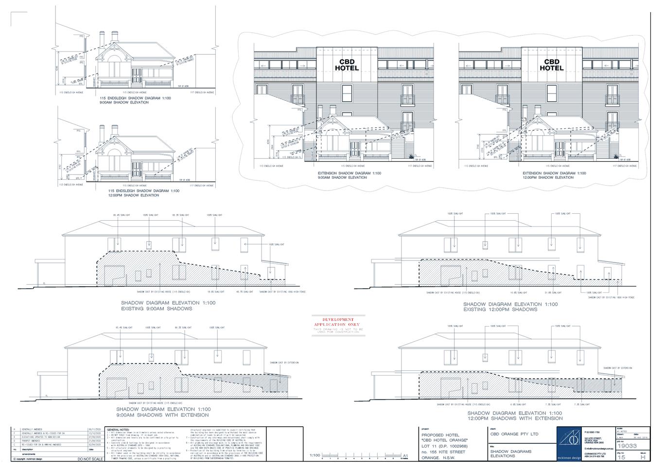
Shadow diagrams were submitted in
support of the proposal. The diagrams demonstrate that internal and external
solar access will be provided to the extended dwelling and dwellings on
adjoining lands in accordance with the DCP Guidelines.
Views
The DCP sets the following Planning
Outcomes in regard to Views:
· building
form and design allow for residents from adjacent properties to share prominent
views where possible
· views
including vistas of heritage items or landmarks are not substantially affected
by the bulk and scale of the new development.
There are no prominent views or
landmarks that require consideration in this setting. The streetscape view
corridor will not be altered by the rear addition.
Visual Privacy
The DCP sets the following Planning
Outcome in regard to Visual Privacy:
· Direct
overlooking of principal living areas and private open spaces of other
dwellings is minimised firstly by:
- building
siting and layout
- location
of windows and balconies
and secondly
by:
- design
of windows or use of screening devices and landscaping.
The proposed site layout and
building design will provide acceptable visual privacy for the subject and
adjoining dwellings.
Privacy will be achieved within the
development as follows:
- Openings
in the addition will be directed to the rear private open space area.
- The
outdoor terrace will be enclosed on the west side by a timber privacy screen.
Privacy for dwellings on adjoining parcels will be
maintained as follows:
- Existing
perimeter fencing will be retained.
- The
proposed addition does not involve ground level openings on the west
façade (most affected).
- One
window will be located on the first floor of the west façade. A privacy
screen will be installed to prevent views to and from the subject window.
- A
light void will be located on the first floor of the east façade. The
void will not permit views to or from the subject glazing, and will be located
some 8m from the opposing eastern boundary.
- The
proposal will not alter existing arrangements relating to opposing private open
spaces.
Acoustic Privacy
The DCP sets the following Planning Outcome in regard to
Acoustic Privacy:
· Site
layout and building design:
- protect
habitable rooms from excessively high levels of external noise
- minimise
the entry of external noise to private open space for dwellings close to major
noise sources
- minimise
transmission of sound through a building to affect other dwellings.
The subject land is contained in a residential area, where
ambient noise levels are low. The proposal will not alter the existing
acoustic environment for the subject and adjoining dwellings.
Security
The DCP sets the following Planning Outcomes in regard to
Security:
· the
site layout enhances personal safety and minimises the potential for crime,
vandalism and fear
· the
design of dwellings enables residents to survey streets, communal areas and
approaches to dwelling entrances.
The proposal is considered acceptable in regard to safety
and security as follows:
· openings
in the dwelling will provide for surveillance of Moulder Street, the driveway
and rear yard
· the
landscape design will not restrict sight lines
· the
dwelling will have internal access via the garage
· front
fencing/gates and side boundary fencing will be installed/maintained.
Circulation and Design
The DCP sets the following Planning Outcome in regard to
Circulation and Design:
· accessways
and parking areas are designed to manage stormwater
· accessways,
driveways and open parking areas are suitably landscaped to enhance amenity
while providing security and accessibility to residents and visitors
· the
site layout allows people with a disability to travel to and within the site
between car parks, buildings and communal open space.
The existing footpath crossover and driveway via Moulder
Street will be retained in the current location. Reverse egress to Moulder
Street will be required for the extended dwelling, consistent with existing
vehicle arrangements. The proposal will not generate additional traffic volumes
above the existing situation.
Car
Parking
The DCP sets the following Planning Outcomes in regard to
Car Parking:
· Parking
facilities are provided, designed and located to:
- enable
the efficient and convenient use of car spaces and access ways within the site
- reduce
the visual dominance of car parking areas and access ways.
· Car
parking is provided with regard to the:
- the
number and size of proposed dwellings
- requirements
of people with limited mobility or disabilities.
Pursuant to DCP 2004, onsite parking is required for 3+
bedroom dwellings at a rate of 1.5 spaces per dwelling. An attached double
garage will be provided for the extended dwelling in compliance with the DCP.
Private Open Space
The DCP sets the following Planning Outcomes in regard to
Private Open Space:
Private open space is clearly
defined for private use.
· Private
open space areas are of a size, shape and slope to suit the reasonable
requirements of residents including some outdoor recreational needs and service
functions.
· Private
open space is:
- capable
of being an extension of the dwelling for outdoor living, entertainment and
recreation
- accessible
from a living area of the dwelling
- located
to take advantage of outlooks; and to reduce adverse impacts of overshadowing
or privacy from adjoining buildings
- orientated
to optimise year round use.
Private open space for the proposed
extended dwelling will comply with the DCP Guidelines in relation to
minimum area, dimension, orientation, solar access and connectivity.
Open Space and Landscaping
The DCP sets the following Planning Outcomes in regard to
Open Space and Landscaping:
· the
site layout provides open space and landscaped areas which:
- contribute
to the character of the development by providing buildings in a landscaped
setting
- provide
for a range of uses and activities including stormwater management
- allow
cost effective management.
· the
landscape design specifies landscape themes consistent with the desired neighbourhood
character; vegetation types and location, paving and lighting provided for
access and security
· major
existing trees are retained and protected in a viable condition whenever
practicable through appropriate siting of buildings, access ways and parking
areas
· paving
is applied sparingly and integrated in the landscape design.
Existing site landscaping will be retained.
Stormwater
The DCP sets the following Planning Outcomes in regard to
Stormwater:
· Onsite
drainage systems are designed to consider:
- downstream
capacity and need for onsite retention, detention and re-use
- scope
for onsite infiltration of water
- safety
and convenience of pedestrians and vehicles
- overland
flow paths.
· Provision
is made for onsite drainage which does not cause damage or nuisance flows to
adjoining properties.
Existing arrangements for stormwater drainage will be
maintained.
Erosion
and Sedimentation
The DCP sets the following Planning Outcome in regard to
Erosion and Sedimentation:
· Measures
implemented during construction to ensure that the landform is stabilised and
erosion is controlled.
Sediment and erosion controls will be employed during
construction.
Provisions Prescribed by the
Regulations S4.15(1)(A)(Iv)
The proposal is not inconsistent with any matter prescribed
by Regulation.
The Likely Impacts of the
Development S4.15(1)(B)
The impacts of the proposed
development have been considered in the foregoing sections of this report and
include:
· Setting,
context and neighbourhood character.
· Visual
impacts (streetscape presentation, building design and detailing, fencing,
landscaping, visual bulk).
· Traffic
matters (site access, car parking and manoeuvring, traffic generation).
· Residential
amenity (onsite and on adjoining lands, solar access, acoustic and visual
privacy, outdoor spaces, visual bulk).
· Crime
prevention.
· Environmental
impacts (biodiversity, groundwater, stormwater management, sediment control).
The impacts of the development are
considered to be within reasonable limit. Conditions are included on the attached
Notice of approval to mitigate and managing arising impacts.
The Suitability Of The Site S4.15(1)(C)
The subject land is considered to
be suitable for the proposed development due to the following:
· The
proposal is permitted on the subject land.
· Utility
services are available and adequate.
· The
land has suitable road access.
· The
local road network is of sufficient capacity.
· The
land is not subject to known technological or natural hazards.
· The
site has no particular environmental values.
· The
nearby conservation setting will not affect the proposed development.
Any Submissions Made In Accordance With The Act
S4.15(1)(D)
The proposal is a notified
development pursuant to Council’s Community Participation Plan 2019. At
the completion of the notification period, no submissions had been received in
relation to the application.
Public Interest S4.15(1)(E)
The proposal is not inconsistent
with any relevant policy statements, planning studies and guidelines etc. that
have not been considered in this assessment.
SUMMARY
The proposed development is
permitted with consent. The development will contribute to the diversity of
housing forms in the precinct in a manner that is
consistent with the neighbourhood character. The proposal will provide and maintain
a high standard of residential amenity for the proposed dwelling and those on
adjoining lands. The proposed development will be consistent with applicable
Local planning controls. Impacts of the development will be within reasonable
limit. Approval of the application is recommended.
Attachments
1 Notice
of Approval, D20/70353⇩
2 Plans,
D20/70044⇩
Attachment 1 Notice
of Approval
|

|
ORANGE
CITY COUNCIL
Development
Application No DA
402/2020(1)
NA20/ Container
PR8778
|
NOTICE OF DETERMINATION
OF A DEVELOPMENT
APPLICATION
issued under the Environmental
Planning and Assessment Act 1979
Section 4.18
|
Development
Application
|
|
|
Applicant Name:
|
Ms JM
McRae and Ms HM Cameron
|
|
Applicant Address:
|
C/- Source
Architects
PO Box 144
ORANGE
NSW 2800
|
|
Owner’s Name:
|
Ms JM
McRae and Ms H M Cameron
|
|
Land to Be Developed:
|
Lot 2 DP
13567 - 114 Moulder Street, Orange
|
|
Proposed Development:
|
Dwelling
House (part demolition, alterations and additions (two-storey))
|
|
|
|
|
Building
Code of Australia
building
classification:
|
Class to
be certified by the PC
|
|
|
|
|
Determination
made under
Section 4.16
|
|
|
Made On:
|
1 December
2020
|
|
Determination:
|
CONSENT
GRANTED SUBJECT TO CONDITIONS DESCRIBED BELOW:
|
|
|
|
|
Consent to
Operate From:
|
2 December
2020
|
|
Consent to
Lapse On:
|
2 December
2025
|
Terms of Approval
The reasons for the imposition of
conditions are:
(1) To ensure a quality
urban design for the development which complements the surrounding environment.
(2) To maintain
neighbourhood amenity and character.
(3) To ensure compliance
with relevant statutory requirements.
(4) To ensure the utility
services are available to the site and adequate for the development.
(5) To prevent the proposed
development having a detrimental effect on adjoining land uses.
Conditions
(1) The
development must be carried out in accordance with:
(a) Drawings by Source
Architects, Project No. 20180. Drawing Nos. DA00 Rev 5; DA01
Rev 5; DA02 Rev 5; DA03 Rev 4; DA04 Rev 4; DA05 Rev 1 (5
sheets)
(b) Statements
of environmental effects or other similar associated documents that form part
of the approval
as amended
in accordance with any conditions of this consent.
(2) All building work must
be carried out in accordance with the provisions of the Building Code of
Australia.
(3) A sign is to be erected
in a prominent position on any site on which building work, subdivision work or
demolition work is being carried out:
(a) showing
the name, address and telephone number of the principal certifying authority
for the work, and
(b) showing
the name of the principal contractor (if any) for any building work and a
telephone number on which that person may be contacted outside working hours,
and
(c) stating
that unauthorised entry to the site is prohibited.
Any such sign is to be maintained while the
building work, subdivision work or demolition work is being carried out.
(4) In the case
of residential building work for which the Home Building Act 1989
requires there to be a contract of insurance in force in accordance with Part 6
of the Act, evidence that such a contract of insurance is in force is to be
provided to the Principal Certifying Authority before any building work
authorised to be carried out by the consent commences.
(5) Residential
building work within the meaning of the Home Building Act 1989 must not
be carried out unless the principal certifying authority for the development to
which the work relates (not being the council) has given the council written
notice of the following information:
(a) in
the case of work for which a principal contractor is required to be appointed:
(i) the
name and the licence number of the principal contractor, and
(ii) the
name of the insurer by which the work is insured under Part 6 of that Act,
(b) in
the case of work to be done by an owner-builder:
(i) the
name of the owner-builder, and
(ii) if
the owner-builder is required to hold an owner-builder permit under that Act,
the number of the owner-builder permit.
If arrangements for doing the
residential building work are changed while the work is in progress so that the
information under this condition becomes out of date, further work must not be
carried out unless the principal certifying authority for the development to
which the work relates (not being the council) has given the council written
notice of the updated information.
(6) Where any excavation
work on the site extends below the level of the base of the footings of a
building on adjoining land, the person having the benefit of the development
consent must, at the person’s own expense:
(a) protect
and support the adjoining premises from possible damage from the excavation,
and
(b) where
necessary, underpin the adjoining premises to prevent any such damage.
Note: This
condition does not apply if the person having the benefit of the development
consent owns the adjoining land or the owner of the adjoining land has given
consent in writing to this condition not applying.
|
PRIOR TO THE ISSUE OF
A CONSTRUCTION CERTIFICATE
|
(7) An
approval under Section 68 of the Local Government Act is to be sought
from Orange City Council, as the Water and Sewer Authority, for alterations to
water and sewer. No plumbing and drainage is to commence until approval is
granted.
(8) A Road Opening Permit
in accordance with Section 138 of the Roads Act 1993 must be approved by
Council prior to a Construction Certificate being issued or any intrusive
works being carried out within the public road or footpath reserve.
|
PRIOR TO WORKS
COMMENCING
|
(9) A
temporary onsite toilet is to be provided and must remain throughout the
project or until an alternative facility meeting Council’s requirements
is available onsite.
(10) The
location and depth of the sewer junction/connection to Council’s sewerage
system is to be determined to ensure that adequate fall to the sewer is
available.
(11) Soil erosion control
measures shall be implemented on the site.
(12) A
Construction Certificate application is required to be submitted to, and issued
by Council/Accredited Certifier prior to any excavation or building works being
carried out onsite.
|
DURING
CONSTRUCTION/SITEWORKS
|
(13) All
construction/demolition work on the site is to be carried out between the hours
of 7.00 am and 6.00 pm Monday to Friday inclusive, 7.00 am to
5.00 pm Saturdays and 8.00 am to 5.00 pm Sundays and Public
Holidays. Written approval must be obtained from the General Manager of Orange
City Council to vary these hours.
(14) A
Registered Surveyor’s Certificate identifying the location of the
building on the site must be submitted to the Principal Certifying Authority.
(15) All
construction works are to be strictly in accordance with the Reduced Levels
(RLs) as shown on the approved plans.
(16) All services (water,
sewer and stormwater) shall be laid outside the easement unless there is a direct
connection to the main within that easement.
(17) All
materials on site or being delivered to the site are to be contained within the
site. The requirements of the Protection of the Environment Operations Act
1997 are to be complied with when placing/stockpiling loose material or
when disposing of waste products or during any other activities likely to
pollute drains or watercourses.
(18) No portion of the
building - including footings, eaves, overhang and service pipes - shall
encroach into any easement.
|
PRIOR TO THE ISSUE OF
AN OCCUPATION CERTIFICATE
|
(19) No
person is to use or occupy the building or alteration that is the subject of
this approval without the prior issuing of an Occupation Certificate.
(20) Finished
ground levels are to be graded away from the buildings and adjoining properties
and must achieve natural drainage. The concentrated flows are to be dispersed
down slope or collected and discharged to the stormwater drainage system.
(21) Where
Orange City Council is not the Principal Certifying Authority, a final
inspection of water connection, sewer and stormwater drainage shall be
undertaken by Orange City Council and a Final Notice of Inspection issued,
prior to the issue of either an interim or a final Occupation Certificate.
(22) The cut and
fill is to be retained and/or adequately battered and stabilised (within the
allotment) prior to the issue of an Occupation Certificate.
(23) A Road Opening Permit
Certificate of Compliance is to be issued for the works by Council prior to any
Occupation/Final Certificate being issued for the development.
(24) All
of the foregoing conditions are to be at the full cost of the developer and to
the requirements and standards of the Orange City Council Development and
Subdivision Code, unless specifically stated otherwise. All work required by
the foregoing conditions is to be completed prior to the issuing of an
Occupation Certificate, unless stated otherwise.
Other Approvals
(1) Local
Government Act 1993 approvals granted under Section 68.
Nil
(2) General
terms of other approvals integrated as part of this consent.
Nil
Right of Appeal
If you are dissatisfied with this
decision, Section 8.7 of the Environmental Planning and Assessment
Act 1979 gives you the right to appeal to the Land and Environment
Court. Pursuant to Section 8.10, an applicant may only appeal within 6 months
after the date the decision is notified.
|
Disability Discrimination Act
1992:
|
This application has been assessed in
accordance with the Environmental Planning and Assessment Act 1979. No
guarantee is given that the proposal complies with the Disability
Discrimination Act 1992.
The applicant/owner is responsible to
ensure compliance with this and other anti-discrimination legislation.
The Disability Discrimination Act
covers disabilities not catered for in the minimum standards called up in the
Building Code of Australia which references AS1428.1 - "Design for
Access and Mobility". AS1428 Parts 2, 3 and 4 provides the most
comprehensive technical guidance under the Disability Discrimination Act
currently available in Australia.
|
|
|
|
|
Disclaimer - S88B of the Conveyancing
Act 1919 - Restrictions on the Use of Land:
|
The applicant should note that there
could be covenants in favour of persons other than Council restricting what
may be built or done upon the subject land. The applicant is advised to check
the position before commencing any work.
|
|
|
|
|
Signed:
|
On behalf of the consent authority ORANGE
CITY COUNCIL
|
|
Signature:
|
|
|
Name:
|
PAUL JOHNSTON - MANAGER DEVELOPMENT
ASSESSMENTS
|
|
Date:
|
2 December 2020
|
Planning and Development Committee
1 December 2020
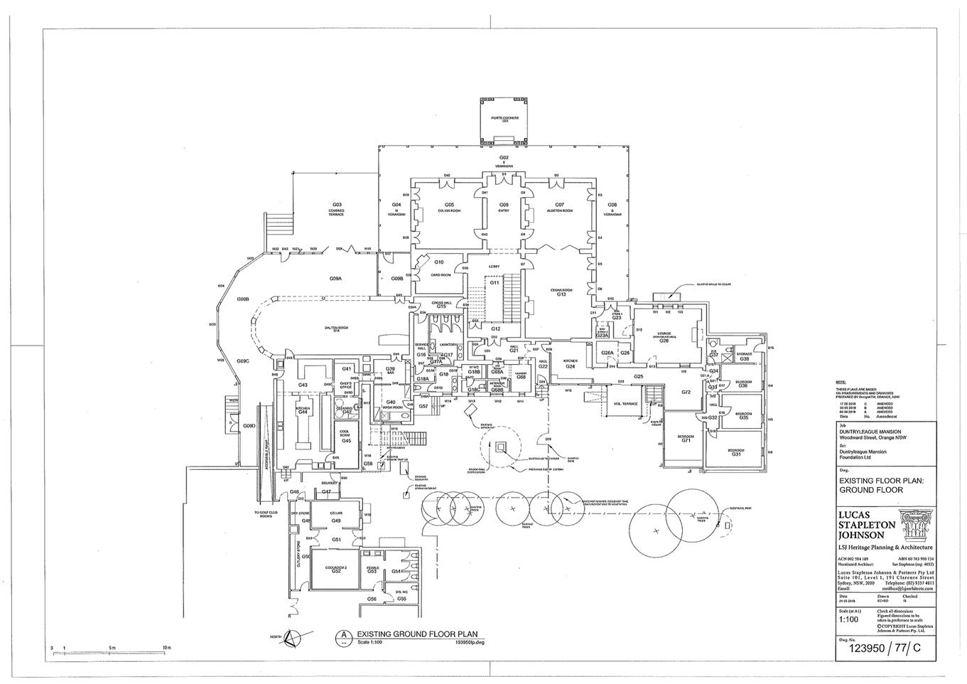
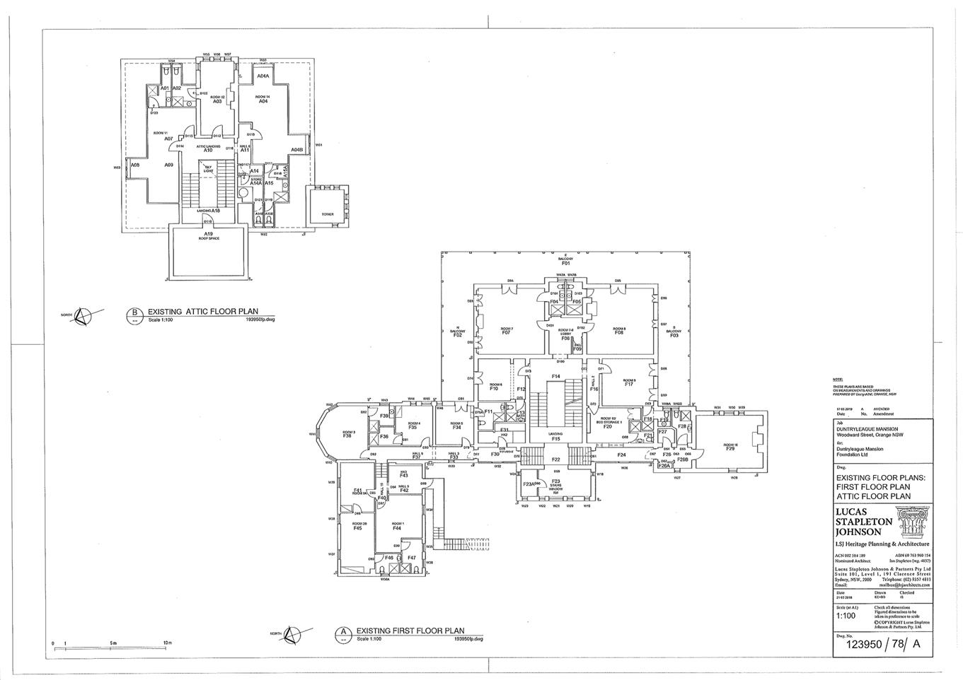
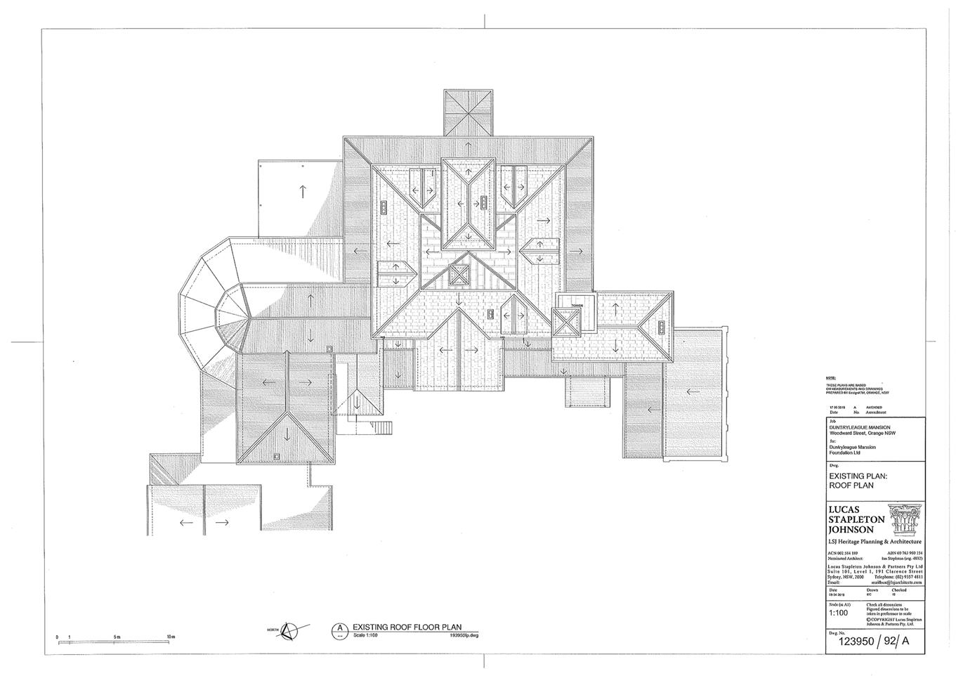
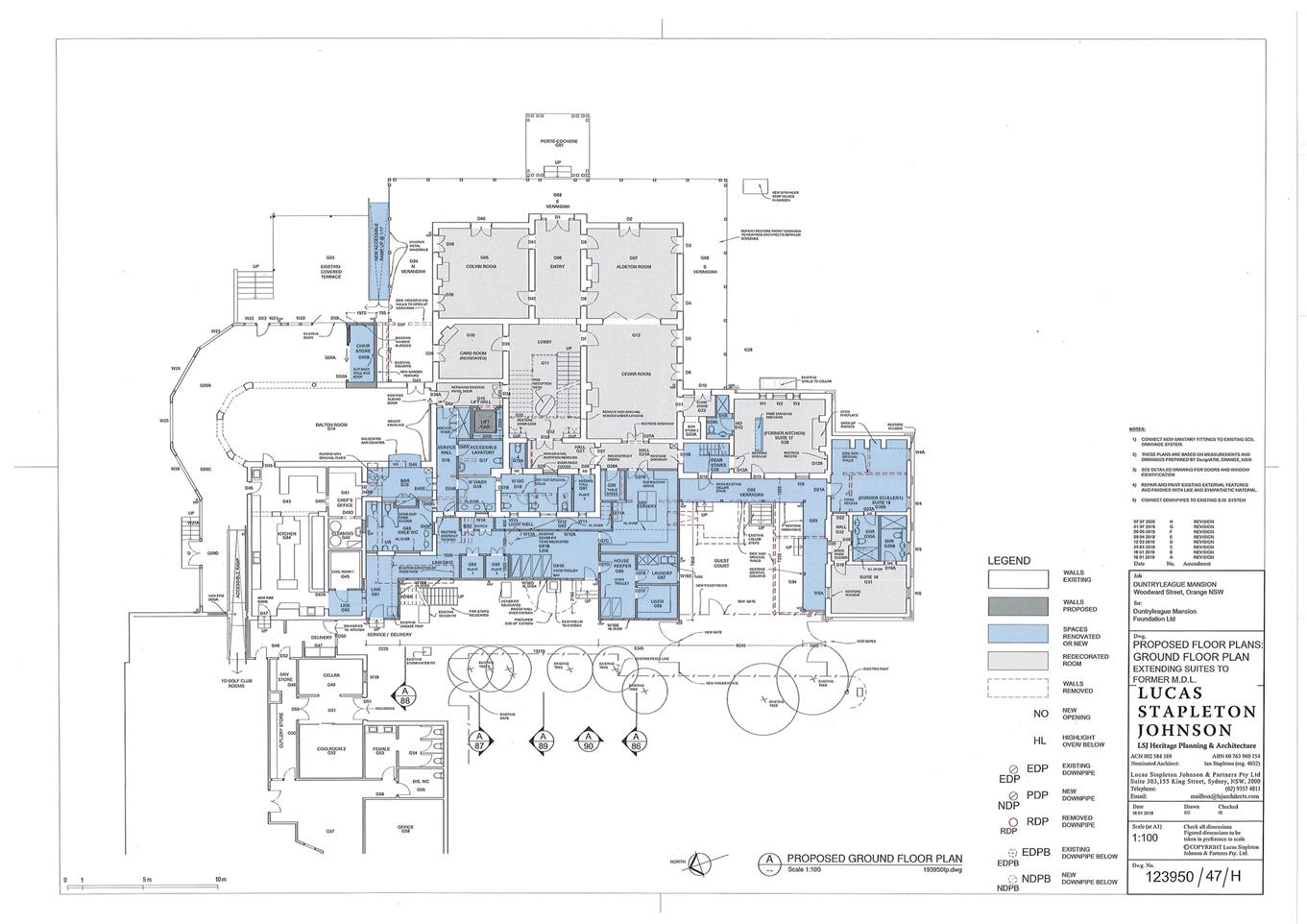
2.3 Development
Application DA 210/2019(1) - Woodward Street - Duntryleague Guest House
RECORD
NUMBER: 2020/2350
AUTHOR: Andrew
Crump, Senior Planner
EXECUTIVE
Summary
|
Application
lodged
|
10 July
2019
|
|
Applicant/s
|
Lucas
Stapleton Johnson and Partners
|
|
Owner/s
|
Orange
Golf Club Limited
|
|
Land
description
|
Lot 16
DP 1120534 - Woodward Street, Orange
|
|
Proposed
land use
|
Alterations
and Additions to Duntryleague Guest House (including upgrading works and rear
extension)
|
|
Value of
proposed development
|
$3,200,000.00
|
Council's consent is sought to
undertake alterations and additions to the Duntryleague Mansion that sits
within The Orange Golf Club on land described as Lot 16 DP 1120534, known
as Lot 16 Woodward Street, Orange.
Figure 1 - locality plan – development site
shown red outline
The principle objective of the proposed works are to
increase the accessibility to all but three rooms on the upper level, and
improvements to the functionality of the guest house.
The land is identified as a state heritage item and
accordingly the development is a nominated integrated development application.
After a protracted process through
NSW Heritage with various meetings and amendments to plans, General Terms of
Approval from NSW Heritage have been obtained and are attached to the consent.
Council staff along with Council’s Heritage Advisor
are supportive of the development application and as such the development is
recommended for approval.
DECISION FRAMEWORK
Development in Orange is governed by two key documents
Orange Local Environment Plan 2011 and Orange Development Control Plan 2004. In
addition the Infill Guidelines are used to guide development, particularly in
the heritage conservation areas and around heritage items.
Orange Local Environment Plan 2011 – The
provisions of the LEP must be considered by the Council in determining the
application. LEPs govern the types of development that are permissible or
prohibited in different parts of the City and also provide some assessment
criteria in specific circumstances. Uses are either permissible or not. The
objectives of each zoning and indeed the aims of the LEP itself are also to be
considered and can be used to guide decision making around appropriateness of
development.
Orange Development Control Plan 2004 – the DCP
provides guidelines for development. In general it is a performance based
document rather than prescriptive in nature. For each planning element there
are often guidelines used. These guidelines indicate ways of achieving the
planning outcomes. It is thus recognised that there may also be other solutions
of merit. All design solutions are considered on merit by planning and building
staff. Applications should clearly demonstrate how the planning outcomes are
being met where alternative design solutions are proposed. The DCP enables
developers and architects to use design to achieve the planning outcomes in
alternative ways.
DIRECTOR’S
COMMENT
Staff have been working with the members
of the Orange Golf Club for many years to progress a long term development and
maintenance plan for the Duntryleague mansion. This work has resulted in
a long term plan that would see alterations to the building to permit disabled
access; improved safety and increased room availability, whilst preserving this
important building. The Golf Club have spent a considerable amount in
designs in order to meet requirements of the NSW Heritage Council. Whilst
there is still details that are to be sorted by the Club in order to obtain
Heritage Approval, staff and Council’s Heritage Advisor support this
proposal. Approval of this Application is recommended.
Link To Delivery/OPerational Plan
The recommendation in this report relates to the
Delivery/Operational Plan strategy “10.1 Preserve -
Engage with the community to ensure plans for growth and development are
respectful of our heritage”.
Financial Implications
Nil
Policy and Governance Implications
Nil
|
Recommendation
That Council consents to
development application DA 210/2019(1)
for Alterations and Additions to Duntryleague Guest House (including
upgrading works and rear extension) at Lot 16 DP 1120534 -
Woodward Street, Orange pursuant to the conditions
of consent in the attached Notice of Approval.
|
further considerations
Consideration has been given to the
recommendation’s impact on Council’s service delivery; image and
reputation; political; environmental; health and safety; employees;
stakeholders and project management; and no further implications or risks have
been identified.
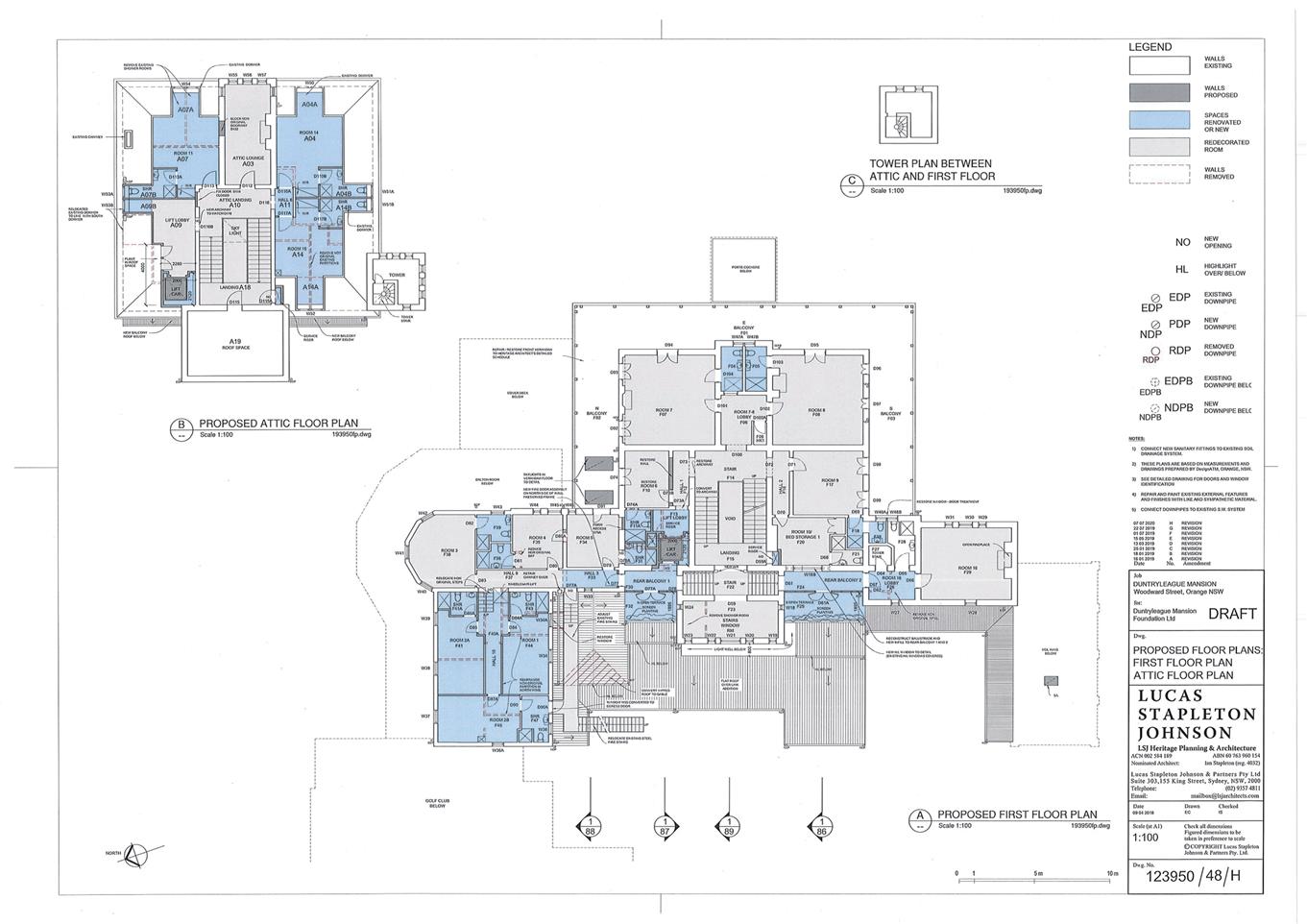
SUPPORTING INFORMATION
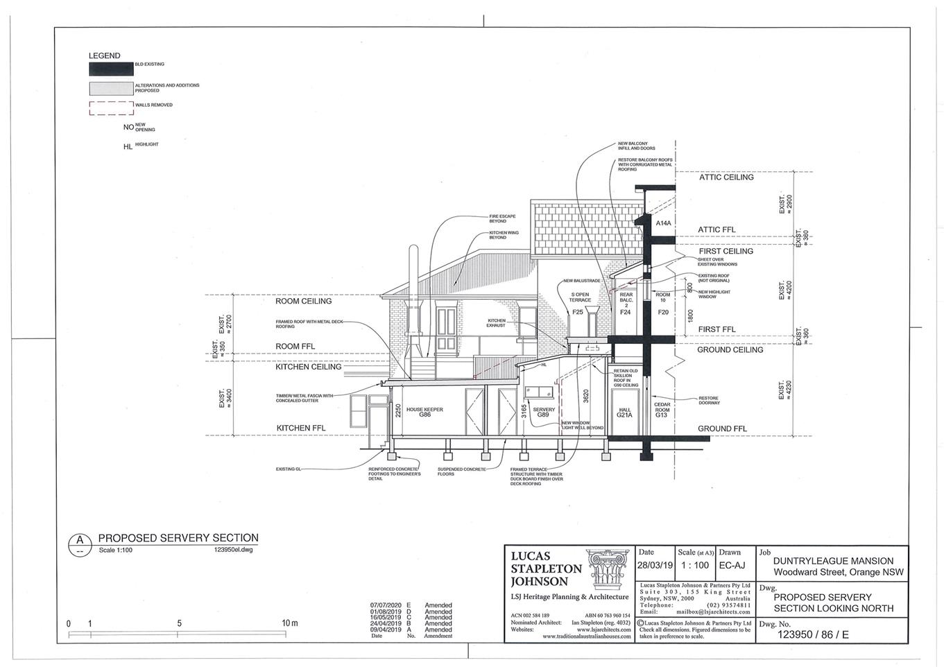
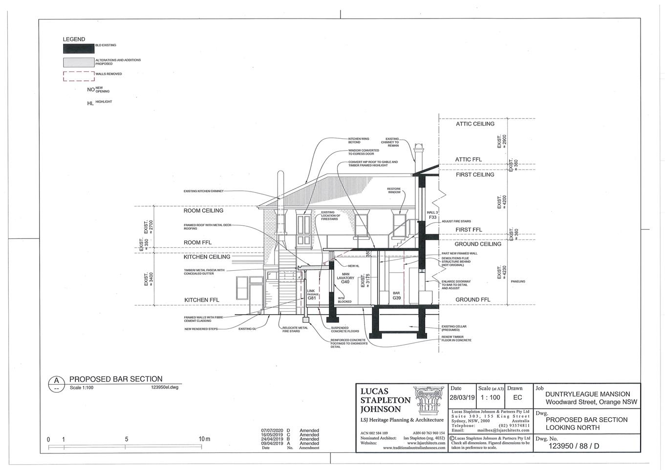
Council's consent is sought to undertake alterations and
additions to the Duntryleague Mansion which provides guesthouse accommodation
and sits within the ground of the Orange Golf Course. The works primarily
relate to improving accessibility via the provision of an elevator, improved
amenity to guest rooms through the provision of ensuite bathrooms to some of
the rooms, and improved operational functionality via provision of rear service
corridors.
Period appropriate refurbishment of the rooms is also
proposed.
The entire extent of works is summarised in the below table
and should be read in conjunction with the accompanying plans. NB where items
are struck-out, they were originally proposed but now they no long form part of
the application.
SCOPE OF WORKS
The applicant submits the scope
of works involves the following:
|
No.
|
Proposed Works
|
|
GENERALLY
|
|
1
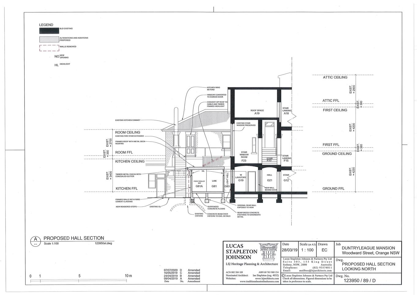
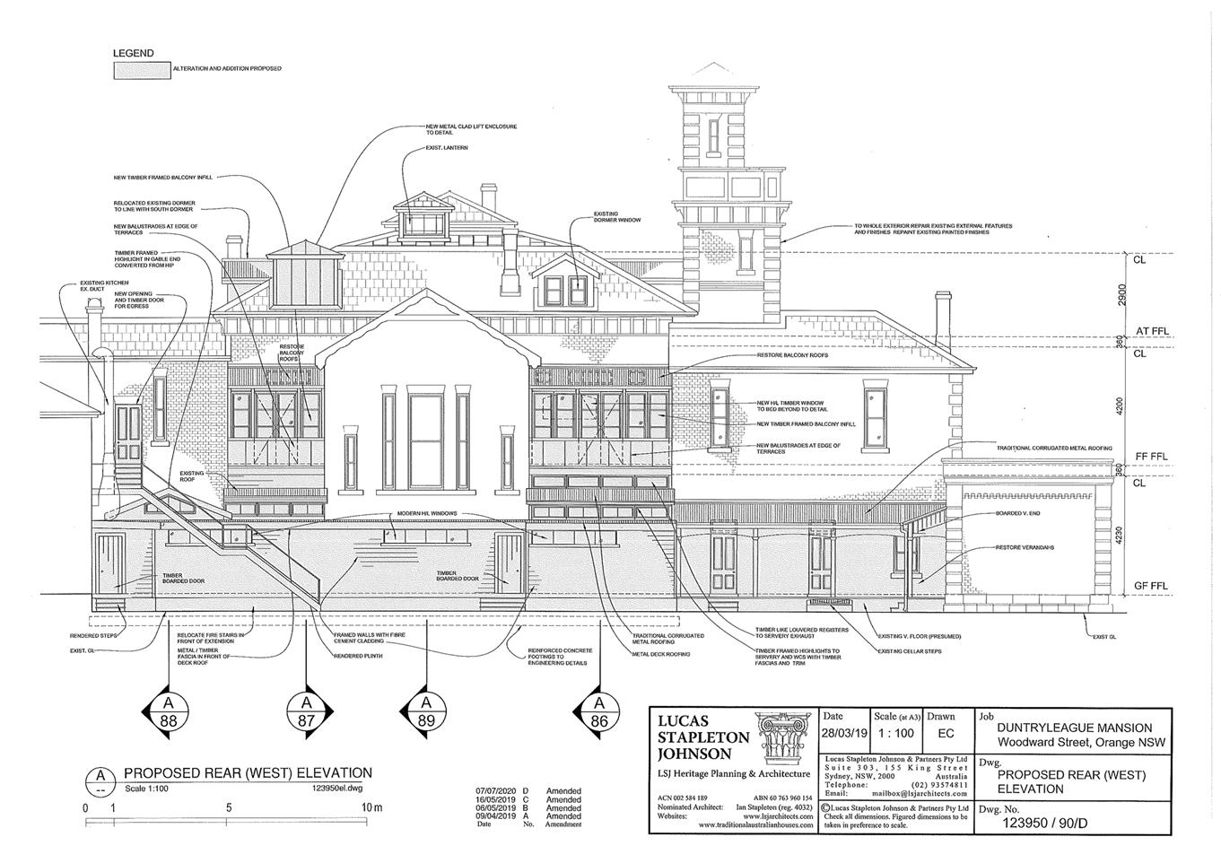
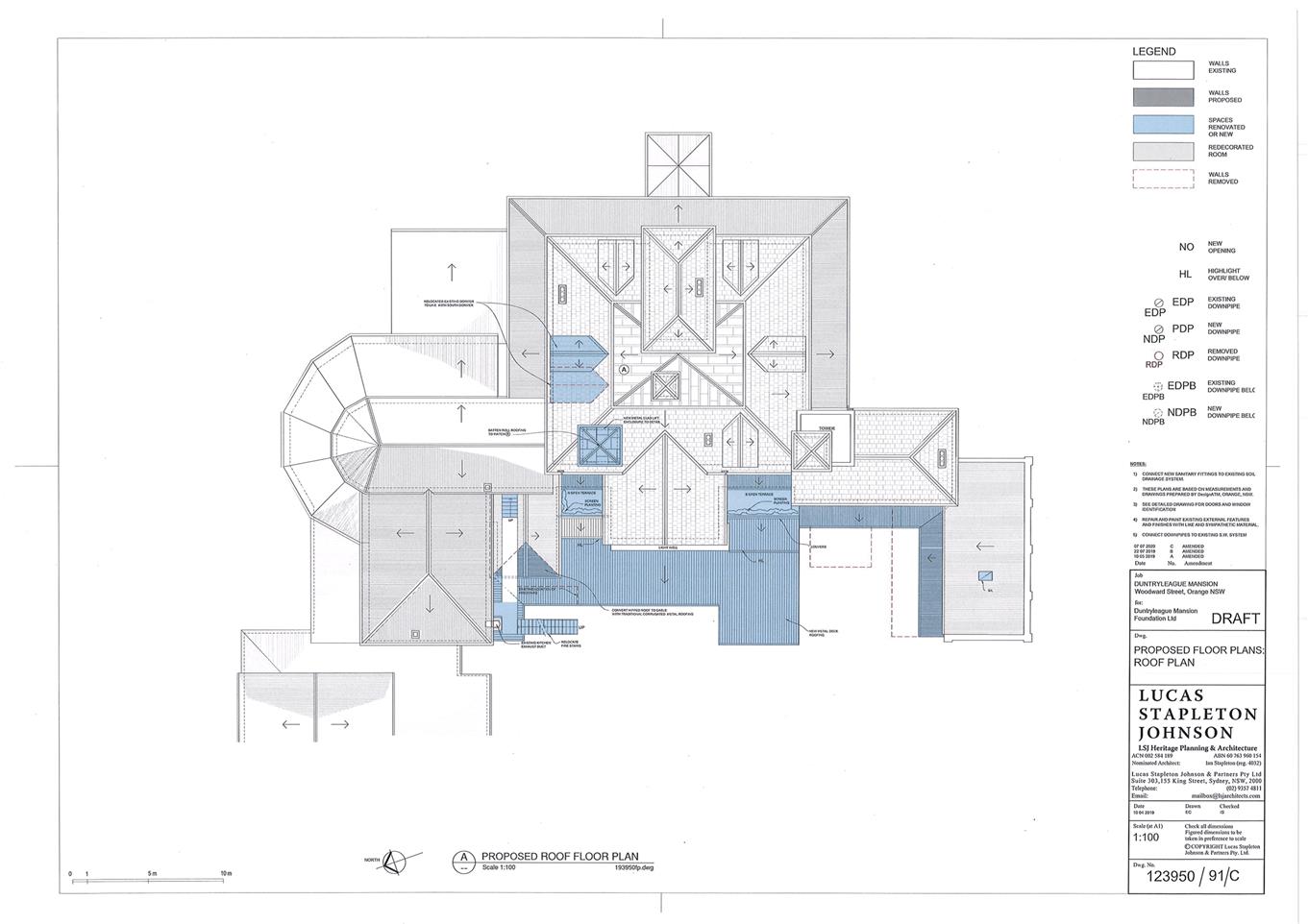
|
Relocate northern dormer
window to main roof to match details of existing.
|
|
2
|
Reduce Dalton Room at
south-east corner and construct chair-store (in order to reinstate use of
Card Room G10). Open up west end of northern front verandah by removing
non-original walling.
|
|
3
|
Generally add additions and
alterations to rear (west side) of building to accommodate enlarged
lavatories, new servery, new housekeepers (linen/laundry) facilities, plant
rooms, table dressing store and rear link passage connecting existing kitchen
to servery.
|
|
4
|
As part of above, alter G40 for Male WC.
|
|
5
|
As part of above, rearrange
existing Men’s and Women’s Lavatories for accessible Lavatory G17
and Women’s Washroom G18.
|
6
|
As part of the above, form Women’s WC G19 and Plant
Room G91 in existing Laundry area.
|
|
7
|
As part of the above, construct Link addition no with
G81, G81A, G81B and G81C on west side (rear) of building articulated by a
lightwell to leave rear wall partly free.
|
|
8
|
As part of the above, alter existing rear entry and
Margaret Dalton Lodge (MDL)
Kitchen to form Servery G91, Linen-Trolley Room G86,
Laundry G87 and Linen Room G88.
|
|
9
|
As part of the above, demolish existing infills and
reconstruct original west (rear) verandahs to former Margaret Dalton Lodge
area (G28-G31) and original Kitchen/Scullery area forming G28/G36A and
G94. As part of the above retain existing Cellar steps and existing
rear cistern.
|
|
10
|
Install
new lift at Ground Floor level adjusting non-original partitioning.
|
|
11
|
Install new lift at First Floor level and adjust adjacent
partitioning and ensuites as shown.
|
|
12
|
Install
new lift at Attic level and adjust adjacent partitioning as shown.
|
|
13
|
As part of the above, restore rear Balcony Space F30 and
construct light-weight first floor Terrace F32.
|
|
14
|
As part of the above, restore rear Balcony Space F24 and construct
light-weight first Floor Terrace F25.
|
|
15
|
Remove
old flues, create larger opening to Dalton Room and refurbish bar G39.
|
|
16
|
Remove
screen under stair landing and install cupboards beneath Main Stair G12.
|
|
17
|
Restore
Cedar Room door assembly D27A to provide access to new Servery.
|
|
18
|
Restore
original door opening between Hall G21A and Hall G26.
|
|
19
|
New
partition to form Spaces G26A and G26.
|
|
20
|
Demolish
part west wall of G23.
|
|
21
|
Convert
space G38 to Ensuite
|
|
22
|
Alter
D34A to include Fire door retaining existing door assembly.
|
|
23
|
Form new Fire doors at D49E.
|
|
24
|
Construct
internal disabled ramp and Fire door at G09D (north-west Dalton Room).
|
|
25
|
Convert
G10 from Store Room (table dressings) to Card Room.
|
|
26
|
Redecorate
Reception Rooms G05 Colvin Room and G10 Card Room.
|
|
27
|
Redecorate
common areas G06 Entry and G11 Lobby (Stair).
|
|
28
|
Redecorate
Rear Corridors G21 Hall, G21A Hall and G26A Rear Stairs.
|
|
29
|
Redecorate
Function Room G07 Alderton Room and G13 Cedar Room.
|
|
30
|
Convert Old Kitchen G28 to a guest suite including
constructing ensuite bathroom at G28A and restoring a door recess at D13B.
|
|
31
|
Conversion of former Margaret Dalton Lodge rooms to Guest
Suites G31, G36A including partitioning and converting G35 to 2 no. ensuite
bathrooms.
|
|
32
|
Other
required BCA works to be determined.
|
|
FIRST
FLOOR
|
|
33
|
Removal
of non-original walls at Room 16 Lobby, (F26).
|
|
34
|
Redecoration
of guest suites F41, F44, F45.
|
|
34A
|
Rearrange partitioning to North West wing, construct new
ensuite bathrooms and wheelchair lift as shown. Adjust existing rear fire
stair to serve rearrangement. Renovate ensuite bathroom F47.
|
|
35
|
Redecoration of Guest Suites F34, F35, F38 including new
doorway in wall between F34 and F35 and new doorway to F31.
|
|
36
|
Reconstruction of Room 6, F10, including reconstructing
south wall and new opening to west wall.
|
|
37
|
Restore
archway D73 (matches D72).
|
|
38
|
Redecoration
of guest suites, Main Wing, F07, F08, F17 and F20.
|
|
39
|
Redecoration
Room 16, F29 and restore fireplace.
|
|
40
|
Redecoration
of hallways F33 and F37.
|
|
41
|
Redecoration of guest spaces Main Wing F06, F12, F14,
F15, F16, F22, F23 including removal of cupboard/bathroom in F23.
|
|
42
|
New
opening and service duct at Door 59A.
|
|
43
|
Renovation
of all ensuite bathrooms except F28.
|
|
44
|
Restore
window/door treatment at W48 (South Front Balcony)
|
|
45
|
Other
BCA works to be determined.
|
|
ATTIC
(SECOND FLOOR)
|
|
46
|
Rearrange and redecorate guest suites A03, A04, A04C,
A07, A09, A10, A11 and A18 as shown.
|
|
47
|
Redecoration
of guest areas A09, A10, A11, A18.
|
|
48
|
Relocate
northern dormer structure.
|
|
49
|
New
opening and service riser at D115A.
|
|
50
|
Strengthening
of floors for Plant Room in roof space A19.
|
|
51
|
Relocate
ensuite bathrooms as shown.
|
|
52
|
Other
BCA works to be determined.
|
|
ROOF
|
|
53
|
See
also comments above relating to alterations and additions at lower roof
levels.
|
|
54
|
New
metal-clad lift enclosure for lift- to be recognisable as modern construction
on close inspection.
|
|
55
|
New
slate roofing for new proposed dormers. See also Item 1.
|
|
56
|
Convert
hipped roof over space G40 to gable in order to introduce highlight.
|
|
SERVICES
|
|
57
|
Upgrade
electrical services.
|
|
58
|
New
power points and other communications points in guest rooms and new areas.
|
|
59
|
New
water/oil traditional -style radiators for heating throughout the building.
|
|
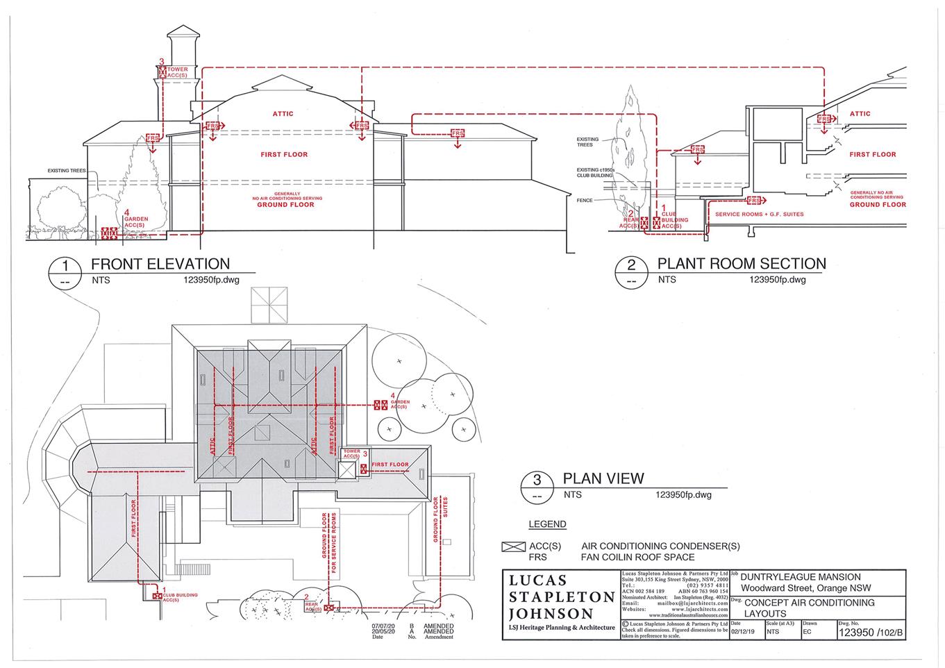
60
|
New
concealed air-conditioning fan coil units, heat exchangers, piping and
conduits for air-conditioning system to serve First and Attic Floors. See
A.C. strategy drawing 102B.
|
|
61
|
New
concealed fire sprinkler system with stop valves located in garden as shown.
|
|
62
|
Upgrade/extend water, stormwater, sewer, hot water
services. Conceal where possible and remove existing surface mounted piping
and conduits where possible.
|
|
63
|
Install
skylights in floor of north balcony (to light verandah outside Card Room
G10).
|
|
64
|
New
ramp for disabled access alongside the original northern front verandah.
|
The proposed elevator on the ground
floor will be in an area identified as low heritage significance, located near
the existing toilets in the corridor linking the foyer and the Dalton Room as
shown below:


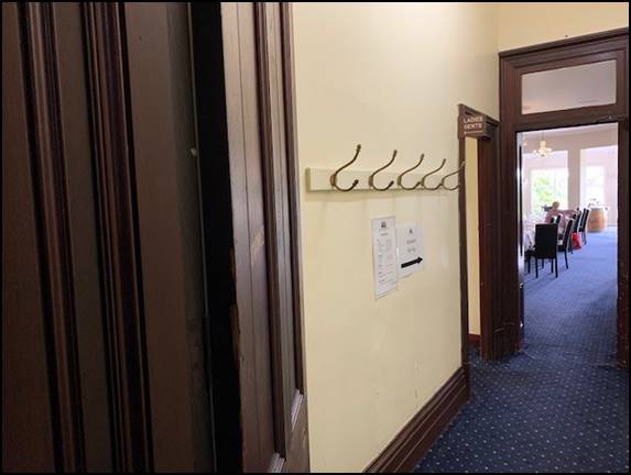
Figure 2 - approximate location of elevator on Ground
Floor
The rear link corridor relates the
western elevation as shown below:
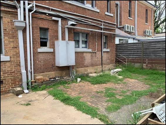
Figure 3 - rear wall where the rear link corridor is
proposed
MATTERS FOR CONSIDERATION
Section 1.7 - Application of Part
7 of the Biodiversity Conservation Act 2016 and Part 7A of the Fisheries
Management Act 1994
Section 1.7 of the EP&A Act
identifies that Part 7 of the Biodiversity Conservation Act 2016
(BC Act) and Part 7A of the Fisheries Management Act 1994 have effect in
connection with terrestrial and aquatic environments.
There are four triggers known to insert a development into the
Biodiversity Offset Scheme (i.e. the need for a BDAR to be submitted with
a DA):
· Trigger
1: development occurs in land mapped on the Biodiversity Values
Map (OEH) (clause 7.1 of BC Regulation 2017);
· Trigger
2: development involves clearing/disturbance of native vegetation above a
certain area threshold (clauses 7.1 and 7.2 of BC Regulation 2017); or
· Trigger
3: development is otherwise likely to significantly affect threatened
species (clauses 7.2 and 7.3 of BC Act 2016).
The fourth trigger (development
proposed to occur in an Area of Outstanding Biodiversity Value (clause 7.2 of
BC Act 2016) is generally not applicable to the Orange LGA; as no such areas
are known to occur in the LGA. No further comments will be made against the
fourth trigger.
None of the above triggers are
expected to be activated by the development. The development relates to
alterations and additions to an existing building, no trees are to be removed
as part of the development.
Section 4.15
Section 4.15 of the Environmental
Planning and Assessment Act 1979 requires Council to consider various
matters, of which those pertaining to the application are listed below.
PROVISIONS OF ANY ENVIRONMENTAL PLANNING INSTRUMENT s4.15(1)(a)(i)
Orange Local Environmental Plan
2011
Part 1 - Preliminary
Clause 1.2 - Aims of Plan
The broad aims of the LEP are set out under Subclause 2.
Those relevant to the application are as follows:
(a) to encourage development which complements and
enhances the unique character of Orange as a major regional centre boasting a
diverse economy and offering an attractive regional lifestyle,
(b) to provide for a range of development opportunities
that contribute to the social, economic and environmental resources of Orange
in a way that allows present and future generations to meet their needs by
implementing the principles for ecologically sustainable development,
(c) to conserve and enhance the water resources on which
Orange depends, particularly water supply catchments,
(f) to recognise and manage valued environmental heritage,
landscape and scenic features of Orange.
The application is considered to be
consistent with aims (a), (b), (c) and (f) as listed above.
Clause 1.6 - Consent Authority
This clause establishes that,
subject to the Act, Council is the consent authority for applications made
under the LEP.
Clause 1.7 - Mapping
The subject site is identified on the LEP maps in the
following manner:
|
Land Zoning Map:
|
Land zoned RE2 Private
Recreation
|
|
Lot Size Map:
|
No Minimum Lot Size
|
|
Heritage Map:
|
Heritage item
|
|
Height of Buildings Map:
|
No building height limit
|
|
Floor Space Ratio Map:
|
No floor space limit
|
|
Terrestrial Biodiversity Map:
|
No biodiversity sensitivity on the
site
|
|
Groundwater Vulnerability Map:
|
Groundwater vulnerable
|
|
Drinking Water Catchment Map:
|
Not within the drinking water
catchment
|
|
Watercourse Map:
|
Not within or affecting a defined
watercourse
|
|
Urban Release Area Map:
|
Not within an urban release area
|
|
Obstacle Limitation Surface Map:
|
No restriction on building siting
or construction
|
|
Additional Permitted Uses Map:
|
No additional permitted use applies
|
|
Flood Planning Map:
|
Not within a flood planning area
|
Those matters that are of relevance
are addressed in detail in the body of this report.
Clause 1.9A - Suspension of
Covenants, Agreements and Instruments
This clause provides that covenants, agreements and other
instruments which seek to restrict the carrying out of development do not apply
with the following exceptions.
(a) to
a covenant imposed by the Council or that the Council requires to be imposed,
or
(b) to
any relevant instrument under Section 13.4 of the Crown Land Management Act
2016, or
(c) to
any conservation agreement under the National Parks and Wildlife Act 1974, or
(d) to
any Trust agreement under the Nature Conservation Trust Act 2001, or
(e) to
any property vegetation plan under the Native Vegetation Act 2003, or
(f) to
any biobanking agreement under Part 7A of the Threatened Species Conservation
Act 1995, or
(g) to
any planning agreement under Subdivision 2 of Division 7.1 of the Environmental
Planning and Assessment Act 1979.
Council staff are not aware of the title of the subject
property being affected by any of the above.
Part 2 - Permitted or Prohibited Development
Clause 2.1 - Land Use Zones and
Clause 2.3 - Zone Objectives and Land Use Table
The subject site is located within the RE2 – Private
Recreational zone. The proposed development is characterised as hotel or motel
accommodation under OLEP 2011. Hotel or motel accommodation means:
a building or place (whether or
not licensed premises under the Liquor Act 2007) that provides temporary or
short-term accommodation on a commercial basis and that -
(a) comprises
rooms or self-contained suites, and
(b) may
provide meals to guests or the general public and facilities for the parking of
guests’ vehicles,
but does not include
backpackers’ accommodation, a boarding house, bed and breakfast
accommodation or farm stay accommodation.
Hotel or motel
accommodation is not permitted in the RE2 zone; however, the development has a
long history being used as a guest house dating back to 1936. For a period
during the Second World War it was used by the Red Cross as a convalescent
hospital. It was returned to a guest house in 1947 and has continued as such
over the years.
The use pre-dates the
modern planning system and as such the land benefits from existing use rights.
The EP and A
Regulations allow the alteration and extension of an existing use but only with
development consent.
The development is
therefore permissible as an existing use.
Clause 2.3 of LEP 2011 references the Objectives for each zone in
LEP 2011. These objectives for land zoned RE2 – Private Recreation
are as follows:
1 -
Objectives of the RE2 Private Recreation zone
· To
enable land to be used for private open space or recreational purposes.
· To
provide a range of recreational settings and activities and compatible land
uses.
· To
protect and enhance the natural environment for recreational purposes.
· To
ensure development is ordered in such a way as to maximise public transport
patronage and encourage walking and cycling in close proximity to settlement.
· To
ensure development along the Southern Link Road has alternative access.
The development (although not a
permissible use in the zone under the current LEP), remains consistent with the
objects of the RE2 zone as the development will continue to provide a
complementary use supporting main use of the land as a golf course.
Part 3 - Exempt and Complying
Development
The application is not exempt or complying development.
Part 5 - Miscellaneous Provisions
5.10 - Heritage Conservation
The subject
land is identified as a Heritage Item under schedule 5 of Orange LEP 2011.
The relevant
inventory sheet describes the statement of significance as follows:
Duntryleague Mansion (including
gateway, gatekeeper’s lodge, entry avenue and stables, but excluding golf
course layout).
This two storey house, with
tower like chapel above, is significant for the display of wealth and
confidence following, and partly the result of, the gold rush to the
surrounding fields.
The property now known as
Duntryleague was part of one of the first land grants in the Orange area in
1834, located adjacent to the later gazetted township of Orange and comprising
a full square mile. The property was grazed for many years by various owners
and tenants, but William Sampson, the first grantee who was himself an absent
land owner with interests in the Mudgee area, also established his early
property called Campdale on the land. The property also included other early
buildings important in the history of Orange such as John Peisley's the Coach
and Horses which is regarded as the first inn in the Blackman's Swamp (Orange)
area.
James Dalton, the prominent
Orange merchant, purchased sections of the land from 1872 to establish a
substantial family estate of 311 acres that he named Duntryleague after his
birthplace in Ireland. In 1876 he commissioned the design and construction of a
mansion located on a prominent ridge of the property from Sydney architect
Benjamin Backhouse. The house is a splendid example of mid Victorian splendour
designed in the Victorian Filigree style with a richness of detail befitting
the man of wealth and influence that James had become by that time.
The estate included two
gatehouses, an ornate entrance and gates, a stable, a dairy, 2-3 workers'
cottages, a fern house, orchards, vegetable gardens for the household and
extensive pastures for grazing.
James initially assisted his
father in their first shop in Orange after arriving from Ireland at the age of
15. In 1853 he set up his own store at the corner of Post Office Lane which he
later managed with his brother Thomas who arrived in Australia in 1858. His
father went on to manage the well-known Daniel O'Connell Inn in Orange. The
Dalton Bros. business grew to become the largest wholesale merchant business
west of the Blue Mountains with interests throughout the Central West,
eastwards to Sydney and northwards to the Queensland border at the height of
their success in the late 1800s. The store building that James built in Summer
Street was significantly added to over the years and was to become one of the
landmark buildings in town. The Sydney side of the business was managed by
Thomas who lived at Wheatleigh in North Sydney and the company was notable in
the city for Dalton House in Pitt Street, and the Dalton Wharf at Millers
Point.
Over the years up to 1925 in
Orange the family have been associated with a large number of significant homes
and also owned and managed a number of extensive pastoral properties. Many of
these buildings remain today as testimony to the importance of the family in
the region.
The Dalton family was among New
South Wales' most influential and wealthy Catholic families. The
Irish-Catholic community in Orange was relatively large and particularly
wealthy enough to play a dominant role in politics and the social and spiritual
development of the town. The Daltons were instrumental in the financing of St.
Joseph's Catholic Church in Orange and James Dalton had built Australia Hall in
Lord's Place to provide the controversial venue for a group of visiting Irish
Nationalists in 1883. James may also have provided funds and leadership for the
Irish Nationalist Movement in NSW. Some of the Dalton children later studied in
Ireland and returned to Australia to work. The Dalton family were involved in
the early civic development of Orange. Some stood on local Council (James
Dalton Mayor 1869, Michael Francis Dalton Councillor from 1906 for many years).
In 1877 James was awarded the rare honour of being made a Papal Knight by Pope
Gregory for his services to the Catholic Church and the large stained
glass window in the hall of Duntryleague commemorates his investiture.
After James' death the house
and grounds were retained briefly in family ownership and also used as a large
convalescent hospital run by the Red Cross. The property was then purchased by
the Orange Golf Club in 1935 as a home for the Club, which had originally been
established in Orange in 1909, but had outgrown earlier Club premises. James
Dalton had in fact opened the Club in 1901.
The Club has made some
alterations to the house and grounds over the years but both still retain
significant aspects of their history that are still able to demonstrate the
original design and use of the once splendid property. The Club has established
itself at Duntryleague over the past 70 years as an important golf club in NSW
with an exceptional setting for its courses and attracting local, state and
international players and visitors (Christo Aitken & Associates, 2003,
66-67).
Duntryleague property has
strong historic associations with prominent merchant, pastoralist and townsman,
James Dalton, and architect Benjamin Backhouse, its designer, R Scott & JJ
McMurtrie, stone masons. Duntryleague has aesthetic significance with its
prominent hilltop location, extensive grounds now a golf course, fine
collection of magnificent mature trees, original estate elements including an
axial entry driveway with gate keeper's lodge, notable house, terraced former
gardens and tennis courts.
Duntryleague contains a house
of mid Victorian splendour, a good example of Victorian Filigree style by
virtue of its ornate cast iron work to the portico and verandahs. It displays
high standards of construction and high quality craftsmanship in its joinery an
ironwork.
(1) Objectives
The objectives of this clause are
as follows:
(a) to
conserve the environmental heritage of Orange,
(b) to
conserve the heritage significance of heritage items and heritage conservation
areas, including associated fabric, settings and views,
(c) to
conserve archaeological sites,
(d) to
conserve Aboriginal objects and Aboriginal places of heritage significance.
The development is not incongruous with the objects of the
clause. The proposed works will provide sympathetic improvements to the
accessibility and overall functionality of the guesthouse; which in turn should
make the facility a more attractive offering in the tourist market, providing
increased revenue which then can be used to conserve the building ongoing.
(2) Requirement
for Consent
Development consent is required
for any of the following:
(b) altering
a heritage item that is a building by making structural changes to its interior
or by making changes to anything inside the item that is specified in Schedule
5 in relation to the item,
The development involves altering
a heritage item and as such required consent which the applicant has applied
for.
(4) Effect
of Proposed Development on Heritage Significance
The consent authority must,
before granting consent under this clause in respect of a heritage item or
heritage conservation area, consider the effect of the proposed development on
the heritage significance of the item or area concerned. This Subclause applies
regardless of whether a heritage management document is prepared under Subclause
(5) or a heritage conservation management plan is submitted under Subclause
(6).
The development will not have a
detrimental effect on the significance of the Heritage Item. The development
has the support of Council’s Heritage Advisor and General Terms of
Approval have been issued by NSW Heritage.
(5) Heritage
Assessment
The consent authority may,
before granting consent to any development:
(a) on
land on which a heritage item is located, or
(b) on
land that is within a heritage conservation area, or
(c) on
land that is within the vicinity of land referred to in paragraph (a) or (b),
require a heritage management
document to be prepared that assesses the extent to which the carrying out of
the proposed development would affect the heritage significance of the heritage
item or heritage conservation area concerned.
The development
is accompanied by a HIS and a CMP is already in place.
(6) Heritage
Conservation Management Plans
The consent authority may
require, after considering the heritage significance of a heritage item and the
extent of change proposed to it, the submission of a heritage conservation
management plan before granting consent under this clause.
A CMP is already in place for the subject land. The development
is not contrary to the CMP.
(7) Archaeological
Sites
The consent authority must,
before granting consent under this clause to the carrying out of development on
an archaeological site (other than land listed on the State Heritage
Register or to which an interim heritage order under the Heritage Act 1977
applies):
(a) notify
the Heritage Council of its intention to grant consent, and
(b) take
into consideration any response received from the Heritage Council within 28
days after the notice is sent.
The subject land is not an archaeological site.
(8) Aboriginal
Places of Heritage Significance
The consent authority must,
before granting consent under this clause to the carrying out of development in
an Aboriginal place of heritage significance:
(a) consider
the effect of the proposed development on the heritage significance of the
place and any Aboriginal object known or reasonably likely to be located at the
place by means of an adequate investigation and assessment (which may involve
consideration of a heritage impact statement), and
(b) notify
the local Aboriginal communities, in writing or in such other manner as may be
appropriate, about the application and take into consideration any response
received within 28 days after the notice is sent.
The subject land is not an Aboriginal Place of Heritage
Significance.
(9) Demolition
of Nominated State Heritage Items
The consent authority must,
before granting consent under this clause for the demolition of a nominated
State heritage item:
(a) notify
the Heritage Council about the application, and
(b) take
into consideration any response received from the Heritage Council within
28 days after the notice is sent.
The site is
already state item.
(10) Conservation
Incentives
The consent authority may grant
consent to development for any purpose of a building that is a heritage item or
of the land on which such a building is erected, or for any purpose on an
Aboriginal place of heritage significance, even though development for that
purpose would otherwise not be allowed by this Plan, if the consent authority
is satisfied that:
(a) the
conservation of the heritage item or Aboriginal place of heritage significance
is facilitated by the granting of consent, and
(b) the
proposed development is in accordance with a heritage management document that
has been approved by the consent authority, and
(c) the
consent to the proposed development would require that all necessary
conservation work identified in the heritage management document is carried
out, and
(d) the
proposed development would not adversely affect the heritage significance of the
heritage item, including its setting, or the heritage significance of the
Aboriginal place of heritage significance, and
(e) the
proposed development would not have any significant adverse effect on the
amenity of the surrounding area.
The subject land benefits from
existing use rights and as such Subclause (10) is not required.
Part 6 - Urban Release Area
Not relevant to the application. The subject site is not
located in an Urban Release Area.
Part 7 - Additional Local Provisions
7.1 - Earthworks
This clause establishes a range of
matters that must be considered prior to granting development consent for any
application involving earthworks, such as:
(a) the likely disruption of, or any
detrimental effect on, existing drainage patterns and soil stability in the
locality of the development
(b) the effect of the development on the
likely future use or redevelopment of the land
(c) the quality of the fill or the soil to be
excavated, or both
(d) the effect of the development on the
existing and likely amenity of adjoining properties
(e) the source of any fill material and the
destination of any excavated material
(f) the likelihood of disturbing relics
(g) the proximity to and potential for adverse
impacts on any waterway, drinking water catchment or environmentally sensitive
area
(h) any measures proposed to minimise or
mitigate the impacts referred to in paragraph (g).
The earthworks
proposed in the application are limited to the extent necessary for the
footings for the rear link. The extent of disruption to the drainage of the
site is considered to be minor and will not detrimentally affect adjoining
properties or receiving waterways.
The extent of the
earthworks will not materially affect the potential future use or redevelopment
of the site that may occur at the end of the proposed development's lifespan.
The site is not known
to be contaminated, however, Council’s standard precautionary condition
is attached.
The earthworks will
be appropriately supported onsite and the change in ground level is not
substantial. Therefore the effect on the amenity of adjoining properties is
considered to be minor.
The site is not known
to contain any Aboriginal, European or Archaeological relics. Previous known
uses of the site do not suggest that any relics are likely to be uncovered.
However, conditions are imposed to ensure that should site works uncover a
potential aboriginal object, relic or artefact, works will be halted to enable
proper investigation by relevant authorities and the proponent required to seek
relevant permits to either destroy or relocate the findings.
The site is not in
proximity to any waterway, drinking water catchment or sensitive area. Given
the characteristics of the site and the minor nature of the works sediment and
erosion control is not considered relevant.
7.3 - Stormwater Management
This clause applies
to all industrial, commercial and residential zones and requires that Council
be satisfied that the proposal:
(a) is designed to maximise the use of water
permeable surfaces on the land having regard to the soil characteristics
affecting onsite infiltration of water
(b) includes, where practical, onsite
stormwater retention for use as an alternative supply to mains water,
groundwater or river water; and
(c) avoids any significant impacts of
stormwater runoff on adjoining downstream properties, native bushland and
receiving waters, or if that impact cannot be reasonably avoided, minimises and
mitigates the impact.
Existing stormwater arrangements will
be maintained.
7.6
- Groundwater Vulnerability
This clause seeks to protect
hydrological functions of groundwater systems and protect resources from both
depletion and contamination. Orange has a high water table and large areas of
the LGA, including the subject site, are identified with “Groundwater
Vulnerability” on the Groundwater Vulnerability Map. This requires that
Council consider:
(a) whether or not the development (including
any onsite storage or disposal of solid or liquid waste and chemicals) is
likely to cause any groundwater contamination or have any adverse effect on
groundwater dependent ecosystems, and
(b) the cumulative impact (including the
impact on nearby groundwater extraction for potable water supply or stock water
supply) of the development and any other existing development on groundwater.
Furthermore, consent may not be granted unless Council is satisfied that:
(a) the development is designed, sited and
will be managed to avoid any significant adverse environmental impact, or
(b) if that impact cannot be reasonably
avoided - the development is designed, sited and will be managed to minimise
that impact,
(c) if that impact cannot be minimised - the
development will be managed to mitigate that impact.
The proposal is not
anticipated to involve the discharge of toxic or noxious substances and is
therefore unlikely to contaminate the groundwater or related ecosystems. The
proposal does not involve extraction of groundwater and will therefore not
contribute to groundwater depletion. The design and siting of the proposal
avoids impacts on groundwater and is therefore considered acceptable.
Clause 7.11 - Essential
Services
Clause 7.11 applies and states:
Development
consent must not be granted to development unless the consent authority is satisfied
that any of the following services that are essential for the proposed
development are available or that adequate arrangements have been made to make
them available when required:
(a) the supply of water,
(b) the supply of electricity,
(c) the disposal and management of sewage,
(d) storm water drainage or onsite
conservation,
(e) suitable road access.
In consideration of this clause, all utility services are
available to the land and adequate for the proposal.
STATE ENVIRONMENTAL PLANNING
POLICIES
State Environmental Planning Policy 55 - Remediation of
Land
State Environmental Planning Policy 55 - Remediation of Land
(SEPP 55) requires that a consent authority must not consent to the carrying
out of development of land unless it has considered whether the land is
contaminated, is satisfied that the land is suitable in its contaminated state
for the development that is proposed, and if the land requires remediation to
be made suitable for the proposed development it is satisfied that the land will
be remediated before the land is used for that purpose.
Furthermore, SEPP 55 requires that before determining an
application for consent to carry out development that would involve a change of
use on any of the land specified in Subclause (4), the consent authority
must consider a report specifying findings of a preliminary investigation of
the land concerned. Notably, Subclause (4) refers to ‘child care
purposes’.
Given that the land has a long history being used for the
purposes of a guest house and prior to that, a private residence, with no
evidence or knowledge of any contaminating activities occurring in relation to
the Duntryleague Manson, Council can be satisfied that the land is unlikely to
be contaminated. Furthermore, it is noted the development does not involve a
change of use as described in Subclause (4).
Notwithstanding the above, Council’s standard
precautionary condition relating to unexpected fines is attached to the
consent.
PROVISIONS OF ANY DRAFT
ENVIRONMENTAL PLANNING INSTRUMENT THAT HAS BEEN PLACED ON EXHIBITION 4.15(1)(a)(ii)
From 31 January to13 April 2018 the Department of
Planning and Environment publically exhibited an Explanation of Intended Effect
(EIE) and Draft Planning Guidelines for the proposed Remediation of Land SEPP,
which will repeal and replace State Environmental Planning Policy 55 –
Remediation of Land (SEPP 55). Of particular note, the Draft Planning
Guidelines state:
“In undertaking an initial evaluation, a
planning authority should consider whether there is any known or potential
contamination on nearby or neighbouring properties, or in nearby groundwater,
and whether that contamination needs to be considered in the assessment and
decision making process.”
“If the planning authority knows that
contamination of nearby land is present but has not yet been investigated, it
may require further information from the applicant to demonstrate that the
contamination on nearby land will not adversely affect the subject land having
regard to the proposed use.” (Proposed
Remediation of Lands SEPP - Draft Planning Guidelines, Page 10).
The draft instrument is not applicable to the assessment of
the application.
DESIGNATED DEVELOPMENT
The proposed development is not designated development.
INTEGRATED DEVELOPMENT
The development relates to a state
listed Heritage Item and as such is a nominated integrated development
application through the Heritage Act.
The application was referred to NSW
Heritage.
A site visit was convened with
officers from NSW Heritage, Council staff, Council’s Heritage Advisor and
the applicant on 23 October 2019.
Correspondence was received from
NSW Heritage dated 21 January 2020 indicating their refusal to grant General
Terms of Approval. The correspondence left open an opportunity to amend the
application stating in part:
6. Encourage the applicant to reconsider
the proposal and present an amended design to the Heritage Council for
consideration. The following guidance should be taken into consideration in the
redesign of the proposed works to Duntryleague:
a. Future additions to the rear should be undertaken
at the north western wing/corner.
The North Western corner has been modified in the past and
any addition to this area would have much lesser impact. Further, consideration
should be given to the addition of services within the existing clubhouse
building to the North West, not within the Duntryleague building which is
intact and has limited ability to accommodate additional services.
b. A
redesign of the proposed air-conditioning system within Duntryleague to remove
impacts to significant windows, balconies and spaces.
c. Reconsideration of impacts to the
attic space and roof planes including removal of the proposed dormer windows
and skylights and a redesign of the lift overrun to ensure it is not intrusive
and will not impact significant roof fabric and views of Duntryleague when
viewed from outside.
d. Any future application should also
include provision of detailed information for all the proposed works including
the proposed upgrading of heating, water, storm water and hot water services
and BCA works to allow assessment of the potential impacts.
Following this further work was
undertaken by the applicant, and a subsequent further presentation with NSW
Heritage Approvals Committee occurred, where the applicant and the Approvals
Committee were able to agree on certain contentions such as the treatment of
external cladding of the lift over-run where it projects above the roof scape,
and a redesign of the rear link corridor to allow the original fabric in the
rear elevation remain exposed to view as a light-well.
Upon these changes being received
by NSW Heritage, General Terms of Approval were granted. It is noted the GTAs
from heritage do not approve the following:
WORKS NOT APPROVED
2. The
following works proposed as part of the application are not approved:
a. The highlight windows on the
linkage corridor are not approved. The linkage corridor must be a glazed
corridor to view the entire stained-glass window wall.
Reason: To
provide the opportunity for users to be able to fully view the entirety of the
significant stained-glass window wall.
b. The proposed opening between Rooms
4 and 5 is not approved.
Reason: To
minimise unnecessary impact on significant fabric.
c. The second fire egress exit to
first floor North West wing must be redesigned to connect directly to an
extension off the Hall 10 rather than go through Bedroom 2B and its
ensuite.
Amended architecture plans outlining this change must be
provided with the s.60 application).
Reason: To
ensure a more direct fire access route for guests in the event of an emergency.
d. Any BCA works not included in the
scope of works of this application are not approved.
Reason: To
avoid/minimise impact on the significant values of the item due to any
additional works not documented.
The GTAs also contains a series of conditions requiring
additional detail such as construction detail of plumbing, electrical and HVAC
services routes. Additionally, standard conditions are also imposed such as
heritage consultant to oversee, archival recordings, unexpected finds protocol,
etc.
The GTAs are attached to the consent as Annexure
“A”.
The development is considered satisfactory with respect to
the requirements of integrated development.
POVISIONS OF ANY DEVELOPMENT
CONTROL PLAN s4.15(1)(a)(iii)
Development Control Plan 2004
Development Control Plan 2004
(“the DCP”) applies to the subject land. An assessment of the
proposed development against the relevant Planning Outcomes will be undertaken
below.
Pursuant to Planning Outcome 0.2-1 Interim Planning Outcomes
- Conversion of Zones:
· Throughout this
Plan, any reference to a zone in Orange LEP 2000 is to be taken to be a
reference to the corresponding zone(s) in the zone conversion table.
The corresponding zone to zone 6
Open Space (Orange LEP 2000) is zone RE2 Private Recreation (Orange LEP
2011). As such, Orange DCP 2004 - Chapter 11 Land Used for Open Space and
Recreation is of primary relevance to this proposal. Notwithstanding this,
as the land is zoned for private recreation there are no planning outcomes
applicable under the above referenced chapter of the DCP.
Chapter 15 - Car Parking
The development will not generate
any additional car parking requirements. It is noted that the application will
not increase the number of guest rooms; noting that the additional room on the
attic level is offset by the creation of the attic lounge which converts an
existing guest room to a communal lounge space.
It is also noted that there is no
increase in bar or dining space.
The development is satisfactory
with regards to chapter 15 of the DCP.
INFILL GUIDELINES
Council’s Infill Guidelines have been prepared to
provide an assessment framework for developments located in heritage settings
to ensure good quality and sensitive design outcomes. The framework is
structured to guide development in heritage settings under five key heads of
consideration, namely:
· Character
· Scale
and Form
· Siting
· Materials
and Colour
· Detailing
As noted above, the subject land is identified as a heritage
item listed within Schedule 5 of Orange LEP 2011.
Objectives of Infill Design
The development is not inconsistent with the objects of the
infill guidelines, specifically those listed below:
· To
ensure new buildings respond to and enhance the character and appearance of the
streetscapes of the Heritage Conservation Areas.
· To
ensure contributory heritage items retain their prominence and are not
dominated by new development within a Heritage Conservation Area and do not
compromise the heritage values of the existing area.
· To
ensure new buildings do not adversely affect the significance, character or
appearance of the Heritage Conservation Area or heritage items.
· To
allow for reasonable change within a Heritage Conservation Area while ensuring
all other heritage objectives are met.
The proposed development is not inconsistent with any of the
above heads of consideration, nor is it inconsistent with the objects of the
infill guidelines.
The proposed development will by sympathetic to the
character of the setting, the visible parts (lift over run and rear link) are
of an appropriate scale and form and are appropriately sited so as to not
impact the heritage significance of the setting.
The materials and colours; and details have been the subject
of much dialogue between the applicant and NSW Heritage and subject to the
attached conditions, the development is considered acceptable.
PROVISIONS PRESCRIBED BY THE
REGULATIONS s4.15(1)(a)(iv)
Demolition of a Building (clause 92)
The proposal involves minor demolition as part of the
alterations and additions. A condition is attached requiring the demolition to
be carried out in accordance with Australian Standard AS2601 - 2001: The
Demolition of Structures and the requirements of Safe Work NSW.
Fire Safety Considerations (clause
93)
A BCA report and addendum have been submitted in support of
the application. Council’s Building Surveyor has reviewed the reports and
have advised they are satisfactory. Relevant conditions are attached in
relation to fire safety.
Buildings to be Upgraded (clause 94)
Upgrading of the building will be required to ensure the
existing building is brought into partial or total conformity with the Building
Code of Australia. Conditions are attached in relation to the required
upgrading works.
BASIX Commitments (clause 97A)
BASIX is not applicable to the proposed development. A
Section J Energy Efficiency Statement will be required with the Construction
Certificate application.
THE LIKELY IMPACTS OF THE
DEVELOPMENT s4.15(1)(b)
The development is not expected to give rise to any
unacceptable impacts in the locality. The heritage aspects of the application
have been considered in considerable detail and NSW Heritage have arrived at a
point where they are happy with the development, subject to a number of
conditions.
The development is considered satisfactory from an environmental
impact perspective.
THE SUITABILITY OF THE SITE
s4.15(1)(c)
The site has a long history of tourism uses complementing
the longstanding recreation use of a golf course. The development benefits from
existing use rights and as such the proposed development is permissible with
consent.
Council staff are not aware of any physical, technological
or natural hazards that may constrain the development.
ANY SUBMISSIONS MADE IN
ACCORDANCE WITH THE ACT s4.15(1)(d)
The proposed development is defined as "advertised
development" under the provisions of the LEP. The application was
advertised for the prescribed period of 14 days and at the end of that period
two submissions were received; both of which offered support of the
development.
PUBLIC INTEREST s4.15(1)(e)
The proposed development is considered to be of minor
interest to the wider public due to the relatively localised nature of
potential impacts. The proposal is not inconsistent with any relevant policy
statements, planning studies, guidelines etc that have not been considered in
this assessment.
SUMMARY
The proposed development is permissible with the consent of
Council. The proposed development complies with the relevant aims, objectives
and provisions of Orange LEP 2011 (as amended) and DCP
2004.
A Section 4.15 assessment of the
development indicates that the development is acceptable in this instance.
Attached is a draft Notice of Approval outlining a range of conditions
considered appropriate to ensure that the development proceeds in an acceptable
manner.
COMMENTS
The requirements of the Environmental Health and Building
Surveyor and the Engineering Development Section are included in the attached
Notice of Approval.
Attachments
1 Notice
of Approval and ANNEXURE "A" GTAs, D20/71416⇩
2 Plans,
D20/70845⇩
3 Submissions,
D20/70667⇩
Planning
and Development Committee
1 December 2020
Attachment 1 Notice
of Approval and ANNEXURE "A" GTAs
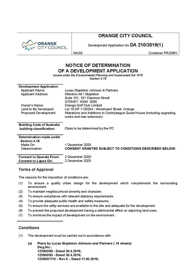
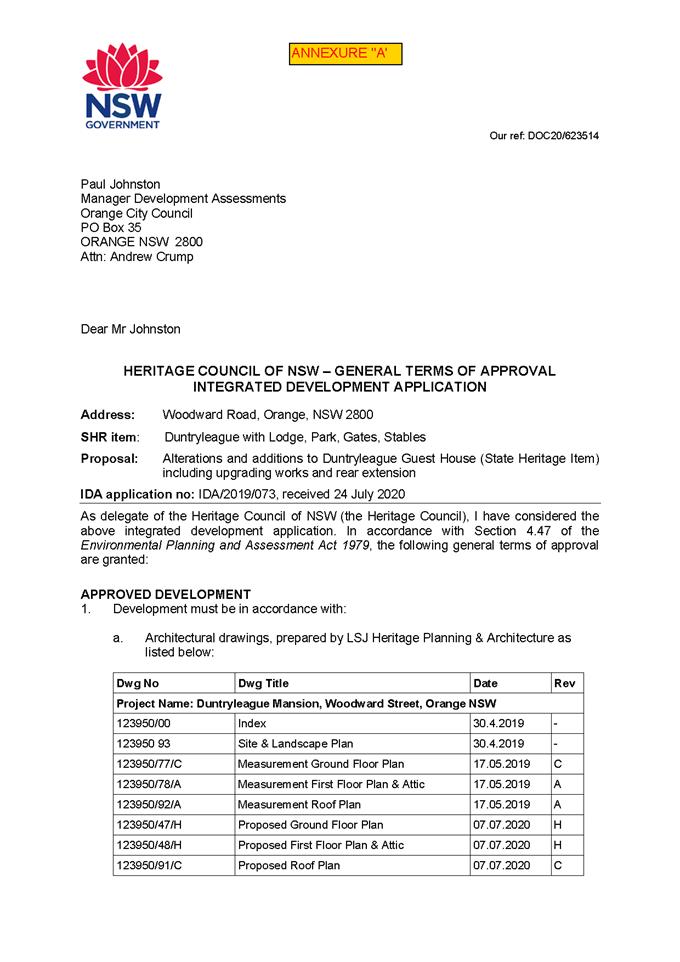
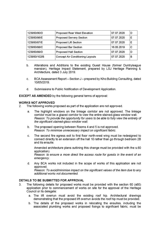
Planning and Development Committee
1 December 2020
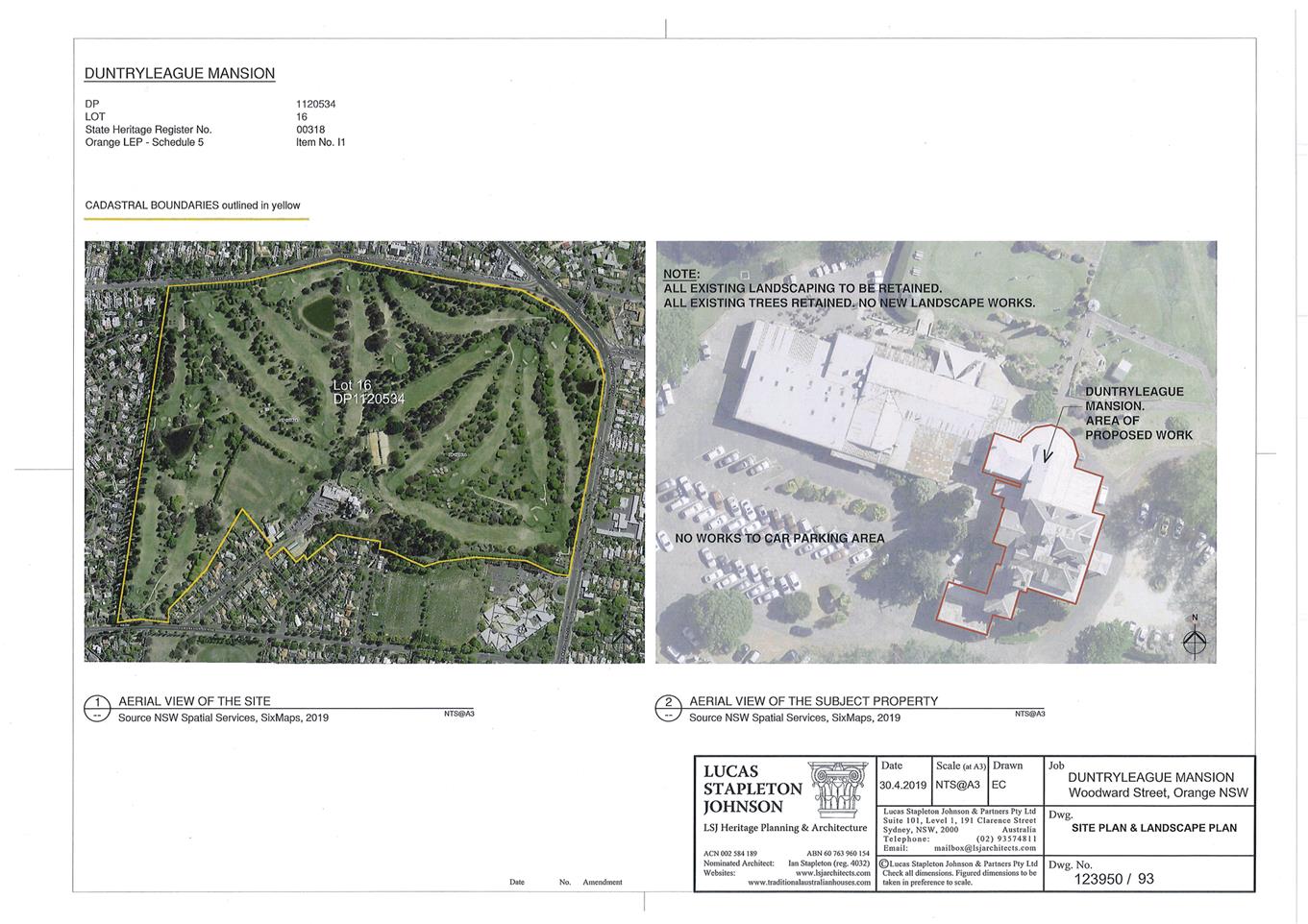
Planning
and Development Committee
1 December 2020
2.4 Development
Application DA 133/2020(1) - 155 Kite Street and 115 Endsleigh Avenue
RECORD
NUMBER: 2020/2352
AUTHOR: David
Paine, Senior Planner
EXECUTIVE
Summary
|
Application
lodged
|
7 April
2020
|
|
Applicant/s
|
Orange
CBD Pty Ltd
|
|
Owner/s
|
Orange
CBD Pty Ltd
|
|
Land
description
|
Lot 11 DP 1002968, Lot 1 DP 770265,
Lot 8 DP 1069072 - 155 Kite Street and 115 Endsleigh Avenue, Orange
|
|
Proposed
land use
|
Demolition (ancillary structures
and rear skillion of existing building), Hotel or Motel Accommodation (four
storey building), Alterations and Additions (existing building), and Business
Identification Signage
|
|
Value of
proposed development
|
$6.2M
|
Council's consent is sought for the demolition of all
buildings (vacant sheds known as the ‘Perway’ Structures) within
155 Kite Street, Orange to create a vacant site for the construction of a new
four storey building that will comprise of parking at Ground Level for 67 vehicles
(including 21 spaces in car stackers), and accommodation on Levels 1 to 3 for
61 rooms. The proposal also includes the conversion of the existing
cottage on the adjoining site at 115 Endsleigh Avenue to provide a reception
and restaurant area, as well as the lift lobby that will provide a connection
to the proposed motel which is located at the rear of cottage. The conversion
work will involve the demolition of the skillion addition at the rear of the
existing cottage and additional building works to the original cottage to
create the additional space. The building is identified as a local Heritage
Item ‘Ivanhoe’ under Council’s Local Environmental
Plan (LEP) 2011.
The application was advertised on two separate occasions in
accordance with Council’s public participation plan. During the first
round of notification, Council received eight submissions objecting to the
proposed development. The plans were subsequently amended. These plans were
re-notified and Council received three submissions. Whilst two of these
submissions are still objecting to the development, the third submission was
generally supportive of the amended design, although the person still had some
reservations about the development exceeding the 12m height limit.
The plans were amended in response to technical issues
raised by Council’s Officers and Council’s Heritage Advisor. The
amended plans have removed the pool, gym and BBQ area from the Third Floor.
Other changes relate to the building’s form and include a new pitched
roof at either end of the building, a new clerestory style roof element for the
upper floor, and new windows on the North and South of the proposed building.
The amended design has also included new ‘French’ style
balconies on the eastern elevation – note: these balconies are not
accessible and have only been included for articulation purposes.
The number of motel units have been reduced by one from 62 to 61.
The development is proposed on land described Lot 11 DP
1002968, Lot 1 DP 770265, Lot 8 DP 1069072 - 155 Kite Street and115
Endsleigh Avenue, Orange.
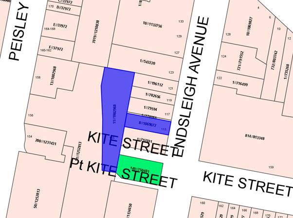
Figure 1 - Locality plan
DECISION FRAMEWORK
Development in Orange is governed by two key documents being
the Orange Local Environment Plan 2011 and the Orange Development Control Plan
2004. In addition, the Infill Guidelines are used to guide development,
particularly in the heritage conservation areas and around heritage items.
Orange Local Environment Plan 2011 – The
provisions of the LEP must be considered by the Council in determining the
application. LEPs govern the types of development that are permissible or
prohibited in different parts of the City and also provide some assessment
criteria in specific circumstances. Uses are either permissible or not. The
objectives of each zoning and, indeed, the aims of the LEP itself are also to
be considered and can be used to guide decision making around appropriateness
of development.
Orange Development Control Plan 2004 – The DCP
provides guidelines for development. In general, it is a performance based
document rather than prescriptive in nature. For each planning element there
are often guidelines used. These guidelines indicate ways of achieving the
planning outcomes. It is thus recognised that there may also be other solutions
of merit. All design solutions are considered on merit by planning and building
staff. Applications should clearly demonstrate how the planning outcomes are
being met where alternative design solutions are proposed. The DCP enables
developers and architects to use design to achieve the planning outcomes in
alternative ways.
DIRECTOR’S COMMENT
Main issues of this hotel proposal
centre on the building’s height (almost 4m above height limits for the
area); valet parking; heritage; streetscape; character; waste management and
building design. The proponent seriously considered these issues during
the assessment process, substantially amending the proposal to address concerns
of staff and submissions made by residents. The result is a pleasing
development that whilst large, will not adversely impact on the surrounding
environment, indeed permitting the extra height gives more setback and relief
to the nearby heritage rail bridge. This development will provide
significant economic benefits to the City both during construction and
operation. The recommendation of approval is supported.
Link To Delivery/OPerational Plan
The recommendation in this report relates to the
Delivery/Operational Plan strategy “10.1 Preserve -
Engage with the community to ensure plans for growth and development are
respectful of our heritage”.
Financial Implications
Nil
Policy and Governance Implications
Nil
|
Recommendation
That Council consents to
development application DA 133/2020(1)
for Demolition (ancillary structures and rear skillion of existing
dwelling), Hotel or Motel Accommodation (four storey building), Alterations
and Additions (existing building), and Business Identification Signage at
Lot 11 DP 1002968, Lot 1 DP 770265, Lot 8 DP 1069072 - 155 Kite
Street and 115 Endsleigh Avenue, Orange pursuant to
the conditions of consent in the attached Notice of Approval.
|
further considerations
Consideration has been given to the
recommendation’s impact on Council’s service delivery; image and
reputation; political; environmental; health and safety; employees;
stakeholders and project management; and no further implications or risks have
been identified.
BACKGROUND/ORANGE EASTSIDE
PRECINCT PLAN AND SITE SPECIFIC CONTROLS
Council has recently commissioned a review of the
surrounding area given a number of changes that have occurred. The changes
include the Department of Primary Industries (DPI) relocating to a new office
complex, and the relocation of a motor showroom to larger premises on the
outskirts of Orange. Council hired a local planning firm to conduct the review
of the area including consideration of existing zonings, land uses, and various
planning controls including height, floor space ratio and building design. The
review is recommending a number of changes for the area including increasing
the height from 12m to 14m to attract new business. The review, named the
Orange Eastside Precinct Plan and Site Specific Controls is currently on public
exhibition.
The
development involves the construction of a four storey hotel or motel and
comprises of the following scope of works:
· Demolition
of all buildings (vacant sheds known as the ‘Perway’ Structures)
within 155 Kite Street, Orange to create a vacant site for the construction of
a new four storey building that will comprise of parking at Ground Level for 67
vehicles and accommodation on Levels 1 to 3 for 61 rooms.
· Conversion
of the existing cottage on the adjoining site at 115 Endsleigh Avenue to
provide a reception and restaurant area as well as the lift lobby that will
provide a connection to the proposed motel which is located at the rear of
cottage. The conversion work will involve the demolition of the skillion
addition at the rear of the existing cottage and additional building works to
the original cottage to create the additional space. The building is identified
as a local heritage item ‘Ivanhoe’ under Council’s
Local Environmental Plan (LEP) 2011.
· The
main vehicle access will be via 115 Endsleigh Avenue in the form of a one way
access point past the proposed reception area. The reception area will be
located behind the existing cottage. Vehicles will leave the site via a garage
door with access onto Kite Street (exit only).
· The
applicant is seeking a variation to Council’s 12m height restriction.
The development standard is contained within Council’s Local
Environmental Plan 2011. The variation to the height standard ranges from
0.543m to 3.93m. The applicant has submitted a formal written request to
Council to vary the development standard via a LEP 4.6 Exception to Development
Standards application.
· Associated
signage.
· Site
landscaping.
AMENDED
DESIGN
The overall design of the
subject building has evolved since the plans were initially lodged with
Council. The evolving nature of the design, culminating in the final design
which is being assessed as the proposed building, has been possible because of
the proponent’s co‑operation and willingness to work
collaboratively with Council staff, Council’s Heritage advisor and feedback
from public submissions. Council’s Heritage Advisor indicated in his
final comments that:
‘The applicant, architect and consultants are
to be congratulated for their approach during the design development of this
project. The result will complement the precinct and supplement the design
quality and character of the area. It would be excellent if the project primed
further conservation and restoration in the precinct’.
The amended design has
progressed to a higher quality and more sophisticated design from the initial
starting point as a direct result of the collaborative process that has
occurred. It should be noted that the proposed development is still
exceeding the height limit by around 3.93m. This issue is discussed in more
detail under Clause 4.6 Exception to Development Standard.
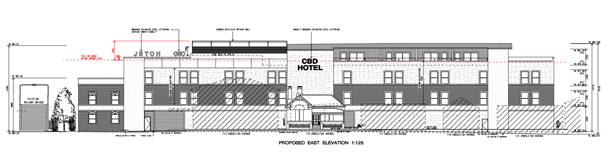
Figure 2 - design as initially submitted to Council
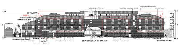
Figure 3 - amended design
The amended design has included modulation and fine-scale
detailing help to reduce the sense of scale and overall bulk of the development,
resulting in a more sympathetic development in the context and setting.
MATTERS FOR CONSIDERATION
Section 1.7 - Application of
Part 7 of the Biodiversity Conservation Act 2016 and Part 7A of the
Fisheries Management Act 1994
Having regard to the relevant provisions and based on an
inspection of the subject property, it is considered that the proposed
development is not likely to have a significant effect on any threatened
species, populations or ecological communities or their habitats.
Section 4.15
Section 4.15 of the Environmental Planning and Assessment
Act 1979 requires Council to consider various matters, of which those
pertaining to the application are listed below.
PROVISIONS OF ANY ENVIRONMENTAL
PLANNING INSTRUMENT s4.15(1)(a)(i)
Orange Local Environmental Plan 2011
Part 1 - Preliminary
Clause 1.2 - Aims of Plan
The
broad aims of the LEP are set out under Subclause 2. Those relevant to the
application are as follows:
(a) to encourage development which complements and
enhances the unique character of Orange as a major regional centre boasting a
diverse economy and offering an attractive regional lifestyle,
(b) to provide for a range of development opportunities
that contribute to the social, economic and environmental resources of Orange in
a way that allows present and future generations to meet their needs by
implementing the principles for ecologically sustainable development,
(f) to recognise and manage valued environmental
heritage, landscape and scenic features of Orange.
The application is considered to be consistent with aims
(a), (b), and (f) as listed above.
Clause 1.6 - Consent Authority
This clause establishes that, subject to the Act, Council is
the consent authority for applications made under the LEP.
Clause 1.7 - Mapping
The subject site is identified
on the LEP maps in the following manner:
|
Land Zoning Map:
|
Land zoned B6 Enterprise Corridor
|
|
Lot Size Map:
|
No Minimum Lot Size
|
|
Heritage Map:
|
Local heritage item and adjoins a
conservation area
|
|
Height of Buildings Map:
|
Building height limit 12 m
|
|
Floor Space Ratio Map:
|
Floor space limit 1.5:1
|
|
Terrestrial Biodiversity Map:
|
No biodiversity sensitivity on the
site
|
|
Groundwater Vulnerability Map:
|
Groundwater vulnerable
|
|
Drinking Water Catchment Map:
|
Not within the drinking water
catchment
|
|
Watercourse Map:
|
Not within or affecting a defined
watercourse
|
|
Urban Release Area Map:
|
Not within an urban release area
|
|
Obstacle Limitation Surface Map:
|
No restriction on building siting
or construction
|
|
Additional Permitted Uses Map:
|
No additional permitted use applies
|
|
Flood Planning Map:
|
Not within a flood planning area
|
Those matters that are of relevance are addressed in detail
in the body of this report.
Clause 1.9A - Suspension of
Covenants, Agreements and Instruments
This clause provides that covenants, agreements and other
instruments which seek to restrict the carrying out of development do not apply
with the following exceptions:
· covenants
imposed or required by Council
· prescribed
instruments under Section 183A of the Crown Lands Act 1989
· any
conservation agreement under the National Parks and Wildlife Act 1974
· any
trust agreement under the Nature Conservation Trust Act 2001
· any
property vegetation plan under the Native Vegetation Act 2003
· any
biobanking agreement under Part 7A of the Threatened Species Conservation
Act 1995
· any
planning agreement under Division 6 of Part 4 of the Environmental Planning
and Assessment Act 1979.
Council staff are not aware of the title of the subject
property being affected by any of the above.
An Easement for Overhead Communications Lines (Variable
Width) affects the north western edge of the site. A Council sewer main and
stormwater lines traverse the site from south to north west.
Council’s Technical Service Division has recommended conditions requiring
the sewer line to be renewed and stormwater line to be protected.
Part 2 - Permitted or Prohibited Development
Clause
2.1 - Land Use Zones and Clause 2.3 - Zone Objectives and Land Use Table
The subject sites are located within the B6 Enterprise
Corridor. The proposed development is defined as hotel or motel accommodation
under OLEP 2011 which means:
hotel or motel accommodation
means a building or place (whether or not licensed premises under the Liquor
Act 2007) that provides temporary or short-term accommodation on a commercial
basis and that:
(a) comprises
rooms or self-contained suites, and
(b) may
provide meals to guests or the general public and facilities for the parking of
guests’ vehicles,
but does not include
backpackers’ accommodation, a boarding house, bed and breakfast
accommodation or farm stay accommodation.
food and drink premises means
premises that are used for the preparation and retail sale of food or drink (or
both) for immediate consumption on or off the premises, and includes any of the
following -
(a) a
restaurant or cafe,
(b) take
away food and drink premises,
(c) a
pub,
(d) a
small bar.
Signage means
any sign, notice, device, representation or advertisement that advertises or
promotes any goods, services or events and any structure or vessel that is
principally designed for, or that is used for, the display of signage, and
includes any of the following:
(a) an
advertising structure,
(b) a
building identification sign,
(c) a
business identification sign,
but does
not include a traffic sign or traffic control facilities.
Hotel or motel accommodation, food
and drink premises and signage are all permissible in the B6 Enterprise
Corridor zone with the consent of Council. It is noted that the proposed
restaurant is considered ancillary to the dominant use of the land as a motel,
ie they are a typical and expected support facility for many modern motels
globally.
The initial demolition component of the development is
addressed below under Clause 2.7.
Clause
2.3 of LEP 2011 references the Land Use
Table and Objectives for each zone in LEP 2011. These objectives for land
zoned B6 Enterprise Corridor zone are as
follows:
1 Objectives
of zone
· To
promote businesses along main roads and to encourage a mix of compatible uses.
· To
provide a range of employment uses (including business, office, retail and
light industrial uses).
· To
maintain the economic strength of centres by limiting retailing activity.
· To
provide for residential uses, but only as part of a mixed use development.
The development is consistent with the objectives of the
zone. The development is well positioned and is within close proximity to the
CBD to encourage cycling and walking and will be well serviced by public
transport. The proposed development will further strengthen the status of
Orange as a major regional centre and is also expected to generate employment
during the initial construction phase, along with ongoing employment in the
hospitality industry once the building has been completed.
Clause 2.6 Subdivision
– consent requirements
This clause triggers the need for development consent for
the subdivision of land. Whilst the proposal has not specifically nominated
that the subject land will be consolidated, this issue has been discussed with
the applicant and is standard practice when development is occurring over
separate parcels of land. A number of conditions are recommended to ensure that
proof of lodgement for registration of a survey plan of consolidation of
Lot 11, DP1002968, Lot 8, DP 1069072, Lots 1 and DP 770265 with
NSW Government Land and Property Information has been undertaken prior to
the issue of a Construction Certificate, with formal registration of the plan
to occur prior to the issue of an Occupation Certificate.
Clause 2.7 - Demolition
Requires Development Consent
This clause triggers the need for
development consent in relation to a building or work.
The proposal involves demolition
of all existing buildings (vacant sheds) on 155 Kite Street, Orange. The
proposal also includes the demolition of a skillion addition at the rear of the
existing cottage at 115 Endsleigh Avenue.
The demolition works proposed will
have no significant impact on adjoining lands, streetscape or public realm.
Conditions will be imposed in respect of hours of operation, dust suppression
and the need to investigate for, and appropriately manage the presence of any
materials containing asbestos.
Part 3 - Exempt and Complying Development
The application is not exempt or complying development.
Part 4 - Principal Development Standards
Clause
4.3 - Height of Buildings
This clause limits the height of
buildings (HoB) on land identified on the Height of Buildings Map. The subject
land is identified on the Map as having a HoB limit of 12m.
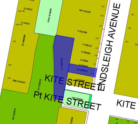
Figure 4 – Height of Building Map
– M= 12m (subject land marked in blue)
The
applicant submits that the maximum height of the proposed development at the
highest point is 15.93m and therefore contravenes the height of buildings
standard by 3.93m. This point has been calculated based on existing Ground
Levels at the rear of the site.
The
applicant has made application pursuant to Clause 4.6 of OLEP 2011 to vary the
development standard. The issue is addressed below.
Space Ratio
This
clause limits the floor space ratio (FSR) permitted on land identified on the
Floor Space Ratio Map. Clause 4.5 is associated with this clause and
establishes the rules for calculating the site area and FSR of any proposal.
These rules exclude certain parts of a site and development such as:
· excluding
any part of the site upon which the development is prohibited (ie if the
site is split zoned only the zone in which the development is permissible may
be considered)
· excluding
community land and most public places
· lots
in a Strata scheme wholly or partly above other lots in the scheme do not
increase the site area (ie the site area is the Ground Level of the scheme
only)
· adjoining
lots in the same ownership do not form part of the site area unless significant
parts of the development are proposed on that land
· the
floor area of existing buildings is to be included in the FSR calculation
· any
covenant restricting floor space on the lot, due to floor space having been
considered as part of the development of another lot, is to be taken into
account.
The subject land is identified
on the Map as having an FSR of 1.5:1. The subject land has a total area of
2,080m2. The proposed development has a GFA of 2,601.1m2.
As such, the proposed FSR is
1.25:1 and is therefore compliant with the FSR requirement of the LEP.
Clause 4.6 - Exceptions to Development Standards
The
objective of this clause is to provide for a degree of flexibility when
applying certain development standards and to achieve better outcomes as a
result of the allowance of flexibility in particular circumstances. The clause
allows development to be granted despite the fact it contravenes a development
standard imposed under Orange LEP 2011, unless such a development is expressly
excluded from the clause.
The
applicant has submitted a detailed request for the variation of the height
(Clause 4.3) development standards under Clause 4.6 of the Orange LEP 2011.
To
allow variations to development standards under the Orange LEP 2011 the
applicant must make a formal request under Clause 4.6 which specifically
addresses the terms of Clause 4.6, particularly Clause 4.6(3). Additionally,
the consent authority must consider the written request from the applicant for
the variation plus be satisfied that the proposal will be in the public
interest, is consistent with the objectives of the relevant standards and the
objectives of the zone (Clause 4.6(4).
The
Clause 4.6 request to vary the height standard, as it applies to the current
amended design, is supported and a detailed assessment is included below.
Preliminary
Firstly,
it is noted that the subject site has a height standard under the current
Orange LEP 2011 provisions, Clause 4.3, of 12m and the submitted proposal is
15.93m.
Clause 4.6(3)
The
applicant's written request for the Clause 4.6 variation must demonstrate the
proposal is justified under Clause 4.6(3) (a) and (b), as follows:
(3) Development consent
must not be granted for development that contravenes a development standard unless
the consent authority has considered a written request from the applicant that
seeks to justify the contravention of the development standard by
demonstrating:
(a) that compliance
with the development standard is unreasonable or unnecessary in the circumstances
of the case, and
(b) that there are
sufficient environmental planning grounds to justify contravening the
development standard.
It is
considered that the applicant's Clause 4.6 variation request meets these
requirements. The proposed building height exceedance is considered to
have only minor impacts on neighbouring properties in terms of privacy and
overshadowing. The proposed exception to the height of buildings development
standard of OLEP 2011 is considered a minor variation in the context of the
site and its locality and, therefore, strict compliance would be unreasonable.
Clause
4.6(4)
The
consent authority must not grant consent to a Clause 4.6 variation unless it is
satisfied with the matters under Clause 4.6(4) as detailed below:
(4) Development consent
must not be granted for development that contravenes a development standard
unless:
(a) the consent authority is
satisfied that:
(i) the
applicant’s written request has adequately addressed the matters required
to be demonstrated by Subclause (3), and
(ii) the proposed
development will be in the public interest because it is consistent with the
objectives of the particular standard and the objectives for development within
the zone in which the development is proposed to be carried out, and
(b) the concurrence of the
Secretary has been obtained.'
The
detailed assessment below addresses Clause 4.6 and specifically Clauses 4.6(3)
and 4.6(4) demonstrating that these clauses have been satisfied.
Height
Standard Variation (Cl4.6(3)
The
applicant's written submission contends that the variation to the height
standard should be supported as the resultant impacts are acceptable and it
would be unreasonable and unnecessary in this instance to require strict
compliance in this instance.
The
applicant has argued that the current development proposal is consistent with
the underlying intent of the control based on the following:
‘A development that strictly complies with the 12m
height control is unreasonable or unnecessary in this circumstance for the
following reasons:
· It
would result in a less sympathetic response to the historic rail footbridge
that adjoins the site to the south. In this regard:
- Following
consultation with Council’s Heritage advisor, the design intent was to
provide a building that maintained a reasonable setback and modest building
height in deference to the footbridge.
Having regard to the above point, the design adopts the
southern boundary building line recommended by Council’s Heritage advisor
and adopts a building height near the footbridge that is in the order of 9m (or
approximately 3m lower than the allowed building height of 12m).
To achieve a building that complies with the height control
and provides the required number of rooms, facilities and support areas
proposed by this development, would be likely to require a closer building
setback and the full 12m height adjacent to the footbridge.
Appropriate architectural design measures are used to
address the building height, including:
· So
that it does not appear too tall or imposing, the Upper Level of the building
is recessed in relation to the levels below and a recessive roof element is
expressed by continuing the roof material along the walls of this level.
· The
massing of the proposed hotel is articulated via modulated façades;
glazing and varied fenestration; and a mix of materials in order to break down
its overall bulk.
· The
top level of the building is given a more transparent treatment. It is now
proposed as a clerestory/roof lantern element that presents to Endsleigh Avenue
with generous glazed walls and a floating roof.
· The
development has a FSR of 1.25:1 which is reasonably below the maximum allowed
FSR of 1.5:1 pursuant to Clause 4.4 of the LEP. In consideration of this
particular aspect, it is clear that the increased height is not due to
excessive floor space demands or overdevelopment of the site.
· The
proposal adopts a sensible approach to provide the car park on Ground Level,
despite the fact that it causes the building to exceed the maximum height
limit. Any realistic alternative to the proposed design would require a
reduction in the scale of the development. However, according to the applicant,
a marked reduction in the number of rooms (i.e. removal of the top floor) would
threaten the viability of the project’.
Overall,
the proposed increase in height relates to the third level (containing nine
motel units) and does not have any significant impact on adjoining neighbours
through overshadowing or privacy. The proposed development is considered
acceptable in relation to the exceedance in height as compliance with the
standard is unreasonable in this instance and there are sufficient environmental
planning grounds for the variation.
Height
Standard Variation Cl 4.6(4)(a)(i))
It is
considered that the applicant has satisfactorily addressed the provisions of
Clause 4.6(3).
Height Standard Variation Cl 4.6(4)(a)(ii))
Height
Standard Objectives
The
height objectives under Clause 4.3 are as follows:
4.3 Height
of buildings
(1) The objectives of this clause
are as follows -
(a) to provide for taller buildings
in the City centre and to enable a transition in building height in response to
varying urban character and function,
(b) to protect the amenity of
neighbouring properties and public places, with particular regard to visual
bulk, scale, overshadowing, privacy and views.
(2) The height of a building on any
land is not to exceed the maximum height shown for the land on the Height of
Buildings Map.
The applicant has argued that the development is consistent
with the objectives for the following reasons:
Objective (a) – To provide for taller buildings in
the City centre and to enable a transition in building height in response to
varying urban character and function.
‘The building as proposed would achieve reasonable
integration in terms of building height because it is within a precinct that
comprises a much larger building that is already above the maximum height
control.
For the reasons provided earlier in this report and the
State Environmental Planning Policy (SoEE) [sic], the building as proposed sits
reasonably well in relation to the Peisley Street and Endsleigh Avenue
streetscapes; and also respects the heritage values attributed to the historic
railway precinct.
The proposed taller building facilitates a better design
outcome because it allows the development to provide satisfactory onsite
parking arrangements’.
Objective
(b) – To protect the amenity of neighbouring properties and public
places, with particular regard to visual bulk, scale, overshadowing, privacy
and views.
‘Despite being taller, the building as proposed does
not unreasonably affect the amenity of neighbouring properties and public
places.
As addressed in the Statement of Environmental Effects,
non-compliance with the standard does not contribute to unacceptable impacts in
terms of traffic, parking, overshadowing, visual impacts or view loss’.
Following
an assessment of the proposal under the objectives of the Orange LEP 2011
(i.e. zone and height objectives), it has been determined that the scale
of the development (i.e. 15.93m) makes a positive contribution to the desired
form intended under the adopted planning controls and the hierarchy of the
area.
Zone
Objectives- Height Cl 4.6(4)(a)(ii)
The
proposed development is considered in the public interest and the variation to
the height standard is consistent with the objectives of Clause 4.3, as the
scale of the development makes a positive contribution towards the desired
built form. The proposal also allows for reasonable daylight access to the
public domain and nearby developments.
The issue of the proposed height variation was also
examined and discussed at length with Council’s Heritage and Urban Design
Advisor who has provided the following comments:
‘The current design reflects the objectives and
guidelines provided within the LEP and the DCP. In relation to the additional
height of the proposal in the central element of the design, the mitigation
provided through the use of the traditional clerestorey roof form and
associated details is acceptable in terms of the increased height’.
Overall,
it is considered that the submitted Clause 4.6 variation request is adequate
and support for the variation should be given.
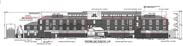
Figures 5
and 6 - above and below indicating the exceedance in height
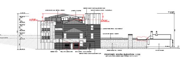 Part 5 -Miscellaneous Provisions
5.10 - Heritage Conservation
Clause 5.10 of the LEP lists the
provisions that need to be considered where an application relates to a
heritage setting. The subject land is not within a Heritage Conservation Area
but adjoins a number of heritage items:
· The
existing dwelling “Ivanhoe” within the subject land at 115
Endsleigh Avenue, is identified as a Heritage Item of Local Significance.
Conversion work is proposed of the existing cottage on the adjoining site at
115 Endsleigh Avenue to provide a reception and restaurant area, as well as the
lift lobby that will provide a connection to the proposed motel which is
located at the rear of cottage. The conversion work will involve the demolition
of the skillion addition at the rear of the existing cottage and additional
building works to the original cottage to create the additional space.
· Orange
Railway Station, including the pedestrian bridge to the south and south west of
the site of the proposed accommodation building (Item 22, State Significance).
· The
Stationmaster’s House at 158 Peisley Street to the west of the subject
land (Item 78, Local Significance).
· The
Endsleigh building which adjoins to the south and east of the subject land
(Item 249, Local Significance).
Heritage Advisor’s
recommendations
The
applicant has been working closely with Council staff and Council’s
Heritage Advisor to reach an agreement on the overall design of the building.
Council’s Heritage Advisor initially raised a number of concerns about
the proposed building in terms of the building’s height, bulk and scale
and how the built form relates to the adjoining heritage items and the visual
impact of the building from Endsleigh Avenue.
Another
important aspect of the proposal is the demolition of the structures on 155
Kite Street, known as the Perway Structures.
The
issues related to a number of key issues around the bulk and scale of the new
building, and the demolition of the ‘Perway’ Structures are
discussed below.
Proposed
Floor Plans - Recommendation:
‘The Fourth Floor/Third Level consisting of nine
rooms and the outdoor recreation facility should be eliminated to reduce the
height to a nominally compliant level.
The recreation facility should be relocated to the southern
end of the Third Floor/Level 2 at the southern end replacing Rooms 1-5 and
26, where a steel framed pergola structure can be used to interpret the
adjoining footbridge.’
Applicant’s
response
‘The applicant’s preference is to retain the
accommodation rooms on the top level. To this end it was agreed at the
Zoom meeting that a more lightweight or transparent structure could be
considered. Therefore the top level is now proposed as a clerestory/roof
lantern element that presents to Endsleigh Avenue with generous glazed walls
and a floating roof’.
Planning
Officer’s response
The
amended plans have removed the pool, gym and BBQ area from the Third Floor.
Other changes relate to the building’s form and include a new pitched
roof at either end of the building, a new clerestory style roof element for the
upper floor, and new windows on the north and south of the proposed building.
The amended design has also included new ‘French’ style balconies
on the eastern elevation – note: these balconies are not accessible and
have only been included for articulation purposes.
Heritage Advisor’s recommendations
Proposed
Floor Plans - Recommendation:
‘A pair of continuous vertical windows as a slot of
nominal 300mm should be provided between the service core and the main building
to express the element and reduce the overall bulk’.
Applicant’s
response
‘This recommendation
has been adopted as shown on the north and south elevations’
Planning Officer’s response
The
changes have improved the building’s articulation on the northern and
southern elevation and are considered a good outcome in terms of the built
form.
Heritage Advisor’s recommendations
Proposed East Elevation - Recommendations:
‘The painted masonry wall to the elevation should
extend to a nominal 2100mm high with a louvre/lattice or open screen being
provided up to the soffit or beam level and the wall and screen provided with
climbing wires for creeper planting in order that the elevation presented to
the adjoining properties is improved in character and amenity.
Levels 1 and 2 should be clad in the brick cladding system,
using a selected brown brick with blue/grey banding related to window
head and sill lines as an interpretation of the brickwork in the conservation
area’.
Applicant’s response
‘The plans have now been amended to satisfy the above
recommendations. The nominated brick cladding is PGH Castlemaine (See drawings
No 09 and 16).
This recommendation has been adopted (refer Drawing 16).
The selected brown brick is PGH Hotham Standard. The blue grey banding is
selected as Dulux Windspray’.
Planning
Officer’s response
The
amended colour scheme represents a better outcome for the surrounding area.
Heritage Advisor’s recommendations
Proposed East Elevation - Recommendation:
‘All windows should be provided with a
‘French’ style balcony with a pair of external opening full height
louvre doors and contemporary flat overhead awning. The elements will model the
facade, improve the level of privacy and reduce the overlooking to the
adjoining sites and provide shading and an amenity for the occupants.
The revised roof to be an expressed pitched Windspray
traditional steel roof with nominal central ridge, traditional rolled flashings
and hipped ends to the north and south with the contemporary half round
fascia/gutter set at a nominal 877.58 and external expressed circular
downpipes.
The staircases to include windows to assist in their
modelling and character and be clad in a contrasting blue/grey brick with brown
brick banding.
The upper nominal 4m of the stair/lift core is to be clad
in composite silver metallic cladding, as selected and a sign graphic revised
prepared’.
Applicant’s response
‘The recommendation has been adopted. As indicated in
the east elevation drawing, a balcony is provided to every accommodation room
window. However, due to safety and NCC requirements, there will be no doors
that open onto a balcony. Instead, each balcony is provided with windows that
appear as full height doors.
The balustrade treatment includes a perforated steel screen
to assist with privacy.
This recommendation has been adopted. However, the level of
the half round fascia/gutter will be set higher than the nominal 877.58 because
it is proposed to retain the top level.
The last two recommendations has been adopted’.
Planning Officer’s response
The inclusion of the French style balconies on the eastern
elevation is a significant improvement to the overall design.
Heritage Advisor’s Recommendations
Proposed
South Elevation
‘A simple climber trellis planting is recommended to
offset the scale and impact on the adjoining properties’.
Applicant’s response
‘The
plans have been amended to satisfy the above recommendation (refer to drawings
No 9)’.
Planning Officer’s response
The inclusion of the trellis planting on the southern
elevation improves the overall appearance of this section of the building.
Heritage
Advisor’s recommendations
The proposal includes the demolition of all buildings
(vacant sheds) within 155 Kite Street Orange. The building on the site have
been identified as ‘Perway’ depot.
Excerpt from Heritage Impact Statement for Arnott’s
site demolition, 2017, James Nicholson
‘In summary, the
structures remaining on the subject site were known as the Permanent Way depot
or the ‘Perway’ depot. The accommodation was to suit the railway
gangers or fettlers who were responsible for maintaining the railway line or
‘permanent way’, including the rails, sleepering and ballast. A
store would provide for tools including sledges, spanners and track plates
together with their vehicles, known as ‘trikes’. The two sheds
consisted of a larger shed to the north of a type to accommodate the
‘trikes’ which were used to take fettlers and inspectors along the
lines in addition to the stores areas while the smaller shed was the
Inspector’s office for the staff who managed the Perway labour force and
tasking.
The loss of the structures
will require mitigation. The Applicant may be able to access via the NSW
Railways and their various agencies, the study that would have been completed
prior to the sale. Studies are required from the Authority under NSW Heritage
Act, where the sale affects a heritage listed place.
The site occupied by the
former Perway depot will require an archival recording in addition to the site
history. If no study is evident, James Nicholson – Adaptive Architects,
completed a study of East Fork and has access to much of the relevant material
related to the origins of the Perway depot.
Applicant’s response
The applicant has agreed with the recommendation of
Council’s Heritage Consultant to mitigate the loss of these structure:
‘Mitigation for the loss
of the Perway Structure should include the provision of an outline marked in
the ground floor car park surface of an outline of the two main structure
using a steel element similar in size to a rail, so as to interpret the former
buildings and use. An interpretive panel is to be designed and prepared in
conjunction with O&DHS illustration the significant of the Perway deport
and placed within the space at an agreed location’.
The
applicant has also agreed to name the dining area ‘Perway’
Restaurant.
Planning Officer’s
response
The
agreed outcome for the loss of structures known as the ‘Perway’
structures is considered a good outcome in terms of the proposed development. A
number of conditions have been included in the notice of determination to
ensure that an archival recording has been completed prior to any demolition
works.
Planning Officer’s concluding comments
The
proposed development has undergone a number of design changes since the initial
design was lodged with Council. The applicant and their consultants have worked
closely with Council’s Heritage Advisor over the last couple of months to
try and resolve all outstanding issues. Council’s Heritage Advisor
indicates that:
‘The use of traditional but contemporary details
in the exteriors and the use of appropriate materials and colours will
complement the design and acknowledge the vicinity including the Railway
precinct, the residences and the local business accommodation while the larger
Heritage Conservation Area should benefit from the project.
The applicant, architect and consultants are to be
congratulated for their approach during the design development of this project.
The result will complement the precinct and supplement the design quality and
character of the area’.
The amended plans have addressed all the outstanding issues
that have been raised by Council’s Heritage Advisor and, overall the
proposal is considered a good design on a constrained site.
Part 6 - Urban Release Area
Not relevant to the application. The subject site is not
located in an Urban Release Area.
Part 7 - Additional Local Provisions
7.1
- Earthworks
This
clause establishes a range of matters that must be considered prior to granting
development consent for any application involving earthworks, such as:
(a) the likely disruption of, or any detrimental effect
on, existing drainage patterns and soil stability in the locality of the
development
(b) the effect of the development on the likely future use
or redevelopment of the land
(c) the quality of the fill or the soil to be excavated,
or both
(d) the effect of the development on the existing and
likely amenity of adjoining properties
(e) the source of any fill material and the destination of
any excavated material
(f) the likelihood of disturbing relics
(g) the proximity to and potential for adverse impacts on
any waterway, drinking water catchment or environmentally sensitive area
(h) any measures proposed to minimise or mitigate the
impacts referred to in paragraph (g).
The earthworks proposed in the
application are limited to the extent of cutting and filling required for the
proposed building or structure. The extent of disruption to the drainage of the
site is considered to be minor and will not detrimentally affect adjoining
properties or receiving waterways.
The extent of the earthworks
will not materially affect the potential future use or redevelopment of the
site that may occur at the end of the proposed development's lifespan.
A preliminary contamination
report was obtained for the site. The site is not known to be
contaminated and conditions may be imposed requiring the use of verified clean
fill only. Excavated materials will be reused onsite as far as possible and
conditions may be imposed to require that surplus materials will be disposed of
to an appropriate destination.
The earthworks will be
appropriately supported onsite and the change in Ground Level is not
substantial. Therefore the effect on the amenity of adjoining properties is
considered to be minor.
The site is not known to contain
any Aboriginal, European or Archaeological relics. Previous known uses of the
site do not suggest that any relics are likely to be uncovered. However,
conditions may be imposed to ensure that should site works uncover a potential
relic or artefact, works will be halted to enable proper investigation by
relevant authorities and the proponent required to seek relevant permits to
either destroy or relocate the findings.
The site is not in proximity to
any waterway, drinking water catchment or sensitive area. Conditions may be
imposed to require a sediment control plan, including silt traps and other
protective measures, to ensure that loose dirt and sediment does not escape the
site boundaries.
7.3 - Stormwater Management
This clause applies to all
industrial, commercial and residential zones and requires that Council be
satisfied that the proposal:
(a) is designed to maximise the use of water permeable
surfaces on the land having regard to the soil characteristics affecting onsite
infiltration of water
(b) includes, where practical, onsite stormwater retention
for use as an alternative supply to mains water, groundwater or river water;
and
(c) avoids any significant impacts of stormwater runoff on
adjoining downstream properties, native bushland and receiving waters, or if
that impact cannot be reasonably avoided, minimises and mitigates the impact.
The
existing area is almost 100% impervious. As the proposed development does not
increase the impervious areas onsite stormwater detention is required. The
existing stormwater pipes crossing the site shall be retained from boundary to
boundary. The proposed building will dispose of stormwater via the
existing system.
7.6 - Groundwater Vulnerability
This
clause seeks to protect hydrological functions of groundwater systems and
protect resources from both depletion and contamination. Orange has a high
water table and large areas of the LGA, including the subject site, are
identified with “Groundwater Vulnerability” on the Groundwater
Vulnerability Map. This requires that Council consider:
(a) whether or not the development (including any onsite
storage or disposal of solid or liquid waste and chemicals) is likely to cause
any groundwater contamination or have any adverse effect on groundwater
dependent ecosystems, and
(b) the cumulative impact (including the impact on nearby
groundwater extraction for potable water supply or stock water supply) of the
development and any other existing development on groundwater.
Furthermore, consent may not be granted unless Council is satisfied that:
(a) the development is designed, sited and will be managed
to avoid any significant adverse environmental impact, or
(b) if that impact cannot be reasonably avoided - the
development is designed, sited and will be managed to minimise that impact,
(c) if that impact cannot be minimised - the development
will be managed to mitigate that impact.
The proposal is not anticipated
to involve the discharge of toxic or noxious substances and is therefore
unlikely to contaminate the groundwater or related ecosystems. The proposal
does not involve extraction of groundwater and will therefore not contribute to
groundwater depletion. The design and siting of the proposal avoids impacts on
groundwater and is therefore considered acceptable.
Clause 7.11 - Essential Services
Clause 7.11 applies and states:
Development
consent must not be granted to development unless the consent authority is
satisfied that any of the following services that are essential for the
proposed development are available or that adequate arrangements have been made
to make them available when required:
(a) the supply of water,
(b) the supply of electricity,
(c) the disposal and management of sewage,
(d) storm water drainage or onsite
conservation,
(e) suitable road access.
In consideration of this clause, all utility services are
available to the land and adequate for the proposal.
STATE ENVIRONMENTAL PLANNING
POLICIES
State Environmental Planning Policy 55 Remediation of
Land
State Environmental Planning Policy 55 - Remediation of
Land (SEPP 55) is applicable. Pursuant to Clause 7 Contamination
and remediation to be considered in determining development application:
(1) A consent authority must
not consent to the carrying out of any development on land unless:
(a) it
has considered whether the land is contaminated, and
(b) if the land is contaminated, it is
satisfied that the land is suitable in its contaminated state (or will be
suitable, after remediation) for the purpose for which the development is
proposed to be carried out, and
(c) if the land requires remediation to be made
suitable for the purpose for which the development is proposed to be carried
out, it is satisfied that the land will be remediated before the land is used
for that purpose.
In regard to 155 Kite Street, a
Preliminary Site Investigation was undertaken by Environmental Earth Sciences
in December 2018. The assessment makes the following conclusion and
recommendations:
‘Environmental
Earth Sciences consider that there is an overall Low risk relating to
contamination onsite associated with current and former uses. Minor spillages
of engine fuel likely from vehicles which had been previously parked in the
underground carpark are considered to pose a very low risk and there were no
records of bulk chemicals being stored or licensed to be used at the site. The
chances of any contamination impact to underlying soils or groundwater is very
low, with the site being constructed over a sealed carpark.
As a result
of this PSI, further investigation to assess for potential chemical
contamination is not recommended at this stage.
In relation
to potential ACM, if this material is required to be disturbed and removed, it
is recommended that any hazardous building materials which may be disturbed
should be removed by an appropriately licensed contractor prior to the
commencement of works.
During any
proposed redevelopment there is a potential for unexpected subsurface finds (as
is the case for any site), and consequently Environmental Earth Sciences
recommends that these occurrences can be manage accordingly through the
implementation of appropriate management documents (such as an Unexpected
Findings Protocol)’.
Based on the
preliminary contamination report, Council’s Environmental Officer is
satisfied that the contamination issue identified can be addressed by way of
condition.
The subject land and buildings at
115 Endsleigh Avenue have been used for the purposes of a dwelling. The land is
well established with the dwelling, garage, driveway, lawns and gardens. A site
inspection of the area does not indicate any areas or sources of potential
contamination.
State Environmental Planning
Policy 64 - Advertising and Signage
State Environmental Planning Policy 64 - Advertising and
Signage (SEPP 64) is applicable and states in part:
3 Aims,
Objectives etc
(1) This
Policy aims:
(a) to
ensure that signage (including advertising):
(i) is
compatible with the desired amenity and visual character of an area, and
(ii) provides
effective communication in suitable locations, and
(iii) is
of high quality design and finish, and
(8) Granting
of Consent to Signage
A consent authority must not
grant development consent to an application to display signage unless the
consent authority is satisfied:
(a) that
the signage is consistent with the objectives of this Policy as set out in
Clause 3 (1) (a), and
(b) that
the signage the subject of the application satisfies the assessment criteria
specified in Schedule 1.
The proposal includes one business identification sign. The
sign is located on the upper section of the eastern elevation of the lift
(facing Endsleigh Avenue) with the wordmark CBD Hotel. The signage will
be of brushed stainless steel lettering and will be illuminated from behind
with lighting.
The business identification sign has
been carefully considered in terms of the adjoining area. The proposed business
identification sign is an appropriate scale for the proposed building. The sign
will have no impact on views or streetscape and any illumination will be
minimal. The business identification sign is considered appropriate in its
context and consistent with the aims and objectives of the SEPP No 64 Adverting
and Signage.
STATE ENVIRONMENTAL PLANNING
POLICY (INFRASTRUCTURE) 2007
State Environmental Planning
Policy (Infrastructure) 2007 (ISEPP) was introduced to facilitate the
delivery of infrastructure across the State by improving regulatory certainly
and efficiency.
State Environmental Planning Policy
(Infrastructure) applies to the subject land, specifically Clause 85, 86 and
87.
Concurrence was required from
Transport for NSW under the above ISEPP given the close proximity of the site
and the potential impact on the rail network. The applicant was requested to
provide additional information to Transport for NSW to ensure that the proposed
development does not have any implications for the safe operation of the rail
network. The additional information was given to Transport for NSW who are
satisfied with the additional information. Concurrence has been obtained from
Transport for NSW and their requirements have been integrated as conditions of
consent within the attached notice.
The applicant was provided with a
copy of the concurrence.
Draft State Environmental
Planning Policy (Remediation of Land)
The draft State Environmental Planning Policy (Remediation
of Land) aims for better management of remediation works by aligning the needs
for development consent with the scale, complexity and risks associated with
the proposed works. Once the policy is adopted, the SEPP will provide a
state-wide planning framework for the remediation of land and requires consent
authorities to consider the potential for land to be contaminated with
determining development applications.
As mentioned above, contamination investigation carried out
on the site has determined the site can be made suitable for the proposed.
DESIGNATED DEVELOPMENT
The proposed development is not
designated development.
INTEGRATED DEVELOPMENT
The proposed development is not
integrated development although concurrence was required from Transport for NSW
under the State Environmental Planning Policy (Infrastructure) 2007.
Concurrence has been obtained from Transport for NSW and their requirements
have been integrated as conditions of consent within the attached notice.
PROVISIONS OF ANY DEVELOPMENT
CONTROL PLAN s4.15(1)(a)(iii)
Development Control Plan 2004
Development Control Plan 2004
(“the DCP”) applies to the subject land. Chapters of the DCP
relevant to the proposed use and development include:
· Chapter
3 - General Considerations;
· Chapter
8 - Development in Business zones
· Chapter
13 - Heritage;
· Chapter
14 - Advertising; and
· Chapter
15 - Car Parking.
CHAPTER 3 - GENERAL
CONSIDERATIONS
Section 3.1 - Cumulative Impacts
Section 3.1 - Cumulative Impacts identifies that Council
will consider not only the direct impacts of a particular development, but also
whether the development, when carried out in conjunction with other development
in the locality, has a more significant environmental impact.
Cumulative impacts of the proposed development are addressed
under the heading “Likely Impacts of the Development”.
Section 3.2 - Scenic, Landscape
and Urban Areas
Section 3.2 -Scenic, Landscape and Urban Areas identifies
that in urban areas consideration should be given to the character of the
locality, whether that locality is recognised as having heritage character with
formal plantings of exotic trees, or whether the locality comprises areas
developed as suburban release areas where informal native planting is common.
Council’s Heritage advisor has indicated that the
proposed development will complement the existing area.
Section 3.4 - Waste Generation
Section 3.4 - Waste Generation requires that applications
involving demolition indicate measures that will be implemented for reuse and
recycling of waste, and that development involving demolition is carried out in
a manner that optimises reuse and recycling of waste materials consistent with
waste-minimisation principles.
A waste management plan has not been submitted with the
application for the demolition phase of the development. However, this is
addressed via a condition of consent which requires a waste management plan to
be prepared and submitted to Council prior to works commencing onsite.
The development is considered satisfactory with regards to
waste generation.
Community Participation Plan
2019
The development is categorised as advertised development
given the 4.6 variation is greater than 10%. Accordingly, the development
application was advertised on Thursday, 23 April 2020 and exhibited between
Friday, 24 April 2020 and Friday, 8 May 2020. During the first round of public
notification Council received eight (8) public submissions. The concerns raised
during the first round included concerns about the variation to the 12m limit,
the potential impact on the adjoining heritage items and the loss of the
‘Perway’ structure, privacy, bulk and scale, overshadowing, car
parking and waste disposal.
The amended plans were renotified
from 30 October to 13 November 2020 and three (3) submissions were received in
response.
A detailed assessment of the issues raised by the submitters
is provided under the heading “Any Submissions Made in Accordance with
the Act”.
CHAPTER 8 - DEVELOPMENT IN
BUSINESS ZONES
Section 8.1 - Orange CBD
Section 8.1 - Orange CBD outlines planning outcomes for the
Orange Central Business District, with an emphasis on design, character,
parking and loading. The relevant planning outcomes are addressed below.
· Buildings
have a high level of urban design to contribute to the regional status of the
City’s Central Business District with attention given to façade
features, external materials, colour and advertising.
Given the scale of the proposed development and the
relationship to nearby heritage items, Council staff considered it appropriate
to refer the development application to Council’s Heritage Advisor for
his assessment and recommendations.
Council’s appointed Heritage advisor has assessed the
proposed development against Council’s adopted Orange Development
Control Plan 2004 Infill Guidelines. In summary, the Heritage advisor
considers that the amended development has provided a suitable response to each
of the applicable design criteria, including character, scale and form, siting,
materials and colours, and detailing.
Based on the advice and recommendations provided by Council’s
Heritage advisor, it is considered that the proposed development has been
appropriately designed with regard to the site’s context within the
Orange CBD, particularly the development’s relationship with surrounding
heritage buildings.
CHAPTER 13 - HERITAGE
Sections 13.1-13.06 of Chapter 13 - Heritage of the DCP
address heritage matters in detail, including heritage objectives, heritage
items and heritage conservation areas, heritage consideration for development,
development in the vicinity of heritage items, heritage proposals as advertised
development, and incentives for heritage conservation.
These matters have previously been addressed in detail under
the heading “Clause 5.10 - Heritage Conservation”.
It is considered that the requirements of the DCP have been
adequately addressed.
CHAPTER 14 ADVERTISING
An assessment of the suitability of the proposed signage has
been addressed in the SEPP 64 assessment above. It was concluded that the
proposed signage is consistent with the character of
the surrounding area, and is therefore acceptable.
CHAPTER 15 - CAR PARKING
Section 15.4 - Parking
Requirements
Section 15.4 - Parking Requirements
sets out the minimum parking requirements for specific land uses. The
application car parking requirements were calculated based on the following
rates:
· One
space for every three seats in the restaurant.
· One
space per room for Hotel Accommodation.
· One
space per manager and one space per two employees for Hotel Staff.
A number of recent approval for restaurants in Orange CBD
have had the rate of 1 space per 40m2 of GFA. This is the same
approach taken for the Quest apartments in Kite Street.
Based on the above requirements the proposed development
generates the following parking demands:
|
DCP Parking Rate
Hotel or Motel
Accommodation
|
Proposed
|
Spaces
|
|
One space per unit, plus
|
61 rooms
|
61
|
|
1 space per resident manager, plus
|
1
|
1
|
|
One space per
two employees, plus
|
maximum 4 staff at any one
time
|
2
|
|
One space per 40m2 of GFA for restaurant
|
137.8m2
|
3.45
|
|
Total provide = 67 including 21 stacked spaces
|
67.4
|
The applicant was requested to
provide additional information regarding how the proposed car parking system
was going to operate. The applicant provided the following plan of management
to explain how the valet parking system is proposed to work:
· ‘As
requested by Council, a one way traffic flow arrangement will be adopted
whereby guest vehicles will enter the hotel car park via the Endsleigh Avenue
driveway and exit via the Kite Street lane way.
· The
above traffic flow arrangement reinforces the site design which requires guest
to attend hotel reception for check in before they enter the car park.
· The
car park provides 37 independent spaces for guest (plus 1 for the manager). The
number of spaces for guest will be increased to 46 with 9 tandem spaces; and
then further increased to 67 spaces with the use of car stackers.
· The
valet system will be triggered when advanced accommodation bookings indicate
that the number of rooms (with parking booked) exceeds 37.
· The
hotel booking software will automatically alert reception when parking for more
than 37 cars is required, at which point the valet system will operate.
· In
valet parking mode, guest will drive their car to the parking area adjacent to
reception where they will be met by a valet. The valet will place the
guest’s luggage on a trolley for delivery of their luggage to their room
and direct the guest to the reception. The valet will proceed to park the
guest’s car in any of the identified valet spaces (tandem or stacker as
appropriate).
· Guest’s
keys will be labelled and securely stored in a safe at reception.
· Guest
will be advised at check in to contact reception 10 minutes before their
planned departure to arrange for their car to be moved into the parking zone in
front of reception on advance of their departure.
· The
hotel has a resident’s manager (and thus staffed 24/7) should a vehicle
have to be moved out of hours.
· Reception
staff can monitor the car parking via the CCTV monitors on the reception desk.
· Reception
staff and management will be trained on valet parking’.
Car parking arrangements for
hotels are different to parking in other types of commercial developments. The
typical arrangement for motel guests is that, on arrival, they park their
vehicle and check into the accommodation via reception. The use of valet
parking for motel accommodation is therefore considered appropriate when
compared to other forms of commercial development.
The proposed car parking arrangement
in terms of valet and tandem parking is similar to other hotel accommodation in
Orange. While the inclusion of a car stacker is new for Orange, the use of car
stackers is becoming more common where sites are constrained in area.
A number of conditions will be
included in the notice of determination to ensure that the car stackers are
installed in accordance with the manufacturer’s specification and are
appropriately maintained.
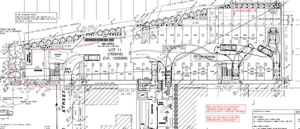
Figure 7 - car parking layout
Section 15.5 - Parking Area
Design and Layout
Section 15.5 - Parking Design and Layout identifies that the
design and layout of parking areas are to comply with the applicable Australian
Standard.
It is noted that the operation of the proposed car parking
layout would rely on the use of a ‘tandem’ and ‘valet’
style parking system depending on the occupancy of the hotel.
While Council’s Development Engineer has indicated
that the proposed ‘tandem’ and ‘valet’ style car
parking would not meet the applicable Australian Standard, he has confirmed
that such an arrangement is a common method of maximising the capacity of a
private car park and that the design is acceptable. The implications of the
‘tandem’ and ‘valet’ style car parking spaces have been
discussed above and it is deemed appropriate subject to a number of specific
conditions
Section 15.6 - Parking Area
Construction
Section 15.6 - Off-Street Car Parking sets out the following
planning outcomes:
Adequate off-street car
parking is provided in accordance with the Table or, alternatively, according
to an assessment that demonstrates peak-parking demand based on recognised
research.
The requirements for off-street car parking have previously
been addressed under “Section 15.4 - Car Parking
Requirements”.
Car parking areas are designed
according to Australian Standard.
While Council’s Development Engineer has indicated
that the proposed ‘tandem’ and ‘valet’ style car
parking would not meet the applicable Australian Standard, he has confirmed
that such an arrangement is a common method of maximising the capacity of a
private car park and that the design is acceptable.
The implications of the ‘tandem’ and
‘valet’ style car parking spaces and Council’s options have
been set out in the foregoing “Section 15.4 - Parking
Requirements”.
Car park areas include
adequate lighting and landscaping (preferably deciduous shade trees), which
provides for the personal security of users.
All off-street car parking will be provided internally on
the Ground Level of the proposed development. While it is likely that a
prospective developer would ensure that adequate lighting is provided, a
condition of consent is recommended requiring that lighting be provided for the
personal security of users.
Bicycle parking facilities are
provided according to the relevant Australian Standard.
No provisions have been made for bicycle parking.
Notwithstanding this, a condition is attached that requires the provision of a
minimum of five bicycle parking spaces within the site without impacting upon
vehicle circulation or parking spaces.
Facilities for loading and
unloading of commercial vehicles are provided according to the relevant
Australian Standard.
The bins will be wheeled along the Kite Street laneway to
Endsleigh Avenue for collection by an approved contractor. The intention is to
have waste collection occur regularly during the week at non-peak
periods. Other delivery and collection for food and catering and laundry
supplies can all be provided via light commercials (vans and utilities).
SECTION 64 WATER AND SEWER HEADWORKS
Council Technical Services staff have provided the advice in
relation to water and sewer headworks charges. Water and sewer contributions
are based on Water Directorate rates for motel rooms. The development generates
a demand for 17.3 equivalent tenements for water supply headworks and 26.45
equivalent tenements for sewer headworks.
PROVISIONS PRESCRIBED BY THE
REGULATIONS s4.15(1)(a)(iv)
Demolition of a Building (clause 92)
The proposal involves the demolition of existing sheds. A
condition is attached requiring the demolition to be carried out in accordance
with Australian Standard AS2601 - 2001: The Demolition of Structures and
the requirements of Safe Work NSW.
Fire Safety Considerations
(clause 93)
The proposal involves a change of building use for an
existing cottage. Council is satisfied that the fire protection and structural
capacity of the building are appropriate for the proposed new building use.
Relevant conditions are included.
Buildings to be Upgraded
(clause 94)
Upgrading of the existing cottage will be required to ensure
the existing building is brought into partial or total conformity with the
Building Code of Australia. Conditions are included in relation to the required
upgrading works.
BASIX Commitments (clause 97A)
BASIX is not applicable to the proposed development.
THE LIKELY IMPACTS OF THE
DEVELOPMENT s4.15(1)(b)
Context and Setting
The context and setting of a particular area is established
by taking into account the surrounding situation, having regard for adjoining
land-uses, scenic qualities, scale of surrounding development, previous
land-use, etc.
The locality immediately surrounding the subject land, as
well as the subject land itself, is characterised as an area of mixed land uses
including commercial land, residential land-uses and public spaces including
the Park to the south of the site.
In terms of the compatibility with adjoining land-uses, the
development is considered acceptable. An acoustic report has been prepared that
indicates the development will achieve the relevant noise criteria, subject to
a number of conditions. The scale of the development is considered
appropriate for the site and its commercial zoning.
Visual Impact
The applicant has provided a series of photo montages which
has demonstrated that the proposed development is considered appropriate in the
context of the surrounding settings.
Overshadowing Impacts
The applicant has submitted shadow diagrams for 21 June at
9.00 am to 12.00 pm for the proposed development. The shadow diagrams indicate that
the existing Endsleigh building is already affected by overshadowing by the
building itself. The proposed development increases the amount of overshadowing
from 9am to midday. Whilst overshadowing diagrams were not produced for the
afternoon period, it is expected that the proposed development will continue to
impact the Endsleigh building from midday onwards.
The applicant has provided a
breakdown of the proposed building and the potential impact on the north facing
Endsleigh building (refer to Figure 8).
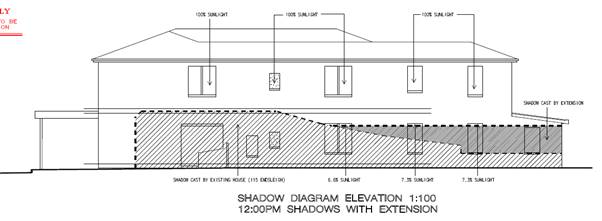
Figure 8 - Shadow Diagram
The proposed alterations and extensions to the existing
dwelling at 115 Endsleigh Avenue will increase the overshadowing impact on
the adjoining building. However, the proposed overshadowing impacts are
considered acceptable given the commercial zoning. In general, the level of
residential amenity within commercial zones is considered a less significant
factor because the zoning is aimed at promoting business and generating
employment.
Privacy Impacts
The proposed development is likely
to have privacy implications for some of the adjoining neighbours. Most of the
adjoining buildings along Endsleigh Avenue are commercial based businesses
although the site at 111-113 Endsleigh Avenue contains a mixed use building with
commercial on the ground floor and five residential units above. The proposed
development contains a significant number of windows along the Eastern
elevation which will have privacy impacts for the residents of the
‘Endsleigh’. The amended design has increased the width of these
window, in line with the recommendation of Council’s Heritage Advisor.
However, the new ‘French’ style balconies on the eastern elevation
are not accessible and have only been included for articulation purposes (refer
to Figure 9).
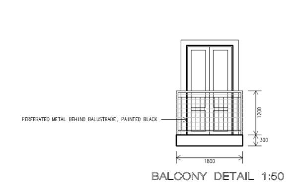 Figure 9 - balcony design
In addition, the perforated metal balustrade will
provide some privacy protection for the residents mixed use development known
as the Endsleigh. The applicant has provided a number of sight line diagrams
which indicates that the views of the neighbouring property will be partially
screened (refer to Figure 10 below).
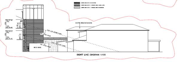
Figure 10 - Sight Line Diagram
The Upper Level (Third Floor) contain another nine motel
units of which four are located on the eastern side facing Endsleigh Avenue.
The units on the third level all have access to accessible balconies on the
eastern and western elevations. The location of these balconies is not expected
to have any significant privacy implication for the adjoining mixed use
development, given that they have been setback from eastern boundary. The
balconies also have solid balustrade which would prevent overlooking onto
adjoining properties.
The amended design has also included a number of additional
windows on the Eastern elevation to help create a more compatible building
design. The inclusion of the additional windows were a suggestion from
Council’s Heritage Advisor to help with the visual impact of the
building. The additional windows are generally located within the stairways and
lift area and are not expected to have any significant impacts on privacy.
It is acknowledged that the proposed development will have
privacy impacts for the residents of the Endsleigh building. However, these
impacts are considered acceptable given the surrounding land is zoned for
commercial use (B6 Enterprise Corridor). The level of residential amenity
within the commercial zones is generally considered a less significant factor
because the zone is aimed at promoting business and generating employment.
The amended proposed development has made some significant improvement to
the design to try and lessen the potential impact on the adjoining neighbours.
The proposed development is therefore considered acceptable.
Heritage Impacts
The issues of heritage impacts have been addressed above.
The amended design has demonstrated there will be no significant impacts on the
adjoining Heritage Items.
Traffic Parking and Access
Council’s Development Officer (Engineering) has
considered the proposal to be acceptable.
Concerns were raised in public submissions about the
potential implications given the proposed use of a car stacker for the
development. The main area of concern is what would happens if the car stacker
broke down and is not repaired.
The use of car stackers is increasing
given that they offer a viable option for limited space. While the concept is
relatively new to Orange car stackers have been successfully used in
development in some larger towns and cities. A condition will be included
in the Notice of Determination to ensure that the car stacker is maintained.
The proposal enables all vehicles to enter the site via the
main access point on Endsleigh Avenue and leave the site in a forward
direction, via Kite Street. The development is not expected to have any significant
impact on pedestrian safety given that it is likely to be a low speed
environment.
In summary, the access and parking areas are well integrated
into the development and are considered acceptable in relation to the DCP
guidelines.
Waste Generation
The applicant has undertaken an assessment of likely waste
generation for the motel which concludes that there is sufficient capacity to
store the number of bins (waste and recycling) within bin area on ground floor.
The bins will be wheeled along the Kite Street to Endsleigh
Avenue for collection by arrangement with an approved contractor.
Safety, Security and Crime
Prevention
The proposed development provides for passive surveillance
of the street and surrounding area. The internal driveway design should ensure
low speed traffic movements to facilitate pedestrian safety.
Initial discussions with NSW Police recommended that any
approval should include a condition for closed-circuit television (CCTV). A
relevant condition has been included in the draft schedule of conditions.
As such, the proposed development is considered acceptable
in relation to safety and security.
Social- economic Impacts
The development has the potential to provide for positive
socio-economic impacts. The development will allow for additional
employment during both construction and operational phases of the development.
Economic Impacts
The development has the potential to result in positive
economic impacts for the City. The development will create additional
competition in the motel/hotel industry. The development will also
generate employment during the construction phase and ongoing employment within
the hospitality sector.
THE SUITABILITY OF THE SITE
s4.15(1)(c)
Adequate services are available to the site to facilitate
the proposed development. The site is considered suitable for the proposed
development.
ANY SUBMISSIONS MADE IN ACCORDANCE
WITH THE ACT s4.15(1)(d)
The proposed development is
defined as "advertised development" under the provisions of
the LEP. The application was originally advertised for the prescribed
period of 14 days and at the end of that period eight (8) submissions were
received in response. The plans were subsequently amended and these plans were
renotified to the eight objectors and to neighbouring properties for 14 days.
At the end of the period three (3) submissions were received in response.
|
Issue
|
Comment
|
|
Visual privacy
|
As discussed in this report, it is considered that visual
privacy impacts are acceptable.
|
|
Overshadowing
|
As discussed in this report, it is considered that the
overshadowing impacts are acceptable.
|
|
Bulk and scale
|
The proposed development complies with the maximum floor
space ratio for this site. Bulk and scale considerations have been addressed
in this report.
|
|
Height
|
The variation to the 12m height limit is discussed within
this report and is considered appropriate in the context of the site.
|
|
Car parking and pedestrian safety
|
The issues of car parking and pedestrian safety have been
considered and are satisfactory.
|
|
Noise - Objection was raised to the proposed development
on the grounds that it would result in increased noise impacts upon
surrounding properties
|
The development will clearly lead to an increase in noise
levels compared to the existing vacant land. A number of conditions have been
included in the draft conditions to ensure that any noise generated by the
Hotel complies with the relevant guidelines.
The Acoustic Assessment identifies that the mechanical
plant associated with the development has not been selected and thus no
external noise emissions have been assessed as part of this assessment.
A condition has been included to ensure that all equipment proposed to be
installed complies with the relevant guidelines.
|
|
Waste Management
|
The applicant has indicated that waste and recycling will
be collected by a Council/private contractor from Endsleigh Avenue. A
condition has been placed on the consent in relation to waste management.
|
|
Character/Heritage
|
The character, suitability and density of the proposal
have been discussed in this report, in the context of the OLEP 2011, DCP
controls and the surrounding heritage items. The proposed development is
considered acceptable.
|
|
Impacts on property values
|
This concern is not a matter of consideration pursuant to
Section 4.15 of the Environmental Planning and Assessment Act 1979.
|
|
Concerns regarding the nature of notification process
|
The application was notified/advertised in accordance with
Council’s Community Participation Plan.
|
|
Concerns about the location of the rooftop pool, gym and
BBQ area.
|
The plans have been subsequently amended to remove the
facilities from the roof top area.
|
|
Signage and lighting
|
Concerns were raised about the potential impact of the
illumination of the proposed sign and light spillage from the rooms and
windows in general. A condition will be included in the notice of
determination to ensure that any lighting will comply with the relevant
standard.
|
|
Traffic Generation
|
Under the RTA guidelines (Guide to Traffic Generating
Development) motels have the potential to generate the following:
· Daily
vehicle trips three per unit
· Evening
peak hour vehicle trips 0.4 per unit
It is assumed that the restaurant
will be mainly used by motel guests and is unlikely to generate significant
additional traffic. This is supported by the applicant who has indicated
that: ‘As an experienced operator, the applicant has found that the
incidence of non-motel guests using the restaurant in this style of motel is
minimal’.
The proposed development at full
capacity is likely to generate around 183 vehicle trips per day and 24
evening peak hour vehicle trips
On this basis the additional
traffic generated by this development is considered minor in terms of the
operation of surrounding road network.
|
|
Pedestrian Safely
|
The pedestrian gate has now been relocated to the northern
side of Kite Street to align with the footpath. This enables guests and staff
to exist the building and walk into town via the existing railway foot
bridge.
Concerns were raised regarding
pedestrian safety entering and leaving the building via the pedestrian
gate. The increase in traffic is not expected to have any significant
impact on pedestrian safety given the low speed environment.
Concerns were also raised for the
existing residents entering and leaving the garages which have direct vehicle
assess onto Kite Street. The increase in vehicle traffic is not expected to
have any significant impact on vehicles safety given the low speed
environment.
|
|
Crime Risk
|
Initial discussions with NSW Police recommended that any
approval should include a condition for closed-circuit television (CCTV). A
condition has been included in the draft schedule of conditions.
As such, the proposed development is considered acceptable
in relation to safety and security.
|
|
Orange Eastside Precinct plan and Site Specific Controls
|
Concerns were raised about the timing and public
exhibition of the Orange Eastside Precinct Plan. The submission expressed
concern that the proposed development appears to have endorsed the proposed
development on the draft documents.
|
|
Concerns about the loss of former ‘Perway’
structure.
Note: The submission that initially raise concerns about
the loss of these structure put in a second submission indicating that the
outcomes as a good outcome for railway history.
|
The applicant has agreed with the following suggestions
from Council’s Heritage Consultant to mitigate the loss of these
structure:
‘Mitigation for the loss of the Perway Structure
should include the provision of an outline marked in the ground floor car
park surface of an outline of the two main structure using a steel element
similar in size to a rail, so as to interpret the former buildings and use.
An interpretive panel is to be designed and prepared in conjunction with
O&DHS illustration the significant of the Perway deport and placed within
the space at an agreed location’.
The applicant has agreed to name the dining area
“Perway Restaurant.
|
|
Concerned about noised being generated from the proposed
gym which was included on the amended plans which were renotified.
|
The gym was subsequently removed from the amended plans.
|
PUBLIC INTEREST
s4.15(1)(e)
The proposed development is considered to be of minor
interest to the wider public due to the relatively localised nature of
potential impacts. The proposal is not inconsistent with any relevant policy
statements, planning studies, guidelines etc that have not been considered in
this assessment.
SUMMARY
The proposed development is permissible with the consent of
Council. The proposed development complies with the relevant aims, objectives
and provisions of the LEP. It is recommended that Council supports the
request to vary the height control applicable to the subject development
pursuant to Clause 4.6 of the LEP. A detailed assessment of matters pertaining
to parking and heritage has been provided in the body of the report.
A Section 4.15 assessment
of the development indicates that the development is acceptable in this
instance. Attached is a draft Notice of Approval outlining a range of
conditions considered appropriate to ensure that the development proceeds in an
acceptable manner.
COMMENTS
The requirements of the Environmental Health, Building
Surveyor and the Engineering Development Section are included in the attached
Notice of Approval.
Attachments
1 Notice
of Approval, D20/71463⇩
2 Plans,
D20/70578⇩
3 Submissions
for 1st and 2nd exhibition period - 155 Kite Street and 115 Endsleigh Avenue,
D20/71059⇩
Planning
and Development Committee
1 December 2020
Attachment 1 Notice
of Approval
|

|
ORANGE
CITY COUNCIL
Development
Application No DA
133/2020(1)
NA20/ Container
PR17385
|
NOTICE OF DETERMINATION
OF A DEVELOPMENT
APPLICATION
issued under the Environmental
Planning and Assessment Act 1979
Section 4.18
|
Development
Application
|
|
|
Applicant Name:
|
Orange CBD
Pty Ltd
|
|
Applicant Address:
|
C/- Peter
Basha Planning & Development
PO Box
1827p
ORANGE
NSW 2800
|
|
Owner’s Name:
|
Orange CBD
Pty Ltd
|
|
Land to Be Developed:
|
Lot 11 DP 1002968, Lot 1 DP 770265,
Lot 8 DP 1069072 - 155 Kite Street and 115 Endsleigh Avenue, Orange
|
|
Proposed Development:
|
Demolition (ancillary structures and
rear skillion of existing building), Hotel or Motel Accommodation (four storey
building), Alterations and Additions (existing building), and Business
Identification Signage
|
|
|
|
|
Building
Code of Australia
building
classification:
|
Class to
be determined by the PC
|
|
|
|
|
Determination
made under
Section 4.16
|
|
|
Made On:
|
1 December
2020
|
|
Determination:
|
CONSENT
GRANTED SUBJECT TO CONDITIONS DESCRIBED BELOW:
|
|
|
|
|
Consent to
Operate From:
|
2 December
2020
|
|
Consent to
Lapse On:
|
2 December
2025
|
Terms of Approval
The
reasons for the imposition of conditions are:
(1) To ensure a quality
urban design for the development which complements the surrounding environment.
(2) To maintain
neighbourhood amenity and character.
(3) To ensure compliance
with relevant statutory requirements.
(4) To provide adequate
public health and safety measures.
(5) Because the development
will require the provision of, or increase the demand for, public amenities and
services.
(6) To prevent the proposed
development having a detrimental effect on adjoining land uses.
(7) To minimise the impact
of development on the environment.
Conditions
(1) The
development must be carried out in accordance with:
(a) Amended
Plans prepared by McKinnon Design. Sheets No 1 to 3, Rev: F, Sheet No 4,
Rev: J, Sheet No 5 Rev: G. Sheets 6 to 12 Rev: H, Sheets 13 to 14 Rev: F,
Sheets 15 to 17 Rev: H, Sheet 18 Rev: F. Job No: 19033, dated 13 October 2020
(b) Statements
of environmental effects or other similar associated documents that form part
of the approval
as amended
in accordance with any conditions of this consent.
(2) All building work must
be carried out in accordance with the provisions of the Building Code of
Australia.
(3) A sign is to be erected
in a prominent position on any site on which building work, subdivision work or
demolition work is being carried out:
(a) showing
the name, address and telephone number of the principal certifying authority
for the work, and
(b) showing
the name of the principal contractor (if any) for any building work and a
telephone number on which that person may be contacted outside working hours,
and
(c) stating
that unauthorised entry to the site is prohibited.
Any such sign is to be maintained while the
building work, subdivision work or demolition work is being carried out.
(4) Where any excavation
work on the site extends below the level of the base of the footings of a
building on adjoining land, the person having the benefit of the development
consent must, at the person’s own expense:
(a) protect
and support the adjoining premises from possible damage from the excavation,
and
(b) where
necessary, underpin the adjoining premises to prevent any such damage.
Note: This
condition does not apply if the person having the benefit of the development
consent owns the adjoining land or the owner of the adjoining land has given
consent in writing to this condition not applying.
|
PRIOR TO THE ISSUE OF
A CONSTRUCTION CERTIFICATE
|
(5) The applicant shall
provide the Principal Certifying Authority and Council with a report from a
qualified Acoustic Consultant that identifies all mechanical equipment,
including the car stackers, and attenuation solutions (such as acoustic
shielding) to be installed within the development. The Report shall confirm
that the operation of such plant will comply with the NSW State Industrial
Noise Policy. Plans must be amended to include any recommendations and design
requirements of the Acoustic Consultant prior to the issue of a Construction
Certificate.
(6) The
development is to comply with the conditions of concurrence issued by Transport
NSW letter dated 23 October 2020.
(7) A
detailed plan showing landscaping is to be submitted to, and approved by,
Council’s Manager Development Assessments prior to the issuing of a
Construction Certificate
(8) An
approval under Section 68 of the Local Government Act is to be sought
from Orange City Council, as the Water and Sewer Authority, for alterations to
water and sewer. No plumbing and drainage is to commence until approval is
granted.
(9) The
applicant is to submit a waste management plan that describes the nature of
wastes to be removed, the wastes to be recycled and the destination of all
wastes. All wastes from the demolition and construction phases of this project
are to be deposited at a licensed or approved waste disposal site.
(10) Prior
to the issue of a Construction Certificate, evidence shall be submitted to
Council of the lodgement of plans with Land & Property Information to
consolidate Lot 11 DP 1002968 and Lot 8 DP 1069072 into one
parcel.
(11) A water and soil
erosion control plan is to be submitted to the principal certifying authority
for approval prior to the issuing of a Construction Certificate. The control
plan is to be in accordance with the Orange City Council Development and
Subdivision Code and the Landcom, Managing Urban Stormwater; Soils and
Construction Handbook.
(12) Engineering plans
providing complete details of the proposed driveway and car parking areas
within the site are to be submitted to the principal certifying authority for
approval prior to the issuing of a Construction Certificate. These plans are to
provide details of levels, cross falls of all pavements, proposed sealing
materials and proposed drainage works and are to be in accordance with Orange
City Council Development and Subdivision Code. The carpark plans shall also
detail the following signage and line marking:
· Signage to indicate
‘No Entry’ to traffic approaching the carpark exit from Kite
Street; and
· Directional and
‘Exit’ signage within the carpark; and
· 45 parking spaces line
marked to dimensions specified in AS 2890.1 Off-street car parking, with 7
stack parking spaces and manoeuvring area clearly line marked.
(13) The existing
150mm-diameter sewer main located on 115 Endsleigh Avenue shall be renewed from
boundary to boundary. Prior to a Construction Certificate being issued evidence
of payment to Orange City Council for the sewer main relining works, new sewer
junction and any associated sewer main works shall be provided to the Principal
Certifying Authority.
(14) The existing 150mm
diameter sewer main that crosses the site is to be accurately located and
indicated on the plans. Where the main is positioned under or adjacent to any
proposed building work, measures are to be taken in accordance with Orange City
Council Policy - Building over and/or adjacent to sewers ST009 (the policy). A
structural engineers design for footings / piers / slabs in the vicinity of the
sewer main and sewer vent demonstrating compliance with Clause 4 of the policy
shall be submitted to Orange City Councils Water and Sewer Engineer for
approval prior to the issue of a Construction Certificate.
(15) The existing stormwater
main that crosses the site shall be protected from construction traffic from
the southern boundary and kerb inlet pit in Kite Street to the pit located in
the railway reserve. A new grated kerb inlet structure shall be constructed in
Kite Street to tie into the carpark vehicle exit driveway. Where the main is
positioned under or adjacent to any proposed building work, measures are to be
taken to protect the pipe from building imposed loads. A structural engineers
design for footings / piers / slabs in the vicinity of the stormwater main
shall be submitted to Orange City Councils Manager Engineering Services for
approval prior to the issue of a Construction Certificate.
(16) A Liquid
Trade Waste Application is to be submitted to Orange City Council prior to the
issuing of a Construction Certificate. The application is to be in
accordance with Orange City Council’s Liquid Trade Waste Policy.
Engineering plans submitted as part of the application are to show details of
all proposed liquid trade waste pre-treatment systems and their connection to
sewer.
Where applicable, the applicant is to
enter into a Liquid Trade Waste Service Agreement with Orange City Council in
accordance with the Orange City Council Liquid Trade Waste Policy.
(17) Payment of
contributions for water, sewer and drainage works is required to be made
at the contribution rate applicable at the time that the payment is made.
The contributions are based on 17.3 ETs for water supply headworks and 26.45
ETs for sewerage headworks. A Certificate of Compliance, from Orange City
Council in accordance with the Water Management Act 2000, will be issued
upon payment of the contributions.
This Certificate of Compliance is to be
submitted to the Principal Certifying Authority prior to the issuing of a
Construction Certificate.
(18) A dedicated fire main
and water supply shall be provided for the development. Engineering plans of
the proposed water main connection are to be submitted to and approved by
Orange City Council prior to the issue of a Construction Certificate.
(19) Backflow Prevention
Devices are to be installed to AS3500 and in accordance with Orange City
Council Backflow Protection Guidelines. Details of the Backflow Prevention
Devices are to be submitted to Orange City Council prior to the issuing of a
Construction Certificate.
(20) A Road Opening Permit
in accordance with Section 138 of the Roads Act 1993 must be approved by
Council prior to a Construction Certificate being issued or any intrusive
works being carried out within the public road or footpath reserve.
Works covered by a ROP include:
a) Installation,
maintenance, repairs/replacement or upgrading of utilities (water, gas,
electricity or telecommunications).
b) Any
type of stormwater or sewer connection works and repairs.
c) Construction
of any temporary/permanent driveway access to a property for construction
vehicle access. Replacement of redundant driveways with new footpaths.
d) Reinstatement
/ upgrading the road pavement, road surfacing, or kerb and gutter associated
with a development site approved by the Orange City Council.
A Road Opening Permit Certificate of Compliance
is to be issued for the works by Council prior to any Occupation/ Final
Certificate being issued for the development.
|
PRIOR TO WORKS
COMMENCING
|
(21) The buildings known as
the ‘Perway’ structures are s to be photographically recorded and
surveyed prior to demolition in accordance with Council's "Guidelines for
Photographic Recording of Heritage Buildings and Sites". One set of
photographs showing the features and construction methods of the Guildry shall
be provided to Council for its records along with a detailed site plan.
(22) A
Construction Certificate application is required to be submitted to, and issued
by Council/Accredited Certifier prior to any excavation or building works being
carried out onsite.
(23) A
temporary onsite toilet is to be provided and must remain throughout the
project or until an alternative facility meeting Council’s requirements
is available onsite.
(24) Soil erosion control
measures shall be implemented on the site.
(25) A
dilapidation report prepared by a suitably qualified engineer is to be
submitted to Council addressing the current condition of the buildings that are
adjoining the development site, and also the existing building that is to
remain as part of this development.
(26) Prior
to works commencing, the applicant shall prepare a structural Dilapidation Report
identifying the condition of all public infrastructure in the vicinity of the
site (including roads, gutters, footpaths, sewer manholes, water main valves
and hydrants etc.) in Kite Street and Endsleigh Avenue and an internal video
camera inspection of the stormwater line crossing the site. A copy of the
Dilapidation Report shall be submitted to the principal certifying authority
and Orange City Council.
(27) Prior to works
commencing, a Traffic Management Plan shall be prepared for the construction
phase of the project. A copy of the Traffic Management Plan shall be submitted
to the principal certifying authority and Orange City Council.
|
DURING
CONSTRUCTION/SITEWORKS
|
(28) On-site car parking
accommodation is to be provided for a minimum of 67 vehicles and such being set
out generally in accordance with the details indicated on the submitted plans
except as otherwise provided by the conditions of consent.
(29) All
construction/demolition work on the site is to be carried out between the hours
of 7.00 am and 6.00 pm Monday to Friday inclusive, 7.00 am to
5.00 pm Saturdays and 8.00 am to 5.00 pm Sundays and Public
Holidays. Written approval must be obtained from the General Manager of Orange
City Council to vary these hours.
(30) A
Registered Surveyor’s certificate identifying the location of the
building on the site must be submitted to the Principal Certifying Authority.
(31) All
construction works are to be strictly in accordance with the Reduced Levels (RLs)
as shown on the approved plans.
(32) All
materials on site or being delivered to the site are to be contained within the
site. The requirements of the Protection of the Environment Operations Act
1997 are to be complied with when placing/stockpiling loose material or
when disposing of waste products or during any other activities likely to
pollute drains or watercourses.
(33) Building demolition is
to be carried out in accordance with Australian Standard 2601:2001 - The
Demolition of Structures and the requirements of Safe Work NSW.
(34) Asbestos
containing building materials must be removed in accordance with the provisions
of the Work Health and Safety Act 2011 and any guidelines or Codes
of Practice published by Safe Work NSW, and disposed of at a licenced landfill
in accordance with the requirements of the NSW EPA.
(35) Any adjustments to
existing utility services that are made necessary by this development proceeding
are to be at the full cost of the developer.
(36) The
provisions and requirements of the Orange City Council Development and
Subdivision Code are to be applied to this application and all work constructed
within the development is to be in accordance with that Code.
The developer is to be entirely responsible for
the provision of water, sewerage and drainage facilities capable of servicing
the development from Council’s existing infrastructure. The developer is
to be responsible for gaining access over adjoining land for services where
necessary and easements are to be created about all water, sewer and drainage
mains within and outside the lots they serve.
(37) All driveway and
parking areas are to be sealed with bitumen, hot mix or concrete and are to be
designed for all expected loading conditions (provided however that the minimum
pavement depth for gravel and flush seal roadways is 200mm) and be in
accordance with the Orange City Council Development and Subdivision Code.
(38) Heavy-duty concrete
kerb and gutter laybacks and footpath crossings are to be constructed for the
entrances to the proposed development in Endsleigh Avenue and Kite Street. The
location and construction of the laybacks and footpath crossings and any
footpath construction / reinstatement works are to be as required by the Orange
City Council Development and Subdivision Code and Road Opening Permit.
(39) The water and sewerage
services to the existing building, where they are not proposed to be used as
part of this development, are to be sealed off at their respective Council
mains.
(40) All services
are to be contained within the allotment that they serve.
(41) The pedestrian access
to the carpark from
Kite Street shall have a concrete path constructed a minimum of 1.2mwide and
tied into the existing public footpath. Construction work is to be to the
requirements and standards of the Orange City Council Development and
Subdivision Code.
(42) The fit-out
of the food preparation and storage areas are to be installed in accordance
with the requirements of Food Safety Standard 3.2.3 "Food Premises and
Equipment" of the Australian New Zealand Food Standards Code and
Australian Standard 4674-2004 "Design and construction and fit-out of food
premises".
(43) In the event of an
unexpected find during works such as (but not limited to) the presence of
undocumented waste, odorous or stained soil, asbestos, structures such as
underground storage tanks, slabs, or any contaminated or suspect material, all
work on site must cease immediately. The beneficiary of the consent must
discuss with Council the appropriate process that should be followed
therein. Works on site must not resume unless the express permission of
the Director Development Services is obtained in writing.
(44) All
construction/demolition work on the site is to be carried out in accordance
with the EPA’s Interim Construction Noise Guideline 2009.
|
PRIOR TO THE ISSUE OF
AN OCCUPATION CERTIFICATE
|
(45) The proposed
floodlighting of the premises is to be designed, positioned, and installed,
including appropriate shielding and orientation of the lighting fixture, as to
not give rise to obtrusive light, interfere with traffic safety or detract from
the amenity of surrounding properties in accordance with Australian Standard
4282:1997 - Control of the obtrusive effects of outdoor lighting..
(46) A
total of 67 off-street car parking spaces are to be provided upon the site in
accordance with the approved plans and the provisions of Development Control
Plan 2004. The parking spaces are to be constructed in accordance with the
requirements of Council's Development and Subdivision Code, prior to the
issuing of an Occupation Certificate.
(47) The proposed mechanical
stack parking systems shall be regularly serviced and maintained to the
requirements set out by the manufacturer of the system. In this regard the
owner or the occupier of the building is to enter into an annual service and
maintenance contract with the manufacturer’s service agent for the life of
the system. A copy of the initial service and maintenance contract is to be
provided to Council prior to issue of an Occupation Certificate.
In the event of permanent failure of the system
(which is unable to be remedied by servicing), the owner of the building is to
immediately replace the mechanical stack parking system.
(48) An easement, to drain
sewage and to provide Council access for maintenance of sewerage works, a
minimum of 2.0 metres wide is to be created over the sewer main and vent.
Evidence that the easement has been registered is to be submitted to the
Principal Certifying Authority prior to issuing of an Occupation Certificate.
(49) Landscaping
shall be installed in accordance with the approved plans and shall be
permanently maintained to the satisfaction of Councils Manager Development
Assessments
(50) An easement, to drain
stormwater and to provide Council access for maintenance, a minimum of 2.0
metres wide and height limited to the underside of the first floor concrete
slab is to be created over the stormwater main crossing the site. Evidence that
the easement has been registered is to be submitted to the Principal Certifying
Authority prior to issuing of an Occupation Certificate.
(51) Certification from
Orange City Council is required to be submitted to the Principal Certifying
Authority prior to the issue of an Occupation Certificate stating that all
works relating to connection of the development to Council assets, works on
public land, works on public roads, stormwater, sewer and water reticulation
mains and footpaths have been carried out in accordance with the Orange City
Council Development and Subdivision Code and the foregoing conditions.
(52) A Road Opening Permit
Certificate of Compliance is to be issued for the works by Council prior to any
Occupation/Final Certificate being issued for the development.
(53) Prior to an Occupation Certificate being issued, the applicant must
engage a suitably qualified person to prepare a Post-Construction Dilapidation
Report at the completion of construction. This report is required to ascertain
whether the construction created any structural damage to adjoining
infrastructure.
This report is to be submitted to the principal
certifying authority who shall compare the Post-Construction Dilapidation
Report with the Pre-Construction Dilapidation Report required by these
conditions and obtain written confirmation from the relevant authority and/or
land owners that there is no adverse structural damage to Council
infrastructure and/or roads.
A copy of the Post-Construction Dilapidation
Report is to be provided to Orange City Council.
Where the Post Construction Dilapidation Report
identifies damage to infrastructure as a result of the construction works, the
applicant shall pay the full cost of “make good” repairs to the
satisfaction of the Director, Technical Services.
(54) Certificates for
testable Backflow Prevention Devices are to be submitted to Orange City Council
by a plumber with backflow qualifications prior to the issue of an Occupation
Certificate.
(55) The applicant shall
provide Council with an Operational Management Plan. The Plan shall
include measures to appropriately mitigate operational noise from the
development including noise from plant, patrons/pedestrians entering/leaving
the site; noise from private areas such as balconies; waste collection
times; delivery times; general access and security gate operations, along with
measures to mitigate odours and fumes that could be emitted from the kitchen or
waste storage areas.
(56) No
person is to use or occupy the building or alteration that is the subject of
this approval without the prior issuing of an Occupation Certificate.
(57) The
owner of the building/s must cause the Council to be given a Final Fire Safety
Certificate on completion of the building in relation to essential fire or
other safety measures included in the schedule attached to this approval.
(58) Where
Orange City Council is not the Principal Certifying Authority, a final
inspection of water connection, sewer and stormwater drainage shall be
undertaken by Orange City Council and a Final Notice of Inspection issued,
prior to the issue of either an interim or a final Occupation Certificate.
(59) Prior
to the issue of a Construction Certificate, evidence shall be submitted to
Council of the registration of plans with Land &
Property Information to consolidate Lot 11 DP 1002968 and Lot 8
DP 1069072 into one parcel.
|
PRIOR TO THE ISSUE OF
A SUBDIVISION CERTIFICATE
|
(60) Application shall be
made for a Subdivision Certificate under Section 6.3(1)(d) of the Act.
(61) Application is to be
made to Telstra/NBN for infrastructure to be made available to each individual
lot within the development. Either a Telecommunications Infrastructure
Provisioning Confirmation or Certificate of Practical Completion is to be
submitted to the Principal Certifying Authority confirming that the specified
lot(s) have been declared ready for service prior to the issue of a Subdivision
Certificate.
(62) A Notice of Arrangement
from Essential Energy stating arrangements have been made for the provision of
electricity supply to the development, is to be submitted to the Principal
Certifying Authority prior to the issue of a Subdivision Certificate.
(63) An easement, to drain
sewage and to provide Council access for maintenance of sewerage works, a
minimum of 2.0 metres wide is to be created over the sewer main and vent.
Evidence that the easement has been registered is to be submitted to the
Principal Certifying Authority prior to issuing of a Subdivision Certificate.
(64) All services are to be
contained within the allotment that they serve. A Statement of Compliance, from
a Registered Surveyor, is to be submitted to the Principal Certifying Authority
prior to the issuing of a Subdivision Certificate.
(65) All engineering
conditions of development consent as it relates to the provision of services to
the development are to be completed prior to the issuing of a Subdivision
Certificate.
(66) An easement, to drain
stormwater and to provide Council access for maintenance, a minimum of 2.0
metres wide and height limited to the underside of the first floor concrete
slab is to be created over the stormwater main crossing the site. Evidence that
the easement has been registered is to be submitted to the Principal Certifying
Authority prior to issuing of a Subdivision Certificate.
(67) Certification from
Orange City Council is required to be submitted to the Principal Certifying
Authority prior to the issue of a Subdivision Certificate stating that all
works relating to connection of the development to Council assets, works on
public land, works on public roads, stormwater, sewer and water reticulation
mains and footpaths have been carried out in accordance with the Orange City Council
Development and Subdivision Code and the foregoing conditions.
(68) All
of the foregoing conditions are to be at the full cost of the developer and to
the requirements and standards of the Orange City Council Development and
Subdivision Code, unless specifically stated otherwise. All work required by
the foregoing conditions is to be completed prior to the issuing of an
Occupation Certificate, unless stated otherwise.
|
MATTERS FOR THE
ONGOING PERFORMANCE AND OPERATION OF THE DEVELOPMENT
|
(69) The
owner is required to provide to Council and to the NSW Fire Commissioner an
Annual Fire Safety Statement in respect of the fire-safety measures, as
required by Clause 177 of the Environmental Planning and Assessment
Regulation 2000.
(70) An assessment of noise
emissions from the premises is to be provided to Council within 3 months from
the issue of any Occupation Certificate. This commissioning report is to
indicate noise levels through the monitoring of noise emanating from the normal
peak use of the premises and determine any necessary noise mitigation
measures. Any identified mitigations works shall be carried out within 1
month of the commissioning report, and the operation of the premises shall be
carried out in accordance with any recommendations set out in the report.
(71) Operating hours of the
restaurant or café are restricted to between 6am - 11pm Monday to
Sunday, inclusive.
(72) All garbage bins must
be stored within the garbage bay at all times, other than on garbage collection
days.
(73) A closed circuit
television system (CCTV), incorporating digital video surveillance cameras and
recorders, being installed and maintained on the premises (restaurant and
reception area) and car parking area and to be operated during trading hours
(Motel 24 hours).
Other Approvals
(1) Local
Government Act 1993 approvals granted under Section 68.
Nil
(2) General
terms of other approvals integrated as part of this consent.
Nil
Right of Appeal
If you are dissatisfied with this
decision, Section 8.7 of the Environmental Planning and Assessment
Act 1979 gives you the right to appeal to the Land and Environment
Court. Pursuant to Section 8.10, an applicant may only appeal within 6 months
after the date the decision is notified.
|
Disability Discrimination Act
1992:
|
This application has been assessed in
accordance with the Environmental Planning and Assessment Act 1979. No
guarantee is given that the proposal complies with the Disability Discrimination
Act 1992.
The applicant/owner is responsible to
ensure compliance with this and other anti-discrimination legislation.
The Disability Discrimination Act
covers disabilities not catered for in the minimum standards called up in the
Building Code of Australia which references AS1428.1 - "Design for
Access and Mobility". AS1428 Parts 2, 3 and 4 provides the most
comprehensive technical guidance under the Disability Discrimination Act
currently available in Australia.
|
|
|
|
|
Disclaimer - S88B of the Conveyancing
Act 1919 - Restrictions on the Use of Land:
|
The applicant should note that there
could be covenants in favour of persons other than Council restricting what
may be built or done upon the subject land. The applicant is advised to check
the position before commencing any work.
|
|
|
|
|
Signed:
|
On behalf of the consent authority ORANGE
CITY COUNCIL
|
|
Signature:
|
|
|
Name:
|
PAUL JOHNSTON - MANAGER DEVELOPMENT
ASSESSMENTS
|
|
Date:
|
2 December 2020
|
Planning and Development Committee
1 December 2020
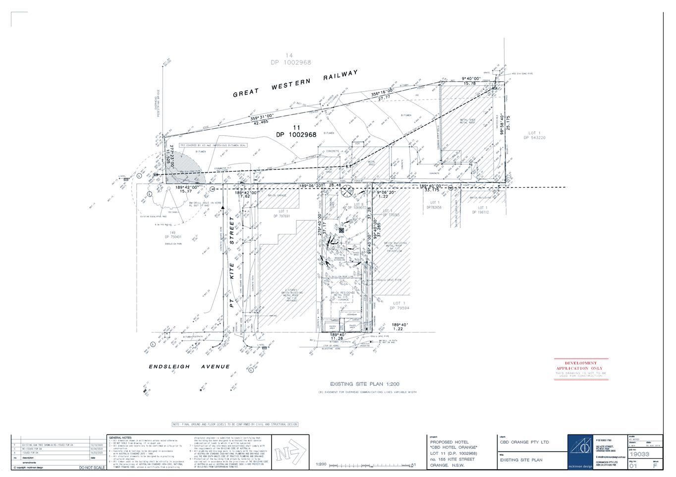
Planning
and Development Committee
1 December 2020
Attachment 3 Submissions
for 1st and 2nd exhibition period - 155 Kite Street and 115 Endsleigh Avenue
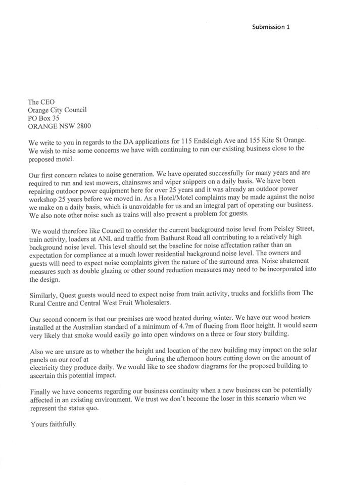
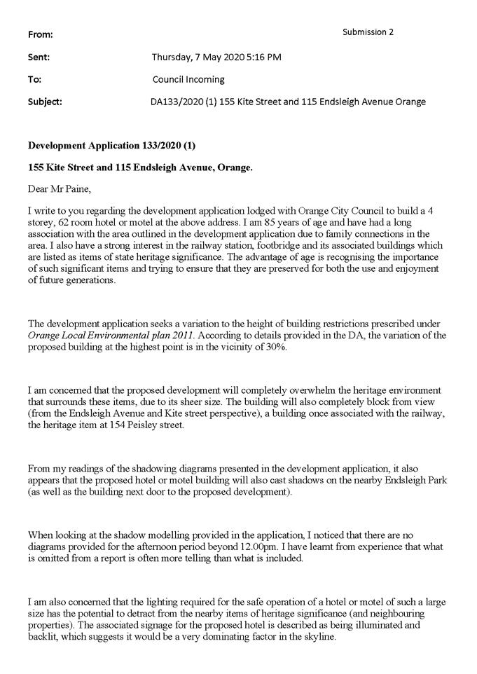
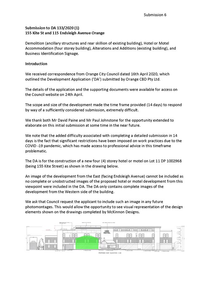


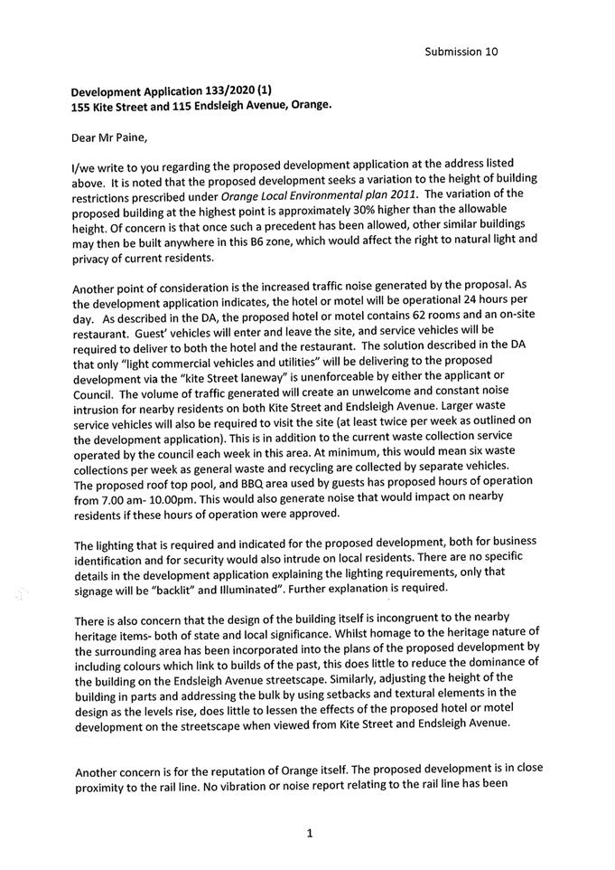
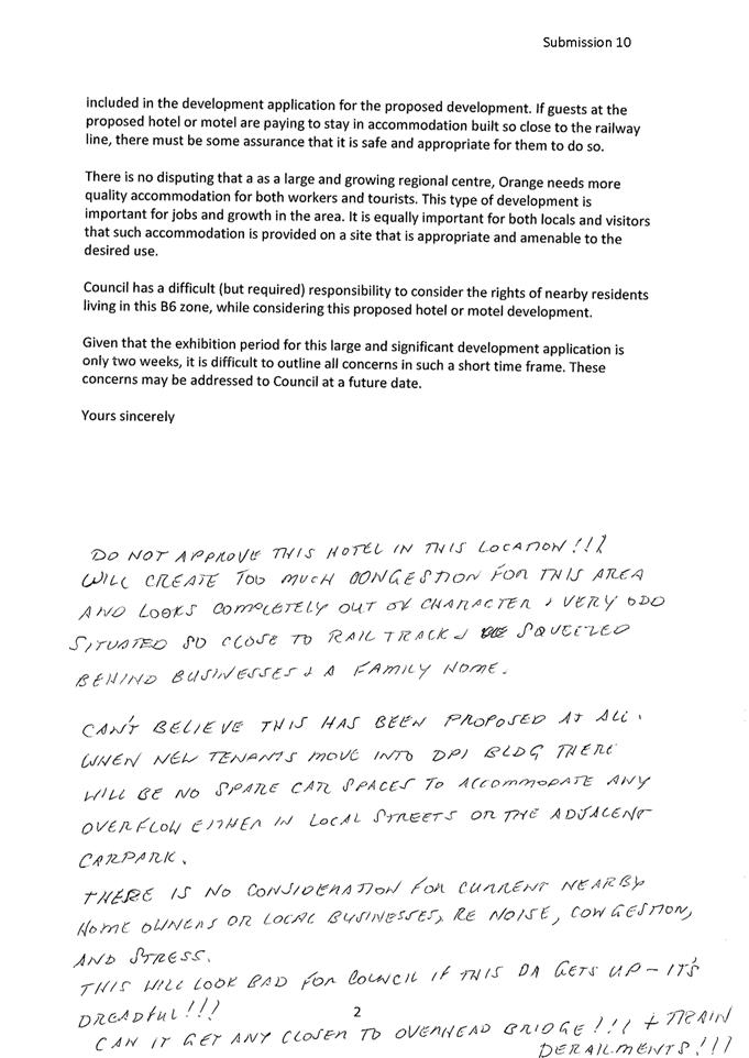
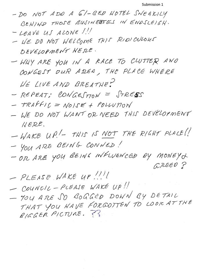
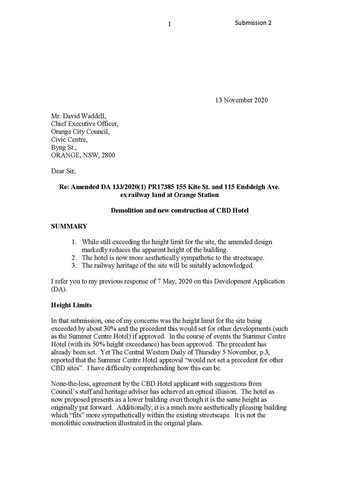
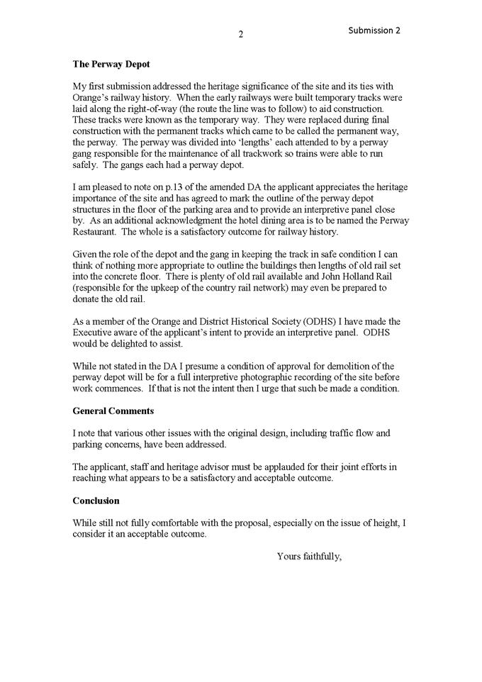
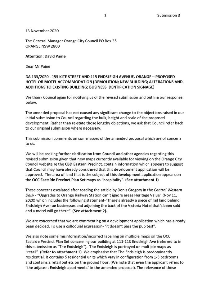
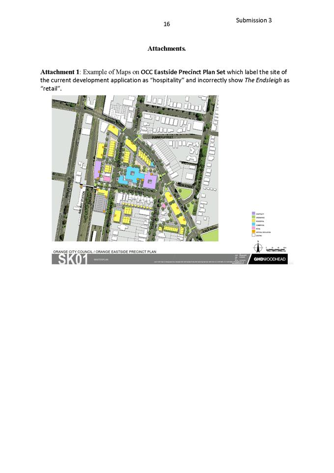
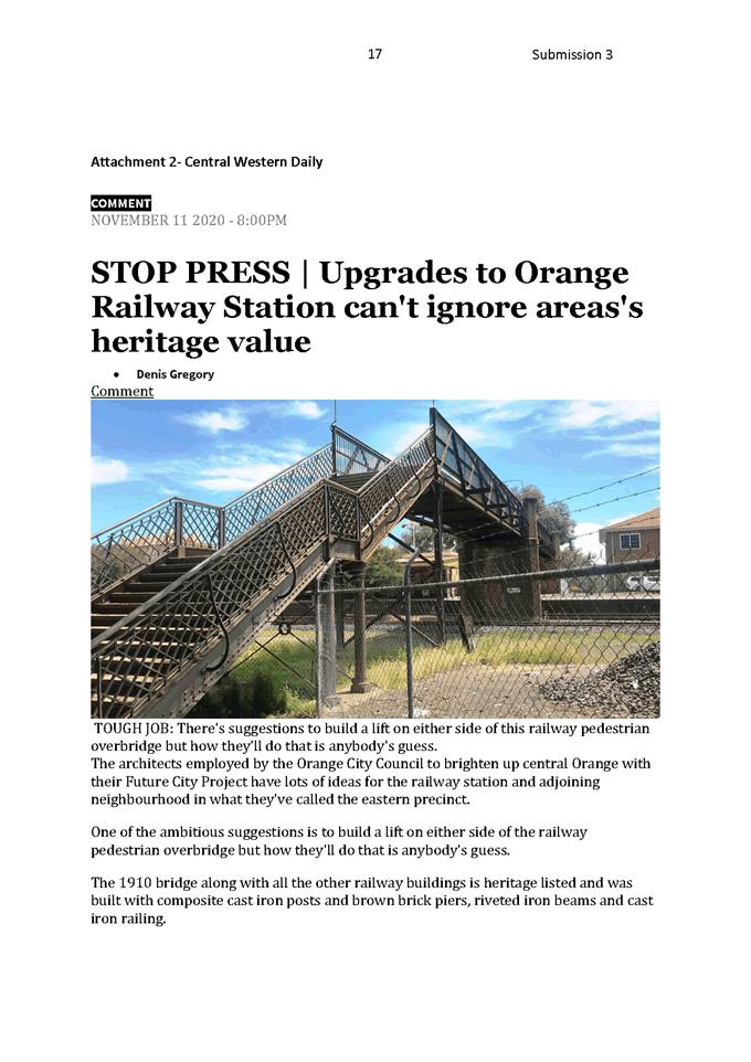
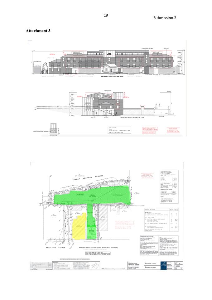
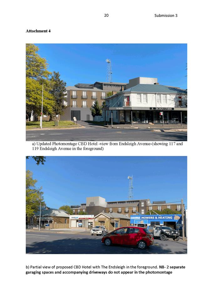
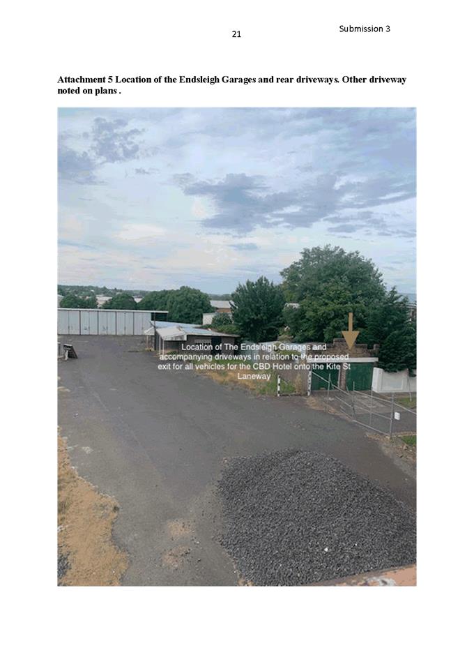
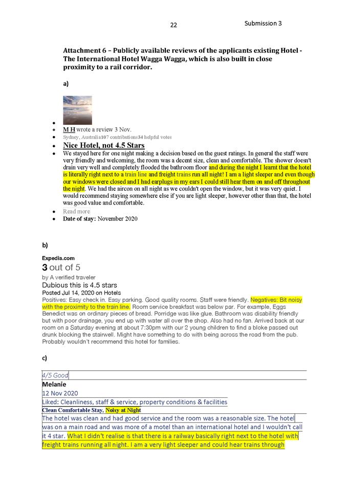
2.5 Heritage
Study Review - Post Exhibition and Adoption
RECORD
NUMBER: 2020/2362
AUTHOR: Andrew
Crump, Senior Planner
EXECUTIVE Summary
Council recently resolved to place the draft Heritage Study
Review on public exhibition for a period of 40 days.
During the exhibition period 11 submissions were received.
Council’s Heritage consultants have been provided the
submissions and they have been considered in the finalisation of the attached
report.
Subject to the exceptions detailed below in body of the
report, it is recommended the study be adopted.
The next step in the process is for Council’s
strategic planning staff to commence the process of amending the Local
Environmental Plan to enshrine the outcomes of this review document in to
Council’s planning scheme.
Link To Delivery/OPerational Plan
The recommendation in this report relates to the
Delivery/Operational Plan Strategy “10.2 Preserve -
Preserve our diverse social and cultural heritage”.
Financial Implications
The Heritage Study Review is listed within Council’s
operational delivery plan. There is a financial implication with respect to the
preparation of the required planning proposal that updates the Local
Environmental Plan (LEP) to reflect any adopted heritage changes.
Policy and Governance Implications
It will be necessary to amend Orange LEP 2011 following
Council adoption of the Final Report from the consultants.
DIRECTORS COMMENT
Following extensive community consultation, the Heritage
Study Review has now been completed by Council’s Heritage Advisor, David
Scobie and local Heritage Architect James Nicholson. The Review
recommends the renaming of some of the existing Heritage Conservation Areas to
reflect their heritage, along with extension of the Heritage Conservation Areas
and list of Heritage items.
Once adopted by Council, the Study would then feed into a
Planning Proposal, to have the changes identified in the Orange Local
Environmental Plan.
Of particular interest to Council will be the expansion of
the HCA of Newman Park that takes in site that in the past has been the subject
of a boarding house proposal, along with the area of Spring Street and Summer
Place, which recently received publicity due to investigations by NSW Land and
Housing Corporation into affordable housing. That is these sites area
included in the Newman Park HCA detailed in Figure 2 of this report.
Adoption of the Heritage Study Review is recommended.
|
Recommendation
1 That
the report by Council’s Senior Planner be acknowledged.
2 That
the following recommendations be adopted:
· The
proposed Heritage Conservation Areas known as Bletchington, Newman Park and
Blackman’s Swamp Heritage Conservation Areas as described in the
Heritage Study Review and as shown on the accompanying maps be adopted.
· The
extension to the existing Central, Duration Cottages and Glenroi Heritage
Conservation Areas as described in the Heritage Study Review and as shown on
the accompanying maps be adopted.
· The
name of the existing Heritage Conservation Area known as Central Heritage
Conservation Area, be renamed: Dalton Heritage Conservation Area.
· The
name of the existing Heritage Conservation Area known as the Duration
Cottages Heritage Conservation Area be renamed: Glenroi Duration Cottages
Heritage Conservation Area.
· The
name of the existing Heritage Conservation Area known as Glenroi Heritage
Conservation Area be renamed: Endsleigh Heritage Conservation Area.
· The
name of the existing Heritage Conservation Area known as East Orange Heritage
Conservation Area be renamed: Bowen Heritage Conservation Area.
· The
following properties are recommended to be adopted as Local Heritage Items:
o 117 Sampson Street
o 49 Prince Street
o 139 Margaret Street
o 5 Hawkins Lane
o 9 Hawkins Lane
o 11 Hawkins Lane
o 3 Hawkins Lane
o 6 Hawkins Lane
o 4 Hawkins Lane
o 2 Hawkins Lane
o 20 Nile Street
o 22 Nile Street
o 22 Nile Street
o 26 Nile Street
o 171 Margaret Street
o 110 Matthews Avenue
o 125 Prince Street
o 125 Dalton Street
o 112 Dalton Street
o 121 Gardiner Road
o 123 Gardiner Road
o 102 Gardiner Road
o 106 Gardiner Road
o 108 Gardiner Road
o 105 Spring Street
o 15 Capps Lane, Huntley
o ‘Waverton’ 76
Blunt Road, Huntley (as per the described curtilage)
o ‘Homeleigh’
359 Phoenix Mine Road, Huntley
|
further considerations
Consideration has
been given to the recommendation’s impact on Council’s service
delivery; image and reputation; political; environmental; health and safety;
employees; stakeholders and project management; and no further implications or
risks have been identified.
SUPPORTING INFORMATION
Hughes Trueman Ludlow completed the
City’s first Heritage Study in 1986 which identified the majority of the
conservation areas we have today, along with approximately a third of the
Heritage Items still listed today.
In 2010 David Scobie Architects
were engaged to undertake a Community Based Heritage Study. The study was
adopted in 2012 and was incorporated into the LEP as part of Amendment 1
in 2014.
In line with Council’s
obligations to carry out periodic reviews and updates of Council’s
Planning Strategies and Policies, in mid-2019 Council engaged David Scobie of
David Scobie Architects and also James Nicholson of Adaptive Architects to
carry out a periodic review of the study.
The purpose of the review is to
determine if the existing mapped Heritage Areas and listed Heritage Items are
adequate and capture everything that is deemed to carry heritage significance;
or if not, identify the areas that should be expanded or recalibrated; or
whether new areas need to be included along with whether or not additional
items need to be included.
The review was to going to explore
the possibility of reducing the mapped area of certain large Heritage Items such
as Charles Sturt University Water Tower for example. A test case has been
identified with the Waverton listing in Huntley.
Should this new way of listing
large properties prove successful and useful from a heritage management
perspective, a review of Heritage Items on large parcels of land would be
recommended to be commissioned.
Public Engagement
Council staff hosted two inception
workshops which the public was invited to. In addition to the general public,
Council staff invited the members of the Cultural Heritage Community Committee,
along with members of the community who have showed an interest in heritage
conservation within the City.
At this time, notices were placed
in the local press inviting the community to assist with the process by nominating
areas or properties that Council’s consultants could investigate the
significance of as part of the review.
Following this, all the information
was collated by the consultants and a draft report was prepared.
The draft report was placed on
public exhibition for a period of 40 days in July 2020.
During the exhibition period a
drop-in information session was held with Council consultants and staff.
During the first week of the
exhibition period, Council’s consultants and Council staff also met with
the owners of properties in the Huntley area that were identified in a
submission at the initial invite of submission at the beginning of the review.
At the conclusion of the exhibition
period 11 submissions were received these are addressed below.
SUMMARY OF RECOMMENDATIONS
The following is a summary of
recommendations out of the draft Heritage Study Review. There are four main
groupings of recommendations to come out the draft heritage study review;
namely:
· Three
new proposed Heritage Conservation Areas.
· Extensions
to existing Heritage Conservation Areas; namely, Central, Glenroi and Duration
Cottages HCAs.
· Changes
to the names of existing conservation areas.
· Inclusion
of 30 locally listed Heritage Items.
Proposed Heritage Conservation
Areas
The Heritage Study Review
recommends three new Heritage Conservation Areas, namely; the Bletchington HCA
which is shown below:
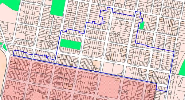
Figure 1 - proposed Bletchington Heritage Conservation
Area
The Newman Park HCA shown below:
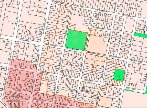
Figure 2 - proposed Newman Park Heritage Conservation
Area
The Blackman’s Swamp HCA as shown below:
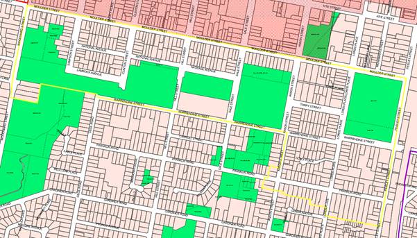
Figure 3 - proposed Blackman’s Swamp Heritage
Conservation Area
The justification to list the above
areas as heritage conservation area is provided within the attached Heritage
Study Review. Council staff agree and the above areas are recommended to become
Heritage Conservation Areas.
Extension to existing Heritage
Conservation Areas
The Central HCA
The review recommends an
extension of the existing Central Heritage Conservation Area in the south east
corner of the existing mapped are shown below.
Figure 4 - proposed extension to Central Heritage
Conservation Area
The exhibited draft review
document recommended an extension to the western boundary as shown below.
Figure 5 - as exhibited proposed extension to Central
Heritage Conservation Area
no longer proposed
Upon receipt of a submission objecting to this extension and
a review by Council’s consultants the review was updated to delete this
and in lieu of the extension it was recommended to list 143 and 147 Woodward
Street as Heritage Items.
It is noted that 143 Woodward Street is already an item and
as such the recommendation is superfluous.
In relation to 147 Woodward Street, as previous notification
to the owners of this property was indicating an intent to include their
property in a conservation area, and not be listed as a Local Heritage Item,
the owners have not had the opportunity to be fully consulted on this at this
point in time; and as such, Council staff are not recommending this property be
listed as a Heritage Item at this stage. The property should form part of any
future studies.
Glenroi HCA
The review recommends an extension of the existing Glenroi Heritage
Conservation Area to the South as shown below.
Figure 6 -proposed extension to existing Glenroi
Heritage Conservation Area
Duration Cottages HCA
The review recommends an extension of the existing Duration
Cottages Heritage Conservation Area to the South east and a small extension to
the east above Churchill Avenue as shown below.
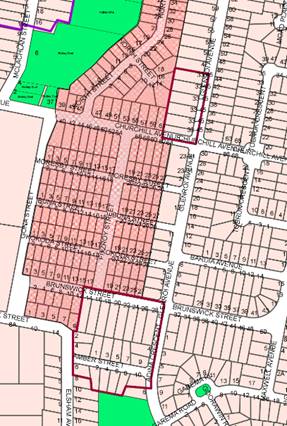
Figure 7 - proposed extension to existing Duration
Cottages Heritage Conservation Area
Council staff support the proposed
extension to the above referenced Heritage Conservation Areas.
CHANGES TO THE NAMES OF
EXISTING HERITAGE CONSERVATION AREAS
Council’s Consultants have
recommended new names to identify the existing conservation areas. The proposed
changes are identified below:
|
Current Name
|
Proposed Name
|
|
Central
HCA
|
Dalton
HCA (recommended additional area shown in Red on the study map)
|
|
Duration
Cottages HCA
|
Glenroi
“Duration Cottages” HCA (recommended additional area shown Amber
on the study map)
|
|
Glenroi
HCA
|
Endsleigh
HCA (recommended additional area shown purple on the study map)
|
|
East
Orange HCA
|
Bowen
HCA (no changes other than name)
|
|
**
|
Blackman’s
Swamp HCA (yellow study map)
|
|
**
|
Newman
Park HCA (Orange study map)
|
|
**
|
Bletchington
HCA (Blue study map)
|
As exhibited the review
recommended that the existing Glenroi HCA become known as the East Orange HCA.
A matter arising out of the most
recent Cultural Heritage Community Committee, the committee recommended staff
discuss with the consultants the following amendments to the proposed HCA
names.
|
Current Name
|
Proposed Name
|
CHCC Recommended names
|
|
Central
HCA
|
Dalton
HCA (recommended additional area shown in Red on the study map)
|
Stay
as Central HCA
|
|
Duration
Cottages HCA
|
Glenroi
“Duration Cottages” HCA (recommended additional area shown Amber
on the study map)
|
No
Change
|
|
Glenroi
HCA
|
East
Orange HCA (recommended additional area shown purple on the study map)
|
This
become the Endsleigh HCA
|
|
East
Orange HCA
|
Bowen
HCA (no changes other than name)
|
This
stay as the East Orange HCA
|
This was put to the consultants and they provided the
following response:
East Orange - I
went with this for lack of any alternative. I'm actually happy to call it The
Endsleigh HCA as it connects to important historic value of the area. It was
either that or some association with the railway.
Bowen - I
disagree with leaving this as "East Orange" because it isn't
historically accurate. The East Orange municipality extended across Endsleigh,
Bowen, Newman Park and some of Bletchington. We have named one HCA after a
suburb name (Bletchington), and so in this case the best name for this area is The
Bowen HCA. It is more precise, it uses a term already understood for the area
and it makes better sense.
Duration Cottages
- We already made the recommendation to change this to Glenroi
Duration Cottages - once again utilising the existing suburb name that is well
understood.
Central - It
is not true that the remainder of the names are geographical. Newman Park is
named after a Mayor of the town who fought to create East Orange. Bowen is
named after Henry Thomas Bowen. Endsleigh is named after a house. I think that
the Dalton's had such an enormous impact in making the Orange CBD what it is,
that it is a fair and reasonable thing to honour their memory in this way. I'm
surprised that there is opposition to it. I think we should stay with Dalton
Central HCA.
Should Council wish for the
existing Central HCA and East Orange HCA to remain the status quo, the relevant
recommendations relating to those name changes would need to be deleted.
The existing Glenroi HCA has been
amended to reflect to wishes of the Cultural Heritage Community Committee and
is recommended to become the Endsleigh HCA.
Proposed Heritage Items
· The Heritage
Study Review nominates the following properties to be listed as Heritage Items:
o 117 Sampson Street
o 49 Prince Street
o 139 Margaret Street
o 5 Hawkins Lane
o 7 Hawkins Lane
o 9 Hawkins Lane
o 11 Hawkins Lane
o 3 Hawkins Lane
o 6 Hawkins Lane
o 4 Hawkins Lane
o 2 Hawkins Lane
o 20 Nile Street
o 22 Nile Street
o 22 Nile Street
o 26 Nile Street
o 171 Margaret Street
o 110 Matthews Avenue
o 125 Prince Street
o 125 Dalton Street
o 112 Dalton Street
o 121 Gardiner Road
o 123 Gardiner Road
o 102 Gardiner Road
o 106 Gardiner Road
o 108 Gardiner Road
o 105 Spring Street
o 15 Capps Lane, Huntley
o ‘Waverton’ 76
Blunt Road, Huntley (as per the described curtilage)
o ‘Homeleigh’ 359
Phoenix Mine Road, Huntley
All but one of the above properties are recommended by staff
to become Local Heritage Items.
The exception, 7 Hawkins Lane. The
owners made submission objecting to the listing indicating extensive
alterations and additions having been carried out to the property including a
two storey rear extension. Upon review by Council staff it is considered that
the subject property has undergone such changes that would reduce the heritage
significance of the property to the extent that heritage listing is not
recommended.
Save for 7 Hawkins Lane, all of the recommended properties
identified in the Heritage Study Review are agreed to by staff and recommendations
are attached accordingly.
It is notated that ‘Waverton’ 76 Blunt Road,
Huntley has been recommended to be listed but rather than list the 200+ acres
of the rural parcel, the most significant buildings and a sufficient curtilage
has been nominated.
This will be a test case for the way in which Council lists
and described large properties into the future.
At the time of preparing the planning proposal to amend the
LEP, special consideration will need to be given to how this particular
property is to be listed.
SUBMISSIONS
During the exhibition period of the draft Heritage Study
Review eleven Public Submissions were received.
The following provides a summary and commentary of the
received submissions.
Submission 1
The submitter offers general support to the review process,
but indicates he owns a medical centre located in one of the proposed
conservation areas and requests leniency should they wish to extend their
building in the future.
Staff comment
Council staff appreciated the support offered by the
submitter.
In relation to the request for leniency for a possible
future extension of their building, any extension or new building would be
assessed against the requirements of Council’s LEP, DCP and Infill
Guidelines. An appropriate design would most likely be able to be achieved
within the confines of the relevant controls without needing to apply leniency.
However, in saying that, the controls that sit within the DCP and Infill
Guidelines are just that guidelines, and there is flexibility afforded to
quality design that demonstrates an appropriate outcome where a departure is
sought.
Submission 2
The submission is from an owner of a property in Huntley.
The submitter indicates no objection to the listing of their
property but consideration is requested to be given to listing only the
significant buildings/improvements on the land, rather than listing boundary to
boundary.
Staff Comment
Council staff have obliged, and a reduced listing is
recommended where only the significant buildings are identified and a suitable
curtilage defined.
Submission 3
The submission offers general
support to the review. The submitted does offer some suggestions in relation to
the proposed name changes of conservation areas.
Staff Comment
The support is appreciated and in
relation to HCA name changes a discussion of this is provided above.
Submission 4
The submission offers general
support of the review, in particular the Blackman’s Swamp HCA.
Staff Comments
The support within the submission
is acknowledged.
Submission 5
The submission draws attention to
the as exhibited proposed extension to the Central HCA to the west and a
discrepancy in the relevant map where half a strata listed was included in the
proposed HCA and half was not.
Staff Comment
In response to this submission,
Councils Consultants reviewed the subject area and altered their recommendation
by deletion. Further commentary on this is provided above.
Submission 6
This submission is from the National Trust and the author
expresses strong support to the review.
Staff Comment
The strong support is appreciated.
Submission 7
This submission offered strong
objection to the extension of the HCA, specifically the Blackman’s Swamp
HCA.
The submitter disputes the
recommendations on the grounds the area does not meet the necessary threshold
test of significance under the four stated criteria namely Historic, Aesthetic,
Social, and Representativeness.
Staff Comment
In response directly to this
Submission, Council’s Heritage Consultants have provided the following:
The character of the extended
area is different and more diverse with increased contemporary building. This
does not of itself alter the level of significance of the area or make it less
worthy of protection. The lack of analysis of both rarity and recreation in the
area is acknowledged and should be scheduled for further work. The need for
consultants on typical residential works is not required given the free
heritage advice available to property owners.
In addition to the above, heritage
significance of a place is assessed against seven criteria, namely; Historical,
Association, Aesthetic, Social, Research, Rarity and Representativeness.
In order for a place to meet the test of heritage significance and warrant a
listing, only one of the above criteria needs to be met.
As established in the Heritage
Study Review, Council’s expert Heritage consultants have determined that
the area in question meets the threshold for listing based on their expertise.
Accordingly, Council staff support
the proposed HCA and a recommendation for adopting the Blackmans Swamp HCA is
attached.
Submission 8
Submission 8 objects to their property being included in the
Bletchington HCA. Siting their property is a contemporary property and does not
fit in the context of a HCA.
Additionally, the submitter states that the listing of their
property in a HCA will reduce their ability to modernise, renovate etc. and
invites staff to their property to advise how this may be undertaken.
Staff Comment
A Heritage Conservation Area is a
collective group of buildings or places that, together retains sufficient
significance to necessitate conserving the area for future generations. It is
not practical to pick out and exclude every contemporary house or a house with
intrusive additions from a previous era.
In response to the invitation,
Council has a heritage advisor who can provide free advice to people who own
heritage listed properties or properties in a HCA, should a draft HCA be
recommended over their property the owner is encouraged to make contact with
Council staff to arrange an appointment with Council’s Heritage Advisor.
Submission 9
The submission makes some general
recommendations in relation to squaring up boundaries and the proposed changes
to the names of HCAs.
The submitter also purports that,
in their opinion, there are dwellings in East Orange that are better examples
than those proposed to be listed in Gardiner Road.
The submitter suggests the
Bletchington HCA be extended to include Legacy Avenue.
Staff Comment
The
Consultants have provided the following in respect to this submisison.
Further
rationalisation of boundaries has been undertaken as a result of the review and
submissions. The naming convention is generally accepted. The more diverse
boundaries are complex and this is the price of addressing significance and
character of buildings over general history. The war service and State housing
issues have been addressed with additional listings and aboundary extension in
Bletchington. The specialist knowledge is greatly appreciated.
Additionally, in response to the
above, the boundaries of the HCA should be set by significance, rather than a
simplistic squaring up of boundaries. This suggestion is not supported.
In relation to the comments of new
names of the existing HCAs, this is addressed in detail above.
This review does not contemplate
extension to Legacy Avenue.
Submission 10
The submission strongly objects to
the listing of their property being listed within the proposed Bletchington
HCA.
The submission poses a series of
questions taken from a FAQ prepared by Council staff as part of the exhibition
material that was available on Council’s website which are addressed
below. The submission rejects some of the assertions made in the FAQ. The matters
relate to; strict heritage controls, cost and difficulties with having future
development applications dealt with, increase in rates, increase in insurances,
decrease in property values.
The submission also suggests that
the timing of the review is “tone deaf” given the current situation
with Covid-19.
Staff Comment
The consultants have reviewed the
submission and provide the following:
The subject property adjoins the Motor Lodge and is a
double fronted brick house with flat roofed verandah, hipped metal roof with
brick chimney and paling/masonry piered fence. It forms the important bookend
of the northern streetscape. The arguments in the objection do not relate to
significance. A site meeting should be extended to investigate resolution of
any perceived constraints in relation to future works.
In response to the submission; the heritage controls are
there to conserve the character of a building or place. The controls sit within
Council’s DCP so there is flexibility built into them and they are able to
be departed from. Most renovation works require a development application to be
lodged regardless of whether or not the property is located in a Heritage
Conservation Area. Council has a Heritage Advisor on staff who can provide free
architectural advice to property owners.
In relation to rates, rates are calculated on the
unimproved value of land, as such, a heritage listing would not affect rates.
In relation to insurances, Council staff have indicated
that increases may arise due to insurance companies misunderstanding of
heritage conservation. They may incorrectly assume Council would expect a
building to be replaced like for like. This would not be the case, a
replacement dwelling following a fire or some other event would be required to
be sympathetic to its context and setting, but could be built using
contemporary methods and materials.
In relation to property values, there are so many variables
and contributing factors such as the current situation where median house
prices have increased by 7.7% in the last twelve months.
There is no evidence to suggest that Council’s intent
to expand the Heritage Conservation Area is having a negative effect on
property values within the city.
In relation to the comment around the timing of this
heritage review process during a pandemic, Council staff commenced to review
process halfway through 2019, well before the pandemic and Council has an
obligation to complete the process.
Submission 11
The submitter requests their property not be listed as a heritage
item on the basis that the property was all but rebuilt in 2006 including a two
storey rear extension.
Staff comment
A review of the file confirms an extensive extension around
2006. On this basis staff are not recommending the subject property be listed
as a Heritage Item.
YourSay Data
The Heritage Study Review was placed on Council’s YourSay
Platform which generated 432 visits over the course of the exhibition
period. A small sample size of 13 people participated in the survey which
presented questions such as “Do you support the Heritage Review”.
The majority of responses, although quite a small size, were in favour of
the Heritage Study Review.
The Next Steps
This study forms the body of work necessary to support a
planning proposal (a change to Councils Local Environmental Plan). So once this
Heritage Study Review is adopted by Council, it will then be necessary for
Council’s Strategic Planner to commence the planning proposal process.
As part of this process there will another round of
community consultation where people can provide submission and Council will
then need to decide on that planning proposal.
Attachments
1 Heritage
Study Review FINAL November 2020, D20/71784⇩
2 HCA
Maps FINAL, D20/71786⇩
3 Submissions,
D20/71836⇩
Planning
and Development Committee
1 December 2020
Attachment 1 Heritage
Study Review FINAL November 2020
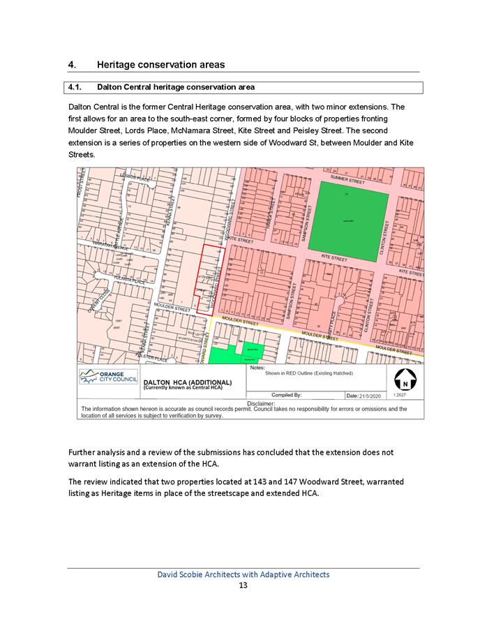
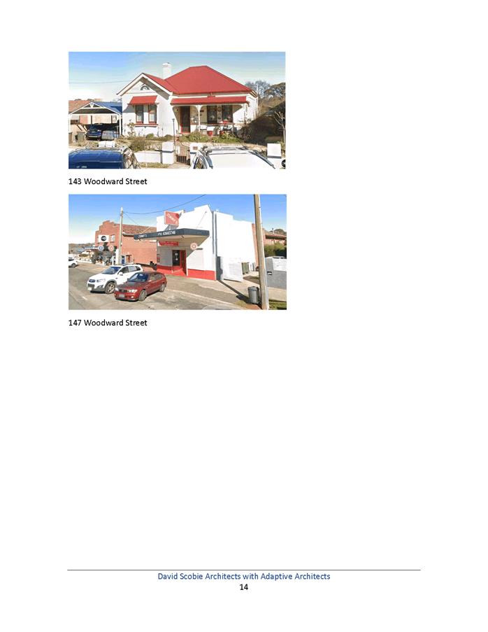
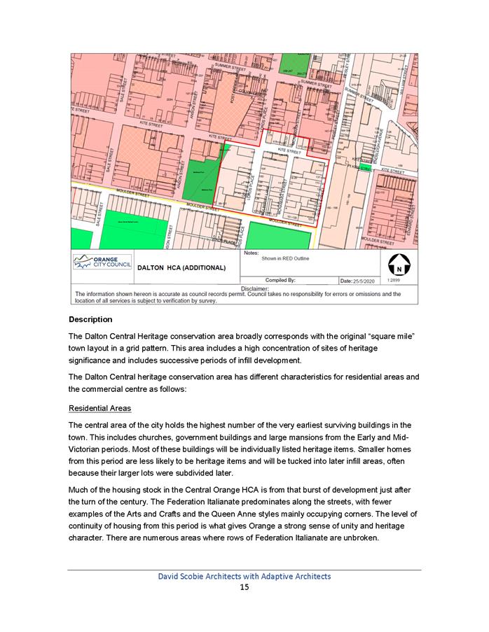
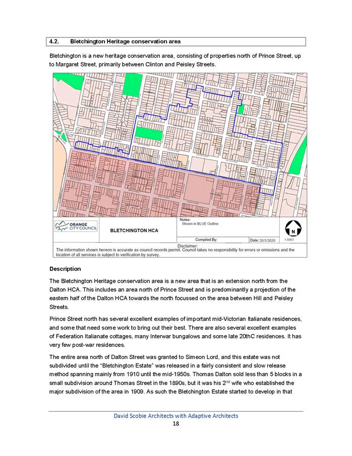
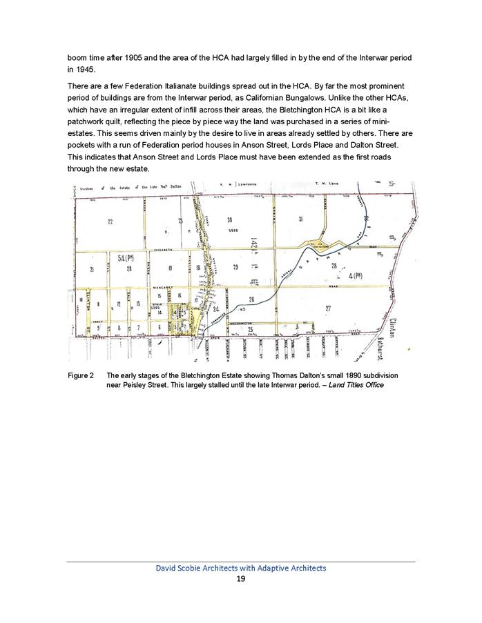
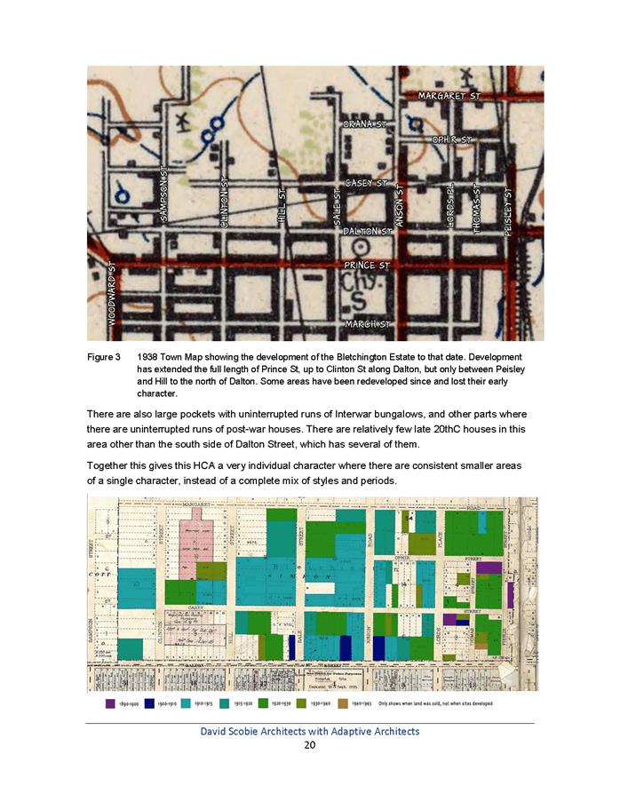
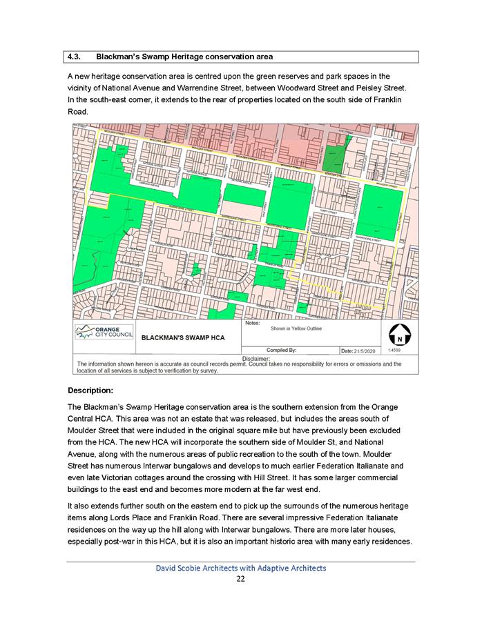
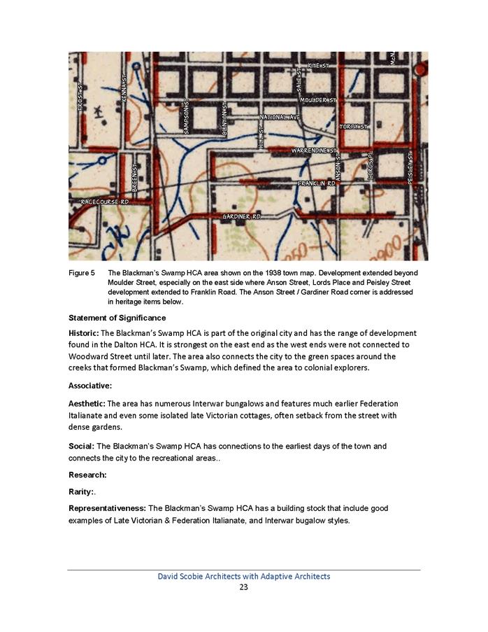
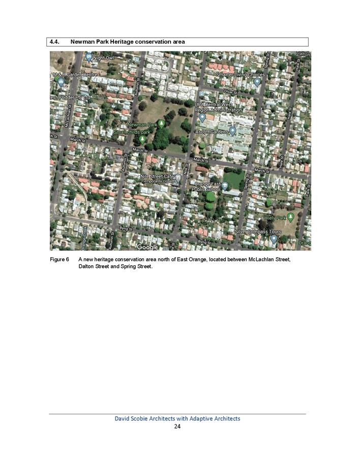
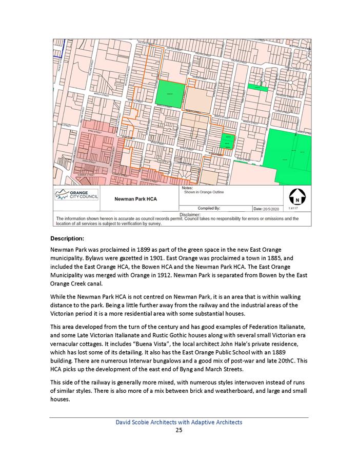
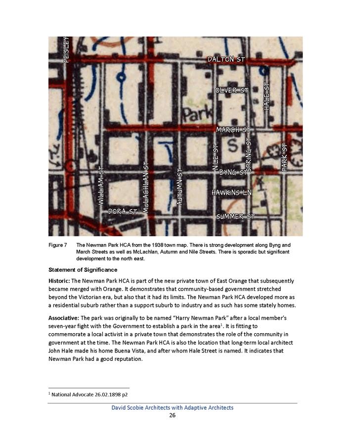

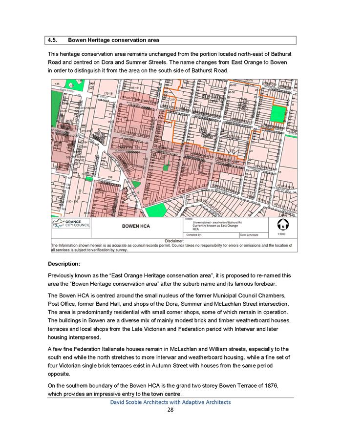
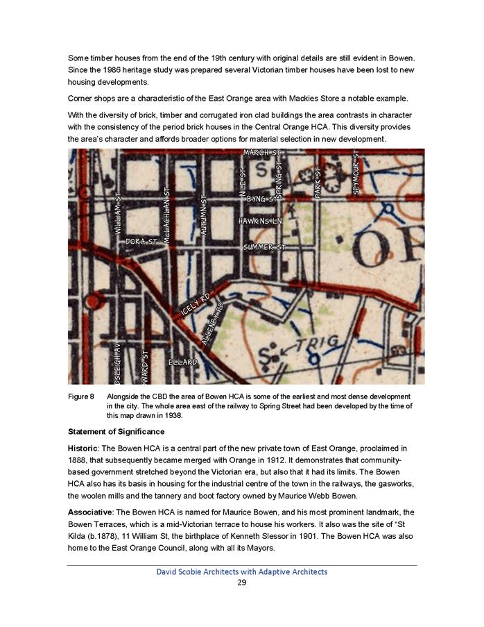
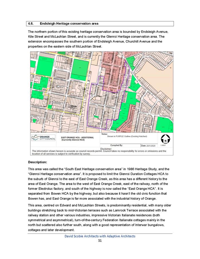
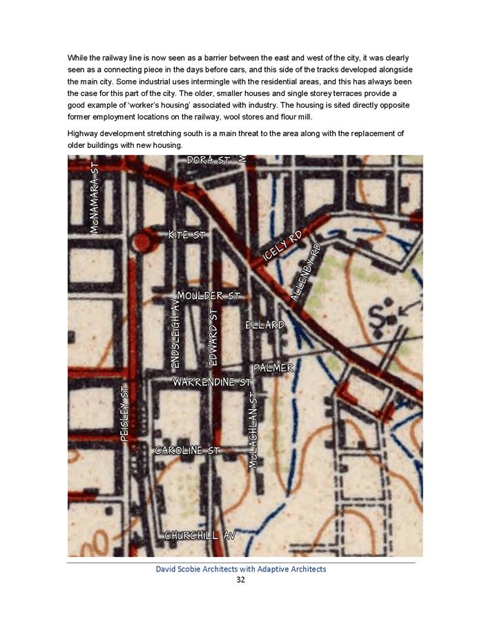
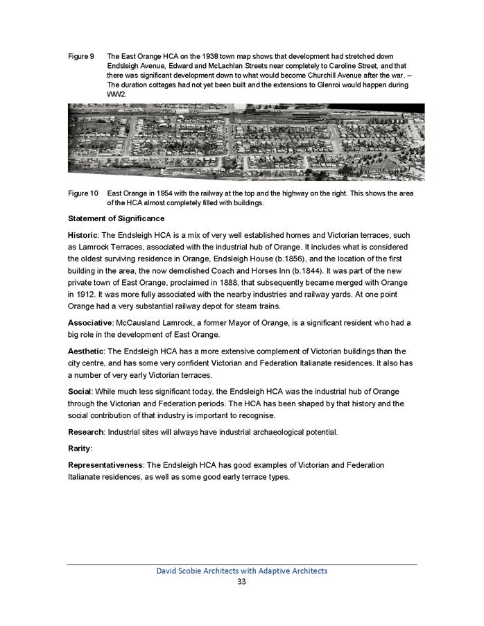
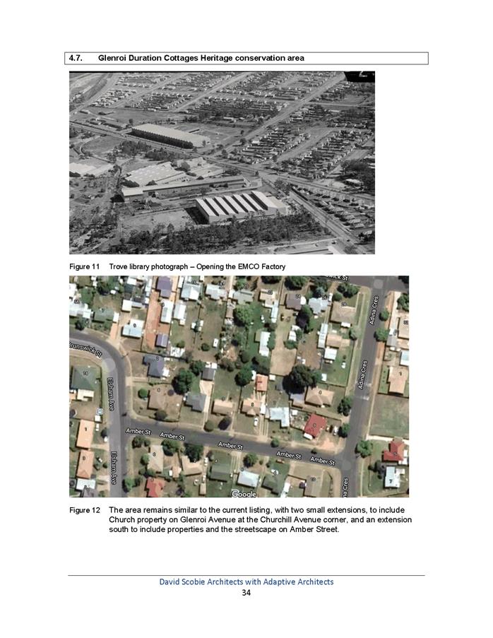
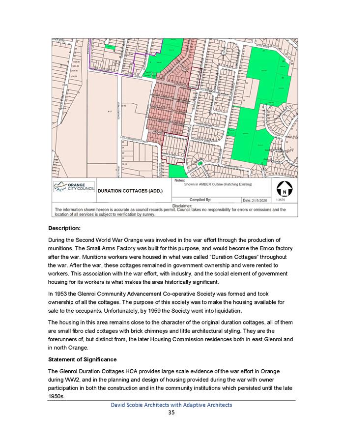
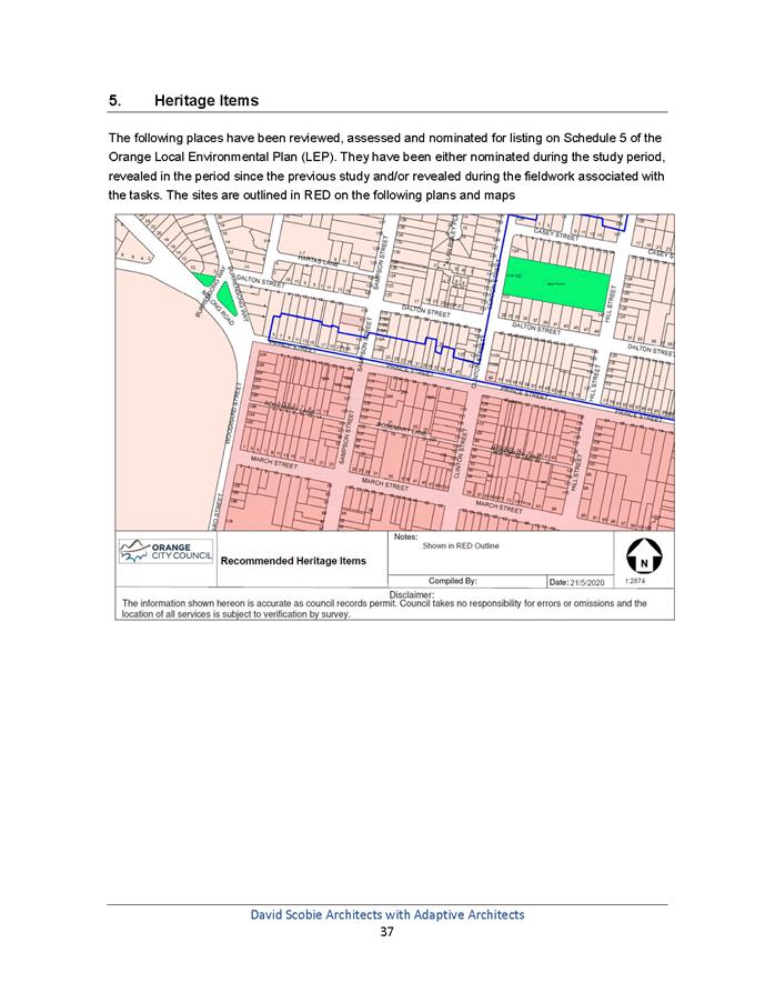
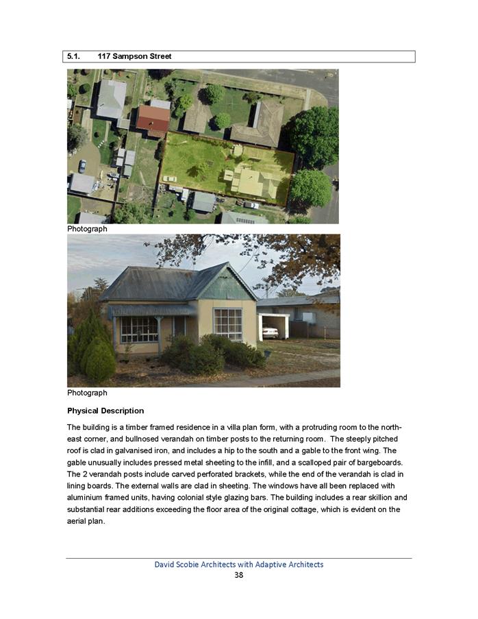
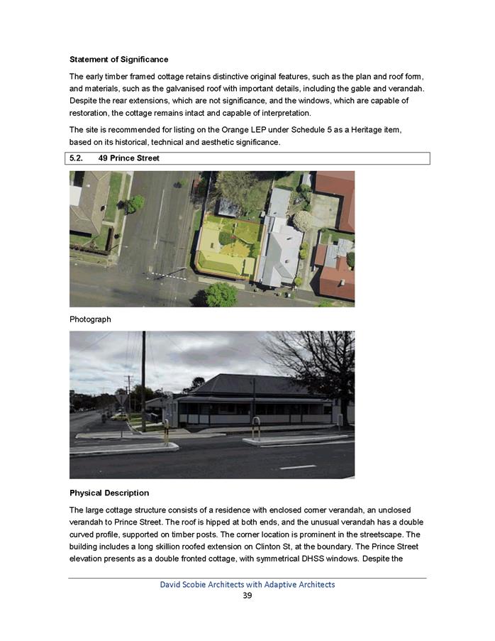
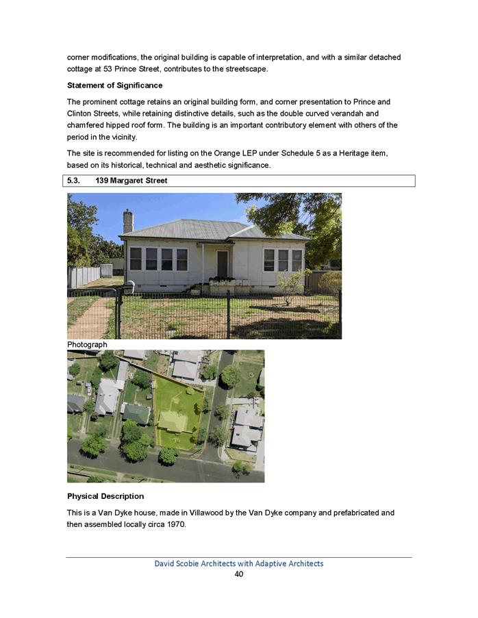
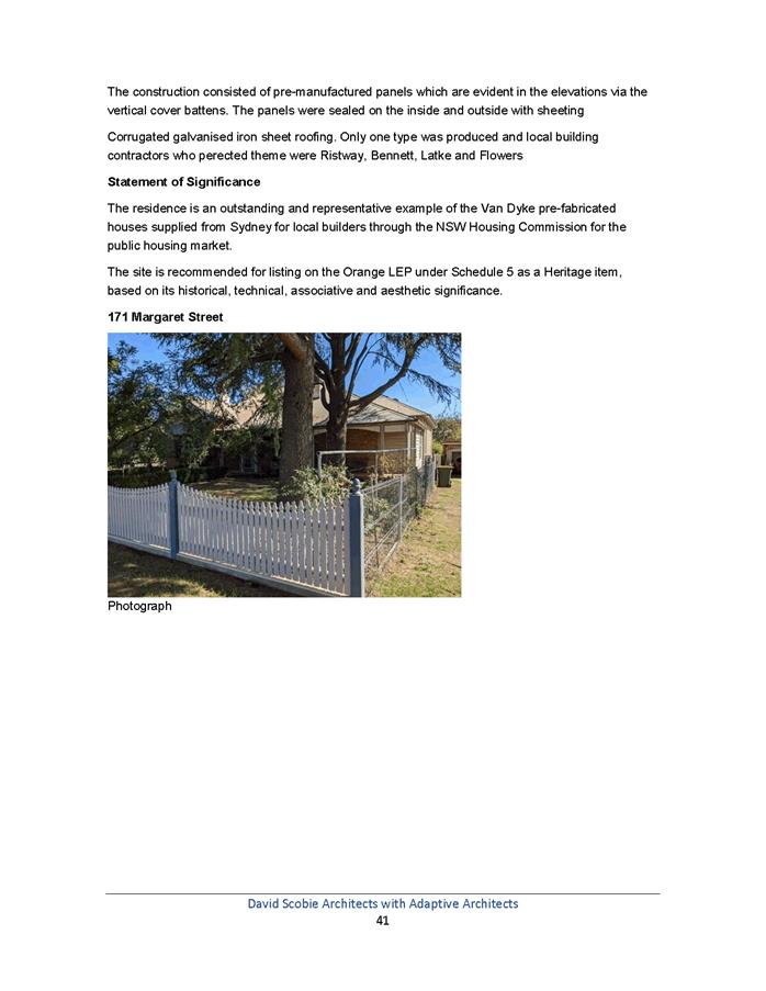
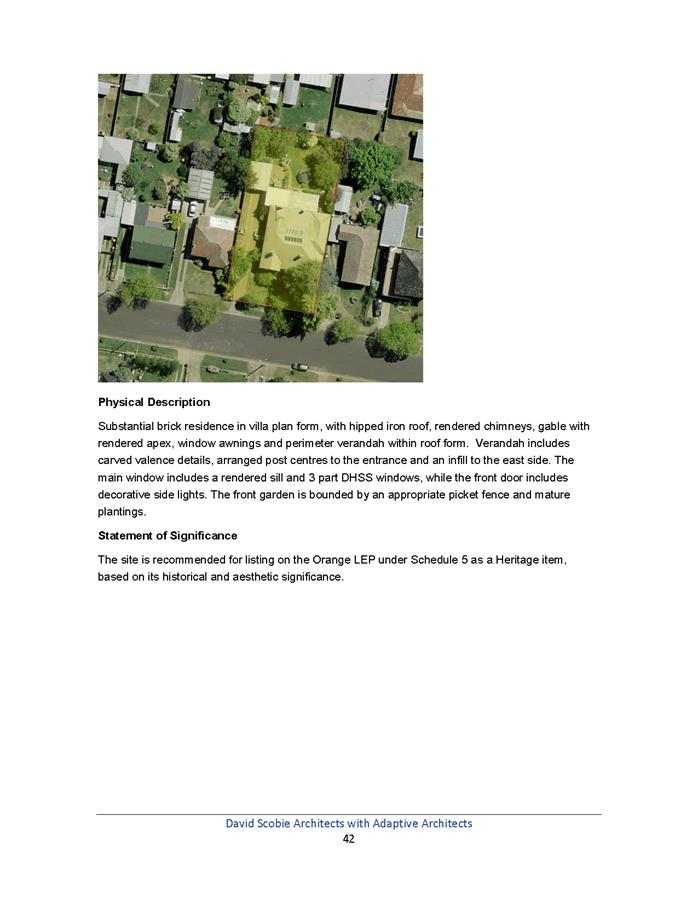
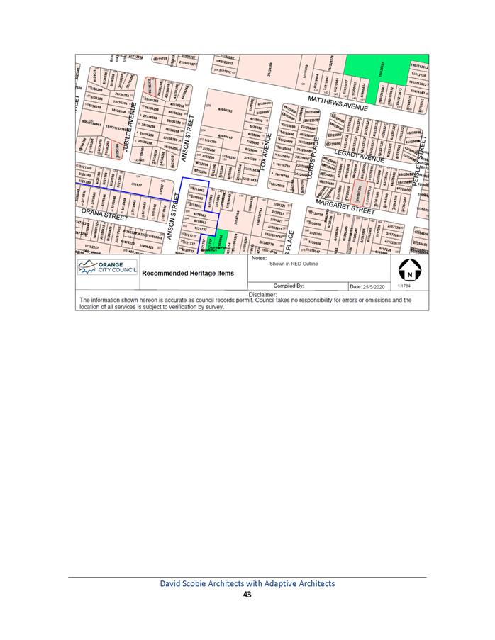
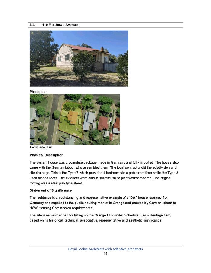
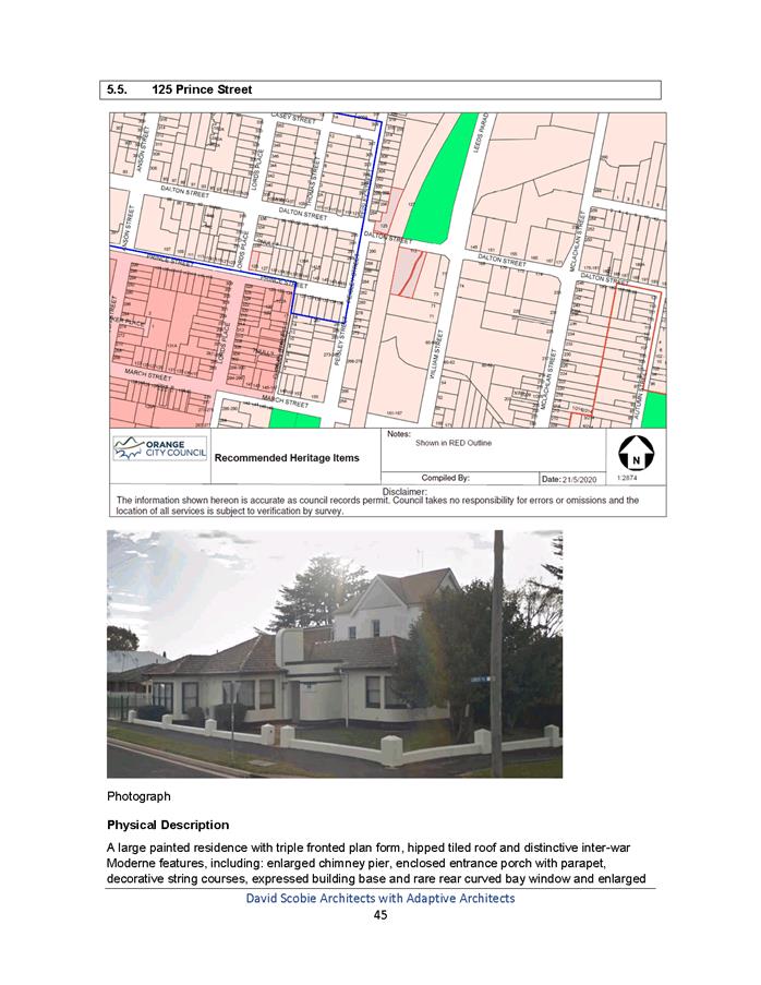
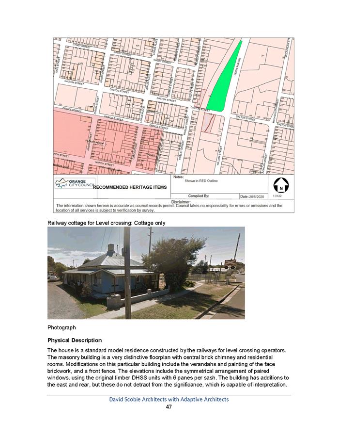
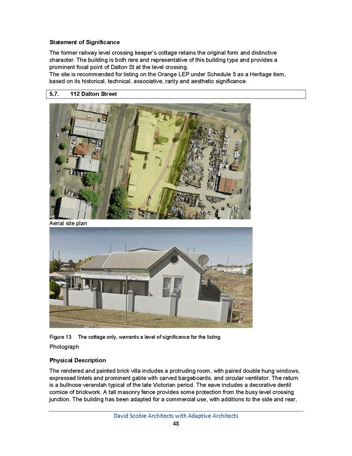
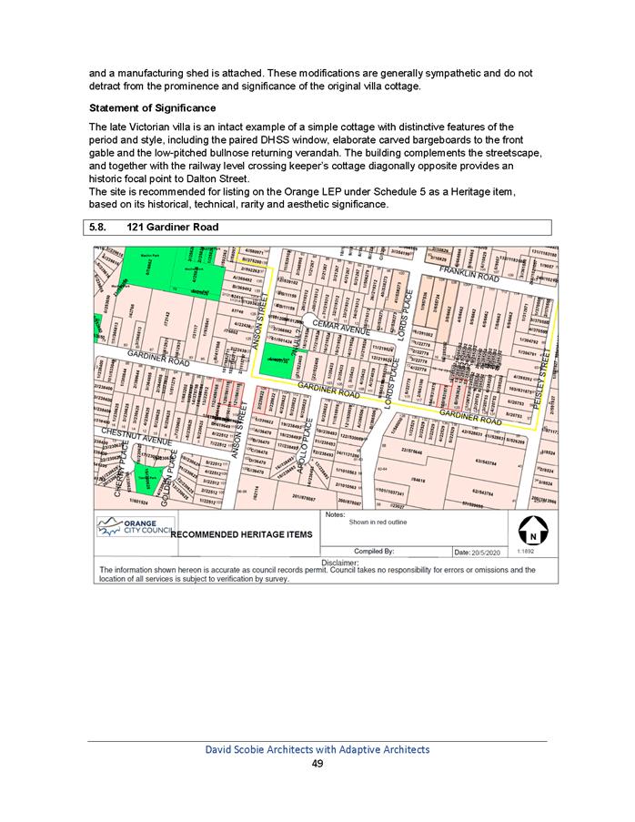
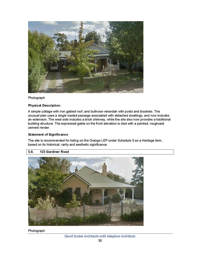
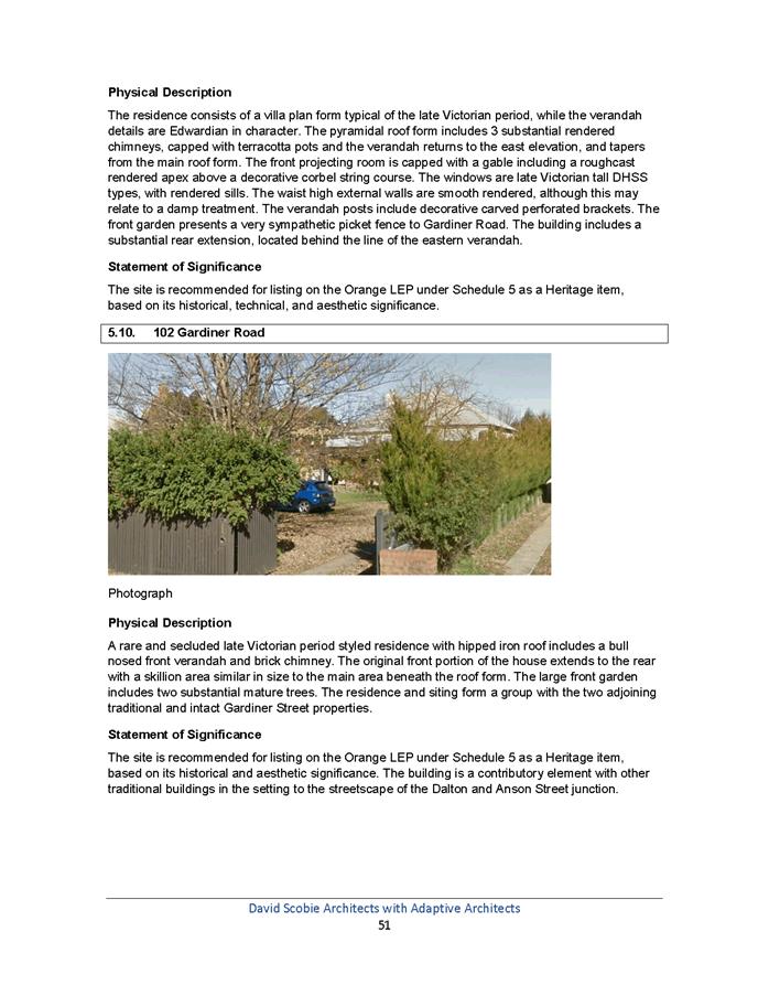
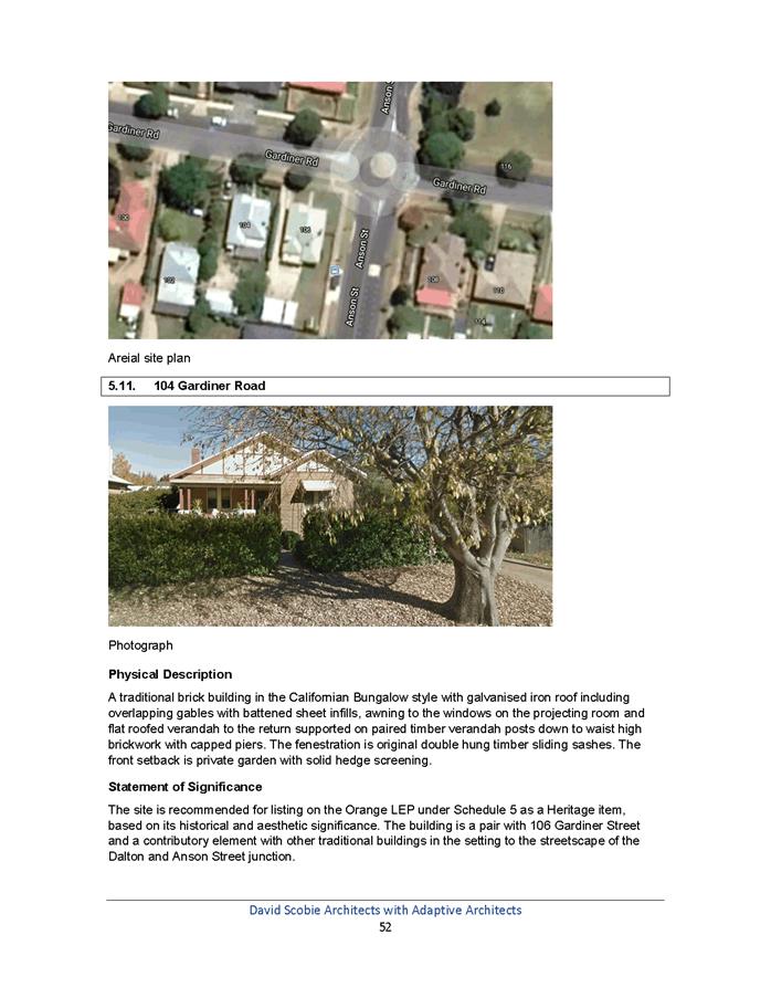
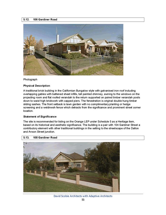
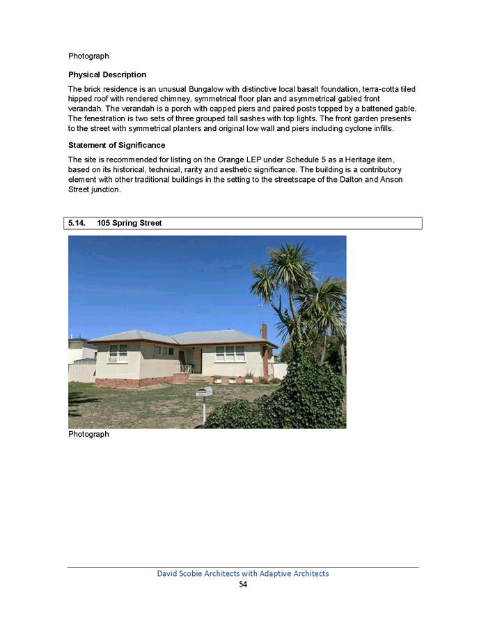
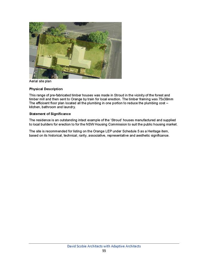
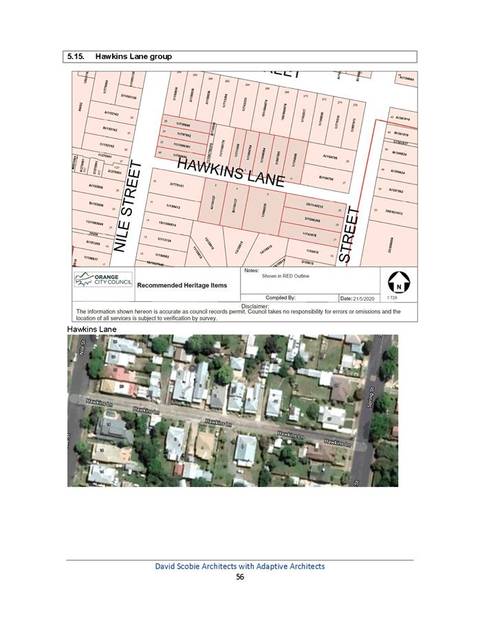
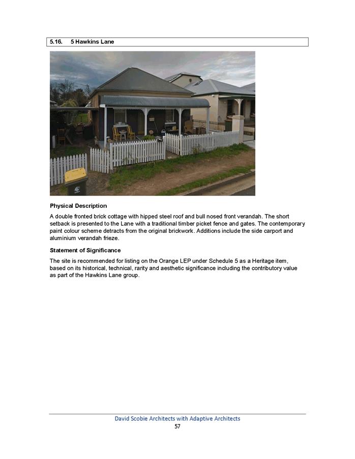
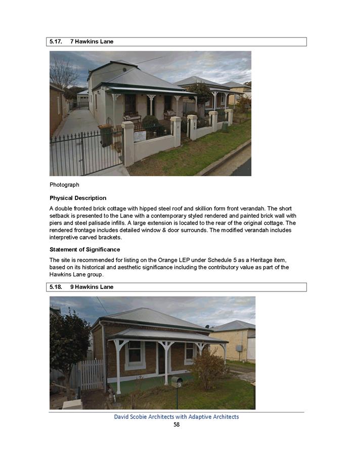
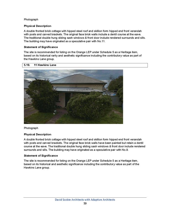
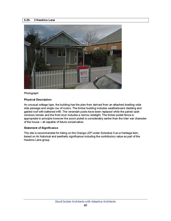
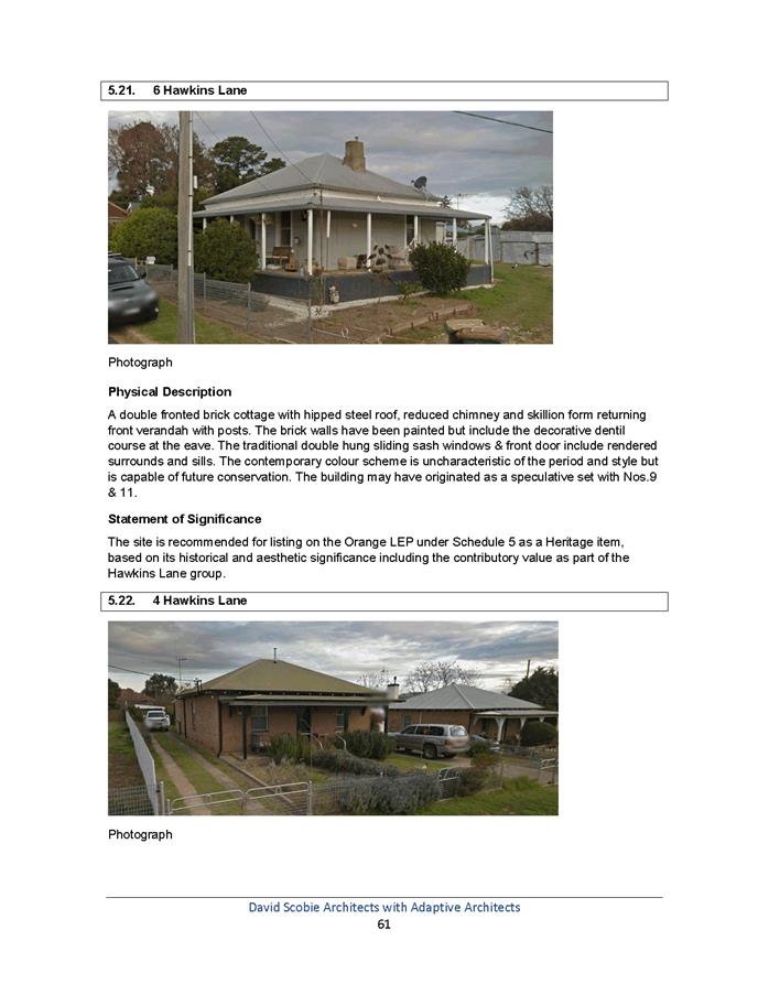
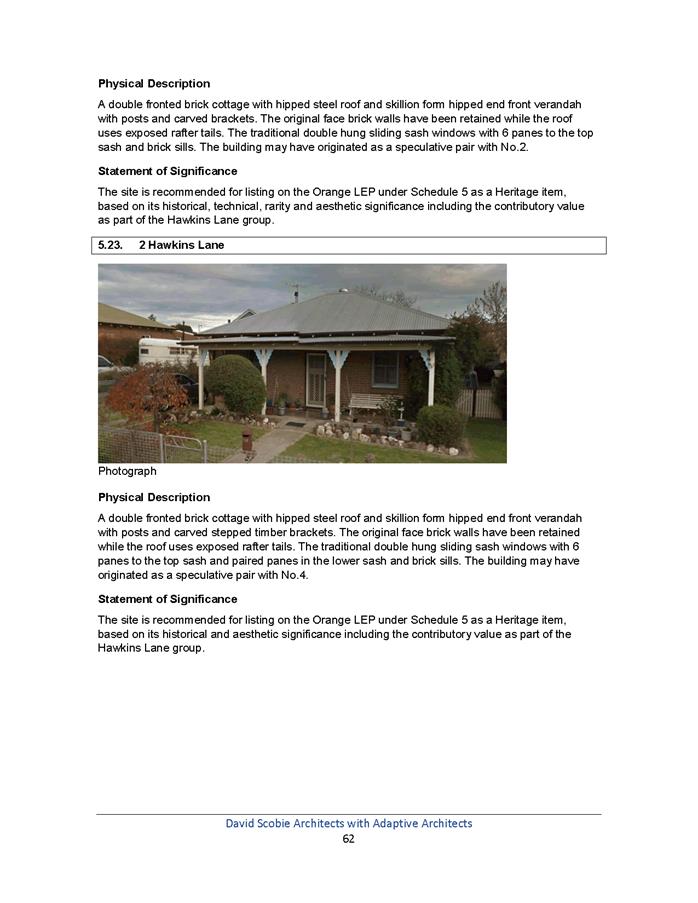
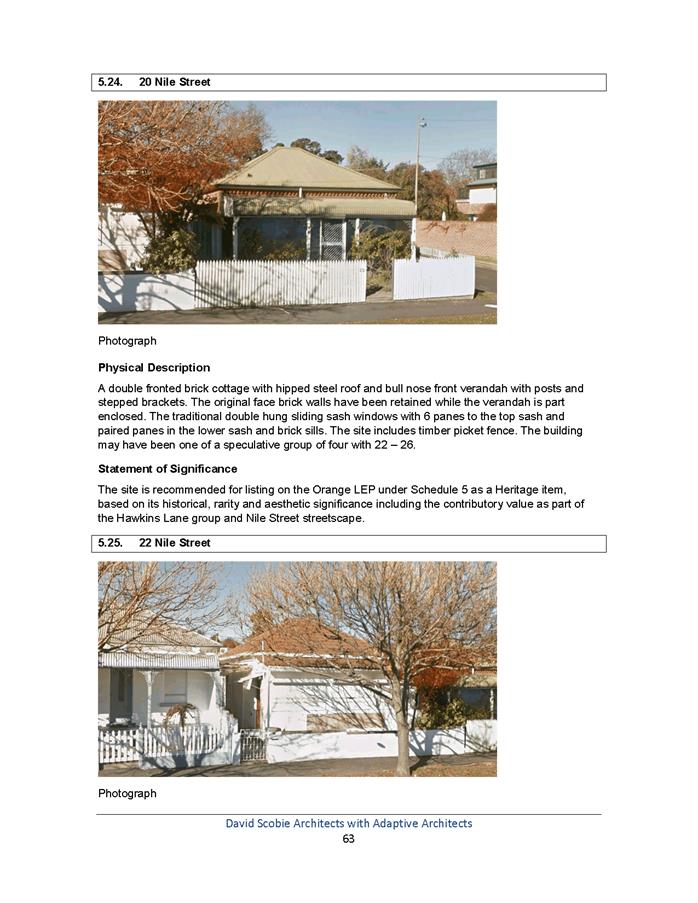
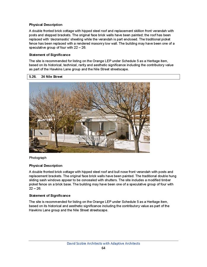
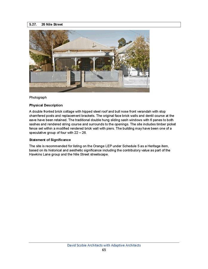

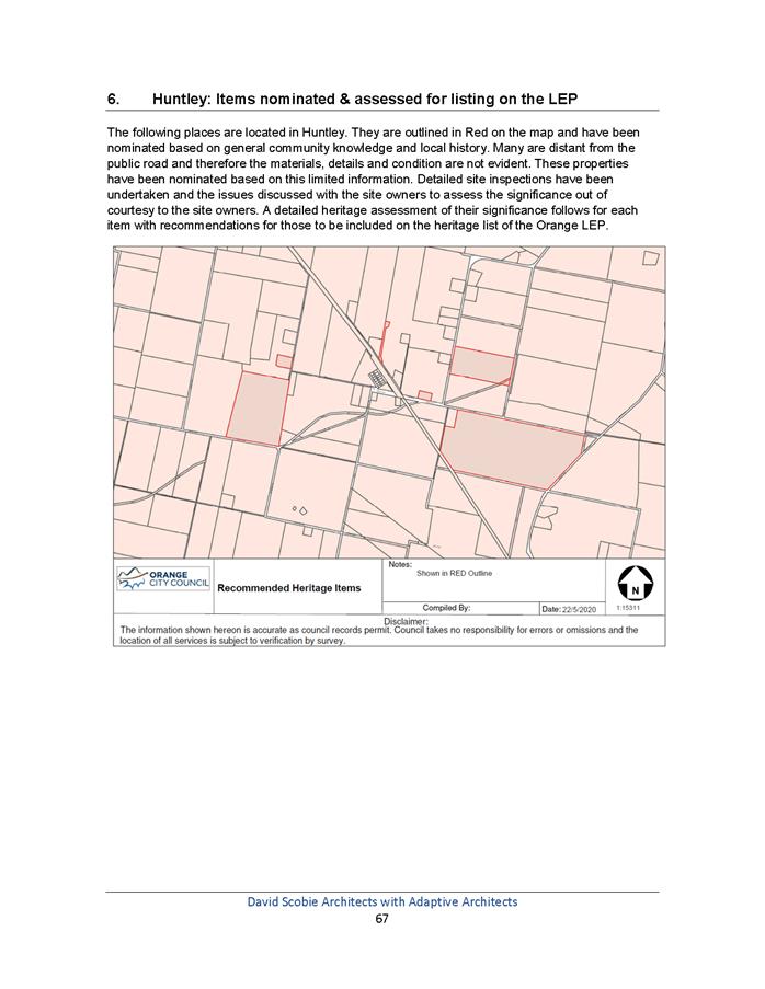
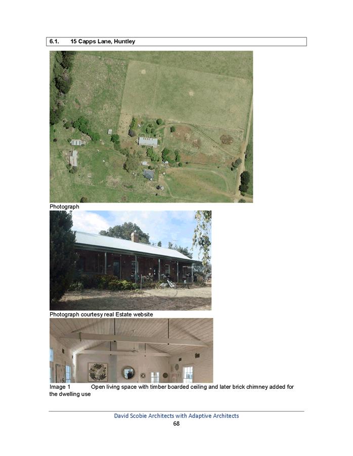
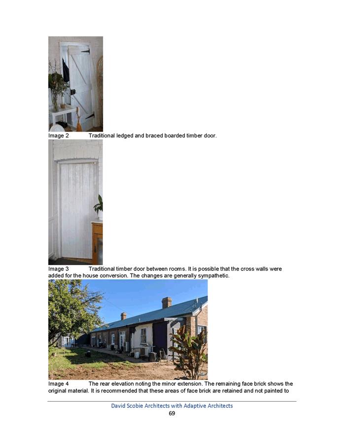
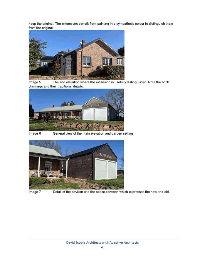
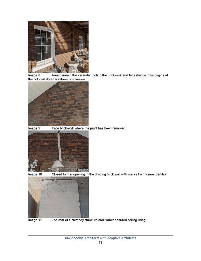
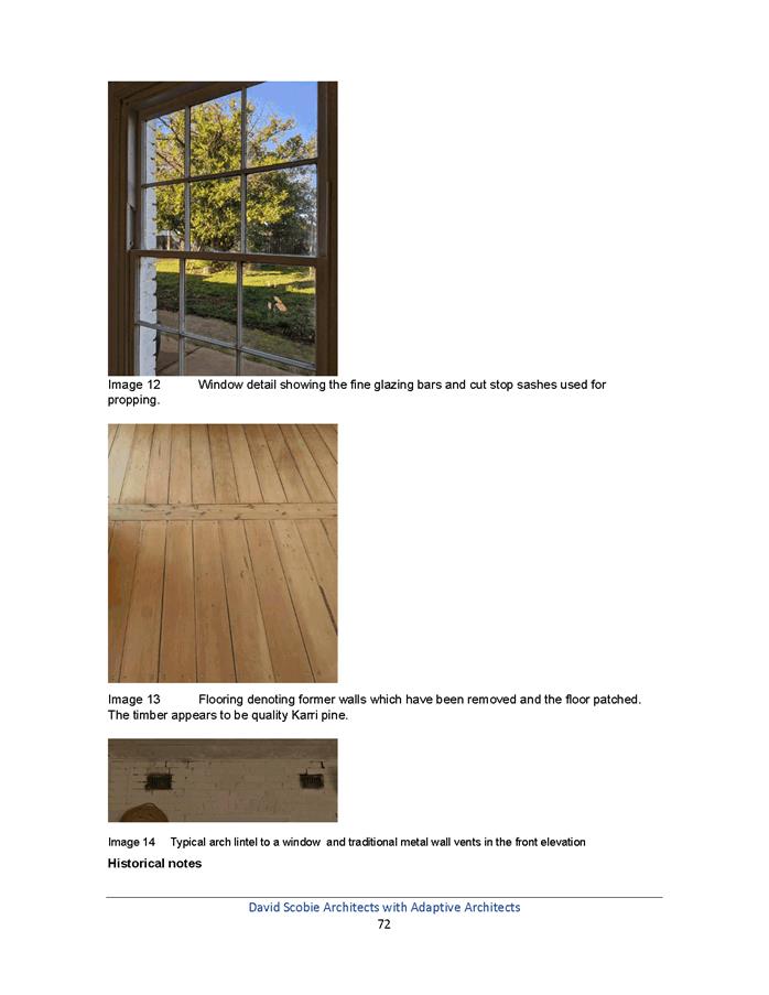
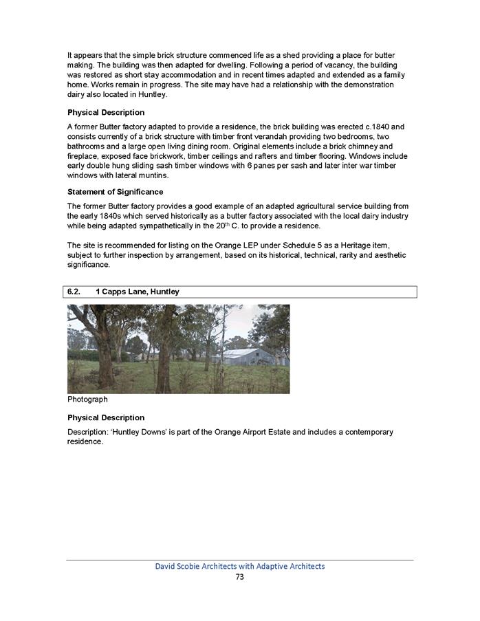
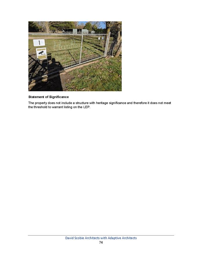
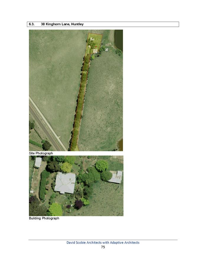
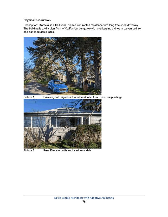
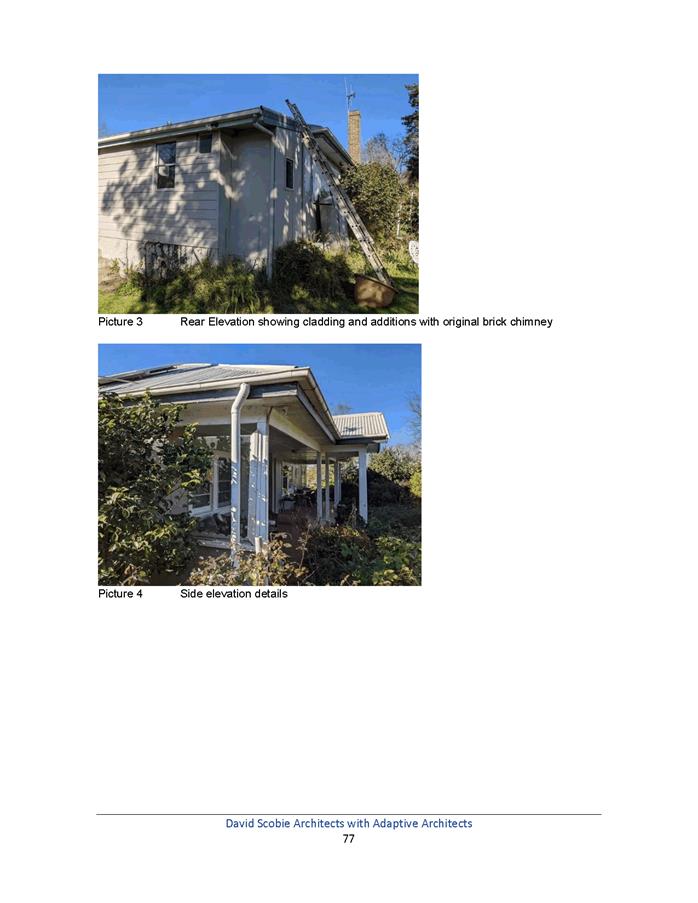
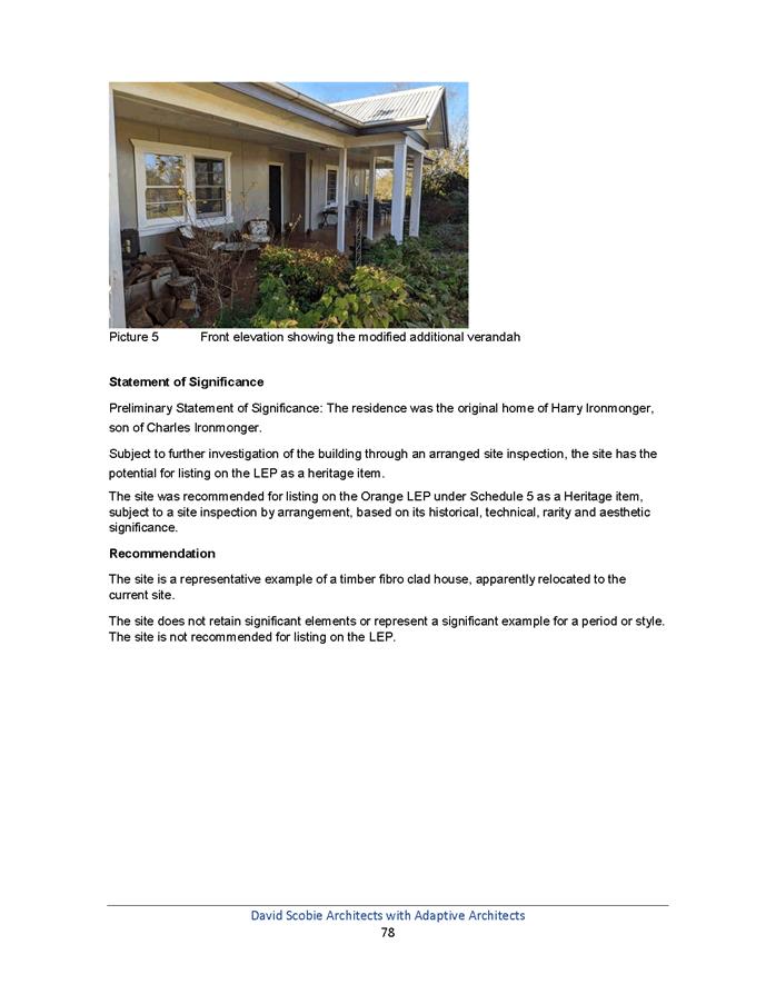
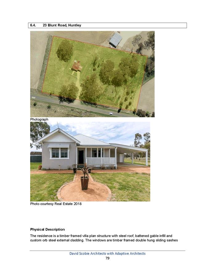
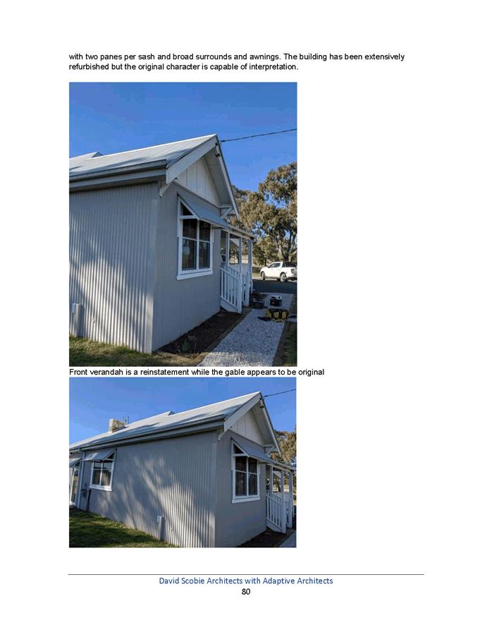
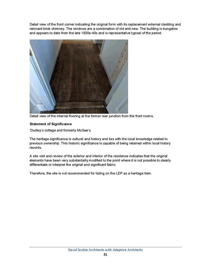
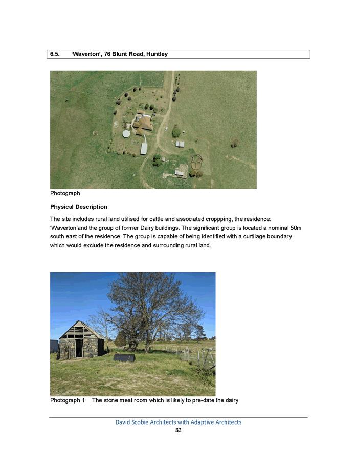
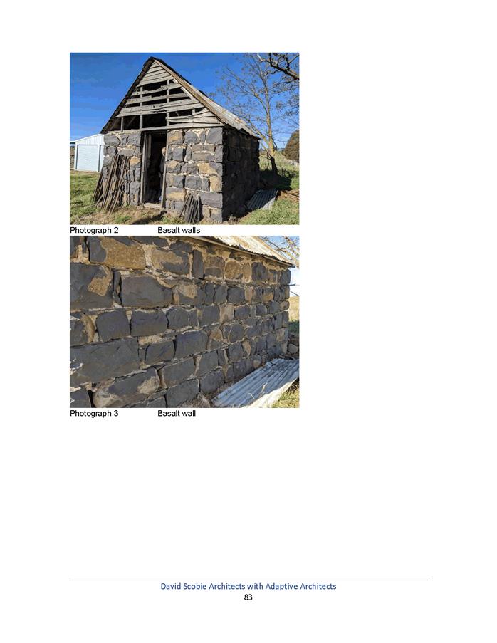
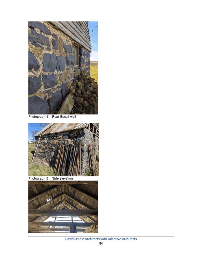
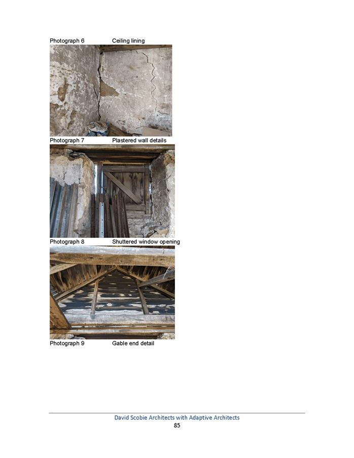
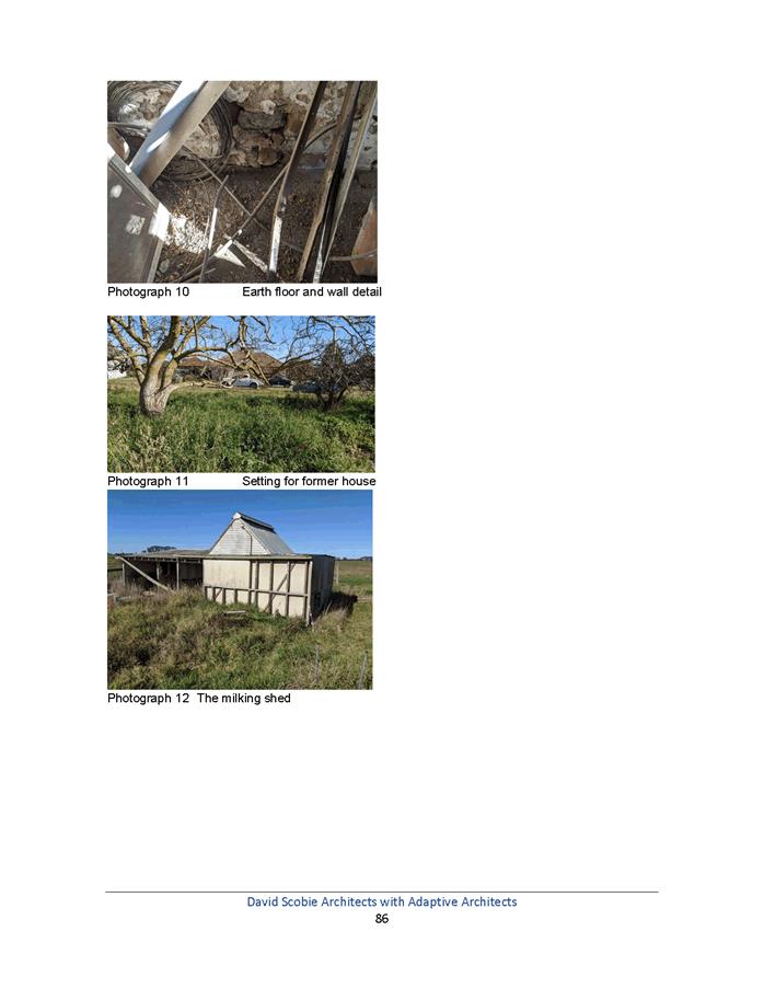
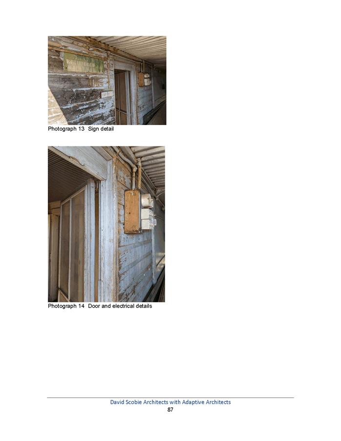
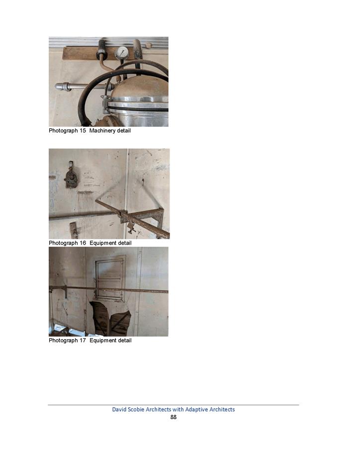
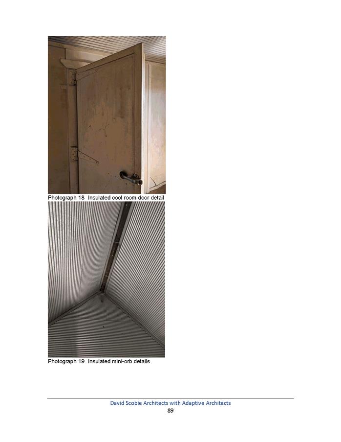
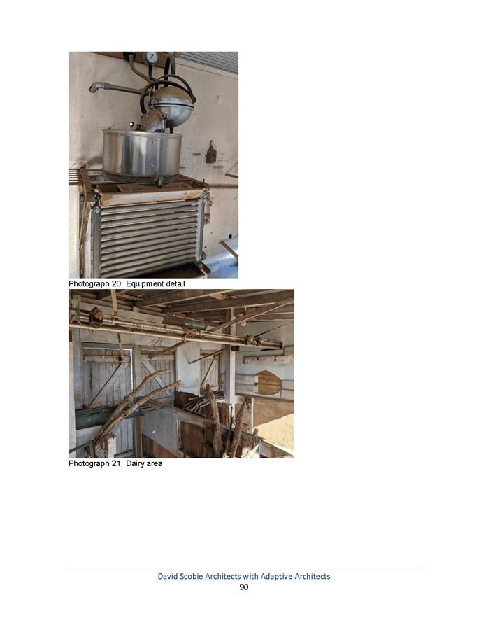
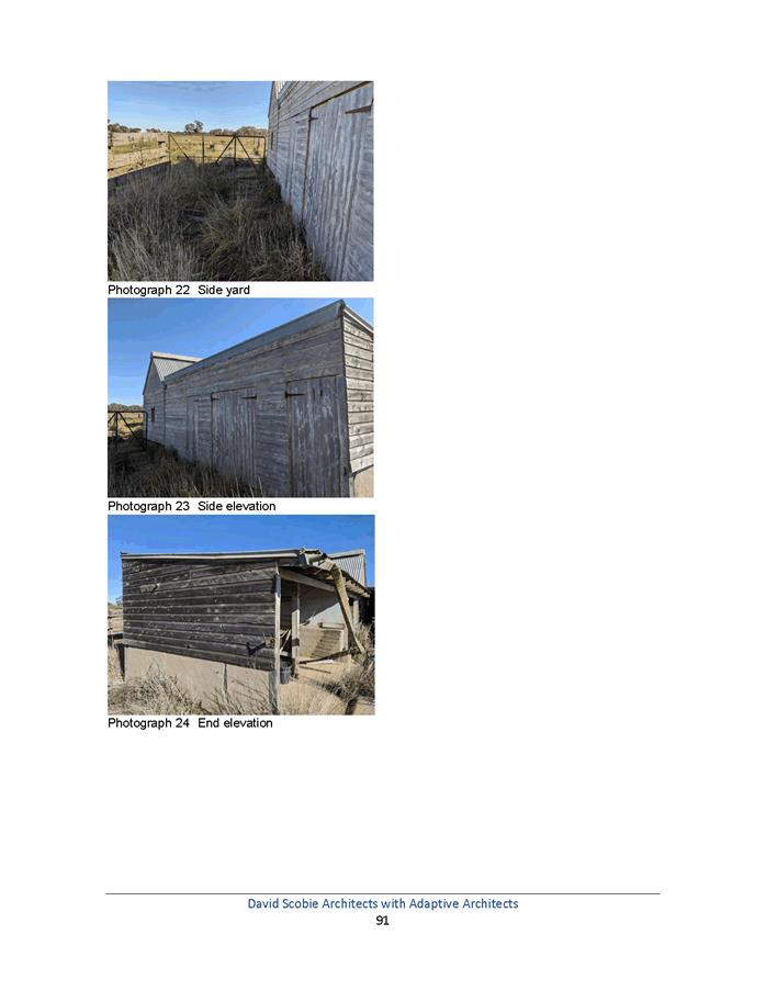
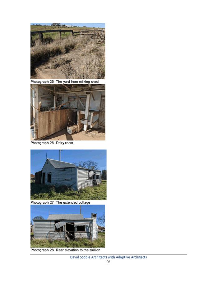
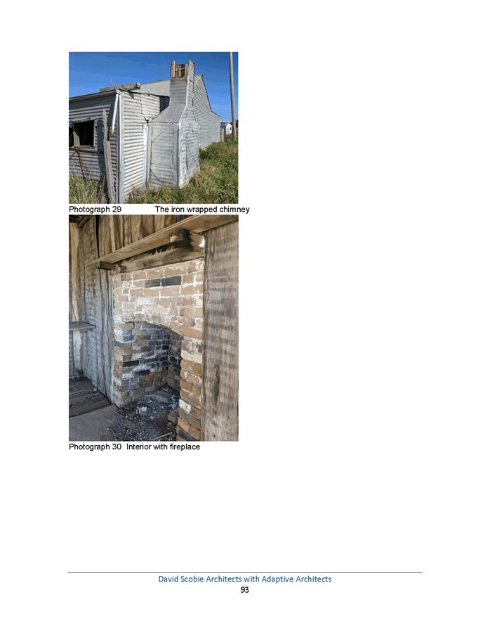
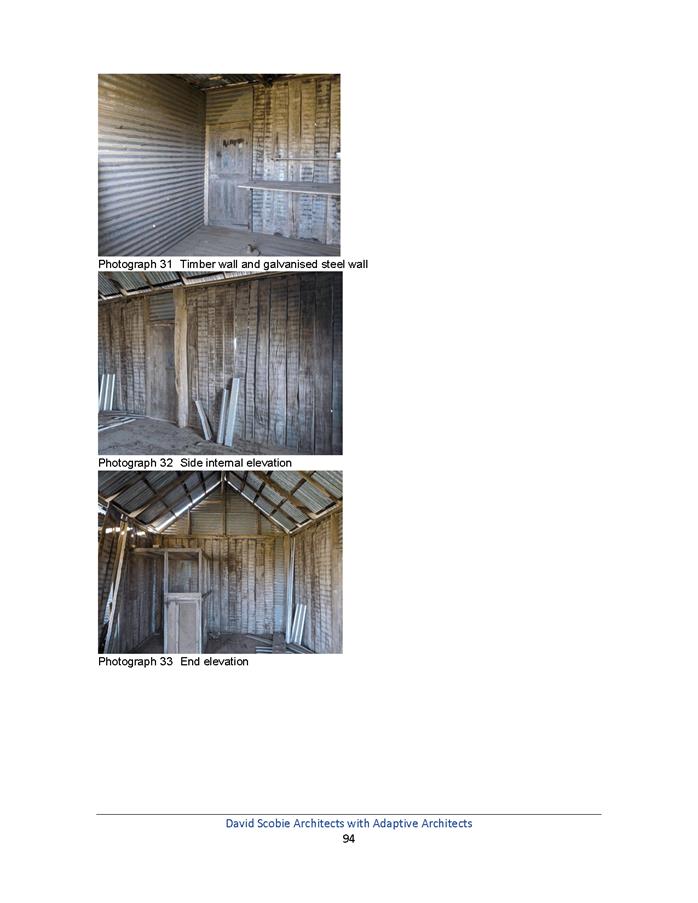
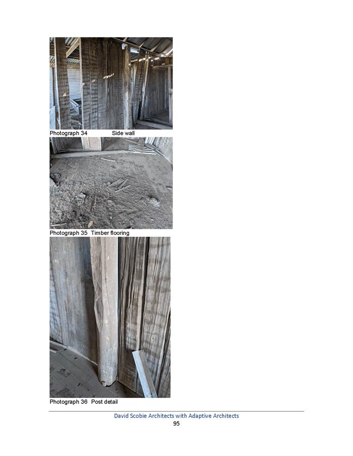
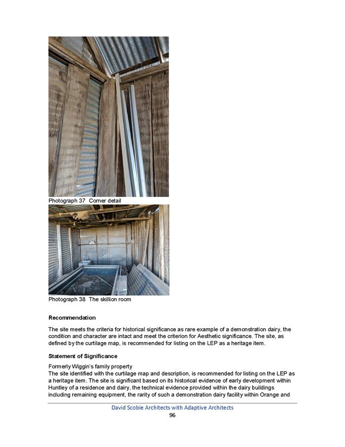
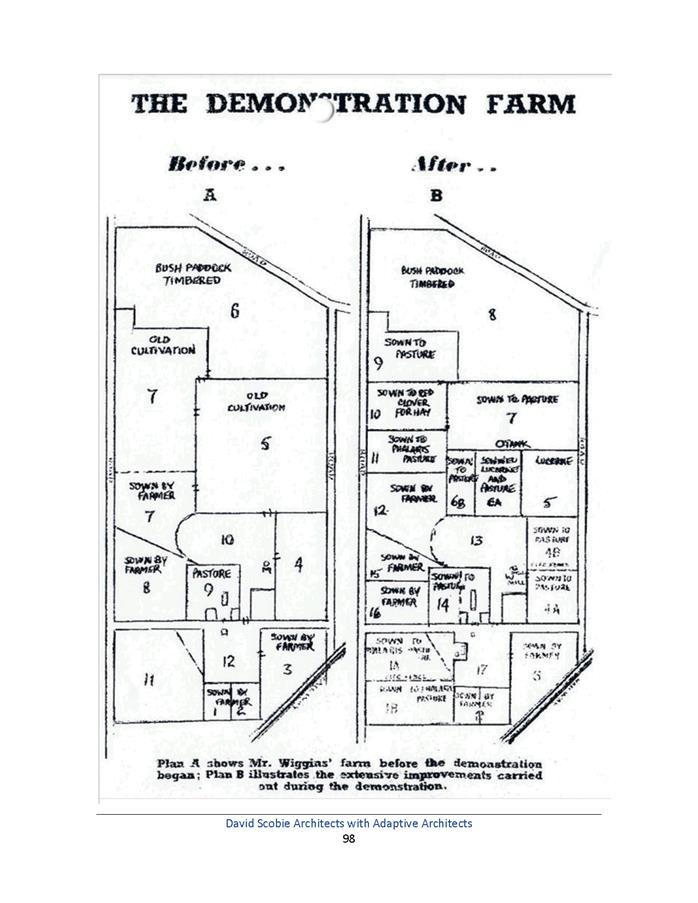
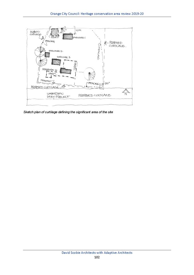
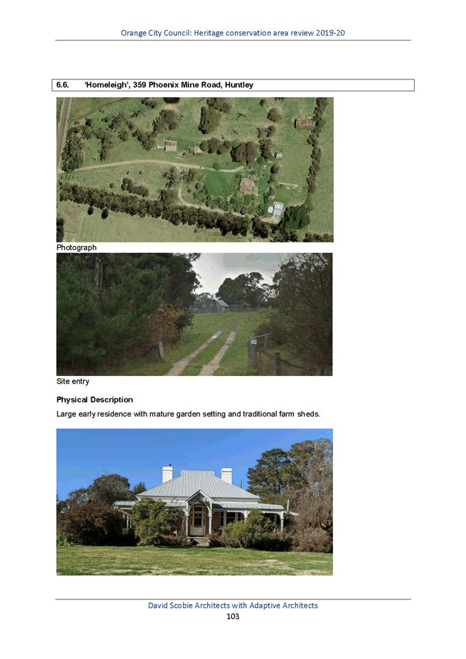
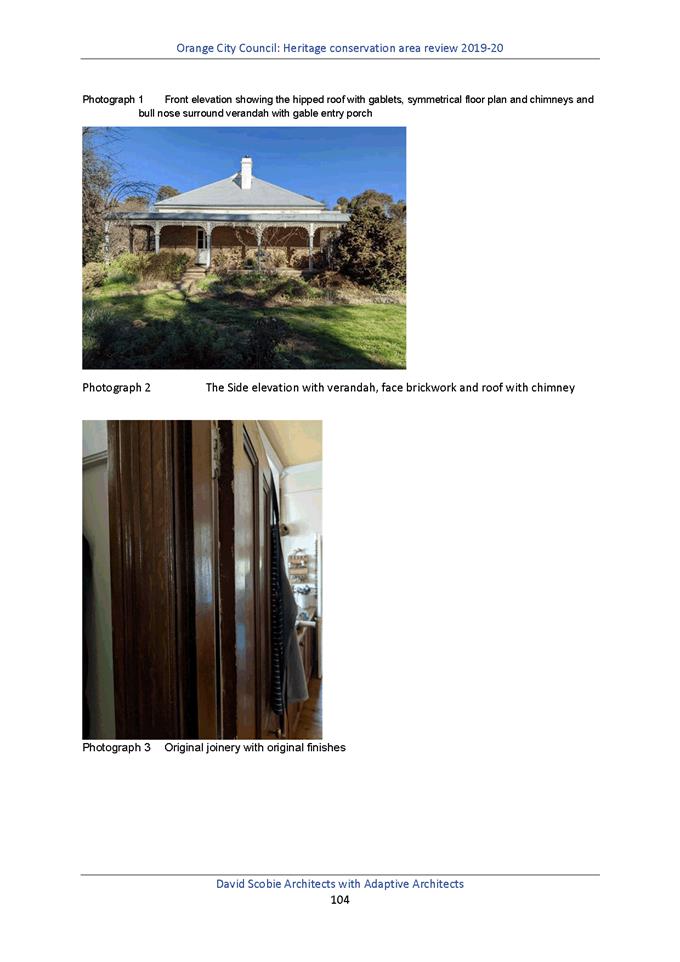
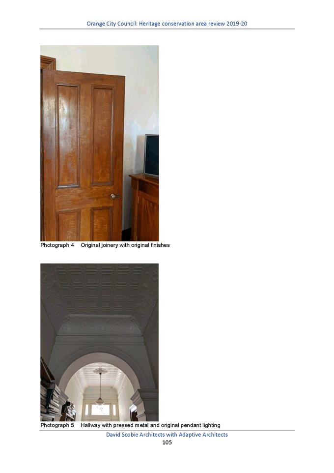
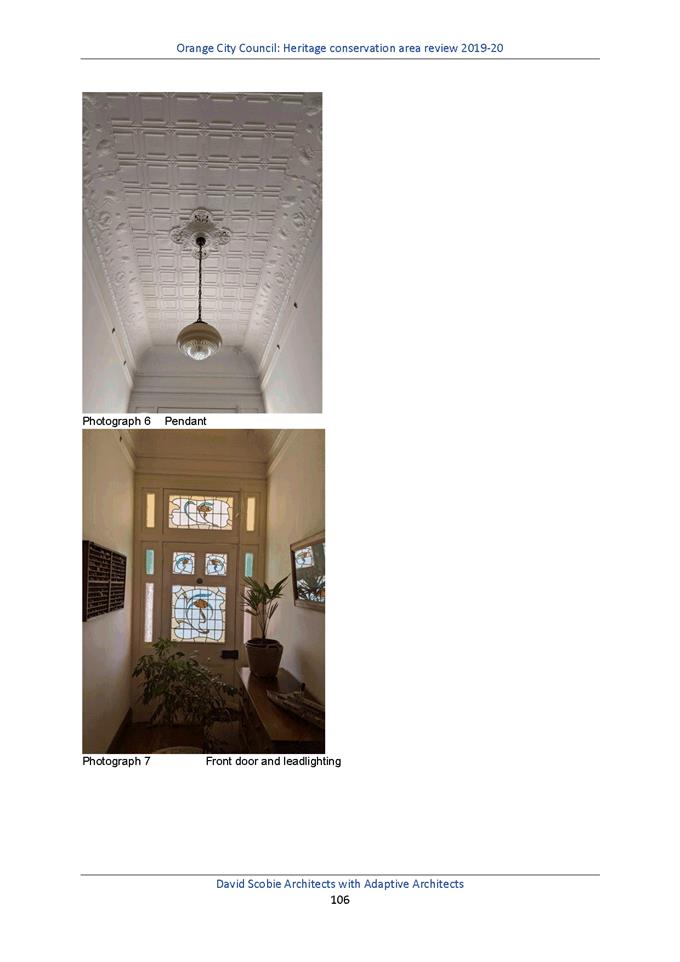
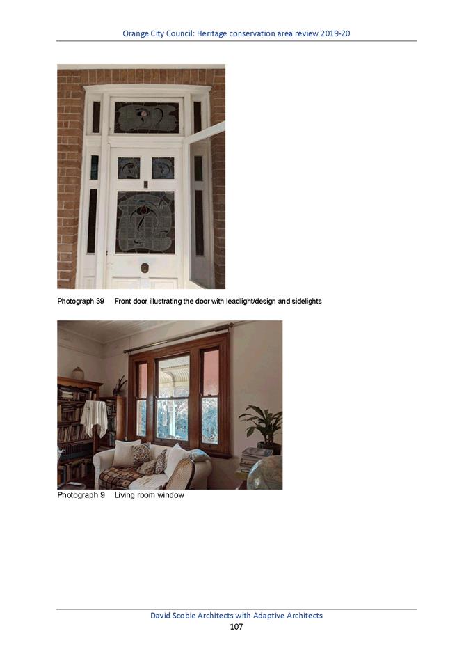
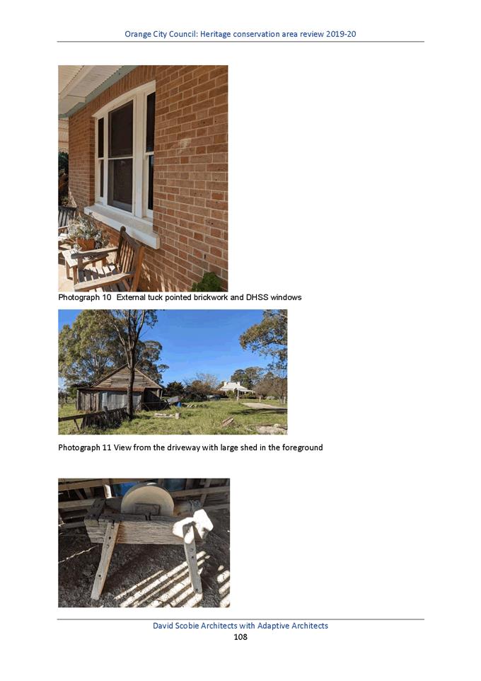
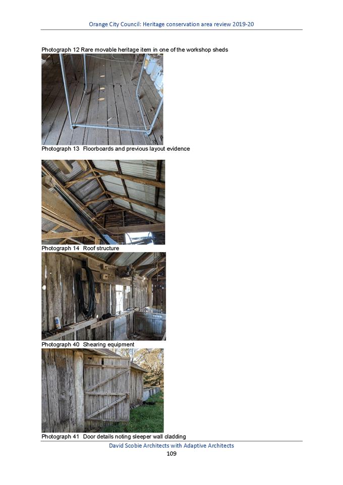
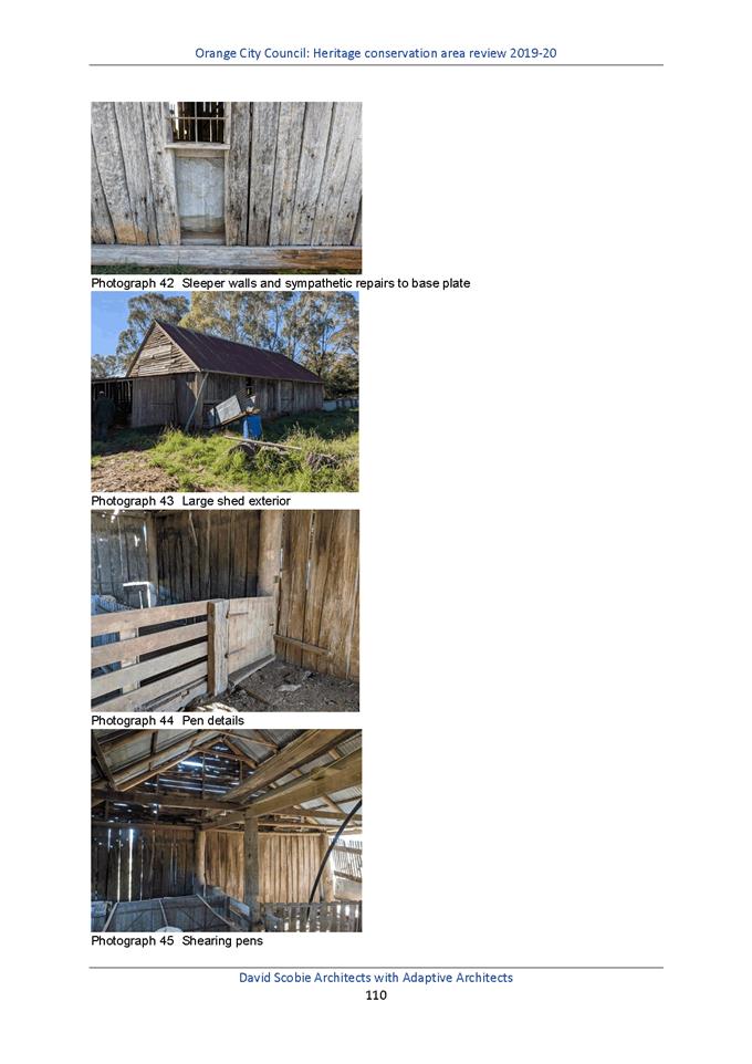
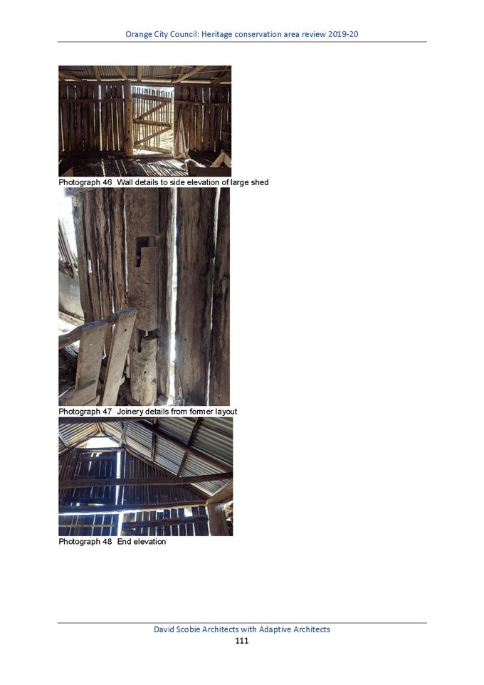
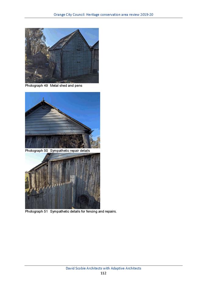
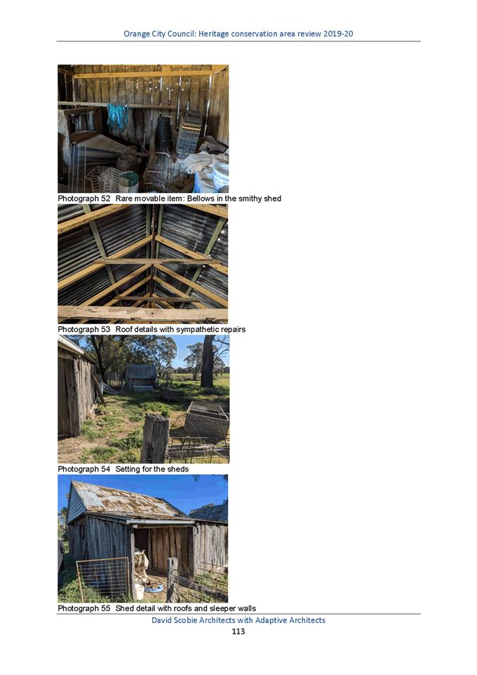
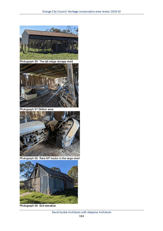
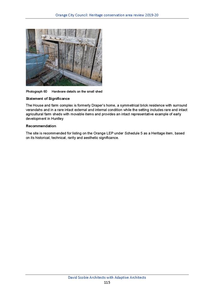
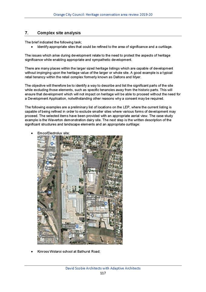

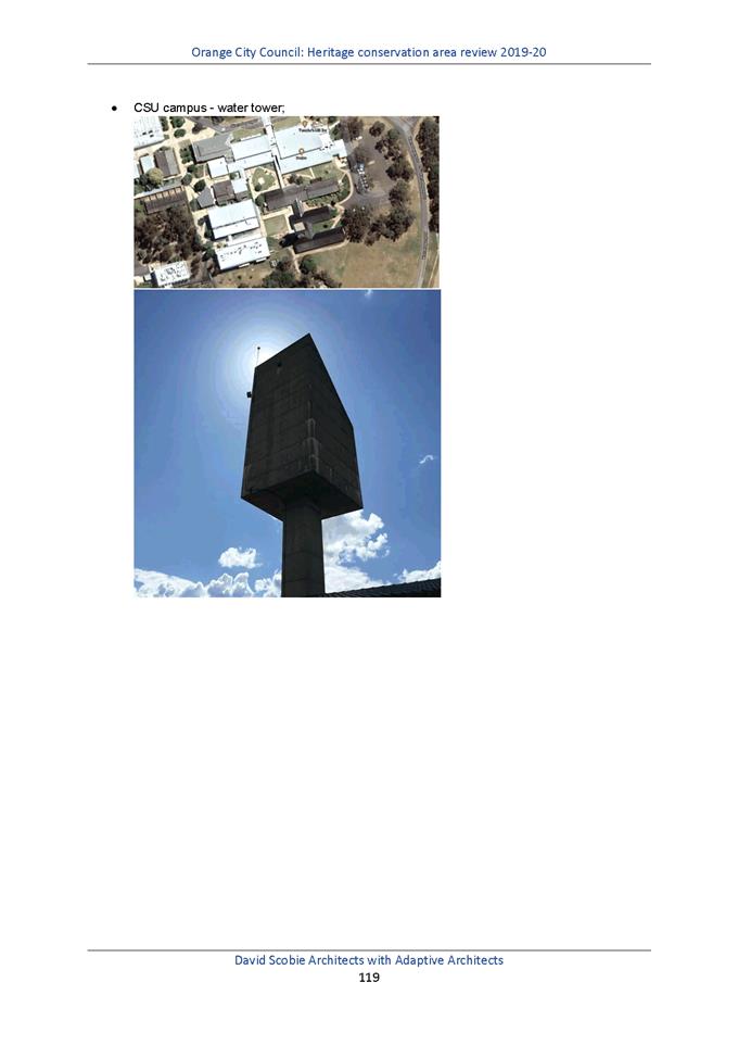
Planning and Development Committee
1 December 2020
Attachment 2 HCA
Maps FINAL
Planning
and Development Committee
1 December 2020