Sport and Recreation Policy
Committee
Agenda
4 December 2018
Notice is hereby given, in
accordance with the provisions of the Local Government Act 1993 that a Sport and Recreation Policy Committee
meeting of ORANGE CITY
COUNCIL will be held in the Council
Chamber, Civic Centre, Byng Street, Orange on Tuesday,
4 December 2018.
Garry
Styles
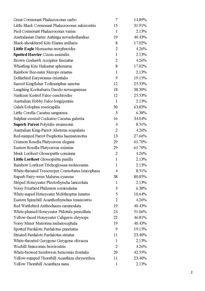
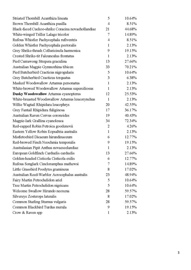
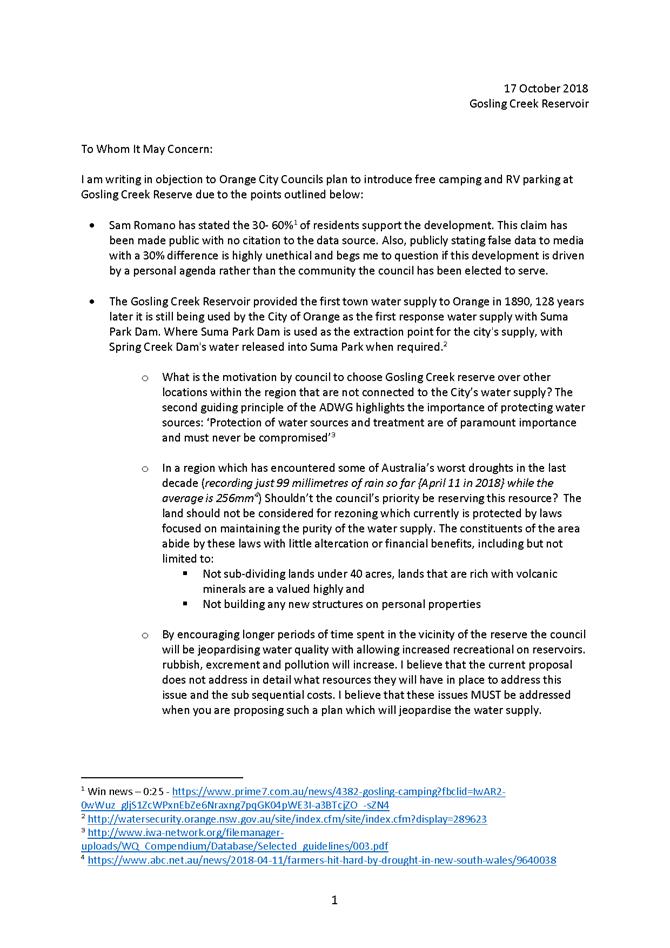
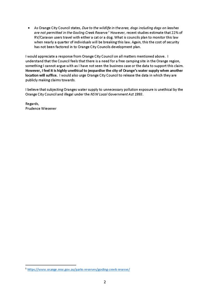
General Manager
For apologies please
contact Administration on 6393 8218.
1 Introduction
1.1 Declaration
of pecuniary interests, significant non-pecuniary interests and less than
significant non-pecuniary interests
The
provisions of Chapter 14 of the Local Government Act, 1993 (the Act)
regulate the way in which Councillors and designated staff of Council conduct
themselves to ensure that there is no conflict between their private interests
and their public role.
The
Act prescribes that where a member of Council (or a Committee of Council) has a
direct or indirect financial (pecuniary) interest in a matter to be considered
at a meeting of the Council (or Committee), that interest must be disclosed as
soon as practicable after the start of the meeting and the reasons given for
declaring such interest.
As
members are aware, the provisions of the Local Government Act restrict any
member who has declared a pecuniary interest in any matter from participating
in the discussion or voting on that matter, and requires that member to vacate
the Chamber.
Council’s Code of Conduct provides that if members
have a non-pecuniary conflict of interest, the nature of the conflict must be
disclosed. The Code of Conduct also provides for a number of ways in which a
member may manage non pecuniary conflicts of interest.
|
Recommendation
It is recommended that Committee Members now disclose any
conflicts of interest in matters under consideration by the Sport and
Recreation Policy Committee at this meeting.
|
2 Committee
Minutes
2.1 Minutes
of the Australia Day Community Committee Meeting – 14 November 2018
TRIM
REFERENCE: 2018/2884
AUTHOR: Mark
Burdack, Director Corporate and Commercial Services
EXECUTIVE Summary
The Australia Day Community Committee met on 14 November
2018 and the minutes from this meeting are presented to the Sport and
Recreation Policy Committee for information.
Link To Delivery/OPerational Plan
The recommendation in this report relates to the
Delivery/Operational Plan strategy “11.2 Prosper - Develop and attract a
variety of events, festivals, venues and activities for locals and visitors,
ensuring accessibility for all”.
Financial Implications
Nil
Policy and Governance Implications
Nil
|
Recommendation
Council resolves to adopt the minutes of the Australia
Day Community Committee meeting held on 14 November 2018.
|
further considerations
Consideration has been given to the recommendation’s
impact on Council’s service delivery; image and reputation; political;
environmental; health and safety; employees; stakeholders and project
management; and no further implications or risks have been identified.
Attachments
1 Minutes
of the Meeting of the Australia Day Community Committee held on 14 November
2018
2 ADC
14 November 2018 Agenda PDF, D18/62441⇩
ORANGE CITY COUNCIL
MINUTES OF THE
Australia Day Community
Committee
HELD IN Councillors Workroom, Civic Centre, Byng Street,
Orange
ON 14 November 2018
COMMENCING AT 5:30PM
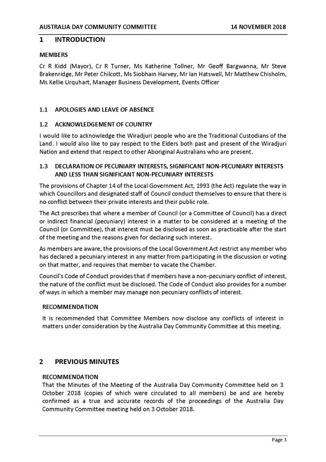
1 Introduction
Cr R Turner, Ms Katherine Tollner (5:32pm), Mr Geoff
Bargwanna, Mr Steve Brakenridge, Mr Ian Hatswell (5:35pm), Mr Matthew Chisholm,
Ms Kellie Urquhart and Events Officer.
1.1 Apologies
and Leave of Absence
|
RECOMMENDATION Cr
R Turner/Mr G Bargwanna
That the apologies be
accepted from Cr R Kidd (Mayor), Mr Peter Chilcott, Ms Siobhain Harvey
and Manager Business Development for the Australia Day Community Committee
meeting on 14 November 2018.
|
1.3 Declaration
of pecuniary interests, significant non-pecuniary interests and less than significant
non-pecuniary interests
2 Previous
Minutes
|
RECOMMENDATION Mr
G Bargwanna/Ms K Urquhart
That the Minutes of the
Meeting of the Australia Day Community Committee held on 3 October 2018
(copies of which were circulated to all members) be and are hereby confirmed
as a true and accurate record of the proceedings of the Australia Day
Community Committee meeting held on 3 October 2018.
|
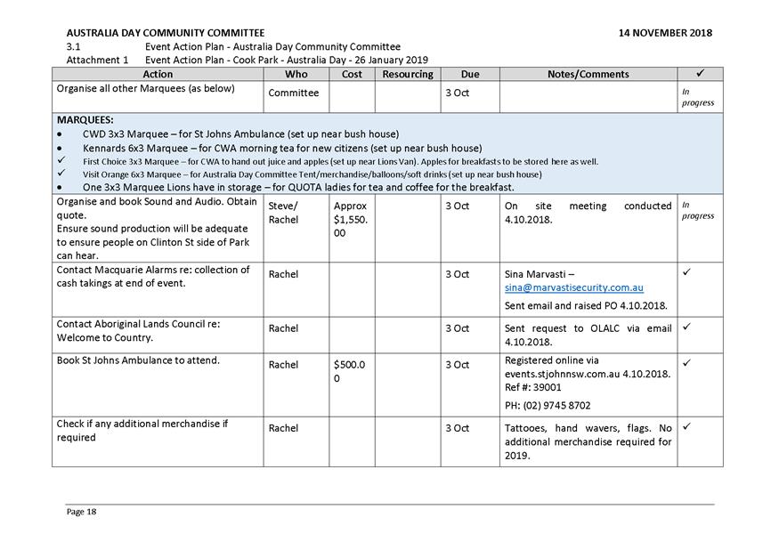
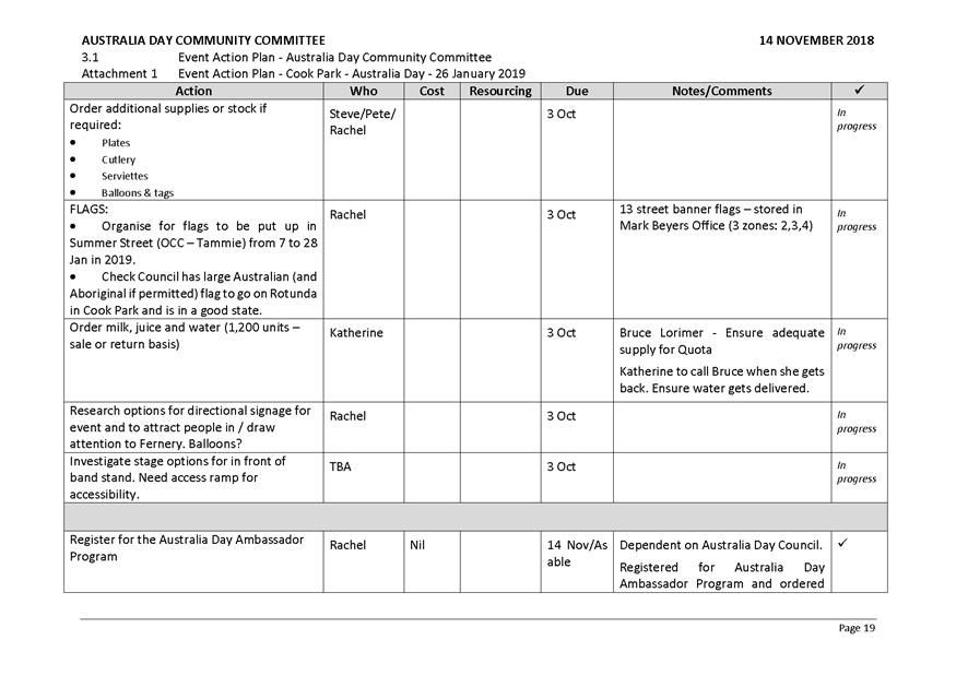
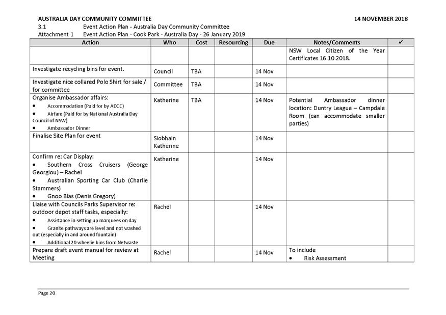
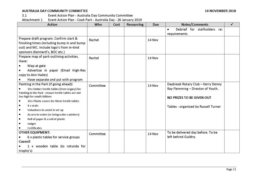
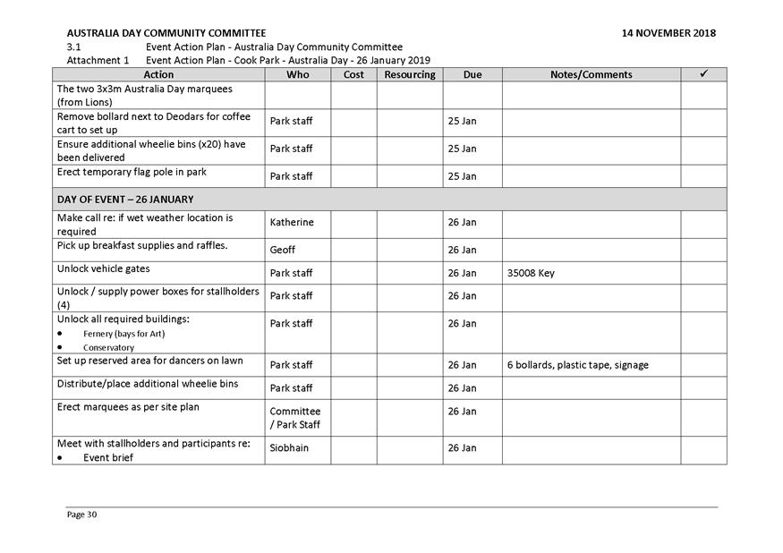
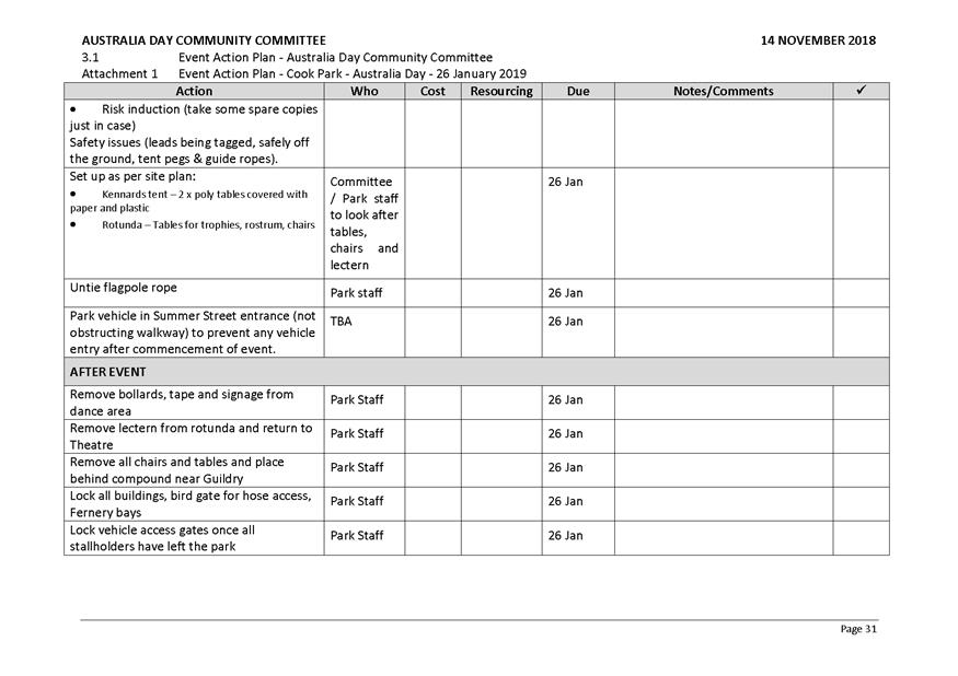
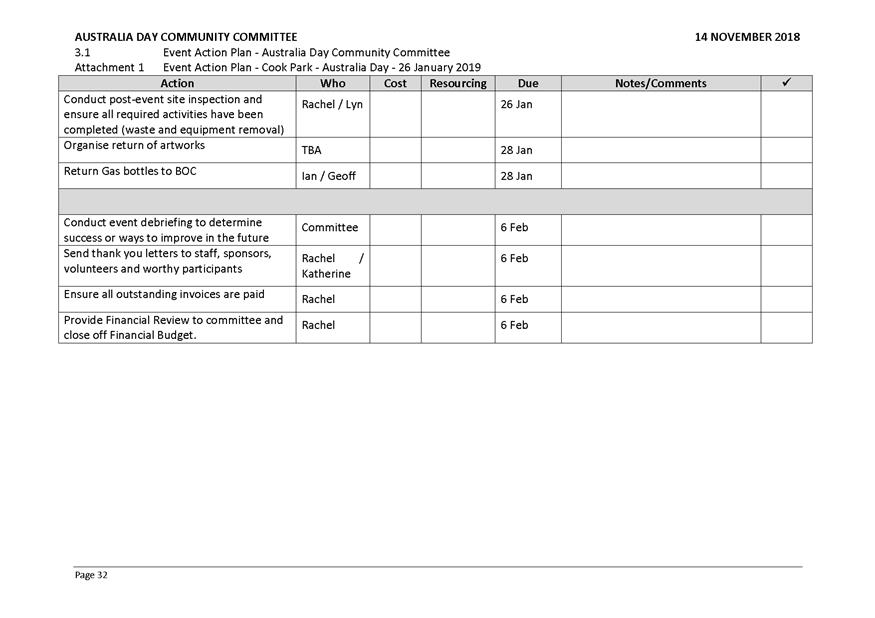
3 General
Reports
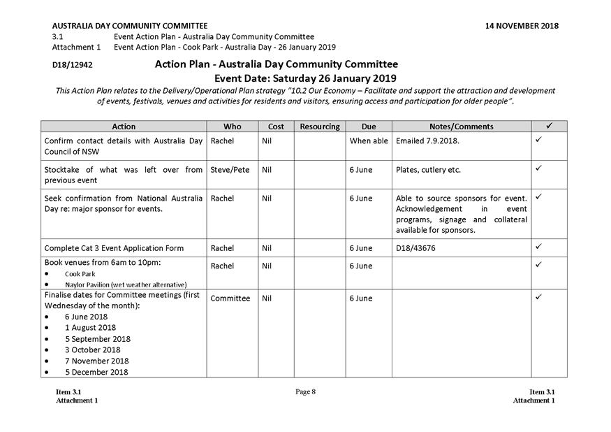
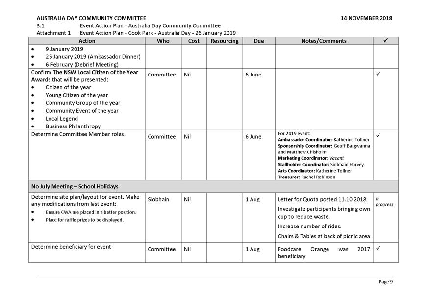
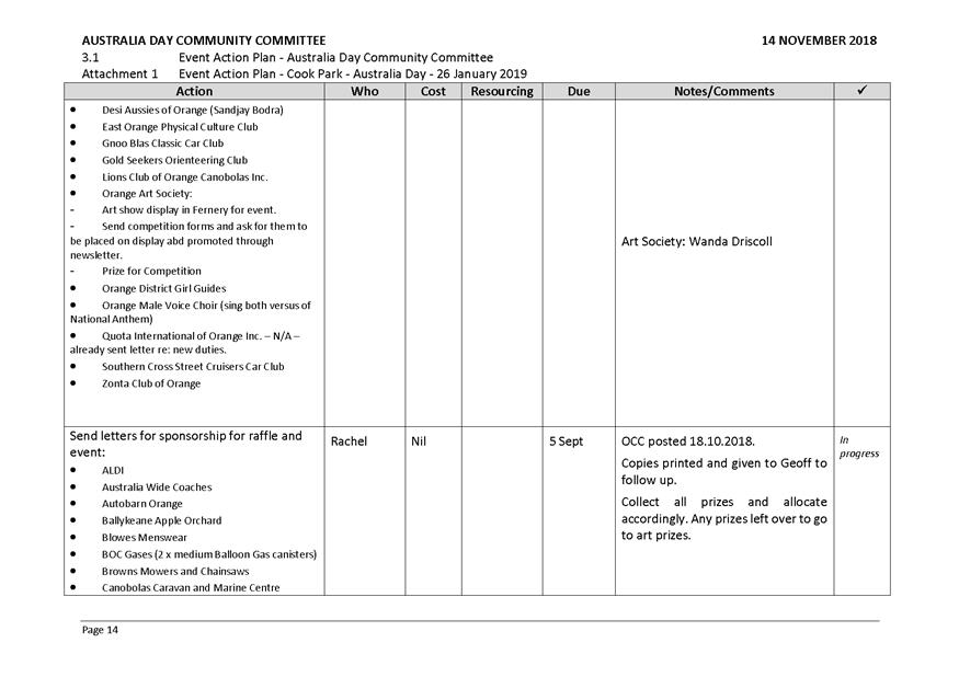
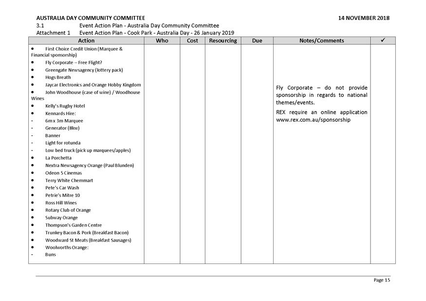
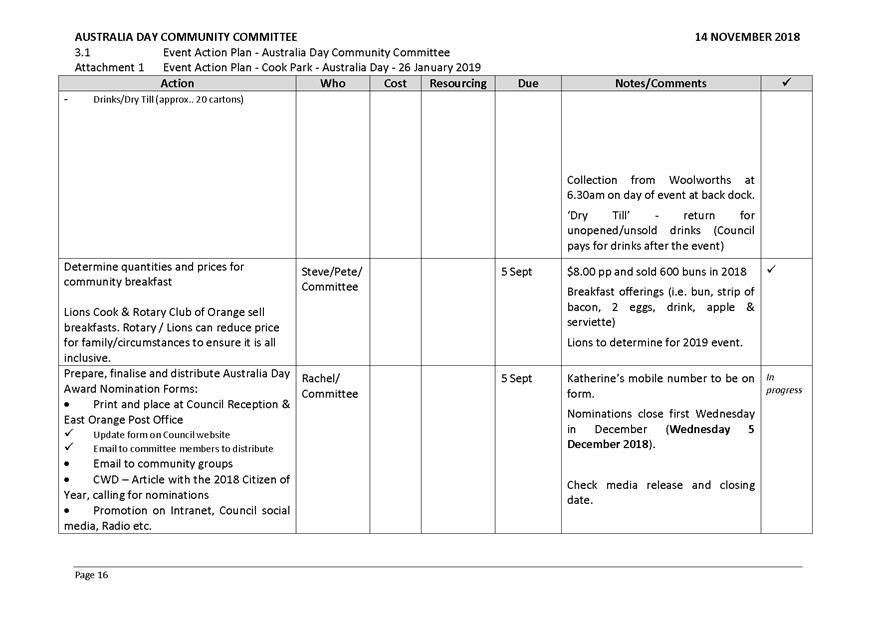
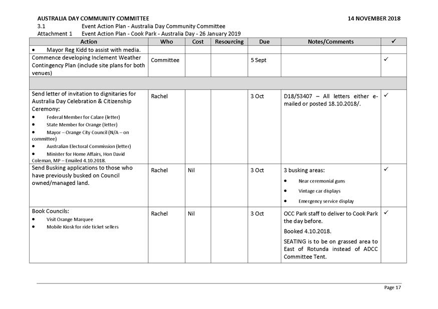
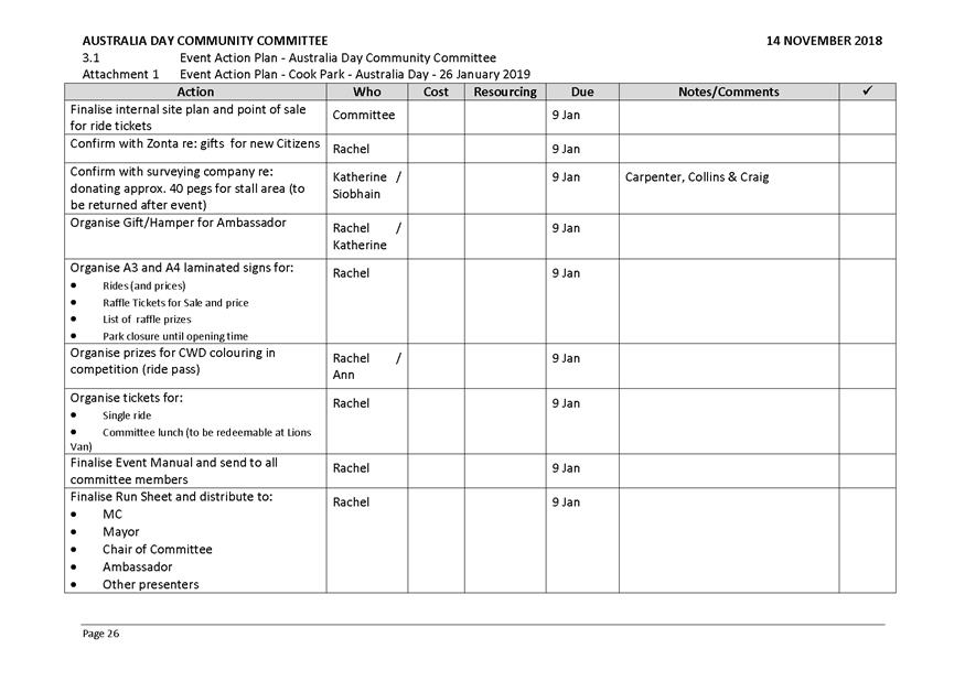
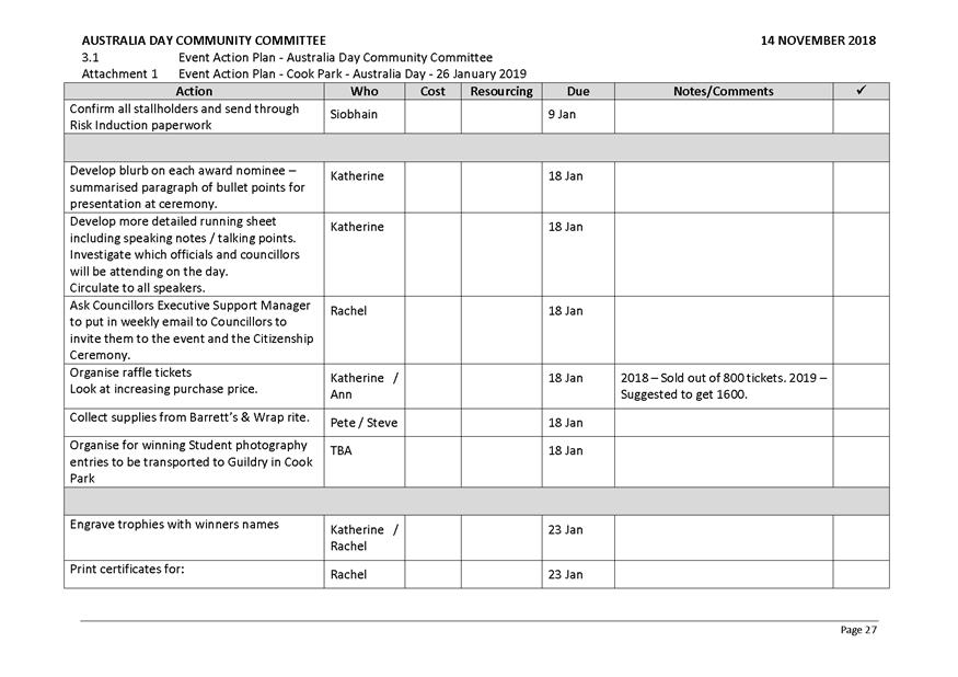
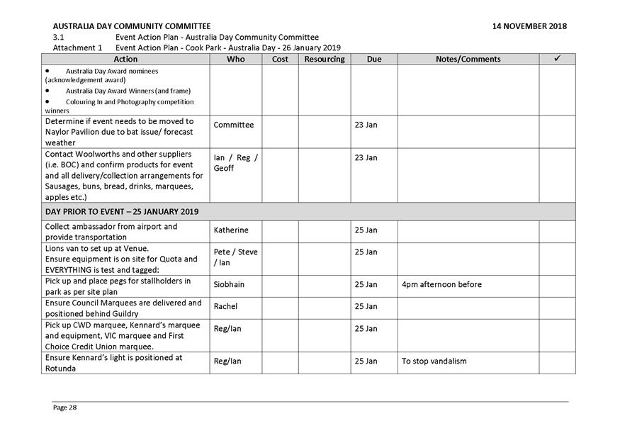
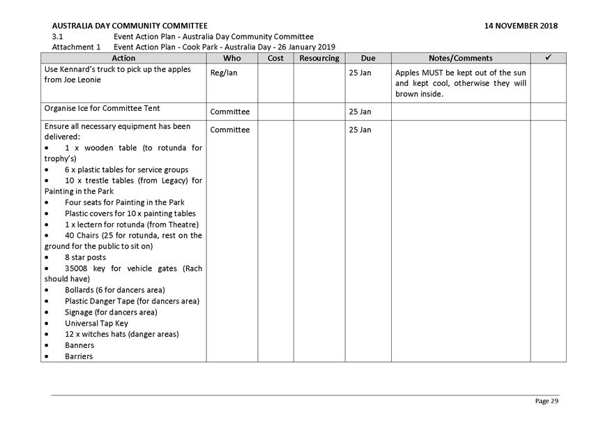
3.1 Event Action Plan -
Australia Day Community Committee
TRIM Reference: 2018/2786
|
|
Recommendation Mr G Bargwanna/Mr S Brakenridge
The Event Action Plan for the 2019 Australia Day event be
reviewed, updated and implemented.
|
The Meeting
Closed at 6:25PM.
Sport
and Recreation Policy Committee
4 December 2018
2.1 Minutes
of the Australia Day Community Committee Meeting - 14 November 2018
Attachment 1 ADC 14 November 2018 Agenda
PDF

2.2 Minutes
of the Sport and Recreation Community Committee meeting held on 29 October 2018
RECORD
NUMBER: 2018/2958
AUTHOR: Ben
Keegan, Sport and Recreation Coordinator
EXECUTIVE Summary
The Sport and Recreation Community Committee met on 29
October 2019 and the recommendations from those meetings are provided to the
Sport and Recreation Policy Committee for adoption.
Link To Delivery/OPerational Plan
The recommendation in this report relates to the
Delivery/Operational Plan strategy “2.1 Live - Identify
and deliver sport and recreation facilities to service the community into the
future”.
Financial Implications
Nil
Policy and Governance Implications
Nil
|
Recommendation
That
Council resolves:
1 To
acknowledge the reports presented to the Sport and
Recreation Community Committee at its
meeting held on 29 October 2018.
2 To
adopt recommendations 3.2, 3.3, 3.4 from the minutes of the Sport and Recreation Community Committee meeting of 29 October 2018
being:
3.2 That
Council send a letter to the NSW Minister of Sport expressing disappointment
in missing out on funding through the Regional Sporting Infrastructure Fund.
3.3 That
the Hon. Rick Colless be invited to the next meeting of the Sport and
Recreation Community Committee to provide him with an overview of the
Committee’s priority sport and active recreation projects and seek
support and assistance in securing funding for the projects.
3.4 That
the future of the Anzac Park BMX Track be added to the Sport and Recreation
Community Committee Action Plan for further discussion.
3 To
adopt the remainder of the minutes of the Sport and
Recreation Community Committee at its
meeting held on 29 October 2018.
|
further considerations
Consideration has been given to the
recommendation’s impact on Council’s service delivery; image and
reputation; political; environmental; health and safety; employees;
stakeholders and project management; and no further implications or risks have
been identified.
Attachments
1 Minutes
of the Meeting of the Sport and Recreation Community Committee held on 29 October
2018
2 SRCC
29 October 2018 Agenda, D18/64449⇩
ORANGE CITY COUNCIL
MINUTES OF THE
Sport and Recreation
Community Committee
HELD IN Councillors Workroom, Civic Centre, Byng Street,
Orange
ON 29 October 2018
COMMENCING AT 8.00am
1 Introduction
Cr J Hamling (Chairperson), Mrs Alison Bennett, Mr Scott
Holmes, Mrs Kim Gray, Mr Peter Rodgers, Mr Gary Norton, Mr Peter Jarick, Director
Community, Recreation and Cultural Services, Manager City Presentation,
Recreation Planner, Sports and Recreation Coordinator
1.1 Apologies and Leave of
Absence
|
RECOMMENDATION Mr
P Jarick/Mr G Norton
That the apologies be
accepted from Cr S Nugent, Mr Darryl Curran, Mr Peter Rodgers, Mr
Gavin Hillier, Mrs Jacqueline Jasprizza, for the Sport and Recreation
Community Committee meeting on 29 October 2018.
|
1.2 Acknowledgement of Country
1.3 Declaration of pecuniary
interests, significant non-pecuniary interests and less than significant
non-pecuniary interests
2 Previous
Minutes
|
RESOLVED
- 18/485 Mr
S Holmes/Mr G Norton
That the Minutes of the Meeting
of the Sport and Recreation Community Committee held on 30 July 2018 (copies
of which were circulated to all members) be and are hereby confirmed as a
true and accurate record of the proceedings of the Sport and Recreation
Community Committee meeting held on 30 July 2018.
|
3 General
Reports
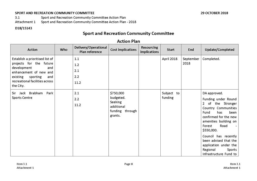
3.1 Sport and Recreation
Community Committee Action Plan
TRIM Reference: 2018/2638
The Committee was advised that
Council had recently been informed that the application for funding under the
Office of Sport Regional Sporting Infrastructure Fund to implement the Sir
Jack Brabham Park Master Plan was unsuccessful.
The Committee raised concerns over the lack of funding
Orange was receiving through various grant programs and requested that a
letter be sent to the State Government to express disappointment that worthy
projects were not being funded.
The Committee also discussed a number of other topics
including:
·
Basketball facilities – Mr Holmes advised that Orange has
been missing out on a number of basketball events (eg. Western Junior League
Rounds) in the last 2 years as the City only has 4 Basketball NSW approved
indoor courts where a minimum 6 courts are required. Local school facilities
previously used to supplement the Anzac Park courts are not longer considered
compliant. The Orange Basketball Association are investigating options to use
James Sheahan High School Sports Hall when additioanl courts are required.
·
Commercial recreation facilities – A suggestion was made
that Orange would benefit from the development of an indoor/outdoor golf
driving range and an indoor rock climbing facility. Given the commercial
nature of these facilities it was advised that this matter be referred to
Council’s Economic Development Committee for consideration.
·
Anzac Park BMX Track – the Committee discussed the
condition and use of the BMX track and agreed that a decision should be made
with regard to the future of the facility. Further consideration needs to be
given to ongoing maintenance and opportunities for formal and informal usage
of the facility.
|
|
Recommendation Mr G Norton/Mr S Holmes
3.1 That the Sport and Recreation
Community Committee Action Plan be reviewed and updated.
3.2 That
Council send a letter to the NSW Minister of Sport expressing disappointment
in missing out on funding through the Regional Sporting Infrastructure Fund.
3.3 That
the Hon. Rick Colless be invited to the next meeting of the Sport and Recreation
Community Committee to provide him with an overview of the Committee’s
priority sport and active recreation projects and seek support and assistance
in securing funding for the projects.
3.4 That
the future of the Anzac Park BMX Track be added to the Sport and Recreation Community
Committee Action Plan for further discussion.
|
The Meeting
Closed at 9.00am.
Sport
and Recreation Policy Committee
4 December 2018
2.2 Minutes
of the Sport and Recreation Community Committee meeting held on 29 October 2018
Attachment 1 SRCC 29 October 2018 Agenda

3 General
Reports
3.1 Recreational
use of Gosling Creek, Spring Creek and Suma Park Dams - Report Following Public
Exhibition
RECORD
NUMBER: 2018/2649
AUTHOR: Scott
Maunder, Director Community, Recreation and Cultural Services
EXECUTIVE Summary
At its meeting of 4 September 2018 Council resolved to
publicly exhibit proposals relating to the recreational use of Gosling Creek,
Spring Creek Dam and Suma Park Dam.
Following the conclusion of the exhibition period Council
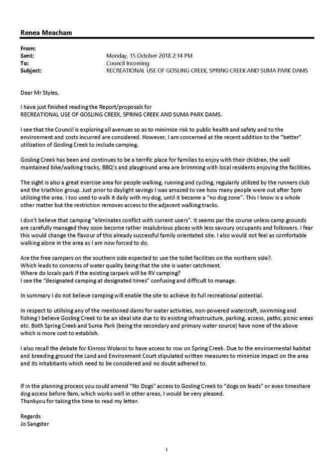
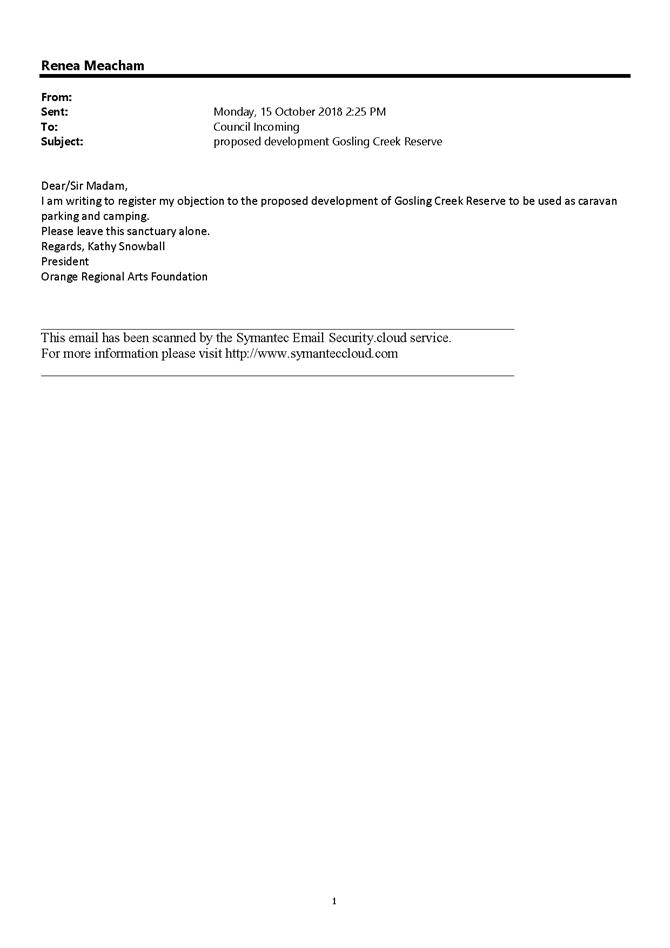
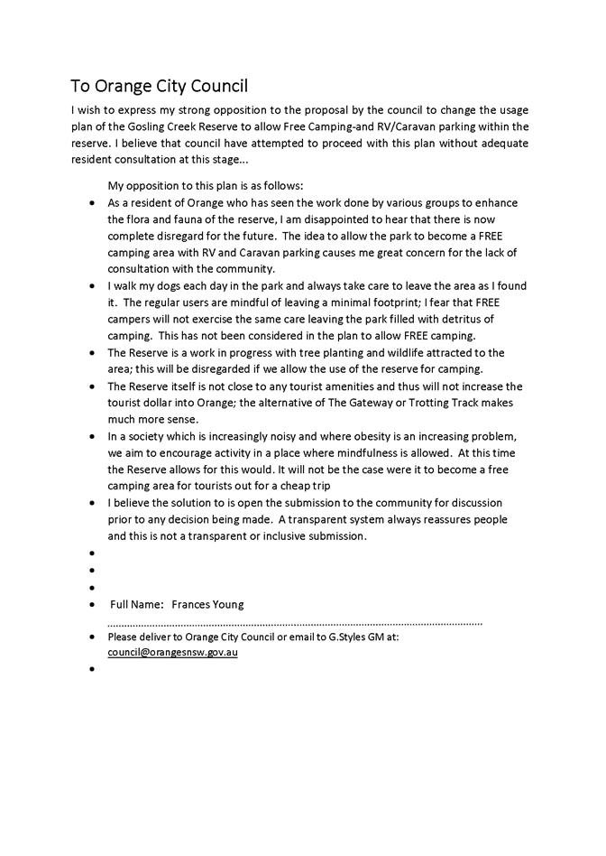
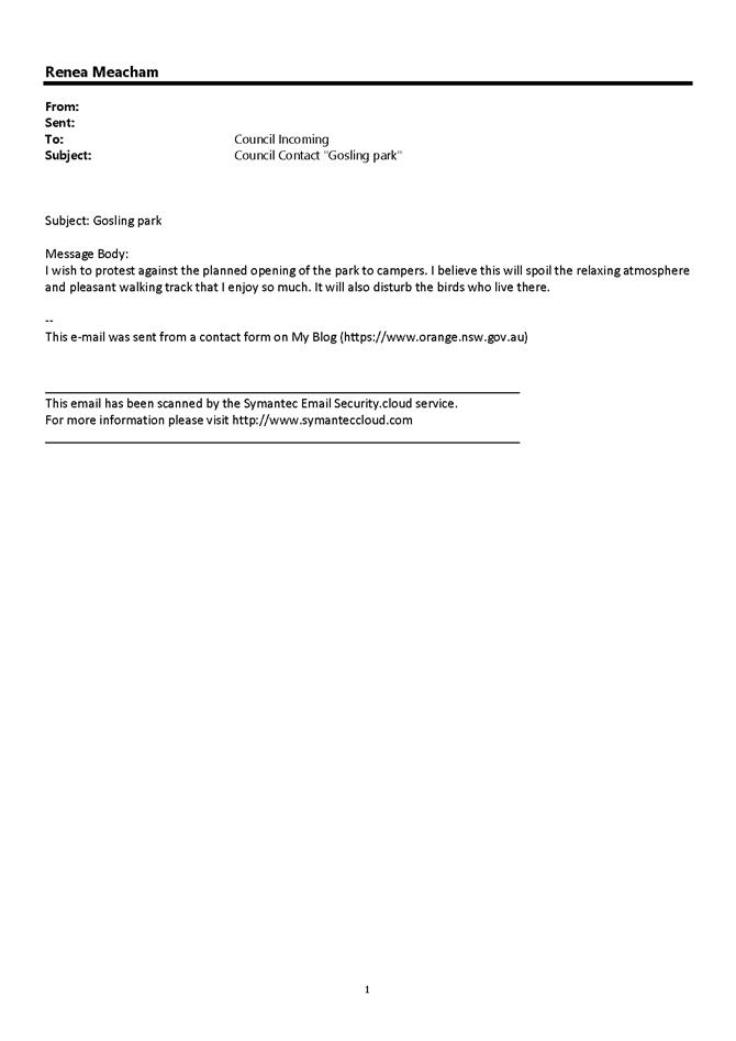
received 133 submissions. These included:
· 120
submissions opposing the proposals for Gosling Creek;
· 9
submissions opposing the proposals for Gosling Creek and Spring Creek
Dam; and
· 4
submissions supporting the proposals for Gosling Creek.
This report details the outcomes and provides copies of the
submissions.
Link To Delivery/OPerational Plan
The recommendation in this report relates to the
Delivery/Operational Plan strategy “2.1 Live - Identify
and deliver sport and recreation facilities to service the community into the
future”.
Financial Implications
Nil
Policy and Governance Implications
Nil
|
RecommendationS
That Council resolves to:
1 Not permit camping at Gosling Creek;
2 Not permit RV parking within established car parks at Gosling
Creek;
3 Not
permit land or water based activity at Suma Park; and
4 To commence the process to seek approval to permit access to
Spring Creek Dam for non-powered and electric boating and fishing but not
permit camping.
|
further considerations
The recommendation of this report has been
assessed against Council’s other key risk categories and the following
comments are provided:
|
|
|
|
|
Service Delivery
|
Drinking water quality, security of
drinking water supply assets
|
|
|
Image and Reputation
|
Tourism/economic impacts
|
|
|
Environmental
|
Wildlife and wildlife habitat
management, preservation of historic sites in the area, introduction of weeds
or exotic plants, introduction of vermin and exotic animals, foreshore
erosion, litter and heightened risk of bushfires
|
|
|
Health and Safety
|
Legal and public liability, water
quality health risks to users
|
|
|
Stakeholders
|
Orange residents, external/regional
users (including sporting clubs), Federal and State Government Approvals
Authorities/Regulators
|
|
SUPPORTING INFORMATION
At its meeting of 15 May 2018 Council
considered a report on the Gosling Creek, Spring Creek and Suma Park Dams
containing the following recommendation:
|
Recommendation
That Council publicly
exhibits, for a period of 28 days, proposals to:
1 Permit primitive
camping on the southern side of Gosling Creek;
2 Permit access to
Spring Creek Dam for non-powered and electric boating, fishing but not
camping;
3 Not permit land or
water based activity at Suma Park;
|
Council resolved
that:
|
RESOLVED
- 18/224 Cr
K Duffy/Cr M Previtera
That
Council defer this item for consideration at a Councillor Workshop.
|
A workshop was conducted to
further consider the proposals. Following the conduct of the workshop, Council
again considered the report on 4 September 2018 which included the following
recommendations:
|
Recommendation
That Council publicly
exhibits, for a period of 28 days, proposals to:
1 Permit camping on the
Southern side of Gosling Creek with access to amenities on the Northern Side
of Gosling Creek;
2 Permit Camping on the
Northern side of Gosling Creek within a designated area at times determined
by Council so as not to conflict with events or activities;
3 Permit RV parking within
established car parks at Gosling Creek;
4 Permit access to Spring
Creek Dam for non-powered and electric boating, fishing but not camping;
5 Not permit land or water
based activity at Suma Park; and
6 Report to Council
following the public exhibition on the submissions received.
|
Council did not amend the
recommendations contained within the report and resolved that:
|
RESOLVED - 18/416 Cr
M Previtera/Cr S Munro
That Council publicly
exhibits, for a period of 28 days, proposals to:
1 Permit camping on the
Southern side of Gosling Creek with access to amenities on the Northern Side
of Gosling Creek;
2 Permit Camping on the
Northern side of Gosling Creek within a designated area at times determined
by Council so as not to conflict with events or activities;
3 Permit RV parking within
established car parks at Gosling Creek;
4 Permit access to Spring
Creek Dam for non-powered and electric boating, fishing but not camping;
5 Not permit land or water
based activity at Suma Park; and
6 Report to Council
following the public exhibition on the submissions received.
|
The proposals were exhibited and
written comments were sought on the proposals.
During that period 129 objections
were received including a petition of 20 persons detailing their objection with
4 submissions received supporting the proposals. A summary of the
submissions follows:
|
Submission No
|
IC Number
|
Submitter/s' Name
|
Environmental
|
Safety
|
Out of Character
|
Suitable Elsewhere
|
Pollution
|
Anti-Social Behaviour
|
Insufficient Area
|
Financial Concerns
|
|
|
|
Against
|
|
|
|
|
|
|
|
|
|
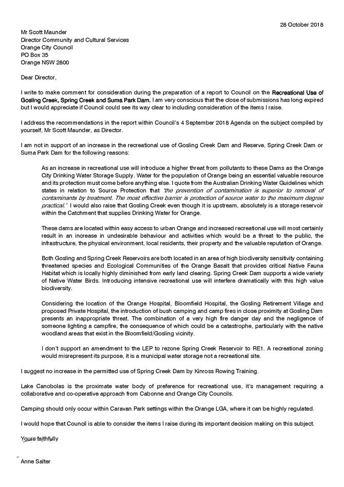
1
|
IC18/21261
|
Ms Anne Salter
|
x
|
x
|
|
|
|
x
|
|
|
|
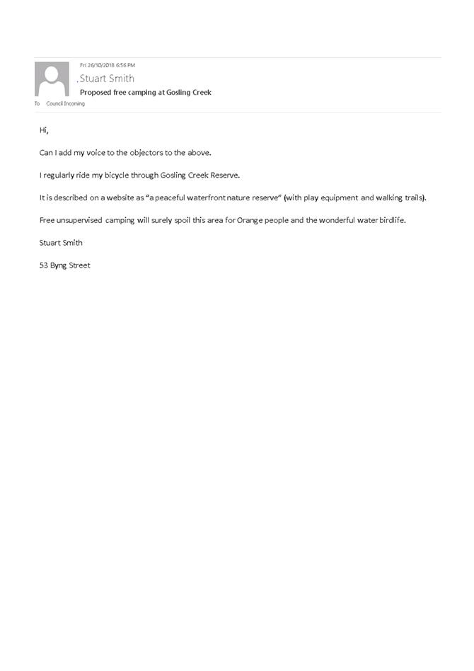
2
|
IC18/21172
|
Mr Stuart Smith
|
x
|
|
|
|
|
|
|
|
|
3
|
IC18/20719
|
Mr Cyril Smith
|
x
|
|
|
|
x
|
|
x
|
|
|
4
|
IC18/20702
|
M & L Tilston
|
x
|
|
x
|
|
|
|
|
|
|
5
|
IC18/20659
|
Ms Dorothy Arnold
|
x
|
|
|
|
|
x
|
|
|
|
6
|
IC18/20597
|
Mr Mark Root
|
|
|
|
x
|
|
x
|
|
|
|
7
|
IC18/20517
|
Ms Wendy Wiesener and Ross Doherty
|
x
|
|
x
|
|
|
|
|
|
|
8
|
IC18/20482
|
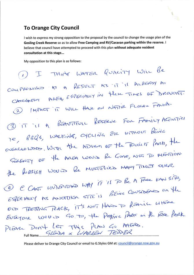
Mr Warren and Mrs Glenda Tedder
|
x
|
|
|
x
|
|
x
|
|
|
|
9
|
IC18/20459
|
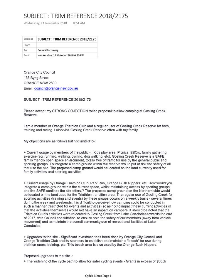
Marc Kiho
|
x
|
x
|
|
x
|
x
|
x
|
|
|
|
10
|
IC18/20460
|
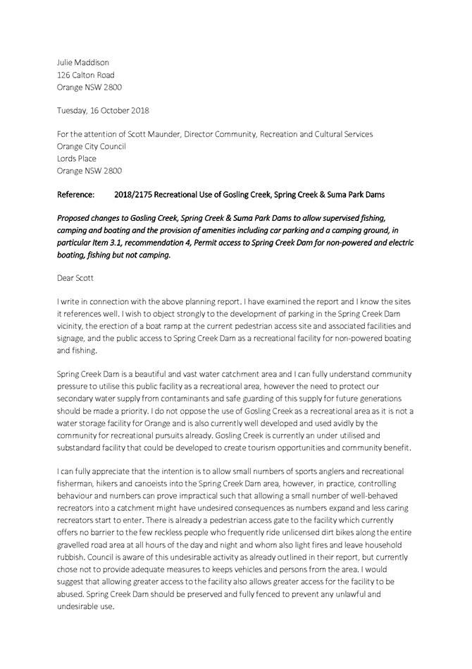
Ms Julie Maddison
|
x
|
|
|
|
x
|
x
|
|
|
|
11
|
IC18/20458
|
Ms Kathryn Bourke
|
x
|
|
|
x
|
|
|
|
|
|
12
|
IC18/20417
|
NSW Bird Atlassers Inc
|
x
|
|
|
|
|
|
|
|
|
13
|
IC18/20416
|
Ms Kate Ziegler
|
x
|
|
|
|
|
|
|
|
|
14
|
IC18/20415
|
Ms Katey Sutton
|
x
|
x
|
|
|
x
|
x
|
|
|
|
15
|
IC18/20413
|
Ms Ann Visman
|
x
|
|
|
x
|
|
x
|
|
x
|
|
16
|
IC18/20412
|
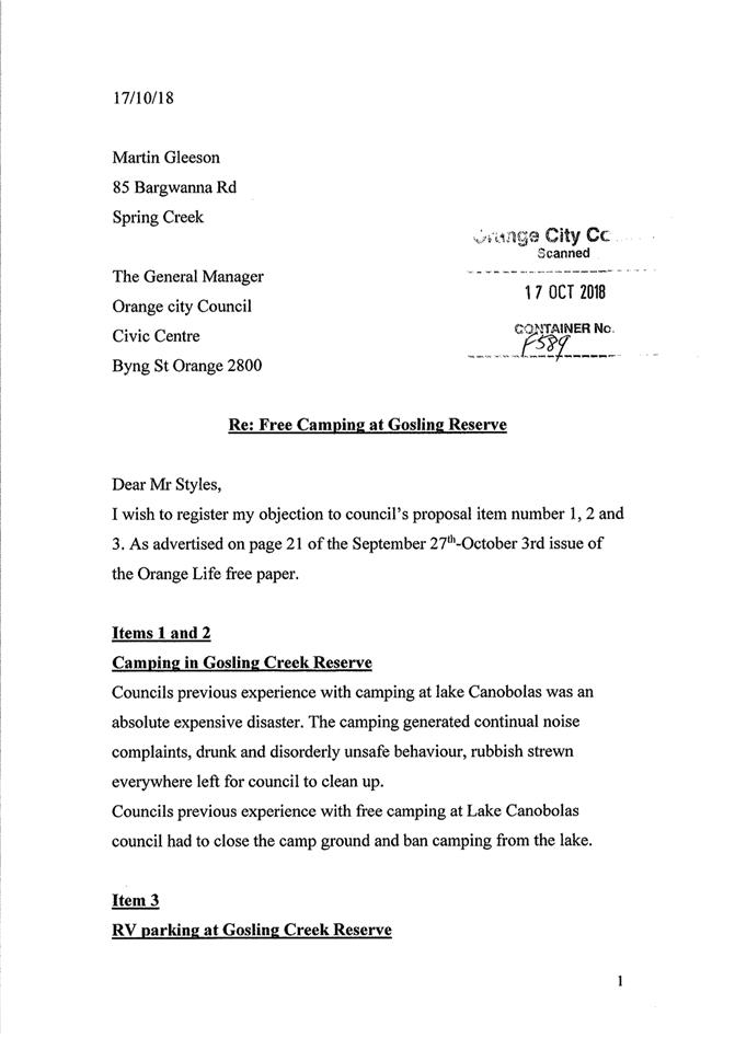
Mr Martin Gleeson
|
|
|
|
|
x
|
x
|
|
x
|
|
17
|
IC18/20410
|
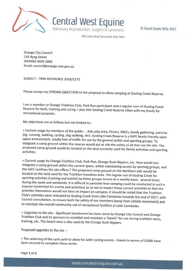
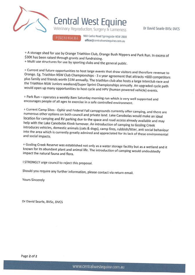
Dr David Searle
|
x
|
x
|
x
|
|
x
|
|
|
|
|
18
|
IC18/20409
|
Mr Greg Michell
|
x
|
|
|
|
|
|
|
|
|
19
|
IC18/20407
|
Daroo Landcare Group
|
x
|
|
|
|
x
|
|
|
|
|
20
|
IC18/20406
|
Ms Dorothy Jones
|
x
|
|
|
x
|
|
|
|
|
|
21
|
IC18/20405
|
Ms Lorraine Milla
|
|
|
|
|
|
|
|
|
|
22
|
IC18/20398
|
Ms Christine Carter
|
x
|
|
|
|
|
|
|
|
|
23
|
IC18/20396
|
Ms Bridgette Evans
|
x
|
x
|
|
|
x
|
x
|
|
|
|
24
|
IC18/20392
|
Ms Sue Furze
|
x
|
|
|
|
|
|
|
|
|
25
|
IC18/20390
|
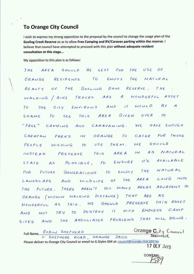
Robin Shepherd
|
x
|
|
|
|
|
|
|
|
|
26
|
IC18/20389
|
Edward Furze
|
x
|
|
|
|
|
|
|
|
|
27
|
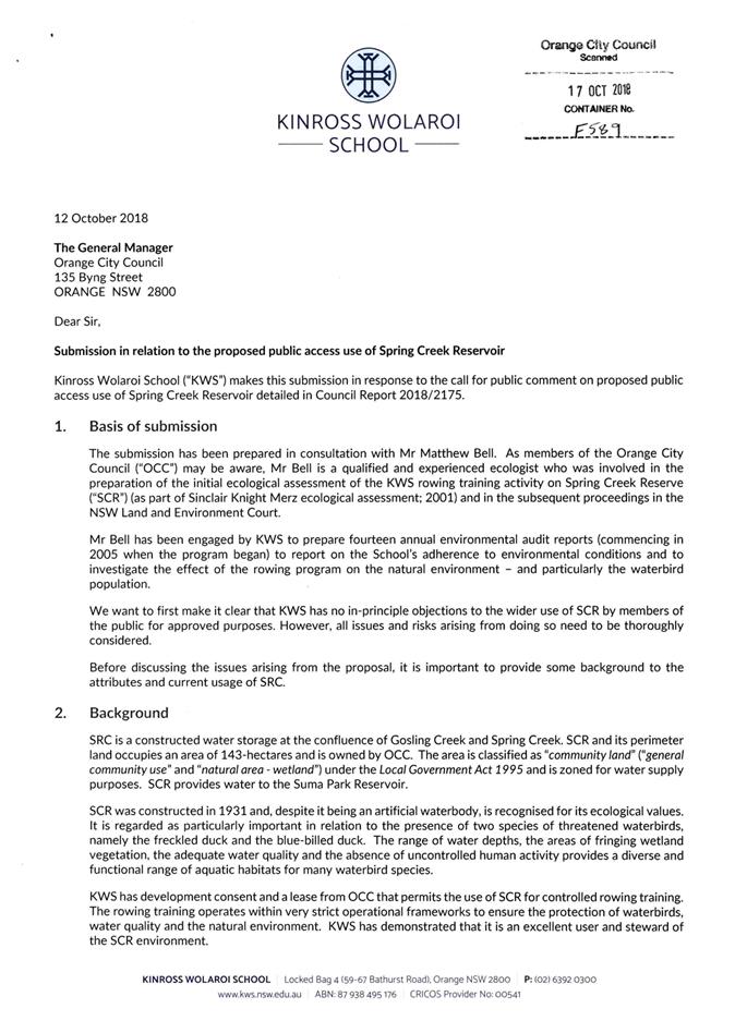
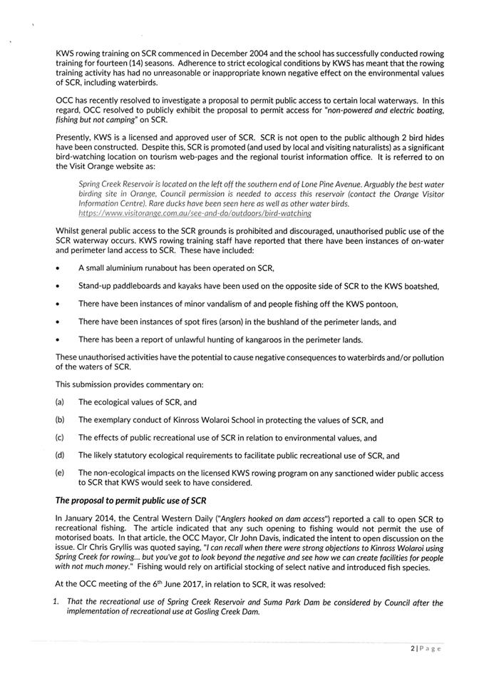
IC18/20378
|
Kinross Wolaroi School
|
x
|
x
|
|
|
x
|
x
|
|
|
|
28
|
IC18/20376
|
Peter Toedter
|
x
|
|
|
|
|
x
|
|
|
|
29
|
IC18/20371
|
Orange Field Naturalist
|
x
|
|
x
|
|
|
|
|
|
|
30
|
IC18/20370
|
Prue Wiesener
|
x
|
|
|
|
x
|
|
|
|
|
31
|
IC18/20369
|
Mr Anthony Cook
|
x
|
x
|
|
|
x
|
x
|
|
|
|
32
|
IC18/20367
|
Ms Jane Wiesener
|
x
|
x
|
x
|
|
x
|
x
|
|
|
|
33
|
IC18/20341
|
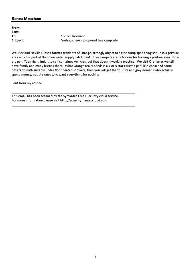
Bev and Nev Gibson
|
|
|
|
x
|
x
|
x
|
|
|
|
34
|
IC18/20340
|
Megan Goodwin
|
x
|
x
|
|
|
x
|
x
|
|
|
|
35
|
IC18/20339
|
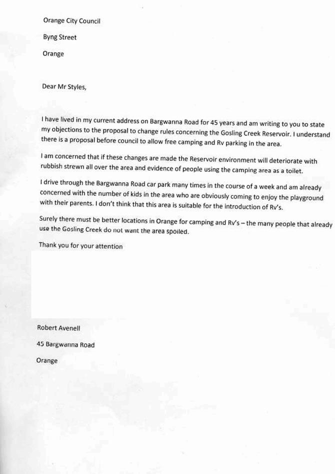
Mr Robert Avenell
|
x
|
|
|
x
|
x
|
|
|
|
|
36
|
IC18/20338
|
Ms Kate Thornton
|
x
|
x
|
|
|
x
|
|
|
|
|
37
|
IC18/20337
|
Mr Phil Tudor
|
x
|
x
|
|
|
x
|
x
|
|
|
|
38
|
IC18/20336
|
Mr Dan Benton
|
x
|
|
|
|
|
|
|
|
|
39
|
IC18/20335
|
Ms Margaret Duguid
|
x
|
x
|
x
|
|
x
|
|
|
|
|
40
|
IC18/20334
|
Mr Steve Robinson
|
x
|
|
|
x
|
x
|
|
|
|
|
41
|
IC18/20328
|
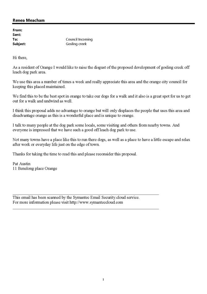
Pat Austin
|
x
|
|
x
|
|
|
|
|
|
|
42
|
IC18/20327
|
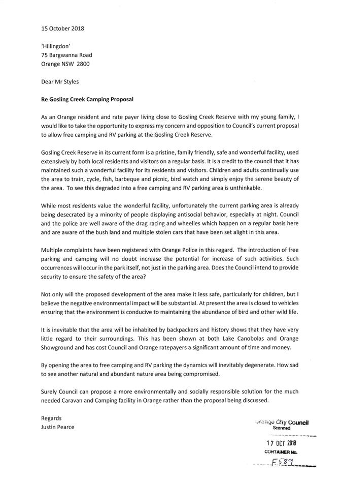
Justin Pearce
|
x
|
x
|
|
x
|
x
|
x
|
|
|
|
43
|
IC18/20325
|
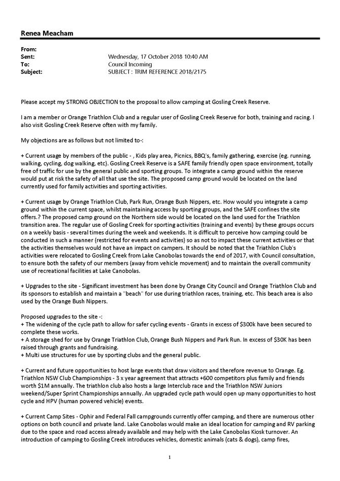
Kim Dale
|
x
|
x
|
|
x
|
x
|
x
|
|
|
|
44
|
IC18/20322
|
Mr Andrew Commins
|
x
|
x
|
|
x
|
x
|
x
|
|
|
|
45
|
IC18/20321
|
Mr Phil Smith
|
x
|
|
|
|
x
|
|
|
|
|
46
|
IC18/20310
|
Ms Jenna Austin
|
x
|
|
x
|
|
|
|
|
|
|
47
|
IC18/20308
|
Mr Harry Fardell
|
x
|
x
|
x
|
|
x
|
x
|
|
|
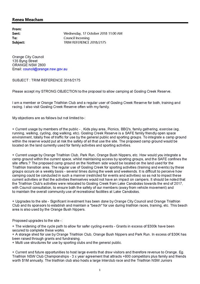
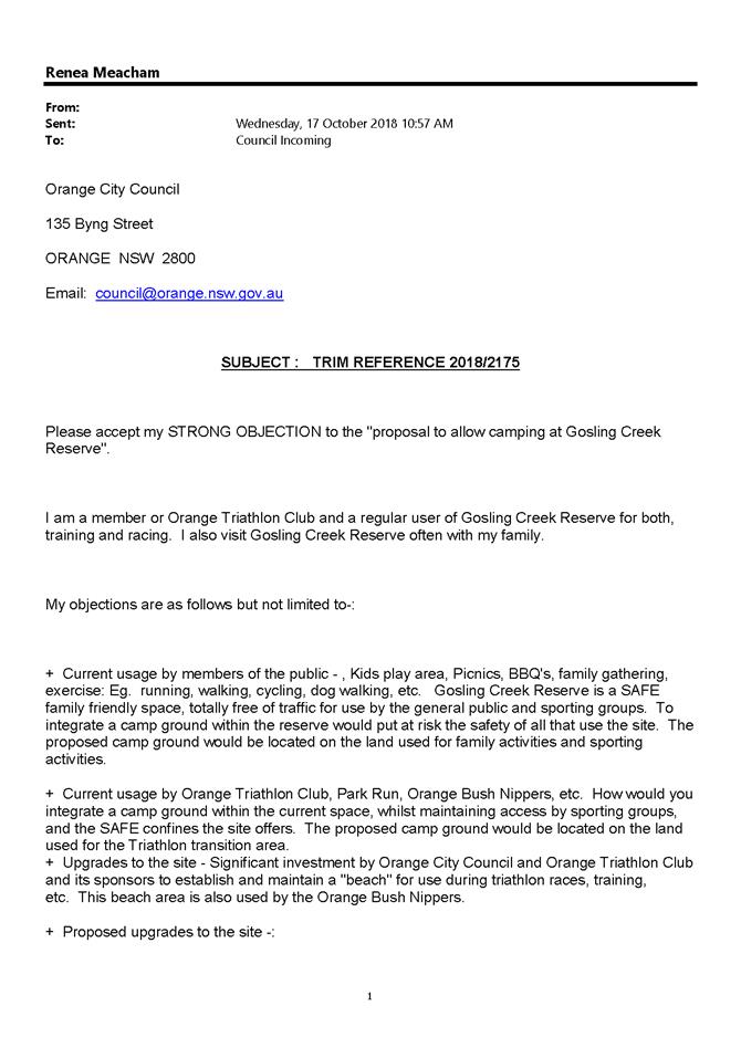
|
48
|
IC18/20307
|
Caroline Egan
|
x
|
x
|
|
|
x
|
x
|
|
|
|
49
|
IC18/20305
|
Melinda Smith
|
x
|
x
|
|
x
|
x
|
x
|
|
|
|
50
|
IC18/20304
|
Janet Martin
|
x
|
x
|
|
x
|
x
|
x
|
|
|
|
51
|
IC18/20302
|
Stephen Martin
|
x
|
x
|
|
x
|
x
|
x
|
|
|
|
52
|
IC18/20299
|
Andy Hardy
|
x
|
x
|
|
x
|
x
|
x
|
|
|
|
53
|
IC18/20297
|
Ray Dally
|
x
|
x
|
|
x
|
x
|
x
|
|
|
|
54
|
IC18/20289
|
Daphne Smith
|
x
|
x
|
|
x
|
|
x
|
|
|
|
55
|
IC18/20288
|
Michael Lockyer
|
x
|
x
|
|
x
|
x
|
x
|
|
|
|
56
|
IC18/20285
|
Richard and Amanda
Walker
|
x
|
|
|
|
x
|
x
|
|
|
|
57
|
IC18/20284
|
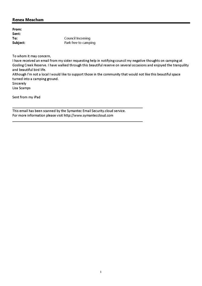
Lisa Scamps
|
x
|
|
|
|
|
|
|
|
|
58
|
IC18/20283
|
Caroline Robertson
|
x
|
x
|
|
x
|
x
|
x
|
|
|
|
59
|
IC18/20281
|
Ken Dally
|
x
|
|
|
x
|
x
|
|
|
|
|
60
|
IC18/20279
|
Alison Dermody
|
x
|
|
|
x
|
x
|
x
|
|
|
|
61
|
IC18/20277
|
Elizabeth Carpenter
|
|
x
|
|
x
|
|
|
|
|
|
62
|
IC18/20276
|
Sally Wallace
|
x
|
x
|
|
x
|
x
|
x
|
|
|
|
63
|
IC18/20274
|
Renee Sunderland
|
x
|
x
|
|
x
|
x
|
x
|
|
|
|
64
|
IC18/20273
|
Audrey Brown
|
x
|
x
|
|
x
|
x
|
x
|
|
|
|
65
|
IC18/20272
|
Amy Sullivan
|
|
x
|
|
x
|
x
|
x
|
|
|
|
66
|
IC18/20270
|
Jo Keniry
|
x
|
x
|
|
|
x
|
|
|
|
|
67
|
IC18/20269
|
Jeremy Wallace
|
x
|
x
|
|
x
|
x
|
x
|
|
|
|
68
|
IC18/20248
|
Scott Wiesner
|
x
|
|
|
x
|
x
|
|
|
|
|
69
|
IC18/20243
|
Bernadette Robinson
|
x
|
x
|
|
x
|
x
|
x
|
|
|
|
70
|
IC18/20215
|
Judy Haling
|
x
|
x
|
|
|
|
|
|
|
|
71
|
IC18/20212
|
Nino Belmonte
|
|
x
|
|
|
|
|
|
|
|
72
|
IC18/20197
|
David and Bernadette
Lamrock
|
x
|
|
|
x
|
x
|
|
|
|
|
73
|
IC18/20188
|
Daniel Hately
|
x
|
x
|
|
|
x
|
|
|
|
|
74
|
IC18/20187
|
Philippa Mitchell
|
x
|
x
|
|
|
x
|
|
|
|
|
75
|
IC18/20186
|
Judy Tarleton
|
x
|
x
|
|
x
|
x
|
x
|
|
|
|
76
|
IC18/20180
|
Dave Shearing
|
|
|
x
|
x
|
|
|
|
|
|
77
|
IC18/20144
|
Jill Mitchell
|
|
|
x
|
|
|
|
|
|
|
78
|
IC18/20112
|
Chris and Kerrie Blandford
|
|
|
|
x
|
|
|
|
|
|
79
|
IC18/20111
|
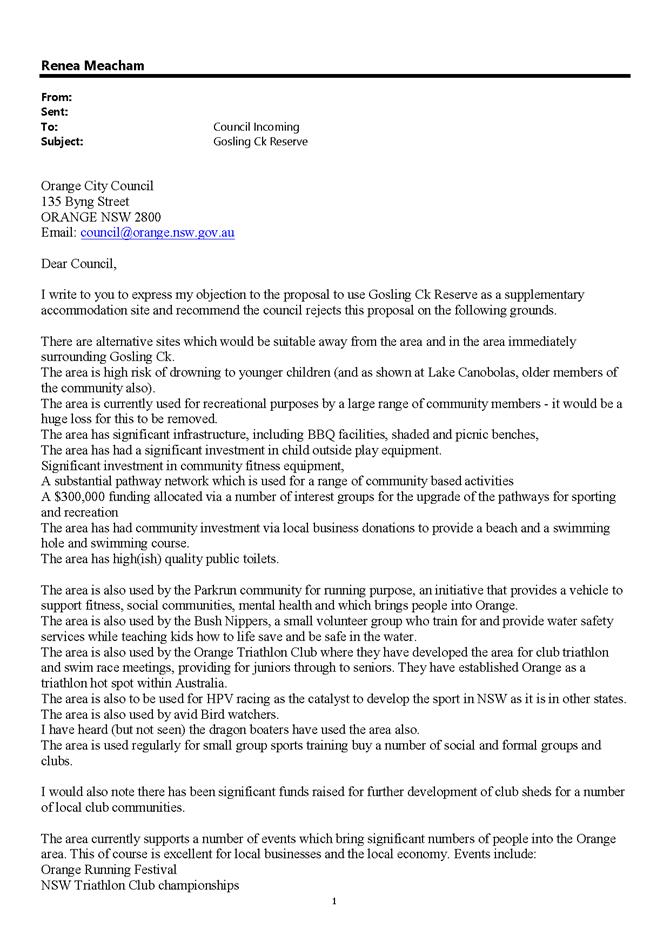
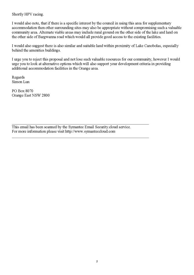
Simon Lun
|
|
x
|
|
x
|
x
|
|
|
|
|
80
|
IC18/20110
|
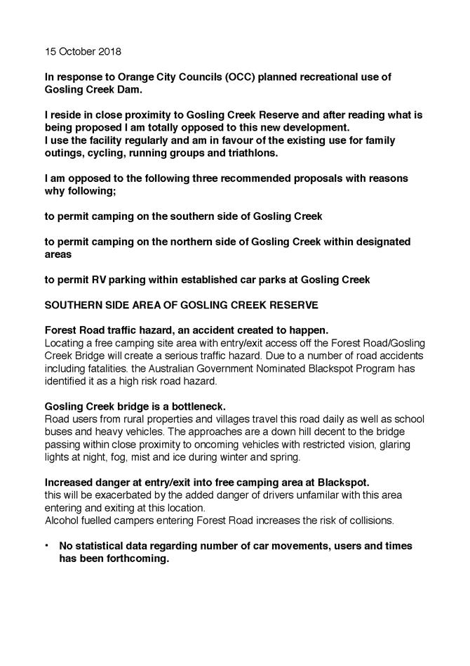
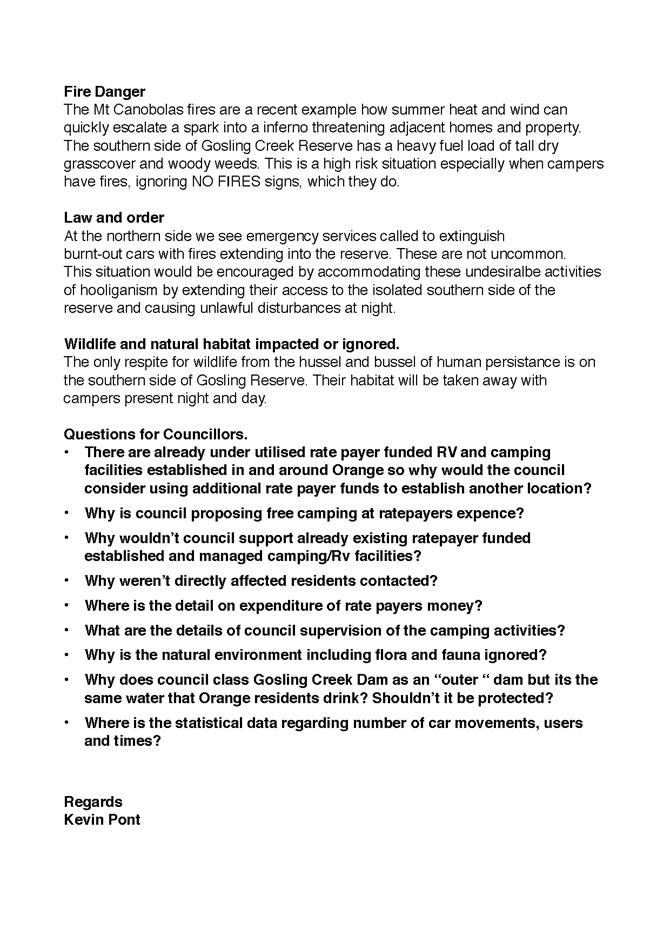
Kevin Pont
|
x
|
x
|
|
|
x
|
|
|
|
|
81
|
IC18/20108
|
Lloyd Mead
|
|
x
|
|
x
|
|
x
|
|
|
|
82
|
IC18/20099
|
Kerri Leadbette
|
x
|
|
x
|
|
|
|
|
|
|
83
|
IC18/20098
|
ECCO
|
x
|
|
x
|
x
|
|
|
|
|
|
84
|
IC18/20090
|
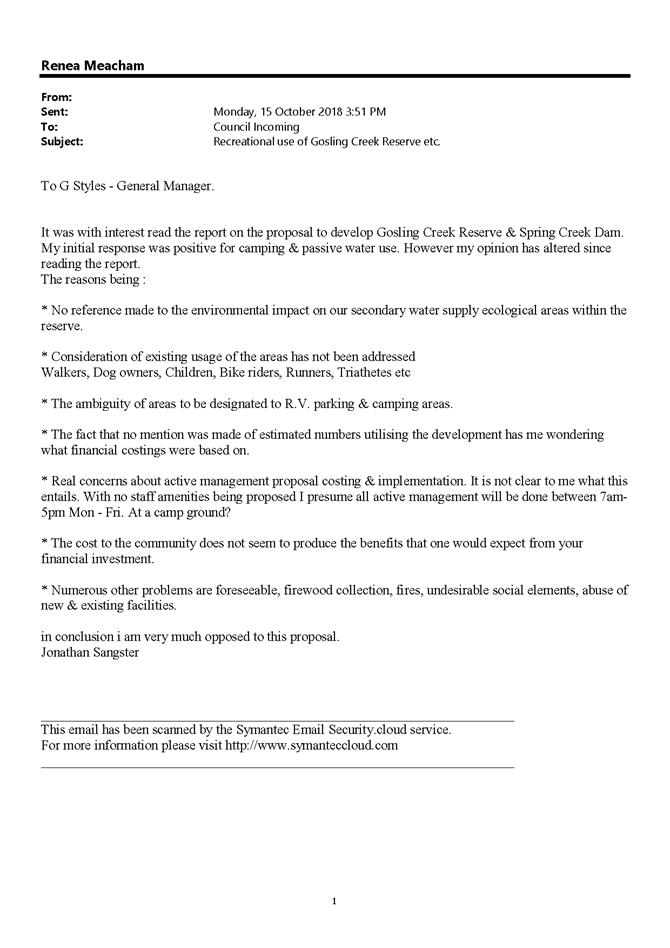
Jonathan Sangster
|
x
|
|
|
|
|
x
|
|
x
|
|
85
|
IC18/20089
|
Orange Field Naturalist
and Conservation Society
|
x
|
|
x
|
|
|
|
|
|
|
86
|
IC18/20080
|
Jo Sangster
|
x
|
x
|
x
|
|
|
|
|
|
|
87
|
IC18/20075
|
Kathy Snowball
|
x
|
|
|
|
|
|
|
|
|
88
|
IC18/20073
|
Frances Young
|
x
|
|
x
|
x
|
|
|
|
|
|
89
|
IC18/20067
|
Mark Flanagan
|
x
|
|
|
|
|
|
|
|
|
90
|
IC18/20037
|
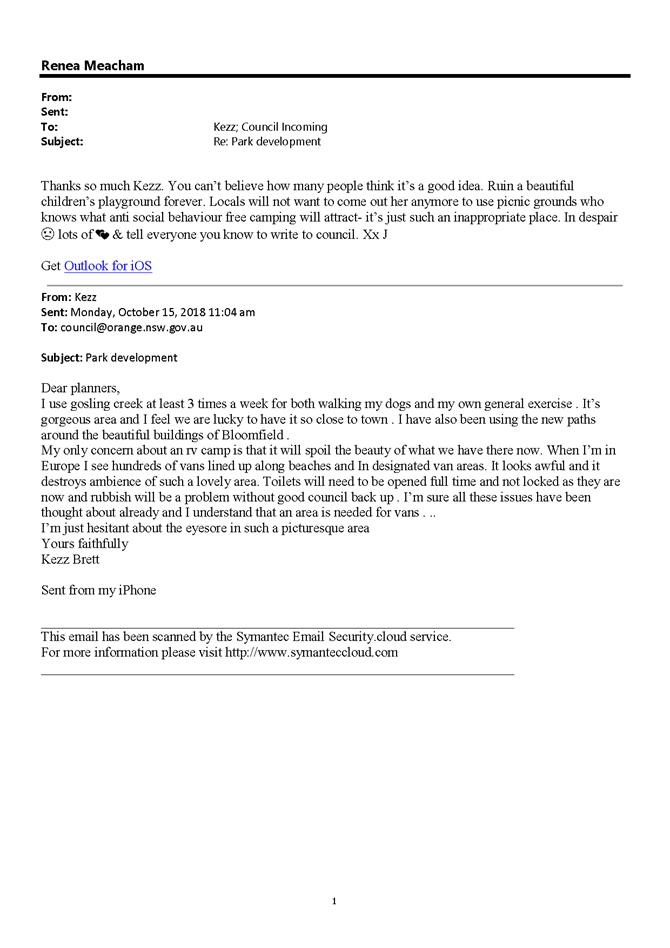
Kezz Brett
|
x
|
|
x
|
|
x
|
|
|
|
|
91
|
IC18/20015
|
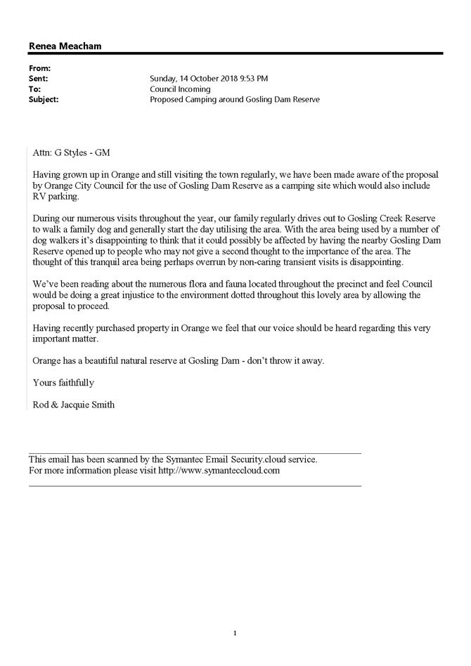
Rod and Jacquie Smith
|
x
|
|
|
|
|
|
|
|
|
92
|
IC18/20013
|
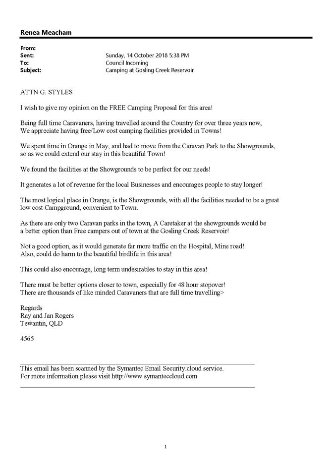
Ray and Jan Rogers
|
x
|
|
|
x
|
|
|
|
|
|
93
|
IC18/20012
|
David Cooper
|
x
|
|
|
|
|
|
|
|
|
94
|
IC18/20011
|
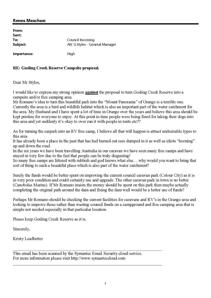
Kristy Leadbetter
|
x
|
|
|
x
|
x
|
x
|
|
|
|
95
|
IC18/20010
|
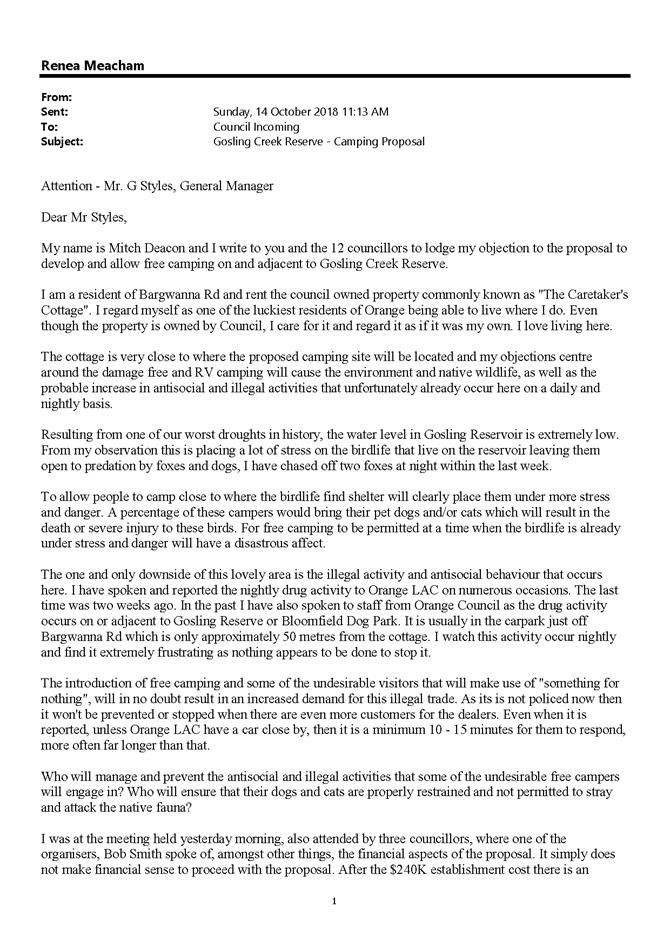
Mitch Deacon
|
x
|
|
|
|
|
x
|
|
x
|
|
96
|
IC18/20009
|
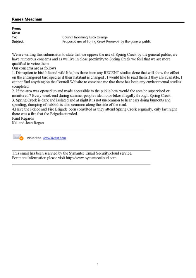
Kel and Joan Regan
|
x
|
x
|
|
|
x
|
|
|
|
|
97
|
IC18/20008
|
Will Woods
|
x
|
x
|
|
|
|
|
|
|
|
98
|
IC18/20007
|
Catherine Schmich
|
x
|
|
|
x
|
|
|
|
|
|
99
|
IC18/20005
|
May El-Khoury
|
x
|
x
|
|
x
|
x
|
|
|
|
|
100
|
IC18/20003
|
Stephen Gross
|
x
|
|
|
|
|
|
|
|
|
101
|
IC18/20002
|
Julie Pont
|
x
|
x
|
|
|
x
|
|
x
|
|
|
102
|
IC18/19930
|
Lew and Val Randahl
|
x
|
x
|
x
|
|
|
|
|
|
|
103
|
IC18/19925
|
Robert and Daphne Smith
|
x
|
|
x
|
x
|
|
|
|
x
|
|
104
|
IC18/19831
|
Lee and Grace Cook
|
x
|
x
|
|
|
|
x
|
|
x
|
|
105
|
IC18/19830
|
Phillip and Margot
Daniel
|
x
|
|
|
|
|
|
|
x
|
|
106
|
IC18/19814
|
Karen Dibley
|
x
|
|
|
x
|
x
|
x
|
|
|
|
107
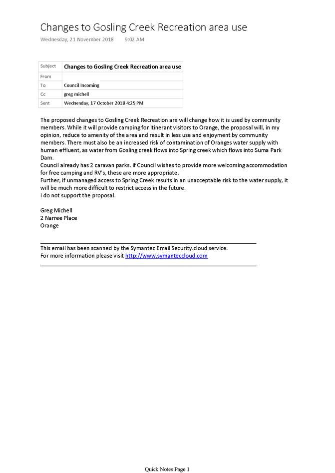
|
IC18/19804
|
Melissa Ward
|
x
|
|
|
x
|
|
|
|
|
|
108
|
IC18/19670
|
Susan Saunders
|
|
|
|
|
|
|
|
|
|
109
|
IC18/20388
|
Petition - 20 objections
|
x
|
x
|
x
|
x
|
x
|
|
|
x
|
|
|
Submissions for proposal
|
|
|
|
|
|
|
|
|
|
|
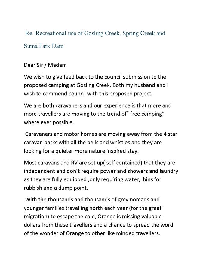
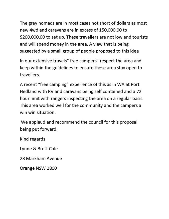
IC18/20093
|
Lynne and Brett Cole
|
|
|
|
|
|
|
|
|
|
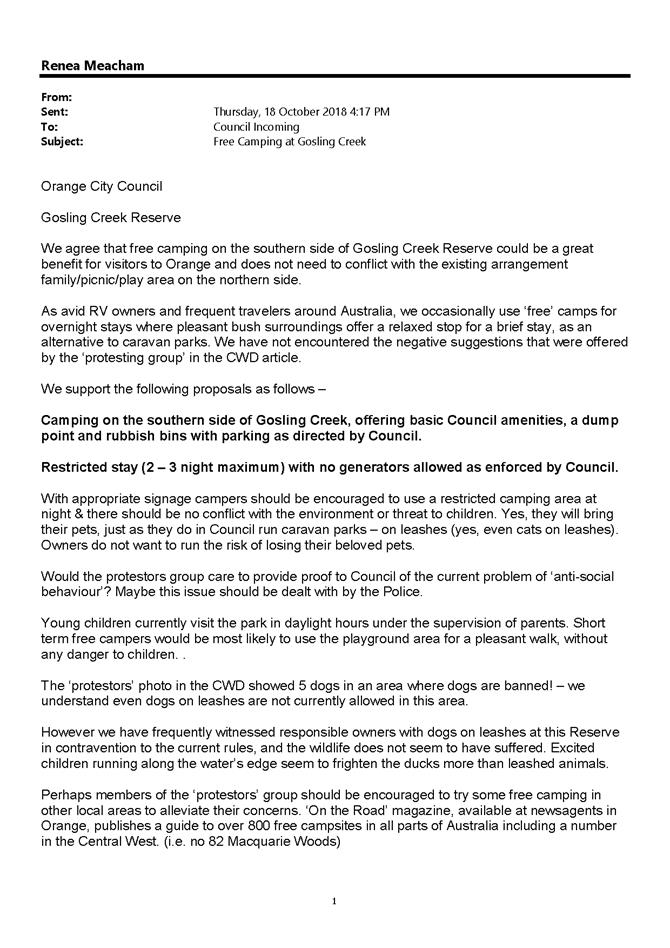
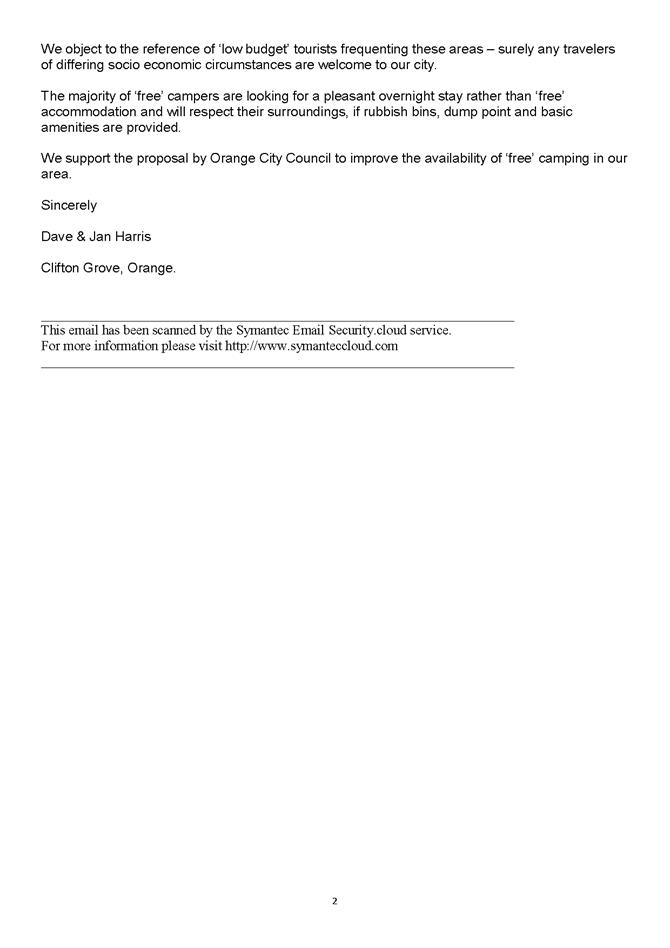
IC18/20478
|
Mr David and Mrs Janelle
Harris
|
|
|
|
|
|
|
|
|
|
IC18/20068
|
Ben Vaughan
|
|
|
|
|
|
|
|
|
|
IC18/20014
|
Bill and Lesley Brady
|
|
|
|
|
|
|
|
|
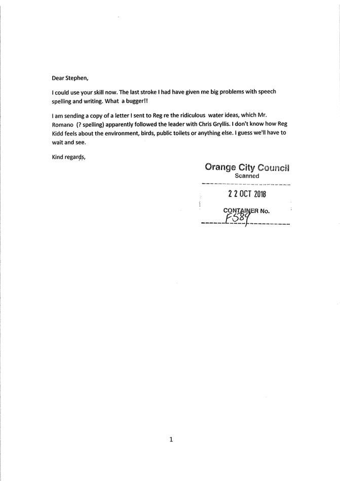
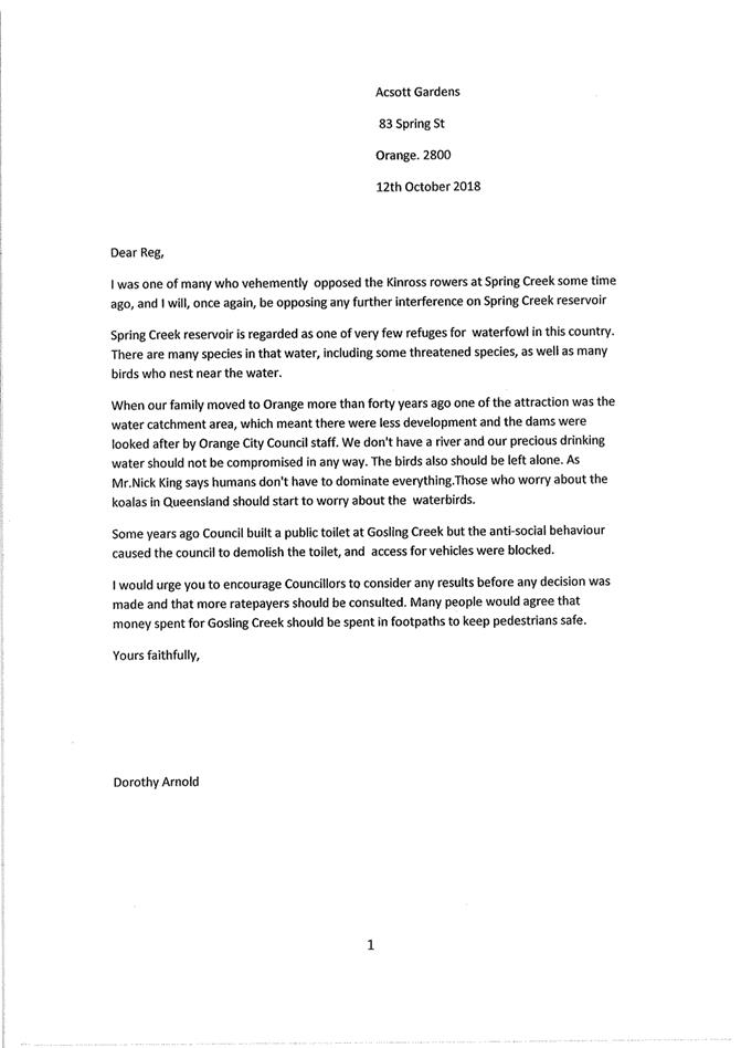
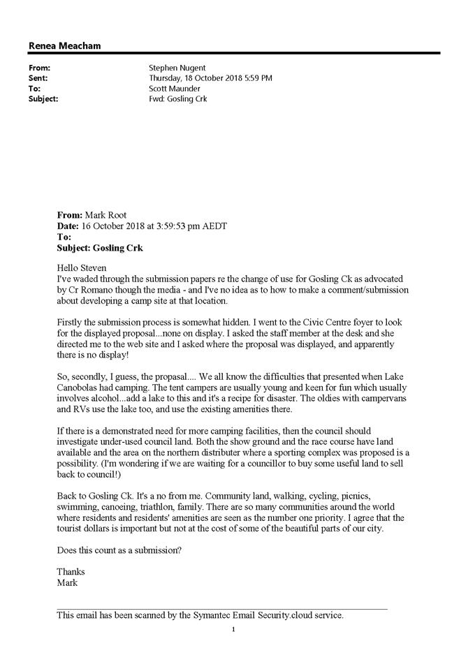
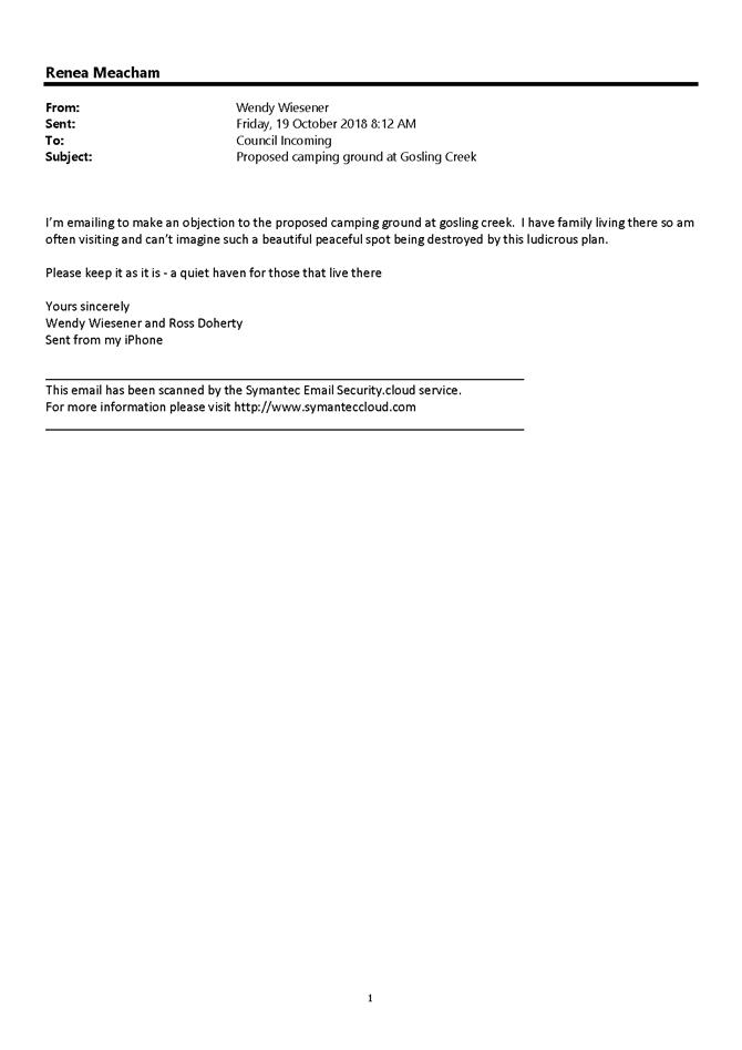
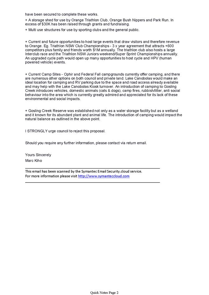
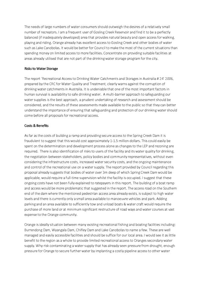
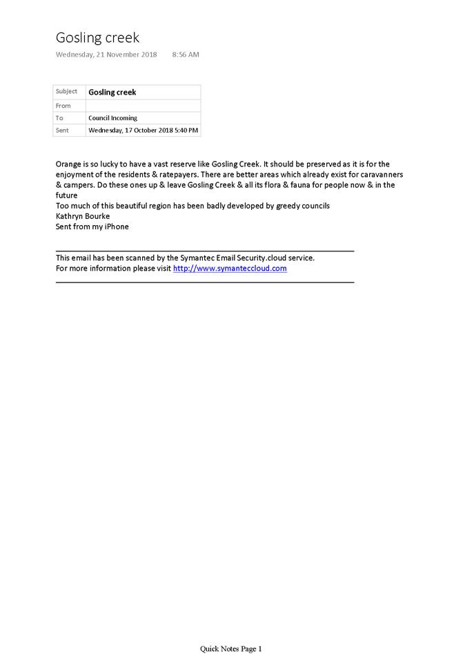
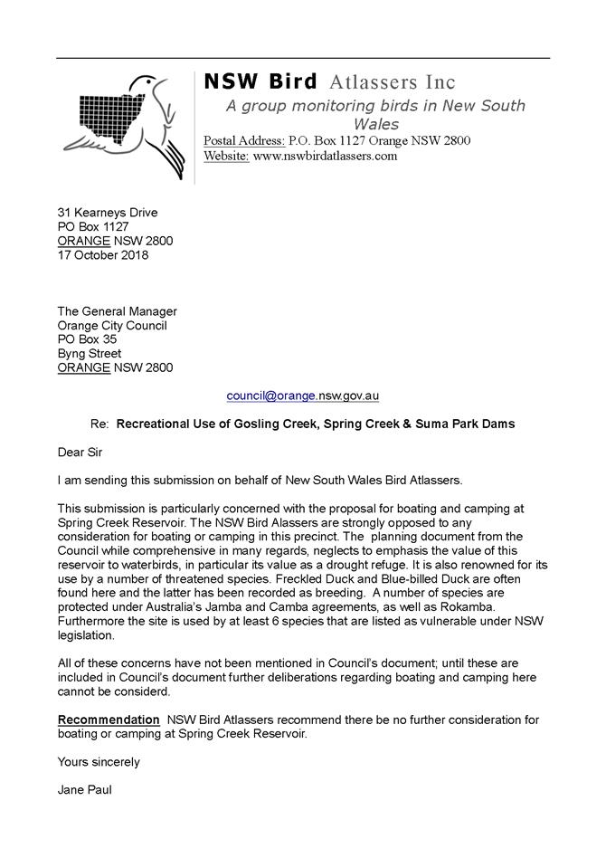
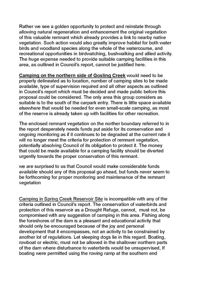
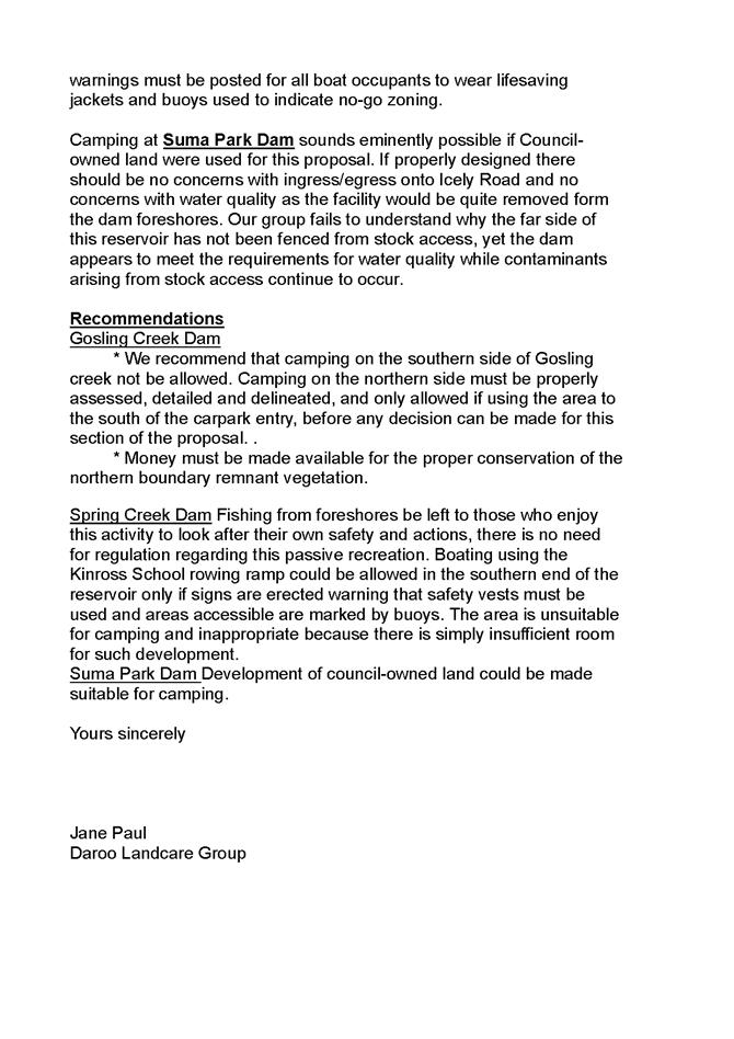
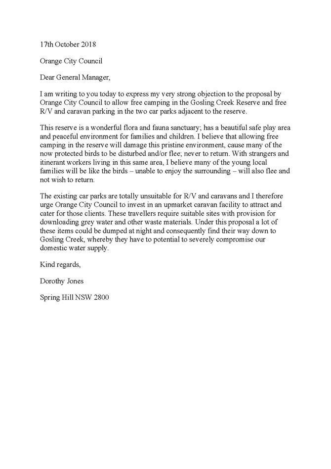
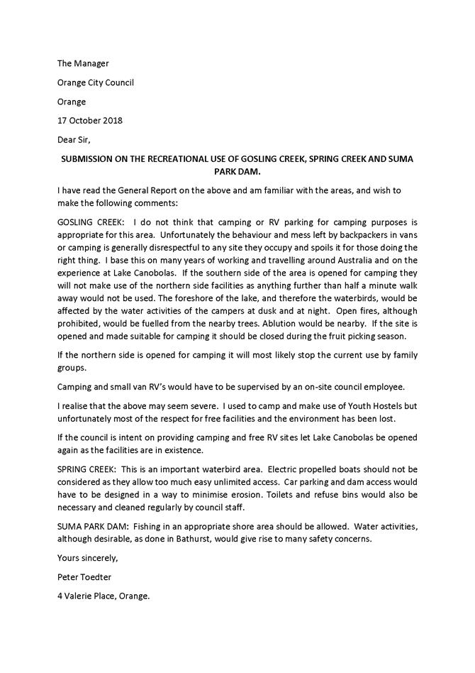
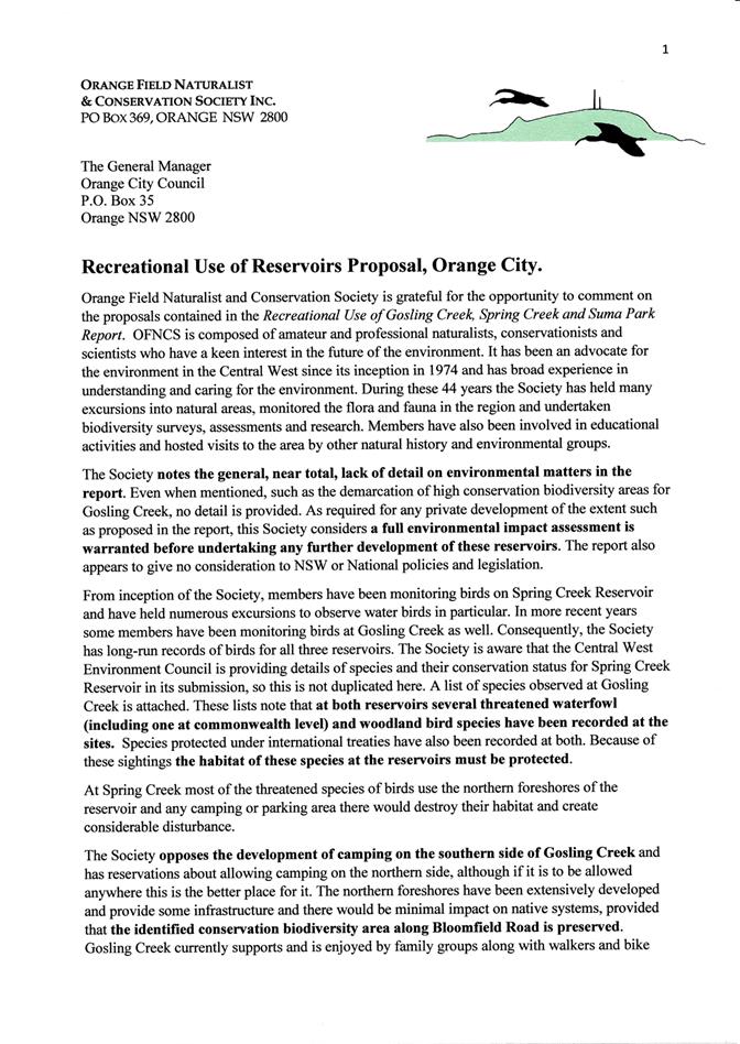
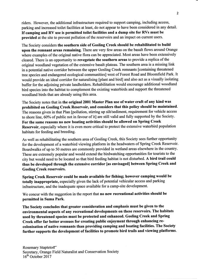
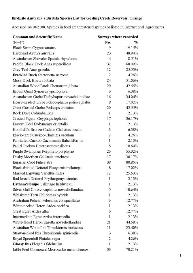
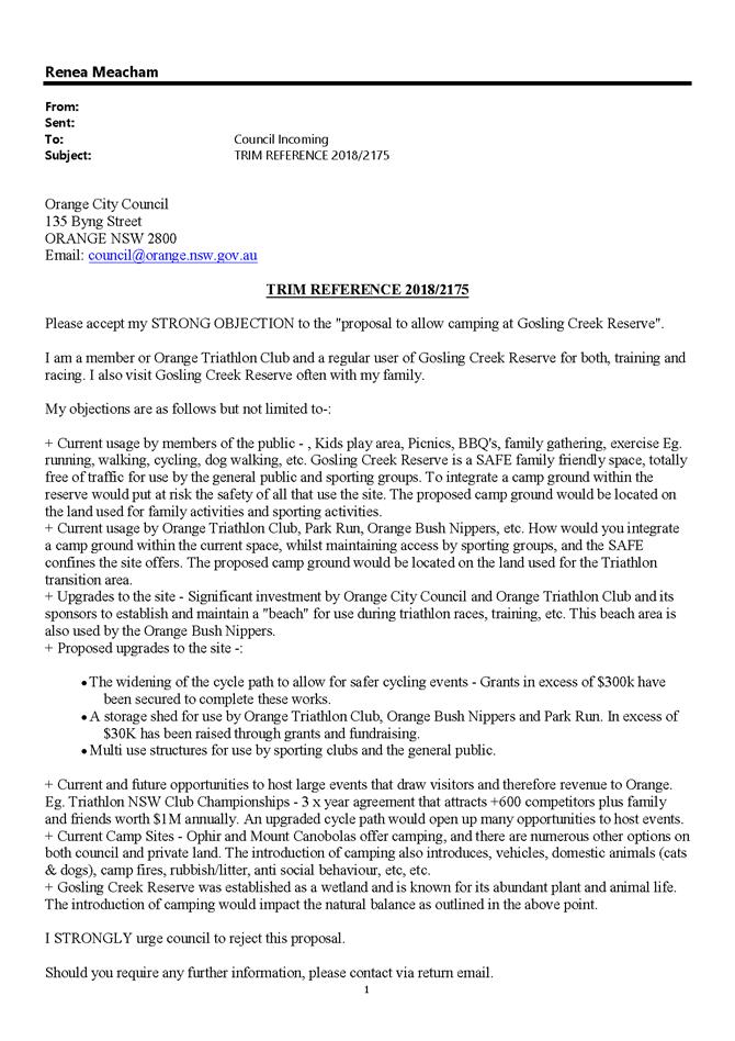
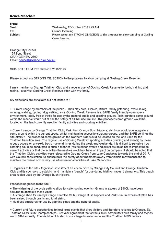
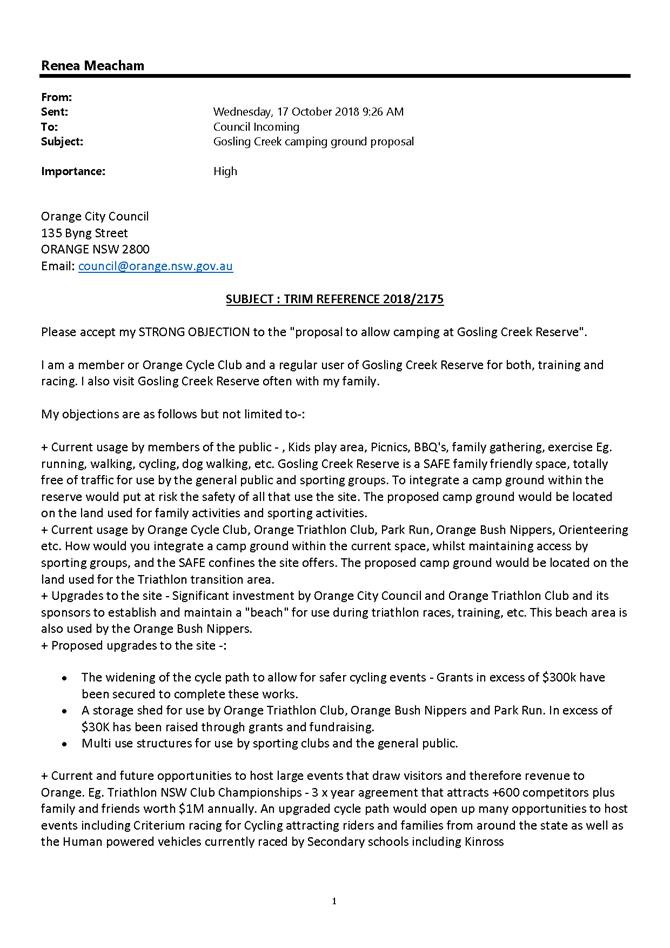
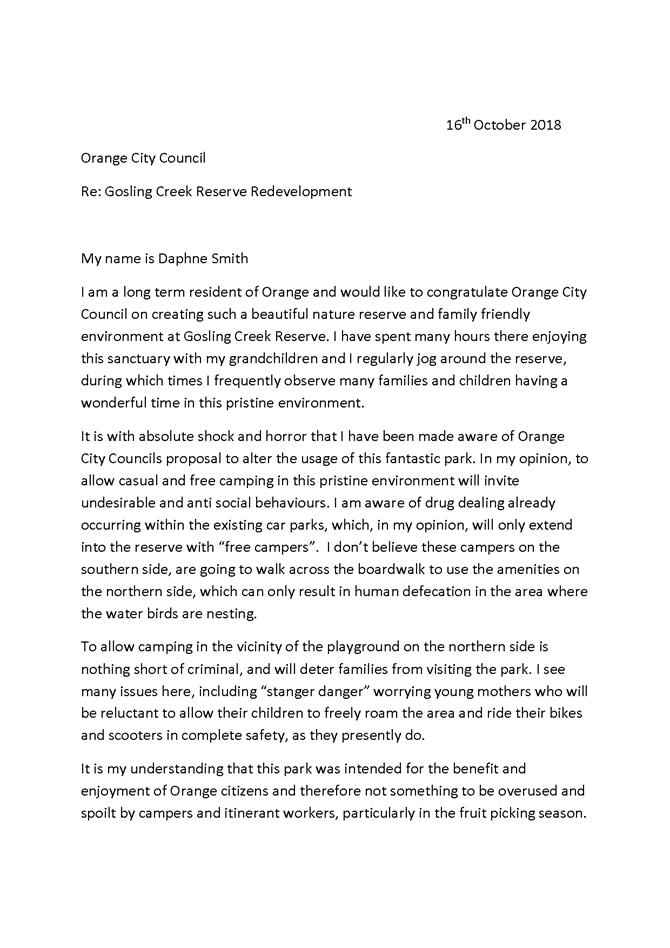
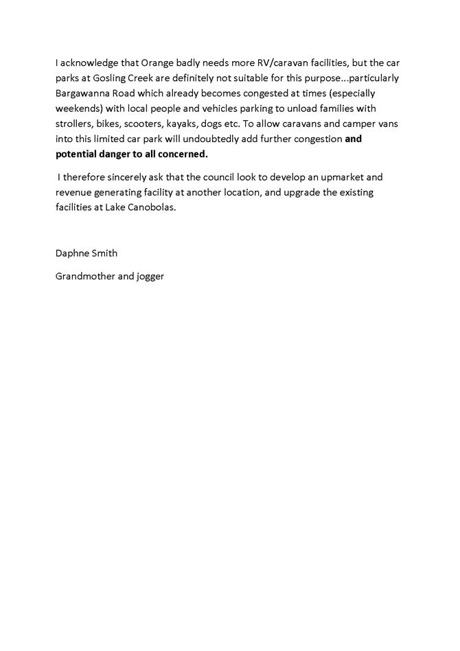
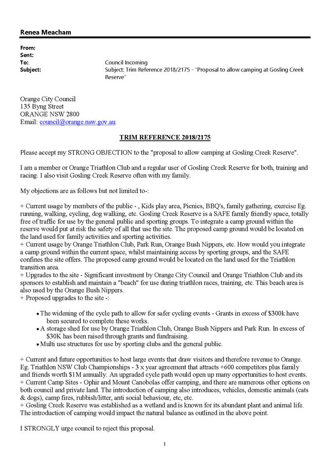
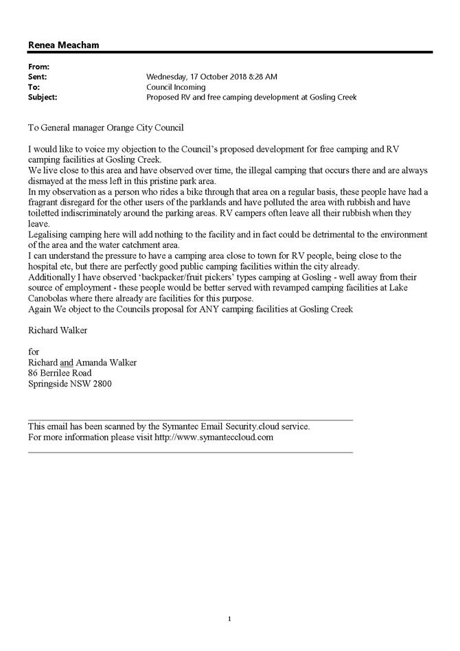
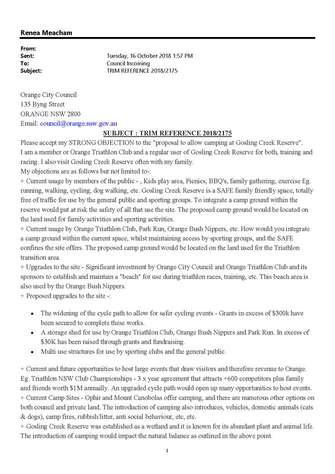
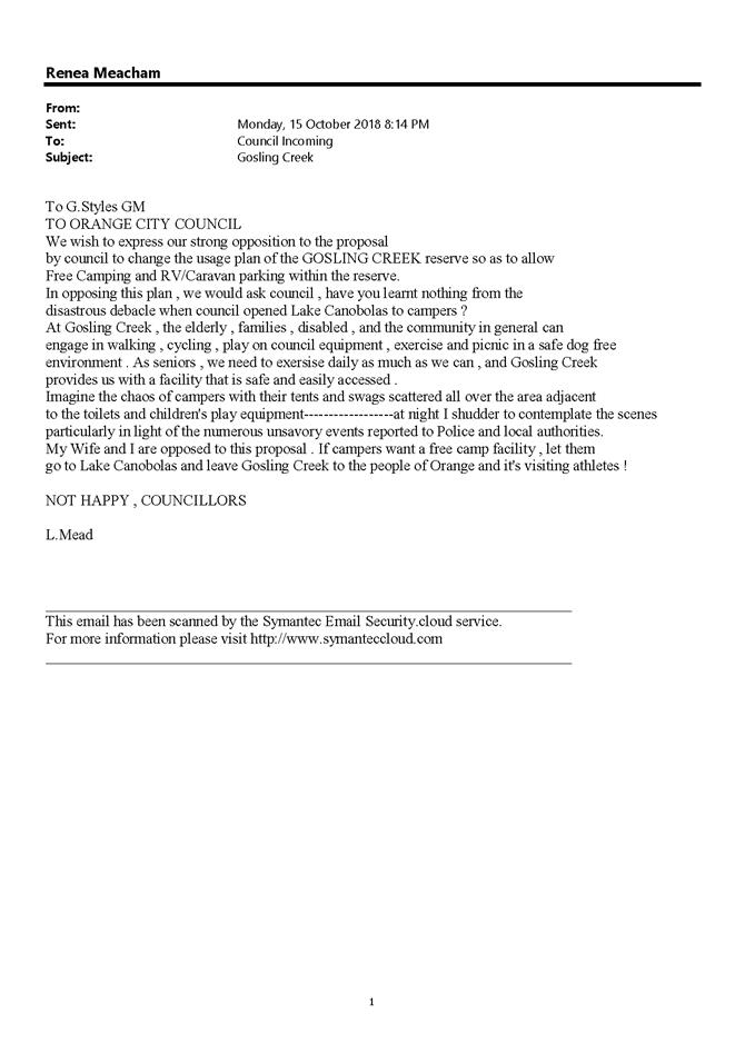
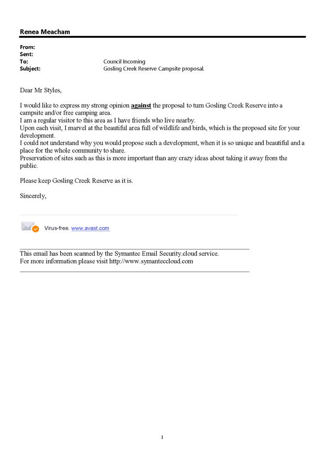
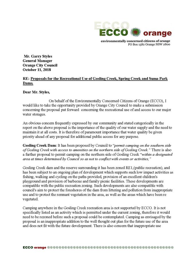
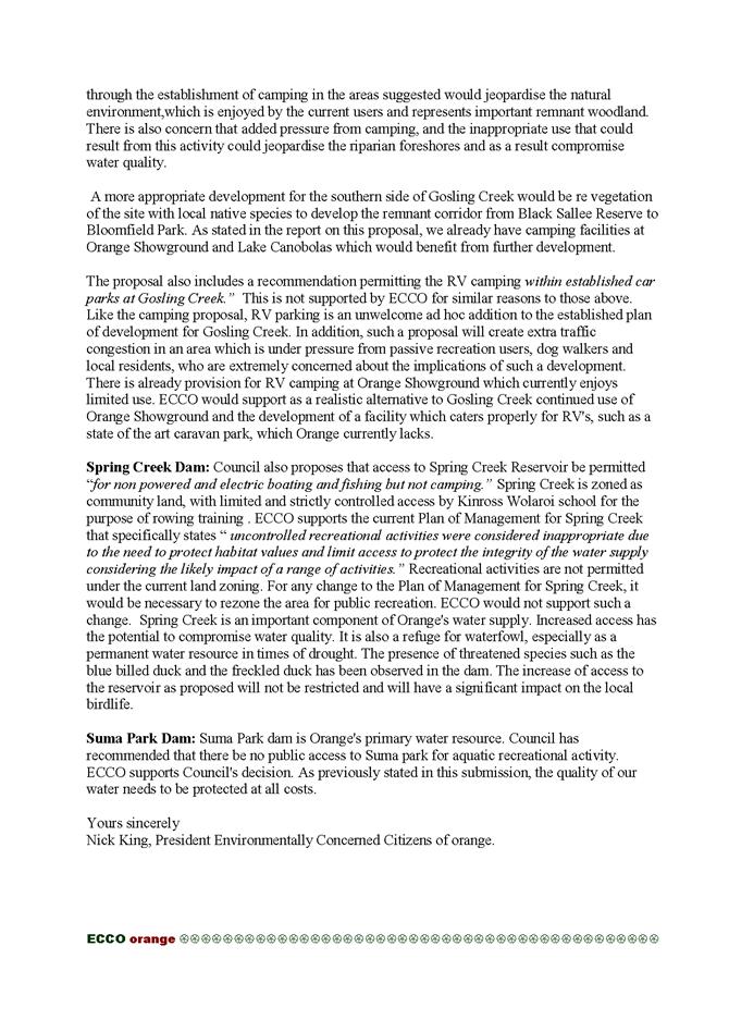
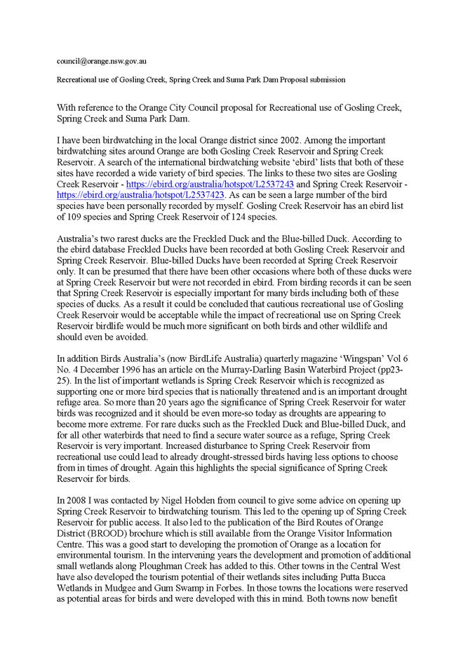
Included in the submissions were 9 objections to the proposal
for Spring Creek Dam including those from Kinross Wolaroi School, ECCO and the
Orange Field Naturalists. These submissions highlighted the potential impact on
flora and the steps required to obtain approval.
However, given the current use by residents adjoining Spring
Creek Dam and the activity of Kinross Wolaroi School, together with the current
unregulated use by the general public, it is recommended that Council commence
the process to permit activity as described in this report.
However, based on the identified risks and estimated costs
contained within the report to Council on 4 September 2018, an assessment of
the proposals, together with an assessment of the submissions received, it is
my view that Council should:
1 Not permit camping
at Gosling Creek;
2 Not permit RV
parking within established car parks at Gosling Creek; and
3 Not permit land or
water based activity at Suma Park.
Attachments
1 Submissions
received 1-50 - Recreational use of Gosling Creek, Spring Creek Dam and Suma
Park Dam, D18/63539⇩
2 Submissions
received 51-113 - Recreational use of Gosling Creek, Spring Creek Dam and Suma
Park Dam, D18/63540⇩
3 SPC
4 September 2018 Recreational use of Gosling Creek, Spring Creek and Suma Park
Dams, 2018/2175⇩
Sport
and Recreation Policy Committee
4 December 2018
3.1 Recreational
use of Gosling Creek, Spring Creek and Suma Park Dams - Report Following Public
Exhibition
Attachment 1 Submissions received 1-50 -
Recreational use of Gosling Creek, Spring Creek Dam and Suma Park Dam


Sport and Recreation Policy
Committee
4 December 2018
3.1 Recreational
use of Gosling Creek, Spring Creek and Suma Park Dams - Report Following Public
Exhibition
Attachment 2 Submissions received 51-113 -
Recreational use of Gosling Creek, Spring Creek Dam and Suma Park Dam


3.1 Recreational
use of Gosling Creek, Spring Creek and Suma Park Dams - Report Following Public
Exhibition
Attachment 3 SPC 4 September 2018
Recreational use of Gosling Creek, Spring Creek and Suma Park Dams
3.1 Recreational use
of Gosling Creek, Spring Creek and Suma Park Dams
TRIM
REFERENCE: 2018/2175
AUTHOR: Scott
Maunder, Director Community, Recreation and Cultural Services
EXECUTIVE
Summary
This report follows a report to Council on 15 May 2018 and a
subsequent workshop to discuss an increase in the recreational use of Gosling
Creek, Spring Creek and Suma Park Dams.
This report provides information on the costs and timeframe
for permitting supervised fishing, camping and boating at Suma Park Dam,
Gosling Creek Reserve and Spring Creek Dam, to include amenities, car parking
and a camping ground.
Link To Delivery/OPerational Plan
The recommendation in this report relates to the
Delivery/Operational Plan strategy “15.2 Our Environment – Operate,
maintain, renew and upgrade water, sewer and stormwater infrastructure assets
and services as specified within the Asset Management Plans at agreed levels of
service”.
Financial Implications
Additional funds and resources will need to be allocated in
order to build infrastructure, manage and operate Suma Park Dam, Spring Creek
Dam and Gosling Creek Reserve, if both land-based and water-based recreational
use is to be permitted.
Policy and Governance Implications
Council will be required to comply with requirements set by
the Local Government Act 1993 as well as the Crown Lands Act 1989.
|
Recommendation
That Council publicly exhibits,
for a period of 28 days, proposals to:
1 Permit camping on the
Southern side of Gosling Creek with access to amenities on the Northern Side
of Gosling Creek;
2 Permit Camping on the
Northern side of Gosling Creek within a designated area at times determined
by Council so as not to conflict with events or activities;
3 Permit RV parking
within established car parks at Gosling Creek;
4 Permit access to Spring
Creek Dam for non-powered and electric boating, fishing but not camping;
5 Not permit land or
water based activity at Suma Park; and
6 Report to Council
following the public exhibition on the submissions received.
|
further
considerations
The recommendation of this report has been assessed against
Council’s other key risk categories and the following comments are
provided:
|
Service
Delivery
|
Drinking water quality, security of
drinking water supply assets
|
|
Image
and Reputation
|
Tourism/economic benefit
|
|
Political
|
Project funding and impact on
Council’s Long Term Financial Plan
|
|
Environmental
|
Wildlife and wildlife habitat
management, preservation of historic sites in the area, introduction of weeds
or exotic plants, introduction of vermin and exotic animals, foreshore
erosion, litter and heightened risk of bushfires
|
|
Health
and Safety
|
Legal and public liability, water
quality health risks to users
|
|
Stakeholders
|
Orange residents, external/regional
users (including sporting clubs), Federal and State Government Approvals
Authorities/Regulators
|
SUPPORTING INFORMATION
At its meeting of 7 November 2017 Council resolved
|
RESOLVED - 17/493 Cr
S Romano/Cr M Previtera
That Council receive report that provides information
on the costs and timeframe for allowing supervised fishing, camping and
boating at Suma Park Dam, Gosling Creek Reserve and Spring Creek Dam, to
include amenities, car parking and a camping ground.
|
Council has previously received
reports on this subject matter with the reports also circulated to Councillors
on 20 October 2017. Those reports are attached for reference and background.
POTENTIAL ISSUES WITH INCREASED
WATER-BASED ACTIVITIES ON RESERVOIRS
Council needs to adopt an appropriately diligent assessment
of the water quality issues associated with allowing increased recreational on
reservoirs. Consideration needs to be given to the National Health and Medical
Research Council’s (NHMRC) 2008 Guidelines for Managing Risks in
Recreational Water. Although not mandatory, following these guidelines ensures
recreational water environments are managed as safely as possible.
The NHMRC Australian Drinking Water Guidelines (ADWG 2011)
is the authoritative document for drinking water management in Australia. It
contains information about management of drinking water systems from catchment
to consumer. The NHMRC are considering the introduction of additional
requirements in a pending guideline review that will be used to determine the
appropriate treatment process to address the source water risk. Recreational
use of the water body is one of the risk considerations.
The proposed update to the guidelines, discuss
‘inner’ and ‘outer’ catchments. Gosling Creek Dam could
be considered to be in the ‘outer’ catchment and as such, the
introduction of water-based recreational activities poses less of a risk to
source water than our primary and secondary water storages i.e. Suma Park and
Spring Creek Dams.
SUPERVISION
The resolution of Council sought information in relation to
“supervised” activities of fishing, camping and boating.
Supervision can be conducted in a number of ways including:
1 Staff
on site at times of operation (similar to Aquatic Centre)
2 Issuing
of licences and spot checks by staff
3 Remote
supervision (similar to system imposed on open space areas of Council where
certain activities are permitted or prohibited)
4 A
combination of above elements
Council utilises the principals of remote supervision for
the management of its open space and recreational areas. This has been
implemented using the best practice guidelines of Council’s insurer,
Statewide Mutual. (With the change of insurer this will require review).
Essentially a risk management analysis is conducted for the
site based on:
· Nature of reserve,
hazard or pool
· Population use at
any one time
· Frequency of use
Each area is then given a score and the relevant signage is
installed.
Each proposed site would require assessment and controls to
ensure the level of supervision is appropriate.
Example of assessment and required supervision level.
For areas which have deep water bodies (depth in excess of 3
metres), high population use at any one time and high frequency of use Council
are recommended to consider full time supervision whilst the facility is
occupied as well as the display of warning symbols.
In this example the level of risk is such that the
installation of a sign alone warning people of the hazards would not be the
most appropriate risk reduction technique. A combination of both supervision
and signage is the most appropriate approach.
CAMPING
Council’s experience over recent years with the
provision of camping sites at Lake Canobolas, Orange Showground and Caravan
Park is that they require active management to ensure compliance with camp
ground provisions, garbage removal, cleaning of amenities, and payment of site
fees.
RECREATIONAL VEHICLE (RV) SITE
Council has established RV sites at the Showground and with
development consent at Lake Canobolas.
Should Council wish to pursue the establishment of a
permanent RV site adjacent to a water body it is recommended that this site be
located at Lake Canobolas taking advantage of existing infrastructure.
Parking of RVs could also be considered within established
Car Parks at Gosling Creek.
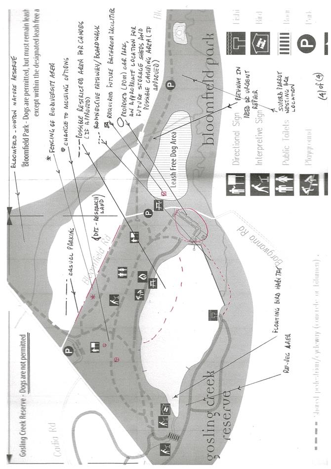
1 GOSLING
CREEK
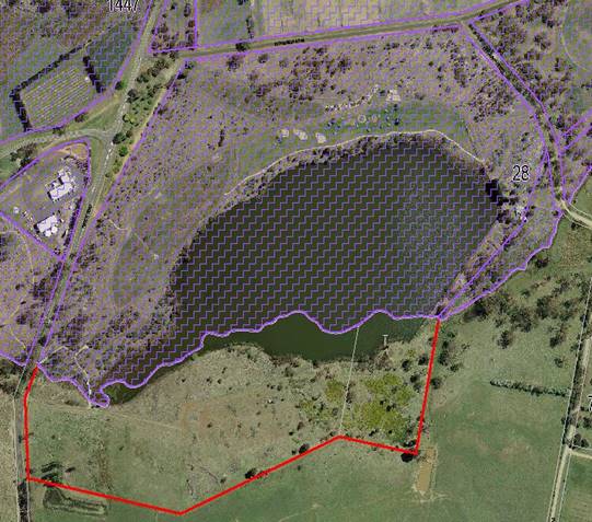
Gosling Creek precinct consists of two components Crown Land
to the north and two parcels of council owned community land to the south.
The three parcels of land that make up Gosling Creek are
zoned RE1 – Public Recreation and together with the Plan of Management
governs its use and development.
|
|
|
Aerial image purple hatched area is
Crown land the area bounded by the red line and adjoining the hatched area is
Council Community Land.
|
The Zone RE1 - Public
Recreation objectives are:
· To enable land to
be used for public open space or recreational purposes.
· To provide a range
of recreational settings and activities and compatible land uses.
· To protect and
enhance the natural environment for recreational purposes.
· To protect open
space at riparian and foreshore locations.
Developments permitted with consent
are:
Child care centres; Community
facilities; Depots; Environmental facilities; Environmental protection works;
Function centres; Information and education facilities; Kiosks; Markets; Places
of public worship; Public administration buildings; Recreation areas;
Recreation facilities (indoor); Recreation facilities (major); Recreation
facilities (outdoor); Respite day care centres; Restaurants or cafes; Roads;
Water recreation structures.
An aerial view of Gosling Creek
follows:
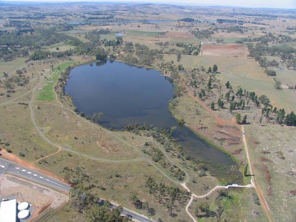
Aerial
view from south western corner above Forest Road looking down stream along
Gosling Creek. Note the shared path network, passive recreational precinct
– irrigated grassland, remnant vegetation significant small patch centre
left of image.
KEY CONSIDERATIONS
Consistent with the RE1 zoning the
precinct is able to be developed to include the provision for camping with an
amendment to the Plan of Management. Non-powered boating and fishing is currently
permitted at the site.
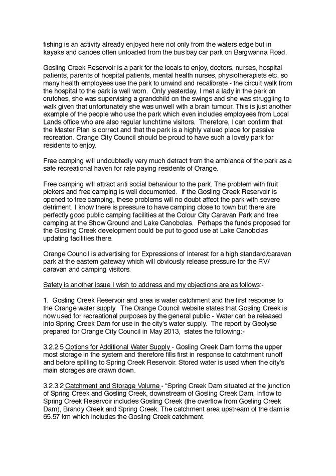
However the Gosling Creek Reserve is
a highly valued recreational area originally set aside to protect the water
quality of Orange’s drinking supply following the damming of Gosling
Creek in 1890. The Reserve and its surrounds of remnant woodland remains a
habitat for native wildlife and is also highly valued as a place for passive
recreation and a refuge from the urban development of Orange and the Bloomfield
Hospital complex to the North.
The development of the site for camping in particular needs
to consider the overall goals of the management of the site in particular
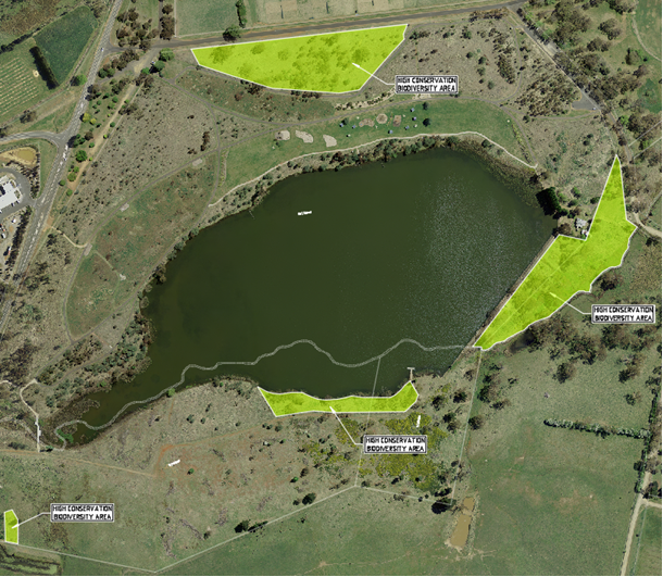
sensitive areas. Council has identified areas of high conservation biodiversity
as indicated below.
OPPORTUNITIES AND CONSIDERATIONS
|
Opportunity
|
Considerations
|
Advantages
|
Disadvantages
|
|
Camping Located on the southern side area with access from
Forest Road.
|
· Supervision of
site
|
· Defined area
· Eliminates
conflict with current users
|
· No facilities
· Requires active
supervision of users
· Operational Cost
|
|
Camping Located on the Northern side in designated areas
at designated times.
|
· Supervision of
site
· Ensuring
provision of camping does not conflict with current uses or recreational use.
|
· Provides for
camping adjacent to existing amenities in a controlled manner.
|
· Requires active
supervision of users
· Operational Cost
|
|
Boating – non powered and electric
|
· Non powered
boating is permitted
|
· Existing
activity
· Good access to
water
· No additional
cost.
|
· Nil
|
|
Boating – powered
|
· Not permitted
and would require a change to the plan of management as activity is with
Crown Land zone.
|
|
· Small area for
conduct of activity
· Degradation of
water quality for other uses
|
|
Fishing
|
· Permitted activity
|
· Current activity
· Does not require
active supervision
|
|
Cost estimates
· Should
Council require the establishment of additional infrastructure an estimate of
the capital cost for the development of camping on the southern side of Gosling
Creek is $240,000. This includes the following:
o Composting Toilet facilities: $100,000
o Access Road and Parking: $100,000
o Signage: $10,000
o Fencing – biosecurity
areas: $10,000
o Potable Water: $20,000
· Operational
costs $120,000 per annum for active management of camp sites and overall
management.
· Nil
additional operational costs if camping is excluded
Timeframe for approvals,
development and implementation
Should Council wish to include camping at Gosling Creek this
process would involve advertisement of the proposed amendment to the Plan of
Management, report to Council and then if resolved by Council the update of the
Plan of Management.
Council would then need to conduct the associated works for
the installation of the infrastructure.
It is anticipated that this process would be completed
within 9 – 12 months.
2 SPRING
CREEK DAM
Spring Creek Reservoir is owned by Orange City Council and
is classified as Community Land. The Plan of Management was adopted by
Council on 3 December 2007. This plan specifically provides for the use of the
land for “public water supply purposes along with specific provisions to
permit the controlled and supervised rowing training and other low impact
recreational activities subject to development consents and licensing
arrangements”.
Key considerations
a Drinking
Water Quality Risks
Spring Creek Dam is the secondary source of drinking water
for Orange residents. The Australian Drinking Water Guidelines outline six
guiding principles that are fundamental in the considerations of safe drinking
water. One of these principles says that the “protection of water
sources and treatment are of paramount importance and must never be
compromised”
Introducing recreational activities onto Spring Creek Dam
will have public health implications for the Orange Drinking Water Supply
b Plan
of Management
Spring Creek Dam is classified as Community land. The
current Plan of Management was adopted by Council on 3 December 2007. This plan
specifically provides for the use of the land for “public water supply
purposes along with specific provisions to permit the controlled and supervised
rowing training and other low impact recreational activities subject to
development consents and licencing arrangements”
Any change to this Plan of Management needs to be exhibited
and adopted by Council as required under the Local Government Act. The current
Plan of Management for Spring Creek Dam specifically states that “Uncontrolled
recreation activities were considered inappropriate due to the needs to protect
habitat values and limit access to protect the integrity of the water supply,
considering the likely impacts of a range of activities”
c Land
zoning
The zoning for Spring Creek Dam is for water supply purposes
and recreational use is not permissible under this zoning. The LEP will need to
be amended in order to rezone the whole site to Public Recreation RE1. The
surrounding private land is zoned E3 Environmental Management and RU1 Primary
Production. Recreation would then be permissible in the zone, subject to
consent.
d Access
To Spring Creek Dam For Water Non Powered Boating Activities
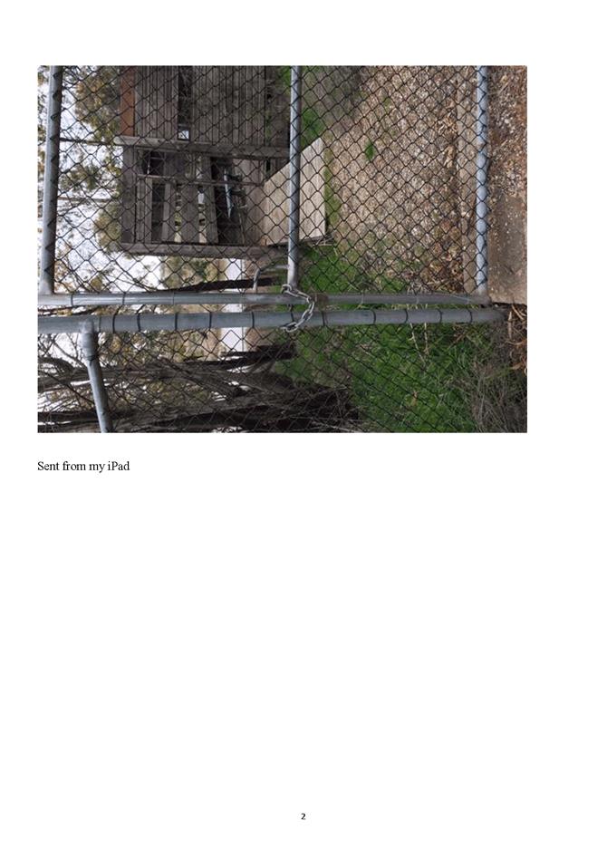
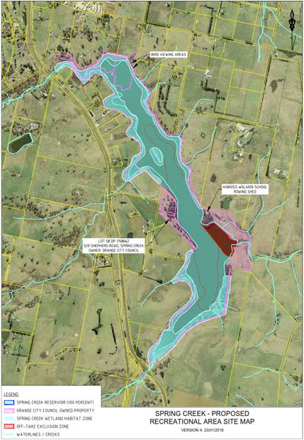
As illustrated below access to Spring Creek Dam is
controlled by a locked gate and pedestrian access point at the southern end of
Lone Pine Avenue at the North East point of the dam. This is the access point
to the Kinross Wolaroi School Rowing facility. All other land surrounding
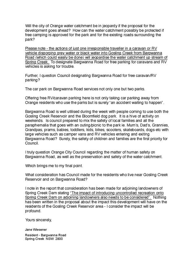
Spring Creek Dam is privately owned. The impact of introducing uncontrolled
recreation onto Spring Creek Dam on adjoining landowners also needs to be
considered.
Council should also note that adjoining landowners access
the dam for non-powered boating activities and fishing. There is also strong
evidence that members of the public also access the dam for these activities
gaining access through fence lines or via the pedestrian access at this access
point.
The regulation of this activity would improve the safety of
its conduct and provide access to the community.
 Access
point – Spring Creek Dam
Access
point – Spring Creek Dam
· Council could
explore the redevelopment of this entrance point to provide a parking area and
access point for non-powered boating activities. Access to the dam wall is
available along the eastern side.
· Topography –
the slope of land adjacent to the waterbody is suitable for access points
· Variable (low or
high) water levels at any one given time may restrict access to the waterbody.
· “No-go”
zones – buffer zones around critical water supply infrastructure will be
required (i.e. near the dam wall)
· Opening hours need
to be considered
e Access
and variable water levels
f Health
impact on users
· blue green algae
outbreaks – using the waterbody would be restricted when blue green algae
concentration is above health guidelines
OPPORTUNITIES AND CONSIDERATIONS
|
Opportunity
|
Considerations
|
Advantages
|
Disadvantages
|
|
Boating – non
powered and electric
|
· Access
points
· Amendment
to plan of management, LEP and Development Application
|
· Accessible
from existing access road
· Used
by community currently
· Regulate
current unapproved activity
|
· Conflict
with current users and landholders
|
|
Camping
Located on western side of Spring creek dam
|
· Supervision
of site
· Access
· Provision
of amenities
|
· Council
Owned
· Defined
area
|
· Land
locked no access
· No
facilities
· Requires
active supervision of users
· Operational
Cost
|
|
Boating – powered
|
· Access
points
· Water
quality risk
· Amendment
to plan of management, LEP and Development Application
|
·
Nil
|
· Conflict
with current users and landholders
|
|
Fishing
|
· Access
points
· Amendment
to plan of management, LEP and Development Application
|
· Provides
an additional location for recreational fishing in Orange LGA.
|
· Limited
access from land based sites.
|
Cost Implications
Council staff were asked to provide information on boating,
camping, fishing, amenities and car parking. For these to proceed Council would
be required to conduct the following works:
· Land acquisition
for camping
· Access road(s) and
car parking
· Pathways/non-vehicle
access routes
· Rubbish Bins
· Signage
· Toilets
· Cleared areas
· Potable water
· Water Entrance
similar to that constructed at Gosling Creek
· Operational costs
Cost estimate based on the above requirements is $1.5m to
$3.0m
If Council were to consider only access for non-powered
boating and fishing the requirements would eliminate the need for land
acquisition and reduced infrastructure requirement for the other elements.
Pending approvals it is estimated that the cost for the
provision of access for non-powered boating and fishing would require
· Access road
and car parking
· Rubbish Bins
· Signage
· Toilets
· Potable
water
· Water
Entrance similar to that constructed at Gosling Creek
· Fish
cleaning areas
· Operational
Costs
Estimated cost for these elements would be $500,000 to $1M.
Timeframe for approvals, development and implementation
At this early stage, it is difficult to estimate a timeframe
for the delivery of such a project given its complexity and key issues that
will need to be considered.
As a guide the timeframe for the implementation of Rowing
Training for Kinross Wolaroi School on Spring Creek Reservoir was:
· August 1999
– Commence Plan of Management development
· June 2001 –
Plan of Management adopted by Council
· June 2002 –
Development Application lodged for facility (Boatshed and Pontoon Jetty) and
approved with consent to operate
· July 2002 –
the Central West Environment Group sought intervention from NSW Land and
Environment Court.
· May 2003 –
NSW Land and Environment Court decision in favour of Kinross Wolaroi School and
Orange City Council
· May 2004 –
Orange City Council and Kinross Wolaroi School entered into a Licence to use
Spring Creek Dam as a Rowing Facility
· December 2004
– Rowing Training commenced
3 SUMA
PARK
Suma Park Reservoir is owned by
Orange City Council and is classified as Community Land. The land is
categorised as Natural Area (with subcategories of Bushland, Watercourse and
Wetland) and will require a Plan of Management to be developed and adopted by
Council under the Local Government Act, 1993.
Key considerations
The following areas are key issues to consider if Council
were to introduce recreational activities onto Suma Park Dam:
a Impact
on drinking water quality
The Australian Drinking Water Guidelines (ADWG 2011)
is the authoritative document for drinking water management in Australia. It
contains information about management of drinking water systems from catchment
to consumer. The second guiding principle of the ADWG highlights the importance
of protecting water sources:
‘Protection
of water sources and treatment are of paramount importance and must never be
compromised’
The NHMRC are now considering the introduction of additional
requirements in a pending guideline review that will be used to determine the
appropriate treatment process to address the source water risk. Recreational
use of the water body is one of the risk considerations. Unprotected catchments
may require a higher level of treatment in order to provide a safe drinking
water supply. The Orange drinking water supply catchment would be considered an
unprotected catchment and, as such, additional treatment upgrades may be
necessary unless catchment management practices can be improved. Water
treatment cost implications (potential treatment plant upgrades) may need to be
considered if water-based recreational activities are introduced to
Council’s drinking water storages.
b Land
zoning
Land zoning dictates how the land is to be used.
The only activity that the current zoning allows is a water supply. The LEP
will require amendment in order to rezone the site to Public Recreation RE1.
The surrounding private land is zoned E3 Environmental Management and RU1
Primary Production.
c Potential
health impact on recreational users
As mentioned earlier, recreational use on dams should follow
the Guidelines for Managing Risks in Recreational Water (NHMRC 2008). Although not
mandatory, following these guidelines ensures recreational water environments
are managed as safely as possible. The potential impacts of water quality,
water temperature and blue green algae should be considered
d Legal
and Public Liability
Duty of care to persons using the water storage (potential
hazards associated with access to dam wall, hazards above and below the water)
e Access
To Suma Park Dam For Non-Powered Boating And Fishing
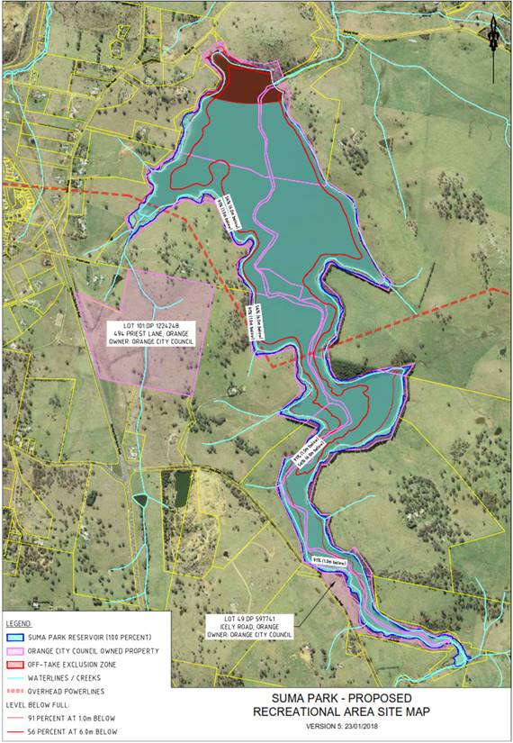
Council recently acquired 494 Priest Lane for the purpose of
a future sporting precinct. As demonstrated in the map above this lot does not
have access to Suma Park Dam and is not viable for an access point to Suma Park
without the acquisition of adjoining land.
Council also owns Lot 49, DP597741 which adjoins Suma Park
Dam at the southern extremity of the Dam with entry off Icely Road. Should
Council wish to progress access to Suma Park Dam an access point could be
established at this location.
Camping is also possible at this site.
f Operational
management
The potential costs associated with the operational
management of recreational activities could include:
· Additional
drinking water treatment processes
· Management
of access to water storages
· Maintenance
and rehabilitation of infrastructure to support the recreational activities
· Monitoring
of water quality and recreational users
· Policing of
recreational users
Other issues to consider include:
a Health
risks of users
b Public
use impacts of foreshore erosion introducing sediment into the water storage
c Wildlife
and wildlife habitat management
d Changes
in system ecology
e Increased
risk of fire
f Legal/public
liability/public safety - Proximity to spillway, outlet structures and
dam wall
g Security
of drinking water supply assets
h Potential
land acquisition requirements
i Water
storage levels
j Impacts
on adjoining neighbours
OPPORTUNITIES AND CONSIDERATIONS
|
Opportunity
|
Considerations
|
Advantages
|
Disadvantages
|
|
Boating – non
powered and electric
|
· Access
points
· Requires
development of plan of management
· Amendment
to LEP and Development Application
· Risk
to drinking water
|
· Readily
accessible from Icely Road
|
· Increased
cost for management of drinking water as primary source for Orange.
· Conflict
with current users and landholders
· Water
recedes at water levels under 90%
|
|
Camping
Located on the southern side (council owned) area with access from Forest
Road.
|
· Supervision
of site
|
· Defined
area
· Accessible
from Icely Road
|
· No
facilities
· Requires
active supervision of users
· Site
adjacent to busy road
· Operational
Cost
|
|
Boating – powered
|
· Access
points
· Water
quality risk
· Requires
development of plan of management
· Amendment
to LEP and Development Application
|
·
Nil
|
· Conflict
with current users and landholders
|
|
Fishing
|
· Requires
access points
· Requires
development of plan of management
· Amendment
to LEP and Development Application
|
· Provides
alternative location for recreational fishing in Orange LGA.
|
· Limited
access from land based sites
· Conflict
with current landholders
|
Cost Implications
Depending on the type of use, there are cost and resourcing
implications in managing all of the risks and infrastructure requirements.
Infrastructure requirements need to be funded and other risks mitigated by
operational practices and procedures.
Council staff were asked to provide information on boating,
camping, fishing, amenities and car parking. For these to proceed Council would
be required to conduct the following works:
· Pathways/non-vehicle
access routes
· Rubbish Bins
· Signage
· Toilets
· Cleared areas
· Potable water
· Water Entrance
similar to that constructed at Gosling Creek
· Operational costs
· System for
security of water supply assets
· Fish cleaning
areas
· Establishment of
restricted zones
· Boating equipment
for supervision and inspection of water activities.
Capital cost estimate based on the above requirements is
$1.5m to $2.5m
Operational Costs
Operational Costs are estimated to be significant given the
sensitivity of the Dam and the need for active management and supervision of
the precinct. It is estimated that the site would require two staff to monitor
on weekends and one staff member to monitor during weekdays.
The site would also require rubbish removal and maintenance.
On this basis the estimated operational cost is $200,000 -
$300,000 per annum.
Timeframe for approvals, development and implementation
As with Spring Creek Dam it is difficult to estimate a
timeframe for the delivery of such a project given its complexity and key
issues that will need to be considered.
Using the example of access to Spring Creek by Kinross
Wolaroi School it is estimated that this process would take several years.
Attachments
1 Suma
Park Dam Recreation Map, D18/20764
2 Spring
Creek Dam Recreation Map, D18/20763
3 IPC
6 June 2017 Recreational use of Gosling Creek, Spring Creek and Suma Park Dams,
D18/24491
4 IPC
5 September 2017 Recreational use of Gosling Creek Dam, Spring Creek Dam and
Suma Park Dam, D18/24493
5 Facility
Signs Assessment form Councils, D18/21857
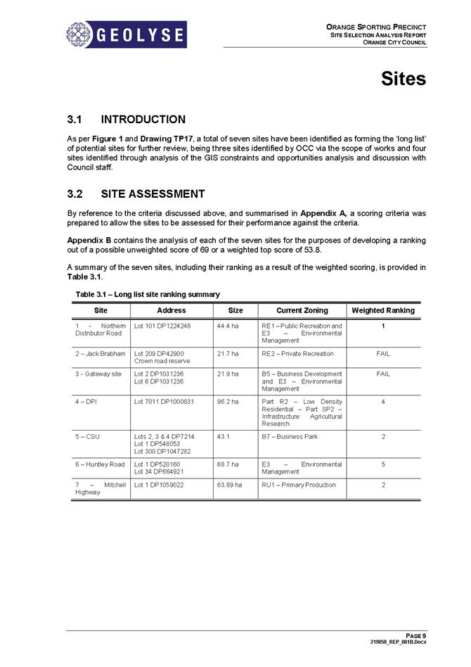
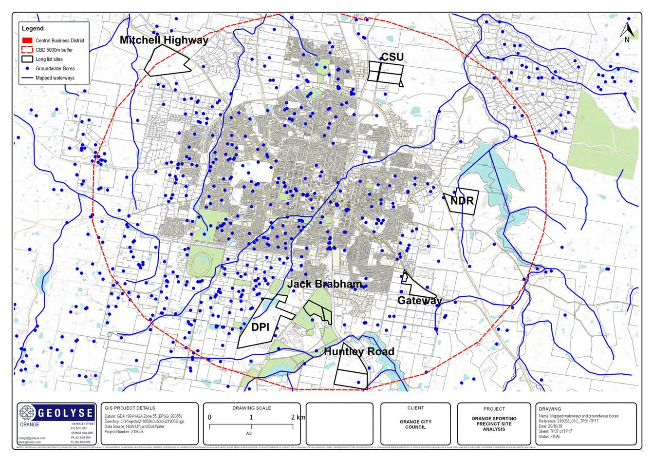
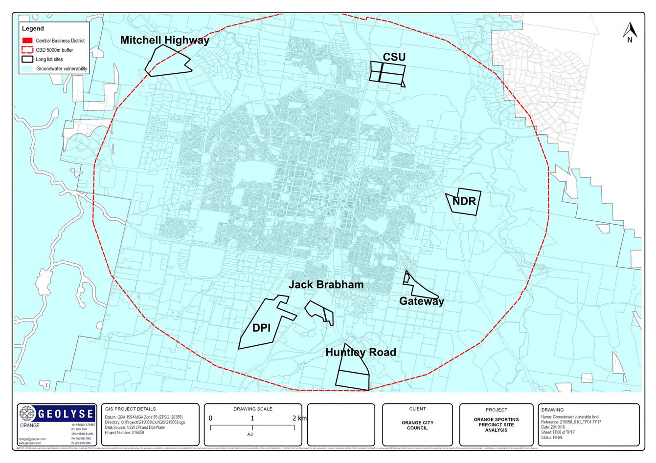
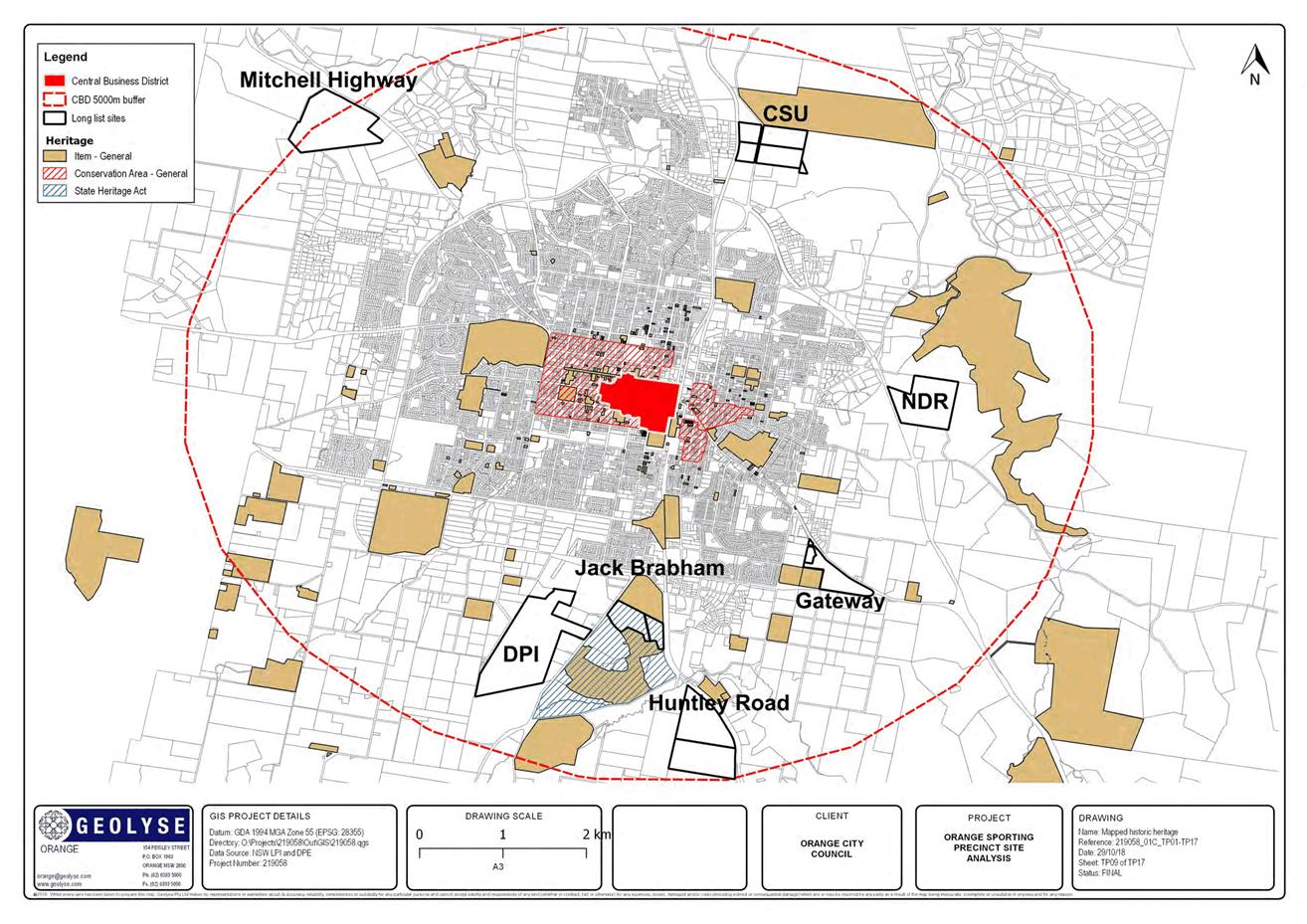
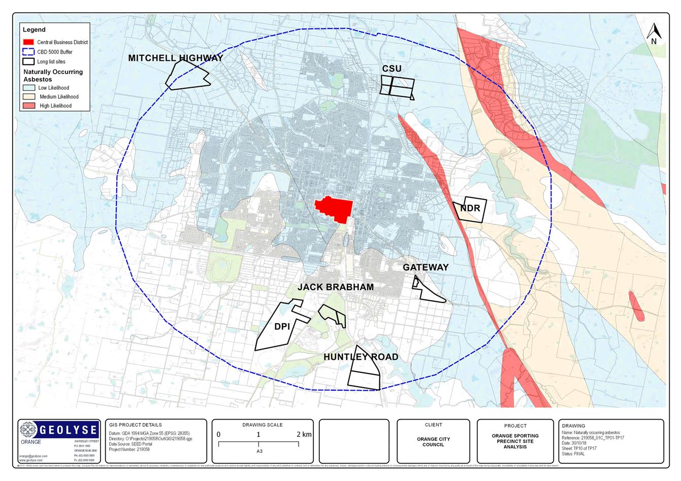
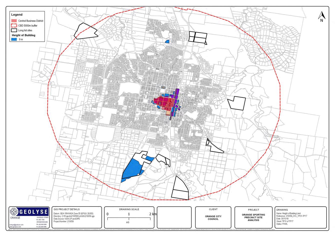
3.2 Orange
Sporting Precinct
RECORD
NUMBER: 2018/2812
AUTHOR: Scott
Maunder, Director Community, Recreation and Cultural Services
EXECUTIVE Summary
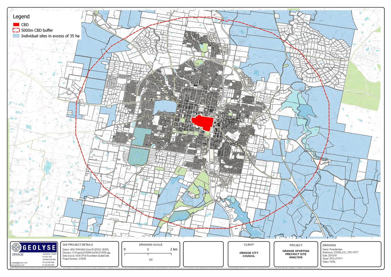
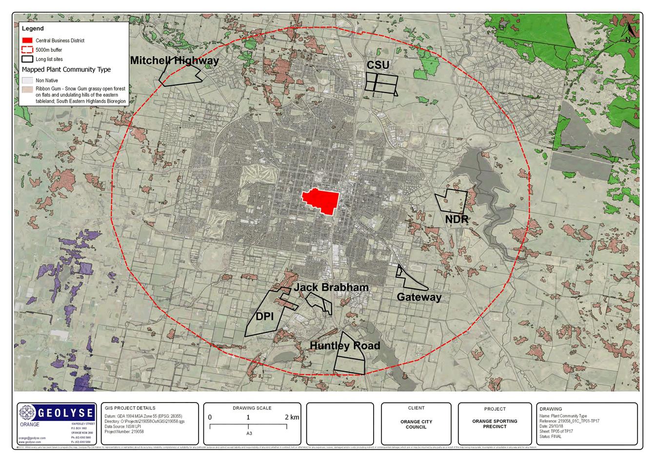
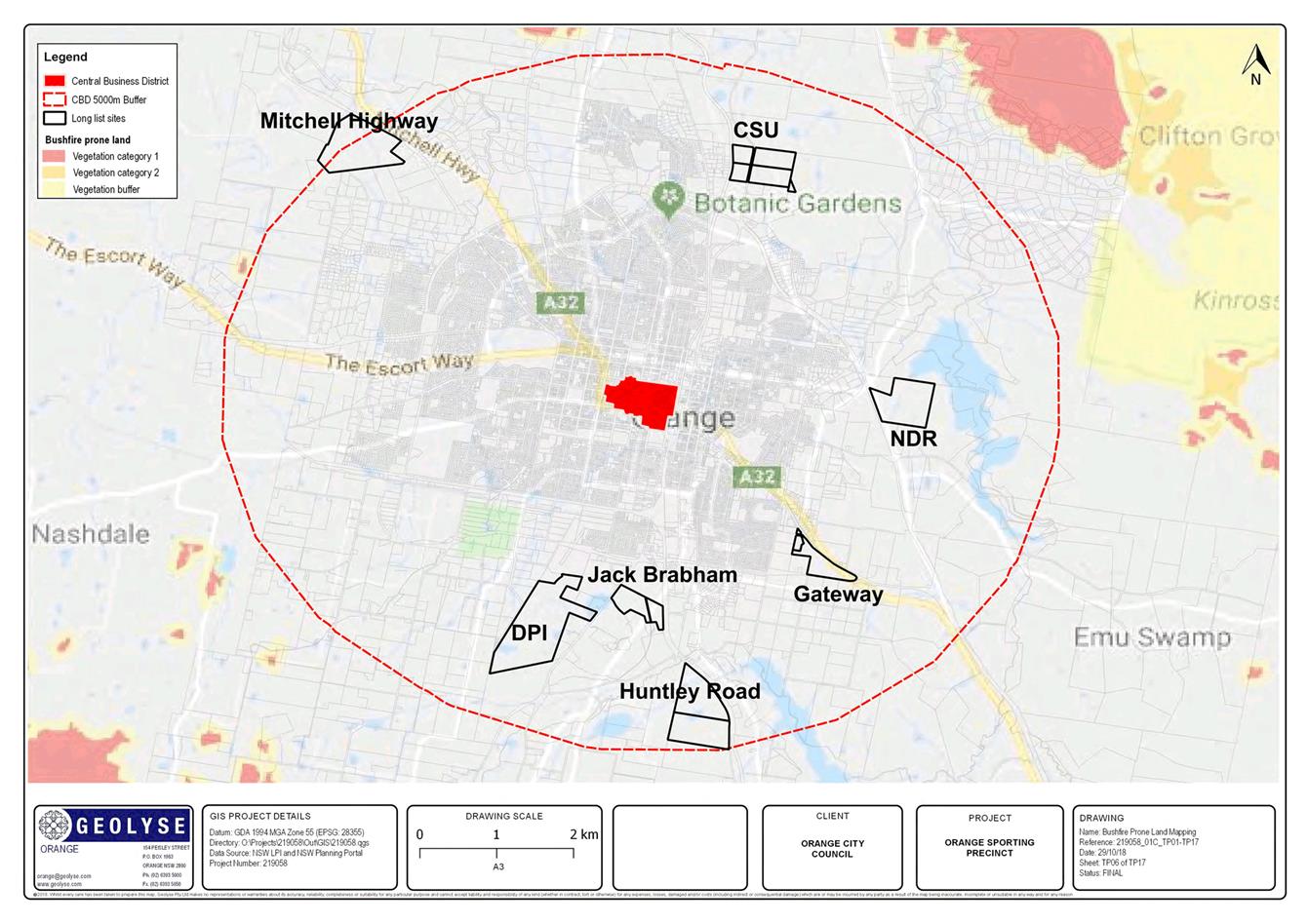
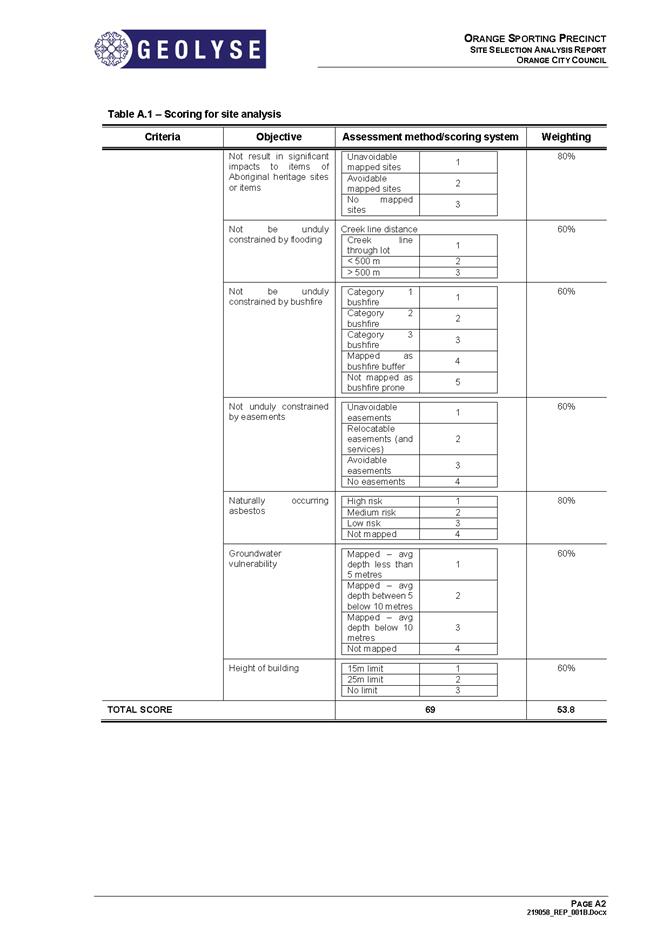
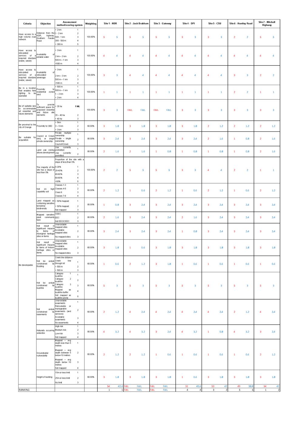
Council engaged Geolyse to identify possible sites, conduct
a desktop assessment of constraints for each site and develop a schematic
design in plan format of a sporting precinct for up to two sites.
Council has received the desktop constraints analysis for
possible sites.
This report summarises those outcomes and seeks
Council’s direction on the next stage.
Link To Delivery/OPerational Plan
The recommendation in this report relates to the
Delivery/Operational Plan strategy “2.1 Live - Identify
and deliver sport and recreation facilities to service the community into the
future”.
Financial Implications
Council has engaged Geolyse to conduct the constraint
analysis and develop concept designs for a sporting precinct for up to two
sites.
Policy and Governance Implications
Nil
|
Recommendation
The Council resolves:
1 To
note the findings of the report.
2 That
a schematic design incorporating current and future requirements for the NDR
site be developed to a standard to enable costing be completed.
|
further considerations
Consideration has been given to the
recommendation’s impact on Council’s service delivery; image and
reputation; political; environmental; health and safety; employees;
stakeholders and project management; and no further implications or risks have
been identified.
SUPPORTING INFORMATION
Council engaged Geolyse to identify
possible sites, conduct a desktop assessment of constraints for each site and
develop a schematic design in plan format of a sporting precinct for up to two
sites.
Essential
site features as identified by Council were:
Core elements:
a One
main rectangular field suitable for the conduct of International Rugby League,
Rugby Union and Football (soccer) incorporating a 1,500 seat grandstand with
disability access, change rooms, amenities, broadcast facilities, staff and
storage areas and competition lighting for night games. Field to be hybrid
field and for ground capacity to a minimum of 10,000.
b A
“number 1” field suitable for the conduct of International Rugby
League, Rugby Union and Football (soccer) adjacent to the main field. Field to
be hybrid field.
c 4
multipurpose fields suitable for the conduct of International Rugby League,
Rugby Union and Football (soccer) for summer and winter sports competition
d Amenities
e Food
outlets
f Parking
g Public
transport bays
h Storage
i Works
shed
j Circulation
tracks for walking and cycling
Future elements:
1 State
level standard Track and Field facilities with grandstand incorporated into
grandstand on main field
2 4
multipurpose fields suitable for the conduct of International Rugby League,
Rugby Union and Football (soccer) for summer and winter sports
competition
3 Amenities
4 Food
outlets
5 Walking
paths and observation points linking with precinct.
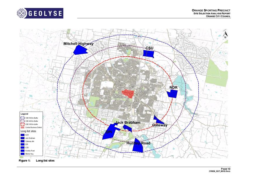
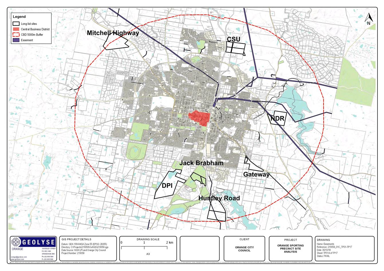
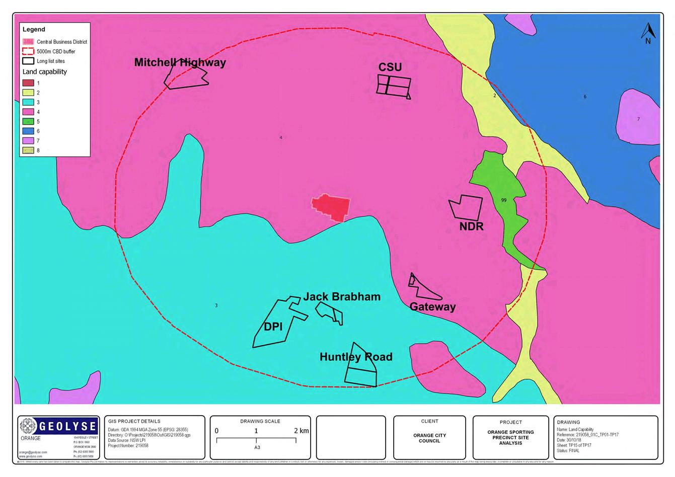
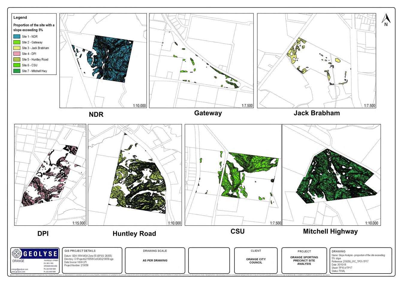
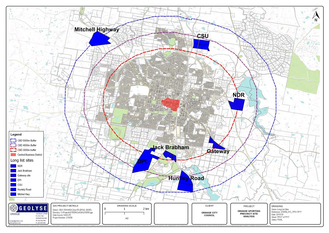
The sites assessed
were:
1 Northern
Distributor Road
2 Jack
Brabham Park – Golf Course
3 Gateway
site behind homemakers Centre
4 DPI
Site
5 CSU
Grounds
6 Private
property on Huntley Road adjacent to the hospital
7 Mitchell
Highway
Stages for the project are:
Stage 1 -
Information review and inception
· Review
all available data/documentation related to the project.
· Attend
an inception meeting.
· Undertake
background desktop research of relevant archives and database.
· Identify
possible sites. This would include the three sites in the request for quotation
and up to three additional sites.
· Undertake
site visits in conjunction with an OCC representative.
Stage 2 –
Desktop Constraints Analysis
· Complete
a desktop constraints analysis for each site focusing on Access, Parking, Noise
impact, Heritage impact, Lighting impact, Environmental constraints, Other
constraints such as servicing issues for each site and collate information
utilising GIS software.
· Prepare
a report for each identified possible site and rank sites in terms of
suitability.
· Based
on the ranking and in consultation with Council, identify two preferred
sites to move forward into draft site master plan/schematic design in
dimensional form.
Stage 3 - Draft
site plan and documentation
· Prepare
the draft plan document (Version 1) for each of the preferred sites.
Stage 4 -
Finalise draft plan
· Update
and issue final draft plan (Version 2) for each of the preferred sites.
Stage 5 - Final
plan
· Prepare
and issue final plan (Final Version) for each of the preferred sites.
|
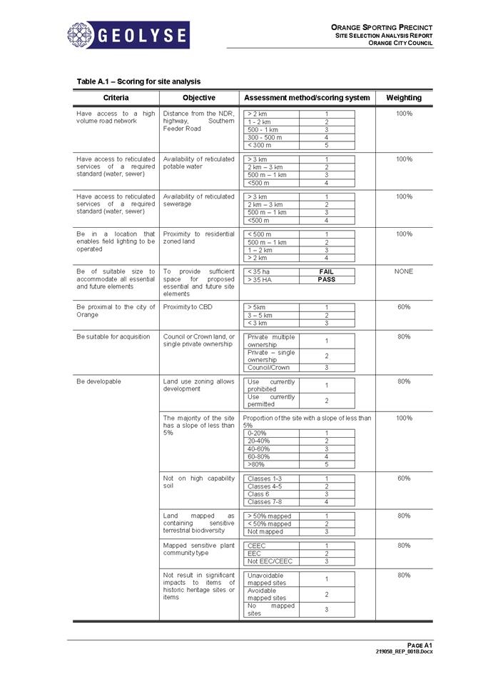
CHARACTERISTIC
|
QUANTITATIVE MEASURE
|
WEIGHTING
|
|
Have access to a
high volume
road network
|
Be located within 300-500 metres of a
major
road that is capable of accommodating large volumes of vehicles at peak times (up to 5,000 vehicles arriving and departing in the peak hour, together
with existing road traffic
volumes)
|
100%
|
|
Have access to services of a required
standard (water, sewer, tc)
|
Have an
existing connection to Council
reticulated services, or be located within
500 metres of existing
services which have
capacity to be extended
to support the
development
|
100%
|
|
Be in a location that enables
field lighting
to
be operated
|
Not be within 500 metres
of residential properties
|
100%
|
|
Be of suitable size to accommodate all essential and future elements
|
Have a size of not less
than 35 hectares.
Those properties with a
size of less than 35 hectares will receive an automatic FAIL notwithstanding their
overall score as this is seen as a critical aspect of the project in order to
future proof the site.
|
Pass / Fail
|
|
Be proximal to the city of
Orange
|
Be within 2-3 kilometres
of the
central
business district
|
60%
|
|
Be suitable for acquisition
|
Be:
· in Council or Crown ownership,
· A single parcel of land;
· A group of land parcels owned by a
single owner
|
80%
|
|
Be developable
|
Not unduly constrained
by site characteristics, i.e.
· Land use zoning
allows development
· Have a predominant slope of less than 5% Not on high
capability soil
· Land
mapped as
containing sensitive
terrestrial biodiversity
· Mapped sensitive plant
community
type
· Not result in significant impacts to items of
Aboriginal heritage sites or items
· Not result in significant impacts to items of
historic heritage sites or items
· Not be unduly constrained by flooding
· Not be unduly constrained by bushfire
· Not unduly constrained by easements
· Naturally occurring asbestos
· Groundwater vulnerability
· Applicable height of building LEP limit
|
80%
100%
60%
80%
80%
60%
60%
60%
60%
80%
60%
60%
|
Council has received the Desktop
Constraints Analysis report (attached). The analysis considered seven sites
across the criteria above. A summary of the findings is:
|
SITE
|
ADDRESS
|
SIZE
|
CURRENT ZONING
|
WEIGHTED RANKING
|
|
1 - Northern
Distributor Road
|
Lot 101 DP1224248
|
44.4 ha
|
RE1 – Public Recreation and
E3
– Environmental Management
|
1
|
|
2 – Jack Brabham
|
Lot 209 DP42900
Crown road reserve
|
21.7 ha
|
RE2 – Private Recreation
|
FAIL
|
|
3 - Gateway
site
|
Lot 2 DP1031236
Lot 6 DP1031236
|
21.9 ha
|
B5 –
Business Development and E3
– Environmental Management
|
FAIL
|
|
4 – DPI
|
Lot 7011 DP1000831
|
96.2 ha
|
Part R2 – Low
Density
Residential –
Part SP2 – Infrastructure:
Agricultural Research
|
4
|
|
5 – CSU
|
Lots 2, 3 & 4
DP7214
Lot 1 DP548053
Lot 300 DP1047282
|
43.1
|
B7 – Business
Park
|
2
|
|
6 – Huntley Road
|
Lot 1 DP520160
Lot 34 DP664921
|
68.7 ha
|
E3
– Environmental
Management
|
5
|
|
7 – Mitchell Highway
|
Lot 1 DP1059022
|
63.89 ha
|
RU1 – Primary Production
|
2
|
Based on these findings, it is
recommended that Council progress with the design for the sporting precinct at
the NDR site.
Attachments
1 Incoming
Correspondence IC18/22313 Sporting precinct - weighted rankings - Geolyse
Report, IC18/22313
Sport
and Recreation Policy Committee
4 December 2018
3.2 Orange
Sporting Precinct
Attachment 1 Incoming Correspondence
IC18/22313 Sporting precinct - weighted rankings - Geolyse Report