
ORANGE CITY COUNCIL
Planning and Development
Committee
Agenda
1 May 2018
Notice
is hereby given, in accordance with the provisions of the Local Government Act
1993 that a Planning and Development
Committee meeting
of ORANGE CITY COUNCIL will be held in the Council Chamber, Civic Centre, Byng Street, Orange on Tuesday,
1 May 2018.
Garry
Styles
General Manager
For apologies please
contact Michelle Catlin on 6393 8246.
Planning and Development Committee 1
May 2018
1 Introduction
1.1 Declaration
of pecuniary interests, significant non-pecuniary interests and less than
significant non-pecuniary interests
The
provisions of Chapter 14 of the Local Government Act, 1993 (the Act)
regulate the way in which Councillors and designated staff of Council conduct
themselves to ensure that there is no conflict between their private interests
and their public role.
The
Act prescribes that where a member of Council (or a Committee of Council) has a
direct or indirect financial (pecuniary) interest in a matter to be considered
at a meeting of the Council (or Committee), that interest must be disclosed as
soon as practicable after the start of the meeting and the reasons given for
declaring such interest.
As
members are aware, the provisions of the Local Government Act restrict any
member who has declared a pecuniary interest in any matter from participating
in the discussion or voting on that matter, and requires that member to vacate
the Chamber.
Council’s Code of Conduct provides that if members
have a non-pecuniary conflict of interest, the nature of the conflict must be
disclosed. The Code of Conduct also provides for a number of ways in which a
member may manage non pecuniary conflicts of interest.
|
Recommendation
It is recommended that Committee Members now disclose any
conflicts of interest in matters under consideration by the Planning and
Development Committee at this meeting.
|
2 General
Reports
2.1 Items
Approved Under Delegated Authority of Council
RECORD
NUMBER: 2018/776
AUTHOR: Mark
Hodges, Manager Building and Environment
EXECUTIVE Summary
Following is a list of development
applications approved under the delegated authority of Council.
Link To Delivery/OPerational Plan
The recommendation in this report relates to the
Delivery/Operational Plan strategy “13.4 Our Environment
– Monitor and enforce regulations relating to City amenity”.
Financial Implications
Nil
Policy and Governance Implications
Nil
|
Recommendation
That the information provided in the
report by the Manager Development Assessments on Items Approved Under the
Delegated Authority of Council be acknowledged.
|
further considerations
Consideration has been given to the
recommendation’s impact on Council’s service delivery; image and
reputation; political; environmental; health and safety; employees;
stakeholders and project management; and no further implications or risks have
been identified.
SUPPORTING INFORMATION
|
Reference:
|
DA 404/2012(2)
|
Determination
Date
|
18 March 2018
|
|
PR Number
|
PR6618
|
|
Applicant/s:
|
Mr M and Mrs B
Casido
|
|
Owner/s:
|
Mr MCL and Mrs BT
Casido
|
|
Location:
|
Lot 18 DP 255071
– 21 Leewood Drive, Orange
|
|
Proposal:
|
Modification of
development consent – agricultural produce industry. The modified
proposal will increase the height of the approved rear extension by
approximately 2m.
|
|
Value:
|
$300,000 (being
$125,000 more than the original development)
|
|
Reference:
|
DA 307/2013(4)
|
Determination
Date
|
22 March 2018
|
|
PR Number
|
PR27375
|
|
Applicant/s:
|
Benedict Design
|
|
Owner/s:
|
Beverley Anna
Duncan
|
|
Location:
|
Approved Lot 5.
Lot 3 DP 286647 – 51 Moulder Street, Orange (formerly known as Lot 1 DP
797835 and Lot 201 DP 1175177 – 49 and 51 Moulder Street, Orange.
|
|
Proposal:
|
Modification of
development application - dwelling house, community title subdivision (three
lot residential), community title subdivision (four lot residential) and
dwelling houses (four). The modification involves an amended floor plan for
proposed Unit 5 within Lot 5.
|
|
Value:
|
$350,000 (being
$50,000 more than the original development)
|
|
Reference:
|
DA 307/2013(5)
|
Determination
Date
|
22 March 2018
|
|
PR Number
|
PR27375
|
|
Applicant/s:
|
Mr LG and Mrs GC
Cook
|
|
Owner/s:
|
Mr LG and Mrs GC
Cook
|
|
Location:
|
Approved Lot 6.
Lot 3 DP 286647 – 51 Moulder Street, Orange (formerly known as Lot 1 DP
797835 and Lot 201 DP 1175177 – 49 and 51 Moulder Street, Orange.
|
|
Proposal:
|
Modification of
development application – dwelling house, community title subdivision
(three lot residential), community title subdivision (four lot residential)
and dwelling houses (four). The modification involves an amended floor plan
for proposed Unit 6 within Lot 6.
|
|
Value:
|
$400,000 (being
$100,000 more than the original development)
|
|
Reference:
|
DA 259/2017(2)
|
Determination
Date
|
6 April 2018
|
|
PR Number
|
PR1974
|
|
Applicant/s:
|
Saran Holdings Pty
Ltd
|
|
Owner/s:
|
Saran Holdings Pty
Ltd
|
|
Location:
|
Lot 3 DP 150391
– 129-131 Byng Street, Orange
|
|
Proposal:
|
Modification of development consent – office premises (change
of use from pub, alterations and additions to existing building, and verandah
reinstatement) and demolition (ancillary buildings and tree removal). The modified proposal involves:
· addressing the windows that have been removed from
the building;
· amending a condition relating to one of the exterior
paint colours;
· substituting the proposed galvanised iron roof
cladding materials and stormwater goods for Colorbond custom orb roof
cladding in Windspray colour and the same colour rain goods;
· clarifying the supplier of the chimney pots;
· proposing a sliding gate; and
· relocating the location of mechanical plant from the
new flat roof to within the car park area, resulting in the loss of one car
parking space.
|
|
Value:
|
$1,900,000 (being
the same value as the original development)
|
|
Reference:
|
DA 271/2017(2)
|
Determination
Date
|
23 March 2018
|
|
PR Number
|
PR27941
|
|
Applicant/s:
|
Hanna Developments
Group Pty Limited
|
|
Owner/s:
|
Hanna Developments
Group Pty Limited
|
|
Location:
|
Lot 203 DP 1238394
– 19 William Maker Drive, Orange
|
|
Proposal:
|
Modification of
development consent – centre based child care facility and business
identification sign (pylon sign). The modification involves raising the
finished floor levels for the child care facility by 500mm above the original
approved development.
|
|
Value:
|
$2,000,000
(being $548,165 more than the original development)
|
|
Reference:
|
DA 418/2017(1)
|
Determination
Date
|
21 March 2018
|
|
PR Number
|
PR22164
|
|
Applicant/s:
|
Mr JA Kerdic and
Ms LM Auteri
|
|
Owner/s:
|
Mr JA Kerdic and
Ms LM Auteri
|
|
Location:
|
Lot 101 DP 1107586
– 319 Lords Place, Orange
|
|
Proposal:
|
Dwelling
alterations and additions, fence additions, garage/workshop, demolition
(outbuildings) and tree removal
|
|
Value:
|
$620,000
|
|
Reference:
|
DA 457/2017(1)
|
Determination
Date
|
7 April 2018
|
|
PR Number
|
PR11015
|
|
Applicant/s:
|
BT Homes
|
|
Owner/s:
|
Mr BE and Mrs EK
Cook
|
|
Location:
|
Lot 19 DP 722291
– 48 Sharp Road, Orange
|
|
Proposal:
|
Subdivision (two
lot residential)
|
|
Value:
|
$224,000
|
|
Reference:
|
DA 476/2017(1)
|
Determination
Date
|
23 March 2018
|
|
PR Number
|
PR26353
|
|
Applicant/s:
|
MET School -
Orange
|
|
Owner/s:
|
MET – Orange
Campus Pty Ltd
|
|
Location:
|
Lot 501 DP 1189720
– 257 Dalton Street, Orange
|
|
Proposal:
|
Educational
establishment (school)(new building)
|
|
Value:
|
$395,000
|
|
Reference:
|
DA 2/2018(1)
|
Determination
Date
|
3 April 2018
|
|
PR Number
|
PR27600
|
|
Applicant/s:
|
Mr MD and Mrs WJ
Miller
|
|
Owner/s:
|
Mr MD and Mrs WJ
Miller
|
|
Location:
|
Lot 438 DP 1228050
– 24 Buckland Drive, Orange
|
|
Proposal:
|
Dual occupancy
(attached) and subdivision (two lot residential)
|
|
Value:
|
$585,000
|
|
Reference:
|
DA 11/2018(1)
|
Determination
Date
|
19 March 2018
|
|
PR Number
|
PR5127
|
|
Applicant/s:
|
Mr DJ Williams and
Ms JM Scott
|
|
Owner/s:
|
Mr DJ Williams and
Ms JM Scott
|
|
Location:
|
Lot 1 DP 194882
– 115 Hill Street, Orange
|
|
Proposal:
|
Demolition (tree
removal)
|
|
Value:
|
$1,020
|
|
Reference:
|
DA 29/2018(1)
|
Determination
Date
|
5 April 2018
|
|
PR Number
|
PR10704
|
|
Applicant/s:
|
Lead Architects
|
|
Owner/s:
|
Mr Z and Mrs T
Rossi
|
|
Location:
|
Lot A DP 155863
– 20 Sale Street, Orange
|
|
Proposal:
|
Take away food and
drink premises (shop fitout) and business identification signage
|
|
Value:
|
$135,000
|
|
Reference:
|
DA 58/2018(1)
|
Determination
Date
|
3 April 2018
|
|
PR Number
|
PR25684
|
|
Applicant/s:
|
Spotless Services
Pty Limited
|
|
Owner/s:
|
Bloomfield
Hospital
|
|
Location:
|
Lot 100 DP 1225276
and Lot 10 DP 11474672 – 1502 and 1530 Forest Road, Orange
|
|
Proposal:
|
Demolition (tree
removal)
|
|
Value:
|
$0
|
|
Reference:
|
DA 60/2018(1)
|
Determination
Date
|
26 March 2018
|
|
PR Number
|
PR20579
|
|
Applicant/s:
|
Mrs JM Granger
|
|
Owner/s:
|
Mrs JM Granger
|
|
Location:
|
Lot 1 DP 1085535
– 31 Autumn Street, Orange
|
|
Proposal:
|
Demolition (tree
removal)
|
|
Value:
|
$0
|
|
Reference:
|
DA 63/2018(1)
|
Determination
Date
|
29 March 2018
|
|
PR Number
|
PR27830
|
|
Applicant/s:
|
Willowdene
Constructions Pty Ltd
|
|
Owner/s:
|
Mr GJ and Mrs KL
Stevenson
|
|
Location:
|
Lot 519 DP 1233683
– 27 Buckland Drive, Orange
|
|
Proposal:
|
Dual occupancy and
subdivision (two lot residential)
|
|
Value:
|
$530,000
|
|
Reference:
|
DA 84/2018(1)
|
Determination
Date
|
10 April 2018
|
|
PR Number
|
PR19015
|
|
Applicant/s:
|
Hi-Tec Vehicle
Management Pty Ltd
|
|
Owner/s:
|
Newlyn Canobolas
Pty Ltd
|
|
Location:
|
Lot 45 DP 1063083
– 11 Elwin Drive, Orange
|
|
Proposal:
|
Vehicular repair
station (part change of use)
|
|
Value:
|
$0
|
|
Reference:
|
DA 93/2018(1)
|
Determination
Date
|
11 April 2018
|
|
PR Number
|
PR8739
|
|
Applicant/s:
|
Mr A Roweth
|
|
Owner/s:
|
Mr AC and Mrs RT
Roweth
|
|
Location:
|
Lot 27 DP 11439
– 111 Moulder Street, Orange
|
|
Proposal:
|
Business
identification sign
|
|
Value:
|
$0
|
TOTAL NET*
VALUE OF ALL DEVELOPMENTS APPROVED IN THIS PERIOD: $3,313,185.00
*
Net value relates to the value of modifications. If modifications are
the same value as the original DA, then nil is added. If there is a plus/minus
difference, this difference is added or taken out.
2.2 Development
Application DA 347/2017(1) - 68-74 Molong Road
RECORD
NUMBER: 2018/990
AUTHOR: Andrew
Crump, Senior Planner
EXECUTIVE Summary
|
Application
lodged
|
18
September 2017
|
|
Applicant/s
|
Hargreaves
Property Group
|
|
Owner/s
|
Mr J
Stojanovic
|
|
Land
description
|
Lot 1 DP
393543 - 68-74 Molong Road, Orange
|
|
Proposed
land use
|
Service
Station; Neighbourhood Shop (two); Business Premises (car wash); Category 1
Remediation; Subdivision (two lot commercial), Signage, Demolition and Tree
Removal
|
|
Value of
proposed development
|
$3,000,000.00
|
This report is a supplementary report to be read in
conjunction with the report that was Agenda Item 2.2 of the Planning and
Development Committee meeting of 3 April 2018 which is attached
herein. The Planning and Development Committee at the meeting of 3 April
2018 resolved:
|
RESOLVED - 18/126 Cr
G Taylor/Cr K Duffy
That development application DA 347/2017(1) for Service Station; Neighbourhood Shop (two); Business
Premises (car wash); Category 1 Remediation; Subdivision (two lot
commercial), Signage, Demolition and Tree Removal at Lot 1
DP 393543 - 68-74 Molong Road, Orange be deferred and staff
negotiate with the developer to reduce the hours of operation.
|
Link To Delivery/OPerational Plan
The recommendation in this report relates to the
Delivery/Operational Plan strategy “13.4 Our Environment
– Monitor and enforce regulations relating to City amenity”.
Financial Implications
Nil
Policy and Governance Implications
Nil
|
Recommendation
That Council consents to
development application DA 347/2017(1)
for Service Station; Neighbourhood Shop (two); Business Premises (car wash);
Category 1 Remediation; Subdivision (two lot commercial), Signage, Demolition
and Tree Removal at Lot 1 DP 393543 - 68-74 Molong Road ORANGE pursuant to the conditions of consent in the attached
Notice of Approval.
|
further considerations
Consideration has been given to the
recommendation’s impact on Council’s service delivery; image and
reputation; political; environmental; health and safety; employees;
stakeholders and project management; and no further implications or risks have
been identified.
SUPPORTING INFORMATION
Council staff wrote to the applicant’s planning
consultant requesting that they deliberate internally on the proposed hours of
operation and determine what opportunity there is to review the proposed hours
of operation for the subject development.
A subsequent meeting was convened which was attended by the
applicant and his representatives, Council staff and some Councillors. At this
meeting the applicant presented the reasons for the proposed 24 hour
arrangement and addressed other matters raised by Councillors in attendance.
It should be noted that the car wash is restricted to the
hours of 7am to 9pm daily, and the neighbourhood shops require that development
applications be lodged for their first use and fitout, at which point
appropriate hours of operation can be determined.
The applicant has also provided additional commentary on the
proposed vapour recovery system, and the relevant condition relating to the
required vapour recovery system has been adjusted slightly to reflect the
additional information.
The attached notice also includes the standard requirements
from Essential Energy for the development.
Following this meeting, formal correspondence was received
from the applicant which presents the following:
24 Hour Operation
We confirm that the car wash
is not proposed to be operated 24 hours and note Council’s recommended DA
condition that the car wash cease operating at 9pm.
As previously discussed,
7-Eleven adhere to a national model of operating their 600+ stores 24 hours. It
is therefore critical to their brand and operational viability that the service
station be granted 24 hour approval.
These 24 hour offerings
provide an important service to shift workers with access to daily essentials
at times when other retail outlets are closed. Furthermore, we believe the 24
hour component of the development (being the service station) is compatible
with the surrounding land uses, as it is buffered on all three sides by
commercial land uses.
We otherwise note the other
examples in Orange of 24 hour retail businesses being located next to
residential property, including the following:
· BP service station
(56-60 Bathurst Road, Orange)
· 7-Eleven service
station (90 Bathurst Road, Orange)
· McDonald’s
restaurant (100-110 Bathurst Road, Orange)
The above developments have
residential property within 20m opposite and are separated by a road, which
provides no acoustic and visual buffering to these properties. The buffer
created by the car wash lot provides over 30m of clearance to the nearest
residence. The proposed car wash, acoustic fence and landscaped buffer offers
significantly better separation from the 24 hour component of the development
compared with the above, as well as providing effective acoustic and visual
attenuation.
The attached Notice of Approval does not restrict hours of
operation of the service station as per Council staff’s previous
position. Also as per Council staff’s previous recommendation, a
condition is attached which controls the operation of the car wash to be
limited from 7am to 9pm daily. Additionally, the attached notice contains
conditions around such things as loading arrangements at night (10pm to 7am)
and the maximum number of deliveries that can occur during this same period.
Also, as previously recommended by staff, to reduce the
likelihood of the occurrence of anti-social behaviour, the applicant is
required to prepare and implement a safety, security and crime prevention plan
of management.
These matters are all addressed in detail in the attached
report that was considered at the Planning and Development Committee meeting of
3 April 2018.
Vapour Recovery
The applicant has provided additional information in
relation to the vapour recovery system associated with the service station. To
this end the following has been submitted:
With respect to vapour
recovery, we provide the following additional information:
- Vapour
recovery was introduced by the NSW EPA to minimise the release of petrol
vapours from existing service stations. The EPA refer to two stages of vapour
recovery, known as VR1 and VR2.
- Stage 1
vapour recovery (VR1) captures the vapours that are displaced when a tanker is
delivering fuel to a service station. As the underground tanks are refilled,
the vapour from these tanks is pumped back into the tanker. A diagram of this
process is shown below.
- Stage
2 vapour recovery (VR2) captures the displaced vapour from a vehicle’s
fuel tank when refuelling at a service station. These vapours are recovered
through the nozzle delivering the fuel and are returned to the underground
storage tanks. A diagram of this process is also shown below.
- Vapour
recovery systems are regulated under the Protection of the Environment
Operations (Clean Air) Regulation 2010. We note that these (sic) are not a
statutory requirement under this regulation to provide a VR2 system for this
site, but to further alleviate the concerns of local residents and to meet best
practice guidelines for maximising vapour recovery, both VR1 and VR2 systems
are proposed to be installed.
In relation to the comments around vapour recovery, Council
staff recommended a condition that was attached to the report of 3 April 2018
which stated that:
(39) The
service station shall include a vapour recovery system capable of achieving a
capture efficiency of at least 97% of petrol vapours. The plans submitted with
an application for a Construction Certificate shall clearly show the required
vapour recovery system.
To ensure the vapour recovery
system described above is installed, the above condition will be augmented as
follows:
(39) The service station shall include a
vapour recovery system (including both Stage 1 vapour recovery and
Stage 2 vapour recovery systems) capable of achieving a capture efficiency
of at least 97% of petrol vapours. The plans submitted with an application for
a Construction Certificate shall clearly show the required vapour recovery
systems.
A further condition was
recommended under the previous report and remains attached to the accompanying
notice of approval which requires the following:
(59) The service station shall be designed
and constructed in accordance with all relevant Regulations, Australian
Standards, guidelines or similar relevant documents.
An anomaly occurred with the previous notice whereby the
general requirements of Essential Energy were not incorporated into the notice.
This has been addressed in the attached notice of approval.
Attachments
1 Notice
of Approval, NA18/234⇩
2 Plans,
D18/20479⇩
3 Submissions,
D18/13890⇩
4 Report
from PDC 3 April 2018, D18/20836⇩
Planning and Development Committee
1 May 2018
2.2 Development
Application DA 347/2017(1) - 68-74 Molong Road
Attachment 1 Notice
of Approval
|

|
ORANGE
CITY COUNCIL
Development
Application No DA
347/2017(1)
NA18/ Container
PR8504
|
NOTICE OF DETERMINATION
OF A DEVELOPMENT
APPLICATION
issued under the Environmental
Planning and Assessment Act 1979
Section 4.18
|
Development
Application
|
|
|
Applicant
Name:
|
Hargreaves
Property Group
|
|
Applicant
Address:
|
C/- Peter
Basha Planning & Development
PO Box
1827
ORANGE
NSW 2800
|
|
Owner’s
Name:
|
Mr J
Stojanovic
|
|
Land
to Be Developed:
|
Lot 1 DP
393543 - 68-74 Molong Road, Orange
|
|
Proposed
Development:
|
Service
Station; Neighbourhood Shop (two); Business Premises (car wash); Category 1
Remediation; Subdivision (two lot commercial), Signage, Demolition and Tree
Removal
|
|
|
|
|
Building
Code of Australia
building
classification:
|
As
determined by Certifier
|
|
|
|
|
Determination
made under
Section 4.16
|
|
|
Made
On:
|
1 May 2018
|
|
Determination:
|
CONSENT
GRANTED SUBJECT TO CONDITIONS DESCRIBED BELOW:
|
|
|
|
|
Consent to
Operate From:
|
2 May 2018
|
|
Consent to
Lapse On:
|
2 May 2023
|
Terms of Approval
The reasons for the imposition of
conditions are:
(1) To ensure a quality
urban design for the development which complements the surrounding environment.
(2) To maintain
neighbourhood amenity and character.
(3) To ensure compliance
with relevant statutory requirements.
(4) To provide adequate
public health and safety measures.
(5) Because the development
will require the provision of, or increase the demand for, public amenities and
services.
(6) To ensure the utility
services are available to the site and adequate for the development.
(7) To prevent the proposed
development having a detrimental effect on adjoining land uses.
(8) To minimise the impact
of development on the environment.
Conditions
(1) The
development must be carried out in accordance with:
(a) Plans
by
Peter Basha Planning and Development
Reference 17030DA:
Sheets 1 to 5 (including aerials) - dated 15
March 2018 (9 sheets)
Plans by studio
architecture
Reference 1708:
DA-100 dated 21 March
2018
DA-100.1 dated 26
February 2018
DA-100.2 dated 19
October 2017
DA-101 dated 21 March
2018
DA-102 dated 21 March
2018
DA-103 dated 21 March
2018
DA-301 dated 21 March
2018
DA-302 dated 21 March 2018
DA-401 dated 21 March
2018
DA-501 dated 11 October
2017
DA-502 8 September 2017
(11 sheets)
Landscape
plan by rfa Landscape Architects
Project no. 4255b - 26 February 2018 -
Drawing no. L-01 – rev. DA issue no. B (1 sheet)
(b) statements
of environmental effects or other similar associated documents that form part
of the approval
as amended in accordance with any
conditions of this consent.
(2) All building work must
be carried out in accordance with the provisions of the Building Code of
Australia.
(3) A sign is to be erected
in a prominent position on any site on which building work, subdivision work or
demolition work is being carried out:
(a) showing the
name, address and telephone number of the principal certifying authority for
the work, and
(b) showing the
name of the principal contractor (if any) for any building work and a telephone
number on which that person may be contacted outside working hours, and
(c) stating that
unauthorised entry to the site is prohibited.
Any such sign is to be maintained while the
building work, subdivision work or demolition work is being carried out.
(4) Where any excavation
work on the site extends below the level of the base of the footings of a
building on adjoining land, the person having the benefit of the development
consent must, at the person’s own expense:
(a) protect
and support the adjoining premises from possible damage from the excavation,
and
(b) where
necessary, underpin the adjoining premises to prevent any such damage.
Note: This
condition does not apply if the person having the benefit of the development
consent owns the adjoining land or the owner of the adjoining land has given
consent in writing to this condition not applying.
DEMOLITION AND TWO LOT SUBDIVISION
|
PRIOR TO THE ISSUE OF
A CONSTRUCTION CERTIFICATE
|
(5) The
applicant is to submit a waste management plan that describes the nature of
wastes to be removed, the wastes to be recycled and the destination of all
wastes. All wastes from the demolition and construction phases of this project
are to be deposited at a licensed or approved waste disposal site.
(6) Proposed
Lots 100 and 101 are to be provided with interlot stormwater drainage where the
surface of the entire lot cannot be drained to the kerb and gutter at the lot
frontage. A grated concrete stormwater pit is to be constructed within each lot
provided with interlot stormwater drainage. Stormwater shall be piped from
proposed lots 100 and 101 to the existing stormwater pipes located at the rear
of 16 El Paso Place. Engineering plans for this drainage system are
to be approved by Orange City Council or an Accredited Certifier (Categories
B1, C3, C4, C6) prior to the issuing of a Construction Certificate.
Where stormwater crosses land outside
the lot it favours, an easement to drain water is to be created over the works.
Evidence of a drainage easement benefitting Lot 1 DP 393543 is to be
provided to the Certifying Authority prior to issuing a Construction
Certificate.
(7) A 150mm-diameter sewer
main is to be constructed from Council’s existing main to serve proposed
Lot 100. Prior to a Construction Certificate being issued engineering plans for
this sewerage system are to be submitted to and approved by Orange City
Council.
(8) A water and soil
erosion control plan is to be submitted to Orange City Council or an Accredited
Certifier (Categories B1, C3, C4, C6) for approval prior to the issuing of a
Construction Certificate. The control plan is to be in accordance with the
Orange City Council Development and Subdivision Code and the Landcom, Managing
Urban Stormwater; Soils and Construction Handbook.
|
PRIOR TO WORKS
COMMENCING
|
(9) The beneficiary of the
consent shall pay to Council a loss of public amenity fee of $1,500 per Council
street tree removed, total $3,000; for Council to readdress the streetscape
once construction works have ceased and the facility operational. The proponent
shall remove, at their cost, the two Golden Ash Street trees marked on Site
Plan 1708 DA-101 Dated 21.3.18 as being removed for vehicle access points.
(10) The two Golden Ash (Fraxinus
excelsior ‘Aurea’) street trees indicated on Site Plan 1708
DA-101 Dated 21.3.18 as being retained shall have Tree Protection Zone fencing
established in accordance with AS 4970 – 2009 Protection of trees on
development sites. The TPZ shall be a minimum of 2 metres in radius, measured
from the centre of the stem of each tree, the TPZ fencing shall be temporary
construction site fencing or similar and clearly signed ‘Tree Protection
Zone’.
(11) A Construction
Certificate application is required to be submitted to, and issued by
Council/Accredited Certifier prior to any excavation or building works being
carried out onsite.
(12) Soil erosion control
measures shall be implemented on the site.
|
DURING
CONSTRUCTION/SITEWORKS
|
(13) The remediation works
shall be carried out in accordance with the Remediation Action Plan prepared by
Envirowest Consulting Ref. R8260RAP Dated 16 October 2017.
(14) Only clean verified
fill shall be transported onto the site. Excavated material, if not required
for removal to meet the remediation action report requirements, shall be used
on site as far as practicable. All excess excavated material shall be
appropriately classified and disposed of at an authorised waste facility.
(15) If Aboriginal objects,
relics, or other historical items or the like are located during development
works, all works in the area of the identified object, relic or item shall
cease, and the NSW Office of Environment and Heritage (OEH), and
representatives from the Orange Local Aboriginal Land Council shall be
notified. Where required, further archaeological investigation shall be
undertaken. Development works in the area of the find(s) may recommence if and
when outlined by the management strategy, developed in consultation with and
approved by the OEH.
(16) The golden ash located
in the North West corner of the site shall be retained. The ash tree in the
south western corner of the site shown on the submitted plans as being retained
shall be removed and replaced as per the amended landscape plan.
(17) All trafficable grates
installed within the driveway system shall be designed and installed in a
manner that prevents nuisance buy way of noise when vehicles drive over them.
(18) All
construction/demolition work on the site is to be carried out between the hours
of 7.00 am and 6.00 pm Monday to Friday inclusive, 7.00 am to
5.00 pm Saturdays and 8.00 am to 5.00 pm Sundays and Public
Holidays. Written approval must be obtained from the General Manager of Orange
City Council to vary these hours.
(19) Building demolition is
to be carried out in accordance with Australian Standard 2601:2001 - The
Demolition of Structures and the requirements of Safe Work NSW.
(20) Asbestos
containing building materials must be removed in accordance with the provisions
of the Work Health and Safety Act 2011 and any guidelines or Codes of
Practice published by Safe Work NSW, and disposed of at a licenced landfill in
accordance with the requirements of the NSW EPA.
(21) Any adjustments to existing
utility services that are made necessary by this development proceeding are to
be at the full cost of the developer.
(22) The provisions
and requirements of the Orange City Council Development and Subdivision Code
are to be applied to this application and all work constructed within the
development is to be in accordance with that Code.
The developer is to be entirely responsible for
the provision of water, sewerage and drainage facilities capable of servicing
the lots from Council’s existing infrastructure. The developer is to be
responsible for gaining access over adjoining land for services where necessary
and easements are to be created about all water, sewer and drainage mains
within and outside the lots they serve.
(23) The water and sewerage services
to the existing building are to be sealed off at their respective Council
mains.
|
PRIOR TO THE ISSUE OF
A SUBDIVISION CERTIFICATE
|
(24) All necessary
validation reports and asbestos clearance certificates shall be submitted to
Council for Council’s records. The subdivision shall not be released
until such time as the receipt of all necessary validation and clearance
certificates have been acknowledged by Council staff in writing.
(25) Application shall be
made for a Subdivision Certificate under Section 109(C)(1)(d) of the Act.
(26) Payment of
contributions for water, sewer and drainage works is required to be made
at the contribution rate applicable at the time that the payment is made. The
contributions are based on 1.0 ETs for water supply headworks and 1.0 ETs for
sewerage headworks. A Certificate of Compliance, from Orange City Council in
accordance with the Water Management Act 2000, will be issued upon
payment of the contributions.
This Certificate of Compliance is to be
submitted to the Principal Certifying Authority prior to the issuing of a
Subdivision Certificate.
(27) Application is to be
made to Telstra/NBN for infrastructure to be made available to each individual
lot within the development. Either a Telecommunications Infrastructure
Provisioning Confirmation or Certificate of Practical Completion is to be
submitted to the Principal Certifying Authority confirming that the specified
lots have been declared ready for service prior to the issue of a Subdivision
Certificate.
(28) A Notice of Arrangement
from Essential Energy stating arrangements have been made for the provision of
electricity supply to the development, is to be submitted to the Principal
Certifying Authority prior to the issue of a Subdivision Certificate.
(29) An easement to drain
sewage and to provide Council access for maintenance of sewerage works a
minimum of 2.0 metres wide is to be created over the proposed sewerage works.
The Principal Certifying Authority is to certify that the easement is in
accordance with the Orange City Council Development and Subdivision Code prior
to the issuing of a Subdivision Certificate.
(30) All services are to be
contained within the allotment that they serve. A Statement of Compliance, from
a Registered Surveyor, is to be submitted to the Principal Certifying Authority
prior to the issuing of a Subdivision Certificate.
(31) Where stormwater
crosses land outside the lot it favours, an easement to drain water is to be
created over the works. A Restriction-as-to-User under section 88B of the NSW
Conveyancing Act 1979 is to be created on the title of the proposed Lots
requiring that no structures are to be placed on the site, or landscaping or
site works carried out on the site, in a manner that affects the continued
operation of the interlot drainage system. The minimum width of the easement is
to be as required in the Orange City Council Development and Subdivision Code.
(32) Certification from
Orange City Council is required to be submitted to the Principal Certifying
Authority prior to the issue of a Subdivision Certificate stating that all
works relating to connection of the development to Council assets, works on
public land, works on public roads, stormwater, sewer and water reticulation
mains and footpaths have been carried out in accordance with the Orange City
Council Development and Subdivision Code and the foregoing conditions, and that
Council will take ownership of the infrastructure assets.
(33) Prior to the issue of a
Subdivision Certificate, reciprocal rights of way shall be established over the
proposed common driveways, internal vehicle access and common parking areas for
Lots 100 and 101.
(34) All of the foregoing
conditions are to be at the full cost of the developer and to the requirements
and standards of the Orange City Council Development and Subdivision Code,
unless specifically stated otherwise. All work required by the foregoing
conditions is to be completed prior to the issuing of an Occupation or
Subdivision Certificate, unless stated otherwise.
|
MATTERS FOR THE
ONGOING PERFORMANCE AND OPERATION OF THE DEVELOPMENT
|
(35) Emitted
noise shall not exceed 5dB(A) above background sound level measured at the
nearest affected residence.
SERVICE STATION
|
PRIOR TO THE ISSUE OF
A CONSTRUCTION CERTIFICATE
|
(36) The proposed 6m high
pylon sign shall be reduced in height from 6m down to 4.5m. The amended pylon
sign shall be clearly shown on the plans submitted with an application for a
Construction Certificate.
(37) The two Golden Ash (Fraxinus
excelsior ‘Aurea’) street trees indicated on Site Plan 1708
DA-101 Dated 21.3.18 as being retained shall have Tree Protection Zone fencing
established in accordance with AS 4970 – 2009 Protection of trees on
development sites. The TPZ shall be a minimum of 2 metres in radius,
measured from the centre of the stem of each tree, the TPZ fencing shall be
temporary construction site fencing or similar and clearly signed ‘Tree
Protection Zone’.
(38) An amended landscape
plan shall be submitted to and approved by Council’s Manager City
Presentation that addresses the loss of amenity tree planting along the street
frontage of the subject property. The plan shall include the planting of a
minimum 6 trees growing to a minimum mature height of 8 metres within the
property boundaries.
Additionally, the landscape plan shall also
provide planting in the location of the required sound wall on the southern
side of the power line exclusion zone. The landscaping shall be designed such
that it provides softening and screening of the required wall without
conflicting with the power line.
The amended landscape plan shall be submitted
to, and approved by Council’s Manager City Presentation prior to the
issue of a Construction Certificate for the Service station.
(39) The service station
shall include a vapour recovery system (including both stage 1 vapour recovery
and stage 2 vapour recovery systems) capable of achieving a capture efficiency
of at least 97% of petrol vapours. The plans submitted with an application for
a Construction Certificate shall clearly show the required vapour recovery
systems.
(40) A safety,
security and crime prevention plan of management shall be prepared which
outlines the measures that are to be implemented for the development in
relation to safety, security and crime prevention. The plan of management must
detail measures such as, but not limited to:
· adequate staff
training;
· holding an incident
register on the site (including complaints);
· installation of a
‘panic button’ for emergencies;
· 24 hour CCTV
surveillance of all areas of the development;
· money handling
procedures;
· theft procedures;
· external lighting;
· clear sightlines to
forecourt; and
· restricted staff areas.
The
safety,
security and crime prevention plan of management shall be submitted to and
approved by the principle certifying prior to the issue of a Construction
Certificate. The plan shall also make provision for the neighbourhood shops
proposed as a separate stage.
(41) An approval under
Section 68 of the Local Government Act is to be sought from Orange City
Council, as the Water and Sewer Authority, for water, sewer and stormwater
connection. No plumbing and drainage is to commence until approval is granted.
(42) The applicant shall
provide the Principal Certifying Authority and Council with a report from a
qualified Acoustic Consultant that certifies that all mechanical services and
equipment proposed to be installed within the development will comply with the
noise goals identified in the Noise Impact Assessment Report by Wilkinson
Murray Report No. 17149 Version D dated 23 February 2017.
(43) An 3.5m high acoustic fence
shall be installed on proposed Lot 100 as required in the Noise Impact
Assessment Report by Wilkinson Murray Report No. 17149 Version D dated 23
February 2017. The fence shall be a lapped and capped design and shall be
wholly constructed of hardwood timber. Plans shall be amended to identify this
fence prior to the issue of a Construction Certificate.
(44) Prior to the issue of a
Construction Certificate evidence shall be provided to the Principal
Certifying Authority that
proposed Lots 100 and 101 have been registered with NSW Land and Property
Information.
(45) Engineering plans
providing complete details of the proposed driveway and car parking areas are
to be submitted to Orange City Council or an Accredited Certifier (Categories
B1, C3, C4, C6) upon application for a Construction Certificate. These plans
are to provide details of levels, cross falls of all pavements, proposed
sealing materials and proposed drainage works and are to be in accordance with
Orange City Council Development and Subdivision Code. Driveways shall cross the
footpath reserve at 90 degrees to the alignment of the kerb and gutter.
(46) A Liquid Trade
Waste Application is to be submitted to Orange City Council prior to the
issuing of a Construction (or Occupation) Certificate. The application is to be
in accordance with Orange City Council’s Liquid Trade Waste Policy.
Engineering plans submitted as part of the application are to show details of
all proposed liquid trade waste pre-treatment systems and their connection to
sewer.
Where
applicable, the applicant is to enter into a Liquid Trade Waste Service
Agreement with Orange City Council in accordance with the Orange City Council
Liquid Trade Waste Policy.
(47) Payment of
contributions for water, sewer and drainage works is required to be made
at the contribution rate applicable at the time that the payment is made. The
contributions are based on 0.8 ETs for water supply headworks and 1.7 ETs
for sewerage headworks. A Certificate of Compliance, from Orange City Council
in accordance with the Water Management Act 2000, will be issued upon
payment of the contributions.
This Certificate of Compliance is to be
submitted to the Principal Certifying Authority prior to the issuing of a
Construction Certificate.
(48) All stormwater from the
site is to be collected and piped to a stormwater treatment system. The design
and construction of the stormwater treatment system for the subject land shall
ensure that the quality of stormwater leaving the developed site shall achieve
the following stormwater quality targets:
· 85% reduction in the
post development mean annual load of Total Suspended Solids (TSS);
· 65% reduction in the
post development mean annual load of Total Phosphorus (TP);
· 45% reduction in the
post development mean annual load of Total Nitrogen loads (TN);
· 90% reduction in the
post development average annual gross pollutant (>5 millimetres) load;
· No observable
Hydrocarbons present in stormwater discharge (<10ppm).
Orange
City Council is to approve engineering plans for this stormwater system prior
to the issuing of a Construction Certificate. The applicant shall undertake
comprehensive water quality modelling on for the site, using an accredited
assessment tool (recommended using Music™ or other approved assessment
tool) and shall include copies of the electronic data files. Modelling shall be
undertaken for both pre and post development scenarios.
(49) Engineering plans,
showing details of the following traffic management works, are to be submitted
to and approved by Orange City Council prior to the issue of a Construction
Certificate:
· Vehicle access for both
lots 100 and 101 shall be entry only via the northern driveway on Lot 100
and exit only for both lots via the southern driveway on Lot 101
· Linemarking of traffic
flow direction arrows within the site enforcing a one way traffic flow within
the site
· Line marking of Molong
Road to provide a BAR urban right turn treatment for the northern entry-only
driveway
· Installation of
‘No Standing’ signs on the western side of Molong Road between
Royle Drive and the northern limit of the BAR right turn line marking
· Any Roads and Maritime
Services requirements.
(50) A copy of a Works
Authorisation Deed from the Roads and Maritime Services for the proposed work
on Molong Road is to be submitted to Orange City Council or an Accredited
Certifier (Categories B1, C3, C4, C6) upon application for a Construction
Certificate.
(51) A water and soil
erosion control plan is to be submitted to Orange City Council or an Accredited
Certifier (Categories B1, C3, C4, C6) for approval prior to the issuing of a
Construction Certificate. The control plan is to be in accordance with the
Orange City Council Development and Subdivision Code and the Landcom, Managing
Urban Stormwater; Soils and Construction Handbook.
(52) The
development’s stormwater design is to include stormwater detention within
the development, designed to limit peak outflows from the land to the
pre-existing natural outflows up to the 100 year ARI frequency, with sufficient
allowance in overflow spillway design capacity to safely pass flows of lower
frequency (that is, a rarer event) without damage to downstream developments.
Where appropriate, the spillway design capacity is to be determined in
accordance with the requirements of the Dam Safety Committee.
The design of the detention storage is to be
undertaken using the ILSAX/DRAINS rainfall-runoff hydrologic model or an
approved equivalent capable of assessing runoff volumes and their temporal
distribution as well as peak flow rates. The model is to be used to calculate
the flow rates for the existing and post-development conditions. The developed
flows are to be routed through the proposed storage within the model so that
the outflows obtained are no greater than the flows obtained for the
pre-existing natural flows. A report detailing the results of the analysis,
which includes:
· catchment
plan showing sub-catchments under existing and developed conditions;
· schematic
diagram of the catchment model showing sub areas and linkages;
· tabulation
detailing the elevation, storage volume and discharge relationships; and
· tabulation
for the range of frequencies analysed, the inflows, outflows and peak storage
levels for both existing and developed conditions;
together with copies of the data files for the
model and engineering design plans of the required drainage system are to be
submitted to Orange City Council upon application for a Construction
Certificate.
(53) Backflow Prevention
Devices are to be installed to AS3500 and in accordance with Orange City
Council Backflow Protection Guidelines. Details of the Backflow Prevention
Devices are to be submitted to Orange City Council prior to the issuing of a
Construction Certificate.
Certificates for testable Backflow Prevention
Devices are to be submitted to Orange City Council by a plumber with backflow
qualifications prior to the issue of an Occupation Certificate.
|
PRIOR TO WORKS
COMMENCING
|
(54) A Construction
Certificate application is required to be submitted to, and issued by
Council/Accredited Certifier prior to any excavation or building works being
carried out onsite.
(55) A temporary
onsite toilet is to be provided and must remain throughout the project or until
an alternative facility meeting Council’s requirements is available
onsite.
(56) The location and
depth of the sewer junction/connection to Council’s sewerage system is to
be determined to ensure that adequate fall to the sewer is available.
(57) Soil erosion control
measures shall be implemented on the site.
|
DURING
CONSTRUCTION/SITEWORKS
|
(58) If Aboriginal objects,
relics, or other historical items or the like are located during development
works, all works in the area of the identified object, relic or item shall
cease, and the NSW Office of Environment and Heritage (OEH), and
representatives from the Orange Local Aboriginal Land Council shall be
notified. Where required, further archaeological investigation shall be
undertaken. Development works in the area of the find(s) may recommence if and
when outlined by the management strategy, developed in consultation with and
approved by the OEH.
(59) The service station
shall be designed and constructed in accordance with all relevant Regulations,
Australian Standards, guidelines or similar relevant documents.
(60) All trafficable grates
within the driveway system shall be designed and installed in a manner that
prevents nuisance by way of noise when vehicles drive over them.
(61) Only clean verified
fill shall be transported onto the site. Excavated material, if not required
for removal to meet the remediation action report requirements, shall be used
onsite as far as practicable. All excess excavated material shall be
appropriately classified and disposed of at an authorised waste facility.
(62) All
construction/demolition work on the site is to be carried out between the hours
of 7.00 am and 6.00 pm Monday to Friday inclusive, 7.00 am to
5.00 pm Saturdays and 8.00 am to 5.00 pm Sundays and Public
Holidays. Written approval must be obtained from the General Manager of Orange
City Council to vary these hours.
(63) All construction
works are to be strictly in accordance with the Reduced Levels (RLs) as shown
on the approved plans.
(64) All materials
onsite or being delivered to the site are to be contained within the site. The
requirements of the Protection of the Environment Operations Act 1997
are to be complied with when placing/stockpiling loose material or when
disposing of waste products or during any other activities likely to pollute
drains or watercourses.
(65) No portion of the
building - including footings, eaves, overhang and service pipes - shall
encroach into any easement.
(66) All services (water,
sewer and stormwater) shall be laid outside the easement unless there is a
direct connection to the main within that easement.
(67) Any adjustments to
existing utility services that are made necessary by this development
proceeding are to be at the full cost of the developer.
(68) The provisions and
requirements of the Orange City Council Development and Subdivision Code are to
be applied to this application and all work constructed within the development
is to be in accordance with that Code.
The developer is to be entirely responsible for
the provision of water, sewerage and drainage facilities capable of servicing
the development from Council’s existing infrastructure. The developer is
to be responsible for gaining access over adjoining land for services where
necessary and easements are to be created about all water, sewer and drainage
mains within and outside the lots they serve.
(69) All driveway and
parking areas are to be sealed with bitumen, hot mix or concrete and are to be
designed for all expected loading conditions (provided however that the minimum
pavement depth for gravel and flush seal roadways is 200mm) and be in
accordance with the Orange City Council Development and Subdivision Code.
(70) Heavy-duty concrete
kerb and gutter laybacks and footpath crossings are to be constructed for the
entrances to the proposed development. The location and construction of the
laybacks and footpath crossings are to be as required by the Orange City
Council Development and Subdivision Code.
(71) The existing kerb and
gutter laybacks and footpath crossings are to be replaced with standard
concrete kerb and gutter and the footpath reinstated to the requirements in the
Orange City Council Development and Subdivision Code.
(72) A 1.2m wide concrete
footpath is to be constructed for the full frontage of the development.
|
PRIOR TO THE ISSUE OF
AN OCCUPATION CERTIFICATE
|
(73) A lux level study of
the proposed illuminated signage and outdoor lighting shall be undertaken by a
suitably qualified person. The maximum lux level of the proposed illuminated signage
and outdoor lighting shall be consistent with recognised relevant Australian
Standards, guidelines or the like. The lux level study shall be submitted to
the Principle Certifying Authority for approval prior to the issue of an
Occupation Certificate.
(74) Off-street car parking
spaces shall be provided upon the site in accordance with the approved plans,
and the provisions of Development Control Plan 2004, and be constructed in
accordance with the requirements of Council's Development and Subdivision Code prior
to the issue of an Occupation Certificate.
(75) All Landscaping shall be
installed in accordance with the approved plans prior to the issue of an
Occupation Certificate.
(76) The duress alarm, CCTV
system etc as required by the safety, security and crime prevention plan of
management shall be installed and made operational prior to the issue of an
Occupation Certificate.
(77) No person is to
use or occupy the building or alteration that is the subject of this approval
without the prior issuing of an Occupation Certificate.
(78) The owner of the
building/s must cause the Council to be given a Final Fire Safety Certificate
on completion of the building in relation to essential fire or other safety
measures included in the schedule attached to this approval.
(79) Where Orange City
Council is not the Principal Certifying Authority, a final inspection of water
connection, sewer and stormwater drainage shall be undertaken by Orange City
Council and a Final Notice of Inspection issued, prior to the issue of either
an interim or a final Occupation Certificate.
(80) Finished ground
levels are to be graded away from the buildings and adjoining properties and
must achieve natural drainage. The concentrated flows are to be dispersed down
slope or collected and discharged to the stormwater drainage system.
(81) The 3.5m high acoustic
fence as detailed in the Noise Impact Assessment Report by Wilkinson Murray
Report No. 17149 Version D dated 23 February 2017and landscaping shall be
installed on proposed Lot 100 prior to the issue of any Occupation
Certificate.
(82) The applicant shall
obtain a Commissioning Report from an appropriately qualified and
experienced acoustic consultant which assesses actual noise emissions from all
operations of the development within 3 months of the issue of an Occupation
Certificate. Where the report requires additional noise attenuation works
to be carried out, these works shall be undertaken within 28 days from the date
of the Commissioning Report.
(83) The applicant shall
provide Council with a copy of the Commissioning Report and certification that
the development complies with the NSW Noise Policy for Industry within four
(4) months from the issue of an Occupation Certificate.
(84) A Certificate of
Compliance, from a Qualified Engineer, stating that the stormwater detention
basin and stormwater treatment system complies with the approved engineering
plans is to be submitted to the Principal Certifying Authority prior to the
issuing of an Occupation Certificate.
(85) Where stormwater
detention or stormwater treatment systems are located on land outside the lot
it favours, an easement to drain water is to be created over the works. A
Restriction-as-to-User under section 88B of the NSW Conveyancing Act 1979
is to be created on the title of the burdened Lot requiring that no structures
are to be placed on the site, or landscaping or site works carried out on the
site, in a manner that affects the continued operation of the stormwater
drainage system. The minimum width of the easement is to be as required in the
Orange City Council Development and Subdivision Code.
(86) Certification from
Orange City Council is required to be submitted to the Principal Certifying
Authority prior to the issue of an Occupation Certificate stating that all
works relating to connection of the development to Council assets, works on
public land, works on public roads, stormwater, sewer and water reticulation
mains and footpaths have been carried out in accordance with the Orange City
Council Development and Subdivision Code and the foregoing conditions, and that
Council will take ownership of the infrastructure assets.
(87) Certificates for
testable Backflow Prevention Devices are to be submitted to Orange City Council
by a plumber with backflow qualifications prior to the issue of an Occupation
Certificate.
(88) All of the foregoing
conditions are to be at the full cost of the developer and to the requirements
and standards of the Orange City Council Development and Subdivision Code,
unless specifically stated otherwise. All work required by the foregoing
conditions is to be completed prior to the issuing of an Occupation or
Subdivision Certificate, unless stated otherwise.
|
MATTERS FOR THE
ONGOING PERFORMANCE AND OPERATION OF THE DEVELOPMENT
|
(89) The service
station shall be operated (in perpetuity) in a manner that is consistent with
the Preliminary Hazard Analysis and Summary prepared by myros design pty. Ltd.
dated 15 August 2017.
(90) The measures
outlined in the safety,
security and crime prevention plan of management shall be implemented at all
times.
(91) Outdoor lighting must
be in accordance with the Australian Standard 4282-1997 - Control of the
obtrusive effects of outdoor lighting.
(92) The maximum number of
annual fuel deliveries shall not exceed 300 deliveries.
(93) The landscaping within the
power line exclusion zone shall be permanently maintained and kept at a height
of not more 2m above existing ground level.
(94) This consent only
provides approval for the signage relating to the service station. No signage
has been approved for the neighbourhood shops or the car wash. A separate
development application shall be submitted to and approved by Council prior to
the erection of any signage of a type that does not meet the exempt development
provisions contained in State Environmental Planning Policy (Exempt and
Complying Development Code) 2008.
(95) The owner is
required to provide to Council and to the NSW Fire Commissioner an Annual Fire
Safety Statement in respect of the fire-safety measures, as required by Clause
177 of the Environmental Planning and Assessment Regulation 2000.
(96) Any ancillary
light fittings fitted to the exterior of the building are to be shielded or
mounted in a position to minimise glare to adjoining properties.
(97) Emitted
noise shall not exceed 5dB(A) above background sound level measured at the
nearest affected residence.
(98) Deliveries shall be
limited as follows:
· Truck deliveries and
servicing (waste collection, fresh food, dry goods, etc.) during daytime and
evening periods, that is 7.00am to 10.00pm, shall occur in the designated
loading bay;
· Truck deliveries and
servicing (fresh food, dry goods etc) during night time periods, that is
10.00pm to 7.00am, are limited to occur under the canopy, where vehicles must
enter and leave the site, as well as manoeuvre within the site, in a forward
direction only. Delivery drivers shall be made aware of this prior to
deliveries taking place on the site. The designated loading bay shall be
cordoned off during night time periods, so that delivery vehicles with
reversing alarms do not impact on the amenity of surrounding residents; and
· Fuel tanker delivery is
to be scheduled to a maximum of one (1) delivery at any time during a single
24 hour period, and outside of normal peak customer periods.
(99) Copies of maintenance
records for servicing of the stormwater treatment system and bio retention
basin shall be forwarded to Council on 1 December annually.
NEIGHBOURHOOD SHOPS
(100) Development applications
shall be lodged for the first use and fitout of the proposed neighbourhood
shops.
|
PRIOR TO THE ISSUE OF
A CONSTRUCTION CERTIFICATE
|
(101) An approval under Section 68
of the Local Government Act is to be sought from Orange City Council, as
the Water and Sewer Authority, for water, sewer and stormwater connection. No
plumbing and drainage is to commence until approval is granted.
(102) The applicant shall
provide the Principal Certifying Authority and Council with a report from a
qualified Acoustic Consultant that certifies that all mechanical services and
equipment proposed to be installed within the development will comply with the
noise goals identified in the Noise Impact Assessment Report by Wilkinson
Murray Report No. 17149 Version D dated 23 February 2017.
|
PRIOR TO WORKS
COMMENCING
|
(103) The two Golden Ash (Fraxinus
excelsior ‘Aurea’) street trees indicated on Site Plan 1708
DA-101 Dated 21.3.18 as being retained shall have Tree Protection Zone fencing
established in accordance with AS 4970 – 2009 Protection of trees on
development sites. The TPZ shall be a minimum of 2 metres in radius,
measured from the centre of the stem of each tree, the TPZ fencing shall be
temporary construction site fencing or similar and clearly signed ‘Tree
Protection Zone’.
(104) A Construction Certificate
application is required to be submitted to, and issued by Council/Accredited
Certifier prior to any excavation or building works being carried out onsite.
(105) A temporary onsite toilet is
to be provided and must remain throughout the project or until an alternative
facility meeting Council’s requirements is available onsite.
(106) The location and depth of
the sewer junction/connection to Council’s sewerage system is to be
determined to ensure that adequate fall to the sewer is available.
|
DURING
CONSTRUCTION/SITEWORKS
|
(107) If Aboriginal objects,
relics, or other historical items or the like are located during development
works, all works in the area of the identified object, relic or item shall
cease, and the NSW Office of Environment and Heritage (OEH), and representatives
from the Orange Local Aboriginal Land Council shall be notified. Where
required, further archaeological investigation shall be undertaken. Development
works in the area of the find(s) may recommence if and when outlined by the
management strategy, developed in consultation with and approved by
the OEH.
(108) All trafficable grates within the
driveway system shall be designed and installed in a manner that prevents
nuisance by way of noise when vehicles drive over them.
(109) All construction/demolition
work on the site is to be carried out between the hours of 7.00 am and
6.00 pm Monday to Friday inclusive, 7.00 am to 5.00 pm Saturdays
and 8.00 am to 5.00 pm Sundays and Public Holidays. Written approval
must be obtained from the General Manager of Orange City Council to vary these
hours.
(110) All construction works are
to be strictly in accordance with the Reduced Levels (RLs) as shown on the
approved plans.
(111) All materials onsite or
being delivered to the site are to be contained within the site. The
requirements of the Protection of the Environment Operations Act 1997
are to be complied with when placing/stockpiling loose material or when
disposing of waste products or during any other activities likely to pollute
drains or watercourses.
(112) No portion of the
building - including footings, eaves, overhang and service pipes - shall
encroach into any easement.
(113) All services (water,
sewer and stormwater) shall be laid outside the easement unless there is a
direct connection to the main within that easement.
(114) Any adjustments to
existing utility services that are made necessary by this development
proceeding are to be at the full cost of the developer.
|
PRIOR TO THE ISSUE OF
AN OCCUPATION CERTIFICATE
|
(115) Off-street car parking spaces shall be
provided upon the site in accordance with the approved plans and the provisions
of Development Control Plan 2004, and be constructed in accordance with the
requirements of Council's Development and Subdivision Code prior to the issue
of an Occupation Certificate.
(116) No person is to use or
occupy the building or alteration that is the subject of this approval without
the prior issuing of an Occupation Certificate.
(117) The owner of the building/s
must cause the Council to be given a Final Fire Safety Certificate on
completion of the building in relation to essential fire or other safety
measures included in the schedule attached to this approval.
(118) Where Orange City Council is
not the Principal Certifying Authority, a final inspection of water connection,
sewer and stormwater drainage shall be undertaken by Orange City Council and a
Final Notice of Inspection issued, prior to the issue of either an interim or a
final Occupation Certificate.
(119) Finished ground levels are
to be graded away from the buildings and adjoining properties and must achieve
natural drainage. The concentrated flows are to be dispersed down slope or
collected and discharged to the stormwater drainage system.
(120) The applicant shall obtain
a Commissioning Report from an appropriately qualified and experienced
acoustic consultant which assesses actual noise emissions from all operations
of the development within 3 months of the issue of an Occupation Certificate.
Where the report requires additional noise attenuation works to be carried out,
these works shall be undertaken within 28 days from the date of the
Commissioning Report.
(121) The applicant shall provide Council
with a copy of the Commissioning Report and certification that the development
complies with the NSW Noise Policy for Industry within four (4) months from
the issue of an Occupation Certificate.
(122) All of the foregoing conditions are
to be at the full cost of the developer and to the requirements and standards
of the Orange City Council Development and Subdivision Code, unless
specifically stated otherwise. All work required by the foregoing conditions is
to be completed prior to the issuing of an Occupation or Subdivision
Certificate, unless stated otherwise.
|
MATTERS FOR THE
ONGOING PERFORMANCE AND OPERATION OF THE DEVELOPMENT
|
(123) This consent only provides
approval for the signage relating to the service station. No signage has been
approved for the neighbourhood shops or the car wash. A separate development
application shall be submitted to and approved by Council prior to the erection
of any signage of a type that does not meet the exempt development provisions
contained in State Environmental Planning Policy (Exempt and Complying
Development Code) 2008.
(124) Outdoor lighting must
be in accordance with the Australian Standard 4282-1997 - Control of the
obtrusive effects of outdoor lighting.
(125) The owner is required to
provide to Council and to the NSW Fire Commissioner an Annual Fire Safety
Statement in respect of the fire-safety measures, as required by Clause 177 of
the Environmental Planning and Assessment Regulation 2000.
(126) Any ancillary light fittings
fitted to the exterior of the building are to be shielded or mounted in a
position to minimise glare to adjoining properties.
(127) Emitted noise shall not
exceed 5dB(A) above background sound level measured at the nearest affected
residence.
CAR WASH
|
PRIOR TO THE ISSUE OF
A CONSTRUCTION CERTIFICATE
|
(128) The shade sail
structure in front of the automated wash bay is to be deleted from the
proposal.
(129) An approval under Section 68
of the Local Government Act is to be sought from Orange City Council, as
the Water and Sewer Authority, for water, sewer and stormwater connection. No
plumbing and drainage is to commence until approval is granted.
(130) Prior to the issue of a
Construction Certificate evidence shall be provided to the Principal
Certifying Authority that
proposed Lots 100 and 101 have been registered with NSW Land and Property
Information.
(131) A Liquid Trade Waste
Application is to be submitted to Orange City Council prior to the issuing of a
Construction Certificate. The application is to be in accordance with Orange
City Council’s Liquid Trade Waste Policy. Engineering plans submitted as
part of the application are to show details of all proposed liquid trade waste
pre-treatment systems and their connection to sewer.
Where applicable, the applicant is to
enter into a Liquid Trade Waste Service Agreement with Orange City Council in
accordance with the Orange City Council Liquid Trade Waste Policy.
(132) Payment of
contributions for water, sewer and drainage works is required to be made
at the contribution rate applicable at the time that the payment is made. The
contributions are based on 22.8 ETs for water supply headworks and 36.0
ETs for sewerage headworks (a 1.0 ET site credit will be applied at the time of
payment for both water and sewer headworks). A Certificate of Compliance, from
Orange City Council in accordance with the Water Management Act 2000,
will be issued upon payment of the contributions.
This Certificate of Compliance is to be
submitted to the Principal Certifying Authority prior to the issuing of a
Construction Certificate.
(133) Engineering plans,
showing details of the following traffic management works, are to be submitted
to and approved by Orange City Council prior to the issue of a Construction
Certificate:
· Vehicle access for both
lots 100 and 101 shall be entry only via the northern driveway on Lot 100
and exit only for both lots via the southern driveway on Lot 101;
· Linemarking of traffic
flow direction arrows within the site enforcing a one way traffic flow within
the site;
· Line marking of Molong
Road to provide a BAR urban right turn treatment for the northern entry-only
driveway;
· Installation of
‘No Standing’ signs on the western side of Molong Road between
Royle Drive and the northern limit of the BAR right turn line marking;
· Any Roads and Maritime
Services requirements.
(134) Engineering plans
providing complete details of the proposed driveway and car-parking areas is to
be submitted to Orange City Council or an Accredited Certifier (Categories B1,
C3, C4, C6) upon application for a Construction Certificate. These plans are to
provide details of levels, cross falls of all pavements, proposed sealing materials
and proposed drainage works and be in accordance with the Orange City Council
Development and Subdivision Code.
(135) A water and soil
erosion control plan is to be submitted to Orange City Council or an Accredited
Certifier (Categories B1, C3, C4, C6) for approval prior to the issuing of a
Construction Certificate. The control plan is to be in accordance with the
Orange City Council Development and Subdivision Code and the Landcom, Managing
Urban Stormwater; Soils and Construction Handbook.
(136) The development’s
stormwater design is to include stormwater detention within the development,
designed to limit peak outflows from the land to the pre-existing natural
outflows up to the 100 year ARI frequency, with sufficient allowance in overflow
spillway design capacity to safely pass flows of lower frequency (that is, a
rarer event) without damage to downstream developments. Where appropriate, the
spillway design capacity is to be determined in accordance with the
requirements of the Dam Safety Committee.
The design of the detention storage is to be
undertaken using the ILSAX/DRAINS rainfall-runoff hydrologic model or an
approved equivalent capable of assessing runoff volumes and their temporal
distribution as well as peak flow rates. The model is to be used to calculate
the flow rates for the existing and post-development conditions. The developed
flows are to be routed through the proposed storage within the model so that
the outflows obtained are no greater than the flows obtained for the pre-existing
natural flows.
A report detailing the results of the analysis,
which includes:
· catchment
plan showing sub-catchments under existing and developed conditions;
· schematic
diagram of the catchment model showing sub areas and linkages;
· tabulation
detailing the elevation, storage volume and discharge relationships; and
· tabulation
for the range of frequencies analysed, the inflows, outflows and peak storage
levels for both existing and developed conditions;
together
with copies of the data files for the model and engineering design plans of the
required drainage system are to be submitted to Orange City Council upon
application for a Construction Certificate.
(137) All stormwater from the
site is to be collected and piped to a stormwater treatment system. The design
and construction of the stormwater treatment system for the subject land shall
ensure that the quality of stormwater leaving the developed site shall achieve
the following stormwater quality targets:
· 85% reduction in the
post development mean annual load of Total Suspended Solids (TSS);
· 65% reduction in the
post development mean annual load of Total Phosphorus (TP);
· 45% reduction in the
post development mean annual load of Total Nitrogen loads (TN);
· 90% reduction in the
post development average annual gross pollutant (>5 millimetres) load,
· No observable
Hydrocarbons present in stormwater discharge (<10ppm).
Orange City Council is to approve engineering
plans for this stormwater system prior to the issuing of a Construction
Certificate. The applicant shall undertake comprehensive water quality
modelling on for the site, using an accredited assessment tool (recommended
using Music™ or other approved assessment tool) and shall include copies
of the electronic data files. Modelling shall be undertaken for both pre and
post development scenarios.
(138) Backflow Prevention
Devices are to be installed to AS3500 and in accordance with Orange City
Council Backflow Protection Guidelines. Details of the Backflow Prevention
Devices are to be submitted to Orange City Council prior to the issuing of a
Construction Certificate.
Certificates for testable Backflow Prevention
Devices are to be submitted to Orange City Council by a plumber with backflow
qualifications prior to the issue of an Occupation Certificate.
|
PRIOR TO WORKS
COMMENCING
|
(139) The two Golden Ash (Fraxinus
excelsior ‘Aurea’) street trees indicated on Site Plan 1708
DA-101 Dated 21.3.18 as being retained shall have Tree Protection Zone fencing established
in accordance with AS 4970 – 2009 Protection of trees on development
sites. The TPZ shall be a minimum of 2 metres in radius, measured from the
centre of the stem of each tree, the TPZ fencing shall be temporary
construction site fencing or similar and clearly signed ‘Tree Protection
Zone’.
(140) A Construction Certificate
application is required to be submitted to, and issued by Council/Accredited
Certifier prior to any excavation or building works being carried out onsite.
(141) A temporary onsite toilet is
to be provided and must remain throughout the project or until an alternative
facility meeting Council’s requirements is available onsite.
(142) The location and depth of
the sewer junction/connection to Council’s sewerage system is to be
determined to ensure that adequate fall to the sewer is available.
(143) Soil erosion control
measures shall be implemented on the site.
|
DURING
CONSTRUCTION/SITEWORKS
|
(144) Only clean verified
fill shall be transported onto the site. Excavated material, if not required
for removal to meet the remediation action report requirements, shall be used
on site as far as practicable. All excess excavated material shall be
appropriately classified and disposed of at an authorised waste facility.
(145) All construction/demolition
work on the site is to be carried out between the hours of 7.00 am and
6.00 pm Monday to Friday inclusive, 7.00 am to 5.00 pm Saturdays
and 8.00 am to 5.00 pm Sundays and Public Holidays. Written approval
must be obtained from the General Manager of Orange City Council to vary these
hours.
(146) All construction works are
to be strictly in accordance with the Reduced Levels (RLs) as shown on the
approved plans.
(147) All materials onsite or
being delivered to the site are to be contained within the site. The
requirements of the Protection of the Environment Operations Act 1997
are to be complied with when placing/stockpiling loose material or when
disposing of waste products or during any other activities likely to pollute drains
or watercourses.
(148) No portion of the
building - including footings, eaves, overhang and service pipes - shall
encroach into any easement.
(149) All services (water,
sewer and stormwater) shall be laid outside the easement unless there is a
direct connection to the main within that easement.
(150) Any adjustments to
existing utility services that are made necessary by this development
proceeding are to be at the full cost of the developer.
(151) All driveway and
parking areas are to be sealed with bitumen, hot mix or concrete and are to be
designed for all expected loading conditions (provided however that the minimum
pavement depth for gravel and flush seal roadways is 200mm) and be in
accordance with the Orange City Council Development and Subdivision Code.
(152) A heavy-duty concrete
kerb and gutter layback and footpath crossing is to be constructed in the
position shown on the plan submitted with the Construction Certificate
application. The works are to be carried out to the requirements of the Orange
City Council Development and Subdivision Code.
|
PRIOR TO THE ISSUE OF
AN OCCUPATION CERTIFICATE
|
(153) Off-street car parking spaces shall be
provided upon the site in accordance with the approved plans and the provisions
of Development Control Plan 2004, and be constructed in accordance with the requirements
of Council's Development and Subdivision Code prior to the issue of an
Occupation Certificate.
(154) The parking space
identified as space no. ‘15’ on the approved plans shall be
utilised as staff parking associated with the car wash. Staff of the car wash
must park in the dedicated space before parking anywhere else within the site.
A suitable sign shall be erected advising that the space is for car wash staff
only.
(155) No person is to use or
occupy the building or alteration that is the subject of this approval without
the prior issuing of an Occupation Certificate.
(156) The owner of the building/s
must cause the Council to be given a Final Fire Safety Certificate on
completion of the building in relation to essential fire or other safety
measures included in the schedule attached to this approval.
(157) Where
Orange City Council is not the Principal Certifying Authority, a final
inspection of water connection, sewer and stormwater drainage shall be
undertaken by Orange City Council and a Final Notice of Inspection issued,
prior to the issue of either an interim or a final Occupation Certificate.
(158) Finished ground levels are
to be graded away from the buildings and adjoining properties and must achieve
natural drainage. The concentrated flows are to be dispersed down slope or
collected and discharged to the stormwater drainage system.
(159) The applicant shall
obtain a Commissioning Report from an appropriately qualified and
experienced acoustic consultant which assesses actual noise emissions from all
operations of the development within 3 months of the issue of an Occupation
Certificate. Where the report requires additional noise attenuation works
to be carried out, these works shall be undertaken within 28 days from the date
of the Commissioning Report.
(160) The applicant shall provide Council
with a copy of the Commissioning Report and certification that the development
complies with the NSW Noise Policy for Industry within four (4) months from
the issue of an Occupation Certificate.
(161) A Certificate of
Compliance, from a Qualified Engineer, stating that the stormwater detention
basin and stormwater treatment system complies with the approved engineering
plans is to be submitted to the Principal Certifying Authority prior to the
issuing of an Occupation Certificate.
(162) Certification from
Orange City Council is required to be submitted to the Principal Certifying
Authority prior to the issue of an Occupation Certificate stating that all
works relating to connection of the development to Council assets, works on
public land, works on public roads, stormwater, sewer and water reticulation
mains and footpaths have been carried out in accordance with the Orange City
Council Development and Subdivision Code and the foregoing conditions, and that
Council will take ownership of the infrastructure assets.
(163) Certificates for
testable Backflow Prevention Devices are to be submitted to Orange City Council
by a plumber with backflow qualifications prior to the issue of an Occupation
Certificate.
(164) All of the foregoing conditions are
to be at the full cost of the developer and to the requirements and standards
of the Orange City Council Development and Subdivision Code, unless
specifically stated otherwise. All work required by the foregoing conditions is
to be completed prior to the issuing of an Occupation or Subdivision
Certificate, unless stated otherwise.
|
MATTERS FOR THE
ONGOING PERFORMANCE AND OPERATION OF THE DEVELOPMENT
|
(165) This consent only provides
approval for the signage relating to the service station. No signage has been
approved for the neighbourhood shops or the car wash. A separate development
application shall be submitted to and approved by Council prior to the erection
of any signage of a type that does not meet the exempt development provisions
contained in State Environmental Planning Policy (Exempt and Complying
Development Code) 2008.
(166) Outdoor lighting must
be in accordance with the Australian Standard 4282-1997 - Control of the
obtrusive effects of outdoor lighting.
(167) The landscaping within the power line
exclusion zone shall be permanently maintained and kept at a height of not more
2m above existing ground level.
(168) The parking space
identified as space no. ‘15’ on the approved plans shall be
utilised as staff parking associated with the car wash. Staff of the car wash
must park in the dedicated space before parking anywhere else within the site.
(169) The maximum number of
staff associated with the car wash on-site at any one time shall not exceed two
(2) persons. An increase in staff numbers for the car wash will require
separate approval.
(170) The owner is required to
provide to Council and to the NSW Fire Commissioner an Annual Fire Safety
Statement in respect of the fire-safety measures, as required by Clause 177 of
the Environmental Planning and Assessment Regulation 2000.
(171) Any ancillary light fittings
fitted to the exterior of the building are to be shielded or mounted in a
position to minimise glare to adjoining properties.
(172) Emitted noise shall not
exceed 5dB(A) above background sound level measured at the nearest affected
residence.
(173) The car wash (including
the vacuum bays) shall operate only between the hours of 7.00am to 9.00pm
daily.
(174) The automatic car wash bay shall be
fitted with a roller door on the entrance and exit. The car wash shall not be
operated (any processes) unless both roller doors are fully closed.
|
NSW ROADS AND MARITIME
SERVICES (RMS) REQUIREMENTS FOR THE DEVELOPMENT
|
(175) The Roads and Maritime
Services (RMS) requirements for the development are:
· All vehicle access to
and from the land from Molong Road is to be in a forward direction.
· Prior to the issuance
of an Occupation Certificate, a Channelised Right Short [CHR(s)] turn treatment
in accordance with Figure 7.18 Part 4A of Austroads Guide to Road Design (copy
enclosed), and relevant Roads and Maritime supplements, is to be provided in
Molong Road at its intersection with the site entry driveway. The intersection
works are to be designed and constructed for a 50km/h speed zone and be able to
accommodate the largest vehicle accessing the intersection.
· Prior to the issuance
of an Occupation Certificate, an Auxiliary Left Short [AUL(s)] turn treatment
in accordance with Figure 8.10 Part4A of Austroads Guide to Road Design (copy
enclosed), and relevant Roads and Maritime supplements, is to be provided in Molong
Road at its intersection with the site entry driveway. The intersection works
are to be designed and constructed for a 50km/h speed zone and be able to
accommodate the largest vehicle accessing the intersection.
· A formal agreement in
the form of a Works Authorisation Deed (WAD) will be required between the
developer and Roads and Maritime for the developer to undertake “private
financing and construction” of any works on Molong Road. This agreement
is necessary for works in which Roads and Maritime has a statutory interest.
The WAD is to be executed prior to issuance of a Construction Certificate.
· Prior to the
commencement of construction works, the proponent is to contact Roads and
Maritime’s Traffic Operations Manager to determine if a Road Occupancy
Licence (ROL) is required. In the event that an ROL is required, the proponent
must obtain the ROL prior to works commencing within three (3) metres of the
travel lanes of Molong Road.
· The entry and exit
driveways are to be constructed generally in accordance with the submitted
plans and finished with concrete. Driveways are to be designed to provide good
sight lines between pedestrians and motorists, match road levels and not
interfere with road drainage.
· “No Entry”
(R2-4) signs are to be provided on the land at each side of the exit driveway.
The signs are to face Molong Road to advise motorists not to enter the site
from Molong road via the exit driveway.
· “No Entry”
(R2-4) signs are to be erected on the land on each side of the entry driveway. The
signs are to face the site to advise motorists not to exit onto Molong Road via
the entry driveway.
· Prior to occupation of
the development, signage on the site facing Molong Road is to be installed
displaying “NO FUELING OF VEHICLES OVER 12.5 METRES LONG”.
· Prior to the issuance
of an Occupation Certificate, redundant kerb layback crossing accesses on
Molong Road servicing the land, are to be removed and replaced with kerb and
gutter to match existing kerb and gutter.
· All entry/exit points
onto/from the public road network, internal vehicular manoeuvring, parking and
loading areas are to be constructed in accordance with the submitted plans
prior to the issuance of an Occupation Certificate for the development.
· Adequate turning
circles, storage room and vertical clearance are to be provided in the site for
the largest type of vehicle (19 metre articulated vehicle) that will visit the
site during construction and operation. Fuel delivery vehicles are to be
restricted to vehicles 19 metres or less in length.
· All activities
including loading and unloading of goods associated with the development are to
be carried out on site in the dedicated areas.
· Landscaping, signage
and fencing are not to impede sight lines of traffic within or when passing,
entering or departing from the site. Safe Intersection Sight Distance (SISD) is
to be provided and maintained in both directions of Molong Road. For a 50km/h
speed zone, SISD is 97 metres.
· Signage is to be in
accordance with the Department of Planning and Environment’s Transport
Corridor Outdoor Advertising and Signage Guidelines 2017, is not to flash,
move or be objectionably glaring or luminous.
|
ESSENTIAL ENERGY
REQUIREMENTS FOR THE DEVELOPMENT
|
(176) The Essential Energy
requirements for the development are:
· Due care should be
taken that no construction activities take place in the exclusion zone (shown
in the red hatched area and from the red hatched area to the blue dashed line)
on the attached plan. Mobile plant or equipment that is capable of extending to
greater than 4.6 metres including any load and or person should not be able to
occupy the exclusion zone.
· If the proposed
development changes, there may be potential safety risks and it is recommended
that Essential Energy is consulted for further comment;
· Any existing
encumbrances in favour of Essential Energy (or its predecessors) noted on the
title of the above property should be complied with; and
· In addition, Essential
Energy’s records indicate there is electricity infrastructure located
within the property. Any activities within this location must be undertaken in
accordance with the latest industry guideline currently known as ISSC 20
Guideline for the Management of Activities within Electricity Easements and
Close to Infrastructure.
· Prior to carrying out
any works, a “Dial Before You Dig” enquiry should be undertaken in
accordance with the requirements of Part 5E (Protection of Underground
Electricity Power Lines) of the Electricity Supply Act 1995 (NSW).
· Given there is electricity
infrastructure in the area, it is the responsibility of the person/s completing
any works around powerlines to understand their safety responsibilities.
SafeWork NSW (www.safework.nsw.gov.au) has publications that provide guidance
when working close to electricity infrastructure. These include the Code of
Practice – Work near Overhead Power Lines and Code of Practice –
Work near Underground Assets.
Other Approvals
(1) Local
Government Act 1993 approvals granted under section 68.
Nil
(2) General
terms of other approvals integrated as part of this consent.
Nil
Right of Appeal
If you are dissatisfied with this
decision, Section 8.7 of the Environmental Planning and Assessment
Act 1979 gives you the right to appeal to the Land and Environment
Court. Pursuant to Section 8.10, an applicant may only appeal within 6 months
after the date the decision is notified.
|
Disability
Discrimination Act 1992:
|
This application has been assessed in
accordance with the Environmental Planning and Assessment Act 1979. No
guarantee is given that the proposal complies with the Disability
Discrimination Act 1992.
The applicant/owner is responsible to
ensure compliance with this and other anti-discrimination legislation.
The Disability Discrimination Act
covers disabilities not catered for in the minimum standards called up in the
Building Code of Australia which references AS1428.1 - "Design for
Access and Mobility". AS1428 Parts 2, 3 and 4 provides the most
comprehensive technical guidance under the Disability Discrimination Act
currently available in Australia.
|
|
|
|
|
|
|
|
Disclaimer
- S88B of the Conveyancing Act 1919 - Restrictions on the Use of Land:
|
The applicant should note that there
could be covenants in favour of persons other than Council restricting what
may be built or done upon the subject land. The applicant is advised to check
the position before commencing any work.
|
|
|
|
|
Signed:
|
On behalf of the consent authority ORANGE
CITY COUNCIL
|
|
Signature:
|
|
|
Name:
|
PAUL JOHNSTON - MANAGER DEVELOPMENT
ASSESSMENTS
|
|
Date:
|
2 May 2018
|
Planning
and Development Committee
1 May 2018
2.2 Development
Application DA 347/2017(1) - 68-74 Molong Road
Attachment 2 Plans
Planning and Development Committee
1 May 2018
2.2 Development
Application DA 347/2017(1) - 68-74 Molong Road
Attachment 2 Plans
Planning and Development Committee
1 May 2018
2.2 Development
Application DA 347/2017(1) - 68-74 Molong Road
Attachment 2 Plans
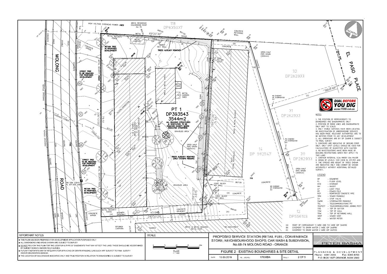
Planning and Development Committee
1 May 2018
2.2 Development
Application DA 347/2017(1) - 68-74 Molong Road
Attachment 2 Plans
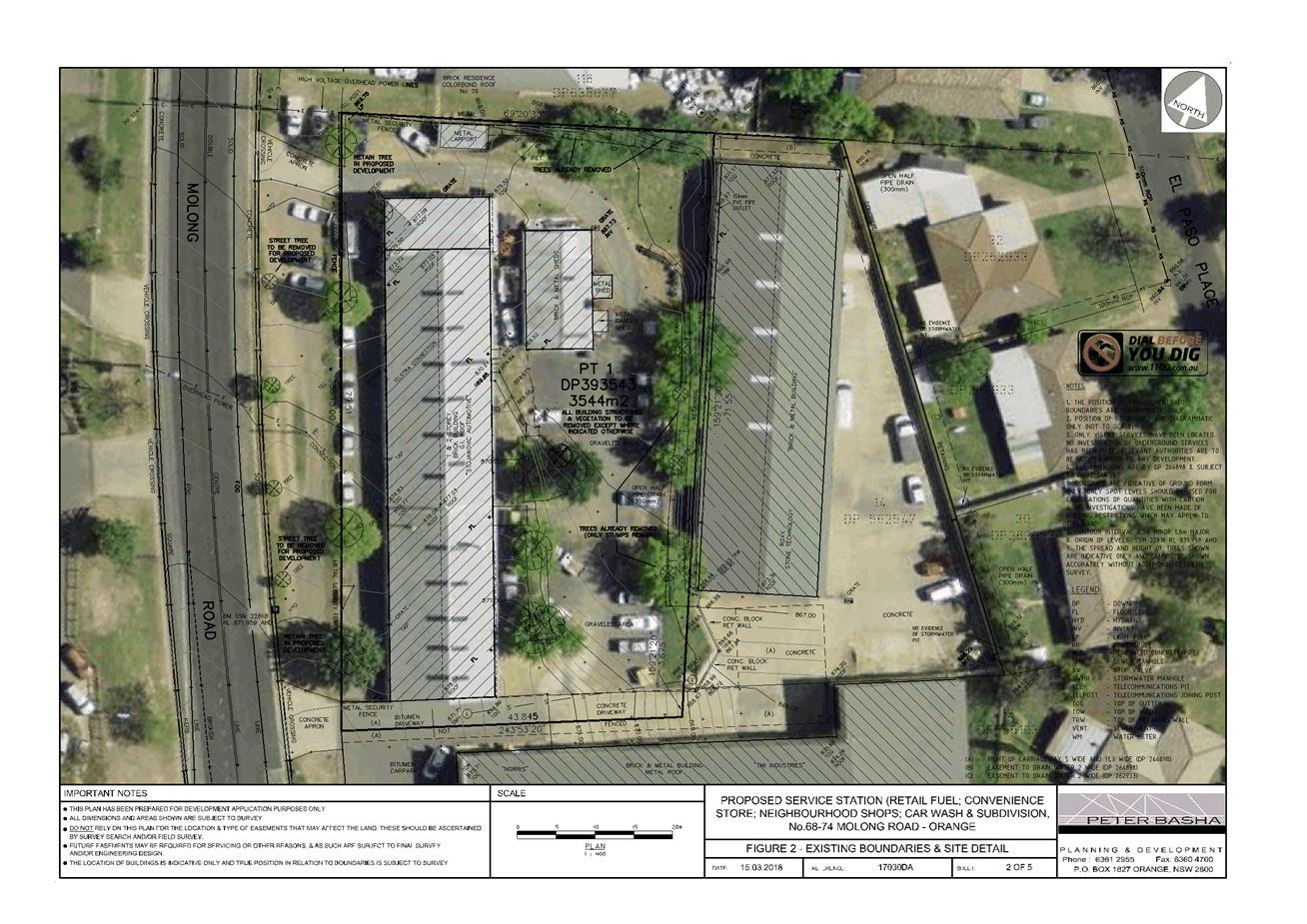
Planning and Development Committee
1 May 2018
2.2 Development
Application DA 347/2017(1) - 68-74 Molong Road
Attachment 2 Plans
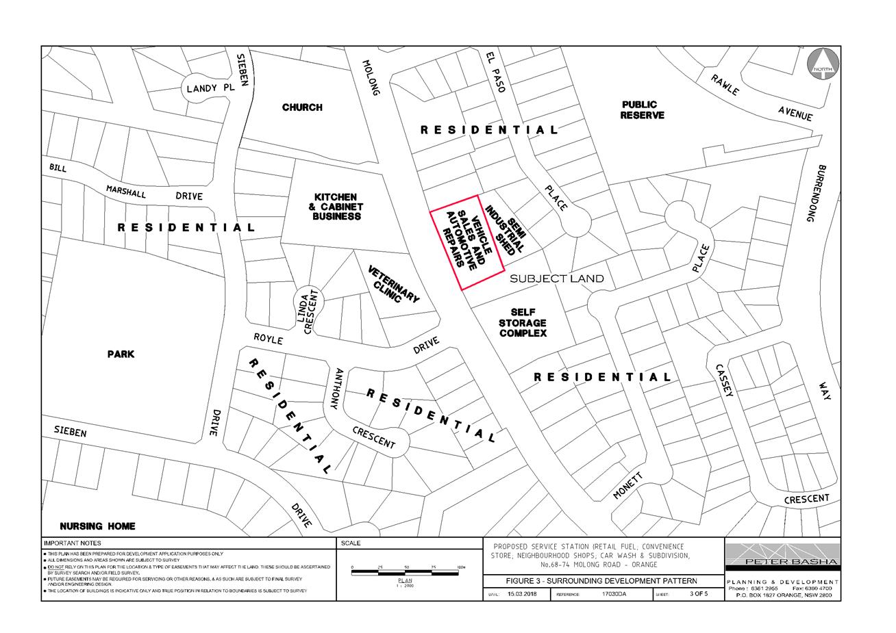
Planning and Development Committee
1 May 2018
2.2 Development
Application DA 347/2017(1) - 68-74 Molong Road
Attachment 2 Plans
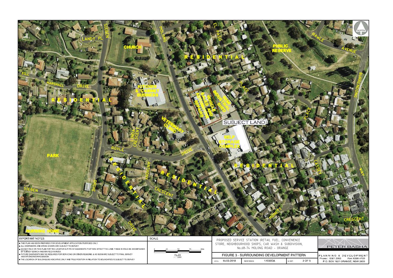
Planning and Development Committee
1 May 2018
2.2 Development
Application DA 347/2017(1) - 68-74 Molong Road
Attachment 2 Plans
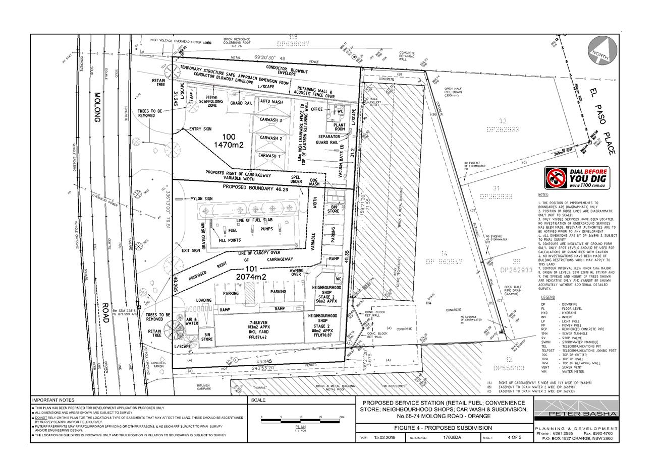
Planning and Development Committee
1 May 2018
2.2 Development
Application DA 347/2017(1) - 68-74 Molong Road
Attachment 2 Plans
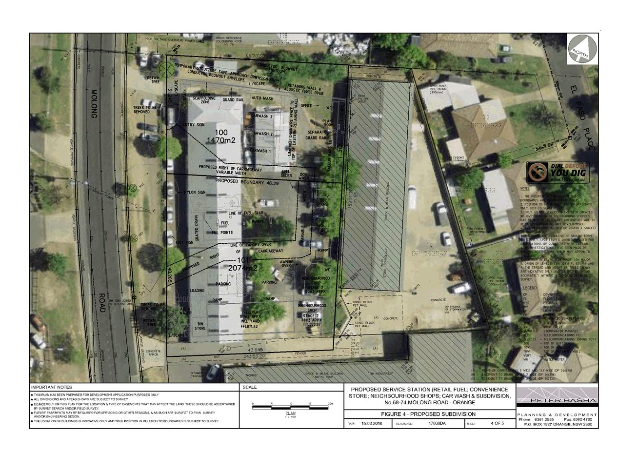
Planning and Development Committee
1 May 2018
2.2 Development
Application DA 347/2017(1) - 68-74 Molong Road
Attachment 2 Plans
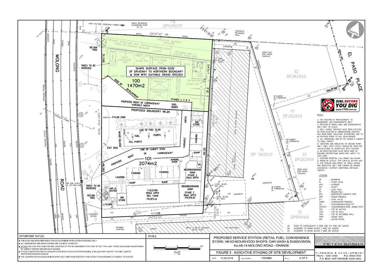
Planning and Development Committee
1 May 2018
2.2 Development
Application DA 347/2017(1) - 68-74 Molong Road
Attachment 2 Plans
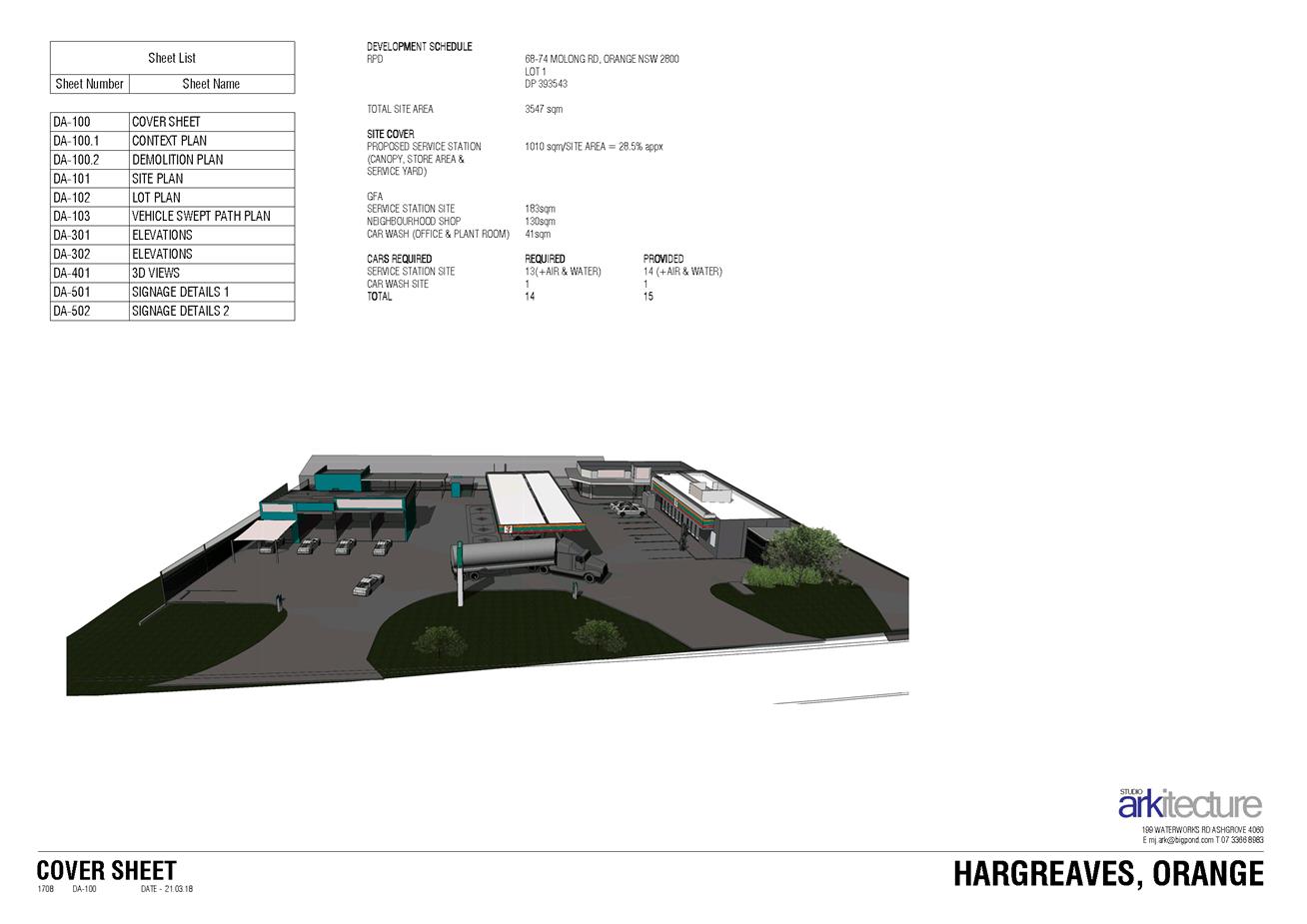
Planning and Development Committee
1 May 2018
2.2 Development
Application DA 347/2017(1) - 68-74 Molong Road
Attachment 2 Plans
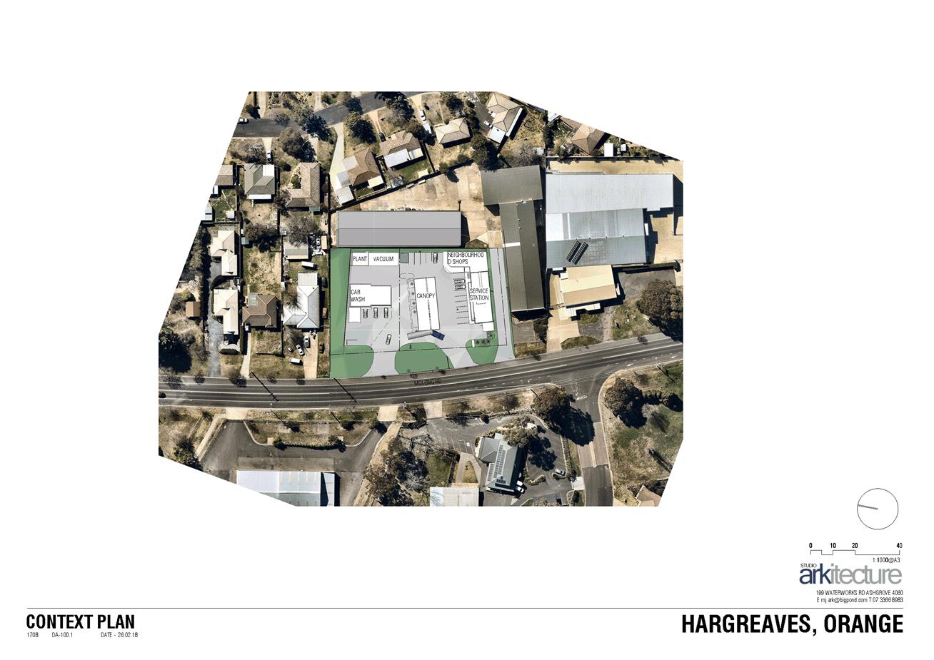
Planning and Development Committee
1 May 2018
2.2 Development
Application DA 347/2017(1) - 68-74 Molong Road
Attachment 2 Plans
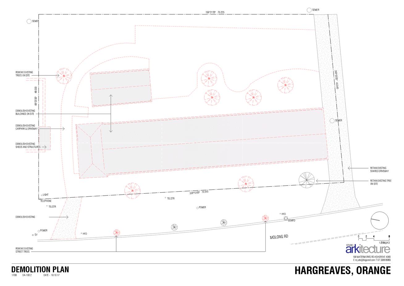
Planning and Development Committee
1 May 2018
2.2 Development
Application DA 347/2017(1) - 68-74 Molong Road
Attachment 2 Plans
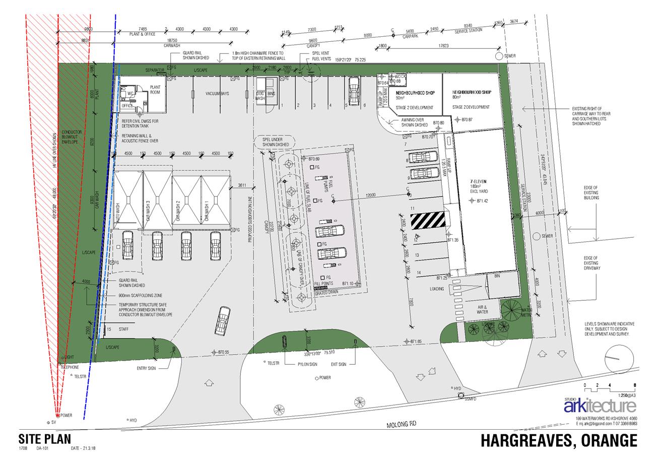
Planning and Development Committee
1 May 2018
2.2 Development
Application DA 347/2017(1) - 68-74 Molong Road
Attachment 2 Plans
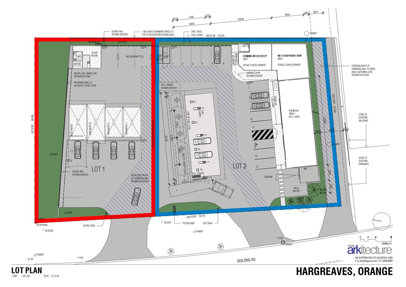
Planning and Development Committee
1 May 2018
2.2 Development
Application DA 347/2017(1) - 68-74 Molong Road
Attachment 2 Plans
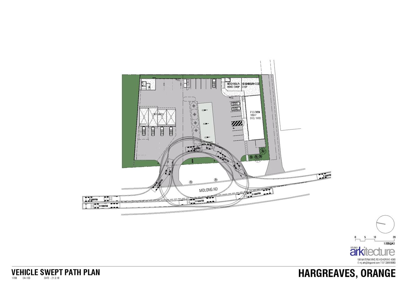
Planning and Development Committee
1 May 2018
2.2 Development
Application DA 347/2017(1) - 68-74 Molong Road
Attachment 2 Plans
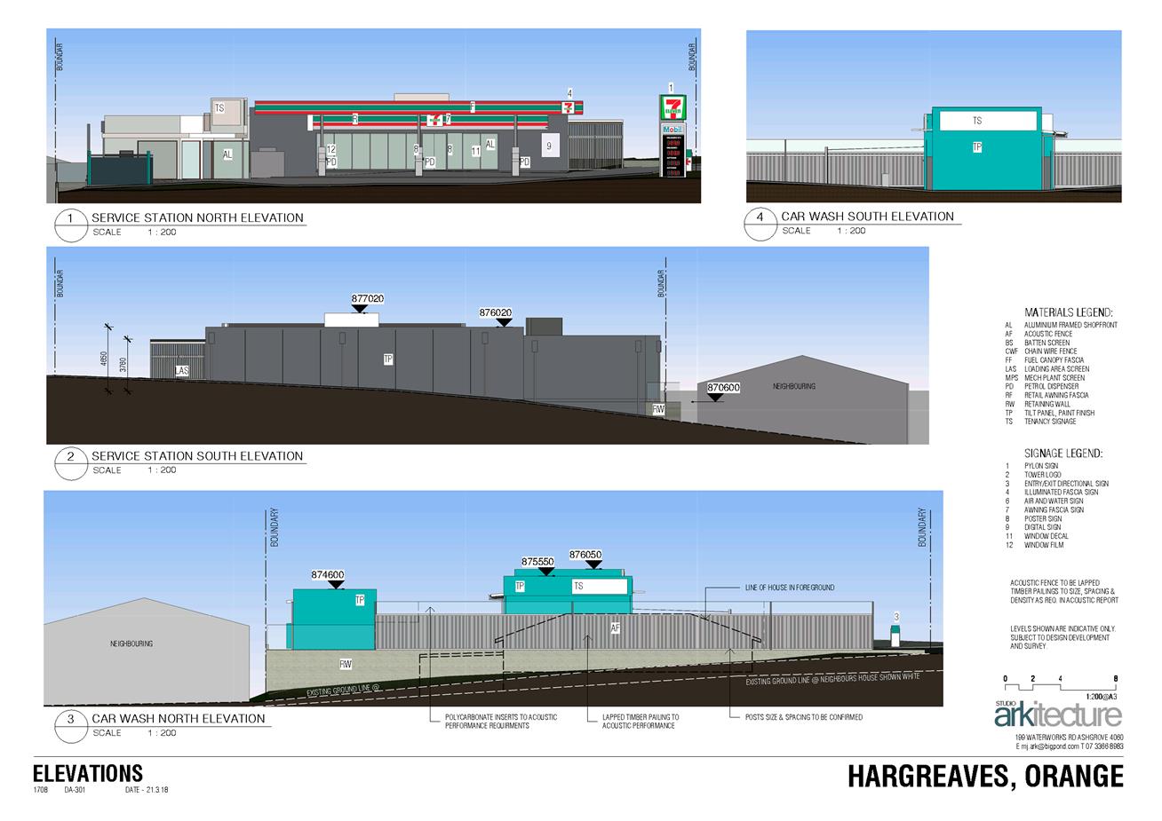
Planning and Development Committee
1 May 2018
2.2 Development
Application DA 347/2017(1) - 68-74 Molong Road
Attachment 2 Plans
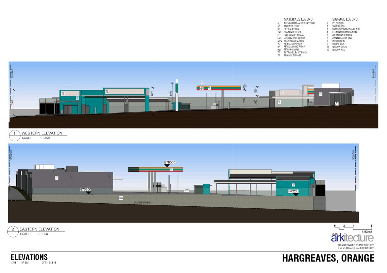
Planning and Development Committee
1 May 2018
2.2 Development
Application DA 347/2017(1) - 68-74 Molong Road
Attachment 2 Plans
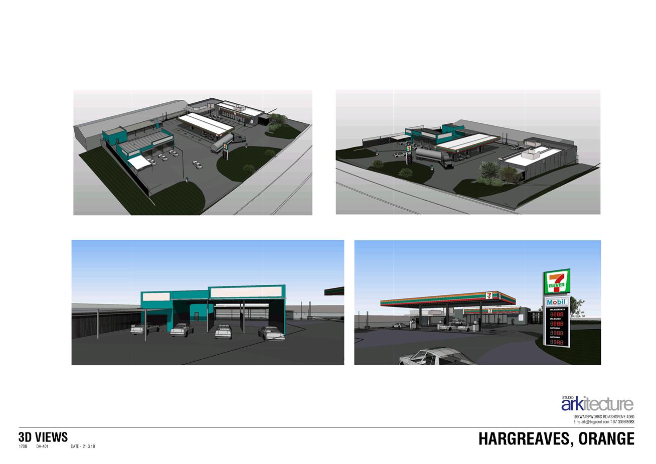
Planning and Development Committee
1 May 2018
2.2 Development
Application DA 347/2017(1) - 68-74 Molong Road
Attachment 2 Plans
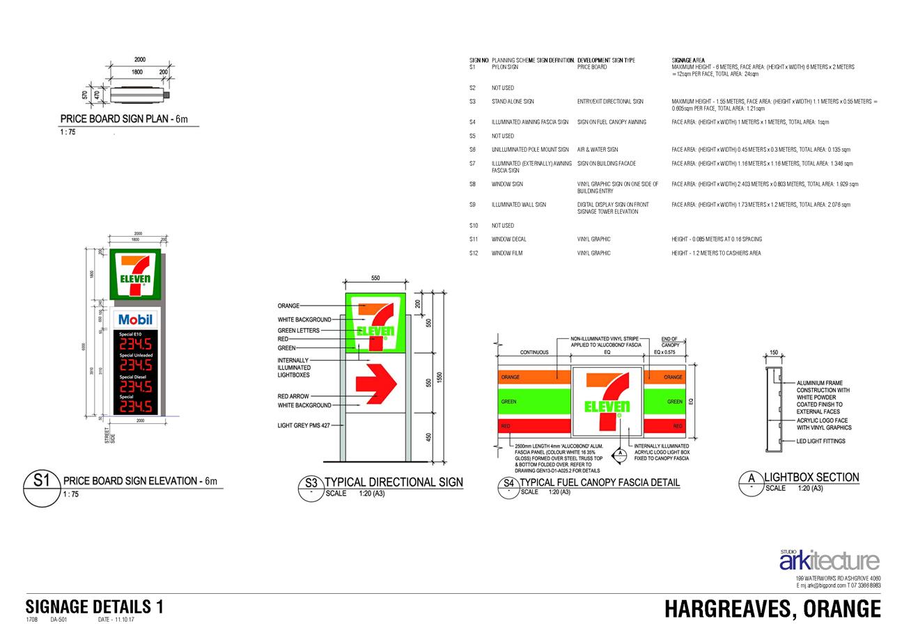
Planning and Development Committee
1 May 2018
2.2 Development
Application DA 347/2017(1) - 68-74 Molong Road
Attachment 2 Plans
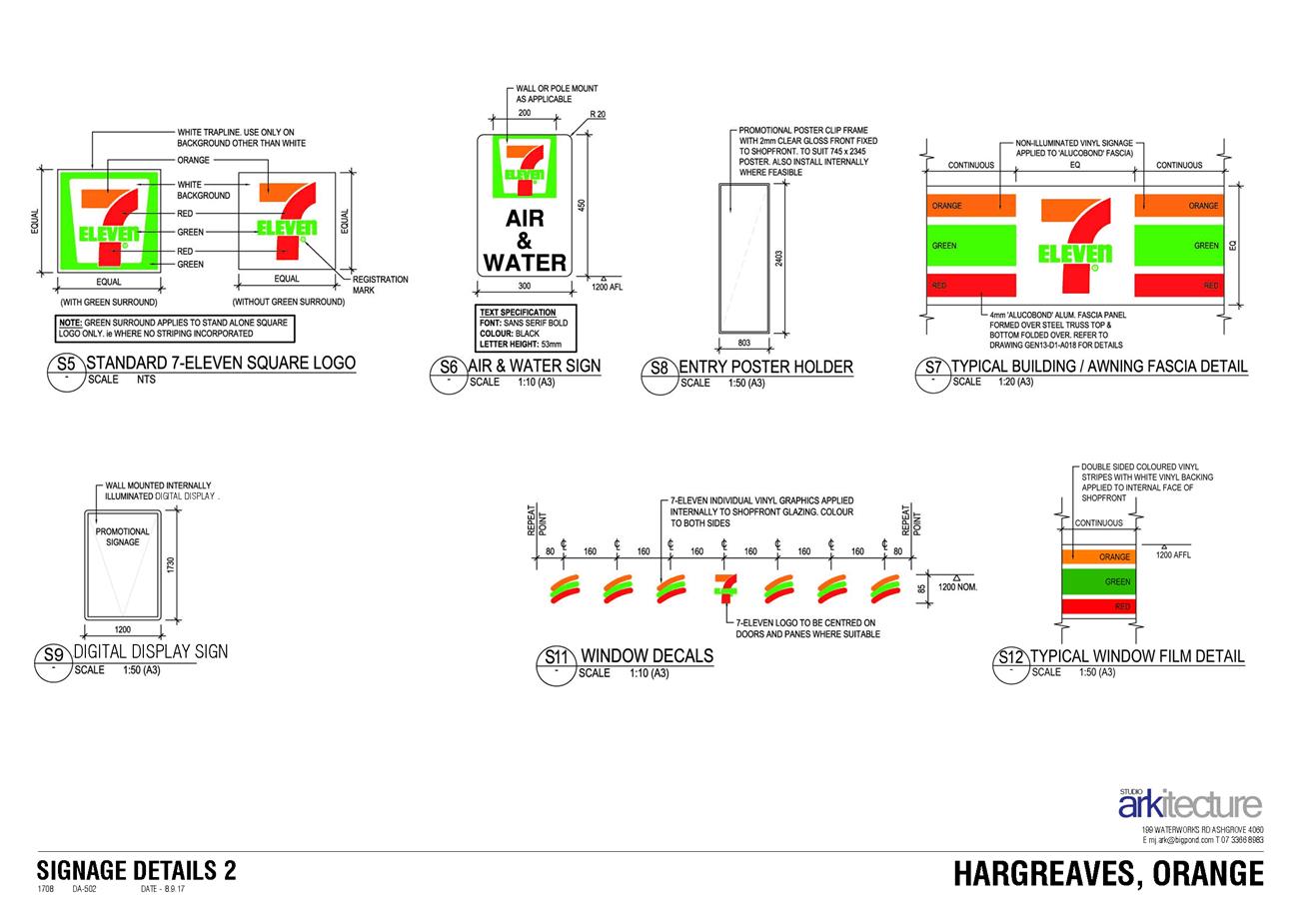
Planning and Development Committee
1 May 2018
2.2 Development
Application DA 347/2017(1) - 68-74 Molong Road
Attachment 2 Plans
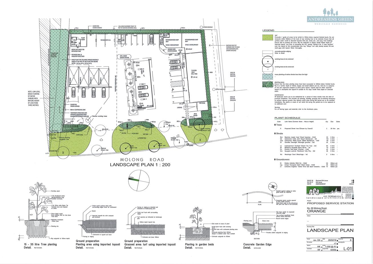
Planning and Development Committee
1 May 2018
2.2 Development
Application DA 347/2017(1) - 68-74 Molong Road
Attachment 3 Submissions

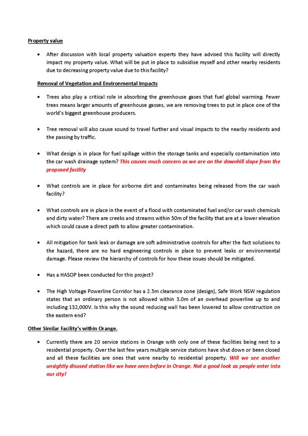
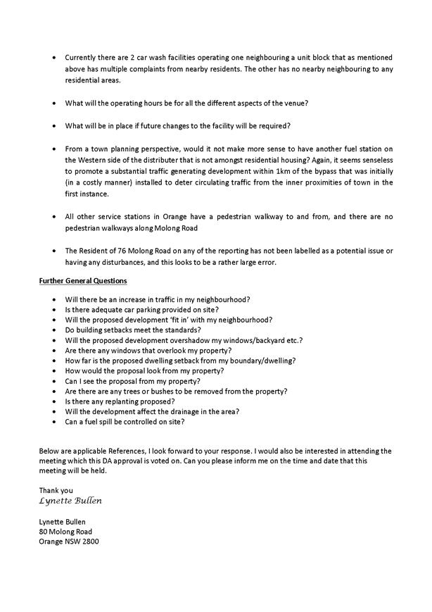

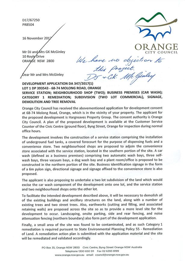
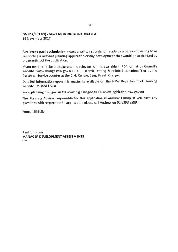
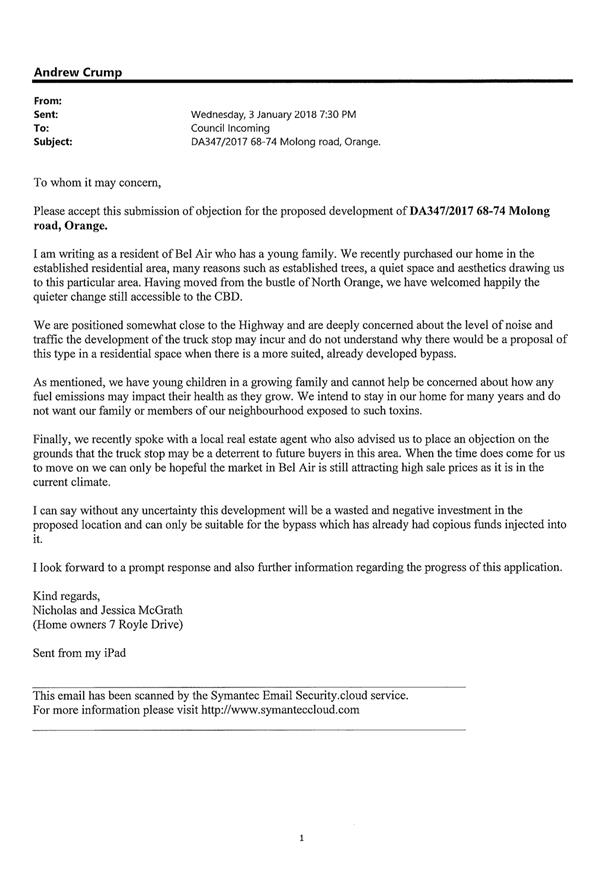
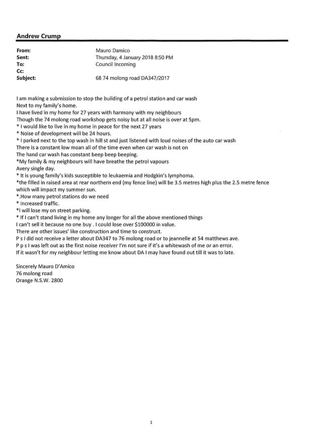
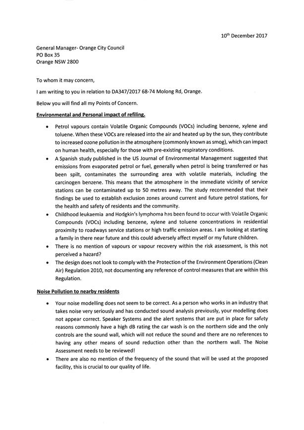
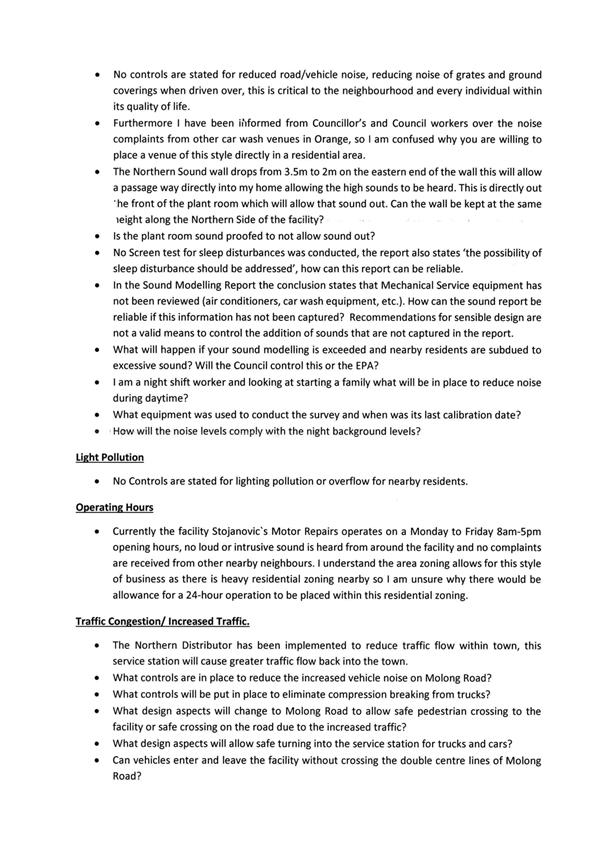

Planning
and Development Committee
1 May 2018
2.2 Development
Application DA 347/2017(1) - 68-74 Molong Road
Attachment 4 Report
from PDC 3 April 2018
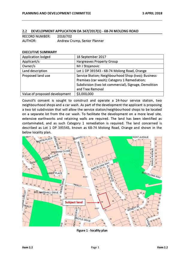
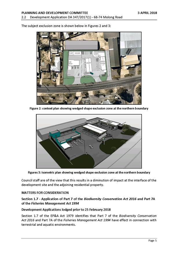
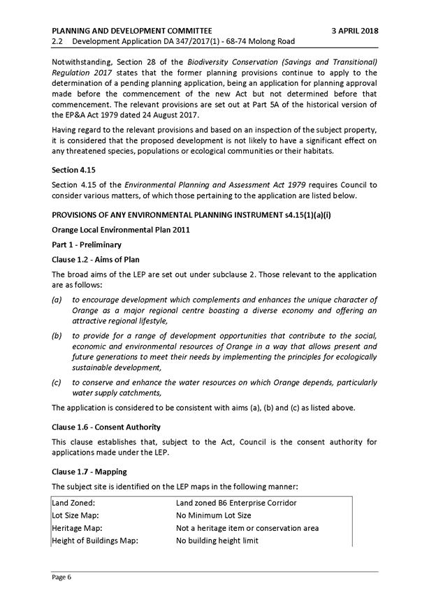
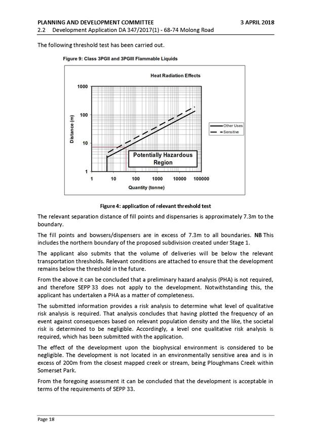

2.3 Development
Application DA 389/2017(1) - Lot 7004 Baker Street, Spring Hill (Alf Read Park)
RECORD
NUMBER: 2017/2521
AUTHOR: Andrew
Crump, Senior Planner
EXECUTIVE Summary
|
Application
lodged
|
24/10/2017
|
|
Applicant/s
|
Orange
City Council
|
|
Owner/s
|
The
State of NSW (Crown Land)
|
|
Land
description
|
Lot 7004
DP 1020289 - Baker Street, Spring Hill
|
|
Proposed
land use
|
Recreation
Area - Amenities Block – Single Accessible WC (Alf Read Park)
|
|
Value of
proposed development
|
$50,000
|
Council's consent is sought to install a building comprising
a single accessible Water Closet (WC) at Alf Read Park, Spring Hill.
The land is known as Lot 7004 DP 1020289. Refer below locality plan.
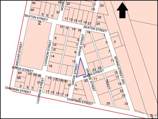
Figure 1: locality plan - subject land shown in blue
outline
The toilet block consists of a single accessible water
closet (WC). The amenities block will be located between the covered play area
and the run-up strip for the existing cricket nets.
The form of the building will be contemporary, with a
mono-pitched roof providing an awning at the entrance to the WC. The external
appearance will consist of lightweight cladding.
A small solar system will be installed on the roof of the
structure to power the associated lighting.
Council’s reticulated water and sewer systems will
need to be extended to service the facility.
The land is Crown Land. It was noted as part of the process
in obtaining owner’s consent that the trustee was vested in Cabonne
Council, rather than Orange City Council. This anomaly has been rectified and
owners consent has been provided.
The development will have an acceptable level of impact upon
the heritage conservation area and acceptable impacts upon the amenity of the
locality. Accordingly, the development is recommended for approval.
RECENT LEGISLATIVE CHANGES
On 1 March 2018 the Environmental Planning and Assessment
Act 1979 was substantially amended. The most immediate change involves the
restructuring and renumbering of the Act, with other more substantive
changes to be phased in over time. However, for some applications (particularly
where an application was lodged prior to the changes coming into effect) the
supporting documentation may still reference the previous numbering regime. In
the drafting of this report the content and substance of the supporting
material has been considered irrespective of which legislative references were
used.
DECISION FRAMEWORK
Development in Orange is governed by two key documents;
Orange Local Environment Plan 2011 and Orange Development Control Plan 2004. In
addition, the Infill Guidelines are used to guide development, particularly in
the heritage conservation areas and around heritage items.
Orange Local Environment Plan 2011 – the LEP
should be considered by Council to be a definitive document. LEPs govern the
types of development that are permissible or prohibited in different parts of
the City and also provide some assessment criteria in specific circumstances.
Uses are either permissible or not - there are no grey areas in terms of
permissibility. The objectives of each zoning and indeed the aims of the LEP
itself are, however, open to interpretation and can be used to guide decision
making around appropriateness of development.
Orange Development Control Plan 2004 – the DCP
guides development. In general it is a performance based document rather than
prescriptive in nature - its purpose is to guide development. The Land and
Environment Court tends to view it as such. In each area of interest there are
often guidelines used. These guidelines indicate ways of achieving the planning
outcomes. It is thus recognised that there may also be other solutions of
merit. All design solutions are considered on merit by planning and building
staff. Applications should clearly demonstrate how the planning outcomes are
being met where alternative design solutions are proposed. So one can see that
the DCP gives leeway for developers and architects to use design to achieve the
outcome in other ways if they can. Stating that DCP guidelines are
inflexible can be misleading.
The proposed toilet design and location is supported by the
Spring Hill Community Committee. The design is considered to be modest and
considers the heritage significance of the village. One submission from an
adjoining neighbour raising objection to the structure was received. The
development is permissible within the zone and would, if approved, improve
public services to Alf Read Park and Spring Hill.
Link To Delivery/OPerational Plan
The recommendation in this report relates to the
Delivery/Operational Plan strategy “1.1 Our City -
Provide easily obtainable information on the legal responsibilities of
Councillors, Council staff and the community”.
Financial Implications
Nil
Policy and Governance Implications
Nil
|
Recommendation
That Council consents to
development application DA 389/2017(1)
for Recreation Area - Amenities Block (Alf Read Park) at Lot 7004 DP
1020289 - Baker Street, Spring Hill
pursuant to the conditions of consent in the attached Notice of Approval.
|
further considerations
Consideration has been given to the
recommendation’s impact on Council’s service delivery; image and reputation;
political; environmental; health and safety; employees; stakeholders and
project management; and no further implications or risks have been identified.
SUPPORTING INFORMATION
THE APPLICATION/PROPOSAL
Council's consent is sought to install a single water closet
(WC) amenities structure on land legally described as Lot 7004 DP 1020289,
known as Alf Read Park, Spring Hill.
The toilet block consists of a single accessible WC. The
amenities block will be located between the covered play area and the run-up
strip for the cricket nets.
The form of the building will be contemporary with a
mono-pitched roof providing an awning at the entrance to the WC. The external
appearance will consist of lightweight cladding. Refer below image.
Figure 2: diagrammatic example of front of proposed
structure
(actual external colours will be different)

Figure 3: rear view of proposed facility
(external colours and finsihes will align with those
shown in above Figure 3)
Council’s reticulated water and sewer systems will
need to be extended to service the facility.
MATTERS FOR CONSIDERATION
Section 1.7 - Application of
Part 7 of the Biodiversity Conservation Act 2016 and Part 7A of the
Fisheries Management Act 1994.
Development Applications lodged prior to 25 February 2018
Section 1.7 of the Environmental Planning and Assessment Act
1979 (EP&A Act 1979) identifies that Part 7 of the Biodiversity
Conservation Act 2016 and Part 7A of the Fisheries Management Act 1994 have
effect in connection with terrestrial and aquatic environments.
Notwithstanding, Section 28 of the Biodiversity Conservation
(Savings and Transitional) Regulation 2017 states that the former planning
provisions continue to apply to the determination of a pending planning
application, being an application for planning approval made before the
commencement of the new Act but not determined before that commencement. The
relevant provisions are set out at Part 5A of the historical version of the
EP&A Act 1979 dated 24 August 2017.
Having regard to the relevant provisions and based on an
inspection of the subject property, it is considered that the proposed
development is not likely to have a significant effect on any threatened
species, populations or ecological communities or their habitats.
Section 4.15
Section 4.15 of the EP&A Act
1979 requires Council to consider various matters, of which those pertaining to
the application are listed below.
PROVISIONS OF ANY ENVIRONMENTAL
PLANNING INSTRUMENT s4.15(1)(a)(i)
Orange Local Environmental Plan
2011
Part 1 - Preliminary
Clause 1.2 - Aims of Plan
The broad aims of the LEP are set out under Subclause 2.
Those relevant to the application are as follows:
(a) to
encourage development which complements and enhances the unique character of
Orange as a major regional centre boasting a diverse economy and offering an
attractive regional lifestyle
(b) to
provide for a range of development opportunities that contribute to the social,
economic and environmental resources of Orange in a way that allows present and
future generations to meet their needs by implementing the principles for
ecologically sustainable development
(c) to
conserve and enhance the water resources on which Orange depends, particularly
water supply catchments
(f) to
recognise and manage valued environmental heritage, landscape and scenic
features of Orange.
The application is considered to be consistent with aims
(a), (b), (c) and (f) as listed above.
Clause 1.6 - Consent Authority
This clause establishes that,
subject to the Act, Council is the consent authority for applications made
under the LEP.
Clause 1.7 - Mapping
The subject site is identified on the LEP maps in the
following manner:
|
Land
Zoning Map:
|
Land
zoned RE1 Public Creation
|
|
Lot
Size Map:
|
Minimum
Lot Size 1000m2
|
|
Heritage
Map:
|
Heritage
item or conservation area
|
|
Height
of Buildings Map:
|
No
building height limit
|
|
Floor
Space Ratio Map:
|
No
floor space limit
|
|
Terrestrial
Biodiversity Map:
|
No
biodiversity sensitivity on the site
|
|
Groundwater
Vulnerability Map:
|
Groundwater
vulnerable
|
|
Drinking
Water Catchment Map:
|
Not
within the drinking water catchment
|
|
Watercourse
Map:
|
Not
within or affecting a defined watercourse
|
|
Urban
Release Area Map:
|
Not
within an urban release area
|
|
Obstacle
Limitation Surface Map:
|
No
restriction on building siting or construction
|
|
Additional
Permitted Uses Map:
|
No
additional permitted use applies
|
|
Flood
Planning Map:
|
Not
within a flood planning area
|
Those matters that are of relevance are addressed in detail
in the body of this report.
Clause 1.9A - Suspension of
Covenants, Agreements and Instruments
This clause provides that covenants, agreements and other
instruments which seek to restrict the carrying out of development do not apply
with the following exceptions:
· covenants imposed
or required by Council
· prescribed
instruments under Section 183A of the Crown Lands Act 1989
· any conservation
agreement under the National Parks and Wildlife Act 1974
· any trust
agreement under the Nature Conservation Trust Act 2001
· any property
vegetation plan under the Native Vegetation Act 2003
· any biobanking
agreement under Part 7A of the Threatened Species Conservation Act 1995
· any planning
agreement under Division 6 of Part 4 of the Environmental Planning and
Assessment Act 1979.
Council staff are not aware of the title of the subject
property being affected by any of the above.
Part 2 - Permitted or Prohibited
Development
Clause 2.1 - Land Use
Zones and Clause 2.3 - Zone Objectives and Land Use Table
The subject site is located within the RE1 Public Recreation
zone. The proposed development is defined as a recreation area under OLEP 2011 which
means:
recreation area means a
place used for outdoor recreation that is normally open to the public, and
includes:
(a) a
children’s playground, or
(b) an
area used for community sporting activities, or
(c) a
public park, reserve or garden or the like,
and any ancillary buildings, but does not include a
recreation facility (indoor), recreation facility (major) or recreation
facility (outdoor).
The development is an ancillary building within a recreation
area and is permissible in the RE1 Public Recreation zone with the consent of
Council.
Clause 2.3 of LEP 2011
references the Objectives for each zone in LEP 2011. These objectives for
land zoned relevant zone are as follows:
1 - Objectives
of the RE1 Public Recreation Zone
· To enable land
to be used for public open space or recreational purposes.
· To provide a
range of recreational settings and activities and compatible land uses.
· To protect and
enhance the natural environment for recreational purposes.
· To ensure
development is ordered in such a way as to maximise public transport patronage
and encourage walking and cycling in close proximity to settlement.
· To ensure
development along the Southern Link Road has alternative access.
The development is not inconsistent with the objectives of
the RE1 Public Recreation Zone. The proposed development will provide public
amenities to users of the public space.
Part 3 - Exempt and Complying
Development
The application is not exempt or complying development.
Part 5 - Miscellaneous Provisions
5.10 - Heritage Conservation
The subject land is located within the Spring Hill Heritage
conservation area. The state of significance for Spring Hill Heritage
Conservation Area is described as:
Spring Hill - The original
subdivision has historic significance as an early successful farming community
which developed under the influence of the railway in the 1870's and 1880's,
and the character of the domestic scale and wide range of building types
including dwellings, shops, sheds, a hotel, police station, school and other
uses remain to provide a character which is rare within the central west,
valued by the local community and worthy of conserving and enhancing.
(1) Objectives
The
objectives of this clause are as follows:
(a) to
conserve the environmental heritage of Orange
(b) to
conserve the heritage significance of heritage items and heritage conservation
areas, including associated fabric, settings and views
(c) to
conserve archaeological sites
(d) to
conserve Aboriginal objects and Aboriginal places of heritage significance.
The development is not inconsistent with the above
objectives of the clause. The building design will be a simple sympathetic
design adopting lightweight cladding materials and a dark recessive colour
palette.
(2) Requirement
for Consent
Development
consent is required for any of the following:
(e) erecting
a building on land:
(i) on
which a heritage item is located or that is within a heritage conservation
area.
The development involves the erection of a building within a
heritage conservation area which requires development consent.
(4) Effect
of Proposed Development on Heritage Significance
The
consent authority must, before granting consent under this clause in respect of
a heritage item or heritage conservation area, consider the effect of the
proposed development on the heritage significance of the item or area
concerned. This subclause applies regardless of whether a heritage management
document is prepared under Subclause (5) or a heritage conservation management
plan is submitted under Subclause (6).
The development will have an acceptable impact upon the
significance of the heritage conservation area. The structure will be
appropriately sited within the park so as not to impact upon the significance
of dwellings within the locality. Moreover, the toilet is respectfully sited
away from the Alf Read memorial sign at the southern end of the park. The size
of the structure will be subordinate to other existing structures within the
park. The condition relating to colours and materials will result in structure
that is visually recessive within the setting, and overall, will result in a
building that will be an appropriate fit within the context and setting. The
proposed solar system will integrate reasonably well within the design and
general appearance of the structure and is considered acceptable.
(5) Heritage
Assessment
The
consent authority may, before granting consent to any development:
(a) on
land on which a heritage item is located
(b) on
land that is within a heritage conservation area
(c) on
land that is within the vicinity of land referred to in paragraph (a) or (b),
require
a heritage management document to be prepared that assesses the extent to which
the carrying out of the proposed development would affect the heritage
significance of the heritage item or heritage conservation area concerned.
A heritage
management document is not required.
(6) Heritage
Conservation Management Plans
The
consent authority may require, after considering the heritage significance of a
heritage item and the extent of change proposed to it, the submission of a
heritage conservation management plan before granting consent under this
clause.
A heritage
conservation management plan is not required.
(7) Archaeological
Sites
The
consent authority must, before granting consent under this clause to the
carrying out of development on an archaeological site (other than land listed
on the State Heritage Register or to which an interim heritage order under the Heritage Act 1977
applies):
(a) notify
the Heritage Council of its intention to grant consent
(b) take
into consideration any response received from the Heritage Council within 28
days after the notice is sent.
The site is not known to be an archaeological site.
Notwithstanding this, Council’s standard precautionary condition relating
to heritage is attached.
(8) Aboriginal
Places of Heritage Significance
The
consent authority must, before granting consent under this clause to the
carrying out of development in an Aboriginal place of heritage significance:
(a) consider
the effect of the proposed development on the heritage significance of the place
and any Aboriginal object known or reasonably likely to be located at the place
by means of an adequate investigation and assessment (which may involve
consideration of a heritage impact statement)
(b) notify
the local Aboriginal communities, in writing or in such other manner as may be
appropriate, about the application and take into consideration any response
received within 28 days after the notice is sent.
An Aboriginal Heritage Information
Management System (AHMS) search confirms that the subject land is not an
Aboriginal Place of Heritage Significance.
Part 6 - Urban Release Area
Not relevant to the application. The subject site is not
located in an Urban Release Area.
Part 7 - Additional Local Provisions
7.6 - Groundwater Vulnerability
This clause seeks to protect
hydrological functions of groundwater systems and protect resources from both
depletion and contamination. Orange has a high water table and large areas of
the LGA, including the subject site, are identified with “Groundwater
Vulnerability” on the Groundwater Vulnerability Map. This requires that
Council consider:
(a) whether or not the development (including
any onsite storage or disposal of solid or liquid waste and chemicals) is
likely to cause any groundwater contamination or have any adverse effect on
groundwater dependent ecosystems
(b) the cumulative impact (including the
impact on nearby groundwater extraction for potable water supply or stock water
supply) of the development and any other existing development on groundwater.
Furthermore, consent may not be
granted unless Council is satisfied that:
(a) the development is designed, sited and
will be managed to avoid any significant adverse environmental impact
(b) if that impact cannot be reasonably
avoided - the development is designed, sited and will be managed to minimise
that impact
(c) if that impact cannot be minimised - the
development will be managed to mitigate that impact.
The proposal is not
anticipated to involve the discharge of toxic or noxious substances and is
therefore unlikely to contaminate the groundwater or related ecosystems. The
proposal does not involve extraction of groundwater and will therefore not
contribute to groundwater depletion. The design and siting of the proposal
avoids impacts on groundwater and is therefore considered acceptable.
Clause 7.11 - Essential
Services
Clause 7.11 applies and states:
Development
consent must not be granted to development unless the consent authority is
satisfied that any of the following services that are essential for the proposed
development are available or that adequate arrangements have been made to make
them available when required:
(a) the supply of water
(b) the supply of electricity
(c) the disposal and management of sewage
(d) storm water drainage or on-site conservation
(e) suitable road access.
In consideration of this clause, Council’s reticulated
water and sewerage systems is available in close proximity to the subject land.
It will be necessary for an engineering plan to be submitted that shows how the
facility will be served by Council’s reticulated systems.
STATE ENVIRONMENTAL PLANNING
POLICIES
State Environmental Planning Policy 55 - Remediation of
Land
State Environmental Planning Policy 55 - Remediation of Land
(SEPP 55) requires that a consent authority must not consent to the carrying
out of development of land unless it has considered whether the land is
contaminated, is satisfied that the land is suitable in its contaminated state
for the development that is proposed, and if the land requires remediation to
be made suitable for the proposed development it is satisfied that the land
will be remediated before the land is used for that purpose.
Furthermore, SEPP 55 requires that before determining an
application for consent to carry out development that would involve a change of
use on any of the land specified in Subclause (4), the consent authority
must consider a report specifying findings of a preliminary investigation of
the land concerned. The development does not involve a change of use.
The subject land has a long history of being used for public
recreation purposes and no prior uses of a nature that could result in
contamination of land are known to have occurred previously. As such, the land
is not expected to be affected by contamination. Notwithstanding this,
Council’s standard precautionary condition relating to unexpected
contamination is attached to the consent.
STATE ENVIRONMENTAL PLANNING
POLICY (Infrastructure)
A small solar panel located on the roof of the structure is
proposed to power the associated lighting. As the land is located in a heritage
conservation area and the roof will be orientated in a way whereby the system
addresses a road, the structure requires consent pursuant to Clause 34(7) of
the SEPP. The applicant has sought consent as part of the application.
PROVISIONS OF ANY DRAFT
ENVIRONMENTAL PLANNING INSTRUMENT THAT HAS BEEN PLACED ON EXHIBITION 4.15(1)(a)(ii)
There are no draft environmental planning instruments that
apply to the subject land or proposed development.
DESIGNATED DEVELOPMENT
The proposed development is not designated development.
INTEGRATED DEVELOPMENT
The proposed development is not integrated development.
PROVISIONS OF ANY DEVELOPMENT
CONTROL PLAN s4.15(1)(a)(iii)
Development Control Plan 2004
Development Control Plan 2004 (“the DCP”)
applies to the subject land (Chapter 0 – LEP 2011, Chapter 2 –
Natural Resource Management, Chapter 3 – General Considerations, chapter
11 – Land used for Open space and recreation and chapter and chapter 13
– Heritage). An assessment of the proposed development against the
relevant Planning Outcomes will be undertaken below.
Pursuant to Planning Outcome 0.2-1 Interim Planning Outcomes
- Conversion of Zones:
· Throughout this
Plan, any reference to a zone in Orange LEP 2000 is to be taken to be a
reference to the corresponding zone(s) in the zone conversion table.
The corresponding zone to zone 6 Open Space (Orange LEP
2000) is zone RE1 Public Recreation zone (Orange LEP 2011). As such, Orange DCP
2004 – Chapter 11 – Land used for Open Space and Recreation is the
principle chapter relevant to development upon such zoned land. Those
provisions that are relevant are addressed below.
Chapter 2 – Natural Resource
Management
Chapter 2 – Natural Resource Management provides
planning outcomes for stormwater quality, groundwater quality, soil resource
management, vegetation management and flora fauna management, all of which have
been considered above under the heading Orange LEP 2011 (stormwater,
groundwater) or Section 1.7 of the Act.
Chapter 3 – General
Considerations
Chapter 3 provides planning outcomes of a general nature.
Those of relevance to this assessment relate to cumulative impacts, scenic
landscape, urban areas and energy efficiency. These are all addressed elsewhere
within this report. Cumulative impacts are addressed below under the heading
“Likely Impacts”. Scenic, landscape and urban areas are addressed
under the infill guidelines below, and energy efficiency is addressed through
the provision of a solar panel to power LED lighting within the building.
Chapter 11 – Land used
for Open Space and recreation
Chapter 11 requires land that is used for open space and
recreation to be done so in accordance with a relevant adopted plan of
management. The subject land is Crown Land. Council is not aware of a plan of
management having been prepared for the land. Notwithstanding this, the Crown
reservation is for the purposes of public recreation in the trust of Orange
City Parklands Reserve Trust, with the additional purpose for the land to be
used for tourist facilities and services. The proposed development relating to
the provision of additional amenities for the park is not inconsistent with the
gazetted reservation of the Crown land. The development is not inconsistent
with chapter 11 of the DCP.
Chapter 13 – Heritage
Heritage matters are addressed both above under the heading
Clause 5.10(3) and below under the heading “Infill Guidelines”. Those
assessments both conclude that the development is satisfactory in terms of
heritage conservation.
INFILL GUIDELINES
The development involves a new building within the Spring
Hill Heritage Conservation Area. The heritage significance of the area is
detailed above. Relevantly, Council’s adopted infill guidelines are
applicable to the assessment of the application. The guidelines principally
deal with the following heads of consideration; character, scale and form,
siting, materials and colour and detailing. Each head of consideration is
addressed below.
Character
The area is characterised as a centrally located triangular
shaped public reserve that is bounded by Grove and Baker Streets and an
unformed road reserve. The existing improvements on the land comprise a
children’s playground and shade sail, cricket nets and basketball court.
There are also a number of large deciduous trees within the park. At the
southern end of the park there is a memorial sign in dedication to Mr Alf Read.
The proposed toilet will not unreasonably alter the
character of the park, nor will it alter in a detrimental way, the character of
the surrounding locality. This is due to the building’s siting within the
park, appropriate sympathetic design and recessive colour scheme.
Scale and Form
The building will be a small single storey building
comprising one accessible WC. The form of the building will be of a simple
rectangular form with a mono-pitch roof, pitching to the front of the building
extending past the building proper which provides a covered entrance to the WC.
The scale and form of the subject building will be appropriate
for the context and setting.
Siting
The building will be sited generally at the mid-point
between the northern and southern boundaries of the park, and will be 2m off
the eastern boundary which is the common boundary between the park and an
unformed road reserve. Although only being 2m from the eastern boundary, the
selected siting is acceptable as the unformed road reserve has the appearance
of being part of the park, meaning for all intents and purposes the subject
structure is centrally located within the park.
In the unlikely event of the road being provided within the
road reserve, notwithstanding the selected setback; the modest size of the
building, its purpose within a public park and arrangement of existing
improvements, the 2m setback will not result in an unsatisfactory
streetscape/amenity impact. The selected siting is acceptable.
Materials and Colour
The external building materials will consist of powder
coated steel, Colorbond custom orb roof and wall cladding (lower portion) and
aluminium wall cladding to the upper portion of the building.
A condition is attached that requires the building to adopt
a dark grey colour palette for the frame, roof and lower portion and timber
look cladding to the upper portion of external walls.
Council’s Heritage Advisor has recommended that all
new concrete be charcoal or basalt coloured concrete. This is to ensure new
concrete is sympathetic and recessive within the landscape. A relevant
condition is attached in this regard.
Detailing
The detailing relates to the integration and location of
modern services and in this case the small solar collector on the roof.
Although this will be visible it will not be visually offensive in the
locality.
PROVISIONS PRESCRIBED BY THE
REGULATIONS s4.15(1)(a)(iv)
The development is not inconsistent with the provisions
prescribed by the regulations.
THE LIKELY IMPACTS OF THE
DEVELOPMENT s4.15(1)(b)
Traffic Impacts
The facility is expected to complement the existing
facilities within Alf Read Park by improving amenities rather than
directly generating additional traffic. That being said, given the modest
nature of the facility, any additional traffic is not likely to be excessive. As
such, existing arrangements of on-street parking would be acceptable.
Visual impacts
The proposed facility is well separated from Grove and Baker
Streets and is separated from nearby dwellings to the east by the existing
unformed road reserve. Additionally, the external colour palette and modest
size will result in a development that does not adversely impact upon the
amenity of the area and will therefore have acceptable visual impacts in the
locality.
Environmental impacts
The development will have a minimal impact upon any
endangered ecological communities, endangered species or their habits. The
works associated with the provision of water and sewer connections will also
have minimal environmental impacts.
Heritage impacts
Heritage impacts are addressed above under the heading 5.10
– Heritage Conservation. The foregoing assessment relating to heritage
determined that the development would have an acceptable level of impact upon
the significance of the Spring Hill Heritage Conservation Area.
Cumulative impacts
Cumulative impacts of a development can arise under four
typical scenarios, namely:
· time crowded
effects where individual impacts occur so close in time that the initial impact
is not dispersed before the proceeding occurs
· space crowded
where impacts are felt because they occur so close in space they have a
tendency to overlap
· nibbling effects
occur where small, often minor impacts, act together to erode the environmental
condition of a locality and
· synergistic
effects, where a mix of heterogeneous impacts interact such that the combined
impacts are greater than the sum of the separate effects.
Given the modest scale of the development and the
conditioned hours of operation, the development is not expected to result in
any of the above scenarios that would result in an unsatisfactory impact in the
locality.
Safety, security and crime
prevention
The siting, design and ongoing management of the proposed
toilet will result in satisfactory impacts in relation to safety, security and
crime prevention. The siting of the facility within the park will allow passive
surveillance of the external areas around the proposed toilet which will assist
in the deterrence of anti-social behaviour. The design of the facility will
allow for easy maintenance and repair/clean-up of incidents of vandalism. To
ensure this is the case, an ongoing condition is attached that requires
incidents of vandalism and graffiti to be repaired/removed as soon as
practicable to deter further incidents from occurring.
In terms of the management of the facility, the facility
will be locked each evening and then opened each morning, meaning the facility
will not be accessible at night.
THE SUITABILITY OF THE SITE
s4.15(1)(c)
The site is suitable for the proposed development. The
development will provide additional amenities within an existing public park.
Council staff are not aware of the subject land being affected by any natural,
physical or technological hazards that would unreasonably constrain the
development from occurring in a satisfactory manner.
ANY SUBMISSIONS MADE IN
ACCORDANCE WITH THE ACT s4.15(1)(d)
The proposed development is not defined as advertised
development under the provisions of the Regulations, and as such no formal
exhibition of the application was required. Notwithstanding this, notification
of the development application was provided to adjoining owners. During this
process one submission was received.
Submission – resident of
22 Baker Street
The submission draws attention to a similar existing
facility 285m away from the subject land, stating that the proposed facility is
unnecessary and will negatively affect the park.
The submitter also purports that the selected location will
impact on existing park facilities, aesthetics of the area and create safety
issues.
The submission flags the absence of any formal parking and
describes the situation that occurs when vehicles park within the park and the
resulting damage that occurs to the ground surface and potential safety issues
this creates. The submission also raises the issue of the facility being
retracted in terms of accessibility.
The submitter also suggests that the building materials will
deteriorate quickly and the facility will become and ongoing maintenance issue.
The submission concludes with the submitter conveying his
displeasure with the consultation processes that this project has gone through.
Council staff response
Council planning staff requested that a response be provided
in relation to the submission received. The following was provided by the
applicant:
Thank you for the opportunity
to respond to the submission in regard to the above development.
I note the concerns of the
resident.
As part of the DA process I
met with the author on site. At that meeting we agreed that the proposed
location was the best location available and had the least impact on adjoining
residents whilst providing amenity to the users of the park.
The distance to the
alternative facility is excessive and not regarded as a viable alternative.
The location and style of the
facility has been agreed with the Spring Hill Community Committee members and
other adjoining residents.
Access to the facility both
for users and the cleaners is regarded as suitable.
The product is in use in a
wide variety of locations across Australia and does not present any of the
possible issues identified by the objector.
In response to the submission it is agreed that the distance
to the existing facility is excessive and the provision of a toilet facility at
this park is justified.
The proposed toilet is expected to complement and enhance
the level of amenities on offer within the existing public space rather than
directly drawing people to the park. As such, the existing parking arrangements
are considered adequate for the proposed development. The comments in relation
to contractors and the like driving onto the park is not directly related to
the assessment of this application. It will be necessary for cleaning and
maintenance staff and the like to be directed not to drive onto the park as a
separate process.
In terms of the level accessibility, this is an important
point, particularly when the toilet is designed to be an accessible toilet. As
such, a condition is attached that requires a footpath to be installed from a
public road to the facility. This is required to be installed prior to the
issue of a final occupation certificate. The footpath will be required to be
basalt or charcoal coloured concrete so as to be sympathetic with the context
and setting.
The development will use powder coated steel structure with
lightweight external cladding. Such products are designed to withstand the
elements and it is expected that the facility will have an acceptable
life-cycle. Notwithstanding this, a condition is attached that requires
incidents of vandalism and graffiti to be repaired / cleaned as soon as
practicable.
In terms of the consultative processes that have occurred in
relation to this project, this is separate to the relevant planning matters.
Council planning staff elected to notify the development to adjoining owners to
make them aware of the development and provide the opportunity for those owners
to make representation in relation to the development. Council has met its
obligations in relation to public consultation in relation to this matter
pursuant to the Environmental Planning and Assessment Act.
PUBLIC INTEREST s4.15(1)(e)
The proposed development is considered to be of minor
interest to the wider public due to the relatively localised nature of
potential impacts. The proposal is not inconsistent with any relevant policy
statements, planning studies, guidelines etc that have not been considered in
this assessment.
SUMMARY
The proposed development is permissible with the consent of
Council. The proposed development complies with the relevant aims, objectives
and provisions of Orange LEP 2011 (as amended) and DCP 2004.
A Section 4.15 assessment of the development indicates that the
development is acceptable in this instance. Attached is a draft Notice of
Approval outlining a range of conditions considered appropriate to ensure that
the development proceeds in an acceptable manner.
COMMENTS
The requirements of the Environmental Health and Building
Surveyor and the Engineering Development Section are included in the attached
Notice of Approval.
Attachments
1 Plans,
D18/20320⇩
2 Submission,
IC17/22799⇩
3 Notice
of Approval, NA18/228⇩
Planning and Development Committee
1 May 2018
2.3 Development
Application DA 389/2017(1) - Lot 7004 Baker Street, Spring Hill (Alf Read Park)
Attachment 1 Plans
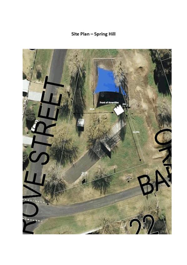
Planning and Development Committee
1 May 2018
2.3 Development
Application DA 389/2017(1) - Lot 7004 Baker Street, Spring Hill (Alf Read Park)
Attachment 1 Plans
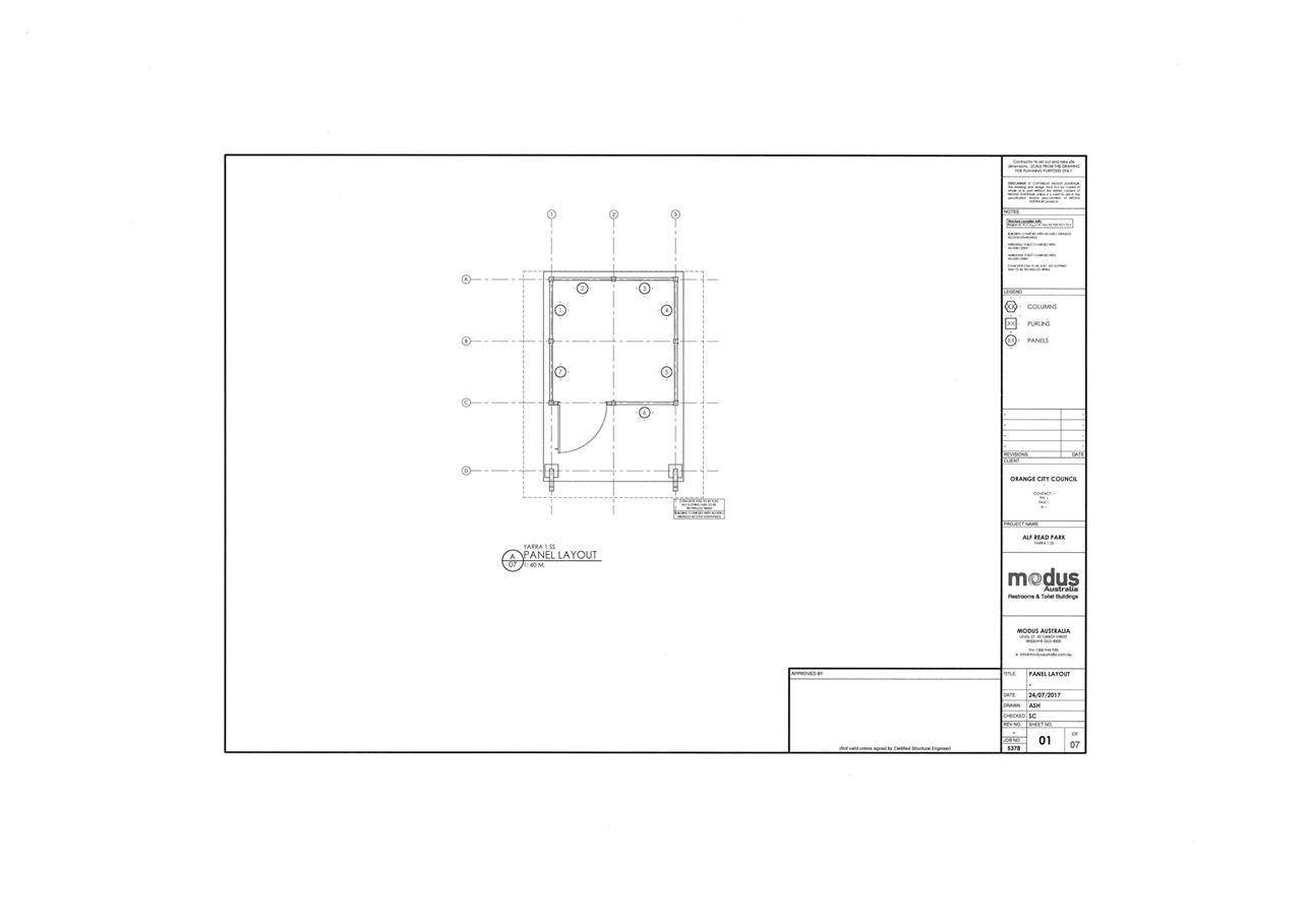
Planning and Development Committee
1 May 2018
2.3 Development
Application DA 389/2017(1) - Lot 7004 Baker Street, Spring Hill (Alf Read Park)
Attachment 1 Plans
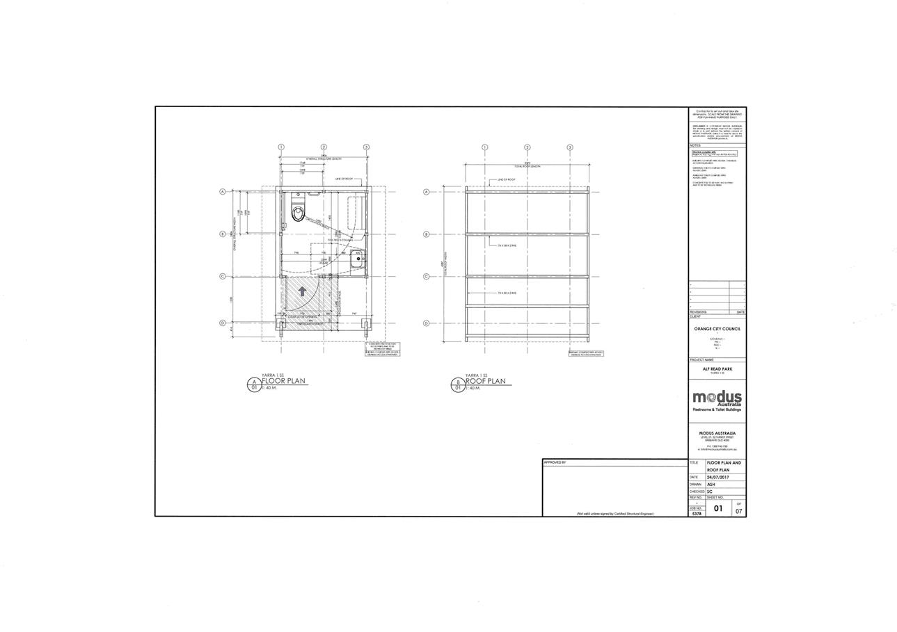
Planning and Development Committee
1 May 2018
2.3 Development
Application DA 389/2017(1) - Lot 7004 Baker Street, Spring Hill (Alf Read Park)
Attachment 1 Plans
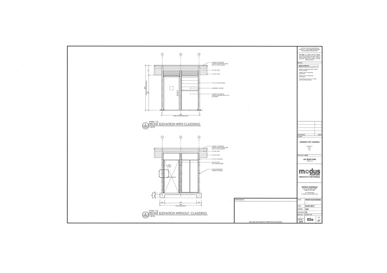
Planning and Development Committee
1 May 2018
2.3 Development
Application DA 389/2017(1) - Lot 7004 Baker Street, Spring Hill (Alf Read Park)
Attachment 1 Plans
Planning and Development Committee
1 May 2018
2.3 Development
Application DA 389/2017(1) - Lot 7004 Baker Street, Spring Hill (Alf Read Park)
Attachment 1 Plans
Planning and Development Committee
1 May 2018
2.3 Development
Application DA 389/2017(1) - Lot 7004 Baker Street, Spring Hill (Alf Read Park)
Attachment 1 Plans
Planning and Development Committee
1 May 2018
2.3 Development
Application DA 389/2017(1) - Lot 7004 Baker Street, Spring Hill (Alf Read Park)
Attachment 1 Plans
Planning and Development Committee
1 May 2018
2.3 Development
Application DA 389/2017(1) - Lot 7004 Baker Street, Spring Hill (Alf Read Park)
Attachment 1 Plans
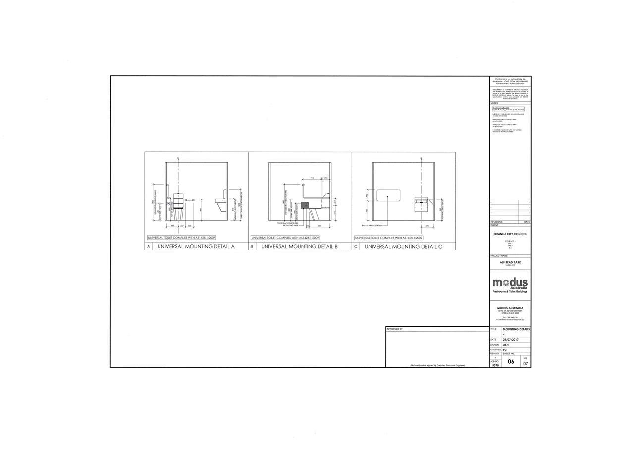
Planning and Development Committee
1 May 2018
2.3 Development
Application DA 389/2017(1) - Lot 7004 Baker Street, Spring Hill (Alf Read Park)
Attachment 2 Submission
Re Alf Reed park
(Spring Hill) proposed toilet. DA
389/2017(1)
Dr Mr Styles
I would like to express my concerns on
the construction of a toilet in the Spring Hill park, I believe a toilet to be
unnecessary and its construction will negatively affect the park. Public
toilets are currently available at approximately 285m (See Diagram 1) from the
proposed site and easily fulfil current needs.
I would like to highlight issues I have with the
current plan
Location.
The location selected will
impact on existing park facilities, aesthetics of the area and create safety
issues.
The location will attract
vehicles to the park, there is no parking available at the site and currently
it is very common to have people drive into the play area and park their cars
to access the play equipment. There is also an issue with vehicles of both the
public and mowing contractors parking on the basketball area. This poor
behaviour presents problems with public safety and the longevity of the
existing facilities due to vehicle damage.
· Vehicles are leaving deep ruts within the park during
rain periods, after a short period of time these ruts are concealed by grass
growth and presenting significant trip and fall hazards for park users.
· The bitumen area is not rated to facilitate vehicle parking,
this is the only place off the roads for residents to use skateboards, and
rollerblades etc. and it is in great danger of being damaged and limiting the
range of activities it provides.
· Children are unable to use the park facilities while
vehicles are present and are intimidated to ask the driver to remove the
vehicle. They are also fearful of the cars movements and are at risk of severe
injury or death if playing in the park near moving vehicles.
· Access to the proposed toilet is restricted for the
disabled, other locations in the park would accommodate this need much better,
the driveway for the residence behind blocks 21 and 23 that goes through the
road easement is the only existing suitable access, presently I believe the
planned location is not in an open location for safety in design requirements.
· Access for maintenance, cleaning and daily security
will require staff and or contractors to access the toilets on foot and
presents its own occupational issues.
Construction and Maintenance
The style presented is of
materials that give the impression that they will quickly deteriate in
appearance and be easily damaged (See Diagram 2), the ongoing operation and
maintenance of the facility will unnecessarily impact on council resources.
Consultation on the construction and placement of the
toilet has been poor, the process seems to have been confined to the
consultative committee and not communicated to the residents in an effective
manner, even more so the residents directly adjacent to the park that should be
formally approached to have the opportunity to discuss the project and raise
any concerns or associated issues. I am pleased that the construction has now
been presented as a development application giving all residents an opportunity
to contribute to the process. Without effective communication the wishes of the
community are not accurately reflected and I believe the consultative committee
desires in this case are not a true representation of the communities, great
improvements can be made in this area.
Regards - Peter Rodgers
22 Baker Street
Spring Hill
Diagram 1
Existing
toilets are easily assesible and are of good quality, these toilets are sign
posted and accommodate large groups using the adjacent hall, they easily fulfil
the current needs of the village, through traffic and tourists.
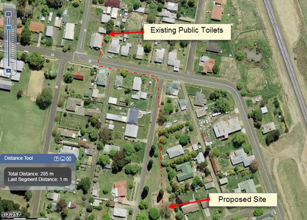
Diagram 2
Image
of the proposed toilet provided by OCC.
Planning
and Development Committee
1 May 2018
2.3 Development
Application DA 389/2017(1) - Lot 7004 Baker Street, Spring Hill (Alf Read Park)
Attachment 3 Notice
of Approval
|

|
ORANGE
CITY COUNCIL
Development
Application No DA
389/2017(1)
NA18/ Container
PR12990
|
NOTICE OF DETERMINATION
OF A DEVELOPMENT
APPLICATION
issued under the Environmental
Planning and Assessment Act 1979
Section 4.18
|
Development
Application
|
|
|
Applicant Name:
|
Orange
City Council
|
|
Applicant Address:
|
PO Box 35
ORANGE
NSW 2800
|
|
Owner’s Name:
|
Orange
City Council
|
|
Land to Be Developed:
|
Lot 7004
DP 1020289 - Baker Street, Spring Hill
|
|
Proposed Development:
|
Recreation
Area - Amenities Block (Alf Read Park)
|
|
|
|
|
Building
Code of Australia
building
classification:
|
Class 10a
|
|
|
|
|
Determination
made under
Section 4.16
|
|
|
Made On:
|
1 May 2018
|
|
Determination:
|
CONSENT
GRANTED SUBJECT TO CONDITIONS DESCRIBED BELOW:
|
|
|
|
|
Consent to
Operate From:
|
2 May 2018
|
|
Consent to
Lapse On:
|
2 May 2023
|
Terms of Approval
The reasons for the imposition of
conditions are:
(1) To ensure a quality
urban design for the development which complements the surrounding environment.
(2) To maintain
neighbourhood amenity and character.
(3) To ensure compliance
with relevant statutory requirements.
(4) To provide adequate
public health and safety measures.
(5) To ensure the utility
services are available to the site and adequate for the development.
(6) To prevent the proposed
development having a detrimental effect on adjoining land uses.
(7) To minimise the impact
of development on the environment.
Conditions
(1) The development
must be carried out in accordance with:
(a) Plan/s
numbered:
One unnumbered site plan,
Plans by ‘modus’ dated 24
July 2017 job no. 5378; sheet 01 (duplicated sheet number, two separate plans);
sheet 02a; sheet 02b; sheet 03; sheet 04; sheet 05; sheet 06 (8 sheets)
(b) statements
of environmental effects or other similar associated documents that form part
of the approval
as amended
in accordance with any conditions of this consent.
(2) All building work must
be carried out in accordance with the provisions of the Building Code of
Australia.
(3) A sign is to be erected
in a prominent position on any site on which building work, subdivision work or
demolition work is being carried out:
(a) showing
the name, address and telephone number of the principal certifying authority
for the work, and
(b) showing
the name of the principal contractor (if any) for any building work and a
telephone number on which that person may be contacted outside working hours,
and
(c) stating
that unauthorised entry to the site is prohibited.
Any such sign is to be maintained while the
building work, subdivision work or demolition work is being carried out.
|
PRIOR TO THE ISSUE OF
A CONSTRUCTION CERTIFICATE
|
(4) Full details of
external colours and finishes of external materials are to be submitted and
approved by Councils Manager Development Assessments prior to the issue of a
Construction Certificate. The external materials and colours shall consist
of woodland grey coloured framing, roof and lower external cladding. The upper
external cladding to be timber coloured or similar lightweight material
cladding. All new concrete is to consist of oxide through mixed concrete in
basalt or charcoal colour.
(5) A 150mm-diameter sewer
main is to be constructed from Council’s existing sewer network to serve
the proposed development. Prior to a Construction Certificate being issued
engineering plans for this sewerage system are to be submitted to and approved
by Orange City Council.
|
PRIOR TO WORKS
COMMENCING
|
(6) Soil erosion control
measures shall be implemented on the site.
(7) A
Construction Certificate application is required to be submitted to, and issued
by Council/Accredited Certifier prior to any excavation or building works being
carried out onsite.
|
DURING
CONSTRUCTION/SITEWORKS
|
(8) If Aboriginal objects,
relics, or other historical items or the like are located during development
works, all works in the area of the identified object, relic or item shall cease,
and the NSW Office of Environment and Heritage (OEH), and representatives from
the Orange Local Aboriginal Land Council shall be notified. Where required,
further archaeological investigation shall be undertaken. Development works in
the area of the find(s) may recommence if and when outlined by the management
strategy, developed in consultation with and approved by the OEH.
(9) In
the event of an unexpected find during works such as (but not limited to) the
presence of undocumented waste, odorous or stained soil, asbestos, structures
such as underground storage tanks, slabs, or any contaminated or suspect
material, all work on site must cease immediately. The beneficiary of the
consent must discuss with Council the appropriate process that should be
followed therein. Works on site must not resume unless the express permission
of the Director Development Services is obtained in writing.
(10) All
construction/demolition work on the site is to be carried out between the hours
of 7.00 am and 6.00 pm Monday to Friday inclusive, 7.00 am to
5.00 pm Saturdays and 8.00 am to 5.00 pm Sundays and Public
Holidays. Written approval must be obtained from the General Manager of Orange
City Council to vary these hours.
(11) Where Orange
City Council is appointed as the Principal Certifying Authority, the following
inspections will be required to be carried out by Council:
- at
commencement of building work
- slab
reinforcement, prior to the pouring of concrete
- frame
inspection
- final
inspection.
Should any of the above mandatory
inspections not be carried out by Council, an Occupation Certificate will not
be issued on the complete structure.
(12) All
materials on site or being delivered to the site are to be contained within the
site. The requirements of the Protection of the Environment Operations Act
1997 are to be complied with when placing/stockpiling loose material or
when disposing of waste products or during any other activities likely to
pollute drains or watercourses.
(13) Any adjustments to
existing utility services that are made necessary by this development
proceeding are to be at the full cost of the developer.
(14) The
provisions and requirements of the Orange City Council Development and
Subdivision Code are to be applied to this application and all work constructed
within the development is to be in accordance with that Code.
The developer is to be entirely responsible for
the provision of water, sewerage and drainage facilities capable of servicing
the development from Council’s existing infrastructure. The developer is
to be responsible for gaining access over adjoining land for services where
necessary and easements are to be created about all water, sewer and drainage
mains within and outside the lots they serve.
(15) A water meter and sewer
junction is to be provided inside the boundary of the allotment in accordance
with the Orange City Council Development and Subdivision Code.
|
PRIOR TO THE ISSUE OF
AN OCCUPATION CERTIFICATE
|
(16) No
person is to use or occupy the building or alteration that is the subject of
this approval without the prior issuing of an Occupation Certificate.
(17) A
concrete footpath shall be installed between a public road and the facility to
provide an accessible connection to the facility. The concrete used for the
footpath shall be oxide through mixed coloured concrete in a charcoal or basalt
colour. The footpath shall be installed prior to the issue of a final
occupation certificate.
(18) Certification from
Orange City Council is required to be submitted to the Principal Certifying
Authority prior to the issue of an Occupation Certificate stating that all
works relating to connection of the development to Council assets, works on
public land, works on public roads, stormwater, sewer and water reticulation
mains and footpaths have been carried out in accordance with the Orange City
Council Development and Subdivision Code and the foregoing conditions, and that
Council will take ownership of the infrastructure assets.
(19) All
of the foregoing conditions are to be at the full cost of the developer and to
the requirements and standards of the Orange City Council Development and
Subdivision Code, unless specifically stated otherwise. All work required by
the foregoing conditions is to be completed prior to the issuing of an
Occupation Certificate, unless stated otherwise.
|
MATTERS FOR THE
ONGOING PERFORMANCE AND OPERATION OF THE DEVELOPMENT
|
(20) Outdoor lighting must
be in accordance with the Australian Standard 4282-1997 Control of the
obtrusive effects of outdoor lighting.
(21) The toilet shall be
locked closed each evening before dusk and then unlocked each morning at dawn.
(22) All incidents of
vandalism and graffiti shall be repaired / removed as soon as practicable.
Other Approvals
General
terms of other approvals integrated as part of this consent:
Local
Government Act 1993 approvals granted under Section 68.
Water, sewer and
stormwater
(1) All plumbing
and drainage (water supply, sanitary plumbing and drainage, stormwater drainage
and hot water supply) is to comply with the Local Government (Water,
Sewerage and Drainage) Regulation 1998, the Plumbing Code of
Australia 2016 - Plumbing & Drainage and Australian
Standard AS3500 - National Plumbing and Drainage Code. Such work is to be
installed by a licensed plumber and is to be inspected and approved by Council
prior to concealment.
(2) The
following inspections are required to be carried out by Council as the Water
and Sewer Authority:
- internal
sewer
- hot
and cold water installation
- external
sewer
- stormwater
drainage
- final
on water, sewer and stormwater drainage and Council services.
(3) Hot
water shall be stored at a minimum of 60OC and be delivered to all
sanitary fixtures used for personal hygiene (bathrooms/ensuites) at a
temperature not exceeding 50oC. Where tempering valves are
installed, a sign is to be permanently fixed on the hot water heater adjacent
to the tempering valve (clearly visible) indicating:
“A tempering valve has been
installed to prevent scalding. This valve is to be renewed at intervals as
recommended by the manufacturer.”
(4) The
location and depth of the sewer junction/connection to Council’s sewerage
system is to be determined to ensure adequate fall to the sewer is available.
(5) All
stormwater is to be disposed of in a manner suitable to the site.
Right of Appeal
If you are dissatisfied with this
decision, Section 8.7 of the Environmental Planning and Assessment
Act 1979 gives you the right to appeal to the Land and Environment
Court. Pursuant to Section 8.10, an applicant may only appeal within 6 months
after the date the decision is notified.
|
Disability Discrimination Act
1992:
|
This application has been assessed in
accordance with the Environmental Planning and Assessment Act 1979. No
guarantee is given that the proposal complies with the Disability
Discrimination Act 1992.
The applicant/owner is responsible to
ensure compliance with this and other anti-discrimination legislation.
The Disability Discrimination Act
covers disabilities not catered for in the minimum standards called up in the
Building Code of Australia which references AS1428.1 - "Design for
Access and Mobility". AS1428 Parts 2, 3 and 4 provides the most
comprehensive technical guidance under the Disability Discrimination Act
currently available in Australia.
|
|
|
|
|
Disclaimer - S88B of the Conveyancing
Act 1919 - Restrictions on the Use of Land:
|
The applicant should note that there
could be covenants in favour of persons other than Council restricting what
may be built or done upon the subject land. The applicant is advised to check
the position before commencing any work.
|
|
|
|
|
Signed:
|
On behalf of the consent authority ORANGE
CITY COUNCIL
|
|
Signature:
|
|
|
Name:
|
PAUL JOHNSTON - MANAGER DEVELOPMENT
ASSESSMENTS
|
|
Date:
|
2 May 2018
|
2.4 Development
Application DA 405/2017(1) - 241 Ploughmans Lane
RECORD
NUMBER: 2018/989
AUTHOR: Summer
Commins, Senior Planner
EXECUTIVE Summary
|
Application
lodged
|
2
November 2017
|
|
Applicant/s
|
Orange
Evangelical Church Incorporated
|
|
Owner/s
|
Orange
Evangelical Church Incorporated
|
|
Land
description
|
Lot 9 DP
746439 - 241 Ploughmans Lane, Orange
|
|
Proposed
land use
|
Place of
Public Worship and Business Identification Sign
|
|
Value of
proposed development
|
$3,000,000.00
|
Council's consent is sought for a proposed place of public
worship at 241 Ploughmans Lane, Orange.
Figure 1 - locality plan
The proposal involves erection of a purpose-built church
building with floor area of 967m²; conversion of the existing dwelling
house to ancillary church offices; and construction of an onsite car park
containing 112 spaces. The development will necessitate new site access via the
road reserve to the west of the site, including intersection construction at
Cargo Road and new public road. Infilling of dams over the site is also proposed.
The proposed place of public worship will provide Sunday
church services, and various pastoral care activities and groups throughout the
week. Proposed hours of operation are generally between the hours of 7am and
10.30pm with operation to midnight on a Saturday night for up to 12 times a
year.
The proposal comprises nominated integrated development. The
subject land is traversed by Ploughmans Creek. Separate approval is required
from NSW Department of Primary Industries (DPI) (Water) under the Water Management
Act 2000, for works in the vicinity of Ploughmans Creek. DPI Water has issued
General Terms of Approval for the proposed development. These are included in
the attached Notice of Approval.
The subject land has frontage to Cargo Road being a classified
road. The concurrence of Roads and Maritime Services (RMS) is required for
proposed new intersection and road, pursuant to the Roads Act 1993. RMS has
granted its concurrence, subject to conditions. The conditions are included in
the attached Notice of Approval.
The proposal comprises advertised development. At the
completion of the public notice and exhibition period, two submissions had been
received in relation to the application. The issues raised in the submissions
generally relate to the impacts of the development on residential amenity
(light, noise and traffic). The impacts are considered to be within reasonable
limit, consistent with applicable standards, and addressed via conditions of
consent.
The proposed development complies with the planning
provisions that apply to the subject land and particular landuse. Approval of
the application is recommended, subject to conditions in the attached Notice of
Approval.
RECENT LEGISLATIVE CHANGES
On 1 March 2018 the Environmental Planning and Assessment
Act 1979 was substantially amended. The most immediate change involves the
restructuring and renumbering of the Act, with other more substantive
changes to be phased in over time. However, for some applications (particularly
where an application was lodged prior to the changes coming into effect) the
supporting documentation may still reference the previous numbering regime. In
the drafting of this report the content and substance of the supporting
material has been considered irrespective of which legislative references were
used.
DECISION FRAMEWORK
Development in Orange is governed by two key documents
Orange Local Environment Plan 2011 and Orange Development Control Plan 2004. In
addition the Infill Guidelines are used to guide development, particularly in
the heritage conservation areas and around heritage items.
Orange Local Environment Plan 2011 – the LEP
should be considered by Council to be a definitive document. LEPs govern the
types of development that are permissible or prohibited in different parts of
the City and also provide some assessment criteria in specific circumstances.
Uses are either permissible or not - there are no grey areas in terms of
permissibility. The objectives of each zoning and indeed the aims of the LEP
itself are, however, open to interpretation and can be used to guide decision
making around appropriateness of development.
Orange Development Control Plan 2004 – the DCP
guides development. In general it is a performance based document rather than
prescriptive in nature - its purpose is to guide development. The Land and
Environment Court tends to view it as such. In each area of interest there are
often guidelines used. These guidelines indicate ways of achieving the planning
outcomes. It is thus recognised that there may also be other solutions of
merit. All design solutions are considered on merit by planning and building
staff. Applications should clearly demonstrate how the planning outcomes are
being met where alternative design solutions are proposed. So one can see that
the DCP gives leeway for developers and architects to use design to achieve the
outcome in other ways if they can. Stating that DCP guidelines are
inflexible can be misleading.
Director’s Comment - the
development will necessitate new site access via the road reserve to the west
of the site, including intersection construction at Cargo Road and new public
road. RMS have given support for the concept. The proposed development is not
contrary to the DCP masterplan for the Ploughmans Valley. The main issues to
consider relate to traffic impacts, hours of operation and noise impacts. These
issues have been addressed by recommended conditions of development consent.
The proposed development is considered acceptable subject to the conditions in
the attached Notice of Determination.
Financial Implications
Nil
Policy and Governance Implications
Nil
|
Recommendation
That Council consents to
development application DA 405/2017(1)
for Place of Public Worship and Advertisement at Lot 9 DP 746439 -
241 Ploughmans Lane, Orange, pursuant to the
conditions of consent in the attached Notice of Approval.
|
HISTORY/BACKGROUND
The site has been the subject of recent development consent
for a proposed place of worship and advertisements (DA 366/2008(1) approved 15
December 2008. The current proposal represents a modified version of the
approved DA.
THE PROPOSAL
The proposal involves development of the subject land for a
place of public worship for Orange Evangelical Church. Proposed works include:
· Erection of a
church building with floor area of 967m² and comprising:
- auditorium
with 347 seats
- three
classrooms
- a
crèche and crying room
- kitchen
and amenities
- entrance
and foyer
- break
out space/café
- store
rooms
· Change of use of
the existing dwelling to ancillary church offices and self-contained apartment
for church visitors.
· New site access
via the road reserve to the west of the site, including intersection
construction at Cargo Road and new public road.
· Construction of
internal access roads and onsite parking areas containing 112 parking spaces.
· Establishment of
an outdoor playground between the proposed church building and offices (former
dwelling).
· Erection of
business identification signage at the Cargo Road frontage, comprising a
double-sided free-standing pylon sign with signage panels of 2.5m² each,
and height of 3.56m.
· Landscaping of the
site.
· Infilling of two
existing dams, beneath the proposed building footprint and at the Ploughmans
Lane site frontage.
The proposed church building
design and site layout are depicted below.

Figure 2 – proposed church building, east
elevation
Figure 3 – proposed site layout
The application provides the
following details in relation to day to day use of the site:

As shown, the proposed place of
public worship will provide Sunday church services, and various pastoral care
activities and groups throughout the week night and day. Peak attendance to the
place of worship will be Sunday morning services at 9am and 11am, with some 200
people present.
MATTERS FOR CONSIDERATION
Section 1.7 - Application of
Part 7 of the Biodiversity Conservation Act 2016 and Part 7A of the
Fisheries Management Act 1994
Development Applications lodged prior to 25 February 2018
Section 1.7 of the EP&A Act 1979 identifies that Part 7
of the Biodiversity Conservation Act 2016 and Part 7A of the Fisheries
Management Act 1994 have effect in connection with terrestrial and aquatic
environments.
Notwithstanding, Section 28 of the Biodiversity Conservation
(Savings and Transitional) Regulation 2017 states that the former planning
provisions continue to apply to the determination of a pending planning
application, being an application for planning approval made before the
commencement of the new Act but not determined before that commencement. The
relevant provisions are set out at Part 5A of the historical version of the
EP&A Act 1979 dated 24 August 2017.
Having regard to the relevant provisions and as outline in
this report, it is considered that the proposed development is not likely to
have a significant effect on any threatened species, populations or ecological
communities or their habitats.
Section 4.15
Section 4.15 of the Environmental Planning and Assessment
Act 1979 requires Council to consider various matters, of which those
pertaining to the application are listed below.
PROVISIONS OF ANY ENVIRONMENTAL
PLANNING INSTRUMENT s4.15(1)(a)(i)
Orange Local Environmental Plan 2011
Part 1 - Preliminary
Clause 1.2 - Aims of Plan
The
particular aims of Orange LEP 2011 relevant to the proposal include:
(a) to
encourage development which complements and enhances the unique character of
Orange as a major regional centre boasting a diverse economy and offering an
attractive regional lifestyle,
(b) to
provide for a range of development opportunities that contribute to the social,
economic and environmental resources of Orange in a way that allows present and
future generations to meet their needs by implementing the principles for
ecologically sustainable development,
(c) to
conserve and enhance the water resources on which Orange depends, particularly
water supply catchments,
(f) to
recognise and manage valued environmental heritage, landscape and scenic
features of Orange.
The application is considered to be consistent with the
above objectives, as outlined in this report.
Clause 1.6 - Consent Authority
Clause 1.6 is applicable and states:
The consent authority
for the purposes of this Plan is (subject to the Act) the Council.
Clause 1.7 - Mapping
The subject site is identified
on the LEP maps in the following manner:
|
Land Zoning Map:
|
Land zoned R2 Low Density
Residential
|
|
Lot Size Map:
|
Minimum lot size 850m2
and 2000m2
|
|
Heritage Map:
|
Not a heritage item or conservation
area
|
|
Height of Buildings Map:
|
No building height limit
|
|
Floor Space Ratio Map:
|
No floor space limit
|
|
Terrestrial Biodiversity Map:
|
No biodiversity sensitivity on the
site
|
|
Groundwater Vulnerability Map:
|
Groundwater vulnerable
|
|
Drinking Water Catchment Map:
|
Not within the drinking water catchment
|
|
Watercourse Map:
|
Land contains defined watercourse
(Ploughmans Creek)
|
|
Urban Release Area Map:
|
Not within an urban release area
|
|
Obstacle Limitation Surface Map:
|
No restriction on building siting
or construction
|
|
Additional Permitted Uses Map:
|
No additional permitted use applies
|
|
Flood Planning Map:
|
Land within a flood planning area
(adjacent to watercourse)
|
Those matters that are of relevance are addressed in detail
in the body of this report.
Clause 1.9A - Suspension of
Covenants, Agreements and Instruments
Clause 1.9A is applicable and states in part:
(1) For the purpose of
enabling development on land in any zone to be carried out in accordance with
this Plan or with a consent granted under the Act, any agreement, covenant or
other similar instrument that restricts the carrying out of that development
does not apply to the extent necessary to serve that purpose.
(2) This
clause does not apply:
(a) to a covenant imposed by the Council or that the Council requires to be
imposed, or
(b) to any prescribed instrument within the
meaning of section 183A of the Crown Lands Act 1989, or
(c) to any conservation agreement within the
meaning of the National Parks and Wildlife Act
1974, or
(d) to any Trust agreement within the meaning
of the Nature Conservation Trust Act
2001, or
(e) to any property vegetation plan within the
meaning of the Native Vegetation Act 2003, or
(f) to any biobanking agreement within
the meaning of Part 7A of the Threatened Species Conservation
Act 1995, or
(g) to
any planning agreement within the meaning of Division 6 of Part 4 of the Act.
In consideration of this clause, Council staff are not aware
of the title of the subject property being affected by any of the above.
Part 2 - Permitted or Prohibited Development
Clause
2.1 - Land Use Zones
The
subject land is located within the R2 Low Density Residential Zone. The
proposed development is defined as ‘place of public worship’ and ‘business
identification sign.’
Pursuant
to the LEP Dictionary:
‘Place
of public worship’ means a building or place used for the purpose of
religious worship by a congregation or religious group, whether or not the
building is also used for counselling, social events, instruction or religious
training.
‘Business identification sign’ means a
sign:
(a) that
indicates:
(i) the
name of the person or business, and
(ii) the
nature of the business carried on by the person at the premises or place at
which the sign is displayed, and
(b) that
may include the address of the premises or place and a logo or other symbol
that identifies the business,
but that does not contain any advertising relating
to a person who does not carry on business at the premises or place.
‘Places
of public worship’ and ‘business identification signs’ are
permitted with consent in the R2 zone. The proposed kitchen and breakout space
café have been assessed as ancillary to the place of public worship, and
are permitted with consent in the zone. A condition is included on the attached
Notice of Approval to this effect, and further requiring that additional
development consent would be required for separate use as a kiosk,
neighbourhood shop, etc.
Clause
2.3 - Zone Objectives and Land Use Table
The objectives for land zoned R2 Low Density Residential are
as follows:
· To provide for
the housing needs of the community within a low density residential
environment.
· To enable other
land uses that provide facilities or services to meet the day to day needs of
residents.
· To ensure
development is ordered in such a way as to maximise public transport patronage
and encourage walking and cycling in close proximity to settlement.
· To ensure that
development along the Southern Link Road has an alternative access.
The proposed development is
consistent with the relevant R2 zone objectives. The proposal does not involve
residential landuse (excepting an ancillary apartment for occasional use by
visiting church members). The proposal will provide a place of worship that may
be utilised by local and wider residents. Places of public worship are a
permitted and complementary landuse in the R2 zone. The neighbourhood is
serviced by public transport. The site does not have frontage or access to the
Southern Link Road.
Part 3 - Exempt and Complying Development
The application is not exempt or complying development.
Part 4 - Principal Development Standards
The
Part 4 Principal Development Standards are not applicable to the proposal.
Part 5 - Miscellaneous Provisions
The
Part 5 Miscellaneous Provisions are not applicable to the proposal.
Part 7 - Additional Local Provisions
7.1 - Earthworks
Clause
7.1 applies. This clause states in part:
(3) Before granting
development consent for earthworks, the consent authority must consider the
following matters:
(a) The likely disruption
of, or any detrimental effect on, existing drainage patterns and soil stability
in the locality of the development
(b) The effect of the
development on the likely future use or redevelopment of the land
(c) The quality of the fill
or the soil to be excavated, or both
(d) The effect of the
development on the existing and likely amenity of adjoining properties
(e) The source of any fill
material and the destination of any excavated material
(f) The likelihood of
disturbing relics
(g) The proximity to and
potential for adverse impacts on any waterway, drinking water catchment or
environmentally sensitive area
(h) Any measures proposed
to minimise or mitigate the impacts referred to in paragraph (g).
Earthworks
associated with the development involve infill existing dams at the site
frontage to Ploughmans Lane and beneath the footprint of the main building; and
the creation of level building pads for the church building, internal roads and
parking areas.
The earthworks will be supported
onsite and the change in ground level is not substantial. Disruption to
drainage is considered to be minor and will not detrimentally affect adjoining
properties. The eastern dam is off-line to Ploughmans Creek; infilling of this
dam will have nil impact on adjoining properties or Ploughmans Creek, subject
to erosion and sediment controls, as required by conditions.
7.2 - Flood Planning
The
subject land is contained within a Flood Planning Area pursuant to the Flood
Planning Map. Clause 7.2 applies and states in part:
(3) Development consent
must not be granted to development on land to which this clause applies unless
the consent authority is satisfied that the development:
(a) is compatible with the
flood hazard of the land, and
(b) is not likely to
significantly adversely affect flood behaviour resulting in detrimental
increases in the potential flood affectation of other development or
properties, and
(c) incorporates
appropriate measures to manage risk to life from flood, and
(d) is not likely to
significantly adversely affect the environment or cause avoidable erosion,
siltation, destruction of riparian vegetation or a reduction in the stability
of river banks or watercourses, and
(e) is not likely to result
in unsustainable social and economic costs to the community as a consequence of
flooding.
In
consideration of Clause 7.2, the proposed building is located outside of the
Flood Planning Area that affects the subject land. Localised flooding is
controlled by existing infrastructure within the Ploughmans Lane road reserve.
The development will have nil impact on flood behaviour, nor alter the existing
flood hazard of the land.
7.3 - Stormwater Management
Clause 7.3 is applicable. This
clause states in part:
(3) Development
consent must not be granted to development on land to which this clause applies
unless the consent authority is satisfied that the development:
(a) is
designed to maximise the use of water permeable surfaces on the land having
regard to the soil characteristics affecting onsite infiltration of water
(b) includes,
where practical, onsite stormwater retention for use as an alternative supply
to mains water, groundwater or river water
(c) avoids
any significant impacts of stormwater runoff on adjoining downstream properties,
native bushland and receiving waters, or if that impact cannot be reasonably
avoided, minimises and mitigates the impact.
Subject to engineering design, stormwater from the
development will be piped to Ploughmans Creek or Council’s piped
stormwater drainage system on Cargo Road (when road upgrading works are
complete). Onsite stormwater detention will also be required to limit
post-development peak flows to pre-development levels. Conditions are included
on the attached Notice of Approval in relation to stormwater management to
satisfy the requirements of Clause 7.3.
7.5 - Riparian Land and Watercourses
The
subject land contains a Sensitive Waterway, as shown on the Watercourse Map.
Ploughmans Creek is located in the eastern portion of the land, adjacent to
Ploughmans Lane. Clause 7.5 is applicable and states in part:
(3) Before
determining a development application to carry out development on land to which
this clause applies, the consent authority must consider whether or not the
development:
(a) is
likely to have any adverse impact on the following:
(i) the
water quality and flows within a watercourse,
(ii) aquatic
and riparian species, habitats and ecosystems of the watercourse,
(iii) the
stability of the bed and banks of the watercourse,
(iv) the
free passage of fish and other aquatic organisms within or along the
watercourse,
(v) any
future rehabilitation of the watercourse and its riparian areas, and
(b) is
likely to increase water extraction from the watercourse.
DPI Water has issued general
terms of approval for development within 40m of the Ploughmans Creek (refer Integrated
Development below). Building siting, stormwater management and construction
measures will avoid risks to the adjacent watercourse.
7.6 - Groundwater Vulnerability
The
subject land is identified as groundwater vulnerable on the Groundwater
Vulnerability Map. Clause 7.6 is applicable and states in part:
(3) Before
determining a development application for development on land to which this
clause applies, the consent authority must consider:
(a) whether
or not the development (including any on-site storage or disposal of solid or
liquid waste and chemicals) is likely to cause any groundwater contamination or
have any adverse effect on groundwater dependent ecosystems, and
(b) the
cumulative impact (including the impact on nearby groundwater extraction for
potable water supply or stock water supply) of the development and any other
existing development on groundwater.
In consideration of this clause,
the proposal does not involve any activities that will cause groundwater
contamination. The proposed development involves only minor excavation for
footings and will not intersect groundwater bearing zones. Conditions are
included on the attached Notice of Approval requiring existing and proposed
buildings to be connected to Council’s reticulated sewerage system.
Clause 7.11 - Essential Services
Clause
7.11 is applicable. This clause states:
Development
consent must not be granted to development unless the consent authority is
satisfied that any of the following services that are essential for the
proposed development are available or that adequate arrangements have been made
to make them available when required:
(a) the
supply of water
(b) the
supply of electricity
(c) the
disposal and management of sewage
(d) storm
water drainage or onsite conservation
(e) suitable
road access.
In
consideration of this clause, all utility services are available to the land
and adequate for the proposal:
· the subject land
is connected to reticulated water supply
· electricity and
telecommunications are available to the land
· conditions are
included on the attached Notice of Approval requiring existing and proposed
buildings be connected to Council’s reticulated sewerage system
· subject to
augmentation and administration, stormwater management for the subject land is
suitable. Stormwater from the development will be piped to Ploughmans Creek or
Council’s piped stormwater drainage system on Cargo Road (when road
upgrading works are complete). Conditions are included on the attached Notice
of Approval in relation to stormwater management
· vehicular access
to the site is proposed via a new road within the road reserve to the west of
the site, including a new intersection at Cargo Road. Conditions are included
on the attached Notice of Approval requiring intersection construction; full
road construction from Cargo Road to the site entrance; and half road
construction for the full frontage of the development. RMS has given their
concurrence to the intersection work (refer Integrated Development
below).
STATE ENVIRONMENTAL PLANNING
POLICIES
State Environmental Planning
Policy 55 - Remediation of Land
State Environmental Planning Policy 55 - Remediation of
Land (SEPP 55) is applicable. Pursuant to Clause 7 Contamination
and remediation to be considered in determining development application:
(1) A consent authority must not consent to the
carrying out of any development on land unless:
(a) it
has considered whether the land is contaminated, and
(b) if the land is contaminated, it is
satisfied that the land is suitable in its contaminated state (or will be
suitable, after remediation) for the purpose for which the development is
proposed to be carried out, and
(c) if the land requires remediation to be made
suitable for the purpose for which the development is proposed to be carried
out, it is satisfied that the land will be remediated before the land is used
for that purpose.
In consideration of this clause, the potential for
contamination of the site is considered to be low. The subject land has
longstanding residential use and is not known to have been used for a Table 1
purpose to the contaminated land planning guidelines. The proposed place of
public worship does not comprise a more sensitive landuse than the existing
residential use. Further contamination investigation as a precursor to
potential site remediation is considered unnecessary for the proposed
development.
State Environmental Planning
Policy 64 - Advertising and Signage
State Environmental Planning Policy 64 - Advertising and
Signage (SEPP 64) is applicable and states in part:
3 Aims,
Objectives etc
(1) This
Policy aims:
(a) to
ensure that signage (including advertising):
(i) is
compatible with the desired amenity and visual character of an area, and
(ii) provides
effective communication in suitable locations, and
(iii) is
of high quality design and finish, and
(8) Granting
of Consent to Signage
A consent authority must not grant
development consent to an application to display signage unless the consent
authority is satisfied:
(a) that
the signage is consistent with the objectives of this Policy as set out in
Clause 3 (1) (a), and
(b) that
the signage the subject of the application satisfies the assessment criteria
specified in Schedule 1.
Business identification signage will be erected at the Cargo
Road frontage. Signage will comprise a double-sided free-standing pylon sign
with signage panels of 2.5m2 each, and height of 3.56m, as shown:
Figure 4 – proposed signage
In consideration of the relevant requirements of the SEPP,
the proposed pylon sign is consistent with the policy objectives and assessment
criteria, as outlined below.
1 -
Character of the Area
· Is
the proposal compatible with the existing or desired future character of the
area or locality in which it is proposed to be located?
· Is
the proposal consistent with a particular theme for outdoor advertising in the
area or locality?
The locality is fringe urban area/residential and does not
contain a particular theme for outdoor advertising. Places of worship are a
permitted and complementary landuse in the setting and ancillary advertising is
an expected visual element.
2 - Special Areas
· Does the
proposal detract from the amenity or visual quality of any environmentally
sensitive areas, heritage areas, natural or other conservation areas, open
space areas, waterways, rural landscapes or residential areas?
The subject and adjoining lands are zoned R2 Low General
Residential. The proposed pylon sign subject to recommended conditions of
consent will not detract from the amenity or visual quality of the locality,
given the setback from the public road, the undulation of the site and the
provision of landscaping which is to surround the site.
3 - Views and Vistas
· Does the
proposal obscure or compromise important views?
· Does the
proposal dominate the skyline and reduce the quality of vistas?
· Does the
proposal respect the viewing rights of other advertisers?
The proposed advertising signage will not unreasonably
obscure or compromise views. There are no other advertisers in the immediate
locality. The sign will not protrude above the natural or built skyline in the
locality pursuant to Clause 23 Freestanding Advertisements. Notwithstanding,
the proposed overall height of the pylon sign at 3.56m is considered excessive
in the residential neighbourhood. In order that the sign will be of a
residential scale, a condition is included on the attached Notice of Approval
limiting the sign height to 2m.
4 - Streetscape, Setting or Landscape
· Is the scale,
proportion and form of the proposal appropriate for the streetscape, setting or
landscape?
· Does the
proposal contribute to the visual interest of the streetscape, setting or
landscape?
· Does the
proposal reduce clutter by rationalising and simplifying existing advertising?
· Does the
proposal screen unsightliness?
· Does the
proposal protrude above buildings, structures or tree canopies in the area or
locality?
· Does the
proposal require ongoing vegetation management?
The proposed pylon sign subject to recommended conditions
will have acceptable impacts on the Cargo Road streetscape in respect of scale,
proportion and form.
5 - Site and Building
· Is the proposal
compatible with the scale, proportion and other characteristics of the site or
building, or both, on which the proposed signage is to be located?
· Does the
proposal respect important features of the site or building, or both?
· Does the
proposal show innovation and imagination in its relationship to the site or
building, or both?
The proposed pylon sign subject to conditions will be of
appropriate scale and proportion in the context of the proposed church
building.
6 - Associated Devices and Logos With Advertisements
and Advertising Structures
· Have any safety
devices, platforms, lighting devices or logos been designed as an integral part
of the signage or structure on which it is to be displayed?
The proposal does not involve safety devices, platforms or
lighting devices.
7 - Illumination
· Would
illumination result in unacceptable glare?
· Would
illumination affect safety for pedestrians, vehicles or aircraft?
· Would
illumination detract from the amenity of any residence or other form of
accommodation?
· Can the
intensity of the illumination be adjusted, if necessary?
· Is the
illumination subject to a curfew?
The proposed sign will not be illuminated.
8 - Safety
· Would the
proposal reduce the safety for any public road?
· Would the
proposal reduce the safety for pedestrians or bicyclists?
· Would the
proposal reduce the safety for pedestrians, particularly children, by obscuring
sightlines from public areas?
The proposed sign will be wholly contained within the
subject land and will not obscure sight lines. Consistent with RMS advice, a
condition is included on the attached Notice of Approval that advertising
comply with the Transport Corridor Outdoor Advertising and Signage Guidelines
(Department of Planning and Environment 2017), and not flash, move or be
objectionably glaring or luminous.
State Environmental Planning
Policy Infrastructure 2007
The subject land has frontage to a classified road (Cargo
Road) and State Environmental Planning Policy (SEPP) Infrastructure 2007
applies. The applicable clauses are outlined below.
Clause 101 Development with frontage to a classified
road
(1) The
objectives of this clause are:
(a) to
ensure that new development does not compromise the effective and ongoing
operation and function of classified roads, and
(b) to
prevent or reduce the potential impact of traffic noise and vehicle emission on
development adjacent to classified roads.
(2) The
consent authority must not grant consent to development on land that has a
frontage to a classified road unless it is satisfied that:
(a) where
practicable, vehicular access to the land is provided by a road other than the
classified road, and
(b) the
safety, efficiency and ongoing operation of the classified road will not be
adversely affected by the development as a result of:
(i) the
design of the vehicular access to the land, or
(ii) the
emission of smoke or dust from the development, or
(iii) the
nature, volume or frequency of vehicles using the classified road to gain
access to the land, and
(c) the
development is of a type that is not sensitive to traffic noise or vehicle
emissions, or is appropriately located and designed, or includes measures, to
ameliorate potential traffic noise or vehicle emissions within the site of the
development arising from the adjacent classified road.
In consideration of Clause 101, vehicular access to Cargo
Road is not available for the subject land. The proposal involves vehicular
access to the site via a new road within the road reserve to the west of the
site, including a new intersection at Cargo Road. RMS has given their
concurrence to the intersection work (refer Integrated Development below). The
development will have nil impact on the safety, efficiency and ongoing
operation of Cargo Road. Places of public worship are not sensitive to traffic
noise or vehicle emissions.
Clause 104 Traffic
generating development
The proposal comprises traffic generating development
pursuant to Schedule 3, being a place of public worship that has access within
90m of a classified road and has parking for 50 or more motor vehicles.
Pursuant to Clause 104(3):
(3) Before
determining a development application for development to which this clause
applies, the consent authority must:
(a) give
written notice of the application to RMS within 7 days after the application is
made, and
(b) take
into consideration:
(i) any
submission that RMS provides in response to that notice within 21 days after
the notice was given (unless, before the 21 days have passed, RMS advises that
it will not be making a submission), and
(ii) the
accessibility of the site concerned, including:
(A) the
efficiency of movement of people and freight to and from the site and the
extent of multi-purpose trips, and
(B) the
potential to minimise the need for travel by car and to maximise movement of
freight in containers or bulk freight by rail, and
(iii) any
potential traffic safety, road congestion or parking implications of the
development.
In consideration of this clause, the proposed development
was referred to RMS for consideration. RMS raised no objection to the proposal
on traffic generation grounds, subject to conditions in relation to clearance
for service vehicles; dedicated onsite un/loading areas; and appropriate
signage. RMS conditions are included on the attached Notice of Approval.
Impacts of the development in relation to traffic safety, road congestion and
parking are considered to be within reasonable limit, as outlined below (refer
Impacts of the Development – Traffic Matters).
PROVISIONS OF ANY DRAFT
ENVIRONMENTAL PLANNING INSTRUMENT THAT HAS BEEN PLACED ON EXHIBITION
4.15(1)(a)(ii)
There are no draft environmental planning instruments that
apply to the subject land or proposed development.
DESIGNATED DEVELOPMENT
The proposed development is not designated development.
INTEGRATED DEVELOPMENT
The proposed development comprises integrated development
pursuant to Section 4.46 of the Environmental Planning and Assessment Act 1979.
The proposal requires a Controlled Activity approval under
Section 91 of the Water Management Act 2000, from DPI Water, for works
adjacent to Ploughmans Creek. DPI Water has provided general terms of
approval for the development, and these are included on the attached Notice of
Approval.
The subject land has frontage to Cargo Road. Council is the
roads authority for Cargo Road, and as such, integrated approval is not
required. Notwithstanding, RMS concurrence for the proposed development is
required pursuant to Section 138(2) of the Roads Act 1993. RMS concurrence has
been granted to the development, subject to conditions. These are included on
the attached Notice of Approval.
PROVISIONS OF ANY DEVELOPMENT
CONTROL PLAN s4.15(1)(a)(iii)
Development Control Plan 2004
The proposal is consistent with the relevant Planning
Outcomes (PO), as follows:
Chapter 00 Transitional Provisions
PO 0.4-2 Tree Preservation
· The proposal
involves removal of radiata pine trees. The species are exempt from a tree
preservation order; consent is not required for removal.
PO 0.4-11 Transport Routes
· The proposed site
layout and building design will have positive visual impacts on the arterial
road corridor (Cargo Road).
· Proposed business
identification signage will not generate a distraction to motorists, as
considered previously.
· Direct access to
the development site will not be available via Cargo Road.
· Onsite parking
will be visible and accessible via the new public road and internal roadway.
· The proposed place
of public worship is not sensitive to traffic noise.
Chapter 2 Natural Resource Management
PO 2.1-1 Stormwater Quality
· Soil and erosion
control measures will be implemented during construction.
· Conditions are
included on the attached Notice of Approval requiring the proposed development
comply with the Development and Subdivision Code.
· The stormwater
design for the development will include onsite detention, prior to discharge to
Ploughmans Creek or Cargo Road.
· Ploughmans Creek
is located in the eastern portion of the land, adjacent to Ploughmans Lane. The
proposed development will be wholly located outside of the LEP-prescribed flood
planning area and riparian watercourse, and will have nil impact on the
waterway.
PO 2.3-1 Vegetation Management
· Consent is not
required for proposed removal of radiata pine trees.
· Retention of
vegetation in the northern portion of the land will retain a vegetative buffer
between the development and adjoining dwelling to the north. Additional
landscaping will be provided to the development site. A quality landscape
setting will be retained.
PO 2.4-1 Flora and Fauna Management
· The proposed
development will necessitate removal of radiata pine trees over the site and
within the adjoining western road reserve. Pursuant to the NSW National Parks
and Wildlife Service: Atlas of NSW Wildlife, the locality does not contain
threatened species of flora or fauna. As such, the development is not likely to
have a significant effect on threatened species, populations or ecological
communities, or their habitats.
Chapter 3 General Considerations
PO 3.1-1 Cumulative Impact
· The cumulative
impacts of the development in relation to landuse, character, public domain and
natural and built environment are considered to be within reasonable limit
(refer Likely Impacts of the Development – Cumulative Impacts below).
PO 3.2-1 Scenic, Landscape and Urban Areas
· Site landscaping
will be undertaken. Conditions are included in the attached Notice of Approval
requiring preparation and implementation of a landscape plan.
· Conditions are
included in the attached Notice of Approval requiring submission of an external
colours and finishes schedule, to ensure suitability in the particular setting.
PO 3.3-1 Energy Efficiency
· The development
will be carried out in accordance with Section J of the Building Code of
Australia.
PO 3.4-1 Waste Generation
· The proposal does
not involve demolition. Vegetation to be removed will be mulched and re-used on
site.
Chapter 4 Special Environmental Considerations
PO 4.1-1 Sewage Disposal
· Conditions are
included in the attached Notice of Approval requiring existing and proposed
buildings be connected to Council’s reticulated sewerage system.
PO 4.3-1 Land Shaping
· Conditions are
included in the attached Notice of Approval requiring preparation and
implementation of soil and erosion control measures.
· Conditions are
included in the attached Notice of Approval requiring clean fill to the dam
only.
PO 4.4-1 Contaminated Land
· The potential for
contamination of the site is considered to be low, as considered previously.
Further contamination investigation as a precursor to potential site
remediation is considered unnecessary for the proposed development.
Chapter 5 General Considerations for Zones and
Development
Part 5.3 Advertised Development
· Places of public
worship are advertised development pursuant to Part 5.3. The application was
advertised for the prescribed period. At the conclusion of the public notice
and exhibition period, 2 submissions had been received. The issues raised in
the submission are considered below (refer Submissions).
Chapter 7 Development in Residential Areas
PO 4.2-2 Residential Subdivision in Ploughmans Valley
· The proposal does
not involve subdivision.
· The development
will have nil impact on the Area 3 subdivision masterplan allotment layout.
· The proposed new
road to service the development to the west of the site is consistent with the
road layout shown on the Area 3 masterplan.
· Stormwater
management will include onsite detention prior to discharge to Ploughmans Creek
or Cargo Road.
· The proposal will
have nil impact on open space linkages through Ploughmans Valley.
PO 7.7-1 Neighbourhood Character and PO 7.7-2 Building
Appearance
· The subject site
is located on the corner of Ploughmans Lane and Cargo Road, within the
Ploughmans Valley precinct. The area has high visual amenity and features
undulating land with native and introduced species. The localised cadastre
comprises rural residential parcels and more recent standard residential lots.
The predominant built form comprises substantial modern dwellings and ancillary
structures.
· The
proposed building will be contemporary in presentation with flat and skillion
roof profiles; varied wall heights; mixed wall cladding; and horizontal and
vertical window fenestration. It is considered that the building design is
typical for a modern place of worship in respect of design and detailing.
Figure 5 – south elevation, presentation to
Cargo Road
· The proposed
building design will reasonably complement the neighbourhood built form.
Contemporary design elements have been utilised for newer dwellings in the
precinct. Footprint and massing will relate to substantial dwellings on
adjoining parcels. Part-retention of existing vegetation and new plantings will
retain the landscaped setting and provide integration of the building within
the site and setting.
· The proposed
landuse is permitted and complementary in the zone. An existing place of worship
is located nearby to the site on the southern side of Cargo Road.
· The development
will have primary frontage and access to the proposed new road.
Notwithstanding, the new building has been sited and designed to address all
road frontages (notwithstanding the substantial setbacks from Ploughmans Lane
and Cargo Road).
· Car parking will
be partly sited in the front setback to the proposed new road. Planting to the
front boundary will prevent the carpark from dominating the street frontage.
The intervening public reserve between the site and new road will also assist
to soften and screen the hardstand parking area.
PO 7.7-4 Setbacks
· The DCP prescribes
a 15m setback to Cargo Road, with the setback to comprise plantings with a
“landscape-entry avenue character.” Building siting is consistent
with the prescribed setback. Conditions are included in the attached Notice of
Approval in relation to landscaping requirements.
· The DCP prescribes
a 6m setback from a local service road, including the proposed new road. The
proposed new building will be sited some 18m from this frontage
· Public reserve
lands to the south and west of the site will provide additional visual
separation (over and above the building setbacks) between the development and
the public domain. The building will not visually encroach on the public roads.
Opportunity will exist for a possible part road closure of the former
distributor Road corridor and possible sale of land to the proponent in the
future once the new road is constructed which would further enhance setbacks in
this locality.
PO 7.7-5 Fences and Walls
· Conditions are
included in the attached Notice of Approval that perimeter fencing comply with
the DCP for this location, ie. open style and integrated with plantings.
PO 7.7-6 Visual Bulk
· The proposed
building will not encroach the visual bulk envelope plane, nor exceed the site
coverage prescribed in the DCP.
· The building will
be single-storey, but the auditorium component will present a two-storey
building bulk. The height of the building will be 8.5m at its highest point.
· The proposed bulk
is considered suitable due to the undulating landform on this parcel and in the
locality generally; the massing and height of improvements on adjoining lands;
and the setbacks provided for the building. Furthermore, the building scale is
considered suitable on an allotment of this size.
· Existing and
proposed landscaping will also assist to screen the building bulk and provide
integration of the building form in the site and streetscape.
· The intervening
public reserves will provide additional separation between the development and
public domain. The proposed development will not visual encroach public roads
or adjoining properties.
· The interface
between the development and nearest dwelling to the north will be negligibly
altered due to retention of the existing dwelling (and conversion to offices)
and landscaping in the north of the site.
PO 7.7-8 Daylight and Sunlight
· The proposal will
have nil impact on solar access for adjoining properties.
PO 7.7-9 Views
· The location of
the proposed church building within a valley will ensure that the development
will not impact on prominent views for adjacent properties, nor dominate the
skyline.
PO 7.7-10 Visual Privacy
· The development
will not result in overlooking of, or loss of privacy to the adjoining dwelling
to the north due to the following:
- the
existing dwelling (to be converted to ancillary church offices) will provide a
buffer between the new church improvements
- parking
areas will removed from the northern boundary by some 50m
- advanced
trees in the northern portion of the site will be retained
- outdoor
play space for the church will be central to the site, between the existing and
proposed buildings.
PO 7.7-11 Acoustic Privacy
· Matters in
relation to acoustic privacy have been addressed below under the heading
“Noise Impacts”. Conditions are included on the attached Notice of
Approval in relation to acoustic measures required to ensure the proposed
development would comply with the NSW Noise Policy.
PO 7.7-12 Security
· The proposed site
layout and building design will reasonably satisfy the following crime
prevention principles:
- territorial
enforcement (perimeter fencing, building identification signage, landscape
maintenance)
- surveillance
(sight lines between church facilities and public domain, external lighting,
non-concealing landscaping)
- access
control (single site entry point, perimeter fencing)
- space
management (landscape maintenance).
PO 7.7-14 Circulation Design
· Vehicular access
to the site will be via the new road. Internal roads and car parking areas will
provide for functional onsite passing and manoeuvring, and forward direction
egress to the new road.
· Onsite vehicle
areas will be designed to manage stormwater.
· Landscaping will
be provided to vehicle areas.
· Internal
accessways and parking areas will be designed consistent with AS 1428.1 Design
access and mobility.
PO 7.7-15 Car Parking
· Onsite car parking
is required for places of worship at a rate of 1 space per 10m² GFA or 1
space per every 10 seats, whichever is the greater. The proposed development
comprises GFA of 967m² with 96.7 parking spaces (or 97 whole spaces)
required. Alternatively, based on 347 seats in the auditorium, 34.7 parking
spaces (or 35 whole spaces) are required.
· Three parking
areas are proposed for the development, containing a total of 112 car parking
spaces, including three spaces for disabled drivers. Onsite parking for the
development is thereby consistent with the DCP.
PO 7.7-17 Open Space and Landscaping
· Conditions are
included in the attached Notice of Approval requiring preparation and
implementation of a landscape plan, in order to satisfy the requirements of
this part.
PO 7.7-18 Stormwater
· Stormwater from the
development will be piped to Ploughmans Creek or Council’s piped
stormwater drainage system on Cargo Road (when road upgrading works are
complete). Conditions are included in the attached Notice of Approval in
relation to stormwater management to satisfy the requirements of this part.
PO 7.7-19 Erosion and Sediment Control
· Conditions are
included in the attached Notice of Approval requiring preparation and
implementation of an erosion and sediment control plan, in order to satisfy the
requirements of this part.
Chapter 14 Advertising
PO 14.2-1 Advertisements and PO 14.3-1 High Profile
Areas
· Proposed business
identification signage is considered suitable for the site and setting as
outlined previously (refer SEPP 64 Advertising and Signage).
Chapter 15 Car Parking
PO 15.6-1 Off-street Car Parking
· Onsite car parking
will be provided for the development consistent with the DCP.
· Car parking design
and construction will comply with AS2890.1 Off street car parking.
· The proposal
involves external lighting to parking areas. Conditions are included on the
attached Notice of Approval that external lighting comply with applicable
standards and not cause nuisance glare for adjoining properties.
· The proposed
landuse will not generate service vehicles, and a dedicated un/loading zone is
not required. Any un/loading activities could be undertaken at the building
entrance, without conflict to the movement of vehicles over internal
accessways.
SECTION 64 WATER AND SEWER
HEADWORKS CHARGES
Section 64 water and sewer headwork charges are applicable
to the proposed development. The contributions are based on 3ETs for water
supply headworks and 4ETs for sewerage headworks. Conditions are included in
the attached Notice of Approval requiring payment of applicable contributions.
PROVISIONS PRESCRIBED BY THE
REGULATIONS s4.15(1)(a)(iv)
Demolition of a Building (clause 92)
The proposal does not involve the demolition of a building.
Fire Safety Considerations
(clause 93)
The proposal partly involves a change of building use for an
existing building (dwelling house to ancillary church office). Council is
satisfied that the fire protection and structural capacity will be appropriate
for the existing and proposed buildings. Relevant conditions are attached.
Buildings to be Upgraded
(clause 94)
The proposal does not involve the rebuilding, alteration,
enlargement or extension of an existing building.
BASIX Commitments (clause 97A)
BASIX is not applicable to the proposed development. A
Section J energy efficiency statement will be required with the Construction
Certificate application.
THE LIKELY IMPACTS OF THE
DEVELOPMENT s4.15(1)(b)
Noise Impacts
A Noise Impact Assessment was
submitted in support of the proposal (Guz Box Design + Audio March 2017). The
assessment concludes:
‘Following
installation of acoustic materials and construction systems outlined [in the
assessment], it is anticipated that the proposed worship centre for Orange
Evangelical Church at 241 Ploughmans Lane with satisfy the requirements of the
NSW Industrial Noise Policy… It is anticipated that any noise from within
the proposed worship centre associated with the normal functions of the church
will have little impact on the surrounding residential areas.’
It should be noted that since the
acoustic report was completed in March 2017, the NSW Industrial Noise Policy
was replaced with the Noise Policy for Industry. Council’s Manager
Building and Environment has advised that the noise report as submitted still
adequately assessed noise from the proposed development, with predicted noise
levels used being relatively conservative. The acoustic report recommends
specific design/construction features for the proposed building that would
adequately minimise noise emissions from the building. Council’s
Manager Building and Environment concurs with the findings and recommendations
of the Noise Impact Assessment. Conditions are included on the attached
Notice of Approval in relation to acoustic measures required to ensure the
proposed development would comply with the NSW Noise Policy.
The matter in relation to hours of
operation have been addressed below under the heading
“Submissions”.
Visual Impacts
As outlined in the foregoing assessment, the visual impacts
of the proposal are considered suitable with reference to siting, design,
detailing, bulk, signage and landscaping.
Traffic Matters
The proposal is considered to be satisfactory in terms of
traffic impacts, as outlined below. RMS have raised no objections to the
development and conditions have been recommended to address access
requirements.
Car Parking
Onsite car parking will be provided for the development
consistent with the DCP. The parking areas layout and design will comply with
AS 2890.1 Off-street car parking.
Access
Vehicular access to the site is proposed via a new road
within the road reserve to the west of the site, including a new intersection
at Cargo Road (being a classified road). RMS has granted concurrence to the
proposed intersection work as required pursuant to Section 138(2) of the
Roads Act 1993, subject to conditions which require:
· a Channelised
Right (CHR) turn treatment being provided in Cargo Road at the intersection
with the proposed new road
· safe Intersection
Sight Distances (SISD) being provided in both directions at the vehicle access
point servicing the site, and at the intersection of Cargo Road and the
proposed new road
· no direct access
to the site from Cargo Road being permitted.
RMS conditions are included on the attached Notice of
Approval.
Additionally, Council’s Development Engineer has
recommended conditions in relation to construction of the proposed road,
including:
· full road
construction from Cargo Road, between the new intersection and development site
access
· half road
construction for the full frontage of the development site between the site
access and northern boundary.
The conditions of the Development Engineer are included on
the attached Notice of Approval.
The required intersection and proposed new road will be
designed and constructed consistent with RMS and Council standards.
Traffic Generation
Based on the nature of the proposed landuse, an increase in
local traffic levels is anticipated. Indeed, the proposal comprises
‘traffic generating development’ pursuant to SEPP Infrastructure
2007. Traffic associated with the development will generally comprise passenger
cars. Peak traffic generation will occur during church service arrival and
departure on Sunday morning and afternoon.
A Traffic and Parking Assessment has been submitted in
support of the proposal (Geolyse October 2017). The assessment evaluated the
traffic generation potential of the development and the associated impact on
the surrounding road network. The assessment concluded:
“The greatest percentage
increase in annual average daily traffic (AADT) following the development
occurs on Cargo Road east of the site with an increase in traffic volume of
approximately 131% and 142% for the eastbound and westbound lands respectively.
Notwithstanding the
significant increase in peak hour traffic volumes on Cargo Road, the overall
impact of the additional traffic generated by the proposed development on the
surrounding road network is limited, and the classification of the surrounding
roads will not change following the development of the site. The increase in
traffic volumes is capable of being dispersed and absorbed into the surrounding
road network with minor impact on the existing traffic facilities.
Analysis of the proposed new
intersection of Cargo Road and the new access road indicated the intersection
will operate at Level of Service A under post development traffic
loadings.”
The Traffic and Parking Assessment provided numerous
recommendations to manage traffic generated by the development including the
proposed Cargo Road intersection; proposed new access road at the western
frontage of the site; and requirements for site access and onsite car parking.
Council’s Development Engineer concurred with the findings and
recommendations of the Traffic and Parking Assessment. Relevant conditions are
included on the attached Notice of Approval.
As the proposal comprises traffic generating development,
pursuant to SEPP Infrastructure 2007, RMS consideration of the proposal is
required. RMS raised no objection to the proposal on traffic generation
grounds, subject to conditions which require:
· adequate turning
circles, storage room and vertical clearances being provided onsite, for the
largest vehicle that will attend the site during construction and operation
· all un/loading
activities being undertaken in a dedicated area
· outdoor signage be
consistent with Transport Corridor Outdoor Advertising and Signage Guidelines
(NSW Department of Planning and Environment 2017).
· access standards
for the new intersection.
RMS conditions are included on the attached Notice of
Approval.
Road Connections
The foregoing access arrangements are consistent with the
Conceptual Subdivision Layout for Area 3 Ploughmans Valley, pursuant to DCP
2004. The proposed road will facilitate future road connections to adjoining
land.
Internal Vehicle Areas
Internal vehicle areas are considered functional to achieve
appropriate sight lines, on-site passing and forward-direction site ingress and
egress.
Public Domain
The proposed development will have nil impact on the
provision of open space/recreational opportunities in the locality pursuant to
the Conceptual Subdivision Layout for Area 3 Ploughmans Valley.
Environmental Impacts
Water
The
subject land contains a Sensitive Waterway as prescribed in Orange LEP 2011.
Ploughmans Creek is located in the eastern portion of the land, adjacent to
Ploughmans Lane. DPI Water has issued general terms of approval for
development within 40m of the Ploughmans Creek, including erosion and sediment
controls during construction; and rehabilitation and maintenance of land
adjacent the waterway post‑development.
Building siting, stormwater
management and construction measures will avoid risks to the adjacent
watercourse. Relevant conditions from DPI Water and Council’s Development
Engineer are included on the attached Notice of Approval.
Flora and Fauna
The proposed development will necessitate removal of radiata
pine trees over the site and within the adjoining western road reserve.
Pursuant to the NSW National Parks and Wildlife Service: Atlas of NSW
Wildlife, the locality does not contain threatened species of flora
or fauna. As such, the development is not likely to have a significant effect
on threatened species, populations or ecological communities, or their
habitats.
Based on their established nature, the radiata pine trees
may contain protected fauna, such as Common Eastern Froglet, Australian Magpie,
Galah, and Brushtail Possum. The habitat of the majority of these species is
known to be timbered/woodland and usually near water. It is therefore
recommended that the existing native trees be retained where possible to
provide habitat for the foregoing protected fauna. Replacement plantings will,
in time, provide additional habitat for local fauna.
Residential Amenity
As outlined previously, impacts of the development on the
amenity of the adjoining northern dwelling (in terms of acoustic privacy,
visual privacy, solar access and visual bulk) are considered to be within
reasonable limit, subject to mitigation conditions. On-street and onsite
vehicle movements associated with the development will be removed from the
adjoining northern dwelling. New site access will be located to the south of
the site, with internal vehicle areas located in the centre and south of the
site. The existing dwelling (church office conversion) and vegetation in the
northern portion of the site will assist to provide a buffer screen.
Social and Economic Impacts
The proposed development has the potential to generate
positive social and economic impacts as follows:
· The development
will provide a purpose-built facility for religious workshop and associated
activities for an existing community organisation;
· The development will
not compromise existing way of life, culture or community cohesion for the
local community; and
· The proposal will
result in investment in the local economy, and generate employment
opportunities during construction.
Waste Management
The proposed development will be serviced by Council’s
kerbside collections. The development will be connected to Council’s
reticulated sewer. Green waste associated with vegetation removal will be
reused onsite.
Crime Prevention
As addressed previously, the proposed site layout and
building design is considered suitable in terms of surveillance, territorial
enforcement, access control and space management.
Construction
Conditions are included in the attached Notice of Approval
to minimise construction impacts on adjoining dwellings and the public domain,
including but not limited to hours of operation, erosion control measures,
works to cease if relics are located, etc.
Cumulative Impacts
The proposal is considered to be satisfactory in terms of
cumulative impact. The proposed development will satisfactorily complement the
neighbourhood character in respect of built form and landuse. The development
will not adversely impact on residential amenity for adjoining dwellings in
terms of acoustic privacy, visual privacy, solar access and visual bulk. The
proposed development will have nil impact on the provision of open space /
recreational opportunities in the Ploughmans Valley locality. The development
will have positive social and economic impacts.
THE SUITABILITY OF THE SITE
s4.15(1)(c)
The subject land is suitable for the development due to the
following:
· places of public
worship are a permitted landuse in the R2 zone
· the site is of
sufficient area and dimensions to accommodate the proposed development
· the subject land
is flood liable; however the proposed development will be wholly located
outside of the affected area
· access will be
provided to the development site via a new intersection on Cargo Road and new
public road
· onsite vehicle
areas (internal roads and car parking) will be provided
· the site
topography will not unreasonably constrain the development nor generate
unreasonable offsite impacts
· there is no known
contamination on the land
· all utility
services are available and adequate subject to augmentation
· the subject land
has no particular biodiversity value
· the site is not
known to contain any Aboriginal, European or archaeological relics or items
· the site contains
a sensitive waterway, however conditions in relation to building siting,
stormwater management and construction measures will avoid risks to the
watercourse.
ANY SUBMISSIONS MADE IN
ACCORDANCE WITH THE ACT s4.15(1)(d)
The proposed development is defined as "advertised
development" pursuant to DCP 2004‑5.3. The application was
advertised for the prescribed period, and at the end of that period two (2)
submissions had been received. The issues raised in the submissions are
considered below.
Submission 1
Operating Hours- concerned about late operating hours.
Comment: The following hours of operation are considered
fair and reasonable for a non-residential and complementary landuse in a
residential neighbourhood:
8am to 7pm Monday to Thursday
8am to 10pm Friday and Saturday
9am to 7pm Sunday.
It is recommended that Council adopt the proposed hours of
operation to protect the residential amenity of the locality. A condition is
included on the attached Notice of Approval to this effect.
External lighting and lights
from cars will cause light spill for the adjoining northern dwelling
Comment: The existing dwelling (converted church office) and
vegetation will provide some screening of external lighting and lights from
cars affecting the adjoining northern dwelling. In order to provide additional
protection, a condition is included on the attached Notice of Approval
requiring hard and soft landscaping treatment including earth mounding be
provided to the northern end of the internal vehicle areas.
Outside congregation should
not occur adjacent to the adjoining northern dwelling
Comment: A condition is included on the attached Notice of
Approval to this effect.
Use of the Ploughmans Lane
access
Comment: Access to the land is
proposed via a new road to the west of the development site, with deletion of
the existing access driveway via Ploughmans Lane. The existing access comprises
a shared right of way with the adjoining land to the north (see below).
Figure – shared access - 241 and 243 Ploughmans
Lane
The proponent advises that access works and earthworks to
prepare the site will be completed as a first stage of the development.
Consequently, construction access to the site may not be required via
Ploughmans Lane. Notwithstanding this, the subject land has legal access via
the right of way, any may be legally used during construction. Any potential
damage to the right of way during construction works would be a civil matter
between the parties.
Once operational, access to the proposed place of public
worship will be via the new road to the west, and the existing Ploughmans Lane
access will be deleted / redundant. Conditions are included on the attached
Notice of Approval that access to the site via Ploughmans Lane is prohibited,
excepting for the purposes of a dwelling; furthermore, at the completion of construction
all access to the site will be via the new road.
No congregating on site
prior to completion of the development
Comment: A condition is included on the attached Notice of
Approval to this effect.
Car parking lighting will
cause nuisance glare for adjoining properties
Comment: Conditions are included on the attached Notice of
Approval requiring external lighting for the site be designed and installed in
compliance with AS 4282-1997 Control of the obtrusive effects of outdoor
lighting; further, that external lighting is not to exceed approved hours of
operation.
Submission 2
Traffic generated by the
development will adversely impact on local road conditions and cause traffic
congestion
Comment: As outlined in this report, the overall impact of the
additional traffic generated by the proposed development on the surrounding
road network has been assessed as limited, and the classification of the
surrounding roads will not change following the development of the site. The
increase in traffic volumes associated with the development is capable of being
dispersed and absorbed into the surrounding road network with minor impact on
the existing traffic facilities. The proposed Cargo Road intersection, new road
to the west of the site, and upgrading of Cargo Road will assist to manage
traffic generation associated with the development.
The development will have
unreasonable noise impacts
Comment: As outlined in this
report, a Noise Impact Assessment was submitted in support of the proposal (Guz
Box Design + Audio March 2017). The assessment concludes that the development
will satisfy the requirements of the NSW Industrial Noise Policy; furthermore,
noise impacts will not adversely affect the surrounding residential areas.
Conditions are included on the attached Notice of Approval to manage noise
impacts including hours of operation, and restrictions of emitted noise levels
(not to exceed 5dB(A) above background sound levels).
The development will adverse
impact on property values
Comment: This matter is not a valid
consideration in the assessment of a development application.
PUBLIC INTEREST
s4.15(1)(e)
The proposal is not inconsistent with any relevant policy
statements, planning studies, guidelines etc that have not been considered in
this assessment.
SUMMARY
The proposed development is permissible with the consent of
Council. The proposed development complies with the relevant aims, objectives
and provisions of Orange LEP 2011 (as amended) and DCP
2004. A Section 4.15 assessment of the development indicates that
the development is acceptable in this instance. Attached is a draft Notice of
Approval outlining a range of conditions considered appropriate to ensure that
the development proceeds in an acceptable manner.
COMMENTS
The requirements of the Environmental Health and Building
Surveyor and the Engineering Development Section are included in the attached
Notice of Approval.
Attachments
1 Notice
of Approval, NA18/236⇩
2 Plans,
D18/19279⇩
3 Submissions,
D18/19307⇩
Planning and Development Committee
1 May 2018
2.4 Development
Application DA 405/2017(1) - 241 Ploughmans Lane
Attachment 1 Notice
of Approval
|
|
ORANGE
CITY COUNCIL
Development
Application No DA
405/2017(1)
NA18/236 Container
PR10141
|
NOTICE OF DETERMINATION
OF A DEVELOPMENT
APPLICATION
issued under the Environmental
Planning and Assessment Act 1979
Section 4.18
|
Development
Application
|
|
|
Applicant Name:
|
Orange
Evangelical Church Incorporated
|
|
Applicant Address:
|
C/-
Geolyse
PO Box
1963
ORANGE
NSW 2800
|
|
Owner’s Name:
|
Orange
Evangelical Church Incorporated
|
|
Land to Be Developed:
|
Lot 9 DP
746439 - 241 Ploughmans Lane, Orange
|
|
Proposed Development:
|
Place of
Public Worship and Business Indentification Sign
|
|
|
|
|
Building
Code of Australia
building
classification:
|
To be
determined by certifier (Class 9b)
|
|
|
|
|
Determination
made under
Section 4.16
|
|
|
Made On:
|
1 May 2018
|
|
Determination:
|
CONSENT
GRANTED SUBJECT TO CONDITIONS DESCRIBED BELOW:
|
|
|
|
|
Consent to
Operate From:
|
2 May 2018
|
|
Consent to
Lapse On:
|
2 May 2023
|
Terms of Approval
The reasons for the imposition of
conditions are:
(1) To ensure a quality
urban design for the development which complements the surrounding environment.
(2) To maintain
neighbourhood amenity and character.
(3) To ensure compliance
with relevant statutory requirements.
(4) To provide adequate
public health and safety measures.
(5) Because the development
will require the provision of, or increase the demand for, public amenities and
services.
(6) To ensure the utility
services are available to the site and adequate for the development.
(7) To minimise the impact
of development on the environment.
Conditions
(1) The
development must be carried out in accordance with:
(a) Drawings by Geolyse.
Project No. 216145, Set 02E. Sheets A002, A003, A004, A005, A006, A007, A008,
C001 (8 sheets)
(b) statements
of environmental effects or other similar associated documents that form part
of the approval
(c) General
Terms of Approval issued by the Department of Primary Industries (Water)
(Reference Number IDAS1103024) (attached).
as amended
in accordance with any conditions of this consent.
(2) All building work must
be carried out in accordance with the provisions of the Building Code of
Australia.
(3) A sign is to be erected
in a prominent position on any site on which building work, subdivision work or
demolition work is being carried out:
(a) showing
the name, address and telephone number of the principal certifying authority
for the work, and
(b) showing
the name of the principal contractor (if any) for any building work and a
telephone number on which that person may be contacted outside working hours,
and
(c) stating
that unauthorised entry to the site is prohibited.
Any such sign is to be maintained while the
building work, subdivision work or demolition work is being carried out.
|
PRIOR TO THE ISSUE OF
A CONSTRUCTION CERTIFICATE
|
(4) A Controlled Activity
Approval under the Water Management Act 2000 shall be obtained from NSW
Department of Primary Industries (Water) and submitted to Council prior to
issue of a construction certificate.
(5) Full
details of external colours and finishes of external materials shall be
submitted to and approved by Council’s Manager Development Assessments
prior to issue of a Construction Certificate.
(6) Full details of
proposed perimeter fencing shall be submitted to and approved by
Council’s Manager Development Assessments prior to issue of a
Construction Certificate. Fencing shall be consistent with the Guidelines
for Fences and Walls in Ploughmans Valley, pursuant to Orange Development
Control Plan 2004 (PO7.7-5).
(7) A
detailed landscape plan, compiled by a suitably qualified landscape architect
shall be submitted for approval of Council’s Manager City Presentation
prior to issue of a Construction Certificate. The landscape plan shall
incorporate the following particulars:
· A detailed plant
schedule identifying low maintenance ground covers through to specimen trees
with mature height commensurate to the building
· Plantings to
the site perimeter
· Plantings to
the Cargo Road frontage consistent with Guidelines for Setbacks in Ploughmans
Valley, pursuant to Orange Development Control Plan 2004 (PO7.7-4).
· Plantings to
onsite car parking areas, particularly the most-western carpark at the site frontage
to the new road
· Hard and
soft landscaping including earth mounding to the northern end of each parking
area
(8) The fitout of the food
preparation and storage areas are to be installed in accordance with the
requirements of Australian Standard 4674-2004 “Design and construction
and fit-out of food premises” and Standard 3.2.3 “Food Premises and
Equipment” of the Australian New Zealand Food Standards Code. Prior to
the issue of the Construction Certificate, details of the fit-out of the
kitchen are to be submitted to Council/accredited certifier for approval.
(9) An
approval under Section 68 of the Local Government Act is to be sought
from Orange City Council, as the Water and Sewer Authority, for alterations to
water and sewer. No plumbing and drainage is to commence until approval is
granted.
(10) Engineering plans,
showing details of all proposed work and adhering to any engineering conditions
of development consent, are to be submitted to, and approved by, Orange City
Council or an Accredited Certifier (Categories B1, C3, C4, C6) prior to the
issuing of a Construction Certificate.
(11) A water and soil
erosion control plan is to be submitted to Orange City Council or an Accredited
Certifier (Categories B1, C3, C4, C6) for approval prior to the issuing of a
Construction Certificate. The control plan is to be in accordance with the
Orange City Council Development and Subdivision Code and the Landcom, Managing
Urban Stormwater; Soils and Construction Handbook.
(12) The
development’s stormwater design is to include stormwater detention within
the development, designed to limit peak outflows from the land to the
pre-existing natural outflows up to the 100 year ARI frequency, with sufficient
allowance in overflow spillway design capacity to safely pass flows of lower
frequency (that is, a rarer event) without damage to downstream developments.
Where appropriate, the spillway design capacity is to be determined in
accordance with the requirements of the Dam Safety Committee.
The design of the detention storage is to be
undertaken using the ILSAX/DRAINS rainfall-runoff hydrologic model or an
approved equivalent capable of assessing runoff volumes and their temporal
distribution as well as peak flow rates. The model is to be used to calculate
the flow rates for the existing and post-development conditions. The developed
flows are to be routed through the proposed storage within the model so that
the outflows obtained are no greater than the flows obtained for the
pre-existing natural flows. A report detailing the results of the analysis,
which includes:
· catchment
plan showing sub-catchments under existing and developed conditions
· schematic
diagram of the catchment model showing sub areas and linkages
· tabulation
detailing the elevation, storage volume and discharge relationships
· tabulation
for the range of frequencies analysed, the inflows, outflows and peak storage
levels for both existing and developed conditions
together with copies of the data files for the
model and engineering design plans of the required drainage system are to be
submitted to Orange City Council upon application for a Construction
Certificate.
(13) Engineering plans
providing complete details of the proposed driveway and car parking areas are
to be submitted to Orange City Council or an Accredited Certifier (Categories
B1, C3, C4, C6) upon application for a Construction Certificate. These plans
are to provide details of levels, cross falls of all pavements, proposed
sealing materials and proposed drainage works and are to be in accordance with
Orange City Council Development and Subdivision Code.
(14) Stormwater from the
site is to be piped to the adjacent watercourse, where it is to be discharged
through a standard headwall with appropriate scour protection, or alternatively
into Councils piped stormwater drainage system on Cargo Road. Engineering plans
of this required drainage system are to be approved by Orange City Council or
by an Accredited Certifier (Categories B1, C3, C4, C6).
(15) A 150mm-diameter sewer
main is to be constructed from Council’s existing main to serve the
proposed development. Prior to a Construction Certificate being issued
engineering plans for this sewerage system are to be submitted to and approved
by Orange City Council.
(16) A Liquid
Trade Waste Application is to be submitted to Orange City Council prior to the
issuing of a Construction (or Occupation) Certificate. The application is
to be in accordance with Orange City Council’s Liquid Trade Waste Policy.
Engineering plans submitted as part of the application are to show details of
all proposed liquid trade waste pre-treatment systems and their connection to
sewer.
Where applicable, the applicant is to
enter into a Liquid Trade Waste Service Agreement with Orange City Council in
accordance with the Orange City Council Liquid Trade Waste Policy.
(17) Payment of
contributions for water, sewer and drainage works is required to be made
at the contribution rate applicable at the time that the payment is made.
The contributions are based on 3 ETs for water supply headworks and 4 ETs for
sewerage headworks. A Certificate of Compliance, from Orange City Council
in accordance with the Water Management Act 2000, will be issued upon
payment of the contributions.
This Certificate of Compliance is to be
submitted to the Principal Certifying Authority prior to the issuing of a
Construction Certificate.
(18) The applicant shall
provide the Principal Certifying Authority and Council with a report from a
qualified Acoustic Consultant that certifies that all mechanical services and
equipment proposed to be installed within the development will comply with the
noise goals identified in the Environmental Noise Assessment Report by Guz Box
Design + Audio Report dated 29 March 2017 and the NSW Noise Policy for
Industry.
(19) Plans of the
development shall be amended to include the design, construction and operation
requirements recommended within the Environmental Noise Assessment Report by
Guz Box Design + Audio Report dated 29 March 2017.
|
PRIOR TO WORKS
COMMENCING
|
(20) A
Construction Certificate application is required to be submitted to, and issued
by Council/Accredited Certifier prior to any excavation or building works being
carried out onsite.
(21) A
temporary onsite toilet is to be provided and must remain throughout the
project or until an alternative facility meeting Council’s requirements
is available onsite.
(22) Soil erosion control
measures shall be implemented on the site.
|
DURING CONSTRUCTION/SITEWORKS
|
(23) If Aboriginal objects,
relics, or other historical items or the like are located during development
works, all works in the area of the identified object, relic or item shall
cease, and the NSW Office of Environment and Heritage (OEH), and
representatives from the Orange Local Aboriginal Land Council shall be
notified. Where required, further archaeological investigation shall be
undertaken. Development works in the area of the find(s) may recommence if and
when outlined by the management strategy, developed in consultation with and
approved by the OEH.
(24) Clean fill shall be
utilised for all site earthworks.
(25) All
construction/demolition work on the site is to be carried out between the hours
of 7.00 am and 6.00 pm Monday to Friday inclusive, 7.00 am to
5.00 pm Saturdays and 8.00 am to 5.00 pm Sundays and Public
Holidays. Written approval must be obtained from the General Manager of Orange
City Council to vary these hours.
(26) A
Registered Surveyor’s certificate identifying the location of the
building on the site must be submitted to the Principal Certifying Authority.
(27) All
construction works are to be strictly in accordance with the Reduced Levels
(RLs) as shown on the approved plans.
(28) All
materials on site or being delivered to the site are to be contained within the
site. The requirements of the Protection of the Environment Operations Act
1997 are to be complied with when placing/stockpiling loose material or
when disposing of waste products or during any other activities likely to
pollute drains or watercourses.
(29) The
fit-out of the food preparation and storage areas are to be installed in
accordance with the requirements of Food Safety Standard 3.2.3 "Food
Premises and Equipment" of the Australian New Zealand Food Standards Code
and Australian Standard 4674-2004 "Design and construction and fit-out of
food premises".
(30) Any adjustments to
existing utility services that are made necessary by this development
proceeding are to be at the full cost of the developer.
(31) The
provisions and requirements of the Orange City Council Development and
Subdivision Code are to be applied to this application and all work constructed
within the development is to be in accordance with that Code.
The developer is to be entirely responsible for
the provision of water, sewerage and drainage facilities capable of servicing
the development from Council’s existing infrastructure. The developer is
to be responsible for gaining access over adjoining land for services where
necessary and easements are to be created about all water, sewer and drainage
mains within and outside the lots they serve.
(32) A road is to be
constructed from Cargo Road to the proposed entrance to the development.
Construction work is to be to full urban road standard (9.0m wide kerb face to
kerb face) in accordance with the Orange City Council Development and
Subdivision Code.
(33) Half road width is to
be constructed for the full frontage of the proposed development immediately
north of the access driveway into the carpark. This work is to include road
pavement and pavement surfacing to the centreline, kerb and gutter construction
and earth-formed footpath on the development side of the road. Boxing out and
pavement construction of the roadway on the opposite side of the development is
to also be carried out.
(34) The
existing residence is to be connected to the proposed reticulated sewer. The
contents of the existing septic tank are to be removed by a licensed contractor
for disposal into Council’s sewer system. The septic tank is to be
excavated and disposed of at a licensed landfill and the absorption trench is
to be drained and the voids limed and backfilled with clean compacted material.
Evidence of such work is to be provided
to the Principal Certifying Authority prior to the issuing of an Occupation
Certificate.
(35) The following Roads and
Maritime Services conditions are to be satisfied as part of the development:
· Prior
to the issuance of an occupation certificate, a Channelised Right (CHR) turn
treatment in accordance with Austroads Guide to Road Design, is to be provided
in Cargo Road (MR237) at its intersection with the proposed public road. The
intersection works are to be designed and constructed for a 60km/h speed zone
and be able to accommodate the largest vehicle accessing the intersection.
· Safe
Intersection Sight Distance (SISD) requirements outlined in Austroads Guide to
Road Design Part 4A and relevant Roads and Maritime supplements is to be
provided in both directions at the vehicular access point servicing the
proposed development and at the intersection of the proposed public road and
Cargo Road.
· No
direct access to the site from Cargo Road is permitted.
· Adequate
turning circles, storage room and vertical clearances are to be provided in the
site for the largest type of vehicle that will visit the site during
construction and operation.
· All
activities including loading and unloading of goods associated with the
development are to be carried out on site in the dedicated areas.
· Outdoor
Signage is to be in accordance with the Department of Planning and
Environment’s Transport Corridor Outdoor Advertising and Signage
Guidelines 2017, is not to flash, move or be objectionably glaring or luminous.
|
PRIOR TO THE ISSUE OF
AN OCCUPATION CERTIFICATE
|
(36) Onsite vehicle parking
shall be provided on the land consistent with the approved plan, and in accordance
with Council’s Development and Subdivision Code, prior to issue of an
occupation certificate.
(37) Landscaping
shall be installed in accordance with the approved plans and shall be
permanently maintained to the satisfaction of Council's Manager Development
Assessments.
(38) Perimeter fencing shall
be established on the land consistent with the approved plan.
(39) External colours and
finishes for the completed building shall be consistent with the approved
schedule.
(40) There shall be no congregations
on the site, prior to issue of an occupation certificate.
(41) Occupation
certificate/s for the development may be issued prior to completion of filling
works of the dam at the Ploughmans Lane frontage. A temporary fence shall
be installed and maintained to the dam perimeter until filling works are
completed to the satisfaction of Council’s Manager Development
Assessments. Fencing details shall be consistent with approved perimeter
fencing.
(42) No
person is to use or occupy the building or alteration that is the subject of
this approval without the prior issuing of an Occupation Certificate.
(43) Finished
ground levels are to be graded away from the buildings and adjoining properties
and must achieve natural drainage. The concentrated flows are to be dispersed
down slope or collected and discharged to the stormwater drainage system.
(44) The
owner of the building/s must cause the Council to be given a Final Fire Safety
Certificate on completion of the building in relation to essential fire or
other safety measures included in the schedule attached to this approval.
(45) Where
Orange City Council is not the Principal Certifying Authority, a final
inspection of water connection, sewer and stormwater drainage shall be
undertaken by Orange City Council and a Final Notice of Inspection issued,
prior to the issue of either an interim or a final Occupation Certificate.
(46) A Certificate of
Compliance, from a Qualified Engineer, stating that the stormwater detention
basin complies with the approved engineering plans is to be submitted to the
Principal Certifying Authority prior to the issuing of an Occupation
Certificate.
(47) Certification from
Orange City Council is required to be submitted to the Principal Certifying
Authority prior to the issue of an Occupation Certificate stating that all
works relating to connection of the development to Council assets, works on
public land, works on public roads, stormwater, sewer and water reticulation
mains and footpaths have been carried out in accordance with the Orange City
Council Development and Subdivision Code and the foregoing conditions, and that
Council will take ownership of the infrastructure assets.
(48) All
of the foregoing conditions are to be at the full cost of the developer and to
the requirements and standards of the Orange City Council Development and
Subdivision Code, unless specifically stated otherwise. All work required by
the foregoing conditions is to be completed prior to the issuing of an
Occupation Certificate, unless stated otherwise.
|
MATTERS FOR THE
ONGOING PERFORMANCE AND OPERATION OF THE DEVELOPMENT
|
(49) The
applicant shall obtain a Commissioning Report from an appropriately
qualified and experienced acoustic consultant which assesses actual noise
emissions from all operations of the development within 3 months of the
issue of an Occupation Certificate. Where the report requires additional
noise attenuation works to be carried out, these works shall be undertaken
within 28 days from the date of the Commissioning Report.
(50) The hours of
operation of the development shall not exceed the following, without the prior
approval of Council:
- 8am to 7pm Monday to
Thursday
- 8am to 10pm Friday and
Saturday
- 9am to 7pm Sunday.
Illumination of the building and parking areas
shall not occur outside of the approved hours of operation.
(51) The kitchen and
break-out space / café shall be ancillary to the place of public
worship. Further development consent is required for separate commercial use of
the kitchen and break-out space / café.
(52) Outdoor lighting shall
be sited and designed to comply with Australian Standard 4282-1997 Control
of the obtrusive effects of outdoor lighting. Ancillary light
fittings installed to the exterior of the buildings and within the parking
areas shall be shielded or mounted in a position to minimise glare to adjoining
properties.
(53) Worship and pastoral
activities shall be wholly located within the approved buildings and outdoor
play areas. Congregational activities shall not occur on the northern
side of the administration building.
(54) The approved pylon sign
shall have a maximum height of 2m, with signage panels to be of suitable
proportions.
Advertising content to the pylon sign shall
comprise “business identification” as defined in Orange Local
Environmental Plan 2011:
‘Business
identification sign’ means a sign:
(a) that
indicates:
(i) the
name of the person or business, and
(ii) the
nature of the business carried on by the person at the premises or place at
which the sign is displayed, and
(b) that
may include the address of the premises or place and a logo or other symbol
that identifies the business,
but that
does not contain any advertising relating to a person who does not carry on
business at the premises or place.
The approved pylon sign shall be consistent
with Transport Corridor Outdoor Advertising and Signage Guidelines (NSW Department
of Environment and Planning 2017) (refer conditions from Roads and Maritime
Services).
Illumination of the
approved pylon sign is not permitted.
(55) A separate development
application shall be submitted to and approved by Council prior to the erection
of any additional advertising structures or signs of a type that do not meet
the exempt development provisions of State Environmental Planning Policy
(Exempt and Complying Development Codes) 2008.
(56) Site access via
Ploughmans Lane is prohibited, other than in conjunction with a
dwelling. All access to the site associated with the development
shall be via the new road.
(57) Amplifiers shall not to
be used outside of the building at any time.
(58) Conditions
from Roads and Maritime Services:
1. Adequate
turning circles, storage room and vertical clearances are to be provided on the
site for the largest type of vehicle that will visit the site during
construction and operation.
2. All activities
including loading and unloading of good associated with the development are to
be carried out onsite in the dedicated areas.
3. Outdoor
signage is to be in accordance with the Department of Planning and
Environment’s Transport Corridor Outdoor Advertising and Signage
Guidelines 2017, is not to flash, move or be objectionably glaring or luminous.
(59) Emitted
noise shall not exceed 5dB(A) above background sound level measured at the
nearest affected residence.
(60) The
owner is required to provide to Council and to the NSW Fire Commissioner an
Annual Fire Safety Statement in respect of the fire-safety measures, as
required by Clause 177 of the Environmental Planning and Assessment
Regulation 2000.
Other Approvals
(1) Local
Government Act 1993 approvals granted under Section 68.
Nil
(2) General
terms of other approvals integrated as part of this consent.
The development shall be carried out in
accordance with the General Terms of Approval issued by the Department of
Primary Industries (Water) (Reference Number IDAS1103024) (attached).
Right of Appeal
If you are dissatisfied with this
decision, Section 8.7 of the Environmental Planning and Assessment
Act 1979 gives you the right to appeal to the Land and Environment
Court. Pursuant to Section 8.10, an applicant may only appeal within 6 months
after the date the decision is notified.
|
Disability Discrimination Act
1992:
|
This application has been assessed in
accordance with the Environmental Planning and Assessment Act 1979. No
guarantee is given that the proposal complies with the Disability
Discrimination Act 1992.
The applicant/owner is responsible to
ensure compliance with this and other anti-discrimination legislation.
The Disability Discrimination Act
covers disabilities not catered for in the minimum standards called up in the
Building Code of Australia which references AS1428.1 - "Design for
Access and Mobility". AS1428 Parts 2, 3 and 4 provides the most
comprehensive technical guidance under the Disability Discrimination Act
currently available in Australia.
|
|
|
|
|
|
|
|
Disclaimer - S88B of the Conveyancing Act 1919 - Restrictions
on the Use of Land:
|
The applicant should note that there
could be covenants in favour of persons other than Council restricting what
may be built or done upon the subject land. The applicant is advised to check
the position before commencing any work.
|
|
|
|
|
Signed:
|
On behalf of the consent authority ORANGE
CITY COUNCIL
|
|
Signature:
|
|
|
Name:
|
PAUL JOHNSTON - MANAGER DEVELOPMENT
ASSESSMENTS
|
|
Date:
|
2 May 2018
|
Planning
and Development Committee
1 May 2018
2.4 Development
Application DA 405/2017(1) - 241 Ploughmans Lane
Attachment 2 Plans
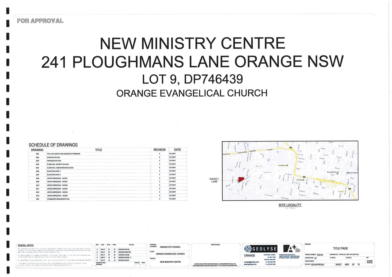
Planning and Development Committee
1 May 2018
2.4 Development
Application DA 405/2017(1) - 241 Ploughmans Lane
Attachment 2 Plans
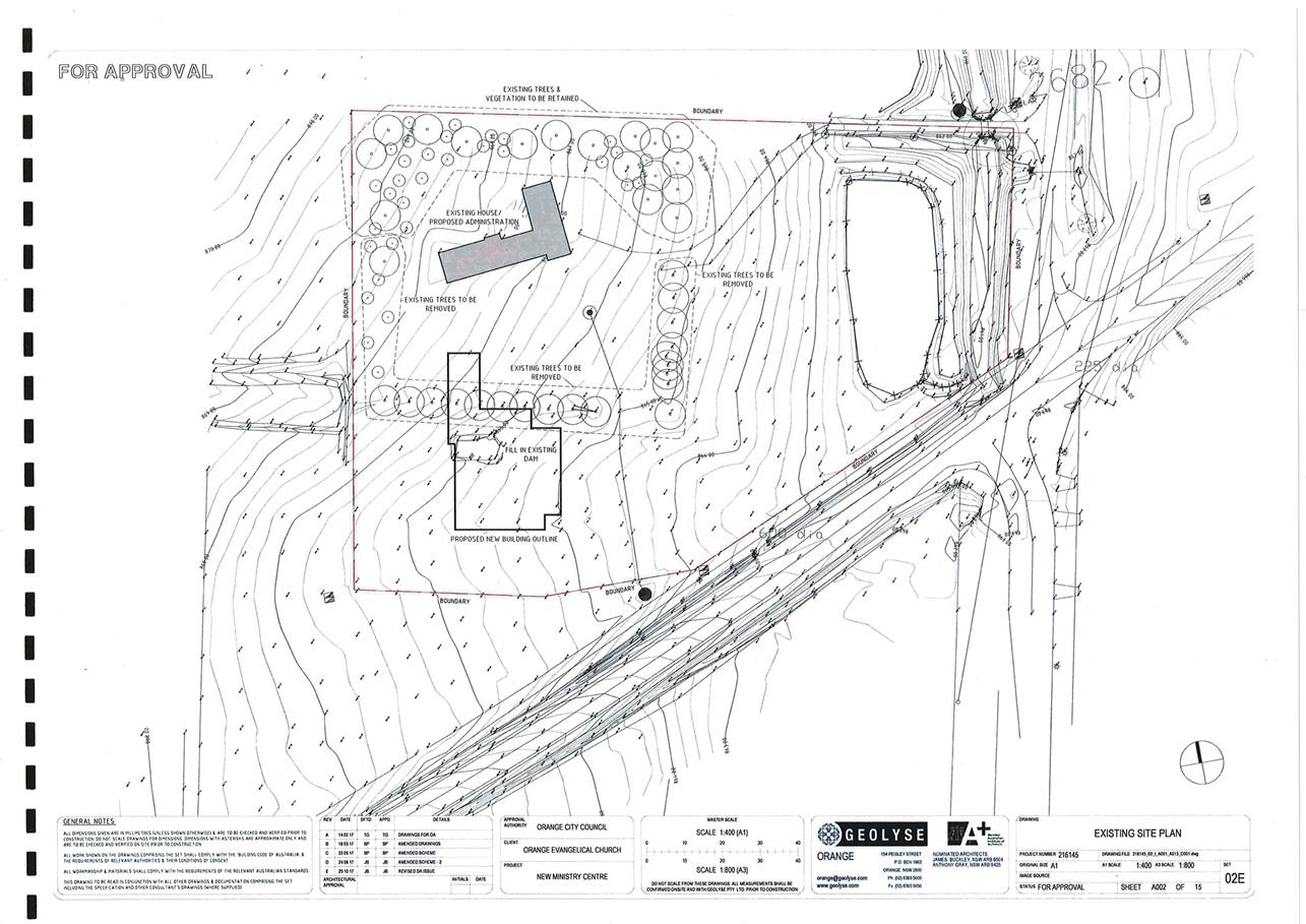
Planning and Development Committee
1 May 2018
2.4 Development
Application DA 405/2017(1) - 241 Ploughmans Lane
Attachment 2 Plans
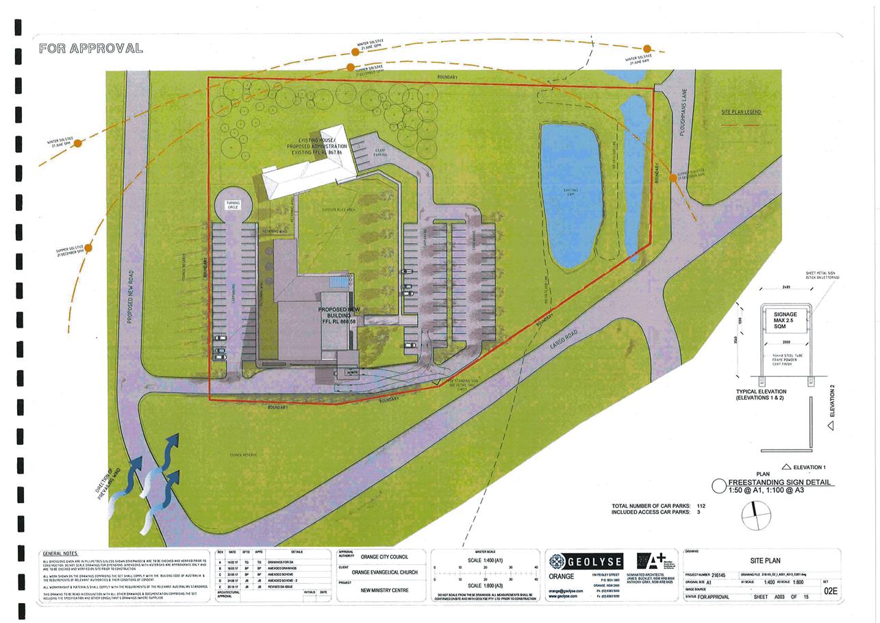
Planning and Development Committee
1 May 2018
2.4 Development
Application DA 405/2017(1) - 241 Ploughmans Lane
Attachment 2 Plans
Planning and Development Committee
1 May 2018
2.4 Development
Application DA 405/2017(1) - 241 Ploughmans Lane
Attachment 2 Plans
Planning and Development Committee
1 May 2018
2.4 Development
Application DA 405/2017(1) - 241 Ploughmans Lane
Attachment 2 Plans
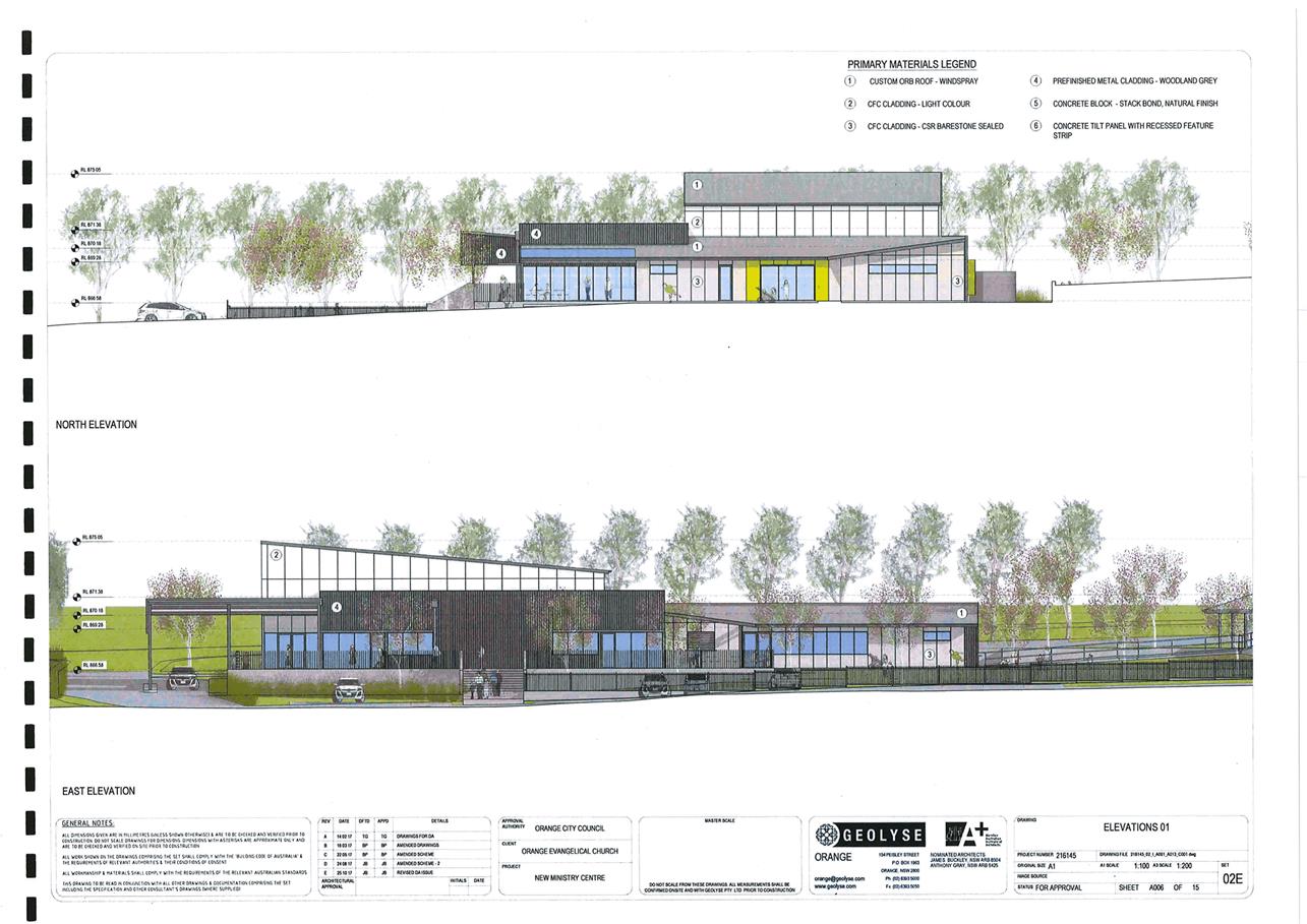
Planning and Development Committee
1 May 2018
2.4 Development
Application DA 405/2017(1) - 241 Ploughmans Lane
Attachment 2 Plans
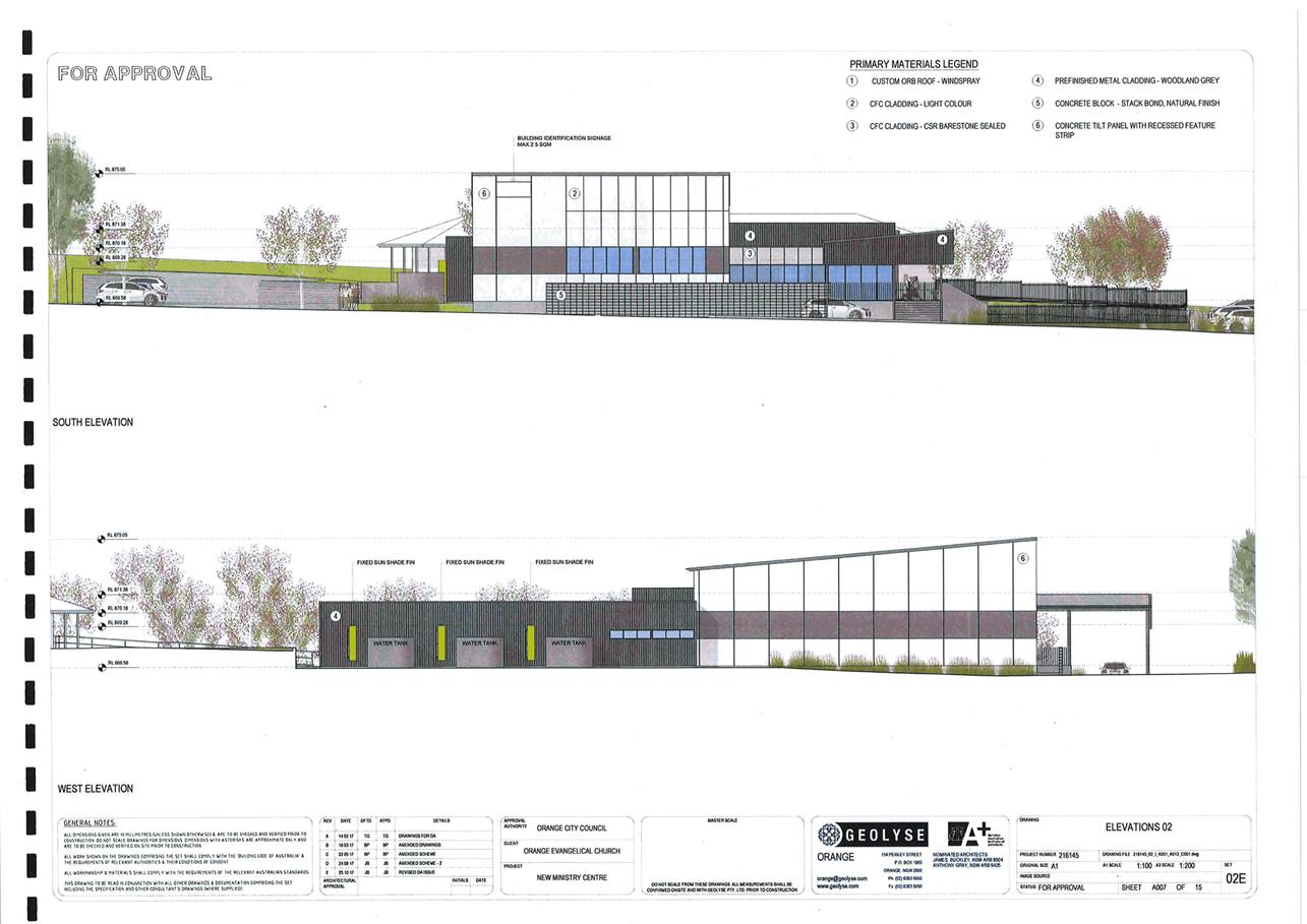
Planning and Development Committee
1 May 2018
2.4 Development
Application DA 405/2017(1) - 241 Ploughmans Lane
Attachment 2 Plans
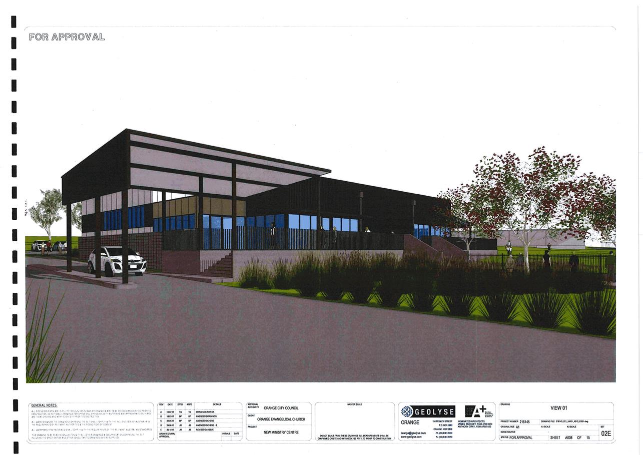
Planning and Development Committee
1 May 2018
2.4 Development
Application DA 405/2017(1) - 241 Ploughmans Lane
Attachment 2 Plans
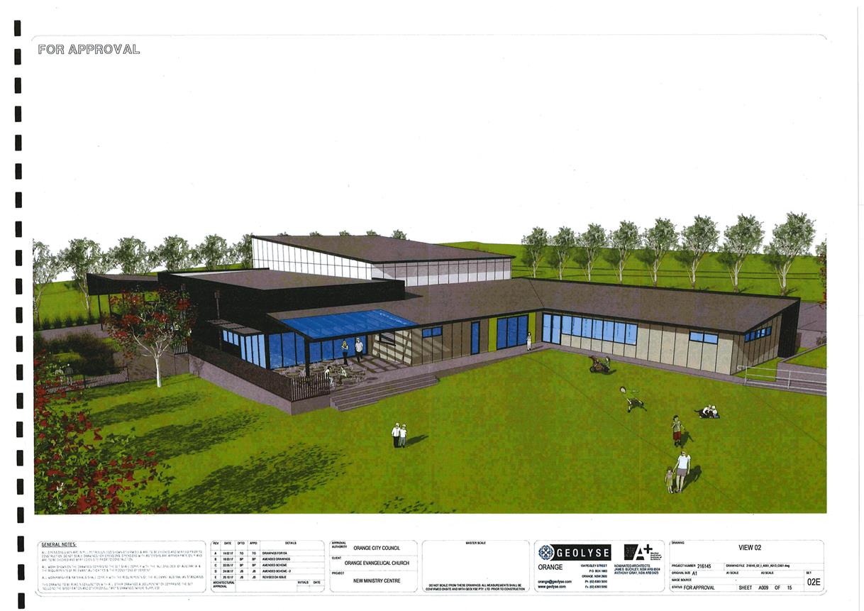
Planning and Development Committee
1 May 2018
2.4 Development
Application DA 405/2017(1) - 241 Ploughmans Lane
Attachment 2 Plans
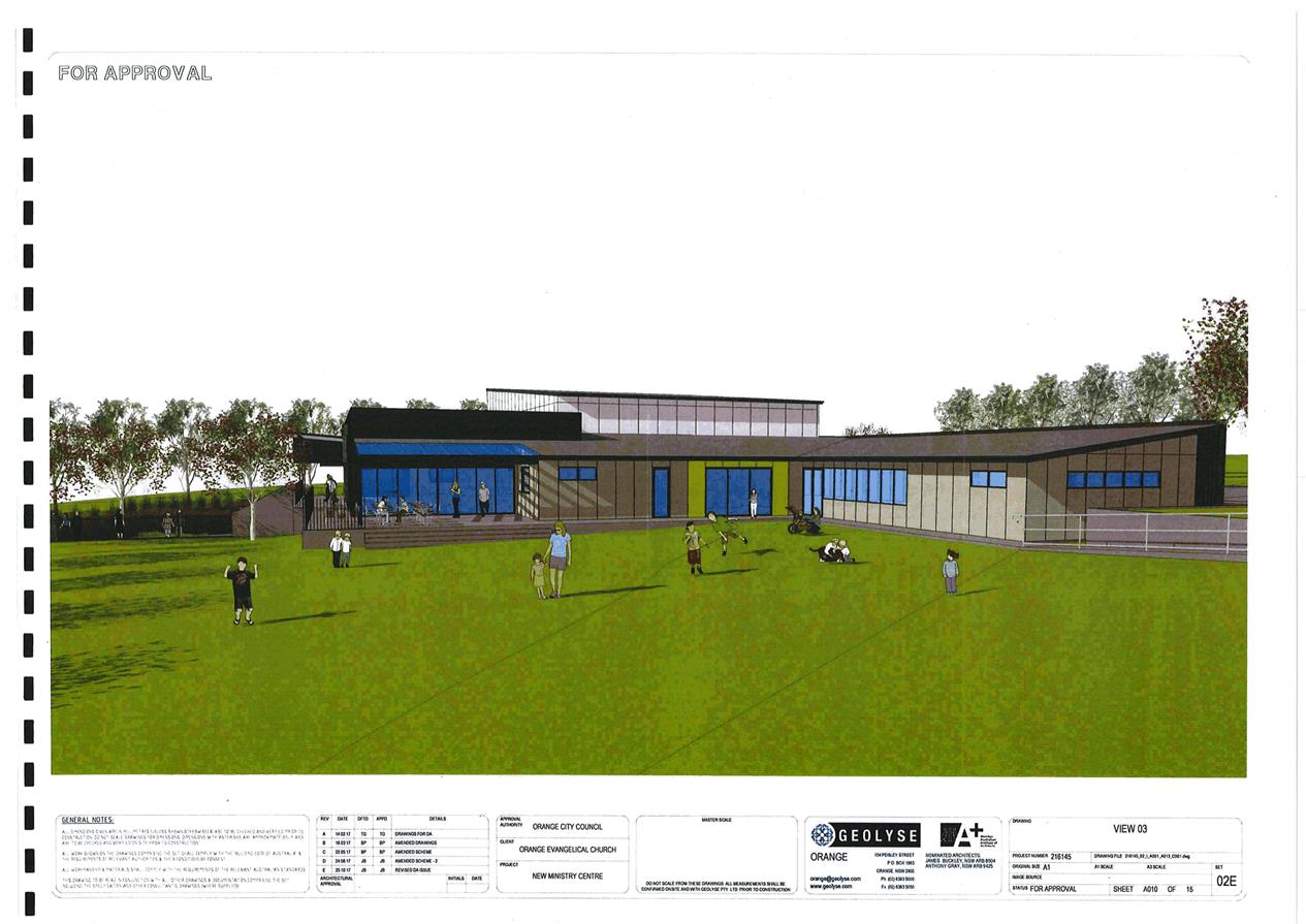
Planning and Development Committee
1 May 2018
2.4 Development
Application DA 405/2017(1) - 241 Ploughmans Lane
Attachment 2 Plans
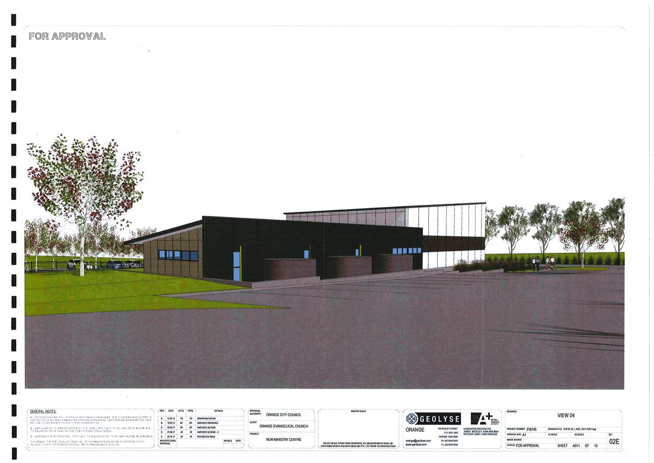
Planning and Development Committee
1 May 2018
2.4 Development
Application DA 405/2017(1) - 241 Ploughmans Lane
Attachment 2 Plans
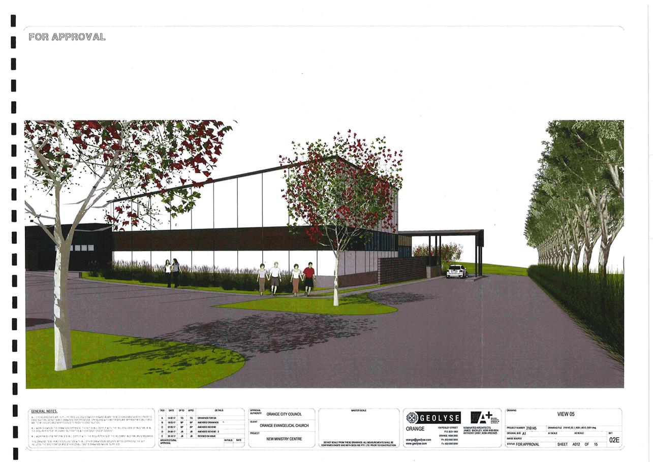
Planning and Development Committee
1 May 2018
2.4 Development
Application DA 405/2017(1) - 241 Ploughmans Lane
Attachment 2 Plans
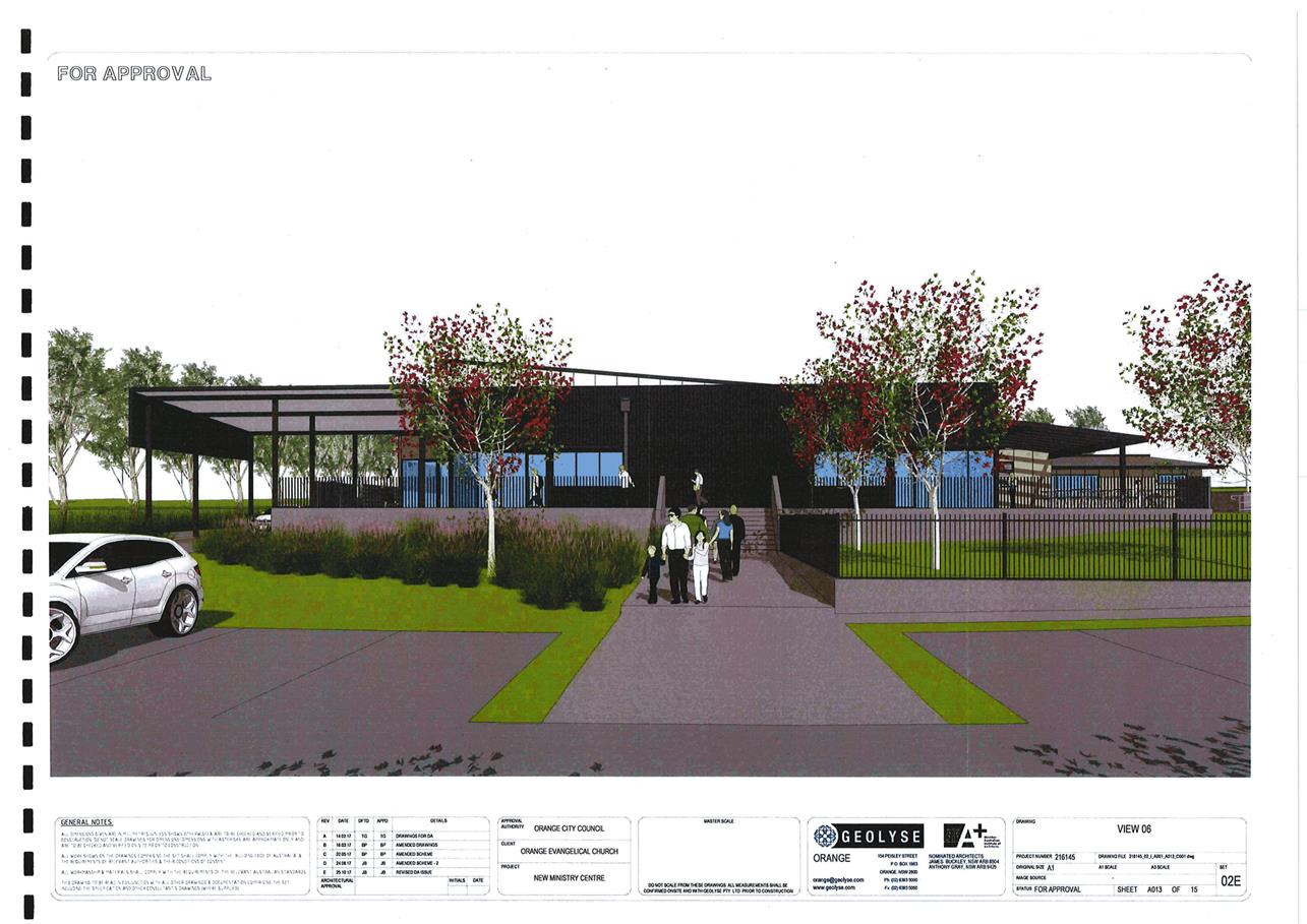
Planning and Development Committee
1 May 2018
2.4 Development
Application DA 405/2017(1) - 241 Ploughmans Lane
Attachment 2 Plans
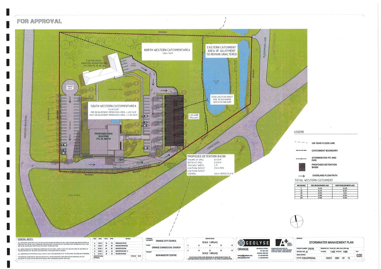
Planning and Development Committee
1 May 2018
2.4 Development
Application DA 405/2017(1) - 241 Ploughmans Lane
Attachment 2 Plans
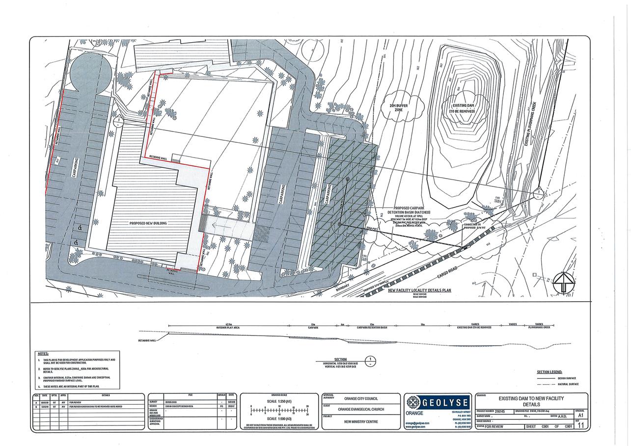
Planning and Development Committee
1 May 2018
2.4 Development
Application DA 405/2017(1) - 241 Ploughmans Lane
Attachment 3 Submissions
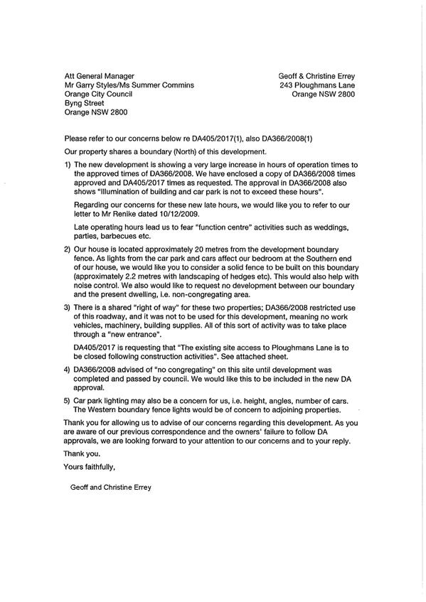
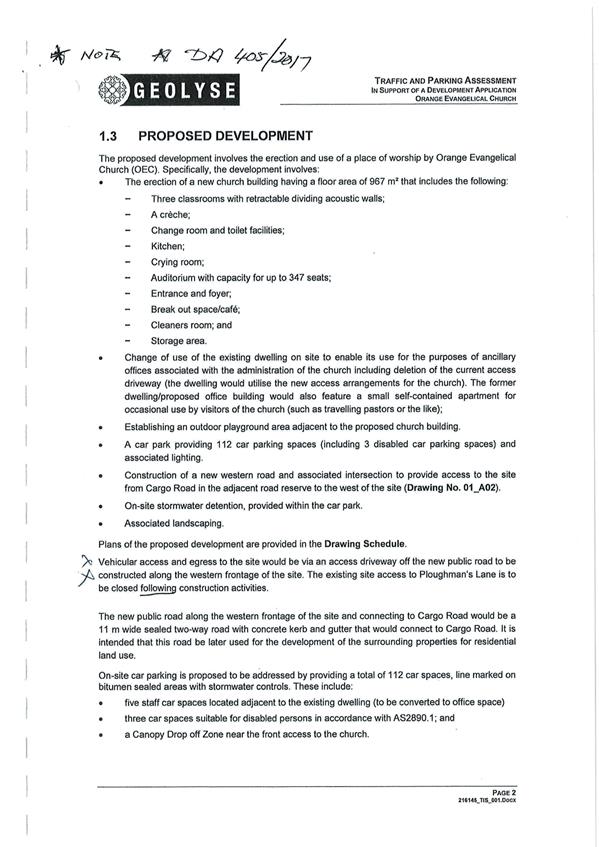
2.5 Development
Application DA 56/2018(1) - 5 William Maker Drive
RECORD
NUMBER: 2018/704
AUTHOR: Michael
Glenn, Senior Planner
EXECUTIVE Summary
|
Application
lodged
|
22
February 2018
|
|
Applicant/s
|
Landorange
Partnership
|
|
Owner
|
Mr BJ
Hutchinson
|
|
Land
description
|
Lot 44
DP 1116123 - 5 William Maker Drive, Orange
|
|
Proposed
land use
|
Subdivision
(16 lot residential) (2 stage)
|
|
Value of
proposed development
|
Not
Applicable
|
Council's consent is sought to subdivide land described as
Lot 44 DP 1116123 – 5 William Maker Drive, Orange.
The application seeks to subdivide the aforementioned land into 16 residential
lots comprising a range of lot sizes varying from 654m2 up to 4,492m2.
The site is constrained by native vegetation located at the western end of the
property. This area is classified as Box Gum Grassy Woodland (BGGW)
Endangered Ecological Community (EEC), with clear linkages to more substantial
BGGW remnants more to the west of the site. This classification of vegetation
alliance is fully protected under the Threatened Species Conservation Act and
subject to full protection under the threatened species guidelines.
It is noted that the application was lodged prior to the
relevant date of the commencement of the new Biodiversity Conservation Act
2017. The assessment of significance for this application is carried out in
accordance with the procedures and legislation in place prior to the current
provisions taking effect. The guidelines, recovery plans and OEH Scientific
Committee determination for this vegetation type remain unchanged.
The application in its current configuration (which has been
amended to respond to biodiversity conservation issues) is generally
satisfactory, but will require conditions to mitigate the effects of the
development and help ensure ongoing survival of the urban bushland on the site.
The applicant in his discussions has indicated general agreement to those
conditions.
It is necessary to refer the subject application to the
Planning and Development Committee for determination as the proposed
subdivision is not consistent with the applicable masterplan for the site and
the number of lots exceeds ten lots. A detailed assessment of the proposal has
been undertaken in the body of this report. A Section 4.15 evaluation of the
application has been undertaken and the application is recommended for
approval, subject to conditions.
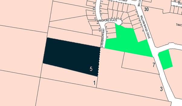
Figure 1 – Locality Plan
RECENT LEGISLATIVE CHANGES
On 1 March 2018 the Environmental Planning and Assessment
Act 1979 was substantially amended. The most immediate change involves the
restructuring and renumbering of the Act, with other more substantive
changes to be phased in over time. However, for some applications (particularly
where an application was lodged prior to the changes coming into effect) the
supporting documentation may still reference the previous numbering regime. In
the drafting of this report the content and substance of the supporting
material has been considered irrespective of which legislative references were
used.
DECISION FRAMEWORK
Development in Orange is governed by two key documents;
Orange Local Environment Plan 2011 and Orange Development Control Plan 2004. In
addition, the Infill Guidelines are used to guide development, particularly in
the heritage conservation areas and around heritage items.
Orange Local Environment Plan 2011 – the LEP
should be considered by Council to be a definitive document. LEPs govern the
types of development that are permissible or prohibited in different parts of
the City and also provide some assessment criteria in specific circumstances.
Uses are either permissible or not - there are no grey areas in terms of
permissibility. The objectives of each zoning and indeed the aims of the LEP
itself are, however, open to interpretation and can be used to guide decision
making around appropriateness of development.
Orange Development Control Plan 2004 – the DCP
guides development. In general it is a performance based document rather than
prescriptive in nature - its purpose is to guide development. The Land and
Environment Court tends to view it as such. In each area of interest there are
often guidelines used. These guidelines indicate ways of achieving the planning
outcomes. It is thus recognised that there may also be other solutions of
merit. All design solutions are considered on merit by planning and building
staff. Applications should clearly demonstrate how the planning outcomes are
being met where alternative design solutions are proposed. So one can see that
the DCP gives leeway for developers and architects to use design to achieve the
outcome in other ways if they can. Stating that DCP guidelines are
inflexible can be misleading.
Director’s Comment - the subject land was not
included in the North Orange masterplan when it was originally rezoned for
residential development. This land was left out in the initial master planning
of this locality due in part to servicing constraints associated with the land
which have since been resolved, and the fact that the land contained in part
patches of significant vegetation. Whilst it would have been ideal to have a
DCP concept in place for this particular precinct following resolution of
servicing constraints before allowing development, it is not a mandatory
requirement to have a DCP to consider such development. Council recently
granted development at 1 William Maker Drive under the same circumstances.
A detailed assessment of relevant matters for the subdivision (including
servicing arrangements, access, connectivity and vegetation) have been
undertaken in the assessment of the development application. The evaluation of
the application indicates that the development concept is acceptable in this
case.
Link To Delivery/OPerational Plan
The recommendation in this report relates to the
Delivery/Operational Plan strategy “13.4 Our Environment
– Monitor and enforce regulations relating to City amenity”.
Financial Implications
Nil
Policy and Governance Implications
Nil
|
Recommendation
That Council consents to development application DA
56/2018(1) for Subdivision (16 lot residential) (2 stage) at Lot 44 DP
1116123 - 5 William Maker Drive, Orange pursuant to the conditions of consent
in the attached Notice of Approval.
|
further considerations
Consideration has been given to the recommendation’s
impact on Council’s service delivery; image and reputation; political;
environmental; health and safety; employees; stakeholders and project
management; and no further implications or risks have been identified.
SUPPORTING INFORMATION
Council’s consent is sought for a 16 lot residential
subdivision of the subject property. The proposed lots range in sizes varying
from 654m2 up to 4,492m2. The proposed subdivision
includes provision for a cul-de-sac to be constructed from Stevenson Way to provide
access to the proposed lots. Proposed lots 401, 402 and 403 will have direct
access from Stevenson Way.
The proposed subdivision is to be completed in two stages
with Stage 1 to create proposed Lots 400 and 401, and Stage 2 to create
proposed Lots 402 to 416 (Figures 2 and 3). Part of the lots created in Stage 1
would be reconfigured so as to create a separate allotment in Stage 2. This is
unusual but not prohibited.
Building envelopes are proposed
for Lots 414, 415 and 416 as these lots have BGGW threatened EECs located on
them. The intent of the building envelopes is to limit the level of disturbance
and loss within the EEC.
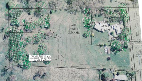
Figure 2: proposed Stage 1
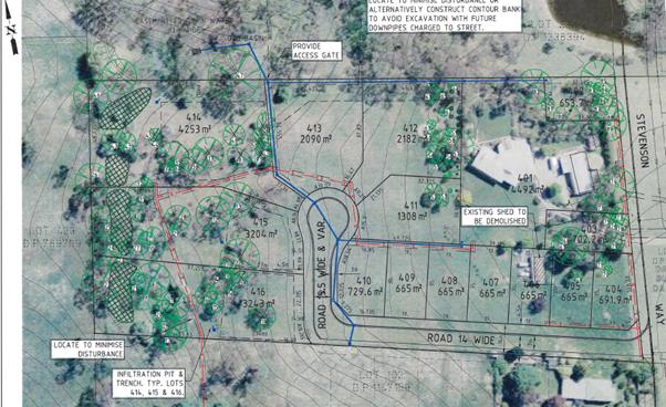
Figure 3: proposed Stage 2
MATTERS FOR CONSIDERATION
Section 1.7 - Application of
Part 7 of the Biodiversity Conservation Act 2016 and Part 7A of the
Fisheries Management Act 1994
Development Applications lodged prior to 25 February 2018
Section 1.7 of the EP&A Act 1979 identifies that Part 7
of the Biodiversity Conservation Act 2016 and Part 7A of the Fisheries
Management Act 1994 have effect in connection with terrestrial and aquatic
environments.
Notwithstanding, Section 28 of the Biodiversity Conservation
(Savings and Transitional) Regulation 2017 states that the former planning
provisions continue to apply to the determination of a pending planning
application, being an application for planning approval made before the
commencement of the new Act but not determined before that commencement. The
relevant provisions are set out at Part 5A of the historical version of the
EP&A Act 1979 dated 24 August 2017.
Part 5A is applicable as a pre-determination test and is
applied as a seven part test (as set out in the Act). It is applicable to all
applications, but the test of significance, ie whether or not the proposed
development is likely to have significant adverse effect, is only of tangible
effect in the context of likely impacts on Threatened Species or on listed
EECs. If no threatened species or EEC is present on a site, the Assessment of
Significance is of no practical relevance to the assessment. In the case of
EECs, if such areas are protected it can be assumed that impacts on threatened
species associated with such EECs are also adequately protected.
In this case the bushland extant on proposed Lots 414, 415
and 416 contain elements of viable and survivable tree canopies for the EEC
type listed in the OEH wildlife atlas as White Box Yellow Box Blakely’s
Red Gum Woodland (commonly referred to as Box-Gum Woodland). This is an open
woodland community (sometimes occurring as a forest formation), in which the
most obvious species are one or more of the following: Apple Box Eucalyptus bridgesiana, White Box Eucalyptus albens, Yellow Box E.
melliodora and Blakely's Red Gum E. blakelyi. Ground covers are
integral to the EEC, but in the context of locally occurring BGGW, bushland
that retains either the tree canopy or the ground covers, or some degraded
combination of both elements is considered a BGGW for the purposes of
classification. The example occurring on the subject site has consistent
elements of BGGW EEC present on the site, albeit in a degraded state.
The bushland on the lots other than Lots 414, 415 and 416,
whilst native (in part) are not consistent with BGGW EEC though the maturity
and species type do suggest some biodiversity value and supporting importance
to the continued survival and viability to the classified EEC further to the
west. There are no observed threatened species, nesting places or food sources
in these areas that suggest a need for a more rigorous application of the
Assessment of Significance for these lots.
There is little or no native ground cover left on the site.
Some of the trees contained on these blocks are in poor health or are of poor
structure, or are diseased or dying. However a number are in good health and
structure and should be considered as viable elements of the larger biomass to
which they enjoy a high level of connectivity.
OEH have advised that BGGW areas are in acute decline. Any
loss from these areas should be considered as significant. In situations where
losses are unavoidable Council has the option to refuse the application or seek
suitable offsets, recovery mechanisms (even in the local sense) and/or
compensations within the application. It does not have the legal authority to
approve applications where there is a significant impact likely to arise, and
where such impacts remain unaddressed.
Why the Conservation of Old Growth BGGW is important
The old growth components of a BGGW provide the skeletal
framework for threatened species to live, feed and breed, and importantly tend
to act as the most prolific seed banking components of the EEC, as well as
providing the best opportunities for nesting and forest floor litter, all of
which are important structural elements of the EEC. The other elements of a
BGGW (the mid-storey juvenile trees and the understorey grasses) are also
important but it is the trees that most people identify with the
“bush”.
Assessment of tree Losses
The submitted plan indicates that 88 trees are extant on the
site. There are 37 trees located in the unprotected area and 51 trees are
located in the EEC areas of the site. Of the 88 trees, it is proposed to remove
or effectively cause the removal of 54 trees from the site (all of the 37
unprotected trees and 11 of the EEC trees, with a further 6 considered to be at
a high risk due mainly to their proximity to the designated building envelopes.
It will be virtually impossible to save these marginal trees once the building
envelopes are prepared and the hydrology surrounding these trees is
significantly changed. It will not be possible to protect the marginal trees as
specified in the relevant Australian standard (AS4790). It is appropriate to
assume the loss of the marginal trees.
Unquestionably, if left as a total loss the removal of this
many trees without replacement should be considered a significant impact.
However, the applicant has agreed in principal to the planting and nurturing of
replacements for those trees to be removed. Mitigation is therefore possible
and may be considered as part of the application given the applicants agreement
in principal to that concept.
Whilst not all the trees are within a designated EEC area,
most, if not all the trees on the site have some level of positive contribution
to the viability of the EEC vegetation. Even the dying trees are part of the
EEC’s life cycle and if left to natural fates would provide significant
ground litter and protection to the forest floor after they die. It is
considered essential that in order to achieve a neutral effect from the
development on the biodiversity of the site, a replacement planting regime at
the rates specified in the National Recovery Plans for BGGW vegetation (between
2:1 and 5:1 replacement rates, depending on the relative value of the
vegetation to be removed) is appropriate for those trees to be removed from the
BGGW and 1:1 for those trees to be removed that are outside the EEC. In terms
of spacing the vegetation outside the designated EEC (comprising a loss of 37
trees, could be replaced at virtually any density, but the trees to be removed
from the EEC vegetation should be replaced with spacing consistent with the
National Recovery Plan Guidelines (generally 1 tree per 35m2).
Recommended Conditions
[Prior to works commencing]
· This consent
approves the removal of the trees numbered as follows on the approved plans; 1,
3, 4, 5, 14, 16, 36, 37, 38, 39, 40, 41, 44, 45, 48, 49, 50, 51, 52, 53, 54,
55, 56, 57, 58, 59, 60, 61, 62, 63, 64, 65, 66, 67, 68, 69, 70, 71, 73, 74, 75,
76, 77, 78, 79, 80, 81, 82, 83, 84, 85, 86, 87, 88, 89. All other numbered
trees on the approved plans are to be conserved and protected in accordance
with the provisions of AS 4970 – 2009 – Protection Of Trees On
Development sites except as modified by this consent.
· All trees that
are not shown as approved for removal under this consent shall be fully
protected in accordance with the requirements of AS4970-2009 (protection of
trees). Protective fencing is required to be erected around these trees at a
minimum distance of 5m from the base of the trees, and retained in place until
the issue of the subdivision certificate.
Trenching or earthworks
carried out on the site within a 7m radius of the protected trees shall be
supervised by an arborist engaged by the contractor or applicant. The arborist
shall provide instructions to the contractor as to whether such excavation work
can be undertaken at no risk to the long term health and stability of the tree
in question. Written certification is required to be forwarded to Council prior
to the issue of a subdivision certificate that the arborist was on site and his
advice observed at the time such work was undertaken. The arborist is required
to certify that the protected trees are healthy and stable at the completion of
the subdivision works.
· A detailed
landscaping plan is required to be submitted providing replacement trees for
those to be removed from Lots 414-416 as follows:
- Apple
Box Eucalyptus bridgesiana:
minimum 26 healthy species
- Yellow
Box E. melliodora: minimum 4 healthy species
- White Box Eucalyptus albens, and/or
Blakely's Red Gum E. blakelyi: minimum 6 healthy species.
These listed trees shall be
spaced at minimum intervals of 35m2 per specimen, requiring a total
landscaped area of 1260m2 over the western parts of Lots 414, 415
and 416 contiguous to the EEC located to the west of the site. The area
calculations do not include areas around existing EEC trees that are also
required to be retained with adequate spacing.
These replacements are
required to replace those trees to be removed from the EEC vegetation contained
within the existing Box Gum Grassy Woodland located on Lots 414-416.
· A further
detailed landscaping plan is required providing replacement trees for the non
EEC trees to be removed from the site, being all trees except those located on
future Lots 414-416).
A minimum of 37 replacement
trees are required. The species selection shall be of types reinforcing of the
Box Gum Grassy Woodland areas at the western end of the site. Such landscaping
may be located within the verge areas of the roads network, but such species as
are proposed must receive prior approval from Council’s Manager City
Presentation.
[Prior to the issue of a subdivision certificate]
· A
Restriction-as-to-User under Section 88b of the NSW Conveyancing Act 1979 shall
be placed on the titles of proposed Lots 414, 415 and 416 specifying that all
buildings shall be limited to within the designated building envelopes, and
further prohibiting construction of any structure within a 4m radius of the
protected trees on these sites, except with the further approval of Council.
The location of the building envelopes and TPZs shall be in accordance with the
stamped approved plan. The Restriction-as-to-User under Section 88b of the NSW
Conveyancing Act 1979 shall also provide for the retention of those trees not
specifically identified for removal (and including all replacement trees
specified elsewhere in this consent), except with the prior approval of
Council.
· Landscaping
Plans required under this consent are required to be fully implemented to the
satisfaction of the Manager Development Assessments. All required landscaping
must have been in good health and well established prior to the release of the
Subdivision Certificate.
· Landscape
plantings are required to be maintained with respect to weed control, and
watering as well as replacement of any dying or damaged stock for a minimum
period of two years after release of the Subdivision Certificate or until all
lots have been sold and Council is satisfied that the trees are well
established.
Section 4.15
Section 4.15 of the Environmental Planning and Assessment
Act 1979 requires Council to consider various matters, of which those
pertaining to the application are listed below.
PROVISIONS OF ANY ENVIRONMENTAL
PLANNING INSTRUMENT s4.15(1)(a)(i)
Orange Local Environmental Plan 2011
Part 1 - Preliminary
Clause 1.2 - Aims of Plan
The broad aims of the LEP are
set out under subclause 2. Those relevant to the application are as follows:
(a) to encourage development which complements
and enhances the unique character of Orange as a major regional centre boasting
a diverse economy and offering an attractive regional lifestyle,
(e) to provide a range of housing choices in
planned urban and rural locations to meet population growth,
The application is considered to be consistent with aims (a)
and (e).
Clause 1.6 - Consent Authority
This clause establishes that, subject to the Act, Council is
the consent authority for applications made under the LEP.
Clause 1.7 - Mapping
The subject site is identified
on the LEP maps in the following manner:
|
Land Zoning Map:
|
Land zoned R1 General Residential
|
|
Lot Size Map:
|
No Minimum Lot Size
|
|
Heritage Map:
|
Not a heritage item or conservation
area
|
|
Height of Buildings Map:
|
No building height limit
|
|
Floor Space Ratio Map:
|
No floor space limit
|
|
Terrestrial Biodiversity Map:
|
High biodiversity sensitivity on
the site
|
|
Groundwater Vulnerability Map:
|
Ground water vulnerable
|
|
Drinking Water Catchment Map:
|
Not within the drinking water
catchment
|
|
Watercourse Map:
|
Not within or affecting a defined
watercourse
|
|
Urban Release Area Map:
|
Not within an urban release area
|
|
Obstacle Limitation Surface Map:
|
No restriction on building siting
or construction
|
|
Additional Permitted Uses Map:
|
No additional permitted use applies
|
Those matters that are of relevance are addressed in detail
in the body of this report.
Clause 1.9A - Suspension of Covenants, Agreements
and Instruments
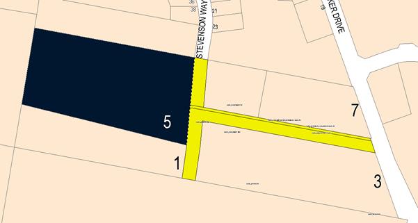
Figure 4 – easements
This clause provides that covenants, agreements and other
instruments which seek to restrict the carrying out of development do not apply
with the following exceptions:
· covenants imposed
or required by Council
· prescribed instruments
under Section 183A of the Crown Lands Act 1989
· any conservation
agreement under the National Parks and Wildlife Act 1974
· any trust
agreement under the Nature Conservation Trust Act 2001
· any property
vegetation plan under the Native Vegetation Act 2003
· any biobanking
agreement under Part 7A of the Threatened Species Conservation Act 1995
· any planning
agreement under Division 6 of Part 4 of the Environmental Planning and
Assessment Act 1979.
The land is subject to water and sewer easements as shown in
Figure 4. The proposed development will not have any tangible effect on the
functionality of those water and sewer easements.
Part 2 -
Permitted or Prohibited Development
Clause 2.1 - Land Use Zones
and Clause 2.3 - Zone Objectives and Land Use Table
The subject site is located within the R1 General
Residential zone. The proposed development is defined as subdivision of land
under OLEP 2011. Pursuant to Section 4B of the Environmental Planning and
Assessment Act, subdivision of land means:
the division of land into two
or more parts that, after the division, would be obviously adapted for separate
occupation, use or disposition.
Subdivision of land is permissible with the consent of
Council in the R1 General Residential zone.
Clause 2.3 of LEP 2011
references the Land Use Table and Objectives for each zone in LEP 2011.
These objectives for land zoned R1 General Residential are as follows:
1 - Objectives of the R1 General Residential Zone
· To provide for
the housing needs of the community.
· To provide for
a variety of housing types and densities.
· To enable other
land uses that provide facilities or services to meet the day to day needs of
residents.
· To ensure
development is ordered in such a way as to maximise public transport patronage
and encourage walking and cycling in close proximity to settlement.
· To ensure that
development along the Southern Link Road has an alternative access.
The development is not
inconsistent with the objectives of the R1 General Residential zone. The new
residential lots will add to the available stock of residential land within the
City and provide a range of lot sizes. No non-residential land uses are
proposed at this stage. A range of non-residential land uses could occur once
the subdivision has been completed. Conditions are attached in relation to
footpaths and cycle ways which will connect to the existing footpath and cycle
way network within the Waratahs area and beyond. The development will have a
nil effect on the Southern Feeder Road.
Clause 2.6 - Subdivision -
Consent Requirements
This clause triggers the need for development consent for
the subdivision of land, which the applicant has applied for.
Part 7 - Additional
Local Provisions
7.1 - Earthworks
This clause establishes a range
of matters that must be considered prior to granting development consent for
any application involving earthworks, such as:
(a) the likely disruption of, or any
detrimental effect on, existing drainage patterns and soil stability in the
locality of the development
(b) the effect of the development on the
likely future use or redevelopment of the land
(c) the quality of the fill or the soil to be
excavated, or both
(d) the effect of the development on the
existing and likely amenity of adjoining properties
(e) the source of any fill material and the
destination of any excavated material
(f) the likelihood of disturbing relics
(g) the proximity to and potential for adverse
impacts on any waterway, drinking water catchment or environmentally sensitive
area
(h) any measures proposed to minimise or
mitigate the impacts referred to in paragraph (g).
The earthworks proposed in the
application are limited to the extent required to facilitate the constructions
of the subdivision. The extent of disruption to the drainage of the site is
considered to be minor and will not detrimentally affect adjoining properties
or receiving waterways.
The extent of the earthworks
will not materially affect the potential future use or redevelopment of the
site that may occur at the end of the proposed development's lifespan.
The site is not known to be
contaminated, however conditions are attached that require chemical residue
testing to ensure that the land is suitable for residential development.
Excavated materials will be reused onsite as far as possible and conditions are
imposed that require surplus materials to be disposed of to an appropriate
destination.
The earthworks will be
appropriately supported onsite and the change in ground level is not
substantial. Therefore the effect on the amenity of adjoining properties is
considered to be minor.
The site is not known to contain
any Aboriginal, European or archaeological relics. Previous known uses of the site
do not suggest that any relics are likely to be uncovered. However, conditions
are imposed to ensure that should site works uncover a potential relic or
artefact, works will be halted to enable proper investigation by relevant
authorities and the proponent required to seek relevant permits to either
destroy or relocate the findings.
7.3 -
Stormwater Management
This clause applies to all
industrial, commercial and residential zones and requires that Council be
satisfied that the proposal:
(a) is designed to maximise the use of water
permeable surfaces on the land having regard to the soil characteristics
affecting onsite infiltration of water
(b) includes, where practical, onsite
stormwater retention for use as an alternative supply to mains water, groundwater
or river water; and
(c) avoids any significant impacts of
stormwater runoff on adjoining downstream properties, native bushland and
receiving waters, or if that impact cannot be reasonably avoided, minimises and
mitigates the impact.
Council’s Technical
Services Division advises that the applicant will be required to contribute to
the provision of an off-site stormwater system for the development.
7.4 -
Terrestrial Biodiversity
This clause seeks to maintain
terrestrial biodiversity and requires that consent must not be issued unless
the application demonstrates whether or not the proposal:
(a) is likely to have any adverse impact on
the condition, ecological value and significance of the fauna and flora on the
land
(b) is likely to have any adverse impact on
the importance of the vegetation on the land to the habitat and survival of
native fauna
(c) has any potential to fragment, disturb or
diminish the biodiversity structure, function and composition of the land, and
(d) is likely to have any adverse impact on
the habitat elements providing connectivity on the land.
Additionally, this clause
prevents consent being granted unless Council is satisfied that:
(a) the development is designed, sited and
will be managed to avoid any significant adverse environmental impact, or
(b) if that impact cannot be reasonably
avoided - the development is designed, sited and will be managed to minimise
that impact, or
(c) if that impact cannot be minimised - the
development will be managed to mitigate that impact.
The proposal is located on land
that has been identified on the Terrestrial Biodiversity Map as partially
comprising “High Biodiversity Sensitivity” land (see below) –
Environmentally Sensitive Areas (ESAs). The subject site was inspected on 22
February 2018 and the area of sensitivity was found to be significant and
largely consistent with the LEP map layer. With many native trees proposed or
required, or likely to be lost during the development process, the proposed
development can only be shown to be neutral in its effect. If harm minimisation
and recovery actions are accepted and implemented no significant impact arises.
The mapped
area shows that the sensitive area extends from the north of the site (see
image below).
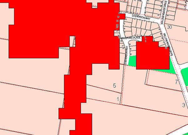
Figure 5 - extent of Mapped High Biodiversity - OLEP
2011 High Biodiversity Map
The ESA mapping used in
Council’s LEP is based on a dataset provided by the Catchment Management
Authority (CMA), and was a mapping tool intended for use at a regional planning
scale. It was an electronic data source, with data collection mostly based on
satellite imagery and spectral analysis undertaken by the CMA. This explains
the heavy pixilation of the mapping. Despite these obvious shortcomings, in
this case the Bio sensitive mapping is a reasonably accurate spatial
representation of what parts of the locality are constrained by high
biodiversity sensitivity.
The LEP bio sensitivity mapping
is a reflection of sensitive values for all native species, not just threatened
species and EECs, as is applicable to the Part 5A assessment of significance.
In this case the mapping contained in the LEP gives some credence to the need
to offset the vegetation losses that will occur outside the defined BGGW areas
at the western end of the site. As previously discussed, conditions are
included to address these more general vegetation losses.
With regard to the impacts on
those areas that by their nature are defined as BGGW, the preceding Section 5A
assessment already completed and discussed in this report includes a condition
that acknowledges that the vegetation losses are potentially significant, but
can be offset by harm minimisation and recovery actions to which the applicant
is agreeable.
7.6 -
Groundwater Vulnerability
This clause seeks to protect
hydrological functions of groundwater systems and protect resources from both
depletion and contamination. Orange has a high water table and large areas of
the LGA, including the subject site, are identified with “Groundwater
Vulnerability” on the Groundwater Vulnerability Map. This requires that
Council consider:
(a) whether or not the development (including
any onsite storage or disposal of solid or liquid waste and chemicals) is
likely to cause any groundwater contamination or have any adverse effect on
groundwater dependent ecosystems, and
(b) the cumulative impact (including the
impact on nearby groundwater extraction for potable water supply or stock water
supply) of the development and any other existing development on groundwater.
Furthermore, consent may not be granted unless Council is satisfied that:
(a) the development is designed, sited and
will be managed to avoid any significant adverse environmental impact, or
(b) if that impact cannot be reasonably
avoided - the development is designed, sited and will be managed to minimise
that impact,
(c) if that impact cannot be minimised - the
development will be managed to mitigate that impact.
The proposal is not anticipated
to involve the discharge of toxic or noxious substances and is therefore
unlikely to contaminate the groundwater or related ecosystems. The proposal
does not involve extraction of groundwater and will therefore not contribute to
groundwater depletion. The design and siting of the proposal avoids impacts on
groundwater and is therefore considered acceptable.
Clause 7.11 - Essential
Services
Clause 7.11 applies and states:
Development
consent must not be granted to development unless the consent authority is
satisfied that any of the following services that are essential for the
proposed development are available or that adequate arrangements have been made
to make them available when required:
(a) the supply of water
(b) the supply of electricity
(c) the disposal and management of sewage
(d) storm water drainage or on-site
conservation
(e) suitable road access.
In consideration of this clause, all utility services are
available, or can be made available to the proposed lots.
STATE ENVIRONMENTAL PLANNING
POLICIES
State Environmental Planning Policy 55 Remediation of
Land
State Environmental Planning Policy 55 - Remediation of Land
(SEPP 55) requires that a consent authority must not consent to the carrying
out of development of land unless it has considered whether the land is
contaminated, is satisfied that the land is suitable in its contaminated state
for the development that is proposed, and if the land requires remediation to
be made suitable for the proposed development it is satisfied that the land
will be remediated before the land is used for that purpose.
Furthermore, SEPP 55 requires that before determining an
application to carry out development that would involve a change of use of land
(specified in subclause 4), the consent authority must consider a
preliminary investigation of the land concerned.
A search of records indicates that the subject property has
existed as a 2ha rural residential property since at least 1990. Prior to that,
since at least July 1920, records show that land has existed as a 5ha hobby
farm. A site inspection confirms that there are no signs of the site having
been used for intensive plant agriculture, no signs of sheep dips or spray drum
disposal on the site. On this basis, the risks from contamination are
considered to be minimal.
However, notwithstanding the above assessment it is
recommended that a condition be attached to the Notice of Determination
requiring soil sampling for analysing chemical residue to be undertaken for the
residential allotments in a manner and frequency as determined by an
appropriately qualified and experienced consultant giving consideration to
specific uses and onsite characteristics of the site. The results of the
testing will be required to be provided to the Principal Certifying Authority
and are to demonstrate that the land is suitable for residential use to enable
the Subdivision Certificate to be released.
State Environmental Planning Policy
(Infrastructure) 2008
Referral of the application to the
electricity provider is required as the site on which the proposed development
is to be carried out is adjacent a power transmission line along the property
frontage.
By email communication the energy provider
has responded in the following terms:
We refer to Council’s
correspondence seeking comment from Essential Energy in relation to the
proposed development at the above property. Strictly based on the documents
submitted, Essential Energy has no comments to make as to potential safety
risks arising from the proposed development. Essential Energy makes the
following general comments:
· As part of the
subdivision, an easement/s is/are created for any existing electrical
infrastructure. The easement/s is/are to be created using Essential
Energy’s standard easement terms current at the time of registration of
the plan of subdivision
· If the proposed
development changes, there may be potential safety risks and it is recommended
that Essential Energy is consulted for further comment
· Any existing
encumbrances in favour of Essential Energy (or its predecessors) noted on the
title of the above property should be complied with
· Council should ensure
that a Notification of Arrangement (confirming satisfactory arrangements have
been made for the provision of power) is issued by Essential Energy with
respect to all proposed lots which will form part of the subdivision, prior to
Council releasing the Subdivision Certificate. It is the Applicant’s
responsibility to make the appropriate application with Essential Energy for
the supply of electricity to the subdivision, which may include the payment of
fees and contributions
· In addition,
Essential Energy’s records indicate there is electricity infrastructure
located within the property. Any activities within this location must be
undertaken in accordance with the latest industry guideline currently known as
ISSC 20 Guideline for the Management of Activities within Electricity Easements
and Close to Infrastructure
· Prior to carrying out
any works, a “Dial Before You Dig” enquiry should be undertaken in
accordance with the requirements of Part 5E (Protection of Underground
Electricity Power Lines) of the Electricity Supply Act 1995 (NSW)
· Given there is
electricity infrastructure in the area, it is the responsibility of the
person/s completing any works around powerlines to understand their safety responsibilities.
SafeWork NSW (www.safework.nsw.gov.au)
has publications that provide guidance when working close to electricity
infrastructure. These include the Code of Practice – Work near Overhead
Power Lines and Code of Practice – Work near Underground Assets.
These requirements have been included as either conditions
of consent or as advisory notes in the consent, depending on the specificity of
the issue raised.
PROVISIONS OF ANY DRAFT
ENVIRONMENTAL PLANNING INSTRUMENT THAT HAS BEEN PLACED ON EXHIBITION
4.15(1)(a)(ii)
There are no draft EPI that apply to the subject land or
proposed development.
DESIGNATED DEVELOPMENT
The proposed development is not designated development.
INTEGRATED DEVELOPMENT
The proposed development is not integrated development.
PROVISIONS OF ANY DEVELOPMENT
CONTROL PLAN s4.15(1)(a)(iii)
Development Control Plan 2004
Development Control Plan 2004 (“the DCP”)
applies to the subject land (Part 7). An assessment of the proposed
development against the relevant Planning Outcomes will be undertaken below.
Pursuant to Planning Outcome 0.2-1 Interim Planning Outcomes
- Conversion of Zones:
· Throughout this
Plan, any reference to a zone in Orange LEP 2000 is to be taken to be a
reference to the corresponding zone(s) in the zone conversion table.
The subject property was zoned Residential 2(a) under LEP
2000, and with the adoption of LEP 2011 the subject property was
classified as R1 General Residential, which is the nearest equivalent zoning to
the previous land classification. It is noted that a masterplan for the
subdivision of this land forms part of the DCP provisions. It is appropriate to
apply such parts of Chapter 7 of the DCP as are applicable to the subdivision
in the assessment. Additionally, the general provisions of Chapters 2 (Natural
Resource Management) and 3 (General Considerations) have relevance with
respect to cumulative impacts and scenic landscape issues.
Waratahs Masterplan
The DCP has a masterplan for
the Waratahs precinct, of which the subject property is a part. The masterplan
for the subject property is as follows:
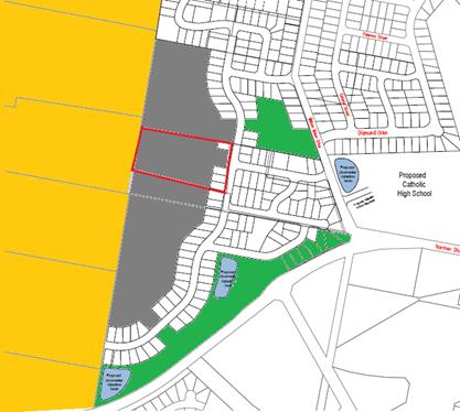
Figure 6 - Waratahs Masterplan (from DCP 2004)
The areas shown in yellow are non-urban land zoned E4. The
blue areas shown on the plan are stormwater detention basins. The green areas
are the elements of open space. The white areas are allocated to residential
development. The grey area, whilst zoned residential, has not had any
conceptual master planning undertaken for that part of the site (as well as
adjoining sites). The reason for the omission appears to relate to the fall of
the land, which falls to the west rather than the south east, making stormwater
and sewer reticulation harder to provide. It could be interpreted as meaning
the intention of the DCP was to allow no subdivision in these areas, however
this would render the DCP inconsistent with the general principals of the LEP
as is applicable to general residential development, and render the DCP less
relevant to the assessment as a matter for consideration. A DCP must be
generally consistent with the LEP that relates to it from which it derives its
statutory weight. Lots of 2ha or larger would generally be considered to be
inconsistent with zone objectives for the R1 zone.
The masterplan is useful conceptually, particularly with
respect to the amounts of open space planned for, as well the general roads and
subdivision layout. It is a matter for consideration in the planning assessment
of the proposal. The masterplan is based on Urban Design Advisory Service
(UDAS) principals. These principals are published by the Division of Planning
and set out best practice design principals for the design of new subdivisions
and settlements.
As indicated above, the masterplan was left uncompleted for
the western part of the site. At the time of the development of the DCP, it was
considered infeasible to provide water, sewer and stormwater reticulation,
because of the slope and topography of this site. Later, after the DCP was
adopted, this area was also shown to be environmentally sensitive because of
the biodiversity value of this part of the site. Both of these constraints
should not be considered insurmountable, acting as a total barrier to
development for residential purposes. The applicant's submission substantially
addresses these site constraints satisfactorily. Council’s Technical
Services Division has advised that the previously identified constraints in
terms of servicing have been resolved in the proposed design and that no
objection is raised. Conditions of consent are attached to address these
issues.
Council has recently granted development consent for the
property to the immediate north and for land located further south of the
subject land that fall within the same category. The identified constraints
have been properly considered and addressed in the determination of those
applications. The subject development remains consistent with the outcomes
approved on these adjoining properties and is therefore considered to be
acceptable. One remaining property to the immediate south of the subject land
has not been the subject of a development application at this time. The
proposed concept provides adequate arrangements for access to this land in the
future.
Part 2 -
Natural Resource Management
The DCP states:
Development
that concentrates, redirects flows, increases flow rates or disturbs land in
close proximity to creeks has the potential to affect waterways with associated
erosion, sedimentation and release of nutrients, which combine to affect
downstream water quality. Erosion appears to be particularly prevalent within
the “North Orange” red earth soil types.
Urban stormwater has also been identified
as a significant source of water pollutants. Uncontrolled stormwater flows from
urban development has the potential to contribute to downstream impacts,
including periodic flooding, erosion, sedimentation and reduced in‑stream
water quality.
It is noted that in this case there is no direct access by
the development to natural waterways.
Part 3 -
General Considerations
The applicant has responded to the site
constraints in a way generally satisfactory to environmental issues affecting
this site. The issues of slope, character and native vegetation have been
generally responded to co-operatively by the applicant.
With regard to cumulative impacts, the DCP
requires that applicants demonstrate how the development relates to the
existing character of the locality. In this instance there is a mixed character
for the locality. To the west there is E4 land with a minimum lot size
of 10ha and very limited opportunity for further development. To the
north, east and south the land is zoned for residential purposes.
There are significant vegetation remnants
evident in the locality, and important open space links and opportunities for
which parts of the site are important. There is a major transport link in the
form of the NDR (NDR) further to the south. Each of these constraints have
differing, and sometimes competing demands on land capability, but as a generalisation
the proposed subdivision responds well to the constraints.
It is accepted that the proposed
development is generally consistent with the lot sizes and subdivision patterns
of the residential subdivisions that are nearby. Within that context and in the
absence of any specific master planning in the DCP, it cannot be strongly
argued that the proposed development is vastly inconsistent with the expected
future character of the locality.
The site has been given a zone that
dictates what is appropriate to the site. The proposed development meets that
standard. The density and lot size are urban residential, with the lots on the
western side tending towards a larger size to provide some level of transition
to E4 land along the western flank (lots along the western boundary
tend to be 1200m2 or larger). There will be some friction
issues between the differing lot sizes along the zone boundary, but this should
be able to be mitigated to an extent by appropriate buffers, fencing and
landscaping. It is conceded, however, that the future development of this site
in terms of expected yields, spacing and intensity of development, will be
greater than has hitherto been the case in this locality. Attached are
conditions of consent to address matters pertaining to fencing and landscaping.
Part 7 -
Development in Residential Areas
General Principles
The DCP in its preliminary instructions includes the
following guidelines for design of urban residential subdivisions, based on
Department of Planning Urban Design guidelines:
“The Urban
Form publication identifies the following issues for future development of
the city:
· The square grid
of 200m blocks and the open space system along the creek lines are the most
important features of Orange’s urban identity.
· Maintaining
this pattern in new development will allow uninterrupted view lines, and offer
variety as the streets traverse the topography. It will also result in the
efficient provision of services and permeable pedestrian routes.
· Expanding open
space along natural creek lines and in associated parks will increase amenity,
provide environmental buffer zones, allow for drainage control structures and
help people orient themselves by being able to read the landscape.
· Laneways that
have been introduced through the original blocks as cul-de-sacs can be extended
to give pedestrian or vehicular access across the blocks.
· As the town
grows, radial expansion will require cross connections to assist the movement
between outer suburbs.
The
distribution of facilities such as schools and places of worship in existing
development suggest similar distribution will be required near new residential
development, ie, within a five- to ten-minute walking distance from every
home”.
It is considered that the revised design responds positively
to these urban design principles.
Subdivision in North Orange – Waratahs (DCP 2004)
General Principles
The North Orange-Waratah precinct comprises
those lands situated to the north of the NDR and south of Beer Road,
between Clergate Road in the east and the E4 zoned land adjacent to Burrendong
Way in the west.
The Orange Sustainable Settlement Strategy
(Parsons Brinckerhoff 2004) identified the Waratah precinct as a major
source for further expansion of the City, and to a large extent this is now
completing. Parsons Brinckerhoff recommended that this occur, and this finding
was consistent with various planning studies that had supported the use of the
northern land for urban purposes since the 1970s. The land was rezoned in
November 2005 from 2(d) Urban Transition to 2(a) Urban Residential
pursuant to Orange Local Environmental Plan 2000 (Amendment No 4).
The pattern of residential development in
North Orange-Waratah has always been determined by the physical attributes of
the land and existing and adjoining landuse. The land is traversed by a
north-south ridgeline towards the west and contains pockets of remnant
vegetation. The terrain is generally undulating, falling away from the central
ridge both to the east and west. The western flank of the subdivision, of which
the subject property is a part, abuts land with steeper slope, making that land
unsuitable for more intense development.
Planning Outcomes
· The subdivision layout is generally in accordance with the
Conceptual Subdivision Layout.
As previously noted, there is no conceptual layout for most
of this this site, however it is ringed on three sides by residential land, and
the general layout in terms of such issues as drainage works, sewer and roads
geometry appears compatible to surrounding and pending future development
nearby.
· Subdivision design and construction complies with the Orange City
Development and Subdivision Code.
Council’s Technical Services Division is principally
responsible for the application of the Subdivision Code. They have not raised
objection to the submitted layout, and have imposed a suite of conditions to
ensure that the development is carried out in accordance with the Subdivision
Code requirements.
· Lots are oriented to maximise energy-efficiency principles. Where
practicable, lots are rectangular rather than splay shaped and oriented to
provide the long axis within the range N200W to N300E or
E200N to E300S.
The orientation of some lots conforms to this planning
outcome, but a significant number do not comply. Lots 404 to 410 are within
this category of non-complying for solar orientation. This will increase the
difficulty in achieving complying solar access for future development on these
lots but it is not impossible for compliance to be achieved.
· Lots adjoining Farrell Road and industrial lands in Clergate Road
and Ralston Drive have a minimum area of 2,000m2.
Not relevant to this application.
· Battleaxe lots have a minimum area of 650m2, excluding
the access handle. Access handles have a minimum width of 4.5m incorporating a
3m- wide driveway.
Proposed Lots 412, 413 and 414 are battleaxe in shape, with
areas exceeding the minimum specified and driveway widths that also comply to
the DCP standards.
· Local collector roads connect to the NDR, Clergate Road and Farrell
Road generally at the locations shown on the Conceptual Subdivision Layout.
Future road connections to adjoining land are located generally in accordance
with the Conceptual Subdivision Layout.
Access to William Maker Drive being the collector road is
proposed via Stevenson Way. The proposed subdivision is generally consistent
with the intended outcome envisaged in the conceptual subdivision designs that
apply to other subdivision localities on the western side of William Maker Drive.
· Residential lots have direct frontage and access to a public road.
Access is not available to the NDR and Clergate Road for adjoining lots.
All residential lots will have direct frontage and access to
a public road. See comments above.
· Footpath cycle ways (4.5m wide) are provided in the locations shown
on the Conceptual Subdivision Layout.
There are no footpaths or cycle ways shown on the plans
though the proposed road reserves are wide enough to accommodate such
facilities. Attached are relevant conditions addressing this issue.
· A pedestrian overpass over the NDR is provided in the vicinity of
the proposed Catholic school site (ie, Lot 2 DP 1074558).
Not directly relevant to this application.
· Hard and soft landscape treatment is provided at the intersection of
collector roads with the NDR, Farrell Road and Clergate Road.
Not directly relevant to this application.
· Onsite stormwater detention basins and drainage reserves are
provided.
It is proposed to provide reticulated stormwater collection
and disposal for all lots except lots 414-416. These three lifestyle block will
be provided with onsite detention at the rear of the designated building
envelopes.
· All utility services are provided to the proposed lots. The capacity
for sewer reticulation to lots to the west of the ridgeline is investigated at
development application stage.
The detailed designs for water, sewer and stormwater
management for the proposed development have not been provided, however it will
be possible to provide these services according to Technical Services. Attached
are relevant conditions of consent addressing servicing requirements.
· Significant landscape features are retained and disturbance to
natural vegetation, landform and overland-flow paths is minimised.
The principal landscape features on this site are the tree
formations. The most visually significant elements of the landscape are the
large planted trees at the eastern end of the site close to Stevenson Way. The
applicant has not nominated their removal, but the small size of the lots
(apart from Lot 401), renders it impractical to retain these landscape elements
after development of the new lots begin. Large native trees on small lots is
impractical. It is more viable to allow existing trees to be removed and then
replacements planted after structures have been constructed. Soil disturbance
and inevitable changes to hydrology make it virtually impossible to retain
trees and expect them to be safe and healthy after that process. Vegetation
planted after construction will grow and develop according to the parameters
set by the soil hydrology (as it will exist at that time) and will not suffer
catastrophic root disturbance or soil compaction in the same manner as existing
vegetation.
This is not to say or claim that the existing vegetation is
not significant to the landscape character; they are significant. For this
reason the existing planted vegetation is required to be replaced, with
appropriate native landscaping to match those removed, after completion of the
subdivision works, in locations where the vegetation will not interfere with
future dwelling construction on these sites.
The second element of the landscape on this site is the BGGW
vegetation at the western end of the site. This vegetation is further removed
from visible exposure, less stunning as a visual element, but forming part of a
critically endangered ecological community (EEC) for which Council does not
have the direct authority to permit removal of, except if suitable (and
approved) recovery actions are incorporated into the proposal. In this case the
proposed development, with respect to Lots 414-416, will result in the loss of
significant landscape elements of the EEC vegetation, but the applicant has
indicated the retention of a portion of this protected vegetation, and
replacement of other elements that are to be removed as a result of the
development. It is noted that whilst a good number of the EEC classified
vegetation is to be removed as a result of the application, such vegetation
(with a few exceptions) is already diseased, dying or poorly formed.
· Public open-space areas are sited in accordance with the Conceptual
Subdivision Layout. Public open-space contains significant trees/tree groups,
threatened species, populations, ecological communities or their habitats.
Public open-space areas incorporate stormwater detention basins where required.
Not relevant to this application as no parts of the site are
shown in the masterplan as providing open space.
· An assessment under Section 5A of the Environmental Planning and
Assessment Act 1979 is submitted at development-application stage to identify
the effect of subdivision on threatened species, ecological communities or
their habitats.
The Section 5A assessment has been completed and summary of
findings included within this report.
· Building envelopes are identified on lots with trees or tree groups.
Building envelopes, roads, drainage and service trenches are sited a minimum 4m
from trees and tree groups.
The amended subdivision plan incorporates building envelopes
on several of the proposed lots for the purposes of retention of the native
vegetation on these sites. Attached are conditions of consent to this effect.
· Allotments for multi-unit housing are identified on development
application plans.
No lots within the subdivision have been identified as
potential multi-unit sites.
· A traffic-noise assessment (potential impacts and attenuation
measures) prepared by a qualified acoustic engineer is required for lots
adjoining the NDR. Consideration is given to the Noise and Vibration Assessment
prepared by Richard Heggie Associates Pty Ltd in support of the EIS for the
NDR.
The subject property is not adjoining the NDR, and it is
further noted that it is also some distance from William Maker Drive. As such,
the risks from excessive noise are considered to be low, and no requirement
exists under the DCP for a noise assessment exists.
DEVELOPMENT CONTRIBUTIONS
Section 7.11 Contributions
The proposed development contains two stages. Stage 1 will
result in one additional lot. Stage 2 will result in an additional 14 lots. The
subject property has a credit of one Equivalent Tenement (ET) for the existing
lot at Stage 1. Stage 1 generates a credit of two lots for Stage 2.
Stage 1
Pursuant to Orange Development Contributions Plan 2017, the
following contributions have been levied for the subject development and are
attached as a condition of consent.
The payment of contributions as
per the following shall be made to Council in accordance with Section 7.11 of
the Act and the Orange Development Contributions Plan 2017 (development in
Waratahs Urban Release Area) towards the provision of the following public
facilities:
|
Open Space and Recreation
|
@ 3,876.54 x 1 additional lot
|
3,876.54
|
|
Community and Cultural
|
@ 1,124.19 x 1 additional lot
|
1,124.19
|
|
Roads and Traffic Management
|
@ 5,116.91 x 1 additional lot
|
5,116.91
|
|
Local Area Facilities
|
@ 9,299.84 x 1 additional lot
|
9,299.84
|
|
Plan Preparation and Administration
|
@ 582.52 x 1 additional lot
|
582.52
|
|
TOTAL (subtotal less compensation):
|
|
$20,000.00
|
The contribution will be indexed quarterly in accordance
with the Orange Development Contributions Plan 2017 (development in Waratahs
Urban Release Area).
Stage 2
Pursuant to Orange Development Contributions Plan 2017, the
following contributions have been levied for the subject development and are
attached as a condition of consent.
The payment of contributions as
per the following shall be made to Council in accordance with Section 7.11 of
the Act and the Orange Development Contributions Plan 2017 (development in
Waratahs Urban Release Area) towards the provision of the following public
facilities:
|
Open Space and Recreation
|
@ 3,876.54 x 14 additional lots
|
54,271.56
|
|
Community and Cultural
|
@ 1,124.19 x 14 additional lots
|
15738.56
|
|
Roads and Traffic Management
|
@ 5,116.91x 14 additional lots
|
71,636.74
|
|
Local Area Facilities
|
@ 9,299.84 x 14 additional lots
|
130,197.76
|
|
Plan Preparation and Administration
|
@ 582.52 x 14 additional lots
|
8,155.28
|
|
TOTAL (subtotal less compensation):
|
|
$280,000.00
|
The contribution will be indexed quarterly in accordance
with the Orange Development Contributions Plan 2017 (development in Waratahs
Urban Release Area).
Section 64 Water and Sewer
Headwork Charges
Section 64 water and sewer headwork charges are also
applicable to the proposal. Such charges are calculated at the time of a
Subdivision Certificate for the proposed development. Attached are draft
conditions requiring the payment of the required contribution prior to the
issue of a Subdivision Certificate.
PROVISIONS PRESCRIBED BY THE
REGULATIONS s79C(1)(a)(iv)
The development is not inconsistent with the provisions
prescribed by the regulations
THE LIKELY IMPACTS OF THE
DEVELOPMENT s4.15(1)(b)
Traffic
The capacity of the road network in the vicinity of the site
is sufficient to accommodate additional localised traffic generated by the
development, or the likely additional traffic that future developments on the
subdivided lots are likely to generate. Council’s Technical Services
Department advises that the proposed road layout is satisfactory, allows
adjoining land to be developed and is generally in accordance with
the DCP.
Conditions are considered necessary and are included in the
attached consent preventing access for the individual lots directly onto either
the NDR or William Maker Drive.
Noise
The principal source of noise disturbance for the
residential subdivision will emanate from the NDR. As alluded to elsewhere
in this report the applicant has not undertaken a site specific noise
assessment as part of the submission to Council, but neither is the site in
close proximity to the NDR. The subject lots will not be adversely affected by
noise impacts from the NDR.
Cumulative Impacts
The proliferation of low density residential development on
the fringe of the City is a reflection of the urban growth of Orange, which is
currently being achieved by an expansion of residential land into the
surrounding lower density rural and non-urban land.
A continuation of green field residential subdivisions
satisfies the market demand but is likely to result in community isolation from
transport facilities and services due to the increase in distance from
employment areas and the CBD. Because of the distances, a continuation on motor
vehicle reliance is likely to be reinforced by developments such as the subject
application.
On the other hand, the development of a new estate creates
opportunities for home ownership, improves housing stock quality from an
aesthetic point of view and promotes economic activity in the building
industry.
Cumulative impacts of the development are acceptable.
THE SUITABILITY OF THE SITE
s4.15(1)(c)
The subject property has two significant natural features,
being the waterways that cross the site and the vegetation remnants. These are
adequately allowed for in the subdivision design.
The subject property will be significantly reliant on motor
vehicles for access to most facilities and amenities, and this should be seen
as a negative to the overall amenity and ambience the site will generate. To
achieve satisfactory levels of amenity it is considered highly desirable to
provide pedestrian linkages to the open space network.
Overall, the applicant has suitably demonstrated that the
site is suitable for the proposed development. Attached to the Notice of
Approval are a suite of conditions considered appropriate to ensure that the
development proceeds in an acceptable manner.
ANY SUBMISSIONS MADE IN
ACCORDANCE WITH THE ACT s4.15(1)(d)
The proposed development is defined as "advertised
development" under the provisions of the LEP. The application was
advertised for the prescribed period of 14 days and at the end of that period
two submissions had been received, with the issues summarised and commented
upon as follows:
Tom and Jenny Priest
As part of the development works on the Hutchinson
subdivision the developer wishes to pull down fencing part located on our
existing boundary to the north of our dwelling as he said this will allow to
them to carry out their work in a more efficient manner. The developer has
proposed that he will replace that part of the existing fence that they pull
down with a new colorbond fence to match height, colour and style of the
already existing front fence at no cost to us. However, to address our concerns
with noise and our privacy we would like the new fence extended to take in the
full north side of our house yard at no cost to us, so the issues we have
concerns with will be addressed. Thank you for your time.
Comment:
The proposed road design will ultimately facilitate
development of adjoining land in the future. Road widening and footpath
extension at that point would ordinarily be required if a proposal of that type
was to be submitted which would ultimately impact the location of the fencing.
Replacement fencing along the boundary road reserve has the potential to affect
the streetscape but it would not be an uncommon element given that it will be a
future corner allotment. The final positioning and agreement to undertake any
fencing is a matter for the applicant and the adjoining property owner to
resolve. A condition of consent is proposed that requires the
erection of a solid fence along the boundary of the main private open space
(house block). It is considered that this would provide adequate private and
noise attenuation to the property.
The submitter has also requested a new fence to be
constructed along the entire length of the northern boundary. There is no
planning justification to require such fencing by condition of consent at this
time. Matters in relation to fencing beyond the extent of that detailed above,
would need to be via a private landowner agreement and should not form part of
the development consent.
Cyril Smith
The Waratahs Masterplan and DCP and LEP are outdated and
need to be revised.
Comment:
As alluded to in the report this land was not included in
the North Orange masterplan when it was first developed when rezoning of this
land occurred. It is understood that this land was left out in the initial
planning of this locality due in part to servicing constraints associated with
the land which have since been resolved, and the fact that the land is
contained in part patches of significant vegetation. Whilst it would have been
ideal to have a DCP concept in place for this particular precinct following
resolution of servicing constraints before allowing development, it is not a
mandatory requirement to have a DCP to consider development. Council recently
granted development at 1 William Maker Drive under the same circumstances. A
detailed assessment of relevant matters for the subdivision (including
servicing arrangements, access, connectivity and vegetation) have been
undertaken in the assessment of the development application. The evaluation of the
application indicates that the development concept is acceptable in this case.
Drainage
Comment
Adequate arrangements for drainage can be incorporated into
the design and the resultant consent.
Land Use - it should be noted
that the subject land was originally used for native vegetation, inhabited by
the Wiradjuri and was recently used for grazing.
Comment
A detailed assessment of matters pertaining to this issue
have been addressed in the report.
A “9m wide” access
road could prove to be insufficient for traffic management.
Comment
Council development and subdivision code is based on best
practice engineering standards broadly adopted across the state. There is no
element of the proposed subdivision to suggest that the carriageway widths
(which are derived from the Subdivision code) will not be sufficient to cater
for expected generated demand emanating from the proposed development.
Available Services - There is
no data in the proposal to indicate the volume of rainfall that infiltrates the
subject land and how the removal of this infiltration would affect the subject
land or neighbouring properties.
Comment
The hydrology of the site will change as a result of soil
compaction and increased hard surfaces introduced to the site. This will
inevitably result in increased surface runoff. However, stormwater collection
and disposal will be the subject of a detailed stormwater plan, the details of
which will be required to be submitted by the applicant’s Hydraulic
Engineer and be approved by Council as part of the post consent approvals
process.
The Waratahs DCP does not
include the subject land, which would give Council the opportunity to consider
other criteria when assessing the proposal. The Shiralee subdivision document
probably would be a better guide to the future direction of urban expansion in
Orange.
Comment
It is accepted that the Waratahs Masterplan is not complete
with respect to preferred subdivision layouts for much of the site, but the
subject property is nevertheless part of the Waratahs precinct and is within
the R1 General Residential zone. It is without any legal foundation to attempt
to apply the Shiralee Masterplan to this proposal. Such application would be
without any legal standing and not enforceable in any way. Council’s assessment
would flawed if it attempted to do so.
Tree losses on smaller lots
appear unavoidable. Is it possible for Council and the developers to consider
Lot 414 to become a part of a new public neighbourhood park? This would allow
Council time to decide the fate of the trees on Lot 414. This park could be
extended to include the tree area behind the building envelopes of Lots 415 and
416, creating some connectivity of the remnant bushland. To compensate, Lots
413 and 412 could be further subdivided or a more intense use be allowed -
possibly some 2 storey townhouses.
Comment
Lot 414 is not identified in the masterplan for open space
acquisition, and it has not been offered as such by the applicant to Council.
Council is not in a position to require such offers to be made. Moreover, such
an offer would inevitably require some form of compensation by Council, in the
order of $200,000 (on the basis of current acquisition rates, which is totally
unfunded at this time. Public benefits for open space on a location so far removed
from population nodes would be very difficult to justify from a social benefit
point of view.
It would be incumbent on
Council to consider the relevant changes that are currently being made to
Section 79C(1) of the Environmental Planning and Assessment Act, 1979 by the
NSW Government.
Comment
The application has been assessed in accordance with the
provision of Section 4.15 of the Environmental Planning and Assessment Act. It
is acknowledged that changes are being proposed to the heads of consideration
for residential development, however the precise nature of such changes is
still uncertain. Changes to the act itself are not the same as changes to
supporting Environmental Planning Instruments (EPI’s). In the event that
changes are proposed for an EPI that is relevant to the proposed development,
Council is required to consider such changes, but this obligation does not
extend to changes to the legislation itself.
We are all governed by the
intent of policy and it is clear that State Planning is intending to make
changes to the EPI. The draft policy changes, when adopted, will be
incorporated into changes in the existing SEPPs. It may be reasonable to argue
that currently there exists draft changes (Greener Places and Better Places)
and they should be considered during this development application.
Comment
The Department of Planning has circulated for discussion a
policy on Greener Places, which when finalised will be intended to act as a
guideline in the preparation of DCPs, LEPs and SEPPs (particularly the code
SEPP). It is not a draft policy as such, rather a guideline for discussion in
the preparation of directions that are yet to be revealed. As a matter for
consideration to a development proposal they carry virtually no statutory
weight. Further, in the context of the Waratahs Masterplan, which is nearing
completion, the provisions for open space are at the high end of the regional
statistics, and are well based on the findings of the Sustainable Settlements
Strategy. This is an older strategic policy, but now nearing completion. For
the reasons outlined in this report there seems no real justification for
alteration or modification, much less refusal, of an application that is, or
can be made to comply with best practice guidelines already.
State Planning has indicated
that DCPs should be reviewed every five years. Noting this, the Waratah DCP
2005 would be considered outdated. A better guide for planning this subdivision
would be to look at the Shiralee development components.
Comment
The DCP has undergone a number of amendments since 2005.
Council has been advised by the Department of Planning that they are in the
process of drafting a proposal aimed at introducing a standardised DCP template
for the State. Council is in the process of reviewing the current DCP
provisions with a view to having them incorporated into the template when
adopted.
Some components of the Waratah
DCP may be (in-)appropriate as they may relate to all DCPs: “To protect
landscape features [sic, ridge lines per Orange SSS] and environmentally
sensitive areas [sic, OLEP Clause 7.4]”.
Comment
Efforts have been made in relation to this application to
assess the landscape value of its features (which are generally its trees on
the site), and to devise harm minimisation mechanisms in response to those
challenges. The science behind those conservation measures do not support a
more aggressive application of conservation principles in this case.
Allotment Layout and Size: The
creation of a Council owned park would greatly increase the protection of the
native vegetation in the subdivision into the future.
Comment
There are no provisions in the masterplan for acquisitions
to be undertaken on this site. Council has little or no opportunity to insist
on an acquisition in these circumstances.
Roads and Access: Generally, it
has been found that a more rectangular grid street pattern works better for
traffic movements - as adopted in the Shiralee development. This proposal does
not include a cul-de-sac”, but one is indicated adjoining Lot 410 through
to Lot 416 - the only road in the development. “The proposed road widths
are in accordance with the DCP” (Waratahs) but may not be creating a
desirable outcome. Other streets, like Roselawn Drive in a nearby area, are dangerous
because of their narrow winding nature. It is doubtful whether anyone could
park legally on any section of this street. Streets of this design should not
be acceptable in future subdivisions.
Comment:
Waratahs utilises a modified grid layout template which is
slightly different to the more rigid roads design set out in the Shiralee urban
release area. For the purposes of categorisation, however, both Shiralee and
the subject site are utilising a modified grid layout. Both are known to
produce satisfactory results in terms of “safer by design”
principals. A semi‑curvilinear approach with relatively narrow
carriageways produces natural impediments to high speed traffic in residential
areas. High speed in residential areas is well known to be a major safety
hazard, and something to be avoided as much as possible. Wide straight street
patterns fashioned on the traditional grid pattern are not safer, they are more
dangerous in a residential situation.
Stormwater Management;
Designing a stormwater system to a “1 in 10 year average
recurrence” would be a gross under design. This would not be able to cope
with the expected extreme rain events in the future, because of climate change.
If this is Council’s standard, it should change with the revision of the
LEP and DCP. This application requires much more data to determine the accuracy
of the assertions made in it.
Comment
Clause 54(4) of the Environmental Planning and Assessment
Regulations 2000 makes the following provisions with regard to information
to be provided: “the information that a consent
authority may request does not include, in relation to building or subdivision
work, the information that is required to be attached
to an application for a construction certificate”. “Note:
The aim of this provision is to ensure that the consent authority does
not oblige the applicant to provide these construction details up-front where
the applicant may prefer to test the waters first and delay applying for a
construction certificate until, or if, development consent is granted”.
Stormwater designs at the level of detail advocated by the
submitter are normally worked out as a construction certificate detail.
Relevant conditions are attached.
PUBLIC INTEREST
s4.15(1)(e)
The proposed development is considered to be of minor
interest to the wider public due to the relatively localised nature of
potential impacts. The proposal is not inconsistent with any relevant policy
statements, planning studies, guidelines etc that have not been considered in
this assessment.
SUMMARY
The proposed development is permissible with the consent of
Council. The proposed development complies with the relevant aims, objectives
and provisions of Orange LEP 2011 (as amended) and DCP
2004. A Section 4.15 assessment of the development indicates that
the development is acceptable in this instance. Attached is a draft Notice of
Approval outlining a range of conditions considered appropriate to ensure that
the development proceeds in an acceptable manner.
COMMENTS
The requirements of the Environmental Health and Building
Surveyor and the Engineering Development Section are included in the attached
Notice of Approval.
Attachments
1 Notice
of Approval, NA18/230⇩
2 Plans,
D18/20436⇩
3 Submissions,
D18/20448⇩
Planning and Development Committee
1 May 2018
2.5 Development
Application DA 56/2018(1) - 5 William Maker Drive
Attachment 1 Notice
of Approval
|

|
ORANGE
CITY COUNCIL
Development
Application No DA
56/2018(1)
NA18/ Container
PR22400
|
NOTICE OF DETERMINATION
OF A DEVELOPMENT
APPLICATION
issued under the Environmental
Planning and Assessment Act 1979
Section 4.18
|
Development
Application
|
|
|
Applicant Name:
|
Landorange
Partnership
|
|
Applicant Address:
|
1
Borrodell Drive
ORANGE
NSW 2800
|
|
Owner’s Name:
|
Mr BJ
Hutchinson
|
|
Land to Be Developed:
|
Lot 44 DP
1116123 - 5 William Maker Drive, Orange
|
|
Proposed Development:
|
Subdivision
(16 lot residential) (2 stage)
|
|
|
|
|
Building
Code of Australia
building
classification:
|
Not
applicable
|
|
|
|
|
Determination
made under
Section 4.16
|
|
|
Made On:
|
1 May 2018
|
|
Determination:
|
CONSENT
GRANTED SUBJECT TO CONDITIONS DESCRIBED BELOW:
|
|
|
|
|
Consent to
Operate From:
|
2 May 2018
|
|
Consent to
Lapse On:
|
2 May 2023
|
Terms of Approval
The reasons for the imposition of
conditions are:
(1) To ensure a quality
urban design for the development which complements the surrounding environment.
(2) To maintain
neighbourhood amenity and character.
(3) To ensure compliance
with relevant statutory requirements.
(4) To provide adequate
public health and safety measures.
(5) Because the development
will require the provision of, or increase the demand for, public amenities and
services.
(6) To ensure the utility
services are available to the site and adequate for the development.
(7) To prevent the proposed
development having a detrimental effect on adjoining land uses.
(8) To minimise the impact
of development on the environment.
Conditions
(1) The
development must be carried out in accordance with:
(a) Plan by Heath
Consulting Engineers Job Number 18_003, Drawing Number 18003-DA04, Revision D,
(Sheets 2, 3, & 4) (3 sheets)
(b) statements
of environmental effects or other similar associated documents that form part
of the approval
as amended
in accordance with any conditions of this consent.
(2) All building work must
be carried out in accordance with the provisions of the Building Code of
Australia.
(3) A sign is to be erected
in a prominent position on any site on which building work, subdivision work or
demolition work is being carried out:
(a) showing
the name, address and telephone number of the principal certifying authority
for the work, and
(b) showing
the name of the principal contractor (if any) for any building work and a
telephone number on which that person may be contacted outside working hours,
and
(c) stating
that unauthorised entry to the site is prohibited.
Any such sign is to be maintained while the
building work, subdivision work or demolition work is being carried out.
STAGE 1 - TWO LOT SUBDIVISION
|
DURING
CONSTRUCTION/SITEWORKS
|
(4) All
construction/demolition work on the site is to be carried out between the hours
of 7.00 am and 6.00 pm Monday to Friday inclusive, 7.00 am to
5.00 pm Saturdays and 8.00 am to 5.00 pm Sundays and Public Holidays.
Written approval must be obtained from the General Manager of Orange City
Council to vary these hours.
(5) Any adjustments to
existing utility services that are made necessary by this development
proceeding are to be at the full cost of the developer.
|
PRIOR TO THE ISSUE OF
A SUBDIVISION CERTIFICATE
|
(6) Pursuant
to Orange Development Contributions Plan 2017, the following contributions have
been levied for the subject development and are attached as a condition of
consent.
The payment of contributions as per the
following shall be made to Council in accordance with Section 7.11 of the Act
and the Orange Development Contributions Plan 2017 (development in Waratahs
Urban Release Area) towards the provision of the following public facilities:
|
Open Space and Recreation
|
@ 3,876.54 x 1 additional lots
|
3,876.54
|
|
Community and Cultural
|
@ 1,124.19 x 1 additional lots
|
1,124.19
|
|
Roads and Traffic Management
|
@ 5,116.91 x 1 additional lots
|
5,116.91
|
|
Local Area Facilities
|
@ 9,299.84 x 1 additional lots
|
9,299.84
|
|
Plan Preparation and Administration
|
@ 582.52 x 1 additional
lots
|
582.52
|
|
TOTAL (subtotal less compensation):
|
|
$20,000.00
|
The contribution will be indexed quarterly in
accordance with the Orange Development Contributions Plan 2017 (development in
Waratahs Urban Release Area).
(7) Prior to the
issuing of the Subdivision Certificate, a Surveyor’s Certificate or
written statement is to be provided to the Principal Certifying Authority,
stating that the buildings and associated on-site sewerage management system is
within the boundaries of the proposed Lot 401 comply in respect to the
distances of walls from boundaries.
(8) As part of the
subdivision, an easement shall be created for any existing electrical
infrastructure affecting the subject land. The easement if required is to be
created using Essential Energy’s standard easement terms current at the
time of registration of the plan of subdivision;
(9) Any existing
encumbrances in favour of Essential Energy (or its predecessors) noted on the
title of the above property shall be complied with.
(10) A Notification of
Arrangement (confirming satisfactory arrangements have been made for the
provision of power) issued by Essential Energy with respect to all proposed
lots which will form part of the subdivision must be provided to the Orange
City Council prior to the release of the Subdivision Certificate. It is the
Applicant’s responsibility to make the appropriate application with
Essential Energy for the supply of electricity to the subdivision, which may
include the payment of fees and contributions.
(11) Application shall be
made for a Subdivision Certificate under Section 109(C)(1)(d) of the Act.
(12) A
Restriction-as-to-User under section 88B of the NSW Conveyancing Act is
to be created on the title of proposed Lot 401 requiring the subject land to be
connected to reticulated sewer when it becomes available and the existing
septic system to be removed in accordance with Council policy. Payment of the
relevant section 64-sewer headwork’s charges is to be made to Council at
that time.
(13) Application is to be
made to Telstra/NBN for infrastructure to be made available to each individual
lot within the development. Either a Telecommunications Infrastructure
Provisioning Confirmation or Certificate of Practical Completion is to be
submitted to the Principal Certifying Authority confirming that the specified
lots have been declared ready for service prior to the issue of a Subdivision
Certificate.
(14) A
Restriction-as-to-User under Section 88B of the NSW Conveyancing Act is
to be created on the title of proposed Lot 400 which states that:
· Proposed Lot 400 may
not be subdivided or further developed and may not be used for residential
purposes unless the following works are carried out to the satisfaction of
Orange City Council:
- All
infrastructure services (roads, water, sewer, stormwater drainage, gas,
electricity, phone lines) as required by the Orange City Council Development
and Subdivision Code are provided to Lot 400; and
- The
developer of proposed Lot 400 is responsible for gaining access over adjoining
land for services as necessary. Easements are to be created about all service
mains within and outside the lots they serve; and
- Section
94 contributions are paid as required by the development contributions plan
applicable at the time of development and Water and Sewer charges as required
by Orange City Council in accordance with Division 5 of Part 2 of Chapter 6 of
the Water Management act 2000; and
- Stevenson
Way frontage is constructed in accordance with the Orange City Council
Development and Subdivision Code.
(15) A
Restriction-as-to-User under section 88B of the NSW Conveyancing Act is
to be created on the title of proposed Lot 401 which states that:
The western portion of
Lot 401 may only be used for non-habitable purposes until the following works
are carried out to the satisfaction of Orange City Council:
· All infrastructure
services (roads, water, sewer, stormwater drainage, gas, electricity, phone lines)
as required by the Orange City Council Development and Subdivision Code are
provided to Lot 401; and
·
The eastern and western portions of Lot 401 may not be subdivided or further
developed until the following works are carried out to the satisfaction of
Orange City Council:
· All infrastructure
services (roads, water, sewer, stormwater drainage, gas, electricity, phone
lines) as required by the Orange City Council Development and Subdivision Code
are provided to Lot 401; and
· The developer of proposed
Lot 401 is responsible for gaining access over adjoining land for services as
necessary. Easements are to be created about all service mains within and
outside the lots they serve; and
· Section 94
contributions are paid as required by the development contributions plan
applicable at the time of development and Water and Sewer charges as required
by Orange City Council in accordance with Division 5 of Part 2 of Chapter 6 of
the Water Management act 2000; and
· Stevenson Way frontage
is constructed in accordance with the Orange City Council Development and
Subdivision Code.
(16) Prior to the issue of a
Subdivision Certificate access to the western portion of Lot 401 shall be
provided by the establishment of right of way over Lot 400. The right of way
shall be extinguished upon alternate public road access being provided to the
land.
(17) All services are to be
contained within the allotment that they serve. A Statement of Compliance, from
a Registered Surveyor, is to be submitted to the Principal Certifying Authority
prior to the issuing of a Subdivision Certificate.
(18) Certification from
Orange City Council is required to be submitted to the Principal Certifying
Authority prior to the issue of a Subdivision Certificate stating that all
works relating to connection of the development to Council assets, works on
public land, works on public roads, stormwater, sewer and water reticulation
mains and footpaths have been carried out in accordance with the Orange City
Council Development and Subdivision Code and the foregoing conditions, and that
Council will take ownership of the infrastructure assets.
(19) All
of the foregoing conditions are to be at the full cost of the developer and to
the requirements and standards of the Orange City Council Development and
Subdivision Code, unless specifically stated otherwise. All work required by the
foregoing conditions is to be completed prior to the issuing of an Occupation
or Subdivision Certificate, unless stated otherwise.
14 LOT SUBDIVISION AND
DEMOLITION
|
PRIOR TO THE ISSUE OF
A CONSTRUCTION CERTIFICATE
|
(20) A detailed landscaping
plan is required providing replacement trees for the non EEC trees to be
removed from the site, being all trees except those located on future lots
414-416). A minimum of 37 replacement trees are required within the subject
land. The species selection shall be of types reinforcing of the Box Gum
Grassy Woodland areas at the western end of the site. The Landscape Plan shall
be approved by the Council’s Manager City Presentation prior to the issue
of a Construction Certificate.
(21) A
detailed landscaping plan is required to be submitted providing replacement
trees for those to be removed from Lots 414-416 as follows:
· Apple Box Eucalyptus
bridgesiana: minimum 26 healthy species
· Yellow Box E.
melliodora: minimum 4 healthy species
· White Box
Eucalyptus albens, and/or Blakely's Red Gum E. blakelyi: minimum 6 healthy
species.
These listed shall be spaced at minimum
intervals of 35m2 per specimen, requiring a total landscaped area of
1260m2 over the western parts of lots 414, 415 and 416 contiguous to
the EEC located to the west of the site. The area calculations do not include areas
around existing EEC trees that are also required to be retained with adequate
spacing.
These replacements are required to replace
those trees to be removed from the EEC vegetation contained within the existing
Box Gum Grassy Woodland located on Lots 414-416.
(22) The
applicant is to submit a waste management plan that describes the nature of
wastes to be removed, the wastes to be recycled and the destination of all
wastes. All wastes from the demolition and construction phases of this project
are to be deposited at a licensed or approved waste disposal site.
(23) Engineering plans,
showing details of all proposed work and adhering to any engineering conditions
of development consent, are to be submitted to, and approved by, Orange City
Council or an Accredited Certifier (Categories B1, C3, C4, C6) prior to the
issuing of a Construction Certificate.
(24) A water and soil
erosion control plan is to be submitted to Orange City Council or an Accredited
Certifier (Categories B1, C3, C4, C6) for approval prior to the issuing of a
Construction Certificate. The control plan is to be in accordance with the
Orange City Council Development and Subdivision Code and the Landcom, Managing
Urban Stormwater; Soils and Construction Handbook.
(25) The
development’s stormwater design is to include stormwater detention within
the development, designed to limit peak outflows from the land to the
pre-existing natural outflows up to the 100 year ARI frequency, with sufficient
allowance in overflow spillway design capacity to safely pass flows of lower
frequency (that is, a rarer event) without damage to downstream developments.
Where appropriate, the spillway design capacity is to be determined in accordance
with the requirements of the Dam Safety Committee.
The design of the detention storage is to be
undertaken using the ILSAX/DRAINS rainfall-runoff hydrologic model or an
approved equivalent capable of assessing runoff volumes and their temporal
distribution as well as peak flow rates. The model is to be used to calculate
the flow rates for the existing and post-development conditions. The developed
flows are to be routed through the proposed storage within the model so that
the outflows obtained are no greater than the flows obtained for the
pre-existing natural flows. A report detailing the results of the analysis,
which includes:
· catchment
plan showing sub-catchments under existing and developed conditions;
· schematic
diagram of the catchment model showing sub areas and linkages;
· tabulation
detailing the elevation, storage volume and discharge relationships; and
· tabulation
for the range of frequencies analysed, the inflows, outflows and peak storage
levels for both existing and developed conditions;
together with copies of the data files for the
model and engineering design plans of the required drainage system are to be
submitted to Orange City Council upon application for a Construction
Certificate.
(26) Proposed
lots are to be provided with interlot stormwater drainage, including those lots
abutting public land, where the surface of the entire lot cannot be drained to
the kerb and gutter at the lot frontage. A grated stormwater pit is to be
constructed within each lot provided with interlot stormwater drainage.
Engineering plans for this drainage system are to be approved by Orange City
Council or an Accredited Certifier (Categories B1, C3, C4, C6) prior to the
issuing of a Construction Certificate.
(27) A 150mm-diameter sewer
main is to be constructed from Council’s existing main to serve the
proposed lots. Prior to a Construction Certificate being issued engineering
plans for this sewerage system are to be submitted to and approved by Orange
City Council. Written agreement is to be obtained from adjoining land owners to
undertake works within their land.
(28) A water reticulation
analysis is to be carried out by Orange City Council on any proposed water
reticulation system for the development. Engineering plans are to be
submitted to and approved by Orange City Council prior to the issue of a
Construction Certificate.
The reticulation system is to be designed to
supply a peak instantaneous demand by gravity of 0.15 L/s/tenement at a
minimum residual head of 200kPa.
(29) Prior to the issue of a
Construction Certificate written agreement is to be obtained from adjoining
land owners to undertake works within and discharge stormwater onto their land.
(30) The
existing residence is to be connected to the proposed reticulated sewer. The
existing septic tank is to be accurately located and indicated on the submitted
engineering plans.
|
PRIOR TO WORKS
COMMENCING
|
(31) Soil erosion control
measures shall be implemented on the site.
(32) A
Construction Certificate application is required to be submitted to, and issued
by Council/Accredited Certifier prior to any excavation or building works being
carried out onsite.
(33) All trees that are not
shown as approved for removal under this consent shall be fully protected in
accordance with the requirements of AS4970-2009 (protection of trees) except as
modified by the provisions of this consent. Protective fencing is required to
be erected around these trees at a minimum distance of 5m from the base of the
trees, and retained in place until the issue of the subdivision certificate.
Trenching or earthworks carried out on the site
within a 7m radius of the protected trees shall be supervised by an arborist
engaged by the contractor or applicant. The arborist shall provide instructions
to the contractor as to whether such excavation work can be undertaken at no
risk to the long term health and stability of the tree in question. Written
certification is required to be forwarded to Council prior to the issue of a
subdivision certificate that the arborist was on site and his advice observed
at the time such work was undertaken. The arborist is required to certify that
the protected trees are healthy and stable at the completion of the subdivision
works.
|
DURING
CONSTRUCTION/SITEWORKS
|
(34) This consent approves
the removal of the trees numbered as follows on the approved plans; 1, 3, 4, 5,
14, 16, 36, 37, 38, 39, 40, 41, 44, 45, 48, 49, 50, 51, 52, 53, 54, 55, 56, 57,
58, 59, 60, 61, 62, 63, 64, 65, 66, 67, 68, 69, 70, 71, 73, 74, 75, 76, 77, 78,
79, 80, 81, 82, 83, 84, 85, 86, 87, 88, 89. All other numbered trees on the
approved plans are to be conserved and protected in accordance with the
provisions of AS 4970 – 2009 – Protection of Trees on Development
sites.
(35) Essential
Energy’s records indicate there is electricity infrastructure located
within the property. Any activities within this location must be undertaken in
accordance with the latest industry guideline currently known as ISSC 20
Guideline for the Management of Activities within Electricity Easements and
Close to Infrastructure.
(36) Prior to carrying out
any works, a “Dial Before You Dig” enquiry should be undertaken in
accordance with the requirements of Part 5E (Protection of Underground
Electricity Power Lines) of the Electricity Supply Act 1995 (NSW).
(37) All
construction/demolition work on the site is to be carried out between the hours
of 7.00 am and 6.00 pm Monday to Friday inclusive, 7.00 am to
5.00 pm Saturdays and 8.00 am to 5.00 pm Sundays and Public
Holidays. Written approval must be obtained from the General Manager of Orange
City Council to vary these hours.
(38) All
materials on site or being delivered to the site are to be contained within the
site. The requirements of the Protection of the Environment Operations Act
1997 are to be complied with when placing/stockpiling loose material or
when disposing of waste products or during any other activities likely to
pollute drains or watercourses.
(39) Building demolition is
to be carried out in accordance with Australian Standard 2601:2001 - The
Demolition of Structures and the requirements of Safe Work NSW.
(40) Any adjustments to
existing utility services that are made necessary by this development
proceeding are to be at the full cost of the developer.
(41) The
provisions and requirements of the Orange City Council Development and
Subdivision Code are to be applied to this application and all work constructed
within the development is to be in accordance with that Code.
The developer is to be entirely responsible for
the provision of water, sewerage and drainage facilities capable of servicing
all the lots from Council’s existing infrastructure. The developer is to
be responsible for gaining access over adjoining land for services where
necessary and easements are to be created about all water, sewer and drainage
mains within and outside the lots they serve.
(42) Half road width is to
be constructed for the frontage of the proposed development to Lot 102 DP
1147159 on the 18m wide road. This work is to include road pavement and
pavement surfacing to the centreline, kerb and gutter construction and
earth-formed footpath on the development side of the road. Boxing out, pavement
construction, bitumen seal of the roadway and sufficient kerb and gutter works
to allow for the construction of the intersection with Stevenson Way and
function of drainage on the opposite side of the development is to also be
carried out. No Parking signs shall be installed to Councils satisfaction in
the section of 15.5m wide road.
Stevenson
Way is to be constructed to an urban standard on the development side of the
road.
(43) A heavy-duty concrete
kerb and gutter layback and footpath crossing is to be constructed to serve the
existing dwelling on Lot 401. The works are to be carried out to the requirements
of the Orange City Council Development and Subdivision Code.
(44) A minimum 3.5m wide
heavy-duty concrete driveway including kerb and gutter layback and footpath
crossing is to be constructed along the western boundary of Lot 413 to provide
vehicle access to the stormwater detention basins. The works are to be carried
out to the requirements of the Orange City Council Development and Subdivision
Code.
(45) Dual water and sewerage
reticulation is to be provided to every lot in the proposed residential
subdivision in accordance with the Orange City Council Development and
Subdivision Code.
|
PRIOR TO THE ISSUE OF
A SUBDIVISION CERTIFICATE
|
(46) The payment of contributions as per
the following table shall be made to Council in accordance with Section 7.11
of the Act and the Orange Development Contributions Plan 2017 (Development in
Waratahs Urban Release Area) towards the provision of the following public
facilities:
|
Open Space and Recreation
|
@ 3,876.54 x 14 additional lots
|
54,271.56
|
|
Community and Cultural
|
@ 1,124.19 x 14 additional lots
|
15,738.66
|
|
Roads and Traffic Management
|
@ 5,116.91 x 14 additional lots
|
71,636.74
|
|
Local Area Facilities
|
@ 9,299.84 x 14 additional lots
|
130,197.76
|
|
Plan Preparation and Administration
|
@ 582.52 x 14 additional
lots
|
8,155.28
|
|
TOTAL (subtotal less compensation):
|
|
$280,000.00
|
The contribution will be indexed quarterly in
accordance with the Orange Development Contributions Plan 2017 (development in
Waratahs Urban Release Area).
(47) A
Restriction-as-to-User under Section 88b of the NSW Conveyancing Act 1979 shall be
placed on the titles of proposed lots 414, 415 and 416 specifying that all
buildings shall be limited to within the designated building envelopes, and
further prohibiting construction of any structure within a 4m radius of the
protected trees on these sites, except with the further approval of Council.
The location of the building envelopes and TPZs shall be in accordance with the
stamped approved plan.
The restriction-as-to-user under section 88b of the NSW Conveyancing Act 1979
shall also provide for the retention of those trees not specifically identified
for removal (and including all replacement trees specified elsewhere in this
consent), except with the prior approval of Council.
(48) Landscaping
Plans required under this consent (all stages) are required to be fully
implemented to the satisfaction of the Manager-Development Assessments. All
required landscaping must have been in good health and well established prior
to the release of the subdivision certificate.
(49) New
Rural Fencing (ie stock proof fencing) to Council rural fencing standards
(as set out in DCP-2004) is required to be provided along the entire length of
the western boundary of the existing lot, to Council satisfaction.
(50) As part of the
subdivision, an easement shall be created for any existing electrical
infrastructure affecting the subject land. The easement if required shall be
created using Essential Energy’s standard easement terms current at the
time of registration of the plan of subdivision;
(51) Any existing
encumbrances in favour of Essential Energy (or its predecessors) noted on the
title of the above property should be complied with.
(52) A Notification of
Arrangement (confirming satisfactory arrangements have been made for the
provision of power) issued by Essential Energy with respect to all proposed
lots which will form part of the subdivision must be provided to the Orange
City Council prior to the release of the Subdivision Certificate. It is the
Applicant’s responsibility to make the appropriate application with
Essential Energy for the supply of electricity to the subdivision, which may
include the payment of fees and contributions.
(53) The
contents of the existing septic tank are to be removed by a licensed contractor
for disposal into Council’s sewer system. The septic tank is to be
excavated and disposed of at a licensed landfill and the absorption trench is
to be drained and the voids limed and backfilled with clean compacted material.
Evidence of such work is to be provided
to the Principal Certifying Authority prior to the issuing of a Subdivision
Certificate.
(54) Application shall be
made for a Subdivision Certificate under Section 109(C)(1)(d) of the Act.
(55) Payment of
contributions for water, sewer and drainage works is required to be made
at the contribution rate applicable at the time that the payment is made.
The contributions are based on 16 ETs for water supply headworks and 16 ETs for
sewerage headworks. A Certificate of Compliance, from Orange City Council
in accordance with the Water Management Act 2000, will be issued upon
payment of the contributions.
This Certificate of Compliance is to be
submitted to the Principal Certifying Authority prior to the issuing of a
Subdivision Certificate.
(56) Evidence from a
registered NATA laboratory is to be submitted prior to the issuing of a
Subdivision Certificate stating that the filling of all dams and low-lying
areas has been carried out in accordance with Australian Standard 3798-2007.
(57) Application is to be
made to Telstra/NBN for infrastructure to be made available to each individual
lot within the development. Either a Telecommunications Infrastructure
Provisioning Confirmation or Certificate of Practical Completion is to be
submitted to the Principal Certifying Authority confirming that the specified
lots have been declared ready for service prior to the issue of a Subdivision
Certificate.
(58) An easement to drain
sewage and to provide Council access for maintenance of sewerage works a
minimum of 2.0 metres wide is to be created over the proposed sewerage works.
The Principal Certifying Authority is to certify that the easement is in
accordance with the Orange City Council Development and Subdivision Code prior
to the issuing of a Subdivision Certificate.
(59) All services are to be
contained within the allotment that they serve. A Statement of Compliance, from
a Registered Surveyor, is to be submitted to the Principal Certifying Authority
prior to the issuing of a Subdivision Certificate.
(60) A Certificate of
Compliance, from a Qualified Engineer, stating that the stormwater detention
basin complies with the approved engineering plans is to be submitted to the
Principal Certifying Authority prior to the issuing of a Subdivision Certificate.
(61) A
Maintenance Security Deposit, in accordance with the provisions and
requirements of the Orange City Council Development and Subdivision Code, is to
be provided to Orange City Council prior to the issuing of a Subdivision
Certificate.
A Certificate of Compliance, from Orange
City Council, certifying that the maintenance security deposit has been paid,
is to be submitted to the Principal Certifying Authority prior to the issuing
of a Subdivision Certificate.
(62) Where
stormwater crosses land outside the lot it favours, an easement to drain water
is to be created over the works. A Restriction-as-to-User under section 88B of
the NSW Conveyancing Act 1979 is to be created on the title of the
proposed lots requiring that no structures are to be placed on the site, or
landscaping or site works carried out on the site, in a manner that affects the
continued operation of the interlot drainage system. The minimum width of the
easement is to be as required in the Orange City Council Development and
Subdivision Code, except for the drainage easement on Lot 413 which shall fully
contain the access driveway.
(63) Prior to the issuing of
a Subdivision Certificate, a Road Naming Application form is to be completed
and submitted with a plan of the whole development defining the stage being
released - including future road extensions.
(64) Certification from
Orange City Council is required to be submitted to the Principal Certifying
Authority prior to the issue of a Subdivision Certificate stating that all
works relating to connection of the development to Council assets, works on
public land, works on public roads, stormwater, sewer and water reticulation
mains and footpaths have been carried out in accordance with the Orange City
Council Development and Subdivision Code and the foregoing conditions, and that
Council will take ownership of the infrastructure assets.
(65) All
of the foregoing conditions are to be at the full cost of the developer and to
the requirements and standards of the Orange City Council Development and
Subdivision Code, unless specifically stated otherwise. All work required by
the foregoing conditions is to be completed prior to the issuing of an
Occupation or Subdivision Certificate, unless stated otherwise.
(66) Soil sampling for
analysing chemical residue is to be carried out for the residential allotments
in a manner and frequency as determined by an appropriately qualified and
experienced consultant giving consideration to specific uses and onsite
characteristics of the site. Reference is to be made to the Contaminated Land
Management Act 1997 and State Environmental Planning Policy No 55 –
“Remediation of Land”. The results of the testing are to be
provided to the Principal Certifying Authority and are to demonstrate that the
land is suitable for residential use, to enable the subdivision certificate to
be released.
(67) A
solid colorbond or lapped and capped timber fence of 1.8m in height shall be
erected on the boundary of the neighbouring lot to the immediate south of the development.
The fence shall extend from the front building line of the existing house
fronting Stevenson Way to the western edge of the current private open space
(house yard) of that property (opposite proposed Lot 407), prior to the issue
of a Subdivision Certificate.
|
MATTERS FOR THE
ONGOING PERFORMANCE AND OPERATION OF THE DEVELOPMENT
|
(68) Landscape
plantings are required to be maintained with respect to weed control, and
watering as well as replacement of any dying or damaged stock for a minimum period
of 2 years after release of the subdivision certificate or until all lots have
been sold and Council is satisfied that the trees are well established.
(69) Aboriginal artefacts or
other indigenous heritage that is discovered during the construction process is
required to be conserved, with all work in the vicinity of the discovered item
being suspended until the appropriate permits have been obtained from the
National Parks and Wildlife Service and the Local Aboriginal Land Council has
been appropriately consulted.
Other Approvals
(1) Local
Government Act 1993 approvals granted under Section 68.
Nil
(2) General
terms of other approvals integrated as part of this consent.
Nil
Right of Appeal
If you are dissatisfied with this
decision, Section 8.7 of the Environmental Planning and Assessment
Act 1979 gives you the right to appeal to the Land and Environment
Court. Pursuant to Section 8.10, an applicant may only appeal within 6 months
after the date the decision is notified.
|
Disability Discrimination Act
1992:
|
This application has been assessed in
accordance with the Environmental Planning and Assessment Act 1979. No
guarantee is given that the proposal complies with the Disability
Discrimination Act 1992.
The applicant/owner is responsible to
ensure compliance with this and other anti-discrimination legislation.
The Disability Discrimination Act
covers disabilities not catered for in the minimum standards called up in the
Building Code of Australia which references AS1428.1 - "Design for
Access and Mobility". AS1428 Parts 2, 3 and 4 provides the most
comprehensive technical guidance under the Disability Discrimination Act
currently available in Australia.
|
|
|
|
|
|
|
|
Disclaimer - S88B of the Conveyancing Act 1919
- Restrictions on the Use of Land:
|
The applicant should note that there
could be covenants in favour of persons other than Council restricting what
may be built or done upon the subject land. The applicant is advised to check
the position before commencing any work.
|
|
|
|
|
Signed:
|
On behalf of the consent authority ORANGE
CITY COUNCIL
|
|
Signature:
|
|
|
Name:
|
PAUL JOHNSTON - MANAGER DEVELOPMENT
ASSESSMENTS
|
|
Date:
|
2 May 2018
|
Planning
and Development Committee
1 May 2018
2.5 Development
Application DA 56/2018(1) - 5 William Maker Drive
Attachment 2 Plans
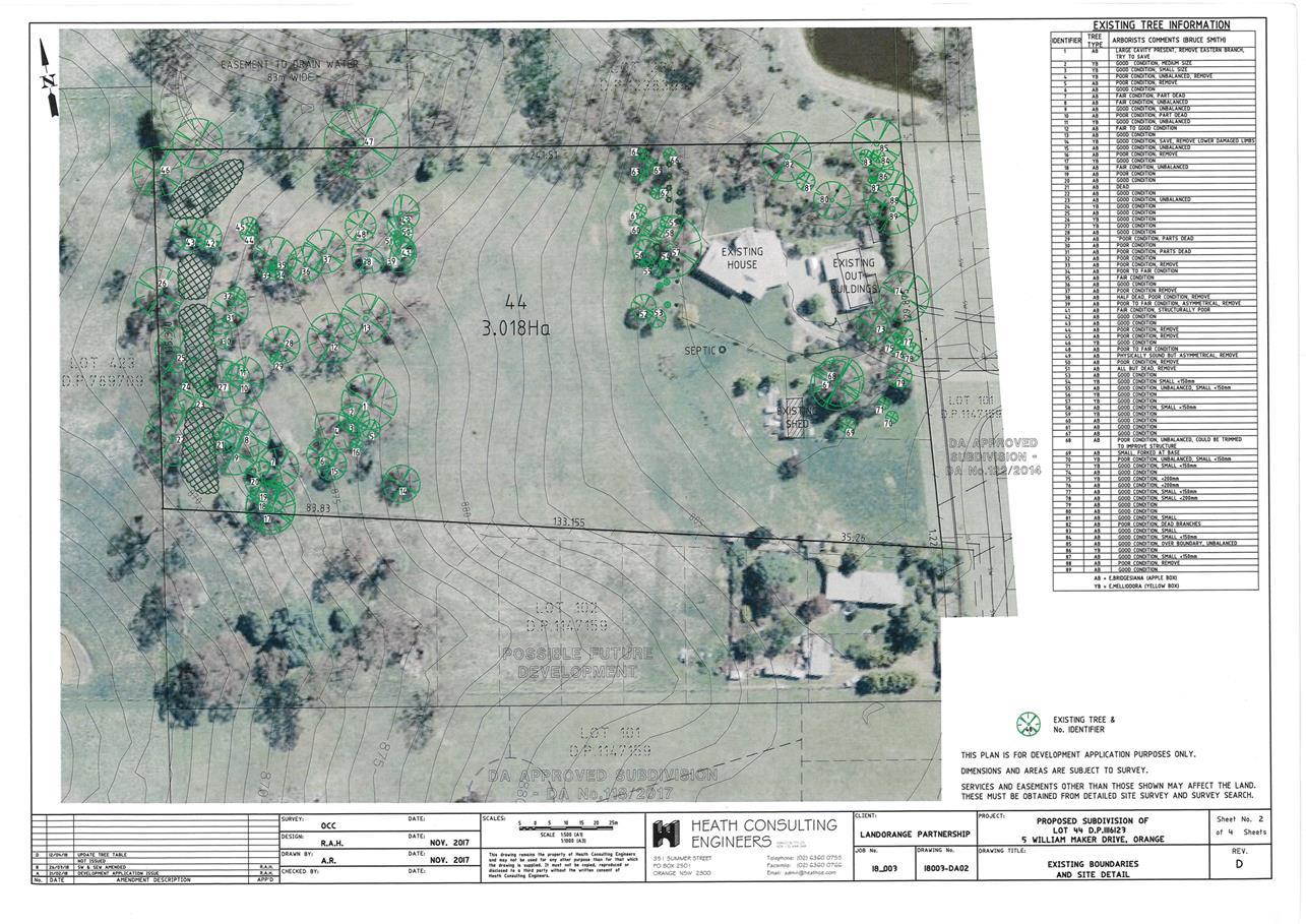
Planning and Development Committee
1 May 2018
2.5 Development
Application DA 56/2018(1) - 5 William Maker Drive
Attachment 2 Plans
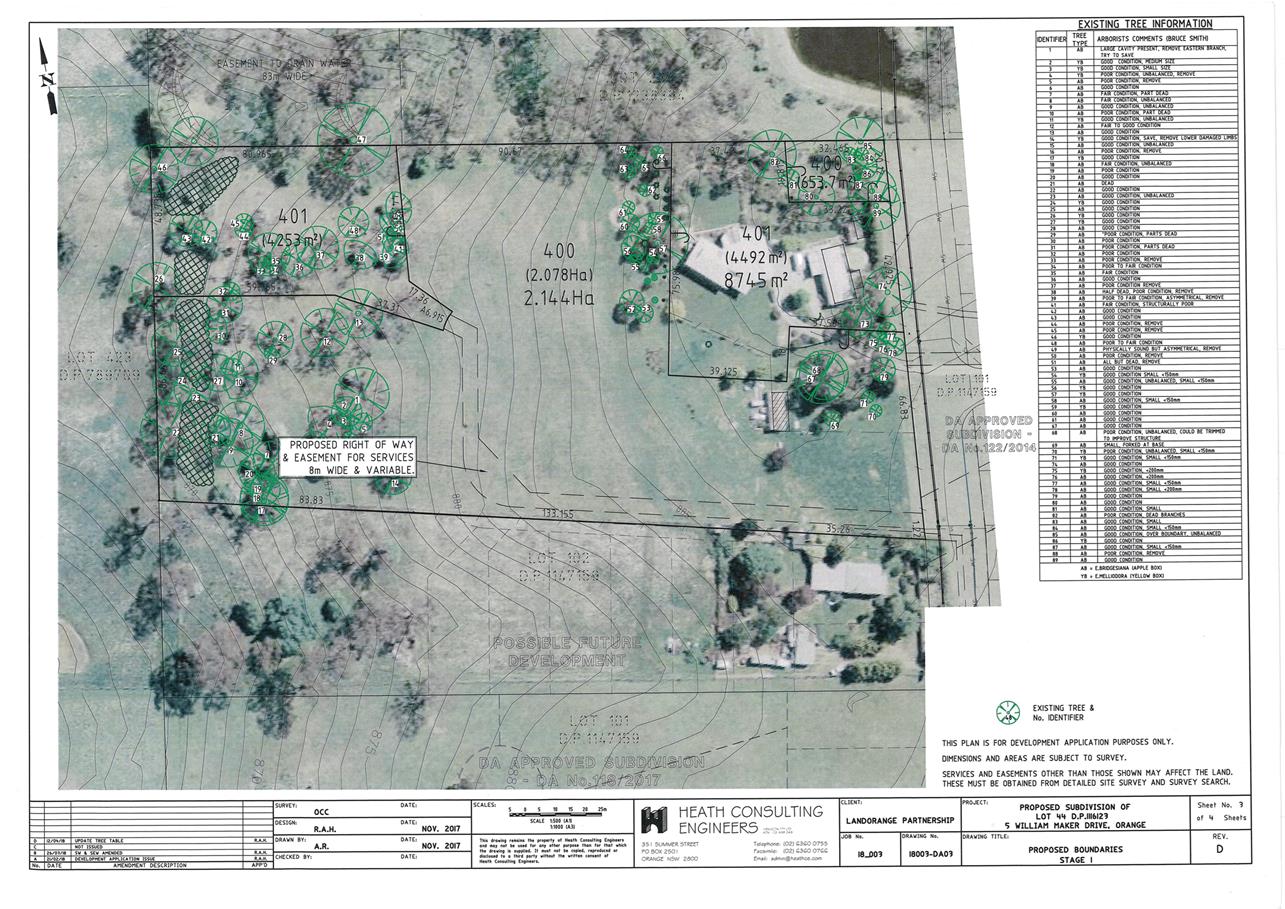
Planning and Development Committee
1 May 2018
2.5 Development
Application DA 56/2018(1) - 5 William Maker Drive
Attachment 2 Plans
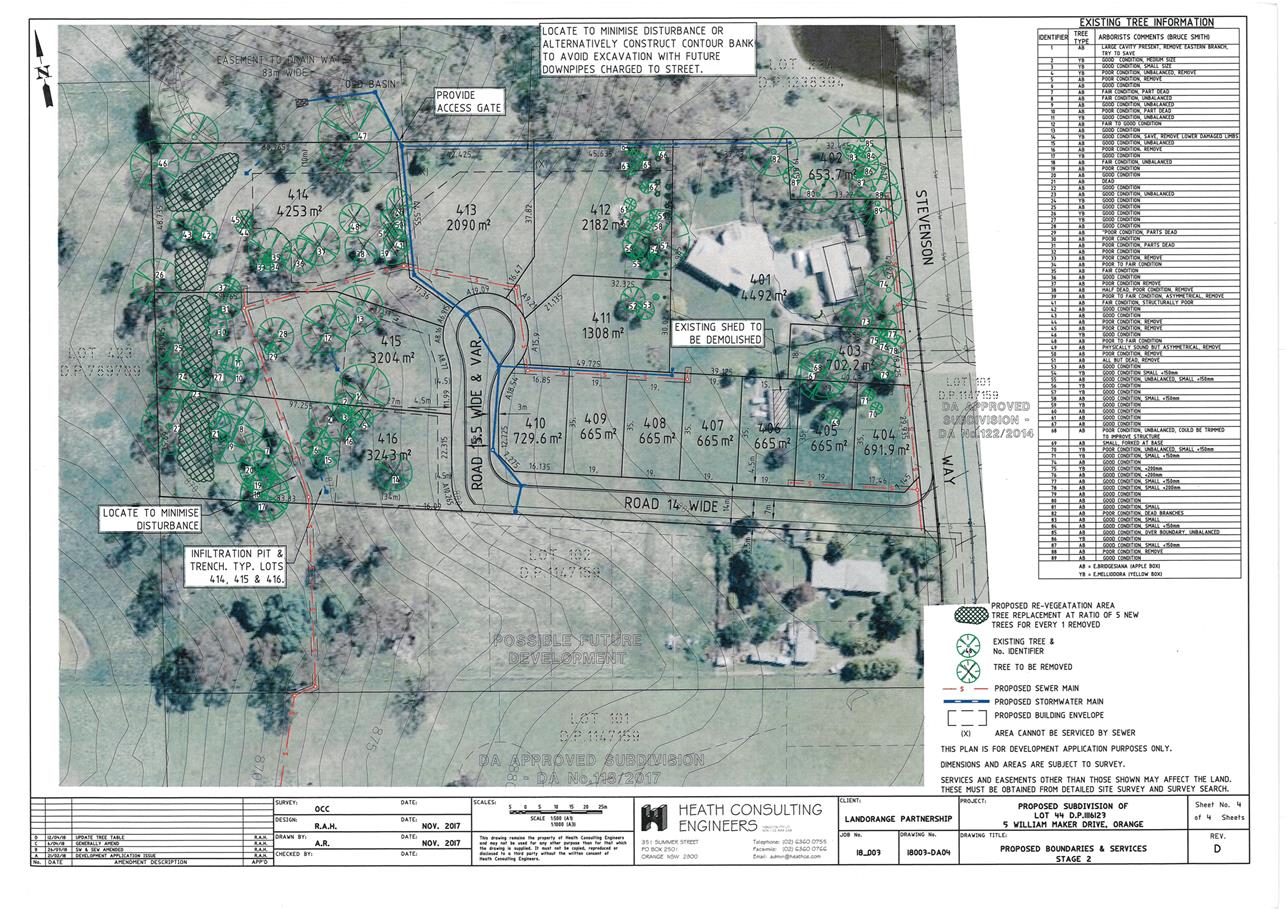
Planning and Development Committee
1 May 2018
2.5 Development
Application DA 56/2018(1) - 5 William Maker Drive
Attachment 3 Submissions
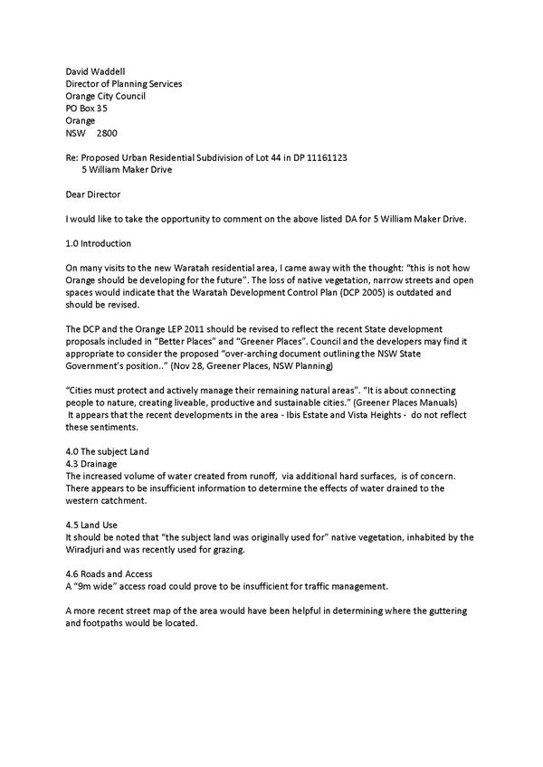
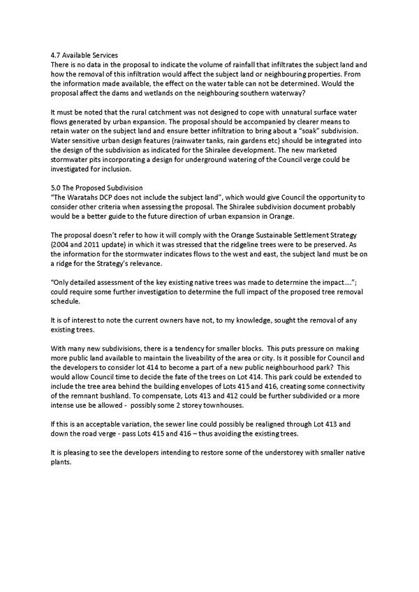

RECORD
NUMBER: 2018/430
AUTHOR: David
Waddell, Director Development Services
EXECUTIVE Summary
This report updates Council on the status of the aluminium
cladding issue in NSW as it pertains to Orange, and also the on the issue
of PFAS contamination - both which are very topical across NSW. Orange does not
appear to have a significant issue.
Staff are continuing to follow instruction from the State
Government on aluminium cladding management and protocols. Orange has several
buildings under investigation but no serious issue is emerging.
Link To Delivery/OPerational Plan
The recommendation in this report relates to the
Delivery/Operational Plan strategy “1.1 Our City -
Provide easily obtainable information on the legal responsibilities of
Councillors, Council staff and the community”.
Financial Implications
An extensive PFAS monitoring program would have significant
financial implications should the Environmental Protection Authority decree it
necessary.
Policy and Governance Implications
Nil
|
Recommendation
That the report by the Director Development Services on
PFAS and cladding be acknowledged.
|
further considerations
Consideration has been given to the
recommendation’s impact on Council’s service delivery; image and
reputation; political; environmental; health and safety; employees;
stakeholders and project management; and no further implications or risks have
been identified.
SUPPORTING INFORMATION
Both PFAS contamination and aluminium cladding have been
topical in recent months - the PFAS (polyfluoroalkyl
substances) via the RAAF Williamtown saga and cladding through the
London and Melbourne tower fires. Both have the potential to impact Orange.
PFAS National Environmental Management
Plan (PFAS NEPIP)
The Heads of Environmental Protection
Authorities in Australia and New Zealand (HEPA) released the PFAS NEPIP in
January 2018 to provide a consistent approach to PFAS regulation.
PFAS
Reference is made to the work of Chris
Jewell who is assisting Council in PFAS monitoring.
In 2017, the NSW Environment Protection
Authority (EPA) wrote to local councils in NSW, including Orange City
Council, seeking advice concerning sites in the local government area (LGA)
that might be impacted by PFAS on the basis of the historical use of those
sites. A separate letter requested specific information concerning
fire-training carried out in conjunction with the Rural Fire Service (RFS) at
Orange Airport, and recommended soil and groundwater sampling to identify any
such contamination.
PFAS is an abbreviation for per- and
polyfluoroalkyl substances. These chemicals have been manufactured and used for
over 50 years because they have properties that make them particularly useful
for some purposes. When used as a coating, they can make products non-stick,
water repellent and stain resistant. Mixed with water, they form foams that can
blanket and extinguish fuel and oil fires. Unfortunately, those same properties
make them extremely mobile and persistent in the environment. They are also
able to bio accumulate, and there is evidence that some of them are toxic to
humans and other animals.
There are (at least) several hundred PFAS.
Little is known about most of them, which are present at very low concentrations
as impurities in commercial products. In Australia, laboratory analysis is
available for approximately 28 PFAS. Of these, three are of particular concern.
These are PFOS, PFHxS and PFOA. Health-based guidance values for these
compounds in drinking water and recreational water have been issued by the
Australian Department of Health. Draft guidelines values to protect aquatic
ecosystems have been issued for PFOS and PFOA by the Australian and New Zealand
Environment and Conservation Council (ANZECC).
During recent years it has become clear
that PFAS are significant contaminants impacting soil, surface water and
groundwater in Australia. Whilst this contamination has proved to be
widespread, reflecting the long-term use of PFAS in many industrial processes
and a wide range of consumer products, by far the most significant source of
PFAS contamination that has impacted water resources is the use of aqueous
film-forming foams (AFFF) in fire-fighting. In particular, the use of AFFF
in hot fire training exercises in military and civil aviation and some other
applications has proved to be the source of all the large-scale
PFAS contamination issues so far identified in Australia. In contrast to
some other countries, the main PFAS compound of concern in Australia has
proved to be PFOS, with PFOA and PFHxS generally found in the
environment at significantly lower concentrations.
The RAAF Williamtown case is front of mind
in Australia at the moment.
The
investigation into PFAS contamination coming from the RAAF Base Williamtown is
complete, and the NSW Government is providing long-term advice to the
Williamtown community. This follows a review of the Department of
Defence’s final Human Health Risk Assessment (HHRA) report. (EPA Website)
The following paragraphs contain a review
of information collected by Orange Council in response to this request,
together with output from the Spring Hill and Airport studies that Chris Jewell
is working on for Council.
Historic
Fire-Fighting Foam (PFAS) Risk to Drinking Water Quality
Foams currently used by NSW Fire and Rescue
in Orange do not contain PFAS.
NSW RFS (Canobolas Zone) has not to its
knowledge used, and has no record of using, PFAS‑containing foam at
Orange Airport. RFS last purchased PFAS-containing foam in 2005, and
recalled the remaining stocks in 2007. Fire training has been carried out at a
number of locations at the airport, and there is no dedicated hot fire training
area.
Without in any way doubting the veracity of
this statement, and knowing that where possible RFS used simple detergents for
training purposes due to the high cost of AFFF, there have been a large
number of branded foams available, some of which did contain PFAS; and
without a detailed review it would not be possible to be sure that all foams
used were PFAS-free. PFAS in soil and groundwater have been detected at other
RFS training locations, and it is understood that some PFAS-containing
foam escaped the recall. A precautionary approach is thus being applied.
Aviation Incidents
According to Jewell:
I have
reviewed the reports of aviation incidents at Orange Airport on 6 July 2010, 15
January 2014 and 10 February 2015. The July 2010 incident, when an aircraft
clipped the top of the hanger and crashed into taxiway Charlie, appears to have
been the most serious; photographs attached to the report indicate that whilst
there was no fire, foam was applied as a precaution, but use does not appear to
have been excessive. Foam does not appear to have been used in the other
incidents. Jewell 2018
Spring Hill water supply bores
The Spring Hill/Lucknow water bores were
sampled in May 2017 and the samples analysed for PFOS, PFOA and for four
fluorotelomer sulphonates (FTS). The concentrations reported were less than the
limits of reporting (0.01 micrograms per litre (μg/L) of PFOS
and PFOA, 0.05 μg/L for the FTS) (i.e. they could not be
detected).
Modelling of groundwater flow to these
bores has recently been carried out. This modelling is still being refined but
indicates clearly that the capture zone (the source of the water) is narrow and
extends west of the bores, with only a small proportion of the flow drawn from
the areas north, south and east of the bores. Orange Airport is definitely not
in the modelled capture zone.
It is of note that in time the bores will
be decommission and the supply replaced by the Orange to Carcoar Pipeline.
Airport bore
The airport water supply bore was sampled
at the same time as the Spring Hill bores; analysis indicated PFOS, PFOA and
the three FTS at concentrations below the limits of reporting.
Proposed PFAS sampling at Orange Airport
A soil sampling and groundwater monitoring
program for PFAS at Orange Airport is being developed as a precautionary
measure on the basis of historical information and the groundwater modelling results.
Staff will continue to work with Chris Jewell on this issue across the
catchment.
ALUMINIUM CLADDING
Staff have provided such information as is known about this
type of cladding in Orange in response to an October 2017 request by the Fire
Safety Commissioner. There are not a significant number of buildings with this
cladding in Orange according to our records and staff collective knowledge. I
have not mentioned buildings affected in this report deliberately as I cannot
be fully accurate without detailed inspection. Those building owners have been
notified and the emphasis is on those owners to proactively manage their own
cases.
A package of proposed reforms for buildings with combustible
cladding has been released in response to the tragic fire at Grenfell Tower,
London in June 2017. This package was on exhibition until 16 February 2018 and
builds on action taken following Melbourne’s Lacrosse Tower fire in
November 2014.
A key component of this is the
development of a draft Regulation that will require
owners of buildings with combustible cladding to inform state government, and
to undertake an independent fire safety assessment. The exhibition package
includes an Explanation of Intended Effect, which
proposes amendments to eight State Environmental Planning Policies to limit the
use of combustible cladding as exempt development, that is without planning or
building approval. PNSW
The draft Environmental Planning and Assessment Amendment
(Identification of Buildings with Combustible Cladding) Regulation 2017 and the
Explanation of Intended Effect are currently on public exhibition.
Staff may make submission on Council’s behalf. In the
meantime the emphasis is on certifiers to ensure any new approvals for building
meet current standards.
2.7 Use
of Old Netball Courts for Overflow Parking
TRIM
REFERENCE: 2017/1730
AUTHOR: David
Waddell, Director Development Services
EXECUTIVE Summary
This report provides information to Council on the
possibility of the temporary use of the old netball courts in Moulder Park for
overflow CBD parking, following a request from Councillor Kidd:
Cr Kidd requested an update
report to the next meeting on the possibility of using the old netball courts
in Moulder Park for car parking.
The old netball courts are currently lying dormant as a
netball use, although are fairly heavily used as an ad hoc recreation area,
particularly for small children. This use needs to be gauged by a public
consultation.
The site is owned by Orange City
Council and is zoned RE1 Public Recreation and has an area
of 8,505m².
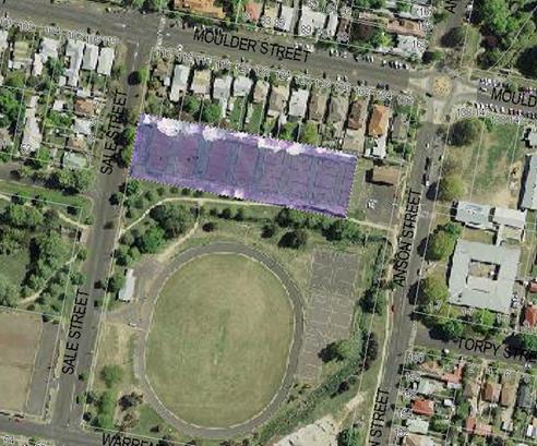
Figure 1: locality plan
Parking is not permissible on land zoned RE1. A rezoning
would thus be required or the submission of a temporary use development
application under clause 2.8 of Orange Local Environmental Plan 11 which
would give up to a 52 day approval. Alternately the use of the
Infrastructure SEPP will permit the use with a Part 5 Environmental
Assessment.
A temporary use development application would first require
that Council grant a lease for a temporary public car park that would then
enable consideration of the development application. This is because the land
is classified as community land under the Local Government Act 1993.
Typically this restricts the range of uses to which the land
may be put. However, Section 46 of the Act allows a “lease, licence
or other estate” to be granted in certain circumstances. Amongst
these options are purposes stipulated by regulations if the plan of management
applies to several areas of community land. Sections 52-66 of the Local
Government (General) Regulation 2005 relates to approvals for public car parks
on community land.
The eastern end of the courts is flanked by an Orange Public
School drop-off/pick-up area. This precludes an eastern entrance to a temporary
car park, putting that solely on Sale Street if the project proceeds.
The entire site is flood affected, although this may not be
prohibitive to a temporary use. The site is slated for a detention basin in the
future. It has also been earmarked as a possible residential site
dependant on flood study outcomes.
Key questions should Council resolve to pursue a temporary
use development application and change to the Plan of Management will be:
· Is this an
appropriate location and would it be utilised?
· What upgrade would
be required to the surface and at what cost?
· Can conflicts be
managed?
· Would there be
public support or has ad hoc recreation taken the place of netball?
Link To Delivery/OPerational Plan
The recommendation in this report relates to the
Delivery/Operational Plan strategy “1.1 Our City -
Provide easily obtainable information on the legal responsibilities of
Councillors, Council staff and the community”.
Financial Implications
The creation of a suitable entrance on Sale Street will
require funds as well as line-marking and signage.
The pavement will be degraded if parking is allowed, but no
use as netball courts is envisaged into the future, rather a detention basin.
Policy and Governance Implications
Nil
|
Recommendation
That the proposal to allow temporary use of the former
netball courts in Moulder Park for car parking be placed on public exhibition
for a period of 28 days.
|
further considerations
Consideration has been given to the
recommendation’s impact on Council’s service delivery; image and
reputation; political; environmental; health and safety; employees;
stakeholders and project management; and no further implications or risks have
been identified.
SUPPORTING INFORMATION
Council staff were requested to examine the possibility of
making the old netball courts at Moulder Park available for parking. An
examination of the request considered the possible benefits and barriers to the
use for this purpose, and determining the permissibility of the development on
this land.
Ownership
Orange City Council owns the subject land – Lot 12 DP 13567
Zoning
The Land is zoned RE1 Public Recreation
Permissibility
A car park is defined under Orange Local Environmental Plan
2011 as a building or place primarily used for the purpose of parking motor
vehicles, including any manoeuvring space and access thereto, whether operated
for gain or not.
Car parks are listed as a prohibited land use in the RE1
zone. However, notwithstanding the provisions of the LEP, Clause 65 of State
Environmental Planning Policy (Infrastructure) – Parks and Other Public Reserves
provides for the following development without consent:
(3) Development
for any of the following purposes may be carried out by or on behalf of a
council without consent on a public reserve under the control of or vested in
the council:
(a) roads,
cycleways, single storey car parks, ticketing facilities and viewing platforms,
To this end, whilst development consent is not required
Council would be required to carry out a Review of Environmental Factors under
the provisions of Part 5 of the Environmental Planning and Assessment Act 1979.
Key issues to be addressed would include matters relating to the construction
of access driveways, suitability of the pavement to support the development,
acoustic assessment, development within 40m of a prescribed stream and the
associated flooding impacts that may occur. Council would need to be satisfied
that the development is consistent with the adopted Plan of Management that
applies to the land (the Moulder Park Plan of Management).
It is estimated that at least 100 car parking spaces could
be accommodated on the subject land.
Issues Analysis
Benefits:
- Provides
overflow all day CBD parking
- use
of an otherwise underutilised public space in a strategic location
- would
not restrict the temporary role for events like markets
Negatives:
- underutilised
street parking in the streets surrounding Moulder Park
- located
a distance away from the CBD
- the
eastern end must not be used as it will cause unsafe interference with the Orange
Public school drop-off/pick-up zone
- the
cost to upgrade the surface and line-mark, construct at the western end a driveway
and entrance works, and the installation of a barrier to restrict access to the
remainder of Moulder Park
- proximity
to houses would require a noise assessment
- the
car park is currently used by children on bikes and other equipment
- the
land is affected by flooding
- an
understanding of the structural integrity of the car park to accommodate
vehicles being parked on the land would be required.
In conclusion, whilst the use for a temporary car park is permissible
under the Infrastructure SEPP, the negatives of the proposed use may
require public consultation prior to a decision being made. There are other
potential strategic land uses which need to be considered under the CBD
Masterplan before a final use is resolved. In addition the flood study
currently underway will determine the final constraints on the site.