
ORANGE CITY COUNCIL
Planning and Development
Committee
Agenda
3 April 2018
Notice
is hereby given, in accordance with the provisions of the Local Government Act
1993 that a Planning and Development
Committee meeting
of ORANGE CITY COUNCIL will be held in the Council Chamber, Civic Centre, Byng Street, Orange on Tuesday,
3 April 2018.
Garry
Styles
General Manager
For apologies please
contact Michelle Catlin on 6393 8246.
Planning and Development Committee 3
April 2018
1 Introduction
1.1 Declaration
of pecuniary interests, significant non-pecuniary interests and less than
significant non-pecuniary interests
The
provisions of Chapter 14 of the Local Government Act, 1993 (the Act)
regulate the way in which Councillors and designated staff of Council conduct
themselves to ensure that there is no conflict between their private interests
and their public role.
The
Act prescribes that where a member of Council (or a Committee of Council) has a
direct or indirect financial (pecuniary) interest in a matter to be considered
at a meeting of the Council (or Committee), that interest must be disclosed as
soon as practicable after the start of the meeting and the reasons given for
declaring such interest.
As
members are aware, the provisions of the Local Government Act restrict any
member who has declared a pecuniary interest in any matter from participating
in the discussion or voting on that matter, and requires that member to vacate
the Chamber.
Council’s Code of Conduct provides that if members
have a non-pecuniary conflict of interest, the nature of the conflict must be
disclosed. The Code of Conduct also provides for a number of ways in which a
member may manage non pecuniary conflicts of interest.
|
Recommendation
It is recommended that Committee Members now disclose any
conflicts of interest in matters under consideration by the Planning and
Development Committee at this meeting.
|
2 General
Reports
2.1 Items
Approved Under the Delegated Authority of Council
RECORD
NUMBER: 2018/459
AUTHOR: Paul
Johnston, Manager Development Assessments
EXECUTIVE Summary
Following is a list of development
applications approved under the delegated authority of Council.
Link To Delivery/OPerational Plan
The recommendation in this report relates to the Delivery/Operational
Plan strategy “13.4 Our Environment – Monitor and
enforce regulations relating to City amenity”.
Financial Implications
Nil
Policy and Governance Implications
Nil
|
Recommendation
That the information provided in the
report by the Manager Development Assessments on Items Approved Under the
Delegated Authority of Council be acknowledged.
|
further considerations
Consideration has been given to the
recommendation’s impact on Council’s service delivery; image and
reputation; political; environmental; health and safety; employees;
stakeholders and project management; and no further implications or risks have
been identified.
SUPPORTING INFORMATION
|
Reference:
|
DA 750/2002(3)
|
Determination
Date
|
12 March 2018
|
|
PR Number
|
PR25568
|
|
Applicant/s:
|
Designs@M
|
|
Owner/s:
|
Mrs JA Pascoe
|
|
Location:
|
Lot 26 DP 1171207
– 72 Valencia Drive, Orange
|
|
Proposal:
|
Modification of
development consent - subdivision (nine lot residential). The modification
involves amending a Restriction as to User (Condition 28) applying to the
subject land, to allow a rear building setback of 15m.
|
|
Value:
|
$0 (being the same
value as the original development).
|
|
Reference:
|
DA 278/2012(2)
|
Determination
Date
|
27 February 2018
|
|
PR Number
|
PR14478
|
|
Applicant/s:
|
Mr AS Bailey
|
|
Owner/s:
|
Mr AS Bailey
|
|
Location:
|
Lot 2 DP 731030
– 3848 Mitchell Highway, Shadforth
|
|
Proposal:
|
Modification of development
consent – temporary dwelling and recreation facility (outdoor), bed and
breakfast with dwelling and ancillary sheds. The proposed modification does
not alter the details of the proposal, but does change the manner in which it
will be built.
|
|
Value:
|
$2,911,930 (being
the same value as the original development)
|
|
Reference:
|
DA 452/2015(3)
|
Determination
Date
|
15 March 2018
|
|
PR Number
|
PR19670
|
|
Applicant/s:
|
Mrs DV Gee
|
|
Owner/s:
|
Mrs DV Gee
|
|
Location:
|
Lot 10 DP 1070599
– 4601 Mitchell Highway, Lucknow
|
|
Proposal:
|
Modification of
development consent -shop (alterations and additions to existing premises)
and Demolition (tree removal). The modified proposal will effect minor
changes to the approved building centred on the addition of a wheelchair
accessible toilet.
|
|
Value:
|
$65,000 (being the
same value as the original development)
|
|
Reference:
|
DA 112/2017(2)
|
Determination
Date
|
23 February 2018
|
|
PR Number
|
PR26080
|
|
Applicant/s:
|
West Orange
Holdings Pty Ltd
|
|
Owner/s:
|
West Orange
Holdings Pty Ltd
|
|
Location:
|
Lot 102 DP 1187463
– 22-34 Forbes Road, Orange
|
|
Proposal:
|
Modification of
development consent – vehicle sales or hire premises (alterations and
additions to existing building) and signage. The modification is seeking
consent to enclose the rear verandah of the subject building and to use the
area for the purpose of a customer lounge.
|
|
Value:
|
$500,000 (being
the same value as the original development)
|
|
Reference:
|
DA 412/2017(1)
|
Determination
Date
|
1 March 2018
|
|
PR Number
|
PR27051
|
|
Applicant/s:
|
Mr PJ and Mrs JB Plasto
|
|
Owner/s:
|
Mr PJ and Mrs JB
Plasto
|
|
Location:
|
Lot 101 DP 1207360
– 53 Silverdown Way, Orange
|
|
Proposal:
|
Dwelling house,
bed and breakfast accommodation with garage
|
|
Value:
|
$580,000
|
|
Reference:
|
DA 424/2017(1)
|
Determination
Date
|
5 March 2018
|
|
PR Number
|
PR18128
|
|
Applicant/s:
|
Mr HJ Harris and
Mrs JE Birchall
|
|
Owner/s:
|
Mr HJ Harris and
Mrs JE Birchall
|
|
Location:
|
Lot 310 DP 1024556
– 354 Cadia Road, Springside
|
|
Proposal:
|
Farm stay
accommodation
|
|
Value:
|
$40,000
|
|
Reference:
|
DA 426/2017(1)
|
Determination
Date
|
16 March 2018
|
|
PR Number
|
PR10644
|
|
Applicant/s:
|
Mr S Turner and Mr
BJ Irvine
|
|
Owner/s:
|
Messrs SA Turner
and B Irvine
|
|
Location:
|
Lot 33 DP 16787
– 167 Sale Street, Orange
|
|
Proposal:
|
Subdivision (two lot
Torrens Title), Multi Dwelling Housing (four dwellings), Subdivision
(Community Title), Demolition (existing garage, gazebo and outbuilding), Tree
Removal and Garage (new construction)
|
|
Value:
|
$900,000
|
|
Reference:
|
DA 458/2017(1)
|
Determination
Date
|
5 March 2018
|
|
PR Number
|
PR3888
|
|
Applicant/s:
|
Mr B Cochrane
|
|
Owner/s:
|
Mr RG and Mrs M
Gardoll
|
|
Location:
|
Lot C DP 155281
– 66 Endsleigh Avenue, Orange
|
|
Proposal:
|
Light industry,
ancillary kiosk, business identification signs
|
|
Value:
|
$10,000
|
|
Reference:
|
DA 485/2017(1)
|
Determination
Date
|
1 March 2018
|
|
PR Number
|
PR11487
|
|
Applicant/s:
|
With Dezign
|
|
Owner/s:
|
Mountain Group AU
Pty Ltd
|
|
Location:
|
Lot E DP 27336
– 129 Summer Street, Orange
|
|
Proposal:
|
Restaurant or
café and business identification signage
|
|
Value:
|
$180,000
|
|
Reference:
|
DA 486/2017(1)
|
Determination Date
|
22 February 2018
|
|
PR Number
|
PR19437
|
|
Applicant/s:
|
Banksia Building
Pty Limited
|
|
Owner/s:
|
Orange Nominees
Pty Ltd
|
|
Location:
|
Lot 108 DP 1067744
– 10 Ralston Drive, Orange
|
|
Proposal:
|
Storage premises
|
|
Value:
|
$600,000
|
|
Reference:
|
DA 15/2018(1)
|
Determination
Date
|
5 March 2018
|
|
PR Number
|
PR2179
|
|
Applicant/s:
|
Mr C Christodoulou
|
|
Owner/s:
|
Mr C Christodoulou
|
|
Location:
|
Lot 25 DP 258858
– 6 Calang Street, Orange
|
|
Proposal:
|
Secondary dwelling
(use)
|
|
Value:
|
$0
|
|
Reference:
|
DA 31/2018(1)
|
Determination Date
|
7 March 2018
|
|
PR Number
|
PR11579
|
|
Applicant/s:
|
The Clever Owl
|
|
Owner/s:
|
Australia Post
Property Division
|
|
Location:
|
Lot 11 Sec 40 DP
758817 – 222-224 Summer Street, Orange
|
|
Proposal:
|
Retail premises
(change of use and internal fitout)
|
|
Value:
|
$0
|
|
Reference:
|
DA 35/2018(1)
|
Determination
Date
|
26 February 2018
|
|
PR Number
|
PR11579
|
|
Applicant/s:
|
Jireh
International Pty Ltd
|
|
Owner/s:
|
Australia Post
Property Division
|
|
Location:
|
Lot 11 Sec 40 DP
758817 – 222-224 Summer Street, Orange
|
|
Proposal:
|
Demolition (removal
of fittings and signage)
|
|
Value:
|
$50,000
|
|
Reference:
|
DA 47/2018(1)
|
Determination
Date
|
14 March 2018
|
|
PR Number
|
PR18108
|
|
Applicant/s:
|
Hort Enterprises
|
|
Owner/s:
|
Hort Family
Properties Pty Ltd
|
|
Location:
|
Lot 20 DP 1022526
– 258 Clergate Road, Orange
|
|
Proposal:
|
General industry
(alterations and additions to existing building)
|
|
Value:
|
$280,000
|
TOTAL
NET* VALUE OF ALL DEVELOPMENTS APPROVED IN THIS PERIOD: $2,640,000
*
Net value relates to the value of modifications. If modifications are
the same value as the original DA, then nil is added. If there is a plus/minus
difference, this difference is added or taken out.
2.2 Development
Application DA 347/2017(1) - 68-74 Molong Road
RECORD
NUMBER: 2018/702
AUTHOR: Andrew
Crump, Senior Planner
EXECUTIVE Summary
|
Application
lodged
|
18
September 2017
|
|
Applicant/s
|
Hargreaves
Property Group
|
|
Owner/s
|
Mr J
Stojanovic
|
|
Land
description
|
Lot 1 DP
393543 - 68-74 Molong Road, Orange
|
|
Proposed
land use
|
Service
Station; Neighbourhood Shop (two); Business Premises (car wash); Category 1
Remediation; Subdivision (two lot commercial), Signage, Demolition and Tree
Removal
|
|
Value of
proposed development
|
$3,000,000
|
Council's consent is sought to
construct and operate a 24-hour service station, two neighbourhood shops and a
car wash. As part of the development the applicant is proposing a two lot
subdivision that will allow the service station/neighbourhood shops to be
located on a separate lot from the car wash. To facilitate the development on a
more level site, extensive earthworks and retaining walls are required. The
land has been identified as contaminated, and as such Category 1 remediation is
required. The land concerned is described as Lot 1 DP 393543, known as 68-74
Molong Road, Orange and shown in the below locality plan.
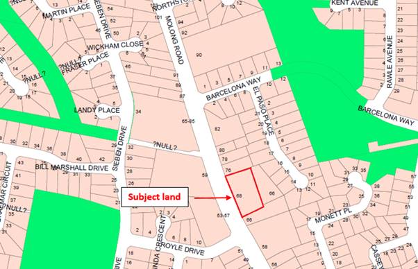
Figure 1 - locality plan
RECENT LEGISLATIVE CHANGES
On 1 March 2018 the Environmental Planning and Assessment
Act 1979 was substantially amended. The most immediate change involves the
restructuring and renumbering of the Act, with other more substantive
changes to be phased in over time. However, for some applications (particularly
where an application was lodged prior to the changes coming into effect) the
supporting documentation may still reference the previous numbering regime. In
the drafting of this report the content and substance of the supporting
material has been considered irrespective of which legislative references were
used.
DECISION FRAMEWORK
Development in Orange is governed by two key documents
Orange Local Environment Plan 2011 and Orange Development Control Plan 2004. In
addition the Infill Guidelines are used to guide development, particularly in
the heritage conservation areas and around heritage items.
Orange Local Environment Plan 2011 – the LEP
should be considered by Council to be a definitive document. LEPs govern the
types of development that are permissible or prohibited in different parts of
the City and also provide some assessment criteria in specific circumstances.
Uses are either permissible or not - there are no grey areas in terms of
permissibility. The objectives of each zoning and indeed the aims of the LEP
itself are, however, open to interpretation and can be used to guide decision
making around appropriateness of development.
Orange Development Control Plan 2004 – the DCP
guides development. In general, it is a performance based document rather than
prescriptive in nature - its purpose is to guide development. The Land and
Environment Court tends to view it as such. In each area of interest there are
often guidelines used. These guidelines indicate ways of achieving the planning
outcomes. It is thus recognised that there may also be other solutions of
merit. All design solutions are considered on merit by planning and building
staff. Applications should clearly demonstrate how the planning outcomes are
being met where alternative design solutions are proposed. So one can see that
the DCP gives leeway for developers and architects to use design to achieve the
outcome in other ways if they can. Stating that DCP guidelines are
inflexible can be misleading.
DIRECTOR’S COMMENT
This development involves a non-residential use replacing a
non-residential use in a B6 zone. Given the zoning of the site, such a use
was not unlikely. Given there are residences in close proximity and whilst the
development meets the outcomes of the LEP and DCP, Councillors need
to be satisfied that the development addresses the concerns of objectors. Road
safety concerns have been addressed by conditions from the RMS given
Molong Road is a major road.
Link To Delivery/OPerational Plan
The recommendation in this report relates to the
Delivery/Operational Plan strategy “13.4 Our Environment
– Monitor and enforce regulations relating to City amenity”.
Financial Implications
Nil
Policy and Governance Implications
Nil
|
Recommendation
That Council consents to
development application DA 347/2017(1)
for Service Station; Neighbourhood Shop (two); Business Premises (car
wash); Category 1 Remediation; Subdivision (two lot commercial), Signage,
Demolition and Tree Removal at Lot 1 DP 393543 - 68-74 Molong
Road, Orange pursuant to the conditions of consent
in the attached Notice of Approval.
|
further considerations
Consideration has been given to the
recommendation’s impact on Council’s service delivery; image and
reputation; political; environmental; health and safety; employees;
stakeholders and project management; and no further implications or risks have
been identified.
SUPPORTING INFORMATION
THE APPLICATION/PROPOSAL
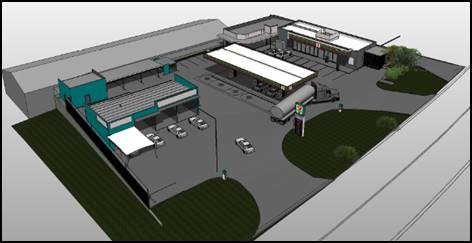
The application involves the construction and operation of a
24-hour service station, two neighbourhood shops and a four bay car wash (one
automated bay and three self-service bays). The application also involves a two
lot subdivision that will allow the service station/neighbourhood shops to be
located on a separate lot from the car wash. To facilitate the development on a
level site, it is proposed to undertake extensive earthworks and retaining
walls. The land has been identified as being contaminated, and as such
Category 1 remediation is required. The development is proposed to be
established in a series of stages which are outlined below.
STAGING
The applicant submits the staging will comprise the
following:
· Stage 1 - subdivision
including demolition, tree removal, site remediation, and associated works
· Stage 2 - service
station signage and associated works
· Stage 3 - neighbourhood
shops and associated works
· Stage 4 - car
wash and associated works.
The applicant further clarified
the staging with the following:
· The vehicle areas
attributed to Stages 1 and 3 will be constructed as a concrete surface to the
northern edge of the proposed right of carriageway within proposed lot 100.
· The remaining area
(shaded green [attached plans]) will be shaped from the northern edge of the
abovementioned right of carriageway to the northern boundary of the site and
sown with an appropriate.
· Proposed lot 100 will
remain as a grassed area until such time that Stage 4 of the development
proceeds. At that point, the relevant retaining structures and the landscaping
along the northern edge of the subject land will be provided as proposed.
· On-site stormwater
detention will be provided to address all stages of the development and any
relevant easements will be created as required. It is understood that Council
will impose conditions to this effect.
The above staging presents an issue in relation to achieving
the required noise attenuation for the development. This is because the noise
assessment does not account for a staged arrangement. The noise assessment
arrives at the respective conclusions based on a complete development. If the
service station proceeds before the car wash and it is not until the car wash
is constructed that the noise wall is built, there would be limited noise
attenuation measures controlling the operation of the service station in that
interim period.
Accordingly, conditions are attached that require the sound
wall (as required within the acoustic assessment) adjacent to the southern side
of the power line exclusion zone to be installed at the time of constructing
the service station. This will have the effect of also requiring some of the
civil works in the northern part of the site to be carried out such that the
wall can extend to the required height to achieve the necessary attenuation.
As there is no certainty around when the car wash will be
constructed, and therefore when the civil works in that part will be complete,
it is considered necessary to require landscaping in the interim period to
ensure that the required sound wall presents satisfactorily within the street.
Relevant conditions are attached that require landscaping to soften and screen
the subject sound wall.
BACKGROUND
The information submitted with the application at the time
of lodgement acknowledged the presence of a 66kV power line along the northern
boundary, stating that the development had been designed to achieve the
required clearances from the subject infrastructure.
Council staff completed their obligations pursuant to clause
45 of SEPP (Infrastructure) and referred the application to Essential Energy
(EE) accordingly. EE responded with a requirement for an ASP 3 accredited
person to provided EE with evidence that the development complied with the
relevant policy document.
As it transpired, the subject power line resulted in an
exclusion zone within the development site. Effectively this results in a
buffer along the northern boundary of between 9m and 6m from the northern
boundary which cannot be developed upon. Consequently, the scale of the car
wash has been reduced from five wash bays down to four, and a landscaped buffer
can be provided between the development and the adjoining residential property
to the north.
The subject exclusion zone is shown below in Figures 2 and
3:
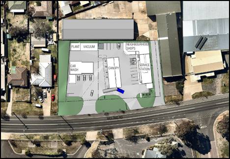
Figure 2: context plan showing wedged shape exclusion
zone at the northern boundary
Figures 3: isometric plan showing wedged shape
exclusion zone at the northern boundary
Council staff are of the view that
this results in a diminution of impact at the interface of the development site
and the adjoining residential property.
MATTERS FOR CONSIDERATION
Section 1.7 - Application of
Part 7 of the Biodiversity Conservation Act 2016 and Part 7A of the
Fisheries Management Act 1994
Development Applications lodged prior to 25 February 2018
Section 1.7 of the EP&A Act 1979 identifies that Part 7
of the Biodiversity Conservation Act 2016 and Part 7A of the Fisheries
Management Act 1994 have effect in connection with terrestrial and aquatic
environments.
Notwithstanding, Section 28 of the Biodiversity
Conservation (Savings and Transitional) Regulation 2017 states that the
former planning provisions continue to apply to the determination of a pending
planning application, being an application for planning approval made before
the commencement of the new Act but not determined before that commencement.
The relevant provisions are set out at Part 5A of the historical version of the
EP&A Act 1979 dated 24 August 2017.
Having regard to the relevant provisions and based on an
inspection of the subject property, it is considered that the proposed
development is not likely to have a significant effect on any threatened
species, populations or ecological communities or their habitats.
Section 4.15
Section 4.15 of the Environmental Planning and Assessment
Act 1979 requires Council to consider various matters, of which those
pertaining to the application are listed below.
PROVISIONS OF ANY ENVIRONMENTAL
PLANNING INSTRUMENT s4.15(1)(a)(i)
Orange Local Environmental Plan 2011
Part 1 - Preliminary
Clause 1.2 - Aims of Plan
The
broad aims of the LEP are set out under subclause 2. Those relevant to the
application are as follows:
(a) to encourage development which complements
and enhances the unique character of Orange as a major regional centre boasting
a diverse economy and offering an attractive regional lifestyle,
(b) to provide for a range of development
opportunities that contribute to the social, economic and environmental
resources of Orange in a way that allows present and future generations to meet
their needs by implementing the principles for ecologically sustainable
development,
(c) to conserve and enhance the water
resources on which Orange depends, particularly water supply catchments,
The application is considered to be consistent with aims
(a), (b) and (c) as listed above.
Clause 1.6 - Consent Authority
This clause establishes that, subject to the Act, Council is
the consent authority for applications made under the LEP.
Clause 1.7 - Mapping
The subject site is identified
on the LEP maps in the following manner:
|
Land Zoned:
|
Land zoned B6 Enterprise Corridor
|
|
Lot Size Map:
|
No Minimum Lot Size
|
|
Heritage Map:
|
Not a heritage item or conservation
area
|
|
Height of Buildings Map:
|
No building height limit
|
|
Floor Space Ratio Map:
|
No floor space limit
|
|
Terrestrial Biodiversity Map:
|
No biodiversity sensitivity on the
site
|
|
Groundwater Vulnerability Map:
|
Groundwater vulnerable
|
|
Drinking Water Catchment Map:
|
Not within the drinking water
catchment
|
|
Watercourse Map:
|
Not within or affecting a defined watercourse
|
|
Urban Release Area Map:
|
Not within an urban release area
|
|
Obstacle Limitation Surface Map:
|
No restriction on building siting
or construction
|
|
Additional Permitted Uses Map:
|
No additional permitted use applies
|
|
Flood Planning Map:
|
Not within a flood planning area
|
Those matters that are of relevance are addressed in detail
in the body of this report.
Clause 1.9A - Suspension of
Covenants, Agreements and Instruments
This clause provides that covenants, agreements and other
instruments which seek to restrict the carrying out of development do not apply
with the following exceptions.
· covenants imposed
or required by Council
· prescribed
instruments under Section 183A of the Crown Lands Act 1989
· any conservation
agreement under the National Parks and Wildlife Act 1974
· any trust
agreement under the Nature Conservation Trust Act 2001
· any property
vegetation plan under the Native Vegetation Act 2003
· any biobanking
agreement under Part 7A of the Threatened Species Conservation Act 1995
· any planning
agreement under Division 6 of Part 4 of the Environmental Planning and
Assessment Act 1979.
Council staff are not aware of the title of the subject
property being affected by any of the above.
Part 2 - Permitted or Prohibited Development
Clause
2.1 - Land Use Zones and Clause 2.3 - Zone Objectives and Land Use Table
The subject site is located within the B6 Enterprise
Corridor zone. The proposed development is
defined as a service station, neighbourhood shops, business premises (car wash)
and signage. Each of the above described land uses are defined as follows:
NB the development also involves subdivision,
demolition and tree removal, which are addressed separately below.
Service Station - means a building or place used for the sale by retail of fuels and
lubricants for motor vehicles, whether or not the building or place is also
used for any one or more of the following:
(a) the ancillary sale by retail of spare parts
and accessories for motor vehicles,
(b) the cleaning of motor vehicles,
(c) installation of accessories,
(d) inspecting, repairing and servicing of
motor vehicles (other than body building, panel beating, spray painting, or
chassis restoration),
(e) the ancillary retail selling or hiring of
general merchandise or services or both.
Neighborhood
Shop - means premises
used for the purposes of selling general merchandise such as foodstuffs,
personal care products, newspapers and the like to provide for the day-to-day
needs of people who live or work in the local area, and may include ancillary
services such as a post office, bank or dry cleaning, but does not include
restricted premises.
Business
Premises - means a building or
place at or on which:
(a) an
occupation, profession or trade (other than an industry) is carried on for the
provision of services directly to members of the public on a regular basis, or
(b) a
service is provided directly to members of the public on a regular basis,
and includes a funeral home and, without limitation,
premises such as banks, post offices, hairdressers, dry cleaners, travel
agencies, internet access facilities, betting agencies and the like, but does
not include an entertainment facility, home business, home occupation, home
occupation (sex services), medical centre, restricted premises, sex services
premises or veterinary hospital.
Signage -
means any sign, notice, device,
representation or advertisement that advertises or promotes any goods, services
or events and any structure or vessel that is principally designed for, or that
is used for, the display of signage, and includes any of the following:
(a) an
advertising structure,
(b) a
building identification sign,
(c) a
business identification sign,
but does not include a traffic sign or traffic control
facilities.
Service stations, neighbourhood shops, business premises and
signage are all permissible in the B6 Enterprise Corridor zone with development
consent.
Subdivision, demolition (including tree removal) and
Category 1 remediation are also permissible, but are addressed under separate
parts below.
Clause 2.3 of
LEP 2011 references the Objectives for each zone in LEP 2011. These
objectives for land zoned B6 Enterprise Corridor are as follows:
1 -
Objectives of the B6 Enterprise Corridor
· To
promote businesses along main roads and to encourage a mix of compatible uses.
· To
provide a range of employment uses (including business, office, retail and
light industrial uses).
· To
maintain the economic strength of centres by limiting retailing activity.
· To
provide for residential uses, but only as part of a mixed use development.
The development is not
inconsistent with the objectives of the zone. The development will provide for
an appropriate employment generating commercial landuse on the highway. The
landuse will not unreasonably conflict with the primacy of the CBD. The scale
of retailing is limited to the shop associated with the service station and two
neighbourhood shops that are restricted in floor area under a miscellaneous
development standard. No residential uses are proposed.
Clause 2.6 - Subdivision -
Consent Requirements
This clause triggers the need for development consent for
the subdivision of land, which the applicant has sought through the lodgement
of this application.
Clause 2.7 - Demolition
Requires Development Consent
This clause triggers the need for development consent in
relation to a building or work, which the applicant has sought through the
lodgement of this application.
Part 3 - Exempt and Complying Development
The application is not exempt or complying development.
Part 5 - Miscellaneous Provisions
Clause
5.4 - Controls Relating to Miscellaneous Permissible Uses
This
clause contains various development standards that apply to specific types of
development. Relevantly the clause requires:
· neighbourhood
shops to be limited to 140 square metres of gross floor area
There
are two neighbourhood shops proposed with floor areas of 80m2
and 50m2 respectively (aggregate total 130m2). Thus
the development is consistent with the above development standard.
Part 6 - Urban Release Area
Not relevant to the application. The subject site is not
located in an Urban Release Area.
Part 7 - Additional Local Provisions
7.1
- Earthworks
This
clause establishes a range of matters that must be considered prior to granting
development consent for any application involving earthworks, such as:
(a) the likely disruption of, or any
detrimental effect on, existing drainage patterns and soil stability in the
locality of the development
(b) the effect of the development on the
likely future use or redevelopment of the land
(c) the quality of the fill or the soil to be
excavated, or both
(d) the effect of the development on the
existing and likely amenity of adjoining properties
(e) the source of any fill material and the
destination of any excavated material
(f) the likelihood of disturbing relics
(g) the proximity to and potential for adverse
impacts on any waterway, drinking water catchment or environmentally sensitive
area
(h) any measures proposed to minimise or
mitigate the impacts referred to in paragraph (g).
The earthworks proposed within
the application are considered ancillary to the principle development.
Notwithstanding this, the following assessment is provided for completeness.
The earthworks proposed in the application relate primarily to the filling of
the site to provide a more level area for vehicles to utilise the development.
The extent of fill required is reasonably significant along the northern
portion of the site. At the most extreme point, the site will be filled
approximately 3.5m, which tappers down to existing ground level at the front of
the site. Notwithstanding the extent of earthworks, the degree of disruption to
the drainage of the site is considered to be minor and will not detrimentally
affect adjoining properties or receiving waterways.
The extent of the earthworks
will not materially affect the potential future use or redevelopment of the
site that may occur at the end of the proposed development's lifespan.
The site is known to be
contaminated as detailed below. A remediation action plan has been submitted
with the development application – relevant conditions are attached.
Conditions are also attached that require the use of verified clean fill only.
Excavated materials will be reused onsite as far as possible, and conditions
may be imposed to require that surplus materials will disposed of to an
appropriate destination.
The earthworks will be
appropriately supported onsite through the use of retaining walls as part of
the final stage. The impact of the proposed earthworks upon the residential
property to the north has been significantly reduced as a result of the power
line exclusion zone. There will now be a substantial landscaped buffer between
the retaining walls and the boundary. Therefore, the effect on the amenity of
adjoining properties is considered to be within acceptable levels.
The site is not known to contain
any Aboriginal objects; or European or Archaeological relics. Previous known
uses of the site do not suggest that any object or relics are likely to be
uncovered. However, Council’s standard precautionary condition is imposed
to ensure that should site works uncover a potential aboriginal object, relic
or artefact, works will be halted to enable proper investigation by relevant authorities
and the proponent required to seek relevant permits to either destroy or
relocate the findings.
The site is not in proximity to
any waterway, drinking water catchment or sensitive area. Notwithstanding this,
conditions are imposed that require a sediment control plan, including silt
traps and other protective measures, to ensure that loose dirt and sediment
does not escape the site boundaries.
7.3 - Stormwater Management
This clause applies to all
industrial, commercial and residential zones and requires that Council be
satisfied that the proposal:
(a) is designed to maximise the use of water
permeable surfaces on the land having regard to the soil characteristics
affecting onsite infiltration of water
(b) includes, where practical, onsite
stormwater retention for use as an alternative supply to mains water,
groundwater or river water; and
(c) avoids any significant impacts of
stormwater runoff on adjoining downstream properties, native bushland and
receiving waters, or if that impact cannot be reasonably avoided, minimises and
mitigates the impact.
Council’s
Technical Services Division has assessed the development in regards to
stormwater. Relevant conditions are attached to ensure that the
post-development run-off levels do not exceed pre-development levels.
7.6 - Groundwater Vulnerability
This
clause seeks to protect hydrological functions of groundwater systems and
protect resources from both depletion and contamination. Orange has a high
water table and large areas of the LGA, including the subject site, are
identified with “Groundwater Vulnerability” on the Groundwater
Vulnerability Map. This requires that Council consider:
(a) whether or not the development (including
any onsite storage or disposal of solid or liquid waste and chemicals) is
likely to cause any groundwater contamination or have any adverse effect on
groundwater dependent ecosystems, and
(b) the cumulative impact (including the
impact on nearby groundwater extraction for potable water supply or stock water
supply) of the development and any other existing development on groundwater.
Furthermore consent may not be granted unless Council is satisfied that:
(a) the development is designed, sited and
will be managed to avoid any significant adverse environmental impact, or
(b) if that impact cannot be reasonably
avoided - the development is designed, sited and will be managed to minimise
that impact,
(c) if that impact cannot be minimised - the
development will be managed to mitigate that impact.
The proposal is not anticipated
to involve the discharge of toxic or noxious substances and is therefore
unlikely to contaminate the groundwater or related ecosystems. The proposal
does not involve extraction of groundwater and will therefore not contribute to
groundwater depletion. The design and siting of the proposal avoids impacts on
groundwater and is therefore considered acceptable.
Clause 7.11 - Essential
Services
Clause 7.11 applies and states:
Development
consent must not be granted to development unless the consent authority is
satisfied that any of the following services that are essential for the
proposed development are available or that adequate arrangements have been made
to make them available when required:
(a) the supply of water,
(b) the supply of electricity,
(c) the disposal and management of sewage,
(d) storm water drainage or on-site
conservation,
(e) suitable road access.
The subject land is located in a
fully developed urban environment, and as such all essential services are
available to the property.
STATE ENVIRONMENTAL PLANNING
POLICIES
State Environmental Planning Policy 55 - Remediation of
Land
State Environmental Planning Policy 55 - Remediation of Land
(SEPP 55) requires that a consent authority must not consent to the carrying
out of development of land unless it has considered whether the land is
contaminated, is satisfied that the land is suitable in its contaminated state
for the development that is proposed, and if the land requires remediation to
be made suitable for the proposed development it is satisfied that the land
will be remediated before the land is used for that purpose.
Furthermore, SEPP 55 requires that before determining an
application for consent to carry out development that would involve a change of
use on any of the land specified in subclause (4), the consent authority
must consider a report specifying findings of a preliminary investigation of
the land concerned. Notably, subclause (4) refers to ‘a purpose
referred to in Table 1’.
The land has a long history of being used for the purposes
of a motor mechanic, and prior to that a cannery, and before that horticultural
purposes.
A preliminary investigation was undertaken which found the
land concerned to be contaminated. The contamination relates to a small drum
storage area (hydrocarbon impacted soil), as well as asbestos fragments through
the road base used to construct an internal driveway. It is noted that four
monitor wells have been established within the site boundaries. The
particulates in the groundwater within the subject monitoring wells were found
to be below the relevant thresholds.
Consequently, Council staff requested that the development
be amended to include Category 1 remediation and that a remediation action
plan (RAP) be submitted with the application. This was done and a RAP was
submitted which outlines the methodology for remediation. The clean-up of the
site will involve excavation and stockpiling of hydrocarbon stained material
for waste classification and transport to a licenced landfill facility.
Following this process the excavated area will be analysed and validated to
ensure that all impacted soil is removed and the site is suitable for
commercial purposes.
Asbestos material will be excavated in accordance with
SafeWork’s (2011) How to safely remove Asbestos. A clearance
certificate/validation will be required post removal of asbestos material.
Relevant conditions are attached in this regard.
There are no objections to the proposed remediation action
plan. Relevant conditions are attached to ensure that the remediation occurs in
a manner consistent with the proposed plan.
State Environmental Planning
Policy 64 - Advertising and Signage
The application involves a mix of signage, business
identification signage and directional signage. The proposed signage
(collectively) is as follows:
· 6m high pylon sign
displaying business identification signage, fuel products and fuel prices;
· 1.55m directional
signage which also includes the business name;
· canopy and
building awning signage;
· window decals;
· window film; and
· digital display
sign.
This assessment relates only to the proposed signage to be
affixed to the 7eleven service station development. Future signage affixed to
the neighbourhood shops and car wash will require separate approval; relevant
conditions are attached in this regard.
3 Aims,
Objectives etc
(1) This
Policy aims:
(a) to
ensure that signage (including advertising):
(i) is
compatible with the desired amenity and visual character of an area, and
(ii) provides
effective communication in suitable locations, and
(iii) is
of high quality design and finish, and
(b) to
regulate signage (but not content) under Part 4 of the Act, and
(c) to
provide time-limited consents for the display of certain advertisements, and
(d) to
regulate the display of advertisements in transport corridors, and
(e) to ensure that public benefits may be
derived from advertising in and adjacent to transport corridors.
The development is not inconsistent with the aims,
objectives etc of the plan. Where an inconsistency exists, a relevant condition
is attached to ensure consistency with the plan.
(8) Granting
of Consent to Signage
A consent authority must not
grant development consent to an application to display signage unless the
consent authority is satisfied:
(a) that
the signage is consistent with the objectives of this Policy as set out in
clause 3 (1) (a), and
(b) that
the signage the subject of the application satisfies the assessment criteria
specified in Schedule 1.
The development is considered to be consistent with the
aims, objectives etc of the plan. Additionally, the proposed signage is
consistent with the assessment criteria contained in schedule 1 as
addressed below, or is conditioned to accord with the relevant criteria.
1 -
Character of the Area
· Is
the proposal compatible with the existing or desired future character of the
area or locality in which it is proposed to be located?
· Is
the proposal consistent with a particular theme for outdoor advertising in the
area or locality?
The character of the area is described as a small cluster of
commercial properties that have frontage and/or access to the highway, and
which sit amongst an area that is primarily residential. The signage within the
immediate locality comprises business identification signage of modest sizes.
Of particular note is the pylon sign located at the West Orange Self Storage
which sits at 3.5m in height. The overwhelming theme of signage within the
immediate locality is modest signage of between 2-4m in height.
Council staff initially wrote to the applicant requesting
further justification in relation to the proposed 6m pylon sign indicating
that:
In relation
to the 6m pylon sign, an assessment of the theme of signage in the immediate
area reveals that it comprises modest freestanding signage of not higher than 3.5m
(West Orange Self-Storage) associated with a small pocket of commercial
activities surrounded by residential development. Further justification is
required which demonstrates the pylon sign is not incongruous with the
locality; or alternatively, the plans should be amended to reduce the height of
the subject sign to reflect others in the vicinity.
The applicant responded to this request
with the following statements:
In regard to
the proposed 6 metre pylon sign, it is our submission that the surrounding
residential development pattern should not dictate a reduction in sign height
due to the following:
· The subject land is zoned B6 Enterprise Corridor. In other areas
around the City that are zoned B6, Council has generally accepted a maximum
pylon sign height of 6 metres. It is considered unreasonable to zone the
subject land as B6 and then not afford it the same signage expectations that
apply to the other B6 zones within the City.
· The proposed pylon sign remains commensurate with the height of the
proposed building to which it relates.
In response to the above, the SEPP is set up in a way
whereby the proposed signage needs to be compatible with the character of the
area - the policy has very little to do with the zoning of the land.
Furthermore, the applicant’s comments in regard to other signs in
the B6 zone that Council has approved are not supported. Again, the
SEPP requires Council to be satisfied that the subject sign is compatible with
a particular character or theme of signage, thus the signs referenced by the
applicant would have to have been consistent with the character and theme of
signage in that particular location.
The character of the area and the theme of signage in this
particular circumstance are such that it is appropriate to limit the pylon sign
to a height of not more than 4.5m. A relevant condition is attached.
2 - Special Areas
· Does the
proposal detract from the amenity or visual quality of any environmentally
sensitive areas, heritage areas, natural or other conservation areas, open
space areas, waterways, rural landscapes or residential areas?
Although the subject land adjoins residential properties,
the land is not located in a special area.
3 - Views and Vistas
· Does the
proposal obscure or compromise important views?
· Does the
proposal dominate the skyline and reduce the quality of vistas?
· Does the
proposal respect the viewing rights of other advertisers?
There are no prominent views identified as being currently
enjoyed in the locality that would be impacted by the proposed signage; nor is
the proposed signage likely to dominate the landscape or erode the quality of
any existing vistas to an unacceptable level.
4 - Streetscape, Setting or
Landscape
· Is the scale,
proportion and form of the proposal appropriate for the streetscape, setting or
landscape?
· Does the
proposal contribute to the visual interest of the streetscape, setting or
landscape?
· Does the
proposal reduce clutter by rationalising and simplifying existing advertising?
· Does the
proposal screen unsightliness?
· Does the
proposal protrude above buildings, structures or tree canopies in the area or
locality?
· Does the
proposal require ongoing vegetation management?
With respect to the above comments in relation to the
character of the area and the recommended condition to reduce the height of the
pylon sign, the signage is considered to have acceptable compatibility with the
streetscape; and the scale, proportions and form are commensurate with the
setting and landscape.
The signage affixed to the forecourt canopy and pay-point
building will have acceptable streetscape compatibility and will be not be
incongruous with the broader locality.
Again, with respect to the recommended condition in relation
to the height of the pylon sign; the proposed signage will sit appropriately
against trees, buildings, dwellings and other structures in the backdrop.
5 - Site and Building
· Is the proposal
compatible with the scale, proportion and other characteristics of the site or
building, or both, on which the proposed signage is to be located?
· Does the
proposal respect important features of the site or building, or both?
· Does the
proposal show innovation and imagination in its relationship to the site or
building, or both?
The proposed signage will have an acceptable relationship
with the host building to which it is affixed and the site in general. There
are no important features of the site or building that warrant protecting. The
signage is similar to the style and approach to branding of similar developments
within the City. The signage does not exhibit any material innovation or
imagination, but nonetheless it is considered to be acceptable.
6 - Associated Devices and
Logos With Advertisements and Advertising Structures
· Have any safety
devices, platforms, lighting devices or logos been designed as an integral part
of the signage or structure on which it is to be displayed?
Not relevant.
7 - Illumination
· Would
illumination result in unacceptable glare?
· Would
illumination affect safety for pedestrians, vehicles or aircraft?
· Would
illumination detract from the amenity of any residence or other form of
accommodation?
· Can the
intensity of the illumination be adjusted, if necessary?
· Is the
illumination subject to a curfew?
The proposed signage will be illuminated. Given the
proximity of the proposed illuminated signage to nearby residential receivers,
a condition is imposed that requires a lux level study of all illuminated
signage to be completed, submitted to and approved by the Principle Certifying
Authority prior to the issue of an Occupation Certificate. The study is to be
prepared by a suitably qualified expert and is to demonstrate that the lux
levels of the illuminated signage are below or equal to the accepted lux levels
contained within relevant standards, polices or the like.
8 - Safety
· Would the
proposal reduce the safety for any public road?
· Would the
proposal reduce the safety for pedestrians or bicyclists?
· Would the
proposal reduce the safety for pedestrians, particularly children, by obscuring
sightlines from public areas?
This primarily relates to the location of the pylon sign.
The width of the verge, the central positioning of the pylon sign within the
frontage of the site and the distances between the sign and the respective entry
and exit result in a circumstance where drivers will have good sight lines
entering and exiting the site. The proposed signage is not likely to create any
undesirable safety issue for motorists, cyclists or pedestrians.
State Environmental Planning
Policy 33 - Hazardous and Offensive Development
State Environment Planning Policy 33 - Hazardous and
Offensive Development is applicable to the assessment of this application. The
principle purpose of the SEPP is to determine whether or not a development is potentially
hazardous or potentially offensive; and in the event of such, to assess what
measures will be implanted to reduce the likely risks.
The SEPP relies on a series of guidelines and other papers
to determine whether a development is potentially hazardous or potentially
offensive. The guidelines adopt a threshold test based on the particular
characteristics of a particular development and its setting and context (ie
types of goods being stored, dispensed and transported, quantities, distances
of fill points and dispensers from boundaries etc). It should be noted that if
a particular development falls below the relevant thresholds, the SEPP is
considered to not apply to the development.
The following is an assessment of the relevant thresholds.
The development is not a type that is listed as offensive
development within the Applying SEPP 33 guidelines.
The submitted information states
that the fuel storage will consist of the following Class 3 hazardous
substances:
|
Hazardous Material
|
Quantity (KL) Nominal Capacity
|
Classification and Package Group
|
|
Unleaded 91
|
60
|
3 PG II
|
|
Ethanol 10
|
30
|
3 PG II
|
|
Premium Unleaded 95
|
30
|
3 PG II
|
|
Premium Unleaded 98
|
30
|
3 PG II
|
|
Automotive Diesel Fuel
|
30
|
3 PG II**
|
|
Total Class 3
|
180KL
|
|
** Combustible Liquid
Class C1, treated as Class 3 PG II for assessment purposes as it is stored with
petrol.
The above listed fuels will be stored in two underground
type 90 double walled storage tanks arranged as one; 60,000/30,000 split and
the other a 30,000/30,000/30, 000 split.
As the storage will be underground the total quantity is
divided by 5 to apply the relevant threshold test - ie 180/5 = 36KL
The following threshold test has been carried out.
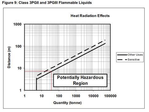
Figure 4: application of relevant threshold test
The relevant separation distance of fill points and
dispensaries is approximately 7.3m to the boundary.
The fill points and bowsers/dispensers are in excess of 7.3m
to all boundaries. NB This includes the northern boundary of the
proposed subdivision created under Stage 1.
The applicant also submits that the volume of deliveries
will be below the relevant transportation thresholds. Relevant conditions are
attached to ensure that the development remains below the threshold in the
future.
From the above it can be concluded that a preliminary hazard
analysis (PHA) is not required, and therefore SEPP 33 does not apply to
the development. Notwithstanding this, the applicant has undertaken a PHA
as a matter of completeness.
The submitted information provides a risk analysis to
determine what level of qualitative risk analysis is required. That analysis
concludes that having plotted the frequency of an event against consequences
based on relevant population density and the like, the societal risk is
determined to be negligible. Accordingly, a level one qualitative risk analysis
is required, which has been submitted with the application.
The effect of the development upon the biophysical
environment is considered to be negligible. The development is not located in
an environmentally sensitive area and is in excess of 200m from the closest
mapped creek or stream, being Ploughmans Creek within Somerset Park.
From the foregoing assessment it can be concluded that the
development is acceptable in terms of the requirements of SEPP 33.
State Environmental Planning
Policy (Infrastructure)
Clause 45
Clause 45 of the SEPP (Infrastructure) requires Council to
refer development applications to the relevant electricity supply authority in
circumstances where there is electricity infrastructure on the land concerned
or adjoining the land concerned.
As mentioned above, there is a large 66kV power line running
along the northern boundary of the subject land. The presence of the power line
resulted in a requirement for an exclusion zone to be put in place and the
development redesigned accordingly.
The redesigned development was referred back to Essential
Energy as required by the relevant clause, and accordingly Essential Energy
raised no objections to the amended proposal (which now includes the exclusion
area). However, that organisation did provide a number of comments that are
attached as advisory notes.
Although not required by Essential Energy, a condition is
attached that controls the height of landscaping within the exclusion zone.
Clause 101
The purpose of this clause is to ensure that new development
that has frontage to a classified road does not impact upon the ongoing
operations and functions of the road; and also that any noise sensitive
development will not be impacted upon by the subject road.
The subject land has frontage to just one road, which is the
classified road, there are no opportunities for the land to be served by any
other roads. Council staff are satisfied that the design and management of the
development (which includes one-way circulation) are arranged in such a way
that the development will not unreasonably impact upon the classified road.
Finally, the development is not a noise sensitive
development.
Clause 104
This clause identifies certain development being of a
relevant size or capacity as development requiring the concurrence of Roads and
Maritime Service (RMS) as traffic generating development. The proposed
development is identified as traffic generating development, and accordingly
the concurrence of the RMS has been obtained.
The RMS raises no objections to the (amended) development
application. However, that department requires the following to be done as part
of the issuance of their concurrence:
· All vehicle access to and from the land from Molong Road is
to be in a forward direction.
· Prior to the issuance of an occupation certificate, a Channelised
Right Short [CHR(s)] turn treatment in accordance with Figure 7.18 Part 4A of Austroads
Guide to Road Design (copy enclosed), and relevant Roads and Maritime
supplements, is to be provided in Molong Road at its intersection with the site
entry driveway. The intersection works are to be designed and constructed for a
50km/h speed zone and be able to accommodate the largest vehicle accessing the
intersection.
· Prior to the issuance of an occupation certificate, an
Auxiliary Left Short [AUL(s)] turn treatment in accordance with Figure 8.10
Part4A of Austroads Guide to Road Design (copy enclosed), and relevant Roads
and Maritime supplements, is to be provided in Molong Road at its intersection
with the site entry driveway. The intersection works are to be designed and
constructed for a 50km/h speed zone and be able to accommodate the largest
vehicle accessing the intersection.
· A formal agreement in the form of a Works Authorisation
Deed (WAD) will be required between the developer and Roads and Maritime for
the developer to undertake “private financing and construction” of
any works on Molong Road. This agreement is necessary for works in which Roads
and Maritime has a statutory interest. The WAD is to be executed prior to
issuance of a Construction Certificate.
· Prior to the commencement of construction works, the
proponent is to contact Roads and Maritime’s Traffic Operations Manager
to determine if a Road Occupancy Licence (ROL) is required. In the event that
an ROL is required, the proponent must obtain the ROL prior to works commencing
within three (3) metres of the travel lanes of Molong Road.
· The entry and exit driveways are to be constructed
generally in accordance with the submitted plans and finished with concrete.
Driveways are to be designed to provide good sight lines between pedestrians
and motorists, match road levels and not interfere with road drainage.
· “No Entry” (R2-4) signs are to be provided on
the land at each side of the exit driveway. The signs are to face Molong Road
to advise motorists not to enter the site from Molong road via the exit
driveway.
· “No Entry” (R2-4) signs are to be erected on
the land on each side of the entry driveway. The signs are to face the site to
advise motorists not to exit onto Molong Road via the entry driveway
· Prior to occupation of the development, signage on the site
facing Molong Road is to be installed displaying “NO FUELING OF VEHICLES
OVER 12.5 METRES LONG”.
· Prior to the issuance of an Occupation Certificate,
redundant kerb layback crossing accesses on Molong Road servicing the land, are
to be removed and replaced with kerb and gutter to match existing kerb and
gutter.
· All entry/exit points onto/from the public road network,
internal vehicular manoeuvring, parking and loading areas are to be constructed
in accordance with the submitted plans prior to the issuance of an Occupation
Certificate for the development.
· Adequate turning circles, storage room and vertical
clearance are to be provided in the site for the largest type of vehicle (19
metre articulated vehicle) that will visit the site during construction and
operation. Fuel delivery vehicles are to be restricted to vehicles 19 metres or
less in length.
· All activities including loading and unloading of goods
associated with the development are to be carried out on site in the dedicated
areas.
· Landscaping, signage and fencing are not to impede sight
lines of traffic within or when passing, entering or departing from the site.
Safe Intersection Sight Distance (SISD) is to be provided and maintained in
both directions of Molong Road. For a 50km/h speed zone, SISD is 97 metres.
· Signage is to be in accordance with the Department of
Planning and Environment’s Transport Corridor Outdoor Advertising and
Signage Guidelines 2017, is not to flash, move or be objectionably glaring or luminous.
The
above have been incorporated into the development consent as conditions.
It is
noted that the applicant has not elected to have the application treated as
integrated development under Section 138(b) of the Roads Act.
Council
staff, following normal procedure, referred the application to the RMS pursuant
to Clause 104 of the SEPP (Infrastructure). The RMS submission also
includes their concurrence as required under the Roads Act. In meeting
the requirements of the Roads Act, the applicant is obligated to obtain
all necessary approvals, licences or agreements prior to works occurring on the
land.
PROVISIONS OF ANY DRAFT ENVIRONMENTAL PLANNING
INSTRUMENT THAT HAS BEEN PLACED ON EXHIBITION 4.15(1)(a)(ii)
There are no draft environmental planning instruments that
apply to the subject land or proposed development.
DESIGNATED DEVELOPMENT
The proposed development is not designated development.
PROVISIONS OF ANY DEVELOPMENT
CONTROL PLAN s4.15(1)(a)(iii)
Development Control Plan 2004
Development Control Plan 2004 (“the DCP”)
applies to the subject land:
· Chapter 0 –
LEP 2011;
· Chapter 2 –
Natural Resource Management;
· Chapter 3 –
General considerations;
· Chapter 8 -
Development in Business Zones;
· Chapter 14 –
Advertisements; and
· Chapter 15 - Car
Parking).
An assessment of the proposed development against the
relevant Planning Outcomes will be undertaken below.
Pursuant to Planning Outcome 0.2-1
Interim Planning Outcomes - Conversion of Zones:
· Throughout this
Plan, any reference to a zone in Orange LEP 2000 is to be taken to be a
reference to the corresponding zone(s) in the zone conversion table.
The corresponding zone to zone 3b Business Services (Orange
LEP 2000) is zone B6 Enterprise Corridor (Orange LEP 2011). As such, Orange
DCP 2004 - Chapter 8 is of primary relevance to the assessment, along with
the other relevant chapters addressed below.
Chapter 0 – LEP 2011
PO 0.4-11 INTERIM PLANNING OUTCOMES -
TRANSPORT ROUTES
· The development provides a high standard of visual appeal to
motorists, cyclists and pedestrians as well as adjoining property owners.
The architectural style and design, the
adopted materiality and the extent of landscaping for the development will
result in a development with an acceptable streetscape compatibility and a
reasonable standard of visual appeal.
· The visual appearance of the development, including any signage,
lighting or other ancillary element, must not generate a distraction to
motorists.
The RMS has attached a condition that
addresses this issue.
· Any signage must not be animated whether by movement or flashing
lights.
As above.
· Where land has more than one street frontage the street with the
lower volume of traffic is to provide the principal access to the development,
subject to safety considerations.
The development only has frontage to Molong
Road. As detailed above, the RMS has reviewed the development and issued their
concurrence, which includes conditions that require the necessary road
treatment within Molong Road and other requirements.
· Where access is provided onto an arterial road, distributor road or
major collector road, the access point must have appropriate safe sight
distances for the prevailing speed limit and clear and unimpeded entrance/exit
signage must be displayed.
As detailed above, the RMS has reviewed the
development and issued their concurrence, which includes conditions that
require the necessary road treatment within Molong Road and other requirements.
· Where onsite customer parking is provided that is not immediately
visible from a public road clear and unimpeded directional signage must be
displayed.
The off-street parking characteristics for
this development are somewhat unusual in the sense that neither the service
station (save for the convenience store which does generate a parking demand)
and the car wash generate a real parking demand based on how they function -
they need queuing space more so than individual parking spaces. Notwithstanding
this, the location of the proposed parking within the site will be obvious from
the street. In relation to space ‘15’, being the allocated staff
parking space for the car wash, this will be less obvious. Accordingly, a
condition is attached that requires a sign indicating that the space is
dedicated for staff only. A further condition is attached that obligates staff
to park their vehicle in the staff parking space.
· Where the proposal is residential, or another noise sensitive form,
appropriate noise mitigation measures to limit the development from traffic
noise must be demonstrated.
Not applicable.
Chapter 2 – Natural
Resource Management
Chapter 2 – Natural Resource Management provides
planning outcomes for stormwater quality, groundwater quality, soil resource
management, vegetation management, and flora and fauna management; all of which
have been considered above under the heading Orange LEP 2011 (stormwater,
groundwater) or the above biodiversity considerations.
Chapter 3 – General
Considerations
Chapter 3 provides planning outcomes of a general nature.
Those of relevance to this assessment relate to cumulative impacts, scenic
landscape, urban areas and energy efficiency. These are all addressed elsewhere
within this report. Cumulative impacts and urban areas are addressed below
under the heading “Likely Impacts”. Energy efficiency is addressed
through a condition that requires a report addressing Section J of the
Building Code of Australia to be submitted.
Chapter 8 – Development
in Business Zones
PO 8.2-1 PLANNING
OUTCOMES - BUSINESS SERVICES AREAS
· Applications clearly demonstrate that the development will not detract
from the role of the CBD as a regional centre.
The proposed development will have a neutral effect on the
primacy of the CBD. The proposed development will provide a service to the
travelling public and residents within the area. Moreover, the scale of the
retailing component is controlled by a development standard.
· Provision of adequate fire-safety measures and facilities for
disabled persons (according to the BCA) is addressed at the application stage
(relevant for all development but particularly important where converting
residential buildings for business use).
Relevant conditions are attached which
address this requirement.
· Heritage streetscapes are conserved and enhanced through adaptive
reuse of heritage buildings, restrained advertising and landscaped gardens.
Not applicable.
· Areas on the main roads into and out of Orange (such as Molong Road
and Bathurst Road) provide a high level of architectural design to enhance the
visual character of the City entrances.
By their very nature and function, service stations and car
washes are difficult to design in a way whereby a high level of architectural
design is exhibited. That being said, this development presents acceptably. The
building along the southern boundary and also the car wash will be constructed
principally using concrete tilt panels, and the retail component will also
incorporate aluminium shopfronts. It is unclear what purpose the shade sail
structure in front of the automated car wash serves. This structure is
considered to be incompatible with the streetscape, and as such it is
recommended that structure be deleted from the development.
Landscaping will ensure an appropriate level of streetscape
capability.
· All sites contain an element of landscaping. Landscaping provided is
of a bulk, scale and height relative to buildings nearest the front property
boundary so as to provide beautification and visual relief to the built form
proposed or existing on the site. The depth of the landscape bed at the site
frontage is sufficient to accommodate the spread of plantings that meet the
abovementioned outcomes but, where practicable, a minimum depth of 3m is
provided. Plantings are designed to provide shade for parking areas, to break
up large areas of bitumen, to enhance building preservation and to screen
against noise.
A detailed landscape plan has been
submitted that demonstrates the landscape design intent. The design rationale
incorporates shrubs and groundcovers as the only new plantings and relies on
existing trees within the site that are being retained.
Council’s Manager City Presentation
(MCP) has reviewed the development with respect to tree removal and proposed
new landscaping. The MCP has concluded that given the extent of tree loss and
the significant change to the streetscape both within the site and from the
footpath, a condition is recommended that requires an additional six (6) trees
be to planted within the site that have a mature height of at least 8m.
The exclusion zone that has been
established under the existing power line along the northern boundary will be
densely planted with small shrubs and groundcovers. Obviously, the mature
heights of plants within the exclusion zone is a key consideration to ensure
that vegetation does not conflict with the electricity infrastructure. The
selected plants shown on the landscape plan will have a mature height of less
than 2m. This is considered acceptable.
With respect to the imposition of the above
condition relating to the planting of an additional six trees, the development
is considered acceptable with regards to landscaping.
Chapter 14 –
Advertisements
An assessment of proposed signage has been
addressed under SEPP 64 above.
Chapter 15 – Car Parking
The separate landuses that are considered
to generate a parking demand are the service station including the convenience
store, the car wash and the neighbourhood shops. As the subdivision is
occurring under the first stage, the parking demand for the petrol station and
neighbourhood shops are considered separately to the demand generate by the car
wash.
The DCP does not specify an onsite parking
demand for a car wash. In such situations the DCP requires a professionally
prepared traffic and parking study to be prepared and submitted with the
application.
A traffic and parking study was submitted
with the application prepared by McLaren Traffic Engineers.
The DCP provides the following parking
requirements for services stations and shops outside of the CBD.
Service Station –
combined total of 3 spaces for each work bay and 1 space per 25m2
of gross floor area (GFA) of the shop, convenience store or pay area.
Shops (outside the CBD)
– 6.1 Spaces per 100m2 of gross leasable floor area (GLFA).
The McLaren report assessed the parking
demand for the service station and neighbourhood shops by adopting the
rationale that the neighbourhood shops contribute to the collective convenience
shop offerings, and as such would generate the same parking demand rate as the
service station shop.
Based on this
approach the following equation is used to calculate parking demand:
|
Land use
|
Type
|
Scale
|
Rate
|
Spaces required
|
|
Service station
|
Work bay
Convenience store
|
Nil
313m2 GFA
|
3 spaces/work bay
1 space/25m2
|
0
12.52
|
|
Total
|
|
|
|
13 spaces
|
Council staff do not accept the
adopted rationale as the two landuses (service station shop and the two
neighbourhood shops) do not have a dominate/subservient relationship. They are
equally dominant, they are independent of each other and are likely to be
operated as such. Accordingly, Council staff requested that the applicant
address the parking demand on this basis. The applicant accordingly analysed
the parking demand based on Council staff’s position and provided the
following:
|
Land use
|
Type
|
Scale
|
Rate
|
Spaces required
|
|
Service station
|
Work bay
Convenience store
|
Nil
183m2 GFA
|
3 spaces/work bay
1 space/25m2
|
0
7.32
|
|
Neighbourhood shop
|
-
|
130m2
|
6.1 spaces / 100m2 GLFA
|
7.93
|
|
Total
|
|
|
|
15.25 spaces
|
The submitted plans show the provision of 14 onsite parking
spaces, thus resulting in a deficiency of 1.25 spaces (or 2 whole spaces).
As mentioned above, the DCP does not include a parking
requirement for a car wash. The McLaren report concludes that the way a car
wash typically operates results in a neutral parking demand as people do not
typically leave their vehicle except to wash it. However, there should be
allocation made for a single staff member.
Council staff accept the above position adopted within the
McLaren report. To ensure that the car wash is operated in the same manner
contemplated within the application, a condition is attached that limits the
number of staff working at the car wash at any one time to not more than two
staff. This is accounting for one staff member arriving to the car wash by a
mode other than self-driven vehicle (ie walk, ride or car pool for example).
The submitted information provides little supporting
justification in relation to the methodology that results in the development
having a 2 space deficiency as the conclusions within the McLaren report rely
on the rationale that the shops all have the same parking demand.
The SoEE does, however, point out that the way a typical
customer uses a service station means that the forecourt acts as a parking
resource. This is because people will typically fill their vehicle with fuel,
then briefly leave their vehicle at the bowser and then proceed to the pay
point.
Additionally, the forecourt area will also provide
reasonable queuing opportunities for the use of both the car wash and service
station. Moreover, there will be a reasonable means of escape to exit the site
if a driver, having entered the site, then decides not to use the facilities.
Notwithstanding the 2 space deficiency as a result of the
development, the development is considered to be acceptable and will not
generate an unreasonable environmental impact within the locality.
SECTION 64 WATER AND SEWER
HEADWORKS CHARGES
The service station and the car wash are both development
types that require the levying of water and sewer headworks charges pursuant to
section 64 of the Local Government Act. Relevant conditions are
attached.
PROVISIONS PRESCRIBED BY THE
REGULATIONS s4.15(1)(a)(iv)
Demolition of a Building (clause 92)
The proposal involves the demolition of existing buildings
within the site. A condition is attached requiring the demolition to be carried
out in accordance with Australian Standard AS2601 - 1991: The Demolition of
Structures.
Fire Safety Considerations
(clause 93)
The proposal does not involve a change of building use for
an existing building.
Buildings to be Upgraded
(clause 94)
The proposal does not involve the rebuilding, alteration,
enlargement or extension of an existing building.
THE LIKELY IMPACTS OF THE
DEVELOPMENT s4.15(1)(b)
Context and Setting
The subject land is located on the northern edge of a small
conglomeration of commercially zoned properties comprising self-storage units
and light industrial/warehousing type land uses. The land has direct
frontage to the Mitchell Highway. The land is approximately 100m from the
intersection of Forbes Road and Molong Road, and 200m from the
intersection of Molong Road and the Northern Distributor Road.
To the north of the subject land lies residential
properties. A veterinary hospital is situated on the opposite of the highway
and a further commercial property adjoins the vet to the north. The land
benefits from an unusually deep footpath/verge which provides a sense of a
larger setback from the public realm.
Traffic Impacts
The development will generate a greater volume of traffic
than is currently experienced. Notwithstanding this, the design of the
development in terms of circulation, stacking/ queuing opportunities for both
fuel and the car wash, the number of parking spaces provided and the capacity
of Molong Road will result in a situation that is not expected to impact upon
the operations of the highway; nor is it expected to generate any unacceptable
traffic impacts within the locality.
The requirements of the RMS have been included as conditions
of consent within the Notice of Approval.
Impacts Upon the Natural
Environment
The subject land does not comprise any significant
vegetation. The trees to be removed from both the subject land and the street
are exotic or non-native species. The development is not expected to impact
upon any endangered ecological communities, endangered species or their habits.
In terms of the development’s impacts upon water
quality, relevant conditions are attached that deal with the treatment of
stormwater before it leaves the site.
Public Realm (Street trees)
The development necessitates the removal of two small street
trees which are identified as Fraxinus excelsior ‘Aurea’.
Council’s Manager City Presentation has reviewed the proposal and has
indicated no objections subject to a condition being imposed that requires
a $1,500 loss of public amenity fee per tree ($3,000 total) to be
paid to Council. Council will then use that money to plant two new street trees
once the construction has concluded and the development is operational.
Amenity (tree loss within the
property)
Council’s Manager City Presentation has reviewed the
proposed development in relation to the request to remove a number of trees within
the development and has responded with the following:
The streetscape of Molong Road
is uniformly planted with Golden Ash (Fraxinus excelsior ‘Aurea’)
on the eastern side and Chinese Pistachio (Pistacia chinensis) on the western
side. The proponent proposes to remove two Golden Ash trees from the road
reserve (Council street trees), a further two Golden Ash trees from within the
subject property on the Molong Road boundary, and a number of Box Elders (Acer
negundo) and a Lombardy Poplar (Populus nigra ‘Italica’) from the
rear of the existing building.
Not noted on the plans but
also requiring removal are two Chinese Pistachio trees immediately in front of
the existing building at the northern end. There is also a third Golden Ash in
the property’s north-western corner that is not indicated on the survey
plan and its retention or removal is not identified. I would suggest that the
tree be retained as it provides a significant contribution to the streetscape.
The proponent has identified
that they will retain the southernmost Ash tree. This specimen by all
intentions, when planted, would have been meant to be a Golden Ash for
consistency of the four trees planted on the street boundary of the subject
property. However, its root stock has dominated and the tree has
characteristics of a Desert Ash. By the amount of seed currently existing
within the canopy the tree is likely to be under stress, with dieback to the
canopy more than likely to eventuate (diagnosis of symptoms).
This is shown diagrammatically
below:
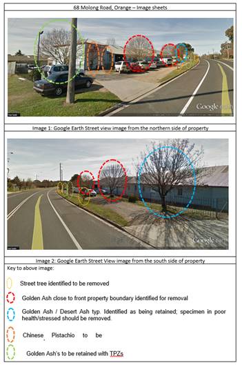
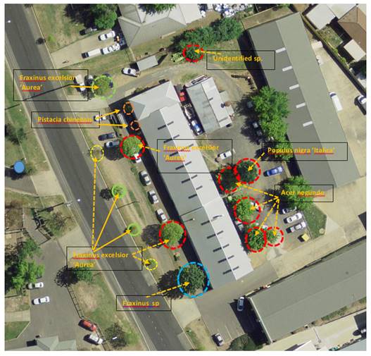
In light of the above it is
recommended that approval be granted for the removal of the follow trees
occurring on the subject property (as identified on the attached image sheet):
· 2 x Golden Ash (Fraxinus
excelsior ‘Aurea’) and one Desert Ash typ. (Fraxinus sp) from the
front property boundary;
· 2 x Chinese Pistachio
(Pistacia chinensis) immediately adjacent to the building at the northern end;
and
· 4 x Box Elders (Acer
negundo) and one Poplar (Populus nigra ‘Italic’) located behind the
existing building.
The following conditions recommended by Council’s
Manager City Presentation are attached as conditions of consent.
· The two Golden
Ash (Fraxinus excelsior ‘Aurea’) street trees indicated on Site
Plan 1708 DA-101 Dated 26.2.18 as being retained shall have Tree Protection
Zone fencing established in accordance with AS 4970 – 2009 Protection of
trees on development sites. The TPZ shall be a minimum of 2 metres in radius,
measured from the centre of the stem of each tree, the TPZ fencing shall be
temporary construction site fencing or similar and clearly signed ‘Tree
Protection Zone’.
· A landscape
plan shall be submitted for approval by Council’s Manager City
Presentation that addresses the loss of amenity tree planting along the street
frontage of the subject property. The plan is to include the planting of a
minimum 6 trees growing to a minimum mature height of 8 metres within the
property boundaries.
A condition is also attached that requires the retention of
the golden ash in the north-western corner of the site.
Noise
An acoustic report has been submitted in support of the
development. Simply put, the report analyses background noise levels, predicts
the noise levels of the development and then recommends controls to ensure the
development will be acceptable and not cause unsatisfactory noise impacts in
the locality.
As mentioned above under the heading “Staging”,
the noise report presents conclusions and recommendations based on a complete
development; it does not contemplate the noise implications based on the
development being constructed in stages. As such, to ensure that the service
station (constructed as Stage 2) does not create any unreasonable noise
impacts, the sound wall located on the southern side of the power line exclusion
zone is required to be constructed prior to the occupation of the service
station. The staging arrangement proposed by the applicant would result in this
being constructed under the final stage relating to the car wash. Relevant
conditions are attached.
The acoustic study provides commentary around why plant and
equipment have not been considered. This is common practice with these types of
facilities; but to ensure that the selected plant complies with the necessary
requirements, a condition is attached that requires a further noise study to
demonstrate compliance. Additionally, a commissioning report is required at the
various stages to ensure that the development, once operational, is consistent
with the relevant noise targets.
In terms of the ongoing operation of the development, the
noise report recommends that the car wash cease operations no later 10pm each
evening. This is likely to impede upon the general amenity of the area, and as
such a more reasonable time has been recommended by Council’s Manager
Building and Environment to be 9pm. A relevant condition is attached.
Further conditions are attached in relation to when and how
many deliveries can be made to the development during the night time period.
As the tenants of the neighbourhood shops is unknown at this
stage, to ensure that the operation of those shops is appropriate once
occupied, a condition is attached that requires separate development
applications to be lodged for their first use and fitout. This will give
Council the opportunity to consider things like hours of operation, deliveries
and the like based on their specific use.
Cumulative Impacts
Cumulative impacts of a development can arise under four
typical scenarios, namely:
· time crowded
effects where individual impacts occur so close in time that the initial impact
is not dispersed before the proceeding occurs
· space crowded
where impacts are felt because they occur so close in space they have a
tendency to overlap
· nibbling effects
occur where small, often minor impacts, act together to erode the environmental
condition of a locality and
· synergistic
effects, where a mix of heterogeneous impacts interact such that the combined
impacts are greater than the sum of the separate effects.
This development has the potential to generate a number of
the above scenarios, such as a circumstance where all the car wash bays are
being operated at the one time, or vehicles queuing during busing periods. That
being said, the design and management of the development and the imposed conditions
of consent (particularly those relating to noise) will ensure that the likely
cumulative impacts are kept to within community expectations.
Safety, Security and Crime
Prevention
Typically, crime prevention is achieved by delineating
public and private areas, providing physical barriers (territoriality) and
surveillance opportunities (both natural surveillance and closed circuit
television recordings). The development is considered acceptable in regards to
crime prevention. The public and private spaces will be well demarcated and the
orientation and openness of the site will allow reasonable opportunities for
natural surveillance. Notwithstanding this, it is considered appropriate to
require a plan of management for the ongoing operations of the site that
details the necessary measures, such as:
· adequate staff
training;
· holding an
incident register on the site (including complaints);
· installation of a
‘panic button’ for emergencies;
· 24 hour CCTV
surveillance;
· money handling
procedures;
· theft procedures;
· external lighting;
· clear sightlines
to forecourt; and
· restricted staff
areas.
A relevant condition is attached in regards to a plan of
management.
With respect to the required plan of management, the
development is considered acceptable in relation to safety, security and crime
prevention.
Neighbourhood Amenity
Having established the context
and setting above, it is important to address the likely impacts upon the
neighbourhood amenity. The Land and Environment Court established the following
planning principle in Seaside Property Developments Pty Ltd v Wyong Shire
Council [2004]:
As
a matter of principle, at a zone interface as exists here, any development
proposal in one zone needs to recognise and take into account the form of
existing development and/or development likely to occur in an adjoining
different zone. In this case residents living in the 2(b) zone must accept that
a higher density and larger scale residential development can happen in the
adjoining 2(c) or 2(d) zones and whilst impacts must be within reason they can
nevertheless occur. Such impacts may well be greater than might be the case if
adjacent development were in and complied with the requirements of the same
zone. Conversely any development of this site must take into account its
relationship to the 2(b) zoned lands to the east, south-east, south and
south-west and the likely future character of those lands must be taken into
account. Also in considering the likely future character of development on the
other side of the interface it may be that the development of sites such as
this may not be able to achieve the full potential otherwise indicated by
applicable development standards and the like.
The subject land has a long history of being used for
non-residential purposes. Under LEP 11 the land was zoned light
industrial; following that under the two succeeding LEPs (which includes
the current LEP) the subject land has been zoned for commercial purposes.
Accordingly, it would not be unreasonable to expect a commercial use from
occurring on the land, a use that is listed as permissible under the LEP.
However, as outlined by the Court, this should not come at the cost of an
appropriate level of amenity to the adjoining neighbours. As outlined in the
foregoing assessment, the design of the development (particularly with the
inclusion of the necessary exclusion zone which will be densely landscaped,
management of the development and recommended conditions of consent around the
operation of the car wash), will have a satisfactory level of impact upon land
within the adjoining zones and will not jeopardise future development of
adjoining land.
THE SUITABILITY OF THE SITE
s4.15(1)(c)
The site is considered suitable for the proposed
development. The proposed landuses are permissible in the zone and the
development is considered to be consistent with the objectives of the zone.
Moreover, Council staff are not aware of any natural, physical or technological
hazards within the site that would unreasonably constrain the development form
occurring in a satisfactory manner.
ANY SUBMISSIONS MADE IN
ACCORDANCE WITH THE ACT s4.15(1)(d)
The proposed development is defined as "advertised
development" under the provisions of State Environmental Planning Policy
55 - Remediation of Land. The application was advertised for the prescribed
period of 30 days and at the end of that period nine (9) submissions
had been received. The submissions were provided to the applicant to address
and a response was received.
The development was advertised in Orange City Life on
Thursday, 23 November 2017. Exhibition was extended to account for the
Christmas/New Year period and concluded on Friday, 5 January 2018.
Submission 1 - resident of 10
Royle Drive
The submission indicates that the residents of the above
mention property raise no objection to the development.
Council staff comment
Noted.
Submission 2 - resident of 7
Royle Drive
The submission raises concerns in relation to noise and
traffic impacts, and health implications of the residents in relation to fuel
emissions. The submission also raises concerns in relation to the impact that
the development may have on the real estate market in the area in the future.
The submission concludes with a comment that this development would be better
suited to the bypass.
Council staff comment
The potential noise impacts and traffic impacts are
addressed in detail within the report. In relation to the health implications
associated with the development, the applicant submits that a vapour recovery
system capable of recovering 97% of vapours will be installed. To ensure this
occurs a relevant condition of consent is attached. Additionally, further
conditions are attached that require the development to be constructed to
accord with all relevant regulations, standards and the like. Another condition
is attached that requires the development to be carried out in accordance with
the Preliminary Hazard Analysis and Summary. In relation to the concerns
relating to the development effecting property values, as mentioned below, this
is not considered a planning consideration. In relation to the comment
regarding this type of use being better suited to a location along the bypass,
the
Submission 3 - resident of 12
El Paso Place
The submission raises concerns in relation to noise impacts,
light pollution, increased traffic/traffic congestion, hours of operation and
property values. The submission also raises four general questions relating to
controlling fuel spills, visual impacts, privacy impacts and increase of
traffic and pedestrian activity in the submitters’ neighbourhood.
Council staff comment
The concerns relating to noise, light spill, traffic, hours
of operation and property values have all been addressed in detail within the
report.
In relation to the specific questions, a condition is
attached that requires the development to be carried in accordance with the
Preliminary Hazard Analysis and Summary document submitted with the
application. In relation to the visual impacts that the submitter is concerned
about, with respect to the existing surrounding built form it is unlikely that
the development would be seen from the submitter’s property.
The two existing industrial scale buildings located at 66
Molong Road would serve the purpose screening much, if not all of the
development from view from their property. In relation to privacy, given the
separation distance and the existing buildings situated between the
submitter’s property and the development site, the likelihood of the
development causing any unsatisfactory privacy impacts is minimal.
In relation to increased traffic and pedestrian activity
within El Paso Place, the likelihood of the development directly causing an
increase in vehicle and pedestrian movements within El Paso Place is
unlikely. There would be no need for vehicles to enter EL Paso Place, nor would
there be a need for pedestrians to use El Paso Place as there are no access
points from the rear of the site.
Submission 4 - resident of 4
Linda Crescent
The submission raises concerns in relation to noise
pollution, traffic congestion and traffic safety, pedestrian connectivity,
safety (in relation to crime prevention, vandalism, crime etc),
environmental issues in relation to the operation of the service station, the
effect of the development on property values and concerns in relation to the
hours of operation.
Council staff comment
Noise, traffic, pedestrian connectivity, crime prevention
and environmental considerations are addressed in detail above under the
heading “Likely Impacts of the Development”. The considerations in
relation to events involving fuel spills are addressed under the heading
“SEPP 33”.
As mentioned elsewhere within this report, the effect a
development may or may not have on the property market is not possible to
quantify, and as such Council staff have consistently held the position that
such a consideration is not a relevant planning consideration under section
4.15 of the Act.
The hours of operation are addressed above in relation to
the likely noise impacts; and have also been considered in relation to safety,
security and crime prevention.
Submission 5 - resident of 76
Molong Road
The submission raises concerns in relation to noise impacts
as a result of the development and the possible health effect of fuel vapours
and the like. The submission also raises concerns in relation to traffic
impacts and makes comment that: “I will lose my on-street
parking”. The submitter questions how many petrol stations are needed
within the City. The submission also raises concerns in relation to property
values, claiming they will have difficulty selling their property in the future
and that they could lose $100,000 in value.
The submission also notes the extent of fill and retaining
walls in the northern corner of the site.[1]
Finally, the submission brings to Council’s attention
two matters. Firstly, it is claimed that the initial notification letter was
not received at the above mentioned residence of the submitter, nor at another
address connected to the submitter. Secondly, the submitter highlights an
anomaly within the acoustic report which references 78 Molong Road as the
closest receiver rather than 76 Molong Road.
Council staff comment
The matters relating to noise, health effects, and property
values have been addressed in detail elsewhere within the report. In relation
to the submitter’s query regarding the number of services stations,
Council’s current planning scheme provides a mechanism for determining
what landuses are appropriate in what locations. The planning system does not
attempt to achieve what ordinary commercial markets would achieve. In other
words, this would be a market-driven phenomena based on demand, rather than a
planning function.
The submission was based on plans as originally submitted,
which shows development along the common boundary with the submitter’s
property. As mentioned above, the development has been amended to provide an
exclusion zone along the northern boundary. This has the effect of pushing the
development off the common boundary and providing a landscaped strip/exclusion
zone along the northern boundary. As a consequence of the exclusion zone, a
positive outcome is achieved in terms of impacts upon the adjoining owner.
In relation to the administrative matters raised in the
submission, Council’s records indicate that all correspondence has been
sent to the correct mailing address at the time the correspondence was sent. In
relation to “78” Molong Road being referenced instead of
“76” Molong Road, the applicant has clarified that the mistake
related to a typographical error and has since been corrected in the amended
application material.
Submission 6 - resident of 78
Molong Road
The submission raises a number of points of concern under
several headings which are separately listed and addressed below.
Environmental and personal
impacts of refilling – The submission raises health concerns
relating to volatile organic compounds and their impacts on human health. The
submission cites a journal article and suggests that the article concludes that
petrol emissions and spillages can lead to contamination of the surrounding
area for up 100m. The submission queries whether a vapour recovery system is
being installed, if the development is consistent with the POEO (Clean Air)
Regulations, if the development is a hazardous area and why there are no
hazardous classification drawings included in the application.
Council staff comment
In relation to the above comments, the development is
considered to be consistent with SEPP 33, being the principle planning
instrument that deals with potentially hazardous and potentially offensive
development. Additionally, the applicant has indicated that a vapour recovery
system capable of recovering 97% of all vapours will be installed. A relevant
condition is attached.
Also, a condition is attached that requires the development
to be constructed and operated in accordance with all relevant regulations,
Australian Standards or the like. A further condition is attached that requires
the development to be carried out strictly in accordance with the submitted
Preliminary Hazard Analysis and Summary prepared by Myros dated 15 August 2017.
In relation to the health concerns with specific reference
to the cited journal article, the article relates mostly to highly trafficked
major freeways and the like, or large scale fuel refineries. Council staff are
unable to agree with the correlations purported within the submission in
relation to the findings of journal article therein.
Noise pollution to nearby
residents – The submission raises various questions in relation
to the rigorousness of the acoustic testing, and questions what equipment was
used and when was it last calibrated.
Council staff comment
The acoustic assessment has been scrutinised by
Council’s Manager Building and Environment who has recommended that the
development is acceptable subject to various conditions, which are attached and
addressed above under the “Likely Impacts” section of this report.
The applicant’s response to submissions included
advice from the acoustician that clarifies the matters raised in the
submission, including the methods other than a sound wall to control noise.
Further comment is provided in relation to frequency to the effect that the
modelling has been based on a worst case scenario where all wash bays are in
use.[2] In relation
to vehicles driving over grates, this level of detail was beyond the scope of
the report. Should such a scenario eventuate this would be controlled under the
Protection of Environment Operations Act. Notwithstanding this, a
condition is attached which ensures that all grates within the trafficable
areas are designed in a way that reduces nuisance when driven over.
In relation to the plant room, the design of the plant room
will be subject to final design of the plant and equipment inside. A further
acoustic report is required, along with a commissioning report once
operational. These are required by conditions of consent which address this
issue.
The applicant’s response to the submissions has
included a calibration certificate of the equipment used.
Light Pollution
– The submission states that there are no controls in relation to light
spill.
Council Staff Comment
There is a condition attached that requires a lux study of
the proposed illuminated signage. Additionally, Council’s standard
condition in relation to the relevant Australia Standard relating to the
control of obtrusive outdoor lighting is also attached.
Operating Hours -
The submission references the hours of operation of the existing landuse and
questions why a 24 hour facility would be contemplated next to a residential
zone.
Council staff comment
The hours of operation of the service station are proposed
to be 24 hours. The car wash will have specific controls to ensure compliance
with noise requirements, which requires all operations associated with the car
wash including the vacuum bays to cease no later than 9pm each evening.
The initial design (prior to the establishment of the power line exclusion
zone) proposed five (5) wash bays, one of which was required to be shut down
by 6pm to comply. As the car wash was reduced in scale by one wash bay,
this staged curfew is no longer required.
The 24 hour service station has been designed in a way that
would suggest a level of cognisance with the surrounding landuse pattern. The
service station has been positioned within the site so that it will be
effectively buffered on all sides by non-residential landuses.
As addressed above, the stagging proposed, whereby the
service station precedes the other uses, particularly the car wash (at which
point the sound wall is proposed to be constructed), presents an outcome where
an unacceptable noise impact is likely. Thus, conditions are attached that
require the necessary sound wall at the same time as the service station is
being constructed. This will ensure that the operations of the service station
do not present an unacceptable noise impact.
Additionally, controls are required around when deliveries
to the site can be made; and also, a plan of management addressing the safety,
security and crime prevention measures is required to be prepared (prior to
Construction Certificate) and implemented prior to the occupation of the service
station.
Traffic –
The submission raises concerns in relation to the effects the development will
have in redirecting traffic from the distributor. The submission also questions
what controls will be in place to control traffic noise and compression braking
of trucks, what design aspects have been made to allow for safe pedestrian
crossing and safe turning of cars and trucks, and questions whether vehicles
will be able to enter and leave without crossing double white lines.
Council staff comment
The development is likely to draw some level of traffic off
the distributor road momentarily, but then return to the NDR via a right hand
turn out of the facility back to the NDR (It should be noted though, that
a service station does already exist close to the NDR off Hanrahan Place
(and a second facility approved opposite the Woolworths facility)).
Notwithstanding this, the access treatment (required by RMS) and the capacity
of Molong Road could easily cater for such a circumstance. Typically though, it
is expected that the majority of traffic will be attributed to those within the
local area or vicinity.
The RMS has imposed a condition limiting the size of
vehicles that are able to fill up at the facility to be not more than 12.5m in
length. This will have the effect of limiting traffic to a certain sized
vehicle, meaning semi-trailers are not able to use the facility other than to
deliver fuel. This will also have the effect of reducing the likelihood of
compression braking associated with the facility.
As mentioned above, the RMS has imposed conditions requiring
a particular turn treatment for the facility to ensure safe ingress and egress.
Property values
– The submission states that the development will decrease property
values within the locality and questions what will be put in place to subsidise
residents due to decreased property value.
Council staff comment
Council staff have held a consistent view that the effect of
development on property values within the locality is not a relevant planning
consideration. There are a multiplicity of factors effecting property values
within a particular area, both in the short and long run. The effect a
development may have on property values in a locality is not something that can
be accurately quantified.
Removal of Vegetation and
Environmental Factors - The submission
raises concerns in relation to the extent of tree removal and other
environmental issues, such as fuel leaving the site in stormwater, leakage
prevention, requirements of a HASOP and the clearance requirements in relation
to the power line.
Council staff comment
The extent of landscaping being removed from the site is
addressed in detail above, along with measures to ensure that replacement trees
are planted within the site.
In relation to the other environmental matters raised,
Council’s Technical Services Division has imposed conditions that relate
to stormwater treatment targets - the proposed underground tanks are
double-walled to significantly reduce the risk of leakages. In relation to the
requirements of a HASOP, a HASOP is not required. The development has been
assessed against the requirements of SEPP 33 (being the principle environmental
planning instrument for developments that could be classified as potentially
hazardous or potentially offensive – this development is not classified
as either). Additionally, a condition is attached that requires the development
to be carried out in accordance with all relevant regulations, Australian
Standards, policies, guidelines and the like.
The requirements of the necessary clearances relating to the
power line are addressed in detail above.
Other similar
facility’s within Orange – The submission references other
similar facilities and highlights some alleged issues that have transpired with
regards to noise. The submission queries the hours of operation of all the
various aspects of the development and questions what will be in place if
future changes occur to the facility.
The submission further questions the appropriateness of the
location of the development and suggests that the distributor road would make a
better location for the development. The submission also suggests that all
other service stations have pedestrian access via a formed footpath, however
there is no formed footpath within Molong Road.
This section of the submission concludes with a comment in
relation the typographical error within the acoustic report.
Council staff comment
Council staff can only assess the development as presented.
Notwithstanding this, from experience Council staff are cognisant of how other
facilities operate and the typical issues that arise. This experience has been
drawn upon when determining what controls should be imposed on the development
to ensure that it operates in a satisfactory manner.
In relation to the comment in regards to the NDR, there are
limited opportunities for a similar development to be located on the western
sector of the NDR, and moreover, the NDR has been designed in a manner
that reduces the number of connection points from the NDR to ensure its
efficiency in moving traffic.
It is also worth noting that the B6 zoning allows for a
service station to be established provided it is acceptable in terms of likely
impacts.
In relation to the submitter’s last point under this
heading, the applicant has acknowledged the error and described it as a
typographical error and it has been corrected.
Further General Questions
The submission raises the following general questions,
Council staff have provided comment directly following each question.
· Will there be
increased traffic within my neighbourhood?
There is likely to be an increase in traffic within
the area. However, the effect of the increase in traffic is not expected to
result in an unacceptable environmental impact in the locality for the reasons
outlined throughout the report.
· Is there
adequate car parking provided onsite?
As mentioned above, adopting the rationale that treats the
pay point of the service station separate to the neighbourhood shops, there is
a two (2) space deficiency. However, Council staff have accepted that the
deficiency is not likely to create an unacceptable environmental impact in the
locality for the reasons outlined under the heading “Chapter 15
– Car Parking”.
· Will the
development ‘fit-in’ with my neighbourhood?
The “neighbourhood” is characterised as a
cluster of well-established commercially zoned properties located on a highway
that is surrounded by residential properties. The proposed use is a commercial
use commensurate with the long-standing non-residential use of the land. It is
noted that prior to the preceding LEP the land was zoned light industrial,
and prior to that the land was zoned for agricultural purposes. Based on the
surrounding context and the historic landuse pattern, Council staff are of the
view that the development is consistent with the neighbourhood character.
· Do building
setbacks meet the standards?
There are no applicable setback requirements that apply to
the land given the zoning of the land. That being said, from a likely impacts
perspective the development is satisfactory in terms of siting. The car wash
component adopts a setback that is behind the building line of the dwelling
located on 76 Molong Road to the north. On the southern side the submitted
plans show a 10m front setback to the building proper. This is considered
acceptable.
There are no objections to the proposed siting of the
buildings within the development in terms of front setbacks.
Relevant fire safety requirements would apply to side and
rear boundaries where buildings are within 3m of the boundary.
· Will the
proposed development overshadow my windows/backyards etc?
There will be zero impacts in relation to overshadowing of
the submitter’s property. This is because the submitter’s residence
is not located directly next to the development site – rather it is
separated from the site by another residence.
· Are there any
windows that overlook my property?
There are no windows that would cause an impact upon the
residential amenity of the submitter’s property.
· How far is the
proposed dwelling setback from my boundary/dwelling?
With respect to the author, Council staff are uncertain what
is meant by this query; there are no dwellings proposed as part of the
development.
· How would the
proposal look from my property?
The submitter’s property is one property separated
from the development site. That being said, it would be possible to see the development
from the submitter’s backyard. The submitter would be able to see the
retaining wall along the northern boundary, the northern elevation of the plant
room and part of the car wash.
· Can I see the
proposal from my property?
It is likely the submitter would be able to see the
development from the rear of their property. That being said, being able to see
a development is not sufficient grounds for a development to be considered
unacceptable.
· Are there any
trees or bushes to be removed from the property?
· Is there any
replanting proposed?
The extent of tree removal and the level of replanting have
been addressed in detail above.
· Will
development affect the drainage in the area?
Council’s Technical Services staff have provided a
referral which includes appropriate conditions of consent that deal with the
management of stormwater.
· Can a fuel
spill be controlled onsite?
A condition is attached that requires the development to be
carried out in accordance with the Preliminary Hazard Analysis and Summary,
which addresses spill incidents.
Submission 7 - El Paso Place
resident
Council staff comment
This submission is principally a facsimile of Submission 6
which has been addressed in detail above. The general questions posed at the
end of the submission (such as what will the development look like from the
submitter’s property) are not possible to answer as the submission is
effectively anonymous, save for the author residing somewhere in El Paso
Place.
Submission 8 - anonymous
Council staff comment
This submission is principally a facsimile of Submission 6
which has been addressed in detail above. The general questions posed at the
end of the submission (such as what will the development look like from the
submitter’s property) are not possible to answer as the submission is
effectively anonymous and it is unknown where the author resides.
Submission 9 - 80 Molong Road
Council staff comment
This development is principally a facsimile of Submission 6,
however some additional text has been added. Notwithstanding the additional
text, all the additional comments in this submission have been addressed
throughout the report.
As the submitter has provided an address it is possible to
address the general questions as they relate to their property.
Further General Questions
The submission raises the following general questions,
Council staff have provided comment directly following each question.
· Will there be
increased traffic within my neighbourhood?
There is likely to be an increase in traffic within the
area. However, the effect of the increase in traffic is not expected to result
in an unacceptable environmental impact in the locality for the reasons
outlined throughout the report.
· Is there
adequate car parking provided onsite?
As mentioned above, adopting the rationale that treats the
pay point of the service station separate to the neighbourhood shops, there is
a two (2) space deficiency. However, Council staff have accepted that the
deficiency is not likely to create an unacceptable environmental impact in the
locality for the reasons outlined under the heading “Chapter 15
– Car Parking”.
· Will the
development ‘fit-in’ with my neighbourhood?
The “neighbourhood” is characterised as a
cluster of well-established commercially zoned properties located on a highway
that is surrounded by residential properties. The proposed use is a commercial
use commensurate with the long-standing non-residential use of the land.
It is noted that prior to the preceding LEP the land was
zoned light industrial, and prior to that the land was zoned for agricultural
purposes. Based on the surrounding context and the historic landuse pattern,
Council staff are of the view that the development is consistent with the
neighbourhood character.
· Do building
setbacks meet the standards?
There are no applicable setback requirements that apply to
the land given the zoning of the land. That being said, from a likely impacts
perspective the development is satisfactory in terms of siting. The car wash
component adopts a setback that is behind the building line of the dwelling
located on 76 Molong Road to the north. On the southern side the submitted
plans show a 10m front setback to the building proper. This is considered
acceptable. There are no objections to the proposed siting of the buildings
within the development in terms of front setbacks.
Relevant fire safety requirements would apply to side and
rear boundaries where buildings are within 3m of the boundary.
· Will the
proposed development overshadow my windows/backyards etc?
There will be zero impacts in relation to overshadowing of
the submitter’s property. This is because the submitter’s residence
is not located directly next to the development site - rather it is separated
from the site by two other properties. Moreover, the submitter’s property
is located to the north of the development site.
· Are there any
windows that overlook my property?
There are no windows that would cause an impact upon the
residential amenity of the submitter’s property.
· How far is the
proposed dwelling setback from my boundary/dwelling?
With respect to the author, Council staff are uncertain what
is meant by this query; there are no dwellings proposed as part of the
development.
· How would the
proposal look from my property?
The submitter’s property is two properties separated
from the development site. As such, it would be difficult to see the
development from the submitter’s backyard as the dwellings and fences
located at 78 and 76 Molong Road would obscure the development. It may be possible
for the submitter to see the tops of buildings along the northern boundaries,
however, this is not considered to result in an unacceptable impact.
· Can I see the
proposal from my property?
As above.
· Are there any
trees or bushes to be removed from the property?
· Is there any
replanting proposed?
The extent of tree removal and the level of replanting have
been addressed in detail above.
· Will
development affect the drainage in the area?
Council’s Technical Services staff have provided a
referral which includes appropriate conditions of consent that deal with the
management of stormwater.
· Can a fuel
spill be controlled onsite?
A condition is attached that requires the development to be
carried out in accordance with the Preliminary Hazard Analysis and Summary,
which addresses spill incidents.
PUBLIC INTEREST
s4.15(1)(e)
The proposed development is considered to be of minor
interest to the wider public due to the relatively localised nature of
potential impacts. The proposal is not inconsistent with any relevant policy
statements, planning studies, guidelines etc that have not been considered in
this assessment.
SUMMARY
The proposed development is permissible with the consent of
Council. The proposed development complies with the relevant aims, objectives
and provisions of Orange LEP 2011 (as amended) and DCP
2004. A section 4.15 assessment of the development indicates that
the development is acceptable in this instance. Attached is a draft Notice of
Approval outlining a range of conditions considered appropriate to ensure that
the development proceeds in an acceptable manner.
COMMENTS
The requirements of the Environmental Health and Building
Surveyor and the Engineering Development Section are included in the attached
Notice of Approval.
Attachments
1 Notice
of Approval, D18/15544⇩
2 Plans,
D18/15255⇩
3 Submissions,
D18/13890⇩
Planning and Development Committee
3 April 2018
2.2 Development
Application DA 347/2017(1) - 68-74 Molong Road
Attachment 1 Notice
of Approval
|

|
ORANGE
CITY COUNCIL
Development
Application No DA
347/2017(1)
NA18/ Container
PR8504
|
NOTICE OF DETERMINATION
OF A DEVELOPMENT
APPLICATION
issued under the Environmental
Planning and Assessment Act 1979
Section 4.18
|
Development
Application
|
|
|
Applicant
Name:
|
Hargreaves
Property Group
|
|
Applicant
Address:
|
C/- Peter
Basha Planning & Development
PO Box
1827
ORANGE
NSW 2800
|
|
Owner’s
Name:
|
Mr J
Stojanovic
|
|
Land
to Be Developed:
|
Lot 1 DP
393543 - 68-74 Molong Road, Orange
|
|
Proposed
Development:
|
Service
Station; Neighbourhood Shop (two); Business Premises (car wash); Category 1
Remediation; Subdivision (two lot commercial), Signage, Demolition and Tree
Removal
|
|
|
|
|
Building
Code of Australia
building
classification:
|
As
determined by Certifier
|
|
|
|
|
Determination
made under
Section 4.16
|
|
|
Made
On:
|
3 April
2018
|
|
Determination:
|
CONSENT
GRANTED SUBJECT TO CONDITIONS DESCRIBED BELOW:
|
|
|
|
|
Consent to
Operate From:
|
4 April
2018
|
|
Consent to
Lapse On:
|
4 April
2023
|
Terms of Approval
The reasons for the imposition of
conditions are:
(1) To ensure a quality
urban design for the development which complements the surrounding environment.
(2) To maintain
neighbourhood amenity and character.
(3) To ensure compliance
with relevant statutory requirements.
(4) To provide adequate
public health and safety measures.
(5) Because the development
will require the provision of, or increase the demand for, public amenities and
services.
(6) To ensure the utility
services are available to the site and adequate for the development.
(7) To prevent the proposed
development having a detrimental effect on adjoining land uses.
(8) To minimise the impact
of development on the environment.
Conditions
(1) The
development must be carried out in accordance with:
(a) Plans
by
Peter Basha Planning and Development
Reference 17030DA:
Sheets 1 to 5 (including aerials) - dated 15
March 2018 (9 sheets)
Plans by studio
architecture
Reference 1708:
DA-100 dated 21 March
2018
DA-100.1 dated 26
February 2018
DA-100.2 dated 19
October 2017
DA-101 dated 21 March
2018
DA-102 dated 21 March
2018
DA-103 dated 21 March
2018
DA-301 dated 21 March
2018
DA-302 dated 21 March 2018
DA-401 dated 21 March
2018
DA-501 dated 11 October
2017
DA-502 8 September 2017
(11 sheets)
(b) statements
of environmental effects or other similar associated documents that form part
of the approval
as amended in accordance with any
conditions of this consent.
(2) All building work must
be carried out in accordance with the provisions of the Building Code of
Australia.
(3) A sign is to be erected
in a prominent position on any site on which building work, subdivision work or
demolition work is being carried out:
(a) showing the
name, address and telephone number of the principal certifying authority for
the work, and
(b) showing the
name of the principal contractor (if any) for any building work and a telephone
number on which that person may be contacted outside working hours, and
(c) stating that
unauthorised entry to the site is prohibited.
Any such sign is to be maintained while the
building work, subdivision work or demolition work is being carried out.
(4) Where any excavation
work on the site extends below the level of the base of the footings of a
building on adjoining land, the person having the benefit of the development
consent must, at the person’s own expense:
(a) protect
and support the adjoining premises from possible damage from the excavation,
and
(b) where
necessary, underpin the adjoining premises to prevent any such damage.
Note: This
condition does not apply if the person having the benefit of the development
consent owns the adjoining land or the owner of the adjoining land has given
consent in writing to this condition not applying.
DEMOLITION AND TWO LOT SUBDIVISION
|
PRIOR TO THE ISSUE OF
A CONSTRUCTION CERTIFICATE
|
(5) The
applicant is to submit a waste management plan that describes the nature of
wastes to be removed, the wastes to be recycled and the destination of all
wastes. All wastes from the demolition and construction phases of this project
are to be deposited at a licensed or approved waste disposal site.
(6) Proposed
Lots 100 and 101 are to be provided with interlot stormwater drainage where the
surface of the entire lot cannot be drained to the kerb and gutter at the lot
frontage. A grated concrete stormwater pit is to be constructed within each lot
provided with interlot stormwater drainage. Stormwater shall be piped from
proposed lots 100 and 101 to the existing stormwater pipes located at the rear
of 16 El Paso Place. Engineering plans for this drainage system are
to be approved by Orange City Council or an Accredited Certifier (Categories
B1, C3, C4, C6) prior to the issuing of a Construction Certificate.
Where stormwater crosses land outside
the lot it favours, an easement to drain water is to be created over the works.
Evidence of a drainage easement benefitting Lot 1 DP 393543 is to be
provided to the Certifying Authority prior to issuing a Construction
Certificate.
(7) A 150mm-diameter sewer
main is to be constructed from Council’s existing main to serve proposed
Lot 100. Prior to a Construction Certificate being issued engineering plans for
this sewerage system are to be submitted to and approved by Orange City
Council.
(8) A water and soil
erosion control plan is to be submitted to Orange City Council or an Accredited
Certifier (Categories B1, C3, C4, C6) for approval prior to the issuing of a
Construction Certificate. The control plan is to be in accordance with the
Orange City Council Development and Subdivision Code and the Landcom, Managing
Urban Stormwater; Soils and Construction Handbook.
|
PRIOR TO WORKS
COMMENCING
|
(9) The beneficiary of the
consent shall pay to Council a loss of public amenity fee of $1,500 per Council
street tree removed, total $3,000; for Council to readdress the streetscape
once construction works have ceased and the facility operational. The proponent
shall remove, at their cost, the two Golden Ash Street trees marked on Site
Plan 1708 DA-101 Dated 21.3.18 as being removed for vehicle access points.
(10) The two Golden Ash (Fraxinus
excelsior ‘Aurea’) street trees indicated on Site Plan 1708
DA-101 Dated 21.3.18 as being retained shall have Tree Protection Zone fencing
established in accordance with AS 4970 – 2009 Protection of trees on
development sites. The TPZ shall be a minimum of 2 metres in radius,
measured from the centre of the stem of each tree, the TPZ fencing shall be
temporary construction site fencing or similar and clearly signed ‘Tree
Protection Zone’.
(11) A Construction
Certificate application is required to be submitted to, and issued by
Council/Accredited Certifier prior to any excavation or building works being
carried out onsite.
(12) Soil erosion control
measures shall be implemented on the site.
|
DURING
CONSTRUCTION/SITEWORKS
|
(13) The remediation works
shall be carried out in accordance with the Remediation Action Plan prepared by
Envirowest Consulting Ref. R8260RAP Dated 16 October 2017.
(14) Only clean verified
fill shall be transported onto the site. Excavated material, if not required
for removal to meet the remediation action report requirements, shall be used
on site as far as practicable. All excess excavated material shall be
appropriately classified and disposed of at an authorised waste facility.
(15) If Aboriginal objects,
relics, or other historical items or the like are located during development
works, all works in the area of the identified object, relic or item shall
cease, and the NSW Office of Environment and Heritage (OEH), and
representatives from the Orange Local Aboriginal Land Council shall be
notified. Where required, further archaeological investigation shall be
undertaken. Development works in the area of the find(s) may recommence if and
when outlined by the management strategy, developed in consultation with and
approved by the OEH.
(16) The golden ash located
in the North West corner of the site shall be retained. The ash tree in the
south western corner of the site shown on the submitted plans as being retained
shall be removed and replaced as per the amended landscape plan.
(17) All trafficable grates
installed within the driveway system shall be designed and installed in a
manner that prevents nuisance buy way of noise when vehicles drive over them.
(18) All
construction/demolition work on the site is to be carried out between the hours
of 7.00 am and 6.00 pm Monday to Friday inclusive, 7.00 am to
5.00 pm Saturdays and 8.00 am to 5.00 pm Sundays and Public
Holidays. Written approval must be obtained from the General Manager of Orange
City Council to vary these hours.
(19) Building demolition is
to be carried out in accordance with Australian Standard 2601:2001 - The
Demolition of Structures and the requirements of Safe Work NSW.
(20) Asbestos
containing building materials must be removed in accordance with the provisions
of the Work Health and Safety Act 2011 and any guidelines or Codes of
Practice published by Safe Work NSW, and disposed of at a licenced landfill in
accordance with the requirements of the NSW EPA.
(21) Any adjustments to
existing utility services that are made necessary by this development
proceeding are to be at the full cost of the developer.
(22) The provisions
and requirements of the Orange City Council Development and Subdivision Code
are to be applied to this application and all work constructed within the
development is to be in accordance with that Code.
The developer is to be entirely responsible for
the provision of water, sewerage and drainage facilities capable of servicing
the lots from Council’s existing infrastructure. The developer is to be
responsible for gaining access over adjoining land for services where necessary
and easements are to be created about all water, sewer and drainage mains
within and outside the lots they serve.
(23) The water and sewerage
services to the existing building are to be sealed off at their respective
Council mains.
|
PRIOR TO THE ISSUE OF
A SUBDIVISION CERTIFICATE
|
(24) All necessary
validation reports and asbestos clearance certificates shall be submitted to
Council for Council’s records. The subdivision shall not be released
until such time as the receipt of all necessary validation and clearance
certificates have been acknowledged by Council staff in writing.
(25) Application shall be
made for a Subdivision Certificate under Section 109(C)(1)(d) of the Act.
(26) Payment of
contributions for water, sewer and drainage works is required to be made
at the contribution rate applicable at the time that the payment is made. The
contributions are based on 1.0 ETs for water supply headworks and 1.0 ETs for
sewerage headworks. A Certificate of Compliance, from Orange City Council in
accordance with the Water Management Act 2000, will be issued upon
payment of the contributions.
This Certificate of Compliance is to be
submitted to the Principal Certifying Authority prior to the issuing of a
Subdivision Certificate.
(27) Application is to be
made to Telstra/NBN for infrastructure to be made available to each individual
lot within the development. Either a Telecommunications Infrastructure
Provisioning Confirmation or Certificate of Practical Completion is to be
submitted to the Principal Certifying Authority confirming that the specified
lots have been declared ready for service prior to the issue of a Subdivision
Certificate.
(28) A Notice of Arrangement
from Essential Energy stating arrangements have been made for the provision of
electricity supply to the development, is to be submitted to the Principal
Certifying Authority prior to the issue of a Subdivision Certificate.
(29) An easement to drain
sewage and to provide Council access for maintenance of sewerage works a
minimum of 2.0 metres wide is to be created over the proposed sewerage works.
The Principal Certifying Authority is to certify that the easement is in
accordance with the Orange City Council Development and Subdivision Code prior
to the issuing of a Subdivision Certificate.
(30) All services are to be
contained within the allotment that they serve. A Statement of Compliance, from
a Registered Surveyor, is to be submitted to the Principal Certifying Authority
prior to the issuing of a Subdivision Certificate.
(31) Where stormwater
crosses land outside the lot it favours, an easement to drain water is to be
created over the works. A Restriction-as-to-User under section 88B of the NSW
Conveyancing Act 1979 is to be created on the title of the proposed Lots
requiring that no structures are to be placed on the site, or landscaping or
site works carried out on the site, in a manner that affects the continued
operation of the interlot drainage system. The minimum width of the easement is
to be as required in the Orange City Council Development and Subdivision Code.
(32) Certification from
Orange City Council is required to be submitted to the Principal Certifying
Authority prior to the issue of a Subdivision Certificate stating that all
works relating to connection of the development to Council assets, works on
public land, works on public roads, stormwater, sewer and water reticulation
mains and footpaths have been carried out in accordance with the Orange City
Council Development and Subdivision Code and the foregoing conditions, and that
Council will take ownership of the infrastructure assets.
(33) Prior to the issue of a
Subdivision Certificate, reciprocal rights of way shall be established over the
proposed common driveways, internal vehicle access and common parking areas for
Lots 100 and 101.
(34) All of the foregoing
conditions are to be at the full cost of the developer and to the requirements
and standards of the Orange City Council Development and Subdivision Code,
unless specifically stated otherwise. All work required by the foregoing
conditions is to be completed prior to the issuing of an Occupation or
Subdivision Certificate, unless stated otherwise.
|
MATTERS FOR THE
ONGOING PERFORMANCE AND OPERATION OF THE DEVELOPMENT
|
(35) Emitted
noise shall not exceed 5dB(A) above background sound level measured at the
nearest affected residence.
SERVICE STATION
|
PRIOR TO THE ISSUE OF
A CONSTRUCTION CERTIFICATE
|
(36) The proposed 6m high
pylon sign shall be reduced in height from 6m down to 4.5m. The amended pylon
sign shall be clearly shown on the plans submitted with an application for a
Construction Certificate.
(37) The two Golden Ash (Fraxinus
excelsior ‘Aurea’) street trees indicated on Site Plan 1708
DA-101 Dated 21.3.18 as being retained shall have Tree Protection Zone fencing
established in accordance with AS 4970 – 2009 Protection of trees on
development sites. The TPZ shall be a minimum of 2 metres in radius,
measured from the centre of the stem of each tree, the TPZ fencing shall be
temporary construction site fencing or similar and clearly signed ‘Tree
Protection Zone’.
(38) An amended landscape
plan shall be submitted to and approved by Council’s Manager City
Presentation that addresses the loss of amenity tree planting along the street
frontage of the subject property. The plan shall include the planting of a
minimum 6 trees growing to a minimum mature height of 8 metres within the
property boundaries.
Additionally, the landscape plan shall also
provide planting in the location of the required sound wall on the southern
side of the power line exclusion zone. The landscaping shall be designed such
that it provides softening and screening of the required wall without
conflicting with the power line.
The amended landscape plan shall be submitted
to, and approved by Council’s Manager City Presentation prior to the
issue of a Construction Certificate for the Service station.
(39) The service station
shall include a vapour recovery system capable of achieving a capture
efficiency of at least 97% of petrol vapours. The plans submitted with an
application for a Construction Certificate shall clearly show the required
vapour recovery system.
(40) A safety,
security and crime prevention plan of management shall be prepared which
outlines the measures that are to be implemented for the development in relation
to safety, security and crime prevention. The plan of management must detail
measures such as, but not limited to:
· adequate staff
training;
· holding an incident
register on the site (including complaints);
· installation of a
‘panic button’ for emergencies;
· 24 hour CCTV
surveillance of all areas of the development;
· money handling
procedures;
· theft procedures;
· external lighting;
· clear sightlines to
forecourt; and
· restricted staff areas.
The
safety,
security and crime prevention plan of management shall be submitted to and
approved by the principle certifying prior to the issue of a Construction
Certificate. The plan shall also make provision for the neighbourhood shops
proposed as a separate stage.
(41) An approval under
Section 68 of the Local Government Act is to be sought from Orange City
Council, as the Water and Sewer Authority, for water, sewer and stormwater
connection. No plumbing and drainage is to commence until approval is granted.
(42) The applicant shall
provide the Principal Certifying Authority and Council with a report from a
qualified Acoustic Consultant that certifies that all mechanical services and
equipment proposed to be installed within the development will comply with the
noise goals identified in the Noise Impact Assessment Report by Wilkinson
Murray Report No. 17149 Version D dated 23 February 2017.
(43) An 3.5m high acoustic
fence shall be installed on proposed Lot 100 as required in the Noise Impact
Assessment Report by Wilkinson Murray Report No. 17149 Version D dated 23
February 2017. The fence shall be a lapped and capped design and shall be
wholly constructed of hardwood timber. Plans shall be amended to identify this
fence prior to the issue of a Construction Certificate.
(44) Prior to the issue of a
Construction Certificate evidence shall be provided to the Principal
Certifying Authority that
proposed Lots 100 and 101 have been registered with NSW Land and Property
Information.
(45) Engineering plans
providing complete details of the proposed driveway and car parking areas are
to be submitted to Orange City Council or an Accredited Certifier (Categories
B1, C3, C4, C6) upon application for a Construction Certificate. These plans
are to provide details of levels, cross falls of all pavements, proposed
sealing materials and proposed drainage works and are to be in accordance with
Orange City Council Development and Subdivision Code. Driveways shall cross the
footpath reserve at 90 degrees to the alignment of the kerb and gutter.
(46) A Liquid Trade Waste
Application is to be submitted to Orange City Council prior to the issuing of a
Construction (or Occupation) Certificate. The application is to be in
accordance with Orange City Council’s Liquid Trade Waste Policy.
Engineering plans submitted as part of the application are to show details of
all proposed liquid trade waste pre-treatment systems and their connection to
sewer.
Where
applicable, the applicant is to enter into a Liquid Trade Waste Service
Agreement with Orange City Council in accordance with the Orange City Council
Liquid Trade Waste Policy.
(47) Payment of
contributions for water, sewer and drainage works is required to be made
at the contribution rate applicable at the time that the payment is made. The
contributions are based on 0.8 ETs for water supply headworks and 1.7 ETs
for sewerage headworks. A Certificate of Compliance, from Orange City Council
in accordance with the Water Management Act 2000, will be issued upon
payment of the contributions.
This Certificate of Compliance is to be
submitted to the Principal Certifying Authority prior to the issuing of a
Construction Certificate.
(48) All stormwater from the
site is to be collected and piped to a stormwater treatment system. The design
and construction of the stormwater treatment system for the subject land shall
ensure that the quality of stormwater leaving the developed site shall achieve
the following stormwater quality targets:
· 85% reduction in the
post development mean annual load of Total Suspended Solids (TSS);
· 65% reduction in the
post development mean annual load of Total Phosphorus (TP);
· 45% reduction in the
post development mean annual load of Total Nitrogen loads (TN);
· 90% reduction in the
post development average annual gross pollutant (>5 millimetres) load;
· No observable
Hydrocarbons present in stormwater discharge (<10ppm).
Orange City Council is to approve engineering
plans for this stormwater system prior to the issuing of a Construction
Certificate. The applicant shall undertake comprehensive water quality
modelling on for the site, using an accredited assessment tool (recommended
using Music™ or other approved assessment tool) and shall include copies
of the electronic data files. Modelling shall be undertaken for both pre and
post development scenarios.
(49) Engineering plans,
showing details of the following traffic management works, are to be submitted
to and approved by Orange City Council prior to the issue of a Construction
Certificate:
· Vehicle access for both
lots 100 and 101 shall be entry only via the northern driveway on Lot 100
and exit only for both lots via the southern driveway on Lot 101;
· Linemarking of traffic
flow direction arrows within the site enforcing a one way traffic flow within
the site;
· Line marking of Molong
Road to provide a BAR urban right turn treatment for the northern entry-only
driveway;
· Installation of
‘No Standing’ signs on the western side of Molong Road between
Royle Drive and the northern limit of the BAR right turn line marking;
· Any Roads and Maritime
Services requirements.
(50) A copy of a Works
Authorisation Deed from the Roads and Maritime Services for the proposed work
on Molong Road is to be submitted to Orange City Council or an Accredited
Certifier (Categories B1, C3, C4, C6) upon application for a Construction
Certificate.
(51) A water and soil
erosion control plan is to be submitted to Orange City Council or an Accredited
Certifier (Categories B1, C3, C4, C6) for approval prior to the issuing of a
Construction Certificate. The control plan is to be in accordance with the
Orange City Council Development and Subdivision Code and the Landcom, Managing
Urban Stormwater; Soils and Construction Handbook.
(52) The
development’s stormwater design is to include stormwater detention within
the development, designed to limit peak outflows from the land to the
pre-existing natural outflows up to the 100 year ARI frequency, with sufficient
allowance in overflow spillway design capacity to safely pass flows of lower
frequency (that is, a rarer event) without damage to downstream developments.
Where appropriate, the spillway design capacity is to be determined in
accordance with the requirements of the Dam Safety Committee.
The design of the detention storage is to be
undertaken using the ILSAX/DRAINS rainfall-runoff hydrologic model or an
approved equivalent capable of assessing runoff volumes and their temporal
distribution as well as peak flow rates. The model is to be used to calculate
the flow rates for the existing and post-development conditions. The developed
flows are to be routed through the proposed storage within the model so that
the outflows obtained are no greater than the flows obtained for the
pre-existing natural flows. A report detailing the results of the analysis,
which includes:
· catchment plan
showing sub-catchments under existing and developed conditions;
· schematic
diagram of the catchment model showing sub areas and linkages;
· tabulation
detailing the elevation, storage volume and discharge relationships; and
· tabulation
for the range of frequencies analysed, the inflows, outflows and peak storage
levels for both existing and developed conditions;
together with copies of the data files for the
model and engineering design plans of the required drainage system are to be
submitted to Orange City Council upon application for a Construction
Certificate.
(53) Backflow Prevention
Devices are to be installed to AS3500 and in accordance with Orange City
Council Backflow Protection Guidelines. Details of the Backflow Prevention
Devices are to be submitted to Orange City Council prior to the issuing of a
Construction Certificate.
Certificates for testable Backflow Prevention
Devices are to be submitted to Orange City Council by a plumber with backflow
qualifications prior to the issue of an Occupation Certificate.
|
PRIOR TO WORKS
COMMENCING
|
(54) A Construction
Certificate application is required to be submitted to, and issued by
Council/Accredited Certifier prior to any excavation or building works being
carried out onsite.
(55) A temporary onsite
toilet is to be provided and must remain throughout the project or until an
alternative facility meeting Council’s requirements is available onsite.
(56) The location and
depth of the sewer junction/connection to Council’s sewerage system is to
be determined to ensure that adequate fall to the sewer is available.
(57) Soil erosion control
measures shall be implemented on the site.
|
DURING
CONSTRUCTION/SITEWORKS
|
(58) If Aboriginal objects,
relics, or other historical items or the like are located during development
works, all works in the area of the identified object, relic or item shall
cease, and the NSW Office of Environment and Heritage (OEH), and
representatives from the Orange Local Aboriginal Land Council shall be
notified. Where required, further archaeological investigation shall be
undertaken. Development works in the area of the find(s) may recommence if and
when outlined by the management strategy, developed in consultation with and
approved by the OEH.
(59) The service station
shall be designed and constructed in accordance with all relevant Regulations,
Australian Standards, guidelines or similar relevant documents.
(60) All trafficable grates
within the driveway system shall be designed and installed in a manner that
prevents nuisance by way of noise when vehicles drive over them.
(61) Only clean verified
fill shall be transported onto the site. Excavated material, if not required
for removal to meet the remediation action report requirements, shall be used
onsite as far as practicable. All excess excavated material shall be
appropriately classified and disposed of at an authorised waste facility.
(62) All
construction/demolition work on the site is to be carried out between the hours
of 7.00 am and 6.00 pm Monday to Friday inclusive, 7.00 am to
5.00 pm Saturdays and 8.00 am to 5.00 pm Sundays and Public
Holidays. Written approval must be obtained from the General Manager of Orange
City Council to vary these hours.
(63) All construction
works are to be strictly in accordance with the Reduced Levels (RLs) as shown
on the approved plans.
(64) All materials
onsite or being delivered to the site are to be contained within the site. The
requirements of the Protection of the Environment Operations Act 1997
are to be complied with when placing/stockpiling loose material or when
disposing of waste products or during any other activities likely to pollute
drains or watercourses.
(65) No portion of the
building - including footings, eaves, overhang and service pipes - shall
encroach into any easement.
(66) All services (water,
sewer and stormwater) shall be laid outside the easement unless there is a
direct connection to the main within that easement.
(67) Any adjustments to
existing utility services that are made necessary by this development
proceeding are to be at the full cost of the developer.
(68) The provisions
and requirements of the Orange City Council Development and Subdivision Code
are to be applied to this application and all work constructed within the
development is to be in accordance with that Code.
The developer is to be entirely responsible for
the provision of water, sewerage and drainage facilities capable of servicing
the development from Council’s existing infrastructure. The developer is
to be responsible for gaining access over adjoining land for services where
necessary and easements are to be created about all water, sewer and drainage
mains within and outside the lots they serve.
(69) All driveway and
parking areas are to be sealed with bitumen, hot mix or concrete and are to be
designed for all expected loading conditions (provided however that the minimum
pavement depth for gravel and flush seal roadways is 200mm) and be in
accordance with the Orange City Council Development and Subdivision Code.
(70) Heavy-duty concrete
kerb and gutter laybacks and footpath crossings are to be constructed for the
entrances to the proposed development. The location and construction of the
laybacks and footpath crossings are to be as required by the Orange City
Council Development and Subdivision Code.
(71) The existing kerb and
gutter laybacks and footpath crossings are to be replaced with standard
concrete kerb and gutter and the footpath reinstated to the requirements in the
Orange City Council Development and Subdivision Code.
(72) A 1.2m wide concrete
footpath is to be constructed for the full frontage of the development.
|
PRIOR TO THE ISSUE OF
AN OCCUPATION CERTIFICATE
|
(73) A lux level study of
the proposed illuminated signage and outdoor lighting shall be undertaken by a
suitably qualified person. The maximum lux level of the proposed illuminated
signage and outdoor lighting shall be consistent with recognised relevant
Australian Standards, guidelines or the like. The lux level study shall be
submitted to the Principle Certifying Authority for approval prior to the issue
of an Occupation Certificate.
(74) Off-street car parking
spaces shall be provided upon the site in accordance with the approved plans,
and the provisions of Development Control Plan 2004, and be constructed in
accordance with the requirements of Council's Development and Subdivision Code prior
to the issue of an Occupation Certificate.
(75) All Landscaping shall be
installed in accordance with the approved plans prior to the issue of an Occupation
Certificate.
(76) The duress alarm, CCTV
system etc as required by the safety, security and crime prevention plan of
management shall be installed and made operational prior to the issue of an
Occupation Certificate.
(77) No person is to
use or occupy the building or alteration that is the subject of this approval
without the prior issuing of an Occupation Certificate.
(78) The owner of the
building/s must cause the Council to be given a Final Fire Safety Certificate
on completion of the building in relation to essential fire or other safety
measures included in the schedule attached to this approval.
(79) Where Orange City
Council is not the Principal Certifying Authority, a final inspection of water
connection, sewer and stormwater drainage shall be undertaken by Orange City
Council and a Final Notice of Inspection issued, prior to the issue of either
an interim or a final Occupation Certificate.
(80) Finished ground
levels are to be graded away from the buildings and adjoining properties and
must achieve natural drainage. The concentrated flows are to be dispersed down
slope or collected and discharged to the stormwater drainage system.
(81) The 3.5m high acoustic
fence as detailed in the Noise Impact Assessment Report by Wilkinson Murray Report
No. 17149 Version D dated 23 February 2017and landscaping shall be installed on
proposed Lot 100 prior to the issue of any Occupation Certificate.
(82) The applicant shall
obtain a Commissioning Report from an appropriately qualified and
experienced acoustic consultant which assesses actual noise emissions from all
operations of the development within 3 months of the issue of an Occupation
Certificate. Where the report requires additional noise attenuation works
to be carried out, these works shall be undertaken within 28 days from the date
of the Commissioning Report.
(83) The applicant shall
provide Council with a copy of the Commissioning Report and certification that
the development complies with the NSW Noise Policy for Industry within four
(4) months from the issue of an Occupation Certificate.
(84) A Certificate of
Compliance, from a Qualified Engineer, stating that the stormwater detention
basin and stormwater treatment system complies with the approved engineering
plans is to be submitted to the Principal Certifying Authority prior to the
issuing of an Occupation Certificate.
(85) Where stormwater
detention or stormwater treatment systems are located on land outside the lot
it favours, an easement to drain water is to be created over the works. A
Restriction-as-to-User under section 88B of the NSW Conveyancing Act 1979
is to be created on the title of the burdened Lot requiring that no structures
are to be placed on the site, or landscaping or site works carried out on the
site, in a manner that affects the continued operation of the stormwater
drainage system. The minimum width of the easement is to be as required in the
Orange City Council Development and Subdivision Code.
(86) Certification from
Orange City Council is required to be submitted to the Principal Certifying
Authority prior to the issue of an Occupation Certificate stating that all
works relating to connection of the development to Council assets, works on
public land, works on public roads, stormwater, sewer and water reticulation
mains and footpaths have been carried out in accordance with the Orange City
Council Development and Subdivision Code and the foregoing conditions, and that
Council will take ownership of the infrastructure assets.
(87) Certificates for
testable Backflow Prevention Devices are to be submitted to Orange City Council
by a plumber with backflow qualifications prior to the issue of an Occupation
Certificate.
(88) All of the foregoing
conditions are to be at the full cost of the developer and to the requirements
and standards of the Orange City Council Development and Subdivision Code,
unless specifically stated otherwise. All work required by the foregoing
conditions is to be completed prior to the issuing of an Occupation or
Subdivision Certificate, unless stated otherwise.
|
MATTERS FOR THE
ONGOING PERFORMANCE AND OPERATION OF THE DEVELOPMENT
|
(89) The service
station shall be operated (in perpetuity) in a manner that is consistent with
the Preliminary Hazard Analysis and Summary prepared by myros design pty. Ltd.
dated 15 August 2017.
(90) The measures
outlined in the safety,
security and crime prevention plan of management shall be implemented at all
times.
(91) Outdoor lighting must
be in accordance with the Australian Standard 4282-1997 - Control of the
obtrusive effects of outdoor lighting.
(92) The maximum number of
annual fuel deliveries shall not exceed 300 deliveries.
(93) The landscaping within the
power line exclusion zone shall be permanently maintained and kept at a height
of not more 2m above existing ground level.
(94) This consent only
provides approval for the signage relating to the service station. No signage
has been approved for the neighbourhood shops or the car wash. A separate development
application shall be submitted to and approved by Council prior to the erection
of any signage of a type that does not meet the exempt development provisions
contained in State Environmental Planning Policy (Exempt and Complying
Development Code) 2008.
(95) The owner is
required to provide to Council and to the NSW Fire Commissioner an Annual Fire
Safety Statement in respect of the fire-safety measures, as required by Clause
177 of the Environmental Planning and Assessment Regulation 2000.
(96) Any ancillary
light fittings fitted to the exterior of the building are to be shielded or
mounted in a position to minimise glare to adjoining properties.
(97) Emitted
noise shall not exceed 5dB(A) above background sound level measured at the
nearest affected residence.
(98) Deliveries shall be
limited as follows:
· Truck deliveries and
servicing (waste collection, fresh food, dry goods, etc.) during daytime and
evening periods, that is 7.00am to 10.00pm, shall occur in the designated
loading bay;
· Truck deliveries and
servicing (fresh food, dry goods etc) during night time periods, that is
10.00pm to 7.00am, are limited to occur under the canopy, where vehicles must
enter and leave the site, as well as manoeuvre within the site, in a forward
direction only. Delivery drivers shall be made aware of this prior to
deliveries taking place on the site. The designated loading bay shall be
cordoned off during night time periods, so that delivery vehicles with
reversing alarms do not impact on the amenity of surrounding residents; and
· Fuel tanker delivery is
to be scheduled to a maximum of one (1) delivery at any time during a single
24 hour period, and outside of normal peak customer periods.
(99) Copies of maintenance
records for servicing of the stormwater treatment system and bio retention
basin shall be forwarded to Council on 1 December annually.
SHOPS
(100) Development applications
shall be lodged for the first use and fitout of the proposed neighbourhood
shops.
|
PRIOR TO THE ISSUE OF
A CONSTRUCTION CERTIFICATE
|
(101) An approval under Section 68
of the Local Government Act is to be sought from Orange City Council, as
the Water and Sewer Authority, for water, sewer and stormwater connection. No
plumbing and drainage is to commence until approval is granted.
(102) The applicant shall
provide the Principal Certifying Authority and Council with a report from a
qualified Acoustic Consultant that certifies that all mechanical services and
equipment proposed to be installed within the development will comply with the
noise goals identified in the Noise Impact Assessment Report by Wilkinson
Murray Report No. 17149 Version D dated 23 February 2017.
|
PRIOR TO WORKS
COMMENCING
|
(103) The two Golden Ash (Fraxinus
excelsior ‘Aurea’) street trees indicated on Site Plan 1708
DA-101 Dated 21.3.18 as being retained shall have Tree Protection Zone fencing
established in accordance with AS 4970 – 2009 Protection of trees on
development sites. The TPZ shall be a minimum of 2 metres in radius,
measured from the centre of the stem of each tree, the TPZ fencing shall be
temporary construction site fencing or similar and clearly signed ‘Tree
Protection Zone’.
(104) A Construction Certificate
application is required to be submitted to, and issued by Council/Accredited
Certifier prior to any excavation or building works being carried out onsite.
(105) A temporary onsite toilet is
to be provided and must remain throughout the project or until an alternative
facility meeting Council’s requirements is available onsite.
(106) The location and depth of
the sewer junction/connection to Council’s sewerage system is to be
determined to ensure that adequate fall to the sewer is available.
|
DURING
CONSTRUCTION/SITEWORKS
|
(107) If Aboriginal objects,
relics, or other historical items or the like are located during development
works, all works in the area of the identified object, relic or item shall
cease, and the NSW Office of Environment and Heritage (OEH), and
representatives from the Orange Local Aboriginal Land Council shall be
notified. Where required, further archaeological investigation shall be
undertaken. Development works in the area of the find(s) may recommence if and
when outlined by the management strategy, developed in consultation with and
approved by the OEH.
(108) All trafficable grates within the
driveway system shall be designed and installed in a manner that prevents
nuisance by way of noise when vehicles drive over them.
(109) All construction/demolition
work on the site is to be carried out between the hours of 7.00 am and
6.00 pm Monday to Friday inclusive, 7.00 am to 5.00 pm Saturdays
and 8.00 am to 5.00 pm Sundays and Public Holidays. Written approval
must be obtained from the General Manager of Orange City Council to vary these
hours.
(110) All construction works are
to be strictly in accordance with the Reduced Levels (RLs) as shown on the
approved plans.
(111) All materials onsite or
being delivered to the site are to be contained within the site. The
requirements of the Protection of the Environment Operations Act 1997
are to be complied with when placing/stockpiling loose material or when
disposing of waste products or during any other activities likely to pollute
drains or watercourses.
(112) No portion of the
building - including footings, eaves, overhang and service pipes - shall
encroach into any easement.
(113) All services (water,
sewer and stormwater) shall be laid outside the easement unless there is a
direct connection to the main within that easement.
(114) Any adjustments to
existing utility services that are made necessary by this development
proceeding are to be at the full cost of the developer.
|
PRIOR TO THE ISSUE OF
AN OCCUPATION CERTIFICATE
|
(115) Off-street car parking spaces shall be
provided upon the site in accordance with the approved plans and the provisions
of Development Control Plan 2004, and be constructed in accordance with the
requirements of Council's Development and Subdivision Code prior to the issue
of an Occupation Certificate.
(116) No person is to use or
occupy the building or alteration that is the subject of this approval without
the prior issuing of an Occupation Certificate.
(117) The owner of the building/s
must cause the Council to be given a Final Fire Safety Certificate on
completion of the building in relation to essential fire or other safety
measures included in the schedule attached to this approval.
(118) Where Orange City Council is
not the Principal Certifying Authority, a final inspection of water connection,
sewer and stormwater drainage shall be undertaken by Orange City Council and a
Final Notice of Inspection issued, prior to the issue of either an interim or a
final Occupation Certificate.
(119) Finished ground levels are
to be graded away from the buildings and adjoining properties and must achieve
natural drainage. The concentrated flows are to be dispersed down slope or
collected and discharged to the stormwater drainage system.
(120) The applicant shall obtain
a Commissioning Report from an appropriately qualified and experienced
acoustic consultant which assesses actual noise emissions from all operations
of the development within 3 months of the issue of an Occupation Certificate.
Where the report requires additional noise attenuation works to be carried out,
these works shall be undertaken within 28 days from the date of the
Commissioning Report.
(121) The applicant shall provide Council
with a copy of the Commissioning Report and certification that the development
complies with the NSW Noise Policy for Industry within four (4) months from
the issue of an Occupation Certificate.
(122) All of the foregoing conditions are
to be at the full cost of the developer and to the requirements and standards
of the Orange City Council Development and Subdivision Code, unless
specifically stated otherwise. All work required by the foregoing conditions is
to be completed prior to the issuing of an Occupation or Subdivision
Certificate, unless stated otherwise.
|
MATTERS FOR THE
ONGOING PERFORMANCE AND OPERATION OF THE DEVELOPMENT
|
(123) This consent only provides
approval for the signage relating to the service station. No signage has been
approved for the neighbourhood shops or the car wash. A separate development
application shall be submitted to and approved by Council prior to the erection
of any signage of a type that does not meet the exempt development provisions
contained in State Environmental Planning Policy (Exempt and Complying
Development Code) 2008.
(124) Outdoor lighting must
be in accordance with the Australian Standard 4282-1997 - Control of the
obtrusive effects of outdoor lighting.
(125) The owner is required to
provide to Council and to the NSW Fire Commissioner an Annual Fire Safety Statement
in respect of the fire-safety measures, as required by Clause 177 of the Environmental
Planning and Assessment Regulation 2000.
(126) Any ancillary light fittings
fitted to the exterior of the building are to be shielded or mounted in a
position to minimise glare to adjoining properties.
(127) Emitted noise shall not
exceed 5dB(A) above background sound level measured at the nearest affected
residence.
CAR WASH
|
PRIOR TO THE ISSUE OF
A CONSTRUCTION CERTIFICATE
|
(128) The shade sail
structure in front of the automated wash bay is to be deleted from the
proposal.
(129) An approval under Section 68
of the Local Government Act is to be sought from Orange City Council, as
the Water and Sewer Authority, for water, sewer and stormwater connection. No
plumbing and drainage is to commence until approval is granted.
(130) Prior to the issue of a
Construction Certificate evidence shall be provided to the Principal
Certifying Authority that
proposed Lots 100 and 101 have been registered with NSW Land and Property
Information.
(131) A Liquid Trade Waste
Application is to be submitted to Orange City Council prior to the issuing of a
Construction Certificate. The application is to be in accordance with Orange
City Council’s Liquid Trade Waste Policy. Engineering plans submitted as
part of the application are to show details of all proposed liquid trade waste
pre-treatment systems and their connection to sewer.
Where applicable, the applicant is to
enter into a Liquid Trade Waste Service Agreement with Orange City Council in
accordance with the Orange City Council Liquid Trade Waste Policy.
(132) Payment of
contributions for water, sewer and drainage works is required to be made
at the contribution rate applicable at the time that the payment is made. The
contributions are based on 22.8 ETs for water supply headworks and 36.0
ETs for sewerage headworks (a 1.0 ET site credit will be applied at the time of
payment for both water and sewer headworks). A Certificate of Compliance, from
Orange City Council in accordance with the Water Management Act 2000,
will be issued upon payment of the contributions.
This Certificate of Compliance is to be
submitted to the Principal Certifying Authority prior to the issuing of a
Construction Certificate.
(133) Engineering plans,
showing details of the following traffic management works, are to be submitted
to and approved by Orange City Council prior to the issue of a Construction
Certificate:
· Vehicle access for both
lots 100 and 101 shall be entry only via the northern driveway on Lot 100
and exit only for both lots via the southern driveway on Lot 101;
· Linemarking of traffic
flow direction arrows within the site enforcing a one way traffic flow within
the site;
· Line marking of Molong
Road to provide a BAR urban right turn treatment for the northern entry-only
driveway;
· Installation of
‘No Standing’ signs on the western side of Molong Road between
Royle Drive and the northern limit of the BAR right turn line marking;
· Any Roads and Maritime
Services requirements.
(134) Engineering plans
providing complete details of the proposed driveway and car-parking areas is to
be submitted to Orange City Council or an Accredited Certifier (Categories B1,
C3, C4, C6) upon application for a Construction Certificate. These plans are to
provide details of levels, cross falls of all pavements, proposed sealing
materials and proposed drainage works and be in accordance with the Orange City
Council Development and Subdivision Code.
(135) A water and soil
erosion control plan is to be submitted to Orange City Council or an Accredited
Certifier (Categories B1, C3, C4, C6) for approval prior to the issuing of a
Construction Certificate. The control plan is to be in accordance with the
Orange City Council Development and Subdivision Code and the Landcom, Managing
Urban Stormwater; Soils and Construction Handbook.
(136) The development’s
stormwater design is to include stormwater detention within the development,
designed to limit peak outflows from the land to the pre-existing natural
outflows up to the 100 year ARI frequency, with sufficient allowance in
overflow spillway design capacity to safely pass flows of lower frequency (that
is, a rarer event) without damage to downstream developments. Where
appropriate, the spillway design capacity is to be determined in accordance
with the requirements of the Dam Safety Committee.
The design of the detention storage is to be
undertaken using the ILSAX/DRAINS rainfall-runoff hydrologic model or an
approved equivalent capable of assessing runoff volumes and their temporal
distribution as well as peak flow rates. The model is to be used to calculate
the flow rates for the existing and post-development conditions. The developed
flows are to be routed through the proposed storage within the model so that
the outflows obtained are no greater than the flows obtained for the
pre-existing natural flows.
A report detailing the results of the analysis,
which includes:
· catchment
plan showing sub-catchments under existing and developed conditions;
· schematic
diagram of the catchment model showing sub areas and linkages;
· tabulation
detailing the elevation, storage volume and discharge relationships; and
· tabulation
for the range of frequencies analysed, the inflows, outflows and peak storage
levels for both existing and developed conditions;
together with copies of the data files for the
model and engineering design plans of the required drainage system are to be
submitted to Orange City Council upon application for a Construction
Certificate.
(137) All stormwater from the
site is to be collected and piped to a stormwater treatment system. The design
and construction of the stormwater treatment system for the subject land shall
ensure that the quality of stormwater leaving the developed site shall achieve
the following stormwater quality targets:
· 85% reduction in the
post development mean annual load of Total Suspended Solids (TSS);
· 65% reduction in the
post development mean annual load of Total Phosphorus (TP);
· 45% reduction in the
post development mean annual load of Total Nitrogen loads (TN);
· 90% reduction in the
post development average annual gross pollutant (>5 millimetres) load,
· No observable
Hydrocarbons present in stormwater discharge (<10ppm).
Orange City Council is to approve engineering
plans for this stormwater system prior to the issuing of a Construction
Certificate. The applicant shall undertake comprehensive water quality
modelling on for the site, using an accredited assessment tool (recommended
using Music™ or other approved assessment tool) and shall include copies
of the electronic data files. Modelling shall be undertaken for both pre and
post development scenarios.
(138) Backflow Prevention
Devices are to be installed to AS3500 and in accordance with Orange City
Council Backflow Protection Guidelines. Details of the Backflow Prevention
Devices are to be submitted to Orange City Council prior to the issuing of a
Construction Certificate.
Certificates for testable Backflow Prevention
Devices are to be submitted to Orange City Council by a plumber with backflow
qualifications prior to the issue of an Occupation Certificate.
|
PRIOR TO WORKS
COMMENCING
|
(139) The two Golden Ash (Fraxinus
excelsior ‘Aurea’) street trees indicated on Site Plan 1708
DA-101 Dated 21.3.18 as being retained shall have Tree Protection Zone fencing
established in accordance with AS 4970 – 2009 Protection of trees on
development sites. The TPZ shall be a minimum of 2 metres in radius,
measured from the centre of the stem of each tree, the TPZ fencing shall be
temporary construction site fencing or similar and clearly signed ‘Tree
Protection Zone’.
(140) A Construction Certificate
application is required to be submitted to, and issued by Council/Accredited
Certifier prior to any excavation or building works being carried out onsite.
(141) A temporary onsite toilet is
to be provided and must remain throughout the project or until an alternative
facility meeting Council’s requirements is available onsite.
(142) The location and depth of
the sewer junction/connection to Council’s sewerage system is to be
determined to ensure that adequate fall to the sewer is available.
(143) Soil erosion control
measures shall be implemented on the site.
|
DURING
CONSTRUCTION/SITEWORKS
|
(144) Only clean verified
fill shall be transported onto the site. Excavated material, if not required
for removal to meet the remediation action report requirements, shall be used
on site as far as practicable. All excess excavated material shall be
appropriately classified and disposed of at an authorised waste facility.
(145) All construction/demolition
work on the site is to be carried out between the hours of 7.00 am and
6.00 pm Monday to Friday inclusive, 7.00 am to 5.00 pm Saturdays
and 8.00 am to 5.00 pm Sundays and Public Holidays. Written approval
must be obtained from the General Manager of Orange City Council to vary these
hours.
(146) All construction works are
to be strictly in accordance with the Reduced Levels (RLs) as shown on the
approved plans.
(147) All materials onsite or
being delivered to the site are to be contained within the site. The
requirements of the Protection of the Environment Operations Act 1997
are to be complied with when placing/stockpiling loose material or when
disposing of waste products or during any other activities likely to pollute
drains or watercourses.
(148) No portion of the
building - including footings, eaves, overhang and service pipes - shall
encroach into any easement.
(149) All services (water,
sewer and stormwater) shall be laid outside the easement unless there is a
direct connection to the main within that easement.
(150) Any adjustments to
existing utility services that are made necessary by this development
proceeding are to be at the full cost of the developer.
(151) All driveway and
parking areas are to be sealed with bitumen, hot mix or concrete and are to be
designed for all expected loading conditions (provided however that the minimum
pavement depth for gravel and flush seal roadways is 200mm) and be in
accordance with the Orange City Council Development and Subdivision Code.
(152) A heavy-duty concrete
kerb and gutter layback and footpath crossing is to be constructed in the
position shown on the plan submitted with the Construction Certificate
application. The works are to be carried out to the requirements of the Orange
City Council Development and Subdivision Code.
|
PRIOR TO THE ISSUE OF
AN OCCUPATION CERTIFICATE
|
(153) Off-street car parking spaces shall be
provided upon the site in accordance with the approved plans and the provisions
of Development Control Plan 2004, and be constructed in accordance with the
requirements of Council's Development and Subdivision Code prior to the issue
of an Occupation Certificate.
(154) The parking space
identified as space no. ‘15’ on the approved plans shall be
utilised as staff parking associated with the car wash. Staff of the car wash
must park in the dedicated space before parking anywhere else within the site.
A suitable sign shall be erected advising that the space is for car wash staff
only.
(155) No person is to use or
occupy the building or alteration that is the subject of this approval without
the prior issuing of an Occupation Certificate.
(156) The owner of the building/s
must cause the Council to be given a Final Fire Safety Certificate on
completion of the building in relation to essential fire or other safety
measures included in the schedule attached to this approval.
(157) Where Orange City Council is
not the Principal Certifying Authority, a final inspection of water connection,
sewer and stormwater drainage shall be undertaken by Orange City Council and a
Final Notice of Inspection issued, prior to the issue of either an interim or a
final Occupation Certificate.
(158) Finished ground levels are
to be graded away from the buildings and adjoining properties and must achieve
natural drainage. The concentrated flows are to be dispersed down slope or
collected and discharged to the stormwater drainage system.
(159) The applicant shall
obtain a Commissioning Report from an appropriately qualified and
experienced acoustic consultant which assesses actual noise emissions from all
operations of the development within 3 months of the issue of an Occupation
Certificate. Where the report requires additional noise attenuation works
to be carried out, these works shall be undertaken within 28 days from the date
of the Commissioning Report.
(160) The applicant shall provide Council
with a copy of the Commissioning Report and certification that the development
complies with the NSW Noise Policy for Industry within four (4) months from
the issue of an Occupation Certificate.
(161) A Certificate of Compliance,
from a Qualified Engineer, stating that the stormwater detention basin and
stormwater treatment system complies with the approved engineering plans is to
be submitted to the Principal Certifying Authority prior to the issuing of an
Occupation Certificate.
(162) Certification from
Orange City Council is required to be submitted to the Principal Certifying
Authority prior to the issue of an Occupation Certificate stating that all
works relating to connection of the development to Council assets, works on
public land, works on public roads, stormwater, sewer and water reticulation
mains and footpaths have been carried out in accordance with the Orange City
Council Development and Subdivision Code and the foregoing conditions, and that
Council will take ownership of the infrastructure assets.
(163) Certificates for
testable Backflow Prevention Devices are to be submitted to Orange City Council
by a plumber with backflow qualifications prior to the issue of an Occupation
Certificate.
(164) All of the foregoing conditions are
to be at the full cost of the developer and to the requirements and standards
of the Orange City Council Development and Subdivision Code, unless
specifically stated otherwise. All work required by the foregoing conditions is
to be completed prior to the issuing of an Occupation or Subdivision
Certificate, unless stated otherwise.
|
MATTERS FOR THE
ONGOING PERFORMANCE AND OPERATION OF THE DEVELOPMENT
|
(165) This consent only provides
approval for the signage relating to the service station. No signage has been
approved for the neighbourhood shops or the car wash. A separate development
application shall be submitted to and approved by Council prior to the erection
of any signage of a type that does not meet the exempt development provisions
contained in State Environmental Planning Policy (Exempt and Complying
Development Code) 2008.
(166) Outdoor lighting must
be in accordance with the Australian Standard 4282-1997 - Control of the
obtrusive effects of outdoor lighting.
(167) The landscaping within the power line
exclusion zone shall be permanently maintained and kept at a height of not more
2m above existing ground level.
(168) The parking space
identified as space no. ‘15’ on the approved plans shall be
utilised as staff parking associated with the car wash. Staff of the car wash
must park in the dedicated space before parking anywhere else within the site.
(169) The maximum number of
staff associated with the car wash on-site at any one time shall not exceed two
(2) persons. An increase in staff numbers for the car wash will require
separate approval.
(170) The owner is required to
provide to Council and to the NSW Fire Commissioner an Annual Fire Safety
Statement in respect of the fire-safety measures, as required by Clause 177 of
the Environmental Planning and Assessment Regulation 2000.
(171) Any ancillary light fittings
fitted to the exterior of the building are to be shielded or mounted in a
position to minimise glare to adjoining properties.
(172) Emitted noise shall not
exceed 5dB(A) above background sound level measured at the nearest affected
residence.
(173) The car wash (including
the vacuum bays) shall operate only between the hours of 7.00am to 9.00pm
daily.
(174) The automatic car wash bay shall be
fitted with a roller door on the entrance and exit. The car wash shall not be
operated (any processes) unless both roller doors are fully closed.
|
NSW ROADS AND
MARITIME SERVICES (RMS) REQUIREMENTS FOR THE DEVELOPMENT
|
(175) The Roads and Maritime
Services (RMS) requirements for the development are:
· All vehicle access to
and from the land from Molong Road is to be in a forward direction.
· Prior to the issuance
of an Occupation Certificate, a Channelised Right Short [CHR(s)] turn treatment
in accordance with Figure 7.18 Part 4A of Austroads Guide to Road Design (copy
enclosed), and relevant Roads and Maritime supplements, is to be provided in
Molong Road at its intersection with the site entry driveway. The intersection
works are to be designed and constructed for a 50km/h speed zone and be able to
accommodate the largest vehicle accessing the intersection.
· Prior to the issuance
of an Occupation Certificate, an Auxiliary Left Short [AUL(s)] turn treatment
in accordance with Figure 8.10 Part4A of Austroads Guide to Road Design (copy
enclosed), and relevant Roads and Maritime supplements, is to be provided in
Molong Road at its intersection with the site entry driveway. The intersection
works are to be designed and constructed for a 50km/h speed zone and be able to
accommodate the largest vehicle accessing the intersection.
· A formal agreement in
the form of a Works Authorisation Deed (WAD) will be required between the
developer and Roads and Maritime for the developer to undertake “private
financing and construction” of any works on Molong Road. This agreement
is necessary for works in which Roads and Maritime has a statutory interest.
The WAD is to be executed prior to issuance of a Construction Certificate.
· Prior to the
commencement of construction works, the proponent is to contact Roads and
Maritime’s Traffic Operations Manager to determine if a Road Occupancy
Licence (ROL) is required. In the event that an ROL is required, the proponent
must obtain the ROL prior to works commencing within three (3) metres of the
travel lanes of Molong Road.
· The entry and exit
driveways are to be constructed generally in accordance with the submitted
plans and finished with concrete. Driveways are to be designed to provide good
sight lines between pedestrians and motorists, match road levels and not
interfere with road drainage.
· “No Entry”
(R2-4) signs are to be provided on the land at each side of the exit driveway.
The signs are to face Molong Road to advise motorists not to enter the site
from Molong road via the exit driveway.
· “No Entry”
(R2-4) signs are to be erected on the land on each side of the entry driveway.
The signs are to face the site to advise motorists not to exit onto Molong Road
via the entry driveway.
· Prior to occupation of
the development, signage on the site facing Molong Road is to be installed
displaying “NO FUELING OF VEHICLES OVER 12.5 METRES LONG”.
· Prior to the issuance
of an Occupation Certificate, redundant kerb layback crossing accesses on
Molong Road servicing the land, are to be removed and replaced with kerb and
gutter to match existing kerb and gutter.
· All entry/exit points
onto/from the public road network, internal vehicular manoeuvring, parking and
loading areas are to be constructed in accordance with the submitted plans
prior to the issuance of an Occupation Certificate for the development.
· Adequate turning
circles, storage room and vertical clearance are to be provided in the site for
the largest type of vehicle (19 metre articulated vehicle) that will visit the
site during construction and operation. Fuel delivery vehicles are to be
restricted to vehicles 19 metres or less in length.
· All activities
including loading and unloading of goods associated with the development are to
be carried out on site in the dedicated areas.
· Landscaping, signage
and fencing are not to impede sight lines of traffic within or when passing,
entering or departing from the site. Safe Intersection Sight Distance (SISD) is
to be provided and maintained in both directions of Molong Road. For a 50km/h
speed zone, SISD is 97 metres.
· Signage is to be in
accordance with the Department of Planning and Environment’s Transport
Corridor Outdoor Advertising and Signage Guidelines 2017, is not to flash,
move or be objectionably glaring or luminous.
Other Approvals
(1) Local
Government Act 1993 approvals granted under section 68.
Nil
(2) General
terms of other approvals integrated as part of this consent.
Nil
Right of Appeal
If you are dissatisfied with this
decision, Section 8.7 of the Environmental Planning and Assessment
Act 1979 gives you the right to appeal to the Land and Environment
Court. Pursuant to Section 8.10, an applicant may only appeal within 6 months
after the date the decision is notified.
|
Disability
Discrimination Act 1992:
|
This application has been assessed in
accordance with the Environmental Planning and Assessment Act 1979. No
guarantee is given that the proposal complies with the Disability Discrimination
Act 1992.
The applicant/owner is responsible to
ensure compliance with this and other anti-discrimination legislation.
The Disability Discrimination Act
covers disabilities not catered for in the minimum standards called up in the
Building Code of Australia which references AS1428.1 - "Design for
Access and Mobility". AS1428 Parts 2, 3 and 4 provides the most
comprehensive technical guidance under the Disability Discrimination Act
currently available in Australia.
|
|
|
|
|
Disclaimer
- S88B of the Conveyancing Act 1919 - Restrictions on the Use of Land:
|
The applicant should note that there
could be covenants in favour of persons other than Council restricting what
may be built or done upon the subject land. The applicant is advised to check
the position before commencing any work.
|
|
|
|
|
Signed:
|
On behalf of the consent authority ORANGE
CITY COUNCIL
|
|
Signature:
|
|
|
Name:
|
PAUL JOHNSTON - MANAGER DEVELOPMENT
ASSESSMENTS
|
|
Date:
|
4 April 2018
|
Planning
and Development Committee
3 April 2018
2.2 Development
Application DA 347/2017(1) - 68-74 Molong Road
Attachment 2 Plans
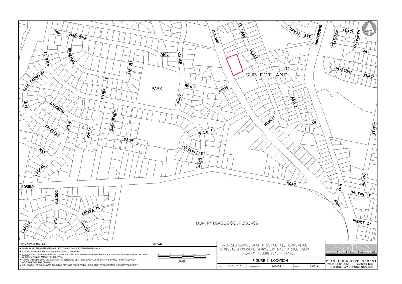
Planning and Development Committee
3 April 2018
2.2 Development
Application DA 347/2017(1) - 68-74 Molong Road
Attachment 2 Plans
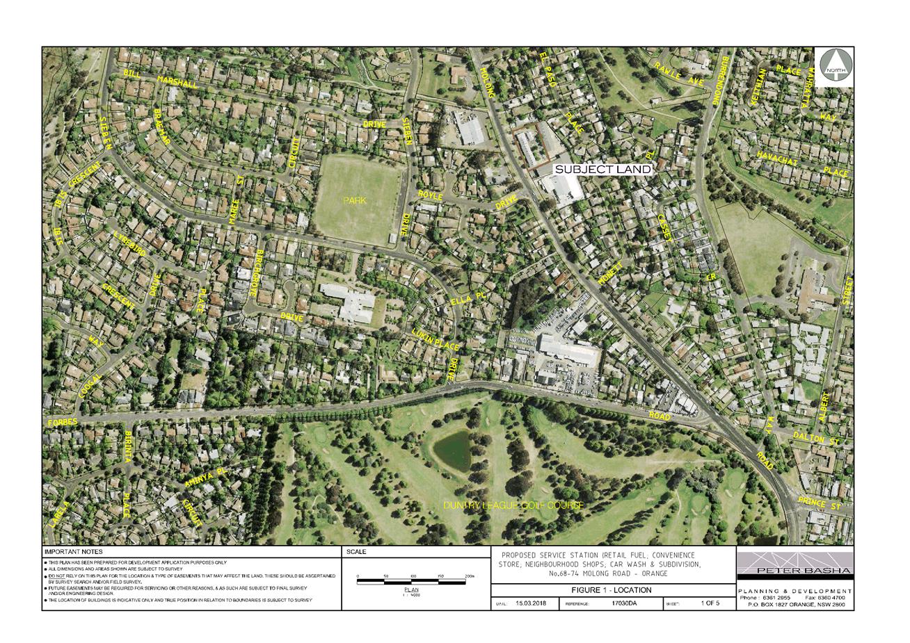
Planning and Development Committee
3 April 2018
2.2 Development
Application DA 347/2017(1) - 68-74 Molong Road
Attachment 2 Plans
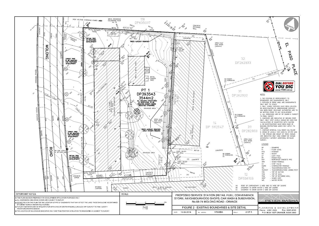
Planning and Development Committee
3 April 2018
2.2 Development
Application DA 347/2017(1) - 68-74 Molong Road
Attachment 2 Plans
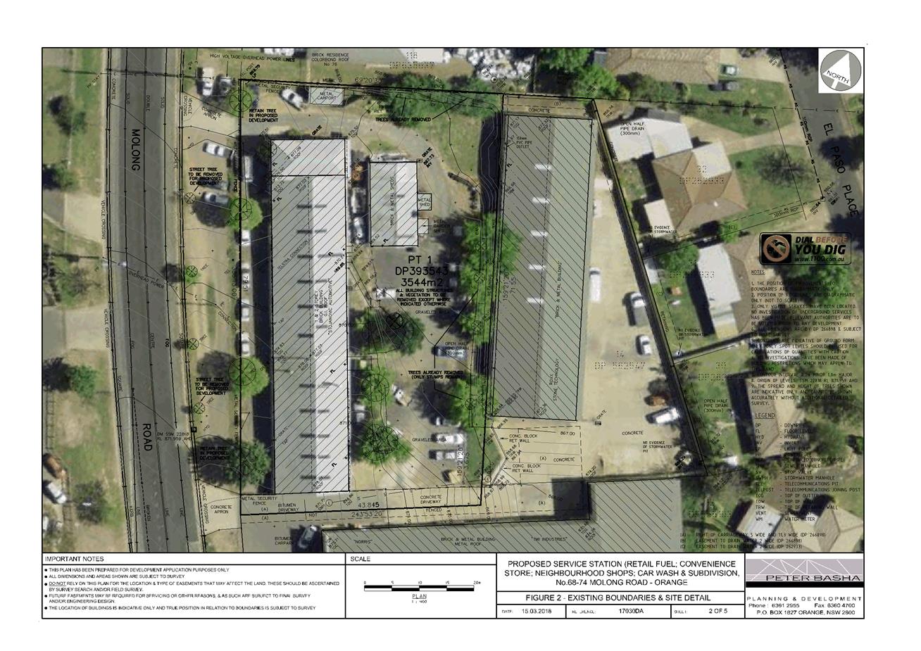
Planning and Development Committee
3 April 2018
2.2 Development
Application DA 347/2017(1) - 68-74 Molong Road
Attachment 2 Plans

Planning and Development Committee
3 April 2018
2.2 Development
Application DA 347/2017(1) - 68-74 Molong Road
Attachment 2 Plans
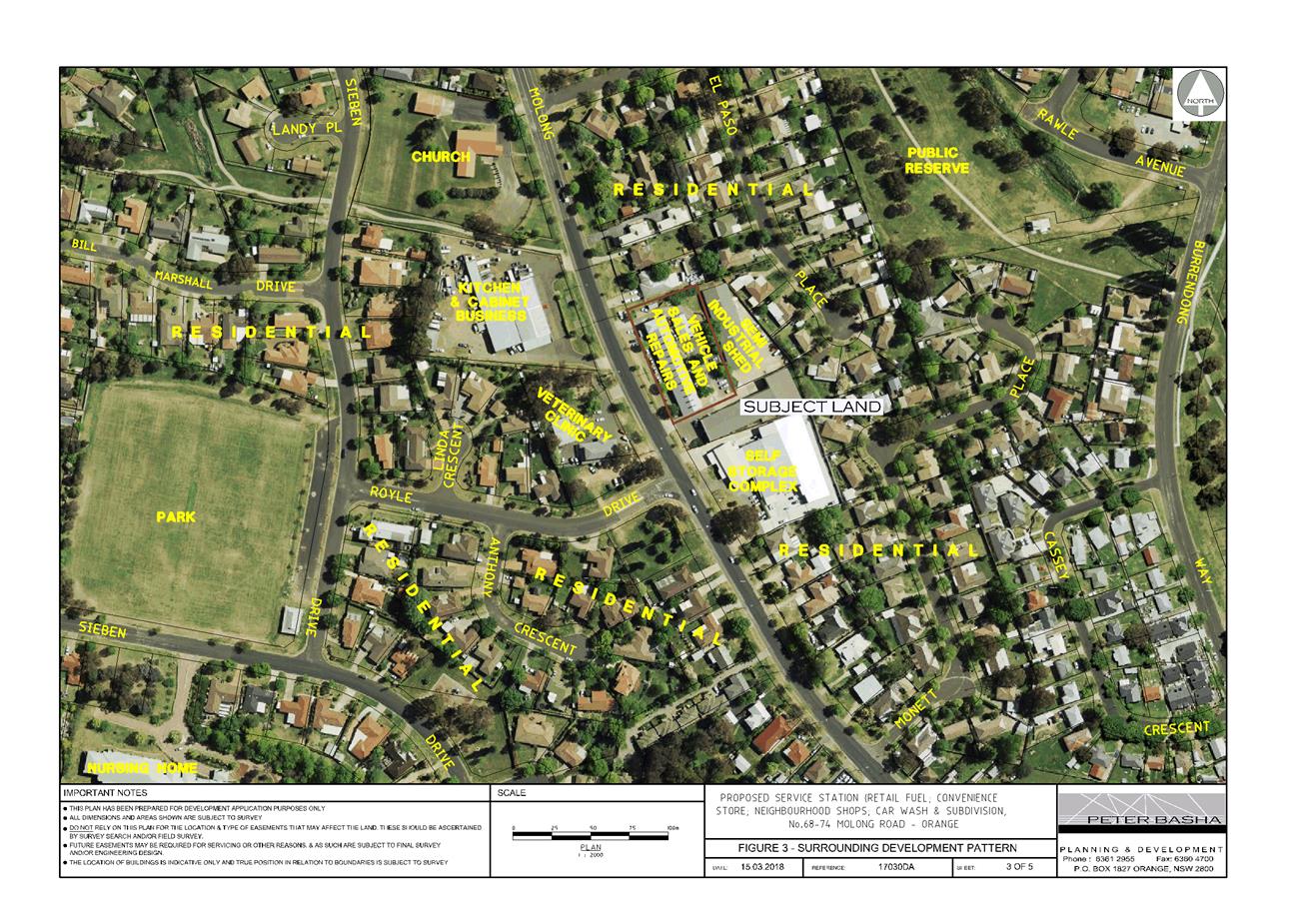
Planning and Development Committee
3 April 2018
2.2 Development
Application DA 347/2017(1) - 68-74 Molong Road
Attachment 2 Plans
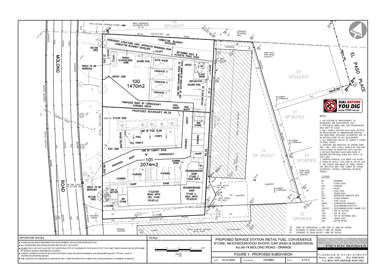
Planning and Development Committee
3 April 2018
2.2 Development
Application DA 347/2017(1) - 68-74 Molong Road
Attachment 2 Plans
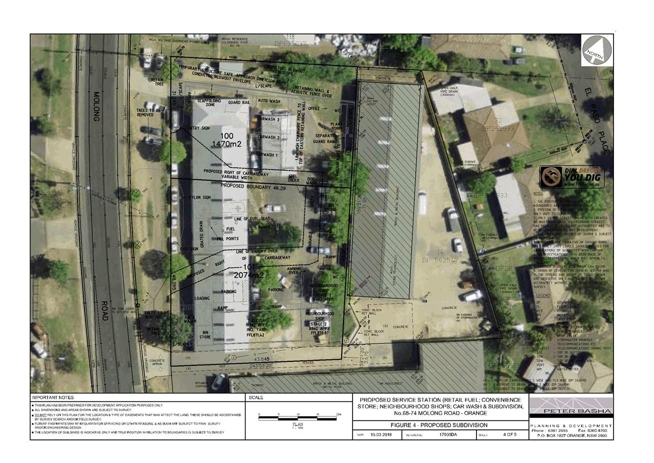
Planning and Development Committee
3 April 2018
2.2 Development
Application DA 347/2017(1) - 68-74 Molong Road
Attachment 2 Plans
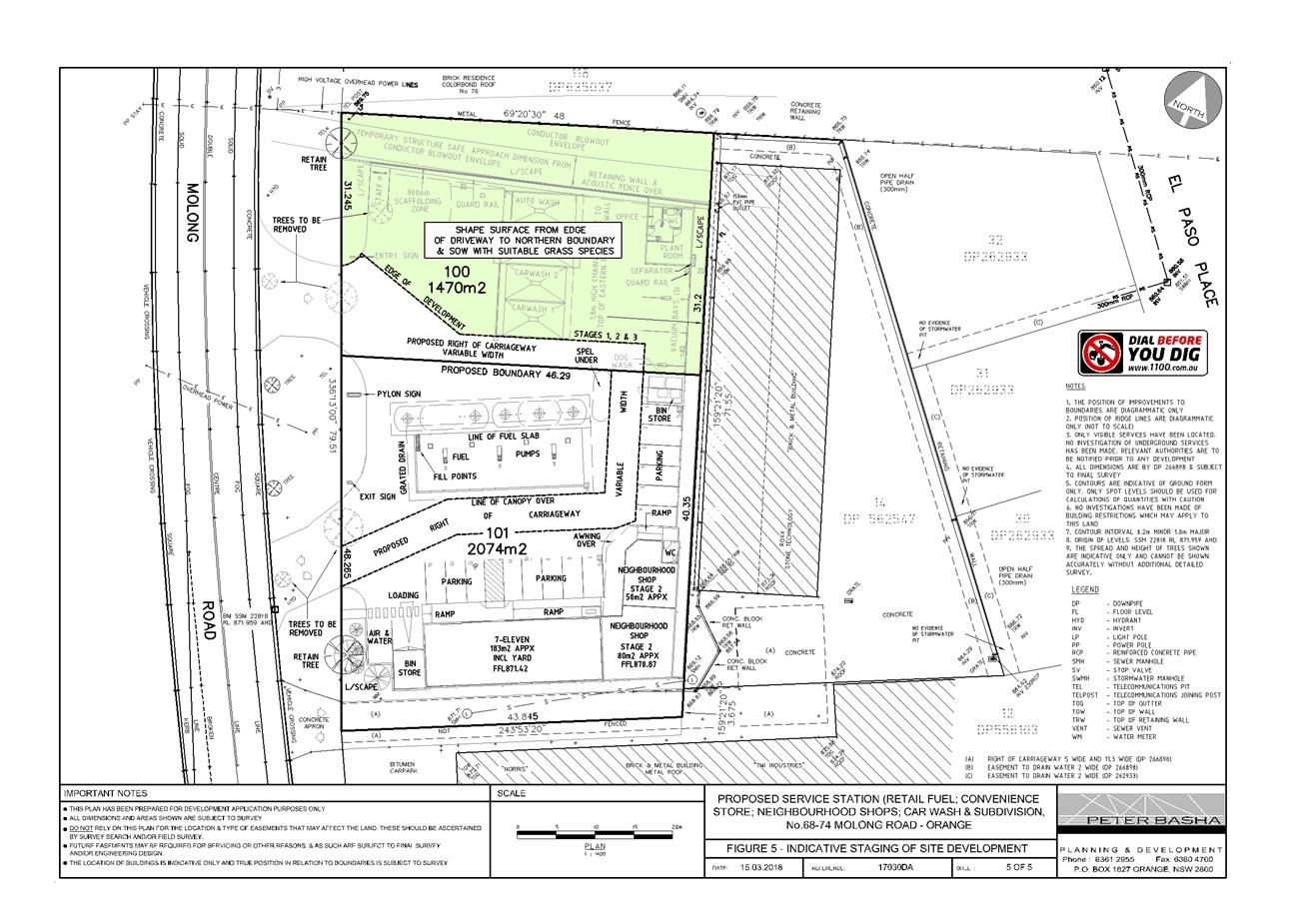
Planning and Development Committee
3 April 2018
2.2 Development
Application DA 347/2017(1) - 68-74 Molong Road
Attachment 2 Plans
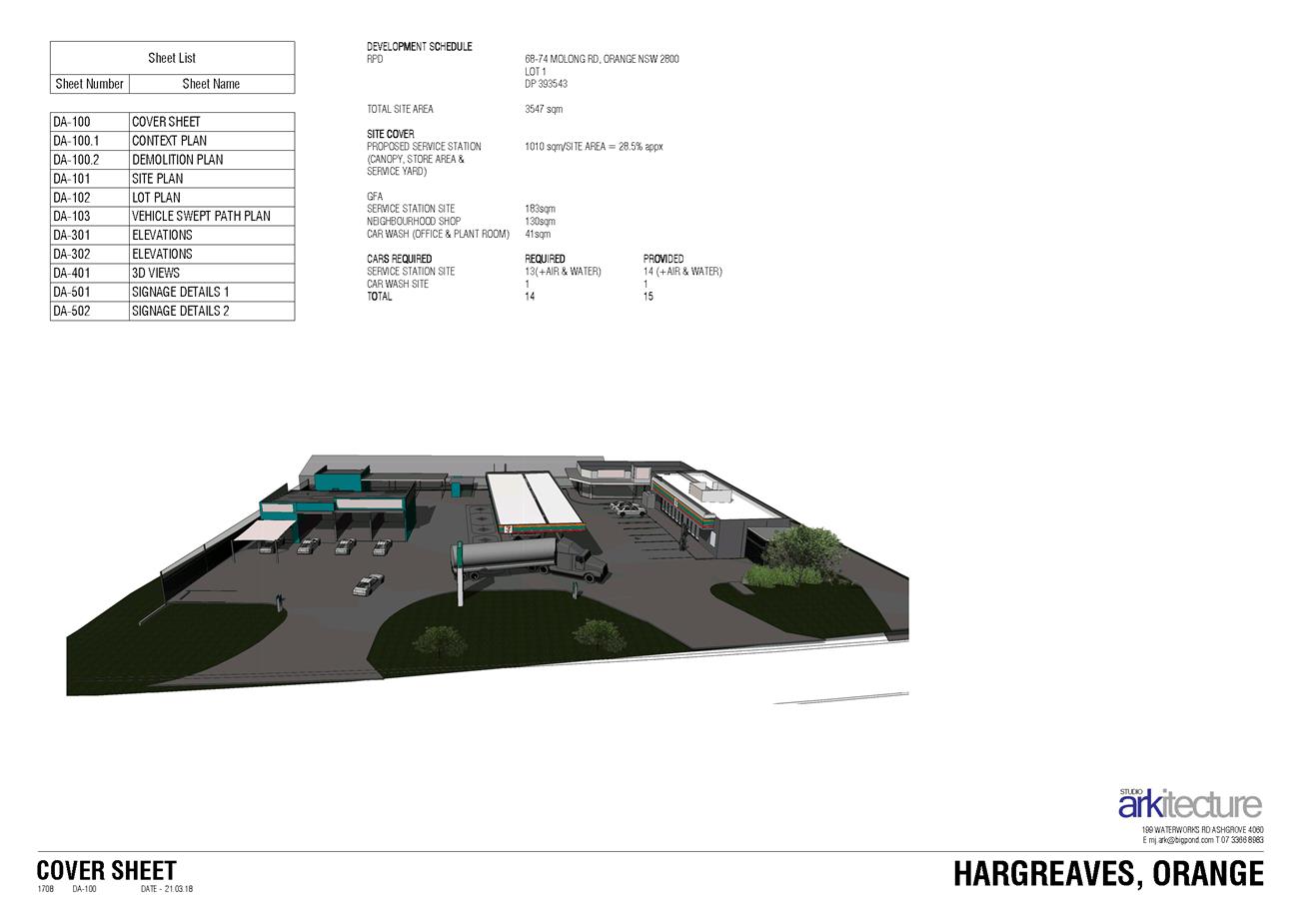
Planning and Development Committee
3 April 2018
2.2 Development
Application DA 347/2017(1) - 68-74 Molong Road
Attachment 2 Plans
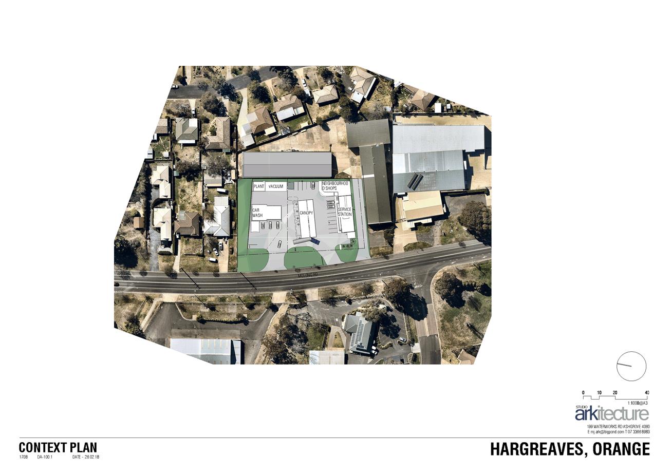
Planning and Development Committee
3 April 2018
2.2 Development
Application DA 347/2017(1) - 68-74 Molong Road
Attachment 2 Plans
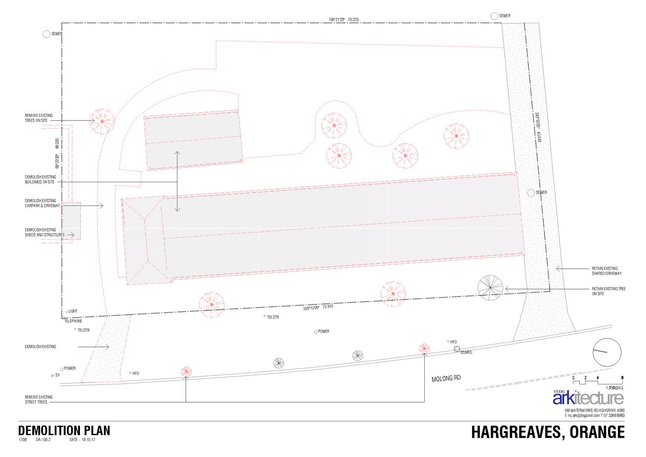
Planning and Development Committee
3 April 2018
2.2 Development
Application DA 347/2017(1) - 68-74 Molong Road
Attachment 2 Plans
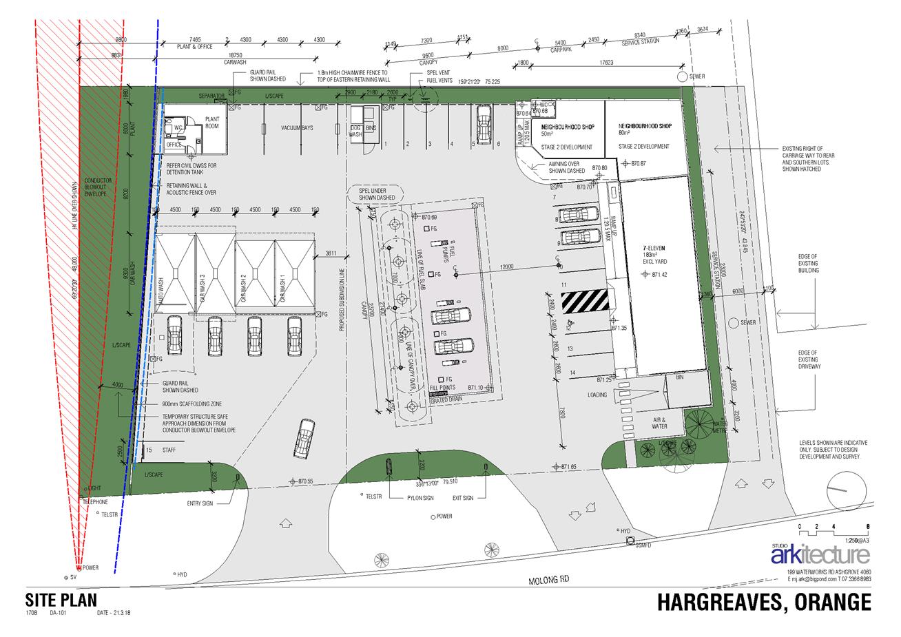
Planning and Development Committee
3 April 2018
2.2 Development
Application DA 347/2017(1) - 68-74 Molong Road
Attachment 2 Plans
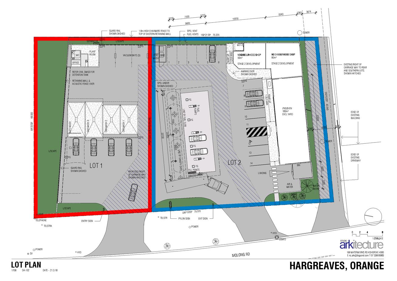
Planning and Development Committee
3 April 2018
2.2 Development
Application DA 347/2017(1) - 68-74 Molong Road
Attachment 2 Plans
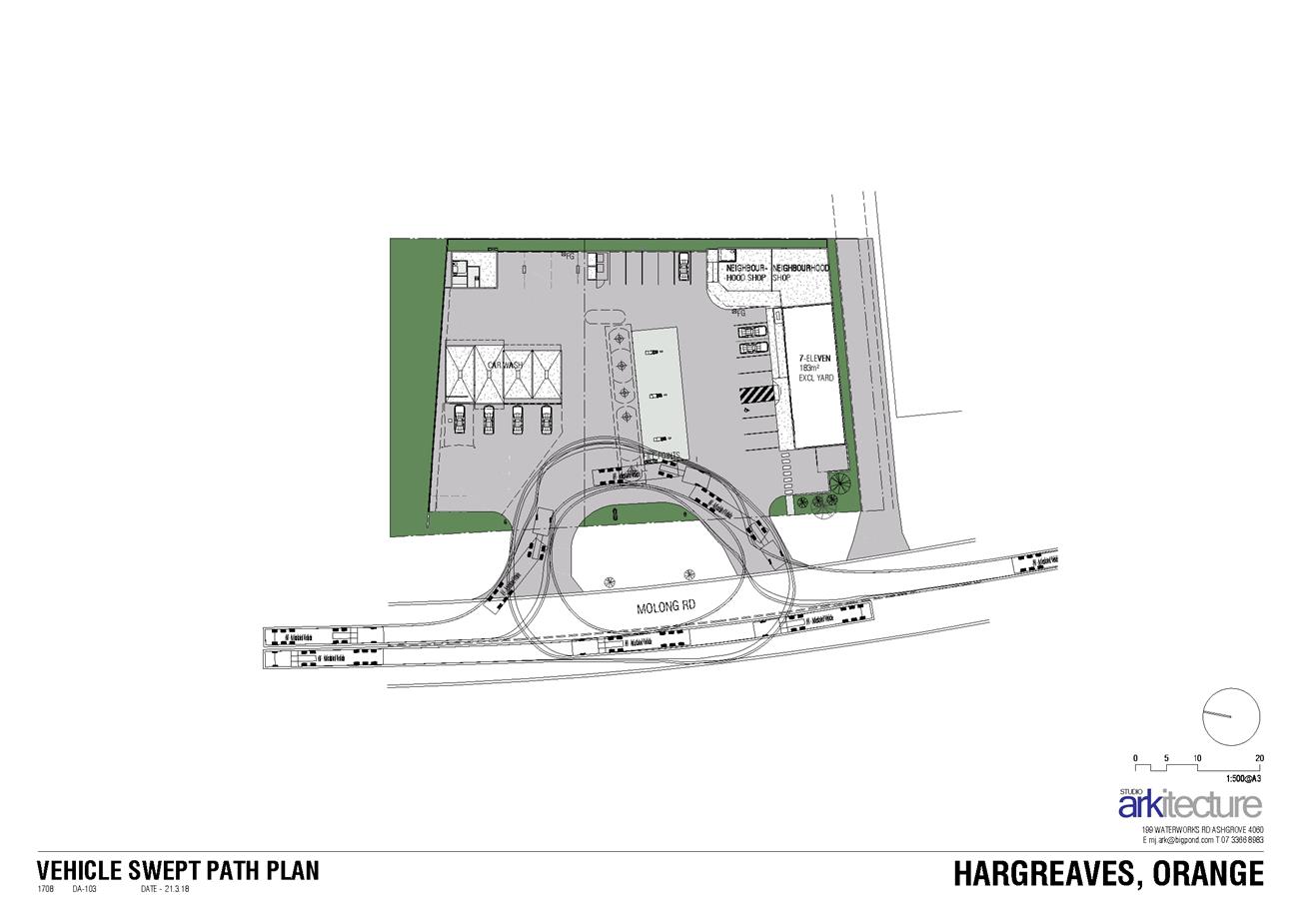
Planning and Development Committee
3 April 2018
2.2 Development
Application DA 347/2017(1) - 68-74 Molong Road
Attachment 2 Plans
Planning and Development Committee
3 April 2018
2.2 Development
Application DA 347/2017(1) - 68-74 Molong Road
Attachment 2 Plans
Planning and Development Committee
3 April 2018
2.2 Development
Application DA 347/2017(1) - 68-74 Molong Road
Attachment 2 Plans
Planning and Development Committee
3 April 2018
2.2 Development
Application DA 347/2017(1) - 68-74 Molong Road
Attachment 2 Plans
Planning and Development Committee
3 April 2018
2.2 Development
Application DA 347/2017(1) - 68-74 Molong Road
Attachment 2 Plans
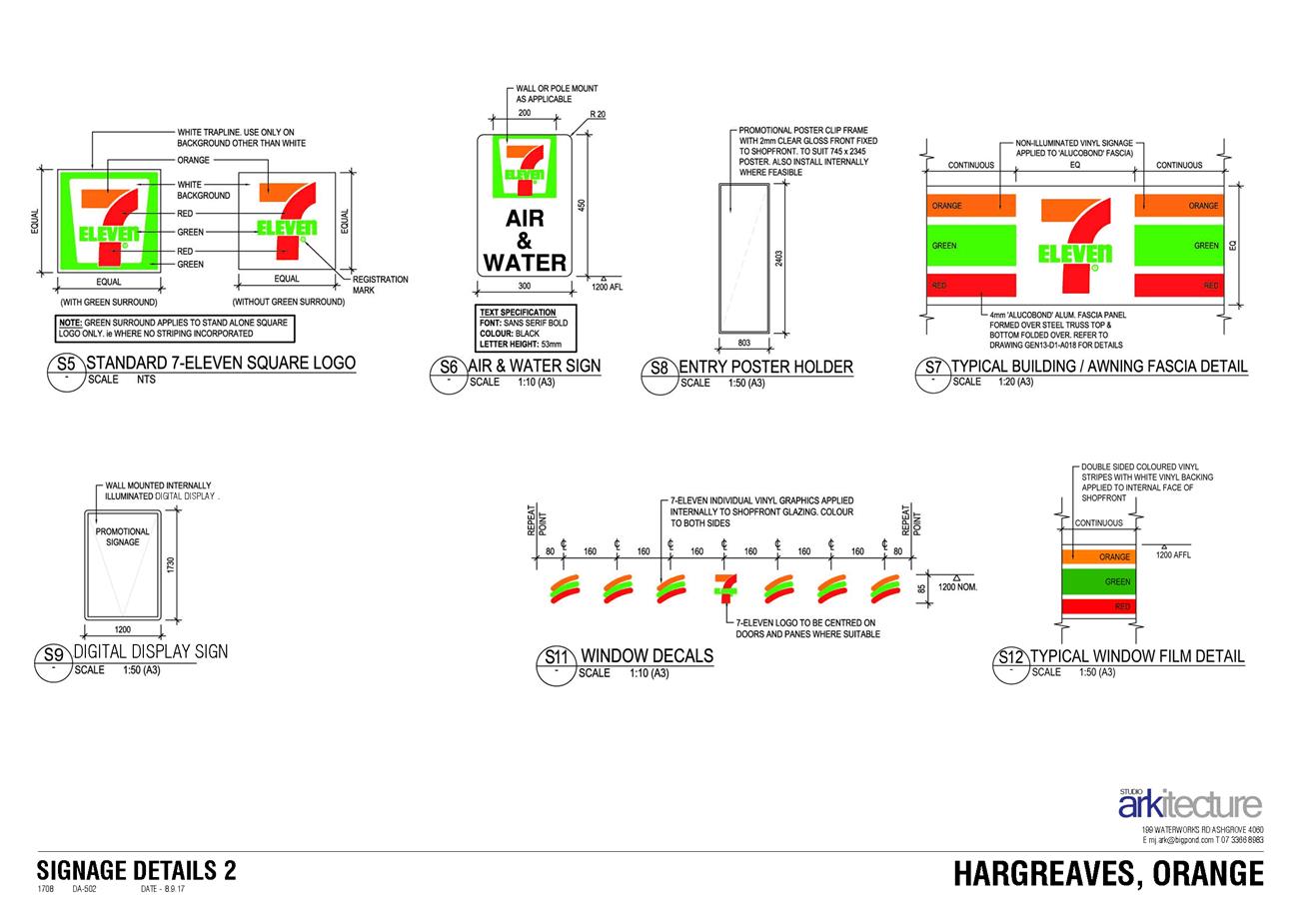
Planning and Development Committee
3 April 2018
2.2 Development
Application DA 347/2017(1) - 68-74 Molong Road
Attachment 3 Submissions


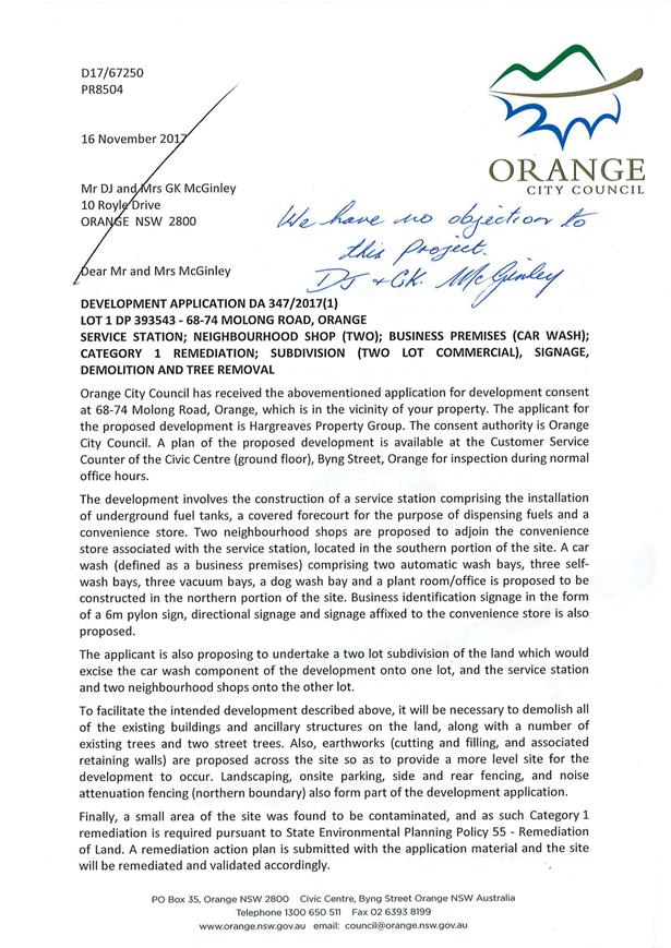
2.3 Development
Application DA 309/2017(1) - 26 Cox Avenue
RECORD
NUMBER: 2018/761
AUTHOR: Daniel
Drum, Senior Planner
EXECUTIVE Summary
|
Application
lodged
|
22 August
2017
|
|
Applicant/s
|
Mr PR
and Mrs JR Cox
|
|
Owner/s
|
Mr PR
and Mrs JR Cox
|
|
Land
description
|
Lot 9
Sec 4 DP 2986 – 26 Cox Avenue, Orange
|
|
Proposed
land use
|
Demolition
(existing dwelling and garage), Multi Dwelling Housing (three dwellings) and
Subdivision (three lot residential Strata)
|
|
Value of
proposed development
|
$700,000
|
Council's consent is sought for demolition of a dwelling,
outbuilding and trees, construction of three dwellings and four lot strata
title subdivision at 26 Cox Avenue, Orange, being Lot 9 Sec 4 DP 2986 (the
‘subject property’).
The subject property is located midway between Newman Street
to the north and Frederica Street to the south. Properties to the north
east and south of the subject property have been developed for a residential purpose,
including a mix of single dwellings and multi dwelling housing. Land to the
west of the subject property, beyond Cox Avenue, forms part of the Kinross
Wolaroi School campus.
The proposed development appears to be typical of multi
dwelling development which could reasonably be expected of a large residential
property in central Orange.
The key issue for consideration is whether or not the
proposed development will have an acceptable privacy impact on the adjoining
residential property at 28 Cox Avenue. In summary, it is considered that
an acceptable outcome can be achieved via recommended conditions of consent.
Further, the proposed development
relies on an exception to the minimum lot size requirement for multi dwelling
housing, being 1,250m2. The subject property has a total area of
1,214m2, being less than 3% (or 36m2) below the minimum
lot size. In this instance it is considered that an exception to the minimum
lot size for multi dwelling development is appropriate. This matter is
addressed in detail in the body of the report.
The proposed use and development is considered to be
consistent with the relevant aims, objectives and planning outcomes of the
Orange Local Environmental Plan 2011 (LEP 2011) and Orange
Development Control Plan 2004 (DCP 2004), subject to the recommended
conditions of consent.
Link To Delivery/OPerational Plan
The recommendation in this report relates to the
Delivery/Operational Plan strategy “13.4 Our Environment
– Monitor and enforce regulations relating to City amenity”.
Financial Implications
Nil
Policy and Governance Implications
Nil
|
That Council consents to development application DA 309/2017(1) for Demolition (existing dwelling and garage), Multi
Dwelling Housing (three dwellings) and Subdivision (three lot residential
Strata) at Lot 9 Sec 4 DP 2986 - 26 Cox Avenue, Orange pursuant to the conditions of consent in the attached
Notice of Approval.
|
further considerations
Consideration has been given to the
recommendation’s impact on Council’s service delivery; image and
reputation; political; environmental; health and safety; employees;
stakeholders and project management; and no further implications or risks have
been identified.
SUPPORTING INFORMATION
THE APPLICATION/PROPOSAL
Council's consent is sought for the demolition of a dwelling
and outbuilding, construction of three dwellings and four lot strata title
subdivision of the subject property.
The proposed development would be undertaken in three main
stages:
Stage 1: Demolition of
the dwelling, outbuilding and trees
Stage 2: Construction
of proposed Dwellings 1, 2 and 3
Stage 3: Strata
title subdivision to create proposed common property Lot 91 and proposed
residential lots 92, 93 and 94.
The proposed development is illustrated in the attached
architectural drawings.
EXISTING CONDITIONS
The subject property is a regularly shaped property in the
order of 1,214m2. The property currently comprises a single storey
brick dwelling setback in the order of 5m from Cox Avenue. The balance of
the property contains a detached weatherboard garage, mature vegetation and
grass.
The existing conditions of the
subject property are illustrated in Figure 1–2 below.
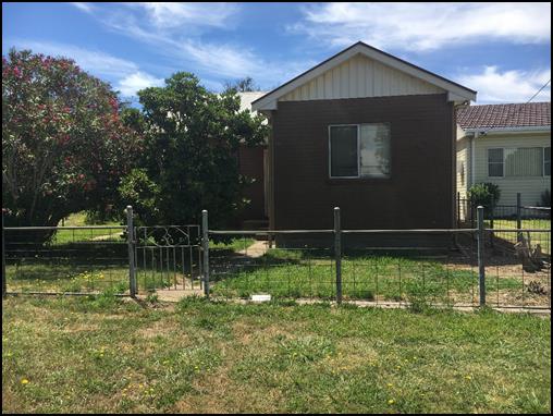
Figure 1 - the subject property – viewed from
Cox Avenue
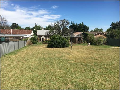
Figure 2 - the subject property – viewed from
Cox Avenue
SURROUNDING USE AND DEVELOPMENT
Properties adjoining the subject property include 28 Cox
Avenue to the north and 24 Cox Avenue to the south. Both 28 Cox
Avenue and 24 Cox Avenue share a number of common characteristics with the
subject property, including being regularly shaped, comprising a total area in
the order of 1,000m and being developed with a single storey dwelling setback
in the order of 5m from Cox Avenue.
An un-named land lane connecting Frederica Street and Newman
Street is located to the immediate east of the subject property.
The
existing conditions of surrounding use and development are illustrated in
Figure 3, below.
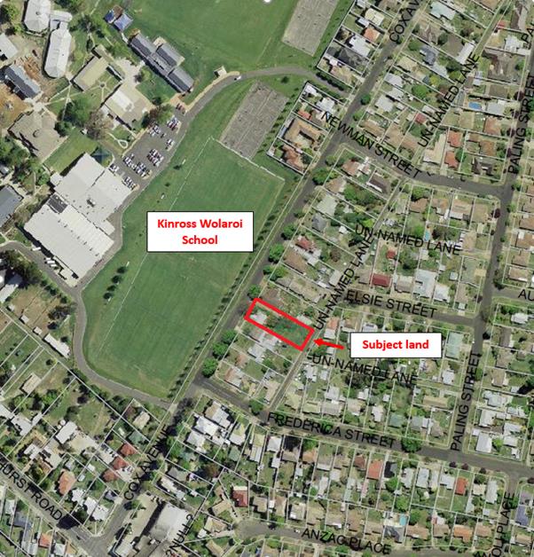
Figure 3 - Site Context Plan
MATTERS FOR CONSIDERATION
Section 1.7 Application of Part 7 of Biodiversity Conservation Act
2016 and Part 7A of Fisheries Management Act 1994
Section 1.7 of the EP&A Act 1979 identifies that Part 7 of
the Biodiversity Conservation Act 2016 and Part 7A of the Fisheries
Management Act 1994 have effect in connection with terrestrial and aquatic
environments.
Notwithstanding, Section 28 of the Biodiversity
Conservation (Savings and Transitional) Regulation 2017 states that the
former planning provisions continue to apply to the determination of a pending
planning application, being an application for planning approval made before
the commencement of the new Act but not determined before that commencement.
It is considered that the subject property does not comprise
any significant biodiversity or habitat value.
Section 4.15 Assessment
Section 4.15 of the Environmental Planning and Assessment
Act 1979 requires Council to consider various matters, of which those
pertaining to the application are listed below.
PROVISIONS OF ANY ENVIRONMENTAL
PLANNING INSTRUMENT s4.15(1)(a)(i)
Orange Local Environmental Plan 2011
Part 1 - Preliminary
Clause 1.2 - Aims of Plan
The
broad aims of the LEP are set out under subclause 2. Those relevant to the
application are as follows:
(a) to
encourage development which complements and enhances the unique character of
Orange as a major regional centre boasting a diverse economy and offering an
attractive regional lifestyle,
(b) to
provide for a range of development opportunities that contribute to the social,
economic and environmental resources of Orange in a way that allows present and
future generations to meet their needs by implementing the principles for
ecologically sustainable development,
(e) to
provide a range of housing choices in planned urban and rural locations to meet
population growth.
(f) to
recognise and manage valued environmental heritage, landscape and scenic
features of Orange.
The application is considered to be consistent with the
foregoing aims insofar as it will contribute to the housing choices in close
proximity to the Orange CBD without detracting from the unique character or
social, economic and environmental characteristics of Orange.
Clause 1.6 - Consent Authority
This clause establishes that, subject to the Act, Council is
the consent authority for applications made under the LEP.
Clause 1.9A - Suspension of
Covenants, Agreements and Instruments
This clause provides that covenants, agreements and other
instruments which seek to restrict the carrying out of development do not apply
with the following exceptions:
· covenants imposed
or required by Council
· prescribed
instruments under Section 183A of the Crown Lands Act 1989
· any conservation
agreement under the National Parks and Wildlife Act 1974
· any trust
agreement under the Nature Conservation Trust Act 2001
· any property
vegetation plan under the Native Vegetation Act 2003
· any biobanking
agreement under Part 7A of the Threatened Species Conservation Act 1995
· any planning
agreement under Division 6 of Part 4 of the Environmental Planning and
Assessment Act 1979.
Council does not hold a Section 88B Instrument for the
subject property. Council staff are not aware of the subject property being
affected by any of the above.
Clause 1.7 - Maps
The subject site is identified
on the LEP maps in the following manner:
|
Land Zoning Map:
|
Land zoned R1 General Residential
|
|
Lot Size Map:
|
No Minimum Lot Size
|
|
Heritage Map:
|
Not a heritage item or conservation
area
|
|
Height of Buildings Map:
|
No building height limit
|
|
Floor Space Ratio Map:
|
No floor space limit
|
|
Terrestrial Biodiversity Map:
|
No biodiversity sensitivity on the
site
|
|
Groundwater Vulnerability Map:
|
Ground water vulnerable
|
|
Drinking Water Catchment Map:
|
Not within the drinking water
catchment
|
|
Watercourse Map:
|
Not within or affecting a defined
watercourse
|
|
Urban Release Area Map:
|
Not within an urban release area
|
|
Obstacle Limitation Surface Map:
|
No restriction on building siting
or construction
|
|
Additional Permitted Uses Map:
|
No additional permitted use applies
|
Those matters that are of relevance are addressed in detail
in the body of this report.
Part 2 - Permitted or Prohibited Development
Land
Use Zones
The subject site is located within the R1 General
Residential zone. For the purpose of permissible uses in the R1 General
Residential zone the proposed use is defined as Multi dwelling housing.
Multi dwelling housing is permitted with consent for
this zone.
Clause
2.3 of LEP references the Land Use Table and
Objectives for each zone. The objectives for land zoned R1 General
Residential are as follows:
· To provide for
the housing needs of the community.
· To provide for
a variety of housing types and densities.
· To enable other
land uses that provide facilities or services to meet the day to day needs of
residents.
· To ensure
development is ordered in such a way as to maximise public transport patronage
and encourage walking and cycling in close proximity to settlement.
· To ensure that
development along the Southern Link Road has an alternative access.
Section
4B of the Act defines subdivision as:
the division of land into two or more parts that, after the
division, would be obviously adapted for separate occupation, use or
disposition.
The
proposed development is consistent with the meaning of Multi dwelling
housing and subdivision, and is consistent with the objectives of
the R1 General Residential zone as it contributes to the variety of housing
types and densities in central Orange, providing for the housing needs of the
community.
Clause 2.6 - Subdivision -
Consent Requirements
Clause 2.6 requires development consent for the subdivision
of land. Additionally, the clause prohibits subdivision of land on which a
secondary dwelling is situated if the subdivision would result in the principal
and secondary dwellings being located on separate lots if either of those lots
are below the minimum lot size applying to the land.
Development consent is required for the third stage of
development, which involves a Strata Title subdivision to create Lots 91, 92,
93 and 94.
The subject property is not affected by a minimum lot size.
Clause 2.7 - Demolition Requires
Development Consent
Clause 2.7 requires the development consent for demolition
of a building or work.
The proposal involves demolition of the existing dwelling
and detached garage.
Part 4 - Principal Development
Standards
Clause
4.1B - Minimum Lot Sizes for Dual Occupancy, Multi Dwelling Housing and
Residential Flat Buildings
Clause
4.1B establishes the minimum lot size required for dual occupancies and
multi dwelling housing in the R1, R2 and R3 zones. Given the proposed
staging of development (ie construction of dwellings prior to Strata Title
subdivision), this clause applies to the Development Application.
In
this instance the subject property has a total area of 1,214m2,
being 36m2 below the minimum lot size for multi dwelling housing.
Approval is required under Clause 4.6 to vary the requirements of
Clause 4.1B. Clause 4.6 is addressed in further detail below.
Notwithstanding,
it is relevant to note that there are many examples of development applications
for multi dwelling development whereby subdivision is proposed prior to
construction of dwellings, therefore avoiding the requirement to consider
Clause 4.1B and Clause 4.6.
Clause 4.6 - Exceptions to Development Standards
Clause
4.6 Exceptions to Development Standards provides that development consent may,
subject to this clause, be granted for development even though the development
would contravene a development standard imposed by this or any other
environmental planning instrument (other than a development standard expressly
excluded from the operation of the clause).
Development
consent must not be granted for development that contravenes a development
standard, unless the consent authority has considered a written request from
the applicant that seeks to justify the contravention of the development
standard by demonstrating that compliance with the development standard is
unreasonable or unnecessary in the circumstances of the case, and that there
are sufficient environmental planning grounds to justify contravening the
development standard.
Further,
development consent must not be granted for development that contravenes a
development standard, unless the consent authority is satisfied that the
applicant’s written request has adequately addressed the matters
required, and the proposed development will be in the public interest
because it is consistent with the objectives of the particular standard and the
objectives for development within the zone in which the development is proposed
to be carried out, and the concurrence of the Secretary has been obtained.
As
noted under the heading ‘Clause 4.1B - Minimum Lot Sizes for Dual
Occupancy, Multi Dwelling Housing and Residential Flat Buildings’,
the subject property comprises a total area of 1,214m2, being 36m2,
or less than 3%, below the minimum lot size for multi dwelling housing.
In
accordance with the requirements of Clause 4.6, the applicant has submitted a
written request seeking to justify the relatively negligible contravention of
the development standard.
While
there are a number of factors which must be taken into consideration under
Clause 4.6 to determine whether or not a variation to the minimum lot size
for a multi dwelling housing should be met, it should be noted from the
outset that the proposed variation is less than 3% and considered to be
negligible.
The
relevant assessment framework is addressed below:
1 Has
the applicant’s written request adequately addressed the matters required
to be addressed?
The
applicant has provided a written submission which outlines why compliance with the
standard is considered to be unnecessary and which demonstrates that there are
sufficient planning grounds to justify contravening the development standard.
With
regard to why compliance with the development standard is considered to be
unnecessary, the applicant’s submission identifies that the objective of
Clause 4.1B is to achieve planned residential density in certain zones,
and that the proposal provides for planned infill residential development
despite not meeting the minimum lot size requirement.
While
the applicant’s response is relatively brief, it is accepted that a
variation of less than 3% has no perceivable impact on the otherwise
permissible residential density. Further, it is noted that other similar types
of development in close proximity to the subject property at 30 Cox Avenue and
12–14 Wakeford Street have either a similar or higher density of
development.
With
regard to the environmental planning grounds which justify contravention of the
development standard, the applicant’s submission identifies strict
compliance with the standard would not allow for one additional dwelling to be
built, while the proposed development would not have a significant off-site
environmental impact.
It is accepted that a variation could be supported on the
basis that the proposed development allows for a higher density of residential
development than which would otherwise be permissible. In general, this is
supported by two objectives of the R1 General Residential Zone, which seek to
provide for the housing needs of the community and a variety of housing types
and densities.
2 Is
the proposed development in the public interest because it is consistent with
the objectives of the particular standard and the objectives for development
within the zone in which the development is proposed to be carried out?
Consistent
with the rationale outlined above, it is considered that the proposed
development is consistent with both the objective of Clause 4.1B and the
R1 General Residential Zone.
On this basis, it is considered that the proposed
development is in the public interest.
3 Does
the contravention of the development standard raise any matter of significance
for State or regional environmental planning?
Based on the foregoing assessment, it is considered that a
negligible contravention of the development standard would not raise any other
matter of significance for State or Regional environmental planning.
4 Any
other matters required to be taken into consideration by the Secretary before
granting concurrence.
The assessing
officer is not aware of any other matter required to be taken in to
consideration in this matter.
Part 5 - Miscellaneous Provisions
5.10 - Heritage Conservation
Clause
5.10 seeks to conserve the environmental heritage of Orange, the heritage significance
of heritage items and heritage conservation areas, including associated fabric,
settings and views, to conserve archaeological sites, and to conserve
Aboriginal objects and Aboriginal places of heritage significance.
The subject property is located
adjacent to the former Wolaroi Mansion (Heritage Item I9), which now forms part
of the Kinross Wolaroi campus.
The Orange City Council Heritage
Inventory describes the former Wolaroi Mansion as:
“A
substantial original Victorian period Italianate style brick residence with
elaborate brick and cast iron details and additions set within a mature
landscape incorporating many cultural plantings, the adaptations over
successive generations for private school use complement the original
architecture and contribute to the significance of the site as an item of State
heritage significance in relation to architecture and education.
Given that the subject property
is located in excess of 300m from the heritage item and is physically separated
by playing fields and other school buildings, it is considered that the
proposed development will not affect the heritage significance of the former
Wolaroi Mansion.
Part 7 - Additional Local Provisions
7.1
- Earthworks
This
clause establishes a range of matters that must be considered prior to granting
development consent for any application involving earthworks, such as:
(a) the likely disruption of, or any
detrimental effect on, existing drainage patterns and soil stability in the
locality of the development
(b) the effect of the development on the
likely future use or redevelopment of the land
(c) the quality of the fill or the soil to be
excavated, or both
(d) the effect of the development on the
existing and likely amenity of adjoining properties
(e) the source of any fill material and the
destination of any excavated material
(f) the likelihood of disturbing relics
(g) the proximity to and potential for adverse
impacts on any waterway, drinking water catchment or environmentally sensitive
area
(h) any measures proposed to minimise or
mitigate the impacts referred to in paragraph (g).
The architectural plans
submitted with the Development Application indicate that minor earthworks would
be required in the order of +/- 500mm (50cm). The extent of disruption to the
drainage of the site is considered to be moderate and is unlikely to affect
adjoining properties or receiving waterways, with the proposed masonry walls
design specifically to capture stormwater and direct it towards Cox Avenue. The
extent of the earthworks are unlikely to materially affect potential future use
or redevelopment of the subject property.
The subject property is not
known to be contaminated. The earthworks will be appropriately supported onsite
and the change in ground level is not substantial, therefore the effect on the
amenity of adjoining properties is unlikely to be significant. However, the
effect of elevated floor levels is discussed in the body of this report under
the heading “Section 7.7 – Design Elements for Residential
Development”.
The site is not known to contain
any Aboriginal, European or archaeological relics. Previous known uses of the
site do not suggest that any relics are likely to be uncovered. The site is not
in proximity to any waterway, drinking water catchment or sensitive area.
Conditions requiring a sediment control plan, including silt traps and other
protective measures, to ensure that loose dirt and sediment does not escape the
site boundaries are recommended.
7.3 - Stormwater Management
This clause applies to all industrial,
commercial and residential zones and requires that Council be satisfied that
the proposal:
(a) is designed to maximise the use of water
permeable surfaces on the land having regard to the soil characteristics
affecting onsite infiltration of water
(b) includes, where practical, onsite
stormwater retention for use as an alternative supply to mains water,
groundwater or river water; and
(c) avoids any significant impacts of
stormwater runoff on adjoining downstream properties, native bushland and receiving
waters, or if that impact cannot be reasonably avoided, minimises and mitigates
the impact.
Council’s
Development Engineer has recommended that a condition of consent be applied
requiring that the development’s stormwater design is to include stormwater
detention within the development designed to limit peak outflows from the land
to the pre-existing natural outflows up to the 100 year ARI frequency, with
sufficient allowance in overflow spillway design capacity to safely pass flows
of a lower frequency without damage to downstream developments.
It is
noted that a portion of the proposed common property, located forward of
Dwelling 1, is intended to be used for the purpose of stormwater detention.
7.6 - Groundwater Vulnerability
This
clause seeks to protect hydrological functions of groundwater systems and
protect resources from both depletion and contamination. Orange has a high
water table and large areas of the LGA, including the subject site, are
identified with “Groundwater Vulnerability” on the Groundwater
Vulnerability Map. This requires that Council consider:
(a) whether or not the development (including
any onsite storage or disposal of solid or liquid waste and chemicals) is
likely to cause any groundwater contamination or have any adverse effect on
groundwater dependent ecosystems, and
(b) the cumulative impact (including the
impact on nearby groundwater extraction for potable water supply or stock water
supply) of the development and any other existing development on groundwater.
Furthermore, consent may not be granted unless Council is satisfied that:
(a) the development is designed, sited and
will be managed to avoid any significant adverse environmental impact, or
(b) if that impact cannot be reasonably
avoided - the development is designed, sited and will be managed to minimise
that impact,
(c) if that impact cannot be minimised - the
development will be managed to mitigate that impact.
The proposal
is not anticipated to involve the discharge of toxic or noxious substances and
is therefore unlikely to contaminate the groundwater
or related ecosystems. The proposal does not involve extraction of groundwater and will therefore not contribute to
groundwater depletion. The design and siting of the proposal avoids impacts on
groundwater and is therefore considered acceptable.
STATE ENVIRONMENTAL PLANNING
POLICIES
State Environmental Planning Policy 55 - Remediation of
Land
State Environmental Planning
Policy 55 - Remediation of Land identifies that a consent authority must
not consent to the carrying out of any development on land unless it has
considered whether the land is contaminated; and if the land is contaminated,
it is satisfied that the land is suitable in its contaminated state (or will be
suitable after remediation) for the purpose for which the development is
proposed to be carried out; and if the land requires remediation to be made
suitable for the purpose for which the development is proposed to be carried
out, it is satisfied that the land will be remediated before the land is used
for that purpose.
Given that the subject property is
currently used for residential purposes and is located within a long
established residential neighbourhood, it is unlikely that the uses of the land
would have resulted in it being in a contaminated state unsuitable for
residential use.
PROVISIONS OF ANY DRAFT
ENVIRONMENTAL PLANNING INSTRUMENT THAT HAS BEEN PLACED ON EXHIBITION
s74.15(1)(a)(ii)
There are no draft environmental planning instruments that
apply to the subject land or proposed development.
DESIGNATED DEVELOPMENT
The proposed development is not designated development.
PROVISIONS OF ANY DEVELOPMENT
CONTROL PLAN s4.15
Development Control Plan 2004
Development Control Plan 2004 (“the DCP”)
applies to the subject property. Chapters of the DCP relevant to the
proposed use and development include:
· Chapter 0
– Transitional Provisions
· Chapter 2
– Natural Resource Management
· Chapter 3
– General Considerations
· Chapter 5
– General Considerations for Zones and Development
· Chapter 7 -
Development in Residential Areas.
The relevant sections, objectives and planning outcomes for
each chapter are addressed below.
Chapter 0 - Transitional
Provisions
Section 0.2 - General Translation of Zones
Section 0.2 - General Translation of Zones provides that any
reference to a zone under Orange Local Environmental Plan 2000 is to be a
reference to the corresponding zone in the zone conversion table.
The table identifies that the R1 General Residential zone
(LEP 2011) corresponds with the 2a Urban Residential and 2d Urban
Transition zones (LEP 2000).
Section 0.4-2 - Tree
Preservation
Section 0.4-2 - Tree Preservation identifies those trees
subject to the Tree Preservation clause of the LEP.
Council’s Manager of City Presentation has advised
that there are no trees of significance located on the subject property.
Chapter 2 - Natural Resource
Management
Section - 2.1 Water Quality
Section 2.1 identifies development that concentrates,
redirects flows, increases flow rates or disturbs land in close proximity to
creeks, has the potential to affect waterways with associated erosion,
sedimentation and release of nutrients, which combine to affect downstream
water quality. Section 2.1 also identifies that development involving
groundwater extraction and/or onsite wastewater disposal is deemed to have the
potential to affect groundwater resources.
Stormwater and groundwater has previously been addressed
under Sections 7.3 -Stormwater Management and 7.6 - Groundwater
Vulnerability.
Section 2.3 - Vegetation
Section 2.3 identifies that the heavily-modified landscape
and climate of Orange have cumulated in introduced species of trees providing a
significant contribution to the landscape character. Further, it is identified
that the established urban areas are characterised by “cottage”
gardens in residential areas and by formal parks and avenues of exotic street
trees.
Vegetation has previously been addressed under Sections 5A
Assessment and Section 0.4-2 - Tree Preservation.
Chapter 3 - General
Considerations
Section 3.1 - Cumulative Impacts
“Cumulative Impacts” identifies that Council
will consider not only the direct impacts of a particular development, but also
whether the development, when carried out in conjunction with other development
in the locality, has a more significant environmental impact.
Notably, this section identifies that residential units and
dual occupancies should be located and designed in a way that fits in with the
predominant low-density character of the City’s residential area.
Specific planning outcomes for cumulative impacts include:
· Applications
for development demonstrate how the development relates to the character and
use of land in the vicinity.
· The
introduction of new development into a locality maintains environmental impacts
within existing or community-accepted levels.
· Water
conservation measures are implemented.
The relevant matters are generally addressed under Section
7.7 - Design Elements for Residential Development, below and elsewhere
throughout this report.
Based on that assessment it is considered that the proposed
development adequately relates to the existing character and land use in the
area, and would maintain environmental impacts within existing community accepted
levels.
Section 3.2 - Scenic, Landscape
and Urban Areas
Section 3.2 identifies that the urban character of the City
is represented by a central area of established gardens, avenues of exotic
trees, formal town parks and informal park networks along creeks. Informal
landscaping increases, with a greater emphasis on native plants in parks and
gardens in suburban areas.
Specific planning outcomes for scenic, landscape and urban
areas include:
· Development
incorporates landscaping that enhances the landscaped setting of the locality.
· External
finishes, materials and colour schemes of development complement its setting.
The landscape character of the subject property and
surrounding area is generally characterised by informal gardens, which often include
maturing canopy trees.
It is recommended that a condition of consent be applied
requiring that a small canopy tree be planted within the courtyard of each of
the proposed dwellings to further enhance the proposed landscaping.
It is not considered that any particular external finishes,
materials are colour schemes are required to complement the landscape setting.
Chapter 5 - General
Consideration for Zones and Development
Section 5.3 - Advertised Development
Section 5.3 identifies that Council will give written and
published notice of applications for advertised development as required by the Environmental
Planning and Assessment Regulations. The proposed development was
advertised in the Orange City Life on 7 September 2017.
Three submissions were received during the advertising
period. Issues raised in submissions are addressed in detail under the heading
‘Any submissions made in accordance with the act s79c(1)(d)’.
Section 5.7 - Subdivision
Section 5.7 identifies that subdivision works are to be designed
and undertaken in accordance with Council’s adopted standards as outlined
in the Orange City Development and Subdivision Code.
Council’s Development Engineer has recommended a
condition of consent requiring that the provisions and requirements of the Code
are to be applied and all work constructed in accordance with the Code.
Chapter 7 - Development in
Residential Areas
Section 7.2 - Residential Subdivision
Subdivision Lot Sizes
Section 7.2 identifies that lots less than 350m2 must
be able to define the configuration of a dwelling footprint and associated
private open space.
This has been achieved as the applicant has sought consent
for the construction of three dwellings as multi dwelling housing prior to
subdivision.
Special Requirements for Battleaxe
Lots
Section 7.2 identifies that battleaxe lots need to have a
sufficient size and shape to permit a house and driveway positioned in a way
that allow cars to turn around within the lot, and that the accessway needs to
be wide enough to allow for vehicular access and services such as power,
telecommunications, water and possibly drainage and internal sewer.
Section 7.2 identifies that a common driveway to two
battleaxe lots or an access serving two dwellings requires a 4.5m driveway
within a 6m wide accessway, however it may be necessary to require a 6m wide
driveway to provide for passing cars.
The design plans incorporate a 6m wide (minimum) driveway
from Cox Avenue to a point approximately 12m inside the front boundary of the
property, which is considered adequate for the proposed development.
Further, Section 7.2 identifies that battleaxe lots should
have a minimum area of 650m2 excluding the area of the accessway;
battleaxe lots should be designed to provide for solar access and privacy; and
where practicable, lots should adjoin open space.
The proposed development involves a strata subdivision to
create three residential lots in the order of 266m2 to 296m2 and
one common lot of 378.67m2. While the residential lots are
substantially smaller than the required 650m2, it is considered that
they can be supported given that access to each of these lots is via the
proposed common driveway and provided that adequate solar access and privacy
outcomes are achieved. These matters are addressed in further detail below.
Subdivision Layout
The DCP sets out the following relevant planning outcomes
for urban residential subdivision:
· Subdivision
layout in areas zoned Urban Residential prior to this plan are generally in
accordance with the applicable plan maps in Appendix 1.
Not applicable.
· Lots are
orientated to optimise energy efficiency principles.
Each proposed dwelling has been
designed to incorporate primary living areas on the northern side of each
dwelling.
· New roads are
planned according to modified grid layouts with restrained use of cul‑de-sac
roads in new developments according to the UDAS Urban Form principles for
Orange.
Not applicable.
· Local open
space is provided along creek corridors to create open space linkages for
environmental conservation and social interaction. Release areas removed from
creeks provide for open space links incorporating substantial stands of native
vegetation.
Not applicable.
· Release areas
indicate trunk cycle and pedestrian ways that link the area to major open space
networks and activity centres (schools, shopping centres and employment areas).
Not applicable.
· Lots below
500m2 indicate a mandatory side setback to provide for solar access and
privacy.
Not applicable.
· Lots below
350m2 indicate existing or planned house layouts, which identify how privacy,
solar access, vehicular access and private open-space needs are to be achieved.
The architectural plans submitted with the Development
Application demonstrate that appropriate solar access, privacy, vehicle access
and private open space outcomes can be achieved. These matters are addressed in
detail below.
· Up to 25% of
new subdivisions comprise small lots in dispersed locations.
As the proposed development will create two additional lots
in the order of 266–296m2, the development will contribute to the
availability of small lots within central Orange.
· Lots are fully
serviced and have direct frontage/access to a public road.
It is understood that all services have the capacity to be
extended to the proposed development. Each proposed lot would have direct
access to Cox Avenue.
· Design and
construction complies with the Orange Development and Subdivision Code.
Council’s Development Engineer has recommended a
condition of consent stating that the provisions and requirements of the Orange
Development and Subdivision Code apply to the proposal.
· Corner lots
provide for a house to front one street.
Not applicable.
· Battleaxe lots
provide an adequate accessway width for the number of dwellings proposed to be
served in order to allow for vehicle and pedestrian access and location of
services.
The design plans submitted with the Development Application
indicate that each of the proposed residential lots would be served via a
common egress/ingress from Cox Avenue. The design plans incorporate a 6m
wide (minimum) driveway from Cox Avenue to a point approximately 12m inside the
front boundary of the property, which is considered adequate for the proposed
development.
· Lots proposed
to be used specifically for dual occupancy or units in new residential areas
are identified on development application plans to inform prospective
purchasers of mixed residential form of the area and measures are outlined on
how prospective residents are to be informed of these identified sites prior to
purchasing land.
While the subject property has not been specifically
identified for multi dwelling development, Council has previously approved
multi dwelling development and small lot subdivisions on such properties
subject to meeting the appropriate merit assessment.
Section 7.7 - Design
Elements for Residential Development
Section 7.7 sets out objectives and planning outcomes for
residential development design elements. The objectives and planning outcomes
are addressed in detail below.
Streetscape Objectives
The DCP sets out overarching objectives with regard to
streetscape, including:
· To
ensure that the development fits into its setting and environmental features of
the locality.
· To
ensure that the appearance of housing is of a high visual quality, enhances the
streetscape and complements good quality surrounding development.
· To
ensure that new development complements places with heritage significance and
their settings in a contemporary way.
· To
develop a sense of place with attractive street frontages.
· To
encourage visually appealing cohesive streetscapes.
· To
create a safe and secure environment.
· To provide
consistent design elements that protect private investment.
Neighbourhood Character
The DCP sets out the following planning outcomes in regard
to neighbourhood character:
· Site layout and
building design enables the:
- creation
of attractive residential environments with clear character and identity
- use
of site features such as views, aspect, existing vegetation and landmarks
· Buildings are
designed to complement the relevant features and built form that are identified
as part of the desired neighbourhood character.
· The streetscape
is designed to encourage pedestrian access and use.
The design plans submitted with the original Development
Application did not adequately address the forgoing objectives and outcomes. In
particular, it was assessed that Dwelling 1 lacked any meaningful relief
features which would assist in creating an attractive residential environment
or which would make a positive contribution to the neighbourhood character of
the area.
As such, Council staff advised that the amended design plans
should be submitted with Dwelling 1 reoriented to address Cox Avenue,
consistent with the prevailing neighbourhood character of the area.
The applicant subsequently submitted amended plans with
Dwelling 1 redesigned to orientate towards Cox Avenue, including presentation
of a front door. The amended design is considered to be acceptable.
Building Appearance
The DCP sets the following planning outcomes in regard to
building appearance:
· The
building design, detailing and finishes relate to the desired neighbourhood
character, complement the residential scale of the area, and add visual
interest to the street.
· The
frontages of buildings and their entries face the street.
· Garages
and car parks are sited and designed so that they do not dominate the street
frontage.
As discussed above, the design
plans submitted with the original Development Application did not adequately
address the forgoing objectives and outcomes.
Notwithstanding, the amended design is considered to be acceptable.
Setbacks
The DCP sets out the following planning outcomes with regard
to setbacks:
· Street
setbacks contribute to the desired neighbourhood character, assist with the
integration of new development and make efficient use of the site.
· Street
setbacks create an appropriate scale for the street considering all other
streetscape components.
Dwelling 1 is set back in the order of 5m from Cox Avenue,
consistent with the setback of the existing dwelling which is proposed to be
demolished. The proposed setback is considered be appropriate.
Front Fences and Walls
The DCP sets out the following planning outcomes with regard
to fences and walls:
· Front
fences and walls:
- assist
in highlighting entrances and creating a sense of identity within the
streetscape
- are
constructed of materials compatible with associated housing and with fences
visible from the site that positively contribute to the streetscape
- provide
for facilities in the street frontage area such as mail boxes.
The proposed development incorporates a front fence with a
maximum height of 1.2m.
The proposed front fence will predominately be constructed
of brick with timber infill, consistent with the proposed dwellings.
While the proposed fence is required to achieve temporary
stormwater retention on the subject property, it is considered that it will
also may a positive contribution to the streetscape. The proposed fence will be
consistent, albeit slightly higher, with other masonry fences in Cox Avenue.
Bulk and Scale Objectives
The DCP sets out overarching objectives with regard to bulk
and scale, including:
· To
allow flexibility in siting buildings and to ensure that the bulk and scale of
new development reasonably protects the amenity of neighbouring properties and
maintains appropriate neighbourhood character.
· To
allow adequate daylight, sunlight and ventilation to living areas and private
open spaces of new and neighbouring developments.
· To
encourage the sharing of views, while considering the reasonable development of
the site.
Visual Bulk
The DCP sets out the following planning outcome with regard
to visual bulk:
· Built
form accords with the desired neighbourhood character of the area with:
- side
and rear setbacks progressively increased to reduce bulk and overshadowing
- site
coverage that retains the relatively low density landscaped character of
residential areas
- building
form and siting that relates to landform, with minimal land shaping
(cut and fill)
- building
height at the street frontage that maintains a comparable scale with the
predominant adjacent development form
- building
to the boundary where appropriate.
The DCP identifies that appropriate visual bulk is achieved
by containing buildings within an envelope generated by planes projected over
the site at 45° commencing
at 2.5m above ground level from each side and rear boundary (Visual Bulk
Envelope).
Design plans submitted with the Development Application
demonstrate that each of the proposed dwellings meet this requirement.
The DCP also identifies that appropriate visual bulk is
achieved by ensuring that single dwellings cover no more than 60% of the site
area.
The SoEE indicates that the proposed development would have
a total site coverage of 39%, incorporating the common areas.
Walls and Boundaries
The DCP sets out the following planning outcome with regard
to walls and boundaries:
· Building
to the boundary is undertaken to provide for efficient use of the site taking
into account:
- the
privacy of neighbouring dwellings and private open space
- the
access to daylight reaching adjoining properties
- the
impact of boundary walls on neighbours.
The design plans submitted with the development application
indicate that the walls of the proposed dwellings would not be built to the
boundary of the subject property, with all walls to be setback a minimum of 1m.
Daylight and Sunlight
The DCP sets out the following planning outcome in regard to
daylight and sunlight:
· Buildings
are sited and designed to ensure:
- daylight
to habitable rooms in adjacent dwellings is not significantly reduced
- overshadowing
of neighbouring secluded open spaces or main living area windows is not significantly
increased
- consideration
of Council’s Energy Efficiency Code.
Shadow diagrams have been prepared in support of the
proposed development. In consideration of the DCP guidelines, the proposal is
considered to be satisfactory as outlined below.
Habitable Rooms
The DCP Guidelines require habitable rooms that are facing
private open space, a courtyard, verandah, patio or the like which are open to
the sky, to be at least 1.8m from any adjoining buildings.
The proposed development has been designed and sited to
ensure that adequate daylight and sunlight could be provided to habitable rooms
where windows that face private open space are open to the sky. All windows of
each dwelling are set back a minimum of 1m from the boundaries of the subject
property, enabling a 1.8m setback from any future adjoining building.
Overshadowing of Private Open
Space
The DCP guidelines and Council’s Energy Smart Homes
Code require sunlight to be available to at least 40% of open space for
dwellings within the development and on neighbouring properties for at least
three hours between 9am and 3pm. For new developments, the 40% of open space is
generally interpreted to be 40% of the required area of private open space, as
opposed to 40% of the total area of open space.
Amended shadow diagrams provided with the Development
Application and the SoEE indicate that the proposed development has been
designed and sited.
The 1.8m southern boundary fence of the subject property
will also overshadow the adjoining property to the south at 24 Cox Avenue.
However, the overshadowing would be substantially below the 40% / three hour
threshold.
Overshadowing of Dwelling
The DCP guidelines and Council’s Energy Efficiency
Code require sunlight to at least 75% of north facing living area windows
within the development and on adjoining land to be provided for a minimum of
four hours on 21 June; or not further reduced where already less.
Amended shadow diagrams provided with the development
application for Dwelling 1 will have a four hour average of 67.48%, Dwelling 2
will have a four hour average of 73.19% and Dwelling 3 will have a four hour
average of 79.45%.
Notably, the applicant has not provided any meaningful
justification to support a variation from the DCP guidelines. However, during
discussion with the applicant it was made evident that the numerical standard
could simply be overcome by redesigning the windows to be smaller ‘high
lights’ which could be 100% unaffected by overshadowing, or removing the
eaves of each dwelling.
On balance, it is considered that the best planning outcome
is for the size of the windows and design of the eaves to remain as currently
designed as they both make a significant contribution to the overall amenity of
future residents.
Further, regard has been given to The Benevolent Society
v Waverly Council at Paras 133‑144 which establishes the
planning principle addressing access to sunlight. The first dot point of that
principle sets out the following:
“The ease with which
sunlight access can be protected is inversely proportional to the density of a
development. At low densities, there is a reasonable expectation that a
dwelling and some of its open space will retain its existing sunlight.
(However, even at low densities there are sites and buildings that are highly
vulnerable to being overshadowed.) At higher densities sunlight is harder to
protect and the claim to retain is not as strong.”
Taking this into consideration and given the higher density
nature of the proposed development, it is considered reasonable that a minor
variation from the DCP guideline is acceptable within the subject property. A
variation such as this should only be considered on a site-by-site basis and
not taken to be a precedent.
Views
The DCP sets the following planning outcomes with regard to
views:
· Building
form and design allow for residents from adjacent properties to share prominent
views where possible.
· Views
including vistas of heritage items or landmarks are not substantially affected
by the bulk and scale of the new development.
While proposed development would be clearly visible from
each of the neighbouring dwellings, it is considered that no prominent views
would be significantly affected. Existing views from the frontage and rear of
each property would be retained.
Privacy and Security
Objective
The DCP sets the following planning outcome in regard to
privacy and security:
· To
ensure that the siting and design of buildings provide privacy for residents
and neighbours in their dwellings and principal private open space.
Visual Privacy
The DCP sets the following planning outcome in regard to
visual privacy:
· Direct
overlooking of principal living areas and private open spaces of other
dwellings is minimised firstly by:
- building
siting and layout
- location
of windows and balconies
and
secondly by:
- design
of windows or use of screening devices and landscaping.
The design plans submitted with the Development Application
identify that a minimum 1.8m Colorbond fence is proposed along all
internal and external property boundaries.
A 1.8m high perimeter fence would generally ensure adequate
visual privacy between the private open space and habitable rooms of a single
storey dwelling and surrounding development.
However, given the slightly elevated nature of Dwelling 1
and Dwelling 2, the proposed 1.8m high fence would have a reduced effect in
this case. In particular, it is clear that the living room windows of Dwelling
1 would have a direct view towards the south facing bedroom windows of 28 Cox
Avenue, while Dwelling 2 would overlook a portion of the private open space of
28 Cox Avenue.
The SoEE submitted with the development application contends
that the proposed development is unlikely to have an adverse impact on visual
privacy due to the single storey design and orientation of the windows. In
general, this rationale is not accepted. There is an overlooking impact
associated with Dwelling 1 and 2.
With regard to Meriton v Sydney City Council [2004]
NSWLEC 313, which sets out the planning principle for privacy, it is noted
that the use of each space determines the importance of its privacy (ie a
living area is more important than a bedroom). However, the planning principle
also identifies that overlooking of neighbours that arises out of poor design
is not acceptable, and in areas undergoing change the impact on what is likely
to be built on adjoining sites should be considered.
In this regard, the greatest impact will be experienced
within the private open space of 28 Cox Avenue which would be partially
overlooked by the living room window of Dwelling 2. A lesser impact would
be experienced by the living room window of Dwelling 1 being orientated
towards the bedroom windows of 28 Cox Avenue.
In order to address privacy issues, it is recommended that a
condition of consent be attached to the Notice of Determination that requires a
design solution to mitigate the overlooking impact on the bedroom windows and
private open space of 28 Cox Avenue. An acceptable solution would be that a
portion of each living area room window which overlooks 28 Cox Avenue be
finished with an obscure type glass which, while obscuring view, allows for
access to natural daylight.
Acoustic Privacy
The DCP sets the following planning outcome in regard to
acoustic privacy:
· Site
layout and building design:
- protect
habitable rooms from excessively high levels of external noise
- minimise
the entry of external noise to private open space for dwellings close to major
noise sources
- minimise
transmission of sound through a building to affect other dwellings.
The proposed development is located within an existing
residential area where the ambient noise is generally expected to be low, with
the exception of traffic travelling along Cox Avenue.
It is considered that each proposed dwelling will not be detrimentally
affected by high levels of external noise.
Security
The DCP sets the following planning outcomes in regard to
security:
· The
site layout enhances personal safety and minimises the potential for crime,
vandalism and fear.
· The
design of dwellings enables residents to survey streets, communal areas and
approaches to dwelling entrances.
The proposed development is consistent with the principles
of Crime Prevention Through Environmental Design, being surveillance, access
control, territorial reinforcement and space management.
Surveillance: The proposed development provides for clear sightlines between
public and private places and landscaping will not provide offenders with a
space to hide or entrap.
Access control: The layout of the proposed development clearly distinguishes
between the private open space of each dwelling and the common property
driveway. Physical barriers, such as fences and buildings, would prevent
convenient access between these areas.
Territorial reinforcement: As discussed above, the layout of the proposed development clearly
distinguishes between private and public spaces. While it is unlikely that
residents would regularly gather within the common driveway area given its
functional purpose, clear sightlines will provide for ongoing informal
surveillance.
Space management: Given the relatively limited area of the common driveway it is not
considered that any space management practices are required.
Site Access and Circulation
Objectives
The DCP sets out the following objectives in regard to site
access and circulation:
· To
provide convenient and safe access and parking that meets the needs of all
residents and visitors.
· To
encourage the integrated design of access and parking facilities to minimise
visual and environmental impacts.
Circulation and Design
The DCP sets the following planning outcome in regard to
circulation and design:
· Accessways
and parking areas are designed to manage stormwater.
· Accessways,
driveways and open parking areas are suitably landscaped to enhance amenity
while providing security and accessibility to residents and visitors.
· The
site layout allows people with a disability to travel to and within the site
between car parks, buildings and communal open space.
Council’s Development Engineer has identified that the
proposed development has been appropriately designed with regard to
accessways/parking areas and stormwater management.
The landscape plan submitted with the development
application indicates that some landscaping will be provided within and
adjacent to the accessway.
Car Parking
The DCP sets out the following planning outcomes in regard
to car parking:
· Parking
facilities are provided, designed and located to:
- enable
the efficient and convenient use of car spaces and accessways within the site
- reduce
the visual dominance of car parking areas and accessways.
· Car
parking is provided with regard to the:
- the
number and size of proposed dwellings
- requirements
of people with limited mobility or disabilities.
The DCP generates a requirement for 1.5 car parking spaces
for large dwellings (ie >110m2 or 3+ bedrooms),
1.2 car parking spaces for small dwellings (ie 75m2–110m2
or 2 bedroom unit) and 0.2 visitor parking spaces per dwelling.
The proposed development includes 3 x three bedroom units,
generating a total requirement of 5.1 (6) car parking spaces. The proposed
development has been designed to include six car parking spaces in form of
three double garages separately attached to each proposed dwelling. As such, the
proposed development includes sufficient parking.
Open Space And Landscaping
Objectives
The DCP sets the following objectives in regard to open
space and landscaping:
· To
provide convenient and safe access and parking that meets the needs of all
residents and visitors.
· To
encourage the integrated design of access and parking facilities to minimise
visual and environmental impacts.
Private Open Space
The DCP sets out the following planning outcomes in regard
to private open space:
· Private
open space is clearly defined for private use.
· Private
open space areas are of a size, shape and slope to suit the reasonable
requirements of residents including some outdoor recreational needs and service
functions.
· Private
open space is:
- capable
of being an extension of the dwelling for outdoor living, entertainment and
recreation
- accessible
from a living area of the dwelling
- located
to take advantage of outlooks; and to reduce adverse impacts of overshadowing
or privacy from adjoining buildings
- orientated
to optimise year round use.
The proposed development has been designed to incorporate
private open space for each dwelling. Private open space has generally been
located to benefit from a northern aspect, and be capable of forming an
extension to the internal living areas. Each proposed dwelling would be
provided with an adequate area of open space (ie at least one area with a
minimum dimension of 5m x 5m), with a minimum area 50% of the total floor area
of each dwelling.
Open Space
and Landscaping
The DCP sets the following planning outcomes in regard to
open space and landscaping:
· The
site layout provides open space and landscaped areas which:
- contribute
to the character of the development by providing buildings in a landscaped
setting
- provide
for a range of uses and activities including stormwater management
- allow
cost effective management.
· The
landscape design specifies landscape themes consistent with the desired
neighbourhood character; vegetation types and location, paving and lighting provided
for access and security.
· Major
existing trees are retained and protected in a viable condition whenever
practicable through appropriate siting of buildings, accessways and parking
areas.
· Paving
is applied sparingly and integrated in the landscape design.
A simple landscape plan has been submitted with the
Development Application. The landscape plan provides for some small to medium
trees, medium to large shrubs and hedging.
Stormwater
The DCP sets the following planning outcomes in regard to
stormwater:
· Onsite
drainage systems are designed to consider:
- downstream
capacity and need for onsite retention, detention and re-use
- scope
for onsite infiltration of water
- safety
and convenience of pedestrians and vehicles
- overland
flow paths.
· Provision
is made for onsite drainage which does not cause damage or nuisance flows to
adjoining properties.
Stormwater has
previously been addressed under the heading ‘7.3 - Stormwater
Management’.
Erosion and Sedimentation
The DCP sets the following planning outcome in regard to
erosion and sedimentation:
· Measures
implemented during construction to ensure that the landform is stabilised and
erosion is controlled.
Council’s Development Engineer has recommended a
condition of consent requiring that a water and soil erosion control plan be
submitted prior to the issue of a Construction Certificate and that the
applicable measures be implemented prior to works commencing.
INFILL GUIDELINES
Given that the subject property
is located in excess of 300m from the heritage item and is physically separated
by playing fields and other school buildings, it is considered that the
proposed development will not affect the heritage significance of the former
Wolaroi Mansion. The proposed development is not inconsistent with the Infill
Guidelines.
DEVELOPMENT CONTRIBUTIONS PLAN
2015
Development Contributions
The development has been assessed pursuant to Orange
Development Contributions Plan 2015 (Development in Remainder of LGA)
towards the provision of the following public facilities.
The existing lot has a credit
for 1 x three bedroom dwelling. As the proposed development involves the
development of two additional three bedroom dwellings, the following
development contributions are calculated:
|
Open
Space and Recreation
|
@
$3,891.67 x 2
|
7,783.34
|
|
Community
and Cultural
|
@
$1,128.59 x 2
|
2,257.18
|
|
Roads
and Traffic Management
|
@
$5,136.89 x 2
|
10,273.78
|
|
Local
Area Facilities
|
Nil
|
|
|
Plan
Preparation and Administration
|
@
$304.72 x 2
|
609.44
|
|
TOTAL:
|
|
$20,923.74
|
The attached Notice of Determination contains a condition of
consent requiring the payment of contributions.
Water and Sewer Headworks
Charges
Section 64 water and sewer headwork charges are also
applicable to the proposal. Such charges are calculated at the time of release
of a Construction Certificate for the proposed development. Attached are draft
conditions requiring the payment of the required contributions prior to the
issue of a Construction Certificate.
PROVISIONS PRESCRIBED BY THE
REGULATIONS s4.15(1)(a)(iv)
Demolition of a Building (clause 92)
The proposal involves the demolition of a dwelling and
outbuilding. A condition is attached requiring the demolition to be
carried out in accordance with Australian Standard AS2601 - 1991: The
Demolition of Structures.
Fire Safety Considerations
(clause 93)
The proposal does not involve a change of building use for
an existing building.
Buildings to be Upgraded
(clause 94)
The proposal does not involve the rebuilding, alteration,
enlargement or extension of an existing building.
BASIX Commitments (clause 97A)
BASIX Certificates have been provided with the application
which demonstrate that the proposed dwellings meet the requirements in regards
to thermal and water efficiency.
THE LIKELY IMPACTS OF THE
DEVELOPMENT s4.15(1)(b)
The likely impacts of the proposed development have
generally been addressed in the body of this report. The only other likely
impact is considered to be management of garbage bins.
With respect to solid waste disposal, the gradual increase
of multi dwelling housing projects is considered to have an overall adverse
impact on city presentation as the number of bins placed kerbside rapidly
increases, and the collection of those bins can take many days to occur. This
generates a situation where a large number of unsightly bins are being stored
either in the public street, or in readily visible locations that are unsightly
and detrimental to neighbourhood character.
In this particular situation the three units at the rear
will only have a driveway to Cox Avenue for access, and would, if left to
standard arrangements, result in a large number of bins being placed outside
the frontage of an unrelated property. This is considered an unacceptable
impost on the amenity of those neighbours, and will detract from the character
of the locality.
“A private service
agreement is to be negotiated between the applicant and the waste contractor
(JR Richards at this time) that is also to the satisfaction of Council's Waste
Services Manager that have bins awaiting collection being stored and collected
from the storage areas within the property. The service agreement shall require
bin collection to be made from the onsite storage areas, storage of full bins
not being permitted under this agreement in the street. The service contract
shall limit the number of bins required on a shared basis to a maximum of four
general refuse, four recycled waste bins, and two green waste bins for each
type. This needs to form part of the Strata Management Statement”
“Bins
for waste management within the strata management plan are only permitted to be
placed in the common property areas of the development on the day of rubbish
collection, or the night immediately preceding”.
“The service agreement
for the disposal of solid wastes and recyclables specified in this consent
shall be incorporated into the Strata Management Statement, and shall include a
rule that the Strata Management Statement may only vary or delete the
requirement from their management statement with the agreement of Orange City
Council’s Waste Services Manager”.
THE SUITABILITY OF THE SITE
s4.15(1)(c)
The foregoing assessment demonstrates that the subject
property is suitable for the proposed development.
ANY SUBMISSIONS MADE IN
ACCORDANCE WITH THE ACT s4.15(1)(d)
The proposed development is defined as "advertised
development" under the provisions of the LEP. The application was
advertised for the prescribed period of 14 days and at the end of that period
three submissions were received from the owners of 24 Cox Avenue and
28 Cox Avenue, being the properties located to the immediate north and
south of the subject property.
The issues raised are addressed below:
Fence between 26 Cox Avenue and
24 Cox Avenue
The owners of 24 Cox Avenue requested that the common boundary
fence between 24 Cox Avenue and 26 Cox Avenue be replaced with a 1.8m
fence prior to commencement of construction. The applicant accepted this
request and amended the proposed plans accordingly.
Notwithstanding, it is considered that a condition of consent
should be applied requiring the fence taper to a maximum height of 1.2 forward
of the front building line of 26 Cox Avenue.
It is considered that there is no planning reason to require
a condition of consent requiring that the fence be completed prior to the
construction of the dwellings.
Shrubs along common boundary of
26 Cox Avenue and 24 Cox Avenue
The owners of 24 Cox Avenue have identified that the
proposed shrubs and small plants shown on the landscaping plan are too close to
the sewerage line, which runs proximate to the common boundary. The sewerage
line has previously been blocked by tree roots.
While it is acknowledged that the owners of 24 Cox Avenue
have previously experienced inconvenience associated with tree roots blocking a
sewer pipe, it is considered that this is not a planning matter which should be
addressed by condition of consent.
In particular, it is noted that even if a condition of
consent were applied requiring an amended landscape plan to show no landscaping
in the affected area, there would be nothing preventing planting to occur
following the development of the subject property.
Proximity of Dwelling 1 to the
dwelling at 28 Cox Avenue
The owner of 28 Cox Avenue has identified that the design
plans indicate that proposed Dwelling 1 is sited in the order of 1.2m from the
common boundary with 28 Cox Avenue, which would reduce the amount of
sunlight reaching three bedrooms, create a dim and barren passageway and create
a privacy issue.
With regard to access to sunlight, it is noted that the DCP
requires habitable room windows which include windows be at least 1.8m from any
adjoining building. Further, the DCP does not require that direct sunlight be
accessible to windows, other than north facing windows. In this regard, it is
considered that the proposed development is consistent with the requirements of
the DCP.
With regard to privacy, it is accepted that the proposed
development, as designed, would present an unacceptable privacy impact in terms
of overlooking. As previously addressed, it is considered that the proposed
development should be modified to incorporate a design solution which would
mitigate the overlooking impact on the bedroom windows and private open space
of 28 Cox Avenue.
As previously discussed, an acceptable solution would be
that a portion of each living area room window which overlooks 28 Cox Avenue be
finished with an obscure type glass, while obscuring view, allows for access to
natural daylight. A condition of consent to this effect is attached.
PUBLIC INTEREST
s4.15(1)(e)
The proposed development is considered to be of minor
interest to the wider public due to the relatively localised nature of
potential impacts. The proposal is not inconsistent with any relevant policy
statements, planning studies, guidelines etc that have not been considered in
this assessment.
SUMMARY
The proposed development is permissible with the consent of
Council. The proposed development complies with the relevant aims, objectives
and provisions of the LEP. A Section 4.15 assessment of the
development indicates that the development is acceptable in this instance.
Attached is a draft Notice of Approval outlining a range of conditions
considered appropriate to ensure that the development proceeds in an acceptable
manner.
COMMENTS
The requirements of the Environmental Health and Building
Surveyor and the Engineering Development Section are included in the attached
Notice of Approval.
Attachments
1 Notice
of Approval, D18/15129⇩
2 Plans,
D18/15098⇩
3 Submissions,
D18/15158⇩
Planning and Development Committee
3 April 2018
2.3 Development
Application DA 309/2017(1) - 26 Cox Avenue
Attachment 1 Notice
of Approval
|

|
ORANGE
CITY COUNCIL
Development
Application No DA
309/2017(1)
NA18/ Container
PR3107
|
NOTICE OF DETERMINATION
OF A DEVELOPMENT
APPLICATION
issued under the Environmental
Planning and Assessment Act 1979
Section 4.18
|
Development
Application
|
|
|
Applicant Name:
|
Mr PR and
Mrs JR Cox
|
|
Applicant Address:
|
C/-
Planning Potential
PO Box
2512
ORANGE
NSW 2800
|
|
Owner’s Name:
|
Mr PR and
Mrs JR Cox
|
|
Land to Be Developed:
|
Lot 9 Sec
4 DP 2986 - 26 Cox Avenue, Orange
|
|
Proposed Development:
|
Demolition
(existing dwelling and garage), Multi Dwelling Housing (three dwellings) and
Subdivision (three lot residential Strata)
|
|
|
|
|
Building
Code of Australia
building
classification:
|
As
determined by Certifier
|
|
|
|
|
Determination
made under Section 4.16
|
|
|
Made On:
|
3 April
2018
|
|
Determination:
|
CONSENT
GRANTED SUBJECT TO CONDITIONS DESCRIBED BELOW:
|
|
|
|
|
Consent to
Operate From:
|
4 April
2018
|
|
Consent to
Lapse On:
|
4 April
2023
|
Terms of Approval
The reasons for the imposition of
conditions are:
(1) To ensure a quality
urban design for the development which complements the surrounding environment.
(2) To maintain
neighbourhood amenity and character.
(3) To ensure compliance
with relevant statutory requirements.
(4) To provide adequate
public health and safety measures.
(5) Because the development
will require the provision of, or increase the demand for, public amenities and
services.
(6) To ensure the utility
services are available to the site and adequate for the development.
(7) To prevent the proposed
development having a detrimental effect on adjoining land uses.
(8) To minimise the impact
of development on the environment.
Conditions
(1) The development
must be carried out in accordance with:
(a) Page 1 Site Plan
– Existing dated 11.03.2017, Page 2 Site Plan – Proposed dated
31.01.2018,
Page 3 Floor Plan
– Dwelling 1 dated 26.09.2017
Page 4 Elevations
– Dwelling 1 dated 11.03.2017
Page 5 Floor Plan
– Dwelling 2 dated 11.03.2017
Page 6 Elevations
– Dwelling 2 dated 11.03.2017
Page 7 Floor Plan
– Dwelling 3 dated 11.03.2017
Page 8 Elevations
– Dwelling 3 dated 11.03.2017
Page 9 Street View,
Construction Detail, Sediment Control, Basix, notes dated 11.03.2017
Page 10 Northern
Windows – Dwelling 1 dated 12.02.2018
Page 11 Northern
Windows – Dwelling 2 dated 12.02.2018
Page 12 Northern
Windows – Dwelling 3 dated 11.03.2017
Page 13 Shadow Diagrams
– 9am & 10am dated 31.01.2018
Page 14 Shadow Diagrams
– 11am & 12pm
Page 15 Shadow Diagrams
– 1pm & 2pm dated 31.01.2018
Page 16 Shadow Diagrams
– 3pm dated 31.01.2018
Page 17 Long Section,
Generic Perspective dated 11.03.2017
Page 18 Sub-Division
dated 11.03.2017.
(b) statements
of environmental effects or other similar associated documents that form part
of the approval
as amended
in accordance with any conditions of this consent.
(2) All building work must
be carried out in accordance with the provisions of the Building Code of
Australia.
(3) A sign is to be erected
in a prominent position on any site on which building work, subdivision work or
demolition work is being carried out:
(a) showing
the name, address and telephone number of the principal certifying authority
for the work, and
(b) showing
the name of the principal contractor (if any) for any building work and a
telephone number on which that person may be contacted outside working hours,
and
(c) stating
that unauthorised entry to the site is prohibited.
Any such sign is to be maintained while the
building work, subdivision work or demolition work is being carried out.
(4) In the case
of residential building work for which the Home Building Act 1989
requires there to be a contract of insurance in force in accordance with Part 6
of the Act, evidence that such a contract of insurance is in force is to be
provided to the Principal Certifying Authority before any building work
authorised to be carried out by the consent commences.
(5) Residential
building work within the meaning of the Home Building Act 1989 must not
be carried out unless the principal certifying authority for the development to
which the work relates (not being the council) has given the council written
notice of the following information:
(a) in
the case of work for which a principal contractor is required to be appointed:
(i) the
name and the licence number of the principal contractor, and
(ii) the
name of the insurer by which the work is insured under Part 6 of that Act,
(b) in
the case of work to be done by an owner-builder:
(i) the
name of the owner-builder, and
(ii) if
the owner-builder is required to hold an owner-builder permit under that Act,
the number of the owner-builder permit.
If arrangements for doing the
residential building work are changed while the work is in progress so that the
information under this condition becomes out of date, further work must not be
carried out unless the principal certifying authority for the development to
which the work relates (not being the council) has given the council written
notice of the updated information.
(6) Where any excavation
work on the site extends below the level of the base of the footings of a
building on adjoining land, the person having the benefit of the development
consent must, at the person’s own expense:
(a) protect
and support the adjoining premises from possible damage from the excavation,
and
(b) where
necessary, underpin the adjoining premises to prevent any such damage.
Note: This
condition does not apply if the person having the benefit of the development
consent owns the adjoining land or the owner of the adjoining land has given
consent in writing to this condition not applying.
DEMOLITION
|
PRIOR TO WORKS
COMMENCING
|
(7) Prior to works
commencing a waste management plan is to be submitted to the Certifying
Authority describing the nature of the wastes to be removed, the wastes to be
recycled and the destination of the waste for disposal. All wastes from the
demolition phase are to be deposited at a licensed or approved waste disposal
site.
(8) A
temporary onsite toilet is to be provided and must remain throughout the
project or until an alternative facility meeting Council’s requirements
is available onsite.
|
DURING
CONSTRUCTION/SITEWORKS
|
(9) All
construction/demolition work on the site is to be carried out between the hours
of 7.00 am and 6.00 pm Monday to Friday inclusive, 7.00 am to
5.00 pm Saturdays and 8.00 am to 5.00 pm Sundays and Public
Holidays. Written approval must be obtained from the General Manager of Orange
City Council to vary these hours.
(10) All
materials on site or being delivered to the site are to be contained within the
site. The requirements of the Protection of the Environment Operations Act
1997 are to be complied with when placing/stockpiling loose material or
when disposing of waste products or during any other activities likely to
pollute drains or watercourses.
(11) Building demolition is
to be carried out in accordance with Australian Standard 2601:2001 - The
Demolition of Structures and the requirements of Safe Work NSW.
(12) Asbestos
containing building materials must be removed in accordance with the provisions
of the Work Health and Safety Act 2011 and any guidelines or Codes
of Practice published by Safe Work NSW, and disposed of at a licenced landfill
in accordance with the requirements of the NSW EPA.
(13) Any adjustments to
existing utility services that are made necessary by this development proceeding
are to be at the full cost of the developer.
(14) The water and sewerage
services to the existing building are to be sealed off at their respective
Council mains.
(15) The cut and
fill is to be retained and/or adequately battered and stabilised (within the
allotment) prior to the issue of an Occupation Certificate.
(16) All
of the foregoing conditions are to be at the full cost of the developer and to
the requirements and standards of the Orange City Council Development and
Subdivision Code, unless specifically stated otherwise. All work required by
the foregoing conditions is to be completed prior to the issuing of an
Occupation or Subdivision Certificate, unless stated otherwise.
CONSTRUCTION OF DWELLINGS
|
PRIOR TO THE ISSUE OF
A CONSTRUCTION CERTIFICATE
|
(17) Amended architectural
plans shall be submitted to and approved by, Council Manager Development
Assessments prior to the issue of a Construction Certificate.
The amended plans must incorporate a screening
device in the form of obscure glazing or obscure film for the north facing
habitable room windows of Dwelling 1 and Dwelling 2 to prevent direct
overlooking of habitable rooms and private open space of 28 Cox Avenue.
(18) The payment of $20,923.74 is to be
made to Council in accordance with Section 7.11 of the Act and the Orange
Development Contributions Plan 2017 (Development in Remainder of LGA) towards
the provision of the following public facilities:
|
Open
Space and Recreation
|
@
(3,891.67 x 2)
|
7,783.34
|
|
Community
and Cultural
|
@
(1,128.59 x 2)
|
2,257.18
|
|
Roads
and Traffic Management
|
@
(5,136.89 x 2)
|
10,273.78
|
|
Local
Area Facilities
|
Nil
|
|
|
Plan
Preparation and Administration
|
@
(304.72 x 2)
|
609.44
|
|
TOTAL:
|
|
$20,923.74
|
Payment must be made prior to the issuing of a Construction
Certificate. The contributions will be indexed quarterly in accordance
with the Orange Development Contributions Plan 2017.
(19) An
approval under Section 68 of the Local Government Act is to be sought
from Orange City Council, as the Water and Sewer Authority, for water, sewer
and stormwater connection. No plumbing and drainage is to commence until
approval is granted.
(20) Engineering plans
providing complete details of the proposed driveway and car parking areas are
to be submitted to Orange City Council or an Accredited Certifier (Categories
B1, C3, C4, C6) upon application for a Construction Certificate. These plans
are to provide details of levels, cross falls of all pavements, proposed
sealing materials and proposed drainage works and are to be in accordance with
Orange City Council Development and Subdivision Code.
(21) A 150mm-diameter sewer
junction is to be constructed from Council’s existing main to serve the
proposed development. Prior to a Construction Certificate being issued engineering
plans for this sewerage system are to be submitted to and approved by Orange
City Council.
(22) The
development’s stormwater design is to include stormwater detention within
the development, designed to limit peak outflows from the land to the pre-existing
natural outflows up to the 100 year ARI frequency, with sufficient allowance in
overflow spillway design capacity to safely pass flows of lower frequency (that
is, a rarer event) without damage to downstream developments. Where
appropriate, the spillway design capacity is to be determined in accordance
with the requirements of the Dam Safety Committee.
The design of the detention storage is to be
undertaken using the ILSAX/DRAINS rainfall-runoff hydrologic model or an
approved equivalent capable of assessing runoff volumes and their temporal
distribution as well as peak flow rates. The model is to be used to calculate
the flow rates for the existing and post-development conditions. The developed
flows are to be routed through the proposed storage within the model so that
the outflows obtained are no greater than the flows obtained for the
pre-existing natural flows. A report detailing the results of the analysis,
which includes:
· catchment
plan showing sub-catchments under existing and developed conditions;
· schematic
diagram of the catchment model showing sub areas and linkages;
· tabulation
detailing the elevation, storage volume and discharge relationships; and
· tabulation
for the range of frequencies analysed, the inflows, outflows and peak storage
levels for both existing and developed conditions;
together with copies of the data files for the
model and engineering design plans of the required drainage system are to be
submitted to Orange City Council upon application for a Construction Certificate.
(23) A water and soil
erosion control plan is to be submitted to Orange City Council or an Accredited
Certifier (Categories B1, C3, C4, C6) for approval prior to the issuing of a
Construction Certificate. The control plan is to be in accordance with the
Orange City Council Development and Subdivision Code and the Landcom, Managing
Urban Stormwater; Soils and Construction Handbook.
(24) Payment of
contributions for water, sewer and drainage works is required to be made
at the contribution rate applicable at the time that the payment is made.
The contributions are based on 2 ETs for water supply headworks and 2 ETs for
sewerage headworks. A Certificate of Compliance, from Orange City Council
in accordance with the Water Management Act 2000, will be issued upon
payment of the contributions.
This Certificate of Compliance is to be
submitted to the Principal Certifying Authority prior to the issuing of a
Construction Certificate.
|
PRIOR TO WORKS
COMMENCING
|
(25) A
Construction Certificate application is required to be submitted to, and issued
by Council/Accredited Certifier prior to any excavation or building works being
carried out onsite.
(26) A
temporary onsite toilet is to be provided and must remain throughout the
project or until an alternative facility meeting Council’s requirements
is available onsite.
|
DURING
CONSTRUCTION/SITEWORKS
|
(27) Any adjustments to
existing utility services that are made necessary by this development
proceeding are to be at the full cost of the developer.
(28) The
provisions and requirements of the Orange City Council Development and
Subdivision Code are to be applied to this application and all work constructed
within the development is to be in accordance with that Code.
The developer is to be entirely responsible for
the provision of water, sewerage and drainage facilities capable of servicing
the development from Council’s existing infrastructure. The developer is
to be responsible for gaining access over adjoining land for services where
necessary and easements are to be created about all water, sewer and drainage
mains within and outside the lots they serve.
(29) All driveway and
parking areas are to be sealed with bitumen, hot mix or concrete and are to be
designed for all expected loading conditions (provided however that the minimum
pavement depth for gravel and flush seal roadways is 200mm) and be in
accordance with the Orange City Council Development and Subdivision Code.
(30) A heavy-duty concrete
kerb and gutter layback and footpath crossing is to be constructed in the
position shown on the plan submitted with the Construction Certificate
application. The works are to be carried out to the requirements of the Orange
City Council Development and Subdivision Code.
(31) The existing kerb and gutter
layback that is not proposed to be used is to be replaced with standard
concrete kerb and gutter and the adjacent footpath area re‑graded to the
shape and level requirements of footpaths in the Orange City Council
Development and Subdivision Code.
(32) All
construction/demolition work on the site is to be carried out between the hours
of 7.00 am and 6.00 pm Monday to Friday inclusive, 7.00 am to
5.00 pm Saturdays and 8.00 am to 5.00 pm Sundays and Public
Holidays. Written approval must be obtained from the General Manager of Orange
City Council to vary these hours.
(33) All
materials on site or being delivered to the site are to be contained within the
site. The requirements of the Protection of the Environment Operations Act
1997 are to be complied with when placing/stockpiling loose material or
when disposing of waste products or during any other activities likely to
pollute drains or watercourses.
(34) All
services (water, sewer and stormwater) shall be laid outside the easement
unless there is a direct connection to the main within that easement.
|
PRIOR TO THE ISSUE OF
AN OCCUPATION CERTIFICATE
|
(35) The
owner of the building/s must cause the Council to be given a Final Fire Safety
Certificate on completion of the building in relation to essential fire or
other safety measures included in the schedule attached to this approval.
(36) No
person is to use or occupy the building or alteration that is the subject of
this approval without the prior issuing of an Occupation Certificate.
(37) Finished
ground levels are to be graded away from the buildings and adjoining properties
and must achieve natural drainage. The concentrated flows are to be dispersed
down slope or collected and discharged to the stormwater drainage system.
(38) Where
Orange City Council is not the Principal Certifying Authority, a final
inspection of water connection sewer and stormwater drainage shall be
undertaken by Orange City Council and a Final Notice of Inspection issued,
prior to the issue of either an interim or a final Occupation Certificate.
(39) The cut and
fill is to be retained and/or adequately battered and stabilised (within the
allotment) prior to the issue of an Occupation Certificate.
(40) A Certificate of
Compliance, from a Qualified Engineer, stating that the stormwater detention
basin complies with the approved engineering plans is to be submitted to the
Principal Certifying Authority prior to the issuing of an Occupation
Certificate.
(41) Certification from
Orange City Council is required to be submitted to the Principal Certifying
Authority prior to the issue of an Occupation Certificate stating that all
works relating to connection of the development to Council assets, works on
public land, works on public roads, stormwater, sewer and water reticulation
mains and footpaths have been carried out in accordance with the Orange City
Council Development and Subdivision Code and the foregoing conditions, and that
Council will take ownership of the infrastructure assets.
(42) A
private service agreement is to be negotiated between the applicant and the
waste contractor (JR Richards at this time) that is also to the satisfaction of
Council's Waste Services Manager that have bins awaiting collection being
stored and collected from the storage areas within the property. The service
agreement shall require bin collection to be made from the onsite storage
areas, storage of full bins not being permitted under this agreement in the
street. The service contract shall limit the number of bins required on a
shared basis to a maximum of 4 general refuse, 4 recycled waste bins, and 2
green waste bins for each type. This needs to form part of the Strata
Management Statement.
(43) A
1.8m-high fence is to be provided around the northern, eastern and southern
perimeter of the development. The fence must taper to a height of 1.2m forward
of the front building line of the dwellings located at 24 Cox Avenue and 28 Cox
Avenue respectively.
A 1.5m-high fence is to be provided between
each unit. The height of the fence is to be measured from the highest finished
ground level adjacent to each part of that fence.
(44) Landscaping
shall be installed in accordance with the approved plans and shall be
permanently maintained to the satisfaction of Councils Manager Development
Assessments.
(45) All
of the foregoing conditions are to be at the full cost of the developer and to
the requirements and standards of the Orange City Council Development and
Subdivision Code, unless specifically stated otherwise. All work required by
the foregoing conditions is to be completed prior to the issuing of an
Occupation or Subdivision Certificate, unless stated otherwise.
MATTERS FOR
THE ONGOING PERFORMANCE AND OPERATION OF THE DEVELOPMENT
(46) Bins
for waste management within the strata management plan are only permitted to be
placed in the common property areas of the development on the day of rubbish
collection, or the night immediately preceding
STRATA SUBDIVISION
|
DURING
CONSTRUCTION/SITEWORKS
|
(47) Any adjustments to
existing utility services that are made necessary by this development
proceeding are to be at the full cost of the developer.
|
PRIOR TO THE ISSUE OF
A SUBDIVISION CERTIFICATE
|
(48) Prior to the
issuing of the Subdivision Certificate, a Surveyor’s Certificate or
written statement is to be provided to the Principal Certifying Authority,
stating that the buildings within the boundaries of the proposed Lots comply in
respect to the distances of walls from boundaries.
(49) Application shall be
made for a Subdivision Certificate under Section 109(C)(1)(d) of the Act.
(50) A Notice of Arrangement
from Essential Energy stating arrangements have been made for the provision of
electricity supply to the development, is to be submitted to the Principal
Certifying Authority prior to the issue of a Subdivision Certificate.
(51) All services are to be
contained within the allotment that they serve. A Statement of Compliance, from
a Registered Surveyor, is to be submitted to the Principal Certifying Authority
prior to the issuing of a Subdivision Certificate.
(52) Certification from
Orange City Council is required to be submitted to the Principal Certifying
Authority prior to the issue of a Subdivision Certificate stating that all
works relating to connection of the development to Council assets, works on
public land, works on public roads, stormwater, sewer and water reticulation
mains and footpaths have been carried out in accordance with the Orange City
Council Development and Subdivision Code and the foregoing conditions, and that
Council will take ownership of the infrastructure assets.
(53) The service agreement for the
disposal of solid wastes and recyclables specified in this consent shall be
incorporated into the Strata Management Statement, and shall include a rule
that the Strata Management Statement may only vary or delete the requirement
from their management statement with the agreement of Orange City
Council’s Waste Services Manager
(54) All
of the foregoing conditions are to be at the full cost of the developer and to
the requirements and standards of the Orange City Council Development and
Subdivision Code, unless specifically stated otherwise. All work required by
the foregoing conditions is to be completed prior to the issuing of an
Occupation or Subdivision Certificate, unless stated otherwise.
Other Approvals
(1) Local
Government Act 1993 approvals granted under Section 68.
Nil
(2) General
terms of other approvals integrated as part of this consent.
Nil
Right of Appeal
If
you are dissatisfied with this decision, Section 8.7 of Environmental
Planning and Assessment Act 1979 gives you the right to appeal to the Land
and Environment Court. Pursuant to Section 8.10 an applicant may only appeal
within 6 months after the date the decision is notified.
*
Section 97 of the Environmental Planning and Assessment Act 1979 does not apply
to the determination of a development application for State significant
development or local designated development that has been the subject of a Commission
of Inquiry.
|
Disability Discrimination Act
1992:
|
This application has been assessed in
accordance with the Environmental Planning and Assessment Act 1979. No
guarantee is given that the proposal complies with the Disability
Discrimination Act 1992.
The applicant/owner is responsible to
ensure compliance with this and other anti-discrimination legislation.
The Disability Discrimination Act
covers disabilities not catered for in the minimum standards called up in the
Building Code of Australia which references AS1428.1 - "Design for
Access and Mobility". AS1428 Parts 2, 3 and 4 provides the most
comprehensive technical guidance under the Disability Discrimination Act
currently available in Australia.
|
|
|
|
|
Disclaimer - S88B of the Conveyancing Act 1919
-Restrictions on the Use of Land:
|
The applicant should note that there
could be covenants in favour of persons other than Council restricting what
may be built or done upon the subject land. The applicant is advised to check
the position before commencing any work.
|
|
|
|
|
Signed:
|
On behalf of the consent authority ORANGE
CITY COUNCIL
|
|
Signature:
|
|
|
Name:
|
PAUL JOHNSTON - MANAGER DEVELOPMENT
ASSESSMENTS
|
|
Date:
|
4 April 2018
|
Planning
and Development Committee
3 April 2018
2.3 Development
Application DA 309/2017(1) - 26 Cox Avenue
Attachment 2 Plans
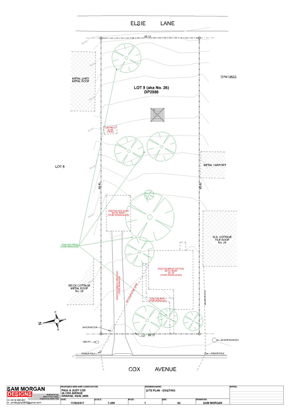
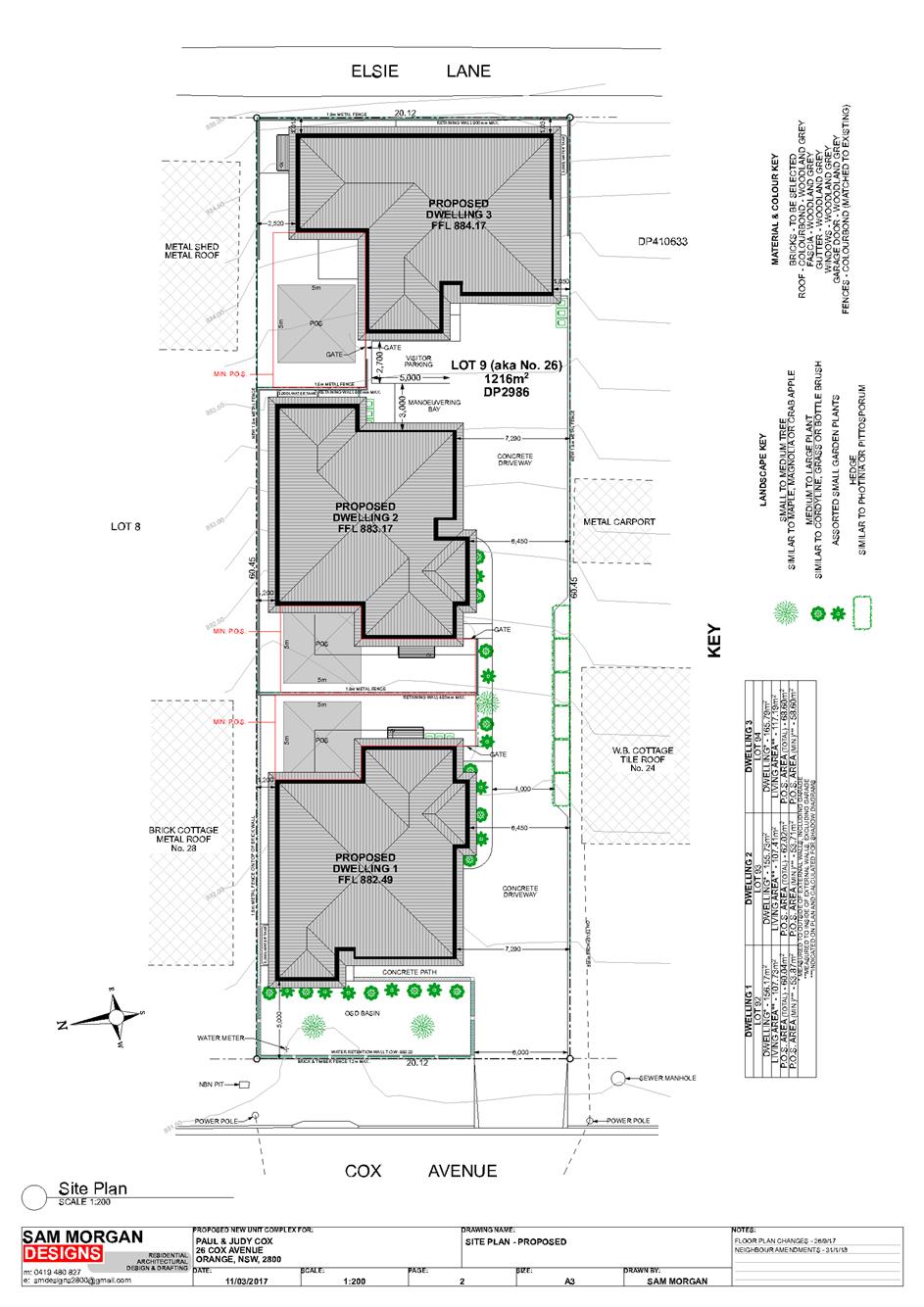
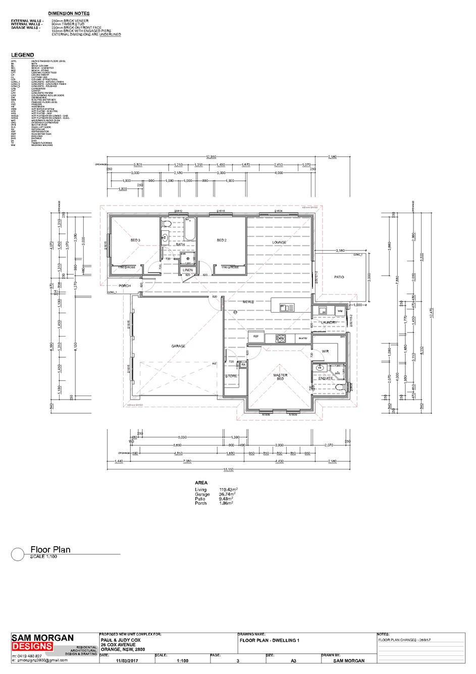
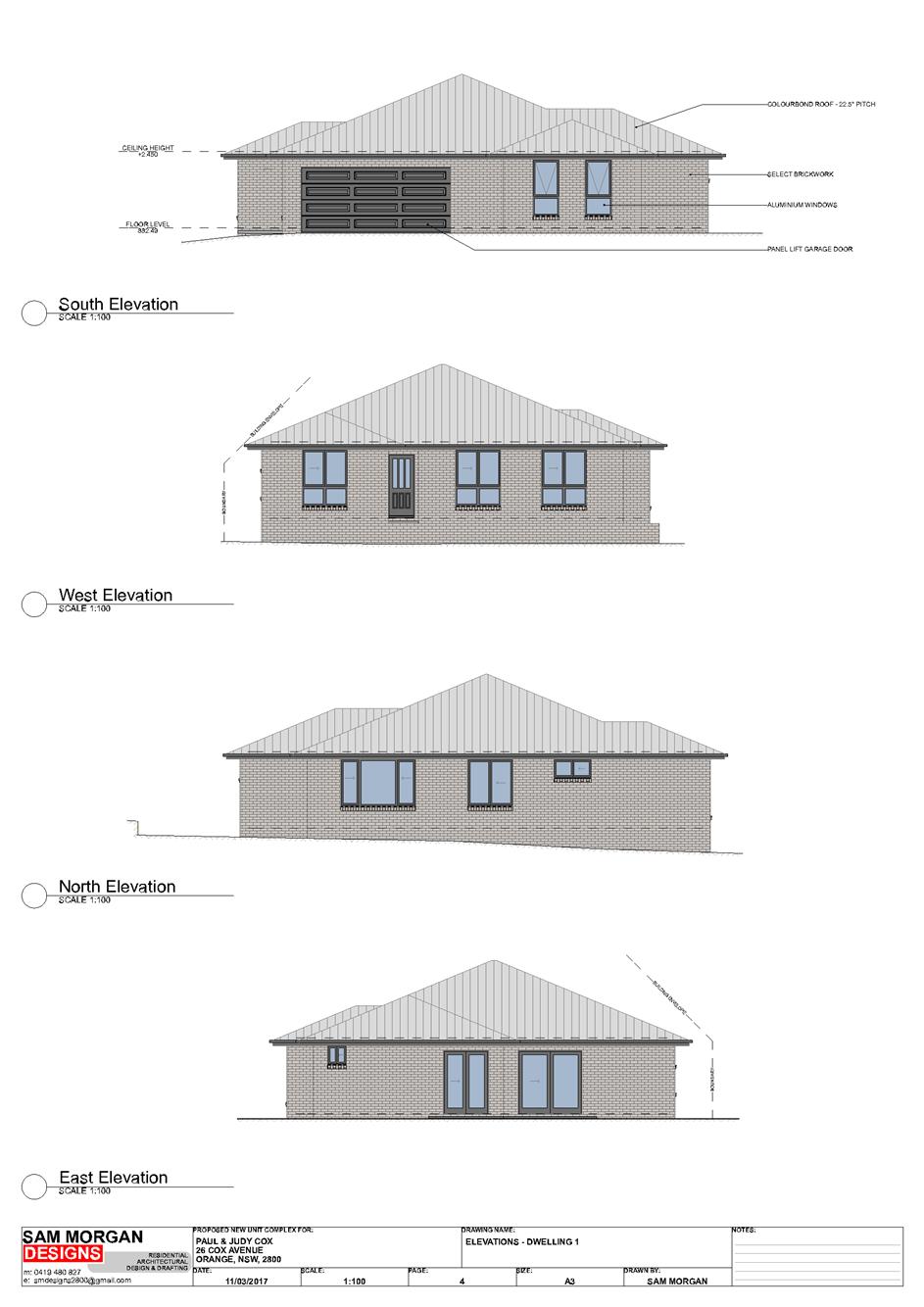
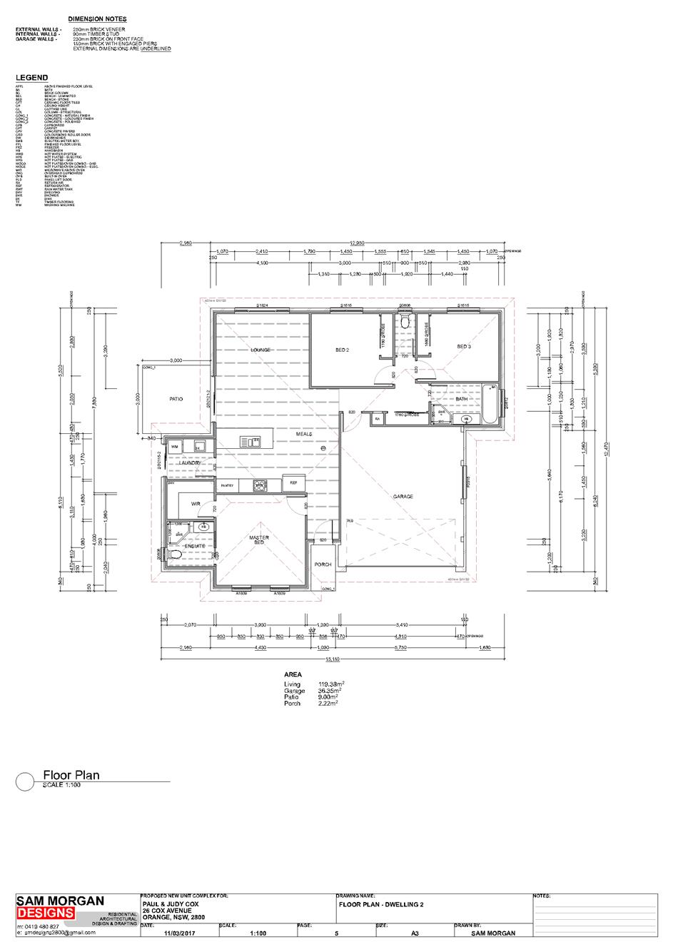
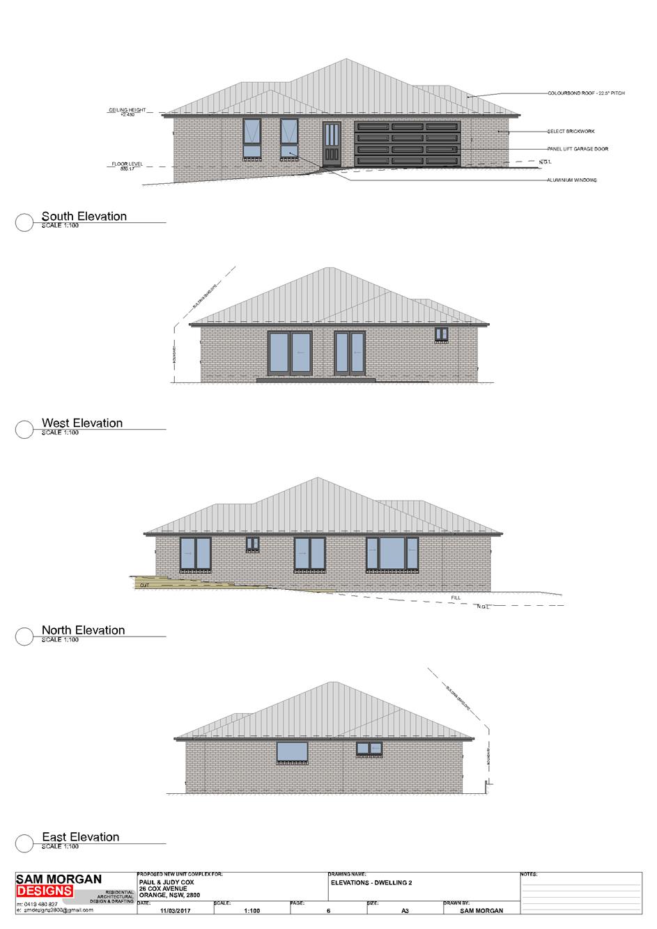
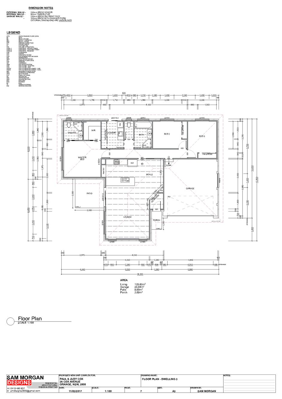
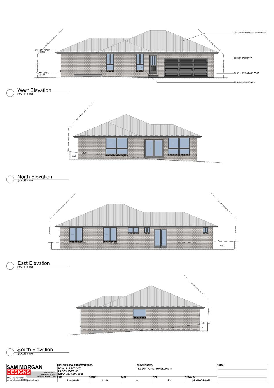
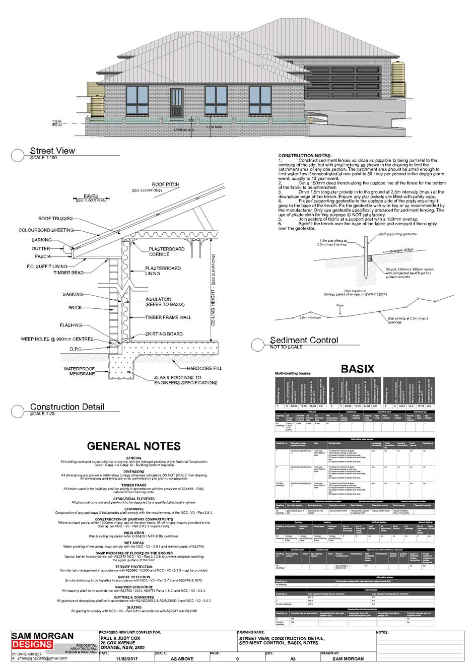
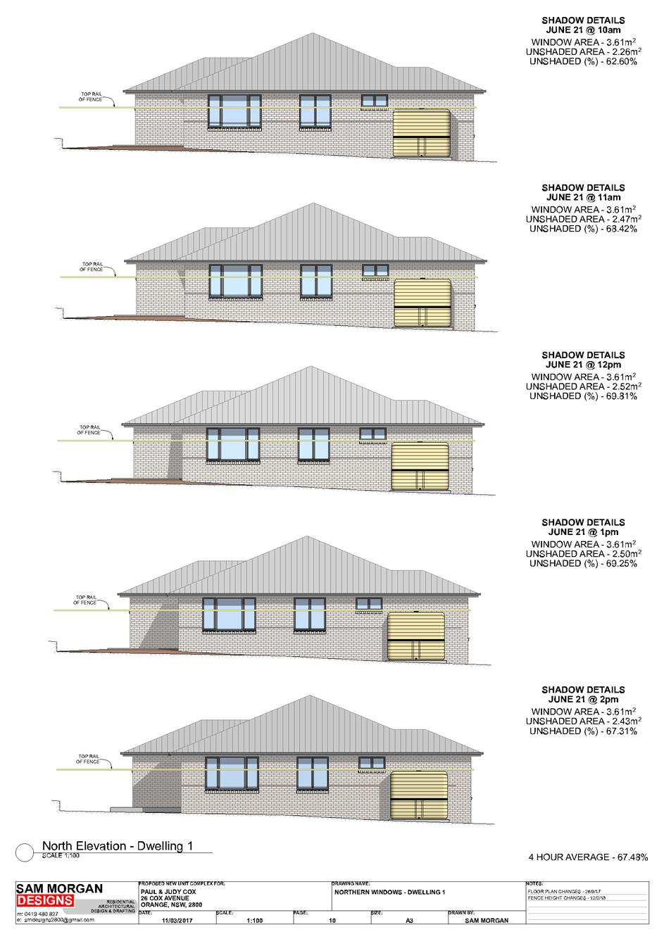
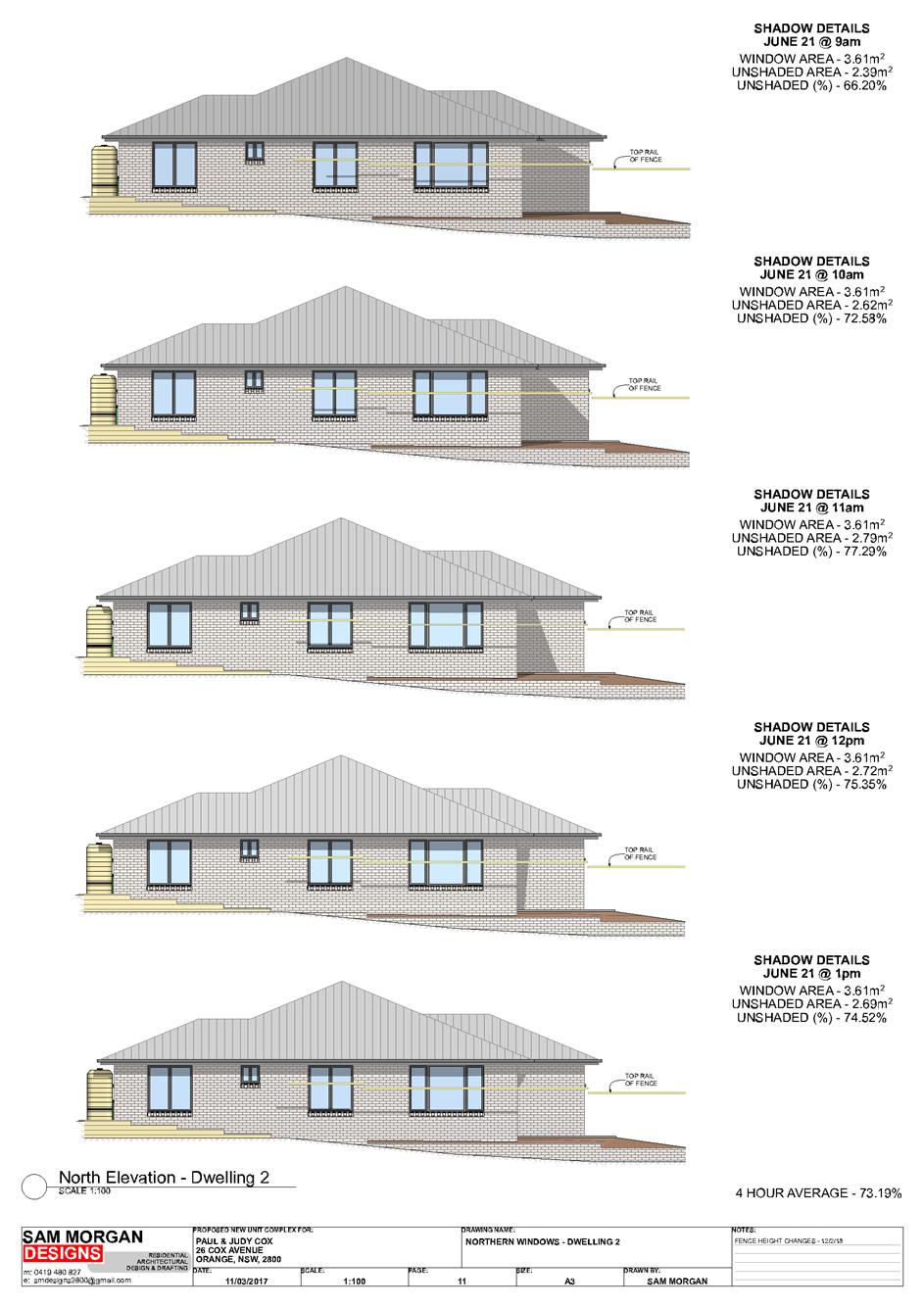
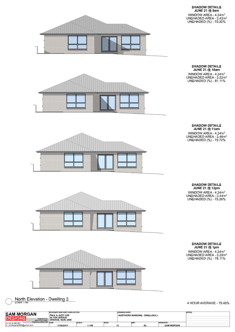
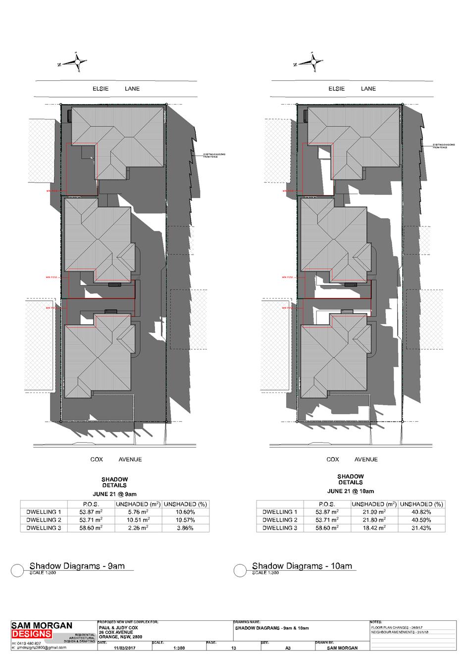
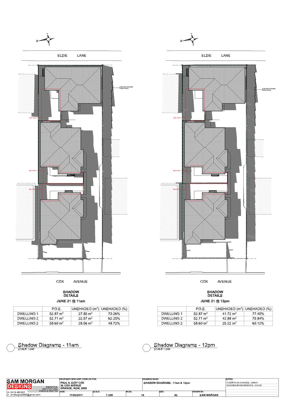
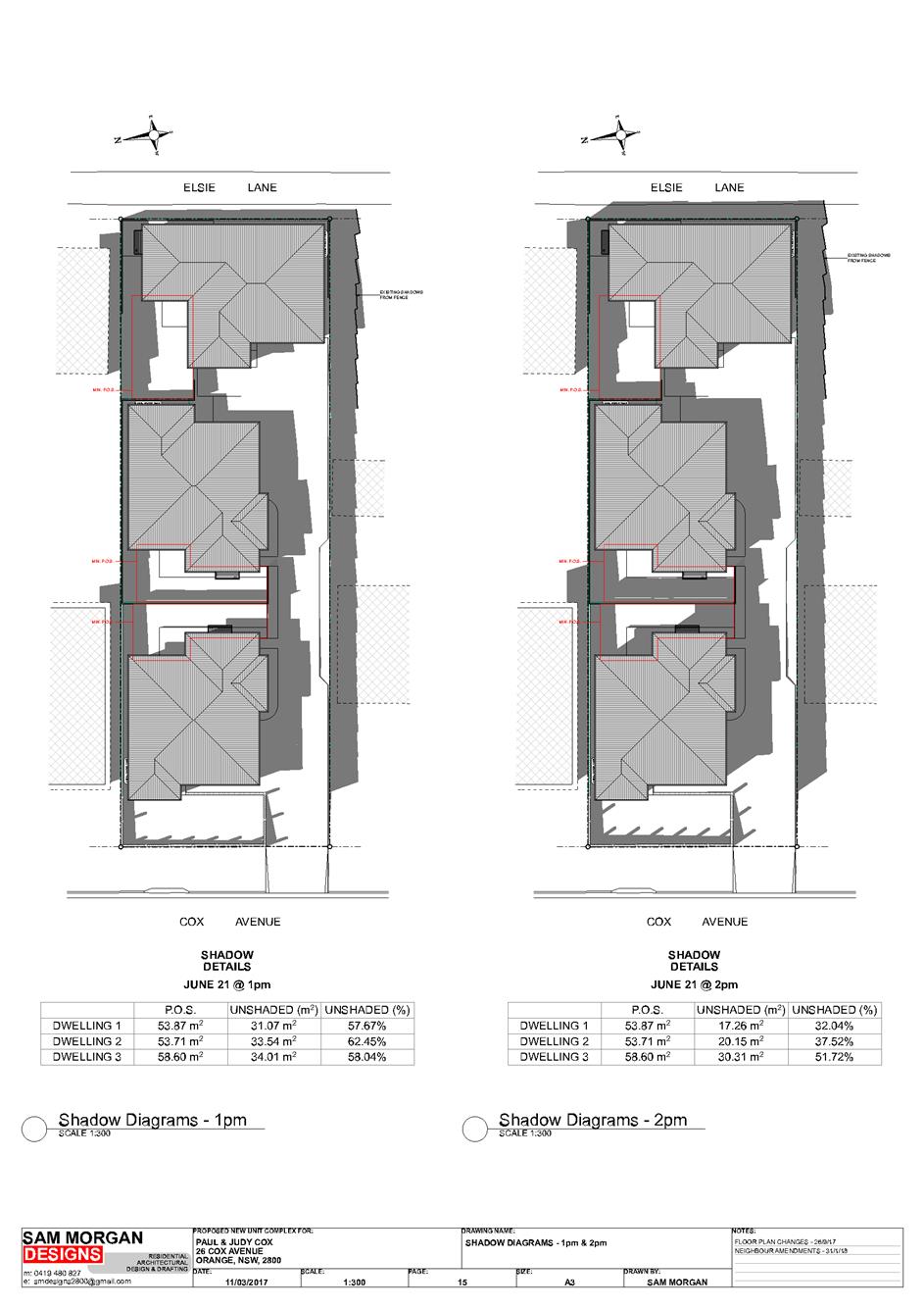
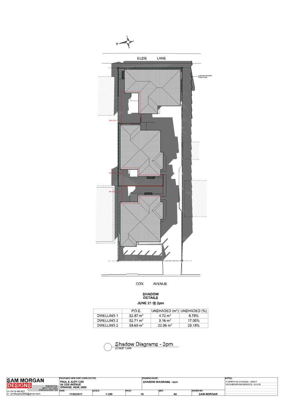
Planning and Development Committee
3 April 2018
2.3 Development
Application DA 309/2017(1) - 26 Cox Avenue
Attachment 2 Plans
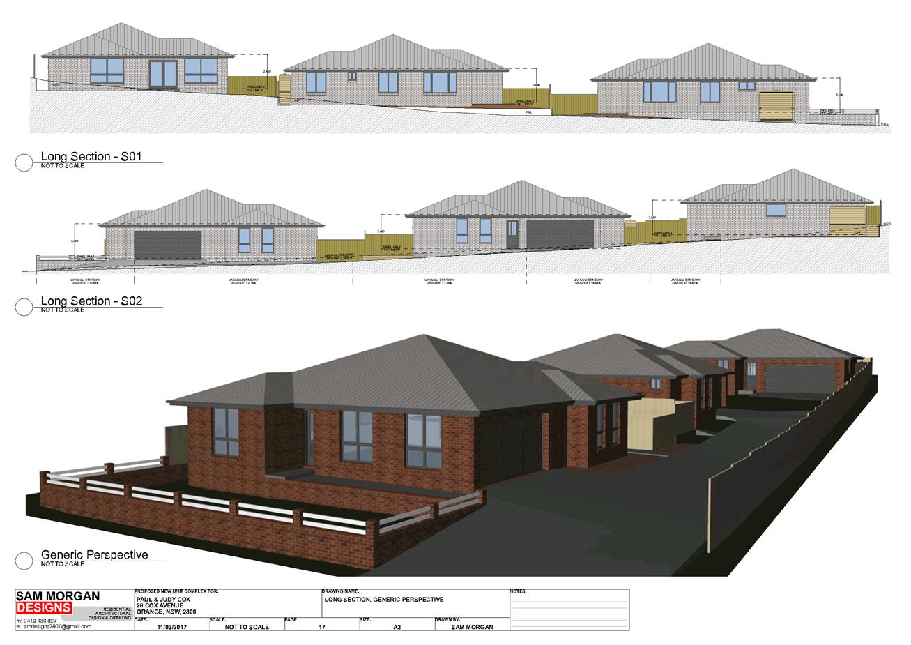
Planning and Development Committee
3 April 2018
2.3 Development
Application DA 309/2017(1) - 26 Cox Avenue
Attachment 2 Plans
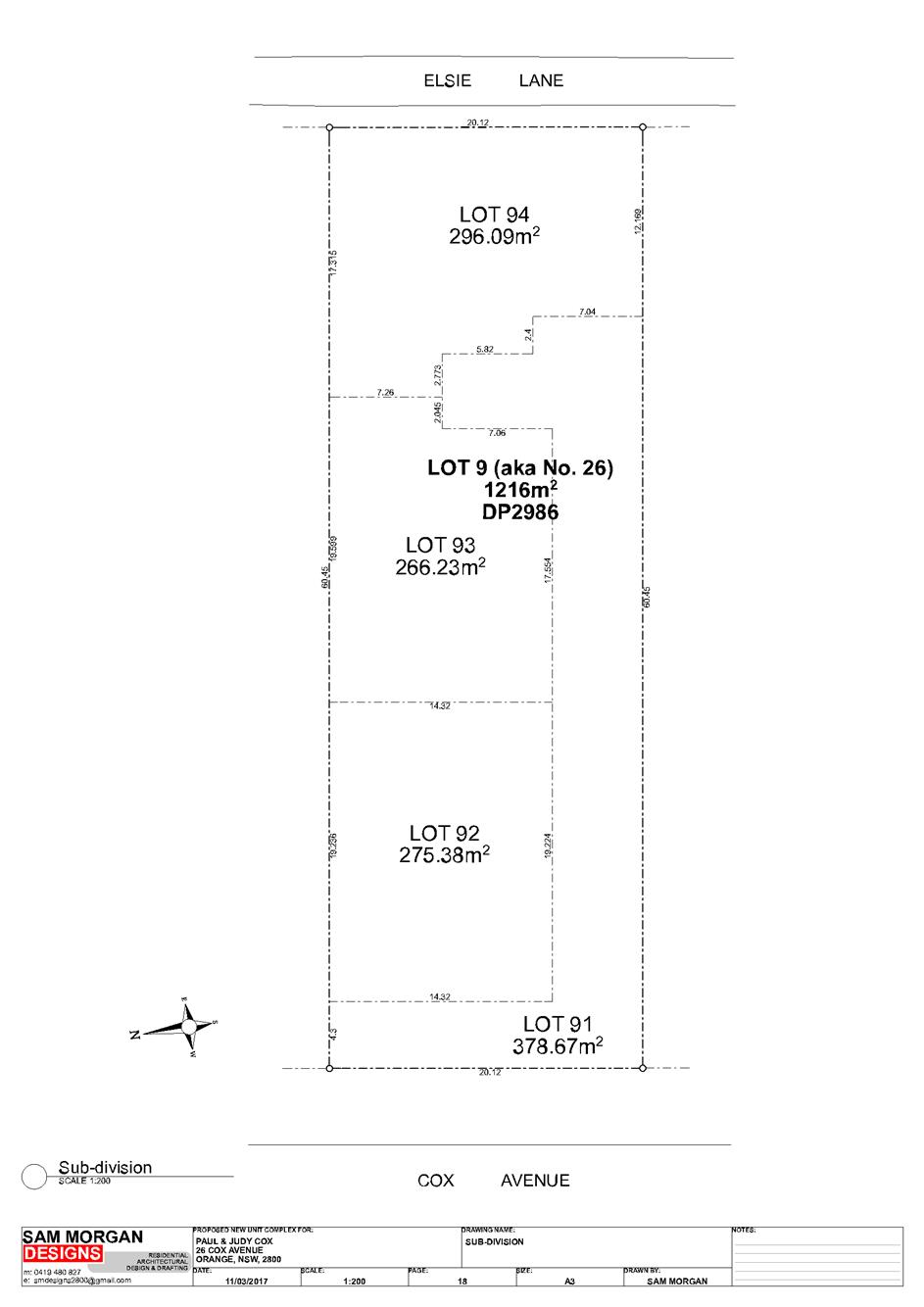
Planning and Development Committee
3 April 2018
2.3 Development
Application DA 309/2017(1) - 26 Cox Avenue
Attachment 3 Submissions
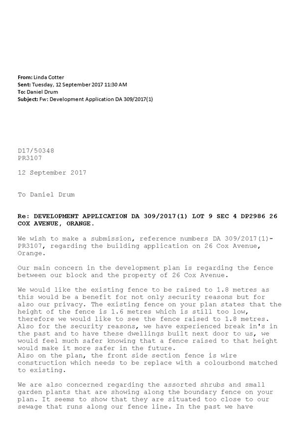
2.4 Development
Application DA 442/2017(1) - 122 McLachlan Street
RECORD
NUMBER: 2018/703
AUTHOR: Summer
Commins, Senior Planner
EXECUTIVE Summary
|
Application
lodged
|
23 November 2017
|
|
Applicant/s
|
Bassmann Drafting Services
|
|
Owner/s
|
Mustang Rocks Pty Ltd and 2Pursue
Mr Gini Pty Ltd
|
|
Land
description
|
Lot 172 DP 1238302 - 122 McLachlan
Street, Orange
|
|
Proposed
land use
|
Boarding House (four boarding
houses), Subdivision (four lot Strata) and Demolition (tree removal)
|
|
Value of
proposed development
|
$1,930,000
|
Council’s consent is sought for development of land at
122 McLachlan Street, Orange, for the purpose of boarding houses. The
development application (DA) was considered at the Planning and Development
Committee Meeting on 6 March 2018. A copy of the assessment report to the
Committee is attached for Council’s perusal and should be read in
conjunction with this supplementary planning report. The Committee resolved to
defer determination of the original application pending design revisions that
are appropriate to the conservation setting.
Amended plans have been submitted to address Council’s
resolution. This report provides a supplementary assessment of the matters
relevant to the proposed changes to the design. The building design now
incorporates a Dutch gable roof profile and contemporary detailing. Council’s
Heritage Advisor is reasonably satisfied with the amended design, subject to
mitigation conditions in relation to external finishes.
It is considered that the amended building design (subject
to conditions) will be compatible with the localised built form and will
satisfy the conservation and character provisions contained in Orange Local
Environmental Plan (the LEP) 2011, Development Control Plan 2004 Infill
Guidelines and State Environmental Planning Policy (Affordable Rental Housing)
2009 (the SEPP).
The amended building design affects alterations to visual
bulk and solar access associated with the proposed boarding houses. Minor
alterations to landscape design, vehicle areas and waste management are also
proposed. The impacts of the amended proposal are considered to be within
reasonable limit and consistent with development guidelines contained in the
DCP and SEPP. Council officers are satisfied with the design revisions, subject
to mitigation conditions.
Approval of the application is recommended, subject to
conditions outlined in the attached Notice of Approval.
DIRECTOR’S COMMENT
In response to Council’s resolution seeking a more
appropriate design, the applicant has submitted a revised design that further
respects the heritage context of the area. The attached Notice includes
recommended conditions of consent that will ensure that the development
suitably integrates with the surrounding heritage precinct.
Link To Delivery/OPerational Plan
The recommendation in this report relates to the
Delivery/Operational Plan strategy “13.4 Our Environment
– Monitor and enforce regulations relating to City amenity”.
Financial Implications
Nil
Policy and Governance Implications
Nil
|
Recommendation
That Council consents to
development application DA 442/2017(1)
for Boarding House (four boarding houses), Subdivision (four lot Strata)
and Demolition (tree removal) at Lot 172 DP 1238302 - 122
McLachlan Street, Orange, pursuant to the
conditions of consent in the attached Notice of Approval.
|
further considerations
Consideration has been given to the recommendation’s
impact on Council’s service delivery; image and reputation; political;
environmental; health and safety; employees; stakeholders and project
management; and no further implications or risks have been identified.
SUPPORTING INFORMATION
Council’s consent is sought for development of land at
122 McLachlan Street, Orange, for the purpose of boarding houses.
The proposal involves construction of four x two-storey
buildings, each containing five or six self-contained double rooms and a communal
living room. Shared outdoor open space areas will be provided for each
building, together with private courtyards for some of the rooms. Onsite
vehicle parking will be available. The boarding houses will provide residential
accommodation for lodgers for three months or more. A four lot Strata
subdivision is also proposed to excise each building/boarding house on a
separate Strata lot.
The DA was considered at the Planning and Development
Committee Meeting on 6 March 2018. A copy of the assessment report to the
Committee is attached for Council’s perusal and should be read in
conjunction with this report. As previously reported, the subject land is
located in the East Orange Heritage Conservation Area.
Council’s Heritage Advisor and staff considered that the
initial building design for the proposed boarding houses was incompatible with
the character of the local area. It was on this basis that the proposal was
considered contrary to the conservation and character provisions contained in
Orange LEP 2011, DCP 2004 Infill Guidelines and SEPP (Affordable Rental
Housing) 2009.
The Planning and Development Committee subsequently
resolved:
|
RESOLVED - 18/001 Cr
T Mileto/Cr K Duffy
That Council defer determination of development
application DA 442/2017(1) for Boarding
House (four boarding houses), Subdivision (four lot Strata) and Demolition
(tree removal) at Lot 172 DP 1238302 – 122
McLachlan Street, Orange and the applicant be requested to redesign the
development to comply with the requirements of Council’s Infill
Guidelines, the provisions of Clause 5.10(4) of Orange Local Environmental
Plan 2011, and the provisions of Clause 30A of State Environmental
Planning Policy (Affordable Rental Housing) 2009 in terms of its impact upon
the character of the locality and the Heritage Conservation Area in general.
|
Amended plans have now been submitted in response to the
Committee’s resolution. The matters arising as a consequence of the
revisions to the building design and site layout are considered below.
Impacts on Conservation Setting
The building design has been
amended to provide a Dutch gable roof profile as depicted below. It is noted
that the skillion roof type originally proposed was considered a departure from
the built form in this setting.
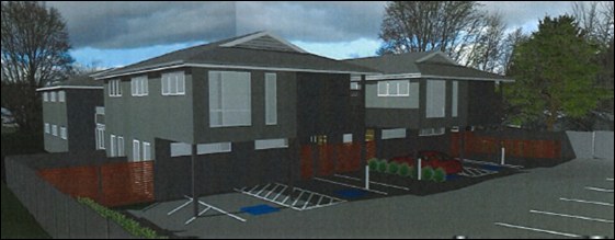
Figure 1 - amended proposal: front (western) elevation
and parking area
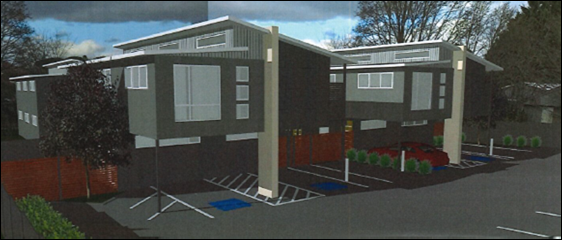
Figure 2 - original proposal: front (western)
elevation and parking area
The proposed building will otherwise retain modern styling,
with contemporary fenestration (window arrangement) and balustrades, and mix of
painted wall cladding at first floor level.
Council’s Heritage Advisor is satisfied with the
alternative Dutch gable roof profile, but raised concerns in relation to the
proposed contemporary finishes. The following comments in this regard were
provided:
“The drawings and the
relevant elevations do not accurately reflect the likely appearance which would
result from the use of the contemporary materials. While Council fully supports
good contemporary design, this is a heritage conservation area and not the
place for what is shown.
The applicant has not
appreciated the issues raised to date and the level of compromise has not been
seen as an opportunity. The solution is near at hand and can be sympathetic
with the general approach adopted and supported by Council in other matters in
the conservation area. I would hope the applicant can appreciate
Council’s desire to maintain high standards in these sought after
precincts.”
Council’s Heritage Advisor has consistently maintained
throughout assessment of the development application that the general design,
materials selection and fenestration are contemporary, and have minimal
elements which relate to the conservation area. Notwithstanding, the Heritage
Advisor is amenable to supporting the amended building design, subject to a
mitigation condition requiring the use of horizontal expressed board fibre
cladding to the first floor level. This will ‘ensure that the exterior
is sympathetic with the conservation area and nearby traditional buildings.’
A condition to this effect is included in the attached Notice of Approval.
Based on the foregoing, it is considered that the built form
will be reasonably compatible with localised built form, and will satisfy the
conservation and character provisions contained in Orange LEP 2011 DCP 2004
Infill Guidelines and SEPP (Affordable Rental Housing) 2009.
Visual Bulk
The revised Dutch gable roof profile will have a maximum
building height of 8.8m, being 0.4m higher than the clerestory roof
originally proposed. The visual bulk impacts associated with the amended
proposal are generally consistent with the planning outcomes contained in DCP
2004, as follows:
· Side and rear
setbacks for the proposed boarding houses will exceed typical residential
setbacks and generally relate to the setbacks on adjoining lots to the north
and south.
· Site coverage for
the development will comprise 24.3% and not exceed the maximum site coverage
for residential development (ie 50% for the nearest equivalent landuse of multi
dwelling housing).
· Negligible
earthworks will be required.
· The proposed
buildings will be contained within the DCP-prescribed visual bulk envelope
plane, except for minor eave encroachments.
· The proposed
boarding houses will be located at the rear of the site on a battleaxe parcel.
Buildings A and B will be set back some 38m from the McLachlan Street
frontage and at the rear of the existing cottage at 124 McLachlan Street.
· Due
to the fall of the land towards the rear boundary, the buildings will not
exceed the height of the existing cottage at the site frontage, as demonstrated
in plan view below:
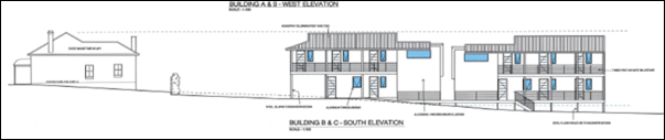
Figure 3 - southern elevation of site with existing
cottage and proposed boarding houses
· A separation of
some 21m will be provided between the cottage at 124 McLachlan Street
and nearest Buildings A and B. Similarly, Building A will be sited some
15m from the adjoining dwelling to the south at 120 McLachlan Street.
The distances provided between the proposed boarding houses and adjoining
dwellings will be sufficient to prevent visual bulk encroachment by the
development on adjoining improvements.
· At the highest
point (8.8m for the rear facades of Buildings C and D) the buildings are
well-removed from the McLachlan Street frontage and the adjoining dwellings to
the north and south. Whilst the buildings are large in dimension and will
introduce a new visual element in this setting, it is considered that the
development will not visually encroach upon adjoining dwellings.
Solar Access
The amended gable roof profile will have a maximum building
height of 8.8m, being 0.4m higher than the clerestory roof originally
proposed. The shadow impacts associated with the amended building design are
within reasonable limit, both within the development site and on the adjoining
southern parcel.
In relation to land to the south, shadow diagrams with
calculations have been submitted in support of the proposal. As demonstrated,
the proposed development will alter existing solar access for the
adjoining dwelling to the south at 120 McLachlan Street. However,
sufficient solar access will be maintained to north-facing windows and the main
private open space area between approximately 11am and 3pm, consistent with the
DC guidelines (ie 75% of north‑facing windows for four
hours; and 40% of the required open space area for three hours).
SEPP (Affordable Rental Housing) 2009 requires that communal
living rooms within boarding houses receive three hours direct sunlight
between 9am and 3pm (Clause 29(2)(c)). Window shadow elevations
were submitted with the revised proposal and demonstrate compliance with this
requirement between 10.30am and 1.30pm.
Landscape Design
The amended proposal involves revised landscaping of the
site, including retention of a Maple (Aver sp.) and associated tree
protection zone on the southern boundary. Council’s Manager City
Presentation advises that ‘the proponent has identified the landscape
issues that require addressing.’ Conditions are included in the
attached Notice of Approval in relation to site landscaping requirements.
Waste Facilities
The amended proposal includes revised waste management
facilities for the boarding houses. The proposed bin enclosure on the northern
side of the access driveway will provide bin storage on collection days only.
Permanent bin enclosures are now proposed in the car park (adjacent to car
spaces numbered 9 and 14) on the northern and southern boundaries of the site.
The permanent bin enclosures are reasonably removed from
dwellings on adjoining lands to maintain amenity. Council’s Manager City
Presentation raised no objection to a permanent bin enclosure within the tree
protection zone associated with the retained Maple.
The proponent will enter into a private waste pick-up
contract for the servicing of bins. The resident manager will place bins in the
driveway bin enclosure on collection days only, and return bins to permanent
enclosures in the car park after servicing. Conditions are included in the
attached Notice of Approval to reflect this arrangement.
Council’s Technical Services Division has advised that
a minimum of 12 bins will be required for the development (6 garbage (red), 4
recycling (yellow) and 2 organic (green)). The proposed development makes
provision for 16 bins.
Vehicle Areas
The amended plans show relocation of two parallel motor
cycle parking spaces on the northern side of the access driveway (relocation of
the spaces is required to accommodate bin enclosures in the car park). This
arrangement is suitable for manoeuvring. Council’s Manager City
Presentation raised no objection to car spaces numbered 13 and 14
within/partly within the tree protection zone for the retained Maple tree. Vehicle
parking for the development (cars, motor cycles and bicycles) will be provided
in compliance with SEPP (Affordable Rental Housing) 2009.
SUMMARY
Council’s consent is sought for development of land at
122 McLachlan Street, Orange, for the purpose of boarding houses.
The proposed building design has been amended, consistent
with the resolution of the Planning and Development Committee on 6 March 2018. The
building design now incorporates a Dutch gable roof profile and contemporary
detailing. Council’s Heritage Advisor is reasonably satisfied with the
amended design in the conservation area setting, subject to mitigation
conditions in relation to external finishes.
It is considered that the amended building design (subject
to conditions) will be reasonably compatible with the localised built form. The
proposal is now considered to be consistent with the planning regime that
applies to the particular landuse and subject land. Approval of the application
is recommended.
Attachments
1 Notice
of Approval, D18/15147⇩
2 Plans,
D18/14724⇩
3 PDC
report of 6 March 2018, 2018/517⇩
Planning and Development Committee
3 April 2018
2.4 Development
Application DA 442/2017(1) - 122 McLachlan Street
Attachment 1 Notice
of Approval
|

|
ORANGE
CITY COUNCIL
Development
Application No DA
442/2017(1)
NA18/ Container
PR8272
|
NOTICE OF DETERMINATION
OF A DEVELOPMENT
APPLICATION
issued under the Environmental
Planning and Assessment Act 1979
Section 4.18
|
Development
Application
|
|
|
Applicant Name:
|
Bassmann
Drafting Services
|
|
Applicant Address:
|
PO Box 911
ORANGE
NSW 2800
|
|
Owner’s Name:
|
Mustang
Rocks Pty Ltd & 2Pursue Mt Gini Pty Ltd
|
|
Land to Be Developed:
|
Lot 172 DP
1238302 - 122 McLachlan Street, Orange
|
|
Proposed Development:
|
Boarding
House (four boarding houses),Subdivision (four lot Strata) and Demolition
(tree removal)
|
|
|
|
|
Building
Code of Australia
building
classification:
|
To be
determined by the Principal Certifying Authority
|
|
|
|
|
Determination
made under
Section 4.16
|
|
|
Made On:
|
3 April
2018
|
|
Determination:
|
CONSENT
GRANTED SUBJECT TO CONDITIONS DESCRIBED BELOW:
|
|
|
|
|
Consent to
Operate From:
|
4 April
2018
|
|
Consent to
Lapse On:
|
4 April
2023
|
Terms of Approval
The reasons for the imposition of
conditions are:
(1) To ensure a quality
urban design for the development which complements the surrounding environment.
(2) To maintain
neighbourhood amenity and character.
(3) To ensure compliance
with relevant statutory requirements.
(4) Because the development
will require the provision of, or increase the demand for, public amenities and
services.
(5) To ensure the utility
services are available to the site and adequate for the development.
(6) To prevent the proposed
development having a detrimental effect on adjoining land uses.
Conditions
(1) The
development must be carried out in accordance with:
(a) Plans
by Bassmann Drafting Services, Job No. 17.039: Drawing Nos. DA-01(M); DA-02(E);
DA-03(D); DA-04(F); DA-05(F) (5 sheets)
Draft Strata Plan by Timothy Collins Ref.
21216ST (3 sheets)
(b) statements
of environmental effects or other similar associated documents that form part
of the approval
as amended
in accordance with any conditions of this consent.
(2) All building work must
be carried out in accordance with the provisions of the Building Code of
Australia.
(3) A sign is to be erected
in a prominent position on any site on which building work, subdivision work or
demolition work is being carried out:
(a) showing
the name, address and telephone number of the principal certifying authority
for the work, and
(b) showing
the name of the principal contractor (if any) for any building work and a
telephone number on which that person may be contacted outside working hours,
and
(c) stating
that unauthorised entry to the site is prohibited.
Any such sign is to be maintained while the
building work, subdivision work or demolition work is being carried out.
(4) In the case
of residential building work for which the Home Building Act 1989
requires there to be a contract of insurance in force in accordance with Part 6
of the Act, evidence that such a contract of insurance is in force is to be
provided to the Principal Certifying Authority before any building work
authorised to be carried out by the consent commences.
(5) Residential
building work within the meaning of the Home Building Act 1989 must not
be carried out unless the principal certifying authority for the development to
which the work relates (not being the council) has given the council written
notice of the following information:
(a) in
the case of work for which a principal contractor is required to be appointed:
(i) the
name and the licence number of the principal contractor, and
(ii) the
name of the insurer by which the work is insured under Part 6 of that Act,
(b) in
the case of work to be done by an owner-builder:
(i) the
name of the owner-builder, and
(ii) if
the owner-builder is required to hold an owner-builder permit under that Act,
the number of the owner-builder permit.
If arrangements for doing the
residential building work are changed while the work is in progress so that the
information under this condition becomes out of date, further work must not be
carried out unless the principal certifying authority for the development to
which the work relates (not being the council) has given the council written
notice of the updated information.
(6) Where any excavation
work on the site extends below the level of the base of the footings of a
building on adjoining land, the person having the benefit of the development
consent must, at the person’s own expense:
(a) protect
and support the adjoining premises from possible damage from the excavation,
and
(b) where
necessary, underpin the adjoining premises to prevent any such damage.
Note: This
condition does not apply if the person having the benefit of the development
consent owns the adjoining land or the owner of the adjoining land has given
consent in writing to this condition not applying.
BOARDING HOUSES
|
PRIOR TO THE ISSUE OF
A CONSTRUCTION CERTIFICATE
|
(7) Full
details of external colours and finishes of external materials shall be
submitted and approved by Council’s Manager Development Assessments prior
to issue of a Construction Certificate. The finishes schedule shall incorporate
horizontal expressed board fibre cement cladding to the first floor of the proposed
boarding houses.
(8) Suitable
privacy screening shall be installed adjacent to the entrances to boarding
rooms on the first floor verandahs to the southern elevations of Buildings A
and D. Details of screening shall be included in the Construction Certificate
drawings.
(9) A
detailed landscape plan, compiled by a suitably qualified landscape architect
shall be submitted for approval of Council’s Manager City Presentation
prior to issue of a Construction Certificate. The landscape plan shall
incorporate the following particulars:
· retention of the Maple
tree and establishment of a planted tree protection zone (TPZ);
· plan, cross-section and
specification of the permeable gravel surface in the Maple tree TPZ identifying
how the permeable surface is to be constructed, and in particular if any cut
and fill is required;
· detailed plant schedule
identifying low maintenance ground covers through to specimen trees, including
exotic deciduous species;
· intermittent screen
planting to the southern (side) boundary adjacent to 120 McLachlan Street, of
sufficient height to minimise overlooking from Buildings A and D entrance
verandahs;
· screen planting to the
western (front) boundary adjacent to 124 McLachlan Street;
· additional plantings to
the eastern (rear) boundary appropriate to the flood risk precinct;
· additional plantings to
the southern side of the access driveway to soften hardstand.
(10) The payment of
$92,135.79 is to be made to Council in accordance with Section 94 of the Act
and the Orange Development Contributions Plan 2017 (LGA Contributions Area)
towards the provision of the following public facilities:
|
Open Space and
Recreation
|
22 additional 1
bedroom boarding rooms @ $1,641.58
less 1 standard lot @
$3,891.67
|
32,223.09
|
|
Community and
Cultural
|
22 additional 1
bedroom boarding rooms @ $476.06
less 1 standard lot @
$1,128.59
|
9,344.73
|
|
Roads and Traffic
Management
|
22 additional 1
bedroom boarding rooms @ $2,417.35
less 1 standard lot @
$5,136.89
|
48,044.81
|
|
Plan Preparation
& Administration
|
22 additional 1
bedroom boarding rooms @ $128.54
less 1 standard lot @
$304.72
|
2,523.16
|
|
TOTAL:
|
|
$92,135.79
|
The contribution will be indexed quarterly in
accordance with the Orange Development Contributions Plan 2017 (LGA
Contributions Area). This plan can be inspected at the Orange Civic Centre,
Byng Street, Orange.
(11) Engineering plans
providing complete details of the proposed driveway and car parking areas are
to be submitted to Orange City Council or an Accredited Certifier (Categories
B1, C3, C4, C6) upon application for a Construction Certificate. These plans
are to provide details of levels, cross falls of all pavements, proposed
sealing materials, structural engineer’s details of the driveway
indicating compliance with the NSW Fire Brigades Guidelines for Emergency
Vehicle Access, proposed drainage works, and are to be in accordance with
Orange City Council Development and Subdivision Code. The driveway within the
battle-axe handle shall be a minimum clear width of 4.5m and designed in
accordance with NSW Fire Brigades Guidelines for Emergency Vehicle Access.
(12) Payment of
contributions for water, sewer and drainage works is required to be made
at the contribution rate applicable at the time that the payment is made. The
contributions are based on 6.26 ETs for water supply headworks and 10.0
ETs for sewerage headworks. A Certificate of Compliance, from Orange City
Council in accordance with the Water Management Act 2000, will be issued
upon payment of the contributions.
This Certificate of Compliance is to be
submitted to the Principal Certifying Authority prior to the issuing of a
Construction Certificate.
(13) A water and soil
erosion control plan is to be submitted to Orange City Council or an Accredited
Certifier (Categories B1, C3, C4, C6) for approval prior to the issuing of a
Construction Certificate. The control plan is to be in accordance with the
Orange City Council Development and Subdivision Code and the Landcom, Managing
Urban Stormwater; Soils and Construction Handbook.
(14) The development’s
stormwater design is to include stormwater detention within the development,
designed to limit peak outflows from the land to the pre-existing natural
outflows up to the 100 year ARI frequency, with sufficient allowance in
overflow spillway design capacity to safely pass flows of lower frequency (that
is, a rarer event) without damage to downstream developments. Where
appropriate, the spillway design capacity is to be determined in accordance
with the requirements of the Dam Safety Committee.
The design of the detention storage is to be
undertaken using the ILSAX/DRAINS rainfall-runoff hydrologic model or an
approved equivalent capable of assessing runoff volumes and their temporal
distribution as well as peak flow rates. The model is to be used to calculate
the flow rates for the existing and post-development conditions. The developed
flows are to be routed through the proposed storage within the model so that
the outflows obtained are no greater than the flows obtained for the
pre-existing natural flows. A report detailing the results of the analysis,
which includes:
· catchment
plan showing sub-catchments under existing and developed conditions;
· schematic
diagram of the catchment model showing sub areas and linkages;
· tabulation
detailing the elevation, storage volume and discharge relationships; and
· tabulation
for the range of frequencies analysed, the inflows, outflows and peak storage
levels for both existing and developed conditions;
together with copies of the data files for the
model and engineering design plans of the required drainage system are to be
submitted to Orange City Council upon application for a Construction
Certificate.
(15) All stormwater from the
site is to be collected and piped to the existing interlot drainage system
within the site. Orange City Council or an Accredited Certifier (Categories B1,
C3, C4, C6), prior to the issuing a Construction Certificate, is to approve
engineering plans for this stormwater system.
(16) A single common water
service and meter shall be located in the driveway area. The plans shall also
detail compliance with NSW Fire and Rescue – Fire Hydrants for Minor
Residential Development. Engineering plans of the water reticulation layout
and sizing are to be submitted to Orange City Council for approval prior to the
issuing of a Construction Certificate.
(17) Prior to the issue of a
Construction Certificate the plans shall be amended in accordance with the
following:
· no filling of the site
is to occur between the existing natural ground contour level of 864.40m AHD
(1% AEP flood level) and the eastern boundary. No above ground structures apart
from Buildings C and D and associated access decks shall be permitted in this
area;
· Buildings C and D shall
have the finished floor level established by the underside of the lowest floor
support structural elements being above 864.40m AHD (1% AEP flood level) with
the finished floor level of buildings C and D being no less than the 1% AEP
flood level plus 500mm (864.90m AHD);
· the underfloor area of
Buildings C and D shall be unenclosed and supported on piers only. All piers
and other structural elements shall be designed to resist stream flow
pressure, force exerted by debris, buoyancy and sliding forces caused by the 1%
AEP flood;
· all
materials used in the construction of the buildings shall be flood compatible
to a minimum level equivalent to a 1% AEP flood level plus 500 mm (864.90m AHD);
· all
electrical connections shall be located above the 1% AEP flood level plus 500
mm (864.90m
AHD). All electrical circuit connections shall be automatically
isolated in the event of flood waters having the potential to gain access to
exposed electrical circuits, either internal or external of the building; and
· any gate or fence
within the flood prone area located below 864.40m AHD shall be an open palisade
style.
|
PRIOR TO WORKS
COMMENCING
|
(18) Following clearing of
approved site vegetation (Elm trees and Elm sucker growth) the Maple tree
located immediately south of the common boundary and upon 120 McLachlan Street
shall have Tree Protection Zone (TPZ) fencing established at a 6 metre radius
form the centre of the tree’s stem.
The TPZ fence shall be appropriately sign
posted in accordance with AS 4970 – 2009 Protection of trees on
development sites. The fence shall remain in place until approval is
obtained from Council’s Manager City Presentation and works to install
the permeable surface are to commence.
(19) A
Construction Certificate application is required to be submitted to, and issued
by Council/Accredited Certifier prior to any excavation or building works being
carried out onsite.
(20) A
temporary onsite toilet is to be provided and must remain throughout the
project or until an alternative facility meeting Council’s requirements
is available onsite.
(21) Soil erosion control
measures shall be implemented on the site.
|
DURING
CONSTRUCTION/SITEWORKS
|
(22) All tree work shall be
undertaken by a suitably qualified arborist, including the removal of Elm
trees, Elm tree sucker growth and pruning of the Maple tree as required to
clear the building envelope in accordance with AS4373 – 2007 Pruning of
amenity trees.
(23) If
Aboriginal objects, relics or other historical items or the like are located
during development works, all works in the area of the identified object, relic
or item shall cease, and the NSW Office of Environment and Heritage and
representatives from the Orange LALC shall be notified. Where required, further
archaeological investigation shall be undertaken. Development works in the area
of the find(s) may recommence if and when outlined by the management strategy,
developed in consultation with and approved by the OEH.
(24) All
construction/demolition work on the site is to be carried out between the hours
of 7.00 am and 6.00 pm Monday to Friday inclusive, 7.00 am to
5.00 pm Saturdays and 8.00 am to 5.00 pm Sundays and Public
Holidays. Written approval must be obtained from the General Manager of Orange
City Council to vary these hours.
(25) A
Registered Surveyor’s certificate identifying the location of the
building on the site must be submitted to the Principal Certifying Authority.
(26) All
materials onsite or being delivered to the site are to be contained within the
site. The requirements of the Protection of the Environment Operations Act
1997 are to be complied with when placing/stockpiling loose material or
when disposing of waste products or during any other activities likely to
pollute drains or watercourses.
(27) Any adjustments to
existing utility services that are made necessary by this development
proceeding are to be at the full cost of the developer.
(28) The
provisions and requirements of the Orange City Council Development and
Subdivision Code are to be applied to this application and all work constructed
within the development is to be in accordance with that Code.
The developer is to be entirely responsible for
the provision of water, sewerage and drainage facilities capable of servicing
the development from Council’s existing infrastructure. The developer is
to be responsible for gaining access over adjoining land for services where
necessary and easements are to be created about all water, sewer and drainage
mains within and outside the lots they serve.
(29) All driveway and
parking areas are to be sealed with bitumen, hot mix or concrete and are to be
designed for all expected loading conditions (provided however that the minimum
pavement depth for gravel and flush seal roadways is 200mm) and be in
accordance with the Orange City Council Development and Subdivision Code.
(30) The existing sewer main
that crosses the site is to be accurately located. Where the main is positioned
adjacent to any building work, measures are to be taken in accordance with
Orange City Council Policy - Building over and/or adjacent to sewers ST009.
|
PRIOR TO THE ISSUE OF
AN OCCUPATION CERTIFICATE
|
(31) Landscaping
shall be installed in accordance with the amended and approved landscaping plan
to the satisfaction of Council's Manager Development Assessments.
Tree removal and pruning works shall be
undertaken in accordance with the amended and approved landscaping plan to the
satisfaction of Council’s Manager City Presentation.
(32) Onsite vehicle parking
shall be provided on the land consistent with the approved plan, and in accordance
with Council’s Development and Subdivision Code, prior to issue of an
occupation certificate.
(33) Perimeter fencing shall
be established on the land consistent with the approved plan.
(34) The proponent shall
enter into a private service arrangement with a waste contractor for the
collection of garbage, recycling and organic waste associated with the
development. Details of the service arrangement shall be provided to Council
prior to issue of an Occupation Certificate.
(35) No
person is to use or occupy the building or alteration that is the subject of
this approval without the prior issuing of an Occupation Certificate.
(36) The
owner of the building/s must cause the Council to be given a Final Fire Safety
Certificate on completion of the building in relation to essential fire or
other safety measures included in the schedule attached to this approval.
(37) Where
Orange City Council is not the Principal Certifying Authority, a final
inspection of water connection, sewer and stormwater drainage shall be
undertaken by Orange City Council and a Final Notice of Inspection issued,
prior to the issue of either an interim or a final Occupation Certificate.
(38) The cut and
fill is to be retained and/or adequately battered and stabilised (within the
allotment) prior to the issue of an Occupation Certificate.
(39) A Certificate of
Compliance, from a Qualified Engineer, stating that the stormwater detention
basin complies with the approved engineering plans is to be submitted to the
Principal Certifying Authority prior to the issuing of an Occupation
Certificate.
(40) Certification from
Orange City Council is required to be submitted to the Principal Certifying
Authority prior to the issue of an Occupation Certificate stating that all
works relating to connection of the development to Council assets, works on
public land, works on public roads, stormwater, sewer and water reticulation
mains and footpaths have been carried out in accordance with the Orange City
Council Development and Subdivision Code and the foregoing conditions, and that
Council will take ownership of the infrastructure assets.
(41) All
of the foregoing conditions are to be at the full cost of the developer and to
the requirements and standards of the Orange City Council Development and
Subdivision Code, unless specifically stated otherwise. All work required by
the foregoing conditions is to be completed prior to the issuing of an
Occupation or Subdivision Certificate, unless stated otherwise.
|
MATTERS FOR THE
ONGOING PERFORMANCE AND OPERATION OF THE DEVELOPMENT
|
(42) Operation
and management of the development shall comply with the Boarding Houses
Act 2012 and the Boarding Houses Regulation 2013.
(43) The boarding house
shall be occupied by lodgers for a minimum stay of 3 months.
(44) A separate development
application shall be submitted to and approved by Council prior to the erection
of any advertising structures or signs of a type that do not meet the exempt
development provisions of State Environmental Planning Policy (Exempt and
Complying Development Codes) 2008.
(45) No
sandwich boards or the like are to be placed on Council’s footpath.
(46) Site
landscaping, consistent with the amended and approved landscaping plan shall be
permanently maintained to the satisfaction of Council's Manager Development
Assessments.
(47) Bins
shall be placed in the driveway bin enclosure on collection days only.
Kerbside placement of bins is not permitted. At other times, bins shall be
stored in the permanent bin enclosures in the vehicle parking area.
Council may require additional bins be
provided, should waste generation associated with the development exceed the
approved bin numbers.
(48) Any
ancillary light fittings fitted to the building or located within the vehicle
parking area shall be shielded or mounted in a position to minimise glare to
adjoining properties.
(49) All vehicle movements
to and from the land shall be in a forward direction.
Vehicle parking in the access driveway is not
permitted (excepting approved motor cycle spaces numbered 1 and 2).
(50) The site is subject to
flooding. Apart from the approved buildings, no other above ground structures
are to be constructed below the 864.40m AHD contour. All internal and external
fencing shall consist of an open palisade style and the approved buildings
shall maintain an open subfloor space.
(51) Emitted
noise shall not exceed 5dB(A) above background sound level measured at the
nearest affected residence.
(52) The
owner is required to provide to Council and to the NSW Fire Commissioner an
Annual Fire Safety Statement in respect of the fire-safety measures, as
required by Clause 177 of the Environmental Planning and Assessment
Regulation 2000.
|
MATTERS FOR CRIME
PREVENTION IN THE OPERATION OF THE DEVELOPMENT
|
Surveillance
(53) Closed
Circuit Television (CCTV) shall be installed on common areas, entry points and
vehicle parking areas.
(54) CCTV
shall be installed on the perimeter of the property and near letterbox
collection.
(55) CCTV
shall be recorded appropriately, kept for a minimum of 14 days and cameras
should be located in suitable locations to identify an individual from a recorded
image.
(56) Lighting
and CCTV shall be used during construction stage.
(57) Premises
shall be able to be viewed from the street and landscaping should be regularly
maintained.
(58) Suitable
lighting of the car park shall be provided onsite. Specific detail of the
lighting proposal shall be submitted to the Manager of Development Assessments
for approval prior to establishment.
(59) Lighting
shall be sufficient to assist identification of intruders and should not be
placed to the detriment of CCTV cameras.
(60) Of
particular importance is the lighting between the two buildings. Lighting in
this space shall be of good quality and it is recommended that this area be
covered by CCTV cameras.
Access Control
(61) Fences
shall be constructed of appropriately solid materials.
(62) External
doors and door frames should be of solid construction and fitted with quality
locksets.
(63) Peephole
door viewers should be installed.
(64) External
door hinges should be mounted so they cannot be removed.
(65) External
windows should be of solid construction and fitted with quality lock sets.
(66) Access
to car parking should be restricted to residents only.
Territorial Enforcement
(67) Street
number shall be clearly visible from the street, should be visible at night and
should be in a contrasting colour to the background.
(68) Directional
signage shall be displaced within the complex, clearly identifying the
Manager’s room, building names and room numbers.
(69) A
map of the complex shall be displayed.
(70) Appropriate
warning signs shall be displayed in relation to CCTV, securing property,
locking doors and fire safety.
Space and Activity Management
(71) Furniture
in communal areas should be of solid construction and should not contain items which
can be taken away from the area or used to gain entry into other parts of the
property.
STRATA SUBDIVISION
|
PRIOR TO THE ISSUE OF
A SUBDIVISION CERTIFICATE
|
(72) Prior
to the issue of a Subdivision Certificate, the applicant is to provide a written
statement that the building complies with the Building Code of Australia with
regard to fire separation and early warning systems.
(73) Application shall be
made for a Subdivision Certificate under Section 109(C)(1)(d) of the Act.
(74) Application is to be
made to Telstra/NBN for infrastructure to be made available to each individual
lot within the development. Either a Telecommunications Infrastructure
Provisioning Confirmation or Certificate of Practical Completion is to be
submitted to the Principal Certifying Authority confirming that the specified
lots have been declared ready for service prior to the issue of a Subdivision
Certificate.
(75) A Notice of Arrangement
from Essential Energy stating arrangements have been made for the provision of
electricity supply to the development, is to be submitted to the Principal
Certifying Authority prior to the issue of a Subdivision Certificate.
(76) All engineering
conditions of this development consent related to the servicing of the boarding
house development are to be completed prior to the issuing of a Subdivision
Certificate.
(77) Certification from
Orange City Council is required to be submitted to the Principal Certifying
Authority prior to the issue of a Subdivision Certificate stating that all
works relating to connection of the development to Council assets, works on
public land, works on public roads, stormwater, sewer and water reticulation
mains and footpaths have been carried out in accordance with the Orange City
Council Development and Subdivision Code and the foregoing conditions, and that
Council will take ownership of the infrastructure assets.
(78) All
of the foregoing conditions are to be at the full cost of the developer and to
the requirements and standards of the Orange City Council Development and
Subdivision Code, unless specifically stated otherwise. All work required by
the foregoing conditions is to be completed prior to the issuing of an
Occupation or Subdivision Certificate, unless stated otherwise.
(79) The
service
agreement for the disposal of solid wastes and recyclables specified in this
consent shall be incorporated into the Strata Management Statement, and shall
include a rule that the Strata Management Statement may only vary or delete the
requirement from their management statement with the agreement of Orange City
Council.
(1) The
site is subject to flooding. Apart from the approved buildings, no other above
ground structures are to be constructed below the 864.40m AHD contour. All
internal and external fencing shall consist of an open palisade style and the
approved buildings shall maintain an open subfloor space.
Other Approvals
(1) Local
Government Act 1993 approvals granted under section 68.
Water,
sewer and stormwater
(2) General
terms of other approvals integrated as part of this consent.
(1) All plumbing
and drainage (water supply, sanitary plumbing and drainage, stormwater drainage
and hot water supply) is to comply with the Local Government (Water,
Sewerage and Drainage) Regulation 1998, the Plumbing Code of
Australia 2016 - Plumbing & Drainage and Australian
Standard AS3500 - National Plumbing and Drainage Code. Such work is to be
installed by a licensed plumber and is to be inspected and approved by Council
prior to concealment.
(2) Orange
City Council is the Water and Sewer Authority for the Orange City Council area.
Therefore all water and sewer works must be inspected by Council. These
inspections CANNOT be carried out by a private certifier.
(3) The
following inspections are required to be carried out by Council as the Water
and Sewer Authority:
- internal
sewer
- hot
and cold water installation
- external
sewer
- stormwater
drainage
- final
on water, sewer and stormwater drainage and Council services.
Other Approvals (cont)
(2) General
terms of other approvals integrated as part of this consent (cont)
(4) Hot
water shall be stored at a minimum of 60OC and be delivered to all
sanitary fixtures used for personal hygiene (bathrooms/ensuites) at a
temperature not exceeding 50oC. Where tempering valves are
installed, a sign is to be permanently fixed on the hot water heater adjacent
to the tempering valve (clearly visible) indicating:
“A tempering valve has been
installed to prevent scalding. This valve is to be renewed at intervals as
recommended by the manufacturer.”
(5) The
location and depth of the sewer junction/connection to Council’s sewerage
system is to be determined to ensure adequate fall to the sewer is available.
(6) All services (water,
sewer and stormwater) shall be laid outside the easement unless there is a
direct connection to the main within that easement.
(7) All
stormwater is to be disposed of in a manner suitable to the site.
Right of Appeal
If you are dissatisfied with this
decision, Section 8.7 of the Environmental Planning and Assessment
Act 1979 gives you the right to appeal to the Land and Environment
Court. Pursuant to Section 8.10, an applicant may only appeal within 6 months
after the date the decision is notified.
|
Disability Discrimination Act
1992:
|
This application has been assessed in
accordance with the Environmental Planning and Assessment Act 1979. No
guarantee is given that the proposal complies with the Disability
Discrimination Act 1992.
The applicant/owner is responsible to
ensure compliance with this and other anti-discrimination legislation.
The Disability Discrimination Act
covers disabilities not catered for in the minimum standards called up in the
Building Code of Australia which references AS1428.1 - "Design for
Access and Mobility". AS1428 Parts 2, 3 and 4 provides the most
comprehensive technical guidance under the Disability Discrimination Act
currently available in Australia.
|
|
|
|
|
Disclaimer - S88B of the Conveyancing Act 1919
- Restrictions on the Use of Land:
|
The applicant should note that there
could be covenants in favour of persons other than Council restricting what
may be built or done upon the subject land. The applicant is advised to check
the position before commencing any work.
|
|
|
|
|
Signed:
|
On behalf of the consent authority ORANGE
CITY COUNCIL
|
|
Signature:
|
|
|
Name:
|
PAUL JOHNSTON - MANAGER DEVELOPMENT ASSESMENTS
|
|
Date:
|
4 April 2018
|
Planning
and Development Committee
3 April 2018
2.4 Development
Application DA 442/2017(1) - 122 McLachlan Street
Attachment 2 Plans
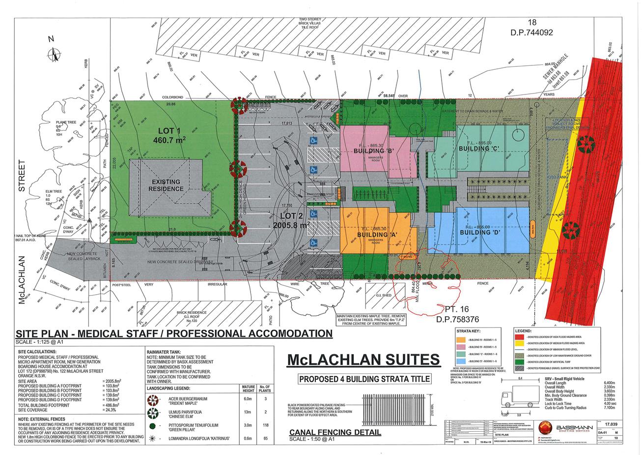
Planning and Development Committee
3 April 2018
2.4 Development
Application DA 442/2017(1) - 122 McLachlan Street
Attachment 2 Plans
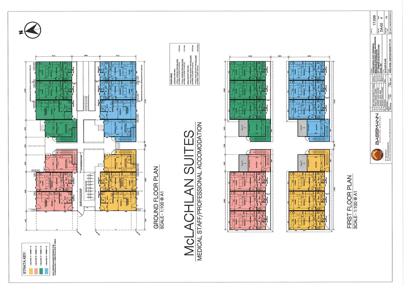
Planning and Development Committee
3 April 2018
2.4 Development
Application DA 442/2017(1) - 122 McLachlan Street
Attachment 2 Plans
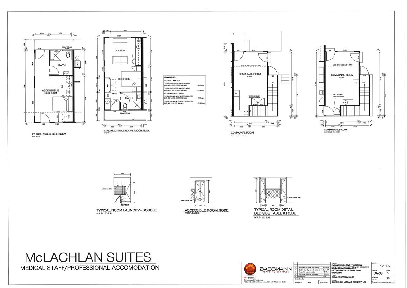
Planning and Development Committee
3 April 2018
2.4 Development
Application DA 442/2017(1) - 122 McLachlan Street
Attachment 2 Plans
Planning and Development Committee
3 April 2018
2.4 Development
Application DA 442/2017(1) - 122 McLachlan Street
Attachment 2 Plans
Planning and Development Committee
3 April 2018
2.4 Development
Application DA 442/2017(1) - 122 McLachlan Street
Attachment 2 Plans
Planning and Development Committee
3 April 2018
2.4 Development
Application DA 442/2017(1) - 122 McLachlan Street
Attachment 2 Plans
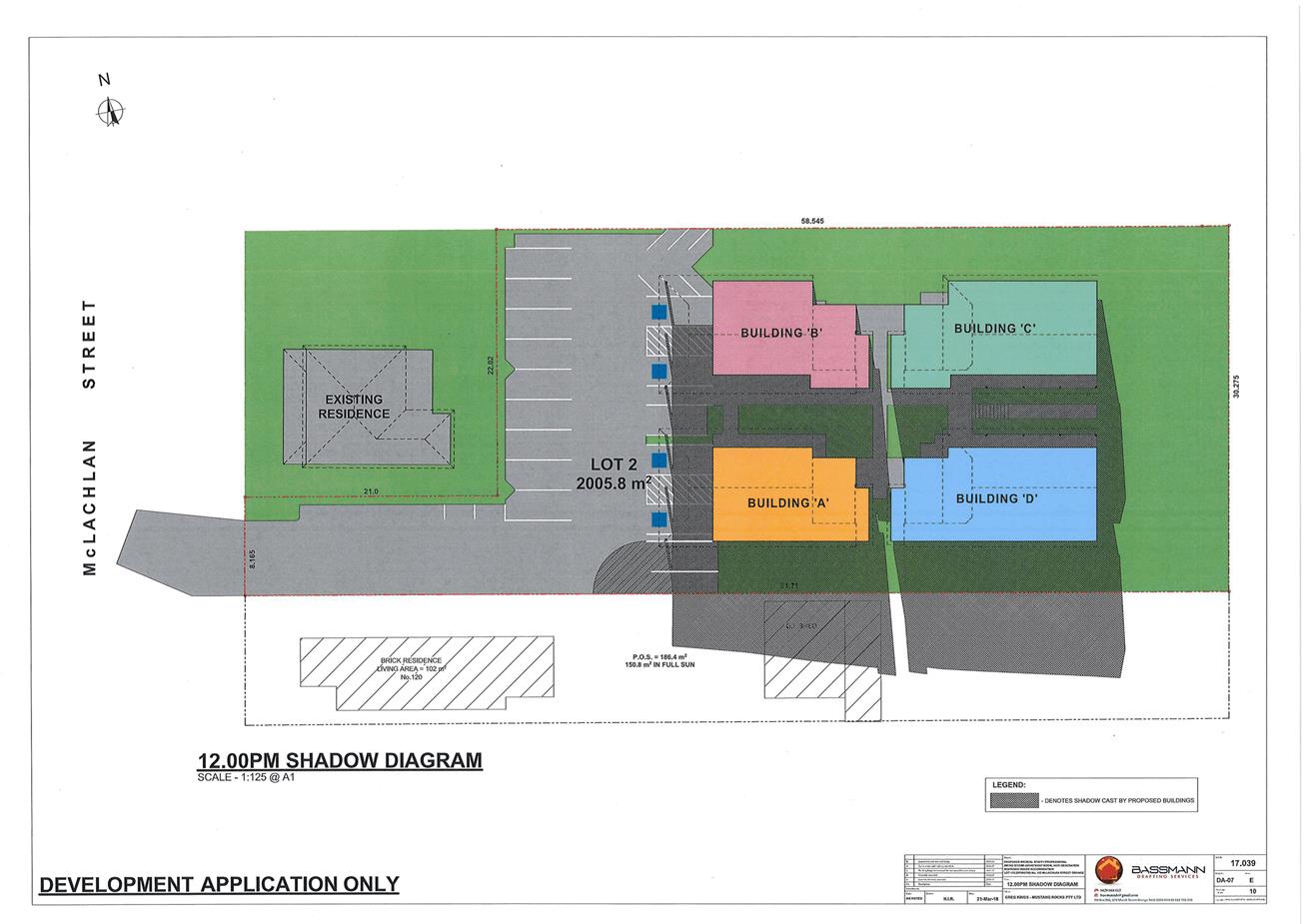
Planning and Development Committee
3 April 2018
2.4 Development
Application DA 442/2017(1) - 122 McLachlan Street
Attachment 2 Plans
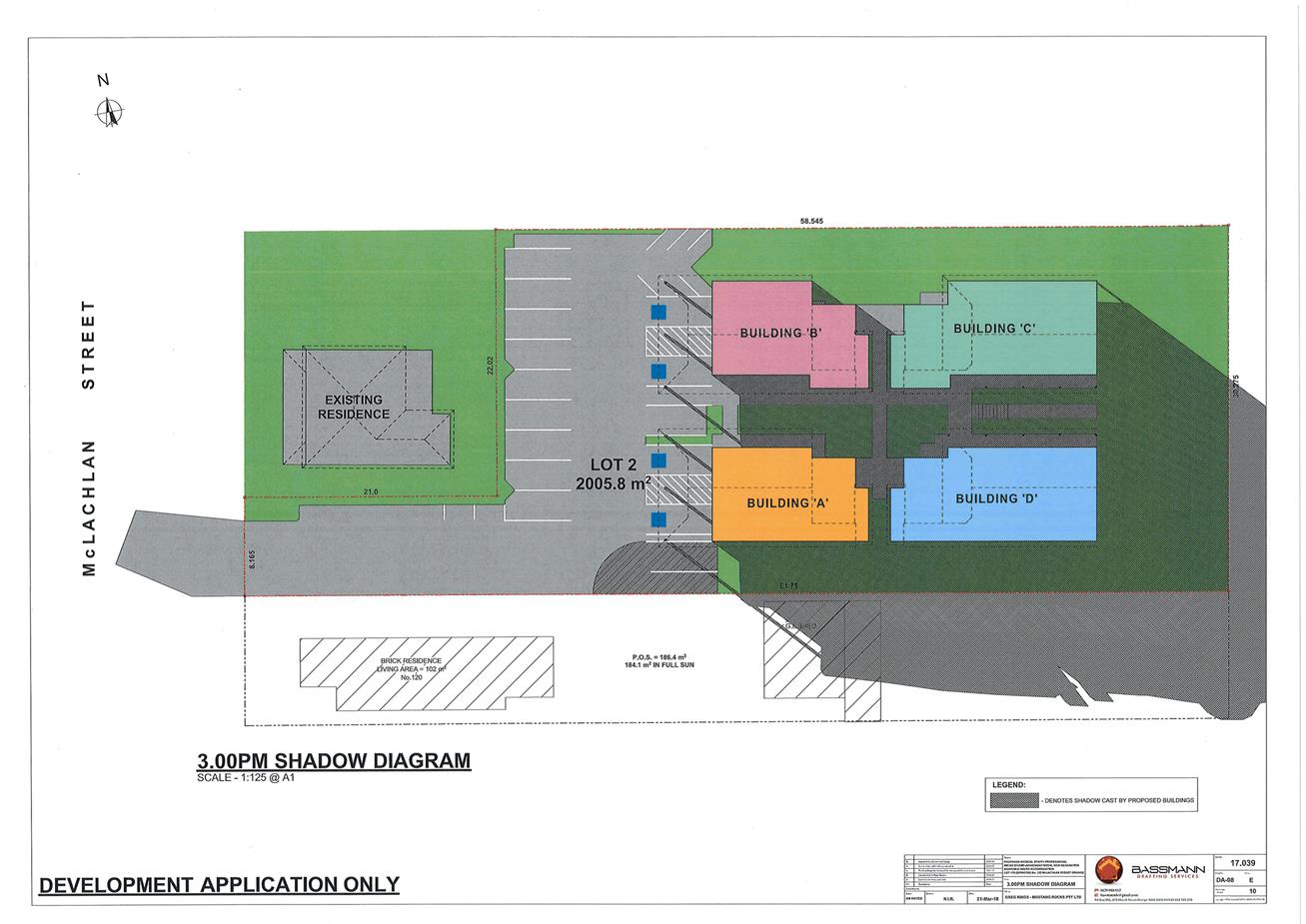
Planning and Development Committee
3 April 2018
2.4 Development
Application DA 442/2017(1) - 122 McLachlan Street
Attachment 2 Plans
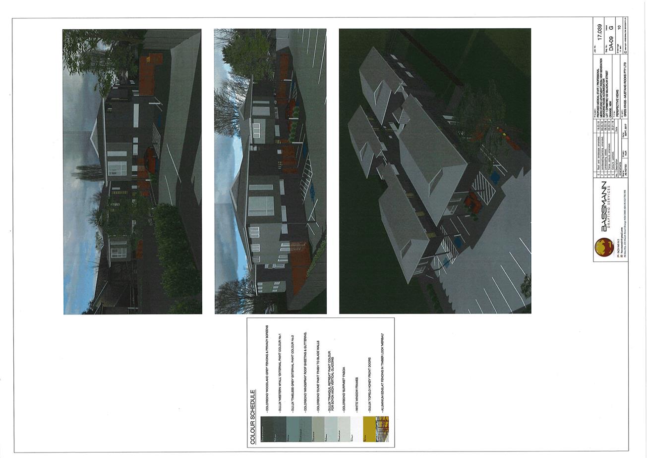
Planning and Development Committee
3 April 2018
2.4 Development
Application DA 442/2017(1) - 122 McLachlan Street
Attachment 2 Plans
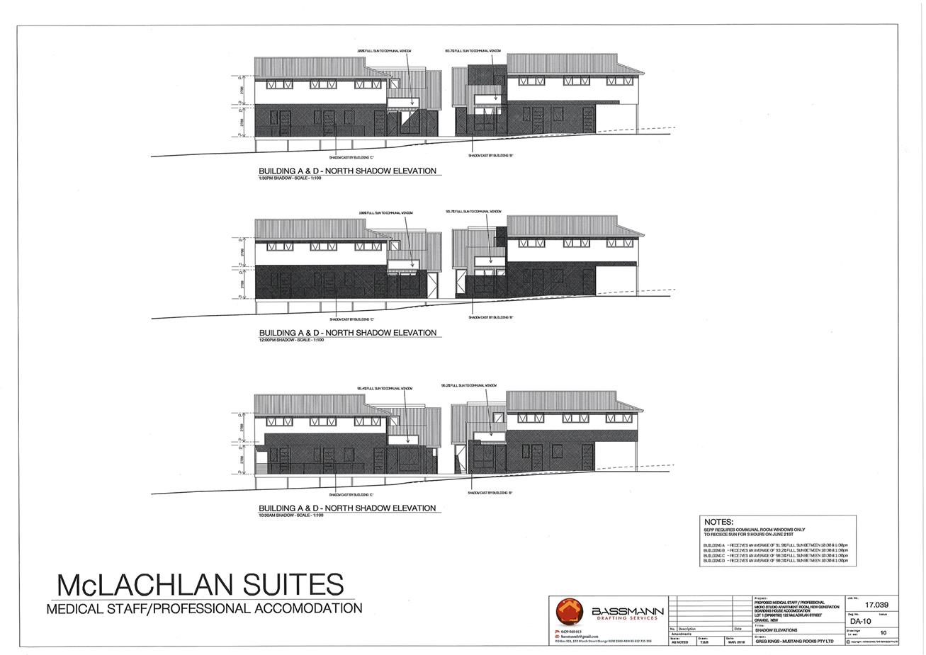
Planning and Development Committee
3 April 2018
2.4 Development
Application DA 442/2017(1) - 122 McLachlan Street
Attachment 2 Plans
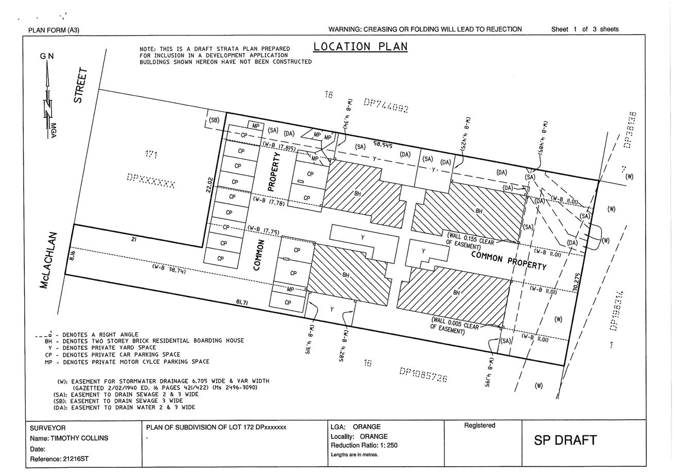
Planning and Development Committee
3 April 2018
2.4 Development
Application DA 442/2017(1) - 122 McLachlan Street
Attachment 2 Plans
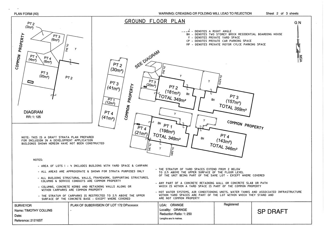
Planning and Development Committee
3 April 2018
2.4 Development
Application DA 442/2017(1) - 122 McLachlan Street
Attachment 2 Plans
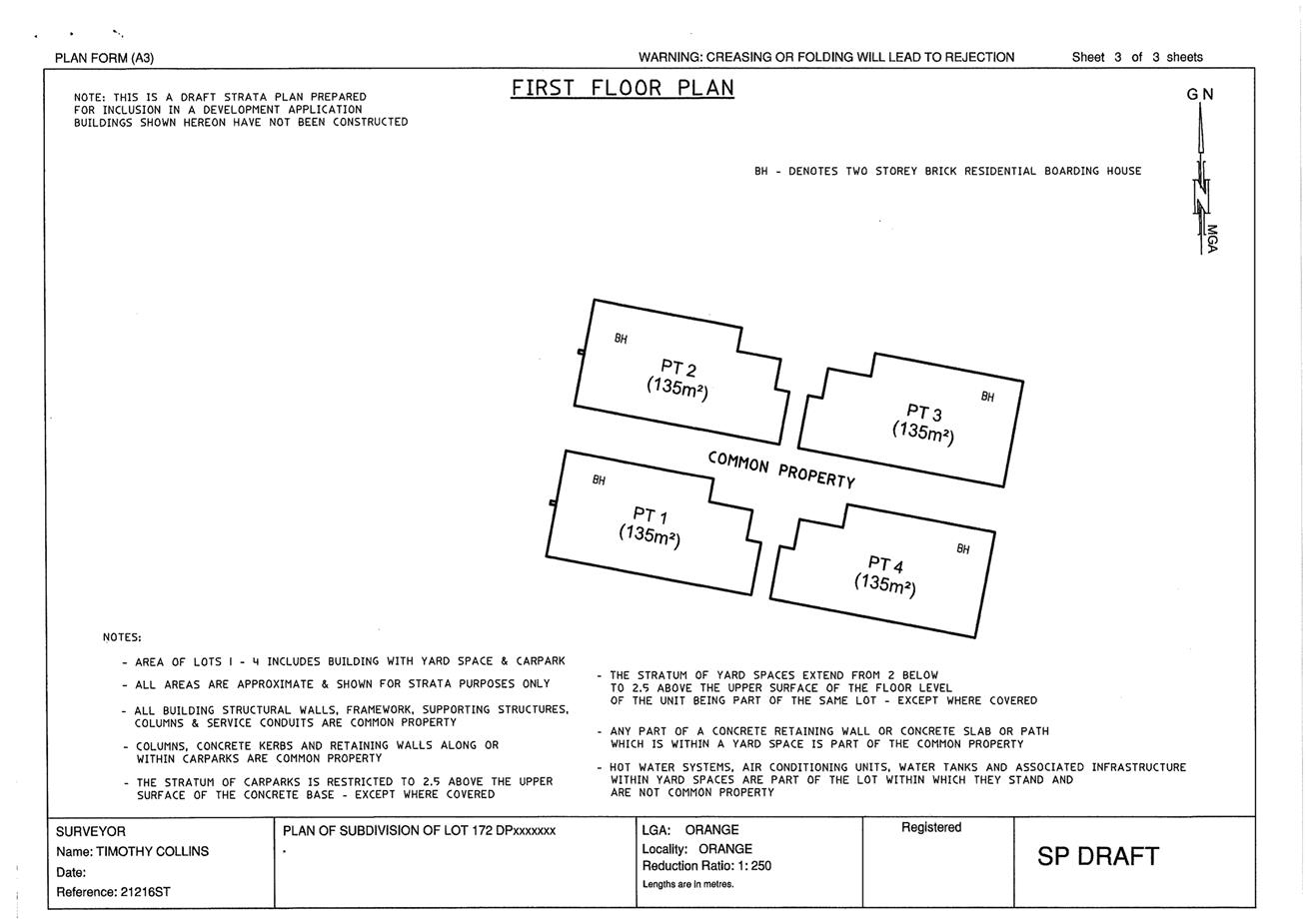
Planning and Development Committee
3 April 2018
2.4 Development
Application DA 442/2017(1) - 122 McLachlan Street
Attachment 3 PDC
report of 6 March 2018
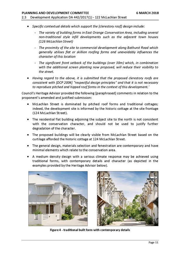
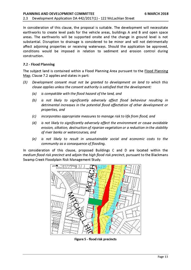
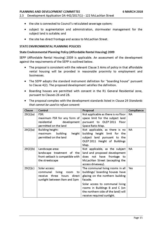
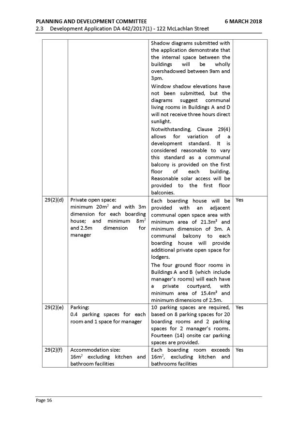
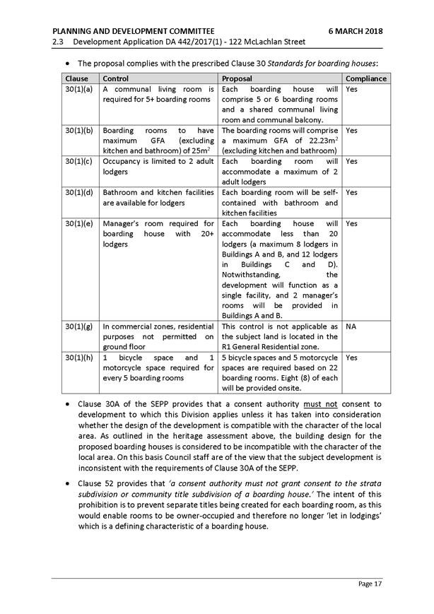
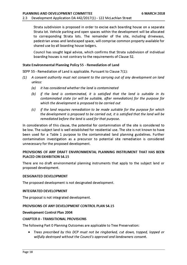
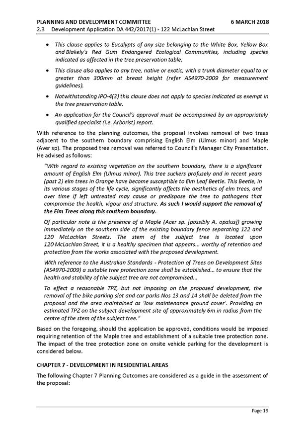
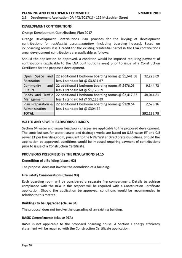

Planning and Development Committee
3 April 2018
2.4 Development
Application DA 442/2017(1) - 122 McLachlan Street
Attachment 3 PDC
report of 6 March 2018
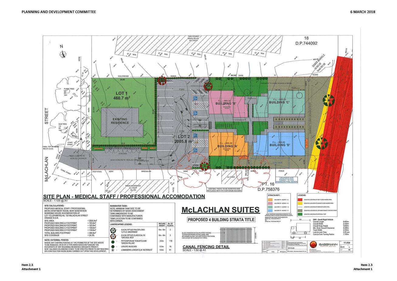
Planning and Development Committee
3 April 2018
2.4 Development
Application DA 442/2017(1) - 122 McLachlan Street
Attachment 3 PDC
report of 6 March 2018
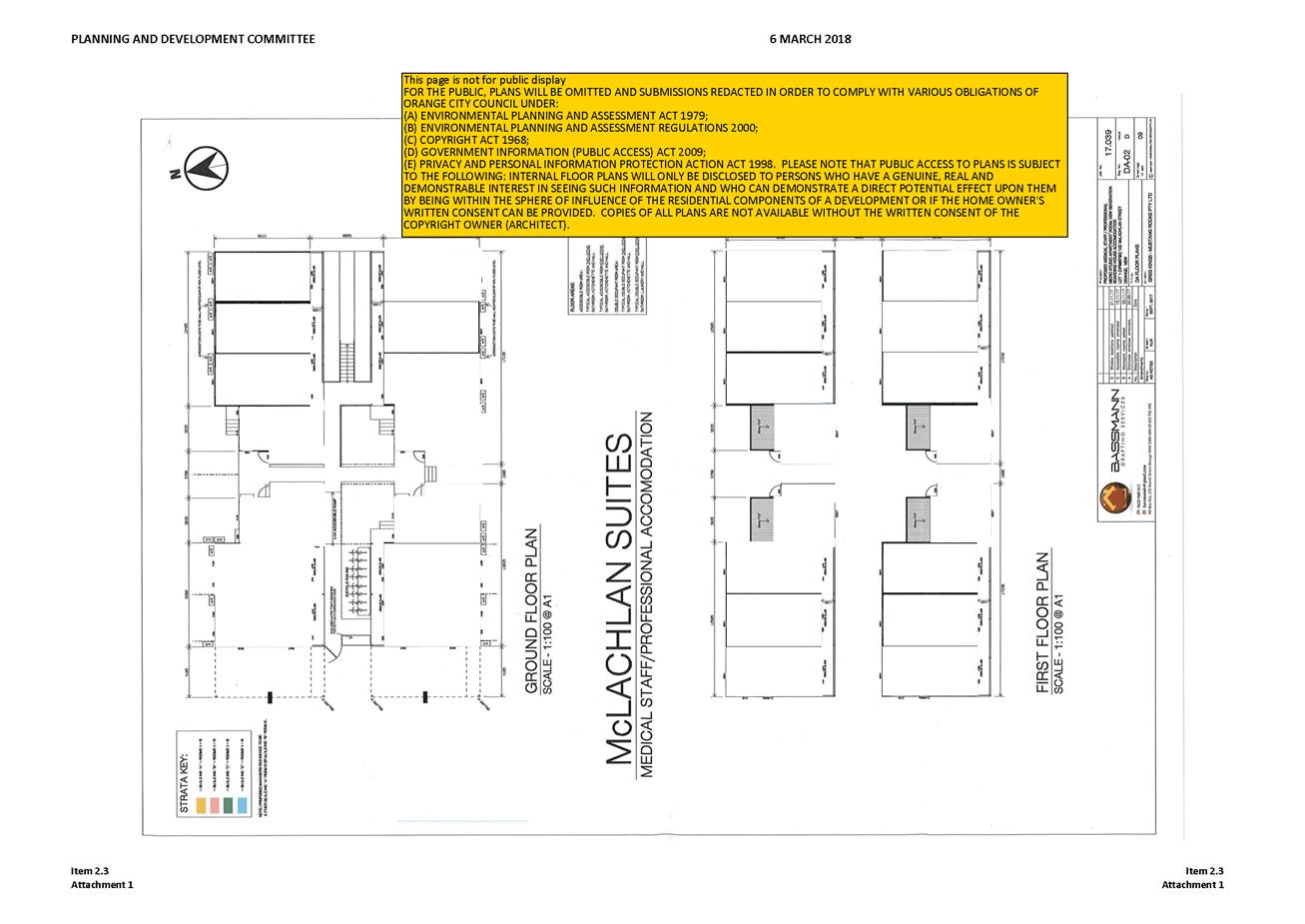
Planning and Development Committee
3 April 2018
2.4 Development
Application DA 442/2017(1) - 122 McLachlan Street
Attachment 3 PDC
report of 6 March 2018

Planning and Development Committee
3 April 2018
2.4 Development
Application DA 442/2017(1) - 122 McLachlan Street
Attachment 3 PDC
report of 6 March 2018
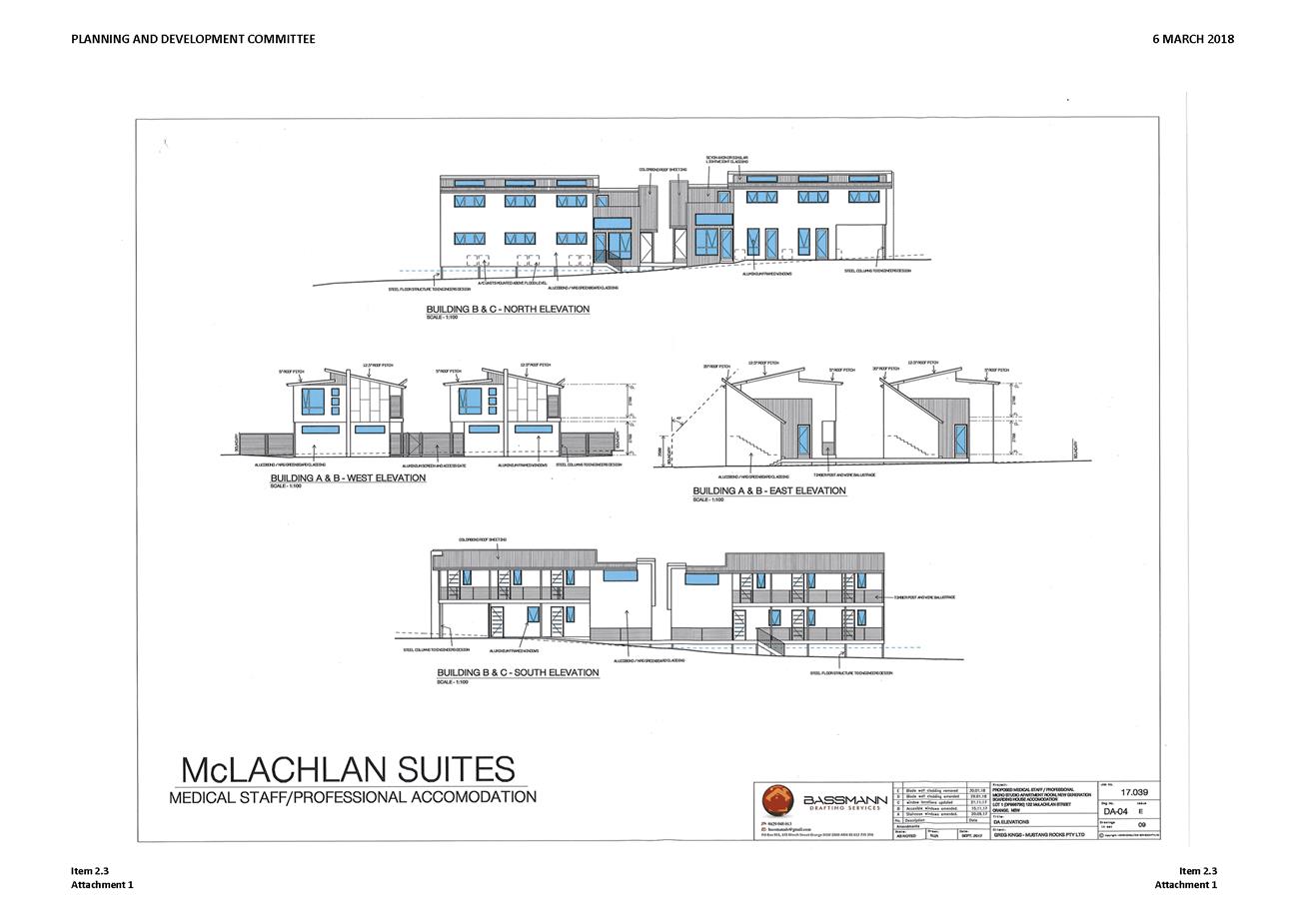
Planning and Development Committee
3 April 2018
2.4 Development
Application DA 442/2017(1) - 122 McLachlan Street
Attachment 3 PDC
report of 6 March 2018
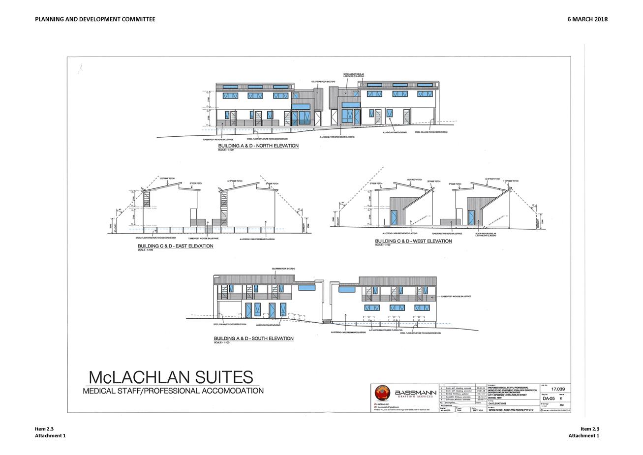
Planning and Development Committee
3 April 2018
2.4 Development
Application DA 442/2017(1) - 122 McLachlan Street
Attachment 3 PDC
report of 6 March 2018
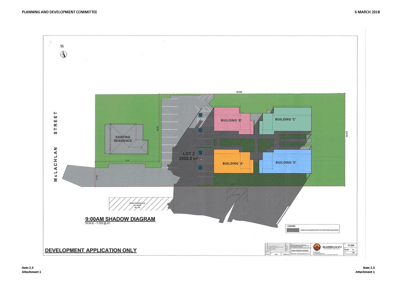
Planning and Development Committee
3 April 2018
2.4 Development
Application DA 442/2017(1) - 122 McLachlan Street
Attachment 3 PDC
report of 6 March 2018
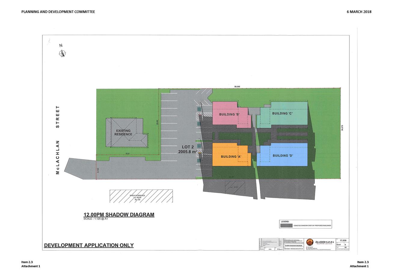
Planning and Development Committee
3 April 2018
2.4 Development
Application DA 442/2017(1) - 122 McLachlan Street
Attachment 3 PDC
report of 6 March 2018

Planning and Development Committee
3 April 2018
2.4 Development
Application DA 442/2017(1) - 122 McLachlan Street
Attachment 3 PDC
report of 6 March 2018
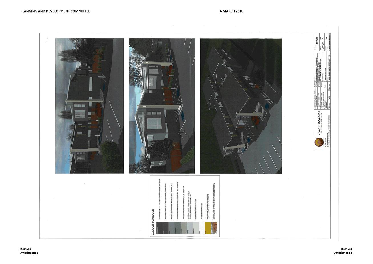
Planning and Development Committee
3 April 2018
2.4 Development
Application DA 442/2017(1) - 122 McLachlan Street
Attachment 3 PDC
report of 6 March 2018
2.5 Development
Application DA 19/2018(1) - 23 Honeyman Drive and Quinlan Run
RECORD
NUMBER: 2018/691
AUTHOR: Michael
Glenn, Senior Planner
EXECUTIVE Summary
|
Application
lodged
|
24
January 2018
|
|
Applicant/s
|
Mr M McCarthy
|
|
Owner/s
|
Mr MJ
McCarthy
|
|
Land
description
|
Lot 44
DP 1183090 and Lot 750 DP 1091475 – 23 Honeyman Drive and
Quinlan Run, Orange
|
|
Proposed
land use
|
Subdivision
(22 lot residential) and Demolition (dwelling, outbuildings and tree removal)
|
|
Value of
proposed development
|
$$1,100,000
|
Council's consent is sought for a 22 lot residential
subdivision, including the provision of servicing (roads, sewer, water,
stormwater, telecommunications and gas). The subdivision would provide 22
standard residential lots with sizes between 534m²
and 1,536m². The existing dwelling and associated outbuildings on the
property would be demolished to accommodate the proposed subdivision. Tree
removal would be required, and the applicant proposes site regrading on the
northern side of the proposed extension of Honeyman Drive as a component of the
application to provide developable building pads.
Due to the flatter grade on the lots on the southern side of
the proposed extension of Honeyman Drive, no regrading is proposed in this
area. Road connections to extend Honeyman Drive are proposed, together with a
proposed new road link to Quinlan Run in the south.
This matter is referred to the
Planning and Development Committee for determination as more than ten lots are
proposed and there is no masterplan applicable to the subject site.
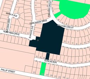
Figure 1 - locality plan
RECENT LEGISLATIVE CHANGES
On 1 March 2018 the Environmental Planning and Assessment
Act 1979 was substantially amended. The most immediate change involves the
restructuring and renumbering of the Act, with other more substantive
changes to be phased in over time. However, for some applications (particularly
where an application was lodged prior to the changes coming into effect) the
supporting documentation may still reference the previous numbering regime. In
the drafting of this report the content and substance of the supporting
material has been considered irrespective of which legislative references were
used.
DECISION FRAMEWORK
Development in Orange is governed by key documents
summarised as follows:
State Environmental Planning Policies (SEPPs) provide
the NSW Government the ability to provide a legislative framework to assess
specific matters. They are made by the Minister of Planning and generally have
over-arching weight within the context of the issue they address
In this case there is one principal state policy applicable
to the assessment of this application; S SEPP-55 (Remediation of Land),
SEPP (Infrastructure 2007).
Orange Local Environment Plan 2011 – the LEP
should be considered by Council to be a definitive document (except when
modified or added to by over-arching state policies). LEPs govern the
types of development that are permissible or prohibited in different parts of
the City and also provide some assessment criteria in specific circumstances.
Uses are either permissible or not - there are no grey areas in terms of
permissibility. The objectives of each zoning and indeed the aims of the LEP
itself are, however, open to interpretation and can be used to guide decision
making around appropriateness of development.
Orange Development Control Plan 2004 – the DCP
guides development. In general it is a performance based document rather than
prescriptive in nature - its purpose is to guide development. The Land and
Environment Court tends to view it as such. In each area of interest there are
often guidelines used. These guidelines indicate ways of achieving the planning
outcomes. It is thus recognised that there may also be other solutions of
merit. All design solutions are considered on merit by planning and building
staff. Applications should clearly demonstrate how the planning outcomes are
being met where alternative design solutions are proposed. So one can see that
the DCP gives leeway for developers and architects to use design to achieve the
outcome in other ways if they can. Stating that DCP guidelines are
inflexible can be misleading.
DIRECTOR’S COMMENT
This development application involves a straight forward
subdivision in an established area of modern subdivisions, and as such is in
line with Council’s planning documents and general approach.
Link To Delivery/OPerational Plan
The recommendation in this report relates to the Delivery/Operational
Plan strategy “13.4 Our Environment – Monitor and
enforce regulations relating to City amenity”.
Financial Implications
Nil
Policy and Governance Implications
Nil
|
Recommendation
That Council consents to development application DA
19/2018(1) for Subdivision (22 lot residential) and Demolition
(dwelling, outbuildings and tree removal) at Lot 44 DP 1183090
and Lot 750 DP 1091475 - 23 Honeyman Drive and Quinlan Run, Orange pursuant
to the conditions of consent in the attached Notice of Approval.
|
further considerations
Consideration has been given to the
recommendation’s impact on Council’s service delivery; image and
reputation; political; environmental; health and safety; employees;
stakeholders and project management; and no further implications or risks have
been identified.
SUPPORTING INFORMATION
THE PROPOSAL
The proposal involves a 22 lot subdivision, demolition and
vegetation removal to achieve a subdivision as shown in the following site
plan.
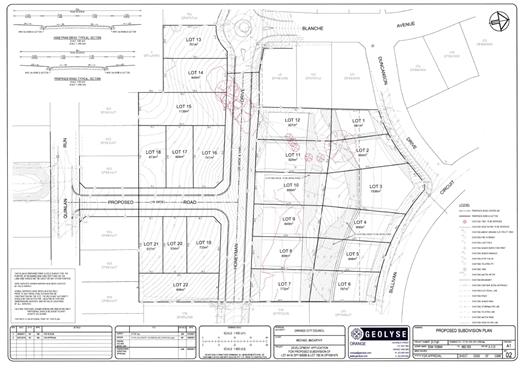
Figure 2 - proposed subdivision layout
MATTERS FOR CONSIDERATION
Section 1.7 - Application of
Part 7 of the Biodiversity Conservation Act 2016 and Part 7A of the
Fisheries Management Act 1994
Development Applications lodged prior to 25 February 2018
Section 1.7 of the EP&A Act 1979 identifies that Part 7
of the Biodiversity Conservation Act 2016 and Part 7A of the Fisheries
Management Act 1994 have effect in connection with terrestrial and aquatic
environments.
Notwithstanding, Section 28 of the Biodiversity
Conservation (Savings and Transitional) Regulation 2017 states that the
former planning provisions continue to apply to the determination of a pending
planning application, being an application for planning approval made before
the commencement of the new Act but not determined before that commencement.
The relevant provisions are set out at Part 5A of the historical version of the
EP&A Act 1979 dated 24 August 2017.
Having regard to the relevant provisions and based on an
inspection of the subject property, it is considered that the proposed
development is not likely to have a significant effect on any threatened
species, populations or ecological communities or their habitats.
Aboriginal Heritage
The subject property is not identified in the Aboriginal
Heritage Information Management System (AHIMS) managed by the Office of
Environment and Heritage (OEH). Notwithstanding, it is considered that a
standard condition should be imposed that requires the protection of any
Aboriginal artefacts discovered during the subdivisions works being carried
out.
Section 4.15
Section 4.15 of the Environmental Planning and Assessment
Act 1979 requires Council to consider various matters, of which those
pertaining to the application are listed below.
PROVISIONS OF ANY ENVIRONMENTAL
PLANNING INSTRUMENT s4.15(1)(a)(i)
Orange Local Environmental Plan 2011
Part 1 - Preliminary
Clause 1.2 - Aims of Plan
The broad aims of the LEP are
set out under subclause 2. Those relevant to the application are as follows:
(a) to encourage development which complements
and enhances the unique character of Orange as a major regional centre boasting
a diverse economy and offering an attractive regional lifestyle,
(b) to provide for a range of development
opportunities that contribute to the social, economic and environmental
resources of Orange in a way that allows present and future generations to meet
their needs by implementing the principles for ecologically sustainable
development,
(c) to conserve and enhance the water
resources on which Orange depends, particularly water supply catchments,
(d) to manage rural land as an environmental
resource that provides economic and social benefits for Orange,
(e) to provide a range of housing choices in
planned urban and rural locations to meet population growth,
(f) to recognise and manage valued
environmental heritage, landscape and scenic features of Orange.
In relation to (a), the proposed
development will slightly detract from or decrease the open character of the
locality, but will be consistent with and increase the residential character of
the more urban areas nearby. The subject property is zoned R1 General
Residential, and it is appropriate to assume that the site would at some point
be developed for urban purposes.
The development site is surrounded by
similarly zoned low density residential land, with some open space land within
relatively close proximity.
With regard to (b), the proposed
development increases the stock of housing lots that, in some perspective, adds
to the development opportunities of the City. Adding to the housing stock
increases the potential for population growth that in turn suggests that the
needs of the workforce will be met.
With regard to (c), the proposed
development would not have any significant effect on the resources of the
City’s water supply.
With regard to (d), the rural use of the
site is nominal given that the zoning has for some time been for residential
purposes. Its assessment as rural land is relative to its known land use.
With regard to (e), the proposed
development does not include housing, however, it does increase the supply of
residential allotments. This will produce the conditions needed to provide
additional housing opportunities.
With regard to (f), the proposed
development is consistent with this aim.
Clause 1.6 - Consent Authority
This clause establishes that, subject to the Act, Council is
the consent authority for applications made under the LEP.
Clause 1.7 - Mapping
The subject site is identified
on the LEP maps in the following manner:
|
Land Zoning Map:
|
Land zoned R1 General Residential
|
|
Lot Size Map:
|
No Minimum Lot Size
|
|
Heritage Map:
|
Not a heritage item or conservation
area
|
|
Height of Buildings Map:
|
No building height limit
|
|
Floor Space Ratio Map:
|
No floor space limit
|
|
Terrestrial Biodiversity Map:
|
No biodiversity sensitivity on the
site
|
|
Groundwater Vulnerability Map:
|
Groundwater vulnerable
|
|
Drinking Water Catchment Map:
|
Not within the drinking water
catchment
|
|
Watercourse Map:
|
Not within or affecting a defined
watercourse
|
|
Urban Release Area Map:
|
Not within an urban release area
|
|
Obstacle Limitation Surface Map:
|
No restriction on building siting
or construction
|
|
Additional Permitted Uses Map:
|
No additional permitted use applies
|
|
Flood Planning Map:
|
Not within a flood planning area
|
Those matters that are of relevance are addressed in detail
in the body of this report.
Clause 1.9A - Suspension of
Covenants, Agreements and Instruments
This clause provides that covenants, agreements and other
instruments which seek to restrict the carrying out of development do not apply
with the following exceptions.
· covenants imposed
or required by Council
· prescribed
instruments under Section 183A of the Crown Lands Act 1989
· any conservation
agreement under the National Parks and Wildlife Act 1974
· any trust
agreement under the Nature Conservation Trust Act 2001
· any property
vegetation plan under the Native Vegetation Act 2003
· any biobanking
agreement under Part 7A of the Threatened Species Conservation Act 1995
· any planning
agreement under Division 6 of Part 4 of the Environmental Planning and
Assessment Act 1979.
Council staff are not aware of the title of the subject
property being affected by any of the above.
Part 2 - Permitted or
Prohibited Development
Clause 2.1 - Land Use
Zones and Clause 2.3 - Zone Objectives and Land Use Table
The subject site is located within the R1 General
Residential zone. The proposed development is defined as a “subdivision
“under OLEP 2011. Subdivision of land under LEP 2011 has the
same meaning as defined in the Act. Pursuant to Clause 4B of the Environmental
Planning and Assessment Act, subdivision of land means:
the division of land into two
or more parts that, after the division, would be obviously adapted for separate
occupation, use or disposition.
Subdivision of land is permissible with consent in the R1
General Residential zone. There are no minimum lot size provisions applicable
to the development site. Pursuant to Clause 2.7 of OLEP 2011 consent is also
required for the demolition of buildings.
Clause 2.3 of LEP 2011
references the Land Use Table and Objectives for each zone in LEP 2011.
These objectives for land zoned R1 general Residential Zone are as follows:
1 -
Objectives of the R1 General Residential Zone
· To provide for the
housing needs of the community.
· To provide for a
variety of housing types and densities.
· To enable other land
uses that provide facilities or services to meet the day to day needs of
residents.
· To ensure development
is ordered in such a way as to maximise public transport patronage and
encourage walking and cycling in close proximity to settlement.
· To ensure that
development along the Southern Link Road has an alternative access.
In relation to the
first objective, the proposed development would provide additional lots of land
on which housing stock within the City can be provided. It will provide these
additional lots at a scale consistent with typical low density development. In
terms of lot yield and lot sizes, the proposed subdivision is consistent with
the relevant controls.
In relation to the
second objective, the proposed subdivision would not impede the provision of
other land to provide facilities and services should such a need ever arise in
the future.
In relation to the
third objective, it is possible for public transport services to be provided to
the new lots proposed.
In relation to the fourth
objective, it is considered that public transport is available.
In relation to the fifth
objective, the proposed development has no measurable impact on the provision
of the southern link road.
Clause 2.6 - Subdivision -
Consent Requirements
Application has been made for the subdivision of the subject
land. Clause 2.6 of OLEP 2011 permits the subdivision of the subject
land only with development consent.
Clause 2.7 –
Demolition Requires Development Consent
Clause 2.7 requires
the development consent for demolition of a building or work.
The proposed
development involves the demolition of the existing dwelling and associated
outbuildings. The attached Notice contains conditions of consent addressing matters
pertaining to demolition.
Part 4 - Principal
Development Standards
Clause 4.1 - Minimum
Subdivision Lot Size
This clause requires
the subdivision of land to be equal to or greater than the size nominated for
the land under the Minimum Lot Size Map. The subject property is zoned R1
General Residential, which does not have an applicable minimum lot size.
Part 7 - Additional
Local Provisions
7.1 - Earthworks
Given the undulating
nature of the site, earthworks are proposed in the northern extent to provide
flat and developable building lots.
Clause 7 .1 of the
LEP therefore applies to the proposed development on the basis that earthworks
are included. Clause 7.1(3) states that a consent authority must consider the
following matters in the determination of an application for development
consent involving earthworks:
(3) Before
granting development consent for earthworks, the consent authority must
consider the following matters:
(a) the
likely disruption of, or any detrimental effect on, existing drainage patterns
and soil stability in the locality of the development,
(b) the
effect of the development on the likely future use or redevelopment of the
land,
(c) the
quality of the fill or the soil to be excavated, or both,
(d) the
effect of the development on the existing and likely amenity of adjoining
properties,
(e) the
source of any fill material and the destination of any excavated material
(f) the
likelihood of disturbing relics,( Note. The National Parks and Wildlife Act
1974, particularly section 86, deals with disturbing or excavating land and
Aboriginal objects).
(g) the
proximity to and potential for adverse impacts on any waterway, drinking water
catchment or environmentally sensitive area,
(h) any
measures proposed to minimise or mitigate the impacts referred to in paragraph
In respect of clause
7 .1(3) of the LEP:
(a) The
development is unlikely to lead to a detrimental impact on drainage patterns.
Soil stability will be maintained during construction through the appropriate
use of erosion and sediment control measures, with additional details to be
provided in conjunction with detailed design plans at Construction Certificate
stage.
(b) The
proposed development provides for the provision of 22 residential lots, adding
to the land supply in Orange. The earthworks on the land would provide
developable sites for future dwellings and provide for an integrated design,
rather than a piecemeal approach at individual development application stage,
which would be the case if earthworks were not proposed. A consolidated
approach is considered more appropriate.
(c) Cut
and fill on the site would be balanced to ensure that removal of overburden off‑site
or the importation of fill from off-site is minimised.
(d) The
site is bounded by roads. The proposed development would involve cut and fill,
but would be appropriately managed through either retaining or battering as
appropriate to ensure no detrimental impacts to the adjacent land.
(e) As
noted, no fill is anticipated, and any excess cut (not expected) would be
disposed of at an appropriate waste management facility.
(f) The
Statement of Environmental Effects advises that Investigations with respect to
heritage and onsite archaeology have not identified any likelihood of the site
containing any items of Aboriginal or non-Aboriginal heritage.
(g) Stormwater
management in the form of inter-allotment drainage forms part of the proposed
development, and all proposed infrastructure would drain to the existing
regional stormwater basin to the south of the site (south of Quinlan Run).
(h) In
consideration of the intent and content of LEP clause 7.1, it is anticipated
that the proposed earthworks would not have any detrimental impact on the
environment.
7.3 - Stormwater
Management
This clause applies
to all industrial, commercial and residential zones and requires that Council
be satisfied that the proposal:
(a) is designed to maximise the use of water
permeable surfaces on the land having regard to the soil characteristics
affecting onsite infiltration of water
(b) includes, where practical, onsite
stormwater retention for use as an alternative supply to mains water,
groundwater or river water; and
(c) avoids any significant impacts of
stormwater runoff on adjoining downstream properties, native bushland and
receiving waters, or if that impact cannot be reasonably avoided, minimises and
mitigates the impact.
With regard to (a)
and (b), the proposed development is for subdivision of an existing two lot
holding into residential lots. The future development of the 22 residential
lots will likely consist of standard residential housing. Council has controls
with respect to site coverage that will ensure that extensive parts of each
allotment will have permeable spaces. The future surface runoff for each lot
will be directed to flow into Council’s stormwater reticulation system
With regard to (c),
there will be some impacts arising with stormwater runoff for water quantity
and water quality. Quantities can be expected to rise as hard surfaces like
roads are installed, but can be adequately managed by engineering works which
are imposed as conditions in the consent.
With regard to water
quality, collection and increase in particulate content and nutrients is likely
for a residential subdivision, although contamination from toxic or dangerous
chemicals is considered minimal. Nutrient and particulate control is
recommended under Water Sensitive Urban Design principals (WSUD) and for this
site is managed under the water re-use scheme.
7.6 - Groundwater
Vulnerability
This clause seeks to
protect hydrological functions of groundwater systems and protect resources
from both depletion and contamination. Orange has a high water table and large
areas of the LGA, including the subject site, are identified with
“Groundwater Vulnerability” on the Groundwater Vulnerability Map.
This requires that Council consider:
(a) whether or not the development (including
any onsite storage or disposal of solid or liquid waste and chemicals) is
likely to cause any groundwater contamination or have any adverse effect on
groundwater dependent ecosystems, and
(b) the cumulative impact (including the
impact on nearby groundwater extraction for potable water supply or stock water
supply) of the development and any other existing development on groundwater.
Furthermore consent may not be granted unless Council is satisfied that:
(a) the development is designed, sited and
will be managed to avoid any significant adverse environmental impact, or
(b) if that impact cannot be reasonably
avoided - the development is designed, sited and will be managed to minimise
that impact,
(c) if that impact cannot be minimised - the
development will be managed to mitigate that impact.
The proposal is not
anticipated to involve the discharge of toxic or noxious substances and is
therefore unlikely to contaminate the groundwater or related ecosystems. The
proposal does not involve extraction of groundwater and will therefore not
contribute to groundwater depletion. The design and siting of the proposal
avoids impacts on groundwater and is therefore considered acceptable.
Clause 7.11 - Essential
Services
Clause 7.11 applies and states:
Development
consent must not be granted to development unless the consent authority is
satisfied that any of the following services that are essential for the
proposed development are available or that adequate arrangements have been made
to make them available when required:
(a) the supply of water,
(b) the supply of electricity,
(c) the disposal and management of sewage,
(d) storm water drainage or on-site
conservation,
(e) suitable road access.
In consideration of this clause, all utility services are
available to the land and adequate for the proposal.
STATE ENVIRONMENTAL PLANNING
POLICIES
The following State Environmental Planning Policies (SEPPs)
are applicable to the proposed development.
State Environmental Planning Policy (Vegetation in
Non-Rural Areas)
The operation of this SEPP is linked to Orange City
Council’s Tree Preservation Order (under Development Control Plan 2004).
Where the removal of vegetation forms part of an overall development
application, the assessment of that vegetation removal can be considered as
part of that development application.
The SEPP has its primary assessment provisions deferred
because of the savings provisions embedded into the SEPP, which permits
applications lodged but not determined before the relevant date (in this case
25 August 2017) to be determined under the old regime.
It is noted that the adoption of this SEPP was concurrent
with the government’s suspension of Clause 5.9. Unlike the SEPP,
there were no savings provisions applied to the removal of Clause 5.9.
The SEPP as a matter for consideration is acknowledged, but
has no significant impact on the assessment of this application.
State Environmental Planning
Policy 55 - Remediation of Land
Notwithstanding the residential zoning of the site, the
subject property has for many years been used for extensive agriculture, which
can act as a trigger for a contamination assessment under Council’s draft
remediation strategy. The structure of Council's contamination strategy can be
found in the quick reference guide produced by Contamination Central at the
time of the preparation of the draft policy.
There is a flowchart that sets
out the procedures when receiving new development applications. This flow chart
is reproduced below:
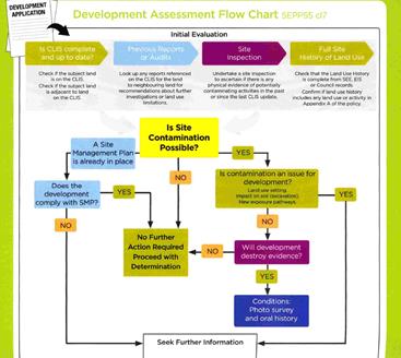
Figure 3 - development assessment flowchart
Initial Evaluation - Matters
for Consideration
Figure 4 - determining if the property is on the
Contaminated Lands Information System (CLIS)
The subject land is not on
Council’s Local CLIS. It is not recorded on the EPA Register as
being contaminated.
Figure 5 - checking previous reports
There are no reports on the CLIS
relevant to this matter.
Figure 6 - site inspections
There is little physical
evidence to suggest a likely source of contamination. There are some sheds on
the site, but these sheds do not show evidence of use as chemical stores or the
like. There are no sheep dips or spray dumps; and perusal of the historical
aerial photography does not reveal the presence of such structures in previous
times. The site has no prior history as a site used for intensive plant
agriculture. It has been used for grazing on a very limited basis (hobby
farming basically) for perhaps twenty years. Before that it is believed to have
also been used for more serious general grazing.

Figure 7 - site history
The previous land uses of this site are reflected in the
small scale structures on the site and its use for extensive agriculture over
an extended period. There is no relevant history recorded in Council’s
records. Its prior land uses are based on site observation. Such deduced
history does not suggest that the site has any significant contamination
issues.
However, the existing land use for extensive agriculture is
included in Appendix A of the quick reference guide as a potential source
of contamination. This observation needs, however, to be further considered
against the provisions contained in the Contamination Central draft policy in
section 11.3, which states:
“land used for extensive
agriculture should be assessed for site contamination where development
applications relate to redevelopment in the vicinity of stock yards, stock
dip or farm sheds where fuel or chemicals have been stored or handled”.
As previously alluded to, the site was previously used for
extensive agriculture, but the site does not have any of the triggers contained
in the bolded part of the above-described clause. It appears to have been used
solely as grazing land.
The risks of site contamination is considered unlikely given
the above analysis. However as a precaution attached to the Notice of
Determination is a condition of consent requiring contamination assessment to
be undertaken to confirm the suitability of the site for residential
development. These assessments are required to be submitted prior to the issue
of a subdivision certificate.
PROVISIONS OF ANY DRAFT
ENVIRONMENTAL PLANNING INSTRUMENT THAT HAS BEEN PLACED ON EXHIBITION
4.15(1)(a)(ii)
There are no draft environmental planning instruments that
apply to the subject land or proposed development.
DESIGNATED DEVELOPMENT
The proposed development is not designated development.
INTEGRATED DEVELOPMENT
The proposed development is not integrated development.
PROVISIONS OF ANY DEVELOPMENT
CONTROL PLAN s4.15(1)(a)(iii)
Development Control Plan 2004
Development Control Plan 2004 (“the DCP”)
applies to the subject land (Part 7). An assessment of the
proposed development against the relevant Planning Outcomes will be undertaken
below.
Pursuant to Planning Outcome 0.2-1 Interim Planning Outcomes
- Conversion of Zones:
· Throughout this
Plan, any reference to a zone in Orange LEP 2000 is to be taken to be a
reference to the corresponding zone(s) in the zone conversion table.
The subject property was zoned Residential 2(a) under LEP
2000, and with the adoption of LEP 2011 the subject property was classified
as R1 General Residential which is an equivalent zoning to the previous land
classification. It is noted that the site is not subject to any
DCP masterplan.
It is appropriate to apply such parts of Chapter 7 of the
DCP as are applicable to the subdivision in the assessment. Additionally, the
general provisions of Chapters 2 (Natural Resource Management) and
3 (General Considerations) have relevance with respect to cumulative
impacts and scenic landscape issues.
Part 2 -
Natural Resource Management
The DCP states:
Development
that concentrates, redirects flows, increases flow rates or disturbs land in
close proximity to creeks has the potential to affect waterways with associated
erosion, sedimentation and release of nutrients, which combine to affect
downstream water quality. Erosion appears to be particularly prevalent within
the “North Orange” red earth soil types.
Urban stormwater has also been identified
as a significant source of water pollutants. Uncontrolled stormwater flow from
urban development has the potential to contribute to downstream impacts,
including periodic flooding, erosion, sedimentation and reduced in‑stream
water quality.
Orange City Council’s Drainage
Strategy was adopted by Council on 19 June 1997 to identify measures
required to control stormwater flow velocities and volumes.
Conditions are included that require the
design and provision of a stormwater management system that minimises erosion,
controls outflows and requires water quality to be at least as good as the best
water currently being discharged from the site as a vacant allotment.
Part 3 -
General Considerations
The applicant has responded to the site
constraints in a way generally satisfactory to environmental issues affecting
this site. The issues of slope, character, open space, linkages and road
connections have been generally responded to cooperatively by the applicant.
With regard to cumulative impacts, the DCP
requires that applicants demonstrate how the development relates to the
existing character of the locality. In this instance the character is generally
residential. There are no significant vegetation remnants evident on the site.
Each of these constraints/opportunities have differing and sometimes competing
demands on land capability, but as a generalisation the proposed subdivision
responds well to the constraints.
The proposed development is generally
consistent with the lot sizes and subdivision patterns of the residential
subdivisions that are nearby. Within that context and in the absence of any
specific master planning in the DCP, it cannot be strongly argued that the
proposed development is vastly inconsistent with the expected future character
of the locality.
PART 7 -
DEVELOPMENT IN RESIDENTIAL AREAS
General Principles
The DCP in its preliminary instructions includes the
following guidelines for design of urban residential subdivisions, based on
Department of Planning Urban Design guidelines:
“The
Urban Form publication identifies the following issues for future development
of the City:
· The
square grid of 200 m blocks and the open space system along the creek lines are
the most important features of Orange’s urban identity.
· Maintaining
this pattern in new development will allow uninterrupted view lines, and offer
variety as the streets traverse the topography. It will also result in the
efficient provision of services and permeable pedestrian routes.
· Expanding
open space along natural creek lines and in associated parks will increase
amenity, provide environmental buffer zones, allow for drainage control
structures and help people orient themselves by being able to read the
landscape.
· Laneways
that have been introduced through the original blocks as a cul-de-sac can be
extended to give pedestrian or vehicular access across the blocks.
· As the
town grows, radial expansion will require cross connections to assist the
movement between outer suburbs.
The
distribution of facilities such as schools and places of worship in existing
development suggest similar distribution will be required near new residential
development, ie, within a five- to ten-minute walking distance from every
home”.
It is considered that the design responds positively to
these urban design principles. The proposed road system is functional from the
point of view of traffic management, and also provides a level of connectivity
to improve social and communal cohesion and integration that the physical
design parameters of the modified grid layout favour in the DCP.
Subdivision in LGA Not Forming
Part of a Masterplan Area
Subdivision - Lot Sizes and Battleaxe
Lots
Residential lots in Orange are
predominantly between 600m² and 900m² in area. In recent years, the
average residential lot size has reduced from about 800m² to
about 750m².
This DCP establishes guidelines for
residential subdivision.
Standard Lot 500m2
or greater
Cottage Lot >350 and <500m2
Town House Lot 250 to 350m2
The submitted plans show all the proposed
lots to be “Standard Lots”. There are no additional information
requirements for standard lots as the assumption is that there are no
particular difficulties in locating a standard detached dwelling on lots of
this size.
There are no battleaxe allotments proposed
under this application.
Corner Lots
· Corner lots should be designed to provide for a house facing one
street. Where dual occupancy development is proposed on a corner lot, each
dwelling should face a different street.
The proposed development is consistent with
this principle.
Dual Occupancy and Unit Sites
Dual occupancies in the R1 zone are
permissible with consent. Under Clause 4.1B of the LEP a minimum lot
size of 800m2 is applicable. The applicant has not specifically
identified any lots for such purposes. It is noted that several lots within the
subdivision exceed the minimum area requirements of 800m² for dual
occupancy development. Future applications for such development would be assessed
upon merit.
Subdivision Layouts
The Department of Urban Affairs and
Planning’s Urban Design Advisory Service publication on Urban Form
describes the influences on, and effects of the urban pattern of Orange as a
Case Study.
Department of Urban Affairs and
Planning’s Urban Form concludes that:
... the city
is well contained within a multiple of the original square mile grid and no
significant subdivision has occurred along the roads into town. Some
subdivisions have occurred at the edges of the city, with curvilinear streets
and cul-de-sac. Nearer the city there are very small blocks, shallow with a
relatively wide frontage, which express the current fashion where a wide street
address is more important than a big backyard.
The Urban Form publication
identifies the following issues for future development of the City:
· The square grid
of 200m blocks and the open space system along the creek lines are the most
important features of Orange’s urban identity.
· Maintaining
this pattern in new development will allow uninterrupted view lines, and offer
variety as the streets traverse the topography. It will also result in the
efficient provision of services and permeable pedestrian routes.
· Expanding open
space along natural creek lines and in associated parks will increase amenity,
provide environmental buffer zones, allow for drainage control structures and
help people orient themselves by being able to read the landscape.
· Laneways that
have been introduced through the original blocks as cul-de-sac can be extended
to give pedestrian or vehicular access across the blocks.
· As the town
grows, radial expansion will require cross connections to assist the movement
between outer suburbs.
· The
distribution of facilities such as schools and places of worship in existing
development suggest similar distribution will be required near new residential
development, ie, within a five- to ten-minute walking distance from every home.
The return to a modified grid layout in
preference to the 1970’s urban-planning theories of curvilinear streets
and associated cul-de-sacs has become more recently promoted in the City,
such as in the layout for Ploughmans Valley. This principle will continue to be
emphasised for the planning for new release areas for the foreseeable future.
A modified grid layout not only provides
for more efficient servicing of residential land, views and improved
connections between residential areas, the grid pattern is also consistent with
energy efficiency principles. Orientation of boundaries along the north‑south
and east-west axes encourages solar design of houses. Lots facing east or west
need to be wider to promote northern sunlight.
In this case the layout is consistent with
the modified grid layout principals favoured under the DCP and will effectively
link with the already approved subdivision development that adjoins the subject
land.
Orange Subdivision Code
Council Technical Services Division is principally
responsible for the application of the Subdivision Code. That Division has not
raised objection to the submitted layout, and has imposed a suite of conditions
to ensure that the development is carried out in accordance with the
Subdivision Code requirements. The proposal is generally consistent with the
principles specified in the subdivision code
DEVELOPMENT CONTRIBUTIONS
Section 7.11 Contributions
The proposed subdivision plan shows 22 residential lots,
resulting in a net 20 lot yield for future development.
Pursuant to Orange Development
Contributions Plan 2017, the following contributions have been levied for the
subject development and are attached as a condition of consent. The payment of
contributions as per the following shall be made to Council in accordance with
Section 7.11 of the Act and the Orange Development Contributions
Plan 2017 (development in LGA Remainder Area) towards the provision of the
following public facilities:
|
Open Space and Recreation
|
@ $3,891.67 x 20 additional lots
|
77,833.40
|
|
Community and Cultural
|
@ $1,128.59 x 20 additional lots
|
22,571.80
|
|
Roads and Traffic Management
|
@ $5,136.89 x 20 additional lots
|
102,737.80
|
|
Plan Preparation and Administration
|
@ $304.72 x 20 additional lots
|
6,094.40
|
|
TOTAL
|
|
$209,237.40
|
The contribution will be indexed quarterly in accordance
with the Orange Development Contributions Plan 2017 (development in LGA
Remainder Area). Attached is a condition of consent requiring the payment of
the Section 7.11 Contributions prior to the issue of a Subdivision Certificate.
Section 64 Water and Sewer
Headwork Charges
Council’s Technical Services assessment advises that
payment of contributions for water, sewer and drainage works is required to be
made at the contribution rate applicable at the time that the payment is made.
The contributions are to be based on 21 ETs for water supply headworks and 22
ETs for sewerage headworks. A Certificate of Compliance, from Orange City
Council in accordance with the Water Management Act 2000, will be issued
upon payment of the contributions.
PROVISIONS PRESCRIBED BY THE
REGULATIONS s4.15(1)(a)(iv)
The development is not inconsistent with the provisions
prescribed by the regulations
THE LIKELY IMPACTS OF THE
DEVELOPMENT s4.15(1)(b)
Access, Transport and Traffic
In accordance with the Roads and Maritime Services'
(formally Roads and Traffic Authority) Guide to Traffic Generating
Developments 2002, development for the purpose of a 'Dwelling House' would
generate 9.0 daily vehicle trips per dwelling, including 0.85 trips in
weekday peak hour periods.
As a total of 22 residential lots (assuming one dwelling per
allotment) are proposed to be established on the subject site, the overall
development would result in approximately 207 vehicle trips per day on the
local road network, and 19.55 trips during weekday peak hour periods. This includes
current movements associated with the existing use of the site for the purposes
of a single residential dwelling.
The impact of these additional vehicle trips on the local
road network would be off-set by the following factors;
· In accordance with
the Guide to Traffic Generating Developments Policy 2002, 25% of
the above vehicle trips are expected to be confined to the local area
(ie such as local social visits, trips to local parks etc) and would not
impact upon the wider road network; and
· Orange is serviced
by 'Orange Bus Lines' bus services. Bus Route 532 travels along Philip Street
to the south of the site 12 times per weekday and four times per day on
Saturday, in addition to school services which travel through this area on a
daily basis. These services offer an alternative route to the central business
district/education facilities and enable a reduction of the number of vehicle
trips to and from the site.
The development does not represent traffic generating
development in the context of the ISEPP as it proposes less than 200 lots.
Roads within the subdivision would be consistent in width with existing roads
to which they will connect. Road widths are adequate for the provision of
services. All lots are adequately sized to provide for off-street parking
associated with future dwelling use.
Public Domain
Open space is provided by the Orange Showground less than
100m to the south, as well as a small 'pocket park' on the southern side of
Quinlan Road, providing opportunities for public recreation for future
residents. Consistent with the locality, street trees would be provided within
road corridors via this application
Noise and Vibration
The proposed residential land use is compatible with the
surrounding developed land uses and would not give rise to noise and vibration
impacts that are likely to have a detrimental impact on the locality
Safety, Security and Crime
Prevention
The proper design of buildings and places using Crime
Prevention Through Environmental Design (CPTED) principles reduces crime and
fear by reducing criminal opportunity and fostering positive social interaction
among genuine users of space.
CPTED seeks to influence the design of buildings and places
by:
· increasing the
perception of risk to criminals by increasing the possibility of detection,
challenge and capture
· increasing the
effort required to commit crime by increasing the time, energy or resources
which need to be expended
· reducing the
potential rewards of crime by minimising, removing or concealing ‘crime
benefits’
· removing
conditions that create confusion about required norms of behaviour.
Most CPTED planning is done at the building construction
stage, however there are some basic principles to also apply at subdivision
stage. Good lighting and visibility of the street layout, lots with boundaries
able to accommodate visible entrances and able to allow good surveillance are
generally sound principles to build into the design.
CPTED is based on four design concepts. They are:
· surveillance
· access control
· territorial
reinforcement
· space
management/maintenance.
There are no inherent aspects of the proposed layout that
suggests that these principals would not be achieved as the lots are developed.
Surveillance: Surveillance
is about creating environments to keep intruders under observation. It aims to
provide opportunities for people engaged in their normal daily business to
observe the space around them. In the context of the proposed subdivision,
surveillance is related to the provision of adequate street lighting and fully
visible road networks. It is considered that the recommended Notice of
Determination contains conditions that satisfactorily address these issues.
Access Control: Access
control is about decreasing opportunities for crime by controlling access to a
crime target and by creating a perception of risk to an offender. Physical and
symbolic barriers can be used to attract, channel or restrict the movement of
people. In the context of the proposed subdivision, the most relevant
consideration relates to the location of footpaths and access points, avoiding
isolated “dead ends” and making pedestrian spaces visible for the
casual observer. In this case the amended concept does not produce access
control issues that could be of concern.
Territorial Reinforcement:
Territorial reinforcement is about clearly defining private space from
semi-public and public space in order to create a sense of ownership. The
created ownership shows that the owner has a vested interest in the location,
which in turn challenges intruders. For the proposed development, the
subdivision layout is suggestive of discreet allotments in which the boundary
lines will be clearly identifiable from public spaces.
Space Management/Maintenance:
Space management involves the formal supervision, control and care of urban
space. Public perceptions are affected by the appearance of a place. A
well-maintained urban environment is essential in sustaining confidence and
helping to control vandalism, crime or fear of crime. The proposed subdivision
will result in private ownership for most lots, which has inherent benefits as
far as ‘space management” and ‘maintenance” is
concerned. Future land owners will maintain their lots, as opposed to the
current situation where the land is largely unmanaged and opened to various
forms of criminal or antisocial behaviour. The passage of the land to a
residential development will also assist in the proper maintenance of the urban
space. People are unlikely to allow antisocial activities in the surrounding
public spaces.
Social Impact
As defined by the NSW Government Office on Social Policy,
social impacts are significant events experienced by people as changes in one
or more of the following are experienced:
· peoples' way of
life (how they live, work or play and interact with one another on a day-to-day
basis);
· their culture
(shared beliefs, customs and values); or
· their community
(its cohesion, stability, character, services and facilities).
As a natural progression of the existing residential area,
and given the consistency with the residential zoning, the proposed development
is not likely to result in significant impacts on any of the above matters.
Cumulative Impacts
The proliferation of low density residential development on
the fringe of the City is a reflection of the urban growth of Orange, which is
currently being achieved by an expansion of residential land into the
surrounding lower density rural and non-urban land.
A continuation of green field residential subdivisions
satisfies the market demand, but is likely to result in community isolation
from transport facilities and services due to the increase in distance from
employment areas and the Central Business District.
Continued reliance on green fields development on the urban
fringes also tends to be high impact in terms of biodiversity conservation.
Because of the distances, a continuation on motor vehicle reliance is likely to
be reinforced by developments such as the subject application.
On the other hand, the development of a new estate creates
opportunities for home ownership, improves housing stock quality from an
aesthetic point of view, and promotes economic activity in the building
industry. The land forms part of a strategic land release for residential
development and is supported in this case.
THE SUITABILITY OF THE SITE
s4.15(1)(c)
The subject property has significant natural features, being
the slope of the site. These are adequately allowed for in the subdivision
design.
The subject property will be significantly reliant on motor
vehicles for access to most facilities and amenities. The proposed subdivision
links effectively with other approved development that adjoins the subject
land.
Overall, the applicant has adequately demonstrated that the
site is suitable for the proposed development. Attached to the Notice of
Determination is a suite of conditions considered appropriate to ensure that
the development proceeds in an acceptable manner.
ANY SUBMISSIONS MADE IN
ACCORDANCE WITH THE ACT s4.15(1)(d)
The proposed development is not defined as advertised
development under the provisions of the LEP, and as such no formal
exhibition of the application was required. However, neighbours were advised of
the proposed development. No submissions have been received in relation to this
application.
PUBLIC INTEREST
s4.15(1)(e)
The proposed development is considered to be of minor
interest to the wider public due to the relatively localised nature of
potential impacts. The proposal is not inconsistent with any relevant policy
statements, planning studies, guidelines etc that have not been considered in
this assessment.
SUMMARY
The proposed development is permissible with the consent of
Council. The proposed development complies with the relevant aims, objectives
and provisions of Orange LEP 2011 (as amended) and DCP
2004. A section 4.15 assessment of the development indicates that
the development is acceptable in this instance. Attached is a draft Notice of
Approval outlining a range of conditions considered appropriate to ensure that
the development proceeds in an acceptable manner.
COMMENTS
The requirements of the Environmental Health and Building
Surveyor and the Engineering Development Section are included in the attached
Notice of Approval.
Attachments
1 Notice
of Approval, D18/14839⇩
2 Plans,
D18/13398⇩
Planning and Development Committee
3 April 2018
2.5 Development
Application DA 19/2018(1) - 23 Honeyman Drive and Quinlan Run
Attachment 1 Notice
of Approval
|

|
ORANGE
CITY COUNCIL
Development
Application No DA
19/2018(1)
NA18/ Container
PR26283
|
NOTICE OF DETERMINATION
OF A DEVELOPMENT
APPLICATION
issued under the Environmental
Planning and Assessment Act 1979
Section 4.18
|
Development
Application
|
|
|
Applicant Name:
|
Mr M
McCarthy
|
|
Applicant Address:
|
C/-
Geolyse
PO BOX
1963
ORANGE
NSW 2800
|
|
Owner’s Name:
|
Mr MJ
McCarthy
|
|
Land to Be Developed:
|
Lot 44 DP
1183090 and Lot 750 DP 1091475 -
23 Honeyman Drive and Quinlan Run, Orange
|
|
Proposed Development:
|
Subdivision
(22 lot residential) and Demolition (dwelling, outbuildings and tree removal)
|
|
|
|
|
Building
Code of Australia
building
classification:
|
Not
applicable
|
|
|
|
|
Determination
made under
Section 4.16
|
|
|
Made On:
|
3 April
2018
|
|
Determination:
|
CONSENT
GRANTED SUBJECT TO CONDITIONS DESCRIBED BELOW:
|
|
|
|
|
Consent to
Operate From:
|
4 April
2018
|
|
Consent to
Lapse On:
|
4 April
2023
|
Terms of Approval
The reasons for the imposition of
conditions are:
(1) To ensure a quality
urban design for the development which complements the surrounding environment.
(2) To maintain
neighbourhood amenity and character.
(3) To ensure compliance
with relevant statutory requirements.
(4) To provide adequate
public health and safety measures.
(5) Because the development
will require the provision of, or increase the demand for, public amenities and
services.
(6) To ensure the utility
services are available to the site and adequate for the development.
(7) To prevent the proposed
development having a detrimental effect on adjoining land uses.
(8) To minimise the impact
of development on the environment.
Conditions
(1) The
development must be carried out in accordance with:
(a) Plans
by Geolyse: Project 217181 - sheets C001 to C008 (8 sheets)
(b) statements
of environmental effects or other similar associated documents that form part
of the approval
as amended
in accordance with any conditions of this consent.
(2) All building work must
be carried out in accordance with the provisions of the Building Code of
Australia.
(3) Where any excavation
work on the site extends below the level of the base of the footings of a
building on adjoining land, the person having the benefit of the development
consent must, at the person’s own expense:
(a) protect
and support the adjoining premises from possible damage from the excavation,
and
(b) where
necessary, underpin the adjoining premises to prevent any such damage.
Note: This
condition does not apply if the person having the benefit of the development
consent owns the adjoining land or the owner of the adjoining land has given
consent in writing to this condition not applying.
|
PRIOR TO THE ISSUE OF
A CONSTRUCTION CERTIFICATE
|
(4) The
applicant is to submit a waste management plan that describes the nature of
wastes to be removed, the wastes to be recycled and the destination of all
wastes. All wastes from the demolition and construction phases of this project
are to be deposited at a licensed or approved waste disposal site.
(5) Engineering plans,
showing details of all proposed work and adhering to any engineering conditions
of development consent, are to be submitted to, and approved by, Orange City
Council or an Accredited Certifier (Categories B1, C3, C4, C6) prior to the
issuing of a Construction Certificate.
(6) A water and soil
erosion control plan is to be submitted to Orange City Council or an Accredited
Certifier (Categories B1, C3, C4, C6) for approval prior to the issuing of a
Construction Certificate. The control plan is to be in accordance with the
Orange City Council Development and Subdivision Code and the Landcom, Managing
Urban Stormwater; Soils and Construction Handbook.
(7) Proposed
lots are to be provided with interlot stormwater drainage, including those lots
abutting public land, where the surface of the entire lot cannot be drained to
the kerb and gutter at the lot frontage. A grated concrete stormwater pit is to
be constructed within each lot provided with interlot stormwater drainage.
Engineering plans for this drainage system are to be approved by Orange City
Council or an Accredited Certifier (Categories B1, C3, C4, C6) prior to the
issuing of a Construction Certificate.
(8) A 150mm-diameter sewer
main is to be constructed from Council’s existing main to serve the
proposed lots. Prior to a Construction Certificate being issued engineering
plans for this sewerage system are to be submitted to and approved by Orange
City Council.
(9) A water reticulation
analysis is to be carried out by Orange City Council on any proposed water
reticulation system for the development. Engineering plans are to be submitted
to and approved by Orange City Council prior to the issue of a Construction
Certificate.
The reticulation system is to be designed to
supply a peak instantaneous demand by gravity of 0.15 L/s/tenement at a
minimum residual head of 200kPa.
(10) Prior to the
issue of a construction certificate structural engineers details shall be
provided for the proposed retaining walls.
|
PRIOR TO WORKS
COMMENCING
|
(11) A
temporary onsite toilet is to be provided and must remain throughout the
project or until an alternative facility meeting Council’s requirements
is available onsite.
(12) Soil erosion control
measures shall be implemented on the site.
(13) A
Construction Certificate application is required to be submitted to, and issued
by Council/Accredited Certifier prior to any excavation or building works being
carried out onsite.
|
DURING
CONSTRUCTION/SITEWORKS
|
(14) All
construction/demolition work on the site is to be carried out between the hours
of 7.00 am and 6.00 pm Monday to Friday inclusive, 7.00 am to
5.00 pm Saturdays and 8.00 am to 5.00 pm Sundays and Public
Holidays. Written approval must be obtained from the General Manager of Orange
City Council to vary these hours.
(15) Building demolition is
to be carried out in accordance with Australian Standard 2601:2001 - The
Demolition of Structures and the requirements of Safe Work NSW.
(16) Asbestos
containing building materials must be removed in accordance with the provisions
of the Work Health and Safety Act 2011 and any guidelines or Codes
of Practice published by Safe Work NSW, and disposed of at a licenced
landfill in accordance with the requirements of the NSW EPA.
(17) Any adjustments to
existing utility services that are made necessary by this development proceeding
are to be at the full cost of the developer.
(18) The
provisions and requirements of the Orange City Council Development and
Subdivision Code are to be applied to this application and all work constructed
within the development is to be in accordance with that Code.
The developer is to be entirely responsible for
the provision of water, sewerage and drainage facilities capable of servicing
all the lots from Council’s existing infrastructure. The developer is to
be responsible for gaining access over adjoining land for services where
necessary and easements are to be created about all water, sewer and drainage
mains within and outside the lots they serve.
(19) Water and sewerage
reticulation is to be provided to every lot in the proposed residential
subdivision in accordance with the Orange City Council Development and
Subdivision Code.
(20) The water service to
the existing building is to be sealed off at the Council main.
(21) All services
are to be contained within the allotment that they serve.
(22) Concrete footpaths, a
minimum of 1.2 metres wide, are to be constructed on one side of all through
streets.
Construction work is to be to the requirements
and standards of the Orange City Council Development and Subdivision Code.
(23) All street lighting is
to be completed using Essential Energy approved LED lighting.
|
PRIOR TO THE ISSUE OF
A SUBDIVISION CERTIFICATE
|
(24) Soil
sampling for analysing chemical residue is to be carried out within the
proposed Lots in a manner and frequency as determined by an appropriately
qualified and experienced consultant giving consideration to previous specific
uses and on-site characteristics of the site. A NATA registered laboratory
is to carry out such testing. Reference is to be made to the Contaminated
Land Management Act 1997 and State Environmental Planning Policy No 55
- “Remediation of Land”. The results of the testing are to be
provided to the Principal Certifying Authority and are to demonstrate that the
land is suitable for residential use, to enable a Subdivision Certificate to be
issued.
(25) The payment of $$209,237.40
is to be made to Council in accordance with section 94 of the Act and the
Orange Development Contributions Plan 2017 (LGA Remainder Area towards the
provision of the following public facilities:
|
Open
Space and Recreation
|
@
$3,891.67 x 20 additional lots
|
77,833.40
|
|
Community
and Cultural
|
@
$1,128.59 x 20 additional lots
|
22,571.80
|
|
Roads
and Traffic Management
|
@
$5,136.89 x 20 additional lots
|
102,737.80
|
|
Plan
Preparation and Administration
|
@
$304.72 x 20 additional lots
|
6,094.40
|
|
TOTAL
|
|
$209,237.40
|
The contribution will be indexed quarterly in
accordance with the Orange Development Contributions Plan 2017 (LGA
Remainder Area).
This Plan can be inspected at the Orange Civic Centre, Byng Street, Orange.
(26) Application shall be
made for a Subdivision Certificate under Section 109(C)(1)(d) of the Act.
(27) Payment of
contributions for water, sewer and drainage works is required to be made
at the contribution rate applicable at the time that the payment is made. The
contributions are based on 21 ETs for water supply headworks and 22 ETs for
sewerage headworks. A Certificate of Compliance, from Orange City Council in accordance
with the Water Management Act 2000, will be issued upon payment of the
contributions.
This Certificate of Compliance is to be
submitted to the Principal Certifying Authority prior to the issuing of a
Subdivision Certificate.
(28) Evidence from a
registered NATA laboratory is to be submitted prior to the issuing of a
Subdivision Certificate stating that the filling of all dams and low-lying
areas has been carried out in accordance with Australian Standard 3798-2007.
(29) Application is to be
made to Telstra/NBN for infrastructure to be made available to each individual
lot within the development. Either a Telecommunications Infrastructure
Provisioning Confirmation or Certificate of Practical Completion is to be
submitted to the Principal Certifying Authority confirming that the specified
lots have been declared ready for service prior to the issue of a Subdivision
Certificate.
(30) A Notice of Arrangement
from Essential Energy stating arrangements have been made for the provision of
electricity supply to the development, is to be submitted to the Principal
Certifying Authority prior to the issue of a Subdivision Certificate.
(31) An easement to drain
sewage and to provide Council access for maintenance of sewerage works a
minimum of 2.0 metres wide is to be created over the proposed sewerage works.
The Principal Certifying Authority is to certify that the easement is in
accordance with the Orange City Council Development and Subdivision Code prior
to the issuing of a Subdivision Certificate.
(32) All services are to be
contained within the allotment that they serve. A Statement of Compliance, from
a Registered Surveyor, is to be submitted to the Principal Certifying Authority
prior to the issuing of a Subdivision Certificate.
(33) A
Maintenance Security Deposit, in accordance with the provisions and
requirements of the Orange City Council Development and Subdivision Code, is to
be provided to Orange City Council prior to the issuing of a Subdivision
Certificate.
A Certificate of Compliance, from Orange
City Council, certifying that the maintenance security deposit has been paid,
is to be submitted to the Principal Certifying Authority prior to the issuing
of a Subdivision Certificate.
(34) The
contents of the existing septic tank are to be removed by a licensed contractor
for disposal into Council’s sewer system. The septic tank is to be
excavated and disposed of at a licensed landfill and the absorption trench is
to be drained and the voids limed and backfilled with clean compacted material.
Evidence of such work is to be provided
to the Principal Certifying Authority prior to the issuing of a Subdivision
Certificate.
(35) Where
stormwater crosses land outside the lot it favours, an easement to drain water
is to be created over the works. A Restriction-as-to-User under section 88B of
the NSW Conveyancing Act 1979 is to be created on the title of the
proposed Lots requiring that no structures are to be placed on the site, or
landscaping or site works carried out on the site, in a manner that affects the
continued operation of the interlot drainage system. The minimum width of the
easement is to be as required in the Orange City Council Development and
Subdivision Code.
(36) Prior to the issuing of
a Subdivision Certificate, a Road Naming Application form is to be completed
and submitted with a plan of the whole development defining the stage being
released - including future road extensions.
(37) Certification from
Orange City Council is required to be submitted to the Principal Certifying
Authority prior to the issue of a Subdivision Certificate stating that all
works relating to connection of the development to Council assets, works on
public land, works on public roads, stormwater, sewer and water reticulation
mains and footpaths have been carried out in accordance with the Orange City
Council Development and Subdivision Code and the foregoing conditions, and that
Council will take ownership of the infrastructure assets.
(38) All
of the foregoing conditions are to be at the full cost of the developer and to
the requirements and standards of the Orange City Council Development and
Subdivision Code, unless specifically stated otherwise. All work required by
the foregoing conditions is to be completed prior to the issuing of a
Subdivision Certificate, unless stated otherwise.
Other Approvals
(1) Local
Government Act 1993 approvals granted under section 68.
Nil
(2) General
terms of other approvals integrated as part of this consent.
Nil
Right of Appeal
If you are dissatisfied with this
decision, Section 8.7 of the Environmental Planning and Assessment
Act 1979 gives you the right to appeal to the Land and Environment
Court. Pursuant to Section 8.10, an applicant may only appeal within 6 months
after the date the decision is notified.
|
Disability Discrimination Act
1992:
|
This application has been assessed in
accordance with the Environmental Planning and Assessment Act 1979. No
guarantee is given that the proposal complies with the Disability
Discrimination Act 1992.
The applicant/owner is responsible to
ensure compliance with this and other anti-discrimination legislation.
The Disability Discrimination Act
covers disabilities not catered for in the minimum standards called up in the
Building Code of Australia which references AS1428.1 - "Design for
Access and Mobility". AS1428 Parts 2, 3 and 4 provides the most
comprehensive technical guidance under the Disability Discrimination Act
currently available in Australia.
|
|
|
|
|
Disclaimer - S88B of the Conveyancing Act 1919
- Restrictions on the Use of Land:
|
The applicant should note that there
could be covenants in favour of persons other than Council restricting what
may be built or done upon the subject land. The applicant is advised to check
the position before commencing any work.
|
|
|
|
|
Signed:
|
On behalf of the consent authority ORANGE
CITY COUNCIL
|
|
Signature:
|
|
|
Name:
|
PAUL JOHNSTON - MANAGER DEVELOPMENT
ASSESSMENTS
|
|
Date:
|
4 April 2018
|
Planning
and Development Committee
3 April 2018
2.5 Development
Application DA 19/2018(1) - 23 Honeyman Drive and Quinlan Run
Attachment 2 Plans
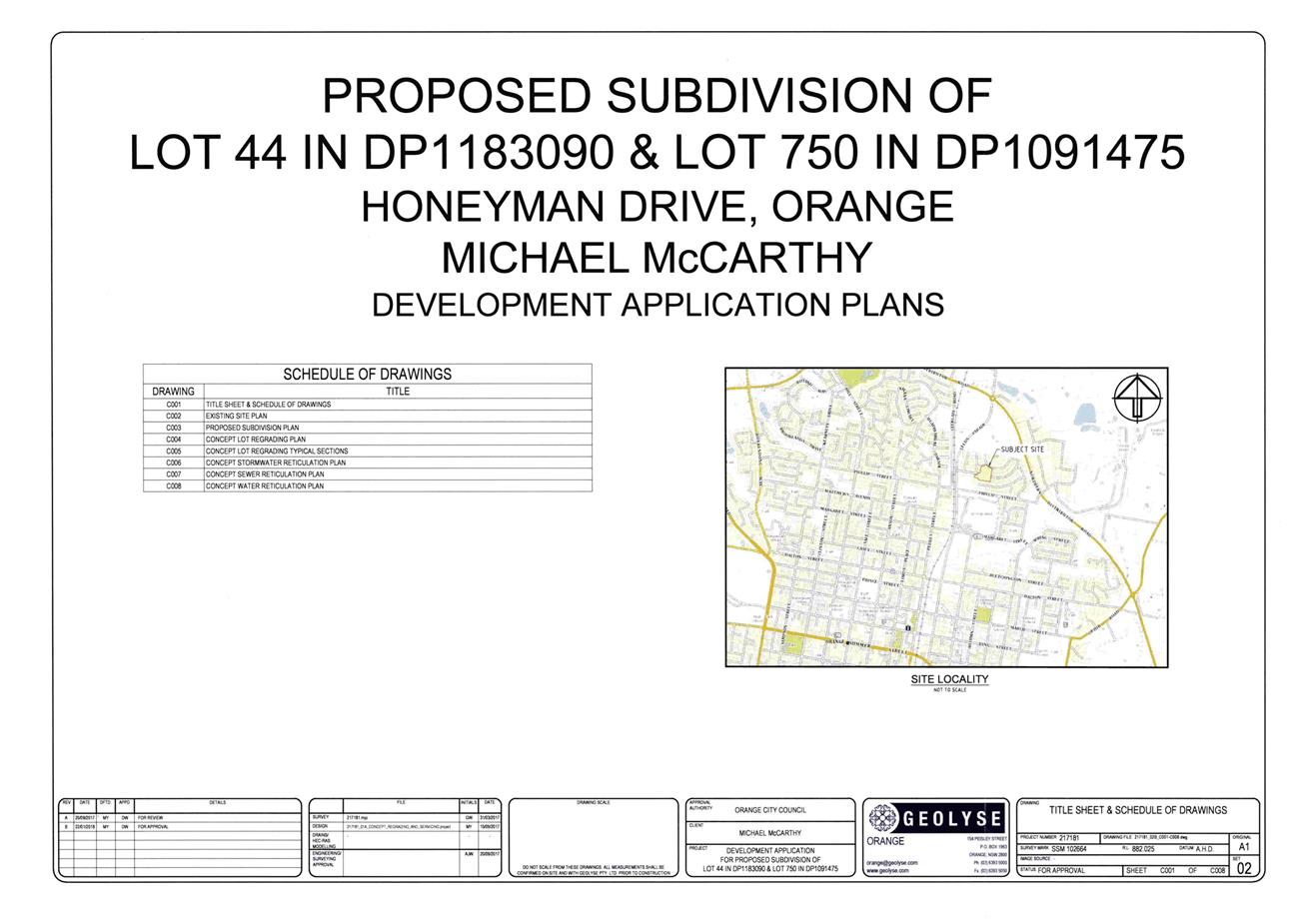
Planning and Development Committee
3 April 2018
2.5 Development
Application DA 19/2018(1) - 23 Honeyman Drive and Quinlan Run
Attachment 2 Plans
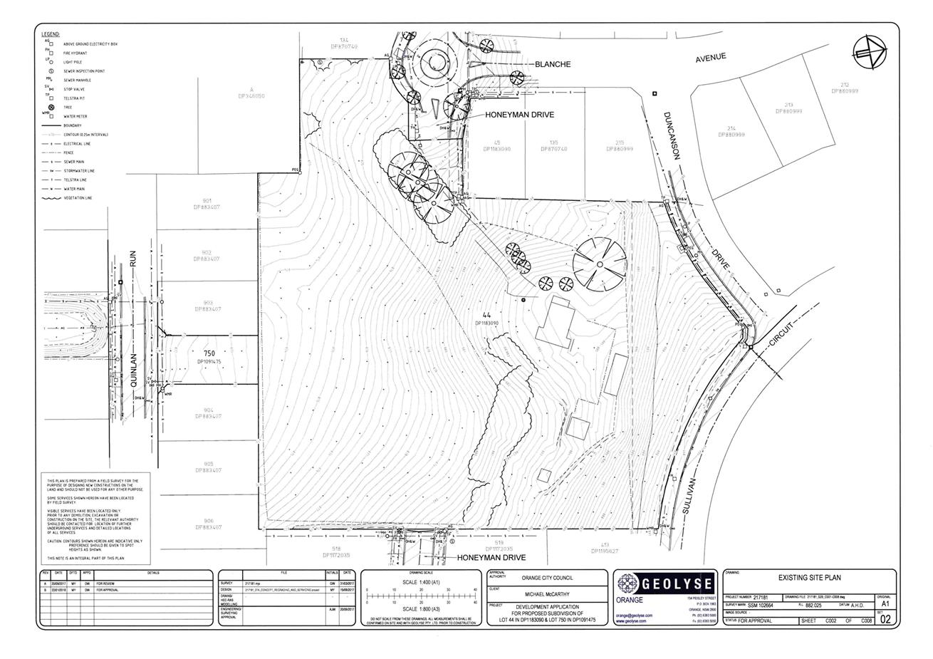
Planning and Development Committee
3 April 2018
2.5 Development
Application DA 19/2018(1) - 23 Honeyman Drive and Quinlan Run
Attachment 2 Plans
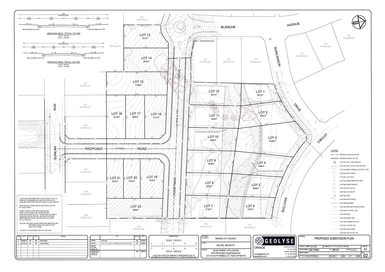
2.6 Draft
Planning Proposal - Towac Equine Precinct
RECORD
NUMBER: 2018/591
AUTHOR: Craig
Mortell, Senior Planner
EXECUTIVE
Summary
Council is in receipt of a
proposal to amend Orange Local Environmental Plan 2011 in relation to land
south and west of Towac Park. The intention is to enable development of the
subject land as an ‘Equine Precinct’ that would allow creation of
mainly 2ha+ lifestyle lots, with four lots proposed below 2ha that are located
on the eastern end of the subject land. The nominated site also includes seven
existing residential properties on the western side of Ploughmans Lane that are
already below the 2ha benchmark.

The estate is principally intended
for horse owners and enthusiasts and seeks to leverage the proximity of Towac
Park. This has the support of Racing Orange, which views the concept as
consistent with their efforts to diversify Towac Park into a multi-purpose
equine use facility.
The proposal has not clarified how it will ensure that the
proposed lots are taken up by horse owners rather than becoming a generic large
lot residential development. The route of the Southern Feeder Road (SFR) also
divides the site from Towac Park and will require appropriate design measures
to manage the conflict between horse and vehicle traffic.
Link To Delivery/OPerational Plan
The recommendation in this report relates to the
Delivery/Operational Plan strategy “1.2 Our City -
Information and advice provided for the decision-making process will be
succinct, reasoned, accurate, timely and balanced”.
Financial Implications
Nil
Policy and Governance Implications
Nil
|
Recommendation
1 That
Council give in principle support to the planning proposal, subject to:
· a preliminary
design and costing of a horse underpass to convey horse riders to Towac Park
without conflicting with future Southern Feeder Road traffic.
· a draft Development
Control Plan masterplan being prepared containing specific equine controls
and an indicative lot layout, with horse laneways and provisions relating to
the construction of horse stables, exercise paddocks and animal welfare
requirements.
2 That
the Local Environmental Plan amendment be drafted on the basis of amending
the land use zone and minimum lot size maps to reflect:
· rezoning the
subject land to RU4 Primary Production Small Lots, excluding the residue land
(to remain RU1 Primary Production).
· establishing a
minimum lot size of 2ha for the subject land, excluding the residue land (to
remain 100ha) and also establishing a minimum lot size of 1ha for the
easternmost property (Lot 1 DP 310521).
3 That
once the above matters are completed, the planning proposal be returned to
Council for further consideration to determine whether the matter proceed to
a Gateway determination.
|
further considerations
The recommendation of this report has been
assessed against Council’s other key risk categories and the following
comments are provided:
|
Political
|
The Southern Feeder Road (and the
Northern Distributor Road) was originally conceived of as a ring road around
Orange. This was later modified when a section of the route parallel to
Ploughmans Lane was abandoned, due in part to significant resident objection.
In more recent times Council has considered and rejected relocation of the
Orange Showground to Towac as part of a combined facility model. Given the
location and this history, the public reaction to this proposal is likely to
be cautious and sceptical.
|
|
Environmental
|
The proposed lot sizes of 2ha do
not typically require provision of reticulated sewer/water. However the
vision of an equine precinct suggests that generation, management and
disposal of horse manure could be significant.
|
|
Health and Safety
|
Creation of an equine estate
straddling the Southern Feeder Road requires separation of horse and
vehicular traffic for the safety of both horse riders and motorists.
Additionally, race meetings will continue to draw traffic from beyond the
immediate area. Clear messaging to alert such motorists to the presence of
horse riders will be needed in order to help calm traffic and reduce the risk
of alarming horses.
|
|
Stakeholders
|
Racing Orange was formed in 2011
after discussions between Racing NSW and Orange City Council aimed at
reinvigorating the sport at Towac Park. Additional horse owners in the
vicinity are likely to reinforce this objective. Managing expectations
between horse owning residents and the broader racing community will be
important.
|
|
Projects
|
The route of the Southern Feeder
Road traverses the precinct. Potential conflict between traffic
volumes/speeds and horse movements to and from Towac Racecourse needs to be
carefully managed. Potential solutions such as forming an underpass or
similar are likely to be required, at significant cost to the proponents.
|
SUPPORTING INFORMATION
Popular in the United States since they emerged in the
1970s, an Equine Precinct concept (also known as an equestrian community or
horse community), is a planned community where people live with horses on their
property within a rural or suburban context. Typically such a community would
have access to a range of facilities, such as shared trails and bridal paths
for pleasure riding through to equestrian arenas, and veterinary hospitals on
or near the site. Shared communal stables are sometimes provided, particularly
for estates with smaller lot sizes. While there are fewer examples in Australia
(such as Mornington in Victoria and Kembla Grange in Wollongong), a local
landowner has expressed interest in exploring the concept, particularly given
the proximity of their land to the Towac Park racecourse. The landowner has
also gained the support of some surrounding residents in response to a staff
request for this to occur.
The proposal before Council has not indicated any particular
horse related embellishments within the estate other than provision of a shared
vehicle/bridal laneway that is intended to bring horse riders to a single
crossing point with the Southern Feeder Road (SFR) route, nominated as a
potential underpass. Beyond this, the proposal relies upon facilities at Towac
Park to provide the attraction to horse owners. The support of Racing Orange is
therefore a key endorsement for the viability of the concept.
The nominated lot sizes of 2ha would be sufficient for
property owners to erect modest stables and some room to graze. However, with
the proximity to the urban area of Orange consideration needs to be given to
how such an estate can successfully avoid a potential land use conflict between
horse owning residents and more generic ‘lifestyle’ residents that
may seek to buy into the estate and find some horse related odours
objectionable.
Supply and Demand
Rural residential sales data supplied by the proponent
indicates that the market share of large lot residential blocks has risen from
approximately 5% to as much as 25% in recent years (2014-April 2017). The
proposal notes that the available supply of such lots is tightening, with limited
supply remaining at Silverdown Way, Clifton Grove, Mullion Creek or Windera.
The proposal includes an indicative layout for a total of 34
lots. This includes 13 existing dwellings, leaving a prospective yield of
21 new lots. This equates to approximately 2/3 of the number sold in 2016
and less than 1/2 of the number sold in 2015. However, it should be noted that
most large lot residences in Orange are not held by horse owners. Therefore the
estate is likely to represent a greater supply level if limited to the equine
subsector.
Southern Feeder Road
In the 1980s Council planning established a route for a ring
road all the way around the City however development in Ploughmans Valley later
resulted in part of the route along the western side of the City being deleted.
The remaining sections of the route became known as the Northern Distributor
Road (NDR) and the Southern Feeder Road (SFR). Of the two, the NDR is
intended to provide the primary route for through traffic while both, roads
also provide a major route for moving local traffic around the City. Location
of the new hospital in Forest Road and the growing medical precinct in that
area will increase the significance of the SFR for both internal and external
traffic.
The current zoning for the SFR route (shown in yellow below)
ends at the southern end of Ploughmans Lane.
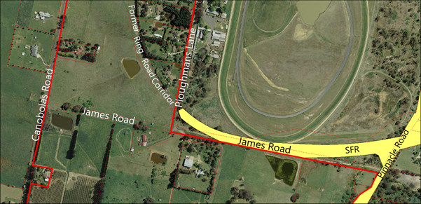
The unformed James Road covers part of the route, while the
western end of James Road may provide a connection further west to Canobolas
Road. This planning proposal requires consideration of the long term future of
the SFR and its role in the local traffic planning.
Presently the zoned route terminates where it meets
Ploughmans Lane. This implies that traffic from the western side of the City is
likely to use Ploughmans Lane as a connection through to the hospital/medical
precinct on Forest Road. It would also be possible to extend the corridor
through James Road to Canobolas Road, after which a further route could be
investigated to ultimately link with Cargo Road.
Traffic Generation Generally
The creation of 21 additional lots is unlikely to generate
significant volumes of localised traffic. The equine aspect of the proposal may
result in some additional movements for delivery of feed and transport of
horses, but this is still expected to be well within the capacity of the local
road network, especially given that the site will connect directly to
the SFR corridor.
The concern with the development as proposed is the conflict
between traffic and equine activities needing to cross the SFR corridor, either
on Ploughmans Road or James Road. In order to ensure public safety for both
activities, a suitable equine crossing, such as a cut and cover tunnel, would
be required as part of the development conditions.
Water Supply and Sewerage Servicing
The proponent initially suggested connecting wastewater from
the estate to a package sewage treatment plant within Towac Park that could
then use the treated effluent to irrigate the racecourse area. Council’s
Water and Sewerage Strategic Manager does not support this concept for a number
of reasons:
· increased
operational maintenance costs associated with owning the asset;
· ongoing compliance
requirements associated with potential water quality and odour issues when
operating such a treatment system;
· public health and
environmental risks associated with using treated effluent for irrigation
purposes at the racecourse; and
· the availability
of other, more efficient servicing options.
The proposal has been amended from that originally proposed and
seeks a minimum lot size of 2ha for most of the land. Council’s policy is
that large lots of 2ha and above do not require reticulated sewer or water and
are generally suitable for onsite waste management.
A small portion to the eastern end of James Road would be
set at 1ha in size. Council’s ability to service these lots would need to
be assessed when and if the entire area were to further intensify. When this
occurs, reticulated services would be required which would be subject to a
separate servicing strategy.
Social and Economic Impacts
The provision of a precinct aimed specifically at one
demographic may be regarded by some as exclusionary. However, Council has
periodically received enquiries and applications related to being able to keep
horses domestically on large lots in other estates such as Clifton Grove and
Silverdown Way. Providing a dedicated estate for the horse owning community
would reduce the risk of horse related complaints from non-horse owners -
admittedly such complaints have been minimal.
Ecological Impacts
The subject land is not identified as possessing any
significant ecological features or remnant habitat. As such, there are not
expected to be any negative impacts. DCP provisions are likely to require
appropriate shade trees and windbreaks, which may in turn enhance the level of
vegetation and provide some incidental benefit to birdlife and small
invertebrates. Further assessment will be required at the DCP stage.
Management of Waste (horse
manure)
The number of horses that would be anticipated is unlikely
to be significant. As an example, the Wollongong DCP governs the development of
Kembla Grange. A relevant extract of that DCP has been attached to this
report. It suggests that horse paddocks of 2,000m2 per horse in area
are generally sufficient to avoid over grazing - especially where supplemental
feeding is provided. Any excessive horse manure production, although unlikely,
could be sold into the local gardening market. Towac Park accommodates a significant
number of horses during race meetings and for training - disposal of manure
from Towac has not emerged as an issue.
Stormwater
By establishing an appropriate maximum stocking rate, horse
paddocks should not experience overgrazing, and therefore runoff water quantity
and quality should not be impacted. DCP provisions can also be prepared to
provide for settling ponds to further limit any contamination risk.
LEP Options
The proposal examined several possible methods of amending
the Orange LEP 2011, these include:
· Extending the R5
Large Lot Residential zone – presumably with an appropriate minimum lot
size of 2ha.
· Amending the land
use table for both the R5 Large Lot Residential and RU1 Primary Production
zones to ensure that stables and supporting functions are permissible –
again presumably with an appropriate minimum lot size.
· Rezoning the site
to RU4 Primary Production – Small Lots zone. This zone has so far not
been adopted within the Orange LEP, and as such would allow Council to tailor
the zone objectives and range of uses permissible. This would help to reinforce
the intended role of the estate as an equine precinct and reduce the likelihood
of land use conflicts.
Additionally, a local clause could also be considered in
relation to domestic horse keeping. This issue has occasionally arisen on other
large lots around Orange, with prospective buyers wanting certainty about being
able to construct stables and/or what Council’s requirements would be.
These considerations will be determined through discussions with
NSW Planning and Environment.
STRATEGIC FRAMEWORK
Orange Sustainable Settlement Strategy (OSSS)
The site is identified as part of LU9 in the OSSS, which
nominates the area for urban development but was not anticipated to be required
in the life of the plan. In essence, the strategy views this and other land
units to the south and west as an overflow area that can be considered if the
demand for land is greater than had been anticipated. The supply and demand
figures provided in the planning proposal, while not extensive, can be regarded
as indicative of the overall level of activity, and do suggest that demand has
been stronger than the OSSS predicted.
Central West Orana Regional
Plan 2036
The regional plan contains a number of objectives and
strategies that are intended to guide the development of the region within the
State population forecasts. As a member council within the region, Council is
required to consider the intent and directions of the regional plan when
evaluating planning proposals.
In this respect the proposal notionally supports tourism
(Direction 4) by fostering development of horse related activities in a defined
precinct. Any increase to the local horse owning community will help to
underpin local equine events that may, in turn, attract visitors from beyond
the immediate area.
The proposal similarly supports equine related education and
training opportunities (Direction 6). An amendment to the LEP with
supporting DCP provisions would also foster greater land use compatibility
(Direction 12), in particular providing greater certainty of land use
(Direction 12.4) and provide guidance on sympathetic land use to reduce
land use conflicts (Direction 12.5)
The proposal also responds favourably to managing rural
residential development (Direction 28) in that the site is located close
to existing urban settlements, enabling efficient use of roads and social and
community infrastructure; and it is considered that horse owners are less
likely to conflict with agricultural land uses south and west of the site.
Section 9.1 Directions by the
Minister (formerly Section 117 Directions)
The planning proposal has examined all directions and given
specific responses to directions:
1.2 Rural
Zones
1.3 Mining
Petroleum Production and Extractive Industries
1.5 Rural
Lands
2.3 Heritage
Conservation
3.1 Residential
Zones
3.2 Caravan
Parkes and Manufactured Home Estates
3.4 Integrating
Land Use and Transport
5.10 Implementation
of Regional Plans
6.1 Approval
and Referral Requirements
6.2 Reserving
Land for Public Purposes
6.3 Site
specific Provisions
The rationale outlined in each response has been reviewed
and is considered to be satisfactory and supportable.
Development Control Plan
If the proposal proceeds, it is considered that the Orange
DCP will need to be amended as well to provide at least the following:
· a 20m setback for
all buildings from both James Road and Ploughmans Lane. This will help to
preserve design options for the long term future of the SFR;
· provision for a
future horse underpass to link Towac Park with the equine precinct at the
developer’s expense;
· a horse friendly
laneway network designed to enable all horse riders to move between the
allotments and Towac Park without conflicting with the SFR or other local
traffic;
· a requirement that
the site design of all homes and outbuildings must retain the ability to locate
stables and yard sufficient to maintain at least one horse; and
· additional
requirements for the location of stables and horse yards, maximum stocking
rates and any other animal welfare issues.
The Wollongong DCP example contains provisions for Animal
Boarding or Training Establishments – Horse Breeding or Training that
sets out a range of factors that could be adapted to conditions in Orange.
These include:
· minimum 2,000m2
paddock size per horse, with a preference for 1ha or more;
· setbacks for
stable buildings to preserve amenity;
· minimum dimensions
for stables;
· material
requirements for masonry construction to 1.2m in height – lighter
materials being more susceptible to damage from horse kicks;
· impervious
flooring materials to facilitate cleaning;
· conveyance of
stormwater runoff into drainage systems and/or drinking troughs;
· height and
placement of feeder and water troughs to reduce fouling;
· shade trees in
horse paddocks and appropriate horse standard fencing to be of post and rail
construction; and
· liquid and solid
waste collection and treatment requirements.
Conclusion
The concept outlined in the planning proposal is regarded as
having merit and is located in an appropriate location, particularly given the
relation of Towac Park. However, some further refinement is required prior to
seeking a formal Gateway determination from the Department of Planning and
Environment. The recommendations of this report would therefore give the
proponent a degree of confidence to move forward with the additional work
suggested.
Attachments
1 Original
Planning Proposal - 18 April 2017, IC17/22884⇩
2 Revised
Planning Proposal 12 September 2017, IC17/23386⇩
3 Planning
Proposal Supplemental Information 6 February 2018, D18/14783⇩
4 Revised
Planning Proposal Layout 12 March 2018, D18/14776⇩
5 Revised
Planning Proposal supporting information 12 March 2018, D18/14775⇩
6 Extract
of Wollongong DCP 2009, D18/14823⇩
Planning and Development Committee
3 April 2018
2.6 Draft
Planning Proposal - Towac Equine Precinct
Attachment 1 Original
Planning Proposal - 18 April 2017

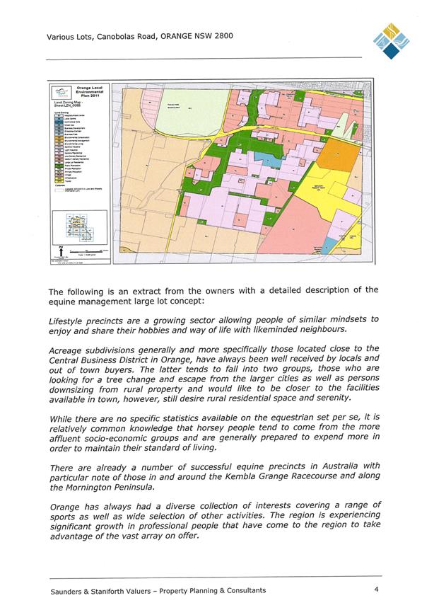
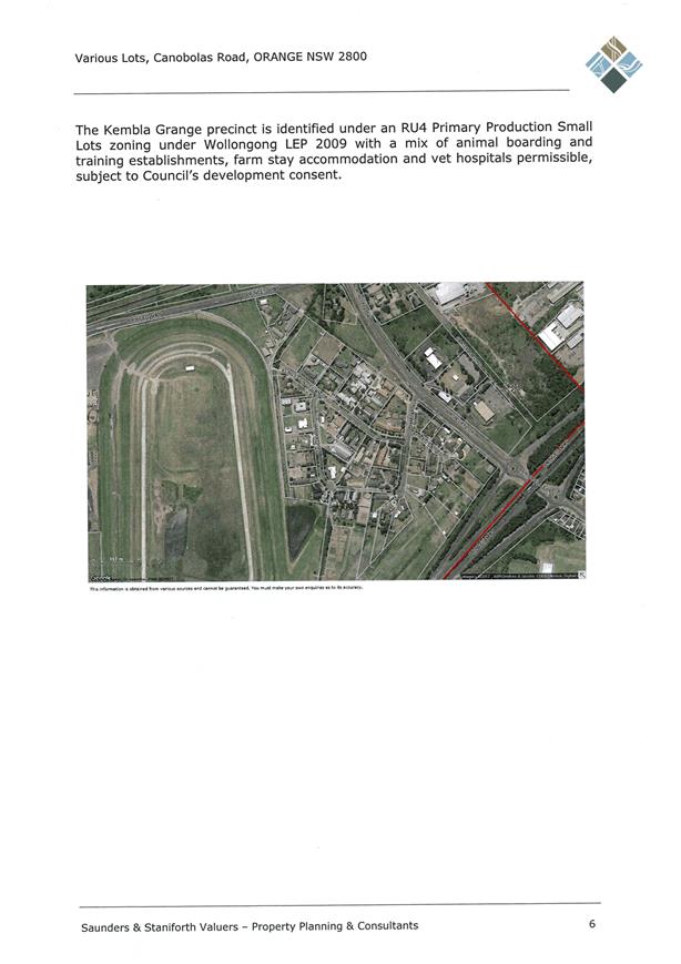
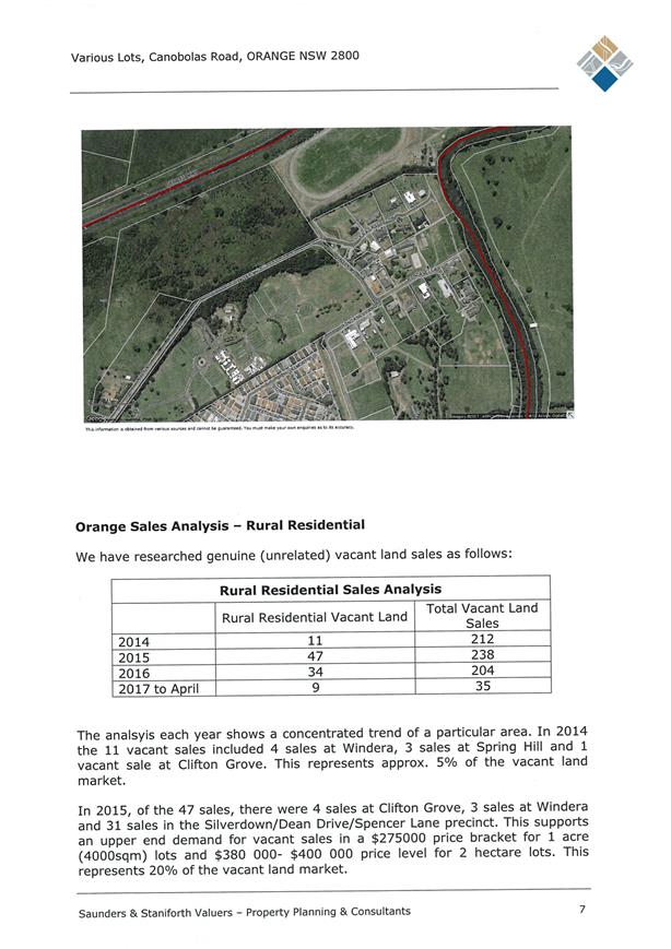

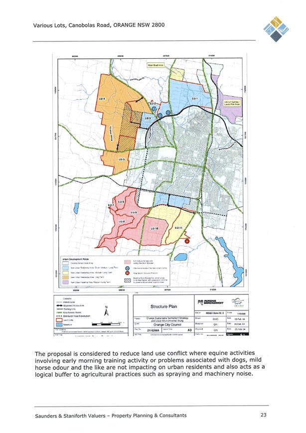


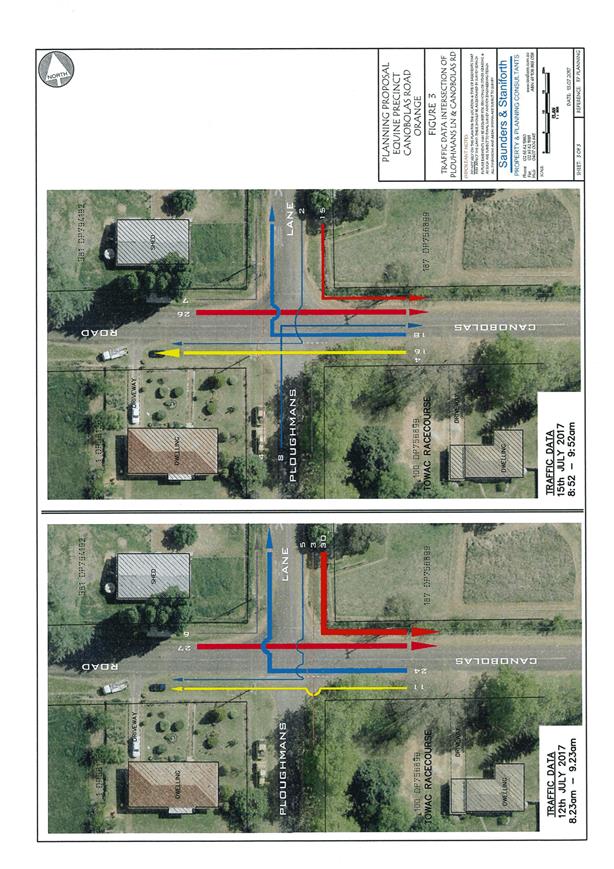
Planning and Development Committee
3 April 2018
2.6 Draft
Planning Proposal - Towac Equine Precinct
Attachment 1 Original
Planning Proposal - 18 April 2017
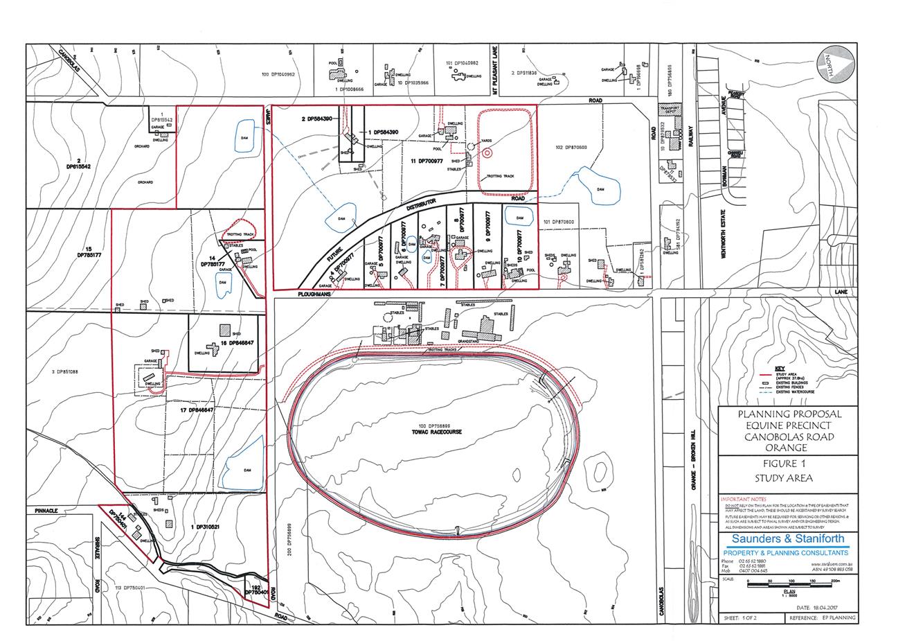
Planning and Development Committee
3 April 2018
2.6 Draft
Planning Proposal - Towac Equine Precinct
Attachment 1 Original
Planning Proposal - 18 April 2017
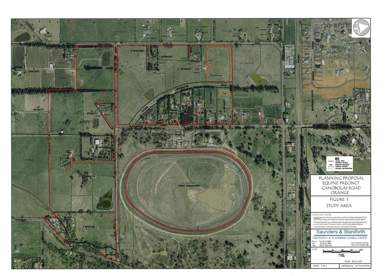
Planning and Development Committee
3 April 2018
2.6 Draft
Planning Proposal - Towac Equine Precinct
Attachment 1 Original
Planning Proposal - 18 April 2017
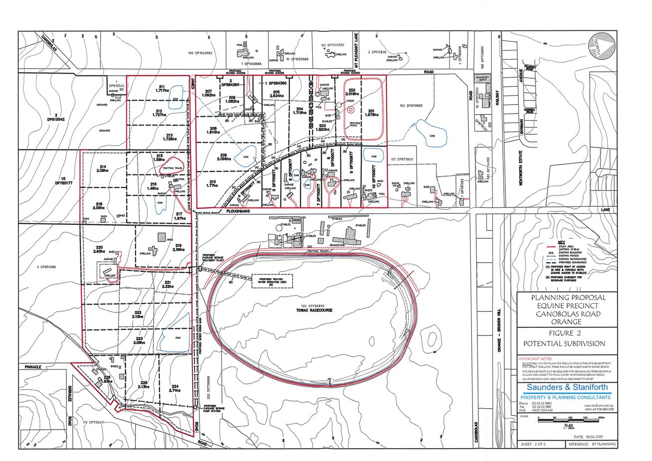
Planning and Development Committee
3 April 2018
2.6 Draft
Planning Proposal - Towac Equine Precinct
Attachment 1 Original
Planning Proposal - 18 April 2017
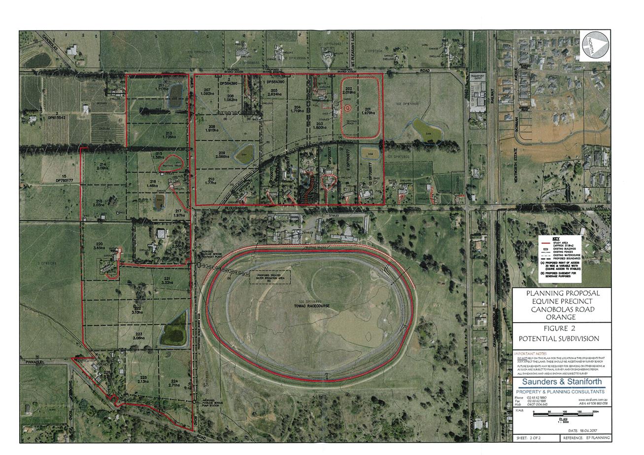
Planning and Development Committee
3 April 2018
2.6 Draft
Planning Proposal - Towac Equine Precinct
Attachment 2 Revised
Planning Proposal 12 September 2017
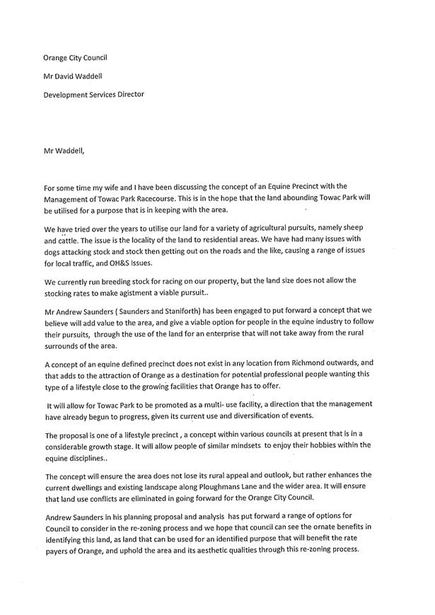

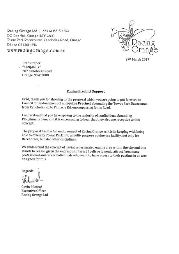
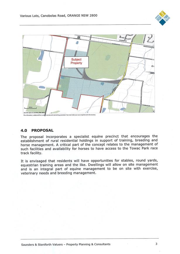

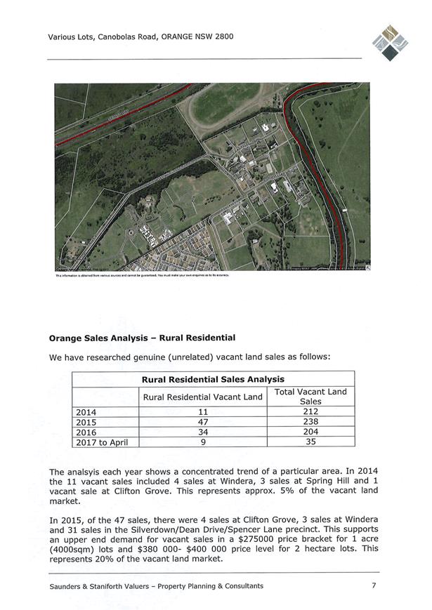
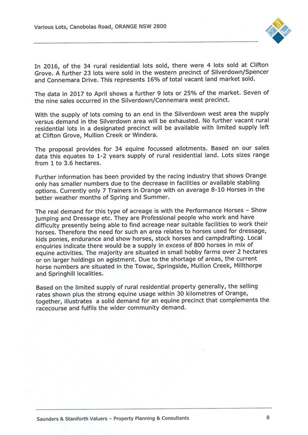


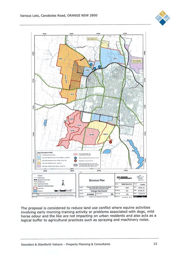


Planning and Development Committee
3 April 2018
2.6 Draft
Planning Proposal - Towac Equine Precinct
Attachment 2 Revised
Planning Proposal 12 September 2017
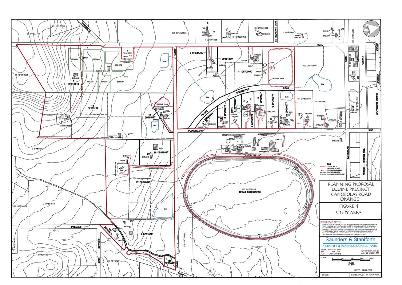
Planning and Development Committee
3 April 2018
2.6 Draft
Planning Proposal - Towac Equine Precinct
Attachment 2 Revised
Planning Proposal 12 September 2017
Planning and Development Committee
3 April 2018
2.6 Draft
Planning Proposal - Towac Equine Precinct
Attachment 2 Revised
Planning Proposal 12 September 2017
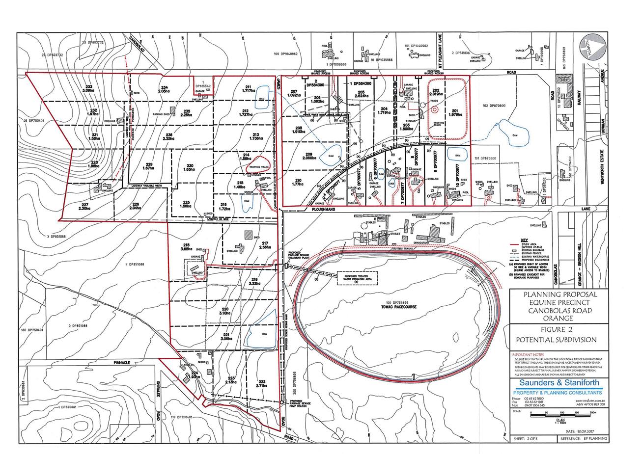
Planning and Development Committee
3 April 2018
2.6 Draft
Planning Proposal - Towac Equine Precinct
Attachment 2 Revised
Planning Proposal 12 September 2017
Planning and Development Committee
3 April 2018
2.6 Draft
Planning Proposal - Towac Equine Precinct
Attachment 3 Planning
Proposal Supplemental Information 6 February 2018
Planning
and Development Committee
3 April 2018
2.6 Draft
Planning Proposal - Towac Equine Precinct
Attachment 4 Revised
Planning Proposal Layout 12 March 2018
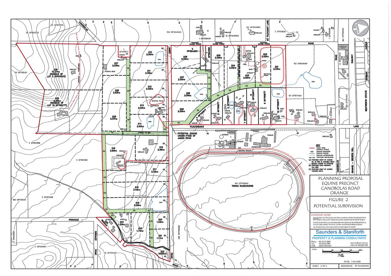
Planning and Development Committee
3 April 2018
2.6 Draft
Planning Proposal - Towac Equine Precinct
Attachment 4 Revised
Planning Proposal Layout 12 March 2018
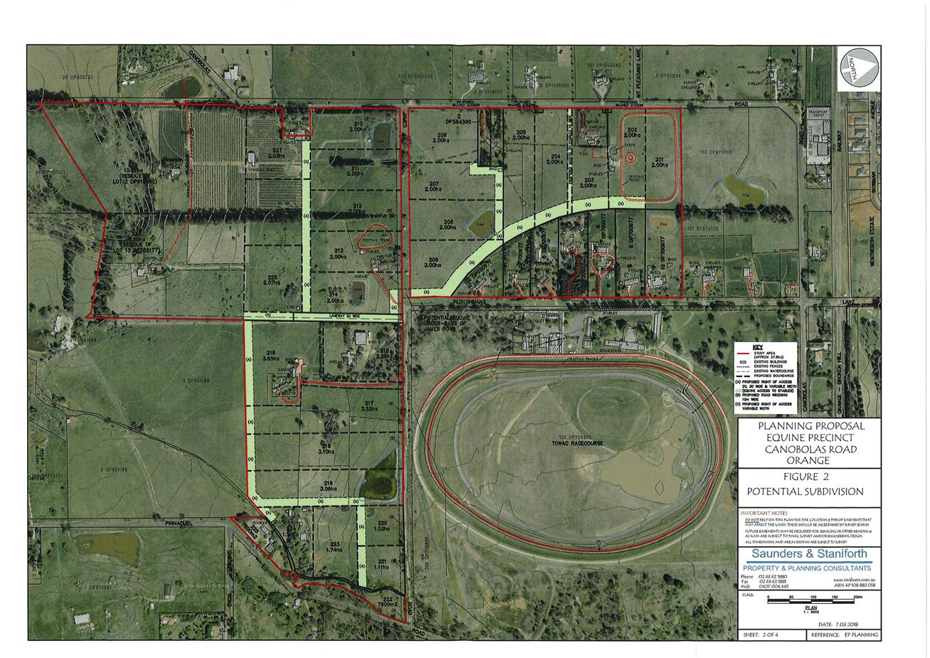
Planning and Development Committee
3 April 2018
2.6 Draft
Planning Proposal - Towac Equine Precinct
Attachment 5 Revised
Planning Proposal supporting information 12 March 2018
Planning
and Development Committee
3 April 2018
2.6 Draft
Planning Proposal - Towac Equine Precinct
Attachment 6 Extract
of Wollongong DCP 2009
Extract of
Wollongong Development Control Plan 2009
6 ANIMAL BOARDING OR TRAINING ESTABLISHMENTS –
HORSE BREEDING OR TRAINING ESTABLISHMENTS
6.1 General
1. “Animal boarding or
training establishment” means a building or place used for the breeding,
boarding, training, keeping or caring of animals for commercial purposes (other
than for the agistment of horses) and includes any associated riding school or
ancillary veterinary hospital.”
6.2 Minimum Site Area
6.2.1 Objective
(a) To permit horse breeding or
training establishments upon certain sized rural and non-urban landholdings, to
minimise potential land use conflicts with rural residential and other rural
land uses in a particular locality.
6.2.2 Development Controls
1. The minimum site area for
any horse breeding or training establishment shall be 3000m2.
2. Notwithstanding this, the
minimum site area for any horse breeding or training facility within the
landholdings known as Lots 1- 13, DP 794002, bounded Trifecta Place and Phar
Lap Avenue in the Kembla Grange Equestrian Estate (as per Precinct 1 in the map
below) may be less than 3000m2 provided the facility is conducted by the
occupants of each rural residential dwelling only, for their own private
recreation purposes.
6.3 Maximum Number of Horses – Kembla Grange Equestrian
Estate
6.3.1 Objective
(a) To restrict the number of
horses within any horse boarding, breeding or training establishment within the
Kembla Grange Equestrian Estate, in order to maintain the amenity of the
locality.
6.3.2 Development Controls
1. The maximum number of
horses for any animal boarding, breeding or training establishment within the
Kembla Grange Equestrian Estate shall be restricted to rate of not more than 1
horse per 250m2 of the site area.
6.4 Minimum Setback Requirements for Horse Stables &
Shelters
6.4.1 Objective
(a) To ensure horse stables and
shelters are appropriately setback from common property
boundaries, in order to maintain
the amenity and character of the surrounding locality.
6.4.2 Development Controls
1. Any horse stable or horse
shelter shall be setback from property boundaries and adjoining land uses in
accordance with Table 4 below.
Table 4: Minimum Setback Requirements for Horse Stables &
Shelters
|
Land Use
|
Minimum Setback Requirement
|
|
Front Building Line Setback to Primary Road
|
10 metres(1)
|
|
Secondary Road Frontage
|
5 metres
|
|
Side and Rear Building Line Setback
|
5 metres
|
|
Adjoining Dwelling not associated with the facility
|
10 metres
|
Land Use Minimum Setback Requirement
Note(1): Council may vary the front
building line setback requirement for a horse stable upon the landholdings
known as Lots 1- 13, DP 794002, bounded Trifecta Place and Phar Lap Avenue in
the Kembla Grange Equestrian Estate subject to an absolute 6 metre minimum
front building line being provided.
6.5 Horse Stable, Exercise Yard & Shelter Requirements
6.5.1 Objectives
(a) To ensure horse stables and
shelters are well designed and constructed to provide suitable all weather
protection for horses.
(b) To ensure horse stables and
shelters are sympathetic to the rural landscape and the scenic environmental
amenity of the locality.
(c) To ensure horse breeding and
training establishments provide suitable exercise training yards.
6.5.2 Development Controls
1. Each horse should be
provided with a suitable horse stable and exercise training yard.
2. The minimum size for any
horse stable should be 3.7 metres wide and 3.7 metres deep. The height of any
horse stable should be a minimum of 2.75 metres up to 3.4 metres, depending
upon the height of the horse.
3. The roof of the stable
shall provide all weather protection and should incorporate appropriate
guttering and down pipes to convey stormwater into rainwater tanks and into
appropriately designed stormwater drainage systems or drinking troughs.
4. The walls of the horse
stable should be of a masonry construction for a height of at least 1.2 metres with
either masonry or solid galvanised iron sheeting provided for the upper wall
panelling. Any concrete masonry blocks should be reinforced with vertical steel
rods and the cores filled with concrete. Some form of window or air passage
between the roof and the walls is needed for cross-ventilation purposes.
5. The wall height shall
range between 2.75 metres up to 3.4 metres high, depending upon the height of
the intended horse. The external walls of the stable shall be appropriately
sealed and waterproofed. The internal walls of the stable should be lined with
plywood sheeting or rubber material to prevent injury to horses and to also
protect the walls from pawing or kicking.
6. The doors of any horse
stable shall be at least 1.2 metres wide and 2.4 metres high with no
protrusions which may cause potential injury to the horse. Any latches to the
doors should be strong and have no protrusions which may injure the horse.
7. The floor of any horse
stable must be constructed of an impervious material which is graded towards
the doorway to permit drainage and with no low spots where urine can collect.
8. A 100mm thick reinforced
concrete slab is the preferred flooring method. Clean bedding such as straw or
sawdust should be provided daily to prevent any foot or leg problems caused by
the horse standing on concrete.
9. Feeders and water troughs
should be raised to a height of 1.05 metres aboveground and placed within a
corner of the stable. The feeders and water troughs should be smooth finished
and free of any protrusions.
10. Any horse shelters shall be
constructed to fulfil the same requirements as a horse stable regarding walls,
floor and roofing but should be provided without any doors, in order to allow
free passage of horses to / from the shelter, at all times.
11. The external finishes of any
horse stable or horse stable shall be painted in a muted green, light brown or
grey colour, in order to maintain the rural character of the surrounding
locality.
6.6 Horse Paddocks
6.6.1 Objectives
(a) To ensure horse paddocks are of
a sufficient size and are provided with appropriate feed and shade trees.
(b) To ensure horse paddocks are
properly fenced (both internally and externally) to minimise any injury to
horses and to encourage rotational grazing of the paddocks.
6.6.2 Development Controls
1. The minimum paddock size
for each horse should be 2,000m2 with a preferable size of 1 hectare or more.
2. Any horse paddock must
contain a horse shelter as well as shade trees.
3. Horse paddocks should be
internally fenced, wherever possible to allow for the rotational use of the
grazing area, in order to minimise any potential overgrazing.
4. Supplementary feed must be
provided, where necessary.
5. Post and rail fencing for
horse paddocks is preferred. The use of wire or barb wire is not recommended
because of its tendency to cause injury to horses. Electric fences are suitable
but should be supported with some type of sight barrier (eg a painted tin lid)
attached to the electric wire, in order to improve the visibility of the electric
fence.
6.7 Liquid & Solid Waste Collection and Treatment
6.7.1 Objective
(a) To ensure all horse boarding,
breeding or training establishments have appropriate liquid and solid waste
collection and treatment systems.
6.7.2 Development Controls
1. All liquid wastes are to be led
to a settling pond area, prior to discharge into any watercourse, stormwater
drainage system or Sydney Water Corporation sewerage system. The settling pond
area shall have a minimum capacity of 1.5% of the total site area with a
maximum depth of 1.2 metres. Any pond overflow shall meet the water quality
criteria set out in the ANZECC guidelines for the particular receiving
waterway.
2. All solid manure should be
removed regularly and placed in a suitable waste storage bin. The solid waste
storage bin should be a large metal bin with a flanged-fitting metal lid which
is waterproof and prevents access to flies and / or vermin. This bin should be
emptied and disinfected weekly.
3. The full details of the proposed
liquid and solid waste treatment process including the settling pond area are
to be submitted with the Development Application for an animal boarding or
training establishment.
4. In the event that the proposal
is ultimately supported, a condition of consent may be imposed requiring an
appropriate water sampling program to be implemented to monitor the water
quality of any waters discharging from the settling pond.
5. The sampling regime is likely to
involve quarterly sampling and sampling after each heavy rainfall event. The
sampling of the water at a registered NATA laboratory should include the
following parameters:-
(a) pH;
(b) Suspended solids;
(c) Dissolve Oxygen;
(d) Total Phosphorous;
(e) Ammonia;
(f) Total Nitrogen; and
(g) Faecal Coliforms.
6. The preparation of an annual
environmental management plan may also be required for any approved horse
boarding, breeding or training facility which outlines the performance of the
settling pond bearing in mind the sampling regime.
RECORD
NUMBER: 2018/213
AUTHOR: Donna
Sims, Health and Building Surveyor
EXECUTIVE Summary
This report outlines Council’s current Itinerant
Trading Policy, discusses recent issues raised in the community, analyses the
policies of other councils and is designed for Council to provide feedback to
staff for the development of a new policy.
Link To Delivery/OPerational Plan
The recommendation in this report relates to the
Delivery/Operational Plan strategy “13.4 Our Environment
– Monitor and enforce regulations relating to City amenity”.
Financial Implications
Nil
Policy and Governance Implications
Nil
|
Recommendation
That the General Manager
develop a comprehensive Local Approvals
Policy for Mobile Food Vending Vehicles operating within the Orange Local
Government Area.
|
further considerations
Consideration has been given to the
recommendation’s impact on Council’s service delivery; image and
reputation; political; environmental; health and safety; employees;
stakeholders and project management; and no further implications or risks have
been identified.
SUPPORTING INFORMATION
Historically, Council has issued approvals under Section 68
of the Local Government Act for mobile coffee vans to operate on public
land within its local government area. Approvals are issued in accordance with
requirements of Council’s Itinerant Trading Policy. Approvals are issued
for a two year period with an option to trade for a third year depending on
satisfactory compliance with approval conditions.
There is also provision for larger scale mobile food vans
and trucks to trade on privately owned land under State
Environmental Planning Policy (Exempt and Complying
Development Codes) 2008. There are a number of criteria
set out in the SEPP regulating this type of trade, the main one being the
business cannot contravene any conditions of a development consent for any
other use carried out on the land.
Generally, vendors operate small scale mobile vans, moving
around the City selling coffee and small amounts of pre-packaged food such as
cakes and sandwiches. They provide a popular service to workers in outlying
industrial and commercial areas who do not have ready access to permanent food
and coffee outlets. By their nature these operators do not incur overheads such
as rates and charges, which are inherent to operating a permanent business.
Mobile food van operators are only required to pay an approval fee
(currently $203 for a five year approval), which affords them the ability
to trade around local streets, accessing potential customers with minimal
ongoing costs.
Complaints have been received from various permanent food
outlets in regard to loss of trade to itinerant traders (coffee vans). There
have also been issues raised around mobile food vendors setting up outside
community events where the organisers have already arranged food vendors to
service their events, causing loss of trade to approved vendors.
To combat the issue of itinerant traders operating in the
Orange area, Council adopted an Itinerant Trading Policy which was last
reviewed in February 2014. This Policy was originally developed to protect all
types of permanent businesses within the Orange City Council area from the
impact of itinerant traders who regularly frequented Orange to sell a variety
of goods from the backs of trucks in the CBD area.
There are exemptions set out in this Policy to allow for
small scale coffee vans to operate outside of the CBD and not less than 100
metres from an existing premises selling coffee. The Policy also allows mobile
coffee vans to trade at the Orange Function Centre, Orange Botanic Gardens,
Showground, Robertson Park, Cook Park, and the Civic Centre Forecourt and
Northcourt. There is also provision to allow seasonal local fruit selling
subject to relevant approval being obtained under the Local Government Act.
It would be appropriate for Council to have a separate Policy for Mobile Food
Vending Vehicles which separates out the requirements for this activity from
the existing Itinerant Trading Policy.
There is a nationwide growth industry in mobile food vending
and ‘pop-up’ food trucks, especially in metropolitan areas. The NSW
Food Authority has acknowledged this well-established trend of large numbers of
mobile food vans and food trucks operating within the metropolitan Local
Government Areas, and the inevitability of this type of trade spreading to
regional areas. Accordingly, the Food Authority has worked with Council
representative groups to give guidance and assistance in formulating guidelines
for vendors on fitout and food handling requirements.
Controls around trading requirements vary between
metropolitan councils, but most have adopted comprehensive Mobile Food Vending
Vehicle Local Approvals Policies and Guidelines to allow these type of
businesses to operate in conjunction with fixed food premises.
The following is a sample of
how three metropolitan councils are currently dealing with this type of trade
(all of these councils allow mobile food vans and trucks to trade):
|
Council
|
Local approvals policy adopted
|
Approval term
|
Comments
|
|
City of Sydney Council
|
Yes
|
12 months
|
Comprehensive
Local Approvals Policy adopted, vendors allocated specific areas of trade,
trading areas clearly defined, strict controls over hours of operation,
signage, waste disposal.
Food
premises inspection fee charged for 12 monthly scheduled food inspection
- $100 per 30 minutes, plus 12 month permit fee of $550 set out in fees and
charges.
Rate-based
fee charged in relation to trading area, eg high demand, low demand. Fees
vary from $400 for street vending only up to $7,500 for low demand and $15,395
for high demand/premium area.
Approval
issued under Section 68 LGA - permit to trade in public place. Mobile food
vending vehicles are broken up into two categories – serving low risk
food, and serving potentially hazardous food.
|
|
Parramatta City Council
|
Yes
|
12 months
|
Comprehensive
Policy and Guidelines. Similar to City of Sydney Council rate-based fee.
Areas
of trade and operating hours strictly controlled. Fees currently $240 annual
inspection fee plus 12 month permit fee of $375
Rate-based
fees range from $5,500 for outer areas of LGA up to $12,000 in CBD and also
dependent on times of trade.
Approval
issued under Section 68 LGA - permit to trade in public place.
|
|
Blacktown
City Council
|
Yes
|
12 months
|
Comprehensive
Policy and Guidelines. Similar to City of Sydney Council rate-based fee
Areas
of trade and operating hours strictly controlled. $290 annual inspection fee
plus 12 month permit fee of $500
Rate-based
access fees range from $3,300 for low demand areas up to $10,000 for high
demand areas.
Approval
issued under Section 68 LGA - permit to trade in public place.
|
To date there has not been a demand to regulate large style
food vans and trucks trading in regional areas. However, as is the case for
metropolitan councils, this form of trade is expanding and will begin to impact
on regional councils in the near future.
Regional councils currently vary in their approach to
allowing mobile food vans to operate in their area but most discourage all
forms of itinerant trading due to its impact on local established businesses.
A summary of information
provided by comparable Regional Councils who allow mobile food and coffee vans
to trade in their LGA is set out below:
|
Regional Council contacted
|
Allows mobile coffee vans/ food trucks to trade
|
Local approvals policy adopted
|
Approval term
|
Comments
|
|
Bathurst
Regional Council
|
No
|
No
|
n/a
|
Mobile
food vans not allowed to trade on public land except at community events.
Temporary
food permits issued for these events.
|
|
Dubbo
Regional Council
|
Yes
|
No
|
Varies
from 1 to 12 months
|
Limits
numbers and discourages mobile food vans trading in Local Government area. Temporary
food permits issued for local community events
Vehicles
must comply with the Food Authority Guidelines for Mobile Food Vendors
No
policy in place - have been fielding more enquiries about this activity but
no change to procedure at this time.
Charges
$160 inspection fee plus $250 administration fee.
|
|
Wagga
City Council
|
Yes
|
No
|
12
months
|
No policy
in place for mobile food vending vehicles.
Limited
number of low risk mobile food vans currently operating under Section 68
approval. Discourages mobile food vendors trading in the Local Government
area.
$185
inspection fee plus $225 administration fee.
|
|
Tamworth
Regional Council
|
Yes
|
Yes
|
12
months
|
Mobile
food vendors allowed to operate under a Use of Public Land (Local Approvals)
Policy.
Strict
control over numbers of vendors.
Approvals
issued under Section 68 LGA.
$233
inspection fee plus $242 administration fee.
Encourages
mobile food vendors at public events.
|
|
Orange
City Council
|
Yes
|
Yes
|
2 years
|
Mobile
coffee vans allowed to operate under Itinerant Trading Policy.
Approvals
issued under Section 68 LGA.
Strict
conditions applied to approval to restrict areas of trade and times of trade.
Annual
inspection fee $203.
|
The mobile food van/truck business (large show van style
vehicles/trailers, cooking and selling high volumes of food) has started to
emerge in Orange, with Council receiving enquiries from operators seeking
approval to operate outlets on public land, selling a variety of food including
Vietnamese cuisine, home style meals, barbecue cuisine, hamburgers/chips, ice
cream and gelato, hotdogs and pie meals. However, there is no provision for
this type of business to evolve in Council’s Itinerant Trading Policy or
conditions of consent for a Section 68 Approval.
There are two options available to Council to be able to
address the existing situation of small mobile food vans (smaller vehicles
selling coffee, sandwiches, cakes etc.) operating within the Orange area:
1 Introduce
a ‘sunset’ clause on all existing approvals so that when they
expire there will be no opportunity to renew, which will phase this trade out
over a period of time.
OR
2 Develop
a comprehensive Policy and Guidelines to allow small coffee vans to continue to
operate within a strictly controlled approval process, as well as allowing for
mobile food trucks (large vans/trucks which are fitted out to enable them to
set up on a site and prepare and cook food for immediate sale) to be approved
for trade.
The development of a Policy and Guidelines would need to
address issues such as:
· what areas of the
Local Government Area will be approved for trade, and if they would be broken
up into high and low demand areas (e.g. high demand would be the CBD and
surrounds)
· how fees will be
applied (e.g. in line with the metropolitan council approach of a percentage of
commercial rates paid by fixed premises, or a set fee for all approvals)
· period of
approvals – 12 months or longer
· capping of numbers
of vehicles allowed to trade or no restrictions on numbers, and relying on fees
to keep numbers at a controlled level