
ORANGE CITY COUNCIL
Planning and Development
Committee
Agenda
7 December 2017
Notice
is hereby given, in accordance with the provisions of the Local Government Act
1993 that a Planning and Development
Committee meeting
of ORANGE CITY COUNCIL will be held in the Council Chamber, Civic Centre, Byng Street, Orange on Thursday,
7 December 2017.
Garry
Styles
General Manager
For apologies please
contact Michelle Catlin on 6393 8246.
Planning and Development Committee 7
December 2017
1 Introduction
The
provisions of Chapter 14 of the Local Government Act, 1993 (the Act)
regulate the way in which Councillors and designated staff of Council conduct
themselves to ensure that there is no conflict between their private interests
and their public role.
The
Act prescribes that where a member of Council (or a Committee of Council) has a
direct or indirect financial (pecuniary) interest in a matter to be considered
at a meeting of the Council (or Committee), that interest must be disclosed as
soon as practicable after the start of the meeting and the reasons given for declaring
such interest.
As
members are aware, the provisions of the Local Government Act restrict any
member who has declared a pecuniary interest in any matter from participating
in the discussion or voting on that matter, and requires that member to vacate
the Chamber.
Council’s Code of Conduct provides that if members
have a non-pecuniary conflict of interest, the nature of the conflict must be
disclosed. The Code of Conduct also provides for a number of ways in which a
member may manage non pecuniary conflicts of interest.
|
Recommendation
It is recommended that Committee Members now disclose any
conflicts of interest in matters under consideration by the Planning and
Development Committee at this meeting.
|
2 General
Reports
2.1 Items Approved
Under the Delegated Authority of Council
TRIM
REFERENCE: 2017/2272
AUTHOR: Paul
Johnston, Manager Development Assessments
EXECUTIVE Summary
Following is a list of development
applications approved under the delegated authority of Council.
Link To Delivery/OPerational Plan
The recommendation in this report relates to the
Delivery/Operational Plan strategy “13.4 Our Environment
– Monitor and enforce regulations relating to City amenity”.
Financial Implications
Nil
Policy and Governance Implications
Nil
|
Recommendation
That the information provided in the
report by the Manager Development Assessments on Items Approved Under the
Delegated Authority of Council be acknowledged.
|
further considerations
Consideration has been given to the
recommendation’s impact on Council’s service delivery; image and
reputation; political; environmental; health and safety; employees;
stakeholders and project management; and no further implications or risks have
been identified.
SUPPORTING INFORMATION
|
Reference:
|
DA112/2016(2)
|
Determination
Date
|
1 November 2017
|
|
PR Number
|
PR22384
|
|
Applicant/s:
|
The Wellness House
Pty Ltd
|
|
Owner/s:
|
Dr TY Chen &
The Wellness House Pty Ltd
|
|
Location:
|
Lot 100 DP 1113737
– 55-57 Bathurst Road, Orange
|
|
Proposal:
|
Modification
of development consent - medical centre (alterations and additions) and
neighbourhood shop (pharmacy). The modification involves part enclosure of
the verandah on the southern building façade to provide enlarged
consulting rooms.
|
|
Value:
|
$100,000 (being
the same value as the original development)
|
|
Reference:
|
DA233/2017(1)
|
Determination
Date
|
2 November 2017
|
|
PR Number
|
PR25414
|
|
Applicant/s:
|
Stevens Group
|
|
Owner/s:
|
Orange Service
Centre Pty Ltd
|
|
Location:
|
Lot 85 DP 1167633
– 5 Hanrahan Place, Orange
|
|
Proposal:
|
Highway service
centre and signage
|
|
Value:
|
$1,400,000
|
|
Reference:
|
DA287/2017(2)
|
Determination
Date
|
30 October 2017
|
|
PR Number
|
PR2279
|
|
Applicant/s:
|
Mr HS Hamouda
|
|
Owner/s:
|
Mr HS Hamouda
|
|
Location:
|
Lot 13 DP 16510
– 26 Caroline Street, Orange
|
|
Proposal:
|
Modification of
development consent -conversion of Shop and Dwelling to Principal and
Secondary Dwelling. The modification is seeking approval for an amended plan
that indicates a room formerly shown as a bedroom as actually a bathroom.
|
|
Value:
|
$2,000
(being the same value as the original development)
|
|
Reference:
|
DA 301/2017(1)
|
Determination
Date
|
9 November 2017
|
|
PR Number
|
PR26105
|
|
Applicant/s:
|
J & J Stojanovic
|
|
Owner/s:
|
Orange Investments
(NSW) Pty Ltd
|
|
Location:
|
Lot 9 DP 1183249 -
225 McLachlan Street, Orange
|
|
Proposal:
|
Vehicle repair
station and vehicle sales or hire premises
|
|
Value:
|
$450,000
|
|
Reference:
|
DA 302/2017(1)
|
Determination
Date
|
8 November 2017
|
|
PR Number
|
PR10176
|
|
Applicant/s:
|
Mr RM Pitt
|
|
Owner/s:
|
Mr RM Pitt
|
|
Location:
|
Lot 1 DP 531400
– 47-49 Prince Street, Orange
|
|
Proposal:
|
Subdivision (two
lot residential), Dwelling House, Secondary Dwelling (change of use) and
Demolition (tree removal)
|
|
Value:
|
$0
|
|
Reference:
|
DA 310/2017(1)
|
Determination
Date
|
2 November 2017
|
|
PR Number
|
PR6190
|
|
Applicant/s:
|
Mr KW and Mrs HL
Cochrane
|
|
Owner/s:
|
Mr KW and Mrs HL
Cochrane
|
|
Location:
|
Lot 1 DP 197845
– 19 Kite Street, Orange
|
|
Proposal:
|
Demolition
(existing shed) and Serviced Apartment
|
|
Value:
|
$65,000
|
|
Reference:
|
DA 316/2017(1)
|
Determination
Date
|
6 November 2017
|
|
PR Number
|
PR5636
|
|
Applicant/s:
|
Mr B Inwood
|
|
Owner/s:
|
Ms N Yousif
|
|
Location:
|
Lot 64 DP 258354
– 33 Jilba Street, Orange
|
|
Proposal:
|
Dwelling house and
secondary dwelling
|
|
Value:
|
$400,000
|
|
Reference:
|
DA 318/2017(1)
|
Determination
Date
|
17 October 2017
|
|
PR Number
|
PR25189
|
|
Applicant/s:
|
Southern Cross
Austereo
|
|
Owner/s:
|
Keratin NSW Pty
Ltd
|
|
Location:
|
Lot 3 SP 84946
|
|
Proposal:
|
Telecommunications
Facility (radio transmission mast)
|
|
Value:
|
$50,000
|
|
Reference:
|
DA 325/2017(1)
|
Determination
Date
|
6 November 2017
|
|
PR Number
|
PR8737
|
|
Applicant/s:
|
Nipperess
Investments Pty Ltd
|
|
Owner/s:
|
Nipperess
Investments Pty Ltd
|
|
Location:
|
Lot 29 DP 11439
– 107 Moulder Street, Orange
|
|
Proposal:
|
Office premises
(change of use from dwelling house)
|
|
Value:
|
$20,000
|
|
Reference:
|
DA 327/2017(1)
|
Determination
Date
|
9 November 2017
|
|
PR Number
|
PR26583
|
|
Applicant/s:
|
Waratah Sapling
Children’s Centre Pty Ltd
|
|
Owner/s:
|
Mr RM Hay
|
|
Location:
|
Lot 110 DP
-1194964 – 56 Farrell Road, Orange
|
|
Proposal:
|
Centre based child
care facility (additions)
|
|
Value:
|
$270,000
|
|
Reference:
|
DA 361/2017(1)
|
Determination
Date
|
2 November 2017
|
|
PR Number
|
PR10006
|
|
Applicant/s:
|
Lyndon Community
|
|
Owner/s:
|
Ms JZ Bond
|
|
Location:
|
Lot 177 DP 775277
– 6 Lysterfield Road, Orange
|
|
Proposal:
|
Group home
(transitional) (change of use)
|
|
Value:
|
$0
|
|
Reference:
|
DA 364/2017(1)
|
Determination
Date
|
3 November 2017
|
|
PR Number
|
PR8325
|
|
Applicant/s:
|
Mr JA Vandenberg
|
|
Owner/s:
|
Amberlend Pty
Limited
|
|
Location:
|
Lot 4 DP 233405
– 45-47 McNamara Street, Orange
|
|
Proposal:
|
Small bar
|
|
Value:
|
$0
|
|
Reference:
|
DA 368/2017(1)
|
Determination
Date
|
27 October 2017
|
|
PR Number
|
PR11592
|
|
Applicant/s:
|
Mr D Angley
|
|
Owner/s:
|
Rossi Orchards Pty
Ltd
|
|
Location:
|
Lot 1 DP 38588
– 178 Summer Street, Orange
|
|
Proposal:
|
Retail
(alterations and additions) and signage
|
|
Value:
|
$15,000
|
|
Reference:
|
DA 385/2017(1)
|
Determination
Date
|
16 November 2017
|
|
PR Number
|
PR17469
|
|
Applicant/s:
|
Rotary Club of
Orange Daybreak
|
|
Owner/s:
|
Sentinel Orange
Homemaker Pty Ltd
|
|
Location:
|
Lot 2 DP 270204
– 168-200 Lone Pine Avenue, Orange
|
|
Proposal:
|
Temporary use of
land (car show)
|
|
Value:
|
$0
|
|
Reference:
|
DA 395/2017(1)
|
Determination
Date
|
15 November 2017
|
|
PR Number
|
PR27554
|
|
Applicant/s:
|
R & JE White
Superfund
|
|
Owner/s:
|
Orange City
Council
|
|
Location:
|
Lot 200 DP 1227253 - Astill Drive and Lot 55 DP 1063083 – 4
Elwin Drive, Orange
|
|
Proposal:
|
Earthworks
(retaining walls and filling portion of site)
|
|
Value:
|
$20,000
|
TOTAL
NET* VALUE OF ALL DEVELOPMENTS APPROVED IN THIS PERIOD: $2,690,000
*
Net value relates to the value of modifications. If modifications are
the same value as the original DA, then nil is added. If there is a plus/minus
difference, this difference is added or taken out.
2.2 Enforcement
of Development Issues in Orange
TRIM
REFERENCE: 2017/1935
AUTHOR: David
Waddell, Director Development Services
EXECUTIVE Summary
Council in the last decade has adopted a practice of working
with developers and ratepayers on development issues rather than a more
punitive approach to illegal development and works. Council has on occasion
fined developers in the Local Government Area under the Protection
Environment and Operations Act and Environmental Planning and Assessment Act,
particularly for flagrant breaches or continued breaches. Examples include
illegal earthworks in the Hill Street area, illegal earth shaping in the Gorman
Road area, illegal works in the Occidental Hotel and Hotel Orange, illegal
works on Officeworks, and 47 Byng Street (Byng Street Café) for
operations outside the consent. Fines are usually levied after warnings have
been issued.
A good example of Council’s historical and current
approach can be seen in the Royal Hotel case of 2007 where the glass
heritage tiles were removed from the hotel without consent. Whilst the loss of
the heritage tiles was irreversible, rather than prosecute the owner, Council
resolved to allow the matter to be resolved via a development application and a
level of restoration, with no penalty applied. In many local government areas
this would have resulted in instant fines or court action.
The Kurim shops issue is one with a long history.
Council issued demolition orders which have been resisted by the landowner.
Given this resistance and the significant works required by the Orders, Council
is now seeking demolition orders from the Land and Environment Court to protect
Council's interests.
Subsequent to DA 222/2015(1) for a Chemist’s
Warehouse in Summer Street, the applicant has carried out illegal signage
works, resulting in signage significantly different to that approved. Two sets
of orders and warnings have been issued without adequate response.
Prior to the approval of DA 259/2017(1), the owner of the Carrington
Hotel in Byng Street carried out works to render the building safe and to
stop further decay. In addition, other works were carried out that might be
interpreted as premature and thus without consent.
Prior to lodgement of the development application, the new
owner and developer of 62 Byng Street, Orange carried out works to
render the house safe and to stop further decay. Again, other works were
carried out that might be interpreted as premature and without consent.
Highland Heritage has carried out significant
building works without consent as part of its expansion plans. DA 324/2015(1)
is still before the Land and Environment court so no further comment will be
made in this report. No action has been taken to date on this matter.
Numerous other matters include a motel using a function
centre next door as its de facto restaurant without consent, numerous examples
where owners of heritage items unknowingly disturb the fabric of buildings
without consent, a builder who on a number of occasions has undertaken illegal
works then modified the consent afterwards to match the works, and an
earthmoving company that has yet to move out of its premises into approved
premises.
Two development applications are currently before Council
for potential illegal occupation of business premises. It is likely that their
occupation will be approved retrospectively without business discontinuity.
In general terms, illegal development including demolition
is often undertaken in ignorance or for reasons thought time-critical by
developers – builders onsite for example. In most cases the impact on
heritage items or streetscape is minimal, however in some cases the impact has
been significant and irreversible.
This report outlines the actions currently underway on some
matters and options available to Council in dealing with several of the current
matters and into the current Council term.
Link To Delivery/OPerational Plan
The recommendation in this report relates to the
Delivery/Operational Plan strategy “13.4 Our Environment
– Monitor and enforce regulations relating to City amenity”.
Financial Implications
Council does not have a high level of resourcing in the
policing of development. Any move to a more punitive approach may require
further staffing.
Policy and Governance Implications
Nil
|
Recommendation
1 That the information
provided in the report by the Director Development Services on enforcement of
development issues in the Orange Local Government Area be acknowledged.
2 That
for minor breaches, Council continues the practice of working with developers
across the local government area through warnings and education rather than a
more punitive approach unless wilful or continued breaches occur.
3 That
for serious, wilful or continued breaches, Council act upon penalising
developers for proven illegal works within six months of knowledge of the
breach.
|
further considerations
Consideration has been given to the
recommendation’s impact on Council’s service delivery; image and
reputation; political; environmental; health and safety; employees;
stakeholders and project management; and no further implications or risks have
been identified.
SUPPORTING INFORMATION
Kurim Shops - the current legal process
Following a protracted process of warnings
and dialogue with the landowner, his failure to adequately secure the premises
resulted in Council resolving to issue orders to demolish.
The landowner has subsequently not complied
with the orders in the requisite time period, so Council is seeking the orders
to be issued by the Land and Environment Court. Council’s legal advisor
has advised that given the seriousness of a significant building demolition,
Court orders are more preferable than simply acting upon the Council issued
orders. Council’s legal advisor has been directed to commence
proceedings. We await this process to allow Council to effect the demolition
orders of the Court.
Chemist Warehouse - the Current
Legal Process
Subsequent to DA 222/2015(1) for a Chemist’s Warehouse
in Summer Street, the applicant has carried out illegal signage works,
resulting in large scale signage significantly different to that approved.
Council has issued orders for the signage to be removed but not acted upon the
orders yet. The applicant is yet to properly respond or remove this signage.
Heritage and Planning Context
Orange Local Environment Plan 2011 (OLEP
2011) outlines the consent requirements around heritage items in Orange:
(2) Requirement for consent Development
consent is required for any of the following:
(a) demolishing or moving
any of the following or altering the exterior of any of the following
(including, in the case of a building, making changes to its detail, fabric,
finish or appearance):
(i) a heritage item,
(ii) an Aboriginal object,
(iii) a building, work, relic or
tree within a heritage conservation area,
(b) altering a heritage item
that is a building by making structural changes to its interior or by making
changes to anything inside the item that is specified in Schedule 5 in relation
to the item,
(c) disturbing or excavating
an archaeological site while knowing, or having reasonable cause to suspect,
that the disturbance or excavation will or is likely to result in a relic being
discovered, exposed, moved, damaged or destroyed,
(d) disturbing or excavating
an Aboriginal place of heritage significance,
(e) erecting a building on
land:
(i) on which a
heritage item is located or that is within a heritage conservation area,or
(ii) on which an Aboriginal
object is located or that is within an Aboriginal place of heritage
significance,
(f) subdividing land:
(i) on which a
heritage item is located or that is within a heritage conservation area, or
(ii) on which an Aboriginal
object is located or that is within an Aboriginal place of heritage
significance.
(3) When consent not
required
However, development consent under this clause is
not required if:
(a) the applicant has
notified the consent authority of the proposed development and the consent
authority has advised the applicant in writing before any work is carried out
that it is satisfied that the proposed development:
(i) is of a minor
nature or is for the maintenance of the heritage item, Aboriginal object,
Aboriginal place of heritage significance or archaeological site or a building,
work, relic, tree or place within the heritage conservation area, and
(ii) would not adversely
affect the heritage significance of the heritage item, Aboriginal object,
Aboriginal place, archaeological site or heritage conservation area, or
(b) the development is in a
cemetery or burial ground and the proposed development:
(i) is the creation of
a new grave or monument, or excavation or disturbance of land for the purpose
of conserving or repairing monuments or grave markers, and
(ii) would not cause
disturbance to human remains, relics, Aboriginal objects in the form of grave
goods, or to an Aboriginal place of heritage significance, or
(c) the development is
limited to the removal of a tree or other vegetation that the Council is
satisfied is a risk to human life or property, or
(d) the development is
exempt development.
Carrington Hotel
As previously reported to the Planning and Development
Committee earlier in 2017, Council staff agreed to a very specific list of
works that could be carried out to the building by the owner without the need
for development consent pursuant to Clause 5.10(3) of
Orange LEP 2011. Such works included removing carpets, wood panelling
and bar on the ground floor. Also, non-original skirting boards and architraves
were agreed to be removed (provided sections were retained for the purposes of
making suitable reproductions). General interior cosmetic works such as
painting, new carpets and the like were also agreed to.
These works were agreed to on the basis that the works were
minor and would not adversely impact the significance of the conservation area
- noting that the subject land is not a nominated heritage item.
The owner commenced these works and it became apparent that
the structural integrity of the building was unsound, to the extent that there
was a possibility of failure of exterior walls.
It was found that the junctions of exterior brickwork at the
foundations had suffered severe water damage and were extremely brittle. Also,
the foundations upon which exterior brickwork sat consisted of rotted hardwood
timber resting on a gravel/earthen base.
On the first floor, it was noted that interior walls
comprised a simple timber frame, wrapped in chicken wire and rendered with
modern sand and cement render.
These walls comprised considerable weight and were not
supported directly below on the ground floor, save for a single post and beam
which had obvious visible signs of deflection. It is estimated that this
structural arrangement was installed at some point in the second half of the 20th century.
The roof structure was noted to not meet current engineering
standards.
The owner of the premises took immediate action to underpin
the exterior walls (ground floor) of the northern section of the building and
replace the ground floor with a new reinforced concrete slab. The owner also
removed several internal dividing walls on the first floor to reduce the load
on the aforementioned post and beam.
Despite being arguably inherent to the safety of the
building, these works were not authorised by Council. Council staff commenced
investigations of the premises and it was agreed that the remaining necessary
remedial works could be carried out under a separate emergency orders process
issued by Council staff.
These works have since been completed. It is noted
that the internal stairs were removed outside of the orders process.
In summary, the initial slab/underpinning of the northern
section of the ground floor and removal of several first-floor walls, along
with the removal of the internal stairs occurred without consent.
62 Byng Street
The property was bought in December 2014 by the current
owner. Council will recall the recent Land and Environment Court Case
over the boutique Hotel development which has subsequently been approved.
Senior staff visited the site with the owner to discuss the
site's development potential in 2014. It was evident at this visit that
the house was in a state of disrepair. Numerous cats were living in and under
the house, rot and decay was highly visible. In this context it could be
considered commendable that the new owner has taken the project on. The
restoration costs alone are significant. Indeed, it is often the case that
Council is asked to consent to demolition once buildings are too far gone.
Subsequent to this visit staff communicated to the owner the
rules under the Orange LEP relating to which works could be done without
consent.
As a follow-up, another email clarified some matters.
The Planner’s report for the Boutique Hotel DA noted:
Notably,
some works have already been undertaken onsite. Accordingly, the applicant is seeking
consent to regularise those works. In accordance with Council’s standard
procedure, matters in relation to carrying out works on the subject property
without development consent are addressed under separate cover to avoid any
confusion between the assessment of the development application and potential
enforcement procedures.
Council subsequently received a list of works undertaken
from the owner. This list received from the owner is provided below:
1 No
trees have been removed from the site without Council approval. In particular
the tree in the front of the property was removed because it posed a risk as
the letter from Council of 21 November indicated.
2 No
garden was removed from the rear of the house as none existed. The area was
completely overgrown with privet, blackberry, bamboo and ivey (sic).
When Council Officer Hobden inspected the property in November he suggested
that the area needed immediate clearing as it represented a health hazard.
3 The
shed we have removed was not as you are aware part of the listed heritage
property. It contained a large amount of asbestos material which needed removal
from the site before construction could be undertaken. This material has been
removed and any useful material has been retained on the site for use in the
restoration.
4 Likewise
the enclosed verandah was not part of the historic fabric of the house and was
again largely constructed of asbestos, it was also giving off a very offensive
smell. This was found to be caused by a number of dead cats. In order to remove
the smell all the floor boards had to be removed and soil removed from the
area. Any material which was not contaminated has been retained on the site.
Of note is that the Heritage Listing of "Yalungah"
includes the whole property, not just the house itself, so the removal of the
garage could be construed as illegal works notwithstanding the state of
disrepair and presence of asbestos. The state of the enclosed verandah was
confirmed by staff as fundamentally degraded.
Timing is of great importance in these matters. Given the
time expired since the 62 Byng Street and Highland Heritage matters and
Council’s practice of separating the two, Council’s ability to
impose fines may have passed according to legal advice received. Council
may wish to alter its standard procedure under which matters in relation to
carrying out works on the subject property without development consent are
addressed under separate cover to avoid any confusion between the assessment of
the development application and potential enforcement procedures to avoid this
statute of limitation (A statute of limitation is a law which forbids
prosecutors from charging someone with a crime that was committed more than a
specified number of years ago. The general purpose of statutes of limitation is
to make sure convictions occur only upon evidence (physical or eyewitness) that
has not deteriorated with time.)
Council appetite for future action
under the Environmental Planning & Assessment Act
Council can set the tone for the next three year term by
either:
1 Instructing
the General Manager to continue the practice of working with developers across
the LGA combined with an education campaign
2 Setting
a more punitive direction, with the use of more fines in particular.
2.3 Orange
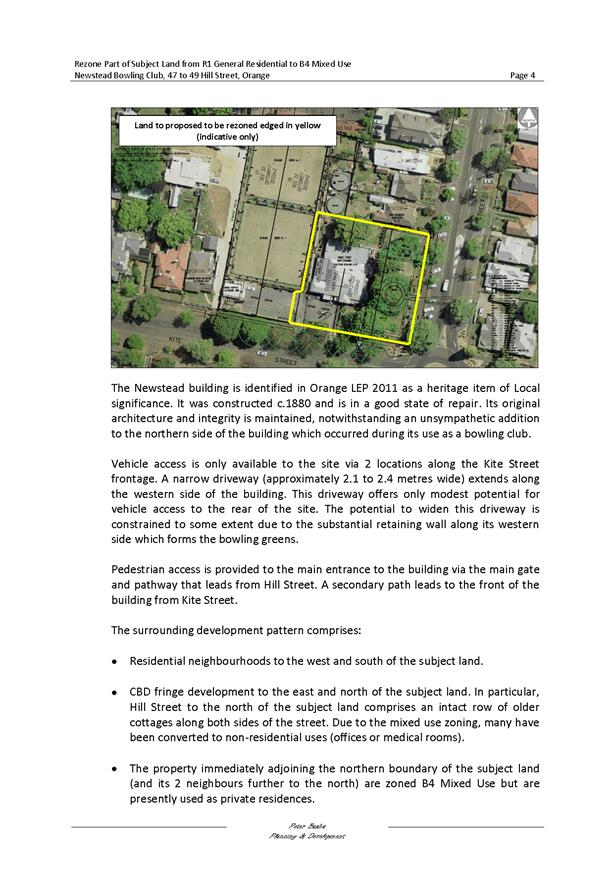
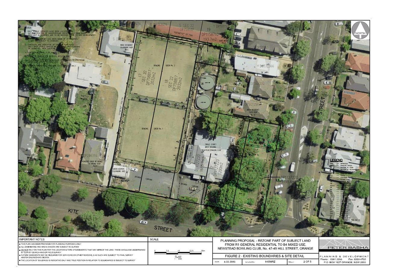
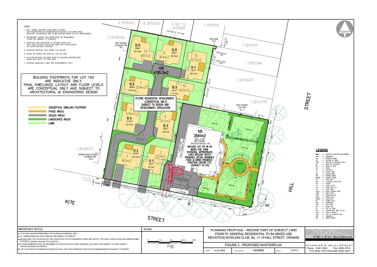
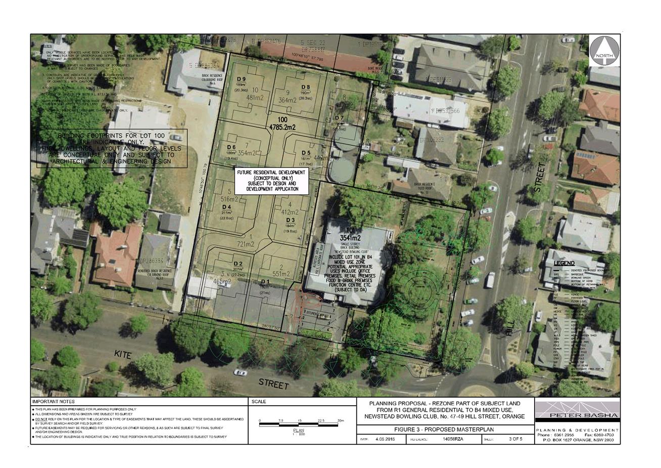
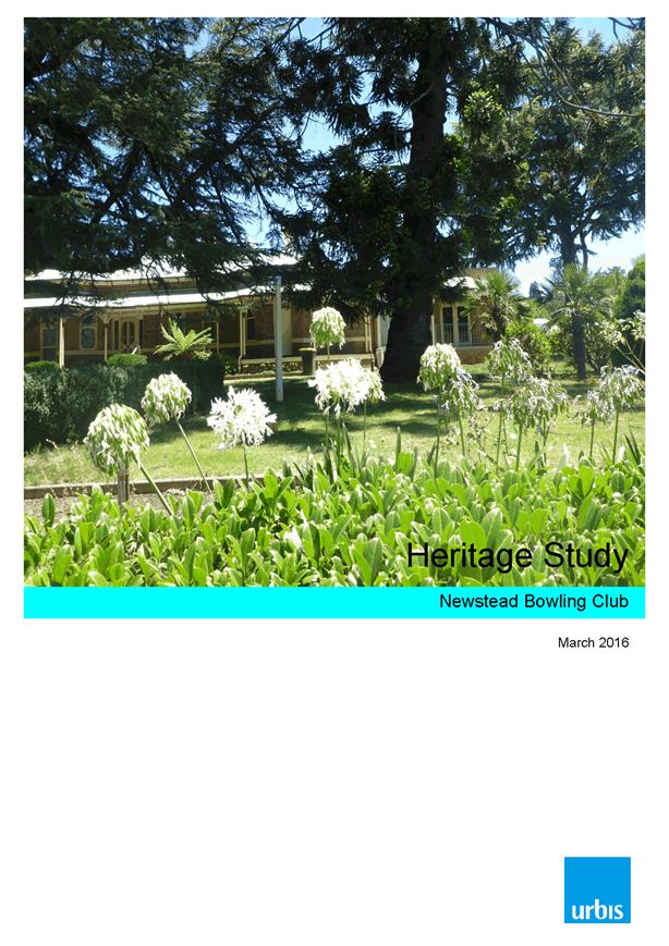
Local Environmental Plan 2011 - Amendment 11 - Newstead Bowling Club
RECORD
NUMBER: 2017/2332
AUTHOR: Craig
Mortell, Senior Planner
EXECUTIVE Summary
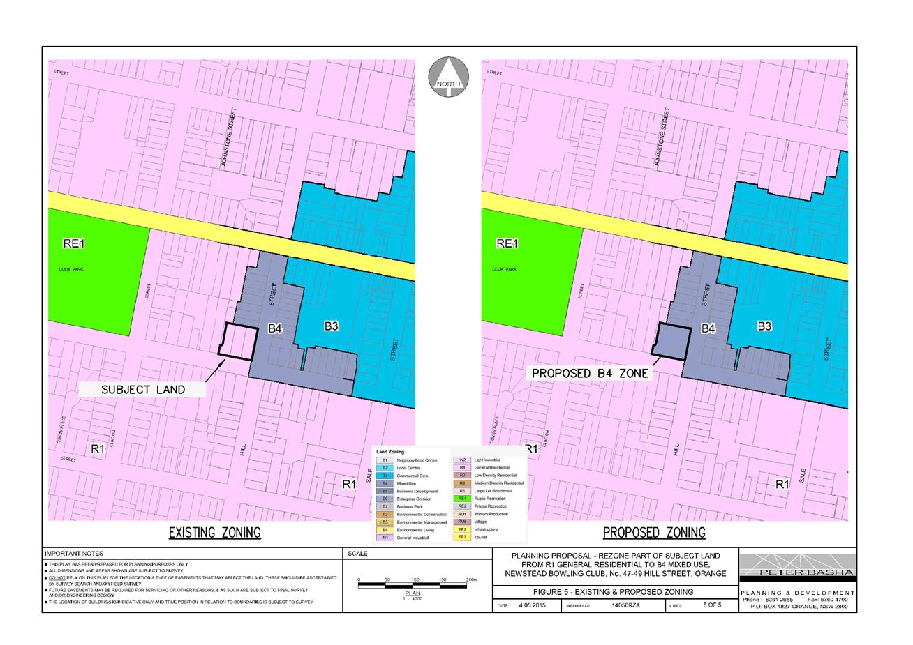
The Planning Proposal seeks to amend Orange Local
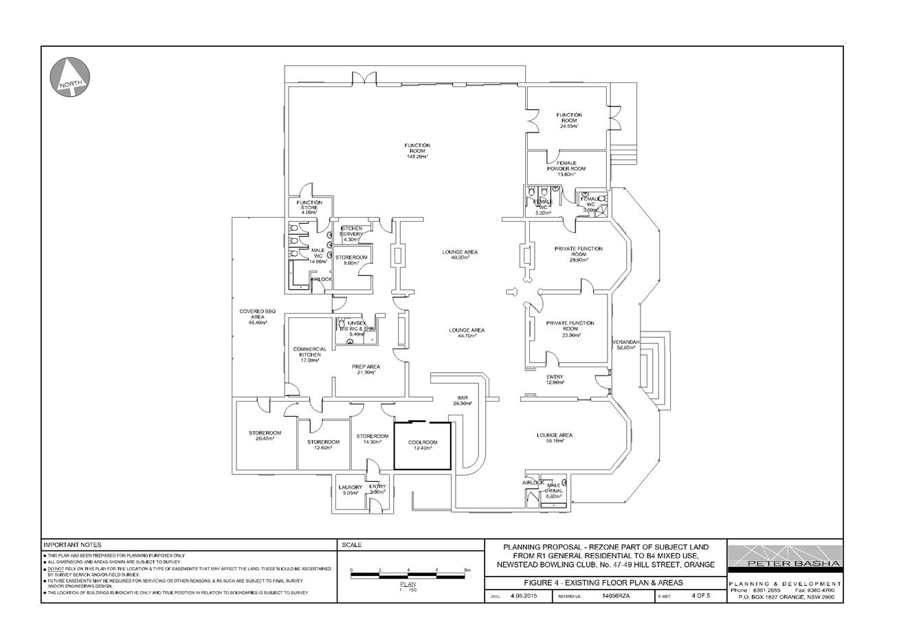
Environmental Plan 2011 in relation to the heritage listed Newstead
Clubhouse (former mansion), altering the zone and imposing building height and
floor space ratio controls over the site.
The intention of the proponent is to secure the future of
the heritage listed building by providing a zone that will enable a range of
land uses to be considered. Given that neighbouring B4 zoned land is already
subject to building height and floor space ratio controls, extension of the B4
zone over the heritage building has also included similar controls to avoid a
perception that the site could be more intensively developed, which may be seen
as inconsistent with the heritage values of the building.
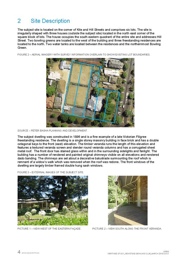
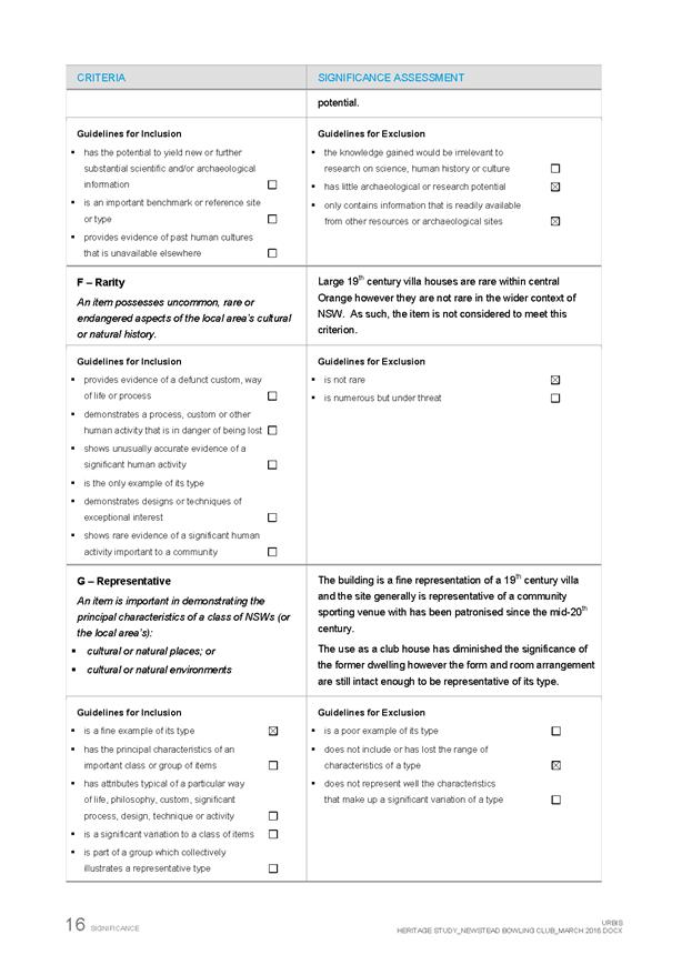
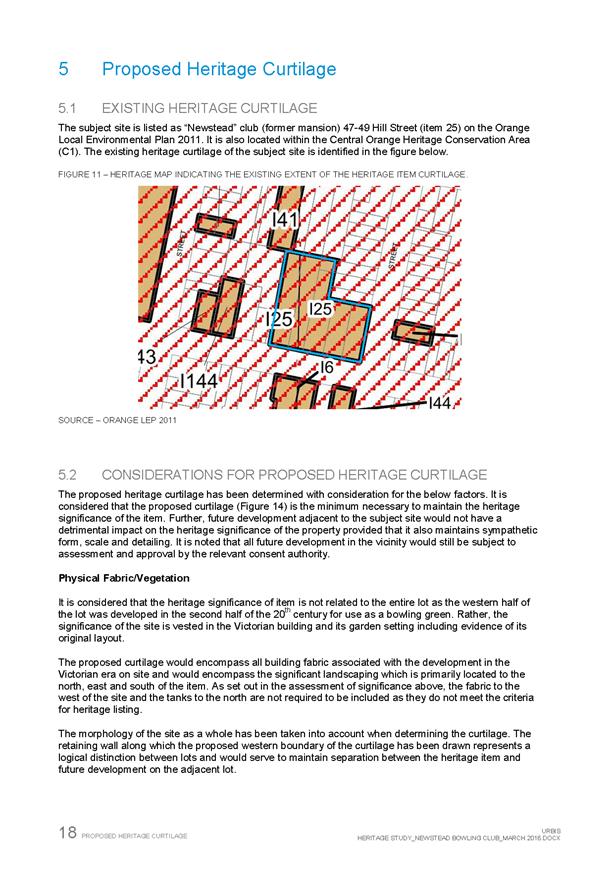
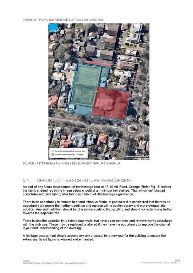
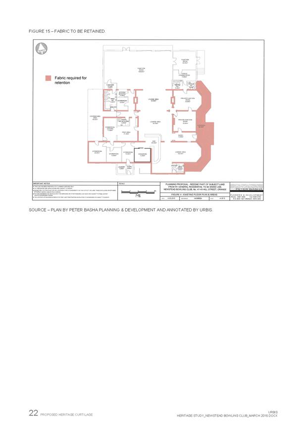
The proposal seeks to reduce the area of heritage item I25.
The current area encompasses the entire site of the former bowling club
(clubhouse and bowling greens) even though the heritage listing is only related
to the clubhouse/former mansion. The former bowling greens are intended to remain
residentially zoned and developed for multi dwelling housing.
A general principle of heritage management is that enabling
a productive and economical use of a building will tend to promote the
maintenance and preservation of that building.
The proposed B4 Mixed Use zone adjoins other properties in
Hill Street and Kite Street., including a heritage item at 50 Hill Street.
Link To Delivery/OPerational Plan
The recommendation in this report relates to the
Delivery/Operational Plan strategy “1.2 Our City -
Information and advice provided for the decision-making process will be
succinct, reasoned, accurate, timely and balanced”.
Financial Implications
Nil
Policy and Governance Implications
Nil
|
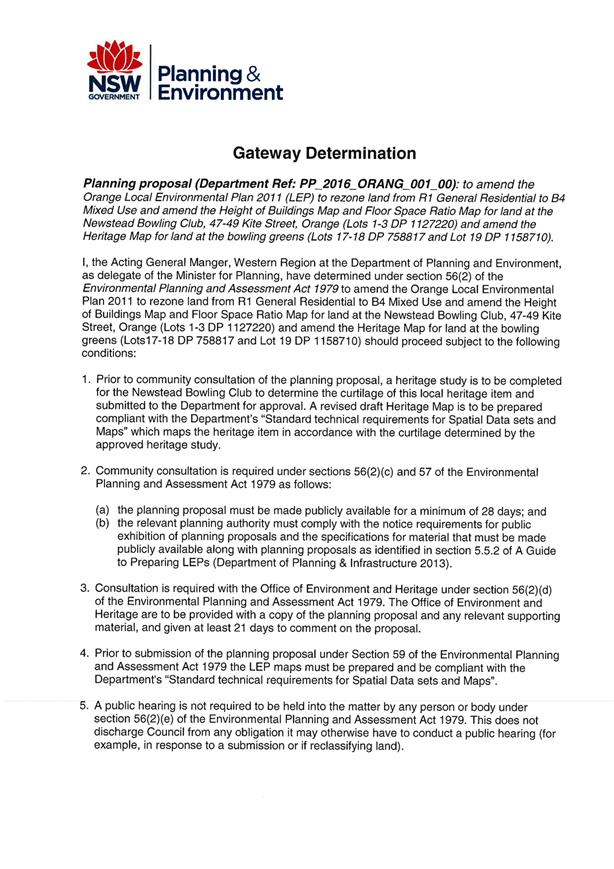
Recommendation
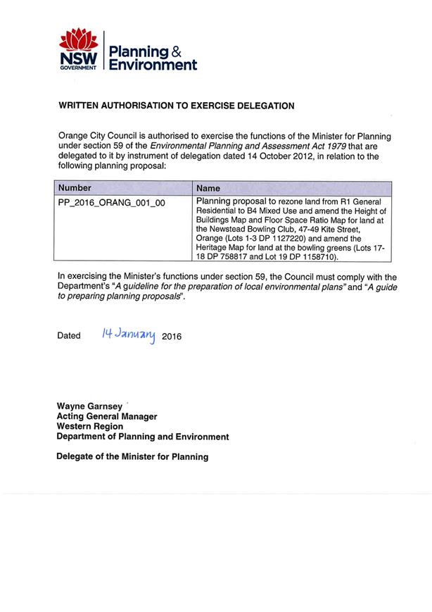
1 That
amendment 11 – Orange Local Environmental Plan 2011 – Newstead
Bowling Club be referred to the NSW Department of Planning and Environment
and the Parliamentary Counsel Office for legal opinion and finalisation.
2 That
Council amend Orange Local Environmental Plan 2011 authorising the
General Manager to make the plan in accordance with the planning proposal
with the following changes:
(a) that
the height limit proposed for the heritage item be reduced from 9 metres
to 6 metres consistent with the established pattern of the area, and
(b) that
the floor space ratio limit be reduced from 0.5:1 to 0.25:1 in recognition of
the desirability to preserve the landscaped curtilage of the heritage listed
building.
|
further considerations
Consideration has been given to the
recommendation’s impact on Council’s service delivery; image and
reputation; political; environmental; health and safety; employees;
stakeholders and project management; and no further implications or risks have
been identified.
SUPPORTING INFORMATION
Following the closure of the Newstead Bowling Club the new
owners of the property have sought ensure the long term protection of the
heritage listed building by requesting a rezoning of the property to enable a
wider and more appropriate range of potential uses to be considered both now
and into the future. This has coincided with redevelopment of the bowling
greens for residential units consistent with the existing residential zoning
(subject to a separate report).
The bowling greens did not form part of the heritage
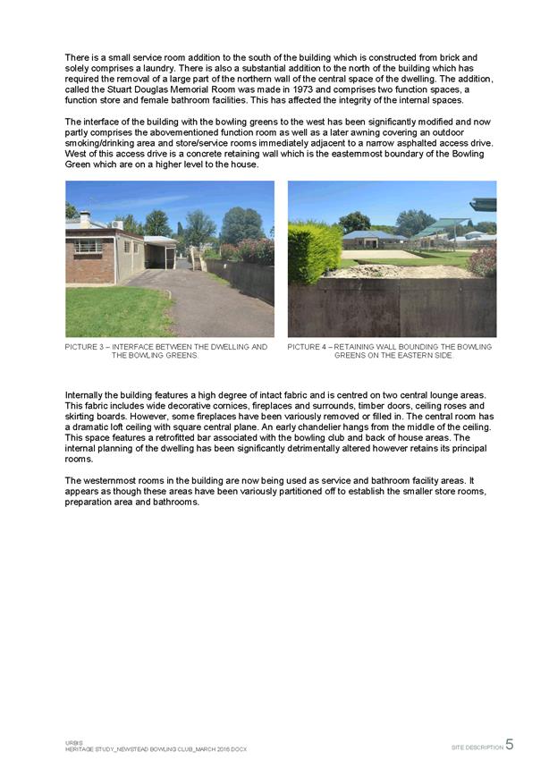
significance of the site, which goes back to its original use as a grand local
residence. The bowling club itself was an adaptation of the original mansion.
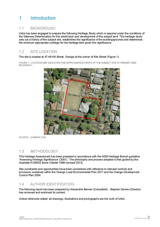
The Gateway determination required that a heritage study be
prepared to establish and justify the appropriate extent of curtilage that
should be retained with the building. This was undertaken by Urbis on behalf of
the proponent and submitted to the Department of Planning and Environment for
review prior to public exhibition.
The 28 day exhibition period
for the planning proposal was from 22 June 2017 through to 21 July
2017. No submissions were received during this time, however a retiring staff
member with a keen appreciation of the City’s heritage had previously
supplied comments and concerns to be considered.
Submissions
One submission was received.
Issues were raised that the height and FSR provisions that
apply to the neighbouring B4 land do not reflect the heritage significance
of the Newstead Clubhouse (former mansion) and associated landscaping. The
submission questions the height limit of 9 metres in preference for a
height that reflects the general existing height of the buildings in the area
of around 6 metres.
The submission states that FSR should be substantially lower
than the 0.5:1 proposed as any expansion of floor space would likely be located
forward of the heritage building, impacting on the heritage value of the
property. Adoption of generous height/FSR standards may raise expectations from
future developers that would then be difficult to limit.
The height and FSR nominated in the exhibition was derived
from a continuation of the controls applying to neighbouring B4 properties in
Hill Street. It was considered that the Hill Street character in this area is
of an appropriate density and scale such that continuation of that pattern is
desirable. Notwithstanding this, the Newstead building derives significant
benefit from its landscaped curtilage, and preserving this would reduce the
scale involved.
The current building footprint is approximately 800m²
inclusive of verandas, and the reduced area of the site is approximately
3,600m². This would be an approximate ratio of 0.22:1. The options
are to remain consistent with the neighbouring B4 properties in Hill Street at 0.5:1
and 9 metre height limit or reduce the level as suggested in the
submission, in which case a ratio of 0.25:1 and 6 metre heights would
still retain some flexibility for sympathetic alterations and additions to be
considered over time without signalling more ambitious redevelopment.
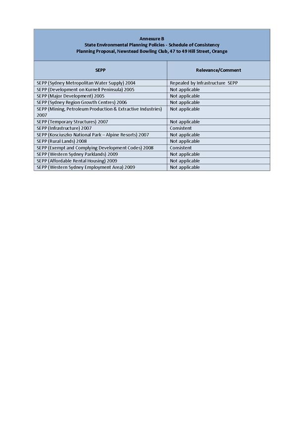
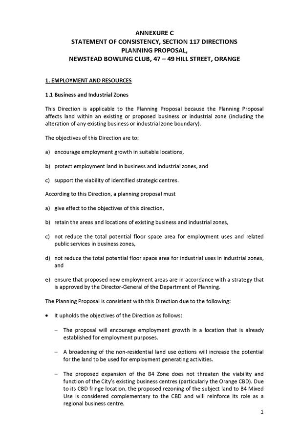
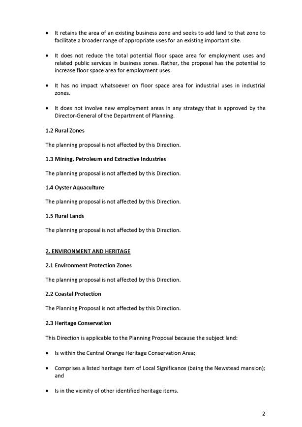
Attachments
1 Gateway
Determination, D17/70005⇩
2 Gateway
Determination - timeframe extension, IC17/13603⇩
3 Planning
Proposal, D17/68009⇩
4 Heritage
Study - Newstead Bowling Club 47-49 Hill Street, D17/68011⇩
5 Draft
Zoning Map, D17/68001⇩
6 Draft
Height of Buildings Map, D17/68002⇩
7 Draft
Floor Space Ratio Map, D17/68004⇩
8 Draft
Heritage Map 8A, D17/68005⇩
9 Draft
Heritage Map 8C, D17/68007⇩
10 Submission,
D15/38372⇩
Planning and Development Committee
7 December 2017
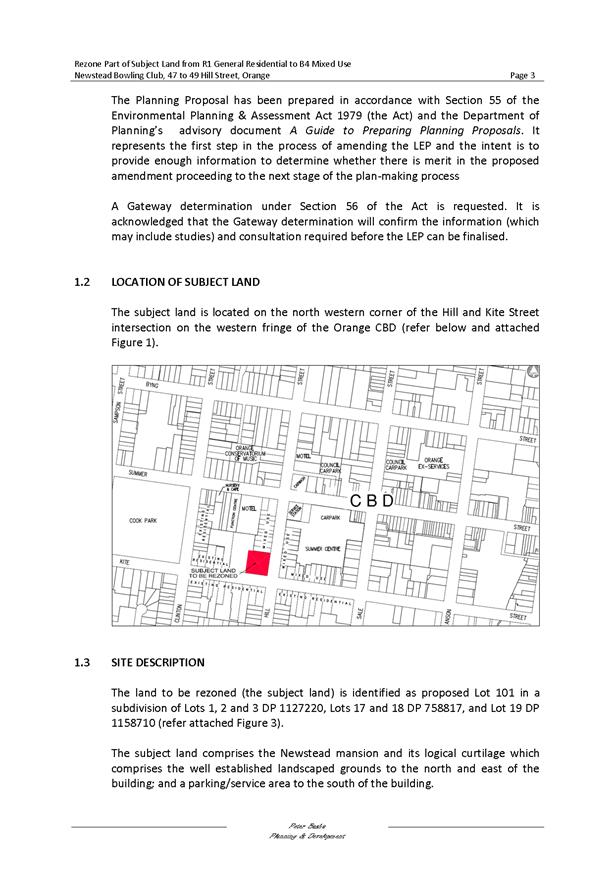
2.3 Orange
Local Environmental Plan 2011 - Amendment 11 - Newstead Bowling Club
Attachment 1 Gateway
Determination
Planning
and Development Committee
7 December 2017
2.3 Orange
Local Environmental Plan 2011 - Amendment 11 - Newstead Bowling Club
Attachment 2 Gateway
Determination - timeframe extension
Planning
and Development Committee
7 December 2017
2.3 Orange
Local Environmental Plan 2011 - Amendment 11 - Newstead Bowling Club
Attachment 3 Planning
Proposal
Planning and Development Committee
7 December 2017
2.3 Orange
Local Environmental Plan 2011 - Amendment 11 - Newstead Bowling Club
Attachment 3 Planning
Proposal
Planning and Development Committee
7 December 2017
2.3 Orange
Local Environmental Plan 2011 - Amendment 11 - Newstead Bowling Club
Attachment 3 Planning
Proposal
Planning and Development Committee
7 December 2017
2.3 Orange
Local Environmental Plan 2011 - Amendment 11 - Newstead Bowling Club
Attachment 3 Planning
Proposal

Planning and Development Committee
7 December 2017
2.3 Orange
Local Environmental Plan 2011 - Amendment 11 - Newstead Bowling Club
Attachment 3 Planning
Proposal
Planning and Development Committee
7 December 2017
2.3 Orange
Local Environmental Plan 2011 - Amendment 11 - Newstead Bowling Club
Attachment 3 Planning
Proposal
Planning and Development Committee
7 December 2017
2.3 Orange
Local Environmental Plan 2011 - Amendment 11 - Newstead Bowling Club
Attachment 3 Planning
Proposal
Planning and Development Committee
7 December 2017
2.3 Orange
Local Environmental Plan 2011 - Amendment 11 - Newstead Bowling Club
Attachment 3 Planning
Proposal
Planning and Development Committee
7 December 2017
2.3 Orange
Local Environmental Plan 2011 - Amendment 11 - Newstead Bowling Club
Attachment 3 Planning
Proposal
Planning and Development Committee
7 December 2017
2.3 Orange
Local Environmental Plan 2011 - Amendment 11 - Newstead Bowling Club
Attachment 3 Planning
Proposal
Planning and Development Committee
7 December 2017
2.3 Orange
Local Environmental Plan 2011 - Amendment 11 - Newstead Bowling Club
Attachment 4 Heritage
Study - Newstead Bowling Club 47-49 Hill Street

Planning
and Development Committee
7 December 2017
2.3 Orange
Local Environmental Plan 2011 - Amendment 11 - Newstead Bowling Club
Attachment 5 Draft
Zoning Map
Planning
and Development Committee
7 December 2017
2.3 Orange
Local Environmental Plan 2011 - Amendment 11 - Newstead Bowling Club
Attachment 6 Draft
Height of Buildings Map
Planning
and Development Committee
7 December 2017
2.3 Orange
Local Environmental Plan 2011 - Amendment 11 - Newstead Bowling Club
Attachment 7 Draft
Floor Space Ratio Map
Planning
and Development Committee
7 December 2017
2.3 Orange
Local Environmental Plan 2011 - Amendment 11 - Newstead Bowling Club
Attachment 8 Draft
Heritage Map 8A
Planning
and Development Committee
7 December 2017
2.3 Orange
Local Environmental Plan 2011 - Amendment 11 - Newstead Bowling Club
Attachment 9 Draft
Heritage Map 8C
Planning
and Development Committee
7 December 2017
2.3 Orange
Local Environmental Plan 2011 - Amendment 11 - Newstead Bowling Club
Attachment 10 Submission
From:Craig Mortell[EX:/O=ORANGE CITY COUNCIL/OU=EXCHANGE
ADMINISTRATIVE GROUP (FYDIBOHF23SPDLT)/CN=RECIPIENTS/CN=CAM]
To:Linda
McFadden[SMTP:LMcFadden@orange.nsw.gov.au]
Received-Date:8/10/2015
Received-Time:3:23 AM
Sent-Date:8/10/2015
Sent-Time:3:23 AM
Subject:FW: Planning
Proposal Newstead Bowling Club
Linda, please trim as a
submission to Amendment 11 – Newstead Bowling Club
Regards
Craig Mortell
Senior Planner
| Development Services | Orange City Council
PO Box 35, Orange NSW 2800 |
P: 02 6393 8036 | F: 02 6393 8199
please consider the
environment before printing this email.
From: Allan Renike
Sent: Thursday, 8 October
2015 2:06 PM
To: David Waddell; Craig
Mortell
Subject: Planning Proposal
Newstead Bowling Club
Hi Dave and Craig,
As discussed I would
like to make submission on the subject planning proposal as Manager Development
Assessments in the capacity of the assessment of development potential of the
land following making of the planning proposal. It is noted that under the proposal
it is intended to apply the same floor space ration of 0.5:1 and building
height limit of 9metres that currently apply to the neighbouring B4 Mixed Use
land. As indicated in the report to Council the Newstead Club is a Heritage
Item under Schedule 5 of OLEP 2011 and this listing will be reduced to the area
the subject of the rezoning, which is supported. However it is considered that
the adoption of the Height and FSR provisions that apply to the neighbouring B4
land does not reflect the significance of the Newstead Clubhouse (the former
mansion) and the existing extensive landscape setting. It is considered that
the height that should apply under Cl 4.3 of OLEP 2011 should reflect the
general existing height of the building of around 6 metres. It is understood
that this is the next lowest height provided for in the LEP. It is also
considered that the Floor Space Ratio that is more appropriate to the property
so as to protect the extensive landscape should be substantially lower than
0.5:1. As can be observed the former mansion is set well back from both the
Hill and Kite Street boundaries towards the rear of the proposed rezoned site
meaning that if development were allowed to occur at 0.5:1 site coverage,
assuming the development were to be single storey, such development would most
likely occur at the front of the existing building and will significantly
impact upon the heritage item, which will be inconsistent with sound heritage
principles and will significantly impact upon the landscape setting of the
item. Adoption of the standards as proposed will lead to expectations from
future developers that development to those standards will be achievable
and may make it difficult for Council to limit development less than those
standards based on sound heritage and urban design principles.
Regards
Allan Renike
Manager Development
Assessments |Orange City Council
PO Box 35, Orange NSW 2800 |
P: 02 6393 8260 | M 0419418597
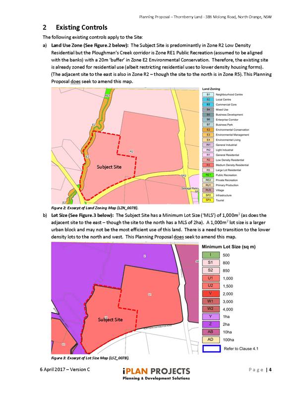
2.4 Orange
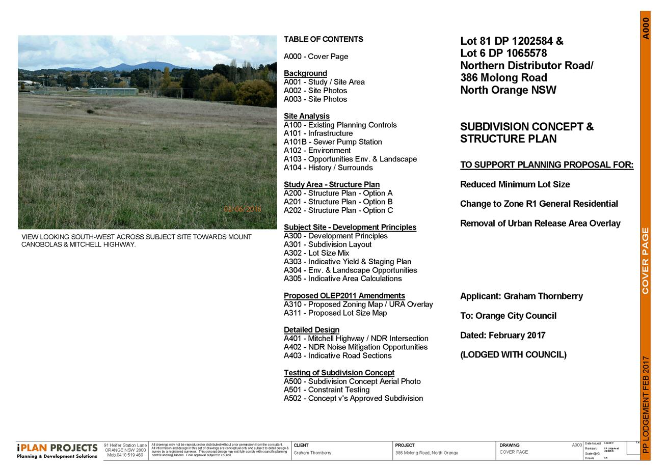
LEP Amendment 19 - 386 Molong Road - Post exhibition report
RECORD
NUMBER: 2017/2514
AUTHOR: Craig
Mortell, Senior Planner
EXECUTIVE Summary
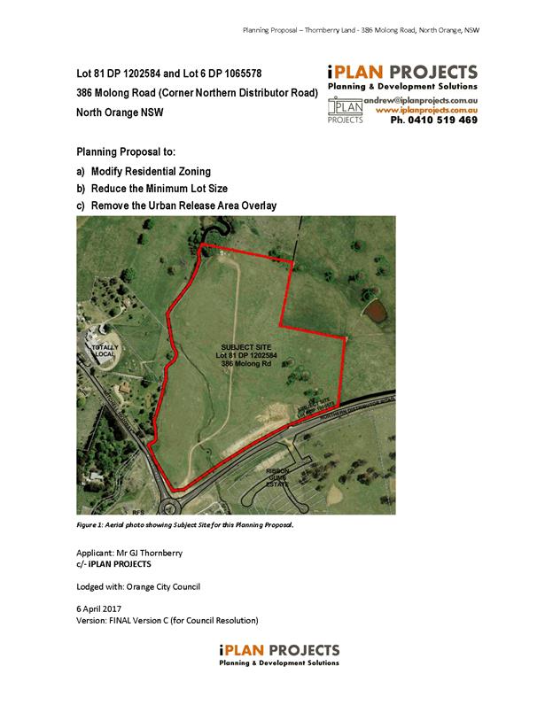
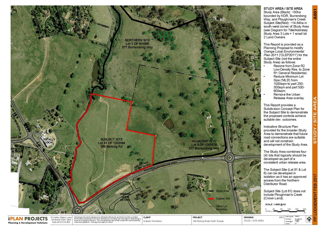
At 18 April 2017 meeting Council considered a pre-gateway
report on a planning proposal in relation to 386 Molong Road on the
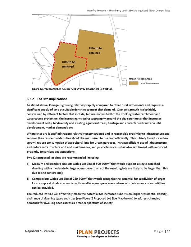
intersection of the Northern Distributor Road, known as Lot 81 DP
1202584 and Lot 6 DP 1065578 which has previously been approved for residential
subdivision (DA 217/2014(1)) for 61 lots at the current minimum lot size
of 1,000m2.
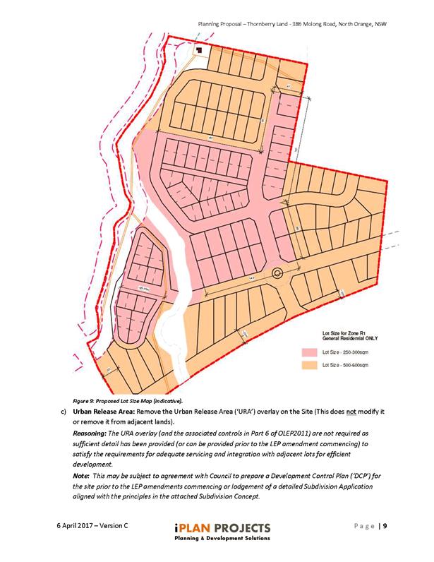
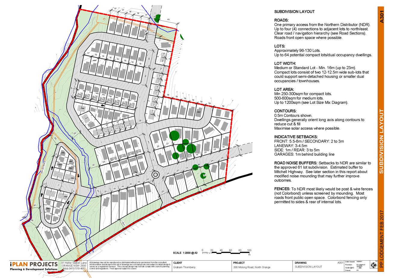
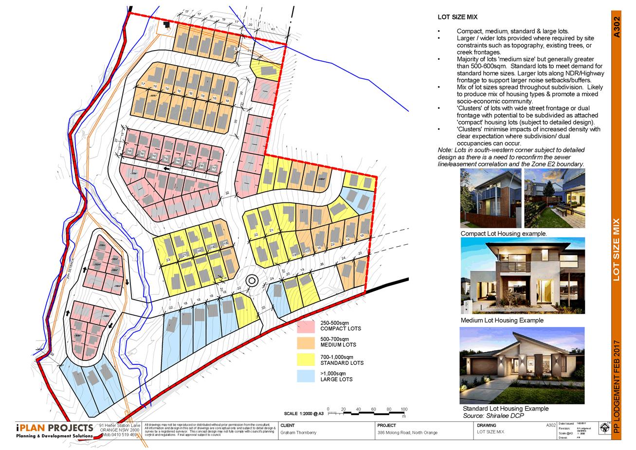
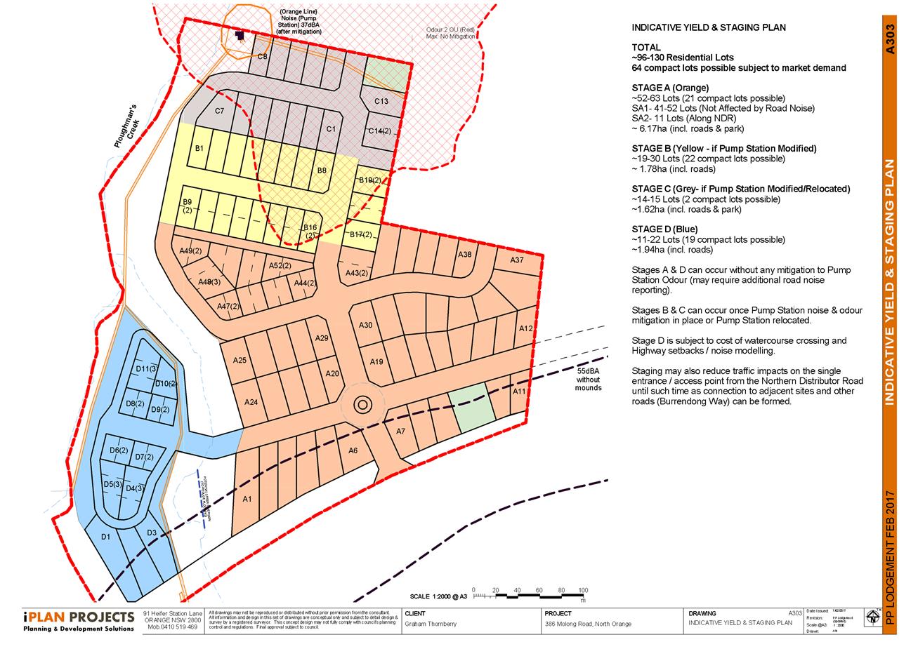
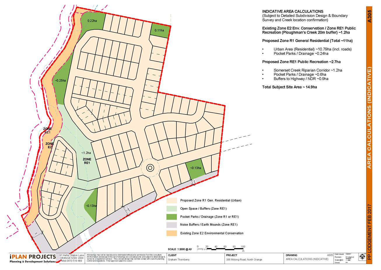
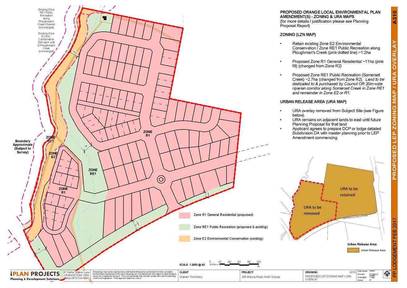
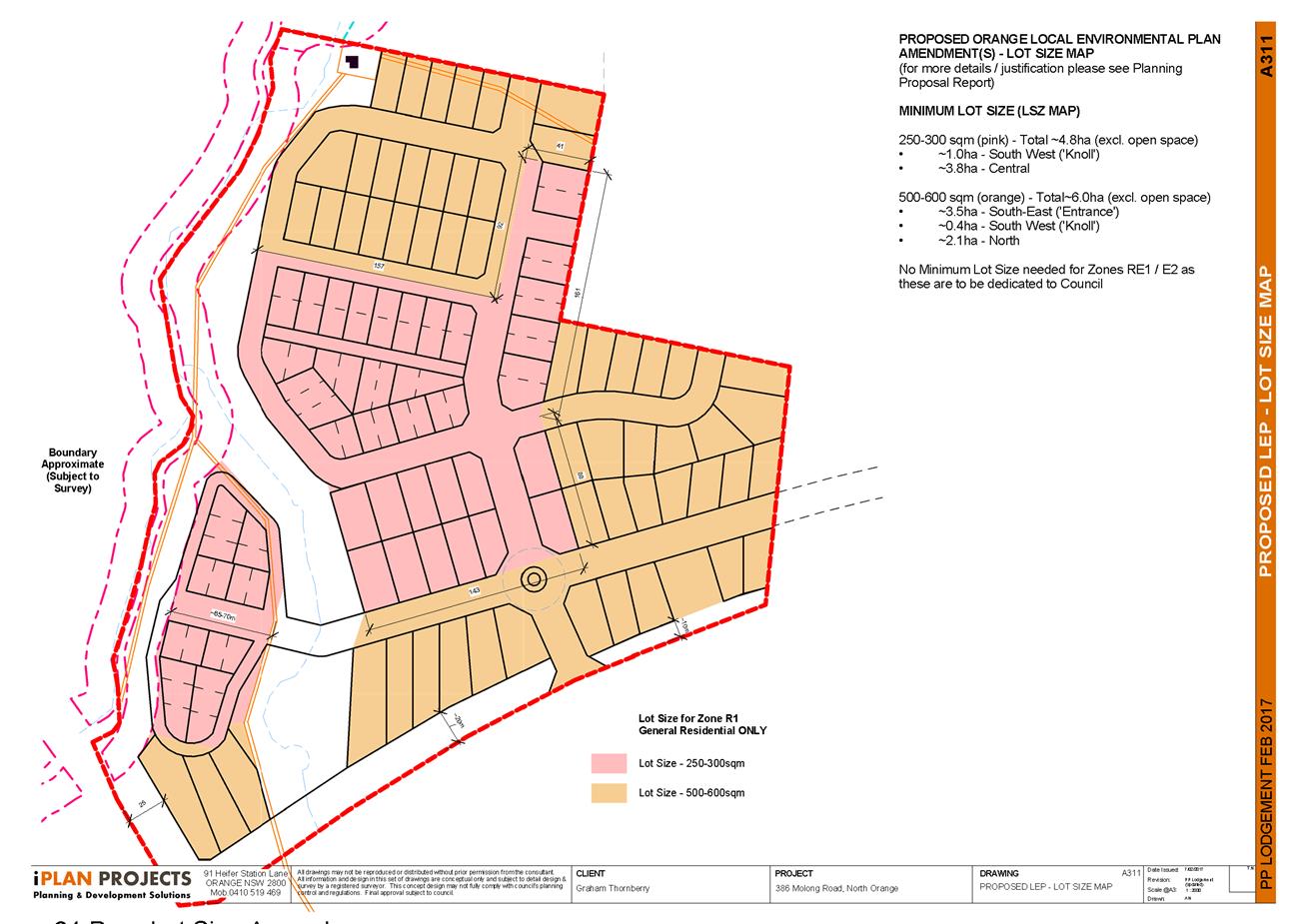
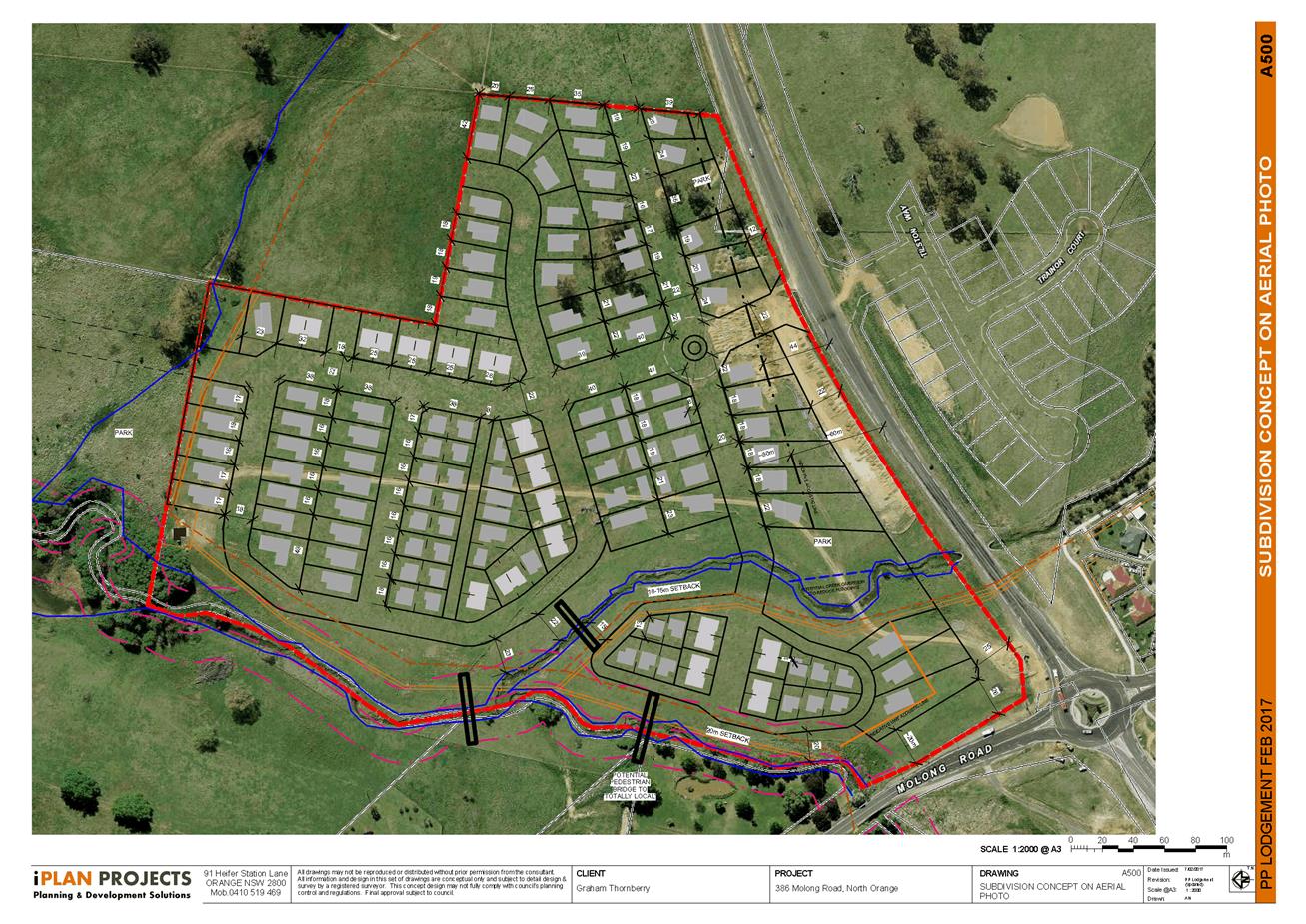
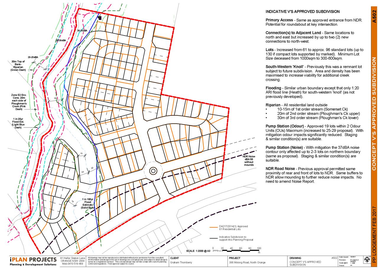
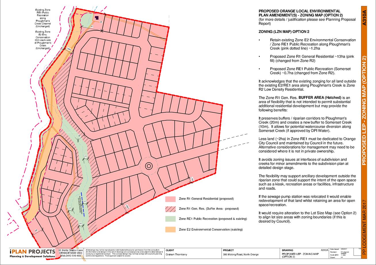
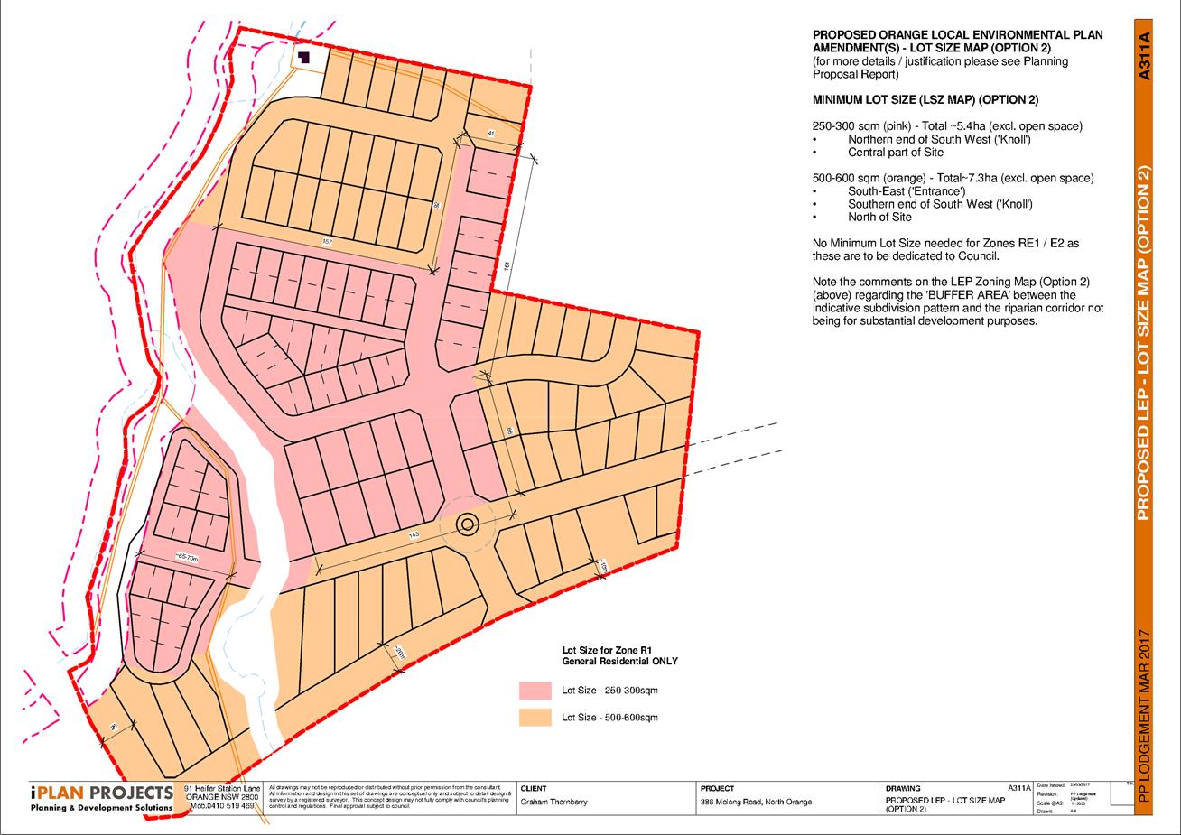
The proposal seeks to increase the density attainable on the
site by amending the minimum lot size map and the zoning map. This would
increase the yield from 61 lots to between 96‑130 lots at a range of
sizes from 250m2 through to 1,200m2.
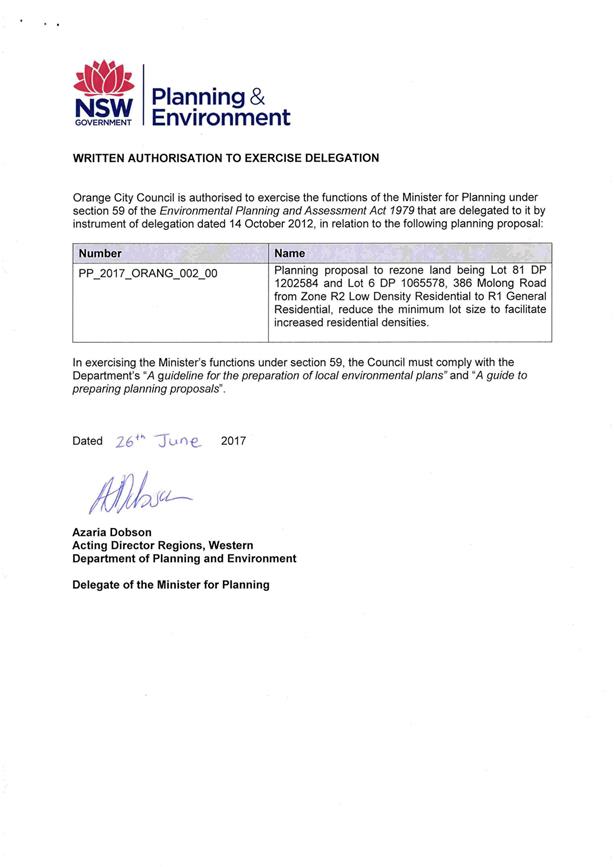
At that meeting Council resolved to proceed to gateway and
public exhibition. The gateway determination was issued 26 June 2017 and public
exhibition was conducted from 14 September to 13 October 2017. A total of
three submissions were received, two from state agencies and one from the
Environmentally Concerned Citizens of Orange. The matters raised in those
submissions are addressed in this report.
Link To Delivery/OPerational Plan
The recommendation in this report relates to the
Delivery/Operational Plan strategy “1.2 Our City -
Information and advice provided for the decision-making process will be
succinct, reasoned, accurate, timely and balanced”.
Financial Implications
Nil
Policy and Governance Implications
Nil
|
Recommendation
1 That
Amendment 19 – Orange Local Environmental Plan 2011 – 386 Molong
Road Orange be referred to the NSW Department of Planning and Environment and
the Parliamentary Counsel Office for legal opinion and finalisation.
2 That
Council amend Orange Local Environmental Plan 2011 authorising the
General Manager to make the plan in accordance with the planning proposal as
exhibited.
|
further considerations
Consideration has been given to the
recommendation’s impact on Council’s service delivery; image and
reputation; political; environmental; health and safety; employees;
stakeholders and project management; and no further implications or risks have
been identified.
SUPPORTING INFORMATION
Submissions
A total of three submissions were received during the
exhibition period, which ran from 14 September to 13 October 2017. These
included one community organisation, Environmentally Concerned Citizens of
Orange, and two government agencies, Roads and Maritime Services and the Office
of Environment and Heritage. The latter were directly consulted in accordance
with the gateway determination conditions.
1 Site
Isolation
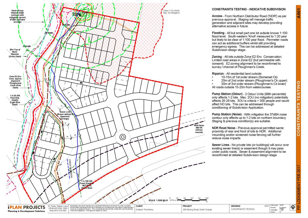
One submission views the site
as relatively isolated from other urban residential areas due to the Northern
Distributor Road and Molong Road, suggesting that this will affect recreational
amenity of future residents as well as pedestrian and cyclist movement.
Response
The site context is
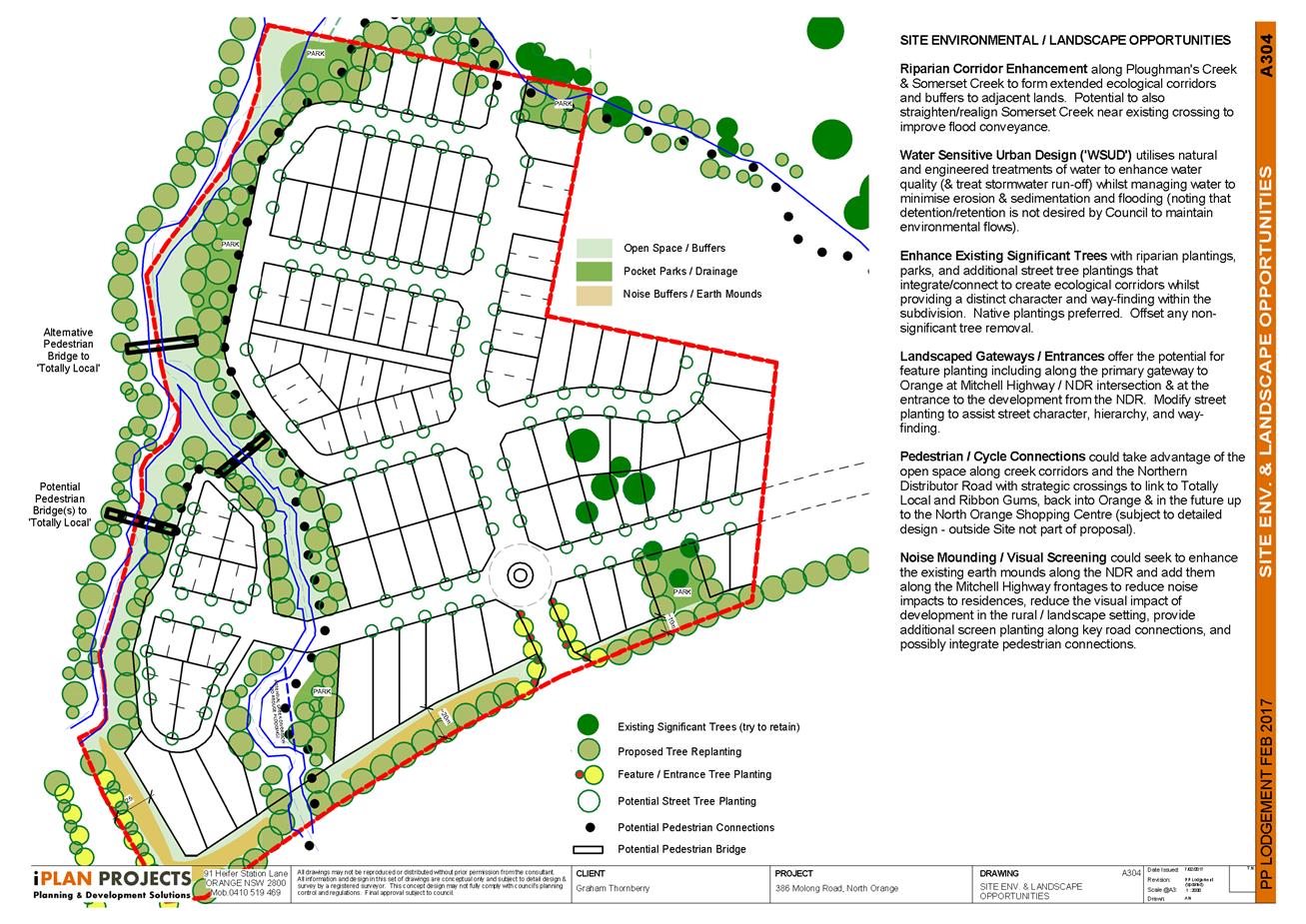
acknowledged. However, the conceptual plan includes open space areas along the
riparian corridors, pedestrian connectivity through to the Agrestic Grocer in
Molong Road, and multiple connection points to the adjoining residential land
to the east, which ultimately links to Burrendong Way. The conceptual design
illustrates lots facing single sided streets alongside the open space
corridors. This ensures that the open space is passively monitored to promote
its utilisation for passive recreation.
Direct connections to the
Northern Distributor Road have been limited to preserve the safety and
operational efficiency of an important local traffic artery. Road widening is
included, which may allow for enhanced pedestrian/cycle connectivity.
Notwithstanding, this Somerset Park is directly opposite the site enabling
pedestrian/cyclist penetration through to Burrendong Way and Albert Street.
Lots adjacent to the Northern
Distributor Road can be designed with sufficient depth to allow dwellings to be
sited away from the noise source. Additional mitigation measures such as sound
mounds/ barriers can also be incorporated at the subdivision development
application stage.
On balance, the proximity of
the land to the greater urban area of Orange and the extent of passive open
space means that future residents will have an appropriate mix of amenity and
access to facilities.
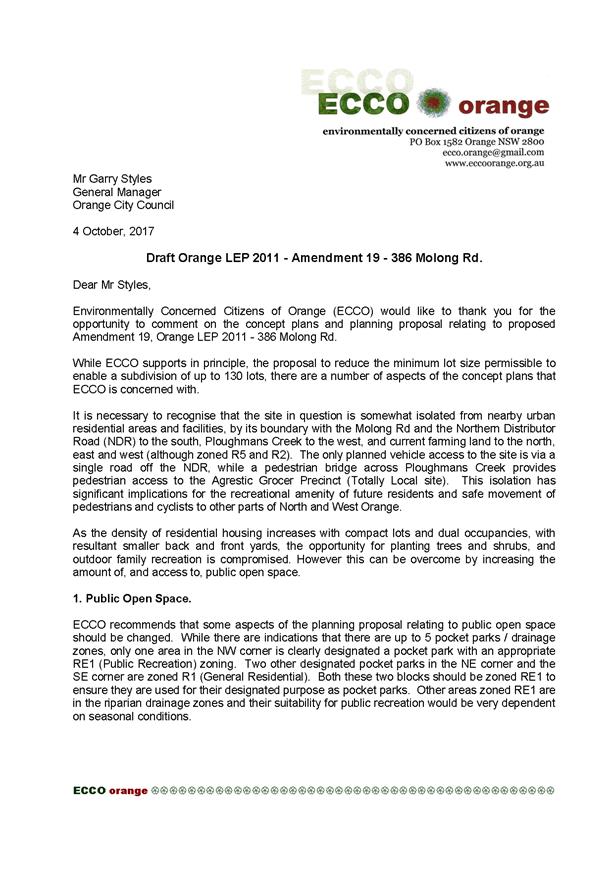
2 Public
Open Space
The extent of formal RE1
Public Recreation zone is criticised as inadequate given the reduced lot sizes,
and suggests that two additional pocket parks, indicated in the conceptual
layout but proposed as residential zone, should be considered for RE1 Public
Recreation zone instead.
The utility of the pocket
park in the north-western corner of the site is questioned due to being low
lying and in proximity to the proposed sewerage pump station. The pocket parks
are criticised as not being able to provide a large flat area sufficient for
active recreation such as ball games and community events.
Response
The total number of lots
proposed would not typically require a playing field or active recreation
facility. Additionally, the relative isolation of the site from other urban
areas, noted in issue 1, means that any such facility would be of minimal
benefit to people from beyond the proposed development.
The location of the
north-western pocket park and proximity to the proposed pump station is
acknowledged. The lots in this area would be part of a later stage of
development and are contingent upon resolution of the pump station issue -
either relocation or improved sealing works, which has already been considered
in the original subdivision consents.
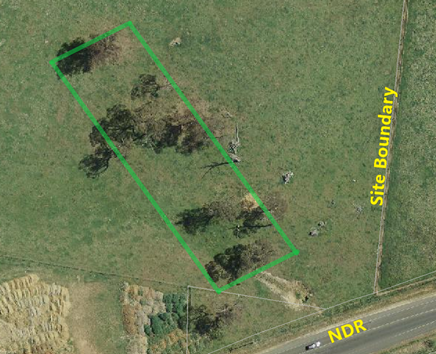
3 Tree
Preservation
The conceptual plan is
criticised for not seeking to retain the existing mature trees towards the
south-eastern corner of the site. The submission suggests enhancing the area
with additional plantings of native trees and shrubs as part of a designated
small wildlife reserve. It suggests the impact on lot yield could be offset by
reducing the lot sizes from 700-1000m² to 500-700m².
Response
The trees in question span an
area of approximately 105m north to south and about 40m wide. This would
equate to approximately 4,200m². Retaining the area would also hinder the
road layout and reduce connectivity to the neighbouring land to the east. The
vegetation is not identified as biodiversity sensitive in the Orange Local
Environmental Plan.
The suggestion of reducing lot sizes to maintain lot
yield appears to be at odds with the previous critique that small lot sizes
reduce resident amenity.
Additionally, an important aspect of the planning
proposal is that it seeks to enable the creation of a diverse range of lot
sizes, which contributes to the supply of residential land across market
sectors. Reducing lot sizes to maintain yield would alter the balance of sizes
proposed.
If the tree retention impedes the
road layout, the extent of connectivity and permeability with future
development of the eastern neighbour would be considerably diminished. If the
road layout were permitted to remain it would likely divide the area indicated
in two. A pocket park could then be negotiated to be located over one of the
two sections. This would typically be resolved at the subdivision development
application stage.
Consequently, while retention
of mature trees is always desirable, there is not seen to be a need to alter
the planning proposal in this regard.
4 Riparian
Corridors
A submission has criticised
the uncertainty of the width of the riparian corridors, suggesting that
residential encroachment could compromise the value of this open space area.
Response
The conceptual subdivision
layout associated with the planning proposal is provided primarily to
illustrate that the rezoning and lot size pattern can deliver a viable
development. The purpose is not to fully resolve all issues to the extent
expected of a development application. In this regard the zoning pattern
nominated has acknowledged the minimum width of riparian corridors, with some
potential for this to be expanded where appropriate but to also allow some
flexibility in the final design. This allows the development application to
respond to various issues, including those raised in the rezoning process.
5 Stormwater
Harvesting/Constructed Wetland
One submission recommends
that a constructed wetland or stormwater harvesting scheme be incorporated into
the design.
Response
This can and ordinarily would
be considered at the development application assessment stage. Given that the
previous consent achieved satisfactory outcomes in this regard, this would be
regarded as the starting point for assessment for any new development
application.
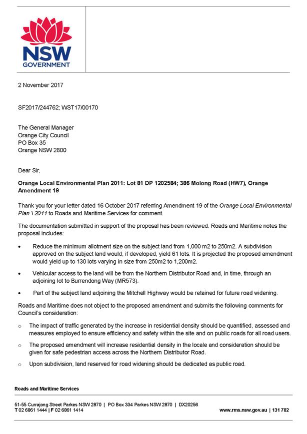
6 Roads
and Maritime Services
Traffic generation from the
proposed development needs to be quantified and assessed during the development
application stage, with appropriate measures employed to ensure efficiency and
safety within the site and on public roads. Consideration should be given to safe
pedestrian access across the Northern Distributor Road, and upon
subdivision, land reserved for road widening should be dedicated as public
road.
Response
The advice is noted and will
be considered during the assessment of any DA in due course.
7 Office
of Environment and Heritage
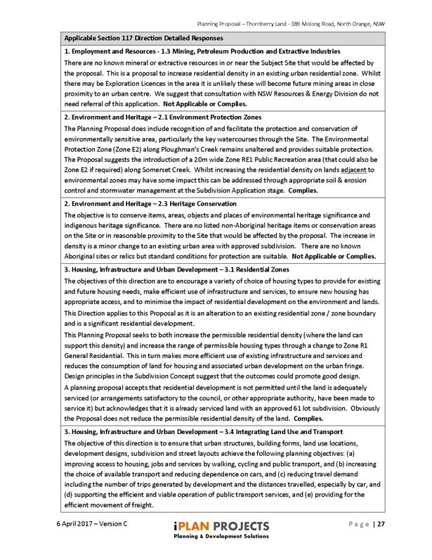
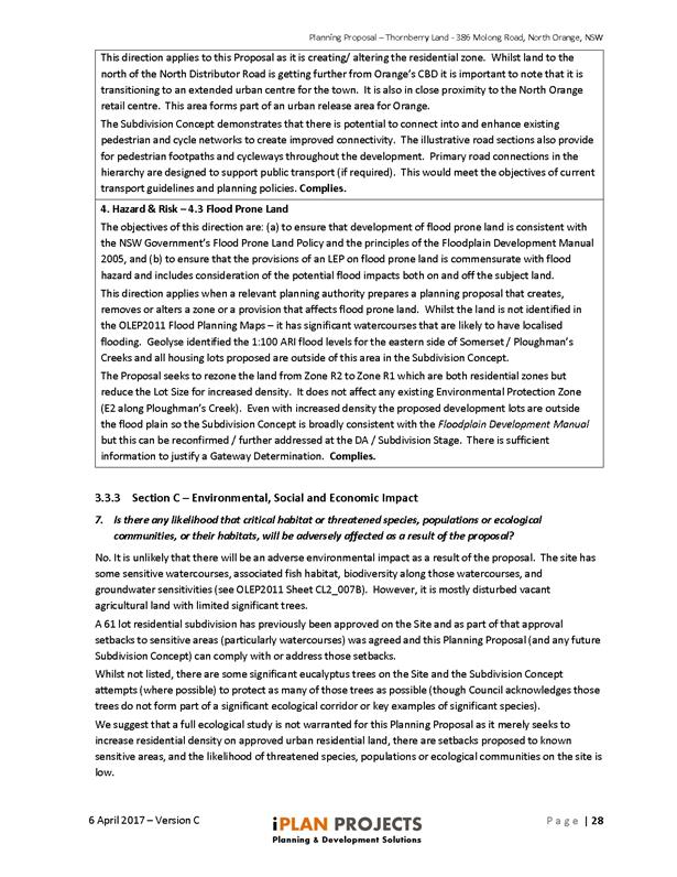
Biodiversity and flooding
were raised as matters to be considered in more detail at the development
application stage. In particular, a small section of road reserve intrudes
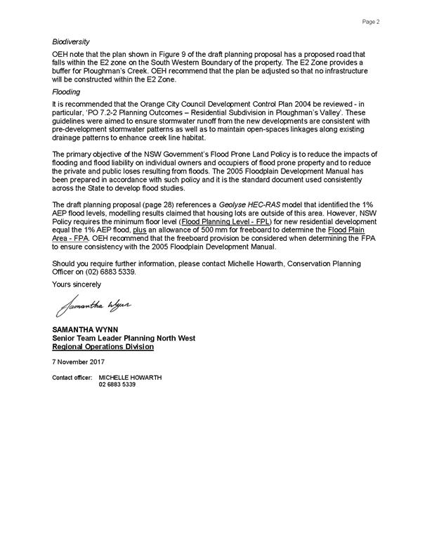
into the E2 zone at the southwestern boundary. Office of Environment and
Heritage recommend that the plan be adjusted so that no infrastructure will be
constructed in the zone. In terms of flooding, the Development Control Plan
provisions in section PO 7.2-2 should be reviewed, and the NSW
Government's Flood Prone Land Policy and associated 2005 Floodplain Development
Manual are used consistently across the state to develop flood studies.
Specifically, the development should include a 1% Annual Exceedance Probability
flood level plus an allowance of 500mm freeboard.
Response
These matters can be
appropriately addressed during assessment of a residential
subdivision development application. More generally, work on a
comprehensive update of Council’s Development Control Plan is in
progress and this will have regard to the matters raised.
Notwithstanding this, the
planning proposal has acknowledged that there is potential for flooding on or
near the two creeks (Ploughmans and Somerset) and that the subdivision will
need to address flooding in more detail.
The original flood modelling
was prepared by Geolyse as part of the redesign of the detention/retention
systems along Ploughmans Creek. Cross sections were prepared at regular
intervals through the site to determine the 1% Average Recurrence interval
along the eastern side of Somerset and Ploughmans Creeks. The proponent has
acknowledged there may be a need to update the modelling to provide the 1% Annual
Exceedance Probability before a subdivision application in the affected area
can be processed.
The original subdivision
approval was based on the Geolyse modelling and the proposed concept boundaries
are very similar to those already approved. Naturally, an increase in density
would potentially increase runoff and may partially alter the outcomes. The
proponent has undertaken to ensure the Flood Planning Level is addressed for
any residential building envelopes at the development application stage.
It should be noted that while
density would increase under this proposal, the extent of residential land
would actually contract due to the creation of RE1 Public Recreation zone along
the riparian corridors.
Additionally, it is not
necessary to align zone boundaries with the Flood Planning Level. Residential
properties can and frequently do contain some extent of Flood Planning Level
affected land within their boundaries. While that would clearly be the first
preference, it is not always viable to do so. Areas that may be deeply
inundated and/or subject to high velocity flows should be excluded first, while
areas of low velocity minor inundation can be acceptable for gardens and yard
space.
Provided that a lot contains
sufficient space clear of the Flood Planning Level to enable a reasonable
building envelope and the Flood Planning Level status is clearly acknowledged
on section 149 planning certificates, then any prospective buyer can make an
informed decision and design their dwellings and curtilage accordingly.
Background
The following information was provided in the pre-gateway
report at the Council meeting of 18 April 2017.
While the site has an existing development consent, an increased
yield will result in an increase to traffic generation through a single
connection point to the Northern Distributor Road, which may in turn require a
different intersection treatment than previously approved. However, the concept
plan provides generous setbacks along the Northern Distributor frontage
(between 10m-25m), primarily to accommodate acoustic mounding barriers, but
will also provide sufficient space to accommodate intersection improvements if
required.
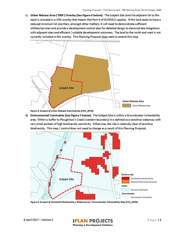
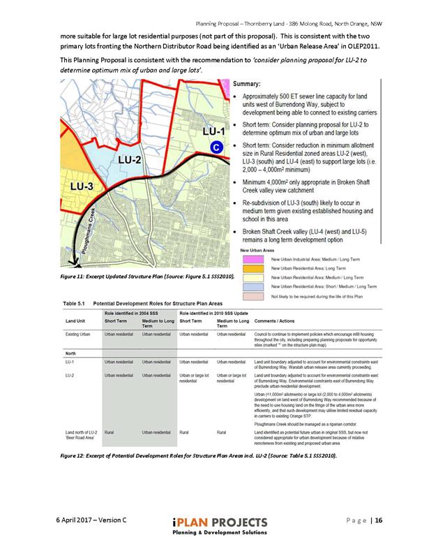
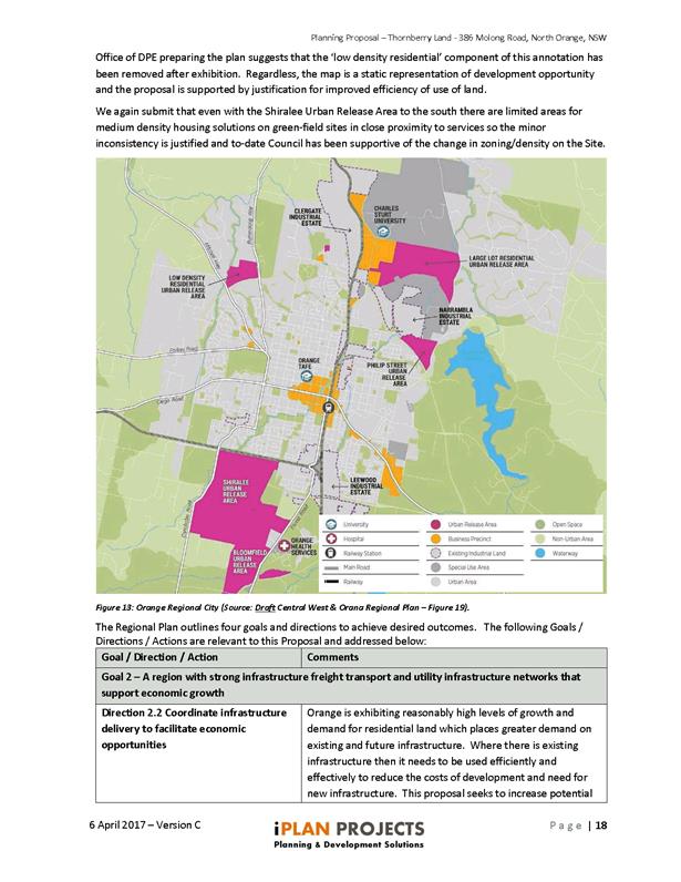
The site is identified as part of LU2 in the Orange
Sustainable Settlement Strategy as updated in 2010. LU2 is recommended as a
“New Urban Residential Area” in the short/ medium/long term
timeframe. The Strategy recommends the area for urban supply due to “the
need to use housing land on the fringe of the urban centre more efficiently,
and that such development may utilise limited residual capacity in carriers to
existing Orange STP, ploughman’s Creek should be managed as a riparian
corridor”.
The concept put forward reflects this strategic intent by
providing more housing supply and options contiguous with the urban footprint
of the City, while also providing a transitional buffer along the creek line to
larger sized properties beyond. This would increase the efficient utilisation
of public infrastructure compared to the existing approval, without impacting
upon rural and agricultural operations or scenic amenity.
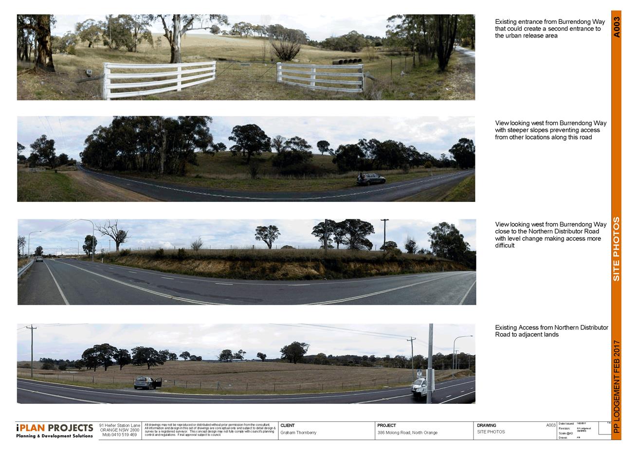
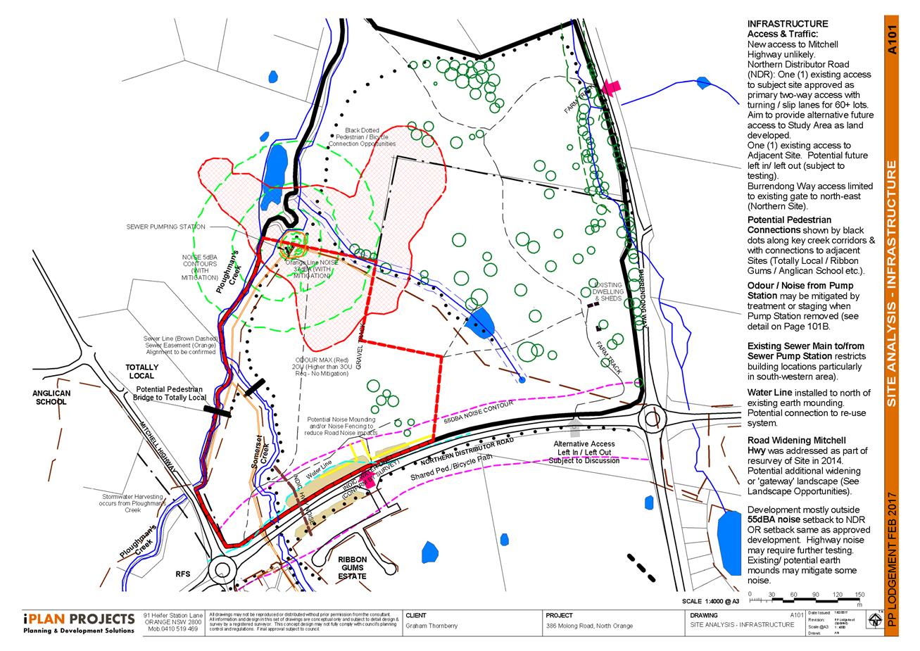
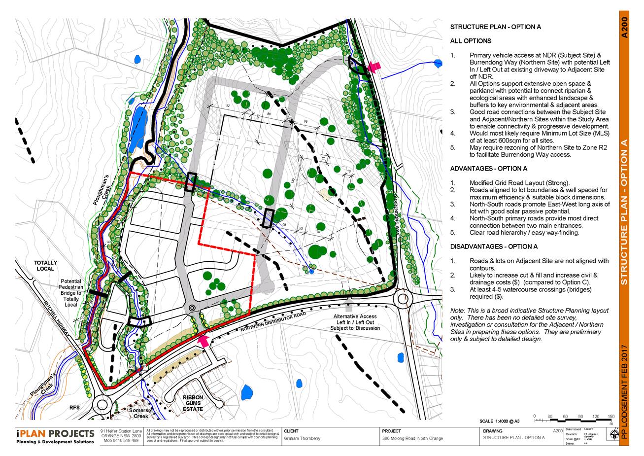
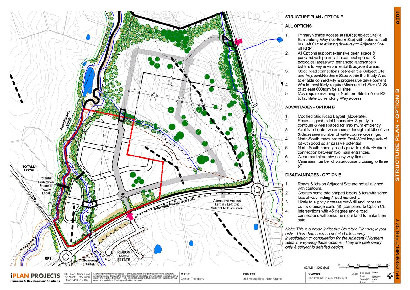
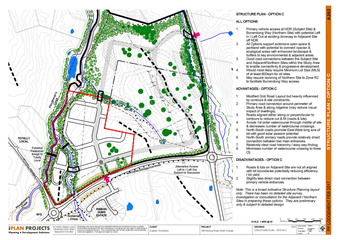
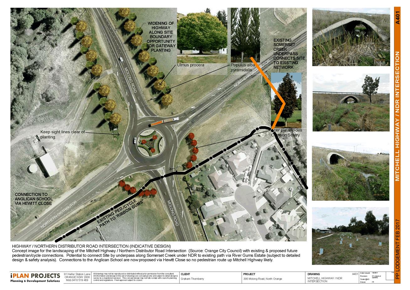
Access
Council has maintained a position that there would only be a
single access point on the northern side of the Northern Distributor Road
between Molong Road and Burrendong Way, which should serve two main properties
- the subject land and another property at 377 Burrendong Way. The design
allows for four connections from the site to 377 Burrendong Way, and
illustrates conceptual layouts of how that land could use the connections to
develop in the future.
It should be noted that the proposal is not seeking to
change the zoning, lot size or urban release area status of 377 Burrendong Way,
nor are the concept layouts intended to be definitive. Rather, the conceptual
layouts for 377 Burrendong Way are only provided to demonstrate that the
proposal does not obstruct or sterilise that land.
Traffic
The proposal will result in an increase in the number of
lots, and therefore the amount of traffic, accessing the Northern Distributor
at the single access point. The location of this access point has already been
approved as part of the previous approval (DA 217/2014(1)), however the
increase in the number of vehicle movements through this intersection will need
to be considered during a future development application. The concept plan
includes a splay and setbacks of 10m on one side and 25m on the other, which
while not a formal subdivision does illustrate that the concept can provide
space for adaptation of the intersection if required, such as turning lanes,
slip lanes and the like.
Pedestrian Linkages and
Walkability
The concept plan includes provision of a footbridge to link
the estate with the Agrestic Grocer site on Molong Road. In addition to which,
the site can connect to Council’s cycleway network which is intended to
provide linkages along the Northern Distributor Road in the future. Providing
single sided roads along the open space corridors will ensure good public
access and passive recreation for residents. Connection points to the east
ensure that these benefits will also be available to future residents of the
adjoining land when it develops in due course. Inclusion of two pocket parks
within the concept will further enhance the estate and promote physical
activity of residents.
Streetscapes
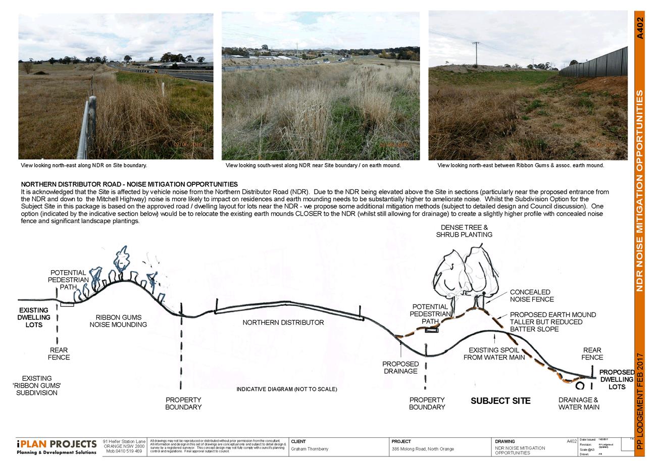
The provision of setbacks and sound mounds along the
Northern Distributor Road will minimise the visual impression on the Northern
Distributor Road route, particularly once landscaping of the mounds matures.
The provision of open space corridors along the creek lines, combined with
single sided park edge streets (in turn leading to housing addressing the
public spaces), means that when viewed from Molong Road the estate will have an
open and welcoming appearance rather than an expanse of Colorbond fencing.
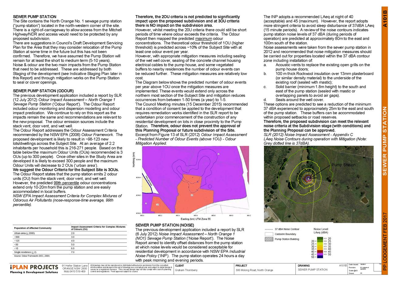
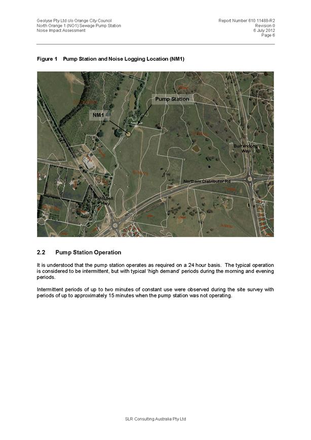
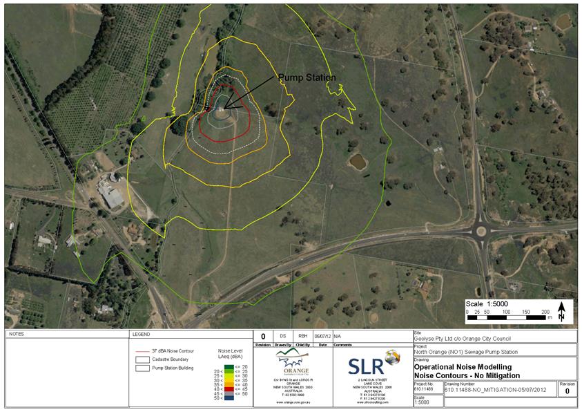
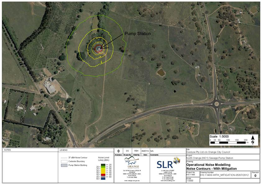
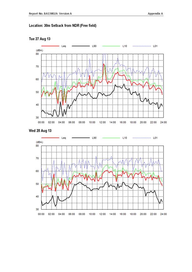
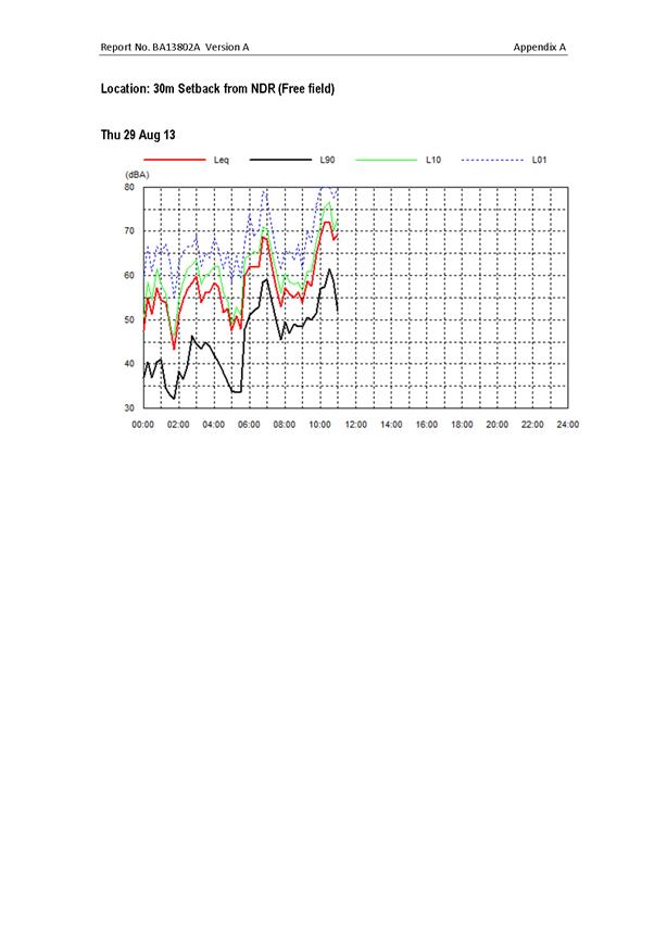
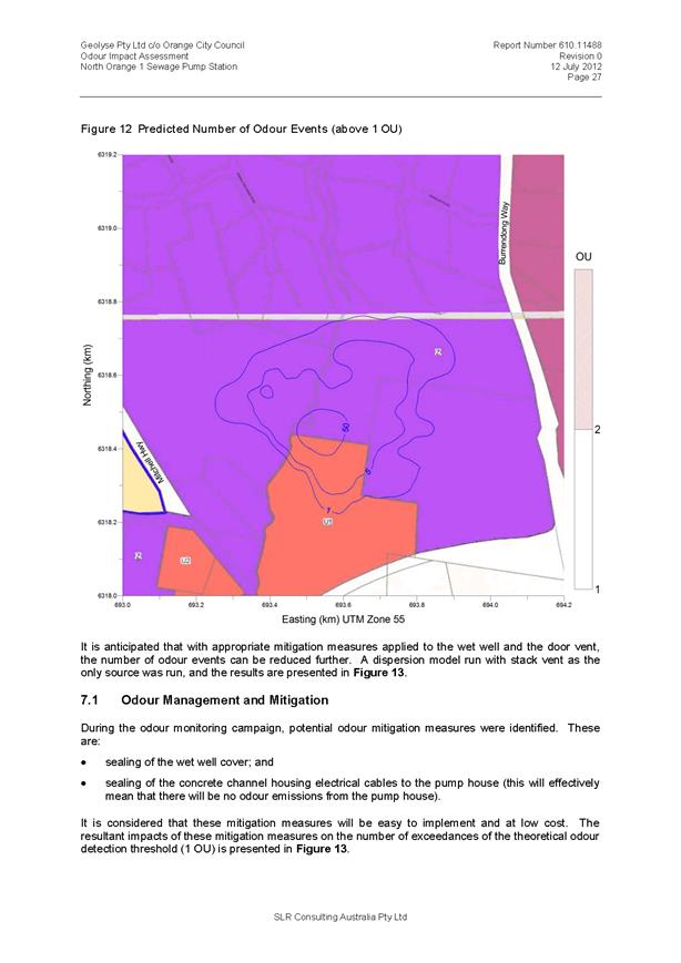
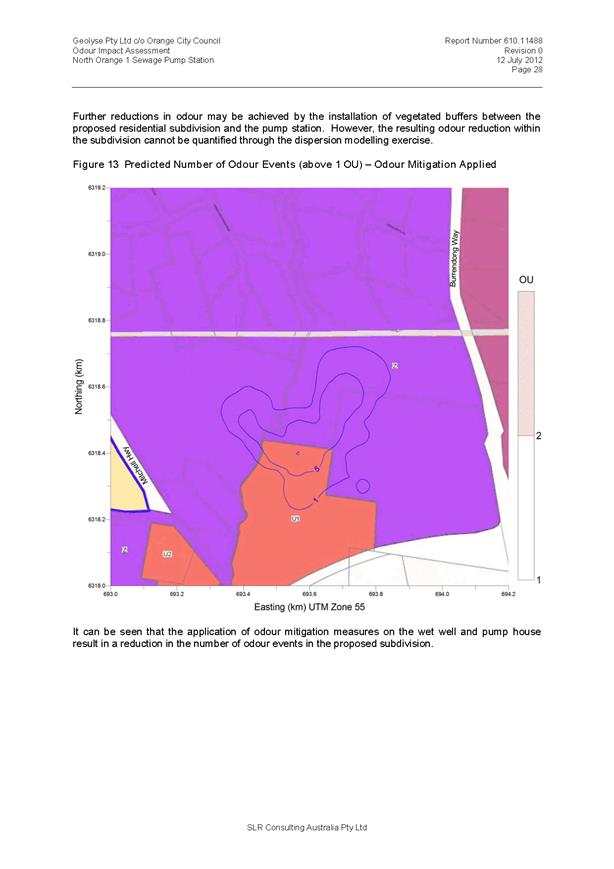
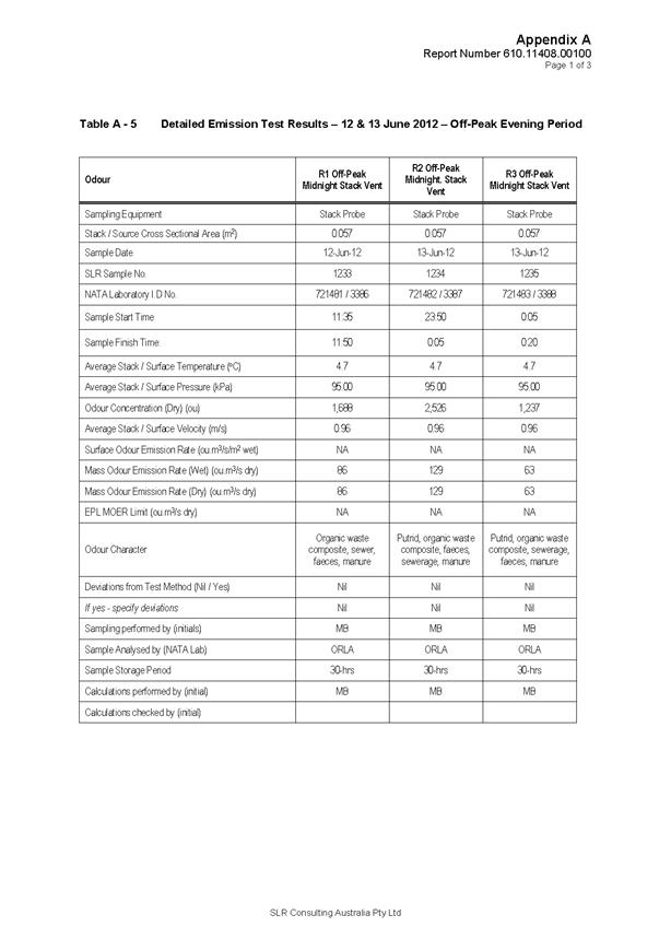
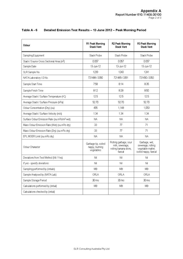
Sewer Pump Station (Noise and
Odour)
The northern end of the site is affected by noise and odour
zones from the North Orange Number 1 Sewer Pumping Station. This area will
be in the later stages, and Council’s Draft Development Servicing Plan
discusses potential relocation of the pump station at an undefined future date.
Alternatively, improved sealing of the pump station (including the wet well
cover and concrete channel housing electrical cables to the pump house) could
also be considered.
The odour and noise issue was raised during the assessment
of DA 217/2014(1) and essentially remains the same. That assessment and
subsequent approval included a condition of consent that requires remediation
works identified in an Odour Impact Assessment report prepared by SLR be
undertaken prior to commencement of the construction of any residential development
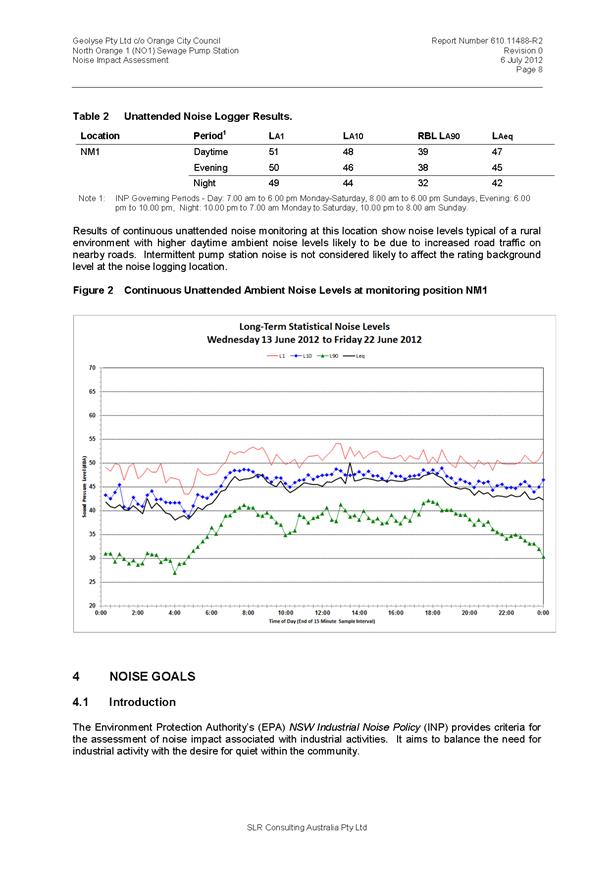
on lots in close proximity to the Pump Station. Similarly, a Noise Impact
Assessment, also by SLR, made recommendations to reduce pump station noise
impacts for the lots in closest proximity.
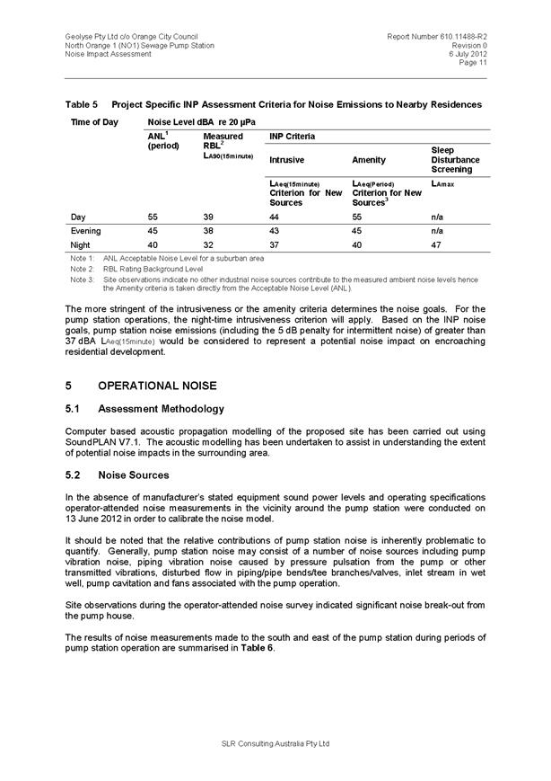
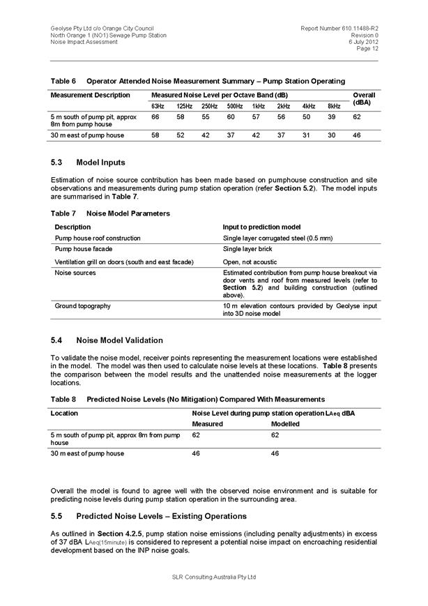
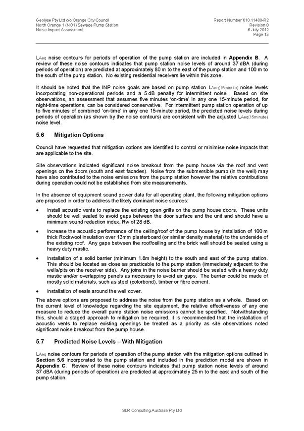
These included:
· acoustic vents to
replace the existing open grills on the pump house doors
· 100mm thick
Rockwool insulation over 13mm plasterboard (or similar density material) to the
underside of the existing roof (sealed with mastic)
· solid barrier
(minimum 1.8m height) to the south and east of the pump station (sealed with
mastic or overlapping panels to avoid air gaps)
· seals around the
well cover.
The noise and odour issues from the pump station will again
be assessed and reviewed at the development application stage. It should
be noted that if the proposal does not proceed (for whatever reason) the
existing development application approval can still be acted upon and
developed, therefore the noise and odour issues will be addressed in due course
either way. The proposal will increase the number of residential lots within
the noise and odour affected area, but does not preclude or hinder the
previously identified mitigation measures.
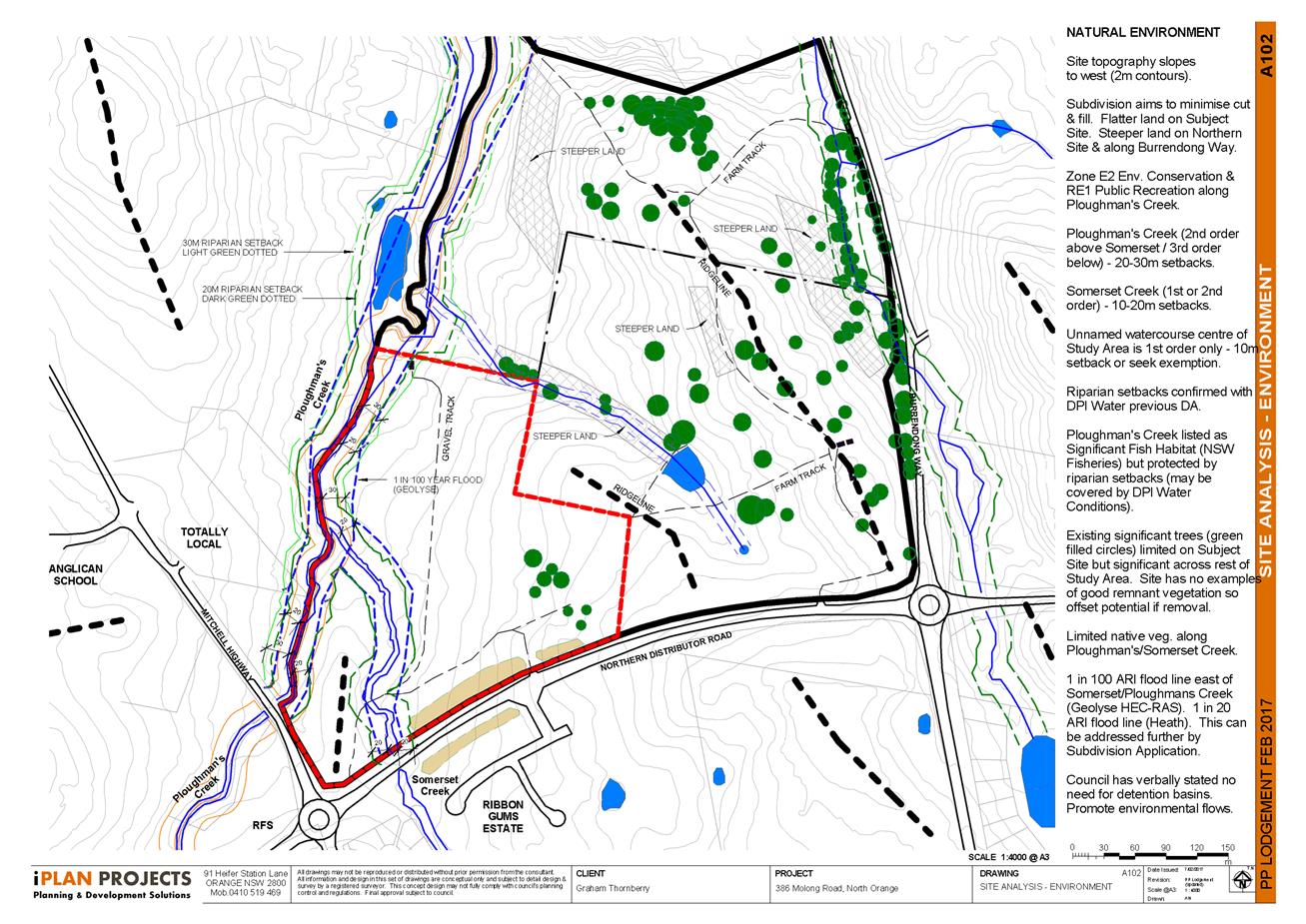
Stormwater and Flooding
The site is located at the confluence of Somerset Creek and
Ploughmans Creek. The Northern Distributor Road, which traverses Somerset
Creek immediately upstream of the site, will act to regulate the flow of
floodwaters from upstream into the site. The provision of open space corridors
along both creek lines will therefore effectively manage localised flooding
potential and accommodate inflows from higher in the catchment.
It should be noted that in nominating land use zones the
proposal has included a hatched area between the creek lines and the potential
lots. This hatched area has been nominated to provide a degree of flexibility
in the concept plan so that the subdivision development application can be
adjusted once more detailed survey and flood analysis is available. As a
result, the final corridor of open space along the creek lines may be slightly
narrowed in places, but the hatching is not intended to enable an increase in
lot yield beyond that indicated in the concept plan.
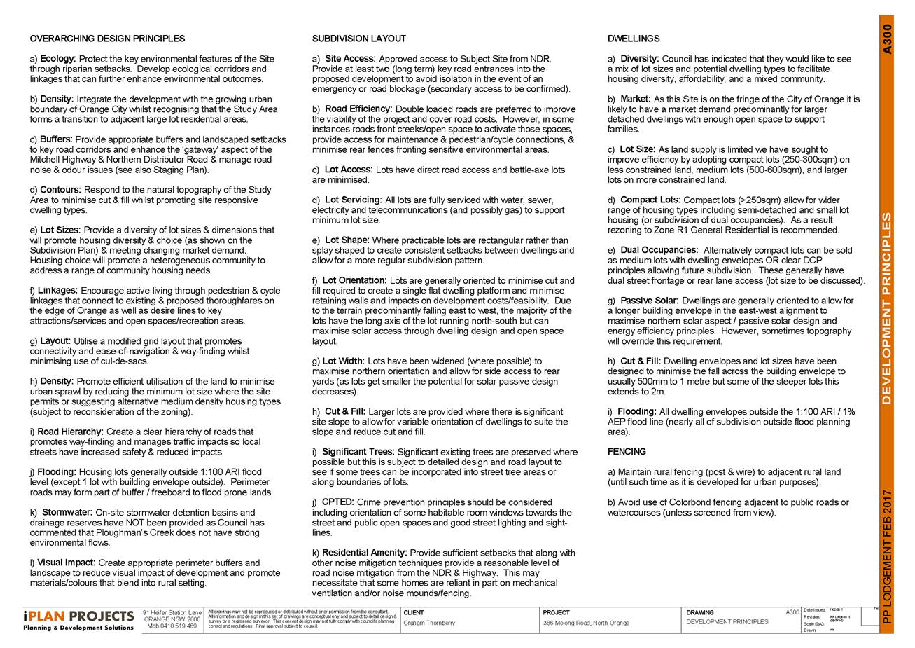
Housing diversity
The range of lot sizes proposed includes compact lots
comparable in size to the Shiralee Master Plan. The concept acknowledges that
some local developers are cautiously sceptical of the market demand for this
scale of product, and as such suggests that the compact lots could be combined
in pairs, known in the industry as splitter blocks. This would give the buyer
the option of either having a single larger lot or undertaking a dual occupancy
and two lot subdivision.
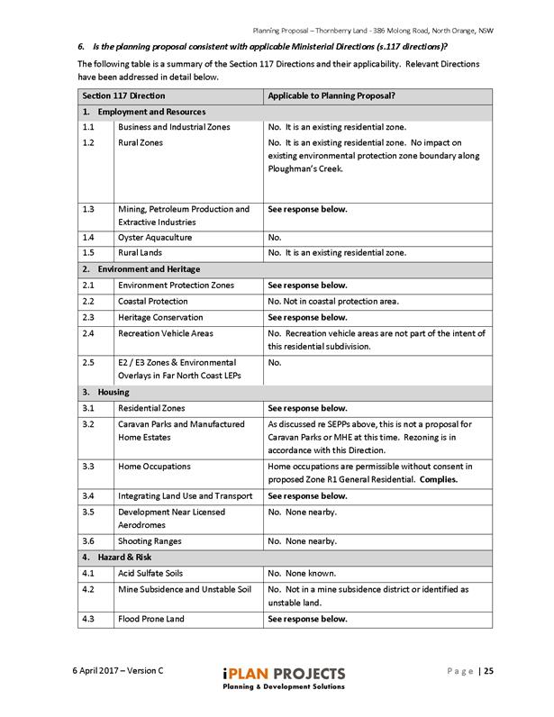
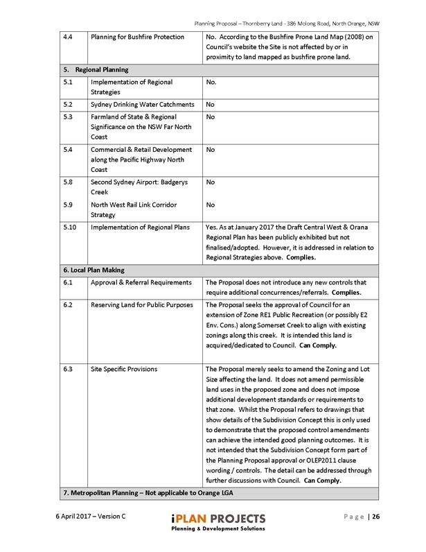
State Environmental Planning Policies and Section 117
Ministerial Directions have been evaluated in the attached planning proposal
documentation. The proponent’s comments and responses to these matters
are supported.
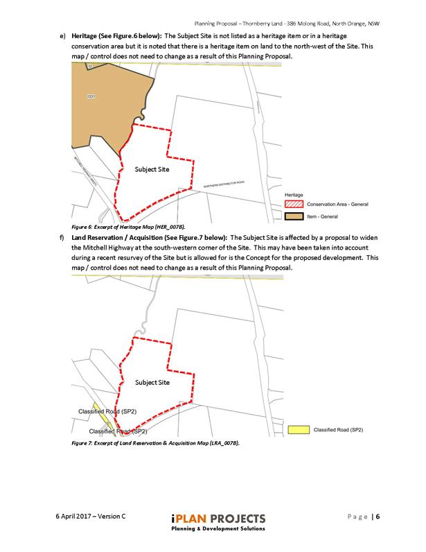
Flora and Fauna
The site is heavily disturbed from past use for agriculture.
Little vegetation remains on the site, including the riparian corridors of both
Somerset Creek and Ploughmans Creek. The design includes open space corridors
along these creeks, providing the opportunity to embellish the site with
substantial landscaping treatment. Consequently the proposal is likely to lead
to enhanced ecological outcomes.
Contamination
The site history does not indicate any likely contamination.
This was considered in detail during assessment of DA 217/2014(1) and the
concept does not increase the footprint of the project or include new or
different lands. It is therefore considered that the site can be safely
developed for residential development. Nonetheless, contamination will again be
considered at the development application stage for this proposal.
Contributions
Under the previous development application, negotiations
issues were raised in relation to contributions and provisions of open space.
Obviously with an increase in lot yield and a revised open space network
proposed, it would be necessary for Council to formally revisit the
Section 94 Contributions plan as it relates to this precinct if the
proposal was to proceed. It should be noted that the hatched areas on the
proposal and zone map attached are proposed to provide flexibility in the final
design between the lot boundaries and open space. Contributions will therefore
need to be determined based on a combination of overall lot yield and area of
open space provided.
Attachments
1 Gateway
Determination, IC17/13011⇩
2 Planning
Proposal, D17/23866⇩
3 Site
Analysis, D17/23875⇩
4 Proposed
Zoning, Lot size and concpetual layout, D17/23873⇩
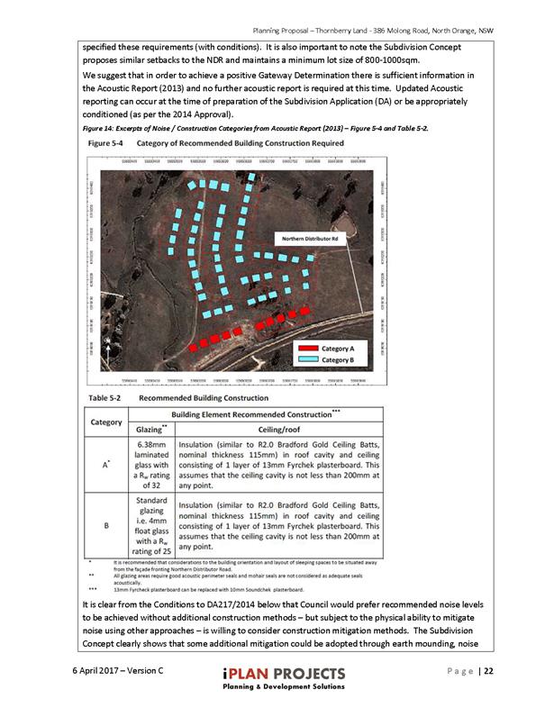
5 Noise
Impact Assessment, D17/23868⇩
6 2013
Road Noise Acoustic report, D17/23872⇩
7 Odour
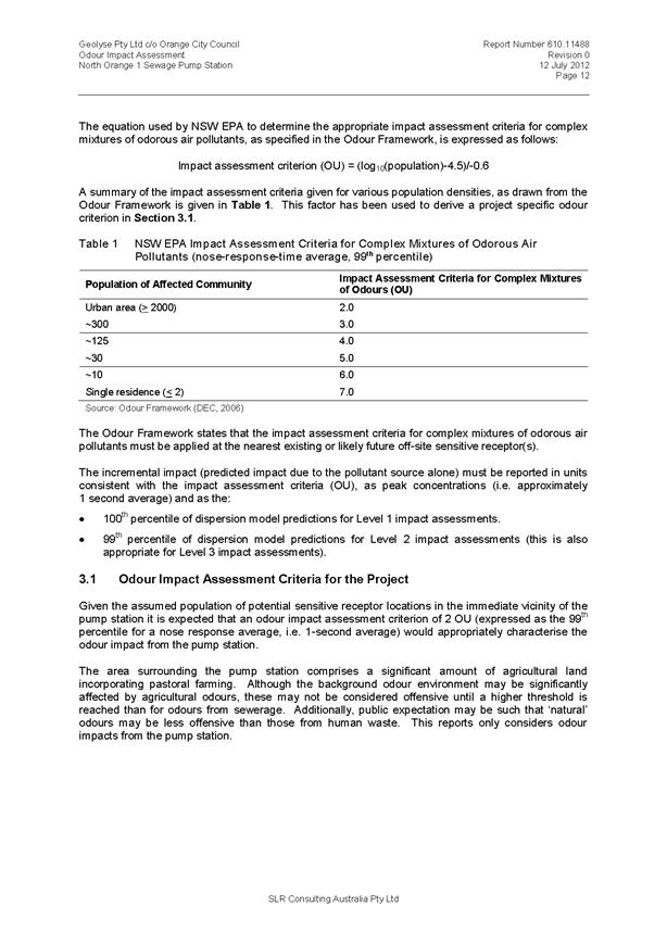
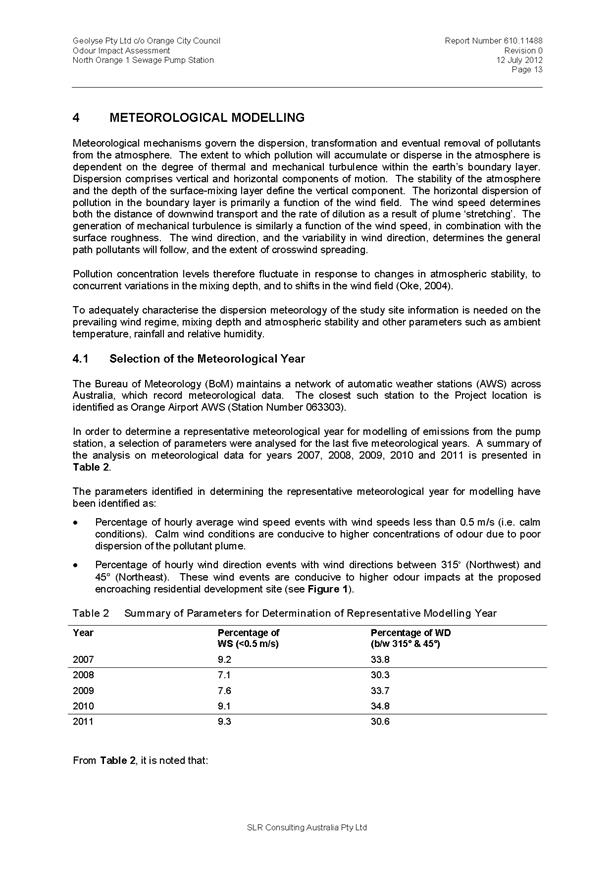
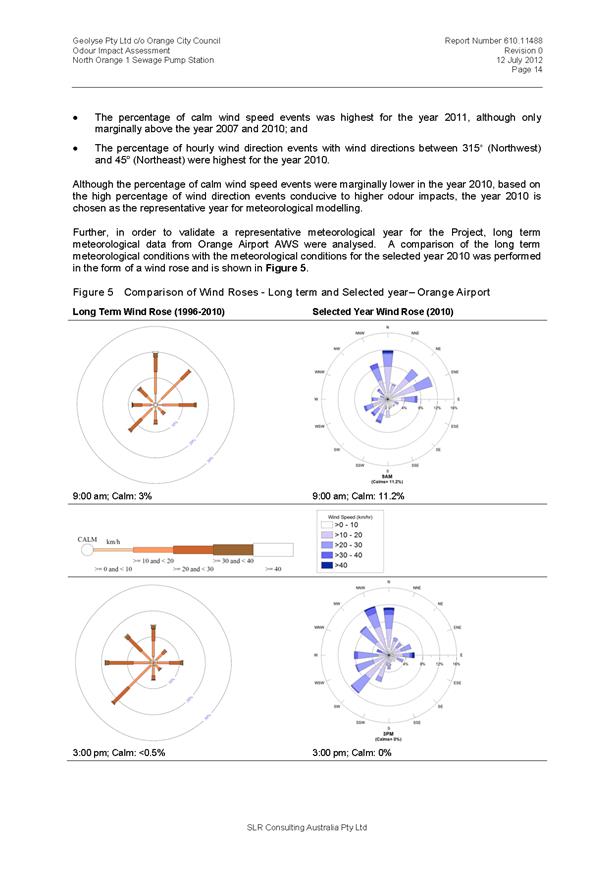
Impact Assessment, D17/23870⇩
8 Odour
Monitoring Report, D17/23871⇩
9 Submission
- Office of Environment and Heritage, D17/68028⇩
10 Submission
- Roads and Maritime Services, IC17/21731⇩
11 Submission
- Environmentally Concerned Citizens of Orange (ECCO), IC17/19567⇩
Planning and Development Committee
7 December 2017
2.4 Orange
LEP Amendment 19 - 386 Molong Road - Post exhibition report
Attachment 1 Gateway
Determination
Planning
and Development Committee
7 December 2017
2.4 Orange
LEP Amendment 19 - 386 Molong Road - Post exhibition report
Attachment 2 Planning
Proposal
Planning
and Development Committee
7 December 2017
2.4 Orange
LEP Amendment 19 - 386 Molong Road - Post exhibition report
Attachment 3 Site
Analysis
Planning and Development Committee
7 December 2017
2.4 Orange
LEP Amendment 19 - 386 Molong Road - Post exhibition report
Attachment 3 Site
Analysis
Planning and Development Committee
7 December 2017
2.4 Orange
LEP Amendment 19 - 386 Molong Road - Post exhibition report
Attachment 3 Site
Analysis

Planning and Development Committee
7 December 2017
2.4 Orange
LEP Amendment 19 - 386 Molong Road - Post exhibition report
Attachment 3 Site
Analysis
Planning and Development Committee
7 December 2017
2.4 Orange
LEP Amendment 19 - 386 Molong Road - Post exhibition report
Attachment 3 Site
Analysis

Planning and Development Committee
7 December 2017
2.4 Orange
LEP Amendment 19 - 386 Molong Road - Post exhibition report
Attachment 3 Site
Analysis
Planning and Development Committee
7 December 2017
2.4 Orange
LEP Amendment 19 - 386 Molong Road - Post exhibition report
Attachment 3 Site
Analysis
Planning and Development Committee
7 December 2017
2.4 Orange
LEP Amendment 19 - 386 Molong Road - Post exhibition report
Attachment 3 Site
Analysis
Planning and Development Committee
7 December 2017
2.4 Orange
LEP Amendment 19 - 386 Molong Road - Post exhibition report
Attachment 3 Site
Analysis

Planning and Development Committee
7 December 2017
2.4 Orange
LEP Amendment 19 - 386 Molong Road - Post exhibition report
Attachment 3 Site
Analysis
Planning and Development Committee
7 December 2017
2.4 Orange
LEP Amendment 19 - 386 Molong Road - Post exhibition report
Attachment 3 Site
Analysis
Planning and Development Committee
7 December 2017
2.4 Orange
LEP Amendment 19 - 386 Molong Road - Post exhibition report
Attachment 3 Site
Analysis
Planning and Development Committee
7 December 2017
2.4 Orange
LEP Amendment 19 - 386 Molong Road - Post exhibition report
Attachment 3 Site
Analysis
Planning and Development Committee
7 December 2017
2.4 Orange
LEP Amendment 19 - 386 Molong Road - Post exhibition report
Attachment 3 Site
Analysis
Planning and Development Committee
7 December 2017
2.4 Orange
LEP Amendment 19 - 386 Molong Road - Post exhibition report
Attachment 3 Site
Analysis
Planning and Development Committee
7 December 2017
2.4 Orange
LEP Amendment 19 - 386 Molong Road - Post exhibition report
Attachment 3 Site
Analysis
Planning and Development Committee
7 December 2017
2.4 Orange
LEP Amendment 19 - 386 Molong Road - Post exhibition report
Attachment 3 Site
Analysis
Planning and Development Committee
7 December 2017
2.4 Orange
LEP Amendment 19 - 386 Molong Road - Post exhibition report
Attachment 3 Site
Analysis
Planning and Development Committee
7 December 2017
2.4 Orange
LEP Amendment 19 - 386 Molong Road - Post exhibition report
Attachment 3 Site
Analysis
Planning and Development Committee
7 December 2017
2.4 Orange
LEP Amendment 19 - 386 Molong Road - Post exhibition report
Attachment 3 Site
Analysis
Planning and Development Committee
7 December 2017
2.4 Orange
LEP Amendment 19 - 386 Molong Road - Post exhibition report
Attachment 3 Site
Analysis
Planning and Development Committee
7 December 2017
2.4 Orange
LEP Amendment 19 - 386 Molong Road - Post exhibition report
Attachment 3 Site
Analysis
Planning and Development Committee
7 December 2017
2.4 Orange
LEP Amendment 19 - 386 Molong Road - Post exhibition report
Attachment 3 Site
Analysis
Planning and Development Committee
7 December 2017
2.4 Orange
LEP Amendment 19 - 386 Molong Road - Post exhibition report
Attachment 3 Site
Analysis
Planning and Development Committee
7 December 2017
2.4 Orange
LEP Amendment 19 - 386 Molong Road - Post exhibition report
Attachment 3 Site
Analysis
Planning and Development Committee
7 December 2017
2.4 Orange
LEP Amendment 19 - 386 Molong Road - Post exhibition report
Attachment 3 Site
Analysis
Planning and Development Committee
7 December 2017
2.4 Orange
LEP Amendment 19 - 386 Molong Road - Post exhibition report
Attachment 3 Site
Analysis
Planning and Development Committee
7 December 2017
2.4 Orange
LEP Amendment 19 - 386 Molong Road - Post exhibition report
Attachment 4 Proposed
Zoning, Lot size and concpetual layout
Planning and Development Committee
7 December 2017
2.4 Orange
LEP Amendment 19 - 386 Molong Road - Post exhibition report
Attachment 4 Proposed
Zoning, Lot size and concpetual layout
Planning and Development Committee
7 December 2017
2.4 Orange
LEP Amendment 19 - 386 Molong Road - Post exhibition report
Attachment 5 Noise
Impact Assessment


Planning and Development Committee
7 December 2017
2.4 Orange
LEP Amendment 19 - 386 Molong Road - Post exhibition report
Attachment 5 Noise
Impact Assessment
Planning and Development Committee
7 December 2017
2.4 Orange
LEP Amendment 19 - 386 Molong Road - Post exhibition report
Attachment 5 Noise
Impact Assessment

Planning and Development Committee
7 December 2017
2.4 Orange
LEP Amendment 19 - 386 Molong Road - Post exhibition report
Attachment 5 Noise
Impact Assessment
Planning and Development Committee
7 December 2017
2.4 Orange
LEP Amendment 19 - 386 Molong Road - Post exhibition report
Attachment 6 2013
Road Noise Acoustic report


Planning
and Development Committee
7 December 2017
2.4 Orange
LEP Amendment 19 - 386 Molong Road - Post exhibition report
Attachment 7 Odour
Impact Assessment
Planning and Development Committee
7 December 2017
2.4 Orange
LEP Amendment 19 - 386 Molong Road - Post exhibition report
Attachment 7 Odour
Impact Assessment
Planning and Development Committee
7 December 2017
2.4 Orange
LEP Amendment 19 - 386 Molong Road - Post exhibition report
Attachment 7 Odour
Impact Assessment
Planning and Development Committee
7 December 2017
2.4 Orange
LEP Amendment 19 - 386 Molong Road - Post exhibition report
Attachment 8 Odour
Monitoring Report


Planning
and Development Committee
7 December 2017
2.4 Orange
LEP Amendment 19 - 386 Molong Road - Post exhibition report
Attachment 9 Submission
- Office of Environment and Heritage


Planning
and Development Committee
7 December 2017
2.4 Orange
LEP Amendment 19 - 386 Molong Road - Post exhibition report
Attachment 10 Submission - Roads
and Maritime Services

Planning
and Development Committee
7 December 2017
2.4 Orange
LEP Amendment 19 - 386 Molong Road - Post exhibition report
Attachment 11 Submission -
Environmentally Concerned Citizens of Orange (ECCO)
2.5 Development
Application DA 109/1992(2) - 1938 Millthorpe Road
RECORD
NUMBER: 2017/2507
AUTHOR: Daniel
Drum, Senior Planner
EXECUTIVE Summary
|
Application
lodged
|
30 June
2017
|
|
Applicant/s
|
Boral
Resources (Country) Pty Limited
|
|
Owner/s
|
Mr GJ
and Mrs M Taylor
|
|
Land
description
|
Lot 105
DP 1109491 - 1938 Millthorpe Road, Shadforth
(formerly
parts of Portions 36, 71 and 147, and Lot 14 DP 113054, Parish of
Shadforth, County of Bathurst)
|
|
Proposed
land use
|
Basalt
Quarry Operation
|
|
Value of
proposed development
|
$0
|
Council’s consent is sought to modify the Notice of
Determination to Development Application 109/92 (DA 109/92), which
applies to 1938 Millthorpe Road, Shadforth, being Lot 105 DP 1109491
(the ‘subject property’).
DA 109/92 was approved in September 1992, providing for the
use and development of the subject property for the purpose of a basalt quarry
and processing plant[i].
The quarry was approved to produce a maximum of 150,000 tonnes of product per
annum.
DA 109/92 was approved as Designated Development pursuant to
the provisions of the Environmental Planning and Assessment Act 1979.
Council’s consent is now sought to modify the Notice
of Determination to DA 109/92 to increase the maximum production limit of
the quarry to 200,000 tonnes per annum, and to update the operational
description of the quarry to reflect current and future requirements.
The proposal does not seek to increase the extent of the
quarry area approved under DA 109/92.
The key matters for consideration are whether the proposed
modification satisfies the requirements of Clause 96(2) of the Environmental
Planning and Assessment Act 1979 and Schedule 3, Part 2,
Clause 35 of the Environmental Planning and Assessment
Regulation 2000. These provisions require Council to consider whether:
· the proposed
development, as modified, is substantially the same as the development for
which consent was originally granted; and
· whether the
proposed development as modified would significantly increase the environmental
impact of the total development compared with the existing development.
The following assessment demonstrates that the development,
as modified, is substantially the same development for which consent was
originally granted; and that the development, as modified, will not
substantially increase the environmental impact of the total development
compared with the existing development.
It is recommended that the use and development, as modified,
be supported.
DECISION FRAMEWORK
Development in Orange is governed by two key documents, the
Orange Local Environment Plan 2011 and Orange Development Control Plan 2004. In
addition, the Infill Guidelines are used to guide development, particularly in
the heritage conservation areas and around heritage items.
Orange Local Environment Plan 2011 – the LEP
should be considered by Council to be a definitive document. LEPs govern the
types of development that are permissible or prohibited in different parts of
the City and also provide some assessment criteria in specific circumstances.
Uses are either permissible or not - there are no grey areas in terms of
permissibility. The objectives of each zoning, and indeed the aims of the LEP
itself are, however, open to interpretation and can be used to guide decision
making around appropriateness of development.
Orange Development Control Plan 2004 – the DCP
guides development. In general it is a performance based document rather than
prescriptive in nature - its purpose is to guide development. The Land and
Environment Court tends to view it as such. In each area of interest there are
often guidelines used. These guidelines indicate ways of achieving the planning
outcomes. It is thus recognised that there may also be other solutions of
merit. All design solutions are considered on merit by Council staff.
Applications should clearly demonstrate how the planning outcomes are being met
where alternative design solutions are proposed. So one can see that the DCP
gives leeway for developers and architects to use design to achieve the outcome
in other ways if they can. Stating that DCP guidelines are inflexible can
be misleading.
This development application centres on extracting matter at
a faster rate than previously approved, not extracting an overall increased
amount over the life of the quarry. The impacts of this faster rate of
extraction are not considered significant by the assessment team.
Link To Delivery/OPerational Plan
The recommendation in this report relates to the Delivery/Operational
Plan strategy “13.4 Our Environment – Monitor and
enforce regulations relating to City amenity”.
Financial Implications
Nil
Policy and Governance Implications
Nil
|
Recommendation
That Council consents to
development application DA 109/1992(2)
for a Basalt Quarry Operation at Lot 105 DP 1109491 - 1938 Millthorpe
Road, Shadforth (formerly parts of Portions 36, 71 and 147, and
Lot 14 DP 113054, Parish of Shadforth, County of Bathurst) pursuant to the conditions of consent in the attached
Notice of Approval.
|
further considerations
Consideration has been given to the
recommendation’s impact on Council’s service delivery; image and
reputation; political; environmental; health and safety; employees;
stakeholders and project management; and no further implications or risks have
been identified.
SUPPORTING INFORMATION
THE APPLICATION/PROPOSAL
Council’s consent is sought to modify Development
Application 109/92 as follows:
Increased Maximum Production
Limit
The applicant proposes to modify Condition (4) of DA 109/92
to increase the maximum rate of quarrying from 150,000 tonnes per annum to
200,000 tonnes per annum.
Supporting information submitted with the application
identifies that an increased annual rate of quarrying is required to service a
forecast increase in short-to-medium term demand for quarry product. It is
understood that regional demand is generally driven by local and regional
construction projects, local and regional infrastructure development and
mining.
Project Description
The application seeks to make a number of changes to the
approved 1992 project description which is outlined in the original development
application and the document Environmental Impact Statement Proposed Basalt
Quarry for A.P. & E.M. Commins by Bruce A Hansen, dated 25 June 1992
(the ‘original 1992 EIS’).
In order to achieve this, the application proposes to modify
Condition 2 of DA 109/92 to reference Statement of Environmental Effects
Orange Quarry – Increase in Maximum Production Limit, Boral Resources (Country)
Pty Ltd, Revision 3 by Aurecon, dated 17 July 2017.
The proposed changes to the approved project description are
described below:
Blasting
The original 1992 EIS identified that blasting after the
third year of operation would occur up to 12 times per year, with a single
blast generally yielding 5,000m3.
Despite the original 1992 EIS, supporting information
submitted with the application indicates that blasting currently occurs two to
three times per year, with a single blast generating in the order of 30,000 to
50,000 tonnes.
Further, the supporting information indicates that in the
future blasts may be undertaken up to six times per year, with a single blast
generating in the order of 75,000 tonnes.
While the supporting information indicates that a
modification of the project description is not required to reduce the number of
blasts undertaken per year, it is noted that the original 1992 EIS anticipated
that each blast would only generate in the order of 5,000m3 (approximately 15,000
tonnes).
Given that each blast is now anticipated to generate in the
order of 75,000 tonnes, Council staff consider that it is appropriate that
this change be formally recognised as a modification to the project description
and that any potential environmental impact be assessed accordingly.
Plant and Equipment
The original 1992 EIS provided for use of mobile screening
and crushing plant for Stages 1‑2 of extraction, and permanent
screening and crushing plant for the subsequent Stages 3‑6 of
extraction, being the remaining life of the quarry.
The supporting information submitted with the application
indicates that while fixed plant was installed and used, the plant has recently
reached the end of its useful design life and has been replaced with a mobile
crushing and screening plant typically located on the floor of the quarry. The
supporting information indicates that current mobile plant consists of the
following:
· Mobile crushers
and screens: crushing and screening equipment consists of a primary crusher, a
secondary crusher, a tertiary crusher, a crusher precision screen and two
triple deck screens.
· Front end loaders:
three front end loaders are used to load product into plant and trucks.
· 25 tonne truck:
one large truck is used to transport materials within the quarry and does not
travel off-site.
· Support vehicles:
bobcat, water truck and service truck.
In addition, the supporting information indicates that
additional plant not addressed by the original 1992 EIS are currently
being used in the quarry. These include:
· Pre-coat plant:
the pre-coat plant coats quarried material with hydrocarbons for use on
asphaltic road base. The pre-coat plant operates intermittently depending upon
demand for the product.
· Pug mill: the pug
mill mixes quarry products with other materials such as sand, clay or cement to
produce a mixed product.
The supporting information submitted with the application
indicates that there are no anticipated changes to the existing mobile plant
and equipment.
Further, on the basis that all fixed plant has been removed
from the quarry, the applicants indicates that the dust emissions requirements
of Condition 21 should be deleted from the Notice of Determination.
Site Buildings and Operations
The original 1992 EIS provided for buildings and a weighbridge
in two locations depending on the staging of quarry development.
The supporting information submitted with the application
indicates that current buildings consist of office and amenities in the form of
four demountable buildings, a workshop hangar, a weighbridge with office, and a
redundant equipment storage area (hardstand). The current buildings do not
appear to be located in any area described by the original 1992 EIS.
While the applicant is seeking approval of the modified
location and arrangement of buildings, the supporting information submitted
with the application notes that the exact location and engineering details have
not been developed and would be submitted to Council as part of a Construction
Certificate application.
Access and Traffic
The approved 1992 project description provided for the
following traffic movements:
· an average of 60
truck movements per day, with half of the trucks being semi-trailers carrying
24 tonnes and half of the trucks being rigid trucks carrying 13 tonnes;
· twenty light
vehicle (ie car) movements per day; and
· an average of four
service vehicle (ie fuel, explosives, repair vehicles) movements per day.
The supporting information submitted with the application
indicates that heavy and light vehicle movements at the quarry are currently
substantially lower than those anticipated in the original 1992 EIS. Generally
this is due to the average load which can be transported by a heavy vehicle
increasing since 1992, meaning that less trucks are required to transport the
same amount of quarry product.
Notwithstanding the current operations of the quarry, the
supporting information indicates that peak heavy vehicle movements may increase
to enable the quarry to supply projects which require a substantial quantity of
material in a short period of time.
Specifically, the supporting information indicates that peak
heavy vehicle movements may increase from 8 movements per hour to 16 movements
per hour. Despite the increase in peak heavy vehicle movements, the supporting
information indicates that the average annual number of heavy vehicle movements
would still be lower than that contained in the original 1992 EIS
(approximately 72 vehicle movements per day).
Other Matters
In addition to the forgoing matters, the supporting information
submitted with the application has identified changes in relation to staging of
extraction and rehabilitation.
The supporting information indicates that modification of DA
109/92 is not required to allow for the proposed changes as they can be addressed
through the existing conditions of consent. Notwithstanding, the anticipated
changes are outlined below.
Extraction Staging
The original 1992 EIS identified a six stage extraction
plan, with extraction to commence in the south-western section of the quarry
and progressively move towards the north. Extraction has generally occurred in
accordance with the original extraction plan to date.
The supporting information submitted with the application
indicates that the material most suitable for current market demands is located
in the northern section of the quarry, and that it may be preferable to extract
this material before the material within the central part of the quarry.
The supporting information indicates that minor differences
in the extraction plan and the provision of secondary access for rehabilitation
are not considered to be modifications to the project description as they are
ongoing internal operational matters which can be managed via Condition 11 of
DA 109/92, which states:
“Within twelve months of
operation an “Overall Site Management Plan” in accordance with
Department of Mineral Resources guidelines shall be submitted to Council and
include the following information to the satisfaction of Council:
- description
of stages of the development
- detailed
plan showing design and location of quarry zones and access roads, erosion and
sediment control structures, fuel and explosive storage, buildings and plan in
relation to contours, and natural drainage lines for all stages of development.”
Council staff accept that Condition 11 would allow for a
revised Overall Site Management Plan to be submitted, subject to
Council’s satisfaction. However, it is recommended that an Advisory Note
be included in the modified Notice of Determination to reiterate the
requirement for the applicant to submit a revised Overall Site Management Plan
if they propose to amend the existing stages of extraction.
Until a revised Overall Site Management Plan is prepared to
Council’s satisfaction, staging of extraction must occur in accordance
with the original 1992 EIS and existing Overall Site Management Plan.
Rehabilitation
The supporting information submitted with the application
identifies that no substantial rehabilitation measures have commenced as no
section of the quarry has been exhausted.
Notwithstanding, some tree planting has been undertaken on
the northern, southern and eastern boundaries of the quarry to mitigate visual
impacts.
Furthermore, the supporting information indicates that a
Rehabilitation Management Plan is currently being prepared and will be provided
to Council when completed.
Existing Conditions of the
Subject Property
The existing conditions of the subject property are
illustrated in Figure 1 below:

Figure 1: existing conditions of the quarry
(Source: Google Earth, imagery dated December 2016)
MATTERS FOR CONSIDERATION
Environmental Assessment
In the administration of sections 78A, 79B, 79C, 111 and
112, the provisions of Section 5A of the Environmental Planning and
Assessment Act 1979 must be taken into account for every development
application in deciding whether there is likely to be a significant effect on
threatened species, populations or ecological communities or their habitats.
This section includes a requirement to consider any adopted assessment
guidelines, which means assessment guidelines issued and in force under
section 94A of the Threatened Species Conservation Act 1995. Assessment
guidelines are in force (see DECC-W “Threatened Species Assessment
Guidelines - The Assessment of Significance”) which requires consent
authority to adopt the precautionary principle in its assessment.
From 25 August 2017, the Biodiversity Conservation Act 2017,
Biodiversity Conservation Regulation 2017 and State Environmental Planning
Policy (Native Vegetation in Non-Rural Areas) 2017 were gazetted. The
implementation of this legislation (and supporting guidelines) is subject to
savings provisions that defer their full effect for a period of three months
from the date of gazettal for local development.
The extent of the development, as modified, is the same as
the development for which consent was originally granted. The only substantial
change to the development is an increase in the annual rate of production from
150,000 tonnes to 200,000 tonnes.
In this regard it is considered that the impact of the
development, as modified, will be similar to the impact of the original
development. No further consideration of Section 5A of the Environmental
Planning and Assessment Act 1979 is considered necessary.
Modification of Consents
Section 96(2) of the Environmental Planning and Assessment
Act 1979 states that a consent authority may modify a consent if it is
satisfied that the development to which the consent as modified relates is
substantially the same development as the development for which consent was
originally granted.
With regard to this requirement, the supporting information
submitted with the application indicates that the proposed development, as
modified, would be substantially the same as the development for which consent
was originally granted on the basis that the impact of the quarry would be
similar, or less, than that predicted by the original development application.
Council staff rely on a number of legal authorities to
determine whether a proposed modification is ‘substantially the
same’ as the development for which consent was originally granted. In
general, those authorities have established the principal that the concept of
‘substantially the same’ must be determined by a ‘quantitative
and qualitative’ comparison.
From a quantitative perspective, it is acknowledged that the
development, as modified, has an annual maximum production capacity 50,000
tonnes greater than the existing development (ie 150,000 tonnes v 200,000
tonnes).
However, from a qualitative perspective it is considered
that the fundamental characteristics of the development, as modified, are the
same as the development for which consent was originally granted; and that
despite an increased annual production limit, will not have a significantly
greater environmental impact.
Based on this quantitative and qualitative comparison,
Council staff agree that the development, as modified, is substantially the
same as the development for which consent was originally granted.
The environmental impact associated with the development, as
modified, is addressed in detail below under the heading “Likely Impact
of the Proposed Development”.
Evaluation
Section 79C of the Environmental Planning and Assessment Act
1979 requires Council to consider various matters, of which those pertaining to
the application are listed below.
Given that the proposed modification relates to an increase
in the maximum production limit of the quarry and other operational
requirements, it is considered that neither Orange Local Environmental Plan
2011 nor Orange Development Control Plan 2004 contain provisions which would
meaningfully assist in the assessment of the development, as modified.
Notwithstanding, the provisions the Orange Local Environmental Plan 2011
which deal with preliminary matters and permissibility are addressed below.
It is considered that the appropriate assessment framework
is established by Schedule 3 of the Environmental Planning and Assessment
Regulations 1979, State Environmental Planning Policy (Mining, Petroleum
Production and Extractive Industries) 2007, State Environmental
Planning Policy 33 - Hazardous and Offensive Development, State Environmental
Planning Policy 55 - Remediation of Land and an assessment of the likely
impacts of the development, as modified. These matters are addressed in the
body of this report.
PROVISIONS OF ANY ENVIRONMENTAL
PLANNING INSTRUMENT s79C(1)(a)(i)
Orange Local Environmental Plan 2011 and Development
Control Plan 2004
The relevant provisions of Orange Local Environmental Plan
11 were addressed in detail as part of the assessment of Development
Application 109/92 in 1992.
Orange Local Environmental Plan
2011
Part 1 - Preliminary
Clause 1.2 - Aims of Plan
The aims
of the LEP include:
(a) to encourage development that complements
and enhances the unique character of Orange as a major regional centre boasting
a diverse economy and offering an attractive regional lifestyle,
(b) to provide for a range of development
opportunities that contribute to the social, economic and environmental
resources of Orange in a way that allows the needs of present and future
generations to be met by implementing the principles of ecologically
sustainable development,
(c) to conserve and enhance the water
resources on which Orange depends, particularly water supply catchments,
(d) to manage rural land as an environmental
resource that provides economic and social benefits for Orange,
(e) to provide a range of housing choices in planned
urban and rural locations to meet population growth,
(f) to recognise and manage valued
environmental heritage, landscape and scenic features of Orange.
The development, as modified, is considered to be consistent
with the relevant aims of the plan. The relevant matters are addressed in the
body of this report.
Clause 1.6 - Consent Authority
This clause establishes that, subject to the Act, Council is
the consent authority for applications made under the LEP.
Clause 1.9A - Suspension of
Covenants, Agreements and Instruments
This clause provides that covenants, agreements and other
instruments which seek to restrict the carrying out of development do not apply
with the following exceptions:
· covenants imposed
or required by Council
· prescribed instruments
under Section 183A of the Crown Lands Act 1989
· any conservation
agreement under the National Parks and Wildlife Act 1974
· any trust
agreement under the Nature Conservation Trust Act 2001
· any property
vegetation plan under the Native Vegetation Act 2003
· any biobanking
agreement under Part 7A of the Threatened Species Conservation Act 1995
· any planning
agreement under Division 6 of Part 4 of the Environmental Planning and
Assessment Act 1979.
Council staff are not aware of the title of the subject
property being affected by any of the above.
Mapping
The subject site is identified
on the LEP maps in the following manner:
|
Land Zoning Map:
|
E3 Environmental Management
|
|
Lot Size Map:
|
Minimum Lot Size 100ha
|
|
Heritage Map:
|
Not a Heritage Conservation Area or
a Heritage Item
|
|
Height of Buildings Map:
|
No Building Height Limit
|
|
Floor Space Ratio Map:
|
No floor space limit
|
|
Terrestrial Biodiversity Map:
|
No biodiversity sensitivity on the
site
|
|
Groundwater Vulnerability Map:
|
Ground water vulnerable
|
|
Drinking Water Catchment Map:
|
Not within the drinking water
catchment
|
|
Watercourse Map:
|
Not within or affecting a defined
watercourse
|
|
Urban Release Area Map:
|
Not within an urban release area
|
|
Obstacle Limitation Surface Map:
|
No restriction on building siting
or construction
|
|
Additional Permitted Uses Map:
|
No additional permitted use applies
|
Those matters that are of relevance are addressed in detail
in the body of this report.
Part 2 - Permitted or
Prohibited Development
Land
Use Zones
The subject property is zoned E3 Environmental Management.
The development, as modified, is defined as extractive industry under
OLEP 2011. Extractive industry is permitted with consent in the E3
Environmental Management zone.
OLEP
2011 identifies that extractive industry means:
“…the winning or removal of extractive
materials (otherwise than from a mine) by methods such as excavating, dredging,
tunnelling or quarrying, including the storing, stockpiling or processing of
extractive materials by methods such as recycling, washing, crushing, sawing or
separating, but does not include turf farming.”
Clause
2.3 of LEP 2011 references the Land Use Table
and Objectives for each zone in LEP 2011. These objectives for land zoned B3 Commercial Core are
as follows:
1 - Objectives of the E3 Environmental
Management Zone
· To protect,
manage and restore areas with special ecological, scientific, cultural or
aesthetic values.
· To provide for
a limited range of development that does not have an adverse effect on those values.
· To manage
development within water supply catchment lands to conserve and enhance the
city and district’s water resources.
· To maintain the
rural function and primary production values of the area.
· To ensure
development along the Southern Link Road has alternative access.
Given that the development, as modified, is substantially
the same as the development for which consent was originally granted, it is
considered that the development, as modified, is neutral with regard to the
objectives of the E3 Environmental Management zone.
STATE ENVIRONMENTAL PLANNING
POLICIES
State Environmental Planning Policy (Mining, Petroleum
Production and Extractive Industries) 2007
The relevant provisions of the State Environmental Planning
Policy (Mining, Petroleum Production and Extractive Industries) 2007 (the
‘SEPP’) are addressed below.
Compatibility of Extractive
Industry with Other Land Uses
Clause 12 of the SEPP requires that the consent authority
must consider and evaluate the following matters before determining an
application for consent for development for the purposes of extractive
industry:
· Consider:
- the
existing uses and approved uses of land in the vicinity of the development;
- whether
or not the development is likely to have a significant impact on the uses that,
in the opinion of the consent authority having regard to land use trends, are
likely to be the preferred uses of land in the vicinity of the development, and
- any
ways in which the development may be incompatible with any of those existing,
approved or likely preferred uses.
· Evaluate and
compare the respective public benefits of the development and the land uses
referred to above.
· Evaluate any
measures proposed by the applicant to avoid or minimise any incompatibility, as
referred to in paragraph 3, above.
The subject property is located within a predominately rural
area which is typically used for extensive agriculture, particularly grazing of
livestock (refer Figure 2 below). The area also forms part of the Orange
drinking water catchment.
Despite the predominately rural nature of the area, it is
noted that there is a mix of property sizes, with a number dwellings being
located within a 2-3 km radius of the quarry.
The key characteristics of the area are generally consistent
with the objectives of the applicable E3 Environmental Management zone and
100ha minimum lot size which apply pursuant to Orange LEP 2011 (refer Figures 3
and 4, below).
A notable exception of the rural landscape is the locality
of Shadforth, located approximately 1km to the northeast of the quarry.
While being approved for an extensive residential subdivision, Shadforth
comprises in the order of 6-7 rural/residential properties. It is not
anticipated that any further intensive residential development would occur
within Shadforth.
In addition, it is noted that the Shadforth Reserve is
located to the immediate northeast of the subject property, adjacent to the
intersection of Millthorpe Road and Mitchell Highway. The Shadforth Reserve is
used for the purpose of a rest area.
Based on the assessment of
likely impacts under the heading “Likely Impacts of the Proposed
Development”, it is considered that the development, as modified, will
not have a significant impact on the existing and preferred uses of land in the
vicinity of the quarry and will not be incompatible with those uses.
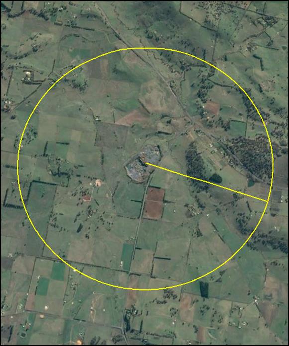
Figure 2: quarry and surrounding land use
(yellow line identifies 2km radius from the centre of
the quarry)
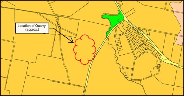
Figure 3: Land Use Zone Map (yellow indicates E3
Environmental Management zone, green indicates RE1 Public Recreation Zone, pink indicates RU1 Primary
Production)
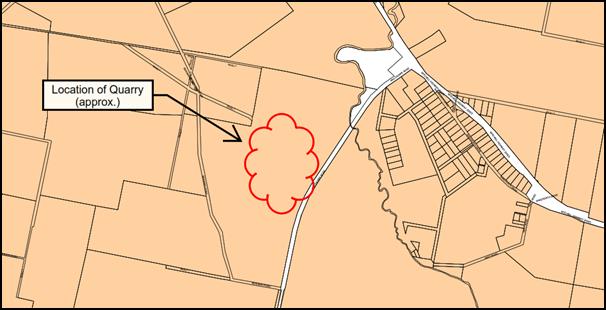
Figure 4: Minimum Lot Size Map (pink indicates Minimum
Lot Size of 100ha)
Further, given that the quarry is
established and that the development, as modified, is substantially the same as
the development for which consent was originally granted, it is considered that
there is no net change in the public benefits of the development as opposed to
the existing and preferred land uses in the vicinity of the quarry.
Natural Resource Management and
Environmental Management
Clause 14 of the SEPP requires that the consent authority
must consider whether or not the consent should be issued subject to conditions
aimed at ensuring that the development is undertaken in an environmentally
responsible manner before granting consent for development for the purpose of
extractive industry, including conditions to ensure the following:
· that impacts on
significant water resources, including surface and groundwater resources, are
avoided or minimised to the greatest extent practicable;
· that impacts on
threatened species and biodiversity are avoided, or are minimised to the
greatest extent practicable; and
· that greenhouse
gas emissions are minimised to the greatest extent practicable.
The consent authority must also consider an assessment of
greenhouse gas emissions (including downstream emissions) of the development,
and must do so having regard to any applicable State or national policies,
programs or guidelines concerning greenhouse gas emissions.
Given that the application is restricted to increasing the
annual rate of production by 50,000 tonnes from 150,000 tonnes to 200,000
tonnes and does not seek to increase the extent of the quarry area approved
under DA 109/92, it is considered unlikely that there will be any further
significant environmental impact; or that the overall greenhouse gas emissions
associated with the quarry would increase.
It is considered unnecessary to apply any further conditions
of consent with regard to natural resource and environmental management.
Transport
Clause 16 of the SEPP requires that the consent authority
must consider whether or not development for the purpose of extractive industry
should be issued subject to conditions which do one or more of the following:
· require that some
or all of the transport materials in connection with the development is not to
be by public road,
· limit or preclude
truck movements, in connection with the development, that occur on roads in
residential areas or on roads near to schools,
· require the
preparation and implementation, in relation to the development, of a code of
conduct relating to the transport of materials on public roads.
Clause 16 of the SEPP also requires that if the consent
authority considers that the development involves the transport of materials on
a public road, the consent authority must provide a copy of the application to
Roads and Maritime Services (the RMS).
The application has been referred to the RMS and
Council’s Technical Services Division for review.
Based on the proposed modification, the RMS has advised that
it does not object subject to Council applying the following conditions of
consent:
- Safe
Intersection Sight Distance (SISD) in accordance with Part 4A of Austroads
Guide to Road Design and relevant Roads and Maritime supplements is to be
provided at the intersection of the quarry road and Millthorpe Road.
- Temporary
closures of Millthorpe Road during blasting operations are to be carried out in
accordance with a current Road Occupancy Licence from Roads and Maritime
Services. Road Occupancy Licences are to be obtained prior to any closures of
Millthorpe Road by contacting the Field Traffic Manager on 02 6861 1461 or
email ROL.Western@rms.nsw.gov.au
- Haulage
operations coinciding with local student school bus pick up/drop off times are
to be avoided.
- In
accordance with clause 16(1) of State Environmental Planning Policy (Mining,
Petroleum Production and Extractive Industries) 2007, the applicant is to prepare
and implement a driver code of conduct for the task of transporting materials
on public roads.
Further, Council’s Technical Services Division has
indicated that while there may be fewer overall traffic movements from the
subject property on a daily basis, the proposed increase in annual production
from 150,000 tonnes to 200,000 tonnes represents a 33.3% increase in equivalent
standard axels (ESAs) applied to the road pavement.
The Technical Services Division has indicated that this
change affects Condition 49 of DA 109/92, which deals with pavement
maintenance costs on Main Road 559 from the intersection of the private
access road of the quarry to the Mitchell Highway (State Highway 7).
The Technical Services Division advised that the new
maintenance cost required by Condition 49 will be $4,840.00 (ie the
original indexed cost of $3,631.45 + 33.3% rounded down to nearest dollar),
which will be indexed annually on 1st January each calendar year.
Rehabilitation
Clause 17 of the SEPP requires that the consent authority
must consider whether or not consent for an extractive industry should be
issued subject to conditions aimed at ensuring the rehabilitation of land that
will be affected by the development. In particular, the consent authority must
consider whether conditions of the consent should:
· require the
preparation of a plan that identifies the proposed end use and landform of the
land once rehabilitated, or
· require waste
generated by the development or the rehabilitation to be dealt with appropriately,
or
· require any soil
contaminated as a result of the development to be remediated in accordance with
relevant guidelines, or
· require steps to
be taken to ensure that the state of the land, while being rehabilitated and at
the completion of the rehabilitation, does not jeopardise public safety.
Landscaping and rehabilitation are addressed under
Conditions 27-30 of DA 109/92. It is not considered that any further
conditions of consent addressing rehabilitation are required.
State Environmental Planning
Policy 33 - Hazardous and Offensive Development
State Environmental Planning Policy 33 - Hazardous and
Offensive Development (SEPP 33) identifies that in determining
whether a development is a hazardous storage establishment, hazardous industry
or other potentially hazardous industry; or an offensive storage establishment,
offensive industry or other potentially offensive industry, consideration must
be given to current circulars or guidelines published by the Department of
Planning relating to hazardous or offensive development. The applicable
guideline is the Hazardous and Offensive Development Application Guidelines
Applying SEPP 33 (SEPP 33 Guidelines).
The SEPP 33 Guidelines identify that the key
consideration of a potentially offensive industry is that the consent authority
is satisfied there are adequate safeguards to ensure that emissions from a
facility can be controlled at levels which are not significant. The
SEPP 33 Guidelines identify that an important factor in making this
judgement is the view of the Department of Environment Climate Change and
Water (DECCW) for those proposals requiring a pollution control licence under
DECCW legislation. If DECCW considers that its licence requirements can be
met, then the proposal is not likely to be an ‘offensive industry’.
In this regard it is noted that the quarry has an
Environmental Protection Licence (EPL 4988) issued by the Environmental
Protection Authority - NSW (the EPA) allowing for production between
100,000-500,000 tonnes per annum.
Further, the EPA has provided Council staff with written
advice indicating that it has reviewed the performance of the quarry against
the EPL conditions, and identified that the licence regulatory level is low and
has no extra concerns with the expansion as proposed, provided all EPL
conditions continue to be complied with.
On this basis, it is considered that the development, as
modified, should not be considered a potentially offensive industry.
State Environmental Planning
Policy 55 - Remediation of Land
State Environmental Planning Policy 55 - Remediation of Land
(SEPP 55) requires that a consent authority must not consent to the
carrying out of development of land unless it has considered whether the land
is contaminated; if the land is contaminated, it is satisfied that the land is
suitable in its contaminated state (or will be suitable, after remediation) for
the purpose for which the development is proposed to be carried out; and if the
land requires remediation to be made suitable for the purpose for which the
development is proposed to be carried out, it is satisfied that the land will
be remediated before the land is used for that purpose.
While extractive industry is identified as a potentially
contaminating land use, it is considered that the land is likely to be suitable
for on-going use as a quarry.
PROVISIONS OF ANY DRAFT
ENVIRONMENTAL PLANNING INSTRUMENT THAT HAS BEEN PLACED ON EXHIBITION
s79C(1)(a)(ii)
There are no draft environmental planning instruments that
apply to the subject land or proposed development.
DESIGNATED DEVELOPMENT
DA 109/92 was approved as Designated Development pursuant to
the provisions of the Environmental Planning and Assessment Act 1979.
The development, as modified, would continue to exceed the
thresholds for Designated Development under Part 1, Clause 19, Schedule 3 of
the Environmental Planning and Assessment Regulations 1979 (the
‘Regulations’).
Despite this, Part 2, Clause 35 of the Regulations provides
that development involving alterations or additions to development (whether
existing or approved) is not Designated Development if, in the opinion of the
consent authority, the alterations or additions do not significantly increase
the environmental impacts of the total development (that is the development
together with the additions or alterations) compared with the existing or
approved development.
Clause 36 identifies that in forming its opinion as to
whether or not development is Designated Development, the consent authority is
to consider the following:
· the impact of the
existing development having regard to factors including:
- previous
environmental management performance, including compliance with the conditions
of any consents, licences, leases or authorisations by a public authority and
compliance with any relevant codes of practice, and
- rehabilitation
or restoration of any disturbed land, and
- the
number and nature of all past changes and their cumulative effects, and
· the likely impact
of the proposed alterations or additions having regard to factors including:
- the
scale, character or nature of the proposal in relation to the development, and
- the
existing vegetation, air, noise and water quality, scenic character and special
features of the land on which the development is or is to be carried out and
the surrounding locality, and
- the
degree to which the potential environmental impacts can be predicted with
adequate certainty, and
- the
capacity of the receiving environment to accommodate changes in environmental
impacts, and
· any proposals:
- to
mitigate the environmental impacts and manage any residual risk, and
- to
facilitate compliance with relevant standards, codes of practice or guidelines
published by the Department or other public authorities.
Council staff have had regard to the foregoing matters. In
general, Council staff consider:
· the impact of the
existing development is consistent with the impact anticipated by the original
1992 EIS and associated Officer Report;
· the likely impact
of the development, as modified, is acceptable with regard to possible
acoustic, air and traffic safety impacts; and
· potential
environmental impacts will continue to be appropriately mitigated.
Notwithstanding these conclusions, Council staff recognise
that development consent was originally granted 25 years ago and that it would
be timely to undertake a detailed review of the development to ensure that all
applicable conditions of consent are being addressed and that the relevant
management plans are being given effect.
For example, while the file for the development indicates
that the operation of the quarry was carefully monitored during its inception
and preliminary stages, it is unclear whether some conditions have continued to
be implemented as they were intended, such as the requirement to review the
rehabilitation bond annually and provide an Annual Performance Report. In
addition, it is noted that the Overall Site Management Plan is currently absent
from the file.
Accordingly, it is recommended that if consent is granted
Council staff engage with the operator of the site to ensure that all
applicable conditions of consent are adequately addressed and that Council
staff revisit those aspects of the development which require attention on an
annual basis to ensure the appropriate ongoing management of the quarry.
PROVISIONS PRESCRIBED BY THE
REGULATIONS s79C(1)(a)(iv)
Demolition of a Building (clause 92)
The proposal does not involve the demolition of a building.
Fire Safety Considerations
(clause 93)
The proposal does not involve a change of building use for
an existing building.
Buildings to be Upgraded
(clause 94)
The proposal does not involve the rebuilding, alteration,
enlargement or extension of an existing building.
BASIX Commitments (clause 97A)
Not applicable.
THE LIKELY IMPACTS OF THE
DEVELOPMENT s79C(1)(b)
The potential key likely impacts of the development, as
modified, are considered to be associated with the increased annual production
rate, and include increased acoustic impact on proximate sensitive receivers
such as dwellings, increased air pollution,; and increased pressure on the
local traffic network.
The relevant matters are addressed
in detail below.
Increased Maximum Production
Limit
Acoustic Impact
The supporting information submitted with the application
includes a Noise Impact Assessment prepared by Aurecon. A summary of the Noise
Impact Assessment is included within the supporting information. The summary
makes the following conclusions.
Quarry noise
The increased maximum
production limit would not require additional quarry plant or equipment to be
used on site. Rather the existing plant and equipment would operate for longer
periods. As discussed above, the existing quarry operations are predicted to be
inaudible at the nearest sensitive receivers and consequently the future operation
of the quarry would continue to be inaudible.
Road traffic noise
The only potential change in
noise levels from the increased production limit would result from increased
truck movements, transporting materials from the quarry. As noted Section 4.6,
average daily vehicle movements would be lower than that predicted in the EIS.
Peak traffic movements would
be higher than those assessed in the EIS, with up to 16 movements in an hour
– which is double the peak traffic movements assessed in the EIS. Doubling
of traffic volume equates to a maximum of 3 dBA increase in the road traffic
noise levels based on the Calculation of Road Traffic Noise (CoRTN)
methodology. This would generally only be experienced at the receiver near the
intersection of the Mitchell Highway and Millthorpe Road as it is on the route
that most trucks and other vehicles use to access the site. Even with this
increase in noise, noise levels would be still below the approved noise
criteria.
Blasting
The number of blasts may
increase up to six blasts a year or the size of blasts may increase to 75000
tonnes per blast. Any increase in the size or number of blasts would continue
to be in compliance with the existing EPA/ANZEC criteria.
The supporting information submitted with the application,
including the Noise Impact Assessment, has been assessed by Council’s
Environmental Health and Building Surveyor, who has provided the following
assessment:
“The SOEE details that
the current quarry operations noise impact is less than the predictions
contained in the original EIS provided with the application in 1992, which were
found to be compliant at the time. This is in part due to more modern equipment
being used, the equipment being used is located on the quarry floor as opposed
to a higher level as originally considered and the bund walls for the site
being higher than originally required. The noise impact of the current and
proposed quarry operations are at least 10dBA less than the existing background
levels in the area. Noise from the quarry in normal operation mode will be
inaudible at nearby receivers and the increase in production will have no or
minimal impact.
The only recommendation of the
NIA is that noise monitoring is recommended if the quarry’s actual
production rate exceeds 150,000 tonnes per year. Referring to the original DA
consent and Condition No. 14 in particular, which says:
14. The
quarry operator shall:
· Undertake and
implement environmental monitoring in respect of air, noise, blasting and water
quality to the satisfaction of Council and in consultation with Department of
Water Resources, Roads and Traffic Authority and Environment Protection
Authority.
· Designate a suitably
qualified Company employee to be responsible for ensuring that all
environmental safeguards and monitoring proposed for the development are met or
are not exceeded to the satisfaction of Council.
The existing Condition No. 14
covers the recommendation of the NIA. Additionally, Condition No. 17 of the
original consent which says:
17. The
quarry operational noise emission levels shall not exceed 5 dBA above the
average background noise level at the nearest residence.
Condition No. 17 of the
original consent reinforces and provides backup to the noise monitoring
required by Condition No. 14 and the recommendation of the NIA.
In light of the above, the
existing conditions of consent will provide the required level of noise impact
monitoring and regulatory control should the noise impacts change to the
detriment of the amenity of the nearby residential receivers.”
In addition to the foregoing, Council’s Environmental
Health and Building Surveyor confirmed that the proposed increase in peak
hourly truck movements would not result in a ‘non-compliance’ at
the dwelling located at the intersection of the Mitchell Highway and Millthorpe
Road.
Based on the assessment provided by the Environmental Health
and Building Surveyor, it is accepted that the current quarry operation noise
impact is likely to be less than the predictions contained in the original 1992
EIS; and that the existing conditions of consent will provide the required
level of noise impact monitoring and regulatory control should the noise
impacts change to the detriment of the amenity of the nearby residential
receivers.
Air Quality Impact
The supporting information submitted with the application
includes an Air Quality Impact Assessment prepared by Aurecon. A summary of the
Air Quality Impact Assessment is included within the supporting information.
The summary makes the following conclusions.
“Activities at the
quarry which may generate dust include:
· Drilling and blasting
· Moving displaced rock
with an excavator or front end loader (FEL)
· Primary, secondary
and tertiary crushing
· Primary and fines
screening
· Loading crushed rock
into stockpiles
· Loading delivery
trucks from stockpiles
· Truck movements
between the pit and weighbridge
· Truck movements
between quarry and main road.
The pre-coat plant and pug
mill do not generate substantial dust emissions as generally the handled material
is “wet” (ie. Coated with liquid or other materials), the size and
capacity of the plant is small and they only operate intermittently. However
the stockpiling and the handling of materials at the precoat plant and pugmill
locations have been included as a surrogate for their emissions.
An emissions inventory has
been compiled using emission factors given in National Pollutant Inventory
(NPI) Emission Estimation Technique Manuals (EETM). Emission factors for the
specific activities listed above have been used to calculate a cumulative
emission load from the quarry.
Using the cumulative
emissions, air quality modelling was undertaken using AERMOD (a steady-state
Gaussian plume model) and local meteorological data. This modelling was
conservative as it assumed that all activities above were occurring
simultaneously – which rarely occurs. The modelling (see Table 3)
indicates that the quarry has little impact on the average annual TSP and PM10
concentrations. However when meteorological conditions are adverse, some
receivers on some days may experience a small increase in the daily PM10.
This increase would not result in exceedances of the daily PM10 criteria.
Overall the quarry has a minimal impact on air quality at sensitive receivers.
With the increased production
limit, there would be no increase or change in the activities or plant used on
site rather the quarry would operate for longer at a higher capacity.
Consequently the impacts would be no greater than the worst case air impacts
predicted above."
The supporting information submitted with the application,
including the Air Quality Impact Assessment, has been assessed by
Council’s Environmental Health and Building Surveyor, who has provided
the following assessment:
“The SOEE also includes
a summary of an Air Quality Assessment (AQA) by aurecon. The SOEE details that
the increased quarry production limit will not increase or change the
activities or plant used on the site, instead the quarry will operate longer at
a higher capacity. The SOEE indicates that the increase in production will have
minimal impact on air quality at sensitive receivers, particularly if the
operator maintains its current strategies to manage dust as is required by the
existing conditions.”
Based on the assessment provided by the Environmental Health
and Building Surveyor, it is accepted that the increase in production will have
minimal impact on air quality at sensitive receivers, particularly if the
operator maintains their current strategies to manage dust as is required by
the existing conditions.
Traffic Impact
The supporting information submitted with the application
includes a Traffic Impact Assessment prepared by Aurecon. A summary of the
Traffic Impact Assessment is included within the supporting information. The
summary makes the following conclusions.
“Compared to the
approved development in the 1992 EIS, the increase in production limits will
result in less traffic than had been estimated in 1992, as a result of the use
of higher capacity and higher efficiency trucks.
At times when the quarry is
servicing special projects or large volume orders, peak vehicle movements of up
to 16 an hour would occur. This increase would not have an impact on the road
network or intersections as the number of movements is small relative to the
capacity of the road network and intersections.
Overall the traffic impact of
the proposed maximum production limit increase would be minimal and
substantially the same as the approved project.”
The supporting information submitted with the application,
including the Traffic Impact Assessment, has been assessed by Council’s
Technical Services Division and the RMS.
Council’s Technical Services Division has provided the
following assessment:
“The increase in production affects Condition 49:
A contribution
of Two Thousand Dollars ($2,000.00), indexed by C.P.I, for pavement maintenance
costs on Main Road 559 from the intersection of the private access road to the
Mitchell Highway (State Highway 7) shall be paid to Council on the 1 January
annually in respect of this development pursuant to Section 94 of the
Environmental Planning and Assessment Act.
The quarry
was officially opened on 14 August 1993 and contributions have previously been
paid for 1994 to 2016.
Despite the applicants comments regarding traffic movements into and out
of the site, regardless of what type of vehicle is used to transport the
crushed stone out of the quarry (whether a truck and dog or 19m semi or B
double) the proposed increase in maximum production from 150,000 tonnes to
200,000 tonnes still represents a 33.3% increase in equivalent standard axels
(ESAs) applied to the road pavement, even though there may be fewer overall
traffic movements on a daily basis.
Accordingly the ongoing pavement maintenance condition 49 must be
increased by a proportionate amount (33.3%). The original amount was $2,000.00
(to be increased annually by CPI since 1992) and the recent 2017 indexed
contribution was $3,631.45 (see PR22742).
The new maintenance contribution is therefore $4,840.00 ($3,631.45 +
33.3% rounded down to nearest dollar), and this will be indexed annually on 1st
January each calendar year.
The amended engineering condition that shall be applied to this
Development Application, received from Boral Resources (Country) Pty Limited on
30/06/2017, is:
Condition 49 (amended)
A
contribution of Four Thousand Eight
Hundred and Forty Dollars ($4,840.00), indexed by C.P.I, for
pavement maintenance costs on Main Road 559 from the intersection of the
private access road to the Mitchell Highway (State Highway 7) shall be paid to
Council on the 1 January annually in respect of this development pursuant to
Section 94 of the Environmental Planning and Assessment Act.”
The RMS has provided the following assessment:
Thank you for your letter received on 14 August
2017 referring DA 109/1992(2) to Roads and Maritime Services for comment. The
proposed development is for an increase in production from 150,000 tonnes per
annum to 200,000 tonnes per annum and an increase in the peak hour heavy vehicle
volume from 8 to 16.
Roads and Maritime will not object to the proposed
development subject to the following conditions being included in any consent
issued in relation to this project:
• Safe
Intersection Sight Distance (SISD) in accordance with Part 4A of Austroads
Guide to Road Design and relevant Roads and Maritime supplements is to be
provided at the intersection of the quarry road and Millthorpe Road.
• Temporary
closures of Millthorpe Road during blasting operations are to be carried out in
accordance with a current Road Occupancy Licence from Roads and Maritime
Services. Road Occupancy Licences are to be obtained prior to any closures of
Millthorpe Road by contacting the Field Traffic Manager on 02 6861 1461 or
email ROL.Western@rms.nsw.gov.au
• Haulage
operations coinciding with local student school bus pick up/drop off times are
to be avoided.
• In accordance with clause
16(1) of State Environmental Planning Policy (Mining, Petroleum Production and
Extractive Industries) 2007, the applicant is to prepare and implement a driver
code of conduct for the task of transporting materials on public roads.”
Based on the assessment provided by Council’s
Technical Services Division and the RMS, it is accepted that the increase
in production will not result in a significant or detrimental impact on the
local traffic network.
Project Description
It is considered that the proposed changes to the approved
project description are unlikely to have any significant environmental impact.
Notwithstanding, the following recommendations are made to ensure that the
quarry continues to be operated in a satisfactory manner:
· Condition 6 be
modified to require that a Development Application and Construction Certificate
application be submitted to Council for all buildings to be erected on the
site.
In addition, Condition 6 be
modified to include a note that any building within the site should not be
visible outside of the quarry.
· Condition 21 be
modified to require that dust emissions from the processing plant be controlled
in a suitable manner to ensure that dust emissions do not have an adverse
impact outside of the quarry.
THE SUITABILITY OF THE SITE
s79C(1)(c)
The suitability of the site was considered by the original
Officer Report for DA 109/92 in 1992.
It is considered that the subject property is also suitable
for the development, as modified, as it is substantially the same the
development for which consent was originally granted; and that the development,
as modified, will not substantially increase the environmental impact of the
total development.
ANY SUBMISSIONS MADE IN
ACCORDANCE WITH THE ACT s79C(1)(d)
The proposed development, as
modified, is defined as advertised development pursuant to the Section 118 of
the Environmental Planning and Assessment Regulation 2000.
While the development, as
modified, was extensively advertised to the local community, submissions were
only received from State Government Departments and Agencies. The submissions
received are summarised below.
Department
of Primary Industries - Agricultural Land Use Planning (DPI Ag)
DPI Ag confirmed that there were
no issues of concern.
Department
of Primary Industries - Water
DPI Water identified that the applicant must identify if
groundwater is currently being intercepted and the potential for groundwater
interception due to the proposed increase in extraction. Additionally, DPI
water stated that the applicant must identify licensing and approval
requirements under the Water Management Act 2000.
Following ongoing correspondence between DPI Water and
Boral, DPI Water has identified that Boral will need to obtain a Water
Supply Works Approval in relation to potential quantity and impacts of
groundwater take as a result of current and future quarry operations. DPI Water
has advised that the requirement to obtain the Water Supply Works Approval
should be included as a condition of consent.
This requirement would apply irrespective of the proposed
modification.
Department
of Planning and Environment - Resources Regulator (DPERR)
The DPERR advised that it did not
wish to make a submission.
Roads
and Maritime Services (RMS)
The RMS advised that it would not object to the development,
as modified, subject to the Council applying recommended conditions of consent.
The recommended conditions of consent are detailed under the traffic impact
assessment, above.
Office of Environment and
Heritage (OEH)
The OEH advised that it had no specific comments to make on
the proposal.
Environmental Protection
Authority (EPA)
The EPA notes that the environment protection licence (EPL)
4988 approves a scale of activity greater than 100,000 and less than 500,000
tonnes annual processing capacity for the extraction, crushing, grinding,
separating and storage of land based material.
Further, the EPA reviewed the performance of the quarry
against the EPL conditions, and identified that the licence regulatory
level is low and the EPA has no extra concerns with the expansion as proposed,
provided all EPL conditions continue to be complied with.
PUBLIC INTEREST
s79C(1)(e)
The proposed development is considered to be of minor
interest to the wider public due to the relatively localised nature of
potential impacts. The proposal is not inconsistent with any relevant policy
statements, planning studies, guidelines etc that have not been considered in
this assessment.
SUMMARY
The development, as modified, is permissible with the
consent of Council. The proposed development, as modified, complies with the
relevant aims, objectives and provisions of the LEP; is consistent with
the provisions of Section 96(2) of the Environmental Planning and Assessment
Act 1979 and the relevant regulations relating to designated development.
A section 79C assessment of the development indicates that the
development as modified is acceptable in this instance. Attached is a draft
Notice of Approval outlining a range of conditions considered appropriate to
ensure that the development proceeds in an acceptable manner.
COMMENTS
The requirements of the Environmental Health and Building
Surveyor and the Engineering Development Section are included in the attached
Notice of Approval.
Attachments
1 Modified
Notice of Approval, D17/69101⇩
2 Submissions,
D17/67949⇩
Planning and Development Committee
7 December 2017
2.5 Development
Application DA 109/1992(2) - 1938 Millthorpe Road
Attachment 1 Modified
Notice of Approval
|

|
ORANGE
CITY COUNCIL
Development
Application No DA
109/1992(2)
NA17/ Container
PR22287
|
NOTICE OF DETERMINATION
OF A DEVELOPMENT
APPLICATION
(AS MODIFIED)
issued under the Environmental
Planning and Assessment Act 1979
Section 81(1)
|
Development
Application
|
|
|
Applicant Name:
|
Boral
Resources (Country) Pty Limited
|
|
Applicant Address:
|
Attention
Ms R Bestic
PO Box
6041
NORTH
RYDE NSW 2113
|
|
Owner’s Name:
|
Mr GJ and
Mrs M Taylor
|
|
Land to Be Developed:
|
Lot 105 DP
1109491 - 1938 Millthorpe Road, Shadforth
(formerly
parts of Portions 36, 71 and 147, and Lot 14 DP 113054, Parish of
Shadforth, County of Bathurst)
|
|
Proposed Development:
|
Basalt
Quarry Operation
|
|
|
|
|
Determination
|
|
|
Made On:
|
7 December
2017
|
|
Determination:
|
CONSENT
GRANTED SUBJECT TO CONDITIONS DESCRIBED BELOW:
|
|
|
|
|
Consent to
Operate From:
|
4 October
1992
|
Terms of Approval
Conditions
The development must be carried out in
accordance with the plans submitted with the Environmental Impact Statement
submitted by the Applicants and bearing Council’s Development Consent
Certificate dated the 7th September, 1992, subject to the provisions
of the City of Orange Local Environmental Plan No. 11; the Environmental
Planning and Assessment Act, 1979; and the following conditions:
|
GENERAL DEVELOPMENT REQUIREMENTS
|
1 The
development consent relating to development application 174/90 (as
amended) approved by Council on the 17th January, 1991 for a basalt quarry
and associated processing plant on the property "Trevanson" and an
access road through part of the property "Beaumah" shall be
surrendered in accordance with Section 91(3)(b) and clause 42 of the Environmental
Planning Act Regulation 1980 upon issue of this consent.
2 The
construction, commencement, operation and rehabilitation of the quarry and
associated processing plant shall be carried out in accordance with the
submitted development application and accompanying Environmental Impact
Statement dated 25th June, 1992, and as amended by the Statement of
Environmental Effects Orange Quarry – Increase in Maximum Production
Limit, Boral Resources (Country) Pty Limited, Revision 3 by Aurecon, dated
17 July 2017, except
where modified by the following conditions.
3 No
physical works shall commence until all relevant details as required by the
following conditions are submitted and approved.
4 The
operator of the quarry shall not extract, process and transport more than
200,000 tonnes of quarry products from the site in any calendar year.
5 The
management of the site during operations and its rehabilitation following cessation
of activity shall be to the satisfaction of Council and in accordance with all
relevant guidelines and policies of the New South Wales Department of Mineral
Resources.
6 A
Development Application and Construction Certificate Application shall be
submitted to Council for all buildings to be erected on the site.
Note:
Any building should have a minimal visual impact outside of the quarry.
7 Evidence
shall be provided to Council that all Civil Aviation Authority requirements
have been met in respect to quarry operations in close proximity to the Orange
Airport.
8 Separate
application for subdivision being made for the approval of Council to the
creation of the quarry lease area.
9 All
of the conditions contained in this consent shall be at the full cost of the
developer, and to the satisfaction of Council, unless specifically stated
otherwise.
|
ENVIRONMENTAL
MANAGEMENT, MONITORING AND REPORTING
|
10 A
management plan for stage 1 of the development shall be prepared and
submitted to Council prior to any site works commencing on the land. The
management plan shall be to the satisfaction of Council, and be prepared in
consultation with the Department of Conservation and Land Management,
Department of Mineral Resources, Department of Water Resources and Environment
Protection Authority.
The
management plan shall include details of the location and design of pollution
control and water management measures, monitoring stations, quarry zones, bund
walls, plantings, buildings and plant, access roads, intersection design,
erosion and sediment control structures, fuel and explosives storage in
relation to contours and natural drainage lines.
11 Within
twelve months of operation an "Overall Site Management Plan" in
accordance with Department of Mineral Resources guidelines shall be submitted
to Council and include the following information to the satisfaction of
Council:
- description
of stages of the development
- detailed
plan showing design and location of quarry zones and access roads, erosion and
sediment control structures, fuel and explosives storage, buildings and plant
in relation to contours and natural drainage lines for all stages of
development.
Note: Prior to any
change to the foregoing matters, an amended Overall Site Management Plan must
be submitted to Council.
12 The
quarrying of basalt and the rehabilitation of the quarry area is to be carried
out in accordance with the provisions detailed in the EIS and the
"Site Management Plans" referred to in conditions No. 10
and 11 above as approved by Council.
13 The
applicant/quarry operator shall submit to Council an Annual Performance Report
covering all matters in compliance with conditions of this consent; the
performance of the development and the effectiveness of the environmental
controls. The Annual Performance Report shall be prepared by a person or
persons with environmental qualifications to the satisfaction of the
Environment Protection Authority and Council for each period ending 31st December
and shall be submitted by 30th March of the following year
during the life of the development.
The annual report shall include
information concerning:
a) The
performance of the development.
b) The
implementation and effectiveness of the environmental controls and conditions
relating to the development.
c) A
review of results of environmental monitoring in respect of air, water and
noise vibration and blasting.
d) A
review of quarrying operations undertaken during the preceding twelve (12)
months.
e) An
overview of workforce characteristics of the development.
14 The
quarry operator shall:
- Undertake
and implement environmental monitoring in respect of air, noise, blasting and
water quality to the satisfaction of Council and in consultation with
Department of Water Resources, Roads and Traffic Authority and Environment
Protection Authority.
- Designate
a suitably qualified Company employee to be responsible for ensuring that all
environmental safeguards and monitoring proposed for the development are met or
are not exceeded to the satisfaction of Council.
15 The
Applicant shall permit access on to the site by officers of Council or any
other public authority at reasonable times for the purposes of inspecting the
emplacement, operation and carrying out such control tests or readings or air,
water and stability of earth works and dams as they consider necessary.
15(a) Prior to the operator
of the quarry extracting, processing or transporting more than 150,000 tonnes
of quarry products from the site in any calendar year, a Water Supply Works
Approval (WA) must be obtained from the relevant State Government Department
(Department of Industry – Water or Water NSW) to address aquifer
interference, including dewatering.
|
REQUIREMENTS OF
STATUTORY AUTHORITIES
|
16 The
quarrying operation shall comply with the requirements of all relevant
Departments, statutory bodies and authorities having power to control or
regulate the quarry. Such requirements are to be complied with either before
commencement or during the life of the quarry as the case may be. This is to
included issue of licences from the Environment Protection Authority and
compliance with the licence conditions.
17 The
quarry operational noise emission levels shall not exceed 5dB(A) above the
average background noise level at the nearest residence.
18 During
commissioning of the Quarry and Processing Plant noise monitoring is to be
conducted and results advised to Council, Environment Protection Authority and
nearest affected residents. The monitoring equipment and methodology shall
comply with the Environment Protection Authority's Environmental and Noise
Control Manual.
19 The
access road and vehicle manoeuvring areas shall be provided with a dust free
surface to the satisfaction of Council.
20 The
hydraulic drill shall be fitted with a dust collection device.
21 Dust
emissions from the processing plant must be controlled in a suitable manner to
ensure that dust emissions do not have an adverse impact outside of the quarry.
22 To
avoid pollution of the water catchment from fuel or explosives stored and used
on site:
i) All
petroleum products to be stored on site shall be above ground in a concrete
floor and bunded storage area with a capacity of 120% of the total product
stored.
ii) The
transfer of fuel in refuelling operations shall take place within the bunded
storage areas.
iii) All
chemical spills on site are to be immediately controlled to prevent entry into
the adjoining water cause or groundwater.
23 Department
of Water Resources shall be consulted with respect to ground and surface water
monitoring and approval obtained for any hydrogeological works associated with
dewatering the quarry as and when required.
24 Environmental
effects caused by blasting shall satisfy the criteria established by the
Environment Protection Authority and Department of Mineral Resources.
25 During
commissioning of the quarry noise, vibration and blast monitoring is to be
conducted and results advised to Council, Environment Protection Authority and
the nearest affected residents. A minimum of three blasts satisfying
Environment Protection Authority criteria are to be monitored during this
period.
The
monitoring equipment and methodology shall comply with the Environment
Protection Authority's requirements specified in the Environmental Noise
Control Manual.
26 Upon
the request of the owner of any property located within 1.0 kilometres of
the boundaries of the proposed quarry, arrange at its cost, for the inspection
by a qualified person agreed to by both parties, to record the material
condition of any structure on such property.
LANDSCAPING
AND REHABILITATION
27 Landscaping
and bund walls shall be implemented and maintained immediately upon
commencement of any works associated with the quarry in order to provide
effective screening of the site. Such details shall be incorporated in a
landscape plan to accompany the "Stage 1 Site Management Plan"
in condition 10 above which shall include provision for
Trees
and shrubs species suitable to the site to be planted, prior to commencement of
the quarry operations, along the boundaries of the site area, and on bund
walls.
28 Vegetation
shall only be removed as quarry work progresses and/or for erosion sediment
control works, bund walls, processing plant area, work sites and road.
29 The
quarry operator is to undertake progressive rehabilitation of the disturbed
areas in accordance with the Soil Conservation Service 1985 Guidelines for
open-cut mining and rehabilitation, in consultation with and to the
satisfaction of Department of Conservation and Land Management.
30 The
applicant shall, before commencing quarry operations, lodge with the Council a
bond supported by a bank guarantee for a sum equal to the cost of carrying out
restoration works associated with rehabilitation, based on a rate of $5,000 per
hectare of all disturbed areas (including work sites, quarry operation and
access roads, to fully compensate the Council in the event of any expense being
incurred by it in respect of the rectification of restoration work referred in
this Consent.
The amount of the "bond" will
be determined upon submission of the "Site Management Plan" defining
the area of all disturbed land in association with the quarry processing and
work sites and roads.
The "rehabilitation bond"
shall be reviewed annually upon submission of the Annual Performance Report
required in Condition 13
above. The amount of the "bond" shall be reviewed according to:
i) the
value of rehabilitation works taken place over the proceeding 12 month
period; and
ii) the
increased value of the restoration based on the Australian Bureau of Statistics
Consumer Price Index (Sydney).
31 Ten
(10) car parking spaces to be provided to the satisfaction of the City Planner
adjacent to the proposed workshop and shed.
32 Engineering
plans showing details of all proposed work including earth works, road works
and stormwater, shall be submitted to Council for the approval of the City
Engineer, and the Roads and Traffic Authority where applicable. The design of
works shall be in accordance with Orange City Council Subdivision Code
guidelines where applicable.
33 The
intersection design of the proposed private access road and the
Millthorpe-Shadforth Road (Main Road 559) shall be based on a Type B
Intersection (refer "Austroads - Guide to Traffic Engineering Practice
Part 5, Fig. 5.2l) and additionally the left turn treatment shall be
based upon Fig. 5.l6 (Desirable Treatment).
All turning circles shall be designed to
accommodate a tri-axle semi trailer movement.
All design and construction work shall
be to the satisfaction of the City Engineer and the Roads and Traffic
Authority.
34 The
sealed pavement of Main Road 559 from the proposed private access road to
the Mitchell Highway (Stage Highway 7) shall be widened to a minimum of
7.0 metres.
All construction work shall be to the
satisfaction of the City Engineer and the Roads & Traffic Authority.
35 The
proposed private access road shall be constructed from Main Road 559 to
the proposed quarry site to a standard equal to a Sealed Rural Secondary Road
(7,250 mm. gravel width) as defined in the Orange City Council Subdivision
Code.
The sealing of the proposed private
access road shall be carried out within a maximum period of three (3)
years from the date of the quarry's commissioning, or such lesser period as
required by Council whereby the access road shall be strengthened and sealed
within three (3) months of a direction by Orange City Council to do so.
Failure to comply with Council's directive shall result in cessation of quarry
operations until the required sealing is completed.
The unsealed access road shall be
treated and maintained to the satisfaction of the City Engineer.
36 The
existing pavement on Main Road 559 between the access and the Mitchell
Highway (State Highway No. 7) shall be maintained in its present condition
by the applicant until such time as the total commercial production figure for
the quarry exceeds 200,000 tonnes.
36(a) Safe
Intersection Sight Distance (SISD) in accordance with Part 4A of Austroads
Guide to Road Design and relevant Roads and Maritime supplements is to be
provided at the intersection of the quarry road and Millthorpe Road.
36(b) Temporary
closures of Millthorpe Road during blasting operations are to be carried out in
accordance with a current Road Occupancy Licence from Roads and Maritime
Services. Road Occupancy Licences are to be obtained prior to any closures of
Millthorpe Road by contacting the Field Traffic Manager on 02 6861 1461 or
email ROL.Western@rms.nsw.gov.au.
36(c) Haulage
operations coinciding with local student school bus pick up/drop off times are
to be avoided.
36(d)
In accordance with clause 16(1) of State Environmental Planning Policy
(Mining, Petroleum Production and Extractive Industries) 2007, the applicant is
to prepare and implement a driver code of conduct for the task of transporting
materials on public roads.
37 Any
adjustments to existing utility services which are made necessary by this
development proceeding, shall be at the full cost of the developer.
38 Evidence
shall be provided, with the "Overall Site Management Plan" required
in condition 11, to the satisfaction of the City Engineer, of the existing
water system's capability to produce a supply of 42,600 litres of
water per day: OR
alternatively water storage facilities
sufficient for sixty (60) days supply shall be provided for the
development. Engineering plans showing details of these required storage facilities
shall be submitted to Council for the approval of the City Engineer.
39 Wastewater
and effluent from the amenities building shall be treated through an aerated
septic tank. An application to instal the plant, together with appropriate
details, shall be submitted to Council for approval.
40 Arrangements
acceptable to Council shall be made for the disposal of waste and putrescible
rubbish.
41 Electricity
supply to service the development shall be provided to the requirements of
Ophir County Council and evidence shall be provided to Council that the
electricity supply has been provided prior to commencement of operations.
SOIL EROSION
AND SEDIMENTATION CONTROL
42 The
applicant shall ensure that adequate safeguards to control erosion and sedimentation
during the construction of the proposed development are implemented and
maintained at all times to minimise pollution of receiving waters. These
safeguards shall include stabilisation of all earth bund walls, overburden
stockpiles and bare ground. The ground surface area around the production and
processing plant shall be graded so that surface water is directed to sediment
control structures.
43 The
applicant is to consult with the Department of Conservation and Land Management
during topsoil and subsoil stripping and stockpiling of these resources in
respect to management of the material and its subsequent re-use.
44 The
applicant is to consult with the Department of Conservation and Land Management
prior to the construction of runoff diversion, erosion and sediment control
works and sediment traps, and these works are to be constructed to capacities
and standards satisfactory to the Department of Conservation and Land
Management. Maintenance of these works will be to a standard satisfactory to
the Department of Conservation and Land Management.
45 The
applicant is to consult with the Department of Conservation and Land Management
in respect to implementation of rehabilitation works and these works are to be
carried out to the satisfaction of the Department of Conservation and Land
Management. Progression to Stage 3 of the development will be conditional
upon satisfactory implementation of rehabilitation works specified for
Stage 2.
46 The
hours of operation shall be restricted to the following:
i) Despatch
of products: 6.00
am to 6.00 pm Mondays to Fridays
7.00
am to 3.00 pm Saturdays
ii) Quarry
and processing operations: 7.00 am to 6.00 pm Mondays to Fridays
8.00
am to 3.00 pm Saturdays
(Haulage
vehicles shall not enter or leave the quarry or processing area outside of
these hours)
iii) Blasting: 9.00
am to 3.00 pm Mondays to Fridays
iv) Construction
of the access road,
quarry and infrastructure: 7.00
am to 6.00 pm Mondays to Fridays
8.00
am to 4.00 pm Saturdays
There is
to be no quarrying operations, processing, blasting, transportation or
construction on Sundays or Public Holidays.
47 The
Applicant, prior to commencement of operations, shall prepare a protocol of
procedure for abating dust, noise and blasting nuisance associated with the
quarry development to be used where the Council or the Environment Protection
Authority receives a complaint, such protocol to address:
· method of
recording the complaint
· availability
of quarry operator to visit the complainant
· the method
by which assessment is made that there is a nuisance
· procedures
to be followed for abating the nuisance (which may include re-arranging
activity, mitigation or ceasing operation).
CONTRIBUTIONS
LEVIED UNDER SECTION 94 OF THE ENVIRONMENTAL PLANNING AND ASSESSMENT
ACT 1979
48 Payment
to Council of contributions levied in respect of Section 94 of the Environmental
Planning and Assessment Act 1979 subject of this development consent to be
made prior to the commencement of site works, or as elsewhere specified. This
clause does not affect the provisions of the condition relating to bonding of
works or those charges connected with engineering works listed elsewhere on
this consent.
49 A
contribution of the following purposes shall apply:
A contribution of Ten Thousand Dollars
($10,000.00), being 50% of the cost, for a single coat 7 mm. stone sprayed
seal on Main Road 559 from the intersection of the private access road to
the Mitchell Highway (State Highway 7) shall be paid in respect to this
development pursuant to Section 94 of the Environmental Planning and
Assessment Act.
A contribution of Four Thousand Eight
Hundred and Forty Dollars ($4,840.00), indexed by C.P.I, for pavement maintenance
costs on Main Road 559 from the intersection of the private access road to the
Mitchell Highway (State Highway 7) shall be paid to Council on the 1 January
annually in respect of this development pursuant to Section 94 of the Environmental Planning
and Assessment Act
Other Approvals
(1) Local
Government Act 1993 approvals granted under section 68.
Nil
(2) General
terms of other approvals integrated as part of this consent.
Nil
Right of Appeal
If
you are dissatisfied with this decision, section 97 of Environmental
Planning and Assessment Act 1979 gives you the right to appeal to the Land
and Environment Court within 6 months after the date on which you receive this
notice.
*
Section 97 of the Environmental Planning and Assessment Act 1979 does not apply
to the determination of a development application for State significant
development or local designated development that has been the subject of a
Commission of Inquiry.
|
Disability Discrimination Act
1992:
|
This application has been assessed in
accordance with the Environmental Planning and Assessment Act 1979. No
guarantee is given that the proposal complies with the Disability
Discrimination Act 1992.
The applicant/owner is responsible to
ensure compliance with this and other anti-discrimination legislation.
The Disability Discrimination Act
covers disabilities not catered for in the minimum standards called up in the
Building Code of Australia which references AS1428.1 - "Design for
Access and Mobility". AS1428 Parts 2, 3 and 4 provides the most
comprehensive technical guidance under the Disability Discrimination Act
currently available in Australia.
|
|
|
|
|
Disclaimer - S88B Restrictions on the Use of Land:
|
The applicant should note that there
could be covenants in favour of persons other than Council restricting what
may be built or done upon the subject land. The applicant is advised to check
the position before commencing any work.
|
|
|
|
|
Signed:
|
On behalf of the consent authority ORANGE
CITY COUNCIL
|
|
Signature:
|
|
|
Name:
|
PAUL JOHNSTON - MANAGER DEVELOPMENT
ASSESSMENTS
|
|
Date:
|
8 December 2017
|
Planning
and Development Committee
7 December 2017
2.5 Development
Application DA 109/1992(2) - 1938 Millthorpe Road
Attachment 2 Submissions
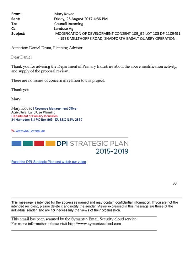
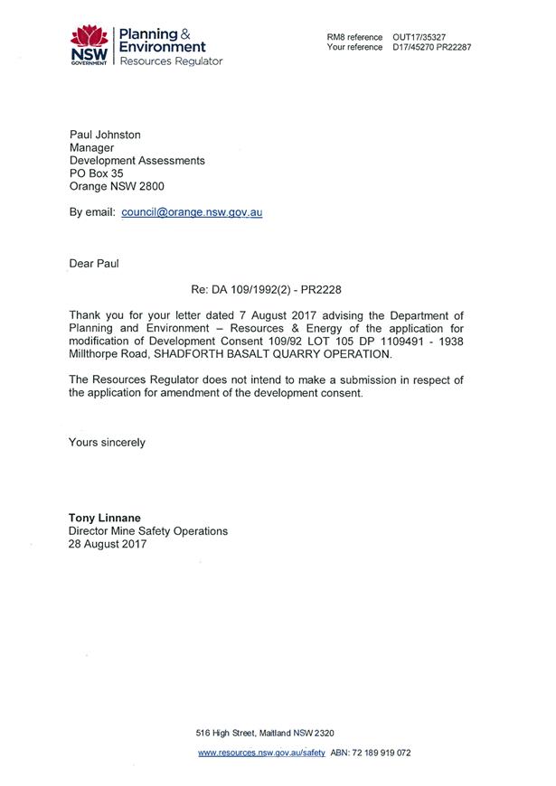
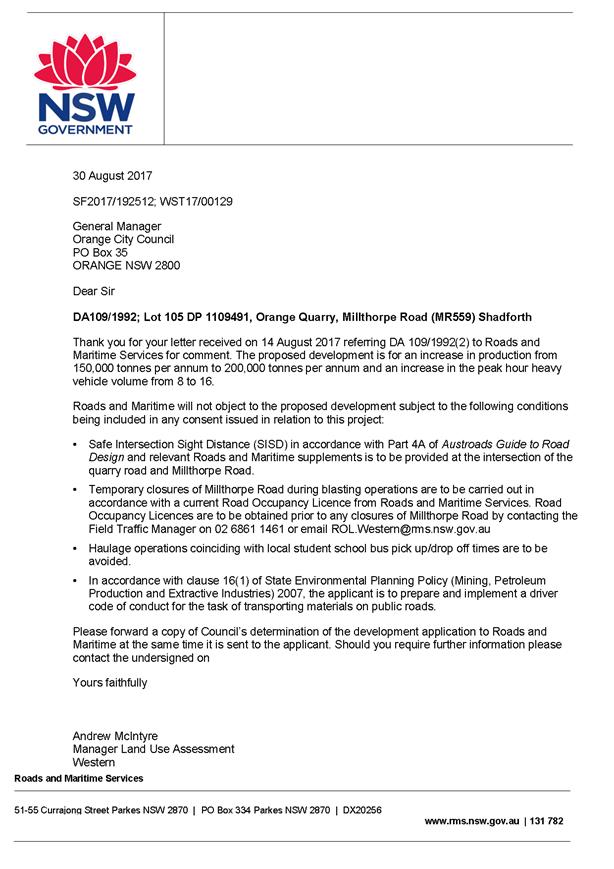
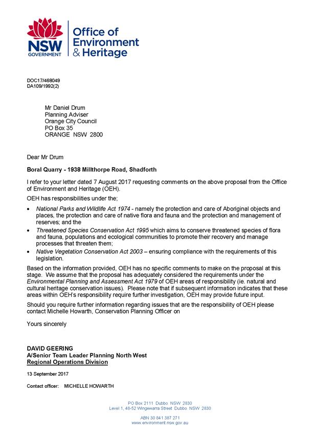
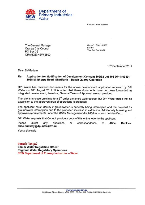
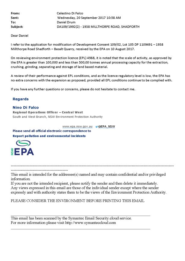
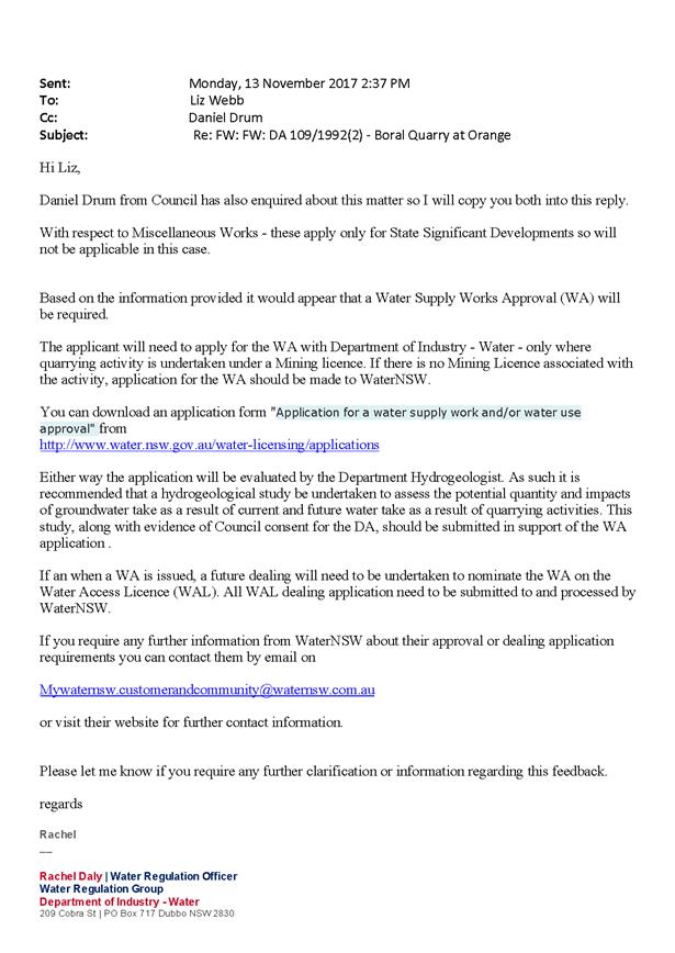
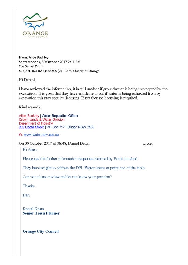
2.6 Orange
Local Environmental Plan 2011 - Amendment 8 - Telopea Way - Post exhibition
report
RECORD
NUMBER: 2017/2515
AUTHOR: Craig
Mortell, Senior Planner
EXECUTIVE Summary
Council exhibited Draft Orange
Local Environmental Plan 2011 – Amendment 8 relating to an expansion of
the North Orange Shopping Centre at 9 Telopea Way from 14 September 2017 to
13 October 2017.
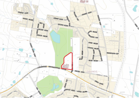
The proposal would expand the B2 Local Centre zone over the
entire property (currently the northern section remains in the R1 General
Residential zone) and adjust the floor space ratio controls. This would in turn
permit consideration of a development application to expand the facility to:
· expand the
current supermarket from 3,200m2 to 4,000m2
· create a
future mini-supermarket of 1,750m2
· create an
additional 800m2 of specialty shops
One submissions was received from NSW Transport Roads and
Maritime Services relating to traffic conditions that will need to be
considered and addressed at the development application stage.
Link To Delivery/OPerational Plan
The recommendation in this report relates to the
Delivery/Operational Plan strategy “1.2 Our City -
Information and advice provided for the decision-making process will be
succinct, reasoned, accurate, timely and balanced”.
Financial Implications
Nil
Policy and Governance Implications
Nil
|
Recommendation
1 That
Amendment 8 to the Orange Local Environmental Plan 2011 – Telopea Way be
referred to the NSW Department of Planning and Environment and the
Parliamentary Counsel Office for legal opinion and finalisation.
2 That
Council resolves to amend Orange Local Environmental Plan 2011
authorising the General Manager to make the plan in accordance with the
planning proposal as exhibited.
|
further considerations
Consideration has been given to the recommendation’s
impact on Council’s service delivery; image and reputation; political;
environmental; health and safety; employees; stakeholders and project
management; and no further implications or risks have been identified.
SUPPORTING INFORMATION
This planning proposal was originally lodged with Council in
2013 and extensive negotiations with the proponent, SCA Property Group, were
held over the course of 2014 to 2016 to ensure that any expansion of
the North Orange Shopping Centre would not unduly impact upon the trading
performance of the CBD.
The primary significance of the Central Business District (CBD)
and the relationship of the North Orange Shopping Centre as providing a
subordinate supporting role, reflect the hierarchy of centres approach adopted
in the Business Centres Review Strategy of Council.
This period also coincided with approaches from the land
owner on the eastern side of Telopea Way seeking to rezone that land to enable
a service station and takeaway food and drink premises. Council resisted that
approach on several grounds, namely
· that land on
the eastern side of Telopea Way directly adjoins residential development, and
as such should at most provide a transition between residential and commercial;
· that the
service station/fast food outlet combination amounted to a Highway Service
Centre, for which other sites along the NDR had already been identified and
were being actively developed (principally Hanrahan Place at the Leeds Parade
intersection); and
· that the
nature of the proposal was likely to attract substantial volumes of high
turnover traffic to the site via a contentious intersection (subsequent
construction of the link road to Diamond Drive has reduced the pressure at this
location).
Conversely, the western side of Telopea Way does not back
onto residential land (other than within the properties own lot boundaries) and
therefore creates less acoustic and privacy disturbance for local residents.
Additionally, the nature of the proposed expansion, while
also attracting significant traffic, involves longer duration stays resulting
in fewer vehicle movements, many of which are likely to be existing customers
who will potentially conduct more of their shopping at the site if it expands.
This has been carefully balanced against the need to
preserve a high performing CBD that can attract and support higher order
services, benefitting the entire local and sub-regional economy. In essence,
the desire to grow the North Orange centre for the benefit of local residents
is understandable, but this must be paced appropriately, in part due to the
need to maintain the efficient operation of the Northern Distributor Road, in
part to preserve the amenity of local residents and in part to avoid undue
fragmentation of the CBD that could otherwise undermine the role and position
of Orange within the Central West.
The results of these
negotiations were considered in a detailed report at the Council meeting of 20
September 2016, where Council resolved:
|
RESOLVED - 16/001 Cr
R Turner/Cr S Munro
1 That Council support a
Planning Proposal at 9 Telopea Way to:
a) rezone the northern portion of Lot
700 DP 1171441 to B2 Local Centre
b) amend the Floor Space Ratio map to
apply a rate of 0.2:1 across the site, enabling a total of 3,100m2
of additional lettable floor space.
2 That Council seeks a
Gateway Determination from the Department of Planning and Environment
consistent with the above and then undertake public exhibition for a period
of 28 days prior to reporting back to Council.
3 That Council’s
support is predicated on the centre not allowing higher order retail uses
such as Discount Department Stores and that absent resolution of this
condition that support be withdrawn.
|
Following receipt of the gateway determination, the planning
proposal was publicly exhibited from 14 September to 13 October 2017. The only
submission received was a response to consultation from NSW Transport Roads and
Maritime Services.
Submissions
NSW Transport Roads and Maritime Services provided a
response to consultation, which did not raise any objection to the proposal but
outlined a range of matters to be considered in more detail at the development
application stage. These matters include:
· Safe
Intersection Sight Distances and appropriate intersection treatments;
· a detailed
traffic impact study and modelling supplied to Roads and Maritime Services at
the development application stage and
· that Section
117(2) Ministerial Direction 3.4 Integrating Land Use Development and Transport
should be considered in relation to access, public transport (especially for
the elderly) and opportunities for pedestrians and cyclists connections to the
area.
Section
117(2) Ministerial Directions
3.4 Integrating Land Use Development and Transport
This direction applies when a planning proposal will create,
alter or remove a zone or a provision relating to urban land, including land
zoned from residential, business, industrial, village or tourist purposes. The
direction requires that planning proposals must locate zones for urban purposes
and include provisions that give effect to the objectives of the direction.
These include:
(1) The
objective of this direction is to ensure that urban structures, building forms,
land use locations, development designs, subdivision and street layouts achieve
the following planning objectives:
(a) improving
access to housing, jobs and services by walking, cycling and public transport,
and
(b) increasing
the choice of available transport and reducing dependence on cars, and
(c) reducing
travel demand including the number of trips generated by development and the
distances travelled, especially by car, and
(d) supporting
the efficient and viable operation of public transport services, and
(e) providing
for the efficient movement of freight.
In this regard the proposal increases the range of jobs and
urban services within the North Orange catchment. The local road network in the
area has been augmented with a link road from the northern end of Telopea Way
westwards to the south/western end of Diamond Drive, improving the connectivity
with residential areas north of the Northern Distributor Road and facilitating
the ability for public transport operators to connect to the site. The
proximity of the site to the Northern Distributor Road continues to ensure an
efficient relationship to the movement of freight and deliveries to the site.
Attachments
1 Pre
gateway report to Council 20 September 2016, D17/70015⇩
2 Gateway
Determination, IC16/18146⇩
3 Formal
Draft Planning Proposal, D17/68179⇩
4 Draft
Zoning Map - Tile 7C, D17/68189⇩
5 Draft
Zoning Map - Tile 7D, D17/68190⇩
6 Draft
Height of Buildings Map - Tile 7D, D17/68188⇩
7 Draft
Height of Buildings Map - Tile 7C, D17/68187⇩
8 Draft
Floor Space Ratio Map - Tile 7D, D17/68186⇩
9 Draft
Floor Space Ratio Map - Tile 7C, D17/68185⇩
10 Proponents
draft Planning Proposal, D17/68192⇩
11 Macroplan
Dimasi - North Orange Marketplace - Economic Impact Assessment, D17/68193⇩
12 Macroplan
Dimasi - North Orange Marketplace - Catchment map, D17/68194⇩
13 Submission
- NSW Transport Roads and Maritime Services, IC17/13976⇩
Planning and Development Committee
7 December 2017
2.6 Orange
Local Environmental Plan 2011 - Amendment 8 - Telopea Way - Post exhibition
report
Attachment 1 Pre
gateway report to Council 20 September 2016
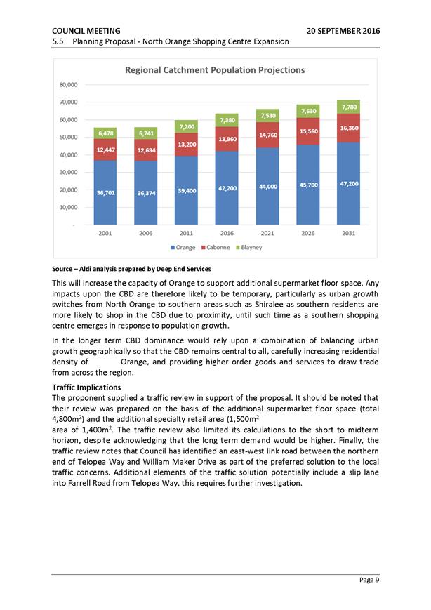
Planning
and Development Committee
7 December 2017
2.6 Orange
Local Environmental Plan 2011 - Amendment 8 - Telopea Way - Post exhibition
report
Attachment 2 Gateway
Determination
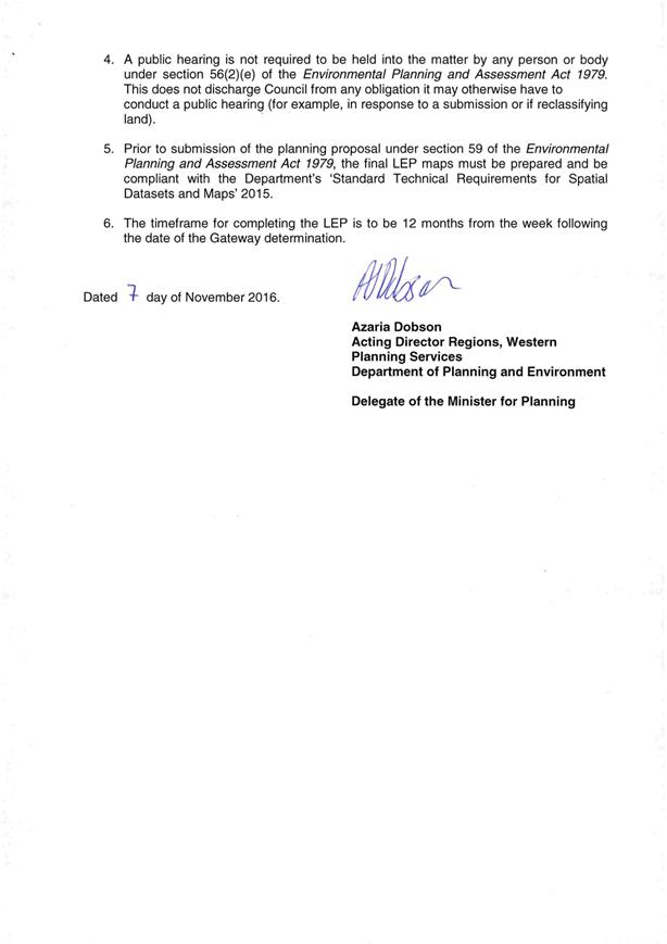

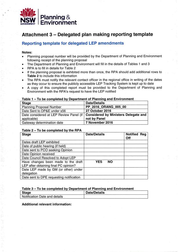
Planning
and Development Committee
7 December 2017
2.6 Orange
Local Environmental Plan 2011 - Amendment 8 - Telopea Way - Post exhibition
report
Attachment 3 Formal
Draft Planning Proposal
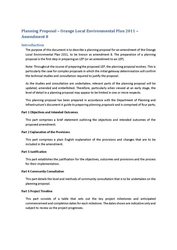


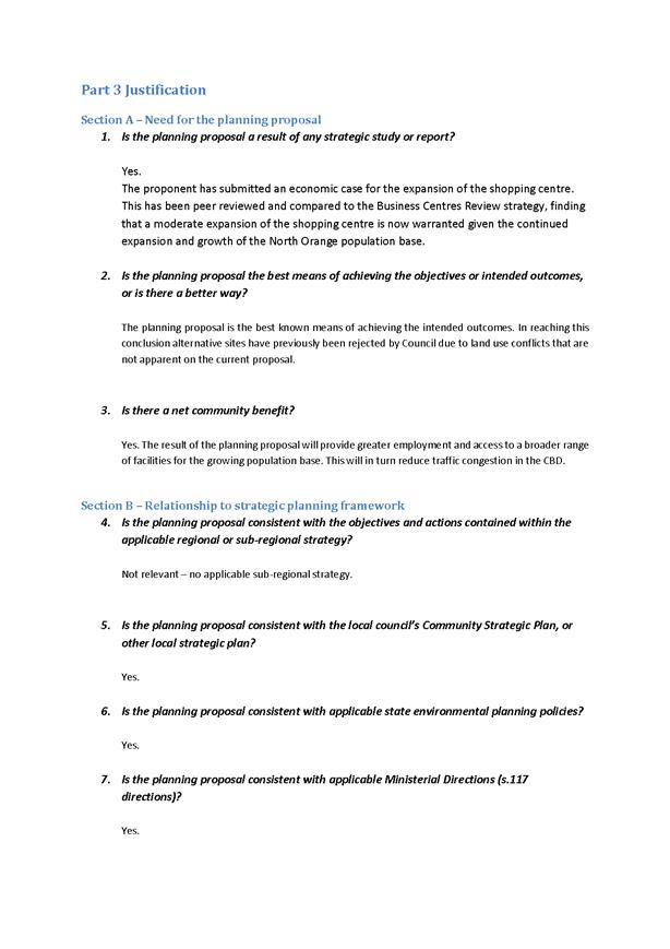
Planning
and Development Committee
7 December 2017
2.6 Orange
Local Environmental Plan 2011 - Amendment 8 - Telopea Way - Post exhibition
report
Attachment 4 Draft
Zoning Map - Tile 7C
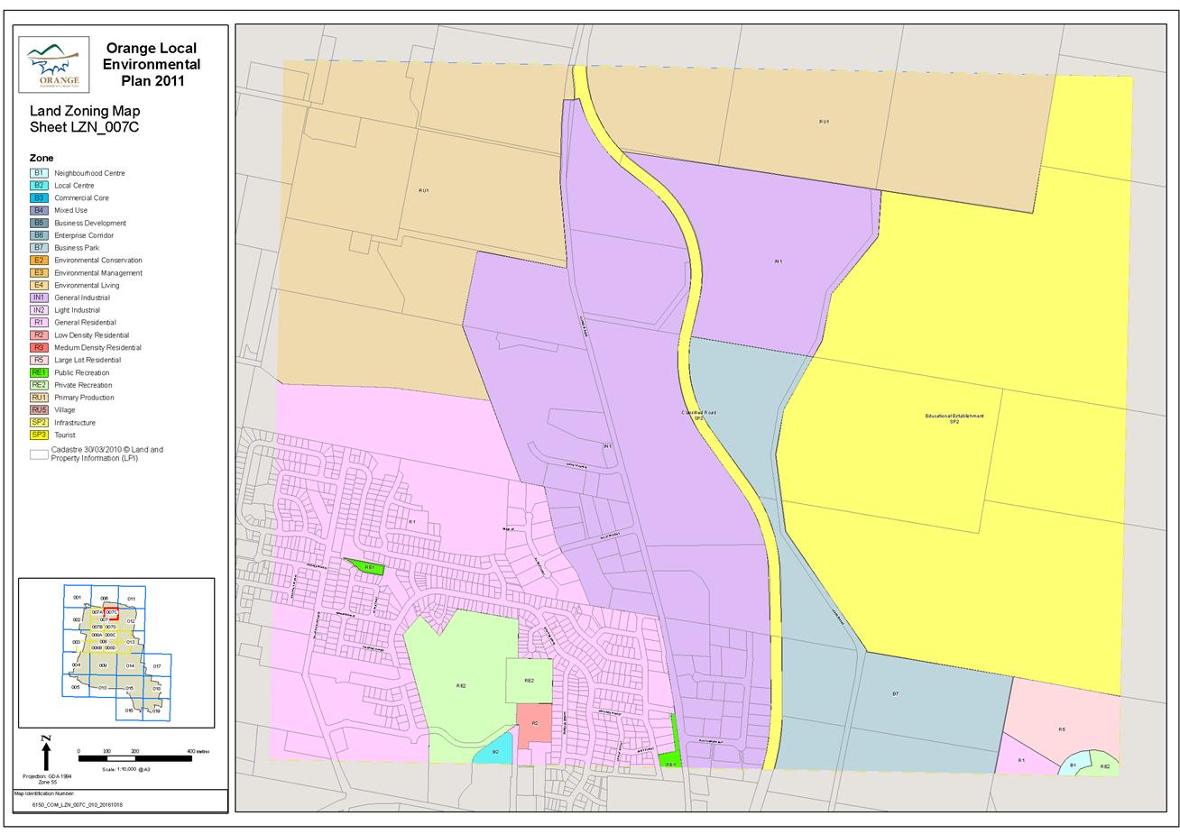
Planning
and Development Committee
7 December 2017
2.6 Orange
Local Environmental Plan 2011 - Amendment 8 - Telopea Way - Post exhibition
report
Attachment 5 Draft
Zoning Map - Tile 7D
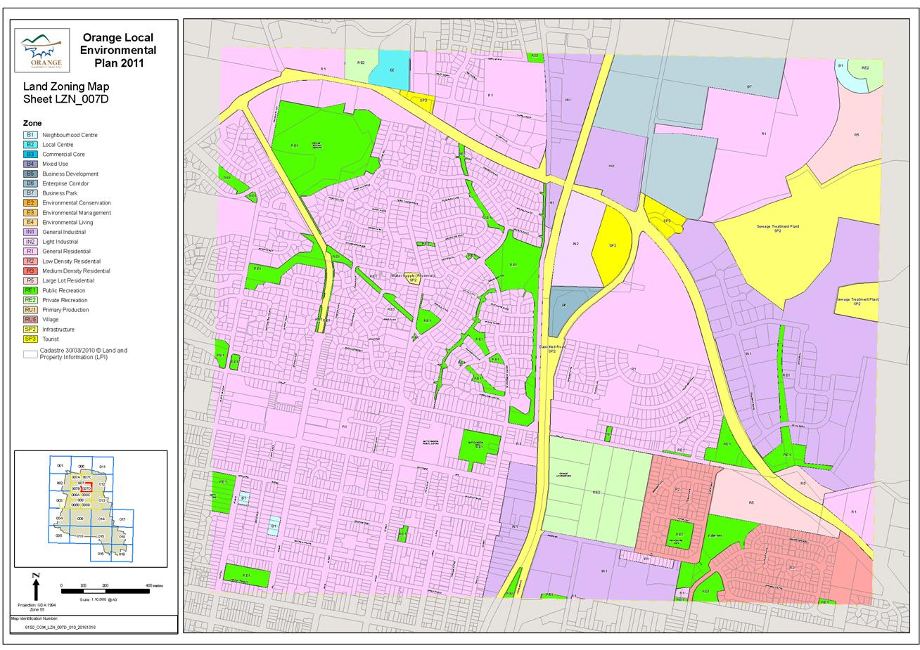
Planning
and Development Committee
7 December 2017
2.6 Orange
Local Environmental Plan 2011 - Amendment 8 - Telopea Way - Post exhibition
report
Attachment 6 Draft
Height of Buildings Map - Tile 7D
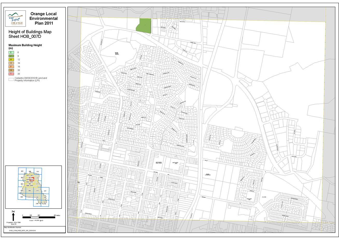
Planning
and Development Committee
7 December 2017
2.6 Orange
Local Environmental Plan 2011 - Amendment 8 - Telopea Way - Post exhibition report
Attachment 7 Draft
Height of Buildings Map - Tile 7C
Planning
and Development Committee
7 December 2017
2.6 Orange
Local Environmental Plan 2011 - Amendment 8 - Telopea Way - Post exhibition
report
Attachment 8 Draft
Floor Space Ratio Map - Tile 7D
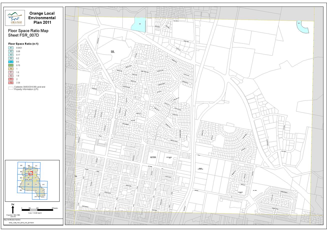
Planning
and Development Committee
7 December 2017
2.6 Orange
Local Environmental Plan 2011 - Amendment 8 - Telopea Way - Post exhibition
report
Attachment 9 Draft
Floor Space Ratio Map - Tile 7C
Planning
and Development Committee
7 December 2017
2.6 Orange
Local Environmental Plan 2011 - Amendment 8 - Telopea Way - Post exhibition
report
Attachment 10 Proponents draft
Planning Proposal


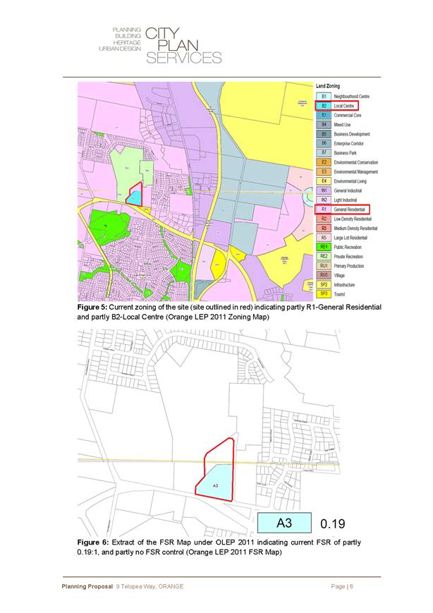
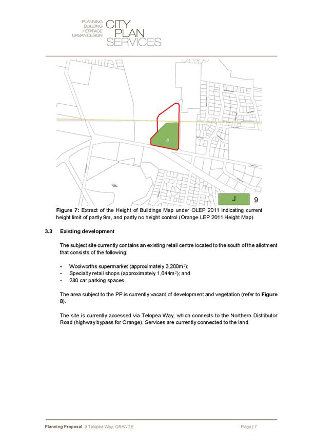
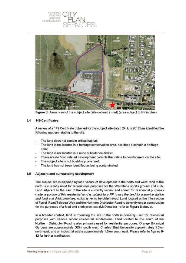

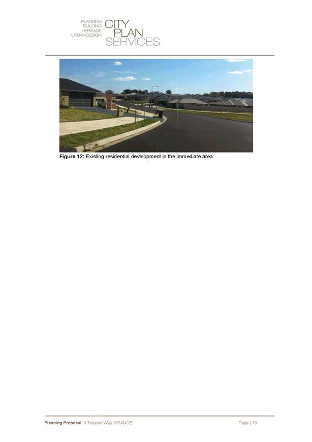
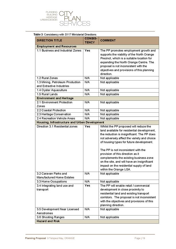


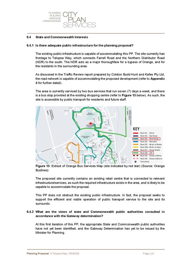
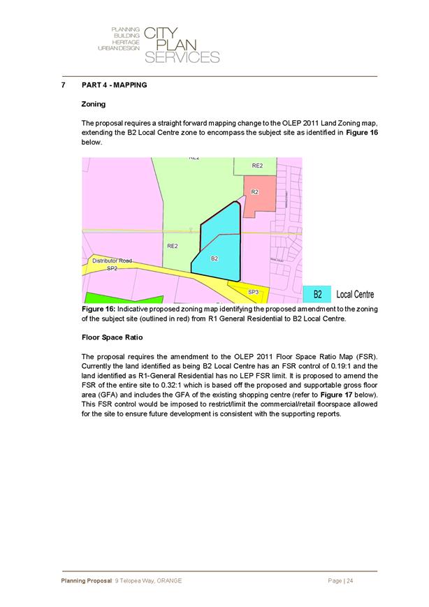
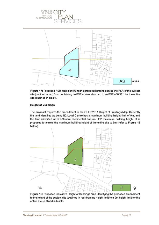
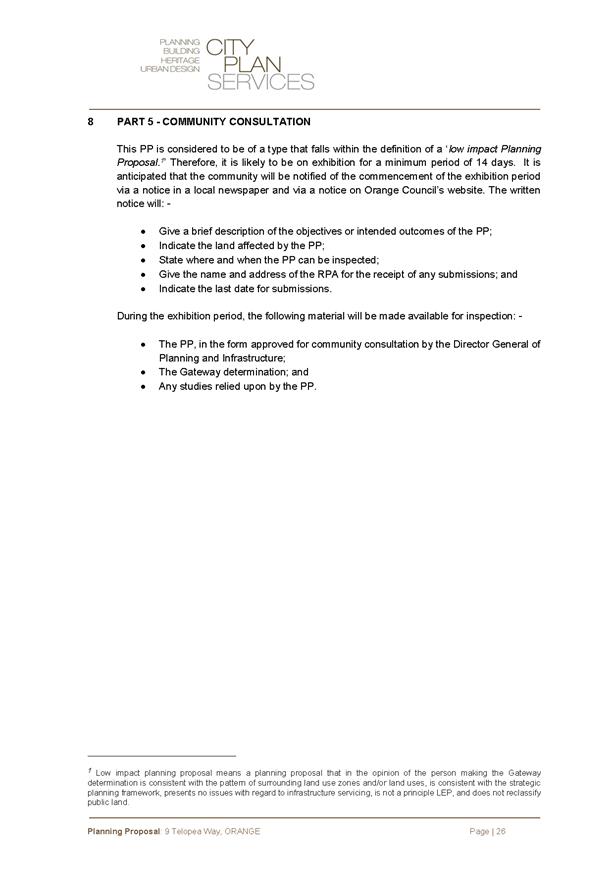

Planning and Development Committee
7 December 2017
2.6 Orange
Local Environmental Plan 2011 - Amendment 8 - Telopea Way - Post exhibition
report
Attachment 10 Proponents draft
Planning Proposal
Planning and Development Committee
7 December 2017
2.6 Orange
Local Environmental Plan 2011 - Amendment 8 - Telopea Way - Post exhibition
report
Attachment 10 Proponents draft
Planning Proposal


Planning and Development Committee
7 December 2017
2.6 Orange
Local Environmental Plan 2011 - Amendment 8 - Telopea Way - Post exhibition
report
Attachment 10 Proponents draft
Planning Proposal
Planning and Development Committee
7 December 2017
2.6 Orange
Local Environmental Plan 2011 - Amendment 8 - Telopea Way - Post exhibition report
Attachment 10 Proponents draft
Planning Proposal
Planning and Development Committee
7 December 2017
2.6 Orange
Local Environmental Plan 2011 - Amendment 8 - Telopea Way - Post exhibition
report
Attachment 10 Proponents draft
Planning Proposal
Planning and Development Committee
7 December 2017
2.6 Orange
Local Environmental Plan 2011 - Amendment 8 - Telopea Way - Post exhibition
report
Attachment 10 Proponents draft
Planning Proposal
Planning and Development Committee
7 December 2017
2.6 Orange
Local Environmental Plan 2011 - Amendment 8 - Telopea Way - Post exhibition
report
Attachment 10 Proponents draft
Planning Proposal

Planning and Development Committee
7 December 2017
2.6 Orange
Local Environmental Plan 2011 - Amendment 8 - Telopea Way - Post exhibition
report
Attachment 10 Proponents draft
Planning Proposal

Planning and Development Committee
7 December 2017
2.6 Orange
Local Environmental Plan 2011 - Amendment 8 - Telopea Way - Post exhibition
report
Attachment 10 Proponents draft
Planning Proposal
Planning and Development Committee
7 December 2017
2.6 Orange
Local Environmental Plan 2011 - Amendment 8 - Telopea Way - Post exhibition
report
Attachment 10 Proponents draft
Planning Proposal
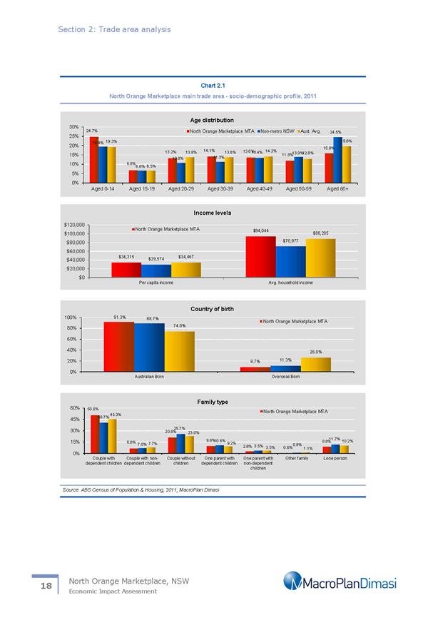
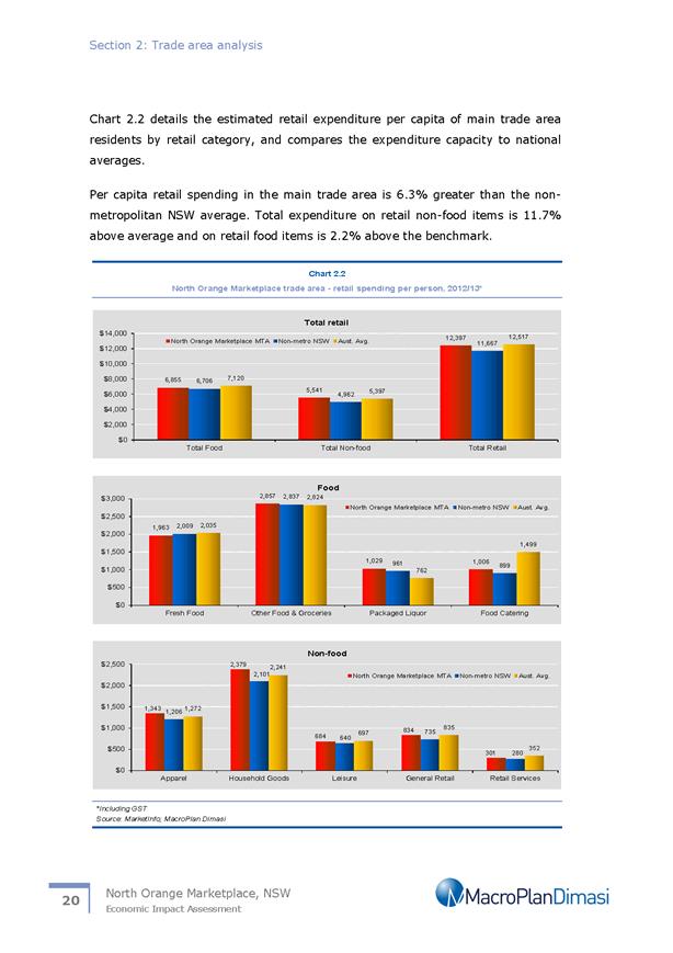
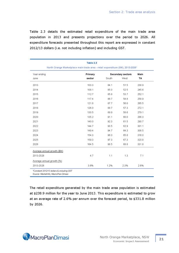


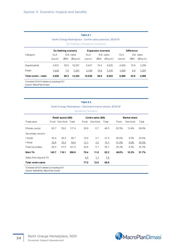

Planning and Development Committee
7 December 2017
2.6 Orange
Local Environmental Plan 2011 - Amendment 8 - Telopea Way - Post exhibition
report
Attachment 10 Proponents draft
Planning Proposal
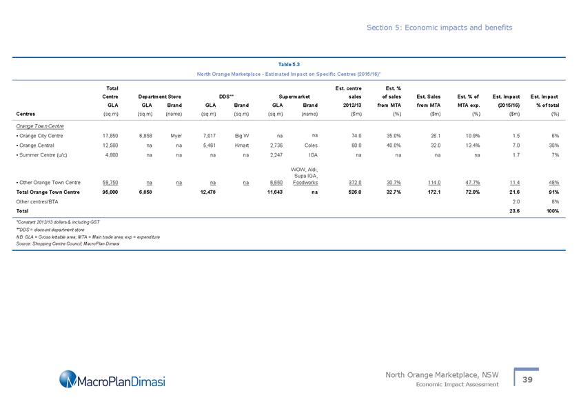
Planning and Development Committee
7 December 2017
2.6 Orange
Local Environmental Plan 2011 - Amendment 8 - Telopea Way - Post exhibition
report
Attachment 10 Proponents draft
Planning Proposal

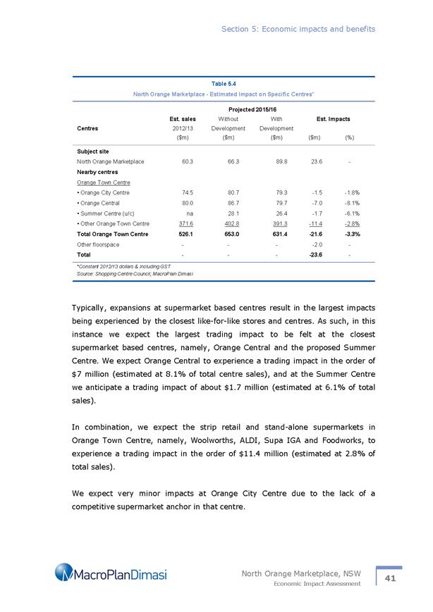

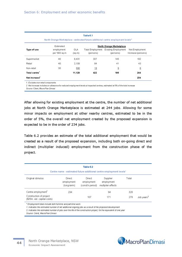


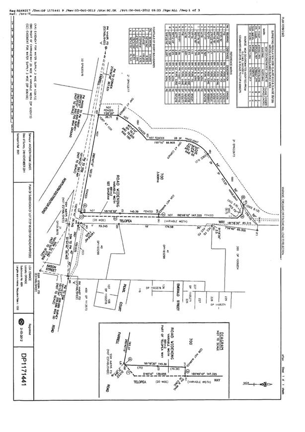
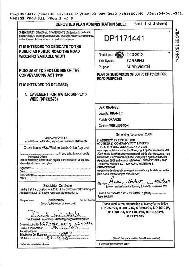
Planning and Development Committee
7 December 2017
2.6 Orange
Local Environmental Plan 2011 - Amendment 8 - Telopea Way - Post exhibition
report
Attachment 11 Macroplan Dimasi -
North Orange Marketplace - Economic Impact Assessment
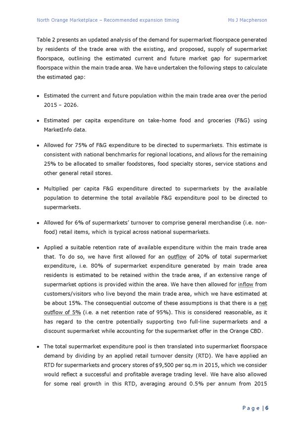
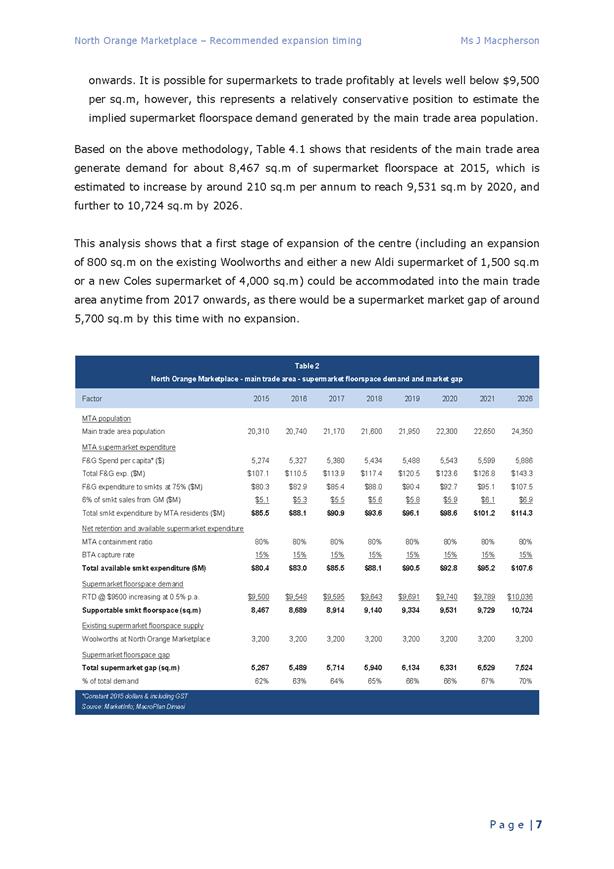
Planning
and Development Committee
7 December 2017
2.6 Orange
Local Environmental Plan 2011 - Amendment 8 - Telopea Way - Post exhibition
report
Attachment 12 Macroplan Dimasi -
North Orange Marketplace - Catchment map
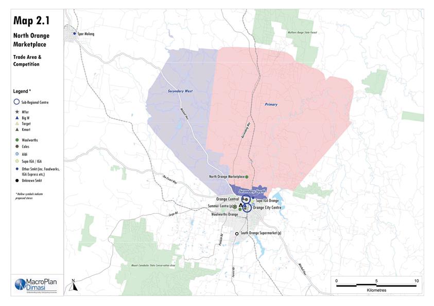
Planning
and Development Committee
7 December 2017
2.6 Orange
Local Environmental Plan 2011 - Amendment 8 - Telopea Way - Post exhibition
report
Attachment 13 Submission - NSW
Transport Roads and Maritime Services
2.7 Development
Application DA 445/2011(4) - 47 Byng Street
RECORD
NUMBER: 2017/2516
AUTHOR: Kelly
Walker, Senior Planner
EXECUTIVE Summary
|
Application
lodged
|
3
January 2017
|
|
Applicant/s
|
Mr JJ
Norris
|
|
Owner/s
|
Mr JJ
Norris
|
|
Land
description
|
Lot B DP
152339 - 47 Byng Street, Orange
|
|
Proposed
land use
|
Restaurant
and Shop
|
|
Value of
proposed development
|
$150,000
|
Application has been made to modify development consent DA
445/2011(3) on Lot B DP 152339, known as 47 Byng Street, Orange. The
original application DA 445/2011(1) was approved on 14 May 2012 for a
restaurant and shop. The amended proposal is depicted in the attached drawings
by Architecture Raw.
The proposed modification involves the demolition of the
garage fronting Clinton Street, the removal of four trees, and the construction
of a pavilion extension to the existing restaurant/café and shop
fronting Clinton Street. This pavilion will cover the existing outdoor dining
area, relocate the takeaway window, and provide improved bin and dry goods
storage behind a metal gate. Signage is proposed to the Clinton Street
frontage, as well as a new stone bench seat. The proposed modification does not
alter the original overall numbers of seats from the original application
(being a total of 63 persons) nor does it alter the existing hours of
operation, being 7am to 10pm Monday to Saturday and 7am to 6pm
on Sundays.
Council officers had initial
concerns about the submitted proposal, in particular whether it constituted
“substantially the same” development as the original application,
as set out in Section 96(2) of the Environmental Planning
and Assessment Act 1979 (the “Act”).
Council took into account the ‘tests’ that the Land and
Environmental Court developed for the purposes of determining if a proposed
modification is “substantially the same” (Tipalea Watson
Pty Ltd v Kurringai Council 2003 129 LGERA 351). Specifically having regard
to these ‘tests’, it was considered that the proposal needed to be
amended to ensure it did not significantly change its relationship to adjoining
properties, the streetscape, and character of the locality; or impact on the
amenity of neighbours. Council’s Heritage Advisor made suggestions for an
amended design that would fit better within the streetscape.
The applicant submitted further supporting information
regarding these ‘tests’ in an attempt to justify the proposal, but
declined to revise the plans at that time, other than to remove the roller-door
from the proposed takeaway window; requesting that Council assess the
application on the basis of the information and plans submitted. The proposal
was placed on public exhibition, and Council received 17 submissions during
that exhibition period, all in opposition to the proposal.
The applicant was provided with a summary of points raised
by the objectors. Council’s Declaration of
Planning and Development Assessment Procedures and Protocols identifies that
upon receipt of at least five submissions objecting to a development
application, and where those issues are considered by Council to be reasonably
capable of negotiation, a meeting will be offered to all parties in an attempt
to resolve issues and find compromise prior to the matter being determined.
Council’s Director Development Services held a mediation meeting between
the applicant and objectors on 29 March 2017. Discussions focussed around the
legal ‘tests’ of modification applications rather than mediate the
potential impacts of the proposal, and as such no resolutions were achieved. A
late objection was then submitted to Council.
Following the exhibition period and mediation meeting,
Council requested that the applicant give further consideration to altering the
design of the proposal to address initial concerns about whether the proposal
was “substantially the same” development as the original, as well
as address impacts raised by objectors. Potential noise impacts on
adjoining residential properties was raised as a key issue. Discussions took
place between Council staff, Council’s Heritage Advisor and the applicant
over the subsequent few months, and revised plans and a Noise Report were
submitted to Council on 20 September 2017. Changes included the
removal of the roller door to the takeaway window, increased setbacks from
Clinton Street, reduced height and bulk at the frontage, and removal of the
upper section of the blade wall. Details of materials, colours and dimensions
were also provided.
The revised modification application was re-advertised in
the local press, and neighbours and submitters were re-notified. 39 submissions
were received as a result of the second exhibition period, giving a total of 57
submissions following both exhibition periods, 30 in support of the
application, and 27 objecting to the proposal. A summary of the issues
raised in the submissions has been addressed in the body of this report.
Overall, it is considered that the revised proposal meets
the ‘tests’ of being “substantially the same”
development as the originally approved development, as set out in
Section 96 of the Act. A Section 79C assessment indicates that
the development as modified is acceptable in this case, subject to amended and
additional conditions of consent. Attached is an amended Notice of Approval for
Council’s consideration.
It is recommended that Council supports the subject
proposal.
DECISION FRAMEWORK
Development in Orange is governed by two key documents
Orange Local Environment Plan 2011 (LEP) and Orange Development Control Plan
2004 (DCP). In addition the Infill Guidelines are used to guide development,
particularly in the heritage conservation areas and around heritage items.
Orange Local Environment Plan 2011 – the LEP
should be considered by Council to be a definitive document. LEPs govern the
types of development that are permissible or prohibited in different parts of
the City and also provide some assessment criteria in specific circumstances.
Uses are either permissible or not - there are no grey areas in terms of
permissibility. The objectives of each zoning and indeed the aims of the LEP
itself are, however, open to interpretation and can be used to guide decision
making around appropriateness of development.
Orange Development Control Plan 2004 – the DCP
guides development. In general it is a performance based document rather than
prescriptive in nature - its purpose is to guide development. The Land and
Environment Court tends to view it as such. In each area of interest there are
often guidelines used. These guidelines indicate ways of achieving the planning
outcomes. It is thus recognised that there may also be other solutions of
merit. All design solutions are considered on merit by planning and building
staff. Applications should clearly demonstrate how the planning outcomes are
being met where alternative design solutions are proposed. So one can see that
the DCP gives leeway for developers and architects to use design to achieve the
outcome in other ways if they can. Stating that DCP guidelines are
inflexible can be misleading.
The final form of the building involved in this application
is the product of a negotiated process between Council staff and feedback from
objectors and the applicant. The applicant has responded to Council’s
design comments from the Heritage Advisor, and the resulting building responds
well to the streetscape and context in staff opinion. The objectives of
the LEP, DCP and Infill guidelines have been fulfilled. The proposed development
is an example of how contemporary design can be included within a heritage
setting to create an interesting and aesthetically pleasing outcome.
Link To Delivery/OPerational Plan
The recommendation in this report relates to the
Delivery/Operational Plan strategy “13.4 Our Environment
– Monitor and enforce regulations relating to City amenity”.
Financial Implications
Nil
Policy and Governance Implications
Nil
|
Recommendation
That Council consents to the
modification of development consent DA 445/2011(3) for Restaurant and Shop at Lot B DP 152339 - 47
Byng Street, Orange pursuant to the conditions of
consent in the attached Notice of Approval.
|
further considerations
Consideration has been given to the
recommendation’s impact on Council’s service delivery; image and
reputation; political; environmental; health and safety; employees;
stakeholders and project management; and no further implications or risks have
been identified.
SUPPORTING INFORMATION
THE APPLICATION/THE PROPOSAL
Application has been made to modify development consent
DA 445/2011(3) on Lot B DP 152339, known as 47 Byng Street,
Orange. The original application DA 445/2011(1) was approved on
14 May 2012 for a restaurant and shop. The amended proposal is depicted in
the attached drawings by Architecture Raw.
The proposed modification involves the demolition of the
garage fronting Clinton Street, the removal of four trees, and the construction
of a pavilion extension to the existing restaurant/café and shop
fronting Clinton Street. This pavilion will cover the existing outdoor dining
area, relocate the takeaway window, and provide improved bin and dry goods
storage. Materials include masonry walls, glass bi-fold doors to Clinton
Street, glass gas lift takeaway window to Clinton Street, glass louvered/ventilated
windows to the north, south and east (Clinton Street) elevations, aluminium
frames and posts, a steel roof, a glazed awning to Clinton Street, and a metal
gate to Clinton Street. A stone bench seat is proposed within the frontage of
the addition to provide outdoor seating.
Signage is proposed on the Clinton Street frontage, which
reads ‘The Pavilion Byng Street Café’ to the right of the
bi-fold doors (when looking at the building from Clinton Street), and
‘Takeaway’ above the takeaway window.
The proposed modification does not alter the original
overall numbers of seats from the original application, being a total of 63
persons; nor does it alter the existing hours of operation, being 7am to 10pm
Monday to Saturday and 7am to 6pm on Sundays.
BACKGROUND
This application seeks to modify the original Development application DA 445/2011(1) approved on 14 May 2012
for a restaurant and shop.
The original application has been modified previously DA
445/2011(3) to carry out internal alterations to the café and shop,
approved 23 December 2015. The modification opened up the dining and shop
areas, and improved the kitchen fit-out.
Modification DA 445/2011(2) was withdrawn on 10 February
2014 as it sought to regularise opening earlier in the morning and producing
food commercially for consumption off the premises. This proposal was not
supported by Council. A penalty notice was issued in relation to the breach of
hours of operation following numerous complaints from neighbours.
MATTERS FOR CONSIDERATION
Section 96(2) of the Environmental Planning
and Assessment Act 1979 (EPAA) applies to the subject modification application,
and states:
A consent authority may…modify the consent if:
(a) it
is satisfied that the development to which the consent as modified relates is
substantially the same development as the development for which consent was
originally granted and before that consent as originally granted was modified
(if at all), and
(b) it
has consulted with the relevant Minister, public authority or approval body
(within the meaning of Division 5) in respect of a condition imposed as a
requirement of a concurrence to the consent or in accordance with the general
terms of an approval proposed to be granted by the approval body and that
Minister, authority or body has not, within 21 days after being consulted,
objected to the modification of that consent, and
(c) it
has notified the application in accordance with:
(i) the
regulations, if the regulations so require, or
(ii) a
development control plan, if the consent authority is a council that has made a
development control plan that requires the notification or advertising of
applications for modification of a development consent, and
(d) it
has considered any submissions made concerning the proposed modification within
the period prescribed by the regulations or provided by the development control
plan, as the case may be.
The applicant has lodged the application as a
Section 96(2) modification to the original application on the basis that
it is “substantially the same” as the original development. It is
noted that reliance has been placed on the Section 96 procedures as the
original application was approved in accordance with the transitional savings
provisions in place in the intervening period between the previous
LEP 2000 and the current LEP 2011. As such, no existing use
provisions apply to the use, and the use is now a prohibited activity under the
current LEP.
When assessing a modification application, the consent
authority has a threshold decision to make, and must be satisfied that what is
proposed is “substantially the same” development as the original
development, as set out in Section 96(2)(a) of the Act. This decision can
be guided by ‘tests’ developed in Land and
Environmental Court cases. The traditional test as to whether or
not a development as modified will be “substantially the same”
development as that originally approved was applied by Justine Stein in Vacik
Pty. Limited v Penrith City Council (unreported, Stein, J 10242 of 1991, 24
February 1992), and by Justice Bignold in Moto Projects No. 2 Pty.
Limited v North Sydney Council (1999) 106 LGERA 298.
Justine Stein stated in the Vacik case: “In
my opinion ‘substantially’ when used in the section [s102, the
predecessor of s96] means essentially or materially having the same
essence”.
Justice Bignold expressed in Moto: “The
requisite factual finding obviously requires a comparison between the
development, as currently approved, and the development as proposed to be
modified … not merely a comparison of the physical features or components
of the development … rather … involves an appreciation, qualitative
as well as quantitative, of the developments being compared in their proper
contexts (including the circumstances in which the development consent was
granted).”
Justice Bignold came to deal with the matter of
“substantially the same” again in Tipalea Watson Pty. Limited v
Kurringai Council (2003) 129 LGERA 351. In this Judgement, one can distil a
list of matters or ‘tests’ to consider:
(a) significant
change to the nature of the intensity of the use;
(b) significant
change to the relationship to adjoining properties;
(c) averse
amenity impacts on neighbours from the changes;
(d) significant
change to the streetscape; and
(e) change
to the scale or character if the development, or the character of the locality.
Initial Proposal
During discussions with the applicant prior to lodging this
modification application, Council officers recommended that a legal view would
be required to support the proposal. The applicant has provided legal advice
from ADK Legal which applied the traditional test and concluded that the
proposed changes are not significant enough to preclude the proposed
development being considered substantially the same development, and as such
Council has the power to approve the proposed modification under
Section 96.
Council sought its own legal advice, which concluded that
the application is capable of being treated as a modification, and that a
quantitative and qualitative comparison needed to be carried out to compare the
originally approved consent with the proposed modification.
Based on that advice, Council officers considered that the
proposed pavilion as initially submitted would significantly change the
relationship to adjoining properties, may have adverse amenity impacts on
residential neighbours, and would result in a change to the scale and character
of the development, as well as the character of the locality, substantially
altering the visual appearance of the site, the streetscape, and the heritage
conservation area, compared to the originally approved development. As
such, it was initially considered that the proposed modification was not
“substantially the same” development as that originally approved.
The initial proposal changed the ‘essence’ of the development when
taking its context and circumstances into account, and therefore it was
considered that a Section 96 modification was not the correct procedure in this
case, and that Council did not have the power to grant consent to the subject
modification.
To be considered a
‘modification’ under Section 96(2) of the Act, the applicant
was advised that the proposal needed to be amended to ensure that it did not
significantly change its relationship to adjoining properties, the streetscape
and character of the locality; or impact on the amenity of neighbours.
Council’s Heritage Advisor made suggestions for an amended design that
would fit better within the streetscape.
The applicant submitted further supporting information
regarding these ‘tests’ in an attempt to justify the proposal, but
declined to revise the plans at that time, other than to remove the roller-door
from the proposed takeaway window; requesting that Council assess the
application on the basis of the information submitted. On this basis, the
proposal was placed on public exhibition, and Council received 17 submissions
during that exhibition period, all in opposition to the proposal. The applicant
was provided with a summary of points raised by the objectors.
In accordance with Council’s document Declaration of
Planning and Development Assessment Procedures and Protocols Council’s
Director Development Services held a mediation meeting between the applicant
and objectors on 29 March 2017. Discussions focussed around the legal
‘tests’ of modification applications rather than mediate the
potential impacts of the proposal, and as such no resolutions were achieved. A
late objection was then submitted to Council.
Following the exhibition period and mediation meeting,
Council requested that the applicant give further consideration to altering the
design of the proposal to address initial concerns about whether the proposal
was “substantially the same” development as the original, as well
as address impacts raised by objectors.
Revised Proposal
Discussions took place between Council staff,
Council’s Heritage Advisor and the applicant over the subsequent few
months, and revised plans and a Noise Report were submitted to Council on
20 September 2017. Changes included the removal of the roller door
to the takeaway window, increased setbacks from Clinton Street, reduced height
and bulk at the frontage, and removal of the upper section of the blade wall.
Details of materials, colours and dimensions were also provided. The
revision was subsequently re-advertised and neighbours were again notified, and
39 submissions were received as a result of the second exhibition period.
In applying the above ‘tests’ and a qualitative
and quantitative assessment to the revised drawings, Council officers consider
that the modification:
- still
seeks the use of the premises as ‘restaurant and shop’ which is in
accordance with the originally approved development;
- does
not significantly change the nature of the intensity of the use, where the
footprint of the development is to be the same, with the same capacity (ie
number of tables and chairs, hours, staff etc) as the originally approved
development (see Figures 1 and 2);
- involves
the demotion of structures fronting Clinton Street (garage and outdoor dining
areas) and their replacement with a pavilion structure, covering the originally
approved outdoor area (see Figures 1 and 2);
- would
not significantly change the relationship of the property to adjoining
properties compared to the originally approved development;
- has
potential adverse noise impacts on residential neighbours, however these can be
mitigated through operational conditions of consent, and the potential impacts
do not significantly differ from the originally approved development;
- involves
the removal of a substantial tree at the site frontage, which would result in a
change to the visual appearance of the streetscape; however impacts can be
mitigated through replacement street tree planting; and
- would not result in
a substantial change to the scale and character of the development or the
locality, nor substantially alter the visual appearance of the site, the
streetscape and the heritage conservation area.
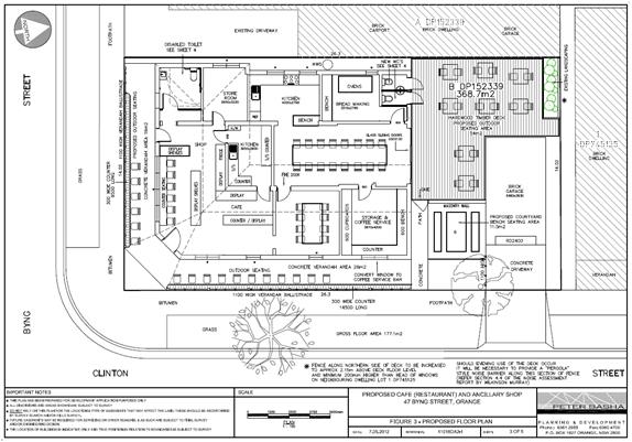
Figure 1: originally approved plan
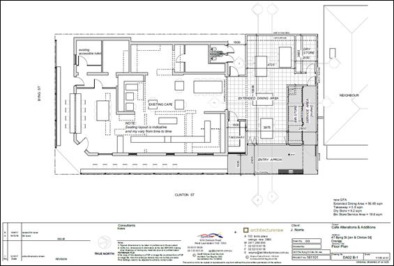
Figure 2: subject modification plan
Based on Council’s assessment of the subject
modification application (as discussed above, as well as in the assessment
sections of this report) it is considered that the revised proposal meets the
‘tests’ of being “substantially the same” development
as the originally approved development.
In this case, the application to modify the consent was
lodged pursuant to the provisions of Section 96(2) of the Act. As alluded to
above, in accordance with the Act and Regulations, the development application
was advertised on two separate occasions; firstly in the local press on
18 February 2017, and neighbours notified 15 February. Following receipt
of a revised proposal, the modification application was re-advertised in the
local press on 28 September 2017, and neighbours re-notified
22 September 2017. Consultation with other bodies was not
required for the original consent, and therefore is not required for this
modification.
A total of 57 submissions were received in relation to both
exhibition periods, 30 in support of the proposal, and 27 in opposition. A detailed assessment of the issues raised by the
submitters in both exhibition periods is provided under the heading “Any
Submissions Made in Accordance with the Act”.
Council may therefore consider this
application as a modification application under the provisions of
Section 96(2) of the EPAA.
It is noted that Council has power to give conditional
approval to an application to modify a development consent under
Section 96(2). In this case, the proposed modification remains
“substantially the same” as the original development as discussed
above, and amended and additional conditions of consent are recommended to ensure
that the development as modified does not impact on the environment or
neighbouring residential properties. These conditions are discussed in detail
throughout the following assessment, and are included in the attached modified
Notice of Approval.
Furthermore, pursuant to section 96(3) of
the EPAA:
In determining an application for
modification of a consent under this section, the consent authority must take
into consideration such of the matters referred to in section 79C(1) as are of
relevance to the development the subject of the application.
The relevant matters are considered below.
PROVISIONS OF ANY ENVIRONMENTAL
PLANNING INSTRUMENT s79C(1)(a)(i)
Orange Local Environmental Plan 2000
The initial development was approved under the provisions of
the previous Orange LEP 2000 and was defined as a ‘shop’ and
‘restaurant’. Pursuant to clause 38(2)(b) of LEP 2000,
shops and restaurant were permissible activities in the 2(a) zone with
consent. Schedule 7 of the LEP 2000 permitted various shops in the
2(a) zone, such as a delicatessen, sandwich shop, shop selling bread, cakes,
pies and pastries and the like, shop selling fruit and vegetables - being shops
that benefit residents in the area.
The modification does not alter the original assessment
carried out under LEP 2000, where it is still consistent with the aims of
the previous Plan, as well as the general considerations for development.
Orange Local Environmental Plan
2011
In assessing the original application, pursuant to clause
1.8A of LEP 2011, the application was determined as though LEP 2011 had not
been made by virtue of the date the application was lodged. Section 79C
of the Act still required consideration of the provisions of any draft LEP,
which was the status of LEP 2011 prior to its gazettal. Accordingly the
proposal was also assessed against the current LEP 2011.
An LEP 2011 assessment of the modification has been
carried out below.
Land Use Zones
Under the current LEP 2011 (as amended), the subject land is
zoned R1 General Residential. The proposed development is defined as a ‘restaurant or café’ and
‘shop’, which are defined as follows:
Restaurant or café
means a building or place the principal purpose of which is the preparation and
serving, on a retail basis, of food and drink to people for consumption on the
premises, whether or not liquor, takeaway meals and drinks or entertainment are
also provided.
Shop means
premises that sell merchandise such as groceries, personal care products,
clothing, music, homewares, stationery, electrical goods or the like or that
hire any such merchandise, and includes a neighbourhood shop, but does not
include food and drink premises or restricted premises.
Although these land uses are prohibited within the R1 zone
under the current LEP 2011, they were approved under the previous LEP 2000
due to the transitional savings provisions that applied under LEP 2011. In this
case, the application was submitted when LEP 2000 was still operational,
but approved after LEP 2011 was adopted, as such the previous LEP
provisions apply to the development, but it does not benefit from existing use
rights as set out by the Act. The continuation of these approved uses and
their proposed modification is allowed by Section 109B of the EPAA, which
states:
(1) Nothing
in an environmental planning instrument prohibits, or requires a further
development consent to authorise, the carrying out of development in accordance
with a consent that has been granted and is in force.
(2) This
section:
(a) applies
to consents lawfully granted before or after the commencement of this Act, and
(b) does
not prevent the lapsing, revocation or modification, in accordance with this
Act, of a consent, and
(c) has
effect despite anything to the contrary in section 107 or 109.
(3) This
section is taken to have commenced on the commencement of this Act.
Clause 2.7 - Demolition
Requires Development Consent
The proposal involves demolition of the existing garage
fronting Clinton Street, as well as the removal of four trees, and the
applicant is seeking the consent of Council. Subject to the works being carried
out in accordance with existing conditions of consent, the demolition works
proposed will have no significant impact on adjoining lands, the streetscape,
or the public realm. Existing conditions of consent include construction hours,
dust suppression and the need to investigate for, and appropriately manage the
presence of any materials containing asbestos.
Clause 5.10 - Heritage
Conservation
The objectives of this clause are as follows:
(a) to
conserve the environmental heritage of Orange,
(b) to
conserve the heritage significance of heritage items and heritage conservation
areas, including associated fabric, settings and views,
(c) to
conserve archaeological sites,
(d) to
conserve Aboriginal objects and Aboriginal places of heritage significance.
Council is required to consider the potential impact that
the development may have on the conservation area or any heritage item within
the vicinity of the subject land. The subject land is within the Central Orange
Heritage Conservation Area but is not a listed heritage item under the LEP. The
highly valued streetscapes of Byng and Clinton Streets make up part of the
conservation area, and form part of the site. The removal of trees within
a conservation area requires development consent pursuant to this clause. The
proposal involves additions and alterations to the existing building which
fronts Clinton Street, the removal of the garage fronting Clinton Street, as
well as the complete removal of four trees on a site within a heritage
conservation area.
Initial Proposal
Council’s Heritage Adviser has provided advice in relation
to this modification application, and the various revisions of the proposal. It
was initially considered that the proposal had adverse impacts in terms of bulk
and scale, height, materials, details and tree loss. It was considered that the
scale would visually dominate the prominent location and adjoining traditional
buildings, detrimentally impacting on the aesthetic significance of the
Heritage Conservation Area. The key heritage objective is for proposed
development to relate to the significance of the conservation area, and the
initially submitted proposal did not achieve this.
Discussions took place over a period of a few months between
the applicant and Council officers and Heritage Advisor. Below is a summary of
recommendations made:
· The
roller shutter (takeaway window) is out of character and so a more
appropriate material and details are requested.
· The
full glass doors require mitigation. Bronze plates and hardware and a grey body
tint would be fine.
· Glass
awnings are problematic due to cleaning. A patterned interlayer would be fine
plus details of the steel support framing at CC stage.
· The
seat should be clear finished timber on an appropriate base.
· The
bulk conflicts with the two traditional contributory buildings. A tall sharp
box form has been adopted for the outdoor dining space. DA06 shows this
protruding unsympathetically pass the roof forms. While a dark grey colour
scheme may make this less obtrusive it is difficult to see any sympathetic
gestures in the design at this level.
· It
is recommended that a setback similar to the adjoining northern building be
adopted on Clinton Street, which appears similar to the point on the Byng
Street corner. The takeaway portion could remain as it is a low link element.
· The
two storey solid wall above the main sign is a significant elevation element
and shields a low roof to the bin store. This draws attention to the contrast
in bulk and scale without interpretation of any streetscape character. It is
recommended that the solid fin or blade wall be removed at the first level and
the eastern glazing be simply returned to meet the northern glazing.
· A
range of options are available to the scheme including reducing the height of
the two storey element to align with the intersecting line to the pitched roof
on the existing café; or reduce the height of the blade wall to a single
level wall and wrap the north glazing around the corner to the glazing on the
east elevation.
· A
colour scheme and materials schedule on the drawings is required.
· Dimensions
to sections and setbacks on the drawings is required.
Revised Proposal
The applicant revised the proposal in accordance with these
recommendations. Main changes included the removal of the roller door to the
takeaway window, increased setbacks from Clinton Street, reduced height and
bulk at the frontage, and removal of the upper section of the blade wall.
Details of materials, colours and dimensions were also provided.
Council’s Heritage Advisor considers the revision to
be satisfactory. The bulk, scale and visual appearance (materials,
colours, details, etc) of the proposal will relate to the existing café
building and neighbouring buildings, and will not adversely impact on the
heritage significance of the conservation area. Conditions of consent
have been recommended, including that colours and materials are carried out in
accordance with the submitted schedule, and that a replacement tree is
provided, which is discussed in more detail below.
It is considered that the removal of the garage to Clinton
Street will not impact on the conservation area as it was a later addition to
the streetscape and does not have any significant architectural or heritage
merit.
The removal of trees within a conservation area is also a
heritage consideration. A statement from the applicant’s town planner was
submitted in support of the application, and makes the following points:
- It is requested that
Council not require the advice from an arborist, on the basis
that there is no debate concerning the health or condition of
the trees and reasonable justification is provided below.
- The tree (Silver
Birch tree on Clinton Street frontage) is an introduced species and does not
represent habitat for threatened or endangered species.
- It is not
possible to retain or prune the tree given the extent of the proposed pavilion
and the awning along the eastern elevation.
- It is acknowledged that
the tree is contributory to the streetscape. Given that is located very close
to the Clinton Street frontage, it is somewhat akin to a street tree… There
are 2 nearby street trees with one in the centre of the Clinton
Street frontage of the site; and another just to the north. These trees
soften this section of the streetscape and may assist to lessen the impact of
the loss of the Silver Birch. Also, there is considerable vegetation in
this precinct which forms a backdrop. In this context, the loss of the Silver
Birch may be less obvious.
- The potential for a replacement planting is limited to
some extent by the location of the 2 existing street trees. However, the
applicant would agree to provide a new street tree elsewhere in the vicinity to
offset the loss of the Silver Birch.
Council’s Manager City Presentation has reviewed the
proposal and concurs that it is not possible to retain or prune the Silver
Birch or Pear trees, and that there is little scope for replacement tree
planting on the subject property or the Clinton Street frontage. He also notes
that the existing Silver Birch tree has thinner than normal canopy with some
dieback to the periphery of the upper canopy, and that Silver Birch trees are
not well suited to the extended dry hot periods and prefer a moist soil profile
with limited hard surfacing. He recommends that a replacement street tree be
provided within Byng Street.
Given that there are already two street trees within the
Clinton Street frontage, as noted in the applicant's submission, it is
considered that the loss of the Sliver Birch will not adversely impact on the
visual appearance of the Clinton Street heritage streetscape. However, the loss
of four trees on the site will have an impact on the visual amenity of the
Conservation Area and the total available tree canopy in the locality, and a
replacement is considered necessary in this case.
It is considered that an arborist's report is not necessary,
and that the removal of trees can be supported providing that the applicant
provides for the planting of an advanced specimen street tree on the Byng
Street frontage. A condition of consent to this effect is included in the
attached modified Notice of Approval.
Overall, it is considered the proposed additions and
alterations as revised, and subject to conditions of consent, will not
adversely impact on the heritage significance of the subject and neighbouring
buildings, or the heritage setting of the conservation area. As such, Council
can be satisfied that the development as modified remains compatible with the
character of the surrounding heritage conservation area, and is therefore
acceptable in this case.
7.1 - Earthworks
This
clause establishes a range of matters that must be considered prior to granting
development consent for any application involving earthworks, such as:
(a) the likely disruption of, or any
detrimental effect on, existing drainage patterns and soil stability in the
locality of the development
(b) the effect of the development on the
likely future use or redevelopment of the land
(c) the quality of the fill or the soil to be
excavated, or both
(d) the effect of the development on the
existing and likely amenity of adjoining properties
(e) the source of any fill material and the
destination of any excavated material
(f) the likelihood of disturbing relics
(g) the proximity to and potential for adverse
impacts on any waterway, drinking water catchment or environmentally sensitive
area
(h) any measures proposed to minimise or
mitigate the impacts referred to in paragraph (g).
The earthworks proposed in the
application are limited to the extent of cutting and filling required for the
proposed addition, and the removal of trees, their stumps and root systems. The
earthworks can be appropriately supported onsite, and the extent of disruption
to the drainage of the site is considered to be minor and will not
detrimentally affect adjoining properties or receiving waterways. The extent of
the works will not materially affect the potential future use of the site.
The site is not known to be
contaminated. The site is not known to contain any Aboriginal, European or
archaeological relics. Previous known uses of the site do not suggest that any
relics are likely to be uncovered. The site is not in proximity to any
waterway, drinking water catchment or sensitive area.
7.3 - Stormwater Management
This clause applies to all
industrial, commercial and residential zones and requires that Council be
satisfied that the proposal:
(a) is designed to maximise the use of water
permeable surfaces on the land having regard to the soil characteristics
affecting onsite infiltration of water
(b) includes, where practical, onsite
stormwater retention for use as an alternative supply to mains water,
groundwater or river water; and
(c) avoids any significant impacts of
stormwater runoff on adjoining downstream properties, native bushland and
receiving waters, or if that impact cannot be reasonably avoided, minimises and
mitigates the impact.
The development as modified would cause no impacts in regard
to stormwater management.
7.6 - Groundwater Vulnerability
This
clause seeks to protect hydrological functions of groundwater systems and
protect resources from both depletion and contamination. Orange has a high
water table and large areas of the LGA, including the subject site, are
identified with “Groundwater Vulnerability” on the Groundwater
Vulnerability Map. This requires that Council consider:
(a) whether or not the development (including
any onsite storage or disposal of solid or liquid waste and chemicals) is
likely to cause any groundwater contamination or have any adverse effect on
groundwater dependent ecosystems, and
(b) the cumulative impact (including the
impact on nearby groundwater extraction for potable water supply or stock water
supply) of the development and any other existing development on groundwater.
Furthermore, consent may not be granted unless Council is satisfied that:
(a) the development is designed, sited and
will be managed to avoid any significant adverse environmental impact, or
(b) if that impact cannot be reasonably
avoided - the development is designed, sited and will be managed to minimise that
impact,
(c) if that impact cannot be minimised - the
development will be managed to mitigate that impact.
The development as modified would cause no impacts in regard
to groundwater vulnerability.
STATE ENVIRONMENTAL PLANNING
POLICIES
State Environmental Planning Policy 55 - Remediation of
Land
State Environmental Planning Policy 55 - Remediation of Land
(SEPP 55) states that a consent authority must not consent to the carrying
out of development of land unless is has considered whether the land is contaminated,
is satisfied if the land is suitable in its contaminated state for which the
development is proposed, and if the land requires remediation to be made
suitable for the proposed development.
As the subject property has a long history of residential
use, it is not considered likely that it would be contaminated or unsuitable
for the proposed alterations and additions.
It is acknowledged that asbestos materials associated with
the garage may be present on the subject property. An existing condition of
consent in regards to demolition being carried out in accordance with the
relevant standards covers this issue.
State Environmental Planning
Policy (Vegetation in Non-Rural Areas) 2017
State Environmental Planning Policy (Vegetation in Non-Rural
Areas) 2017 is not relevant to the proposal as it involves the removal
of trees which form part of a heritage conservation area, and as such require
consent under clause 5.10 of the LEP. This matter has been assessed in detail
in the LEP assessment above.
PROVISIONS OF ANY DRAFT
ENVIRONMENTAL PLANNING INSTRUMENT THAT HAS BEEN PLACED ON EXHIBITION
s79C(1)(a)(ii)
There are no draft environmental planning instruments that
apply to the subject land or proposed development.
DESIGNATED DEVELOPMENT
The proposed development is not designated development.
PROVISIONS OF ANY DEVELOPMENT
CONTROL PLAN s79C(1)(a)(iii)
Development Control Plan 2004
Development Control Plan 2004 (“the DCP”)
applies to the subject land. The relevant planning outcomes were considered as
part of the assessment of the original development application. An assessment
of the proposed development against the relevant Planning Outcomes that affect
the proposal to modify the consent will be undertaken below.
5.3 - Advertised Development
Section 5.3 - Advertised Development identifies that Council
will give written and published notice of applications for advertised
development as required by the Environmental Planning and Assessment
Regulations.
In this case, the application to modify the consent was
lodged pursuant to the provisions of Section 96(2) of the Act. In
accordance with the Act and Regulations, the development application was
advertised on two separate occasions; firstly in the local press on
18 February 2017, and neighbours notified 15 February. The first
exhibition period closed 6 March 2017.
At the end of that period 17 submissions were received. A
further (ie late) submission was received after that period ended. It is noted
that some submitters made multiple submissions.
Council’s Declaration of
Planning and Development Assessment Procedures and Protocols identifies that
upon receipt of at least five submissions objecting to a development
application and where those issues are considered by Council to be reasonably
capable of negotiation, a meeting will be offered to all parties in an attempt
to resolve issues and find compromise prior to the matter being determined. Council’s
Director Development Services held a mediation meeting between the applicant
and objectors on 29 March 2017. Discussions focussed around the legal
‘tests’ of modification applications, rather than mediate the
potential impacts of the proposal, and as such no resolutions were achieved.
Following the first exhibition period and mediation meeting,
Council requested that the applicant give further consideration to altering the
design of the proposal to address initial concerns about whether the proposal
was “substantially the same” development as the original, as well
as address impacts raised by objectors. Discussions took place between Council
staff, Council’s Heritage Advisor, and the applicant over the subsequent
few months, and revised plans were submitted to Council on 20 September
2017. The revised modification application was re-advertised in the local press
on 28 September 2017, and neighbours re-notified 22 September 2017.
The second exhibition period closed 13 October 2017.
At the end of the second exhibition period, 39 submissions
were received. Some submitters made multiple submissions, and some submitters
lodged objections during both exhibition periods. A total of 57 submissions
were received in relation to this application, 30 in support of the proposal,
and 27 in opposition. A detailed assessment of the
issues raised by the submitters in both exhibition periods is provided under
the heading “Any Submissions Made in Accordance with the Act”.
Section 7.7 - Design Elements for
Residential Development
Section 7.7 - Design Elements for Residential Development
sets out the objectives and planning outcomes for residential development.
While the proposed development is defined as a
“restaurant or café” and “shop”, the objectives and
planning outcomes outlined in Section 7.7 are relevant considerations given
that the subject property and immediate area is zoned R1 General
Residential, and that all adjoining and proximate properties contain dwelling
houses.
Streetscape Objectives
The DCP sets out overarching objectives with regard to
streetscape, including:
· To ensure that
the development fits into its setting and environmental features of the
locality.
· To ensure that
the appearance of housing is of a high visual quality, enhances the streetscape
and complements good quality surrounding development.
· To ensure that
new development complements places with heritage significance and their
settings in a contemporary way.
· To develop a
sense of place with attractive street frontages.
· To encourage
visually appealing cohesive streetscapes.
· To create a
safe and secure environment.
· To provide
consistent design elements that protect private investment.
The streetscape objectives are addressed by the following
planning outcomes regarding neighbourhood character, building appearance,
heritage and setbacks.
Neighbourhood Character
The DCP sets out the following planning outcomes in regard
to neighbourhood character:
· Site layout and
building design enables the:
- creation of attractive residential
environments with clear character and identity
- use of site features such as
views, aspect, existing vegetation and landmarks
· Buildings are
designed to complement the relevant features and built form that are identified
as part of the desired neighbourhood character.
· The streetscape
is designed to encourage pedestrian access and use.
The revised proposal has been designed in accordance with
the outcomes for neighbourhood character. In particular, the proposed pavilion
has been revised to maintain the existing appearance of the café
building, adjacent building to the north, and the Byng and Clinton Street
streetscapes. As discussed in the LEP assessment, Council’s Heritage
Advisor has advised that the revised bulk, scale, setbacks, details and
materials are acceptable and will not detract from the character of the
conservation area.
Further, it is noted that Council’s Heritage Advisor
and Manager City Presentation support the removal of the trees from the subject
property, provided that a replacement street tree is provided to maintain
visual amenity and vegetation canopy in the locality.
Building Appearance
The DCP sets the following planning outcomes in regard to
building appearance:
· The
building design, detailing and finishes relate to the desired neighbourhood
character, complement the residential scale of the area, and add visual
interest to the street.
· The
frontages of buildings and their entries face the street.
· Garages
and car parks are sited and designed so that they do not dominate the street
frontage.
As noted above, the revised development has been designed to
maintain the existing appearance of the existing buildings and heritage
streetscapes. A detailed assessment of matters pertaining to the
appearance of the development has been provided under the LEP section of this
report.
Heritage
The DCP sets the following planning outcomes in regard to
heritage:
· Heritage
buildings and structures are efficiently re-used.
· New
development complements and enhances the significance of a heritage item or
place of heritage significance listed in the Orange Heritage Study.
· Significant
landscape features are retained including original period fences and period
gardens.
Heritage has previously been addressed in detail under the
LEP heading “5.10 - Heritage Conservation”. The proposed
development has been designed in accordance with the outcomes for heritage.
Setbacks
The DCP sets out the following planning outcomes with regard
to setbacks:
· Street
setbacks contribute to the desired neighbourhood character, assist with the
integration of new development and make efficient use of the site.
· Street
setbacks create an appropriate scale for the street considering all other
streetscape components.
As discussed in the LEP assessment, Council’s Heritage
Advisor has advised that the revised setbacks are acceptable and will not
detract from the character of the streetscape.
Bulk and Scale Objectives
The DCP sets out overarching objectives with regard to bulk
and scale, including:
· To
allow flexibility in siting buildings and to ensure that the bulk and scale of
new development reasonably protects the amenity of neighbouring properties and
maintains appropriate neighbourhood character.
· To
allow adequate daylight, sunlight and ventilation to living areas and private
open spaces of new and neighbouring developments.
· To
encourage the sharing of views, while considering the reasonable development of
the site.
The bulk and scale objectives are addressed by the following
planning outcomes regarding visual bulk, walls and boundaries, daylight and
sunlight and views.
Visual Bulk
The DCP sets out the following planning outcome with regard
to visual bulk:
· Built
form accords with the desired neighbourhood character of the area with:
- side and rear setbacks
progressively increased to reduce bulk and overshadowing
- site coverage that retains
the relatively low density landscaped character of residential areas
- building form and siting
that relates to landform, with minimal land shaping (cut and fill)
- building height at the
street frontage that maintains a comparable scale with the predominant adjacent
development form
- building to the boundary
where appropriate.
As discussed in the LEP assessment, Council’s Heritage
Advisor has advised that the revised bulk, scale, setbacks, details and
materials are acceptable and will not detract from the character of the
streetscape or neighbouring properties. The proposal has been designed to step
back from the adjacent dwellings to the north and west (see Figures 3 and 4),
and therefore will not impact the neighbours in terms of visual bulk. The
building form complies with the visual bulk envelopes recommended by the DCP,
being buildings contained within planes projected at 45 degrees over the site
commencing at 2.5m above existing ground level from each side and rear
boundary. Furthermore, the bulk of the proposed pavilion will be consistent
with the bulk of the neighbouring buildings.

Figure 3: proposed north elevation (from plan number
DA04 B3, prepared by Architecture Raw)
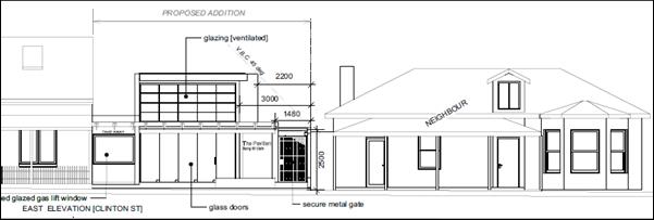 Figure 4: proposed east elevation (from plan number DA04 B3, prepared
by Architecture Raw)
Figure 4: proposed east elevation (from plan number DA04 B3, prepared
by Architecture Raw)
Walls and Boundaries
The DCP sets out the following planning outcome with regard
to walls and boundaries:
· Building
to the boundary is undertaken to provide for efficient use of the site taking
into account:
- the privacy of neighbouring
dwellings and private open space
- the access to daylight
reaching adjoining properties
- the
impact of boundary walls on neighbours.
As noted above, the proposal has been designed to step back
from the adjacent dwellings to the north and west (see Figures 3 and 4), and
therefore will not impact the neighbours in terms of visual bulk, daylighting,
views, privacy, fire safety etc.
Daylight and Sunlight
The DCP sets out the following planning outcome in regard to
daylight and sunlight:
· Buildings
are sited and designed to ensure:
- daylight to habitable rooms
in adjacent dwellings is not significantly reduced
- overshadowing of
neighbouring secluded open spaces or main living area windows is not
significantly increased
- consideration of
Council’s Energy Efficiency Code.
The DCP guidelines and Council’s Energy Smart Home
Code require sunlight to be available to at least 40% of required open space
for dwellings on neighbouring properties for at least three hours between 9am
and 3pm and is not further reduced where existing overshadowing exceeds this
requirement, and that sunlight to at least 75% of north facing living area
windows within development and on adjoining land is provided for a minimum of
four hours on 21 June and is not further reduced where already less.
As noted above, the proposal has been designed to step back
from the adjacent dwellings to the north and west. Given the orientation of the
site, and that the bulk of the proposed pavilion at the boundaries will be
generally consistent with the bulk of the garage to be removed and neighbouring
buildings, the proposal will not impact the neighbours in terms of daylighting
and shadowing.
Views
The DCP sets the following planning outcomes with regard to
views:
· Building
form and design allow for residents from adjacent properties to share prominent
views where possible.
· Views
including vistas of heritage items or landmarks are not substantially affected
by the bulk and scale of the new development.
The proposed development will not affect views to any
significant landmarks, nor affect the vistas within the Byng and Clinton Street
heritage streetscapes. As discussed above and in in the LEP assessment,
the revised setbacks will ensure that the proposal does not detract from the
character of the streetscape.
Privacy and Security
Objective
The DCP sets the following planning outcome in regard to
privacy and security:
· To
ensure that the siting and design of buildings provide privacy for residents
and neighbours in their dwellings and principal private open space.
The privacy and security objective is addressed by the
following planning outcomes regarding visual privacy, acoustic privacy and
security.
Visual Privacy
The DCP sets the following planning outcome in regard to
visual privacy:
· Direct
overlooking of principal living areas and private open spaces of other
dwellings is minimised firstly by:
- building
siting and layout
- location
of windows and balconies
and
secondly by:
- design
of windows or use of screening devices and landscaping.
The proposed development has been designed to avoid any
direct or close views into the windows or private open spaces of adjoining
dwellings. In particular, there are no windows at ground level height, and the
proposed louvre system is above eye level when seated or standing, therefore
will not provide views into or from the adjoining properties and streetscapes.
Acoustic Privacy
The DCP sets the following planning outcome in regard to
acoustic privacy:
· Site
layout and building design:
- protect habitable rooms from
excessively high levels of external noise
- minimise the entry of
external noise to private open space for dwellings close to major noise sources
- minimise transmission of
sound through a building to affect other dwellings.
Several written submissions were received raising concerns
regarding potential noise impacts associated with the existing premises and the
proposed modification of the premises. In order to address this issue, Council
requested that the applicant provide a Noise Report.
Wilkinson Murray prepared a Noise Assessment, labelled
‘Byng Street Local Store – Pavilion Noise Assessment’, dated
September 2017. The report identifies that the most potentially affected
sensitive receivers near the development are the adjacent dwelling at
45 Byng Street (west of the subject property) and the dwelling at 49 Byng
Street (to the east, on the opposite corner of Byng and Clinton Streets). The report
notes that the dwelling immediately to the north of the site at 81 Clinton
Street is not assessed as a sensitive receiver as it is owned by the Byng
Street Local Store.
The noise report notes that the primary noise sources
associated with the proposal include patron noise; in particular, noise from
internal spaces ‘breaking out’ via openings in the structure and
noise from outdoor seating areas. Predicted noise levels take into account the
louvered/ventilation windows on the northern, southern and eastern facades of
the pavilion, as well as assumes that all openable glazing will be open during
the daytime (7am to 6pm), and outdoor seating will only be used
during the daytime.
The report concludes that the predicted noise levels
associated with the operation of the café with the proposed pavilion
will comply with the relevant noise criteria, based on the following
recommendations:
· The area
between the pavilion and the toilets is fully enclosed;
· No openable
glazing is installed along the south façade of the pavilion to the west
of the ridge-line of the existing building;
· The outdoor
seating is used in the daytime only;
· Doors are not
to be left open during the evening; and,
· All windows
should be closed during the evening, except for the ventilated glazing on the
north and south facades of the pavilion.
Council’s Manager Building and Environment does not
agree that the dwelling to the north is not a sensitive receiver. The
neighbouring property is owned by the applicant, who also owns the subject
property/cafe, however, 81 Clinton Street is a residential dwelling house in a
residential zone, and is used for residential purposes.
It is noted that conditions of consent from the previous
modification (DA 445/2011(3)) and consent to install new windows to the premises
(DA 364/2013(1) required an assessment of noise emissions to be provided
to Council to monitor noise levels, and if necessary, provide noise mitigation
measures. These assessments have not yet been carried out given the ongoing
works being undertaken on the premises. Furthermore, the noise assessment needs
to be undertaken during peak time and in the summer season, when the
café will be at or near full capacity, with all openings open. A delay
in carrying out the assessment until works are completed has been discussed and
agreed with Council’s Manager Building and Environment.
Based on these comments, it is considered that noise
compliance can be achieved based on the existing conditions of consent, and the
following additional and modified conditions of consent:
(1) An
assessment of the development in terms of noise shall be verified through
testing at nearby receivers (including the adjacent site to the north at 81
Clinton Street) within three (3) months of the occupation of the development,
or as otherwise agreed in writing by Council (but not more than six (6) months
after occupation), to ensure that the assessment is undertaken when the
restaurant and pavilion are near full capacity and louvres are open as set out
in the conditions of this consent.
(2) The
outdoor/external seating shall only be used during daytime hours, being between
7am and 6pm.
(3) External
doors must not be left open between 6pm and 10pm.
(4) All
windows shall be closed between the hours of 6pm and 10pm, with the exception of
the ventilated/louvered glazing on the south façade of the pavilion.
Council’s Manager Building and Environment notes that
the implementation of an Operational Management Plan for the site also needs to
be undertaken to ensure compliance with the Protection of the Environment
Operations Act. The previous modification application required a Plan of
Management for the site; however based on ongoing complaints, and submissions
received in relation to this modification application, it has been demonstrated
that the existing Plan and operations of the premises have not been successful
in managing adverse impacts on neighbouring properties. A modified condition of
consent is recommended in regards to the Plan of Management for the site, which
needs to be revised by the applicant. It is noted that the applicant has
requested a modification to this condition of consent, as there is a typo in
the number of seats (states 63 when should state 69).
These conditions have been modified and added to the
attached modified Notice of Approval.
Security
The DCP sets the following planning outcomes in regard to
security:
· The
site layout enhances personal safety and minimises the potential for crime,
vandalism and fear.
· The
design of dwellings enables residents to survey streets, communal areas and
approaches to dwelling entrances.
The proposal has generally been designed in accordance with
the key principles of Crime Prevention through Environmental Design (CPTED). In
particular, active surveillance of the street can be achieved through windows
and doors fronting the streets. The principles also require that public and
private spaces are generally well defined, however the proposed stone bench
adjacent to the boundary on Clinton Street does not provide adequate separation
between the site and the street.
There are also car parking issues created as a result of
providing additional seating on the site, which is discussed in more detail in
the car parking assessment below. It is recommended that the stone bench be
removed from the proposal to negate these issues. Overall, subject to
conditions of consent, it is considered that the proposal would not detract
from personal safety or increase the potential for crime, vandalism or fear.
Site Access and Circulation
Objectives
The DCP sets out the following objectives in regard to site
access and circulation:
· To
provide convenient and safe access and parking that meets the needs of all
residents and visitors.
· To
encourage the integrated design of access and parking facilities to minimise
visual and environmental impacts.
The site access and circulation objectives are addressed by
the following planning outcomes regarding circulation and design, and car
parking.
Circulation and Design
The DCP sets the following planning outcome in regard to
circulation and design:
· Accessways
and parking areas are designed to manage stormwater.
· Accessways,
driveways and open parking areas are suitably landscaped to enhance amenity
while providing security and accessibility to residents and visitors.
· The
site layout allows people with a disability to travel to and within the site
between car parks, buildings and communal open space.
The removal of the garage from the site will allow for the
existing driveway in Clinton Street to be reinstated, improving the visual
amenity of the streetscape and providing better footpath facilities in the
locality. Relevant conditions of consent are included on the attached modified
Notice of Approval in regards to the reinstatement of the footpath and kerb.
Car Parking
The DCP sets out the following planning outcomes in regard
to car parking:
· Parking
facilities are provided, designed and located to:
- enable the efficient and
convenient use of car spaces and accessways within the site
- reduce the visual dominance
of car parking areas and accessways.
· Car
parking is provided with regard to the:
- the number and size of
proposed dwellings
- requirements of people with
limited mobility or disabilities.
Car parking is addressed in detail below under the heading “Section
15.4 - Parking Requirements”.
Open Space and Landscaping
Objectives
The DCP sets the following objectives in regard to open
space and landscaping:
· To
provide convenient and safe access and parking that meets the needs of all
residents and visitors.
· To
encourage the integrated design of access and parking facilities to minimise
visual and environmental impacts.
The open space and landscaping objectives are addressed by
the following planning outcomes regarding private open space, and open space
and landscaping.
Private Open Space
The DCP sets out the following planning outcomes in regard
to private open space:
· Private
open space is clearly defined for private use.
· Private
open space areas are of a size, shape and slope to suit the reasonable
requirements of residents including some outdoor recreational needs and service
functions.
· Private
open space is:
- capable
of being an extension of the dwelling for outdoor living, entertainment and
recreation
- accessible
from a living area of the dwelling
- located
to take advantage of outlooks; and to reduce adverse impacts of overshadowing
or privacy from adjoining buildings
- orientated
to optimise year round use.
The foregoing objectives are specific to residential
dwellings and are not applicable to the proposed development as a restaurant,
café and shop.
Open Space
and Landscaping
The DCP sets the following planning outcomes in regard to
open space and landscaping:
· The
site layout provides open space and landscaped areas which:
- contribute to the character
of the development by providing buildings in a landscaped setting
- provide for a range of uses
and activities including stormwater management
- allow cost effective
management.
· The
landscape design specifies landscape themes consistent with the desired
neighbourhood character; vegetation types and location, paving and lighting
provided for access and security.
· Major
existing trees are retained and protected in a viable condition whenever
practicable through appropriate siting of buildings, accessways and parking
areas.
· Paving
is applied sparingly and integrated in the landscape design.
The removal of trees has been discussed previously in this
report, where the proposal seeks to remove all trees and landscaping from the site
to facilitate the proposed development. There is little opportunity to provide
replacement planting on the site, however the loss of trees is only considered
acceptable on the basis that a new street tree is provided on the Byng Street
frontage. Subject to relevant conditions of consent to replace one tree, the
proposal is considered acceptable in this regard.
Water and
Soil Management Objectives
The DCP sets the following objectives in regard to water and
soil management:
· To
control and minimise the impact of stormwater run-off and soil erosion on
adjoining land and downstream.
· To
encourage reduced water wastage by reusing, recycling and harvesting
stormwater.
The water and soil management objectives are addressed by
the following planning outcomes regarding stormwater, and erosion and sediment
control.
Stormwater
The DCP sets the following planning outcomes in regard to
stormwater:
· Onsite
drainage systems are designed to consider:
- downstream capacity and the need for onsite
stormwater retention, detention and re-use;
- scope for onsite infiltration of water;
- safety and convenience of pedestrians and
vehicles;
- overland flowpaths.
· Provision
is made for onsite drainage which does not cause damage or nuisance flows to
adjoining properties.
Stormwater has previously been addressed in detail under the
heading “7.3 - Stormwater Management” and is considered
satisfactory.
It is considered that the requirements of the DCP have been
adequately addressed.
Erosion and
Sediment Control
The DCP sets out the following planning outcomes in regard
to erosion and sediment control:
· A
Stormwater and Soil Management Plan as required by the Development and
Subdivision Code demonstrate how sedimentation and erosion of disturbed areas
will be managed on the site.
· All
disturbed areas are re-stabilised and revegetated as soon as practicable during
development.
Existing conditions of consent requiring soil erosion
measures to be implemented onsite prior to works commencing adequately address
these outcomes.
13 -
Heritage
Sections 13.1-13.06 of Chapter 13 - Heritage of the DCP
address heritage matters in detail, including heritage objectives, heritage
items and heritage conservation areas, heritage consideration for development,
development in the vicinity of heritage items, heritage proposals as advertised
development, and incentives for heritage conservation.
These matters have previously been addressed in detail under
the LEP heading “5.10 ‑ Heritage
Conservation”, where it is considered that the proposal will not detract
from the heritage setting.
15 -
Parking
The original parking analysis demonstrated that the
development had a shortfall of 20.3 car parking spaces based on the rate
of car parking for shops and cafes. It was considered that there
was reasonable opportunity to accommodate the parking demands within the
surrounding on-street parking, with only minimal impact to neighboring
properties, and as such, the variation to the car parking standard was accepted
by Council. It was acknowledged that there was the potential for parking to
occur in front of nearby dwellings, although it would be of short duration and
often occur outside of peak residential demand.
The applicant argues that the development
as modified does not increase the floor area or seating numbers beyond that
which was originally approved, but acknowledges that the existing garage would
be lost. The applicant argues that the reinstatement of the driveway to
footpath and kerb would provide an additional on-street car parking space,
thereby mitigating this increase in shortfall.
Although the removal of the garage will
result in the reinstatement of the footpath and kerb on Clinton Street, and
will provide one additional on-street car parking space, it is considered
necessary to provide an additional street tree on Byng Street to mitigate the
impacts of removing all vegetation from the site. The proposal will therefore
result in one additional on-street space in Clinton Street, but one less
on-street space on Byng Street - as such neither increasing nor decreasing the
availability of on-street parking. The proposal will therefore increase the
shortfall of car parking to 21.3 spaces.
Based on the original assessment of car
parking, that the proposal will not intensify the use of the site, and considering
that the garage is not actually used for the parking of vehicles, the
modification will not alter the existing demand for on-street car parking.
It is noted, however, that while Council
officers agree that the proposal will not increase the overall floor area (the
original application based car parking demand on seating and floor areas both
internally and externally), the proposal involves a new outdoor bench seat,
which can accommodate seating for additional customers. Given that there is
already a significant shortfall in car parking for the premises, and that the
modification being “substantially the same” as the original
development relies on the intensity remaining unchanged, the bench seat needs
to be removed from the proposal. A condition of consent is recommended to this
effect.
Submissions received in regards to the
proposed modification state that there is unlawful car parking taking place,
including parking in and across neighbouring residential driveways, as well as
the promotion of cars for sale from local car sales premises parked within the
street.
However, based on the consented number of
seats within the business, and the high turnover of customers, the extent of
parking demand is within the capability of the local road network. Unlawful
parking needs to be monitored by Council, and be reported by the owner and
neighbouring residents/owners.
It is also noted that the original application was reviewed
by the Council’s Traffic Committee who resolved to install ‘No
Parking’ signs and lines across the neighbouring driveways where
customers regularly parked unlawfully. These measures have at best had limited
effectiveness. Customers continue to unlawfully park from time to time.
Council’s parking officers have been directed to carry regular targeted
parking patrols of the locality in an attempt to reduce the impact on
surrounding residents and educate users of the parking controls that apply.
Development Control Plan
2004 Infill Guidelines
The Orange Development
Control Plan 2004 Infill Guidelines apply to this application. Council
recently adopted this policy to guide designs of infill development in heritage
areas, to ensure new development ‘harmonises’ with the character of
the neighbourhood. While the proposed development does not relate to a new
building, it involves a building addition in a conservation area, and therefore
the policy can be used as a guidance tool.
The objectives of the policy are
as follows:
· Retention of
appropriate visual setting (Article 8 Burra Charter).
· To ensure new
buildings respond to and enhance the character and appearance of the
streetscapes of the Heritage Conservation Areas.
· To ensure
contributory heritage items retain their prominence and are not dominated by
new development within a Heritage Conservation Area and do not compromise the
heritage values of the existing area.
· To ensure new
buildings do not adversely affect the significance, character or appearance of
the Heritage Conservation Area or heritage items.
· To allow for
reasonable change within a Heritage Conservation Area while ensuring all other
heritage objectives are met.
· To ensure new
development facilitates the retention of significant vegetation that
contributes to the tree canopy, especially within the Central Orange Heritage
Conservation Area.
The policy states that an
important aspect of good design is designing in context and having regard to
the site and its surroundings. Consideration should be given to the nature of
adjoining and surrounding heritage items and places, significant vegetation on
the site and adjoining the site, and the overall significance and character of
the heritage area where it is located. It also notes that new development
within a conservation area should not have to replicate the existing built
form, but should be compatible and enhance the existing streetscape. Contemporary
designs may be acceptable provided the design is appropriate in character,
scale and form, siting, materials and colour, and detailing. Historic character
is shaped by landform, distinctive vegetation, building style and scale, street
and subdivision pattern, fabric, curtilage, setbacks, materials, views, vistas,
and pattern and proportions of buildings.
The existing setting is varied
in terms of scale, ranging from modest to large sized single storey dwellings.
Extensive mature vegetation is fairly consistent in the area. The proposed
additions and alterations do not alter the existing landform or lot patterns;
nor the fabric of the existing building or neighbouring buildings. The materials
and proportions of the pavilion addition have been revised to fit in with the
existing building, neighbouring dwellings, and street scape, as discussed in
detail in the LEP and DCP assessments of this report. A replacement tree is
required to mitigate the impacts of removing all vegetation from the site, as
discussed earlier in this report.
It is considered that adequate consideration has been given
to the Policy, to the context of the subject site, the neighbouring properties,
and the surrounding pattern of development, as shown in the revised proposal
and discussed in the LEP and DCP assessments above.
PROVISIONS PRESCRIBED BY THE
REGULATIONS s79C(1)(a)(iv)
Demolition of a Building (clause 92)
The proposal involves the demolition of a garage and the
removal of trees. The existing condition attached to the consent, requiring the
demolition to be carried out in accordance with Australian Standard AS2601 -
1991: The Demolition of Structures, is sufficient to deal with issues arising
from this part of the proposal.
Fire Safety Considerations
(clause 93)
Existing conditions of consent adequately deal with fire
safety considerations
Buildings to be Upgraded
(clause 94)
Existing conditions of consent were included in relation to
the required upgrading works.
THE LIKELY IMPACTS OF THE
DEVELOPMENT s79C(1)(b)
An assessment of the relevant impacts associated with the
development was undertaken as part of the initial assessment of the development
application. The potential impacts of the development as modified are
considered below.
Heritage, Streetscape, and
Visual Impacts
The subject land is located within the Orange Heritage
Conservation Area and is identified as a building which contributes to the
heritage setting in the Orange Heritage Study Building Inventory. The proposal
involves additions and alterations to an existing building and the removal of
trees within a heritage setting, and therefore has the potential to have visual
and heritage impacts. As noted in the LEP and DCP assessments above, the
proposal as initially submitted was considered to have adverse impacts on the
heritage and residential values of the surrounding area. The revised proposal,
subject to conditions of consent regarding tree replanting and materials and
colours, has been designed to meet the objectives and outcomes for heritage,
neighbourhood character, building design, setbacks, visual bulk, etc.
Overall, it is considered that the development is unlikely
to have adverse visual impacts on the existing building, neighbouring dwellings,
the streetscape, or the heritage conservation area.
Noise Impacts
As discussed in the DCP assessment earlier in this report,
noise impacts are considered to be an issue for this site and are a key
consideration in this modification application. The original Noise Report
submitted to Council included a series of recommendations that were required to
be implemented to limit the potential for an adverse noise impact, however some
of these measures have not been undertaken, and numerous and ongoing noise complaints
have been received by Council. Conditions of consent from the previous
modification (DA 445/2011(3)) and consent to install new windows to the
premises (DA 364/2013(1) required an assessment of noise emissions to be
provided to Council to monitor noise levels, and if necessary, provide noise
mitigation measures. These assessments have not yet been carried out; however
Council’s Manager Building and Environment has agreed to delay these
assessments given the ongoing works being undertaken on the premises, and that
the assessment needs to be undertaken during peak time.
Wilkinson Murray prepared a Noise Assessment to support the
subject modification, which concludes that the predicted noise levels
associated with the operation of the café with the proposed pavilion
will comply with the relevant noise criteria, based on operational
recommendations. This report, however, did not assess the impacts to the
neighbouring dwelling to the north at 81 Clinton Street, which although owned
by the applicant, is used for residential purposes. Council’s Manager
Building and Environment recommends additional and modified conditions of
consent in regards to noise, operations, and a Plan of Management to ensure
compliance, as set out previously in the DCP assessment.
Overall, subject to relevant conditions of
consent, including further assessment of noise upon the completion of the
development, adverse noise impacts can be adequately mitigated.
Waste Management
The original application stated that waste
storage bins will be stored in the rear yard of the property outside public
view, and disposed of in the normal Council street collection service. However,
it was brought to Council’s attention that waste storage bins were being
stored on the adjoining residential property at 81 Clinton Street, which was
not considered to be a satisfactory arrangement for waste management and was
inconsistent with the original approval. Alternative arrangements were made for
the storage and management of waste on site. It is considered that the modified
proposal provides for a greatly improved arrangement for waste storage and
collection on the site, and as such, waste management impacts are unlikely.
Traffic Impacts
As discussed in the DCP assessment earlier in this report,
the proposed modification would have a neutral effect on current traffic levels
and amenity in the locality in terms of car parking as the proposal does not
seek to alter the floor area, or staff and customer numbers. However, this
conclusion is subject to the removal of the outdoor stone bench from the
proposal, which provides additional seating. Although the removal of the garage
from the site technically increases the overall shortfall of parking on the
site, the garage has not been used for parking of vehicles, and as such, the
demand for on-street parking will remain unchanged.
While there have been regular incidents of unlawful car
parking and driving, the applicant cannot be reasonably held responsible for
public adherence to road rules. This needs to be monitored by Council and
reported by the premises, neighbouring properties and the wider community.
Conditions of consent will assist in ensuring that customer numbers stay within
reasonable limit so that the capacity of the surrounding car parking network is
not exceeded, as well as assisting in the monitoring of unlawful car parking.
As noted in the DCP assessment, the original application was reviewed by
the Council’s Traffic Committee who resolved to install ‘No
Parking’ signs and lines across the neighbouring driveways where
customers regularly parked unlawfully. As discussed above, these measures have
at best had limited effectiveness. Customers continue to unlawfully park from
time to time. Council’s parking officers have been directed to carry
regular targeted parking patrols of the locality in an attempt to reduce the
impact on surrounding residents and educate users of the parking controls that
apply.
Overall, it is considered that the proposed development as
modified is unlikely to have an adverse impact upon the surrounding traffic
network.
Environmental Impact
The subject property is unlikely to have any biodiversity or
habitat value due to the use of the site for a residential dwelling and
commercial premises. Inspections carried out did not indicate any habitat
within the subject trees to be removed. As discussed in the LEP
assessment, the replacement street tree planting will assist in continuing
existing canopy, as well as providing for habitat in the future. The proposal
will not impact on groundwater or stormwater. Overall, the proposal is unlikely
to have adverse impacts on the environment.
Cumulative Impacts
The DCP outlines that in determining a development
application Council will consider not only the direct impacts of a particular
development, but also whether the development when carried out in conjunction with
other development in the locality has a more significant environmental impact.
As an example, in urban areas the DCP identifies that the
amenity of a residential area may be affected by a concentration of
non-residential units, and that developments such as residential units and dual
occupancy should be located and designed in a way that fits in with the
predominant low-density character of the City’s residential areas.
With regard to the proposed development, it is considered
that it has the potential to have a cumulative impact on:
· the
heritage significance of existing buildings and dwellings in the Central Orange
Conservation Area;
· the
local street network in terms of traffic flow and availability of on-street
parking; and
· residential
amenity in terms of the noise associated with the use of the premises.
However, notwithstanding the potential cumulative impacts,
it is considered that each issue has been appropriately assessed in this
report, that the proposed development as modified is suitable in its context,
and that it will not have a significant cumulative impact which exceeds
reasonable community expectations. It is acknowledged however, that while the
application does not propose an intensification of development (ie not
additional floor area or seating), the improved functionality of the premises
may lead to increased usage of seating during the colder months.
There may be cumulative impacts associated with the future
development of properties within the vicinity of the subject property, and
those impacts will be assessed at the Development Application stage.
THE SUITABILITY OF THE SITE
s79C(1)(c)
Council has previously determined that the site is suitable
for the proposed development. There are no aspects of the site to indicate that
it would be unsuitable to accommodate the modified development. It is noted,
however, that the modified development is only suitable for this site on the
basis that it is operated within the intensity set out in the original and
modified applications and conditions of consent.
ANY SUBMISSIONS MADE IN
ACCORDANCE WITH THE ACT s79C(1)(d)
Under the provisions of Section 96(2) of the Act the
proposed development was advertised in accordance with the Environmental
Planning and Assessment Regulations. No public authorities were identified as
having an interest in the determination of the application.
Formal exhibition of the application was undertaken by way
of an advertisement in the local press on 18 February 2017 and neighbours
notified 15 February 2017. The first exhibition period closed on 6 March 2017. At
the end of that period 17 submissions were received. A further (ie late)
submission was received after that period ended.
As discussed previously in this report, a mediation meeting
was held by Council’s Director Development Services. As a result of
the meeting and the objections received in the first exhibition period, the
applicant revised the proposal.
A second exhibition period was arranged, and the revised
modification application was re-advertised in the local press on
28 September 2017 and neighbours re-notified 22 September 2017. The second
exhibition period closed on 13 October 2017. At the end of the second
exhibition period, a further 39 submissions were received.
In summary, a total of 57 submissions were received in
relation to this application, 30 of which in support of the application, and 27
objecting to the application. It is noted that some submitters made multiple
submissions, and some submitters made submissions in both exhibition periods. All
of these submissions have been taken into consideration in this assessment.
Objections
A summary of objections and Council’s comments are as
follows:
· The proposal is
an inappropriate use in a residential area.
The original consent was approved when restaurants were
permitted in residential zones (LEP 2000), as such this is not a
consideration in the modification of the existing premises.
· The proposal is
inconsistent with the heritage conservation area, streetscape, existing
building, and neighbouring dwellings.
This matter has been addressed in the body of the report
under the LEP Clause 5.10 and “Likely Impacts” assessments. The
proposal has been revised to address initial concerns raised by objectors and
Council’s Heritage Advisor.
· Amenity and visual
impacts on adjoining properties and streetscape (bulk, height, and scale; no
open space or landscaping; loss of trees; modern design; poor design).
This matter has been addressed in the DCP residential design
and “Likely Impacts” assessments of the report. The proposal has
been revised to address initial concerns raised by objectors and
Council’s Heritage Advisor.
· Noise impacts
to neighbouring dwellings (patrons, music, vehicles, open windows etc).
This matter has been addressed in the DCP residential
design, and the “Noise Impacts” assessments of the report.
Additional and modified conditions of consent have been recommended by
Council’s Manager Building and Environment, and are included in the
attached modified Notice of Approval.
· Concerns that the
proposal will continue to increase patronage, traffic movements, parking, and
congestion (steadily increasing by way of incremental developments).
This matter has been addressed in the DCP and “Likely
Impacts” assessments of the report.
· The proposal would
set an inappropriate precedent for other commercial uses in the area.
This matter has been addressed in the “Cumulative
Impacts” assessments of the report.
· Car parking
impacts; the new stone bench at the front needs to be accounted for in the
total number of seats available.
This matter has been addressed in the DCP and “Likely
Impacts” assessments of the report, which recommends that the stone bench
be removed from the proposal.
· Council
processes; that ‘unacceptable’ applications should not be accepted
by Council/be put on public exhibition; and that Council’s
“advertising” of proposals is inadequate.
The development application process is set out by the Act
and Regulations, as well as within Council’s Policies. While Council
recommends that applicants seek advice prior to lodgement, this is not a
legislative requirement. In this case, Council requested amendments/revisions
to the proposal during the assessment process. Council followed the advertising
process prescribed by the Act and Regulations, where it was advertised in the
local press and neighbours were notified of two separate exhibition periods.
This matter has been addressed in detail in the body of the report.
· Inconsistent
with LEP, DCP and Infill Policy.
The proposal is considered to be consistent with the LEP and
DCP as addressed in the body of the report.
· Fire safety
concerns building near the boundaries.
Council’s Environmental Health and Building Surveyor
has assessed the modification, and fire safety has been adequately covered by
the existing conditions of consent.
· The
applicant’s property next door at 81 Clinton Street is being used as an
‘Air BNB’.
A check of Council’s records shows the neighbouring
premises does not have consent for the purpose of a ‘Bed and Breakfast’,
however this matter is not relevant to this application and will be separately
investigated.
· Concerns about
the holding of cocktail parties and functions (objectors have provided
advertising material from the premises promoting these activities), which are
advertised as being bookable Monday to Saturday evenings.
Council officers believe that these activities do not fit
into the approved use and definition of ‘restaurant and
café’ in the LEP, however this does not form part of the consent.
Council would need to investigate any breaches should they arise.
· Concerns that
current issues and ongoing breaches have not been resolved by Council, and that
the applicant will continue to operate in breach of the consent and
modifications.
This issue has come up in previous modifications, and numerous
complaints have been lodged between 2012 and 2017 with Council, the Police, and
the Office of Liquor and Gaming regarding ongoing breaches in trading hours
(early and late), noise associated with night time functions, commercial bread
baking, noise associated with plant equipment, exceeding patron/seating
capacity limits, illegal parking by patrons across residents' driveways,
dangerous driving by patrons, littering of roads, footpaths and streets by
patrons (cigarettes, drink cans, coffee cups), and abuse of residents by
patrons. As discussed in the body of the report,
Council is taking this opportunity to ‘tighten up’ on existing
conditions of consent as well as include additional conditions regarding the
operation of the premises. Council will continue to monitor the
situation, and take enforcement action where breaches occur.
It is noted that the immediately
adjacent neighbour objects to the proposal, however supports the removal of the
courtyard trees as they are inappropriately large and may damage adjoining
buildings.
Submissions of Support
The letters of support are generally from local businesses
and visitors to the area, but note that they are in support of the design of
the proposed additions, the improved functionality of the café (eg
provision of seating that can be used all year, improved takeaway
window etc), and the positive impacts to local tourism and the marketing
of local produce.
The letters of support received from nearby residents make
the following points:
· the proposal will
improve noise impacts by covering the outdoor area;
· the proposal will
provide better waste storage;
· the proposal will
not generate additional parking demand;
· the revision has
reduced the height and bulk of the proposed pavilion and set it further back
from the street, and will improve the streetscape.
PUBLIC INTEREST
s79C(1)(e)
The proposed development is considered to be of minor
interest to the wider public due to the relatively localised nature of
potential impacts. The proposal is not inconsistent with any relevant policy
statements, planning studies, guidelines etc. that have not been considered in
this assessment.
SUMMARY
The proposed modification is permissible
with the consent of Council. The applicant has adequately demonstrated that the
proposed development complies with the relevant aims, objectives and provisions
of Orange LEP 2000 and 2011 (as amended) and DCP 2004. The modification is
consistent with the provisions of Section 96(2) of the Environmental
Planning and Assessment Act 1979. A Section 79C assessment of the proposal
indicates that the development is acceptable in this instance, subject to
amended and additional conditions of consent. An amended draft Notice of
Approval is attached.
COMMENTS
The requirements of Council’s Environmental Health and
Building Surveyor, Engineering Development Section, and Manager City
Presentation are included in the attached Notice of Approval.
Attachments
1 Notice
of Approval, D17/69266⇩
2 Plans,
D17/69271⇩
3 Submissions,
D17/69378⇩
Planning and Development Committee
7 December 2017
2.7 Development
Application DA 445/2011(4) - 47 Byng Street
Attachment 1 Notice
of Approval
|

|
ORANGE
CITY COUNCIL
Development
Application No DA
445/2011(4)
NA17/ Container
PR1936
|
NOTICE OF DETERMINATION
OF A DEVELOPMENT
APPLICATION
(AS MODIFIED)
issued under the Environmental
Planning and Assessment Act 1979
Section 81(1)
|
Development
Application
|
|
|
Applicant Name:
|
Mr JJ
Norris
|
|
Applicant Address:
|
C/- Peter
Basha Planning and Development
PO Box
1827
ORANGE
NSW 2800
|
|
Owner’s Name:
|
Mr JJ
Norris
|
|
Land to Be Developed:
|
Lot B DP
152339 - 47 Byng Street, Orange
|
|
Proposed Development:
|
Restaurant
and Shop
|
|
|
|
|
Building
Code of Australia
building classification:
|
Class 6
|
|
|
|
|
Determination
|
|
|
Made On:
|
7 December
2017
|
|
Determination:
|
CONSENT
GRANTED SUBJECT TO CONDITIONS DESCRIBED BELOW:
|
|
|
|
|
Consent to
Operate From:
|
15 May
2012
|
|
Consent to
Lapse On:
|
15 May
2017
|
Terms of Approval
The reasons for the imposition of
conditions are:
(1) To maintain
neighbourhood amenity and character.
(2) To ensure compliance
with relevant statutory requirements.
(3) To provide adequate
public health and safety measures.
(4) To prevent the proposed
development having a detrimental effect on adjoining land uses.
(5) To minimise the impact
of development on the environment.
Conditions
(1) The
development is to be carried out generally in accordance with:
(a) Plans
numbered 11018DA-1
(sheets 1, 2 and 5) and 11018DA2-1 labelled (sheets 3 and 4)
as amended by plans by Peter Bash
Planning & Development numbered 11018DA6 and dated 10.12.2015
(6 sheets)
and amended
by plans
by Peter Basha Planning & Development, numbered 11018DA7, and dated
13.12.2016 (2 sheets); and plans by Architecture Raw, numbered 161101 DA01
B-2, DA02 B-1, DA03 B-2, DA04 B-3, DA05 B-1, and DA06 B-2, and dated 19/9/17 (6
sheets)
(b) statements
of environmental effects, noise assessments, and other similar associated documents
that form part of the approval
as amended
in accordance with any conditions of this consent.
(2) All building work must
be carried out in accordance with the provisions of the Building Code of
Australia.
(3) A sign is to be erected
in a prominent position on any site on which building work, subdivision work or
demolition work is being carried out:
a. showing
the name, address and telephone number of the principal certifying authority
for the work, and
b. showing
the name of the principal contractor (if any) for any building work and a
telephone number on which that person may be contacted outside working hours,
and
c. stating
that unauthorised entry to the site is prohibited.
Any such sign is to be maintained while the building
work, subdivision work or demolition work is being carried out.
GENERAL OPERATIONAL
CONDITIONS
(4) (deleted)
(5) Containment of
operations
All
activities associated with the approved use are to be contained within the
subject premises being Lot B DP 152339 and must not extend onto neighbouring
properties. The development is must not install, erect or allow to remain any
A-frame signs, banners, flags or other promotional materials in the public road
reserve at any time.
(6) Limitation of approval
All
foodstuffs prepared on the premises are to be for consumption on the premises
or limited retail to members of the public. The bread making facilities
indicated on the plans are not to be used for mass production and wholesale
distribution to other retail outlets.
(7) Noise mitigation
The
western boundary with 45 Byng Street is to be provided with noise barrier
fencing consistent with the approved drawings, and report prepared by Wilkinson
Murray, numbered 12055, and dated 30 October 2013. The barrier fencing is
to be installed in conjunction with the approved works, and completed prior
to the issue of any Occupation Certificate.
(8) Noise mitigation
In
the interest of preserving residential amenity, sound systems, radios, public
address systems and the like, including speakers associated with such systems
may not be installed, operated or allowed to remain on the verandah, deck or
other external areas of the premises. Internal operation of sound systems,
radios, public address systems and the like must not commence prior to 8:00am
and must cease no later than 9:30pm and volume must not exceed the ambient
background level when measured at the property boundary.
(9) Noise
mitigation
Prior
to the issue of any Occupation Certificate, a concrete pedestal must be
installed in the premises for the coffee knock box, to reduce noise and
vibration caused by the banging of the filters. The knock box shall only
be used on the pedestal. Multiple pedestals may be installed if numerous
locations are necessary.
(10) Noise
mitigation
An assessment of the development in terms of
noise shall be verified through testing at nearby receivers (including the
adjacent site to the north at 81 Clinton Street) within three (3) months of
the occupation of the development, or as otherwise agreed in writing by
Council (but not more than six (6) months after occupation), to ensure that the
assessment is undertaken when the restaurant and pavilion are near full
capacity and louvres are open as set out in the conditions of this consent.
|
PRIOR TO THE ISSUE OF
A CONSTRUCTION CERTIFICATE
|
(11) Operation
of the business
The applicant shall provide Council with an
Operational Management Plan (or a Plan of Management), to be submitted and
approved by Council’s Manager of Development Assessment, relating to the
operations of the premise prior to the issuing of a Construction Certificate.
The Operational Management Plan shall include measures to mitigate noise,
litter, and odours and fumes that could be emitted from the waste storage area.
The Operational Management Plan shall also include the frequency of service
vehicle types to the site (including waste management services); and shall also
address the following matters:
(a) hours of operation,
servicing, deliveries, and waste collection (including grease trap waste);
(b) management of
early/late arrivals;
(c) general staff and
patron rules, including limiting patron numbers (69 maximum); ensuring that
that the premises, particularly the outdoor dining areas and takeaway window,
will not cause noise hindrance to neighbouring properties; ensuring that
customers are respectful to neighbouring properties both while on the premises
and when coming and going from the premises; collection of litter off-site; and
the monitoring and reporting unlawful car parking.
(d) complaints handling
procedures and contact person.
The Operational Management Plan approved by
Council under this condition must be complied with at all times. Any proposed
amendments to the Operational Management Plan shall be notified to and approved
by Council.
(12) A
Construction Certificate application is required to be submitted to, and issued
by, Council/Accredited Certifier prior to any excavation or building works
being carried out on site.
(13) A
Fire Safety Schedule specifying the fire-safety measures (both current and/or
proposed) to be implemented in the building is to be submitted with the
Construction Certificate application, in accordance with Part 9 Clause 168 of
the Environmental Planning and Assessment Regulation 2000.
(14) Plans
and specifications are to be provided indicating all details in relation to the
energy efficiency of the building in accordance with Section J (Energy
Efficiency) of the Building Code of Australia.
(15) (deleted)
(15A) Prior to
the issuing of a Construction Certificate, amended plans showing the full
enclosure of toilets within the building, and showing the deletion of the
outdoor stone bench, are to be submitted to and approved by Council.
(16) Detailed
plans indicating the layout of all sanitary and access facilities for people
with disabilities is to be submitted. These designs must be in accordance with
Part D3 of the Building Code of Australia, Australian Standard 1428.1:2009 -
Design for Access and Mobility: General Requirements for Access - New Building
Work.
(17) Detailed
plans and specification are to be provided specifying the proposed fit-out of
the food preparation and storage areas in accordance with the requirements of
Australian Standard 4674-2004 "Design and construction and fit-out of food
premises" and Standard 3.2.3 "Food Premises and Equipment" of
the Australian New Zealand Food Standards Code.
(18) An
approval under Section 68 of the Local Government Act is to be sought from
Orange City Council, as the Water and Sewer Authority, for water, sewer and
stormwater connection. No plumbing and drainage is to commence until approval
is granted.
|
DURING
CONSTRUCTION/SITEWORKS
|
(19) All
construction/demolition work on the site is to be carried out between the hours
of 7.00 am and 6.00 pm Monday to Friday inclusive, 7.00 am to
5.00 pm Saturdays and 8.00 am to 5.00 pm on Sundays and Public
Holidays. Written approval must be obtained from the General Manager of Orange
City Council to vary these hours.
(20) All
plumbing and drainage (water supply, sanitary plumbing and drainage, stormwater
drainage and hot water supply) is to comply with the Local Government
(Water, Sewerage and Drainage) Regulation 1998, the NSW Code of Practice
- Plumbing & Drainage and Australian Standard AS3500 - National
Plumbing and Drainage Code. Such work is to be installed by a licensed plumber
and is to be inspected and approved by Council prior to concealment.
(21) The
development is to be provided with access and facilities for people with
disabilities in accordance with Part D3 of the Building Code of Australia,
Australian Standard 1428.1:2009 - Design for Access and Mobility: General
Requirements for Access - New Building Work.
(22) The
fit-out of the food preparation and storage areas are to be installed in
accordance with the requirements of Food Safety Standard 3.2.3 "Food
Premises and Equipment" of the Australian New Zealand Food Standards Code
and Australian Standard 4674-2004 "Design and construction and fit-out of
food premises".
(23) Building
demolition is to be carried out in accordance with Australian
Standard 2601:2001 - The Demolition of Structures and the requirements of
the NSW WorkCover Authority.
(24) Any adjustments to
existing utility services that are made necessary by this development
proceeding are to be at the full cost of the developer.
(24A) The
existing kerb and gutter laybacks that are not proposed to be used are to be
replaced with standard concrete kerb and gutter and the concrete footpath
reinstated to the requirements in the Orange City Council Development and
Subdivision Code.
|
PRIOR TO THE ISSUE OF
AN OCCUPATION CERTIFICATE
|
(25) No
person is to use or occupy the building or alteration that is the subject of
this approval without the prior issuing of an Occupation Certificate.
(25A) All
materials and colours are to be in accordance with the approved plans and
submission schedule.
(26) Finished
ground levels are to be graded away from the buildings and adjoining properties
and must achieve natural drainage. The concentrated flows are to be dispersed
down slope or collected and discharged to the stormwater drainage system.
(27) Commitments
listed in the Section J Report - “Energy Efficiency” must be
fulfilled and certified by the installer prior to the issue of an Occupation
Certificate.
(28) The
owner of the building/s must cause the Council to be given a Final Fire Safety
Certificate on completion of the building in relation to essential fire or
other safety measures included in the schedule attached to this approval.
(29) Where
Orange City Council is not the Principal Certifying Authority, a final
inspection of water connection, sewer and stormwater drainage shall be
undertaken by Orange City Council and a compliance certificate issued, prior to
the issue of either an interim or a final Occupation Certificate.
(30) All
of the foregoing conditions are to be at the full cost of the developer and to
the requirements and standards of the Orange City Council Development and
Subdivision Code, unless specifically stated otherwise. All work required by
the foregoing conditions is to be completed prior to the issuing of an
Occupation Certificate, unless stated otherwise.
|
MATTERS FOR THE
ONGOING PERFORMANCE AND OPERATION OF THE DEVELOPMENT
|
(31) Hours
of operation
The development is not to be available to
members of the public outside of the following hours:
Monday to Saturday: commencing at 7:00am and
closing at 10:00pm
Sundays and public holidays: commencing at
7:00am and closing at 6:00pm
(32) Emitted
noise shall not exceed 5dB(A) above background sound level measured at the
nearest affected residence.
(33) Any
ancillary light fittings fitted to the exterior of the building are to be
shielded or mounted in a position to minimise glare to adjoining properties.
(34) The
operation of the outdoor eating area is to be in accordance with Food Safety Standard
3.2.2 "Food Safety Practices and General Requirements" and Food
Safety Standard 3.2.3 "Food Premises and Equipment".
(35) The outdoor/external
seating shall only be used during daytime hours, being between 7am and 6pm.
(36) External
doors must not be left open between 6pm and 10pm.
(37) All
windows shall be closed between the hours of 6pm and 10pm, with the exception
of the ventilated/louvered glazing on the south façade of the pavilion.
(38) The
applicant shall within 3 months from the issue of any Occupation Certificate
arrange for a mature specimen street tree to be supplied and installed in the
frontage of the subject site within Byng Street to Council’s
specification. The street tree is to be determined in consultation with Council’s
Manager City Presentation and Traffic Management Officer. Tree planting and
surrounds are to be to the satisfaction of Council’s Manager City
Presentation.
Other Approvals
(1) Local
Government Act 1993 approvals granted under section 68.
Nil
(2) General
terms of other approvals integrated as part of this consent.
Nil
Right of Appeal
If
you are dissatisfied with this decision, section 97 of Environmental
Planning and Assessment Act 1979 gives you the right to appeal to the Land
and Environment Court within 6 months after the date on which you receive this
notice.
*
Section 97 of the Environmental Planning and Assessment Act 1979 does not apply
to the determination of a development application for State significant
development or local designated development that has been the subject of a
Commission of Inquiry.
|
Disability Discrimination Act
1992:
|
This application has been assessed in
accordance with the Environmental Planning and Assessment Act 1979. No
guarantee is given that the proposal complies with the Disability
Discrimination Act 1992.
The applicant/owner is responsible to
ensure compliance with this and other anti-discrimination legislation.
The Disability Discrimination Act
covers disabilities not catered for in the minimum standards called up in the
Building Code of Australia which references AS1428.1 - "Design for
Access and Mobility". AS1428 Parts 2, 3 and 4 provides the most
comprehensive technical guidance under the Disability Discrimination Act
currently available in Australia.
|
|
|
|
|
Disclaimer - S88B Restrictions on the Use of Land:
|
The applicant should note that there
could be covenants in favour of persons other than Council restricting what
may be built or done upon the subject land. The applicant is advised to check
the position before commencing any work.
|
|
|
|
|
Signed:
|
On behalf of the consent authority ORANGE
CITY COUNCIL
|
|
Signature:
|
|
|
Name:
|
PAUL JOHNSTON - MANAGER DEVELOPMENT
ASSESSMENTS
|
|
Date:
|
8 December 2017
|
Planning
and Development Committee
7 December 2017
2.7 Development
Application DA 445/2011(4) - 47 Byng Street
Attachment 2 Plans
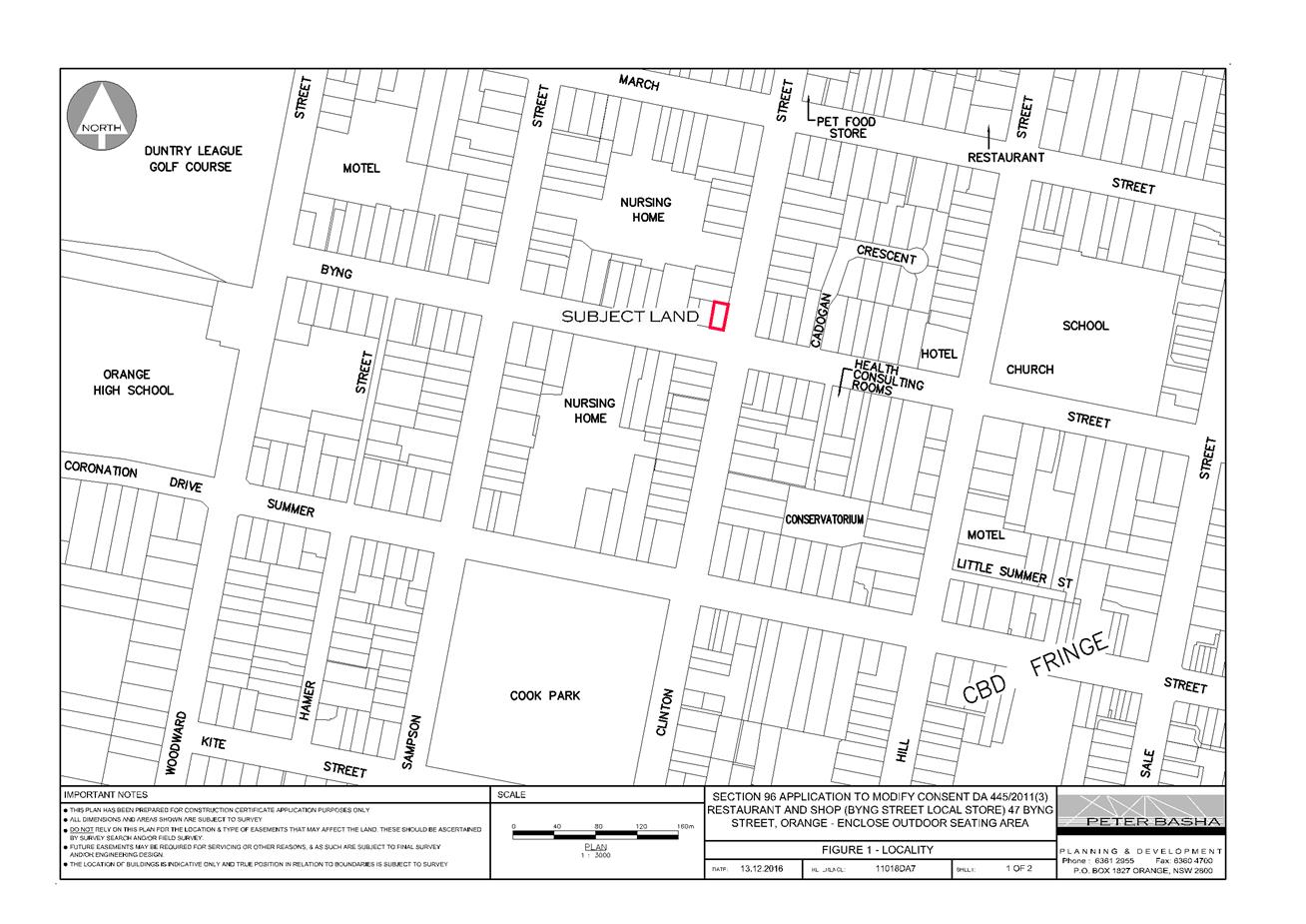
Planning and Development Committee
7 December 2017
2.7 Development
Application DA 445/2011(4) - 47 Byng Street
Attachment 2 Plans
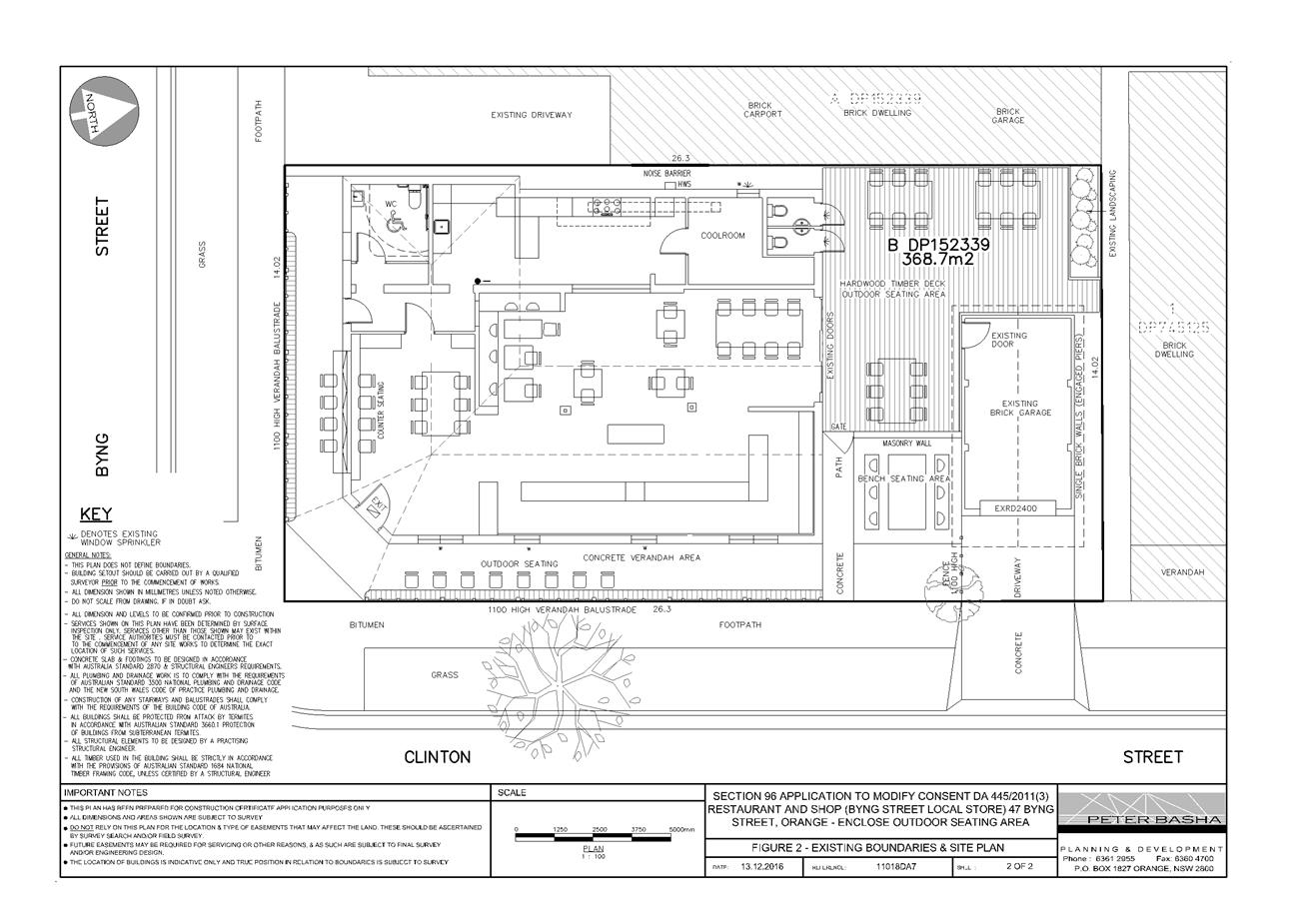
Planning and Development Committee
7 December 2017
2.7 Development
Application DA 445/2011(4) - 47 Byng Street
Attachment 2 Plans
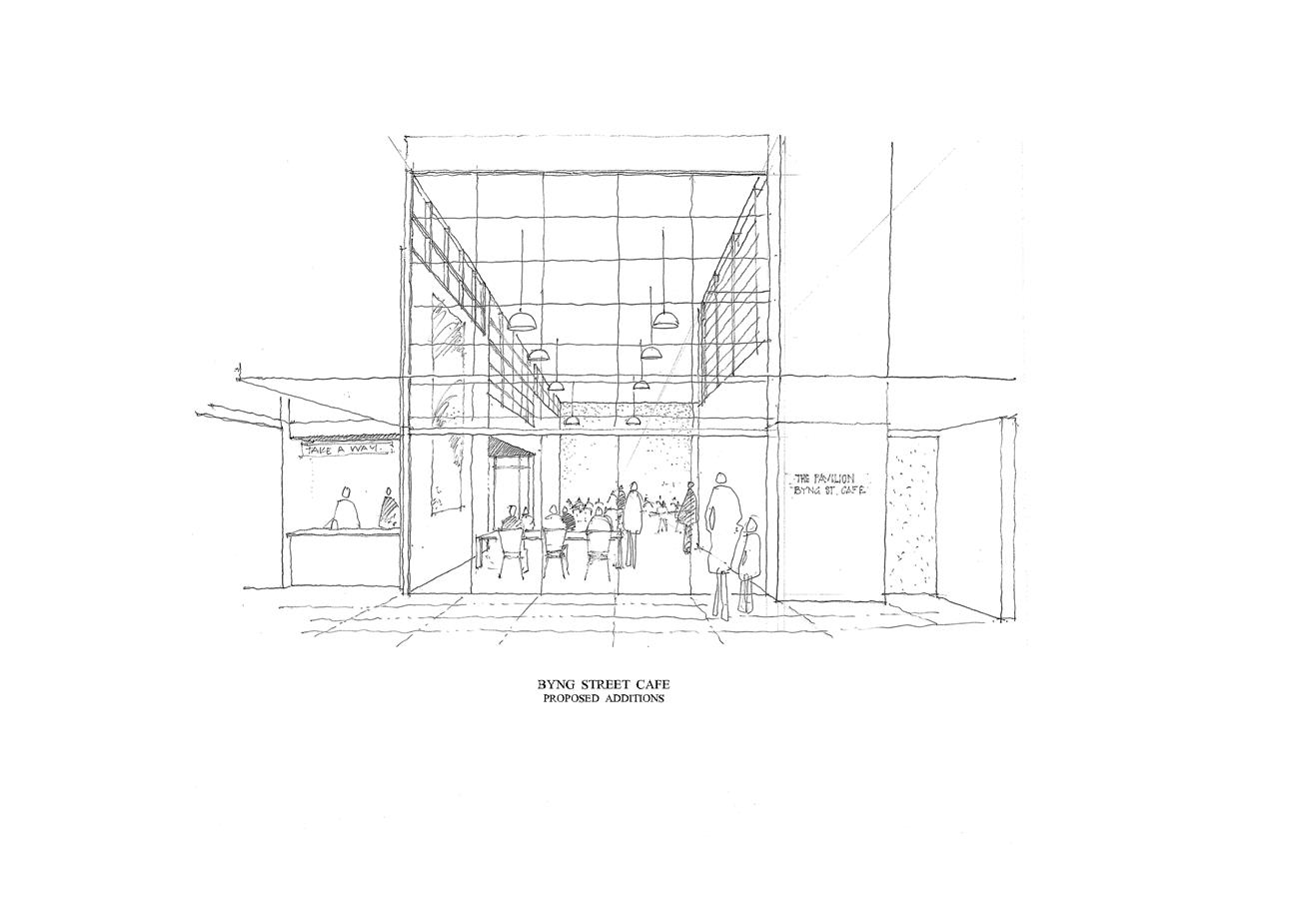
Planning and Development Committee
7 December 2017
2.7 Development
Application DA 445/2011(4) - 47 Byng Street
Attachment 2 Plans
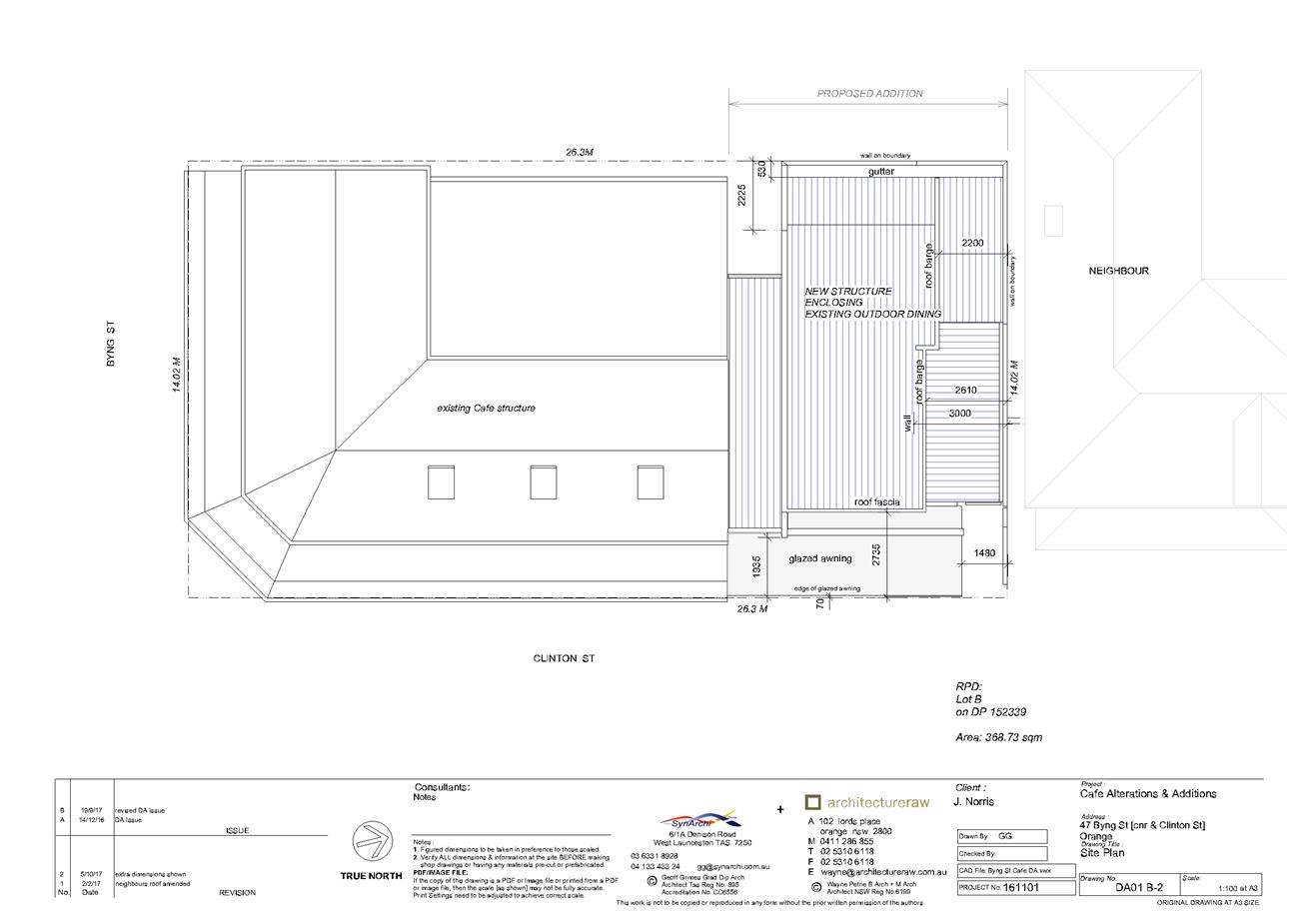
Planning and Development Committee
7 December 2017
2.7 Development
Application DA 445/2011(4) - 47 Byng Street
Attachment 2 Plans
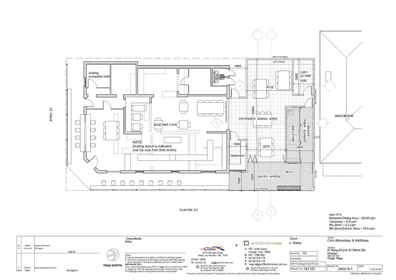
Planning and Development Committee
7 December 2017
2.7 Development
Application DA 445/2011(4) - 47 Byng Street
Attachment 2 Plans
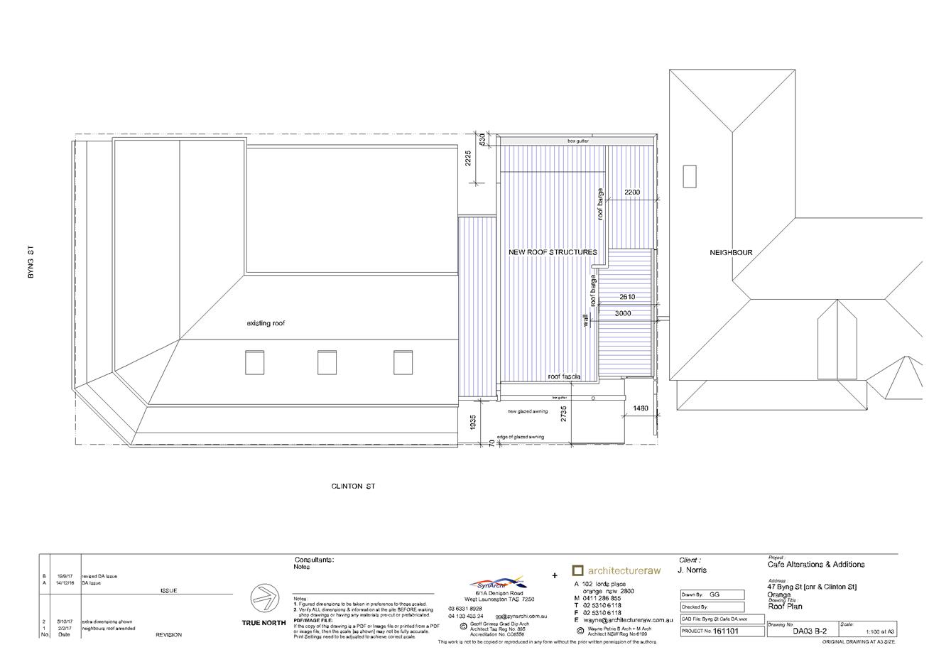
Planning and Development Committee
7 December 2017
2.7 Development
Application DA 445/2011(4) - 47 Byng Street
Attachment 2 Plans

Planning and Development Committee
7 December 2017
2.7 Development
Application DA 445/2011(4) - 47 Byng Street
Attachment 2 Plans
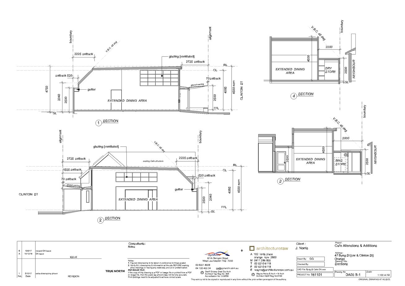
Planning and Development Committee
7 December 2017
2.7 Development
Application DA 445/2011(4) - 47 Byng Street
Attachment 2 Plans
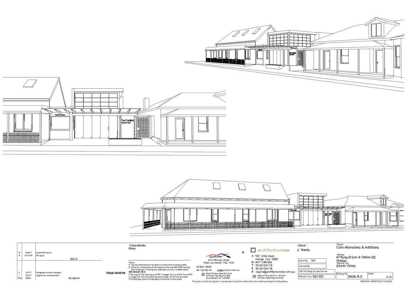
Planning and Development Committee
7 December 2017
2.7 Development
Application DA 445/2011(4) - 47 Byng Street
Attachment 3 Submissions

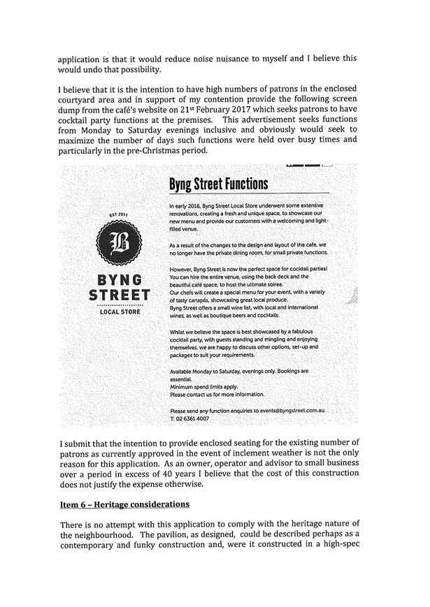
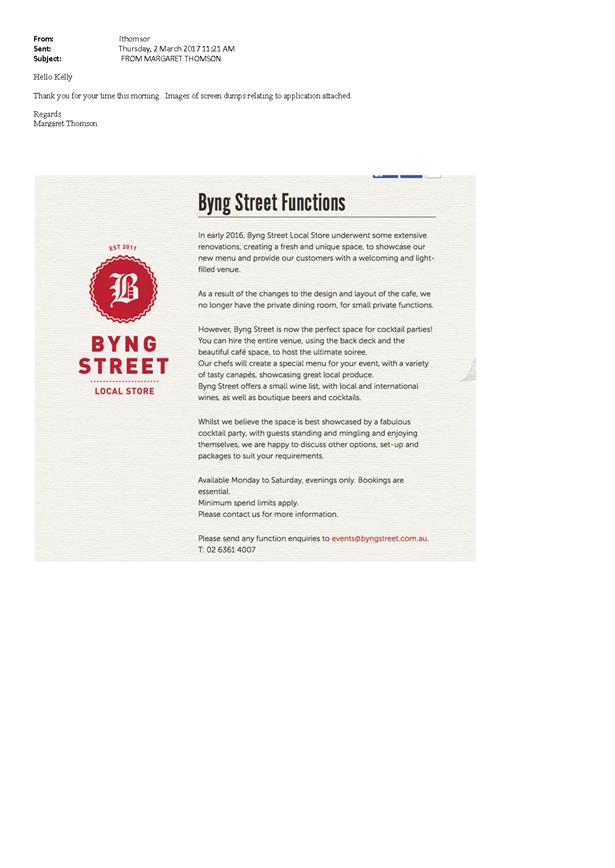
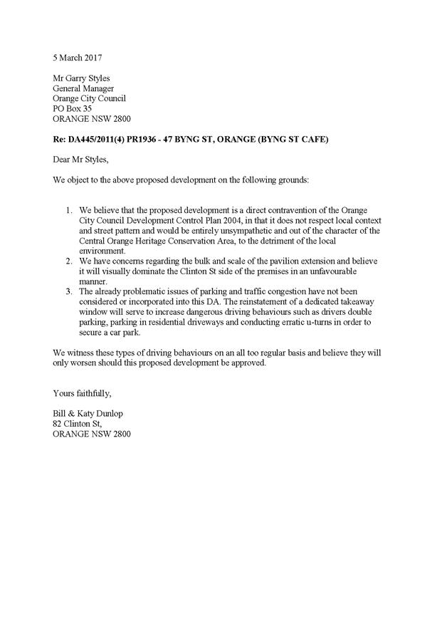
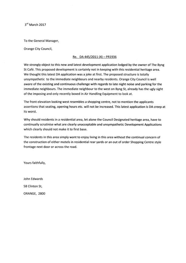
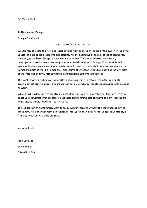
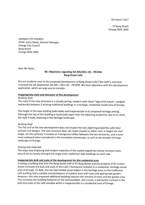

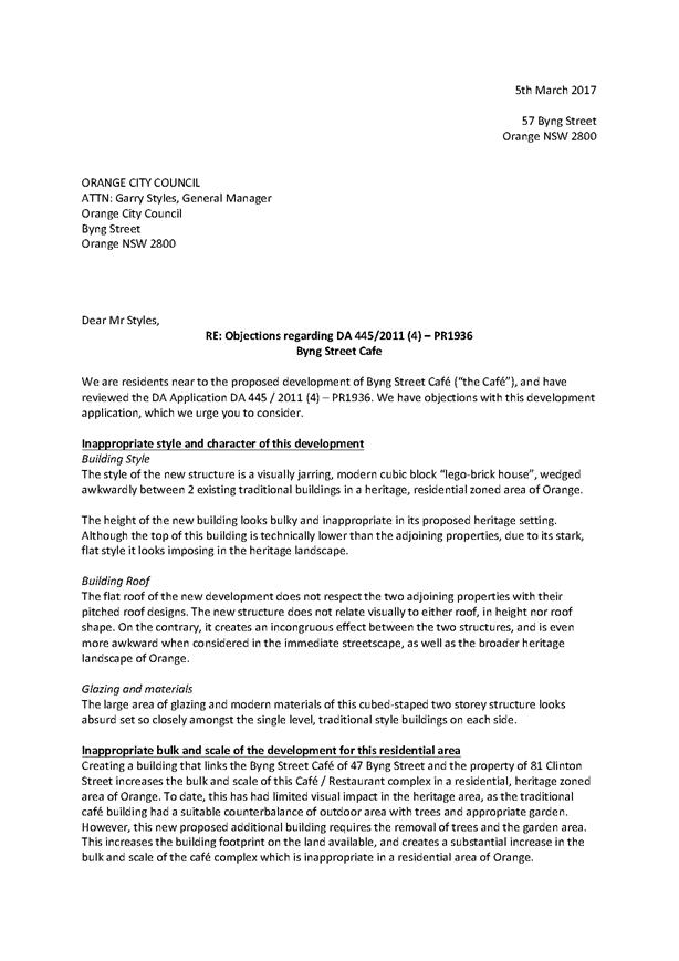


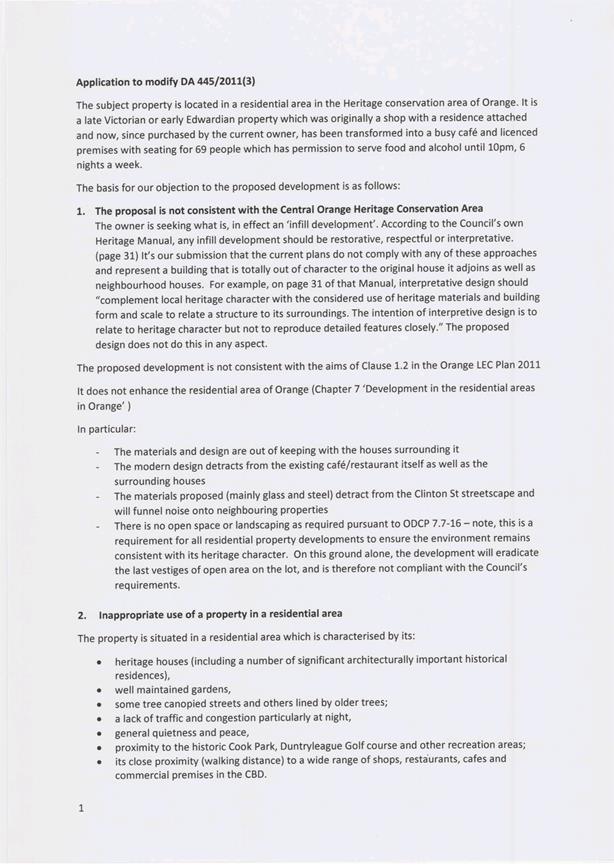
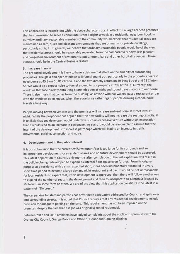
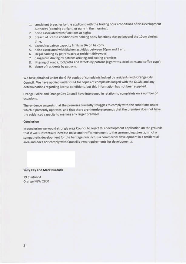
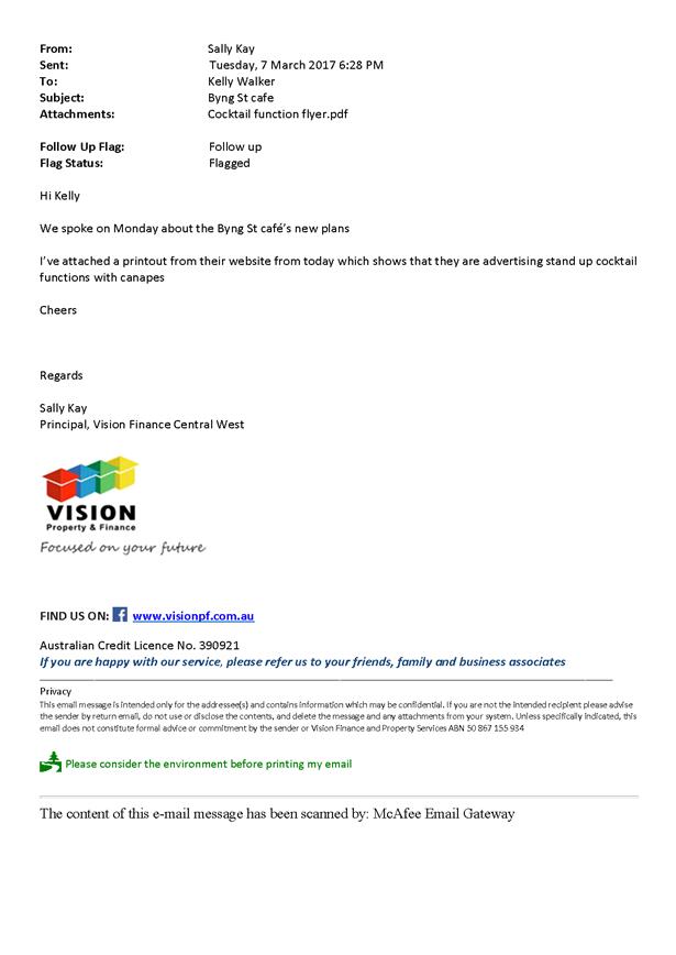
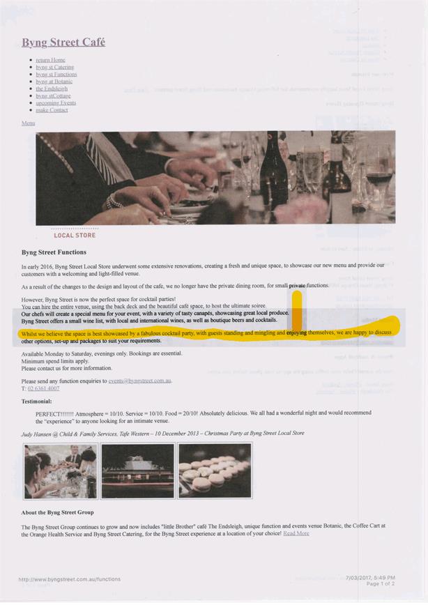

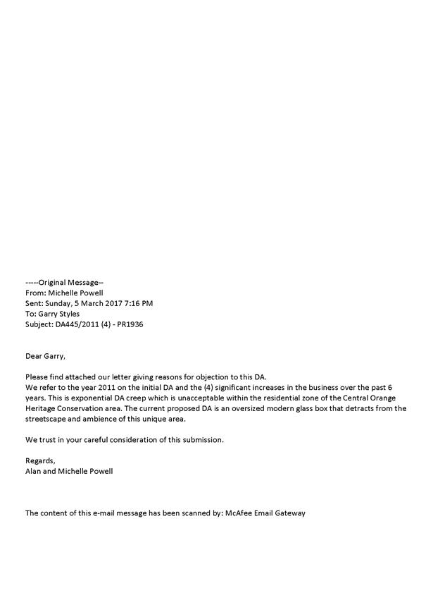
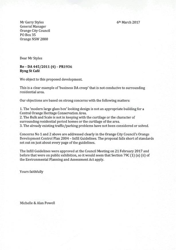
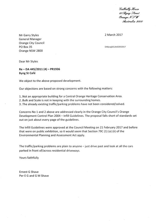
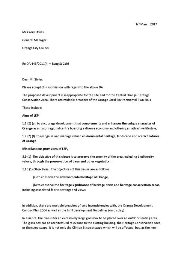
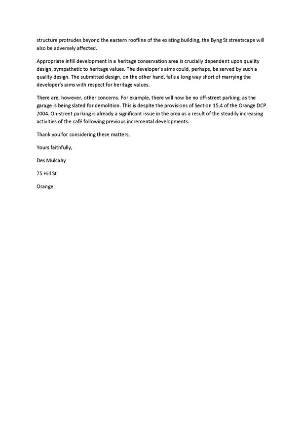
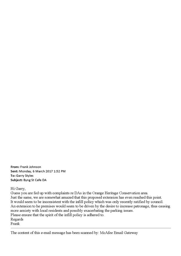
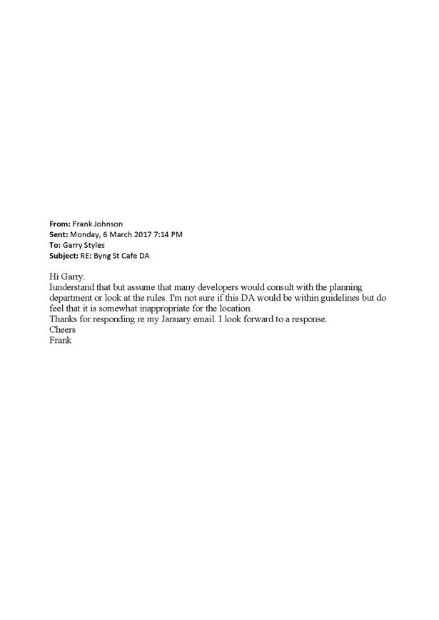
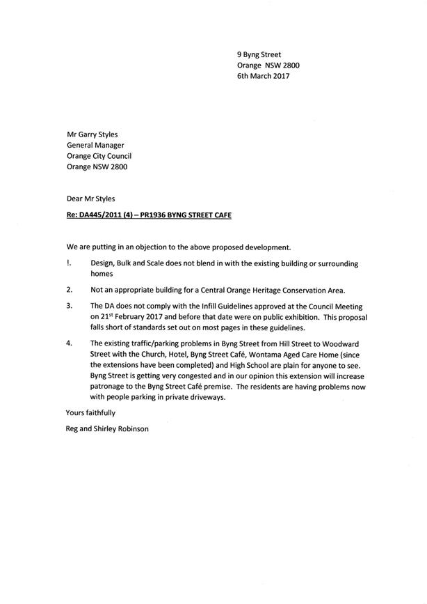
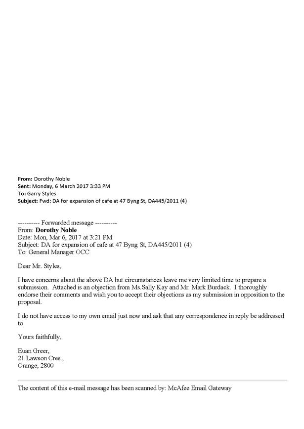
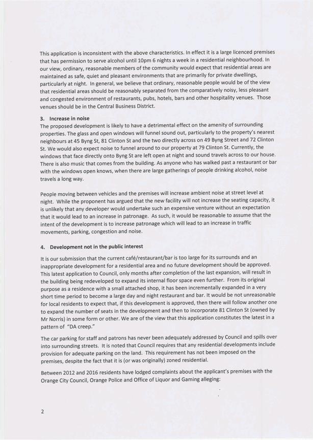
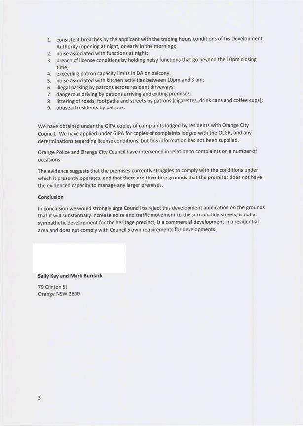
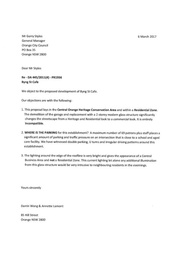
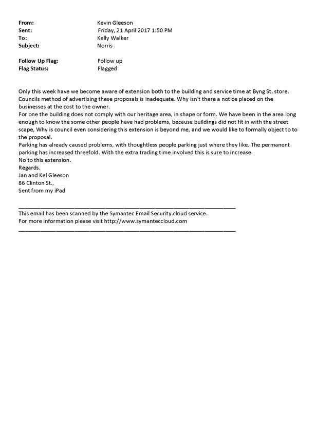

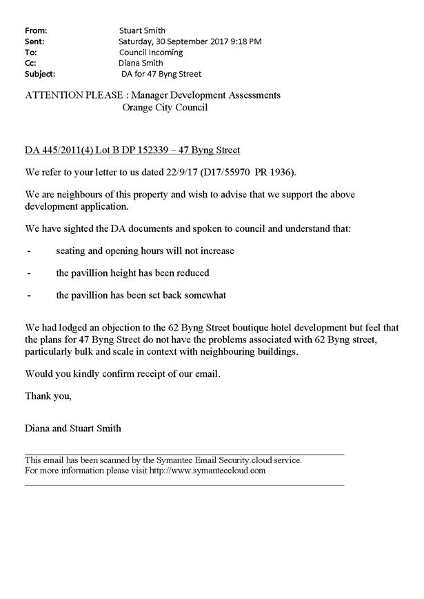

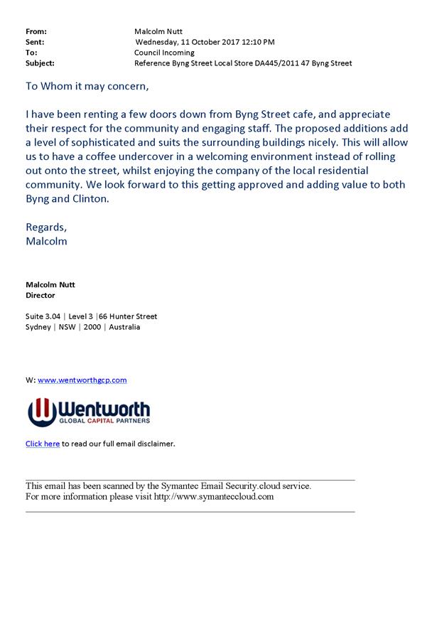
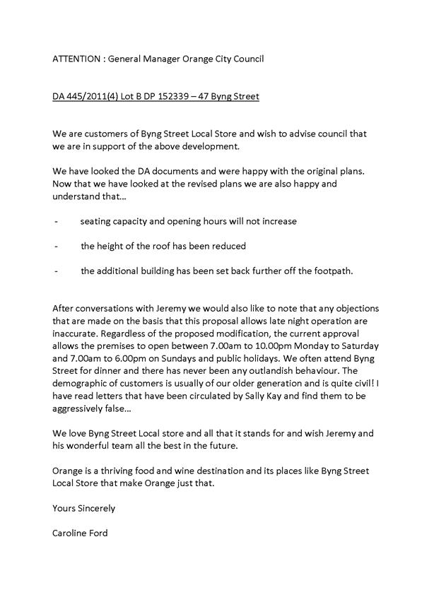
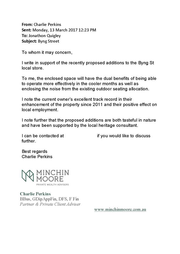


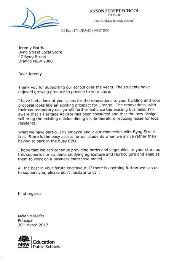
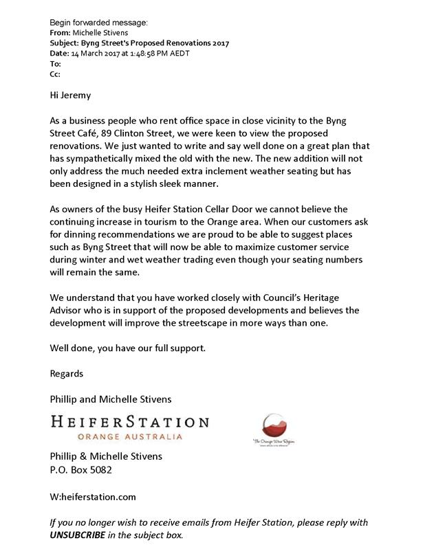

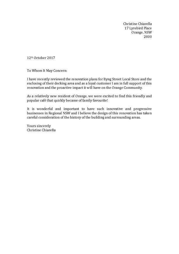
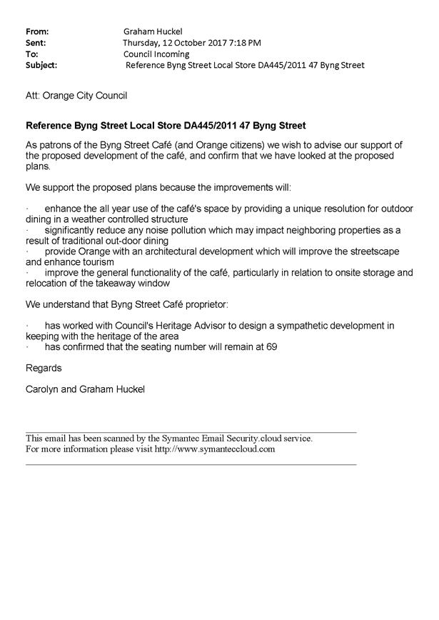

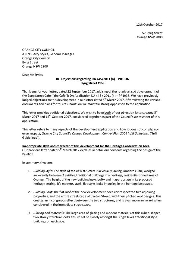
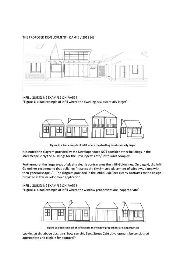

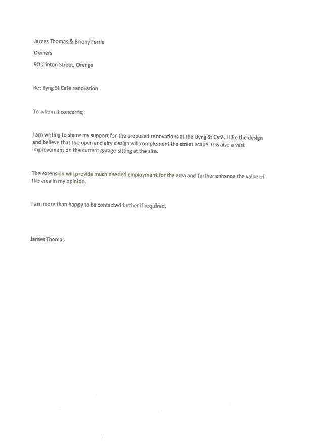
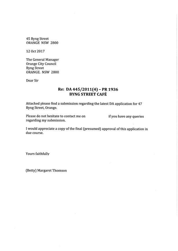
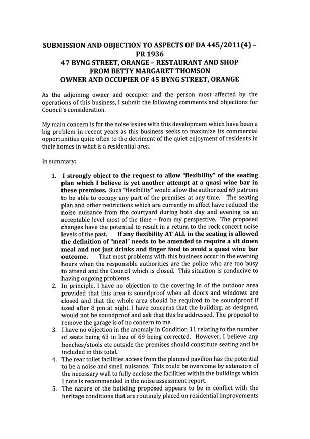
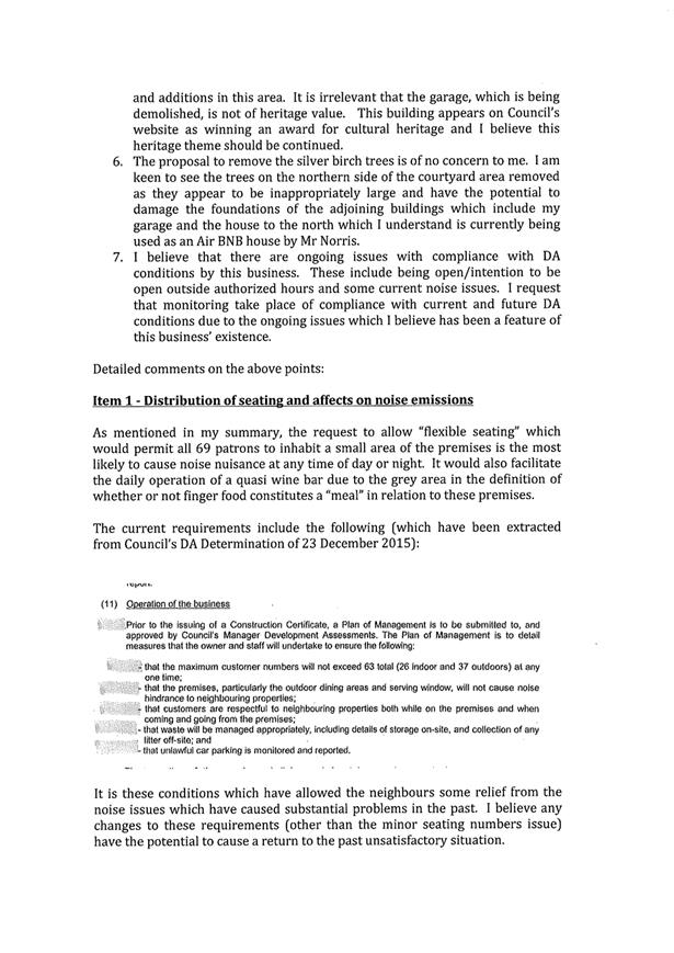
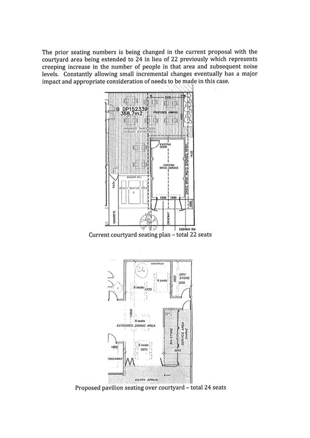
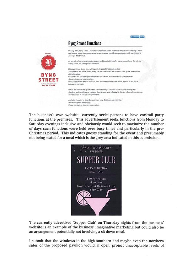
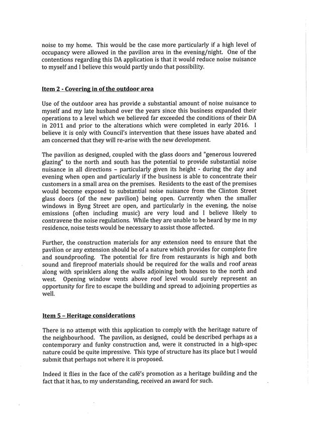
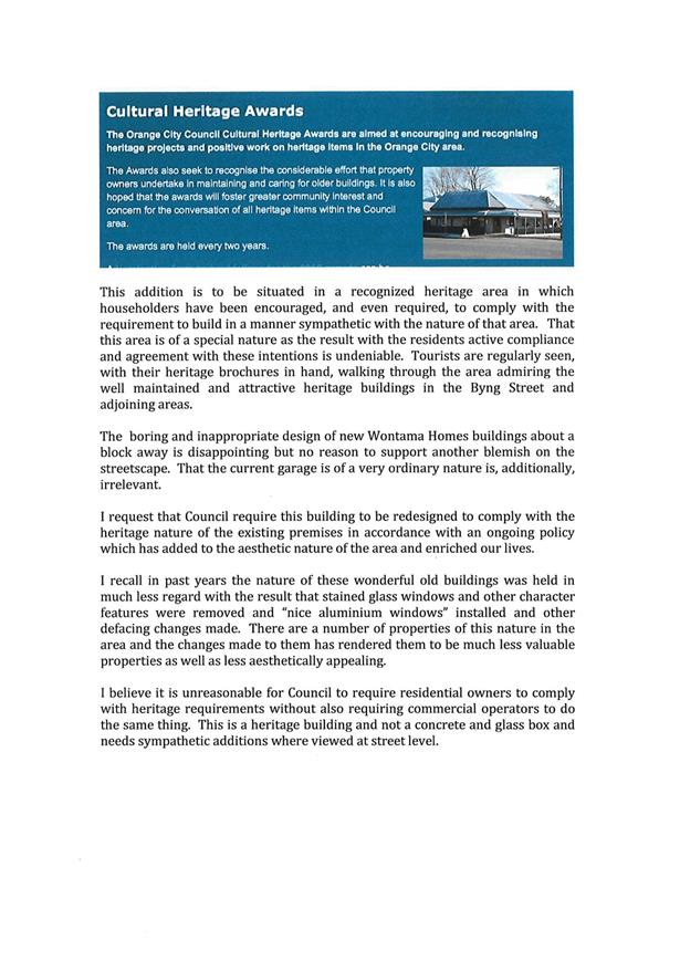
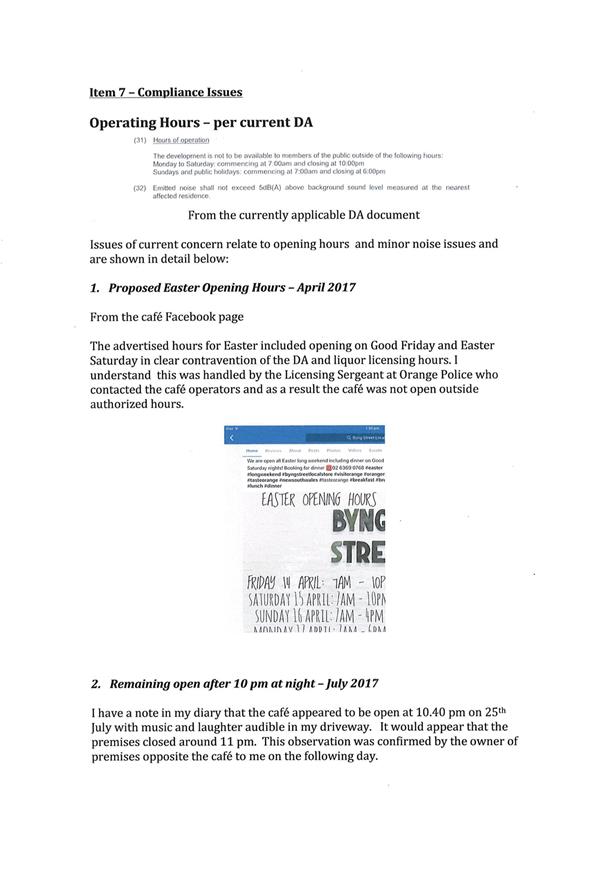
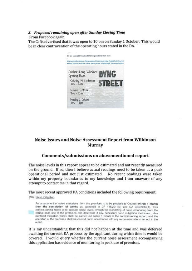
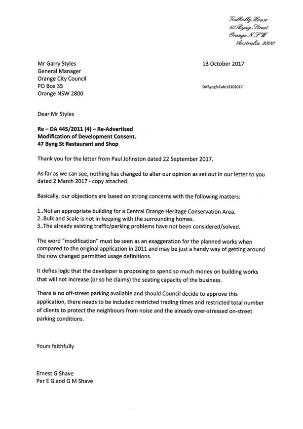
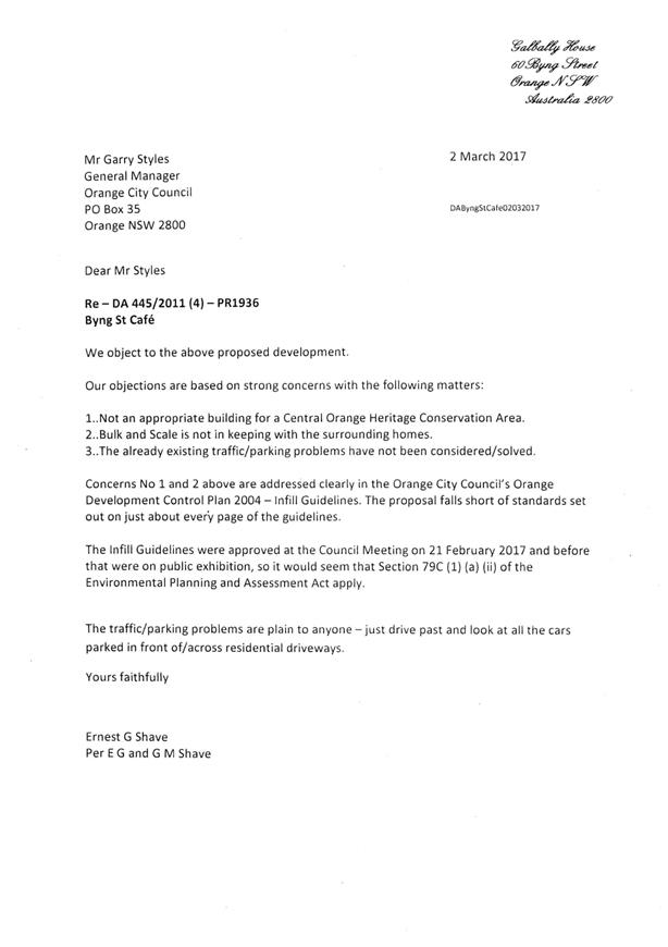
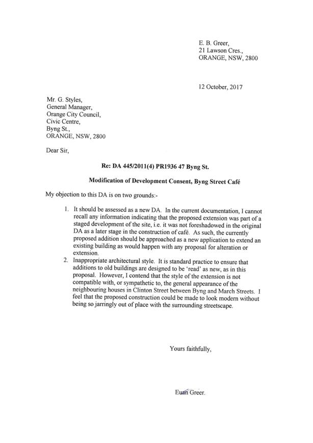
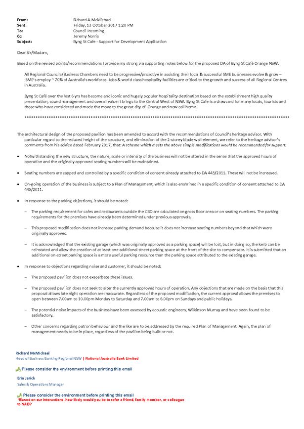


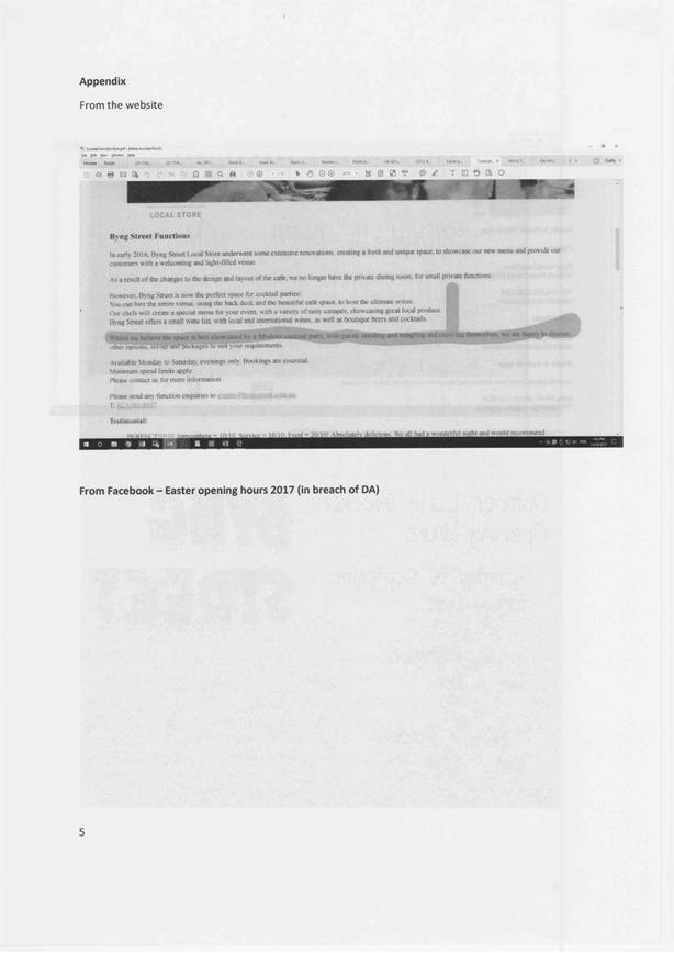
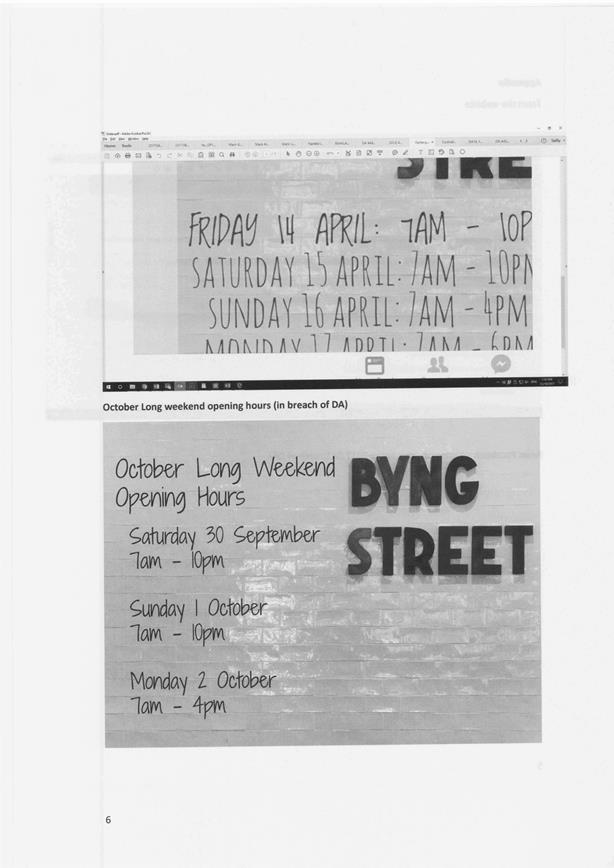
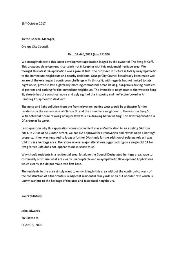
2.8 Development
Application DA 350/2016(1) - 47-49 Hill Street
RECORD
NUMBER: 2017/2517
AUTHOR: Andrew
Crump, Senior Planner
EXECUTIVE Summary
|
Application lodged
|
14 October 2016
|
|
Applicant/s
|
Newstead Property Nominees Pty Ltd
|
|
Owner/s
|
Newstead Property Nominees Pty Ltd
|
|
Land description
|
Lots 1, 2 and 3 DP 1127220,
Lot 19 DP 1158710, and Lots 17 and 18 Sec 22 DP 758817 - 47-49 Hill
Street, Orange
|
|
Proposed land use
|
Demolition (ancillary structures),
Subdivision (Torrens title - four lot residential), Dwellings (two
dwellings), Multi Dwelling Housing (seven dwellings) and Subdivision
(Community title - eight lot residential)
|
|
Value of proposed development
|
$3,550,000
|
Council's consent is sought to undertake a residential
redevelopment of the former Newstead Bowling Club site.
The critical aspect to the assessment of this application is
the presentation of the two dwellings fronting Kite Street, which are described
as detached, single storey contemporary style dwellings with attached double
garages. The design rationale adopted with attached double garages presenting
to Kite Street is contrary to Council’s Infill Guidelines which seek to
ensure that garages do not interrupt the continuity of consistent streetscapes,
nor dominate important and valued heritage street frontages.
Council’s Heritage Advisor
has recommended that the proposed development will have a significant impact
upon the heritage value of the area and thus should not to be supported by
Council.
Additionally, the significance of the Newstead building and
the locality generally will be detrimentally effected by the siting of dwelling
2 which adopts a setback line with reference to the adjoining development to
the west, but bears no relationship with the siting of the heritage item. The
adopted siting of dwelling 2 will impinge on important views of significant
features of the Newstead building and will have the effect of crowding the
setting of the heritage item. Similar to the impacts derived from the presentation
of dwellings 1 and 2, the siting of dwelling 2 will have a
detrimental impact upon the significance of the heritage item on the land and
unsatisfactorily impact upon the streetscape.
The extent of the impact can be seen in the below
photomontages which Council staff had prepared by an external practitioner with
extensive Photoshop experience. In the opinion of Council staff, the below
images provide a more realistic impression of how the development will fit in
the street compared to the photomontages and other information submitted with
the application.
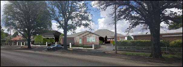
Figure 1 - photomontage prepared by Council’s
Photoshop consultant
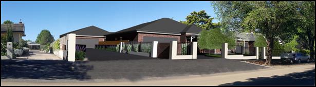
Figure 2 - photomontage prepared by Council’s
Photoshop consultant
The proposal firstly involves a four lot Torrens title
subdivision. The intent of the subdivision is to excise the Newstead building
(former mansion) onto a separate lot, create two separate lots with frontage to
Kite Street and create a battleaxe lot as a development lot. Demolition of the
shed and other ancillary items (water tanks) will occur at the time of the
subdivision. The applicant then seeks to construct nine dwelling houses, one
dwelling on each of the two lots fronting Kite Street and seven dwellings as a
multi-dwelling housing development on the battleaxe lot. Finally, the applicant
is seeking to undertake an eight lot Community title subdivision (seven
house lots and one community lot (access)) over the multi-dwelling housing
development within the battleaxe lot. As part of the development new vehicle
crossovers will be provided within the street, changing the existing
arrangement within the footpath. The development also involves a new front
fence, landscaping and visitor parking spaces.
The setting and context of the subject land is characterised
as being situated within an area of the City which displays exceptional
heritage value owing to the cluster of intact heritage items such as Mena (50
Kite Street), Sir Charles and Lady Cutler's former residence (52 Kite Street)
(both opposite the subject land in Kite Street) and the Newstead bowling club
(former mansion) which is situated on the land the subject of the application.
The avenue of large mature plain trees within Kite Street is a notable feature
within the Central Heritage Conservation Area and the Cook Park tree canopy
forms an important back drop to the west.
The existing topography of the footpath and the change in
levels between the footpath and the subject land will necessitate the provision
of new vehicular access points that will be similar to the adjoining property
to the west. To improve safety, Council’s Technical Services staff have
indicated that the new gutter bridges for the access handle and the driveway to
Lot 103 will need to be unbroken and connect with the existing bridge serving 45 Kite
Street. This will result in a continuous gutter bridge approximately 17m in
length. A further 4m long gutter bridge footpath crossing will be required
for dwelling 2. The proposed westernmost access will necessitate the
removal of an immature street tree and relocation of an existing low voltage
electricity pole and street light. The development will augment the existing
footpath situation, which will involve excavation within close proximity of the
large street trees. Special consideration needs to be given to this aspect of
the development to ensure their root structures are not damaged and their
health is not effected.
The intended stormwater design as shown on the preliminary
services plan shows the private open space areas of dwellings 6 and 9
being used as the onsite stormwater detention system. Whilst this is an
acceptable engineering solution, it is less than desirable from a residential
amenity perspective for the future occupants of these dwellings.
Council’s Technical Services staff estimate that the onsite detention
basins in the rear yards of Dwellings 6 and 9 will be inundated with
approximately 200mm 1-2 times a year (on average – depending on
meteorological factors), and fill to a depth of up to 500mm in larger, less
frequent storm events. Whether or not this presents a safety issue is also a
matter for consideration.
Additionally, the engineering design will require the
installation of stormwater pipes within the structural root zone of a large
mature and heritage significant tree on the northern side of the Newstead
building (former mansion). This compounds the complexity of the stormwater
design. Utilising two larger pipes (in place of one pipe) and connecting to the
existing stormwater system near the Hill Street/Kite Street roundabout could
discharge the stormwater from the onsite detention basins more efficiently,
meaning amenity for the occupants of Dwellings 6 and 9 would improve.
However, this option requires more than one pipe and at larger diameters, which
would need to be installed within the structural root zone of the subject tree.
Hence, Council’s Manager City Presentation cannot guarantee the health of
the tree if the structural root zone is effected by the installation of the
stormwater system.
The design of the driveway with two opposing 90 degree turns
will mean that a firefighting appliance will not be able to practically enter
the site past the first right angle turn. This means that in order to obtain
the necessary firefighting coverage for the furthest dwelling from the street,
a private hydrant will need to be installed within the community property. In
the event the necessary coverage is still not achievable, dwelling 9 will
need to have a domestic sprinkler system installed.
Another critical aspect of the assessment relates to the
parking implications resultant from excising the Newstead building (former
mansion) onto a separate lot, and development to occur in the area where the
majority of off-street parking for the registered club is located.
As outlined in the above summary, the development will
result in a number of departures from Council’s adopted planning
provisions, principally Council’s heritage related provisions within the
adopted Infill Guidelines with respect to the design of dwellings 1
and 2.
Additionally, the development will result in outcomes such
as the new vehicle footpath crossing treatments, stormwater design, access to
hydrants, loss of on-street parking and loss of parking associated with the
former Newstead club; which, if isolated to just one issue, would not be as
great an issue - but when amassed together, the development presents planning
outcomes with unacceptable levels of environmental impacts in the locality.
Council staff acknowledges the merits associated with
developing the subject land for residential purposes. For a start, the land is
centrally located and a large portion of the site is currently under-developed
and underutilised. Its redevelopment presents an efficient use of land within
the urban context, alleviating a small amount of pressure on the push for urban
sprawl. What Council staff do not agree with is the adopted design rationale
presented within the application. Council staff are of the view that a more
sophisticated design could be developed which could entirely remove, or a least
reduce to an acceptable level, the above-described elements of the design that
will result in unsatisfactory environmental impacts in the locality.
As such, the development is recommended for refusal based on
the following reasons:
· The design and
siting of dwellings 1 and 2; particularly the attached double garages
presenting visually to the street, and the siting of dwelling 2 being
forward of the significant heritage item on the land will result in an
unacceptable detrimental impact upon the significance of the heritage item on
the land known as the Newstead building, as well as the significance of the Central
Heritage Conservation Area and a number significant heritage items within the
vicinity of the subject land.
· The development is
inconsistent with the objects of Clause 5.10 - Heritage Conservation pursuant
to Orange Local Environmental Plan 2011.
· The development is
inconsistent with the residential design objectives listed under Chapter 7
of Orange Development Control Plan 2004, particularly neighbourhood character,
building appearance, heritage and streetscape.
· The development is
in direct conflict with planning outcome PO 7.7-3 (2) - Heritage
which seeks to ensure that new development complements and enhances the
significance of a heritage item or place of heritage significance listed in the
Orange Heritage Study.
· The development is
fundamentally inconsistent with Council’s Infill Guidelines.
· Compliance with
the infill guidelines and the other relevant aspects of Council’s
planning provisions could be achieved if not for the number, size, design and
layout of the proposed dwellings. Accordingly, the development is considered to
be an over development of the site.
· The proposed
stormwater design will result in unsatisfactory impacts upon the residential
amenity of Dwellings 6 and 9. An alternative solution that improves the amenity
of those dwellings would have unacceptable impacts upon the large mature Deodar
Cedar (Cedrus deodara) on the northern side of the Newstead building
(former mansion).
DECISION FRAMEWORK
Development in Orange is governed by two key documents
Orange Local Environment Plan 2011 and Orange Development Control Plan 2004. In
addition the Infill Guidelines are used to guide development, particularly in
the heritage conservation areas and around heritage items.
Orange Local Environment Plan 2011 – the LEP
should be considered by Council to be a definitive document. LEPs govern the
types of development that are permissible or prohibited in different parts of
the City and also provide some assessment criteria in specific circumstances.
Uses are either permissible or not - there are no grey areas in terms of
permissibility. The objectives of each zoning and indeed the aims of the LEP
itself are, however, open to interpretation and can be used to guide decision
making around appropriateness of development.
Orange Development Control Plan 2004 – the DCP
guides development. In general it is a performance based document rather than
prescriptive in nature - its purpose is to guide development. The Land and
Environment Court tends to view it as such. In each area of interest there are
often guidelines used. These guidelines indicate ways of achieving the planning
outcomes. It is thus recognised that there may also be other solutions of
merit. All design solutions are considered on merit by planning and building
staff. Applications should clearly demonstrate how the planning outcomes are
being met where alternative design solutions are proposed. So one can see that
the DCP gives leeway for developers and architects to use design to achieve the
outcome in other ways if they can. Stating that DCP guidelines are
inflexible can be misleading.
This development involved the insertion of basic modern
style homes in arguably one of the most important heritage precincts in Orange.
Staff do not oppose units being developed in this location,
and indeed have made suggestions on how redesign could adequately address
heritage issues.
The LEP, DCP and Infill guidelines all support a refusal of
the development in its current form.
Link To Delivery/OPerational Plan
The recommendation in this report relates to the Delivery/Operational
Plan strategy “13.4 Our Environment – Monitor and
enforce regulations relating to City amenity”.
Financial Implications
Nil
Policy and Governance Implications
Nil
|
Recommendation
That Council refuses development application
DA 350/2016(1) for Demolition (ancillary structures), Subdivision
(Torrens Title - four lot residential), Dwellings (two dwellings), Multi
Dwelling Housing (seven dwellings) and Subdivision (Community Title - eight
lot residential) at Lots 1, 2 and 3 DP 1127220, Lot 19
DP 1158710, and Lots 17 and 18 Sec 22 DP 758817 - 47-49 Hill
Street, Orange pursuant to the reasons listed in the attached Notice of
Refusal.
|
further considerations
Consideration has been given to the
recommendation’s impact on Council’s service delivery; image and
reputation; political; environmental; health and safety; employees;
stakeholders and project management; and no further implications or risks have
been identified.
SUPPORTING INFORMATION
THE APPLICATION/PROPOSAL
Council's consent is sought to undertake a residential
redevelopment of the former Newstead Bowling Club site which is situated on
land described as Lots 1, 2 and 3 DP 1127220, Lot 19
DP 1158710, and Lots 17 and 18 Sec 22 DP 758817. The land is known as
47-49 Hill Street, Orange (also known as the Newstead Bowling Club Kite Street,
Orange).
The development is proposed as a number of stages to achieve
the intended outcome. The following is an outline of the various stages:
Stage 1
Stage 1 involves the demolition
of ancillary structures within the land such as the greenkeeper's shed, storage
shed and water tanks. This stage also involves undertaking a four lot
subdivision summarised in the below table:
|
Lot
|
Size (m2)
|
Frontage
|
Further Development
|
|
100
|
3680.6
|
Kite Street via access handle of
battleaxe lot
|
Multi dwelling housing (seven
dwellings) and Community title subdivision
|
|
101
|
3528.7
|
Corner lot, frontage to both Kite
and Hill Streets. The existing mansion primarily addresses Hill Street
|
No further development proposed as part
of this application - subject of a re-zoning to B4 Mixed Use
|
|
102
|
549.9
|
Kite Street
|
Single dwelling
|
|
103
|
562.6
|
Kite Street
|
Single dwelling
|
The size of the lots and the
location of new boundaries is depicted in the below except from the submitted plans.
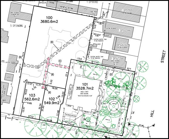
Figure 3: except from submitted plans showing
subdivision layout
Stage 2
Construction of a dwelling on each of the resultant Lots 102
and 103 (created under Stage 1) and construction of seven dwellings as a
multi dwelling housing development on the resultant battleaxe development Lot
100 (created under Stage 1).
All proposed dwellings are single storey with attached
double garages, three bedrooms, two bathrooms, open plan kitchen/dining/living
and some with separate lounge rooms. Roof forms will primarily comprise hips
roofs, with some gables. The external materials for all dwellings will be face
brick, Colorbond roof sheeting, aluminium windows, circular profile downpipes
and quad profile gutters. Hard landscaping will comprise coloured concrete
driveways and paths. Trees, hedges and shrubs are proposed within the soft
landscaping scheme.
Stage 3
The final stage comprises an eight lot Community Title
subdivision to excise the seven dwellings constructed under Stage 2 onto
separate Community Title lots. The subdivision will comprise seven house lots
and a community (access) lot.
The Community subdivision is
summarised as follows:
|
Lot
|
Size (m2)
|
Resultant Improvement
|
|
1
|
737.7
|
Community lot/vehicular access
|
|
2
|
356.2
|
Dwelling 3
|
|
3
|
387.6
|
Dwelling 4
|
|
4
|
399.8
|
Dwelling 5
|
|
5
|
492.6
|
Dwelling 6
|
|
6
|
446.6
|
Dwelling 7
|
|
7
|
387.0
|
Dwelling 8
|
|
8
|
473.1
|
Dwelling 9
|
The size of the lots and the
location of new boundaries is depicted in the below except from the submitted
plans.
Figure 4: except from submitted plans showing
Community Title subdivision layout.
BACKGROUND/CHRONOLOGY OF
APPLICATION
The following is a chronology of key dates with an
explanation of amendments to the application and elucidation of each of the
three exhibition periods.
August 2016
The applicant attempted to lodge the application, however it
was not accepted at this time due to insufficient information. The development
was, for all intents and purposes, the same design as what is currently before
Council. Dwellings 1 and 2 comprised attached garages presenting to
Kite Street. Council staff at this time procured advice from Council’s
Heritage Advisor, who recommended that the two garages that orientate to the
street be redesigned such that vehicular access to these garages was achieved
internally from the common driveway, thus not being visually dominant within
the streetscape.
Additionally, it was recommended that dwelling 2 be set back
further from Kite Street so as to provide a more appropriate setback transition
between the new development and the heritage item on the land, and allow the
primacy of the heritage item to be more obvious within the street.
This advice was provided to the applicant.
14 October 2016
Application lodged with Council. When the application was
formally lodged with Council, the orientation of Dwelling 1 was amended such
that the garage door faced west (away from Kite Street) and was accessed from
the common property driveway. Dwelling 2 remained unchanged from when the
applicant first attempted to lodge the application in terms of both garage
location/orientation and front setback.
27 October 2016
Council staff provided the applicant with an additional
information request which included inter alia a request to redesign
dwelling 2 such that the attached garage was not visually dominating
within the streetscape and also requested re-siting of the same dwelling such
that a greater setback was provided. Noting that at this time dwelling 1
had an attached garage that orientated the opening internally (facing west)
within the site.
2 November 2016
Application advertised and notified.
11 April 2017
Additional information provided to Council which included
amended plans with dwelling 1 redesigned such that the garage door
re-orientated 90 degrees to visually present to the street and dwelling 2
remained essentially unchanged, with a slight setback increase of
nominally 0.7m. Other minor changes included reduced roof pitch, privacy
treatment to dwelling 9, materials schedule, minor floor plan changes etc.
Essentially the design returned to the same design that was originally rejected
by Council staff in August 2016, save for the minor changes mentioned
above.
27 April 2017
Application re-advertised and notified based on
inconsistency in the application's formal description/order of the development.
The application was also required to be readvertised due to the substantial
change to the design of dwelling 1.
11 May 2017
At the completion of the second exhibition period, it became
apparent from some of the submissions received during that period that the
material that that was placed on public exhibition led to confusion within the
community. The confusion centred on the exact design of dwelling 1. The
cause of the confusion related to the information that was resubmitted from URBIS
dated 26 August 2016 that indicated “Dwelling 1 has been
redesigned so that the entry to the garage is from the side of the dwelling
…”. This information was contradictory to the plans and other
material accompanying the application. As such, Council staff were left with no
option other than to request clarification from the applicant and re-advertise
the application for the third time to address the confusion.
At this point, the applicant requested that they be allowed
time to prepare a complete new heritage impact statement from URBIS. This was
agreed to by Council staff and Council awaited the submission of new material
so that exhibition could occur for the third time.
14 August 2017
Revised development application material submitted which
included a revised Statement of Environmental Effects and a new heritage impact
statement prepared by URBIS.
31 August 2017
Development application advertised and notified for the
third time.
PLANNING PROPOSAL
As a separate matter the owners of the land have lodged a
planning proposal with Council which seeks to rezone the former Mansion and the
curtilage around it (approximate area shown red below) to B4 Mixed Use. This
will effectively complete a contiguous line of B4 Mixed Use zoned properties on
the western side of Hill Street from Summer Street through to Kite Street (see
below).
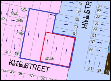
Figure 5 - area of land proposed to be re-zoned to B4
Mixed Use (shown red outline)
(blue outline relates to the subject land)
It should be noted that the alignment of proposed boundaries
for proposed Lot 101 (which is the lot that will contain the heritage item
(former mansion)) relates to the same area that is proposed to be rezoned to
B4. As part of the planning proposal, development standards relating to floor
space ratios and height of building controls are also being considered. It is
also noted that as part of the planning proposal, the relevant heritage map and
listing within Schedule 5 of the Local Environmental Plan will be pared back to
relate to the former mansion and adopted curtilage only. The Heritage
Conservation Area will remain unchanged, which includes the balance of the
subject land.
The planning proposal will have no material effect on the
consideration of this application.
Errata in Submitted Plans
Council staff have identified the following errors within
the submitted plans:
· Submitted shadow
diagrams contain errors and omissions which has made assessing the
development's compliance with the relevant Development Control Plan provisions
a time consuming and onerous task.
· The submitted site
plan shows external laundry doors for dwellings 5, 6
and 7, whereas individual floor plans and the applicable elevations
for those dwellings show windows instead of doors. If Council is of a view to
approve the development it will be necessary to require a complete set of plans
that addresses these identified conflicts.
Other Issues with the Submitted
Plans
· Information shown
on the streetscape analysis - Council requested a streetscape analysis that
provided an understanding of how the development would be viewed within the
Kite Street. A plan was provided; however, it fails to demonstrate the full
extent of the development as the plan only shows dwellings 1 and 2
and not the elevated dwellings behind, particularly dwelling 3 which
adjoins the Newstead building. This is discussed further below under the infill
guidelines and is evident in the below photomontage (figure 7).
· Submitted
photomontages - Council requested that photomontages be prepared that provide a
realistic impression of what the development will look like in the street.
Photomontages haven been submitted, however the placement of advanced
vegetation - different to what is shown on the landscape plan - and the angles
of view selected, do not provide a true representation of how the development
will appear in the street.
· To
address this, Council staff have engaged a registered landscape architect with
experience in Photoshop software to prepare photomontages that provide a more
realistic impression of the development (refer figure 6 and 7 below).
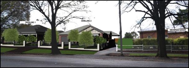
Figure 6 - photomontage prepared by the applicant
Figure 7 - photomontage prepared by Council’s
Photoshop consultant
Council staff are of the view that figure 7 above
provides a much more realistic impression of how the development will appear in
the street, along with its relationship with the Newstead building. The purpose
of showing these two images is to demonstrate that the images submitted with
the application do not accurately represent the development.
It is noted that photomontages serve the purpose of
providing an appreciation of the development and are not technical
architectural drawings.
MATTERS FOR CONSIDERATION
Section 5A Assessment
In the administration of sections 78A, 79B, 79C, 111 and
112, the provisions of Section 5A must be taken into account for every
development application in deciding whether there is likely to be a significant
effect on threatened species, populations or ecological communities or their
habitats. This section includes a requirement to consider any adopted
assessment guidelines, which means assessment guidelines issued and in force
under section 94A of the Threatened Species Conservation Act 1995.
Assessment guidelines are in force (see DECC-W “Threatened Species
Assessment Guidelines - The Assessment of Significance”) which requires
consent authority to adopt the precautionary principle in its assessment.
From 25 August 2017, the Biodiversity Conservation
Act 2017 and Biodiversity Conservation Regulation 2017 were gazetted. State
Environmental Planning Policy (Native Vegetation in Non-Rural Areas) 2017 was
also gazetted. The implementation of this legislation (and supporting
guidelines) is subject to savings provisions that defer their full effect for a
period of three months from the date of gazettal for local development.
A site inspection reveals that the subject land is a highly
modified urban parcel which has no biodiversity or habitat value.
Section 79C
Section 79C of the Environmental Planning and Assessment Act
1979 requires Council to consider various matters, of which those pertaining to
the application are listed below.
PROVISIONS OF ANY ENVIRONMENTAL
PLANNING INSTRUMENT s79C(1)(a)(i)
Orange Local Environmental Plan 2011
Part 1 - Preliminary
Clause 1.2 - Aims of Plan
The broad aims of the LEP are
set out under subclause 2. Those relevant to the application are as follows:
(a) to encourage development which complements
and enhances the unique character of Orange as a major regional centre boasting
a diverse economy and offering an attractive regional lifestyle,
(b) to provide for a range of development
opportunities that contribute to the social, economic and environmental
resources of Orange in a way that allows present and future generations to meet
their needs by implementing the principles for ecologically sustainable
development,
(e) to provide a range of housing choices in
planned urban and rural locations to meet population growth,
The development is consistent with the above aims of the plan.
However, the development is inconsistent with the below aim.
(f) to recognise and manage valued
environmental heritage, landscape and scenic features of Orange.
The development will have an
unacceptable impact on parts of the valued environmental heritage of the City.
A detailed assessment of the development has been carried out below under the
heading Clause 5.10 – Heritage Conservation.
Clause 1.6 - Consent Authority
This clause establishes that, subject to the Act, Council is
the consent authority for applications made under the LEP.
Clause 1.9A - Suspension of
Covenants, Agreements and Instruments
This clause provides that covenants, agreements and other
instruments which seek to restrict the carrying out of development do not apply
with the following exceptions.
· covenants imposed
or required by Council
· prescribed
instruments under Section 183A of the Crown Lands Act 1989
· any conservation
agreement under the National Parks and Wildlife Act 1974
· any trust
agreement under the Nature Conservation Trust Act 2001
· any property
vegetation plan under the Native Vegetation Act 2003
· any biobanking
agreement under Part 7A of the Threatened Species Conservation Act 1995
· any planning
agreement under Division 6 of Part 4 of the Environmental Planning and
Assessment Act 1979.
Council staff are not aware of the title of the subject
property being affected by any of the above.
Mapping
The subject site is identified
on the LEP maps in the following manner:
|
Land Zoning Map:
|
Land zoned R1 General Residential
(and small area of B4)
|
|
Lot Size Map:
|
No Minimum Lot Size
|
|
Heritage Map:
|
Heritage item and heritage
conservation area
|
|
Height of Buildings Map:
|
No building height limit
|
|
Floor Space Ratio Map:
|
No floor space limit
|
|
Terrestrial Biodiversity Map:
|
No biodiversity sensitivity on the
site
|
|
Groundwater Vulnerability Map:
|
Ground water vulnerable
|
|
Drinking Water Catchment Map:
|
Not within the drinking water
catchment
|
|
Watercourse Map:
|
Not within or affecting a defined
watercourse
|
|
Urban Release Area Map:
|
Not within an urban release area
|
|
Obstacle Limitation Surface Map:
|
No restriction on building siting
or construction
|
|
Additional Permitted Uses Map:
|
No additional permitted use applies
|
Those matters that are of relevance are addressed in detail
in the body of this report.
Part 2 -
Permitted or Prohibited Development
Land Use Zones
The subject site is located within the R1 General
Residential zone. The proposed development is defined as a subdivision of land,
demolition, dwelling houses and multi dwelling housing (Community Title
subdivision has the same meaning as a Torrens Title subdivision) under OLEP
2011.
The Environmental Planning and Assessment Act (Section 4B)
defines subdivision of land as
the division of land into two
or more parts that, after the division, would be obviously adapted for separate
occupation, use or disposition.
Dwelling houses are defined by
the LEP to mean:
a building containing only one
dwelling.
The LEP provides further
guidance around the meaning of a dwelling which means:
a room or suite of rooms
occupied or used or so constructed or adapted as to be capable of being
occupied or used as a separate domicile.
Multi dwelling housing is
defined as:
3 or more dwellings (whether
attached or detached) on one lot of land, each with access at ground level, but
does not include a residential flat building.
Subdivision (including the
Community Title subdivision under the final stage) is permissible with consent
pursuant to clause 2.6 of the LEP. Demolition is permissible with consent
pursuant to clause 2.7 of the LEP. Dwellings Houses and multi dwelling housing
are permissible in the R1 General Residential zone with the consent of Council.
This application does not deal
with the use of the former Newstead club building (former Mansion). It will be
necessary for a separate development application to be lodged with Council that
seeks consent for an appropriate use of that land in the future.
Clause 2.3 of
LEP 2011 references the Objectives for each zone in LEP 2011. These
objectives for land zoned R1 General Residential are as follows:
1 - Objectives of the R1 General Residential Zone
· To provide for the
housing needs of the community.
· To provide for a
variety of housing types and densities.
· To enable other land
uses that provide facilities or services to meet the day to day needs of
residents.
· To ensure development
is ordered in such a way as to maximise public transport patronage and
encourage walking and cycling in close proximity to settlement.
· To ensure that
development along the Southern Link Road has an alternative access.
The development is not
inconsistent with the objects of the R1 General Residential zone. The
development will provide residential accommodation on land that is otherwise
underutilised in a location that is in close proximity to facilities and
services.
It is noted that there is a
small area of land (approximately 3.4m²) in the far north-eastern corner
if the site. It is unclear from the gazetted zoning maps precisely what the
zoning of this small area of land is. It is likely to be a small area of B4
land that was mistakenly zoned as such, being included with the same zoning as
the adjoining B4 zoned properties within Hill Street.
This
identified zoning anomaly has zero effect on the permissibility and appropriateness
of the development; the proposed land uses remain permissible and the
development is consistent with the B4 zone objectives.
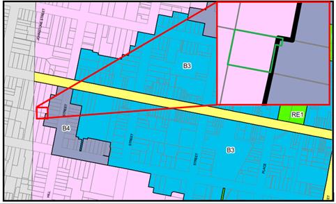
Figure 8 (and insert) - approximate location of lot 19
showing part of the land likely to be zoned
B4 Mixed Use
Clause 2.6 - Subdivision -
Consent Requirements
This clause triggers the need for development consent for
the subdivision of land, which that applicant has sought through this
application.
Clause 2.7 - Demolition
Requires Development Consent
This clause triggers the need for development consent in
relation to a building or work, which the applicant has sought through this
application. The proposed structures to be demolished include the bowling
greens, the greenkeeper's shed, and front fence and retaining wall, as well as
the two aboveground rain water tanks and storage shed in the north-eastern
corner of the site. There are no objections to the proposed demolition.
Part 3 -
Exempt and Complying Development
The application is not exempt or complying development.
Part 4 -
Principal Development Standards
Clause 4.1B - Minimum Lot
Sizes for Dual Occupancy, Multi Dwelling Housing and Residential Flat Buildings
This clause establishes the
minimum lot size required for dual occupancies and multi dwelling housing in
the R1, R2 and R3 zones. The proposed multi dwelling housing project is
situated on land within the R1 General Residential zone that is not identified
on the Minimum Lot Size Map. Accordingly, this clause requires the site to have
a minimum area of 1,250m2.
The resultant development lot
(created as part of Stage 1), being Lot 100 (battleaxe lot) is proposed at
3,680.6m2 and is therefore consistent with this clause.
Part 5 -
Miscellaneous Provisions
5.10 - Heritage Conservation
The subject land is identified as a heritage item listed
within schedule 5 of Orange LEP 2011. The land is also located within the
Central Heritage Conservation Area as defined by the heritage maps contained
within the Orange LEP 2011.
The subject land is also located opposite, adjoins, or is in
close proximity to the following heritage items as shown on the below figure.
· I6
– "Mena" dwelling – 50 Kite Street (opposite subject
land)
· I146 – dwelling
(former residence of the late Sir Charles and Lady Cutler) – 52 Kite
Street (opposite subject land)
· I44
– dwelling – 56 Kite Street (opposite subject land)
· I179
– dwelling – 50 Hill Street (opposite subject land)
· I41
– Heritage House "Gortnessy" – 58 Summer Street (adjoins
the subject land at the north-western corner)
· I144
– "The Channings" dwelling – 39 Kite Street (in proximity
of subject land)
· I143
– dwelling – 37 Kite Street (in proximity of the subject land).
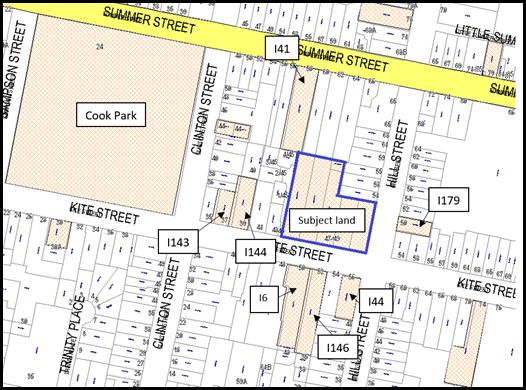
Figure 9 - the geographical relationship of the
subject land with surrounding heritage items
The relevant heritage inventory sheets describe the Heritage
Significance of the above properties and central conservation area as follows:
Newstead (former mansion)
Newstead was built in 1890 by John Douglas for Mr. &
Mrs. De Vries Pilcher as a double octagonal bay residence including a roof
mounted widows walk, considerable stained glass in the front door, its
surrounding sidelights and fanlight. The dominating Indian Cedar tree was
planted shortly after the house was built and is one of several significant
cultural plantings in the formal garden. It was purchased and adapted to
provide a Bowling Club in 1955.
Central Heritage Conservation
Area
Consisting of a range of buildings dating from the latter
part of the nineteenth century and the early part of the twentieth, the
conservation area has historical importance for reflecting the development and
prosperity of Orange during this period.
The conservation area exhibits several fine examples of
different architectural styles. The building materials used, the mature street
trees and the fine parklands all help to bring the area together as an
aesthetically pleasing whole and as a townscape of importance.
Representing much of the core of the city, the
conservation area has an appreciable level of social significance for the
Orange community.
50 Kite
Street "Mena"
This symmetrical masonry residence with curved return
verandah was built for Thomas Dalton by his father James, and is a significant
example of the Irish legacy and a manifestation of their confident outlook
while complementing the streetscape and contributing to the Conservation Area
within the city as a heritage item.
52 Kite
Street
An attractive Victorian-style residence which has
retained the original character and distinctive details, including mouldings,
verandah and barge boards, the property was the home of Sir Charles and Lady
Cutler. Sir Charles was leader of the Country Party, Minister for Education,
and Deputy Premier of NSW.
50 Hill
Street
The unusual early Inter war face brick house with hipped
and vented iron roof includes a distinctive arched central porch and the
building complements the streetscape and contributes to the Conservation Area
as a heritage item.
58 Summer
Street – Heritage House "Gortnessy"
An outstanding and representative example of an Edwardian
residence in garden setting and original piered and steel palisade fencing, the
building retains all the distinctive features from the original 1900 design and
complements to the streetscape and contributes to the Conservation Area as a heritage
item.
39 Kite
Street – "The Channings"
The late Victorian two storey residence dominates the
streetscape and has historical value as a guest house, the site contributes to
the Conservation Area as a heritage item.
37 Kite
Street
The late Victorian residence retains the original
character including the verandah, complements the streetscape and as a rare
example of the type is also intact and in a sound condition, contributes to the
Conservation Area as a heritage item
(1) Objectives
The
objectives of this clause are as follows:
(a) to
conserve the environmental heritage of Orange,
(b) to
conserve the heritage significance of heritage items and heritage conservation
areas, including associated fabric, settings and views,
(c) to
conserve archaeological sites,
(d) to
conserve Aboriginal objects and Aboriginal places of heritage significance.
The objects of the above clause centre on the conservation
of heritage places. Of particular relevance to this application are objectives
(a) and (b). Objectives (c) and (d) are less relevant to the application as the
site is not a known archaeological site or a site likely to contain aboriginal
objects; nor is the land a known aboriginal place of heritage significance.
Notwithstanding this, precautionary conditions relating to these two objectives
should be imposed if Council is of a view to approve the application.
In terms of determining whether the development is
consistent or inconsistent with the above objectives, it is necessary to
understand what is meant by the term conservation or to conserve. The Burra
Charter defines conservation to mean all the processes of looking after a place
so as to retain its cultural significance. In this case the places referred to
in the aforementioned definition include the heritage item on the land, the
central conservation area and the heritage items within the vicinity of the
development; and reference to the expression ‘the process’ includes
the assessment of the potential impacts a development may have on those places.
Council staff are of the view that the development,
specifically the design of Dwelling 1 and the design and siting of
Dwelling 2, will have a substantial detrimental impact upon the
significance of the heritage item on the land, the significance of the Central
Heritage Conservation Area and the significance of a number of heritage items
in the vicinity of the subject land.
Based on this contention by Council staff, the development
is considered to be fundamentally inconsistent with the first two objectives of
the above clause. Thus, the development is recommended for refusal.
(2) Requirement
for Consent
Development
consent is required for any of the following:
(a) demolishing
or moving any of the following or altering the exterior of any of the following
(including, in the case of a building, making changes to its detail, fabric,
finish or appearance):
(iii) a
building, work, relic or tree within a heritage conservation area,
(e) erecting
a building on land:
(i) on
which a heritage item is located or that is within a heritage conservation
area, or
(f) subdividing
land:
(i) on
which a heritage item is located or that is within a heritage conservation
area, …..
The development requires consent due to the foregoing
clause, which the applicant has sought by way of this development application.
(4) Effect
of Proposed Development on Heritage Significance
The
consent authority must, before granting consent under this clause in respect of
a heritage item or heritage conservation area, consider the effect of the proposed
development on the heritage significance of the item or area concerned. This
subclause applies regardless of whether a heritage management document is
prepared under subclause (5) or a heritage conservation management plan is
submitted under subclause (6).
As mentioned below a Heritage Impact Statement has been
submitted with the application which concludes the following:
The existing Newstead Mansion
would be retained. The proposal would have no impact on the presentation of the
site to Hill Street and would be appropriately landscaped such that the mansion
remains legible as one in a garden setting.
The subdivision of the western
part of the subject site would have no impact on the significance of Newstead.
Rather, it would create a subdivision pattern which would facilitate
development which better reflects the original subdivision pattern of the area.
The proposed development would
be concerned with a currently underutilised site and would constitute
appropriate infill development which responds to the character of the area
which is dominated by single storey detached residences.
The development will improve
the presentation to Kite Street by removing the unsympathetic metal fence and
colorbond shed.
The development is
appropriately designed in terms of form and materiality such that it is
referential to the context while avoiding monotony in its presentation. It
therefore would not visually dominate the streetscape.
The proposed works are
supported in accordance with the observations set down in this report.
Notwithstanding the above conclusion, Council’s
Heritage Advisor has consistently held the position that the design of
Dwelling 1 and the design and siting of Dwelling 2 will result in
unacceptable impacts upon the significance of the heritage item on the land,
the significance of the Central Heritage Conservation Area and the significance
of the heritage items in the vicinity of the subject land. These matter are
discussed in greater detail below under the infill guidelines.
Accordingly the development is recommended for refusal.
(5) Heritage
assessment
The
consent authority may, before granting consent to any development:
(a) on
land on which a heritage item is located, or
(b) on
land that is within a heritage conservation area, or
(c) on
land that is within the vicinity of land referred to in paragraph (a) or (b),
require
a heritage management document to be prepared that assesses the extent to which
the carrying out of the proposed development would affect the heritage significance
of the heritage item or heritage conservation area concerned.
A heritage management document in the form of a heritage
impact statement has been prepared by URBIS. Additionally, a separate Heritage
Impact Statement has been undertaken by the proponent's planning consultant
that deals with Council’s Infill Guidelines.
(6) Heritage
Conservation Management Plans
The
consent authority may require, after considering the heritage significance of a
heritage item and the extent of change proposed to it, the submission of a
heritage conservation management plan before granting consent under this
clause.
The heritage inventory sheet for the Newstead Bowling Club
identifies the level of heritage significance of the place as being at State
level. This is an elevated level of significance within the heritage
conservation framework from the regular Local level of significance.
Effectively, it is a way of further grading the heritage value of a property
based on its significance to the local community, the State and the nation.
This is notwithstanding the fact that the relevant listing within schedule 5 of
the LEP lists the land as being of Local significance – this appears to
be an anomaly as this status is established as part of the preparation of the
heritage inventory sheets – which list Newstead as a State item. This
anomaly should be addressed as part of a house keeping amendment to
the LEP. It is worth noting that Newstead was recognised as being
important at a State level under the former LEP.
When a development is contemplated on a State significant
local heritage item (not being on the State Heritage Register administered
under the Heritage Act) it presents as an ideal opportunity to require a
Heritage Conservation Management Plan to be prepared for the property. (It is
noted that there are only a dozen or so properties listed under the LEP as
being of State significance.).
A Heritage Conservation Plan is a document prepared in
accordance with guidelines prepared by the Public Service agency responsible to
the Minister administering the Heritage Act 1977 that documents the
heritage significance of an item, place or heritage conservation area, and
identifies conservation policies and management mechanisms that are appropriate
to enable that significance to be retained.
It is considered appropriate to have a mechanism in place
that deals with the ongoing management of the former mansion, particularly when
it is highly likely that some form of adaptive re-use will occur to it in the
future once the rezoning is finalised. As such, should Council be of a view to
approve the development a condition should be imposed that requires a Heritage
Conservation Management Plan for the former mansion and its curtilage to be
prepared and implemented as part of the ongoing management of the property into
the future. This is not considered an overly onerous task as a lot of the lead
work will have been completed as part of the preparation of the Heritage Impact
Statement.
(7) Archaeological
Sites
The
consent authority must, before granting consent under this clause to the
carrying out of development on an archaeological site (other than land listed
on the State Heritage Register or to which an interim heritage order under the Heritage
Act 1977 applies):
(a) notify
the Heritage Council of its intention to grant consent, and
(b) take
into consideration any response received from the Heritage Council within 28
days after the notice is sent.
The site is not an identified archaeological site.
Notwithstanding this, should Council be of a view to approve the application it
will be necessary to, as it is standard practice, impose a precautionary
condition that establishes protocols in the event that a European relic or
artefact is discovered during construction.
(8) Aboriginal
Places of Heritage Significance
The
consent authority must, before granting consent under this clause to the
carrying out of development in an Aboriginal place of heritage significance:
(a) consider
the effect of the proposed development on the heritage significance of the
place and any Aboriginal object known or reasonably likely to be located at the
place by means of an adequate investigation and assessment (which may involve
consideration of a heritage impact statement), and
(b) notify
the local Aboriginal communities, in writing or in such other manner as may be
appropriate, about the application and take into consideration any response
received within 28 days after the notice is sent.
An AHIMS search confirms that the land is not an identified
Aboriginal Place of Heritage Significance. Notwithstanding this, should Council
be of a view to approve the application it will be necessary to, as it is
standard practice, impose a precautionary condition that establishes the
protocols in the event that an Aboriginal object is discovered during
construction.
Part 6 -
Urban Release Area
Not relevant to the application. The subject site is not
located in an Urban Release Area.
Part 7 -
Additional Local Provisions
7.1 - Earthworks
This clause establishes a range
of matters that must be considered prior to granting development consent for
any application involving earthworks, such as:
(a) the likely disruption of, or any
detrimental effect on, existing drainage patterns and soil stability in the
locality of the development
(b) the effect of the development on the
likely future use or redevelopment of the land
(c) the quality of the fill or the soil to be
excavated, or both
(d) the effect of the development on the
existing and likely amenity of adjoining properties
(e) the source of any fill material and the
destination of any excavated material
(f) the likelihood of disturbing relics
(g) the proximity to and potential for adverse
impacts on any waterway, drinking water catchment or environmentally sensitive
area
(h) any measures proposed to minimise or
mitigate the impacts referred to in paragraph (g).
The plans submitted with the
development application indicate that the extent of earthworks associated with
the proposed development relate to the excavation of material in the front
(primarily south-western corner) of the site in the order of
approximately 500mm. The existing ground levels over the bowling greens
essentially set consistent finished floor levels for Dwellings 3-9.
The earthworks are considered
minor and ancillary to the proposed development, and are unlikely to have a
detrimental impact with regard to the foregoing matters.
However, should Council be of a
view to approve the application, it will be necessary to attach relevant standard
conditions that deal with the management of the required earthworks.
7.3 -
Stormwater Management
This clause applies to all
industrial, commercial and residential zones and requires that Council be
satisfied that the proposal:
(a) is designed to maximise the use of water
permeable surfaces on the land having regard to the soil characteristics
affecting onsite infiltration of water
(b) includes, where practical, onsite
stormwater retention for use as an alternative supply to mains water,
groundwater or river water; and
(c) avoids any significant impacts of
stormwater runoff on adjoining downstream properties, native bushland and
receiving waters, or if that impact cannot be reasonably avoided, minimises and
mitigates the impact.
The proposal has been designed
to include permeable surfaces and includes onsite retention of stormwater
through the use of detention basins within the private open space areas of
Dwellings 6 and 9. While the intended design represents an acceptable
engineering solution, Council’s Technical Services Division advises that:
the
proposed stormwater detention basin almost fully comprises the private open
space of dwellings 6 and 9. Due to the limits on maximum discharge rate of
stormwater to the kerb and gutter (20 L/sec) the stormwater basin will fill to
a depth up to 200mm 1-2 times per year thereby making the area of inundation
useless for private recreation purposes. The detention basin will fill to a
depth of up to 500mm in larger, less frequent storm events.
The proposed stormwater
solution, whilst acceptable from an engineering point of view, is considered
undesirable from a residential amenity perspective, with the likelihood of
prospective purchasers of these properties being unaware that their private
open space will be inundated with the development's stormwater on a regular
basis.
Councils Technical Services
Division further advises: that as an alternative to the single large basin
the applicant has the option of creating a series of smaller basins spread
throughout the development and / or connecting the drainage to the existing
underground stormwater system at the Hill St / Kite St roundabout. This option
potentially has more impact on the large tree as larger diameter outlet pipe/s
will be used.
Basically, this means that there
is an engineering solution that would improve the amenity of Dwellings 6
and 9 with the installation of large diameter piping to reduce the storage
volume and discharge the water at a faster rate (as it would connect to the
existing system). However, this potentially comes at a cost to the health of a
significant mature tree within the northern curtilage of the former mansion.
The alternative engineering solution (whether it be a series of small basins or
connecting directly with Council’s existing stormwater system at the
roundabout) would mean installing pipes within the structural root zone of the
subject tree.
Council’s Manage City
Presentation provides the following advice with respect to the subject tree:
The
subject tree, a Deodar Cedar (Cedrus deodara), is a mature specimen with a
diameter at breast height (1400mm above ground level) of 1000mm and at the root
buttress of approximately 1140mm. A tree having a root buttress of 1.14m has a
Structural Root Zone (SRZ) of 3.77mm in radius from the centre of the stem. In
the conceptual layout for servicing the proposed stormwater main is proposed to
be constructed within 3 metres of the centre of the stem of the Deodar Cedar.
The Tree Protection Zone (TPZ) for this tree is in the order of 12 metres in
radius from the centre of the stem. The proposed trench is considered to be a
major encroachment within the TPZ as all root activity to support a healthy and
vigorous tree will be severed by open trenching 3 metres to the north of the
stem.
As there
is a major encroachment within the TPZ a review of the SRZ is also required. As
mentioned above the SRZ is 3.77m in radius from the centre of the stem. The SRZ
is the area required for the stability of the tree. The proposed trench is
well within the limit of the SRZ and as such may influence the stability of the
tree as structural roots are highly likely to be encountered and possibly
severed.
Council’s Manager City
Presentation recommends an alternate path for stormwater discharge to Kite
Street or the use of boring rather than trenching to the lay the pipes. An
alternate path to Kite Street is not possible as the required grade is not
achievable. With regards to the boring option, there are limitations on the
size of pipes that can be bored. The alternate engineering solution suggested
by Council Technical Services Division that involves piping to the roundabout
requires the installation of two x 225mm-300mm diameter pipes; it is not
feasible to bore when installing a pipe of this diameter.
In summary, the stormwater
detention design as proposed by the applicant is unacceptable from a
residential amenity perspective; and the alternate improved engineering
solution (piped to the roundabout) is not acceptable either as Council staff
cannot, with any degree of certainty guarantee the health and survival of the
large Deodar Cedar (Cedrus deodara) to the north of the former mansion.
Accordingly, the stormwater design of the development is unsatisfactory and is
one of the reasons the development should not be approved.
7.6 -
Groundwater Vulnerability
This clause seeks to protect
hydrological functions of groundwater systems and protect resources from both
depletion and contamination. Orange has a high water table and large areas of
the LGA, including the subject site, are identified with “Groundwater
Vulnerability” on the Groundwater Vulnerability Map. This requires that
Council consider:
(a) whether or not the development (including
any onsite storage or disposal of solid or liquid waste and chemicals) is
likely to cause any groundwater contamination or have any adverse effect on
groundwater dependent ecosystems, and
(b) the cumulative impact (including the
impact on nearby groundwater extraction for potable water supply or stock water
supply) of the development and any other existing development on groundwater.
Furthermore, consent may not be granted unless Council is satisfied that:
(a) the development is designed, sited and
will be managed to avoid any significant adverse environmental impact, or
(b) if that impact cannot be reasonably
avoided - the development is designed, sited and will be managed to minimise
that impact,
(c) if that impact cannot be minimised - the
development will be managed to mitigate that impact.
It is noted that an existing
bore is located in the far north-eastern corner of the site. This bore is
likely to have been established as part of the irrigation system to maintain
the bowling greens and the landscaped setting around the former mansion.
The bore would be located within
the rear yard of Dwelling 9 in the north-eastern corner of the proposed
lot. Council staff were not able to obtain any licencing details for the
subject bore. However, it is likely that the developer or future occupants of
Dwelling 9 would need to speak with the NSW Office of Water to establish
if the licence needs to be reclassified in the event the bore is intended to be
maintained.
From a planning point of view,
there will be an obvious diminution of water usage as a result of the bore
transferring to a domestic scale of use, and as such there would be no objections
to the bore being retained and used for domestic purposes only.
There are no other aspects of
the development that would have a detrimental impact on the existing ground
water within the City.
Clause 7.11
- Essential Services
Clause 7.11 has the effect of
ensuring that all necessary services are, or will be available for a particular
development.
The subject land is serviced by
Council’s water, sewer and stormwater systems. Other services such as
electricity, gas and telecommunications are also available to the land.
It is noted that the design of
the driveway system of proposed Lot 100 (battleaxe lot) with the two right
angle turns will not allow a firefighting appliance to practically enter the
site (past the first 90 degree turn) and leave the site in a forward direction.
This will mean that a private
domestic hydrant system will need to be installed in the common property of
Lot 100 - likely to be to the left of the garage attached to proposed
Dwelling 3. The positioning of this hydrant is important so that the
maximum 90m (three (3) hose lengths) hose coverage can be
achieved to all dwellings within the site. If this is not able to be achieved,
the furthermost dwelling (Dwelling 9) may need a domestic sprinkler system
installed within the dwelling. These requirements are set out in the Fire and
Rescue NSWs Fire Safety Guidelines: Fire hydrants for minor residential
development Version 02. Should Council be of a view to approve the
development it will be necessary to impose conditions that ensure compliance
with the aforementioned guideline. Additionally, the positioning of the hydrant
is important so as not to impact upon the streetscape. As such, the terms of
the condition must be written in a way whereby the hydrant is located as far
into the site as practicable taking into account the requirements of the
aforementioned guideline. A hydrant booster within the street or adjacent to
the front boundary would not be acceptable.
The development is able to be
made consistent with the above clause by condition.
STATE ENVIRONMENTAL PLANNING
POLICIES
State Environmental Planning Policy 55 - Remediation of
Land
State Environmental Planning
Policy 55 - Remediation of Land (SEPP 55) requires that a consent
authority must not consent to the carrying out of development of land unless it
has considered whether the land is contaminated, is satisfied that the land is
suitable in its contaminated state for the development that is proposed, and if
the land requires remediation to be made suitable for the proposed development
it is satisfied that the land will be remediated before the land is used for
that purpose.
Furthermore, SEPP 55 requires
that before determining an application for consent to carry out development
that would involve a change of use on any of the land specified in
subclause (4), the consent authority must consider a report specifying
findings of a preliminary investigation of the land concerned. Notably,
subclause (4) refers to ‘residential purposes’.
The land has a long history,
being used for recreational purposes as a bowling club dating back to 1955,
with two bowling greens in the location of the proposed residential
development. As such, given the change of use to a residential use,
subclause (2) requires a preliminary investigation to be submitted with
the application. Envirowest Consulting (report ref. R7443c2) have
completed a preliminary contamination investigation which acknowledges the use
of pesticides and herbicides over the bowling greens as part of the day-to-day
maintenance of the greens. The report tested the site (including greenkeeper's
shed, car park and storage areas) for heavy metals and organochlorine
pesticides. The report concluded that no further investigation is necessary and
the site is suitable for residential development.
Notwithstanding this, should
Council be of the view to approve the development it would be necessary to
impose Council's standard precautionary condition that deals with the unlikely
event of unexpected contamination being encountered.
State Environmental Planning
Policy (Infrastructure)
State Environmental Planning Policy (Infrastructure) is
applicable to the development, specifically clause 45. This clause applies
when there is electricity infrastructure within or adjacent to a development
site and gives the supply authority the opportunity to comment on the
development from a safety point of view.
In this case there is a low voltage connection line that
crosses Kite Street from in front of 52 Kite Street and connects to a pole
in the footpath on the northern side of Kite Street. The line also provides
street lighting. The subject line and pole will need to be moved or the line
laid underground and a new street light provided by other means as the pole is
in the location of the proposed gutter bridge footpath crossover.
Essential Energy (being the
relevant supply authority) have advised no objections to the development
provided the following requirement (amongst others) is met:
The
existing low voltage overhead power line connection to Lot 1 and Lot 2 in
DP1127220 may need to be disconnected and/or relocated – refer to
Essential Energy’s Contestable Works Team for requirements. The Applicant
should engage the services of an Accredited Service Provider who will guide
them through this process.
If Council is of a view to approve the development, the
above requirement and the other standard requirements from Essential Energy
will need to be imposed as conditions and/or advisory notes on the consent.
PROVISIONS OF ANY DRAFT
ENVIRONMENTAL PLANNING INSTRUMENT THAT HAS BEEN PLACED ON EXHIBITION
s79C(1)(a)(ii)
It is noted that the Planning Proposal that applies to the
land has been exhibited, with the post-exhibition report being considered at
the same meeting as this report. The planning proposal seeks to rezone the Newstead
and its curtilage (effectively the same area of land as proposed lot 101) to B4
Mixed Use. Additionally, a floor space ratio and building height development
standards will also be included over the land.
DESIGNATED DEVELOPMENT
The proposed development is not designated development.
PROVISIONS OF ANY DEVELOPMENT
CONTROL PLAN s79C(1)(a)(iii)
Development Control Plan 2004
Development Control Plan 2004 (“the DCP”)
applies to the subject land. Chapters of the DCP relevant to the proposed
use and development include:
· Chapter 0 -
Transitional Provisions;
· Chapter 2 -
Natural Resource Management;
· Chapter 3 -
General Considerations;
· Chapter 4 -
Special Environmental Considerations;
· Chapter 5 -
General Considerations for Zones and Development;
· Chapter 7 -
Development in Residential Zones;
· Chapter 13 -
Heritage; and
· Chapter 15 - Car
Parking.
CHAPTER 0 - TRANSITIONAL
PROVISIONS
Section 0.2 - General Translation of Zones
Section 0.2 - General Translation of Zones provides that any
reference to a zone under Orange Local Environmental Plan 2000 is to be a
reference to the corresponding zones in the zone conversion table.
The table identifies that the R1 General Residential zone
corresponds with the 2a Urban Residential zone for the purposes of the DCP.
Accordingly, Chapter 7 is of primary relevance to the assessment of the
residential development.
As acknowledged above, a 3.4m2 area of land in
the far north-eastern corner of the site is identified as B4 Mixed Use zoned
land. This part of the site relates to the private open space of
Dwelling 9. There are no aspects of the DCP that conflict with this small
area of land, and there is no essential or practical requirement to assess the
small area of land under a separate section of the DCP or as a separate
consideration.
CHAPTER 2 - NATURAL RESOURCE
MANAGEMENT
Section2.1 - Water Quality
Section 2.1 - Water Quality identifies that development that
concentrates, redirects flows, increases flow rates or disturbs land in close
proximity to creeks has the potential to affect waterways with associated
erosion, sedimentation and release of nutrients, which combine to affect
downstream water quality. Section 2.1 also identifies that development
involving groundwater extraction and/or onsite wastewater disposal is deemed to
affect groundwater resources.
The relevant matters have previously been addressed in
detail under the headings “7.3 ‑ Stormwater” and
“7.6 - Groundwater Vulnerability”.
It is considered that the requirements of the DCP have been
adequately addressed.
Section 2.2 - Soil Resources
Section 2.2 - Soil Resources identifies that soil
characteristics influence land use and development capability, including the
suitability for building footings, onsite waste disposal, road engineering and
drainage.
Council’s Technical Services Division has recommended
a condition of consent requiring that the development is to be constructed in
accordance with Council’s Development and Subdivision Code. Should
Council be of the view to approve the development it will be necessary to
impose this condition.
It is considered that the requirements of the DCP have been
adequately addressed.
CHAPTER 3 - GENERAL
CONSIDERATIONS
Section 3.1 - Cumulative Impacts
Section 3.1 - Cumulative Impacts identifies that Council
will consider not only the direct impacts of a particular development, but also
whether the development, when carried out in conjunction with other development
in the locality, has a more significant environmental impact.
Cumulative impacts of the proposed development are addressed
under the heading “Likely Impacts of the Development”.
Section 3.2 - Scenic, Landscape
and Urban Areas
Section 3.2 -Scenic, Landscape and Urban Areas identifies
that in urban areas consideration should be given to the character of the locality,
whether that locality is recognised as having heritage character with formal
plantings of exotic trees or whether the locality comprises areas developed as
suburban release areas where informal native planting is common.
The area is a significant and important heritage precinct.
For the sake of avoiding repetition these considerations are addressed below
under the considerations of the Infill Guidelines.
Section 3.4 - Waste Generation
Section 3.4 - Waste Generation requires that applications
involving demolition include proposed measures that will be implemented for
reuse and recycling of waste, and that development involving demolition is
carried out in a manner that optimises reuse and recycling of waste materials
consistent with waste-minimisation principles.
The application involves minor demolition in the form of
buildings and structures ancillary to the bowling greens.
Council’s Building Surveyor has indicated that should
Council be of a view to approve the development, it will be necessary to impose
conditions that relate to the demolition component of the development.
CHAPTER 4 - SPECIAL
ENVIRONMENTAL CONSIDERATIONS
Section 4.1 - Sewage Disposal
Section 4.1 - Sewage Disposal identifies that urban
development must be connected to a sewerage system approved by Council prior to
occupation. For the purposes of this clause, urban development includes all
development within residential, business and industrial zones (and associated
open space and special use zones).
It is noted that an existing Council sewer main traverses
the site. Should Council be of a view to approve the development it will be
necessary for the existing sewer to be relined; and construction of new sewer
mains to connect to Council’s existing sewerage system will also be
necessary.
Section 4.3 - Land Shaping
Section 4.3 - Land Shaping identifies that substantial land
shaping, including filling or excavating land, has the potential to generate
significant environmental impacts; and that land shaping should not adversely
affect land in the vicinity as a result of drainage, erosion or sedimentation,
or as a result of leachate entering surface or groundwater.
The relevant matters have previously been addressed under
the heading “7.1 ‑ Earthworks”.
It is considered that the requirements of the DCP have been
adequately addressed.
Section 4.4 - Contaminated Land
Section 4.4 - Contaminated Land identifies that contaminated
land can pose a risk to human health and the environment. Contaminants can be
released into waterways and humans exposed when contaminated land is disturbed
as a consequence of development.
The relevant matters have previously been addressed under
the heading State “Environmental Planning Policy 55 - Remediation of
Land”.
It is considered that the requirements of the DCP have been
adequately addressed.
CHAPTER 5 - GENERAL
CONSIDERATION FOR ZONES AND DEVELOPMENT
Section 5.3 - Advertised Development
Section 5.3 - Advertised Development identifies that Council
will give written and published notice of applications for advertised
development as required by the Environmental Planning and Assessment
Regulations.
The development is a kind that requires formal advertising
and notification. As outlined above, Council staff undertook advertising and
notification on three separate occasions due to substantial changes to the
design and confusion arising out of the exhibition material.
At the end of those periods a total of 26 written
submissions were received (broken down as 6 during the first exhibition
period, 13 during the second exhibition period and 7 during the third
exhibition period). It is noted that a number of submitters furnished
submissions during all three exhibition periods - of those, some made new
submissions, while others reiterated previous comments. A detailed assessment
of the issues raised by the submitters is provided under the heading “Any
Submissions Made in Accordance with the Act”.
CHAPTER 7 - DESIGN ELEMENTS
FOR RESIDENTIAL DEVELOPMENT
The development is essentially three stages (or three
separate developments within the one application (which the EP&A Act allows
for)); being a four lot Torrens Title subdivision, construction of nine
dwellings (two dwelling houses and seven dwellings as part of the multi
dwelling housing component) and finally, a Community Title subdivision over the
multi dwelling housing component. The following DCP assessment addresses the
relevant DCP provisions in the order of staging of the development.
STAGE 1 - FOUR LOT TORRENS
TITLE SUBDIVISION
The DCP sets the following (applicable) Planning Outcomes in
regard to urban residential subdivision:
· Lots
are orientated to optimise energy-efficiency principles.
The subject lots, particularly Lots 102 and 103, will have a
north-south orientation, and being located on the northern side of Kite Street
provide the potential for the design of future dwellings to provide north
orientated private open space and rear living rooms with northerly aspects. The
battleaxe lot will result in the same orientation and potential for appropriately
orientated open space areas of future dwellings. Orientation of Lot 101
(containing the former mansion) is appropriate, however is less important given
the future zoning to B4 Mixed Use. Notwithstanding, should the mansion be
returned to a dwelling use, then the orientation is appropriate and would allow
for private open space with a northerly aspect.
The development is consistent with the above planning
outcome.
· Lots
are fully serviced and have direct frontage and access to a public road.
The proposed lots will each have direct street frontage and
legal and practical access to Kite Street. Separate access will be provided to
the proposed lots via vehicle crossings and driveways. Council’s
Technical Services Division has advised of no objections to the proposed access
arrangements. It is noted that due to the grade of the footpath, an extension
of the existing gutter bridge on the neighbouring property to the west will be
required for proposed Lots 100 and 103. Lot 102 will require a similar
treatment but separate.
As noted below, the new access points will impact upon the
visual quality of the Heritage Conservation Area and reduce the
availability/supply of on-street parking. This is further addressed below.
· Design
and construction complies with the Orange Development and Subdivision Code.
The subdivision design and construction will be required to
comply with the Orange Development and Subdivision Code. Should Council be of a
view to approve the development, it will be necessary to impose conditions that
require the development to be consistent with the Orange Development and
Subdivision Code.
· Battleaxe
lots provide an adequate accessway width for the number of dwellings proposed
to be served in order to allow for vehicle and pedestrian access and location
of services.
The battleaxe lot is proposed with a 7m wide access handle
at the street frontage, which reduces to 6m wide approximately 12m from Kite
Street. A 4.5m driveway will be provided to service the future multi-dwelling
housing. The circulation of vehicles within the site is considered under
Stage 2 of the development below.
Council’s Technical Services staff raise no objections
to the proposed accessway width proposed as part of the subdivision.
The size of the battleaxe lot is well above the DCP's
requirement of 650m² for battleaxe lots.
Generally speaking, the size and shape of the lots and the
existing topography of the land will result in lots that will provide suitable
residential amenity to occupants of future dwellings upon the proposed lots.
Car Parking
A car parking assessment is not a typical consideration at
subdivision stage as car parking rates are attributed to a land use. However,
the scenario proposed by the applicant, whereby an area of parking attributed
to the former club is being subdivided and replaced by dwellings, makes it a
necessary consideration at the subdivision stage.
In order to fully appreciate the car parking situation that
occurs as a result of the proposed subdivision, the number of existing spaces
being lost needs to be established along with establishing the practical number
of spaces that can fit within Lot 101.
A hand drawn plan (dated Nov. 2004) on Council’s file
shows the provision of 7 spaces at the front of the site in the area where
Dwellings 1 and 2 (Lots 102 and 103) are proposed.
It needs to be acknowledged that these spaces are being
removed and there is only a certain amount of area within the curtilage of the
heritage item on proposed Lot 101 where parking can be provided without
impacting upon the setting of the heritage item.
It also needs to be acknowledged that the submitted plans
show the provision of 7 spaces to the south of the heritage item. These
spaces are highly constrained in terms of vehicles being able to practically
enter and exit these spaces. For example, the isle width for spaces 1-3
measures less than 5m, which does not meet the applicable Australian Standard.
Based on this assessment it estimated that the likely
maximum number of physical spaces able to be practically provided on the lot
containing the Newstead building (Lot 101) without impacting upon the
setting would be 4 spaces.
The applicant has not nominated a specific land use for the
Newstead building at this time; and with the impending re-zoning to B4 Mixed
Use, the array of permissible uses in that zone varies from returning the
building back to a substantial single dwelling, retail shops, restaurants or
cafes; or some form of tourist accommodation, for example.
All Council staff can possibly do at this stage is assess the
availability of parking as a result of the subdivision and flag that any future
development will need to accord with Council’s DCP to avoid an
unacceptable environmental impact in the locality.
It should be noted that the site falls within the car parking
contributions catchment area. This means that, subject to an acceptable level
of environmental impact, a shortfall in off-street parking under a future
development application for the use of the former club could theoretically be
addressed via a monetary contribution in lieu of the physical spaces on the
land.
Based on the possibility that the development could be
returned to a dwelling (at which point the level of car parking would be
acceptable, notwithstanding the absence of a covered parking space), it is not
reasonable (in the Wednesbury sense) for the development to be refused on car
parking grounds as part of this application.
Finally, in light of the unsatisfactory car park design
within the Kite Street frontage of the former mansion, for the avoidance of
doubt or ambiguity in the future, a condition should be imposed (if Council is
of the view to approve the development) that indicates those spaces are not
approved.
On a separate but related matter, the subdivision (with the
requirements for legal access to a public road under the Torrens Title system),
removes the availability of (conservatively) three to four parking spaces
within the street. This goes to the suitability of the development, where a
more appropriate design with a single driveway system could reduce this number
of lost spaces.
Heritage
Subdivision of land has the ability to have a long lasting
effect on a particular place or precinct, particularly so when excising a
heritage item is involved. As such, careful consideration needs to be given to
the effect proposed boundaries will have on the heritage significance of the
item, and more importantly the curtilage around the heritage item. The proposed
lot that will contain the heritage item (lot 101) is considered to be
reasonable. The provided curtilage will include the landscape setting that
forms part of the mansion's heritage significance.
Additionally, the existing curved retaining wall that
manages the change in ground level between the mansion and the bowling greens
has been included within the curtilage of the heritage item as an
interpretation and recognition or reminder of the former bowling greens.
It should also be noted that in order to achieve the desired
heritage outcomes (i.e. remove the presence of garages being visually dominant
in the street and provide a greater setback of a dwelling on Lot 102), it may
be necessary to devise a different subdivision pattern to achieve those
outcomes.
Council staff raise no objections to the proposed four lot
Torrens Title subdivision from a heritage conservation perspective.
STAGE 2 - DWELLINGS HOUSES
(TWO) AND MULTI DWELLING HOUSING
Residential Design Objectives
· To
ensure that the development fits into its setting and environmental features of
the locality.
· To
ensure that the appearance of housing is of a high visual quality, enhances the
streetscape and complements good quality surrounding development.
· To
ensure that new development complements places with heritage significance and
their settings in a contemporary way.
· To
develop a sense of place with attractive street frontages.
· To
encourage visually appealing cohesive streetscapes.
· To
create a safe and secure environment.
· To provide
consistent design elements that protect private investment.
The development is inconsistent with the above objectives.
As further outlined below, the design of Dwelling 1 and the design and siting
of Dwelling 2 will be incongruous with the surrounding heritage setting, and
will result in an incompatible infill development that will visually disrupt
and unacceptably detract from an existing high quality streetscape.
Heritage
The DCP sets the following Planning Outcomes in regard to
Heritage:
· Heritage
buildings and structures are efficiently re-used.
· New
development complements and enhances the significance of a heritage item or
place of heritage significance listed in the Orange Heritage Study.
· Significant
landscape features are retained including original period fences and period
gardens.
NOTE - In heritage settings these criteria override other
criteria in this Plan [emphasis added]
The above note indicates that in a heritage setting, the
heritage provisions contained within the DCP are a higher level of
importance in the assessment of a development than any other provision, to the
extent that they override other provisions contained in the plan. Accordingly,
the following DCP assessment places a focus on the heritage provisions. It also
makes sense to address the infill guidelines at this point to consolidate the
relevant heritage consideration to one section of the report. When addressing
the “other criteria” below, if that criteria has been addressed
earlier in the report under this (heritage) section, it is noted as being the
case.
As mentioned throughout the report and as outlined in detail
below under the considerations of the Infill Guidelines, the design of Dwelling
1 and the design and siting of Dwelling 2 will have unacceptable impacts
upon the significance of the heritage item on the land, the significance of the
Central Heritage Conservation Area and the significance of heritage items
within the vicinity of the subject land.
The development is in direct conflict with the above
planning outcome, which seeks to ensure that new development complements and
enhances the significance of a heritage item or place of heritage significance
listed in the Orange Heritage Study as described in detail below. The conflict
with the planning outcome principally arises with the presentation of the
garages and the siting of dwelling two as outlined in detail below.
INFILL GUIDELINES
Council’s Infill Guidelines have been prepared to
provide an assessment framework for developments located in heritage settings
to ensure good quality and sensitive design outcomes. The framework is
structured to guide development in heritage settings under five key heads of
consideration, namely:
· Character
· Scale and Form
· Siting
· Materials and
Colour
· Detailing
As noted above, the subject land is identified as a heritage
item listed within Schedule 5 of Orange LEP 2011. The land is also
located within the Central Heritage Conservation Area as defined by the heritage
maps contained within Orange LEP 2011.
The subject land is also located opposite, adjoins or is in
close proximity to the following heritage items as shown on the above figure 9:
· I6 –
"Mena" dwelling – 50 Kite Street (opposite subject land)
· I146 –
dwelling (former residence of the late Sir Charles and Lady Cutler) –
52 Kite Street (opposite subject land)
· I44 –
dwelling – 56 Kite Street (opposite subject land)
· I179 –
dwelling – 50 Hill Street (opposite subject land)
· I41 –
Heritage House - "Gortnessy" – 58 Summer Street (adjoins the
subject land at the north-western corner)
· I144 –
"The Channings" dwelling – 39 Kite Street (in proximity of
subject land)
· I143 –
dwelling – 37 Kite Street (in proximity of the subject land).
Objectives of Infill Design
The development is patently inconsistent with a number of
the objectives of infill design listed within the guidelines, namely;
· To
ensure new buildings respond to and enhance the character and appearance of the
streetscapes of the Heritage Conservation Areas.
· To
ensure contributory heritage items retain their prominence and are not
dominated by new development within a Heritage Conservation Area and do not
compromise the heritage values of the existing area.
· To
ensure new buildings do not adversely affect the significance, character or
appearance of the Heritage Conservation Area or heritage items.
· To
allow for reasonable change within a Heritage Conservation Area while ensuring
all other heritage objectives are met.
The inconsistency with these objectives further demonstrates
that the development is unacceptable.
Character
The submitted SoEE provides a good assessment of the
character of the location. The statement indicates that:
Kite Street, particularly in
the vicinity of the subject land and the proposed new dwellings is recognised
as an important streetscape that is characterised by the following:
· Intact rows of mostly
single storey dwellings with relatively consistent setbacks.
· Older style
buildings. The buildings, particularly in the vicinity of the subject land,
date from the late 19th century to the early-mid 20th
century. The property immediately adjacent to the western boundary of the
subject land comprises a relatively later 20th century dwelling
(circa 1960s) which faces Kite Street.
· Dwellings that
present to the street with a 2 to 3 room wide façade/ reflective of
older style buildings, roof pitch is generally steeper than typical modern
building forms and window proportions have a vertical emphasis.
· Narrow driveways
alongside dwellings that lead to garages at the rear. Whilst the neighbourhood
is characterised by garages that are set to the rear of residential properties
(largely out of view), there are some instances where the garages are evident
in streetscape views [our emphasis].
· Dwellings that
generally relate to the existing landform consistently and without obvious cut
or fill earthworks. The subject land itself rises more than others above the
road and footpath. This is evident by the retaining wall and fill at the front
of the site.
· Important
contributory vegetation attributed to:
o Landscaped front yards, many of
which contain larger ornamental deciduous trees.
o Well established large deciduous
street trees which are planted in the road reserve between the traffic and the
kerb.
o The established trees sit within
the northern, eastern and south eastern curtilage of the Newstead building
within a well landscaped yard.
o Cook Park vegetation which forms
an important backdrop.
· Front fences in a
range of (mostly sympathetic) styles.
· Occasional infill
development that occurs behind the older established homes. In particular, an
infill development of relatively new single dwellings (circa 2005 to 2015) is
adjacent to the western boundary of the subject land.
· Various local
landmarks including:
o Cook park
o “Mena”, a heritage
item of state significance
o The “Newstead”
building itself.
Council staff agree with the above character assessment. The
area concerned is one of the most significant precincts within the City.
Garages in the immediate streetscape are an uncommon element. Those few that
are present in the immediate area are listed and described below:
· 48
Kite Street – detached double garage located in generous landscaped front
setback area. The garage is designed in a way whereby it does not present to
the street. Additionally, the site is constrained in terms of where a suitable
garage could be provided elsewhere within the site.
· 46
Kite Street – brick wall in line with the front building line. Arched
single vehicle opening and metal gates.
· 39
Kite Street “The Channings” – double garage located
approximately 18.5m from front boundary. This was identified within the URBIS
HIS as being an example of similar garages within the locality. Council staff
disagree that this is a comparable example. The garage has been integrated into
the site in a way whereby it appears that the garage is detached from and
located to the rear as a subservient ancillary building, whilst ensuring the
prominence of the heritage item is retained from all vantage points.
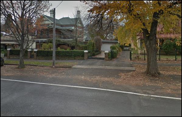
Figure 10 - 39 Kite Street “The Channings”
- example of an acceptable garage integration
39 Kite Street noted above serves as an example of how a
garage could be successfully integrated into a heritage context.
Council’s Heritage Advisor holds the view that
proposed Dwellings 1 and 2 will have a substantial detrimental impact
upon the significance of the area concerned, including the Newstead building,
the Central Heritage Conservation Area and important heritage items in the
locality for the reasons outlined throughout the report. The adverse impact
upon the character of the area is such that the application should not be
supported.
Scale and Form
The scale of a building is essentially its size in relation
to buildings in the area. The size of the dwellings will be single storey, with
9 foot ceilings and 27 degree pitch roofs. The scale of the development is not
incompatible with the immediate area. Council’s Heritage Advisor has not
raised the scale of the development as being unsatisfactory as there are
examples in the area of dwellings similar in size or larger, such as the two
storey dwelling at 39 Kite Street.
It is noted that with the change in ground level between the
front of the site and the existing height of the bowling greens results in
Dwelling 3 and in particular Dwelling 4 (as viewed through the space
between Dwelling 2 and the Newstead Building) results in dwelling 4
sitting above the gutter height of the heritage item. This is shown in the
below photomontage.
Whilst the second row of
dwellings will sit above the heights of the front dwellings and the heritage
item, the resultant impact from this is considered secondary to the principle
impacts that occur as a result of attached double garages and the siting of
Dwelling 2 as described below.
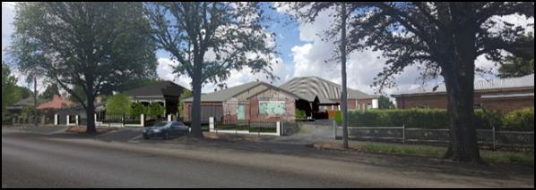
Figure 11 - photomontage providing an impression of
the development's appearance within the street
Form relates to a building's overall shape and volume and
the arrangement of its parts.
The form of the two dwellings at the front of the site with
attached double garages fronting Kite Street is inconsistent will predominant
building form in the locality. The prevailing form of dwellings comprise
habitable rooms with windows presenting to the street with verandahs and other
architectural detailing. As such, the form of the subject dwellings with
attached double garages is consistent with the theme of built form in the
street, and as such will be incompatible in the street.
Additionally, the window shown in the front elevation of
Dwelling 1 presents with square proportions. The prevailing style of
windows within the conservation area are windows with vertical proportions. As
such, should Council be of the view to approve the development, this window should
be deleted and replaced with two symmetrically positioned and vertically
proportioned timber sliding sash windows. This should be addressed via a
condition.
The forms of Dwellings 1 and 2 are in consistent
with Council’s Infill Guidelines.
Siting
Appropriate siting of infill development - how and where
development is positioned in relation to the road, front and side boundaries
and built form on adjoining land - is crucial in ensuring a harmonious,
cohesive and compatible development outcome in a heritage setting. The
Guidelines further state that development should retain the building-to-space
theme predominant in the area, including driveway widths.
In terms of siting, the main considerations of the
development therefore relate to front setbacks, the space between dwellings
(particularly relating to Dwellings 1 and 2 given they have street
frontage) and the widths of driveways.
In terms of front setbacks, proposed Dwelling 1 will
have a front setback of 7m to the front line of the verandah, 8.2m to the
building proper and 12.2m to the attached garage. Proposed Dwelling 2 will have
a front setback of 7.6m to the front building line and 12.26m to the
attached garage.
The front setbacks of Dwellings
1 and 2 have clearly been established based on a relationship with the setbacks
of dwellings to the west, rather than also considering the relationship with
the heritage item on the land to the east. Council’s Heritage Advisor
does not support the setback of Dwelling 2. Council staff requested that the
development be designed in a way whereby Dwelling 2 could be afforded a greater
setback that has a more appropriate relationship with the former mansion. The
applicant in response has set Dwelling 2 back an additional 700mm. To
achieve the recommendation from Council’s Heritage Advisor, it would have
been necessary to have provided Dwelling 2 with a setback equal to or
greater than the red line shown in the below figure.
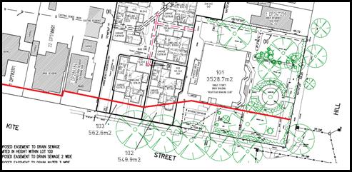
Figure 12 - nominal setback recommended by
Council’s Heritage Advisor
The proposed siting of Dwelling 2 will have a significant
adverse impact upon the streetscape and the significance of the heritage item
on the land.
The other consideration of siting relates to the widths of
driveways. The design of the development will result in three contiguous
footpath crossings - being 45 Kite Street, Lot 100 and Lot 103); plus
a further three driveways - being Lot 102 and the two existing driveways
serving the southern side of the Newstead building.
Council’s Photoshop
consultant has prepared a photomontage impression of what the proposed driveway
arrangement will look like in the street. As can be observed from the below
figure, there are no examples in the area of similar accessways, in terms of
width, extent of concrete and concentration. This too will have a significant
impact upon the streetscape.
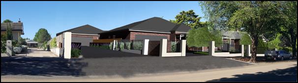
Figure 13 - photomontage (prepared by Council's
consultant) depicting the extent of the accessways
Materials and Colour
A detailed external materials: Colours and Finishes schedule
has been submitted with the application. The materials comprise dry pressed
face brick (all dwellings to be the same colour brick - PGH Gledswood
blend above floor level and PGH Mowbrey blend below floor level intended
to interpret the traditional bluestone foundations), Colorbond roof sheeting
(colour alternating between dwellings with either Basalt [Dwelling 1 for
example] or Shale Grey [Dwelling 2 for example]), quad gutters, metal fascia,
circular downpipes and panel lift garage doors.
Council’s Heritage Advisor previously provided
guidance around the external materials and colours, such as the primary face
bricks with contrasting blue coloured sub-floor bricks to interpret the
vernacular architecture in the locality of dwellings having bluestone
foundations. The applicant has incorporated those previous recommended
materials into the design.
However, Council’s Heritage Advisor indicates that
there are several design elements that remain in conjecture which relate to the
following:
· The brick piers
as verandah details with the posts are inconsistent with a design approach
which interprets heritage character without imitation. The brick bases could be
deleted and the posts extended;
· Aluminium
windows on the front elevations are inconsistent with the character and details
appropriate for the Conservation Area streetscape and a site in the vicinity of
heritage items. All windows to the two Kite Street dwellings could be timber
with an appropriate timber stain finish; and
· The gable
infill elements are inconsistent with a design approach which interprets
heritage character without imitation. They could be contemporary painted fibre
cement vertical panels with vertical recessed 15mm joints in place of the cover
battens.
· The
fence pier proposal is inconsistent with details, materials and colours which
are sympathetic with the heritage details in the streetscape. A suitable
modification would be nominal 470mm max width to the piers an their material to
be the selected face brick with brick capping and mortar coloured to match the
brick
· The
indicated bricks are acceptable. All mortar jointing material is to be coloured
to reflect the brick colour so as to produce a contemporary interpretive
character
Should Council be of a view to approve the development, it
will necessary to impose conditions that amend the development to reflect the
above advice.
Detailing
The key consideration concerning detailing comes with
ensuring important features common to the area are carried over and interpreted
in contemporary way within the infill development - this could be chimneys,
verandahs, window awnings etc.
The detailing adopted within the design, particularly
Dwellings 1 and 2 will comprise verandahs, gable ends for
Dwelling 2 and simple windows. Except as required to be amended elsewhere,
the detailing adopted within the design is acceptable.
A landscape plan has been submitted in support of the
proposal which shows the provision of soft landscaping in the form of three
Crepe Myrtles, two Magnolia Royal Crowns and turf within each of the frontages
of Dwellings 1 and 2; and rows of hedges or groundcovers adjacent to
driveways. Hard landscaping consists of the three driveways and a central path
from the footpath to the front verandahs of Dwellings 1 and 2. The hard
landscaping is intended to be Boral Colori - “Graphite”
coloured concrete.
As mentioned above, the extent of concrete or the ratio of
hard to soft landscaping within this section of Kite Street will be excessive
and will have a significant detrimental impact upon the streetscape. The
development is unsatisfactory in this regard.
Despite the context and setting of the land lending itself
to a more elaborate or sophisticated landscape scheme commensurate with the
level of landscaping evident within the front setbacks of properties in the
immediate vicinity, particularly the mansion’s setting, what has been
proposed will achieve baseline objectives of softening hard edges, breaking up
the front elevations and trees that will (albeit confined in a localised way
due to their mature heights) add to the tree canopy and foliage of the
conservation area.
The development is considered satisfactory in regard to the
proposed soft landscaping.
Neighbourhood Character
The DCP sets the following Planning Outcomes in regard to
Neighbourhood Character:
· Site
layout and building design enables the:
- creation of attractive
residential environments with clear character and identity
- use of site features
such as views, aspect, existing vegetation and landmarks
· Buildings
are designed to complement the relevant features and built form that are
identified as part of the desired neighbourhood character.
· The
streetscape is designed to encourage pedestrian access and use.
The character and identity of a particular area is
influenced by the intricate interrelationship of the public and private realms,
taking into account the qualitative interplay of built form, vegetation and
topographic characteristics; all of which contribute to creating a unique
neighbourhood character.
It is often difficult to distinguish or separate a
neighbourhood character assessment from a heritage character assessment, as the
one intrinsically influences the other to a certain extent.
For the sake of brevity and to avoid duplication, the
character of the area is addressed above under the infill guidelines.
Building Appearance
The DCP sets the following Planning Outcomes in regard to
Building Appearance:
· The building
design, detailing and finishes relate to the desired neighbourhood character,
complement the residential scale of the area, and add visual interest to the
street.
· The frontages
of buildings and their entries face the street.
· Garages and car
parks are sited and designed so that they do not dominate the street frontage.
The design, detailing and finishes (which encompass the
composition of Dwellings 1 and 2 with attached double garages) have
been addressed in detail above under "Infill Guidelines".
Setbacks
The DCP sets the following Planning Outcomes in regard to
Setbacks:
· Street setbacks
contribute to the desired neighbourhood character, assist with the integration
of new development and make efficient use of the site.
· Street setbacks
create an appropriate scale for the street considering all other streetscape
components.
Setback considerations have been addressed under the siting
considerations within the Infill Guidelines.
Front Fences and Walls
The DCP sets the following Planning Outcomes in regard to
Fences and Walls:
· Front fences
and walls:
– assist
in highlighting entrances and creating a sense of identity within the
streetscape.
– are
constructed of materials compatible with associated housing and with fences
visible from the site that positively contribute to the streetscape
– provide
for facilities in the street frontage area such as mail boxes.
The design and detailing of the proposed front fence is
considered above under the Infill Guidelines.
Council’s Technical Services staff have advised that
the proposed fence on the common boundary between the proposed access handle of
Lot 100 and the adjoining land to the west (being Lot 1
DP 286384) is required to be deleted. This is to ensure adequate sight
distances are maintained for vehicles exiting the common property and
pedestrians using the footpath. Should Council be of a view to approve the
development it will necessary to impose a condition that deletes the subject
length of fence from the development.
Bulk and Scale Objectives
· To
allow flexibility in siting buildings and to ensure that the bulk and scale of
new development reasonably protects the amenity of neighbouring properties and
maintains appropriate neighbourhood character.
· To
allow adequate daylight, sunlight and ventilation to living areas and private open
spaces of new and neighbouring developments.
· To
encourage the sharing of views, while considering the reasonable development of
the site.
The development in not inconsistent with the above
objectives as detailed below.
Visual Bulk
The DCP sets the following Planning Outcome in regard to
Visual Bulk:
· Built form
accords with the desired neighbourhood character of the area with:
- side and rear setbacks
progressively increased to reduce bulk and overshadowing
- site coverage that retains
the relatively low density landscaped character of residential areas
- building form and siting
that relates to landform, with minimal land shaping (cut and fill)
- building height at the
street frontage that maintains a comparable scale with the predominant adjacent
development form
- building to the boundary
where appropriate.
In consideration of the DCP Guidelines, the proposal is
considered to be satisfactory. The proposed dwellings will be single storey,
consistent with the majority of established form of residential development in
the locality.
The DCP requires dwellings to be contained within the
prescribed envelopes generated by planes projected at 45o over
the site commencing 2.5m above existing ground level from each side and rear
boundary. The development is assessed at this point based the boundaries that
will exist at the time of the construction of the dwellings. A further
assessment is required under the final subdivision stage (community title
subdivision) to determine if the proposed boundary positions are satisfactory
with respect to the visual bulk considerations.
It is noted that a minor encroachment will occur for the
east facing gable end (eastern elevation) of Dwelling 2. This encroachment
is considered minor and will not have a detrimental impact upon the
significance or amenity of the adjoining heritage item. The encroachment
relates to a 3.5m long gable roof element. The impact experienced by the
encroachment within the prescribed visual bulk envelope will not be
substantial, and as such is considered acceptable.
The other visual bulk encroachment relates to a minor amount
of the eastern elevation of Dwelling 9 experienced in the rear yards of
the adjoining properties in Hill Street. The encroachment relates to a small
section of eave and gutter only. Given the area where the impact would be
experienced is the very rear yard of the properties in question, coupled with
the small amount of building that encroaches, the extent of the impact will be
minimal.
The development is acceptable with regards to visual bulk
considerations.
Site Coverage
The DCP requires site coverage
for single dwellings to be not more than 60% and in circumstances where
there is more than one dwelling on the land the allowable site coverage
is 50%.
|
Dwelling
|
Footprint
|
Site Area
|
Site Coverage
|
|
1
|
253.52m²
|
562.6m²
|
45% (60% maximum)
|
|
2
|
238.79m²
|
549.9m²
|
43% (60% maximum)
|
|
3-9
|
1525.97m²
(aggregate footprint)
|
3680.6m2
|
41% (50% maximum)
|
The proposed development is consistent with the site
coverage requirement for single dwellings and multi dwelling housing.
Walls and Boundaries
The DCP sets the following Planning Outcome in regard to
walls and boundaries:
· Building to the
boundary is undertaken to provide for efficient use of the site taking into
account:
- the privacy of neighbouring
dwellings and private open space
- the access to daylight
reaching adjoining properties
- the
impact of boundary walls on neighbours.
The subject dwellings are appropriately positioned within
the site so as to achieve an acceptable level of visual privacy and solar
access to neighbouring properties. The positioning of proposed walls will not
result in any unsatisfactory amenity impacts to adjoining residential
properties.
Daylight and Sunlight
The DCP sets the following Planning Outcome in regard to
Daylight and Sunlight:
· Buildings are
sited and designed to ensure:
- daylight to habitable rooms
in adjacent dwellings is not significantly reduced
- overshadowing of
neighbouring secluded open spaces or main living area windows is not significantly
increased
- consideration of
Council’s Energy Efficiency Code.
Solar Access to Dwellings
According to the DCP Guidelines and Council’s Energy
Efficiency Code, sunlight to at least 75% of north-facing living area
windows within the development and on adjoining land is to be provided for a
minimum of four hours on 21 June, or not further reduced than existing where
already less.
Solar Access to Private Open
Space
According to the DCP Guidelines and Council’s Energy
Smart Homes Code, sunlight is to be available to at least 40% of required open
space for dwellings within the development.
Shadow diagrams have been prepared in support of the
proposed development. In consideration of the DCP Guidelines, the proposal is
considered to be satisfactory as outlined below.
The orientation of the subject land and its location on the
northern side of Kite Street means that the development will not result in any
unsatisfactory impacts as a result of over shadowing. The closest external
property (4/45 Kite Street) will not be unreasonably affected by the proposed.
This is principally due to the orientation and the design of 4/45 Kite
Street, where a garage and storage area adjoin the eastern boundary.
In terms of assessing the level of solar access available to
the dwellings within the development, this task has been challenging owing to a
number of errors identified within the submitted shadow diagrams.
Notwithstanding the identified errors with the shadow
diagrams, the development complies with the minimum requirements for solar
access to private open space areas. It is noted that the proposed internal
fencing is nominated at 1.8m in height. It is considered that there are limited
reasons from a privacy point of view, or any other planning reason, to require
internal fencing at 1.8m in height. The relationship of floor levels between
proposed dwellings and the positioning of opposing private open space areas is
not such that 1.8m high fencing would be warranted. As such, in order to
improve the levels of overshadowing for each private open space area within the
development, the internal common boundary fencing should be reduced from 1.8m
down to 1.5m. This would need to be imposed as a condition of consent if
Council approves the development.
Views
The DCP sets the following Planning Outcomes in regard to
Views:
· Building form
and design allow for residents from adjacent properties to share prominent
views where possible.
· Views including
vistas of heritage items or landmarks are not substantially affected by the
bulk and scale of the new development.
The subject site is not within an important view corridor.
The proposed siting of Dwelling 2 will interrupt the
view lines of significant features of the heritage item such as the widow's
walk element within the roof from within the footpath when standing to the west
of the subject land looking toward the Newstead building. Providing a
transitional setback for Dwelling 2 (ie a greater setback to that
which is proposed) as suggested above would assist in retaining some of the
existing levels of views of the important features of the heritage item from
within Kite Street.
This goes to the appropriateness of the design and siting of
those dwellings within the Kite Street frontage.
Privacy and Security
Objective
· To ensure
that the siting and design of buildings provide privacy for residents and
neighbours in their dwellings and principal private open space.
The development is not inconsistent with the above objective
as detailed below.
Visual Privacy
The DCP sets the following Planning Outcome in regard to
Visual Privacy:
· Direct
overlooking of principal living areas and private open spaces of other
dwellings is minimised firstly by:
- building siting and layout
- location of windows and
balconies
and
secondly by:
- design of windows or use of
screening devices and landscaping.
The level of visual privacy is acceptable both within the
development and external to the development. This will be achieved with
appropriate fencing treatment and finished floor levels that relate to the
existing situation, save for Dwelling 9.
With respect to Dwelling 9, its floor level has been
set at the same level as the surrounding dwellings (FL878.70). However,
the land slopes to the east, and as such the floor level at the eastern elevation
is approximately 1.7m above natural ground level at the most extreme point. The
proposed elevated floor level has the potential to overlook the rear private
open space areas of adjoining properties within Hill Street. To ameliorate the
potential visual privacy impacts, the submitted plans show privacy screening
(1.7m above FFL) to occupiable elevated outdoor areas, high-light windows to
bedrooms and frosted bathroom room widows. The proposed mitigation solutions
employed into the design of Dwelling 9 are acceptable.
Externally, the rear yard will be terraced to adjust to the
change in ground level. The submitted plan shows vegetation screening. This is
not considered an acceptable design solution due to the time the vegetation
takes to become effective, and then there is the possibility of the vegetation
not surviving or being pruned. As such, to address the potential privacy issue
related to the elevated terrace in the private open space of Dwelling 9, a
fixed privacy screen would be required in addition to the screening plants. A
condition to this effect would need to be imposed if Council was of a view to
approve the application.
The development is considered acceptable with regards to
visual privacy subject to the above described issues being addressed by
conditions in the event Council are of the view to approve the development.
Acoustic Privacy
The DCP sets the following Planning Outcome in regard to
Acoustic Privacy:
· Site layout and
building design:
- protect habitable rooms from
excessively high levels of external noise
- minimise the entry of
external noise to private open space for dwellings close to major noise sources
- minimise transmission of
sound through a building to affect other dwellings.
In consideration of the DCP Guidelines the proposal is
considered to be satisfactory. The site is located in an area where ambient
noise levels are expected to be low due to the predominant residential land use
pattern. The dwellings are detached, thus limiting the potential for sound
penetration between them.
Security
The DCP sets the following Planning Outcomes in regard to
Security:
· The site layout
enhances personal safety and minimises the potential for crime, vandalism and
fear.
· The design of
dwellings enables residents to survey streets, communal areas and approaches to
dwelling entrances.
The siting and design of all nine dwellings is appropriate
to maintain safety and minimise the potential for crime, vandalism and fear for
residents. Habitable room windows will address either the public road or the
common property, thereby providing opportunities for natural surveillance. The
proposed landscaping and fencing will not restrict sightlines to public areas
and will provide territorial reinforcement and delineate public and private
spaces. Internal access to the dwellings will be available through the garages.
Site Access
and Circulation Objectives
· To
provide convenient and safe access and parking that meets the needs of all
residents and visitors.
· To
encourage the integrated design of access and parking facilities to minimise
visual and environmental impacts.
The development is not inconsistent with the above
objectives as detailed below.
Circulation and Design
The DCP sets the following Planning Outcome in regard to
Circulation and Design:
· Accessways and
parking areas are designed to manage stormwater.
· Accessways,
driveways and open parking areas are suitably landscaped to enhance amenity
while providing security and accessibility to residents and visitors.
· The site layout
allows people with a disability to travel to and within the site between car
parks, buildings and communal open space.
Dwellings 1 and 2 have direct street frontage to Kite Street
and thus a reverse egress will be required, similar to other detached single
dwellings in the area. The presence of the large street tree may make this
manoeuvre challenging at times, however, Council’s Technical Services
Division has not raised any objections to this arrangement.
The access to the multi-dwelling housing will be from Kite
Street also. The submitted plans demonstrate that the design of the garages
will allow a B85 vehicle to enter and leave each garage in no more than two
movements. Additionally, vehicles will be able to enter and leave the site in a
forward direction. The plans also demonstrate that an 8.8m medium rigid vehicle
is able to be satisfactorily negotiate the elbow turns in the driveway and
then, importantly, be able to complete a three-point turn and exit in a forward
direction. It should be noted that a car and a truck will not be able to pass
and, most likely in such a circumstance, the car would reverse until the truck
had a clear exit. Whilst this is undesirable, the frequency of this scenario
occurring would be quite rare, and as such on balance is considered acceptable.
It is noted that a standard firefighting appliance would not
be able to travel the full length of the drive, nor turn around to exit in a
forward direction if it were able to make it down the driveway. This is
addressed above under the essential services considerations under the LEP.
Car Parking
The DCP sets the following Planning Outcomes in regard to
Car Parking:
· Parking
facilities are provided, designed and located to:
- enable the efficient and
convenient use of car spaces and accessways within the site
- reduce the visual dominance
of car parking areas and accessways.
· Car parking is
provided with regard to the:
- the number and size of
proposed dwellings
- requirements of people with
limited mobility or disabilities.
The two separate dwellings at the front of the site will
accommodate at least four vehicles off the street. This is achieved by the
provision of a double garage for each dwelling and space to stack-park two
additional vehicles.
In consideration of the DCP Guidelines for off-street
parking for the multi-dwelling housing component, the proposal is considered to
be satisfactory. According to the car parking table in the DCP, the development
generates a parking requirement of 10.5 + 1.4 (visitor spaces) off-street
spaces (based 1.5 spaces for each 3 bedroom dwelling + 0.2 per dwelling in
visitor parking).
The submitted plans show provision for 16 off-street spaces
in total - 14 off-street parking spaces in the form of attached double garages
for each dwelling and two dedicated visitor spaces.
The proposed dwellings are considered satisfactory with
regard to the allocation of off‑street parking.
Private Open Space
The DCP sets the following Planning Outcomes in regard to
Private Open Space:
· Private open
space is clearly defined for private use.
· Private open
space areas are of a size, shape and slope to suit the reasonable requirements
of residents including some outdoor recreational needs and service functions.
· Private open
space is:
– capable
of being an extension of the dwelling for outdoor living, entertainment and
recreation
– accessible
from a living area of the dwelling
– located
to take advantage of outlooks; and to reduce adverse impacts of overshadowing
or privacy from adjoining buildings
– Orientated
to optimise year round use.
The following table
demonstrates that each of the proposed dwellings is provided with open space
that complies with the minimum requirement in terms of area.
|
Dwelling
|
Living
Area (excluding garage/porches/patios etc) (m2)
|
Private
Open Space Required by DCP (m2)
|
Private
Open Space Provided (m2)
|
|
1
|
181.45
|
90.73
|
110.2
|
|
2
|
179.84
|
89.92
|
101.1
|
|
3
|
148.64
|
74.32
|
90.3
|
|
4
|
161.06
|
80.53
|
108.9
|
|
5
|
161.06
|
80.53
|
113.3
|
|
6
|
161.06
|
80.53
|
218.1
|
|
7
|
169.80
|
84.9
|
159.7
|
|
8
|
154.82
|
77.41
|
102.1
|
|
9
|
177.57
|
88.79
|
125.8
|
The areas of private open space for Dwellings 1
and 2 are provided behind the front building lines. The site plan confirms
that the private open space (as calculated on the on the plan) for each
dwelling will have a minimum dimension of 3m and the yards are able to provide
an area of at least 5m x 5m with access to northern sun directly access from
internal living spaces, consistent with the requirements of the DCP, save for
Dwelling 6. With respect to Dwelling 6 a suitable area of 4m x 9m
will be provided at the higher level of the yard, with the balance of the open
space provided on the lower level accessed via stairs on the northern side of
the yard.
The internal living area for each dwelling will connect to
its respective area of private open space via French doors that open out onto a
covered alfresco area. Each private open space area will be enclosed by 1.8m
high lapped and capped timber fencing – however a condition is
recommended to reduce this to 1.5m to improve solar access.
The applicant has adequately demonstrated compliance with
the Planning Outcomes for private open space.
Open Space and Landscaping
The DCP sets the following Planning Outcomes in regard to
Open Space and Landscaping:
· The site layout
provides open space and landscaped areas which:
– contribute
to the character of the development by providing buildings in a landscaped
setting
– provide
for a range of uses and activities including stormwater management
– allow
cost effective management.
· The landscape
design specifies landscape themes consistent with the desired neighbourhood
character; vegetation types and location, paving and lighting provided for
access and security.
· Major existing
trees are retained and protected in a viable condition whenever practicable
through appropriate siting of buildings, accessways and parking areas.
· Paving is
applied sparingly and integrated in the landscape design.
Landscaping considerations are addressed above under the
considerations of the Infill Guidelines.
Water and Soil Management Objectives
· To control and
minimise the impact of stormwater run-off and soil erosion on adjoining land
and downstream.
· To encourage
reduced water wastage by reusing, recycling and harvesting stormwater.
The development is not inconsistent with the above
objectives as detailed below.
Stormwater
The DCP sets the following Planning Outcomes in regard to
Stormwater:
· Onsite drainage
systems are designed to consider:
– downstream
capacity and need for on-site retention, detention and re-use
– scope
for on-site infiltration of water
– safety
and convenience of pedestrians and vehicles
– overland
flowpaths.
· Provision is
made for onsite drainage which does not cause damage or nuisance flows to
adjoining properties.
Refer to above assessment of the proposed stormwater design
solution under the LEP considerations.
Erosion and Sedimentation
The DCP sets the following Planning Outcome in regard to
Erosion and Sedimentation:
· Measures
implemented during construction to ensure that the landform is stabilised and erosion
is controlled.
Should Council be of a view to approve the development it
will be necessary to attach conditions that ensure appropriate measure are
employed on site to prevent sediment leaving the site and also ensure soils are
appropriately stabilised.
STAGE 3 - SUBDIVISION -
EIGHT LOT COMMUNITY TITLE
The DCP sets the following (applicable) Planning Outcomes in
regard to urban residential subdivision:
· Lots below
500m² indicate a mandatory side setback to provide for solar access and
privacy.
Not relevant as the design and siting of dwellings to be
subdivided under this stage has been established under an earlier stage.
· Lots are fully
serviced and have direct frontage and access to a public road.
The proposed lots will all have direct vehicular to the
common property which has direct legal access to Kite Street. The lots will
also be connected to relevant utility services (ie water, sewer,
electricity and the like).
· Design and
construction complies with the Orange Development and Subdivision Code.
The subdivision design and construction will be required to
comply with the Orange Development and Subdivision Code. Should Council be of a
view to approve the development it will be necessary to impose relevant
conditions in this regard.
The location of boundaries and the size and shape of the
proposed lots as part of the community Title subdivision are acceptable. The
subject dwellings will be contained within the prescribed visual bulk
envelopes, and the site coverage within all resultant lots will be below the
60% site coverage allowable for single dwellings.
DEVELOPMENT CONTRIBUTIONS PLAN
2017
The development has been assessed pursuant to Orange
Development Contributions Plan 2017. The following tables itemise the
contributions payable for the development. Should Council be of a view to
approve the development it will be necessary to impose conditions requiring the
payment of the requisite monetary contribution at the appropriate time.
Based on the configuration of the development, the
contributions are calculated based on three additional lots under Stage 1; and
six additional three bedroom dwellings under Stage 2. There are no
requirements for contributions as part of the community title subdivision.
SECTION 94 DEVELOPMENT
CONTRIBUTIONS
Stage 1 - Three Additional Lots
The payment of $31,198.41
is to be made to Council in accordance with section 94 of the Act and
the Orange Development Contributions Plan 2017 (remainder of LGA) towards the
provision of the following public facilities:
|
Open Space and Recreation
|
@ $3,868.46 x three additional lots
|
11,605.38
|
|
Community and Cultural
|
@ $1,121.86 x three additional lots
|
3,365.58
|
|
Roads and Traffic Management
|
@ $5,106.25 x three additional lots
|
15,318.75
|
|
Local Area Facilities
|
-
|
-
|
|
Plan Preparation & Administration
|
@ $302.90 x three additional lots
|
908.70
|
|
TOTAL:
|
|
$31,198.41
|
The contribution will be indexed quarterly in accordance
with the Orange Development Contributions Plan 2017 (remainder LGA). This Plan
can be inspected at the Orange Civic Centre, Byng Street, Orange.
Stage 2 - Six Additional Three
Bedroom Dwellings
The payment of $62,396.82
is to be made to Council in accordance with section 94 of the Act and the
Orange Development Contributions Plan 2017 (remainder of LGA) towards the provision
of the following public facilities:
|
Open
Space and Recreation
|
@ $3,868.46 x six add. 3 bed dwellings
|
23,210.76
|
|
Community
and Cultural
|
@ $1,121.86 x six add. 3 bed dwellings
|
6,731.16
|
|
Roads
and Traffic Management
|
@ $5,106.25 x six add. 3 bed dwellings
|
30,637.50
|
|
Local
Area Facilities
|
-
|
--
|
|
Plan
Preparation & Administration
|
@ $302.90 x six add. 3 bed dwellings
|
1,817.40
|
|
TOTAL:
|
|
$62,396.82
|
The contribution will be indexed quarterly in accordance
with the Orange Development Contributions Plan 2017 (remainder of LGA). This
Plan can be inspected at the Orange Civic Centre, Byng Street, Orange.
Section 64 Water and Sewer
Headworks Charges
Section 64 water and sewer headwork charges are also
applicable to the proposal. Such charges are calculated at the time of release
of either a Subdivision Certificate for the proposed subdivision or a
Construction Certificate for the proposed dwellings. For the proposed
development, three equivalent tenements for water and sewer are required to be
paid prior to the issue of a Subdivision Certificate and six equivalent
tenements for water and sewer are required to be paid for the additional three
bedroom dwellings under Stage 2.
Should Council be of a view to approve the development; then
it will be necessary to impose a condition requiring the payment of such
charges.
PROVISIONS PRESCRIBED BY THE
REGULATIONS s79C(1)(a)(iv)
Demolition of a Building (clause 92)
The proposal involves the demolition of ancillary buildings,
water tanks and front retaining wall and fence. A condition is attached
requiring the demolition to be carried out in accordance with Australian
Standard AS2601 - 1991: The Demolition of Structures.
Fire Safety Considerations
(clause 93)
The proposal does not involve a change of building use for an
existing building. It will be necessary to lodge a separate development
application for the future use of the former Newstead club (former mansion).
Buildings to be Upgraded
(clause 94)
The proposal does not involve the rebuilding, alteration,
enlargement or extension of an existing building.
BASIX Commitments (clause 97A)
BASIX and NatHERS certificates have been submitted with the
application which demonstrate that the development complies with the NSW
Government's energy efficiency targets.
THE LIKELY IMPACTS OF THE
DEVELOPMENT s79C(1)(b)
Context and Setting
The subject land is described as a unique series of parcels
of land, collectively large in size and relatively un-developed over a large
portion of it (owing to its long history of being used as a bowling club). The
land is located on the periphery of the Central Business District, adjoining a
transitional commercial area to the east and non-residential uses (but
residentially zoned land) to the north (motel).
The land to the west and opposite to the south consists of
residentially zoned land. Housing within the area comprises many intact period
dwellings. Some, such as "Mena", are of exceptional quality and high
significance. Whilst there are dwellings representative of many of the past architectural
periods common to the City of Orange, there are other more recent examples
irregularly dispersed within the broader precinct. There is a recent infill
development immediately to the west of the subject land. Kite Street itself
contains a number of mature trees planted road side; and many properties,
including the Newstead setting, have established formal gardens reflective of
the period of dwelling on the land.
The subject land is located in an important heritage
precinct. As outline elsewhere within the report, the development is considered
incongruous with its context and setting; and thus the development cannot be
recommended for approval.
Heritage Impacts
The heritage impacts of the development have been considered
extensively throughout the report, and upon completing the various assessments
it has been concluded that the development is unacceptable for the reasons
specified elsewhere within the report, and as such is recommended for refusal.
Visual Impacts
As mentioned above, the development will interrupt an
important streetscape with the presence of visually dominating double garages
and a dwelling well forward of the heritage item on the land. This will result
in unacceptable visual impacts which will have the effect of reducing the significance
of the Central Heritage Conservation Area, the heritage item on the land and
heritage items in the vicinity.
Traffic and Parking
Council’s Technical Services staff have not raised
objections in relation to the proposed development in terms of traffic impacts.
It is expected that the nine dwellings will generate an approximate average of
67 vehicle trips per day (RMS Guide to Traffic Generating Development). This
does not account for future traffic movements associated with the use of the
Newstead building.
Kite Street is a local road and is capable of catering for
the additional traffic movements. The access points are appropriate from a
traffic point of view in terms of their widths and location from the nearest
intersection (Kite/Hill Streets roundabout).
Parking associated with the proposed residential development
is acceptable and is in line with Council's parking requirements.
As mentioned above, the design of the car parking area
located on proposed Lot 101 is inadequate and relevant conditions have
been mentioned elsewhere. Also mentioned elsewhere is the challenge faced when
determining the suitability of the subdivision in terms of the resultant car
parking outcomes. The absence of a known future land-use of the Newstead
building is the reason for the complexity. All Council staff can do at this
stage is make Councillors aware of the issue.
Street Trees
The presence of the large mature street trees is
acknowledged. The application was referred to Council’s Manager City
Presentation for comment. The Manager City Presentation did not raise objection
to either the loss of the small immature street tree, nor the impacts upon the
health of the street trees during the construction period provided appropriate
conditions are imposed.
As such, if Council is of the view to approve the
development then it will necessary to impose the following conditions as
recommended by the Manager City Presentation:
· Elm Street
Trees on the Kite Street frontage to be retained (2 out of 3; 1 juvenile tree
to be removed to facilitate the driveway along the western boundary) shall have
Tree Protection Zones established. A TPZ of a minimum 1.5 metres radius from
the centre of each tree’s trunk shall be established using temporary
construction fencing. Fencing shall remain in place for the period of
construction.
· Vehicle access
construction to Garage 2 – Dwelling 2 shall take place as the final item
and tree roots encountered when excavating the road profile to establish the
vehicle access point shall be pruned in accordance with AS4373.2007; that is a
clean sharp cut across the smallest diameter of the root.
Existing Vegetation
As mentioned above, the alternate stormwater design has the
potential to impact upon the health of the large mature tree on the northern
side of the Newstead building. This is considered unacceptable and should not
be supported. In the event Council approves the development, it would be
necessary to resolve their decision based on which outcome they prefer to see:
i) impacts
upon the residential amenity of the occupants of Dwellings 6 and 9
resultant from the onsite stormwater detention design, or
ii) potential
impacts upon the health of the tree.
This decision will need to be made by Council in the event
the development is approved as the advice from Council’s Technical
Services staff is that either impact is unavoidable depending on the
engineering solution.
Waste Management
The submitted plans show the ability for 21 x 240L waste
receptacles to be stored within the common property lot. The bins are to be
stored in this location on collection days only. Should Council be of the view
to approve the development, then it would be necessary to impose a condition
that ensures the beneficiary of the consent has made arrangements to enter in a
contract with a waste contractor to have the bins collected from the temporary
storage area, emptied into the garbage collection vehicle and then the bins
returned to the storage area. This is Council’s standard procedure for
dealing with garbage bins for residential developments that have limited street
frontage.
Public Domain
The existing footpath in the frontage of the residential
component of the development is unusual in that it comprises a handrail and
steep slope from the outside edge of the footpath down to the gutter.
Council’s Technical Services Division has made recommendations in
relation to the developer being required to augment the levels within the
footpath such that a reasonable grade is provided; at which point a handrail
between gutter bridges becomes redundant. Relevant conditions would need to be
imposed in relation to this issue should Council be of a view to approve the
development.
Safer by Design
The development is satisfactory in terms of Crime Prevention
Through Environmental Design principles. The proposed dwellings will have
reasonable vantage points to allow natural surveillance of common areas or the
public street (for Dwellings 1 and 2) and public and private areas
will be clearly delineated by fencing. There are no objections to the
development from a safer by design perspective.
THE SUITABILITY OF THE SITE
s79C(1)(c)
The subject land is considered suitable for being
redeveloped for residential purposes. As mentioned above the land is
underutilised in close proximity to the centre of town, and as such is
considered prime land for an appropriate residential development. It is
important to note that this is a different concept to whether or not what is
proposed in the application is suitable.
In terms of the development's fit within the locality, the
foregoing assessment indicates that the development is unsuitable in the
locality based on the design being inconsistent with Council’s adopted
planning provisions.
Council staff are not aware of any natural, physical or
technological hazards that may otherwise constrain a residential development
from occurring on the land in a satisfactory manner.
ANY SUBMISSIONS MADE IN
ACCORDANCE WITH THE ACT s79C(1)(d)
The proposed development is defined as "advertised
development" under the provisions of the LEP. The application was
advertised for the prescribed period of 14 days on three separate
occasions as outlined above under the chronology of the application. At the end
of the third exhibition period a total of 26 submissions were received. All
submissions have been taken into consideration in the assessment of the
application.
It is noted that some concerns raised during the first
exhibition period, such as visual privacy impacts created by the elevated floor
level of Dwelling 9, have been addressed. Also, the roof pitches of the
proposed dwellings have been identified as a concern in a number of
submissions. It is acknowledged that the applicant has amended the plans to
reduce the pitch from 30 degrees to 27 degrees. Despite this amendment to the
design, the pitch of roofs remains a contention with some objectors.
The fundamental planning matters raised within the
submissions can be broadly summarised as follows:
· Heritage -
concerns that:
o The development contravenes
Council’s heritage related planning provisions (LEP, DCP and Infill
Guidelines).
o The design and siting of proposed
dwellings fronting Kite Street will have a detrimental impact upon the Newstead
building (former mansion), the Central Heritage Conservation Area, heritage items
in the vicinity and the streetscape generally.
o The proposed subdivision (extent
of curtilage) will have a detrimental impact upon the Newstead building (former
mansion).
o The development will potentially
impact on street trees.
o The density of the development,
including the size and number of dwellings, is inconsistent with the
established development pattern within the area.
o There is limited opportunity for
soft landscaping.
o The extent of access points
within Kite Street will impact upon the heritage streetscape.
· Traffic and
parking - concerns that:
o The development will lead to
traffic congestion and be dangerous for vehicles entering and leaving the
respective driveways.
o The design of the community
access will result in the potential for vehicle/ pedestrian conflicts.
o The area for manoeuvring of
vehicles entering and existing the development is constrained.
o The access will not allow
emergency services vehicles to enter the site.
o Inadequate number of visitor
parking spaces associated with the multi dwelling housing are proposed.
o Insufficient off-street parking
allocation for the future use of the Newstead building has been provided.
· General -
concerns that:
o The development will impact upon
Council's tourism objectives and reduce the attractiveness of the heritage
walking trails within the City, reducing participation numbers.
o The Community Title lots are
below the requirements.
Council staff provide the following response to the above
matters raised within the submissions.
Heritage Matters
Council staff are generally in agreement with the majority
of concerns raised within the submissions regarding heritage matters, and
accordingly the development is not supported, mostly on heritage grounds.
However, on a point of clarification, one matter raised within the submissions
that Council staff are not in agreement with is the extent of curtilage around
the former mansion. Council’s Heritage Advisor has accepted the adopted
curtilage as being reasonable in the circumstances.
Traffic and Parking Matters
In terms of the traffic safety concerns, Council’s
Technical Services Division has advised that the driveway and gutter bridge
locations are satisfactory from a traffic point of view, and no objections have
been raised by that Division in relation to unacceptable traffic congestion or
issues with vehicles entering or leaving the site.
Additionally, Council’s Technical Services staff have
assessed the submitted swept paths for passenger vehicles entering and existing
garages, along with a medium rigid vehicle negotiating the site, and have
advised that the development is acceptable.
The inability for a firefighting appliance to enter the site
beyond the first right angle turn is acknowledged in the report, along with
commentary around the necessary conditions that would need to be imposed in the
event Council approves the development. It should be noted that an ambulance is
a type of vehicle that would be able to fully enter and leave the site in a
forward direction.
Councils DCP requires visitor parking at the rate of 0.2
spaces per dwelling within a multi dwelling housing development. Seven
dwellings equate to 1.4 spaces attributed to visitor parking. The development
provides 2 spaces, and is thus compliant with the subject provision.
The parking associated with the former Newstead building has
been addressed in the report. Putting to one side the fact that the parking
shown within the Kite Street frontage on the submitted plans is not supported
(whether four spaces are provided or seven spaces are provided), the challenge
remains for Council with assessing this aspect of the development in the
absence of knowing what the use of the Newstead building might be in future.
Should Council be of a view to approve this development, it
will not remove the need for someone to lodge a subsequent development
application for the use of the Newstead building at some point in the future.
At that point, whilst assessing the relevant development application in the
future it may transpire that the intended use at that time will be deemed to
result in an unacceptable environmental impact (despite any offers by the
proponent to pay a contribution in lieu of physical spaces) and the application
may not be supported by Council staff.
As it stands, the approved use of the Newstead building
itself is defunct. The land would have been operating under LEP 2011 (prior to
activities on the land stopping) as a lawful existing use as a registered club
pursuant to the continuance use provisions under the Act (as registered
clubs are prohibited in the R1 General Residential zone under
LEP 2011). Accordingly, in the opinion of Council staff, since activities
associated with the registered club have ceased on the land for a period of
more than 12 months, the previous existing use to operate a registered club has
ceased.
As there is no approved use applying to the Newstead
building, it is not possible to complete any meaningful form of parking
assessment at this stage as it would just be speculative. Council staff acknowledge
the issue, however Council’s hands are tied in terms of resolving the
issue at this point in time.
General Matters
In terms of the development's effect on tourism and the
attractiveness for tourists wanting to complete the heritage trail, whilst
appreciating the importance of tourism within the City, the extent to which the
development may impact on these matters is not quantifiable and as such is not
considered a planning matter. This is not dissimilar to common statements
within submissions relating to decreases in property value directly resulting
from a development, which are not considered planning matters either.
In terms of the Community Title component of the development
not meeting the relevant planning provisions, this is not a correct statement.
The Community Title subdivision complies with the DCP in respect to site
coverage, visual bulk, open space and the like.
PUBLIC INTEREST s79C(1)(e)
The proposed development is considered to be of considerable
interest to the wider public due to the extent of potential impacts. As
outlined in the foregoing assessment, the proposal exhibits a number of
contraventions within Council’s adopted planning provisions.
SUMMARY
The proposed development is permissible with the consent of
Council and the underutilised land on which it is proposed is considered
suitable for residential development. Notwithstanding this, as the foregoing
assessment has concluded the proposed development conflicts with a number of
objectives and provisions of the LEP relating to heritage conservation. A
section 79C assessment of the development indicates that the development will
have unacceptable impacts in the locality - accordingly the development is
recommended for refusal. Relevantly, attached is a draft Notice of refusal which
outlines the reasons for the refusal.
COMMENTS
The requirements of the Environmental Health and Building
Surveyor and the Engineering Development Section have been considered in the
assessment process.
Attachments
1 Notice
of Refusal, D17/69238⇩
2 Submissions,
D17/68890⇩
Planning and Development Committee
7 December 2017
2.8 Development
Application DA 350/2016(1) - 47-49 Hill Street
Attachment 1 Notice
of Refusal
|

|
ORANGE
CITY COUNCIL
Development
Application No DA
350/2016(1)
NA17/ Container
PR24302
|
NOTICE OF DETERMINATION
OF A DEVELOPMENT
APPLICATION
issued under the Environmental
Planning and Assessment Act 1979
Section 81(1)
|
Development Application
|
|
|
Applicant Name:
|
Newstead Property Nominees Pty Ltd
|
|
Applicant Address:
|
C/- Peter
Basha Planning and Development
PO Box
1827
ORANGE NSW 2800
|
|
Land to Be Developed:
|
Lots 1, 2 and 3 DP 1127220, Lot 19
DP 1158710, and Lots 17 and 18 Sec 22 DP 758817 - 47-49 Hill
Street, Orange
|
|
Proposed Development:
|
Demolition (ancillary structures),
Subdivision (Torrens Title - four lot residential), Dwellings (two
dwellings), Multi Dwelling Housing (seven dwellings) and Subdivision
(Community Title - eight lot residential)
|
|
|
|
|
Building Code of Australia
Building Classification:
|
Not applicable
|
|
|
|
|
Determination
|
|
|
Made On:
|
7 December 2017
|
|
Determination:
|
APPLICATION REFUSED
|
|
|
|
|
Reason(s) for Refusal:
|
1 The
design and siting of Dwellings 1 and 2; particularly the attached
double garages presenting visually to the street, and the siting of
Dwelling 2 being forward of the significant heritage item on the land
will result in an unacceptable detrimental impact upon the significance of
the heritage item on the land known as the Newstead building, as well as the
significance of the Central Heritage Conservation Area and a number
significant heritage items within the vicinity of the subject land.
2 The
development is insistent with the objects of Clause 5.10 - Heritage
Conservation pursuant to Orange Local Environmental Plan 2011.
3 The
development is inconsistent with the residential design objectives listed
under Chapter 7 of Orange Development Control Plan 2004, particularly
neighbourhood character, building appearance, heritage and streetscape.
4 The
development is in direct conflict with planning outcome
PO 7.7-3 (2) - Heritage which seeks to ensure that new
development complements and enhances the significance of a heritage item or
place of heritage significance listed in the Orange Heritage Study.
5 The
development is fundamentally inconsistent with Council’s Infill Guidelines.
6 Compliance
with the infill guidelines and the other relevant aspects of Council’s
planning provisions could be achieved if not for the number, size, design and
layout of the proposed dwellings. Accordingly, the development is considered
to be an over development of the site.
|
|
|
7 The
proposed stormwater design will result in unsatisfactory impacts upon the
residential amenity of Dwellings 6 and 9. An alternative solution that
improves the amenity of those dwellings would have unacceptable impacts upon
the large mature Deodar Cedar (Cedrus deodara) on the northern side of the
Newstead building (former mansion).
|
|
|
|
|
Right of Appeal:
|
Applicant:
If
you are dissatisfied with this decision, Section 97 of Environmental
Planning and Assessment Act 1979 gives you the right to appeal to the
Land and Environment Court within 6 months after the date on which you
receive this notice.
*
Section 97 of the Environmental Planning and Assessment Act, 1979 does not
apply to the determination of a development application for State significant
development or local designated development that has been the subject of a
Commission of Inquiry.
Objector:
The
Environmental
Planning and Assessment Act 1979 does not give a right of appeal against this
determination to an objector.
|
|
|
|
|
Signed:
|
On behalf of the consent authority:
|
|
Signature:
|
|
|
Name:
|
PAUL JOHNSTON - MANAGER DEVELOPMENT
ASSESSMENTS
|
|
Date:
|
8 December 2017
|
Planning
and Development Committee
7 December 2017
2.8 Development
Application DA 350/2016(1) - 47-49 Hill Street
Attachment 2 Submissions


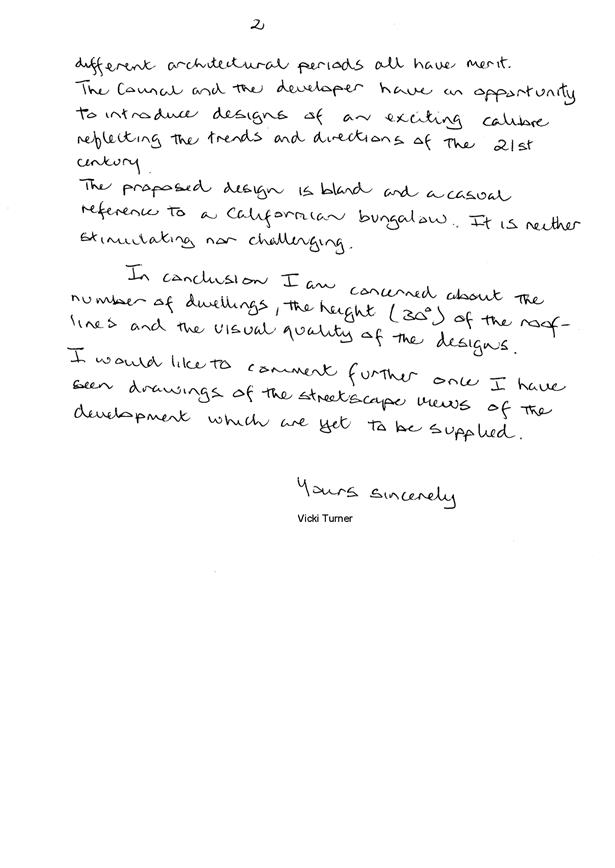
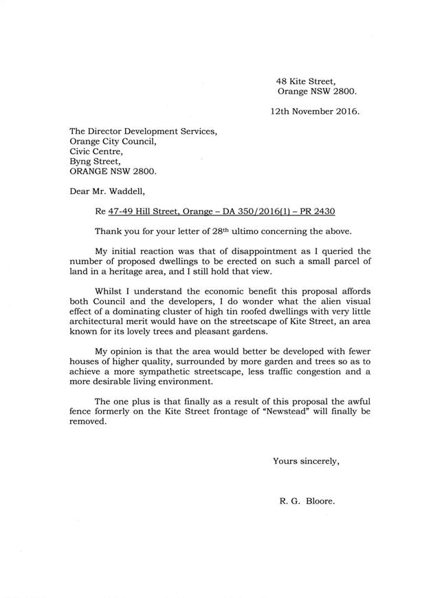
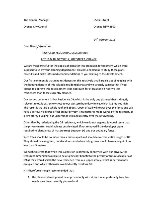
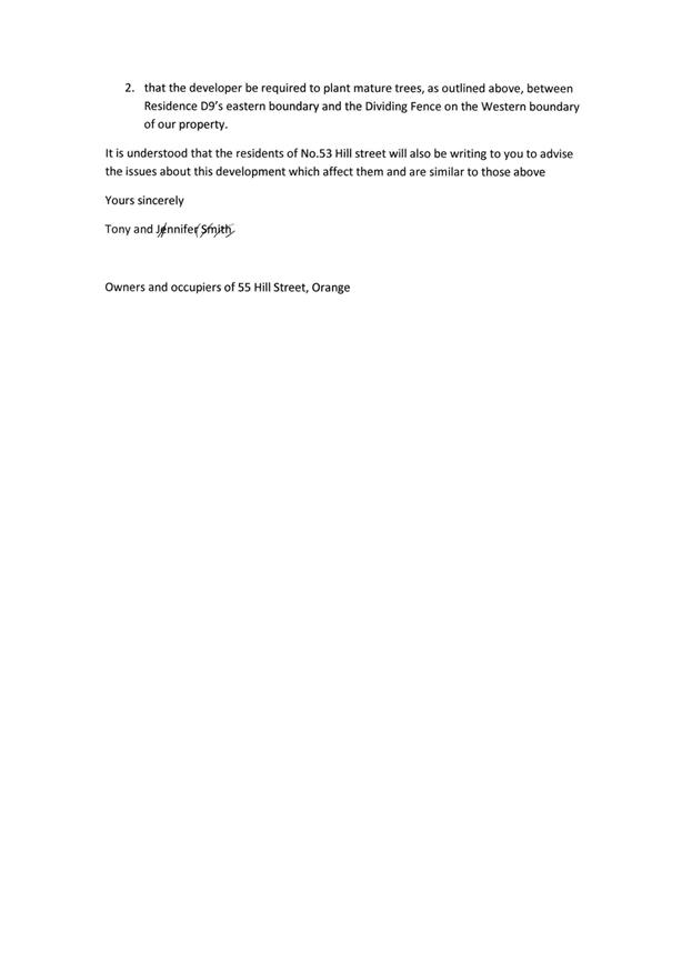


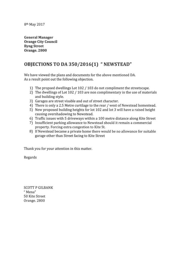
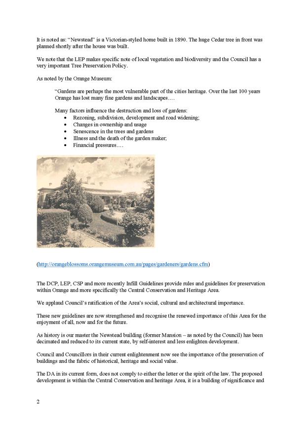
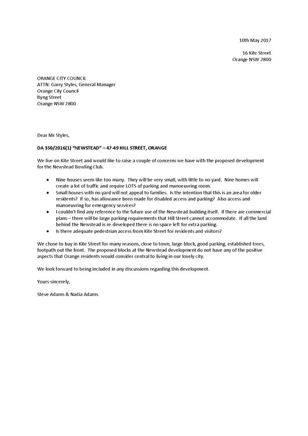

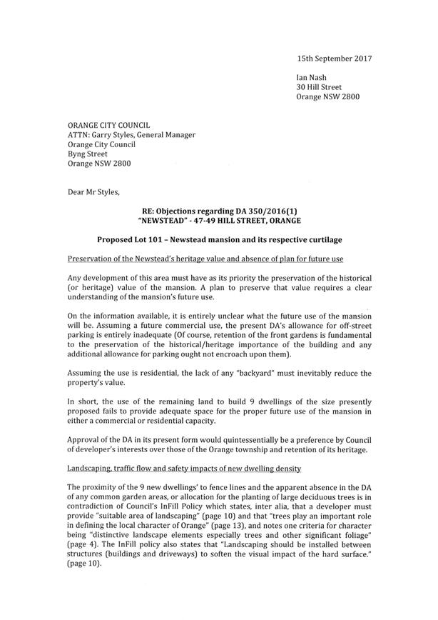

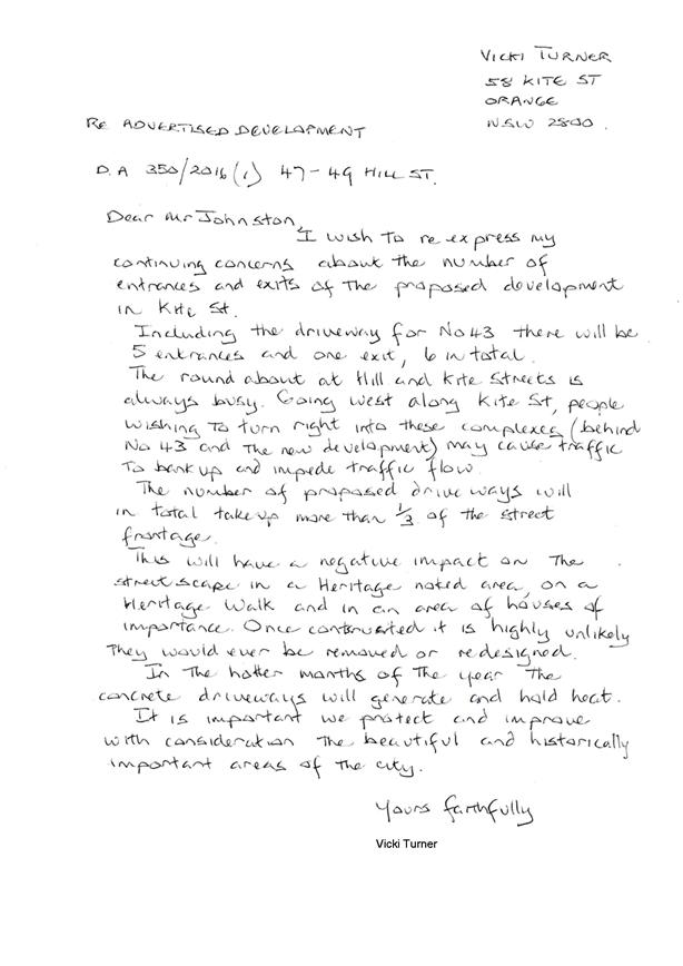
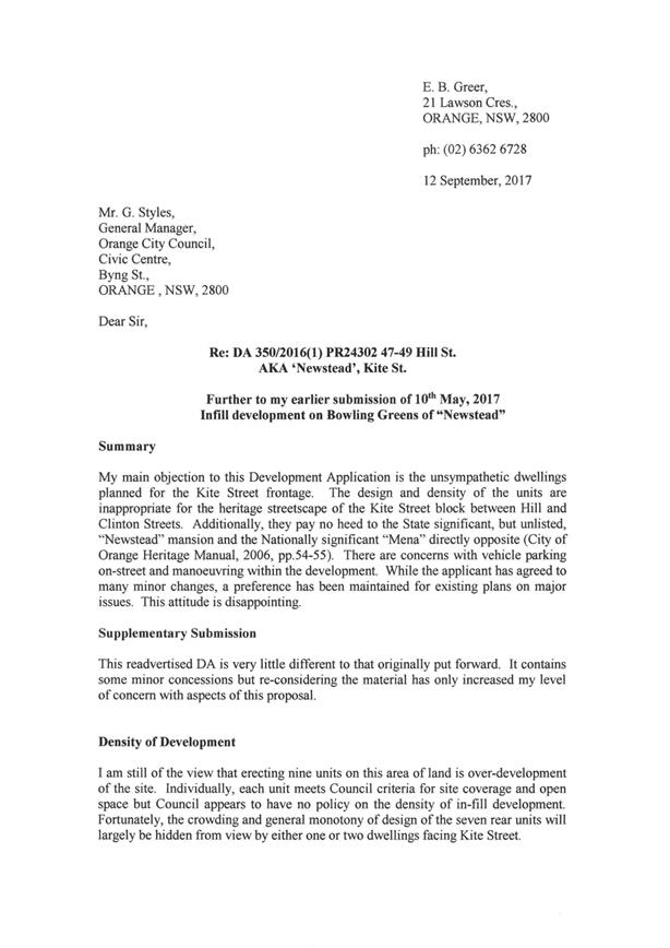
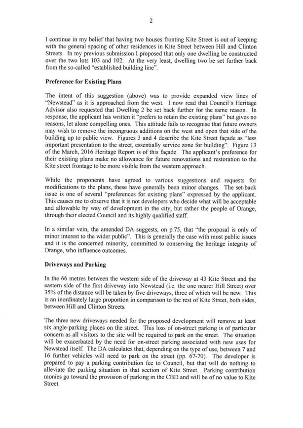
2.9 Development
Application DA 421/2016(1) - 1083 Forest Road
RECORD
NUMBER: 2017/2518
AUTHOR: Daniel
Drum, Senior Planner
EXECUTIVE Summary
|
Application
lodged
|
2
December 2016
|
|
Applicant/s
|
Mr DM
and Mrs JM Brus
|
|
Owner/s
|
Mr DM
and Mrs JM Brus
|
|
Land
description
|
Lot 2 DP
1069705 - 1083 Forest Road, Spring Creek
|
|
Proposed
land use
|
Resource
Recovery Facility
|
|
Value of
proposed development
|
$50,000
|
Council's consent is sought to establish a resource recovery
facility at 1083 Forest Road, Orange, being Lot 2 DP 1069705 (the
‘subject property’).
The proposed resource recovery facility is intended
to be operated by the owner of the subject property for the purpose of storage,
grading and trimming of timber railway sleepers.
The resource recovery facility would include a
stockpile of timber railway sleepers; vehicles/ machinery associated with the
transport and processing of sleepers, including a truck, excavator, tractor and
sawmill; a stormwater detention basin and landscaping.
Supporting information submitted with the development
application indicates that a maximum of 10,000 railway sleepers would be stored
and processed at the resource recovery facility, with the use
anticipated to be complete within 10 years.
The key issues for consideration include potential acoustic
impact on proximate sensitive receivers, potential impact on air quality and
potential impact on surface and groundwater quality within the drinking water
catchment.
In summary it is considered that the potential impacts of
the proposed resource recovery facility can be appropriately managed and are
unlikely to have a significant impact on the surrounding environment.
The development application was notified to surrounding
landowners on two separate occasions to ensure that the community was made
aware of the changes made to the application throughout the assessment.
Following the conclusion of the first notification period seven submissions
from property owners, residents and other interested parties were received.
Following the conclusion of the second notification period, a further seven
submissions were received. A copy of all submissions are attached to this
report and the issues raised by submitters are addressed in the body of this
report.
Subject to meeting the requirements of recommended
conditions of consent, the proposed use and development is considered to be
consistent with the relevant aims and objectives of Orange Local Environmental
Plan 2011 and Orange Development Control Plan 2004.
DECISION FRAMEWORK
Development in Orange is governed by two key documents
Orange Local Environment Plan 2011 and Orange Development Control Plan 2004. In
addition the Infill Guidelines are used to guide development, particularly in
the heritage conservation areas and around heritage items.
Orange Local Environment Plan 2011 – the LEP
should be considered by Council to be a definitive document. LEPs govern the
types of development that are permissible or prohibited in different parts of
the City and also provide some assessment criteria in specific circumstances.
Uses are either permissible or not - there are no grey areas in terms of
permissibility. The objectives of each zoning and indeed the aims of the LEP
itself are, however, open to interpretation and can be used to guide decision
making around appropriateness of development.
Orange Development Control Plan 2004 – the DCP
guides development. In general it is a performance based document rather than
prescriptive in nature - its purpose is to guide development. The Land and
Environment Court tends to view it as such. In each area of interest there are
often guidelines used. These guidelines indicate ways of achieving the planning
outcomes. It is thus recognised that there may also be other solutions of
merit. All design solutions are considered on merit by planning and building
staff. Applications should clearly demonstrate how the planning outcomes are
being met where alternative design solutions are proposed. So one can see that
the DCP gives leeway for developers and architects to use design to achieve the
outcome in other ways if they can. Stating that DCP guidelines are
inflexible can be misleading.
In this case, as alluded to in the following report, whilst
development for the purposes of a resource recovery facility is typically a
prohibited development within the E3 Environmental Management zone,
Council can be satisfied that the development as proposed remains permissible
with development consent pursuant to Clause 121(3) of State Environmental
Planning Policy (Infrastructure) 2007 (see assessment below for detail). State
Environmental Planning Policies prevail in circumstances where an inconsistency
between the two plans exists.
The key issues for consideration include potential acoustic
impact on proximate sensitive receivers, potential impact on air quality and
potential impact on surface and groundwater quality within the drinking water
catchment. As demonstrated in this report it is considered that the potential
impacts of the proposed resource recovery facility can be appropriately managed
and are unlikely to have a significant impact on the surrounding environment.
Link To Delivery/OPerational Plan
The recommendation in this report relates to the
Delivery/Operational Plan strategy “13.4 Our Environment
– Monitor and enforce regulations relating to City amenity”.
Financial Implications
Nil
Policy and Governance Implications
Nil
|
Recommendation
That Council consents to
development application DA 421/2016(1)
for a Resource Recovery Facility at Lot 2 DP 1069705 - 1083 Forest
Road, Spring Creek pursuant to the conditions of
consent in the attached Notice of Approval.
|
further considerations
Consideration has been given to the
recommendation’s impact on Council’s service delivery; image and
reputation; political; environmental; health and safety; employees;
stakeholders and project management; and no further implications or risks have
been identified.
SUPPORTING INFORMATION
BACKGROUND
Development application DA 421/2016(1) was originally lodged
on 2 December 2016. The Development application sought consent for the use and
development of a sawmill or log processing works.
Following various requests for further information and
ongoing discussions with Council staff, the applicant subsequently lodged an
amended development application in early September 2017. The amended
application, which is the subject of this report, seeks consent for the use and
development of a resource recovery facility.
THE APPLICATION/PROPOSAL
Council's consent is sought to establish a resource recovery
facility at the subject property. The proposed resource recovery
facility would be located in the north-eastern corner of the subject
property, proximate to two recently constructed sheds.
The resource recovery facility would include a
stockpile of timber railway sleepers; vehicles/ machinery associated with the
transport and processing of sleepers, including a truck, excavator, tractor and
sawmill; and a 116m3 stormwater/sediment detention basin.
Supporting information submitted with the development
application indicates that a maximum of 10,000 railway sleepers would be stored
and processed at the resource recovery facility, with the processing of all
railway sleepers to be complete within 10 years.
The proposed operating hours of the resource recovery
facility are 7:30am to 5:30pm Monday to Friday and 8am to 1pm
Saturday. No use is proposed to occur on Sunday, with the exception of
occasional customer pick-up which would occur by appointment only.
Notwithstanding the general operating hours of the resource recovery facility, use
of the sawmill is proposed to occur for a maximum period of 1-2 hours per week
between 9am and 4pm Monday to Friday. No use of the sawmill is proposed to
occur on weekends.
Supporting information submitted with the development
application identifies that the sale of graded and trimmed railway sleepers
from the subject property are anticipated to be minor, with 90% of sleepers
likely to be transported in bulk by truck to landscape businesses or nurseries.
The supporting information states that the proposed resource recovery facility
would generate up to two truck movements per day (ie one entry and one
exit).
Supporting information submitted with the development
application also indicates that a 1.2 x 1.2m business identification sign
would be attached near the front gate of the subject property. It is understood
that the sign would be constructed as exempt development.
EXISTING CONDITION OF THE
SUBJECT PROPERTY
The existing conditions of the
area of the subject property affected by the proposed use and development are
illustrated in Figures 1-4 below.
Figure 1: the subject property - railway sleeper
stockpile
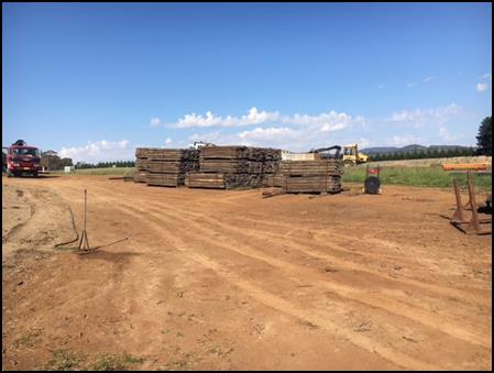
Figure 2: the subject property - graded railway
sleepers
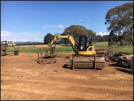
Figure 3: the subject property - equipment used to
grade railway sleepers
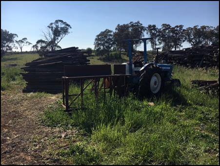
Figure 4: the subject property - sawmill attached to
small tractor
It is evident that the use and
development for which consent is sought has commenced. Matters in relation to
carrying out of development and use without development consent will be
reported separately to Council for consideration of regulatory action following
determination of this application.
SURROUNDING USE AND DEVELOPMENT
The surrounding area is typically used for agricultural
purposes, predominately horticulture and grazing of livestock. Some smaller
rural lifestyle blocks and commercial uses, such as a nursery and kennels, are
also located within the surrounding area.
The subject property and
surrounding area are located within the drinking water catchment. A number of
drainage lines, streams and creeks traverse the immediate area.
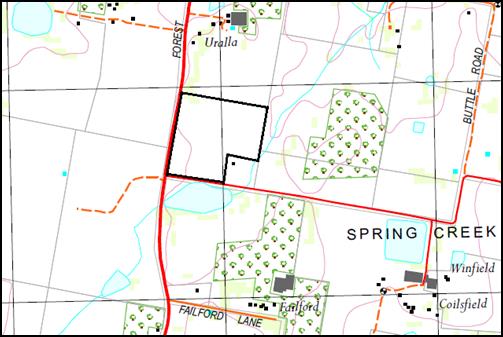
Figure 5: site context plan (subject property
identified by heavy black line)
(Source: Orange 8731-3N 1:25,000 Topographic Map 2016)
MATTERS FOR CONSIDERATION
Section 5A Assessment
In the administration of sections 78A, 79B, 79C, 111 and
112, the provisions of Section 5A must be taken into account for every
development application in deciding whether there is likely to be a significant
effect on threatened species, populations or ecological communities or their
habitats. This section includes a requirement to consider any adopted
assessment guidelines, which means assessment guidelines issued and in force
under section 94A of the Threatened Species Conservation Act 1995.
Assessment guidelines are in force (see DECC-W “Threatened Species
Assessment Guidelines - The Assessment of Significance”) which requires
consent authority to adopt the precautionary principle in its assessment.
From 25 August 2017, the Biodiversity Conservation
Act 2017 and Biodiversity Conservation Regulation 2017 were gazetted.
State Environmental Planning Policy (Native Vegetation in Non-Rural Areas) 2017
was also gazetted. The implementation of this legislation (and supporting
guidelines) is subject to savings provisions that defer their full effect for a
period of three months from the date of gazettal for local development.
Based on an inspection of the subject property, it is
considered that there is no significant biodiversity or habitat value within
the area affected by the proposed use and development.
Section 79C - Evaluation
Section 79C of the Environmental Planning and Assessment Act
1979 sets out the matters that the consent authority is to take into
consideration in determining a development application.
These matters are addressed in the body of this report.
PROVISIONS OF ANY ENVIRONMENTAL
PLANNING INSTRUMENT s79C(1)(a)(i)
Orange Local Environmental Plan 2011
Part 1 - Preliminary
Clause 1.2 - Aims of Plan
The
aims of the Orange Local Environmental Plan 2011 (‘OLEP 2011’) relevant
to the application include:
(a) To encourage development which complements
and enhances the unique character of Orange as a major regional centre boasting
a diverse economy and offering an attractive regional lifestyle.
(b) To provide for a range of development
opportunities that contribute to the social, economic and environmental
resources of Orange in a way that allows present and future generations to meet
their needs by implementing the principles for ecologically sustainable
development.
(c) To conserve and enhance the water
resources on which Orange depends, particularly water supply catchments.
(d) To manage rural land as an environmental
resource that provides economic and social benefits for Orange.
(f) To recognise and manage valued environmental
heritage, landscape and scenic features of Orange.
Subject to meeting the requirements of recommended
conditions of consent, the proposed use and development is considered to be
consistent with the relevant aims of OLEP 2011.
The relevant matters are discussed in the body of this
report.
Clause 1.6 - Consent Authority
Clause 1.6 establishes that Council is the consent authority
for the purposes of Orange LEP 2011.
Clause 1.9A - Suspension of
Covenants, Agreements and Instruments
This clause provides that covenants, agreements and other
instruments which seek to restrict the carrying out of development do not apply
with the following exceptions.
· covenants imposed
or required by Council
· prescribed
instruments under Section 183A of the Crown Lands Act 1989
· any conservation
agreement under the National Parks and Wildlife Act 1974
· any trust
agreement under the Nature Conservation Trust Act 2001
· any property
vegetation plan under the Native Vegetation Act 2003
· any biobanking
agreement under Part 7A of the Threatened Species Conservation Act 1995
· any planning
agreement under Division 6 of Part 4 of the Environmental Planning and
Assessment Act 1979
This clause does not affect the rights or interests of any
public authority under any registered instrument.
A search of Council’s records identifies that the
subject property is not affected by any of the foregoing covenants,
instruments, agreements or plans.
Clause 1.7 - Mapping
The subject site is identified
on the LEP maps in the following manner:
|
Land Zoning Map:
|
Land zoned E3 Environmental
Management
|
|
Lot Size Map:
|
Minimum Lot Size 100ha
|
|
Heritage Map:
|
Not a heritage item or conservation
area
|
|
Height of Buildings Map:
|
No building height limit
|
|
Floor Space Ratio Map:
|
No floor space limit
|
|
Terrestrial Biodiversity Map:
|
No biodiversity sensitivity on the
site
|
|
Groundwater Vulnerability Map:
|
Ground water vulnerable
|
|
Drinking Water Catchment Map:
|
Within the drinking water catchment
|
|
Watercourse Map:
|
Not within or affecting a defined watercourse
|
|
Urban Release Area Map:
|
Not within an urban release area
|
|
Obstacle Limitation Surface Map:
|
No restriction on building siting
or construction
|
|
Additional Permitted Uses Map:
|
No additional permitted use applies
|
Those matters that are of relevance are addressed in detail
in the body of this report.
Part 2 - Permitted or Prohibited Development
Clause
2.1 - Land Use Zones and Clause 2.3 - Zone Objectives and Land Use Table
The subject property is zoned E3 Environmental Management
(Figure 6).
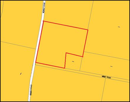
Figure 6: zone context plan (subject property
identified by heavy red line)
The
proposed use and development is defined as resource recovery facility under Orange LEP 2011,
which means:
…a
building or place used for the recovery of resources from waste, including
works or activities such as separating and sorting, processing or treating the
waste, composting, temporary storage, transfer or sale of recovered resources,
energy generation from gases and water treatment, but not including re-manufacture
or disposal of the material by landfill or incineration.
Note.
Resource recovery
facilities are a type of waste or resource management facility—see the
definition of that term in this Dictionary.
While
a resource recovery facility is typically a prohibited use in the
E3 Environmental Management Zone, Clause 121(3) of State Environmental
Planning Policy (Infrastructure) 2007 provides that:
Development
for the purpose of the recycling of construction and demolition material, or
the disposal of virgin excavated natural material (within the meaning of
Schedule 1 to the Protection of the Environment Operations Act 1997) or
clean fill, may be carried out by any person with consent on land on which
development for the purpose of industries, extractive industries or mining may
be carried out with consent under any environmental planning instrument.
Council staff have sought advice
regarding the effect of this provision with regard to the proposed use and
development. The advice provided identified that the proposed use and
development is permissible within the E3 Environmental Management zone based on
the following rationale:
· Whilst
“virgin excavated natural material” is defined by reference to the Protection
of the Environment Operations Act, construction and demolition material is
not defined for the purpose of the Infrastructure SEPP.
· Applying
the words "construction and demolition material" literally, railway
sleepers are used in the construction of railway lines. The removal and
delivery of used railway sleepers to the subject land for the purpose of
cutting and cleaning rotting sections of the timber for resale may be
considered to be for the purpose of recycling of construction and demolition
material coming from railway lines.
· Extractive
industries are permissible with consent in the E3 Environmental
Management zone.
· By
this analysis, pursuant to Clause 121(3) of the Infrastructure SEPP,
development for the purpose of the recycling of the used timber sleepers may be
carried out with consent on the land because:
(a) the purpose is recycling of construction and
demolition material; and
(b) extractive industries are permissible with
consent under the OLEP.
Consistent with standard
practice, Council staff advised the applicant of their interpretation and
characterisation of the proposed use and development, including the foregoing
rationale. The applicant subsequently sought to rely on the same.
Notwithstanding the foregoing,
Clause 2.3 of the LEP requires that the consent authority must have regard to
the objectives for development in a zone when determining a development
application in respect of land within the zone.
The objectives of the E3
Environmental Management zone are:
· To protect, manage and restore areas with special
ecological, scientific, cultural or aesthetic values.
· To provide for a limited range of development that does not
have an adverse effect on those values.
· To manage development within water supply catchment lands
to conserve and enhance the city and district’s water resources.
· To maintain the rural function and primary production
values of the area.
· To ensure development along the Southern Link Road has
alternative access
Subject to meeting the
recommended conditions of consent, the proposed use and development is
considered to be consistent with the foregoing objectives.
The relevant matters are
discussed in detail in the body of this report.
Part 7 - Additional Local Provisions
7.1
- Earthworks
Clause 7.1 seeks to ensure that
earthworks for which development consent is required will not have a
detrimental impact on environmental functions and processes, neighbouring uses,
cultural or heritage items or features of the surrounding land; and to allow
earthworks of a minor nature without requiring separate development consent.
Development consent is required
for earthworks unless the earthworks are exempt development under this plan or
another applicable environmental planning instrument, or the earthworks are
ancillary to other development for which development consent has been given.
There
are no substantial earthworks associated with the proposed use and development.
7.6 - Groundwater Vulnerability
and 7.7 - Drinking Water Catchment
Clause 7.6 - Groundwater
Vulnerability seeks to maintain the hydrological functions of key groundwater
systems and to protect vulnerable groundwater resources from depletion and
contamination as a result of inappropriate development.
Before determining a development
application for development on land to which this clause applies, the consent authority
must consider whether or not the development (including any onsite storage or
disposal of solid or liquid waste and chemicals) is likely to cause any
groundwater contamination or any adverse impact (including the impact on nearby
groundwater extraction for potable water supply or stock water supply) of the
development and any other existing development on groundwater.
Development consent must not be
granted to development on land to which this clause applies unless the consent
authority is satisfied that the development is designed, sited and will be
managed to avoid any significant adverse environmental impact; or if that
impact cannot be reasonably avoided - the development is designed, sited and
will be managed to minimise the impact; if that impact cannot be minimised -
the development will be managed to mitigate that impact.
Clause 7.7 seeks to protect drinking water catchments by
minimising the adverse impacts of development on the quality and quantity of
water entering drinking water storages.
Before determining a development application for development
on land to which this clause applies, the consent authority must consider
whether or not the development is likely to have any adverse impact on the
quality and quantity of water entering the drinking water storage, having
regard to the distance between the development and any waterway that feeds into
the drinking water storage, the onsite use, storage and disposal of any
chemicals on the land, and the treatment, storage and disposal of waste water
and solid waste generated or used by the development.
Development consent must not be granted to development on
land to which this clause applies unless the consent authority is satisfied
that the development is designed, sited and will be managed to avoid any
significant adverse impact on water quality and flows, or if that impact cannot
be reasonably avoided - the development is designed, sited and will be managed
to minimise that impact, or if that impact cannot be minimised - the development
will be managed to mitigate that impact.
A Preliminary Contamination
Investigation (PCI) prepared by Envirowest Consulting was submitted with the
development application. The PCI identified that potential contaminants
associated with the past agricultural use of the subject property and its more
recent use for the storage and processing of railway sleepers included heavy
metals such as arsenic, cadmium, chromium, copper, nickel, lead, zinc, mercury;
total recoverable hydrocarbons; and organochlorine pesticides.
The results of the PCI (Table 1
and Table 2 below) identify that levels of all potential contaminants at each
test point (Figure 7 below) are below the adopted Ecological
Investigation/Screening Levels for Commercial land use and the Health Based Investigation/
Screening Levels for Commercial/Industrial D land use thresholds. The PCI
subsequently concludes that the site is suitable for the proposed use and that
no further work is required. Notwithstanding this conclusion, a Site Management
Plan (SMP) has also been submitted in support of the proposed use and
development with the intent of providing ongoing measures to manage and
minimise the risk of potential contamination, including provision for a
stormwater detention basin.
A supplementary report prepared
by Envirowest Consulting was provided to Council on 17 November 2017,
after the notification period. The supplementary report identified that further
testing had been undertaken on the existing timber railway sleeper stockpile to
determine the likelihood of asbestos dust being present on the railway
sleepers. The supplementary report concluded that asbestos dust from train
brakes is unlikely to occur on the timber railway sleepers.
While it is accepted that the
proposed resource recovery facility is unlikely to result in groundwater
or surface water contamination, given the location of the subject property
within the drinking water catchment and proximity to waterways it is
recommended that a precautionary approach be adopted and that additional measures
be put in place to minimise any potential environmental or human risk.
In particular, it is recommended
that all sawdust be captured via an extraction system, all residue sawdust be
collected and disposed of in an appropriate manner and an appropriate sediment
trap be installed around the sleeper stockpile and sawmill to prevent any
solids moving off-site.
In addition, Council’s
Technical Services Division has recommended that conditions of consent be
applied requiring that all stormwater is to be directed to a stormwater
treatment system to ensure that no contamination leaves the subject land, with
the criteria for assessment including Total Phosphorus, Total Nitrogen, pH,
Salinity, Turbidity.
Council’s Technical
Services Division has also recommended a condition of consent requiring
stormwater detention designed to limit peak outflow from the land to the pre‑existing
natural outflows up to the 100 year ARI frequency, with sufficient allowance in
overflow spillway design capacity to safely pass flows of lower frequency
without damage to downstream development.
It is also recommended that a
condition consent be applied requiring the foregoing measures to be
incorporated into the Site Management Plan and implemented prior to the
commencement of use.
Notwithstanding,
in the event of an unforeseen impact, the use could be further regulated under
the Protection of the Environment Regulations Act 1997.
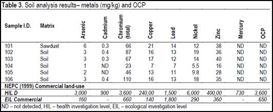
Table 1: soil analysis results - metals and
organochlorine pesticides
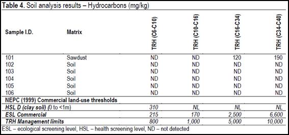
Table 2: soil analysis results - hydrocarbons
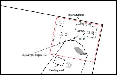
Figure 7: preliminary contamination investigation test
points
7.11 - Essential Services
Clause 7.11 - Essential Services identifies that development
consent must not be granted to development unless the consent authority is
satisfied that any of the following services that are essential for the
proposed development are available or that adequate arrangements have been made
to make them available when required.
Essential services include the supply of water, the supply
of electricity, the disposal and management of sewage, stormwater drainage or
onsite conservation, and suitable road access.
No essential services are required for the proposed use and
development.
STATE ENVIRONMENTAL PLANNING
POLICIES
State Environmental Planning Policy 55 - Remediation of
Land
State Environmental Planning Policy 55 - Remediation of Land
(SEPP 55) requires that a consent authority must not consent to the
carrying out of development of land unless it has considered whether the land
is contaminated; if the land is contaminated, it is satisfied that the land is
suitable in its contaminated state (or will be suitable, after remediation) for
the purpose for which the development is proposed to be carried out; and if the
land requires remediation to be made suitable for the purpose for which the
development is proposed to be carried out, it is satisfied that the land will
be remediated before the land is used for that purpose.
Furthermore, SEPP 55 requires that before determining an
application to carry out development that would involve a change of use of land
(specified in subclause 4), the consent authority must consider a
preliminary investigation of the land concerned.
As previously discussed, the results of the PCI (see Table 1
and Table 2) identify that levels of all potential contaminants are below the
adopted Ecological Investigation/Screening Levels for Commercial land use and
the Health Based Investigation/Screening Levels for Commercial/Industrial D
land use thresholds.
State Environmental Planning
Policy (Infrastructure) 2007
The proposed development was referred to the Roads and
Maritime Service (RMS) pursuant to Section 104 - Traffic Generating
Development of State Environmental Planning Policy (Infrastructure) 2007 (SEPP
Infrastructure).
The RMS has advised that it
makes no submission in relation to the development application.
Matters pertaining to the consideration of Clause 121(3) of
State Environmental Planning Policy (Infrastructure) 2007 which goes to the
issue of permissibility of the proposed development have been assessed above
under the heading “Part 2 - Permitted or Prohibited
Development”.
PROVISIONS OF ANY DRAFT
ENVIRONMENTAL PLANNING INSTRUMENT THAT HAS BEEN PLACED ON EXHIBITION
s79C(1)(a)(ii)
There are no draft environmental planning instruments that
apply to the subject land or proposed development.
DESIGNATED DEVELOPMENT
The proposed development is not designated development
pursuant to Schedule 3, Part 1, Clauses 32 and 33 of the
Environmental Planning and Assessment Regulation 2000 (the
‘Regulations’).
While Schedule 3, Clause 32 of the Regulations identifies
that a waste management facility is typically designated development, it also
provides that Clause 32 does not apply to any development comprising or
involving waste management facilities or works specifically referred to
elsewhere in Schedule 3.
On this basis, the applicant has identified the description
of wood or timber milling or processing works under Clause 33 as being
applicable to the proposed development. Specifically, Clause 33 identifies wood
or timber milling or processing works as being:
… (being works, other than joineries,
builders supply yards or home improvement centres) that saw, machine, mill,
chip, pulp or compress timber or wood:
(a) that
have an intended processing capacity of more than 6,000 cubic metres of timber
per year and:
(i) are
located within 500 metres of a dwelling not associated with the milling works,
or
(ii) are
located within 40 metres of a natural waterbody or wetland, or
(iii) burn waste
(other than as a source of fuel), or
(b) that
have an intended processing capacity of more than 50,000 cubic metres of timber
per year.
It is accepted that the proposed resource recovery
facility is not designated development on the basis that the proposed use can
be characterised as wood or timber milling or processing works, and that the
intended processing capacity is below 6,000 cubic metres (ie the intended
annual processing capacity is identified as 2,000 cubic metres).
PROVISIONS OF ANY DEVELOPMENT
CONTROL PLAN s79C(1)(a)(iii)
Development Control Plan 2004
Development Control Plan 2004 (“DCP 2004”)
applies to the subject property. Chapters of the DCP relevant to the
proposed use and development include:
· Chapter
0 - Transitional Provisions;
· Chapter
2 - Natural Resource Management;
· Chapter
3 - General Considerations;
· Chapter
4 - Special Environmental Considerations;
· Chapter12
- Rural Environment Protection Zone; and
· Chapter
15 - Car Parking.
Section 0.2 - General
Translation of Zones
Section 0.2 provides that any reference to a zone under
Orange Local Environmental Plan 2000 is to be a reference to the
corresponding zones in the zone conversion table.
The table identifies that the E3 Environmental Management
zone corresponds with the 7 Water Supply Catchment zone.
Chapter 2 - Natural Resource
Management
Section 2.1 - Water Quality
Section 2.1 - Water Quality identifies that development that
concentrates, redirects flows, increases flow rates or disturbs land in close
proximity to creeks, has the potential to affect waterways with associated
erosion, sedimentation and release of nutrients, which combine to affect
downstream water quality. Section 2.1 also identifies that development
involving groundwater extraction and/or onsite wastewater disposal is deemed to
have the potential to affect groundwater resources.
Specific planning outcomes for stormwater quality include:
· Development is
carried out in a manner that does not contribute to downstream erosion or
sedimentation of waterways.
· Development
complies with the Water and Soil Erosion Control requirements of the
Development and Subdivision Code.
· On-site
detention is carried out in accordance with the Development and Subdivision
Code for all developments comprising buildings with a site coverage greater
than 50m2 or where site coverage exceeds the “percentage
impervious” level listed in the Code applicable to that development.
· Where on-site
detention is not appropriate, contributions are made towards retarding basins
and/or GPTs and associated drainage under the Contributions Plan that applies
to the land.
· Development in
the vicinity of a natural watercourse is positioned away from the waterway and
includes measures to minimise the impact of the development on the waterway
such as the establishment of Creekside buffer zones and planting of native
trees in a manner that enhances stream bank stability.
Specific planning outcomes for groundwater quality include:
· Development
applications for development (excluding dwelling houses) that proposes to
extract groundwater or involve on-site wastewater disposal identify potential
risks to, and management of, groundwater resources.
· Development is
carried out in a manner that does not adversely affect groundwater resources.
· Development considered
by Council to have the potential to significantly affect groundwater quality
incorporates a monitoring program and provides test results for NATA –
accredited laboratory to Council for review and for inclusion in the City SoE
Reports.
· Development
that requires or proposes the use of groundwater demonstrates that the
groundwater extraction will meet the requirements of DLWC, where necessary
Water quality has previously been addressed under the
heading “7.6 - Groundwater Vulnerability and 7.7 - Drinking Water
Catchment”. Based on the foregoing discussions, the results presented in
Table 1 and Table 2 and the recommended conditions of consent, it is considered
that the proposed use and development is unlikely to have an adverse impact on
the quality of groundwater or surface water entering the drinking water
catchment.
Notwithstanding, in the event of an unforeseen impact, the
use could be further regulated under the Protection of the Environment
Regulations Act 1997.
Section 2.2 - Soil Resource Management
Section 2.2 - Soil Resource Management identifies that soil
characteristics influence land use and development capability and the
suitability for building footings, onsite waste disposal, road engineering and
drainage.
Specific planning outcomes for soil resource management
include:
· Development
complies with the Water and Soil Erosion Control requirements of the
Development and Subdivision Code.
· Sites affected
by soil degradation are restored in accordance with management strategies to be
submitted with development proposals.
· Agricultural
practices apply conservation farming techniques particularly within the water
supply catchments and in areas susceptible to significant erosion hazard.
· A geotechnical
investigation is carried out by a NATA-accredited laboratory that identifies
and classifies all new residential lots for dwelling houses in accordance with
AS 2870-1996 Residential Slabs and Footings Construction.
· A geotechnical
investigation is undertaken that determines the suitability of land for on-site
disposal of sewage effluent in accordance with Environmental and Health
Protection Guidelines: On-site Sewage management for Single Households where
appropriate.
· Non-agricultural
activities in rural areas are carried out on less -productive soils.
It is considered that the proposed resource recovery
facility will occupy a relatively small portion of the subject property
and will not have a significant impact on the availability of productive soils.
Further, it is noted that once the stockpile of timber sleepers has been
processed, the affected area could be returned to an agricultural use.
Chapter 3 - General
Considerations
Section 3.1 - Cumulative Impacts
Section 3.1 - Cumulative Impacts identifies that Council
will consider not only the direct impacts of a particular development but also
whether the development, when carried out in conjunction with other development
in the locality, has a more significant environmental impact.
Specific planning outcomes regarding cumulative impact include:
· Applications
for development demonstrate how the development relates to the character and
use of land in the vicinity;
· The
introduction of new development into a locality maintains environmental impacts
within existing or community-accepted levels.
· Water
conservation measures are implemented
It is considered that the proposed development has the
potential to have a cumulative impact on surface/groundwater quality and air
quality. Notwithstanding the potential cumulative impacts, it is considered that
each issue has been appropriately assessed in this report and is unlikely to
have a significant impact which exceeds reasonable community expectation.
There may be cumulative impacts associated with other future
use and development of properties within the vicinity of the subject property.
Those impacts would be assessed at the development application stage.
Section 4.4 - Contaminated Land
Section 4.4 - Contaminated Land identifies that contaminated
land can pose a risk to human health and the environment. Contaminants can be
released into waterways and humans exposed when contaminated land is disturbed
as a consequence of development.
The DCP sets the following planning outcomes with regard to
contaminated land:
· Land
subject to development is clear from contamination.
· Development
complies with the Contaminated Land Management Act 1997.
· Applications
for development consent on land used or likely to have been previously used for
uses in the table below include contamination assessment and where necessary a
proposed remediation strategy to make the site suitable for the proposed use.
· An independent
site audit at the applicant’s cost is carried out to assess the
information provided with an application where Council considers that:
- Information may be incorrect or
incomplete;
- It needs to verify that the
information adheres to appropriate standards, procedures guidelines; or
- The type or level of contamination
requires an independent technical review.
Land contamination has previously been addressed under
“State Environmental Planning Policy 55 - Remediation of
Land”.
As previously discussed, the PCI
submitted with the development application demonstrates that levels of all
potential contaminants are below the adopted Ecological Investigation/ Screening
Levels for Commercial land use and the Health Based Investigation/Screening
Levels for Commercial/Industrial D land use thresholds.
Chapter 12 - General Controls
for the Water Supply Catchment
Section 12.1 - General Controls for the Water Supply Catchment
Zone and
Section 12.2 - Water Quality Protection Area
Section 12.1 - General Controls for the Water Supply
Catchment zone identifies that the Rural Environmental Protection zone
identifies water supply catchment areas, which are areas that provide for
public water supplies to service urban centres.
The DCP sets out the following planning outcome with regard
to water supply catchments:
· Development
proposals clearly demonstrate measures that are to be instituted to minimise
impacts on the quality and availability of water resources for public
water-supply use.
Section 12.2 identifies that all development in the water
supply catchment needs to manage its impact, with particular attention to be
given to development in proximity to the major creeks within the water supply
catchment.
Clause 12.2 identifies that special protection areas have
been identified around the Gosling Creek, Spring Creek and Suma Park
reservoirs, and main feeder creeks. These protection areas are generally within
200m of a main creek or within 400m of a water-storage reservoir.
Further, Section 12.2 identifies that onsite sewage
management systems are inappropriate within this area, and that development may
be considered where an onsite sewage management system is located outside the
water quality protection area, and where measures are incorporated into the
development that ensure that runoff from buildings and driveways does not
contribute to pollution of the adjacent waterbodies.
The DCP sets out the following planning outcomes with regard
to water quality protection areas:
· Effluent is
treated outside the defined protection area.
· Adjacent
waterways, including native riparian vegetation zones, are protected and
conserved.
· Soil and
water-management measures are incorporated in the development.
Water quality has previously been
addressed under the heading “7.6 ‑ Groundwater
Vulnerability and 7.7 - Drinking Water Catchment”. Based on the foregoing
assessment and recommended conditions of consent, it is considered unlikely
that the proposed development will have a detrimental impact on surface water
or groundwater within the drinking water catchment.
Chapter 15 - Car Parking
Section 15.4 - Parking Requirement
Section 15.4 does not specify a parking rate for a resource
recovery facility.
Notwithstanding, it is considered that formal off-street car
parking is not required as the proposed use does not involve long term
occupation of the site by staff or customers.
Furthermore, it is evident that the subject land is
satisfactory to accommodate the proposed use and provide adequate manoeuvring
space for vehicles.
PROVISIONS PRESCRIBED BY THE
REGULATIONS s79C(1)(a)(iv)
Demolition of a Building (clause 92)
The proposal does not involve the demolition of a building.
Fire Safety Considerations
(clause 93)
The proposal does not involve a change of building use for
an existing building.
Buildings to be Upgraded
(clause 94)
The proposal does not involve the rebuilding, alteration,
enlargement or extension of an existing building.
BASIX Commitments (clause 97A)
Not applicable.
THE LIKELY IMPACTS OF THE
DEVELOPMENT s79C(1)(b)
The key potential impacts associated with the proposed
resource recovery facility are considered to be impact on surface/ground
water quality, air quality and noise.
Surface/Ground Water Quality
Surface and groundwater quality are addressed in detail
under the heading “7.6 ‑ Groundwater Vulnerability and
7.7 ‑ Drinking Water Catchment”.
In summary it is accepted that the results of the PCI
submitted with the development application identify that levels of potential
contaminants are below the adopted Ecological Investigation/Screening Levels
for Commercial land use and the Health Based Investigation/ Screening Levels
for Commercial/Industrial D land use thresholds.
While it is accepted that the proposed resource recovery
facility is unlikely to result in groundwater or surface water contamination,
given the location of the subject property within the drinking water catchment
and proximity to waterways it is recommended that a precautionary approach be
adopted and that additional measures be put in place to minimise any potential
environmental or human risk.
In particular, it is recommended that all sawdust generated
during processing be captured via an extraction system, all residue sawdust be
collected and disposed of in an appropriate manner and an appropriate sediment
trap be installed around the sleeper stockpile and sawmill to prevent any
solids moving off-site.
In addition, Council’s Technical Services Division has
recommended that conditions of consent be applied requiring that all stormwater
is to be directed to a stormwater treatment system to ensure that no
contamination leaves the subject land, with the criteria for assessment
including Total Phosphorus, Total Nitrogen, pH, Salinity, Turbidity.
Council’s Technical Services Division has also
recommended a condition of consent requiring stormwater detention designed to
limit peak outflow from the land to the pre‑existing natural outflows up
to the 100 year ARI frequency, with sufficient allowance in overflow spillway
design capacity to safely pass flows of lower frequency without damage to
downstream development.
It is also recommended that conditions of consent be applied
requiring the foregoing measures to be incorporated into the Site Management
Plan and implemented prior to the commencement of use.
Notwithstanding, in the event of an unforeseen impact the
use could be further regulated under the Protection of the Environment
Regulations Act 1997.
Air Quality
Potential air quality impacts may occur due to airborne
sawdust. On this basis, it is recommended that all sawdust be captured via an
extraction system and that all residue sawdust be collected and disposed of in
an appropriate manner.
Council’s Environmental Health Officer has advised
that nearby land users are unlikely to be affected in respect of dust and
odour.
Noise
Noise impacts may occur as a result of the sawmill operating
for up to 1-2 hours per week and truck movements to and from the subject
property.
Council’s Environmental Health Officer has commented
that nearby land users are unlikely to be affected in respect of noise.
THE SUITABILITY OF THE SITE
s79C(1)(c)
It is considered that the attributes of the subject property
and surrounding area are suitable for the proposed use and development, subject
to recommended conditions of consent addressed in the body of this report.
ANY SUBMISSIONS MADE IN
ACCORDANCE WITH THE ACT s79C(1)(d)
The proposed development is not defined as advertised
development under the provisions of the LEP, and as such no formal
exhibition of the application was required.
Notwithstanding, the proposed development was notified to
surrounding landowners. Following the conclusion of the first notification
period seven submissions from property owners, residents and other interested
parties had been received. Following the conclusion of the second notification
period, a further seven submissions were received. A copy of all submissions
are attached to this report and the issues raised by submitters are addressed
in the body of this report.
The proposed development was also referred to Roads and
Maritime Services, Environment Protection Authority and Department of Primary
Industries-Water.
Submissions from Surrounding
Land Owners/Interested Parties
Characterisation of the Use
A number of submissions have identified that the proposed
use and development has not been accurately characterised and that it should be
prohibited in the E3 Environmental Management zone.
While is acknowledged that that characterisation of the
proposed resource recovery facility has changed during the development
application process, it is open to an applicant to seek to change the details
of a proposal during the assessment process.
Council staff accept that the proposed use and development
has been accurately characterised as a resource recovery facility and that a
resource recovery facility is permissible in the E3 Environmental Management
zone pursuant to Clause 121(3) of State Environmental
Planning Policy (Infrastructure) 2007.
Illegal Use and Development
A number of submissions have identified that the proposed
use and development has commenced without development consent.
Illegal use and development is not a relevant consideration
pursuant to Section 79C of the Environmental Planning and Assessment Act
1979. Matters in relation to carrying out of development and use without
development consent will be reported separately to Council for consideration of
regulatory action following determination of this application.
Inconsistent With the
Objectives of the E3 Environmental Management Zone
A number of submissions identify that the proposed resource
recovery facility is inconsistent with the objectives of the E3 Environmental
Management zone.
It is generally held that the planning principle established
by BGP Properties Pty Limited v Lake
Macquarie City Council [2004] NSWLEC 399 revised - 05/05/2005 requires that
approval should be granted for a use for which the site is zoned subject to
achieving an acceptable environmental impact.
It is considered that the proposed resource recovery
facility is likely to result in an acceptable environmental impact.
Contamination of Railway
Sleepers
The majority of submissions identified that the railway
sleepers may be contaminated.
Contamination has been addressed in detail under the heading
“7.6 - Groundwater Vulnerability and 7.7 - Drinking Water Catchment”.
In summary, it is accepted that the results of the PCI and
supplementary identify that levels of all potential contaminants at each test
point are below the adopted Ecological Investigation/Screening Levels for
Commercial land use and the Health Based Investigation/ Screening Levels for
Commercial/Industrial D land use thresholds. The PCI subsequently
concludes that the site is suitable for the proposed use and that no further
work is required.
Further, it is acknowledged that
the supplementary report prepared by Envirowest Consulting concluded that
asbestos dust from train brakes is unlikely to occur on the timber railway
sleepers.
Hazardous/Offensive Development
One submission identified that
the proposed resource recovery facility should be characterised as being a
hazardous industry and/or an offensive industry pursuant to the requirements of
State Environmental Planning Policy 33 - Hazardous and Offensive Development
(SEPP 33).
It is considered that SEPP 33
does not apply to the proposed resource recovery facility as it does not
involve a hazardous substance which falls within the classification of the
Australian Code for Transportation of Dangerous Goods by Road and Rail
(Dangerous Goods Code); it does not require a licence from the EPA; and it is
considered unlikely that it will have a significant environmental impact.
Water Quality/Drinking Water
Catchment
The majority of submissions have raised concerns regarding
the potential impact of contamination from railway sleepers on groundwater and
surface water, with concern for both agriculture (eg stock and horticulture)
and potable water within a drinking water catchment.
Water quality has previously been addressed under the
heading “7.6 - Groundwater Vulnerability and 7.7 - Drinking Water
Catchment”. In summary it is accepted that the proposed resource recovery
facility is unlikely to result in groundwater or surface water contamination or
any other adverse impact.
Notwithstanding, on a
precautionary basis it is recommended that additional measures be put in place
to minimise any potential environmental or human risk. In particular, it is
recommended that all sawdust generated during processing be captured via an
extraction system, all residue sawdust be collected and disposed of in an
appropriate manner and an appropriate sediment trap be installed around the
sleeper stockpile and sawmill to prevent any solids moving off-site.
Further to these requirements,
Council’s Technical Services Division has recommended that conditions of
consent be applied requiring that all stormwater is to be directed to a
stormwater treatment system to ensure that no contamination leaves the subject
land, with the criteria for assessment including Total Phosphorus, Total
Nitrogen, pH, Salinity and turbidity.
Council’s Technical
Services Division has also recommended a condition of consent requiring
stormwater detention designed to limit peak outflow from the land to the pre‑existing
natural outflows up to the 100 year ARI frequency, with sufficient allowance in
overflow spillway design capacity to safely pass flows of lower frequency
without damage to downstream development.
It is also recommended that
conditions of consent be applied requiring the foregoing measures to be
incorporated into the Site Management Plan and implemented prior to the
commencement of use.
Notwithstanding, in the event of
an unforeseen impact, the use could be further regulated under the Protection
of the Environment Operations Act 1997.
Air Quality - Impacts on Human
Health and Agriculture
A number of submissions have raised concerns regarding the
potential impact of dust generated by the sawmill impacting on human health and
agricultural viability (ie dust carrying forms of contamination such as
asbestos).
Some submissions have also raised the impact of dust
generated by heavy vehicles, such as trucks entering and exiting the subject
property.
With regard to the possibility of airborne dust carrying
contamination, it is recommended that a condition of consent be applied
requiring that an extraction system be used in association with the sawmill to
minimise the likelihood of any airborne dust. Further, it is recommended that
any heavy residual dust which may fall below the sawmill be collected and
disposed of in an appropriate manner immediately after processing.
It is acknowledged that the supplementary report prepared by
Envirowest Consulting concluded that asbestos dust from train brakes is
unlikely to occur on the timber railway sleepers.
With regard to dust generated by heavy vehicles entering the
subject property, it is considered that the level of dust generated by two
truck movements per day is acceptable in the context of the subject property,
and consistent with the agricultural function of the surrounding area.
Noise
One submission raised concerns regarding the acoustic impact
of the sawmill and heavy vehicles on residential amenity, including trucks
entering and leaving the subject property during the night.
Council’s Environmental Health Officer has commented
that the noise which would be generated by the sawmill for a 1-2 hour period
between 9am and 4pm each week is unlikely to affect other nearby land users.
Further, it is acknowledged that the sawmill would not be operated on Saturday
or Sunday.
Further, Council’s Environmental officer has confirmed
that all truck movements associated with the resource recovery facility should
be limited to the proposed operating hours, which would reduce the acoustic
impact of vehicle movements at night. However, it should be noted that this
would not preclude heavy vehicle movements to the subject property associated
with any agricultural use of the property.
Other Possible Uses of the
Resource Recovery Facility
Some submissions have identified that the approval of a resource
recovery facility could allow for other unintended uses, which may have
a more significant impact on the water catchment.
In the event that the proposed resource recovery facility is
approved, a condition of consent would require that it be undertaken in
accordance with the Statement of Environmental Effects submitted with the
development application. In this regard, it is considered that the scope of the
resource recovery facility is restricted to processing 10,000 timber sleepers
which are currently stockpiled onsite.
Fire
One submission has identified the
potential risk of the railway sleepers catching fire as an issues of concern.
Council’s Environmental
Health Officer has commented that the proposed resource recovery facility does
not pose a significant fire risk and that the proposed sleepers would not
easily ignite in a stockpile as proposed.
Road Safety
A number of submissions identified concerns regarding
limited visibility at the intersection of Hiney Road and Forest Road,
particularly in relation to visibility of large, slow trucks entering from
Hiney Road. One submissions also identified a black spot at the Gosling Creek
Bridge.
Neither Council’s Technical Services Division nor the
RMS have identified road safety associated with truck movements as an issue of
concern.
Property Value
A number of submissions have identified reduced property
values as an impact of the proposed development.
Property value is not considered to be a relevant matter
under Section 79C of the Environmental Planning and Assessment Act 1979 and has
not been considered in any further detail.
Impact on Amenity
One submission raised concerns regarding the impact of the
proposed resource recovery facility on existing residential amenity.
In particular, the submission indicated that residential
amenity has been impacted by people knocking on their door looking to purchase
railway sleepers and increased number of rats.
Supporting information submitted with the development
application indicates that the owner intends to erect a business identification
sign at the property frontage. This should prevent confusion as to where the
proposed resource recovery facility is located.
With regard to an increased number of rats, it is
recommended that an advisory note be placed on the Notice of Determination
indicating that the owner of the subject property should take all reasonable
steps to manage rodents such as rats and mice.
Impact on Future Dwelling
One submission identified that the use of the proposed
resource recovery facility would require relocation of an approved
dwelling at 356 Hiney Road.
Based on the assessment presented in the body of this report,
it is considered that the proposed resource recovery facility is
unlikely to have a detrimental effect on the proposed dwelling once
constructed.
Use of Sheds
A number of submissions have noted the presence of a number
of sheds on the subject property which are not mentioned in the development
application.
Council records indicate that a number of approvals have
been issued for rural sheds on the subject property.
Sleepers Should Not Be Sold to
the Public
A number of submissions identified that railway sleepers
should not be sold to the public, particularly for firewood.
While the concerns associated with potential contamination
of railway sleepers is understood, Council is not responsible for the
regulation of the sale of goods.
It is incumbent on the operator of the proposed resource
recovery facility to ensure that the sale of any product is legal and in
accordance with any specific requirements.
Insufficient Information
Regarding Waste
One submission identified that the development application
has not identified how waste will be managed.
It is recommended that a condition of consent be applied
requiring that any waste, including sawdust or timber off-cuts, be disposed of
in appropriate manner.
No Toilets
One submission has identified that no toilets are proposed.
Council’s Building Surveyor has not identified that
toilets are required.
Visual Impact/Air Quality
One submission identified that the proposed resource
recovery facility should be screened to minimise visual impact. Other
submissions identified that the proposed resource recovery facility should be
screened to reduce possible air pollution.
The proposed use and development includes perimeter
landscaping (Leylandii) to the immediate west of the resource recovery facility
and to the immediate north of the property boundary with 21 Hiney Road.
While it is considered that the proposed resource recovery
facility is unlikely to present a significant visual impact or result in
dust emissions subject to recommended conditions of consent, it is understood
that the applicant would be willing to provide additional perimeter
landscaping.
On this basis, it is recommended that a condition of consent
be applied requiring that perimeter landscaping be provided to the east, north
and west of the timber railway stockpile and sawmill area.
Loss of Agricultural Land
One submission identified the loss of prime agricultural
land as an issue of concern.
It is considered that the proposed resource recovery
facility will occupy a relatively small portion of the subject property and
will not have a significant impact on the availability of productive soils.
Further, it is noted that once the stockpile of timber
sleepers has been processed, the affected area could be returned to an
agricultural use.
Weeds
One submission identified the introduction of weed seeds as
an issue of concern and noted that the proponent does not have a biosecurity
protocol.
Following an inspection of the timber sleeper stockpile it
is considered unlikely that it would have a significant impact on weed species
or volume of weeds in the immediate area. The sleepers were generally devoid of
significant amounts of soil.
Inconsistencies in the
Development Application
A number of submissions identified that there are some
inconsistencies in the application material submitted by the applicant.
It is accepted that there are some inconsistences in the
application material, however those inconsistencies have not prevented Council
staff undertaking a full assessment of the application.
Submissions from State
Government Authorities and Departments
EPA
The EPA has had ongoing correspondence with Council staff
throughout the assessment process. The final comments of the EPA area
summarised as follows:
· The proposed use
and development is not a scheduled activity and does not require an
Environmental Protection Licence based on the weight and volume of timber
sleepers currently stored onsite and the weight of material anticipated to be
processed each year.
· The land use
activity being carried out also appears to be not permissible under
Orange LEP 2011 for zone E3. Therefore it is considered that
section 144 of the Protection of the Environment Operations Act 1997
"Use of place as waste facility without lawful authority", may have been
breached, and as such Council is the Appropriate Regulatory Authority under the
Act.
With regard to the second point, reference is made to the
discussion under the heading “Clause 2.1 - Land
Use Zones and Clause 2.3 - Zone Objectives and Land Use Table”, which
identifies that the proposed use and development is permissible pursuant to Clause 121(3) of State Environmental Planning Policy
(Infrastructure) 2007.
The EPA did not identify any other
issues and make any recommendations in its final submission to Council.
Roads and Maritime Services
The RMS has provided advice to
Council indicating that it does not object to the proposed development and that
it makes no submission.
DPI - Water
DPI - Water has provided advice to
Council identifying that for the purposes of the Water Management Act 2000, a
controlled activity approval is not required and no further assessment by this
agency is necessary as the proposed activity is not occurring on waterfront
land.
PUBLIC INTEREST
s79C(1)(e)
The proposed development is considered to be of minor
interest to the wider public due to the relatively localised nature of
potential impacts. The proposal is not inconsistent with any relevant policy
statements, planning studies, guidelines, etc that have not been considered in
this assessment.
SUMMARY
The proposed development is permissible with the consent of
Council. The proposed development complies with the relevant aims, objectives
and provisions of the LEP. A section 79C assessment of the
development indicates that the development is acceptable in this instance.
Attached is a draft Notice of Approval outlining a range of conditions
considered appropriate to ensure that the development proceeds in an acceptable
manner.
COMMENTS
The requirements of the Environmental Health and Building Surveyor
and the Engineering Development Section are included in the attached Notice of
Approval.
Attachments
1 Notice
of Approval, D17/68952⇩
2 Plans,
D17/68257⇩
3 Public
Submissions - first exhibition period, D17/68282⇩
4 Public
Submissions - second exhibition period, D17/68310⇩
5 Agency
Submissions, D17/68317⇩
Planning and Development Committee
7 December 2017
2.9 Development
Application DA 421/2016(1) - 1083 Forest Road
Attachment 1 Notice
of Approval
|

|
ORANGE
CITY COUNCIL
Development
Application No DA
421/2016(1)
NA17/ Container
PR20260
|
NOTICE OF DETERMINATION
OF A DEVELOPMENT
APPLICATION
issued under the Environmental
Planning and Assessment Act 1979
Section 81(1)
|
Development
Application
|
|
|
Applicant Name:
|
Mr DM and
Mrs JM Brus
|
|
Applicant Address:
|
25B Lysterfield
Road
ORANGE
NSW 2800
|
|
Owner’s Name:
|
Mr DM and
Mrs JM Brus
|
|
Land to Be Developed:
|
Lot 2 DP
1069705 - 1083 Forest Road, Spring Creek
|
|
Proposed Development:
|
Resource
Recovery Facility
|
|
|
|
|
Building
Code of Australia
building
classification:
|
Not
applicable
|
|
|
|
|
Determination
|
|
|
Made On:
|
7 December
2017
|
|
Determination:
|
CONSENT
GRANTED SUBJECT TO CONDITIONS DESCRIBED BELOW:
|
|
|
|
|
Consent to
Operate From:
|
8 December
2017
|
|
Consent to
Lapse On:
|
8 December
2022
|
Terms of Approval
The reasons for the imposition of
conditions are:
(1) To
maintain neighbourhood amenity and character.
(2) To
ensure compliance with relevant statutory requirements.
(3) To
provide adequate public health and safety measures.
(4) To
prevent the proposed development having a detrimental effect on adjoining land
uses.
(5) To
minimise the impact of development on the environment.
Conditions
(1) The
development must be carried out in accordance with:
(a) Plan/s
numbered Figure 1 Existing Boundaries and Site Detail, dated 15.11.2016 (Sheet
1 and 2), Figure 2 Proposed Site Plan, dated 15.11.2016 (Sheet 1 and 2) (four
sheets). All plans by Saunders and Staniforth Property and Planning Consultants
(b) statements
of environmental effects or other similar associated documents that form part
of the approval
as amended
in accordance with any conditions of this consent.
(2) All building work must
be carried out in accordance with the provisions of the Building Code of
Australia.
(3) A sign is to be erected
in a prominent position on any site on which building work, subdivision work or
demolition work is being carried out:
(a) showing
the name, address and telephone number of the principal certifying authority
for the work, and
(b) showing
the name of the principal contractor (if any) for any building work and a
telephone number on which that person may be contacted outside working hours,
and
(c) stating
that unauthorised entry to the site is prohibited.
Any such sign is to be maintained while the building
work, subdivision work or demolition work is being carried out.
|
PRIOR TO THE ISSUE OF
A CONSTRUCTION CERTIFICATE
|
(4) Prior to the issue of a
Construction Certificate, details must be provided to Council to identify how a
dust extraction and capture system can be operated in association with sawmill.
The details must demonstrate how sawdust and potential contaminants can be
extracted and captured during the processing of timber railway sleepers.
The details provided must be to the
satisfaction of Council’s Manager Development Assessment.
(5) Prior to the issue of a
Construction Certificate, details must be provided to Council to identify
details of a suitable sediment trap which can be installed around all timber
railway sleep stockpiles and sawmill area to prevent movement of solids
including fragments of timber railway sleepers and any sawdust not captured by
the sawdust extraction and capture system. The details must include a method to
ensure the ongoing effectiveness of the sediment trap while the Resource
recovery facility is in use (I.e. until all timber railway sleepers have
been processed and removed)
(6) Prior to the issue of a
Construction Certificate, the Site Management Plan prepared by Envirowest
Consulting dated 18 April 2017 Ref: R8139smp, must be amended to incorporate
the requirements of Conditions 4, 5 and 7.
The amended Site Management Plan must be prepared
by the author of the original document, or another suitably qualified
environmental scientist.
The amended Site Management Plan must be
prepared to the satisfaction of Council’s Manager Development Assessment.
(7) Prior to the issue of a
Construction Certificate, details must be provided to Council identify how all
residue sawdust and other waste will be disposed of.
All waste generated by the Resource recovery
facility must be disposed of to an appropriately licenced waste management
facility.
(8) Prior to the issue of a
Construction Certificate, an amended landscape plan must be submitted to, and
approved by Council’s Manager Development Assessments, providing for
perimeter landscaping to the east, north and west of the area designated for
sawmilling and stockpiling timber railway sleepers.
The landscape plan must provide for an
appropriate tree species and number of plantings to create a visual screen
between the Resource recovery facility and the adjoining properties.
(9) The
existing vehicle entrance providing access to the development on Hiney Road is
to be upgraded to a bitumen sealed standard with minimum 200mm thick gravel
incorporating a pipe culvert.
The pipe
culvert is to consist of minimum 375mm diameter stormwater pipes and 2 concrete
headwalls. Where it is not possible to construct a pipe culvert, due to shallow
depth of table drain or the entrance being located on a crest, a 2 metre wide
by 100mm deep concrete dish drain may replace the pipe culvert.
The
entrance is to be constructed in accordance with the RTA Guidelines for
Intersections at Grade Figure 4.9.7 Rural Property Access with Indented Access
and designed to accommodate a 19m semi-trailer. The construction is to be as
per the requirements of the Orange City Council Development and Subdivision
Code.
Engineering plans, showing details of the
vehicle access and traffic management works, are to be submitted to Orange City
Council or an Accredited Certifier (Categories B1, C3, C4, C6) upon application
for a Construction Certificate.
(10) All stormwater is to be
directed to a stormwater treatment system prior to discharge from the subject
land.
The design of the
stormwater treatment system shall ensure that the quality of stormwater leaving
the developed site shall be equal to or better than predevelopment outflows.
The criteria for assessment shall include the following key indicators: Total
Phosphorus (μg.L-1), Total Nitrogen (μg.L-1), pH (lower and upper
limits), Salinity (μS.cm-1), and Turbidity (NTU).
The stormwater
treatment system design shall be submitted to Orange City Council for approval
by Councils Director – Technical Services. The design shall be undertaken
using an accredited assessment tool (Music™ or other approved assessment tool)
and shall include the abovementioned key indicators and copies of the
electronic data files. Modelling shall be undertaken for both pre and post
development scenarios.
(11) The
development’s stormwater design is to include stormwater detention within
the development, designed to limit peak outflows from the land to the
pre-existing natural outflows up to the 100 year ARI frequency, with sufficient
allowance in overflow spillway design capacity to safely pass flows of lower
frequency (that is, a rarer event) without damage to downstream developments.
Where appropriate, the spillway design capacity is to be determined in
accordance with the requirements of the Dam Safety Committee.
The design of the detention storage is to be
undertaken using the ILSAX/DRAINS rainfall-runoff hydrologic model or an
approved equivalent capable of assessing runoff volumes and their temporal
distribution as well as peak flow rates. The model is to be used to calculate
the flow rates for the existing and post-development conditions. The developed
flows are to be routed through the proposed storage within the model so that
the outflows obtained are no greater than the flows obtained for the
pre-existing natural flows. A report detailing the results of the analysis,
which includes:
· catchment
plan showing sub-catchments under existing and developed conditions;
· schematic
diagram of the catchment model showing sub areas and linkages;
· tabulation
detailing the elevation, storage volume and discharge relationships; and
· tabulation
for the range of frequencies analysed, the inflows, outflows and peak storage
levels for both existing and developed conditions;
together with copies of the data files for the
model and engineering design plans of the required drainage system are to be
submitted to Orange City Council upon application for a Construction
Certificate.
(12) Stormwater from the
site is to be discharged at the lowest natural drainage discharge point, where
it is to be discharged through a drainage structure with appropriate scour
protection and wide spread to replicate natural surface flows. Engineering
plans of this required drainage system are to be approved by Orange City
Council or by an Accredited Certifier (Categories B1, C3, C4, C6) and a licence
from the Department of Planning Infrastructure and Natural Resources for work
within 40 metres of the watercourse is to be submitted prior to the issuing of
a Construction Certificate.
|
DURING
CONSTRUCTION/SITEWORKS
|
(13) All
materials onsite or being delivered to the site are to be contained within the
site. The requirements of the Protection of the Environment Operations Act
1997 are to be complied with when placing/stockpiling loose material or
when disposing of waste products or during any other activities likely to
pollute drains or watercourses.
(14) Any adjustments to
existing utility services that are made necessary by this development
proceeding are to be at the full cost of the developer.
(15) All storage/standing
areas are to have hard standing all-weather surfaces and be in accordance with
the Orange City Council Development and Subdivision Code.
|
PRIOR TO THE ISSUE OF
AN OCCUPATION CERTIFICATE
|
(16) A Certificate of
Compliance, from a Qualified Engineer, stating that the stormwater detention
basin and stormwater treatment system complies with the approved engineering
plans is to be submitted to the Principal Certifying Authority prior to the
issuing of an Occupation Certificate.
(17) Certification from
Orange City Council is required to be submitted to the Principal Certifying
Authority prior to the issue of an Occupation Certificate stating that all
works relating to connection of the development to Council assets, works on
public land, works on public roads, stormwater, sewer and water reticulation
mains and footpaths have been carried out in accordance with the Orange City
Council Development and Subdivision Code and the foregoing conditions, and that
Council will take ownership of the infrastructure assets.
(18) All
of the foregoing conditions are to be at the full cost of the developer and to
the requirements and standards of the Orange City Council Development and
Subdivision Code, unless specifically stated otherwise. All work required by the
foregoing conditions is to be completed prior to the issuing of an Occupation
Certificate, unless stated otherwise.
|
MATTERS FOR THE
ONGOING PERFORMANCE AND OPERATION OF THE DEVELOPMENT
|
(19) Prior to the use
commencing, all environmental management requirements set out in Conditions 4,
5 and 7 and the amended Site Management Plan must be implemented to the
satisfaction of Council’s Manager of Development Assessments.
The resource recovery facility must be operated
in accordance with the requirements of the amended Site Management Plan.
(20) Notwithstanding the
general operating hours of the resource recovery facility, the sawmill may only
be operated for a maximum period of two hours per week between 9am – 4pm
Monday to Friday.
(21) Emitted
noise shall not exceed 5dB(A) above background sound level measured at the
nearest affected residence.
(22) The operating hours of
the resource recovery facility (including all truck movements to and from the
site), other than on-site sales, shall be 7.30am to 5.30pm, Monday to Friday
and 8am to 1pm on Saturdays.
On-site sale
and pick-up of timber railway sleepers shall occur on Sunday only. All on-site
sales must be pre-arranged with the operator of the Resource Recovery Facility.
On-site
sales shall be restricted to a maximum of 10 sleepers per customer. On-site
sales shall only be collected using a vehicle up to or below a 5.2m passenger vehicle,
otherwise known as B99 (i.e. a ute or a car).
(23) Copies of maintenance
records for servicing of the stormwater treatment system and/or bio retention
basin shall be forwarded to Council on 1 December annually.
(24) This
consent shall cease on 7 December, 2027, being 10 (10) years after the date on
which the determination of this consent was made. The land shall be returned to
its legal predevelopment condition within 3 months of the date on which this
consent ceases.
Use
of the land beyond 7 December 2027 for the purpose of a Resource
Recovery Facility would require further development consent from the consent
authority.
(25) This
consent only allows for the processing of timber railway sleepers contained on
the land on 17 November 2017. No additional timber railway sleepers shall be
transported to the land.
(1) The operator of the
Resource recovery facility should take all reasonable steps to manage rodents
such as rats and mice.
Other Approvals
(1) Local
Government Act 1993 approvals granted under section 68.
Nil
(2) General
terms of other approvals integrated as part of this consent.
Nil
Right of Appeal
If
you are dissatisfied with this decision, section 97 of Environmental
Planning and Assessment Act 1979 gives you the right to appeal to the Land
and Environment Court within 6 months after the date on which you receive this
notice.
*
Section 97 of the Environmental Planning and Assessment Act 1979 does not apply
to the determination of a development application for State significant
development or local designated development that has been the subject of a
Commission of Inquiry.
|
Disability Discrimination Act
1992:
|
This application has been assessed in
accordance with the Environmental Planning and Assessment Act 1979. No
guarantee is given that the proposal complies with the Disability
Discrimination Act 1992.
The applicant/owner is responsible to
ensure compliance with this and other anti-discrimination legislation.
The Disability Discrimination Act
covers disabilities not catered for in the minimum standards called up in the
Building Code of Australia which references AS1428.1 - "Design for
Access and Mobility". AS1428 Parts 2, 3 and 4 provides the most
comprehensive technical guidance under the Disability Discrimination Act
currently available in Australia.
|
|
|
|
|
Disclaimer - S88B Restrictions on the Use of Land:
|
The applicant should note that there
could be covenants in favour of persons other than Council restricting what
may be built or done upon the subject land. The applicant is advised to check
the position before commencing any work.
|
|
|
|
|
Signed:
|
On behalf of the consent authority ORANGE
CITY COUNCIL
|
|
Signature:
|
|
|
Name:
|
PAUL JOHNSTON - MANAGER DEVELOPMENT
ASSESSMENTS
|
|
Date:
|
8 December 2017
|
Planning
and Development Committee
7 December 2017
2.9 Development
Application DA 421/2016(1) - 1083 Forest Road
Attachment 2 Plans
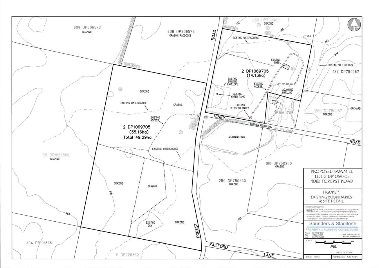
Planning and Development Committee
7 December 2017
2.9 Development
Application DA 421/2016(1) - 1083 Forest Road
Attachment 2 Plans
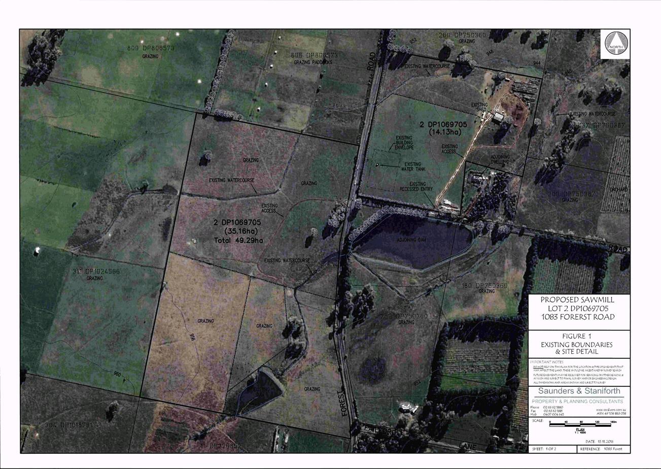
Planning and Development Committee
7 December 2017
2.9 Development
Application DA 421/2016(1) - 1083 Forest Road
Attachment 2 Plans
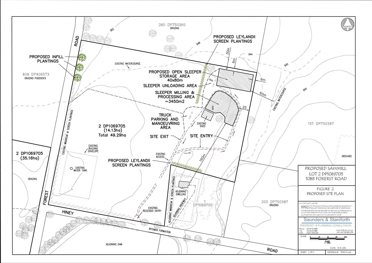
Planning and Development Committee
7 December 2017
2.9 Development
Application DA 421/2016(1) - 1083 Forest Road
Attachment 2 Plans
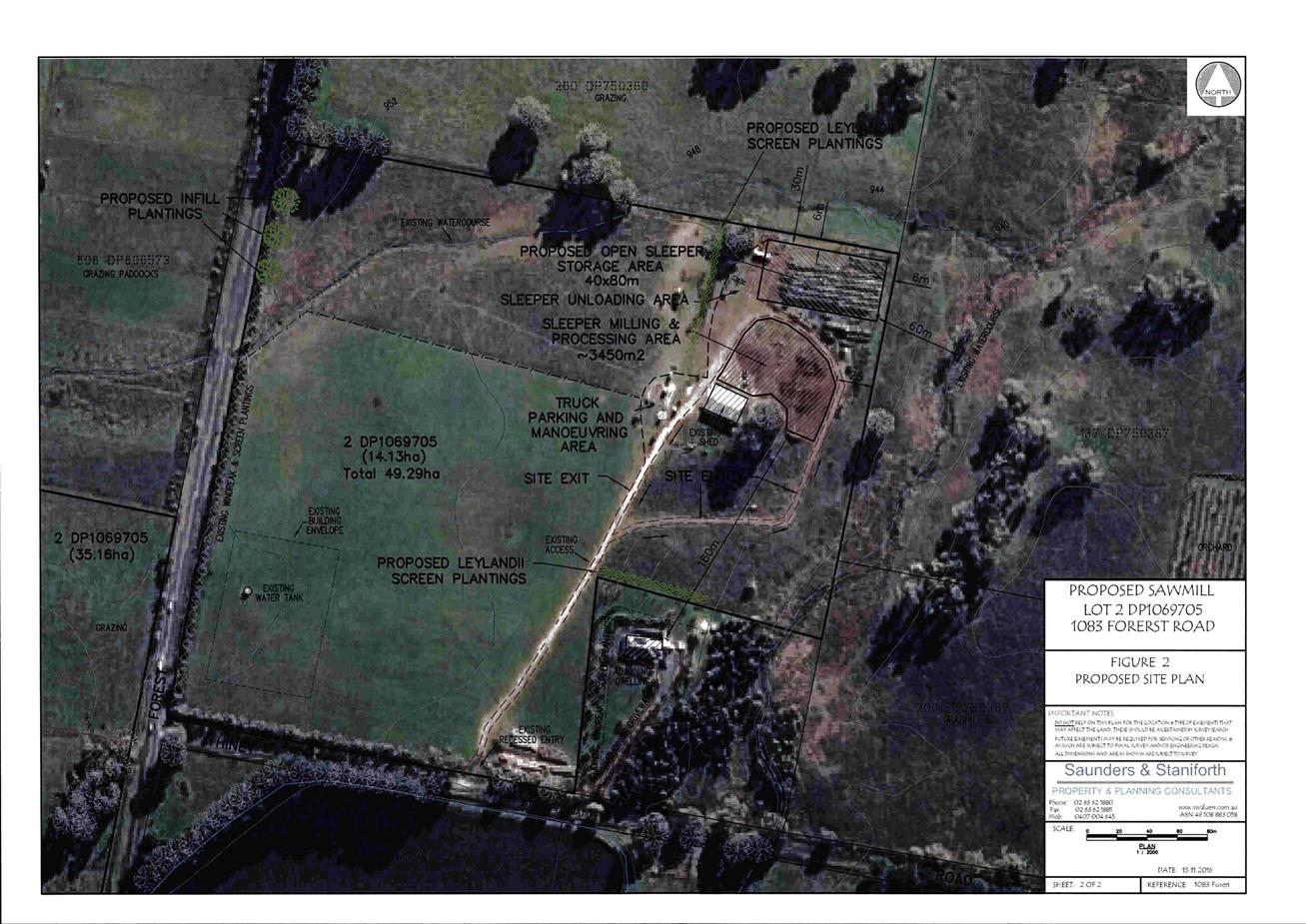
Planning and Development Committee
7 December 2017
2.9 Development
Application DA 421/2016(1) - 1083 Forest Road
Attachment 3 Public
Submissions - first exhibition period
Planning and Development Committee
7 December 2017
2.9 Development
Application DA 421/2016(1) - 1083 Forest Road
Attachment 3 Public
Submissions - first exhibition period
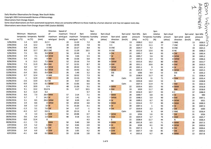
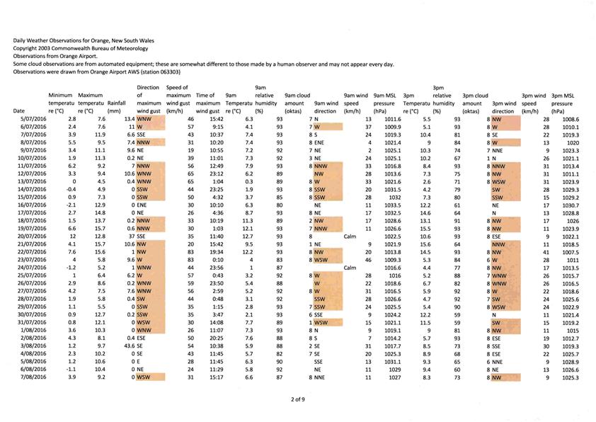
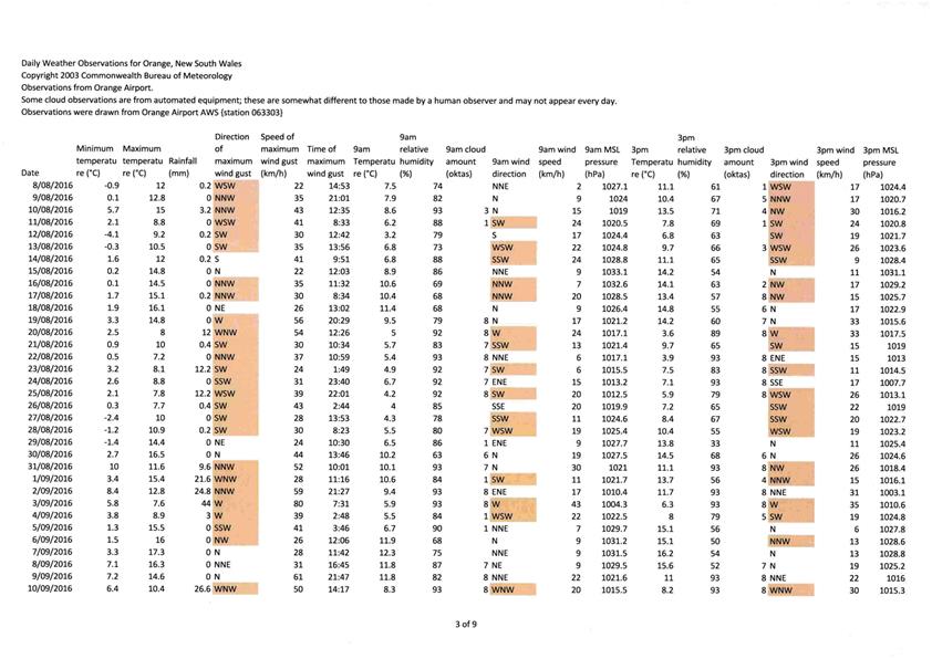
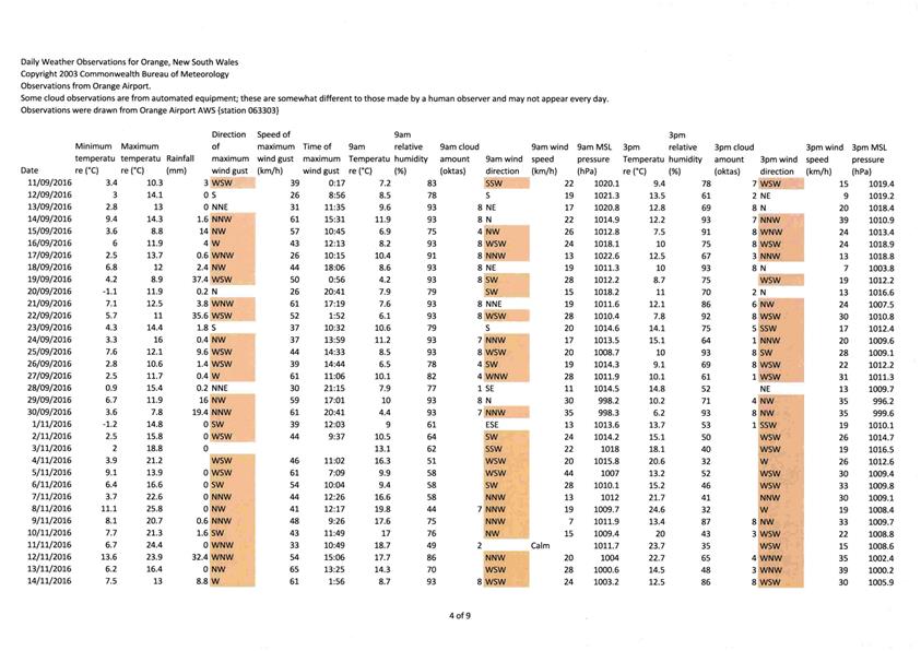
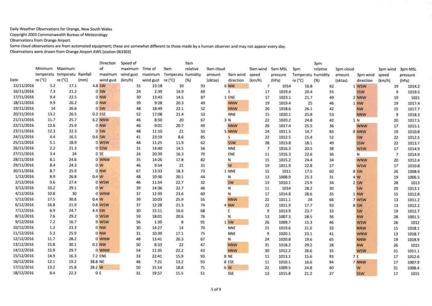
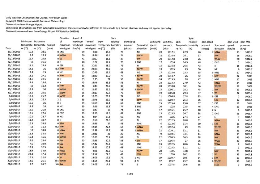
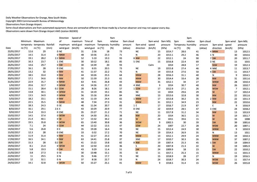
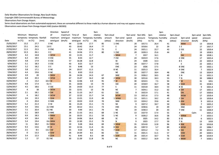
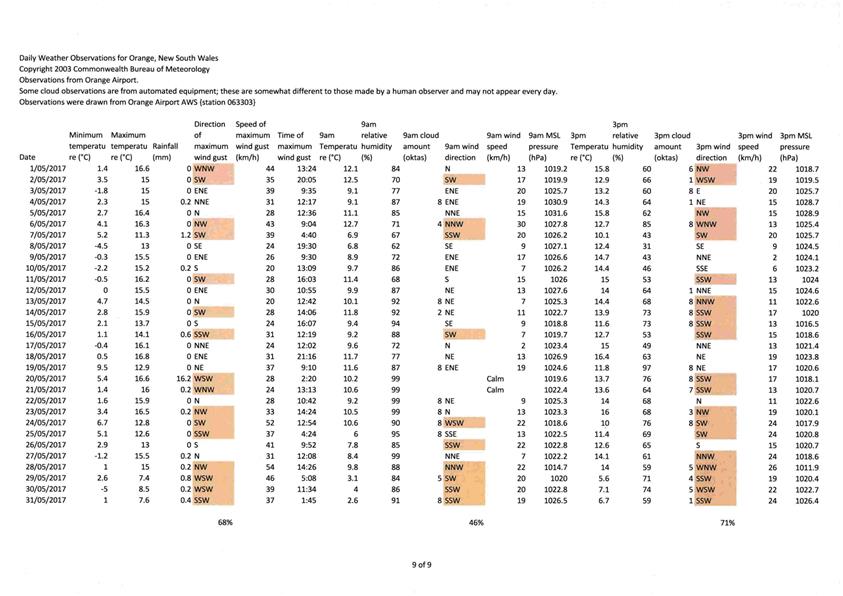
Planning and Development Committee
7 December 2017
2.9 Development
Application DA 421/2016(1) - 1083 Forest Road
Attachment 3 Public
Submissions - first exhibition period
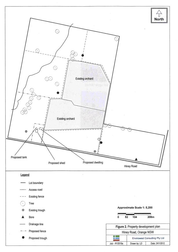
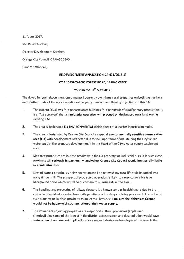

Planning and Development Committee
7 December 2017
2.9 Development
Application DA 421/2016(1) - 1083 Forest Road
Attachment 3 Public
Submissions - first exhibition period

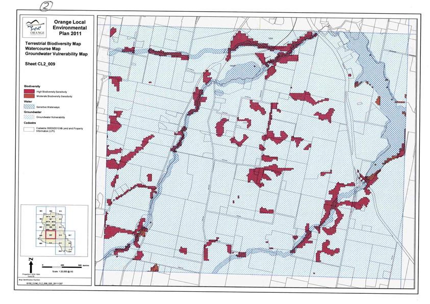
Planning and Development Committee
7 December 2017
2.9 Development
Application DA 421/2016(1) - 1083 Forest Road
Attachment 3 Public
Submissions - first exhibition period
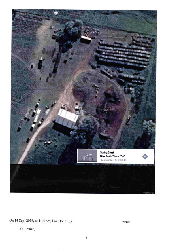
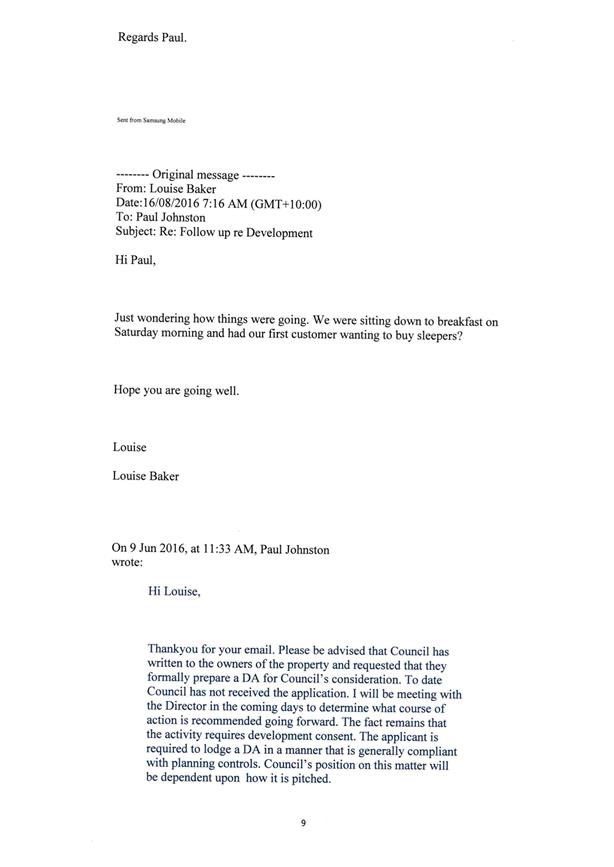
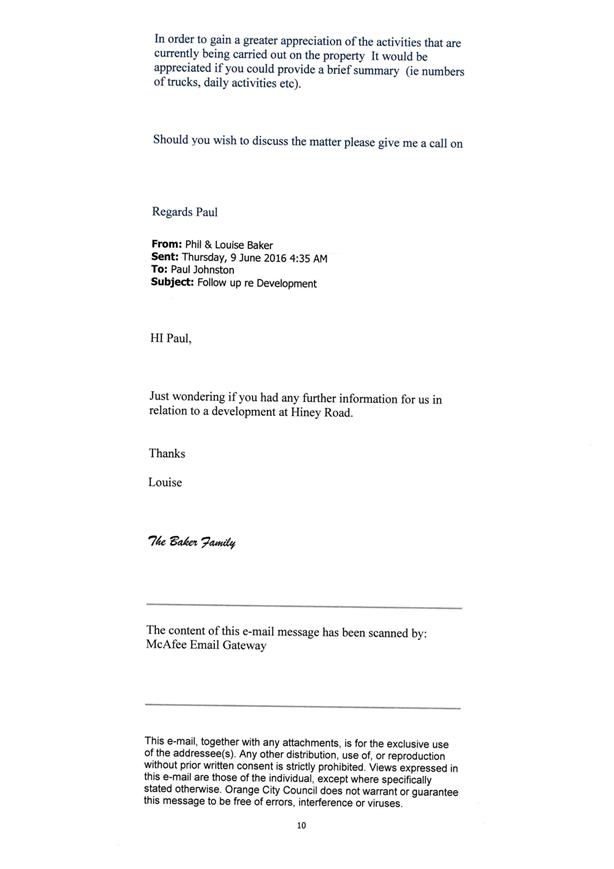


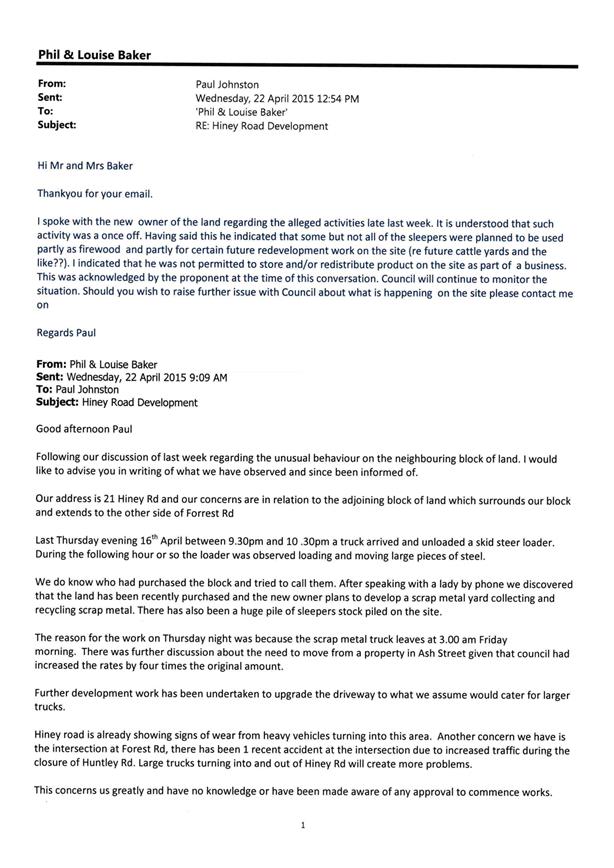
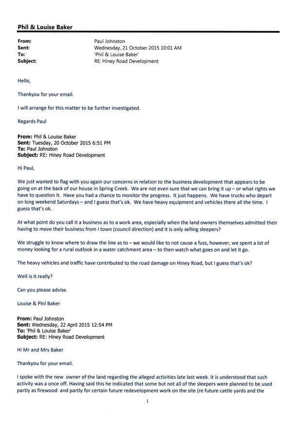
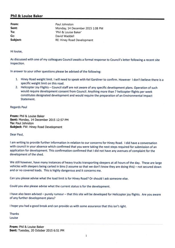
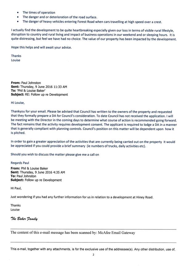

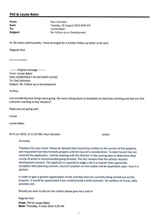
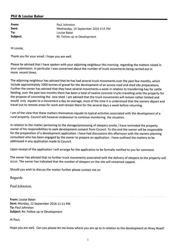
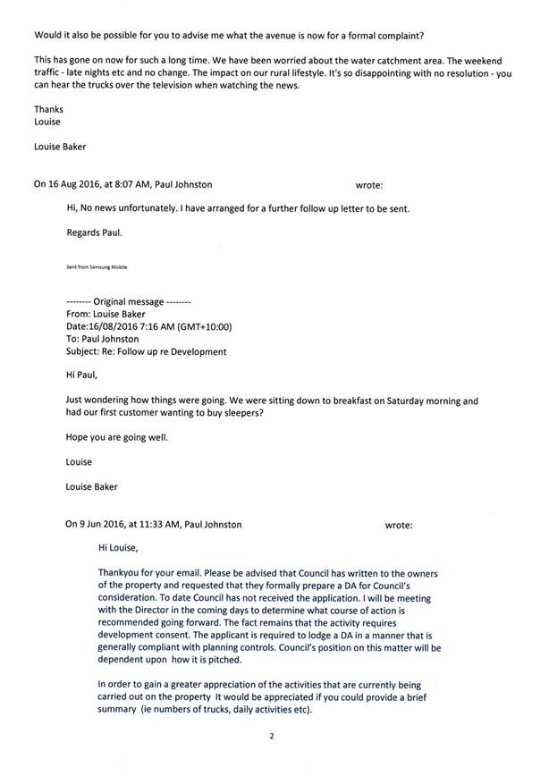
Planning and Development Committee
7 December 2017
2.9 Development
Application DA 421/2016(1) - 1083 Forest Road
Attachment 3 Public
Submissions - first exhibition period
Planning and Development Committee
7 December 2017
2.9 Development
Application DA 421/2016(1) - 1083 Forest Road
Attachment 3 Public Submissions
- first exhibition period
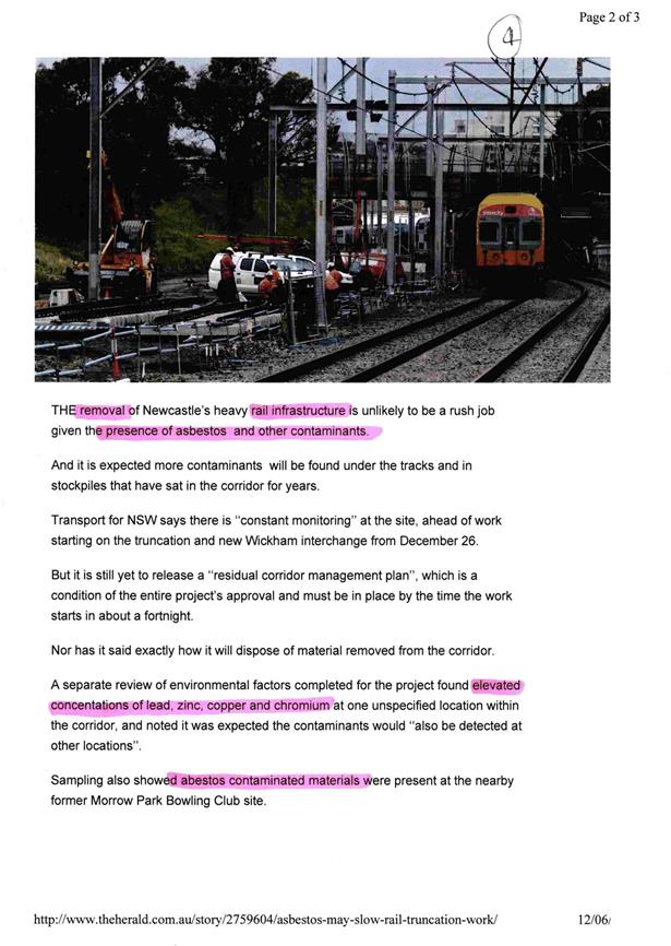


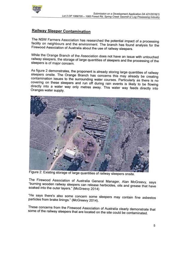
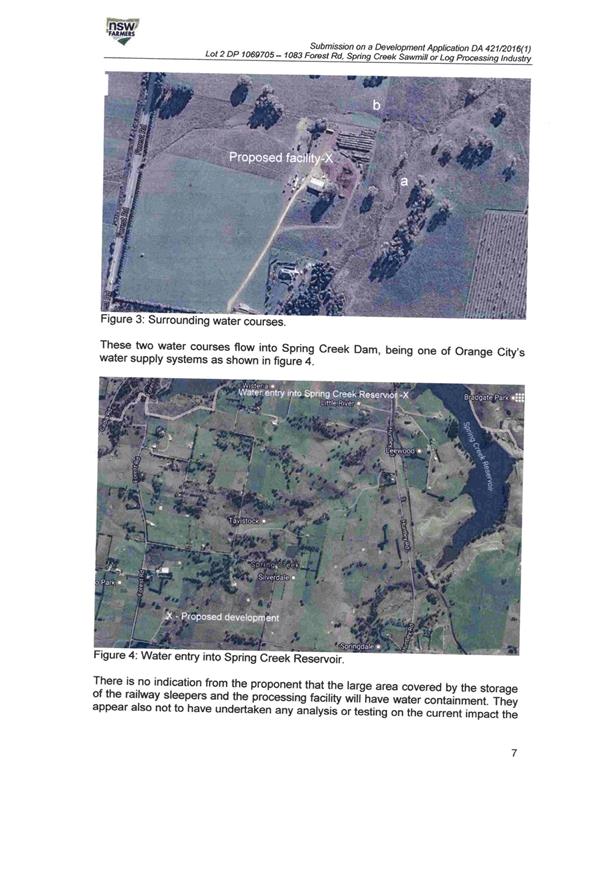
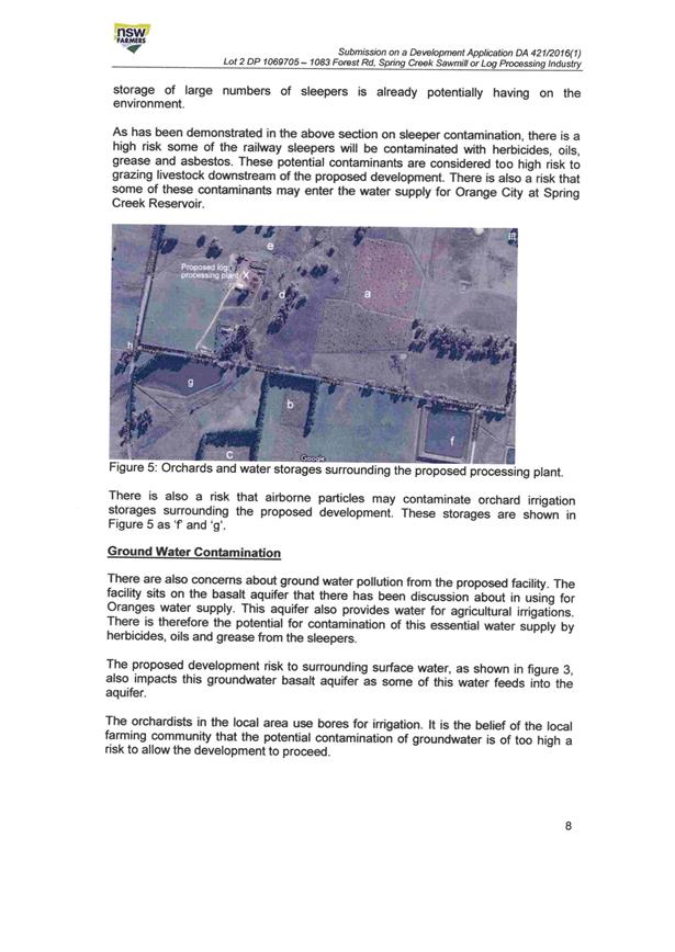

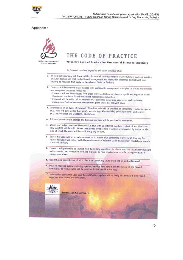
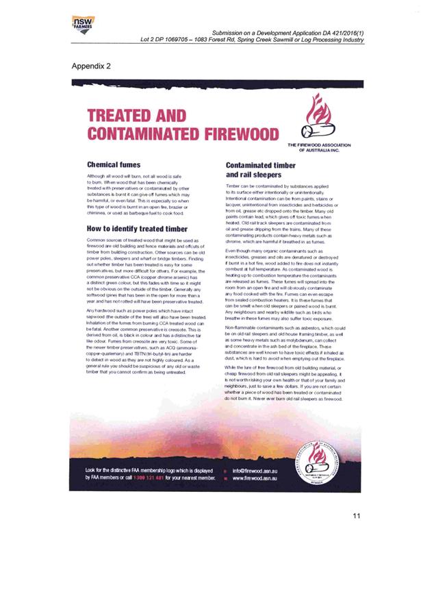

Planning and Development Committee
7 December 2017
2.9 Development
Application DA 421/2016(1) - 1083 Forest Road
Attachment 4 Public
Submissions - second exhibition period


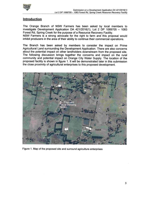
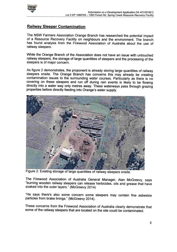
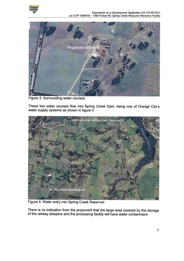


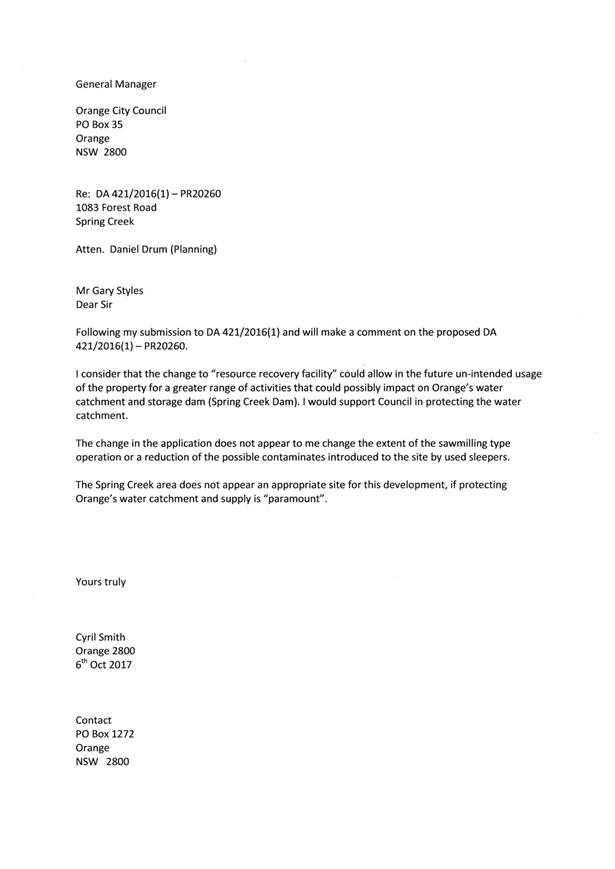
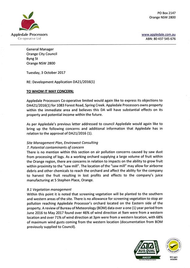
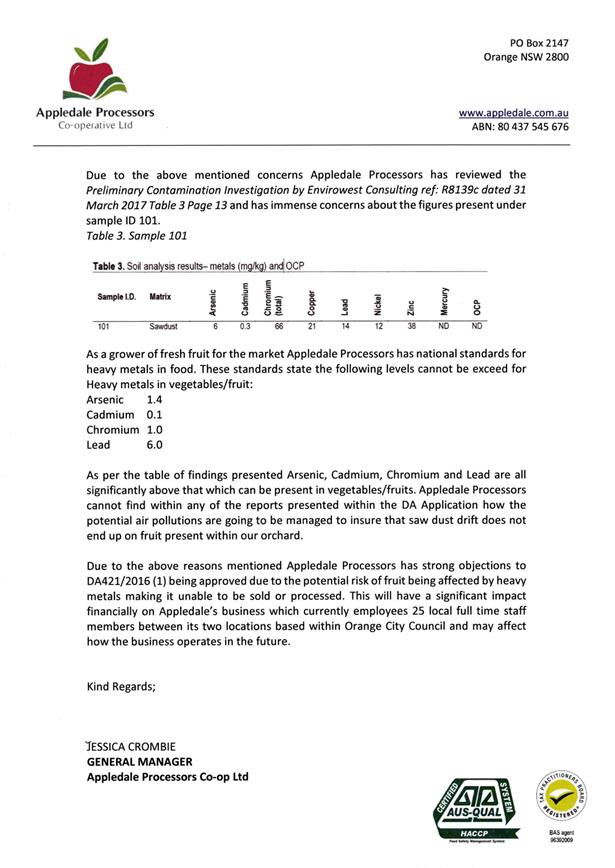
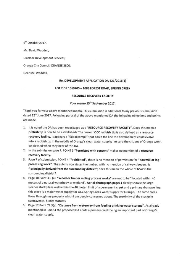
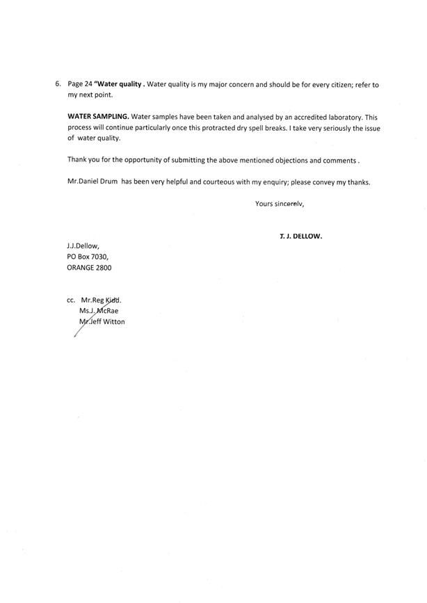


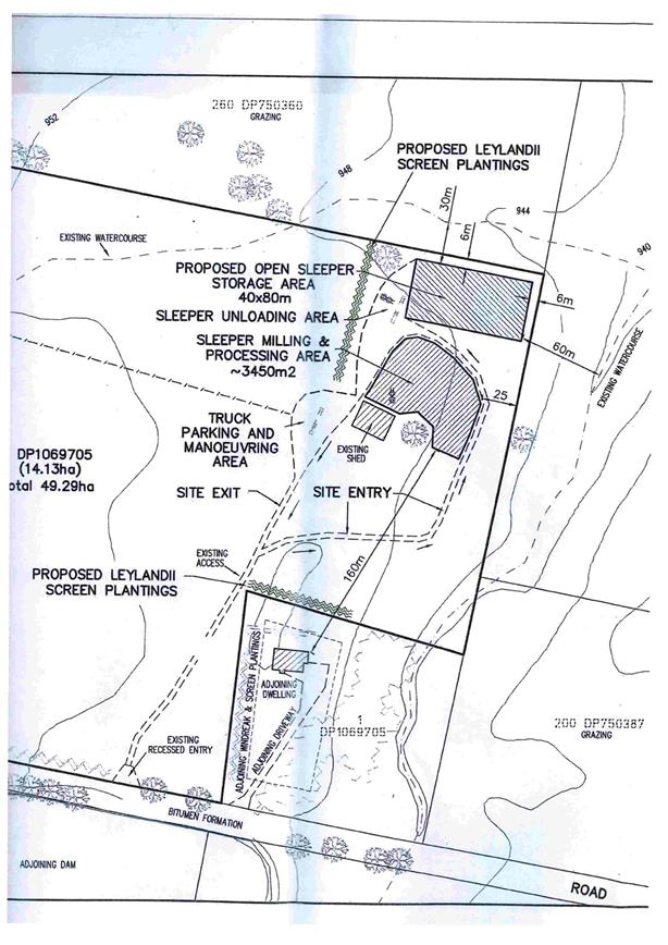
Planning and Development Committee
7 December 2017
2.9 Development
Application DA 421/2016(1) - 1083 Forest Road
Attachment 4 Public
Submissions - second exhibition period
Planning and Development Committee
7 December 2017
2.9 Development
Application DA 421/2016(1) - 1083 Forest Road
Attachment 4 Public
Submissions - second exhibition period
Planning and Development Committee
7 December 2017
2.9 Development
Application DA 421/2016(1) - 1083 Forest Road
Attachment 4 Public
Submissions - second exhibition period

Planning and Development Committee
7 December 2017
2.9 Development
Application DA 421/2016(1) - 1083 Forest Road
Attachment 4 Public
Submissions - second exhibition period

Planning and Development Committee
7 December 2017
2.9 Development
Application DA 421/2016(1) - 1083 Forest Road
Attachment 4 Public
Submissions - second exhibition period
Planning and Development Committee
7 December 2017
2.9 Development
Application DA 421/2016(1) - 1083 Forest Road
Attachment 4 Public
Submissions - second exhibition period
Planning and Development Committee
7 December 2017
2.9 Development
Application DA 421/2016(1) - 1083 Forest Road
Attachment 4 Public
Submissions - second exhibition period
Planning and Development Committee
7 December 2017
2.9 Development
Application DA 421/2016(1) - 1083 Forest Road
Attachment 4 Public
Submissions - second exhibition period
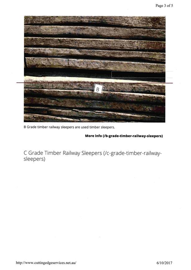
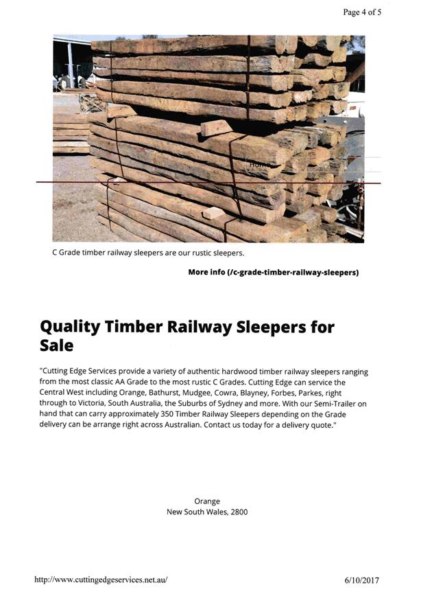
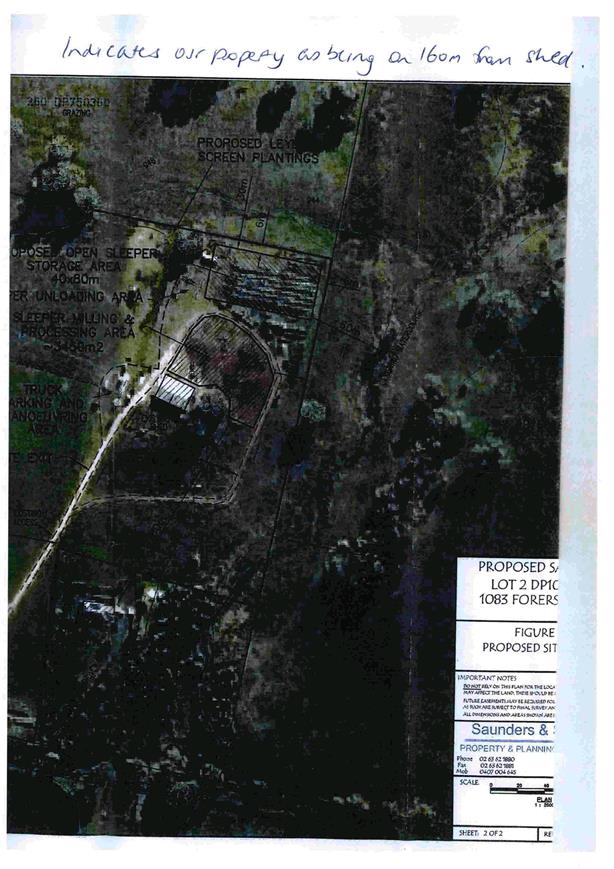
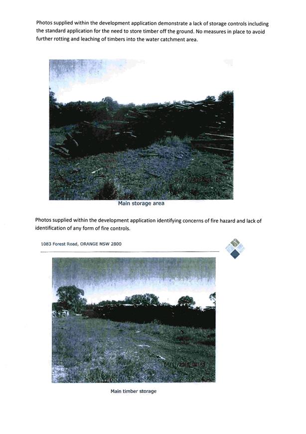
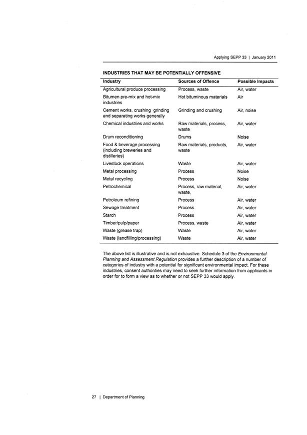
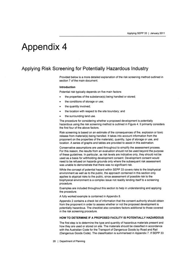
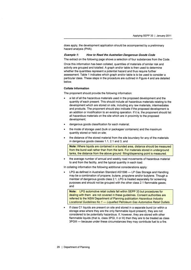
Planning and Development Committee
7 December 2017
2.9 Development
Application DA 421/2016(1) - 1083 Forest Road
Attachment 4 Public
Submissions - second exhibition period
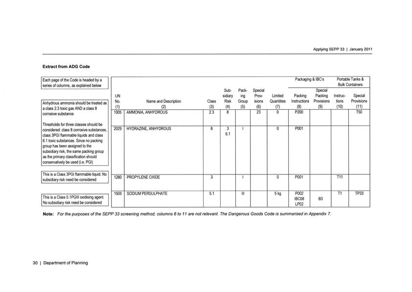
Planning and Development Committee
7 December 2017
2.9 Development
Application DA 421/2016(1) - 1083 Forest Road
Attachment 4 Public
Submissions - second exhibition period


Planning and Development Committee
7 December 2017
2.9 Development
Application DA 421/2016(1) - 1083 Forest Road
Attachment 5 Agency
Submissions
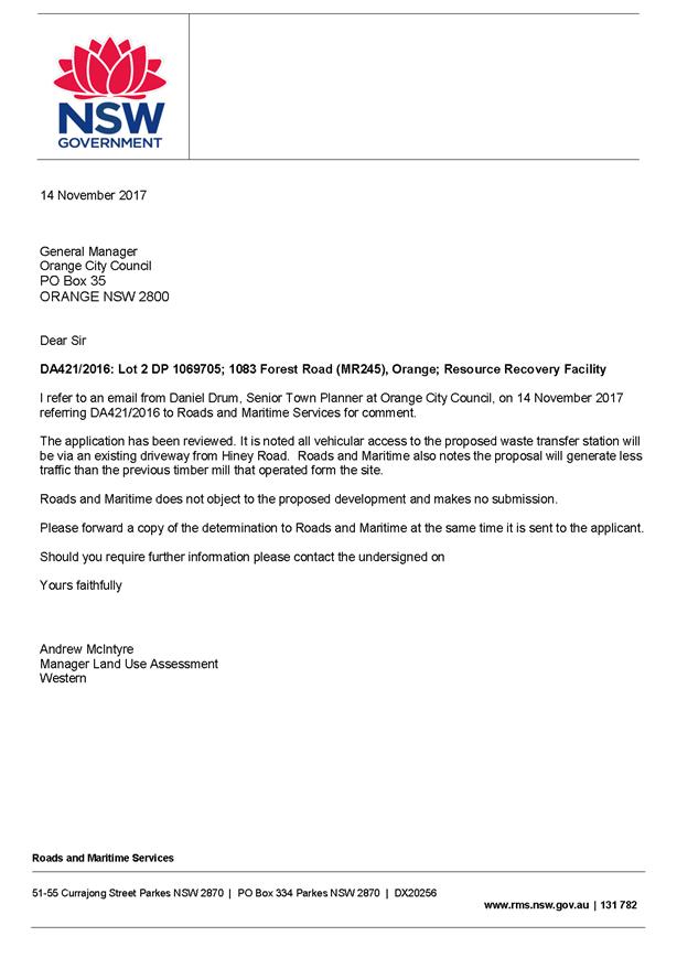
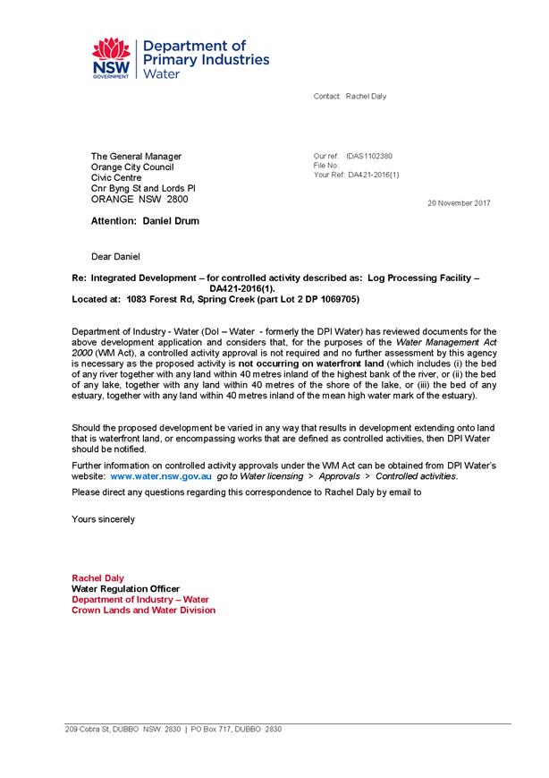
2.10 Development
Application DA 244/2017(1) - 15 Etna Street
RECORD
NUMBER: 2017/2531
AUTHOR: Martin
Hebold, Compliance Team Leader
EXECUTIVE Summary
|
Application
lodged
|
7 July 2017
|
|
Applicant/s
|
Mrs K Churchill
|
|
Owner/s
|
Mrs K
Churchill
|
|
Land
description
|
Lot 51
DP 1127190 - 15 Etna Street, Orange
|
|
Proposed
land use
|
Dwelling
Alterations and Additions (carport)
|
|
Value of
proposed development
|
$7,994
|
Council's consent is sought for a new attached three car carport on land described as Lot 51 DP 1127190 – 15 Etna
Street, Orange. The proposal
involves the construction of a skillion roofed carport measuring 9.1m wide x
4.4m deep, in front of the existing attached garage of the existing dwelling.
Proposed materials include Colorbond steel and Laserlight, and colours are to
match the existing dwelling.
It is considered that
the proposed carport does not comply with the relevant objectives and planning
outcomes of the Orange Local Environmental Plan 2011 (LEP) and Chapter 7
of the Orange Development Control Plan 2004 (DCP), including DCP
objectives for ‘Residential Design’, ‘Bulk and
Scale’, ‘Site Access and Circulation’, ‘Open Space and
Landscaping’ and ‘Water and Soil Management’; and the DCP
planning outcomes for ‘Neighbourhood Character’, ‘Building
Appearance’, ‘Setbacks’, ‘Visual Bulk’,
‘Circulation Design’, ‘Car Parking’, ‘Open Space
and Landscaping’ and ‘Stormwater’.
The proposed scale and
setback of the carport is inappropriate for a residential area, is out of
character with the surrounding pattern of development, and will adversely
impact on the residential and visual amenity of the streetscape and
neighbourhood. The carport has not been designed to minimise visual and environmental
impacts, and as such, the application is recommended for refusal.
It is important to note
that the existing dwelling has been established on the land using the minimum
setbacks set out in the DCP, and as such leaves little opportunity for further development
in the frontage of the site. The existing dwelling includes an attached
three car garage positioned at the minimum setback to the street of 8m,
and there is an additional double garage in the backyard. The DCP requires an
increased setback for triple garages so they do not dominate the streetscape,
and so that the driveway width is kept to a maximum of 6m (double width) at the
front boundary. The maximum width balances the requirement for adequate
manoeuvring while retaining sufficient landscaping between the dwelling and the
street. The proposed carport on a reduced front setback cannot be serviced
fully, and would require a wider driveway than that prescribed by the DCP,
adversely impacting on the visual and residential amenity of the neighbourhood
and street, and increasing stormwater runoff from the site frontage.
Whilst it is not
desirable to have a triple carport forward of a dwelling house, the proposal
would be considered more appropriate and could achieve the overall objectives
of the DCP if the carport was reduced in size, and set back at least 4.5m
from the front boundary. These issues were discussed with the applicant, and
they were requested to consider amending the proposal so the carport would be
less dominant on the street. However, the applicant was not willing to
compromise, stating that the proposed size is needed to provide shelter for
their car, to allow them to get their child out of the car on rainy days
without getting wet, and to provide a shady place for their child to ride their
scooter and shoot basketball hoops. The applicant has also advised that the
carport is needed even though they have five garage spaces already on the site.
It is noted that the only carport within the frontage in the
neighbourhood has been designed to be set back 4.5m from the street and is
reduced in size (double width, and less depth), appropriately balancing the
need for adequate coverage of vehicles, without adversely impacting on the
street and neighbourhood. It is considered that the applicant can design their
carport in a similar manner, which will not be detrimental to the amenity of
the surrounding neighbourhood.
Furthermore, it is
considered that the site offers ample alternative areas to the rear of the
dwelling to provide for covered vehicle storage and recreational spaces, that
can also be designed in a way that do not adversely impact on the neighbourhood
and the streetscape. In any case, it is not considered appropriate for
children’s recreational areas and play equipment to be located within the
front driveway due to potential vehicle conflicts.
DECISION FRAMEWORK
Development in Orange is governed by two key documents; the
Orange Local Environment Plan 2011 and Orange Development Control Plan 2004. In
addition, the Infill Guidelines are used to guide development, particularly in
the heritage conservation areas and around heritage items.
Orange Local Environment Plan 2011 – the LEP
should be considered by Council to be a definitive document. LEPs govern the
types of development that are permissible or prohibited in different parts of
the City and also provide some assessment criteria in specific circumstances.
Uses are either permissible or not - there are no grey areas in terms of
permissibility. The objectives of each zoning, and indeed the aims of the LEP
itself are, however, open to interpretation and can be used to guide decision
making around appropriateness of development.
Orange Development Control Plan 2004 – the DCP
guides development. In general it is a performance based document rather than
prescriptive in nature - its purpose is to guide development. The Land and
Environment Court tends to view it as such. In each area of interest there are
often guidelines used. These guidelines indicate ways of achieving the planning
outcomes. It is thus recognised that there may also be other solutions of
merit. All design solutions are considered on merit by Council staff.
Applications should clearly demonstrate how the planning outcomes are being met
where alternative design solutions are proposed. So one can see that the DCP
gives leeway for developers and architects to use design to achieve the outcome
in other ways if they can. Stating that DCP guidelines are inflexible can
be misleading.
It is
considered that the site is suitable for a carport as the land is appropriately
serviced and there are no known physical attributes, technological or natural
hazards which constrain the site. However, as assessed in this report, the
design and siting of the carport in its proposed form does not meet the
objectives, and planning outcomes of both the LEP and DCP. Suitable
alternatives exist on the site, such as a carport of reduced scale and greater
setback in the frontage, or a carport/covered area to the rear, which could
achieve similar intentions that are not detrimental to the residential and
visual amenity of the neighbourhood or the environment.
Link To Delivery/OPerational Plan
The recommendation in this report relates to the
Delivery/Operational Plan strategy “13.4 Our Environment
– Monitor and enforce regulations relating to City amenity”.
Financial Implications
Nil
Policy and Governance Implications
Nil
|
Recommendation
That Council refuses
development application DA 244/2017(1)
for Dwelling Alterations and Additions (carport) at Lot 51 DP 1127190
- 15 Etna Street, Orange pursuant to the reasons as
set out in the attached Notice of Refusal.
|
further considerations
Consideration has been given to the
recommendation’s impact on Council’s service delivery; image and
reputation; political; environmental; health and safety; employees;
stakeholders and project management; and no further implications or risks have
been identified.
SUPPORTING INFORMATION
THE APPLICATION
Council's consent is sought for a new three car carport to
be constructed in front of the existing three car garage at Lot 51 DP 1127190, known as 15 Etna Street, Orange.
THE PROPOSAL
The proposal involves the construction of a skillion roofed
carport measuring 9.1m wide x 4.4m deep in front of the existing attached
garage of the existing dwelling (western elevation). The carport is proposed at
a setback of 3.7m from the front road boundary and 1.4m from the northern side
boundary. Proposed materials include Colorbond steel and Laserlight, and
colours are to match the existing dwelling.
MATTERS FOR CONSIDERATION
Section 5A Assessment
In the administration of sections 78A, 79B, 79C, 111 and
112, the provisions of Section 5A must be taken into account for every
development application in deciding whether there is likely to be a significant
effect on threatened species, populations or ecological communities or their
habitats. This section includes a requirement to consider any adopted
assessment guidelines, which means assessment guidelines issued and in force
under section 94A of the Threatened Species Conservation Act 1995.
Assessment guidelines are in force (see DECC-W “Threatened Species
Assessment Guidelines - The Assessment of Significance”) which requires
consent authority to adopt the precautionary principle in its assessment.
From 25 August 2017, the Biodiversity Conservation Act 2017
and Biodiversity Conservation Regulation 2017 were gazetted. State
Environmental Planning Policy (Native Vegetation in Non-Rural Areas) 2017 was
also gazetted. The implementation of this legislation (and supporting
guidelines) is subject to savings provisions that defer their full effect for a
period of three months from the date of gazettal for local development.
In this instance, site inspection reveals that the subject
property has no biodiversity or habitat value.
Section 79C
Section 79C of the Environmental Planning and Assessment Act
1979 requires Council to consider various matters, of which those pertaining to
the application are listed below.
PROVISIONS OF ANY ENVIRONMENTAL
PLANNING INSTRUMENT s79C(1)(a)(i)
Orange Local Environmental Plan 2011
Part 1 - Preliminary
Clause 1.2 - Aims of Plan
The broad
aims of the LEP are set out under subclause 2. Those relevant to the
application are as follows:
(a) to encourage development which complements
and enhances the unique character of Orange as a major regional centre boasting
a diverse economy and offering an attractive regional lifestyle,
(f) to recognise and manage valued
environmental heritage, landscape and scenic features of Orange.
The application is considered to be inconsistent with the
relevant aims of the plan, as the proposed carport will adversely impact on the residential and visual amenity of the
streetscape and neighbourhood. This is discussed in greater detail in the DCP
assessment later in this report.
Clause 1.6 - Consent Authority
This clause establishes that, subject to the Act, Council is
the consent authority for applications made under the LEP.
Clause 1.9A - Suspension of
Covenants, Agreements and Instruments
This clause provides that covenants, agreements and other
instruments which seek to restrict the carrying out of development do not apply
with the following exceptions:
· covenants imposed
or required by Council
· prescribed
instruments under Section 183A of the Crown Lands Act 1989
· any conservation
agreement under the National Parks and Wildlife Act 1974
· any trust agreement
under the Nature Conservation Trust Act 2001
· any property
vegetation plan under the Native Vegetation Act 2003
· any biobanking
agreement under Part 7A of the Threatened Species Conservation Act 1995
· any planning
agreement under Division 6 of Part 4 of the Environmental Planning and
Assessment Act 1979.
Council staff are not aware of the title of the subject
property being affected by any of the above.
Mapping
The subject site is identified
on the LEP maps in the following manner:
|
Land Zoning Map:
|
Land zoned R1 General Residential
|
|
Lot Size Map:
|
No Minimum Lot Size
|
|
Heritage Map:
|
Not a heritage item or conservation
area
|
|
Height of Buildings Map:
|
No building height limit
|
|
Floor Space Ratio Map:
|
No floor space limit
|
|
Terrestrial Biodiversity Map:
|
No biodiversity sensitivity on the
site
|
|
Groundwater Vulnerability Map:
|
Ground water vulnerable
|
|
Drinking Water Catchment Map:
|
Not within the drinking water
catchment
|
|
Watercourse Map:
|
Within or affecting a defined watercourse
|
|
Urban Release Area Map:
|
Not within an urban release area
|
|
Obstacle Limitation Surface Map:
|
No restriction on building siting
or construction
|
|
Additional Permitted Uses Map:
|
No additional permitted use applies
|
Those matters that are of relevance are addressed in detail
in the body of this report.
Part 2 - Permitted or Prohibited
Development
Land Use Zones
The subject site is located within the R1 General
Residential zone. The proposed development is defined as a residential
accommodation – dwelling house under OLEP 2011 and is permitted with
consent for this zone. This application is seeking consent.
Clause 2.3 of LEP 2011 references the Land Use
Table and Objectives for each zone in LEP 2011. These objectives for land zoned R1 General Residential
are as follows:
· To
provide for the housing needs of the community.
· To
provide for a variety of housing types and densities.
· To
enable other land uses that provide facilities or services to meet the day to
day needs of residents.
· To
ensure development is ordered in such a way as to maximise public transport
patronage and encourage walking and cycling in close proximity to settlement.
The proposed development is generally consistent with the
above objectives.
Part 3 - Exempt and Complying
Development
The application is not exempt or complying development. Pursuant
to Clause 2.6 the application is seeking development consent.
Part 4 - Principal Development
Standards
Not relevant to the application.
Part 5 – Miscellaneous
Provisions
Not relevant to the application.
Part 6 – Urban Release Areas
Not relevant to the application, the
land is not within an Urban Release Area.
Part 7 - Additional Local Provisions
7.3 - Stormwater Management
This clause applies
to all industrial, commercial and residential zones and requires that Council
be satisfied that the proposal:
(a) is designed to maximise the use of water
permeable surfaces on the land having regard to the soil characteristics
affecting onsite infiltration of water
(b) includes, where practical, onsite
stormwater retention for use as an alternative supply to mains water,
groundwater or river water; and
(c) avoids any significant impacts of
stormwater runoff on adjoining downstream properties, native bushland and
receiving waters, or if that impact cannot be reasonably avoided, minimises and
mitigates the impact.
It is assumed that the carport guttering will be connected
to the existing stormwater system, and soil erosion can be managed at
construction stage. However, the driveway width will need to be increased to
provide for adequate manoeuvring of vehicles in and out of the site. The
reduction of landscaping and permeable areas in the frontage will increase
stormwater runoff from the site to the street, which may impact the existing
stormwater system during heavy/flash rainfall events.
7.5 - Riparian Land and Watercourses
This clause seeks to preserve both
water quality and riparian ecological health. The clause applies to land
identified as a “Sensitive Waterway” on the Watercourse Map. The
subject land contains such a waterway and therefore Council must consider
whether or not the proposal:
(a) is likely to have any adverse impact on
the following:
(i) the water quality and flows within a
watercourse
(ii) aquatic and riparian species, habitats
and ecosystems of the watercourse
(iii) the stability of the bed and banks of the
watercourse
(iv) the free passage of fish and other aquatic
organisms within or along the watercourse
(v) any future rehabilitation of the
watercourse and its riparian areas, and
(b) is
likely to increase water extraction from the watercourse.
Additionally, consent may not be
granted until Council is satisfied that:
(a) the development is designed, sited and
will be managed to avoid any significant adverse environmental impact, or
(b) if that impact cannot be reasonably
avoided - the development is designed, sited and will be managed to minimise
that impact, or
(c) if that impact cannot be minimised - the
development will be managed to mitigate that impact.
While the subject site does
contain a sensitive waterway, the proposal has been designed to site the
buildings 75m from the waterway. This provides a reasonable separation distance
to manage the post-development runoff.
Overall, while there will always
remain a risk to the waterway under extreme circumstances such as record storms
and the like, it is considered that the risk of adverse impacts in regards to
waterways can be appropriately managed to an acceptable level of risk.
7.6 - Groundwater Vulnerability
This clause seeks to protect
hydrological functions of groundwater systems and protect resources from both
depletion and contamination. Orange has a high water table and large areas of
the LGA, including the subject site, are identified with “Groundwater
Vulnerability” on the Groundwater Vulnerability Map. This requires that
Council consider:
(a) whether or not the development (including
any onsite storage or disposal of solid or liquid waste and chemicals) is
likely to cause any groundwater contamination or have any adverse effect on
groundwater dependent ecosystems, and
(b) the cumulative impact (including the
impact on nearby groundwater extraction for potable water supply or stock water
supply) of the development and any other existing development on groundwater.
Furthermore consent may not be granted unless Council is satisfied that:
(a) the development is designed, sited and
will be managed to avoid any significant adverse environmental impact, or
(b) if that impact cannot be reasonably
avoided - the development is designed, sited and will be managed to minimise
that impact,
(c) if that impact cannot be minimised - the
development will be managed to mitigate that impact.
The proposal is not
anticipated to involve the discharge of toxic or noxious substances and is
therefore unlikely to contaminate the groundwater or related ecosystems. The
proposal does not involve extraction of groundwater and will therefore not
contribute to groundwater depletion. The design and siting of the proposal
avoids impacts on groundwater and is therefore considered acceptable.
Clause 7.11 - Essential Services
Clause 7.11 is applicable and states:
Development
consent must not be granted to development unless the consent authority is
satisfied that any of the following services that are essential for the
proposed development are available or that adequate arrangements have been made
to make them available when required:
(a) the
supply of water
(b) the
supply of electricity
(c)
the disposal and management of sewage
(d) storm
water drainage or on-site conservation
(e) suitable
road access.
In consideration of this clause, all
utility services are available to the land and adequate for the proposal.
STATE ENVIRONMENTAL PLANNING
POLICIES
State Environmental Planning Policy 55 - Remediation of
Land
Under Clause 7 of State Environmental Planning Policy 55 -
Remediation of Land (SEPP 55), Council must consider whether the land is
contaminated and whether the land requires any form of remediation to render it
suitable for the purpose to which it is proposed to be used. The previous land
uses must be considered along with any visible or tangible evidence on the
site. Clause 7 of SEPP 55 provides as follows:
A consent authority must not consent to the carrying out of any
development on land unless:
(a) it has considered whether the land is
contaminated, and
(b) if the land is contaminated, it is
satisfied that the land is suitable in its contaminated state (or will be
suitable, after remediation) for the purpose for which the development is proposed
to be carried out, and
(c) if the land requires remediation to be
made suitable for the purpose for which the development is proposed to be
carried out, it is satisfied that the land will be remediated before the land
is used for that purpose.
Prior to the residential zoning of the
subject land and adjoining parcels, the locality had longstanding agricultural
(grazing) use. Contamination investigation was undertaken in conjunction with
the residential subdivision of the land. As
the potential for
contamination is very low, and the overall use of the land is not changing
(i.e. continued residential use), further
investigation as a precursor to site remediation is considered unnecessary in
conjunction with the current proposal.
PROVISIONS OF ANY DRAFT
ENVIRONMENTAL PLANNING INSTRUMENT THAT HAS BEEN PLACED ON EXHIBITION
s79C(1)(a)(ii)
There are no draft environmental planning instruments that
apply to the subject land or proposed development.
DESIGNATED DEVELOPMENT
The proposed development is not designated development.
INTEGRATED DEVELOPMENT
The proposal is not integrated development.
PROVISIONS OF ANY DEVELOPMENT
CONTROL PLAN s79C(1)(a)(iii)
Development Control Plan 2004
Development Control Plan 2004 (“the DCP”)
applies to the subject land. An assessment of the proposed development against
the relevant Planning Outcomes will be undertaken below.
Part 7 - Design Elements for
Residential Development
The DCP sets the following Planning Outcomes in regard to
Urban Residential Development.
Residential Design
Objectives
· To
ensure that the development fits into its setting and environmental features of
the locality.
· To
ensure that the appearance of housing is of a high visual quality, enhances the
streetscape and complements good quality surrounding development.
· To
ensure that new development complements places with heritage significance and
their settings in a contemporary way.
· To
develop a sense of place with attractive street frontages.
· To
encourage visually appealing cohesive streetscapes.
· To
create a safe and secure environment.
· To provide
consistent design elements that protect private investment.
The proposed development is contrary to the residential
design objectives of this section of the DCP as detailed below.
7.7-1 - Neighbourhood Character
The DCP sets the following Planning Outcomes in regard to
Neighbourhood Character:
· Site
layout and building design enables the:
- creation
of attractive residential environments with clear character and identity
- use of
site features such as views, aspect, existing vegetation and landmarks
· Buildings
are designed to complement the relevant features and built form that are
identified as part of the desired neighbourhood character.
· The
streetscape is designed to encourage pedestrian access and use.
The character of the surrounding area is exceptionally
consistent, where the pattern of development comprises of single storey
dwelling houses, constructed from brick, with pitched Colorbond or tiled roofs,
set 4.5m from the front boundary, with attached double garages.
It is considered that the proposed carport will not be in
keeping with the surrounding neighbourhood character, and will be very dominant
in the streetscape. The proposed carport measures 9.1m wide by 4.4m in depth,
giving an overall roof area of approximately 40m2. The proposed
setback from the front boundary of the site is 3.7m.
The minimum setback for this
recently established area, as set out in the DCP, is 4.5m. The existing dwelling has already been established on
the land using the minimum setbacks set out in the DCP, and as such leaves
little opportunity for further development in the frontage of the site. The
existing dwelling includes an attached three car garage positioned at the
minimum setback to the street of 8m (see Figure 1). The DCP requires an
increased setback for triple garages so they do not dominate the streetscape,
and so that the driveway width is kept to a maximum of 6m (double width). This
maximum width balances the requirement for adequate manoeuvring while retaining
sufficient landscaping between the dwelling and the street (see Figure 1). The
proposed carport, on a reduced front setback, cannot be adequately serviced
without widening the driveway to around 9m, in excess of that that prescribed
by the DCP, resulting in adverse visual impacts to the streetscape. This
matter is discussed in greater detail in the ‘Setbacks’ section of
the DCP assessment.
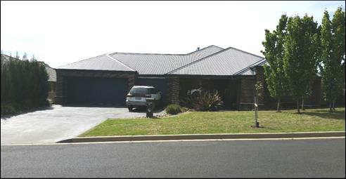
Figure 1 - photograph of the existing dwelling and
attached garages
There are no carports within the frontage of lots in this
street, and only one example of a double carport in the wider area, which
achieves the minimum 4.5m setback and therefore does not impact on the
streetscape. The proposed carport would be located forward of the main building
line of the existing dwelling and neighbouring dwellings. Given the substantial
size of the carport, and lack of setback from the street, it is considered that
the adverse impacts will be significant in terms of the desired streetscape of
this recently developed estate. It is considered that such a departure from the
requirements of the DCP in a newly established area would be inappropriate.
Overall, the proposal does not meet the objectives for
residential design and the planning outcomes for neighbourhood character as
follows:
· the
proposed site layout will not achieve an attractive and cohesive streetscape
and residential environment
· the
appearance of the carport is not of a high visual quality and will not enhance
the streetscape
· the
carport has not been designed to complement the features and built form that
characterises the area.
7.7-2 - Building Appearance
The DCP sets the following Planning Outcomes in regard to
Building Appearance:
· The
building design, detailing and finishes relate to the desired neighbourhood
character, complement the residential scale of the area, and add visual
interest to the street.
· The
frontages of buildings and their entries face the street.
· Garages
and car parks are sited and designed so that they do not dominate the street
frontage.
The proposed carport would be visually dominant due to its
size and insufficient setback from the street, when compared with the open
nature of the frontages within the existing streetscape. The existing attached
triple garage is already comparatively dominate in the streetscape, however
this is mitigated by its setback of 8m. This mitigating factor would be
ineffective with a large carport located in front of it. As discussed in
‘Neighbourhood Character’ above, the proposed carport will dominate
the street and the existing dwelling, where its design does not complement the
residential scale of the area. The planning outcomes and residential design
objectives have not been met in regards to building appearance.
7.7-4 - Setbacks
The DCP sets the following Planning Outcomes in regard to
Setbacks:
· Street setbacks
contribute to the desired neighbourhood character, assist with the integration
of new development and make efficient use of the site.
· Street setbacks
create an appropriate scale for the street considering all other streetscape
components.
These outcomes seek to achieve an appropriate scale of
development for the street and neighbourhood. As discussed in
‘Neighbourhood Character’ and ‘Building Appearance’
above, the proposed carport is setback only 3.7m from the frontage, and will
adversely impact on the existing dwelling, the streetscape, and neighbourhood
character.
The proposal would be
considered more appropriate and could achieve the planning outcomes and
residential design objectives if the carport was reduced in scale, was set back
at least 4.5m from the front boundary, and the existing 6m wide driveway was
retained (that is, reduce the size of the carport so that the driveway does not
require widening). These issues were discussed with the applicant, and they
were requested to consider amending the proposal so the carport would be less dominant
on the street, however they declined to do so, stating that that a
reduced and set back carport would not be able to fully cover their vehicles. It
is noted that the only carport within the frontage in the neighbourhood, which
the applicant gives as an example, has been designed to be set back 4.5m from
the street, and is reduced in size (i.e. double width, and reduced depth),
which appropriately balances the need for adequate coverage of vehicles,
without adversely impacting on the street and neighbourhood.
Whilst a triple carport on a 4.5m setback is not desirable,
at least it would be set back in line with the neighbouring dwelling houses,
and therefore would not be as dominant as the proposed 3.7m setback. However,
as mentioned above, the applicant has refused to move the carport further back
from the frontage. It is noted that a greater setback alone would not be
sufficient to achieve an adequate development, as the driveway would still have
to be widened to allow for manoeuvring in and out of the site, and as such, the
carport also needs to be reduced in size/scale.
It its current form, the proposed carport does not achieve
the planning outcomes for setbacks, or the overall objectives for residential
design.
7.7-5 - Fences and Walls
The DCP sets the following Planning Outcomes in regard to
Fences and Walls:
· Front fences
and walls:
– assist
in highlighting entrances and creating a sense of identity within the
streetscape
– are
constructed of materials compatible with associated housing and with fences
visible from the site that positively contribute to the streetscape
– provide
for facilities in the street frontage area such as mail boxes.
The proposal does not relate to fencing.
Bulk and Scale Objectives
· To
allow flexibility in siting buildings and to ensure that the bulk and scale of
new development reasonably protects the amenity of neighbouring properties and
maintains appropriate neighbourhood character.
· To
allow adequate daylight, sunlight and ventilation to living areas and private
open spaces of new and neighbouring developments.
· To
encourage the sharing of views, while considering the reasonable development of
the site.
The development is considered to be inconsistent with the
above objectives, as detailed below.
7.7-6 - Visual Bulk
The DCP sets the following Planning Outcome in regard to
Visual Bulk:
· Built form
accords with the desired neighbourhood character of the area with:
- side and rear setbacks
progressively increased to reduce bulk and overshadowing
- site coverage that retains
the relatively low density landscaped character of residential areas
- building form and siting
that relates to landform, with minimal land shaping (cut and fill)
- building height at the
street frontage that maintains a comparable scale with the predominant adjacent
development form
- building to the boundary
where appropriate.
While the proposed carport will fit within the bulk and
scale envelope, its great size and reduced setback from the street will result
in a building form that does not accord with the neighbourhood character from a
streetscape perspective. As noted previously in this report, the existing
dwelling and garaging at the frontage has already been built using the minimum
setbacks, leaving little scope for further development. A carport reduced in
scale, that is, reduced in size and setback at least 4.5m from the street,
could allow a carport to be located in the frontage in a way that reasonably
protects the amenity of the neighbourhood.
The applicant, however was
unwilling to compromise in this regard, stating that the existing vegetation
provides sufficient screening. Although the boundary vegetation provides some
screening, it is not considered sufficient alone, and that the scale and
setback of the carport also needs to be reduced to ensure that the impacts are
not unreasonable or adverse. It is also noted that the vegetation along the
northern boundary, which provides for most of the screening is likely to need
trimming back to facilitate the building and siting of the carport, and less
foliage will need to be maintained in the long-term due to conflict between the
vegetation and the carport (see Figure 2).
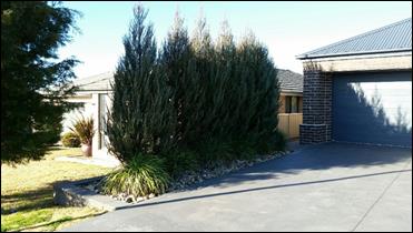
Figure 2 - photograph of northern boundary vegetation
As such, the proposal does not meet the planning outcomes
for visual bulk, or the overall bulk and scale objectives.
7.7-7 - Walls and Boundaries
The DCP sets the following Planning Outcome in regard to
Walls and Boundaries:
· Building to the
boundary is undertaken to provide for efficient use of the site taking into
account:
- the privacy of neighbouring
dwellings and private open space
- the access to daylight
reaching adjoining properties
- the impact of boundary walls
on neighbours.
The proposed side setbacks will ensure there will be no
privacy or daylighting impacts on the adjacent residential properties.
7.7-8 - Sunlight and Daylight
The DCP sets the following Planning Outcome in regard to
Daylight and Sunlight:
· Buildings are
sited and designed to ensure:
- daylight to habitable rooms
in adjacent dwellings is not significantly reduced
- overshadowing of
neighbouring secluded open spaces or main living area windows is not
significantly increased
- consideration of
Council’s Energy Efficiency Code.
As mentioned previously, the proposed carport can be
contained within the bulk and scale envelope, and complies with side setbacks,
therefore there will be no adverse impacts to neighbouring properties in terms
of sunlight and daylight to windows and areas of private open space.
7.7-9 - Views
The DCP sets the following Planning Outcomes in regard to
Views:
· Building form
and design allow for residents from adjacent properties to share prominent
views where possible.
· Views including
vistas of heritage items or landmarks are not substantially affected by the
bulk and scale of the new development.
There are no prominent views, or vistas, from the property,
therefore these outcomes are not relevant to the application.
Site Access
and Circulation Objectives
· To
provide convenient and safe access and parking that meets the needs of all
residents and visitors.
· To
encourage the integrated design of access and parking facilities to minimise
visual and environmental impacts.
The proposed development is inconsistent
with the above objectives, as detailed below.
7.7-14 - Circulation Design
The DCP sets the following Planning Outcome in regard to
Circulation and Design:
· Accessways and
parking areas are designed to manage stormwater.
· Accessways,
driveways and open parking areas are suitably landscaped to enhance amenity
while providing security and accessibility to residents and visitors.
· The site layout
allows people with a disability to travel to and within the site between car
parks, buildings and communal open space.
The proposal does not seek to alter access arrangements to
the site, however a wider driveway would be required to provide adequate
vehicle manoeuvring in and out of the carport. As discussed earlier in this
assessment, a 9m driveway would be required, which is 3m wider than the maximum
6m set out in the DCP. This would result in adverse visual impacts to the
street and neighbourhood, as the property would have additional hard standing
areas and less landscaped areas. Landscaped areas in the frontage are required
to ‘soften’ the visual impact of a dwelling and its garaging and
driveways into a streetscape, to provide for an attractive neighbourhood, as well
as mitigate stormwater runoff from the property onto the street. It is also
noted that there are safety concerns with the proposed carport being used as
vehicle parking and manoeuvring, as well as a children’s play area. It is
not considered appropriate to locate children’s recreational areas within
the driveway due to potential vehicle conflicts.
It is considered that the proposal does not achieve the
planning outcomes in regards to circulation design, or the overall objective
for site access and circulation.
7.7-15 - Car Parking
The DCP sets the following Planning Outcomes in regard to
Car Parking:
· Parking
facilities are provided, designed and located to:
- enable the efficient and
convenient use of car spaces and accessways within the site
- reduce the visual dominance
of car parking areas and accessways.
· Car parking is
provided with regard to the:
- the number and size of
proposed dwellings
- requirements of people with
limited mobility or disabilities.
The proposed carport will increase the number of parking
spaces originally proposed and approved for the subject lot. There is an
existing double garage in the backyard, and a triple garage attached to the
existing dwelling, providing for 5 covered car parking spaces. The addition of
the proposed carport would result in 8 covered parking spaces on the site,
which is well above average, and out of character for the neighbourhood.
It is noted that the DCP only requires 1.7 parking spaces
for a dwelling with 3 or more bedrooms. Recent census data (2016) states that
around 50% of Orange residents have access to more than 2 motor vehicles, and
this appears to be the case for the applicant, who requires more than the
average number of covered parking spaces.
However, the need for additional vehicle parking on the site
should not be to the detriment of the neighbourhood, and it is considered that
the proposal could easily be amended to be more suitable for the site and
surrounds.
In its current form, the proposed development does not meet
the planning outcomes for car parking, or the overall objectives for site
access and circulation, as the proposed parking spaces would not retain the
residential character of the area, and will result in an increase of visual
dominance of garaging, car parking, and driveway/hard standing areas on the
site.
7.7-16 - Private Open Space
The DCP sets the following Planning Outcomes in regard to
Private Open Space:
· Private open
space is clearly defined for private use.
· Private open
space areas are of a size, shape and slope to suit the reasonable requirements
of residents including some outdoor recreational needs and service functions.
· Private open
space is:
– capable
of being an extension of the dwelling for outdoor living, entertainment and
recreation
– accessible
from a living area of the dwelling
– located
to take advantage of outlooks; and to reduce adverse impacts of overshadowing
or privacy from adjoining buildings
– Orientated
to optimise year round use.
The carport will not impact on the availability of, or
access to private open space on the site. Given the proposal will result in
adverse impacts to the street and neighbourhood, it is considered that the site offers ample alternative areas to the
rear of the dwelling to provide for covered vehicle storage and recreational
spaces, that can be designed in a way that do not impact on the neighbourhood
and the streetscape, yet still provide adequate private outdoor areas. It is
also considered more appropriate, in terms of security and safety, that children’s recreational areas and
play equipment are located to the rear of the site, where the driveway
poses potential vehicle conflicts.
7.7-17 - Open Space and
Landscaping
The DCP sets the following Planning Outcomes in regard to
Open Space and Landscaping:
· The site layout
provides open space and landscaped areas which:
– contribute
to the character of the development by providing buildings in a landscaped
setting
– provide
for a range of uses and activities including stormwater management
– allow
cost effective management.
· The landscape
design specifies landscape themes consistent with the desired neighbourhood
character; vegetation types and location, paving and lighting provided for
access and security.
· Major existing
trees are retained and protected in a viable condition whenever practicable
through appropriate siting of buildings, accessways and parking areas.
· Paving is
applied sparingly and integrated in the landscape design.
The carport will be located over the existing concrete
driveway, however the driveway width in the frontage and at the street will
need to be increased to provide for adequate manoeuvring of vehicles in and out
of the site. As such, the provision of unpaved area will be reduced in the
front garden area, thereby reducing landscaping and permeable areas, resulting
in adverse visual impacts to the street and neighbourhood, and increasing stormwater
runoff from the site to the street. Stormwater is discussed in more detail
below. It is considered that the proposal does not meet the planning outcomes
for open space and landscaping.
Water and Soil Management
Objectives
· To control and
minimise the impact of stormwater run-off and soil erosion on adjoining land
and downstream.
· To encourage
reduced water wastage by reusing, recycling and harvesting stormwater.
The development is inconsistent with the above objectives,
as detailed below.
7.7-18 - Stormwater
The DCP sets the following Planning Outcomes in regard to
Stormwater:
· Onsite drainage
systems are designed to consider:
– downstream
capacity and need for on-site retention, detention and re-use
– scope
for on-site infiltration of water
– safety
and convenience of pedestrians and vehicles
– overland
flowpaths.
· Provision is
made for onsite drainage which does not cause damage or nuisance flows to
adjoining properties.
It is assumed that the carport guttering will be connected
to the existing stormwater system, however the driveway width will need to be
increased to provide for adequate manoeuvring of vehicles. The reduction of
landscaping and permeable areas in the frontage will increase stormwater runoff
from the site to the street, which may result in impacts to the existing
stormwater system during heavy/flash rainfall events. The application has not
addressed this matter, and as such, these planning outcomes and the overall
objectives have not been met.
7.7-19 - Erosion and Sediment
Control
The DCP sets the following Planning Outcome in regard to
Erosion and Sedimentation:
· Measures
implemented during construction to ensure that the landform is stabilised and
erosion is controlled.
It is assumed that the carport guttering will be connected
to the existing stormwater system, and soil erosion can be managed at
construction stage. Therefore impacts to neighbouring properties will be
minimal.
PROVISIONS PRESCRIBED BY THE
REGULATIONS s79C(1)(a)(iv)
Demolition of a Building (clause 92)
The proposal does not involve the demolition of a building.
Fire Safety Considerations
(clause 93)
The proposal does not involve a change of building use for
an existing building.
Buildings to be Upgraded
(clause 94)
The proposed works do not require the upgrading of the
existing dwelling house.
BASIX Commitments (clause 97A)
The provisions of BASIX will do not apply to a Class 10a
carport.
THE LIKELY IMPACTS OF THE
DEVELOPMENT s79C(1)(b)
Neighbourhood Amenity and Visual Impacts
The pattern of development in the surrounding area is
exceptionally consistent, and as discussed in the DCP assessment, the proposed
triple carport being 40m2 in size and only setback 3.7m from the
street frontage, coupled with the need to increase the width of the existing
driveway to 9m, will not be in keeping with the surrounding neighbourhood
character and will be visually dominant in the streetscape.
In its current form, the proposed carport does not meet the DCP
objectives for ‘Residential Design’, ‘Bulk and Scale’,
‘Site Access and Circulation’, and ‘Open Space and
Landscaping’; nor meet the DCP planning outcomes for ‘Neighbourhood
Character’, ‘Building Appearance’, ‘Setbacks’,
‘Visual Bulk’, ‘Circulation Design’, ‘Car
Parking’, and ‘Open Space and Landscaping’ as follows:
· the proposed site
layout will not achieve an attractive and cohesive streetscape and residential
environment
· the appearance of
the carport is not of a high visual quality and will not enhance the streetscape
· the carport has
not been designed to complement the features and built form that characterises
the area
· the carport has
not been designed to minimise visual impacts.
Overall, the proposed carport is likely to adversely affect
the visual and residential quality of the existing streetscape and
neighbourhood character. Mitigation of these impacts is possible by reducing
the scale of the carport, and setting it back at least 4.5m from the street,
however the applicant is not willing to amend its design.
Traffic Impacts
The proposed carport will not generate an increase in
traffic movements compared to the existing or approved situation, however,
adequate circulation can only be achieved if the driveway is widened to triple
width. The proposal is unlikely to have any traffic impacts if the driveway is
widened, but this would be to the detriment of the residential amenity of
neighbouring properties and the wider neighbourhood.
Environmental Impacts
The subject land is highly modified and well established
with no significant vegetation, threatened species or ecological endangered
communities or their habitats. No changes are proposed to the existing
landscaping on the site, however the driveway will need to be widened to
provide for adequate manoeuvring in and out of the site. This will result in a reduction
of landscaping and permeable areas in the frontage, and will increase
stormwater runoff from the site.
In its current form, the proposed carport does not meet the DCP
objectives for ‘Residential Design’, ‘Site Access and
Circulation’, ‘Open Space and Landscaping’ and ‘Water
and Soil Management’; nor meet the DCP planning outcomes for
‘Circulation Design’, ‘Open Space and Landscaping’, and
‘Stormwater’ as follows:
· the carport has
not been designed to fit into its setting and environmental features of the
locality
· the carport has
not been designed to minimise environmental impacts
· the carport has
not been designed to apply paving sparingly, integrate suitable landscaping, or
to control and minimise stormwater run-off.
Overall, the proposed use is likely to impact upon the local
environment, and no mitigation measures have been proposed.
Cumulative Impacts
The development may present cumulative impacts within the
locality by setting a precedent for inappropriate carports in the street and
neighbourhood. Whilst a carport is generally considered an appropriate use of
land, the design and siting of this carport is not consistent with the
objectives and planning outcomes of the LEP and DCP.
THE SUITABILITY OF THE SITE
s79C(1)(c)
It is
considered that the site is suitable for a carport, as the land is
appropriately serviced and there are no known physical attributes,
technological or natural hazards which constrain the site. However, as assessed
above, the design and siting of the carport in its proposed form do not meet
the objectives, and planning outcomes of both the LEP and DCP. Suitable
alternatives exist on the site, such as a carport of reduced scale and greater
setback in the frontage, or a carport/covered area to the rear, which could
achieve similar intentions that are not detrimental to the neighbourhood or
environment.
ANY SUBMISSIONS MADE IN
ACCORDANCE WITH THE ACT s79C(1)(d)
The proposed development is not defined as advertised
development under the provisions of the LEP and, as such, no formal exhibition
of the application was required. However, the application was notified to
neighbours for a period of 14 days, and at the end of that period, no
submissions were received in relation to this application.
PUBLIC INTEREST
s79C(1)(e)
The proposed development is considered to be of minor
interest to the wider public due to the localised nature of potential impacts. The
proposed carport would result in adverse impacts to the neighbourhood
character, and may result in cumulative impacts by setting an inappropriate
precedent.
SUMMARY
The proposed development is permissible with the consent of
Council. The applicant has not demonstrated that the proposed development
complies with the relevant objectives and planning outcomes of the LEP and DCP.
A Section 79C assessment of the development indicates that the development is
likely to result in adverse impacts which cannot be mitigated unless the
carport is redesigned. The applicant is unwilling to concede in this regard,
and as such, the proposal is considered unacceptable, and refusal of the
application is recommended. Attached is a draft Notice of Refusal.
Attachments
1 Notice
of Refusal, D17/68528⇩
2 Plans,
IC17/13335⇩
3 Supporting
Information, D17/63483⇩
Planning and Development Committee
7 December 2017
2.10 Development
Application DA 244/2017(1) - 15 Etna Street
Attachment 1 Notice
of Refusal
|

|
ORANGE
CITY COUNCIL
Development
Application No DA
244/2017(1)
NA17/ Container
PR22884
|
NOTICE OF DETERMINATION
OF A DEVELOPMENT
APPLICATION
issued under the Environmental
Planning and Assessment Act 1979
Section 81(1)
|
Development Application
|
|
|
Applicant Name:
|
Mrs K Churchill
|
|
Applicant Address:
|
15 Etna
Street
ORANGE
NSW 2800
|
|
Land to Be Developed:
|
Lot 51 DP 1127190 - 15 Etna Street,
Orange
|
|
Proposed Development:
|
Dwelling Alterations and Additions (carport)
|
|
|
|
|
Building Code of Australia
Building Classification:
|
Not applicable
|
|
|
|
|
Determination
|
|
|
Made On:
|
7 December 2017
|
|
Determination:
|
APPLICATION REFUSED
|
|
|
|
|
Reason(s) for Refusal:
|
(1) The
site layout and design of the proposed development is of a scale and setback
which is inappropriate for the residential setting and out of character with
the surrounding pattern of development, and will adversely impact on the
character of the neighbourhood, contrary to the objectives of Orange
Development Control Plan 2004.
(2) The
design of the proposed development is not of sufficient visual quality and
will adversely impact on the visual amenity of the streetscape and
residential environment, contrary to the objectives of Orange Development
Control Plan 2004.
(3) The
proposed development is not in the public interest, will adversely impact the
neighbourhood character, and may result in cumulative impacts by setting an
inappropriate precedent, contrary to the objectives of Orange Development
Control Plan 2004.
|
|
|
|
|
Right of Appeal:
|
Applicant:
If
you are dissatisfied with this decision, Section 97 of Environmental
Planning and Assessment Act 1979 gives you the right to appeal to the
Land and Environment Court within 6 months after the date on which you
receive this notice.
*
Section 97 of the Environmental Planning and Assessment Act, 1979 does not
apply to the determination of a development application for State significant
development or local designated development that has been the subject of a
Commission of Inquiry.
Objector:
The
Environmental
Planning and Assessment Act 1979 does not give a right of appeal against this
determination to an objector.
|
|
|
|
|
Signed:
|
On behalf of the consent authority:
|
|
Signature:
|
|
|
Name:
|
PAUL JOHNSTON - MANAGER DEVELOPMENT
SERVICES
|
|
Date:
|
8 December 2017
|
Planning
and Development Committee
7 December 2017
2.10 Development
Application DA 244/2017(1) - 15 Etna Street
Attachment 2 Plans
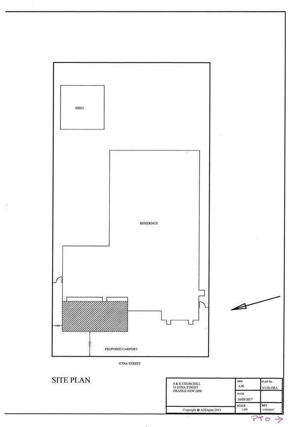
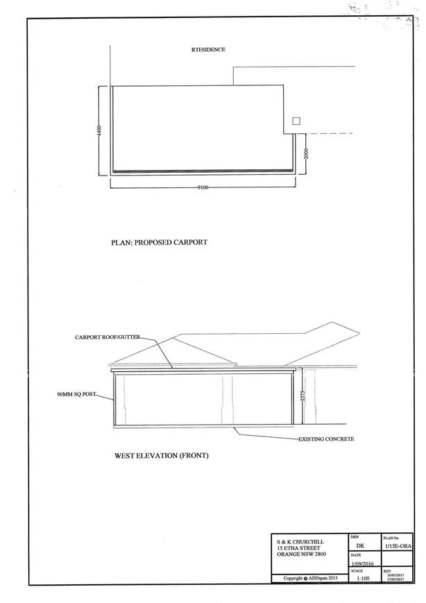
Planning
and Development Committee
7 December 2017
2.10 Development
Application DA 244/2017(1) - 15 Etna Street
Attachment 3 Supporting
Information

[i] The Officer Report
to DA 109/92 defined the proposed development as Extractive industry,
pursuant to the provisions of the Environmental Planning and Assessment Act
Model Provisions 1980.
The Environmental Planning and Assessment
Act Model Provisions 1980 stated that Extractive industry means:
(a) the winning of
extractive material, or
(b) an undertaking, not
being a mine, which depends for its operations on the winning of extractive
material from the land upon which it is carried on, and includes any washing,
crushing, grinding, milling or separating into different sizes of that
extractive material on that land.
