ORANGE CITY COUNCIL
Planning and Development
Committee
Agenda
7 November 2017
Notice
is hereby given, in accordance with the provisions of the Local Government Act
1993 that a Planning and Development
Committee meeting
of ORANGE CITY COUNCIL will be held in the Council Chamber, Civic Centre, Byng Street, Orange on Tuesday,
7 November 2017.
Garry
Styles
General Manager
For apologies please
contact Michelle Catlin on 6393 8246.
Planning and Development Committee 7
November 2017
1 Introduction
1.1 Declaration
of pecuniary interests, significant non-pecuniary interests and less than
significant non-pecuniary interests
The
provisions of Chapter 14 of the Local Government Act, 1993 (the Act)
regulate the way in which Councillors and designated staff of Council conduct
themselves to ensure that there is no conflict between their private interests
and their public role.
The
Act prescribes that where a member of Council (or a Committee of Council) has a
direct or indirect financial (pecuniary) interest in a matter to be considered
at a meeting of the Council (or Committee), that interest must be disclosed as
soon as practicable after the start of the meeting and the reasons given for
declaring such interest.
As
members are aware, the provisions of the Local Government Act restrict any
member who has declared a pecuniary interest in any matter from participating
in the discussion or voting on that matter, and requires that member to vacate
the Chamber.
Council’s Code of Conduct provides that if members
have a non-pecuniary conflict of interest, the nature of the conflict must be
disclosed. The Code of Conduct also provides for a number of ways in which a
member may manage non pecuniary conflicts of interest.
|
Recommendation
It is recommended that Committee Members now disclose any
conflicts of interest in matters under consideration by the Planning and
Development Committee at this meeting.
|
2 General
Reports
2.1 Items
Approved Under the Delegated Authority of Council
TRIM
REFERENCE: 2017/1641
AUTHOR: Paul
Johnston, Manager Development Assessments
EXECUTIVE Summary
Following is a list of development
applications approved under the delegated authority of Council.
Link To Delivery/OPerational Plan
The recommendation in this report relates to the
Delivery/Operational Plan strategy “13.4 Our Environment
– Monitor and enforce regulations relating to City amenity”.
Financial Implications
Nil
Policy and Governance Implications
Nil
|
Recommendation
That the information provided in the
report by the Manager Development Assessments on Items Approved Under the
Delegated Authority of Council be acknowledged.
|
further considerations
Consideration has been given to the
recommendation’s impact on Council’s service delivery; image and
reputation; political; environmental; health and safety; employees;
stakeholders and project management; and no further implications or risks have
been identified.
SUPPORTING INFORMATION
|
Reference:
|
DA 501/2007(12)
|
Determination
Date
|
19 September 2017
|
|
PR Number
|
PR27526
|
|
Applicant/s:
|
Coastplan
Consulting
|
|
Owner/s:
|
Oak Tree
Retirement Villages West Orange Pty Ltd
|
|
Location:
|
Lot 5 DP 1224367
– 109 Ploughmans Lane, Orange
|
|
Proposal:
|
Modification of
development consent - housing for seniors or people with a disability
(including a community centre and bowling green). The modification seeks to
replace some unit type/mixes, as well as alterations to the internal layout
of some unit types.
|
|
Value:
|
$12,000,000 (being
the same value as the original development)
|
|
Reference:
|
DA 235/2011(2)
|
Determination
Date
|
18 July 2017
|
|
PR Number
|
PR16738
|
|
Applicant/s:
|
Mr D and Mrs C
Gordon
|
|
Owner/s:
|
Mr D and Mrs C
Gordon
|
|
Location:
|
Lot 13 DP 871617
– Wallace Lane, Orange
|
|
Proposal:
|
Modification of
development consent – dwelling, detached garage and rainwater tank. The
modification seeks consent for a house of different layout and in a slightly
different location to the dwelling originally approved.
|
|
Value:
|
$250,000 (being
the same value as the original development)
|
|
Reference:
|
DA 377/2013(2)
|
Determination
Date
|
16 October 2017
|
|
PR Number
|
PR27689
|
|
Applicant/s:
|
Mr MA Madden and
Mr LW Bevan
|
|
Owner/s:
|
Messrs LW Bevan
and MA Madden
|
|
Location:
|
Lot 7 DP –
271075 – 6/8B Majestic Way, Orange
|
|
Proposal:
|
Modification of
development consent – subdivision – torrens title (three lot
residential), subdivision – community title (seven lot residential and
one community lot) and dwelling houses (seven). The modification proposal
will change the configuration of one unit, reducing the number of bedrooms
from three to two.
|
|
Value:
|
$1,100,000 (being
the same value as the original development)
|
|
Reference:
|
DA 379/2014(2)
|
Determination
Date
|
31 August 2017
|
|
PR Number
|
PR3
|
|
Applicant/s:
|
Taylor Made
Buildings Pty Ltd
|
|
Owner/s:
|
Mr EJ Zell
|
|
Location:
|
Lot 3 DP 568571
– 23 Beasley Road, Lucknow
|
|
Proposal:
|
Modification of
development consent - subdivision (two lot residential) and dwelling house.
The modification involves the erection of a single storey dwelling of different
design to that which is currently approved.
|
|
Value:
|
$150,000 (being
the same value as the original development)
|
|
Reference:
|
DA 401/2015(2)
|
Determination
Date
|
13 September 2017
|
|
PR Number
|
PR10749
|
|
Applicant/s:
|
Mr SJ Carrigan
|
|
Owner/s:
|
Mr SJ and Mrs AG
Carrigan
|
|
Location:
|
Lot 1 DP 999448
– 61 Sampson Street, Orange
|
|
Proposal:
|
Modification of
development consent - serviced apartment (change of use of existing shed)
|
|
Value:
|
$30,000 (being the
same value as the original development)
|
|
Reference:
|
DA 437/2015(2)
|
Determination
Date
|
23 August 2017
|
|
PR Number
|
PR26103
|
|
Applicant/s:
|
Australia Wide
Coaches
|
|
Owner/s:
|
Mr RG Dawes
|
|
Location:
|
Lot 7 DP 1183249
– 229 McLachlan Street, Orange
|
|
Proposal:
|
Modification of
development consent – transport depot (passenger coaches). The amended
proposal replaces the fencing on the eastern boundary with 2.1m palisade
fencing, as opposed to the previous fencing shown as 1.8m Colorbond style
fencing.
|
|
Value:
|
$230,000 (being
the same value as the original development)
|
|
Reference:
|
DA 237/2016(2)
|
Determination
Date
|
1 August 2017
|
|
PR Number
|
PR19439
|
|
Applicant/s:
|
Bassman Drafting
Services
|
|
Owner/s:
|
Mr JH and Mrs MJ
Trindade
|
|
Location:
|
Lots 110 and 111
DP 1067744 – 4 and 6 Ralston Drive
|
|
Proposal:
|
Modification of
development consent – vehicle repair station. The modification involves
increasing the height of the shed by 200mm; provide for a steel framed
walkway between the shed and warehouse and distribution centre; and to adjust
the alignment of retaining walls.
|
|
Value:
|
$950,000 (being
the same value as the original development)
|
|
Reference:
|
DA 388/2016(1)
|
Determination
Date
|
11 October 2017
|
|
PR Number
|
PR15326
|
|
Applicant/s:
|
Orange Cycle and
Triathlon Club
|
|
Owner/s:
|
Orange City
Council
|
|
Location:
|
Lot 58 DP 750401
– 2 Bloomfield Road, Orange
|
|
Proposal:
|
Recreation Area
(storage shed)
|
|
Value:
|
$25,000
|
|
Reference:
|
DA 84/2017(1)
|
Determination
Date
|
21 August 2017
|
|
PR Number
|
PR22203
|
|
Applicant/s:
|
Statspan Pty Ltd
|
|
Owner/s:
|
Statspan Pty Ltd
|
|
Location:
|
Lot 1 DP 1109351
– 120-122 Summer Street, Orange
|
|
Proposal:
|
Shop and serviced
apartments (alterations and additions to existing building for shop and five
serviced apartments)
|
|
Value:
|
$500,000
|
|
Reference:
|
DA 110/2017(1)
|
Determination
Date
|
17 August 2017
|
|
PR Number
|
PR20437
|
|
Applicant/s:
|
Mr MJ Meagher
|
|
Owner/s:
|
Messrs MJ Meagher
and MP O’Neill
|
|
Location:
|
Lot 2 DP 1085646
– 260 Clergate Road, Orange
|
|
Proposal:
|
Subdivision (17
lot industrial) and Category 1 remediation
|
|
Value:
|
$0
|
|
Reference:
|
DA 112/2017(1)
|
Determination
Date
|
26 September 2017
|
|
PR Number
|
PR26080
|
|
Applicant/s:
|
West Orange
Holdings Pty Ltd
|
|
Owner/s:
|
West Orange
Holdings Pty Ltd
|
|
Location:
|
Lot 102 DP 1187463
– 22-34 Forbes Road, Orange
|
|
Proposal:
|
Vehicle sales or
hire premises (alterations and additions to existing building) and signage
|
|
Value:
|
$500,000
|
|
Reference:
|
DA 118/2017(1)
|
Determination
Date
|
19 September 2017
|
|
PR Number
|
PR22224
|
|
Applicant/s:
|
Carpenter Collins
and Craig
|
|
Owner/s:
|
Mr KS Baker
|
|
Location:
|
Lot 8 DP 1108024
– 1 William Maker Drive, Orange
|
|
Proposal:
|
Subdivision (81
lots comprising 77 residential lots, 2 lots for the Transgrid easement and 2
lots for public open space/drainage)
|
|
Value:
|
$0
|
|
Reference:
|
DA 146/2017(1)
|
Determination
Date
|
4 August 2017
|
|
PR Number
|
PR27675
|
|
Applicant/s:
|
Bassman Drafting
Services
|
|
Owner/s:
|
Sandy June Pty Ltd
|
|
Location:
|
Lot 110 DP 1229500
– 48 Molong Road, Orange
|
|
Proposal:
|
Demolition
(garage), boarding house (two boarding houses each containing seven rooms)
and subdivision (two lot strata)
|
|
Value:
|
$882,000
|
|
Reference:
|
DA 183/2017(1)
|
Determination
Date
|
24 August 2017
|
|
PR Number
|
PR27005
|
|
Applicant/s:
|
Mr AM and Mrs SL
Ford
|
|
Owner/s:
|
Mr AM and Mrs SL
Ford
|
|
Location:
|
Lot 17 DP 1209535
– 5 Kirkwood Place, Orange
|
|
Proposal:
|
Water storage
facility (domestic dam)
|
|
Value:
|
$0
|
|
Reference:
|
DA 189/2017(1)
|
Determination
Date
|
28 July 2017
|
|
PR Number
|
PR26011
|
|
Applicant/s:
|
Mr K and Mrs SE
Barber
|
|
Owner/s:
|
Mrs SB Barber
|
|
Location:
|
Lot 640 DP 1172022
– 17 Bowman Avenue, Orange
|
|
Proposal:
|
Dwelling and
attached garage; subdivision (two lot residential); dwelling and attached
garage; and tree removal.
|
|
Value:
|
$800,000
|
|
Reference:
|
DA 206/2017(1)
|
Determination
Date
|
11 September 2017
|
|
PR Number
|
PR10550
|
|
Applicant/s:
|
Ms S Mendel
|
|
Owner/s:
|
Ms SA Mendel
|
|
Location:
|
Lot 5 Sec D DP
18064 – 12 Rowan Street, Orange
|
|
Proposal:
|
Dwelling
alterations and additions (two storey)
|
|
Value:
|
$322,000
|
|
Reference:
|
DA 211/2017(1)
|
Determination
Date
|
10 August 2017
|
|
PR Number
|
PR27641
|
|
Applicant/s:
|
Mr I Zhang
|
|
Owner/s:
|
Dinkum Exporting
and Importing Pty Limited
|
|
Location:
|
Lot 203 DP 1229307
– 15 Aloe Vera Place, Orange
|
|
Proposal:
|
Dual occupancy and
subdivision (two lot residential)
|
|
Value:
|
$380,000
|
|
Reference:
|
DA 228/2017(1)
|
Determination
Date
|
4 October 2017
|
|
PR Number
|
PR20243
|
|
Applicant/s:
|
Western Freight
Management Pty Ltd
|
|
Owner/s:
|
Tura Holdings Pty
Limited
|
|
Location:
|
Lots 72, 73, 74
and 75 DP 1077739 – 16-18 Colliers Avenue and 59-61 Astill Drive,
Orange
|
|
Proposal:
|
Freight transport
facility (gravel hardstand/laydown area)
|
|
Value:
|
$120,000
|
|
Reference:
|
DA 231/2017(1)
|
Determination
Date
|
4 August 2017
|
|
PR Number
|
PR6942
|
|
Applicant/s:
|
Mr M Walker
|
|
Owner/s:
|
Messrs RM
D’Hudson and J Hayter
|
|
Location:
|
Lot 1 DP 315435
– 215 Lords Place, Orange
|
|
Proposal:
|
Small bar
|
|
Value:
|
$5,000
|
|
Reference:
|
DA 235/2017(1)
|
Determination
Date
|
21 August 2017
|
|
PR Number
|
PR17729
|
|
Applicant/s:
|
McKinnon Design
|
|
Owner/s:
|
Apostolic Church
Trust
|
|
Location:
|
Lots 17-21 Sec 7
DP 13315, and Lot 1 DP 436291 – 33-45 Glenroi Avenue, Orange
|
|
Proposal:
|
Place of public
worship (alterations to existing building)
|
|
Value:
|
$250,000
|
|
Reference:
|
DA 237/2017(1)
|
Determination
Date
|
10 August 2017
|
|
PR Number
|
PR17272
|
|
Applicant/s:
|
D’Aquino
Group of Companies
|
|
Owner/s:
|
Mrs Z
D’Aquino
|
|
Location:
|
Lots 7 and 8 DP
1000034 – 125-133 Bathurst Road, Orange
|
|
Proposal:
|
Subdivision
(boundary adjustment)
|
|
Value:
|
$0
|
|
Reference:
|
DA 238/2017(1)
|
Determination
Date
|
4 August 2017
|
|
PR Number
|
PR25579
|
|
Applicant/s:
|
Knight Frank
Australia Pty Ltd
|
|
Owner/s:
|
Shopping Centres Australasia
Property Group
|
|
Location:
|
Lot 700 DP 1171441
– 9 Telopea Way, Orange
|
|
Proposal:
|
Business
identification sign (wall sign)
|
|
Value:
|
$4,500
|
|
Reference:
|
DA 240/2017(1)
|
Determination
Date
|
31 August 2017
|
|
PR Number
|
PR13294
|
|
Applicant/s:
|
Mr SGP and Mrs MA
Price
|
|
Owner/s:
|
Mr SGP and Mrs MA
Price
|
|
Location:
|
Lot 190 DP 756899
– 381 Pinnacle Road, Orange
|
|
Proposal:
|
Serviced apartment
|
|
Value:
|
$100,000
|
|
Reference:
|
DA 245/2017(1)
|
Determination
Date
|
13 September 2017
|
|
PR Number
|
PR1494
|
|
Applicant/s:
|
Housing Plus
|
|
Owner/s:
|
Mr RJ Sharpe
|
|
Location:
|
Lot 10 DP 248178
– 71 Bletchington Street, Orange
|
|
Proposal:
|
Seniors Housing
(four self-contained dwellings)
|
|
Value:
|
$1,400,000
|
|
Reference:
|
DA 248/2017(1)
|
Determination
Date
|
7 September 2017
|
|
PR Number
|
PR27493
|
|
Applicant/s:
|
Ashlynne Pty
Limited
|
|
Owner/s:
|
Ashlynne Pty
Limited
|
|
Location:
|
Lot 27 DP 1224147
– 9 Gala Crescent, Orange
|
|
Proposal:
|
Exhibition home,
retaining wall and business identification sign
|
|
Value:
|
$300,000
|
|
Reference:
|
DA 250/2017(1)
|
Determination Date
|
24 July 2017
|
|
PR Number
|
PR19022
|
|
Applicant/s:
|
NSW Electoral
Commission
|
|
Owner/s:
|
Mr MP and Mrs CM
Bayada
|
|
Location:
|
Lot 52 DP 1063083
– 10 Elwin Drive
|
|
Proposal:
|
Public
administration building (temporary)
|
|
Value:
|
$0.00
|
|
Reference:
|
DA 258/2017(1)
|
Determination
Date
|
6 September 2017
|
|
PR Number
|
PR14898
|
|
Applicant/s:
|
Mr S Birmili
|
|
Owner/s:
|
Orange Arcade Pty
Limited
|
|
Location:
|
Lot 1 DP 572210,
Lot 2 DP 553754, Lots A and B DP 150436, Lot 1 DP 1063911 – Sale
Street, Summer Street, 146-148 Summer Street, Orange
|
|
Proposal:
|
Shop (change of
use)
|
|
Value:
|
$60,000
|
|
Reference:
|
DA 268/2017(1)
|
Determination
Date
|
22 August 2017
|
|
PR Number
|
PR17233
|
|
Applicant/s:
|
Mrs J Campbell
|
|
Owner/s:
|
Mr DA and Mrs JL
Player
|
|
Location:
|
Lot 101 DP 884400
– 184-190 Peisley Street, Orange
|
|
Proposal:
|
Business
identification sigh (wall sign)
|
|
Value:
|
$0
|
|
Reference:
|
DA 269/2017(1)
|
Determination
Date
|
19 September 2017
|
|
PR Number
|
PR2610
|
|
Applicant/s:
|
Forefront Services
|
|
Owner/s:
|
Clout Redfern
Investments Pty Ltd
|
|
Location:
|
Lot 62 DP 55915
– 345 Clergate Road, Orange
|
|
Proposal:
|
General industry
(new industrial shed, and alteration and additions to existing building)
|
|
Value:
|
$600,000
|
|
Reference:
|
DA 271/2017(1)
|
Determination
Date
|
11 October 2017
|
|
PR Number
|
PR26577
|
|
Applicant/s:
|
Hanna Developments
Group Pty Limited
|
|
Owner/s:
|
Fenlor Group Pty
Limited & Charms Developments Pty Limited
|
|
Location:
|
Unregistered Lots
202, 203 and 204 in a subdivision of Lot 42 DP 1195966 – 41 William
Maker Drive, Orange
|
|
Proposal:
|
Centre-based
child-care facility and business identification sign (pylon sign)
|
|
Value:
|
$1,451,835
|
|
Reference:
|
DA 272/2017(1)
|
Determination
Date
|
26 September 2017
|
|
PR Number
|
PR22507
|
|
Applicant/s:
|
Mr MM Oh
|
|
Owner/s:
|
Mr KW and Mrs DL
Carr
|
|
Location:
|
Lot 1 SP 79153 - Unit
1/60-62 William Street, Orange
|
|
Proposal:
|
Recreation
facility (indoor) (martial arts school) and business identification sign
(flush wall sign)
|
|
Value:
|
$0
|
|
Reference:
|
DA 274/2017(1)
|
Determination
Date
|
15 August 2017
|
|
PR Number
|
PR794
|
|
Applicant/s:
|
Mr N and Mrs D
Penhall
|
|
Owner/s:
|
NJ and DJ Penhall
Pty Limited
|
|
Location:
|
Lot B DP 163869
– 202 Anson Street, Orange
|
|
Proposal:
|
Retail premises
(internal alterations)
|
|
Value:
|
$20,000
|
|
Reference:
|
DA
276/2017(1)
|
Determination
Date
|
15 August 2017
|
|
PR Number
|
PR20690
|
|
Applicant/s:
|
Mr AJ Kirkwood
|
|
Owner/s:
|
Mr AJ Kirkwood
|
|
Location:
|
Lot 87 DP 1086540
– 87 Byng Street, Orange
|
|
Proposal:
|
Dwelling house
(change of use from office premises)
|
|
Value:
|
$0
|
|
Reference:
|
DA 283/2017(1)
|
Determination
Date
|
23 August 2017
|
|
PR Number
|
PR283/2017
|
|
Applicant/s:
|
Mr RG Dawes
|
|
Owner/s:
|
1st
Class Coach Pty Ltd
|
|
Location:
|
Lots 7 and 8 DP
1183249 – 227-229 McLachlan Street, Orange
|
|
Proposal:
|
Boundary fence
(1.2m high palisade fence)
|
|
Value:
|
$14,000
|
|
Reference:
|
DA 284/2017(1)
|
Determination
Date
|
26 September 2017
|
|
PR Number
|
PR12823
|
|
Applicant/s:
|
Mr MS Swiatkiwsky
|
|
Owner/s:
|
Mr JA and Mrs DM
Cantrill
|
|
Location:
|
Lot 170 DP 595892
– 145-147 Woodward Street, Orange
|
|
Proposal:
|
Restaurant or cafe
|
|
Value:
|
$40,000
|
|
Reference:
|
DA 285/2017(1)
|
Determination
Date
|
31 August 2017
|
|
PR Number
|
PR12946
|
|
Applicant/s:
|
Orange City
Council
|
|
Owner/s:
|
Orange City
Council
|
|
Location:
|
Lot 54 DP 812701
– 2-4 Yarrawong Place, Orange
|
|
Proposal:
|
Boundary fence
(2.1m high palisade fence)
|
|
Value:
|
$13,000
|
|
Reference:
|
DA 287/2017(1)
|
Determination
Date
|
5 October 2017
|
|
PR Number
|
PR2279
|
|
Applicant/s:
|
Mr HS Hamouda
|
|
Owner/s:
|
Mr HS Hamouda
|
|
Location:
|
Lot 13 DP 16510
– 26 Caroline Street, Orange
|
|
Proposal:
|
Conversion of
dwelling and shop to principal dwelling and secondary dwelling
|
|
Value:
|
$2,000
|
|
Reference:
|
DA 290/2017(1)
|
Determination
Date
|
18 September 2017
|
|
PR Number
|
P9698R
|
|
Applicant/s:
|
Orange Regional
Gallery
|
|
Owner/s:
|
Orange City
Council
|
|
Location:
|
Lot 9 DP 820905
– 149 Byng Street, Orange
|
|
Proposal:
|
Information and
education facility (alterations and additions to existing building)
|
|
Value:
|
$170,000
|
|
Reference:
|
DA 291/2017(1)
|
Determination
Date
|
29 September 2017
|
|
PR Number
|
PR26185
|
|
Applicant/s:
|
The Uniting Church
in Australia Property Trust (NSW)
|
|
Owner/s:
|
The Uniting Church
in Australia Property Trust (NSW)
|
|
Location:
|
Lot 100 DP 1185280
– 27 Summer Street, Orange
|
|
Proposal:
|
Demolition (tree
removal)
|
|
Value:
|
$8,580
|
|
Reference:
|
DA 297/2017(1)
|
Determination
Date
|
9 October 2017
|
|
PR Number
|
PR12852
|
|
Applicant/s:
|
Bela Vista
Hospitality Pty Limited
|
|
Owner/s:
|
Orange Motel
Investments Pty Ltd
|
|
Location:
|
Lot 189 DP 808347
– 178-184 Woodward Street, Orange
|
|
Proposal:
|
Hotel or motel
accommodation (increase licenced area and new front fence)
|
|
Value:
|
$2,850
|
|
Reference:
|
DA 320/2017
|
Determination
Date
|
25 October 2017
|
|
PR Number
|
PR17577
|
|
Applicant/s:
|
Janlin Circuses
Pty Ltd T/AS Stardust Circus
|
|
Owner/s:
|
Orange City
Council
|
|
Location:
|
Lots 14 and 15
Section 29 DP 5600 – Phillip Street, Orange (Orange Showground)
|
|
Proposal:
|
Entertainment
facility (temporary use of land – circus)
|
|
Value:
|
$0
|
|
Reference:
|
DA 321/2017(1)
|
Determination
Date
|
25 September 2017
|
|
PR Number
|
PR601
|
|
Applicant/s:
|
Sweet Sour Salt
|
|
Owner/s:
|
Mr RN and Mrs EMW
Mitchell
|
|
Location:
|
Lot 1 DP 900677
– 179 Anson Street, Orange
|
|
Proposal:
|
Restaurant or
Café (alterations to existing premises)
|
|
Value:
|
$40,000
|
|
Reference:
|
DA 353/2017(1)
|
Determination
Date
|
10 October 2017
|
|
PR Number
|
PR14898
|
|
Applicant/s:
|
Mr J Kirk
|
|
Owner/s:
|
Orange Arcade Pty
Limited
|
|
Location:
|
Lot 1 DP 572210
– Sale Street, Orange (Shop 20, Orange Arcade)
|
|
Proposal:
|
Shop (change of
use)
|
|
Value:
|
$0
|
|
Reference:
|
DA 373/2017(1)
|
Determination
Date
|
11 October 2017
|
|
PR Number
|
PR11579
|
|
Applicant/s:
|
Small Acre Cyder
|
|
Owner/s:
|
Orange City Council
|
|
Location:
|
Post Office Lane
|
|
Proposal:
|
Entertainment
facility and market
|
|
Value:
|
$5,000
|
|
Reference:
|
DA 311/2017(1)
|
Determination
Date
|
16 October 2017
|
|
PR Number
|
PR3693
|
|
Applicant/s:
|
designs@m
|
|
Owner/s:
|
Mr DR Davis and Ms
AA Porch
|
|
Location:
|
Lot 20 DP 632537
– 26 Edward Street, Orange
|
|
Proposal:
|
Vehicle repair
station (new building) and signage
|
|
Value:
|
$75,000
|
TOTAL
NET* VALUE OF ALL DEVELOPMENTS APPROVED IN THIS PERIOD: $8,090,765
*
Net value relates to the value of modifications. If modifications are
the same value as the original DA, then nil is added. If there is a plus/minus
difference, this difference is added or taken out.
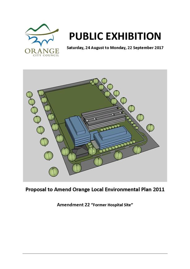
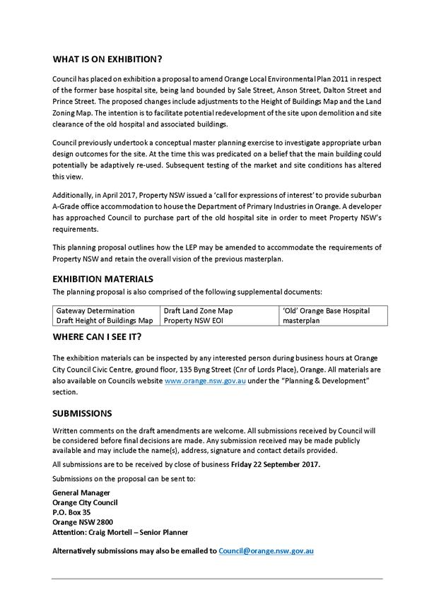
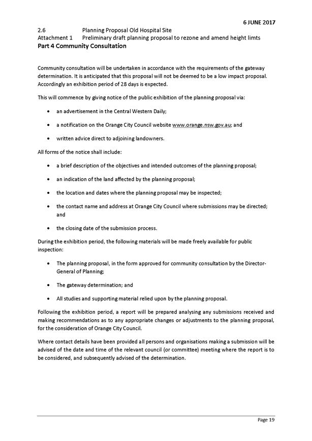
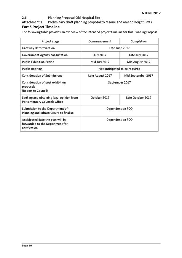
2.2 Orange
Local Environmental Plan 2011 - Amendment 22 - Former Base Hospital Site - Post
Exhibition Report
TRIM
REFERENCE: 2017/2106
AUTHOR: Craig
Mortell, Senior Planner
EXECUTIVE Summary
Orange Local Environmental Plan 2011 - Amendment 22,
relating to rezoning of the former base hospital site, was placed on public
exhibition from 24 August to 22 September 2017. A total of two
submissions were received. The Office of Environment and Heritage submission
essentially confirmed no concerns, while a submission from the Orange Local
Aboriginal Land Council opposed the proposal on a number of grounds. The
matters raised in the submissions are detailed in this report.
After being decommissioned in March 2011, the community
began to express concern that the mothballed buildings were being vandalised
and impacting upon both the character and amenity of the area. Council acquired
the former base hospital site from NSW Health Infrastructure (HI) in April
2016 to facilitate the redevelopment of the site either through the adaptive
re-use of up to two of the existing buildings or, should re-use prove unviable,
the demolition, clean up and decontamination of the site to enable a range of
possible development options.
As part of their divestment process, HI commissioned a
master plan for the site showing a range of potential redevelopment options. It
should be noted that while Council was consulted, the master plan was not a
Council document and most options would require some form of amendment to
Orange LEP 2011. To avoid duplication of effort, amendment of the LEP
was deferred until more specific requirements of the potential development
could be determined.
The HI master plan suggested creating an area of
B4 Mixed Use zone, which attracted interest from a developer of large
scale commercial office premises in the eastern (Anson Street) end of the site.
The NSW Department of Primary Industries subsequently announced a tender
process for new or refurbished premises in Orange and the developer refined
their interest in order to submit a bid involving the former hospital site.
The DPI workforce is a significant contributor to the
local economy with the departmental headquarters in Orange regarded as highly
valuable. Actual site selection is a matter for the DPI and it is understood
that they received a number of bids. The planning proposal was therefore
drafted to accommodate a viable bid to bring the DPI to the site, but with
enough flexibility to enable other configurations should the bid be
unsuccessful, broadly consistent with the master plan.
Therefore the planning proposal should be considered in
terms of the range of uses and built forms that would be enabled, rather than
any specific project. The DPI bid can therefore be thought of as one
illustration, or scenario, of what the planning proposal may allow.
Link To Delivery/OPerational Plan
The recommendation in this report relates to the
Delivery/Operational Plan strategy “1.2 Our City -
Information and advice provided for the decision-making process will be
succinct, reasoned, accurate, timely and balanced”.
Financial Implications
Nil
Policy and Governance Implications
Council has a direct pecuniary interest in the proposal
which may create a perception of conflict. Consequently, the Department of
Planning and Environment determined not to provide delegations to make the plan
and the matter will ultimately be determined by the Minister on advice from the
Department of Planning and Environment.
|
Recommendation
1 That the information
provided in the report on Orange Local Environmental Plan 2011 - Amendment 22
- Former Base Hospital Site - Post Exhibition Report be acknowledged.
2 That
Council endorse Orange Local Environmental Plan 2011 - Amendment 22 - Former
Base Hospital site planning proposal in its current form.
3 That
Council forward the planning proposal to the Department of Planning and
Environment requesting that Orange Local Environmental Plan 2011 be amended
accordingly.
4 That
Council write to the entities that provided submissions to the Planning
Proposal, advising of Council’s resolution.
|
further considerations
The
recommendation of this report has been assessed against Council’s other
key risk categories and the following comments are provided:
|
Image
and Reputation
|
As landowner of the site Council
has a direct pecuniary interest in the proposal. Accordingly the gateway
determination withheld delegations to formally make the plan with such powers
retained by the Minister.
|
|
Political
|
Council’s interest in the
site has the potential to generate adverse public reaction and scepticism
over the role and impartiality of decision making (one submission explicitly
references governance concerns). Scrutiny and oversight is provided by the
NSW Department of Planning and Environment in advising the Minister whether to
make the plan. Council is not the determining authority for the rezoning.
|
|
Stakeholders
|
The proposal has been initiated in
response to both the master plan for the site and a developer expressing
interest in the site and entering into an option agreement with Council. This
does not bind Council to approve or support the proposal. All normal land use
planning obligations remain and Council must have due regard to the
environmental, social, ecological and economic aspects of the proposal as it
would for any other proposal.
|
SUPPORTING INFORMATION
Background
Following the opening of the new Orange Health Service in
Forest Road, the old Orange Base Hospital was decommissioned in March 2011. At
about that time the site was mothballed with security fencing erected, however
this did not prevent periodic vandalism and the condition of the premises
attracted complaints.
The site remained the responsibility/liability of NSW Health
Infrastructure (HI). This extended to any clean-up and demolition of the
site for eventual re-use. Leaving the site vacant and not cleaned up was not
considered an acceptable action on the part of HI; however, there are
examples of unresolved former institutional sites across NSW.
HI undertook a master planning exercise to explore a
range of re-development options and scenarios which were presented to Council
in April 2013. The master planning exercise was extensive and detailed but it
was not placed on formal public exhibition and was not formally adopted by
Council. The master plan serves to illustrate the potential of the site via the
use of concept studies. The concepts within the master plan are predicated on
rezoning part of the site to B4 Mixed Use. Therefore although the current
planning proposal involves a different configuration of zones, with a larger B4
area, it remains informed by the broad principles and approach of the master
plan.
HI opened discussions with Council in 2013 over
the future of the site, and on 14 October 2014 Council conditionally
resolved to seek to acquire the site. Negotiations then proceeded over an
extended timeframe, with the title ultimately transferred to Council
20 April 2016.
The acquisition was subject to a range of conditions such as
the demolition, site clean-up and remediation costs being reflected in the
price; i.e. the demolition and clean-up works would be undertaken by Council
(or its contractors) for which the nett price was correspondingly reduced, with
ultimate liability remaining with HI until remediation works are validated.
The site is presently undergoing demolition and remediation
works. These works are not linked to, or dependent upon, the proposed rezoning.
Rather, the current works will provide a clean and clear site which could then
be further developed in accordance with the LEP provisions.
The current proposal seeks to amend the LEP to enable both a
range of uses and a particular form of development to be considered on the
site.
Submissions
One submission notes Council's direct involvement in the
proposal as land owner. Independent legal advice was sought on this aspect. In
summary, the advice received is that this aspect of the matter is appropriately
managed through the planning system by virtue of the NSW Department of Planning
and Environment, not Council, being the body that undertakes the Gateway
Determination, and in this instance having withheld delegations from Council
the NSW Department of Planning and Environment determines the application.
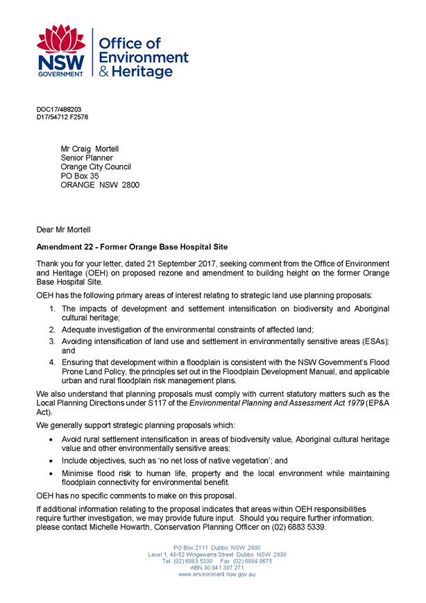
One submission was received from the NSW Office of
Environment and Heritage (OEH). The OEH was directly notified of the
proposal as required by the Gateway Determination conditions. The OEH response
acknowledged receipt of the proposal but raised no specific concerns.
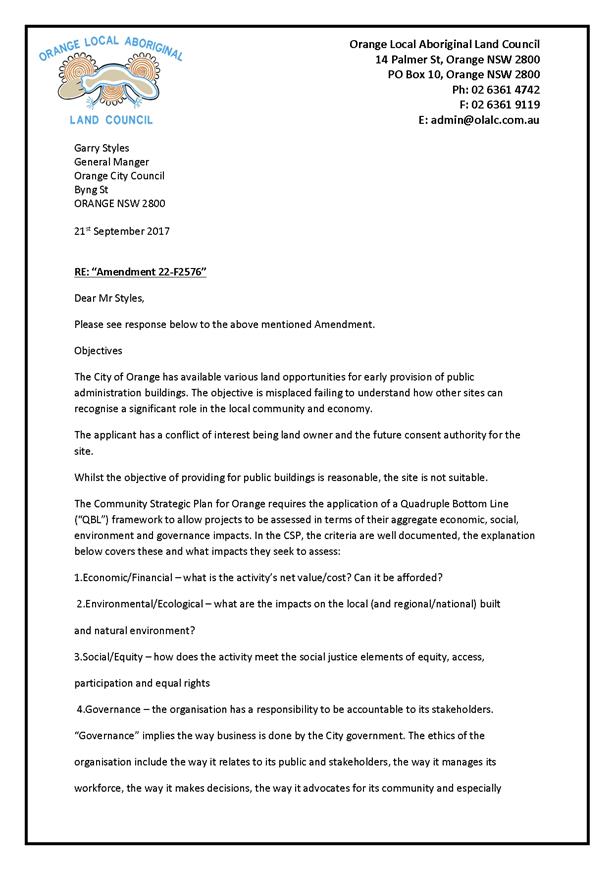
One submission was received from the Orange Local Aboriginal
Land Council (OLALC) that raised a range of matters and asserts that the
applicant (Council) has a conflict of interest, being land owner and the future
consent authority for the site.
Response: Due to Council being the landowner, the Gateway
Determination did not provide delegations to formally make the plan. The power
to ultimately determine and amend (or not) the LEP rests with the Minister and
the NSW Department of Planning and Environment. Additionally, there is a
legislative requirement that any proposal over $20 million dollars (or $5
million in the case of Council having a direct interest) in construction value
be considered and determined by the Joint Regional Planning Panel. Therefore,
Council is not likely to be the consent authority for a major development.
Other specific issues in the OLALC submission are outlined below.
Quadruple Bottom Line
Economic/Financial - What is the activity’s net
value/cost? Can it be afforded?
The proposal
will provide the zoning capable of supporting a significant number of jobs
close to the CBD and provide open space and inner city residential uses.
The
employment levels will add to those supplying and stimulating the CBD along
with other mixed-use offerings near the CBD.
In the short
term the additional floor space may impact on business rental prices but an
increased supply of floor space enables growth and diversification of the local
economy, generally, which would see stabilisation of yields in the medium term.
The B4 zone
enables consideration of a range of land uses including; offices, various
commercial premises, community facilities, educational establishments, function
centres, entertainment facilities, medical centres, child care centres as well
as residential accommodation. It is considered that many of these would be
economically viable as well as provide potential social and community benefits.
The flexibility of this zone therefore mitigates any perceived risk of the site
being locked into any particular development
Environmental/Ecological
– What are the impacts on the local (and regional/national) built and
natural environment?
There are no
impacts of a national or regional significance on either the built or natural
environments. At a local level the site is not identified as having ecological
significance and vegetation is minimal, having been limited to various
landscaping around the former hospital buildings and car parks.
In terms of
local built environment, the ultimate design of any development will be
resolved during a future development application. The built forms will then be
assessed in terms of articulation, façade treatment and overall
aesthetics, as well as potential for overshadowing, privacy concerns and the
like.
The LEP
amendment alters the permissible building heights but does not increase the
allowable Floor Space Ratio (FSR). As such, the effect of the amendment may be
to enable taller buildings but with a correspondingly reduced building
footprint. In turn this may lead to improved landscaping opportunities.
Social/Equity - How does the
activity meet the social justice elements of equity, access, participation and
equal rights?
The proposal
includes the establishment of an area of RE1 Public Recreation land. This
will increase the stock of public land available to the broader community.
Office premises will help to provide jobs in the local economy. The proposal
facilitates the adaptive reuse of the heritage listed former ambulance station
to a range of uses. The remainder of the site remains R3 Medium Density
Residential and will ultimately add to the stock and range of housing options
available in the area.
Governance - The
organisation has a responsibility to be accountable to its stakeholders.
“Governance” implies the way business is done by the City
government. The ethics of the organisation include the way it relates to its
public and stakeholders, the way it manages its workforce, the way it makes
decisions, the way it advocates for its community and especially future
generations.
The above
comment on governance is noted and supported.
More
specifically, the proposal has been drafted, reported to Council, submitted to
the Department of Planning Gateway process and publicly exhibited in accordance
with the Gateway Determination conditions. Ethically, Council has sought to
enhance public awareness of the proposal in terms of providing information to
local media to facilitate coverage of the proposal.
Lack of Strategic support
The submission disputes that the planning proposal has
support of any strategic study or report and notes that the proposal alters the
vision of the master plan.
The master
plan was prepared by HI, in consultation with Council, as part of its
divestment processes to illustrate the potential of the site. A large
consolidated site well within the urban footprint of the city and in reasonable
proximity to the CBD represents a unique opportunity and set of issues. While
the master plan was not formally exhibited or adopted by Council, it has served
to provide a broad basis for considering the role and function of the site
within the Orange context.
A key
message that may be drawn from the master plan is that to achieve the
site’s full potential, both financially and from a social benefit
viewpoint, requires inclusion of non-residential elements. A purely residential
development would limit the benefits of the site to those residents alone.
Whereas by fostering employment, services and facilities on the land the broader
community can derive a range of benefits beyond a financial return.
Net Community Benefit
The submission highlights potential traffic changes
and notes the absence of a detailed traffic study.
Net
community benefit is a broader concept than traffic alone. Notwithstanding
this, it is considered that the local road network has considerable capacity in
the area - having previously been accustomed to substantial traffic and parking
demand from the former base hospital. Since the decommissioning of the hospital
there have not been any large scale developments in the immediate area that
could be argued to have replaced the previous traffic volumes. While neighbours
and residents in the area may have noticed a decline in traffic since the
hospital decommissioning, this should always have been regarded as temporary
because the site was clearly going to be redeveloped or adapted at some point.
The submission also
suggests: “There is no justification or support for the proposition that
the proximity to the site is more beneficial than other uses on the site for
economic and trading stimulus. For example, in a changing and dynamic world
start-up companies, incubators, various other small businesses all seek opportunities
in central locations. By creating such a substantial public building for the
site the net community benefits are not articulated well compared with other
uses that may provide greater net community benefits.”
The proposed
amendments to the LEP do not lock the site in to any particular development.
The planning proposal seeks to allow consideration of a range of potential uses
and built forms via a subsequent development application. It should be noted
that the planning proposal would enable this site to be developed for a variety
of purposes, including many of those suggested in the submission.
Community Strategic Plan
The submission states that the proposal is consistent
with one aspect of the community strategic plan but is critical that
maintaining the trading performance of the CBD is retail centric and
ignores other community objectives and impacts.
The planning
proposal is capable of enabling a wide range of uses and functions on the site
through the use of the B4 Mixed Use zone. At the present time there is no
specific community or public oriented project seeking such a location before
Council. Council has a record of facilitating and providing a wide range of
community facilities and services throughout the City. It is noted that the
submission has not suggested that the proposal contravenes or hinders other
community objectives in the Community Strategic Plan.
The
criticism of retail centricity is overly simplistic. The health, energy,
vibrancy and dynamism of any regional community relies upon a strong local
economy, without which non-profit services and facilities cannot be financially
sustained. The CBD has traditionally been a fundamental part of that
equation. The broader the range of firms, goods and services present, the more
capable and resilient the community becomes. Such diversity is in turn
dependent upon the scale of economic activity in the area. Some enterprises are
more marginal than others and only become viable in larger centres. Thus increased
activity and turnover leads to increased diversity.
Regional Plan Direction 10
The submission asserts that the proposal has not
demonstrated how a public administration building will create social and
economic benefits to Regional Plan Direction 10.
The mixed
use zone provides for many potential employment generating and economic
activities, as described under the response to the quadruple bottom line issue.
Many of which would deliver varying levels and types of social and economic
benefits.
A public
administration building would also enable the presence of several hundred
professional jobs in the local economy. This is considered to be a direct
economic benefit, not to mention the construction phase jobs that would be
created.
The social
benefits from the proposal include the creation of an area of RE1 Public
Recreation land in the western portion of the site, the next nearest public
open space being Jaeger Reserve located approximately 300m to the northwest
between Hill Street and Clinton Street; plus maintaining employment
opportunities in the City enables both new employment growth and existing
workforce to remain in the area and participate in the social fabric of daily
life.
Environmental Effects
The submission is critical of potential traffic, overshadowing
and residential amenity impacts, stating that these factors have not been
appropriately analysed.
The site has
historically accommodated the former base hospital, which generated significant
volumes of traffic, comprised a six storey building and was visible to
surrounding residential development. It has not been possible to undertake
detailed specific traffic/ overshadowing analysis given that the proposal does
not relate to a specific final design. However, the planning proposal does not
significantly increase the density or scale of development potential on the
site, and as such it is considered that any future development application will
be able to adequately address such matters.
Site Master plan
The submission states that the master plan has no
legal status and suggests that this leaves the potential outcome for the
balance of the site (assumed to be the western portion) unclear. The submission
argues that as both landowner and consent authority this gives Council too much
latitude to determine future proposals over that area.
Council’s
interest in the site means that if a development application is lodged in
relation to the balance of the site with a construction value above $5 million
dollars, the application would be determined by the Joint Regional Planning
Panel in place of Council. Notwithstanding this, Council has the option to
undertake a formal master plan for the balance of the site, enabling further
community input into the direction and vision for the remainder of the site.
Effect of Public Administration
Building on Remainder of the Site
The submission questions whether the proposal for a
public administration building on the eastern portion of the site may adversely
impact on the balance of the land value and future development opportunities
for the site.
It should be
noted that the non-B4 area of the site will remain in Council ownership pending
further evaluation of development options, not private landowners or other
parties.
Notwithstanding
this the area of the site anticipated for the public administration building
includes appropriate internal setbacks to the balance of the site. Clearly the
area closest to the multi storey building is likely to experience some
overshadowing during the morning period (being to the west of such structures)
but would regain significant solar access from mid-morning onward. This factor
may influence Councils evaluation for the balance of the site but is not
considered to sterilise or overly restrict its potential.
The
inclusion of the RE1 Public Recreation zone running east-west through the
centre of the western portion further ensures that the southern, Prince Street,
frontage will also have good solar access throughout most of the day. It is therefore
considered that the proposal retains substantial land value and development
opportunities for the western end of the site.
It is likely
that any conceptual design would need to be adapted to the specific
requirements of the use. Accordingly, specific overshadowing analysis has not
been undertaken at this time due to the design of any building not being
finalised. Irrespective of this, as has previously been stated, any future
development on this site would be the subject of a development application
which would be assessed at that time, to ensure that the specific development
proposal complied with the relevant planning and design controls applicable to
the site.
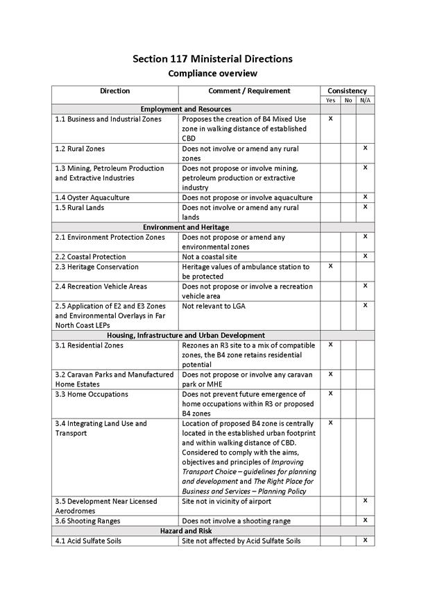
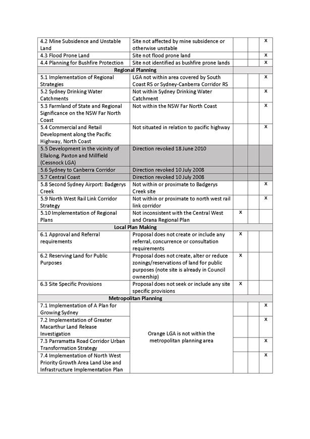
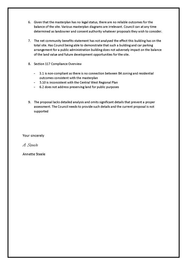
Section 117 directions
The submission claims the proposal is contrary to the
following Section 117 Ministerial Directions.
· Direction 3.1:
the proposal is non-compliant as there is no connection between B4 zoning
and residential outcomes consistent with the master plan.
The
direction does not require a connection between the B4 zone and an unofficial
master plan. The direction requires that the planning proposal must encourage
housing that will:
(a) Broaden
the choice of building types and locations available in the housing market, and
(b) Make
more efficient use of existing infrastructure and services, and
(c) Reduce
the consumption of land for housing and associated urban development on the
urban fringe, and
(d) Be
of good urban design.
Additionally the proposal must
require that residential development is adequately serviced and not reduce the
permissible residential density.
In regard to the above:
- the
proposal retains an R3 Medium Density zone to the west, and the B4 Mixed
Use zone also permits various forms of residential development, thus choice of
building types and locations is not reduced;
- the
proposal makes efficient use of existing infrastructure and services that were
established during the operation of the former hospital, in terms of local road
network capacity, sewer and water connections and the like;
- the
site is not on the urban fringe;
- the
design quality of any project will be subject to development application
assessment in due course;
- services
are present; and
- the
proposal does not reduce the permissible density of residential development.
· Direction 5.10:
the proposal is inconsistent with the Central West Regional Plan
The direction requires that
planning proposals must be consistent with any Regional Plan released by the
Minister. The submission offers no detail in how the proposal is viewed as
inconsistent.
· Direction 6.2:
the proposal does not address preserving land for public purposes.
Under this direction the
proposal must not create, alter or reduce existing zonings or reservations for
public purposes without the approval of the relevant public authority and the
Director-General of the Department of Planning.
When Council acquired the site,
in order to facilitate the ultimate redevelopment of the property it resolved
that the site be declared Operational Land within the meaning of the Local
Government Act. Operational Land is not considered to be reserved, or
intended for, public purposes.
The land is currently zoned
R3 Medium Density Residential and the rezoning proposal will create an
area of R1 Public Recreation zone in the western portion of the site. This
was evident when the matter was referred to the Department of Planning for
Gateway Determination; and since delegations to determine the proposal were
withheld, this will be a matter for the Department of Planning to determine.
However, the creation of an area
of R1 Public Recreation zoned land is consistent with the objectives of
the Direction which include:
“To facilitate the
provision of public services and facilities by reserving land for public
purposes”.
Level of Detail
The submission is critical of the limited level of
detail in the proposal.
The level of
detail provided is consistent with other rezoning applications which have
received consent. A conceptual layout and massing study gives an impression of
the type of scale and density that may be anticipated. Further detail would
only be possible at the development application stage once a design was
essentially complete.
The zoning
of a site, including rezoning, is only intended to establish the broader
framework within which a development may be designed. Essentially, an LEP
is intended to govern ‘what’ types of development may occur
‘where’, and a few broad parameters such as the overall density and
scale that can be expected. Whereas a DCP provides guidance on
‘how’ the design of such development should be resolved in terms of
aesthetics.
It is therefore
at the development application stage where more detail is to be expected and
evaluated. Thus it is considered that it would be too onerous and unreasonable
to require a proponent to resolve a concept associated with a rezoning, with
specific construction detail equivalent to that required for a development
application on the site.
Attachments
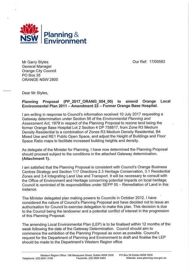
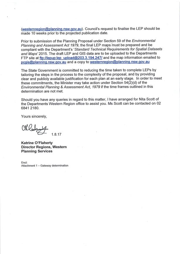
1 Gateway
Determination, D17/63813⇩
2 Planning
Proposal, D17/63812⇩
3 Technical
Clarification Notice, D17/63814⇩
4 Report
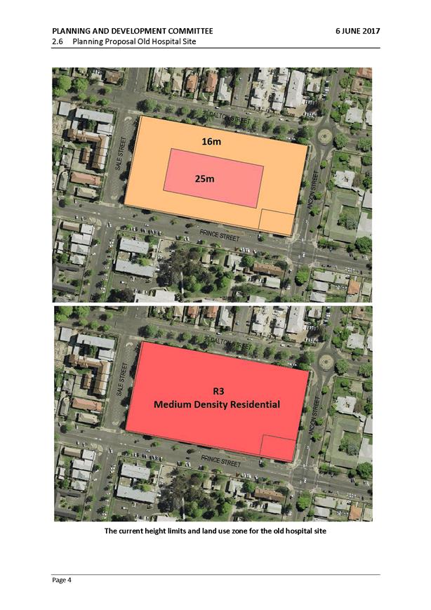
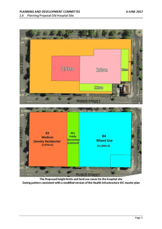
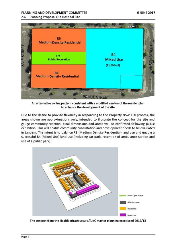
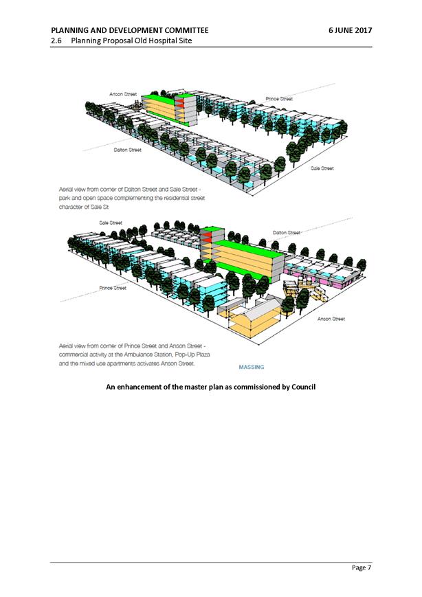
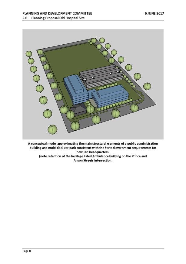
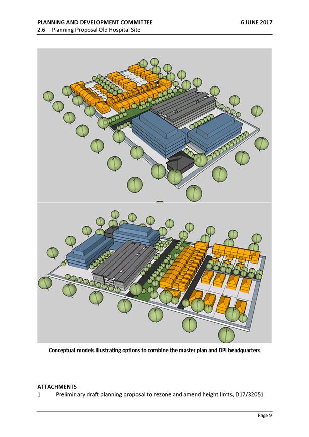
to Planning & Development Committee - 6 June 2017, D17/63815⇩
5 Section
117 Ministerial Directions, D17/63818⇩
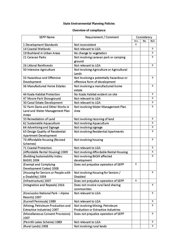
6 State
Environmental Planning Policies, D17/63819⇩
7 Council
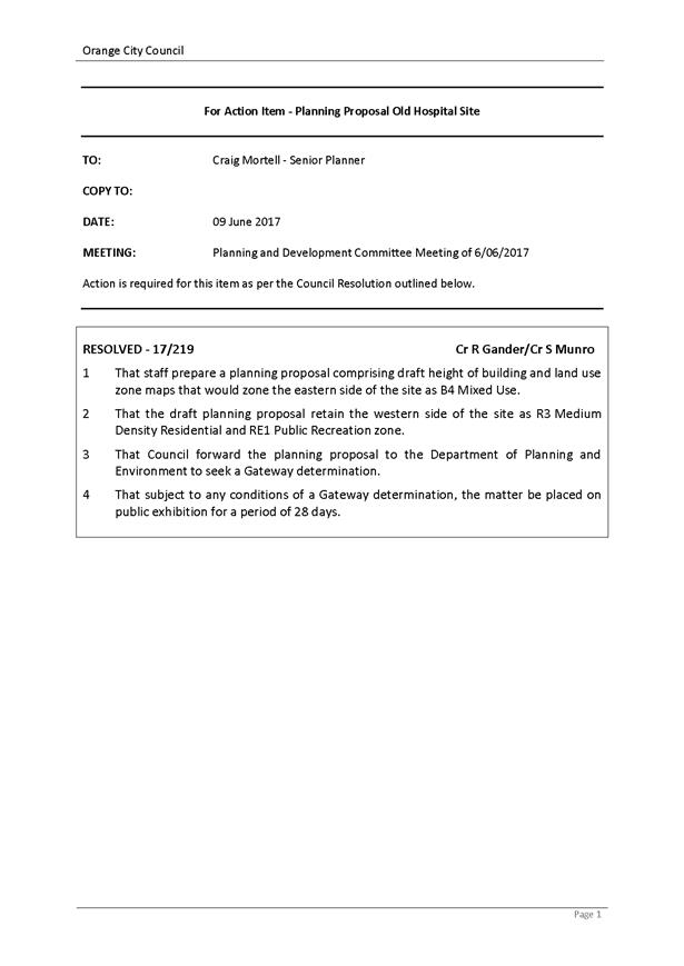
Resolution 17/219, D17/63820⇩
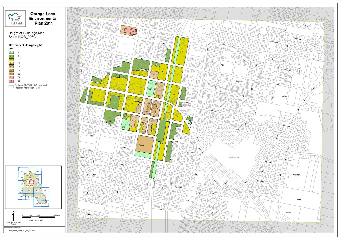
8 Height
of Buildings Map, D17/63821⇩
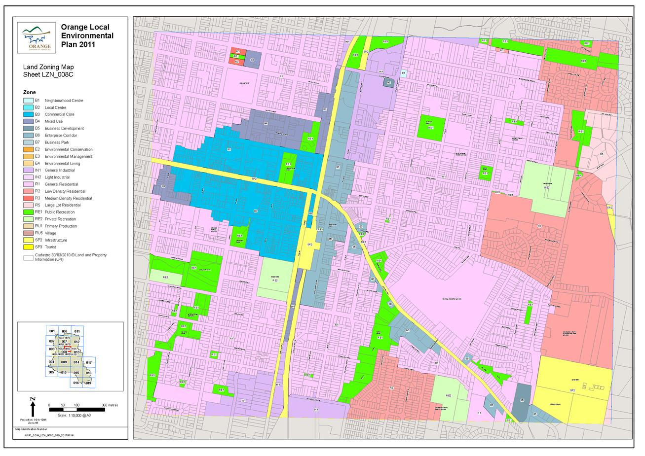
9 Land
Zoning Map, D17/63822⇩
10 NSW
Office of Environment and Heritage - response to consultation, IC17/19262⇩
11 Submission
from Orange Local Aboriginal Land Council, IC17/18830⇩
Planning and Development Committee
7 November 2017
2.2 Orange
Local Environmental Plan 2011 - Amendment 22 - Former Base Hospital Site - Post
Exhibition Report
Attachment 1 Gateway
Determination
Planning
and Development Committee
7 November 2017
2.2 Orange
Local Environmental Plan 2011 - Amendment 22 - Former Base Hospital Site - Post
Exhibition Report
Attachment 2 Planning
Proposal

Planning
and Development Committee
7 November 2017
2.2 Orange
Local Environmental Plan 2011 - Amendment 22 - Former Base Hospital Site - Post
Exhibition Report
Attachment 3 Technical
Clarification Notice
Planning
and Development Committee
7 November 2017
2.2 Orange
Local Environmental Plan 2011 - Amendment 22 - Former Base Hospital Site - Post
Exhibition Report
Attachment 4 Report
to Planning & Development Committee - 6 June 2017
Planning
and Development Committee
7 November 2017
2.2 Orange
Local Environmental Plan 2011 - Amendment 22 - Former Base Hospital Site - Post
Exhibition Report
Attachment 5 Section
117 Ministerial Directions
Planning
and Development Committee
7 November 2017
2.2 Orange
Local Environmental Plan 2011 - Amendment 22 - Former Base Hospital Site - Post
Exhibition Report
Attachment 6 State
Environmental Planning Policies

Planning
and Development Committee
7 November 2017
2.2 Orange
Local Environmental Plan 2011 - Amendment 22 - Former Base Hospital Site - Post
Exhibition Report
Attachment 7 Council
Resolution 17/219
Planning
and Development Committee
7 November 2017
2.2 Orange
Local Environmental Plan 2011 - Amendment 22 - Former Base Hospital Site - Post
Exhibition Report
Attachment 8 Height
of Buildings Map
Planning
and Development Committee
7 November 2017
2.2 Orange
Local Environmental Plan 2011 - Amendment 22 - Former Base Hospital Site - Post
Exhibition Report
Attachment 9 Land
Zoning Map
Planning
and Development Committee
7 November 2017
2.2 Orange
Local Environmental Plan 2011 - Amendment 22 - Former Base Hospital Site - Post
Exhibition Report
Attachment 10 NSW Office of
Environment and Heritage - response to consultation

Planning
and Development Committee
7 November 2017
2.2 Orange
Local Environmental Plan 2011 - Amendment 22 - Former Base Hospital Site - Post
Exhibition Report
Attachment 11 Submission from
Orange Local Aboriginal Land Council
2.3 Development
Application DA 258/2015(1) - 131 and 199 Bargwanna Road
TRIM
REFERENCE: 2016/2063
AUTHOR: Michael
Glenn, Senior Planner
EXECUTIVE Summary
|
Application
lodged
|
11
August 2015
|
|
Applicant/s
|
Mr GM
Gleeson
|
|
Owner/s
|
Mr GM
Gleeson
|
|
Land
description
|
Lots 226
and 227 DP 750387 and Lot 1 DP 1141864 - 131 and 199 Bargwanna
Road, Orange
|
|
Proposed
land use
|
Intensive
Plant Agriculture, Dwelling House and Subdivision (consolidation)
|
|
Value of
proposed development
|
$450,000
|
Council's consent is sought for
the establishment of a 12 hectare olive farm on the premises, proposed as
viable intensive plant agriculture. In addition, the applicant proposes to
erect a dwelling house to operate in support of the intensive plant agriculture
and to consolidate the subject land (three existing lots) into a single
allotment.
The land on which the proposed
dwelling is to be erected does not meet the 100 hectare minimum area
requirements of the Orange Local Environmental Plan 2011 (LEP) for the E3 zone,
and the subject property does not have a dwelling erected on the property at
the present time. Council’s records indicate that the subject land did
not have a dwelling entitlement immediately before the current LEP came
into effect. These are all relevant to the development application, as the only
means for a dwelling to be lawfully approved on the subject land is by
the development meeting all the requirements of clause 4.2A(5A) of Orange
Local Environmental Plan 2011. At its core this clause requires the site
to be used for intensive plant agriculture at commercial levels, and for the
proposed dwelling to be needed for the successful management of that operation.
To be permitted to erect a dwelling under clause 4.2A(5A), the applicant must
demonstrate full compliance with all parts of the clause, and must also
demonstrate that the agricultural activities being undertaken on the premises
are for a commercial intensive plant agricultural purpose.
The determination of this
development application has been protracted. Council was advised by the
Department of Primary Industries (DPI) who in effect act as a referee in such
matters, that the original application did not propose significant intensive
plant agriculture that would adequately meet all the requirements of clause
4.2A(5A) of the LEP. In particular, the DPI was not supportive of the
initial development because there was insufficient evidence submitted to
properly demonstrate that the site would be used for intensive plant
agriculture of the scale required to warrant a manager’s residence, and
the lack of a reliable source of water supply.
Following extended negotiations
and advice, the applicant reconfigured the proposed development and has now
proposed intensive plant agriculture, being the refurbishment of the existing
debilitated olive grove and the planting of an additional 6ha of olive plants
to comprise a total of 12 hectares.
The proposal to construct a
dwelling has been put forward on the premise that the dwelling is needed to
ensure the proper and efficient management of the olive grove. According to the
DPI, the erection of a dwelling on the land should only supported on the basis
that the property is formally developed as a 12 hectare olive grove.
As amended, the proposed
development is considered to be permissible. It is significantly different in
form and detail to what was originally proposed. Further advice has been
received from the DPI in support of the amended proposal subject to the
adoption of several conditions. The revised application addresses the initial
concerns of the DPI in regards to the size of the olive grove were addressed by
increasing the area under cultivation to 12 hectares. With respect to the
watering issue, an independent review by DPI officers separate to the
original assessment (done at the request of the applicant) now only requires an
interim watering system for the new plantings during a limited period whilst
the plants are establishing themselves. Subject to those caveats, the DPI
advise that it is possible to consider the proposed intensive plant agriculture
operations as viable commercial use of the land. The establishment of a viable
intensive plant agriculture operation on the land opens the possibility of
validly granting consent for the dwelling. This is an option that did not
present itself in the previous version of the proposed development.
Attached is a recommended Notice
of Determination that contains several conditions of consent designed to ensure
compliance with the DPI requirements and the provisions contained within
Council’s LEP and DCP with respect to intensive plant agriculture. The
conditions of consent will require the applicant to first establish the
12 hectare olive grove on the land prior to the issue of a Construction
Certificate for the dwelling - a position which has been acknowledged by the
applicant. The applicant will be required to obtain formal certification from
Orange City Council following the completion of the establishment stage of the
olive grove. For clarity, the establishment stage has been defined as the
period of 12 months from the end of the planting stage - a position which
has been endorsed by the DPI. The site will be inspected by the Director
Development Services and a suitably qualified professional or commercial olive
grower approved by the DPI at the completion of the establishment phase.
The dwelling can be erected on the
subject property without causing significant harm to the scenic character or
biodiversity of the site. Based on the amended proposal it is now possible to
validly grant consent to the proposed development, subject to the conditions
specified in the consent. A dwelling house is prohibited on the land in all
other circumstances.
DECISION
FRAMEWORK
Development in Orange is governed
by two key documents - Orange Local Environment Plan 2011 and Orange
Development Control Plan 2004. In addition, the Infill Guidelines are used to
guide development, particularly in the heritage conservation areas and around
heritage items.
Orange
Local Environment Plan 2011 – the
LEP should be considered by Council to be a definitive document. LEPs govern
the types of development that are permissible or prohibited in different parts
of the City and also provide some assessment criteria in specific
circumstances.
Uses are
either permissible or not - there are no grey areas in terms of permissibility.
The objectives of each zoning and indeed the aims of the LEP itself are,
however, open to interpretation and can be used to guide decision making around
appropriateness of development.
Orange
Development Control Plan 2004 – the
DCP guides development. In general it is a performance based document rather
than prescriptive in nature - its purpose is to guide development. The Land and
Environment Court tends to view it as such. In each area of interest there are
often guidelines used. These guidelines indicate ways of achieving the planning
outcomes. It is thus recognised that there may also be other solutions of
merit. All design solutions are considered on merit by planning and building
staff. Applications should clearly demonstrate how the planning outcomes are
being met where alternative design solutions are proposed. So one can see that
the DCP gives leeway for developers and architects to use design to achieve the
outcome in other ways if they can. Stating that DCP guidelines are
inflexible can be misleading.
Dwellings
are listed as a permissible form of development within the E3 zone, requiring
development consent. It is noted that special restrictions apply to the
permissibility of erecting a dwelling on an allotment within the E3 zone. These
provisions are contained within Clause 4.2 of the LEP which have been
discussed in detail under the heading “Clause 4.2A - Erection of
Dwelling Houses on Land in Certain Rural and Environmental Protection
Zones”.
In this case, it should be noted
that dwelling house on the subject land is only permissible with consent of
Council if it can be demonstrated that the requirements of Clause 4.2A(5A) of
the LEP can be satisfactorily addressed. This clause requires the Council to be
satisfied that the land is being used or will be used for a commercial
intensive plant agricultural purpose prior to allowing a dwelling on the land. A
Section 79C assessment of the development indicates that the proposal in its
amended form is acceptable and can comply with the requirements of
Clause 4.2A(5A) of Orange LEP 2011 (see assessment below) subject to
certain conditions.
Attached is a recommended Notice
of Determination that has been designed to ensure compliance with the DPI
requirements and the provisions contained within Council’s LEP
and DCP with respect to intensive plant agriculture. Of note, the
conditions of consent will require the applicant to first establish the 12ha
olive grove on the land prior to the issue of a Construction Certificate for
the dwelling, a position which has been acknowledged by the applicant. The
applicant will be required to obtain formal certification from Orange City
Council following the completion of the establishment stage of the olive grove.
Link To Delivery/OPerational Plan
The recommendation in this report relates to the
Delivery/Operational Plan strategy “13.4 Our Environment
– Monitor and enforce regulations relating to City amenity”.
Financial Implications
Nil
Policy and Governance Implications
Nil
|
Recommendation
That Council consents to
development application DA 258/2015(1) for Intensive Plant Agriculture,
Dwelling House and Subdivision (consolidation of land) at Lots 226
and 227 DP 750387, and Lot 1 DP 1141864 – 131 and 199
Bargwanna Road, Orange pursuant to the conditions of consent in the attached
Notice of Approval.
|
further considerations
Consideration has been given to the
recommendation’s impact on Council’s service delivery; image and
reputation; political; environmental; health and safety; employees;
stakeholders and project management; and no further implications or risks have
been identified.
SUPPORTING INFORMATION
THE APPLICATION/PROPOSAL
Council's consent is sought for
intensive plant agriculture, dwelling house and subdivision (consolidation of
land) at Lots 226 and 227 DP 750387, and Lot 1
DP 1141864 – 131 and 199 Bargwanna Road, Orange.
The proposal involves the
establishment of a 12 hectare olive grove and the establishment of a
manager’s residence on the subject land. It is proposed that the dwelling
be constructed following the establishment of the 12 hectare olive grove. The
development will involve the refurbishment and rejuvenation of the existing
olive grove, incorporating necessary pruning, weed removal and replacement of
dead and diseased plants and the further planting of an additional 6 hectares
of olives to comprise a total area of 12 hectares under commercial olive
production. An interim water supply in the establishment phase of the
development has been proposed.
The application is supported by a
Farm Plan prepared by Envirowest Consulting.
MATTERS
FOR CONSIDERATION
Section 5A Assessment
In the administration of sections
78A, 79B, 79C, 111 and 112, the provisions of Section 5A must be taken
into account for every development application in deciding whether there is
likely to be a significant effect on threatened species, populations or
ecological communities or their habitats. This section includes a requirement
to consider any adopted assessment guidelines, which means assessment
guidelines issued and in force under section 94A of the Threatened
Species Conservation Act 1995. Assessment guidelines are in force (see
DECC-W “Threatened Species Assessment Guidelines - The Assessment of
Significance”) which requires consent authority to adopt the
precautionary principle in its assessment.
From 25 August 2017, the Biodiversity Conservation Act 2017
and Biodiversity Conservation Regulation 2017 were gazetted. State
Environmental Planning Policy (Native Vegetation in Non-Rural Areas) 2017 was
also gazetted. The implementation of this legislation (and supporting
guidelines) is subject to savings provisions that defer their full effect for a
period of three months from the date of gazettal for local development.
The amended details submitted
September 2017 indicate that it will not be necessary to remove any significant
vegetation from the site. Some changes were needed to the proposed development:
redesigning the access so as to follow the existing access path to avoid
vegetation losses and pushing the effluent disposal area slightly to the north
so that rocky outcrops, sloping land and significant vegetation are avoided. It
is considered appropriate to impose precautionary conditions that prevent the
loss of significant native trees from the site, but in the form now submitted
the basic proposal applies avoidance techniques so as to minimise the impacts
of the proposed development on the biodiversity values of the site.
Aboriginal
Heritage
There is a possibility of
Aboriginal heritage on the site, although the probability of such occurrence is
considered to be low. The site is not recorded in the Aboriginal Heritage Information
Management System (AHIMS) as containing any item of Aboriginal heritage.
However, this record cannot be fully relied upon as complete, and a risk does
exist of undiscovered Aboriginal heritage. In situations where such possibility
exists, applicants are required to undertake some level of investigation,
including consultations with the Local Land Council. Such issues are
technically applicable to all new applications, but in practical terms is
really unnecessary for most applications because the landscape has generally
suffered or undergone a lot of disturbance since white settlement, and the
chances of Aboriginal heritage remaining are considered to be generally low.
Council’s usual practice is to apply a precautionary condition, which
would appear appropriate in this case if Council were inclined to grant consent
to the proposed development.
Section
79C
Section 79C of the Environmental
Planning and Assessment Act 1979 requires Council to consider various
matters, of which those pertaining to the application are listed below.
PROVISIONS
OF ANY ENVIRONMENTAL PLANNING INSTRUMENT s79C(1)(a)(i)
Orange Local Environmental Plan
2011
Part 1 - Preliminary
Clause 1.2 - Aims of Plan
The
broad aims of the LEP are set out under subclause 2. Those relevant to the application
are as follows:
(a) to encourage
development which complements and enhances the unique character of Orange as a
major regional centre boasting a diverse economy and offering an attractive
regional lifestyle,
(b) to provide for a
range of development opportunities that contribute to the social, economic and
environmental resources of Orange in a way that allows present and future
generations to meet their needs by implementing the principles for ecologically
sustainable development,
(c) to conserve and
enhance the water resources on which Orange depends, particularly water supply
catchments,
(d) to manage rural
land as an environmental resource that provides economic and social benefits
for Orange,
(e) to provide a
range of housing choices in planned urban and rural locations to meet
population growth,
(f) to
recognise and manage valued environmental heritage, landscape and scenic
features of Orange.
The proposed development in its
final amended form is generally consistent with the aims of the plan. With
regard to (a), the proposed development would respect and conserve the
valuable rural landscape and native vegetation that is critical to the local
rural and natural character. With regard to (d), the revised Farm Plan would
result in the establishment of intensive plant agriculture and other uses, that
whilst not able to be fully self-supporting from a financial point of view,
does represent a viable agricultural land use. In terms of (e), the
proposed development is proposing to add to the housing stock of the City and
thereby increase, to a very small extent, the range of housing choices
available.
The proposed development is
consistent with the other aims of the plan.
Clause
1.6 - Consent Authority
This clause establishes that,
subject to the Act, Council is the consent authority for applications made
under the LEP.
Clause
1.9A - Suspension of Covenants, Agreements and Instruments
This clause provides that
covenants, agreements and other instruments which seek to restrict the carrying
out of development do not apply with the following exceptions.
· covenants imposed or required by Council
· prescribed instruments under Section 183A of the Crown
Lands Act 1989
· any conservation agreement under the National Parks and
Wildlife Act 1974
· any trust agreement under the Nature Conservation Trust
Act 2001
· any property vegetation plan under the Native Vegetation
Act 2003
· any biobanking agreement under Part 7A of the Threatened
Species Conservation Act 1995
· any planning agreement under Division 6 of Part 4 of the Environmental
Planning and Assessment Act 1979.
Council staff are not aware of the
title of the subject property being affected by any of the above.
Mapping
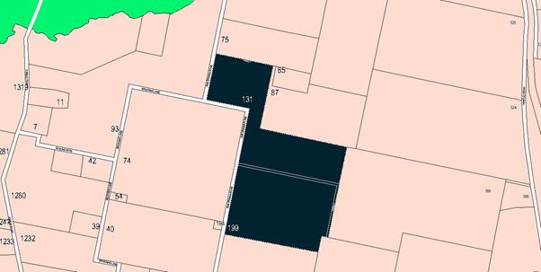
Figure 1 - locality plan
The subject site is identified
on the LEP maps in the following manner:
|
Land
Zoning Map:
|
Land
zoned E3 Environmental management
|
|
Lot Size
Map:
|
Minimum
Lot Size 100 ha
|
|
Heritage
Map:
|
Not a
heritage item or conservation area
|
|
Height of
Buildings Map:
|
No
building height limit
|
|
Floor
Space Ratio Map:
|
No floor
space limit
|
|
Terrestrial
Biodiversity Map:
|
Medium
biodiversity sensitivity on the site
|
|
Groundwater
Vulnerability Map:
|
Ground
water vulnerable
|
|
Drinking
Water Catchment Map:
|
Located
within the drinking water catchment
|
|
Watercourse
Map:
|
Not within
or affecting a defined watercourse
|
|
Urban
Release Area Map:
|
Not
within an urban release area
|
|
Obstacle
Limitation Surface Map:
|
No
restriction on building siting or construction
|
|
Additional
Permitted Uses Map:
|
No
additional permitted use applies
|
Those matters that are of
relevance are addressed in detail in the body of this report.
Part 2 - Permitted or Prohibited Development
The
subject property is zoned E3 Environmental Management under Orange Local
Environmental Plan 2011 (OLEP 11). The proposed development is defined as
“intensive plant agriculture”, and “dwelling house”,
whilst the consolidation of lots is a form of “subdivision”.
"Intensive plant agriculture" means:
any
of the following:
(a) the
cultivation of irrigated crops for commercial purposes (other than irrigated
pasture or fodder crops),
(b) horticulture,
(c) turf
farming,
(d) viticulture.
Intensive
plant agriculture is a type of agriculture.
The
proposed development is consistent with both (a) and (b) in that, at
propagation, the plants would be hand watered (and hence irrigated); whilst
later they would not, and are hence consistent with the definition of
horticulture.
"Horticulture"
means:
the cultivation of fruits, vegetables, mushrooms,
nuts, cut flowers and foliage and nursery products for commercial purposes, but
does not include a plant nursery, turf farming or viticulture.
Intensive
plant agriculture is permissible with development consent in the zone
“Dwelling
house” is a subcategory to the group term “residential
accommodation”, and is the erection of not more than one
“dwelling” within a given building. A “dwelling” is
defined in the LEP as a:
room or suite of rooms occupied or used or so
constructed or adapted as to be capable of being occupied or used as a separate
domicile.
Dwellings
and intensive plant agriculture are listed as a permissible form of development
within the E3 zone, requiring development consent. It is noted that
special restrictions apply to the permissibility of erecting a dwelling on an
allotment within the E3 zone. These provisions are contained within
Clause 4.2 of the LEP which are discussed in detail below under the
heading “Clause 4.2A - Erection of Dwelling Houses on Land in
Certain Rural and Environmental Protection Zones”.
Land Use Zones
The
amended proposal is significantly different to the original in that it is now
proposing additions and rejuvenation to the olive grove such that it can now be
considered as intensive plant agriculture. Further, it is considered that the
proposed dwelling component of the application is, in fact, ancillary (or it is
possible for it to be ancillary) to the intensive plant agriculture component
of the proposal. In this configuration the proposed development is permissible
with consent.
Clause 2.3 of LEP 2011
references the Land Use Table and Objectives for each zone in LEP 2011.
These objectives for land zoned E3 Environmental Management are as follows:
1 - Objectives of the E3 Environmental
Management Zone
· To protect, manage and restore areas with special
ecological, scientific, cultural or aesthetic values.
· To provide for a limited range of development that
does not have an adverse effect on those values
· To manage development within water supply catchment
lands to conserve and enhance the city and district’s water resources. of residents.
· To maintain the rural function and primary
production values of the area.
· To
ensure development along the Southern Link Road has alternative access
With
regard to the first dot point, there are areas on the site that possess
moderate ecological value that the applicant has given consideration to in his
amended response. The revised proposal utilises avoidance strategies to achieve
satisfactory impact on local biodiversity values of the site.
With
respect to the second dot point, the proposed development is generally
consistent with the range of permissible developments allowed in the zone. The
amended proposal demonstrates that with sufficient care and application, the basic
proposal is consistent with zone objectives.
With
regard to the third dot point, the subject property is located well within the
water supply catchment area of the City. The proposed development is unlikely
to have a significant effect on the provision of water supply to the City.
With
regard to the fourth dot point, the proposed development as originally proposed
was considered to be inconsistent with this zone objective. The amended
proposal is now more focused on the issue of primary production uses of the
site and rural functions.
With
regard to the fifth dot point, the proposed development has no impact.
Clause
2.6 - Subdivision - Consent Requirements
The proposed development includes
consolidation of existing lots. This meets the definition of subdivision as set
out in division 4B of the Environmental Planning and Assessment Act.
In order to satisfy the LEP requirement of the land having a minimum area of
25ha, it is necessary to obtain development consent. Development consent is
being sought as part of this application. Council can grant consent to the
consolidation in the circumstances that are now being proposed, where the
resultant lot is to be used for intensive plant agriculture (which lowers the
minimum lot size to 25ha).
Part 3 - Exempt and Complying Development
No element of the proposed
development is exempt or complying development.
Part 4 - Principal Development Standards
Clause
4.2A - Erection of Dwelling Houses on Land in Certain Rural and Environmental
Protection Zones
(1)
- Objectives
(a) to
minimise unplanned rural residential development,
(b) to
enable the replacement of lawfully erected dwelling houses in rural and
environmental protection zones.
In
relation to (a), the proposed development is seeking consent that by definition
results in planned or considered outcomes in development.
In
relation to (b), there is no existing dwelling on the site; and as a result it
cannot be argued that the proposed development is either consistent or
inconsistent with the stated objective of the clause.
(2) - Applicability
This clause applies to land in the
following zones:
(a) Zone RU1
Primary Production,
(b) Zone E2
Environmental Conservation,
(c) Zone E3
Environmental Management,
(d) Zone E4
Environmental Living
The
subject land is zoned E3 Environmental Management and the clause is therefore
applicable.
(3) - Circumstances where consent may not be granted for a
dwelling house)
Development consent must not be granted for the erection of
a dwelling house on land in a zone to which this clause applies, and on which
no dwelling house has been erected, unless the land is:
(a) a lot
that is at least the minimum lot size specified for that land by the Lot Size
Map, or
(b) a lot
created before this Plan commenced and on which the erection of a dwelling
house was permissible immediately before that commencement, or
(c) a lot
resulting from a subdivision for which development consent (or equivalent) was
granted before this Plan commenced and on which the erection of a dwelling
house would have been permissible if the plan of subdivision had been
registered before that commencement, or
(d) an
existing holding.
(A dwelling cannot be erected on a lot created under clause
9 of State Environmental Planning Policy (Rural Lands) 2008 or clause 4.2).
In
relation to (a), the minimum lot size applicable to the subject property is 100ha.
No lot in the holding, nor the holding as a whole, meets the minimum area
requirements for the zone.
In
relation to (b), Council’s history of this site shows that it did not
have a “dwelling entitlement” in the period immediately before the
gazettal of OLEP 2011.
In
relation to (c), there is no history of a consent for a subdivision and/or
consolidation in which a dwelling house could lawfully have been erected on
this land.
In
relation to (d), the existing holding provisions of the LEP have been suspended
since 2012. Even so, the subject land was never an existing holding. In
relation to the final note, the proposed development is not seeking consent
under the provisions of clause 9 of the rural lands SEPP.
(4) - Sunset clause for existing holding provisions
Land ceases to be an existing holding for the purposes of
subclause (3)(d) if an application for development consent referred to in that
subclause is not made in relation to that land before 31 December 2012.
The
application was lodged after 31 December 2012. In any event, the subject
property was never an existing holding.
(5) - Exceptions where subclause (3) may be dispensed with
Despite subclause (3), development consent may be granted
for the erection of a dwelling house on land to which this clause applies if:
(a) there is
a lawfully erected dwelling house on the land and the dwelling house to be
erected is intended only to replace the existing dwelling house, or
(b) the land
would have been a lot or a holding referred to in subclause (3) had it not been
affected by:
(i) a
minor realignment of its boundaries that did not create an additional lot, or
(ii) a
subdivision creating or widening a public road or public reserve or for another
public purpose.
In
relation to (a), there is no dwelling erected on the subject land. No dwelling
entitlement arises by reason of an existing dwelling being on the site.
In
relation to (b)(i), the subject land has not been the subject of a minor
realignment of boundaries. In relation to (b)(ii), the subject land has
not been altered or re-subdivided for the purpose of road widening or other
public purpose.
(5A) - Further exceptions where subclause (3) may be
dispensed with
Despite subclause (3),
development consent must not be granted for the erection of a dwelling house on
land to which this clause applies that is being, or that is intended to be,
used for the purpose of intensive plant agriculture unless the consent
authority is satisfied that:
(a) the land is located
wholly within Zone RU1 Primary Production or Zone E3 Environmental
Management or a combination of those zones, and
(b) the lot has an area of
not less than 25 hectares, and
(c) the land is being or will be
used for the purpose of intensive plant agriculture, and
(d) the quality and area of the
land is suitable for the commercial production of the proposed or existing
intensive plant agriculture of the kind proposed, and
(e) the dwelling house is required
to support the carrying out of the proposed or existing intensive plant
agriculture, and
(f) the land:
(i) has an average annual
rainfall, recorded over a minimum 5-year period, sufficient for the proposed
use, or
(ii) is subject, or will be
subject, to irrigation requiring a licence under the Water Act 1912 or the Water
Management Act 2000 and the volume and entitlement of water available under
that licence is or will be adequate for the purpose of intensive plant
agriculture, and
(g) services for the supply of
electricity and other infrastructure to support the intensive plant agriculture
are available or adequate arrangements have been made to make them available
when required, and
(h) the sustainable intensive plant
agriculture activity will have commenced or been established before the
subdivision is registered
Note: State
Environmental Planning Policy (Rural Lands) 2008 and the fact sheet entitled Assessing
Intensive Plant Agriculture Developments (published by the NSW Government in
December 2011) set out other relevant issues for the consideration of consent
authorities when assessing development applications for intensive plant
agriculture.
This special provision of the LEP
is relevant because the site contains some primary production that the
applicant proposes as intensive plant agriculture. It is important to note that
in order to achieve permissibility for a dwelling under this clause, full
compliance with all the listed provisions of the clause is required.
In relation to (a), the land is
wholly located within the E3 Environmental Management zone and is therefore in
conformity with this requirement.
In relation to (b), the area of
the development site exceeds 25ha, but there is no lot within that bundle that
meets the requirement. The applicant has proposed consolidation of the subject
land to address that issue. As a combined or consolidated allotment, the
subject land would meet the minimum area requirements of this clause provided
the primary production being carried out on the site is deemed to be intensive
plant agriculture, which is achieved under the amended proposal.
In relation to (c), Council is
required to be satisfied that the land
is being or will be used for the purpose of intensive plant agriculture. In
determining this point it should be noted that
the existing olive grove consists of two parts:
· one part of approximately 1ha of olives that are 14 years
old and nearing productive maturity - this is the only surviving remnant of
approximately 4ha planted in 2004
· another part of the existing grove consists of 5ha of
immature olives not close to productive maturity that have been poorly managed.
Many olive trees have died and require replacement.
Council staff and the DPI have
inspected the property. Staff were advised that the existing activities on the
site are not within the ambit of intensive plant agriculture because production
for a commercial basis is not achieved by the current levels of activity on the
site. The current activities of the site are best classified as
“lifestyle” or “hobby farming” that might be more related
to rural residential living rather than any form of agriculture on a commercial
basis, which fails to satisfy a fundamental requirement of clause 4.2A(5A)
and brings the overall site use into conflict with zone and
LEP objectives.
However, notwithstanding the
above, the applicant has following extended negotiations reconfigured the
proposed development in an attempt to justify to Council that the site will be
used for intensive plant agriculture into the future. The amended proposal now
involves the refurbishment of the existing debilitated grove and the planting
of an additional 6ha of olive plants to comprise a total of 12ha. The Farm
Plan describes the agricultural component of the development as follows:
“Expansion
of the horticultural enterprise will be undertaken with six hectares in the
western section of the property to be planted to olives. The olives will be
planted in a similar design to the existing grove which is 10m between rows and
6m between trees equating to a density of 160 trees per hectare.
The
remainder of the property contains pasture grass species and some areas of
degraded native vegetation. Approximately 30 hectares of improved pasture
paddocks are used for lamb production. Production of olives is expected to be a
profitable enterprise by the current owner in an average season and when
appropriate management techniques are employed.
Following
the establishment and expansion of the intensive plant agriculture operation,
it is proposed to erect a dwelling on the subject property and to consolidate
the various constituent parcels that make up the development lot into a single
allotment."
The proposal to construct a
dwelling has been put forward on the premise that the dwelling is needed to
ensure the proper and efficient management of the grove. According to the DPI,
the erection of a dwelling on the land should only be supported on the basis
that the property is developed as a 12ha commercial olive grove enterprise.
Attached is a recommended Notice
of Determination that contains several conditions of consent designed to ensure
compliance with the DPI requirements and the provisions contained within
Council’s LEP with respect to intensive plant agriculture. The conditions
of consent will require the applicant to first establish the 12ha olive grove
on the land prior to the issue of a Construction Certificate for the dwelling,
a position which has been acknowledged by the applicant. The applicant will be
required to obtain formal certification from Orange City Council following the
completion of the establishment stage of the olive grove. For clarity, the
establishment stage has been defined as the period of 12 months from the
end of the planting stage, a position which has been endorsed by the DPI.
The site will be inspected by the Director Development Services and a suitably
qualified professional or commercial olive grower approved by the DPI at the
completion of the establishment phase.
Based on the amended proposal and
subject to the adoption of the conditions outlined in the attached Notice,
Council can be satisfied that it is able to validly grant consent to the
proposed development under this provision. In the absence of a viable
commercial horticultural enterprise on the land, a dwelling house would be
prohibited. A dwelling house is prohibited on the land in all other
circumstances.
In
relation to (d), the applicant’s revised Farm Plan suggests that the land
is of sufficient quality to support the proposed activity. This position has
been confirmed by the DPI.
In
relation to (e), the existing olive grove has been planted for over ten years,
but its quality is low as it has not been properly maintained in that period.
The applicant submits that the construction of a dwelling would enable better
farm management. This would appear a reasonable position to submit, however the
applicant needs to make the effort to establish the olive grove first before
the erection of a dwelling on the site can be agreed to. It is not considered
an unreasonable imposition to require the applicant to travel to and from the
site for the 12 month establishment period, given that Orange City itself
is only 2.3km to the north of the site. The DPI has indicated that a dwelling
would only be supported once 12ha of olives were established on the land.
In relation to (f)(i) and (f)(ii),
the applicant has submitted information to suggest or support that sufficient
rainfall occurs on the site of the olive farming plantation. There is separate
and independent advice from the DPI to suggest that a temporary water supply to
augment the existing naturally occurring precipitation during the propagation
period would be useful. Advice received from the DPI initially insisted upon on
the need for supplementary irrigation on a permanent basis to demonstrate
commercial viability, but this has since been revised. The DPI now
suggests that watering on a permanent basis is not required for ongoing plant
survival, but supplementary watering for at least six months but preferably for
2 years after initial planting would be beneficial to survival rates.
The applicant has agreed to
supplementary watering after initial propagation. Hand watering is proposed via
the use of 20 litre slow release water drums for each plant, however the
frequency and length of watering (number of months after planting) is not specified.
The DPI is critical of the proposed measures for supplementary irrigation and
recommend that the watering system be re-designed to perhaps include a
permanent/temporary drip irrigation system linked to a water storage facility
or be carried out via a watering truck/cart, the details of which would need to
be submitted to Council for approval. Attached is a condition of consent
addressing this issue. Council is advised that the ideal planting time would be
just after Summer.
Olives Australia (OA) is the peak
body for olive farming in Australia and has published a number of factsheets
and advisory notes including the issue of watering and irrigation. It is a
common question raised by prospective olive farmers. According to the
OA publication Water Requirements For Olive Orchards., there
are many factors that affect watering regimes.
Olive trees will generally survive
in climates similar to Orange, although the cold winters will degrade
production. For the Orange climate, peak production would be reached with
about 1,016mm of annual water supply. The local rainfall average is
about 800mm. With that rainfall, production should be expected to be about
60-70kg per tree (when fully mature).
Were the full water supply needs
to be met on a permanent basis, the projected production could be expected to
be as high as 90-95kg per tree. Significant benefits would be achieved by the
implementation of a start-up watering regime for at least six months but
preferably 2 years after propagation. It is also important from a
sustainability aspect that weed control (slashing or mowing around the trees)
and adequate fertilisation be provided during the establishment period.
Attached are relevant conditions
of consent to this effect.
In relation to (g), there are no
issues in relation to the supply of services for the proposed intensive plant
agriculture activity.
In relation to (h), it is
necessary for the applicant to go through a consolidation process for the lots
involved so as to have a lot of sufficient size to meet the minimum lot size
for intensive plant agriculture (ie 25ha) and then permit the erection of
a dwelling on the site. A primary concern in this instance is that the
intensive plant agriculture activity be in place and established before the
dwelling is constructed. The consolidation (as a form of subdivision) is of
lesser importance, but it will be necessary to consolidate the lots before a
dwelling is erected.
As alluded to above, it is
considered that a minimum 12 month establishment period after completion
of the rejuvenation and planting component of the olive grove is necessary as a
means of quantifying what constitutes ‘established”.
Part 7 - Additional Local Provisions
7.1
- Earthworks
This
clause establishes a range of matters that must be considered prior to granting
development consent for any application involving earthworks, such as:
(a) the likely
disruption of, or any detrimental effect on, existing drainage patterns and
soil stability in the locality of the development
(b) the effect of
the development on the likely future use or redevelopment of the land
(c) the quality of
the fill or the soil to be excavated, or both
(d) the effect of
the development on the existing and likely amenity of adjoining properties
(e) the source of
any fill material and the destination of any excavated material
(f) the likelihood
of disturbing relics
(g) the proximity to
and potential for adverse impacts on any waterway, drinking water catchment or
environmentally sensitive area
(h) any measures proposed
to minimise or mitigate the impacts referred to in paragraph (g).
No
details have been provided with respect to this application concerning the
levels and extent of earthworks that may be required for the proposed dwelling
and its likely access. However, the extent of earthworks following site
inspection of the dwelling site will be less than 1m of cut and fill.
There will be extensive earthworks relating to the construction of the access
drive, however the applicant is advising that such works will not result in
significant vegetation loss.
The
road will generally not be visible in those parts of the access drive that will
require work. It is considered that the low scale of earthworks has a
corresponding low risk of uncovering or damaging any buried Aboriginal heritage
that may exist on the site.
7.4 - Terrestrial Biodiversity
This
clause seeks to maintain terrestrial biodiversity and requires that consent
must not be issued unless the application demonstrates whether or not the
proposal:
(a) is likely to
have any adverse impact on the condition, ecological value and significance of
the fauna and flora on the land
(b) is likely to
have any adverse impact on the importance of the vegetation on the land to the
habitat and survival of native fauna
(c) has any
potential to fragment, disturb or diminish the biodiversity structure, function
and composition of the land, and
(d) is likely to
have any adverse impact on the habitat elements providing connectivity on the
land.
Additionally
this clause prevents consent being granted unless Council is satisfied that:
(a) the development
is designed, sited and will be managed to avoid any significant adverse
environmental impact, or
(b) if that impact
cannot be reasonably avoided - the development is designed, sited and will be
managed to minimise that impact, or
(c) if that impact
cannot be minimised - the development will be managed to mitigate that impact.
Council's
LEP mapping does not show the location of the proposed dwelling as being within
a mapped Environmentally Sensitive Area (ESA). However, parts of the site are
mapped in the LEP as containing ESA. Site inspection reveals that such
environmental sensitivity extends somewhat further than is shown in the mapping
under the definitions applicable in the State legislation.
As
parts of the site are mapped as ESA land, this prevents the proposed
development being considered under the exempt and complying development
provisions of the SEPP code. As a blanket requirement for a development
application being required, it is clear that the intent of the ESA mapping
is primarily to act as a red flag, in which a merits based assessment is needed
by Council that includes determining the full extent of such ESA mapping
on a given site.
In
this case, the proposed development is not located within the mapped area.
7.6 - Groundwater Vulnerability
This
clause seeks to protect hydrological functions of groundwater systems and
protect resources from both depletion and contamination. Orange has a high
water table and large areas of the LGA, including the subject site, are
identified with “Groundwater Vulnerability” on the Groundwater
Vulnerability Map.
This
requires that Council consider:
(a) whether or not
the development (including any onsite storage or disposal of solid or liquid
waste and chemicals) is likely to cause any groundwater contamination or have
any adverse effect on groundwater dependent ecosystems, and
(b) the cumulative
impact (including the impact on nearby groundwater extraction for potable water
supply or stock water supply) of the development and any other existing
development on groundwater.
Furthermore consent may not be granted unless
Council is satisfied that:
(a) the development
is designed, sited and will be managed to avoid any significant adverse
environmental impact, or
(b) if that impact
cannot be reasonably avoided - the development is designed, sited and will be
managed to minimise that impact,
(c) if that impact
cannot be minimised - the development will be managed to mitigate that impact.
The
proposal is not anticipated to involve the discharge of toxic or noxious
substances and is therefore unlikely to contaminate the groundwater or related
ecosystems. The proposal does not involve extraction of groundwater and will
therefore not contribute to groundwater depletion. The design and siting of the
proposal avoids impacts on groundwater and is therefore considered acceptable.
7.7 - Drinking Water Catchments
(1) The objective of this clause is
to protect drinking water catchments by minimising the adverse impacts of
development on the quality and quantity of water entering drinking water
storages.
(2) This clause applies to land
identified as “Drinking water” on the Drinking Water Catchment
Map.
(3) Before determining a
development application for development on land to which this clause applies,
the consent authority must consider whether or not the development is likely to
have any adverse impact on the quality and quantity of water entering the
drinking water storage, having regard to:
(a) the distance between the
development and any waterway that feeds into the drinking water storage, and
(b) the onsite use, storage and
disposal of any chemicals on the land, and
(c) the treatment, storage and
disposal of waste water and solid waste generated or used by the development.
(4) Development consent must not be
granted to development on land to which this clause applies unless the consent
authority is satisfied that:
(a) the development is designed,
sited and will be managed to avoid any significant adverse impact on water
quality and flows, or
(b) if that impact cannot be
reasonably avoided - the development is designed, sited and will be managed to
minimise that impact, or
(c) if that impact cannot be
minimised - the development will be managed to mitigate that impact.
The subject property is located
within the Orange City water supply catchment. The proposed development has
been assessed against the matters listed in this clause, and it is considered
that there are no issues arising that require refusal or modification of the
proposal on the basis of possible impacts on the water supply.
STATE
ENVIRONMENTAL PLANNING POLICIES
State Environmental Planning
Policy 55 - Remediation of Land
Under clause 7 of the SEPP,
Council must consider whether the land is contaminated and whether the land
requires any form of remediation to render it suitable for the purpose for
which it is proposed to be used. The previous land uses must be considered
along with any visible or tangible evidence on the site.
In this case Council has no
records that indicate the land was used for purposes likely to have caused
contamination of the site. Its potential for contamination is very low. A site
inspection conducted as part of the assessment has not revealed any evidence of
contamination or activities on the site which would render it unsuitable for
the proposed development.
On the basis of the available
evidence, it is considered that the site is suitable for the proposed use and
no further preliminary investigation is required to satisfy the requirements of
the SEPP.
State
Environmental Planning Policy (Building Sustainability Index: BASIX) 2004
A BASIX certificate has been
submitted as part of the application which addresses the requirements of
this SEPP insofar as it relates to the proposed development.
State Environmental Planning
Policy - Rural Lands (2008)
The rural lands SEPP is applicable because the proposed
development involves elements that by definition constitute
“subdivision”; and also proposes the erection of a dwelling.
Part 3 of the Policy sets out provisions for rural subdivision and
dwellings.
The Rural Subdivision Principles are as
follows:
(a) the minimisation of rural land fragmentation,
(b) the minimisation of rural land use
conflicts, particularly between residential land uses and other rural land
uses,
(c) the consideration of the nature of existing
agricultural holdings and the existing and planned future supply of rural residential
land when considering lot sizes for rural lands,
(d) the consideration of the natural and
physical constraints and opportunities of land,
(e) ensuring that planning for dwelling
opportunities takes account of those constraints
Clause 10 lists the matters to be
considered when determining development applications for rural subdivisions or
rural dwellings:
(a) the existing uses and approved uses of land
in the vicinity of the development,
(b) whether or not the development is likely to
have a significant impact on land uses that, in the opinion of the consent
authority, are likely to be preferred and the predominant land uses in the
vicinity of the development,
(c) whether or not the development is likely to
be incompatible with a use referred to in paragraph (a) or (b),
(d) if the land is not situated within a rural
residential zone, whether or not the development is likely to be incompatible
with a use on land within an adjoining rural residential zone,
(e) any measures proposed by the applicant to
avoid or minimise any incompatibility referred to in paragraph (c) or (d).
In relation to (a), the surrounding land uses are generally
rural developments of various types and intensities.
In relation to (b), approval of a dwelling is an ancillary
element to intensive plant agriculture that is to be established. As such, the
dwelling should not be viewed in isolation, rather a component of activities
that are consistent with the surrounding land use patterns.
In relation to (c) and (d), the subject property is not in a
rural residential area, and the proposed development in its amended form is
considered compatible to the existing surrounding agricultural land uses and
those which are likely to develop on the subject property.
In relation to (e), the applicant has considered and
proposed various mitigation elements that will have the effect of providing
mitigation to the compatibility issues that a transformation to a rural
residential lifestyle might bring to the surrounding agricultural land.
PROVISIONS OF ANY DRAFT
ENVIRONMENTAL PLANNING INSTRUMENT THAT HAS BEEN PLACED ON EXHIBITION
s79C(1)(a)(ii)
There are no draft environmental planning instruments that
apply to the subject land or proposed development.
DESIGNATED DEVELOPMENT
The proposed development is not designated development.
PROVISIONS OF ANY DEVELOPMENT
CONTROL PLAN s79C(1)(a)(iii)
Development Control Plan 2004
Development Control Plan 2004 (“the DCP”)
applies to the subject land (Parts 2 and 6). An assessment of the
proposed development against the relevant Planning Outcomes will be undertaken
below.
Pursuant to Planning Outcome 0.2-1 Interim Planning Outcomes
- Conversion of Zones:
· Throughout this
Plan, any reference to a zone in Orange LEP 2000 is to be taken to be a
reference to the corresponding zone(s) in the zone conversion table.
The corresponding zone to zone 7 (Water supply catchment)
(Orange LEP 2000) is zone E3 (Environmental Management) (Orange
LEP 2011). As such, Orange DCP 2004 – Parts 2 and 6
are relevant to this proposal. The provisions of these Parts are considered
below.
PART 2 - NATURAL RESOURCE
MANAGEMENT
Stormwater Quality
Not applicable in this zone.
Groundwater Issues
1 Development
applications for development (excluding dwelling houses) that proposes to
extract groundwater or involve on-site wastewater disposal identify potential
risks to, and management of, groundwater resources.
Not applicable to this development as the development does
not involve extraction and use of groundwater as an element of the application.
2 Development
is carried out in a manner that does not adversely affect groundwater
resources.
The proposed development has been submitted with an effluent
management study indicating that the site is capable of managing effluent from
the dwelling and recommending the type and capacity of the effluent management
system. With regard to the agricultural activities proposed, it is considered
unlikely that such uses will have any significant effect with regard to
groundwater sources.
3 Development
considered by Council to have the potential to significantly affect groundwater
quality incorporates a monitoring program and provides test results from a
NATA-accredited laboratory to Council for review and for inclusion in the City
SoE Reports
An ongoing monitoring program is considered unnecessary.
4 Development
that requires or proposes the use of groundwater demonstrates that the
groundwater extraction will meet the requirements of DLWC, where necessary
Groundwater extraction is not proposed under this application.
Vegetation Management
1 Compliance
with the Native Vegetation Conservation Act 1997
The Native Vegetation Act (NVA) is not directly
applicable to the subject application as the amount of area affected is below
the minimum thresholds specified to trigger consideration of the Act.
2 Development
is designed and constructed in a way that minimises the impact on existing
vegetation.
The material submitted with the application demonstrates
that the proposed dwelling has been located to minimise vegetation loss.
3 Particular
attention is given to the effect of rural or urban residential release
development on existing vegetation and scenic areas.
The revised Farm Plan (unlike its predecessor) acknowledges
the presence of some significant native vegetation on the site. Both the
intensive agriculture and the dwelling components and associated infrastructure
apply avoidance strategies, using careful siting for the development to avoid
major impacts on significant vegetation. In terms of impacts on scenic qualities,
the proposed development will not have a significant adverse effect.
4 Development
applications indicate on plans the location of all significant trees affected
by or in the vicinity of development.
The application as submitted has managed to avoid significant
damage or loss of significant vegetation known to be located on the site.
5 Applications
demonstrate to Council’s satisfaction that all practical measures have
been made to retain trees that contribute to and embellish the Orange landscape
The proposed development in its amended form achieves this
planning outcome.
Flora and Fauna Management
This exists in the DCP as a separate matter for
consideration, but is really a variation to the matters previously canvassed.
It applies ecological conservation and sustainability principles to areas of
high biodiversity, and could be applied to issues like native grasslands and
rocky outcrops, both of which are now also listed as protected habitats in
State legislation. There is a high likelihood that such features might exist on
the site.
PART 6 - RURAL DEVELOPMENT
Planning Outcomes for (Intensive Agriculture)
Subdivisions and the Placement of Rural Dwellings
This part provides a comprehensive assessment tool for
dealing with various types of rural development, including that pertaining to
intensive plant agriculture and the justified need for a dwelling on certain
parcels of land that under ordinary circumstances would not be entitled to a
dwelling. The provisions also provide guidance on the site selection criteria
for rural dwellings.
Planning Outcome 6.10-3 of the DCP in particular provides
guidelines for ensuring suitable management of intensive plant agricultural
enterprises. In particular, the provisions require Council to be satisfied that
the land is being used for intensive plant agriculture or that satisfactory
arrangements are in place to provide for the establishment of the intensive
plant agricultural enterprise on the land before allowing a dwelling. This has
been discussed in depth above under the heading “Clause 4.2A - Erection
of Dwelling Houses on Land in Certain Rural and Environmental Protection
Zones”.
As discussed above, the applicant now proposes the
establishment of a 12ha olive enterprise within the property. Council has
sought advice from the NSW DPI with regard to the proposed intensive
agriculture operation. The DPI is requiring the rejuvenation of the existing
grove, augmented by an additional 6ha of new plantings, proper management of
the existing grove including pruning, weeding and replacement plantings, and
watering during the propagation stage for the new grove.
The applicant has acknowledged that a dwelling house can
only be constructed following satisfactory signoff from Council that the olive
enterprise has been first established. Conditions of consent as recommended and
discussed elsewhere in this report have been included to address this issue.
Planning Outcome 6.10-2 of the DCP in particular provides
guidelines for the siting of rural dwelling houses. The planning outcomes
contained therein relate to the suitability of the site for a dwelling and
address issues including, but not limited to access, effluent management,
contamination, buffers, privacy, water supply and protection of remnant
vegetation. The applicant has suitably demonstrated compliance with this
criteria. There do not appear to be any areas on the site proposed that are
contrary to the heads of consideration listed in PO 6.10-2. The siting of
the dwelling is considered to be acceptable in this regard. Conditions of
consent are also recommended to ensure that the development proceeds in an
acceptable manner.
The proposed development is not inconsistent with provisions
contained within Chapter 6.
DEVELOPMENT CONTRIBUTIONS PLAN
2017
Development on land situated outside the Orange urban area
and areas zoned for rural residential purposes is not required to make
contributions for Roads and Cycleways and Stormwater Drainage. The subject land
is consistent with this categorisation.
The payment of $5,261.65 is to
be made to Council in accordance with Section 94 of Act and the Orange
Development Contributions Plan 2017 (LGA remainder) towards the provision of
the following public facilities:
|
Open Space and Recreation
|
@ $3,845.39 x 1 x three bedroom dwelling
|
3,845.39
|
|
Community and Cultural
|
@ $1,115.17 x
1 x three bedroom dwelling
|
1,115.17
|
|
Roads and Traffic Management
|
@ $0 x 1 x three bedroom dwelling
|
0
|
|
Stormwater Drainage
|
@$0 x 1 x three bedroom dwelling
|
0
|
|
Local Area Facilities
|
@ $0 x 1 x three bedroom dwelling
|
0
|
|
Plan Preparation & Administration
|
@ $301.09 x 1 x three bedroom dwelling
|
301.09
|
|
Subtotal
|
|
|
|
Credit for dwelling entitlement
|
@$0
|
0
|
|
TOTAL:
|
|
$5,261.65
|
The contribution will be indexed quarterly in accordance
with the Orange Development Contributions Plan 2017 (LGA Remainder). This Plan
can be inspected at the Orange Civic Centre, Byng Street, Orange.
PROVISIONS PRESCRIBED BY THE
REGULATIONS s79C(1)(a)(iv)
Demolition of a Building (clause 92)
The proposal does not involve the demolition of a building.
Fire Safety Considerations
(clause 93)
The proposal does not involve a change of building use for
an existing building.
Buildings to be Upgraded
(clause 94)
The proposal does not involve the rebuilding, alteration,
enlargement or extension of an existing building.
THE LIKELY IMPACTS OF THE
DEVELOPMENT s79C(1)(b)
The likely impacts of the proposed development have been
considered in the body of this report.
THE SUITABILITY OF THE SITE
s79C(1)(c)
The site of the proposed development is principally
agricultural, with some environmental considerations due to its location within
the City’s water supply catchment. Parts of the site are constrained due
to the environmental and biodiversity concerns. The activities on the site as
viable intensive plant agriculture render the erection of a dwelling
permissible, notwithstanding the small size of the holding.
ANY SUBMISSIONS MADE IN
ACCORDANCE WITH THE ACT s79C(1)(d)
The proposed development is not defined as advertised
development under the provisions of the LEP, and as such no formal
exhibition of the application was required. No objections have been received in
relation to this application, however the applicant has produced several
letters, identical to each other, that express their support for the proposed
development, but do not add in any way to the substantive arguments to support
approval.
PUBLIC INTEREST
s79C(1)(e)
It is considered a matter for public interest that
agricultural land be utilised efficiently to maximise economic development and employment
opportunities, add security to food sources, and minimise unplanned rural
residential and residential development within areas set aside primarily for
agriculture. The unplanned placement of rural development will place
unnecessary pressure and expense on public infrastructure provision.
The initial proposal had the potential to be acting contrary
to the public interest as staff and the DPI were unconvinced that the
applicant had demonstrated compliance with the requirements of
Council’s LEP. Unsound decisions in rural planning issues tend to
generate knock-on issues that affect other rural planning issues and overall
economic development in the LGA. It is considered that in this case, the
amended proposal, if carried out in accordance with the consent, can be
undertaken in a way that is in the interests of both the individual and the
public as a whole.
SUMMARY
Dwellings are listed as a
permissible form of development within the E3 zone, requiring development
consent. It is noted that special restrictions apply to the permissibility of
erecting a dwelling on an allotment within the E3 zone. These provisions are
contained within Clause 4.2 of the LEP which have been discussed in detail
under the heading “Clause 4.2A - Erection of Dwelling Houses on Land
in Certain Rural and Environmental Protection Zones”.
A Section 79C assessment of the development indicates that
the proposal in its amended form is acceptable and can comply with the
requirements of Clause 4.2A(5A) of Orange LEP 2011 subject to certain
conditions.
Attached is a recommended Notice of Determination that has
been designed to ensure compliance with the DPI requirements and the provisions
contained within Council’s LEP and DCP with respect to
intensive plant agriculture. Of note, the conditions of consent will require
the applicant to first establish the 12ha olive grove on the land prior to the
issue of a Construction Certificate for the dwelling, a position which has been
acknowledged by the applicant. The applicant will be required to obtain formal
certification from Orange City Council following the completion of the
establishment stage of the olive grove.
COMMENTS
A draft Notice of Approval is attached for consideration.
Attachments
1 Notice
of Approval, D17/63324⇩
2 Plans,
D17/60792⇩
3 Revised
Farm Plan, D17/60794⇩
4 DPI
advice, D17/60832⇩
5 Submissions,
D17/64311⇩
Planning and Development Committee
7 November 2017
2.3 Development
Application DA 258/2015(1) - 131 and 199 Bargwanna Road
Attachment 1 Notice
of Approval
|

|
ORANGE
CITY COUNCIL
Development
Application No DA
258/2015(1)
NA17/ Container
PR1144
|
NOTICE OF DETERMINATION
OF A DEVELOPMENT
APPLICATION
issued under the Environmental
Planning and Assessment Act 1979
Section 81(1)
|
Development
Application
|
|
|
Applicant Name:
|
Mr GM Gleeson
|
|
Applicant Address:
|
PO Box
1154
ORANGE
NSW 2800
|
|
Owner’s Name:
|
Mr GM and
Ms CM Gleeson
|
|
Land to Be Developed:
|
Lots 226
and 227 DP 750387, and Lot 1 DP 1141864 -
131 and
199 Bargwanna Road, Orange
|
|
Proposed Development:
|
Intensive
Plant Agriculture, Dwelling House and Subdivision (consolidation of land)
|
|
|
|
|
Building
Code of Australia
building
classification:
|
To be
determined by Certifier
|
|
|
|
|
Determination
|
|
|
Made On:
|
7 November
2017
|
|
Determination:
|
CONSENT
GRANTED SUBJECT TO CONDITIONS DESCRIBED BELOW:
|
|
|
|
|
Consent to
Operate From:
|
8 November
2017
|
|
Consent to
Lapse On:
|
8 November
2022
|
Terms of Approval
The reasons for the imposition of
conditions are:
(1) To ensure a quality
urban design for the development which complements the surrounding environment.
(2) To maintain
neighbourhood amenity and character.
(3) To ensure compliance
with relevant statutory requirements.
(4) To provide adequate
public health and safety measures.
(5) Because the development
will require the provision of, or increase the demand for, public amenities and
services.
(6) To ensure the utility
services are available to the site and adequate for the development.
(7) To prevent the proposed
development having a detrimental effect on adjoining land uses.
(8) To minimise the impact
of development on the environment.
Conditions
(1) The
development must be carried out in accordance with:
(a) Plan/s
numbered House Plans by Gleeson Homes numbered Sheets 1 & 2 (House Plan),
Proposed Farm Layout Plan prepared by Envirowest Consulting numbered 5911 dated
6/9/2017 with red hatching (the Farm Plan Layout). Farm Management Plan by
Envirowest reference R5911a5, dated 28 August 2017 (Farm Management Plan)
(b) statements
of environmental effects or other similar associated documents that form part
of the approval including BASIX Certificate 842960S
as amended
in accordance with any conditions of this consent.
(2) All building work must
be carried out in accordance with the provisions of the Building Code of
Australia.
(3) A sign is to be erected
in a prominent position on any site on which building work, subdivision work or
demolition work is being carried out:
(a) showing
the name, address and telephone number of the principal certifying authority
for the work, and
(b) showing
the name of the principal contractor (if any) for any building work and a
telephone number on which that person may be contacted outside working hours,
and
(c) stating
that unauthorised entry to the site is prohibited.
Any such sign is to be maintained while the
building work, subdivision work or demolition work is being carried out.
(4) In the case
of residential building work for which the Home Building Act 1989 requires
there to be a contract of insurance in force in accordance with Part 6 of the
Act, evidence that such a contract of insurance is in force is to be provided
to the Principal Certifying Authority before any building work authorised to be
carried out by the consent commences.
(5) Residential
building work within the meaning of the Home Building Act 1989 must not
be carried out unless the principal certifying authority for the development to
which the work relates (not being the council) has given the council written
notice of the following information:
(a) in
the case of work for which a principal contractor is required to be appointed:
(i) the
name and the licence number of the principal contractor, and
(ii) the
name of the insurer by which the work is insured under Part 6 of that Act,
(b) in
the case of work to be done by an owner-builder:
(i) the
name of the owner-builder, and
(ii) if
the owner-builder is required to hold an owner-builder permit under that Act,
the number of the owner-builder permit.
If arrangements for doing the
residential building work are changed while the work is in progress so that the
information under this condition becomes out of date, further work must not be
carried out unless the principal certifying authority for the development to
which the work relates (not being the council) has given the council written
notice of the updated information.
|
PRIOR TO THE ISSUE OF
A CONSTRUCTION CERTIFICATE
|
(6) The payment of
$5,261.65 is to be made to Council in accordance with Section 94 of Act
and the Orange Development Contributions Plan 2017 (LGA remainder) towards the
provision of the following public facilities:
|
Open Space and
Recreation
|
@ $3,845.39 x 1 x
three bedroom dwelling
|
3,845.39
|
|
Community and
Cultural
|
@ $1,115.17 x 1 x three
bedroom dwelling
|
1,115.17
|
|
Roads and Traffic
Management
|
@ $0 x 1 x three
bedroom dwelling
|
0
|
|
Stormwater Drainage
|
@$0 x 1 x three
bedroom dwelling
|
0
|
|
Local Area Facilities
|
@ $0 x 1 x three
bedroom dwelling
|
0
|
|
Plan Preparation
& Administration
|
@ $301.09 x 1 x three
bedroom dwelling
|
301.09
|
|
Subtotal
|
|
|
|
Credit for dwelling
entitlement
|
@$0
|
0
|
|
TOTAL:
|
|
$5,261.65
|
The contribution will be indexed quarterly in
accordance with the Orange Development Contributions Plan 2017 (LGA Remainder).
This Plan can be inspected at the Orange Civic Centre, Byng Street, Orange.
(7) Land
described as Lots 226 and 227 DP 750387, and Lot 1 DP 1141864 shall be
consolidated into a single allotment and be registered at the Land and Property
Information Centre prior to the issue of a Construction Certificate. Evidence of
consolidation of the lots forming the development site is required to be
submitted to Council and the Principal Certifying Authority prior to the issue
of a Construction Certificate.
(8) This
consent is granted subject to compliance with Clause 4.2A(5A) of Orange Local
Environmental Plan 2011. Accordingly, prior to the issue of a Construction
Certificate for the dwelling the applicant shall establish and maintain 12
hectares of olive trees planted at a density of 160 trees per hectare with
trees spaced 6 metres apart in rows 10 metres apart in accordance with paragraph 5.1
of the Farm Management Plan and located as identified by red hatching on the
Proposed Farm Layout Plan.
(9) The
applicant is to undertake the following works to establish the commercial olive
grove to Council’s satisfaction:
Planting Stage
· Restore and rejuvenate
the existing olive grove involving:
- replacement
of olive trees that have perished, are missing or diseased (or otherwise in
poor health) within the existing row structure to achieve the density and
spacing required by Condition (8)
- thorough
weed management incorporating mulching/slashing and/or mowing and/or use of
herbicides as necessary
- install
and use a watering system that will provide for the effective watering of young
trees for the first two years. This may include a permanent/temporary drip
irrigation system linked to a water storage facility or via a watering
truck/cart, the details of which shall be submitted to Council for approval by
the Director Development Services.
- existing
trees which are to be retained must be pruned and trained to have a single
trunk clear of branches from the ground to a height of 1m to enable effective
harvesting of fruit.
· Extend the olive grove
to 12 hectares in area involving:
- deep
ripping and soil preparation according to commercial best practice of the new
grove areas
- planting
a minimum of 1,600 new olive trees in accordance with the approved Farm
Management Plan and Farm Layout Plan
- thorough
weed management incorporating mulching/slashing and/or mowing and/or herbicide
as necessary
- install
and use a watering system that will provide for the effective watering of young
trees for the first two years. This may include a temporary drip irrigation
system linked to a water storage facility or via a watering truck/cart, the
details of which shall be submitted to Council for approval.
Establishment Stage
· The establishment stage
is the period of 12 months from the end of the planting stage as certified
under Condition (10).
· The watering system for
both existing and extended olive grove is to be kept in place, maintained and
operated for at least 2 years from the date of completion of the planting in
the Planting Stage.
· Prune all olive trees
to suit mechanical harvesting with a tree shaker and catcher. Each tree shall
have a single trunk and should be free of branches from the ground to a height
of 1m to enable effective harvesting of fruit.
· Any trees that fail or
die within the first 6 month period from establishment are to be documented and
replaced.
· Successful
establishment shall include verification that the enterprise is in line with
commercial best practice olive production in the region.
(10) Compliance
with Conditions (8) and (9) is to be subject to inspection by Council’s
Director Development Services and a suitably qualified professional or
commercial olive grower approved by the Department of Primary Industry.
Inspections shall take place at the conclusion of the Planting Stage and at the
conclusion of the Establishment Stage at the cost of the Applicant.
(11) A
Construction Certificate for the dwelling must not be issued until the full 12
hectares of olive grove has been established and has been confirmed to the
satisfaction of the Director Development Services at the conclusion of the
Establishment Stage. Certification from Orange City Council, upon being
satisfied that the above criteria have been met, is required to be submitted to
the Principal Certifying Authority prior to the issue of a Construction
Certificate for the dwelling.
(12) The position of the effluent
disposal area as depicted on the approved site plan shall be relocated a
minimum of 20m to the northeast of the currently indicated position. A detailed
plan of the revised location of the effluent management system shall be
submitted with the Construction Certificate application.
(13) An
approval under Section 68 of the Local Government Act is to be sought
from Orange City Council, as the Water and Sewer Authority, for water,
stormwater and the on-site sewer system. No plumbing and drainage is to commence
until approval is granted.
The onsite sewer management report is to
accompany the application recommending a suitable disposal area. Manufactures
specifications for the on-site effluent disposal system are to accompany the
application.
|
PRIOR TO WORKS
COMMENCING
|
(14) A
Construction Certificate application is required to be submitted to, and issued
by Council/Accredited Certifier prior to any excavation or building works being
carried out onsite.
(15) A
temporary onsite toilet is to be provided and must remain throughout the
project or until an alternative facility meeting Council’s requirements
is available onsite.
(16) Soil erosion control
measures shall be implemented on the site.
|
DURING
CONSTRUCTION/SITEWORKS
|
(17) All
construction/demolition work on the site is to be carried out between the hours
of 7.00 am and 6.00 pm Monday to Friday inclusive, 7.00 am to
5.00 pm Saturdays and 8.00 am to 5.00 pm Sundays and Public
Holidays. Written approval must be obtained from the General Manager of Orange
City Council to vary these hours.
(18) Any adjustments to
existing utility services that are made necessary by this development
proceeding are to be at the full cost of the developer.
(19) A minimum
200mm thick gravel vehicular entrance incorporating a pipe culvert is to be
constructed to provide access to the proposed dwelling from Bargwanna Road.
The pipe culvert is to consist of minimum 375mm
diameter stormwater pipes and 2 concrete headwalls and be a minimum 5 metres
long. Where it is not possible to construct a pipe culvert, due to shallow
depth of table drain or the entrance being located on a crest, a 6 metre long
by 2 metre wide by 100mm deep concrete dish drain may replace the pipe culvert.
The location of this entrance and selection of
pipe culvert or dish drain are to be as directed by Orange City Council. The
entrance is to be constructed in accordance with the RTA Guidelines for
Intersections at Grade Figure 4.9.7 Rural Property Access with Indented Access.
The construction is to be as per the requirements of the Orange City Council
Development and Subdivision Code.
(20) A
Registered Surveyor’s certificate identifying the location of the
building on the site must be submitted to the Principal Certifying Authority.
|
PRIOR TO THE ISSUE OF
AN OCCUPATION CERTIFICATE
|
(21) No
person is to use or occupy the building or alteration that is the subject of
this approval without the prior issuing of an Occupation Certificate.
(22) Finished
ground levels are to be graded away from the buildings and adjoining properties
and must achieve natural drainage. The concentrated flows are to be dispersed
down slope or collected and discharged to the stormwater drainage system.
(23) Where
Orange City Council is not the Principal Certifying Authority, a final
inspection of water connection, sewer and stormwater drainage shall be
undertaken by Orange City Council and a Final Notice of Inspection issued,
prior to the issue of either an interim or a final Occupation Certificate.
(24) Certification from
Orange City Council is required to be submitted to the Principal Certifying
Authority prior to the issue of an Occupation Certificate stating that all
works relating to connection of the development to Council assets and works on
Public Land have been carried out in accordance with the Orange City Council
Development and Subdivision Code and the foregoing conditions.
(25) All
of the foregoing conditions are to be at the full cost of the developer and to
the requirements and standards of the Orange City Council Development and
Subdivision Code, unless specifically stated otherwise. All work required by
the foregoing conditions is to be completed prior to the issuing of an
Occupation Certificate, unless stated otherwise.
|
MATTERS FOR THE
ONGOING PERFORMANCE AND OPERATION OF THE DEVELOPMENT
|
(26) The intensive plant
agricultural operation shall be carried out, managed and maintained in
accordance with the Farm Management Plan except as modified by the further
conditions of this consent.
(27) No native trees are
permitted to be removed in conjunction with the dwelling construction, the
driveway or effluent management area. In the event that farm operations require
further tree removal prior consent or approval shall be first obtained from
Orange City Council. Removal of native vegetation from this site is not
permitted without consent or approval.
(28) In the event that
aboriginal artefacts or other elements of aboriginal heritage are located on
the site, all work in the vicinity of that item or artefact shall cease until
the necessary approvals and permits pursuant to the National Parks and
Wildlife Act 1974 (or its successor) have been obtained.
(29) In addition to the
existing olive grove, which is to be managed through weed control, replacement
plantings, pruning and start up watering, the applicant is required to install
and maintain an additional area of olive grove to establish 12 hectares of
olive trees as set out in the Farm Management Plan. The applicant shall
maintain the ongoing health and productivity of the olive grove at all times
that the dwelling is in use, or apply and have approved such other intensive
plant agriculture operations as are deemed appropriate to utilise the site in
place of the olive farm. The farm must at all times be used for intensive plant
agriculture and be deemed to be used in this way on a viable commercial
basis.
(30) Start-up watering of
the olive grove as required by Condition 9 above shall be provided and
maintained for a minimum period of 2 years from the completion of the
propagation and rejuvenation process.
Other Approvals
(1) Local
Government Act 1993 approvals granted under section 68.
Nil
(2) General
terms of other approvals integrated as part of this consent.
Nil
Right of Appeal
If
you are dissatisfied with this decision, section 97 of Environmental
Planning and Assessment Act 1979 gives you the right to appeal to the Land
and Environment Court within 6 months after the date on which you receive this
notice.
*
Section 97 of the Environmental Planning and Assessment Act 1979 does not apply
to the determination of a development application for State significant
development or local designated development that has been the subject of a
Commission of Inquiry.
|
Disability Discrimination Act
1992:
|
This application has been assessed in
accordance with the Environmental Planning and Assessment Act 1979. No
guarantee is given that the proposal complies with the Disability
Discrimination Act 1992.
The applicant/owner is responsible to ensure
compliance with this and other anti-discrimination legislation.
The Disability Discrimination Act
covers disabilities not catered for in the minimum standards called up in the
Building Code of Australia which references AS1428.1 - "Design for Access
and Mobility". AS1428 Parts 2, 3 and 4 provides the most comprehensive
technical guidance under the Disability Discrimination Act currently
available in Australia.
|
|
|
|
|
Disclaimer - S88B Restrictions on the Use of Land:
|
The applicant should note that there
could be covenants in favour of persons other than Council restricting what
may be built or done upon the subject land. The applicant is advised to check
the position before commencing any work.
|
|
|
|
|
Signed:
|
On behalf of the consent authority ORANGE
CITY COUNCIL
|
|
Signature:
|
|
|
Name:
|
PAUL JOHNSTON - MANAGER DEVELOPMENT
ASSESSMENTS
|
|
Date:
|
8 November 2017
|
Planning
and Development Committee
7 November 2017
2.3 Development
Application DA 258/2015(1) - 131 and 199 Bargwanna Road
Attachment 2 Plans
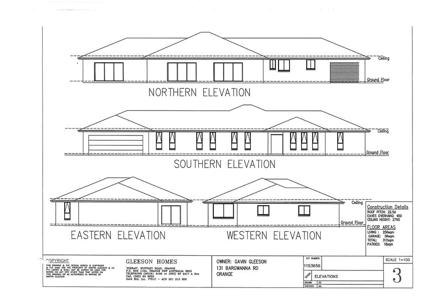
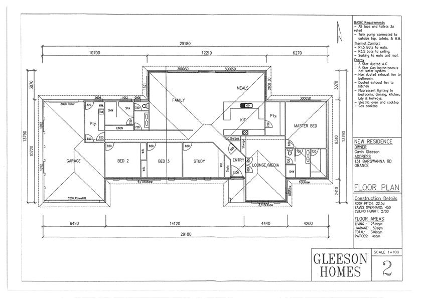
Planning and Development Committee
7 November 2017
2.3 Development
Application DA 258/2015(1) - 131 and 199 Bargwanna Road
Attachment 2 Plans
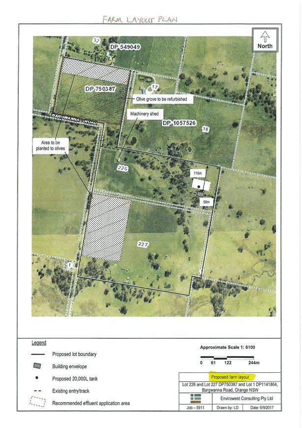
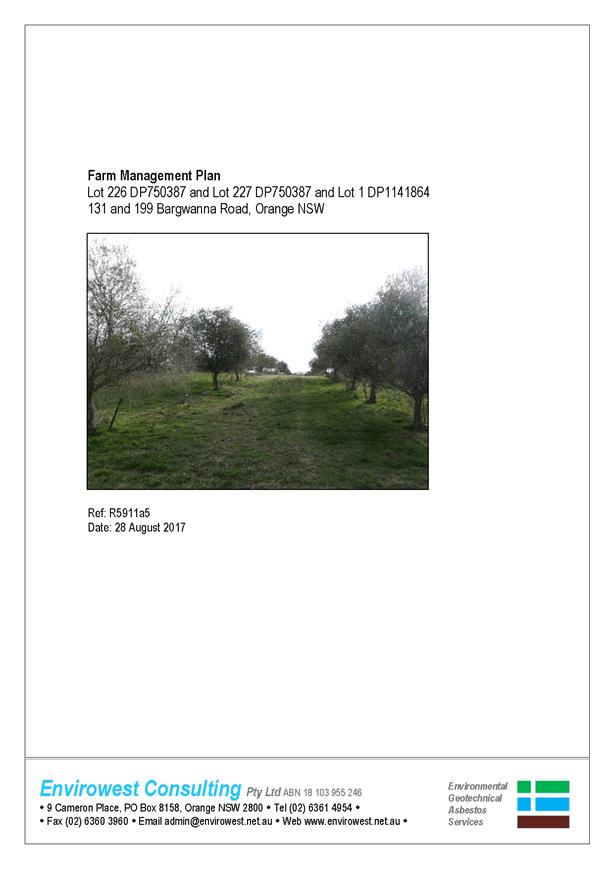
Planning and Development Committee
7 November 2017
2.3 Development
Application DA 258/2015(1) - 131 and 199 Bargwanna Road
Attachment 3 Revised
Farm Plan
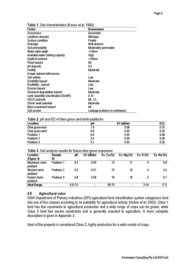
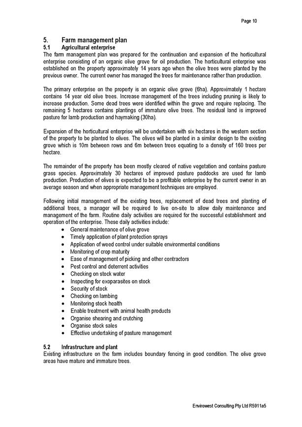
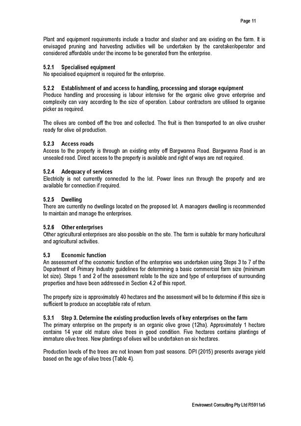
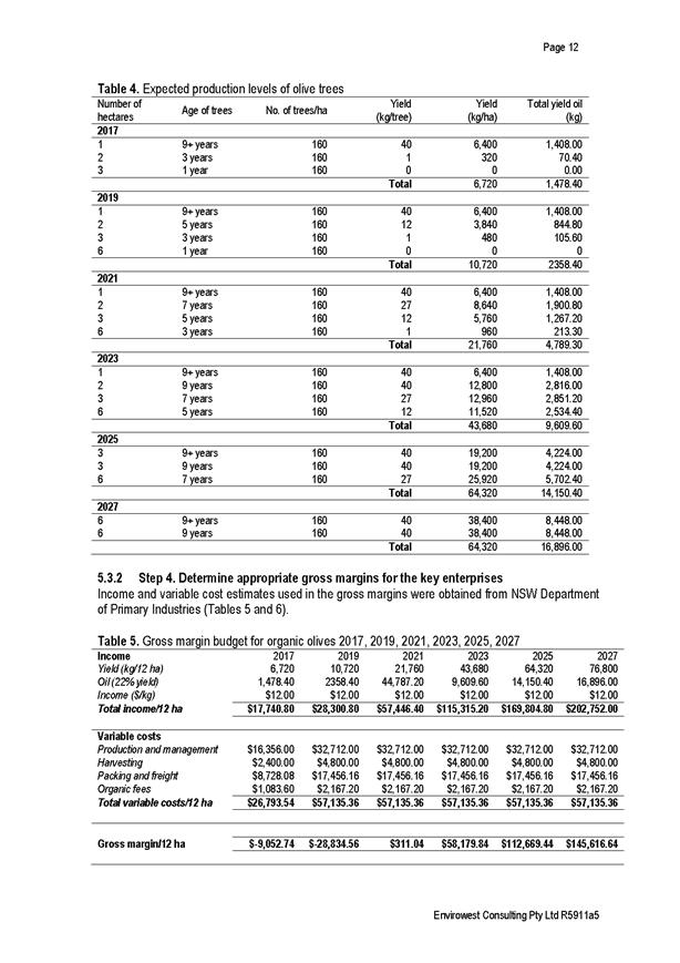
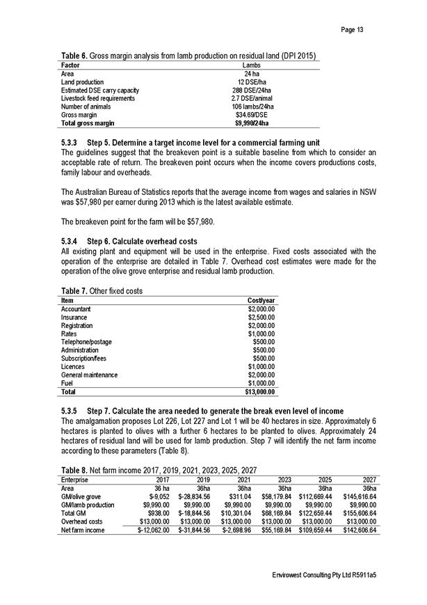

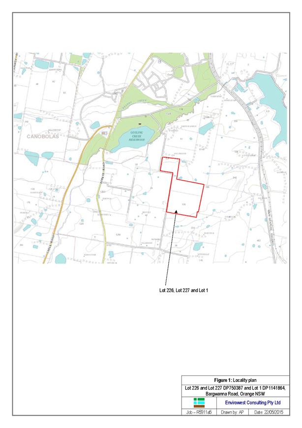
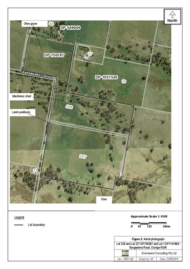

Planning and Development Committee
7 November 2017
2.3 Development
Application DA 258/2015(1) - 131 and 199 Bargwanna Road
Attachment 3 Revised
Farm Plan
Planning and Development Committee
7 November 2017
2.3 Development
Application DA 258/2015(1) - 131 and 199 Bargwanna Road
Attachment 3 Revised
Farm Plan
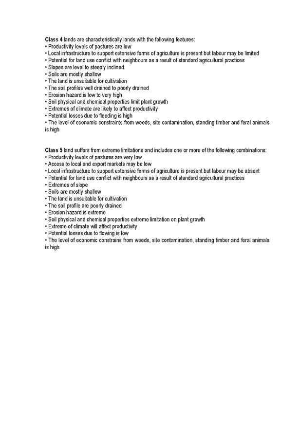
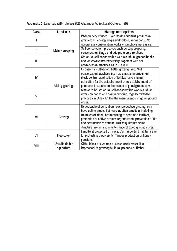


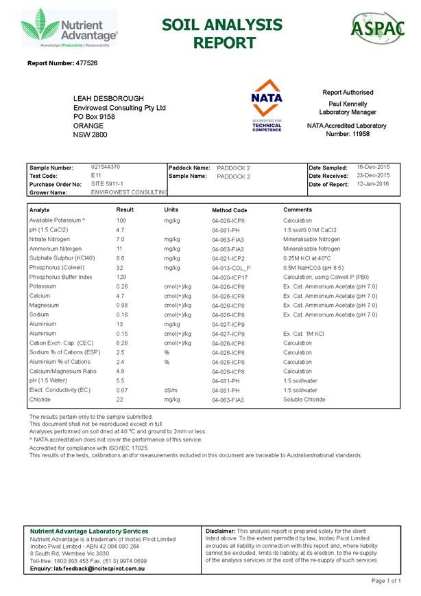
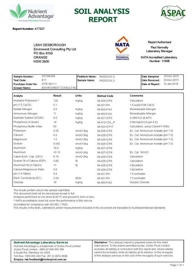
Planning and Development Committee
7 November 2017
2.3 Development
Application DA 258/2015(1) - 131 and 199 Bargwanna Road
Attachment 4 DPI
advice

Planning
and Development Committee
7 November 2017
2.3 Development
Application DA 258/2015(1) - 131 and 199 Bargwanna Road
Attachment 5 Submissions
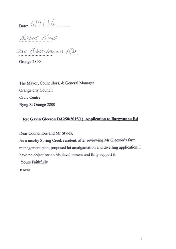

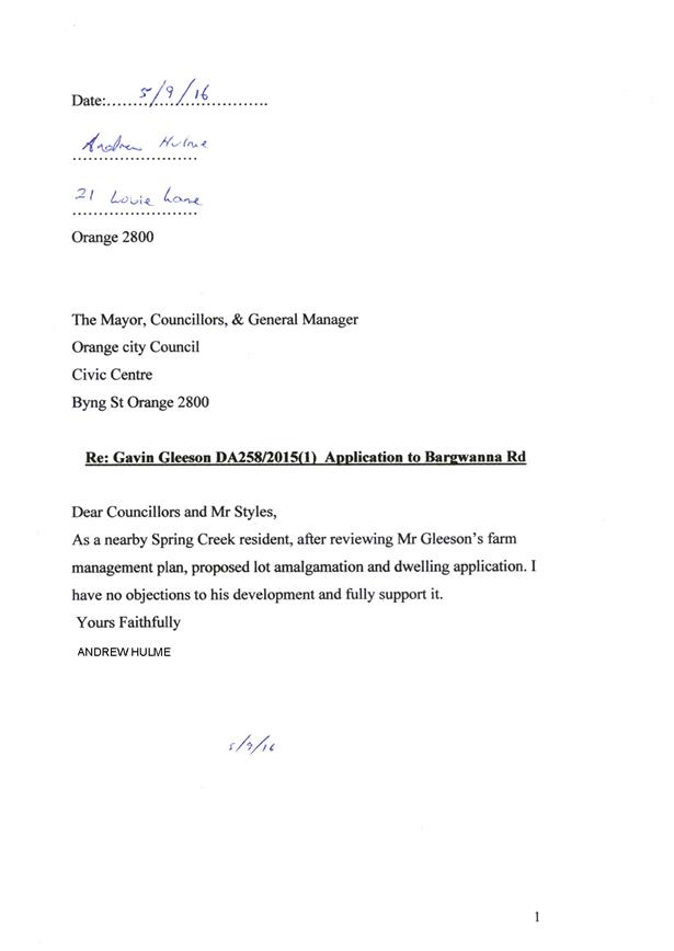
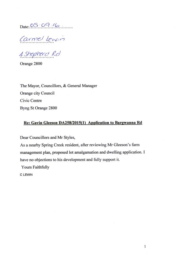
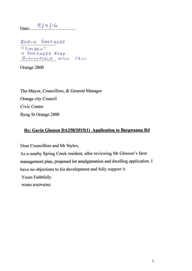
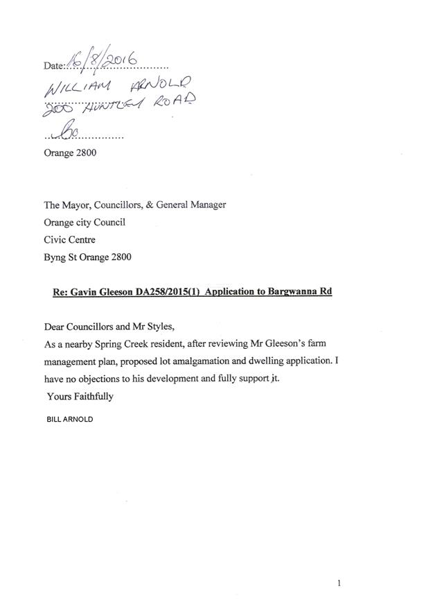
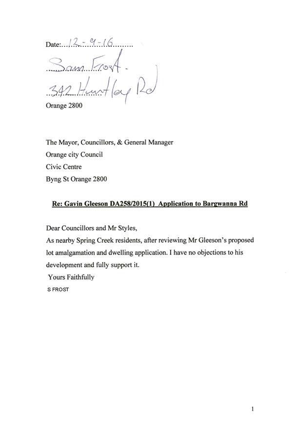
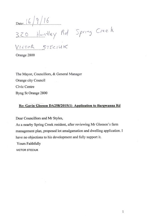
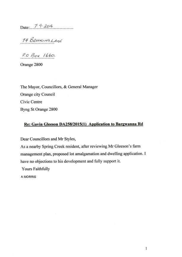
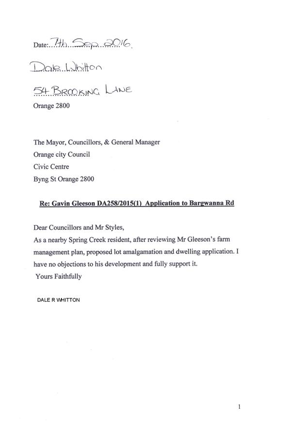
2.4 Development
Application DA 211/2016(2) - 76 Hill Street
RECORD
NUMBER: 2017/2182
AUTHOR: Michael
Glenn, Senior Planner
EXECUTIVE Summary
|
Application
lodged
|
15 June 2017
|
|
Applicant/s
|
Mr RD
and Mrs EM Linsell
|
|
Owner/s
|
Mr RD
and Mrs EM Linsell
|
|
Land
description
|
Lot 12
DP 1225121 - 76 Hill Street, Orange
|
|
Proposed
land use
|
Dwelling
Alterations and Additions, Garage (new), Existing Carport/Garage Conversion
(gymnasium) and Fencing (front boundary fencing)
|
|
Value of
proposed development
|
$321,750
|
Council's consent is sought to modify DA 211/2016(1). The
original application related to alterations and additions to an existing
dwelling, conversion of the existing carport and garage at the rear of the site
to a gymnasium, construction of a garage and front fencing at 76 Hill Street.
In its original form the proposed development had sought to construct an
enclosed garage adjacent to the front of the existing dwelling, but following
negotiations with Council’s assessment staff, the applicant agreed to
amend the design to a detached open sided carport consistent with advice
received from Council’s Heritage Adviser at that time.
The applicant has progressed with the construction of the
proposed development as approved with the exception of the carport. The
applicant now seeks to amend the approved development to once again propose a
garage at the street frontage a position in which was not supported in the
original determination of the application. A small setback from the front
building line (ie the front of the house) of 800mm is proposed.
The reason why an attached garage was not supported with the
original development application and remains unsupported is that this site is
located centrally to the Central Orange Heritage Conservation Area and has a
high level of significance to the Area. Houses of the era did not have
garages at, or close to the front setback of the house. The construction of
such a structure beside this highly valued property would significantly detract
from the heritage values of the existing house and the surrounding Heritage
Conservation Area. The focus of the street to this property should remain at
the house and not the garage.
Assessment staff have again sought advice from Council's
Heritage Advisor who has advised that there remains concerns about the likely
impacts of the development as modified on the heritage values of Hill Street. In
this case there are clear and practical options available to the applicant,
which essentially run to a carport at the front of the site as approved, or alternatively
a garage set back behind the building line several metres to reduce impacts on
the street. Despite the many attempts by Council staff to negotiate a redesign
of this aspect of the development, the applicant has indicated an unwillingness
to set the structure back as a garage.
The proposed garage setback of 800mm behind the building
line does little to allay the adverse heritage and streetscape impacts arising
from the revised building form. The proposed structure is inconsistent with the
recently adopted Council Infill Guidelines, which state that garages and
carports should be located to the rear of allotments, being the traditional
location. Given this, Council staff consider that the proposed garage will
detract from the streetscape of Hill Street. Accordingly it is recommended that
Council refuses the application to modify the development consent. A decision
to do so would mean that the applicant may construct a detached carport as
originally approved in this location.
DECISION FRAMEWORK
Development in Orange is governed by two key documents
Orange Local Environment Plan 2011 and Orange Development Control Plan 2004. In
addition the Infill Guidelines are used to guide development, particularly in
the heritage conservation areas and around heritage items.
Orange Local Environment Plan 2011 – the LEP
should be considered by Council to be a definitive document. LEPs govern the
types of development that are permissible or prohibited in different parts of
the City and also provide some assessment criteria in specific circumstances.
Uses are either permissible or not - there are no grey areas in terms of
permissibility. The objectives of each zoning and indeed the aims of the LEP
itself are, however, open to interpretation and can be used to guide decision
making around appropriateness of development.
Orange Development Control Plan 2004 – the DCP
guides development. In general it is a performance based document rather than
prescriptive in nature - its purpose is to guide development. The Land and
Environment Court tends to view it as such. In each area of interest there are
often guidelines used. These guidelines indicate ways of achieving the planning
outcomes. It is thus recognised that there may also be other solutions of
merit. All design solutions are considered on merit by planning and building
staff. Applications should clearly demonstrate how the planning outcomes are
being met where alternative design solutions are proposed. So one can see that
the DCP gives leeway for developers and architects to use design to achieve the
outcome in other ways if they can. Stating that DCP guidelines are
inflexible can be misleading.
The
purpose of the recently adopted infill guidelines was to provide further
specialised design guidance for the carrying out of work specifically within a
Heritage Conservation Area or adjacent to a heritage item, to ensure new
development harmonises with the character of the neighbourhood. These
guidelines therefore will have particular relevance in the determination of
this application.
Infill development should complement and enhance the local
character by relating to the predominant scale, massing, colours, setbacks and
materials of the area. The guidelines, amongst other things, encourage garages
and carports to be located to the rear of the allotments, being the traditional
location to minimise their visual impact on the streetscape. Based on the
interpretation of the guidelines the proposal is considered to be in clear
breach of the adopted Infill Guidelines 2017.
Link To Delivery/OPerational Plan
The recommendation in this report relates to the
Delivery/Operational Plan strategy “13.4 Our Environment
– Monitor and enforce regulations relating to City amenity”.
Financial Implications
Nil
Policy and Governance Implications
Nil
|
Recommendation
That Council refuses modification of development
application DA 211/2016(1) for Dwelling Alterations and Additions,
Garage (new), Existing Carport/Garage Conversion (gymnasium) and Fencing
(front boundary fencing) at Lot 12 DP 1225121 - 76 Hill Street,
Orange for the reasons contained in the attached Notice of Determination.
|
further considerations
Consideration has been given to the recommendation’s
impact on Council’s service delivery; image and reputation; political;
environmental; health and safety; employees; stakeholders and project
management; and no further implications or risks have been identified.
SUPPORTING INFORMATION
THE APPLICATION
Council's consent is sought to modify DA 211/2016(1), which
permits dwelling alterations and additions, garage (new), existing carport/garage
conversion (gymnasium) and fencing (front boundary fencing). The proposed
modification of consent seeks to replace the approved carport with an enclosed
garage, close to the front building line of the existing dwelling.
THE PROPOSAL
The proposed modification of consent seeks to replace the
currently approved carport with a single garage set back 800mm from the front
building line of the dwelling. It is proposed to finish the proposed garage in
brick, with imitation corbelling and gable decorations. The roof is proposed to
be constructed in custom orb. Colour is not specified. It is proposed to
install a timber tilt-a-door to the front of the garage.
MATTERS FOR CONSIDERATION
Section 5A Assessment
In the administration of sections 78A, 79B, 79C, 111 and
112, the provisions of Section 5A must be taken into account for every
development application in deciding whether there is likely to be a significant
effect on threatened species, populations or ecological communities or their
habitats.
This section includes a requirement to consider any adopted
assessment guidelines, which means assessment guidelines issued and in force
under section 94A of the Threatened Species Conservation Act 1995.
Assessment guidelines are in force (see DECC-W “Threatened Species
Assessment Guidelines - The Assessment of Significance”) which requires
consent authority to adopt the precautionary principle in its assessment.
From 25 August 2017, the Biodiversity Conservation Act 2017
and Biodiversity Conservation Regulation 2017 were gazetted. State
Environmental Planning Policy (Native Vegetation in Non-Rural Areas) 2017 was
also gazetted. The implementation of this legislation (and supporting
guidelines) is subject to savings provisions that defer their full effect for a
period of three months from the date of gazettal for local development.
In this instance, site inspection reveals that the subject
property has no biodiversity or habitat value.
Section 79C
Section 79C of the Environmental Planning and Assessment
Act 1979 requires Council to consider various matters, of which those
pertaining to the application are listed below.
PROVISIONS OF ANY ENVIRONMENTAL
PLANNING INSTRUMENT s79C(1)(a)(i)
Orange Local Environmental Plan 2011
Part 1 - Preliminary
Clause 1.2 - Aims of Plan
The broad aims of the LEP are
set out under subclause 2. Those relevant to the application are as follows:
(a) to encourage development which complements
and enhances the unique character of Orange as a major regional centre boasting
a diverse economy and offering an attractive regional lifestyle,
(b) to provide
for a range of development opportunities that contribute to the social,
economic and environmental resources of Orange in a way that allows present and
future generations to meet their needs by implementing the principles for
ecologically sustainable development,
(c) to conserve and enhance the water resources
on which Orange depends, particularly water supply catchments,
(d) to manage rural land as an environmental
resource that provides economic and social benefits for Orange,
(e) to provide a range of housing choices in
planned urban and rural locations to meet population growth,
(f) to recognise and manage valued
environmental heritage, landscape and scenic features of Orange.
The proposed modification is
inconsistent with the objectives (a) and (f) described above. It is considered
that the proposed garage will not complement
and/or enhance the unique character of the conservation area.
The development has the potential
to have an adverse impact upon the valued
environmental heritage and unique features of this length of Hill Street. There
is ample opportunity to position the subject garage further within the
development site in a manner that would alleviate the potential impacts on
streetscape a position of which the applicant has been unwilling to entertain.
Clause 1.6 - Consent Authority
This clause establishes that, subject to the Act, Council is
the consent authority for applications made under the LEP.
Clause 1.9A - Suspension of
Covenants, Agreements and Instruments
This clause provides that covenants, agreements and other
instruments which seek to restrict the carrying out of development do not apply
with the following exceptions.
· covenants imposed
or required by Council
· prescribed
instruments under Section 183A of the Crown Lands Act 1989
· any conservation
agreement under the National Parks and Wildlife Act 1974
· any trust
agreement under the Nature Conservation Trust Act 2001
· any property
vegetation plan under the Native Vegetation Act 2003
· any biobanking
agreement under Part 7A of the Threatened Species Conservation Act 1995
· any planning
agreement under Division 6 of Part 4 of the Environmental Planning and
Assessment Act 1979.
Council staff are not aware of the title of the subject
property being affected by any of the above.
Mapping
The subject site is identified
on the LEP maps in the following manner:
|
Land Zoning Map:
|
Land zoned R1 General Residential
|
|
Lot Size Map:
|
No Minimum Lot Size
|
|
Heritage Map:
|
Heritage conservation area
|
|
Height of Buildings Map:
|
No building height limit
|
|
Floor Space Ratio Map:
|
No floor space limit
|
|
Terrestrial Biodiversity Map:
|
No biodiversity sensitivity on the
site
|
|
Groundwater Vulnerability Map:
|
Ground water vulnerable
|
|
Drinking Water Catchment Map:
|
Not within the drinking water
catchment
|
|
Watercourse Map:
|
Not within or affecting a defined
watercourse
|
|
Urban Release Area Map:
|
Not within an urban release area
|
|
Obstacle Limitation Surface Map:
|
No restriction on building siting
or construction
|
|
Additional Permitted Uses Map:
|
No additional permitted use applies
|
Those matters that are of relevance are addressed in detail
in the body of this report.
Part 2 - Permitted or
Prohibited Development
The subject site is located within the R1 General
Residential zone. The proposed development is defined as dwelling.
Pursuant to the LEP 2011 Dictionary:
Dwelling means a
room or suite of rooms occupied or used or so constructed or adapted as to be
capable of being occupied or used as a separate domicile.
Dwellings are permitted with consent in the R1 General
Residential zone. Garages/carports are considered to be an ancillary component
of a dwelling and therefore permissible with development consent.
Clause 2.3 of LEP 2011
references the Land Use Table and Objectives for each zone in LEP 2011.
These objectives for land zoned R1 General Residential are as follows:
· To
provide for the housing needs of the community.
· To
provide for a variety of housing types and densities.
· To
enable other land uses that provide facilities or services to meet the day to
day needs of residents.
· To
ensure development is ordered in such a way as to maximise public transport
patronage and encourage walking and cycling in close proximity to settlement.
· To
ensure that development along the Southern Link Road has an alternative access.
The proposal is consistent with
the objectives of the R1 zone. The proposed development will improve the function
of the existing dwelling, which provides for a variety of housing types. The
proposal involves residential land use only. The subject land is accessible to
public transport routes. The site is not within proximity to the Southern Link
Road.
Part 5 -
Miscellaneous Provisions
5.10 - Heritage Conservation
The subject site is located within the Central Orange
Heritage Conservation Area. Clause 5.10 is applicable to the proposal. The
relevant provisions of the Clause are listed below.
(1) Objectives
The
objectives of this clause are as follows:
(a) to
conserve the environmental heritage of Orange,
(b) to
conserve the heritage significance of heritage items and heritage conservation
areas, including associated fabric, settings and views,
(c) to
conserve archaeological sites,
(d) to
conserve Aboriginal objects and Aboriginal places of heritage significance.
The proposed development is considered to be inconsistent
with the objectives of Clause 5.10 of the LEP and the recently adopted
Infill Guidelines. The proposed modification if approved would enable
development that would significantly detract from the local heritage value, introducing
elements into the streetscape that would be unsympathetic to the character of
the locality.
New buildings in a valued historic context should reinforce
the existing front and side setbacks of the area to provide a consistency of
streetscape quality. Setting the new garage too far forward means that it will
dominate the character of the existing streetscape. The infill guidelines
suggest that garages and carports should be located to the rear of the
allotments, being the traditional location. In this case it has been suggested
as a compromise given that Council has agreed to the conversion of the existing
garage at the rear of the site to a home gymnasium that the applicant consider
setting the proposed garage back several metres to reduce its impact upon the
streetscape. This position is not supported by the applicant.
(4) Effect
of Proposed Development on Heritage Significance
The
consent authority must, before granting consent under this clause in respect of
a heritage item or heritage conservation area, consider the effect of the
proposed development on the heritage significance of the item or area
concerned. This subclause applies regardless of whether a heritage management
document is prepared under subclause (5) or a heritage conservation management
plan is submitted under subclause (6).
The Orange Heritage Database provides the following
statement of significance for the dwelling at 76 Hill Street:
The late Victorian period
brick villa retains a set of unusual architectural details, is associated with
the Dalton family, complements the streetscape opposite Knocklong and
contributes to the conservation area as a heritage item.
The dwelling is described as follows:
Victorian brick house with
projecting gable end and abutting front verandah, returning on north side.
Corrugated iron bullnose verandah roof supported on turned timber posts with
lattice valence. Elaborate timber decoration to gable end and fretwork
bargeboards. Timber brackets to front window hood. Ventilated gablet end on
roof. Chimneys of poly-chrome brick with corbelling. Double hung sash and
casement windows. Glazed and panelled entrance door and sidelights with tinted
glass panes.
The issues with the proposed garage were considered with the
original development proposal and therefore have been of significant concern
for some time. As currently approved the alterations would allow a carport to
be constructed but not an enclosed garage. The current proposed modification is
substantially a return to the original form of the development, and this has
always been considered to detract from the traditional character of the
building and streetscape where garages are traditionally located within the
rear yard.
(5) Heritage
assessment
The
consent authority may, before granting consent to any development:
(a) on
land on which a heritage item is located, or
(b) on
land that is within a heritage conservation area, or
(c) on
land that is within the vicinity of land referred to in paragraph (a) or (b),
require
a heritage management document to be prepared that assesses the extent to which
the carrying out of the proposed development would affect the heritage
significance of the heritage item or heritage conservation area concerned.
The subject land is located within
the Central Orange Heritage Conservation Area but is not specifically listed in
Schedule 5 of the LEP as a Heritage Item. However it should be noted that the
subject land is situated in the vicinity of a concentrated cluster of land
listed within schedule 5 of the LEP as Heritage Items (as shown below), namely
contiguous rows of properties at 58 to 62 Byng Street, 69 – 85 Byng
Street and 66 – 74 Byng Street (save for 70- Byng Street) and 87 Hill
Street, which is located on the opposite side of Hill Street to the subject
land. It is noted the subject land adjoins the heritage item known as 68 Byng
Street.
Figure 1 - map indicating listed items of
Environmental Heritage
in the vicinity of the subject land
The applicant has submitted a Statement of Environmental
Effects that accompanies the development application that includes a general
assessment of heritage matters. However, the assessment provided does not
satisfy the NSW Heritage Impact Assessment Guidelines for development of this
type. The heritage assessment is essentially a series of statements setting out
general conservation principals that are of no particular assistance or
relevance to this modification. In places the heritage assessment is
essentially a critique of the Heritage Advisor's comments, and how the owners
are strongly opposed to a carport as a design solution. There is no real
analysis of proper alternatives, particularly setting the garage back further
behind the front building line.
Based on the above described heritage context it is
important give careful consideration to the manner in which this development
will interact with the surrounding streetscape. A carport was accepted in the
parent approval on the basis of its lightweight and transparent appearance,
which would tend to overcome the negative aspects that a full garage is unable
to avoid. The application was referred to Council’s heritage adviser for
formal advice.
A summary of the advice is as follows:
Heritage
Advisor's Comments
“The revision for the
garage does not conform with the DCP policies for development within the
conservation area and does not conform with development associated with a
listed heritage site.
The details provided for the
extension illustrated on the northern elevation facing the street will be
visible from the street. They are contemporary without reference or
interpretation of the architectural style and detail evident in the original
house and verandah. The proposal is not consistent with previous advice
provided on several occasions.
The proposal is not supported
on heritage grounds”
Based on the advice received
from Council’s Heritage Adviser and an assessment of the development
against the requirements of Clause 5.10 of the LEP and the recently adopted
Infill Guidelines it is recommended that Council does not support the proposed
development as submitted.
Part 7 - Additional
Local Provisions
7.1 - Earthworks
This clause
establishes a range of matters that must be considered prior to granting
development consent for any application involving earthworks, such as:
(a) the likely disruption of, or any
detrimental effect on, existing drainage patterns and soil stability in the
locality of the development
(b) the effect of the development on the
likely future use or redevelopment of the land
(c) the quality of the fill or the soil to be
excavated, or both
(d) the effect of the development on the
existing and likely amenity of adjoining properties
(e) the source of any fill material and the
destination of any excavated material
(f) the likelihood of disturbing relics
(g) the proximity to and potential for adverse
impacts on any waterway, drinking water catchment or environmentally sensitive
area
(h) any measures proposed to minimise or
mitigate the impacts referred to in paragraph (g).
Some earthworks would
need to be undertaken, but are not relevant to the issues surrounding the
proposed amendment.
7.3 - Stormwater
Management
This clause applies
to all industrial, commercial and residential zones and requires that Council
be satisfied that the proposal:
(a) is designed to maximise the use of water
permeable surfaces on the land having regard to the soil characteristics
affecting onsite infiltration of water
(b) includes, where practical, onsite
stormwater retention for use as an alternative supply to mains water,
groundwater or river water; and
(c) avoids any significant impacts of
stormwater runoff on adjoining downstream properties, native bushland and
receiving waters, or if that impact cannot be reasonably avoided, minimises and
mitigates the impact.
Stormwater management
was considered for the original application. The development as modified would
not substantially alter the management of stormwater for this site, as compared
to the existing approval.
7.6 - Groundwater
Vulnerability
Groundwater vulnerability
was considered for the original application. The development as modified will
have nil impact upon groundwater in the locality.
STATE ENVIRONMENTAL PLANNING
POLICIES
State Environmental Planning Policy 55 - Remediation of
Land
State Environmental Planning Policy 55 (Remediation of Land)
applies to the land, but has no relevance to this application. The development
as modified has no greater and no different impacts in terms of the SEPP
criteria, as is applicable to the existing consent.
PROVISIONS OF ANY DRAFT
ENVIRONMENTAL PLANNING INSTRUMENT THAT HAS BEEN PLACED ON EXHIBITION
s79C(1)(a)(ii)
There are no draft environmental planning instruments that
apply to the subject land or proposed development.
DESIGNATED DEVELOPMENT
The proposed development is not designated development.
PROVISIONS OF ANY DEVELOPMENT
CONTROL PLAN s79C(1)(a)(iii)
Development Control Plan 2004
Development Control Plan 2004 (“the DCP”)
applies to the subject land (Part 13). An assessment of the
proposed development against the relevant Planning Outcomes will be undertaken
below.
Pursuant to Planning Outcome 0.2-1 Interim Planning Outcomes
- Conversion of Zones:
· Throughout this
Plan, any reference to a zone in Orange LEP 2000 is to be taken to be a
reference to the corresponding zone(s) in the zone conversion table.
The corresponding zone to zone 2(a) Urban Residential
(Orange LEP 2000) is zone R1 General Residential (Orange LEP 2011). As
such, Orange DCP 2004 – Chapter 7 - Development in
Residential Areas is applicable. Further, as the area is located within a
Conservation Area of the LEP, Chapter 13 - Heritage Conservation is also
relevant to this proposal.
A site analysis is required under the provisions of Chapter
7. The development as modified includes a basic site analysis, but the site
analysis does not make any reference to the new infill guidelines, which now
play a critical role in establishing a planning framework about appropriate
development forms within heritage areas, particularly with regard to the
heritage character and appropriate infill development. The submission that has
been made provides limited analysis of the Infill Guidelines. Such an omission
is indicative of a general failure to adequately consider neighbourhood
character and heritage values of the locality.
Section 13 of the DCP contain heritage provisions. The DCP
acknowledges the high quality of the residential character in the Central
Orange Heritage Conservation Area, and gears its principals and guidance
towards the conservation of that area and its character. The heritage outcomes
contained in section 13.3 of the general provisions place an emphasis on
respectful and interpretative design. This includes increasing the setbacks for
elements such as garages and making the new infill development have less impact
on the street, which is mostly achievable by adopting a “transparent
design “ (essentially a carport), or setting the garage at the rear of
the site, or at least further back in the driveway. None of these elements or
design techniques are evident in the proposed modification.
INFILL GUIDELINES
The Infill Guidelines provide the following provisions with
respect to garages:
“garages and carports
are not permitted to break the consistent building line, and should be located to
the rear of allotments, being the traditional location. Where access is
available garages and carports should be located behind the building line to
minimise their visual impact on the street scape”.
The Infill Guidelines are adopted Council policy and carry
considerable weight in the assessment. The proposed development is clearly not
consistent with the Infill Guidelines. If approved, the proposed modification
would detract from the streetscape considerably, and would lessen the veracity
of the guidelines for future similar assessments and lead to an overall lessening
of the heritage value of this locality. Moreover, the applicant in this case
does have a functional alternative, which they are not willing to accept.
As previously discussed, the applicant has submitted a
Statement of Environmental Effects that accompanies the development application
that includes a general assessment of heritage matters. However, the assessment
provided does not satisfy the NSW Heritage Impact Assessment Guidelines,
and the proper consideration of alternatives has not been undertaken. In
addition, the heritage assessment does not mention the Infill Guidelines,
despite the consultant being advised of their provisions by staff. The heritage
assessment is essentially a series of statements setting out general
conservation principals that are of no particular assistance or relevance to
this modification. The heritage assessment is essentially a critique of the
Heritage Advisor's comments, and how the owners are strongly opposed to a
carport as a design solution. There is no real analysis of possible
alternatives, particularly setting the garage back further behind the front
building line.
It is evident from the submission that no real attempt has
been made by the applicant to seek solutions that are consistent with
Council’s policy. Council’s policy is relevant to the situation
being presented and should be upheld in this instance. There are no solid
grounds to justify variation in this case.
PROVISIONS PRESCRIBED BY THE
REGULATIONS s79C(1)(a)(iv)
Demolition of a Building (clause 92)
The proposal does not involve the demolition of a building.
Fire Safety Considerations
(clause 93)
The proposal does not involve a change of building use for
an existing building.
Buildings to be Upgraded
(clause 94)
The proposal does not involve the rebuilding, alteration,
enlargement or extension of an existing building.
BASIX Commitments (clause 97A)
The provisions of BASIX will commenced on 1 July 2005.
THE LIKELY IMPACTS OF THE
DEVELOPMENT s79C(1)(b)
The proposed modification if approved is likely to lead to a
lessening in the conservation value of the locality and a weakening of the
effectiveness of the recently adopted Infill Guidelines. In this regard the
proposed modification would constitute an undesirable and adverse precedent.
Allowing a garage at the front building line unnecessarily
increases the presence and importance of the new structure as an element of the
streetscape, and breaks up the spacing rhythms between the main buildings, which
are important in this locality in helping to define and emphasise the architectural
styles of the dwellings.
THE SUITABILITY OF THE SITE
s79C(1)(c)
The design of the proposed modification is not considered to
be suitable for this site. As discussed elsewhere in this report opportunities
exist on this site for alternative solutions, such as placing a garage towards
the rear or merely setting the garage further back in the side driveway. The
applicant has been requested to consider the suggested design changes but has
been willing to adopt such alternatives. Within the narrow parameters being set
by the applicant, whereby essentially the garage must be pushed forward to the
building line of the house, the site cannot be considered suitable for that
solution.
ANY SUBMISSIONS MADE IN
ACCORDANCE WITH THE ACT s79C(1)(d)
The proposed development is defined as "advertised
development" under the provisions of the Environmental Planning &
Assessment Regulations. The application was advertised for the prescribed
period of 14 days and at the end of that period no submissions had been
received.
PUBLIC INTEREST
s79C(1)(e)
The proposed development is considered to be in the interest
of the wider public. The Orange Local Government Area has a number of items and
areas of heritage significance pursuant to Orange Local Environmental Plan
(OLEP) 2011. These areas are highly valued by the community and Council is
committed to conserving their character while supporting adaptive reuse and
sympathetic infill development.
Good quality and sensitive design of infill development in
heritage areas is of paramount importance in retaining the historic character
of precincts within Orange. An important aspect of good design is designing in
context and having regard to the site and its surroundings, with particular
consideration to the surrounding built form and significant landscaping.
Residential
infill contributes to the physical and social renewal of the older
neighbourhoods, making better use of existing infrastructure, public facilities
and services. Council recently adopted Infill Guidelines to assist with the
assessment of development applications so as to ensure that new development
harmonises with the character of the neighbourhood. As discussed in the body of
this report, the positioning of the proposed garage is considered to be
inconsistent with the adopted Infill Guidelines and will have an overall
adverse impact upon the Orange Central Heritage Conservation Area.
The proposal is not inconsistent with any relevant policy
statements, planning studies, guidelines, etc that have not been considered in
this assessment.
SUMMARY
The proposed development is permissible with the consent of
Council. However, for the reasons outlined in the body of this report the
development as modified is not considered to be acceptable in this case.
A section 79C assessment of the development indicates that the proposed
structure is inconsistent with Council’s planning controls and the
recently adopted Infill Guidelines.
Assessment staff have sought advice from Council's Heritage
Advisor who has advised that there remains concerns about the likely impacts of
the development as modified on the heritage values of Hill Street. In this case
it has been determined that there are clear and practical options available to
the applicant, which essentially run to a carport at the front of the site as
approved, or alternatively a garage set back behind the building line several
metres to reduce impacts on the street. Despite the many attempts by Council
staff to request the applicant to consider redesign of this aspect of the
development, the applicant has indicated an unwillingness to set the structure
back as a garage.
Accordingly it is recommended that Council refuses the
application to modify the development consent. A decision to do so would mean
that the current approved arrangement involving a carport structure at the front
of the site may still be constructed.
If approved, the proposed modification would significantly
detract from the streetscape, and would undermine the recently adopted Infill
Guidelines for future similar assessments and lead to an overall lessening of
the heritage value of this locality.
Attached is a draft Notice of Refusal outlining the reasons
for refusal.
COMMENTS
The requirements of Council's Heritage
Advisor and the applicant's submission have been considered in the preparation
of this report.
Attachments
1 Notice
of Refusal, D17/63530⇩
2 Plans,
D17/60872⇩
Planning and Development Committee
7 November 2017
2.4 Development
Application DA 211/2016(2) - 76 Hill Street
Attachment 1 Notice
of Refusal
|

|
ORANGE
CITY COUNCIL
Development
Application No DA
211/2016(2)
NA17/ Container
PR27525
|
NOTICE OF DETERMINATION
OF A MODIFICATION
OF A DEVELOPMENT APPLICATION
issued under the Environmental
Planning and Assessment Act 1979
Section 81(1)
|
Development Application
|
|
|
Applicant Name:
|
Mr RD and Mrs EM Linsell
|
|
Applicant Address:
|
76 Hill
Street
ORANGE
NSW 2800
|
|
Land to Be Developed:
|
Lot 12 DP 1225121 - 76 Hill Street,
Orange
|
|
Proposed Development:
|
Dwelling Alterations and Additions, Garage
(new), Existing Carport/Garage Conversion (gymnasium) and Fencing (front
boundary fencing)
|
|
|
|
|
Building Code of Australia
Building Classification:
|
Class 1a and Class 10a
|
|
|
|
|
Determination
|
|
|
Made On:
|
7 November 2017
|
|
Determination:
|
APPLICATION REFUSED
|
|
|
|
|
Reason(s) for Refusal:
|
(1) The
proposed development is not consistent with the requirements of Clause 5.10
of Orange LEP 2011.
(2) The
proposed location of the garage does not conform with the adopted Infill
Guidelines for development within the conservation area.
(3) The
development as modified will detract from the heritage quality of the
streetscape by interrupting the spacing rhythm between dwellings.
(4) The
development as modified does not address the site constraints and
opportunities of the site that would otherwise show that better alternatives
exist for garage placement within the subject land.
(5) The
proposed garage would detract from the prominence and integrity of the
existing building form and have an adverse impact upon the Central Orange
Heritage Conservation Area.
(6) The
proposed development is not in the public interest.
|
|
|
|
|
Right of Appeal:
|
Applicant:
If
you are dissatisfied with this decision, Section 97 of Environmental
Planning and Assessment Act 1979 gives you the right to appeal to the
Land and Environment Court within 6 months after the date on which you
receive this notice.
*
Section 97 of the Environmental Planning and Assessment Act, 1979 does not
apply to the determination of a development application for State significant
development or local designated development that has been the subject of a
Commission of Inquiry.
Objector:
The
Environmental
Planning and Assessment Act 1979 does not give a right of appeal against this
determination to an objector.
|
|
|
|
|
Signed:
|
On behalf of the consent authority:
|
|
Signature:
|
|
|
Name:
|
PAUL JOHNSTON - MANAGER DEVELOPMENT
ASSESSMENTS
|
|
Date:
|
8 November 2017
|
Planning
and Development Committee
7 November 2017
2.4 Development
Application DA 211/2016(2) - 76 Hill Street
Attachment 2 Plans
Planning and Development Committee
7 November 2017
2.4 Development
Application DA 211/2016(2) - 76 Hill Street
Attachment 2 Plans
Planning and Development Committee
7 November 2017
2.4 Development
Application DA 211/2016(2) - 76 Hill Street
Attachment 2 Plans
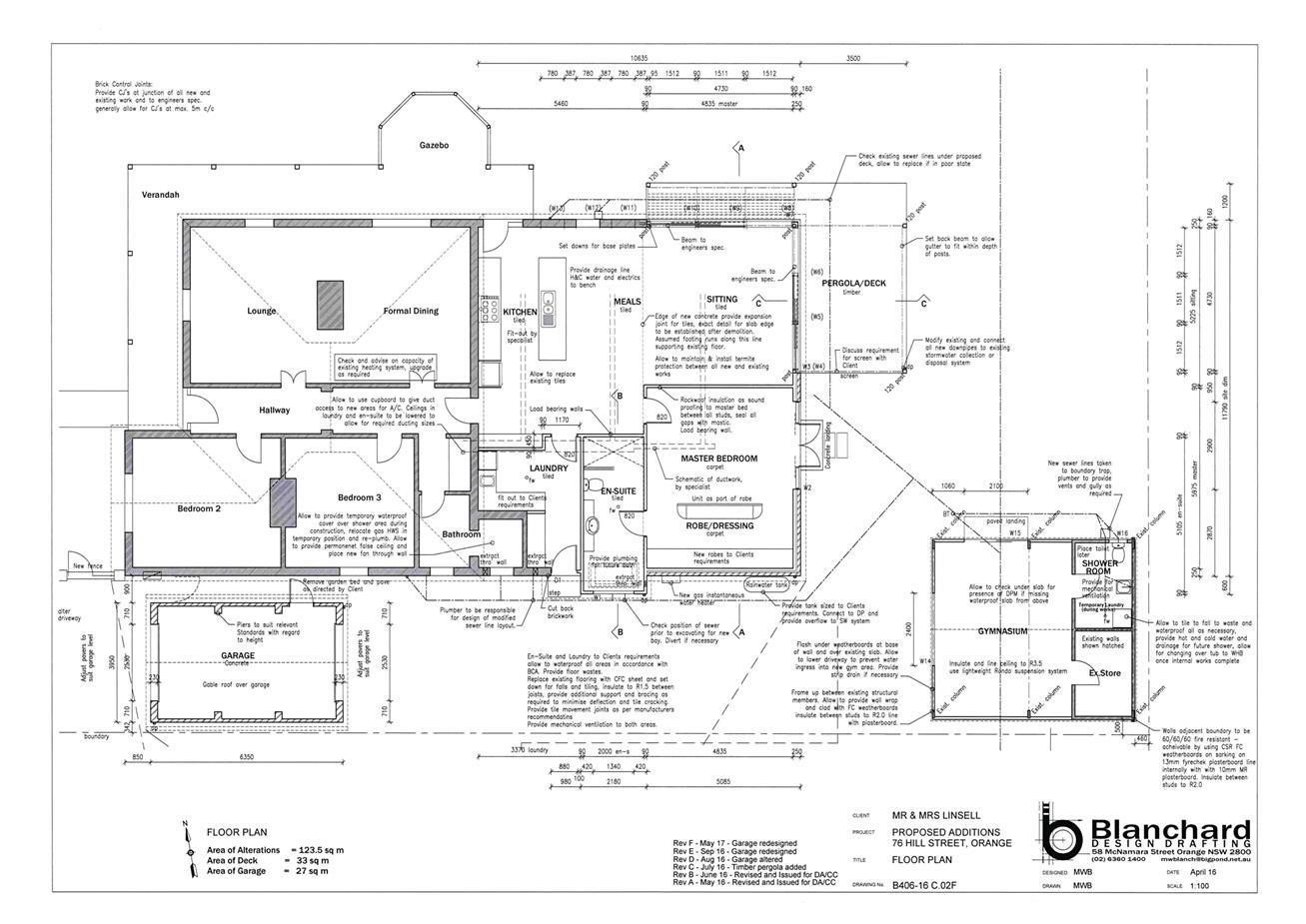
2.5 Development
Application DA 207/2016(1) - 102-110 and 110A Endsleigh Avenue
RECORD
NUMBER: 2017/2183
AUTHOR: Andrew
Crump, Senior Planner
EXECUTIVE Summary
|
Application
lodged
|
22 June
2016
|
|
Applicant/s
|
Mr J
Levi
|
|
Owner/s
|
Mr JA
and Mrs RS Levi, and Mr DK Cooke
|
|
Land
description
|
Lots 11
and 12 DP 519990 – 102-110 and 110A Endsleigh Avenue, Orange
|
|
Proposed
land use
|
Place of
Public Worship (alterations and additions to existing building), Business
Identification Signage and Demolition (tree removal)
|
|
Value of
proposed development
|
$500,000
|
Council's consent is sought for the change of use from a
warehouse to a place of public worship. The application also involves an
extension to the front of the building comprising foyer, crying room, toddler
room and accessible toilet. The new building will comprise extensive
horizontally proportioned glazing in the north-west corner of the new addition,
painted face brick, and Colorbond clad awning. Business identification signage
displaying the name of the place of public worship is proposed to be affixed to
the front elevation. A new car park is proposed at the rear and access to the
car park is required over adjoining land via an existing right of carriage way.
A number of small trees are required to be removed and new landscaping
proposed.
The critical element of this assessment relates to the car
parking demand generated as a result of the change of use. The applicant has
presented justification in support of an alternate parking calculation for the
development which, on balance, is considered acceptable in the circumstances.
The development is consistent with Councils applicable
planning provisions and is recommended for approval.
DECISION FRAMEWORK
Development in Orange is governed by two key documents -
Orange Local Environment Plan 2011 and Orange Development Control Plan 2004. In
addition, the Infill Guidelines are used to guide development, particularly in
the heritage conservation areas and around heritage items.
Orange Local Environment Plan
2011 – the LEP should be considered by Council to be a definitive
document. LEPs govern the types of development that are permissible or
prohibited in different parts of the City and also provide some assessment
criteria in specific circumstances. Uses are either permissible or not - there
are no grey areas in terms of permissibility. The objectives of each zoning and
indeed the aims of the LEP itself are, however, open to interpretation and can
be used to guide decision making around appropriateness of development.
Orange Development Control Plan
2004 – the DCP guides development. In general it is a performance
based document rather than prescriptive in nature - its purpose is to guide
development. The Land and Environment Court tends to view it as such. In each
area of interest there are often guidelines used. These guidelines indicate
ways of achieving the planning outcomes. It is thus recognised that there may
also be other solutions of merit. All design solutions are considered on merit
by planning and building staff. Applications should clearly demonstrate how the
planning outcomes are being met where alternative design solutions are
proposed. So one can see that the DCP gives leeway for developers and
architects to use design to achieve the outcome in other ways if they can.
Stating that DCP guidelines are inflexible can be misleading.
In this case the proposed development is permissible with
development consent of Council. The critical element of this assessment relates
to the car parking demand generated as a result of the proposed change of use.
The applicant has presented justification in support of an alternate parking
calculation for the development which, on balance, is considered acceptable in
the circumstances. It recommended that Council supports the proposed
development subject to the recommended conditions of consent.
Link To Delivery/OPerational Plan
The recommendation in this report relates to the
Delivery/Operational Plan strategy “13.4 Our Environment
– Monitor and enforce regulations relating to City amenity”.
Financial Implications
Nil
Policy and Governance Implications
Nil
|
Recommendation
That Council consents to
development application DA 207/2016(1)
for Place of Public Worship (alterations and additions to existing
building), Business Identification Signage and Demolition (tree removal)
at Lots 11 and 12 DP 519990 - 102-110 and
110A Endsleigh Avenue, Orange pursuant to
the conditions of consent in the attached Notice of Approval.
|
further considerations
Consideration has been given to the
recommendation’s impact on Council’s service delivery; image and
reputation; political; environmental; health and safety; employees;
stakeholders and project management; and no further implications or risks have
been identified.
SUPPORTING INFORMATION
Council's consent is sought for the change of use from a
warehouse to a place of public worship at Lot 11 DP 519990 -
102–110 Endsleigh Avenue, Orange. Lot 12 DP 519990 is
included in the land description as access to the car park on Lot 11 is reliant
on a right of way over Lot 12, and that right of way requires upgrade works to
bring it up to the applicable standard.
The application also involves an extension to the front of
the building comprising foyer, crying room, toddler room and accessible toilet.
The new building will comprise extensive horizontally proportioned glazing in
the north-west corner, painted face brick and Colorbond clad awning. Business
identification signage displaying the name of the place of public worship is
proposed to be affixed to the front elevation. A new car park is proposed at
the rear and access is required over adjoining land via an existing right of
carriage way. A number of small trees are required to be removed and new
landscaping proposed.
MATTERS FOR CONSIDERATION
Section 5A Assessment
In the administration of Sections 78A, 79B, 79C, 111 and
112, the provisions of Section 5A must be taken into account for every
development application in deciding whether there is likely to be a significant
effect on threatened species, populations or ecological communities or their
habitats. This section includes a requirement to consider any adopted assessment
guidelines, which means assessment guidelines issued and in force under
Section 94A of the Threatened Species Conservation Act 1995.
Assessment guidelines are in force (see DECC-W “Threatened Species
Assessment Guidelines - The Assessment of Significance”) which requires
consent authority to adopt the precautionary principle in its assessment.
In this instance, site inspection reveals that the subject
property has no biodiversity or habitat value.
Section 79C
Section 79C of the Environmental Planning and Assessment
Act 1979 requires Council to consider various matters, of which those
pertaining to the application are listed below.
PROVISIONS OF ANY ENVIRONMENTAL
PLANNING INSTRUMENT s79C(1)(a)(i)
Orange Local Environmental Plan 2011
Part 1 - Preliminary
Clause 1.2 - Aims of Plan
The
broad aims of the LEP are set out under subclause 2. Those relevant to the
application are as follows:
(a) to encourage development which complements
and enhances the unique character of Orange as a major regional centre boasting
a diverse economy and offering an attractive regional lifestyle,
(b) to provide for a range of development
opportunities that contribute to the social, economic and environmental
resources of Orange in a way that allows present and future generations to meet
their needs by implementing the principles for ecologically sustainable
development,
(f) to recognise and manage valued
environmental heritage, landscape and scenic features of Orange.
The application is considered to be consistent with aims
(a), (b), and (f) as listed above.
Clause 1.6 - Consent Authority
This clause establishes that, subject to the Act, Council is
the consent authority for applications made under the LEP.
Clause 1.9A - Suspension of
Covenants, Agreements and Instruments
This clause provides that covenants, agreements and other
instruments which seek to restrict the carrying out of development do not apply
with the following exceptions:
· covenants imposed
or required by Council
· prescribed
instruments under Section 183A of the Crown Lands Act 1989
· any conservation
agreement under the National Parks and Wildlife Act 1974
· any trust
agreement under the Nature Conservation Trust Act 2001
· any property
vegetation plan under the Native Vegetation Act 2003
· any biobanking
agreement under Part 7A of the Threatened Species Conservation Act 1995
· any planning
agreement under Division 6 of Part 4 of the Environmental Planning and
Assessment Act 1979.
Council staff are not aware of the title of the subject
property being affected by any of the above.
Mapping
The subject site is identified
on the LEP maps in the following manner:
|
Land Zoning Map:
|
Land zoned B6 Enterprise Corridor
|
|
Lot Size Map:
|
No Minimum Lot Size
|
|
Heritage Map:
|
Heritage conservation area
|
|
Height of Buildings Map:
|
Building height limit 9m
|
|
Floor Space Ratio Map:
|
No floor space limit 0.75:1
|
|
Terrestrial Biodiversity Map:
|
No biodiversity sensitivity on the
site
|
|
Groundwater Vulnerability Map:
|
Ground water vulnerable
|
|
Drinking Water Catchment Map:
|
Not within the drinking water
catchment
|
|
Watercourse Map:
|
Not within or affecting a defined
watercourse
|
|
Urban Release Area Map:
|
Not within an urban release area
|
|
Obstacle Limitation Surface Map:
|
No restriction on building siting
or construction
|
|
Additional Permitted Uses Map:
|
No additional permitted use applies
|
Those matters that are of relevance are addressed in detail
in the body of this report.
Part 2 - Permitted or Prohibited Development
Land
Use Zones
The subject site is located within the B6 Enterprise
Corridor zone. The proposed development is defined as a place of public worship
which means:
a building or place used for the
purpose of religious worship by a congregation or religious group, whether or
not the building or place is also used for counselling, social events,
instruction or religious training.
Places
of public worship are permissible with consent in the B6 Enterprise Corridor
zone. Business Identification Signage is permissible in the zone with consent.
This aspect of the development application is addressed under SEPP 64 below.
Clause 2.3 of LEP
2011 references the Land Use Table and Objectives for each zone in LEP 2011.
These objectives for land zoned B6 Enterprise Corridor are as follows:
1 Objectives of zone
· To promote
businesses along main roads and to encourage a mix of compatible uses.
· To provide a
range of employment uses (including business, office, retail and light
industrial uses).
· To maintain the
economic strength of centres by limiting retailing activity.
· To provide for
residential uses, but only as part of a mixed use development.
The
development is not antipathetic to the objects of the zone. Although the
development is not an employment generator, the development is an example of a
use that is not incompatible with existing or likely future uses allowed within
the B6 zone. The development is not a commercial enterprise and as such it will
not impact upon the primacy of the CBD as the main retail core. The last dot
point is not relevant, the existing manager’s residence is being
abandoned as part of this application.
Clause 2.7 - Demolition
Requires Development Consent
This clause triggers the need for development consent in
relation to a building or work (including a tree). The applicant is seeking to
remove several small trees which requires consent which the applicant has sought.
Part 3 - Exempt and Complying Development
The application is not exempt or complying development.
Part 4 - Principal Development Standards
Clause
4.3 - Height of Buildings
This clause limits the height of
buildings (HoB) on land identified on the Height of Buildings Map. The subject
land is identified on the Map as having a HoB limit of 9m. The maximum height
of the proposed development is 4.86m (the existing building is higher, but the
applicant is not altering the exterior in any way – in any event the
building would be lower than the maximum 9m height) and is therefore consistent
with the established height limit.
Clause 4.4 - Floor Space Ratio
This
clause limits the floor space ratio (FSR) permitted on land identified on the
Floor Space Ratio Map. Clause 4.5 is associated with this clause and
establishes the rules for calculating the site area and FSR of any proposal.
These rules exclude certain parts of a site and development such as:
· excluding
any part of the site upon which the development is prohibited (ie if the site
is split zoned only the zone in which the development is permissible may be
considered)
· excluding
community land and most public places
· lots
in a strata scheme wholly or partly above other lots in the scheme do not
increase the site area (ie the site area is the ground level of the scheme
only)
· adjoining
lots in the same ownership do not form part of the site area unless significant
parts of the development are proposed on that land
· the
floor area of existing buildings is to be included in the FSR calculation
· any
covenant restricting floor space on the lot, due to floor space having been
considered as part of the development of another lot, is to be taken into
account.
The subject land is identified
on the Map as having an FSR of 0.75:1. The site area has been calculated under
Clause 4.5 as 1486m2, meaning the site may have up to 1114.5m2
of floor space. The gross floor area is well below area allowed under the
development standard. The development is considered satisfactory.
Part 5 - Miscellaneous Provisions
5.10 - Heritage Conservation
The subject land is located in the Glenroi Heritage
Conservation Area. The statement of significance for the Glenroi conservation
area is as follows:
The area has a notable
concentration of mainly brick houses, in good condition, from the late
Victorian and Edwardian periods, as well as a good representation of bungalow
housing. The smaller houses and single storey terraces provide a good example
of ‘worker’s housing’ from periods of the town’s
growth. The housing is sited directly opposite former employment locations on
the railway, wool stores and flour mill.
The building the subject of this application is described as
a C.1960s simple industrial style brick warehouse. The building contributes
only in a minor way to the significance of the conservation area.
Notwithstanding this, it is necessary to ensure that the new development is
sympathetic to the character of the conservation area.
(1) Objectives
The
objectives of this clause are as follows:
(a) to
conserve the environmental heritage of Orange,
(b) to
conserve the heritage significance of heritage items and heritage conservation
areas, including associated fabric, settings and views,
(c) to
conserve archaeological sites,
(d) to
conserve Aboriginal objects and Aboriginal places of heritage significance.
The development
is not antipathetic to the objectives of the heritage conservation clause.
(2) Requirement
for Consent
Development
consent is required for any of the following:
(a) demolishing
or moving any of the following or altering the exterior of any of the following
(including, in the case of a building, making changes to its detail, fabric,
finish or appearance):
(iii) a
building, work, relic or tree within a heritage conservation area,
(e) erecting
a building on land:
(i) on
which a heritage item is located or that is within a heritage conservation
area, or
The development requires consent under the above clauses
which the applicant has sought by lodging this development application.
(4) Effect
of Proposed Development on Heritage Significance
The
consent authority must, before granting consent under this clause in respect of
a heritage item or heritage conservation area, consider the effect of the
proposed development on the heritage significance of the item or area
concerned. This subclause applies regardless of whether a heritage management
document is prepared under subclause (5) or a heritage conservation management
plan is submitted under subclause (6).
The application was referred to Council’s Heritage
Advisor for comment who raised no objections to the development, but did
request the exterior colours be noted on the plans and requested further details
on the exterior lighting (as exterior lighting was proposed when the
application was first lodged).
The plans now show Dulux self-destruct (beige)
painted brickwork walls and black window frames and awning. These colours are
acceptable in the context and setting and is further assessed below under
heading infill guideline.
The development will not result in unacceptable impacts upon
the significance of the heritage conservation area and is considered acceptable
on heritage grounds.
(5) Heritage
assessment
The
consent authority may, before granting consent to any development:
(a) on
land on which a heritage item is located, or
(b) on
land that is within a heritage conservation area, or
(c) on
land that is within the vicinity of land referred to in paragraph (a) or (b),
(d) require
a heritage management document to be prepared that assesses the extent to which
the carrying out of the proposed development would affect the heritage
significance of the heritage item or heritage conservation area concerned.
A Heritage Impact Statement has been prepared in support of
the application and is considered acceptable.
(6) Heritage
Conservation Management Plans
The
consent authority may require, after considering the heritage significance of a
heritage item and the extent of change proposed to it, the submission of a
Heritage Conservation Management Plan before granting consent under this
clause.
The buildings on the land comprises C.1960s brick warehouse
type building which comprise limited, to no, heritage value. As such, a
conservation management plan or similar documents are not necessary to ensure
the protection of the building on the land.
(7) Archaeological
Sites
The
consent authority must, before granting consent under this clause to the
carrying out of development on an archaeological site (other than land listed
on the State Heritage Register or to which an interim heritage order under the Heritage Act 1977
applies):
(a) notify
the Heritage Council of its intention to grant consent, and
(b) take
into consideration any response received from the Heritage Council within 28
days after the notice is sent.
Previous uses of the site would suggest that the presence of
relics is unlikely. Notwithstanding this, a precautionary condition is attached
providing a protocol to be followed in the unlikely event that a relic is discovered.
(8) Aboriginal
Places of Heritage Significance
The
consent authority must, before granting consent under this clause to the
carrying out of development in an Aboriginal place of heritage significance:
(a) consider
the effect of the proposed development on the heritage significance of the
place and any Aboriginal object known or reasonably likely to be located at the
place by means of an adequate investigation and assessment (which may involve
consideration of a heritage impact statement), and
(b) notify
the local Aboriginal communities, in writing or in such other manner as may be
appropriate, about the application and take into consideration any response
received within 28 days after the notice is sent.
The area is not
an aboriginal place of heritage significance.
Part 6 - Urban Release Area
Not relevant to the application. The subject site is not
located in an Urban Release Area.
Part 7 - Additional Local Provisions
7.1
- Earthworks
This
clause establishes a range of matters that must be considered prior to granting
development consent for any application involving earthworks, such as:
(a) the likely disruption of, or any
detrimental effect on, existing drainage patterns and soil stability in the
locality of the development
(b) the effect of the development on the
likely future use or redevelopment of the land
(c) the quality of the fill or the soil to be
excavated, or both
(d) the effect of the development on the
existing and likely amenity of adjoining properties
(e) the source of any fill material and the
destination of any excavated material
(f) the likelihood of disturbing relics
(g) the proximity to and potential for adverse
impacts on any waterway, drinking water catchment or environmentally sensitive
area
(h) any measures proposed to minimise or
mitigate the impacts referred to in paragraph (g).
The earthworks proposed in the
application are limited to the extent of cutting and filling required for the
proposed rear car park (approximately 400mm cut to south-east corner), and a
small amount for the front extension. The extent of disruption to the drainage
of the site is considered to be minor and will not detrimentally affect
adjoining properties or receiving waterways.
The extent of the earthworks
will not materially affect the potential future use or redevelopment of the
site that may occur at the end of the proposed development's lifespan.
The site is not known to be
contaminated, however a standard precautionary condition is attached addressing
the protocol for the unlikely event of encountering contamination. Excavated
materials will be reused onsite as far as possible, and conditions are imposed
to require that surplus materials to be disposed of to an appropriate
destination.
The earthworks will be
appropriately supported onsite and the change in ground level is not
substantial. Therefore the effect on the amenity of adjoining properties is
considered to be minor, and if anything the 400mm cut to the rear of the car
park with lessen the impacts to adjoining properties to the east.
The site is not known to contain
any Aboriginal, European or archaeological relics. Previous known uses of the
site do not suggest that any relics are likely to be uncovered. However,
conditions are imposed to ensure that should site works uncover a potential
relic or artefact, works will be halted to enable proper investigation by
relevant authorities and the proponent required to seek relevant permits to
either destroy or relocate the findings.
The site is not in proximity to
any waterway, drinking water catchment or sensitive area. However, conditions
are imposed in relation to sediment control.
7.3 - Stormwater Management
This clause applies to all
industrial, commercial and residential zones and requires that Council be
satisfied that the proposal:
(a) is designed to maximise the use of water
permeable surfaces on the land having regard to the soil characteristics
affecting onsite infiltration of water
(b) includes, where practical, onsite
stormwater retention for use as an alternative supply to mains water,
groundwater or river water; and
(c) avoids any significant impacts of
stormwater runoff on adjoining downstream properties, native bushland and
receiving waters, or if that impact cannot be reasonably avoided, minimises and
mitigates the impact.
The
development will increase the amount of impervious surfaces (additional roof
collection area and car park). As such, in order to ensure post-development
runoff levels do not exceed pre-development levels. It will be necessary for
stormwater detention to be provided. Relevant conditions are attached.
7.6 - Groundwater Vulnerability
This
clause seeks to protect hydrological functions of groundwater systems and
protect resources from both depletion and contamination. Orange has a high
water table and large areas of the LGA, including the subject site, are
identified with “Groundwater Vulnerability” on the Groundwater
Vulnerability Map. This requires that Council consider:
(a) whether or not the development (including
any onsite storage or disposal of solid or liquid waste and chemicals) is
likely to cause any groundwater contamination or have any adverse effect on
groundwater dependent ecosystems, and
(b) the cumulative impact (including the
impact on nearby groundwater extraction for potable water supply or stock water
supply) of the development and any other existing development on groundwater.
Furthermore, consent may not be granted unless Council is satisfied that:
(a) the development is designed, sited and
will be managed to avoid any significant adverse environmental impact, or
(b) if that impact cannot be reasonably
avoided - the development is designed, sited and will be managed to minimise
that impact,
(c) if that impact cannot be minimised - the
development will be managed to mitigate that impact.
The proposal is not anticipated
to involve the discharge of toxic or noxious substances and is therefore
unlikely to contaminate the groundwater or related ecosystems. The proposal
does not involve extraction of groundwater and will therefore not contribute to
groundwater depletion.
7.11 – Essential Services
Clause 7.11 has the effect of ensuring all necessary
services are, or will be available for a particular development.
The subject land is serviced by Council’s water, Sewer
and Stormwater systems. Other services such as electricity and
telecommunications are also available to the land. The development is
consistent with the above clause.
STATE ENVIRONMENTAL PLANNING POLICIES
State Environmental Planning Policy 55 - Remediation of
Land (SEPP 55)
State Environmental Planning Policy 55 - Remediation of Land
(SEPP 55) requires that a consent authority must not consent to the carrying
out of development of land unless it has considered whether the land is
contaminated, is satisfied that the land is suitable in its contaminated state
for the development that is proposed, and if the land requires remediation to
be made suitable for the proposed development it is satisfied that the land
will be remediated before the land is used for that purpose.
Furthermore, SEPP 55 requires that before determining an
application for consent to carry out development that would involve a change of
use on any of the land specified in subclause (4), the consent authority
must consider a report specifying findings of a preliminary investigation of
the land concerned.
In consideration of the relevant cluses of the SEPP; the
previous known uses of the land are for the purposes of a warehouse. The applicant
submits that the warehouse stored and distributed pharmaceutical products. Such
products were contained in individual receptacles. No manufacturing or mass
storage of chemicals is known to have occurred on the land. As such, the
previous uses of the land have not been for the purposes of a use listed within
table 1 of the Contaminated Land Management Guidelines.
Council staff inspected the state of the floor for visual
signs of chemical spill or the like. No such incidents were evident during the
visual inspection. The existing timber floor only showed signs of moisture
damage and expected levels of ware and tare.
It is noted that the existing floor is being demolished to
provide a new lower finished floor level. There is no objection to this aspect of
the proposal.
Notwithstanding the above, a precautionary condition is
attached that sets out the protocol in the unexpected event of contamination
being identified during the demolition or construction phase of the proposal.
State Environmental Planning
Policy (Infrastructure)
State Environmental Planning Policy (Infrastructure) is
applicable to the proposed development, specifically Clauses 45 and 87.
With respect to Cluse 45, a referral was sent to Essential
Energy for comment as per the aforementioned clause. Essential Energy responded
indicating no objection to the application, but outlined several standard
requirements which are applied as advisory notes.
Clause 87 requires Council to consider the impacts from
noise and vibration on certain non‑rail uses as a result of development
adjacent to a rail corridor. With reference to the interim guidelines, the
subject land is outside the distances that triggers the need for noise and
vibration reports (approximately 80m to the operational track). As such, the
development is considered acceptable. It should be noted that the subject land
is not adjacent to the rail corridor, but separated by Endsleigh Avenue.
State Environmental Planning
Policy 64 – Advertising and Signage
State Environmental Planning Policy 64 – Advertising
and Signage applies to the subject land as the applicant is proposing to
install a business identification sign displaying the name of the organisation,
Open Heavens Church.
The signage is not inconsistent with the objectives of the
SEPP and as the sign is being displayed on land within a heritage conservation
area the sign needs to be consistent with the definition of a business
identification signage which means:
a sign:
(a) that indicates:
(i) the name of the person, and
(ii) the business carried on by the person,
at the premises
or place at which the sign is displayed, and
(b) that may include the address of the
premises or place and a logo or other symbol that identifies the business,
but that does not
include any advertising relating to a person who does not carry on business at
the premises or place.
The sign is not inconsistent with the above definition,
although it is arguable that the church is not a business (and thus the name of
the church is not business identification signage), notwithstanding this, for
the purposes of assessing the sign on the building, the above referenced
definition is the most appropriate.
A Schedule 1 Assessment has been undertaken below which
concludes that the subject sign is suitable in the locality.
Character of the area
· Is
the proposal compatible with the existing or desired future character of the
area or locality in which it is proposed to be located?
· Is
the proposal consistent with a particular theme for outdoor advertising in the
area or locality?
The
theme of signage in the subject area is
characterised as a mix of signage
types associated with the commercial, light industrial and rail uses in the
locality. The types of signage in the area comprises a mix of wall signs and
small pylon signs.
The
subject sign to be affixed to the wall of the new portion of building will not
be incongruous with either the existing or future desired character of the
area.
Special areas
· Does
the proposal detract from the amenity or visual quality of any environmentally
sensitive areas, heritage areas, natural or other conservation areas, open
space areas, waterways, rural landscapes or residential areas?
The
area is identified as a heritage area and as such signage is required to
conform to the definition of business identification signage. The proposed
signage design rationale is simplistic and understated and as such will not
detract from the identified special area.
Views and vistas
· Does
the proposal obscure or compromise important views?
· Does
the proposal dominate the skyline and reduce the quality of vistas?
· Does
the proposal respect the viewing rights of other advertisers?
The
sign is affixed to the building and as such will have no impact on views or vista
within the locality.
Streetscape, setting or landscape
· Is
the scale, proportion and form of the proposal appropriate for the streetscape,
setting or landscape?
· Does
the proposal contribute to the visual interest of the streetscape, setting or
landscape?
· Does
the proposal reduce clutter by rationalising and simplifying existing
advertising?
· Does
the proposal screen unsightliness?
· Does
the proposal protrude above buildings, structures or tree canopies in the area
or locality?
· Does
the proposal require ongoing
vegetation management?
The
proposed signage will have suitable streetscape compatibility with the size of
the sign consistent with the size of other signs in the locality.
Site and building
· Is
the proposal compatible with the scale, proportion and other characteristics of
the site or building, or both, on which the proposed signage is to be located?
· Does
the proposal respect important features of the site or building, or both?
· Does
the proposal show innovation and imagination in its relationship to the site or
building, or both?
The
proportions of the sign are compatible with the propositions of the host
building and will not obstruct or detract from import features of the building.
Associated devices and logos with advertisements and
advertising structures
· Have
any safety devices, platforms, lighting devices or logos been designed as an
integral part of the signage or
structure on which it is to be displayed?
No
logos or devices are proposed.
Illumination
· Would
illumination result in unacceptable glare?
· Would
illumination affect safety for pedestrians, vehicles or aircraft?
· Would
illumination detract from the amenity of any residence or other form of
accommodation?
· Can
the intensity of the illumination be adjusted, if necessary?
· Is
the illumination subject to a curfew?
The
applicant submits that the flush wall sign will be illuminated by ancillary
light fittings. Conditions are attached to ensure light spill is controlled as
per the relevant Australian Standard.
Safety
· Would
the proposal reduce the safety for any public road?
· Would
the proposal reduce the safety for pedestrians or bicyclists?
· Would
the proposal reduce the safety for pedestrians, particularly children, by
obscuring sightlines from public
areas?
As the sign is fixed flushed to the building, it will not
cause safety concerns for road users or pedestrians.
PROVISIONS OF ANY DRAFT ENVIRONMENTAL
PLANNING INSTRUMENT THAT HAS BEEN PLACED ON EXHIBITION s79C(1)(a)(ii)
There are no draft environmental planning instruments that
apply to the subject land or proposed development.
DESIGNATED DEVELOPMENT
The proposed development is not designated development.
PROVISIONS OF ANY DEVELOPMENT
CONTROL PLAN s79C(1)(a)(iii)
Development Control Plan 2004
Development Control Plan 2004 (“the DCP”)
applies to the subject land (Part ---). An assessment of the proposed
development against the relevant Planning Outcomes will be undertaken below.
Pursuant to Planning Outcome 0.2-1 Interim Planning Outcomes
- Conversion of Zones:
· Throughout this
Plan, any reference to a zone in Orange LEP 2000 is to be taken to be a reference
to the corresponding zone(s) in the zone conversion table.
The corresponding zone to zone 3b zone (Orange LEP 2000) is
B6 Enterprise Corridor zone (Orange LEP 2011). As such, Orange DCP 2004
– Chapter 8 Development in Business zones is the primary chapter
relevant to this assessment. Chapters 2, 3, 13, 14 and 15 are also
relevant and are assessed below. The provisions of Part chapter no are
considered below.
Chapter 2 – Natural
Resource Management
Chapter 2 – Natural Resource Management provides
planning outcomes for stormwater quality, groundwater quality, soil resource
management, vegetation management and flora fauna management; all of which have
been considered above under the heading Orange LEP 2011 (stormwater,
groundwater vulnerability) or Section 5A of the Act.
Chapter 3 – General
Considerations
Chapter 3 provides planning outcomes of a general nature.
Those of relevance to this assessment relate to cumulative impacts, scenic
landscape, urban areas and energy efficiency. These are all addressed elsewhere
within this report. Cumulative impacts are addressed below under the heading
“Likely Impacts”. Scenic, landscape and urban areas are addressed
under the infill guidelines below, and energy efficiency is a requirement of
Section J of the BCA.
Chapter 8 – Development
in business zones
Planning Outcomes – Business Services Areas
· Applications
clearly demonstrate that the development will not detract from the role of the
CBD as a regional centre.
Given
the non-commercial nature of the use, there will be immaterial impacts on the
primacy role of the CBD as a regional centre.
· Provision of
adequate fire-safety measures and facilities for disabled persons (according to
the BCA) is addressed at the application stage (relevant for all development
but particularly important where converting residential buildings for business
use).
Council’s
Environmental Health and Building Surveyor has indicated in their referral that
the proposal can comply with the BCA with further details required at
construction certificate stage.
· Heritage
streetscapes are conserved and enhanced through adaptive reuse of heritage
buildings, restrained advertising and landscaped gardens.
Heritage
considerations have been addressed elsewhere in the report which conclude the
development is satisfactory. The landscape scheme is appropriate and will
assist in integrating the design into the broader environment.
· Areas on the main roads into and out of Orange (such as
Molong Road and Bathurst Road) provide a high level of architectural design to
enhance the visual character of the City entrances.
Not
relevant.
· All sites contain an element of landscaping. Landscaping
provided is of a bulk, scale and height relative to buildings nearest the front
property boundary so as to provide beautification and visual relief to the built
form proposed or existing on the site. The depth of the landscape bed at the
site frontage is sufficient to accommodate the spread of plantings that meet
the abovementioned outcomes but, where practicable, a minimum depth of 3m is
provided. Plantings are designed to provide shade for parking areas, to break
up large areas of bitumen, to enhance building preservation and to screen
against noise.
A landscape scheme has been submitted in support of the
application which shows extensive perimeter plantings comprising photinias,
pittosporums and hebe. Two trees are proposed in the car park area along the
rear boundary.
Chapter 13 – Heritage
Heritage considerations have been addressed elsewhere within
this report which concludes that the application is satisfactory.
Chapter 14 – Advertising
The proposed business identification signage has been
assessed against the provisions of SEPP 64 and found to be acceptable.
Chapter 15 – Car Parking
The requirements for on-site parking as provided by the DCP
are essential to ensure new development does not result in an unacceptable
environmental impact in the locality as a result of an undersupply in parking.
In the event the requisite physical spaces cannot be practically provided on
the land, Council has the ability to levy a monetary contribution in lieu of
the physical parking space as part of Council’s Section 94 plan. Such car
parking spaces would be provided by Council in select locations on a strategic
needs basis.
To assess this development’s car parking demand, it is
necessary to establish the net increase in demand based on the proposed use and
current approved use.
Proposed Use
The DCP requires on-site parking for places of public
worship at the rate of:
1 space per 10m2
of GFA
or, 1 space for every 10 seats
whichever is the greater
+ 1 space for every residence on-site.
The submitted plans indicate a gross floor area of 857.7m2
of GFA. Based on the above equation, this would result in the need for
85.8 (or 86 to the nearest integer) parking spaces to be provided on the land.
The submitted plans also show the provision of 150 seats within the auditorium.
Based on the above equation, this would result in the need to provide 15
parking spaces within the land.
The floor area calculation generates the higher demand and
thus is the applicable standard to apply.
There is no residence associated with the new use.
Existing Use
The existing use (warehouse) generates a parking demand of 1
space for every 100m2 of GFA. The existing warehouse has a
floor area of 421.8m2 resulting in a parking requirement of 4.2
spaces.
The land also comprises a three bedroom dwelling generating
a parking requirement of a 1.5 spaces.
Thus the existing use generates a car parking demand of 5.7
spaces.
There does not appear to be any formalised physical spaces
provided on the land.
Strictly based on the DCP requirement (for the greater
demand), the development generates the following net increase in demand:
85.8 spaces (new use)
-
5.7 spaces (existing use)
=
80.1 spaces (net increase)
-
23 spaces (proposed)
=
57.1 spaces (short fall)
The subject plans show the provision of 23 spaces including
2 accessible spaces. Thus, based on a strict application of the DCP, the
development results in a short fall of 57.1 spaces.
The subject land falls within Council’s Car parking
contributions plan area.
As such, the above shortfall would theoretically generate
the following car parking contribution as there is no ability to provide
further parking spaces on the land.
Council’s car parking contributions plan is broken
down in to two rates for development involving a change of use (rate (a) and
rate (b)). Rate (a) applies to additional floor and is the equivalent to a
whole parking space. Rate (b) applies to changes of use where no additional
floor area is provided and equates to 50% of the full contribution rate.
Given the two separate rates, in order to determine the
applicable rate for the development’s shortfall it is necessary to
establish what proportion of the total proposed floor area is existing floor
area and what proportion is new floor area. Once this is calculated, given the
development results in a shortfall of 57.1 spaces, it is necessary apportion
how much of the 57.1 spaces should have the rate (a) applied and how of the
shortfall should have the rate (b) applied.
The most pragmatic way to do this is to calculate the
percentage of existing floor area and the percentage of additional floor area
and then use those percentages to distribute the shortfall in parking against
the two rates.
Calculation of existing and
additional floor area
857.7m2 – 421.8m2 (Proposed GFA
- existing GFA) = 435.9m2(additional floor area (rate (a)
applicable)). 421.8m2 (existing floor area) is the amount of floor
area to be calculated at rate (b).
Percentages of existing and new
floor area
Existing floor area = 49.2% of the total floor area
New floor area = 50.8% of the total floor area
Proportion of shortfall in
parking
49.2% of the shortfall = 28.1 of the 57.1 total shortfall
50.8% of the shortfall = 29 of the 57.1 total shortfall
Parking contributions
calculations
29 spaces @ rate (a) ($14,162.94) = $410,725.26
28.1 spaces @ rate (b) ($7,081.48) = $198,989.60
TOTAL $609,714.85
The Car Parking Contributions Plan
indicates the nearby car park in Endsleigh Avenue provides 86 spaces and has an
unindexed cost of $549,110.
Council would have the power to apply a condition requiring
the payment of the above amount as per Council’s Orange Car Parking
Development Contributions Plan 2015 (Section 94 of the Act).
In support of the shortfall in onsite parking, the applicant
has presented the following points of justification in support of adopting a
rate that relates to the floor area of the auditorium area only, rather than
the gross floor area of the building.
The DCP requires parking to be
provided for a place of worship at the rate of one space per 10m2 GFA or one
space for every 10 seats, whichever is the greater.
We acknowledge Council's
position in its email of 6 July 2016, where it states that in recent approvals
by Council, the GFA for the entire place of worship (not just the seating area)
has been adopted by when assessing car parking requirements.
However, we submit that in
this particular case, such an approach is unreasonable due to the following:
· The peak parking demand for the development will only occur
as a result of church services.
· The other support facilities and spaces within the building
will only be used:
- In
association with church services (such as children's church concurrent with
adult church; or after service mingling).
- Outside
main worship times by small groups (such as evening bible studies, small
meetings and the like).
The use of the support
facilities and spaces will not occur at the same time that the church services
are in operation. Thus, the use of these spaces will not compound the demand
for parking during the peak operation periods of the development:
· if the auditorium is only used for the parking assessment,
it would generate a parking need of 15 spaces based on seating or 31.7 spaces
based on GFA (refer to the calculation later in this report).
· if the entire building is used for the parking assessment,
it would generate a parking need of 85.7 spaces. This suggests that the support
areas outside and separate to the auditorium would generate a parking demand of
approximately 54 spaces. In our opinion, the support components due to their
very size, nature and use are not capable of generating a parking demand of
this level. For instance:
- The
proposed addition at the front of the building has a GFA of 110.6m2 and
provides a foyer, crying room, toddler's room, hallway and accessible WC.
Strict application of the DCP parking rate suggests that his component of the
development alone would generate a parking need of more than 11 spaces. This is
an excessive requirement given that these rooms support the main use
(church/auditorium) and on their own do not really generate a parking need.
- The
mezzanine has a floor area of 46.1m2. Strict application of the DCP parking
rate suggests that this component of the development would generate the need
for more than 14 parking spaces. The offices and galley will not be used when
church services are on. When they are used, the parking demand attributed to
this component can be easily accommodated in the proposed car park because the
church/auditorium will not be in use.
- The
proposed meeting rooms have a total GFA of 75.8m2‑. Strict application of
the DCP parking rate suggests that this component of the development would
generate the need for almost 8 parking spaces. The meeting rooms would not be
used when church services are on. When they are used, the parking demand
attributed to this component can be easily accommodated in the proposed car
park because the church/auditorium will not be in use.
- In
the event that the mezzanine and the meeting rooms were being used
concurrently, strict application of the DCP parking rate suggests that such use
would generate the need for 22 parking spaces (i.e. 14 attributed to the
mezzanine and 8 attributed to the meeting rooms). The proposed car park
provides 23 spaces and will thus accommodate the parking demand generated by
this scenario, bearing in mind that the church/auditorium would not be in use.
The applicant applied the above contentions and prepared a
parking assessment accordingly as detailed below. Based on the above
information, the development generates a net parking increase of 25. 7 spaces,
calculated as follows:
31.7 (Proposed
parking requirements for church)
-
6*
(Existing parking requirements)
+
0
(Parking requirements applicable to the land)
=
25.7
(Total parking requirement as a result of proposed development)
* Council
arrived at a different figure for existing parking requirements as shown below.
An
off-street car park is proposed at the rear of the building to provide
23 spaces.
As such, the development will
generate a parking shortfall of 2.7 spaces. It is requested that Council accept
the shortfall for the following reasons:
· Peak parking demand for the development will occur on
Sundays and on weekday evenings (i.e. outside normal business hours) when
demand for public parking in the precinct will be low.
· Ample parking is available in the public car park directly
opposite the site on the western side of Endsleigh Avenue. This car park will
largely be unutilised during peak demand for parking associated with the
development (i.e. on Sundays and weekday evenings).
· On-street parking spaces along Endsleigh Avenue will
continue to represent a parking resource that is of direct benefit to the
subject land. While it cannot be formally recognised in the parking
calculations, this on street parking cannot be ignored when assessing the
parking impacts of the development. Street parking resources are readily
available during the proposed operation times for the church.
· The RTA Guide to Traffic Generating Development (2002) does
not oppose on-street parking, provided that it does not adversely affect the
amenity of the adjacent area. It is submitted that the proposal would be satisfactory
in this regard due to the following:
- The
adjacent area would not be sensitive to the potential impacts of on‑street
parking. Despite the presence of dwelling houses to the south of the subject
land, the precinct is dominated by non-residential land uses including
commercial premises in Endsleigh Avenue, Council's car park opposite the site
and vacant land associated with the railway station.
- In
the context of the existing land use pattern it would be difficult to argue
that on-street parking would generate unreasonable privacy impacts upon this
neighbourhood. In any event, Endsleigh Avenue is a public road and thus permits
vehicle and pedestrian movements and parking by any member of the public.
- In
the context of the existing land use pattern, it is submitted that vehicle
movements and parking associated with the proposal would be unlikely to
generate unreasonable traffic noise impacts in this urban locality.
- Parking
laws make it illegal for vehicles to park across a driveway.
Council staff have considered the arguments presented by the
applicant in support of adopting a parking rate attributed to the auditorium
area only.
Council staff agree that there is merit in adopting the
lesser rate for the following reasons:
· The intended operations of the building mean that only
certain functions will occur within the building at the one time, save for the
concurrent children’s activities (which would not generate a directed
parking demand in the themselves) and as such, the other parts of the building
would be unused and therefore not generate a parking demand at that point in
time. In order to ensure that the development is operated in this way, a
condition is attached that prevents the other rooms being used when the
auditorium is being used, and vice versa.
· The hours of operation are proposed as follows:
- Two
90 minute services held on Sundays at 8.30am to 10.30am.
- Pastoral
activities undertaken weekday evenings between 7pm and 9.30pm.
- The
building will be occupied by two to three church personnel outside of the above
times.
Acknowledging the fact that
residents in the area are likely to be at home during these times rather than
at their respective workplace or the like (and thus their vehicles are likely
to be in the area at these times), but not withstanding this, the above hours
of operation will be outside of core business hours meaning that this
development will not compete with nearby businesses such as the DPI for
available parking stock in the locality. This would account for far more of the
demand for on‑street parking than at times outside of core business hours
used by residents.
Additionally, the Council owned
car park opposite the subject land is likely to be underutilised during these
times also. A condition is attached to ensure the development operates strictly
in adherence with these times.
Given the acceptance that the
building has different functions and that those functions will not occur in
synergy, it is thus necessary to identify which of those separate functions
will generate the greater parking demand. The area generating the greater
parking demand would relate to the auditorium area based on a floor area (refer
diagram below), and as such the following assessment of parking demand is
undertaken, adjusted to account for the agreed rationale above.
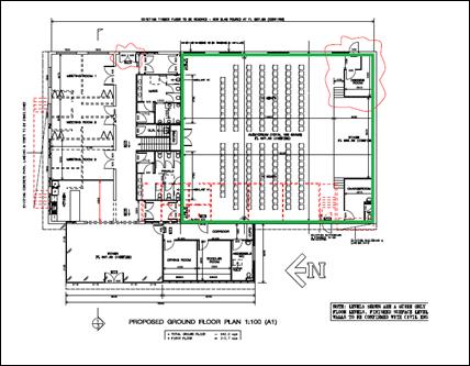
31.7 spaces
attributed to 311m2 area of auditorium (including stage and change
rooms)
-
5.7
(existing use)
=
26
spaces
The submitted plans show the provisions of 23 spaces, and
thus a shortfall of 3 spaces based on the above rationale.
The applicant has presented justification in support of the
aforementioned shortfall. This justification is not supported purely for the
fact that Council staff have already accepted a rationale for a reduced parking
demand and that reduced parking demand should be fully met on site; or,
alternatively be addressed by way of monetary contribution in lieu of the
physical spaces.
As such, a condition requiring the payment of the equivalent
of 2.4 spaces at the half rate for a change of use (the half rate is applied
given that based on the accepted rationale the area of demand relates to the
existing building not the new floor area) shall be paid prior to the issue of a
construction certificate.
3 x $7,067.35(rate
(b))
=
$21,202.05
The above assessment has resulted in three options being
available to Council which are described below:
1 Disagree
with the contentions presented by the applicant and require the full
contribution based on the strict application of the DCP.
2 Agree
with the contentions presented by the applicant, save the contention around the
short fall in parking of 3 spaces based on the revised parking assessment; and
attach a condition restricting the operation of the place of public worship to
accord with the rationale of the revised parking assessment.
3 Agree
with the applicant on all points and do not require any contributions.
It is the recommendation of Council staff that option TWO
be adopted. Accordingly a condition is attached requiring the payment of a
monetary contribution for the 3 space shortfall in parking based on the
applicant rationale and attach conditions controlling the ongoing operation of
the place of public worship.
With reference to the foregoing assessment of parking demand
attributed to the development, the development will not have a significant
adverse environmental impact in the locality and, accordingly the development
is considered acceptable in terms of parking.
It should be noted that Council’s DCP is performance
based which allows a degree of elasticity (where appropriately justified) with
the provisions therein. The above rationale has only been agreed to strictly on
the basis of the isolated circumstances and merits of the justification
presented. It should not be construed as to be the setting of a precedent
relating to car parking requirements of other places of public worship.
INFILL GUIDELINES
The subject land is located in within the Glenroi Heritage
Conservation Area and as such Council’s Infill Guideline applies to the
development. The guideline requires development to considered the character,
scale and form, siting, materials and colour, and detailing.
Character
The immediate area is characterised as a mix of residential,
commercial/light industrial and railway uses. There is a mix of intact period
dwellings and more modern commercial buildings with limited to no significance
in the locality.
There are no heritage items immediately adjoining the
subject land; however, there is a contiguous row, save for one property, of
heritage items in Kite Street (round the corner from the subject land) and a
number to the east in Edward Street. The rail precinct opposite the subject
land is also a heritage item.
Scale and Form
The building adopts a scale commensurate with the existing
industrial style building on the land and similar to various other buildings in
the wider locality. The new element comprises a rectilinear form comprising
contemporary horizontal proportioned glazing and awning.
Siting
The siting of the new front extension will adopt a similar
setback to the secondary setback of the adjoining property to the north. More
broadly, there is a mix of setbacks from 21m to 0m. It is considered that
the proposed front setback/siting will not unreasonably impact upon the
significance of the locality. Council’s Heritage Advisor raised no
objections in relation the buildings siting.
Materials and Colour
The existing brickwork which is an orange coloured brick is
intended to be painted a beige colour. There are no objections to this.
The new portion of building comprises face brickwork
intended to be painted the same colour as the existing building (beige colour).
The new windows and are door are proposed to be black aluminium and the new
awning is also proposed to be black in colour.
Council staff raise no objections to the proposed colour
scheme. The brick colour will interpret a traditional stone colour and the dark
coloured windows and awning are an appropriate choice in a commercial context.
Detailing
The proposed detailing is not incongruous with character of
the Glenroi conservation area. Council’s Heritage Advisor has not raised
any objections to the proposed detailing.
PROVISIONS PRESCRIBED BY THE
REGULATIONS s79C(1)(a)(iv)
Demolition of a Building (clause 92)
The proposal involves the demolition of internal walls and
fixtures. A condition is attached requiring the demolition to be carried out in
accordance with Australian Standard AS2601 - 1991: The Demolition of
Structures.
Fire Safety Considerations
(clause 93)
The proposal involves a change of building use for an
existing building. Council is satisfied that the fire protection and structural
capacity of the building are appropriate for the proposed new building use.
Relevant conditions are attached.
Buildings to be Upgraded
(clause 94)
Upgrading of the building will be required to ensure the
existing building is brought into partial or total conformity with the Building
Code of Australia. Conditions are attached in relation to the required
upgrading works.
THE LIKELY IMPACTS OF THE
DEVELOPMENT s79C(1)(b)
Context and Setting
The subject land is peripheral CBD location in an area
comprising mixed uses and mixed buildings styles. The land is also within the
heritage conservation area. The subject land is opposite the railway public car
park and is in the vicinity of the DPI building (the DPI building has a major
influence on parking demand in the locality). The foregoing and following
assessment conclude that the development is appropriate in the context and setting
and will not have a detrimental impact upon the public realm or neighbourhood
amenity.
Traffic, Access and Parking
Impacts
The land is serviced by Endsleigh Avenue which is local road
that connects with Kite Street and Bathurst Road to the north, and Moulder
and Warrendine Street to the south. The site itself is reliant on a right of
carriageway (as described in Book 2801 No. 856) over adjoining Lot 12 to
provide access to the car park at the rear of the building on the subject land.
The state of the existing access over Lot 12 is not adequate to service the
development the subject of this application. Accordingly, the owner of Lot 12
DP 519990 has owner’s consent to upgrade the right of way to the standard
required under Council’s Subdivision and Development code.
It is considered that the access arrangements are
satisfactory for the proposed development. Endsleigh Avenue is of a capacity
capable of catering for the additional traffic movements associated with the
development and access point to the subject land and the access itself (once
upgraded to the applicable standard). This is confirmed by Council’s
Technical Services raising no objections in relation to the traffic
arrangements for the development.
Whilst it is acknowledged that the place of public worship
will generate a parking demand within the area, on balance, based on the
intended (and conditioned) operation of the development, the likely demand will
occur at times when there will be limited to no competition for parking created
by the DPI building. Accordingly the available public parking area across from
the development will be available to absorb the extra demand result from this
development.
As such, the development is unlikely to result in any
unsatisfactory traffic related impacts in the locality.
Noise and Vibration
An acoustic report prepared by Wilkinson Murray has been
submitted in support of the application. Council’s Environmental Health
and Building Surveyor has reviewed the report and provided the following
advice:
“An operational noise
assessment has been provided with the application. The assessment identifies
two primary noise impacts from the proposal upon adjoining residential users,
namely, noise from the carpark and from singing/musical activities within the
building itself. The assessment identifies that in order for this proposal to
comply with the established noise criteria, a solid 1.8 metre high fence needs
to be established along the northern side of the adjoining Right of Way and
that all doors and windows must remain closed during all singing/musical
activities. If these criteria are adhered to, the proposal will only exceed the
established noise criteria by 1 dBA in the evening time when the carpark is
used. This exceedance is indistinguishable and acceptable. Conditions have been
included requiring the recommendations of the operational noise assessment to
be complied with.”
It is also noted that the fence along the eastern boundary
which was present at the time of the noise testing has since been removed. The
applicant’s acoustician has separately by way of email dated 24 August
2017 recommended a new solid fence along this boundary at a height of 2.2m.
Relevant conditions are attached in this regard.
The northern fence is not required to extend at the full
height all the way to the Endsleigh Avenue front boundary. The fence is
able to be raked or slope down to 1.2m at the front boundary with the rake
commencing at the front building line (western elevation) of the building at
160 Kite Street. This is to improve sight distances/safety for vehicles exiting
the site and also from a streetscape/heritage impacts perspective. Relevant
conditions are attached in this regard.
Environmental Impacts
The development site is located in a fully urbanised area
with little habitat value. As such, the development is not likely to result in
any unreasonable environmental impacts.
Heritage Impacts
The likely impacts upon the heritage significance of the
heritage conservation area.
Safety, Security and Crime
prevention
The framework for assessment of safety, security and crime
prevention is based on the principles of territorial reinforcement,
surveillance, access control and space management. Each principle is addressed
below.
Territorial Reinforcement
The site is fenced at relevant boundaries and clearly
defined access points are provided within the building design. The design and
management of the development presents clear areas demarcated as private or
public areas.
Surveillance
Natural surveillance will be achieved at all key access
points; meaning those attending the site will be able to ensure the main areas
are safe at all times.
Access Control
Access to the site is limited to a single entry point.
Access to the building is from the front and rear of the building. Reasonable
natural surveillance will be achieved at these access points and external
lighting will assisting in providing a safe and secure development whilst
deterring criminal behaviour.
Space Management
The applicant submits the site will be managed and
maintained so as to continually achieve the other principles of crime
prevention.
The development is considered satisfactory in this regard.
Construction Impacts
The development is expected to result in minor and short
term construction impacts. Conditions such as construction times are attached
to ensure the development is carried out in a satisfactory manner by reducing
nuisance impacts on adjoining neighbours.
Street Tree Impacts
The development has the potential to impact upon the trunk,
branch and root structure of the street trees within the road reserve in front
of the site. Council’s Manager City Presentation has reviewed the
application and provided the following recommended condition which is attached
to the consent:
“Should the Pin Oak street
trees require pruning work to enable the proposed building extension to be
constructed the work shall be undertaken by Council’s Tree Care team with
the developer responsible for all costs associated with the pruning work. At no
point shall construction workers or other personnel undertake pruning of the
street trees.”
Cumulative Impacts
Cumulative impacts of a development can arise under four
typical scenarios, namely:
· time crowded
effects where individual impacts occur so close in time that the initial impact
is not dispersed before the proceeding occurs
· space crowded
where impacts are felt because they occur so close in space they have a
tendency to overlap
· nibbling effects
occur where small, often minor impacts, act together to erode the environmental
condition of a locality and
· synergistic
effects, where a mix of heterogeneous impacts interact such that the combined
impacts are greater than the sum of the separate effects.
The development has the potential to result in a number of
the above scenarios. For example, time crowded effects could occur when a
service is scheduled for a particular time and a large number of parishioners
all arrive around the same time; or space crowded effects could arise with
parishioners signing in unison.
Although the development may create the scenarios described
above, the design of the development, the proposed amelioration (noise study)
and the way the development is intended to be operated (reinforced by
conditions of consent), the likely cumulative impacts are not expected to be so
significant so as to result in an unacceptable situation.
As such, with the intended design and management along with
conditions of consent the development is considered acceptable in regards to
cumulative impacts.
THE SUITABILITY OF THE SITE
s79C(1)(c)
The site is considered suitable for the proposed
development. Council officers are not aware of the subject property being
effected by any natural, physical or technological hazards within the site (or
vicinity) that would unreasonably constrain the development.
The foregoing assessment indicates (with the imposition of
conditions of consent) that the development has acceptable compatibility with
the surrounding land-use pattern and will not cause undue conflicts.
ANY SUBMISSIONS MADE IN
ACCORDANCE WITH THE ACT s79C(1)(d)
The proposed development is defined as "advertised
development" under the provisions of the LEP. The application was
advertised for the prescribed period of 14 days and at the end of that period
three submissions have been received.
Submission 1 – John
Holland Pty Ltd
The submission references the
SEPP (Infrastructure) and the document titled Development Near Rail
Corridors and Busy Road.
The SEPP and associated documents have been considered
above.
Submission 2 – 160 Kite
Street
The submission relates to the
materials of the required fence along the northern boundary of the right of
carriage way and requests that it commence behind the building line of the
building located on 160 Kite Street.
It is noted from Council’s
mapping system that a thin parcel of land lies between the land providing
access (shown below in yellow) to the proposed car park and the property
referenced in this submission (160 Kite Street). The thin parcel appears to be
owned by 164 Kite Street. So in actual fact the fence will be on the boundary
of this long thin parcel rather than the boundary of 160 Kite Street. This is
shown diagrammatically below.
Image 1 - ownership of adjoining parcels
(BLUE–Subject
land, YELLOW–right of carriage way providing access to car park
RED–adjoining narrow slither of land owned by
164 Kite Street,
GREEN–similar to red but unsure of ownership)
Conditions are attached requiring the fencing be constructed
from hardwood and be lapped and capped.
In terms of where the fence starts, the fence is necessary
for noise attenuation and as such has to extend to the front boundary, however
the applicant’s acoustician has indicated that the fence can be raked to
the front boundary, with the rake starting at the front building line of the
building on 160 Kite Street down to a height of 1.2m.
Submission 3 – 94
Endsleigh Avenue
The submission raises concerns
relating to appropriate location of places of public worship, bonded asbestos
material, contamination, fire safety and heritage considerations. These matters
are considered below.
Location of Places of Public
Worship
Orange LEP 2011 is the principle planning document
governing, inter alia, land-use within the various zonings within the city.
Detailed consideration was given to the types of land uses appropriate in the
B6 Zone when the LEP was being prepared, and at that time places of public
worship were deemed appropriate in the B6 zone with development consent.
Bonded Asbestos Material
Any bonded asbestos material (or other types) will need to
be removed by licenced a contactor administered by NSW work cover.
Contamination
Contamination matters have been addressed under SEPP 55
considerations above.
Fire Safety
Fire safety matters will be addressed at the construction
certificate stage of the development. It will be the responsibility of the
Principle Certifying Authority to ensure the development is consistent with the
NCC and other relevant standards.
Heritage Matters
Heritage conservation matters have been addressed in detail
above under the heading Clause 5.10 – Heritage Conservation.
PUBLIC INTEREST
s79C(1)(e)
The proposed development is considered to be of minor
interest to the wider public due to the relatively localised nature of
potential impacts. The proposal is not inconsistent with any relevant policy
statements, planning studies, guidelines etc that have not been considered in
this assessment.
SUMMARY
The proposed development is permissible with the consent of
Council. The proposed development complies with the relevant aims, objectives
and provisions of the LEP. A Section 79C assessment of the
development indicates that the development is acceptable. The key issue in the
assessment relates to parking. A detailed assessment of this issue has been the
body of this report.
It is recommended that Council accepts the applicant
rationale for the assessment of parking demand, save for the 2.4 space
shortfall under the applicants rationale (relevant conditions attached require
car parking contributions based on a 2.4 space shortfall) Attached is a draft
Notice of Approval outlining a range of conditions considered appropriate to
ensure that the development proceeds in an acceptable manner.
COMMENTS
The requirements of the Environmental Health and Building
Surveyor and the Engineering Development Section are included in the attached
Notice of Approval.
Attachments
1 Notice
of Approval, D17/62652⇩
2 Plans,
D17/63876⇩
3 Submissions,
D17/60877⇩
Planning and Development Committee
7 November 2017
2.5 Development
Application DA 207/2016(1) - 102-110 and 110A Endsleigh Avenue
Attachment 1 Notice
of Approval
|

|
ORANGE
CITY COUNCIL
Development
Application No
DA 207/2016(1)
NA17/ Container
PR3902
|
NOTICE OF DETERMINATION
OF A DEVELOPMENT
APPLICATION
issued under the Environmental
Planning and Assessment Act 1979
Section 81(1)
|
Development
Application
|
|
|
Applicant Name:
|
Mr J Levi
|
|
Applicant Address:
|
C/- Peter
Basha Planning & Development
PO Box
1827
ORANGE
NSW 2800
|
|
Owner’s Name:
|
Mr JA and
Mrs RS Levi, and Mr DK Cooke
|
|
Land to Be Developed:
|
Lot 11 and
Lot 12 DP 519990 - 102-110 and 110A Endsleigh Avenue, Orange
|
|
Proposed Development:
|
Place of
Public Worship (alterations and additions to existing building), Business
Identification Signage and Demolition (tree removal)
|
|
|
|
|
Building
Code of Australia
building
classification:
|
To be
determined by the PCA
|
|
|
|
|
Determination
|
|
|
Made On:
|
7 November
2017
|
|
Determination:
|
CONSENT
GRANTED SUBJECT TO CONDITIONS DESCRIBED BELOW:
|
|
|
|
|
Consent to
Operate From:
|
8 November
2017
|
|
Consent to
Lapse On:
|
8 November
2022
|
Terms of Approval
The reasons for the imposition of
conditions are:
(1) To ensure a quality
urban design for the development which complements the surrounding environment.
(2) To maintain
neighbourhood amenity and character.
(3) To ensure compliance
with relevant statutory requirements.
(4) To provide adequate
public health and safety measures.
(5) Because the development
will require the provision of, or increase the demand for, public amenities and
services.
(6) To ensure the utility
services are available to the site and adequate for the development.
(7) To prevent the proposed
development having a detrimental effect on adjoining land uses.
(8) To minimise the impact
of development on the environment.
Conditions
(1) The
development must be carried out in accordance with:
(a) Plans
by Peter Basha Planning and Development reference 12087DA – dated
6.6.2017 sheets 1 to 3 (including aerials) (5 sheets).
Plans by McKinnon
Design – Job no. 16078 drg no. 01 issue C; drg no. 02; drg no. 03 issue
A; drg. no. 04 issue A (4 sheets).
(b) statements
of environmental effects or other similar associated documents that form part
of the approval
as amended
in accordance with any conditions of this consent.
(2) All building work must
be carried out in accordance with the provisions of the Building Code of
Australia.
(3) A sign is to be erected
in a prominent position on any site on which building work, subdivision work or
demolition work is being carried out:
(a) showing
the name, address and telephone number of the principal certifying authority
for the work, and
(b) showing
the name of the principal contractor (if any) for any building work and a
telephone number on which that person may be contacted outside working hours,
and
(c) stating
that unauthorised entry to the site is prohibited.
Any such sign is to be maintained while the
building work, subdivision work or demolition work is being carried out.
(4) Where any excavation
work on the site extends below the level of the base of the footings of a
building on adjoining land, the person having the benefit of the development
consent must, at the person’s own expense:
(a) protect
and support the adjoining premises from possible damage from the excavation,
and
(b) where
necessary, underpin the adjoining premises to prevent any such damage.
Note: This
condition does not apply if the person having the benefit of the development
consent owns the adjoining land or the owner of the adjoining land has given
consent in writing to this condition not applying.
|
PRIOR TO THE ISSUE OF
A CONSTRUCTION CERTIFICATE
|
(5) The payment of $21,202.05
shall be made to Council in accordance with
Section 94 of the Act and Orange Car Parking
Development Contributions Plan 2015 in lieu of the physical provision of
adequate on-site car parking spaces.
PAYMENT MUST BE MADE PRIOR TO THE
ISSUE OF ANY CERTIFICATE under part 4A of
the Act.
The contribution shall be indexed
quarterly in accordance with the Orange Car Parking Development Contributions
Plan 2015, which may be inspected at the Orange Civic Centre, Byng Street,
Orange.
(6) The required fence
along the northern boundary shall be a lapped and capped timber fence. The
plans submitted with the application for a construction certificate must
clearly show the subject fence being a lapped and capped timber fence.
Additionally, the subject fence shall rake
(slope) down to not more than 1.2m in height at the front boundary, with the
rake (slope) of the fence commencing at the front building line (western
elevation) of the building located at 160 Kite Street, Orange. The plans
submitted with the application for a construction certificate shall clearly
show the rake (slope) of the subject fence.
(7) An
approval under Section 68 of the Local Government Act is to be sought
from Orange City Council, as the Water and Sewer Authority, for water, sewer
and stormwater connection. No plumbing and drainage is to commence until
approval is granted.
(8) Arrange
for a suitably qualified person to evaluate the fire safety of the building and
recommend a schedule of works to upgrade the fire safety provisions so as to
adequately prevent the spread of fire and promote the safety of persons within
the building in the event of a fire.
The design proposal and schedule of work
are to be submitted to Council/Accredited Certifier for approval.
(9) All
external building materials shall be non-reflective.
(10) The
applicant is to submit a waste management plan that describes the nature of
wastes to be removed, the wastes to be recycled and the destination of all
wastes. All wastes from the demolition and construction phases of this project
are to be deposited at a licensed or approved waste disposal site.
(11) Engineering plans providing
complete details of the proposed driveway and car parking areas are to be
submitted to Orange City Council or an Accredited Certifier (Categories B1, C3,
C4, C6) upon application for a Construction Certificate. The heavy duty kerb
and gutter layback and footpath crossing is to be 6.0m wide. The driveway
within the access arm of Lot 12 DP 519990 is to be a minimum of 4.5m wide. The
plans are to provide details of levels, cross falls of all pavements, proposed
sealing materials and proposed drainage works and are to be in accordance with
Orange City Council Development and Subdivision Code.
(12) A
Liquid Trade Waste Application is to be submitted to Orange City Council prior
to the issuing of a Construction Certificate. The application is to be in
accordance with Orange City Council’s Liquid Trade Waste Policy.
Engineering plans submitted as part of the application are to show details of
all proposed liquid trade waste pre-treatment systems and their connection to
sewer.
Where applicable, the applicant is to
enter into a Liquid Trade Waste Service Agreement with Orange City Council in
accordance with the Orange City Council Liquid Trade Waste Policy.
(13) The
development’s stormwater design is to include stormwater detention within
the development, designed to limit peak outflows from the land to the
pre-existing natural outflows up to the 100 year ARI frequency, with sufficient
allowance in overflow spillway design capacity to safely pass flows of lower
frequency (that is, a rarer event) without damage to downstream developments.
Where appropriate, the spillway design capacity is to be determined in
accordance with the requirements of the Dam Safety Committee.
The design of the detention storage is to be
undertaken using the ILSAX/DRAINS rainfall-runoff hydrologic model or an
approved equivalent capable of assessing runoff volumes and their temporal
distribution as well as peak flow rates. The model is to be used to calculate
the flow rates for the existing and post-development conditions. The developed
flows are to be routed through the proposed storage within the model so that
the outflows obtained are no greater than the flows obtained for the
pre-existing natural flows. A report detailing the results of the analysis,
which includes:
· catchment
plan showing sub-catchments under existing and developed conditions;
· schematic
diagram of the catchment model showing sub areas and linkages;
· tabulation
detailing the elevation, storage volume and discharge relationships; and
· tabulation
for the range of frequencies analysed, the inflows, outflows and peak storage
levels for both existing and developed conditions;
together with copies of the data files for the
model and engineering design plans of the required drainage system are to be
submitted to Orange City Council upon application for a Construction
Certificate.
(14) Backflow Prevention
Devices are to be installed to AS3500 and in accordance with Orange City
Council Backflow Protection Guidelines. Details of the Backflow Prevention Devices
are to be submitted to Orange City Council prior to the issuing of a
Construction Certificate.
|
PRIOR TO WORKS
COMMENCING
|
(15) A
Construction Certificate application is required to be submitted to, and issued
by Council/Accredited Certifier prior to any excavation or building works being
carried out onsite.
(16) A
temporary onsite toilet is to be provided and must remain throughout the
project or until an alternative facility meeting Council’s requirements
is available onsite.
(17) Soil erosion control
measures shall be implemented on the site.
|
DURING
CONSTRUCTION/SITEWORKS
|
(18) Should the Pin Oak
street trees require pruning work to enable the proposed building extension to
be constructed, the work shall be undertaken by Council’s Tree Care team
with the beneficiary of the consent being responsible for all costs associated
with the pruning work. At no point shall construction workers or other
personnel undertake pruning of the street trees.
(19) If Aboriginal objects,
relics, or other historical items or the like are located during development
works, all works in the area of the identified object, relic or item shall
cease, and the NSW Office of Environment and Heritage (OEH), and
representatives from the Orange Local Aboriginal Land Council shall be
notified. Where required, further archaeological investigation shall be
undertaken. Development works in the area of the find(s) may recommence if and
when outlined by the management strategy, developed in consultation with and
approved by the OEH.
(20) Any surplus excavated
material shall be disposed of at an appropriate location.
(21) In
the event of an unexpected find during works such as (but not limited to) the
presence of undocumented waste, odorous or stained soil, asbestos, structures such
as underground storage tanks, slabs, or any contaminated or suspect material,
all work on site must cease immediately. The beneficiary of the consent
must discuss with Council the appropriate process that should be followed
therein. Works on site must not resume unless the express permission of the
Director Development Services is obtained in writing.
(22) All
construction/demolition work on the site is to be carried out between the hours
of 7.00 am and 6.00 pm Monday to Friday inclusive, 7.00 am to 5.00 pm
Saturdays and 8.00 am to 5.00 pm Sundays and Public Holidays. Written
approval must be obtained from the General Manager of Orange City Council to
vary these hours.
(23) A
Registered Surveyor’s certificate identifying the location of the
building on the site must be submitted to the Principal Certifying Authority.
(24) All
materials on site or being delivered to the site are to be contained within the
site. The requirements of the Protection of the Environment Operations Act
1997 are to be complied with when placing/stockpiling loose material or
when disposing of waste products or during any other activities likely to
pollute drains or watercourses.
(25) Building demolition is
to be carried out in accordance with Australian Standard 2601:2001 - The
Demolition of Structures and the requirements of Safe Work NSW.
(26) Asbestos
containing building materials must be removed in accordance with the provisions
of the Work Health and Safety Act 2011 and any guidelines or Codes
of Practice published by Safe Work NSW, and disposed of at a licenced landfill
in accordance with the requirements of the NSW EPA.
(27) Any adjustments to
existing utility services that are made necessary by this development
proceeding are to be at the full cost of the developer.
(28) The
provisions and requirements of the Orange City Council Development and
Subdivision Code are to be applied to this application and all work constructed
within the development is to be in accordance with that Code.
The developer is to be entirely responsible for
the provision of water, sewerage and drainage facilities capable of servicing
the development from Council’s existing infrastructure. The developer is
to be responsible for gaining access over adjoining land for services where
necessary and easements are to be created about all water, sewer and drainage
mains within and outside the lots they serve.
(29) A 6.0m wide heavy-duty
concrete kerb and gutter layback and footpath crossing is to be constructed in
the position shown on the plan submitted with the Construction Certificate
application. The works are to be carried out to the requirements of the Orange
City Council Development and Subdivision Code.
(30) The
existing basalt (bluestone) kerb and gutter in Endsleigh Avenue is to be
retained. Where bluestone exists in the location of the proposed widened
driveway, the bluestone gutter is to be retained and incorporated into the new
vehicular layback. Any kerb stones removed as a result of the works are to be
firstly used as kerb stones in the areas of reinstated kerb and any leftover
stones returned to Council.
The
existing driveway in Endsleigh Avenue adjacent to the southern boundary that is
not proposed to be used is to be replaced with concrete and/or bluestone kerb
and the footpath reinstated to the requirements in the Orange City Council
Development and Subdivision Code.
|
PRIOR TO THE ISSUE OF
AN OCCUPATION CERTIFICATE
|
(31) A
1.8 m high solid fence is to be established along the northern boundary of the
development site. A 2.2 m high solid fence is to be established along the
eastern boundary of the development site in accordance with the requirements of the
Operational Noise Assessment (Report No. 14113 Version B dated August 2015 and
updated advice dated 24 August 2017) by Wilkinson Murray and amending email
from Wilkinson Murray Dated 24 August 2017.
The
fence shall also be consistent with the requirements of condition (6) as shown
on the Construction Certificate plans.
(32) Landscaping
shall be installed in accordance with approved plans prior to the issue of a
final occupation certificate.
(33) A
total of 23 off-street car parking spaces shall be provided upon the site in
accordance with the approved plans, the provisions of Development Control Plan
2004, and be constructed in accordance with the requirements of Council's
Development and Subdivision Code prior to the issue of an Occupation
Certificate.
(34) No
person is to use or occupy the building or alteration that is the subject of
this approval without the prior issuing of an Occupation Certificate.
(35) The
owner of the building/s must cause the Council to be given a Final Fire Safety
Certificate on completion of the building in relation to essential fire or
other safety measures included in the schedule attached to this approval.
(36) Where
Orange City Council is not the Principal Certifying Authority, a final
inspection of water connection, sewer and stormwater drainage shall be
undertaken by Orange City Council and a Final Notice of Inspection issued,
prior to the issue of either an interim or a final Occupation Certificate.
(37) Prior to the issue of
an Occupation Certificate, the following fencing is to be established on the
site:
(38) A Certificate of
Compliance, from a Qualified Engineer, stating that the stormwater detention
basin complies with the approved engineering plans is to be submitted to the
Principal Certifying Authority prior to the issuing of an Occupation
Certificate.
(39) Certification from
Orange City Council is required to be submitted to the Principal Certifying
Authority prior to the issue of an Occupation Certificate stating that all
works relating to connection of the development to Council assets, works on
public land, works on public roads, stormwater, sewer and water reticulation
mains and footpaths have been carried out in accordance with the Orange City
Council Development and Subdivision Code and the foregoing conditions, and that
Council will take ownership of the infrastructure assets.
(40) Certificates for
testable Backflow Prevention Devices are to be submitted to Orange City Council
by a plumber with backflow qualifications prior to the issue of an Occupation
Certificate.
(41) Where
stormwater crosses land outside the lot it favours, an easement to drain water
is to be created over the works. A Restriction-as-to-User under section 88B of
the NSW Conveyancing Act 1979 is to be created on the title of the
burdened lot requiring that no structures are to be placed on the site, or
landscaping or site works carried out on the site, in a manner that affects the
continued operation of the interlot drainage system. The minimum width of the
easement is to be as required in the Orange City Council Development and
Subdivision Code.
(42) All
of the foregoing conditions are to be at the full cost of the developer and to
the requirements and standards of the Orange City Council Development and
Subdivision Code, unless specifically stated otherwise. All work required by
the foregoing conditions is to be completed prior to the issuing of an Occupation
Certificate, unless stated otherwise.
|
MATTERS FOR THE
ONGOING PERFORMANCE AND OPERATION OF THE DEVELOPMENT
|
(43) Outdoor lighting must
be in accordance with the Australian Standard 4282-1997 Control of the
obtrusive effects of outdoor lighting.
(44) No other separate place
of public worship related activities shall occur at the premises (save for
Sunday school type activities for children) whilst a service is occurring.
(45) Two church
services only shall occur at the premises per week. These are to occur
at 8.30am and 10.30am each Sunday only. Pastoral services shall only occur
between 7.00pm and 9.30pm weekday evenings. All other administrative activities
related to the place of public worship outside of these times shall be limited
to 8.00am to 8.00pm Monday to Friday.
(46) Emitted
noise shall not exceed 5dB(A) above background sound level measured at the
nearest affected residence.
(47) The
owner is required to provide to Council and to the NSW Fire Commissioner an
Annual Fire Safety Statement in respect of the fire-safety measures, as
required by Clause 177 of the Environmental Planning and Assessment
Regulation 2000.
(48) All external doors and
windows must remain closed during all singing and musical activities in
accordance with the requirements of the Operational Noise Assessment (Report
No. 14113 Version B dated August 2015) by Wilkinson Murray.
(1) Any existing
encumbrances in favour of Essential Energy (or its predecessors) noted on the
title of the above property are complied with.
Essential Energy’s records indicate there
is electricity infrastructure located within close proximity of the property.
Any activities within this location must be undertaken in accordance with the
latest industry guideline currently known as ISSC 20 Guideline for the
Management of Activities within Electricity Easements and Close to
Infrastructure.
Prior to carrying out any works, a “Dial
Before You Dig” enquiry must be undertaken in accordance with the
requirements of Part 5E (Protection of Underground Electricity Power Lines) of
the Electricity Supply Act 1995 (NSW).
Given there is electricity infrastructure in
the area, it is the responsibility of the person/s completing any works around
powerlines to understand their safety responsibilities. SafeWork NSW (www.safework.nsw.gov.au) has publications that
provide guidance when working close to electricity infrastructure. These include
the Code of Practice – Work near Overhead Powerlines.
Other Approvals
(1) Local
Government Act 1993 approvals granted under Section 68.
Nil
(2) General
terms of other approvals integrated as part of this consent.
Nil
Right of Appeal
If
you are dissatisfied with this decision, Section 97 of Environmental
Planning and Assessment Act 1979 gives you the right to appeal to the Land
and Environment Court within 6 months after the date on which you receive this
notice.
* Section 97 of the Environmental Planning and Assessment
Act 1979 does not apply to the determination of a development application for
State significant development or local designated development that has been the
subject of a Commission of Inquiry.
|
Disability Discrimination Act
1992:
|
This application has been assessed in
accordance with the Environmental Planning and Assessment Act 1979. No
guarantee is given that the proposal complies with the Disability
Discrimination Act 1992.
The applicant/owner is responsible to
ensure compliance with this and other anti-discrimination legislation.
The Disability Discrimination Act
covers disabilities not catered for in the minimum standards called up in the
Building Code of Australia which references AS1428.1 - "Design for
Access and Mobility". AS1428 Parts 2, 3 and 4 provides the most
comprehensive technical guidance under the Disability Discrimination Act
currently available in Australia.
|
|
|
|
|
Disclaimer - S88B Restrictions on the Use of Land:
|
The applicant should note that there could
be covenants in favour of persons other than Council restricting what may be
built or done upon the subject land. The applicant is advised to check the
position before commencing any work.
|
|
|
|
|
Signed:
|
On behalf of the consent authority ORANGE
CITY COUNCIL
|
|
Signature:
|
|
|
Name:
|
PAUL JOHNSTON - MANAGER DEVELOPMENT
ASSESSMENTS
|
|
Date:
|
8 November 2017
|
Planning
and Development Committee
7 November 2017
2.5 Development
Application DA 207/2016(1) - 102-110 and 110A Endsleigh Avenue
Attachment 2 Plans
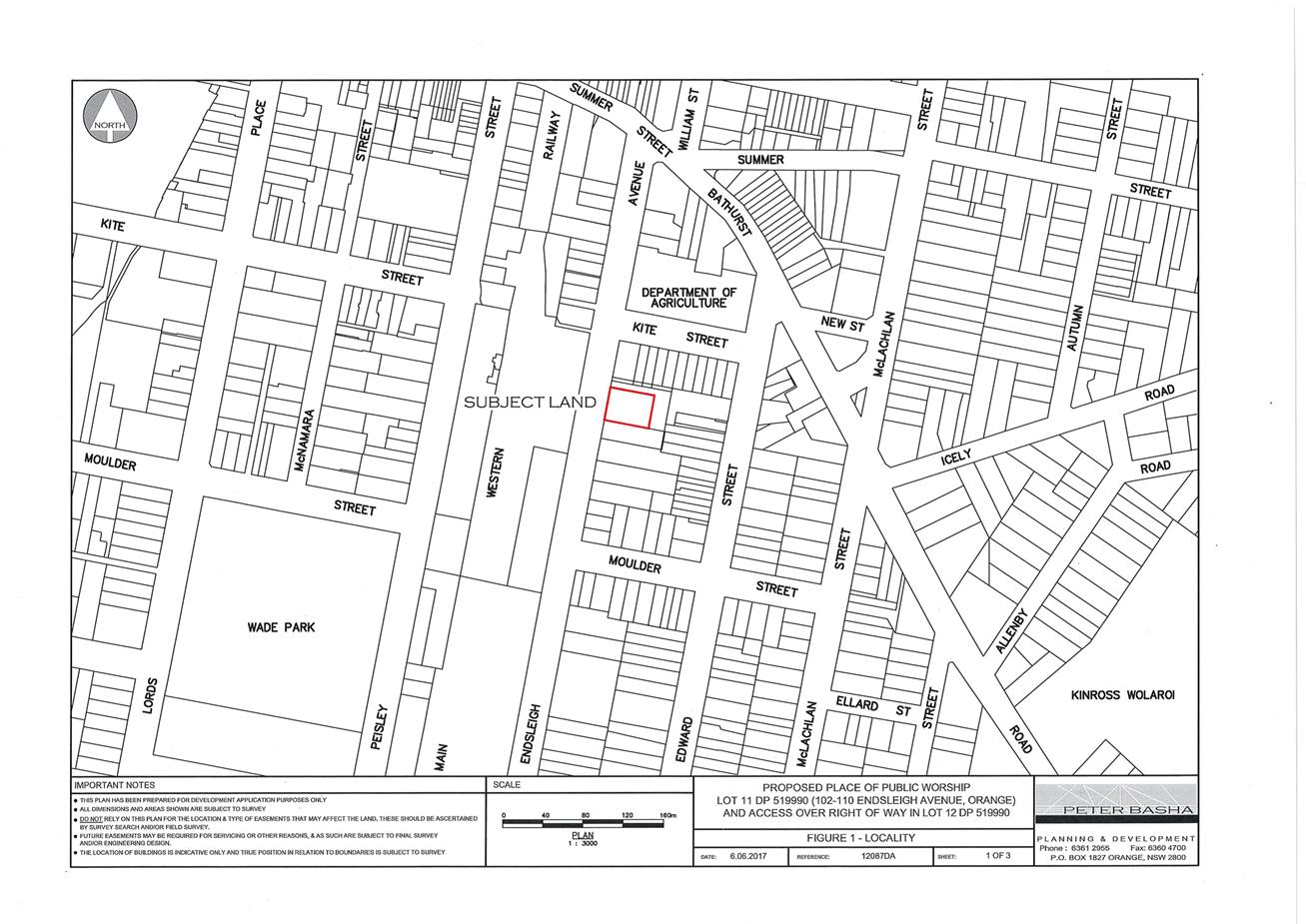
Planning and Development Committee
7 November 2017
2.5 Development
Application DA 207/2016(1) - 102-110 and 110A Endsleigh Avenue
Attachment 2 Plans
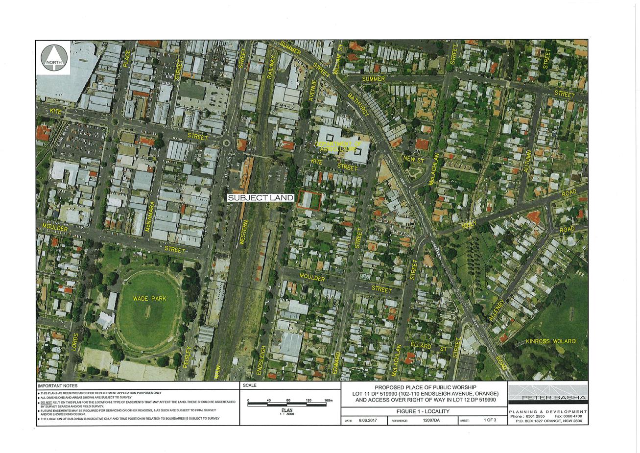
Planning and Development Committee
7 November 2017
2.5 Development
Application DA 207/2016(1) - 102-110 and 110A Endsleigh Avenue
Attachment 2 Plans
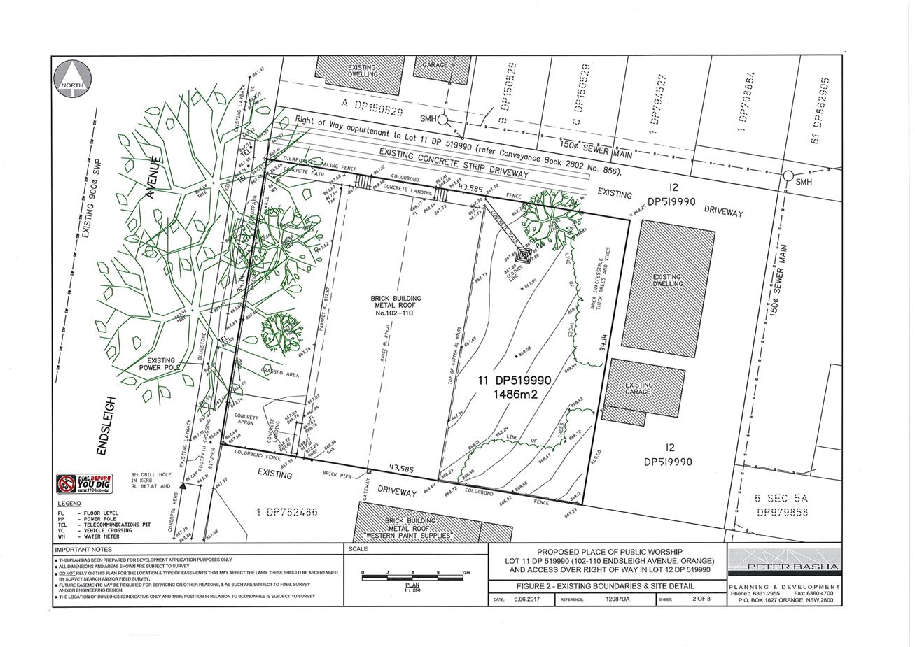
Planning and Development Committee
7 November 2017
2.5 Development
Application DA 207/2016(1) - 102-110 and 110A Endsleigh Avenue
Attachment 2 Plans
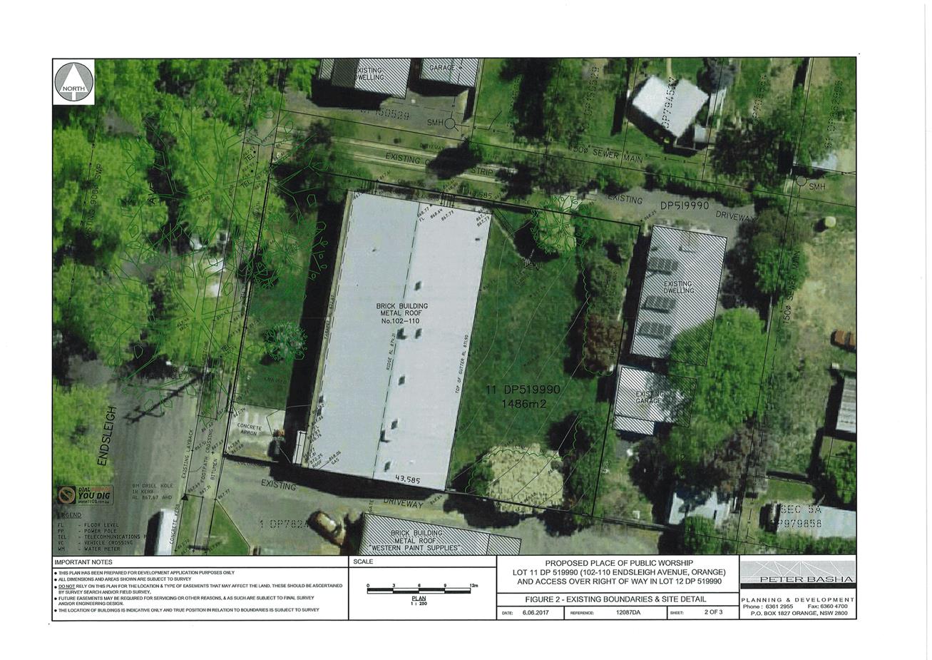
Planning and Development Committee
7 November 2017
2.5 Development
Application DA 207/2016(1) - 102-110 and 110A Endsleigh Avenue
Attachment 2 Plans
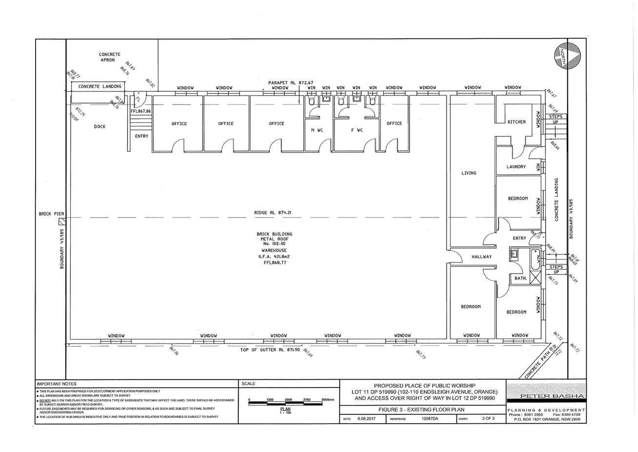
Planning and Development Committee
7 November 2017
2.5 Development
Application DA 207/2016(1) - 102-110 and 110A Endsleigh Avenue
Attachment 2 Plans
Planning and Development Committee
7 November 2017
2.5 Development
Application DA 207/2016(1) - 102-110 and 110A Endsleigh Avenue
Attachment 2 Plans
Planning and Development Committee
7 November 2017
2.5 Development
Application DA 207/2016(1) - 102-110 and 110A Endsleigh Avenue
Attachment 2 Plans
Planning and Development Committee
7 November 2017
2.5 Development
Application DA 207/2016(1) - 102-110 and 110A Endsleigh Avenue
Attachment 2 Plans
Planning and Development Committee
7 November 2017
2.5 Development
Application DA 207/2016(1) - 102-110 and 110A Endsleigh Avenue
Attachment 3 Submissions
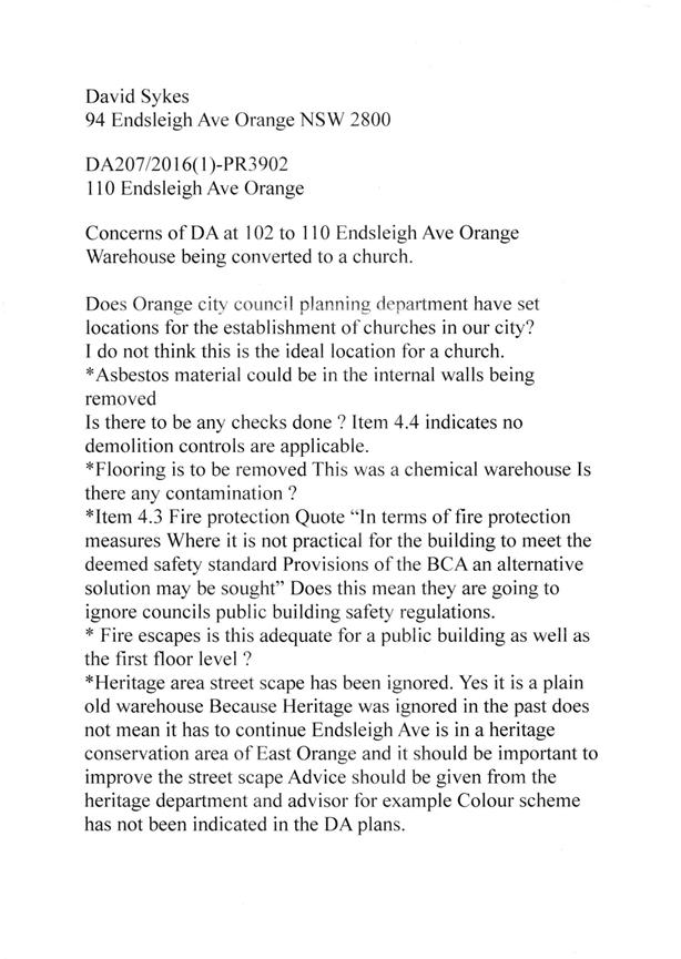
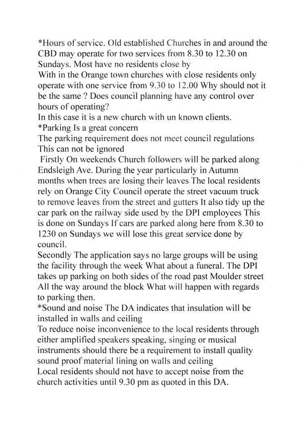

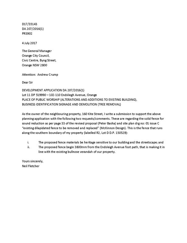
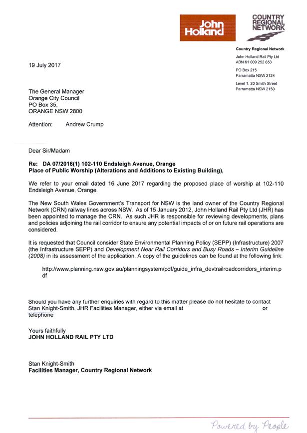
2.6 Development
Application DA 289/2017(1) - 2 Hanrahan Place
RECORD
NUMBER: 2017/2184
AUTHOR: Andrew
Crump, Senior Planner
EXECUTIVE Summary
|
Application
lodged
|
7 August
2017
|
|
Applicant/s
|
D'Aquino's
Liquor North Orange Pty Ltd
|
|
Owner/s
|
Orange
Service Centre Pty Ltd
|
|
Land
description
|
Lot 87
DP 1167633 - 2 Hanrahan Place, Orange
|
|
Proposed
land use
|
Retail
Premises (shop) (drive-through liquor shop) and Business Identification
Signage
|
|
Value of
proposed development
|
$1,800,000
|
Council's consent is sought to construct a building with a
drive-through arrangement to be used as a retail premises for the purposes of
the retail sale of liquor and other ancillary items. The land in question is
described as Lot 87 DP 1167633, known as 2 Hanrahan Place, Orange. The
development also involves new vehicle crossings, business identification
signage, a 25 space car park, retaining walls, site works and landscaping.
The key considerations with this application relate to the
circulation of vehicles internally within the site, an existing approval (not
yet commenced) that runs with this land and also the land opposite the site,
and the social impacts associated with a liquor store.
The development has been assessed against the NSW Planning
framework and within that, Council’s relevant planning provisions. As
outlined in the following assessment, the development is considered
satisfactory and is recommended for approval.
DECISION FRAMEWORK
Development in Orange is governed by two key documents
Orange Local Environment Plan 2011 and Orange Development Control Plan 2004. In
addition the Infill Guidelines are used to guide development, particularly in
the heritage conservation areas and around heritage items.
Orange Local Environment Plan 2011 – the LEP
should be considered by Council to be a definitive document. LEPs govern the
types of development that are permissible or prohibited in different parts of
the City and also provide some assessment criteria in specific circumstances.
Uses are either permissible or not - there are no grey areas in terms of
permissibility. The objectives of each zoning and indeed the aims of the LEP
itself are, however, open to interpretation and can be used to guide decision
making around appropriateness of development.
Orange Development Control Plan 2004 – the DCP
guides development. In general it is a performance based document rather than
prescriptive in nature - its purpose is to guide development. The Land and
Environment Court tends to view it as such. In each area of interest there are
often guidelines used. These guidelines indicate ways of achieving the planning
outcomes. It is thus recognised that there may also be other solutions of
merit. All design solutions are considered on merit by planning and building
staff.
Applications should clearly demonstrate how the planning
outcomes are being met where alternative design solutions are proposed. So one
can see that the DCP gives leeway for developers and architects to use design
to achieve the outcome in other ways if they can. Stating that
DCP guidelines are inflexible can be misleading.
The proposed development is permissible with development
consent. Council recently altered the strategic planning provisions that relate
to this site to provide for a liquor outlet. The mains issue relating to the
circulation of vehicles within the site has been addressed. The attached Notice
of Determination contains several conditions to ensure that the development proceeds
in an acceptable manner.
Link To Delivery/OPerational Plan
The recommendation in this report relates to the
Delivery/Operational Plan strategy “13.4 Our Environment
– Monitor and enforce regulations relating to City amenity”.
Financial Implications
Nil
Policy and Governance Implications
Nil
|
Recommendation
That Council consents to
development application DA 289/2017(1)
for Retail Premises (shop) (drive-through liquor shop) and Business
Identification Signage at Lot 87 DP 1167633 - 2 Hanrahan
Place, Orange pursuant to the conditions of consent
in the attached Notice of Approval.
|
further considerations
Consideration has been given to the
recommendation’s impact on Council’s service delivery; image and
reputation; political; environmental; health and safety; employees;
stakeholders and project management; and no further implications or risks have
been identified.
SUPPORTING INFORMATION
THE APPLICATION/PROPOSAL
Council's consent is sought to construct a 33.4m (long)
by 22.5m (deep) and 6.0m high (7.7m to ridgeline) commercial
building to be used for the purposes of a drive-through liquor store on land
described as Lot 87 DP 1167633, known as 2 Hanrahan Place, Orange.
The building will comprise a display area at the front of
the building and three travel lanes (comprising one browse lane and two
drive-through service lanes). Adjacent to the third travel lane will be a
service counter; behind the service counter will be a wine store, cool room,
store area and staff amenities.
The building will be set back 13.7m from the front boundary,
with 16 onsite parking spaces adjacent to the front of the building and a
further 9 spaces to the east of the proposed building.
A retaining wall will be constructed adjacent to an easement
at the rear of the site and return along the northern boundary.
A 4.5m high pylon sign is proposed at the front of the
site within the landscaped area.
BACKGROUND
Council issued development consent DA 278/2014(1) on
1 September 2014 which provided for neighbourhood shops, take away food
and drink premises and restaurant or café. The development consent
relates to the land the subject of this application and also the land opposite
known as 5 Hanrahan Place. The approved plans showed the footprint of a building
with the notation over it “proposed liquor outlet (indicative only
– subject to future planning proposal)”.
The owners of the land lodged a planning proposal in
November 2015 seeking to have another permitted use (APU) allowed on the
land over and above the permitted uses within the SP3 Tourist zone
land-use table that would permit a retail premises that sold liquor. The
planning proposal was supported by Council resolution and agreed to by the NSW
Department of Planning and Environment; and accordingly Schedule 1 of
the LEP has been amended to include the APU.
As part of DA 278/2014(1) a commercial building was
approved to the east of the site comprising a take away food and drink
premises, a restaurant or café and a neighbourhood shop.
When the application currently before Council was lodged, it
was noted by Council that the building shown differed to what was approved
previously in a number of ways, including size, location, external appearance
and car park layout. Accordingly the applicant was requested to either agree to
surrender the earlier consent (which would include the approved development on
the land opposite) or amend the application currently before Council to fully
accord with the development that was previously approved in that location.
The applicant subsequently agreed to Council imposing a
condition that prevents the release of a Construction Certificate until such
time as formal advice is received by Council, and Council in return
acknowledges receipt of advice, that the beneficiary of development consent
DA 278/2014(1) has surrendered the aforementioned development consent. A
relevant condition is attached.
As such, the eastern part of the site is effectively left
vacant for a future development of some type.
MATTERS FOR CONSIDERATION
Section 5A Assessment
In the administration of sections 78A, 79B, 79C, 111 and
112, the provisions of Section 5A must be taken into account for every
development application in deciding whether there is likely to be a significant
effect on threatened species, populations or ecological communities or their
habitats. This section includes a requirement to consider any adopted
assessment guidelines, which means assessment guidelines issued and in force
under section 94A of the Threatened Species Conservation Act 1995.
Assessment guidelines are in force (see DECC-W “Threatened Species
Assessment Guidelines - The Assessment of Significance”) which requires
consent authority to adopt the precautionary principle in its assessment.
From 25 August 2017, the Biodiversity Conservation Act
2017 and Biodiversity Conservation Regulation 2017 were
gazetted. State Environmental Planning Policy (Native Vegetation in Non-Rural
Areas) 2017 was also gazetted. The implementation of this legislation (and
supporting guidelines) is subject to savings provisions that defer their full
effect for a period of three months from the date of gazettal for local
development.
It is noted that there are native trees located on the
adjoining land to the north. Council’s planning staff referred the
application to Council’s Manager City Presentation to comment on the
likely effect of the development, particularly the impact that the proposed
retaining walls may have on the subject native vegetation.
Council’s Manager City Presentation advises that the
subject retaining walls would not cause a material impact on the existing
vegetation.
As such, the development is unlikely cause a significant
effect on threatened species, populations or ecological communities or their
habitats.
Section 79C
Section 79C of the Environmental Planning and Assessment
Act 1979 requires Council to consider various matters, of which those
pertaining to the application are listed below.
Water Management Act 2000
The development will require a controlled activity approval
due to the development's proximity to a 1st order stream which forms part of
Blackmans Swamp Creek. This development could have been treated as a nominated
integrated development application pursuant to Section 91 of the Environmental
Planning and Assessment Act. However, the applicant has elected (by not
ticking the relevant box on the application) for the application NOT to be
treated as such, and will obtain the necessary approvals separate to this
application. In doing so, the applicant runs the risk of the approval body
declining to issue an approval, a fact that the applicant's planning consultant
is aware of.
The Land and Environment Court has seemingly issued
conflicting judgements on whether or not an applicant is entitled to elect for
an application to not be treated as nominated integrated development when on
its face an application requires an approval pursuant to the integrated
provisions. Relying on the judgement Maule v Liporoni and Another Justice Lloyd
held at para. 86:
In
making the development application Mr Liporoni did not tick the box in the
application form to indicate that consent was being sought for an integrated
development approval. In so doing he elected to have his development
application processed as if it were not an application for integrated
development. That was his choice. There was and is no compulsion on an
applicant to make an application for an integrated development approval, if he
or she chooses not to do so.
The above was reaffirmed in Motbey v Hollis and Eurobodalla.
It is noted that Justice Sheahan
in Azzopardi and Others v Gosford City Council And Another (2001)
and subsequently Azzopardi and Other v Gosford City Council and Another (2002)
in the Court of Appeal appears to have adopted the position that a development
consent granted in respect of integrated development without first complying
with the necessary provisions could lead to invalidity.
Accordingly, given the Court's varying decisions on the
application of Section 91 of the Act, the provisions remain open to
interpretation. Until such time as the Court strengthens its position on this
issue or the Act is amended to tighten up the relevant provisions, it would
remain accepted that an applicant is entitled to elect to have a development
application assessed as though it is not an integrated development.
Relying on Justice Lloyd's ruling, it is acceptable for the
applicant to elect not to have the application treated as integrated
development.
A condition is attached that requires the applicant to
obtain all necessary approvals under the Water Management Act 2000.
Fisheries Act
The land to the rear of the subject land is identified as key
fish habitat as mapped by NSW Fisheries. Accordingly, as with the
requirements under the Water Management Act, the applicant will be
required to obtain any necessary approvals under the Fisheries Management
Act.
PROVISIONS OF ANY ENVIRONMENTAL
PLANNING INSTRUMENT s79C(1)(a)(i)
Orange Local Environmental Plan 2011
Part 1 - Preliminary
Clause 1.2 - Aims of Plan
The
broad aims of the LEP are set out under subclause 2. Those relevant to the
application are as follows:
(a) to encourage development which complements
and enhances the unique character of Orange as a major regional centre boasting
a diverse economy and offering an attractive regional lifestyle,
(b) to provide for a range of development
opportunities that contribute to the social, economic and environmental
resources of Orange in a way that allows present and future generations to meet
their needs by implementing the principles for ecologically sustainable
development,
The application is considered to be consistent with aims (a)
and (b) as listed above.
Clause 1.6 - Consent Authority
This clause establishes that, subject to the Act, Council is
the consent authority for applications made under the LEP.
Clause 1.9A - Suspension of
Covenants, Agreements and Instruments
This clause provides that covenants, agreements and other
instruments which seek to restrict the carrying out of development do not apply
with the following exceptions.
· covenants imposed
or required by Council
· prescribed
instruments under Section 183A of the Crown Lands Act 1989
· any conservation
agreement under the National Parks and Wildlife Act 1974
· any trust
agreement under the Nature Conservation Trust Act 2001
· any property
vegetation plan under the Native Vegetation Act 2003
· any biobanking
agreement under Part 7A of the Threatened Species Conservation Act 1995
· any planning
agreement under Division 6 of Part 4 of the Environmental Planning and
Assessment Act 1979.
Council staff are not aware of the title of the subject
property being affected by any of the above.
Mapping
The subject site is identified
on the LEP maps in the following manner:
|
Land Zoning Map:
|
Land zoned SP3 Tourist
|
|
Lot Size Map:
|
No Minimum Lot Size 2000m2
|
|
Heritage Map:
|
Not a heritage item or conservation
area
|
|
Height of Buildings Map:
|
No building height limit
|
|
Floor Space Ratio Map:
|
No floor space limit
|
|
Terrestrial Biodiversity Map:
|
No biodiversity sensitivity on the
site
|
|
Groundwater Vulnerability Map:
|
Ground water vulnerable
|
|
Drinking Water Catchment Map:
|
Not within the drinking water
catchment
|
|
Watercourse Map:
|
Not within or affecting a defined
watercourse
|
|
Urban Release Area Map:
|
Not within an urban release area
|
|
Obstacle Limitation Surface Map:
|
No restriction on building siting
or construction
|
|
Additional Permitted Uses Map:
|
No additional permitted use applies
|
Those matters that are of relevance are addressed in detail
in the body of this report.
Part 2 - Permitted or Prohibited
Development
Land Use Zones
The subject site is located within the SP3 Tourist Zone. The
proposed development is defined as a retail premises (shop) and business
identification signage. Orange LEP 2011 defines each of these land uses as
follows:
retail premises means a building or place used for
the purpose of selling items by retail, or hiring or displaying items for the
purpose of selling them or hiring them out, whether the items are goods or
materials (or whether also sold by wholesale), and includes any of the
following:
(a) bulky
goods premises,
(b) cellar
door premises,
(c) food
and drink premises,
(d) garden
centres,
(e) hardware
and building supplies,
(f) kiosks,
(g) landscaping
material supplies,
(h) markets,
(i) plant
nurseries,
(j) roadside
stalls,
(k) rural
supplies,
(l) shops,
(m) timber yards,
(n) vehicle
sales or hire premises,
but does not include highway service centres, service
stations, industrial retail outlets or restricted premises.
The land-use can be further characterised as a shop which
means:
premises that sell merchandise such as groceries, personal
care products, clothing, music, homewares, stationery, electrical goods or the
like or that hire any such merchandise, and includes a neighbourhood shop, but does not include food and drink premises or restricted
premises.
Business identification signage means:
a sign:
(a) that
indicates:
(i) the
name of the person or business, and
(ii) the
nature of the business carried on by the person at the premises or place at
which the sign is displayed, and
(b) that
may include the address of the premises or place and a logo or other symbol
that identifies the business,
but that does not contain any advertising relating to a
person who does not carry on business at the premises or place.
Retail Premises (including
shops) are listed as prohibited within the SP3 zone.
However,
Clause 2.5 has the effect of allowing site specific exceptions to the generic
land-use tables in certain circumstances if the use is allowed as an additional
permitted use (APU) and listed within Schedule 1 of the LEP.
Clause 2.5 has effect despite anything to the
contrary in the Land Use Table or other provision of the LEP.
Schedule 1 - Additional Permitted Uses
Pursuant to Schedule 1
of the LEP an additional permitted use applies to the land which provides
for:
(2) Development for the
purpose of retail premises that consist of a liquor outlet or bottle shop is
permitted with development consent.
(3) Subclause (2) applies
only if the retail floor space on the site used for a liquor outlet or bottle
shop is no more than 600m².
In terms of subclause (2) the subject development
relates to a retail premises (or shop) for the purposes of the retail sale of
liquor. Subclause (3) has the effect of limiting the size of the
‘retail floor space’. It is noted from the submitted plans that the
gross floor area (GFA) of the building is 658.27m2, thereby
exceeding the 600m² standard within the APU.
Notwithstanding the fact that the building is larger
than 600m2 of GFA, the APU applies a standard of
‘retail floor space’ as opposed to GFA. Retail floor space is
not a defined term under the LEP like GFA is; as such its meaning is
open to interpretation. In calculating the area of retail floor space, it is
reasonable to exclude the vehicle service lanes from the area of retail floor
space as this space is essentially customer parking/loading area designed for
convenience rather than resulting in additional floor space and thereby additional
parking demand.
If the travel lanes are excluded from the calculation of
retail floor space, the floor area of the building reduces
to 382.1m², which is well below the 600m² ‘retail floor
area’ standard.
The development is
therefore permissible upon the subject land with the consent of Council.
Clause 2.3 of LEP 2011
references the Objectives for each zone in LEP 2011. These objectives for
land zoned SP3 Tourist are as follows:
1 - Objectives of Zone - SP3 Tourist
· To provide for a variety of tourist-oriented development
and related uses.
· To cater for the needs of the travelling public.
The development is not expressly
consistent with the objects of the zone. The land-use is not strictly a tourist
related development and the development (what is being
retailed, i.e. liquor) is not necessarily something that caters to
the travelling public.
Notwithstanding this, the use
represents a site specific provision that only applies to the subject land,
allowed via an ‘another permitted use’ that was gazetted as part of
Amendment 14 to the LEP, having gone through a rigorous strategic
planning process. As such, whilst the development is not strictly consistent
with the objects of the zone, the development is considered acceptable.
Part 3 - Exempt and Complying
Development
The application is not exempt or complying development.
Part 6 - Urban Release Area
Not relevant to the application. The subject site is not
located in an Urban Release Area.
Part 7 - Additional Local Provisions
7.1 - Earthworks
This clause establishes a range of
matters that must be considered prior to granting development consent for any
application involving earthworks, such as:
(a) the likely disruption of, or any
detrimental effect on, existing drainage patterns and soil stability in the
locality of the development
(b) the effect of the development on the
likely future use or redevelopment of the land
(c) the quality of the fill or the soil to be
excavated, or both
(d) the effect of the development on the
existing and likely amenity of adjoining properties
(e) the source of any fill material and the
destination of any excavated material
(f) the likelihood of disturbing relics
(g) the proximity to and potential for adverse
impacts on any waterway, drinking water catchment or environmentally sensitive
area
(h) any measures proposed to minimise or
mitigate the impacts referred to in paragraph (g).
The earthworks
proposed in the application are limited to the extent of cutting and filling
required for the proposed building. This involves approximately 750mm of fill at
the rear of the site where the site falls away to the open drainage channel,
and a small amount of cut at the south-western corner of the site. The extent
of disruption to the drainage of the site is considered to be minor and will
not detrimentally affect adjoining properties or receiving waterways.
The extent of the
earthworks will not materially affect the potential future use or redevelopment
of the site that may occur at the end of the proposed development's lifespan.
The site is not known
to be contaminated and conditions are imposed requiring the use of verified
clean fill only. Excavated materials are to be reused onsite as far as possible,
and conditions are imposed to require that surplus materials will be disposed
of to an appropriate destination.
It is noted that a
large stockpile of excavated material exists on the site. The applicant submits
that the material was derived from the adjoining land to the west at the time
of the construction of the highway service centre on that land. The applicant
further submits that the material was originally derived from clean fill within
the Narrambla Industrial Estate.
The earthworks will
be appropriately supported onsite with the use of retaining walls, and the
change in ground level is not substantial. Therefore the effect on the amenity
of adjoining properties is considered to be minor.
The site is not known
to contain any Aboriginal, European or archaeological relics. Previous known
uses of the site do not suggest that any relics are likely to be uncovered.
However, conditions are imposed to ensure that should site works uncover a
potential relic or artefact, works will be halted to enable proper
investigation by relevant authorities and the proponent required to seek
relevant permits to either destroy or relocate the findings.
The site is in
proximity to a waterway (separate approval required as mentioned above), but
not a drinking water catchment or sensitive area. Conditions are imposed to
require a sediment control plan, including silt traps and other protective
measures, to ensure that loose dirt and sediment does not escape the site
boundaries.
7.3 - Stormwater Management
This clause applies
to all industrial, commercial and residential zones and requires that Council
be satisfied that the proposal:
(a) is designed to maximise the use of water
permeable surfaces on the land having regard to the soil characteristics affecting
onsite infiltration of water
(b) includes, where practical, onsite
stormwater retention for use as an alternative supply to mains water,
groundwater or river water; and
(c) avoids any significant impacts of
stormwater runoff on adjoining downstream properties, native bushland and
receiving waters, or if that impact cannot be reasonably avoided, minimises and
mitigates the impact.
The development will result in only a
small percentage of impervious surfaces, save for the landscaped area at the
front of the site and the turfed future development site. As such, the car park
will act as a detention basin designed to ensure that post-development run-off
does not exceed pre-development levels. Relevant conditions are attached to
ensure that this occurs.
7.6 - Groundwater Vulnerability
This clause seeks to protect
hydrological functions of groundwater systems and protect resources from both
depletion and contamination. Orange has a high water table and large areas of
the LGA, including the subject site, are identified with “Groundwater
Vulnerability” on the Groundwater Vulnerability Map. This requires that
Council consider:
(a) whether or not the development (including
any onsite storage or disposal of solid or liquid waste and chemicals) is
likely to cause any groundwater contamination or have any adverse effect on
groundwater dependent ecosystems, and
(b) the cumulative impact (including the
impact on nearby groundwater extraction for potable water supply or stock water
supply) of the development and any other existing development on groundwater.
Furthermore consent may not be granted unless Council is satisfied that:
(a) the development is designed, sited and
will be managed to avoid any significant adverse environmental impact, or
(b) if that impact cannot be reasonably
avoided - the development is designed, sited and will be managed to minimise
that impact,
(c) if that impact cannot be minimised - the
development will be managed to mitigate that impact.
The proposal is not
anticipated to involve the discharge of toxic or noxious substances and is
therefore unlikely to contaminate the groundwater or related ecosystems. The
proposal does not involve extraction of groundwater and will therefore not
contribute to groundwater depletion. The design and siting of the proposal
avoids impacts on groundwater and is therefore considered acceptable.
7.11 – Essential Services
All necessary services including Councils reticulated water,
sewer and stormwater, are readily available within the subject land.
STATE ENVIRONMENTAL PLANNING
POLICIES
State Environmental Planning Policy 55 - Remediation of
Land
State Environmental Planning Policy 55 - Remediation of Land
(SEPP 55) requires that a consent authority must not consent to the
carrying out of development of land unless it has considered whether the land
is contaminated, is satisfied that the land is suitable in its contaminated
state for the development that is proposed, and if the land requires
remediation to be made suitable for the proposed development it is satisfied
that the land will be remediated before the land is used for that purpose.
Furthermore, SEPP 55 requires that before determining
an application for consent to carry out development that would involve a change
of use on any of the land specified in subclause (4), the consent
authority must consider a report specifying findings of a preliminary
investigation of the land concerned. It is noted that the land-use is not a
type listed within subclause (4).
Given that the land has been recently subdivided and deemed
suitable for commercial use, it is considered that the subject land is suitable
for the proposed development and no further investigation of contamination is
required. It is noted that the previous development application that applies to
the land considered the likelihood of contamination at that time and it was
considered acceptable.
As noted above, there is a large stockpile of soil that has
been deposited on the subject land derived from the adjoining land. It is,
according to the applicant, clean fill. However, it is likely that this
material contains naturally occurring asbestos (NOA) given its provenance
within an area of the City known to contain NOA. It is likely that this
material will be used to raise the ground levels at the rear of the site.
Relevant conditions are attached to ensure that the subject material (and other
excavated material within the site) is used in a satisfactory manner,
consistent with the WHS Act and Regulations and Council’s Asbestos
Management Plan. Council staff raise no objections to this occurring.
State Environmental Planning
Policy 64 - Advertising and Signage
State Environmental Planning Policy 64 - Advertising and
Signage applies to the subject development. The applicant is seeking consent to
install a 4.5m high pylon sign located in the south-western corner of the
site and a business identification sign (BIS) affixed to the front elevation of
the proposed building.
The business identification sign will display the business
name ‘D’Aquino Liquor Drive Thru Bottle Shop’. The pylon sign
will display the company logo (in lieu of the words D’Aquino Liquor). The
development also includes directional signage at the site entrances and above
the entrances to the drive-through section of the building.
Conditions are attached in relation to additional signage
being applied to the building in the future. A further condition is attached
prohibiting A-Frame signage within the road reserve.
The SEPP requires that a consent authority must not grant
development consent to an application to display signage unless the consent
authority if satisfied:
(a) that
the signage is consistent with the objectives of this Policy as set out in
clause 3 (1) (a), and
(b) that
the signage the subject of the application satisfies the assessment criteria
specified in Schedule 1.
3 - Aims, Objectives etc
(1) This
Policy aims:
(a) to
ensure that signage (including advertising):
(i) is
compatible with the desired amenity and visual character of an area, and
(ii) provides
effective communication in suitable locations, and
(iii) is
of high quality design and finish, and
(b) to
regulate signage (but not content) under Part 4 of the Act, and
(c) to
provide time-limited consents for the display of certain advertisements, and
(d) to
regulate the display of advertisements in transport corridors, and
(e) to
ensure that public benefits may be derived from advertising in and adjacent to
transport corridors.
(2) This
Policy does not regulate the content of signage and does not require consent
for a change in the content of signage.
The subject signage is not incompatible with the theme of
signage in the locality and is commensurate with other signs in the immediate
locality such as the adjoining highway service centre and Finemores Transport.
Also, the signage will effectively communicate the presence and the purpose of
the business to the travelling public, with signage that is of an acceptable
level of design quality and finish.
The proposed BIS is not inconsistent with the general aims
and objectives of the plan.
Schedule 1
1 -
Character of the Area
· Is the proposal
compatible with the existing or desired future character of the area or
locality in which it is proposed to be located?
· Is the proposal
consistent with a particular theme for outdoor advertising in the area or
locality?
Hanrahan Place is emerging as an important precinct
providing services to the travelling public, with a highway service centre
adjoining the subject land to the west, a further development application for a
highway service centre currently before Council on the opposite land at
5 Hanrahan Place, and this development with the added ability to also
provide additional neighbourhood shops, restaurants or cafes, or take away food
and drink premises to the east of the subject building as noted on the plans.
The signage proposed within this application is commensurate
with the theme of signage associated with the developments on adjoining land
which generally do, or are proposed to (given that the service station before
Council has not been determined at the time of writing this report) comprise
pylon signage and corporate signage affixed to the host building on the land.
2 - Special Areas
· Does the
proposal detract from the amenity or visual quality of any environmentally
sensitive areas, heritage areas, natural or other conservation areas, open
spaces areas, waterways, rural landscapes or residential areas?
The area is not characterised as a special area.
3 - Views and
Vistas
· Does the
proposal obscure or compromise important views?
· Does the
proposal dominate the skyline and reduce the quality of vistas?
· Does the
proposal respect the viewing rights of other advertisers?
The proposed pylon signage is relatively modest in terms of
its height and is positioned in a way that it will not disrupts important views
and will not dominate the skyline; nor will it unreasonably obscure signage on
adjoining land.
The signage affixed to the building will have an immaterial
effect on views or vistas; nor will it obscure the viewing rights of signage on
adjoining land.
4 -
Streetscape, Setting or Landscape
· Is the scale,
proportion and form of the proposal appropriate for the streetscape, setting or
landscape?
· Does the
proposal contribute to the visual interest of the streetscape, setting or
landscape?
· Does the
proposal reduce clutter by rationalising and simplifying existing advertising?
· Does the
proposal screen unsightliness?
· Does the
proposal protrude above buildings, structures or tree canopies in the area or
locality?
· Does the
proposal require ongoing vegetation management?
The signage is appropriate within the streetscape, setting
and landscape in terms of its size, scale, proportions and form. It is noted
that the pylon signage will not be as tall as other pylon signs in the area
such as Caltex and Bunnings. The signage will make a neutral contribution to
the visual interest of the streetscape.
There is no existing signage within the site; accordingly
the development will not result in a reduction in visual clutter, nor will the
signage screen any unsightly element within the site. The proposed signage,
including the pylon signage, will not protrude above the height of the building
or other important features within the site.
No vegetation management directly related to the signage is
required.
The signage is therefore appropriate within the streetscape,
setting and landscape.
5 - Site and Building
· Is the proposal
compatible with the scale, proportion and other characteristics of the site or
building, or both, on which the proposed signage is to be located?
· Does the
proposal respect important features of the site or building, or both?
· Does the
proposal show innovation and imagination in its relationship to the site or
building, or both?
The pylon sign will sit at 4.5m in height, well below the
overall height of the proposed building; and the BIS affixed to the wall is
appropriately positioned within the composition of the building and
appropriately proportioned against the overall scale of the building.
6 - Associated Devices and
Logos with Advertisements and Advertising Structures
· Have
any safety devices, platforms, lighting devices or logos been designed as an
integral part of the signage or structure on which it is to be displayed?
Not applicable.
7 - Illumination
· Would
illumination result in unacceptable glare?
· Would
illumination affect safety for pedestrians, vehicles or aircraft?
· Would
illumination detract from the amenity of any residence or other form of
accommodation?
· Can
the intensity of the illumination be adjusted, if necessary?
· Is
the illumination subject to a curfew?
The applicant advises that the signage will be illuminated.
Council staff raise no objections to the signage being illuminated provided any
possible light spill is contained within the site. Accordingly, a condition is
attached requiring any exterior lighting to be installed in accordance with
Australian Standard AS 4282 -1997 – Control of the Obtrusive Effects of
Outdoor Lighting.
8 - Safety
· Would
the proposal reduce the safety for any public road?
· Would
the proposal reduce the safety for pedestrians or bicyclists?
· Would
the proposal reduce the safety for pedestrians, particularly children, by
obscuring sightlines from public areas?
The proposed signage affixed to the building is unlikely to
result in any safety concerns for motorists, pedestrians or bicyclists. The
subject pylon sign is a solid structure all the way to almost ground level and
positioned adjacent to the primary exit of the drive-through liquor store, and
therefore reduces the sightlines for vehicles exiting the site. Whilst the
predominate means of arrival to the liquor store will be by passenger vehicle,
there is still the likelihood of pedestrian or foot traffic to the store, and
as such a potential risk to the safety of pedestrians as a result of the solid
pylon sign and its location. Accordingly, a condition is attached that requires
the infill panel between to the post to be removed between ground level and
1.5m above ground level.
PROVISIONS OF ANY DRAFT
ENVIRONMENTAL PLANNING INSTRUMENT THAT HAS BEEN PLACED ON EXHIBITION
s79C(1)(a)(ii)
There are no draft environmental planning instruments that
apply to the subject land or proposed development.
DESIGNATED DEVELOPMENT
The proposed development is not designated development.
PROVISIONS OF ANY DEVELOPMENT
CONTROL PLAN s79C(1)(a)(iii)
Development Control Plan 2004
Orange Development Control Plan
2004 provides details and criteria for assessing development to support the
statutory provisions of Orange LEP 2011. The relevant chapters of the DCP
are:
· Chapter
0 - Interim Provisions
· Chapter
2 - Natural Resource Management
· Chapter
3 - General Considerations
· Chapter
10 - Special Uses and Roads Zones
· Chapter
14 - Advertising
· Chapter
15 - Car Parking
Chapter
0 - Local Environmental Plan 2011
Part 0.2 of Orange DCP 2004 establishes a conversation
table for old zones under OLEP 2000 to new zones under LEP 2011, and
in turn provides which chapters of the DCP are applicable in instances of
new zonings under LEP 2011. This is pertinent given the subject land's
zoning, being SP3 Tourist. Part 0.2 provides that there is no equivalent
zoning for land zoned SP3. Notwithstanding the above, the provisions of
PO 0.4-11 Interim Planning Outcomes - Transport Routes will apply to this
proposal. An assessment of the relevant planning outcomes is provided below.
Part 0.4-11 Planning Outcomes -
Interim Planning Outcomes - Transport Routes
The below Planning outcomes provide controls for development
that occurs on land with frontage and/or access to a major transport route.
Whilst it is acknowledged that the subject land does not
have either access nor frontage to the Northern Distributor Road (NDR),
the land is currently visually exposed to the NDR, and Hanrahan Place does
gain access directly from the NDR from the large five-arm roundabout on
Leeds Parade. As such for completeness, the below planning outcomes are
considered relevant to the assessment of the application.
· The
development provides a high standard of visual appeal to motorists, cyclists
and pedestrians, as well as adjoining property owners.
The design of the subject building
is of an acceptable standard, commensurate with the level of design quality
exhibited on nearby sites such as Bunnings, Caltex and Ron Finemores. The
design rationale adopted results in a simple commercial style building of
rectilinear form with articulated front elevation, expansive glazing, simple
gable roof form with feature red banding below gutter line, and constrained
building identification signage.
A 3m wide landscape bed will be
provided at the frontage of the site planted out with a Lansdowneana (western
corner), magnolias and groundcovers. Additionally, a further area of
landscaping (with provision of another Lansdowneana) will be provided adjacent
to the eastern entrance to the building to soften the building and provide
shading for vehicles parked in spaces 14 and 15.
The development is consistent
with the above planning outcome.
· The
visual appearance of the development, including any signage, lighting or other
ancillary element, must not generate a distraction to motorists.
The development, whilst
providing illuminated signage, is unlikely to present any distraction issues
for motorist due to two reasons: firstly its proximity to the NDR being
reasonably separated, and secondly a condition is attached relating to the
control of light spill.
· Any
signage must not be animated whether by movement or flashing lights.
The subject signage is not
animated.
· Where
land has more than one street frontage the street with the lower volume of
traffic is to provide the principal access to the development, subject to
safety considerations.
The land has only one possible
access, which is from Hanrahan Place.
· Where access is
provided onto an arterial road, distributor road or major collector road, the
access point must have appropriate safe sight distances for the prevailing
speed limit and clear and unimpeded entrance/exit signage must be displayed.
Not applicable.
· Where
onsite customer parking is provided that is not immediately visible from a
public road, clear and unimpeded directional signage must be displayed.
The parking will be obvious to
the travelling public. Notwithstanding, the applicant is proposing directional
signage.
Chapter 2 - Natural Resource
Management
Chapter 2 - Natural Resource Management provides planning
outcomes for stormwater and groundwater quality, soil resource management,
vegetation management and flora/fauna management - all of which have been
considered above under the headings "Orange LEP 2011"
(stormwater, groundwater), "Section 5A of the Act" and/or "Likely
Impacts" below.
Chapter 3 - General
Considerations
Chapter 3 provides planning outcomes of a general nature.
Those of relevance to this assessment relate to cumulative impacts and urban
areas. These are both addressed elsewhere within this report.
Chapter 10 - Special Uses and
Roads Zones
Part 10.3-1 Panning Outcomes - Development Near Major
Roads
An assessment of relevant planning outcomes is provided
below:
· Development
on land fronting and visible from a major road or distributor road provides for
quality design on the highway and/or distributor road through landscaping,
building setbacks façade design, external colours and materials and
siting.
Whilst the proposed development does not front a major road,
the location of the subject site can be viewed from the NDR near the
intersection with Leeds Parade. The building facade has been designed to
present as a modern commercial building of a reasonable architectural standard
and is in keeping with the existing and future “desired character”
of the surrounding area.
· Direct
access to major roads is limited and is constructed to the requirements of the
relevant roads authority.
As discussed above, access to the development is proposed
via Hanrahan Place. Hanrahan Place represents the fifth arm of the major
roundabout at this intersection. Egress from the development is proposed onto Hanrahan
Place. A detailed assessment in relation to access has been undertaken below
under the heading “Traffic Impacts”. Attached is a condition of
consent which requires all work to be carried out in accordance with
Council’s Development and Subdivision Code.
· Commercial
buildings adjoining a distributor road are set back from the property boundary
by at least 10m.
This planning outcome is not
relevant to this application given that the subject lot does not adjoin the NDR.
· Lighting
and signage visible from a distributor road is not animated and is designed so
as not to distract motorists beyond glance recognition.
Lighting of the premises will be required to be carried out
in accordance with AS 4282‑1997 - Control of the Obtrusive Effects
of Outdoor Lighting. A detailed assessment of signage has been carried out
above under the heading “State Environmental Planning Policy 64 -
Advertising and Signage". The design of the signage will not unreasonably
distract motorists travelling along the NDR.
Chapter 14 - Advertising
Part
14.2-1 Planning Outcomes - Advertisements
An assessment of relevant planning outcomes is provided
below:
· The
location, size, colour and design of advertisement complement the character of
the locality.
· Advertisements
on buildings fit within the envelope of the building.
· Freestanding
pole or pylon signs relate to the height of associated buildings in business
and industrial areas.
As outlined
above under the SEPP 64 assessment, the proposed business identification
signage is acceptable in the context and setting.
Chapter 15 - Car Parking
Part
15.6-1 Planning Outcomes - Off-Street Car Parking
An assessment of relevant planning outcomes is provided
below:
· Adequate
off-street car parking is provided in accordance with the Table or,
alternatively, according to an assessment that demonstrates peak-parking demand
based on recognised research.
· Car-parking
areas are designed according to Australian Standard.
· Car-park
areas include adequate lighting and landscaping (preferably deciduous shade
trees), which provide for the personal security of users.
· Bicycle parking
facilities are provided according to the relevant Australian Standard.
· Facilities
for loading and unloading of commercial vehicles are .provided according to the
relevant Australian Standard.
The DCP stipulates that retail premises are to provide
onsite parking at the rate of 6.1 spaces per 100m2 of
Gross Leasable Floor Area (GLFA).
Similar to the comments above relating to the APU,
whilst the building provides a total floor area of 658.27m2, it
is reasonable to exclude the travel lanes from the total floor area
calculations for car parking purposes as they do not relate to retail floor
space and thus do not generate a parking demand. Moreover, they are essentially
parking in themselves within the building that provides a level of convenience
to shoppers.
Accordingly, with the travel lanes excluded from the
calculations for car parking, the applicable floor area equates to 382.06m2.
This results in a parking demand of 23.3 spaces
(or 24 spaces to the nearest integer).
The submitted plans show the provision of 25 spaces, thus
providing a surplus of 1 space. The level of on-site parking is further
supplemented by the service lanes as part of the drive-through arrangement.
Additionally, an appropriate amount of onsite queuing area is provided,
resulting in a development that is satisfactory in terms of parking.
A drafting error was identified within the submitted plans
by Designsatm which effectively provided a landscape bed in the middle
of a parking space. This was raised with the applicant and it was suggested by
Council staff to leave the landscape area, increase it in size, provide a large
shade tree and forego one parking space as there was a 2 space surplus at
the time. This was agreed to and is reflected in the current plans by Designsatm.
However, as there are plans provided by two organisations,
the other plans identified as the Peter Basha Plans on the consent have not
been amended to reflect the above described change to the parking layout. For
the avoidance of doubt arising out of this identified conflict between the two
sets of plans, the conditions relating to car parking and landscaping reference
specific plans.
The applicant is not proposing bicycle storage as part of
the application.
Adequate loading arrangements have been provided for onsite
in a manner that will not unreasonably interrupt the day-to-day operations of
the development.
PROVISIONS PRESCRIBED BY THE
REGULATIONS s79C(1)(a)(iv)
The development is not inconsistent with the provisions
prescribed by the regulations.
THE LIKELY IMPACTS OF THE
DEVELOPMENT s79C(1)(b)
Context and Setting
The subject land is located within a small cul-de-sac which
links directly with the NDR at the Leeds Parade roundabout. The area is
emerging as a service precinct for the travelling public, with a highway
service centre operating from the adjoining land to the west and a further
highway service centre proposed opposite the land the subject of this
application which is currently before Council for consideration.
The other parcel within Hanrahan Place comprises a transport
terminal which is the operations base for Ron Finemores Transport and provides
vehicle maintenance, warehousing and storage of transport vehicles.
The area concerned is depicted in the below image:
Figure 1 - site context - the subject land is shown as
the blue outline (approximate)
NB: the Caltex and Bunnings developments have been
completed since this photo
(source: Google)
The land surrounding these properties comprises Bunnings on
the western side of Leeds Parade, the Narrambla Industrial Estate to the
southeast behind Finemores, undeveloped residential land to the south of
Finemores and undeveloped business park land to the north of the subject land.
As such, the context and setting of the subject land can
thus be characterised as a small commercial and industrial precinct. A retail
premises providing drive-through liquor sales is not incongruous with the context
and setting of the immediate locality in Hanrahan Place.
Access, Traffic and Parking -
RMS guide
Access to the site is provided via an entrance/exit to the
eastern half of the land just before the start of the cul-de-sac bowl; with an
exit only to the west of the site. The circulation through the
‘drive-through’ arrangement is anticlockwise, with entry to the
east and egress to the west of the site.
The application when originally submitted presented the
opposite arrangement, with entry to the west and egress to the east. This
arrangement was deemed unsatisfactory by Council staff as it did not provide
sufficient stacking of vehicles waiting to enter the drive-through arrangement
during peak periods and had the potential to impact upon Hanrahan Place. Such a
problem would be exacerbated by the high volume of heavy vehicles within
Hanrahan Place associated with the transport terminal at 3 -4 Hanrahan Place.
This position held by Council staff is supported by the RMS
Guide to Traffic Generating Developments, which recommends that drive-through
liquor stores are designed based on the following principles:
The
drive-in facility (if a component of a large development) must be integrated
with the overall development so as to limit the number of access points.
The
internal roadway must be a minimum of 2 lanes wide, each lane being at least 3
metres wide, with one way circulation. Off-street parking spaces for browse-room
customers and employees must also be provided which must not inhibit the free
flow of vehicles.
An
adequate holding area must be provided to ensure that vehicles are not forced
to park on the street. Vehicles must travel a minimum distance of 30 metres before
reaching the serving area.
Separate
entry / exit driveways are recommended, each with a minimum width of 4 metres
and with a minimum separation of 1 metre.
Accordingly, upon Council staff requests to amend the
application, the applicant agreed to reverse the vehicle circulation, which
provided far greater stacking volume and easier escape routes if insufficient
stacking occurred during exceptional circumstances.
In relation to the above RMS recommendations, the
development (having been amended by the applicant) is consistent with the above
principles. The development provides appropriate access arrangements that will
cater for this development and any future development within the possible
future development site area. The development will provide three travel lanes
comprising two service lanes and one browse lane; each will be 3m wide.
The siting of the building, access location and vehicle circulation
arrangements mean that approximately 39m of stacking distance or
queuing space will be available for vehicles between the site access and the
closest travel lane to the front boundary.
Finally, separate entry/exit driveways are provided.
The access, traffic and parking arrangements are acceptable
and unlikely to result in an adverse environmental impact in the locality.
As mentioned above, there is an
existing development consent applying to the land that provided for a
neighbourhood shops, a restaurant or café and a take away food or drink
premises as shown below:
Figure 2 - excerpt of plans from previous consent that
applies to the land DA 278/2014(1)
The development that has been proposed under the application
currently before Council does not align with the development previously
approved on the land. To address this the applicant has earmarked the area
shown on the submitted plans as a future development site and agreed to
surrender the earlier development consent DA 278/2014(1).
Visual Impacts
The presentation of the subject building is of an
appropriate architectural standard and scale for the land's context and
setting; and accordingly the development is unlikely to result in any unsatisfactory
visual impacts in the locality.
Noise Impacts
Council’s Environmental Health and Building Surveyor
has reviewed the submitted material as it relates to noise impacts and provides
the following assessment:
A Noise Impact Assessment
(NIA) has been provided for this proposal. It demonstrates that this proposal
can comply with the EPA’s Industrial Noise Criteria for the daytime and
evening times. The Statement of Environmental Effects indicates that the
proposal will operate between 9am and 10pm, which conforms to the
recommendations of the Noise Impact Assessments recommendations. A condition
has been included limiting the hours of operation of the proposal to 7am to
10pm to ensure that the NIA’s recommendations are met. Should the
operator wish to operate beyond those hours, further consent and a further NIA
will be required to ensure that nearby residential receivers are not unduly
disturbed.
In addition to the above assessment, consideration needs to
be given to the location of plant and equipment such as air conditioning units
and cool room condensers. The submitted material indicates that all plant and
equipment will be located on the roof space. Council's Environmental Health
& Building Surveyor raises no objections to the location of plant and
equipment.
Pedestrian Safety
Given the nature of the way the development is intended to
operate - with drive-through vehicles and foot traffic in the one area - the
risk of a vehicle/pedestrian conflict would exist. As such, to eliminate such a
circumstance from occurring (or at the very least reduce the risk of such a
circumstance) the applicant is required to provide traffic control measures
such as a speed humps at the entry and exit of the travel lanes, and speed
limit signs installed at the entry to travel lanes indicating that the area is
a shared zone with a speed limit of 10km/h. A further sign advising
motorists to ‘look for pedestrians’ is required. Additionally, at
all four pedestrian entrances that link directly with retail display area,
adequate signage is to be install advising people to look for vehicles.
The above measures will serve the purpose of raising the
awareness and alertness of people using the retail premises so as to reduce the
risk of a potential conflict. Relevant conditions are attached to ensure that
these measures are installed and maintained prior to the issue of an Occupation
Certificate.
Flora and Fauna
The site is devoid of any significant vegetation. There are
large native trees on the adjoining land at the rear of the site which would
provide shelter and refuge for native fauna. Council’s Manager City
Presentation has advised that this vegetation will not be impacted upon by this
development. As such, the development will not result in any impacts upon
significant native flora or fauna.
Waste
The development is of a type likely to generate moderate to
high levels of waste through shipping packaging, cardboard cartons etc. The subject
plans nominate a refuse enclosure at the rear of the site. Swept path diagrams
are submitted which demonstrate that the refuse enclosure can be serviced by an
11.347m, four axle refuse vehicle.
The development is acceptable in terms of waste management
for the proposed business.
Safety Security and Crime
Prevention
The applicant submits that the development has been designed
to incorporate Crime Prevention through Environmental Design (CPTED)
principles, which primarily relate to surveillance, territorial reinforcement,
access control and space management.
The applicant submits that the development will provide
reasonable opportunities for natural surveillance of external areas, with
windows orientated to the street. However, it is noted that the central windows
are identified as being ‘etched’, which would prevent the windows
being used for surveillance. To ensure some level of surveillance is achieved
to the front of the site, a condition is attached requiring that the shopfront
windows adjacent to each entry within the front elevation remain
100% transparent at all times.
Other surveillance measures as submitted by the applicant
include appropriate illumination of external areas and the installation of a
CCTV system (this is required as part of the licencing requirements).
The open style frontage and landscaping scheme will allow
casual surveillance of the site frontage from the public realm.
Territorial reinforcement and access control will be
achieved by well-defined access points and signage identifying staff only
areas.
The applicant submits that space management will include
rapid removal of graffiti, repair of vandalism and replacement of
malfunctioning lighting within the car park and exterior of the building.
From the foregoing, the development is considered
satisfactory with regards to safety, security and crime prevention
considerations.
Whilst not expressly provided for within the comments
provided by NSW Police, in the interests of a consistent approach to CPTED
within the locality, the same conditions that haven been applied to other
development in Hanrahan Place have been included as conditions on the attached
consent.
Note: pedestrian safety internally within the site is
addressed separately elsewhere within the report.
Social Impacts
In a planning sense, social impacts are generally measured
against changes that occur as a result of a development in three areas of
society namely life, culture and community. This effectively relates to changes
to:
· peoples' way of
life (how they live, work, play and interact with one another),
· their culture
(shared values, customs and beliefs),
· their community
(its cohesion, stability, character, services and facilities).
The subject development is unlikely to directly result in
any significant changes to the way people live, nor is it likely to have a
direct effect on societal values or beliefs. Nor again is it likely to
destabilise the community or disrupt the existing level of community cohesion.
This is primarily due to the land's geographical proximity
from residentially zoned land, particularly residential areas of social
disadvantage. Also, the functions and operational measures intended to be
employed such as hours of operation (ie the 10pm closure time) will
reduce the likelihood of social impacts.
The applicant submits that a community impact statement has
been prepared in support of the liquor license application process.
As part of this process, key stakeholders were consulted,
including Orange City Council. Council’s Director Community, Recreation
and Cultural Services provided submission indicating no objections to the
notice of intent to apply for a liquor license, citing that this application
differed from other recent applications for bottle shops (where objections were
raised during the assessment those applications) due to the separation of
Hanrahan Place from residential areas, meaning this development would not
directly increase access to alcohol to residential areas within walking
distance.
This position has been reaffirmed during the assessment of
the development application.
As such, the application is unlikely to result in
unacceptable social impacts.
Economic Impacts
The development is likely to result in positive economic
impacts through employment generation. Council raises no objections to the
development on economic grounds.
Naturally Occurring Asbestos
The land is located in an area known to contain naturally
occurring asbestos. As such, an Asbestos Management Plan is required to be
prepared for the construction works in accordance with Work Health and Safety
legislation. Relevant conditions are attached in this regard.
Cumulative Impacts
Cumulative impacts of a development can arise under four
typical scenarios, namely:
· time crowded
effects where individual impacts occur so close in time that the initial impact
is not dispersed before the proceeding occurs
· space crowded
where impacts are felt because they occur so close in space they have a
tendency to overlap
· nibbling effects
occur where small, often minor impacts, act together to erode the environmental
condition of a locality and
· synergistic
effects, where a mix of heterogeneous impacts interact such that the combined
impacts are greater than the sum of the separate effects.
The development has been designed, and will be managed in
such a way, so as to reduce the likelihood of the above scenarios form
occurring. Things such as the counter-clockwise one-way circulation, the extent
of service lanes, the amount of parking and the ongoing management of the
business (such as hours of operation) will assist to limit the occurrence of unacceptable
cumulative impacts.
The development is acceptable in terms of likely cumulative
impacts.
THE SUITABILITY OF THE SITE
s79C(1)(c)
The site is considered suitable for the proposed
development. Council staff are not aware of any natural, physical or
technological hazards that would unreasonably constrain the development.
As noted elsewhere, the land is located in an area likely to
contain naturally occurring asbestos. Relevant conditions are attached in this
regard.
ANY SUBMISSIONS MADE IN
ACCORDANCE WITH THE ACT s79C(1)(d)
The proposed development is defined as "advertised
development" under the provisions of the LEP. The application was
advertised for the prescribed period of 14 days and at the end of that period
no submissions were received.
As part of the advertising and exhibition process the application
was referred to the NSW Police - Canobolas Local Area Command for comment.
Council received comment indicating no objections to the application.
PUBLIC INTEREST
s79C(1)(e)
The proposed development is considered to be of minor
interest to the wider public due to the relatively localised nature of
potential impacts. The proposal is not inconsistent with any relevant policy
statements, planning studies, guidelines, etc that have not been considered in
this assessment.
SUMMARY
The proposed development is permissible with the consent of
Council. The proposed development complies with the relevant aims, objectives
and provisions of the LEP. A section 79C assessment of the
development indicates that the development is acceptable in this instance.
Attached is a draft Notice of Approval outlining a range of conditions considered
appropriate to ensure that the development proceeds in an acceptable manner.
COMMENTS
The requirements of the Environmental Health and Building
Surveyor and the Engineering Development Section are included in the attached
Notice of Approval.
Attachments
1 Notice
of Approval, D17/63733⇩
2 Plans,
D17/63717⇩
Planning and Development Committee
7 November 2017
2.6 Development
Application DA 289/2017(1) - 2 Hanrahan Place
Attachment 1 Notice
of Approval
|
|
ORANGE
CITY COUNCIL
Development
Application No DA
289/2017(1)
NA17/ Container
PR25416
|
NOTICE OF DETERMINATION
OF A DEVELOPMENT
APPLICATION
issued under the Environmental
Planning and Assessment Act 1979
Section 81(1)
|
Development
Application
|
|
|
Applicant Name:
|
D'Aquino's
Liquor North Orange Pty Ltd
|
|
Applicant Address:
|
C/- Peter
Basha Planning and Development
PO Box
1827
ORANGE
NSW 2800
|
|
Owner’s Name:
|
Hanrahan
Place Pty Ltd
|
|
Land to Be Developed:
|
Lot 87 DP
1167633 - 2 Hanrahan Place, Orange
|
|
Proposed Development:
|
Retail
Premises (shop) (drive-through liquor shop) and Business Identification
Signage
|
|
|
|
|
Building
Code of Australia
building
classification:
|
To be
determined by the PCA
|
|
|
|
|
Determination
|
|
|
Made On:
|
7 November
2017
|
|
Determination:
|
CONSENT
GRANTED SUBJECT TO CONDITIONS DESCRIBED BELOW:
|
|
|
|
|
Consent to
Operate From:
|
8 November
2017
|
|
Consent to
Lapse On:
|
8 November
2022
|
Terms of Approval
The reasons for the imposition of
conditions are:
(1) To ensure a quality
urban design for the development which complements the surrounding environment.
(2) To maintain
neighbourhood amenity and character.
(3) To ensure compliance
with relevant statutory requirements.
(4) To provide adequate
public health and safety measures.
(5) To ensure the utility
services are available to the site and adequate for the development.
(6) To prevent the proposed
development having a detrimental effect on adjoining land uses.
(7) To minimise the impact
of development on the environment.
Conditions
(1) The
development must be carried out in accordance with:
(a) Plans
by Peter Basha Planning and Development reference 17039DA sheets 1 and 2 -
dated 23.08.2017
Plans by Designsatm Job no. 16-025 DA01
Rev D; DA02 Rev D; DA03 Rev B; DA04 Rev B; DA05 Rev D; DA06 Rev B; DA07 Rev B;
DA08 Rev B (8 sheets)
(b) statements
of environmental effects or other similar associated documents that form part
of the approval
as amended
in accordance with any conditions of this consent.
(2) All building work must
be carried out in accordance with the provisions of the Building Code of
Australia.
(3) A sign is to be erected
in a prominent position on any site on which building work, subdivision work or
demolition work is being carried out:
(a) showing
the name, address and telephone number of the principal certifying authority
for the work, and
(b) showing
the name of the principal contractor (if any) for any building work and a
telephone number on which that person may be contacted outside working hours,
and
(c) stating
that unauthorised entry to the site is prohibited.
Any such sign is to be maintained while the
building work, subdivision work or demolition work is being carried out.
(4) Where any excavation
work on the site extends below the level of the base of the footings of a
building on adjoining land, the person having the benefit of the development
consent must, at the person’s own expense:
(a) protect
and support the adjoining premises from possible damage from the excavation,
and
(b) where
necessary, underpin the adjoining premises to prevent any such damage.
Note: This
condition does not apply if the person having the benefit of the development
consent owns the adjoining land or the owner of the adjoining land has given
consent in writing to this condition not applying.
|
PRIOR TO THE ISSUE OF
A CONSTRUCTION CERTIFICATE
|
(5) The beneficiary of
development consent DA 278/2014(1) shall surrender the development consent
DA 278/2014(1) prior to the issue of a Construction Certificate. The
notice of surrender of the consent shall be made in accordance with the relevant
legislation. The construction certificate shall not be issued until such time
as Council acknowledges receipt of the notice of surrender of the development
consent.
(6) The pylon sign shall be
amended such that the infill portion between the two posts is deleted from
ground level up to a height of 1.5m. The plans submitted with the application
for a construction certificate shall clearly show the amend pylon sign.
(7) An
approval under Section 68 of the Local Government Act is to be sought
from Orange City Council, as the Water and Sewer Authority, for alterations to
water and sewer. No plumbing and drainage is to commence until approval is
granted.
(8) Engineering plans
providing complete details of the proposed driveway and car parking areas are
to be submitted to Orange City Council or an Accredited Certifier (Categories
B1, C3, C4, C6) upon application for a Construction Certificate. These plans
are to provide details of levels, cross falls of all pavements, line marking,
signage, proposed sealing materials and proposed drainage works and are to be
in accordance with Orange City Council Development and Subdivision Code.
The plan shall indicate signage and line
marking necessary for the proper function of the one-way traffic circulation
through the bottle shop to the western exit driveway. The eastern entry/exit
driveway shall be a minimum of 7.0m wide at the property boundary.
(9) A water and soil
erosion control plan is to be submitted to Orange City Council or an Accredited
Certifier (Categories B1, C3, C4, C6) for approval prior to the issuing of a
Construction Certificate. The control plan is to be in accordance with the
Orange City Council Development and Subdivision Code and the Landcom, Managing
Urban Stormwater; Soils and Construction Handbook.
|
PRIOR TO WORKS
COMMENCING
|
(10) All necessary approvals
under the Water Management Act 2000 and Fisheries Management Act 1994
shall be obtained prior to works commencing on the land.
(11) A
Construction Certificate application is required to be submitted to, and issued
by Council/Accredited Certifier prior to any excavation or building works being
carried out onsite.
(12) A
temporary onsite toilet is to be provided and must remain throughout the
project or until an alternative facility meeting Council’s requirements
is available onsite.
(13) Soil erosion control
measures shall be implemented on the site.
|
DURING
CONSTRUCTION/SITEWORKS
|
(14) If Aboriginal objects,
relics, or other historical items or the like are located during development
works, all works in the area of the identified object, relic or item shall
cease, and the NSW Office of Environment and Heritage (OEH), and representatives
from the Orange Local Aboriginal Land Council shall be notified. Where
required, further archaeological investigation shall be undertaken. Development
works in the area of the find(s) may recommence if and when outlined by the
management strategy, developed in consultation with and approved by
the OEH.
(15) In the event of an
unexpected find during works such as (but not limited to) the presence of
undocumented waste, odorous or stained soil, asbestos, structures such as
underground storage tanks, slabs, or any contaminated or suspect material, all
work on site must cease immediately. The beneficiary of the consent must
discuss with Council the appropriate process that should be followed therein.
Works on site must not resume unless the express permission of the Director
Development Services is obtained in writing.
(16) Only clean verified
fill shall be imported onto the site. Any surplus excavated material shall be
disposed of at an appropriate location.
(17) All
mechanical plant shall be located and positioned in a manner such that it
cannot be viewed directly from any public place.
(18) All
construction/demolition work on the site is to be carried out between the hours
of 7.00 am and 6.00 pm Monday to Friday inclusive, 7.00 am to
5.00 pm Saturdays and 8.00 am to 5.00 pm Sundays and Public
Holidays. Written approval must be obtained from the General Manager of Orange
City Council to vary these hours.
(19) A
Registered Surveyor’s certificate identifying the location of the
building on the site must be submitted to the Principal Certifying Authority.
(20) All
construction works are to be strictly in accordance with the Reduced Levels
(RLs) as shown on the approved plans.
(21) The
site is located within an area identified as containing serpentinite rock
formations, which can contain chrysotile, a naturally occurring asbestos.
Therefore the applicant or person with management or control of the site shall
ensure that a written plan (an Asbestos Management Plan) for the site is
prepared in accordance with the provisions of the Work Health and Safety
Act 2011 and Work Health and Safety Regulation 2011.
To assist applicants with developing an
Asbestos Management Plan, applicants are encouraged to access the ‘Asbestos
Management Plan for Orange City Council 2014’, which is
available on Council’s website: www.orange.nsw.gov.au
(22) All
materials onsite or being delivered to the site are to be contained within the
site. The requirements of the Protection of the Environment Operations Act
1997 are to be complied with when placing/stockpiling loose material or
when disposing of waste products or during any other activities likely to
pollute drains or watercourses.
(23) Any adjustments to
existing utility services that are made necessary by this development
proceeding are to be at the full cost of the developer.
(24) The
provisions and requirements of the Orange City Council Development and
Subdivision Code are to be applied to this application and all work constructed
within the development is to be in accordance with that Code.
The developer is to be entirely responsible for
the provision of water, sewerage and drainage facilities capable of servicing
the development from Council’s existing infrastructure. The developer is
to be responsible for gaining access over adjoining land for services where
necessary and easements are to be created about all water, sewer and drainage
mains within and outside the lots they serve.
(25) All driveway and
parking areas are to be sealed with bitumen, hot mix or concrete and are to be
designed for all expected loading conditions (provided however that the minimum
pavement depth for gravel and flush seal roadways is 200mm) and be in
accordance with the Orange City Council Development and Subdivision Code.
(26) Heavy-duty concrete
kerb and gutter laybacks and footpath crossings are to be constructed for the
entrances to the proposed development. The location and construction of the
laybacks and footpath crossings are to be as required by the Orange City
Council Development and Subdivision Code.
|
PRIOR TO THE ISSUE OF
AN OCCUPATION CERTIFICATE
|
(27) A total of 25
off-street car parking spaces shall be provided upon the site in accordance
with approved plan by designsatm Job no. 16-025 sheet DA01 rev. D, the provisions
of Development Control Plan 2004, and be constructed in accordance with
the requirements of Council's Development and Subdivision Code prior to the
issue of an Occupation Certificate.
(28) Prior to the issuing of
any occupation certificate, the following crime safety prevention requirements shall
be installed on the site, and shall be maintained thereafter to the
satisfaction of Council’s Manager Development Assessments:
· good quality CCTV shall
be installed with multiple cameras positioned in locations that allow the
capture of quality images, including; inside the store, to the sides and the
rear of the building, and at the entry that faces out to capture a quality
image of the customer’s face;
· CCTV must be able to be
viewed by staff, preferably out of the view of the public;
· lighting shall be
sufficient and placed in order to support images obtained from CCTV, as well as
at entry and exit points, and light switches shall be located in a secure area;
· entry and exit points
shall be clearly defined by signage;
· signage shall be placed
at rear of the building to advise that CCTV is in operation; and
· way of travel markers
shall be marked on the ground to ensure pedestrians and vehicles both have
clear and safe passage.
(29) Landscaping
shall be installed in accordance with the approved landscape plan by Designsatm
Job no. 16-025 DA02 Rev D prior to the issue of a final occupation
certificate and shall be permanently maintained to the satisfaction of
Council's Manager Development Assessments.
(30) Speed humps shall be
installed at the vehicle entrance and exit of the drive through liquor store.
Signage visible at the vehicle entrance of the drive through liquor store
building displaying the words “look for pedestrians” and “10KM/H
speed limit” shall be erected. Signage at the pedestrian entrances of the
liquor store displaying the words “look for vehicles” shall be
installed.
The above measures shall be installed prior to
the issue of an Occupation Certificate.
(31) No
person is to use or occupy the building or alteration that is the subject of
this approval without the prior issuing of an Occupation Certificate.
(32) The
owner of the building/s must cause the Council to be given a Final Fire Safety
Certificate on completion of the building in relation to essential fire or
other safety measures included in the schedule attached to this approval.
(33) Where
Orange City Council is not the Principal Certifying Authority, a final
inspection of water connection, sewer and stormwater drainage shall be
undertaken by Orange City Council and a Final Notice of Inspection issued,
prior to the issue of either an interim or a final Occupation Certificate.
(34) Certification from
Orange City Council is required to be submitted to the Principal Certifying
Authority prior to the issue of an Occupation Certificate stating that all
works relating to connection of the development to Council assets, works on
public land, works on public roads, stormwater, sewer and water reticulation
mains and footpaths have been carried out in accordance with the Orange City
Council Development and Subdivision Code and the foregoing conditions, and that
Council will take ownership of the infrastructure assets.
(35) All
of the foregoing conditions are to be at the full cost of the developer and to
the requirements and standards of the Orange City Council Development and
Subdivision Code, unless specifically stated otherwise. All work required by
the foregoing conditions is to be completed prior to the issuing of an
Occupation Certificate, unless stated otherwise.
|
MATTERS FOR THE
ONGOING PERFORMANCE AND OPERATION OF THE DEVELOPMENT
|
(36) A separate development
application shall be submitted to and approved by Council prior to the erection
of any advertising structures or signs of a type that do not meet the exempt
development provisions State Environmental Planning Policy (exempt and complying
development codes) 2008.
(37) No sandwich
boards or the like are to be placed on Council's footpath.
(38) Outdoor lighting must
be in accordance with the Australian Standard 4282-1997 Control of the
obtrusive effects of outdoor lighting.
(39) The following crime
safety prevention requirements shall be maintained on site at all times to the
satisfaction of Council’s Manager Development Services:
· CCTV shall be recorded
appropriately, kept for at least 28 days, and staff should be trained in using
the system;
· CCTV must be able to be
viewed by staff, preferably out of the view of the public;
· promotional material
shall not block surveillance in or out of any area within the store; and
· waste bins shall be
locked away or secured in a way that prevents them being moved or accessed
without authorisation.
(40) The glazing around the
two entrances to the building within the front elevation shall be entirely
transparent and permanently maintained as such.
(41) Emitted
noise shall not exceed 5dB(A) above background sound level measured at the
nearest affected residence.
(42) The
owner is required to provide to Council and to the NSW Fire Commissioner an
Annual Fire Safety Statement in respect of the fire-safety measures, as
required by Clause 177 of the Environmental Planning and Assessment
Regulation 2000.
(43) The hours of operations
of the premises shall not exceed 7am to 10pm without the prior approval of
Council.
Other Approvals
(1) Local
Government Act 1993 approvals granted under section 68.
Nil
(2) General
terms of other approvals integrated as part of this consent.
Nil
Right of Appeal
If
you are dissatisfied with this decision, section 97 of Environmental
Planning and Assessment Act 1979 gives you the right to appeal to the Land
and Environment Court within 6 months after the date on which you receive this
notice.
*
Section 97 of the Environmental Planning and Assessment Act 1979 does not apply
to the determination of a development application for State significant
development or local designated development that has been the subject of a
Commission of Inquiry.
|
Disability Discrimination Act
1992:
|
This application has been assessed in
accordance with the Environmental Planning and Assessment Act 1979. No
guarantee is given that the proposal complies with the Disability
Discrimination Act 1992.
The applicant/owner is responsible to
ensure compliance with this and other anti-discrimination legislation.
The Disability Discrimination Act
covers disabilities not catered for in the minimum standards called up in the
Building Code of Australia which references AS1428.1 - "Design for
Access and Mobility". AS1428 Parts 2, 3 and 4 provides the most
comprehensive technical guidance under the Disability Discrimination Act
currently available in Australia.
|
|
|
|
|
Disclaimer - S88B Restrictions on the Use of Land:
|
The applicant should note that there
could be covenants in favour of persons other than Council restricting what
may be built or done upon the subject land. The applicant is advised to check
the position before commencing any work.
|
|
|
|
|
Signed:
|
On behalf of the consent authority ORANGE
CITY COUNCIL
|
|
Signature:
|
|
|
Name:
|
PAUL JOHNSTON - MANAGER DEVELOPMENT
ASSESSMENTS
|
|
Date:
|
8 November 2017
|
Planning
and Development Committee
7 November 2017
2.6 Development
Application DA 289/2017(1) - 2 Hanrahan Place
Attachment 2 Plans
Planning and Development Committee
7 November 2017
2.6 Development
Application DA 289/2017(1) - 2 Hanrahan Place
Attachment 2 Plans
Planning and Development Committee
7 November 2017
2.6 Development
Application DA 289/2017(1) - 2 Hanrahan Place
Attachment 2 Plans
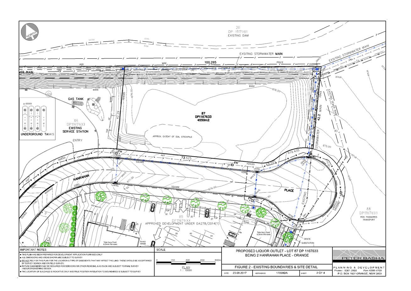
Planning and Development Committee
7 November 2017
2.6 Development
Application DA 289/2017(1) - 2 Hanrahan Place
Attachment 2 Plans
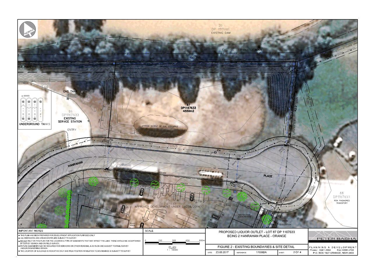
Planning and Development Committee
7 November 2017
2.6 Development
Application DA 289/2017(1) - 2 Hanrahan Place
Attachment 2 Plans
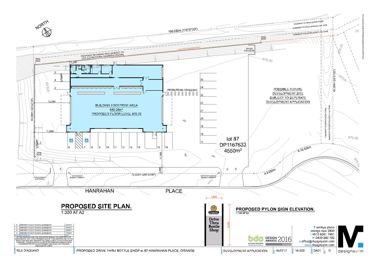
Planning and Development Committee
7 November 2017
2.6 Development
Application DA 289/2017(1) - 2 Hanrahan Place
Attachment 2 Plans
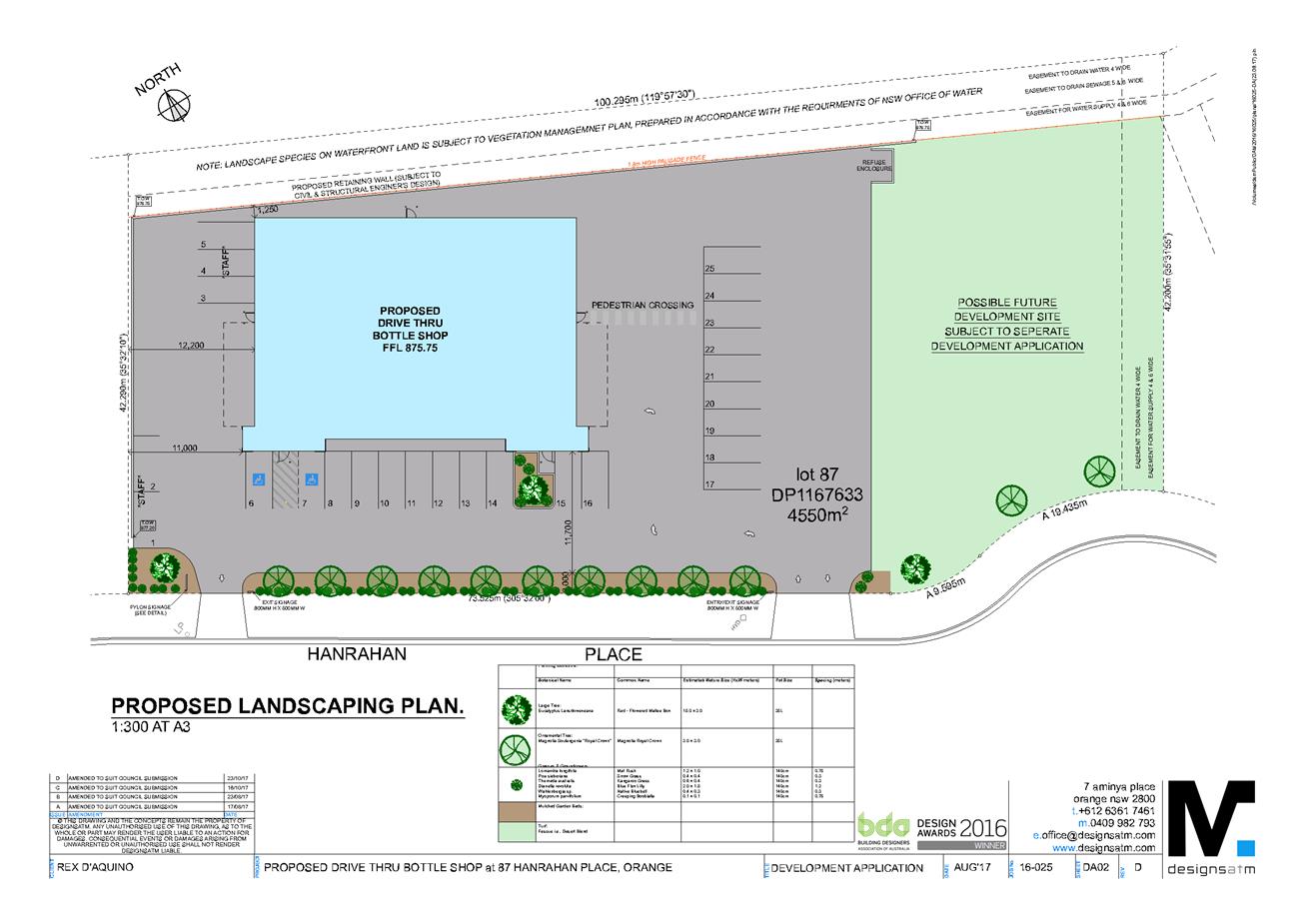
Planning and Development Committee
7 November 2017
2.6 Development
Application DA 289/2017(1) - 2 Hanrahan Place
Attachment 2 Plans
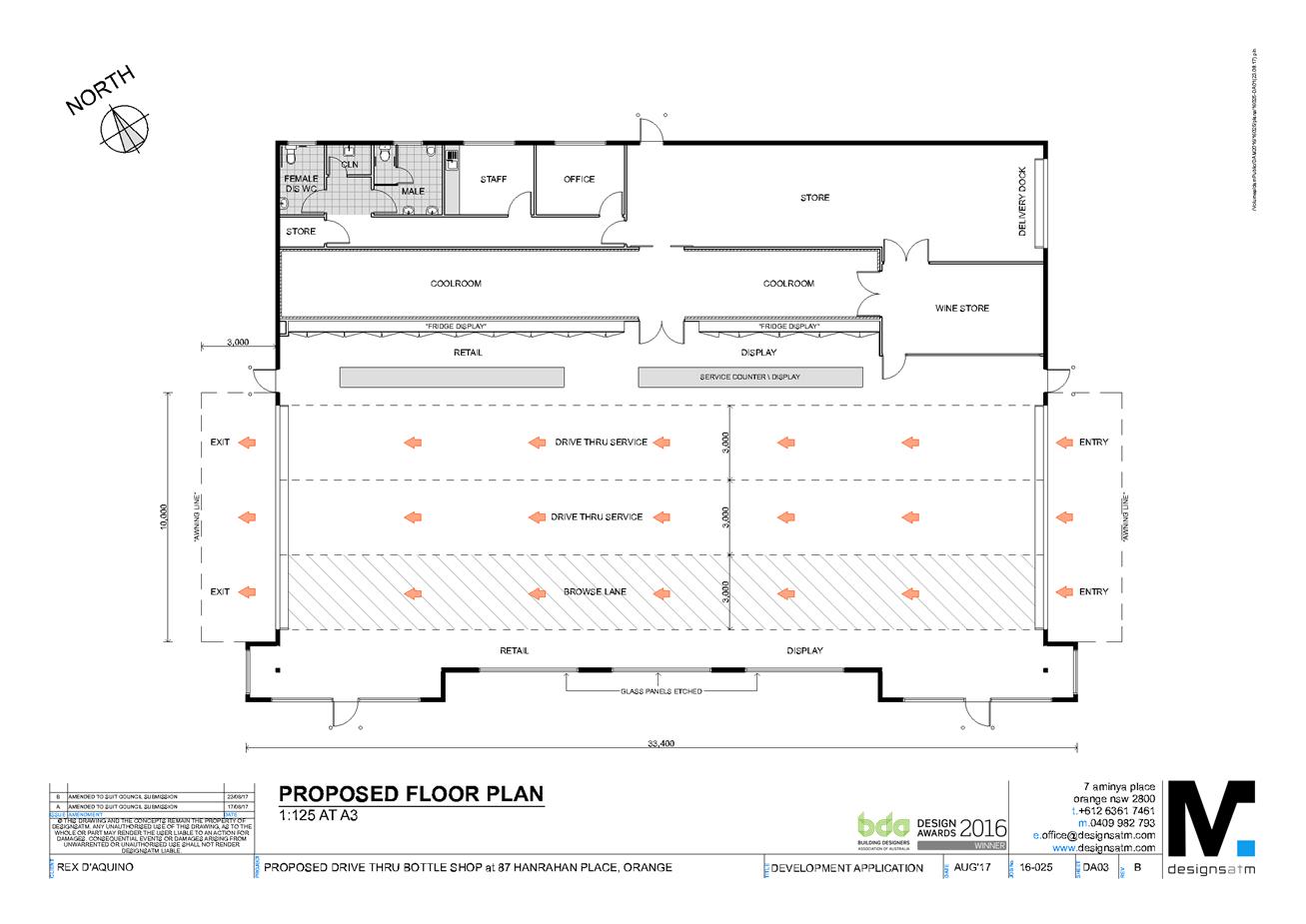
Planning and Development Committee
7 November 2017
2.6 Development
Application DA 289/2017(1) - 2 Hanrahan Place
Attachment 2 Plans
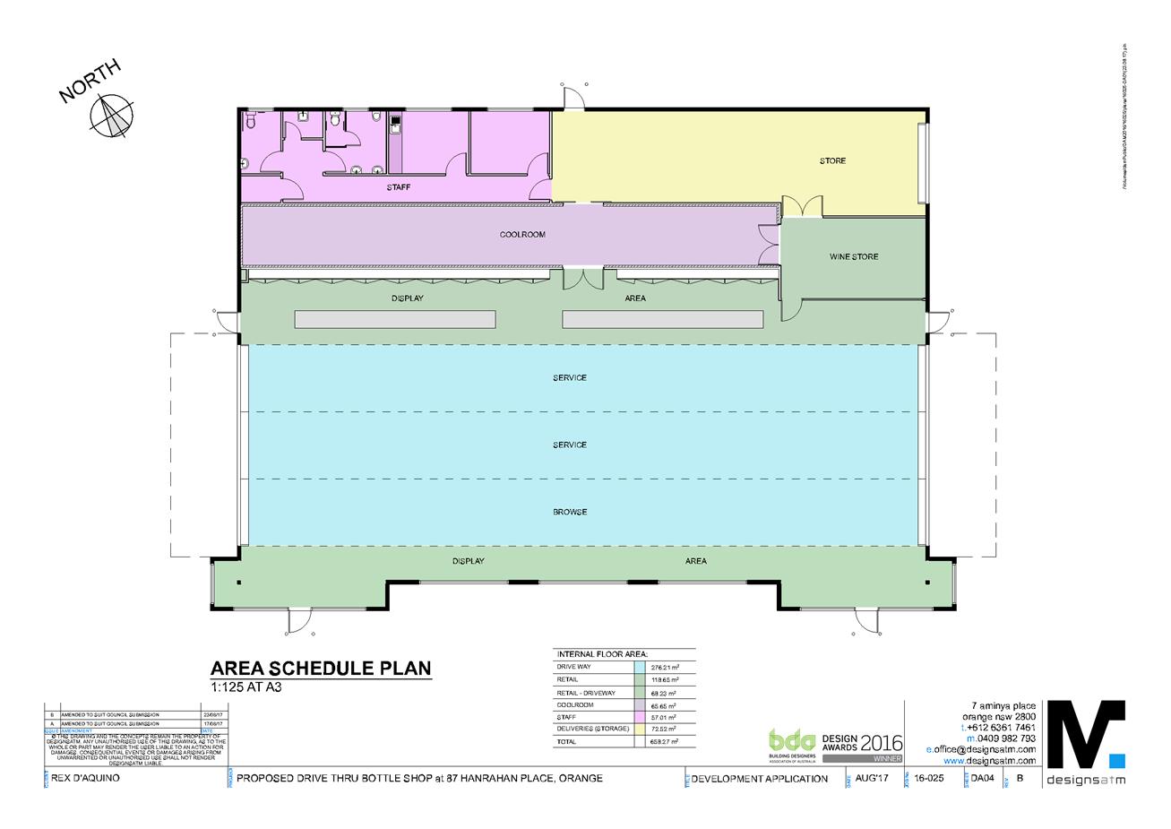
Planning and Development Committee
7 November 2017
2.6 Development
Application DA 289/2017(1) - 2 Hanrahan Place
Attachment 2 Plans
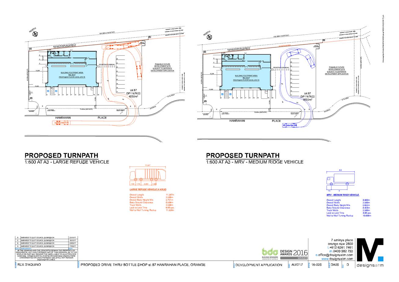
Planning and Development Committee
7 November 2017
2.6 Development
Application DA 289/2017(1) - 2 Hanrahan Place
Attachment 2 Plans
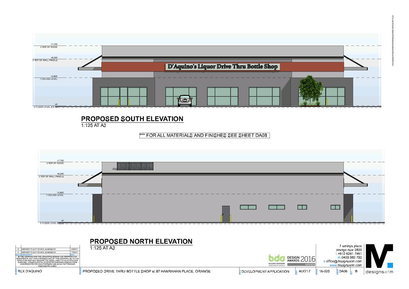
Planning and Development Committee
7 November 2017
2.6 Development
Application DA 289/2017(1) - 2 Hanrahan Place
Attachment 2 Plans
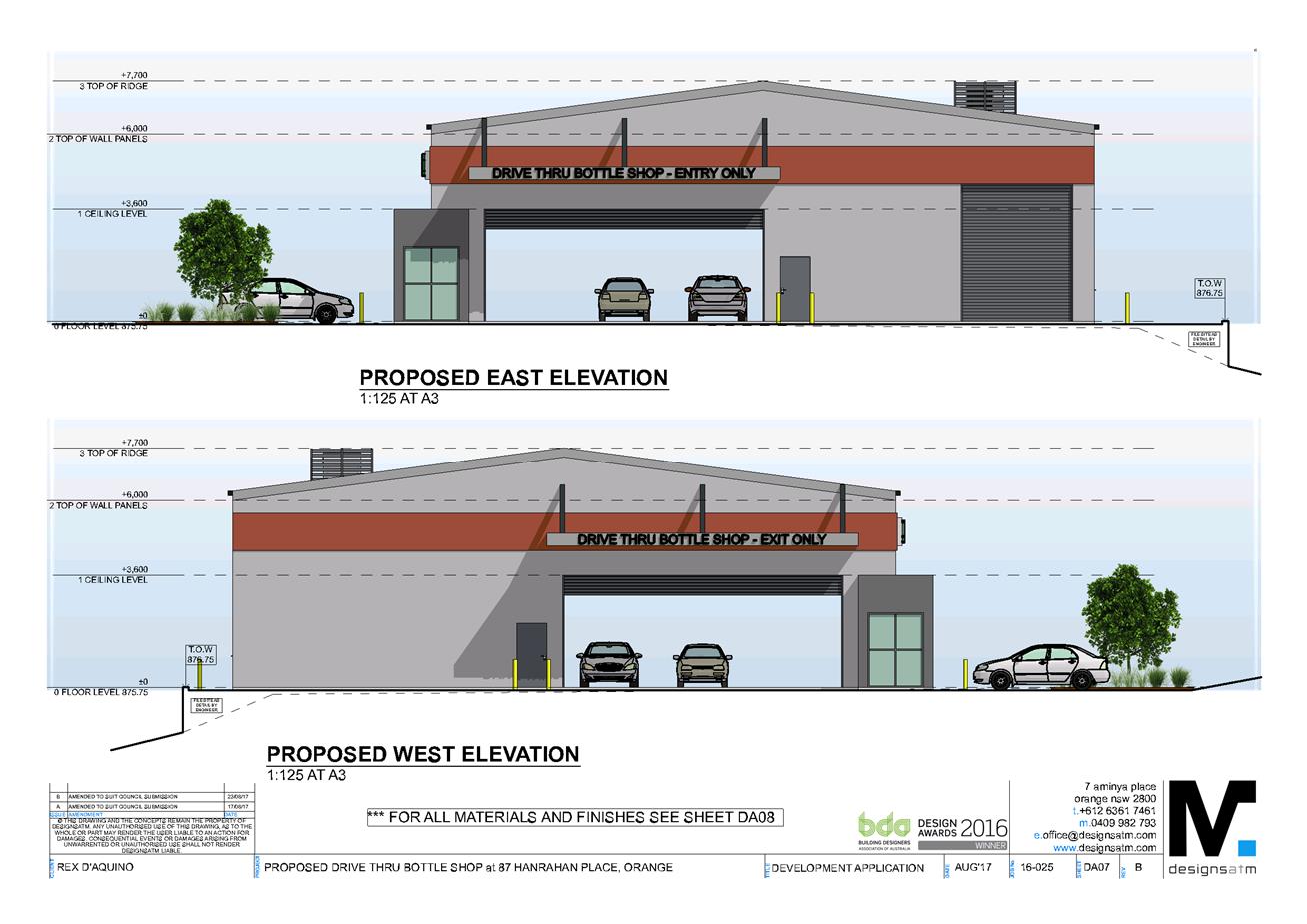
Planning and Development Committee
7 November 2017
2.6 Development
Application DA 289/2017(1) - 2 Hanrahan Place
Attachment 2 Plans
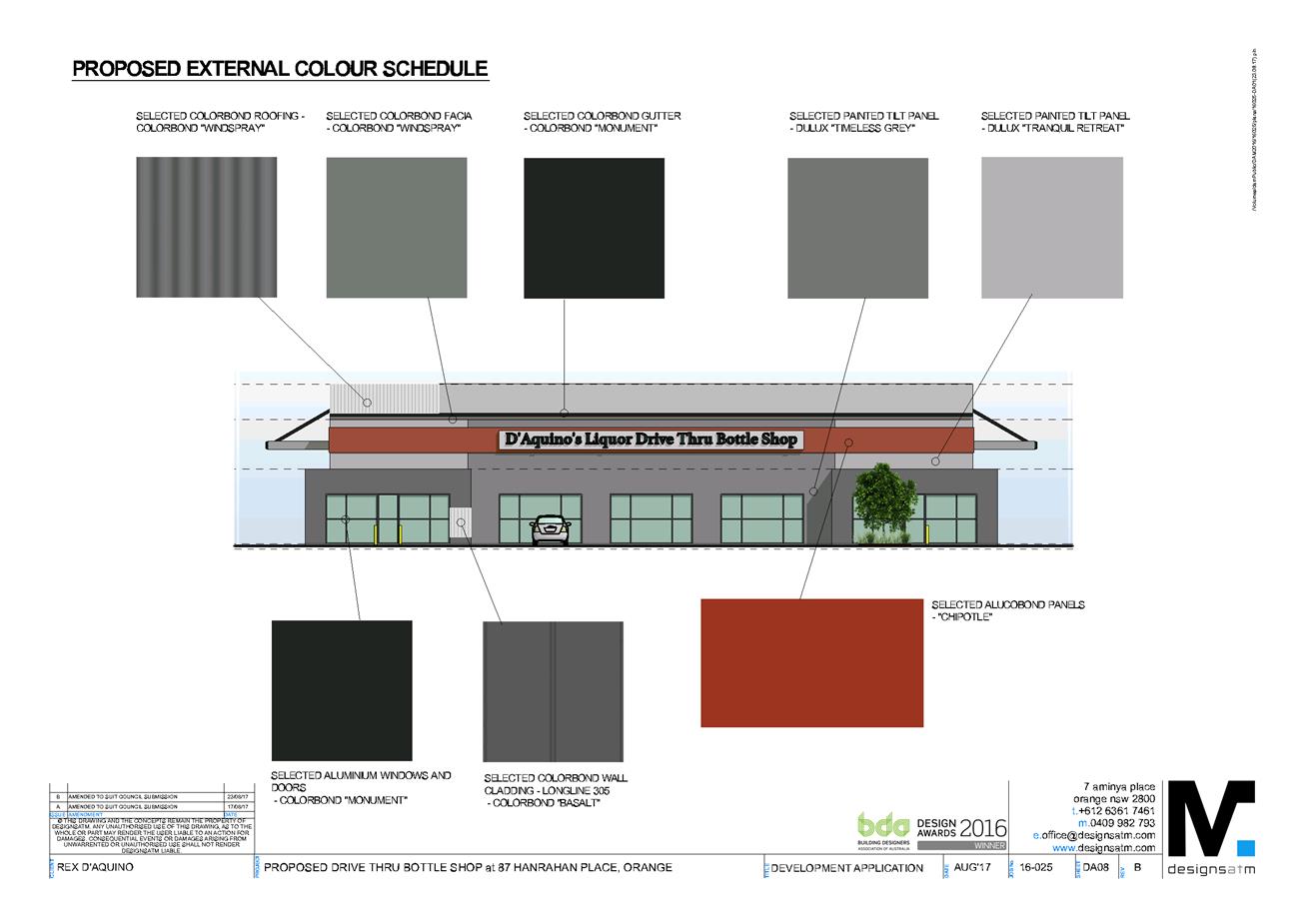
2.7 Development
Application DA 157/2017(2) - 122 and 124 McLachlan Street
RECORD
NUMBER: 2017/2185
AUTHOR: Summer
Commins, Senior Planner
EXECUTIVE Summary
|
Application
lodged
|
6
September 2017
|
|
Applicant/s
|
Mr G
Kings
|
|
Owner/s
|
Mustang
Rocks Pty Ltd & 2Pursue Mt Gini Pty Ltd
|
|
Land
description
|
Lot 1 DP
998790 and Lot 1 DP 986148
122-124
McLachlan Street, Orange
|
|
Proposed
land use
|
Subdivision
(two lot residential boundary adjustment)
|
|
Value of
proposed development
|
Not
applicable
|
Application has been made to modify development consent
DA 157/2017(1) for proposed subdivision (two lot residential boundary
adjustment) at Lot 1 DP 998790 and Lot 1 DP 986148 - 122-124
McLachlan Street, Orange.
The approved development involves boundary adjustment to
excise the existing dwelling on a standard lot at the site frontage (proposed
Lot 1); and create a vacant battleaxe development lot (proposed Lot 2).
The modified proposal seeks to amend and delete conditions
of development consent, which require the construction of a heavy duty concrete
driveway for the full length of the access handle servicing proposed battleaxe
Lot 2. It is the applicant’s intention that the battleaxe driveway be
constructed in conjunction with future development on proposed Lot 2. Council
is not in receipt of a development application for subsequent development on
proposed Lot 2 at this time.
A report on the proposed departure has been prepared by
Council’s Development Engineer to inform assessment of the modified
development. The report concludes that Council’s Technical Services
Division does not support a departure to the Code, nor the proposed modified
development.
Approval of the modified proposal in the form submitted is
not supported. Notwithstanding, the development conditions may be modified
slightly to satisfy Council’s requirements and reduce development costs
to the applicant. An amended draft Notice of Approval is attached,
with conditions to ensure the development proceeds in an acceptable manner.
DECISION FRAMEWORK
Development in Orange is governed by two key documents -
Orange Local Environment Plan 2011 and Orange Development Control Plan 2004. In
addition, the Infill Guidelines are used to guide development, particularly in
the heritage conservation areas and around heritage items.
Orange Local Environment Plan
2011 – the LEP should be considered by Council to be a definitive
document. LEPs govern the types of development that are permissible or
prohibited in different parts of the City and also provide some assessment
criteria in specific circumstances. Uses are either permissible or not - there
are no grey areas in terms of permissibility. The objectives of each zoning and
indeed the aims of the LEP itself are, however, open to interpretation and can
be used to guide decision making around appropriateness of development.
Orange Development Control Plan
2004 – the DCP guides development. In general it is a performance
based document rather than prescriptive in nature - its purpose is to guide
development. The Land and Environment Court tends to view it as such. In each
area of interest there are often guidelines used. These guidelines indicate
ways of achieving the planning outcomes. It is thus recognised that there may
also be other solutions of merit. All design solutions are considered on merit
by planning and building staff. Applications should clearly demonstrate how the
planning outcomes are being met where alternative design solutions are
proposed. So one can see that the DCP gives leeway for developers and
architects to use design to achieve the outcome in other ways if they can.
Stating that DCP guidelines are inflexible can be misleading.
The modified proposal is inconsistent with Council’s
historical practice for the creation of the battleaxe lots requiring the
construction of the driveway prior to the issue of a subdivision certificate. It
is unsuitable and unreasonable to permit a Code variation for the modified
development only. The Code would need to be varied to alter the requirements
for all battleaxe lots and ensure consistency for developers. Approval of the
application in the form submitted would have adverse cumulative impacts. The
alternative conditions (Conditions (7) and (12)) as recommended by Council’s
Development Engineer are suitable to ensure compliance with the Development and
Subdivision Code and reduce costs for the developer.
Link To Delivery/OPerational Plan
The recommendation in this report relates to the
Delivery/Operational Plan strategy “13.4 Our Environment
– Monitor and enforce regulations relating to City amenity”.
Financial Implications
Nil
Policy and Governance Implications
Nil
|
Recommendation
That Council modifies
development application DA 157/2017(2)
for Subdivision (two lot residential boundary adjustment) at Lot 1 DP
998790 and Lot 1 DP 986148 – 122 and 124 McLachlan
Street, Orange, pursuant to the conditions of
consent in the attached Notice of Approval.
|
further considerations
Consideration has been given to the recommendation’s
impact on Council’s service delivery; image and reputation; political;
environmental; health and safety; employees; stakeholders and project
management; and no further implications or risks have been identified.
SUPPORTING INFORMATION
THE PROPOSAL
Application has been made to modify development consent
DA 157/2017(1). The approved development involves boundary
adjustment to excise the existing dwelling on a standard lot at the site
frontage (proposed Lot 1); and create a vacant battleaxe development lot
(proposed Lot 2). The approved subdivision is depicted below.
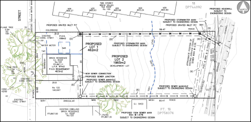
Figure 1 - approved subdivision DA 157/2017(1)
The modified proposal seeks to waive requirements for
construction of the driveway servicing battleaxe Lot 2. Consent is sought
to:
· Amend Condition 7, by
removing text shown bold, below :
The existing footpath crossing
serving proposed Lot 2 shall be reconstructed to align with the McLachlan
Street access handle. Engineering plans, showing details of the proposed
location of the vehicle access, gutter bridge construction, heavy duty
concrete driveway for the full length of the access handle and
traffic management works, are to be approved by Orange
City Council or an Accredited Certifier (Categories B1, C3, C4, C6) prior to
the issuing of a Construction Certificate.
· Delete Condition 12
which states:
Proposed Lot 2 shall be
provided with a heavy duty concrete driveway constructed to a minimum width of
3.0 metres for the full length of the access handle and to the requirements and
standards of the Orange City Council Development and Subdivision Code.
It is the applicant’s intention that the battleaxe
driveway be constructed in conjunction with future development on proposed
battleaxe Lot 2. Council is not in receipt of a development application for
subsequent development on proposed Lot 2 at this time. The applicant submits
(refer attachment) that deferring construction of the driveway will not
adversely impact on neighbourhood character, adjoining improvements, the
natural environment, or the quality of the completed subdivision.
MATTERS FOR CONSIDERATION
Section 96(1A) and (3) of the Environmental
Planning and Assessment Act 1979 (EPAA) states:
(1A) A consent authority may…modify the consent
if:
(a) it is satisfied that the proposed
modification is of minimal environmental impact, and
(b) it is satisfied that the development to
which the consent as modified relates is substantially the same development as
the development for which the consent was originally granted and before that
consent as originally granted was modified (if at all), and
(c) it has notified the application in
accordance with:
(i) the regulations, if the
regulations so require, or
(ii) a development control plan, if the
consent authority is a council that has made a development control plan under
section 72 that requires the notification or advertising of applications for
modification of a development consent, and
(d) it has considered any submissions made
concerning the proposed modification within any period prescribed by the
regulations or provided by the development control plan, as the case may be.
(3) In determining an application for
modification of a consent under this section, the consent authority must take
into consideration such of the matters referred to in Section 79C(1) as are of
relevance to the development the subject of the application.
In
consideration of the requirements of Sections 96(1A) and (3):
· The development as
modified is substantially the same development as the development for which the
consent was originally granted:
- the
modified works relate to a small component of the approved development only
- the
modification will not alter the nature or intensity of the existing and future
use of the proposed lots
- the
modified development will have minor impact on the interface and relationship
with adjoining residential parcels
- the
modification will not result in adverse amenity impacts for adjoining dwellings
in respect of visual bulk, privacy and solar access.
· The development as
modified does not effect a condition imposed as a requirement of concurrence by
a Minister, public authority or approval body.
· The development as
modified does not comprise advertised development pursuant to Clause 117
of the Environmental Planning and Assessment Regulation 2000 or Orange
Development Control Plan (DCP) 2004-5.3. Public notice and exhibition of the
modified development was not required.
· No submissions
were received in relation to the development as modified.
· The relevant
matters under Section 79C(1) are addressed in this report.
PROVISIONS OF ANY ENVIRONMENTAL
PLANNING INSTRUMENT s79C(1)(a)(i)
Orange Local Environmental Plan 2011
Part 1 - Preliminary
Clause 1.2 - Aims of Plan
The
broad aims of the LEP are set out under subclause 2. Those relevant to the modified
application are as follows:
(a) to encourage development which complements
and enhances the unique character of Orange as a major regional centre boasting
a diverse economy and offering an attractive regional lifestyle,
(b) to provide for a range of development
opportunities that contribute to the social, economic and environmental
resources of Orange in a way that allows present and future generations to meet
their needs by implementing the principles for ecologically sustainable
development,
(e) to provide a range of housing choices in
planned urban and rural locations to meet population growth,
(f) to recognise and manage valued
environmental heritage, landscape and scenic features of Orange.
The modified proposal is not contrary to the above
objectives, as outlined in this report.
Clause 1.6 - Consent Authority
This clause establishes that, subject to the Act, Council is
the consent authority for applications made under the LEP.
Clause 1.9A - Suspension of
Covenants, Agreements and Instruments
This clause provides that covenants, agreements and other
instruments which seek to restrict the carrying out of development do not apply
with the following exceptions:
· covenants imposed
or required by Council
· prescribed
instruments under Section 183A of the Crown Lands Act 1989
· any conservation
agreement under the National Parks and Wildlife Act 1974
· any trust
agreement under the Nature Conservation Trust Act 2001
· any property
vegetation plan under the Native Vegetation Act 2003
· any biobanking
agreement under Part 7A of the Threatened Species Conservation Act 1995
· any planning
agreement under Division 6 of Part 4 of the Environmental Planning and
Assessment Act 1979.
Council staff are not aware of the title of the subject
property being affected by any of the above.
Mapping
The subject land is identified
on the LEP maps in the following manner:
|
Land Zoning Map:
|
Land zoned R1 General Residential
|
|
Lot Size Map:
|
No minimum lot size
|
|
Heritage Map:
|
Not a heritage item; located in a
heritage conservation area
|
|
Height of Buildings Map:
|
No building
height limit
|
|
Floor Space Ratio Map:
|
No floor space limit
|
|
Terrestrial Biodiversity Map:
|
No biodiversity
sensitivity on the site
|
|
Groundwater Vulnerability Map:
|
Ground water vulnerable
|
|
Drinking Water Catchment Map:
|
Not within the drinking water
catchment
|
|
Watercourse Map:
|
Not within or affecting a defined
watercourse
|
|
Urban Release Area Map:
|
Not within an urban release area
|
|
Obstacle Limitation Surface Map:
|
No restriction on building siting
or construction
|
|
Additional Permitted Uses Map:
|
No additional permitted use applies
|
|
Flood Planning Map:
|
Flood planning area
|
Those matters that are of relevance are addressed in detail
in the body of this report.
Part 2 - Permitted or Prohibited
Development
Clause 2.3 Zone Objectives and Land Use Table
Permissibility
The subject site is located within the R1 General
Residential zone. The modified development is defined as “subdivision”
(residential boundary adjustment).
Pursuant to Section 4B of the Environmental Planning and
Assessment Act:
Subdivision of land means the
division of land into two or more parts that, after the division, would be
obviously adapted for separate occupation, use or disposition.
Subdivision is permitted with consent in the R1 Zone,
pursuant to Clause 2.6 (see below).
Zone Objectives
The objectives for land zoned R1
General Residential are as follows:
· To
provide for the housing needs of the community.
· To
provide for a variety of housing types and densities.
· To
enable other land uses that provide facilities or services to meet the day to
day needs of residents.
· To
ensure development is ordered in such a way as to maximise public transport
patronage and encourage walking and cycling in close proximity to settlement.
· To
ensure that development along the Southern Link Road has an alternative access.
The
modified proposal is not adverse to the zone objectives.
Clause 2.6 Subdivision -
Consent Requirements
Clause 2.6 is applicable and states:
(1) Land
to which this Plan applies may be subdivided but only with development consent.
Consent is sought for Torrens subdivision (boundary
adjustment) of the subject land in accordance with this clause.
Part 3 - Exempt and Complying
Development
The modified proposal is not exempt or complying
development.
Part 4 - Principal Development
Standards
The Principal Development Standards do
not relate to the subject land or modified development.
Part 5 - Miscellaneous Provisions
5.10 - Heritage Conservation
Clause 5.10 is applicable. The subject land is located in
the East Orange Heritage Conservation Area. Pursuant to Clause 5.10(4):
The consent authority must,
before granting consent under this clause in respect of a heritage item or
heritage conservation area, consider the effect of the proposed development on
the heritage significance of the item or area concerned. This subclause applies
regardless of whether a heritage management document is prepared under
subclause (5) or a heritage conservation management plan is submitted under
subclause (6).
In consideration of this clause, the modified development will not have
adverse impact on the significance of the conservation area, as considered for
the original development.
Part 6 - Urban Release Area
Not relevant to the application. The subject site is not
located in an Urban Release Area.
7.2 - Flood Planning
The subject land is identified on the Flood
Planning Map as a Flood Planning Area. Clause 7.2 applies. This clause
states in part:
(3) Development consent
must not be granted to development on land to which this clause applies unless
the consent authority is satisfied that the development:
(a) is compatible with the
flood hazard of the land, and
(b) is not likely to
significantly adversely affect flood behaviour resulting in detrimental
increases in the potential flood affectation of other development or
properties, and
(c) incorporates
appropriate measures to manage risk to life from flood, and
(d) is not likely to
significantly adversely affect the environment or cause avoidable erosion,
siltation, destruction of riparian vegetation or a reduction in the stability
of river banks or watercourses, and
(e) is not likely to result
in unsustainable social and economic costs to the community as a consequence of
flooding.
In consideration of Clause 7.2, the
modified proposal will not alter the approved development in respect of flood
hazard, flood behaviour or adverse environmental impacts.
7.3 - Stormwater Management
Clause 7.3 is
applicable. This clause states in part:
(3) Development
consent must not be granted to development on land to which this clause applies
unless the consent authority is satisfied that the development:
(a) is
designed to maximise the use of water permeable surfaces on the land having
regard to the soil characteristics affecting on-site infiltration of water, and
(b) includes,
where practical, on-site stormwater retention for use as an alternative supply
to mains water, groundwater or river water, and
(c) avoids
any significant impacts of stormwater runoff on adjoining downstream
properties, native bushland and receiving waters, or if that impact cannot be
reasonably avoided, minimises and mitigates the impact.
In consideration of
Clause 7.3, the modified proposal will not alter the approved development in
terms of stormwater management.
7.6 Groundwater Vulnerability
The subject land is identified as
Groundwater Vulnerable on the Groundwater Vulnerability Map and Clause 7.6
applies. This clause states in part:
(3) Before
determining a development application for development on land to which this
clause applies, the consent authority must consider:
(a) whether
or not the development (including any onsite storage or disposal of solid or
liquid waste and chemicals) is likely to cause any groundwater contamination or
have any adverse effect on groundwater dependent ecosystems, and
In consideration of
Clause 7.6, the modified proposal will not alter the approved development in
terms of groundwater vulnerability.
7.11 Essential Services
Clause 7.11 is applicable. This clause
states:
Development
consent must not be granted to development unless the consent authority is
satisfied that any of the following services that are essential for the
proposed development are available or that adequate arrangements have been made
to make them available when required:
(a) the
supply of water
(b) the
supply of electricity
(c) the
disposal and management of sewage
(d) storm
water drainage or on-site conservation
(e) suitable
road access.
In consideration of this clause, the modified proposal will not alter
the approved development in respect of utility services (a) – (d)
above. Urban services will be augmented to provide individual servicing to
proposed Lots 1 and 2.
The modified proposal will not provide (e) suitable road
access to proposed Lot 2. Council’s Development Engineer has
recommended Conditions 7 and 12 be amended to satisfy the requirements of the
Clause 7.11 and the Development and Subdivision Code and reduce
development costs to the applicant (refer below). Amended conditions are
included on the attached Notice of Approval.
STATE ENVIRONMENTAL PLANNING
POLICIES
There are no State Environmental Planning Policies that
apply to the modified development.
PROVISIONS OF ANY DRAFT
ENVIRONMENTAL PLANNING INSTRUMENT THAT HAS BEEN PLACED ON EXHIBITION
s79C(1)(a)(ii)
There are no draft environmental planning instruments that
apply to the subject land or proposed development.
DESIGNATED DEVELOPMENT
The modified proposal is not designated development.
INTEGRATED DEVELOPMENT
The modified proposal is not integrated development.
PROVISIONS OF ANY DEVELOPMENT
CONTROL PLAN s79C(1)(a)(iii)
Development Control Plan 2004
DCP 2004 – 7.2 Residential Subdivision
The DCP prescribes the following applicable planning
outcomes:
· Lots are
oriented to optimise energy-efficiency principles.
· Lots below
500m2 indicate a mandatory side setback to provide for solar access and
privacy.
· Lots are fully
serviced and have direct frontage/access to a public road.
· Design and
construction complies with the Orange Development and Subdivision Code.
In consideration of the planning outcomes:
· The modified
proposal will not alter the approved development in respect of residential
amenity (energy efficiency, solar access, privacy, access to services) to existing
and future residential use of proposed Lots 1 and 2.
· The modified
proposal to defer driveway construction will not provide suitable access to
McLachlan Street for proposed battleaxe Lot 2.
· Pursuant to the
Orange City Development and Subdivision Code, driveway construction for
battleaxe lots is required prior to the issue of a subdivision certificate. The
modified proposal represents a variation to Council’s longstanding policy
and practice. A report on the proposed Code variation has been prepared by
Council’s Development Engineer to inform assessment of the modified
development and is attached. The report states in summary:
- There
are various advantages to Council and developer associated with battleaxe
driveway construction: a reduction in construction load on street; positive
visual impacts for streetscape and site; sediment control; services protection.
- Past
experience has found that a battleaxe driveway will cater for construction
traffic with no damage.
- The
construction of a driveway to a battleaxe lot is Council’s standard
policy and practice for 25 years.
- Council’s
policy on this matter is consistent with other regional Councils.
- Should
battleaxe driveway construction be deferred until development on the battleaxe
lot, the driveway may not be constructed for a significant period. This may
remove the advantages to Council and developer cited above.
- Deferral
of battleaxe driveway construction until development on the battleaxe lot would
remove costs for developers and pass costs to home owners or builders.
- It
is unsuitable and unreasonable to permit a Code variation for the modified
development only. The Code would need to be varied to alter the requirements
for all battleaxe lots and ensure consistency for developers.
- The
existing requirements for creating battleaxe lots should be maintained, without
variation to the Orange City Development and Subdivision Code.
- Council’s
Technical Services Division do not support the proposed modification in the
form submitted.
Council’s Development
Engineer has recommended Conditions 7 and 12 be amended to satisfy the
requirements of the Development and Subdivision Code and reduce development
costs to the applicant. Conditions 7 and 12 will read as follows on the
modified Notice of Approval [amendments shown in bold italics]:
(7) The existing footpath crossing serving
proposed Lot 2 shall be reconstructed to align with the McLachlan Street access
handle. Engineering plans, showing details of the proposed location of the
vehicle access, gutter bridge construction, heavy duty concrete or
bitumen sealed driveway for the full length of the access handle and
traffic management works, are to be approved by Orange City Council or an
Accredited Certifier (Categories B1, C3, C4, C6) prior to the issuing of a
Construction Certificate.
(12) Proposed Lot 2 shall be provided with either a
heavy duty concrete driveway or bitumen sealed gravel pavement (200mm thick) constructed
to a minimum width of 3.0 metres for the full length of the access handle and
to the requirements and standards of the Orange City Council Development and
Subdivision Code.
DCP 2004-13 - Heritage
· Development
relates to the significant features of heritage buildings on or near the site,
as reflected in inventory sheets.
· Development conforms
with recognised conservation principles.
· Conservation
Management Plans are prepared for development having a significant effect on
heritage site.
As outlined above, the modified development will not have
adverse impact on the significance of the East Orange Heritage Conservation
Area. A conservation management plan is not required for the proposal.
Orange DCP 2004 – Infill
Guidelines
The DCP 2004 Infill Guidelines are not applicable to the
proposed development.
Orange Development
Contributions Plan 2015
The modified proposal will have nil impact on development
contributions for the approved development. Developer contributions (Section 94
and Section 64) are not applicable to the proposed boundary adjustment. The
proposal does not involve additional lots. Each existing parcel has credit for
a 3br dwelling.
PROVISIONS PRESCRIBED BY THE
REGULATIONS s79C(1)(a)(iv)
The modified development is not inconsistent with any
provision prescribed by the Regulations.
THE LIKELY IMPACTS OF THE
DEVELOPMENT s79C(1)(b)
The visual, conservation, residential amenity and
environment impacts of the modified proposal are consistent with the original
development.
The modified development to defer battleaxe driveway
construction will not provide suitable road access to proposed Lot 2.
Associated flow-on effects include construction load on public roads; adverse
visual impacts for streetscape and site; on-street sedimentation; and potential
damage to onsite services.
The modified proposal would also have cumulative impacts. As
outlined, the proposal is contrary to the requirements of Council’s
Development and Subdivision Code, which requires driveway construction for
battleaxe lots prior to the issue of a subdivision certificate. It is
unsuitable and unreasonable to permit a Code variation for the modified
development only. The Code would need to be varied to alter the requirements
for all battleaxe lots and ensure consistency for developers.
To avoid such impacts, the modified development is not
supported in the form submitted. Council’s Development Engineer has
recommended amendment to Condition Nos. 7 and 12 requiring driveway
construction, which will satisfy the requirements of the Development and
Subdivision Code, and reduce development costs for the applicant.
THE SUITABILITY OF THE SITE
s79C(1)(c)
There are no aspects of the site that indicate it is
unstable for the modified development.
ANY SUBMISSIONS MADE IN
ACCORDANCE WITH THE ACT s79C(1)(d)
The modified development does not comprise advertised
development pursuant to Clause 117 of the Environmental Planning and
Assessment Regulation 2000 or Orange Development Control Plan (DCP) 2004-5.3.
Public notice and exhibition of the modified development was not required. No
submissions have been received in relation to the proposal.
PUBLIC INTEREST s79C(1)(e)
The proposal is not inconsistent
with any relevant policy statements, planning studies, guidelines etc. that
have not been considered in this assessment. To approve the modified
development in the form submitted would be contrary to the requirements of
Council’s Development and Subdivision Code, and not in the public
interest.
SUMMARY
Approval of the modified proposal in the form submitted is
not supported. Notwithstanding, the development conditions may be
modified slightly to satisfy Council’s requirements and reduce
development costs to the applicant. An amended draft
Notice of Approval is attached, with conditions to ensure the
development proceeds in an acceptable manner.
Attachments
1 Notice
of Approval, D17/63432⇩
2 Supporting
Information, IC17/20502⇩
3 Pros
and Cons of Driveway, D17/51156⇩
Planning and Development Committee
7 November 2017
2.7 Development
Application DA 157/2017(2) - 122 and 124 McLachlan Street
Attachment 1 Notice
of Approval
|

|
ORANGE
CITY COUNCIL
Development
Application No DA
157/2017(2)
NA17/ Container
PR8272
|
NOTICE OF DETERMINATION
OF A DEVELOPMENT
APPLICATION
(AS MODIFIED)
issued under the Environmental
Planning and Assessment Act 1979
Section 81(1)
|
Development
Application
|
|
|
Applicant Name:
|
Mr G Kings
|
|
Applicant Address:
|
C/- Heath
Consulting Engineers
PO Box
2501
ORANGE
NSW 2800
|
|
Owner’s Name:
|
Mustang
Rocks Pty Ltd & 2Pursue Mt Gini Pty Ltd
|
|
Land to Be Developed:
|
Lot 1 DP
998790 and Lot 1 DP 986148 – 122 and 124 McLachlan Street, Orange
|
|
Proposed Development:
|
Subdivision
(two lot residential boundary adjustment)
|
|
|
|
|
Building
Code of Australia
building
classification:
|
Not
applicable
|
|
|
|
|
Determination
|
|
|
Made On:
|
7 November
2017
|
|
Determination:
|
CONSENT
GRANTED SUBJECT TO CONDITIONS DESCRIBED BELOW:
|
|
|
|
|
Consent to
Operate From:
|
22 June
2017
|
|
Consent to
Lapse On:
|
22 June
2022
|
Terms of Approval
The reasons for the imposition of
conditions are:
(1) To maintain
neighbourhood amenity and character.
(2) To ensure compliance
with relevant statutory requirements.
(3) To ensure the utility
services are available to the site and adequate for the development.
(4) To prevent the proposed
development having a detrimental effect on adjoining land uses.
(5) To minimise the impact
of development on the environment.
Conditions
(1) The
development must be carried out in accordance with:
(a) Plan/s
numbered 2017-116DA Figure 2 (4.05.2017) (1 sheet)
(b) statements
of environmental effects or other similar associated documents that form part
of the approval
as amended
in accordance with any conditions of this consent.
|
PRIOR TO THE ISSUE OF
A CONSTRUCTION CERTIFICATE
|
(2) Engineering plans,
showing details of all proposed work and adhering to any engineering conditions
of development consent, are to be submitted to, and approved by, Orange City
Council or an Accredited Certifier (Categories B1, C3, C4, C6) prior to the
issuing of a Construction Certificate.
(3) A water and soil
erosion control plan is to be submitted to Orange City Council or an Accredited
Certifier (Categories B1, C3, C4, C6) for approval prior to the issuing of a
Construction Certificate. The control plan is to be in accordance with the
Orange City Council Development and Subdivision Code and the Landcom, Managing
Urban Stormwater; Soils and Construction Handbook.
(4) Proposed lot
1 is to be provided with interlot stormwater drainage. Engineering plans for
this drainage system are to be approved by Orange City Council or an Accredited
Certifier (Categories B1, C3, C4, C6) prior to the issuing of a Construction
Certificate.
(5) A 150mm-diameter sewer
main is to be constructed from Council’s existing main to serve the
proposed lot. Prior to a Construction Certificate being issued engineering
plans for this sewerage system are to be submitted to and approved by Orange
City Council.
(6) Where
stormwater crosses land outside the development lot, an easement to drain water
is to be created over the drainage works. Evidence that the owner of Lot
1 in DP 198314 land immediately adjacent to the east of the development, will
agree to the creation of an easement over Lot 1 in DP 198314 is to be provided
prior to the issuing of a Construction Certificate. The stormwater
easement will be required to be created prior to the issue of a subdivision
certificate.
(7) The existing footpath
crossing serving proposed Lot 2 shall be reconstructed to align with the
McLachlan Street access handle. Engineering plans, showing details of the
proposed location of the vehicle access, gutter bridge construction, heavy duty
concrete or bitumen sealed driveway for the full length of the access handle
and traffic management works, are to be approved by Orange City Council or an
Accredited Certifier (Categories B1, C3, C4, C6) prior to the issuing of a
Construction Certificate.
|
DURING
CONSTRUCTION/SITEWORKS
|
(8) Any adjustments to
existing utility services that are made necessary by this development
proceeding are to be at the full cost of the developer.
(9) The
provisions and requirements of the Orange City Council Development and
Subdivision Code are to be applied to this application and all work constructed
within the development is to be in accordance with that Code.
The developer is to be entirely responsible for
the provision of water, sewerage and drainage facilities capable of servicing
the lots from Council’s existing infrastructure. The developer is to be
responsible for gaining access over adjoining land for services where necessary
and easements are to be created about all water, sewer and drainage mains
within and outside the lots they serve.
(10) The existing kerb and
gutter layback, gutter bridge and driveway that is not proposed to be used is
to be replaced with standard concrete kerb and gutter and the bitumen footpath
reinstated to the requirements in the Orange City Council Development and
Subdivision Code.
(11) The existing sewer
connection serving the dwelling on proposed Lot 1 is to be sealed off at the
sewer main.
(12) Proposed Lot 2 shall be
provided with either a heavy duty concrete driveway or bitumen sealed gravel
pavement (200mm thick) constructed to a minimum width of 3.0 metres for the
full length of the access handle and to the requirements and standards of the
Orange City Council Development and Subdivision Code.
|
PRIOR TO THE ISSUE OF
A SUBDIVISION CERTIFICATE
|
(13) The
proponent shall supply and plant at their cost and to the satisfaction of
Council’s Manager City Presentation, a 100 litre containerised Claret Ash
Tree (Fraxinus Raywood) within Colvin Park, between McLachlan Street, New
Street and Bathurst Road.
(14) Application shall be
made for a Subdivision Certificate under Section 109(C)(1)(d) of the Act.
(15) An easement to drain sewage
and to provide Council access for maintenance of sewerage works a minimum of
2.0 metres wide is to be created over the proposed sewerage works. The
Principal Certifying Authority is to certify that the easement is in accordance
with the Orange City Council Development and Subdivision Code prior to the
issuing of a Subdivision Certificate.
(16) All services are to be
contained within the allotment that they serve. A Statement of Compliance, from
a Registered Surveyor, is to be submitted to the Principal Certifying Authority
prior to the issuing of a Subdivision Certificate.
(17) Where
stormwater crosses land outside the lot it favours, an easement to drain water
is to be created over the works. A Restriction-as-to-User under section 88B of
the NSW Conveyancing Act 1979 is to be created on the title of the
proposed Lot 2 requiring that no structures are to be placed on the site, or
landscaping or site works carried out on the site, in a manner that affects the
continued operation of the interlot drainage system. The minimum width of the
easement is to be as required in the Orange City Council Development and
Subdivision Code.
(18) All
of the foregoing conditions are to be at the full cost of the developer and to
the requirements and standards of the Orange City Council Development and
Subdivision Code, unless specifically stated otherwise. All work required by
the foregoing conditions is to be completed prior to the issuing of an
Occupation Certificate, unless stated otherwise.
The subject
land is located in an area affected by potential flooding. Future development
proposals within Proposed Lot 2 will be required to be designed to account for
the flood hazard.
Other Approvals
(1) Local
Government Act 1993 approvals granted under Section 68.
Not
applicable
(2) General
terms of other approvals integrated as part of this consent.
Nil
Right of Appeal
If
you are dissatisfied with this decision, section 97 of Environmental
Planning and Assessment Act 1979 gives you the right to appeal to the Land
and Environment Court within 6 months after the date on which you receive this
notice.
*
Section 97 of the Environmental Planning and Assessment Act 1979 does not apply
to the determination of a development application for State significant
development or local designated development that has been the subject of a
Commission of Inquiry.
|
Disability Discrimination Act
1992:
|
This application has been assessed in
accordance with the Environmental Planning and Assessment Act 1979. No
guarantee is given that the proposal complies with the Disability
Discrimination Act 1992.
The applicant/owner is responsible to
ensure compliance with this and other anti-discrimination legislation.
The Disability Discrimination Act
covers disabilities not catered for in the minimum standards called up in the
Building Code of Australia which references AS1428.1 - "Design for
Access and Mobility". AS1428 Parts 2, 3 and 4 provides the most
comprehensive technical guidance under the Disability Discrimination Act
currently available in Australia.
|
|
|
|
|
Disclaimer - S88B Restrictions on the Use of Land:
|
The applicant should note that there
could be covenants in favour of persons other than Council restricting what
may be built or done upon the subject land. The applicant is advised to check
the position before commencing any work.
|
|
|
|
|
Signed:
|
On behalf of the consent authority ORANGE
CITY COUNCIL
|
|
Signature:
|
|
|
Name:
|
PAUL JOHNSTON - MANAGER DEVELOPMENT
ASSESSMENTS
|
|
Date:
|
8 November 2017
|
Planning
and Development Committee
7 November 2017
2.7 Development
Application DA 157/2017(2) - 122 and 124 McLachlan Street
Attachment 2 Supporting
Information

Planning
and Development Committee
7 November 2017
2.7 Development
Application DA 157/2017(2) - 122 and 124 McLachlan Street
Attachment 3 Pros
and Cons of Driveway
REPORT
TO MANAGER ENGINEERING
SERVICES
FROM DEVELOPMENT
ENGINEER
DATE 6
SEPTEMBER 2017
ON BATTLEAXE
LOT DRIVEWAY – 122 to 124 McLachlan Street
DA
157/2017(1) - 194 March Street DA 158/2017 (1)
PR23068
PR8272
D17/51156

Following on from the recent communications with Mr G
Kings and Mr R Heath in reference to Council requirements to construct
driveways for battleaxe lots prior to issue of a subdivision certificate
relating to 122 to 124 McLachlan Street and 194 March Street the following
information is provided.
A battleaxe lot is a block of land behind another, with
access from the street through a narrow long
driveway (axe handle). The rear lot can be used to build a house, houses or
units.
This type of lot is used in Greenfield sites to maximise
lot numbers in unusual land shapes as indicated below in figure 1;
 Figure 1
2
Or to create an additional lot in an existing developed
area on an existing lot as indicated below in figure 2;
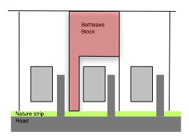 Figure 2
Council’s development control plan requires
residential battleaxe lots to have an access width of 4.5m with a 3.0m wide
driveway for single lots or single house and 6.0m access width and 4.5m wide
driveway for two or more lots or houses.
Historically Council’s practice for the creation of
battleaxe lots is to require the construction of the driveway prior to the
issue of a subdivision certificate in both scenarios as described above.
In relation to these scenarios battleaxe lots can be
found in residential, industrial and rural zoned areas.
The advantages to Council of requiring the
driveway to be constructed prior to the issue of a subdivision are:
· As
battleaxe lot does not have street frontage for building construction, work
cannot be carried out from street frontage as required for a normal lot. A
constructed driveway allows work to be carried out from driveway, reducing
construction vehicle load on street.
· Maintains
street amenity and visual appearance.
· Reduces
negative impacts on any existing house.
· Extra
hard stand of driveway allows sediment and vegetative matter to be dropped from
vehicles prior to entry on street acting as sediment control.
· Gives
a designated load proof drive path in access that protects services from
damage.
· Visually
more positive than overgrown with vegetation that is not maintained.
3
The disadvantages to Council are:
· Possible
damage to driveway from construction traffic.
The advantages to the developer
are:
· As
battleaxe lot does not have street frontage for building construction, work
cannot be carried out from street frontage as required for a normal lot. A
constructed driveway allows work to be carried out from driveway, reducing
construction vehicle load on street.
· Maintains
street amenity and visual appearance.
· Reduces
negative impacts on any existing house.
· Extra
hard stand of driveway allows sediment and vegetative matter to be dropped from
vehicles prior to entry on street acting as sediment control.
· Gives
a designated load proof drive path in access that protects services from
damage.
· Visually
more positive than overgrown with vegetation that is not maintained.
The disadvantages to the
developer are:
· Outlay
of cost of driveway prior to building construction on lot.
· Possible
damage to driveway from construction traffic.
Previous experience has found that if a
concrete driveway is constructed to the driveway requirements of thickness,
reinforcement and concrete strength the driveway will cater for construction
traffic with no damage.
4
Below, plate 1, shows a recent example of a
driveway constructed at subdivision stage for a battleaxe lot of a development
at 238 McLachlan Street and is now nearing completion for construction of
units. This driveway has no damage and is working well.

5
Below, Plate 2, shows an example of a recent
industrial battleaxe lot for 229 to 231 McLachlan Street where the driveway was
constructed as part of the subdivision and an industrial shed has been
constructed on one of the battle axe lots with no damage to the driveway.
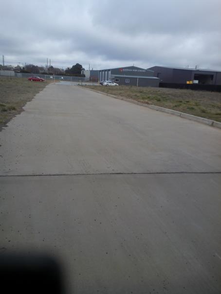
6
Council has required the construction of a
driveway in a battleaxe lot prior to issue of a subdivision certificate for
over 25 years because it is standard practice. A survey of Councils has been
carried out with the results in the following table:
|
Council
|
Survey Result
|
|
Bathurst
|
Requires driveway to be constructed
prior to subdivision certificate issue
|
|
Hills
|
Requires driveway to be constructed
prior to subdivision certificate issue
|
|
Mudgee
|
DCP requires all dual
occupancys are to have direct street frontage. The dual occupancy is to
be build first and then the subdivision which requires driveways prior to
subdivision certificate issue.
|
|
Blayney
|
Requires driveway built before the
subdivision release. will take a bond for the works to be completed at a
later date
|
|
Tamworth
|
Requires Driveway completed prior
to subdivision certificate or occupation certificate issue.
|
|
Wollongong
|
Encourages no battleaxe lots but
does permit 2 in a subdivision with driveway to be constructed prior to issue
of subdivision certificate.
|
|
Parkes
|
Do not accept battle-axe blocks as
an acceptable form of subdivision.
|
|
Coffs Harbour
|
Requires driveways to be
constructed prior to subdivision certificate issue
|
|
Temora
|
Requires driveways to be
constructed prior to subdivision certificate issue
|
|
Forbes
|
Do not accept battle-axe blocks as
an acceptable form of subdivision.
|
|
Penrith
|
Discourages battleaxe lots
|
As can be seen from this table the requirement
for the construction of a driveway prior to the issue of a subdivision is
standard practice to most Council’s and several do not permit or
discourage the use of battleaxe lots.
Whether the battleaxe lot is in a Greenfield
site or part of the subdivision of an existing lot in a developed residential
area or in an industrial area or rural area the developer is required to
construct the driveway prior to the issue of a subdivision certificate. To make
amendments on different scenarios would create inconsistencies that would
confuse the process for other developers.
7
The developments of 122 – 124 McLachlan
Street and 194 March Street are of the existing lot scenario where the
development consent was granted for a subdivision of the existing house from
the rear to create a development lot. Although proposals for the future
development of these lots have been offered by the developer, a development
application has not been submitted to Council at the writing of this report.
Even with the information provided by the developer of the proposed future
development of the land Council officers have to assess the development
application as presented with standard accepted conditions and being consistent
with previous battleaxe proposals.
In conditioning a proposed subdivision it
cannot be assumed that the suggested development will occur as described by the
developer.
Historically with the creation of a battleaxe
lot the timing of development of the lot can vary from time of registration of
lot by Land Property Information (LPI) to years after and in some cases a
proposed development may not go ahead.
If the driveway was not required to be
constructed as part of the subdivision a driveway may not get built for a
significant time period removing the advantages to Council previously noted.
The proposal to
remove the condition of driveway construction prior to subdivision certificate
issue could not be done as a one off for the developments in question but would
require Council to change its requirements for all battleaxe lots.
This would remove
the cost for driveway construction from developers in Greenfield sites and pass
costs on to home owners/builders. Driveway construction costs for developers in
existing areas would be deferred to the final stages of the development or
passed on to other developers if the development is sold on.
8
Recommendation
In approving
development in the Orange Local Government area Council is responsible for the
following goals:
· To maintain neighbourhood amenity, character, and
provide suitably high quality finished development (subdivision)
· To prevent the proposed development (subdivision)
having a detrimental effect on adjoining land uses / neighbours including the
original dwelling.
· To minimise the impact of development (subdivision)
on the environment.
· To manage the risk to Council / City if the next stage
of the Development (construction) does not proceed or does not proceed in a
timely manner and the impact that will have on the above points.
Therefore it is
recommended that the existing process of creating battleaxe lots is maintained
To meet the above
goals.
B Nalder
DEVELOPMENT
ENGINEER
2.8 Development
Application DA 158/2017(2) - 194 March Street
RECORD
NUMBER: 2017/2186
AUTHOR: Summer
Commins, Senior Planner
EXECUTIVE Summary
|
Application
lodged
|
6
September 2017
|
|
Applicant/s
|
Mr G
Kings
|
|
Owner/s
|
Rusty
Man Pty Ltd & 2Pursue Mt Hay Pty Ltd & DR 8 Pty Ltd
|
|
Land
description
|
Lot 22
DP 1131258 - 194 March Street, Orange
|
|
Proposed
land use
|
Subdivision
(two lot residential) and Demolition (existing shed)
|
|
Value of
proposed development
|
Not
applicable
|
Application has been made to modify development consent
DA 158/2017(1) for proposed subdivision (two lot residential) and
demolition (existing shed) at Lot 22 DP 1131258 -194 March Street,
Orange.
The approved development involves residential subdivision to
excise the existing dwelling on a standard lot at the site frontage (proposed
Lot 1) and create a vacant battleaxe development lot (proposed Lot 2).
The modified proposal seeks to amend and delete conditions
of development consent which require the construction of a heavy duty concrete
driveway for the full length of the access handle servicing proposed battleaxe
Lot 2. It is the applicant’s intention that the battleaxe driveway be
constructed in conjunction with future development on proposed Lot 2. Council
is not in receipt of a development application for subsequent development on
proposed Lot 2 at this time.
A report on the proposed departure has been prepared by
Council’s Development Engineer to inform assessment of the modified
development. The report concludes that Council’s Technical Services
Division does not support a departure to the Code, nor the proposed modified
development.
Approval of the modified proposal in the form submitted is
not supported. Notwithstanding, the development conditions may be modified
slightly to satisfy Council’s requirements and reduce development costs
to the applicant. An amended draft Notice of Approval is attached,
with conditions to ensure the development proceeds in an acceptable manner.
DECISION FRAMEWORK
Development in Orange is governed by two key documents -
Orange Local Environment Plan 2011 and Orange Development Control Plan 2004. In
addition, the Infill Guidelines are used to guide development, particularly in
the heritage conservation areas and around heritage items.
Orange Local Environment Plan
2011 – the LEP should be considered by Council to be a definitive
document. LEPs govern the types of development that are permissible or
prohibited in different parts of the City and also provide some assessment
criteria in specific circumstances. Uses are either permissible or not - there
are no grey areas in terms of permissibility. The objectives of each zoning and
indeed the aims of the LEP itself are, however, open to interpretation and can
be used to guide decision making around appropriateness of development.
Orange Development Control Plan
2004 – the DCP guides development. In general it is a performance
based document rather than prescriptive in nature - its purpose is to guide
development. The Land and Environment Court tends to view it as such. In each
area of interest there are often guidelines used. These guidelines indicate
ways of achieving the planning outcomes. It is thus recognised that there may
also be other solutions of merit. All design solutions are considered on merit
by planning and building staff. Applications should clearly demonstrate how the
planning outcomes are being met where alternative design solutions are
proposed. So one can see that the DCP gives leeway for developers and
architects to use design to achieve the outcome in other ways if they can.
Stating that DCP guidelines are inflexible can be misleading.
The modified proposal is inconsistent with Council’s
historical practice for the creation of the battleaxe lots requiring the
construction of the driveway prior to the issue of a subdivision certificate. It
is unsuitable and unreasonable to permit a Code variation for the modified
development only. The Code would need to be varied to alter the requirements
for all battleaxe lots and ensure consistency for developers. Approval of the
application in the form submitted would have adverse cumulative impacts. The
alternative conditions (Conditions (5) and (14)) as recommended by
Council’s Development Engineer are suitable to ensure compliance with the
Development and Subdivision Code and reduce costs for the developer.
Link To Delivery/OPerational Plan
The recommendation in this report relates to the
Delivery/Operational Plan strategy “13.4 Our Environment
– Monitor and enforce regulations relating to City amenity”.
Financial Implications
Nil
Policy and Governance Implications
Nil
|
Recommendation
That Council consents to
development application DA 158/2017(2)
for Subdivision (two lot residential) and Demolition (existing shed)
at Lot 22 DP 1131258 - 194 March Street, Orange pursuant to the conditions of consent in the attached
Notice of Approval.
|
further considerations
Consideration has been given to the
recommendation’s impact on Council’s service delivery; image and
reputation; political; environmental; health and safety; employees;
stakeholders and project management; and no further implications or risks have
been identified.
SUPPORTING INFORMATION
THE PROPOSAL
Application has been made to modify
development consent DA 158/2017(1). The approved development involves two
lot subdivision to excise the existing dwelling on a standard lot at the site
frontage (proposed Lot 1); and create a vacant battleaxe development lot
(proposed Lot 2). The approved subdivision is depicted below.
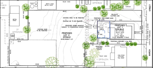
Figure 1 - approved subdivision DA 158/2017(1)
The modified proposal seeks to waive requirements for
construction of the driveway servicing battleaxe Lot 2. Consent is sought to:
· Amend Condition 5,
by removing text shown bold, below :
Engineering plans, showing
details of the proposed location of the vehicle accesses, footpath crossing
details, heavy duty concrete driveway for the full length of the Lot 2
access handle and traffic management works, are to be submitted to Orange
City Council or an Accredited Certifier (Categories B1, C3, C4, C6) prior to
the issuing of a Construction Certificate.
· Delete Condition
14 which states:
Proposed Lot 2 shall be
provided with a heavy duty concrete driveway constructed to a minimum width of
3.0 metres for the full length of the access handle and to the requirements and
standards of the Orange City Council Development and Subdivision Code.
It is the applicant’s intention that the battleaxe
driveway be constructed in conjunction with future development on proposed
battleaxe Lot 2. Council is not in receipt of a development application for
subsequent development on proposed Lot 2 at this time. The applicant submits
(refer attachment) that deferring construction of the driveway will not
adversely impact on neighbourhood character, adjoining improvements, the natural
environment, or the quality of the completed subdivision.
MATTERS FOR CONSIDERATION
Section 96(1A) and (3) of the Environmental
Planning and Assessment Act 1979 (EPAA) states:
(1A) A consent authority may…modify the consent if:
(a) it is satisfied that the proposed
modification is of minimal environmental impact, and
(b) it is satisfied that the development to
which the consent as modified relates is substantially the same development as
the development for which the consent was originally granted and before that
consent as originally granted was modified (if at all), and
(c) it has notified the application in
accordance with:
(i) the regulations, if the
regulations so require, or
(ii) a development control plan, if the
consent authority is a council that has made a development control plan under
section 72 that requires the notification or advertising of applications for
modification of a development consent, and
(d) it has considered any submissions made
concerning the proposed modification within any period prescribed by the
regulations or provided by the development control plan, as the case may be.
(3) In determining an application for
modification of a consent under this section, the consent authority must take
into consideration such of the matters referred to in Section 79C(1) as are of
relevance to the development the subject of the application.
In
consideration of the requirements of Sections 96(1A) and (3):
· The development as
modified is substantially the same development as the development for which the
consent was originally granted:
- the
modified works relate to a small component of the approved development only
- the
modification will not alter the nature or intensity of the existing and future
use of the proposed lots
- the
modified development will have minor impact on the interface and relationship
with adjoining residential parcels
- the
modification will not result in adverse amenity impacts for adjoining dwellings
in respect of visual bulk, privacy and solar access.
· The development as
modified does not effect a condition imposed as a requirement of concurrence by
a Minister, public authority or approval body.
· The development as
modified does not comprise advertised development pursuant to Clause 117
of the Environmental Planning and Assessment Regulation 2000 or Orange
Development Control Plan (DCP) 2004-5.3. Public notice and exhibition of the
modified development was not required.
· No submissions
were received in relation to the development as modified.
· The relevant
matters under Section 79C(1) are addressed in this report.
PROVISIONS OF ANY ENVIRONMENTAL
PLANNING INSTRUMENT s79C(1)(a)(i)
Orange Local Environmental Plan 2011
Part 1 - Preliminary
Clause 1.2 - Aims of Plan
The
broad aims of the LEP are set out under subclause 2. Those relevant to the modified
application are as follows:
(a) to
encourage development which complements and enhances the unique character of
Orange as a major regional centre boasting a diverse economy and offering an
attractive regional lifestyle,
(b) to
provide for a range of development opportunities that contribute to the social,
economic and environmental resources of Orange in a way that allows present and
future generations to meet their needs by implementing the principles for
ecologically sustainable development,
(e) to
provide a range of housing choices in planned urban and rural locations to meet
population growth,
(f) to
recognise and manage valued environmental heritage, landscape and scenic
features of Orange.
The modified proposal is not contrary to the above
objectives, as outlined in this report.
Clause 1.6 - Consent Authority
This clause establishes that, subject to the Act, Council is
the consent authority for applications made under the LEP.
Clause 1.9A - Suspension of
Covenants, Agreements and Instruments
This clause provides that covenants, agreements and other
instruments which seek to restrict the carrying out of development do not apply
with the following exceptions:
· covenants imposed
or required by Council
· prescribed
instruments under Section 183A of the Crown Lands Act 1989
· any conservation
agreement under the National Parks and Wildlife Act 1974
· any trust
agreement under the Nature Conservation Trust Act 2001
· any property
vegetation plan under the Native Vegetation Act 2003
· any biobanking
agreement under Part 7A of the Threatened Species Conservation Act 1995
· any planning
agreement under Division 6 of Part 4 of the Environmental Planning and
Assessment Act 1979.
Council staff are not aware of the title of the subject
property being affected by any of the above.
Mapping
The subject land is identified
on the LEP maps in the following manner:
|
Land Zoning Map:
|
Land zoned R1 General Residential
|
|
Lot Size Map:
|
No minimum lot size
|
|
Heritage Map:
|
Not a heritage item or conservation
area; adjoining a Local heritage item
|
|
Height of Buildings Map:
|
No building
height limit
|
|
Floor Space Ratio Map:
|
No floor space limit
|
|
Terrestrial Biodiversity Map:
|
No biodiversity
sensitivity on the site
|
|
Groundwater Vulnerability Map:
|
Ground water vulnerable
|
|
Drinking Water Catchment Map:
|
Not within the drinking water
catchment
|
|
Watercourse Map:
|
Not within or affecting a defined
watercourse
|
|
Urban Release Area Map:
|
Not within an urban release area
|
|
Obstacle Limitation Surface Map:
|
No restriction on building siting
or construction
|
|
Additional Permitted Uses Map:
|
No additional permitted use applies
|
|
Flood Planning Map:
|
Flood planning area
|
Those matters that are of relevance are addressed in detail
in the body of this report.
Part 2 - Permitted or Prohibited
Development
Clause 2.3 Zone Objectives and Land Use Table
Permissibility
The subject site is located within the R1 General
Residential zone. The modified development is defined as
“subdivision.”
Pursuant to Section 4B of the Environmental Planning and
Assessment Act:
Subdivision of land means the
division of land into two or more parts that, after the division, would be
obviously adapted for separate occupation, use or disposition.
Subdivision is permitted with consent in the R1 Zone,
pursuant to Clause 2.6 (see below).
Zone Objectives
The objectives for land zoned R1
General Residential are as follows:
· To
provide for the housing needs of the community.
· To
provide for a variety of housing types and densities.
· To
enable other land uses that provide facilities or services to meet the day to
day needs of residents.
· To
ensure development is ordered in such a way as to maximise public transport
patronage and encourage walking and cycling in close proximity to settlement.
· To
ensure that development along the Southern Link Road has an alternative access.
The
modified proposal is not adverse to the zone objectives.
Clause 2.6 Subdivision -
Consent Requirements
Clause 2.6 is applicable and states:
(1) Land
to which this Plan applies may be subdivided but only with development consent.
Consent is sought for Torrens subdivision of the subject
land in accordance with this clause.
Part 3 - Exempt and Complying Development
The modified proposal is not exempt or complying
development.
Part 4 - Principal Development
Standards
The Principal Development Standards do
not relate to the subject land or modified development.
Part 5 - Miscellaneous Provisions
5.10 - Heritage Conservation
Clause 5.10 is applicable. The subject land is located in
the vicinity of Local heritage items (dwelling at 68 Autumn Street (Item I166);
and Newman Park at 197 March Street (Item I55)). Pursuant to Clause
5.10(4):
The consent authority must,
before granting consent under this clause in respect of a heritage item or
heritage conservation area, consider the effect of the proposed development on
the heritage significance of the item or area concerned. This subclause applies
regardless of whether a heritage management document is prepared under
subclause (5) or a heritage conservation management plan is submitted under
subclause (6).
In consideration of this clause, the modified development will not have
adverse impact on the significance of the nearby Local heritage items, as
considered for the original development.
Part 6 - Urban Release Area
Not relevant to the application. The subject site is not
located in an Urban Release Area.
7.3 - Stormwater Management
Clause 7.3 is
applicable. This clause states in part:
(3) Development
consent must not be granted to development on land to which this clause applies
unless the consent authority is satisfied that the development:
(a) is
designed to maximise the use of water permeable surfaces on the land having
regard to the soil characteristics affecting on-site infiltration of water, and
(b) includes,
where practical, on-site stormwater retention for use as an alternative supply
to mains water, groundwater or river water, and
(c) avoids
any significant impacts of stormwater runoff on adjoining downstream
properties, native bushland and receiving waters, or if that impact cannot be
reasonably avoided, minimises and mitigates the impact.
In consideration of
Clause 7.3, the modified proposal will not alter the approved development in
terms of stormwater management.
7.6 Groundwater Vulnerability
The subject land is identified as
Groundwater Vulnerable on the Groundwater Vulnerability Map and Clause 7.6
applies. This clause states in part:
(3) Before
determining a development application for development on land to which this
clause applies, the consent authority must consider:
(a) whether or not the development (including
any onsite storage or disposal of solid or liquid waste and chemicals) is
likely to cause any groundwater contamination or have any adverse effect on
groundwater dependent ecosystems, and
In consideration of
Clause 7.6, the modified proposal will not alter the approved development in
terms of groundwater vulnerability.
7.11 Essential Services
Clause 7.11 is applicable. This clause
states:
Development
consent must not be granted to development unless the consent authority is
satisfied that any of the following services that are essential for the
proposed development are available or that adequate arrangements have been made
to make them available when required:
(a) the
supply of water
(b) the
supply of electricity
(c) the
disposal and management of sewage
(d) storm
water drainage or on-site conservation
(e) suitable
road access.
In consideration of this clause, the modified proposal will not alter
the approved development in respect of utility services (a) – (d)
above. Urban services will be augmented to provide individual servicing to
proposed Lots 1 and 2.
The modified proposal will not provide (e) suitable road
access to proposed Lot 2. Council’s Development Engineer has
recommended Conditions 5 and 14 be amended to satisfy the requirements of
Clause 7.11 and the Development and Subdivision Code and reduce
development costs to the applicant. Amended conditions are included on the
attached Notice of Approval.
STATE ENVIRONMENTAL PLANNING
POLICIES
There are no State Environmental Planning Policies that
apply to the modified development.
PROVISIONS OF ANY DRAFT
ENVIRONMENTAL PLANNING INSTRUMENT THAT HAS BEEN PLACED ON EXHIBITION
s79C(1)(a)(ii)
There are no draft environmental planning instruments that
apply to the subject land or modified development.
DESIGNATED DEVELOPMENT
The modified proposal is not designated development.
INTEGRATED DEVELOPMENT
The modified proposal is not integrated development.
PROVISIONS OF ANY DEVELOPMENT
CONTROL PLAN s79C(1)(a)(iii)
Development Control Plan 2004
DCP 2004 – 7.2 Residential Subdivision
The DCP prescribes the following applicable planning
outcomes:
· Lots are
oriented to optimise energy-efficiency principles.
· Lots below
500m2 indicate a mandatory side setback to provide for solar access and
privacy.
· Lots are fully
serviced and have direct frontage/access to a public road.
· Design and
construction complies with the Orange Development and Subdivision Code.
In consideration of the planning outcomes:
· The modified
proposal will not alter the approved development in respect of residential
amenity (energy efficiency, solar access, privacy, access to services) to
existing and future residential use of proposed Lots 1 and 2.
· The modified
proposal to defer driveway construction will not provide suitable access to
March Street for proposed battleaxe Lot 2.
· Pursuant to the
Orange City Development and Subdivision Code, driveway construction for
battleaxe lots is required prior to the issue of a subdivision certificate. The
modified proposal represents a variation to Council’s longstanding policy
and practice. A report on the proposed Code variation has been prepared by
Council’s Development Engineer to inform assessment of the modified
development and is attached. The report states in summary:
- There
are various advantages to Council and developer associated with battleaxe
driveway construction: a reduction in construction load on street; positive
visual impacts for streetscape and site; sediment control; services protection.
- Past
experience has found that a battleaxe driveway will cater for construction
traffic with no damage.
- The
construction of a driveway to a battleaxe lot is Council’s standard
policy and practice for 25 years.
- Council’s
policy on this matter is consistent with other regional councils.
- Should
battleaxe driveway construction be deferred until development on the battleaxe
lot, the driveway may not be constructed for a significant period. This may
remove the advantages to Council and developer cited above.
- Deferral
of battleaxe driveway construction until development on the battleaxe lot would
remove costs for developers and pass costs to home owners or builders.
- It
is unsuitable and unreasonable to permit a Code variation for the modified
development only. The Code would need to be varied to alter the requirements
for all battleaxe lots and ensure consistency for developers.
- The
existing requirements for creating battleaxe lots should be maintained, without
variation to the Orange City Development and Subdivision Code.
- Council’s
Technical Services Division do not support the proposed modification in the
form submitted.
Council’s Development
Engineer has recommended Condition numbers 5 and 14 be amended to satisfy
the requirements of the Development and Subdivision Code and reduce development
costs to the applicant. Condition numbers 5 and 14 will read as follows on the
modified Notice of Approval [amendments shown in bold italics]:
(5) Engineering
plans, showing details of the proposed location of the vehicle accesses,
footpath crossing details, heavy duty concrete or bitumen sealed
driveway for the full length of the Lot 2 access handle and traffic management
works, are to be submitted to Orange City Council or an Accredited Certifier
(Categories B1, C3, C4, C6) prior to the issuing of a Construction Certificate.
(14) Proposed
Lot 2 shall be provided with either a heavy duty concrete driveway or
bitumen sealed gravel pavement (200mm thick) constructed to a minimum
width of 3.0 metres for the full length of the access handle and to the
requirements and standards of the Orange City Council Development and
Subdivision Code.
DCP 2004-13 - Heritage
· Development
relates to the significant features of heritage buildings on or near the site,
as reflected in inventory sheets.
· Development
conforms with recognised conservation principles.
· Conservation
Management Plans are prepared for development having a significant effect on
heritage site.
As outlined above, the modified development will not have
adverse impact on the significance of the nearby Local heritage items. A
conservation management plan is not required for the proposal.
Orange DCP 2004 – Infill
Guidelines
The DCP 2004 Infill Guidelines are not applicable to the
proposed development.
Orange Development
Contributions Plan 2015
The modified proposal will have nil impact on development
contributions applicable to the approved development, pursuant to Orange
Development Contributions Plan 2015.
PROVISIONS PRESCRIBED BY THE
REGULATIONS s79C(1)(a)(iv)
The modified development is not inconsistent with any
provision prescribed by the Regulations.
THE LIKELY IMPACTS OF THE
DEVELOPMENT s79C(1)(b)
The visual, conservation, residential amenity and
environment impacts of the modified proposal are consistent with the original
development.
The modified development to defer battleaxe driveway
construction will not provide suitable road access to proposed Lot 2.
Associated flow-on effects include construction load on public roads; adverse
visual impacts for streetscape and site; onstreet sedimentation; and potential
damage to onsite services.
The modified proposal would also have cumulative impacts. As
outlined, the proposal is contrary to the requirements of Council’s
Development and Subdivision Code, which requires driveway construction for
battleaxe lots prior to the issue of a subdivision certificate. It is
unsuitable and unreasonable to permit a Code variation for the modified
development only. The Code would need to be varied to alter the requirements
for all battleaxe lots and ensure consistency for developers.
To avoid such impacts, the modified development is not
supported in the form submitted. Council’s Development Engineer has
recommended amendment to Condition numbers 5 and 14 requiring
driveway construction, which will satisfy the requirements of the Development
and Subdivision Code, and reduce development costs for the applicant.
THE SUITABILITY OF THE SITE
s79C(1)(c)
There are no aspects of the site that indicate it is unstable
for the modified development.
ANY SUBMISSIONS MADE IN
ACCORDANCE WITH THE ACT s79C(1)(d)
The modified development does not comprise advertised
development pursuant to Clause 117 of the Environmental Planning and
Assessment Regulation 2000 or Orange Development Control Plan (DCP) 2004-5.3.
Public notice and exhibition of the modified development was not required. No
submissions have been received in relation to the proposal.
PUBLIC INTEREST
s79C(1)(e)
The proposal is not inconsistent
with any relevant policy statements, planning studies, guidelines etc. that
have not been considered in this assessment. To approve the modified
development in the form submitted would be contrary to the requirements of
Council’s Development and Subdivision Code, and not in the public
interest.
SUMMARY
Approval of the modified proposal in the form submitted is
not supported. Notwithstanding, the development conditions may be modified
slightly to satisfy Council’s requirements and reduce development costs
to the applicant. An amended draft Notice of Approval is attached, with
conditions to ensure the development proceeds in an acceptable manner.
Attachments
1 Notice
of Approval, D17/63447⇩
2 Supporting
Information, IC17/17608⇩
3 Pros
and Cons of Driveway, D17/51154⇩
Planning and Development Committee
7 November 2017
2.8 Development
Application DA 158/2017(2) - 194 March Street
Attachment 1 Notice
of Approval
|

|
ORANGE
CITY COUNCIL
Development
Application No DA
158/2017(2)
NA17/ Container
PR23068
|
NOTICE OF DETERMINATION
OF A DEVELOPMENT APPLICATION
(AS MODIFIED)
issued under the Environmental
Planning and Assessment Act 1979
Section 81(1)
|
Development
Application
|
|
|
Applicant Name:
|
Mr G Kings
|
|
Applicant Address:
|
C/- Heath Consulting
Engineers
PO Box 2501
ORANGE
NSW 2800
|
|
Owner’s Name:
|
Rusty Man Pty Ltd
& 2Pursue Mt Hay Pty Ltd & DR 8 Pty Ltd
|
|
Land to Be Developed:
|
Lot 22 DP
1131258 - 194 March Street, Orange
|
|
Proposed Development:
|
Subdivision
(two lot residential) and Demolition (existing shed)
|
|
|
|
|
Building
Code of Australia
building
classification:
|
Not
applicable
|
|
|
|
|
Determination
|
|
|
Made On:
|
7 November
2017
|
|
Determination:
|
CONSENT
GRANTED SUBJECT TO CONDITIONS DESCRIBED BELOW:
|
|
|
|
|
Consent to
Operate From:
|
28 June
2017
|
|
Consent to
Lapse On:
|
28 June
2022
|
Terms of Approval
The reasons for the imposition of
conditions are:
(1) To maintain
neighbourhood amenity and character.
(2) To ensure compliance
with relevant statutory requirements.
(3) To provide adequate
public health and safety measures.
(4) To ensure the utility services
are available to the site and adequate for the development.
(5) To prevent the proposed
development having a detrimental effect on adjoining land uses.
(6) Because the development
will require the provision of, or increase the demand for, public amenities and
services.
(7) To minimise the impact
of development on the environment.
Conditions
(1) The
development must be carried out in accordance with:
(a) Plan/s
numbered 2017-117DA - FIGURE 2 - 4.05.2017 (1 sheet)
(b) statements
of environmental effects or other similar associated documents that form part
of the approval
as amended
in accordance with any conditions of this consent.
|
PRIOR TO THE ISSUE OF
A CONSTRUCTION CERTIFICATE
|
(2) Engineering plans,
showing details of all proposed work and adhering to any engineering conditions
of development consent, are to be submitted to, and approved by, Orange City
Council or an Accredited Certifier (Categories B1, C3, C4, C6) prior to the
issuing of a Construction Certificate.
(3) Proposed Lot
2 is to be provided with interlot stormwater drainage where the surface of the
entire lot cannot be drained to the kerb and gutter at the lot frontage. A
grated concrete stormwater pit is to be constructed within Lot 2. Engineering
plans for this drainage system are to be approved by Orange City Council or an
Accredited Certifier (Categories B1, C3, C4, C6) prior to the issuing of a
Construction Certificate.
(4) A 150mm-diameter sewer
main is to be constructed from Council’s existing main to serve the
proposed lots. Prior to a Construction Certificate being issued engineering
plans for this sewerage system are to be submitted to and approved by Orange
City Council.
(5) Engineering plans,
showing details of the proposed location of the vehicle accesses, footpath
crossing details, heavy duty concrete or bitumen sealed driveway for the full
length of the Lot 2 access handle and traffic management works, are to be
submitted to Orange City Council or an Accredited Certifier (Categories B1, C3,
C4, C6) prior to the issuing of a Construction Certificate.
|
PRIOR TO WORKS
COMMENCING
|
(6) The
applicant is to submit a waste management plan that describes the nature of
wastes to be removed, the wastes to be recycled and the destination of all
wastes. All wastes from the demolition and construction phases of this project
are to be deposited at a licensed or approved waste disposal site.
(7) A
Construction Certificate application is required to be submitted to, and issued
by Council/Accredited Certifier prior to any construction works being carried
out onsite.
(8) Soil erosion control
measures shall be implemented on the site.
|
DURING
CONSTRUCTION/SITEWORKS
|
(9) All
demolition work on the site is to be carried out between the hours of
7.00 am and 6.00 pm Monday to Friday inclusive, 7.00 am to
5.00 pm Saturdays and 8.00 am to 5.00 pm Sundays and Public
Holidays. Written approval must be obtained from the General Manager of Orange
City Council to vary these hours.
(10) Building demolition is
to be carried out in accordance with Australian Standard 2601:2001 - The
Demolition of Structures and the requirements of Safe Work NSW.
(11) Asbestos
containing building materials must be removed in accordance with the provisions
of the Work Health and Safety Act 2011 and any guidelines or Codes
of Practice published by Safe Work NSW, and disposed of at a licenced landfill
in accordance with the requirements of the NSW EPA.
(12) Any adjustments to
existing utility services that are made necessary by this development
proceeding are to be at the full cost of the developer.
(13) The
provisions and requirements of the Orange City Council Development and
Subdivision Code are to be applied to this application and all work constructed
within the development is to be in accordance with that Code.
The developer is to be entirely responsible for
the provision of water, sewerage and drainage facilities capable of servicing
both lots from Council’s existing infrastructure. The developer is to be
responsible for gaining access over adjoining land for services where necessary
and easements are to be created about all water, sewer and drainage mains
within and outside the lots they serve.
(14) Proposed Lot 2 shall be
provided with either a heavy duty concrete driveway or bitumen sealed gravel
pavement (200mm thick) constructed to a minimum width of 3.0 metres for the
full length of the access handle and to the requirements and standards of the
Orange City Council Development and Subdivision Code.
(15) Heavy-duty concrete
kerb and gutter laybacks and footpath crossings are to be constructed to serve
Lots 1 and 2. The location and construction of the laybacks and footpath
crossings are to be as required by the approved engineering plans and Orange
City Council Development and Subdivision Code.
(16) The existing kerb and
gutter layback that is not proposed to be used is to be replaced with standard
concrete kerb and gutter and the bitumen footpath reinstated to the
requirements in the Orange City Council Development and Subdivision Code.
|
PRIOR TO THE ISSUE OF
A SUBDIVISION CERTIFICATE
|
(17) The payment of
$9,917.84 is to be made to Council in accordance with section 94 of the Act and
the Orange Development Contributions Plan 2015 (LGA Remainder) towards the
provision of the following public facilities:
|
Open Space and
Recreation
|
1 additional lot @
$3,384.33
|
3,384.33
|
|
Community and
Cultural
|
1 additional lot @
$681.62
|
681.62
|
|
Roads and Cycleways
|
1 additional lot @
$5,246.32
|
5,246.32
|
|
Stormwater Drainage
|
1 additional lot @
$316.72
|
316.72
|
|
Local Area Facilities
|
-
|
|
|
Plan Preparation
& Administration
|
1 additional lot @
$288.85
|
288.85
|
|
TOTAL:
|
|
$9,917.84
|
The contribution will be indexed quarterly in
accordance with the Orange Development Contributions Plan 2015 (LGA
Remainder). This Plan can be inspected at the Orange Civic Centre, Byng
Street, Orange.
(18) Application shall be
made for a Subdivision Certificate under Section 109(C)(1)(d) of the Act.
(19) Payment of
contributions for water, sewer and drainage works is required to be made
at the contribution rate applicable at the time that the payment is made.
The contributions are based on 1 ETs for water supply headworks and 1 ETs for
sewerage headworks. A Certificate of Compliance, from Orange City Council
in accordance with the Water Management Act 2000, will be issued upon
payment of the contributions.
This Certificate of Compliance is to be
submitted to the Principal Certifying Authority prior to the issuing of a
Subdivision Certificate.
(20) A
carport or garage shall be constructed for the existing dwelling on proposed
Lot 1. Further development consent shall be obtained for the carport or garage
unless it is exempt development pursuant to State Environmental Planning Policy
(Exempt and Complying Development Codes) 2008.
(21) Evidence
from a registered NATA laboratory is to be submitted prior to the issuing of a
Subdivision Certificate stating that the filling of any low-lying areas has
been carried out in accordance with Australian Standard 3798-2007.
(22) Application is to be
made to Telstra/NBN for infrastructure to be made available to each individual
lot within the development. Either a Telecommunications Infrastructure
Provisioning Confirmation or Certificate of Practical Completion is to be
submitted to the Principal Certifying Authority confirming that the specified
lots have been declared ready for service prior to the issue of a Subdivision
Certificate.
(23) A Notice of Arrangement
from Essential Energy stating arrangements have been made for the provision of
electricity supply to the development, is to be submitted to the Principal
Certifying Authority prior to the issue of a Subdivision Certificate.
(24) An easement to drain
sewage and to provide Council access for maintenance of sewerage works a
minimum of 2.0 metres wide is to be created over the proposed sewerage works.
The Principal Certifying Authority is to certify that the easement is in
accordance with the Orange City Council Development and Subdivision Code prior
to the issuing of a Subdivision Certificate.
(25) All services are to be
contained within the allotment that they serve. A Statement of Compliance, from
a Registered Surveyor, is to be submitted to the Principal Certifying Authority
prior to the issuing of a Subdivision Certificate.
(26) Where
stormwater crosses land outside the lot it favours, an easement to drain water
is to be created over the works. A Restriction-as-to-User under section 88B of
the NSW Conveyancing Act 1979 is to be created on the title of the
burdened Lot requiring that no structures are to be placed on the site, or
landscaping or site works carried out on the site, in a manner that affects the
continued operation of the interlot drainage system. The minimum width of the
easement is to be as required in the Orange City Council Development and
Subdivision Code.
(27) Certification from
Orange City Council is required to be submitted to the Principal Certifying
Authority prior to the issue of a Subdivision Certificate stating that all
works relating to connection of the development to Council assets, works on
public land, public roads, stormwater, sewer and water reticulation mains and
footpaths have been carried out in accordance with the Orange City Council Development
and Subdivision Code and the foregoing conditions, and that Council will take
ownership of the infrastructure assets.
(28) All
of the foregoing conditions are to be at the full cost of the developer and to
the requirements and standards of the Orange City Council Development and
Subdivision Code, unless specifically stated otherwise. All work required by
the foregoing conditions is to be completed prior to the issuing of an
Occupation Certificate, unless stated otherwise.
Other Approvals
(1) Local
Government Act 1993 approvals granted under Section 68.
Nil
(2) General
terms of other approvals integrated as part of this consent.
Nil
Right of Appeal
If
you are dissatisfied with this decision, Section 97 of Environmental
Planning and Assessment Act 1979 gives you the right to appeal to the Land
and Environment Court within 6 months after the date on which you receive this
notice.
*
Section 97 of the Environmental Planning and Assessment Act 1979 does not apply
to the determination of a development application for State significant
development or local designated development that has been the subject of a
Commission of Inquiry.
|
Disability Discrimination Act
1992:
|
This application has been assessed in
accordance with the Environmental Planning and Assessment Act 1979. No
guarantee is given that the proposal complies with the Disability
Discrimination Act 1992.
The applicant/owner is responsible to
ensure compliance with this and other anti-discrimination legislation.
The Disability Discrimination Act
covers disabilities not catered for in the minimum standards called up in the
Building Code of Australia which references AS1428.1 - "Design for
Access and Mobility". AS1428 Parts 2, 3 and 4 provides the most
comprehensive technical guidance under the Disability Discrimination Act
currently available in Australia.
|
|
|
|
|
Disclaimer - S88B Restrictions on the Use of Land:
|
The applicant should note that there
could be covenants in favour of persons other than Council restricting what
may be built or done upon the subject land. The applicant is advised to check
the position before commencing any work.
|
|
|
|
|
Signed:
|
On behalf of the consent authority ORANGE
CITY COUNCIL
|
|
Signature:
|
|
|
Name:
|
PAUL JOHNSTON - MANAGER DEVELOPMENT ASSESSMENTS
|
|
Date:
|
8 November 2017
|
Planning
and Development Committee
7 November 2017
2.8 Development
Application DA 158/2017(2) - 194 March Street
Attachment 2 Supporting
Information
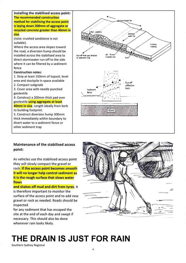
Planning
and Development Committee
7 November 2017
2.8 Development
Application DA 158/2017(2) - 194 March Street
Attachment 3 Pros
and Cons of Driveway
REPORT
TO MANAGER ENGINEERING
SERVICES
FROM DEVELOPMENT
ENGINEER
DATE 6
SEPTEMBER 2017
ON BATTLEAXE
LOT DRIVEWAY – 122 to 124 McLachlan Street
DA
157/2017(1) 194 March Street DA 158/2017 (1)
PR23068
PR8272
D17/51154
Following on from the recent communications with Mr G
Kings and Mr R Heath in reference to Council requirements to construct
driveways for battleaxe lots prior to issue of a subdivision certificate
relating to 122 to 124 McLachlan Street and 194 March Street the following
information is provided.
A battleaxe lot is a block of land behind another, with
access from the street through a narrow long
driveway (axe handle). The rear lot can be used to build a house, houses or
units.
This type of lot is used in Greenfield sites to maximise
lot numbers in unusual land shapes as indicated below in figure 1;
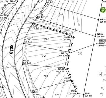 Figure 1
2
Or to create an additional lot in an existing developed
area on an existing lot as indicated below in figure 2;
Figure 2
Council’s development control plan requires
residential battleaxe lots to have an access width of 4.5m with a 3.0m wide
driveway for single lots or single house and 6.0m access width and 4.5m wide
driveway for two or more lots or houses.
Historically Council’s practice for the creation of
battleaxe lots is to require the construction of the driveway prior to the
issue of a subdivision certificate in both scenarios as described above.
In relation to these scenarios battleaxe lots can be
found in residential, industrial and rural zoned areas.
The advantages to Council of requiring the
driveway to be constructed prior to the issue of a subdivision are:
· As
battleaxe lot does not have street frontage for building construction, work
cannot be carried out from street frontage as required for a normal lot. A
constructed driveway allows work to be carried out from driveway, reducing
construction vehicle load on street.
· Maintains
street amenity and visual appearance.
· Reduces
negative impacts on any existing house.
· Extra
hard stand of driveway allows sediment and vegetative matter to be dropped from
vehicles prior to entry on street acting as sediment control.
· Gives
a designated load proof drive path in access that protects services from
damage.
· Visually
more positive than overgrown with vegetation that is not maintained.
3
The disadvantages to Council are:
· Possible
damage to driveway from construction traffic.
The advantages to the developer
are:
· As
battleaxe lot does not have street frontage for building construction, work
cannot be carried out from street frontage as required for a normal lot. A
constructed driveway allows work to be carried out from driveway, reducing
construction vehicle load on street.
· Maintains
street amenity and visual appearance.
· Reduces
negative impacts on any existing house.
· Extra
hard stand of driveway allows sediment and vegetative matter to be dropped from
vehicles prior to entry on street acting as sediment control.
· Gives
a designated load proof drive path in access that protects services from
damage.
· Visually
more positive than overgrown with vegetation that is not maintained.
The disadvantages to the
developer are:
· Outlay
of cost of driveway prior to building construction on lot.
· Possible
damage to driveway from construction traffic.
Previous experience has found that if a
concrete driveway is constructed to the driveway requirements of thickness,
reinforcement and concrete strength the driveway will cater for construction
traffic with no damage.
4
Below, plate 1, shows a recent example of a
driveway constructed at subdivision stage for a battleaxe lot of a development
at 238 McLachlan Street and is now nearing completion for construction of
units. This driveway has no damage and is working well.
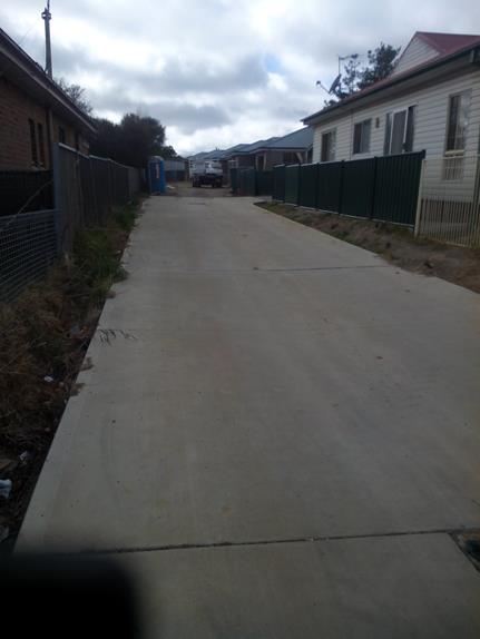
5
Below, Plate 2, shows an example of a recent
industrial battleaxe lot for 229 to 231 McLachlan Street where the driveway was
constructed as part of the subdivision and an industrial shed has been
constructed on one of the battle axe lots with no damage to the driveway.
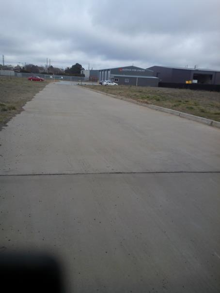
6
Council has required the construction of a
driveway in a battleaxe lot prior to issue of a subdivision certificate for
over 25 years because it is standard practice. A survey of Councils has been
carried out with the results in the following table:
|
Council
|
Survey Result
|
|
Bathurst
|
Requires driveway to be constructed
prior to subdivision certificate issue
|
|
Hills
|
Requires driveway to be constructed
prior to subdivision certificate issue
|
|
Mudgee
|
DCP requires all dual
occupancys are to have direct street frontage. The dual occupancy is to
be build first and then the subdivision which requires driveways prior to
subdivision certificate issue.
|
|
Blayney
|
Requires driveway built before the
subdivision release. will take a bond for the works to be completed at a
later date
|
|
Tamworth
|
Requires Driveway completed prior
to subdivision certificate or occupation certificate issue.
|
|
Wollongong
|
Encourages no battleaxe lots but
does permit 2 in a subdivision with driveway to be constructed prior to issue
of subdivision certificate.
|
|
Parkes
|
Do not accept battle-axe blocks as
an acceptable form of subdivision.
|
|
Coffs Harbour
|
Requires driveways to be
constructed prior to subdivision certificate issue
|
|
Temora
|
Requires driveways to be
constructed prior to subdivision certificate issue
|
|
Forbes
|
Do not accept battle-axe blocks as
an acceptable form of subdivision.
|
|
Penrith
|
Discourages battleaxe lots
|
As can be seen from this table the requirement
for the construction of a driveway prior to the issue of a subdivision is
standard practice to most Council’s and several do not permit or
discourage the use of battleaxe lots.
Whether the battleaxe lot is in a Greenfield
site or part of the subdivision of an existing lot in a developed residential
area or in an industrial area or rural area the developer is required to
construct the driveway prior to the issue of a subdivision certificate. To make
amendments on different scenarios would create inconsistencies that would
confuse the process for other developers.
7
The developments of 122 – 124 McLachlan
Street and 194 March Street are of the existing lot scenario where the
development consent was granted for a subdivision of the existing house from
the rear to create a development lot. Although proposals for the future
development of these lots have been offered by the developer, a development
application has not been submitted to Council at the writing of this report.
Even with the information provided by the developer of the proposed future
development of the land Council officers have to assess the development
application as presented with standard accepted conditions and being consistent
with previous battleaxe proposals.
In conditioning a proposed subdivision it
cannot be assumed that the suggested development will occur as described by the
developer.
Historically with the creation of a battleaxe
lot the timing of development of the lot can vary from time of registration of
lot by Land Property Information (LPI) to years after and in some cases a
proposed development may not go ahead.
If the driveway was not required to be
constructed as part of the subdivision a driveway may not get built for a
significant time period removing the advantages to Council previously noted.
The proposal to
remove the condition of driveway construction prior to subdivision certificate
issue could not be done as a one off for the developments in question but would
require Council to change its requirements for all battleaxe lots.
This would remove
the cost for driveway construction from developers in Greenfield sites and pass
costs on to home owners/builders. Driveway construction costs for developers in
existing areas would be deferred to the final stages of the development or
passed on to other developers if the development is sold on.
8
Recommendation
In approving
development in the Orange Local Government area Council is responsible for the
following goals:
· To maintain neighbourhood amenity, character, and
provide suitably high quality finished development (subdivision)
· To prevent the proposed development (subdivision)
having a detrimental effect on adjoining land uses / neighbours including the
original dwelling.
· To minimise the impact of development (subdivision)
on the environment.
· To manage the risk to Council / City if the next stage
of the Development (construction) does not proceed or does not proceed in a
timely manner and the impact that will have on the above points.
Therefore it is
recommended that the existing process of creating battleaxe lots is maintained
To meet the above
goals.
B Nalder
DEVELOPMENT
ENGINEER
2.9 Development
Application DA 244/2017(1) - 15 Etna Street
RECORD
NUMBER: 2017/2187
AUTHOR: Martin
Hebold, Compliance Team Leader
EXECUTIVE Summary
|
Application
lodged
|
7 July 2017
|
|
Applicant/s
|
Mrs K
Churchill
|
|
Owner/s
|
Mrs K
Churchill
|
|
Land
description
|
Lot 51
DP 1127190 - 15 Etna Street, Orange
|
|
Proposed
land use
|
Dwelling
Alterations and Additions (carport)
|
|
Value of
proposed development
|
$7,994
|
Council's consent is sought for a new attached three car carport on land described as Lot 51 DP 1127190 – 15 Etna
Street, Orange. The proposal
involves the construction of a skillion roofed carport measuring 9.1m wide x
4.4m deep, in front of the existing attached garage of the existing dwelling.
Proposed materials include Colorbond steel and Laserlight, and colours are to
match the existing dwelling.
It is considered that
the proposed carport does not comply with the relevant objectives and planning
outcomes of the Orange Local Environmental Plan 2011 (LEP) and
Chapter 7 of the Orange Development Control Plan 2004 (DCP);
including DCP objectives for ‘Residential Design’,
‘Bulk and Scale’, ‘Site Access and Circulation’,
‘Open Space and Landscaping’ and ‘Water and Soil
Management’; and the DCP planning outcomes for ‘Neighbourhood Character’,
‘Building Appearance’, ‘Setbacks’, ‘Visual
Bulk’, ‘Circulation Design’, ‘Car Parking’,
‘Open Space and Landscaping’ and ‘Stormwater’.
The proposed scale and
setback of the carport is inappropriate for a residential area, is out of
character with the surrounding pattern of development, and will adversely
impact on the residential and visual amenity of the streetscape and
neighbourhood. The carport has not been designed to minimise visual and
environmental impacts, and as such, the application is recommended for refusal.
It is important to note
that the existing dwelling has been established on the land using the minimum
setbacks set out in the DCP, and as such leaves little opportunity for further
development in the frontage of the site. The existing dwelling includes an
attached three car garage positioned at the minimum setback to the street
of 8m, and there is an additional double garage in the backyard. The DCP
requires an increased setback for triple garages so they do not dominate the
streetscape, and so that the driveway width is kept to a maximum of 6m (double
width) at the front boundary. The maximum width balances the requirement for
adequate manoeuvring while retaining sufficient landscaping between the
dwelling and the street. The proposed carport on a reduced front setback cannot
be serviced fully, and would require a wider driveway than that prescribed by
the DCP, adversely impacting on the visual and residential amenity of the
neighbourhood and street, and increasing stormwater runoff from the site
frontage.
Whilst it is not
desirable to have a triple carport forward of a dwelling house, the proposal
would be considered more appropriate and could achieve the overall objectives
of the DCP if the carport was reduced in size, and set back at least 4.5m
from the front boundary. These issues were discussed with the applicant, and
they were requested to consider amending the proposal so the carport would be
less dominant on the street. However, the applicant was not willing to
compromise, stating that the proposed size is needed to provide shelter for
their car, to allow them to get their child out of the car on rainy days
without getting wet, and to provide a shady place for their child to ride their
scooter and shoot basketball hoops. The applicant has also advised that the
carport is needed even though they have five garage spaces already on the site.
It is noted that the only carport within the frontage in the
neighbourhood has been designed to be set back 4.5m from the street and is
reduced in size (double width, and less depth), appropriately balancing the
need for adequate coverage of vehicles, without adversely impacting on the
street and neighbourhood. It is considered that the applicant can design their
carport in a similar manner, which will not be detrimental to the amenity of
the surrounding neighbourhood.
Furthermore, it is
considered that the site offers ample alternative areas to the rear of the
dwelling to provide for covered vehicle storage and recreational spaces, that
can also be designed in a way that do not adversely impact on the neighbourhood
and the streetscape. In any case, it is not considered appropriate for
children’s recreational areas and play equipment to be located within the
front driveway due to potential vehicle conflicts.
DECISION FRAMEWORK
Development in Orange is governed by two key documents; the Orange
Local Environment Plan 2011 and Orange Development Control Plan 2004.
In addition, the Infill Guidelines are used to guide development, particularly
in the heritage conservation areas and around heritage items.
Orange Local Environment Plan 2011 – the LEP
should be considered by Council to be a definitive document. LEPs govern the
types of development that are permissible or prohibited in different parts of
the City and also provide some assessment criteria in specific circumstances.
Uses are either permissible or not - there are no grey areas in terms of
permissibility. The objectives of each zoning, and indeed the aims of the LEP
itself are, however, open to interpretation and can be used to guide decision
making around appropriateness of development.
Orange Development Control Plan 2004 – the DCP
guides development. In general it is a performance based document rather than
prescriptive in nature - its purpose is to guide development. The Land and
Environment Court tends to view it as such. In each area of interest there are
often guidelines used. These guidelines indicate ways of achieving the planning
outcomes. It is thus recognised that there may also be other solutions of
merit. All design solutions are considered on merit by Council staff.
Applications should clearly demonstrate how the planning outcomes are being met
where alternative design solutions are proposed. So one can see that the DCP
gives leeway for developers and architects to use design to achieve the outcome
in other ways if they can. Stating that DCP guidelines are inflexible can
be misleading.
It is
considered that the site is suitable for a carport as the land is appropriately
serviced and there are no known physical attributes, technological or natural
hazards which constrain the site. However, as assessed in this report, the
design and siting of the carport in its proposed form does not meet the
objectives, and planning outcomes of both the LEP and DCP. Suitable
alternatives exist on the site, such as a carport of reduced scale and greater
setback in the frontage, or a carport/covered area to the rear, which could
achieve similar intentions that are not detrimental to the residential and
visual amenity of the neighbourhood or the environment.
Link To Delivery/OPerational Plan
The recommendation in this report relates to the
Delivery/Operational Plan strategy “13.4 Our Environment
– Monitor and enforce regulations relating to City amenity”.
Financial Implications
Nil
Policy and Governance Implications
Nil
|
Recommendation
That Council refuses
development application DA 244/2017(1)
for Dwelling Alterations and Additions (carport) at Lot 51 DP 1127190
- 15 Etna Street, Orange pursuant to the reasons as
set out in the attached Notice of Refusal.
|
further considerations
Consideration has been given to the
recommendation’s impact on Council’s service delivery; image and
reputation; political; environmental; health and safety; employees;
stakeholders and project management; and no further implications or risks have
been identified.
SUPPORTING INFORMATION
THE APPLICATION
Council's consent is sought for a new three car carport to
be constructed in front of the existing three car garage at Lot 51 DP 1127190, known as 15 Etna Street, Orange.
THE PROPOSAL
The proposal involves the construction of a skillion roofed
carport measuring 9.1m wide x 4.4m deep in front of the existing attached
garage of the existing dwelling (western elevation). The carport is proposed at
a setback of 3.7m from the front road boundary and 1.4m from the northern side
boundary. Proposed materials include Colorbond steel and Laserlight, and
colours are to match the existing dwelling.
MATTERS FOR CONSIDERATION
Section 5A Assessment
In the administration of sections 78A, 79B, 79C, 111 and
112, the provisions of Section 5A must be taken into account for every
development application in deciding whether there is likely to be a significant
effect on threatened species, populations or ecological communities or their
habitats. This section includes a requirement to consider any adopted
assessment guidelines, which means assessment guidelines issued and in force under
section 94A of the Threatened Species Conservation Act 1995.
Assessment guidelines are in force (see DECC-W “Threatened Species
Assessment Guidelines - The Assessment of Significance”) which requires
consent authority to adopt the precautionary principle in its assessment.
From 25 August 2017, the Biodiversity Conservation Act
2017 and Biodiversity Conservation Regulation 2017 were
gazetted. State Environmental Planning Policy (Native Vegetation in
Non-Rural Areas) 2017 was also gazetted. The implementation of this
legislation (and supporting guidelines) is subject to savings provisions that
defer their full effect for a period of three months from the date of gazettal
for local development.
In this instance, site inspection reveals that the subject
property has no biodiversity or habitat value.
Section 79C
Section 79C of the Environmental Planning and Assessment
Act 1979 requires Council to consider various matters, of which those
pertaining to the application are listed below.
PROVISIONS OF ANY ENVIRONMENTAL
PLANNING INSTRUMENT s79C(1)(a)(i)
Orange Local Environmental Plan 2011
Part 1 - Preliminary
Clause 1.2 - Aims of Plan
The
broad aims of the LEP are set out under subclause 2. Those relevant to the
application are as follows:
(a) to encourage development which complements
and enhances the unique character of Orange as a major regional centre boasting
a diverse economy and offering an attractive regional lifestyle,
(f) to recognise and manage valued
environmental heritage, landscape and scenic features of Orange.
The application is considered to be inconsistent with the
relevant aims of the plan, as the proposed carport will adversely impact on the residential and visual amenity of the
streetscape and neighbourhood. This is discussed in greater detail in the DCP
assessment later in this report.
Clause 1.6 - Consent Authority
This clause establishes that, subject to the Act, Council is
the consent authority for applications made under the LEP.
Clause 1.9A - Suspension of
Covenants, Agreements and Instruments
This clause provides that covenants, agreements and other
instruments which seek to restrict the carrying out of development do not apply
with the following exceptions:
· covenants imposed
or required by Council
· prescribed
instruments under Section 183A of the Crown Lands Act 1989
· any conservation
agreement under the National Parks and Wildlife Act 1974
· any trust
agreement under the Nature Conservation Trust Act 2001
· any property
vegetation plan under the Native Vegetation Act 2003
· any biobanking
agreement under Part 7A of the Threatened Species Conservation Act 1995
· any planning
agreement under Division 6 of Part 4 of the Environmental Planning and
Assessment Act 1979.
Council staff are not aware of the title of the subject
property being affected by any of the above.
Mapping
The subject site is identified
on the LEP maps in the following manner:
|
Land Zoning Map:
|
Land zoned R1 General Residential
|
|
Lot Size Map:
|
No Minimum Lot Size
|
|
Heritage Map:
|
Not a heritage item or conservation
area
|
|
Height of Buildings Map:
|
No building height limit
|
|
Floor Space Ratio Map:
|
No floor space limit
|
|
Terrestrial Biodiversity Map:
|
No biodiversity sensitivity on the
site
|
|
Groundwater Vulnerability Map:
|
Ground water vulnerable
|
|
Drinking Water Catchment Map:
|
Not within the drinking water
catchment
|
|
Watercourse Map:
|
Within or affecting a defined
watercourse
|
|
Urban Release Area Map:
|
Not within an urban release area
|
|
Obstacle Limitation Surface Map:
|
No restriction on building siting
or construction
|
|
Additional Permitted Uses Map:
|
No additional permitted use applies
|
Those matters that are of relevance are addressed in detail
in the body of this report.
Part 2 - Permitted or Prohibited
Development
Land Use Zones
The subject site is located within the R1 General
Residential zone. The proposed development is defined as a residential
accommodation – dwelling house under OLEP 2011 and is permitted with
consent for this zone. This application is seeking consent.
Clause 2.3 of LEP 2011 references the Land Use
Table and Objectives for each zone in LEP 2011. These objectives for land zoned R1 General
Residential are as follows:
· To
provide for the housing needs of the community.
· To
provide for a variety of housing types and densities.
· To
enable other land uses that provide facilities or services to meet the day to
day needs of residents.
· To
ensure development is ordered in such a way as to maximise public transport
patronage and encourage walking and cycling in close proximity to settlement.
The proposed development is generally consistent with the
above objectives.
Part 3 - Exempt and Complying
Development
The application is not exempt or complying development. Pursuant
to Clause 2.6 the application is seeking development consent.
Part 4 - Principal Development
Standards
Not relevant to the application.
Part 5 – Miscellaneous
Provisions
Not relevant to the application.
Part 6 – Urban Release Areas
Not relevant to the application, the
land is not within an Urban Release Area.
Part 7 - Additional Local Provisions
7.3 - Stormwater Management
This clause applies
to all industrial, commercial and residential zones and requires that Council
be satisfied that the proposal:
(a) is designed to maximise the use of water
permeable surfaces on the land having regard to the soil characteristics
affecting onsite infiltration of water
(b) includes, where practical, onsite
stormwater retention for use as an alternative supply to mains water,
groundwater or river water; and
(c) avoids any significant impacts of
stormwater runoff on adjoining downstream properties, native bushland and
receiving waters, or if that impact cannot be reasonably avoided, minimises and
mitigates the impact.
It is assumed that the carport guttering will be connected
to the existing stormwater system, and soil erosion can be managed at
construction stage. However, the driveway width will need to be increased to
provide for adequate manoeuvring of vehicles in and out of the site. The
reduction of landscaping and permeable areas in the frontage will increase
stormwater runoff from the site to the street, which may impact the existing
stormwater system during heavy/flash rainfall events.
7.5 - Riparian Land and Watercourses
This clause seeks to preserve both
water quality and riparian ecological health. The clause applies to land
identified as a “Sensitive Waterway” on the Watercourse Map. The
subject land contains such a waterway and therefore Council must consider
whether or not the proposal:
(a) is likely to have any adverse impact on
the following:
(i) the water quality and flows within a
watercourse
(ii) aquatic and riparian species, habitats
and ecosystems of the watercourse
(iii) the stability of the bed and banks of the
watercourse
(iv) the free passage of fish and other aquatic
organisms within or along the watercourse
(v) any future rehabilitation of the
watercourse and its riparian areas, and
(b) is
likely to increase water extraction from the watercourse.
Additionally, consent may not be
granted until Council is satisfied that:
(a) the development is designed, sited and
will be managed to avoid any significant adverse environmental impact, or
(b) if that impact cannot be reasonably
avoided - the development is designed, sited and will be managed to minimise
that impact, or
(c) if that impact cannot be minimised - the
development will be managed to mitigate that impact.
While the subject site does
contain a sensitive waterway, the proposal has been designed to site the
buildings 75m from the waterway. This provides a reasonable separation distance
to manage the post-development runoff.
Overall, while there will always
remain a risk to the waterway under extreme circumstances such as record storms
and the like, it is considered that the risk of adverse impacts in regards to
waterways can be appropriately managed to an acceptable level of risk.
7.6 - Groundwater Vulnerability
This clause seeks to protect
hydrological functions of groundwater systems and protect resources from both
depletion and contamination. Orange has a high water table and large areas of
the LGA, including the subject site, are identified with “Groundwater
Vulnerability” on the Groundwater Vulnerability Map. This requires that
Council consider:
(a) whether or not the development (including
any onsite storage or disposal of solid or liquid waste and chemicals) is
likely to cause any groundwater contamination or have any adverse effect on
groundwater dependent ecosystems, and
(b) the cumulative impact (including the
impact on nearby groundwater extraction for potable water supply or stock water
supply) of the development and any other existing development on groundwater.
Furthermore consent may not be granted unless Council is satisfied that:
(a) the development is designed, sited and
will be managed to avoid any significant adverse environmental impact, or
(b) if that impact cannot be reasonably
avoided - the development is designed, sited and will be managed to minimise
that impact,
(c) if that impact cannot be minimised - the
development will be managed to mitigate that impact.
The proposal is not
anticipated to involve the discharge of toxic or noxious substances and is
therefore unlikely to contaminate the groundwater or related ecosystems. The
proposal does not involve extraction of groundwater and will therefore not
contribute to groundwater depletion. The design and siting of the proposal
avoids impacts on groundwater and is therefore considered acceptable.
Clause 7.11 - Essential Services
Clause 7.11 is applicable and states:
Development
consent must not be granted to development unless the consent authority is
satisfied that any of the following services that are essential for the
proposed development are available or that adequate arrangements have been made
to make them available when required:
(a) the
supply of water
(b) the
supply of electricity
(c)
the disposal and management of sewage
(d) storm
water drainage or on-site conservation
(e) suitable
road access.
In consideration of this clause, all
utility services are available to the land and adequate for the proposal.
STATE ENVIRONMENTAL PLANNING
POLICIES
State Environmental Planning Policy 55 - Remediation of
Land
Under Clause 7 of State Environmental Planning Policy 55
- Remediation of Land (SEPP 55), Council must consider whether the
land is contaminated and whether the land requires any form of remediation to
render it suitable for the purpose to which it is proposed to be used. The
previous land uses must be considered along with any visible or tangible
evidence on the site. Clause 7 of SEPP 55 provides as follows:
A consent authority must not consent to the carrying out of any
development on land unless:
(a) it has considered whether the land is
contaminated, and
(b) if the land is contaminated, it is
satisfied that the land is suitable in its contaminated state (or will be
suitable, after remediation) for the purpose for which the development is
proposed to be carried out, and
(c) if the land requires remediation to be
made suitable for the purpose for which the development is proposed to be
carried out, it is satisfied that the land will be remediated before the land
is used for that purpose.
Prior to the residential zoning of the
subject land and adjoining parcels, the locality had longstanding agricultural
(grazing) use. Contamination investigation was undertaken in conjunction with
the residential subdivision of the land. As
the potential for
contamination is very low, and the overall use of the land is not changing
(i.e. continued residential use), further
investigation as a precursor to site remediation is considered unnecessary in
conjunction with the current proposal.
PROVISIONS OF ANY DRAFT
ENVIRONMENTAL PLANNING INSTRUMENT THAT HAS BEEN PLACED ON EXHIBITION
s79C(1)(a)(ii)
There are no draft environmental planning instruments that
apply to the subject land or proposed development.
DESIGNATED DEVELOPMENT
The proposed development is not designated development.
INTEGRATED DEVELOPMENT
The proposal is not integrated development.
PROVISIONS OF ANY DEVELOPMENT
CONTROL PLAN s79C(1)(a)(iii)
Development Control Plan 2004
Development Control Plan 2004 (“the DCP”)
applies to the subject land. An assessment of the proposed development against
the relevant Planning Outcomes will be undertaken below.
Part 7 - Design Elements for
Residential Development
The DCP sets the following Planning Outcomes in regard to
Urban Residential Development.
Residential Design
Objectives
· To
ensure that the development fits into its setting and environmental features of
the locality.
· To
ensure that the appearance of housing is of a high visual quality, enhances the
streetscape and complements good quality surrounding development.
· To
ensure that new development complements places with heritage significance and
their settings in a contemporary way.
· To
develop a sense of place with attractive street frontages.
· To
encourage visually appealing cohesive streetscapes.
· To
create a safe and secure environment.
· To provide
consistent design elements that protect private investment.
The proposed development is contrary to the residential
design objectives of this section of the DCP as detailed below.
7.7-1 - Neighbourhood Character
The DCP sets the following Planning Outcomes in regard to
Neighbourhood Character:
· Site
layout and building design enables the:
- creation
of attractive residential environments with clear character and identity
- use of
site features such as views, aspect, existing vegetation and landmarks
· Buildings
are designed to complement the relevant features and built form that are
identified as part of the desired neighbourhood character.
· The
streetscape is designed to encourage pedestrian access and use.
The character of the surrounding area is exceptionally
consistent, where the pattern of development comprises of single storey
dwelling houses, constructed from brick, with pitched Colorbond or tiled roofs,
set 4.5m from the front boundary, with attached double garages.
It is considered that the proposed carport will not be in
keeping with the surrounding neighbourhood character, and will be very dominant
in the streetscape. The proposed carport measures 9.1m wide by 4.4m in depth,
giving an overall roof area of approximately 40m2. The proposed
setback from the front boundary of the site is 3.7m.
The minimum setback for this
recently established area, as set out in the DCP, is 4.5m. The existing dwelling has already been established on
the land using the minimum setbacks set out in the DCP, and as such leaves
little opportunity for further development in the frontage of the site. The
existing dwelling includes an attached three car garage positioned at the
minimum setback to the street of 8m (see Figure 1). The DCP requires an
increased setback for triple garages so they do not dominate the streetscape,
and so that the driveway width is kept to a maximum of 6m (double width). This
maximum width balances the requirement for adequate manoeuvring while retaining
sufficient landscaping between the dwelling and the street (see Figure 1). The
proposed carport, on a reduced front setback, cannot be adequately serviced
without widening the driveway to around 9m, in excess of that that prescribed
by the DCP, resulting in adverse visual impacts to the streetscape. This
matter is discussed in greater detail in the ‘Setbacks’ section of
the DCP assessment.
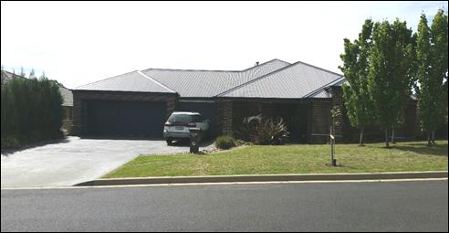
Figure 1 - photograph of the existing dwelling and attached
garages
There are no carports within the frontage of lots in this
street, and only one example of a double carport in the wider area, which
achieves the minimum 4.5m setback and therefore does not impact on the
streetscape. The proposed carport would be located forward of the main building
line of the existing dwelling and neighbouring dwellings. Given the substantial
size of the carport, and lack of setback from the street, it is considered that
the adverse impacts will be significant in terms of the desired streetscape of
this recently developed estate. It is considered that such a departure from the
requirements of the DCP in a newly established area would be inappropriate.
Overall, the proposal does not meet the objectives for
residential design and the planning outcomes for neighbourhood character as
follows:
· the
proposed site layout will not achieve an attractive and cohesive streetscape
and residential environment
· the
appearance of the carport is not of a high visual quality and will not enhance
the streetscape
· the
carport has not been designed to complement the features and built form that
characterises the area.
7.7-2 - Building Appearance
The DCP sets the following Planning Outcomes in regard to
Building Appearance:
· The
building design, detailing and finishes relate to the desired neighbourhood
character, complement the residential scale of the area, and add visual
interest to the street.
· The
frontages of buildings and their entries face the street.
· Garages
and car parks are sited and designed so that they do not dominate the street
frontage.
The proposed carport would be visually dominant due to its
size and insufficient setback from the street, when compared with the open
nature of the frontages within the existing streetscape. The existing attached
triple garage is already comparatively dominate in the streetscape, however
this is mitigated by its setback of 8m. This mitigating factor would be
ineffective with a large carport located in front of it. As discussed in
‘Neighbourhood Character’ above, the proposed carport will dominate
the street and the existing dwelling, where its design does not complement the
residential scale of the area. The planning outcomes and residential design
objectives have not been met in regards to building appearance.
7.7-4 - Setbacks
The DCP sets the following Planning Outcomes in regard to
Setbacks:
· Street setbacks
contribute to the desired neighbourhood character, assist with the integration
of new development and make efficient use of the site.
· Street setbacks
create an appropriate scale for the street considering all other streetscape
components.
These outcomes seek to achieve an appropriate scale of
development for the street and neighbourhood. As discussed in
‘Neighbourhood Character’ and ‘Building Appearance’
above, the proposed carport is setback only 3.7m from the frontage, and will
adversely impact on the existing dwelling, the streetscape, and neighbourhood
character.
The proposal would be
considered more appropriate and could achieve the planning outcomes and
residential design objectives if the carport was reduced in scale, was set back
at least 4.5m from the front boundary, and the existing 6m wide driveway was
retained (that is, reduce the size of the carport so that the driveway does not
require widening). These issues were discussed with the applicant, and they
were requested to consider amending the proposal so the carport would be less dominant
on the street, however they declined to do so, stating that that a
reduced and set back carport would not be able to fully cover their vehicles. It
is noted that the only carport within the frontage in the neighbourhood, which
the applicant gives as an example, has been designed to be set back 4.5m from
the street, and is reduced in size (i.e. double width, and reduced depth),
which appropriately balances the need for adequate coverage of vehicles,
without adversely impacting on the street and neighbourhood.
Whilst a triple carport on a 4.5m setback is not desirable,
at least it would be set back in line with the neighbouring dwelling houses,
and therefore would not be as dominant as the proposed 3.7m setback. However,
as mentioned above, the applicant has refused to move the carport further back
from the frontage. It is noted that a greater setback alone would not be
sufficient to achieve an adequate development, as the driveway would still have
to be widened to allow for manoeuvring in and out of the site, and as such, the
carport also needs to be reduced in size/scale.
It its current form, the proposed carport does not achieve
the planning outcomes for setbacks, or the overall objectives for residential
design.
7.7-5 - Fences and Walls
The DCP sets the following Planning Outcomes in regard to
Fences and Walls:
· Front fences
and walls:
– assist
in highlighting entrances and creating a sense of identity within the
streetscape
– are
constructed of materials compatible with associated housing and with fences
visible from the site that positively contribute to the streetscape
– provide
for facilities in the street frontage area such as mail boxes.
The proposal does not relate to fencing.
Bulk and Scale Objectives
· To
allow flexibility in siting buildings and to ensure that the bulk and scale of
new development reasonably protects the amenity of neighbouring properties and
maintains appropriate neighbourhood character.
· To
allow adequate daylight, sunlight and ventilation to living areas and private
open spaces of new and neighbouring developments.
· To
encourage the sharing of views, while considering the reasonable development of
the site.
The development is considered to be inconsistent with the
above objectives, as detailed below.
7.7-6 - Visual Bulk
The DCP sets the following Planning Outcome in regard to
Visual Bulk:
· Built form accords
with the desired neighbourhood character of the area with:
- side and rear setbacks
progressively increased to reduce bulk and overshadowing
- site coverage that retains
the relatively low density landscaped character of residential areas
- building form and siting
that relates to landform, with minimal land shaping (cut and fill)
- building height at the
street frontage that maintains a comparable scale with the predominant adjacent
development form
- building to the boundary
where appropriate.
While the proposed carport will fit within the bulk and
scale envelope, its great size and reduced setback from the street will result
in a building form that does not accord with the neighbourhood character from a
streetscape perspective. As noted previously in this report, the existing
dwelling and garaging at the frontage has already been built using the minimum
setbacks, leaving little scope for further development. A carport reduced in
scale, that is, reduced in size and setback at least 4.5m from the street,
could allow a carport to be located in the frontage in a way that reasonably
protects the amenity of the neighbourhood.
The applicant, however was
unwilling to compromise in this regard, stating that the existing vegetation
provides sufficient screening. Although the boundary vegetation provides some
screening, it is not considered sufficient alone, and that the scale and
setback of the carport also needs to be reduced to ensure that the impacts are
not unreasonable or adverse. It is also noted that the vegetation along the
northern boundary, which provides for most of the screening is likely to need
trimming back to facilitate the building and siting of the carport, and less
foliage will need to be maintained in the long-term due to conflict between the
vegetation and the carport (see Figure 2).
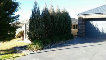
Figure 2 - photograph of northern boundary vegetation
As such, the proposal does not meet the planning outcomes
for visual bulk, or the overall bulk and scale objectives.
7.7-7 - Walls and Boundaries
The DCP sets the following Planning Outcome in regard to
Walls and Boundaries:
· Building to the
boundary is undertaken to provide for efficient use of the site taking into
account:
- the privacy of neighbouring
dwellings and private open space
- the access to daylight
reaching adjoining properties
- the impact of boundary walls
on neighbours.
The proposed side setbacks will ensure there will be no
privacy or daylighting impacts on the adjacent residential properties.
7.7-8 - Sunlight and Daylight
The DCP sets the following Planning Outcome in regard to
Daylight and Sunlight:
· Buildings are
sited and designed to ensure:
- daylight to habitable rooms
in adjacent dwellings is not significantly reduced
- overshadowing of
neighbouring secluded open spaces or main living area windows is not
significantly increased
- consideration of
Council’s Energy Efficiency Code.
As mentioned previously, the proposed carport can be
contained within the bulk and scale envelope, and complies with side setbacks,
therefore there will be no adverse impacts to neighbouring properties in terms
of sunlight and daylight to windows and areas of private open space.
7.7-9 - Views
The DCP sets the following Planning Outcomes in regard to
Views:
· Building form
and design allow for residents from adjacent properties to share prominent
views where possible.
· Views including
vistas of heritage items or landmarks are not substantially affected by the
bulk and scale of the new development.
There are no prominent views, or vistas, from the property,
therefore these outcomes are not relevant to the application.
Site Access
and Circulation Objectives
· To
provide convenient and safe access and parking that meets the needs of all
residents and visitors.
· To
encourage the integrated design of access and parking facilities to minimise
visual and environmental impacts.
The proposed development is inconsistent
with the above objectives, as detailed below.
7.7-14 - Circulation Design
The DCP sets the following Planning Outcome in regard to
Circulation and Design:
· Accessways and
parking areas are designed to manage stormwater.
· Accessways,
driveways and open parking areas are suitably landscaped to enhance amenity
while providing security and accessibility to residents and visitors.
· The site layout
allows people with a disability to travel to and within the site between car
parks, buildings and communal open space.
The proposal does not seek to alter access arrangements to
the site, however a wider driveway would be required to provide adequate
vehicle manoeuvring in and out of the carport. As discussed earlier in this
assessment, a 9m driveway would be required, which is 3m wider than the maximum
6m set out in the DCP. This would result in adverse visual impacts to the
street and neighbourhood, as the property would have additional hard standing
areas and less landscaped areas. Landscaped areas in the frontage are required
to ‘soften’ the visual impact of a dwelling and its garaging and
driveways into a streetscape, to provide for an attractive neighbourhood, as
well as mitigate stormwater runoff from the property onto the street. It is
also noted that there are safety concerns with the proposed carport being used
as vehicle parking and manoeuvring, as well as a children’s play area. It
is not considered appropriate to locate children’s recreational areas
within the driveway due to potential vehicle conflicts.
It is considered that the proposal does not achieve the
planning outcomes in regards to circulation design, or the overall objective
for site access and circulation.
7.7-15 - Car Parking
The DCP sets the following Planning Outcomes in regard to
Car Parking:
· Parking
facilities are provided, designed and located to:
- enable the efficient and
convenient use of car spaces and accessways within the site
- reduce the visual dominance
of car parking areas and accessways.
· Car parking is
provided with regard to the:
- the number and size of
proposed dwellings
- requirements of people with
limited mobility or disabilities.
The proposed carport will increase the number of parking
spaces originally proposed and approved for the subject lot. There is an
existing double garage in the backyard, and a triple garage attached to the existing
dwelling, providing for 5 covered car parking spaces. The addition of the
proposed carport would result in 8 covered parking spaces on the site, which is
well above average, and out of character for the neighbourhood.
It is noted that the DCP only requires 1.7 parking spaces
for a dwelling with 3 or more bedrooms. Recent census data (2016) states that
around 50% of Orange residents have access to more than 2 motor vehicles, and
this appears to be the case for the applicant, who requires more than the
average number of covered parking spaces.
However, the need for additional vehicle parking on the site
should not be to the detriment of the neighbourhood, and it is considered that
the proposal could easily be amended to be more suitable for the site and
surrounds.
In its current form, the proposed development does not meet
the planning outcomes for car parking, or the overall objectives for site
access and circulation, as the proposed parking spaces would not retain the
residential character of the area, and will result in an increase of visual
dominance of garaging, car parking, and driveway/hard standing areas on the
site.
7.7-16 - Private Open Space
The DCP sets the following Planning Outcomes in regard to
Private Open Space:
· Private open
space is clearly defined for private use.
· Private open
space areas are of a size, shape and slope to suit the reasonable requirements
of residents including some outdoor recreational needs and service functions.
· Private open
space is:
– capable
of being an extension of the dwelling for outdoor living, entertainment and
recreation
– accessible
from a living area of the dwelling
– located
to take advantage of outlooks; and to reduce adverse impacts of overshadowing
or privacy from adjoining buildings
– Orientated
to optimise year round use.
The carport will not impact on the availability of, or
access to private open space on the site. Given the proposal will result in
adverse impacts to the street and neighbourhood, it is considered that the site offers ample alternative areas to the
rear of the dwelling to provide for covered vehicle storage and recreational
spaces, that can be designed in a way that do not impact on the neighbourhood
and the streetscape, yet still provide adequate private outdoor areas. It is
also considered more appropriate, in terms of security and safety, that children’s recreational areas and
play equipment are located to the rear of the site, where the driveway
poses potential vehicle conflicts.
7.7-17 - Open Space and
Landscaping
The DCP sets the following Planning Outcomes in regard to
Open Space and Landscaping:
· The site layout
provides open space and landscaped areas which:
– contribute
to the character of the development by providing buildings in a landscaped
setting
– provide
for a range of uses and activities including stormwater management
– allow
cost effective management.
· The landscape
design specifies landscape themes consistent with the desired neighbourhood
character; vegetation types and location, paving and lighting provided for
access and security.
· Major existing
trees are retained and protected in a viable condition whenever practicable
through appropriate siting of buildings, accessways and parking areas.
· Paving is
applied sparingly and integrated in the landscape design.
The carport will be located over the existing concrete
driveway, however the driveway width in the frontage and at the street will
need to be increased to provide for adequate manoeuvring of vehicles in and out
of the site. As such, the provision of unpaved area will be reduced in the
front garden area, thereby reducing landscaping and permeable areas, resulting
in adverse visual impacts to the street and neighbourhood, and increasing stormwater
runoff from the site to the street. Stormwater is discussed in more detail
below. It is considered that the proposal does not meet the planning outcomes
for open space and landscaping.
Water and Soil Management
Objectives
· To control and
minimise the impact of stormwater run-off and soil erosion on adjoining land
and downstream.
· To encourage
reduced water wastage by reusing, recycling and harvesting stormwater.
The development is inconsistent with the above objectives,
as detailed below.
7.7-18 - Stormwater
The DCP sets the following Planning Outcomes in regard to
Stormwater:
· Onsite drainage
systems are designed to consider:
– downstream
capacity and need for on-site retention, detention and re-use
– scope
for on-site infiltration of water
– safety
and convenience of pedestrians and vehicles
– overland
flowpaths.
· Provision is
made for onsite drainage which does not cause damage or nuisance flows to
adjoining properties.
It is assumed that the carport guttering will be connected
to the existing stormwater system, however the driveway width will need to be
increased to provide for adequate manoeuvring of vehicles. The reduction of
landscaping and permeable areas in the frontage will increase stormwater runoff
from the site to the street, which may result in impacts to the existing
stormwater system during heavy/flash rainfall events. The application has not
addressed this matter, and as such, these planning outcomes and the overall
objectives have not been met.
7.7-19 - Erosion and Sediment
Control
The DCP sets the following Planning Outcome in regard to
Erosion and Sedimentation:
· Measures
implemented during construction to ensure that the landform is stabilised and
erosion is controlled.
It is assumed that the carport guttering will be connected
to the existing stormwater system, and soil erosion can be managed at
construction stage. Therefore impacts to neighbouring properties will be
minimal.
PROVISIONS PRESCRIBED BY THE
REGULATIONS s79C(1)(a)(iv)
Demolition of a Building (clause 92)
The proposal does not involve the demolition of a building.
Fire Safety Considerations
(clause 93)
The proposal does not involve a change of building use for
an existing building.
Buildings to be Upgraded
(clause 94)
The proposed works do not require the upgrading of the
existing dwelling house.
BASIX Commitments (clause 97A)
The provisions of BASIX will do not apply to a Class 10a
carport.
THE LIKELY IMPACTS OF THE
DEVELOPMENT s79C(1)(b)
Neighbourhood Amenity and Visual Impacts
The pattern of development in the surrounding area is
exceptionally consistent, and as discussed in the DCP assessment, the proposed
triple carport being 40m2 in size and only setback 3.7m from the
street frontage, coupled with the need to increase the width of the existing
driveway to 9m, will not be in keeping with the surrounding neighbourhood
character and will be visually dominant in the streetscape.
In its current form, the proposed carport does not meet the DCP
objectives for ‘Residential Design’, ‘Bulk and Scale’,
‘Site Access and Circulation’, and ‘Open Space and
Landscaping’; nor meet the DCP planning outcomes for ‘Neighbourhood
Character’, ‘Building Appearance’, ‘Setbacks’,
‘Visual Bulk’, ‘Circulation Design’, ‘Car
Parking’, and ‘Open Space and Landscaping’ as follows:
· the proposed site
layout will not achieve an attractive and cohesive streetscape and residential
environment
· the appearance of
the carport is not of a high visual quality and will not enhance the streetscape
· the carport has
not been designed to complement the features and built form that characterises
the area
· the carport has
not been designed to minimise visual impacts.
Overall, the proposed carport is likely to adversely affect
the visual and residential quality of the existing streetscape and
neighbourhood character. Mitigation of these impacts is possible by reducing
the scale of the carport, and setting it back at least 4.5m from the street,
however the applicant is not willing to amend its design.
Traffic Impacts
The proposed carport will not generate an increase in
traffic movements compared to the existing or approved situation, however,
adequate circulation can only be achieved if the driveway is widened to triple
width. The proposal is unlikely to have any traffic impacts if the driveway is
widened, but this would be to the detriment of the residential amenity of
neighbouring properties and the wider neighbourhood.
Environmental Impacts
The subject land is highly modified and well established
with no significant vegetation, threatened species or ecological endangered
communities or their habitats. No changes are proposed to the existing
landscaping on the site, however the driveway will need to be widened to
provide for adequate manoeuvring in and out of the site. This will result in a reduction
of landscaping and permeable areas in the frontage, and will increase
stormwater runoff from the site.
In its current form, the proposed carport does not meet the DCP
objectives for ‘Residential Design’, ‘Site Access and
Circulation’, ‘Open Space and Landscaping’ and ‘Water
and Soil Management’; nor meet the DCP planning outcomes for
‘Circulation Design’, ‘Open Space and Landscaping’, and
‘Stormwater’ as follows:
· the carport has
not been designed to fit into its setting and environmental features of the
locality
· the carport has
not been designed to minimise environmental impacts
· the carport has
not been designed to apply paving sparingly, integrate suitable landscaping, or
to control and minimise stormwater run-off.
Overall, the proposed use is likely to impact upon the local
environment, and no mitigation measures have been proposed.
Cumulative Impacts
The development may present cumulative impacts within the
locality by setting a precedent for inappropriate carports in the street and
neighbourhood. Whilst a carport is generally considered an appropriate use of
land, the design and siting of this carport is not consistent with the
objectives and planning outcomes of the LEP and DCP.
THE SUITABILITY OF THE SITE
s79C(1)(c)
It is
considered that the site is suitable for a carport, as the land is
appropriately serviced and there are no known physical attributes,
technological or natural hazards which constrain the site. However, as assessed
above, the design and siting of the carport in its proposed form do not meet
the objectives, and planning outcomes of both the LEP and DCP. Suitable
alternatives exist on the site, such as a carport of reduced scale and greater
setback in the frontage, or a carport/covered area to the rear, which could
achieve similar intentions that are not detrimental to the neighbourhood or
environment.
ANY SUBMISSIONS MADE IN
ACCORDANCE WITH THE ACT s79C(1)(d)
The proposed development is not defined as advertised
development under the provisions of the LEP and, as such, no formal exhibition
of the application was required. However, the application was notified to
neighbours for a period of 14 days, and at the end of that period, no
submissions were received in relation to this application.
PUBLIC INTEREST
s79C(1)(e)
The proposed development is considered to be of minor
interest to the wider public due to the localised nature of potential impacts. The
proposed carport would result in adverse impacts to the neighbourhood
character, and may result in cumulative impacts by setting an inappropriate
precedent.
SUMMARY
The proposed development is permissible with the consent of
Council. The applicant has not demonstrated that the proposed development
complies with the relevant objectives and planning outcomes of the LEP and DCP.
A Section 79C assessment of the development indicates that the development is
likely to result in adverse impacts which cannot be mitigated unless the
carport is redesigned. The applicant is unwilling to concede in this regard,
and as such, the proposal is considered unacceptable, and refusal of the
application is recommended. Attached is a draft Notice of Refusal.
Attachments
1 Notice
of Refusal, D17/63474⇩
2 Plans,
IC17/13335⇩
3 Supporting
Information, D17/63483⇩
Planning and Development Committee
7 November 2017
2.9 Development
Application DA 244/2017(1) - 15 Etna Street
Attachment 1 Notice
of Refusal
|

|
ORANGE
CITY COUNCIL
Development
Application No DA
244/2017(1)
NA17/ Container
PR22884
|
NOTICE OF DETERMINATION
OF A DEVELOPMENT
APPLICATION
issued under the Environmental
Planning and Assessment Act 1979
Section 81(1)
|
Development Application
|
|
|
Applicant Name:
|
Mrs K Churchill
|
|
Applicant Address:
|
15 Etna
Street
ORANGE
NSW 2800
|
|
Land to Be Developed:
|
Lot 51 DP 1127190 - 15 Etna Street,
Orange
|
|
Proposed Development:
|
Dwelling Alterations and Additions (carport)
|
|
|
|
|
Building Code of Australia
Building Classification:
|
Not applicable
|
|
|
|
|
Determination
|
|
|
Made On:
|
7 November 2017
|
|
Determination:
|
APPLICATION REFUSED
|
|
|
|
|
Reason(s) for Refusal:
|
(1) The
site layout and design of the proposed development is of a scale and setback
which is inappropriate for the residential setting and out of character with
the surrounding pattern of development, and will adversely impact on the
character of the neighbourhood, contrary to the objectives of Orange
Development Control Plan 2004.
(2) The
design of the proposed development is not of sufficient visual quality and
will adversely impact on the visual amenity of the streetscape and
residential environment, contrary to the objectives of Orange Development
Control Plan 2004.
(3) The
proposed development is not in the public interest, will adversely impact the
neighbourhood character, and may result in cumulative impacts by setting an
inappropriate precedent, contrary to the objectives of Orange Development
Control Plan 2004.
|
|
|
|
|
Right of Appeal:
|
Applicant:
If
you are dissatisfied with this decision, Section 97 of Environmental
Planning and Assessment Act 1979 gives you the right to appeal to the
Land and Environment Court within 6 months after the date on which you
receive this notice.
*
Section 97 of the Environmental Planning and Assessment Act, 1979 does not
apply to the determination of a development application for State significant
development or local designated development that has been the subject of a
Commission of Inquiry.
Objector:
The
Environmental
Planning and Assessment Act 1979 does not give a right of appeal against this
determination to an objector.
|
|
|
|
|
Signed:
|
On behalf of the consent authority:
|
|
Signature:
|
|
|
Name:
|
PAUL JOHNSTON - MANAGER DEVELOPMENT
SERVICES
|
|
Date:
|
8 November 2017
|
Planning
and Development Committee
7 November 2017
2.9 Development
Application DA 244/2017(1) - 15 Etna Street
Attachment 2 Plans
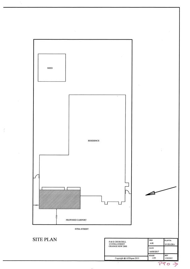
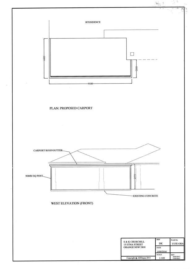
Planning
and Development Committee
7 November 2017
2.9 Development
Application DA 244/2017(1) - 15 Etna Street
Attachment 3 Supporting
Information

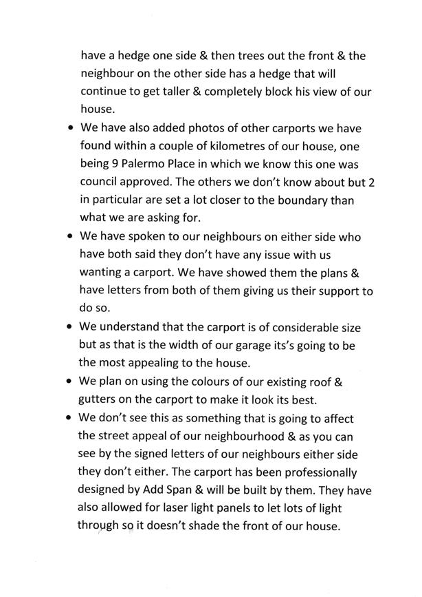

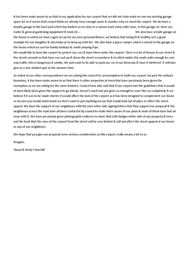
2.10 Development
Application DA 181/2017(1) - 6A and 8 Ophir Street
RECORD
NUMBER: 2017/2216
AUTHOR: Michael
Glenn, Senior Planner
EXECUTIVE Summary
|
Application
lodged
|
22 May
2017
|
|
Applicant/s
|
Mr M
Mustac
|
|
Owner/s
|
Mustac
Holdings Pty Ltd
|
|
Land
description
|
Lots 160
and 161 DP 1105373 - 6A and 8 Ophir Street, Orange
|
|
Proposed
land use
|
Multi
dwelling housing (six dwellings); Subdivision (seven lot Community title
residential); Tree removal within Lot 161 DP 1105373 (being
6A Ophir Street); and use of existing right-of-way in Lot 160
DP 1105373 (being 8 Ophir Street) to provide access
|
|
Value of
proposed development
|
$880,000
|
Council's consent is sought for multi dwelling housing (with
six units proposed), and Community Title subdivision. An existing dwelling on
8 Ophir Street is proposed to be retained. 8 Ophir Street is part of
the application simply to provide for a proposed right-of-way
to the principal lot, being 6A Ophir Street. 6 Ophir Street located
on the western side of the access drive is not part of the proposed
development. The development site is effectively 6A Ophir Street.
The subject property is affected by an overland flowpath
that traverses through the property. Council’s Technical Services
Division has provided advice indicating certain minimum floor levels, generally
raising the height of the buildings by 200mm so as to achieve minimum
freeboards above the flood planning levels for the site. Amended plans received
in early September generally conform to those requirements, but because the
applicant's revised submission is slightly different to the specified levels, a
condition is included in the consent.
There is an overland flowpath affecting the property that
requires that the full width of the driveway to be hard paved to maximise flow
rates. This will make it necessary for the driveway (generally 4.5m wide
including a right-of-way proposed for the
western flank of 8 Ophir street) to remain fully clear of
obstruction, including no landscaping. This part of the driveway will required
to be fully hard paved to address the overland flow issue. These arrangements
do not fully comply with Council’s Development Control Plan
(DCP) requirements, but are considered to be adequate and necessary in
this case. The site was first subdivided and approved as a potential unit site
with a 3m wide accessway, to which the current application is proposing a
further 1.5m width to be added. It is possible for vehicles to enter and leave
the site in a forward direction, and for vehicles to pass each other
simultaneously within the driveway. It is conceded that the driveway is not
ideal, however, the vehicle access arrangement would have been considered when
the original subdivision was approved. A variation to the DCP with respect to
driveway standards is considered justified in this instance.
Neighbour submissions have raised a number of issues,
generally concerning privacy, site stability and congestion in Ophir Street.
Some of the issues raised by neighbours are not considered well founded in
terms of the planning outcomes expected under the DCP (and other relevant
matters for consideration).
The applicant has addressed some of the issues in the
amended plans. It is considered overall that the proposed development does
respond to a certain extent to the matters of concern raised by neighbours, and
that other issues that have been raised are either not matters relevant to the
planning assessment, or not of sufficient impact as to constitute a significant
adverse effect or can be addressed by conditions. As a consequence, it is
considered possible to support approval of the application, subject to
conditions to address certain details of the application.
DECISION FRAMEWORK
Development in Orange is governed by two key documents -
Orange Local Environment Plan 2011 and Orange Development Control Plan 2004. In
addition, the Infill Guidelines are used to guide development, particularly in the
heritage conservation areas and around heritage items.
Orange Local Environment Plan
2011 – the LEP should be considered by Council to be a definitive
document. LEPs govern the types of development that are permissible or
prohibited in different parts of the City and also provide some assessment
criteria in specific circumstances. Uses are either permissible or not - there
are no grey areas in terms of permissibility. The objectives of each zoning and
indeed the aims of the LEP itself are, however, open to interpretation and can
be used to guide decision making around appropriateness of development.
Orange Development Control Plan
2004 – the DCP guides development. In general it is a performance
based document rather than prescriptive in nature - its purpose is to guide
development. The Land and Environment Court tends to view it as such. In each
area of interest there are often guidelines used. These guidelines indicate
ways of achieving the planning outcomes. It is thus recognised that there may
also be other solutions of merit. All design solutions are considered on merit
by planning and building staff. Applications should clearly demonstrate how the
planning outcomes are being met where alternative design solutions are
proposed. So one can see that the DCP gives leeway for developers and
architects to use design to achieve the outcome in other ways if they can.
Stating that DCP guidelines are inflexible can be misleading.
In this case the proposed development is permissible with
development consent. The applicant has sought a departure to the DCP access
requirements. As discussed in the body of this report, a variation to the DCP
requirements with respect to driveway standards is considered justified in this
instance. Neighbour submissions have raised a number of issues, generally
concerning privacy, site stability and congestion in Ophir Street. The matters
raised in the submissions have been addressed in the body of this report. The
attached Notice of Determination contains several conditions of consent
considered suitable to ensure that the development proceeds in an acceptable
manner.
Link To
Delivery/OPerational Plan
The recommendation in this report relates to the
Delivery/Operational Plan strategy “13.4 Our
Environment – Monitor and enforce regulations relating to City amenity”.
Financial Implications
Nil
Policy and Governance Implications
Nil
|
Recommendation
That Council consents to
development application DA 181/2017(1)
for Multi Dwelling Housing (six dwellings); Subdivision (seven lot
Community title residential); Tree Removal within Lot 161 DP 1105373 (being
6A Ophir Street); and Use of Existing Right-of-Way in Lot 160 DP 1105373
(being 8 Ophir Street) to Provide Access at Lots 160 and 161
DP 1105373 - 6A and 8 Ophir Street, Orange, pursuant to the conditions of consent in the attached
Notice of Approval.
|
further considerations
Consideration has been given to the
recommendation’s impact on Council’s service delivery; image and
reputation; political; environmental; health and safety; employees;
stakeholders and project management; and no further implications or risks have
been identified.
SUPPORTING INFORMATION
THE APPLICATION
Council's consent is sought for multi dwelling housing (six
dwellings); subdivision (seven lot Community Title residential); tree removal
within Lot 161 DP 1105373 (being 6A Ophir Street); and use
of an existing right-of-way in Lot 160 DP 1105373 (being
8 Ophir Street) to Provide Access at Lots 160 and 161 DP 1105373 - 6A
and 8 Ophir Street, Orange.
THE PROPOSAL
The proposal involves the following principal elements:
Tree Removal
Removal of existing vegetation on
the site.
Multi
Dwelling Housing
Consent is sought for the construction of six units as
depicted in the attached plan set by Bassmann Drafting Services. The proposed
units are detached and each will comprise:
· two bedrooms (with
ensuite to main)
· open plan
kitchen/dining/living area
· bathroom
· laundry
· attached single
garage.
The external finishes of the
proposed units will comprise:
· face brickwork
walls with rendered and painted entry feature at the front door
· Colorbond roof
sheeting
· powder coated
aluminium window frames
· panel lift garage
doors.
Private open space will be provided for each unit. Perimeter
fencing (1.8m high) and internal fencing (1.5m high) will be established.
The site will be landscaped and lawn areas will be established. Visitor parking
spaces will be provided.
Given the limited driveway width, bin collection bays are
identified within the main section of the site (near Units 1 and 6). The bins
will be stored in these bays and will be collected under a run-cost arrangement
with Council’s waste collection contractor. At all times (ie other
than collection days) the bins will be stored within the individual lots. There
is no communal bin storage proposed.
Community Title Subdivision
The proposal involves a seven
lot Community Title subdivision of the subject land to create the following
parcels:
|
Community
Title Lot
|
Area
subject to survey
|
Purpose
|
|
1
|
368.2m²
|
Community
Property
|
|
2
|
278.3m²
|
Unit
1
|
|
3
|
215.1m²
|
Unit
2
|
|
4
|
210.0m²
|
Unit
3
|
|
5
|
213.6m²
|
Unit
4
|
|
6
|
207.0m²
|
Unit
5
|
|
7
|
209.4m²
|
Unit
6
|
Proposed Lot 1 (Community Property) will comprise the shared
driveway, roadway, visitor parking spaces, some of the landscaped areas, bin
collection bays and the mail boxes.
Proposed Lots 2 to 7 will each excise the respective unit
and its private open space area. Access to the proposed lots will be provided
via Lot 1 (Community Property) which will connect to Ophir Street.
The proposed lots will be connected to urban utility
services in accordance with the requirements of the relevant supply authority.
MATTERS FOR CONSIDERATION
Section 5A Assessment
In the administration of sections 78A, 79B, 79C, 111 and
112, the provisions of Section 5A must be taken into account for every
development application in deciding whether there is likely to be a significant
effect on threatened species, populations or ecological communities or their
habitats. This section includes a requirement to consider any adopted
assessment guidelines, which means assessment guidelines issued and in force
under section 94A of the Threatened Species Conservation Act 1995.
Assessment guidelines are in force (see DECC-W “Threatened Species
Assessment Guidelines - The Assessment of Significance”) which requires
consent authority to adopt the precautionary principle in its assessment.
From 25 August 2017, the Biodiversity Conservation Act 2017
and Biodiversity Conservation Regulation 2017 were gazetted. State
Environmental Planning Policy (Native Vegetation in Non-Rural Areas) 2017 was
also gazetted. The implementation of this legislation (and supporting
guidelines) is subject to savings provisions that defer their full effect for a
period of three months from the date of gazettal for local development.
In this instance, site inspection reveals that the subject
property has no biodiversity or habitat value.
Section 79C
Section 79C of the Environmental Planning and Assessment
Act 1979 requires Council to consider various matters, of which those
pertaining to the application are listed below.
PROVISIONS OF ANY ENVIRONMENTAL
PLANNING INSTRUMENT s79C(1)(a)(i)
Orange Local Environmental Plan
2011
Part 1 - Preliminary
Clause 1.2 - Aims of Plan
The
broad aims of the LEP are set out under subclause 2. Those relevant to the
application are as follows:
(a) to
encourage development which complements and enhances the unique character of
Orange as a major regional centre boasting a diverse economy and offering an
attractive regional lifestyle,
(b) to
provide for a range of development opportunities that contribute to the social,
economic and environmental resources of Orange in a way that allows present and
future generations to meet their needs by implementing the principles for
ecologically sustainable development,
(c) to
conserve and enhance the water resources on which Orange depends, particularly
water supply catchments,
(d) to
manage rural land as an environmental resource that provides economic and
social benefits for Orange,
(e) to
provide a range of housing choices in planned urban and rural locations to meet
population growth,
(f) to
recognise and manage valued environmental heritage, landscape and scenic
features of Orange.
The application is not inconsistent with the relevant aims.
Clause 1.6 - Consent Authority
This clause establishes that, subject to the Act, Council is
the consent authority for applications made under the LEP.
Clause 1.9A - Suspension of
Covenants, Agreements and Instruments
This clause provides that covenants, agreements and other
instruments which seek to restrict the carrying out of development do not apply
with the following exceptions:
· covenants imposed
or required by Council
· prescribed
instruments under Section 183A of the Crown Lands Act 1989
· any conservation
agreement under the National Parks and Wildlife Act 1974
· any trust
agreement under the Nature Conservation Trust Act 2001
· any property
vegetation plan under the Native Vegetation Act 2003
· any biobanking
agreement under Part 7A of the Threatened Species Conservation Act 1995
· any planning
agreement under Division 6 of Part 4 of the Environmental Planning and
Assessment Act 1979.
It is believed that the subject property is not affected by
any of the above.
Mapping
The subject site is identified
on the LEP maps in the following manner:
|
Land Zoning Map:
|
Land zoned R1 General Residential
|
|
Lot Size Map:
|
No Minimum Lot Size
|
|
Heritage Map:
|
Not a heritage item or conservation
area
|
|
Height of Buildings Map:
|
No building height limit
|
|
Floor Space Ratio Map:
|
No floor space limit
|
|
Terrestrial Biodiversity Map:
|
No biodiversity sensitivity on the
site
|
|
Groundwater Vulnerability Map:
|
ground water vulnerable
|
|
Drinking Water Catchment Map:
|
Not within the drinking water
catchment
|
|
Watercourse Map:
|
Not within or affecting a LEP
defined watercourse
|
|
Urban Release Area Map:
|
Not within an urban release area
|
|
Obstacle Limitation Surface Map:
|
No restriction on building siting
or construction
|
|
Additional Permitted Uses Map:
|
No additional permitted use applies
|
Those matters that are of relevance are addressed in detail
in the body of this report.
Part 2 - Permitted or Prohibited Development
Land
Use Zones
The subject site is located within the R1 General
Residential zone. The proposed development is defined as "multi dwelling
housing" under OLEP 2011.
Pursuant to the dictionary contained within OLEP 2011 multi
dwelling housing means:
Three or more dwellings (whether attached or detached) on one lot of
land, each with access at ground level, but does not include a residential flat
building.
Note. Multi dwelling housing is a type
of residential accommodation—see the definition of that term in this
Dictionary.
Multi dwelling housing is
permissible with consent in the R1 General Residential zone.
Subdivision is defined under the
provisions of Division 4B of the Environmental Planning and Assessment Act
1979. It includes subdivisions under the Strata Titles Act or the Community
Land Management Act.
Clause 2.3 of LEP 2011
references the Land Use Table and Objectives for each zone in LEP 2011.
These objectives for land zoned R1 General Residential are as follows:
1 - Objectives of the R1 General Residential
Zone
· To
provide for the housing needs of the community.
· To
provide for a variety of housing types and densities.
· To
enable other land uses that provide facilities or services to meet the day to
day needs of residents.
· To
ensure development is ordered in such a way as to maximise public transport
patronage and encourage walking and cycling in close proximity to settlement.
· To
ensure that development along the Southern Link Road has an alternative access.
In relation to the first
objective, the proposed development would act to provide additional housing
stock within the City. In relation to the second objective, the proposed
dwellings will provide a variation of housing type and density for the City. In
relation to the third objective, the proposed development has no effect. In
relation to the fourth objective, the subject site is within close proximity to
routes used by public transport, and is also in close proximity to shops and
services. In relation to the last objective, the proposed development has no
effect.
The proposed development is not
inconsistent with the objectives of the zone.
Clause 2.6 - Subdivision -
Consent Requirements
The applicant is seeking consent for subdivision in
accordance with this Clause.
Part 4 - Principal Development Standards
Clauses 4.1 and 4.1B -
Minimum Subdivision Lot Size and Minimum Lot Sizes for Dual Occupancy, Multi
Dwelling Housing and Residential Flat Buildings
This Clause establishes the
minimum lot size required for dual occupancies and multi dwelling housing
in the R1 and R2 zones. The proposed multi dwelling housing project is situated
on land within the R1 General Residential zone that is not identified on the Minimum
Lot Size Map. Accordingly, this clause requires the site to have a minimum area
of 1,250m2, which the subject property meets.
Part 7 - Additional Local Provisions
7.1
- Earthworks
This
clause establishes a range of matters that must be considered prior to granting
development consent for any application involving earthworks, such as:
(a) the likely disruption of, or any
detrimental effect on, existing drainage patterns and soil stability in the
locality of the development
(b) the effect of the development on the
likely future use or redevelopment of the land
(c) the quality of the fill or the soil to be
excavated, or both
(d) the effect of the development on the
existing and likely amenity of adjoining properties
(e) the source of any fill material and the
destination of any excavated material
(f) the likelihood of disturbing relics
(g) the proximity to and potential for adverse
impacts on any waterway, drinking water catchment or environmentally sensitive
area
(h) any measures proposed to minimise or
mitigate the impacts referred to in paragraph (g).
Some reshaping and filling of
the land is required, including land shaping for the creation of a formed
overland flowpath, but the amounts are very small - generally less than 500mm.
This is unlikely to affect the amenity of adjoining properties, and there is a
very low likelihood of disturbing or finding relics on the site. The proposed
earthworks are not being carried out within close proximity to a defined
waterway but are located in an overland stormwater flowpath. It will be
necessary to require the floor levels of the units to be raised to accommodate
the required freeboard. Attached is a condition of consent to this effect.
7.2 - Flood Planning
This
clause applies to land identified on the Flood Planning Map as a Flood Planning
Area and requires that, before any consent is issued, Council must be satisfied
that the proposal:
(a) is compatible with the flood hazard of the
land, and
(b) is not likely to significantly adversely
affect flood behaviour resulting in detrimental increases in the potential
flood affectation of other development or properties, and
(c) incorporates appropriate measures to
manage risk to life from flood, and
(d) is not likely to significantly adversely
affect the environment or cause avoidable erosion, siltation, destruction of
riparian vegetation or a reduction in the stability of river banks or
watercourses, and
(e) is not likely to result in unsustainable
social and economic costs to the community as a consequence of flooding.
Whilst
the subject land is not specifically mapped as a flood affected lot as defined
by the LEP the land is affected by an overland flow path that traverses the
subject land.
In
order to address the potential impact of the overland flow path on residential
development Council’s Technical Services Division has have provided the
following comments with respect to flood planning:
“The applicant will be required to provide on-site
detention to limit post development peak flows to that of pre-development peak
flows. In addition, the development will contribute to the provision of
off-site trunk stormwater infrastructure works for the development through s94
contributions due to the increased volume of stormwater runoff generated as a
result of the development.
Stormwater detention can be provided in the driveway and
yard areas of the units.
A significant stormwater overland flow path runs through
the site from Ophir Street. Floor heights will be determined for dwellings as part
of the civil engineering design to ensure 500mm clearance above the predicted
1% AEP flood level. Floor levels are expected to rise approx. 200mm on the
levels shown on the DA plans. Garages may be constructed at the 1% level
subject to garage construction with flood compatible materials.
Revised floor levels (to allow for 1% AEP event through the
site) have been provided to the applicant as follows:
Units 2,3,4,5 = 870.20m AHD
Unit 1 = 870.60m AHD
Unit 6 = 870.40m AHD”
The
amended plans submitted in September 2017 generally show that the design can
now substantially comply with the specified floor levels. There are some minor
areas of non-compliance, making it necessary to impose conditions that require
full compliance with Council's Technical Services specifications.
7.3 - Stormwater Management
This clause applies to all
industrial, commercial and residential zones and requires that Council be
satisfied that the proposal:
(a) is designed to maximise the use of water
permeable surfaces on the land having regard to the soil characteristics
affecting onsite infiltration of water
(b) includes, where practical, onsite
stormwater retention for use as an alternative supply to mains water,
groundwater or river water; and
(c) avoids any significant impacts of stormwater
runoff on adjoining downstream properties, native bushland and receiving
waters, or if that impact cannot be reasonably avoided, minimises and mitigates
the impact.
The applicant will be required to provide on-site detention
to limit post development peak flows to that of pre-development peak flows. In
addition, the development will contribute to the provision of off-site trunk
stormwater infrastructure works for the development through s94 contributions
due to the increased volume of stormwater runoff generated as a result of the
development. Stormwater detention can be provided in the driveway and yard
areas of the units.
A significant stormwater overland flow path runs through the
site from Ophir Street. Floor heights will be determined for dwellings as part
of the civil engineering design to ensure 500mm clearance above the predicted
1% AEP flood level. Floor levels are expected to rise approximately 200mm on
the levels shown on the DA plans. Garages may be constructed at the 1% level
subject to garage construction with flood compatible materials.
Conditions of consent are recommended to address stormwater
related issues.
7.4 - Terrestrial Biodiversity
This
clause seeks to maintain terrestrial biodiversity and requires that consent
must not be issued unless the application demonstrates whether or not the
proposal:
(a) is likely to have any adverse impact on
the condition, ecological value and significance of the fauna and flora on the
land
(b) is likely to have any adverse impact on
the importance of the vegetation on the land to the habitat and survival of
native fauna
(c) has any potential to fragment, disturb or
diminish the biodiversity structure, function and composition of the land, and
(d) is likely to have any adverse impact on the
habitat elements providing connectivity on the land.
Additionally, this clause
prevents consent being granted unless Council is satisfied that:
(a) the development is designed, sited and
will be managed to avoid any significant adverse environmental impact, or
(b) if that impact cannot be reasonably
avoided - the development is designed, sited and will be managed to minimise
that impact, or
(c) if that impact cannot be minimised - the
development will be managed to mitigate that impact.
There is no significant
terrestrial biodiversity that exists on the site
7.6 - Groundwater Vulnerability
This
clause seeks to protect hydrological functions of groundwater systems and
protect resources from both depletion and contamination. Orange has a high
water table and large areas of the LGA, including the subject site, are
identified with “Groundwater Vulnerability” on the Groundwater
Vulnerability Map. This requires that Council consider:
(a) whether or not the development (including
any onsite storage or disposal of solid or liquid waste and chemicals) is
likely to cause any groundwater contamination or have any adverse effect on
groundwater dependent ecosystems, and
(b) the cumulative impact (including the
impact on nearby groundwater extraction for potable water supply or stock water
supply) of the development and any other existing development on groundwater.
Furthermore, consent may not be granted unless Council is satisfied that:
(a) the development is designed, sited and
will be managed to avoid any significant adverse environmental impact, or
(b) if that impact cannot be reasonably
avoided - the development is designed, sited and will be managed to minimise
that impact,
(c) if that impact cannot be minimised - the
development will be managed to mitigate that impact.
The proposal is not anticipated
to involve the discharge of toxic or noxious substances and is therefore
unlikely to contaminate the groundwater or related ecosystems. The proposal
does not involve extraction of groundwater and will therefore not contribute to
groundwater depletion. The design and siting of the proposal avoids impacts on
groundwater and is therefore considered acceptable.
STATE ENVIRONMENTAL PLANNING
POLICIES
State Environmental Planning Policy 55 - Remediation of
Land
State Environmental Planning Policy 55 - Remediation of Land
applies to the subject development. SEPP 55 states that a consent authority
must not consent to the carrying out of any development unless:
(a) it has
considered whether the land is contaminated, and
(b) if the land is contaminated, it is
satisfied that the land is suitable in its contaminated state (or will be
suitable, after remediation) for the purpose for which the development is
proposed to be carried out, and
(c) if the land requires remediation to be made
suitable for the purpose for which the development is proposed to be carried
out, it is satisfied that the land will be remediated before the land is used
for that purpose.
The site is not identified on Council’s contaminated
sites register. A site inspection does not suggest evidence of contamination.
The long history of residential land uses also suggests that the site is
unlikely to suffer from contamination.
State Environmental Planning
Policy (Vegetation in Non-Rural Areas)
State Environmental Planning Policy (Vegetation In Non-Rural
Areas) is nominally applicable to the proposed development. The aims of the
policy are to
(a) protect the biodiversity values of trees
and other vegetation in non-rural areas of the State
(b) preserve the amenity of non-rural areas of
the State through the preservation of trees and other vegetation.
The tree protection aspects of the proposed development came
into effect from 25 August 2017, replacing the requirements of clause 5.9
of the LEP and adopting the provisions of PO‑0.4.2 (Interim Outcomes -
Tree Preservation) of DCP 2004.
Where a development application is lodged for associated
development, and where that associated development requires tree removal or is
likely to result in tree removal as a result of the development proceeding,
Council is required to take into account the provisions of the SEPP in its
determination.
In this case the subject application is specifically seeking
consent for the removal of all vegetation from the site. The predominant surface
cover is grass. The site is essentially clear of trees except for a pencil pine
along the access arm and a photinia tree along the eastern boundary. These will
require removal to accommodate the development. There are also intermittent
shrubs and small trees that will be removed. None of the vegetation on the site
can be considered significant, and its removal is not contrary to the aims of
the SEPP.
PROVISIONS OF ANY DRAFT
ENVIRONMENTAL PLANNING INSTRUMENT THAT HAS BEEN PLACED ON EXHIBITION
s79C(1)(a)(ii)
There are no draft environmental planning instruments that
apply to the subject land or proposed development.
DESIGNATED DEVELOPMENT
The proposed development is not designated development.
PROVISIONS OF ANY DEVELOPMENT
CONTROL PLAN s79C(1)(a)(iii)
Development Control Plan 2004
Special Requirements for Battleaxe Lots
· The accessway needs to be wide enough to allow for vehicular access
and services such as power, telecommunications, water and possibly drainage and
internal sewer.
· Unit developments may require a 6 metre wide driveway to provide for
passing cars.
Council’s standards indicate that the development is
required to provide a 4.5m wide pavement within a 6m wide corridor for access
to multi dwelling housing. The width required for access is to facilitate both
the required width of the driveway, the provision of infrastructure and provide
opportunities for suitable landscaping. In this case the available space for a
formed access is only 4.5m. The proposed driveway width is 3.1m plus 1.4m right-of-way (according to the engineering concept
plan submitted by Heath Consulting).
Council’s Technical Services Division advise that the
driveway as detailed on the DA plans has insufficient width to allow vehicles
to pass within the access arm, although there is an opportunity for passing of
vehicles at the front of the property and elsewhere within the site. Council’s
Technical Services Division advises that it will be necessary for the entire
4.5m wide access be formed and hard paved so as to manage and accommodate the
overland flow path that traverses the site. This requirement will come at the
expense of providing opportunity for landscaping strips along the driveway that
are normally required for residential driveways.
Also of note, Council’s Technical Services Division
advise that the combined driveway with 8 Ophir St may also lead to vehicle
conflicts due to the lack of a physical separation or any delineation between
the edge of the right-of-way serving the rear property and the existing 8 Ophir
St driveway. The width of the proposed driveway will also affect the ability to
practically manage garbage bins within the driveway (discussed later in the
report).
Subject to the implementation of the attached conditions of
consent, Council’s Technical Services Division advises that the proposed
arrangements and issues raised can be suitably managed and are acceptable in
this case. This decision has been partly recommended based on Council’s
previous position on the original subdivision, approved on 15 December 2004,
creating the subject title which endorsed a reduced width access that was anticipated
to be used for the purposes of a future multi dwelling housing proposal at that
time. Further the proposed variation to the access standard is considered
justified, given the special constraint of a flood path that affects the
driveway.
Urban
Residential Subdivision
The relevant Planning Outcomes for Urban
Residential Subdivision include:
· Lots below 350m² indicate existing or proposed house layouts
which identify how privacy, solar access, vehicle access and private open space
needs are to be achieved
· Lots below 500m² indicate a mandatory side setback to provide
for solar access and privacy
· Lots are fully serviced and have direct frontage access to a public
road
· Design and construction complies with the Orange City development
and subdivision code.
The subdivision component in this case follows the
construction of the multi dwelling units on the subject property.
This proposal can be demonstrated to be satisfactory in this
regard due to the following:
1 The
proposed residential lots will be of sufficient area to provide a satisfactory
standard of residential amenity to the proposed units in respect of privacy,
solar access, vehicular access and private open space.
2 Each
of the proposed lots will be provided with legal and practical access via
frontage to the private roadway under Community Title and its connection to
Ophir Street.
3 All
of the proposed unit lots will be fully serviced in terms of urban utilities.
4 The
subdivision design and construction will comply with the Orange Development and
Subdivision Code.
5 The
proposed subdivision is unlikely to cause significant environmental harm if put
into effect and the resulting development to which the subdivision relates to
is also unlikely to have significant impact on character or cause significant
environmental harm.
6 It
is acknowledged that the style of development and the related subdivision are
more intense and higher density than some of the surrounding development. There
are, however, exceptions to this generalisation. Development located to the
south of the site is for medium density housing similar to that now proposed
for the subject site. The proposed development and subdivision is for multi
dwelling housing consistent with principals of urban consolidation and urban
renewal. It is considered that Orange faces some significant challenges in this
regard, principally in achieving higher densities in the urban centre so as to
avoid many of the problems associated with urban sprawl.
Part 7.3 -
Urban Residential Development
Neighbourhood Character
The Neighbourhood Character Planning
Outcomes include:
· Site layout and
building design enables the creation of attractive residential environments
with clear character and identity
- use
of site features such as views, aspect, existing vegetation and landmarks
- buildings
are designed to complement the relevant features and built form that are
identified as part of the desired neighbourhood character.
· The
streetscape is designed to encourage pedestrian access and use.
The neighbourhood is an
established residential area. The built form in the precinct comprises detached
single storey dwellings at the street frontage (circa 1920-1980), with generous
setbacks and extensive landscaping as depicted in the streetscape view below:
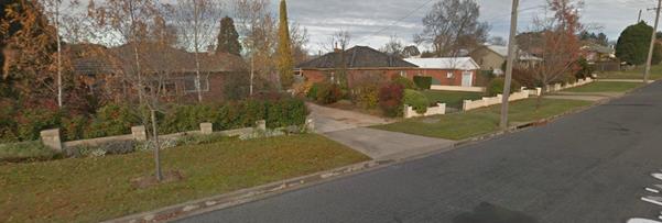
Figure 1 - neighbourhood character
The proposed development is not inconsistent with the
neighbourhood character planning outcomes.
Building Appearance
The Building Appearance Planning
Outcomes include:
· The building
design, detailing and finishes relate to the desired neighbourhood character,
complement the residential scale of the area and add visual interest to the
street
· The frontage of
buildings and their entries address the street
· Garages and car
parks are sited and designed so that they do not dominate the street frontage.
It is considered that the appearance of the proposed
residential units will not have a significant adverse effect on the
neighbourhood character. The form and design of the proposed units is single
storey and conventional, with fenestration and articulation that provide an
identifiable front entrance for the buildings.
The proposed development, despite being multi dwelling
housing, is reinforcing in its appearance to the form and styling of detached
housing in the street. In terms of bulk and scale, detailing and the like, the
proposed development is similar to surrounding development. In terms of site
coverage, the proposed development is significantly more dense than that
pertaining to the surrounding low density detached housing, but nevertheless
entirely consistent with the limits recommended in the DCP. It is
acknowledged that as a medium density multi dwelling development, the proposed
development would have an altering effect on the character of the locality.
However, it is considered that such changes would not be out of the ordinary,
or result in significant loss of character for the neighbourhood.
Setbacks
Front setbacks are not relevant to this proposed
development, given its configuration as a battleaxe shaped development lot.
Fences and Walls
The Fences and Walls Planning Outcomes include:
· Front fences
and walls:
- assist in highlighting
entrances and creating a sense of identity within the streetscape
- are constructed of materials
compatible with associated housing and with fences visible from the site that
positively contribute to the streetscape
- provide for facilities in
the street frontage area such as mailboxes.
Fencing in this instance is not a major issue with regard to
the planning outcomes specified in the DCP. Fences and walls do have some
relevance in assessing and protecting neighbour privacy, however these issues
are addressed under the general heading of privacy in this report.
Visual Bulk
The Visual Bulk Planning Outcomes
include:
· Built form
accords with the desired neighbourhood character of the area with:
- side and rear setbacks
progressively increased to reduce bulk and overshadowing;
- site coverage that retains
the relatively low-density, landscaped character of residential areas;
- building form and siting
that relates to land form, with minimal land shaping (cut and fill);
- building height at the
street frontage that maintains a comparable scale with the predominant adjacent
development form;
- building to the boundary
where appropriate.
The planning outcome includes guidelines
that indicate ways of achieving the planning outcomes. The DCP recognises that
there may also be other solutions.
The guideline provisions accepted in the
DCP are as follows:
(a) Buildings are contained within an
envelope generated by planes projected at 45o over the site
commencing 2.5m above existing ground level from each side and rear boundary.
(b) Buildings within 15m of the street
frontage, in areas of predominantly single-storey houses, are or appear as
single storey
(c) Buildings may cover up to 50% of the
site area (except for single dwellings which may cover up to 60% including
outbuildings
The proposed development complies with the
above described guidelines listed in the DCP with respect to building bulk
and site coverage. It is further noted that the proposed development is single
storey that by default further reinforces its compliance to all outcomes.
Walls and
Boundaries
The deemed to satisfy guidelines for this
outcome are
(a) There is a side boundary setback of at
least 900mm minimum for walls in accordance with the above building envelope
planes (unless the wall has been built on the boundary). Eaves and other
projections may encroach within this area.
(b) Adequately fire-rated walls without
windows or other openings may be erected on or adjacent to boundaries subject
to no projections encroaching on adjoining land. The length of a wall within
900mm of the boundary is a maximum of 15 metres or 50% of the side boundary
length, whichever is less.
(c) Encroachments within the setback
demonstrate that privacy and overshadowing will not affect adjoining land.
Council requires evidence that the adjoining owner does not object to the
positioning of the building on or near the boundary.
(d) The position of buildings in relation to
boundaries addresses existing trees and landscaping that contribute to the
amenity of the locality.
The proposed development is not contrary to
any of the deemed to satisfy guidelines.
Daylight and
Sunlight
Council’s Technical Services Division required the
floor levels of certain units to be raised to accommodate the overland flow
path that traverses the site. The original shadow diagrams have been amended to
reflect the revised floor levels. The following assessment has been undertaken
to address the requirements of Orange DCP 2004 - 07 Development in
Residential Areas.
Solar Access - Private Open
Space
According to the DCP Guidelines and Council’s Energy
Smart Homes Code, sunlight is to be available to at least 40% of required open
space for the units within the development and on neighbouring properties for
at least three hours between 9am and 3pm.
The shadow diagrams demonstrate
that sunlight will be available to the required private open space area of each
unit for at least three hours between 9am and 3pm on the winter solstice as
follows:
|
Unit
|
GFA
|
POS required
|
Unshaded
POS required
|
Solar Access to POS
Performance in minimum three hour period
|
|
1
|
91.6m2
|
45.8m2
|
18.3m2
|
Complies
26.2m2 to 58.5m2
of unshaded POS in period 10.30am to 1.30pm
|
|
2
|
82.3m2
|
41.2m2
|
16.5m2
|
Complies
18.6m2 to 27.1m2
of unshaded POS in period 9.30am to 12.30pm
|
|
3
|
82.3m2
|
41.2m2
|
16.5m2
|
Complies
18.2m2 to 26.4m2
of unshaded POS in period 9.30am to 12.30pm
|
|
4
|
84.6m2
|
42.3m2
|
16.9m2
|
Complies
18.2m2 to 27.4m2
of unshaded POS in period 10.30am to 1.30pm
|
|
5
|
84.6m2
|
42.3m2
|
16.9m2
|
Complies
17.1m2 to 26.4m2
of unshaded POS in period 11am to 2pm
|
|
6
|
87.8m2
|
43.9m2
|
17.6m2
|
Complies
17.9m2 to 27.6m2
of unshaded POS in period 10.30am to 1.30pm
|
The shadow diagrams indicate
that the proposed development would meet the DCP requirements in regard to
maintaining solar access to the private open space of the existing dwellings on
the adjoining land to the east and west. For the southern neighbours there is a
small increase in the shadowing impact from Units 3 and 4 on the private open
space areas of those properties.
Whilst there is an increase in shadow impact the shadows
cast are only marginally greater than the shadows cast by the existing boundary
fencing and is therefore considered to be acceptable in this case.
Solar Access - North Facing
Windows
According to the DCP Guidelines and Council’s Energy
Efficiency Code, sunlight to at least 75% of north-facing living-area
windows within the development and on adjoining land is to be provided for a
minimum of four hours on 21 June; or not further reduced than existing where
already less.
The shadow diagrams demonstrate that the north facing living
room windows of proposed Units 1, 2, 4, 5 and 6
achieve the required amount of direct sunlight.
Drawing DA23 shows that Unit 3 complies with the 75%
requirement for most of the four hour period until 1pm, when the amount of
direct sunlight to glazing reduces to 70%.
The applicant has requested that Council accept a variation
of the DCP in this regard. Compliance with the DCP would be achieved if
the size of the affected window in proposed Unit 3 was reduced by raising
the sill height. However, it is more desirable to maintain a larger window that
achieves reasonable solar access and also offers generous natural light to the
living area, even when the window itself is in shade.
The shadow diagrams demonstrate that the proposed units
generally would not reduce solar access for the north-facing windows of the
existing dwellings on the adjoining land to the south.
Unit 3 will cause minor overshadowing of part of the
northern elevation of the neighbouring dwelling to the south. The potential
impact is considered satisfactory given that the shadow only just reaches the
wall in the morning period and would be off the wall at around 10.30am. At
most other times of the day, the shadow cast by Unit 3 would be only
marginally larger than the shadow cast by the boundary fence.
Views
The Views Planning Outcomes include:
· Building form
and design allow for residents from adjacent properties to share prominent
views where possible.
· Views,
including vistas of heritage items or landmarks, are not substantially affected
by the bulk and scale of new development.
The subject site is not located within a significant view
corridor. The proposed dwellings will not restrict any prominent views from
adjoining properties.
Visual Privacy
Land and Environment Court Planning Protocols for assessment
of privacy are available and should be considered or used as a framework for
the assessment of this issue. They are not binding and carry no statutory
weight, but are considered useful in providing guidance in assessing subjective
issues like privacy.
In Meriton v Sydney City Council [2004] NSWLEC 313
Roseth established certain planning principals established concerning the
assessment of privacy. The principles laid down by Justice Roseth are as
follows:
“Planning principle:
protection of visual privacy
When visual privacy is
referred to in the context of residential design, it means the freedom of one
dwelling and its private open space from being overlooked by another dwelling
and its private open space. Most planning instruments and development control
plans acknowledge the need for privacy, but leave it to be assessed
qualitatively. Numerical guidelines for the separation of dwellings exist in
the Australia-wide guideline, AMCORD; as well is in the NSW-specific
Residential Flat Design Code attached to SEPP 65. AMCORD recommends a
separation of 9m between habitable rooms. The Residential Flat Design Code
recommends increasing separation between buildings as they get taller.
For buildings up to three
storeys, it suggests 12m between habitable rooms and balconies, 9m between a
habitable and non-habitable room, and 6m between non-habitable rooms.
Generalised numerical
guidelines such as above, need to be applied with a great deal of judgment,
taking into consideration density, separation, use and design.
The following principles may assist.
The ease with which privacy
can be protected is inversely proportional to the density of
development. At low-densities there is a reasonable expectation that a dwelling
and some of its private open space will remain private. At high-densities it is
more difficult to protect privacy.
Privacy can be achieved by separation.
The required distance depends upon density and whether windows are at the same
level and directly facing each other. Privacy is hardest to achieve in
developments that face each other at the same level. Even in high-density
development it is unacceptable to have windows at the same level close to each
other. Conversely, in a low-density area, the objective should be to achieve
separation between windows that exceed the numerical standards above.
(Objectives are, of curse, not always achievable.)
The use of a space
determines the importance of its privacy. Within a dwelling, the privacy of
living areas, including kitchens, is more important than that of bedrooms.
Conversely, overlooking from a living area is more objectionable than
overlooking from a bedroom where people tend to spend less waking time.
Overlooking of neighbours that
arises out of poor design is not acceptable. A poor design is
demonstrated where an alternative design, that provides the same amenity to the
applicant at no additional cost, has a reduced impact on privacy.
Where the whole or most of a
private open space cannot be protected from overlooking, the part adjoining the
living area of a dwelling should be given the highest level of protection.
Apart from adequate
separation, the most effective way to protect privacy is by the skewed
arrangement of windows and the use of devices such as fixed louvres, high
and/or deep sills and planter boxes. The use of obscure glass and privacy
screens, while sometimes being the only solution, is less desirable.
Landscaping should not be
relied on as the sole protection against overlooking. While existing dense
vegetation within a development is valuable, planting proposed in a landscaping
plan should be given little weight”.
Essentially Roseth was establishing that at lower densities
greater potential exists for the achievement of privacy, and more difficulties
arise if a height difference exists between the properties being assessed. If a
given development has been designed so as to minimise privacy impacts, the
planning protocol is that this should be viewed more favourably than if a poor
design response is proposed.
In this case, the design response is conventional but low
key. In the context of its surroundings, the proposed development has minimal
setbacks to boundaries and therefore its ability to rely on separation as a
means of solving privacy issues is limited, compared to what surrounding
property owners might expect. The chief privacy impacts arise from the
placement of living and dining room windows that will, by their proximity to
boundaries, generate issues for neighbours. This is particularly the case for
the western, northern and southern neighbours.
To address the additional privacy impacts of the development
on neighbours, the following conditions are considered appropriate:
Prior to the issue of a
Construction Certificate
Amended plans are required to be submitted that
incorporate the following:
Where provided, the west-facing window of the dining and
kitchen areas of Units 4, 5 and 6 shall incorporate a privacy screen. A privacy screen is also required for the
south-facing bedroom 2 window of Unit 3. The required screens shall
extend to at least 1.7m above the finished floor level of their respective
units. The screens shall incorporate fixed louvres capable of preventing
downwards vision of the neighbours. Such screens shall have the louvres spaced
and oriented so as to allow only views skyward not less than 30 degrees from
the horizontal plane. The louvres are to be permanently affixed to the
buildings and shall not be removed except with the consent of Council.
Prior to the issue of a Construction
Certificate
The northern boundary fence adjacent to Unit 6 shall
incorporate a 300mm lattice screen or similar (such that the overall height of
the fence along the northern boundary of Unit 6 is not less
than 2.2m), for the purposes of providing or maintaining existing privacy
levels for the residence at 8 Ophir Street. Details of the fencing to be
provided along this shared boundary are to be submitted and approved by
Council’s Manager Development Assessments prior to the issue of a
Construction Certificate.
Prior to the issue of a
Subdivision Certificate Construction Certificate
The Community Management Statement for the approved
subdivision shall include a statement prohibiting the removal of the required
louvred privacy screens from Units 3, 4, 5 and 6, and the
fencing along the northern boundary of Unit 6 except with the further
consent of Council.
Acoustic Privacy
The Acoustic Privacy Planning Outcomes include:
· Site layout and
building design:
- protect habitable rooms
from excessively high levels of external noise
- minimise the entry of
external noise to private open space for dwellings close to major noise sources
- minimise transmission of
sound through a building to affect other dwellings.
The proposal will provide reasonable
acoustic privacy to the residential units. The site is located within an
established residential area and will not be subject to high noise sources
Security
The Security Planning Outcomes include:
· The site layout
enhances personal safety and minimises the potential for crime, vandalism and
fear.
· The design of
dwellings enables residents to survey streets, communal areas and approaches to
dwelling entrances.
Crime Prevention Through Environmental
Design has been considered in the site layout and
building design. Reasonable opportunities are provided for surveillance
(windows addressing Ophir Street and the internal access driveway, appropriate
landscaping), territorial enforcement (consistent unit design) and access
control (fencing, internal access to the dwellings from the garages).
Car Parking
The DCP sets the following Planning Outcomes in regard to
Car Parking:
· Parking
facilities are provided, designed and located to:
- enable
the efficient and convenient use of car spaces and accessways within the site
- reduce
the visual dominance of car parking areas and accessways.
· Car parking is
provided with regard to the:
- the
number and size of proposed dwellings
- requirements of
people with limited mobility or disabilities.
|
DWELLING SIZE OR NUMBER OF BEDROOMS
|
AVERAGE CAR PARKING PER DWELLING
|
|
Small (<75m2) or 1-bedroom unit
|
1.0
spaces per unit
|
|
Medium (75m2 – 110m2) or
2-bedroom unit
|
1.2
spaces per unit
|
|
Large (>110m2) or 3+ -bedroom
unit
|
1.5
spaces per unit
|
|
Visitor Parking
|
0.2
spaces per unit
|
The development comprises six x two bedroom
dwellings as well as the retention of the existing dwelling on 8 Ophir
Street (which will retain its existing parking arrangements unchanged by the
development). The new dwellings generates a parking demand of 1.2 spaces
per unit and 0.2 visitor spaces per unit, for an overall provision of 8.4
spaces.
The submitted plans shows eight parking
spaces (one being in tandem, and one being a visitor space) being provided.
Technically the proposed development will have a shortfall of 0.4 spaces. There
is no opportunity to provide additional parking on the site. Each unit will
have a single garage available and two visitor spaces are provided. It is
recommended that Council supports the variation to the development standard in
this case. Council’s Technical Services Division has reviewed the
internal manoeuvring arrangements and advise that no significant difficulties
will arise from the proposal.
Circulation Design
The Circulation Design Planning Outcomes include:
· Accessways and
parking areas are designed to manage stormwater.
· Accessways,
driveways and open parking areas are suitably landscaped to enhance amenity
while providing security and accessibility to residents and visitors.
· The site layout
allows people with a disability to travel to and within the site between
carparks, buildings and communal open space.
The applicant will be required to provide onsite detention
as part of this development. The preliminary stormwater design submitted in
support of the development shows the detention basin being provided within the
driveway. Council’s Technical Services Division advises that the proposed
arrangements for onsite detention are generally satisfactory.
Council’s Assistant Development Engineer has reviewed
the internal manoeuvring spaces for vehicles into and out of the garages and
advises that no significant difficulties will arise from the proposed
arrangements.
A landscape plan has been submitted in support of the
development. An amended landscape plan will be required to ensure adequate
privacy for the private open space areas of Units 4 and 5, where
palisade fencing is required to ensure that stormwater flows are not impeded.
Attached are recommended conditions addressing matters pertaining to
landscaping.
Public Transport
The Public Transport Planning Outcome includes:
· Residential
unit development is accessible to public transport.
The subject site is located within an
established urban residential area currently serviced by public transport.
Private Open
Space
The DCP sets the following Planning Outcomes in regard to
Private Open Space:
· Private open
space is clearly defined for private use.
· Private open
spaces are of a size, shape and slope suited the requirements of residents
including some outdoor recreational needs and service functions.
· Private open
space is:
- capable
of being an extension of the dwelling for outdoor living, entertainment and
recreation
- accessible
from a living area of the dwelling
- located
to take advantage of outlooks; and to reduce adverse impacts of overshadowing
or privacy from adjoining buildings
- orientated
to optimise year round use.
The guidelines of the DCP indicate that
private open space at ground level is to have a useable area at least
equivalent to 50% of the dwelling floor space (gross), with a minimum dimension
of 3m, and including at least one area with minimum dimensions of
5m x 5m directly accessible to a living area, preferably orientated
to the north or to the east of the dwelling. Each of the proposed units
is provided with sufficient private open space to meet the standard. Moreover,
each of the proposed units is provided with a 5m x 5m area accessible
to the living area of the unit. The POS areas for the proposed dwellings are
considered generally satisfactory, although solar access is marginal for the
units.
Open Space and
Landscaping
The DCP sets the following Planning Outcomes in regard to
Open Space and Landscaping:
· The site layout
provides open space and landscaped areas which:
- contribute
to the character of the development by providing buildings in a landscaped
setting
- provide
for a range of uses and activities including stormwater management
- allow
cost effective management.
· The landscape
design specifies landscape themes consistent with the desired neighbourhood
character; vegetation types and location, paving and lighting provided for
access and security.
· Major existing
trees are retained and protected in a viable condition whenever practicable
through appropriate siting of buildings, access ways and parking areas.
· Paving is
applied sparingly and integrated in the landscape design.
The site plan includes a landscaping plan
indicating that sufficient open space in the front setbacks and within the
common property will be provided for some landscaping to be installed.
Stormwater
The Stormwater Planning Outcomes include:
· Onsite drainage
systems are designed to consider:
- downstream capacity and the
need for onsite stormwater retention, detention and re‑use
- scope for onsite
infiltration of water
- safety and convenience of
pedestrians and vehicles
- overland flowpaths.
· Provision
is made for onsite drainage which does not cause damage or nuisance flows to
adjoining properties.
Council's Development Engineer has reviewed
the proposal and has some concerns with respect to the proposed freeboards for
the floor levels of the units located within the designated overland flowpath.
A condition is included requiring the floor levels of the units to be raised by
up to 200mm for a minimum freeboard of 500mm.
In other respects the proposed arrangement
for stormwater management will have to be worked out as part of the
Construction Certificate details. Protection of the overland flowpath is an
important issue. Council's Engineers have specified in a condition of consent
the style of fencing required within the easement so as to facilitate the
unimpeded flow of stormwater through the property.
DEVELOPMENT CONTRIBUTIONS PLAN
2017
The payment of $25,600.58
is to be made to Council in accordance with Section 94 of the Act and
Orange Development Contributions Plan 2017 (LGA Remainder) towards the
provision of the following public facilities:
|
Open
Space and Recreation
|
@
$2,195.37 x 6 x two bedroom dwellings
|
13,172.22
|
|
Community
and Cultural
|
@
$636.65 x 6 x two bedroom dwellings
|
3,819.90
|
|
Roads
and Traffic Management
|
@
$2,985.75 x 6 two bedroom dwellings
|
17,914.50
|
|
Plan
Preparation & Administration
|
@
$171.90 x 6 two bedroom dwellings
|
1,031.40
|
|
Less
1 Standard Credit applying to the land (1 subdivided lot)
|
@$10,337.44
|
$10,337.44
|
|
TOTAL:
|
|
$25,600.58
|
The contributions will be indexed quarterly in accordance
with Orange Development Contributions Plan 2017 (LGA Remainder).
Section 64 Water and Sewer
Headworks Charges
Section 64 water and sewer headworks charges are also
applicable to the proposal. Such charges are calculated at the time of release
of a relevant certificate for the development, being the issue of a
Construction Certificate for the multi dwelling housing development in this
case.
PROVISIONS PRESCRIBED BY THE
REGULATIONS s79C(1)(a)(iv)
The development is not inconsistent with the provisions
prescribed by the regulations
THE LIKELY IMPACTS OF THE
DEVELOPMENT s79C(1)(b)
Servicing Arrangements
Council’s Technical Services Division
advises that all utility services are available to the site and adequate for
the proposal. The proposed development will be connected to
Council’s sewer, town water and stormwater reticulations in accordance
with normal requirements.
Power, telephone and natural gas services will be connected
to the dwellings in accordance with the requirements of the relevant supply
authority. Attached is a condition of consent addressing this issue.
With respect to solid waste disposal, the gradual increase
of multi dwelling housing projects is considered to have an overall adverse
impact on city presentation as the number of bins placed kerbside rapidly
increases; and the collection of those bins can take many days to occur.
This generates a situation where a large number of unsightly
bins are being stored either in the public street, or in readily visible
locations that are unsightly and detrimental to neighbourhood character.
In this particular situation the six units will have a
driveway to Ophir Street for access, and would, if left to standard
arrangements, result in a large number of bins being placed outside the
frontage of an unrelated properties. This is considered an unacceptable impost
on the amenity of those neighbours, and will detract from the character of the
locality.
To address the issue it is considered necessary to impose
the following conditions:
Prior to the issue of an
Occupation Certificate for the rear four units
A private service agreement is
to be negotiated between the applicant and the waste contractor (JR Richards at
this time) that is also to the satisfaction of Council's Waste Services Manager
that have bins awaiting collection being stored and collected from the storage
area within the property containing those six units. These bins may not be
placed in the driveway, where the width of the driveway is 4.5m or less. The
service agreement shall require bin collection to be made from the onsite
storage areas as proposed, storage of full bins not being permitted under this
agreement in the street. The service contract shall limit the number of bins
required on a shared basis to a maximum of 2 green waste bins. This needs to
form part of the Community Management Statement that will be required for the
units.
Prior to the issue of a
Subdivision Certificate for the Community Title Lots.
The service agreement for the
disposal of solid wastes and recyclables specified in conditions of this consent
shall be incorporated into the Community Management Statement, and shall
include a rule that the Community Management Body may only vary or delete the
requirement from their management statement with the agreement of Orange City
Council’s Waste Services Manager.
Overland Flowpaths
The subject property is located within an overland flowpath.
Council’s Technical Services Division has not raised objections to the
granting of approval, suggesting in that acceptance that the proposed
development may proceed without significant risks arising to either the
proposed development or other properties located within that flowpath.
The Technical Services Division has no objection to
approval, however they do recommend that the floor heights of the dwellings be
raised, and other conditions to preserve the safety of the units and also
ensure that the overland flowpath remains unobstructed. These requirements have
generally been met in the amended proposal. It is important that the driveway
remain uncluttered during rain events to maintain the function of the floodway,
and of course not allow the construction of buildings within that area. The
proposed development is consistent with those principals.
Streetscape/Neighbourhood
Character
Whilst the development proposes a greater density of
housing, the development will not have an adverse impact upon the streetscape
or general character of the locality. A detailed assessment of building
appearance and neighbourhood character has been provided elsewhere in the
report.
THE SUITABILITY OF THE SITE
s79C(1)(c)
Notwithstanding the issue relating to the overland flowpaths
that affects the land, the site is considered suitable for the proposed
development.
ANY SUBMISSIONS MADE IN
ACCORDANCE WITH THE ACT s79C(1)(d)
The proposed development is defined as "advertised
development" under the provisions of the LEP. The application was
advertised in accordance with the prescribed period of 14 days. Following
exhibition, three written submissions were received from nearby and surrounding
property owners. The concerns raised can be summarised as follows:
Mark and Rochelle Monaghan - 11
Ophir Street
The characteristics of the proposed development will
require residents of the new development to park on both sides of Ophir Street,
which is too narrow for this to safely occur.
Comment:
Matters in relation to parking have been discussed in the
body of this report under the heading “Provisions of Any Development
Control Plans”. The proposed development generally complies with the
parking requirements of the DCP, which in turn are based on relevant
standards published by the NSW Government. The submitted plans show the
provision of 8 off-street car parking spaces in the form of one single garage
and two visitor spaces. This represents a shortfall of 0.4 spaces which is
considered acceptable in this case. Apart from the general claims made in the
submission, there are no specific supporting data or observations included in
the submission to support this objection.
Council has approved similar developments for multi dwelling
housing with narrow access driveways and tight manoeuvring spaces. An example
is the low cost housing development located at 72A Icely Road. This
development for multi dwelling housing was similar in size and density to that
now being considered and has been occupied since early 2015. There are no
reports of increased congestion or any increase in the local accident
statistics for this development. It is considered reasonable to extrapolate
that observation for the subject application.
It is possible that the incidence of vehicles being parked
in the street might increase, but there is no evidence to suggest from like
developments that such use of street parking actually increases post
completion, and no evidence that traffic safety is in any way adversely
affected. In any event Council’s Technical Services Division advises that
the capacity of the road network in the locality is acceptable for the
development.
Stormwater
Comment:
The submission is non-specific about what elements of
stormwater management are of concern. There is a general comment about past
issues with inundation but no claims specific to this site.
The site is affected by a known overland flowpath, which in
turn has required conditions designed to protect and keep clear from
obstruction that flowpath. Conditions are also imposed specifying minimum FFLs
for the proposed units. Council’s Technical Services Division is
generally satisfied that the proposed development may proceed with no
significant impacts in terms of stormwater management either onsite, or for any
nearby properties.
Luke and Donna Galvin - 10
Ophir Street
Privacy impacts - the loss of the Photinia on the
boundary will adversely affect residential privacy
Comment:
The LEC planning protocols specifically identify vegetation
as a means of maintaining privacy that should be avoided (“Landscaping
should not be relied on as the sole protection against overlooking”).
In this case the Photinia to be
removed does not offer significant benefits for the objector in terms of
privacy. There is a step-down from the objectors' rear yard to the subject
property of approximately 500mm and a fence erected along the high side of that
cutting. This height difference would be retained in the development, and effectively
makes it impossible for the proposed units looking east to have any significant
privacy impacts.
Figure 2 - Photinia to be removed
Concerned that excavations and building work will affect
the structural integrity of the retaining wall located on the shared boundary
Comment:
The objectors have requested a condition that requires a
structural engineering certificate detailing the method of retaining works to
be undertaken on the site. They do not want a situation where additional strain
is placed on the existing retaining wall.
The applicant is proposing the construction of a block wall
to replace the existing structurally untested rock wall that has unknown load
bearing capabilities. The proposed block wall is proposed to be set-in from the
boundary by 1m. It will be necessary for the construction details of this wall
to be provided with the Construction Certificate application. To add clarity
and surety to the outcome, the following additional conditions are included in
the consent:
Prior to the issue of an Occupation Certificate
The cut and fill is to be retained
and/or adequately battered and stabilised (within the allotment) prior to the
issue of an Occupation Certificate.
Where any excavation work on the site extends below the
level of the base of the footings of a building on adjoining land, the person
having the benefit of the development consent must, at the person’s own
expense:
(a) protect
and support the adjoining premises from possible damage from the excavation,
and
(b) where
necessary, underpin the adjoining premises to prevent any such damage.
Note: This condition does not apply if the person having
the benefit of the development consent owns the adjoining land or the owner of
the adjoining land has given consent in writing to that condition not applying.
Fencing
Comment:
The objection is in fact a reworded concern about the
retaining works and site stability already addressed above. It is noted,
however, that perimeter fencing is required as a condition of consent.
Traffic congestion and safety
in the street, including heavy construction traffic during the construction of
the development
Comment:
Matters in relation to traffic congestion and safety in the
street has been addressed elsewhere in the report. Whilst it is acknowledged
that during the construction phase of the development there is likely to be
more traffic in the vicinity, Council’s Technical Services Division have
raised no objections to the development.
Overdevelopment of the site
Comment:
Matters in relation to site coverage have been dealt with
the report under the heading “Provision of any Development Control Plans.
The proposed development complies with the relevant DCP density controls.
David and Cindy Cudden - 9
Ophir Street
Concerned about the amounts of vehicular traffic in and
out of the units – particularly headlight glare as vehicles leave the
property at night
Comment:
A site assessment indicates that there are properties on the
opposite side of Ophir Street which have the potential to be impacted by
headlight glare. A site inspection confirms that there are no specific windows
into the dwellings on those affected lots that are within the direct path of
vehicles leaving the subject site via the driveway. Having said that the impact
of headlight glare in any event would be relatively infrequent and not an
unreasonable imposition in a residential environment. The impact of glare is
lessened to a degree by the positioning of existing vegetation within the front
yards of those properties potentially affected.
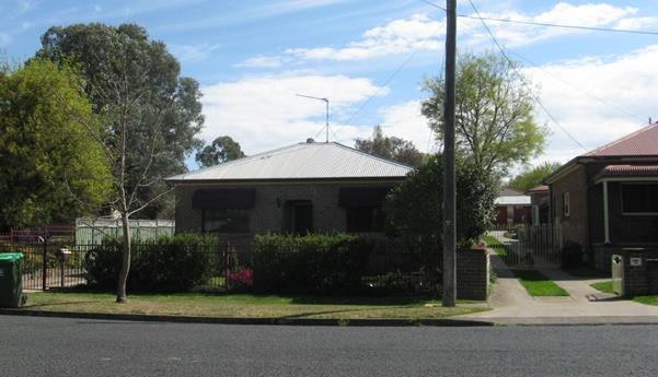
Figure 3 - development opposite the subject property
in Ophir Street
PUBLIC INTEREST
s79C(1)(e)
The proposed development is considered to be of minor
interest to the wider public due to the relatively localised nature of
potential impacts. The proposal is not inconsistent with any relevant policy
statements, planning studies, guidelines etc that have not been considered in
this assessment.
SUMMARY
The proposed development is permissible with the consent of
Council. The proposed development complies with the relevant aims, objectives
and provisions of the LEP. A Section 79C assessment of the
development indicates that the development is acceptable in this instance.
Matters pertaining to access, parking and privacy have been addressed in the
body of this report. It is recommended that Council supports the proposed
development. Attached is a draft Notice of Approval outlining a range of
conditions considered appropriate to ensure that the development proceeds in an
acceptable manner.
COMMENTS
The requirements of the Environmental Health and Building
Surveyor and the Engineering Development Section are included in the attached
Notice of Approval.
Attachments
1 Notice
of Approval, D17/62760⇩
2 Plans,
D17/62536⇩
3 Submissions,
D17/62551⇩
Planning and Development Committee
7 November 2017
2.10 Development
Application DA 181/2017(1) - 6A and 8 Ophir Street
Attachment 1 Notice
of Approval
|

|
ORANGE
CITY COUNCIL
Development
Application No DA
181/2017(1)
NA17/ Container
PR20991
|
NOTICE OF DETERMINATION
OF A DEVELOPMENT
APPLICATION
issued under the Environmental
Planning and Assessment Act 1979
Section 81(1)
|
Development
Application
|
|
|
Applicant Name:
|
Mr M
Mustac
|
|
Applicant Address:
|
C/- Peter
Basha Planning & Development
PO Box
1827
ORANGE
NSW 2800
|
|
Owner’s Name:
|
Mustac
Holdings Pty Ltd
|
|
Land to Be Developed:
|
Lots 160
and 161 DP 1105373 - 6A and 8 Ophir Street, Orange
|
|
Proposed Development:
|
Multi
Dwelling Housing (six dwellings); Subdivision (seven lot Community title
residential); Tree Removal within Lot 161 DP 1105373 (being 6A Ophir Street);
and Use of Existing Right-of-Way in Lot 160 DP 1105373 (being 8 Ophir
Street) to Provide Access
|
|
|
|
|
Building
Code of Australia
building
classification:
|
As
determined by certifier
|
|
|
|
|
Determination
|
|
|
Made On:
|
7 November
2017
|
|
Determination:
|
CONSENT
GRANTED SUBJECT TO CONDITIONS DESCRIBED BELOW:
|
|
|
|
|
Consent to
Operate From:
|
8 November
2017
|
|
Consent to
Lapse On:
|
8 November
2022
|
Terms of Approval
The reasons for the imposition of
conditions are:
(1) To ensure a quality
urban design for the development which complements the surrounding environment.
(2) To maintain
neighbourhood amenity and character.
(3) To ensure compliance
with relevant statutory requirements.
(4) To provide adequate
public health and safety measures.
(5) Because the development
will require the provision of, or increase the demand for, public amenities and
services.
(6) To ensure the utility
services are available to the site and adequate for the development.
(7) To prevent the proposed
development having a detrimental effect on adjoining land uses.
(8) To minimise the impact
of development on the environment.
Conditions
(1) The
development must be carried out in accordance with:
(a) Plans by Peter Basha
Planning & Development - reference 16058DA:
Figure 1 Locality
Figure 2 Existing
Boundaries, Services and Site Detail
Figure 3 Proposed
Community Title Subdivision
Plans By Bassmann Drafting Services:
Drawing DA1 Site
Plan
Drawing DA2 Unit
1 Floor Plan
Drawing DA3 Unit
1 Elevations
Drawing DA4 Unit
2 Floor Plan
Drawing DA5 Unit
2 Elevations
Drawing DA6 Unit
3 Floor Plan
Drawing DA7 Unit
3 Elevations
Drawing DA8 Unit
4 Floor Plan
Drawing DA9 Unit
4 Elevations
Drawing DA10 Unit
5 Floor Plan
Drawing DA11 Unit
5 Elevations
Drawing DA12 Unit
6 Floor Plan
Drawing DA13 Unit
6 Elevations
Preliminary Civil Engineering Plans by Heath
Consulting Engineers:
Sheet 1 Proposed
Finished Site Levels
Sheet 2 Stormwater
Reticulation Layout
Sheet 3 Stormwater
Detention Basin Calculations and Details
Sheet 4 Sewer
Reticulation and Sanitary Drainage Layout
Sheet 5 Water
Reticulation Layout
Sheet 6 Erosion
and Sediment Control Plan
(b) statements
of environmental effects or other similar associated documents that form part
of the approval
as amended
in accordance with any conditions of this consent.
(2) All building work must
be carried out in accordance with the provisions of the Building Code of
Australia.
(3) A sign is to be erected
in a prominent position on any site on which building work, subdivision work or
demolition work is being carried out:
(a) showing
the name, address and telephone number of the principal certifying authority
for the work, and
(b) showing
the name of the principal contractor (if any) for any building work and a
telephone number on which that person may be contacted outside working hours,
and
(c) stating
that unauthorised entry to the site is prohibited.
Any such sign is to be maintained while the
building work, subdivision work or demolition work is being carried out.
(4) In the case
of residential building work for which the Home Building Act 1989
requires there to be a contract of insurance in force in accordance with Part 6
of the Act, evidence that such a contract of insurance is in force is to be
provided to the Principal Certifying Authority before any building work
authorised to be carried out by the consent commences.
(5) Residential
building work within the meaning of the Home Building Act 1989 must not
be carried out unless the principal certifying authority for the development to
which the work relates (not being the council) has given the council written
notice of the following information:
(a) in
the case of work for which a principal contractor is required to be appointed:
(i) the
name and the licence number of the principal contractor, and
(ii) the
name of the insurer by which the work is insured under Part 6 of that Act,
(b) in
the case of work to be done by an owner-builder:
(i) the
name of the owner-builder, and
(ii) if
the owner-builder is required to hold an owner-builder permit under that Act,
the number of the owner-builder permit.
If arrangements for doing the
residential building work are changed while the work is in progress so that the
information under this condition becomes out of date, further work must not be
carried out unless the principal certifying authority for the development to
which the work relates (not being the council) has given the council written
notice of the updated information.
(6) Where any excavation
work on the site extends below the level of the base of the footings of a
building on adjoining land, the person having the benefit of the development
consent must, at the person’s own expense:
(a) protect
and support the adjoining premises from possible damage from the excavation,
and
(b) where
necessary, underpin the adjoining premises to prevent any such damage.
Note: This
condition does not apply if the person having the benefit of the development
consent owns the adjoining land or the owner of the adjoining land has given
consent in writing to this condition not applying.
MULTI DWELLING HOUSING (SIX
DWELLINGS)
|
PRIOR TO THE ISSUE OF
A CONSTRUCTION CERTIFICATE
|
(7) The payment of $25,600.58
is to be made to Council in accordance with Section 94 of the Act and
Orange Development Contributions Plan 2017 (LGA Remainder) towards the
provision of the following public facilities:
|
Open
Space and Recreation
|
@
$2,195.37 x 6 x two bedroom dwellings
|
13,172.22
|
|
Community
and Cultural
|
@
$636.65 x 6 x two bedroom dwellings
|
3,819.90
|
|
Roads
and Traffic Management
|
@
$2,985.75 x 6 two bedroom dwellings
|
17,914.50
|
|
Plan
Preparation & Administration
|
@
$171.90 x 6 two bedroom dwellings
|
1,031.40
|
|
Less
1 Standard Credit applying to the land (1 subdivided lot)
|
@$10,337.44
|
$10,337.44
|
|
TOTAL:
|
|
$25,600.58
|
The contributions will be indexed quarterly in
accordance with Orange Development Contributions Plan 2017 (LGA
Remainder).
(8) Amended plans are required
to be submitted that incorporate the following
Where provided, the west facing window of the
dining and kitchen areas of Units 4, 5 and 6 shall incorporate a
privacy
screen. A privacy screen is also required for the south facing bedroom 2
window of Unit 3. The required screens shall extend to at least
1.7m above the finished floor level of their respective units. The screens
shall incorporate fixed louvres capable of preventing downwards vision of the
neighbours. Such screens shall have the louvres spaced and oriented so as to
allow only views skyward not less than 30 degrees from the horizontal plane.
The louvres are to be permanently affixed to the buildings and shall not be
removed except with the consent of Council
(9) The northern boundary
fence adjacent to Unit 6 shall incorporate a 300mm lattice screen or
similar (such that the overall height of the fence along the northern boundary
of Unit 6 is not less than 2.1m), for the purposes of providing or
maintaining existing privacy levels for the residence at number 8 Ophir
Street. Details of the fencing to be provided along this shared boundary are to
be submitted and approved by Council’s Manager Development Services prior
to the issue of a Construction Certificate
(10) An
approval under Section 68 of the Local Government Act is to be sought
from Orange City Council, as the Water and Sewer Authority, for water, sewer
and stormwater connection. No plumbing and drainage is to commence until
approval is granted.
(11) Engineering plans,
showing details of all proposed work and adhering to any engineering conditions
of development consent, are to be submitted to, and approved by, Orange City
Council or an Accredited Certifier (Categories B1, C3, C4, C6) prior to the
issuing of a Construction Certificate.
(12) A water and soil
erosion control plan is to be submitted to Orange City Council or an Accredited
Certifier (Categories B1, C3, C4, C6) for approval prior to the issuing of a
Construction Certificate. The control plan is to be in accordance with the
Orange City Council Development and Subdivision Code and the Landcom, Managing
Urban Stormwater; Soils and Construction Handbook.
(13) The
development’s stormwater design is to include stormwater detention within
the development, designed to limit peak outflows from the land to the
pre-existing natural outflows up to the 100 year ARI frequency, with sufficient
allowance in overflow spillway design capacity to safely pass flows of lower
frequency (that is, a rarer event) without damage to downstream developments.
Where appropriate, the spillway design capacity is to be determined in
accordance with the requirements of the Dam Safety Committee.
The design of the detention storage is to be
undertaken using the ILSAX/DRAINS rainfall-runoff hydrologic model or an
approved equivalent capable of assessing runoff volumes and their temporal
distribution as well as peak flow rates. The model is to be used to calculate
the flow rates for the existing and post-development conditions. The developed
flows are to be routed through the proposed storage within the model so that
the outflows obtained are no greater than the flows obtained for the
pre-existing natural flows. A report detailing the results of the analysis,
which includes:
· catchment
plan showing sub-catchments under existing and developed conditions;
· schematic
diagram of the catchment model showing sub areas and linkages;
· tabulation
detailing the elevation, storage volume and discharge relationships; and
· tabulation
for the range of frequencies analysed, the inflows, outflows and peak storage
levels for both existing and developed conditions;
together with copies of the data files for the
model and engineering design plans of the required drainage system are to be
submitted to Orange City Council upon application for a Construction
Certificate.
The stormwater detention system shall be
designed to accommodate overland stormwater flows entering the site from Ophir
Street.
(14) Engineering plans
providing complete details of the proposed driveway and car parking areas are
to be submitted to Orange City Council or an Accredited Certifier (Categories
B1, C3, C4, C6) upon application for a Construction Certificate. These plans
are to provide details of levels, cross falls of all pavements, proposed
sealing materials and proposed drainage works and are to be in accordance with
Orange City Council Development and Subdivision Code.
The plan shall provide for a minimum concrete
driveway width of 4.5m for the full length of the access arm, protection for
the western wall of the existing dwelling on 8 Ophir Street, and also provide
details of the passing bay arrangement adjacent to Ophir Street frontage
including a method of permanent delineation to define the eastern boundary of
the right- of-way located on 8 Ophir Street. No landscaping is to be located
within the access arm and mailboxes shall consist of small, post mounted flip
top units located against the western property boundary.
The central concrete driveway and parking areas
shall be designed by a structural engineer to span over the 750mm stormwater
pipe and prevent any loads being applied to the pipe.
(15) A sewer access chamber
and 150mm-diameter sewer junction is to be constructed from Council’s
existing main to serve the proposed development. Internal sewer lines servicing
the development from the sewer junction shall be constructed as private sewer
mains. Prior to a Construction Certificate being issued engineering plans for
this sewerage system are to be submitted to and approved by Orange City
Council.
(16) Prior to the issue of a
Construction Certificate the applicant shall pay Orange City Council to
undertake the following works:
· reline
the existing 150mm diameter sewer line located under the proposed dwellings from
boundary to boundary; and
· installation
of a new sewer manhole to serve the development.
Evidence of payment for
the above works will be required to be submitted to the Principal Certifying
Authority prior to the issue of a Construction Certificate.
(17) Payment of
contributions for water, sewer and drainage works is required to be made
at the contribution rate applicable at the time that the payment is made. The
contributions are based on water supply headworks, sewerage headworks and
stormwater for 6 x two bedroom dwellings (the existing allotment has a credit
for a single 3 bedroom dwelling which will be applied at the time of payment).
A Certificate of Compliance, from Orange City Council in accordance with the Water
Management Act 2000, will be issued upon payment of the contributions.
This Certificate of Compliance is to be
submitted to the Principal Certifying Authority prior to the issuing of a
Construction Certificate.
(18) A single common water
service and meter shall be located in the driveway area. The plans shall also
detail compliance with NSW Fire and Rescue – Fire Hydrants for Minor
Residential Development. Engineering plans of the water reticulation layout
and sizing are to be submitted to Orange City Council for approval prior to the
issuing of a Construction Certificate.
(19) Prior to the issue of a
Construction Certificate the plans shall be amended as follows:
· the floor levels of the
garages shall be constructed no lower than the calculated 1% AEP level for
stormwater flows within the adjacent driveway; and
· the garages shall be
constructed of flood compatible materials and all electrical connections are
located a minimum of 1.0m above the calculated 1% AEP level.
|
PRIOR TO WORKS
COMMENCING
|
(20) A
Construction Certificate application is required to be submitted to, and issued
by Council/Accredited Certifier prior to any excavation or building works being
carried out onsite.
(21) A
temporary onsite toilet is to be provided and must remain throughout the
project or until an alternative facility meeting Council’s requirements
is available onsite.
(22) The
location and depth of the sewer junction/connection to Council’s sewerage
system is to be determined to ensure that adequate fall to the sewer is
available.
(23) Soil erosion control
measures shall be implemented on the site.
|
DURING
CONSTRUCTION/SITEWORKS
|
(24) All
construction/demolition work on the site is to be carried out between the hours
of 7.00 am and 6.00 pm Monday to Friday inclusive, 7.00 am to
5.00 pm Saturdays and 8.00 am to 5.00 pm Sundays and Public
Holidays. Written approval must be obtained from the General Manager of Orange
City Council to vary these hours.
(25) All
materials onsite or being delivered to the site are to be contained within the
site. The requirements of the Protection of the Environment Operations Act
1997 are to be complied with when placing/stockpiling loose material or
when disposing of waste products or during any other activities likely to
pollute drains or watercourses.
(26) No portion of the
building - including footings, eaves, overhang and service pipes - shall
encroach into any easement.
(27) Any adjustments to
existing utility services that are made necessary by this development
proceeding are to be at the full cost of the developer.
(28) The
provisions and requirements of the Orange City Council Development and
Subdivision Code are to be applied to this application and all work constructed
within the development is to be in accordance with that Code.
The developer is to be entirely responsible for
the provision of water, sewerage and drainage facilities capable of servicing
the development from Council’s existing infrastructure. The developer is
to be responsible for gaining access over adjoining land for services where
necessary and easements are to be created about all water, sewer and drainage
mains within and outside the lots they serve.
(29) A heavy-duty concrete
kerb and gutter layback and footpath crossing is to be constructed for the full
width of the combined driveway serving 6A and 8 Ophir Street. The works are to
be carried out to the requirements of the Orange City Council Development and
Subdivision Code.
(30) The existing 150mm
diameter sewer main that crosses the site is to be accurately located. Where
the main is positioned under any proposed building work, measures are to be
taken in accordance with Orange City Council Policy - Building over and/or
adjacent to sewers ST009.
(31) Water and sewerage
reticulation is to be provided to every dwelling in accordance with the Orange
City Council Development and Subdivision Code.
(32) All dwellings are to
have a minimum freeboard above the 1-in-100-year flood level in accordance with
the Orange City Council Development and Subdivision Code and the Floodplain
Risk Management Plan.
|
PRIOR TO THE ISSUE OF
AN OCCUPATION CERTIFICATE
|
(33) Except as elsewhere
specified in this consent, a 1.8m high fence shall be provided around the
perimeter of the development excluding the frontage. A 1.5m high fence shall be
provided between each unit. The height of the fence shall be measured from the
highest finished ground level adjacent to each part of that fence.
(34) A private service
agreement is to be negotiated between the applicant and the waste contractor
(JR Richards at this time) that is also to the satisfaction of Council's
Waste Services Manager that has bins awaiting collection being stored and
collected from the storage area within the property containing those four
units. These bins may not be placed in the driveway, where the width of the
driveway is 4.5m or less. The service agreement shall require bin collection to
be made from the onsite storage areas, storage of full bins not being permitted
under this agreement in the street. The service contract shall limit the number
of bins required on a shared basis to a maximum of two green waste bins. This
needs to form part of the Community Management Statement that will be required
for the units.
(35) A total of 6 garaged, 1
tandem and 1 visitor parking space shall be provided upon the site in
accordance with the approved plans, the provisions of Development Control Plan
2004, and be constructed in accordance with the requirements of Council's
Development and Subdivision Code prior to the issue of an Occupation
Certificate.
(36) The
cut and fill is to be retained and/or adequately battered and stabilised
(within the allotment) prior to the issue of an Occupation Certificate
(37) No
person is to use or occupy the building or alteration that is the subject of
this approval without the prior issuing of an Occupation Certificate.
(38) Finished
ground levels are to be graded away from the buildings and adjoining properties
and must achieve natural drainage. The concentrated flows are to be dispersed
down slope or collected and discharged to the stormwater drainage system.
(39) Where
Orange City Council is not the Principal Certifying Authority, a final
inspection of water connection, sewer and stormwater drainage shall be
undertaken by Orange City Council and a Final Notice of Inspection issued,
prior to the issue of either an interim or a final Occupation Certificate.
(40) A Certificate of
Compliance, from a Qualified Engineer, stating that the stormwater detention
basin complies with the approved engineering plans is to be submitted to the
Principal Certifying Authority prior to the issuing of an Occupation
Certificate.
(41) Certification from
Orange City Council is required to be submitted to the Principal Certifying
Authority prior to the issue of an Occupation Certificate stating that all
works relating to connection of the development to Council assets, works on
public land, works on public roads, stormwater, sewer and water reticulation
mains and footpaths have been carried out in accordance with the Orange City
Council Development and Subdivision Code and the foregoing conditions, and that
Council will take ownership of the infrastructure assets.
(42) All
of the foregoing conditions are to be at the full cost of the developer and to
the requirements and standards of the Orange City Council Development and
Subdivision Code, unless specifically stated otherwise. All work required by
the foregoing conditions is to be completed prior to the issuing of an Occupation
or Subdivision Certificate, unless stated otherwise.
SUBDIVISION (SEVEN LOT
COMMUNITY TITLE RESIDENTIAL)
|
DURING
CONSTRUCTION/SITEWORKS
|
(43) Any adjustments to
existing utility services that are made necessary by this development
proceeding are to be at the full cost of the developer.
|
PRIOR TO THE ISSUE OF
A SUBDIVISION CERTIFICATE
|
(44) The Community Title
Management Statement for the approved subdivision shall include a statement
prohibiting the removal of the required louvred privacy screens from Units
3, 4, 5 and 6, and the fencing along the northern boundary of
Unit 6 except with the further consent of Council.
(45) The service agreement
for the disposal of solid wastes and recyclables specified in conditions of
this consent shall be incorporated into the Community Management Statement, and
shall include a rule that the Community Management Body may only vary or delete
the requirement from their management statement with the agreement of Orange
City Council’s Waste Services Manager
(46) Prior to the
issuing of the Subdivision Certificate, a Surveyor’s Certificate or
written statement is to be provided to the Principal Certifying Authority,
stating that the buildings within the boundaries of the proposed Lots comply in
respect to the distances of walls from boundaries.
(47) Application shall be
made for a Subdivision Certificate under Section 109(C)(1)(d) of the Act.
(48) Application is to be
made to Telstra/NBN for infrastructure to be made available to each individual
lot within the development. Either a Telecommunications Infrastructure
Provisioning Confirmation or Certificate of Practical Completion is to be
submitted to the Principal Certifying Authority confirming that the specified
lots have been declared ready for service prior to the issue of a Subdivision
Certificate.
(49) A Notice of Arrangement
from Essential Energy stating arrangements have been made for the provision of
electricity supply to the development, is to be submitted to the Principal
Certifying Authority prior to the issue of a Subdivision Certificate.
(50) An easement to drain
sewage and to provide Council access for maintenance of sewerage works a
minimum of 2.0 metres wide is to be created over the proposed sewerage works.
The Principal Certifying Authority is to certify that the easement is in
accordance with the Orange City Council Development and Subdivision Code prior
to the issuing of a Subdivision Certificate.
(51) All services are to be
contained within the allotment that they serve. A Statement of Compliance, from
a Registered Surveyor, is to be submitted to the Principal Certifying Authority
prior to the issuing of a Subdivision Certificate.
(52) All engineering
conditions of development as required by this development consent as it relates
to the construction and servicing of the development noted in Stage 1 are to be
completed prior to the issuing of a Subdivision Certificate.
(53) Where
stormwater crosses land outside the lot it favours, an easement to drain water
is to be created over the works. A Restriction-as-to-User under section 88B of
the NSW Conveyancing Act 1979 is to be created on the title of the
proposed Lots requiring that no structures are to be placed on the site, or
landscaping or site works carried out on the site, in a manner that affects the
continued operation of the interlot drainage system. The minimum width of the
easement is to be as required in the Orange City Council Development and
Subdivision Code.
(54) Certification from
Orange City Council is required to be submitted to the Principal Certifying
Authority prior to the issue of a Subdivision Certificate stating that all
works relating to connection of the development to Council assets, works on
public land, works on public roads, stormwater, sewer and water reticulation mains
and footpaths have been carried out in accordance with the Orange City Council
Development and Subdivision Code and the foregoing conditions, and that Council
will take ownership of the infrastructure assets.
(55) Prior to the issue of a
Subdivision Certificate the following conditions (a) to (e) must be included in
the Community Title Management Statement:
(a) water
and sewer mains constructed as private services by the developer must accord
with at least the National Plumbing Code standards; and
(b) Orange
City Council makes no representation that the private water and sewer related
services provided to the development are suitable; and
(c) if
a request is made at any time in the future by the developer or future owner to
Orange City Council to extend the private services for any reason, then such
extension shall be at Orange City Council standards including appropriate
easements and must be constructed, funded and transferred by the applicant; and
(d) Orange
City Council will not provide maintenance services to the private services; and
(e) clauses
(a)-(e) shall not be deleted, varied or modified without the written consent of
Orange City Council.
(56) All
of the foregoing conditions are to be at the full cost of the developer and to
the requirements and standards of the Orange City Council Development and
Subdivision Code, unless specifically stated otherwise. All work required by
the foregoing conditions is to be completed prior to the issuing of an
Occupation or Subdivision Certificate, unless stated otherwise.
Other Approvals
(1) Local
Government Act 1993 approvals granted under section 68.
Nil
(2) General
terms of other approvals integrated as part of this consent.
Nil
Right of Appeal
If
you are dissatisfied with this decision, section 97 of Environmental
Planning and Assessment Act 1979 gives you the right to appeal to the Land
and Environment Court within 6 months after the date on which you receive this
notice.
*
Section 97 of the Environmental Planning and Assessment Act 1979 does not apply
to the determination of a development application for State significant
development or local designated development that has been the subject of a
Commission of Inquiry.
|
Disability Discrimination Act
1992:
|
This application has been assessed in
accordance with the Environmental Planning and Assessment Act 1979. No
guarantee is given that the proposal complies with the Disability
Discrimination Act 1992.
The applicant/owner is responsible to
ensure compliance with this and other anti-discrimination legislation.
The Disability Discrimination Act
covers disabilities not catered for in the minimum standards called up in the
Building Code of Australia which references AS1428.1 - "Design for
Access and Mobility". AS1428 Parts 2, 3 and 4 provides the most
comprehensive technical guidance under the Disability Discrimination Act
currently available in Australia.
|
|
|
|
|
Disclaimer - S88B Restrictions on the Use of Land:
|
The applicant should note that there
could be covenants in favour of persons other than Council restricting what
may be built or done upon the subject land. The applicant is advised to check
the position before commencing any work.
|
|
|
|
|
Signed:
|
On behalf of the consent authority ORANGE
CITY COUNCIL
|
|
Signature:
|
|
|
Name:
|
PAUL JOHNSTON - MANAGER DEVELOPMENT
ASSESSMENTS
|
|
Date:
|
8 November 2017
|
Planning
and Development Committee
7 November 2017
2.10 Development
Application DA 181/2017(1) - 6A and 8 Ophir Street
Attachment 2 Plans
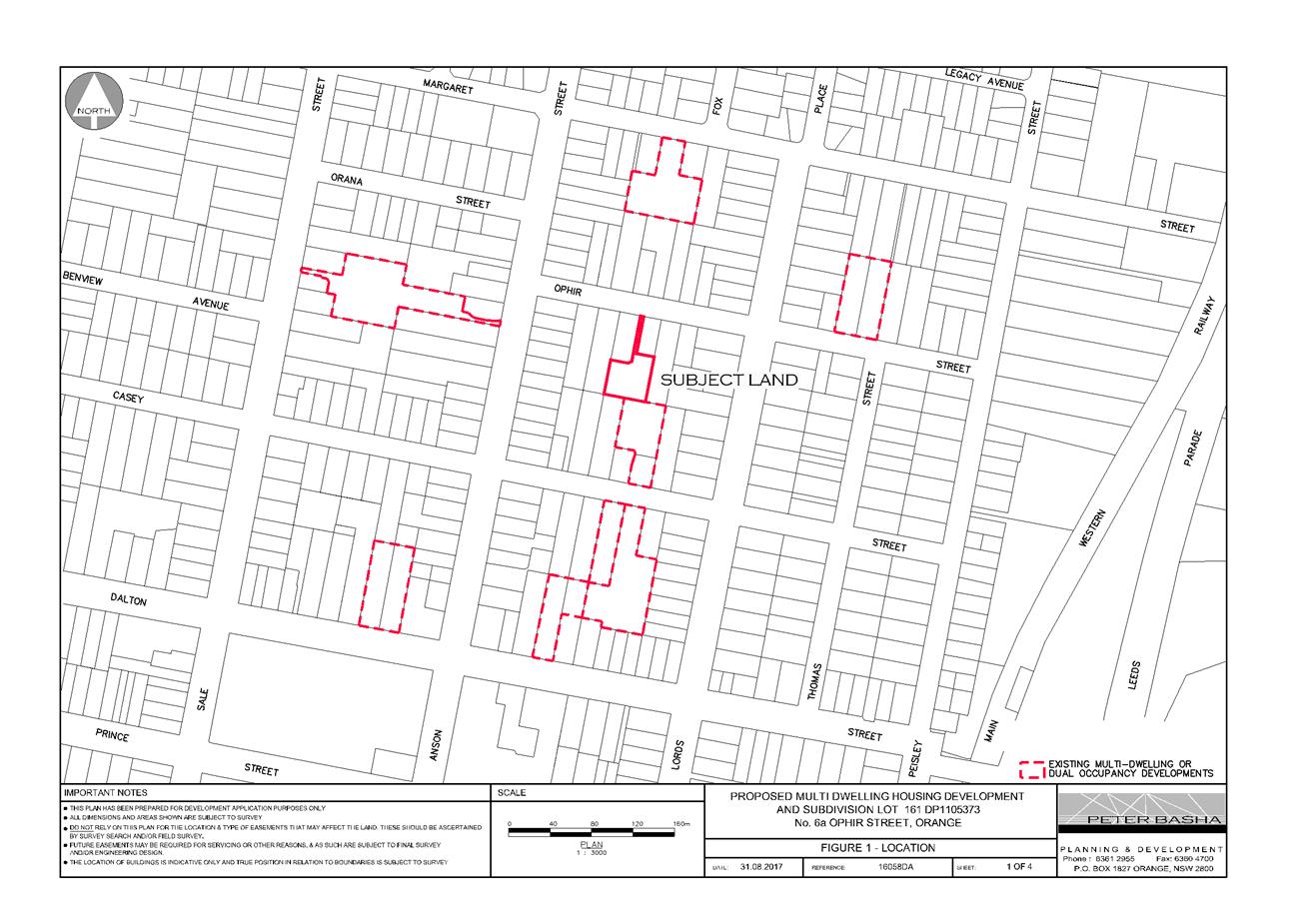
Planning and Development Committee
7 November 2017
2.10 Development
Application DA 181/2017(1) - 6A and 8 Ophir Street
Attachment 2 Plans
Planning and Development Committee
7 November 2017
2.10 Development
Application DA 181/2017(1) - 6A and 8 Ophir Street
Attachment 2 Plans
Planning and Development Committee
7 November 2017
2.10 Development
Application DA 181/2017(1) - 6A and 8 Ophir Street
Attachment 2 Plans
Planning and Development Committee
7 November 2017
2.10 Development
Application DA 181/2017(1) - 6A and 8 Ophir Street
Attachment 2 Plans

Planning and Development Committee
7 November 2017
2.10 Development
Application DA 181/2017(1) - 6A and 8 Ophir Street
Attachment 2 Plans
Planning and Development Committee
7 November 2017
2.10 Development
Application DA 181/2017(1) - 6A and 8 Ophir Street
Attachment 2 Plans

Planning and Development Committee
7 November 2017
2.10 Development
Application DA 181/2017(1) - 6A and 8 Ophir Street
Attachment 2 Plans
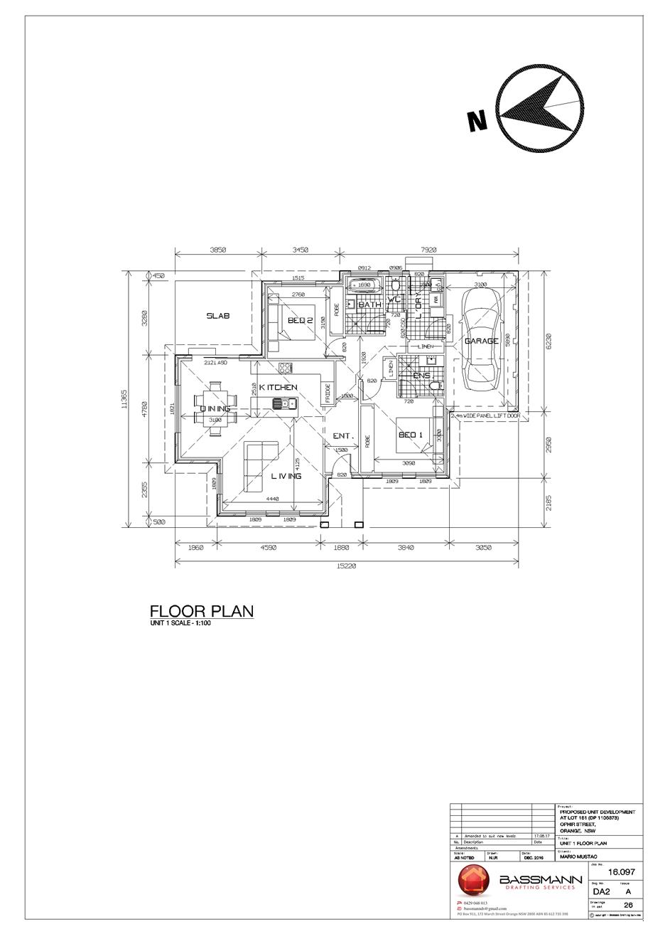
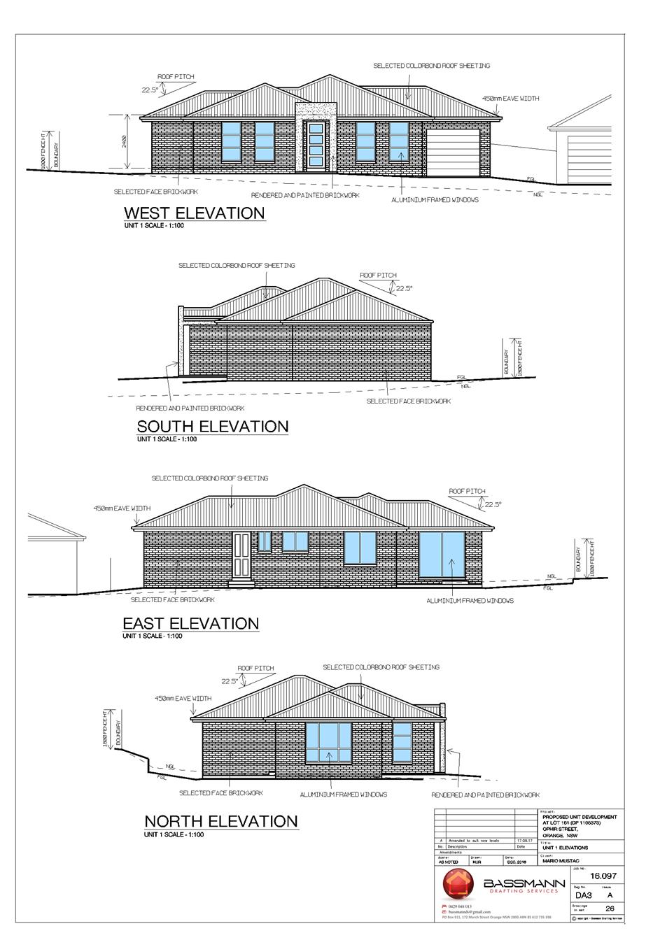
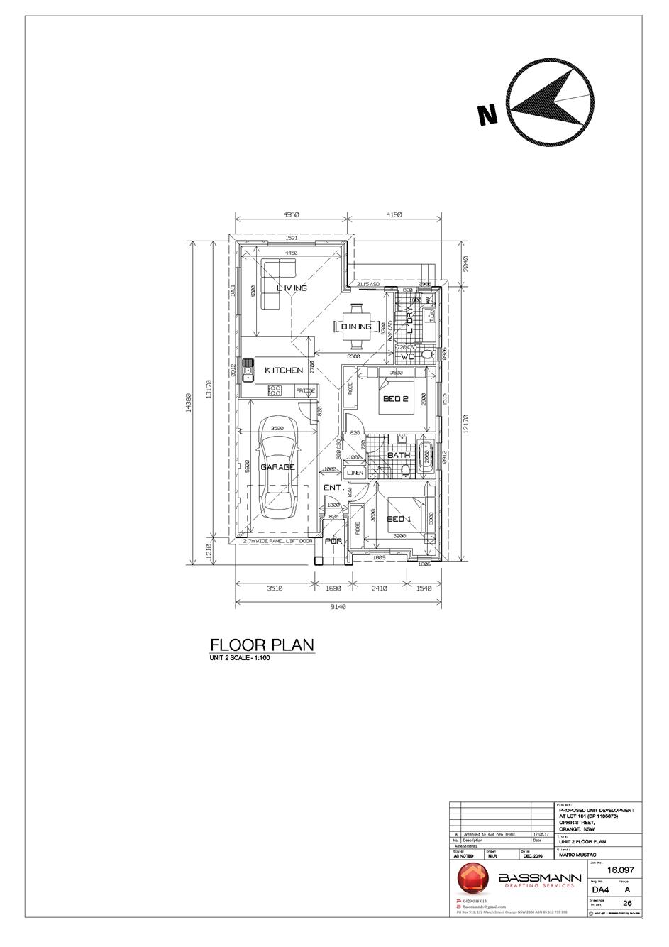
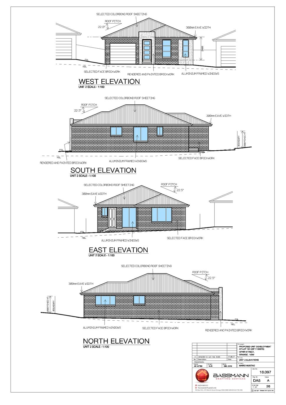
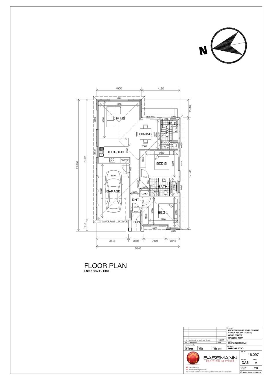
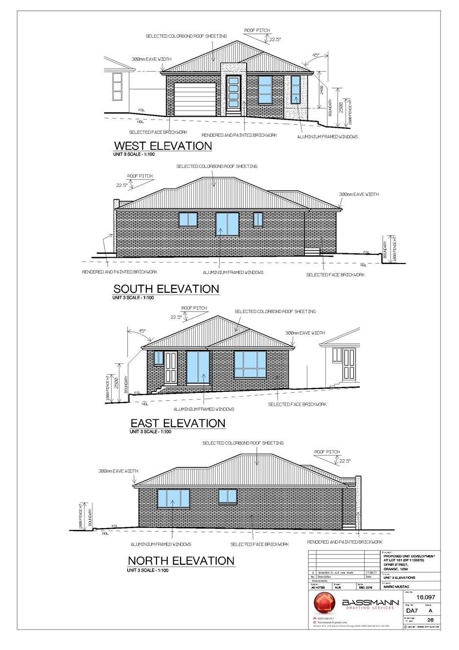
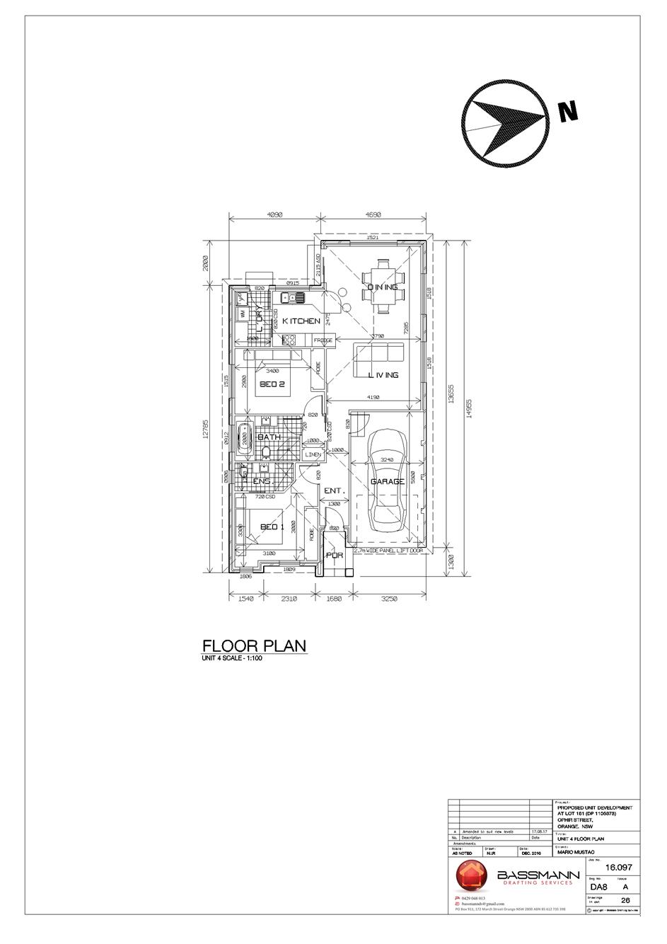
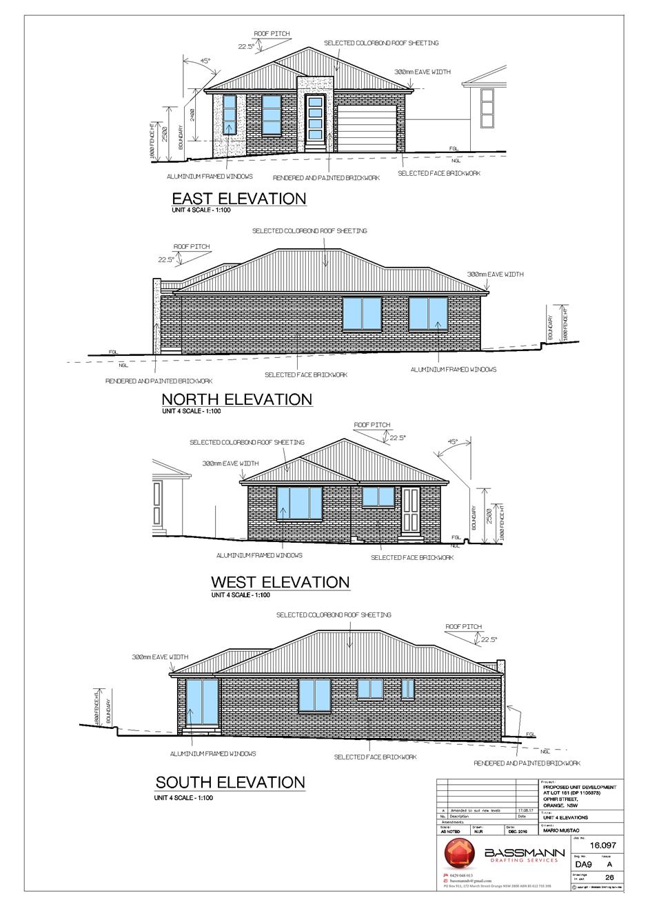

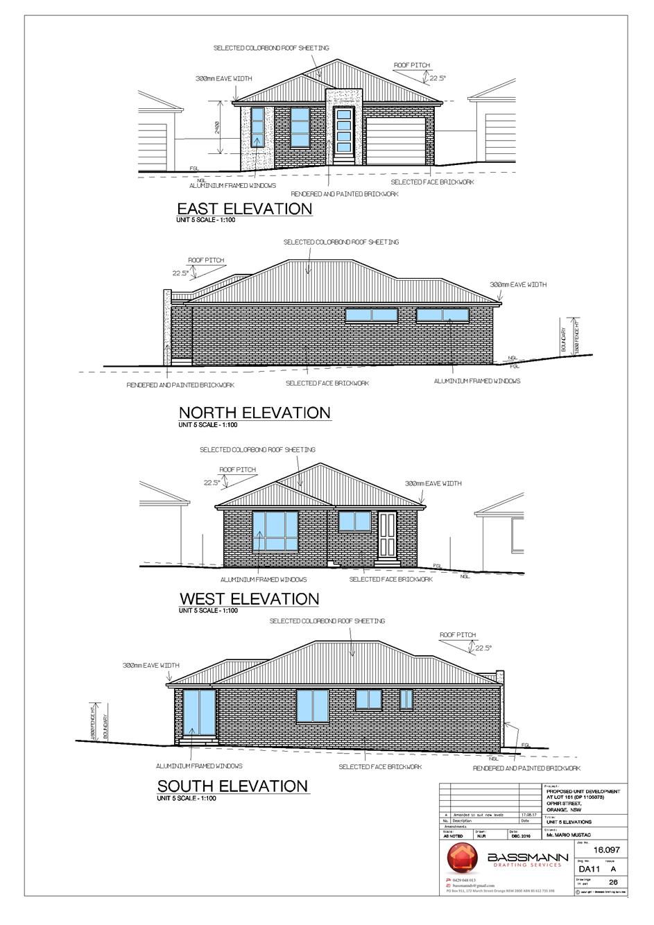
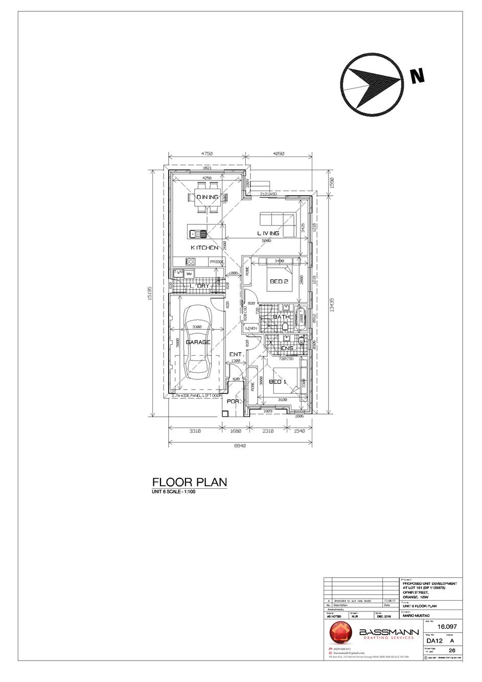
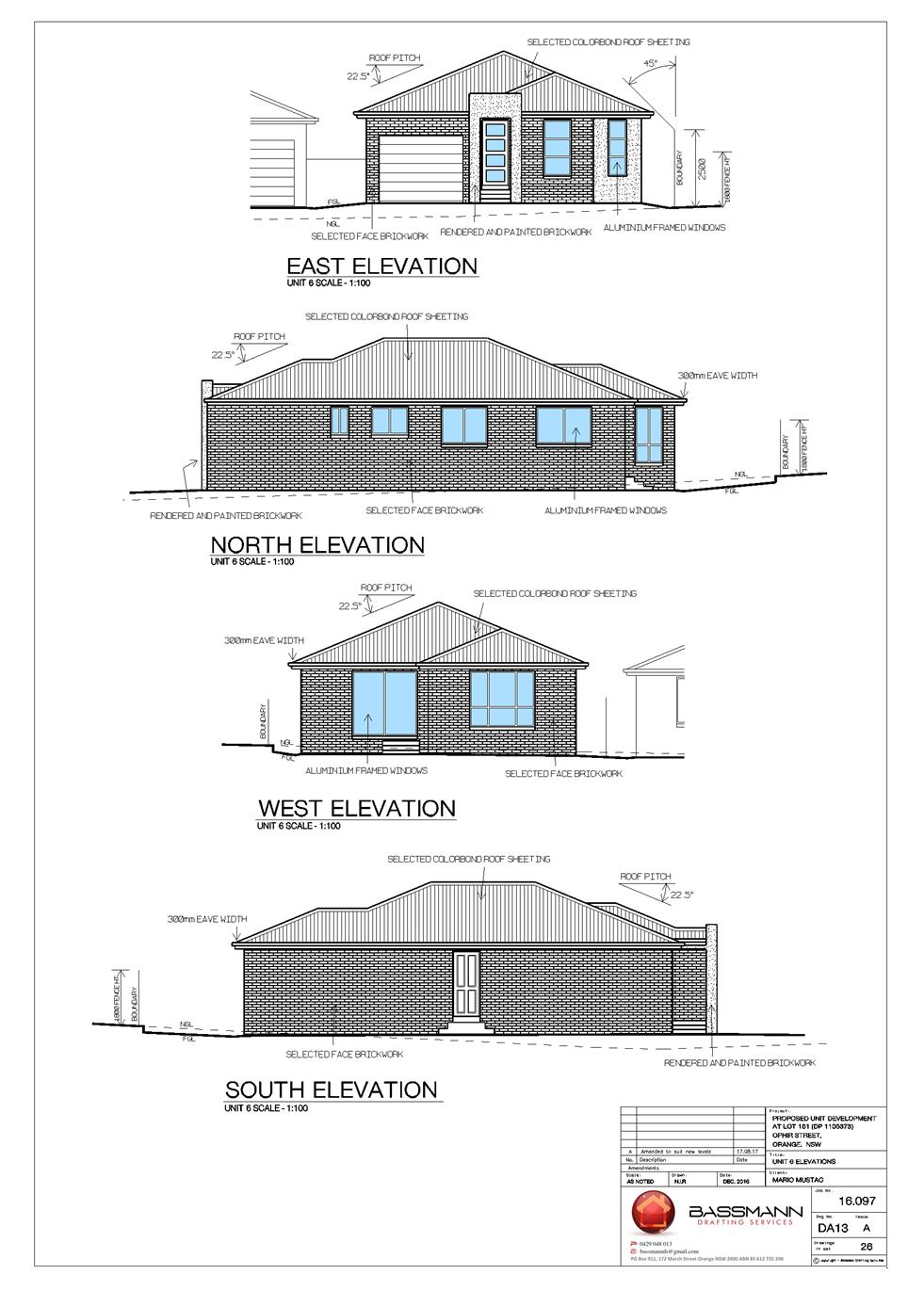
Planning and Development Committee
7 November 2017
2.10 Development
Application DA 181/2017(1) - 6A and 8 Ophir Street
Attachment 2 Plans

Planning and Development Committee
7 November 2017
2.10 Development
Application DA 181/2017(1) - 6A and 8 Ophir Street
Attachment 2 Plans
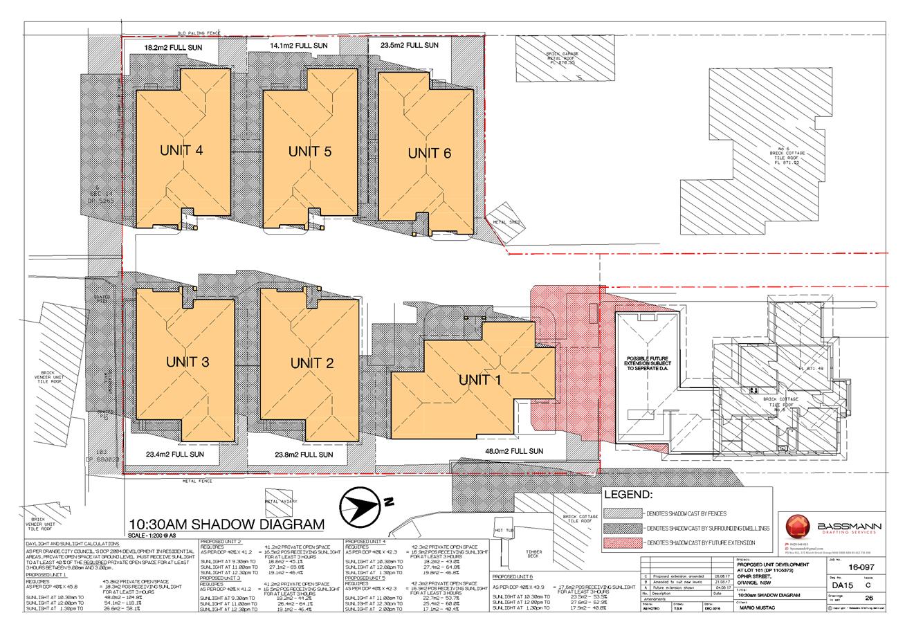
Planning and Development Committee
7 November 2017
2.10 Development
Application DA 181/2017(1) - 6A and 8 Ophir Street
Attachment 2 Plans
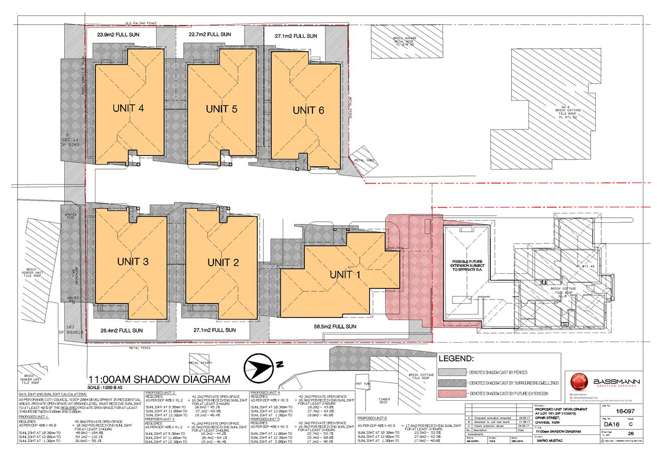
Planning and Development Committee
7 November 2017
2.10 Development
Application DA 181/2017(1) - 6A and 8 Ophir Street
Attachment 2 Plans
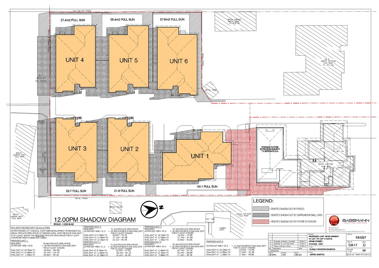
Planning and Development Committee
7 November 2017
2.10 Development
Application DA 181/2017(1) - 6A and 8 Ophir Street
Attachment 2 Plans
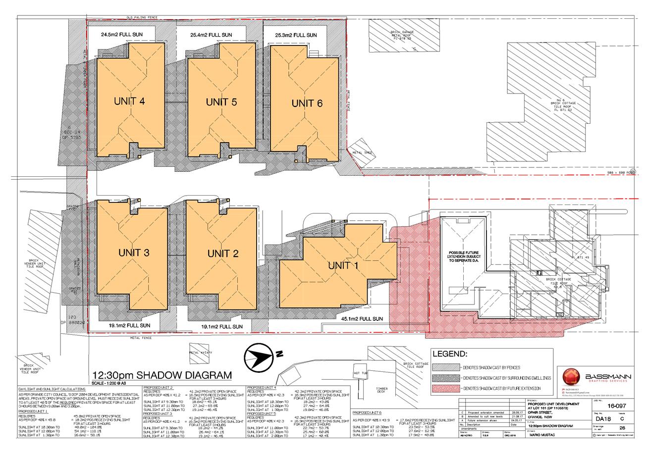
Planning and Development Committee
7 November 2017
2.10 Development
Application DA 181/2017(1) - 6A and 8 Ophir Street
Attachment 2 Plans
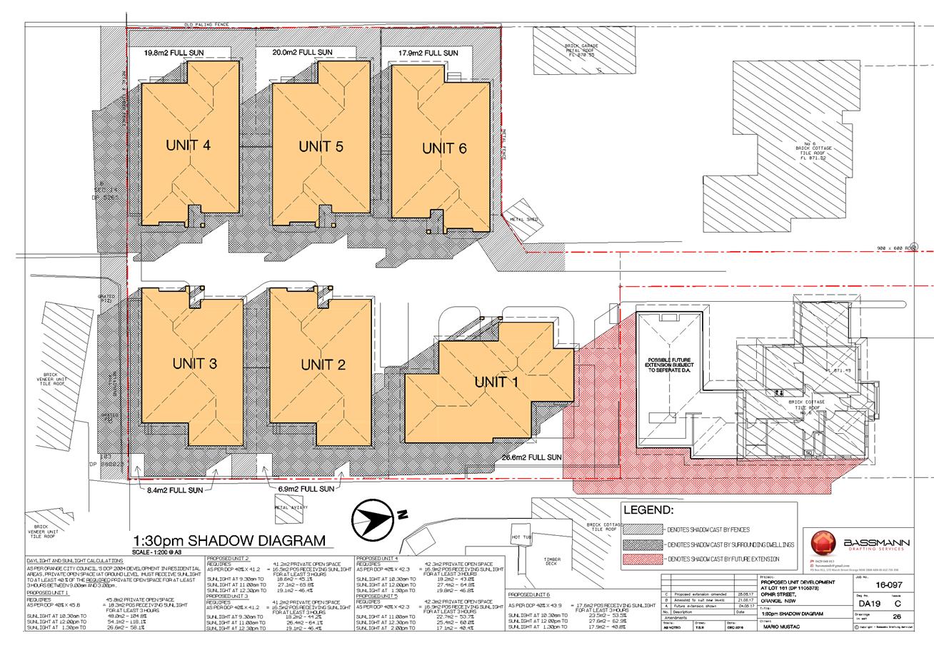
Planning and Development Committee
7 November 2017
2.10 Development
Application DA 181/2017(1) - 6A and 8 Ophir Street
Attachment 2 Plans
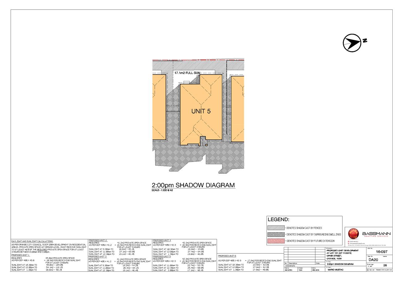
Planning and Development Committee
7 November 2017
2.10 Development
Application DA 181/2017(1) - 6A and 8 Ophir Street
Attachment 2 Plans
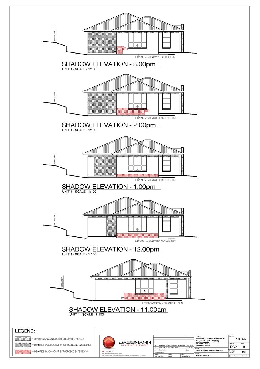

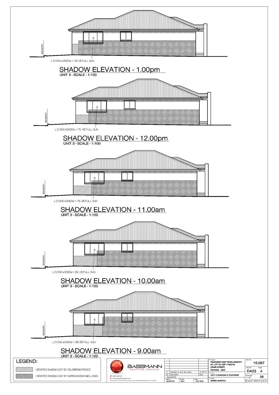
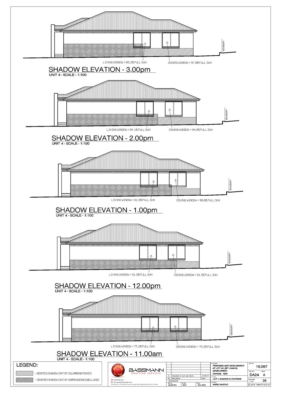
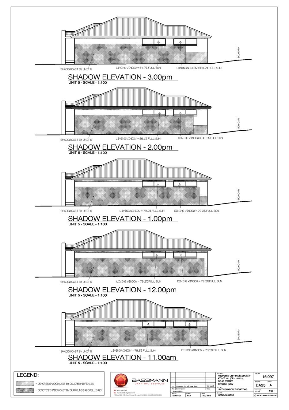
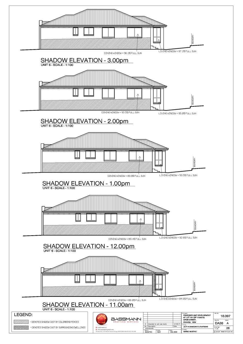
Planning and Development Committee
7 November 2017
2.10 Development
Application DA 181/2017(1) - 6A and 8 Ophir Street
Attachment 2 Plans
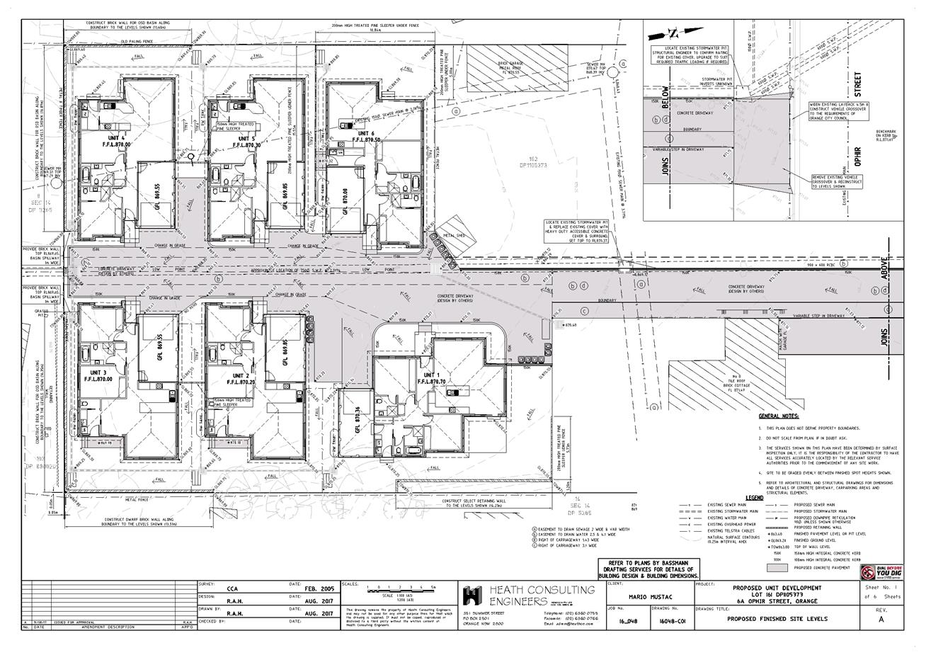
Planning and Development Committee
7 November 2017
2.10 Development
Application DA 181/2017(1) - 6A and 8 Ophir Street
Attachment 2 Plans
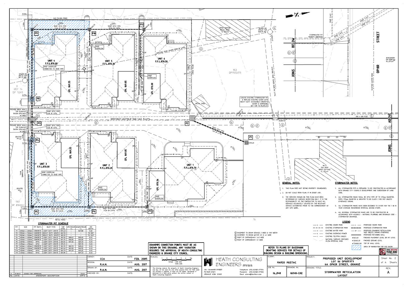
Planning and Development Committee
7 November 2017
2.10 Development
Application DA 181/2017(1) - 6A and 8 Ophir Street
Attachment 2 Plans
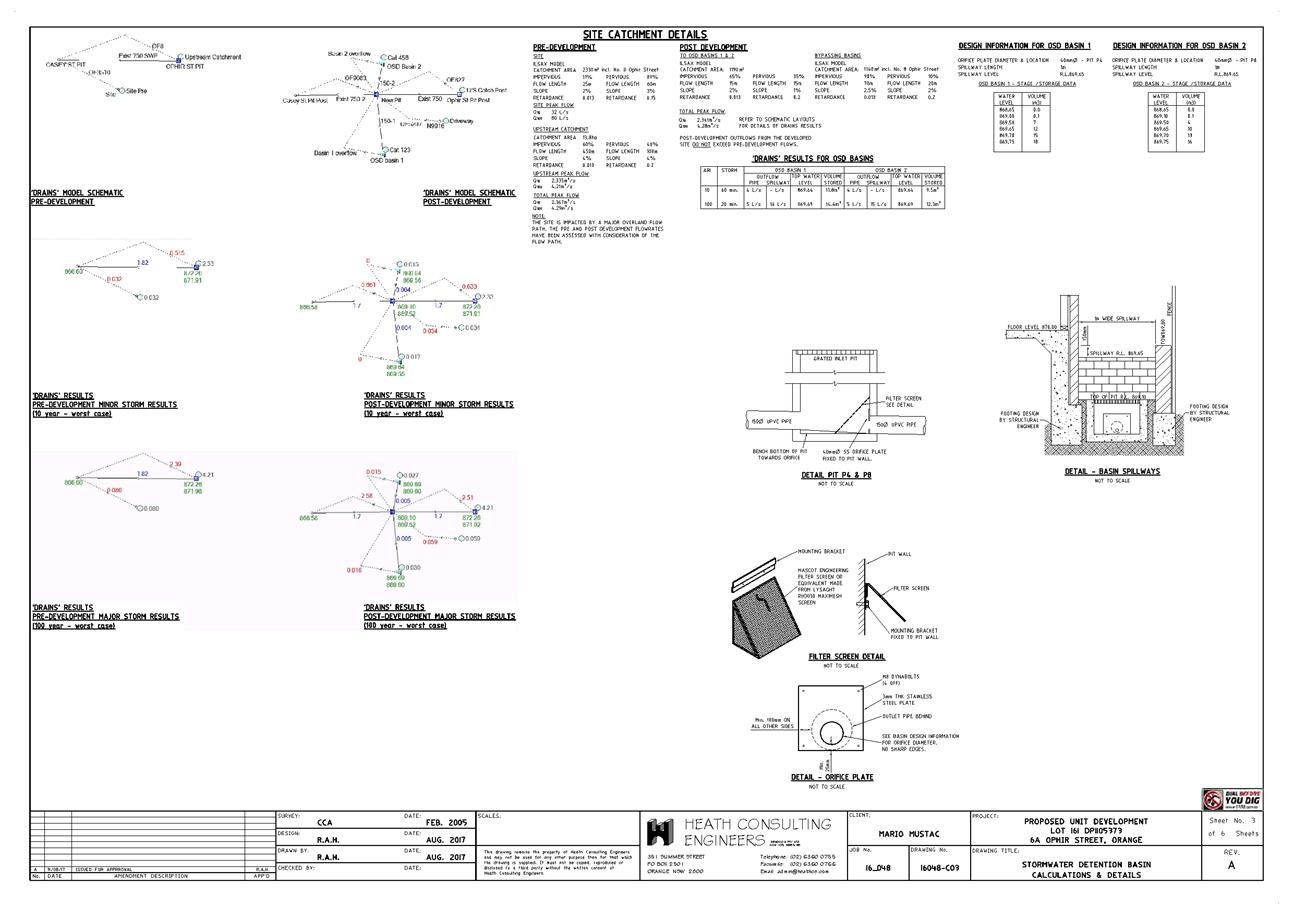
Planning and Development Committee
7 November 2017
2.10 Development
Application DA 181/2017(1) - 6A and 8 Ophir Street
Attachment 2 Plans
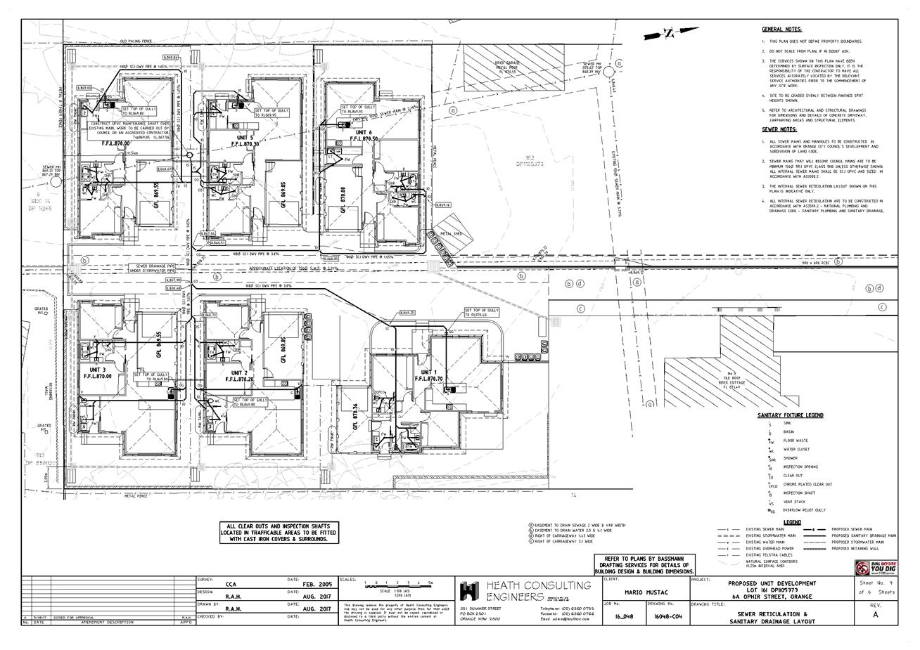
Planning and Development Committee
7 November 2017
2.10 Development
Application DA 181/2017(1) - 6A and 8 Ophir Street
Attachment 2 Plans
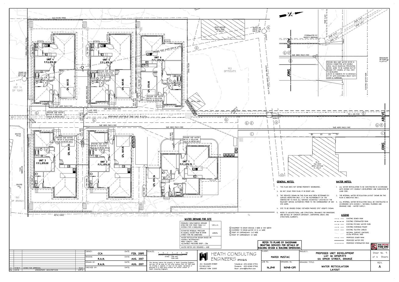
Planning and Development Committee
7 November 2017
2.10 Development
Application DA 181/2017(1) - 6A and 8 Ophir Street
Attachment 2 Plans
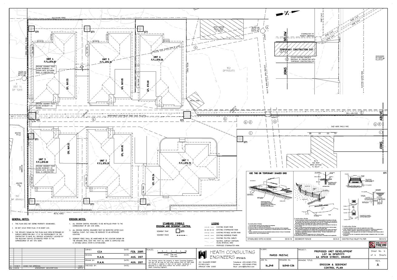
Planning and Development Committee
7 November 2017
2.10 Development
Application DA 181/2017(1) - 6A and 8 Ophir Street
Attachment 3 Submissions