5.3 Development
Application DA 218/2015(1) - 118 Lysterfield Road
TRIM
REFERENCE: 2015/2852
AUTHOR: Paul
Johnston, Planning Team Leader
EXECUTIVE Summary
|
Application
lodged
|
30 June
2015
|
|
Applicant/s
|
Robert R
Wilson & Associates
|
|
Owner/s
|
Roy
Mammone Developments Pty Ltd
|
|
Land
description
|
Lot 100
DP 1204145 – 118 Lysterfield Road, Orange
|
|
Proposed
land use
|
Subdivision
(204 lot residential) and demolition (existing dwelling and shed)
|
|
Value of
proposed development
|
$6,344,000
|
Council was initially in receipt
of a development application which sought consent for a 208 lot
residential subdivision of land described as Lot 100 DP 1204145 known as
118 Lysterfield Road, Orange. The proposal also involved the demolition of
a dwelling house and several structures.
In order to respond to issues associated with the Hawke Lane
Dam exclusion zone referenced within the Shiralee Development Control Plan
(DCP), a formal request from the applicant to amend the development application
in accordance with Clause 55 of the Environmental Planning and Assessment
Regulations was received by Council on 26 October 2015. The amended application
involved a reduction in the number of lots proposed from 208 lots to 204 lots
in order to provide for an additional 12.6m of road width adjacent to Hawke
Lane. The additional road width is proposed along Hawke Lane to allow for the
construction of a future levy bank/vegetation mound along the southern boundary
of the subject development, designed to alleviate the potential for flooding in
the event of Hawke Lane Dam Failure. The above works are proposed to be
undertaken prior to the issue of a subdivision certificate for Stages 2-6.
Council’s Technical Services Department however have advised that the
required works will be required to be undertaken prior to the issue of a subdivision
certificate for Stages 1-6.
The design of the proposed
subdivision has had regard to the Shiralee Masterplan. A detailed assessment of
the application has revealed that some of the lots do not comply with the
Shiralee Development Control Plan (DCP) in terms of width to depth ratio. As
such, this application seeks a departure to those controls.
Proposed Lots 79-92 are also
affected by a dual minimum allotment size requirement under the recently
adopted LEP mapping layer contained within the LEP. The applicant has requested
a variation to the minimum lot size requirement for these lots pursuant to the
provisions of Clause 4.6 of Orange LEP 2011.
The majority of the proposed subdivision is affected by the
Hawke Lane Dam exclusion zone. Council’s DCP for Shiralee specifies that
lots within the subdivision may not be developed until such time that the dam
has been decommissioned or appropriate works are undertaken to safely convey
discharges from the dam into the downstream watercourse or drainage system in
such a manner so as to ensure no adverse flood risk is presented to downstream
properties.
A dam break assessment
commissioned by Council has been undertaken by Entura that indicates that a
drainage diversion structure can be located in the proposed Hawke Lane road
widening to cater for any significant overflows resulting from the failure of
the farm dam located to the south of the site. Surface stormwater flows will be
required to be diverted towards the swale drain in “Green Street”
to the west of the subdivision. A condition relating to the design and
construction of the stormwater diversion structure is included in the Notice of
Approval (Conditions 9 and 42).
A Section 79C assessment of the development indicates that
the development is acceptable. Attached is modified Notice of Approval for
Council’s consideration.
It is recommended that Council supports the subject
proposal.
Link To Delivery/OPerational Plan
The recommendation in this report relates to the
Delivery/Operational Plan strategy “13.4 Our Environment
– Monitor and enforce regulations relating to City amenity”.
Financial Implications
Nil
Policy and Governance Implications
Nil
|
Recommendation
That Council consents to
development application DA 218/2015(1)
for Subdivision (204 lot residential) and Demolition (existing dwelling
and shed) at Lot 100 DP 1204145 – 118 Lysterfield Road,
Orange pursuant to the conditions of consent in the
attached Notice of Approval.
|
further considerations
Consideration has been given to the recommendation’s
impact on Council’s service delivery; image and reputation; political;
environmental; health and safety; employees; stakeholders and project
management; and no further implications or risks have been identified.
SUPPORTING INFORMATION
THE APPLICATION/PROPOSAL
Council is in receipt of a
development application which seeks consent for a 204 lot residential
subdivision of land described as Lot 100 DP 1204145, known as 118 Lysterfield
Road, Orange. The proposal also involves the demolition of a dwelling house and
several structures within the subject site and filling of farm dams.
The subdivision is proposed to
be undertaken in six stages as follows:
Stage 1 - Lots 1 to 32
and construction of part Road 1, Road 2, part Roads 3, 4 and 5;
Stage 2 - Lots 33 to 50
and construction of parts Road 1B, 4 and 5;
Stage 3 - Lots 51 to 76
and construction of part Roads 1B and 6;
Stage 4 - Lots 77 to 108
and construction of part Roads 1B, 3, 6 and 7;
Stage 5 - Lots 109 to 135
and construction of part Roads 1B, 3, 8, 11 and 12; and
Stage 6 - Lots 136 to 204
and construction of part Roads 1B, 3, 9, 10, 11 and 12.
The lots range in size from 288.5m² to 826m².
The majority of the proposed subdivision is affected by the
Hawke Lane Dam exclusion zone. Council’s DCP specifies that lots within
the subdivision may not be developed until such time that the dam has been
decommissioned or appropriate works are undertaken to safely convey discharges
from the dam into the downstream watercourse or drainage system in such a manner
so as to ensure no adverse flood risk is presented to downstream properties. A dam break assessment commissioned by Council has
been undertaken by Entura that indicates that a drainage diversion structure
can be located in the proposed Hawke Lane Road widening to cater for any
significant overflows/failure of the farm dam located to the south of the site.
Surface stormwater flows will be required to be diverted west towards the swale
drain in “Green Street”.
The above described mitigation works are proposed to be
undertaken prior to the issue of a Subdivision Certificate for Stages 2-6.
Council’s Technical Services Division has however advised that the
required works will be required to be undertaken prior to the issue of a
subdivision certificate for Stages 1-6.
MATTERS FOR CONSIDERATION
Section 5A Assessment
In the administration of sections 78A, 79B, 79C, 111 and
112, the provisions of Section 5A must be taken into account for every
development application in deciding whether there is likely to be a significant
effect on threatened species, populations or ecological communities or their
habitats. This section includes a requirement to consider any adopted
assessment guidelines, which means assessment guidelines issued and in force
under section 94A of the Threatened Species Conservation Act 1995.
Assessment guidelines are in force (see DECC-W “Threatened Species
Assessment Guidelines - The Assessment of Significance”) which requires
consent authority to adopt the precautionary principle in its assessment.
In this instance, site inspection reveals the subject
property has no biodiversity or habitat value.
Section 79C
Section 79C of the Environmental Planning and Assessment
Act 1979 requires Council to consider various matters, of which those
pertaining to the application are listed below.
PROVISIONS OF ANY ENVIRONMENTAL
PLANNING INSTRUMENT s79C(1)(a)(i)
Orange Local Environmental Plan 2011
Part 1 - Preliminary
Clause 1.2 - Aims of Plan
The broad aims of the LEP are
set out under subclause 2. Those relevant to the application are as follows:
(a) to encourage development which complements
and enhances the unique character of Orange as a major regional centre boasting
a diverse economy and offering an attractive regional lifestyle,
(e) to provide a range of housing choices in
planned urban and rural locations to meet population growth,
(f) to recognise and manage valued
environmental heritage, landscape and scenic features of Orange.
The application is considered to be consistent with aims
(a), (e) and (f) listed above.
Clause 1.6 - Consent Authority
This clause establishes that, subject to the Act, Council is
the consent authority for applications made under the LEP.
Clause 1.9A - Suspension of
Covenants, Agreements and Instruments
This clause provides that covenants, agreements and other
instruments which seek to restrict the carrying out of development do not apply
with the following exceptions.
· covenants imposed
or required by Council
· prescribed
instruments under Section 183A of the Crown Lands Act 1989
· any conservation
agreement under the National Parks and Wildlife Act 1974
· any trust
agreement under the Nature Conservation Trust Act 2001
· any property
vegetation plan under the Native Vegetation Act 2003
· any biobanking
agreement under Part 7A of the Threatened Species Conservation Act 1995
· any planning
agreement under Division 6 of Part 4 of the Environmental Planning and
Assessment Act 1979.
Council staff are not aware of the title of the subject
property being affected by any of the above.
Mapping
The subject site is identified
on the LEP maps in the following manner:
|
Land Zoning Map:
|
Land zoned Part R1 General
Residential and Part RE1 Public Recreation
|
|
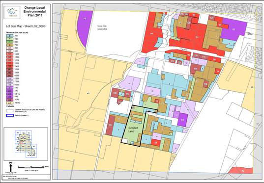
Lot Size Map:
|
Minimum Lot Size applies (see
mapping)
|
|
Heritage Map:
|
Not a heritage item or conservation
area
|
|
Height of Buildings Map:
|
No building height limit
|
|
Floor Space Ratio Map:
|
No floor space limit
|
|
Terrestrial Biodiversity Map:
|
Low biodiversity sensitivity on the
site
|
|
Groundwater Vulnerability Map:
|
Ground water vulnerable
|
|
Drinking Water Catchment Map:
|
Not within the drinking water
catchment
|
|
Watercourse Map:
|
Not within or affecting a defined
watercourse
|
|
Urban Release Area Map:
|
Not within an urban release area
|
|
Obstacle Limitation Surface Map:
|
No restriction on building siting
or construction
|
|
Additional Permitted Uses Map:
|
No additional permitted use applies
|
Those matters that are of relevance are addressed in detail
in the body of this report.
Part 2 -
Permitted or Prohibited Development
Land Use Zones
The subject site is partly
located within the R1 General Residential zone and partly within the RE1 Public
Recreation zone.
The proposed development is defined as subdivision of land
under OLEP 2011. Pursuant to section 4B of the Environmental Planning
and Assessment Act subdivision of land means:
the division of land into two
or more parts that, after the division, would be obviously adapted for separate
occupation, use or disposition.
The proposal also involves demolition of several buildings.
Subdivision and demolition of buildings are permissible in both the R1 General
Residential zone and RE1 Public Recreation zone with the consent of Council.
Clause 2.3 of LEP 2011
references the Objectives for each zone in LEP 2011. The objectives for
land zoned R1 General Residential are as follows:
· To
provide for the housing needs of the community.
· To
provide for a variety of housing types and densities.
· To enable
other land uses that provide facilities or services to meet the day to day
needs of residents.
· To ensure
development is ordered in such a way as to maximise public transport patronage
and encourage walking and cycling in close proximity to settlement.
· To ensure
that development along the Southern Link Road has an alternative access.
The proposed development is not inconsistent with the
objectives of the zone. The development will provide additional opportunity for
residential housing stock in a variety of land sizes. The proposed subdivision
design is considered to be generally consistent with the adopted master
planning for the Shiralee locality.
The objectives for land zoned
RE1 Public Recreation are as follows:
· To
enable land to be used for public open space or recreational purposes.
· To
provide a range of recreational settings and activities and compatible land
uses.
· To
protect and enhance the natural environment for recreational purposes.
· To
ensure development is ordered in such a way as to maximise public transport
patronage and encourage walking and cycling in close proximity to settlement.
· To
ensure development along the Southern Link Road has alternative access.
The proposed development provides for two areas of public
reserve. The subject areas accord with the adopted master planning for the
development of the Shiralee area. The proposed subdivision is therefore
considered to be consistent with the objectives of the zone.
Clause 2.6 - Subdivision -
Consent Requirements
Application has been made for the subdivision of the subject
land. Clause 2.6 of OLEP 2011 permits the subdivision of the subject land
only with development consent.
Clause 2.7 - Demolition requires development
consent
The demolition of a building or work may be carried out only
with development consent. The proposal involves the demolition of the dwelling
and several outbuildings. Demolition of the subject buildings is required to
facilitate the planned subdivision works. Demolition of buildings will be
required to be carried out in accordance with relevant Australian Standards.
Attached to the Notice of Approval are conditions of consent addressing matters
in relation to the proposed demolition.
Part 3 -
Exempt and Complying Development
The application is not exempt or complying development.
Pursuant to Clause 2.6 the application is seeking development consent.
Part 4 -
Principal Development Standards
Clause 4.1 - Minimum
Subdivision Lot Size
This clause
requires the subdivision of land to be equal to or greater than the size
nominated for the land under the Minimum Lot Size Map.
The
submitted plan generally accords with the minimum allotment size mapping
adopted for the Shiralee area with the exception of proposed Lots 79-92 which are affected by a dual minimum
allotment size requirement under the recently adopted LEP mapping layer
contained within the LEP. The applicant has requested a variation to the
minimum lot size requirement for these lots pursuant to the provisions of
Clause 4.6 of Orange LEP 2011. A detailed assessment of the
variation sought is provided below under the heading “Clause 4.6
- Exceptions to Development Standards”.
Clause 4.6
- Exceptions to Development Standards
This clause establishes the
process by which development standards may, in exceptional circumstances, be
varied. Before granting a variation under this clause Council must consider a
written request from the applicant that seeks to justify the contravention of
the development standard by demonstrating:
· that
compliance with the development standard is unreasonable or unnecessary in the
circumstances of the case, and
· that
there are sufficient environmental planning grounds to justify contravening the
development standard.
Council may grant consent only
if the concurrence of the Secretary of the Department of Planning and
Infrastructure has been obtained and Council is satisfied that
· the
written request has adequately addressed the above, and
· the
proposed development will be in the public interest because of:
- consistency with
the objectives of the particular standard, and
- consistency with
the objectives of the zone applying to the site.
Council has been issued the
concurrence of the Secretary for variations of the type proposed. The applicant
has argued that the provision to be varied is unnecessary and unreasonable in
this instance on the basis that the proposed development will provide for a
more effective and appropriate subdivision pattern, which ultimately remains
compliant with the intended development direction and lot density envisaged by
the DCP and Masterplan for this locality.
The submitted plan generally
accords with the minimum allotment size mapping adopted for the Shiralee area,
with the exception of proposed Lots 79-92 which are affected by a dual minimum
allotment size requirement under the recently adopted LEP mapping layer
contained within the LEP. In the present circumstances, it appears the lots are
approximately 75% in the minimum 200m² area and 25% in the minimum
700m² area.
The anomaly has largely come
about due to the finalisation of the lot design and detailed survey work. It is
apparent that the minimum lot size map was intended to give effect to the
Shiralee DCP Masterplan layout. The Masterplan indicates a row of compact lots
with a minimum lot size of 200m² in this area. The submitted design
provides this outcome but has slightly altered the alignment of the road, and
consequently the placement of compact lots fronting the road.
Lots 79 to 92 are only 30m deep
and reducing them by 25% would mean that lots would be 22.5m deep, which
is not a desirable depth. Furthermore, as discussed above, the minimum lot size
map reflects the intended site density. The precise location of the east‑west
roads, including the amended design for Hawke Lane following detailed survey,
may have a bearing on the development to the east in ensuring that
intersections remain functional. This is not anticipated to affect the lot
yield on the property to the immediate east but may have minor implications for
exact lot sizes.
The identified environmental
planning grounds associated with the subdivision are considered to be
sufficient to justify contravening the minimum lot size standard in
clause 4.1(2) of the LEP.
The objectives of provision to
be varied are as follows:
(a) to provide an appropriate degree of
flexibility in applying certain development standards to particular
development, and
(b) to achieve better outcomes for and from
development by allowing flexibility in particular circumstances.
The proposed variation to Clause
4.1 is considered to be consistent with the objectives of the exception clause.
In this regard, given the specific circumstances of the site a better and more
appropriate outcome for the proposed subdivision is achieved by allowing
flexibility to the development standard.
In this regard the proposal,
including the variation sought, is seen to be consistent with the above on the
basis that the overall layout and lot density proposed is consistent with the
intended development direction envisaged in the Shiralee Masterplan DCP.
Part 6 -
Urban Release Area
The Shiralee urban area was
initially defined as an Urban Release Area under the provisions of
Orange LEP. This essentially meant that development of the land was
restricted until such time that master planning and servicing arrangements had
been resolved. Council has since prepared the Shiralee Masterplan DCP for the
locality and has recently adopted Amendment No 4 to Orange LEP 2011 which
sought to rationalise zoning and minimum allotment size provisions for this
locality.
Clause 6.1 of the LEP required
satisfactory arrangements to be made with the Director-General for a
contribution to designated State public infrastructure. Council is in receipt
of advice from NSW Planning and Environment confirming that satisfactory
arrangements for State Infrastructure have now been resolved for the purposes
of Clause6.1(2) of the Orange LEP for the Shiralee Urban Release Area.
Amendment No 4 to Orange
LEP 2011 has also removed the Urban Release Area classification from the
Shiralee area, reflecting the fact that the Shiralee Masterplan DCP and
Section 94 contribution plan have now been finalised. Accordingly
development throughout Shiralee can now be considered and assessed against
conventional planning provisions.
Part 7 -
Additional Local Provisions
7.1 - Earthworks
This clause establishes a range
of matters that must be considered prior to granting development consent for
any application involving earthworks, such as:
(a) the likely disruption of, or any
detrimental effect on, existing drainage patterns and soil stability in the
locality of the development
(b) the effect of the development on the
likely future use or redevelopment of the land
(c) the quality of the fill or the soil to be
excavated, or both
(d) the effect of the development on the
existing and likely amenity of adjoining properties
(e) the source of any fill material and the
destination of any excavated material
(f) the likelihood of disturbing relics
(g) the proximity to and potential for adverse
impacts on any waterway, drinking water catchment or environmentally sensitive
area
(h) any measures proposed to minimise or
mitigate the impacts referred to in paragraph (g).
The earthworks proposed in the
application are limited to the extent associated with creating the subdivision.
Whilst the subdivision will ultimately change the existing landscape, the
extent of disruption to the drainage of the site will be managed through
detailed engineering design.
A dam break assessment
commissioned by Council has been undertaken by Entura that indicates that a
drainage diversion structure will be required to be located in the Hawke Lane
road widening to cater for any significant overflows/failure of the farm dam
located to the south of the site to eliminate the risk. The subject land will
be required to be shaped to ensure that surface stormwater flows are diverted
west towards the swale drain in “Green Street”. A condition
relating to the timing, design and construction of the stormwater diversion
structure and associated subdivision works is included in the Notice of
Approval.
The remaining works envisaged to
be carried out to construct the subdivision are considered to be typical for
residential development and are not likely to detrimentally affect adjoining
properties or receiving waterways.
The preliminary hazard analysis
has identified a small stockpile area of building material within Stage 1
that will require further investigation and remediation. Conditions are
attached that require further testing and validation reporting to ensure that
the site is suitable for residential development. General residue testing of
the remainder of the site is also required by condition due to the previous use
of the land for various agricultural pursuits.
The site is not known to contain
any Aboriginal, European or archaeological relics. Previous known uses of the
site do not suggest that any relics are likely to be uncovered. However,
conditions are imposed to ensure that should site works uncover a potential
relic or artefact, works will be halted to enable proper investigation by
relevant authorities and the proponent required to seek relevant permits to
either destroy or relocate the findings.
Conditions are imposed to
require a sediment control plan to be implemented onsite during construction.
7.3 -
Stormwater Management
This clause applies to all
industrial, commercial and residential zones and requires that Council be
satisfied that the proposal:
(a) is designed to maximise the use of water
permeable surfaces on the land having regard to the soil characteristics
affecting onsite infiltration of water
(b) includes, where practical, onsite
stormwater retention for use as an alternative supply to mains water,
groundwater or river water; and
(c) avoids any significant impacts of
stormwater runoff on adjoining downstream properties, native bushland and
receiving waters, or if that impact cannot be reasonably avoided, minimises and
mitigates the impact.
The requirements of Council’s Technical Services
Division with respect to stormwater management have been included in the
attached Notice of Determination. A detailed assessment of matters pertaining
to the Hawke Lane Dam and its effect on drainage matters, and the ability and
timing of the site to be developed have been addressed later in this report.
7.4 -
Terrestrial Biodiversity
This clause seeks to maintain
terrestrial biodiversity and requires that consent must not be issued unless
the application demonstrates whether or not the proposal:
(a) is likely to have any adverse impact on
the condition, ecological value and significance of the fauna and flora on the
land
(b) is likely to have any adverse impact on
the importance of the vegetation on the land to the habitat and survival of
native fauna
(c) has any potential to fragment, disturb or
diminish the biodiversity structure, function and composition of the land, and
(d) is likely to have any adverse impact on
the habitat elements providing connectivity on the land.
Additionally this clause
prevents consent being granted unless Council is satisfied that:
(a) the development is designed, sited and
will be managed to avoid any significant adverse environmental impact, or
(b) if that impact cannot be reasonably
avoided - the development is designed, sited and will be managed to minimise
that impact, or
(c) if that impact cannot be minimised - the
development will be managed to mitigate that impact.
The proposal is located on land
that has not been identified on the Terrestrial Biodiversity Map as comprising
“High Biodiversity Sensitivity” land.
7.6 -
Groundwater Vulnerability
This clause seeks to protect
hydrological functions of groundwater systems and protect resources from both
depletion and contamination. Orange has a high water table and large areas of
the LGA, including the subject site, are identified with “Groundwater
Vulnerability” on the Groundwater Vulnerability Map. This requires that
Council consider:
(a) whether or not the development (including
any onsite storage or disposal of solid or liquid waste and chemicals) is
likely to cause any groundwater contamination or have any adverse effect on
groundwater dependent ecosystems, and
(b) the cumulative impact (including the
impact on nearby groundwater extraction for potable water supply or stock water
supply) of the development and any other existing development on groundwater.
Furthermore consent may not be granted unless Council is satisfied that:
(a) the development is designed, sited and
will be managed to avoid any significant adverse environmental impact, or
(b) if that impact cannot be reasonably avoided
- the development is designed, sited and will be managed to minimise that
impact,
(c) if that impact cannot be minimised - the
development will be managed to mitigate that impact.
The proposal is not anticipated
to involve the discharge of toxic or noxious substances and is therefore
unlikely to contaminate the groundwater or related ecosystems. The proposal
does not involve extraction of groundwater and will therefore not contribute to
groundwater depletion. The design and construction of the proposal will be
required to take into account the hydrology of this locality. A detailed
engineering design for the subdivision will be required to be submitted for
approval prior to the commencement of work.
7.11 - Essential Services
Clause
7.11 - Essential Services provides that development consent must not be granted
to development unless the consent authority is satisfied that any of the
following services that are essential for the proposed development are
available or that adequate arrangements have been made to make them available
when required.
Essential
services include the supply of water; the supply of electricity; the disposal
and management of sewage; stormwater drainage or onsite conservation; and
suitable road access.
The applicant advises that
reticulated water, sewerage, electricity and telephone services are available
to the site and will be provided to each lot proposed to the satisfaction of
the relevant authorities. The attached Notice of Determination contains
relevant conditions in relation to the provision of essential services.
STATE ENVIRONMENTAL PLANNING
POLICIES
State Environmental Planning Policy 55 - Remediation of
land
State Environmental Planning Policy 55 - Remediation of Land
is relevant to the proposal.
Clause 7 of the SEPP provides:
7 Contamination
and remediation to be considered in determining development application
(1) A
consent authority must not consent to the carrying out of any development on
land unless:
(a) it
has considered whether the land is contaminated, and
(b) if
the land is contaminated, it is satisfied that the land is suitable in its
contaminated state (or will be suitable, after remediation) for the purpose for
which the development is proposed to be carried out, and
(c) if
the land requires remediation to be made suitable for the purpose for which the
development is proposed to be carried out, it is satisfied that the land will
be remediated before the land is used for that purpose.
A preliminary contamination assessment/site investigation
has been submitted in support of the development application which identifies
most of the site as being free from contamination, with the exception of a
stockpile of building demolition material that is located in the area proposed
to be Stage 1 of the subdivision. The stockpile has been identified as having
elevated levels of lead and asbestos material present. The preliminary site
investigation has recommended that the wastes be further characterised as part
of the subdivision process. A condition has been included in the attached
Notice of Approval requiring such work to be carried out prior to the issue of
the Subdivision Certificate for Stage 1 of the Subdivision. The condition
also requires a verification report to be provided demonstrating that the land
is suitable for residential use.
State Environmental Planning
Policy (Infrastructure) 2007
Clause 104 of the State Environmental Planning Policy
(Infrastructure) 2007 (ISEPP) relates to traffic generating developments.
The proposal involves a residential subdivision of 200 plus
residential lots. On this basis the development is captured within the
provisions of Clause 104, and therefore results in a referral to Roads and
Maritime Services (RMS).
Council is in receipt of formal advice from the RMS
regarding this matter. The requirements of the RMS have been evaluated by
Council’s Technical Services Division. An assessment of the traffic
impacts associated with the proposal has been undertaken below under the
heading “Traffic Impacts”.
PROVISIONS OF ANY DRAFT
ENVIRONMENTAL PLANNING INSTRUMENT THAT HAS BEEN PLACED ON EXHIBITION
s79C(1)(a)(ii)
There are no draft environmental planning instruments that
apply to the subject land or proposed development.
PROVISIONS OF ANY DEVELOPMENT
CONTROL PLAN s79C(1)(a)(iii)
Development Control Plan 2004
Development Control Plan 2004 (the “DCP”)
applies to the subject land. Chapters of the DCP relevant to the proposed
use and development include:
· Chapter 0 -
Transitional Provisions;
· Chapter 2 -
Natural Resource Management;
· Chapter 3 -
General Considerations;
· Chapter 4 -
Special Environmental Considerations;
· Chapter 5 -
General Considerations for Zones and Development;
· Shiralee DCP
Chapter 0 - Transitional
Provisions
Part 0 - LEP 2011
Part 0.2 of Orange DCP 2004 establishes a conversation table
for old zones under OLEP 2000 to new zones under LEP 2011, and in turn
provides which chapters of the DCP are applicable in instances of new
zonings under LEP 2011. This is pertinent given the subject land's new zoning,
being part R1 General Residential and part RE1 Public Recreation. Part 0.2
provides that Part 7 and 11 of Orange DCP 2004 are applicable to these zones.
Chapter 2 - Natural Resource
Management
Section 2.1 - Water Quality
Section 2.1 - Water Quality identifies that development that
concentrates, redirects flows, increases flow rates or disturbs land in close
proximity to creeks has the potential to affect waterways with associated
erosion, sedimentation and release of nutrients, which combine to affect
downstream water quality. Section 2.1 also identifies that development
involving groundwater extraction and/or onsite wastewater disposal is deemed to
affect groundwater resources.
Specific planning outcomes for stormwater quality include:
· Development is
carried out in a manner that does not contribute to downstream erosion or
sedimentation of waterways.
· Development
complies with the Water and Soil Erosion Control requirements of the
Development and Subdivision Code.
· On-site
detention is carried out in accordance with the Development and Subdivision
Code for all developments comprising buildings with a site coverage greater
than 50m2 or where site coverage exceeds the “percentage
impervious” level listed in the Code applicable to that development.
· Where on-site
detention is not appropriate, contributions are made towards retarding basins
and/or GPTs and associated drainage under the Contribution Plan that applies to
the land.
· Development in
the vicinity of natural watercourses is positioned away from the waterway and
includes measures to minimise the impact of the development on the waterway
such as the establishment of creekside buffer zones and planting of native
trees in a manner that enhances streambank stability.
Specific planning outcomes for groundwater quality include:
· Development
applications for development (excluding dwelling houses) that proposes to
extract groundwater or involve on-site wastewater disposal identify potential
risks to, and management of, groundwater resources.
· Development is
carried out in a manner that does not adversely affect groundwater resources.
· Development
considered by Council to have the potential to significantly affect groundwater
quality incorporates a monitoring program and provides test results from a
NATA-accredited laboratory to Council for review and for inclusion in the City
SoE Reports.
These matters have previously
been addressed in detail under the headings
“7.3 - Stormwater” and “7.6
- Groundwater Vulnerability”.
Section 2.3 - Vegetation and
Section 2.4 - Flora and Fauna, Biodiversity
Section 2.3 - Vegetation and Section 2.4 - Flora and Fauna,
Biodiversity identify that the natural environment of the Orange LGA has been
heavily modified as a consequence of land clearing for various uses, including
agriculture, plantation forests, mining and urban development; and that
clearing of native vegetation has significantly affected native habitats.
Specific planning outcomes for vegetation and flora, fauna
and biodiversity include:
Vegetation
· Compliance with
the Native Vegetation Conservation Act 1997.
· Development is
designed and constructed in a way that minimises the impact on existing
vegetation.
· Particular
attention is given to the effect of rural or urban residential release
development on existing vegetation and scenic areas.
· Development
applications indicate on plans the location of all significant trees affected
by or in the vicinity of development.
· Applications
demonstrate to Council’s satisfaction that all practical measures have
been made to retain trees that contribute to and embellish the Orange
landscape.
Flora, Fauna and Biodiversity
· Where there is
a likely impact of development on native habitats, that impact is addressed in
the development application.
· A Species
Impact Statement is prepared for development that is likely to significantly
affect habitats of threatened species. The statement is submitted with a
development application and indicates how threatened species will be managed
with the development.
· Development
affecting all or part of significant water bodies or remnant woodland areas
with the potential to comprise habitats of threatened species incorporates the
protection and conservation of these areas where deemed reasonable by Council.
· Threatened
species, populations and ecological communities are managed in conjunction with
development in accordance with the Threatened Species Conservation Act.
These matters have previously been addressed under the heading
“Section 5A Assessment”.
Chapter 3 - General
Considerations
Section 3.1 - Cumulative Impacts
Section 3.1 - Cumulative Impacts identifies that Council
will consider not only the direct impacts of a particular development but also
whether the development, when carried out in conjunction with other development
in the locality, has a more significant environmental impact.
The proposed development is generally consistent with the
intended development insofar as it provides for residential subdivision in a
manner generally in accordance with the Shiralee DCP.
Given that the proposed subdivision generally accords with
the conceptual subdivision layout for this locality, it is not considered that
the proposed development will have a cumulative or significant environmental
impact.
Chapter 4 - Special
Environmental Considerations
Section 4.1 - Sewage Disposal
Section 4.1 specifies that urban development must be
connected to a sewerage system approved by Orange City Council.
Specific planning outcomes for sewage disposal include:
· Development
within the urban area of Orange as defined above is connected to sewerage
facilities or arrangements to the satisfaction of Council have been made for
the provision of sewerage services prior to occupation.
Reticulated sewer will be made available as a component of
this development. A condition of consent addressing matters in relation to
sewerage facilities is attached to the Notice of Approval.
Section 4.3 - Land Shaping
Section 4.3 - Land Shaping
identifies that substantial land shaping, including filling or excavating land,
has the potential to generate significant environmental impacts, and that land
shaping should not adversely affect land in the vicinity as a result of
drainage, erosion or sedimentation or as a result of leachate entering surface
or groundwater.
The DCP sets the following planning outcomes with regard to
land shaping:
· Applications
include details on the existing and proposed landform, watercourses and
vegetation.
· Applications
are accompanied by a soil-erosion control plan for implementation prior to and
upon commencement of the work.
· Landfilling
comprises inert material only and does not include putrescible waste,
vegetation, or other material that may decompose.
· Landfill is
compacted to the required standard and evidence of compaction rates are
provided upon completion of the work or otherwise as directed by Council.
These
matters have previously been addressed under the heading “7.1 -
Earthworks”.
Chapter 5 - General
Consideration for Zones and Development
Section 5.3 - Advertised Development
Section 5.3 - Advertised Development identifies that Council
will give written and published notice of applications for advertised
development as required by the Environmental Planning and Assessment
Regulations. Subdivision of land is not declared advertised development.
Accordingly, the development application was not advertised.
Section 5.7 - Subdivision
Section 5.7 - Subdivision requires all works to be
undertaken in accordance with Council’s adopted standards as outlined in
the Orange City Development and subdivision Code. Council’s Technical
Services Division has recommended conditions of consent in relation to this
matter.
SHIRALEE DCP
The
Shiralee Development Control Plan provides a series of development controls for
the residential development of this locality. Some controls are land use based
and generic, whilst others are detailed and sometimes site specific. It is
considered that the proposed subdivision is generally consistent with the
requirements of the DCP, except for the lot width-to-depth ratio and
orientation of certain lots, for which the applicant has requested Council
consider a departure to the DCP.
Section
1 - Introduction
This
section of the DCP provides the context of the DCP and general information
required in compiling a development application. This section also
contains the stated objectives of the Shiralee “Development Control
Plan” which are as follows:
· To
guide the urban expansion of Shiralee, south of the existing Orange urban area
· To
promote a high quality urban environment with a diversity of housing and
recreation opportunities
· To
encourage alternative modes of transport and healthy lifestyles
· To
reduce traffic congestion by providing for the day to day needs of residents
within the precinct.
The submitted plans demonstrate that the development has
been designed to generally accord with the relevant conceptual subdivision
layout contained within the DCP. The proposed development is considered to
be consistent with the objectives of the DCP.
The
Shiralee Masterplan through a series of maps identifies:
• a range of lot
typologies
• a range of street
typologies
• an overall transport
movement hierarchy
• an open space and
recreation network
• an overall landscape
structure
• a
strategy for street trees.
These
maps present an over-arching structure to the precinct. The development
application has been assessed against these maps and the provisions of the DCP.
A detailed assessment of each of the above requirements has been provided
below.
Section
2 - Desired Future Character
This
section provides the statement of how the subdivision will retain the character
of the area. The Shiralee Masterplan has been developed on the following
principles
· Has a distinct, separate identity to Orange whilst
maintaining the best themes of Orange
· Is anchored by a hill-top mixed use village
· Provides housing choice that promotes a diverse community
· Provides community infrastructure to create a viable
community
· Responds to existing site conditions, including natural
features and man-made elements including the street grid
· Retains and enhance the unique character of the place
· Ensures development has regard to the fabric and
character of each area in scale, proportion, street alignment, materials and
finishes and reinforces distinctive attributes and qualities of built form
· Conserves and protect historic items and their settings
· Maintains a high level of daylight access to streets,
lanes, parks and other public domain spaces
· Encourages active street frontages to the public domain
· Conserves, maintains and enhances existing views and
vistas to buildings and places of historic and aesthetic significance.
It is
considered that the proposed subdivision is in keeping with the character of
the area and the DCP outcomes for lot sizes, densities, roads, etc and the
above described principles. LEP Amendment No 4 to Orange LEP 2011 has been
recently gazetted to reflect this outcome.
Part
2.4 of the DCP provides the following subdivision controls for the development
of the Shiralee locality.
· Subdivision is to be consistent generally in accordance
with the Masterplan design and intent per the DCP. Legislative requirements and
DCP written controls take precedence over the Masterplan.
The development is generally in
accordance with the Masterplan design and intent of the DCP, with only a
few alterations proposed. The applicant was requested to justify the changes
proposed. In particular, proposed Lots 153 and 134 under the Masterplan were
required to be designed to address Road Number 8 as opposed to Road No 12, and
similarly proposed Lots 167 and 168 were required to be orientated towards the
proposed open space area.
It is assumed that the design
intention envisaged in the Masterplan was to ensure that future dwellings in
this locality be designed to address the higher order status of Road No 8
as opposed to the lower order status of Road No 12. Orientation of the
subject parcels to Road No 12 has the potential to present side fencing of
1.8m height along much of the street frontage between Road No 18 and Road No 12
under the current configuration.
The applicant submits that
future side fencing along Lots 134 and 135 would be approximately 30m long, and
that the orientation of these lots would be acceptable having regard to the
requirement under Clause 5.1 which requires corner lot homes to address both
street frontages. Given that these particular lots are not square and are on a
slight angle. it is recommended that the lot configuration proposed with
respect to proposed Lots 134 and 135 be supported.
Additionally, proposed Lots 167 and 168 under the Masterplan
were required to be orientated such that future dwellings would address the
proposed public open space. It is acknowledged that re-orientation of these
lots may in turn affect the overall design of other lots in the precinct.
The applicant has acknowledged that whilst it would be ideal
for these lots to front the open space (proposed Lot 166), they have
requested that Council support the configuration as proposed on the basis that
they will still address rural land and the lot shape allows greater opportunity
for northerly solar access into the rear private open space areas of these
lots. The applicant estimates that fencing of Lot 167 would only be for
some 25m, which is considered reasonable given the fact that other lots
within Road No 12 have been designed to front the park so as to comply
with the principals of CPTED.
On a separate matter the
proposed additional road widening requirements adjacent to Hawke Lane to
accommodate dam break mitigation works may slightly alter the road connection
point with the adjoining property to the immediate east. This adjustment is not
anticipated to affect the overall lot yield potential of that property and can
be addressed when and if an application is made for that land.
It is recommended in this case that the Council supports the
proposed departures to the DCP conceptual subdivision layout.
· Lot
sizes are to be consistent with or greater than the adopted minimum lot size
for the land under the LEP zoning map.
Amendment No 4 to Orange LEP 2011 relating to the minimum
lot size mapping for Shiralee has recently been gazetted. An assessment of the
proposed subdivision design against the LEP lot size mapping indicates
that proposed Lots 79-92 straddle the minimum lot size map. This is related to
the alignment of the road being moved slightly to the south compared to the
Shiralee Masterplan. It is noted that Lots 79-92 will provide the row of
compact lots that the Masterplan envisaged, albeit in a slightly different
location.
The applicant has requested that Council consider a
departure to the LEP lot size controls for the lots pursuant to Clause 4.6 of
the LEP. Clause 4.6 provides for the Council to grant development consent for a
development that would contravene a development standard. A detailed
assessment of matters pertaining to Clause 4.6 has been provided above under
the heading “Clause 4.6 - Exceptions to Development Standards”.
· Where
an oversized lot is proposed (substantially greater than the adopted minimum
lot size), plans are to nominate a building envelope.
Each of the proposed lots
generally accord with the lot size mapping requirements. There are no
allotments within the subdivision that warrant a requirement for the applicant
to nominate a building envelope.
· Building
envelopes on oversized lots are to be positioned in a manner that clearly
enables future subdivision of the lot to a pattern consistent with the masterplan
layout and adopted minimum lot size for the land.
There are no allotments within
the subdivision that warrant a requirement for the applicant to nominate a
building envelope. This subdivision control is therefore not relevant in the
determination of this application.
· Except
for corner lots and where indicated otherwise on the Large Lot Classification
Table, all residential lots are to have a width to depth ratio of between 1:4
and 1:2.75 with the shorter boundary being the street frontage.
· Residential
corner lots are to have greater width with a ratio of between 1:3.25 and 1:2.5
to allow more opportunity for the subsequent dwelling to address both
frontages.
The
submitted plans and accompanying documentation indicate that a number of lots
do not comply with the width-to-depth ratio required by the DCP. The table
below provides a summary of those lots that are non-compliant.
|
Lot
|
Lot size (m²)
|
Width (m)
|
Depth (m)
|
Ratio
|
Compliance (variation
%)
|
|
15
|
367.5
|
6.875 (corner lot) 12.83
at the rear
|
30
|
1:4.36-2.33
|
Partial compliance
|
|
16
|
422.7
|
12.5
|
33.81
|
1:2.7
|
No (1.81%)
|
|
29
|
701.2
|
18.85
|
37.2
|
1:1.97
|
No (28.36%)
|
|
54
|
410.9
|
13.7
|
30
|
1:2.18
|
No (20.72%)
|
|
64
|
483.1
|
16
|
30.2
|
1:1.88
|
No (31.63%)
|
|
68
|
744
|
20
|
37.2
|
1:1.86
|
No (32.36%)
|
|
78
|
532.4
|
12.5
|
30
|
1:2.4
|
No (12.72%)
|
|
79
|
374.9
|
12.5
|
30
|
1:2.4
|
No (12.72%)
|
|
96
|
539.9
|
12.6 (corner lot)
|
30
|
1:2.38
|
No (4.80%)
|
|
97
|
503.9
|
15
|
33.6
|
1:2.24
|
No (18.54%)
|
|
122
|
504
|
15
|
33.6
|
1:2.24
|
No (18.54%)
|
|
123
|
450
|
15
|
30
|
1:2
|
No (27.27%)
|
|
126
|
551.9
|
13 (corner lot)
|
30
|
1:2.3
|
No (8.00%)
|
|
127
|
482.9
|
16.1
|
30
|
1:1.86
|
No (32.36%)
|
|
134
|
532.9
|
13 (corner lot)
|
29
|
1:2.23
|
No (10.80%)
|
|
135
|
524.8
|
13 (corner lot)
|
29.44
|
1:2.26
|
No (9.60%)
|
|
136
|
476.7
|
13.08 (corner lot
|
30.15
|
1:2.3
|
No (8.00%)
|
|
153
|
470
|
16
|
29.76
|
1:1.86
|
No (32.36%)
|
|
170
|
417.2
|
13.3
|
31.36
|
1:2.35
|
No (14.54%)
|
|
171
|
452.2
|
9 (corner lot)
|
31.36
|
1:3.48
|
No (7.07%)
|
The intent of a width-to-depth
ratio is to ensure that the lots created will have reasonable development
potential without requiring excessive impact upon neighbouring lots or
depriving the future occupants of the property of appropriate design options. In
this regard the ratio becomes more important the smaller the overall lot size.
It is apparent from the above table that variations are only related to medium
and standard lots - all compact lots proposed are compliant.
The applicant has submitted a
series of plans which provide detail of how each of the lots that do not comply
with the width-to-depth ratio can still be developed with a dwelling. An
assessment of the indicative plans submitted in support of the application
demonstrates that a dwelling can be constructed to meet the objectives relating
to the requirements of the DCP for each of the lots affected.
This level of detail is not
ordinarily required at the subdivision stage. It is considered appropriate in
this case to demonstrate a reasonable level of certainty that future dwelling
designs can comply with the building controls. This demonstrates that the
proposed lots can be reasonably developed and therefore satisfy the intent of
the width-to-depth ratio provision. All future dwellings will, however, be the
subject of a separate approval process, and each dwelling design will need to
demonstrate compliance with planning controls applicable to the site at that
time.
The applicant has respectfully
requested that Council consider a departure to the DCP width-to-depth
requirements for certain lots within the subdivision. Based on the fact that
the applicant has demonstrated that each of the lots affected can still
accommodate a reasonable residential design in a manner generally consistent
with the requirements of the DCP, it is recommended that Council support
the departure to the DCP in this case.
· Roads identified for Bus Routes:
Ø Intersections where the bus route turns are to be designed
to accommodate full size coaches.
Ø At nominated bus stop locations the road reserve is to be
increased by an addition 0.5m to allow for passenger congregation and future
street furniture. The front building setbacks of affected lots may be reduced
by 0.25m to help preserve the pattern and rhythm of development.
Council’s Technical
Services Division has evaluated the plans and advises that the planned layout
will address the above described requirements.
Part
2.5 - Lot Typologies of the DCP provides the following subdivision controls for
the development of the “Shiralee” urban release area.
· Lot typologies and minimum sizes are to be consistent with
the Masterplan, DCP and LEP zoning map.
The submitted plan generally
accords with the minimum allotment size mapping adopted for the Shiralee area,
with the exception of Proposed Lots 79-92 which are affected by a dual minimum
allotment size requirement under the recently adopted LEP mapping layer
contained within the LEP. The applicant has requested a variation to the
minimum lot size requirement for these lots pursuant to the provisions of
Clause 4.6 of Orange LEP 2011.
The submitted plans and
accompanying documentation also indicate that a number of lots do not comply
with the width-to-depth ratio required by the DCP. An assessment of the width-to-depth
ratios for each of the lots affected has been assessed above.
· Any
subdivision which creates more than 3 lots must not have any oversized lots.
Oversized lots are lots that do not fit within the designated categories.
The proposed development is generally
compliant with this planning outcome.
· Specific requirements for large lots within the Precinct
are to be consistent with the Large Lot Classification Diagram and Large Lot
Classification Table.
The
proposed development does not involve the creation of large lots.
· Where subdivision involves the creation of a lot greater
than the maximum for the lot typology, a building envelope is to be established
on the title of the new lot. The dimensions of the building envelope are to be
no greater than:
Ø Compact Lots: the width of the lot minus 1.2m (to provide
for 0.6m side setbacks) by the depth of the lot minus the front and rear
setbacks.
Ø Medium Lots: the width of the lot minus 2m (to provide
for 1.1m side setbacks) by the depth of the lot minus the front and rear
setbacks.
As discussed above, there are no
allotments within the subdivision that warrant a requirement for the applicant
to nominate a building envelope. This subdivision control is therefore not
relevant in the determination of this application.
· The building envelope is to be positioned consistent with
the front and rear setbacks otherwise specified for the lot typology in this
DCP.
Not
applicable in this case.
· The building envelope is to be positioned consistent with
the front and rear setbacks otherwise specified for the lot typology in this
DCP.
Not
applicable in this case.
· All lots must have a direct street frontage to ensure good
access and property amenity. Lots 3,000m² and larger are excepted.
The
submitted plans show that the development complies with this requirement.
· Lots without a street frontage are to have a minimum size
of 3000m² providing that boundary landscaping is provided with any new
development.
Not
applicable in this case.
· Corner lots are to achieve high quality street frontages
on the primary and secondary street.
A
detailed assessment of matters in relation to lot orientation and
width-to-depth ratios has been discussed above within this section of the
report. The proposed size and configuration of lots largely accords with the
adopted Masterplan. Future dwellings for corner lots will be required to be
designed having reference to Part 5.1 of the DCP.
· All compact, medium and standard lots need to achieve a
solar orientation where the long axis of
the lot is
Ø For north-south oriented lots between 20 degrees west of
north or 30 degrees east of north, or
Ø For east-west oriented lots between 20 degrees north of
east or 30 degrees south of east.
The
proposed development is compliant with respect to the above requirement.
Section 3 - Local Infrastructure
Part
3.1 - Infrastructure Provision
Clause
7.11 of the Orange Local Environmental Plan 2011 establishes that development
is required to be provided with essential services including:
1 the
supply of water
2 the
supply of electricity
3 the
supply of gas
4 the
supply of telecommunications infrastructure
5 the
disposal and management of sewage
6 stormwater
drainage or on-site conservation
7 access
Provision
of all essential local infrastructure will be required to be provided at the
developer’s cost. Attached to the Notice of Determination is a condition
of consent requiring all essential services to be provided in accordance with
the relevant supply authorities. All power lines are to be located underground.
The
applicant proposes to carry out the subdivision in stages, and therefore it is
important that the required infrastructure is in place as the stages are
constructed.
Part 3.2 -
Ground levels and Excavation
The earthworks proposed in the
application are limited to the extent associated with creating the subdivision.
The subdivision will ultimately change the existing landscape, and the extent
of cut and fill across the subdivision will be managed through a detailed
engineering design. The proposed development is not inconsistent with the
DCP planning outcomes pertaining to ground levels and excavation. Attached
are relevant conditions of consent addressing engineering issues.
Part 3.3 - Public Domain
· Land identified for the RE1 Public Recreation Zone is to
be dedicated to Council as public open space upon subdivision of the parent lot
· Compensation for the dedicated land is to be in
accordance with the relevant Section 94 Development Contribution Plan.
The submitted plans show a local park being provided in the
south-western corner of the subject land and a further small area of land being
proposed to link drainage systems in the northwest corner of the subject land
with the adjoining land to the north. The configuration and eventual design of
the finished ground levels within the local park (known as Lot 166) will
need to take into account the engineering design requirements associated with
alleviating the flood risk associated with the Hawke Lane Dam.
In accordance with the Section 94 Contributions Plan, the
applicant will be entitled to be compensated for the provision of the proposed
open space. The allocated open space has a total area of 6,768.60m², of
which 6,077.8m² (proposed Lot 166) is considered unencumbered land for the
purposes of this assessment, with the remaining area being compensated on the
basis of it being classified as encumbered. The applicable rate of compensation
for unencumbered land is $30 per square metre and the rate applicable to
encumbered land is $12 per square metre. On this basis the applicant is
entitled to $190,623.60 in compensation for the proposed open space areas.
Attached is a condition of consent addressing matters in relation to Section 94
Contributions.
Part
3.4 – Staging and dealing with storm water/dam
· The Hawke Lane Dam exclusion zone may not be subdivided
or otherwise developed until the dam has been decommissioned or appropriate
works are undertaken to safely convey discharges from the dam into the
downstream watercourse or drainage system, in such a manner so as to ensure no
adverse flood risk is presented to downstream properties.
Stormwater
drainage design needs to be undertaken in accordance with Council’s
standard subdivision design code requirements. In particular adequate provision
must be made for all potential overland flows within the subdivision and their
safe discharge onto downstream properties. Overland flows can be accommodated
within road reserves or drainage reserves utilising minor/major drainage design
approach.
The southern boundary of the
land that adjoins Hawke Lane and immediately adjoining the southern side of
Hawke Lane is Lot A DP 154249, which contains a large dam known as “Hawke
Lane Dam”. The objective of the control appears to be to ensure the safe
and orderly development of the precinct. In particular, the DCP specifies that
the lots within the subdivision may not be developed until such time that the
dam has been decommissioned or appropriate works are undertaken to safely
convey discharges from the dam into the downstream watercourse or drainage
system in such a manner so as to ensure no adverse flood risk is presented to downstream
properties. There is no figure or map within the Shiralee DCP that
specifically identifies the “Hawke Lane Dam Exclusion Zone”.
However, there was a map in the May 2014 draft version of the DCP that went on
public exhibition, described as “Figure 12 The Hawke Lane Dam Exclusion
Zone.”
In order to more accurately determine the extent of the area
potentially affected by a dam break, Council engaged the services of Entura as
a component of this assessment to provide an indication of what engineering
works could be undertaken within the subject land to safely convey discharges
from a dam break scenario in the event that decommissioning works on the dam
itself are not undertaken at this time.
Based on the recommendations of the investigation, Council’s
Technical Services Division advises that a
drainage diversion structure can be located in the area now proposed to be
dedicated as road widening within Hawke Lane to cater for any significant
overflows/failure of the farm dam that is located to the south of the site so
as to eliminate the risk. The subject land will be required to be shaped to
ensure that surface stormwater flows are diverted west towards the swale drain
in “Green Street.
The required mitigation works are proposed to be undertaken
prior to the issue of a subdivision certificate for Stages 2-6. Council’s
Technical Services Department however have advised that the required works will
be required to be undertaken prior to the issue of a subdivision certificate
for Stages 1-6. Based on the advice of
Council’s Technical Services Division, Council can be satisfied that
appropriate engineering works can be undertaken within the subject land to
safely convey discharges from the dam into the downstream watercourse or
drainage system in such a manner so as to ensure no adverse flood risk is
presented to downstream properties. A
condition relating to the timing, design and construction of the stormwater
diversion structure and associated subdivision works are included in the Notice
of Approval.
The applicant has raised
the issue of potential compensation for the dedication of the of the extra
land. This matter will be negotiated separately.
Section 4 - Village Centre
This
section of the DCP relates to village centre and is not relevant in the
determination of the application for subdivision.
Section 5 - Residential Building
This
section relates to dwelling design. This section of the DCP is not relevant in
the determination of the application for subdivision.
Section 6 - Private Domain Landscape
This
section of the DCP relates to private domain landscape and is not relevant in
the determination of the application for subdivision.
Section
7 Public Domain
Part 7.1 - Passive and Active
Recreation Network
· Open
spaces and streets facing open spaces must be provided according to the
Masterplan.
A conceptual landscape plan has
been submitted in support of the development application. The attached Notice
of Determination includes a condition requiring the submission of a detailed
landscaping plan that is consistent with the planning outcomes of the Shiralee
Masterplan prior to the issue of a Construction Certificate.
Part 7.2 -
Landscape
The following planning outcomes
pertaining to landscaping apply:
· Eco
link streets are to have an understory planting layer of native species
including shrubs, groundcovers and grasses of maximum mature height of 1.5m
with planting plans to be submitted for approval by Council.
· Streets
with medians are to have an understory planting layer of species responding to
the tree planting within the median, including shrubs, groundcovers and grasses
of generally maximum mature height of 1.5m and of 1m within 5m of an
intersection.
· Footpath
verges within residential areas are to be planted with cool climate turf
species, as approved by Council
· Footpath
verges and tree planting zones within the village centre, may be planted with
robust groundcover and grass species in keeping with a high quality street
environment and as approved by Council
· A
developer shall construct all footpaths, turf all verges and provide all road
infrastructure planting prior to sale of building blocks
· Maximum
verge cross-fall from property boundary to kerb is to be 2%
· Longitudinal
gradient of verge is to match the gradient of the adjacent kerb.
A conceptual landscape plan has
been submitted in support of the development application. Landscaping of the
precinct is required to be established in accordance with the planning outcomes
and recommended species envisaged within the Shiralee Masterplan DCP. In
order to ensure that landscaping of the precinct is of high quality and
generally consistent with the intent of the Masterplan and the above described
planning outcomes, it is recommended that a condition of consent be attached to
the Notice of Determination requiring the submission of a detailed landscaping
plan that is consistent with the planning outcomes prior to the issue of a
Construction Certificate, with all approved landscaping being undertaken prior
to the issue of a Subdivision Certificate.
Final finished longitudinal
gradients and verge cross-falls will be the subject of a detailed engineering
plan.
Section 8 - Environmental Management
Part 8.2 - Stream
Classification
The land is affected by a Class
1 stream under the NSW Office of Water Guidelines and may require a Controlled
Activity Approval under Section 91 of the Water Management Act 2000.
The applicant has not sought an Integrated Development approval under the Environmental
Planning and Assessment Act and will therefore need to seek relevant approval
under separate legislation prior to carrying out works on site. Attached is a
condition of consent addressing this requirement.
Part 8.3 -
Stormwater and Water Sensitive
The applicant has suitably
demonstrated that the proposed lots have been designed in accordance with the
DCP and generally have a northerly aspect. In respect of “Water Sensitive
Urban Design” (WSUD), the subdivision has carefully considered water quality
aspects (refer to submitted plans).
Section 9 - Movement Network
Section 9 addresses the requirements for providing an
efficient and effective road network to service the new community. The proposed
subdivision and road design is considered to be consistent with the adopted
road hierarchy and is therefore considered to be acceptable.
SECTION 94 DEVELOPMENT
CONTRIBUTIONS
The submitted plans show 204 allotments, and includes a local
park being provided in the south-western corner (proposed Lot 166) of the
subject land and a further small area of open space (unnumbered) being proposed
to link drainage systems in the north-western corner of the subject land with
the adjoining land to the north.
In accordance with the Section 94 Contributions Plan, the
applicant will be entitled to be compensated for the provision of the proposed
open space. The allocated open space has a total area of 6,768.60m² of
which 6,077.8m² (proposed Lot 166) is considered unencumbered land for the
purposes of this assessment, with the remaining area being compensated on the
basis of it being classified as encumbered. The applicable rate of compensation
for unencumbered land is $30 per square metre and the rate applicable to
encumbered land is $12 per square metre. On this basis the applicant is
entitled to $190,623.60 in compensation.
The proposed development will ultimately result in the
provision of 202 additional allotments for residential purposes. The value of
compensation for the proposed areas of open space may be deducted from the
Section 94 Contributions applicable to the land.
In accordance with Section 94 of
the Act and Orange Development Contributions Plan 2015 (Shiralee Urban
Release Area) a contribution towards the provision of the following public
facilities will be required:
|
Open
Space and Recreation
|
@
$725.81 x 202 additional lots
|
146,613.62
|
|
Community
and Cultural
|
@
$146.18 x 202 additional lots
|
29,528.36
|
|
Roads
and Cycleways
|
@
$1,119.84 x 202 additional lots
|
226,207.68
|
|
Stormwater
Drainage
|
@ $67.74
x 202 additional lots
|
13,683.48
|
|
Local
Area Facilities
|
@
$17,760.90 x 202 additional lots
|
3,587,701.80
|
|
Plan
Preparation & Administration
|
@
$179.53 x 202 additional lots
|
36,265.06
|
|
Sub
Total
|
|
4,040,000.00
|
|
Compensation
for open space
|
|
190,623.60
|
|
TOTAL
|
|
$3,849,376.40
|
The contribution will be indexed quarterly in accordance
with the Orange Development Contributions Plan 2015 (Shiralee Urban Release
Area). Attached to the Notice of Determination is a condition of consent
addressing matters in relation to Section 94.
SECTION 64 - WATER AND SEWER
HEADWORKS CHARGES
Section 64 water and sewer headworks charges are also
applicable to the proposal. Such charges are calculated at the time of release
of a Subdivision Certificate for the development. Attached are conditions
requiring the payment of the required contributions prior to the issue of a
Subdivision Certificate.
PROVISIONS PRESCRIBED BY THE
REGULATIONS s79C(1)(a)(iv)
The development is not inconsistent with the provisions
prescribed by the regulations.
THE LIKELY IMPACTS OF THE
DEVELOPMENT s79C(1)(b)
Traffic Impacts
The potential impacts of traffic
on the surrounding road system are addressed below. The proposal detailed in
the application involves a residential subdivision yielding 204 allotments
accessed from Lysterfield Road. The applicant has submitted a study in
accordance with the aims and objectives of State Environmental Planning Policy
Infrastructure 2007 and in accordance with the guidelines and procedures
for traffic generating developments as prepared by the RMS and with reference
to with the provisions of the Shiralee DCP.
The report addressed the
following matters
· the
subdivision and road layouts;
· cycleway
and pedestrian access;
· public
transport provisions;
· traffic
generation;
· vehicular
access; and
· future
traffic impacts.
The subdivision layout has been
designed to be generally in accord with AMCORD Guidelines and the
requirements of the Shiralee DCP. Road widths proposed generally accord with
requirements of the Shiralee DCP, and Council’s Technical Services
Division has included conditions of consent in the attached Notice of Approval
to address matters in relation to road design.
A hierarchical road network is
essential to maximise road safety, residential amenity and legibility. Each
local access road in the subdivision will serve a distinct set of residential
functions and has been designed accordingly.
The RMS recommended traffic
generation per freestanding residential household is between 8 and 9 movements
per day. The peak period is normally 0.9 movements per dwelling per hour, and
the AM peak period represents only 7% of the daily total. Based on the above
(recommended) RMS rates, it is anticipated that the future traffic generation
levels for 203 residential allotments would be as follows:
· daily
vehicle trips (203 dwelling houses x 9) = 1827 trips daily
· weekday
peak hour vehicle trips (203 dwelling houses x 0.9) = 182.7 trips (3.11 per
minute).
The RMS Guidelines also suggest
that a distribution of peak hour arrival and departure journeys be undertaken
to evaluate the traffic impacts on the adjoining road system - normally as 80%
outbound in the AM peak and 20% inbound, and the reciprocal in the
PM peak.
Given the limited access to
Lysterfield Road, it is assumed that all future traffic will enter and exit the
area from Shiralee Road and via Collector Roads (planned). The peak hour
distribution of traffic to/from the site will be ultimately influenced by
future traffic conditions, levels of service and vehicle origins/destinations
regionally.
Currently Lysterfield Road and
Shiralee Road are under-utilised, low volume, local access roads. Future
development of the subject and adjoining land will increase both daily and peak
hour traffic volumes. However, they are not expected to diminish the level of
service.
It is considered that the
subdivision proposal represents an appropriate use of the site from both a
traffic planning and road safety viewpoint. The design of the subdivision
largely accords with the adopted master planning for the site. Council’s
adopted Section 94 plan highlights the need for certain road upgrades over
time to facilitate the orderly development of the precinct.
As indicated above, the full
development of all allotments is likely to result in an additional
182 peak hour trips. These 182 vehicle movements represent a significant
increase over existing low volumes during the AM/PM peak hour. However,
combined future traffic volumes (ie existing plus projected for this
precinct) are likely to result in two-way totals of around 300-vehicles per
hour, which is in keeping with the recommended RMS threshold for collector
roads. The RMS has advised of no objections to the planned development.
Council’s Technical Services Division has also
indicated no objections to the planned development and has included several
conditions of consent in the attached Notice of Determination to address access
requirements, having reference to the desired road hierarchy and design
envisaged by the Shiralee DCP.
Visual Amenity
The subject property is located in a new urban residential
release area that is currently dominated by rural residential lots. The subject
property has been identified and accordingly rezoned for residential purposes.
The subject property will be transformed over the years from a low density area
to a more urban environment. The development of the land for a variety of
residential allotment sizes is in accordance with the zoning of the land under
the provisions of LEP 2011 (as amended).
Future dwellings or buildings within the proposed lots will
be required to meet the Planning Outcomes contained with Orange Development
Control Plan 2004 - 7 Development in Residential Areas, the corresponding
chapter within the DCP relating to development within the Shiralee locality
and/or the requirements of the NSW Housing Code if they apply.
The subject development represents the first development
within the Shiralee locality. Residential development of the land will
certainly impact upon the visual amenity of the locality. The design of the
Shiralee locality has, however, been the subject of considerable public
consultation, and the overall layout of the development largely accords with
the adopted master planning for this locality. The visual impacts of the
development are therefore considered to be acceptable in this case.
Effect on Threatened Species,
Populations, or Ecological Communities, or Their Habitats
In considering relevant matters under Section 79C (1) of the
Act, it is also necessary to take into account certain factors under Section 5A
of the Act which relate to the potential for the development to affect
threatened species, populations, or ecological communities or their habitats.
In this regard the applicant submits the following:
· The natural
state of the site and surrounding area has been highly modified by the urban
(residential) land use pattern.
· The subject
land is largely established with introduced tree species. As such, the
potential for the site to attract less common native fauna is considered
minimal. Habitat potential is low and the site does not have realistic
potential to re-establish easily into providing habitats of value.
It is considered that the proposed development is unlikely
to have a significant effect upon threatened species, populations, ecological
communities or their habitats.
Water Quality
Stormwater from the site is to be connected to
Council’s urban stormwater drainage system in accordance with
Council’s normal requirements. Construction of the proposed services and
driveways for the subdivision has the potential to generate impacts upon water
quality. It is recommended that the following measures to mitigate potential
impacts be implemented:
· Erosion and
sediment control devices should be placed during the construction phase.
Retention of existing vegetation around disturbed areas where practical would
reduce mass movement of sediment.
· Immediately
after construction works have been completed the exposed areas should be
re-sown with appropriate grass species. The erosion and sediment control
devices installed at the construction phase should remain in place until
revegetation of the exposed areas has occurred.
· Prior to any
earthworks or development, an erosion and sediment control plan should be
prepared. The plan is to cover all aspects of erosion and sediment control
during the construction and post-construction phases of the development.
The above measures are considered to be acceptable for the
proposed development. Attached is a condition of consent which requires the
preparation of a soil and erosion control plan, to be implemented during
construction.
Soil Contamination
In accordance with Council’s normal requirements for
subdivision, soil investigations are required to be undertaken prior to the
issue of a Subdivision Certificate to demonstrate that the proposed lots are
suitable for residential development. A detailed assessment of contamination
issues has been addressed above under the heading “State Environmental
Planning Policy 55 - Remediation of Land”. Attached are conditions of
consent addressing these requirements.
Social and Economic Effect
The applicant submits that proposed subdivision has the
potential to generate positive social and economic effects due to the
following:
· Increases the range
and supply of low density residential land;
· Facilitate the
development of the Shiralee residential area;
· Contributes to
the social and economic sustainability of Orange as a major regional centre.
The development is not likely to result in any adverse
social and economic impacts within the locality. The proposed lots will
facilitate the range and supply of low density residential living
opportunities.
THE SUITABILITY OF THE SITE
s79C(1)(c)
Physical Attributes and Hazards
The subject land is located within the
Shiralee locality. The proposed subdivision layout is considered to be
consistent with the adopted Masterplan for this locality and is generally
conducive to the existing landform and topography. The site is not subject to
known natural hazards.
The land has previously been used for
farming and grazing purposes. Matters in relation to the potential for
contamination have been addressed above under the heading State Environmental
Planning Policy 55 - Remediation of Land. Conditions are attached requiring
soil sampling and testing for contamination.
Utility
Services
As outlined above, all utility services are
available to the proposed lots and adequate for the proposal. The proposed lots
will be provided with sewer, reticulated water, telecommunications, electricity
and gas.
The subject site does not contain any significant landscape
features or vegetation, and the physical attributes of the site will not
constrain development. All utility services are available to the site and
adequate for the proposal. As discussed above, the proposed lots are of
sufficient area and dimension to provide a reasonable standard of residential
amenity.
ANY SUBMISSIONS MADE IN
ACCORDANCE WITH THE ACT s79C(1)(d)
The proposed development is not defined as advertised
development under the provisions of the LEP, and as such no formal exhibition
of the application was required. No submissions have been received in relation
to this application.
It should be noted that whist the proposed subdivision is
generally consistent with the adopted Shiralee Masterplan, a nearby landowner
objected to the density of development permitted on the subject land during the
exhibition of the Masterplan. As such, these concerns were considered again
during this assessment. The principle issues in relation to lot size and
density were resolved by Council in adopting the current Masterplan for this
locality. The subdivision does not compound these issues.
PUBLIC INTEREST
s79C(1)(e)
The proposed development is considered to be of minor
interest to the wider public due to the relatively localised nature of
potential impacts.
SUMMARY
The proposed development is permissible
with the consent of Council. The design of the proposed subdivision has had
regard to the Shiralee Masterplan. A detailed assessment of the application has
revealed that some of the lots do not comply with the Shiralee Development
Control Plan (DCP) in terms of width-to-depth ratio. As discussed in the body
of this report, this application seeks a departure to those controls.
Proposed Lots 79-92 are also
affected by a dual minimum allotment size requirement under the recently
adopted LEP mapping layer contained within the LEP. The applicant has also
requested a variation to the minimum lot size requirement for these lots
pursuant to the provisions of Clause 4.6 of Orange LEP 2011.
A detailed assessment of matters pertaining to the
“Hawke Lane Dam” and its effect on drainage matters and the ability
and timing of the site to be developed has been addressed in the body of this
report.
A section 79C assessment of the development indicates that
the development is acceptable in this instance. Attached is a draft Notice of
Approval outlining a range of conditions considered appropriate to ensure that
the development proceeds in an acceptable manner.
COMMENTS
The requirements of the Environmental Health and Building
Surveyor and the Engineering Development Section are included in the attached
Notice of Approval.
Attachments
1 Notice
of Approval, D15/41411⇩
2 Plans,
D15/41406⇩