ORANGE CITY COUNCIL
Sustainable Development
Committee
Agenda
1 September 2015
Notice
is hereby given, in accordance with the provisions of the Local Government Act
1993 that a Sustainable Development
Committee meeting
of ORANGE CITY COUNCIL will be held in the Council Chamber, Civic Centre, Byng Street, Orange on Tuesday,
1 September 2015.
Garry
Styles
General Manager
For apologies please
contact David Waddell on 6393 8261.
Sustainable Development Committee 1
September 2015
1 Introduction
1.1 Apologies
and Leave of Absence
1.2 Declaration
of pecuniary interests, significant non-pecuniary interests and less than significant
non-pecuniary interests
The
provisions of Chapter 14 of the Local Government Act, 1993 (the Act)
regulate the way in which Councillors and designated staff of Council conduct
themselves to ensure that there is no conflict between their private interests
and their public role.
The
Act prescribes that where a member of Council (or a Committee of Council) has a
direct or indirect financial (pecuniary) interest in a matter to be considered
at a meeting of the Council (or Committee), that interest must be disclosed as
soon as practicable after the start of the meeting and the reasons given for
declaring such interest.
As
members are aware, the provisions of the Local Government Act restrict any
member who has declared a pecuniary interest in any matter from participating
in the discussion or voting on that matter, and requires that member to vacate
the Chamber.
Council’s Code of Conduct provides that if members
have a non-pecuniary conflict of interest, the nature of the conflict must be
disclosed. The Code of Conduct also provides for a number of ways in which a
member may manage non pecuniary conflicts of interest.
|
Recommendation
It is recommended that Committee Members now disclose any
conflicts of interest in matters under consideration by the Sustainable
Development Committee at this meeting.
|
2 General
Reports
2.1 Items
Approved Under the Delegated Authority of Council
TRIM REFERENCE: 2015/1892
AUTHOR: Allan
Renike, Manager Development Assessments
EXECUTIVE Summary
Following is a list of development
applications approved by the General Manager under the delegated authority of
Council.
Link To Delivery/OPerational Plan
The recommendation in this report relates to the
Delivery/Operational Plan strategy “13.4 Our Environment
– Monitor and enforce regulations relating to City amenity”.
Financial Implications
Nil
Policy and Governance Implications
Nil
|
Recommendation
That the information provided in the
report by the Manager Development Assessments on Items Approved Under the
Delegated Authority of Council be acknowledged.
|
further considerations
Consideration has been given to the
recommendation’s impact on Council’s service delivery; image and
reputation; political; environmental; health and safety; employees;
stakeholders and project management; and no further implications or risks have
been identified.
SUPPORTING INFORMATION
|
Reference:
|
DA 202/2015(1)
|
Determination Date
|
23 July 2015
|
|
PR Number
|
PR23038
|
|
Applicant/s:
|
Lynweir Pty Ltd
|
|
Owner/s:
|
Lynweir Pty Ltd
|
|
Location:
|
Lot 100 DP 1134401 – 190-192 Lords Place, Orange
|
|
Proposal:
|
Demolition
(existing building) and shop (new)
|
|
Value:
|
$700,000
|
|
Reference:
|
DA 22/2012(2)
|
Determination
Date
|
10 August 2015
|
|
PR Number
|
PR11609
|
|
Applicant/s:
|
Mrs K Muratore
|
|
Owner/s:
|
Mrs K Muratore
|
|
Location:
|
Lot B DP 161331 – 118 Summer Street, Orange
|
|
Proposal:
|
Modification
of Development consent – retail premises (demolition and alterations
and additions) (restaurant or café). The modification involves:
· change of use from retail premises (shop) to retail premises
(restaurant or café)
· minor increase in the gross floor area of the property
· reconfigure of conversion of the former laundry for use as a
disabled accessible toilet
· replacement of an existing upstairs window to match work recently
completed at the adjacent property 120-122 Summer Street
· construction of rear and side fences
|
|
Value:
|
$100,000 (being the same value as the original application)
|
|
Reference:
|
DA 87/2013(2)
|
Determination
Date
|
10 August 2015
|
|
PR Number
|
PR14004
|
|
Applicant/s:
|
James Sheahan Catholic High School
|
|
Owner/s:
|
The Trustees of the Roman Catholic Church for the Diocese of
Bathurst
|
|
Location:
|
Lots 16-19
DP 9756; Lot 42 DP 9756; Lot 1 DP 995116 and Lot 1 DP 68495 - James Sheahan
Catholic High School - Anson Street and Rifle Range Road, Orange. The
modification involves:
· modifying the lower
ground and ground floor layout and external appearance of Block J,
including the roof form, and external materials and finishes
· modifying landscaping
and outdoor tier seating/amphitheatre proximate to Block J
· deleting Block K from
the development
· modifying the
conditions of development consent to update the references to the endorsed
plans and provide for staged construction of the approved development
· the
applicant also seeks to identify the conceptual location of an on-site
stormwater retention basin, consistent with the requirement of Condition 10
of DA 87/2013(1) - the applicant has not provided any detailed engineering
plans or modelling to substantiate the proposed retention basin.
|
|
Proposal:
|
School
(alterations and additions)
|
|
Value:
|
$2,060,000 (being the same value as the original application)
|
|
Reference:
|
DA 207/2015(1)
|
Determination
Date
|
27 July 2015
|
|
PR Number
|
PR4471
|
|
Applicant/s:
|
Mr S Turner
|
|
Owner/s:
|
Linehan Pty Ltd
|
|
Location:
|
Lot 10 DP 501463 – 30 Gardiner Road, Orange
|
|
Proposal:
|
Kiosk
|
|
Value:
|
$20,000
|
|
Reference:
|
DA 208/2015(1)
|
Determination
Date
|
24 July 2015
|
|
PR Number
|
PR18146
|
|
Applicant/s:
|
Mr F Barsoum
|
|
Owner/s:
|
Mr DW, Mrs SJ, Mr AW and Ms AJ Blowes
|
|
Location:
|
Lot 1 DP 1028865 – 172-174 Summer Street, Orange
|
|
Proposal:
|
Restaurant or café, outdoor dining and
business identification signage
|
|
Value:
|
$240,000
|
|
Reference:
|
DA 214/2015(1)
|
Determination
Date
|
31 July 2015
|
|
PR Number
|
PR9682
|
|
Applicant/s:
|
Mr AJ Saunders
|
|
Owner/s:
|
Mr GE and Mrs DA Gale
|
|
Location:
|
Lot 1 DP 69436 – 161-165 Peisley Street, Orange
|
|
Proposal:
|
Demolition
(existing building) and construction of office premises
|
|
Value:
|
$450,000
|
|
Reference:
|
DA 224/2015(1)
|
Determination
Date
|
10 August 2015
|
|
PR Number
|
PR772
|
|
Applicant/s:
|
Bentleigh Sign Group
|
|
Owner/s:
|
NNG Pty Ltd
|
|
Location:
|
Lot 1 DP 606873 – 226 Anson Street, Orange
|
|
Proposal:
|
Business
identification sign
|
|
Value:
|
$7,358
|
|
Reference:
|
DA 226/2015(1)
|
Determination
Date
|
4 August 2015
|
|
PR Number
|
PR26106
|
|
Applicant/s:
|
Ms D Ryan
|
|
Owner/s:
|
Williams Properties (NSW) Pty Ltd
|
|
Location:
|
Lot 10 DP 1183249 – 74 William Street, Orange
|
|
Proposal:
|
Vehicle
repair station and business identification signs
|
|
Value:
|
$20,000
|
|
Reference:
|
DA 238/2015(1)
|
Determination
Date
|
31 July 2015
|
|
PR Number
|
PR9675
|
|
Applicant/s:
|
Clout Macarthur Pty Ltd
|
|
Owner/s:
|
Clout Macarthur Pty Ltd
|
|
Location:
|
Lot 1 DP 579827 – 131-133 Peisley Street, Orange
|
|
Proposal:
|
Office
premises (internal fitout)
|
|
Value:
|
$60,000
|
TOTAL
NET* VALUE OF ALL DEVELOPMENTS APPROVED IN THIS PERIOD: $1,497,358
*
Net value relates to the value of modifications. If modifications are
the same value as the original DA, then nil is added. If there is a plus/minus
difference, this difference is added or taken out.
2.2 Development
Application DA 278/2014(1) - 2 and 5 Hanrahan Place
TRIM
REFERENCE: 2015/2145
AUTHOR: Paul
Johnston, Planning Team Leader
EXECUTIVE Summary
|
Application
lodged
|
11 September
2014
|
|
Applicant/s
|
Orange
Service Centre Pty Ltd
|
|
Owner/s
|
Orange
City Council
|
|
Land
description
|
Lot 87
DP 1167633 and Lot 85 DP 1167633 – 2 and 5 Hanrahan
Place, Orange
|
|
Proposed
land use
|
Neighbourhood
Shops, Take Away Food and Drink Premises, Restaurant or Café
|
|
Value of
proposed development
|
$2,900,000
|
The application involves a mixed use development that
includes neighbourhood shops, restaurant or cafe, and take away food and drink
premises on land described as Lots 85 and 87 DP 1167633, known as
2 and 5 Hanrahan Place, Orange. These are two separate lots
located on the opposite side of Hanrahan Place to each other.
In summary the proposal includes:
· A single take away
food and drink premises with a drive-through facility on Lot 85
DP 1167633, along with a small complex for four tenancies that is proposed
to comprise two smaller take away food and drink premises, a restaurant/cafe
and a neighbourhood shop. Off-street parking will also be provided.
· A small complex
for three tenancies and off-street parking on Lot 87 DP 1167633. The complex is
proposed to provide a take away food and drink premises, a restaurant/cafe and
a neighbourhood shop.
The submitted plans also show a proposed future liquor
outlet and drive-through facility on Lot 87 DP 1167633. This element
does not represent permissible development under Orange Local Environmental
Plan 2011 (the LEP). Council is advised that the applicant is in the process of
preparing a Planning Proposal for Council’s consideration to have the liquor
outlet included as an Additional Permitted Use pursuant to Schedule 1 of the
LEP. As such, the proposed liquor outlet does not form part of this development
application. It is only depicted on the submitted plans for the purposes of
transparency and master planning.
A Section 79C Assessment of the development has been
undertaken by Council staff which indicates that the development is acceptable
in this case. Attached is a Notice of Approval.
It is recommended that Council supports the proposed
development.
Link To Delivery/OPerational Plan
The recommendation in this report relates to the
Delivery/Operational Plan strategy “13.4 Our Environment
– Monitor and enforce regulations relating to City amenity”.
Financial Implications
Nil
Policy and Governance Implications
Nil
|
Recommendation
That Council consents to
development application DA 278/2014(1)
for Neighbourhood Shops, Take Away Food and Drink Premises, Restaurant or
Cafe at Lots 85 and 87 DP 1167633 and -
2 and 5 Hanrahan Place, Orange
pursuant to the conditions of consent in the attached Notice of Approval.
|
further considerations
Consideration has been given to the
recommendation’s impact on Council’s service delivery; image and
reputation; political; environmental; health and safety; employees;
stakeholders and project management; and no further implications or risks have
been identified.
SUPPORTING INFORMATION
THE APPLICATION
Council's consent is sought for the construction of a mixed
use development including neighbourhood shops, restaurant or cafe, and take
away food and drink premises on land described as Lots 85 and 87 DP 1167633,
known as 2 and 5 Hanrahan Place, Orange.
THE PROPOSAL
The subject application relates to Lots 85 and 87 DP
1167633, being 2 and 5 Hanrahan Place, Orange. These are two
separate lots located on the opposite side of Hanrahan Place to each other.
The proposal includes:
· A single take away
food and drink premises with a drive-through facility on Lot 85
DP 1167633, along with a small complex for four tenancies that is proposed
to comprise two smaller take away food and drink premises, a restaurant/cafe
and a neighbourhood shop. Off-street parking will also be provided.
· A small complex
for three tenancies to provide a take away food and drink premises, a
restaurant/cafe and a neighbourhood shop on Lot 87 DP 1167633. Off-street
parking and landscaping is also proposed.
The submitted plans also show a proposed future liquor
outlet and drive-through facility on Lot 87 DP 1167633. This element
does not represent permissible development. Council is advised that a Planning
Proposal to have the liquor outlet included as an Additional Permitted Use
pursuant to Schedule 1 of Orange LEP 2011 is under preparation. As such, the
proposed liquor outlet does not form part of this development application. It
is only depicted on the submitted plans for the purposes of transparency and
master planning.
A summary of each aspect of the proposed development is
provided below:
Stand-alone Take Away Food
and Drink Premises
It is proposed to construct a stand-alone take away food and
drink premises within Lot 85 DP 1167633. The submitted plans show
that the building will have a floor area of 316.46m2 and be
supported by a drive-through facility. A detailed floor plan has not been
provided. Council is advised that a tenant is yet to be secured and internal
layout requirements are unknown at this stage. A separate development
application for signage and fitout will be required for the eventual tenant.
The proposed building will comprise single storey
construction and adopts a rectilinear architectural design. External finishes
will comprise a mix of rendered and painted blockwork and barestone cladding.
Alucobond (light composite material consisting of two aluminium cover sheets and
a core made of polyethylene) is proposed around the glazed shopfront, and
FC sheeting is proposed along the fascia above the shopfront. Roofing will
comprise Colorbond trimdek.
A drive-through facility and queuing area will be provided
around the eastern, southern and western sides of the building.
Complexes (food and drink
premises and neighbourhood shops)
It is proposed to construct a small complex on each of Lots
85 and 87 DP 1167633.
The complex on Lot 85 will comprise:
· four tenancies,
each with a floor area of approximately 100m2
· a common amenities
area to provide male, female and accessible toilets, as well as a cleaner room
and plant room.
The proposed building will comprise single storey
construction and also adopts a rectilinear architectural design. External
finishes will comprise a mix of rendered and painted blockwork and barestone
cladding. Alucobond is proposed as a parapet feature wall around the northern
corner of the building. Shopfront glazing is proposed along the western
elevation, with FC signage fascia above. Roofing will comprise Colorbond
trimdek.
The complex on Lot 87 will comprise:
· three tenancies,
each with a floor area of approximately 100m2
· a common amenities
area to provide male, female and accessible toilets, as well as a cleaner room
and plant room.
The proposed building will also comprise single storey
construction and also adopts a rectilinear architectural design. The building
design incorporates a distinguishing feature corner element to add visual
interest to the building. External finishes will include generous shopfront
glazing along the front, barestone clad main walls; FC sheeting along the
signage fascia above the shopfronts, alucobond and translucent cladding on the
corner parapet feature.
Detailed floor plans have not been provided as tenants are
yet to be secured, and therefore internal layout requirements are unknown at
this stage. The applicant has acknowledged that a future development
application for first use, change of use, signage and fitout may be required
for eventual tenants.
INTEGRATED DEVELOPMENT
In accordance with the provisions of the Environmental
Planning and Assessment Act 1979, the proposed development is
classified as “Nominated Integrated” development, and as such
required referral to the NSW Office of Water as the proposed development on lot
87 is located within 40m of a prescribed stream. The NSW Office of Water
has issued concurrence for the proposed development. The General Terms of
Approval issued by the NSW Office of Water have been incorporated into the
attached Notice of Approval as required by legislation.
MATTERS FOR CONSIDERATION
Section 5A Assessment
In the administration of sections 78A, 79B, 79C, 111 and
112, the provisions of Section 5A must be taken into account for every
development application in deciding whether there is likely to be a significant
effect on threatened species, populations or ecological communities or their
habitats. This section includes a requirement to consider any adopted
assessment guidelines, which means assessment guidelines issued and in force
under section 94A of the Threatened Species Conservation Act 1995.
Assessment guidelines are in force (see DECC-W “Threatened Species
Assessment Guidelines - The Assessment of Significance”) which requires
consent authority to adopt the precautionary principle in its assessment.
In this instance, site inspection reveals that the subject
property has no biodiversity or habitat value.
Section 79C
Section 79C of the Environmental Planning and Assessment
Act 1979 requires Council to consider various matters, of which those
pertaining to the application are listed below.
PROVISIONS OF ANY ENVIRONMENTAL
PLANNING INSTRUMENT s79C(1)(a)(i)
Orange Local Environmental Plan 2011
Part 1 - Preliminary
Clause 1.2 - Aims of Plan
The
broad aims of the LEP are set out under subclause 2. Those relevant to the
application are as follows:
(a) to encourage development which complements
and enhances the unique character of Orange as a major regional centre boasting
a diverse economy and offering an attractive regional lifestyle,
(b) to provide for a range of development
opportunities that contribute to the social, economic and environmental
resources of Orange in a way that allows present and future generations to meet
their needs by implementing the principles for ecologically sustainable
development,
(f) to recognise and manage valued
environmental heritage, landscape and scenic features of Orange.
The application is considered to be consistent with aims
(a), (b) and (f) as listed above.
Clause 1.6 - Consent Authority
This clause establishes that, subject to the Act, Council is
the consent authority for applications made under the LEP.
Clause 1.9A - Suspension of
Covenants, Agreements and Instruments
This clause provides that covenants, agreements and other
instruments which seek to restrict the carrying out of development do not apply
with the following exceptions.
· covenants
imposed or required by Council
· prescribed
instruments under Section 183A of the Crown Lands Act 1989
· any
conservation agreement under the National Parks and Wildlife Act 1974
· any
trust agreement under the Nature Conservation Trust Act 2001
· any
property vegetation plan under the Native Vegetation Act 2003
· any
biobanking agreement under Part 7A of the Threatened Species Conservation
Act 1995
· any
planning agreement under Division 6 of Part 4 of the Environmental Planning
and Assessment Act 1979.
Lot 85 is affected by drainage, sewer and electricity
easements and Lot 87 is affected by and easement for drainage and water. The
proposed development does not impact upon these easements. Council staff are
not aware of the title of the subject property being affected by any other
restrictions.
Mapping
The subject site is identified
on the LEP maps in the following manner:
|
Land Zoning Map:
|
Land zoned SP3 Tourist
|
|
Lot Size Map:
|
Minimum Lot Size 2,000m2
|
|
Heritage Map:
|
Not a heritage item or conservation
area
|
|
Height of Buildings Map:
|
No building height limit
|
|
Floor Space Ratio Map:
|
No floor space limit
|
|
Terrestrial Biodiversity Map:
|
No biodiversity sensitivity on the
site
|
|
Groundwater Vulnerability Map:
|
Ground water vulnerable
|
|
Drinking Water Catchment Map:
|
Not within the drinking water
catchment
|
|
Watercourse Map:
|
Not within or affecting a defined
watercourse
|
|
Urban Release Area Map:
|
Not within an urban release area
|
|
Obstacle Limitation Surface Map:
|
No restriction on building siting
or construction
|
|
Additional Permitted Uses Map:
|
No additional permitted use applies
|
Those matters that are of relevance are addressed in detail
in the body of this report.
Part 2 -
Permitted or Prohibited Development
The subject site is located
within the SP3 Tourist zone. The proposed development comprises a mixed use
development including restaurant or cafe, take away food and drink premises
and neighbourhood shops. These uses are defined under Orange LEP 2011
as follows:
restaurant or cafe means a
building or place the principal purpose of which is the preparation and
serving, on a retail basis, of food and drink to people for consumption on the
premises, whether or not liquor, take away meals and drinks or entertainment
are also provided.
take away food and drink premises
means premises that are predominantly used for the preparation and retail
sale of food or drink (or both) for immediate consumption away from the
premises.
neighbourhood shop means
premises used for the purposes of selling general merchandise such as
foodstuffs, personal care products, newspapers and the like to provide for the
day-to-day needs of people who live or work in the local area, and may include
ancillary services such as a post office, bank or dry cleaning, but does not
include restricted premises.
The proposed development
is permissible with the consent of Council.
The SP3 objectives are:
· To provide for
a variety of tourist-oriented development and related uses.
· To cater for
the needs of the travelling public.
The proposed development is considered to be consistent with
the objectives of the zone. Whilst it could be argued that the proposed uses
are not strictly tourist orientated, they do however have the potential to be
of service to tourists. The proposed food outlets will cater for the travelling
public and there is some potential for a limited number of neighbourhood shops
to also offer a service to the travelling public in this regard.
Part 3 - Exempt and Complying
Development
The application is not exempt or complying development.
Part 4 - Principal Development Standards
Not
relevant to the application.
Part 5 - Miscellaneous Provisions
Clause 5.4 - Controls Relating to Miscellaneous
Permissible Uses
Clause 5.4(7) of the LEP applies to the subject development.
Clause 5.4(7) limits the size of a single neighbourhood shop to 140m2.
The proposal as submitted complies in this regard.
Part 6 - Urban Release Area
Not relevant to the application. The subject site is not
located in an Urban Release Area.
Part 7 - Additional Local Provisions
7.1
- Earthworks
This
clause establishes a range of matters that must be considered prior to granting
development consent for any application involving earthworks, such as:
(a) the likely disruption of, or any
detrimental effect on, existing drainage patterns and soil stability in the
locality of the development
(b) the effect of the development on the
likely future use or redevelopment of the land
(c) the quality of the fill or the soil to be
excavated, or both
(d) the effect of the development on the
existing and likely amenity of adjoining properties
(e) the source of any fill material and the
destination of any excavated material
(f) the likelihood of disturbing relics
(g) the proximity to and potential for adverse
impacts on any waterway, drinking water catchment or environmentally sensitive
area
(h) any measures proposed to minimise or
mitigate the impacts referred to in paragraph (g).
The earthworks proposed in the
application are limited to the extent of cutting and filling required for the
proposed building and manoeuvring areas. The extent of disruption to the
drainage of the site is considered to be minor and will not detrimentally
affect adjoining properties or receiving waterways. The development is defined
as Integrated Development, requiring an approval from the NSW Office of Water.
The NSW Office of Water has issued the General Terms of Approval for the
proposed development. These requirements have been incorporated into the
attached Notice of Approval.
The applicant will be required
to submit a detailed engineering plan for the proposed development. The
detailed engineering plan will be required to show that the proposed earthworks
will be appropriately supported onsite. The attached Notice of Approval also
contains a condition of consent requiring the preparation and implementation of
a sediment and erosion control plan. The approved measures will be required to
be implemented during construction so as to ensure that loose dirt and sediment
does not escape the site boundaries.
7.3 - Stormwater Management
This clause applies to all
industrial, commercial and residential zones and requires that Council be
satisfied that the proposal:
(a) is designed to maximise the use of water
permeable surfaces on the land having regard to the soil characteristics
affecting onsite infiltration of water
(b) includes, where practical, onsite
stormwater retention for use as an alternative supply to mains water,
groundwater or river water; and
(c) avoids any significant impacts of
stormwater runoff on adjoining downstream properties, native bushland and
receiving waters, or if that impact cannot be reasonably avoided, minimises and
mitigates the impact.
The
proposal has been designed to include permeable surfaces and includes onsite
retention of stormwater. The subject land will drain towards the creek system
located to the north of Lot 87. This drainage system forms part of
Council’s stormwater harvesting system.
As discussed above, the proposal
is defined as Integrated Development given the proximity of the development
site to a prescribed stream. The NSW Office of Water has issued the
General Terms of Approval for the proposed development. The attached Notice of Approval contains the requirements from the NSW
Office of Water and a condition of consent addressing matters in relation to
stormwater management for the proposed development.
7.6 - Groundwater Vulnerability
This
clause seeks to protect hydrological functions of groundwater systems and
protect resources from both depletion and contamination. Orange has a high
water table and large areas of the LGA, including the subject site, are
identified with “Groundwater Vulnerability” on the Groundwater
Vulnerability Map. This requires that Council consider:
(a) whether or not the development (including
any onsite storage or disposal of solid or liquid waste and chemicals) is
likely to cause any groundwater contamination or have any adverse effect on
groundwater dependent ecosystems, and
(b) the cumulative impact (including the
impact on nearby groundwater extraction for potable water supply or stock water
supply) of the development and any other existing development on groundwater.
Furthermore consent may not be
granted unless Council is satisfied that:
(a) the development is designed, sited and
will be managed to avoid any significant adverse environmental impact, or
(b) if that impact cannot be reasonably
avoided - the development is designed, sited and will be managed to minimise
that impact,
(c) if that impact cannot be minimised - the
development will be managed to mitigate that impact.
The proposal does not involve
extraction of groundwater and will therefore not contribute to groundwater
depletion. The development has been designed and sited to avoid impacts on
groundwater and is therefore considered acceptable.
STATE ENVIRONMENTAL PLANNING
POLICIES
State Environmental Planning Policy 55 - Remediation of
Land
State
Environmental Planning Policy 55 - Remediation of Land (SEPP 55) aims to promote the remediation of contaminated
land. A consent authority must not consent to the carrying out of any
development on land unless it has considered whether the land is
contaminated, and if the land is contaminated, it is satisfied that the land is
suitable in its contaminated state (or will be suitable, after remediation) for
the purpose for which the development is proposed to be carried out. If the
land requires remediation to be made suitable for the purpose for which the
development is proposed to be carried out, it is satisfied that the land will
be remediated before the land is used for that purpose.
The
subject site is currently undeveloped but forms part of a recently completed
subdivision of several allotments. The approved subdivision includes the
creation of the allotment of land at 4 Hanrahan Place, which is now developed
as a transport logistics facility (Ron Finemore Transport Logistics). Council
in determining the development application in relation to the subdivision of
the land which created the subject title was satisfied that the land was free
of contamination. It is considered that the subject site is therefore suitable
for use as a food and drink premises and a neighbourhood shops complex in its
current condition.
PROVISIONS OF ANY DRAFT
ENVIRONMENTAL PLANNING INSTRUMENT THAT HAS BEEN PLACED ON EXHIBITION
s79C(1)(a)(ii)
There are no draft environmental planning instruments that
apply to the subject land or proposed development.
DESIGNATED DEVELOPMENT
The proposed development is not designated development.
PROVISIONS OF ANY DEVELOPMENT
CONTROL PLAN s79C(1)(a)(iii)
Development Control Plan 2004
Orange Development Control Plan
2004 provides details and criteria for assessing development to support the
statutory provisions of Orange LEP 2011. The relevant chapters of the DCP are:
· Chapter
0 - Interim Provisions
· Chapter
3 - General Considerations
· Chapter
10 - Special Uses and Roads Zones
· Chapter
15 - Car Parking
Chapter
0 - Local Environmental Plan 2011
Part 0.2 of Orange DCP 2004 establishes a conversation table
for old zones under OLEP 2000 to new zones under LEP 2011, and in turn
provides which chapters of the DCP are applicable in instances of new
zonings under LEP 2011. This is pertinent given the subject land's new zoning,
being SP3 Tourist. Part 0.2 provides that there is no equivalent zoning for
land zoned SP3. Notwithstanding the above, the provisions of PO 0.4-11 Interim
Planning Outcomes - Transport Routes will apply to this proposal. An assessment
of the relevant planning outcomes is provided below.
Part 0.4-11 Planning Outcomes -
Interim Planning Outcomes - Transport Routes
· The
development provides a high standard of visual appeal to motorists, cyclists
and pedestrians, as well as adjoining property owners.
It is considered that the proposed development will provide
a reasonable standard of visual appeal for motorists, cyclists and pedestrians,
as well as adjoining property owners. The submitted plans show that the
buildings will have a reasonable setback from the Northern Distributor Road,
facilitated in part by the Public Reserve that extends between the Northern
Distributor Road and the boundary of Lot 85. The proposed buildings are
considered to be of an appropriate height and bulk. The proposed skillion roofs
will assist in lessoning the visual impacts and overall appearance of the
building. The proposed architectural detailing of the building will include
commercial glazing, mixed wall finishes, awnings and parapet treatments. These
measures will all assist in ensuring that the visual appearance of the
development is acceptable for this locality.
The building designs incorporate signage panels on certain
elevations. Such treatment for advertising signage will limit the proliferation
of structures and signs in this locality. Separate approval will, however, be
required for any signage that does not meet exempt and complying development
requirements.
A reasonable level of landscaping of the development has
been proposed. Having said this, the extent of landscaping is minimal in places
within the development site particularly along the Northern Distributor Road
frontage of the development where the landscape bed is only 2.0m wide.
Council’s Manager City Presentation has indicated that landscaping of the
public reserve located along the Northern Distributor Road frontage of the land
should also be required to be landscaped by the applicant to further assist
with integration of the development along this corridor. To this end it is
recommended that a condition of consent be attached to the Notice of Approval
which requires an amended landscape plan to be submitted for approval with
plant species within the road reserve being selected in consultation with
Council’s Manager City Presentation.
Mechanical plant and equipment is proposed to be
accommodated below the roof line and behind parapets so as to not create
adverse visual impacts. The design of the development is such that the
development’s “back-of-house” elements are not easily viewed
from the Northern Distributor Road. The building itself is proposed to be cut
into the site and will sit well below the finished surface level of the Northern
Distributor Road.
· The
visual appearance of the development, including any signage, lighting or other
ancillary element, must not generate a distraction to motorists.
· Any
signage must not be animated whether by movement or flashing lights.
Signage panels are defined and incorporated in the building
design. The provision of nominated signage panels at this stage of the
development will limit the potential for the proliferation of structures and
signs in the future. Separate approval will be required for any signage that
does not meet exempt and complying development requirements. The provision of
signage panels should not be taken to mean that signage will be permitted to
occupy the whole of those panels as this will need to be assessed if and when
an application is received. On this basis it is considered that the visual
appearance of the development, including the signage, lighting and other
ancillary elements, will not adversely distract motorists.
· Where land has
more than one street frontage the street with the lower volume of traffic is to
provide the principal access to the development, subject to safety
considerations.
The subject land is located on
the corner of Leeds Parade and Hanrahan Place, and also has frontage to the
Northern Distributor Road. Access/egress to and from the development is
proposed via Hanrahan Place, which in this case is the street with the lower volume
of traffic. Council’s Technical Services Division has attached conditions
of consent in relation to the standard of access/egress required for the
development.
· Where
access is provided onto an arterial road, distributor road or major collector
road, the access point must have appropriate safe sight distances for the
prevailing speed limit and clear and unimpeded entrance/exit signage must be
displayed.
The proposed development does
not have direct access onto an arterial road, distributor road or major
collector road. Access to the proposed development will be provided via a
driveway from Hanrahan Place. Hanrahan Place is a local road that intersects
with the Northern Distributor Road and Leeds Parade via a large roundabout.
A detailed assessment of traffic related impacts has been
provided below under the heading “Traffic Impacts”.
· Where
onsite customer parking is provided that is not immediately visible from a
public road, clear and unimpeded directional signage must be displayed.
The proposed onsite customer parking arrangements will be
immediately visible from a public road. The provision of directional signage to
the public car parking areas is not considered to be necessary in this case.
Chapter 3 - General Considerations
Part
3.1-1 Planning Outcomes - Cumulative Impact
An assessment of relevant planning outcomes is provided
below:
· Applications
for development demonstrate how the development relates to the character and
use of land in the vicinity.
The proposed development is located on land which was the
subject of a recent subdivision, and as such is surrounded by undeveloped land.
The closest development to the site is the Ron Finemore Transport depot located
at the end of Hanrahan Place. The development application seeks approval for
the establishment of a mixed use development that includes neighbourhood shops,
restaurant or cafe and take away food and drink premises which are aimed at
complementing the recently approved highway service centre development to be
located on the adjoining property. Council’s records also indicate that
development consent has been recently granted for a Bunnings development to the
west of the subject land on the opposite side of Leeds Parade which has not yet
commenced construction. Undeveloped residential land is located on the southern
side of the Northern Distributor Road.
The subject land is zoned SP3
Tourist under Orange LEP 2011. The subject zoning promotes a variety of
tourist-oriented developments and related uses which essentially cater for the
needs of the travelling public. The proposed development is considered to be
consistent with the zone objectives and will generally complement the emerging
character of this locality.
· The
introduction of new development into a locality maintains environmental impacts
within existing or community accepted levels.
A detailed assessment of the likely impacts of the proposed
development has been undertaken below under the heading “The Likely
impacts of the Development".
Chapter 10 - Special Uses
and Roads Zones
Part 10.2-1 Planning Outcomes
- Development Affecting Distributor Road Routes
An assessment of relevant planning outcomes is provided
below:
· Development
is located an adequate distance from distributor roads, taking into account
reasonable road impacts (particularly road noise).
The subject title for Lot 85 has
frontage to the Northern Distributor Road behind a 5m wide open space strip.
Based on an evaluation of the submitted plans it is considered that the
development will be sited an adequate distance from Leeds Parade and Hanrahan
Place. The adjacent distributor road will not be adversely impacted upon by
unreasonable road impacts. The subject development is not considered to be a
sensitive land use in terms of road noise
· New
access to distributor roads comprise a small number of collector roads only,
located so as to optimise the function of the distributor road.
Access to the development is proposed via Hanrahan Place.
Hanrahan Place represents the fifth arm of this roundabout and currently
services a small number of lots zoned for industrial and tourist related land
uses. The intersection of Hanrahan Place, Leeds Parade and the NDR is
controlled via a large roundabout. A detailed assessment of traffic impacts has
been undertaken below under the heading “Traffic Impacts”.
Part 10.3-1 Planning Outcomes -
Development Near Major Roads
An assessment of relevant planning outcomes is provided
below:
· Development
on land fronting and visible from a major road or distributor road provides for
quality design on the highway and/or distributor road through landscaping,
building setbacks façade design, external colours and materials and
siting.
Due to its proximity to the City’s distributor road
network and relative elevation, the site occupies what could be argued to be a
prominent position. It is considered important in this regard that the
development makes a positive contribution to the visual amenity of this area.
Whilst there are no objections to the overall building design the setback of
the smaller of the two buildings within Lot 85 from the Northern Distributor
Road is of some concern, The submitted plans show that this building will have
a setback of between 7-9m which is facilitated in part by the 5m Public Reserve
that extends between the Northern Distributor Road and the boundary of
Lot 85. The Development Control Plan (DCP) requires a minimum
setback of 10m. A detailed assessment of setbacks is provided below in the
consideration of the DCP planning outcomes.
The proposed architectural detailing of the building will
include commercial glazing, mixed wall finishes, awnings and parapet
treatments. These measures will all assist in ensuring that the visual
appearance of the development is acceptable for this locality. Attached is a
condition of consent requiring the applicant to submit details of all proposed
finished materials and colours for the buildings prior to the issue of a
Construction Certificate.
The applicant has submitted a landscape plan in support of
the proposed development. As discussed above the extent of landscaping is
minimal in places within the development site particularly along the Northern Distributor
Road frontage of the development where the landscape bed is only 2.0m wide.
Council’s Manager City Presentation has indicated that landscaping of the
public reserve located along the Northern Distributor Road frontage of the land
should also be required to be landscaped by the applicant to further assist
with integration of the development along this corridor. To this end it is
recommended that a condition of consent be attached to the Notice of Approval
which addresses this issue.
· Direct access
to major roads is limited and is constructed to the requirements of the
relevant roads authority.
As discussed above, access to the development is proposed
via Hanrahan Place. Hanrahan Place represents the fifth arm of the major
roundabout at this intersection. Egress from the development is proposed onto
Hanrahan Place. A detailed assessment in relation to access has been addressed
below under the heading “Traffic Impacts”. Attached is a condition
of consent which requires all work to be carried out in accordance with
Council’s Development and Subdivision Code.
· Commercial
buildings adjoining a distributor road are set back from the property boundary
by at least 10m.
The applicant has requested that Council consider a
departure to the setback requirements for this development based on the
following:
- The subject land (Lot 85)
does not immediately adjoin the Northern Distributor Road. Instead, a 5 metre
wide Public Reserve separates Lot 85 from the road reserve for the Northern
Distributor Road.
- It is understood that the
Public Reserve was created to prevent direct access from lots onto the Northern
Distributor Road. As such it is our submission that the Public Reserve does not
form part of the distributor road network because it is a distinct and separate
parcel of land to the road reserve.
- There are lengthy sections
along the Northern Distributor Road where the road reserve immediately adjoins
property boundaries. It is our submission that the 10 metre setback should only
apply to those properties because of the direct interface. To apply the 10
metre setback in this case would result in the buildings having a 15 metre
setback from the distributor road.
The submitted plans show that the stand-alone take away food
and drink premises building will achieve a 10m setback from the Northern
Distributor Road due to the 5m wide Public Reserve and the 5.923m setback from
the actual boundary of the subject land. This setback is considered to be
acceptable in this case given the 5m wide public reserve that exists along this
section of the Northern Distributor Road. A similar approach was taken by
Council in the consideration of the Ron Finemore transport depot that exists on
the site to the immediate east of the subject land.
With regards to the smaller complex within Lot 85, the
submitted plans show that the building will have a varied setback from the
distributor road boundary of 7.5m to 9m. The applicant submits that
the elevations facing the Northern Distributor Road are of a relatively modest
profile and are well separated by generous open areas. The applicant further
submits that relocating the building to achieve strict compliance with the 10m
setback would be indiscernible in terms of the visual impact. The justification
provided by the applicant with regards to the proposed setback is not supported
by staff. The setback proposed already heavily relies upon the 5m wide
public reserve that exists along the frontage of the Northern Distributor Road.
It is considered that there is sufficient opportunity in this case to suitably
design a building that is compliant with the setback requirements. Attached is
a condition of consent that requires the subject building to be redesigned to
achieve compliance with the 10m setback requirement.
· Lighting and
signage visible from a distributor road is not animated and is designed so as
not to distract motorists beyond glance recognition.
Lighting of the premises will be required to be carried out
in accordance with AS 4282‑1997 - Control of Obtrusive Effects of
Outdoor Lighting. Attached is a draft condition of consent addressing this
issue.
Chapter 15 - Car Parking
Part
15.6-1 Planning Outcomes - Off-Street Car Parking
An assessment of relevant planning outcomes is provided
below:
· Adequate
off-street car parking is provided in accordance with the Table or,
alternatively, according to an assessment that demonstrates peak-parking demand
based on recognised research.
The proposed development is
subject to the provisions of Orange DCP 2004 – 15 ‑ Car
Parking. The following tables are an extract from the applicant’s
Statement of Environmental Effects which provides a summary of the proposed
parking requirements for the development:
|
Lot 85 Parking Assessment
|
|
Proposed Use
|
DCP requirement
|
Calculation Unit
|
Spaces Required
|
|
Fast food (onsite
seating and drive-through facilities)
|
1
space per 2 seats (internal seating) or 1 space per 3 seats (internal and
external seating)
|
Allow 75 seats internal and external
|
25
|
|
Neighbourhood shops
|
6.1 spaces/100m2 GFA
|
1 tenancy GFA 100m2
|
6.1
|
|
Restaurant or Cafe
|
Greater of 1 space per 10m2 of GFA or 1
space per 3 seats
|
1 tenancy GFA of 100m2
|
10
|
|
Fast food (no seating, no drive through)
|
12 spaces/100m2 GFA
|
2 tenancies GFA of 200m2
|
24
|
|
TOTAL PARKING REQUIREMENT FOR PROPOSED DEVELOPMENT
LOT 85
|
65
|
|
TOTAL PARKING PROVIDED LOT 85
|
64
|
|
SHORTFALL
|
1 SPACE
|
|
Lot 87 Parking Assessment
|
|
Proposed
Use
|
DCP
requirement
|
Calculation
Unit
|
Spaces Required
|
|
Retail
premises (liquor outlet subject to rezoning)
|
6.1
spaces/100m2 GFA
|
Allow
GFA 572m2
|
35
|
|
Neighbourhood
shops
|
6.1
spaces/100m2 GFA
|
Allow 1
tenancy GFA 100m2
|
6
|
|
Restaurant
or Café
|
Greater
of 1 space per 10m2 of GFA or 1 space per 3 seats
|
Allow 1
tenancy GFA of 100m2
|
10
|
|
Fast
food (no seating, no drive through)
|
12
spaces/100m2 GFA
|
Allow 1
tenancy GFA of 100m2
|
12
|
|
TOTAL PARKING REQUIREMENT FOR PROPOSED DEVELOPMENT
LOT 87
|
63
|
|
TOTAL PARKING PROVIDED LOT 87
|
47
|
|
SHORTFALL
|
16 SPACES
|
The above parking calculations are
considered to be an accurate representation of the car parking requirements
that will be generated by the proposed development within both Lot 85 and
Lot 87 with the exception of the calculations relating to the fast food
development within lot 85 that comprises onsite seating and the drive-through
facilities. The submitted plans do not show provision for external seating for
the take away food and drink premises and therefore parking for this aspect of
the development should be calculated on the basis of 1 space per 2 seats as
opposed to the calculations shown in the table that have been based on 1 space
per 3 seats.
Based on an assessment of the
number of seats anticipated car parking demand for this aspect of the development
is calculated to be 37.5 spaces and not 25 spaces as shown in the above table.
This effectively means that the development based on the provision of 75 seats
would result in a parking shortfall of 12.5 spaces. In order to resolve this
parking shortfall at this time it is recommended that a condition of consent be
attached which requires the total number of seats for this aspect of the
development be limited to a maximum of 50 seats.
The applicant has requested that
Council accept a shortfall of one space for development within Lot 85 on the
basis that the shortfall is minor and the drive-through for the take away food
and drink premises would allow queuing for approximately 9 to 10 vehicles.
Whilst there are no objections to a shortfall of one space the justification
submitted by the applicant is considered to be irrelevant given that the car
parking requirement for this style of development already anticipates the
storage of vehicles within the drive through. Whilst on the issue of the drive
through facility, the location of the ordering point will not provide for
sufficient stacking of vehicles. It is recommended that a condition of consent
be attached which requires the positioning of the ordering point be relocated
to accommodate the stacking of at least 4 vehicles.
As discussed above the shortfall
of one car parking space is supported. Having said this it should be noted that
the submitted plans show at least three car parking
spaces being located along the frontage of the development immediately adjacent
to the exit driveway onto Hanrahan Place that have a limited setback from the
front property boundary and would have the potential to impact upon the ability
to provide reasonable landscape opportunities along the frontage of the site.
Whilst the DCP does not provide for a specific landscape buffer requirement
along this frontage, it is considered important that the development includes
reasonable landscaping opportunities along the frontage so as to assist with
integration of the development within the streetscape. As a guide it should be
noted that the recently approved highway service centre was required to provide
a 2m wide landscape strip along the Harahan Place frontage. A requirement for
the same to be provided in this circumstance would result in at least three car
parking spaces being deleted to accommodate additional landscape opportunities.
The
deletion of three off-street car parking spaces is not recommended in this
case, but rather a requirement for an amended landscape plan to be submitted
that includes enhanced plantings along the frontage of the site to compensate
for the limitations in the car park design. Attached is a condition of consent
addressing this issue.
With specific reference to development within Lot 87, the
submitted plans show provision for 47 off-street car parking spaces. The
applicant has requested that the Council accept a shortfall of 16 spaces for
this aspect of the development. A Traffic and Parking Assessment report
prepared by Terraffic Pty Ltd in support of the development application has
been submitted for Council’s consideration. The report included the
following justification for the shortfall of parking proposed:
- The proposed drive-through
facility serving the future liquor shop can accommodate 2 parked cars and a
queue of up to 8 cars (a total of 10 vehicles) which will effectively reduce
the parking shortfall to only 6 spaces.
- It is anticipated that
customers of one component of a development will also patronise another (dual
use of parking). For instance, a proportion of customers to the neighbourhood
shop or restaurant can be expected to patronise the future liquor shop.
- Complementary use of parking
spaces occurs when the peak parking demand of one component of a development
does not coincide with the peak parking demand of another. In this case, the
peak parking demand of the future liquor outlet or restaurant may be after 5pm
weekdays and on weekends, whereas the peak parking demand of the neighbourhood
shop is throughout the weekday (9am-5pm).
- If the amendment to the LEP
is not approved and the liquor shop is not permissible, the layout of the
liquor shop can be modified to comply with the parking requirements of the DCP.
As discussed above, the submitted plans include a proposed
future liquor outlet and drive-through facility on Lot 87 DP 1167633. This
element does not represent permissible development under the current provisions
of Orange LEP 2011. Council is advised that the applicant is in the process of
preparing a Planning Proposal to have the liquor outlet included as an
Additional Permitted Use on the land pursuant to Schedule 1 of the LEP. As
such, the proposed liquor outlet does not form part of this development
application and has only been depicted on the submitted plans for the purposes
of transparency and master planning. As a note it is considered desirable for
the drive through for the possible liquor outlet to be 2 lanes for its entire
length. A note to applicant has been included.
Based on the justification provided in the Parking and
Traffic Assessment, it is considered reasonable to support the proposed
development at this time. A more detailed assessment of likely floor areas and
configuration of the liquor outlet can be undertaken when and if a Planning
Proposal and eventual development application are submitted for Council’s
consideration. It may be necessary in the assessment of those applications to
consider the possibility of limiting the floor area of any future building
within the undeveloped sections of this site to ensure overall compliance.
· Car
parking areas are designed according to Australian Standard
The traffic and parking assessment report submitted in
support of the proposed development indicates that the internal circulation and
car park layout within the site will be provided in accordance with Australian
Standards AS2890.1 2004 and AS2890.6 – 2009. Attached is a condition of
consent which requires the car park to be constructed in accordance with these
standards.
· Car
park areas include adequate lighting and landscaping (preferably deciduous
shade trees), which provide for the personal security of users.
Attached is a condition of consent which requires all
lighting to be designed in accordance with AS 4282 1997 “Control of
Intrusive Effects of Outdoor Lighting.” The lighting of the premises is
unlikely to create an adverse impact for users of the Northern Distributor Road.
A landscape plan was submitted in support of the proposed
development. Whilst the landscaping will be required to be enhanced, it is considered
that the eventual design of the landscaping will ensure safety and minimise the
potential for crime, vandalism and fear for customers. It is not envisaged that
the landscaping will unreasonably disrupt view corridors across the public
areas of the site, thereby providing good opportunity for natural surveillance
of the premises.
· Bicycle parking
facilities are provided according to the relevant Australian Standard.
The submitted plans make no provision for bicycle parking
facilities. Attached is a condition of consent requiring the provision of
bicycle parking facilities.
· Facilities
for loading and unloading of commercial vehicles are .provided according to the
relevant Australian Standard.
The small complexes proposed on
Lots 85 and 87 contain communal loading areas capable of accommodating medium
rigid vehicles. The loading areas are located adjacent to the bin areas and
will provide convenient access to each tenancy. The applicant advises that a
tenant for each of the buildings has not yet been secured. It is difficult on
this basis to accurately predict the number of deliveries that would ordinarily
be undertaken each day. However, for the purposes of this assessment it has
been assumed that two deliveries per day would be undertaken. Based on the
number of small tenancies, the development would generate a total of 14
delivery vehicles per day for this aspect of the development. Deliveries can be
coordinated amongst tenancies to ensure that commercial vehicles do not queue
in the car park. It is acknowledged that other deliveries by courier vans can
be carried out in parking spaces adjacent to each tenancy.
The proposed stand-alone take
away food and drink premises within Lot 85 contains a dedicated loading
area capable of also accommodating a medium rigid vehicle. The loading area is
located adjacent to the building and will provide convenient access to the
premises. While there is no accurate data available to determine the number of
deliveries per day for this aspect of the development, it can be assumed for
the purposes of this assessment that the premises is unlikely to receive more
than 4-5 deliveries per day.
The submitted plans show that a
medium rigid vehicle can access each site and suitably manoeuvre to/from the
loading areas. The plans also indicate that delivery vehicles can access and
leave the site in a forward direction.
PROVISIONS
PRESCRIBED BY THE REGULATIONS s79C(1)(a)(iv)
The proposed development is not inconsistent with any
provisions prescribed by Regulations.
THE LIKELY IMPACTS OF THE
DEVELOPMENT s79C(1)(b)
Context and Setting
The design of the proposed
development is consistent with the desired future character of the site and
locality in the SP3 Tourist zone. The proposed development has been designed
having regard to the characteristics, topography and orientation of the site
and its relationship to neighbouring land and the Northern Distributor Road.
The design seeks to create attractive streetscapes that add visual interest and
amenity to pedestrian areas and establishes high quality urban form. To
preserve the setting of the precinct and the NDR it is recommended that the
small complex building on lot 85 be required to be setback 10m from the NDR
boundary.
Visual Impact
The subject site can be viewed
from Northern Distributor Road and the intersection with Leeds Parade. The
building facade has been designed to present a modern commercial building of
reasonable architectural standard and is in keeping with the existing and
future “desired character” of the surrounding area. The bulk and
height of the proposed development is compatible with the building heights of
other buildings in close proximity and is consistent with the expectations of
the DCP for development on the site in the SP3 Tourist zone.
It is considered that the
proposed development provides an appropriate streetscape along Hanrahan Place
with clear, legible pedestrian and vehicle access points in accordance with
the DCP.
Traffic Impacts
A traffic assessment prepared by
Terraffic Pty Ltd has been submitted in support of the development application.
The traffic assessment indicates that the internal circulation and car park
layout within the site will be designed in accordance with Australian Standards
AS2890.1-2004 and AS2890.6-2009. Council is advised that the design
incorporates accessibility provisions in accordance with AS 1428.1 and AS
1428.2 Dedicated accessible car parking spaces will need to be positioned so
that a driver or passenger do not need to cross or mix with traffic manoeuvring
within the site.
The capacity of the local road network is
considered to be sufficient to accommodate traffic to be generated by this
development. Council has recently constructed the fifth access arm off the
Leeds Parade roundabout to serve the subject land. Hanrahan Place currently
accommodates traffic associated with the Ron Finemore transport depot. Whilst
the development site is essentially split by Hanrahan Place and traffic
associated with Ron Finemore transport will traverse through this area, the development
is unlikely to result in an adverse traffic impact.
The types of vehicles anticipated to access and manoeuvre
within the site include passenger cars or light commercial vehicles, small
rigid service vehicles, medium rigid service vehicles and garbage trucks. The
applicant has submitted a turn path analysis in support of the development
which demonstrates that the site would accommodate a medium rigid vehicle and a
large garbage truck. Traffic impacts are considered to be acceptable.
Noise Impacts
An Acoustic Assessment prepared by Wilkinson Murray has been
submitted in support of the proposed development. Council’s Manager
Building and Environment has reviewed the acoustic report and has indicated
that based on the findings of the report the development should be limited to
the hours of 7am to 10pm daily. The report assumes that there will be
a 2.1m high sound wall installed on the southern side of the NDR to
protect residential land to the south from traffic noise. A recent GHD report
dated June 2015 which was commissioned by Council to assess future noise
impacts from the Northern Distributor Road identifies that the wall required
would need to be 3m high if constructed; or alternatively, houses restricted in
architectural features to reduce noise from the road. Whilst a decision on what
measures would be implemented to address the long term noise issues as
residential development encroaches, it can be concluded from considering the
Wilkinson Murray Report dated May 2015 and the June 2015 GHD study that
noise mitigation levels associated with the Northern Distributor Road would
adequately attenuate noise from the proposed development.
The attached Notice of Determination contains recommended
conditions of consent that require any noise generation from the site to be no
greater than 5dB(A) above background noise levels and that the hours of
operation be limited to 7am to 10pm daily.
Environmental
Impacts
In accordance with the provisions of the Environmental
Planning and Assessment Act 1979, the proposed development was
classified as “Nominated Integrated” development, and as such
required referral to the NSW Office of Water. The Department’s General
Terms of Approval have been received and have been incorporated into the
attached Notice of Approval as required by legislation.
The draft conditions of consent, together
with the General Terms of Approval issued by the NSW Office of Water, will
adequately address issues in relation to soil and erosion control and water
quality.
Neighbourhood
Amenity
The proposed development will complement
the recent approval of a highway service centre on the property at 1 Hanrahan
Place and will be an appropriate component of the local land use pattern. The
operation of the site as proposed is unlikely to have an adverse impact upon
the locality. Issues in relation to noise impacts have been addressed above
under the heading “Noise Impacts”.
Social and Economic Impacts
The proposed development is
likely to have a positive economic impact through the generation of employment
during construction and operation. The construction of neighbourhood shops and
food and drink premises will broaden the range of services offered in the local
area and provide a convenient and efficient service for the travelling public.
Crime Prevention Through
Environmental Design
Council under Section 79C of the Environmental Planning
and Assessment Act 1979 is required to consider Crime Prevention Through
Environmental Design.
The applicant submits that the development will achieve
appropriate levels of natural surveillance to and from the development through
the design and orientation of the buildings. The external areas and the
extensive glazing along the building facades provide clear sightlines across
each site. The sites are reasonably visible from the Northern Distributor Road
and Hanrahan Place. The external areas of the sites will be illuminated and the
applicant advises that CCTV will be installed around the sites.
The principles of access control can be communicated by both
symbolic and physical design elements such as paths, entrances and directional
signage. The applicant advises that the key public entrances to the buildings
are clear and paving and markings will be provided to encourage/channel people
to the frontages. The back-of-house and non-public areas will be well defined,
and most sections of each site will be relatively active, particularly due to
the car parks and drive-through arrangements.
It is considered that the design of the building and site
layout will provide for the effective personal safety of patrons and will
minimise the potential for crime, vandalism and fear through appropriate design
and siting.
Naturally Occurring Asbestos
Council is aware that the
site is located within an area identified as containing serpentinite rock
formations, which can contain chrysotile, a naturally occurring asbestos.
Therefore the applicant or person with management or control of the site will
be required to ensure that a written plan (an Asbestos Management Plan)
for the site is prepared in accordance with the provisions of the Work
Health and Safety Act 2011 and Work Health and Safety Regulation 2011.
Attached is a condition of consent addressing this issue.
THE SUITABILITY OF THE SITE
s79C(1)(c)
The site is considered to be
suitable for the proposed development given its SP3 Tourist zoning, and is
generally compatible with potential future surrounding land uses. In addition,
there are no significant physical, ecological, technological or social
constraints on the proposed development.
ANY SUBMISSIONS MADE IN
ACCORDANCE WITH THE ACT s79C(1)(d)
The proposed development is defined as "advertised
development" under the provisions of the LEP. The integrated
development provisions contained within the Environmental Planning and
Assessment Act 1979 required a 30 day public exhibition period. Following
the completion of the exhibition period, Council records indicate that no
formal submissions were made with respect to the development application.
PUBLIC INTEREST
s79C(1)(e)
The proposed development is considered to be of minor
interest to the wider public due to the relatively localised nature of
potential impacts. The proposal is not inconsistent with any relevant policy
statements, planning studies, guidelines etc that have not been considered in
this assessment.
SUMMARY
The proposed development is permissible with the consent of
Council. The proposed development complies with the relevant aims, objectives
and provisions of the LEP. A section 79C assessment of the
development indicates that the development is acceptable in this instance.
Attached is a draft Notice of Approval outlining a range of conditions
considered appropriate to ensure that the development proceeds in an acceptable
manner.
COMMENTS
The requirements of the Environmental Health and Building
Surveyor and the Engineering Development Section are included in the attached
Notice of Approval.
Attachments
1 Notice
of Approval, D15/31141⇩
2 Plans,
D15/31150⇩
Sustainable Development Committee
1 September 2015
2.2 Development
Application DA 278/2014(1) - 2 and 5 Hanrahan Place
Attachment 1 Notice
of Approval
|

|
ORANGE
CITY COUNCIL
Development
Application No DA
278/2014(1)
NA15/ Container
PR25414
|
NOTICE OF DETERMINATION
OF A DEVELOPMENT
APPLICATION
issued under the Environmental
Planning and Assessment Act 1979
Section 81(1)
|
Development
Application
|
|
|
Applicant Name:
|
Orange
Service Centre Pty Ltd
|
|
Applicant Address:
|
C/- Peter
Basha Planning & Development
P O BOX
1827
ORANGE
NSW 2800
|
|
Owner’s Name:
|
Orange
City Council
|
|
Land to Be Developed:
|
Lots 85
and 87 DP 1167633 - 2 and 5 Hanrahan Place, Orange
|
|
Proposed Development:
|
Neighbourhood Shops,
Take Away Food and Drink Premises, Restaurant or Café
|
|
|
|
|
Building
Code of Australia
building classification:
|
As
determined by certifier
|
|
|
|
|
Determination
|
|
|
Made On:
|
1
September 2015
|
|
Determination:
|
CONSENT
GRANTED SUBJECT TO CONDITIONS DESCRIBED BELOW:
|
|
|
|
|
Consent to
Operate From:
|
2
September 2015
|
|
Consent to
Lapse On:
|
2
September 2020
|
Terms of Approval
The reasons for the imposition of
conditions are:
(1) To ensure a quality
urban design for the development which complements the surrounding environment.
(2) To maintain
neighbourhood amenity and character.
(3) To ensure compliance
with relevant statutory requirements.
(4) To provide adequate
public health and safety measures.
(5) Because the development
will require the provision of, or increase the demand for, public amenities and
services.
(6) To ensure the utility
services are available to the site and adequate for the development.
(7) To minimise the impact
of development on the environment.
(8) To prevent the proposed
development having a detrimental effect on adjoining land uses.
Conditions
(1) The
development must be carried out in accordance with:
(a) Plan/s numbered 13013D2 dated 22/7/2015
(sheets 1-4); 5399.3S.01.001 Revision 4; 5399.3S.01.002 Revision 6;
5399.3S.01.003 Revision 5; 5399.3S.01.004 Revision 6; 5399.3S.02.001 Revision
4; 5399.3S.02.002 Revision 4; 5399.3S.02.003 Revision 4; 5399.3S.02.004
Revision 3; 5399.3S.02.101 Revision 4; 5399.3S.02.102 Revision 4;
5399.3S.02.103 Revision 4; 5399.3S.02.104 Revision 3; 5399.3S.02.201 Revision
5; 5399.3S.02.202 Revision 4; 5399.3S.02.203 Revision 3; 5399.3S.02.204
Revision 3; 5399.3S.02.301 Revision 4; 5399.3S.02.302 Revision 4;
5399.3S.02.303 Revision 4; 5399.3S.02.304 Revision 3
(b) statements
of environmental effects or other similar associated documents that form part
of the approval
as amended
in accordance with any conditions of this consent.
(2) All building work must
be carried out in accordance with the provisions of the Building Code of
Australia.
(3) A sign is to be erected
in a prominent position on any site on which building work, subdivision work or
demolition work is being carried out:
a. showing
the name, address and telephone number of the principal certifying authority
for the work, and
b. showing
the name of the principal contractor (if any) for any building work and a
telephone number on which that person may be contacted outside working hours,
and
c. stating
that unauthorised entry to the site is prohibited.
Any such sign is to be maintained while the
building work, subdivision work or demolition work is being carried out.
(4) Where any excavation
work on the site extends below the level of the base of the footings of a
building on adjoining land, the person having the benefit of the development
consent must, at the person’s own expense:
a protect
and support the adjoining premises from possible damage from the excavation,
and
b where
necessary, underpin the adjoining premises to prevent any such damage.
Note: This
condition does not apply if the person having the benefit of the development
consent owns the adjoining land or the owner of the adjoining land has given
consent in writing to that condition not applying.
|
PRIOR TO THE ISSUE OF
A CONSTRUCTION CERTIFICATE
|
(5) Full details of
external colours and finishes of external materials are to be submitted and
approved by Councils Manager Development Assessments prior to the issue of a
Construction Certificate.
(6) An amended
detailed landscape plan shall be submitted to and approved by Councils Manager
Development Assessments prior to the issue of a Construction Certificate. The
amended landscape plan shall:
· provide for
additional plantings within the NDR road reserve immediately in front of Lot 85
with shrub/groundcover/tree plantings that suitably integrate with other
plantings along the NDR.
· enhanced landscaping
being provided along the Hanrahan Place frontages.
· enhanced landscaping
along the eastern boundary of Lot 87.
The final selection of species and
design of landscaping both within Council owned land and within the subject
land shall be carried out in consultation with the Council’s Manager of
City Presentations.
(7) The
proponent shall submit a Loading Dock Operational Management Plan for the
approval of the Manger of Development Assessments. The Loading Dock Operational
Management Plan shall detail the safety procedures and protocols to be
implemented on site by staff when deliveries are being carried out to the
property so as to provide pedestrian safety for customers. The management plan
shall specify that deliveries to the site shall not be carried out during peak
operating periods.
(8) The
smaller of the two buildings within Lot 85 shall be redesigned to accommodate a
minimum setback of 10 from the NDR property boundary. The applicant shall
submit amended drawings for indicating such with an application for a
construction Certificate.
(9) All
external lighting associated with the proposed development shall be designed to
ensure compliance with AS4282 1997 “Control of Intrusive Effects of
Lighting
(10) A
Construction Certificate application is required to be submitted to, and issued
by, Council/Accredited Certifier prior to any excavation or building works
being carried out on site.
(11) An
approval under Section 68 of the Local Government Act is to be sought from
Orange City Council, as the Water and Sewer Authority, for water, sewer and
stormwater connection. No plumbing and drainage is to commence until approval
is granted.
(12) Engineering plans,
showing details of all proposed work and adhering to any engineering conditions
of development consent, are to be submitted to, and approved by, Orange City
Council or an Accredited Certifier (Categories B1, C3, C4, C6) prior to the
issuing of a Construction Certificate.
(13) A water and soil
erosion control plan is to be submitted to Orange City Council or an Accredited
Certifier (Categories B1, C3, C4, C6) for approval prior to the issuing of a
Construction Certificate. The control plan is to be in accordance with the
Orange City Council Development and Subdivision Code and the Landcom, Managing
Urban Stormwater; Soils and Construction Handbook.
(14) A Liquid
Trade Waste Application is to be submitted to Orange City Council prior to the
issuing of a Construction Certificate. The application is to be in
accordance with Orange City Council’s Liquid Trade Waste Policy.
Engineering plans submitted as part of the application are to show details of
all proposed liquid trade waste pre-treatment systems and their connection to
sewer.
Where applicable, the applicant is to
enter into a Liquid Trade Waste Service Agreement with Orange City Council in
accordance with the Orange City Council Liquid Trade Waste Policy.
(15) Payment of
contributions for water, sewer and drainage works is required to be made at the
contribution rate applicable at the time that the payment is made. The
contributions are based on:
· 5.25 ETs for water
supply headworks and 5.25 ETs for sewerage headworks on Lot 85; and
· 1.0 ET for water supply
headworks and 1.0 ETs for sewerage headworks on Lot 87.
A Certificate of Compliance, from Orange City
Council in accordance with the Water Management Act 2000, will be issued
upon payment of the contributions.
This Certificate of Compliance is to be
submitted to the Principal Certifying Authority prior to the issuing of a
Construction Certificate for any buildings on Lot 85 and/or Lot 87.
(16) Engineering plans
providing complete details of the proposed driveway and car-parking areas is to
be submitted to Orange City Council or an Accredited Certifier (Categories B1,
C3, C4, C6) upon application for a Construction Certificate. These plans are to
provide details of levels, cross falls of all pavements, proposed sealing
materials and proposed drainage works and be in accordance with the Orange City
Council Development and Subdivision Code.
(17) Backflow Prevention
Devices are to be installed to AS3500 and in accordance with Orange City
Council Backflow Protection Guidelines. Details of the Backflow Prevention
Devices are to be submitted to Orange City Council prior to the issuing of a
Construction Certificate.
(18) All stormwater from the
site is to be collected and piped to a stormwater treatment system. The design
and construction of the stormwater treatment system for the subject land shall
ensure that the quality of stormwater leaving the developed site shall achieve
the following stormwater quality targets:
· 85% reduction in the
post development mean annual load of Total Suspended Solids (TSS);
· 65% reduction in the
post development mean annual load of Total Phosphorus (TP);
· 45% reduction in the
post development mean annual load of Total Nitrogen loads (TN);
· 90% reduction in the
post development average annual gross pollutant (>5 millimetres) load.
Orange City Council is to approve engineering
plans for this stormwater system prior to the issuing of a Construction
Certificate. The applicant shall undertake comprehensive water quality
modelling on for the site, using an accredited assessment tool (recommended
using Music™ or other approved assessment tool) and shall include copies
of the electronic data files. Modelling shall be undertaken for both pre and
post development scenarios.
|
PRIOR TO WORKS
COMMENCING
|
(19) A
temporary onsite toilet is to be provided and must remain throughout the
project or until an alternative facility meeting Council’s requirements
is available onsite.
(20) The
location and depth of the sewer junction/connection to Council’s sewerage
system is to be determined to ensure adequate fall to the sewer is available.
(21) Soil erosion control
measures shall be implemented on the site.
|
DURING
CONSTRUCTION/SITEWORKS
|
(22) The
site is located within an area identified as containing serpentinite rock
formations, which can contain chrysotile, a naturally occurring asbestos.
Therefore the applicant or person with management or control of the site shall
ensure that a written plan (an Asbestos Management Plan) for the site is
prepared in accordance with the provisions of the Work Health and Safety Act
2011 and Work Health and Safety Regulation 2011.
To assist applicants with developing an
Asbestos Management Plan, applicants are encouraged to access the “Asbestos
Management Plan for Orange City Council” 2014, which is available on
Council’s website: www.orange.nsw.gov.au.
(23) All
construction/demolition work on the site is to be carried out between the hours
of 7.00 am and 6.00 pm Monday to Friday inclusive, 7.00 am to
5.00 pm Saturdays and 8.00 am to 5.00 pm on Sundays and Public
Holidays. Written approval must be obtained from the General Manager of Orange
City Council to vary these hours.
(24) All
materials onsite or being delivered to the site are to be contained within the
site. The requirements of the Protection of the Environment Operations Act
1997 are to be complied with when placing/stockpiling loose material or
when disposing of waste products or during any other activities likely to
pollute drains or watercourses.
(25) The
fitout of the food preparation and storage areas are to be installed in
accordance with the requirements of Food Safety Standard 3.2.3 "Food
Premises and Equipment" of the Australian New Zealand Food Standards Code
and Australian Standard 4674-2004 "Design and construction and fit-out of
food premises".
(26) Any adjustments to
existing utility services that are made necessary by this development
proceeding are to be at the full cost of the developer.
(27) The
provisions and requirements of the Orange City Council Development and
Subdivision Code are to be applied to this application and all work constructed
within the development is to be in accordance with that Code.
The developer is to be entirely responsible for
the provision of water, sewerage and drainage facilities capable of servicing
the development from Council’s existing infrastructure. The developer is
to be responsible for gaining access over adjoining land for services where
necessary and easements are to be created about all water, sewer and drainage
mains within and outside the lots they serve.
(28) All driveway and
parking areas are to be sealed with bitumen, hot mix or concrete and are to be
designed for all expected loading conditions (provided however that the minimum
pavement depth for gravel and flush seal roadways is 200mm) and be in
accordance with the Orange City Council Development and Subdivision Code.
(29) Heavy-duty concrete
kerb and gutter laybacks and footpath crossings are to be constructed for the
entrances to the proposed development. The location and construction of the
laybacks and footpath crossings are to be as required by the Orange City
Council Development and Subdivision Code.
|
PRIOR TO THE ISSUE OF
AN OCCUPATION CERTIFICATE
|
(30) In the event that the
development is constructed in stages, off-street car parking spaces shall be
provided upon the site commensurate with the number of spaces required for each
stage of development. The car parking spaces shall be designed in accordance with
the approved plans, the provisions of Development Control Plan 2004, and be
constructed in accordance with the requirements of Council's Development and
Subdivision Code prior to the issue of an Occupation Certificate for each stage.
Provision
shall also be made for onsite bicycle parking in accordance with Australian
Standard 2890.3-1993 “Bicycle Parking Facilities”.
(31) Landscaping
shall be installed in accordance with the approved plans and shall be
permanently maintained to the satisfaction of Council's Manager Development
Assessments.
(32) No
person is to use or occupy the building or alteration that is the subject of
this approval without the prior issuing of an Occupation Certificate.
(33) The
owner of the building/s must cause the Council to be given a Final Fire Safety
Certificate on completion of the building in relation to essential fire or
other safety measures included in the schedule attached to this approval.
(34) Certification
from Orange City Council, stating that liquid trade waste measures implemented
comply with Orange City Council’s Liquid Trade Waste approval, is to be
submitted to the Principal Certifying Authority prior to the issuing of an
Occupation Certificate.
(35) Where
Orange City Council is not the Principal Certifying Authority, a final
inspection of water connection, sewer and stormwater drainage shall be
undertaken by Orange City Council and a Final Notice of Inspection issued,
prior to the issue of either an interim or a final Occupation Certificate.
(36) A Certificate of
Compliance, from a Qualified Engineer, stating that the stormwater treatment
system complies with the approved engineering plans is to be submitted to the
Principal Certifying Authority prior to the issuing of an Occupation
Certificate.
(37) Certification from
Orange City Council is required to be submitted to the Principal Certifying
Authority prior to the issue of an Occupation Certificate stating that all
works relating to connection of the development to Council assets, works on
Public Land, stormwater, sewer and water reticulation mains and footpaths have
been carried out in accordance with the Orange City Council Development and
Subdivision Code and the foregoing conditions.
(38) Certificates for
testable Backflow Prevention Devices are to be submitted to Orange City Council
by a plumber with backflow qualifications prior to the issue of an Occupation
Certificate.
(39) All
of the foregoing conditions are to be at the full cost of the developer and to
the requirements and standards of the Orange City Council Development and
Subdivision Code, unless specifically stated otherwise. All work required by
the foregoing conditions is to be completed prior to the issuing of an
Occupation Certificate, unless stated otherwise.
|
MATTERS FOR THE ONGOING
PERFORMANCE AND OPERATION OF THE DEVELOPMENT
|
(40) The hours of
operation of the premises shall not exceed 7am to 10pm without the prior
approval of Council.
(41) Emitted
noise shall not exceed 5dB(A) above background sound level measured at the nearest
affected residence.
(42) A separate development
application shall be lodged with Orange City Council for the fit out and use of
each premises.
(43) Glare
from internal lighting is not permitted to extend beyond the limits of the
building authorised by this approval.
(44) Delivery vehicles
accessing the subject land shall be no greater than Medium Rigid Vehicle. All
delivery vehicles shall enter and leave the service delivery areas of both lots
in a forward direction.
(45) Outdoor
storage of materials including garbage bins, stock, plant or equipment must not
occur within the service delivery areas. The service delivery areas shall be
maintained in a clean and tidy manner at all times.
(46) The
development shall be consistent with “AS4282-1997 Control of the
obtrusive effects of outdoor lighting” at all times. Any ancillary light
fittings fitted to the exterior of the building shall be shielded or mounted in
a position to minimise glare to adjoining properties.
(47) A separate development
application shall be submitted to and approved by Council prior to the erection
of any advertising structures or signs of a type that do not meet the exempt
development provisions of Orange Local Environmental Plan 2000 (amended) and
Development Control Plan 2004.
(48) The
operational controls contained within the approved Loading Dock Management Plan
must be
(49) The proposed takeaway
food and drink premises within Lot 85 shall be limited to a maximum of 50 seats
unless otherwise altered by receiving separate development consent.
(50) The
owner is required to provide to Council and to the NSW Fire Commissioner an
Annual Fire Safety Statement in respect of the fire-safety measures, as
required by Clause 177 of the Environmental Planning and Assessment Regulation
2000.
ADVISORY
NOTE TO APPLICANT
The Master Plan incorporating the
proposed liquor outlet within Lot 87 does not form part of this approval. The
future design of a building to accommodate a development of the type envisaged
should accommodate at least a two lane drive-through design.
|
GENERAL TERMS OF
APPROVAL FROM THE DEPARTMENT OF PRIMARY INDUSTRIES - WATER
|
|
Plans, standards and
guidelines
|
|
1
|
These General Terms of Approval (GTA)
only apply to the controlled activities described in the plans and associated
documentation relating to DA 2014/278 and provided by Council:
i Site
plan, map and/or surveys
Any amendments or modifications to the
proposed controlled activities may render these GTA invalid. If the proposed
controlled activities are amended or modified DPI Water (formerly the NSW
Office of Water) must be notified to determine if any variations to these GTA
will be required.
|
|
2
|
Prior to the commencement of any
controlled activity (works) on waterfront land, the consent holder must obtain
a Controlled Activity Approval (CAA) under the Water Management Act from DPI
Water. Waterfront land for the purposes of this DA is land and material in or
within 40 metres of the top of the bank or shore of the river identified.
|
|
3
|
The consent holder must prepare or
commission the preparation of:
i Plan
clearly identifying the highbank or the river in relation to all works within
40m of the high bank of the river (high bank of the dam located on the creek
on Lot 20 DP 1117081)
ii Site
cross sections – pre and post development
iii Erosion
and Sediment Control Plan
iv Soil
and Water Management Plan
v Vegetation
Management Plan
vi Works
Schedule
vii Monitoring
Plan
|
|
4
|
All plans must be prepared by a
suitably qualified person and submitted to the NSW Office of Water for
approval prior to any controlled activity commencing. The following plans
must be prepared in accordance with DPI Water's guidelines located at
www.water.nsw.gov.au/ Water-Licensing/Approvals.
i Vegetation
Management Plan
ii Laying
pipes and cables in watercourses
iii Riparian
Corridors
iv Outlet
Structures
|
|
5
|
The consent holder must (i) carry out
any controlled activity in accordance with approved plans and (ii) construct
and/or implement any controlled activity by or under the direct supervision
of a suitably qualified professional and (iii) when required, provide a
certificate of completion to DPI Water.
|
|
Rehabilitation and
maintenance
|
|
6
|
The consent holder must carry out a
maintenance period of two (2) years after practical completion of all
controlled activities, rehabilitation and vegetation management in accordance
with a plan approved by the DPI Water.
|
|
7
|
The consent holder must reinstate
waterfront land affected by the carrying out of any controlled activity in
accordance with a plan or design approved by the DPI Water.
|
|
Reporting
requirements
|
|
8
|
The consent holder must use a suitably
qualified person to monitor the progress, completion, performance of works,
rehabilitation and maintenance and report to DPI Water as required.
|
|
9-14
|
N/A
|
|
Drainage and
Stormwater
|
|
15
|
The consent holder is to ensure that
all drainage works (i) capture and convey runoffs, discharges and flood flows
to low flow water level in accordance with a plan approved by DPI Water; and
(ii) do not obstruct the flow of water other than in accordance with a plan
approved by DPI Water.
|
|
16
|
The consent holder must stabilise
drain discharge points to prevent erosion in accordance with a plan approved
by DPI Water.
|
|
Erosion control
|
|
17
|
The consent holder must establish all
erosion and sediment control works and water diversion structures in
accordance with a plan approved by DPI Water. These works and
structures must be inspected and maintained throughout the working period and
must not be removed until the site has been fully stabilised.
|
|
Excavation
|
|
18
|
The consent holder must ensure that no
excavation is undertaken on waterfront land other than in accordance with a
plan approved by DPI Water.
|
|
19-20
|
N/A
|
|
21
|
The consent holder must ensure that
the surfaces of river banks are graded to enable the unobstructed flow of
water and bank retaining structures result in a stable river bank in
accordance with a plan approved by DPI Water.
|
|
22
|
N/A
|
|
River bed and bank
protection
|
|
23
|
The consent holder must establish a
riparian corridor along the unnamed river in accordance with a plan approved
by DPI Water.
|
|
24-28
|
N/A
|
|
END OF CONDITIONS
|
Other Approvals
(1) Local
Government Act 1993 approvals granted under section 68.
Nil
(2) General
terms of other approvals integrated as part of this consent.
Nil
Right of Appeal
If
you are dissatisfied with this decision, section 97 of Environmental
Planning and Assessment Act 1979 gives you the right to appeal to the Land
and Environment Court within 6 months after the date on which you receive this
notice.
*
Section 97 of the Environmental Planning and Assessment Act 1979 does not apply
to the determination of a development application for State significant
development or local designated development that has been the subject of a
Commission of Inquiry.
|
Disability Discrimination Act
1992:
|
This application has been assessed in
accordance with the Environmental Planning and Assessment Act 1979. No
guarantee is given that the proposal complies with the Disability
Discrimination Act 1992.
The applicant/owner is responsible to
ensure compliance with this and other anti-discrimination legislation.
The Disability Discrimination Act
covers disabilities not catered for in the minimum standards called up in the
Building Code of Australia which references AS1428.1 - "Design for
Access and Mobility". AS1428 Parts 2, 3 and 4 provides the most
comprehensive technical guidance under the Disability Discrimination Act
currently available in Australia.
|
|
|
|
|
Disclaimer - S88B Restrictions on the Use of Land:
|
The applicant should note that there
could be covenants in favour of persons other than Council restricting what
may be built or done upon the subject land. The applicant is advised to check
the position before commencing any work.
|
|
|
|
|
Signed:
|
On behalf of the consent authority ORANGE
CITY COUNCIL
|
|
Signature:
|
|
|
Name:
|
ALLAN RENIKE - MANAGER DEVELOPMENT
ASSESSMENTS
|
|
Date:
|
2 September 2015
|
Sustainable
Development Committee
1 September 2015
2.2 Development
Application DA 278/2014(1) - 2 and 5 Hanrahan Place
Attachment 2 Plans
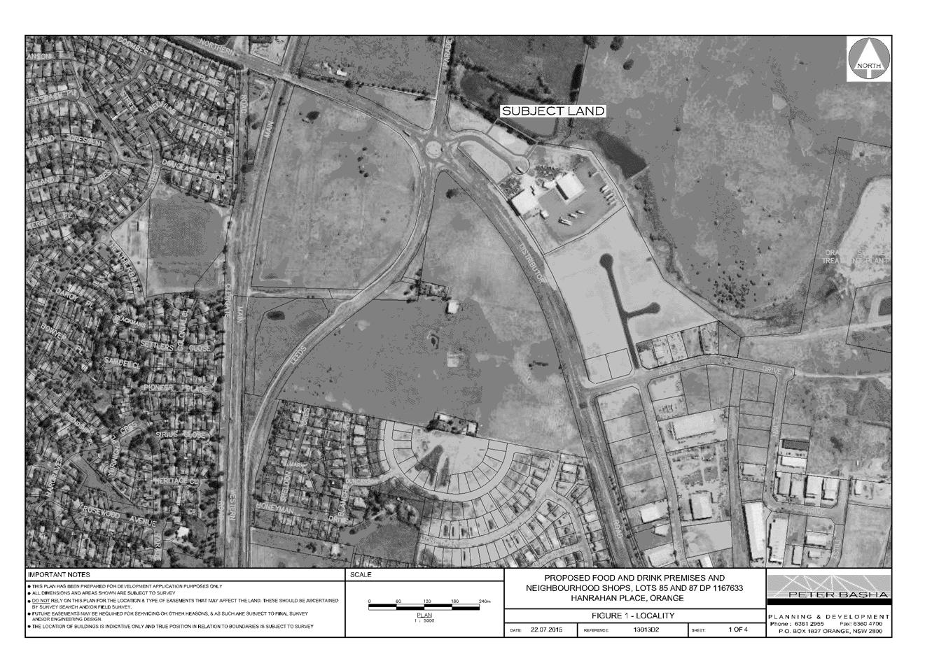
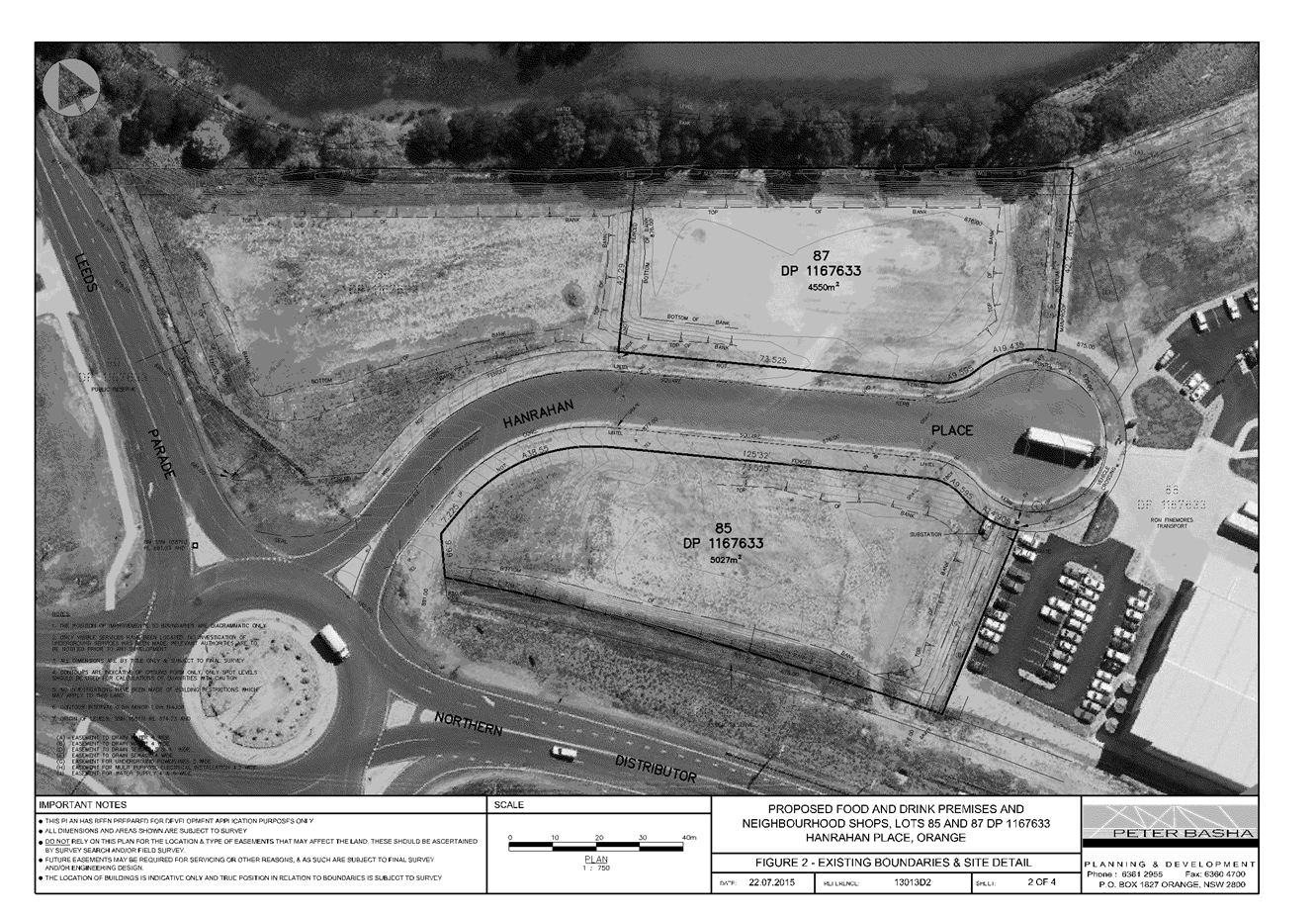
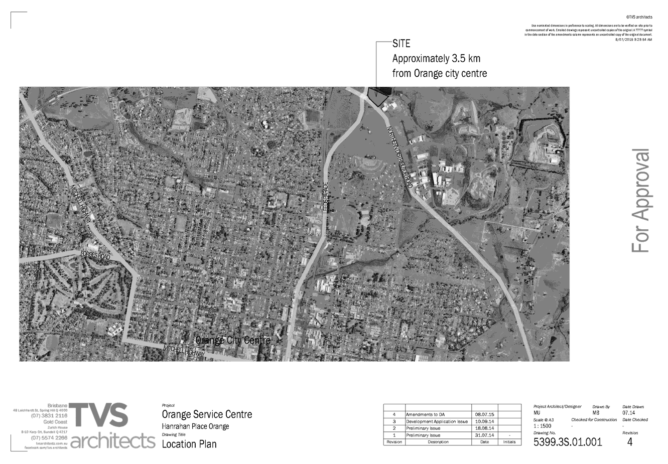
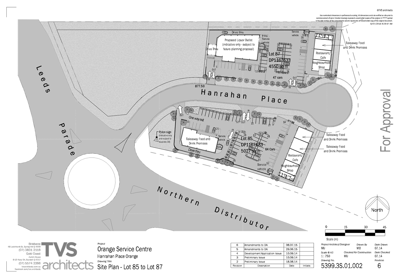
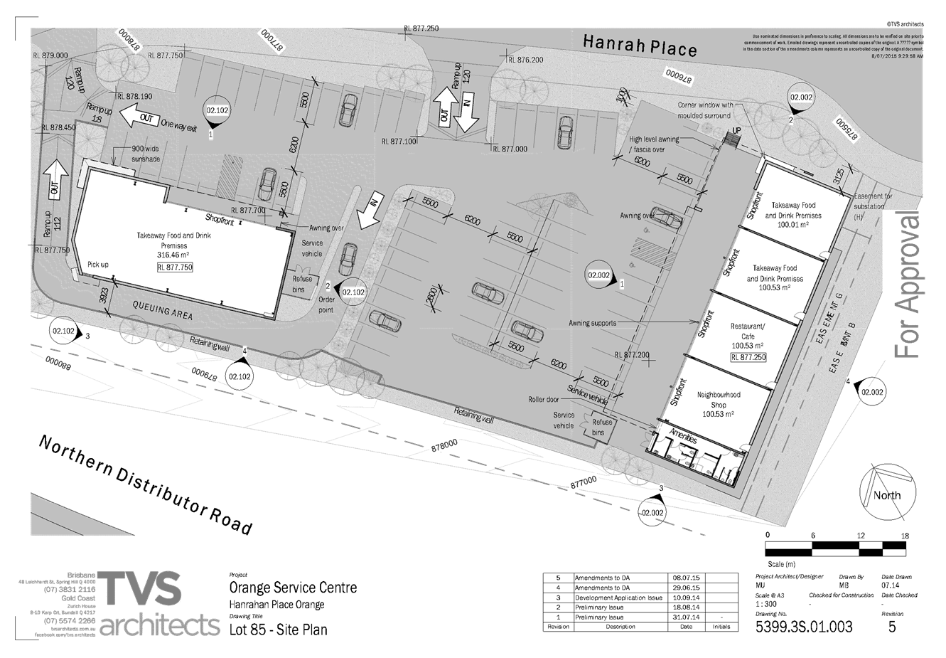
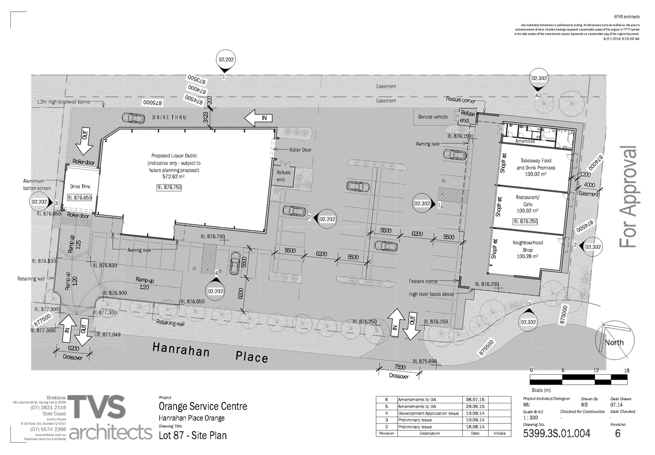
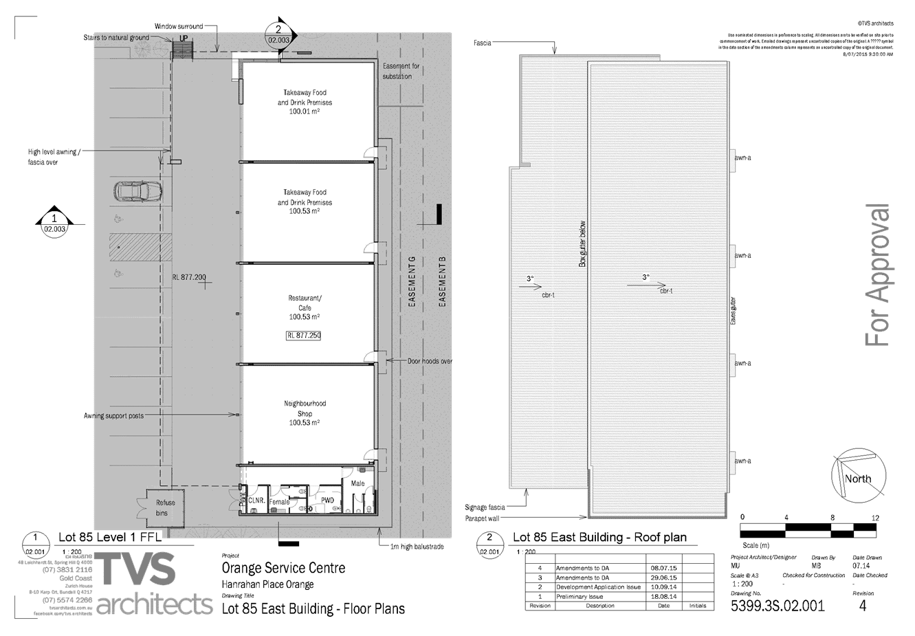
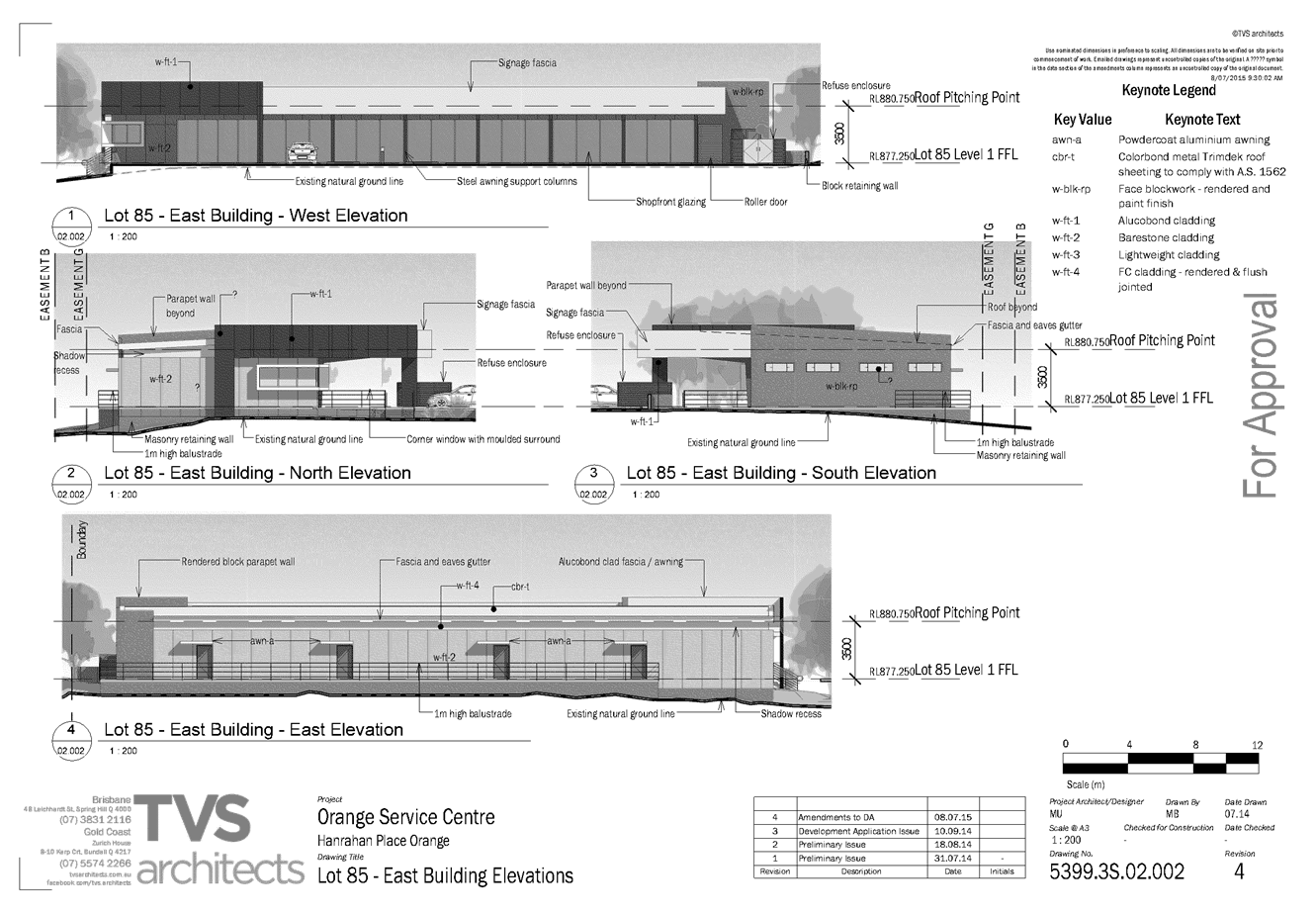
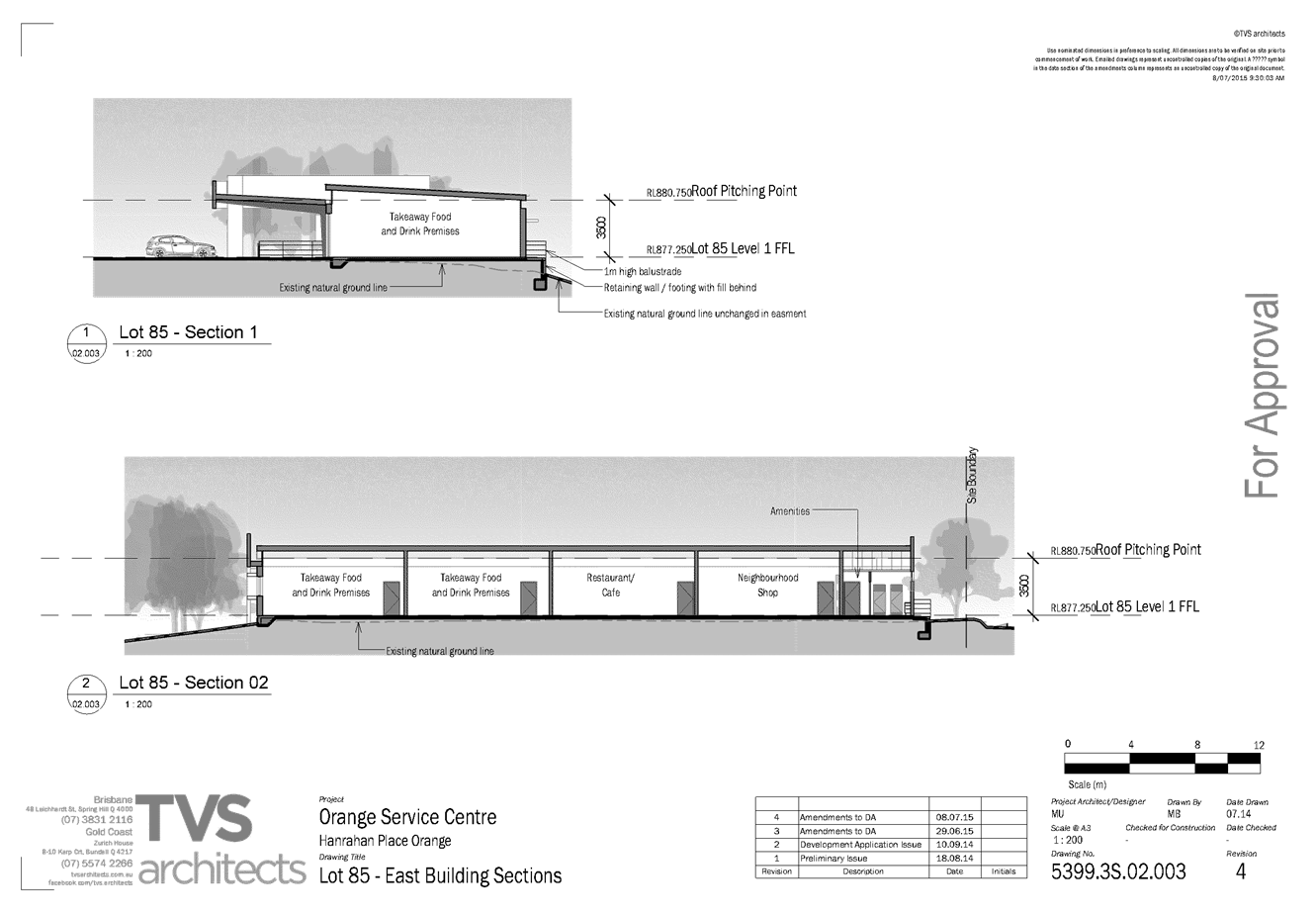
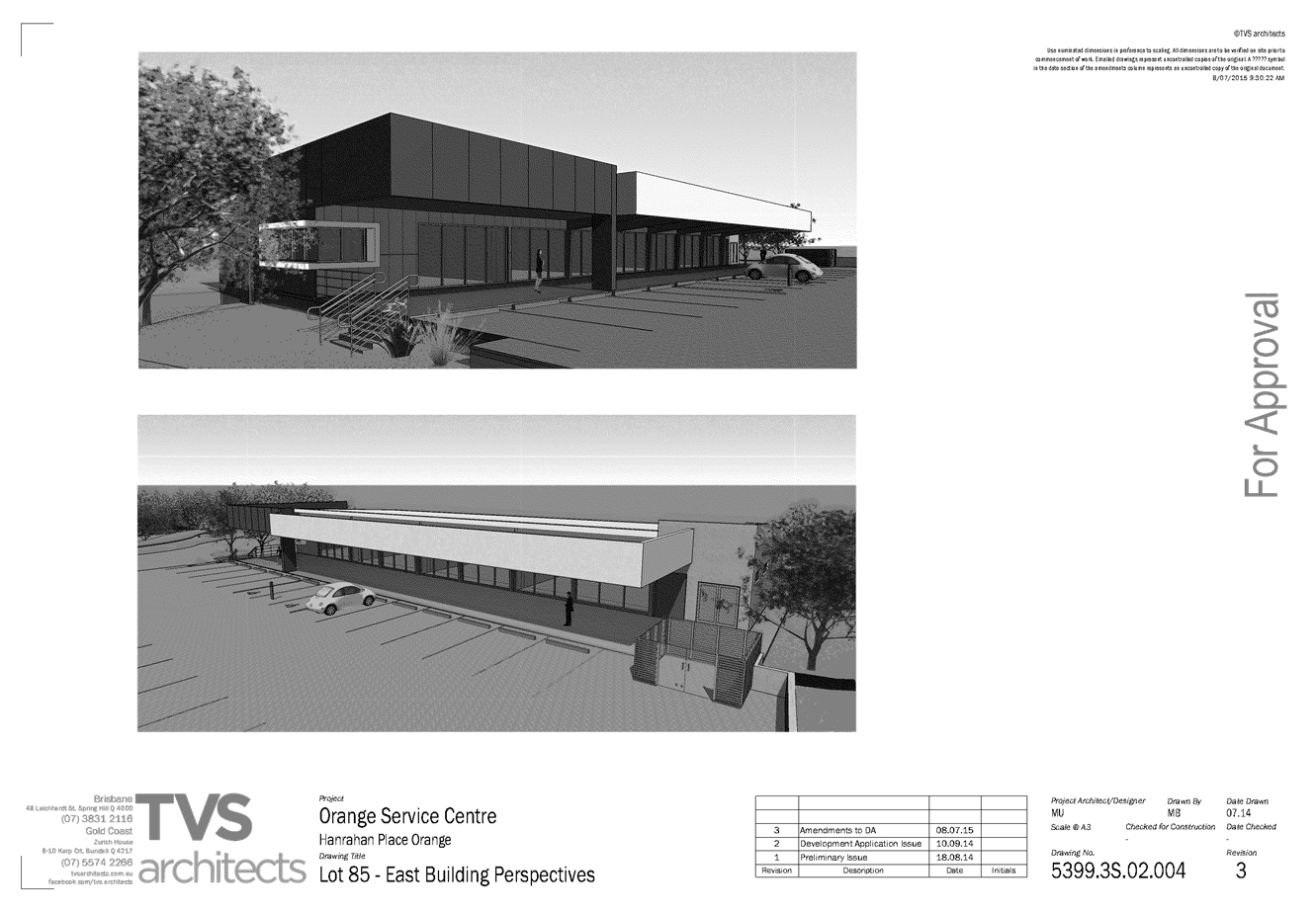
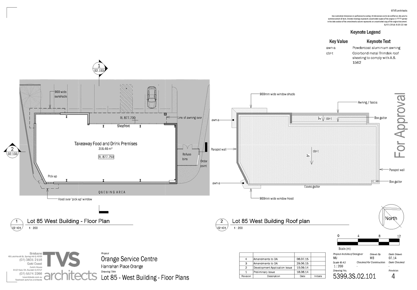
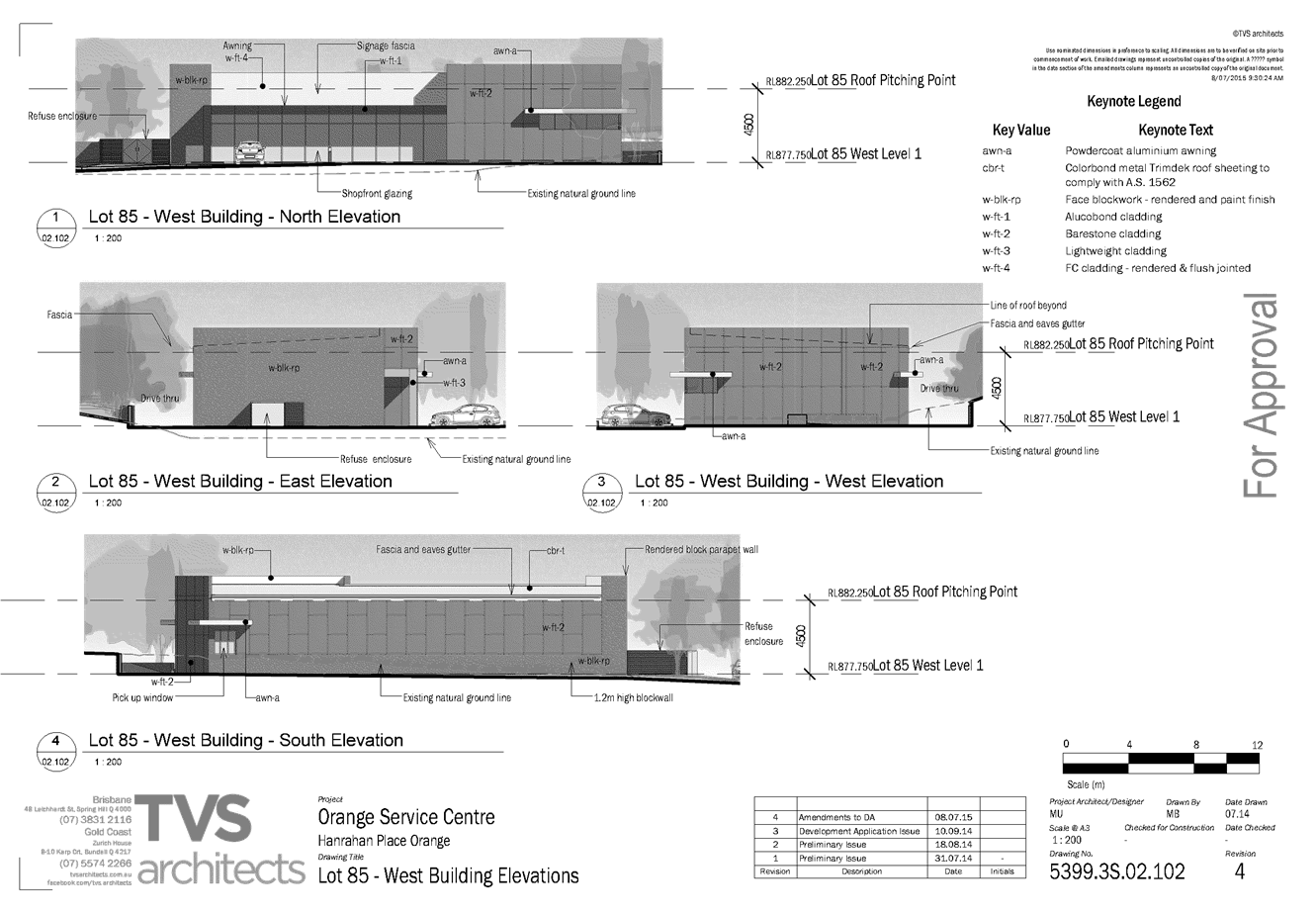
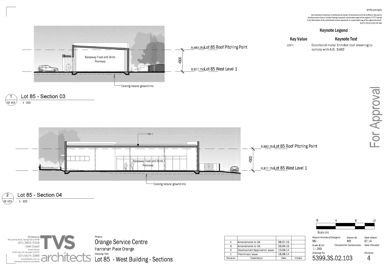
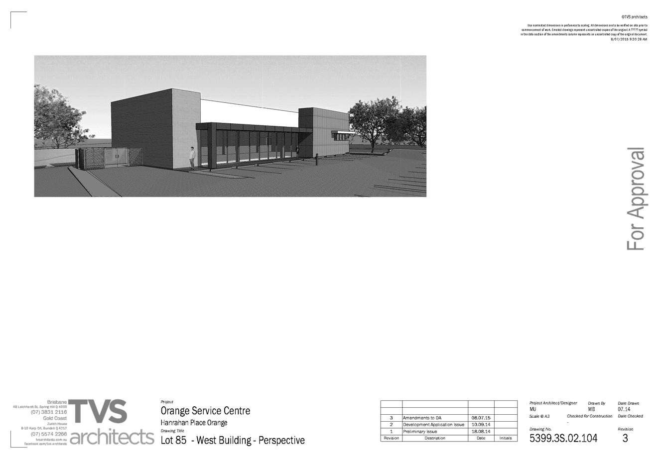
2.3 Development
Application DA 132/2015(1) - Harris Farm Markets - Sale and Summer Streets
TRIM
REFERENCE: 2015/2142
AUTHOR: Michael
Glenn, Senior Planner
EXECUTIVE Summary
|
Application
lodged
|
27 April
2015
|
|
Applicant/s
|
Harris
Farm Markets
|
|
Owner/s
|
Orange
Arcade Pty Ltd and Merchandising Develop Pty Ltd
|
|
Land
description
|
Lots 1
and 2 DP 572210 – Harris Farm Markets, Sale and Summer Streets, Orange
|
|
Proposed
land use
|
Shop (alterations
and additions)
|
|
Value of
proposed development
|
$650,000
|
Council's consent is sought for
alterations and additions to the existing "Harris Farm Markets"
supermarket and fresh food produce store, involving a further expansion into
the adjoining Orange Arcade building, conversion of an outdoor walkway to an
active display area, and refurbishment of the existing internal layout of the
store. The changes also necessitate changes to the car park layout and loading
arrangements for the site, which are undertaken from the adjoining Council
owned Anson/Sale Streets car park. This has in turn required a referral to
Council’s City of Orange Traffic Committee, which has made
recommendations regarding layout arrangements for the loading area and
pedestrian crossing. Use of the car park for loading will require a license and
public liability cover to protect Council.
Contributions for deficient car parking are applicable
because the proposed development increases the gross leasable floor area (GLFA)
of the site, and GLFA is used to calculate parking demand for this type of use.
Link To Delivery/OPerational Plan
The recommendation in this report relates to the
Delivery/Operational Plan strategy “13.4 Our Environment
– Monitor and enforce regulations relating to City amenity”.
Financial Implications
Nil
Policy and Governance Implications
Nil
|
Recommendation
That Council consents to development application DA
132/2015(1) for Shop (alterations and additions) at Lots 1 and 2 DP
572210 - Sale and Summer Streets, Orange pursuant to the conditions of
consent in the attached Notice of Approval.
|
further considerations
Consideration has been given to the
recommendation’s impact on Council’s service delivery; image and
reputation; political; environmental; health and safety; employees;
stakeholders and project management; and no further implications or risks have
been identified.
SUPPORTING INFORMATION
THE APPLICATION
Council's consent is sought for a Shop (alterations and
additions) at Lot 1 DP 572210 and Lot 2 DP 572210 - Sale and Summer
Streets, Orange
THE PROPOSAL
The proposal involves internal alterations and additions to
improve internal circulation paths and retail opportunities within the existing
tenancy. It is further proposed to expand the market into the adjoining arcade
areas, both by occupying existing shop areas, and also converting what is
currently corridor space. Finally, consent is sought to utilise the front
external undercover area of the site for product display and sales.
MATTERS FOR CONSIDERATION
Section 5A Assessment
In the administration of sections 78A, 79B, 79C, 111 and
112, the provisions of Section 5A must be taken into account for every
development application in deciding whether there is likely to be a significant
effect on threatened species, populations or ecological communities or their
habitats. This section includes a requirement to consider any adopted
assessment guidelines, which means assessment guidelines issued and in force under
section 94A of the Threatened Species Conservation Act 1995.
Assessment guidelines are in force (see DECC-W “Threatened Species
Assessment Guidelines - The Assessment of Significance”) which requires
consent authority to adopt the precautionary principle in its assessment.
In this instance, site inspection reveals that the subject
property has no biodiversity or habitat value.
Section 79C
Section 79C of the Environmental Planning and Assessment
Act 1979 requires Council to consider various matters, of which those
pertaining to the application are listed below.
PROVISIONS OF ANY ENVIRONMENTAL
PLANNING INSTRUMENT s79C(1)(a)(i)
Orange Local Environmental Plan 2011
Part 1 - Preliminary
Clause 1.2 - Aims of Plan
The aims of the LEP are set out
under subclause 2. Those relevant to the application are as follows:
(a) to encourage development which complements
and enhances the unique character of Orange as a major regional centre boasting
a diverse economy and offering an attractive regional lifestyle,
The expansion of Harris Farm as a major retail outlet in the
central business district (CBD) is considered consistent with this objective.
Clause 1.6 - Consent Authority
This clause establishes that, subject to the Act, Council is
the consent authority for applications made under the Local Environmental Plan.
Clause 1.9A - Suspension of
Covenants, Agreements and Instruments
This clause provides that covenants, agreements and other
instruments which seek to restrict the carrying out of development do not apply
with the following exceptions.
· covenants imposed
or required by Council
· prescribed
instruments under Section 183A of the Crown Lands Act 1989
· any conservation
agreement under the National Parks and Wildlife Act 1974
· any trust
agreement under the Nature Conservation Trust Act 2001
· any property
vegetation plan under the Native Vegetation Act 2003
· any biobanking
agreement under Part 7A of the Threatened Species Conservation Act 1995
· any planning
agreement under Division 6 of Part 4 of the Environmental Planning and
Assessment Act 1979.
There are a number of covenants affecting the car park,
Harris Farm Markets premises and also the Orange Arcade into which the
extensions are proposed. The proposed development does not have impact on any
of these property restrictions.
Mapping
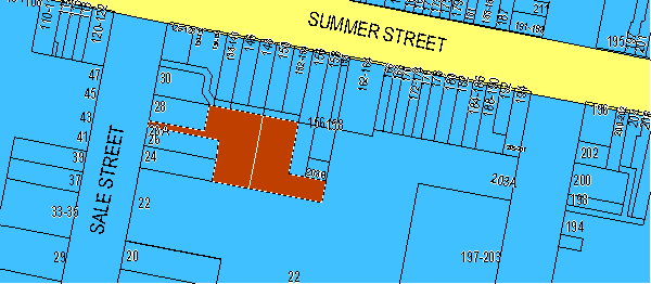
Figure 1 - locality map showing B3 zone and the
subject properties
(it is part of the Orange Arcade)
The subject site is identified on the LEP maps in the
following manner:
|
Land Zoning Map:
|
Land zoned B3 Commercial Core
|
|
Lot Size Map:
|
No Minimum Lot Size
|
|
Heritage Map:
|
Located within a conservation area
|
|
Height of Buildings Map:
|
Building height limit 9m
|
|
Floor Space Ratio Map:
|
Floor space limit 2.25:1
|
|
Terrestrial Biodiversity Map:
|
No biodiversity sensitivity on the
site
|
|
Groundwater Vulnerability Map:
|
Ground water vulnerable
|
|
Drinking Water Catchment Map:
|
Not within the drinking water
catchment
|
|
Watercourse Map:
|
Not within or affecting a defined watercourse
|
|
Urban Release Area Map:
|
Not within an urban release area
|
|
Obstacle Limitation Surface Map:
|
No restriction on building siting
or construction
|
|
Additional Permitted Uses Map:
|
No additional permitted use applies
|
Those matters that are of relevance are addressed in detail
in the body of this report.
Part 2 - Permitted or
Prohibited Development
Land Use Zones
The subject site is located within the B3 Commercial Core
zone. The proposed development is defined as a shop under OLEP 2011 and is permitted
with consent for this zone. This application is seeking consent.
"Shop" is a more specialised form of retail
premises and is defined under the LEP as:
premises that sell merchandise
such as groceries, personal care products, clothing, music, homewares,
stationery, electrical goods or the like or that hire any such merchandise, and
includes a neighbourhood shop, but does not include food and drink premises or
restricted premises.
Clause 2.3 of
LEP 2011 references the Land Use Table and Objectives for each zone in
LEP 2011. These objectives for land zoned B3 Commercial Core are as
follows:
1 - Objectives of the B3 Commercial Core Zone
· To
provide a wide range of retail, business, office, entertainment, community and
other suitable land uses that serve the needs of the local and wider community.
· To
encourage appropriate employment opportunities in accessible locations.
· To
maximise public transport patronage and encourage walking and cycling.
· To
promote development that contributes to the role of the Orange CBD as the
primary retail and business centre in the City and region.
In relation to the first dot
point, the proposed development seeks approval for a small expansion to the
existing store that make it possible for the shop to offer a wider range of
products for sale and display.
In relation to the second dot
point, the proposed development will increase the size of the retail outlet
however there are no indications in the application that this would lead
directly to an increase in staff numbers.
In relation to the third dot
point, the proposed development is located within an area that is already a
focal point of the City public transport network.
In relation to the fourth dot
point, the proposed development will lead to the expansion of an existing
significant retail outlet in the CBD. Such expansion should be considered
consistent with this zone objective
Part 4 - Principal Development
Standards
Clause 4.3 - Height of
Buildings
This clause limits the height of
buildings (HoB) on land identified on the Height of Buildings Map. The subject
land is identified on the Map as having a HoB limit of 9m. The maximum height
of the proposed development is unchanged by the proposed development.
Clause 4.4
- Floor Space Ratio
This clause limits the floor
space ratio (FSR) permitted on land identified on the Floor Space Ratio Map.
Clause 4.5 is associated with this clause and establishes the rules for
calculating the site area and FSR of any proposal.
These rules exclude certain
parts of a site and development such as:
· excluding
any part of the site upon which the development is prohibited (ie if the site
is split zoned only the zone in which the development is permissible may be
considered)
· excluding
community land and most public places
· lots
in a strata scheme wholly or partly above other lots in the scheme do not
increase the site area (ie the site area is the ground level of the scheme
only)
· adjoining
lots in the same ownership do not form part of the site area unless significant
parts of the development are proposed on that land
· the
floor area of existing buildings is to be included in the FSR calculation
· any
covenant restricting floor space on the lot, due to floor space having been
considered as part of the development of another lot, is to be taken into
account.
Note the definition of gross
floor area (GFA) in the dictionary also has inclusions/exclusions that affect
the FSR calculation
GFA means the sum of the floor
area of each floor of a building measured from the internal face of external
walls, or from the internal face of walls separating the building from any
other building, measured at a height of 1.4m above the floor, and includes:
(a) the area of a mezzanine, and
(b) habitable rooms in a basement or an attic,
and
(c) any shop, auditorium, cinema, and the like,
in a basement or attic,
but excludes:
(d) any area for common vertical circulation,
such as lifts and stairs, and
(e) any basement:
(i) storage, and
(ii) vehicular access, loading areas, garbage and
services, and
(f) plant rooms, lift towers and other
areas used exclusively for mechanical services or ducting, and
(g) car parking to meet any requirements of the
consent authority (including access to that car parking), and
(h) any space used for the loading or unloading
of goods (including access to it), and
(i) terraces and balconies with outer walls
less than 1.4 metres high, and
(j) voids above a floor at the level of a
storey or storey above.
The subject land is identified
on the map as having an FSR of 2.25:1. This application proposes development
that affects two separate sites, requiring that the floor areas of the two
sites be considered as a whole for the purposes of calculating floor space
ratios.
The floor areas of the buildings
are not provided in the submission to Council, however it is clear that the
buildings remain well within the upper limits of floor area applicable to these
properties, even with the extensions that are proposed being taken into
consideration. For both properties affected, two storey buildings have been
constructed, indicating a maximum floor space ratio of 2:1. However 142m2
of the Harris Farm site and an unknown amount of the Orange Arcade site provide
non-inclusive areas such as fire passageways, loading areas, ancillary storage
area and the like. It is clear from these observations that the overall floor
area of the two buildings, viewed either separately or as a single whole, is
significantly less than the maximum permitted FSR of 2.25:1.
Part 5 -
Miscellaneous Provisions
5.10 - Heritage Conservation
The subject site is located within the Central Orange
Heritage Conservation Area. The subject retail premises are orientated towards
the Council car park. The proposed alterations to the building are primarily
internal and will not have an adverse impact upon the Heritage Conservation
Area.
STATE ENVIRONMENTAL PLANNING
POLICIES
There are no State Environmental Planning Policies that
apply to the subject development.
PROVISIONS OF ANY DRAFT
ENVIRONMENTAL PLANNING INSTRUMENT THAT HAS BEEN PLACED ON EXHIBITION
s79C(1)(a)(ii)
There are no draft environmental planning instruments that
apply to the subject land or proposed development.
DESIGNATED DEVELOPMENT
The proposed development is not designated development.
PROVISIONS OF ANY DEVELOPMENT
CONTROL PLAN s79C(1)(a)(iii)
Development Control Plan 2004
Development Control Plan 2004 (“the DCP”)
applies to the subject land (Part 8 - Development in Business Zones). An
assessment of the proposed development against the relevant Planning Outcomes
will be undertaken below.
Pursuant to Planning Outcome 0.2-1 Interim Planning Outcomes
- Conversion of Zones:
· Throughout this
Plan, any reference to a zone in Orange LEP 2000 is to be taken to be a
reference to the corresponding zone(s) in the zone conversion table.
The corresponding zone to zone 3(a) (Regional Centre)
(Orange LEP 2000) is zone B3 (Commercial Core) (Orange LEP 2011). As such,
Orange DCP 2004 - Chapter 8 is relevant to this proposal. The provisions
of Chapter 8 are considered below.
· Buildings have
a high level of urban design to contribute to the regional status of the City's
Central Business District, with attention given to façade features,
external materials, colour and advertising.
The proposal alterations to the building to increase the
size of the Harris Farm Markets shop will not substantially alter the external
appearance of the building. The external alterations will relate only to the
provision of new entrance doors to the shop. These elements will not affect the
integrity of the existing building.
· Provision of
adequate fire safety measures and facilities for disabled persons.
A condition is attached requiring the submission of a fire
safety certificate in respect of all fire services within the tenancy. A
further condition is attached requiring the development to be provided with
access and facilities for people with disabilities.
· Land use
complements the role of the CBD as a regional centre for commerce and services.
The subject premises are currently used as retail shops. The
proposal involves alterations to the premises so as to facilitate the extension
of the existing fruit and vegetable shop (Harris Farm Markets) into the
adjoining Orange Arcade. It is considered that the proposed alterations to the
retail premises will continue to complement the role of the CBD as a regional
centre for commerce and services.
· Loading
City of Orange Traffic
Development Committee (COTDC)
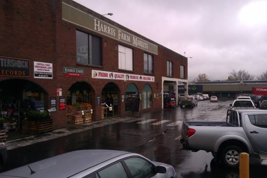
Figure 2 - the subject property from the Anson/Sale
Streets car park
The application
seeks approval for alterations and additions to the existing Harris Farm
Markets, which faces onto the Council owned Anson/Sale Streets car park. There
would be some extension and expansion of Harris Farm into the adjoining Orange
Arcade, adding approximately 150m² of retail space to the premises.
Some of this expansion is additional floor area as the expansion will extend
into access corridors and the like. It is proposed that the existing
easternmost ingress point to the market would be closed off. A new entry is to
be provided at the western extremity of the shop front adjacent to the main
Arcade walk way and egress onto the carpark. A new egress point would be
provided via an internal doorway through the Arcade, with pedestrians exiting
the premises via the main Orange Arcade rear entrance.
The applicant has also provided some
details regarding a proposed addition of a further pedestrian crossing and some
details on loading arrangements. The development proposal states that existing
arrangements would be continued. These are ten deliveries per week using five
Heavy Rigid Vehicles (HRVs 10m in length), three articulated vehicles (AVs 18m
in length) and two vans (5-8m in length). Deliveries are made during the
daytime only, but at varied times.
Loading arrangements on the Council car
park were previously understood by Council to be one delivery per day by a
large rigid truck (up to 12m in length) with the deliveries undertaken at times
considered to be less congested in the car park. As indicated in the
applicant's submissions, there has been some alteration to these limitations
over time. It is currently the case that there are five deliveries per week by
large rigid vehicles (which the applicant advises are 10m in length, described
as HRVs in the submission to Council), three articulated vehicles (which the
applicant advises are 18m in length) and two van deliveries (which the
applicant advises vary between 5-8m in length). The existing arrangements for
loading would not intensify or change as a result of the proposed amendments;
however the currently existing loading activities are already in excess of the
arrangements last reported to the Traffic Committee in September 2006.
There are no loading facilities that have
been provided in the Orange Arcade Development.
The loading arrangements that occur for the
subject development are far from satisfactory as they take place on the main
entrance to the Council owned Anson/Sale Street car park. Due predominantly to
the popularity of the Harris Farm Market enterprise, there is a high degree of
pedestrian and vehicular conflict at this location. This is exacerbated by the
loading and unloading activities of Harris Farm Markets.
Council continues to receive complaints
from users of the car park regarding pedestrian safety in this area.
In an effort to reduce this problem Council
in 2012 relocated the parking spaces in the bays near to this area of the car park,
further south so as to widen the vehicle aisle. Incidentally the owners of
Harris Farm Markets gave a written undertaking to pay for the cost of the car park
relocation but have not responded to a written request from Council to
contribute the amount of $1,020.
To maintain functionality of the driveway
as a driveway, it will be necessary for delivery vehicles to be of a side loading
type, so that unloading can be undertaken from the site unloading alcove. This
stipulation relates to safety in the main. It is considered an excessive risk
for fork lifts to operate outside the building confines. It is considered the
Delivery Management Plan will need to specify the types of vehicles, the
mechanisms for organising loading and unloading including the placement of any
barriers. The conditions of consent require fairly tight control of the types
of vehicles, in particular must specify that side loaders are to be used. The
City of Orange Traffic Development Committee have indicated that substantive
barriers will be needed and that witches hat barriers are not considered
adequate.
The use of the car park for loading should
not be taken as the granting of a legal access or the like and is a solution
agreed to by Council on a strictly limited basis. Should the car park be
developed or sold, this arrangement will cease to have any effect.
As indicated above, it will be necessary to
relocate the existing pedestrian crossing. The proposed pedestrian crossing is
shown on the attached plans, and is acknowledged as well placed to catch
pedestrian traffic from the Arcade including the subject premises. The crossing
as shown on the applicant’s plans would conflict with the north-south car
park drive immediately behind the Cultural Centre. This is not thought to be a
satisfactory solution, although some relocation of the pedestrian crossing is
needed given the changes to the access and egress points to the market proposed
under this application. This was addressed in the plan prepared by Orange City
Council and accepted by the applicant.
These elements were referred to the City of Orange Traffic
Development Committee. The Committee has made the following recommendations:
Regarding DA 132/2015(1) - Harris Farm Markets, Orange Arcade - Lots 1
and 2 Summer/Sale Streets Orange - being alterations and additions to
Harris Farm Markets:
1 The
existing pedestrian delineation be removed.
2 That
new pedestrian delineation markings be installed covering the entrance to
Harris Farm Market and the Arcade with a design to be approved by Council.
3 That
a traffic and pedestrian management plan be developed for unloading vehicles
with this to be approved by Council.
4 That
a speed hump be installed prior to the pedestrian delineation markings.
These requirements can be addressed as conditions of
consent. In regard to items 1, 2 and 4, a design has been prepared by
Council and passed to the applicant for their appraisal. The plan indicates the
specific works that will be required to be carried out. The cost of the
required works will need to be borne by the applicant. A condition is included
in the notice of determination to this effect.
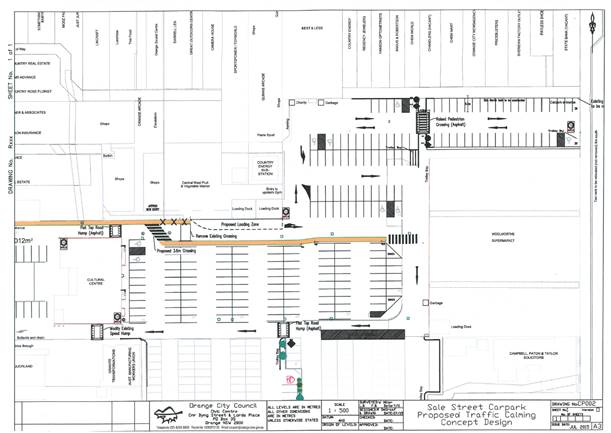
Figure 3 - revised car park and loading arrangements
required by Council
In relation to item (3), a
condition is included in the attached notice.
The proposed development envisages changes to include a
butchery serving meat cut off the bone, which is somewhat different to the
current pre-packed cryogenic meats currently on offer. The applicant was
requested to provide some details on the loading arrangements for fresh meat
deliveries. These details were outlined in an email, and also by an amended
sketch plan (shown below). Deliveries will be made twice weekly by a rear door
semitrailer some 16m in length. The distance from the eastern corner (vertex)
of the building to the western extremity of Harris Farm's Loading alcove is
18.5m. The drawings submitted by the applicant indicate that it is possible to
unload carcasses for the butchery and deliver them via the service entry
without the vehicle extending past the eastern vertex of the building.
Carcasses are delivered from a refrigerated semi-articulated vehicle with
carcasses of up to 70kg delivered via the service entrance or the main
entry. Deliveries are made at around 5am.
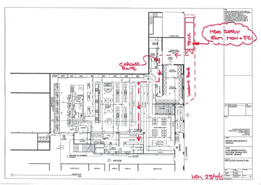
Fig 4 - carcass deliveries to the butchery
It is considered that the delivery
of fresh meat in this way is acceptable provided such deliveries are limited to
twice weekly and at times prior to 7am to avoid peak traffic and parking demand
for the site.
Changes have occurred since the last approval granted in
2009 that in turn require a revision of the loading arrangements for the site.
These arrangements affect the Council car park adjacent to the premises from
which deliveries to the market are made. This is not an ideal situation as
loading operations can interfere somewhat with the operation of the car park as
the loading occurs on the entrance to the car park from Sale Street and there
is a high pedestrian activity at this point due mainly to the popularity of the
subject shop.
As discussed in this report, the City of Orange Traffic
Development Committee have several recommendations with regard to the operation
at the loading dock including a requirement for a Management Plan for the
development and of the loading area and associated re-marking of pedestrian
linkages in and around the site.
The loading arrangements for this site cannot be considered
or described as ideal, however they are considered to be adequate; and provided
good management practices are observed, are of sufficient safety and unlikely
to clash too greatly with car park operations. Attached are relevant conditions
addressing issues in relation to loading and unloading arrangements.
· Parking
The applicable parking rate for the proposed use is 4.1
spaces per 100m2 of GLFA. GLFA is used to determine parking
demands for shops and shopping centres, and is defined under the RTA Guide to
Traffic Generating Developments as the overall area of a building excluding
stairs and other public amenities and access corridors. The definition
specifically includes storage areas and also includes internal accessways
within the shop itself. The proposed additions would increase the GLFA of the
development by 142.2m2, of which 91.8m2 has not
previously been used or lawfully constructed as GLFA. This 91.8 m2 includes
corridor spaces and spaces previously converted to commercial activity without
proper approval.
The proposed additions would extend the Harris Farm Markets
into parts of the Orange Arcade, and also into a covered alcove walkway area at
the car park frontage of the existing premises. Some areas of the Arcade into
which Harris Farm is to be extended have prior approvals for various uses,
requiring the basic parking rates established in the DCP to be modified or
discounted in the assessment. Areas into which Harris Farm propose to be
extended either attract no increase in the demand for parking, or represent
additional floor area to which the policy of 14 November 2014 is not
applicable.
The following Table provides a summary of the nett increase
in parking generated by the proposed development.
TABLE 1 - Parking
Analysis
|
Shop No or Area
|
Current Use
|
Highest approved use
|
Area
(M2)
|
Parking allowed under previous
approvals
|
Net Parking increase
|
|
Shop 31
|
Delicatessen / café
|
Retail premises
(Dress Shop prior to 1991)
|
50.4m2
|
2.1
|
0 spaces
|
|
Shop 26A
|
Showroom for Blinds
|
Corridor/access way
|
11.6m2
|
No
approval
|
0.48 spaces
|
|
Deli/Café
outside dining area
|
Seating Area
|
Corridor/access way
|
44.8 m2
|
No
approval
|
1.84 spaces
|
|
Corridor
space adjacent to Harris arcade doors
|
Corridor
|
Corridor
|
12.2 m2
|
0
|
0.45 spaces
|
|
Outdoor
Kiosk Display Area
|
Outdoor Display
|
None
|
23.2 m2
|
0
|
0.95 spaces
|
|
TOTAL
|
3.77 spaces
|
Where floor space has a prior
approval for some commercial activity, it represents a change of use and is
subject to the 50% discount established in the Council policy of
6 November 2014. Where it is new GLFA, or previously unapproved floor
area, no discount is applicable.
Shop 31 of the Orange Arcade was changed from a dress shop
(a retail outlet) to a delicatessen by way of State Environmental Planning
Policy 4 (Development Without Consent). There is no record of an approval as a
dress shop, however by definition the use of this space (as a delicatessen
commenced under the provisions SEPP 4) could only occur if the previous
use as a dress shop was lawful (ie had some form of approval or
permissibility). As a previous retail premises, this area has no increase in
demand for parking for the new use compared to the proposed use as part of the
Harris Farm Market.
There is no known approval for shop 26 for its establishment
(the small display area located under the stairs of the Orange Arcade).
Therefore it has no credit applied with respect to its parking. Similarly, the
corridor dining area for Shop 31 has no known approval to be used for that
purpose, and therefore has no credit applied. There is also no credit
applicable for the remainder of the corridor also now proposed to be
incorporated into the GLFA of Harris Farm.
As indicated in Table 1, the demand for parking not met in
the proposed development is 3.77 spaces. In accordance with the
contributions plan, Council can accept a contribution to cover the shortfall in
parking. Applying the current levy rate per deficient space ($13,717.19 per
space as of 1 June 2015, or part thereof) the applicable contribution
is $51,713.80.
The applicant has indicated that they agree to the payment
of a contribution in lieu of the shortfall in parking, as set out by Council’s
current policy position. They have been appraised of the value of the
contribution (see below) and have raised no objection to the size of that
contribution.
Council will need to decide whether to accept a
contribution. In the circumstances that there is no ability to provide parking
on the site and that due to public parking spaces being provided in the
locality it is considered reasonable for Council to require a contribution.
PROVISIONS PRESCRIBED BY THE
REGULATIONS s79C(1)(a)(iv)
Demolition of a Building (clause 92)
The proposal does not involve the demolition of a building.
Fire Safety Considerations
(clause 93)
The proposal does not involve a change of building use for
an existing building.
Buildings to be Upgraded
(clause 94)
The proposal does involve the rebuilding, alteration, and
extension of an existing building, that will require a review of the fire
safety standards for the building.
THE LIKELY IMPACTS OF THE
DEVELOPMENT s79C(1)(b)
Circulation and Design
The proposed development as originally proposed included
"pop-up kiosks" in the covered area at the frontage facing the
Council car park; however, the potential conflicts between pedestrians and
vehicles led to this being changed. The area at the rear (facing the car park)
of the site now only proposes product displays, similar to those now provided
on the premises. Conditions are included to prevent direct sales from the area
outside the main entry. It is further considered appropriate to require the
existing steel barriers outside the premises that span between the brick
building supports to be extended so as to provide a barrier all the way between
the spans.
THE SUITABILITY OF THE SITE
s79C(1)(c)
Land Use
The proposal will comprise an intensification of the
existing and longstanding use of the land. The development will provide an
enlarged retail premises for the CBD.
Utility Services
All utility services are available to the site and adequate
for the proposal.
Physical Attributes and Hazards
There are no physical attributes of the land that would
constrain the development. The site is not subject to known technological or
natural hazards.
Public Liability Risk
The proposed development is considered to represent an
acceptable safety risk in terms of public liability. However, it does involve
unusual use of the public car park for loading and deliveries. Council’s
Corporate and Commercial Services Division has requested a condition that
requires a licence agreement that provides protection for Council in relation
to this use of the car park. This is considered reasonable and justified, and
relevant to the planning assessment in this instance given Council's ownership
and responsibility to manage the car park in the wider interests of the
community. Attached is a relevant condition that addresses this issue.
ANY SUBMISSIONS MADE IN
ACCORDANCE WITH THE ACT s79C(1)(d)
The proposed development is not defined as advertised
development under the provisions of the LEP, and as such no formal exhibition
of the application was required. No submissions have been received in relation
to this application.
PUBLIC INTEREST
s79C(1)(e)
The proposed development is considered to be of minor
interest to the wider public due to the relatively localised nature of
potential impacts. The proposal is not inconsistent with any relevant policy
statements, planning studies, guidelines etc. that have not been considered in
this assessment.
SUMMARY
The proposed development is permissible with the consent of
Council. The proposed development complies with the relevant aims, objectives
and provisions of the LEP. A section 79C assessment of the
development indicates that the development is acceptable in this instance.
Attached is a draft Notice of Approval outlining a range of conditions
considered appropriate to ensure that the development proceeds in an acceptable
manner.
COMMENTS
The requirements of the Environmental Health and Building
Surveyor and the Engineering Development Section are included in the attached
Notice of Approval.
Attachments
1 Notice
of Approval, D15/30127⇩
2 Plans,
D15/30975⇩
Sustainable Development Committee
1 September 2015
2.3 Development
Application DA 132/2015(1) - Harris Farm Markets - Sale and Summer Streets
Attachment 1 Notice
of Approval
|

|
ORANGE
CITY COUNCIL
Development
Application No DA
132/2015(1)
NA15/ Container
PR14894
|
NOTICE OF DETERMINATION
OF A DEVELOPMENT
APPLICATION
issued under the Environmental
Planning and Assessment Act 1979
Section 81(1)
|
Development
Application
|
|
|
Applicant Name:
|
Harris
Farm Markets
|
|
Applicant Address:
|
(Attention
John Jan)
PO Box 57
SYDNEY
MARKETS NSW 2129
|
|
Owner’s Name:
|
Orange
Arcade Pty Ltd and Merchandising Develop Pty Limited
|
|
Land to Be Developed:
|
Lots 1 and
2 DP 572210 – Sale Street and Summer Street, Orange
|
|
Proposed Development:
|
Shop
(alterations and additions)
|
|
|
|
|
Building
Code of Australia
building classification:
|
As
determined by Certifier
|
|
|
|
|
Determination
|
|
|
Made On:
|
13 August
2015
|
|
Determination:
|
CONSENT
GRANTED SUBJECT TO CONDITIONS DESCRIBED BELOW:
|
|
|
|
|
Consent to
Operate From:
|
13 August
2015
|
|
Consent to
Lapse On:
|
13 August
2020
|
Terms of Approval
The reasons for the imposition of
conditions are:
(1) To ensure a quality
urban design for the development which complements the surrounding environment.
(2) To maintain
neighbourhood amenity and character.
(3) To ensure compliance
with relevant statutory requirements.
(4) To provide adequate
public health and safety measures.
(5) Because the development
will require the provision of, or increase the demand for, public amenities and
services.
(6) To ensure the utility
services are available to the site and adequate for the development.
(7) To prevent the proposed
development having a detrimental effect on adjoining land uses.
Conditions
(1) The
development must be carried out in accordance with:
(a) Plan/s
numbered Plans By Harris Farm Markets, sheets DA01, 02, 03 and 04, Job
Number 140201, dated 22/04/2015, and as also shown on the amended site
plan showing meat delivery routes (5 sheets)
(b) statements
of environmental effects or other similar associated documents that form part
of the approval
as amended
in accordance with any conditions of this consent.
(2) All building work must
be carried out in accordance with the provisions of the Building Code of
Australia.
(3) A sign is to be erected
in a prominent position on any site on which building work, subdivision work or
demolition work is being carried out:
a. showing
the name, address and telephone number of the principal certifying authority
for the work, and
b. showing
the name of the principal contractor (if any) for any building work and a
telephone number on which that person may be contacted outside working hours,
and
c. stating
that unauthorised entry to the site is prohibited.
Any such sign is to be maintained while the
building work, subdivision work or demolition work is being carried out.
|
PRIOR TO THE ISSUE OF
A CONSTRUCTION CERTIFICATE
|
(4) The payment of
$51,713.80 shall be made to Council in
accordance with Section 94 of the Environment Planning & Assessment Act and
Orange Development Contributions Plan 2012 in lieu of
the physical provision of adequate on-site car parking spaces.
PAYMENT MUST BE MADE PRIOR TO THE
ISSUE OF ANY CERTIFICATE under part 4A of
the Act.
The contribution shall be indexed
quarterly in accordance with the Orange Development Contributions Plan 2012,
which may be inspected at the Orange Civic Centre, Byng Street, Orange.
(5) A
Construction Certificate application is required to be submitted to, and issued
by, Council/Accredited Certifier prior to any excavation or building works
being carried out on site.
(6) An
approval under Section 68 of the Local Government Act is to be sought from
Orange City Council, as the Water and Sewer Authority, for water and sewer
alterations. No plumbing and drainage is to commence until approval is granted.
(7) A
Fire Safety Schedule specifying the fire-safety measures (both current and/or
proposed) to be implemented in the building is to be submitted with the
Construction Certificate application, in accordance with Part 9 Clause 168 of
the Environmental Planning and Assessment Regulation 2000.
(8) Detailed
plans and specification are to be provided specifying the proposed fit-out of
the food preparation and storage areas in accordance with the requirements of
Australian Standard 4674-2004 "Design and construction and fit-out of food
premises" and Standard 3.2.3 "Food Premises and Equipment" of
the Australian New Zealand Food Standards Code.
(9) A Liquid
Trade Waste Application is to be submitted to Orange City Council prior to the
issuing of a Construction Certificate. The application is to be in
accordance with Orange City Council’s Liquid Trade Waste Policy.
Engineering plans submitted as part of the application are to show details of
all proposed liquid trade waste pre-treatment systems and their connection to
sewer.
Where applicable, the applicant is to
enter into a Liquid Trade Waste Service Agreement with Orange City Council in
accordance with the Orange City Council Liquid Trade Waste Policy.
(10) Payment of
contributions for water, sewer and drainage works is required to be made
at the contribution rate applicable at the time that the payment is made.
The contributions are based on 1 ET for water supply headworks and 1 ET for
sewerage headworks. A Certificate of Compliance, from Orange City Council
in accordance with the Water Management Act 2000, will be issued upon
payment of the contributions. This Certificate of Compliance is to be submitted
to the Principal Certifying Authority prior to the issuing of a Construction
Certificate.
(11) Backflow Prevention
Devices are to be installed to AS3500 and in accordance with Orange City
Council Backflow Protection Guidelines. Details of the Backflow Prevention
Devices are to be submitted to Orange City Council prior to the issuing of a
Construction Certificate.
(12) A
licence agreement for the use of the carpark for loading purposes shall be
entered into between the Council and the operator of the Harris Farm
Markets. The licence agreement shall incorporate public liability
insurance that indemnifies Council to not less than $10 million. All
costs associated with the licence and the setting up and maintaining of the
liability cover shall be at the full cost of the proponent, and no cost to
Council. The wording and detail of the agreement shall be prepared to the
satisfaction of Council's Corporate and Commercial Services Division, and
is required to be in force prior to the issue of a Construction Certificate for
any part of the work approved under this consent
|
PRIOR TO WORKS
COMMENCING
|
(13) The
location and depth of the sewer junction/connection to Council’s sewerage
system is to be determined to ensure adequate fall to the sewer is available.
|
DURING
CONSTRUCTION/SITEWORKS
|
(14) All
construction/demolition work on the site is to be carried out between the hours
of 7.00 am and 6.00 pm Monday to Friday inclusive, 7.00 am to
5.00 pm Saturdays and 8.00 am to 5.00 pm on Sundays and Public
Holidays. Written approval must be obtained from the General Manager of Orange
City Council to vary these hours.
(15) The
fit-out of the food preparation and storage areas are to be installed in
accordance with the requirements of Food Safety Standard 3.2.3 "Food
Premises and Equipment" of the Australian New Zealand Food Standards Code
and Australian Standard 4674-2004 "Design and construction and fit-out of
food premises".
(16) Any adjustments to
existing utility services that are made necessary by this development
proceeding are to be at the full cost of the developer.
(17) The
provisions and requirements of the Orange City Council Development and
Subdivision Code are to be applied to this application and all work constructed
within the development is to be in accordance with that Code.
The developer is to be entirely responsible for
the provision of water, sewerage and drainage facilities capable of servicing
all the lots from Council’s existing infrastructure. The developer is to
be responsible for gaining access over adjoining land for services where
necessary and easements are to be created about all water, sewer and drainage
mains within and outside the lots they serve.
(18) The existing pedestrian
crossing line-marking in the carpark is to be blacked out. A new pedestrian
crossing, speed bumps, loading area and other traffic control measures as set
out in the plan approved by the City of Orange Traffic and Development
Committee shall be provided. In addition to this, appropriate signage shall be
provided in the vicinity in a location selected by Council advising motorists
of pedestrians in the area and advising pedestrians of vehicle activity in the
area. All work is to be at the full cost of the developer.
|
PRIOR TO THE ISSUE OF
AN OCCUPATION CERTIFICATE
|
(19) Prior
to the issue of an Occupation Certificate, the applicant shall ensure that
specified changes to the carpark layout are carried out in accordance with plan
number CP002 (shown below), prepared by Orange City Council, dated July 2015.
The specific requirements of Plan Number CP002 that need to be completed by the
applicant include:
· Removal of the existing
pedestrian delineations.
· Installation of new
pedestrian delineation markings covering the entrance to Harris Farm Market and
the Arcade.
· Installation of a speed
hump prior to the pedestrian delineation markings.
Works must be carried out by Orange City
Council at the cost of the applicant (liaise with Council's Commercial and
Emergency Services Manager on disbursement of costs).
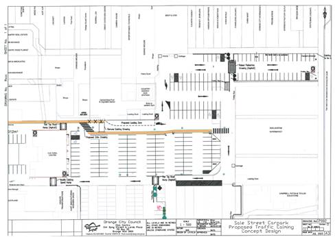
(20) The proponent shall
submit a Loading Dock Operational Management Plan for the approval of the
Manager of Development Assessments. The Loading Dock Operational Management
Plan shall detail types of vehicles (which for larger vehicles to be unloaded
by fork truck must be a side loading vehicle), the number of visits, duration
of stay, the safety procedures and protocols to be implemented on site by staff
when deliveries are being carried out to the property so as to provide traffic
and pedestrian safety for customers. The management plan shall specify that
deliveries to the site shall not be carried out during peak operating periods
where practicable, and shall specifically include the details of barriers to be
installed (which shall not be witches hats barriers).
(21) The archway areas
between the building columns in front of the outdoor product display shall be
modified to prevent direct pedestrian access through the gaps that currently
exist. Such protective balustrading shall be to the satisfaction of the Manager
Development Assessments, and once installed shall not be removed or modified
except with the approval of Council. .
(22) No
person is to use or occupy the building or alteration that is the subject of
this approval without the prior issuing of an Occupation Certificate.
(23) The
owner of the building/s must cause the Council to be given a Final Fire Safety
Certificate on completion of the building in relation to essential fire or
other safety measures included in the schedule attached to this approval.
(24) Certification
from Orange City Council, stating that liquid trade waste measures implemented
comply with Orange City Council’s Liquid Trade Waste approval, is to be
submitted to the Principal Certifying Authority prior to the issuing of an Occupation
Certificate.
(25) Where
Orange City Council is not the Principal Certifying Authority, a final
inspection of water connection, sewer and stormwater drainage shall be
undertaken by Orange City Council and a Final Notice of Inspection issued, prior
to the issue of either an interim or a final Occupation Certificate.
(26) Certificates for
testable Backflow Prevention Devices are to be submitted to Orange City Council
by a plumber with backflow qualifications prior to the issue of an Occupation
Certificate.
(27) All
of the foregoing conditions are to be at the full cost of the developer and to
the requirements and standards of the Orange City Council Development and
Subdivision Code, unless specifically stated otherwise. All work required by
the foregoing conditions is to be completed prior to the issuing of an
Occupation Certificate, unless stated otherwise.
|
MATTERS FOR THE
ONGOING PERFORMANCE AND OPERATION OF THE DEVELOPMENT
|
(28) Deliveries of fresh
meat shall be undertaken in accordance with the approved sketch plan that forms
part of this approval. Deliveries are restricted to a vehicle not exceeding 16m
length, and shall be undertaken at times prior to 7am as indicated in the supporting
information submitted with the application. The delivery vehicle shall utilise
the loading area as shown in the plans approved by the City Of Orange Traffic
and Development Committee, and the vehicle shall not be parked so that any part
of the vehicle extends beyond the eastern extremity of the loading area.
Unloading shall not in any way impede the safe usage of the pedestrian walkways
in the carpark and the free flow of traffic.
(29) The external display
areas shall not be used for any direct sales to the public. It is strictly to
be used for product display only. All displays shall be wholly placed within
the subject property with no encroachments permitted onto adjoining land or
into Council's carpark.
(30) The
owner is required to provide to Council and to the NSW Fire Commissioner an
Annual Fire Safety Statement in respect of the fire-safety measures, as
required by Clause 177 of the Environmental Planning and Assessment
Regulation 2000.
(31) The
operational controls contained within the approved Loading Dock Management Plan
must be complied with at all times.
ADVISORY
NOTE TO APPLICANT
Vehicle access to the loading area is currently
provided via the public carpark. Legal access is not available. The delivery
arrangements to the loading area are not to be construed as the creation of a
legal access over Council land. Legal right-of-carriageway will not be created;
access may be restricted at Council’s discretion if necessary in the
future. Should access to the land be denied due to redevelopment or sale of the
carpark, it would be necessary to make alternative loading and unloading
arrangements for the development.
Other Approvals
(1) Local
Government Act 1993 approvals granted under section 68.
Nil
(2) General
terms of other approvals integrated as part of this consent.
Nil
Right of Appeal
If
you are dissatisfied with this decision, section 97 of Environmental
Planning and Assessment Act 1979 gives you the right to appeal to the Land
and Environment Court within 6 months after the date on which you receive this
notice.
*
Section 97 of the Environmental Planning and Assessment Act 1979 does not apply
to the determination of a development application for State significant
development or local designated development that has been the subject of a
Commission of Inquiry.
|
Disability Discrimination Act
1992:
|
This application has been assessed in
accordance with the Environmental Planning and Assessment Act 1979. No
guarantee is given that the proposal complies with the Disability
Discrimination Act 1992.
The applicant/owner is responsible to
ensure compliance with this and other anti-discrimination legislation.
The Disability Discrimination Act
covers disabilities not catered for in the minimum standards called up in the
Building Code of Australia which references AS1428.1 - "Design for
Access and Mobility". AS1428 Parts 2, 3 and 4 provides the most
comprehensive technical guidance under the Disability Discrimination Act
currently available in Australia.
|
|
|
|
|
Disclaimer - S88B Restrictions on the Use of Land:
|
The applicant should note that there
could be covenants in favour of persons other than Council restricting what
may be built or done upon the subject land. The applicant is advised to check
the position before commencing any work.
|
|
|
|
|
Signed:
|
On behalf of the consent authority ORANGE
CITY COUNCIL
|
|
Signature:
|
|
|
Name:
|
ALLAN RENIKE - MANAGER DEVELOPMENT
ASSESSMENTS
|
|
Date:
|
13 August 2015
|
Sustainable
Development Committee
1 September 2015
2.3 Development
Application DA 132/2015(1) - Harris Farm Markets - Sale and Summer Streets
Attachment 2 Plans
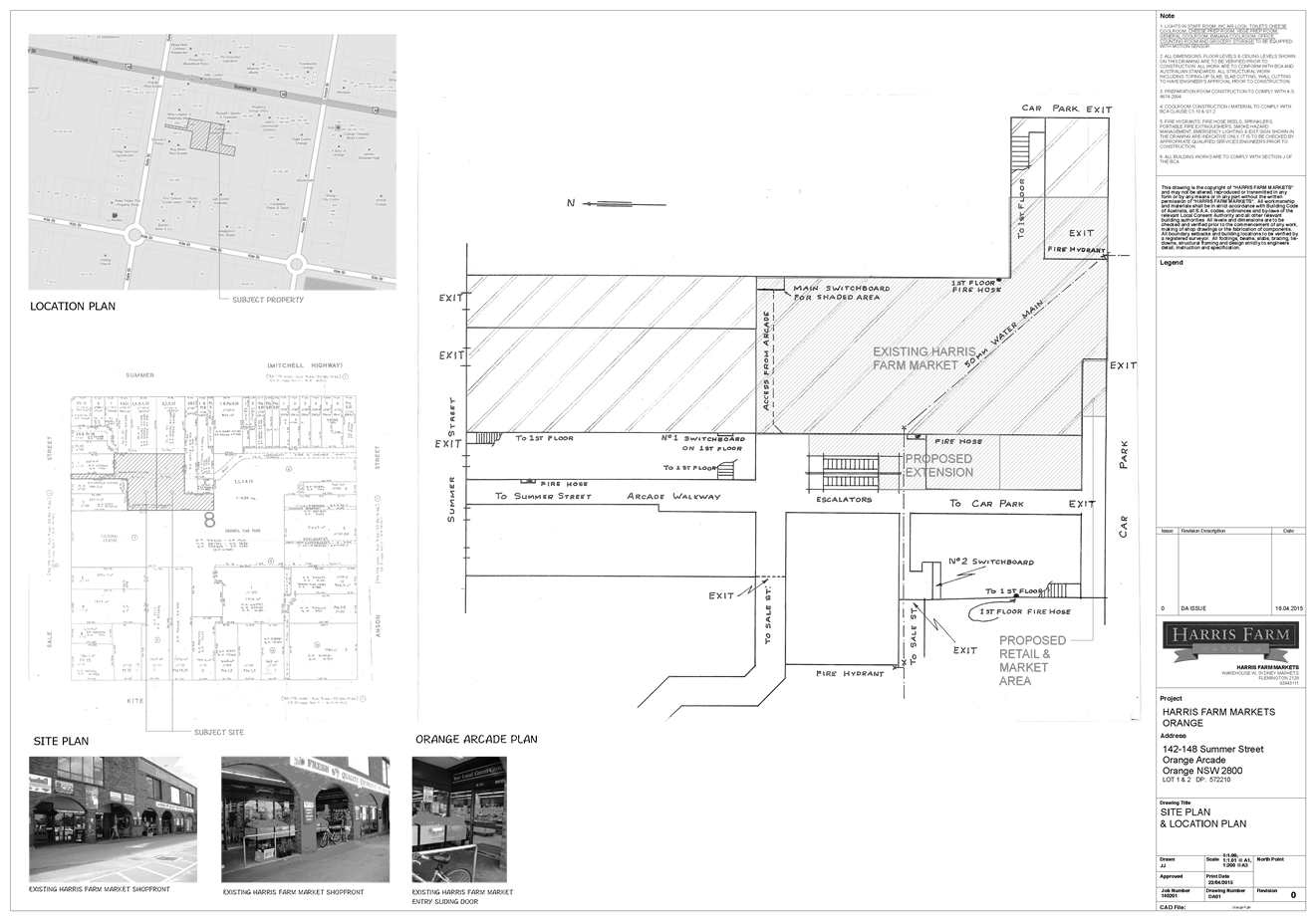

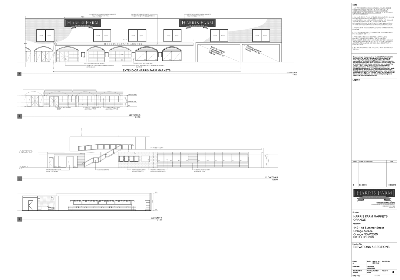
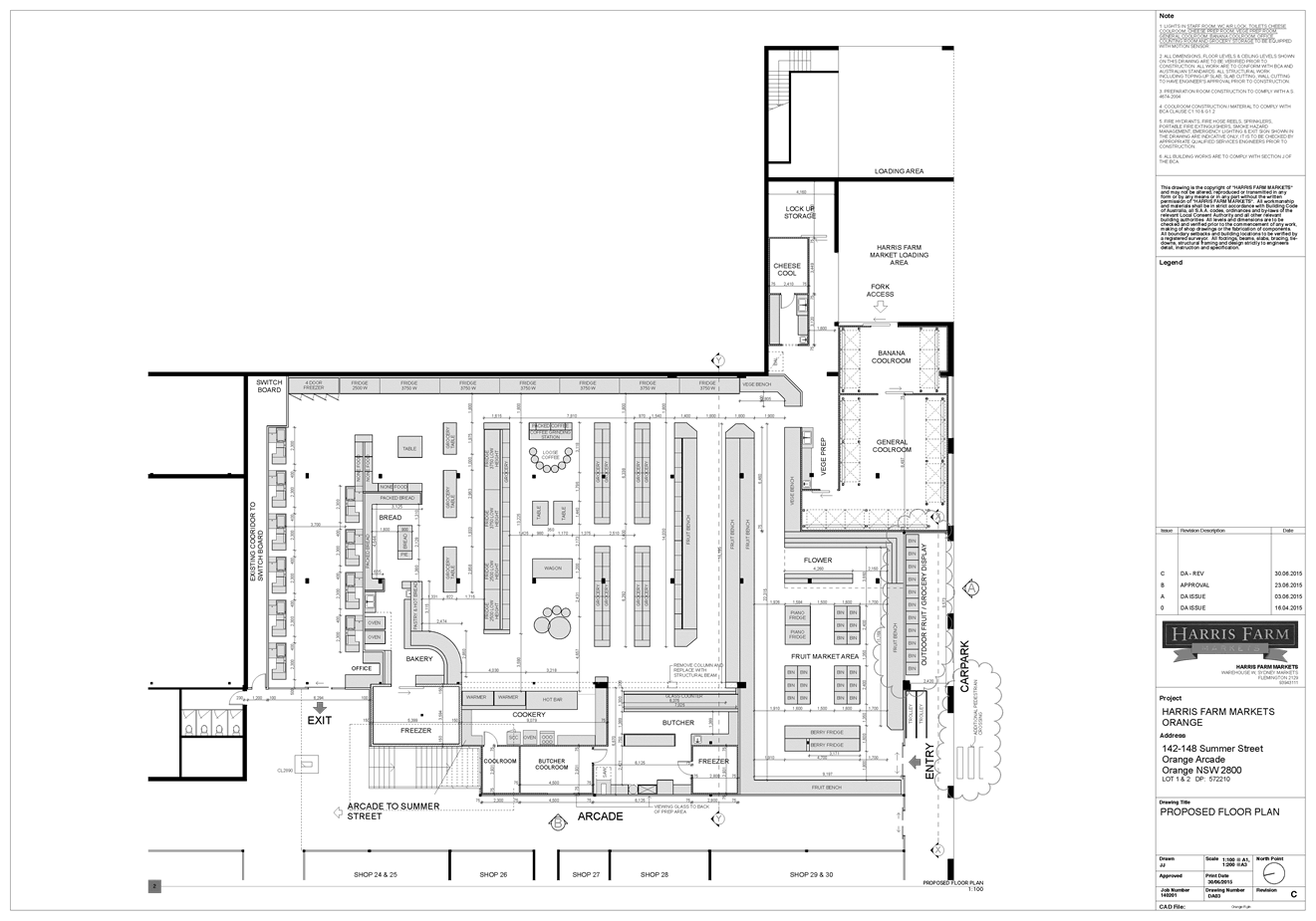
2.4 Planning
Proposal - Rezone Land for Rectangular Sports Field Complex
TRIM
REFERENCE: 2015/2196
AUTHOR: Craig
Mortell, Senior Planner
EXECUTIVE Summary
At its meeting of 20 August 2013
Council considered a feasibility study by Lantz Marshall Consulting (Orange
Rectangular Sporting Field Feasibility Study, August 2013) that examined 11
potential sites for a premier rectangular sports field complex. Council then
resolved as follows:
|
RESOLVED – 13/417 Cr
Hamling/Cr Duffy
|
|
1 That
the General Manager be authorised to finalise the purchase of land for a
future sporting and recreational precinct, in accordance with the provisions
of the report dated 6 August 2013.
2 That
permission be granted for the use of the Council Seal on relevant documents.
3 That the
land be classified as operational land.
|
Subsequent negotiations were held
with relevant land owners and this report considers a planning proposal in
relation to Lot 33 DP 1012682, known as 40 Priest Lane which also has extensive
frontage to the Northern Distributor Road on the eastern approach to the City.
The land is approximately 52.28ha in area and the current
land owner wishes to retain approximately 7.876ha in the north-western corner
of the site surrounding the established house and associated outbuildings,
tennis court and dam. The balance of the site, approximately 44.4ha, would be
acquired by Council as a first step towards establishing the rectangular sports
field complex.
The planning proposal attached to this report outlines the
broad concept and illustrates one possible configuration of sports fields,
stadiums and parking areas. It should be noted that the arrangement shown is
only intended to confirm that the desired components of a sports field complex
can be accommodated. The final design would be the subject of a Development
Application and merit assessment.
The planning proposal therefore involves rezoning part of
the land from E3 Environmental Management to RE1 Public Recreation with the
balance of the land, containing the existing dwelling and associated
outbuildings, remaining within the current E3 zone. The proposal also involves
listing the land in Schedule 1 of the LEP to enable a two lot subdivision of
the land below the minimum lot size of 100ha that otherwise applies to the
land.
Link To Delivery/OPerational Plan
The recommendation in this report relates to the
Delivery/Operational Plan strategy “1.2 Our City -
Information and advice provided for the decision-making process will be
succinct, reasoned, accurate, timely and balanced”.
Financial Implications
Nil
Policy and Governance Implications
The proposal seeks to amend Orange Local Environmental Plan
2011.
|
Recommendation
1 That
Council seeks a Gateway Determination from the Department of Planning and
Environment in relation to:
a Rezone
part of Lot 33 DP 1012682, known as 40 Priest Lane, from E3 Environmental
Management to RE1 Public Recreation.
b List
Lot 33 DP 1012682, known as 40 Priest Lane, in schedule 1 of the LEP to
permit a two lot subdivision below the minimum lot size for the purpose of
excising the existing dwelling and associated improvements from the remainder
of the site without creating any additional dwelling entitlements.
2 That
Council undertake such studies, reports and consultations as may be required
by the Gateway Determination.
3 That
Council proceed to place the Planning Proposal on exhibition in accordance
with any requirements of the Gateway Determination.
|
further considerations
The
recommendation of this report has been assessed against Council’s other
key risk categories and the following comments are provided:
|
Environmental
|
The western boundary of the site is
within the area mapped by Council as potentially affected by Naturally
Occurring Asbestos (NOA). Subsequent development of the site for a sports
field precinct may need to adapt to this constraint to minimise disturbance
of NOA material.
|
|
Health and Safety
|
Safe work methods in accordance
with Council’s NOA policy will be required to ensure the health and
safety of staff, contractors and the general public.
|
|
Projects
|
The potential presence of Naturally
Occurring Asbestos on the site has potential to require particular design
responses that could increase the financial cost of the intended sports field
precinct.
|
SUPPORTING INFORMATION
In 2013 Council considered a feasibility report prepared by
Lantz Marshall Consulting that examined 11 potential sites for a premier
rectangular sports field complex. The three shortlisted sites identified in
that report were:
1 Moulder
Park
2 Orange
Showground
3 North-East
Orange greenfield site
Council resolved to proceed by giving
the General Manager authority to purchase a site. Whichever site is ultimately
developed needs to be appropriate zoned to allow for the appropriate land use.
Under Orange LEP 2011 the term recreation facilities (major) is defined
as:
recreation facility (major)
means a building or place used for large-scale sporting or recreation
activities that are attended by large numbers of people whether regularly or
periodically, and includes theme parks, sports stadiums, showgrounds,
racecourses and motor racing tracks.
The above land use is permissible with consent in the RE1
Public Recreation and RE2 Private Recreation zones. Moulder Park and the
Showground are already within such zones however the North-East Orange
greenfield site is currently in the E3 Environmental Management Zone which does
not permit the use.
North-East Orange greenfield site
Location of site relative to Orange
Negotiations with the owner of the
North-East Orange site have progressed on the basis of successful rezoning to
enable the owner to retain the existing dwelling located in the north-western
corner and to enable the sports field to be built. This would require a two lot
subdivision however the land is already below the minimum lot size allowed for
subdivision.
Approximate layout of two
lot subdivision – subject to LEP Amendment and Development Application
Consequently, this report relates
to a Planning Proposal prepared for Council by Peter Basha Planning and
Development (PBPD) in relation to the North-East Orange greenfield site option,
seeking to rezone the land from E3 Environmental Management to RE1 Public
Recreation and list the property in Schedule 1 of the LEP to allow a two lot
subdivision below the minimum lot size to facilitate the excision of the
existing dwelling on approximately 7.876ha. The sports precinct would then be
possible, subject to a Development Application, on the residual approximately
44.4ha of land.
Anticipated scope of project
In broad terms the North-East Orange greenfield site is
shown to have the capacity to accommodate a complex that:
· Has
crowd capacity of up to 15,000 persons.
· Formal
grandstand seating of up to 1,500 persons.
· Floodlighting
suitable for semi-professional and professional competition matches
· Function
rooms that can be used as corporate boxes.
· Water
efficient drainage and irrigation systems, including use of runoff from
grandstand roofing.
· Full
size (120m long 74m wide) field dimensions to meet the requirements of
rectangular sporting codes – football (soccer), rugby league and rugby
union.
· Change
room facilities (4 rooms for players and 2 rooms for referees/officials).
· Public
amenities and kiosk facilities on both sides of playing fields.
· Warm
up facilities (approximately 60m by 70m)
· Car
parking for a minimum of 250 spaces
If rezoned, the final design of the project would be subject
to further refinement and master planning prior to lodging a development
application. For example, given the stated intention to cater for major events,
the car parking layout may benefit from easier bus/coach access including a
set-down pick up area and possible taxi rank. Access to the NDR would need
consultation with Roads and Maritime Services due to the size and capacity of
the facility.
Planning Proposal Guidelines
The Planning Proposal, attached to this report, addresses
the regulatory requirements for an LEP amendment and outlines the overall
concept for the site. In particular the planning proposal has demonstrated
consistency with State Environmental Planning Policies, Section 117 Ministerial
Directions and considered preliminary flora and fauna and Aboriginal
Archaeological assessments prepared by Envirowest Consulting.
Sections 2 to 5 of the Planning Proposal address the formal
requirements of the Department of Planning and Environments document “A
Guide to Preparing Planning Proposals” which outlines the fundamental
information needed that form basis of public exhibition materials. The planning
proposal attached to this report is broadly consistent with the requirements,
however review of the documentation has found several issues that are not
adequately addressed or that could benefit from supplemental information. These
are detailed in the following sections.
Title
The property is subject to a 45m wide power line easement
that runs from the north-western corner in a south easterly direction to the
middle of the southern boundary, and then onward across other properties. This
would preclude the erection of buildings within the easement but other features
of a low profile, such as car parking and associated access lanes as well as
warm up areas, would not be prevented.
While the formal sports-fields themselves are flat features
it may be necessary to locate the fields clear of the easement, partly for
practical reasons such as keeping the goal posts clear of any overhead lines
and not wanting high clearing kicks to be deflected by contact, and partly for aesthetic
reasons. Notwithstanding this there is ample room clear of the easement to
locate the formal sports fields, stadium/grandstand and other associated
buildings.
Toward the southern side of the property there is an area of
approximately 2.1ha roughly 100m wide between the easement and the area of
Naturally Occurring Asbestos, there is also a larger area of approximately
4.2ha north of the easement, roughly in the centre of the site with modest
slope that is clear of the easement, drainage lines and NOA. These areas are
shown on the following map as Area A and Area B respectively. Furthermore it
should be noted that the presence of NOA is not an absolute constraint and the
areas shown below could therefore be expanded subject to more detailed geotechnical
investigations.
Power line easement shown in yellow, unconstrained and
relatively flat/gentle slopes shown in areas A and B
Naturally Occurring Asbestos
The western edge of the area - approximately relating to the
area of the site intended for car parking, the two sports fields and the
stadium – is within the area identified on Council maps as being
potentially subject to Naturally Occurring Asbestos (NOA).
Council has an Asbestos Management Plan, prepared in 2014,
that guides consideration of development on NOA affected lands. The NOA mapping
follows the precautionary approach, meaning that being on the map signals a
likelihood of NOA being present. Only geotechnical investigation and sampling
could confirm whether this is in fact the case. Additionally, the presence of
NOA does not automatically preclude development of the site, but does trigger
additional requirements to manage the hazard.
Should NOA be present and Council wish to proceed with
acquisition and development of the land, the project would need to respond to
this constraint through design measures. This could include
· All
weather sealing of the car park area to effectively seal off the NOA
· Importation
of clean fill to build up level playing surfaces, rather than using cut/fill techniques,
effectively burying the NOA beyond reach
· Excavation
and removal of material to a required depth and replacement with clean fill in
other areas that are intended to be open to the public, ensuring that NOA
material is not present at or near the surface
· Fencing
off and preventing access to any affected areas where the above measures are
not deemed appropriate
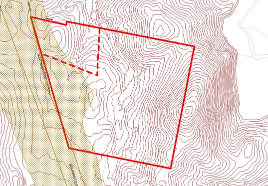
Contours
of property showing NOA land shown stippled brown on left of image – Suma
Park Dam to right of image
Formalities
The planning proposal suggests inclusion of the land into
schedule 1 of the Orange LEP 2011 “to enable subdivision into 2 lots to
reflect the proposed zone boundaries”. While this is an appropriate
mechanism to achieve the intent, the actual listing needs to be accurately
defined in the planning proposal to satisfy the Department of Planning and
Environment and Parliamentary Counsel’s requirements. The wording of this
section of the planning proposal would therefore need to be adjusted to read:
Insert the following into schedule
1 as item 2:
2 Use of certain land at 40
Priest Lane, Orange
(1) This
clause applies to land at 40 Priest Lane, Orange, being Lot 33, DP 1012682.
(2) Development
for the purposes of a two lot subdivision is permitted with consent, provided:
(a) That
each lot created is subject to a single land use zone.
(b) No
dwelling entitlements are created or established on the resultant lot zoned RE1
Public Recreation.
(3) Subclause
(2) ceases to apply on 31 December 2016
The maps and plans supplied in the planning proposal do not
adhere to the Department of Planning and Environment’s technical drafting
and formatting requirements. Accordingly a new draft map would need to be
prepared prior to proposal reaching public exhibition. This is considered to be
a procedural matter as the draft map would be entirely consistent with the maps
currently in the planning proposal.
Precedent
The planning proposal highlights that the amendment is
likely to change expectations of other landowners in the area. The location of
the site on the fringe of the urban area and the character of the surrounds,
being predominantly small scale rural properties and associated dwellings,
would not normally be suggestive of large scale facilities such as sports
stadiums and the like.
In addition to the reasons offered in the planning proposal
(that other non-residential / non-rural uses are already permitted in the E3
zone) the location of the site fronting onto the Northern Distributor Road
essentially at one a key entrance point to the City clearly distinguishes the
site from most of the rest of the E3 zone. The proposal is therefore not likely
to undermine the integrity of the E3 zone and would not set a credible
precedent for rezoning other land in the vast majority of cases.
Flora and Fauna
Parts of the site are identified as containing high
biodiversity sensitivity under the Orange LEP 2011. The planning proposal
includes a preliminary flora and fauna assessment undertaken by Envirowest
Consulting. The assessment did not find any endangered or threatened flora or
fauna species, populations or communities on the site and concluded:
The development is not expected
to have a significant impact on the long-term survival of threatened species
and communities within the South Eastern Highlands Bioregion.
Additionally, the significant vegetation on the site is not
within the probable footprint of the sporting facilities and associated car
parking areas. It is therefore apparent that a suitable design can be achieved
on the site with negligible impact upon the flora and fauna values of the site.
Roads and Traffic
Clause 104 of State Environmental Planning Policy
(Infrastructure) 2007 requires that traffic generating development must be
referred to the Roads and Maritime Service for consideration. In this regard
Recreation Facilities (major) with car parking for 200 or more vehicles is
deemed to be a traffic generating development.
This is technically a matter to be addressed during
subsequent Development Application(s), it highlights the overall potential for
traffic to be a factor in the project. Accordingly, while the planning
proposal is technically correct in stating that SEPP (infrastructure) is not
relevant to the rezoning, it is considered likely that Council will be directed
by any Gateway Determination to undertake consultation with RMS. At this time
RMS opinion has not yet been sought.
In the absence of a traffic study, or RMS opinion, the
location and configuration of the access point to the project is open to
review. While the NDR and local road network is considered to have sufficient
capacity for the volume of traffic likely to be generated, it is possible that
the access arrangement may require adjustments to the relevant section of the
NDR and potentially the Ophir Road intersection.
Flooding
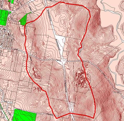
Estimated drainage catchment of the subject site
(approx 256.6ha)
The planning proposal states that the land is not identified
as flood liable land. Whilst this is technically correct it is primarily due to
the area not having been within the study area of previous flood studies.
In the absence of a formal flood study it should be noted
that a drainage line runs roughly north-south through the middle of the site
and feeds into Suma Park Dam approximately 300m north of the property boundary.
Based on examination of the contour lines an estimate of the catchment area for
this drainage line of roughly 256.6ha as shown in the map above. During a large
rainfall event this could result in a significant volume of water passing
through the site. This may suggest limiting direct public access to the
drainage corridor to reduce public liability concerns.
However the area proposed for playing fields is elevated
approximately 6m - 8m above the drainage line itself. Inundation of sporting
fields does not generally present a danger or hazard and is unlikely to cause
damage to such facilities. Notwithstanding this further investigation of
flooding may be appropriate at the Development Application stage to inform the
design and assessment of ancillary buildings such as grandstands, changing
rooms, kiosks and the like.
Net Community Benefit
Orange has many quality sporting and recreation facilities
that have been built up over many decades. However, in recent years the ability
to attract and host major events for rectangular sporting codes
(football/soccer, rugby league, rugby union) has been limited. This is seen to
be the result of several factors including rising venue standards and crowd
capacities expected by the organisers of such events.
The proposal illustrates the potential of the subject site
to accommodate a new facility with appropriate capacity and long term expansion
potential. Such a facility would be of direct benefit to existing local
sporting teams and associations and would improve the ability to attract major
semi-professional and professional grade events to the city. The location of
the site on the fringe of the urban area would allow some events that due to
noise levels might not be appropriate at other locations.
Large scale events (sports related or otherwise) would have
direct flow-on benefits to the local economy in the hospitality and retail
sectors. Large scale events would also introduce more people to Orange which
may then have indirect benefits across the economy and community by helping to
attract new residents, with a range of skillsets and business interests, to the
area.
Conclusion
The planning proposal attached to this report has generally
made a sound case for rezoning of the subject site. This will in turn enable
the development of a significant sporting and cultural asset for the city
allowing Orange to attract and host professional and semi-professional events,
with potential flow-on benefits to the local economy. Some issues require
further investigation, such as the presence of Naturally Occurring Asbestos,
extent of flooding potentially affecting the land and traffic implications.
It is considered that these matters can be investigated
concurrently with public exhibition, unless required by the Gateway
Determination to be addressed prior. The issues raised do not represent
absolute constraints that would render the site unfit for purpose, rather they
are indicative of matters that need to be taken into account during the design
and assessment of any subsequent Development Application.
Attachments
1 Planning
Proposal - Rezoning Lot 33 DP 1012682 - E3 to RE1 - Northern Distributor Road,
IC15/5680⇩
2 Orange
Rectangular Sporting Complex Feasibility Report 2013, D13/18589⇩
Sustainable Development Committee
1 September 2015
2.4 Planning
Proposal - Rezone Land for Rectangular Sports Field Complex
Attachment 1 Planning
Proposal - Rezoning Lot 33 DP 1012682 - E3 to RE1 - Northern Distributor Road
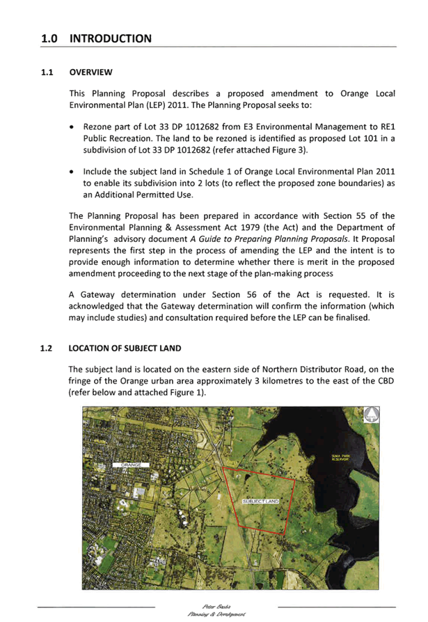
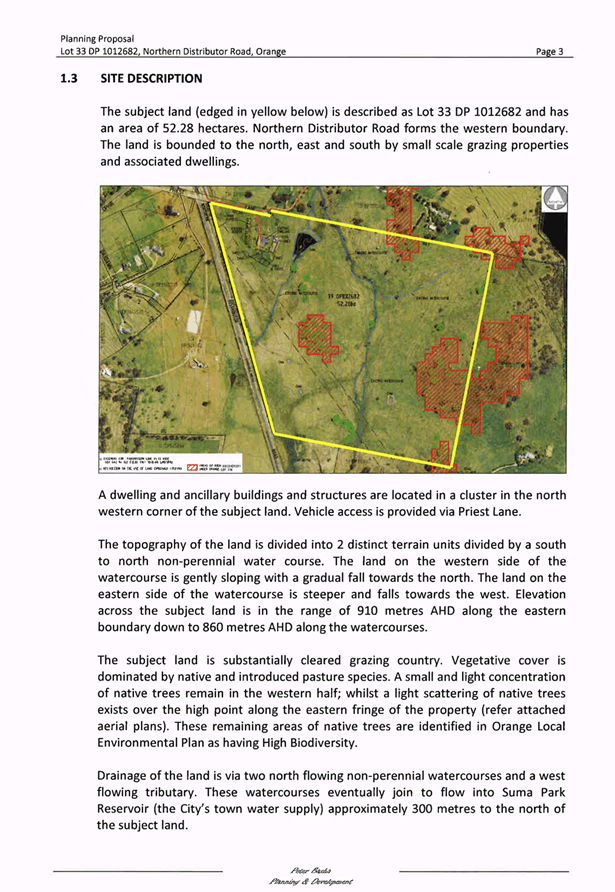


Sustainable Development Committee
1 September 2015
2.4 Planning
Proposal - Rezone Land for Rectangular Sports Field Complex
Attachment 2 Orange
Rectangular Sporting Complex Feasibility Report 2013
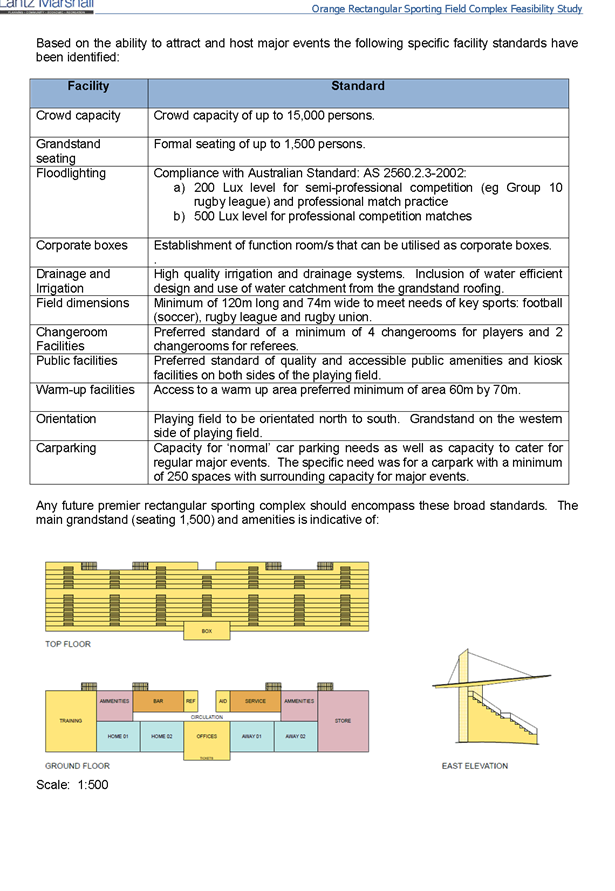
2.5 Orange
LEP 2011 - Planning Proposal - Newstead Bowling Club
TRIM REFERENCE: 2015/2025
AUTHOR: Craig
Mortell, Senior Planner
EXECUTIVE Summary
Council has received a draft Planning Proposal to rezone the
Newstead Bowling Club at 47 – 49 Hill Street from R1 General Residential
to B4 Mixed Use.
The proponent is seeking the new zone in order to provide a
range of non-residential uses for the clubhouse building. The clubhouse is
considered unlikely to ever be adapted for residential occupancy and the
proponent seeks to ensure the site has a reasonable range of viable options
that may in turn promote the upkeep and maintenance of an important heritage
building.
Link To Delivery/OPerational Plan
The recommendation in this report relates to the
Delivery/Operational Plan strategy “1.2 Our City -
Information and advice provided for the decision-making process will be
succinct, reasoned, accurate, timely and balanced”.
Financial Implications
Nil
Policy and Governance Implications
Nil
|
Recommendation
1 That
Council seek a Gateway Determination from the Department of Planning and
Environment in relation to rezoning the Newstead Bowling Club located at 47
– 49 Hill Street, Orange from R1 General Residential to B4 Mixed Use.
2 That
Council include in the Planning Proposal adjustments to the Local Environmental
Plan maps as follows:
a The
Heritage map so that item I23 is reduced in area to include only the land intended
to be added to the B4 zone.
b The
Floor Space Ratio Map so that the subject land has an FSR of 0.5:1
c The
Height of Buildings Map so that the subject land has a building height limit of
9 metres.
3 That
Council undertake such studies, reports and consultations as may be required
by the Gateway Determination, at the proponent’s expense.
4 That
Council proceed to place the Planning Proposal on exhibition in accordance
with any requirements of the Gateway Determination.
|
further considerations
Consideration has been given to the
recommendation’s impact on Council’s service delivery; image and
reputation; political; environmental; health and safety; employees;
stakeholders and project management; and no further implications or risks have
been identified.
SUPPORTING INFORMATION
The Newstead Bowling Club, located at 47 – 49 Hill
Street, ceased operating as a registered club in 2014. The site is zoned R1
General Residential and the current owner intends to redevelop the bowling
greens for housing subject to a future Development Application.
The Newstead club house building is considered to have
substantial heritage values and as such an adaptive re-use of the building that
conserves the heritage values is preferred. The proponent requests that the
club house and grounds be rezoned to B4 Mixed Use to enable a greater range of
prospective functions to be considered.
While the existing R1 General Residential zone does provide
for several non-residential functions and the building presently has existing
use rights for a registered club it is apparent that the building is highly
unlikely to be converted to conventional residential habitation.
The site adjoins the existing B4 Mixed Use zone and as such
the rezoning would be consistent with the zoning pattern in this part of Hill
Street making Kite Street the clear delineation between commercial and
residential areas.
The site is located on a block of Hill Street, between
Summer Street and Kite Street, which is otherwise completely commercially
zoned. Most of the built form in this section of Hill Street comprises
dwellings, some of which have been converted to offices or other
non-residential uses, and one purpose built office that has been carefully
designed to co-exist with the surrounding residential aesthetic.
The current non-residential uses in this section of Hill
Street comprise a dental practice, accounting firm, two legal firms, financial
planning, television office and a disability services provider. The corner
properties on Summer Street are more commercial in appearance, comprising
offices and a service station, that provide a transition into the more
commercially dominated role of Summer Street.
With regard to Kite Street, the aesthetic and function is
more strongly residential with only the bowling club greens giving a
non-residential appearance and it is understood the proponent intends to
redevelop the greens for residential units.
The clubhouse itself has the appearance of a large residence
with very generous setbacks and landscaping to both street frontages. Excluding
the signage panels, the building and grounds make a strong contribution to the
character of the area and preserving this contribution should be supported.
In considering the merits of the planning proposal Council
needs to have regard to any potential alternatives. Should the site remain
zoned R1 General Residential the building will be limited to the uses available
within that zone.
Existing use rights
Ordinarily the site would also be able to maintain the
current activity under existing use rights provisions. However, only allows the
continuation of the activity and in this instance the previously activity is
defined as a “registered club”. By definition this requires the
premises to hold a club license under the Liquor Act. However the bowling club
has ceased operation and the greens are to be redeveloped for housing. The
premises are intended to be sold to private interests and as such would no
longer be able to obtain a “club” license.
Therefore even if new private owners wished to continue
operation of the clubhouse the premises would be deemed to have changed from a
registered club to a pub. Existing use rights only permit changes to
permissible forms of development and both registered clubs and pubs are
prohibited in the R1 General Residential zone.
Additionally, the new owners are seeking the flexibility to
pursue a range of options including office premises, retail premises, business
premises, food and drink premises, function centres and the like. Again these
uses are not permitted in the R1 General Residential Zone.
Amending the R1 Land Use Table
Another alternative to rezoning is to consider amending the
range of uses that are permitted in the current zone. This has implications
across a broader area of the city, since any property with the R1 zone would be
able to seek consent for the additional use(s) proposed. In this regard the
commercial and retail functions would be likely to generate a range of issues
in residential areas from noise generation to parking and traffic congestion to
name a few. Additionally the proliferation of such functions outside of the
commercial zones would potentially undermine the trading performance of the
central business district (CBD) and create traffic congestion and parking
demand in random locations throughout the city that would be difficult to
provision infrastructure for. Accordingly this alternative to rezoning is not
recommended.
Additional Permitted Uses
The LEP includes a mechanism under clause 2.5 to allow a
specific additional use on particular pieces of land, known as the Additional
Permitted Use (APU) clause. In general APUs should only be considered in
exceptional circumstances where other alternatives have been considered and
deemed unsuitable. Excessive use of APUs is argued can undermine the integrity
of the LEP zone maps and reduce public confidence in the planning controls.
Essentially people expect to be able to inspect the LEP and associated maps and
gain a reasonable impression of the type and scale of development that may
occur in their vicinity.
APUs complicate this picture because by definition they
allow proposals beyond that which would normally be anticipated in the current
zone. Consequently the Department of Planning and Environment have historically
discouraged the use of APUs where any alternative approach is viable.
In this case the new owners of Newstead are seeking a
rezoning rather than an APU to ensure that the next and potential future uses
of the site can be accommodated. This will also give a clearer indication to
anyone buying property in the vicinity as to what may be developed on the site.
Redevelopment Risks
In considering a rezoning proposal Council needs to
appreciate that once rezoned the landowner then has the potential to pursue any
of the uses permitted within the zone and not merely the particular use
suggested. In this regard the B4 Mixed Use zone allows a wide range of
commercial and retail development.
However, the subject land is a listed heritage item and as
such redevelopment would need to respect the heritage values of the clubhouse
building and landscaped curtilage.
Additional mapping
The current heritage map indicates that item I23 covers the
entire Newstead site, inclusive of the bowling greens. However the listing in
the schedule refers only to the clubhouse. It is therefore suggested that the
heritage map be amended to reduce the mapped area of item I23 to the land
proposed for rezoning.
Additional protection can be achieved by imposing floor
space ratio (FSR) and building height limits on the property similar to that
which already exists on the neighbouring B4 Mixed Use land. Namely a building
height limit of 9 metres and an FSR of 0.5:1.
Such controls would limit the scale of any redevelopment to
the extent that it would likely be more economical to retain and adapt the
existing building rather than knock down and redevelop.
Servicing and infrastructure
The site is located within the urban area of Orange. The
current premises are fully served in terms of sewer, water, gas, electricity,
telecommunications and direct access to the road network. Any future
application for a change of use will need to address parking requirements as
per the Development Control Plan (DCP).
It is noted that the site is not within the area associated
with the car parking contributions plan. As such Council will not have the
legal ability to levy a contribution in lieu of a parking shortfall, unless and
until the car parking contributions plan is updated. Therefore all future
applications for the site will need to satisfy parking requirements, be refused
or offer a suitable planning agreement to address any shortfall.
Given that the proposal is not predicated on a particular
land use or form of development, it is not possible to fully assess the
parking aspect of the site, other than to note that the area involved for the
rezoning does have some potential for off-street parking to be achieved within
the site. Parking will therefore be a significant aspect of any DA assessment.
Conclusion
The Newstead bowling club ceased operations in 2014. The new
owners are expected to seek redevelopment of the greens for housing. The
clubhouse is a listed heritage item in the LEP but due to internal alterations
over many years is unlikely to be restored to a residential function. The new
owners are keen to preserve the heritage values of the property and are seeking
a rezoning to enable a suitable range of uses are available for the continued
evolution of the premises into the future. Combined with appropriate
restrictions on height and floor space ratio it is considered that a rezoning
will facilitate the ongoing use and maintenance of an important part of Orange’s
architectural and cultural heritage.
Attachments
1 Planning
Proposal - Rezone Newstead Bowling Club - 47-49 Hill Street, IC15/11906⇩
Sustainable Development Committee
1 September 2015
2.5 Orange
LEP 2011 - Planning Proposal - Newstead Bowling Club
Attachment 1 Planning
Proposal - Rezone Newstead Bowling Club - 47-49 Hill Street