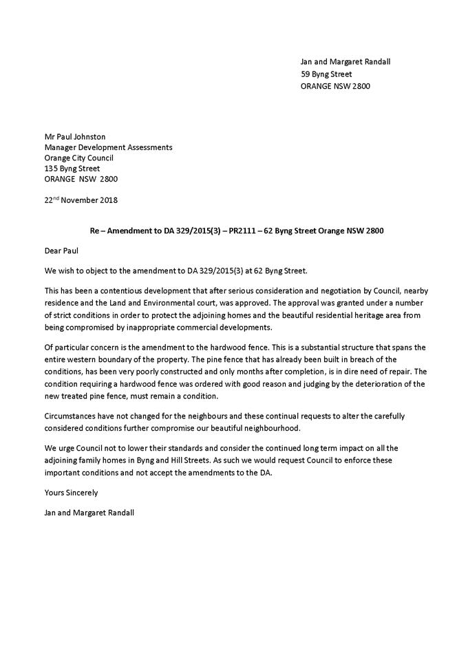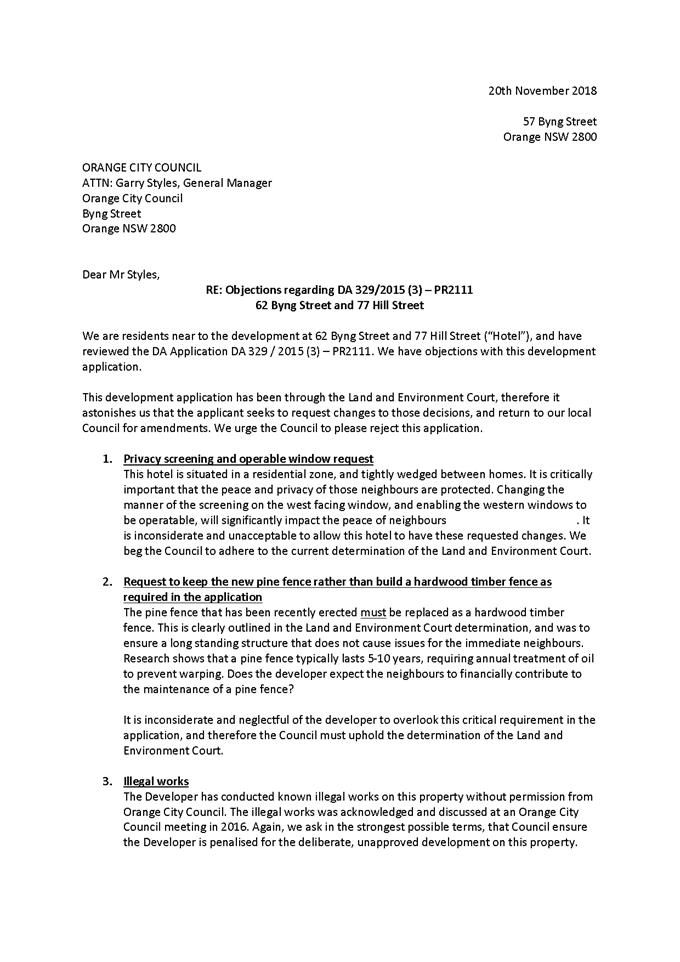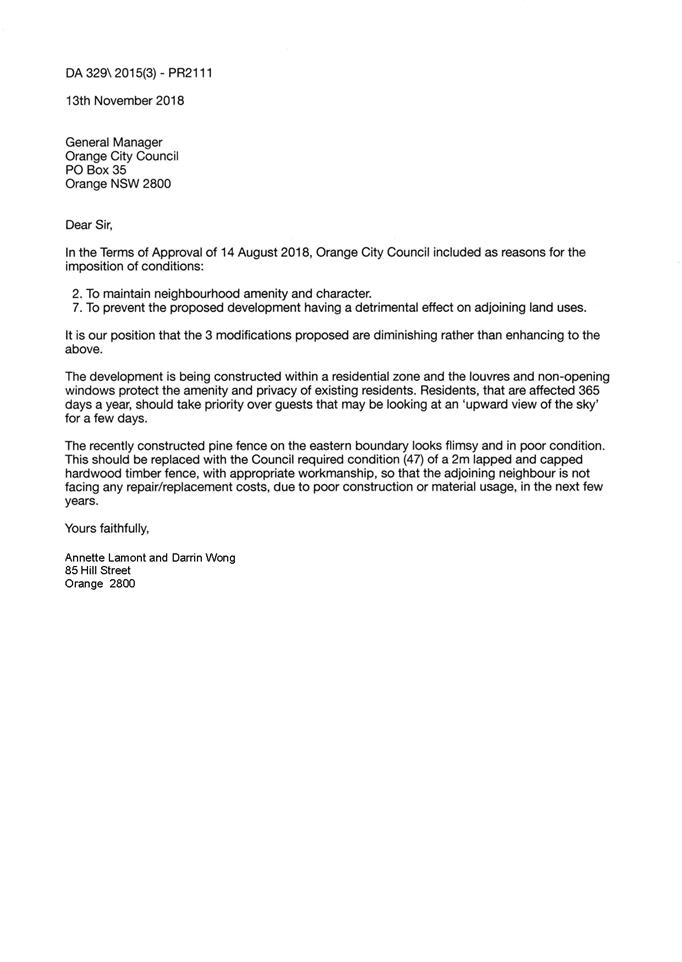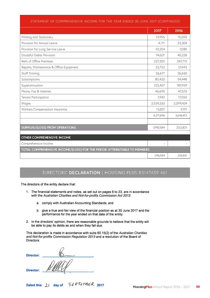
Planning and Development
Committee
Agenda
5 February 2019
Notice is hereby given, in
accordance with the provisions of the Local Government Act 1993 that a Planning and Development Committee meeting of ORANGE CITY COUNCIL
will be held in the Council Chamber,
Civic Centre, Byng Street, Orange on Tuesday, 5 February
2019.
Garry
Styles
General Manager
For apologies please
contact Administration on 6393 8218.
1 Introduction
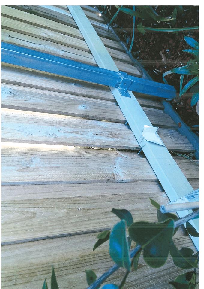
1.1 Declaration
of pecuniary interests, significant non-pecuniary interests and less than
significant non-pecuniary interests
The
provisions of Chapter 14 of the Local Government Act, 1993 (the Act)
regulate the way in which Councillors and designated staff of Council conduct
themselves to ensure that there is no conflict between their private interests
and their public role.
The
Act prescribes that where a member of Council (or a Committee of Council) has a
direct or indirect financial (pecuniary) interest in a matter to be considered
at a meeting of the Council (or Committee), that interest must be disclosed as
soon as practicable after the start of the meeting and the reasons given for
declaring such interest.
As
members are aware, the provisions of the Local Government Act restrict any
member who has declared a pecuniary interest in any matter from participating
in the discussion or voting on that matter, and requires that member to vacate
the Chamber.
Council’s Code of Conduct provides that if members
have a non-pecuniary conflict of interest, the nature of the conflict must be
disclosed. The Code of Conduct also provides for a number of ways in which a
member may manage non pecuniary conflicts of interest.
|
Recommendation
It is recommended that Committee Members now disclose any
conflicts of interest in matters under consideration by the Planning and
Development Committee at this meeting.
|
2 General
Reports
2.1 Items
Approved Under the Delegated Authority of Council and by the Western Joint
Regional Planning Panel
RECORD
NUMBER: 2018/3035
AUTHOR: Paul
Johnston, Manager Development Assessments
EXECUTIVE Summary
Following is a list of development
applications approved under the delegated authority of Council and or by the
Western Joint Regional Planning Panel.
Link To Delivery/OPerational Plan
The recommendation in this report relates to the
Delivery/Operational Plan strategy “7.1 Preserve - Engage with the
community to develop plans for growth and development that value the local
environment”.
Financial Implications
Nil
Policy and Governance Implications
Nil
|
Recommendation
That Council resolves to acknowledge the information
provided in the report by the Manager Development Assessments on Items
Approved Under the Delegated Authority of Council and by the Western Joint
Regional Planning Panel.
|
further considerations
Consideration has been given to the
recommendation’s impact on Council’s service delivery; image and
reputation; political; environmental; health and safety; employees;
stakeholders and project management; and no further implications or risks have
been identified.
APPLICATIONS
APPROVED UNDER THE DELEGATED AUTHORITY OF COUNCIL
|
Reference:
|
DA 379/2014(3)
|
Determination Date
|
2 January 2018
|
|
PR Number
|
PR27982
|
|
Applicant/s:
|
Taylor Made Buildings Pty Ltd
|
|
Owner/s:
|
Mr EJ Zell and Ms TS Schwartzman
|
|
Location:
|
Lot 302 DP 1239953 and Lot 3 DP
568571 – 21 and 23 Beasley Road, Lucknow
|
|
Proposal:
|
Modification of development consent
– dwelling house and subdivision. The modified proposal allows the
floor height to be raised by 1500mm above approved floor levels. It is
proposed also to install a privacy blade wall along the western side of the
rear deck, returning 1m along the northern (rear) side of the deck.
|
|
Value:
|
$229,926 (being $79,926 more than
the original development)
|
|
Reference:
|
DA 212/2015(3)
|
Determination Date
|
15 January 2019
|
|
PR Number
|
PR8502
|
|
Applicant/s:
|
West Orange Self-Storage Pty Ltd
|
|
Owner/s:
|
West Orange Self-Storage Pty Ltd
|
|
Location:
|
Lot 1 DP 404614 – 58-64
Molong Road, Orange
|
|
Proposal:
|
Modification of development consent
– self-storage units (alterations and additions), demolition and
storage. The modification seeks to reduce the height of the proposed building
such that the expansion of the self-storage premises will include a new
attached building of one storey height as opposed to two storey height.
|
|
Value:
|
$550,000 (being the same value as
the original development)
|
|
Reference:
|
DA 350/2016(2)
|
Determination Date
|
14 December 2018
|
|
PR Number
|
PR24302
|
|
Applicant/s:
|
Newstead Property Nominees Pty Ltd
|
|
Owner/s:
|
Newstead Property Nominees Pty Ltd
|
|
Location:
|
Lots 1, 2 and 3 DP 1127220, Lot 19 DP 1158710 and Lots 17 and 18 Sec
22 DP 758817 – 47-49 Hill Street, Orange
|
|
Proposal:
|
Modification of development consent - demolition (ancillary
structures), subdivision (Torrens Title – four lot residential),
dwellings (two dwellings), multi dwelling housing (seven dwellings) and
subdivision (community title – eight lot residential). The modification
involves altering the previously proposed and subsequently approved staging
of the consent to effect an initial two lot subdivision to excise the
Newstead Mansion onto a separate lot, with the balance created as a
development lot.
|
|
Value:
|
$3,550,000 (being the same value as
the original development)
|
|
Reference:
|
DA 431/2016(1)
|
Determination Date
|
7 December 2018
|
|
PR Number
|
PR10623
|
|
Applicant/s:
|
Hogan’s Pharmacy
|
|
Owner/s:
|
Mr GP Madafiglio and Ms FT
Kinghorne
|
|
Location:
|
Lots 1 and 2 SP 21546 and Lot 3 Sec
16 DP 758817 – 123 Sale Street and 76 Prince Street, Orange
|
|
Proposal:
|
Neighbourhood shop (alterations and
additions), medical centre, demolition (existing dwelling) and business
identification signage
|
|
Value:
|
$385,000
|
|
Reference:
|
DA 229/2017(2)
|
Determination Date
|
23 November 2018
|
|
PR Number
|
PR28185
|
|
Applicant/s:
|
Orange MS Investments Pty Ltd
|
|
Owner/s:
|
Orange MS Investments Pty Ltd
|
|
Location:
|
Lot 18 DP 1246117 Tanika Street,
Orange (previously known as 104 Lysterfield Road, Orange)
|
|
Proposal:
|
Modification of development consent
- subdivision (24 lot Torrens title). The modified proposal will amend the
approved subdivision pattern, by removing one proposed lot along Joseph
Drive.
|
|
Value:
|
$0 (being the same value as the
original development)
|
|
Reference:
|
DA 271/2017(3)
|
Determination Date
|
4 January 2019
|
|
PR Number
|
PR27941
|
|
Applicant/s:
|
Childcare Developments Group
|
|
Owner/s:
|
Whitmoro (Aust) Pty Ltd and Orange
City Council
|
|
Location:
|
Lot 203 DP 1238394 - 19
William Maker Drive and Stevenson Way, Orange (formerly unregistered Lots
202, 203 and 204 in a subdivision of Lot 42 DP 1195966 –
41 William Maker Drive, Orange), and Lot 238 DP 1238394 -
Stevenson Way, Orange
|
|
Proposal:
|
Modification of development consent - centre-based child care facility
and business identification sign (pylon sign). The modification involves
increased finished surface levels within the external playground; increased
height of an approved masonry retaining wall along the rear western and
southern side boundary; construction of an additional retaining wall along
the southern side boundary; installation of landscaping along the southern
and western walls.
|
|
Value:
|
$20,000 (being $20,000 more than
the original development)
|
|
Reference:
|
DA 2/2018(2)
|
Determination Date
|
20 December 2018
|
|
PR Number
|
PR27600
|
|
Applicant/s:
|
Mr MD Miller
|
|
Owner/s:
|
Mr MD and Mrs WJ Miller
|
|
Location:
|
Lot 438 DP 1228050 – 1-3
Bligh Street, Orange (previously Lot 438 DP 1228050 – 24 Buckland
Drive, Orange)
|
|
Proposal:
|
Modification of development consent
– dual occupancy and subdivision dual occupancy subdivision. The
modification involves amending the requirement for a 1.8m high perimeter
fence to be erected along the northern and eastern boundaries of the subject
site. As a result of this request, Condition 26 which outlines the general
condition included on a notice for a 1.8m perimeter fence, will also be
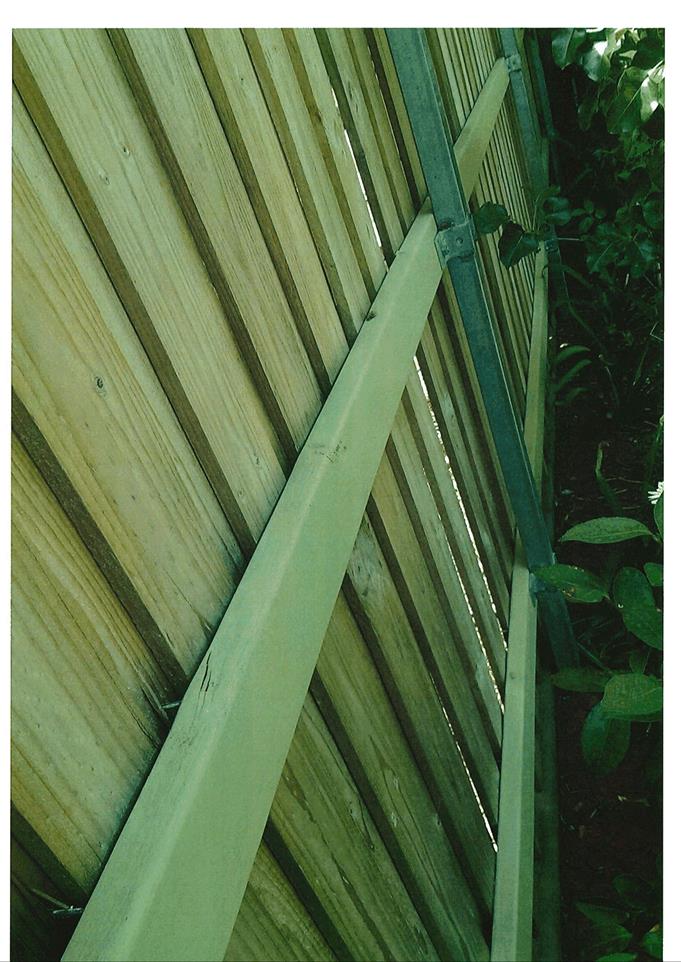
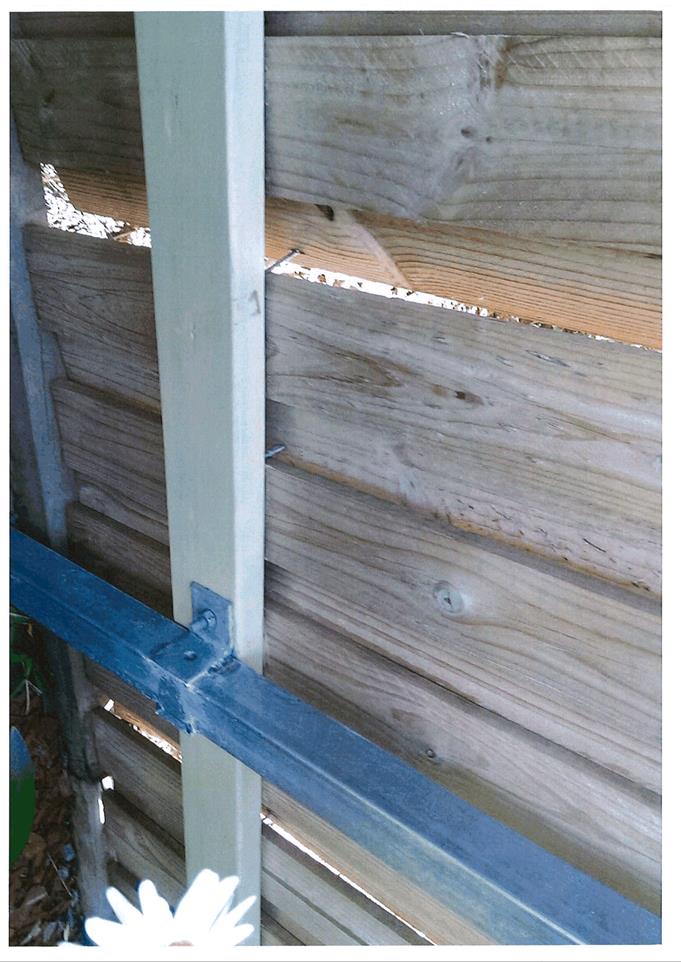
amended.
|
|
Value:
|
$585,000 (being the same value as
the original development)
|
|
Reference:
|
DA 91/2018(2)
|
Determination Date
|
17 December 2018
|
|
PR Number
|
PR8832
|
|
Applicant/s:
|
Mr PR Gunn
|
|
Owner/s:
|
Mr PJ, Mrs CJ, Mr WT and Ms SJ Gunn
|
|
Location:
|
Lot 1 DP 38296 – 14 Moulder
Street, Orange
|
|
Proposal:
|
Modification of development consent – subdivision (two lot
residential), demolition (existing shed), dual occupancy and subdivision
(three lot community title). The modification seeks to amend the finished
floor levels of proposed Dwellings 1 and 2, as a result of a review of
Council’s flood mapping.
|
|
Value:
|
$500,000 (being the same value as
the original development)
|
|
Reference:
|
DA 129/2018(1)
|
Determination Date
|
10 January 2019
|
|
PR Number
|
PR1162
|
|
Applicant/s:
|
Mr A and Mrs D Harvey
|
|
Owner/s:
|
Mr MF and Mrs JM Rangott
|
|
Location:
|
Lots 43 and 44 DP 608334 and Lot 42
DP 532439 – 1, 5 and 7 Barrett Street, Orange
|
|
Proposal:
|
Demolition (existing former
industrial building and trees), subdivision (boundary adjustment),
subdivision (three lot Torrens), and dwelling houses (two buildings)
|
|
Value:
|
$400,000
|
|
Reference:
|
DA 244/2018(1)
|
Determination Date
|
14 December 2018
|
|
PR Number
|
PR25411
|
|
Applicant/s:
|
Toyota Material Handling Australia
|
|
Owner/s:
|
DFT Australia Pty Ltd
|
|
Location:
|
Lot 82 DP 1167633 – 78 Astill
Drive, Orange
|
|
Proposal:
|
Business identification signage
|
|
Value:
|
$109,000
|
|
Reference:
|
DA 276/2018(1)
|
Determination Date
|
27 November 2018
|
|
PR Number
|
PR17910
|
|
Applicant/s:
|
Designs@M
|
|
Owner/s:
|
Kueb Pty Ltd
|
|
Location:
|
Lots 4 and 45 DP 1013849 –
62-64 Kearneys Drive, Orange
|
|
Proposal:
|
Dwelling houses (two dwellings),
subdivision (three lot Torrens), multi dwelling housing (four dwellings) and
subdivision (five lot Community)
|
|
Value:
|
$1,000,000
|
|
Reference:
|
DA 285/2018(1)
|
Determination Date
|
2 December 2018
|
|
PR Number
|
PR20233 and PR20234
|
|
Applicant/s:
|
Shed World
|
|
Owner/s:
|
Mr AL Gersbach
|
|
Location:
|
Lots 65 and 66 DP 1077737 –
70 and 72 Astill Drive, Orange
|
|
Proposal:
|
General industry (change of use)
and warehouse or distribution centre
|
|
Value:
|
$560,000
|
|
Reference:
|
DA 290/2018(1)
|
Determination Date
|
21 December 2018
|
|
PR Number
|
PR26593
|
|
Applicant/s:
|
Mr A and Mrs VJ Wardle
|
|
Owner/s:
|
Mr AL and Mrs VJ Wardle
|
|
Location:
|
Lot 14 DP 1199865 – 176 Emu
Swamp Road, Lucknow
|
|
Proposal:
|
Secondary dwelling, farm building,
dwelling alterations and additions (awning/patio cover) and solar panels
(secondary dwelling)
|
|
Value:
|
$250,000
|
|
Reference:
|
DA 292/2018(1)
|
Determination Date
|
21 January 2019
|
|
PR Number
|
PR1740
|
|
Applicant/s:
|
Twenty Eighteen Pty Ltd
|
|
Owner/s:
|
Twenty Eighteen Pty Ltd
|
|
Location:
|
Lot 27 Sec 2 DP 976979 – 15
Breen Street, Orange
|
|
Proposal:
|
Dual occupancy (attached) and
subdivision (two lot residential)
|
|
Value:
|
$425,000
|
|
Reference:
|
DA 363/2018(1)
|
Determination Date
|
7 December 2018
|
|
PR Number
|
PR10021
|
|
Applicant/s:
|
Mr RT Young
|
|
Owner/s:
|
Mr MA Lindfield
|
|
Location:
|
Lot 12 DP 210766 – 753
Pinnacle Road, Orange
|
|
Proposal:
|
Outbuilding (shed/garage), solar
energy system (photovoltaic electricity generating system), rainwater tanks
(x 2), and removal of fuel tanks (x 3)
|
|
Value:
|
$110,000
|
|
Reference:
|
DA 367/2018(1)
|
Determination Date
|
15 January 2019
|
|
PR Number
|
PR4698
|
|
Applicant/s:
|
Ophir Tavern Business Pty Ltd
|
|
Owner/s:
|
Ophir Tavern Land Pty Ltd
|
|
Location:
|
Lot 3 DP 630463 – 84 Glenroi
Avenue, Orange
|
|
Proposal:
|
Pub (external additions –
children’s playground)
|
|
Value:
|
$250,000
|
|
Reference:
|
DA 377/2018(1)
|
Determination Date
|
26 November 2018
|
|
PR Number
|
PR20399
|
|
Applicant/s:
|
Dice Renascent
|
|
Owner/s:
|
Orange Aboriginal Corporation
Health Service
|
|
Location:
|
Lot 14 DP 270446 – 16 Cameron
Place, Orange
|
|
Proposal:
|
Community Health Services Facility
|
|
Value:
|
$1,000,000
|
|
Reference:
|
DA 378/2018(1)
|
Determination Date
|
19 December 2018
|
|
PR Number
|
PR6885
|
|
Applicant/s:
|
Essential Energy
|
|
Owner/s:
|
Essential Energy
|
|
Location:
|
Lot 62 DP 635440 – 15-41
Lords Place, Orange
|
|
Proposal:
|
Depot (security fence)
|
|
Value:
|
$44,687
|
|
Reference:
|
DA 383/2018(1)
|
Determination Date
|
18 December 2018
|
|
PR Number
|
PR1173
|
|
Applicant/s:
|
Mr A Nguyen
|
|
Owner/s:
|
Orange Fruitgrowers
|
|
Location:
|
Lot 57 DP 606629 – 14-16
Barrett Street, Orange
|
|
Proposal:
|
Solar energy system (photovoltaic
electricity generating system)
|
|
Value:
|
$141,493
|
|
Reference:
|
DA 388/2018(1)
|
Determination Date
|
22 November 2018
|
|
PR Number
|
PR749
|
|
Applicant/s:
|
Ms K Trengrove
|
|
Owner/s:
|
Minebiz Reserve Pty Ltd
|
|
Location:
|
Lot 1 DP 799607 – 262 Anson
Street, Orange
|
|
Proposal:
|
Business identification signage
|
|
Value:
|
$1,400
|
|
Reference:
|
DA 389/2018(1)
|
Determination Date
|
14 December 2018
|
|
PR Number
|
PR20434
|
|
Applicant/s:
|
Norman J Penhall
|
|
Owner/s:
|
Penbrook Holdings Pty Limited
|
|
Location:
|
Lot 1 DP 1076919 and Lot 1 DP
1111912 – 35 and 37 William Street, Orange
|
|
Proposal:
|
Subdivision (two lot boundary
adjustment)
|
|
Value:
|
$0
|
|
Reference:
|
DA 393/2018(1)
|
Determination Date
|
18 December 2018
|
|
PR Number
|
PR11601
|
|
Applicant/s:
|
Mr SA Ellis
|
|
Owner/s:
|
Seniorsearch.com Pty Limited
|
|
Location:
|
Lot 1 DP 196052 and Lot C DP 402112
– 156 Summer Street, Orange
|
|
Proposal:
|
Shop (alterations to shopfront) and
business identification signs
|
|
Value:
|
$20,000
|
|
Reference:
|
DA 400/2018(1)
|
Determination Date
|
18 December 2018
|
|
PR Number
|
PR25968
|
|
Applicant/s:
|
Mr PC and Mrs LG Isaacs
|
|
Owner/s:
|
Mr PC and Mrs LG Isaacs
|
|
Location:
|
Lot 96 DP 1180866 – 30
Colliers Avenue, Orange
|
|
Proposal:
|
Vehicle sales or hire premises
(internal alterations – storeroom) and signage (pylon sign and wall
sign)
|
|
Value:
|
$10,000
|
|
Reference:
|
DA 416/2018(1)
|
Determination Date
|
18 December 2018
|
|
PR Number
|
PR7483
|
|
Applicant/s:
|
Canobolas Locksmiths
|
|
Owner/s:
|
Mr IR Stapleton and Ms DA
Thornberry
|
|
Location:
|
Lot 1 DP 797139 – 169 March
Street, Orange
|
|
Proposal:
|
Demolition (existing building),
hardware and building supplies, light industry and business identification
signage
|
|
Value:
|
$110,000
|
|
Reference:
|
DA 432/2018(1)
|
Determination Date
|
2 January 2019
|
|
PR Number
|
PR8260
|
|
Applicant/s:
|
Inside Design Studio
|
|
Owner/s:
|
Mr BA and Mrs LA Parianos
|
|
Location:
|
Lot A DP 161732 – 146-148
McLachlan Street, Orange
|
|
Proposal:
|
Café (internal fitout and
reconfiguration, external finishes)
|
|
Value:
|
$70,000
|
|
Reference:
|
DA 437/2018(1)
|
Determination Date
|
21 January 2019
|
|
PR Number
|
PR28072
|
|
Applicant/s:
|
B & J Flowers Pty Ltd
|
|
Owner/s:
|
Flowers Fund Management
|
|
Location:
|
Lot 1 DP 1244657 – 18
Geraldton Street, Orange
|
|
Proposal:
|
Dwelling house, temporary use as an
exhibition home, and associated signage
|
|
Value:
|
$380,000
|
|
Reference:
|
DA 449/2018(1)
|
Determination Date
|
20 December 2018
|
|
PR Number
|
PR10242
|
|
Applicant/s:
|
Diadem
|
|
Owner/s:
|
The Uniting Church in Australia
Property Trust (NSW)
|
|
Location:
|
Lot 4 Sec 16 DP 758817 – 74
Prince Street, Orange
|
|
Proposal:
|
Business identification signage
|
|
Value:
|
$2,650
|
TOTAL NET* VALUE OF ALL
DEVELOPMENTS APPROVED UNDER DELEGATED AUTHORITY IN THIS PERIOD: $5,369,156.00
APPLICATIONS
APPROVED UNDER THE WESTERN JOINT REGIONAL PLANNING PANEL
|
Reference:
|
DA 318/2018(1)
|
Determination Date
|
6 December 2018
|
|
PR Number
|
PR10203
|
|
Applicant/s:
|
Verde Property (Aust) Pty Ltd
|
|
Owner/s:
|
Orange City Council
|
|
Location:
|
Lot 500 DP 1249083 – 105 Prince Street, Orange
(formerly 84 Dalton Street, Orange – former Orange Base Hospital
site)
|
|
Proposal:
|
Public administration building and commercial premises
|
|
Value:
|
$42,800,000
|
TOTAL NET* VALUE OF ALL
DEVELOPMENTS APPROVED UNDER THE WESTERN JOINT REGIONAL PLANNING PANEL IN THIS
PERIOD: $42,800,000.00
*
Net value relates to the value of modifications. If modifications are
the same value as the original DA, then nil is added. If there is a plus/minus
difference, this difference is added or taken out.
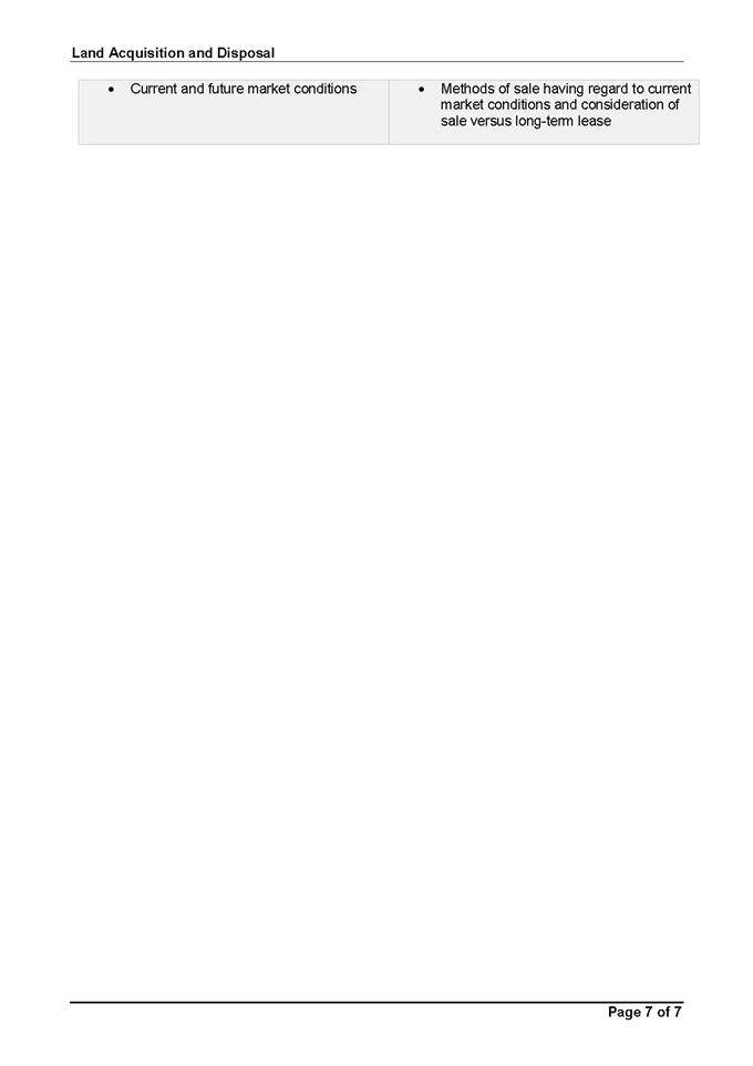
2.2 Development
Application DA 444/2018(2) - Subdivision - 20 George Weily Place and Lot 125
the Escort Way
RECORD NUMBER: 2019/86
AUTHOR: Summer
Commins, Senior Planner
EXECUTIVE Summary
|
Application
lodged
|
5
December 2018
|
|
Applicant/s
|
Orange
City Council
|
|
Owner/s
|
Orange
City Council
|
|
Land
description
|
Lots 119
and 125 DP 1087517 - 20 George Weily Place and Lot 125 The Escort Way
|
|
Proposed
land use
|
Subdivision
(eight residential lots, one stormwater management lot and one residue lot)
|
|
Value of
proposed development
|
Not
applicable
|
Council's consent is sought for subdivision of land at 20
George Weily Place and Lot 125 The Escort Way, Orange (refer to
locality plan below). The development site is comprised of undeveloped
residential land in the western portion at the rear of George Weily Place, the
alignment of the Northern Distributor Road (NDR) through the centre of the
site, and public open space in the eastern portion.
Ten (10) lot Torrens subdivision of the land is proposed.
The subdivision will create eight residential lots, one stormwater
management lot and one residue lot. A new public road/cul-de-sac via George
Weily Place will be constructed.
The subject land is located within Ploughmans Valley (Area
2). The proposed subdivision layout is generally in accordance with the
Masterplan for Area 2, notwithstanding some variation to the cul-de-sac formation
and some vehicular access to Forbes Road.
The development application was subject to public notice and
exhibition. The issues raised in the submissions received relate to traffic
amenity (congestion, safety, access, implications for the NDR), landscaping
treatment and residential amenity (acoustic privacy and impacts on public open
space).
The proposal has been assessed
pursuant to Section 4.15 of the Environmental Planning and Assessment Act
(EPAA) 1979 and is considered to be suitable. Approval of the application
is recommended, subject to conditions of consent in the attached Notice of
Approval.
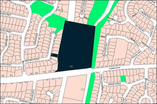
Figure 1 - locality plan
DECISION FRAMEWORK
Development in Orange is governed by two key documents
Orange Local Environment Plan 2011 and Orange Development Control Plan 2004. In
addition the Infill Guidelines are used to guide development, particularly in
the heritage conservation areas and around heritage items.
Orange Local Environment Plan 2011 – The
provisions of the LEP must be considered by the Council in determining the
application. LEPs govern the types of development that are permissible or
prohibited in different parts of the City and also provide some assessment
criteria in specific circumstances. Uses are either permissible or not. The objectives
of each zoning and indeed the aims of the LEP itself are also to be considered
and can be used to guide decision making around appropriateness of development.
Orange Development Control Plan 2004 – the DCP
provides guidelines for development. In general it is a performance based
document rather than prescriptive in nature. For each planning element there
are often guidelines used. These guidelines indicate ways of achieving the
planning outcomes. It is thus recognised that there may also be other solutions
of merit. All design solutions are considered on merit by planning and building
staff. Applications should clearly demonstrate how the planning outcomes are
being met where alternative design solutions are proposed. The DCP enables
developers and architects to use design to achieve the planning outcomes in
alternative ways.
DIRECTOR’S COMMENT
The subject precinct has been included in Council’s
statutory planning documents since 2004 (DCP 2004). This application
proposes a residential subdivision that is reasonably consistent with the
adopted DCP masterplan for the precinct. The key issues associated with the
proposal relate to traffic arrangements, visual impacts and acoustic privacy.
The issues may be addressed either by design or appropriate conditions. The end
use of the proposed lots is not a manner for consideration in the determination
of this application.
The DA was placed on public exhibition in conjunction with
DA 448/2018(1) for a transitional group home, community facility and hostel on
proposed Lot 204. A total of 112 submissions were received in relation to both
applications. This reports considers issues applicable to the subdivision DA
only. Submissions relating to DA 448/2018(1) are considered in the assessment
of that DA.
Link To Delivery/OPerational Plan
The recommendation in this report relates to the
Delivery/Operational Plan strategy “10.1 Preserve -
Engage with the community to ensure plans for growth and development are
respectful of our heritage”.
Financial Implications
It is noteworthy but not of planning relevance that the
current owner of the subject land is Orange City Council.
Policy and Governance Implications
The subject site has been identified for further residential
development by Orange DCP 2004. A conceptual masterplan layout outlined in
DCP 2004 was included to illustrate how some additional lots may be provided
within the location. This layout was indicative only in nature, but
demonstrated further residential development within this location.
|
Recommendation
That Council resolves to
consent to development application DA 444/2018(1) for Subdivision (eight residential lots, one
stormwater management lot and one residue lot) at Lot 119
DP 1087517 and Lot 125 DP 1087517 - 20 George Weily Place and The
Escort Way, Orange, pursuant to the conditions of
consent in the attached Notice of Approval.
|
further considerations
Consideration has been given to the
recommendation’s impact on Council’s service delivery; image and
reputation; political; environmental; health and safety; employees;
stakeholders and project management; and no further implications or risks have
been identified.
SUPPORTING INFORMATION
THE PROPOSAL
Council’s consent is sought for residential
subdivision of land at 20 George Weily Place and Lot 125 The Escort Way.
The subdivision will create eight residential lots, one
stormwater management lot and one residue lot. The proposed residential
lots will be located to the east of George Weily Place and be accessed by a new
public road/cul-de-sac via George Weily Place. The residue lot will contain the
NDR and existing open space area. The proposed subdivision layout is depicted
below (Figure 2).
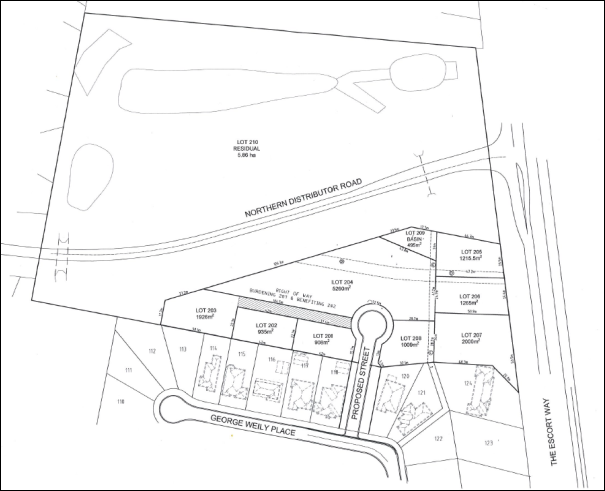
Figure 2- proposed subdivision layout
The proposed lots will comprise
the following areas and future uses, subject to further development consent
where applicable:
|
Lot
|
Area
|
Future Use
|
|
201
|
908m2
|
Dwelling house
|
|
202
|
935m2
|
Dwelling house
|
|
203
|
1,926m2
|
Dwelling house
|
|
204
|
5,260m2
|
Proposed transitional group home, community facility
and hostel
|
|
205
|
1,215.5m2
|
Dwelling house
|
|
206
|
1,265m2
|
Dwelling house
|
|
207
|
2,000m2
|
Dwelling house
|
|
208
|
1,009m2
|
Dwelling house
|
|
209
|
495m2
|
Stormwater detention basin
|
|
210
|
5.86ha
|
Residue parcel – NDR alignment and public open
space
|
Council is considering a concurrent Development Application
(DA) for a transitional group home, community facility and hostel on proposed
Lot 204 (DA 448/2018(1)).
The proposed residential lots will be connected to urban
utility services. Proposed access arrangements for the residential lots will be
as follows:
· proposed Lots 205,
206 and 207 will have frontage and access to the Escort Way;
· proposed Lots 201
and 208 will have frontage and access to the proposed road/cul de sac;
· proposed Lots 202
and 203 will have access to the proposed road via an access driveway and
right-of-way (proposed Lot 203 will be a battleaxe lot).
MATTERS FOR CONSIDERATION
Environmental Planning and
Assessment Act 1979
Section 1.7 Application of
Part 7 of the Biodiversity Conservation Act 2016 and Part 7A of the
Fisheries Management Act 1994
Section 1.7 of the EP&A Act 1979 identifies that Part 7
of the Biodiversity Conservation Act 2016 and Part 7A of the Fisheries
Management Act 1994 have effect in connection with terrestrial and aquatic
environments.
In consideration of this section, the proposed development
is not likely to significantly affect a threatened species. An ecological
assessment was submitted in support of the proposal (Flora Search 8 October
2018). The assessment concluded:
· The proposed
subdivision site is highly disturbed and dominated by introduced flora species
and weeds.
· No endangered
ecological communities are present on the site, although one formerly occurred
there.
· No other
threatened flora or fauna has potential to occur on the site owing to its high
level of disturbance and poor habitat quality.
· It is not
considered necessary to conduct flora and fauna surveys of the subject site or
undertake a formal impact assessment on account of threatened biodiversity.
Council’s Manager City Presentation concurred with the
conclusions of the submitted ecological assessment.
Section 4.15 Evaluation
Section 4.15 requires Council to consider various matters in
determining a development application, of which those relevant to the
application are listed below.
PROVISIONS OF ANY ENVIRONMENTAL
PLANNING INSTRUMENT s4.15(1)(a)(i)
Orange Local Environmental Plan 2011
Part 1 - Preliminary
Clause 1.2 Aims of Plan
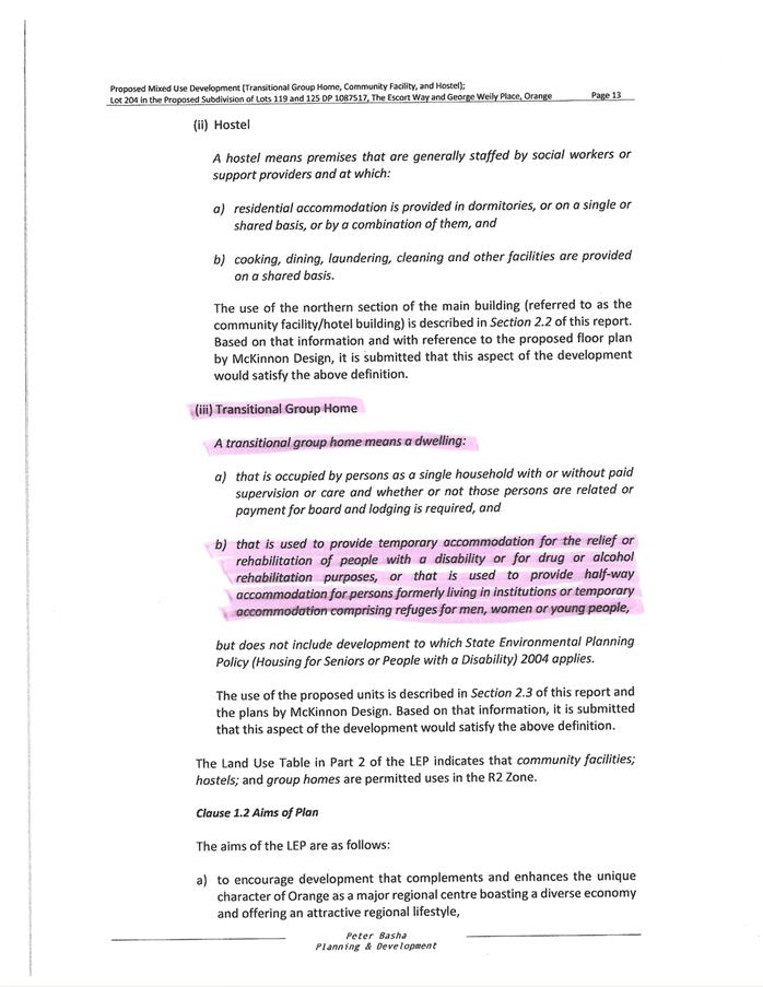
The
particular aims of Orange LEP 2011 relevant to the proposal include:
(a) to encourage development which complements
and enhances the unique character of Orange as a major regional centre boasting
a diverse economy and offering an attractive regional lifestyle,
(b) to provide for a range of development
opportunities that contribute to the social, economic and environmental
resources of Orange in a way that allows present and future generations to meet
their needs by implementing the principles for ecologically sustainable
development,
(c) to conserve and enhance the water
resources on which Orange depends, particularly water supply catchments,
(e) to provide a range of housing choices in
planned urban and rural locations to meet population growth,
(f) to recognise and manage valued
environmental heritage, landscape and scenic features of Orange.
The application is considered to be consistent with the
above objectives, as outlined in this report. The proposed subdivision will
facilitate ongoing development of Ploughmans Valley. The proposal will maintain
public open space areas and protect water quality downstream of the development
site. The proposal will provide lots for additional housing stock and
complementary community uses. The landscape values at the City entrance will be
protected.
Clause 1.6 Consent Authority
Clause 1.6 is applicable and states:
The consent authority for the
purposes of this Plan is (subject to the Act) the Council.
Clause 1.7 Mapping
The subject site is identified
on the LEP maps in the following manner:
|
Land Zoning Map:
|
Land zoned R2 Low Density
Residential, SP2 Infrastructure and RE1 Public Recreation
|
|
Lot Size Map:
|
Minimum lot size 850m2
(applying to 20 George Weily Place only)
|
|
Heritage Map:
|
Not a heritage item or conservation
area
|
|
Height of Buildings Map:
|
No building height limit
|
|
Floor Space Ratio Map:
|
No floor space limit
|
|
Terrestrial Biodiversity Map:
|
High biodiversity sensitivity on
the site
|
|
Groundwater Vulnerability Map:
|
Groundwater vulnerable
|
|
Drinking Water Catchment Map:
|
Not within the drinking water
catchment
|
|
Watercourse Map:
|
Within a defined watercourse
|
|
Urban Release Area Map:
|
Not within an urban release area
|
|
Obstacle Limitation Surface Map:
|
No restriction on building siting
or construction
|
|
Additional Permitted Uses Map:
|
No additional permitted use applies
|
|
Flood Planning Map:
|
Not within/within a flood planning
area
|
Those matters that are of relevance are addressed in detail
in the body of this report.
Clause 1.9A Suspension of
Covenants, Agreements and Instruments
Clause 1.9A is applicable and states in part:
(1) For the purpose of enabling
development on land in any zone to be carried out in accordance with this Plan
or with a consent granted under the Act, any agreement, covenant or other
similar instrument that restricts the carrying out of that development does not
apply to the extent necessary to serve that purpose.
(2) This clause does not apply:
(a) to a covenant
imposed by the Council or that the Council requires to be imposed, or
(b) to
any prescribed instrument within the meaning of section 183A of the Crown Lands Act 1989, or
(c) to
any conservation agreement within the meaning of the National Parks and Wildlife Act 1974, or
(d) to
any Trust agreement within the meaning of the Nature
Conservation Trust Act 2001, or
(e) to
any property vegetation plan within the meaning of the Native Vegetation Act 2003, or
(f) to
any biobanking agreement within the meaning of Part 7A of the Threatened Species Conservation Act 1995, or
(g) to
any planning agreement within the meaning of Division 6 of Part 4 of the Act.
In
consideration of this clause, Council staff are not aware of the title of the
subject property being affected by any of the above.
Notwithstanding the above, the deposited plan relating to
the subject land outlines an easement to drain sewage to the south of the
subject site. The easements also show that existing water mains traverse the
site, and these have been recognised in the development layout.
Part 2 - Permitted or Prohibited Development
Clause
2.1 Land Use Zones
The
subject land is zoned part R2 Low Density Residential, part SP2 Infrastructure
and part RE1 Public Recreation (refer below).
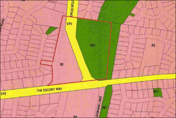
Figure 3 - Orange LEP 2011 Land Zoning Map
The
proposal is defined as ‘subdivision of land’ which means ‘the
division of land into 2 or more parts that, after the division, would be
obviously adapted for separate occupation, use or disposition (EPAA 1979 Clause
6.2).
Subdivision is permitted with Council’s consent
pursuant to Clause 2.6 (see below).
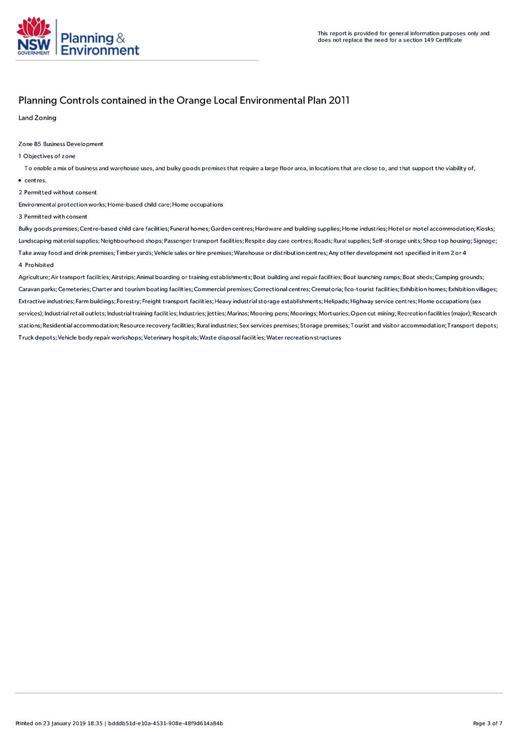
Clause 2.3 Zone Objectives and Land Use Table
The
objectives of the R2 Low Density Residential zone are:
· To provide for
the housing needs of the community within a low density residential
environment.
· To enable other
land uses that provide facilities or services to meet the day to day needs of
residents.
· To ensure
development is ordered in such a way as to maximise public transport patronage
and encourage walking and cycling in close proximity to settlement.
· To ensure that
development along the Southern Link Road has an alternative access.
The proposal is considered to be consistent with the
objectives of the R2 Low Density Residential zone. The proposed residential
lots will be wholly located within that part of the development site zoned R2.
The proposed subdivision will provide lots for additional dwelling stock to
accommodate the housing needs of the community. The proposed residential lot
sizes and layout will reasonably relate to the prevailing cadastre in the low
density setting. Proposed larger Lot 204 will provide a parcel for
complementary residential uses. The neighbourhood is accessible via public
transport. The proposed lots will not have access to the NDR.
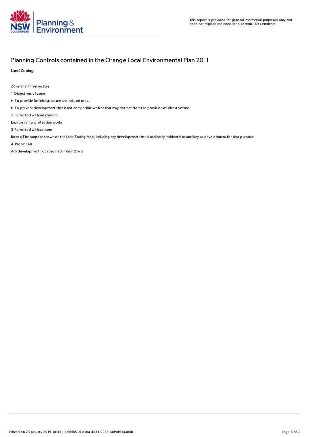
The objectives of the SP2 Infrastructure Zone are:
· To provide for
infrastructure and related uses.
· To prevent
development that is not compatible with or that may detract from the provision
of infrastructure.
The proposed subdivision is not contrary to the objectives
of the SP2 zone. Land zoned SP2 Infrastructure will be wholly located
within proposed residue Lot 210. The proposed subdivision will have nil impact
on the operation of the NDR. As outlined in this report, acoustic measures will
be applied to protect the proposed lots from traffic noise along the NDR.
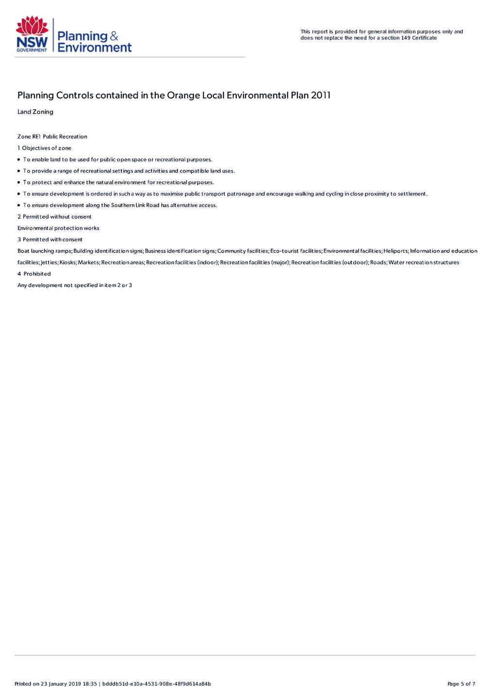
The objectives of the RE1 Public Recreation Zone are:
· To enable land
to be used for public open space or recreational purposes.
· To provide a
range of recreational setting and activities and compatible land uses.
· To protect and
enhance the natural environment for recreational purposes.
· To ensure
development is ordered in such a way as to maximise public transport patronage
and encourage walking and cycling in close proximity to settlement.
· To ensure
development along the Southern Link Road has an alternative access.
The
proposed subdivision is not contrary to the objectives of the RE1 zone. Land
zoned RE1 Infrastructure will be wholly located within proposed residue
Lot 210. The proposed subdivision will have nil impact on continued use of the
open space area for recreational, environmental and stormwater management
purposes. Proposed Lot 210 will not have access to the NDR.
Clause 2.6 Subdivision -
Consent Requirements
Clause 2.6 is applicable and states:
(1) Land
to which this Plan applies may be subdivided but only with development consent.
Consent is sought for Torrens subdivision in accordance with
this clause.
Part 3 - Exempt and Complying Development
The application is not exempt or complying development.
Part 4 - Principal Development Standards
Clause
4.1 Minimum Subdivision Lot Size
Clause
4.1 applies and states in part:
(3) The size of any
lot resulting from a subdivision of land to which this clause applies is not to
be less than the minimum size shown on the Lot Size Map in relation to that
land.
Part of the land (20 George Weily Place) is subject to a
minimum lot size of 850m2 (refer below).
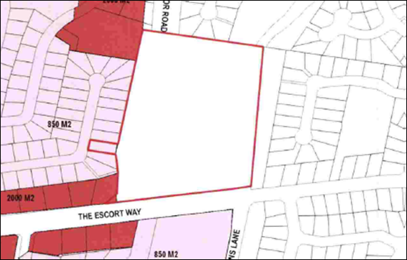
Figure 4 - Orange LEP 2011 Lot Size Map
The
proposed subdivision does not involve the creation of a lot below than the
prescribed minimum area. A proposed road will be constructed over land affected
by the minimum lot size.
Part 5 - Miscellaneous Provisions
The
Part 5 provisions are not applicable to the subject land or proposed
development.
Part 6 - Urban Release Area
Not relevant to the application. The subject site is not
located in an Urban Release Area.
Part 7 - Additional Local Provisions
Clause
7.1 Earthworks
Clause
7.1 applies. This clause states in part:
(3) Before granting development
consent for earthworks, the consent authority must consider the following
matters:
(a) the likely disruption of, or
any detrimental effect on, existing drainage patterns and soil stability in the
locality of the development,
(b) the effect of the development
on the likely future use or redevelopment of the land,
(c) the quality of the fill or the
soil to be excavated, or both,
(d) the effect of the development
on the existing and likely amenity of adjoining properties,
(e) the source of any fill material
and the destination of any excavated material,
(f) the likelihood of
disturbing relics,
(g) the proximity to and potential
for adverse impacts on any waterway, drinking water catchment or
environmentally sensitive area,
(h) any measures proposed to
minimise or mitigate the impacts referred to in paragraph (g).
Earthworks
will be required in conjunction with civil and construction works to create the
proposed lots. Furthermore, as outlined in the following sections of this
report, an acoustic barrier will be required to protect the proposed
residential lots from traffic noise. The acoustic barrier will incorporate (in
part) an earth mound adjacent to the boundaries of those lots adjoining the
NDR. Subject to conditions on the attached Notice of Approval (including
engineering design for mounding, and sediment and erosion controls), the
necessary earthworks are unlikely to impact on the natural environment,
adjoining properties or the downstream catchment.
Clause 7.3 Stormwater Management
Clause 7.3 is applicable. This
clause states in part:
(3) Development
consent must not be granted to development on land to which this clause applies
unless the consent authority is satisfied that the development:
(a) is
designed to maximise the use of water permeable surfaces on the land having
regard to the soil characteristics affecting onsite infiltration of water, and
(b) includes,
where practical, onsite stormwater retention for use as an alternative supply
to mains water, groundwater or river water, and
(c) avoids
any significant impacts of stormwater runoff on adjoining downstream
properties, native bushland and receiving waters, or if that impact cannot be
reasonably avoided, minimises and mitigates the impact.
Council’s Development Engineer has recommended conditions
on the attached Notice of Approval requiring stormwater detention within the
subdivision, designed to limit peak stormwater outflows from the land to
pre-existing natural outflows. The conditional stormwater design will not
result in adverse discharge impacts for downstream parcels. Earth mounding to
the part-site perimeter will be designed to manage overland flows, stormwater
detention and runoff. The proposed development is consistent with the
requirements of Clause 7.3.
Clause 7.4 Terrestrial Biodiversity
A portion of the subject land is identified as ‘High
Biodiversity Sensitivity’ on the Terrestrial Biodiversity Map (see
below).
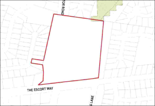
Figure 5 - Orange LEP 2011 Terrestrial Biodiversity
Map
Clause 7.4 is applicable and states in part:
(3) Before determining a
development application for development on land to which this clause applies,
the consent authority must consider whether or not the development:
(a) is likely to have any
adverse impact on the condition, ecological value and significance of the fauna
and flora on the land, and
(b) is likely to have any
adverse impact on the importance of the vegetation on the land to the habitat
and survival of native fauna, and
(c) has any potential to
fragment, disturb or diminish the biodiversity structure, function and
composition of the land, and
(d) is likely to have any
adverse impact on the habitat elements providing connectivity on the land.
In
consideration of this clause, the biodiversity sensitive lands will be located
within residue and open space Lot 210. The proposal does not involve any civil
or construction works within or nearby to the mapped sensitive lands. The
conclusions of the submitted ecological assessment above demonstrate that the
proposed development will not have adverse impact on ecological values. The
development is considered acceptable in the context of Clause 7.4.
Clause 7.5 Riparian Land and Watercourse
The subject land contains a ‘Sensitive
Waterway’ pursuant to the Watercourse Map (see below).
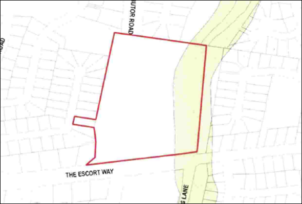
Figure 6 - Orange LEP 2011 Watercourse Map
Clause
7.5 is applicable and states in part:
(3) Before
determining a development application to carry out development on land to which
this clause applies, the consent authority must consider whether or not the
development:
(a) is
likely to have any adverse impact on the following:
(i) the
water quality and flows within a watercourse,
(ii) aquatic
and riparian species, habitats and ecosystems of the watercourse,
(iii) the
stability of the bed and banks of the watercourse,
(iv) the
free passage of fish and other aquatic organisms within or along the
watercourse,
(v) any
future rehabilitation of the watercourse and its riparian areas, and
(b) is
likely to increase water extraction from the watercourse.
In
consideration of this clause, the proposal does not involve any civil or
construction works within or nearby to the mapped watercourse that traverses
the subject land. The development will not impact on the prescribed matters
listed above.
Clause 7.6 Groundwater Vulnerability
The
subject land is identified as ‘Groundwater Vulnerable’ on the Groundwater
Vulnerability Map. Clause 7.6 applies. This clause states in part:
(3) Before
determining a development application for development on land to which this
clause applies, the consent authority must consider:
(a) whether or not the development (including
any onsite storage or disposal of solid or liquid waste and chemicals) is
likely to cause any groundwater contamination or have any adverse effect on
groundwater dependent ecosystems, and
(b) the cumulative impact (including the
impact on nearby groundwater extraction for potable water supply or stock water
supply) of the development and any other existing development on groundwater.
In consideration of Clause 7.6,
the proposed development is unlikely to cause groundwater contamination or
effect groundwater dependent ecosystems. Urban residential subdivision does not
involve processes or activities that would impact on groundwater resources. The
proposed lots will be serviced by reticulated sewer.
Clause 7.11 Essential Services
Clause 7.11 applies and states:
Development consent must not be
granted to development unless the consent authority is satisfied that any of
the following services that are essential for the proposed development are
available or that adequate arrangements have been made to make them available
when required:
(a) the
supply of water,
(b) the
supply of electricity,
(c) the
disposal and management of sewage,
(d) storm
water drainage or onsite conservation,
(e) suitable
road access.
In
consideration of this clause, the listed utility services are available to the
land and adequate for the proposed subdivision. Conditions
are included on the attached Notice of Approval requiring extension,
augmentation and/or upgrading of urban utility services to the standards
required to service the proposed urban lots.
STATE ENVIRONMENTAL PLANNING
POLICIES
State Environmental Planning Policy 55 Remediation of
Land
SEPP 55 is applicable. Pursuant to Clause 7 Contamination and remediation to be considered in determining
development application:
(1) A consent authority must not consent to the
carrying out of any development on land unless:
(a) it
has considered whether the land is contaminated, and
(b) if the land is contaminated, it is satisfied
that the land is suitable in its contaminated state (or will be suitable, after
remediation) for the purpose for which the development is proposed to be
carried out, and
(c) if the land requires remediation to be made
suitable for the purpose for which the development is proposed to be carried
out, it is satisfied that the land will be remediated before the land is used
for that purpose.
In
consideration of this clause, the proposed residential lots are zoned for urban
residential purposes. The land is not known to have been used for a Table 1
purpose in the Managing Land Contamination
Planning Guidelines document. The site is not identified on the NSW Environment
Protection Authority’s register of contaminated lands, nor identified as
being potentially contained on Council’s contamination register.
A
preliminary site investigation/contamination assessment was submitted in
support of the proposed subdivision (Geolyse November 2018). The
supporting documentation noted that part of the subject site was identified as
an informal materials staging area for machinery during the construction of the
Northern Distributor Road. The assessment concludes:
Geolyse make the following conclusions regarding the
potential for land contamination at the site, based on a desktop review of
available information, a review of historical records, a site walkover
reconnaissance and analytical results of collected soil samples:
- Based on
the review of historic operations at the site, the area of the site does not
appear to have been utilised for any intensive purpose(s).
- Land uses
at the majority of the site have been generally limited to passive uses, based
on previous title ownership.
- No
significant routes for exposure by receptors (current or future) to potential
contamination sources have been identified, due to negligible impacts
identified. Residual contamination risks, if identified, may be adequately
managed by conducting works in accordance with appropriate construction
industry standards.
Based
on the foregoing, the subject land is considered suitable in its current form
for the proposed development.
State Environmental Planning
Policy (Infrastructure) 2007
The subject land has frontage to classified roads The Escort
Way and Northern Distributor Road, and SEPP Infrastructure 2007 (Division 17
Roads and Traffic) applies. Clause 101 is applicable and states in part:
Clause 101 Development with
frontage to a classified road
(2) The
consent authority must not grant consent to development on land that has a
frontage to a classified road unless it is satisfied that:
(a) where
practicable, vehicular access to the land is provided by a road other than the
classified road, and
(b) the
safety, efficiency and ongoing operation of the classified road will not be
adversely affected by the development as a result of:
(i) the
design of the vehicular access to the land, or
(ii) the
emission of smoke or dust from the development, or
(iii) the
nature, volume or frequency of vehicles using the classified road to gain
access to the land, and
(c) the
development is of a type that is not sensitive to traffic noise or vehicle
emissions, or is appropriately located and designed, or includes measures, to
ameliorate potential traffic noise or vehicle emissions within the site of the
development arising from the adjacent classified road.
The following comments are made in consideration of Clause
101:
· Vehicular access
is provided to proposed Lots 201-204 and 208 via the proposed road from George
Weily Place.
· Access to proposed
Lots 205-207 will be via The Escort Way, being a classified road. Roads and
Maritime Services (RMS) has provided their concurrence to this arrangement,
subject to a single crossing and driveway being constructed to service the
lots, and appropriate easements for access created. Conditions are included on
the attached Notice of Approval to formalise this arrangement.
· Council’s
Development Engineer and the RMS concur that the design and siting of the
shared vehicular access to Lots 205-207 is unlikely to result in any reduction
in the safety, efficiency and ongoing operation of The Escort Way.
· Traffic generation
associated with proposed Lots 205-207 will be imperceptible within the context
of existing traffic volumes and frequency along The Escort Way.
· The proposed
subdivision involves the creation of residential lots with frontage to
classified roads. Future dwellings on the proposed lots will be sensitive to
traffic noise and vehicle emissions. A Noise Impact Assessment was submitted in
support of the proposal (Assured Environmental 13/11/2018). As outlined in the
following sections of this report, the Noise Impact Assessment confirms that
the proposed lots and future dwellings on the lots will be provided with a high
standard of acoustic amenity.
PROVISIONS OF ANY DRAFT
ENVIRONMENTAL PLANNING INSTRUMENT THAT HAS BEEN PLACED ON EXHIBITION
4.15(1)(a)(ii)
There are no draft environmental planning instruments that
apply to the subject land or proposed development.
DESIGNATED DEVELOPMENT
The proposed development is not designated development.
INTEGRATED DEVELOPMENT
As outlined above, the subject site contains a number of
mapped waterways in the eastern extent. These contain waterfront land. Section
91 of the Water Management Act 2000 provides that a controlled
activity approval is required for any works consisting of a controlled
activity that is carried out on waterfront land.
A controlled
activity means:
(a) the erection of a building or
the carrying out of a work (within the meaning of the Environmental
Planning and Assessment Act 1979), or
(b) the removal of material
(whether or not extractive material) or vegetation from land, whether by way of
excavation or otherwise, or
(c) the deposition of material
(whether or not extractive material) on land, whether by way of landfill
operations or otherwise, or
(d) the carrying out of any other
activity that affects the quantity or flow of water in a water source.
The proposal involves subdivision of land but does not
propose any of the matters listed at (a) through (d) above in relation to
defined waterfront land. All physical works are considerably more than 40m from
the mapped waterfront land. On this basis, a controlled activity approval is
not required and the development is therefore not integrated development
pursuant to Section 4.46 EPAA 1979. In any event, by virtue of Clause 41
of the Water Management (General) Regulation 2018, public authorities
are exempt from the need to gain a Controlled Activity Approval.
PROVISIONS OF ANY DEVELOPMENT
CONTROL PLAN s4.15(1)(a)(iii)
Development Control Plan 2004
The following parts of DCP 2004 are applicable to the
proposed subdivision:
· Part 2 - Natural
Resource Management
· Part 3 - General
Considerations
· Part 4 - Special
Environmental Considerations
· Part 5 - General
Considerations for Zones and Development
· Part 7 -
Development in Residential Zones
The relevant matters in Parts 2, 3, 4 and 5 were considered
in the foregoing assessment under Orange LEP 2011.
The proposal will satisfy the relevant planning outcomes and
guidelines contained in Part 7 as outlined in the following assessment
DCP 2004-7.2-2 Residential
Subdivision in Ploughmans Valley
The applicable Planning Outcomes at Part 7.2 are considered
below.
· The allotment
layout is generally in accordance with the Conceptual Subdivision Layout
…
The subject land is contained
within Area 2 Ploughmans Valley. The DCP masterplan/ conceptual layout provides
for subdivision of this parcel as shown below.
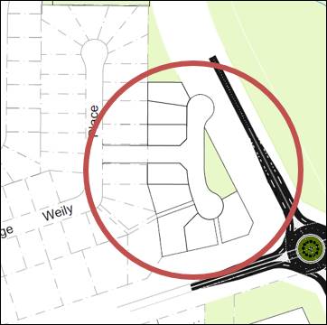
Figure 7 - Ploughmans Valley (part) Area 2 Conceptual
Subdivision Layout
The proposed subdivision layout accords with the DCP as
follows:
- a
new road via George Weily Place (noting that the cul-de-sac is now proposed one
allotment to the south of the envisaged location);
- cul-de-sac
road formation;
- residential
lots adjoining existing residential lots in George Weily Place; and
- public
open space buffer to the NDR.
Contrary to the DCP layout, the proposed subdivision
provides vehicular access to Forbes Road for Lots 205, 206 and 207. The
proposed layout is considered suitable subject to a single vehicle crossing to
Forbes Road and shared access for the lots (as outlined above and preferred by
the RMS). Access to Forbes Road is consistent with other large lots nearby to
the site, and will enable the frontage of future dwellings to address the main
road and City entrance. This street presentation is favoured in this location
over the alternative rear boundary fences. The proposed subdivision layout is
considered reasonably consistent with the DCP masterplan.
· Subdivision
design and construction complies with the Orange City Development and
Subdivision Code.
Council’s Technical
Services Division advises that the proposed subdivision deviates in part from
Council’s Development and Subdivision Code. The additional allotments
created by the proposed subdivision rely on access via an existing cul-de-sac
served by the maximum number of allotments, and is close to the limit for
maximum daily vehicle movements.
The Development and
Subdivision Code limits residential cul-de-sacs to a maximum of
30 residential allotments. George Weily Place currently has 32 lots. The
original DA approval for George Weily Place considered the 2 lots fronting
Jonathon Road as accessing via Jonathon Road, hence complying with the 30
lot limit for the cul-de-sac.
The Development and
Subdivision Code also limits residential cul-de-sacs to a maximum of 300
vehicle movements per day.
The proposed development
will create the following situation in the residential cul-de-sac:
- 36 residential allotments
(exceeding Council’s development standard by 6 lots or 20%);
and
- average daily vehicle
movements of 344 (exceeding Council’s development standard by 44
vehicle movements or 15%).
There are numerous
examples where this deviation from Council’s development code has been
undertaken. Nicole Drive services 4 cul-de-sacs and 54 allotments, with 399
average daily vehicle movements. Glendale Crescent services 106 allotments and
784 average daily vehicle movements.
Table 4.6 of the RTA
Guide to Traffic Generating Development (Roads and Traffic
Authority 2002) sets out the recommended Environmental Capacity
performance standards for roads. The peak hour volumes generated by the
proposed lots and the existing development along George Weily Place will
comprise a conservative 82 vehicles per hour and below the 100 maximum peak
hour volume (vehicles per hour) for a local or collector street.
Council’s Technical
Services Division advises that the following mitigating factors should be taken
into consideration in determining the suitability of the proposed subdivision.
These factors include the following:
- The future
development of this area beside the NDR has been identified on Council’s
DCP since 2004. The DCP subdivision layout includes 8 residential lots. The current
proposal is for only 5 lots with access from George Weily Place, with 3 lots
being accessed via The Escort Way (a reduction of 37.5%);
- The average daily
vehicle movements within George Weily Place as a result of the 5 new
residential lots will increase from 237 to 266. This complies with
Council’s standard;
- The average daily
vehicle movements within George Weily Place as a result of the proposed new
lots and the Group Home/Community Facility/Hostel will be 344. This is
within 15% of the maximum permitted under Council’s Development and
Subdivision Code, however, the increase in vehicle movements will be spread
throughout the day and any peak traffic flows to and from the centre will be in
an opposite direction to that of the local residents;
- The allotments in
George Weily Place are a generous size of 850m2 with 24m frontages which
provides a low density traffic environment (as opposed to typical 15m wide lots
or 62.5% increase in frontage);
- The intersections of
Johnathon Road / George Weily Place and George Weily Place / ‘The
Orchard’ access will manage the predicted peak hour traffic volume
without any significant treatment other than line marking on approaches to the
intersections.
Based on the above
analysis, Council’s Technical Services Division has recommended approval
of the application subject to conditions. The attached Notice of Determination
contains recommended conditions for Council’s consideration.
· The allotment
layout provides for transitional development of the Valley: In Area 2
… lots along Forbes Road and Cargo Road have a minimum area of
2,000m².
Proposed Lots 205 and 206 at The Escort Way/Forbes Road
frontage comprise respective site areas of 1,215.5m2 and 1,265m2.
As such, the lots depart from the DCP-prescribed minimum area of 2,000m2.
The prevailing cadastre along Forbes Road to the east and west of the
development site within Ploughmans Valley contains parcels with areas ranging
between 1,616m2 and 5,142m2. The average lot size of the
parcels is in the order of 2,000m2 consistent with the DCP
requirement (refer figure below).
Figure 8 - large lots at Forbes Road
It should be noted that those parcels addressing Forbes Road
are not subject to a minimum lot size under Orange LEP 2011. To this end the
minimum allotment size in this case is a DCP control only. The proposed
lots are therefore permitted subject to receiving development consent and
Council being satisfied that a variation to the DCP is justifiable in this
case.
Proposed Lots 205 and 206 will be the smallest parcels in
terms of site area and frontage dimension along Forbes Road/The Escort Way.
Whilst the RMS has provided concurrence to a single driveway arrangement onto
The Escort Way with a right-of-way being provided across the frontage of
Proposed Lot 206 to give access to Proposed Lot 207, it is considered that the
lots should be consolidated to comprise a single parcel with an area
of 2,480.5m2 to comply with the DCP in this case. Fewer lots at
the Forbes Road frontage of the proposed subdivision is considered favourable
for various reasons:
- There
will be fewer vehicles accessing the classified road, with associated
improvements for the safety, efficiency and operation of the road.
- There
will be fewer dwellings required to be protected from road traffic noise, with
reduced potential landuse conflicts and adverse amenity impacts.
- There
will be positive visual impacts within the streetscape view corridor associated
with a consistent subdivision pattern and future dwelling massing and siting on
the lots.
- Large
lots in this location are consistent with the intent of the DCP lot size to
provide for transitional development of the valley.
- The
provision of a right-of-way along the frontage of proposed Lot 206 to
provide access to Lot 207 is not ideal in terms of streetscape
presentation of development in this locality.
On this basis, a condition is included on the attached
Notice of Approval requiring Lots 205 and 206 to be consolidated on
the final subdivision plan. It is noted that the consolidated parcel will be
traversed by an easement for water supply associated with existing
infrastructure. Notwithstanding, the easement will not preclude residential
development of a consolidated parcel providing additional opportunity for other
recreational facilities to compliment a dwelling including a tennis court or
pool amongst other things.
· The allotment
layout provides a high standard of residential amenity:
- In
Area 2 … lots have a minimum allotment size of 850m2
- In
Area 2, lots adjoining the Distributor Road alignment have a minimum area
of 2,000m2 and minimum frontage of 30m.
As discussed above, it is recommended that Lots 205 and 206
be consolidated. Subject to the adoption of that recommendation, site areas for
the proposed lots will exceed the minimum lot sizes under the DCP.
· The allotment
layout maximises energy efficiency principles. Where practicable, lots are
rectangular rather than splay shaped and oriented to provide the long axis
within the range of N20oW to N30oE or E20oN to
E30oS.
The proposed lots are within the acceptable range to
maximise energy efficiency principles.
· Subdivision
design retains significant landscape features and minimises disturbance to
natural vegetation, landform and overland flow paths.
The western portion of the subject land does not contain
significant landscape features or natural vegetation.
· The road layout
comprises a modified grid layout with restrained used of cul-de-sacs, generally
in accordance with the Conceptual Subdivision Layout.
The proposed road layout reasonably accords with the
Conceptual Subdivision Layout for Area 2 Ploughmans Valley.
· Future road
connections to adjoining land are provided and located generally in accordance
with the Conceptual Subdivision Layout.
The proposed subdivision does not involve road connections
to adjoining land, consistent with the Conceptual Subdivision Layout.
· Lots have
direct frontage or access to a public road.
All proposed lots will have direct frontage and/or access to
a public road, compromising either the proposed new road or The Escort Way.
· Lots adjoining
the Distributor Road alignment do not have frontage or access to the
Distributor Road. Access to lots is via internal streets.
The proposal does not involve access to proposed lots via
the NDR.
· Stormwater
runoff from the site is consistent with pre-development stormwater patterns.
· Drainage
systems are designed to consider catchment and downstream capacities, onsite
retention and reuse and overland flowpaths.
Council’s Development Engineer has included conditions
requiring interlot stormwater drainage and grated stormwater pits to the
proposed lots. This drainage system will ensure that runoff from the site will
be consistent with pre-development stormwater patterns.
· All utility
services are provided to the proposed lots.
Conditions are included on the attached Notice of Approval
requiring the provision of urban services and access to the proposed lots.
· Public open
space linkages are provided across the subdivision …
The proposed subdivision will retain the existing public
open space area within residue Lot 210. Further, the public open space
buffer on the western side of the NDR will be provided within
Lot 210. Open space within the proposed subdivision will be provided in a
manner generally consistent with the DCP Conceptual Layout.
· Allotments
intended for dual occupancies are identified on DA plans. Dual occupancy lots
range in area between 1,200m² and 1,450m².
The proposed subdivision does not nominate any lots for dual
occupancy. Notwithstanding this, a number of the proposed lots exceed the
minimum area required for dual occupancy. Further development consent will be
required for dual occupancy development on the parcels.
It is noted that Lot 204 comprises a site area of 5,260m2
and is proposed for development of a transitional group home, community
facility and hostel (concurrent DA 448/2018(1)). Should this development
not proceed, further subdivision of Lot 204 may result in order to maximise
development opportunities for this site. Alternatively, the site could be
utilised for another complementary and non-residential landuse, subject to
further development consent.
· Development
proposals shall demonstrate the appropriate retention of existing trees in
order to protect the visual backdrop of the City.
The submitted ecological assessment (Flora Search 8 October
2018) confirms that only one tree, a silver wattle, remains onsite. The tree is
not covered by a tree preservation order and may be removed without permit
(pursuant to DCP 2004-0.4-2) in conjunction with subdivision civil works.
Removal of the tree will have nil-negligible impact on the visual setting of
the site.
Council’s Manager City Presentation advises that
street trees on Forbes Road/The Escort Way may need to be removed to
facilitate access to the proposed lots with frontage to Forbes Road. Tree
removal should be undertaken in consultation with the Manager City
Presentation. A condition is included on the attached Notice of Approval to this
effect.
DEVELOPMENT CONTRIBUTIONS
Section 7.11
In accordance with Section 7.11
of the Environmental Planning and Assessment Act 1979 and Orange
Development Contributions Plan 2017 (Ploughmans Valley urban release area), a
contribution towards the provision of public facilities is required. The
contribution is based on six additional residential lots as Lots 205 and 206
are to be consolidated as required by conditions.
|
Open Space and Recreation
|
@ $3,938.56 x 6 additional residential lots
|
23,631.36
|
|
Community and Cultural
|
@ $1,142.17 x 6 additional residential lots
|
6,853.02
|
|
Roads and Traffic Management
|
@ $5,198.77 x 6 additional residential lots
|
31,192.62
|
|
Local Area Facilities
|
@ $8,891.37 x 6 additional residential lots
|
53,348.22
|
|
Plan Preparation & Administration
|
@ $575.12 x 6 additional residential lots
|
3,450.72
|
|
TOTAL
|
|
$118,475.94
|
The contribution will be indexed quarterly in accordance
with the Orange Development Contributions Plan 2017 (Ploughmans Valley urban
release area). A condition is included on the attached Notice of Approval
requiring payment of the contributions prior to the issue of a Subdivision
Certificate.
Section 64 Headworks Charges
Section 64 water and sewer headworks charges are also
applicable to the proposal. The contributions are based on 6 ETs for water
supply headworks and 6 ETs for sewerage headworks. Such charges are calculated
at the time of release of a Subdivision Certificate for the development. A
condition is included on the attached Notice of Approval requiring payment of
the contributions prior to the issue of a Subdivision Certificate.
PROVISIONS PRESCRIBED BY THE
REGULATIONS s4.15(1)(a)(iv)
Demolition of a Building (clause 92)
The proposal does not involve the demolition of a building.
Fire Safety Considerations
(clause 93)
The proposal does not involve a change of building use for
an existing building.
Buildings to be Upgraded
(clause 94)
The proposal does not involve the rebuilding, alteration,
enlargement or extension of an existing building.
BASIX Commitments (clause 97A)
BASIX is not applicable to
subdivision.
THE LIKELY IMPACTS OF THE
DEVELOPMENT s4.15(1)(b)
The likely impacts of the development have been considered
in the foregoing assessment under Orange LEP 2011 and DCP 2004, except as
provided below. It is considered that the likely impacts of the proposed
development are acceptable and can be adequately managed via conditions of
consent in the attached Notice of Approval.
Traffic Impacts
A detailed assessment of traffic related impacts and a
discussion on the suitability of the proposed access arrangements have been
carried out elsewhere in this report. Council’s Technical Services
Division has indicated support for the subject design and has advised that the
traffic impacts of the development will be acceptable in this case.
Acoustic Impacts
A Noise Impact Assessment was submitted in support of the
proposal (Assured Environmental 13/11/2018). In relation to the proposed
subdivision layout, the report concluded:
Predictive noise modelling has
been undertaken for the Northern Distributor Road and The Escort Way in
accordance with the EPA’s Road Noise Policy. The model demonstrated that
acceptable outdoor acoustic amenity is achieved at all lots based on the
outdoor areas being located behind the proposed dwelling with the erection of a
2.5m barrier as presented in Figure 4.
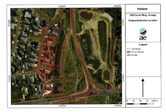
Figure 9 - modelled acoustic barrier location (Source:
Assured Environmental)
Council staff generally concur with the findings and
recommendations of the submitted noise report.
As depicted in the figure above, it is noted that the
acoustic barrier does not extend along the northern boundary of proposed Lot
203, ie return to the western boundary of the development site. The acoustic
barrier should be provided to this boundary in order to enclose Lot 203 and
provide reasonable acoustic privacy to the lot. A condition is included on the
attached Notice of Approval requiring the acoustic barrier to be extended along
the northern boundary of Lot 203.
It is further noted that the acoustic barrier extends to the
Forbes Road frontage of proposed Lot 205 on the eastern boundary. This is
contrary to side boundary fencing treatment permitted by the DCP for dwellings
along Forbes Road, and will have adverse visual impacts in the streetscape view
corridor. A condition is included on the attached Notice of Approval requiring
the acoustic barrier to not encroach the DCP building line to Forbes Road of
15m.
The submitted Noise Impact Assessment is silent on the
design and materials for the proposed acoustic barrier, excepting the height of
2.5m. In order that the acoustic barrier will have acceptable visual impacts in
the NDR view corridor and relate to other fencing adjacent to this road, it is
considered that the barrier should comprise a mix of earth mounding, fencing
and landscaping (refer below). Conditions are included on the attached Notice
of Approval requiring the acoustic barrier to comprise an earth mound with
1.8m high fencing atop; further, that plans/specifications of the acoustic
barrier be submitted for Council’s approval prior to the issue of a
Construction Certificate.
The approved acoustic barrier will be erected prior to the
issue of a Subdivision Certificate. Alternatively, a Restriction-as-to-User
will be created on the titles of the affected lots requiring construction of
the approved acoustic barrier prior to issue of any Occupation Certificate for
subsequent development of the lots. It is considered practical that the acoustic
barrier be wholly constructed in conjunction with subdivision works.
Notwithstanding, the option to defer the acoustic wall will be at the
discretion of the developer.
It is acknowledged that incremental development of the
proposed lots may occur. Standard residential fencing to other boundaries and
separation between the lots and the roads will provide a suitable acoustic
buffer pending development of other lots and full construction of the acoustic
barrier.
The submitted Noise Impact Assessment also gives some
consideration to future dwelling construction on the proposed lots:
Recommended façade
construction details should be provided such that compliance with internal
noise level requirements of SEPP [infrastructure 2007] can be achieved….
It is recommended that acoustic specifications for selected components are
confirmed by suppliers prior to finalisation of the design.
A condition is included on the attached Notice of Approval
requiring a Section 88B Restriction-as-to-User to be created on the title
of residential lots requiring further acoustic assessment specific to a future
dwelling, consistent with the conclusions of the Noise Impact Assessment
(Assured Environmental 13/11/2018). It should be acknowledged that additional
treatment within the building of any future dwellings on those lots fronting
The Escort Way will be required in light of the recommendation to require
the acoustic fence to be set back 15m from the front building alignment to
address streetscape issues.
Council’s Manager Building and Environment has
indicated no objections to this arrangement.
Visual Impacts
Council’s Manager City Presentation has recommended
that landscaping be provided to the proposed subdivision to provide screening,
beautification and integration of the development. He recommends that a
detailed landscape plan be submitted including:
1 Street
trees and spacings for the cul-de-sac linking to George Weily Place
2 Landscaping
of the stormwater detention basin (proposed Lot 209) using species consistent
with the stormwater retention basins in the eastern portion of the subject site
(eastern side of NDR) known as Coogal Wetlands.
3 Landscape
treatment and planting plan for the land adjoining the Northern Distributor
Road corridor and linking to The Escort Way including the reinforcement of
Orange’s Colour City Image, respecting the high profile exposure of the
site within the Ploughmans Valley and to offer aesthetic amelioration to the
proposed 2500mm acoustic barrier to the NDR.
Conditions are included on the attached Notice of Approval
requiring preparation and implementation of a landscaping plan to address the
above matters.
It is further required by conditions that the approved NDR
road corridor landscaping (point 3 above) be installed prior to issue
of a Subdivision Certificate OR a Restriction‑as‑to‑User be
created on the titles of the affected lots requiring installation of the
approved road corridor landscaping prior to the issue of an Occupation
Certificate for any subsequent development of the lots. While it is considered
practical that the road corridor landscaping be wholly constructed in
conjunction with subdivision works, the option to defer the landscaping will be
at the discretion of the developer.
THE SUITABILITY OF THE SITE
s4.15(1)(c)
The foregoing assessment demonstrates that the subject land
is suitable for the proposed development:
· The development
site is (partly) zoned for urban residential purposes and contained within the
Ploughmans Valley urban release area.
· The proposed
subdivision is a permitted landuse in the zones.
· The
part-infrastructure (NDR) and public open space uses of the development site
will be retained in their current form.
· The proposed
residential lots are of appropriate areas and dimensions for future residential
development subject to further development consent.
· All utility
services are available and adequate, subject to augmentation, extension and
upgrading.
· Council’s
Technical Services Division advises that the local road network is suitable to
support the subject proposal.
· The land is not
subject to known natural hazards.
· The contamination
status of the land is suitable for residential landuse.
· The site has no
particular environmental values.
· The site is not
subject to known European or indigenous cultural values.
ANY SUBMISSIONS MADE IN
ACCORDANCE WITH THE ACT s4.15(1)(d)
The proposed subdivision is not defined as
"advertised development" pursuant to DCP 2004-5.3.
Notwithstanding, the proposal was advertised as the development is considered
to be in the public interest.
The DA was placed on public exhibition in conjunction with
DA 448/2018(1) for a transitional group home, community facility and hostel on
proposed Lot 204. A total of 112 submissions were received in relation to both
applications. This reports considers issues applicable to the subdivision DA
only. Submissions relating to DA 448/2018(1) are considered in the assessment
of that DA.
The applications were advertised from Friday, 21 December
2018 until 5pm Friday, 25 January 2019. All submissions received prior to
this deadline have been considered. Online comments were also provided on
Council’s website. Whilst these comments are not formal submissions in
relation to the development proposal, they have been reviewed and the comments
accord with the formal submissions that have been lodged with Council.
The exhibition period should be
extended
The exhibition period for the proposed development was
initially from Tuesday, 18 December 2018 until Friday, 18 January 2019.
The exhibition period was extended for an additional week to Friday 25 January
2019.
Traffic generated by the
proposed lots will cause traffic generation in George Weily Place with
associated safety implications
A detailed assessment of
traffic related impacts and a discussion on the suitability of the proposed
access arrangements have been carried out in previously. Council’s Technical Services Division has advised that the
intersections of Jonathon Road/George Weily Place and George Weily
Place/‘The Orchard’ access will manage the predicted peak hour
traffic volume without any significant treatment other than line marking.
Further, Council’s Technical Services Division has indicated
support for the subject design and has advised that the traffic impacts of the
development will be acceptable in this case.
The proposed subdivision will
impact on the informal truck stop located along the NDR
The north-eastern portion of proposed Lot 204 is currently
used by Council as an inert materials staging/stockpiling area. The site also
has informal use for the standing of heavy vehicles, but does not comprise a
designated truck rest area. The existing use of this portion of the development
site will cease in conjunction with the proposed subdivision. Provision of a
designated rest area for heavy vehicles is outside the scope of this DA.
The overland flowpaths through
the subdivision should be retained as an open channel with reed filtration
(consistent with the existing situation) in order to maintain downstream water
quality
Stormwater from the development site (and beyond) is
directed to the Coogal Wetlands, located on the western side of the NDR within
proposed Lot 210. Council’s Development Engineer advises that piped
stormwater infrastructure will be provided through the proposed subdivision,
and incorporate erosion controls/scour protection at the outlet of the pipe/s.
These measures are considered suitable to maintain downstream water quality in
the Coogal Wetlands.
It is noted that Council’s Manager City Presentation
has requested a landscape plan incorporating in part ‘landscaping of
the stormwater detention basin (proposed Lot 209) using species consistent with
the stormwater retention basins in the eastern portion of the subject site
(eastern side of NDR) known as Coogal Wetlands.’ Similar landscaping
adjacent to the pipe outlets should further assist to maintain downstream water
quality. This requirement will be included in the landscaping plan condition on
the attached Notice of Approval.
A landscaping plan should be
prepared and implemented to minimise weed infestation and invasive species
As outlined in the foregoing sections of this report,
conditions are included requiring submission of a landscape plan for
Council’s approval, and implementation of same.
The impacts of the proposal on
land zoned SP2 Infrastructure
The SP2 zoned corridor through the development site will be
contained within proposed residue Lot 210. The proposed subdivision will have
nil impact on the operation of the NDR and future connection of the NDR
alignment to Ploughmans Lane.
The DA is silent on landscaping
treatment within the buffer along the NDR
As outlined in the foregoing sections of this report,
conditions are included requiring the submission of an NDR road corridor
landscape plan for Council’s approval, and implementation of same.
The proximity of the proposed
lots to the NDR will not allow for development that achieves the setback
requirements in DCP 2004-7 (50m from the NDR centreline)
The NDR setback requirement is intended to mitigate traffic
noise for lots adjacent to the NDR. As outlined above, a Noise Impact
Assessment was submitted in support of the proposal (Assured Environmental
13/11/2018). The Assessment demonstrates that acoustic amenity (consistent with
applicable standards) will be provided to the proposed lots and future
dwellings, subject to a perimeter acoustic barrier (earth mound and fence) and
façade treatment. Council staff concur with the findings and
recommendations of the submitted noise report.
The proposed subdivision will
impact on the future roundabout at the NDR/Ploughmans Lane intersection,
including adjacent open space
Council’s Development Engineer advises that the
proposed subdivision will not preclude design and construction of any future
intersection for NDR/Ploughmans Lane, including a green space buffer from the
intersection.
The proposed intersection/road
connection to George Weily Place is unsuitable/dangerous
Council’s Development Engineer advises that the
proposed intersection of George Weily Place and the new cul-de-sac is suitable.
The proposed cul-de-sac will comprise a 9m wide carriageway to full urban
standard and centrally located within existing Lot 119. The location of
the intersection is not contrary to any design consideration contained in
Council’s Development and Subdivision Code relating to sight lines,
topography or road widths.
The proposal will generate
unreasonable traffic volumes with associated congestion and safety implications
As outlined in previous sections of this report, existing
and proposed traffic volumes in George Weily Place will not exceed prescribed
environmental capacity performance standards for the local street.
The proposed subdivision should
have access via The Escort Way or NDR
It is Council’s policy and practice to restrict
vehicular access to The Escort Way and NDR. The concurrence of the RMS
would be required in this circumstance; concurrence has not been sought or
given (excepting access to proposed Lots 207 and consolidated
Lot 205/206).
The proposed residential lots
at the rear of George Weily Place would be better utilised as public open space
This portion of the development site has long been
identified for urban residential lots within Ploughmans Valley (Area 2). Open
space within the proposed subdivision will be provided consistent with the DCP
Conceptual Layout. The proposed subdivision will retain the existing public
open space area within residue Lot 210. Further, the public open space buffer
on the western side of the NDR will be provided within Lot 210.
A formal biodiversity
assessment is required in support of the DA pursuant to the EP&A 1979
As outlined earlier in this report, the proposed development
is not likely to significantly affect a threatened species pursuant to the
submitted ecological assessment (Flora Search 8 October 2018).
Council’s Manager City Presentation concurred with the conclusions of the
submitted assessment. Biodiversity assessment of the proposal is not required
under State Environmental Planning Policy (Vegetation in Non-Rural Areas) 2017.
Access for Lots 205-207 via The
Escort Way should be consistent with the requirements of the RMS
The RMS has granted concurrence to the shared access to the
classified road for the affected lots. RMS conditions are included on the attached
Notice of Approval.
The proposed lots could be
developed for dual occupancy
The proposed subdivision does not nominate any lots for dual
occupancy. Notwithstanding this, a number of the proposed lots exceed the
minimum area required for dual occupancy. Further development consent will be
required for dual occupancy development on the parcels.
What is the policy/procedure
for the sale of Council land; will the other residential lots be purchased by
Housing Plus?
The sale of Council land is managed by Council’s
Corporate Services Division. The proposed residential lots will be sold on the
open market.
The 2.5m high acoustic wall
will have adverse visual impacts
As outlined in this report, the acoustic wall will comprise
an earth mound with 1.8m fencing atop, with adjacent plantings in the NDR road
corridor. Conditions are included on the attached Notice of Approval requiring
details of the acoustic barrier and landscaping to be submitted to Council for
approval, prior to issue of a Construction Certificate. It is considered that
the earth mounding and landscaping will reduce the visual bulk and screen the
wall, and assist to provide visual integration. The acoustic wall will be
well-removed from the NDR road formation and will not visually encroach within
the view corridor formed by the road. It is noted that various sections of the
NDR have adjacent acoustic barriers. These are considered to be accepted visual
elements and do not present adverse visual impacts.
What is the role of the Coogal
Wetlands in the DA?
The Coogal Wetlands are located on proposed residue Lot 210.
The proposed subdivision does not involve works to the wetlands/creek.
Does the proposed subdivision
layout involve a lane way?
Proposed Lots 202 and 203 will have access to the new cul-de-sac
via an access driveway and right-of-way (proposed Lot 203 will be a battleaxe
lot).
The DA should be subject to
independent assessment
DA 444/2018(1) and DA 448/2018(1) were prepared by
independent consultants, assessed by Council staff and will be determined by
Councillors. Furthermore, Keylan Consulting Pty Ltd has been engaged by
Council to carry out a peer review of DA 448/2018(1).
Proposed Lot 204 could be
utilised for multi dwelling housing, which is contrary to the neighbourhood
character
Proposed Lot 204 comprises a site area of 5,260m2
and is proposed for development of a transitional group home, community
facility and hostel (concurrent DA 448/2018(1)). Should this development
not proceed, further subdivision of Lot 204 may result in order to maximise
development opportunities for this site. Multi dwelling housing is not
permitted in the R2 zone.
The pathway between Lots 121
and 122 George Weily Place should provide linkages to public open space
The concrete pathway provides a superfluous overland
stormwater flowpath. Council’s Development Engineer has included a
condition that the pathway be closed. Public open space linkages are provided
elsewhere through Area 2 Ploughmans Valley.
Stormwater from the proposed
subdivision should not impact on local water quality and flooding
Council’s Development Engineer has included conditions
on the attached Notice of Approval requiring stormwater detention within the
subdivision, designed to limit peak stormwater outflows from the land to
pre-existing natural outflows. The conditional stormwater design will not
result in adverse discharge impacts for downstream parcels. Earth mounding to
the part-site perimeter will be designed to manage overland flows, stormwater
detention and runoff.
PUBLIC INTEREST
s4.15(1)(e)
The proposal is not inconsistent with any relevant policy
statements, planning studies, guidelines etc that have not been considered in
this assessment. The proposal involves the creation of new residential lots
with the Ploughmans Valley, generally in accordance with the precinct
masterplan.
SUMMARY
The proposed development is permissible with the consent of
Council. The proposed development generally complies with the relevant aims,
objectives and provisions of Orange LEP 2011 (as amended)
and DCP 2004. Where a variation has been sought, a detailed discussion
has been provided in the assessment. A section 4.15 assessment of the
development indicates that the development is acceptable in this instance.
Council’s Technical Services Division has indicated support for the
subject design. Attached is a draft Notice of Approval outlining a range of conditions
considered appropriate to ensure that the development proceeds in an acceptable
manner.
COMMENTS
The requirements of the Environmental Health and Building
Surveyor and the Engineering Development Section are included in the attached
Notice of Approval.
Attachments
1 Notice
of Approval, D19/5138⇩
2 Plans,
D19/5144⇩
3 Submissions
(1), D19/5073⇩
4 Submissions
(2), D19/5074⇩
5 Submissions
(3), D19/5076⇩
Planning
and Development Committee
5 February 2019
2.2 Development
Application DA 444/2018(2) - Subdivision - 20 George Weily Place and Lot 125
the Escort Way
Attachment 1 Notice
of Approval
|

|
ORANGE
CITY COUNCIL
Development
Application No DA
444/2018(1)
NA19/ Container
PR20570
|
NOTICE OF DETERMINATION
OF A DEVELOPMENT
APPLICATION
issued under the Environmental
Planning and Assessment Act 1979
Section 4.18
|
Development
Application
|
|
|
Applicant Name:
|
Orange
City Council
|
|
Applicant Address:
|
C/-
Geolyse
PO Box
1963
ORANGE
NSW 2800
|
|
Owner’s Name:
|
Orange
City Council
|
|
Land to Be Developed:
|
Lot 119 DP
1087517 - 20 George Weily Place, Orange and
Lot 125 DP
1087517 - The Escort Way, Orange
|
|
Proposed Development:
|
Subdivision
(eight residential lots, one stormwater management lot and one residue lot)
|
|
|
|
|
Building
Code of Australia
building
classification:
|
Not
applicable
|
|
|
|
|
Determination
made under
Section 4.16
|
|
|
Made On:
|
5 February
2019
|
|
Determination:
|
CONSENT
GRANTED SUBJECT TO CONDITIONS DESCRIBED BELOW:
|
|
|
|
|
Consent to
Operate From:
|
6 February
2019
|
|
Consent to
Lapse On:
|
6 February
2024
|
Terms of Approval
The reasons for the imposition of
conditions are:
(1) To ensure a quality
urban design for the development which complements the surrounding environment.
(2) To maintain
neighbourhood amenity and character.
(3) To ensure compliance
with relevant statutory requirements.
(4) Because the development
will require the provision of, or increase the demand for, public amenities and
services.
(5) To ensure the utility
services are available to the site and adequate for the development.
(6) To prevent the proposed
development having a detrimental effect on adjoining land uses.
(7) To minimise the impact
of development on the environment.
Conditions
(1) The
development must be carried out in accordance with:
(a) Plan
by Geolyse: Project No. 219059 Sheet No. C003 (1 sheet)
(b) statements
of environmental effects or other similar associated documents that form part
of the approval
as amended
in accordance with any conditions of this consent.
|
PRIOR TO THE ISSUE OF
A CONSTRUCTION CERTIFICATE
|
(2) Lots 205 and 206 shall
be consolidated into a single parcel. The consolidated lots shall be depicted
on the engineering design plans for the development.
(3) Design and details of
the acoustic barrier (Figure 4 Noise Impact Assessment (Assured Environmental
13/11/2018)) shall be submitted for approval of Council’s Manager
Development Assessments prior to issue of a construction certificate. The
acoustic barrier shall incorporate earth mounding and 1.8m high solid fencing,
with overall height of 2.5m.
(4) The acoustic barrier
(pursuant to Figure 4 of Noise Impact Assessment (Assured Environmental
13/11/2018)) shall be amended as follows:
The barrier shall extend along the northern
boundary of proposed Lot 203; and
The barrier shall not encroach within the 15m
building line setback to The Escort Way / Forbes Road.
(5) A detailed landscaping
plan shall be submitted to and approved by Council’s Manager Development
Assessments prior to the issue of a Construction Certificate.
The landscaping plan shall incorporate the
following:
(a) Street
trees and spacings for the cul-de-sac linking to George Weily Place
(b) Landscaping
of the stormwater detention basin (proposed Lot 209) and outlet of new
stormwater pipes using species consistent with the stormwater retention basins
in the eastern portion of the subject site (eastern side of Northern
Distributor Road) known as Coogal Wetlands.
(c) Landscape
treatment and planting plan for the land adjoining the Northern Distributor
Road corridor and linking to The Escort Way including the reinforcement of
Orange’s Colour City Image, respecting the high profile exposure of the
site within the Ploughmans Valley and to offer aesthetic amelioration to the
proposed 2500mm acoustic barrier to the Northern Distributor Road.
(6) Engineering plans,
showing details of all proposed work and adhering to any engineering conditions
of development consent, are to be submitted to, and approved by, Orange City
Council or an Accredited Certifier (Categories B1, C3, C4, C6) prior to the
issuing of a Construction Certificate.
(7) A water and soil
erosion control plan is to be submitted to Orange City Council or an Accredited
Certifier (Categories B1, C3, C4, C6) for approval prior to the issuing of a
Construction Certificate. The control plan is to be in accordance with the
Orange City Council Development and Subdivision Code and the Landcom, Managing
Urban Stormwater; Soils and Construction Handbook.
(8) Proposed
lots are to be provided with interlot stormwater drainage, including those lots
abutting public land, where the surface of the entire lot cannot be drained to
the kerb and gutter at the lot frontage. A grated concrete stormwater pit is to
be constructed within each lot provided with interlot stormwater drainage.
Engineering plans for this drainage system are to be approved by Orange City
Council or an Accredited Certifier (Categories B1, C3, C4, C6) prior to the
issuing of a Construction Certificate.
(9) Existing stormwater
pipes from George Weily Place shall be extended to the culvert under the NDR,
where it is to be discharged through a standard headwall with appropriate scour
protection. The existing table drain on Escort Way shall have underground
drainage and grated surface inlets installed and extended to the NDR culvert.
Engineering plans of this required drainage system are to be approved by Orange
City Council or by an Accredited Certifier (Categories B1, C3, C4, C6) prior to
the issuing of a Construction Certificate.
(10) A 150mm-diameter sewer
main is to be constructed from Council’s existing main to serve the proposed
lots. Prior to a Construction Certificate being issued engineering plans for
this sewerage system are to be submitted to and be approved by Orange City
Council.
(11) A water reticulation
analysis is to be carried out by Orange City Council on any proposed water
reticulation system for the development. Engineering plans are to be submitted
to and be approved by Orange City Council prior to the issue of a Construction
Certificate.
The reticulation system is to be designed to
supply a peak instantaneous demand by gravity of 0.15 L/s/tenement at a
minimum residual head of 200kPa.
(12) All vehicle access to
Lot 207 and the consolidated area of Lots 205 and 206 from MR61 shall be via a
single driveway. The driveway intersection with MR61 shall be provided with
BAR/BAL treatments to the requirements of Roads and Maritime Services.
Any work undertaken within the MR61 road
reserve shall be performed in accordance with the requirements of Roads and
Maritime Services, and any necessary approvals obtained from Roads and Maritime
Services prior to commencement.
|
PRIOR TO WORKS
COMMENCING
|
(13) Soil erosion control
measures shall be implemented on the site.
(14) A
Construction Certificate application is required to be submitted to, and issued
by Council/Accredited Certifier prior to any excavation or building works being
carried out onsite.
|
DURING
CONSTRUCTION/SITEWORKS
|
(15) If Aboriginal objects,
relics, or other historical items or the like are located during development
works, all works in the area of the identified object, relic or item shall
cease, and the NSW Office of Environment and Heritage (OEH), and
representatives from the Orange Local Aboriginal Land Council shall be
notified. Where required, further archaeological investigation shall be
undertaken. Development works in the area of the find(s) may recommence if and
when outlined by the management strategy, developed in consultation with and
approved by the OEH.
(16) Removal of street trees
on Forbes Road / The Escort Way to provide vehicular access to proposed Lot 207
and consolidated Lot 205/206 shall be undertaken in consultation with
Council’s Manager City Presentation.
(17) Any adjustments to
existing utility services that are made necessary by this development
proceeding are to be at the full cost of the developer.
(18) The
provisions and requirements of the Orange City Council Development and
Subdivision Code are to be applied to this application and all work constructed
within the development is to be in accordance with that Code.
The developer is to be entirely responsible for
the provision of water, sewerage and drainage facilities capable of servicing
all the lots from Council’s existing infrastructure. The developer is to
be responsible for gaining access over adjoining land for services where
necessary and easements are to be created about all water, sewer and drainage
mains within and outside the lots they serve.
(19) The public road shall
be constructed with a 9.0m wide carriageway to full urban standard and located centrally
within existing Lot 119. Plans shall be prepared showing details of levels,
cross falls of all pavements, proposed sealing materials and proposed drainage
works and be in accordance with the Orange City Council Development and
Subdivision Code.
(20) A concrete kerb layback
and footpath crossing is to be constructed for the access handle serving Lots
202 and 203. The footpath crossing shall be a minimum width of 4.5 metres wide
and to the requirements and standards of the Orange City Council Development
and Subdivision Code.
(21) A 6.0m wide concrete
layback and footpath crossing shall be constructed for a combined access point
serving Lot 207 and the consolidated area of Lots 205 and 206. The location of
this access shall be centred on the common boundary of Lot 207 and the
consolidated area of Lots 205 and 206.
(22) The existing concrete
pathway reserve adjacent to 16 George Weily Place shall be closed for public
use.
(23) All proposed
residential lots adjacent to the stormwater overland flow path are to have a
minimum freeboard above the 1-in-100-year flood level in accordance with the
Orange City Council Development and Subdivision Code and the Floodplain Risk
Management Plan.
(24) Dual water and sewerage
reticulation is to be provided to every lot in the proposed residential
subdivision in accordance with the Orange City Council Development and
Subdivision Code.
(25) Water and sewer
services, including mains construction, easements and all associated materials
and works, are to be provided for the development at the cost of the developer.
(26) An earth mound shall be
constructed the full length of the boundary with the Northern Distributor Road.
The mound shall have a minimum finished RL of 855.750m at cross section X-X as
shown on the submitted plans. Engineering details of the required earth mound
shall be submitted to Orange City Council for approval prior to construction.
|
PRIOR TO THE ISSUE OF
A SUBDIVISION CERTIFICATE
|
(27) The payment of
$118,475.94 is to be made to Council in accordance with Section 7.11 of the Act
and the Orange Development Contributions Plan 2017 (Ploughmans Valley urban
release area) towards the provision of the following public facilities:
|
Open Space and
Recreation
|
@ $3,938.56 x 6
additional residential lots
|
23,631.36
|
|
Community and
Cultural
|
@ $1,142.17 x 6
additional residential lots
|
6,853.02
|
|
Roads and Traffic
Management
|
@ $5,198.77 x 6
additional residential lots
|
31,192.62
|
|
Local Area Facilities
|
@ $8,891.37 x 6
additional residential lots
|
53,348.22
|
|
Plan Preparation
& Administration
|
@ $575.12 x 6
additional residential lots
|
3,450.72
|
|
TOTAL
|
|
$118,475.94
|
The contribution will be indexed quarterly in
accordance with the Orange Development Contributions Plan 2017 (Ploughmans
Valley urban release area). This Plan can be inspected at the Orange Civic
Centre, Byng Street, Orange.
(28) Landscaping (excepting
Northern Distributor Road corridor plantings) shall be installed (and
permanently maintained) in accordance with the approved landscaping plan to the
satisfaction of Council’s Manager City Presentation, prior to issue of a
subdivision certificate.
(29) Landscaping to the
Northern Distributor Road corridor shall be installed (and permanently
maintained) in accordance with the approved landscaping plan to the
satisfaction of Council’s Manager City Presentation, prior to the issue
of a subdivision certificate.
Alternatively, a Section 88B
Restriction-as-to-User shall be created on the titles of Lots 203, 204, 209 and
consolidated Lot 205/206 requiring installation of landscaping to the Northern
Distributor Road corridor in accordance with the approved landscaping plan,
prior to issue of an occupation certificate for any subsequent development of
the lots.
(30) Prior to release of a
Subdivision Certificate, a 2.5m high acoustic barrier (incorporating an earth
mound with a maximum 1.8 metre high fence atop the mound) is to be erected in
the location set out in Figure 4 of Noise Impact Assessment – 360
The Escort Way - prepared by Geolyse Pty Ltd (Project ID 11612
– R_2 – date of release 13/11/2018) and as varied by conditions of
this consent.
OR ALTERNATIVELY
A Section 88B Restriction-as-to-User shall be
imposed on Lots 203, 204 and the consolidated area of Lots 205 and 206,
within the subdivision. The Section 88B Restriction-as-to-User shall be written
to favour Orange City Council and shall be included with the documents for the
subdivision certificate. The Restriction-as-to-User shall impose a requirement
for any future dwelling house/domicile application on Lots 203, 204 and the
consolidated area of Lots 205 and 206, to include the erection of a 2.5 metre
high acoustic barrier (incorporating an earth mound with a maximum 1.8 metre
high fence atop the mound) along the length of the individual allotment
boundary located directly adjacent to the Northern Distributor Road. The
Restriction-as-to-User shall utilise plain English wording and have as its
primary aim that future owners be aware there may be restrictions of these
allotments in terms of the requirement to erect a 2.5 metre high acoustic
barrier along the length of the individual allotment boundary located directly
adjacent to the Northern Distributor Road, prior to the issue of an Occupation
Certificate.
(31) A Section 88B
Restriction-as-to-User shall be imposed on Lots 201, 202, 203, 204, 207
and 208, and the consolidated area of Lots 205 and 206 within the
subdivision. The Section 88B Restriction-as-to-User shall be written to favour
Orange City Council and shall be included with the documents for the
subdivision certificate. The Restriction-as-to-User shall impose a requirement for
any future domicile/dwelling house application on those lots to be provided
with a Noise Assessment Report and certification from an appropriately
qualified acoustic consultant confirming that the design and location of any
domicile/dwelling house on the aforementioned allotments complies with the
relevant road noise standards applicable at the time of lodgement of that
application. The Restriction-as-to-User shall utilise plain English wording and
have as its primary aim that future owners be aware that there may be
restrictions on these allotments in terms of location, height and building
materials of houses/domiciles, due to the need to provide protection of internal areas of any dwelling to be constructed
on the allotment, including any private open space areas, from noise effects of
the Northern Distributor Road and The Escort Way.
(32) Application shall be
made for a Subdivision Certificate under Section 6.3(1)(d) of the Act.
(33) Payment of
contributions for water, sewer and drainage works is required to be made
at the contribution rate applicable at the time that the payment is made. The
contributions are based on 6 ETs for water supply headworks and 6 ETs
for sewerage headworks. A Certificate of Compliance, from Orange City Council in
accordance with the Water Management Act 2000, will be issued upon
payment of the contributions.
This Certificate of Compliance is to be
submitted to the Principal Certifying Authority prior to the issuing of a
Subdivision Certificate.
(34) Evidence from a
registered NATA laboratory is to be submitted prior to the issuing of a
Subdivision Certificate stating that the filling of all low-lying areas has
been carried out in accordance with Australian Standard 3798-2007.
(35) Application is to be
made to Telstra/NBN for infrastructure to be made available to each individual
lot within the development. Either a Telecommunications Infrastructure
Provisioning Confirmation or Certificate of Practical Completion is to be
submitted to the Principal Certifying Authority confirming that the specified
lots have been declared ready for service prior to the issue of a Subdivision
Certificate.
(36) A Notice of Arrangement
from Essential Energy stating arrangements have been made for the provision of
electricity supply to the development, is to be submitted to the Principal
Certifying Authority prior to the issue of a Subdivision Certificate.
(37) A
Restriction-as-to-User under section 88B of the NSW Conveyancing Act
shall be created on the Deed of Title for proposed Lot 207 and the consolidated
area of Lots 205 and 206 prohibiting the erection of any structure within 15
metres of the boundary of the Escort Way.
(38) A
Restriction-as-to-User under section 88B of the NSW Conveyancing Act
shall be created on the Deed of Title on lots 203, 204 and the consolidated
area of Lots 205 and 206 where vehicular access is to be denied to the Northern
Distributor Road.
(39) An easement to drain
sewage and to provide Council access for maintenance of sewerage works a
minimum of 2.0 metres wide is to be created over the proposed sewerage works.
The Principal Certifying Authority is to certify that the easement is in
accordance with the Orange City Council Development and Subdivision Code prior
to the issuing of a Subdivision Certificate.
(40) An easement for water
supply and to provide Council access for maintenance a minimum of 4.0 metres
wide is to be created over the existing water mains. The Principal Certifying
Authority is to certify that the easement is in accordance with the Orange City
Council Development and Subdivision Code prior to the issuing of a Subdivision
Certificate.
(41) All services are to be
contained within the allotment that they serve. A Statement of Compliance, from
a Registered Surveyor, is to be submitted to the Principal Certifying Authority
prior to the issuing of a Subdivision Certificate.
(42) A
Maintenance Security Deposit, in accordance with the provisions and
requirements of the Orange City Council Development and Subdivision Code, is to
be provided to Orange City Council prior to the issuing of a Subdivision
Certificate.
A Certificate of Compliance, from Orange
City Council, certifying that the maintenance security deposit has been paid,
is to be submitted to the Principal Certifying Authority prior to the issuing
of a Subdivision Certificate.
(43) Where
stormwater crosses land outside the lot it favours, an easement to drain water
is to be created over the works. A Restriction-as-to-User under section 88B of
the NSW Conveyancing Act 1979 is to be created on the title of the
proposed Lots requiring that no structures are to be placed on the site, or
landscaping or site works carried out on the site, in a manner that affects the
continued operation of the interlot drainage system. The minimum width of the
easement is to be as required in the Orange City Council Development and
Subdivision Code.
(44) Prior to the issuing of
a Subdivision Certificate, a Road Naming Application form is to be completed
and submitted with a plan of the whole development defining the stage being
released - including future road extensions.
(45) Certification from
Orange City Council is required to be submitted to the Principal Certifying
Authority prior to the issue of a Subdivision Certificate stating that all
works relating to connection of the development to Council assets, works on
public land, works on public roads, stormwater, sewer and water reticulation
mains and footpaths have been carried out in accordance with the Orange City
Council Development and Subdivision Code and the foregoing conditions, and that
Council will take ownership of the infrastructure assets.
(46) All
of the foregoing conditions are to be at the full cost of the developer and to
the requirements and standards of the Orange City Council Development and
Subdivision Code, unless specifically stated otherwise. All work required by
the foregoing conditions is to be completed prior to the issuing of a
Subdivision Certificate, unless stated otherwise.
|
CONDITIONS FROM ROADS
AND MARTIME SERVICES
|
(47) Prior
to release of a subdivision certificate, vehicle access from Escort Way,
servicing proposed Lots 205-207 is to be via a single driveway constructed in
accordance with Austroads Guide to Road Design and any relevant Roads
and Maritime supplements including:
Part 4 Figure 7 (enclosed). The access
is to be sealed a minimum of ten (10) metres from the edge of The Escort Way,
match existing road and footpath levels and not interfere with existing road
drainage.
(48) Safe
Intersection Sight Distance (SISD) requirements outlined in the Austroads
Guide to Road Design Part 4A and relevant Roads and Maritime supplements is
to be provided and maintained in each direction at the access to The Escort way
(MR61). This location is a 60km/h speed environment, minimum SISD is 121
metres.
(49) A
basis right (BAR) turn treatment as shown in Figure A 28 of the Austroads
Guide to Road Design: Part 4 (copy enclosed) is to be provided in The
Escort Way at the vehicular access to Lots 205-207. The widened shoulder is to
be sealed and built for a 60km/h speed environment to provide a reasonable
level of safety for vehicles turning right into the site and allow following
traffic an area to pass the right turning vehicle on the left hand side.
(50) A
basic left (BAL) turn treatment as shown in Figure 8.2 of the Austroads
Guide to Road Design: Part 4 (copy enclosed) is to be provided in The
Escort Way at the vehicular access to Lots 205-207. The BAL facility will also
need to be sealed and built for a 60km/h speed environment.
(51) To
provide suitable storage capacity for the largest class of vehicle accessing
the subject lots, any gate, grid of similar structure installed in the single
driveway is to be setback no less than 15 metres form the edge of the road on
The Escort Way.
(52) Any
onsite landscape and vegetation is not to interfere with driver or pedestrian
sight lines when passing, entering or exiting the residences via the single
driveway.
(53) A
formal agreement in the form of a Works Authorisation Deed (WAD) will be
required between the developer and Roads and Maritime for the developer to
undertake “private financing and construction” of any works on The
Escort Way. This agreement is necessary for works in which Roads and Maritime
has a statutory interest. A WAD is to be executed prior to the issuance of a
construction certificate.
(54) Prior
to commencement of construction works the proponent is to contact Roads and
Maritime’s Field Traffic Manager on 1300 656 371 to determine if a Road
Occupancy Licence (ROL) is required. In the event a ROL is required, the
proponent is to obtain the ROL prior to works commencing within three (3)
meters of the travels lanes of The Escort way (MR61).
(55) Prior
to the issuance of an occupation certificate, the developer must have completed
all road works under the WAD to practical completion as determined by Roads and
Maritime.
Other Approvals
(1) Local
Government Act 1993 approvals granted under section 68.
Nil
(2) General
terms of other approvals integrated as part of this consent.
Nil
Right of Appeal
If you are dissatisfied with this
decision, Section 8.7 of the Environmental Planning and Assessment
Act 1979 gives you the right to appeal to the Land and Environment
Court. Pursuant to Section 8.10, an applicant may only appeal within 6 months
after the date the decision is notified.
|
Disability Discrimination Act
1992:
|
This application has been assessed in
accordance with the Environmental Planning and Assessment Act 1979. No
guarantee is given that the proposal complies with the Disability
Discrimination Act 1992.
The applicant/owner is responsible to
ensure compliance with this and other anti-discrimination legislation.
The Disability Discrimination Act
covers disabilities not catered for in the minimum standards called up in the
Building Code of Australia which references AS1428.1 - "Design for
Access and Mobility". AS1428 Parts 2, 3 and 4 provides the most
comprehensive technical guidance under the Disability Discrimination Act
currently available in Australia.
|
|
|
|
|
Disclaimer - S88B of the Conveyancing Act 1919
- Restrictions on the Use of Land:
|
The applicant should note that there
could be covenants in favour of persons other than Council restricting what
may be built or done upon the subject land. The applicant is advised to check
the position before commencing any work.
|
|
|
|
|
Signed:
|
On behalf of the consent authority ORANGE
CITY COUNCIL
|
|
Signature:
|
|
|
Name:
|
PAUL JOHNSTON - MANAGER DEVELOPMENT
ASSESSMENTS
|
|
Date:
|
6 February 2019
|
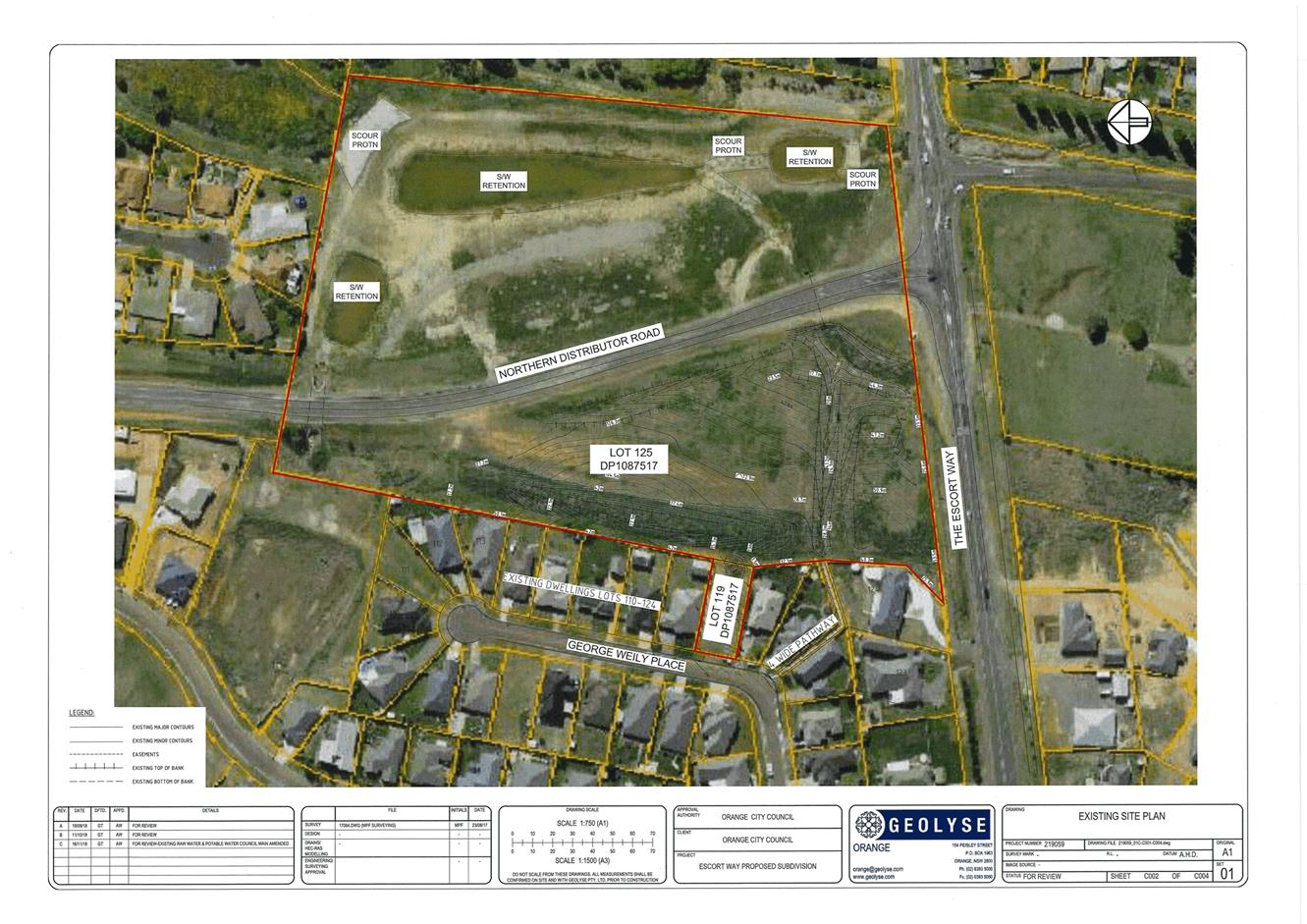
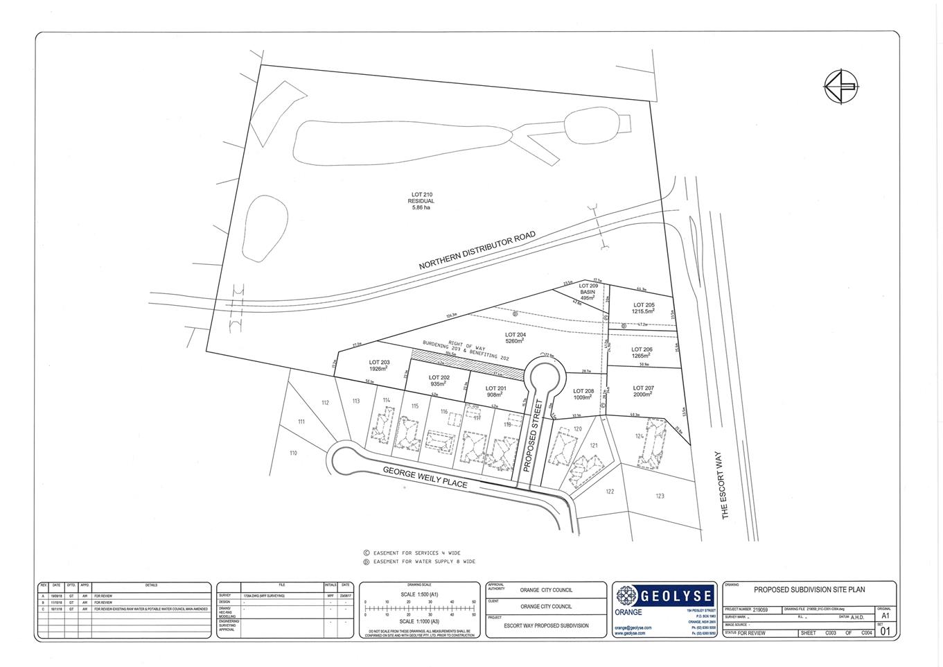
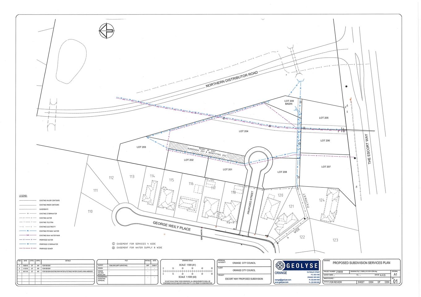
Planning
and Development Committee
5 February 2019
2.2 Development
Application DA 444/2018(2) - Subdivision - 20 George Weily Place and Lot 125
the Escort Way
Attachment 3 Submissions
(1)
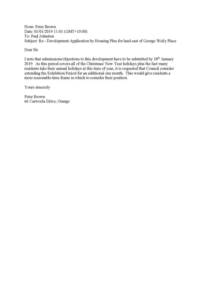
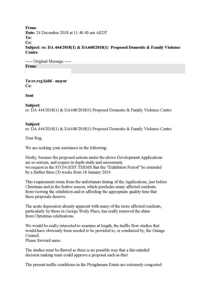
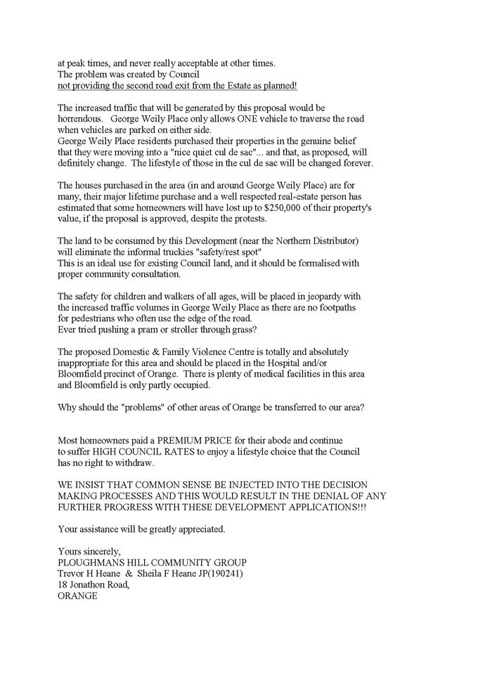
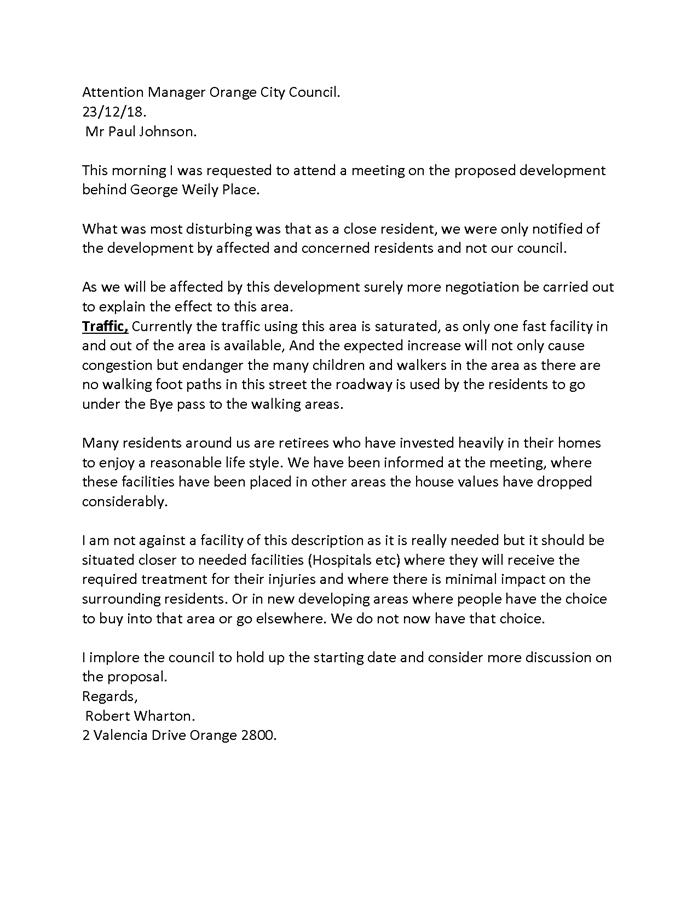
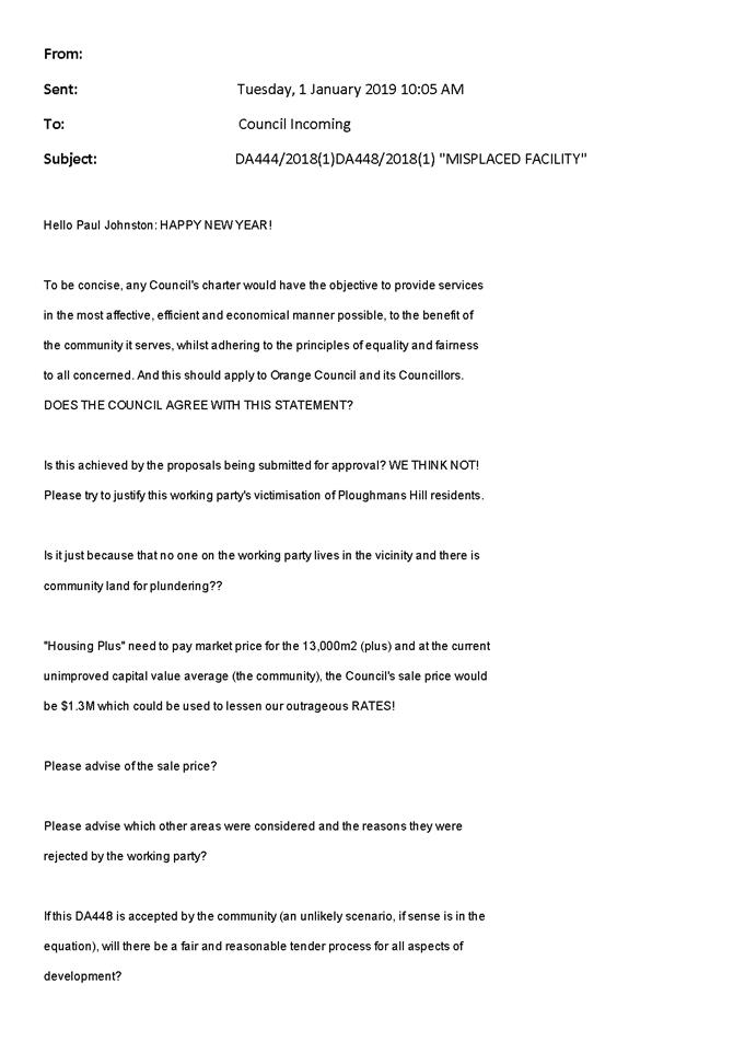

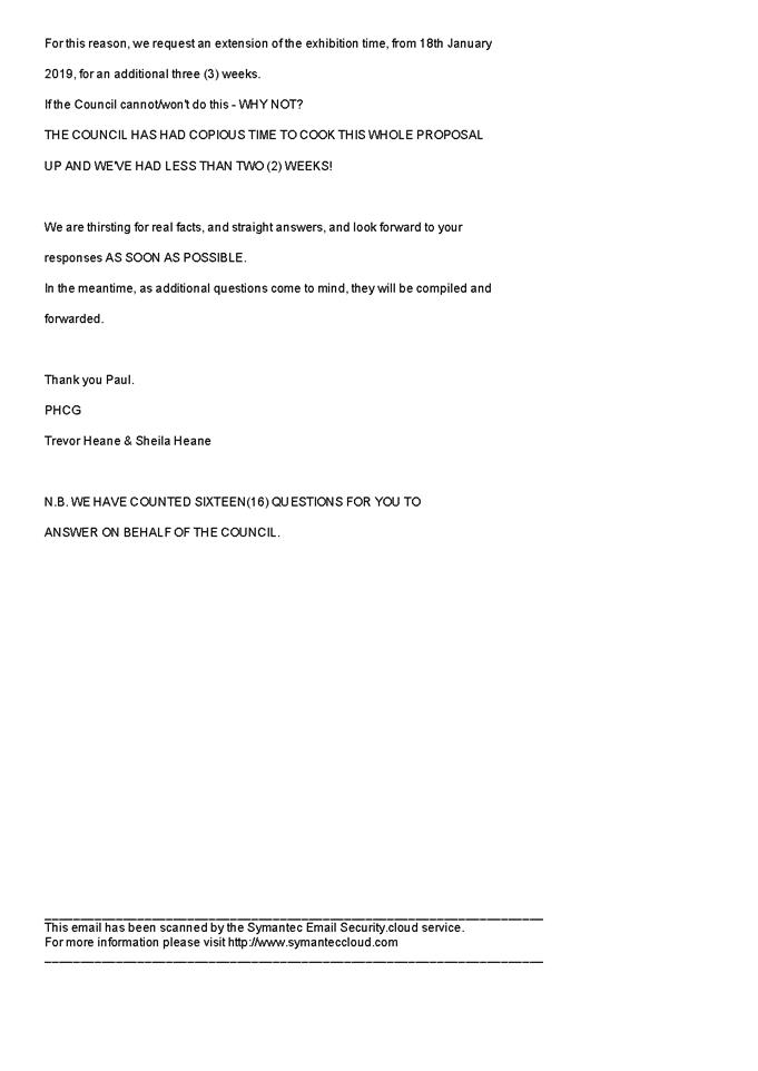
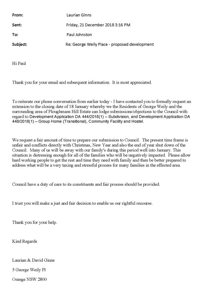
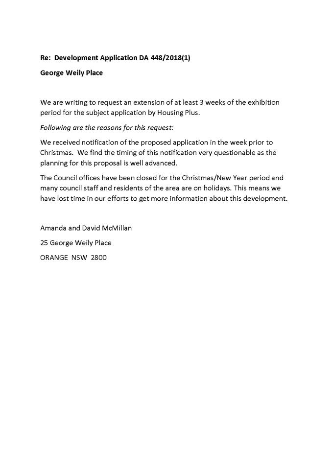
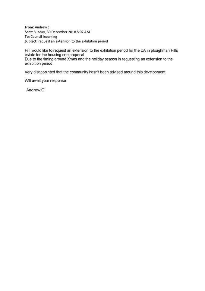
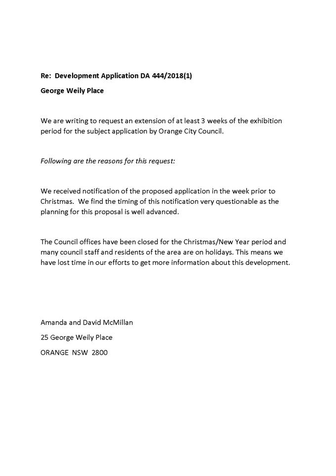
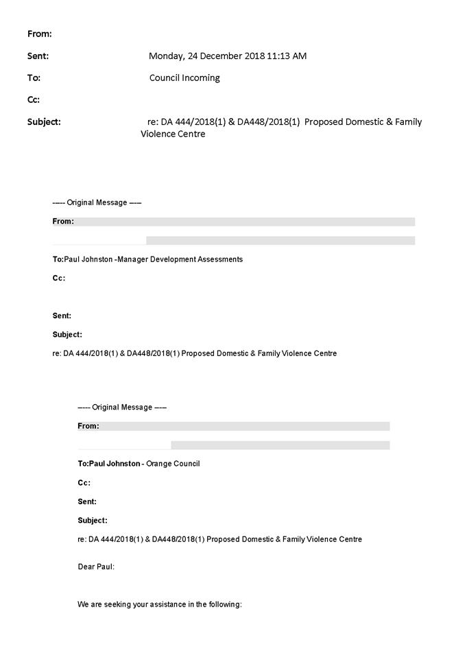

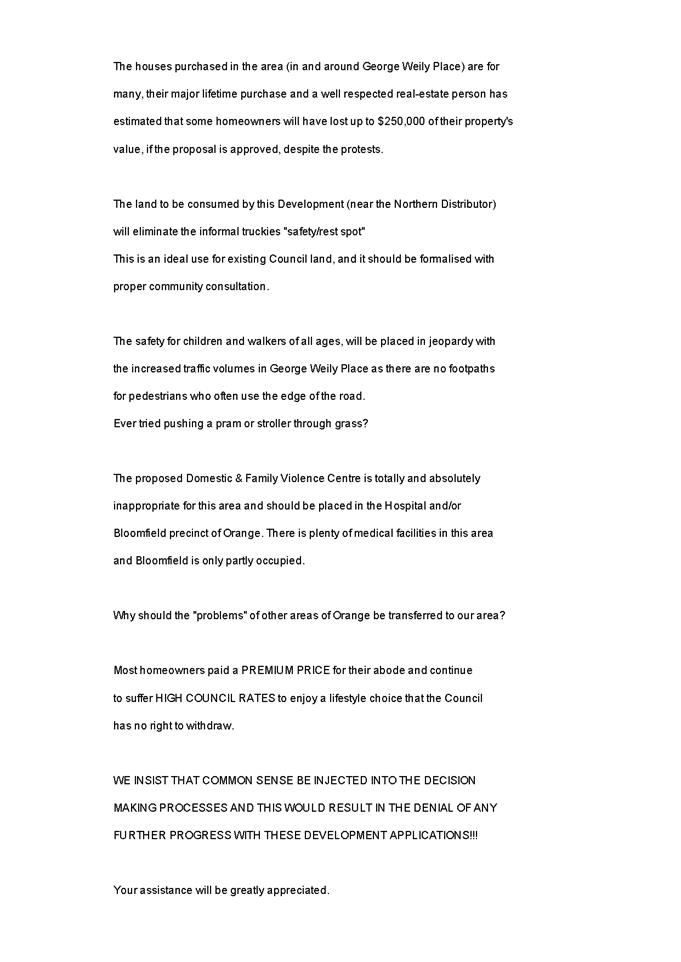

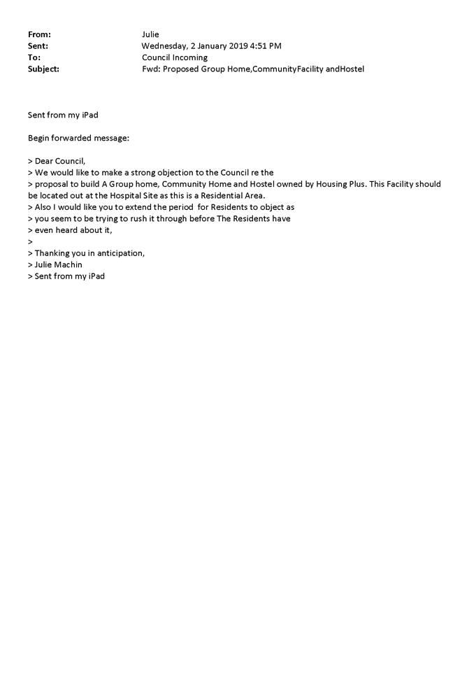

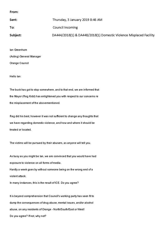
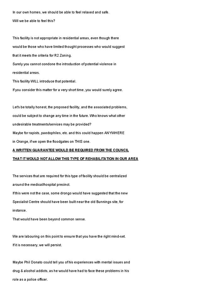

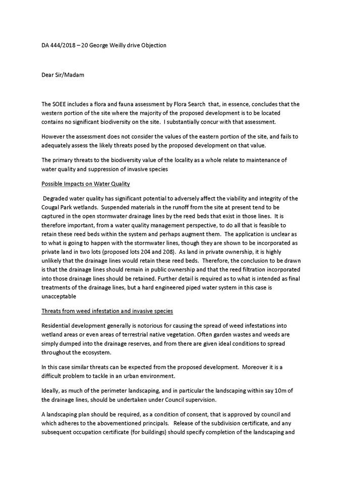

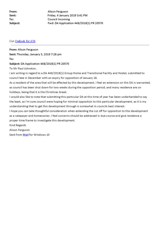

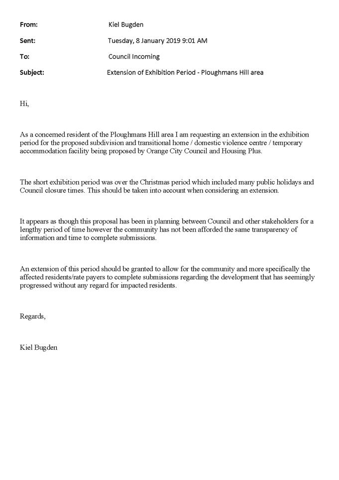
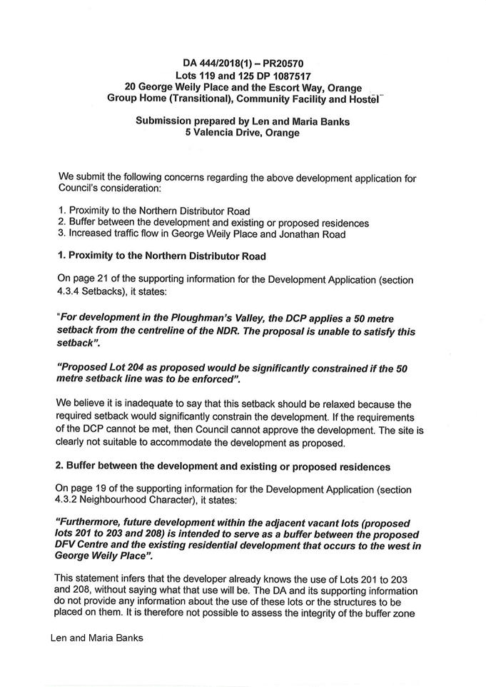
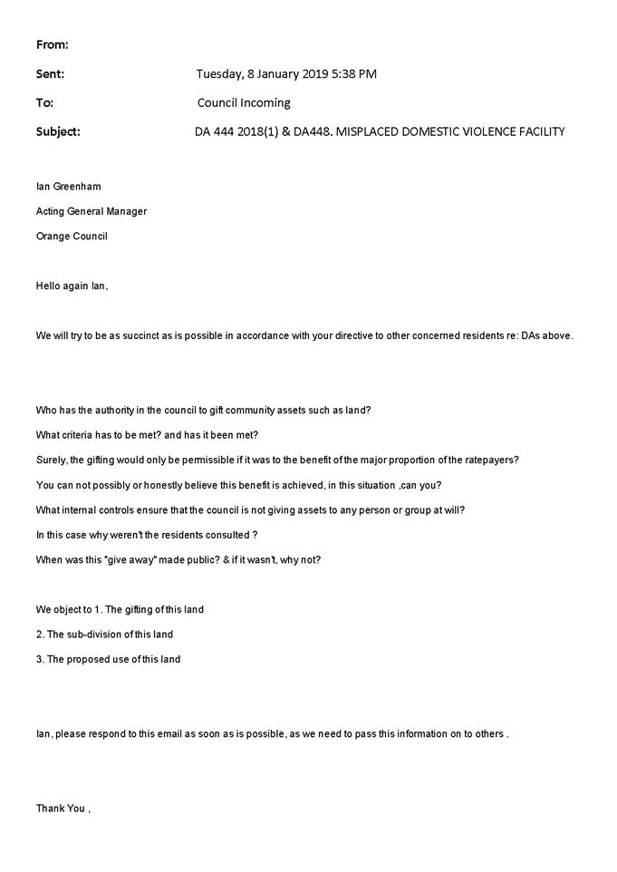

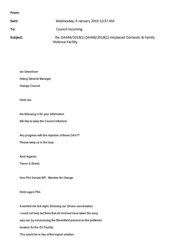

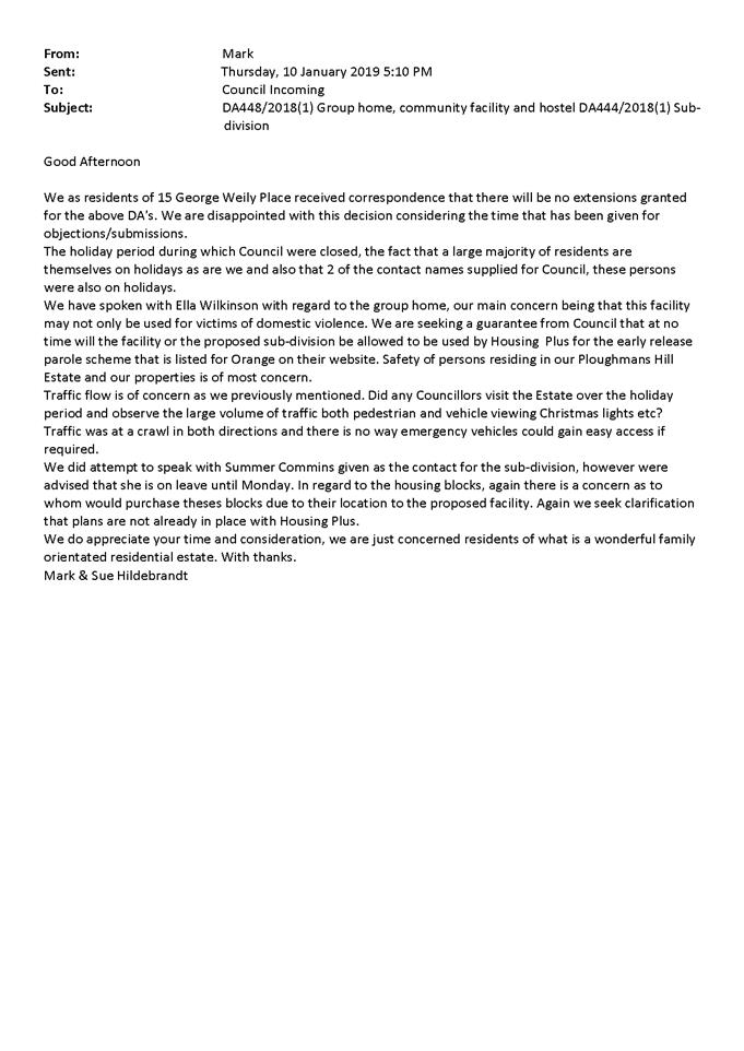
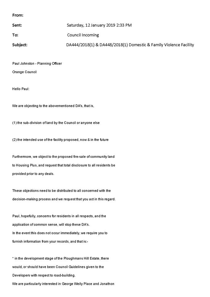

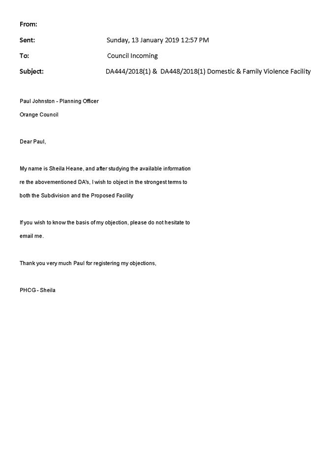
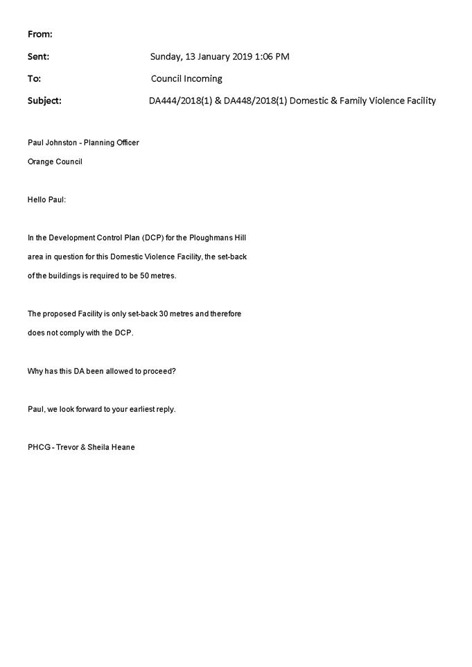
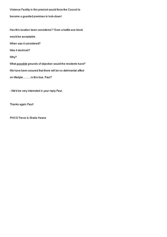
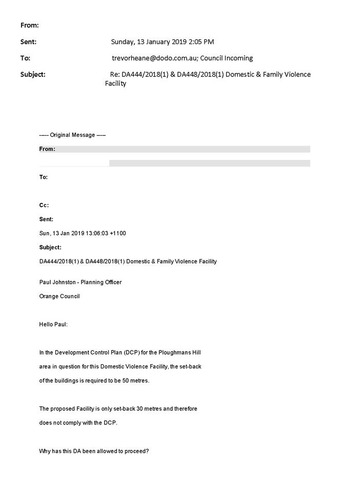

Planning and Development Committee
5 February 2019
2.2 Development
Application DA 444/2018(2) - Subdivision - 20 George Weily Place and Lot 125
the Escort Way
Attachment 4 Submissions
(2)
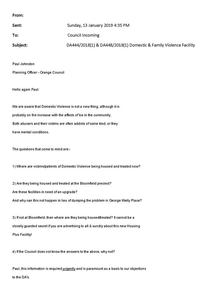

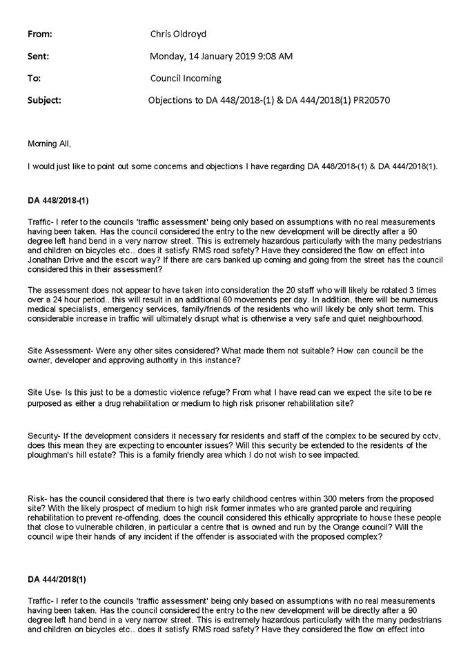

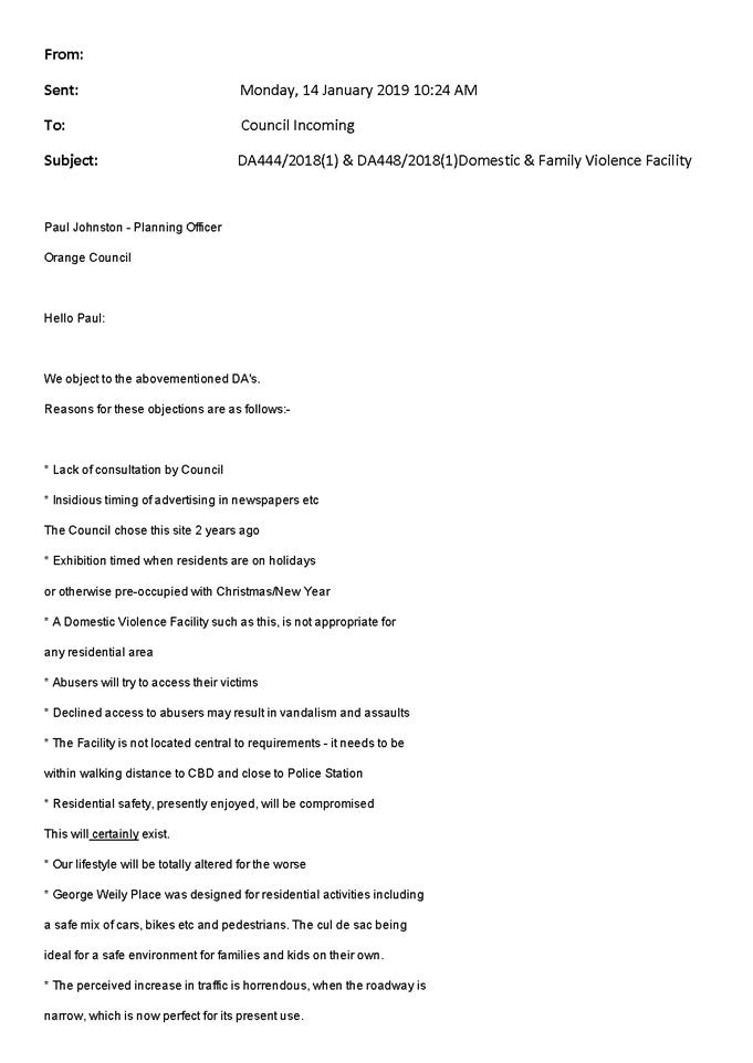


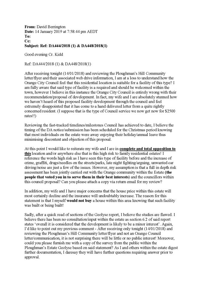


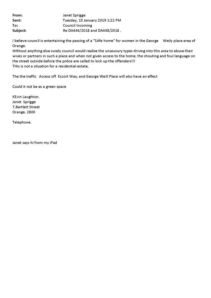
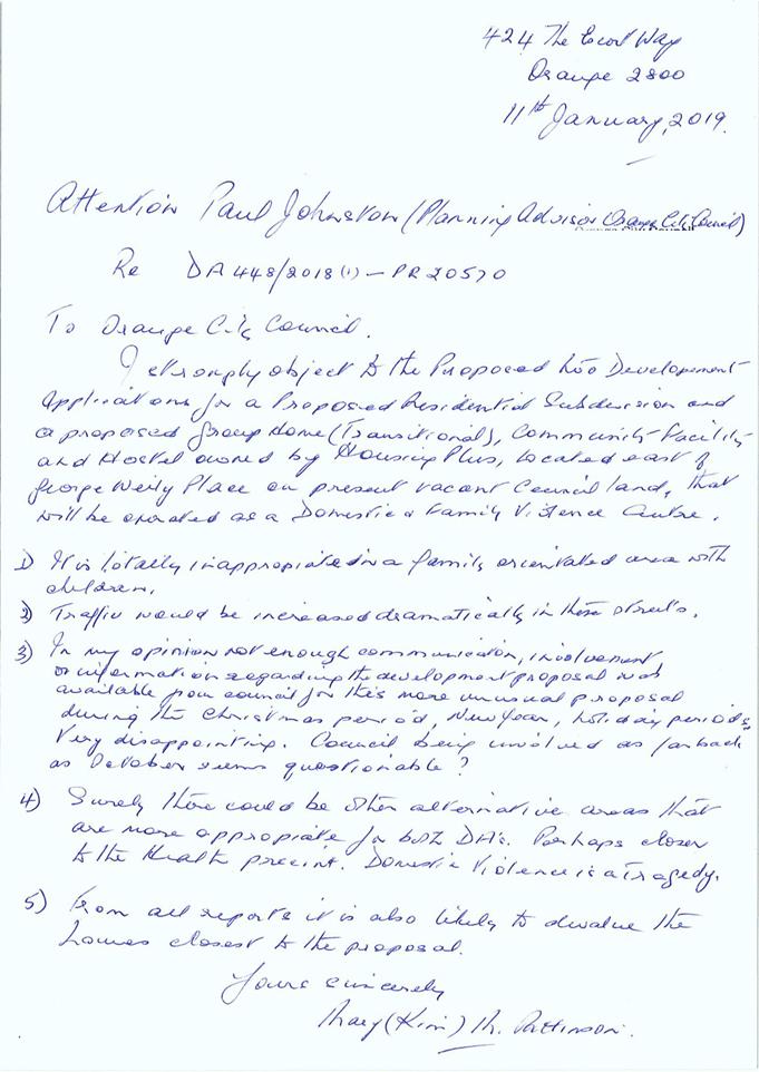
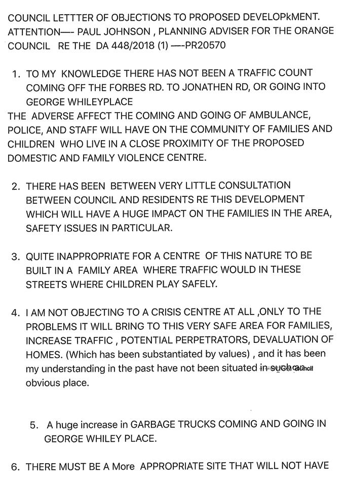

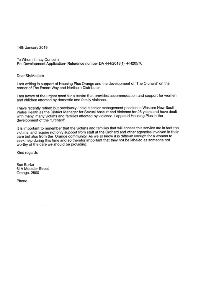
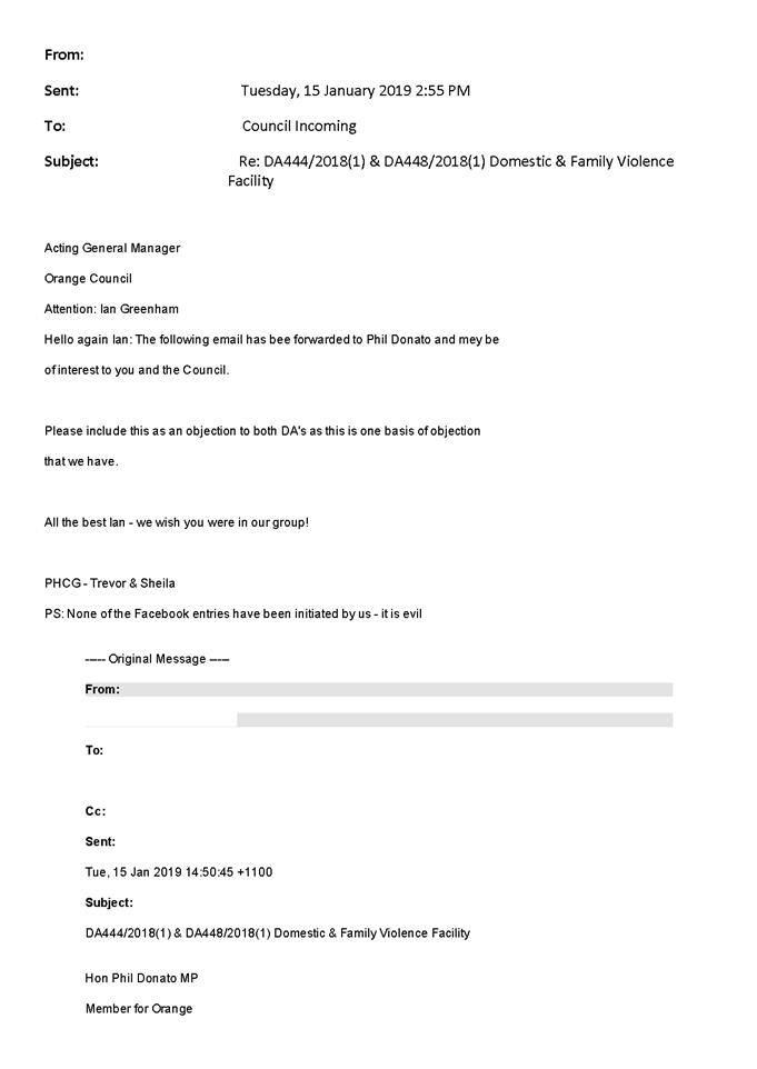
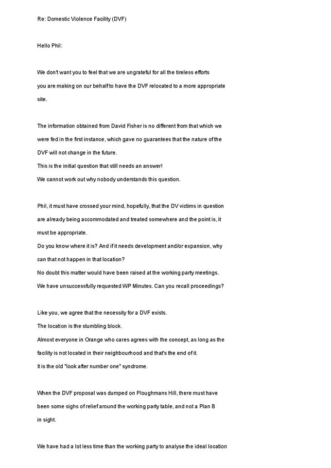
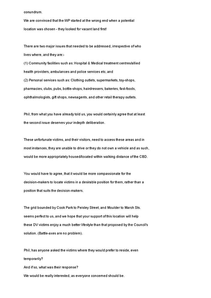

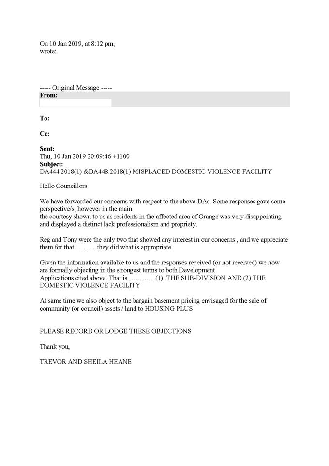
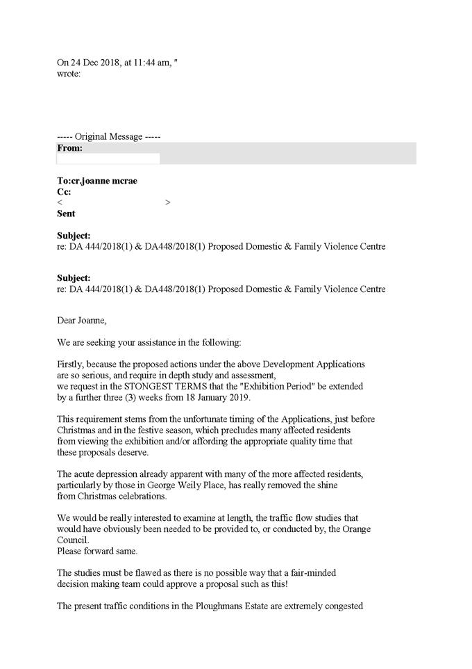
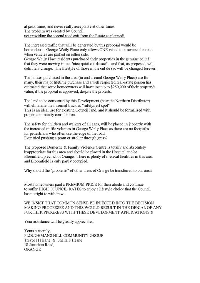

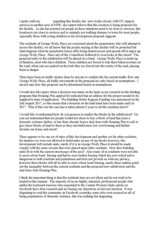


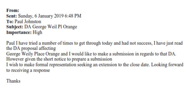
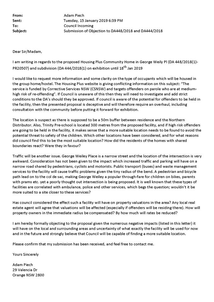


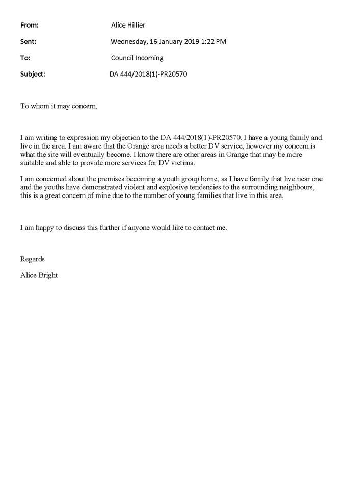


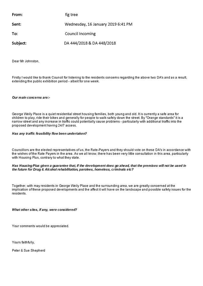
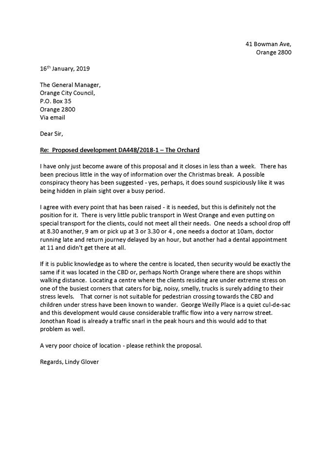
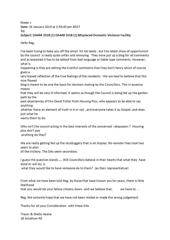
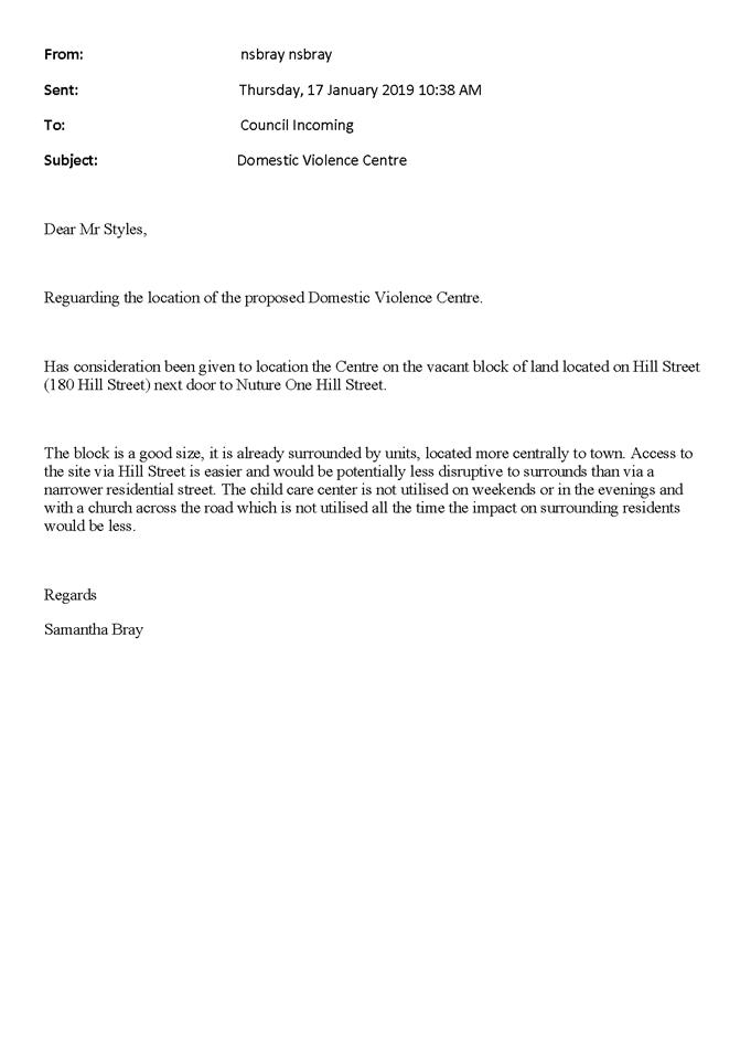
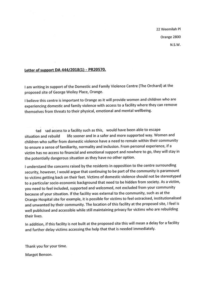
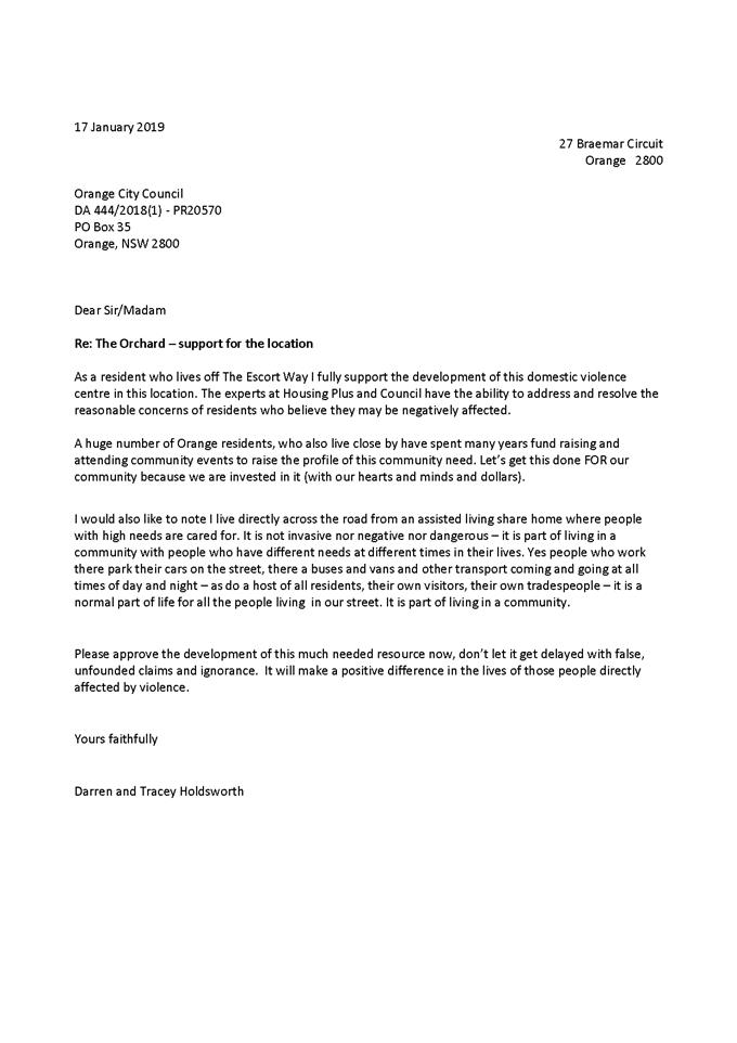
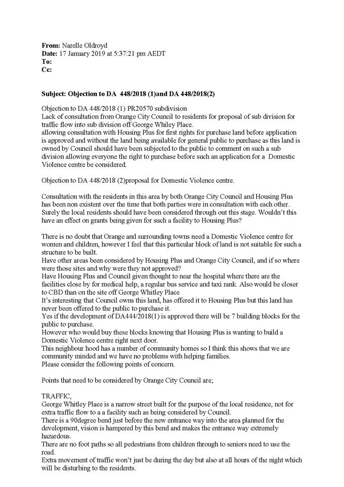
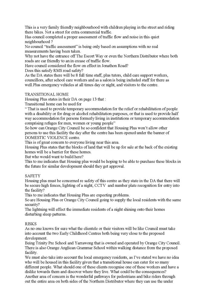

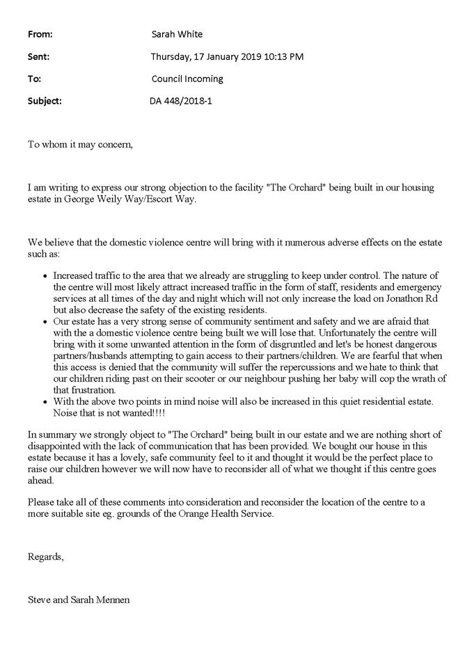
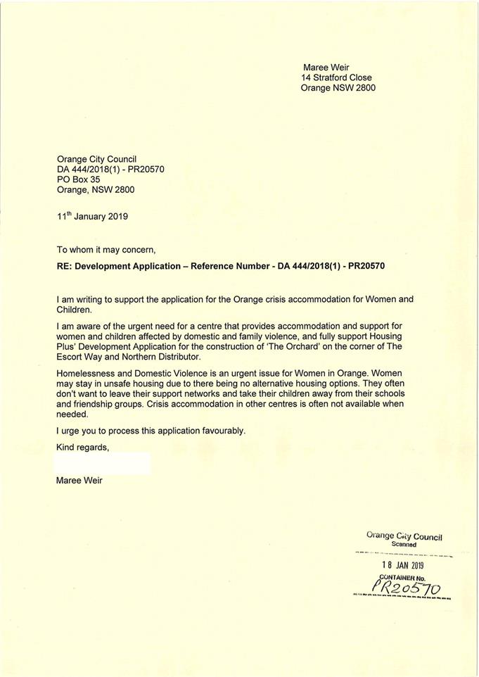
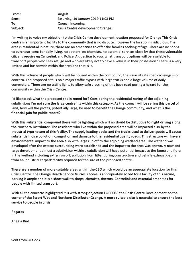
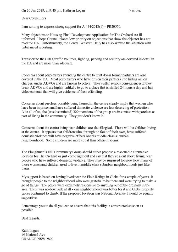


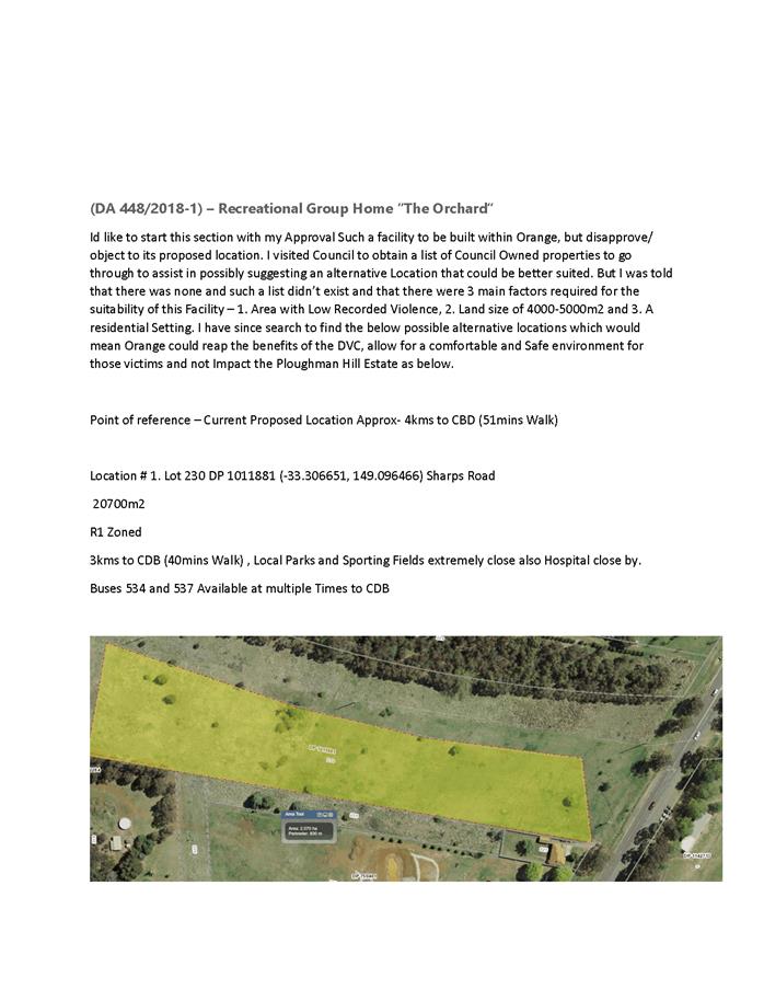
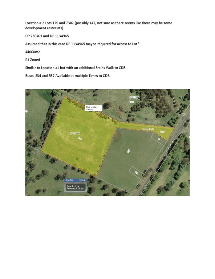
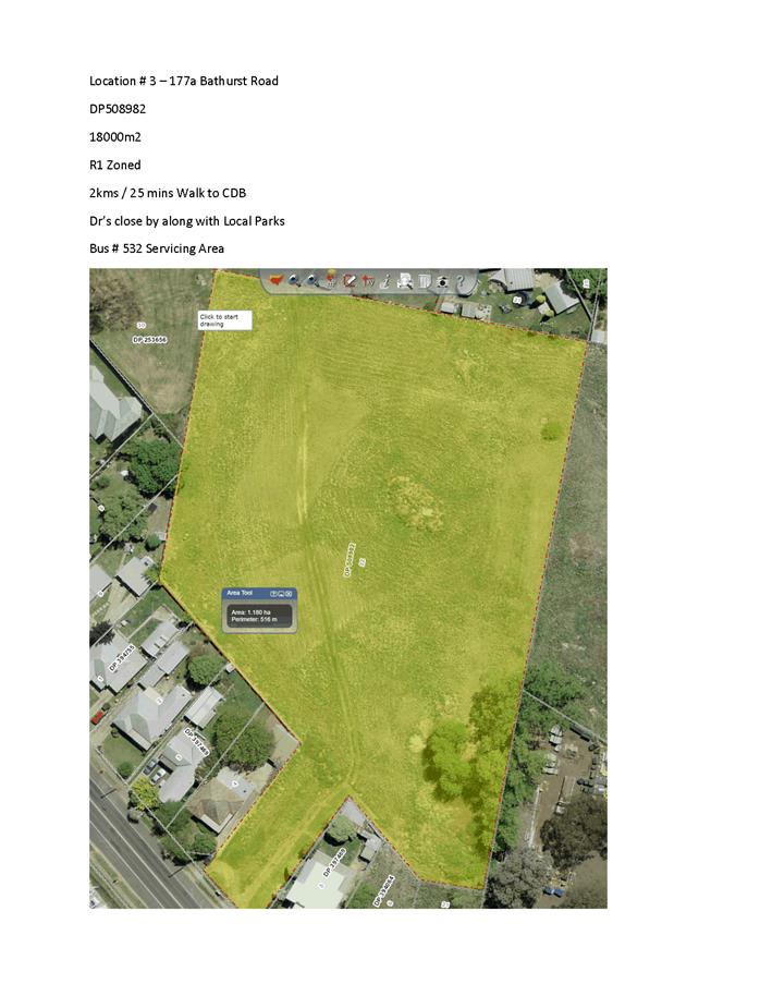
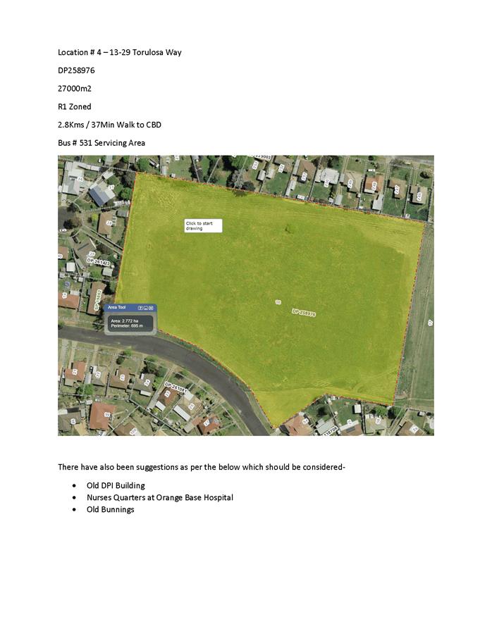
Planning
and Development Committee
5 February 2019
2.2 Development
Application DA 444/2018(2) - Subdivision - 20 George Weily Place and Lot 125
the Escort Way
Attachment 5 Submissions
(3)

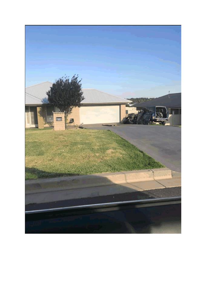

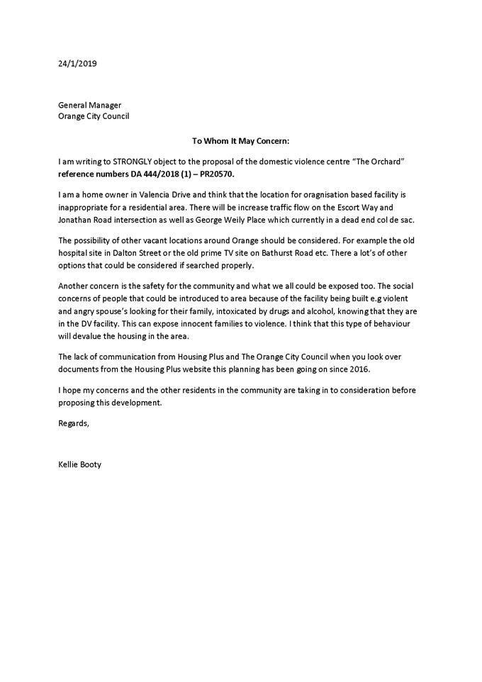
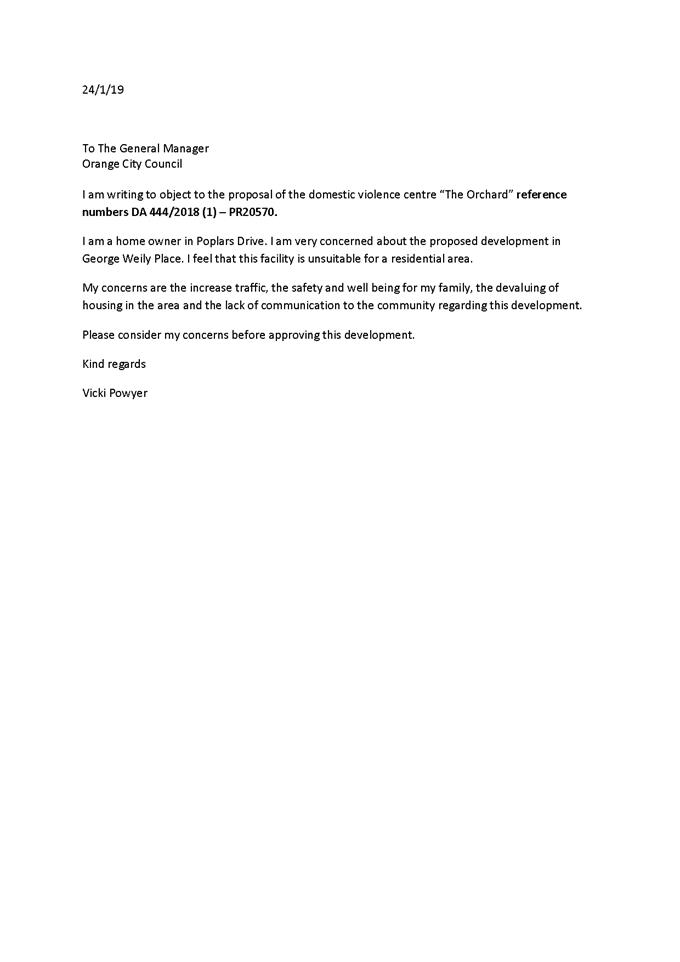
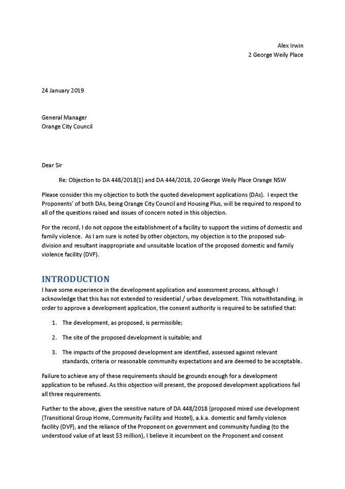

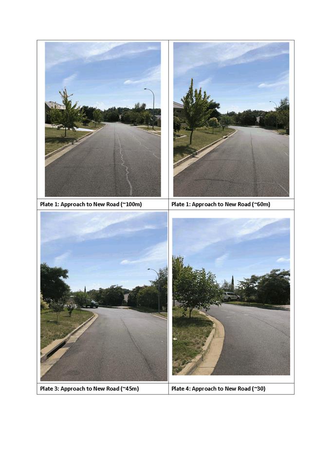
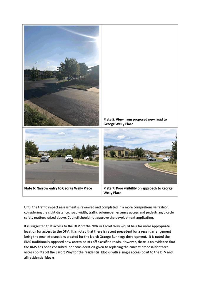

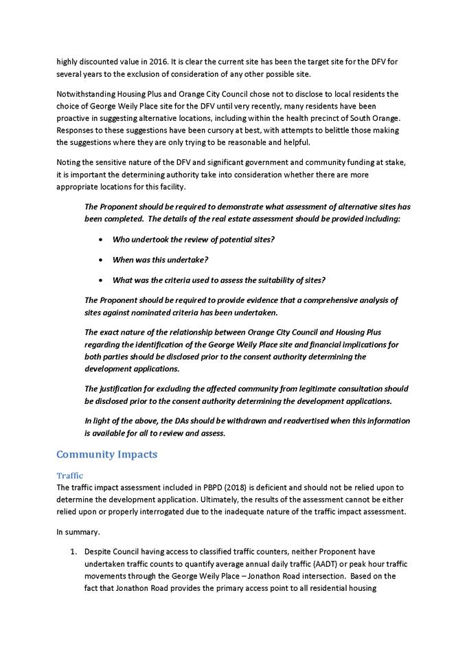
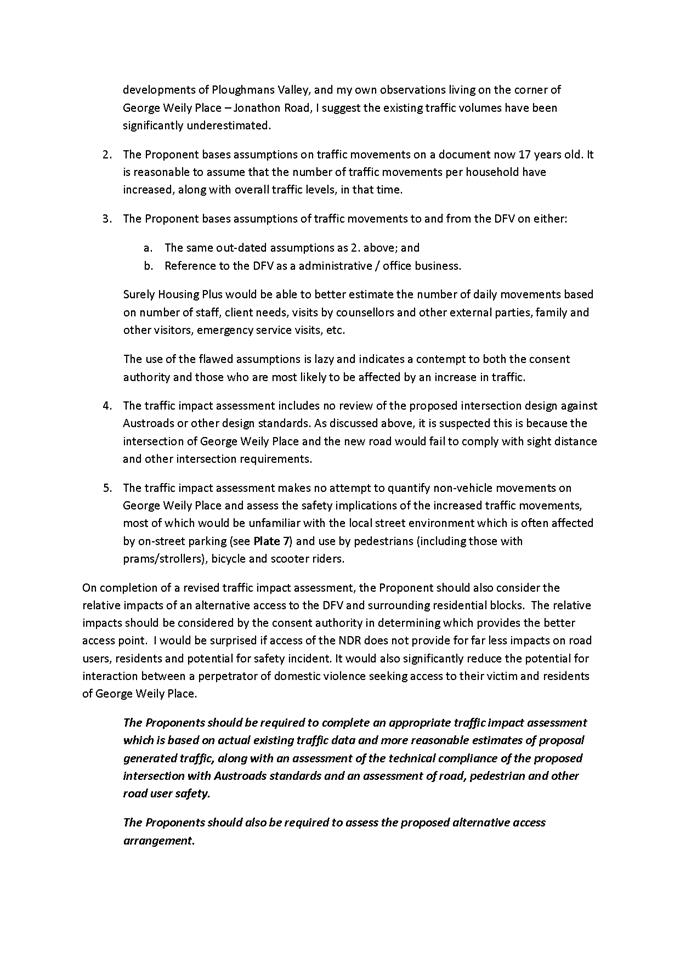
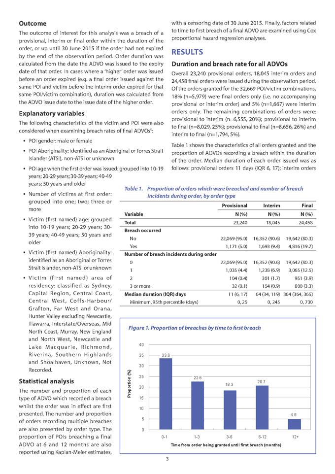
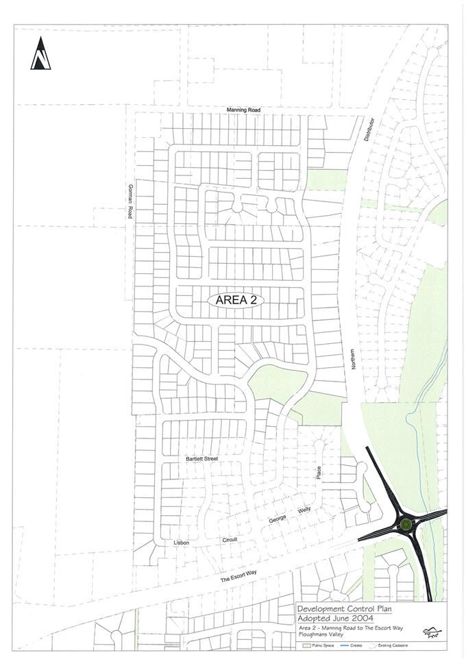
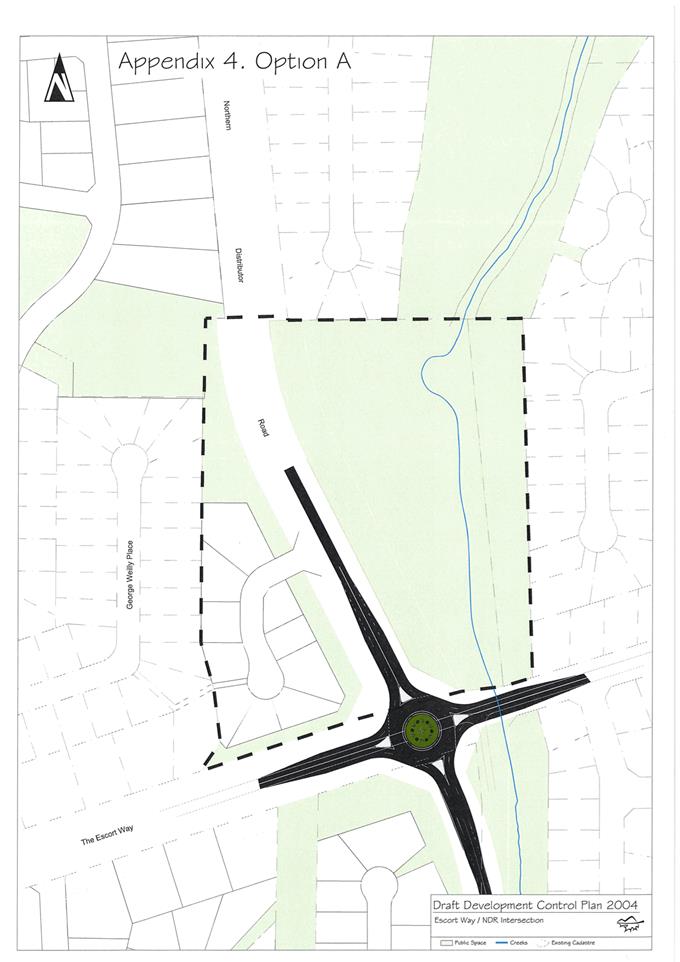


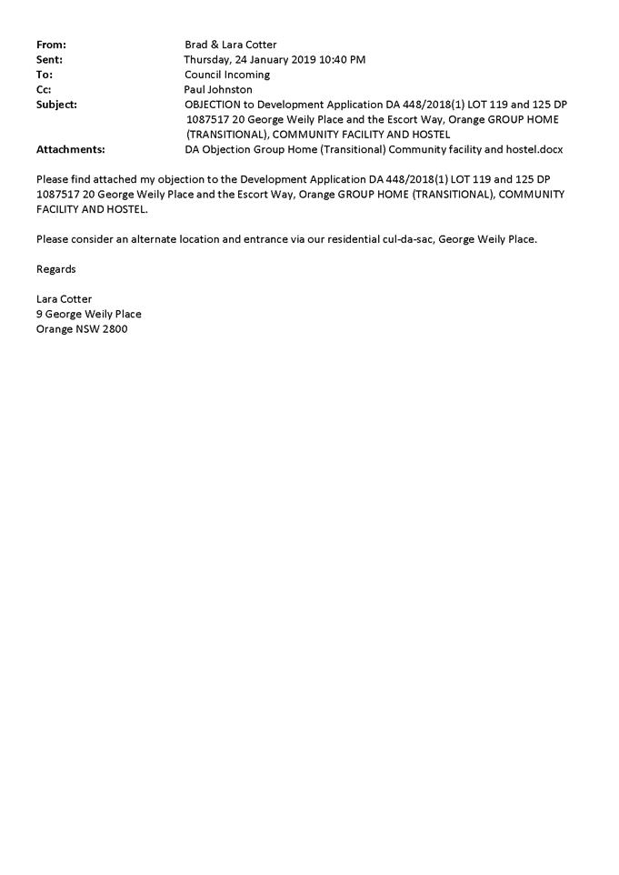
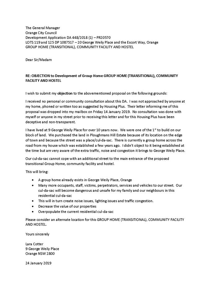
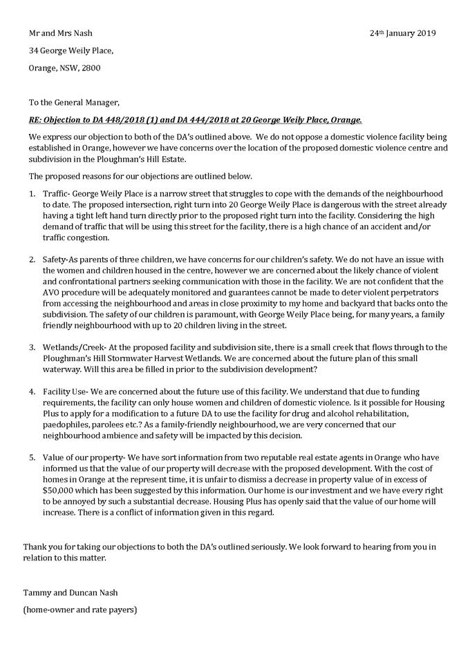

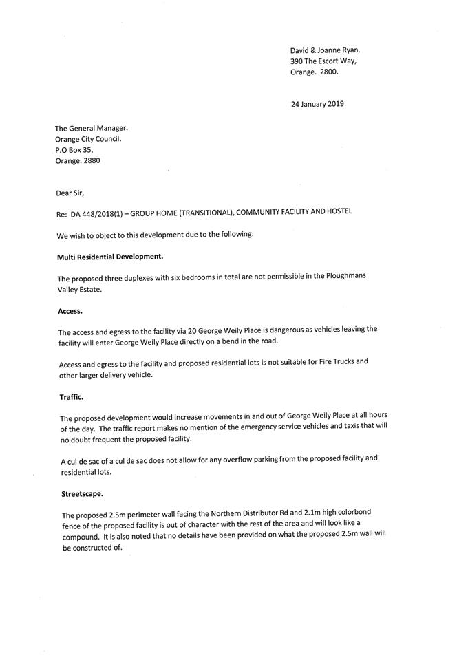
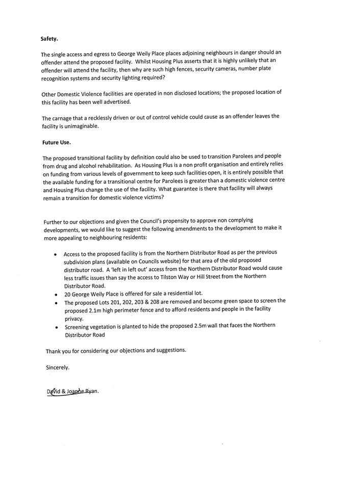


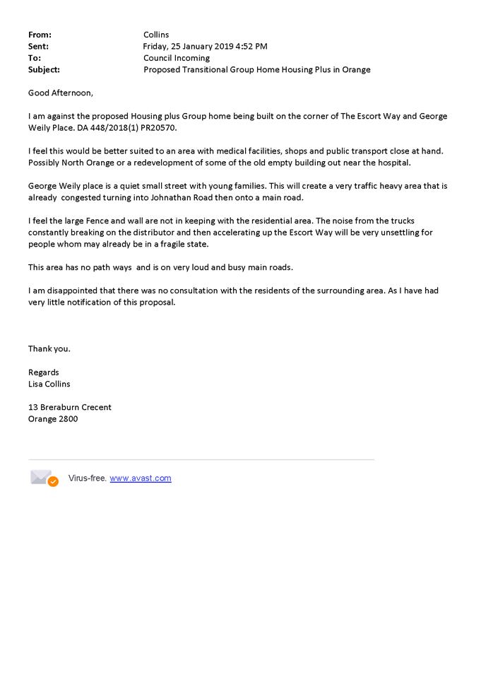
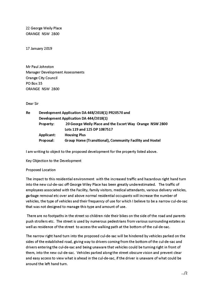
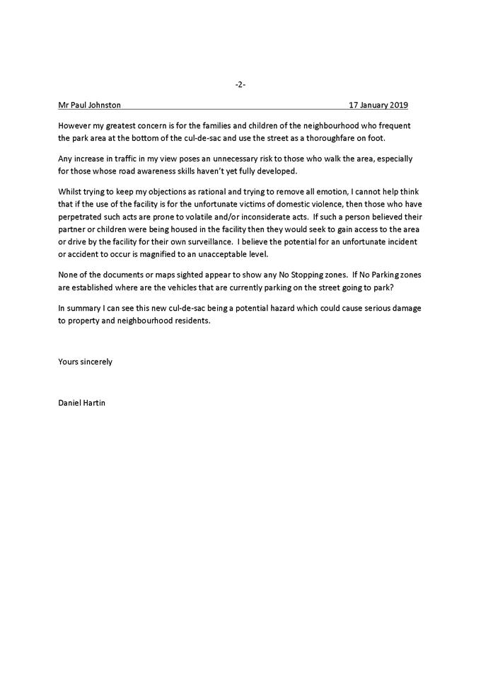


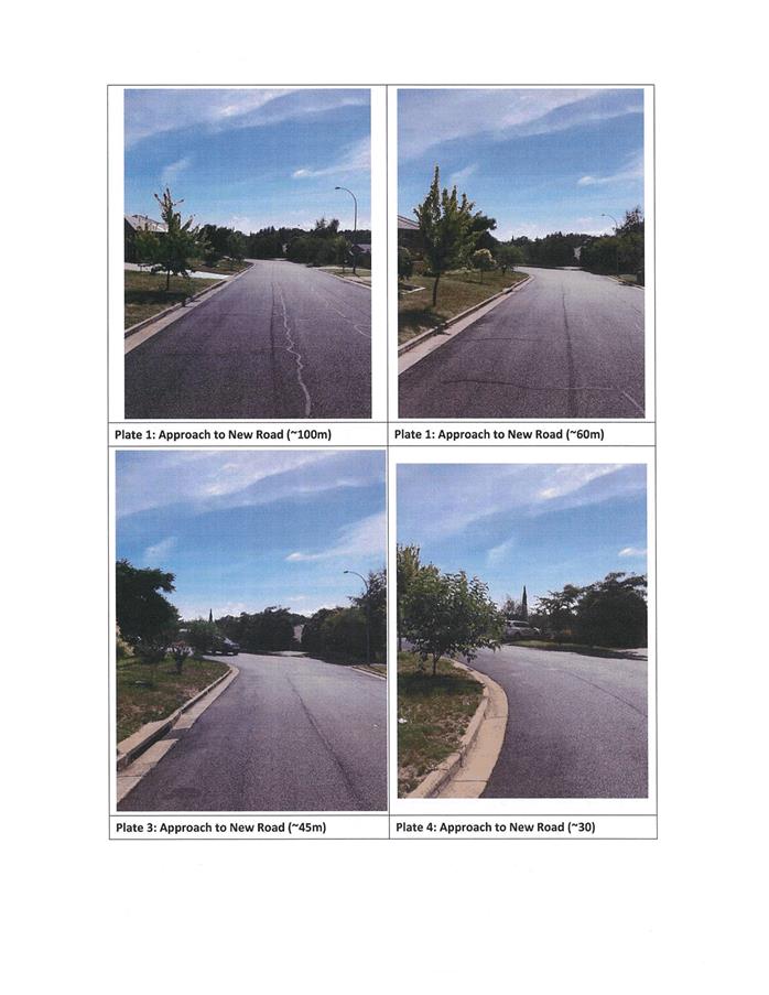
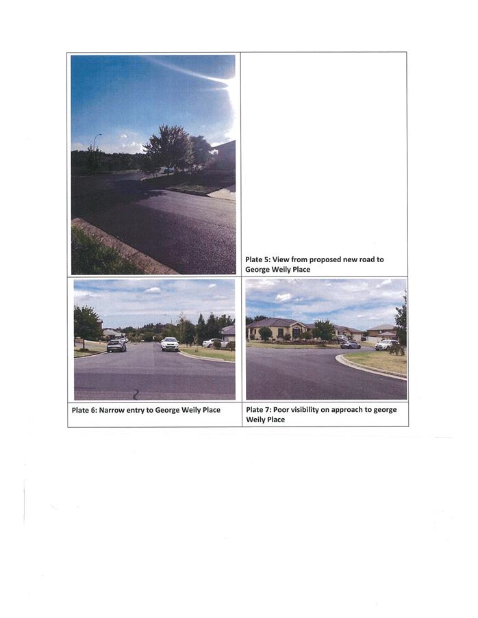
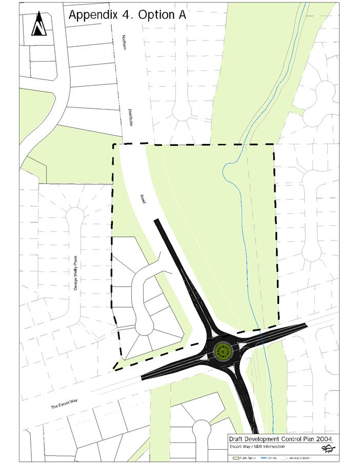
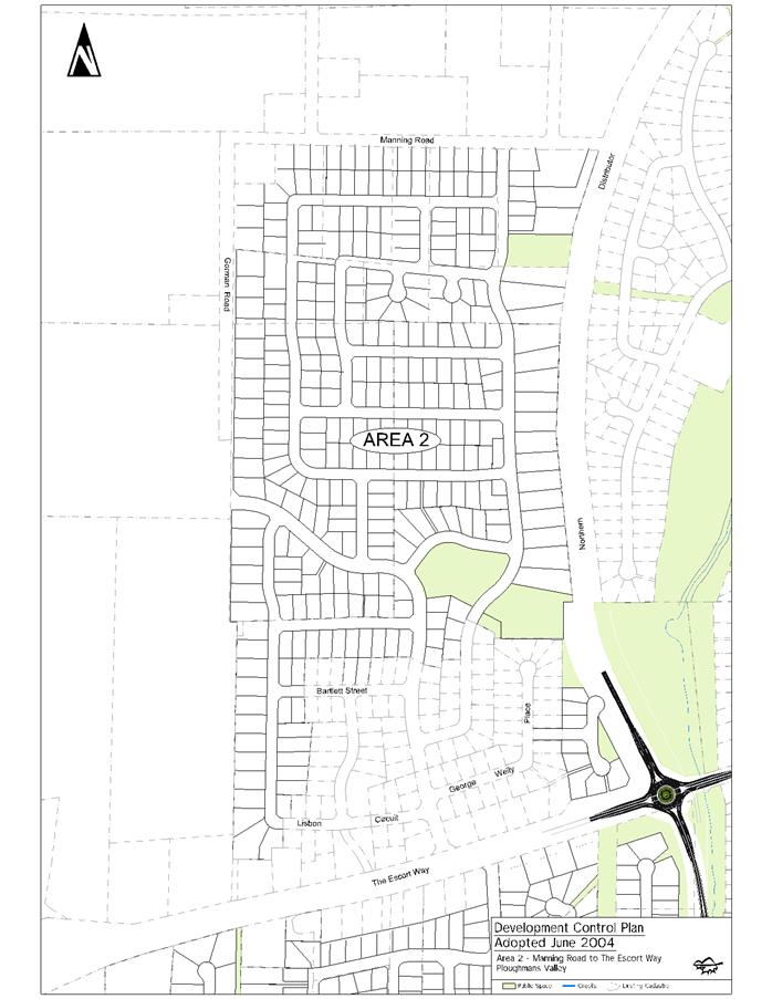
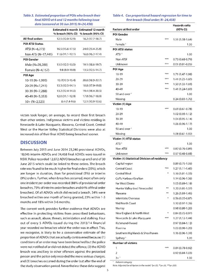
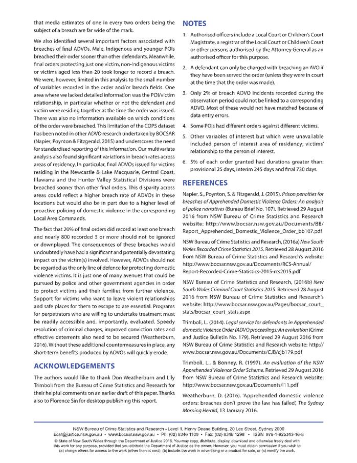
2.3 Development
Application DA 448/2018(2) - Group Home, Community Facility and Hostel - 20
George Weily Place and Lot 125 The Escort Way
RECORD
NUMBER: 2019/87
AUTHOR: Ella
Wilkinson, Senior Planner
EXECUTIVE Summary
|
Application
lodged
|
6
December 2018
|
|
Applicant/s
|
Housing
Plus
|
|
Owner/s
|
Orange
City Council
|
|
Land
description
|
Proposed
Lot 204 in the subdivision of Lots 119 and 125 DP 1087517
(pursuant to DA 444/2018(1) - 20 George Weily Place and Lot 125 The Escort
Way, Orange
|
|
Proposed
land use
|
Group
Home (transitional), Community Facility and Hostel
|
|
Value of
proposed development
|
$2,300,000
|
Council's consent is sought for a mixed use development
comprising a community facility, hostel and transitional group home on proposed
Lot 204 in the proposed subdivision of Lots 119 and 125 DP 1087517
(The Escort Way and George Weily Place).
The development will comprise an administration building
which will operate as a community facility and hostel. The building will
provide offices, counselling areas, staff amenities, staff sleeping quarters
and emergency sleepover accommodation, supported by a common room and shared
kitchen/bathroom/laundry facilities. The building will have a footprint of
515.8m2.
The transitional group homes will be accommodated in three
separate attached duplexes. The duplexes will be capable of being occupied by a
single household of domestic violence victims. Each unit is fully
self-contained, with designated private open space. The duplexes will be an
adaptable design with lockable fire doors so that adjacent units can be used
as:
- 2x
2 bedroom units;
- 1x
1 bedroom unit and 1x 3 bedroom unit; and
- a
single 4 bedroom unit.
The proposed transitional group home units will have the
following building footprints:
- Units
1 and 2 (with attached ancillary salon) = 213.7m2;
- Units
3 and 4 = 180.6 m2; and
- Units
5 and 6 = 180.6 m2.
The transitional group homes will occupy a total area of
574.9m2
The proposal also outlines off street parking, site
landscaping, communal open space areas, garden shed, ancillary salon and a
playground.
The proposal has received considerable public interest, with
multiple submissions provided to Council during the public exhibition period.
The issues raised in these submissions have been summarised in further detail
in the body of this report; however, the main objection to the proposal is that
it is not appropriate in a residential area.
The proposed hostel and transitional group home uses are
defined under the parent term “residential accommodation” in OLEP
2011. Hostels, transitional group homes and community facilities are uses
permitted with consent in the R2 Low Density Residential zone under
OLEP 2011. Further, the test for permissibility of transitional group
homes in the R2 Low Density Residential zone is covered by SEPP
(Affordable Rental Housing) 2009. Despite the definition of a transitional
group home in OLEP 2011 as “a dwelling”, the State policy does not
concern itself with the number of buildings, where consent is required.
The State policy further prevents the consent authority from
viewing a proposal for a transitional group home as anything other than a
normal residential development. The State policy prevents a consent authority
from applying conditions of consent to a proposal of this nature that would not
ordinarily be applied to a standard residence.
One concern raised by submitters is that a proposal for a
transitional group home may be altered to accommodate future, permissible uses,
such as “temporary accommodation for the relief or rehabilitation of
people with a disability or for drug or alcohol rehabilitation purposes, or that
is used to provide half-way accommodation for persons formerly living in
institutions”. To address this concern, a condition of consent has
been recommended that restricts the proposal to domestic violence victims and
their children, and that any change in focus for the centre beyond domestic
violence be subject to an application to modify the development consent,
enabling Council to consider an assessment for the community need for such
services as per clause 46 (1)(a). This is discussed in greater detail
throughout the body of this report.
Other issues raised have
highlighted traffic, noise and safety impacts of the development. These issued
have also been addressed throughout the body of this report.
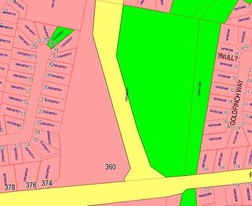
Figure 1 - locality plan
RECENT LEGISLATIVE CHANGES
On 1 March 2018 the Environmental Planning and Assessment
Act 1979 was substantially amended. The most immediate change involves the
restructuring and renumbering of the Act, with other more substantive
changes to be phased in over time. However, for some applications (particularly
where an application was lodged prior to the changes coming into effect) the
supporting documentation may still reference the previous numbering regime. In
the drafting of this report the content and substance of the supporting
material has been considered irrespective of which legislative references were
used.
DECISION FRAMEWORK
Development in Orange is governed by two key documents
Orange Local Environment Plan 2011 and Orange Development Control Plan 2004. In
addition the Infill Guidelines are used to guide development, particularly in
the heritage conservation areas and around heritage items.
Orange Local Environment Plan 2011 – The
provisions of the LEP must be considered by the Council in determining the
application. LEPs govern the types of development that are permissible or
prohibited in different parts of the City and also provide some assessment
criteria in specific circumstances. Uses are either permissible or not. The
objectives of each zoning and indeed the aims of the LEP itself are also to be
considered and can be used to guide decision making around appropriateness of
development.
Orange Development Control Plan 2004 – the DCP
provides guidelines for development. In general it is a performance based
document rather than prescriptive in nature. For each planning element there
are often guidelines used. These guidelines indicate ways of achieving the
planning outcomes. It is thus recognised that there may also be other solutions
of merit. All design solutions are considered on merit by planning and building
staff. Applications should clearly demonstrate how the planning outcomes are
being met where alternative design solutions are proposed. The DCP enables
developers and architects to use design to achieve the planning outcomes in
alternative ways.
DIRECTOR’S COMMENT
This development application deals with a domestic violence
facility, which is permissible via Orange Local Environmental Plan 2011 and
SEPP (Affordable Rental Housing) 2009.
Staff have assessed the development against Orange’s
statutory planning instruments, including the LEP and DCP, and concluded that
the development can meet the goals and objectives laid out in those adopted
documents. Some of these issues have been the subject of redesign or have been
addressed via recommended conditions of consent.
The DA was placed on public exhibition in conjunction with
DA 444/2018(1) for a ten lot subdivision. A total of 112 submissions were
received in relation to both applications. This reports considers issues
applicable to the domestic violence facility DA only. Submissions relating to
DA 444/2018(1) are considered in the assessment of that DA.
The submissions raised numerous issues. Many of those issues
do not relate strictly to planning matters and have been handed to the
applicant to address. Council must base its determination on planning matters
alone. One key issue raised in submissions is that in the future there could be
a change of use of the facility into uses such as “halfway houses”
and other transitory accommodation purposes. A condition has been included on
the Notice to prevent this occurring without further consideration by Council.
Link To Delivery/OPerational Plan
The recommendation in this report relates to the
Delivery/Operational Plan strategy “10.1 Preserve -
Engage with the community to ensure plans for growth and development are
respectful of our heritage”.
Financial Implications
It is noteworthy but not of planning relevance that the
current owner of the subject land is Orange City Council.
Policy and Governance Implications
The subject site has been identified for further residential
development by Orange DCP 2004. A conceptual masterplan layout outlined in
DCP 2004 was included to illustrate how some additional lots may be provided
within the location. This layout was indicative only in nature, but
demonstrated further residential development within this location.
Further, under Orange LEP 2011 the site is zoned R2 Low
Density Residential, and as previously outlined the proposed use is permissible
in this zone.
|
Recommendation
That Council resolves to consent to development
application DA 448/2018(1) for Group Home (transitional), Community
Facility and Hostel at Proposed Lot 204 in the subdivision of
Lots 119 and 125 DP 1087517 - 20 George Weily Place and The
Escort Way, Orange pursuant to the conditions of consent in the attached
Notice of Approval.
|
further considerations
Consideration has been given to the
recommendation’s impact on Council’s service delivery; image and reputation;
political; environmental; health and safety; employees; stakeholders and
project management; and no further implications or risks have been identified.
SUPPORTING INFORMATION
THE APPLICATION
Council's consent is sought for a mixed use development
comprising a community facility, hostel and transitional group home on proposed
Lot 204 in the proposed subdivision of Lots 119 and 125 DP 1087517
(The Escort Way and George Weily Place).
Proposed Lot 204 in the proposed
subdivision of Lots 119 and 125 DP 1087517 (The Escort Way and George Weily
Place) will have an area of approximately 5,260m2 (subject to
survey). The site is an irregular shape, with the northern half of the site
tapering to a point (see Figure 2).
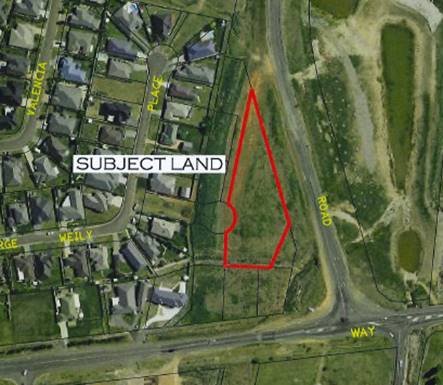
Figure 2 - shape of subject site
The site is zoned R2 Low Density Residential and is east of
the existing Ploughmans Hill residential estate.
The site itself adjoins seven proposed standard residential
lots, three to the south and four to the west, and one lot for use for
stormwater management to the southeast. These lots are proposed as part of the
concurrent subdivision DA that will establish the subdivision pattern for this
proposal. A cul-de-sac is also proposed to provide access to the site, which
will adjoin George Weily Place.
The eastern boundary will adjoin the Northern Distributor
Road road reserve.
Currently the subject site is vacant and clear of any native
trees. The site is highly disturbed and degraded, with no native vegetation of
significance. An overland flow path affects the southern portion of the subject
site, traversing the site in an east-west direction. Orange City
Council’s 450mm non-potable and 300mm potable water mains affect the
eastern section of the site.
The Coogal Wetlands (Council wetlands) are located to the
east of the subject site, across the Northern Distributor Road.
THE PROPOSAL
The proposal involves the construction of an administration
building, which will adopt a contemporary domestic architectural style with:
- skillion
roof lines;
- face
brick external walls;
- selected
sections of vertical groove fibrous cement wall sheeting;
- Colorbond
roof sheeting; and
- powder
coated aluminium door and window frames.
The administration building will have a building footprint
of 515.8m2.
The southern section of the
administration building will be used as a community facility. It will comprise:
- an
entry vestibule;
- waiting
rooms;
- office
space;
- counselling
rooms;
- multi
function rooms;
- staff
bedrooms, staff kitchenette, staff bathroom and staff WCs – so that a
staff member can remain onsite at all times.
The community facility will
provide services to domestic violence victims, such as:
- arrangement
of emergency and transitional accommodation;
- case
management for high needs victims;
- arrange
transport for safety;
- provide
brokerage for emergency needs such as food and sanitary items;
- safety
planning;
- assistance
with victims compensation; and
- ongoing
information, advocacy, support and referral.
The northern section of the
administration building will be used as a hostel, providing emergency
short-stay accommodation for victims until other accommodation arrangements can
be made to address individual circumstances. Two sleepover rooms will be
provided in the northern section of the floorplan, with shared bathrooms,
laundry, kitchen, healing room, crèche and common area.
Occupants of the hostel, customers accessing the services of
the community centre and staff of the Domestic Violence Centre will have access
to off-street parking located to the south of the proposed administration
building. Access to communal open space areas and the playground will also be
provided onsite.
The transitional group homes will be accommodated in three
separate attached duplexes and will comprise a total building footprint of
574.9m2.
The duplexes will be capable of being occupied by victims of
domestic violence as a single household. Each unit is fully self-contained,
with designated private open space. The duplexes will be an adaptable design
with lockable fire doors so that adjacent units can be used as:
- 2x
2 bedroom units;
- 1x
1 bedroom unit and 1x 3 bedroom unit; and
- a
single 4 bedroom unit.
The transitional group homes are
proposed to be a contemporary residential design, consistent with the design of
the administration building. The proposed duplexes will have:
- skillion
roof lines’
- a
mix of face brick or rendered and painted brick walls;
- selected
sections of vertical groove fibrous cement wall sheeting;
- Colorbond
roof sheeting;
- and
powder coated aluminium window and door frames.
Internal 1.5m high fencing is
proposed for the transitional group home.
The units will provide transitional accommodation for
victims of domestic violence. Occupant stays will generally be short term,
until longer term housing solutions can be located for victims. It is estimated
that the occupancy rates and length of stay will be as outlined below:
- The
3 transitional group homes, comprised of up to 6 units, would cater for
approximately 72 families per year (an average of 6 families per month).
- Family
sizes may range from a single person household to a family requiring a four
bedroom unit; hence the proposal to install lockable fire doors to accommodate
flexibility in the duplex layout depending on individual circumstances and
requirements.
- There
will be times when all units may be occupied or only some units are occupied at
any given time.
Occupants of the transitional group home will also access
the proposed off street parking to the south of the administration building,
and no separate car parking spaces will be provided outside the units
themselves.
In addition, the proposal requests consent for:
- the
construction of off-street car parking for 20 cars (as previously mentioned);
- playground,
communal open space and BBQ areas;
- construction
of an ancillary salon adjoining the three transitional group homes comprising
six units, to provide space for a hairdresser from a local business to attend
onsite and provide services to the occupants of the facility;
- site
landscaping;
- construction
of a storage/maintenance shed of steel frame construction and cladding, and
equivalent to a single car garage in size;
- retaining
wall along the western boundary (as required);
- fencing
of the perimeter comprising:
· 2.1m high timber paling
fence adjacent to part of the cul-de-sac
· 2.1m high palisade fence
and gate at the entrance of the facility;
· 2.1m high Colorbond
panels along the western boundary (common with the access arm of proposed Lot
203 and common with proposed Lot 208) and southern boundary (common with
proposed Lots 205, 206 and 207); and
· 2.5m high acoustic
barrier (incorporating earth mound and fence) to the Northern Distributor Road.
- internal
fencing of Units 1 to 6 of Colorbond at 1.5m high.
The facility will be staffed 24 hours a day by approximately
eight (8) workers, with 5-6 of these based onsite at any one time during normal
business hours. It is possible, due to the nature of the proposed use, victims
and staff may need to attend the centre outside of normal business hours. Staff
quarters have been provided within the administration building (community
facility and hostel), so that a staff member can remain onsite overnight to respond
to needs of occupants as they arise.
In addition, external services may visit the site to provide
additional support, such as a child support worker, or a hairdresser from a
local salon to assist clients in preparing for important appointments. The proposal
outlines that it is unlikely that these activities will occur at the same time.
The proposal outlines that some aspects will overlap with
the concurrent subdivision proposal relating to this site. These include:
- public
road access and utility service mains;
- earthworks
and land shaping;
- construction
of the 2.5m high acoustic barrier (incorporating earth mound and fence) along
the eastern boundary of the subject site and adjoining lots that are the
subject of the subdivision proposal.
The application outlines that due to the concurrent proposal
lodged to approve the subdivision, the proposed servicing arrangements and
finished levels for the proposed development are indicative only at this stage
and will be subject to final design of the subdivision.
It is proposed to stage the development in two stages as
follows:
Stage 1
- administration building (community
facility/hostel);
- transitional group home buildings
comprising Units 1 to 4; and
- site works.
Stage 2
- Units 5 and 6.
MATTERS FOR CONSIDERATION
Section 1.7 - Application of
Part 7 of the Biodiversity Conservation Act 2016 and Part 7A of the
Fisheries Management Act 1994
Development Applications lodged on or after 25 February
2018
Section 1.7 of the EP&A Act 1979 identifies that Part 7
of the Biodiversity Conservation Act 2016 and Part 7A of the Fisheries
Management Act 1994 have effect in connection with terrestrial and aquatic
environments.
Having regard to the relevant provisions and based on an
inspection of the subject property, it is considered that the proposed
development is not likely to significantly affect a threatened species.
A Biodiversity Development Assessment Report is not required
in this instance.
In this instance, site inspection reveals that the subject
property has no biodiversity or habitat value and is a cleared, vacant site.
Section 4.15
Section 4.15 of the Environmental Planning and Assessment
Act 1979 requires Council to consider various matters, of which those
pertaining to the application are listed below.
PROVISIONS OF ANY ENVIRONMENTAL
PLANNING INSTRUMENT s4.15(1)(a)(i)
Orange Local Environmental Plan 2011
The provisions applicable to the proposal in relation to the
OLEP 2011 have been considered below. It should be noted that only those
matters considered applicable have been addressed.
Part 1 - Preliminary
Clause 1.2 Aims of Plan
The broad aims of the LEP are
set out under subclause 2. Those relevant to the application are as follows:
(a) to encourage development which complements
and enhances the unique character of Orange as a major regional centre boasting
a diverse economy and offering an attractive regional lifestyle,
(b) to provide for a range of development
opportunities that contribute to the social, economic and environmental
resources of Orange in a way that allows present and future generations to meet
their needs by implementing the principles for ecologically sustainable
development,
(e) to provide a range of housing choices in
planned urban and rural locations to meet population growth,
(f) to recognise and manage valued
environmental heritage, landscape and scenic features of Orange.
The application is considered to be broadly consistent with
these aims as:
· The proposal will
encourage development that will contribute to the character of a regional
centre by providing a facility in an LGA where domestic violence incidents have
been outlined by the application to be double the State average. According to
the Bureau of Crime Statistics and Research (BOCSAR) data recorded
October 2017 to September 2018, Orange is ranked 26 in the State in
regard to the number of recorded domestic violence related assault incidents,
with 245 incidents reported at a rate of 592 incidents per 100,000 population.
· The proposal will
provide for additional residential accommodation that contributes to the social
resources of Orange.
· The proposal will
provide additional housing choices. The proposed location is in a planned
residential subdivision, and transitional group homes and hostels are a form of
residential accommodation. The Applicant states that Orange has double the
State average of domestic violence incidents. BOCSAR data recorded
October 2017 to September 2018 indicates that Orange is ranked 26 in
the State in regard to the number of recorded domestic violence related assault
incidents, with 245 incidents reported at a rate of 592 incidents per
100,000 population. This demonstrates a need for crisis accommodation within
the community.
Clause 1.6 Consent Authority
This clause establishes that, subject to the Act, Council is
the consent authority for applications made under the LEP.
Clause 1.7 Mapping
The subject site is identified
on the LEP maps in the following manner:
|
Land Zoning Map:
|
Land zoned R2 Low Density
Residential
|
|
Lot Size Map:
|
No Minimum Lot Size
|
|
Heritage Map:
|
Not a heritage item or conservation
area
|
|
Height of Buildings Map:
|
No building height limit
|
|
Floor Space Ratio Map:
|
No floor space limit
|
|
Terrestrial Biodiversity Map:
|
No biodiversity sensitivity on the
site
|
|
Groundwater Vulnerability Map:
|
Groundwater vulnerable
|
|
Drinking Water Catchment Map:
|
Not within the drinking water
catchment
|
|
Watercourse Map:
|
Not within or affecting a defined
watercourse
|
|
Urban Release Area Map:
|
Not within an urban release area
|
|
Obstacle Limitation Surface Map:
|
No restriction on building siting
or construction
|
|
Additional Permitted Uses Map:
|
No additional permitted use applies
|
|
Flood Planning Map:
|
Not within a flood planning area
|
Those matters that are of relevance are addressed in detail
in the body of this report.
Clause 1.9A Suspension of
Covenants, Agreements and Instruments
This clause provides that covenants, agreements and other
instruments which seek to restrict the carrying out of development do not apply
with the following exceptions.
· covenants imposed
or required by Council
· prescribed
instruments under Section 183A of the Crown Lands Act 1989
· any conservation
agreement under the National Parks and Wildlife Act 1974
· any trust
agreement under the Nature Conservation Trust Act 2001
· any property
vegetation plan under the Native Vegetation Act 2003
· any biobanking
agreement under Part 7A of the Threatened Species Conservation Act 1995
· any planning
agreement under Division 6 of Part 4 of the Environmental Planning and
Assessment Act 1979.
Council staff are not aware of the title of the subject
property being affected by any of the above.
The deposited plan relating to the subject site outlines an
easement to drain sewage to the south of the subject site. This easement is not
located on proposed Lot 204 in existing Lot 125 DP 1087517, which is
being subdivided under DA 444/2018 (1) (Figure 3).
The associated Section 88B Instrument that relates to the
land establishes a number of terms of restriction on the use of land within the
vicinity of the subject site, however the subject site itself is not burdened
by these restrictions. It should be noted that Lot 119 (20 George
Weily Place) is burdened by these restriction, however this is not land that is
the subject of this application and will be dealt with under the concurrent
subdivision proposal.
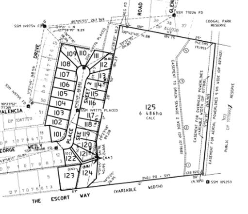
Figure 3 - deposited plan
The application outlines that existing water mains traverse
the eastern end of the subject site, and these have been recognised in the
development layout, with buildings sited so as to remain clear of any future
easement about these water mains. The application outlines that a majority of
the “affected area” will sit within the proposed communal open
space.
Part 2 -
Permitted or Prohibited Development
Clause 2.1 Land Use Zones and
Clause 2.3 Zone Objectives and Land Use Table
The subject site is located within the R2 Low Density
Residential zone. The proposed development is defined as a mixed use
development comprising a transitional group home, community facility and hostel
under OLEP 2011. All proposed uses are permitted with consent for this zone.
This application is seeking consent.
A mixed use development is defined in the OLEP 2011 as “a
building or place comprising 2 or more different land uses”. The
definition is a descriptive term where two or more land uses are proposed in
one development on one lot of land. It is not a formal land use as outlined in
the land use table.
A transitional group home is a defined use under the parent
term residential accommodation in OLEP 2011. Residential
accommodation is defined as “a building or place used
predominantly as a place of residence”.
Specific definitions relating to the proposed use of the
development are outlined below.
group home(transitional) or transitional
group home means a dwelling:
(a) that
is occupied by persons as a single household with or without paid supervision
or care and whether or not those persons are related or payment for board and
lodging is required, and
(b) that
is used to provide temporary accommodation for the relief or rehabilitation of
people with a disability or for drug or alcohol rehabilitation purposes, or
that is used to provide half-way accommodation for persons formerly living in
institutions or temporary accommodation comprising refuges for men, women or
young people,
but does not include
development to which State Environmental Planning Policy (Housing for Seniors
or People with a Disability) 2004 applies.
Further discussion relating to the test for permissibility
of a transitional group home in the R2 Low Density Residential zone is
covered under the State Environmental Planning Policy (Affordable Rental
Housing) 2009 section of this report.
The application outlines the development satisfies this
definition as:
- The
duplexes are capable of being a dwelling that is occupied as a single household
with supervision and care provided by the staff onsite.
- The
proposed transitional group homes comprised of six (6) units will be used as
temporary accommodation comprising refuges until such time as more permanent
accommodation can be located for the occupants.
The proposed salon is considered to be ancillary to the
operations of the wider use of the site as it does not comprise more than 10
per cent of the total floor area of the transitional group homes.
The Department of Planning and Environment Planning Circular
(PS 13-001) How to characterise development states:
“An ancillary use is a
use that is subordinate or subservient to the dominant purpose”.
Notwithstanding, a condition of consent has been included
requiring the salon to only be used by internal occupants of the facility. The
salon will not be permitted to operate as a service to wider external
customers.
A community facility is defined in
OLEP 2011 as:
community facility means a building or
place:
(a) owned
or controlled by a public authority or non-profit community organisation, and
(b) used
for the physical, social, cultural or intellectual development or welfare of
the community,
but does not include an
educational establishment, hospital, retail premises, place of public worship
or residential accommodation.
The application outlines that the development satisfies this
definition as
- the
development will be managed by a non-profit community organisation; and
- the
use of the southern section of the main building for services such as:
arrangement of emergency and transitional accommodation; case management for
high needs victims; arranging transport for safety; providing brokerage for
emergency needs such as food and sanitary items; safety planning; assistance
with victims compensation; ongoing information, advocacy, support and referral;
is for the physical and social welfare of the community.
The application, however, does not address the use of the
salon.
A hostel is a defined use under
the parent term residential accommodation in OLEP 2011:
hostel means premises that are generally
staffed by social workers or support providers and at which:
(a) residential
accommodation is provided in dormitories, or on a single or shared basis, or by
a combination of them, and
(b) cooking,
dining, laundering, cleaning and other facilities are provided on a shared
basis.
The application outlines that the development satisfies this
definition due to:
- the
use of the northern section of the building as a hostel to provide emergency
short term accommodation on a shared basis (plan DA 03 outlines two beds per
sleepover room) until other arrangements are made to address the
circumstance(s) of the occupant(s); and
- cooking,
common area (dining/lounge room), laundering, cleaning and other facilities
(healing room, crèche) will be provided on a shared basis.
Whilst the definition of hostel under the LEP does
not discuss domestic violence directly, it is clear that the intent of the
hostel accommodation is to supplement the services of the domestic violence
centre.
Clause 2.3 of
LEP 2011 references the Land Use Table and Objectives for each zone in
LEP 2011. These objectives for land zoned R2 Low Density Residential are
as follows:
1 -
Objectives of the R2 Low Density Residential Zone
· To provide for the
housing needs of the community within a low density residential environment.
· To enable other land
uses that provide facilities or services to meet the day to day needs of
residents.
· To ensure development
is ordered in such a way as to maximise public transport patronage and
encourage walking and cycling in close proximity to settlement.
· To ensure that
development along the Southern Link Road has an alternative access.
The proposal is considered to
meet the objectives of these aims as:
· The
Applicant states that Orange has double the State average of Domestic Violence
incidents. According to BOCSAR, Orange is ranked 26 in the State in regard to
the number of recorded domestic violence related assault incidents, with 245
incidents reported at a rate of 592 incidents per 100,000 population. This
demonstrates a need for crisis accommodation within the community. Transitional
group homes and hostels are forms of residential accommodation that meet this
need.
· The proposed
community facility, along with ancillary services and facilities under this
community facility use, will meet the day-to-day needs of occupants residing in
the transitional group homes and hostel.
· The
application document states that the area is serviced by public bus routes and
is also within reasonable taxi range. The development is proposed to be in
walking distance of Bus Stop 53 (within approximately 400 metres walking
distance) and in proximity to Bus Stop 54 of route 535A Bel-air (via Calare and
Ploughman’s Hill East), which run to the CBD from 7:24am to 5:26pm on
weekdays and 8:16am and 10:36pm on weekends (at the time of writing) (see
Figure 4).
· The proposal
is not in proximity to the Southern Link Road. The proposal does adjoin land
that would provide linkage to the Southern Link Road from the Northern
Distributor Road, however Council’s Technical Services Department advises
that the future design requirements of the intersection have been taken into
consideration as part of this proposal.
Figure 4 - Bus Route 535A
Part 3 -
Exempt and Complying Development
The application is not exempt or complying development, and
as such the provisions of this part are not applicable to this proposal.
Part 4 -
Principal Development Standards
As demonstrated in Clause 1.7 – Mapping, the
provisions of part 4 are not applicable to this proposal.
Part 5 -
Miscellaneous Provisions
As demonstrated in Clause 1.7 – Mapping, the
provisions of part 5 are not applicable to this proposal.
Part 6 - Urban Release Area
As demonstrated in Clause 1.7 – Mapping, the
provisions of part 6 are not relevant to the application. The subject site is
not located in an Urban Release Area.
Part 7 -
Additional Local Provisions
Clause 7.1 Earthworks
This clause establishes a range
of matters that must be considered prior to granting development consent for
any application involving earthworks, such as:
(a) the likely disruption of, or any
detrimental effect on, existing drainage patterns and soil stability in the
locality of the development
(b) the effect of the development on the
likely future use or redevelopment of the land
(c) the quality of the fill or the soil to be
excavated, or both
(d) the effect of the development on the
existing and likely amenity of adjoining properties
(e) the source of any fill material and the
destination of any excavated material
(f) the likelihood of disturbing relics
(g) the proximity to and potential for adverse
impacts on any waterway, drinking water catchment or environmentally sensitive
area
(h) any measures proposed to minimise or
mitigate the impacts referred to in paragraph (g).
The earthworks proposed in the
application are limited to the extent of cutting and filling required for the
proposed building or structure. The extent of disruption to the drainage of the
site is considered to be minor and will not detrimentally affect adjoining
properties or receiving waterways. The application states that earthworks
required to level the site will be conducted as part of the subdivision
proposal. This arrangement has been reviewed and is supported by
Council’s Technical Service Division.
A retaining wall is proposed to
be erected behind the proposed landscape setback and along the western boundary
of the lot, as required. The height and requirement of this retaining wall will
be determined by earthworks that will be undertaken to level the site as part
of the concurrent subdivision proposal.
The extent of the earthworks
will not materially affect the potential future use or redevelopment of the
site that may occur at the end of the proposed development's lifespan.
The site is not known to be
contaminated. A Preliminary Site Investigation Contamination Assessment
conducted as part of the supporting subdivision proposal (DA 444/2018(1)).
Findings of this report are discussed in greater detail in the State
Environmental Planning Policy 55 – Remediation of Land section of
this report. Materials will be reused onsite as far as possible, and conditions
may be imposed to require that surplus materials will disposed of to an
appropriate destination.
The earthworks will be
appropriately supported onsite and the change in ground level is not
substantial. Therefore the effect on the amenity of adjoining properties is
considered to be minor.
The site is not known to contain
any Aboriginal, European or archaeological relics. Previous known uses of the site
do not suggest that any relics are likely to be uncovered. However, conditions
have been imposed to ensure that should site works uncover a potential relic or
artefact, works will be halted to enable proper investigation by relevant
authorities and the proponent required to seek relevant permits to either
destroy or relocate the findings.
The site is not in proximity to
any sensitive waterway, drinking water catchment or sensitive area. Conditions
may be imposed to require a sediment control plan, including silt traps and
other protective measures, to ensure that loose dirt and sediment does not
escape the site boundaries.
Clause 7.2
Flood Planning
An overland flowpath is situated
on the southern boundary of the subject site. Despite the prevalence of this
flowpath on the subject site, the provisions of Clause 7.2 Flood Planning are
not applicable to the proposal as the subject site does not contain land
identified as “Flood planning area” on the Flood Planning Map. As
such, the provisions are not applicable to the proposal.
Clause 7.3
Stormwater Management
This clause applies to all
industrial, commercial and residential zones and requires that Council be
satisfied that the proposal:
(a) is designed to maximise the use of water
permeable surfaces on the land having regard to the soil characteristics
affecting onsite infiltration of water
(b) includes, where practical, onsite
stormwater retention for use as an alternative supply to mains water,
groundwater or river water; and
(c) avoids any significant impacts of
stormwater runoff on adjoining downstream properties, native bushland and
receiving waters, or if that impact cannot be reasonably avoided, minimises and
mitigates the impact.
The proposal has been designed
to include permeable surfaces and includes retention of stormwater through the
use of an adjoining detention basin. It is therefore considered that the post
development runoff levels will not exceed the predevelopment levels. Conditions
are recommended to this effect.
Clause 7.6
Groundwater Vulnerability
This clause seeks to protect
hydrological functions of groundwater systems and protect resources from both
depletion and contamination. Orange has a high water table and large areas of
the LGA, including the subject site, are identified with “Groundwater
Vulnerability” on the Groundwater Vulnerability Map. This requires that
Council consider:
(a) whether or not the development (including
any onsite storage or disposal of solid or liquid waste and chemicals) is
likely to cause any groundwater contamination or have any adverse effect on
groundwater dependent ecosystems, and
(b) the cumulative impact (including the
impact on nearby groundwater extraction for potable water supply or stock water
supply) of the development and any other existing development on groundwater.
Furthermore consent may not be granted unless Council is satisfied that:
(a) the development is designed, sited and
will be managed to avoid any significant adverse environmental impact, or
(b) if that impact cannot be reasonably avoided
- the development is designed, sited and will be managed to minimise that
impact,
(c) if that impact cannot be minimised - the
development will be managed to mitigate that impact.
The proposal is not anticipated
to involve the discharge of toxic or noxious substances and is therefore
unlikely to contaminate the groundwater or related ecosystems. The proposal
does not involve extraction of groundwater and will therefore not contribute to
groundwater depletion. The design and siting of the proposal avoids impacts on
groundwater and is therefore considered acceptable.
Clause 7.11 Essential Services
Clause 7.11 applies and states:
Development
consent must not be granted to development unless the consent authority is
satisfied that any of the following services that are essential for the
proposed development are available or that adequate arrangements have been made
to make them available when required:
(a) the supply of water,
(b) the supply of electricity,
(c) the disposal and management of sewage,
(d) storm water drainage or on-site
conservation,
(e) suitable road access.
In consideration of this clause, all utility services can be
made available to the land through the processes covered in the concurrent
subdivision proposal, and adequate arrangements can be made to service this
proposal.
STATE ENVIRONMENTAL PLANNING
POLICIES
State Environmental Planning Policy 55 - Remediation of
Land
State Environmental Planning Policy 55 - Remediation of
Land (SEPP 55) is applicable. Pursuant to Clause 7 Contamination
and remediation to be considered in determining development application:
(1) A consent authority must
not consent to the carrying out of any development on land unless:
(a) it
has considered whether the land is contaminated, and
(b) if the land is contaminated, it is
satisfied that the land is suitable in its contaminated state (or will be
suitable, after remediation) for the purpose for which the development is
proposed to be carried out, and
(c) if the land requires remediation to be made
suitable for the purpose for which the development is proposed to be carried
out, it is satisfied that the land will be remediated before the land is used
for that purpose.
In a report prepared by Geolyse to support the concurrent
subdivision proposal, part of the subject site is identified as an informal
materials staging area for machinery during the construction of the Northern
Distributor Road (Figure 4). A machinery staging area is not a use listed in
Table 1 of the Managing Land Contamination Planning Guidelines document.
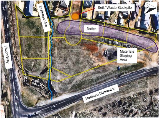
Figure 5 - Preliminary Site Investigation Site Layout
(source: Geolyse)
Further, the site is not identified
on the NSW Environment Protection Authority’s register of contaminated
lands.
In January
2018, the Department of Planning and Environment released an Explanation of
Intended Effect (EIE) and draft Guidelines outlining the intent to review
SEPP 55. The draft Guidelines state that when undertaking an initial
evaluation of contamination, a planning authority should consider whether there
is any known or potential contamination on nearby or neighbouring properties,
or in nearby groundwater, and whether that contamination needs to be considered
in the assessment and decision making process.
As is displayed
in Figure 5, no sites adjoin the subject site that are considered to be
potentially contaminated on Council’s contamination register. Further,
the subject site itself is not identified as being potentially contaminated on
Council’s contamination register.
The report prepared by Geolyse was submitted as additional
information by the Applicant to support the proposal. The report is dated
November 2018.
The application states that no significant routes for
exposure by receptors (future residents) from potential contamination sources
chemicals of potential concern (COPC) have been identified on the site relating
to the proposed subdivision (which includes the subject site). The report
states:
“Based on the findings
of this preliminary contamination investigation, Geolyse considers that
residual contamination risks may be adequately managed by conducting works in
accordance with construction industry standards, specifically:
- Any
excavation that identifies the presence of buried building rubble should be
assessed for the presence of asbestos in accordance with applicable SafeWork
NSW guidelines and codes of practice, and managed accordingly.
- Avoiding
skin contact with soil that is discoloured, malodourous, containing foreign
matter and/or generally inconsistent with virgin top soil; and
- No
entry permitted into confined spaces and excavations.
- Excavation
and stockpiling works should be conducted in a manner that avoids off-site
migration of dust and sediments.”
The report concludes that Geolyse “make the
following conclusions regarding the potential for land contamination at the
site, based on a desktop review of available information, a review of
historical records, a site walkover reconnaissance, and analytical results of
collected soil samples.
- Based
on the review of historic operations at the site, the area of the site does not
appear to have been utilised for any intensive purpose(s).
- Land
uses at the majority of the site have been generally limited to passive uses,
based on previous title ownership.
- No
significant routes for exposure by receptors (current of future) to potential
contamination sources have been identified, due to negligible impacts
identified. Residual contamination risks, if identified, may be adequately
managed by conducting works in accordance with appropriate construction
industry standards” (as outlined above).
Notwithstanding, a standard condition requiring work to
cease onsite in the case of an unexpected find during site works has been
recommended.
Further, a condition has been recommended requiring a water
and soil control plan to be submitted to Orange City Council or an Accredited
Certifier for approval prior to the issuing of a Construction Certificate.
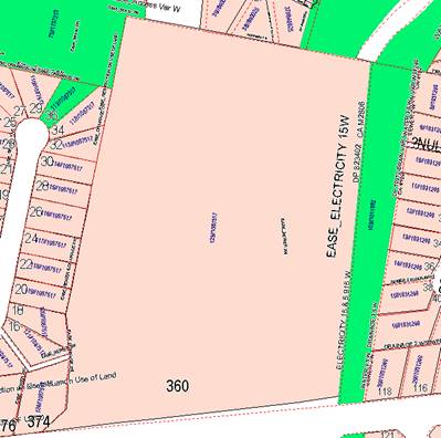
Figure 6 - No sites are identified on Council’s
Contamination Register that adjoin the subject site
State Environmental Planning
Policy (Affordable Rental Housing) 2009
State Environmental Planning Policy (Affordable Rental
Housing) 2009 is applicable. Pursuant to Division 7 Group Homes. Clause 43
Development in prescribed zones states:
(1) Development
for the purpose of a permanent group home or a transitional group home on land
in a prescribed zone may be carried out:
(a) Without
consent if the development does not result in more than 10 bedrooms being
within one or more group homes on a site and the development is carried out by
or on behalf of a public authority, or
(b) With
consent in any other case.
(2) Division
1 of Part 2 of State Environmental Planning Policy (Infrastructure) 2007 applies
in respect of development carried out by or on behalf of a public authority
under subclause (1) and, in the application of that Division, any reference in
that Division to that Policy is taken to be a reference to this clause.
The test for permissibility of a transitional group home in
the R2 Low Density Residential zone is covered by SEPP (Affordable Rental
Housing) 2009. The State policy is not concerned with the number of buildings
in situations where consent is required.
Zone R2 Low Density Residential is defined as a prescribed
zone in clause 42 of Division 7.
In relation to subclause 1(a), a total of twelve (12)
bedrooms are proposed as part of the proposal for the transitional group home,
accommodated within the six (6) proposed units. An additional two (2) bedrooms
are proposed to be accommodated within the administration building, comprising
a community facility and hostel. Further, the proposal will not be carried out
by or on behalf of a public authority. Therefore, in relation to subclause
1(b), as the proposed group home will result in more than 10 bedrooms and the
proposal is not to be carried out by or on behalf of a public authority, the
proposal requires consent. This application is seeking consent.
The provisions of subclause 2 are not applicable to the
proposal as the development is not being carried out by or on behalf of a
public authority.
Clause 45 outlines that a development for the purpose of a
group home is complying development if:
(a) the
development does not result in more than 10 bedrooms being within one or more
group homes on a site
As previously mentioned, a total of twelve (12) bedrooms are
proposed as part of the proposal for the transitional group home, accommodated
within the six (6) proposed units. An additional two (2) bedrooms are proposed
to be accommodated within the administration building, comprising a community
facility and hostel. Therefore, the proposal is not considered complying
development under this policy.
As such, clause 46 is applicable to the proposal and states:
(1) A
consent authority must not:
(a) refuse
consent to development for the purpose of a group home unless the consent
authority has made an assessment of the community need for the group home, or
(b) impose
a condition on any consent for a group home only for the reason that the
development is for the purpose of a group home.
(2) This
clause applies to development for the purpose of a group home that is
permissible with consent under this or any other environmental planning
instrument.
In relation to subclause 1(a), an assessment of the
community need for the group home has not been undertaken. However, given
advice supplied by the Applicant and the data recorded between October 2017 and
September 2018 by BOCSAR regarding the domestic violence statistics in the
Orange LGA, there is a prima facie case demonstrating the need for the
proposal. The absence of a purpose built facility for assisting domestic
violence victims in Orange limits the options for people in need of crisis
accommodation, with the potential in some cases for victims to be forced to
relocate outside of Orange, causing additional disruption to their daily lives,
employment prospects, participation in the broader community and ability to
maintain social networks with friends and family. Provision of a facility such
as the proposed development would therefore reduce the stress and anxiety
involved and may enable more people to seek help by reducing actual and
perceived barriers.
In relation to subclause 1(b), an assessment pertaining to a
transitional group home is to be undertaken as an assessment for a regular
residence. Therefore, State policy prevents the consent authority from viewing
a proposal for a transitional group home as any other form of development and
applying conditions of consent to a proposal of this nature that would not
ordinarily be applied to a standard residence. Notwithstanding this, it is
common practice to require a development to be consistent with the plans and
supporting information supplied in the application. The nature of this
transitional group home as has been portrayed to Council is for domestic
violence victims and their children, rather than the other types of clientele
described in the definition of transitional group homes. As described above,
there is a prima facie case to support a domestic violence centre in
Orange, but this has not been articulated in respect of other types of
transitional group homes. Accordingly, a condition is recommended that
restricts the proposal to domestic violence victims and their children, and
that any change in focus for the centre beyond domestic violence be subject to
an application to modify the development consent, enabling Council to consider
an assessment for the community need for such services as per clause 46
(1)(a) of the SEPP (Affordable Rental Housing) 2009.
It must be noted that, pursuant to clause 46(1)(a), should
Council decide to refuse the proposed development, a needs based assessment
will be required to be completed. Should this occur, it is requested that
Council request a further report to be prepared by staff.
Further assessment in relation to the proposed residential
use of the subject site is undertaken in following sections of this report.
PROVISIONS OF ANY DRAFT
ENVIRONMENTAL PLANNING INSTRUMENT THAT HAS BEEN PLACED ON EXHIBITION
4.15(1)(a)(ii)
There are no draft environmental planning instruments that
apply to the subject land or proposed development.
DESIGNATED DEVELOPMENT
The proposed development is not designated development.
INTEGRATED DEVELOPMENT
The proposed development is not integrated development.
PROVISIONS OF ANY DEVELOPMENT
CONTROL PLAN s4.15(1)(a)(iii)
Development Control Plan 2004
Development Control Plan 2004 (“the DCP”)
applies to the subject land (Part 7). An assessment of the proposed
development against the relevant Planning Outcomes will be undertaken below.
Pursuant to Planning Outcome 0.2-1 Interim Planning Outcomes
- Conversion of Zones:
· Throughout this
Plan, any reference to a zone in Orange LEP 2000 is to be taken to be a
reference to the corresponding zone(s) in the zone conversion table.
The corresponding zone to zones 2a Urban Residential and 2d
Urban Transition (Orange LEP 2000) is zone R2 Low Density Residential
(Orange LEP 2011). As such, Orange DCP 2004 – Chapter 7 is
relevant to this proposal. The provisions of Part 7 are considered below.
Given that the subject site is located in the Ploughmans
Valley Release Area (known as Area 2 in the Ploughmans Valley Release
Area) and adjacent to the Northern Distributor Road, the provisions of Orange
DCP 2004 Chapter 0 - Transitional Provisions are also applicable to the
proposal.
Further, as the Northern Distributor Road is zoned SP2
Distributor Road, the provisions of Orange DCP 2004 Chapter 10 – Special
Uses and Roads Zones also apply.
Applicable planning outcomes contained in the chapters
outlined above are addressed below.
Chapter 0 – Transitional
Provisions
PO 0.4-4 Interim Planning Outcomes - Ploughmans Valley
· Subdivisions
establish large lots adjoining arterial roads and along the western boundary of
the R2 zone in the vicinity of the western ridge.
Whilst the proposal is located within the Ploughmans Valley
Release Area (identified as Area 2 on the Ploughmans Valley Release Area
maps contained in Orange DCP 2004), the proposal does not request consent for
subdivision. The provisions of this clause will be dealt with in the concurrent
subdivision proposal (DA 444/2018(1).
PO 0.4-11 Interim Planning
Outcomes - Transport Routes
· The development
provides a high standard of visual appeal to motorists, cyclists and
pedestrians as well as adjoining property owners.
· The visual
appearance of the development, including any signage, lighting or other
ancillary element, must not generate a distraction to motorists.
· Any signage
must not be animated whether by movement of flashing lights.
· Where land has
more than one street frontage the street with the lower volume of traffic is to
provide the principal access to the development, subject to safety
considerations.
· Where access is
provided onto an arterial road, distributor road or major collector road, the
access point must have appropriate safe sight distances for the prevailing
speed limit and clear and unimpeded entrance/exit signage must be displayed.
· Where on-site
customer parking is provided that is not immediately visible from a public road
clear and unimpeded directional signage must be displayed.
· Where the
proposal is residential, or another noise sensitive form, appropriate noise
mitigation measures to limit the development from traffic noise must be
demonstrated.
A Noise Impact Assessment (NIA), prepared to support the
concurrent subdivision proposal and submitted to support this proposal,
outlines an assessment of the proposed subdivision with consideration to
building siting and construction requirements that are appropriate to achieve
compliance with internal and external noise limit criteria. The NIA assumes
that future buildings on proposed Lot 204 would be of a single storey and
located as generally outlined by this application. The NIA concludes that:
- compliance
with the internal noise level requirements can be achieved subject to
façade treatments recommended as part of the NIA; and
- that
acceptable external acoustic amenity can be achieved, provided a 2.5m high
acoustic barrier (incorporating earth mound and fence) is erected along the
Northern Distributor Road boundary.
Plans provided to support the proposal outline recommended
construction treatments as outlined in the NIA. The Applicant requests that, at the DA stage,
Council not require a greater level of detail in relation to construction
treatments. This is because conversations between the Applicant and Acoustic
Engineer for the project, Nic Hall (Wilkinson Murray Pty Ltd) indicate
that there is no merit in providing further appraisal of these construction
treatment components at this stage. The Applicant suggests as an alternate
approach that Council could adopt the internal noise criteria as outlined in
Table 12 of the NIA, and have the Acoustic Engineer for the project provide an
appraisal/certification of the final selected materials prior to finalisation
of the Construction Certificate drawings and issuing of the Construction
Certificate.
A referral was made to Council’s Environmental Health
and Building Surveyor, who outlined that between the concurrent subdivision
proposal and the development of the mixed use development comprising a
community facility, hostel and transitional group home, there is some
uncertainty in relation to when the acoustic barrier will be constructed.
However, conditions have been recommended that provide options for likely
construction scenarios; for example, if the acoustic barrier is built at the
subdivision stage as opposed to the Applicant being required to erect the noise
barrier.
The conditions state that:
- Prior
to the issue of a Construction Certificate for any domiciles/dwellings, the
Applicant shall provide the principal certifying authority with a Noise
Assessment Report and certification from any appropriately qualified acoustic
consultant confirming that the design and location of the domiciles/dwellings
to which the application relates complies with relevant road noise standards
applicable at the time of lodgement of that application.
- Prior
to the issue of an Occupation Certificate, all noise attenuation measures
required by the approved Noise Impact Assessment Report relating to the
residential buildings on the site shall be installed.
An Advisory Note has been included outlining that:
- There
is a Restriction-as-to-User on this site which includes road noise attenuation
measures which must be considered on this allotment.
It is therefore considered that appropriate noise mitigation
measures to limit the development from traffic noise have been demonstrated.
CHAPTER 7 - DEVELOPMENT IN
RESIDENTIAL AREAS
7.5 - Merit-Based Approach to Residential Development
in Orange
PO 7.5-1 Planning Outcomes for
New Dwellings
· All residential
development demonstrates that the principles and objectives of each design
element as outlined in section 7.7 are achieved.
An assessment against the design
elements as outlined in section 7.7 has been undertaken below.
· Development
applications for multiple-unit development (dual occupancies and residential
unit developments) include site analyses and supporting information showing how
design element outcomes have been addressed in the design in accordance with
sections 7.6 and 7.7.
The proposal does not request consent for multiple-unit
development in the form of dual occupancies or multi dwelling housing. However,
it is accepted that the proposal does propose three (3) transitional group
homes with six (6) units in a higher density than is seen within the
residential area surrounding the site. The permissibility of this is grounded
in the SEPP (Affordable Rental Housing) 2009 as previously discussed. The
Statement of Environmental Effects, site and floor plans provide analysis
demonstrating how design element outcomes have been addressed in the design in
accordance with sections 7.6 and 7.7. This has been assessed in the
proceeding sections below.
· Development
applications for two-storey houses or houses proposing encroachments within
usual setbacks include site analyses and supporting information showing how
design element outcomes have been addressed in the design in accordance with
sections 7.6 and 7.7.
The application does not propose two storey dwellings, and
the proposed buildings do not propose encroachments within the usual setbacks.
However, it must be noted that the proposal does not comply with the
requirement for a 50m setback from the centreline of the Northern Distributor
Road. The 50m setback as identified in Orange DCP 2004 is required to mitigate
noise impacts from the Northern Distributor Road. A Noise Impact Assessment
prepared to support the concurrent subdivision proposal and submitted as
supporting documentation to this proposal indicated that compliance with the
internal noise level requirements could be achieved subject to façade
treatments recommended as part of the NIA; and that acceptable external
acoustic amenity can be achieved, provided a 2.5m high acoustic barrier (incorporating
earth mound and fence) is erected along the Northern Distributor Road boundary.
Further, site analyses and supporting information has been
provided to demonstrate how design element outcomes have been addressed in lieu
of compliance with this requirement. This is discussed in greater detail in the
proceeding section.
7.6 SITE ANALYSIS
The Site:
Site Dimensions
The site is an irregular shape, with an area of
approximately 5,260m2 (subject to survey). The site adjoins the
following land uses:
- R2
Low Density Residential to the west (adjoining a proposed right of accessway
and residential lots as part of the concurrent subdivision proposal.
Established residential dwellings within the Ploughmans Valley area exist
further east).
- SP2
Infrastructure (Northern Distributor Road) immediately to the east and
RE1 Public Recreation (Coogal Wetlands) adjoining the SP2 zone.
- R2
Low Density Residential to the south (residential lots proposed as part of the
concurrent subdivision proposal) and SP2 Infrastructure adjoining this R2 Low
Density Residential zone to the south (The Escort Way).
- R2
Low Density Residential to the north (residential lots proposed as part of the
concurrent subdivision proposal).
The southern half of the subject site is reasonably
proportioned in terms of the east to west and north to south dimensions,
however tapers to a point at the northern end. The site has frontage to a
proposed cul-de-sac (subject to the concurrent subdivision proposal), which is
accessed via George Weily Place.
Topography
The site slopes gently toward the Coogal Wetlands, which are
situated to the south of the site, adjoining the Northern Distributor Road.
Services
An overland flow affects the southern section of the land in
the east-west direction. Council’s 450mm non-potable and 300mm potable
water mains affect the eastern part of the site.
Existing Vegetation
The subject land is vacant and devoid of any trees. The
application outlines that the predominant surface cover is introduced grasses.
Location of Buildings
The application states that the buildings have been designed
and sited to be clear of the services outlined above. The drainage line
relating to the overland flowpath will affect the southern fringe of the
proposed car parking area and will remain separated from the proposed
buildings.
Buildings have been sited on the land so as to remain clear
of any future easement about the 450mm non-potable and 300mm potable water
mains. The majority of the area that may be affected by any future easement
will sit within the proposed communal (open) space.
The Surrounding Area:
Built Form and Character
The character of the surrounding area is predominantly low
density residential estates. Residential estates exist to the north, south,
east and west of the subject site, albeit separated by the Northern Distributor
Road and Coogal Wetlands to the east and The Escort Way to the south. The
houses are of a contemporary design, and whilst the residential lots (subject
to the concurrent subdivision proposal) are currently undeveloped, the
residential estate adjoining these lots are well established.
Heritage Features
There are no identified heritage items in the immediate
vicinity of the subject site. The closest heritage item is well separated from
the site, situated approximately 783m to the southeast.
The subject site is not located within an identified
Heritage Conservation Area.
Neighbouring Buildings
Currently the site does not adjoin any neighbouring
buildings. However, it can be assumed that the adjacent lots (proposed as part
of the concurrent subdivision proposal) will be constructed to integrate with
the existing residential housing stock that exists in the established
residential subdivision to the west, this being predominantly single storey
structures constructed from brick materials and Colorbond roofs.
Privacy
Due to the slope of the land there will be some encroachment
on the existing views and privacy for existing residential lots adjoining the
wider subject site that is the subject of the concurrent subdivision proposal.
However, these impacts will need to be addressed by this concurrent proposal,
as well as any future proposals for development on these sites. In regard to
this proposal, privacy into and out of the site will be relatively well
maintained as a result of proposed fencing, landscaping and siting of
buildings. This is discussed in greater detail in proceeding sections of this report.
Change in Levels
Due to the concurrent subdivision proposal, exact levels of
the subject site are difficult to ascertain as site works will be required to
be undertaken as part of the subdivision proposal. Therefore, final levels are
subject to change.
Street Features
The proposed cul-de-sac which will provide access to the
subject site is yet to be constructed as it is part of the considerations of
the concurrent subdivision proposal. Therefore it is difficult to comment on
the street features of the proposed cu-de-sac.
The wider street features of George Weily Place, the street
that will provide access to the cul-de-sac are as follows:
- No
footpaths are currently established along the street.
- A
footpath connecting to the wider pedestrian walking paths accessing the Coogal
Wetlands exists at the northern end of the George Weily Place cul-de-sac.
- An
additional public footpath exists between 14 and 16 George Weily Place,
connecting to the subject site. The footpath concludes at the subject site.
- Some
street trees have been planted in the road reserve.
Direction and Distance to Local
Facilities
The subject site is approximately 3km (as the crow flies),
or 10 minute drive from the Orange Post Office, and approximately 4km (as the
crow flies), or 7 minute drive from the North Orange Shopping Complex.
Access
Access is proposed via a yet-to-be constructed cul-de-sac,
which is the subject of the concurrent subdivision proposal.
Adjacent Land Features
The Coogal Wetlands exist to the
east of the subject site, adjacent to the Northern Distributor Road. This area
is zone RE1 Public Recreation. A small section of the site adjoining the
Northern Distributor Road adjacent to this site is identified as High
Biodiversity on the OLEP 2011 Terrestrial Biodiversity Map, however, this
is not identified on the subject site itself.
Figure 7 - Site Analysis
7.7 DESIGN ELEMENTS
FOR RESIDENTIAL DEVELOPMENT STREETSCAPE
PO 7.7-1 Planning Outcomes - Neighbourhood Character
· Site layout and
building design enables the:
- creation
of attractive residential environments with clear character and identity;
- use
of site features such as views, aspect, existing vegetation and landmarks.
The application outlines that the proposal meets these
requirements for the following reasons:
- The
proposed development does not impact on important views vegetation or
landmarks.
This justification is accepted.
- Despite
the expected increase in traffic that will be generated, the proposal will not
unreasonably affect the function of the new access road (subject to a
concurrent subdivision proposal) or George Weily Place for pedestrian access
and use. Vehicles associated with the development are able to enter and exit in
a forward direction and adequate driver and pedestrian sightlines will be
achieved so that vehicles entering and exiting the site are visible to
pedestrians and vice versa.
In assessment of this justification, it is considered that
the neighbourhood character of the existing area, particularly along the
existing George Weily Place cul-de-sac, will be altered in some capacity.
George Weily Place is an existing residential cul-de-sac with only local traffic.
In line with internal Council assessment processes, the
proposal was referred to Council’s Technical Services Division to review
the assumptions as outlined in the application (and above) relating to the
impact of the development on the environmental capacity of the road network.
The Technical Services division reviewed the assessment
undertaken by the application and outlined that the proposed development will create the following situation in the
cul-de-sac:
- 35
residential lots and 1 lot for a mixed use development comprising a community
facility, hostel and transitional group home (exceeding Council’s
development standard by 6 lots OR 20%); and
- average
daily vehicle movements of 344 (exceeding Council’s development standard
by 44 vehicle movements OR 15%).
There are numerous examples where this deviation from
Council’s development code has been undertaken. Nicole Drive services 4
cul-de-sacs and 54 allotments, 399 average daily vehicle movements; and
Glendale Crescent services 106 allotments, 784 average daily vehicle movements.
The referral outlined
that these issues could be mitigated as follows:
- The future development of this area
beside the Northern Distributor Road has been identified on Council’s DCP
since 2004. The DCP subdivision layout includes 8 residential lots. The
current subdivision proposal is for only 5 lots with access from George Weily
Place, with 3 lots being accessed via The Escort Way (a reduction of 37.5%
from the DCP).
- The
average daily vehicle movements within George Weily Place as a result of the
5 new lots and mixed use development comprising a community facility,
hostel and transitional group home will be 344. This is within 15% of the
maximum permitted under Council’s Development and Subdivision Code; however,
the increase in vehicle movements will be spread throughout the day and any
peak traffic flows to and from the centre will be in an opposite direction to
that of the local residents.
- The allotments in
George Weily Place are a generous size of 850m2 with 24m frontages,
which provides a low density traffic environment (as opposed to typical 15m wide lots or 62.5% increase in
frontage).
- The
intersections of Jonathon Road/George Weily Place and George Weily
Place/‘The Orchard’ access will manage the predicted peak hour
traffic volume without any significant treatment other than line-marking on
approaches to the intersections.
- There
would be minimal change to the George Weily Place/Jonathon Road intersection
level of service with the additional development as per Austroads Guide to
Traffic Management Part 3.
Therefore, the proposal was recommended for approval by
Technical Services, provided recommended conditions of consent were included in
the Notice. These conditions have been included in the Notice.
Notwithstanding, it is recommended that footpaths be
installed along this road reserve to provide alternatives for pedestrians to
the roadway as part of separate consideration by Council, in order to maintain the
existing residential character and provide safe pedestrian linkages to the
wider walking paths of the area, albeit in a more formalised arrangement.
· Buildings are
designed to complement the relevant features and built form that are identified
as part of the desired neighbourhood character.
The application outlines that the proposal meets these
requirements for the following reasons:
- The
building design maintains a common theme and consistent use of materials. In
particular, the proposed buildings will be of a single storey scale and the
building footprints and elevations are not so large that they are
uncharacteristic of the area.
- The
skillion roof profiles are reflective of modern residential architectural
forms.
- The
proposed wall finishes are reflective of domestic finishes found across the
broader neighbourhood.
- A
minimal expanse of hard driveway surface is proposed at the street frontage.
These justifications are accepted.
· The streetscape
is designed to encourage pedestrian access and use.
This is previously discussed in greater detail above. As
such, the provisions of this requirement are considered to have been addressed.
PO 7.7-2 Planning Outcomes -
Building Appearance
· The building
design, detailing and finishes relate to the desired neighbourhood character,
complement the residential scale of the area and add visual interest to the
street.
As previously noted, the application outlines that the
proposed materials, skillion roof profiles and single storey scale of the
proposed buildings are appropriate in the existing neighbourhood character of
the area.
This is accepted in this instance.
· The frontage of
buildings and their entries address the street.
The application states that the administration building
(community facility and hostel), will be appropriate in regard to presentation
to the public street (proposed cul-de-sac) as:
- Some
windows will be incorporated on the western elevation.
- The
roof line will be varied.
- A
mix of external wall finishes will be incorporated into the design.
A small section of the western elevation will present to the
street, with both the front fencing designed to allow a small section of the
administration building (community facility and hostel) to present to the
cul-de-sac. However, the application outlines that due to the proposed use and
the nature of the activities, the entrance to building will be provided at the
southern side of the building, from within the site.
The application proposes landscaping of the front setback of
the community/hostel building and to minimise hard surface driveway areas. The
application states that the proposed car parking area will not be easily
visible from the streetscape.
The application further outlines that it is considered
unnecessary to address the Northern Distributor Road by way of buildings
“fronting” this road as the principal access will be provided from
the proposed cul-de-sac. The proposal provides for open space areas along the
section of the site that adjoins the Northern Distributor Road and maintains a
bulk, height and scale of modest appearance, and will not “crowd”
the Northern Distributor Road.
The application contends that the presentation of the
development to the Northern Distributor Road will not be uncharacteristic of
other nearby development that is already established along this corridor. These
points are generally accepted. It is further considered that the requirement
for a 2.5m high acoustic barrier (incorporating earth mound and fence) will
impact on the ability of the development to address this frontage, and
improving the amenity of the Northern Distributor Road will be a matter dealt
with as part of the concurrent subdivision proposal. Internal landscaping is
proposed along this wall to soften the impact on occupants of the
administration building and the transitional group homes. The internal
landscaping of the site is discussed in further detail in proceeding sections
of this report.
· Garages and car
parks are sited and designed so that they do not dominate the street frontage.
There are no garages proposed as part of the proposal. A
garden shed, the size of a single car garage is proposed onsite, however, this
does not face the street.
PO 7.7-4 Planning Outcomes -
Setbacks
· Street setbacks
contribute to the desired neighbourhood character, assist with integration of
new development and make efficient use of the site.
The proposal meets the required setback of 4.5m from the
public street boundary (proposed cul-de-sac) along the street frontage for new
development. It is accepted that the wider residential estate is not
technically “new development”, however the proposed subdivision
surrounding the subject site is vacant land, and as such new development. The proposed
development along the street frontage sits behind the required 4.5m setback.
However, in residential areas
development would normally address the street, with the frontage of the
building oriented to the street frontage to maintain the neighbourhood
character. This is not achieved due to the nature of the proposed use. A
proposed retaining wall (as required) sits behind the proposed vegetated
setback (see Figure 7) and is proposed just within the 4.5m required setback.
However, all relevant buildings are maintained behind this setback, meeting
this requirement.
Figure 8 - site plan
Further, the proposal does not meet the recommended
requirement for a 50m setback from the centreline of the Northern Distributor
Road. The application states that, due to the proposed subdivision pattern
(subject to concurrent subdivision proposal), the subject site would be
significantly constrained if this requirement was to be enforced.
The application outlines that visual amenity to the site
from the Northern Distributor Road can still be maintained despite not meeting
the 50m setback requirement, and the setback is considered unnecessary in
ameliorating noise impact given the comments outlined in the Noise Impact
Assessment (dated 13/11/2018). The Noise Impact Assessment, which was provided
as additional information to this proposal and prepared to support the
concurrent subdivision proposal, provides an assessment of the proposed
subdivision, with consideration given to the building siting and construction
requirements that are needed to achieve internal and external noise limit
criteria. This report concludes that internal noise level requirements can be
achieved, subject to recommended façade construction details. The report
further outlines that acceptable outdoor acoustic amenity can be achieved by
erecting a 2.5m high acoustic barrier (incorporating earth mound and fence)
along the Northern Distributor Road.
A referral was made to Council’s Environmental Health
and Building Surveyor (EHBS) who outlined that, between the concurrent
subdivision proposal and the development of the mixed use development
comprising a community facility, hostel and transitional group home, there is
some uncertainty in relation to when the acoustic barrier will be constructed.
However, conditions have been recommended that provide options for likely
construction scenarios; for example, if the acoustic barrier is built at the
subdivision stage as opposed to the Applicant being required to erect the noise
barrier. This will cover both outcomes and provide flexibility in the approach,
while ensuring that the noise amelioration requirements are put in place prior
to residential occupation.
The recommended conditions state that:
- Prior
to the issue of a Construction Certificate for any domiciles/dwellings, the
Applicant shall provide the principal certifying authority with a Noise
Assessment Report and certification from any appropriately qualified acoustic
consultant confirming that the design and location of the domiciles/dwellings
to which the application relates complies with relevant road noise standards
applicable at the time of lodgement of that application.
- Prior
to the issue of an Occupation Certificate, all noise attenuation measures
required by the approved Noise Impact Assessment Report relating to the
residential buildings on the site shall be installed.
- There
is a Restriction-as-to-User on this site which includes road noise attenuation
measures which must be considered on this allotment.
Therefore, it is accepted that in this instance the 50m
setback from the centreline of the Northern Distributor Road is not required,
provided the above recommendations are put in place prior to occupation of the
development.
· Street setbacks
create an appropriate scale for the street considering all other streetscape
components.
As previously stated above, the street setback is proposed
to be landscaped. This is deemed acceptable, provided the landscaping creates
an attractive, diverse setting that presents appropriately to the street.
Further discussion in relation to appropriate landscaping has been discussed in
detail under the PO 7.7-16 Planning Outcomes – Private Open Space.
In this regard, the departure from the standard residential
setbacks and presentation to the street will be acceptable, and the scale for
the street is deemed appropriate in this instance.
PO 7.7-5 Planning Outcomes -
Fences and Walls
· Front fences
and walls:
- assist
in highlighting entrances and creating a sense of identity within the
streetscape
- are
constructed of materials compatible with associated housing and with fences
visible from the site that positively contribute to the streetscape
- provide
for facilities in the street frontage area such as mail boxes.
The Statement of Environmental Effects has not addressed
this requirement specifically, however does state the height and proposed
materials for fencing along the front of the development. The site plan also
provides further indication of the proposed materials and location of fencing.
A 2.1m high palisade fence and gate is proposed to form the
entrance to the development. This fence is proposed to extend from the western
boundary, across the proposed driveway accessible to the south of the
cul-de-sac, and conclude in line with the proposed administration building (see
Figure 7). A 2.1m high timber paling fence will commence from approximately the
middle of the cul-de-sac and will run the length of the cul-de-sac.
The proposed timber paling fence will have prominence and
visibility from the streetscape. The DCP guidelines state that front fences and
walls are to be designed to use similar or compatible materials used in the
locality to positively contribute to the streetscape. Due to the prominence of
the timber paling fence along the cul-de-sac frontage, it is considered that
palisade fencing should be erected along the frontage of the cul-de-sac, to
provide continuity in the streetscape and integrate with the fencing that is
proposed to be erected at the entrance to the facility.
Further, the proposed fencing height of 2.1m along the western
boundary and the southern boundary is in excess of the recommended 1.2m
guideline for front fences (as identified in Orange DCP 2004) and 1.8m
high fence generally requested as part of boundary fencing for residential
development. It is accepted that the proposed use of the development and the
privacy and safety requirements of the proposed facility require a slight
departure from this standard. However, the 2.1m high fence at both the front
setback and along the western and southern boundaries is not considered
acceptable. Discussions with the Applicant in regard to the proposed fencing
has indicated that a maximum height of 1.8m for fencing along these boundaries
is acceptable in this circumstance. Finally, to improve presentation to the
streetscape for users of the proposed cul-de-sac, the proposed boundary fence
between the subject site and proposed Lot 208 forward of the proposed palisade
gate should not exceed 1.2m in height.
In regard to fencing along the shared
boundary with the proposed retention basin, to facilitate management of the
proposed retention basin by Orange City Council, fencing of the shared boundary
between the subject lot and proposed adjoining basin (proposed Lot 209 in
the concurrent subdivision proposal) shall be deferred until the location and
timing of the acoustic barrier has been finalised.
Therefore in relation to front fencing, a condition of
consent has been included requiring the following:
The site plan is to be amended
prior to the issuing of a Construction Certificate demonstrating:
- a
maximum 1.8m high palisade fence is to be erected along the front setback of
the development along George Weily Place. A maximum 1.8m palisade gate is to be
incorporated into the driveway setback, to be accommodated to the southeast of
the proposed cul-de-sac.
- a
maximum 1.8m high Colorbond fence along the western boundary shared with
proposed Lot 208. Any part of the fence in front of the gate line is to have a
maximum height of 1.2m.
- a
maximum 1.8m high Colorbond fence along the western boundary, shared with the
proposed right-of-way (burdening proposed Lot 203 and benefitting proposed
Lot 202).
-
Once the amended site plan has been approved and
Construction Certificate issued, fencing will be required to be erected in line
with this amended site plan.
Energy Efficiency
Council’s DCP 2004 states that the Energy Smart
Homes Code principles include consideration of solar design in terms of
site analysis, thermal design, landscaping and heating systems. These elements
have been covered throughout the various sections and assessment contained in
this report, namely, PO 7.7-8 Planning Outcomes – Daylight and
Sunlight and BASIX Commitments below.
Bulk and Scale
PO 7.7-6 Planning Outcomes - Visual Bulk
· Built form
accords with the desired neighbourhood character of the area with:°°
- side
and rear setbacks progressively increased to reduce bulk and overshadowing;
- site
coverage that retains the relatively low density, landscaped character of
residential areas;
- building
form and siting that relates to land form, with minimal land shaping (cut and
infill);
- building
height at the street frontage that maintains a comparable scale with the
predominant adjacent built form;
- building
to the boundary where appropriate.
The application states that the proposal satisfies planning
outcomes relating to visual bulk as:
- The
proposed buildings will be single storey with reasonable setbacks from side and
rear boundaries, and will complement the bulk, height and scale of dwellings in
the broader residential neighbourhood.
- Due
to the setback from the boundaries, the buildings will be contained within the
visual bulk envelope (VBE), generated by planes projected at 45° over the
site, commencing 2.5 metres above existing ground level from each side and rear
boundary.
- The
development complies with the DCP maximum site coverage. The proposed buildings
comprise a total footprint area of 1,090.7m2. The subject site has
an area of approximately 5,260m2 (subject to survey). As such, site
coverage will be in the order of 21 per cent.
- In
relation to building siting and landform, the bulk earthworks and land shaping
will be undertaken as part of the concurrent subdivision proposal, resulting in
Lot 204 being provided a relatively unconstrained site.
The reasons outlined above are accepted and compliance with
the objectives of visual bulk are considered to have been addressed.
PO 7.7-7 Planning Outcomes -
Walls and Boundaries
· Building to the
boundary is undertaken to provide for efficient use of the site taking into
account:
- the
privacy of neighbouring dwellings and private open space;
- the
access to daylight reaching adjoining properties;
- the
impact of boundary walls on neighbours.
The application states that building to the boundary is
considered unnecessary in this case as the proposed buildings will not
unreasonably reduce the amount of daylight that reaches adjoining properties or
unreasonably impact upon their privacy. Matters relating to access to daylight
and sunlight, and privacy are discussed in further detail in following sections
of this report.
PO 7.7-8 Planning Outcomes -
Daylight and Sunlight
· Buildings are
sited and designed to ensure:
- daylight
to habitable rooms in adjacent dwellings is not significantly reduced;
- overshadowing
of neighbouring secluded open spaces or main living-area windows is no
significantly increased;
- consideration
of Council’s Energy Efficiency Code.
According to guidelines outlined in Council’s DCP
2004, sunlight is to be available to at least 40 per cent of required open
space for each residential building within the development for at least 3 hours
between 9:00am and 3:00pm on the winter solstice (21 June). The
application argues that, in this case this planning outcome relates to the
transitional group homes (Units 1 to 6). This is disputed as a hostel is
considered a residential use, evidenced by the inclusion of the hostel
definition under the parent term “residential accommodation”.
However, given that the proposed hostel will be used for emergency
accommodation only (described as sleepover rooms on the plans), it is
considered that these will only be used for a short period of time (eg
overnight stays only) before occupants will either be transferred into other
accommodation - either the transitional group homes onsite or off-site
facilities. Further, occupants of the hostel will have access to the open space
provided in the grounds, albeit not in a private setting. As such it is not
considered that the hostel will require private open space in line with the
requirements of Orange DCP 2004.
In regard to the transitional
group homes, the application states that the shadow diagrams demonstrate that
the proposed development would not generate adverse impacts on future
residential development that may occur to the west and south (see Table 1
below). The main impact to adjoining properties would be from the 1.8m high
boundary fence along the western boundary. However, this impact would be
absorbed mainly by the proposed right of access to the west of the subject site
(proposed as part of the concurrent subdivision proposal) that would provide
access to residential properties to the north of the proposed cul-de-sac. In
regard to the impact on proposed Lot 208, which is the subject of the
concurrent subdivision proposal, a future dwelling on this site could be
designed and sited to reduce the impact to primary living areas and private
open space. Further, the impact from the 1.8m high fence would be felt
regardless of the proposed residential use of the land. Therefore the
overshadowing to adjoining properties is considered satisfactory in this
instance.
|
Table
1 – Overshadowing to POS
|
|
Unit
|
GFA
(m2)
|
POS
required (m2)
|
Unshaded
POS required (m2)
|
Solar
Access to POS Performance in min. 3-hour period
|
|
1
|
79.1
m2
|
39.55
m2
|
15.82m2
|
Complies.
27.5m2 to 73.3m2 of unshaded POS between 9am
and 3pm.
|
|
2
|
79.1
m2
|
39.55
m2
|
15.82m2
|
Complies.
15.9m2 to 46.9m2 of unshaded POS between 9am
and 3pm.
|
|
3
|
79.1
m2
|
39.55
m2
|
15.82m2
|
Complies.
17.5m2 to 50m2 of unshaded POS between 9am and
3pm.
|
|
4
|
79.1
m2
|
39.55
m2
|
15.82m2
|
Complies.
18.2m2 to 59.3m2 of unshaded POS between 9am
and 3pm.
|
|
Table
1 – Overshadowing to POS
|
|
Unit
|
GFA
(m2)
|
POS
required (m2)
|
Unshaded
POS required (m2)
|
Solar
Access to POS Performance in min. 3-hour period
|
|
5
|
79.1
m2
|
39.55
m2
|
15.82m2
|
Complies.
60.7m2 to 107.9m2 of unshaded POS between
9am and 3pm.
|
|
6
|
79.1
m2
|
39.55
m2
|
15.82m2
|
Complies.
24.7m2 to 72.9m2 of unshaded POS between 9am
and 3pm.
|
Orange DCP 2004 and
Council’s Energy Efficiency Code state that sunlight to at least
75 per cent of north-facing living-area windows or residential buildings
within the development and on adjoining land is to be provided for a minimum of
4 hours on 21 June; or not further reduced than existing where already less.
The application states that the shadow diagrams demonstrate
that:
- The
north facing living room windows of proposed Units 1 to 6 remain largely
unaffected by shadows.
- The
proposed development would not generate adverse impacts on future residential
development that may occur on the adjoining land to the west and south.
The shadow diagrams provided to support the proposal
indicate that Units 2, 4 and 6 achieve adequate sunlight to at least 75
per cent of north facing living-area windows between 9am and 3pm. The shadow
diagrams show that Unit 5 achieves adequate sunlight to its north facing window
between 12pm and 3pm, and due to the location of this window, it is reasonable
to assume that this will continue to 4pm, meeting this requirement.
The shadow diagrams for Units 1 and 3 show that adequate
sunlight to north facing windows can be achieved between 9am and 12pm. Due to
the design of the transitional group homes, with Units 1 and 3 situated on the
south of each of the transitional group homes, and the location of the proposed
windows, it is reasonable to assume that these windows will be able to achieve
an adequate amount of sunlight from 8am, meeting this requirement.
As previously stated, the overshadowing to adjoining
properties is considered satisfactory in this instance as the main impact is
not from the proposed buildings but the fencing, and this impact is absorbed by
the right-of-way adjoining the western boundary to the north of the proposed
cul-de-sac; and impacts can be managed to the adjoining residential lot on the
western boundary to the south of the proposed cul-de-sac.
PO 7.7-9 Planning Outcomes -
Views
· Building form
and design allow for residents from adjacent properties to share prominent
views where possible.
· Views including
vistas of heritage items or landmarks, are not substantially affected by the
bulk and scale of new development.
The application states that the subject site is not located
within an important view corridor and the proposed buildings would not
unreasonably diminish views for other properties in the vicinity. It is
accepted that the proposal is not located within an important view corridor,
being located in close proximity to two busy roadways - The Escort Way and the
Northern Distributor Road. Further, the proposal maintains a single storey
structure and consistent fencing heights that are found in the surrounding
residential area. The requirement for the 2.5m high acoustic boundary
fence (with incorporated earth mound) is a noise attenuation requirement for
the subdivision and is required by the concurrent subdivision proposal.
Therefore, it is considered that the proposal will not substantially impact on
views.
Privacy and Security
PO 7.7-10 Planning Outcomes - Visual Privacy
· Direct
overlooking of principal living areas and private open spaces of other
dwellings is minimised firstly by:
- building
siting and layout;
- location
of windows and balconies;
and secondly by:
- design
of windows or use of screening devices and landscaping.
The application states that the proposal is unlikely to
impact on the privacy on adjoining lots, due mainly due to the proposed fencing
and landscaping proposed on the perimeter of the lot. Specifically, in relation
to visual privacy it is considered that:
- The
proposed development is contained within the boundaries of proposed
Lot 204 with appropriate setbacks.
- “Active”
areas of the development are focused inwards.
- The
eastern boundary of the site adjoins the Northern Distributor Road and the
proposed retention basin lot. As such, the interface is not considered
sensitive in terms of potential privacy impacts. Further, the 2.5m proposed
acoustic barrier (incorporating earth mound and fence) coupled with the
proposed landscaping would limit the potential for overlooking.
- The
majority of the western boundary to the north of the cul-de-sac will adjoin a
right of access driveway that will serve adjoining lots subject to the
concurrent subdivision proposal. The proposed site fencing and landscaping
along this western boundary will maintain privacy between the subject site and
adjoining properties by limiting sight lines into the subject site.
- The
western boundary to the south of the cul-de-sac adjoins proposed Lot 208
in the concurrent subdivision proposal. This section of the site is occupied by
the proposed car park. The proposed site fencing and landscaping will maintain
privacy to adjoining neighbours.
- The southern boundary of the site
adjoins proposed Lots 205, 206 and 207 in the concurrent subdivision proposal.
The proposed fencing and landscaping along that section of the boundary will
assist to maintain privacy between the proposed car park for the development
and the proposed adjoining residential properties.
In regard to potential privacy impacts to adjoining
residential properties, it is considered that the perimeter fencing and
acoustic barrier will prevent overlooking of any private open space and primary
living areas with the development. These justifications are accepted.
In regard to privacy impacts in relation to the internal
arrangements onsite, the application states:
- The
proposed structure of the development aims to encourage a sense of community
among the occupants of the facility. However, it has been recognised that there
is a need to maintain a reasonable level of privacy for occupants. As such:
· The private open space
area pertaining to each unit are to be fenced up to 1.5m in height, so that
privacy is afforded to occupants of the external private open space areas
within each unit.
· The principal living
area windows for each unit are focussed on that unit’s private open
space.
· Key windows of each unit
do not directly oppose each other.
· The front doors are
reasonably separated and do not face each other, allowing occupants to enter
and exit with a degree of privacy.
· Proposed landscaping
will assist to filter views through the site.
In relation to the above, the following comments are made:
- The
proposed 1.5m high fencing between the private open space of each unit is
appropriate and complies with Councils DCP 2004 guidelines.
- Private
open space for each unit is provided off principal living areas of each unit
and on opposite sides of the proposed transitional group homes, in such a way that
the windows in each unit do not overlook adjoining private open space or
principal living areas of other units.
- Units
are oriented to face inwards to the site, complying with passive surveillance
requirements.
- The
adequacy of the proposed landscaping treatments are discussed in detail in
proceeding sections of this report.
As previously discussed, private open space is not provided
for occupants of the hostel situated within the administration building.
Despite this being a residential use, this is proposed to be utilised as
“emergency short term accommodation” until other arrangements are
made to address the circumstances of the occupant(s). It is considered that,
given the short term nature of the proposed hostel, a private open space area
is not required in this instance. Further, occupants have access to the public
open space areas provided on the grounds, which is deemed adequate for short
term occupants of this accommodation.
PO 7.7-11 Planning Outcomes -
Acoustic Privacy
· Site layout and
building design:
- protect
habitable rooms from excessively high levels of external noise;
- minimise
the entry of external noise to private open space for dwellings close to major
noise sources;
- minimise
transmission of sound through a building to affect other dwellings.
A Noise Impact Assessment (NIA), prepared to support the
proposed subdivision proposal and submitted to support this proposal, outlines
an assessment of the proposed subdivision with consideration to building siting
and construction requirements that are appropriate to achieve compliance with
internal and external noise limit criteria. The NIA assumes that future
buildings on proposed Lot 204 would be of a single storey and located as
generally outlined by this application. The NIA concludes that:
- compliance
with the internal noise level requirements can be achieved subject to
façade treatments recommended as part of the NIA; and
- acceptable
external acoustic amenity can be achieved, provided a 2.5m high acoustic
barrier (incorporating earth mound and fence) is erected along the Northern
Distributor Road boundary.
Plans provided to support the proposal outline recommended
construction treatments as outlined in the NIA. The Applicant requests that at
the DA stage, Council not require a greater level of detail in relation to
construction treatments. This is because conversations between the Applicant
and Acoustic Engineer for the project (Nic Hall - Wilkinson Murray Pty Ltd) indicate
that there is no merit in providing further appraisal of these construction
treatment components at this stage. The Applicant suggests, as an alternative
approach, that Council could adopt the internal noise criteria as outlined in
Table 12 of the NIA, and have the Acoustic Engineer for the project
provide an appraisal/certification of the final selected materials prior to
finalisation of the Construction Certificate drawings and issuing of the
Construction Certificate.
A referral was made to Council’s Environmental Health
and Building Surveyor (EHBS) who outlined that, between the concurrent
subdivision proposal and the development of the mixed use development
comprising a community facility, hostel and transitional group home, there is
some uncertainty in relation to when the acoustic barrier will be constructed.
However, conditions have been recommended that provide options for likely
construction scenarios; for example if the acoustic barrier is built at the
subdivision stage as opposed to the Applicant being required to erect the noise
barrier. This will cover both outcomes and provide flexibility in the approach,
while ensuring that the noise amelioration requirements are put in place prior
to residential occupation.
The recommended conditions state that:
- Prior
to the issue of a Construction Certificate for any domiciles/dwellings, the
Applicant shall provide the principal certifying authority with a Noise
Assessment Report and certification from any appropriately qualified acoustic
consultant confirming that the design and location of the domiciles/dwellings
to which the application relates, complies with relevant road noise standards
applicable at the time of lodgement of that application.
- Prior
to the issue of an Occupation Certificate, all noise attenuation measures
required by the approved Noise Impact Assessment Report relating to the
residential buildings on the site shall be installed.
- There
is a Restriction-as-to-User on this site which includes road noise attenuation
measures which must be considered on this allotment.
In the event that the acoustic barrier
(incorporating earth mound and fencing) is not constructed as part of the
subdivision works, the applicant shall provide details of the proposed acoustic
barrier fencing prior to the issue of a Construction Certificate. In
this case, the Applicant shall provide for the erection prior to occupation
certification. The acoustic barrier shall be constructed in accordance with the
requirements of the noise report.
Therefore, it is considered that noise impacts from the
Northern Distributor Road can be mitigated to support residential development
on this site.
Further, the application states that noise impacts from
adjoining units will be mitigated by a fire rated and sound insulated wall erected
between the units within the transitional group homes, with the lockable door
provided as a solid core fire door (providing sound insulation qualities).
The separation of the units will further limit the potential
for noise transfer from each building.
The provisions relating to acoustic amenity are therefore
considered to have been addressed.
PO 7.7-12 Planning Outcomes -
Security
· The site layout
enhances personal safety and minimises the potential for crime, vandalism and
fear.
· The design of dwellings
enables residents to survey streets, communal areas and approaches to dwelling
entrances.
In relation to the matter of security, a letter provided to
Council by the applicant to support the proposal states:
“Feedback from other
facilities including in Bathurst and Forbes indicate there are very few
incidents, both stating they have had no serious issues that affected the
neighbours or others in the community. Perpetrators of domestic violence come
from all walks of life and socioeconomic groups. They seek to control their
partner/ex-partner emotionally, mentally, spiritually and/or physically. The
controlling behaviours are generally directed to their partner and many
perpetrators otherwise lead a ‘normal life’. They may not
have any other interaction with Police or the legal system. Some men do attempt
to contact their partners after they have left the relationship but they are
solely focused on the victim and our staff have strict procedures and extensive
training in dealing with such matters swiftly and decisively.
The experience of other
similar centres and refuges in other regional cities and towns are that
security systems that include fencing that obstructs vision in to the Orchard,
surveillance cameras for, and as well as 24 hour staff act as a deterrent for
Perpetrators, leading to minimal or no incidents. This in combination with a
suite of procedures for staff at the facility, as well as the use of
Apprehended Violence Orders to prevent them approaching (failure to do so would
result in arrest imprisonment), is the best way to deter perpetrators from
trying to visit the families staying at the Orchard.”
Notwithstanding, in line with the requirements of Planning
Outcome 7.7-12, the proposal was referred to the NSW Police Force to review the
proposed safety measures and provide any recommendations in relation to
improving or strengthening the safety of the proposed facility.
Crime Prevention Through Environmental Design (CPTED) is a
crime prevention strategy that focuses on planning, design and structure of
cities and neighbourhoods to reduce opportunities for crime. This is achieved
by using design and place management principles to reduce the likelihood of
essential crime ingredients from intersecting. The security requirements in
relation to CCTV and lighting at night, outlined below, are a product of
recommendations provided by the NSW Police Force and the assessment against the
CPTED Treatment Principles to discourage perpetrators. The nature of the
inclusion of these strategies is to mitigate against any potential risks,
rather than respond to them.
The application outlines that the following CPTED principles
have been considered and adopted when designing the proposal:
- A
secure perimeter with a single controlled access point to the site.
- Building
entrance points are not to be obvious in relation to the street.
- Clarity
to be provided between public and non-public areas within the site.
- Potential
for the development to be easily viewed or exposed to the public will be
limited, but reasonable passive surveillance will maintained within the site
itself.
In regard to surveillance, the
application states reasonable passive surveillance will be provided as follows:
- The community/hostel building has
windows that offer sight lines towards the cul‑de‑sac, site
entrance, Northern Distributor Road boundary of the site, communal space,
playground and pathways to the transitional group homes (Units 1 to 6).
- The
transitional group homes (Units 1 to 6) offer sight lines towards the communal
open areas between them, the central pathway and their segment of external
boundary of the site.
- Reasonable
sight lines will be provided between the eastern communal space and the car
park.
- The
external areas of the site will be illuminated and sensor lighting will be
strategically located.
- Surveillance
cameras will be provided for each unit, the main building and all the grounds
and surrounding paths, as well as assembled on the gate, with a view to the
driveway and a section of the cul-de-sac.
- Car
registration recognition equipment.
In regard to access, the application states that effective
access control would be achieved as follows:
- A
single point of entry to the site, which is gate controlled and adjacent to the
administration (community facility/hostel) building to enable entry and exit to
be monitored.
- Vehicle
access does not extend beyond the car park.
- Once
within the site, the main building entrance is clearly depicted.
- The
boundaries will be fenced to delineate private and public property.
- A
gate and fencing are proposed to secure the car park and premises at night.
In regard to territorial reinforcement and space management,
the application states that the development would be managed so as to
contribute to this principle as follows:
- Site
boundaries secured by fencing.
- Private
open space in Units 1 to 6 accommodated in the transitional group homes secured
by fencing.
- Public
access areas are well defined.
- The
active nature of the car park, playground and communal spaces may facilitate
easy detection of potential offenders.
- The
site and buildings will be illuminated and sensor lighting will be
strategically placed.
- Surveillance
cameras will be provided for each unit, the main building and all the grounds
and surrounding paths, as well as assembled on the gate, with a view to the
driveway and a section of the cul-de-sac.
- Maintenance
of the buildings and external areas will be ongoing.
Further, the application notes that residents surrounding
the proposal may raise concerns in relation to safety concerns. The application
outlines that:
“Based on current
Housing Plus experience in Orange and other centres, perpetrators are largely
deterred because in many cases they have been interviewed by the Police, are in
custody and some may have Orders in place to prevent them approaching (which if
ignored may result in arrest/imprisonment.”
- The
application notes that certain approaches will be adopted in regard to the
management of the facility to deter perpetrators from attending the site,
including:
- Fencing
to obstruct vision into the site.
- Surveillance
cameras will be provided for each unit, the main building and all the grounds
and surrounding paths, as well as assembled on the gate, with a view to the
driveway and a section of the cul-de-sac.
- Car
registration recognition equipment.
- 24
hour staffing of the centre.
The application and associated documents were reviewed by a
representative of the NSW Police Force at the Central West Police
District, Orange Police Station in relation to the Crime Prevention
Guidelines a Crime Risk Assessment (CRA) framework. A number of conditions
were recommended as part of the comments to mitigate impacts of the proposed
development.
Comments from this referral indicate that identified crime
risks that may impact upon the premises are, Break, Enter and Steal, Assault,
Steal from Motor Vehicle, Malicious Damage and Intimidation.
In relation to these risks, the Central West Police District
comments outline that:
“predatory offenders
often make cost-benefit assessments of potential victims and locations before
committing a crime. CPTED aims to create the reality (or perception) that the
costs of committing crime are greater than the likely benefits”.
To mitigate against these risks and discourage perpetrators
from attempting to visit the centre, social and environmental conditions should
be created that:
- maximise
risk to offenders (increasing the likelihood of detection, challenge and
apprehension);
- maximise
the effort required to commit the crime (increasing time, energy and resources
to commit crime);
- minimise
the actual and perceived benefits of crime (removing, minimising or concealing
crime attractors and rewards), and
- minimise
excuse-making opportunities (removing conditions that encourage/facilitate
rationalisation of inappropriate behaviour.
To this end, a number of recommendations have been made to
achieve the above objectives under the various principles outlined by the CPTED
treatments, including surveillance, access control, territorial re-enforcement,
and space and activity management to reduce opportunities. These are outlined
in Table 2 below and recommended conditions have been included in the consent.
It should be noted that the recommendations contained in Table 2 are not a
guarantee that all risks have been identified, or that the area assessed will
be free from criminal activity if the recommendations are followed.
In review of the planning outcomes and assessment and
incorporation of CPTED principles, it is considered that the site layout and
design of dwellings enables residents to survey communal areas and approaches
to dwelling entrances. Dwellings are specifically designed to not survey
streets - due to the nature of the proposed use there is a need for a level of
privacy for victims to deter perpetrators from accessing the site. The
incorporation of certain security measures and technologies as outlined by both
the proposal and the NSW Police referral will assist the development in
meeting the CPTED requirements and deterring perpetrators from attempting
to access the site.
However, in any society there is potential for crime and a
requirement to mitigate against these crimes. Domestic violence crimes are no
different, and a centre of this nature will assist victims to seek shelter from
potential perpetrators. The Applicant has outlined that there is a demonstrated
need for this proposal, with Orange reporting double the State average of
domestic violence incidents. Data obtained from BOCSAR indicates that between
October 2017 and September 2018, Orange was ranked 26 in the State in
regard to the number of recorded domestic violence related assault incidents,
with 245 incidents reported at a rate of 592 incidents per 100,000
population. Transitional group homes and hostels are forms of residential
accommodation that respond to this need. Naturally, any proposed response to
one problem has the potential to impact on other issues. Design responses must
therefore be included to avoid, minimise and mitigate such unintended effects.
The application has been designed in accordance with Crime Prevention Through
Environmental Design principles and reviewed by the NSW Police, and conditions
recommended to mitigate the risks, just as with any other development.
Denying approval of a facility
of this nature, that has incorporated all reasonable design responses and meets
the objectives and planning outcomes as outlined in OLEP 2011, State
policy and Orange DCP 2004, based on a concern for other safety risks, could be
regarded as prioritising the victims of other crimes over victims of domestic
violence. While the potential for all types of crime still exists, it is
considered that the proposal will be developed in such a way that the risks are
mitigated and responded to, to encourage safety of the occupants of the
domestic violence facility, and also surrounding and adjoining neighbours.
|
Table
2 - Crime Prevention through Environmental Design (CPTED) Treatment
Principles
|
|
Principle
|
Description
|
Objectives
|
Recommended Conditions
|
|
Surveillance
|
Achieved
when users of the space can see or be seen. Generally people involved in
antisocial or criminal behaviour do not like to have their activities
monitored. Therefore, layout of space, orientation and location, the
strategic use of design can make it difficult for criminals to operate with
ease. Surveillance should be a by-product of a well planned, well designed
and well used space to help reduce opportunities for crime by increasing
surveillance opportunities.
|
(a) Ensure that there is good surveillance to and from
the development to reduce opportunities for crime.
(b) Ensure that there is good surveillance throughout
the development to reduce opportunities for crime.
(c) Ensure that lighting in and around the development
complies with the Australian standard – Lighting to increase
surveillance opportunities during hours of darkness.
(d) Ensure that lighting in and around the development
is commensurate with the closed circuit television requirements.
|
- CCTV to be used in common and
public areas. The quality should be of a quality that allows an offender to
be identified by their face and should be able to be viewed onsite. The CCTV
monitor and recording equipment should be out of view of the public.
- CCTV footage should be recorded in
high quality digital format and the images should be kept for a minimum of
28 days.
- Lighting should be installed in all
outdoor common areas and sensors should be used after dark. Lighting should
be positioned so it enhances the function of installed CCTV.
|
|
Table
2 - Crime Prevention through Environmental Design (CPTED) Treatment
Principles
|
|
Principle
|
Description
|
Objectives
|
Recommended Conditions
|
|
Access Control
|
Access
control should restrict, channel and encourage people and vehicles into, out
of and throughout areas. It can be used to increase the time and effort
required to commit a crime and to increase the risk to people involve in
antisocial and criminal behaviour. With this in mind, the tactical use of
design features including building configuration, security hardware,
pathways, landscaping, fencing, gardens and onsite guardians can control
access and help to reduce opportunities for antisocial or criminal behaviour.
|
(a) Ensure
that access to the property is controlled to reduce opportunities for crime.
(b) Ensure
that access to restricted areas within the property is controlled to reduce
opportunities for crime.
|
- Entrance gate should be controlled
by an intercom and gate should be able to be operated remotely from within
administration building.
- Master keys for all buildings should
be locked away from public view and a log of keys issued should be kept.
Locks should be changed when keys are unaccounted for.
- Non-public areas should be secured,
such as sheds.
- Quality dead locks should be
installed on entry doors and shared doors (such those between 1 and 2, 3
and 4, and 5 and 6).
|
|
Table
2 - Crime Prevention through Environmental Design (CPTED) Treatment
Principles
|
|
Principle
|
Description
|
Objectives
|
Recommended Conditions
|
|
Territorial Reinforcement
|
Territorial
reinforcement is about ownership, who owns the space, who manages the space,
and who cares for the space. Criminals are more likely to be deterred by the
presence of people who are connected with and protective of a space than by
people who are just passing through. It employs actual and symbolic boundary
markers, spatial legibility and environmental cues to ‘connect’
people with space, to encourage community responsibility for the space, and
to communicate to people where they should and should not be and what
activities are appropriate.
|
(a) Ensure
that the boundaries of the development are clearly defined to reduce excuse
making and crime opportunities.
(b) Ensure
that signage is displayed to provide guidance to users of the development and
reduce excuse making opportunities.
|
- Staff
areas should be separated from public areas and signage clearly defining the
space separation.
|
|
Space
and Activity Management
|
Space
and activity management involves the control, supervision, and care of space.
All space, even well planned and well designed areas, need to be effectively
used and maintained to maximise community safety. Places that are
infrequently used are commonly abused. Space and activity management
strategies are an important means of developing and maintaining natural community
control.
|
(a) Ensure
that management are aware of their obligations under the Work, Health &
Safety Act & Regulations.
(b) Ensure
that staff are aware of their obligations under the Work, Health & Safety
Act & Regulations.
(c) Ensure
that management are aware of their obligations in relation to fire safety.
|
- Fire
Safety plans should be displayed in all units and admin buildings and clients
should be advised of evacuation procedures.
|
It should be further noted that
the requirement for lighting to be installed in all outdoor common areas and
sensors to be used after dark and positioned so they enhance the function of
installed CCTV as outlined above, will be required to be installed and managed
in accordance with AS4282-1997 Control of the obtrusive effects of outdoor
lighting, to ensure that this lighting does not cause undue impacts to
external residential properties.
Further, the proposed location of lighting and CCTV cameras
will be required to be demonstrated on a plan that is submitted to
Council’s Manager Development Assessments for approval prior to the
issuing of a Construction Certificate.
Site Access and Circulation
PO 7.7-13 Planning Outcomes - Public Transport
· Residential
unit development is accessible to public transport.
As previously stated, bus route 535A is accessible from the
site, with bus stop 53 and bus stop 54 in close proximity to this service,
which runs to the CBD from 7:24am to 5:26pm on weekdays and 8:16am and 10:36pm
(see Figure 4). Taxis are also accessible to the site. The proposal also states
that the Applicant offers a transport service.
PO 7.7-14 Planning Outcomes -
Circulation Design
· Accessways and
parking areas are designed to manage stormwater.
· Accessways,
driveways and open parking areas are suitably landscaped to enhance amenity
while providing security and accessibility to residents and visitors.
· The site layout
allows people with a disability to travel to and within the site between car
parks, buildings and communal open space.
The application states that the proposal satisfies the above
planning outcomes as follows:
- The
preliminary servicing design shows that the stormwater from the car park and
driveway will be managed appropriately.
- The
site plan shows that vehicle areas will be suitably landscaped.
- Accessible
paths of travel will be provided between the car park, administration building
(community facility and hostel) and communal areas.
Forward ingress and egress and two-way passing of vehicles
that are likely to access the facility (cars, utilities, small vans and small
rigid vehicles) will be supported on the site.
The application states that the proposed use is not expected
to generate the need for larger service vehicles to enter the site, and
garbage, recycling and greenwaste will be stored in 240 litre mobile bins
within the site and then collected via Council’s kerbside service.
All matters raised above are concurred with, except the
proposal to store 240 litre mobile bins onsite and then have these
collected via Council’s kerbside service. This is because the proposal
will require a large number of bins to service all activities/uses onsite, and
the placement of these overnight on the kerbside prior to collection will
impact accessibility of the footpath.
Therefore, in keeping with Council’s standard
procedure for dealing with garbage bins for residential developments that have
limited street frontage, an on-\site bin storage area (for
collection days only) and a run-cost agreement with Council’s waste
contractor are requested as part of the conditions of consent, and are to be
accommodated on an amended site plan. The bins are to be stored in this
location on collection days only. As mentioned above, a condition is imposed to
ensure that the beneficiary of the consent has made arrangements to enter into
a contract with a waste contractor to have the bins collected from the
temporary storage area, emptied into the garbage collection vehicle and then
the bins returned to the storage area.
PO 7.7-15 Planning Outcomes -
Car Parking
· Parking
facilities are provided, designed and located to:
- enable
the efficient and convenient use of car spaces and accessways within the site;
- reduce
the visual dominance of car-parking areas and accessways.
· Car parking is
provided with regard to the:
- number
and size of proposed dwellings;
- requirements
of people with limited mobility or disabilities.
The application prepared to support the proposal outlines
the following in relation to car parking:
- Orange
DCP 2004 does not outline a specific parking rate for:
· a group home;
· community facility; or
· hostel.
As such, the proposal for:
- The
transitional group home is considered to represent a 2 bedroom dwelling,
equating to:
· 1.2 spaces/2 bedroom
dwelling
· 0.2 visitor parking
spaces.
- The
community facility/hostel is considered to have an
administration/office/service/consultation function, and a parking rate of
1 space/40m² (in keeping with an office and business premises
identified in DCP 2004).
These rates are accepted in lieu of a specific parking rate.
Therefore the proposal generates the need for 20 spaces,
which is calculated as follows:
Transitional Group
Home
6 x 1.2 = 7.2
6 x 0.2 = 1.2
7.2 + 1.2 = 8.4
spaces
Administration
Building (Community Facility and Hostel)
465.5m²/40 =
11.64
Combined total
8.4 + 11.6 = 20
spaces
A total of 20 spaces are shown on the plan, and as such it
is considered that the proposal complies with this planning outcome. A
condition requiring a total of 20 spaces to be provided onsite has been
recommended in the Notice.
Open Space and Landscaping
PO 7.7-16 Planning Outcomes - Private Open Space
· Private open
space is clearly defined for private use.
· Private open
space areas are of a size, shape and slope to suit the reasonable requirements
of residents, including some outdoor recreational needs and service functions.
· Private open
space is:
- capable
of being an extension of the dwelling for outdoor living, entertainment and
recreation;
- accessible
from a living area of the dwelling;
- located
to take advantage of outlooks and to reduce adverse impacts of overshadowing;
- orientated
to optimise year-round use.
The DCP outlines that private open space for residential
buildings must:
- be
provided at a rate of at least 50 per cent of the gross floor space of each
dwelling;
- have
a minimum dimension of 3m;
- include
at least one area with minimum dimensions of 5m x 5m directly accessible to a
living area, preferably orientated to the north or east of the dwelling;
- be
adjacent to dwellings located behind the primary front wall of the dwelling;
and
- be
allocated to individual dwellings where practicable to minimise the need for
management and maintenance of communal open space.
The application states that:
- The
site plan identifies areas of private open space allocated to each unit that
achieves the minimum dimension of 3m and will provide an area of 5m x 5m.
- The
internal living area for each unit is connected to the area of private open
space.
- Each
private open space area will be secured by a 1.5m high fence.
- Given
that units do not face the street, it is not necessary to locate private open
space behind the primary front wall.
- All
units achieve the required area of private open space, with each private open
space area exceeding the required amount as outlined by the DCP and as
previously outlined, and achieving the required amount of solar access as
outlined above.
These statements are accepted, and as such it is considered
that the proposal meets the requirements of this planning outcome.
PO 7.7-17 Planning Outcomes -
Open Space and Landscaping
· The site layout
provides open space and landscaped areas which:
- contribute
to the character of the development by providing buildings in a landscaped
setting;
- provide
for a range of uses and activities including stormwater management;
- allow
cost-effective management.
· The landscape
design specifies landscape themes consistent with the desired neighbourhood
character and vegetation types and location, paving and lighting are provided
for access and security.
· Major existing
trees are retained and protected in a viable condition whenever practicable
through appropriate siting of buildings, accessways and parking areas.
· Paving is
applied sparingly and integrated in the landscape design.
A landscape plan was prepared and submitted to support the
proposal. This landscape plan was referred to Council’s Manager City
Presentations, who reviewed the proposed landscaping. This was determined to
not be appropriate for a site of this size and scale as:
- There
was a lack of plant species variety.
- The
trees chosen for communal open space were not visually aesthetic and appealing
in a lot of this size. There is an opportunity to plant large feature trees
with a minimum height of 20m.
- No
trees should be planted within 5m of constructed stormwater or sewer lines, or
existing potable and non-potable water supply lines bisecting the subject site.
Evergreen Alders (Alunus jorullensis) are a known issue with water pipes and a
more appropriate species should be selected for planting by these locations.
- The use of a single row and single
species of hedging plant to screen the internal side of the boundary walls is
limited in appeal and aesthetics for internal views of the subject site.
- Landscaping
consisting of shade trees to the car park area on the southern are of the admin
building is desired.
- The
landscaping at the front setback of the proposal will be a considerable asset
to the streetscape presentation of the development to the residential
neighbourhood, given the proposal is unusual in its presentation with entrances
not being orientated to the street. The proposed landscape plan does not
adequately address this presentation. The submitted landscape plan shows a
single species of shrub planting to break the consistency of the wall, with
strappy leaved ground covers attaining heights of 500mm or less in front
of the screen planting.
An amended plan was submitted to Council to support this
proposal, and this too was reviewed by the Manager City Presentation, who
deemed the amended landscaping inappropriate.
As such, a condition of consent has been included requiring a
landscape plan drawn by a suitably qualified landscape architect to be
submitted to the Manager Development Assessments for approval, prior to the
issuing of a Construction Certificate. The amended landscape plan shall
incorporate the following requirements:
- ensure
that no trees will be planted within 5m of ‘stormwater lines as shown on
the plan’.
- The
proposed silver birch in the amended landscape plan to be replaced with Tulip
Tree (Liriodendron tulipifera), Pin Oak (Quercus pilustris) or Lime Tree (Tilia
x europaea) as the Silver Birch is not recommended due to climate variability
and poor performance of this species across Orange due to high temperatures and
irregular precipitation.
- Provision
of greater variety of species of trees, including a variation of species and
height (eg mix of 20m high trees and smaller trees growing 10m to 12m) in the
communal area and surrounding the playground to enhance the aesthetics and
functionality. Other smaller trees that could be interspersed with the proposed
20m trees include: Chinese Elm (Ulumus parvifolia), Red Ash (Fraxinus
pennsylvanica) and Silver Maple (Acer saccharinum).
- A
heavier screen planting is to be planted in the front boundary setback along
the street frontage to screen the proposed 1.8m high boundary fence and to
provide a privacy screen to conceal the wider operations occurring on the site
from the street. A mixture of species is to be proposed to provide
articulation of this landscaping to the frontage of the building and assist in improving
presentation to the street. Recommended species include: Magnolia grandiflora
Little Gem, Banksia marginate, Hakea salicifoli – Willow leafed Hakea,
Protea SP and Lagerstroemia SP.
Once the amended landscaping plan has been submitted and
approved prior to the issue of a Construction Certificate, landscaping will be
required to be installed and maintained to the satisfaction of the Manager
Development Assessments prior to the issue of an Occupation Certificate.
In regard to landscaping along the shared boundary
with the proposed retention basin, to facilitate management of the proposed
retention basin by Orange City Council, landscaping of the shared boundary
between the subject lot and proposed adjoining basin (proposed Lot 209 in
the concurrent subdivision proposal) shall be deferred until the location and
timing of the acoustic barrier has been finalised. This has been included as a
condition of consent.
Water and Soil Management
PO 7.7-18 Planning Outcomes - Stormwater
· On-site
drainage systems are designed to consider:
- downstream
capacity and the need for on-site stormwater retention, detention and re-use;
- scope
for on-site infiltration of water;
- safety
and convenience of pedestrians and vehicles;
- overland
flow paths.
· Provision is
made for onsite drainage which does not cause damage or nuisance flows to
adjoining properties.
The proposal has been reviewed by Council’s Technical
Services Division, with various recommendations made relating to the management
of stormwater on the site. Provided the conditions included in the consent are
followed, this requirement is considered to have been addressed.
A condition has been recommended requiring a water and soil
control plan to be submitted to Orange City Council or an Accredited Certifier for
approval prior to the issuing of a Construction Certificate.
PO 7.7-19 Planning Outcomes -
Erosion and Sediment Control
· Measures
implemented during construction to ensure that the landform is stabilised and
erosion is controlled.
The proposal was reviewed by Council Environmental Health
and Building Surveyor, and conditions of consent recommended in relation to
erosion and sediment control during construction. Provided these conditions are
followed, this requirement is considered to have been addressed.
Chapter 10 – Special Uses
and Roads Zones
PO 10.2-1 Planning Outcomes - Development Affecting
Distributor Road Routes
· Development is
located an adequate distance from distributor roads, taking into account
reasonable road impacts (particularly road noise).
Road impacts have been taken into consideration as part of
the assessment of this proposal. In particular, road noise has been taken into
account when assessing this proposal. This has been discussed in detail in
preceding sections of this report.
· Any development
carried out within distributor road land prior to acquisition may be removed at
reasonable cost when required.
This provision is not applicable to this proposal.
· New access to
distributor roads comprise a small number of collector roads only, located so
as to optimise the function of the distributor road.
No access is proposed onto the Northern Distributor Road
from the subject site.
· Distributor
road land is acquired according to staging priorities.
This provision is not applicable to the proposal.
PO 10.3-1 Planning Outcomes
– Development Near Major Roads
· Development on
land fronting and visible from a major road or distributor road provides for
quality design on the highway and/or distributor road through landscaping,
building setbacks, façade design, external colours and materials and
siting.
The proposed development form and visual impact have been
determined to be appropriate in this instance. Notwithstanding, the impact of
the proposal on the Northern Distributor Road and the amenity and landscaping
of this road reserve are the subject of the concurrent subdivision proposal.
· Residential
buildings address potential noise impacts in design from adjacent main roads.
The noise impacts have been reviewed and assessed and deemed
acceptable, provided recommendations in the conditions of consent are met.
· Direct access
to major roads is limited and is constructed to the requirements of the
relevant roads authority.
This outcome is not relevant as the proposal will not have
direct access to the Northern Distributor Road.
· Residential
lots are setback from planned distributor roads to provide reasonable
separation between future roads and residential land.
This planning outcome is relevant to the concurrent
subdivision proposal and does not relate to this request.
· Where direct
access to a main or arterial road is denied by the Roads Authority and
comprises residential subdivision, any rear or side fences are setback and
screened with dense landscaping.
No direct access to a main or arterial road is proposed as
part of this proposal.
· Commercial
buildings adjoining a distributor road are setback from the property boundary
by at least 10m.
Hostels and Transitional Group Homes are
defined as residential accommodation under Orange LEP 2011 and are not
considered commercial buildings. The application outlines that, while the
community facility is not strictly a commercial building, it maintains the
setback of 10m from the Northern Distributor Road.
· Lighting and
signage visible from the distributor road is not animated and is designed so as
not to distract motorists beyond glance recognition.
There is no signage proposed by this proposal.
The application outlines that the lighting system for the
proposed development will be designed to provide effective illumination of the
site without causing light scatter or distraction to motorists. Further, a
condition has been included requiring the proposal to comply with AS4282-1997 Control
of the obtrusive effects of outdoor lighting.
PROVISIONS PRESCRIBED BY THE
REGULATIONS s4.15(1)(a)(iv)
Demolition of a Building (clause 92)
The proposal does not involve the demolition of a building.
Fire Safety Considerations
(clause 93)
The proposal does not involve a change of building use for
an existing building.
Buildings to be Upgraded
(clause 94)
The proposal does not involve the rebuilding, alteration,
enlargement or extension of an existing building.
BASIX Commitments (clause 97A)
A BASIX Certificate has been submitted in support of the
proposed development which confirms that the proposed development will meet the
NSW government’s requirements for sustainability, if it is built in
accordance with the commitments set out in the BASIX Certificate
documents. A separate BASIX Certificate has been provided for the transitional
group homes, Units 1-6 and the hostel component of the administration building.
These have been reviewed by Council’s EHBS and are
considered acceptable.
THE LIKELY IMPACTS OF THE
DEVELOPMENT s4.15(1)(b)
Amenity
Streetscape
It is considered that the neighbourhood character of the
existing area, particularly along the existing George Weily Place cul-de-sac,
will be altered in some capacity. However, it is considered that, based on the
Technical Services assessment of the proposed impacts in relation to traffic,
the increase in traffic on George Weily Place is acceptable.
The request to amend the landscaping plan to provide better
articulation to the streetscape will further soften the impact of the anomalies
of the development, namely that the proposed built form is not oriented to, nor
accessible from the street, while still maintaining privacy for victims.
Boundary fencing has been recommended to provide better
integration to the surrounding residential area, while still maintaining
privacy for occupants accessing the facility.
Lighting
A requirement for lighting to be installed in all outdoor
common areas and for sensors to be used after dark and positioned so they
enhance the function of installed CCTV, has been included on the consent. To
ensure that this lighting does not cause undue impacts to external residential
properties, lighting will be required to be installed and managed in accordance
with AS4282-1997 Control of the obtrusive effects of outdoor lighting.
Traffic
Using the most appropriate figures to the proposed uses as
part of this development proposal, obtained from RTA Guide to Traffic
Generating Development (Roads and Traffic Authority 2002), the
application states that the proposed development will generate the following in
relation to traffic:
- Units
1 to 6 will generate approximately 24 to 30 daily vehicle trips, and 2 to 3
weekday peak hour vehicle trips.
- The
community facility and hostel building will generate approximately 47vehicle
trips per day.
The application states that surrounding development,
including lots proposed as part of the concurrent subdivision proposal and
existing development in George Weily Place, would generate the following:
- Proposed
Lots 201, 202, 203 and 208 will generate approximately 30 daily vehicle trips,
and 5 to 7 weekday peak hour vehicle trips.
- Existing
development on George Weily Place will generate approximately 237 daily
vehicle trips and 25 weekday peak hour vehicle trips.
The application states that from the above data:
- the
proposed Domestic and Family Violence Centre may represent approximately
23 per cent of the overall predicted traffic generation for the immediate
precinct, based on existing and proposed development;
- the
existing development along George Weily Place may account for approximately 69%
of the overall predicted traffic generation; and
- proposed
Lots 201, 202, 203 and 208 may account for approximately 8% of the overall
predicted traffic generation.
The application states that according to Table 4.6 of the RTA
Guide to Traffic Generating Development (Roads and Traffic Authority
2002), which sets out the recommended Environmental Capacity performance
standards, the peak hour volumes generated from the proposal, the proposed lots
(subject to the concurrent subdivision) and the existing development along
George Weily Place, is at a conservative 82 vehicles per hour and below the 100 maximum peak hour volume (vehicles per hour)
for a local or collector street.
In line with internal Council assessment processes, the
proposal was referred to Council’s Technical Services Division to review
the assumptions as outlined in the application (and above) relating to the
impact of the development on the environmental capacity of the road network.
The Technical Services division reviewed the assessment
undertaken by the application and outlined that the proposed development will create the following situation in the
cul-de-sac:
- 35
residential lots and 1 lot for a mixed use development comprising a community
facility, hostel and transitional group home (exceeding Council’s
development standard by 6 lots OR 20%); and
- average
daily vehicle movements of 344 (exceeding Council’s development standard
by 44 vehicle movements OR 15%).
There are numerous examples where this deviation from
Council’s development code has been undertaken. Nicole Drive services 4
cul-de-sacs and 54 allotments, 399 average daily vehicle movements; and
Glendale Crescent services 106 allotments, 784 average daily vehicle movements.
The referral outlined
that these issues could be mitigated as follows:
- The
future development of this area beside the Northern Distributor Road has been
identified on Council’s DCP since 2004. The DCP subdivision layout
includes 8 residential lots. The current subdivision proposal is for only
5 lots with access from George Weily Place, with 3 lots being accessed via The
Escort Way (a reduction of 37.5% from the DCP).
- The
average daily vehicle movements within George Weily Place as a result of the
5 new lots and mixed use development comprising a community facility,
hostel and transitional group home will be 344. This is within 15% of the
maximum permitted under Council’s Development and Subdivision Code;
however, the increase in vehicle movements will be spread throughout the day
and any peak traffic flows to and from the centre will be in an opposite
direction to that of the local residents.
- The allotments in
George Weily Place are a generous size of 850m2 with
24m frontages, which provides a low density traffic environment (as opposed to typical 15m wide lots or
62.5% increase in frontage).
- The
intersections of Jonathon Road/George Weily Place and George Weily
Place/‘The Orchard’ access will manage the predicted peak hour
traffic volume without any significant treatment other than line-marking on
approaches to the intersections.
- There would be minimal change to the
George Weily Place/Jonathon Road intersection level of service with the
additional development as per Austroads Guide to Traffic Management Part 3.
Therefore, the proposal was recommended for approval by Technical
Services, provided recommended conditions of consent were included in the
Notice. These conditions have been included in the Notice.
Noise
A referral was made to Council’s Environmental Health
and Building Surveyor who outlined that, between the concurrent subdivision
proposal and the development of the mixed use development comprising a
community facility, hostel and transitional group home, there is some
uncertainty in relation to when the acoustic barrier will be constructed.
However, conditions have been recommended that provide options for likely
construction scenarios, for example if the acoustic barrier is built at the
subdivision stage as opposed to the Applicant being required to erect the noise
barrier.
The conditions state that:
- Prior
to the issue of a Construction Certificate for any domiciles/dwellings, the
Applicant shall provide the principal certifying authority with a Noise
Assessment Report and certification from any appropriately qualified acoustic
consultant confirming that the design and location of the domiciles/dwellings
to which the application relates, complies with relevant road noise standards
applicable at the time of lodgement of that application.
- Prior
to the issue of an Occupation Certificate, all noise attenuation measures
required by the approved Noise Impact Assessment Report relating to the
residential buildings on the site shall be installed.
An Advisory Note has been included as part of this referral
which outlines the Restriction‑as‑to‑User on the site, which
includes road noise attenuation measures which must be considered on this
allotment. This is the result of the concurrent subdivision proposal for this
subject land.
Waste Management
The proposal to store 240 litre mobile bins onsite and then
have these collected via Council’s kerbside service, was not deemed
appropriate as part of this assessment, as the proposal will require a large
number of bins to service all activities/uses onsite and the placement of these
overnight in the kerbside prior to collection will impact accessibility of the
footpath. Therefore, in keeping with Council’s standard procedure for
dealing with garbage bins for residential developments that have limited street
frontage, an onsite bin storage area (for collection days
only) and a run-cost agreement with Council’s waste contractor is
requested as part of the conditions of consent, and is to be accommodated on an
amended site plan. The bins are to be stored in this location on
collection days only. As mentioned above, a condition is imposed to ensure that
the beneficiary of the consent has made arrangements to enter into a contract
with a waste contractor to have the bins collected from the temporary storage
area, emptied into the garbage collection vehicle and then the bins returned to
the storage area.
Residential Character of
Surrounding Areas
Community Facilities and Hostels are permissible uses in the
R2 Low Density Residential zone. The test for permissibility of a transitional
group home in the R2 Low Density Residential zone is covered by SEPP
(Affordable Rental Housing) 2009. Transitional Group R2 Low Density
Residential is defined as a prescribed zone under this State policy.
The nature of this transitional group home as has been
portrayed to Council is for domestic violence victims and their children across
all social strata, rather than the other types of clientele described in the
definition of transitional group homes. Accordingly, a condition is recommended
that restricts the proposal to domestic violence victims and their children and
that any change in focus for the centre beyond domestic violence be subject to
an application to modify the development consent, enabling Council to consider
an assessment for the community need for such services as per clause 46 (1)(a)
of the SEPP (Affordable Rental Housing) 2009.
Social
An assessment of the community need for the group home has
not been undertaken. However, given advice supplied by the Applicant regarding
the domestic violence statistics in the Orange LGA, there is a prima facie case
demonstrating the need for the proposal.
In relation to safety of the facility and surrounding
residents, in review of the planning outcomes and assessment and incorporation
of CPTED principles, it is considered that the site layout and design of
dwellings enables residents to survey communal areas and approaches to dwelling
entrances. Dwellings are specifically designed to not survey streets - due to
the nature of the proposed use there is a need for a level of privacy for
victims to deter perpetrators from accessing the site. The incorporation of
certain security measures and technologies as outlined by both the proposal and
the NSW Police referral will assist the development in meeting the CPTED
requirements and deterring perpetrators from attempting to access the site.
However, in any society there is potential for crime and a
requirement to mitigate against these crimes. Domestic violence crimes are no
different, and a centre of this nature will assist victims to seek shelter from
potential perpetrators. The Applicant has outlined that there is a demonstrated
need for this proposal, with Orange reporting double the State average of
domestic violence incidents. Transitional group homes and hostels are forms of
residential accommodation that respond to this need. Naturally, any proposed
response to one problem has the potential to impact on other issues. Design
responses must therefore be included to avoid, minimise and mitigate such
unintended effects. The application has been designed in accordance with Crime
Prevention Through Environmental Design principles and reviewed by the NSW
Police, and conditions recommended to mitigate the risks, just as with any
other development.
By denying approval of a facility of this nature, that has
incorporated all reasonable design responses and meets the objectives and
planning outcomes as outlined in OLEP 2011, State policy and Orange DCP
2004, based on a concern for other safety risks, could be regarded as
prioritising the victims of other crimes over victims of domestic violence.
While the potential for all types of crime still exists, it is considered that
the proposal will be developed in such a way that the risks are mitigated and
responded to, to encourage safety of the occupants of the domestic violence facility,
but also surrounding and adjoining neighbours.
THE SUITABILITY OF THE SITE
s4.15(1)(c)
The site is suitable for the proposed development in that
the proposal is permissible in the R2 Low Density zone. The mixed use
development comprising a community facility, hostel and transitional group home
are all permissible uses in the R2 Low Density Residential zone. Further,
the test for permissibility of a transitional group home in the R2 Low
Density Residential zone is covered by SEPP (Affordable Rental
Housing 2009. The State policy outlines that transitional group homes are
permissible in this zone in “one or more” buildings, hence the
proposed structure of the three transitional group homes on one lot of land.
Further, advice supplied by the Applicant regarding the
domestic violence statistics in the Orange LGA, coupled with the data recorded
by BOCSAR between October 2017 and September 2018, indicate that
there is a prima facie case demonstrating the need for the proposal. Despite State
policy preventing the consent authority from viewing a proposal for a
transitional group home as any other form of development other than
residential, it is common practice to require a development to be consistent
with the plans and supporting information supplied in the application. The
nature of this transitional group home as has been portrayed to Council is for
domestic violence victims and their children, rather than the other types of
clientele described in the definition of transitional group homes. As described
above, there is a prima facie case to support a domestic violence centre in
Orange, but this has not been articulated in respect of other types of
transitional group homes. Accordingly, a condition is recommended restricting
the proposal to domestic violence victims and their children, and that any
change in focus for the centre beyond domestic violence be subject to an
application to modify the development consent.
As noted, it has been acknowledged that the proposal will
result in an impact on the existing residential character and identity of the
surrounding area, in particular existing dwellings on George Weily Place.
However, the proposed impacts on the road network have been reviewed and
supported by Council’s Technical Services Division and mitigating factors
identified.
In relation to safety, a letter provided to Council by the
applicant to support the proposal states:
“Feedback from other
facilities including in Bathurst and Forbes indicate there are very few
incidents, both stating they have had no serious issues that affected the
neighbours or others in the community. Perpetrators of domestic violence come
from all walks of life and socioeconomic groups. They seek to control their
partner/ex-partner emotionally, mentally, spiritually and/or physically. The
controlling behaviours are generally directed to their partner and many
perpetrators otherwise lead a ‘normal life’. They may not
have any other interaction with Police or the legal system. Some men do attempt
to contact their partners after they have left the relationship but they are
solely focused on the victim and our staff have strict procedures and extensive
training in dealing with such matters swiftly and decisively.
The experience of other
similar centres and refuges in other regional cities and towns are that
security systems that include fencing that obstructs vision in to the Orchard,
surveillance cameras for, and as well as 24 hour staff act as a deterrent for
Perpetrators, leading to minimal or no incidents. This in combination with a
suite of procedures for staff at the facility, as well as the use of
Apprehended Violence Orders to prevent them approaching (failure to do so would
result in arrest imprisonment), is the best way to deter perpetrators from
trying to visit the families staying at the Orchard.”
However, due to the nature of the proposed facility, it is
accepted that the application requires the implementation of safety measures in
line with the Crime Prevention Through Environmental Design
requirements. These mitigating factors include intercom controlled security
gate, CCTV cameras and safety lighting. These requirements are to afford safety
to the occupants of the facility and act as a deterrent to pursuers, in turn
maintaining safety of surrounding residents.
Further, the location of the subject site adjacent to the
Northern Distributor Road, is noted in regard to noise impacts generated from
the road. However, the proposed noise attenuation arrangements have been
reviewed by Council’s EHBS representative and conditions of consent
recommended and included in the Notice to achieve appropriate outcomes in
relation to the impact of road noise.
Other environmental impacts, including but not limited to
waste management, landscaping and lighting, have been assessed and mitigated
through the process of this report.
ANY SUBMISSIONS MADE IN
ACCORDANCE WITH THE ACT s4.15(1)(d)
The proposed development is defined as "advertised
development" under the provisions of the LEP and was advertised
concurrently alongside DA 444/2018 (1). This report considers issues
applicable to DA 448/2018(1). The application was advertised from Friday,
21 December 2018 until 5pm Friday, 25 January 2019. Any submissions
that were received prior to this deadline have been considered and summarised
below. A total of 112 submissions were received in relation to both
applications (submissions are attached as pages 61 to 513 of Item 2.2 of this
agenda).
Online comments were also provided on Council’s
website. Whilst these comments are not formal submissions in relation to the
development proposal, they have been reviewed; and the comments accord with the
formal submissions that have been lodged with Council.
Comments made in objection
Exhibition
Extension of timeframe for public exhibition period
The exhibition period was extended to conclude on Friday, 25
January 2019.
Timing of the exhibition period
The application was received by Council on Thursday, 6
December 2018. A letter provided to Council by the Applicant, dated 11 January
2019, states that the timing of lodgement of the application was connected to
funding that was received by the Applicant and the timing of the obligations
connected to that funding.
Pursuant to the Environmental Planning and Assessment
Regulation, the approval body is to give written notice of the application
and publish the notice in a local newspaper as soon as practicable after a
development application for advertised development is lodged. Advertising for
the proposal was arranged the week following the lodgement and the application
was advertised in the Central Western Daily on Monday, 17 December 2018 and
Orange City Life on Thursday, 20 December 2018. Additionally, the proposal was
re-advertised in the Central Western Daily on Friday, 18 January 2019
– with this advertisement including the details of the extension of the
public exhibition period. The exhibition period ran from Monday, 17 December
2018 until Friday, 25 January 2019.
Council did not provide enough
consultation or information regarding the development proposal
As outlined above, the application was placed on public
exhibition as soon as practicable following lodgement of the proposal. The
proposal was exhibited in two local papers and written notice was provided to
people who appeared to Council to own or occupy the land adjoining the land to
which the application relates. Due to the nature of the proposal, the
notification area was extended to incorporate properties within a wider area
(see Figure 9).
Notification letters were distributed to this same area when
the exhibition period was extended by an additional week (see Figure 10).
The application documents were
made available on Council’s website, as well as hard copy documents made
available at Council offices. Council officers were available during the
exhibition to speak with the community. The exhibition period was further
extended by an additional week. In line with the provisions of the EP&A Act
and EP&A Regulations, the specific requirements relating to exhibition, notification
and consultation of the community were met.
Figure 9 - Notification Map (dated 14 December 2018)
Figure 10 - Notification Map (dated 15 January 2019)
Comments left on
Council’s website have been edited and deleted
This is a separate matter which Council’s Corporate
Services Division manages. Comments that were judged to be offensive or that
could attract legal action were not approved to be published on the website. Further,
whilst these comments are not formal submissions in relation to the development
proposal, they have been reviewed; and the comments accord with the formal
submissions that have been lodged with Council.
Did not receive notification of the proposal from Council
As outlined above, written notice was provided to people who
appeared to Council to own or occupy the land adjoining the land to which the
application relates, in line with the provisions of the EP&A Regulations.
Due to the nature of the proposal, the notification area was extended to
incorporate properties within a wider area (see Figure 9).
Notification letters were distributed to this same area when
the exhibition period was extended by an additional week (see Figure 10).
As outlined above, advertising for the proposal was arranged
the week following lodgement of the application and the application was
advertised in the Central Western Daily on Monday, 17 December 2018 and Orange
City Life on Thursday, 20 December 2018. Additionally, the proposal was
re-advertised in the Central Western Daily on Friday, 18 January 2019
– with this advertisement including the details of the extension of the
public exhibition period. The exhibition period ran from Monday, 17 December
2018 until Friday, 25 January 2019.
Council did not provide
information in regard to the development application on Section 10.7
Planning Certificate (previously Section 149)
One submitter stated that during the purchase of their own
private property, which is in close proximity to the proposal, Council did not
provide information regarding this development application. A planning
certificate will only provide details relating to the property for which the
certificate is requested. Notwithstanding this point, at the time of the
request for the planning certificate the application was yet to be lodged, and
therefore there was no information that could be advised in relation to this
matter at that time.
Traffic and Access
Impact on the local road network from proposed traffic as
a result of the proposal - comments from engineering regarding traffic
In line with internal Council assessment processes, the
proposal was referred to Council’s Technical Services Division to review
the assumptions as outlined in the application relating to the impact of the
development on the environmental capacity of the road network.
Using the most appropriate figures to the proposed uses as
part of this development proposal, obtained from RTA Guide to Traffic
Generating Development (Roads and Traffic Authority 2002), the
application states that the proposed development will generate the following in
relation to traffic:
- Units
1 to 6 will generate approximately 24 to 30 daily vehicle trips, and 2 to 3
weekday peak hour vehicle trips.
- The
community facility and hostel building will generate approximately 47vehicle
trips per day.
The application states that surrounding development,
including lots proposed as part of the concurrent subdivision proposal and
existing development in George Weily Place, would generate the following:
- Proposed
Lots 201, 202, 203 and 208 will generate approximately 30 daily vehicle trips,
and 5 to 7 weekday peak hour vehicle trips.
- Existing
development on George Weily Place will generate approximately 237 daily
vehicle trips and 25 weekday peak hour vehicle trips.
The application states that from the above data:
- the
proposed Domestic and Family Violence Centre may represent approximately
23 per cent of the overall predicted traffic generation for the immediate
precinct, based on existing and proposed development;
- the
existing development along George Weily Place may account for approximately 69%
of the overall predicted traffic generation; and
- proposed
Lots 201, 202, 203 and 208 may account for approximately 8% of the overall
predicted traffic generation.
The application states that according to Table 4.6 of the RTA
Guide to Traffic Generating Development (Roads and Traffic Authority
2002), which sets out the recommended Environmental Capacity performance
standards, the peak hour volumes generated from the proposal, the proposed lots
(subject to the concurrent subdivision) and the existing development along
George Weily Place, is at a conservative 82 vehicles per hour and below the 100 maximum peak hour volume (vehicles per hour)
for a local or collector street.
In line with internal Council assessment processes, the
proposal was referred to Council’s Technical Services Division to review
the assumptions as outlined in the application (and above) relating to the
impact of the development on the environmental capacity of the road network.
The Technical Services division reviewed the assessment
undertaken by the application and outlined that the proposed development will create the following situation in the
cul-de-sac:
- 35
residential lots and 1 lot for a mixed use development comprising a community facility,
hostel and transitional group home (exceeding Council’s development
standard by 6 lots OR 20%); and
- average
daily vehicle movements of 344 (exceeding Council’s development standard
by 44 vehicle movements OR 15%).
There are numerous examples where this deviation from
Council’s development code has been undertaken. Nicole Drive services 4
cul-de-sacs and 54 allotments, 399 average daily vehicle movements; and
Glendale Crescent services 106 allotments, 784 average daily vehicle movements.
The referral outlined
that these issues could be mitigated as follows:
- The
future development of this area beside the Northern Distributor Road has been
identified on Council’s DCP since 2004. The DCP subdivision layout
includes 8 residential lots. The current subdivision proposal is for only
5 lots with access from George Weily Place, with 3 lots being accessed via The
Escort Way (a reduction of 37.5% from the DCP).
- The
average daily vehicle movements within George Weily Place as a result of the
5 new lots and mixed use development comprising a community facility,
hostel and transitional group home will be 344. This is within 15% of the
maximum permitted under Council’s Development and Subdivision Code;
however, the increase in vehicle movements will be spread throughout the day
and any peak traffic flows to and from the centre will be in an opposite
direction to that of the local residents.
- The allotments in
George Weily Place are a generous size of 850m2 with
24m frontages, which provides a low density traffic environment (as opposed to typical 15m wide lots or
62.5% increase in frontage).
- The
intersections of Jonathon Road/George Weily Place and George Weily
Place/‘The Orchard’ access will manage the predicted peak hour
traffic volume without any significant treatment other than line-marking on
approaches to the intersections.
- There would be minimal change to the
George Weily Place/Jonathon Road intersection level of service with the
additional development as per Austroads Guide to Traffic Management Part 3.
Therefore, the proposal was recommended for approval by
Technical Services, provided recommended conditions of consent were included in
the Notice. These conditions have been included in the Notice.
Why is the entrance to the
facility not provided from the Northern Distributor Road or The Escort Way?
The location of the proposed cul-de-sac is a matter that has
been dealt with as part of the concurrent subdivision proposal. The proposal
for access to the domestic violence centre from the proposed cul-de-sac has
been assessed by Council’s Technical Services Division and is determined
to be acceptable in this instance.
Will there be parking
restrictions along George Weily Place?
The new cul-de-sac will be built to the same width and
cul-de-sac bowl dimensions as George Weily Place. George Weily Place is
constructed to the minimum dimensions in Council’s Development and
Subdivision Code for cul-de-sacs serving up to 30 allotments.
Parking restrictions are not proposed to be introduced
within George Weily Place adjoining the entrance to the new cul-de-sac.
Although the average daily traffic numbers as a result of the development will
be in excess of the design limits in Council’s Development and
Subdivision Code it is considered that normal road parking rules prohibiting
parking within 10m of an intersecting road are sufficient.
Will large vehicles such as
trucks have access and be able to safely turn into the proposed cul-de-sac?
The new cul-de-sac will be constructed to Council’s
Development and Subdivision Code standards, which cater for the expected
service vehicles (garbage trucks etc).
Safety for pedestrians in
George Weily Place
As previously outlined, the proposal was reviewed by
Council’s Technical Services Division, which reviewed the traffic
assessment above and the assumptions outlined by the proposal. Technical
Services determined that the assessment of the proposed impacts in relation to
traffic and the increase in traffic on George Weily Place are acceptable.
However, it would be recommended that footpaths be provided in George Weily
Place to allow for pedestrian connectivity.
Safety for occupants residing
in the Domestic Violence Centre trying to cross The Escort Way or The Northern
Distributor Road
These concerns are noted, however it should be raised that
there a number of pedestrian walking tracks that provide thoroughfare under the
Northern Distributor Road that connect to the Coogal Wetlands walking track,
which provide access to the opposite side of the Northern Distributor Road and
are accessible from the proposed entry to the site.
The entry to the proposal is also focused into an existing
residential area, with a 2.5m high acoustic barrier (earth mound and fencing)
to be erected along the Northern Distributor Road, thus limiting access to this
intersection and discouraging occupants from attempting to cross the Northern
Distributor Road.
Loss of land for the
construction of the roundabout located at the intersection of the Northern
Distributor Road and The Escort Way, and impact on the Southern Feeder Road
The proposal does adjoin land that would provide linkage to
the Southern Feeder Road from the Northern Distributor Road, however
Council’s Technical Services Division advises that the future design
requirements of the intersection have been taken into consideration as part of
this proposal.
Parking on the site will be
inadequate
A submission raised the issue that the documents did not
take into account the number of staff and vehicles attending the site, nor the
number or amount of emergency service vehicles that may access the site.
Parking is based on the parking requirements, as outlined in
Orange DCP 2004. Due to the proposed uses not being specifically listed in this
table, the applicant chose the closest use from the table to calculate the
required amount of car parking onsite. This assessment can be found in PO
7.7-15 Planning Outcomes - Car Parking.
This assessment was reviewed by Council staff and the 20 car
parking spaces were determined to be appropriate.
In relation to parking for emergency service vehicles, these
vehicles respond to emergencies that require a quick response and appropriate
access to the emergency, however this may be deemed appropriate at the time.
Council cannot make provisions for emergency services in relation to parking as
this would be inappropriate and may potentially hinder response times.
Social Impact
Is there a social impact assessment that has been
completed for this proposal and demonstrates the need for a facility of this
nature?
The applicant states that Orange has double the State
average of Domestic Violence incidents. According to BOCSAR, Orange is ranked
26 in the State in regard to the number of recorded domestic violence related
assault incidents, with 245 incidents reported at a rate of 592 incidents per
100,000 population. This demonstrates a need for crisis accommodation within
the community.
The proposal will have an adverse impact on the safety of
the community
The proposal outlines that the facility is proposed to
accommodate and support victims of domestic violence who come from a range of
socio-economic groups. The occupants are the victims, not the perpetrators of
crime or anti-social behaviour.
A letter provided to Council by the applicant to support the
proposal states:
“Feedback from other
facilities including in Bathurst and Forbes indicate there are very few
incidents, both stating they have had no serious issues that affected the
neighbours or others in the community. Perpetrators of domestic violence come
from all walks of life and socioeconomic groups. They seek to control their
partner/ex-partner emotionally, mentally, spiritually and/or physically. The
controlling behaviours are generally directed to their partner and many
perpetrators otherwise lead a ‘normal life’. They may not
have any other interaction with Police or the legal system. Some men do attempt
to contact their partners after they have left the relationship but they are
solely focused on the victim and our staff have strict procedures and extensive
training in dealing with such matters swiftly and decisively.
The experience of other
similar centres and refuges in other regional cities and towns are that
security systems that include fencing that obstructs vision in to the Orchard,
surveillance cameras for, and as well as 24 hour staff act as a deterrent for
Perpetrators, leading to minimal or no incidents. This in combination with a
suite of procedures for staff at the facility, as well as the use of
Apprehended Violence Orders to prevent them approaching (failure to do so would
result in arrest imprisonment), is the best way to deter perpetrators from
trying to visit the families staying at the Orchard.”
Conditions have been included in the consent requiring
certain safety measures to ensure that the proposal complies with the
recommendations of the NSW Police Force outlined in the submission from the
Central West Police District, formulated using the NSW Police Safer by Design
Evaluation process.
In review of the planning outcomes and assessment and
incorporation of CPTED principles, it is considered that the site layout
and design of dwellings enables residents to survey communal areas and
approaches to dwelling entrances. Dwellings are specifically designed to not
survey streets - due to the nature of the proposed use there is a need for a
level of privacy for victims to deter perpetrators from accessing the site. The
incorporation of certain security measures and technologies as outlined by both
the proposal and the NSW Police referral will assist the development in
meeting the CPTED requirements and deterring perpetrators from attempting to
access the site.
However, in any society there is potential for crime and a
requirement to mitigate against these crimes. Domestic violence crimes are no
different, and a centre of this nature will assist victims to seek shelter from
potential perpetrators. The Applicant has outlined that there is a demonstrated
need for this proposal, with Orange reporting double the State average of
domestic violence incidents. Transitional group homes and hostels are forms of
residential accommodation that respond to this need. Naturally, any proposed
response to one problem has the potential to impact on other issues. Design
responses must therefore be included to avoid, minimise and mitigate such
unintended effects. The application has been designed in accordance with Crime
Prevention Through Environmental Design principles and reviewed by the NSW
Police, and conditions recommended to mitigate the risks, just as with any
other development.
By denying approval of a facility of this nature, that has
incorporated all reasonable design responses and meets the objectives and
planning outcomes as outlined in OLEP 2011, State policy and Orange DCP
2004, based on a concern for other safety risks, could be regarded as
prioritising the victims of other crimes over victims of domestic violence.
While the potential for all types of crime still exists, it is considered that
the proposal will be developed in such a way that the risks are mitigated and
responded to, to encourage safety of the occupants of the domestic violence
facility, but also surrounding and adjoining neighbours.
The proposal will have secure
high fences, lighting at night, CCTV and number plate recognition for entry
into the facility, doesn’t this indicate that the Applicant knows that
perpetrators will visit the site?
A letter provided by the applicant to support the proposal
indicates that consultation with other, similar centres was undertaken to
inform this proposal. The letter outlined that this consultation indicated
that:
“Feedback from other
facilities including in Bathurst and Forbes indicate there are very few
incidents, both stating they have had no serious issues that affected the
neighbours or others in the community. Perpetrators of domestic violence come
from all walks of life and socioeconomic groups. They seek to control their
partner/ex-partner emotionally, mentally, spiritually and/or physically. The
controlling behaviours are generally directed to their partner and many
perpetrators otherwise lead a ‘normal life’. They may not
have any other interaction with Police or the legal system. Some men do attempt
to contact their partners after they have left the relationship but they are
solely focused on the victim and our staff have strict procedures and extensive
training in dealing with such matters swiftly and decisively.
The experience of other
similar centres and refuges in other regional cities and towns are that
security systems that include fencing that obstructs vision in to the Orchard,
surveillance cameras for, and as well as 24 hour staff act as a deterrent for
Perpetrators, leading to minimal or no incidents. This in combination with a suite
of procedures for staff at the facility, as well as the use of Apprehended
Violence Orders to prevent them approaching (failure to do so would result in
arrest imprisonment), is the best way to deter perpetrators from trying to
visit the families staying at the Orchard.”
However, due to the nature of the proposed facility, Council
is required to take into consideration Crime Prevention Through Environmental
Design (CPTED) requirements.
Crime Prevention Through Environmental Design (CPTED) is a
crime prevention strategy that focuses on planning, design and structure of
cities and neighbourhoods to reduce opportunities for crime. This is achieved
by using design and place management principles to reduce the likelihood of
essential crime ingredients from intersecting. The security requirements in
relation to CCTV and lighting at night are a product of recommendations
provided by the NSW Police Force and the assessment against the CPTED Treatment
Principles to discourage perpetrators. The nature of the inclusion of these
strategies is to mitigate against any potential risks, rather than respond to
them.
Further, boundary fencing has been reduced to a maximum
height of 1.8m so as to be more conducive to the surrounding residential area.
Conditions are recommended in relation to safety by design and fencing.
No protection will be afforded
to residents against perpetrators of domestic violence pursuing victims
The information that has been provided to Council to support
the application outlines that the potential for perpetrators to attend the site
will be managed using the following measures:
· Fencing to
obstruct vision into the site;
· Surveillance
cameras for each unit, the main building and all the grounds and surrounding
paths and streets,
· Car
registration recognition equipment;
· 24 hour
staffing of the centre.
A letter provided to Council by the Applicant, dated 11
January 2019, states that:
1 Housing
Plus consulted extensively with organisations with similar facilities in
Western NSW and Victoria, as well as our own domestic violence experts and
local Police to gain a thorough understanding of the risks in relation to
perpetrators pursuing victims and how to deter them.
Feedback from other
facilities including in Bathurst and Forbes indicate there are very few
incidents, both stating they have had no serious issues that affected the
neighbours or others in the community. Perpetrators of domestic violence come
from all walks of life and socioeconomic groups. They seek to control their
partner/ex-partner emotionally, mentally, spiritually and/or physically. The
controlling behaviours are generally directed to their partner and many
perpetrators otherwise lead a ‘normal life’. They may not
have any other interaction with Police or the legal system. Some men do attempt
to contact their partners after they have left the relationship but they are
solely focused on the victim and our staff have strict procedures and extensive
training in dealing with such matters swiftly and decisively.
2 The
experience of other similar centres and refuges in other regional cities and
towns are that security systems that include fencing that obstructs vision in
to the Orchard, surveillance cameras for, and as well as 24 hour staff act as a
deterrent for Perpetrators, leading to minimal or no incidents. This in
combination with a suite of procedures for staff at the facility, as well as
the use of Apprehended Violence Orders to prevent them approaching (failure to
do so would result in arrest imprisonment), is the best way to deter
perpetrators from trying to visit the families staying at the Orchard.
The proposed location has not
maintained privacy from the public
Submissions stated that due to the public interest in the
proposal, the proposed facility will not be as effective as people know where
it is. This is a matter for the applicant to manage. Council has a
responsibility to exhibit a proposal in line with the Environmental Planning
and Assessment Act 1979, which was completed. There was considerable public
interest in this proposal resulting from this public exhibition. The
responsibility of the privacy of the occupants and the management of the
facility will lie with the applicant.
Crime rates in the area will
increase
A letter provided by the applicant to support the proposal
indicates that consultation with other, similar centres was undertaken to
inform this proposal. The letter outlined that this consultation indicated
that:
“Feedback from other
facilities including in Bathurst and Forbes indicate there are very few
incidents, both stating they have had no serious issues that affected the
neighbours or others in the community. Perpetrators of domestic violence come
from all walks of life and socioeconomic groups. They seek to control their
partner/ex-partner emotionally, mentally, spiritually and/or physically. The
controlling behaviours are generally directed to their partner and many
perpetrators otherwise lead a ‘normal life’. They may not
have any other interaction with Police or the legal system. Some men do attempt
to contact their partners after they have left the relationship but they are
solely focused on the victim and our staff have strict procedures and extensive
training in dealing with such matters swiftly and decisively.
The experience of other
similar centres and refuges in other regional cities and towns are that
security systems that include fencing that obstructs vision in to the Orchard,
surveillance cameras for, and as well as 24 hour staff act as a deterrent for
Perpetrators, leading to minimal or no incidents. This in combination with a
suite of procedures for staff at the facility, as well as the use of
Apprehended Violence Orders to prevent them approaching (failure to do so would
result in arrest imprisonment), is the best way to deter perpetrators from
trying to visit the families staying at the Orchard.”
However, due to the nature of the proposed facility, Council
is required to take into consideration Crime Prevention Through Environmental
Design (CPTED) requirements.
As previously stated, in review
of the planning outcomes and assessment and incorporation of
CPTED principles, it is considered that the site layout and design of
dwellings enables residents to survey communal areas and approaches to dwelling
entrances. Dwellings are specifically designed to not survey streets - due to
the nature of the proposed use there is a need for a level of privacy for
victims to deter perpetrators from accessing the site. The incorporation of
certain security measures and technologies as outlined by both the proposal and
the NSW Police referral will assist the development in meeting the CPTED
requirements and deterring perpetrators from attempting to access the site.
However, in any society there is potential for crime and a
requirement to mitigate against these crimes. Domestic violence crimes are no
different, and a centre of this nature will assist victims to seek shelter from
potential perpetrators. The Applicant has outlined that there is a demonstrated
need for this proposal, with Orange reporting double the State average of
domestic violence incidents. Transitional group homes and hostels are forms of
residential accommodation that respond to this need. Naturally, any proposed
response to one problem has the potential to impact on other issues. Design
responses must therefore be included to avoid, minimise and mitigate such
unintended effects. The application has been designed in accordance with Crime
Prevention Through Environmental Design principles and reviewed by the NSW
Police, and conditions recommended to mitigate the risks, just as with any
other development.
By denying approval of a facility of this nature, that has
incorporated all reasonable design responses and meets the objectives and
planning outcomes as outlined in OLEP 2011, State policy and Orange DCP
2004, based on a concern for other safety risks, could be regarded as
prioritising the victims of other crimes over victims of domestic violence.
While the potential for all types of crime still exists, it is considered that
the proposal will be developed in such a way that the risks are mitigated and
responded to, to encourage safety of the occupants of the domestic violence
facility, but also surrounding and adjoining neighbours.
Proposal to house vulnerable
women from violent situations next to people released from prison is
inappropriate
The information that has been provided to Council to support
the application does not indicate that the facility will be used to house
domestic violence victims and post parole offenders in the same facility.
The proposal provided to Council and being considered
requests consent for a mixed use development comprising a transitional group
home, community facility and hostel to be operated as a Domestic and Family
Violence Centre.
A letter provided to Council by the Applicant, dated 11
January 2019, states that the Applicant:
“… has received
funding from the Federal and State Governments to establish The Orchard. These
funding arrangements require it to be run for Domestic Violence victims.”
“The Orchard is purpose
designed for women and children escaping domestic violence. It is a much needed
facility and it will only be used for this purpose now and in the
future”.
Submissions raised various
alternative locations as options for the centre
Council does not have a role in deciding an appropriate
location for a development once the land has been purchased and the development
application has been lodged. Council’s role is to assess the proposed
development on the proposed site.
A response in regard to the decision making process for this
land has been summarised below.
Unsuitable location as:
· proposal should
not be located in a residential area;
· proposal should be
located in close proximity to the CBD, North Orange Shopping Precinct to access
services/
· proposal should be
located near the hospital precinct to access medical services;
· proposal should be
located near reliable public transport;
· proposal should be
located near the Police Station;
· proposed site is
obvious externally, impacting the safety of the occupants;
· no other areas
were considered (where are victims of domestic violence currently being housed?
Why can’t these current facilities housing victims be upgraded or
expanded?);
· it is close to
childcare centres and schools; and
· it does not
provide privacy or homely environment to the occupants.
In regard to the proposed location in relation to the NSW
planning legislation, the proposed mixed use development is permissible in the
R2 Low Density Residential zone as community facilities, hostels and
transitional group homes are permissible with consent in the zone.
The test for permissibility of a transitional group home in
the R2 Low Density Residential zone is further covered by SEPP (Affordable
Rental Housing) 2009. The State policy outlines that transitional group homes
are permissible in this zone in “one or more” buildings, hence the
proposed structure of the three transitional group homes on one lot of land.
It should be noted that both hostels and transitional group
homes are defined under the parent term “residential
accommodation” in OLEP 2011.
A letter provided to Council by the Applicant dated 11
January 2019, states that consultation with similar facilities in NSW and
Victoria, as well as the Applicant’s own experience working and
supporting women and children who have experienced domestic violence:
“… indicates that
women and children recovering from domestic and family violence are best placed
in a residential environment that does not have an institutional setting, instead
in residential areas that promote normality, and communities that model
positive and healthy relationships”.
In relation to comments regarding the location of the
proposal in close proximity to services, hospitals, public transport and Police
Station, the nature of the sale of the land in an open market means the
purchaser has the ability to buy the land and make decisions in relation to the
specific requirements they may need in relation to the proposal. Council does
not have control over the private sector decision to situate a proposal in a
particular area, except for zoning provisions, which are outlined above.
In regard to the comment that no other areas had been
considered and the proposed site is obvious externally, impacting the safety
of the occupants, a letter provided to Council by the, dated 11 January
2019, states that the Applicant convened a roundtable of Applicant
representatives across State and Local Government which explored options such
as the Bloomfield district and existing dwellings in residential areas. An
agent was also commissioned to seek out affordable and appropriate land options
throughout Orange. The letter states:
“No other option met the
criteria for a safe, affordable residential area where we could provide a state
of the art facility”.
In regard to the comments raising concerns with the proposed
facility in close proximity to child care centres and schools, the proposed
facility will house victims of domestic violence and their children who may
require these types of services.
Economic Impact:
Negative economic impact of proposal on house prices
In consideration of the requirements of clause 4.15 of the Environmental
Planning and Assessment Act 1979, which establishes the matters that must
be taken into account when determining an application, clause 1(a) states that
the consent authority must take into account the likely impacts, of the
development, the suitability of the site, the public interest and any
submissions made in accordance with the Act.
Concerns raised in regard to the impact on the value of
individual property prices are noted. However, as demonstrated throughout the
body of this report, the application has noted the need for development, and as
such the public interest and social benefits for the community as a result of
the proposal. Further, according to the Bureau of Crime Statistics and Research
(BOCSAR) data recorded October 2017 to September 2018, Orange is
ranked 26 in the State in regard to the number of recorded domestic violence
related assault incidents, with 245 incidents reported at a rate of 592
incidents per 100,000 population. The suitability of the proposed site has been
demonstrated, namely that the proposed uses have permissibility based in both
local and State policy.
The economic impact on house prices in the locality is
somewhat unsubstantiated in this case, however the beneficial social impacts of
the development have been demonstrated.
Further, the impact of the proposal on housing prices is
outside the scope of a 4.15 assessment as outlined by the Environmental
Planning and Assessment Act 1979.
Process
Residential blocks surrounding proposal to be sold to
Housing Plus
The sale of Council land is a separate issue which
Council’s Corporate Services Division manages. Council’s Corporate
Services Division has indicated that the residential lots surrounding the
domestic violence centre will be sold on the open market.
Consultation with residents
during the sale of the subject site
The sale of Council land is a separate issue which Council’s
Corporate Services Division manages. Council’s Corporate Services
Division has indicated that there is no obligation for Council to discuss sale
of land with residents nor any other developer. The nature of sale of land on
the open market means that any party has the opportunity to purchase the land.
Any potential use identified in the land use table for the applicable zone is
permissible, providing appropriate processes are undertaken to approve that use
in line with relevant legislation. In this instance, the proposed use of the
land requires the consent of the consent authority (Council). This application
is seeking consent. As such, the proposal was exhibited in line with the
requirements of the EP&A Act and EP&A Regulation, as previously outlined.
Process of the assessment of
the proposal (conflict of interest)
In order to provide a degree of independent assessment,
Keylan Consulting Pty Ltd has been engaged by Council to carry out a peer
review of the report. A copy of the peer review is attached under separate
cover.
Planning
Permissibility of the proposed development - why are
residents not allowed to develop units but this development will include units?
The test for permissibility of a transitional group home in
the R2 Low Density Residential zone is covered by SEPP (Affordable Rental
Housing) 2009. The State policy outlines that transitional group homes are
permissible in this zone in “one or more” buildings, hence the
proposed structure of the transitional group homes, accommodating six units on
one lot of land.
Therefore, the LEP prohibition on “multi dwelling
housing” in the R2 zone is not material to this application because: (a)
the application is not seeking Multi Dwelling Housing and (b) because the
State policy establishes its own permissibility test, which the application
satisfies. However, should a future proposal request consent to convert the use
to “multi dwelling housing”, this would not be supported under the
current controls as outlined in OLEP 2011.
Impact on streetscape
It is accepted that the presentation to the streetscape of
this facility is not in keeping with the usual presentation, in that it does
not present an entry to the building from the cul‑de‑sac.
However, the proposed fencing is a security measure to
discourage external access to the site and require all access to be directed to
the single entry and exit gate.
Conditions of consent have been included in the Notice
requiring certain landscaping and fencing treatments to soften the impact of
the proposal on the existing streetscape and assist in integrating the front
entrance into the existing residential neighbourhood.
Further landscaping treatments internally of the site are
also requested in line with the comments from Council’s Manager City
Presentation.
In relation to the proposed 2.5m high acoustic barrier (incorporating
earth mound and fence), this is a requirement placed on the proposal by the
related subdivision proposal (DA 444/2018(1)) to ensure that appropriate
noise attenuation measures are in place. Required landscaping of this wall will
be undertaken as part of the subdivision DA and is not considered relevant
to this proposal as the required landscaping falls beyond the boundaries of
this subject site.
No guarantee of future use (eg
expansion of services on the subject site to house other occupants - such as
early parole post release offenders, drug and alcohol rehabilitation, rapists,
homeless, paedophiles)
As previously stated, the information that has been provided
to Council to support the application does not indicate that the facility will
be used to house any occupants other than victims of domestic violence.
The proposal provided to Council and being considered
requests consent for a mixed use development comprising a transitional group
home, community facility and hostel to be operated as a Domestic and Family
Violence Centre.
A letter provided to Council by the Applicant, dated 11
January 2019, states that the applicant
“… has received
funding from the Federal and State Governments to establish The Orchard. These
funding arrangements require it to be run for Domestic Violence victims.”
“The Orchard is purpose
designed for women and children escaping domestic violence. It is a much needed
facility and it will only be used for this purpose now and in the
future”.
Further, a condition has been included in the consent restricting
the proposal to domestic violence victims and their children, and that any
change in focus for the centre beyond domestic violence be subject to an
application to modify the development consent enabling Council to consider an
assessment for the community need for such services as per clause 46(1)(a)
of the SEPP (Affordable Rental Housing) 2009.
No assessment completed in the
supporting documentation against State Environmental Planning Policy
(Affordable Rental Housing) 2009
This submission was noted and the Applicant requested to
address this State policy by way of an additional information request. An assessment
of the relevant provisions of the SEPP (Affordable Rental Housing) 2009
has been included in the body of this report.
Waste management, particularly
garbage collection
As discussed in the PO 7.7-14 Planning Outcomes –
Circulation Design, in keeping with Council’s standard procedure for
dealing with garbage bins for residential developments that have limited street
frontage, an onsite bin storage area (for collection days
only) and a run‑cost agreement with Council’s waste contractor are
requested as part of the conditions of consent, and is to be accommodated on an
amended site plan. The bins are to be stored in this location on
collection days only. As mentioned above, a condition is imposed to ensure that
the beneficiary of the consent has made arrangements to enter into a contract
with a waste contractor to have the bins collected from the temporary storage
area, emptied into the garbage collection vehicle and then the bins returned to
the storage area.
Proposal does not meet the DCP
requirement for a 50m setback from the centreline of the Northern Distributor
Road
The 50m setback as identified in Orange DCP 2004 is required
to mitigate noise impacts from the Northern Distributor Road. A Noise Impact
Assessment prepared to support the concurrent subdivision proposal and
submitted as supporting documentation to this proposal indicated that compliance
with the internal noise level requirements could be achieved subject to
façade treatments recommended as part of the NIA; and that
acceptable external acoustic amenity can be achieved, provided a 2.5m high
acoustic barrier (incorporating earth mound and fence) is erected along the
Northern Distributor Road boundary.
Council’s EHBS representative reviewed these
arrangements and conditions of consent have been included to ensure that the
proposal meets noise attenuation requirements.
Noise from the intersection of
The Escort Way and the Northern Distributor Road will cause undue
impacts on proposed residents of the centre
As stated, the proposal has been reviewed Council’s
EHBS representative and conditions of consent have been included to ensure that
the proposal meets noise attenuation requirements.
The proposal will result in
increased noise in the surrounding area.
The subject site has been identified for further residential
development by Orange DCP 2004.
The proposal is a use defined under the parent term
“residential accommodation” in OLEP 2011. The use,
transitional group home, is identified as permissible in the
R2 Low Density Residential zone under the SEPP (Affordable Rental
Housing) 2009.
Proposed residential development in this area has been
identified by DCP 2004, and any increase in noise in relation to this
development will not be over and above any other permissible residential
development.
Impact of lighting on
surrounding neighbours
All lighting requested as part of the proposal is required
to comply with the Australian Standard AS4282-1997 Control of the obtrusive
effects of outdoor lighting to mitigate impacts externally of the site.
Further, the proposed location of lighting and CCTV cameras
will be required to be demonstrated on a plan that is submitted to
Council’s Manager Development Assessments for approval prior to the
issuing of a Construction Certificate.
Site should be retained for
green space
The conceptual layout in DCP 2004 was only ever for
illustrative purposes as to how some additional lots may be provided within the
location. The small lots of public space identified in the DCP are not of a
size that would be conducive to sportsfields or similar uses. There is
alternative open space in the area which has been provided that is of a size
that can be used for a range of activities and purposes.
This was considered during the rezoning of the area under
Orange LEP 2011, and retaining these small sections of the open space
identified in the vicinity of George Weily Place was not considered valuable in
the wider context.
Further, Orange LEP 2011 holds higher statutory weight than
Council’s DCP 2004. Under Orange LEP 2011 the site is zoned R2 Low
Density Residential and as previously outlined, the proposed use is permissible
in this zone.
Object to the rezoning of the
land
The application does not propose the rezoning of land. The
current land use, R2 Low Density Residential, will remain unchanged. The
proposed use, a mixed use development comprising a community facility, hostel
and transitional group home, is permissible with consent pursuant to State
Environmental Planning Policy (Affordable Rental Housing) 2009 and
OLEP 2011.
Other Issues
Reporting in the media was unfair
This is a separate matter which is outside of
Council’s control. The reports undertaken by the media are entirely the
responsibility of the outlet that reported the story. Concerns raised in regard
to this matter should be taken to the media outlet directly.
People opposing the proposal
were labelled inappropriately by the local media outlets
This is a separate matter which is outside of
Council’s control. The reports undertaken by the media are entirely the
responsibility of the outlet that reported the story. Concerns raised in regard
to this matter should be taken to the media outlet directly.
The applicant did not try to
address residents in the lead up to the lodgement of the application and during
the assessment process
This is a separate matter which is outside of
Council’s control. Council does not play a role in the engagement of
residents prior to the lodgement of a development application. However, it
should be noted that the applicant arranged two drop-in sessions on Monday,
21 January and Wednesday, 23 January 2019 for residents to attend.
The applicant advertised a job
relating to the construction of the centre and outlined on its website that
construction would commence in February 2019, before an approval had been
granted
This is a separate matter which is outside of
Council’s control. The applicant’s decision to advertise a job in
relation to the development and outline an expected commencement date of
construction is their decision alone, and does not impact on Council’s
assessment of the proposal.
Comments made by the applicant
in the letter provided to residents are disputed
This is a separate matter which is outside of
Council’s control. The applicant arranged for the letterbox drop in
response to the community concerns that were raised in public forums. The
content of the letter is not Council’s responsibility. Any issues raised
with this letter should be discussed with the author of the letter.
The applicant has breached
their Code of Ethics and Client Charter
This is a separate matter which is outside of
Council’s control. Further, the applicant’s Code of Ethics and
Client Charter is not a consideration required under clause 4.15 of the Environmental
Planning and Assessment Act 1979.
The letter prepared by the
applicant was not delivered to my address
This is a separate matter which is outside of
Council’s control. The applicant arranged for the letterbox drop in
response to the community concerns that were raised in public forums. The
addresses chosen were not decided by Council. Any issues raised with the
delivery area of this letter should be discussed with the author of the letter.
Can the applicant guarantee
that the facility will be managed to maintain landscaping and prevent
dilapidation of the facility?
This is a separate matter which is outside of
Council’s control. The management of the facility will be the
responsibility of the landowner, just as is the case with privately owned
residential properties.
Comments made in support
Urgent need for a centre that provides accommodation and
support for women and children affected by domestic and family violence
This comment is noted.
Victims and families who will
access this service are the victims not the perpetrators, requiring support
from staff at The Orchard, other agencies involved in their care and the Orange
community
This comment is noted.
Full support for the
construction of the proposed facility
This comment is noted.
Lack of resources in the
community and region to keep victims at home rather than relocating for
services
This comment is noted.
Women in violent situations may
stay in these situations if there are no alternative options available
This comment is noted
Important to support and
maintain family units to enhance possible rehabilitation/ restoration of family
This comment is noted.
There is currently no safe,
purpose built accommodation for women and children escaping violence in Orange
This comment is noted.
Proposal is appropriately
planned and much needed for the community
This comment is noted.
Victims should not be
stereotyped to a particular socio-economic background
This comment is noted.
Any delay for this facility
will result in further delays for victims who need help immediately
This comment is noted.
The proposal will make a
positive difference to the community
This comment is noted.
Living in places with people
from varied backgrounds and with varied needs is part of living in a community
This comment is noted.
Concerns regarding the centre
being near children are illogical - there will be children living at the centre
This comment is noted.
Residential areas are an
appropriate location for this proposal
This comment is noted.
PUBLIC INTEREST
s4.15(1)(e)
Council has received a number of submissions both in
objection and in favour of the subject development. The Applicant has suitably
demonstrated that a facility of the type proposed is required for the Orange
community. The comments both in favour and against are acknowledged.
SUMMARY
The proposed development is permissible with the consent of
Council. The proposed development complies with the relevant aims, objectives
and provisions of Orange LEP 2011 (as amended), State
Environmental Planning Policy (Affordable Rental Housing) 2009 and
DCP 2004. A section 4.15 assessment of the development
indicates that the development is acceptable in this instance. A number of
submissions have been received which Council is required to consider in
determining this proposal. Attached is a draft Notice of Approval outlining a
range of conditions considered appropriate to ensure that the development
proceeds in an acceptable manner.
COMMENTS
The requirements of the Environmental Health and Building
Surveyor and the Engineering Development Section are included in the attached
Notice of Approval.
Attachments
1 Notice
of Approval, D19/5115⇩
2 Plans,
D19/4522⇩
3 Noise
Report, D19/5051⇩
4 Contamination
Report, D19/5046⇩
5 Additional
Information Letter, IC19/59⇩
6 Letter
from Housing Plus, D19/5053⇩
7 Submissions
(1), D19/5073 (Refer to pages 61 to 118 of report 2.2))
8 Submissions
(2), D19/5074 (Refer to pages 119 to 359 of report 2.2)
9 Submissions
(3), D19/5076 (Refer to pages 360 to 513 of report 2.2)
Planning
and Development Committee
5 February 2019
2.3 Development
Application DA 448/2018(2) - Group Home, Community Facility and Hostel - 20
George Weily Place and Lot 125 The Escort Way
Attachment 1 Notice
of Approval
|

|
ORANGE
CITY COUNCIL
Development
Application No DA
448/2018(1)
NA19/ Container
PR20570
|
NOTICE OF DETERMINATION
OF A DEVELOPMENT
APPLICATION
issued under the Environmental
Planning and Assessment Act 1979
Section 4.18
|
Development
Application
|
|
|
Applicant Name:
|
Housing
Plus
|
|
Applicant Address:
|
C/- Peter
Basha Planning & Development
PO Box
1827
ORANGE NSW
2800
|
|
Owner’s Name:
|
Orange
City Council
|
|
Land to Be Developed:
|
Proposed
Lot 204 in the subdivision of Lot 119 DP 1087517 - 20 George Weily Place,
Orange and Lot 125 DP 1087517 - The Escort Way, Orange
|
|
Proposed Development:
|
Group Home
(transitional), Community Facility and Hostel
|
|
|
|
|
Building
Code of Australia
building
classification:
|
As
determined by certifier
|
|
|
|
|
Determination
made under
Section
4.16
|
|
|
Made On:
|
5 February
2019
|
|
Determination:
|
CONSENT
GRANTED SUBJECT TO CONDITIONS DESCRIBED BELOW:
|
|
|
|
|
Consent to
Operate From:
|
6 February
2019
|
|
Consent to
Lapse On:
|
6 February
2024
|
Terms of Approval
The reasons for the imposition of
conditions are:
(1) To ensure a quality
urban design for the development which complements the surrounding environment.
(2) To maintain
neighbourhood amenity and character.
(3) To ensure compliance
with relevant statutory requirements.
(4) To provide adequate
public health and safety measures.
(5) Because the development
will require the provision of, or increase the demand for, public amenities and
services.
(6) To ensure the utility
services are available to the site and adequate for the development.
(7) To prevent the proposed
development having a detrimental effect on adjoining land uses.
(8) To minimise the impact
of development on the environment.
Conditions
(1) The development
must be carried out in accordance with:
(a) Plan/s
numbered Job No. 16002: Drg No. DA01 - Issue A, Drg No. DA02 - Issue C,
Drg No. DA 03, Drg No. DA04 - Issue A, Drg No. DA05 - Issue A, Drg No. DA06 -
Issue A,
Drg No. DA07 - Issue A, Drg No. DA08 - Issue A, Drg No. DA09 - Issue A (9
sheet/s)
(b) statements
of environmental effects or other similar associated documents that form part
of the approval
as amended
in accordance with any conditions of this consent.
(2) All building work must
be carried out in accordance with the provisions of the Building Code of
Australia.
(3) A sign is to be erected
in a prominent position on any site on which building work, subdivision work or
demolition work is being carried out:
(a) showing
the name, address and telephone number of the principal certifying authority
for the work, and
(b) showing
the name of the principal contractor (if any) for any building work and a
telephone number on which that person may be contacted outside working hours,
and
(c) stating
that unauthorised entry to the site is prohibited.
Any such sign is to be maintained while the
building work, subdivision work or demolition work is being carried out.
(4) In the case
of residential building work for which the Home Building Act 1989
requires there to be a contract of insurance in force in accordance with Part 6
of the Act, evidence that such a contract of insurance is in force is to be
provided to the Principal Certifying Authority before any building work
authorised to be carried out by the consent commences.
(5) Residential
building work within the meaning of the Home Building Act 1989 must not
be carried out unless the principal certifying authority for the development to
which the work relates (not being the council) has given the council written
notice of the following information:
(a) in
the case of work for which a principal contractor is required to be appointed:
(i) the
name and the licence number of the principal contractor, and
(ii) the
name of the insurer by which the work is insured under Part 6 of that Act,
(b) in
the case of work to be done by an owner-builder:
(i) the
name of the owner-builder, and
(ii) if
the owner-builder is required to hold an owner-builder permit under that Act,
the number of the owner-builder permit.
If arrangements for doing the
residential building work are changed while the work is in progress so that the
information under this condition becomes out of date, further work must not be
carried out unless the principal certifying authority for the development to
which the work relates (not being the council) has given the council written notice
of the updated information.
(6) Where any excavation
work on the site extends below the level of the base of the footings of a
building on adjoining land, the person having the benefit of the development
consent must, at the person’s own expense:
(a) protect
and support the adjoining premises from possible damage from the excavation,
and
(b) where
necessary, underpin the adjoining premises to prevent any such damage.
Note: This
condition does not apply if the person having the benefit of the development
consent owns the adjoining land or the owner of the adjoining land has given
consent in writing to this condition not applying.
|
PRIOR TO THE ISSUE OF
A CONSTRUCTION CERTIFICATE
|
(7) The site plan is to be
amended to demonstrate:
- a maximum 1.8m high
palisade fence to be erected along the front setback of the development along
George Weily Place. A maximum 1.8m palisade gate is to be incorporated into the
driveway setback, to be accommodated to the southeast of the proposed cul-de-sac.
- a maximum 1.8m high
Colorbond fence along the western boundary shared with proposed Lot 208. Any
part of the fence in front of the gate line is to have a maximum height of
1.2m.
- a maximum 1.8m high
Colorbond fence along the western boundary, shared with the proposed
right-of-way (burdening proposed Lot 203 and benefitting proposed
Lot 202).
- 1.5m high Colorbond
fencing between proposed Units 1 to 6.
- location of an onsite
bin storage area (for collection days only) to accommodate all bins on the subject
site. To accommodate the onsite bin storage area, the proposed car parking
layout may require amendment. Should this be required, a total of 20 car
parking spaces are to be incorporated into the amended design. The amended car
parking layout is to meet all relevant Australian Standards.
The amended site plan is to be approved by the
Manager of Development Assessments, prior to the issuing of a Construction
Certificate
(8) In
the event that the acoustic barrier (incorporating earth mound and fencing) is
not constructed as part of the subdivision works, the applicant shall provide
details of the proposed acoustic barrier fencing. Details of the fencing along
the Northern Distributor Road shall be submitted to the Manager Development
Assessments for approval prior to Construction Certificate. To facilitate
management by Orange City Council of the proposed retention basin, adjoining
the subject lot, fencing of the shared boundary between the subject lot and
proposed adjoining basin (proposed Lot 209 in concurrent subdivision proposal)
shall be deferred until the location and timing of the acoustic barrier has
been finalised.
(9) An amended landscape plan is to
be drawn by a suitably qualified landscape architect. The amended landscape
plan will:
- Ensure no trees will be
planted within 5 metres of ‘stormwater lines as shown on the plan’.
- Replace proposed silver
birch with Tulip Tree (Liriodendron tulipifera), Pin Oak (Quercus pilustris) or
Lime Tree (Tilia x europaea) as the Silver Birch is not recommended due to
climate variability and poor performance of this species across Orange due to
high temperatures and irregular precipitation.
- Provide a greater
variety of species of trees, including a variation of species and height (eg.
mix of 20m high trees and smaller trees growing 10 to 12 metres) in the
communal area and surrounding the playground to enhance the aesthetics and
functionality. Other smaller trees that could be interspersed with the proposed
20m trees include, Chinese Elm (Ulumus parvifolia), Red Ash (Fraxinus
pennsylvanica) and Silver Maple (Acer saccharinum).
- Incorporate heavier
screen planting in the front boundary setback along the street frontage to
screen the proposed 1.8m high boundary fence to provide a privacy screen to
conceal the wider operations occurring on the site, from the street. A mixture
of species is to be proposed to provide articulation of this landscaping to the
frontage of the building and assist in improving presentation to the street.
Recommended species include, Magnolia grandiflora Little Gem, Banksia
marginate, Hakea salicifoli – Willow leafed Hakea, Protea SP and
Lagerstroemia SP.
- To facilitate
management of the proposed retention basin by Orange City Council adjoining the
subject lot, landscaping of the shared boundary between the subject lot and
proposed adjoining basin (proposed Lot 209 in concurrent subdivision proposal)
shall be deferred until the location and timing of the acoustic barrier has
been finalised.
The amended landscape plan shall be submitted
to the Manager Development Assessments for approval, prior to issuing of a
construction certificate.
(10) Prior
to issue of a Construction Certificate a plan, outlining arrangements for
required CCTV and lighting shall be provided to the Manager Development
Assessments for approval. The plan shall demonstrate requirements as
demonstrated by the Crime Prevention through Environmental Design principles
and all lighting is to comply with Australian Standard 4282-1997 Control of the
obtrusive effects of outdoor lighting.
(11) Prior to issue of a
Construction Certificate for any domiciles/dwellings, the applicant shall
provide the PCA with a Noise Assessment Report and certification from an
appropriately qualified acoustic consultant confirming that the design and
location of the domiciles/dwellings to which the application relates, complies
with the relevant road noise standards applicable at the time of lodgement of
that application.
(12) An
approval under Section 68 of the Local Government Act is to be sought
from Orange City Council, as the Water and Sewer Authority, for alterations to
water and sewer. No plumbing and drainage is to commence until approval is
granted.
(13) Engineering plans,
showing details of all proposed work and adhering to any engineering conditions
of development consent, are to be submitted to, and approved by, Orange City
Council or an Accredited Certifier (Categories B1, C3, C4, C6) prior to the issuing
of a Construction Certificate.
(14) A water and soil
erosion control plan is to be submitted to Orange City Council or an Accredited
Certifier (Categories B1, C3, C4, C6) for approval prior to the issuing of a
Construction Certificate. The control plan is to be in accordance with the
Orange City Council Development and Subdivision Code and the Landcom, Managing
Urban Stormwater; Soils and Construction Handbook.
(15) The
development’s stormwater design is to include stormwater detention within
the development, designed to limit peak outflows from the land to the
pre-existing natural outflows up to the 100 year ARI frequency, with sufficient
allowance in overflow spillway design capacity to safely pass flows of lower
frequency (that is, a rarer event) without damage to downstream developments.
Where appropriate, the spillway design capacity is to be determined in
accordance with the requirements of the Dam Safety Committee.
The design of the detention storage is to be
undertaken using the ILSAX/DRAINS rainfall-runoff hydrologic model or an
approved equivalent capable of assessing runoff volumes and their temporal
distribution as well as peak flow rates. The model is to be used to calculate
the flow rates for the existing and post-development conditions. The developed
flows are to be routed through the proposed storage within the model so that
the outflows obtained are no greater than the flows obtained for the
pre-existing natural flows. A report detailing the results of the analysis,
which includes:
· catchment
plan showing sub-catchments under existing and developed conditions;
· schematic
diagram of the catchment model showing sub areas and linkages;
· tabulation
detailing the elevation, storage volume and discharge relationships; and
· tabulation
for the range of frequencies analysed, the inflows, outflows and peak storage
levels for both existing and developed conditions;
together with copies of the data files for the
model and engineering design plans of the required drainage system are to be
submitted to Orange City Council upon application for a Construction
Certificate.
(16) Engineering plans
providing complete details of the proposed driveway and car parking areas are
to be submitted to Orange City Council or an Accredited Certifier (Categories
B1, C3, C4, C6) upon application for a Construction Certificate. These plans
are to provide details of levels, cross falls of all pavements, proposed
sealing materials and proposed drainage works and are to be in accordance with
Orange City Council Development and Subdivision Code.
(17) Payment of
contributions for water, sewer and drainage works is required to be made
at the contribution rate applicable at the time that the payment is made. The
contributions are based on 6.75 ETs for water supply headworks and 9.59 ETs for
sewerage headworks. A Certificate of Compliance, from Orange City Council in
accordance with the Water Management Act 2000, will be issued upon
payment of the contributions.
This Certificate of Compliance is to be submitted
to the Principal Certifying Authority prior to the issuing of a Construction
Certificate.
(18) A Road Opening Permit
in accordance with Section 138 of the Roads Act 1993 must be approved by
Council prior to a Construction Certificate being issued or any intrusive
works being carried out within the public road or footpath reserve.
|
PRIOR TO WORKS
COMMENCING
|
(19) A
Construction Certificate application is required to be submitted to, and issued
by Council/Accredited Certifier prior to any excavation or building works being
carried out onsite.
(20) A
temporary onsite toilet is to be provided and must remain throughout the
project or until an alternative facility meeting Council’s requirements
is available onsite.
(21) The
location and depth of the sewer junction/connection to Council’s sewerage
system is to be determined to ensure that adequate fall to the sewer is
available.
|
DURING
CONSTRUCTION/SITEWORKS
|
(22) If Aboriginal objects,
relics, or other historical items or the like are located during development
works, all works in the area of the identified object, relic or item shall
cease, and the NSW Office of Environment and Heritage (OEH), and
representatives from the Orange Local Aboriginal Land Council shall be
notified. Where required, further archaeological investigation shall be
undertaken. Development works in the area of the find(s) may recommence if and
when outlined by the management strategy, developed in consultation with and
approved by the OEH.
(23) In the event
of an unexpected find during works such as (but not limited to) the presence of
undocumented waste, odorous or stained soil, asbestos, structures such as
underground storage tanks, slabs, or any contaminated or suspect material, all
work on site must cease immediately. The beneficiary of the consent must
discuss with Council the appropriate process that should be followed therein.
Works on site must not resume unless the express permission of the Director
Development Services is obtained in writing.
(24) All
construction/demolition work on the site is to be carried out between the hours
of 7.00 am and 6.00 pm Monday to Friday inclusive, 7.00 am to
5.00 pm Saturdays and 8.00 am to 5.00 pm Sundays and Public
Holidays. Written approval must be obtained from the General Manager of Orange
City Council to vary these hours.
(25) All
materials onsite or being delivered to the site are to be contained within the
site. The requirements of the Protection of the Environment Operations Act
1997 are to be complied with when placing/stockpiling loose material or
when disposing of waste products or during any other activities likely to
pollute drains or watercourses.
(26) No portion of the
building - including footings, eaves, overhang and service pipes - shall
encroach into any easement.
(27) Any adjustments to
existing utility services that are made necessary by this development
proceeding are to be at the full cost of the developer.
(28) The
provisions and requirements of the Orange City Council Development and
Subdivision Code are to be applied to this application and all work constructed
within the development is to be in accordance with that Code.
The developer is to be entirely responsible for
the provision of water, sewerage and drainage facilities capable of servicing
the development from Council’s existing infrastructure. The developer is
to be responsible for gaining access over adjoining land for services where
necessary and easements are to be created about all water, sewer and drainage
mains within and outside the lots they serve.
(29) All driveway and
parking areas are to be sealed with bitumen, hot mix or concrete and are to be
designed for all expected loading conditions (provided however that the minimum
pavement depth for gravel and flush seal roadways is 200mm) and be in
accordance with the Orange City Council Development and Subdivision Code.
(30) A heavy-duty concrete
kerb and gutter layback and footpath crossing is to be constructed in the
position shown on the plan submitted with the Construction Certificate
application. The works are to be carried out to the requirements of the Orange
City Council Development and Subdivision Code.
(31) The existing water
mains that cross the site are to be accurately located. Where any main is
positioned adjacent to any proposed building work, measures are to be taken in
accordance with Orange City Council Policy - Building over and/or adjacent to
sewers ST009.
|
PRIOR TO THE ISSUE OF
AN OCCUPATION CERTIFICATE
|
(32) Fencing is to be installed
in line with the approved site plan, prior to the issuing of an occupation
certificate, pursuant to the amended site plan to be prepared in condition no.
7.
(33) A
total of 20 off-street car parking spaces are to be provided upon the site in
accordance with the approved plans and the provisions of Development Control
Plan 2004. The parking spaces are to be constructed in accordance with the
requirements of Council’s Development and Subdivision code, prior to the
issuing of an occupation certificate. Note, car parking may require adjustment
with recourse to condition no. 7 in relation to the amended site plan.
(34) Prior to the issue of
an Occupation certificate the applicant shall provide evidence that the subject
land has been formally registered as a lot at the Land and Property Information
Centre.
(35) A
run-cost agreement with Council’s waste contractor is required to be
arranged. The
bins are to be stored in the bin storage area (to be identified on an amended
site plan) on collection days only. The beneficiary of this consent is to make
arrangements to enter into a contract with a waste contractor to have the bins
collected from the temporary storage area, emptied into the garbage collection
vehicle and then the bins returned to the storage area.
(36) Landscaping
shall be installed in accordance with the approved plans (condition no. 9) and
shall be permanently maintained to the satisfaction of Council’s Manager
Development Assessments.
(37) In the event that the
acoustic barrier (incorporating earth mound and fencing) is not constructed as
part of the subdivision works, the applicant shall provide for those
arrangements prior to occupation certification. The acoustic barrier shall be
constructed in accordance with the requirements of the noise report.
(38) Prior to issue of an
Occupation Certificate, all noise attenuation measures required by the approved
Noise Assessment Report relating to the residential buildings on the site shall
be installed.
(39) Where
Orange City Council is not the Principal Certifying Authority, a final
inspection of water connection, sewer and stormwater drainage shall be
undertaken by Orange City Council and a Final Notice of Inspection issued,
prior to the issue of either an interim or a final Occupation Certificate.
(40) No
person is to use or occupy the building or alteration that is the subject of
this approval without the prior issuing of an Occupation Certificate.
(41) The
owner of the building/s must cause the Council to be given a Final Fire Safety
Certificate on completion of the building in relation to essential fire or
other safety measures included in the schedule attached to this approval.
(42) The cut and
fill is to be retained and/or adequately battered and stabilised (within the
allotment) prior to the issue of an Occupation Certificate.
(43) Where
stormwater crosses land outside the lot it favours, an easement to drain water
is to be created over the works. A Restriction-as-to-User under section 88B of
the NSW Conveyancing Act 1919 is to be created on the title of the
burdened Lot requiring that no structures are to be placed on the site, or
landscaping or site works carried out on the site, in a manner that affects the
continued operation of the stormwater drainage system. The minimum dimensions
of the easement is to be as required in the Orange City Council Development and
Subdivision Code. The easement shall provide access for Orange City Council.
The easement shall be registered prior to the issue of an Occupation
Certificate.
(44) A Certificate of
Compliance, from a Qualified Engineer, stating that the stormwater detention
basin complies with the approved engineering plans is to be submitted to the
Principal Certifying Authority prior to the issuing of an Occupation
Certificate.
(45) Certification from
Orange City Council is required to be submitted to the Principal Certifying
Authority prior to the issue of an Occupation Certificate stating that all
works relating to connection of the development to Council assets, works on
public land, works on public roads, stormwater, sewer and water reticulation
mains and footpaths have been carried out in accordance with the Orange City Council
Development and Subdivision Code and the foregoing conditions, and that Council
will take ownership of the infrastructure assets.
(46) A Road Opening Permit
Certificate of Compliance is to be issued for the works by Council prior to any
Occupation/Final Certificate being issued for the development.
(47) All
of the foregoing conditions are to be at the full cost of the developer and to
the requirements and standards of the Orange City Council Development and
Subdivision Code, unless specifically stated otherwise. All work required by
the foregoing conditions is to be completed prior to the issuing of an
Occupation Certificate, unless stated otherwise.
|
MATTERS FOR THE
ONGOING PERFORMANCE AND OPERATION OF THE DEVELOPMENT
|
(48) The proposal will be restricted
to accommodate domestic violence victims and their children. Any change in
focus for the centre beyond domestic violence will be subject to an application
to modify the development consent, enabling Council to consider an assessment
for the community need for such services pursuant to State Environmental
Planning Policy (Affordable Rental Housing) 2009.
(49) Outdoor lighting must
be in accordance with the Australian Standard 4282-1997 Control of the
obtrusive effects of outdoor lighting.
(50) The
ancillary salon, identified on the plans for the proposal, shall only be used by
internal occupants of the facility. The salon will not be permitted to operate
as a service to wider external customers.
(51) The
following measures are to be implemented to ensure safe management of the
facility in line with the Crime Prevention through Environmental Design (CPTED)
treatments:
- CCTV is to be used in
common and public areas. The quality should be of that so it allows an offender
to be identified by their face and should be able to be viewed onsite. The CCTV
monitor and recording equipment should be out of view of the public.
- CCTV footage should be
recorded in high quality digital format and the images should be kept for a
minimum of 28 days.
- Lighting should be
installed in all outdoor common areas and sensors should be used after dark.
Lighting should be positioned so it enhances the function of installed CCTV.
- The entrance gate
should be controlled by an intercom and gate should be able to be operated
remotely from within administration building.
- Master keys for all
buildings should be locked away from public view and a log of keys issued
should be kept. Locks should be changed when keys are unaccounted for.
- Non-public areas, such
as sheds, are to be secured.
- Quality dead locks
should be installed on entry doors and shared doors (such those between 1 and
2, 3 and 4, and 5 and 6).
- Staff areas should be
separated from public areas and signage clearly defining the space separation.
- Fire Safety plans
should be displayed in all units and admin buildings and clients should be
advised of evacuation procedures.
(52) The
owner is required to provide to Council and to the NSW Fire Commissioner an
Annual Fire Safety Statement in respect of the fire-safety measures, as
required by Clause 177 of the Environmental Planning and Assessment
Regulation 2000.
There is a Restriction-as-to-User on this site
which includes road noise attenuation measures which must be considered on this
allotment.
Other Approvals
(1) Local
Government Act 1993 approvals granted under section 68.
Nil
(2) General
terms of other approvals integrated as part of this consent.
Nil
Right of Appeal
If you are dissatisfied with this
decision, Section 8.7 of the Environmental Planning and Assessment
Act 1979 gives you the right to appeal to the Land and Environment
Court. Pursuant to Section 8.10, an applicant may only appeal within 6 months
after the date the decision is notified.
|
Disability Discrimination Act
1992:
|
This application has been assessed in
accordance with the Environmental Planning and Assessment Act 1979. No
guarantee is given that the proposal complies with the Disability
Discrimination Act 1992.
The applicant/owner is responsible to
ensure compliance with this and other anti-discrimination legislation.
The Disability Discrimination Act
covers disabilities not catered for in the minimum standards called up in the
Building Code of Australia which references AS1428.1 - "Design for
Access and Mobility". AS1428 Parts 2, 3 and 4 provides the most
comprehensive technical guidance under the Disability Discrimination Act
currently available in Australia.
|
|
|
|
|
Disclaimer - S88B of the Conveyancing
Act 1919 - Restrictions on the Use of Land:
|
The applicant should note that there
could be covenants in favour of persons other than Council restricting what
may be built or done upon the subject land. The applicant is advised to check
the position before commencing any work.
|
|
|
|
|
Signed:
|
On behalf of the consent authority ORANGE
CITY COUNCIL
|
|
Signature:
|
|
|
Name:
|
PAUL JOHNSTON - MANAGER DEVELOPMENT
ASSESSMENTS
|
|
Date:
|
6 February 2019
|
Planning and Development Committee
5 February 2019
2.3 Development
Application DA 448/2018(2) - Group Home, Community Facility and Hostel - 20
George Weily Place and Lot 125 The Escort Way
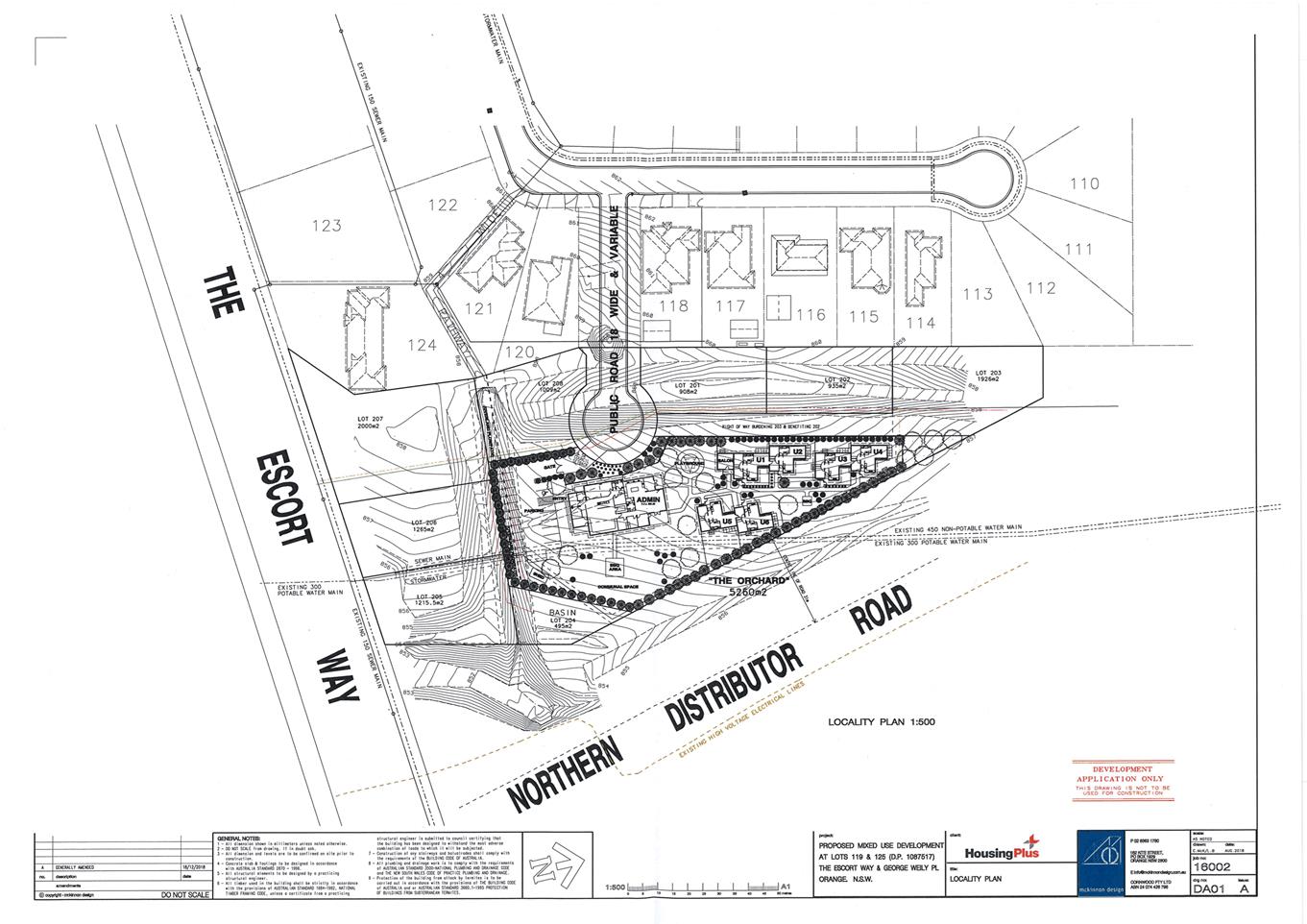
Planning
and Development Committee
5 February 2019
2.3 Development
Application DA 448/2018(2) - Group Home, Community Facility and Hostel - 20
George Weily Place and Lot 125 The Escort Way
Attachment 3 Noise
Report
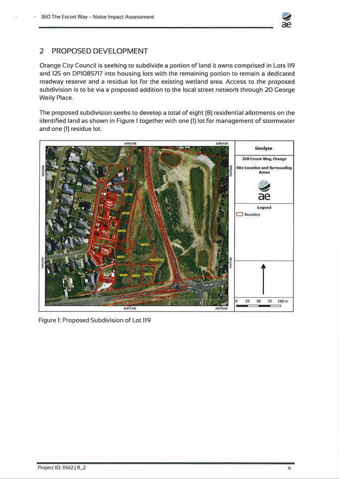
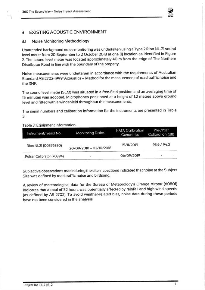
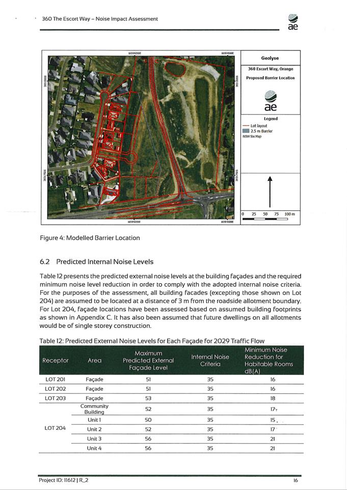
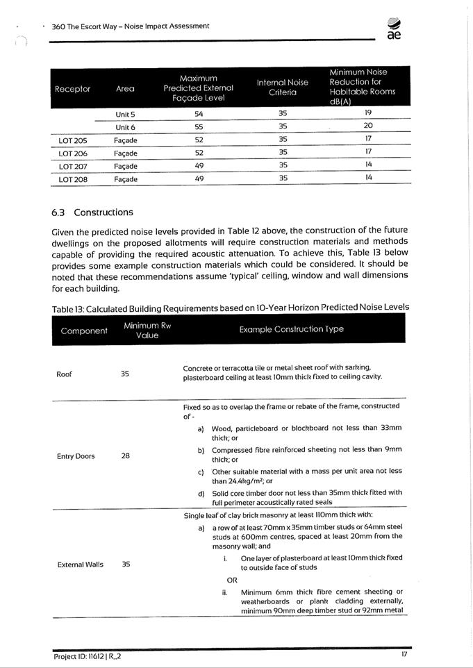
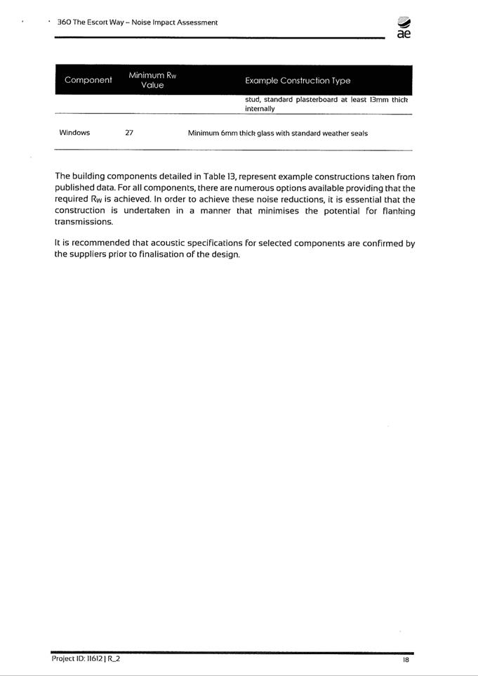
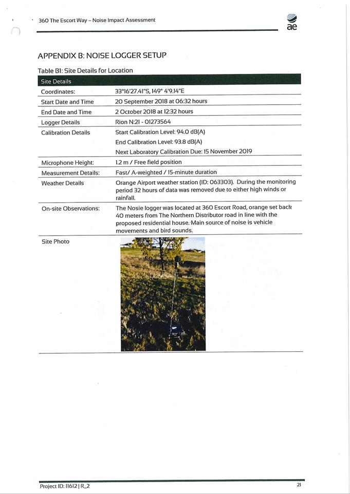
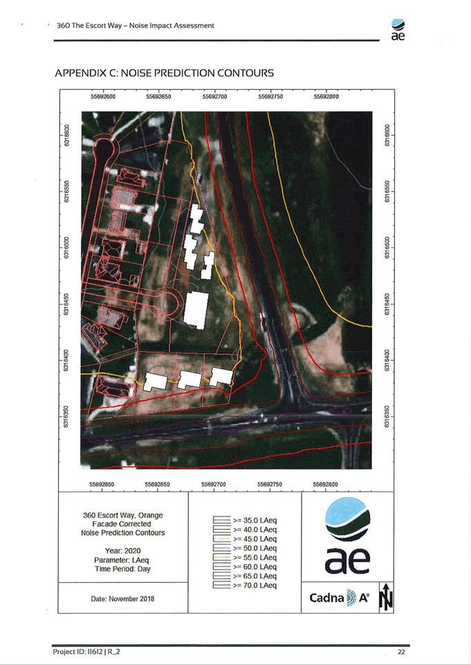
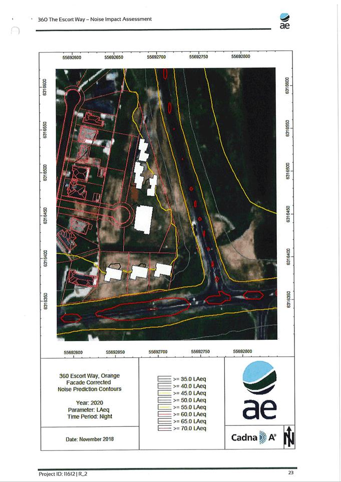
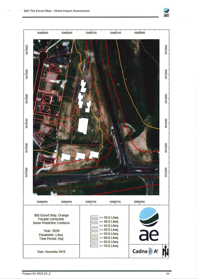
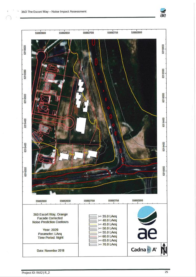
Planning and Development Committee
5 February 2019
2.3 Development
Application DA 448/2018(2) - Group Home, Community Facility and Hostel - 20
George Weily Place and Lot 125 The Escort Way
Attachment 4 Contamination
Report
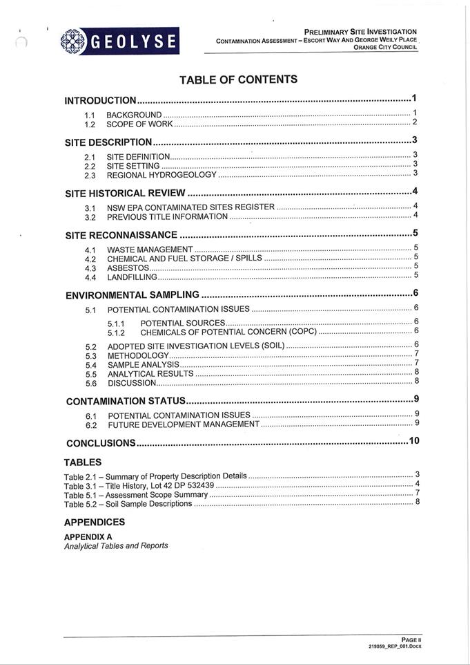
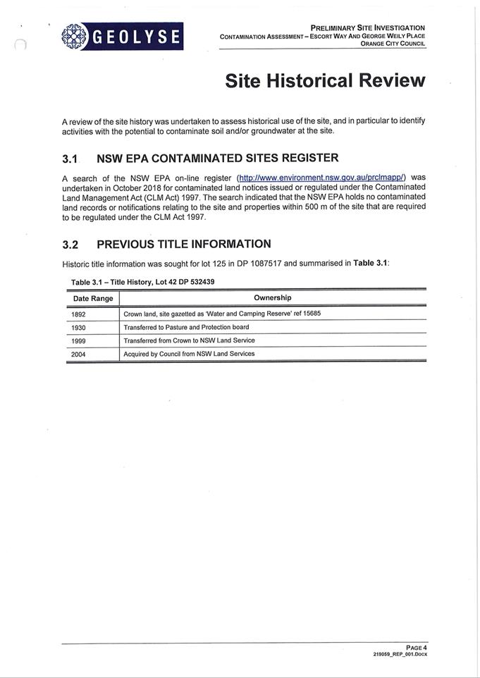
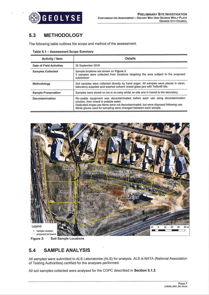
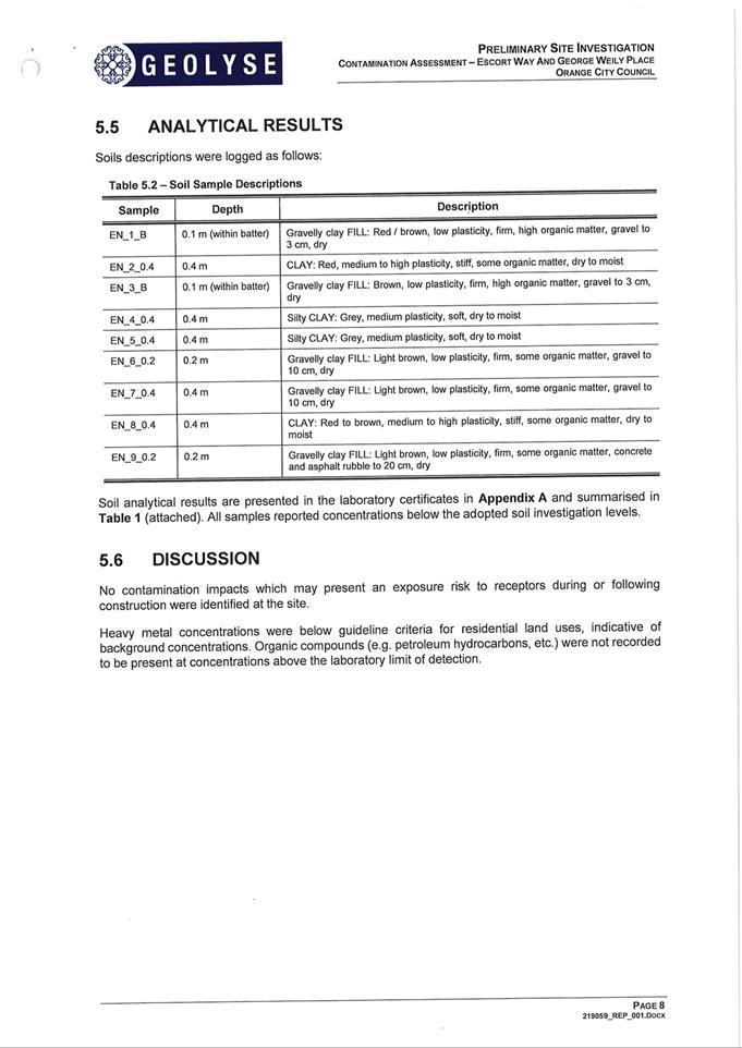
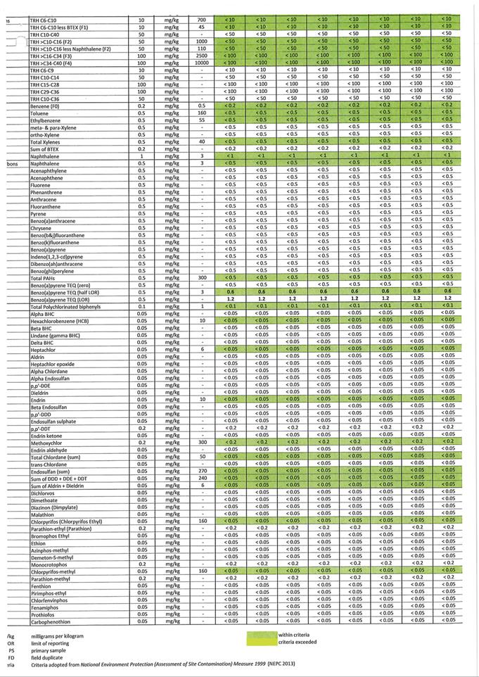
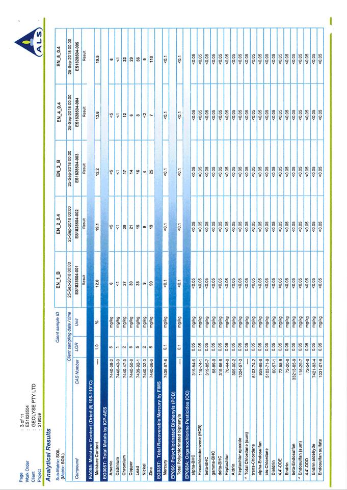
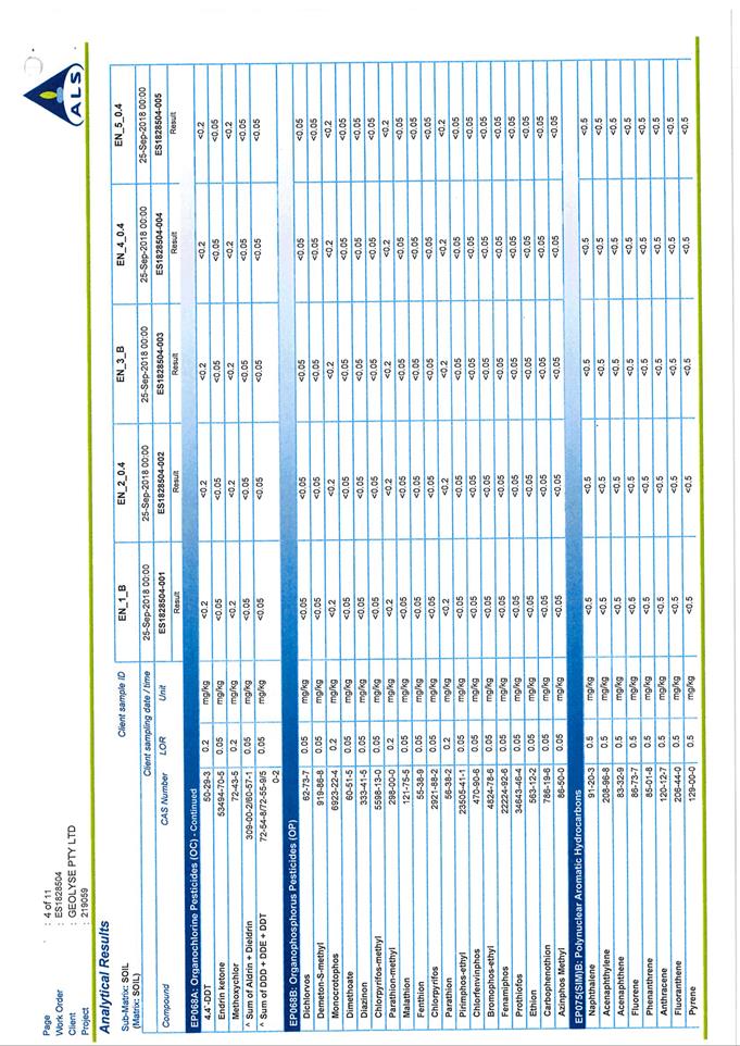
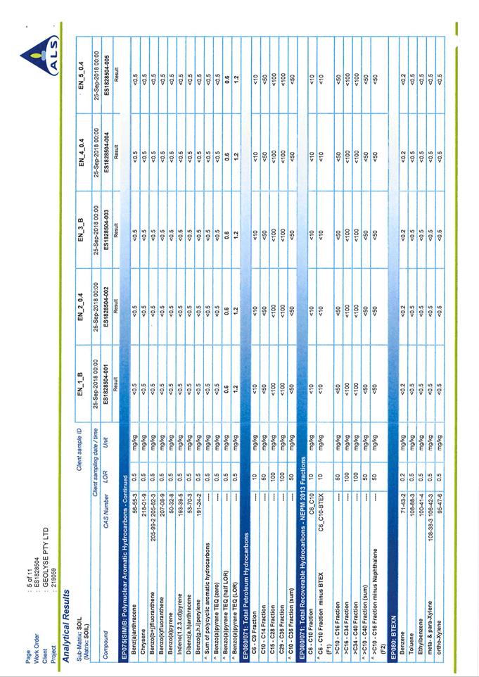
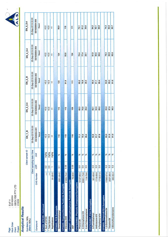
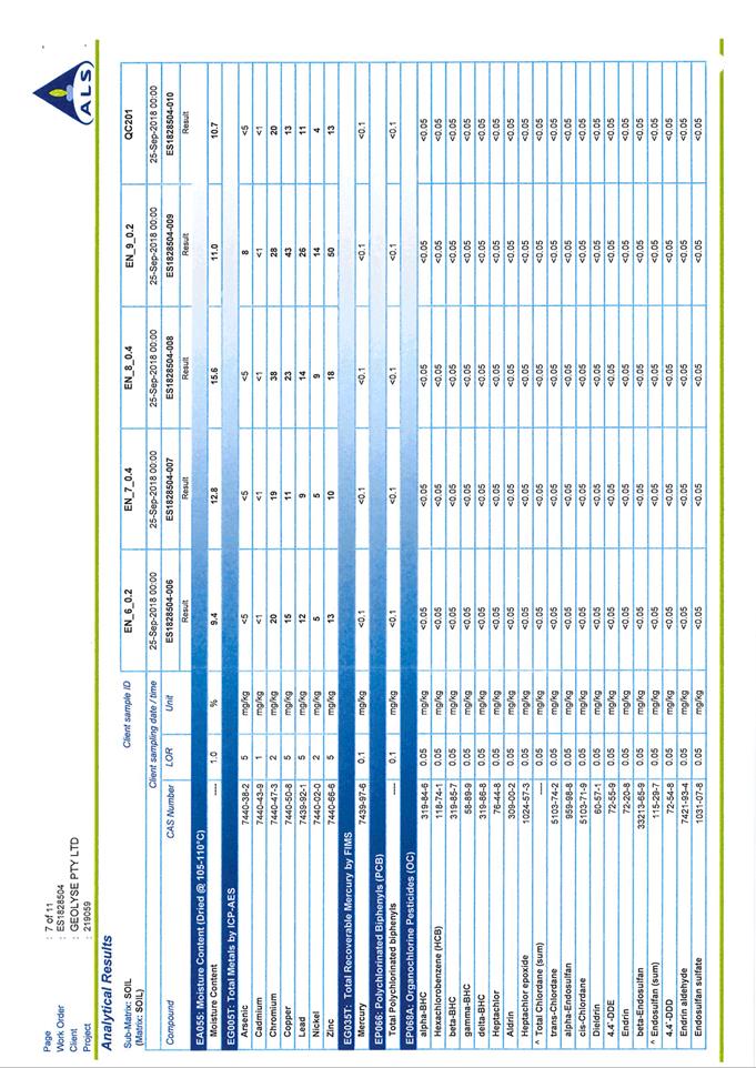
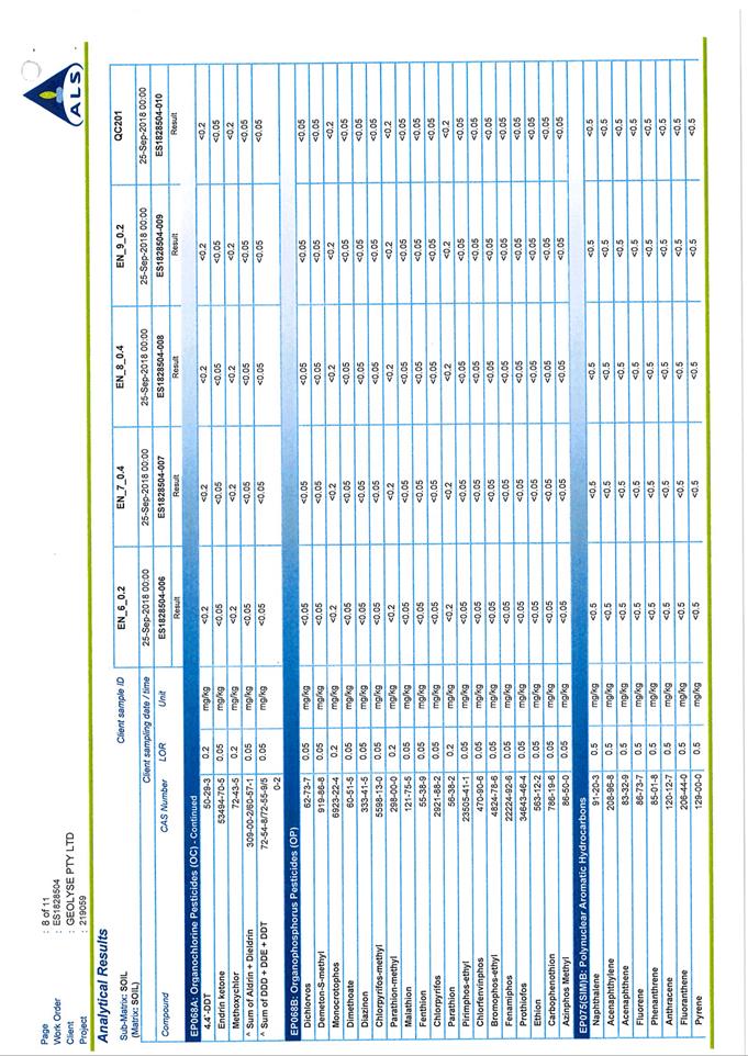
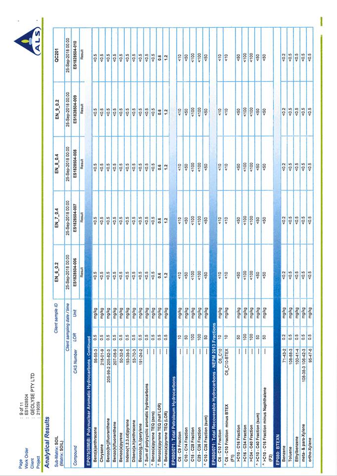
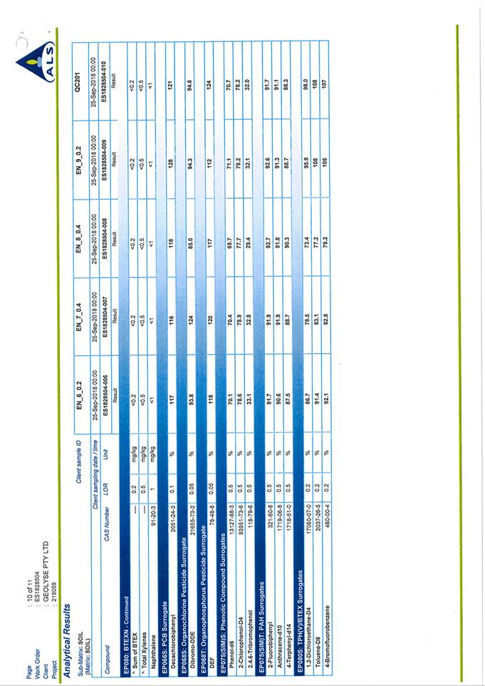
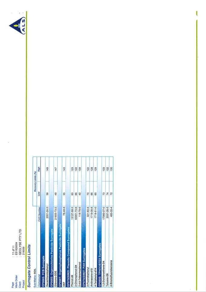
Planning and Development Committee
5 February 2019
2.3 Development
Application DA 448/2018(2) - Group Home, Community Facility and Hostel - 20
George Weily Place and Lot 125 The Escort Way
Attachment 5 Additional
Information Letter
Planning and Development Committee
5 February 2019
2.3 Development
Application DA 448/2018(2) - Group Home, Community Facility and Hostel - 20
George Weily Place and Lot 125 The Escort Way
Attachment 6 Letter
from Housing Plus
2.4 Development
Application DA 1/2019(1) - Animal Shelter - 36 Astill Drive
RECORD
NUMBER: 2019/85
AUTHOR: Andrew
Crump, Senior Planner
EXECUTIVE Summary
|
Application
lodged
|
2
January 2019
|
|
Applicant/s
|
Orange
City Council
|
|
Owner/s
|
Orange
City Council
|
|
Land
description
|
Lot 804
DP 1240445 - 36 Astill Drive, Orange
|
|
Proposed
land use
|
Animal
Shelter
|
|
Value of
proposed development
|
$1,400,000.00
|
Council's consent is sought to
construct an industrial style building to be used for the purposes of
Council’s Animal Shelter for the temporary shelter of stray animals,
impounding of seized animals and also the re-homing of domesticated animals. The
subject land is legally described as Lot 804 DP 1240445, known as 36 Astill
Drive Orange (shown below Figure 1).
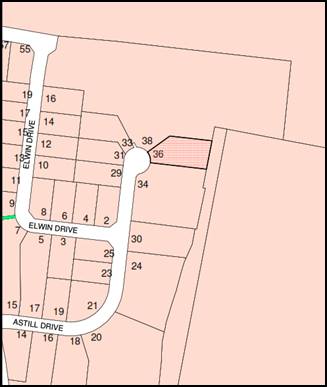
Figure 1 - locality plan
The development comprises the construction of a
prefabricated metal shed which will be fitted out to provide the capacity to
house up to 20 dogs/cats, office space, storage area for Council’s
Rangers, 4–5 publically accessible drop-off cages, a small set of cattle
yards and 5 parking spaces (including an accessible space).
The proposed land-use being an Animal Shelter operated by
the Council does not fit within the confines of the existing defined land-uses
within the Orange Local Environmental Plan 2011.
As such, the development is
considered an innominate use for the purposes of characterisation. The proposal
is rendered permissible as the IN1 General Industrial zoning (zoning applicable
to the subject land) zoning table is an open zone which allows for “any other
development not specifically listed in Item 2 (permitted without consent) or
Item 4 (prohibited)”. Given Animal Shelters are not nominately
listed in Items 2 or 4 of the IN1 General Industrial zone land-use table,
the development can be considered as a permissible innominate use.
The development is considered to be consistent with
Council’s relevant planning provisions and is recommended for approval.
RECENT LEGISLATIVE CHANGES
On 1 March 2018 the Environmental Planning and Assessment
Act 1979 was substantially amended. The most immediate change involves the
restructuring and renumbering of the Act, with other more substantive
changes to be phased in over time. However, for some applications (particularly
where an application was lodged prior to the changes coming into effect) the
supporting documentation may still reference the previous numbering regime. In
the drafting of this report the content and substance of the supporting
material has been considered irrespective of which legislative references were
used.
DECISION FRAMEWORK
Development in Orange is governed by two key documents
Orange Local Environment Plan 2011 and Orange Development Control Plan 2004. In
addition the Infill Guidelines are used to guide development, particularly in
the heritage conservation areas and around heritage items.
Orange Local Environment Plan 2011 – The
provisions of the LEP must be considered by the Council in determining the
application. LEPs govern the types of development that are permissible or
prohibited in different parts of the City and also provide some assessment
criteria in specific circumstances. Uses are either permissible or not. The
objectives of each zoning and indeed the aims of the LEP itself are also to be
considered and can be used to guide decision making around appropriateness of
development.
Orange Development Control Plan 2004 – the DCP
provides guidelines for development. In general it is a performance based
document rather than prescriptive in nature. For each planning element there
are often guidelines used. These guidelines indicate ways of achieving the
planning outcomes. It is thus recognised that there may also be other solutions
of merit. All design solutions are considered on merit by planning and building
staff. Applications should clearly demonstrate how the planning outcomes are
being met where alternative design solutions are proposed. The DCP enables
developers and architects to use design to achieve the planning outcomes in
alternative ways.
DIRECTOR’S COMMENT
This application involves the construction of a large shed
typical of those found in the Narrambla Estate. The location of the shed at the
back of the Estate minimises potential impacts.
Link To Delivery/OPerational Plan
The recommendation in this report relates to the Delivery/Operational
Plan strategy “10.1 Preserve - Engage with the community
to ensure plans for growth and development are respectful of our heritage”.
Financial Implications
Nil
Policy and Governance Implications
Nil
|
Recommendation
That Council resolves to
consent to development application DA 1/2019(1) for Animal Shelter at Lot 804 DP 1240445 -
36 Astill Drive, Orange pursuant to the conditions
of consent in the attached Notice of Approval.
|
further considerations
Consideration has been given to the
recommendation’s impact on Council’s service delivery; image and
reputation; political; environmental; health and safety; employees;
stakeholders and project management; and no further implications or risks have
been identified.
SUPPORTING INFORMATION
THE LAND
The subject land is located in the Narrambla industrial
precinct at the cessation of the southern arm of Astill Drive. The land is
described as Lot 804 DP 1240445, known as 36 Astill Drive, Orange.
It adjoins vacant land to the north, a concrete batching plant to the
south, and existing industrial development to the west, and Council’s
quarry to the east.
THE APPLICATION/PROPOSAL
The application seeks Council’s consent to construct a
building and associated structures and improvements to be used for the purposes
of Council’s Animal Shelter.
The proposal involves the construction of a 30m by 21m
industrial style shed, which will then be fitted out with office and staff
amenities, animal enclosures, and veterinarian treatment area, indoor and
outdoor animal exercise space, ranger animal drop-off area, areas for animal
segregation and storage area.
Externally, the facility will be provided with 4-5 public
drop-off cages, small area for sized livestock, 5 off-street parking spaces,
vehicle access-ways (not accessible to the public) and extensive front
landscaping.
The site will be fortified with the installation of security
fencing and automatic gates. The front fence will comprise palisade style,
while the balance will be chain-link style.
The facility will be managed by three
staff and operate during typical business hours. Noting that the facility will
occasionally be attended by the public (to place an animal in the public
drop-off cages) or by a Council Ranger to impound a seized animal.
MATTERS FOR CONSIDERATION
Section 1.7 - Application of
Part 7 of the Biodiversity Conservation Act 2016 and Part 7A of the
Fisheries Management Act 1994
Section 1.7 of the EP&A Act 1979 identifies that Part 7
of the Biodiversity Conservation Act 2016 and Part 7A of the Fisheries
Management Act 1994 have effect in connection with terrestrial and aquatic
environments.
Having regard to the relevant provisions and based on an
inspection of the subject property, it is considered that the proposed
development is not likely to significantly affect a threatened species.
A Biodiversity Development Assessment Report is not required
in this instance.
A site inspection reveals that the subject property has no
biodiversity or habitat value.
Section 4.15
Section 4.15 of the Environmental Planning and Assessment
Act 1979 requires Council to consider various matters, of which those
pertaining to the application are listed below.
PROVISIONS OF ANY ENVIRONMENTAL
PLANNING INSTRUMENT s4.15(1)(a)(i)
Orange Local Environmental Plan 2011
Part 1 - Preliminary
Clause 1.2 - Aims of Plan
The
broad aims of the LEP are set out under subclause 2. Those relevant to the
application are as follows:
(a) to encourage development which complements
and enhances the unique character of Orange as a major regional centre boasting
a diverse economy and offering an attractive regional lifestyle,
(b) to provide for a range of development
opportunities that contribute to the social, economic and environmental
resources of Orange in a way that allows present and future generations to meet
their needs by implementing the principles for ecologically sustainable
development,
(c) to conserve and enhance the water
resources on which Orange depends, particularly water supply catchments,
The application is considered to be consistent with aims
(a), (b) and (c) as listed above.
Clause 1.6 - Consent Authority
This clause establishes that, subject to the Act, Council is
the consent authority for applications made under the LEP.
Clause 1.7 - Mapping The subject site is identified on
the LEP maps in the following manner:
|
Land Zoning Map:
|
Land zoned IN1 General Industrial
|
|
Lot Size Map:
|
No Minimum Lot Size 2000m2
|
|
Heritage Map:
|
Not a heritage item or conservation
area
|
|
Height of Buildings Map:
|
No building height limit
|
|
Floor Space Ratio Map:
|
No floor space limit
|
|
Terrestrial Biodiversity Map:
|
No biodiversity sensitivity on the
site
|
|
Groundwater Vulnerability Map:
|
Groundwater vulnerable
|
|
Drinking Water Catchment Map:
|
Not within the drinking water
catchment
|
|
Watercourse Map:
|
Not within or affecting a defined
watercourse
|
|
Urban Release Area Map:
|
Not within an urban release area
|
|
Obstacle Limitation Surface Map:
|
No restriction on building siting
or construction
|
|
Additional Permitted Uses Map:
|
No additional permitted use applies
|
|
Flood Planning Map:
|
Not within a flood planning area
|
Those matters that are of relevance are addressed in detail
in the body of this report.
Clause 1.9A - Suspension of
Covenants, Agreements and Instruments
This clause provides that covenants, agreements and other
instruments which seek to restrict the carrying out of development do not apply
with the following exceptions:
· covenants imposed
or required by Council
· prescribed
instruments under Section 183A of the Crown Lands Act 1989
· any conservation
agreement under the National Parks and Wildlife Act 1974
· any trust
agreement under the Nature Conservation Trust Act 2001
· any property
vegetation plan under the Native Vegetation Act 2003
· any biobanking
agreement under Part 7A of the Threatened Species Conservation Act 1995
· any planning
agreement under Division 6 of Part 4 of the Environmental Planning and
Assessment Act 1979.
Council staff are not aware of the title of the subject
property being affected by any of the above.
Part 2 - Permitted or Prohibited Development
Clause
2.1 - Land Use Zones and Clause 2.3 - Zone Objectives and Land Use Table
The subject site is located within the IN1 General
Industrial zone. It is not possible to define or characterise the proposed
development under any of the available terms within OLEP 2011.
Accordingly, the development is considered an innominate use for the purposes
of characterisation. It would appear that Broken Hill LGA encountered a similar
scenario for the Council run Animal Shelter, however that circumstance was
slightly different as the innominate use was not permissible and as such
another approved use (APU) within Schedule 1 of their LEP and define the land
use as follows:
animal pound
means a building or place owned or controlled by a public authority or
non-profit community organisation that is used for the keeping or caring of
animals (other than for the agistment of horses), and includes any associated
ancillary veterinary hospital.
The land use table for the IN1 General Industrial Zone under
the Orange LEP is an open zone, which in other words mean that any other use
not listed in Item 2 or 4 of the LEP is rendered as permissible.
Clause 2.3 of LEP 2011
references the Land Use Table and Objectives for each zone in LEP 2011.
These objectives for land zoned IN1 General Industrial are as follows:
1 -
Objectives of the IN1 General Industrial Zone
· To provide a
wide range of industrial and warehouse land uses.
· To encourage
employment opportunities.
· To minimise any
adverse effect of industry on other land uses.
· To support and
protect industrial land for industrial uses.
· To ensure
development along the Southern Link Road has an alternative access.
The development is not fundamentally incongruous with the
above objects of the IN1 zone; and while the land-use is not industrial in
nature, given the potential noise impacts which a facility such as this could
generate; a facility of this type, is best suited in an area of the city where
noise generating activities are expected and planned for.
Part 3 - Exempt and Complying Development
The application is not exempt or complying development.
Part 6 - Urban Release Area
Not relevant to the application. The subject site is not
located in an Urban Release Area.
Part 7 - Additional Local Provisions
7.1
- Earthworks
This
clause establishes a range of matters that must be considered prior to granting
development consent for any application involving earthworks, such as:
(a) the likely disruption of, or any
detrimental effect on, existing drainage patterns and soil stability in the
locality of the development
(b) the effect of the development on the
likely future use or redevelopment of the land
(c) the quality of the fill or the soil to be
excavated, or both
(d) the effect of the development on the
existing and likely amenity of adjoining properties
(e) the source of any fill material and the
destination of any excavated material
(f) the likelihood of disturbing relics
(g) the proximity to and potential for adverse
impacts on any waterway, drinking water catchment or environmentally sensitive
area
(h) any measures proposed to minimise or
mitigate the impacts referred to in paragraph (g).
The site
comprises a relatively level portion at the front of the site and a steep
embankment toward the rear of the site. To combat the slope a retaining wall is
required along a portion of the north and south edges of the site; and a batter
at the rear of the building.
The level of cut and retaining
will, at the deepest point, be approximately 2m, relating to the rear portion
of the retaining on the northern boundary. The natural topography and the
adjusted levels conveniently provides a ramp connecting to the yards for the
livestock.
The extent of disruption to the
drainage of the site is considered to be minor and will not detrimentally
affect adjoining properties or receiving waterways.
The extent of the earthworks
will not materially affect the potential future use or redevelopment of the
site that may occur at the end of the proposed development's lifespan.
The site is not known to be
contaminated and conditions may be imposed requiring the use of verified clean
fill only.
The earthworks will be
appropriately supported onsite and the change in ground level is not
substantial. Therefore the effect on the amenity of adjoining properties is
considered to be minor.
The site is not known to contain
any Aboriginal, European or Archaeological relics. Previous known uses of the
site do not suggest that any relics are likely to be uncovered. However,
conditions are imposed to ensure that should site works uncover a potential
relic or artefact, works will be halted to enable proper investigation by
relevant authorities and the proponent required to seek relevant permits to
either destroy or relocate the findings.
The site is not in proximity to
any waterway, drinking water catchment or sensitive area. However, conditions
are imposed to require a sediment control to be implemented for the duration of
the construction phase of the development.
7.3 - Stormwater Management
This clause applies to all
industrial, commercial and residential zones and requires that Council be
satisfied that the proposal:
(a) is designed to maximise the use of water
permeable surfaces on the land having regard to the soil characteristics
affecting onsite infiltration of water
(b) includes, where practical, onsite
stormwater retention for use as an alternative supply to mains water,
groundwater or river water; and
(c) avoids any significant impacts of
stormwater runoff on adjoining downstream properties, native bushland and
receiving waters, or if that impact cannot be reasonably avoided, minimises and
mitigates the impact.
Council’s
Technical Services Division has not raised any objections to the proposal and
relevant conditions are attached to the notice of approval in relation to stormwater.
7.6 - Groundwater Vulnerability
This
clause seeks to protect hydrological functions of groundwater systems and
protect resources from both depletion and contamination. Orange has a high
water table and large areas of the LGA, including the subject site, are
identified with “Groundwater Vulnerability” on the Groundwater
Vulnerability Map. This requires that Council consider:
(a) whether or not the development (including
any onsite storage or disposal of solid or liquid waste and chemicals) is likely
to cause any groundwater contamination or have any adverse effect on
groundwater dependent ecosystems, and
(b) the cumulative impact (including the
impact on nearby groundwater extraction for potable water supply or stock water
supply) of the development and any other existing development on groundwater.
Furthermore, consent may not be granted unless Council is satisfied that:
(a) the development is designed, sited and
will be managed to avoid any significant adverse environmental impact, or
(b) if that impact cannot be reasonably
avoided - the development is designed, sited and will be managed to minimise
that impact,
(c) if that impact cannot be minimised - the
development will be managed to mitigate that impact.
The proposal is not anticipated
to involve the discharge of toxic or noxious substances and is therefore
unlikely to contaminate the groundwater or related ecosystems. The proposal
does not involve extraction of groundwater and will therefore not contribute to
groundwater depletion. The design and siting of the proposal avoids impacts on
groundwater and is therefore considered acceptable.
Clause 7.11 - Essential
Services
Clause 7.11 applies and states:
Development
consent must not be granted to development unless the consent authority is
satisfied that any of the following services that are essential for the
proposed development are available or that adequate arrangements have been made
to make them available when required:
(a) the supply of water,
(b) the supply of electricity,
(c) the disposal and management of sewage,
(d) storm water drainage or on-site
conservation,
(e) suitable road access.
In consideration of this clause, all utility services are
available to the land and adequate for the proposal.
STATE ENVIRONMENTAL PLANNING
POLICIES
State Environmental Planning
Policy 55 - Remediation of Land
State Environmental Planning Policy 55 - Remediation of
Land (SEPP 55) is applicable. Pursuant to Clause 7 Contamination
and remediation to be considered in determining development application:
(1) A consent authority must
not consent to the carrying out of any development on land unless:
(a) it
has considered whether the land is contaminated, and
(b) if the land is contaminated, it is
satisfied that the land is suitable in its contaminated state (or will be
suitable, after remediation) for the purpose for which the development is
proposed to be carried out, and
(c) if the land requires remediation to be made
suitable for the purpose for which the development is proposed to be carried
out, it is satisfied that the land will be remediated before the land is used
for that purpose.
The subject land was recently created as part of a 9 lot
industrial subdivision and remains a vacant parcel of land at the moment.
During that assessment the likelihood of the land being contaminated was
considered and the land found suitable for industrial purposes.
Notwithstanding this, Council’s standard unexpected
finds condition is attached which details the process to be followed in the
event contamination is found within the site.
PROVISIONS OF ANY DRAFT
ENVIRONMENTAL PLANNING INSTRUMENT THAT HAS BEEN PLACED ON EXHIBITION
4.15(1)(a)(ii)
There are no draft environmental planning instruments that
apply to the subject land or proposed development.
DESIGNATED DEVELOPMENT
The proposed development is not designated development.
INTEGRATED DEVELOPMENT
The proposed development is not integrated development.
PROVISIONS OF ANY DEVELOPMENT
CONTROL PLAN s4.15(1)(a)(iii)
Development Control Plan 2004
Development Control Plan 2004
(“the DCP”) applies to the subject land (Chapter 0 – LEP
2011, Chapter 2 – Natural Resources, Chapter 3 – General Considerations,
Chapter 4 – special environmental considerations and Chapter 9 –
Development in industrial and employment zone). An assessment of the
proposed development against the relevant Planning Outcomes will be undertaken
below.
Chapter 0 – LEP 2011
Pursuant to Planning Outcome 0.2-1 Interim Planning Outcomes
- Conversion of Zones:
· Throughout this
Plan, any reference to a zone in Orange LEP 2000 is to be taken to be a
reference to the corresponding zone(s) in the zone conversion table.
The corresponding zone to zone 4 Industry and Employment
zone (Orange LEP 2000) is zone IN1 General Industrial zone (Orange LEP 2011).
As such, Orange DCP 2004 – Chapter 9 – Development in Industry
and Employment Zone is relevant to this proposal and in addition to other
relevant section is addressed below.
Chapter
0 – residential proximity
· The design of
industrial and commercial development is consistent or compatible with nearby
residential areas in terms of design, siting and landscaping.
The development is proposed on a parcel of land that is
well separated from nearby residential properties to the west and sits behind
other industrial land that provides a buffer between the development site and
nearby residential land. As such, the design, siting and landscaping of the
site is less crucial in the circumstances, but nonetheless is considered
acceptable. The development in terms of its design is not considered to be
incompatible with the nearby residential area.
· The hours of
operation, traffic and noise generation do not interfere with reasonable
expectations of residential amenity.
The
development is proposed to operate during normal business hours, however owing
to the nature of the development, the facility will function 24 hours a day
given their will be animals at the shelter for short, but continuous periods;
and on-call rangers will attend the site to drop off an impounded animals
collected outside of regular business hours.
That
being said, the land the subject of this application, is well separated from
the residential land to the west such that the operation of the development
will not unreasonably impact upon the reasonable expectations of the residents
of the nearby residential land.
· Noise-generating
activities are contained within the building where practicable.
The
impounded animals (save for out of hours public drop offs and the odd occasion
where livestock will be temporarily housed at the facility) will remain within
the confines of the building.
· Industrial air
conditioning compressors are shielded to direct noise away from residential
development.
The
land is separated from residential properties such that mechanical plant
associated with the development is unlikely to result in any adverse impacts upon
nearby residential properties.
· Car park and
security lighting is positioned and shielded to prevent direct light spill onto
residential properties.
Again
as mentioned above, the separation distance will mean that the development will
not directly impact upon nearby residential properties; notwithstanding this,
standard conditions are attached in relation light spill.
· Measures to
prevent dust, odour and chemical spray from reaching or affecting residential
properties must be demonstrated.
The
development is unlikely to give rise to any dust or chemical spray issues
impacting nearby residents. In terms of odour, animal welfare standards that
the facility will abide by will ensure the site is kept free of odour through
regular cleaning of the facility.
· The design must
demonstrate how residential privacy and solar access will be maintained.
The development will not result in any privacy or solar
access impacts given the separation distances to residential properties.
Chapter 2 – Natural Resource
Management
Chapter 2 – Natural Resource Management provides
planning outcomes for stormwater quality, groundwater quality, soil resource
management, vegetation management and flora and fauna management; all of which
have been considered above under the heading Orange LEP 2011 (stormwater,
groundwater) or Section 1.7 of the Act.
Chapter 3 – General
Considerations
Chapter 3 provides planning outcomes of a general nature.
Those of relevance to this assessment relate to cumulative impacts, scenic
landscape, urban areas and energy efficiency. These are all addressed elsewhere
within this report. Cumulative impacts are addressed below under the heading
“Likely Impacts” and energy efficiency
(Section J requirements) are addressed under BCA condition of the
notice of approval.
Chapter 9 – Development
in Industry and Employment zone
· Buildings are
set back a minimum of 10m from front boundaries (5m to a secondary boundary on
a corner lot) for lots greater than 1,000m² or 5m for lots less than
1,000m² or otherwise to a setback consistent with existing setbacks in
established areas. A 10m setback applies to lots that have frontage to Clergate
Road.
The
subject land comprises an area greater than 1000m2 and as such a 10m
setback is required.
The
submitted plans indicate that the setback at the closest point to the street
will be well in excess of 10m to the building proper and therefore complies
with the above planning outcome.
· Buildings cover
up to 50% of the site area (excluding the area of accessways for battleaxe
lots).
The development results in a site
coverage of 16.4% and thus compliant with the above planning outcome.
· Landscaping is
provided along boundaries fronting roads including trees with an expected
mature height at least comparable to the height of buildings on the site. All
sites contain an element of landscaping. Landscaping provided is of a bulk,
scale and height relative to buildings nearest the front property boundary so
as to provide beautification and visual relief to the built form proposed or
existing on the site. The depth of the landscape bed at the site frontage is
sufficient to accommodate the spread of plantings that meet the abovementioned
outcomes but, where practicable, a minimum depth of 3.5m is provided. Plantings
are designed to provide shade for parking areas, to break up large areas of
bitumen, to enhance building preservation and to screen against noise.
A
landscape plan has been submitted in support of the application. The plan shows
two acer x freemanii and a Parrotia perscia, with hedging
behind on the northern side of the driveway.
The
selected trees will have mature heights of well in excess of the overall height
of the building.
The landscaping is considered acceptable. It will provide
softening of the proposed building as well as provide a degree of shading to
the car parking area in the warmer months.
· Architectural
features are provided to the front building façade to provide relief
using such elements as verandahs, display windows, indented walls, etc.
The proposed building will present quite simply to the
street comprising a sloping awning above the main entry doors, three sets of
small windows and two other set of doors as shown below:
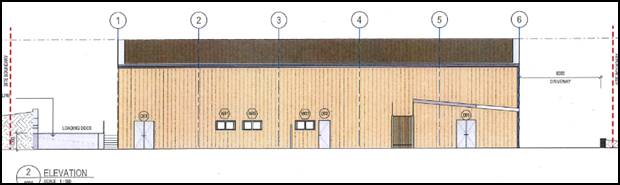
Figure 2 - front (west) elevation
Notwithstanding the simplistic architectural features of the
proposed building, the presentation is considered acceptable. The wedged shape
site frontage reduces how much of the building will be visible and this coupled
with generous landscaping at the site frontage will result in a satisfactory
outcome.
It should also be noted that
the adjoining land comprises a building that presents similarly to the one
proposed under this application (refer below).

Figure 3 - adjoining development to the south of the subject land
· External
materials consist of non-reflective materials.
A
condition is attached requiring all external materials to be non-reflective.
· Adequate
parking and onsite manoeuvring is provided.
The
DCP does not specifically provide a car parking rate for an Animal Shelter. The
applicant has adopted a one space per staff, totalling 3 spaces, leaving two
available for a non-staff member of the public that would attend the premises
to potentially adopt an animal from the shelter. Rangers, when attending the
site would more than likely park their vehicle in the loading area on the
eastern side of the building. Council staff raise no objection to the extent of
onsite parking provided. It should be noted that the hardstand area would
provide for additional overflow parking without impacting on the operations of
the site.
· Advertising
involves business-identification signs within the front façade and/or by
a pole sign comparable to the relative height to the main building on the site.
No
advertising is proposed.
· Security
fencing is located or designed in a manner that does not dominate the visual
setting of the area.
Palisade
style fencing is proposed behind the landscaping area at the front of the site
with access provided by automated gates. The balance of the site behind the
landscape area will consist of chain wire fencing.
PROVISIONS PRESCRIBED BY THE
REGULATIONS s4.15(1)(a)(iv)
The development is not inconsistent with the provisions
prescribed by the regulations.
THE LIKELY IMPACTS OF THE
DEVELOPMENT s4.15(1)(b)
Context and Setting
The subject land is located at the rear of the Narrambla
Industrial precinct and is bound by a concrete batching plant to the south,
vacant land to the north, a quarry to the east and industrial developments to
the east.
The development is considered appropriate in the context and
setting.
Visual Impacts
The development will not present any unsatisfactory visual
impacts. While the presentation of the proposed building is quite simple, this
will be offset by the limited front/exposure to the street and extensive
landscaping that will provide the necessary level of visual relief. Moreover,
it is notated that the building associated with the adjoining concrete batching
plant
Traffic Impacts
Traffic levels associated with the development are expected
to be quite modest. Traffic to and from the site will consist of three staff
members, rangers dropping off seized animals and occasionally members of the
public looking to adopt an animal.
There are driveways on either side of the proposed building.
One driveway provides access to the ranger drop-off area at the rear of the
building; the other provide access to the livestock unloading area. These two
driveways will not conflict with the parking area.
All vehicles will be able to leave
the site in forward direction.
The land is located at the cessation of the southern arm of
Astill Drive which links directly with the NDR. The surrounding road network
will easily meet the traffic demands generated by the facility.
Noise Impacts
Whilst the application does not include a formalised Noise
Assessment Report, relying on the experience of the Manager Building and
Environment with both noise assessment and pound operations, predictions of
noise emissions from the development can adequately be undertaken. An
assessment of noise is provided below:
On average, the noise level of a barking dog is around
100dB(a). The Development Application proposes the construction of the main dog
shelter area to hold up to 24 dogs. There are areas for the keeping of
dogs elsewhere in the development (Ranger drop off; sick/isolation and also
public drop off). It is considered that the number of animals in these other
areas and the length of time in which animals are kept in the isolation and
drop off areas is limited and therefore would not cause dogs to bark.
In terms of predicted noise levels from the main pound area,
it is considered unlikely that if the pound area was full with 24 dogs, that
they would not be all barking at the same time. Calculation has been carried
out allowing for up to 10 dogs barking at once. This would give a noise level
of 127dB(A) at 1m away.
The nearest residential receivers to the proposed
development are in Phillip Street to the south and also Honeyman Drive to
the west. The closest residence is 700m from the proposed development site.
Council noise studies of Narrambla in 2012 identified that
the Background noise of this Estate is 41dB(A) in the day; 40dB(A) in the
evening and 35dB(A) at night time.
It is estimated that due to the distance of the development
to the residential receivers (700m+) there would be a reduction of 63dB(A) in
the noise level reaching the receivers. This would give a noise level at the
façade of the closest residential receiver without attenuation of
64dB(A). It is estimated that a reduction of 20dB(A) could be readily achieved
at the animal shelter shed with the use of acoustic construction (insulation
and acoustic louvres). Further, allowing for a reduction of 10dB(A) into the
house of the receiver it is predicted that the noise level inside the nearest
residential receiver would be around 34dB(A). This level is well below the
minimum noise goal of 40dB(A) (35 background + 5dB(A)). Therefore it can be
concluded that the proposed development would comply with the requirements of
the NSW Noise Policy for Industry and as such would not adversely impact on the
closest residential receivers.
Notwithstanding this, as the application does not include a
detailed acoustic report it is considered reasonable to apply a little more
conservative assessment and require by condition of approval the enclosure of
the 24 dog kennels of the main pound area. This would provide an additional
level of protection to residential receivers, nearby industrial users and also
staff working within the shelter. A condition of approval reflecting this is
recommended and included below.
Additionally, it is recommended that
an Acoustic Commissioning Report be obtained within six months of the operation
of the facility. This will ensure that the noise emissions from the development
are as predicted and is consistent with the approach applied to other
industrial developments within the vicinity.
With the inclusion of these two conditions of consent, the
Manager Building and Environment is satisfied that the proposed development would
comply and therefore no objection to the proposed development is raised by the
Manager.
Environmental Impacts
The subject land does not comprise any significant
vegetation; accordingly the development is not likely to impact upon any
endanger ecological communities, threatened species or habitat.
Cumulative Impacts
Cumulative impacts of a development can arise under four
typical scenarios, namely:
· time crowded
effects where individual impacts occur so close in time that the initial impact
is not dispersed before the proceeding occurs
· space crowded
where impacts are felt because they occur so close in space they have a
tendency to overlap
· nibbling effects
occur where small, often minor impacts, act together to erode the environmental
condition of a locality and
· synergistic
effects, where a mix of heterogeneous impacts interact such that the combined
impacts are greater than the sum of the separate effects.
It is possible that one or more of the above scenarios could
occur as a result of the development, such as every dog within the facility
barking in unison which could lead to noise impacts. However, prevention of
such scenarios occurring has been addressed by relevant conditions of consent
specifying the acoustic measures to be incorporated into the facility.
The development is thus considered satisfactory in terms of
cumulative impacts.
THE SUITABILITY OF THE SITE
s4.15(1)(c)
The site is considered suitable for the proposed
development, the proposed development is permissible in the zone as an innominate
permissible use.
Council staff are not aware of the subject land being
affected by any natural, physical or technological hazard that would
unreasonably constrain the development from occurring in a satisfactory manner.
It is noted that the land is located in an area where soil is identified as
containing naturally occurring asbestos, relevant conditions are attached in
this regard.
ANY SUBMISSIONS MADE IN
ACCORDANCE WITH THE ACT s4.15(1)(d)
The proposed development is
defined as "advertised development" under the provisions of
the Act. The application was advertised for the prescribed period of 14
days and at the end of that period no submissions were received.
PUBLIC INTEREST s4.15(1)(e)
The proposed development is considered to be of minor interest
to the wider public due to the relatively localised nature of potential
impacts. The proposal is not inconsistent with any relevant policy statements,
planning studies, guidelines etc that have not been considered in this
assessment.
SUMMARY
The proposed development is permissible with the consent of
Council. The proposed development complies with the relevant aims, objectives
and provisions of Orange LEP 2011 (as amended) and DCP
2004. A Section 4.15 assessment of the development indicates that
the development is acceptable in this instance. Attached is a draft Notice of
Approval outlining a range of conditions considered appropriate to ensure that
the development proceeds in an acceptable manner.
COMMENTS
The requirements of the Environmental Health and Building
Surveyor and the Engineering Development Section are included in the attached
Notice of Approval
Attachments
1 Plans,
D19/4257⇩
2 Notice
of Approval, D19/4733⇩
Planning
and Development Committee
5 February 2019
2.4 Development
Application DA 1/2019(1) - Animal Shelter - 36 Astill Drive
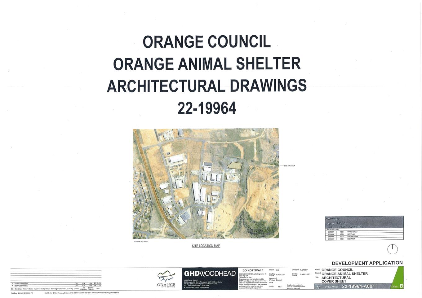
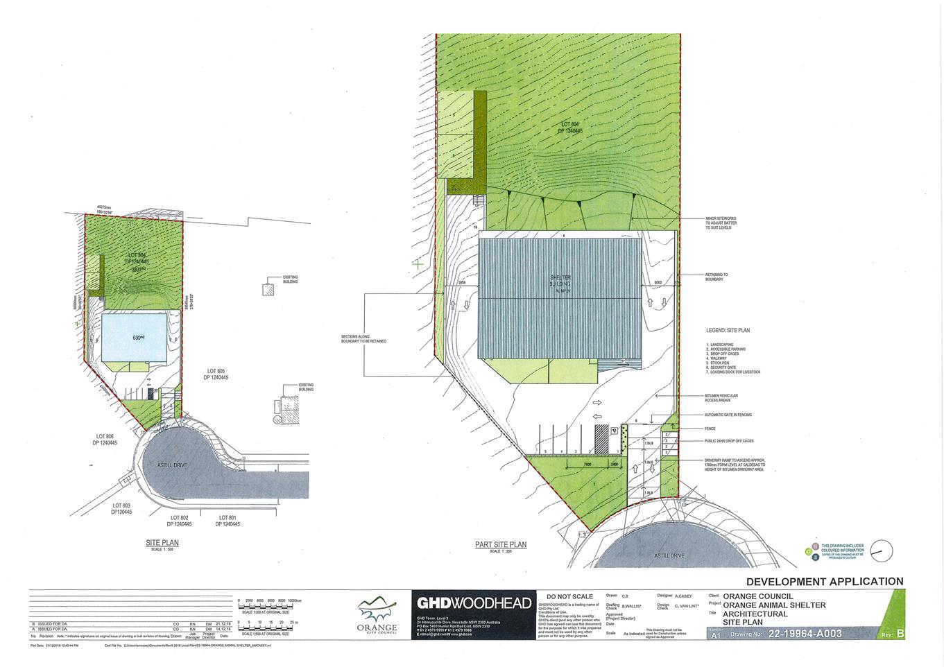
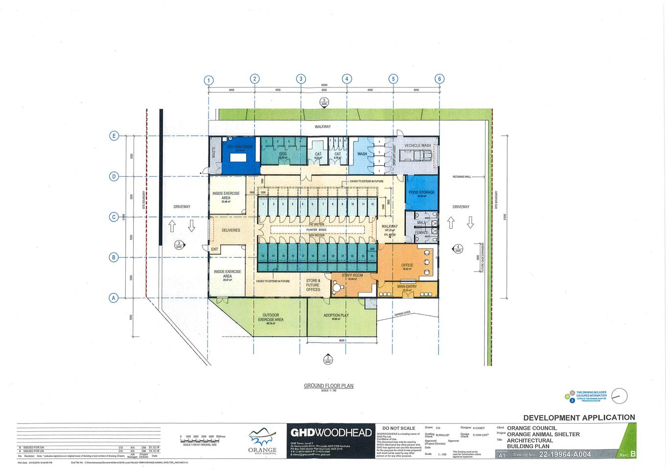
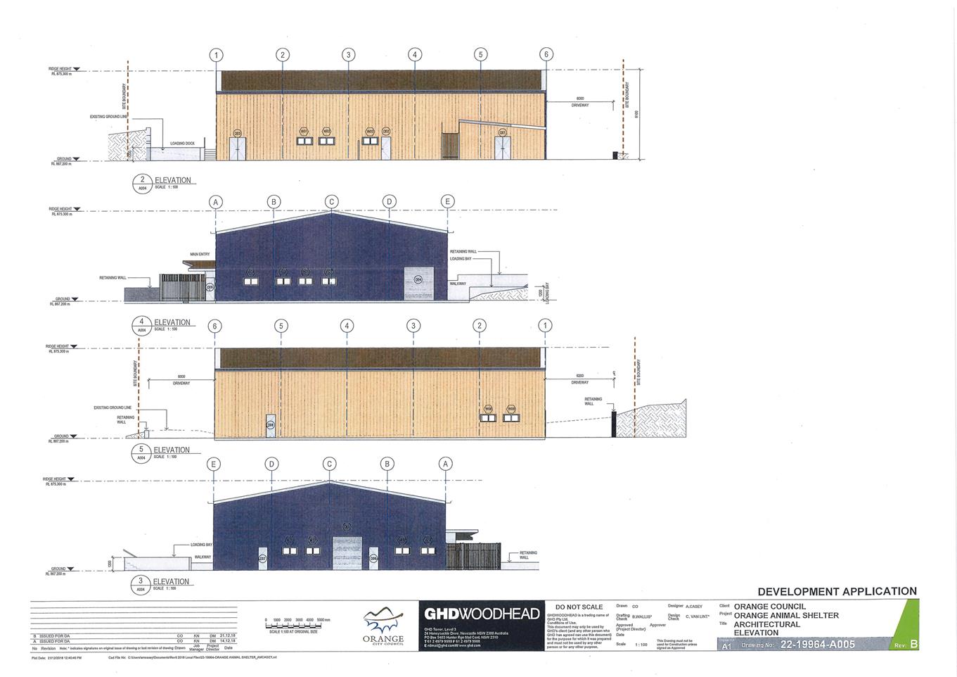
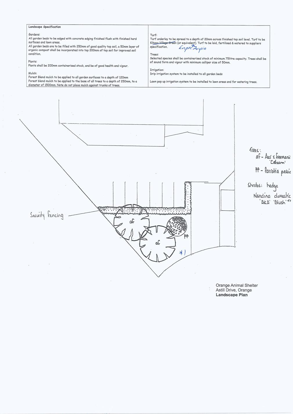
Planning
and Development Committee
5 February 2019
2.4 Development
Application DA 1/2019(1) - Animal Shelter - 36 Astill Drive
Attachment 2 Notice
of Approval
|
|
ORANGE
CITY COUNCIL
Development
Application No DA
1/2019(1)
NA19/ Container
PR27987
|
NOTICE OF DETERMINATION
OF A DEVELOPMENT
APPLICATION
issued under the Environmental
Planning and Assessment Act 1979
Section 4.18
|
Development
Application
|
|
|
Applicant Name:
|
Orange
City Council
|
|
Applicant Address:
|
PO Box 35
ORANGE
NSW 2800
|
|
Owner’s Name:
|
Orange
City Council
|
|
Land to Be Developed:
|
Lot 804 DP
1240445 - 36 Astill Drive, Orange
|
|
Proposed Development:
|
Animal
Shelter
|
|
|
|
|
Building
Code of Australia
building
classification:
|
As
determined by Certifier
|
|
|
|
|
Determination
made under
Section 4.16
|
|
|
Made On:
|
5 February
2019
|
|
Determination:
|
CONSENT
GRANTED SUBJECT TO CONDITIONS DESCRIBED BELOW:
|
|
|
|
|
Consent to
Operate From:
|
6 February
2019
|
|
Consent to
Lapse On:
|
6 February
2024
|
Terms of Approval
The reasons for the imposition of
conditions are:
(1) To ensure a quality
urban design for the development which complements the surrounding environment.
(2) To maintain
neighbourhood amenity and character.
(3) To ensure compliance
with relevant statutory requirements.
(4) To provide adequate
public health and safety measures.
(5) To ensure the utility
services are available to the site and adequate for the development.
(6) To prevent the proposed
development having a detrimental effect on adjoining land uses.
(7) To minimise the impact
of development on the environment.
Conditions
(1) The
development must be carried out in accordance with:
(a) Plans by GHDWOODHEAD -
Drawing nos. 22-19964-A001 Rev B; 22-19964-A003 Rev B; 22‑19964-A004 Rev
B; 22-19964-A005 Rev B (4 sheets).
one unnumbered
landscape plan (1 sheet)
(b) statements
of environmental effects or other similar associated documents that form part
of the approval
as amended
in accordance with any conditions of this consent.
(2) All building work must
be carried out in accordance with the provisions of the Building Code of
Australia.
(3) A sign is to be erected
in a prominent position on any site on which building work, subdivision work or
demolition work is being carried out:
(a) showing
the name, address and telephone number of the principal certifying authority
for the work, and
(b) showing
the name of the principal contractor (if any) for any building work and a
telephone number on which that person may be contacted outside working hours,
and
(c) stating
that unauthorised entry to the site is prohibited.
Any such sign is to be maintained while the
building work, subdivision work or demolition work is being carried out.
(4) Where any excavation
work on the site extends below the level of the base of the footings of a
building on adjoining land, the person having the benefit of the development
consent must, at the person’s own expense:
(a) protect
and support the adjoining premises from possible damage from the excavation,
and
(b) where
necessary, underpin the adjoining premises to prevent any such damage.
Note: This
condition does not apply if the person having the benefit of the development
consent owns the adjoining land or the owner of the adjoining land has given
consent in writing to this condition not applying.
|
PRIOR TO THE ISSUE OF
A CONSTRUCTION CERTIFICATE
|
(5) The
main 24 dog kennels within the shelter shed shall be enclosed by a smaller shed
type structure which utilises acoustic attenuation construction methods, such
as insulation and acoustic louvres. The enclosure may include dividing
walls to separate one row of kennels from the other, so as to reduce the
likelihood of dogs in one row exciting/encouraging the other row to bark.
Plans shall be amended to include the enclosure prior to the issue of a
Construction Certificate.
(6) An
approval under Section 68 of the Local Government Act is to be sought
from Orange City Council, as the Water and Sewer Authority, for alterations to
water and sewer. No plumbing and drainage is to commence until approval is
granted.
(7) All stormwater from the
site is to be collected and piped to the existing interlot drainage pit on
site. Orange City Council or an Accredited Certifier (Categories B1, C3, C4,
C6), prior to issuing a Construction Certificate, is to approve engineering plans
for this drainage system.
(8) A Liquid
Trade Waste Application is to be submitted to Orange City Council prior to the
issuing of a Construction (or Occupation) Certificate. The application is
to be in accordance with Orange City Council’s Liquid Trade Waste
Policy. Engineering plans submitted as part of the application are to
show details of all proposed liquid trade waste pre-treatment systems and their
connection to sewer.
Where applicable, the applicant is to
enter into a Liquid Trade Waste Service Agreement with Orange City Council in
accordance with the Orange City Council Liquid Trade Waste Policy.
(9) Backflow Prevention
Devices are to be installed to AS3500 and in accordance with Orange City
Council Backflow Protection Guidelines. Details of the Backflow Prevention
Devices are to be submitted to Orange City Council prior to the issuing of a
Construction Certificate.
(10) A Road Opening Permit
in accordance with Section 138 of the Roads Act 1993 must be approved by
Council prior to a Construction Certificate being issued or any intrusive
works being carried out within the public road or footpath reserve.
|
PRIOR TO WORKS
COMMENCING
|
(11) A
Construction Certificate application is required to be submitted to, and issued
by Council/Accredited Certifier prior to any excavation or building works being
carried out onsite.
(12) A
temporary onsite toilet is to be provided and must remain throughout the
project or until an alternative facility meeting Council’s requirements
is available onsite.
(13) The
location and depth of the sewer junction/connection to Council’s sewerage
system is to be determined to ensure that adequate fall to the sewer is
available.
|
DURING
CONSTRUCTION/SITEWORKS
|
(14) If Aboriginal objects,
relics, or other historical items or the like are located during development
works, all works in the area of the identified object, relic or item shall
cease, and the NSW Office of Environment and Heritage (OEH), and
representatives from the Orange Local Aboriginal Land Council shall be notified.
Where required, further archaeological investigation shall be undertaken.
Development works in the area of the find(s) may recommence if and when
outlined by the management strategy, developed in consultation with and
approved by the OEH.
(15) In
the event of an unexpected find during works such as (but not limited to) the
presence of undocumented waste, odorous or stained soil, asbestos, structures
such as underground storage tanks, slabs, or any contaminated or suspect
material, all work on site must cease immediately. The beneficiary of the
consent must discuss with Council the appropriate process that should be
followed therein. Works on site must not resume unless the express permission
of the Director Development Services is obtained in writing.
(16) All
construction/demolition work on the site is to be carried out between the hours
of 7.00 am and 6.00 pm Monday to Friday inclusive, 7.00 am to
5.00 pm Saturdays and 8.00 am to 5.00 pm Sundays and Public
Holidays. Written approval must be obtained from the General Manager of Orange
City Council to vary these hours.
(17) All
materials on site or being delivered to the site are to be contained within the
site. The requirements of the Protection of the Environment Operations Act
1997 are to be complied with when placing/stockpiling loose material or
when disposing of waste products or during any other activities likely to
pollute drains or watercourses.
(18) The site is located
within an area identified as containing serpentinite rock formations, which can
contain chrysotile, a naturally occurring asbestos. Therefore the applicant or
person with management or control of the site shall ensure that a written plan
(an Asbestos Management Plan) for the site is prepared in
accordance with the provisions of the Work Health and Safety Act 2011 and
Work Health and Safety Regulation 2011.
To assist applicants with developing an
Asbestos Management Plan, applicants are encouraged to access the ‘Asbestos
Management Plan for Orange City Council 2014’, which is
available on Council’s website: www.orange.nsw.gov.au
(19) All services (water,
sewer and stormwater) shall be laid outside the easement unless there is a
direct connection to the main within that easement.
(20) Any adjustments to
existing utility services that are made necessary by this development
proceeding are to be at the full cost of the developer.
(21) All driveway and
parking areas are to be sealed with bitumen, hot mix or concrete and are to be
designed for all expected loading conditions (provided however that the minimum
pavement depth for gravel and flush seal roadways is 200mm) and be in
accordance with the Orange City Council Development and Subdivision Code.
(22) A heavy-duty concrete
kerb and gutter layback and footpath crossing is to be constructed in the
position shown on the plan submitted with the Construction Certificate
application. The works are to be carried out to the requirements of the Orange
City Council Development and Subdivision Code.
|
PRIOR TO THE ISSUE OF
AN OCCUPATION CERTIFICATE
|
(23) A total of 5 off-street
car parking spaces shall be provided upon the site in accordance with the
approved plans, the provisions of Development Control Plan 2004, and be
constructed in accordance with the requirements of Council's Development and
Subdivision Code prior to the issue of an Occupation Certificate.
(24) Landscaping
shall be installed in accordance with the approved plans and shall be
permanently maintained to the satisfaction of Council's Manager Development
Assessments.
(25) All external lighting
shall accord with Australian Standard AS 4282 – 1997 – Control of
the obtrusive effects of outdoor lighting.
(26) No
person is to use or occupy the building or alteration that is the subject of
this approval without the prior issuing of an Occupation Certificate.
(27) Finished
ground levels are to be graded away from the buildings and adjoining properties
and must achieve natural drainage. The concentrated flows are to be dispersed
down slope or collected and discharged to the stormwater drainage system.
(28) The
owner of the building/s must cause the Council to be given a Final Fire Safety
Certificate on completion of the building in relation to essential fire or
other safety measures included in the schedule attached to this approval.
(29) Where
Orange City Council is not the Principal Certifying Authority, a final
inspection of water connection, sewer and stormwater drainage shall be
undertaken by Orange City Council and a Final Notice of Inspection issued,
prior to the issue of either an interim or a final Occupation Certificate.
(30) The cut and
fill is to be retained and/or adequately battered and stabilised (within the
allotment) prior to the issue of an Occupation Certificate.
(31) Certification from
Orange City Council is required to be submitted to the Principal Certifying
Authority prior to the issue of an Occupation Certificate stating that all
works relating to connection of the development to Council assets, works on
public land, works on public roads, stormwater, sewer and water reticulation
mains and footpaths have been carried out in accordance with the Orange City
Council Development and Subdivision Code and the foregoing conditions, and that
Council will take ownership of the infrastructure assets.
(32) A Road Opening Permit
Certificate of Compliance is to be issued for the works by Council prior to any
Occupation/Final Certificate being issued for the development.
(33) Certificates for
testable Backflow Prevention Devices are to be submitted to Orange City Council
by a plumber with backflow qualifications prior to the issue of an Occupation
Certificate.
(34) All
of the foregoing conditions are to be at the full cost of the developer and to
the requirements and standards of the Orange City Council Development and
Subdivision Code, unless specifically stated otherwise. All work required by
the foregoing conditions is to be completed prior to the issuing of an
Occupation Certificate, unless stated otherwise.
|
MATTERS FOR THE
ONGOING PERFORMANCE AND OPERATION OF THE DEVELOPMENT
|
(35) The
applicant shall provide Council with a Noise Commissioning Report confirming
that noise from the development complies with the requirements of the NSW Noise
Policy for Industry. A report shall be provided to Council within six (6)
months of the issue of an Occupation Certificate.
(36) Any
ancillary light fittings fitted to the exterior of the building are to be
shielded or mounted in a position to minimise glare to adjoining properties.
(37) The
owner is required to provide to Council and to the NSW Fire Commissioner an
Annual Fire Safety Statement in respect of the fire-safety measures, as
required by Clause 177 of the Environmental Planning and Assessment
Regulation 2000.
Other Approvals
(1) Local
Government Act 1993 approvals granted under Section 68.
Nil
(2) General
terms of other approvals integrated as part of this consent.
Nil
Right of Appeal
If you are dissatisfied with this
decision, Section 8.7 of the Environmental Planning and Assessment
Act 1979 gives you the right to appeal to the Land and Environment
Court. Pursuant to Section 8.10, an applicant may only appeal within 6 months
after the date the decision is notified.
|
Disability Discrimination Act
1992:
|
This application has been assessed in
accordance with the Environmental Planning and Assessment Act 1979. No
guarantee is given that the proposal complies with the Disability
Discrimination Act 1992.
The applicant/owner is responsible to
ensure compliance with this and other anti-discrimination legislation.
The Disability Discrimination Act
covers disabilities not catered for in the minimum standards called up in the
Building Code of Australia which references AS1428.1 - "Design for
Access and Mobility". AS1428 Parts 2, 3 and 4 provides the most
comprehensive technical guidance under the Disability Discrimination Act
currently available in Australia.
|
|
|
|
|
Disclaimer - S88B of the Conveyancing
Act 1919 - Restrictions on the Use of Land:
|
The applicant should note that there could
be covenants in favour of persons other than Council restricting what may be
built or done upon the subject land. The applicant is advised to check the
position before commencing any work.
|
|
|
|
|
Signed:
|
On behalf of the consent authority ORANGE
CITY COUNCIL
|
|
Signature:
|
|
|
Name:
|
PAUL JOHNSTON - MANAGER DEVELOPMENT
ASSESSMENTS
|
|
Date:
|
6 February 2019
|
2.5 Development
Application DA 329/2015(3) - Hotel - 62 Byng Street and 77 Hill Street
RECORD
NUMBER: 2019/109
AUTHOR: Andrew
Crump, Senior Planner
EXECUTIVE Summary
|
Application
lodged
|
26
October 2018
|
|
Applicant/s
|
Mayoh
Architects Pty Ltd - PD Mayoh Pty Ltd
|
|
Owner/s
|
Denoc
Holdings Pty Ltd
|
|
Land
description
|
Lot 100
DP 1212419 (previously described as Lot 3 Sec 21 DP 758817, Lot 4
DP 1085463 and Lot 1 DP 956418) - 62 Byng Street and 77 Hill Street,
Orange
|
|
Proposed
land use
|
Hotel or
Motel Accommodation (alterations to an existing heritage mansion to provide
boutique hotel accommodation, conference room, kitchen and dining facilities,
onsite car parking and landscaping)
|
|
Value of
proposed development
|
$6,200,000
|
Application has been made to
modify development consent DA 329/2015(2) which was initially issued by the
Land and Environment Court (and subsequently modified previously). The
development consent relates to boutique hotel accommodation on land described
as Lot 100 DP 1212419 (previously described as Lot 3 Sec 21 DP 758817, Lot
4 DP 1085463 and Lot 1 DP 956418); known as 62 Byng Street and 77 Hill
Street, Orange. The land is shown in the below figure.
Figure 1: locality plan
The modification effectively
comprises four parts as follows:
· an adjustment to
the louvre screens on the west facing ground level guest room windows
· deletion of a
condition that required windows in the western elevation to be fixed pane
glazing to address potential noise impacts
· a request to
revisit the condition requiring the western boundary fence to be constructed
from hardwood
· minor changes to
the first floor verandah balustrade and the original internal staircase to meet
BCA compliance.
The application was previously tabled for consideration by
the Planning and Development Committee meeting in December 2018, with a
recommendation to increase the depth of the privacy louvres on the ground floor
guest rooms. However, prior to the meeting the applicant requested the report
be removed from consideration by the committee to allow the applicant
sufficient time to respond to the requirement to adjust the subject louvres.
This is explained in more detail in the body of the report.
In brief, Council staff have assessed the proposed
modification and concluded the following:
· The proposed
privacy screening devices are considered acceptable in terms of their
appearance, and their effectiveness in providing privacy protection to the
neighbour.
· An acoustic report
has been submitted to support the proposition to allow the west facing guest
room windows to be operable. Council staff concur with the report and confirm
that the development complies in this regard, and accordingly the condition has
been deleted.
· The previous
position of the Court, and most recently the Council, is maintained and the
condition requiring a hardwood fence along the western boundary of the site
continues to apply.
· The proposed
changes to the verandah balustrade and internal staircase are acceptable.
The development is recommended for approval (save for the
element of the application relating to the western boundary fence) subject to
the recommended changes to the amended Notice of Approval.
RECENT LEGISLATIVE CHANGES
On 1 March 2018 the Environmental Planning and Assessment
Act 1979 was substantially amended. The most immediate change involves the
restructuring and renumbering of the Act, with other more substantive
changes to be phased in over time. However, for some applications (particularly
where an application was lodged prior to the changes coming into effect) the
supporting documentation may still reference the previous numbering regime. In
the drafting of this report the content and substance of the supporting
material has been considered irrespective of which legislative references were used.
DECISION FRAMEWORK
Development in Orange is governed by two key documents
Orange Local Environment Plan 2011 and Orange Development Control Plan 2004. In
addition the Infill Guidelines are used to guide development, particularly in
the heritage conservation areas and around heritage items.
Orange Local Environment Plan 2011 – The
provisions of the LEP must be considered by the Council in determining the
application. LEPs govern the types of development that are permissible or
prohibited in different parts of the City and also provide some assessment
criteria in specific circumstances. Uses are either permissible or not. The
objectives of each zoning and indeed the aims of the LEP itself are also to be
considered and can be used to guide decision making around appropriateness of
development.
Orange Development Control Plan 2004 – the DCP
provides guidelines for development. In general it is a performance based
document rather than prescriptive in nature. For each planning element there
are often guidelines used. These guidelines indicate ways of achieving the
planning outcomes. It is thus recognised that there may also be other solutions
of merit. All design solutions are considered on merit by planning and building
staff. Applications should clearly demonstrate how the planning outcomes are
being met where alternative design solutions are proposed. The DCP enables
developers and architects to use design to achieve the planning outcomes in
alternative ways.
DIRECTOR’S COMMENT
This modification seeks to change four conditions on the
court approved 62 Byng Street ‘boutique’ hotel. The BCA
related matters proposed louvres and fixed windows are not disputed by
neighbours or staff, and will add positively to the outcomes required. The
applicant wishes to maintain the fence on the western side which has been
constructed contra to Court conditions which sought a hardwood fence. Based on
the deteriorating condition of the constructed fence the neighbour now objects
to the condition being modified, rather seeks that the Court ordered hardwood
fence be constructed.
Link To Delivery/OPerational Plan
The recommendation in this report relates to the
Delivery/Operational Plan strategy “10.1 Preserve -
Engage with the community to ensure plans for growth and development are
respectful of our heritage”.
Financial Implications
Nil
Policy and Governance Implications
Nil
|
Recommendation
That Council resolves to
modify development application DA 329/2015(2) for alterations to an existing heritage mansion to
provide boutique hotel accommodation, conference room, kitchen and dining
facilities, onsite car parking and landscaping and demolition
(tree removal) at Lot 100 DP 1212419
(previously known as Lot 3 Sec 21 DP 758817, Lot 4 DP 1085463 and
Lot 1 DP 956418) – 62 Byng Street and 77 Hill Street,
Orange pursuant to the conditions of consent in the
attached amended Notice of Approval.
|
further considerations
Consideration has been given to the
recommendation’s impact on Council’s service delivery; image and
reputation; political; environmental; health and safety; employees;
stakeholders and project management; and no further implications or risks have
been identified.
SUPPORTING INFORMATION
THE LAND
At the time of lodging the application, the land was known
as Lot 3 Sec 21 DP 758817, Lot 4 DP 1085463 and Lot 1 DP 956418, known as
62 Byng Street and 77 Hill Street, Orange. However, since this time the
previous three lots have been consolidated as per the consent and thus the land
is now legally described as Lot 100 DP 1212410. The land is located within a
residential area in close proximity to the fringe of the CBD and in close
proximity to other non-residential land-uses. The land is one of a cluster of
listed heritage items.
THE APPLICATION/PROPOSAL
The proposal involves a
modification of the consent which can be simply summarised into the following
four parts:
· amendment to the
previously conditioned privacy screens/louvres attached to the west facing
guest room windows on the ground and first floor
· a request to
delete the condition imposed in relation the western facing windows being
non-operable
· a request to
revisit the materials used in the construction of the western boundary fence
· minor changes to
the first floor verandah balustrade and the original internal staircase to meet
BCA compliance.
MATTERS FOR CONSIDERATION
Section 1.7 - Application of Part
7 of the Biodiversity Conservation Act 2016 and Part 7A of the Fisheries
Management Act 1994
Section 1.7 of the EP&A Act 1979 identifies that Part 7
of the Biodiversity Conservation Act 2016 and Part 7A of the Fisheries
Management Act 1994 have effect in connection with terrestrial and aquatic
environments.
Having regard to the relevant
provisions and based on an inspection of the subject property, it is considered
that the proposed development is not likely to significantly affect a
threatened species.
A Biodiversity Development
Assessment Report is not required in this instance.
In this instance, site inspection
reveals that the subject property has no biodiversity or habitat value.
Section 4.56 - Modification by
consent authorities of consents granted by the Court
(1) A
consent authority may, on application being made by the applicant or any other
person entitled to act on a consent granted by the Court and subject to and in
accordance with the regulations, modify the development consent if:
(a) it
is satisfied that the development to which the consent as modified relates is
substantially the same development as the development for which the consent was
originally granted and before that consent as originally granted was modified
(if at all), and
(b) it
has notified the application in accordance with:
(i) the
regulations, if the regulations so require, and
(ii) a
development control plan, if the consent authority is a council that has made a
development control plan that requires the notification or advertising of
applications for modification of a development consent, and
(c) it
has notified, or made reasonable attempts to notify, each person who made a
submission in respect of the relevant development application of the proposed
modification by sending written notice to the last address known to the consent
authority of the objector or other person, and
(d) it
has considered any submissions made concerning the proposed modification within
any period prescribed by the regulations or provided by the development control
plan, as the case may be.
In respect to the above, Council staff consider the
application to be substantially the same development as the development for
which consent was originally granted by the Court. The overall use does not
change, and the overall scale of the development in terms of the number or
rooms, types of facilities, number of staff and the like does not change from
the original approval. In a qualitative sense, only relatively minor changes
are proposed to the development, save for the issue of the western boundary
fence.
In relation to the above listed notification requirements,
Council has advertised and notified the application in accordance with the
Regulations and made all reasonable attempts to notify those persons who made a
submission previously.
All submissions received have been addressed below.
(1A) In
determining an application for modification of a consent under this section,
the consent authority must take into consideration such of the matters referred
to in Section 4.15 (1) as are of relevance to the development the subject of
the application. The consent authority must also take into consideration the
reasons given by the consent authority for the grant of the consent that is
sought to be modified.
Consideration
of the relevant parts of Section 4.15(1) are detailed below.
Section 4.15
Section 4.15 of the Environmental Planning and Assessment
Act 1979 requires Council to consider various matters, of which those
pertaining to the application are listed below.
PROVISIONS OF ANY ENVIRONMENTAL PLANNING INSTRUMENT
s4.15(1)(a)(i)
Orange Local Environmental Plan 2011
Part 1 - Preliminary
Clause 1.2 - Aims of Plan
The
broad aims of the LEP are set out under subclause 2. Those relevant to the
application are as follows:
(a) to
encourage development which complements and enhances the unique character of
Orange as a major regional centre boasting a diverse economy and offering an
attractive regional lifestyle,
(b) to
provide for a range of development opportunities that contribute to the social,
economic and environmental resources of Orange in a way that allows present and
future generations to meet their needs by implementing the principles for
ecologically sustainable development,
(c) to
conserve and enhance the water resources on which Orange depends, particularly
water supply catchments,
(f) to
recognise and manage valued environmental heritage, landscape and scenic
features of Orange.
The application is considered to be consistent with aims
(a), (b), (c) and (f) as listed above.
Clause 1.6 - Consent Authority
This clause establishes that, subject
to the Act, Council is the consent authority for applications made under the
LEP.
Clause 1.7 - Mapping
The subject site is identified on the LEP maps in the
following manner:
|
Land Zoning Map:
|
Land zoned R1 General Residential
|
|
Lot Size Map:
|
No Minimum Lot Size
|
|
Heritage Map:
|
Heritage item and conservation area
|
|
Height of Buildings Map:
|
No building height limit
|
|
Floor Space Ratio Map:
|
No floor space limit
|
|
Terrestrial Biodiversity Map:
|
No biodiversity sensitivity on the
site
|
|
Groundwater Vulnerability Map:
|
Groundwater vulnerable
|
|
Drinking Water Catchment Map:
|
Not within the drinking water
catchment
|
|
Watercourse Map:
|
Not within or affecting a defined
watercourse
|
|
Urban Release Area Map:
|
Not within an urban release area
|
|
Obstacle Limitation Surface Map:
|
No restriction on building siting
or construction
|
|
Additional Permitted Uses Map:
|
No additional permitted use applies
|
|
Flood Planning Map:
|
Not within a flood planning area
|
Those matters that are of relevance are addressed in detail
in the body of this report.
Clause 1.9A - Suspension of
Covenants, Agreements and Instruments
This clause provides that covenants, agreements and other
instruments which seek to restrict the carrying out of development do not apply
with the following exceptions:
· covenants imposed
or required by Council
· prescribed
instruments under Section 183A of the Crown Lands Act 1989
· any conservation
agreement under the National Parks and Wildlife Act 1974
· any trust
agreement under the Nature Conservation Trust Act 2001
· any property
vegetation plan under the Native Vegetation Act 2003
· any biobanking
agreement under Part 7A of the Threatened Species Conservation Act 1995
· any planning
agreement under Division 6 of Part 4 of the Environmental Planning and
Assessment Act 1979.
Council staff are not aware of the title of the subject
property being affected by any of the above.
Part 2 - Permitted or Prohibited Development
Clause
2.1 - Land Use Zones and Clause 2.3 - Zone Objectives and Land Use Table
The subject site is located within
the R1 General Residential zone. The proposed development continues to be
characterised as hotel or motel accommodation which remains permissible
in the zone with consent.
Clause
2.3 of LEP 2011 references the Land Use Table
and Objectives for each zone in LEP 2011. These objectives for land zoned
R1 General Residential are as follows:
1 -
Objectives of the R1 General Residential Zone
· To provide for
the housing needs of the community.
· To provide for
a variety of housing types and densities.
· To enable other
land uses that provide facilities or services to meet the day to day needs of
residents.
· To ensure
development is ordered in such a way as to maximise public transport patronage
and encourage walking and cycling in close proximity to settlement.
· To ensure that
development along the Southern Link Road has an alternative access.
There are no aspects of the development as modified that
would create an inconsistency with the zone objectives.
Part 5 - Miscellaneous Provisions
5.10 - Heritage Conservation
The land is identified as a heritage item pursuant to
Schedule 5 of the LEP and is located within the Central Heritage Conservation
Area. The land is also within the vicinity of a number of other heritage items.
Three of the four aspects of the
modification require heritage assessment. Those being the appearance of the
screening structures, the materials used in the construction of the fence (on
the western boundary) and the augmented verandah and internal staircase.
Whether the windows are operable or not does not impact upon the heritage
significance of the place. The following therefore relates to those two aspects
as detailed above.
(1) Objectives
The
objectives of this clause are as follows:
(a) to
conserve the environmental heritage of Orange,
(b) to
conserve the heritage significance of heritage items and heritage conservation
areas, including associated fabric, settings and views,
(c) to
conserve archaeological sites,
(d) to
conserve Aboriginal objects and Aboriginal places of heritage significance.
The proposed modifications will
not result in a modified development that is fundamentally averse to the
objects of the clause.
(2) Requirement
for Consent
Development
consent is required for any of the following:
(b) altering
a heritage item that is a building by making structural changes to its interior
or by making changes to anything inside the item that is specified in Schedule
5 in relation to the item,
(e) erecting
a building on land:
(i) on
which a heritage item is located or that is within a heritage conservation
area, or
(ii) on
which an Aboriginal object is located or that is within an Aboriginal place of
heritage significance,
The development as modified involves works as described
above, and as such consent is required.
(4) Effect
of Proposed Development on Heritage Significance
The
consent authority must, before granting consent under this clause in respect of
a heritage item or heritage conservation area, consider the effect of the
proposed development on the heritage significance of the item or area
concerned. This subclause applies regardless of whether a heritage management
document is prepared under Subclause (5) or a heritage conservation management
plan is submitted under Subclause (6).
The operability of windows does not alter the level of
heritage compatibility that the development has within the setting, and as such
the following assessment relates only to the privacy screening and the material
of the western boundary fence.
Privacy Screens
The privacy screens will be integrated as part of the
building and have been previously nominated to be Colorbond
“monument” in colour which is a dark grey colour so they are
recessive. There are no objections the screens from a heritage point of view.
Western
Boundary Fence
Background
The Court required a particular style of boundary fence as
part of the Court issued consent.
The western boundary fence was required to be constructed
using hardwood timber. The fence has subsequently been constructed using
treated pine timber as opposed to hardwood.
The applicant, as part of the last application to modify the
consent, sought to regularise the inconsistency with the consent requirements,
requesting that Council agree to amend the condition to allow the western
boundary fence as constructed (ie in treated pine).
As part of Council’s assessment on the adequacy of the
fence, Council staff received a submission from the adjoining neighbour which
identified a number of inadequacies with the way in which the fence was
constructed.
The adjoining neighbour at the time of the assessment
somewhat begrudgingly agreed that the fence was acceptable as constructed,
provided certain rectification works occurred to the fence. These were included
as conditions of consent in the draft Notice of Approval (amended) that went
before the Planning and Development Committee.
At the time of determining the application, the Committee
determined that the Court imposed condition should remain as this was the will
of the Court, and as such the condition requiring the fence to be constructed
with hard wood timber remained in place.
The applicant is asking Council to reconsider the fence
materials stating that:
Condition (47) was previously
approved with the requirements as mentioned above. A treated pine fence
has been constructed on the common boundary between 60 and 62 Byng Street on
the North/South axis. It was requested that this condition be amended to allow
the fence to be ‘treated pine’ rather than ‘hard wood’.
We note that the Council Officers report supported this amendment and it also
was accepted by the neighbour in principle.
Our submission was supported
by our Heritage Consultant:
‘It is considered that
the treated pine fence will have the same effect in Heritage terms as the
original approval, given that it is a ‘like for like replacement’,
as stated in the letter prepared by the Heritage Architect. There is no mention
of hard wood fencing in the Judgement of the Court or in the Joint Heritage
Witness Statement prepared as part of the Court proceedings. It is therefore
considered that the treated pine fencing will have no further environmental or
heritage effect than the original consent’.
We therefore request this
condition be amended to reflect our previous submission.
Subsequent additional supporting
information was submitted to Council by the applicant purporting that treated
pine timber is a superior product to hard wood timber in Orange’s
climate. The information submitted is based on the Forest and Wood Products
Australia Limited document titled ‘Timber service life design: Design
guide for durability’.
In
response to the submitted justification, the premise of the justification is
that treated pine would have a greater lifecycle than hardwood timber, however
as observed in the below photograph, the structural horizontal rails that the
palings are fixed to is H2 structural blue pine. According to manufactures of
H2 structural blue pine, the product is treated for bores and termites and is
specifically used indoors, undercover and where no wetting would occur. The minimum
standard that should have been used, if treated pine were allowed to be used
under the relevant condition, is H3 treated pine or above. Hardwood timber
would be far superior to H2 treated pine.

Figure 2: horizontal fence rail –
note the H2 stamp
Council staff at the time of the
assessment of the first modification recommended that the fence as erected be
allowed to remain, but only on the proviso that certain works be undertaken to
the fence to address its poor construction and its deteriorating condition. Not
being fully aware of the inadequate timber having been used, the
position staff took on this matter previously was predicated on the agreement
brokered between the parties that share the common boundary (ie the developer
and the owner of the adjoining property at 60 Byng Street); and the terms
of that agreement were enshrined as a draft Condition of Consent. However, this
condition was superfluous based on the Council resolution and was subsequently
removed from the issued Notice of Approval (amended).
In the intervening period between
Council’s determination of the first modification and this point in time,
the adjoining owners have withdrawn their agreement on the boundary fence, and
as such Council staff recommend that the status quo remain in this case (that
the fence be constructed as per the Court issued consent) as this was the will
of the Court and, subsequently, the will of Council. The condition therefore
remains in place.
Verandah
balustrade and internal staircase balustrade
This aspect of the modification
relates to very minor changes to the existing first floor verandah balustrade
and the balustrade of the existing internal stairs to meet BCA compliance.
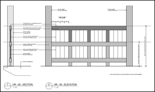 Figure 3: front verandah balustrade detail for BCA compliance
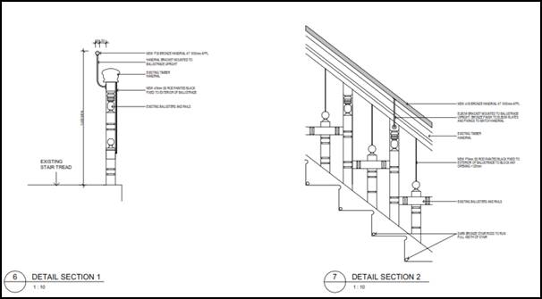
Figure 4: origianl staircase (internal) balustrade
detail for BCA compliance
It is not uncommon for buildings
such as Yallungah to require upgrades of the certain parts of the building to
conform with today’s building codes.
Council’s heritage advisor has reviewed plans showing
the proposed works and has not raised any objections.
Accordingly, the proposed changes to
the verandah balustrade and balustrade on the internal stairs within the former
mansion are considered acceptable.
It is noted that the treatment to
the front verandah balustrade was shown on the plans approved by the Court, so
the plans submitted with this application amend that previously approved
detail.
In relation to the internal stair
case the following two conditions were applied by the court:
(65) An additional
handrail is to be provided above the existing timber handrail on the heritage stairs in the existing mansion. The additional handrail may be wood, brass
or stainless steel material and is to be approved by Orange City Council. The new handrail can be supported
off the existing handrail
or off the side of the balustrade with appropriate brackets. The new
handrail is to be located at a height of at least
865mm above the nosings of the stair and landing.
(66) The gaps in the stair balustrade are to be addressed by installing glass sheets on the outside of the balustrade, fixed to the existing balustrade by
appropriate fittings. The height of the glazing is to be a minimum of 865mm
above the nosing of the stairs and 1000mm
above the
floor level of the landing.
The amended detail is compliant
with Condition (65), however, the plans propose an alternate treatment for
reducing the gaps in the up-rights of the handrail. Instead of glass applied to
the outside of the handrail, the approach now, which has been endorsed by
Council’s heritage advisor (from a heritage point of view), is to install
vertical rods to reduce gaps between original balustrade members. The overall
condition requiring the development to be BCA compliant applies and it would be
the responsibility of the private certifier to ensure the stairs and front
verandah comply with the building code. Condition (66) has been amended to the
following:
(66) The gaps in the stair balustrade are to be addressed as per
the detail shown on plan titled ‘A214 miscellaneous details – sheet
5 revision P1’ dated 7 January 2019 and be compliant with the Building
Code of Australia.
(5) Heritage
Assessment
The
consent authority may, before granting consent to any development:
(a) on
land on which a heritage item is located, or
(b) on
land that is within a heritage conservation area, or
(c) on
land that is within the vicinity of land referred to in paragraph (a) or (b),
require
a heritage management document to be prepared that assesses the extent to which
the carrying out of the proposed development would affect the heritage
significance of the heritage item or heritage conservation area concerned.
Given the relatively minor nature of the proposed
modification, a heritage management document is not considered warranted.
However, a brief heritage impact statement from John Oultram Heritage and
Design was submitted in support of the previous modification; an excerpt of
which is submitted with this application in support of the request to
reconsider the western boundary fence.
(6) Heritage
Conservation Management Plans
The
consent authority may require, after considering the heritage significance of a
heritage item and the extent of change proposed to it, the submission of a
heritage conservation management plan before granting consent under this
clause.
A conservation management plan was not required by the
Court, and there is nothing within this application to modify the Court issued
consent that would require one to be prepared now.
(7) Archaeological
Sites
The
consent authority must, before granting consent under this clause to the
carrying out of development on an archaeological site (other than land listed
on the State Heritage Register or to which an interim heritage order under the Heritage Act 1977 applies):
(a) notify
the Heritage Council of its intention to grant consent, and
(b) take
into consideration any response received from the Heritage Council within 28
days after the notice is sent.
The Court did not identify the subject land as being an
archaeological site.
(8) Aboriginal
Places of Heritage Significance
The
consent authority must, before granting consent under this clause to the carrying
out of development in an Aboriginal place of heritage significance:
(a) consider
the effect of the proposed development on the heritage significance of the
place and any Aboriginal object known or reasonably likely to be located at the
place by means of an adequate investigation and assessment (which may involve
consideration of a heritage impact statement), and
(b) notify
the local Aboriginal communities, in writing or in such other manner as may be
appropriate, about the application and take into consideration any response
received within 28 days after the notice is sent.
The Court did
not identify the land as being an Aboriginal Place of Heritage Significance.
(9) Demolition
of Nominated State Heritage Items
The
consent authority must, before granting consent under this clause for the
demolition of a nominated State heritage item:
(a) notify
the Heritage Council about the application, and
(b) take
into consideration any response received from the Heritage Council within
28 days after the notice is sent.
The
land is not identified as a Nominated State Heritage Item
Part 6 - Urban Release Area
Not relevant to the application. The subject site is not
located in an Urban Release Area.
STATE ENVIRONMENTAL PLANNING
POLICIES
There are no State Environmental
Planning Policies that are of relevance to the assessment of the application to
modify the consent.
PROVISIONS OF ANY DRAFT
ENVIRONMENTAL PLANNING INSTRUMENT THAT HAS BEEN PLACED ON EXHIBITION
4.15(1)(a)(ii)
There are no draft environmental planning instruments that
apply to the subject land or proposed development.
DESIGNATED DEVELOPMENT
The proposed development is not designated development.
INTEGRATED DEVELOPMENT
The proposed development is not integrated development.
PROVISIONS OF ANY DEVELOPMENT
CONTROL PLAN s4.15(1)(a)(iii)
Development Control Plan 2004
Development Control Plan 2004 (“the DCP”)
applies to the subject land. Chapters of the DCP relevant to the proposed
use and development include:
· Chapter 0 -
Transitional Provisions
· Chapter 2 -
Natural Resource Management
· Chapter 3 -
General Considerations
· Chapter 4 -
Special Environmental Considerations
· Chapter 5 -
General Considerations for Zones and Development
· Chapter 7 -
Development in Residential Areas
· Chapter 13 - Heritage
and have been previously considered by the Court.
Those matters that are of relevance to the modification
relate primarily to visual privacy and heritage considerations, and are
addressed below.
Visual Privacy
The DCP sets the following planning outcome in regard to
visual privacy:
· Direct
overlooking of principal living areas and private open spaces of other
dwellings is minimised firstly by:
- building
siting and layout
- location
of windows and balconies
and
secondly by:
- design
of windows or use of screening devices and landscaping.
The consent issued by the Court
required visual privacy screening to all upper level west facing windows and
Rooms 9-12 on the ground floor (noting that these rooms had a balcony when the
court considered the DA).
As previously considered under the last modification, with
the benefit now of understanding the finished floor levels, the full extent of
the visual privacy can now be observed.
Since the determination of the Court, the applicant has
sought additional privacy screening to all guest rooms with west facing windows
(both ground and first level rooms) within the new addition. This is considered
to be a much more positive outcome for all parties than what would have been
achieved by the Court imposed requirements.
The proposed screening
comprises eleven 150mm deep horizontally fixed blades, spaced 25mm apart.
The screening is to commence 1.2m from the finished floor level and up to a
height of 1.6m above finished floor level. The details of the screening are shown
below.
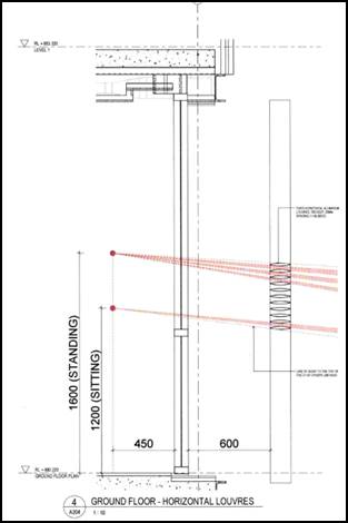
Figure 5: section of the proposed louvres
The applicant invited Council staff and the adjoining owner
to observe a prototype of the proposed screening structure. The prototype was
not an exact match of the screen proposed. The prototype was further off the
ground than proposed and positioned on the inside face of the building rather
than the location on the outside of the building.
Having observed the prototype in the
incorrect position, Council staff were of the view that in order to provide
sufficient privacy to the western neighbour, the depth of the individual fixed
blades should be increased from the proposed 150mm to a depth of 250mm. This
would further prevent the potential for the observer from being able to look
down into the backyard of the adjoining owner.
This was the recommendation to Council for the planning
report prepared for the December 2018 PDC meeting, however the applicant
requested that the application be withdrawn from that meeting to allow
sufficient time to demonstrate that the proposed screen devices would provide a
sufficient level of visual privacy for the adjoining neighbour.
Since then, the applicant installed the prototype in the
proposed location and provided Council staff with a further opportunity to
observe effectiveness of the screening device. During this time is was agreed
by that the screening devices will provide an effective level of privacy
protection for the adjoining owner.
The development as modified is therefore considered
acceptable in terms of visual privacy. Acoustic privacy is addressed below
under the heading “Noise Impacts”.
Heritage
The DCP sets the following planning outcomes in regard to
heritage:
· Heritage
buildings and structures are efficiently re-used.
· New
development complements and enhances the significance of a heritage item or
place of heritage significance listed in the Orange Heritage Study.
· Significant
landscape features are retained including original period fences and period
gardens.
Heritage has previously been addressed in detail under the
heading “5.10 - Heritage Conservation”. The proposed development
has been designed in accordance with the outcomes for heritage and is
considered acceptable.
INFILL GUIDELINES
As established under the Heading “5.10 - Heritage Conservation”,
there are no aspects of the application to modify the consent that would result
in unsatisfactory impacts upon the heritage significance of the place.
The development as modified will not be incongruous with the
character of the locality.
The development as modified will not dramatically alter the
previously approved scale and form of the development.
The previously approved siting of the development does not
change as a result of the development as modified.
The materials and colours, and the detailing of the modified
design are appropriate save for the western boundary fence as described above.
The development as modified is not inconsistent with the
relevant heads of consideration under the Infill Guidelines and remains
consistent with the intent of the Court approved development.
PROVISIONS PRESCRIBED BY THE
REGULATIONS s4.15(1)(a)(iv)
The development as modified is not inconsistent with the
provisions prescribed by the regulations.
THE LIKELY IMPACTS OF THE
DEVELOPMENT s4.15(1)(b)
Residential Amenity
Visual Privacy
The impacts associated with the visual privacy of the
development with consideration to the revised privacy screens are addressed
above under the DCP considerations.
Noise Impacts
The consideration of noise impacts relates only to the
condition Council previously imposed that required windows on the western
elevation to be fixed pane and non-operable windows. The intent was to manage
noise associated with the deletion of balconies. At the time of previously
considering this issue the applicant did not provide sufficient information to
satisfy Council staff that operable windows would be satisfactory, thus the
condition was imposed.
The applicant has now submitted in support of this
application, an acoustic report which demonstrates that the development can
operate with operable windows across all rooms within the western elevation.
The Manager of Building and Environment has assessed the report and agreed that
the development will be acceptable with operable windows.
It is recommended that the relevant condition be deleted.
The development will not give rise to unacceptable impacts
as a result of noise associated with guest rooms.
Heritage
Heritage considerations are addressed above under the
heading “Clause 5.10 - Heritage Conservation” under the LEP
consideration.
THE SUITABILITY OF THE SITE
s4.15(1)(c)
The site continues to remain suitable for the development as
modified.
ANY SUBMISSIONS MADE IN
ACCORDANCE WITH THE ACT s4.15(1)(d)
The proposed development is defined as "advertised
development" under the provisions of the Act. The application was
advertised for the prescribed period of 14 days and at the end of that period
nine submissions had been received (including a submission from the owner of 60
Byng Street outside of the exhibition period).
Submissions 1, 2 and 3 -
Resident of 60 Byng Street
Submission 1
In relation to the louvres, the submitter indicates that
they have no objection to the louvres being fixed and horizontal rather than
being angled, but the submitter states that “the position of the
louvres, distance from the windows and widths of the louvres will have a
bearing on whether they are appropriate”.
In relation to the treated pine
timber fence along the boundary, the submitter articulates their version of
what has transpired between themselves and the adjoining owner. The submitter
concludes that as no further work has been carried out to the fence which was
the basis for the agreed position previously, and that the fence condition has
deteriorated further since the initial agreement. The submitter has indicated
that their previous conditional agreement is thus withdrawn.
In relation to the operable windows, the submitter indicates
no objection provided that the acoustic considerations have been assessed by
Council staff.
Submission 2
Submission 2 is a subsequent submission from the adjoining
owner. The submission details what the adjoining owner indicated at the site
meeting to observe the prototype privacy screening. The submitter confirmed
that he agreed to the proposed method of privacy screening and also that he had
no objections to the operable windows given that Council staff has reviewed the
submitted acoustic report and it was deemed satisfactory.
Council staff response
Submissions 1 and 2 are authored by the same person and are
addressed below.
In relation to the above, Council staff have independently
assessed the level of privacy and now consider the proposed screening devices
appropriate. This matter is addressed under the visual privacy section of this
report.
In relation to the boundary fence, the position of Council
staff on this matter is detailed above. It is recommended that the status quo
of the consent remain (ie that being the position initially held by the Court
and subsequently by Council) and the request to allow the treated pine fence
not be supported.
In relation to the operable windows, as mentioned above the
applicant has submitted an acoustic report in support of the development which
indicates that the development with operable windows would be acceptable. This
has been reviewed by the Manager Building and Environment and confirmed as
acceptable.
Submission
3
A further submission has been
received from the adjoining owner at 60 Byng Street. The submission outlines
further dialogue that has occurred between the two parties in relation to the
boundary fence, raises doubts over some of the comments made by the applicant
in a letter to Council dated 9 January 2019, references/provides a copy of
Submission 9 of this report and provides additional photographs.
Council staff response
As detailed above, Council staff
position on fence material remains consistent with the Court and the previous
resolution of the Council. The condition is to remain as is i.e. require a
hardwood fence.
Submission 4 - Resident of 75
Hill Street
The submission raises concerns in
relation to the western boundary fence in terms of its adequacy in its
construction and the materials it has been constructed from.
Council staff response
In relation to the boundary fence, the position of Council
staff on this matter is detailed above. It is recommended that the status quo
of the consent remain (ie that being the position initially held by the Court
and subsequently by Council) and the request to allow the treated pine fence
not be supported.
Submission 5 - Resident of 82
Clinton Street
The submitter raises concerns in
relation to the operable western windows and the fencing materials.
Council staff response
The allowance of operable windows is addressed in detail
above. The applicant has submitted an acoustic report in support of allowing
the operable windows and this is considered to be acceptable.
In relation to the boundary fence, the position of Council
staff on this matter is detailed above. It is recommended that the status quo
of the consent remain (ie that being the position initially held by the Court
and subsequently by Council) and the request to allow the treated pine fence
not be supported.
Submission 6 - Residents of 59
Byng Street
The submitter raises concerns in
relation to the western boundary in respect of its adequacy and the materials
used in breach of the consent condition.
Council staff response
In relation to the boundary fence, the position of Council
staff on this matter is detailed above. It is recommended that the status quo
of the consent remain (ie that being the position initially held by the Court
and subsequently by Council) and the request to allow the treated pine fence
not be supported.
Submission 7 - 57 Byng Street
The submitter raises concerns in
relation to the operable windows and the western boundary fence in terms of the
material used, which was contrary to the consent. The submitter also mentions
the illegal developments that have allegedly occur at the property, citing
discussions at a Council meeting in 2016, and requests that the developer be
penalised.
Council staff response
The allowance of operable windows
is addressed in detail above. The applicant has submitted an acoustic report in
support of allowing the operable windows and this is considered to be
acceptable.
In relation to the boundary fence, the position of Council
staff on this matter is detailed above. It is recommended that the status quo
of the consent remain (ie that being the position initially held by the Court
and subsequently by Council) and the request to allow the treated pine fence
not be supported.
In relation to the illegal works, this a separate matter
which has been reported to Council previously.
Submission 8 - owners of 85 Hill
Street
The submitters raise concerns in relation to the
applicant’s request to amend the screening and seek to allow operable
windows. The submitters have also referenced the western boundary fence stating
“it looks flimsy and in poor condition” and suggest that the
fence should be replaced as per the Court imposed condition.
Council staff response
The privacy considerations are addressed above and it has
been determined that the fixed louvres should be increased in depth to allow a
greater level of privacy.
In relation to the operable windows, as indicated above the
applicant has submitted an acoustic report in support of the operable windows
which is considered to be acceptable.
In relation to the boundary fence, the position of Council
staff on this matter is detailed above. It is recommended that the status quo
of the consent remain (ie that being the position initially held by the Court
and subsequently by Council) and the request to allow the treated pine fence
not be supported.
Submission 9 - Resident of 234
March Street
The submission objects to the request to allow the constructed
pine fence to remain. The author of the submission outlines various technical
construction factors that they allege the applicant has not considered when
constructing the fence - stating these for the reasons that the fence is in a
poor condition.
Council staff response
In relation to the boundary fence, the position of Council
staff on this matter is detailed above. It is recommended that the status quo
of the consent remain (ie that being the position initially held by the Court
and subsequently by Council) and the request to allow the treated pine fence
not be supported.
PUBLIC INTEREST
s4.15(1)(e)
The proposed development is considered to be of minor
interest to the wider public due to the relatively localised nature of
potential impacts. The proposal is not inconsistent with any relevant policy
statements, planning studies, guidelines etc that have not been considered in
this assessment.
SUMMARY
The development as modified remains permissible with the
consent of Council. The proposed development is not inconsistent with the
relevant aims, objectives and provisions of Orange
LEP 2011 (as amended) and DCP 2004. A Section 4.15
assessment of the development indicates that the development is acceptable save
for the matter pertaining to the materials used for the western boundary fence.
The applicant has requested that Council give further consideration to allowing
the treated pine fence that has been recently constructed along the western
boundary as opposed to the current requirement for the fence to be a timber
hardwood fence. It is open for Council to reconsider its position of this
matter. Attached is a draft amended Notice of Approval outlining a range of
conditions considered appropriate to ensure that the development proceeds in an
acceptable manner.
COMMENTS
The requirements of the Environmental Health and Building
Surveyor and the Engineering Development Section are included in the attached
amended Notice of Approval.
Attachments
1 Notice
of Approval, D19/4769⇩
2 Plans,
D19/4458⇩
3 Submissions,
D19/4542⇩
Planning
and Development Committee
5 February 2019
2.5 Development
Application DA 329/2015(3) - Hotel - 62 Byng Street and 77 Hill Street
Attachment 1 Notice
of Approval
|
|
ORANGE
CITY COUNCIL
Development
Application No DA 329/2015(3)
NA19/ Container
PR2111
|
NOTICE OF
DETERMINATION
OF A
DEVELOPMENT APPLICATION
(AS
MODIFIED)
issued under
the Environmental Planning and Assessment Act 1979
Section 4.18
|
Development
Application
|
|
|
Applicant Name:
|
Mayoh
Architects Pty Ltd - PD Mayoh Pty Ltd
|
|
Applicant Address:
|
(Attention
Melodie Kaplan)
60
Strathallen Avenue
NORTHBRIDGE
NSW 2063
|
|
Owner’s Name:
|
Denoc Holdings Pty
Ltd
|
|
Land to Be Developed:
|
Lot 100 DP
1212419 (previously described as Lot 3 Sec 21 DP 758817, Lot 4 DP 1085463 and
Lot 1 DP 956418) 62 Byng Street and 77 Hill Street, Orange.
|
|
Proposed Development:
|
Alterations
and extension to an existing heritage mansion to provide boutique hotel
accommodation, conference room, kitchen and dining facilities, on-site car
parking and landscaping
|
|
|
|
|
Building
Code of Australia
building
classification:
|
To be
determined by certifier
|
|
|
|
|
Determination
made under
Section 4.16
|
Development
consent was initially granted by the Land and Environment Court on 1 June
2017 – Appeal Number 2016/183468.
|
|
Made On:
|
5 February
2019 – Determination date of the modification application
|
|
Determination:
|
CONSENT
GRANTED SUBJECT TO CONDITIONS DESCRIBED BELOW:
|
|
|
|
|
Consent to
Operate From:
|
1 June
2017
|
|
Consent to
Lapse On:
|
1 June
2022
|
Terms of Approval
The reasons for the imposition of
conditions are:
(1) To ensure a quality
urban design for the development which complements the surrounding environment.
(2) To maintain
neighbourhood amenity and character.
(3) To ensure compliance
with relevant statutory requirements.
(4) To provide adequate
public health and safety measures.
(5) Because the development
will require the provision of, or increase the demand for, public amenities and
services.
(6) To ensure the utility
services are available to the site and adequate for the development.
(7) To prevent the proposed
development having a detrimental effect on adjoining land uses.
(8) To minimise the impact
of development on the environment.
SCHEDULE B
– OPERATIONAL CONDITIONS
GENERAL
CONDITIONS
(1) The development must be carried
out in accordance with the following approved
plans and documentation except where amended by
another Condition of this consent (including a
deferred commencement condition).
· Cover Sheet prepared by PD Mayoh Pty Ltd Drawing Nos. A001, Issue E dated 21 June 2017
· Tree Removal Plan prepared by PD Mayoh Pty Ltd Drawing No. A090, Issue C, dated 21
June 2017;
· Lower Ground Floor Plan prepared by PD Mayoh Pty Ltd, Drawing No. A100, Issue W,
dated 21 June 2017;
· Site Plan and Ground Floor Plan prepared by PD Mayoh Pty Ltd Drawing No. A101, Issue
X, dated
21
June 2017;
· First Floor
Plan prepared by PD
Mayoh Pty Ltd Drawing No. A102, Issue Q , dated
21
June 2017;
· Roof Plan prepared by PD Mayoh Pty Ltd Drawing No. A103, Issue K, dated 21 June 2017;
· East, West, North and South Elevations prepared by PD
Mayoh Pty Ltd, Drawing No. A150, Issue I , dated
21 June 2017;
· Sections CC and DD prepared by PD Mayoh Pty Ltd Drawing No. 161, Issue E, dated 21
June 2017;
· Section EE prepared by PD Mayoh Pty Ltd, Drawing No. A162, Issue B, dated 21 June 2017;
· Section HH, prepared by PD Mayoh Pty Ltd
Drawing No. A163, Issue C dated 21 June 2017
· Landscaping Concept Plans prepared by Christopher Nicholas Garden Design Issue
4 dated 21 June 2017;
· Acoustic Report prepared by Acoustic Logic, dated 20 June 2017
Amending
plans by Mayoh Architects job No. 1444
Dawning nos.
· S4.56_A090 Site Plan - Rev P6 Date 18 July 2018
· S4.56_A100 Lower Ground Floor Plan - Rev P10 Date 21 June 2018
· S4.56_A101a Ground Floor Plan – New Extension – Rev P11 Date
17 July 2018
· S4.56_A101b Ground Floor Plan Existing – Rev P14 Date 18 July 2018
· S4.56_A102a First Floor Plan – New Extension – Rev P10 Date
21 June 2018
· S4.56_A102b Frist Floor Plan - Existing – Rev P10 Date 21
June 2018
· S4.56_A103a Roof Plan – New Extension – Rev P4 Date 17 July
2018
· S4.56_A103b Roof Plan – Existing – Rev P3 Date 1 June 2018
· S4.56_A150 Elevations (E, W, N, S) – Rev P4 Date 17 July 2018
· S4.56_A160 Sections AA and BB – Rev P5 Date 17 July 2018
· S4.56_A211 Miscellaneous Details Sheet 2 – Rev P5 Date 17 July 2018
· S4.56_A212 Miscellaneous Details Sheet 3 – Rev P6 Date 18 July 2018
· S4.56_A214 Miscellaneous Details Sheet 5 – Rev P2 Date 18 July 2018
Amending
plans by Mayoh Architects job No. 1444
Dawning nos.
· A204 Privacy
Louvre Detail Rev 1 Dated 25 October 2018
· A214
Miscellaneous Details Rev P1 – sheet 5 Dated 7 January 2019
Where there is inconsistency between the above plans and a Condition of this Consent, the
Condition is to prevail
to
the extent of any inconsistency.
(2) All building work must be carried out in accordance with the provisions of the Building Code
of
Australia.
(3) A sign is to be erected in a prominent position on any site on which building work, subdivision
work or demolition work is being carried out:
a. showing the name, address and telephone number of the principal certifying authority for the work, and
b. showing the name of the principal contractor (if any) for any building work and a
telephone number
on
which that person may be contacted outside working hours, and
c. stating that unauthorised entry to the site is prohibited.
Any such sign is to be maintained while the building work, subdivision work or demolition
work is being carried out.
(4) Where any excavation work on the site extends below the level of the base of the footings of a building on adjoining land, the person having the benefit of the development consent must,
at the person’s own expense:
a. protect and support the adjoining
premises from possible damage from the excavation, and
b. where necessary, underpin the adjoining
premises to prevent any such damage.
Note: This condition does not apply if the person having the benefit of the development consent owns the adjoining land or the owner of the adjoining land has given consent in writing to that condition not applying.
|
PRIOR TO
THE ISSUE OF A CONSTRUCTION CERTIFICATE
|
(5) An interpretation plan must be submitted to, and be
approved by, Council’s Manager Development Assessments prior to the issuing of a Construction Certificate. The interpretation plan must be consistent with the guidelines produced by
the NSW Heritage Office and must be prepared for the property by
an experienced heritage consultant. The interpretation plan must recommend interpretive devices both internal and extern al to the
building and within the significant portions of the
building sufficient to interpret the relevant
aspects of its cultural heritage significance.
Where required,
a separate development application must be
lodged for any works
associated with the installation of interpretation devices.
(6) The approved landscape plan is to be amended to replace the Hornbeam
(Carpinus
betulus ‘Pendula’ Pleached) with Carpinus
betulus (Pleached) to ensure that the canopy
formed
does not impact on the use of the driveway or affect the neighbouring
property through encroachment over
the
boundary.
The
approved landscape plan identifies
Leightons Green Conifer (Cupressocyparis x leylandii) planted along the eastern boundary of the site. This plant obtains a mature height of over 10 metres and is likely overshadow properties along Hill Street. The Leightons Green Conifers to be planted
along the eastern boundary are to be restricted to a maximum height of 5 metres to ensure that there is no overshadowing impact. The eastern boundary trees are not to be evergreen trees.
(7) An approval under Section 68 of the Local Government Act is to be obtained from Orange
City
Council, as
the
Water and Sewer Authority, for water,
sewer and stormwater
connection. No plumbing and drainage in connection with this development is to commence until approval
is
granted.
(8) Detailed plans and specification are to be submitted with an application for Construction
Certificate specifying the proposed fit-out of the
food preparation
and storage areas in
accordance with the requirements of Australian Standard 4674-2004 "Design
and
construction and fit-out of food premises" and Standard 3.2.3 "Food Premises and Equipment" of the Australian New Zealand Food Standards Code.
(9) Detailed plans and specification are to be submitted with an application for Construction Certificate
that indicate all fire
safety
measures
for
the
existing site and/or
proposed
building. The plans and specifications shall be designed by a suitably qualified person. The
specification is to include all hydraulic calculations for any required hydrants, hose reels,
fire water mains. Any modifications required to the existing house under this condition are to be approved by Orange City Council’s Heritage Advisor.
(10) The applicant shall provide the Principal Certifying Authority and Council with a report from
a qualified Acoustic Consultant that confirms all
mechanical equipment to be installed within the development
will comply
with
the
noise goals and the Management
techniques proposed in the Noise Impact Assessment prepared by Acoustic Logic Revision 4 dated 20June 2017.
(11) Engineering plans providing complete details of the proposed
footpath crossing, driveway and car-parking areas is to be submitted to Orange City Council or an Accredited Certifier (Categories B1, C3, C4, C6) and approved prior to the issue of a Construction Certificate.
These plans are to provide details of levels, cross falls of all
pavements, proposed sealing
materials and proposed drainage works and be in accordance with the Orange City Council
Development and Subdivision Code.
(12) A raised concrete median is to be constructed in Byng Street to prevent in and out right
turns. The concrete median is to extend 30m from
the end of the existing roundabout traffic
island. A double barrier line is to be painted on Byng Street from the end of the median
extending 20m west. The concrete median is to be a minimum
600 millimetres wide and
designed and constructed in accordance with Parts 3 and 4A
of
Austroads Guide to Road Design. The eastbound traffic lanes in Byng Street are to maintain their existing width.
Engineering plans, showing details of the raised concrete median, signage, linemarking and
construction traffic control plan, are to be submitted to Orange City Council or an Accredited
Certifier (Categories B1, C3, C4, C6) and approved prior to the issue of a Construction Certificate.
Separate approval under section 138 of the Roads Act
1993 will be required for work on public roads prior to any work being undertaken on or over a public road.
(13) A water and soil erosion control plan is to be submitted to Orange City Council or an
Accredited Certifier (Categories B1, C3, C4, C6) for
approval prior to the issuing of a
Construction Certificate. The soil erosion control
plan is to be in accordance with the
Orange City Council Development and Subdivision Code and the Landcom, Managing Urban Stormwater; Soils and Construction Handbook.
(14) A Liquid Trade Waste Application is to be submitted for approval to Orange City Council prior to the issuing of a Construction Certificate. The application is to be in
accordance with Orange City Council’s Liquid Trade Waste Policy. Engineering plans
submitted as part of the application are to show details of all proposed liquid trade waste pre-treatment systems and their connection to sewer.
(15) Where applicable, the applicant is to enter
into a Liquid Trade Waste Service
Agreement with Orange City Council
in
accordance with the Orange City Council Liquid
Trade Waste Policy.
(16) Payment of contributions for water, sewer and drainage works is required to be made at the contribution rate applicable at the time that the payment is made. The
contributions are based on 6.1 ETs for
water
supply headworks and 9.4 ETs for
sewerage headworks. A Certificate of Compliance, from Orange City Council
in accordance with the Water
Management Act 2000, will be issued upon payment of the
contributions.
This Certificate of Compliance is to be submitted to the Principal Certifying Authority prior to
the issuing of a Construction Certificate.
(17) Backflow
Prevention Devices are to be installed to AS3500 and in accordance with Orange City Council Backflow Protection Guidelines. Details of the Backflow
Prevention Devices are to be submitted to Orange City Council for approval prior to the issuing of a Construction Certificate.
(18) An acoustic report is to be prepared by a suitably qualified acoustical consultant and
submitted to the Principal
Certifying Authority demonstrating that the noise emission from
the
proposed mechanical plant will
not exceed an Leq noise level of 5 dB above the L90 background noise level measured at the nearest affected residence.
(19) Compliance with Clause 3.2.4, Figure 3.2 and Figure 3.3 of AS2890.1 –
2004 in relation to
sight lines to both pedestrians on the footpath and to vehicles approaching along Byng Street for
drivers of vehicles emerging from the proposed driveway shall be certified by and
experienced and qualified traffic engineer prior
to
the issue of a construction certificate.
This will
in
particular require:
a. a
2m
by 2.5m sight
triangle
to
pedestrians for emerging vehicles provided at the
widened gate location by an open fence form, low level landscaping (below 0.6m height) and at-grade paving and certification of adequate sight line for
emerging drivers
to
pedestrians on the adjacent public footpath.
(20) The internal
car
park and access to the car
park is to be certified by an experienced and certified traffic engineer
to
comply with AS2890.1-2004, AS2890.6-2009 and AS2890.2-2002 (relating to the Small Rigid Vehicle, being the maximum permitted service vehicle on-
site other than fire appliance vehicles). Certification must confirm
that the car
park and
access is fully compliant with the dimensional manoeuvring, gradient and travel height requirements of the design vehicles. The hydrant located between STAFF
car
parking space numbers 22 and 23 is to be confirmed as being flush with the parking pavement level such that those spaces can be lengthened to comply with Figure 2.5 of AS2890.1-2004.
(21) The hedge (Cherry Laurel (prunus laurocerasus)) at the front of the property on the
northern boundary is to be retained. Removal of any part of the hedge may only occur
to accommodate any new gate or fence that may be approved under the Conditions of this
Consent.
(22) The Beech Tree to the north of the site is to be retained.
(23) The accessible path of travel
between the disabled parking spaces and the foyer of the approved development is to be certified as acceptable by an accessibility expert.
(24) An acoustic report shall be prepared prior
to
the construction certificate that details how
the
alterations and additions are proposed to meet Part F5 of the Building Code of Australia,
including, but not limited to:
(a) Acoustic separation of common walls and floors between sole occupancy units in accordance with Part F5.4 and F5.5 of the BCA.
(b) Acoustic separation of common floor/ceiling between sole occupancy units on the first floor and the ground floor of the existing residence in accordance with Part F5.4 of the
BCA.
(c) Acoustic separation of internal
services in accordance with Part F5.6 of the BCA.
(24A) A separate schedule of finishes, colours, swatches and materials is to be provided in a sample board to Orange City Council for the work approved under
this consent. This includes a sample of the “Central Lobby Screen” in the proposed colour, no smaller than 600 x 600mm. The proposed external
finishes are to be generally in accordance with the plan
“External Finishes Legend Drawing” A 105 Revision H
and the “Central Lobby Screen Detail”
is
to be generally in accordance with Appendix E to the Joint Heritage Report dated 21 April
2017 and filed in Land and Environment Court Proceedings 2016/183468 Denoc Holdings Pty Ltd v Orange City Council. The use of the ‘warm pale orange’ to render finishes is not appropriate. The proposed finishes, colours, materials and swatches are to be approved by
Orange City Council prior
to
the issue of a Construction Certificate.
(24B) (deleted)
(24C) A notation must
be provided
on the plans
submitted with a Construction
Certificate
confirming that all outdoor lighting has been designed and will be installed in accordance with Australian Standard
AS
4282-1997 - Control of
the
Obtrusive
Effects of Outdoor Lighting.
(24D) Louvre screens are to be fixed to the ground
floor windows of guest rooms 1-12, and the upper level windows on the western
elevation of the approved extension, except for the western glazing to the main
entry foyer as per the approved plans.
The
angle of the louvres attached to all required windows shall be positioned to
prevent direct overlooking of the adjoining property at 60 Byng Street. Details
of the louvres to all required windows on the western elevation of the approved
extension shall be submitted to Council’s manager Development Assessments
for approval prior to the issue of a Construction Certificate.
(24E) A screen is to be constructed and is to remain at the rear of the three easternmost spaces
(car spaces 14, 15 and 16) in front (north) of the proposed landscaping to act as a barrier to light spill in addition to the boundary fencing and landscaping. This screen is to be in the form
of
a perforated metal
screen to a height of 3 metres. The colour and material of the screen is to be provided to Orange City Council for approval prior to the issue of a Construction Certificate. Details of the
screen are to
be noted on
the
plans submitted
with
a Construction Certificate.
(24F) The “booster
valve”
or equivalent infrastructure shown on Plan A.101 is to be located outside
of
the Structural
Root Zone (SRZ) of the Liquid Amber tree located towards the north eastern
corner of 62 Byng Street. All excavation or
trenching works associated with the installation of
this infrastructure must be located outside of the SRZ
of
the Liquid Amber
tree.
(24G) The original fireplaces, or an equivalent fireplace to be approved by Council’s Heritage
Advisor, are to be reinstated in their original location within rooms 20 and 22.
(24H) Specifications are required for the glazing on the east
and west elevations of the approved
extension shown on Plan A.150. Glazing must be set inwards of the framing so as to
modulate the bulk and minimise the apparent extent
of
glazing on each elevation. Glazing
must rely on body tint or similar without any external reflective coating. The specifications
for the glazing are required to be shown on the plans
submitted with the Construction
Certificate.
(24I) Full details of the
restoration or rebuilding of the front fence and gate to 62 Byng Street must be
submitted to Orange City Council prior to the issue of a Construction
Certificate.
Details of the condition of the existing fence
and gate must be provided to Council. Where it can be demonstrated to the
satisfaction of Council’s Manager of Developments Assessments that the
existing materials are incapable of restoration, the existing fence must be
replaced by fence to match the original fence style of chain wire and timber
posts, consistent with the heritage character of the subject property and
Central Orange Heritage Conservation Area. The selected hedge plants behind the
fence are to be advanced plants.
(24J) An amended stormwater design is to be submitted with the application for a Construction
Certificate to include stormwater detention within the
development, designed to limit peak
outflows from the land to the pre-existing natural outflows up to the 100 year ARI
frequency, with sufficient allowance in overflow spillway
design capacity to safely pass
flows of lower frequency (that is, a rarer event) without damage to downstream developments. Where appropriate, the spillway design capacity is to be determined in accordance with the requirements of the Dam Safety Committee.
The design of the detention storage is
to
be undertaken using the DRAINS rainfall-runoff hydrologic model or an approved equivalent capable
of
assessing runoff volumes and their temporal
distribution as well
as peak flow rates. The model is to be used to calculate the flow rates for
the existing and post-development conditions. The developed flows are to be routed
through the proposed storage within the model so that the outflows obtained are no greater
than the
flows obtained
for the pre-existing
natural flows. A report detailing the
results of the
analysis, which includes:
• catchment plan showing sub-catchments under existing and developed conditions;
• schematic diagram of the catchment model showing sub areas and linkages;
• tabulation detailing the elevation, storage volume and discharge relationships; and
• tabulation for the range of frequencies analysed, the inflows, outflows and peak storage levels for
both existing and developed conditions;
together with copies of the data files for the model and engineering design plans of the
required drainage system are to be submitted and approved by Orange City Council.
All stormwater
from the site is to be collected and piped to Councils existing stormwater system in Hill
Street.
Engineering plans, showing
details of
the
proposed
stormwater drainage system, are to be submitted to,
and approved by Orange City Council prior to the issue of a construction certificate.
The existing 150mm-diameter
sewer main is to be relocated clear of the proposed building.
Engineering plans, showing details of the proposed sewer main relocation works, are to be submitted to,
and approved by Orange City Council prior to the issuing of a Construction
Certificate.
Backflow Prevention Devices
are to be installed to AS3500 and in accordance with Orange City Council Backflow Protection Guidelines. Details of the Backflow Prevention Devices are
to be submitted to Orange City Council for approval prior to the issuing of a Construction
Certificate.
(24K) (deleted)
(24L) The
acoustic fence and acoustic screening shall be in accordance with the acoustic
report by Acoustik report reference 1708.001 Report.3.
(24M) (deleted)
|
PRIOR TO
WORKS COMMENCING
|
(25) A Construction Certificate application is required to be submitted to,
and issued by,
Council/Accredited Certifier
prior
to
any excavation or
building works being carried out on site.
(26) A temporary onsite toilet is to be provided and must remain throughout the project or until an alternative facility meeting Council’s requirements is available onsite.
(27) Soil erosion control measures shall be implemented on the site.
(28) The applicant shall supply Orange City Council with a dilapidation report for the adjoining properties at 75, 79, 81, 85 and 87 Hill Street as well as 60 and 64 Byng Street, Orange which documents and photographs the conditions of buildings
and improvements on those
properties prior
to
commencement of works. A copy of the report must be provided to Council and the owners of the nominated properties. Council shall be provided with a list of owners to whom a copy of the report has been provided.
This condition shall not apply in the event that access is refused by those property owners.
(29) A Tree Protection Zone (TPZ) as detailed in AS 4970 – 2009 shall be established on the development site
for each tree to be retained
on the western side of 62 Byng Street and the
eastern side of 60 Byng Street. The Tree Protection Zone shall be erected a minimum of 4.5 metres in radius
from the centre of each tree along the western boundary
fence of 62 Byng
Street. The Tree Protection Zone must be connected to the western boundary fence of 62
Byng Street.
(30) A Tree Protection Zone (TPZ) as detailed in AS 4970 – 2009 shall be established around the Liquidambar tree in the North east corner
of
62 Byng Street. The Tree Protection Zone shall
be erected a minimum of 2.2 metres to the east of the tree, a minimum of 3.6m
to the south, west and north of the tree.
Note: The trees affected by Condition (27) and (28) include the Liquidambar
in
the north east
corner of 62 Byng Street, the Elm in the north west corner of 62 Byng Street, the Beech on western boundary of 62
Byng Street, the Box Elder on or immediately beyond western boundary of 62 Byng Street and the Elm (2) on or immediately beyond western boundary of
62 Byng Street.
|
DURING
CONSTRUCTION/SITEWORKS
|
(31) The applicant shall
ensure that the Tree Protection zones for those trees identified to be
retained are observed and maintained during construction.
(32) The entrance path, immediately to the west of the Liquidambar located in the north east
corner of 62 Byng Street shall be constructed in such a way that it does not impact on the
soft landscape zone existing within the TPZ. ie. porous pavement or a bridging
of
the Structural Root Zone shall be undertaken to minimise root damage. To ensure protection of the SRZ (SRZ
= trees stability) no excavation or
fill material
shall be permitted within a radius of 2200mm of the centre of the tree’s trunk.
(33) All construction/demolition work
on the site is to be carried out between the hours of 7.00 am
and 6.00 pm
Monday to Friday inclusive and 7.00 am
to
5.00 pm
Saturdays. Written approval must be obtained from the General Manager of Orange City Council
to
vary these hours.
(34) All materials onsite or
being delivered to the site are to be contained within the site. The
requirements of the Protection of the Environment Operations Act 1997 are to be complied with when placing/stockpiling loose material
or when disposing of waste products or during any other activities likely to pollute drains or watercourses.
(35) Building demolition is to be carried out in accordance with Australian Standard 2601:2001 - The Demolition of Structures and the requirements of the NSW WorkCover Authority.
(36) Where asbestos material is removed or disturbed as
a result of any proposed demolition,
alterations or additions, all work must be carried out by a person licensed under Chapter 10
of
the Occupational Health & Safety Regulation 2001 and undertaken in accordance with the requirements of
clause 29
of the Protection
of the Environment
Operations
(Waste) Regulation 2005. All asbestos to be removed must be disposed
of
at a tip recommended by
the NSW Environment Protection Authority and under
no circumstances shall it be reused or
sold.
(37) The fit-out of the food preparation and storage areas are to be installed in accordance with
the requirements of Food Safety Standard 3.2.3 "Food Premises and Equipment"
of
the Australian New Zealand Food Standards Code and Australian Standard 4674-2004 "Design and construction and fit-out of food premises".
(38) The provisions and requirements of the Orange City Council Development and Subdivision Code are to be applied to this application and all work constructed within the development is
to
be in accordance with that Code.
The developer
is
to be entirely responsible for
the provision of water, sewerage and drainage facilities capable of servicing the development
from Council’s existing infrastructure. The
developer is to be responsible
for gaining access over adjoining land for services where
necessary and easements are to be created about all water, sewer and drainage mains
within and outside the lots they serve.
(39) All driveway and parking areas are to be sealed with bitumen, hot mix, cobblestones, pavers
or concrete and are to be designed for all expected loading conditions (provided however that the minimum pavement depth for gravel
and flush seal roadways is 200mm) and be in accordance with the Orange City Council Development and Subdivision Code.
(40) All
pruning works
shall be undertaken
to AS4373-2007 Pruning
of amenity trees by
a qualified arborist under
the supervision of Council’s Manger City Presentation.
(41) A heavy-duty concrete kerb and gutter layback and footpath crossing is
to
be constructed for the entrance to the proposed development on Byng Street. The existing gutter
bridge is to be
removed and the bitumen footpath and roadway
reinstated. The construction of the layback and footpath crossing are to be as required by the Orange City Council Development and Subdivision Code.
(42) The existing basalt (bluestone) kerb and gutter in Byng Street is to be retained . Where bluestone
exists in the location of the proposed new driveway, the bluestone gutter is to be
retained and incorporated into the new vehicular layback. Any kerb stones removed as a result of the works are to be firstly used as kerb stones in the areas of reinstated kerb and
any
leftover stones returned to Council.
(43) Any
adjustments
to
existing utility services that are made necessary by this development
proceeding are to be at the full cost of the developer.
(44) All floors of rooms 20, 21 and 22 within the existing dwelling are to be upgraded to achieve
an
airborne sound insulation of not less than 50 and impact sound insulation rating of not
more than 62.
(45) Walls separating rooms 20, 21 and 22 from each other, a stairway, public corridor, public lobby or the like are to be upgraded achieve an airborne sound insulation of not less
than 50
and extend to the underside of the roof, or to a ceiling that provides the sound insulation
required for
the wall.
(46) The wall separating the bathroom of room 21 from room 22 shall be upgraded to be
discontinuous; and achieve an
airborne sound insulation of not less than 50; and an impact sound insulation rating of not more than 62.
|
PRIOR TO
THE ISSUE OF AN OCCUPATION CERTIFICATE
|
(47) A 2m high
lapped and capped hardwood timber fence must be constructed around the
perimeter of the development, excluding the frontages to 62 Byng Street and
77 Hill Street, the common boundary to 75 Hill Street, the common boundary
between 77 Hill Street and 60 Byng Street and the common boundary between 77
Hill Street and 79 Hill Street prior to the issue of an Occupation Certificate.
Along the
common boundary between 77 Hill Street and 60 Byng Street, the existing fence
must be
retained. Along the eastern boundary of 62 Byng Street, the fence must taper to
a maximum height of 1.8m forward of the front building line of the building at
64 Byng Street.
Along the
western boundary of 62 Byng Street, the fence must taper to a maximum height of
1.8m
forward of the front building line of the building at 62 Byng Street. The
height of the fence must be taken from the highest Finished Surface Level
adjacent to each part of that fence.
(48) A 2m high lapped and capped hard wood timber fence must be constructed along the common boundary of 75 Hill
Street prior to the issue of an Occupation Certificate.
The fence must taper to maximum height of 1.2m where it is forward of the front building line
of
the building at 75 Hill
Street.
The height of the fence must be taken from the highest finished ground level adjacent to each part of that fence.
The existing fence on the common boundary between 77 and 79 Hill Street
is
to be retained
and is not to be modified as part of this approval.
(48A) A screen is to be constructed and is to remain at the rear of the three easternmost
spaces (car spaces 14, 15 and
16) in front (north) of the
proposed landscaping
to act as a barrier to light spill in addition to the boundary fencing and landscaping. This screen is to be in the form of a perforated metal screen to a height of 3 metres.
(49) Landscaping must be planted prior
to the issue of an Occupation Certificate, consistent with
the approved amended landscape plan.
All trees to be planted must be semi mature and have a minimum pot size of at least 55 Litres.
(50) Works associated with the installation of interpretative devices recommended by the interpretation plan must be installed prior to the issue of an Occupation Certificate.
(52) A total of 27 off-street car parking spaces and one service bay are to be provided upon the site in accordance with approved plans and the provisions of Development Control Plan
2004. The parking spaces are to be constructed in accordance with the requirements of
Council’s Development and Subdivision Code, prior to the issue of an Occupation Certificate.
(53) Prior to an Occupation Certificate being issued plans and/or details
of
the operation of the
garbage collection, including
a private service agreement with Orange City Council’s waste
contractor, are to be submitted to and approved by the Orange City Council Waste Services Manager.
This is to include a Waste Management Plan.
The plans and/or details of garbage collection and
the
private service agreement must provide for garbage to be stored in two skip bins located in an enclosure within the lower ground level undercroft. The
private service agreement shall be written so as to obligate the waste contractor to service the development with a small truck with a tare weight
of
not more than 4.1 tonnes with the waste delivery vehicle to
enter and leave the premises in a
forward
direction. The plans
and/or details
of
garbage collection and private service agreement must specify that garbage collection shall be between the hours of 10am and 2pm Monday to
Friday. Kerbside collection of waste is not
permitted and garbage is to be collected a
maximum of twice per
week.
The waste management details are to specify maximum truck length, garbage bin lifting
mechanism type, frequency
of
collection and prohibited hours of garbage and grease truck collection. Detail on how the grease trap and general waste will be collected, the time of day
for
collection and truck collection point must also be included.
Any agreement in relation to the waste management arrangements shall only be varied with the prior
approval of the Director
of
Development Services and is to be complied with at all
times.
(54) No person is to use or occupy Yallungah Mansion or its extension that are the subject of this approval without the prior issue of an Occupation Certificate.
(55) Finished ground levels are to be graded away from the buildings and adjoining properties
and must achieve natural drainage. The concentrated flows are to be dispersed down slope or
collected and discharged to the stormwater drainage system.
(56) Where Orange City Council
is
not the Principal Certifying Authority, a final inspection of water connection, sewer and stormwater drainage shall be undertaken by Orange City Council and a Final
Notice of Inspection issued, prior to the issue of either
an
interim or
a final Occupation Certificate.
(57) The owner of the building/s must cause the Council
to
be given a Final Fire Safety Certificate
on completion of the building in relation to essential fire or
other
safety measures.
(58) (deleted)
(59) An easement, to drain sewage and to provide Council access for maintenance of sewerage
works, a minimum of 2.0 metres wide is to be created over the 150mm
diameter sewer main. Evidence that the easement has been registered is to be submitted to the Principal
Certifying
Authority prior
to
issuing of an Occupation Certificate.
(60) A Certificate of Compliance,
from a Qualified Engineer, stating that the stormwater detention basin complies with the approved engineering plans is to be submitted to the Principal
Certifying Authority prior
to
the issuing of an Occupation Certificate.
(61) Certification from Orange City Council is required to be submitted to the Principal Certifying Authority prior to the issue of an Occupation Certificate stating that all works relating to
connection of the development to Council assets, works on Public Land, stormwater, sewer and water reticulation mains and footpaths have been carried out in accordance with the
Orange City Council Development and Subdivision Code and the foregoing conditions.
(62) Where stormwater crosses land outside the lot it favours, an easement to drain water is to be created over
the
works.
A Restriction-as-to-User under
section
88B
of the NSW Conveyancing Act 1979 is to be created on the title of the burdened lots
requiring that no structures are to be placed on the site, or landscaping or
site works carried out on the site, in
a manner that affects the continued operation of the interlot
drainage system.
The
minimum width of the easement is to be as
required in the Orange City Council Development and Subdivision Code.
(63) All
of the foregoing
conditions are to
be at
the
full cost of
the
developer and to
the
requirements and standards of the Orange City Council Development and Subdivision Code,
unless specifically stated otherwise. All
work required by the foregoing conditions is to be completed prior to the issuing of an Occupation Certificate, unless stated otherwise.
(64) Prior to the issuing of an Occupation Certificate Lot 3 Sec 21 DP 758817, Lot 4 DP 1085463 and Lot 1 DP 956418 shall
be consolidated into one lot. Evidence must be submitted to the Principal Certifying Authority confirming that the applicable plan of consolidation has been
registered by Land and Property Information.
(65) An additional
handrail is to be provided above the existing timber handrail on the heritage stairs in the existing mansion. The additional handrail may be wood, brass
or stainless steel material and is to be approved by Orange City Council. The new handrail can be supported
off the existing handrail
or off the side of the balustrade with appropriate brackets. The new
handrail is to be located at a height of at least
865mm above the nosings of the stair and landing.
(66) The gaps in the stair balustrade are to be addressed as per
the detail shown on plan titled ‘A214 miscellaneous details – sheet
5 revision P1’ dated 7 January 2019 and be compliant with the Building
Code of Australia.
(66A) Prior to the issue of any occupation
certificate, the common boundary fence between the development and the rear of
60 Byng Street shall be lapped on the development side of the existing fence
using hardwood palings.
|
MATTERS
FOR THE ONGOING PERFORMANCE AND OPERATION OF THE DEVELOPMENT
|
(67) Access to all services and facilities within the hotel shall be limited to overnight stay guests
only. The conference room, breakfast room and coffee bar are to be used by overnight stay hotel
guests only. These areas are not permitted to be used by the general public. There is to
be no
advertisement for use of the conference room, breakfast room and coffee bar by the general public.
(68) The development
shall be operated in
accordance with the
approved Operational Management Plan, Noise Management Plan and the Waste Management Plan.
(69) Waste collection
from the
development shall be carried out to the satisfaction of Council's
Waste Services Manager and in accordance with the agreement entered into with the waste
management contractor engaged to service the development and the Conditions of this
Consent.
(70) Outdoor lighting must be in accordance with Australian Standard Control of the obtrusive effects of outdoor lighting – AS 4282-1997.
(71) Any ancillary light fittings fitted to the exterior
of
the building are to be shielded or mounted in
a position to minimise glare to adjoining properties.
(72) The owner is required to provide to Council and to the NSW Fire Commissioner an Annual Fire Safety Statement in respect of the fire-safety measures, as required by Clause 177 of the Environmental
Planning and Assessment Regulation 2000.
(73) The area of the site identified as “Formal Lawn High Tea”
on
Plan A.101 shall not be used for ‘high tea’ events and
functions between the hours of 10.00pm and 7.00am. Any high tea events are to be restricted to attendance by overnight hotel guests only.
(74) All vehicle access to the land from Byng Street is to be left in/left out only. All vehicle movements to and from the land are to be in a forward direction.
(75) Gates located at the street frontage to Byng Street (relating to the vehicular entrance) must be permanently maintained in an open position with the gates orientated into the property.
The gates associated with the electrical substation must remain closed at all
times, except for when the electrical supply authority is conducting
maintenance, repairs, upgrades or the like.
(76) Leq noise emission from the premises shall not exceed 5 dB above background noise level measured at the nearest affected residence. The operation of the development is
to comply with the recommendations
of
the Noise Impact Assessment prepared by
Acoustic Logic revision 4 dated 20 June 2017.
(77) There is to be a maximum of eight (8) staff on the site at any one time.
(78) The maximum permitted service vehicle on-site is a 6.4m long Small Rigid Vehicle in accordance with AS2890.2-2002.
(79) This consent does not permit any signage to be fixed to the heritage item or to be placed anywhere within the front setting of the house.
(80) No external face brickwork is to be painted, sealed or
coated.
(81) No tourist coaches are permitted on the site.
(82) The use of the loading dock is to be limited to daytime hours (7am-6pm) only.
(83) (deleted
(84) Loading and delivery to the site is to be managed as follows:
(i) A small rigid vehicle will deliver food during normal operation hours (and not before
7am)
at
a maximum of twice per
week.
(ii) Laundry delivery and pick up will occur every second day after 10am and no later than
5pm.
(iii) Garbage is to be collected a maximum of twice a week after
10am and before 6pm.
(iv) No delivery to the site is to occur on the weekend.
(85) The operation of the approved development is to be undertaken at all times in accordance
with the approved
Plan of Management (annexed to this consent and marked “A”)
except where
that plan is inconsistent with a condition of this Consent. The applicant shall provide
Council with an Operational Management Plan to be submitted and approved by Council’s Manager of Development Assessment, relating
to
the hotel operations. The Operational
Management Plan
shall include
measures to
mitigate
odours and fumes that could be
emitted from the kitchen or waste storage area.
In particular, the operational
management plan shall stipulate that the temporary bin on the western side of
Yallungah is to be returned to the main bin enclosure at the rear of the
facility at the same time as the kitchen closes each day. Additionally, odours
within the enclosure at to be managed appropriately.
Any proposed amendments to the approved
Plan of Management or Operational Management Plan are to be notified to and
approved by Orange City Council.
(86) The Leightons Green Conifers to be planted along the eastern boundary are to be restricted to a maximum
height of 5 metres to ensure that there is no overshadowing
impact on adjoining properties.
(87) The
temporary bin area adjacent to the kitchen on the western side of Yallungah
shall not be used at any time between 10.00pm and 7.00am daily.
Right of Appeal
If you are
dissatisfied with this decision, Section 8.7 of the Environmental Planning
and Assessment Act 1979 gives you the right to appeal to the Land and
Environment Court. Pursuant to Section 8.10, an applicant may only appeal
within 6 months after the date the decision is notified.
|
Disability Discrimination Act
1992:
|
This
application has been assessed in accordance with the Environmental
Planning and Assessment Act 1979. No guarantee is given that the proposal
complies with the Disability Discrimination Act 1992.
The
applicant/owner is responsible to ensure compliance with this and other
anti-discrimination legislation.
The Disability
Discrimination Act covers disabilities not catered for in the minimum
standards called up in the Building Code of Australia which references
AS1428.1 - "Design for Access and Mobility". AS1428 Parts 2, 3 and
4 provides the most comprehensive technical guidance under the Disability
Discrimination Act currently available in Australia.
|
|
|
|
|
Disclaimer - S88B of the Conveyancing Act 1919
- Restrictions on the Use of Land:
|
The
applicant should note that there could be covenants in favour of persons
other than Council restricting what may be built or done upon the subject
land. The applicant is advised to check the position before commencing any
work.
|
|
|
|
|
Signed:
|
On behalf
of the consent authority ORANGE CITY COUNCIL
|
|
Signature:
|
|
|
Name:
|
PAUL
JOHNSTON - MANAGER DEVELOPMENT ASSESSMENTS
|
|
Date:
|
6 February
2019
|
Planning and Development Committee
5 February 2019
2.5 Development
Application DA 329/2015(3) - Hotel - 62 Byng Street and 77 Hill Street
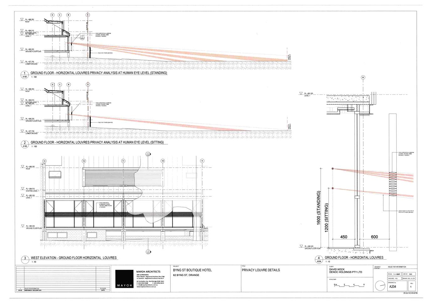
Planning
and Development Committee
5 February 2019
2.5 Development
Application DA 329/2015(3) - Hotel - 62 Byng Street and 77 Hill Street