Extraordinary Planning and
Development Committee
Agenda
17 October 2018
Notice is hereby given, in
accordance with the provisions of the Local Government Act 1993 that an Extraordinary Planning and Development
Committee meeting
of ORANGE CITY COUNCIL will be held in the Council Chamber, Civic Centre, Byng Street, Orange on Wednesday,
17 October 2018.
Garry
Styles
General Manager
For apologies please
contact Administration on 6393 8218.
1 Introduction
1.1 Declaration
of pecuniary interests, significant non-pecuniary interests and less than
significant non-pecuniary interests
The
provisions of Chapter 14 of the Local Government Act, 1993 (the Act)
regulate the way in which Councillors and designated staff of Council conduct
themselves to ensure that there is no conflict between their private interests
and their public role.
The
Act prescribes that where a member of Council (or a Committee of Council) has a
direct or indirect financial (pecuniary) interest in a matter to be considered
at a meeting of the Council (or Committee), that interest must be disclosed as
soon as practicable after the start of the meeting and the reasons given for
declaring such interest.
As
members are aware, the provisions of the Local Government Act restrict any
member who has declared a pecuniary interest in any matter from participating
in the discussion or voting on that matter, and requires that member to vacate
the Chamber.
Council’s Code of Conduct provides that if members
have a non-pecuniary conflict of interest, the nature of the conflict must be
disclosed. The Code of Conduct also provides for a number of ways in which a
member may manage non pecuniary conflicts of interest.
|
Recommendation
It is recommended that Committee Members now disclose any
conflicts of interest in matters under consideration by the Planning and
Development Committee at this meeting.
|
2 General
Reports
2.1 Development
Application DA 445/2011(4) - 47 Byng Street
RECORD
NUMBER: 2018/2443
AUTHOR: Kelly
Walker, Senior Planner
EXECUTIVE
Summary
|
Application lodged
|
3 January 2017
|
|
Applicant/s
|
Mr JJ Norris
|
|
Owner/s
|
Mr JJ Norris
|
|
Land description
|
Lot B DP 152339 - 47 Byng Street, Orange
|
|
Proposed land use
|
Restaurant and Shop
|
|
Value of proposed development
|
$150,000
|
Application has been made to
modify development consent DA 445/2011(3) on Lot B DP 152339, known
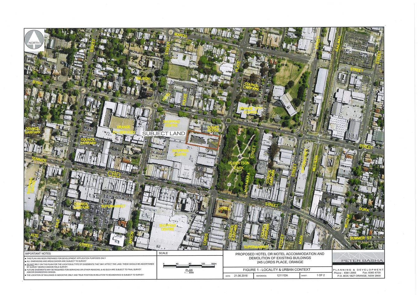
as 47 Byng Street, Orange (see Figure 1). The original application
DA 445/2011(1) was approved on 14 May 2012 for a restaurant and shop.
The amended modification proposal is depicted in the attached amended drawings
by Architecture Raw.
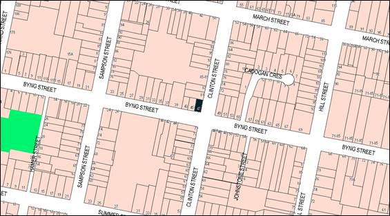
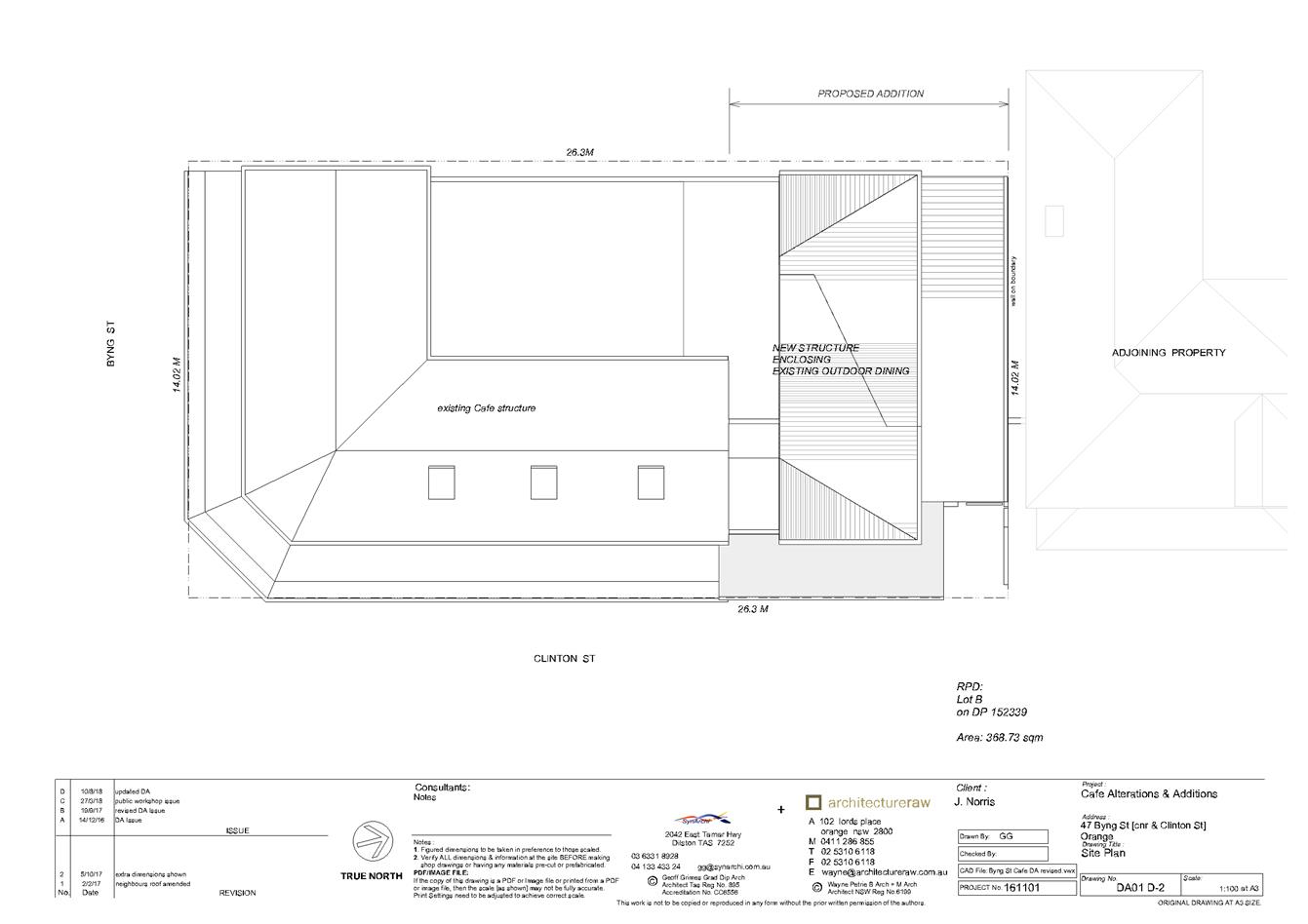
Figure 1 - locality plan
The amended modification involves the demolition of the
garage fronting Clinton Street, the removal of four (4) trees, and the
construction of an extension to the existing restaurant/café and shop
fronting Clinton Street. This extension has been designed as an annex/pavilion
to cover the existing outdoor dining area, and includes the relocation of the
takeaway window, and improved bin and dry goods storage.
Signage shown on the submitted plans cannot form part of
this modification application as discussed later in this report, and does not
form part of the following assessment.
The proposed modification does not alter the original
overall numbers of seats from the original approved application (DA
445/2011(1)), being a total of 69; nor does it alter the existing hours of
operation, being 7am to 10pm Monday to Saturday, and 7am to 6pm on Sundays and
public holidays.
The modification was initially submitted as a pavilion style
annex, designed to be a light, airy cover for the outdoor seating area.
However, Council officers had initial concerns about the proposal, in
particular whether it constituted a modification as set out in
Section 4.55(2) of the Environmental Planning and Assessment Act 1979
(the “EP&A Act”) (previously Section 96), and its
relationship with the heritage setting, streetscape and neighbourhood. Council
requested that the applicant amend the proposal, however the applicant declined
to revise the proposal at that time. Following a public exhibition period,
Council received 17 submissions, all in opposition to the proposal.
In accordance with Council’s Declaration of
Planning and Development Assessment Procedures and Protocols (2010), Council’s
Director Development Services held a mediation meeting between the applicant
and objectors on 29 March 2017. Discussions focussed around the legal
principles and tests of modification applications rather than mediate the
potential impacts of the proposal, and as such no resolutions were achieved.
Following the first exhibition period and mediation meeting,
Council requested that the applicant give further consideration to altering the
design of the proposal to address concerns about whether the proposal was a
modification, as well as address impacts raised by objectors. Amended drawings
and a Noise Report were submitted to Council on 20 September 2017.
That amendment was
re-advertised, and neighbours and submitters were re-notified.
39 submissions were received as a result of the second exhibition period.
The application was presented to the Planning and Development Committee on
7 December 2017 for consideration. At that meeting, the Committee resolved
as follows:
|
RESOLVED - 17/001 Cr
K Duffy/Cr S Munro
That Council defer consideration of the modification of
development consent DA 445/2011(4) for Restaurant and Shop at Lot B DP
152339 - 47 Byng Street, Orange pending further discussion with the applicant
and objectors.
|
Following this resolution, Council’s Director
Development Services and Manager Development Assessments determined that the
best way forward was to hold a ‘design workshop’ with objectors and
interested parties. Many of the contested issues relate to ongoing operational
breaches and matters which are outside the scope of the modification
application (discussed later in the main body of this report). However, design
is an issue that could be further discussed and potentially mediated. The
applicant, submitters, Councillors and Council staff attended the workshop on 9
May 2018.
Main points and concerns raised included:
· bi-fold doors
would cause adverse impacts to neighbours (noise, light spill, visual, privacy,
etc.);
· any openable
windows and doors would cause noise impacts;
· design is still
inconsistent with the Infill Policy and DCP;
· open toilet area
will cause adverse impacts (noise, odour); and the takeaway window causes
significant impacts (noise, unlawful parking and driving).
Following discussions held in and after the workshop, the
applicant further revised the proposal. Changes included removing the bi-fold
doors, removing openable windows, enclosing the toilets, and some revised
materials. This amendment was re-advertised, and neighbours and submitters were
re-notified during a third exhibition period, where eight (8) submissions
were received. Another submission was also received prior to the exhibition of
this amendment.
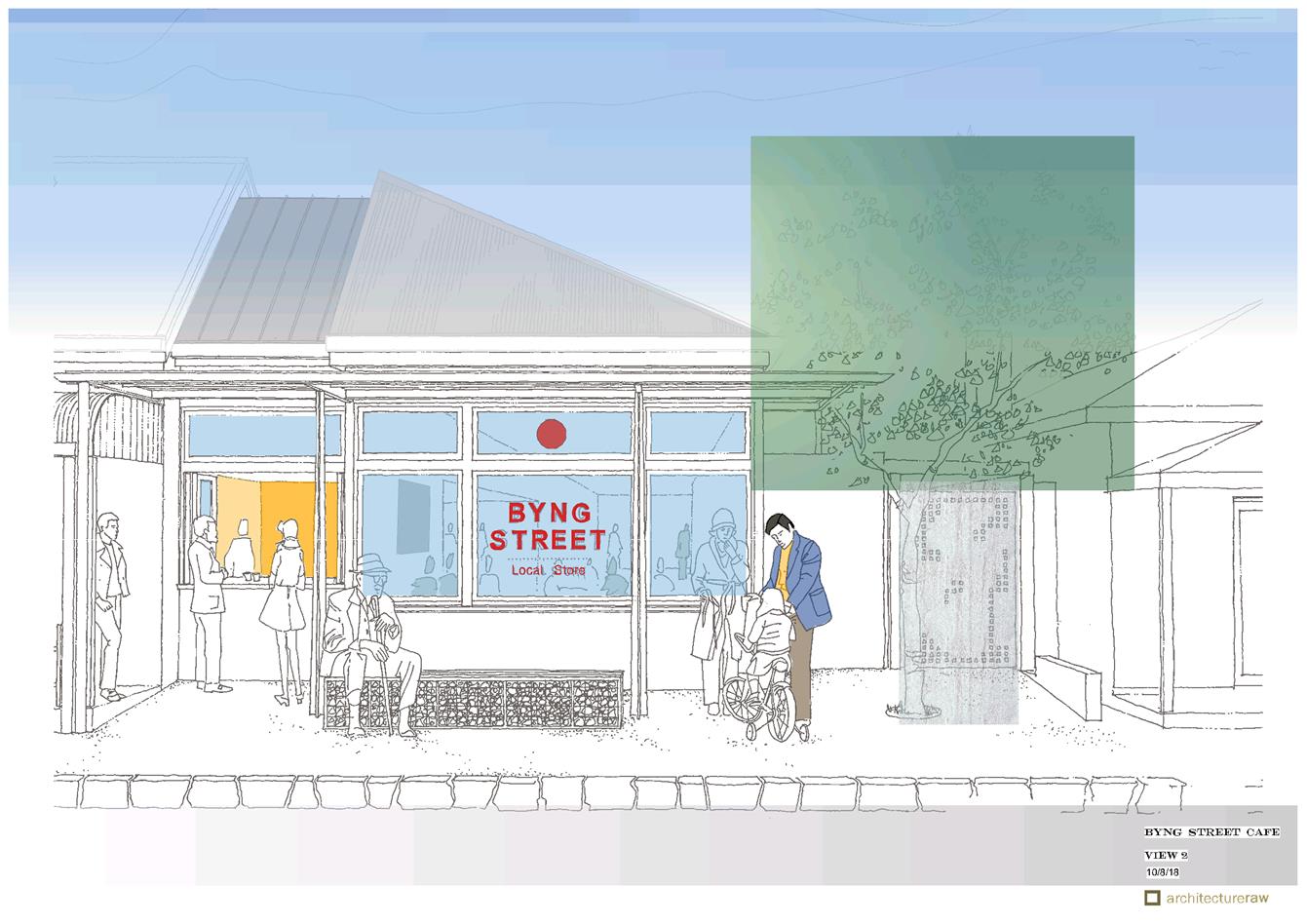
Figures 2 and 3 below show a visual representation of how
the design has changed and progressed throughout the process of this
application over the past 18 months. It shows the proposal in its initial
form, and the development of the design following discussions with Council
staff, and responding to submissions from neighbours and the community:
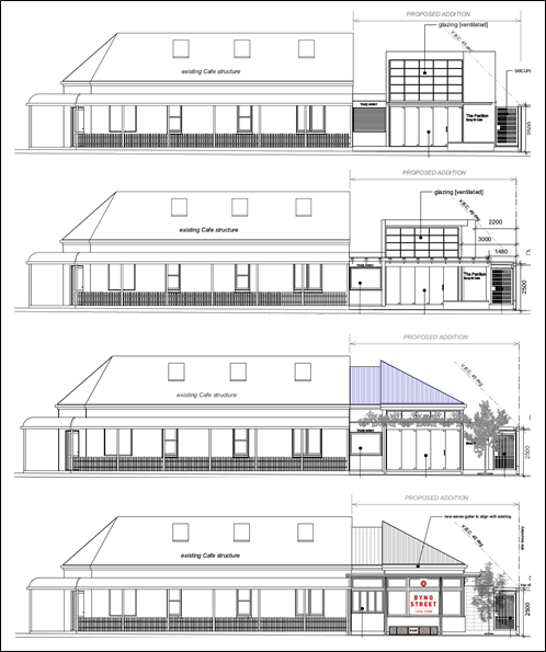
Figure 2 - elevational design progression (from
submitted drawings by Architecture Raw dated from top to bottom 14 December
2016, 5 October 2017, 15 February 2018 and 10 August 2018)
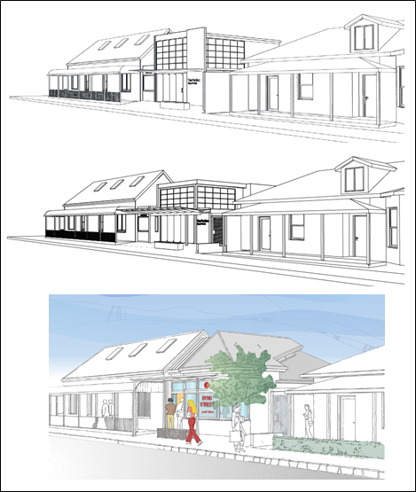
Figure 3 - perspectives design progression (from
submitted drawings by Architecture Raw dated from top to bottom 14
December 2016, 5 October 2017 and 10 August 2018)
This amendment is now before Council for consideration, and
an assessment of this revision has been carried out in the main body of this
report.
It is important to note that since the Committee last
considered this application on 7 December 2017, the EP&A Act has been
substantially amended. Changes have also been made to the Environmental
Planning and Assessment Regulation 2000 (the “Regulations”),
Biodiversity Conservation Act 2016, Fisheries Management Act 1994, and
a new NSW noise policy has been implemented. There have also been changes
to some Council procedures. These amendments apply to the subject
application, and as such a full assessment has been carried out below
reflecting changes made to the Acts, Regulations, policies and procedures, as
well as changes that have been made to this application.
Furthermore, Council staff acknowledge ongoing breaches of
the original consent, as well as breaches of various Acts, which have been
highlighted as a major issue in the submissions. Breaches and potential future
breaches however are outside the scope of this application, and thus have not
been taken into account in the assessment of the modification. It is recommended
that Council investigates these matters under separate cover.
Overall, it is considered that the revised proposal meets
the principles and tests of being “substantially the same”
development as the originally approved development, as set out in Section 4.55
of the amended EP&A Act. A Section 4.15 assessment indicates that
the development as modified is acceptable in this case, subject to amended and
additional conditions of consent. Attached is an amended Notice of Approval for
Council’s consideration.
It is recommended that Council supports the subject
proposal.
RECENT LEGISLATIVE CHANGES
On 1 March 2018 the Environmental Planning and Assessment
Act 1979 (the “EP&A Act”) was substantially amended. The
most immediate change involved the restructuring and renumbering of
the Act, with other more substantive changes to be phased in over time.
This application was lodged prior to the changes coming into effect, therefore
much of the supporting documentation and previous reports to Council on this matter
reference the previous numbering regime. In the drafting of this report the
content and substance of the supporting material has been considered
irrespective of which legislative references were used.
It is noted that amendments to the EP&A Act relating to
modifications of Development Consents have entailed the renumbering of from
Section 96 to Section 4.55 without substantive alteration to the provisions
contained in the section.
DECISION FRAMEWORK
Development in Orange is governed
by two key documents Orange Local Environment Plan 2011 (the
“LEP”) and Orange Development Control Plan 2004 (the
“DCP”). In addition the Infill Guidelines are used to guide
development, particularly in the heritage conservation areas and around
heritage items.
Orange Local Environment Plan
2011 – The provisions of the LEP must be considered by the Council in
determining the application. LEPs govern the types of development that are
permissible or prohibited in different parts of the City and also provide some
assessment criteria in specific circumstances. Uses are either permissible or
not. The objectives of each zoning and indeed the aims of the LEP itself are
also to be considered and can be used to guide decision making around
appropriateness of development.
Orange Development Control Plan
2004 – the DCP provides guidelines for development. In general it is
a performance based document rather than prescriptive in nature. For each
planning element there are often guidelines used. These guidelines indicate
ways of achieving the planning outcomes. It is thus recognised that there may
also be other solutions of merit. All design solutions are considered on merit
by planning and building staff. Applications should clearly demonstrate how the
planning outcomes are being met where alternative design solutions are
proposed. The DCP enables developers and architects to use design to achieve
the planning outcomes in alternative ways.
DIRECTOR’S COMMENT
This development application represents the third attempt by
the applicant to redesign the existing “Byng St Café” at 47
Byng Street to allow covered seating. The first designs were not pursued due to
strong community opposition. The applicant has worked with staff and the Urban
Design and Heritage Advisor to provide a less bold design as previously.
Notwithstanding this residents still oppose the development on design grounds
as well as amenity grounds. The issue of whether this application can be
considered by Council as a modification is also raised by several objectors.
Staff have satisfied themselves that the application can be legally considered
as a modification.
Link To Delivery/OPerational Plan
The recommendation in this report relates to the
Delivery/Operational Plan strategy “10.1 Preserve - Engage with the
community to ensure plans for growth and development are respectful of our
heritage”.
Financial Implications
Nil
Policy and Governance Implications
Nil
|
Recommendation
That Council consents to
development application DA 445/2011(4)
for Restaurant and Shop at Lot B DP 152339 - 47 Byng Street,
Orange pursuant to the conditions of consent in the
attached Notice of Approval.
|
further considerations
Consideration has been given to the recommendation’s
impact on Council’s service delivery; image and reputation; political;
environmental; health and safety; employees; stakeholders and project
management; and no further implications or risks have been identified.
SUPPORTING INFORMATION
THE PROPOSAL
The proposed modification involves the demolition of the
garage fronting Clinton Street, the removal of four (4) trees, and the
construction of an extension to the existing restaurant/café and shop
fronting Clinton Street. This extension has been designed as an annex/pavilion
to cover the existing outdoor dining area, and includes the relocation of the
takeaway window, and provides improved bin and dry goods storage.
Proposed materials include masonry and EcoClad rendered
walls, double glazed timber framed windows to Clinton Street, aluminium framed
bi-fold takeaway windows to Clinton Street, steel awning to Clinton Street,
Zincalume roofing and a steel gate to Clinton Street. A stone and wood
bench seat is proposed within the frontage of the addition to provide outdoor
seating.
The proposed modification does not alter the original
overall numbers of seats from the original application, being a total of 69;
nor does it alter the existing hours of operation, being 7am to 10pm Monday to
Saturday and 7am to 6pm on Sundays and public holidays.
Signage shown on the submitted plans cannot form part of
this modification application as discussed later in this report, and does not
form part of the following assessment.
PROCEDURE AND AMENDMENTS
Figures 2 and 3 in the previous “Executive
Summary” section of this report show a visual representation of how the
design has changed and progressed during the process of this application. A
written description of the changes has been made below:
Initial
Proposal
The modification was initially
submitted as a pavilion style annex, designed to be a light, airy cover for the
outdoor seating area. However, Council officers had initial concerns about the
proposal, in particular whether it constituted a modification as set out in
Section 4.55(2) of the EP&A Act, and its relationship with the
heritage setting, streetscape and neighbourhood. Council took into account the
principles and tests established by the Land and Environment Court to determine
if a proposed modification is “substantially the same”. Having
regard to these principles, it was considered that the proposal needed to be
amended to ensure that it did not significantly change its relationship to
adjoining properties, the streetscape, and character of the locality; or impact
on the amenity of neighbours. This matter is discussed and assessed in detail
later in this report. Council’s Urban Design and Heritage Advisor made
suggestions for an amended design that would fit better within the setting.
The applicant submitted further supporting information
regarding these principles in an attempt to justify the proposal, but declined
to revise the proposal at that time other than to remove the roller-door from
the proposed takeaway window; requesting that Council assess the application on
the basis of the information and plans submitted.
Thus the proposal was placed on public exhibition, and
Council received 19 submissions during that exhibition period (two of
which were duplicates), and an additional submission received after the
exhibition period closed, all in opposition to the proposal. A summary of the
issues raised in the submissions has been addressed in the body of this report.
The applicant was provided with a summary of points raised by the objectors. Council’s Declaration of Planning and Development
Assessment Procedures and Protocols (2010) identifies that upon receipt of
at least five submissions objecting to a development application, and where
those issues are considered by Council to be reasonably capable of negotiation,
a meeting will be offered to all parties in an attempt to resolve issues and
find compromise prior to the matter being determined. As such,
Council’s Director Development Services held a mediation meeting between
the applicant and objectors on 29 March 2017. Discussions focussed around the
legal principles and tests of modification applications rather than mediate the
potential impacts of the proposal, and as such no resolutions were achieved.
Following the first exhibition period and mediation meeting,
Council requested that the applicant give further consideration to altering the
design of the proposal to address initial concerns about whether the proposal
was “substantially the same” development as the original approval,
as well as address impacts raised by objectors. Potential noise impact on
adjoining residential properties was raised as a key issue, as was the design
of the structure. Discussions took place between Council staff, Council’s
Urban Design and Heritage Advisor, and the applicant over the subsequent few
months, and revised plans and a Noise Report were submitted to Council on
20 September 2017.
Amended Proposal
Amendments included the removal of
the roller door to the takeaway window, increased setbacks from Clinton Street,
reduced height and bulk at the frontage, and removal of the upper section of
the blade wall. Details of materials, colours and dimensions were also
provided.
The revised modification
application was re-advertised, and neighbours and submitters were re-notified.
39 submissions were received as a result of the second exhibition period,
giving a total of 57 submissions following both exhibition periods, 30 in
support of the application, and 27 objecting to the proposal. A summary of the
issues raised in the submissions has been addressed in the body of this report.
The application was presented to the Planning and Development
Committee on 7 December 2017 for consideration. At that meeting, the
Committee resolved as follows:
|
RESOLVED - 17/002 Cr
K Duffy/Cr S Munro
That Council defer consideration of the modification of
development consent DA 445/2011(4) for Restaurant and Shop at Lot B DP
152339 - 47 Byng Street, Orange pending further discussion with the applicant
and objectors.
|
Following this resolution, Council’s Director
Development Services and Manager Development Assessments determined that the
best way forward was to hold a ‘design workshop’ with objectors and
interested parties. Many of the contested issues relate to ongoing operational
breaches and matters which are outside the scope of the modification
application (discussed later in this report), however design is an issue that
could be further discussed and potentially mediated. The applicant requested
Council’s comments on potential design revisions, with the assistance of
Council’s Urban Design and Heritage Advisor, before the workshop was
held. The applicant, submitters and Councillors were invited to attend the
workshop on 9 May 2018.
Main points and concerns raised included:
· bi-fold doors
would cause adverse impacts to neighbours (noise, light spill, visual, privacy,
etc.;
· any openable
windows and doors would cause noise impacts;
· design is still
inconsistent with Infill Policy and DCP;
· open toilet area
will cause adverse impacts (noise, odour); and
· the takeaway
window causes significant impacts (noise, unlawful parking and driving).
Recommendations put to the applicant included:
· revising the
glazed front elevation;
· enclosing the
toilets;
· fixing windows
shut; and
· not recommencing
the takeaway component of the operation.
Some written comments were submitted outside of the workshop
in regards to the revised design. Matters not relating to the design were also
raised, which are discussed in detail in the submission section later in this
report. A summary of issues and recommendations from workshop attendees and
Council staff was forwarded to the applicant following the workshop.
Further Amendment
Following discussions held in and after the workshop, the
applicant further revised the proposal. Changes included removing the bi-fold
doors, removing openable windows, enclosing the toilets, and some revised
materials.
This amendment was re-advertised and neighbours and
submitters were re-notified during the third exhibition period, where eight (8)
submissions were received.
This amendment is now before Council for consideration, and an
assessment of this revision follows below.
BACKGROUND HISTORY
This application seeks to modify the original consent DA
445/2011(1). The background history of applications is as follows:
- Development
application DA 445/2011(1) for restaurant and shop with 69 seats was
approved on 14 May 2012
- Modification
application DA 445/2011(2) sought to allow earlier operating hours and food
production for off-site consumption - Council did not support this application
and it was withdrawn
- Modification
application DA 445/2011(3) for additions and alterations to open up the dining
and shop areas, increase counter space, kitchen fitout, and new takeaway window
was approved on 23 December 2015.
Penalty notices have been issued previously in relation to
the breach of this consent in regards to hours of operation following numerous
complaints from neighbours.
MATTERS FOR CONSIDERATION
Section 1.7 - Application of
Part 7 of the Biodiversity Conservation Act 2016 and Part 7A of the
Fisheries Management Act 1994
Section 1.7 of the EP&A Act identifies that Part 7 of
the Biodiversity Conservation Act 2016 and Part 7A of the Fisheries
Management Act 1994 have effect in connection with terrestrial and aquatic
environments.
Notwithstanding, Section 28 of the Biodiversity Conservation
(Savings and Transitional) Regulation 2017 states that the former planning
provisions continue to apply to the determination of a pending planning
application, being an application for planning approval made before the
commencement of the new Act but not determined before that commencement. The
relevant provisions are set out at Part 5A of the historical version of the
EP&A Act dated 24 August 2017.
Having regard to the relevant provisions and based on an
inspection of the subject property, it is considered that the proposed
development is not likely to have a significant effect on any threatened
species, populations or ecological communities or their habitats.
Section 4.55
Section 4.55(2) of the EP&A Act applies to the subject
modification application and states:
A consent authority may, on
application being made by the applicant or any other person entitled to act on
a consent granted by the consent authority and subject to and in accordance
with the regulations, modify the consent if:
(a) it
is satisfied that the development to which the consent as modified relates is
substantially the same development as the development for which consent was
originally granted and before that consent as originally granted was modified
(if at all), and
(b) it
has consulted with the relevant Minister, public authority or approval body
(within the meaning of Division 4.8) in respect of a condition imposed as a
requirement of a concurrence to the consent or in accordance with the general
terms of an approval proposed to be granted by the approval body and that
Minister, authority or body has not, within 21 days after being consulted,
objected to the modification of that consent, and
(c) it
has notified the application in accordance with:
(i) the
regulations, if the regulations so require, or
(ii) a
development control plan, if the consent authority is a council that has made a
development control plan that requires the notification or advertising of
applications for modification of a development consent, and
(d) it
has considered any submissions made concerning the proposed modification within
the period prescribed by the regulations or provided by the development control
plan, as the case may be.
Background
The applicant initially lodged the application as a Section 96(2)
modification under the now historical EP&A Act. The amended modification
has been submitted under 4.55(2) of the amended EP&A Act. Both
modifications were submitted on the basis that the proposal is
“substantially the same” as the original development. The
amendments to the EP&A Act in relation to the modification of development
consents have entailed renumbering of Section 96 to Section 4.55 without a
substantive alteration to the provisions contained in the section. The
following is an assessment of the amended proposal before Council against
Section 4.55.
It is noted that the original application was approved in
accordance with the transitional savings provisions in place in the intervening
period between the previous LEP 2000 and the current LEP 2011; as
such the premises does not benefit from existing use rights as set out by
the EP&A Act. Furthermore, as the uses did not lawfully commence,
Sections 4.68 and 4.69 of the EP&A Act also state that no
existing use provisions apply. The uses are now prohibited activities under the
current LEP, therefore the applicant cannot apply for a new development
application to extend the premises and has to rely on the modification
provisions.
Modification Principles
Established by the Courts
When assessing a modification application, the consent
authority has a threshold decision to make, and must be satisfied that what is
proposed is “substantially the same” development as the original
development, as set out in Section 4.55(2)(a) of the EP&A Act.
Whether the development will be “substantially the same” as the
original consent is a mixed question of fact and law. This decision can
be guided by principles and tests established in the Courts.
The principles regarding Section 96(2)(a) (now Section
4.55(2)(a)) were summarised in Agricultural Equity Investments Pty Ltd v
Westlime Pty Ltd (No 3) [2015], NSWLEC 75. The traditional
‘test’ as to whether or not a development as modified will be
“substantially the same” development as that originally approved
was applied by J Stein and the Court of Appeal in Vacik Pty Limited v
Penrith City Council (1992, NSWLEC 8) (hereafter referred to as “Vacik”),
and endorsed by J Bignold in Moto Projects (No. 2) Pty. Limited v North
Sydney Council (1999) 106 LGERA 298 (hereafter referred to as “Moto”).
J Stein stated in the Vacik case: “In my
opinion ‘substantially’ when used in the section [s102, the
predecessor of s96] means essentially or materially having the same
essence”.
J Bignold expressed in the Moto case: “The
requisite factual finding obviously requires a comparison between the
development, as currently approved, and the development as proposed to be
modified … not merely a comparison of the physical features or components
of the development … rather … involves an appreciation, qualitative
as well as quantitative, of the developments being compared in their proper
contexts (including the circumstances in which the development consent was
granted).”
J Bignold came to deal with the matter of
“substantially the same” again in Tipalea Watson Pty. Limited v
Kurringai Council (2003) 129 LGERA 351. From this Judgement, one can distil
a list of matters or ‘tests’ to consider, being whether the
modification involves the following:
(a) significant
change to the nature or the intensity of the use;
(b) significant
change to the relationship to adjoining properties;
(c) averse
amenity impacts on neighbours from the changes;
(d) significant
change to the streetscape; and
(e) change
to the scale or character of the development, or the character of the locality.
Modification Principles Applied
to the Initial Proposal
During discussions with the applicant prior to lodging this
modification application, Council officers recommended that a legal view would
be required to support the proposal. The applicant provided legal advice from
ADK Legal which applied these traditional tests and concluded that the proposed
changes are not significant enough to preclude the proposed development being
considered “substantially the same” development, and as such
Council has the power to approve the proposed modification under
Section 96 (now Section 4.55).
The applicant has provided a second legal opinion from
Messenger and Messenger which has also confirmed that the application before
Council in its current form meets the relevant tests under Clause 4.55 of the Environmental
Planning and Assessment Act 1979 and that it would be open to Council
to consider the matter as a modification of the original approval.
Ultimately, whether the modification application is
substantially the same development as the original development is an opinion
that needs to be formed by the consent authority. In determining whether this
modification application was capable of being treated as a modification, a
quantitative and qualitative comparison was carried out by staff to compare the
originally approved consent with the proposed modification as established by
the Courts.
Council staff considered that the proposed pavilion as
initially submitted would significantly change the relationship to adjoining
properties, may have adverse amenity impacts on residential neighbours, and
would result in a change to the scale and character of the development, as well
as the character of the locality; substantially altering the visual appearance
of the site, the streetscape, and the heritage conservation area, compared to
the originally approved development. As such, it was initially considered that
the proposed modification was not “substantially the same”
development as that originally approved. The initial proposal changed the
‘essence’ of the development when taking its context and
circumstances into account, and therefore it was considered that a
Section 96 (now Section 4.55) modification was not the correct procedure
in this case, and that Council did not have the power to grant consent to the
subject modification.
To be considered a
‘modification’ under the EP&A Act, the applicant was advised
that the proposal needed to be amended to ensure that it did not significantly
change its relationship to adjoining properties, the streetscape and character
of the locality, or impact on the amenity of neighbours. Council’s Urban
Design and Heritage Advisor made suggestions for an amended design that would
fit better within the streetscape. The applicant submitted further supporting
information regarding these ‘tests’ in an attempt to justify the
proposal, but declined to revise the plans at that time other than to remove
the roller-door from the proposed takeaway window; requesting that Council assess
the application on the basis of the information submitted.
During the mediation meeting held on 29 March 2017,
discussions focussed around the legal ‘tests’ of modifications. Following the exhibition period and mediation
meeting, Council requested that the applicant give further consideration to
altering the design of the proposal to address initial concerns about whether
the proposal was “substantially the same” development as the
original, as well as address impacts raised by objectors.
Modification
Principles Applied to Revised Proposal
As discussed earlier in this report, the applicant has made
significant changes to the application over the past 18 months in an attempt to
better fit the proposal into the setting and meet the modification principles
and tests.
In applying the above principles and tests and a qualitative
and quantitative assessment to the revised proposal before Council, staff
consider that the modification:
- still
seeks the use of the premises as ‘restaurant and shop’, which is in
accordance with the originally approved development;
- does
not change the nature or the intensity of the use, where the footprint of the
development is to be the same, and the capacity of the development is the same
(i.e. number of tables and chairs, hours, staff, etc.) as the originally
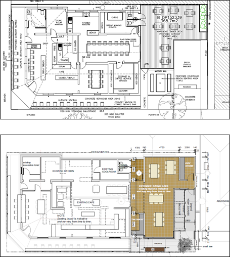
approved development (see Figures 4 and 5);
- involves
the demotion of structures fronting Clinton Street (garage and outdoor deck)
and replaces them with an annex extension covering the originally approved
outdoor area (see Figures 4 and 5);
- somewhat
alters the relationship to the immediately adjoining properties to the north
and west, but does not involve a significant change in relationship to
neighbours’ properties compared to the originally approved development;
- potential
adverse noise impacts do not significantly differ from the originally approved
development, can be mitigated through operational conditions of consent, and
may result in an overall improvement;
- removes
vegetation but replaces the substantial tree at the site frontage, thereby
retaining streetscape appeal and canopy coverage; and
- would not result in
a substantial change to the scale and character of the development or the
locality, nor substantially alter the visual appearance of the site, the
streetscape and the heritage conservation area.
Figure 4: originally approved plan (by Peter Basha
Planning and Development, dated 2012)
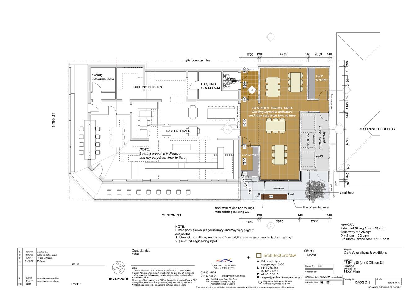
Figure 5: amended modification plan (from submitted
drawing DA02 D-2, prepared by Architecture Raw, dated 10 August 2018)
Overall, it is considered that the use of the premises
remains the same, albeit would be capable of all-weather use. When
compared to the original grant of consent, and assessed on a qualitative and
quantitative basis, it is reasonable to form the conclusion that the
modification application will result in a development that is “substantially
the same” development as that approved by the original consent, pursuant
to Section 4.55(2)(a) of the amended EP&A Act. Thus, Council may
consider this application as a modification application.
Other Modification Matters
Notwithstanding the above, it is considered that the
proposed new signage cannot be considered as part of this modification as it
does not relate to the original approval and therefore requires separate
consent.
In accordance with Section 4.55(2)(b) of the amended
EP&A Act, consultation with other bodies was not required for the original
consent, and is not required for this modification. Under the provisions
of Section 4.55(2)(c) and 5.55(2)(d), and Section 119 of the Regulations,
the proposed development was advertised for the prescribed period of
14 days on three separate occasions due to formal amendments of the
application. A detailed assessment of the issues
raised by the submitters is provided under the heading “Any Submissions
Made in Accordance with the Act”.
Amended and additional conditions of consent are recommended
to ensure that the development as modified does not impact on the environment
or neighbouring residential properties. It is noted that these additional and
amended conditions of consent only relate to the proposal as modified, as
established by the EP&A Act and in relevant case law. These conditions are
discussed in detail throughout the following assessment, and are included in
the attached modified Notice of Approval.
Pursuant to Section 4.55(3) of the EP&A Act:
In determining an
application for modification of a consent under this section, the consent
authority must take into consideration such of the matters referred to in
Section 4.15(1) as are of relevance to the development the subject of the
application. The consent authority must also take into consideration the
reasons given by the consent authority for the grant of the consent that is
sought to be modified.
Reasons for consent were not included the original consent
as this is a recent requirement of the amended EP&A Act and was not
applicable at the time of the original approval. Matters of relevance under
Section 4.15 are considered below.
PROVISIONS OF ANY ENVIRONMENTAL
PLANNING INSTRUMENT s4.15(1)(a)(i)
Orange Local Environmental Plan 2000
The original development was approved under the provisions
of the previous Orange LEP 2000 and was defined as a ‘shop’
and ‘restaurant’. Pursuant to Clause 38(2)(b) of (now
historic) LEP 2000, shops and restaurants were permissible activities in
the 2(a) zone with consent. Schedule 7 of LEP 2000 permitted
various shops in the 2(a) zone, such as a delicatessen, sandwich shop, shop
selling bread, cakes, pies and pastries and the like, shop selling fruit and
vegetables etc., all being shops that benefit residents in the area.
As the original application was submitted when LEP 2000
was still operational, but approved after LEP 2011 was adopted, the LEP
2000 provisions apply in assessing this modification application. The
modification does not alter the original assessment carried out under
LEP 2000, where it is still consistent with its aims and general
considerations for development.
Orange Local Environmental
Plan 2011
Section 79C of the (now historical) EP&A Act required
consideration of the provisions of any draft LEP, which was the status of
LEP 2011 prior to its gazettal. Accordingly, the original proposal was also
assessed against draft LEP 2011 and was considered to be consistent with
relevant provisions.
An assessment of the amended modification now before Council
has been carried out against the relevant provisions of the current LEP 2011
below:
Clause 2.1 - Land Use Zones
Under the current LEP 2011, the subject land is zoned
R1 General Residential. The development is defined as a ‘restaurant
or café’ and ‘shop’ which are prohibited uses within
the R1 zone under the current LEP 2011. However, as they were approved
under the previous LEP 2000 due to the transitional savings provisions that
applied under LEP 2011, they are to be treated as if they were permitted
uses.
Clause 2.3 - Zone Objectives
Clause
2.3 of LEP 2011 references the Land Use
Table and Objectives for each zone in LEP 2011. These objectives
for land zoned R1 General Residential are as follows:
· To provide for the
housing needs of the community.
· To provide for a
variety of housing types and densities.
· To enable other land
uses that provide facilities or services to meet the day to day needs of
residents.
· To ensure development
is ordered in such a way as to maximise public transport patronage and
encourage walking and cycling in close proximity to settlement.
· To ensure that
development along the Southern Link Road has an alternative access.
The proposed modification
continues to be consistent with the objectives for the zone, where the
café/restaurant and shop provide services that meet the day-to day needs
of residents (ie fresh food, coffee, food goods, etc.). Walking and cycling
continues to be encouraged due to the close proximity of the site to residences
and the CBD. The other objectives are not relevant to this proposal.
Clause 2.7 - Demolition
The proposal involves demolition of the existing garage
fronting Clinton Street as well as the removal of four trees, and the applicant
is seeking the consent of Council. Subject to the works being carried out in
accordance with existing conditions of consent, the demolition works proposed
will have no significant impact on adjoining lands, the streetscape, or the
public realm, subject to the replacement of a tree to the frontage. Existing
conditions of consent include construction hours, dust suppression and the need
to investigate for, and appropriately manage the presence of any materials
containing asbestos. Tree replacement is discussed in greater detail below.
Clause 5.10 - Heritage
Conservation
The objectives of this clause are as follows:
(a) to
conserve the environmental heritage of Orange,
(b) to
conserve the heritage significance of heritage items and heritage conservation
areas, including associated fabric, settings and views,
(c) to
conserve archaeological sites,
(d) to
conserve Aboriginal objects and Aboriginal places of heritage significance.
Clause 4
applies and states:
(4) Effect
of Proposed Development on Heritage Significance
The
consent authority must, before granting consent under this clause in respect of
a heritage item or heritage conservation area, consider the effect of the
proposed development on the heritage significance of the item or area
concerned. This subclause applies regardless of whether a heritage management
document is prepared under subclause (5) or a heritage conservation management
plan is submitted under subclause (6).
The subject land is within the Central Orange Heritage
Conservation Area but is not a listed heritage item under the LEP. The existing
setting is varied in terms of scale, ranging from modest to large sized single
storey dwellings. Extensive mature vegetation is fairly consistent in the area.
The highly valued streetscapes of Byng and Clinton Streets make up part of the
conservation area and form part of the site.
Pursuant to Clause 5.10 of the LEP, Chapter 13 of the DCP,
and Council’s Infill Guidelines, Council is required to consider the
potential impact that the development may have on the heritage setting. The
proposal involves the removal of four (4) trees, demolition of the existing
garage, and construction of an annex extension to the existing building.
Council’s Urban Design and Heritage Advisor provided
advice in relation to this modification application and the various revisions
of the proposal. It was initially considered that the proposal had adverse
impacts in terms of bulk and scale, height, materials, details and tree loss.
It was considered that the scale would visually dominate the streetscape,
prominent location and adjoining traditional buildings, and detrimentally
impact on the aesthetic significance of the heritage setting. The key heritage
objective is for proposed development to relate to the significance of the
conservation area, and the initially submitted proposal did not achieve this.
Accordingly the applicant has revised the proposal numerous
times, generally in accordance with recommendations from Council staff and as
demonstrated in Figures 2 and 3 earlier in this report. Council staff and
Council’s Urban Design and Heritage Advisor consider the revised design
to be satisfactory, where the proposed additions and alterations do not alter
the existing landform or lot patterns, nor the fabric of the existing building
or neighbouring buildings. In particular, the annex/pavilion element has been
designed to link to the existing building using a connecting section of lesser
scale and profile, and appropriately recessed front element. The front wall of
the annex aligns with the existing building, and a flat roofed awning provides
a continuation of weather protection to the shopfront.
It is noted that some of the colours on the existing
premises are not sympathetic to the heritage setting, nor are some of the
proposed materials and colours. Recommendations have been made to ensure that
the various elements of the building and extension are adequately dominant and
subservient, in accordance with design principles applicable to the era of the
building and for additions to buildings of historical significance.
Recommendations are as follows:
· Zincalume is not
an appropriate material in heritage conservation areas, and the roof should be
amended to be in steel, such as Fielders heritage corrugated steel;
· gutters should be
in “Monument” or black;
· rendered walls -
the proposed colour “Endless Dusk” does not reflect the traditional
stone colour associated with render and is unacceptable –
“Dune” or similar would be suitable;
· the verandah to
the existing building is proposed as black, which is unacceptable for the
setting and heritage character - it needs to be a lighter shade of the wall
colour such as ¼ tint “Dune” or “Shale Grey”;
· a clear finish
should be used on the timber shopfront to distinguish the new work from the
existing building;
· the painted steel
gate should use a matching bridge paint to clearly distinguish the new work;
· takeaway windows
should be timber to match the other new windows in a similar clear expressed
timber finish (not aluminium as proposed); and
· the polycarbonate
finish on the awning is acceptable provided stained or clear finished timber
slats are used beneath tinted polycarbonate sheeting to screen the view of the
material, as it has a short life span and shows dirt and leaf litter.
Relevant conditions of consent are attached.
Subject to the changes above, the proposed bulk, scale,
form, detailing, and visual appearance of the extension will appropriately
relate to the existing café building and neighbouring buildings, and
will not adversely impact on the heritage significance or historical character
of the immediate setting, or wider conservation area.
The removal of the garage to Clinton Street is supported as
it will not adversely impact on the conservation area, being a later addition
to the streetscape and not having any significant architectural or heritage
merit. Furthermore, the removal of the garage from the site will allow for the
existing driveway in Clinton Street to be reinstated, improving the visual
amenity of the streetscape and providing better footpath facilities in the
locality.
The removal of the Pear trees to the rear of the site is
also supported as they do not relate to the heritage significance of the
setting. The Silver Birch tree on the Clinton Street frontage of the site is
not a heritage tree, however provides for streetscape appeal and tree canopy
for the town centre. A statement from the applicant’s town planner was
submitted in support of the application, which provides the following
justification for its removal:
- “It is requested
that Council not require the advice from an arborist, on the basis
that there is no debate concerning the health or condition of
the trees and reasonable justification is provided below.
- The tree is an
introduced species and does not represent habitat for threatened or endangered
species.
- It is not
possible to retain or prune the tree given the extent of the proposed pavilion
and the awning along the eastern elevation.
- It is acknowledged that
the tree is contributory to the streetscape. Given that is located very close
to the Clinton Street frontage, it is somewhat akin to a street tree… there
are 2 nearby street trees with one in the centre of the Clinton
Street frontage of the site; and another just to the north. These trees
soften this section of the streetscape and may assist to lessen the impact of
the loss of the Silver Birch. Also, there is considerable vegetation in
this precinct which forms a backdrop. In this context, the loss of the Silver
Birch may be less obvious.
- The revised design provides for a small replacement tree
to be planted in the Clinton Street frontage of the new work. An appropriate
species (such as a Capital Pear or Trident Maple) would fit the relatively
small space that is available and reinstate a reasonable element of deciduous
foliage to partially compensate for the loss of the Silver Birch tree.”
Council’s Manager City Presentation reviewed the
application and concurs that it is not possible to retain or prune the Silver
Birch or Pear trees, and notes that the existing Silver Birch tree has thinner
than normal canopy with some dieback to the periphery of the upper canopy, and
that this species is not well suited to extended dry hot periods, and prefer a
moist soil profile with limited hard surfacing. It was initially recommended
that a replacement tree be provided within Byng Street, however the revised
proposal allows for, and proposes, a replacement within the Clinton Street
frontage, which is a vast improvement to the previous proposal. Conditions of
consent are attached in regards to the replacement tree, in particular that an
advanced specimen is planted.
Subject to a replacement tree planting, it is considered
that the proposed demolition of the garage and tree removal will not adversely
impact on the heritage significance of the subject and neighbouring buildings,
or the heritage setting of the conservation area.
Overall, Council can be satisfied that the development as
modified remains compatible with the character of the surrounding heritage
conservation area, and the amended proposal is acceptable in this case.
Clause 7.1 - Earthworks
The development as modified
involves minor earthworks required for the construction of the proposed
addition and the removal of trees, their stumps and root systems. The
earthworks can be appropriately supported onsite, and the extent of disruption
to the drainage of the site is considered to be minor. Existing conditions of
consent provide for mitigation measures during construction, and thus address this
matter.
Clause 7.3 - Stormwater Management
The development as modified would cause no adverse impacts
in regard to stormwater management, where the proposed extension can be
connected to the existing system and existing conditions of consent adequately address
stormwater.
Clause 7.6 - Groundwater Vulnerability
The development as modified would cause no impacts in regard
to groundwater vulnerability.
STATE ENVIRONMENTAL PLANNING
POLICIES
State Environmental Planning Policy 55 - Remediation of
Land
State Environmental Planning Policy 55 - Remediation of
Land (SEPP 55) is applicable. Pursuant to Clause 7(1) contamination and
remediation are to be considered in determining development applications as
follows:
A consent authority must not consent to the carrying out of any
development on land unless:
(a) it has considered whether the land is
contaminated, and
(b) if the land is contaminated, it is
satisfied that the land is suitable in its contaminated state (or will be
suitable, after remediation) for the purpose for which the development is
proposed to be carried out, and
(c) if the land requires remediation to be
made suitable for the purpose for which the development is proposed to be
carried out, it is satisfied that the land will be remediated before the land
is used for that purpose.
As the subject property has a long history of residential
use, it is not considered likely that it would be contaminated or unsuitable
for the proposed alterations and additions. It is acknowledged that asbestos
materials associated with the garage may be present on the subject property,
and an existing condition of consent in regards to demolition being carried out
in accordance with the relevant standards covers this issue.
State Environmental Planning
Policy 64 - Advertising and Signage
New signage shown on the submitted plans cannot be
considered as a modification of the original consent, as discussed previously,
and therefore does not form part of this assessment. As such, State
Environmental Planning Policy 64 - Advertising and Signage is not
applicable. A condition of consent is recommended in regards to separate
consent being required for signage.
PROVISIONS OF ANY DRAFT
ENVIRONMENTAL PLANNING INSTRUMENT THAT HAS BEEN PLACED ON EXHIBITION
4.15(1)(a)(ii)
There are no draft environmental planning instruments that
apply to the subject land or proposed development.
DESIGNATED DEVELOPMENT
The proposed development is not designated development.
INTEGRATED DEVELOPMENT
The proposed development is not integrated development.
PROVISIONS OF ANY DEVELOPMENT
CONTROL PLAN s4.15(1)(a)(iii)
Development Control Plan 2004
Development Control Plan 2004
(“the DCP”) applies to the subject land. The relevant planning
outcomes were considered as part of the assessment of the original development
application. An assessment of the proposed development against the relevant
Planning Outcomes that affect the proposal to modify the consent will be
undertaken below.
Clause 5.3 - Advertised
Development
Section 5.3 - Advertised
Development identifies that Council will give written and published notice of
applications for advertised development as required by the Regulations. This
matter is discussed in more detail previously in the “Procedure and
Amendments” section of this report, and later under
the heading “Any Submissions Made in Accordance with the Act”.
Chapter 13 - Heritage
Sections 13.1-13.06 of DCP Chapter
13 addresses heritage matters in detail, including objectives, heritage
conservation areas, heritage considerations for development, development in the
vicinity of heritage items, and heritage proposals as advertised development.
These matters have previously been addressed in detail under the LEP
heading “5.10 ‑ Heritage Conservation”, where it is
considered that the amended proposal, subject to minor changes regarding
materials and colours, is compatible with the heritage setting.
Chapter 15 - Parking
The parking analysis carried out in
the original assessment of the development (DA 445/2011(1)) demonstrated a
shortfall of 20.3 car parking spaces based on the DCP rate of car
parking for shops and cafes. At that time, it was considered that there was
reasonable opportunity to accommodate the expected parking demands within the
surrounding on‑street parking with only minimal impact to neighbouring
properties, and as such the variation to the car parking standard was accepted
by Council. It was acknowledged that there was the potential for parking to
occur in front of nearby dwellings, however would be of short duration.
The applicant submits that the
development as modified does not increase the floor area or seating numbers
beyond that which was originally approved, but acknowledges that the existing
garage would be lost, thus increasing the shortfall by an additional space. The
applicant goes on to state that the reinstatement of the driveway to footpath
and kerb would provide an additional on-street car parking space, thereby
mitigating this increase in shortfall.
Given that the proposal does not
involve an increase in the intensity of the use or seating numbers, it is
considered that the original parking assessment still applies to the
modification, where the one additional space can be accommodated on the street.
It is noted that the onsite garage has not been used for the parking of vehicles
for some time, therefore this generated demand has already been utilising
on-street car parking, and the removal of the garage will not produce any
change in on-street parking. The takeaway window will be relocated and
reinstated (apparently this has not been operating recently), however was
approved under a previous application and is not relevant to this modification.
Although the proposal does not increase seating numbers,
neighbours argue that year‑round use of all seating will increase
patronage, thereby increasing parking demand. While it is acknowledged that the
proposal would allow the café to have the potential of being at full
capacity year-round instead of only during good weather, the original
assessment of car parking was carried out based on maximum indoor and outdoor
seating numbers of 69. Original calculations therefore represented maximum
patronage and the worst-case parking demand, which remain unchanged as a result
of the modification.
It is noted however, that while the proposed annex will not
increase the overall floor area, the proposal involves a new outdoor bench seat
which can accommodate seating for additional customers. Given that there is
already a significant shortfall in car parking for the premises, and that the
modification being “substantially the same” as the original
development relies on the intensity remaining unchanged, the bench seat needs
to be removed from the proposal. A condition of consent is recommended to this
effect.
Council staff acknowledge that on-street parking is in high
demand due to the popularity of the premises, however the extent of parking
demand generated by the proposal is within the capability of the local road
network. Staff also acknowledge that there are unlawful car parking and traffic
movements taking place in the vicinity of the premises, such as parking across
neighbour’s driveways, car sales promotions taking place within the
street, etc.; however, these issues are not within the scope of this
application. Unlawful parking and breaches of the EP&A Act need to be
monitored by Council and be reported to Council by premises staff and
neighbouring residents. Warnings have been issued to relevant parties in
relation to known breaches presented to Council in this regard.
It is also noted that the original application was reviewed
by the Council’s Traffic Committee who resolved to install ‘No
Parking’ signs and lines across the neighbouring driveways where
customers regularly parked unlawfully. These measures have at best had limited
effectiveness. Customers continue to unlawfully park from time-to-time.
Council’s Parking Officers have been directed to carry regular targeted
parking patrols of the locality in an attempt to reduce the impact on
surrounding residents and educate users of the parking controls that apply.
DCP Infill Guidelines
Council’s Infill
Guidelines apply to this application. The intent of this policy is to guide
infill development design in heritage areas to ensure that new development
‘harmonises’ with the character of the neighbourhood. The policy
states that contemporary designs may be acceptable provided the design is
appropriate in character, scale and form, siting, materials and colour, and
detailing.
Heritage has been discussed in
detail under the LEP “Clause 5.1” assessment earlier in this
report. It is considered that the amended design, subject to minor material and
colour changes, meets the objectives of the policy. In particular, the design
retains an appropriate visual setting, appropriately responds to the character
and appearance of the streetscape, does not adversely affect the significance,
character or appearance of the conservation area or heritage items, and allows
for reasonable change within a conservation area while ensuring all other
heritage objectives are met. Although trees are to be removed, an appropriate
replacement will be provided in the Clinton Street frontage to assist in
maintaining a suitable streetscape appearance.
PROVISIONS PRESCRIBED BY THE
REGULATIONS s4.15(1)(a)(iv)
Demolition of a Building (Clause 92)
The proposal involves the demolition of a garage and the
removal of trees. The existing condition attached to the consent, requiring the
demolition to be carried out in accordance with Australian Standard AS2601 -
1991: The Demolition of Structures, is sufficient to deal with issues
arising from this part of the proposal.
Fire Safety Considerations
(Clause 93) and Buildings to be Upgraded (Clause 94)
Existing conditions of consent adequately deal with fire
safety considerations and upgrading works.
BASIX Commitments (Clause 97A)
BASIX is not applicable to the proposed development. A
Section J energy efficiency statement may be required with the Construction
Certificate application.
THE LIKELY IMPACTS OF THE
DEVELOPMENT s4.15(1)(b)
An assessment of the relevant impacts associated with the
development was undertaken as part of the initial assessment of the development
application. The potential impacts of the development as modified are
considered below.
Heritage, Streetscape, and
Visual Impacts
The subject land is located within the Central Orange
Heritage Conservation Area and contributes to the heritage setting. The
proposal involves additions and alterations to an existing building and the
removal of a garage and trees within a heritage setting, therefore has the
potential to have visual and heritage impacts. As noted in the LEP
and DCP assessments, the proposal as initially submitted was considered to
have adverse impacts on the heritage and residential values of the surrounding
area. The amended proposal, subject to conditions of consent regarding tree
replanting and revised materials and colours, has been designed to meet the
objectives and outcomes for heritage, neighbourhood character, building design,
setbacks, visual bulk, etc. As such, it is considered that the development as
modified is unlikely to have adverse visual impacts on the existing building,
neighbouring dwellings, the streetscape or the heritage conservation area.
Neighbourhood Amenity Impacts
As discussed in the LEP assessment, the revised bulk, scale,
setbacks and detailing are consistent with the bulk of surrounding buildings,
and will not detract from the character of the streetscape or neighbouring
properties. The proposal has been designed to step back from the adjacent dwellings
to the north and west, and therefore will not impact the neighbours in terms of
visual bulk. The building form complies with the residential visual bulk
envelopes recommended by the DCP, being contained within planes projected at
45 degrees over the site commencing at 2.5m above existing ground level
from each side and rear boundary.
Given the orientation of the site and stepped setbacks from
the boundaries, the proposal will not impact the neighbours in terms of
daylighting and shadowing. The proposed development has been designed to avoid
any direct or close views into the windows or private open spaces of adjoining
dwellings. In particular, there are no windows at ground level height other
than those that look out onto Clinton Street, which are well separated from the
dwelling opposite the site (number 49 Byng Street).
Overall, visual bulk, daylighting, privacy and residential
amenity impacts are unlikely. Noise impacts are addressed separately below.
Noise Impacts
Several written submissions were received raising concerns
regarding potential noise impacts associated with the existing premises and the
proposed modification of the premises. In order to address this issue, Council
requested that the applicant provide a Noise Report. A report was submitted in
relation to the initial proposal, and more recently a revised report was
submitted in regards to the amended proposal.
It is noted that since the application was previously
considered by Committee, the NSW Noise Policy for Industry 2017 has
replaced the previous NSW Industrial Noise Policy (2000). The
revised Noise Report and following assessment take this new Policy into
account. The revised proposal reduces the number of openings and encloses the
toilets to the rear, as requested by submitters and recommended by Council
officers, and the revised Noise Report also takes this into account.
Wilkinson Murray’s Noise Assessment dated July 2018
(number 12055-P2 Version A) identifies that the most potentially affected
sensitive receivers are the adjacent dwelling at 45 Byng Street (west of
the subject property) and the dwelling at 49 Byng Street (to the east, on the
opposite corner of Byng and Clinton Streets). The report notes that the
dwelling immediately to the north of the site at 81 Clinton Street is not
assessed as a sensitive receiver as it is owned by the Byng Street Local Store.
The Noise Report deals with potential noise associated with
the development as modified, that is, the additions and alterations to the
premises. It notes that the primary noise source is patron noise, and that
existing mechanical plant has not been assessed as these are not relevant to
the modification. The report identifies that south facing windows are openable,
but recommends that they are not openable, and have assumed this in its
assessment. It has also assumed that outdoor seating will only be used during
the daytime (7am to 6pm).
The report concludes that the predicted noise levels
associated with the operation of the proposed annex/pavilion will comply with
the relevant noise criteria, based on the following recommendations:
· No openable
glazing is installed in the pavilion, except along the eastern facade;
· The outdoor
seating is used in the daytime only; and,
· Doors and
windows are to be closed during the evening.
Council’s Manager Building and Environment does not
agree that the dwelling to the north is not a sensitive receiver. Whilst the
neighbouring property is currently in the same ownership as the cafe, 81
Clinton Street is a residential dwelling house in a residential zone, and is
used for residential purposes, thus should also be assessed as a residential
receiver.
This issue has been brought up previously, however. the
revised report continues to neglect assessing this receiver.
It is noted that conditions of consent from the previous
modification (DA 445/2011(3)) and consent to install new windows to the
premises (DA 364/2013(1) required an assessment of noise emissions to be
provided to Council to monitor noise levels, and if necessary, provide noise
mitigation measures. These assessments have not yet been carried out given the
ongoing works being undertaken on the premises. Furthermore, the noise
assessment needs to be undertaken during peak time and in the summer season,
when the café will be at or near full capacity, with all potential
openings open. The delay in carrying out this assessment until works are
completed has been discussed and agreed with Council’s Manager Building
and Environment.
The applicant has requested a modification to the seating
numbers condition of consent, as the last modification entailed a typo-error in
the number of seats (stating 63 when it should state 69 in accordance with
the original consent). The correction of this error is supported.
The applicant also requests that this condition be altered
to not limit any particular seating number indoors or outdoors to allow for
flexibility. This is not considered acceptable as 69 patrons outside on
the verandah and under the proposed awning would cause significant noise
disturbance to neighbours. It is therefore recommended that an outdoor seating
limit is imposed at a maximum of 13 seats in accordance with previously
approved outdoor verandah seating, and in accordance with the assessment in the
submitted Noise Report. As noted previously in the DCP Chapter 15 car parking
assessment, the proposed additional bench seat is not supported due to its
potential to increase patron numbers and car parking demand. It also has the
potential to increase noise levels, particularly for neighbours to the north
and east.
Based on the above, it is considered that noise compliance
can be achieved based on the existing conditions of consent, and the following
additional and modified conditions of consent:
(1) An
assessment of the development in terms of noise shall be verified through
testing at nearby receivers (including the adjacent site to the north at 81
Clinton Street) within three (3) months of the occupation of the development,
or as otherwise agreed in writing by Council (but not more than six (6) months
after occupation), to ensure that the assessment is undertaken when the
premises is at full capacity and eastern windows are open as set out in the
conditions of this consent.
(2) Outdoor
seating numbers are limited to 13 at any one time, and shall only be used
during daytime hours, being between 7am and 6pm. The outdoor bench shown on the
drawings is not approved, and shall not be constructed or any substitute
installed in its place.
(3) The
takeaway window shall only be used during daytime hours, being between 7am and
6pm.
(4) All
external doors and windows must be closed during evening periods, being between
6pm and 10pm.
Furthermore, Council’s Manager Building and
Environment notes that the implementation of an ‘Operational Management
Plan’ for the site also needs to be undertaken to ensure compliance with
the Protection of the Environment Operations Act 1997. The previous
modification application required a Plan of Management for the site; however based
on ongoing complaints and submissions received in relation to this modification
application, it has been demonstrated that the existing plan and operations of
the premises have not been successful in managing and mitigating adverse
impacts on neighbouring properties. A modified condition of consent is
recommended in regards to the Plan of Management for the site, which needs to
be revised by the applicant.
It is noted that the applicant has a history of being in
breach of the conditions of consent, particularly in relation to noise and
hours of operation. These breaches have been raised in submissions, however are
outside of the scope of this modification. Council will continue to monitor the
operation of the premises in relation to breaches of consent and noise
pollution under the Protection of the Environment Operations Act 1997 and
the NSW Noise Policy for Industry 2017.
Overall, subject to relevant conditions and modified conditions
of consent, including further assessment of noise upon the completion of the
development, adverse noise impacts can be adequately mitigated.
Waste Management Impacts
The original application stated that waste storage bins will
be stored in the rear yard of the property outside public view, and disposed of
in the normal Council street collection service. However, some time ago it was
brought to Council’s attention that waste storage bins were being stored
on the adjoining residential property at 81 Clinton Street, which was not
considered to be a satisfactory arrangement for waste management and was
inconsistent with the original approval. Alternative arrangements were made for
the storage and management of waste onsite and within the existing garage, but
this arrangement has been causing problems in terms of noise disturbance and
poor visual appearance.
It is considered that the modified proposal provides for a
greatly improved arrangement for waste storage and collection on the site, and
as such adverse waste management impacts are less likely than the original
development.
Traffic Impacts
As discussed in the DCP assessment earlier in this report,
the proposed modification would have a neutral effect on current traffic levels
and amenity in the locality in terms of car parking as the proposal does not
seek to alter the floor area, seating number, staff and customer numbers, or
hours of operation. However, this conclusion is subject to the removal of the
outdoor stone bench from the proposal, which would provide for additional
seating. Although the removal of the garage from the site technically increases
the overall shortfall of parking on the site, the garage has not been used for
parking of vehicles, and as such the current arrangements and demand for
on-street parking will remain largely unchanged. The takeaway window will be
relocated, but was approved under a previous application and therefore is not a
consideration in this modification.
As discussed previously, there have been regular incidents
of unlawful car parking and driving, however the applicant cannot be reasonably
held responsible for public adherence to road rules. This matter needs to be
monitored by Council and reported by the premises, neighbouring properties and
the wider community. Conditions of consent will assist in ensuring that
customer numbers stay within reasonable limit so that the capacity of the
surrounding car parking network is not exceeded, as well as assisting in the
monitoring of unlawful car parking.
Overall, it is considered that the proposed development as
modified is unlikely to have an adverse impact upon the surrounding traffic
network.
Environmental Impacts
The subject property is unlikely to have any biodiversity or
habitat value due to the use of the site for a residential dwelling and
commercial premises. Inspections carried out did not indicate any habitat
within the subject trees to be removed. As discussed in the LEP
assessment, the replacement street tree planting will assist in continuing
existing canopy, as well as providing for habitat in the future. The proposal
will not impact on groundwater or stormwater. Overall, the proposal is unlikely
to have adverse impacts on the environment.
Cumulative Impacts
The proposed development has the potential to have a
cumulative impact on the heritage significance of existing buildings and
dwellings in the heritage setting and conservation area, the local street
network in terms of traffic flow and availability of on-street parking, and
residential amenity in terms of waste management and noise associated with the
use of the premises. It is considered that each of these potential issues has
been appropriately assessed above and in the main body of this report. The
proposed development as modified is suitable in its context and is unlikely to
have a significant cumulative impact which exceeds reasonable expectations.
While the application does not propose an intensification of
development (ie no additional floor area or seating), the improved
functionality of the premises may lead to increased usage of the
premises/available seating during colder months and inclement weather. It is
acknowledged that this may be noticeable to surrounding residents in terms of
patronage and car parking on the street, however the original assessment of the
development took into account maximum usage of the premises, and was considered
acceptable. The proposal as modified continues to be acceptable in this regard.
THE SUITABILITY OF THE SITE
s4.15(1)(c)
Council has previously determined that the site is suitable
for the proposed development. There are no aspects of the site to indicate that
it would be unsuitable to accommodate the modified development. It is noted
that the modified development is only suitable for this site on the basis that it
is operated within the intensity as originally approved. The proposed
modification does not seek to increase or alter the nature of the use of the
premises, nor increase seating, staffing, hours of operation, etc.
ANY SUBMISSIONS MADE IN
ACCORDANCE WITH THE ACT s4.15(1)(d)
Under the provisions of Section 4.55(2) of the EP&A Act,
and Section 119 of the Regulations, the proposed development was advertised for
the prescribed period of 14 days. It is noted that no public authorities were
identified as having an interest in the determination of the application.
Formal exhibition of the initial modification was undertaken by way of an advertisement
in the Central Western Daily on 18 February 2017 and neighbouring properties
were notified. The first exhibition period closed on 6 March 2017, and at the
end of that period 20 submissions were received, two of which were duplicates.
One (1) late submission was also received.
As discussed previously in this report, a mediation meeting
was held by Council’s Director Development Services on 29 March 2017. As
a result of the meeting and the objections received in the first exhibition
period, the applicant revised the proposal. The amended proposed was advertised
in Orange City Life on 28 September 2017 and neighbouring properties were
notified. That exhibition period closed on 13 October 2017, and
39 submissions were received.
Following consideration of the application by the Planning
and Development Committee on 7 December 2017, the application was deferred
pending further discussion with the applicant and objectors. As discussed
previously in this report, a ‘design workshop’ was held on 9 May
2018, after which the applicant further amended the application. The subsequent
amendment was advertised in Orange City Life on 16 August 2018 and neighbouring
properties were notified. Exhibition closed on 31 August 2018, and 8
submissions were received. Additional submissions where received prior to the
third exhibition period.
In summary, a total of 65 submissions were received in
relation to this application, 31 of which were in support of the
application, and 34 objecting to the application. It is noted that some
submitters have made multiple submissions, and some submitters made submissions
during more than one of the exhibition periods. These submissions have been
taken into consideration in the above assessments. Other submissions were
received in relation to the Design Workshop. A summary of objections from all
exhibition periods and the Design Workshop have been broken down by topic
below, and include Council staff responses:
Council Processes and
Unacceptable Applications
· That
‘unacceptable’ applications should not be accepted by Council or be
put on public exhibition.
· That
Council’s advertising of proposals is inadequate.
The development application and notification process is set
out by the EP&A Act, Regulations and Council’s Policies, and the
assessment of this application was followed as per those requirements. In this
case Council requested amendments/revisions to the proposal prior to the first
exhibition period, however the applicant declined to amend that application at
that time. Further amendments were sought during the assessment process. These
matters have been addressed in detail in the main body of this report.
Modification Principles/Tests
· That the
application does not constitute a modification under Section 96/4.55 of the
Act.
· That the
applicant’s legal advice is inaccurate, and assesses the proposal as a
“pavilion”, however it does not meet the common definition of a
“pavilion”.
· That Council
seek independent legal advice on the question of whether the application is a
modification.
· That previous
legal advice sought by Council on the question of modifications is
insufficient.
· That the
proposal should be a new DA and not a modification.
This matter has been addressed in detail in the body of the
report, where it was concluded that Council staff are satisfied that the
amended proposal meets the modification requirements of the EP&A Act and
the modification ‘tests’ established by the Courts. Without waiving any legal professional privilege that
attaches to any such advice, Council staff have had regard to legal advice in
reaching their decision.”
In regards to the matter of whether the proposed is a
“pavilion”, the initial proposal designed an airy pavilion style
structure to cover the outdoor area; however as discussed in the main body of
this report, it was considered that it did not meet many of the legislative and
policy requirements, therefore it was amended to be more of a solid annex
extension. The assessment of the amended proposal against all relevant
considerations has taken the revised design into account, including the
modification principles assessment.
Heritage Impacts
· The proposal is
inconsistent with the heritage conservation area, neighbourhood character,
streetscape, existing building, and neighbouring dwellings (modern design, poor
design, scale, bulk, etc.)
· Design
inconsistent with LEP, DCP and Infill Guidelines.
· New signage is
too large for the residential and heritage setting.
· Existing
signage may not have consent, and is too large for the setting.
These matters have been addressed in the body of this report
under the LEP Clause 5.10 and “Likely Impacts” assessments.
The proposal has been revised to address most of the initial concerns raised by
Council staff, objectors, and Council’s Urban Design and Heritage
Advisor. It is considered that the amended proposal, subject to minor changes
to materials and colours, will be compatible with the heritage setting and will
not have any adverse impacts on the historical character of the area.
As discussed in this report, the new signage cannot be
considered as part of this modification and needs separate consent and
assessment. Potential breaches of the EP&A Act in relation to existing
signage is outside of the scope of this modification, and needs to be
investigated and addressed under separate cover.
Inappropriate Use
· The proposal is
an inappropriate use in a residential area.
· Does not meet
LEP objectives or DCP provisions for a residential zone.
· Does not
provide open space in accordance with DCP residential guides.
Neighbours argue that the proposal does not fit in with the residential
character of the area, and therefore should be refused. As noted in the main
body of this report, the use of the site was approved under the previous LEP
2000, when shops, cafes, and restaurants were permitted in the previous
residential zone, and therefore this is not a matter for consideration in the
modification of the existing premises.
As discussed in the main body of this report, the amended
proposal is considered to be consistent with the relevant provisions of LEP
2000, the DCP and Infill Guidelines. While the original development was
approved under LEP 2000, an assessment has also been carried out against LEP
2011 and meets current relevant provisions. The residential chapter of
the DCP relates to new residential development such as dwelling houses,
boarding houses, residential flat/apartment buildings, etc., and therefore is
not relevant in the assessment of this commercial modification.
Amenity Impacts
· Amenity and
visual impacts on adjoining properties and streetscape (modern design, poor
design, etc.).
· Bulk, height,
and scale impacts.
· No open space
or landscaping, and loss of trees.
· Increased
capacity will have increased impacts on the neighbourhood.
· Kitchen exhaust
fan causes noise impacts and other pollution issues.
· Recommendations
by submitters have been made to improve the design to mitigate impacts such as
no bi-fold doors, acoustic materials used to soundproof the building, enclosing
the toilets, remove the takeaway window, adding staff amenities, and moving the
kitchen exhaust fan.
These matters have been addressed in detail in the main body
of the report under the LEP Clause 5.10 and “Likely Impacts”
assessment. The proposal has been revised to address most of the initial
concerns raised by objectors and Council’s Urban Design and Heritage
Advisor. Ongoing breaches and compliance issues are outside of the scope of
this modification, and it is recommended that Council addresses this matter
under separate cover.
Noise Impacts
· Noise impacts
of premises to neighbouring dwellings (patrons, music, vehicles, open
windows, late openings, early servicing, etc.).
· Increased
capacity will have increased impacts on the neighbourhood.
· Not limiting
outdoor seating numbers (allowing for flexible indoor and outdoor seating as
requested by the applicant) will cause significant disturbance to neighbours.
· Takeaway window
will cause noise disturbance.
· Recommendations
have been made by submitters to improve the design to mitigate impacts such as
no bi-fold doors, acoustic materials used to soundproof the building, enclosing
the toilets, remove the takeaway window, moving the kitchen exhaust fan away
from residences, fixing windows shut, and opening later in the mornings in the
weekends.
These matters have been addressed in the “Noise
Impacts” assessment of the report. A submitted noise report
demonstrates that the modified proposal can comply with relevant noise
provisions. Additional and modified conditions of consent have been recommended
by the applicant’s noise consultant and Council’s Manager Building
and Environment to mitigate potential impacts, and are included in the attached
modified Notice of Approval.
The takeaway window and hours of operation were considered
under the original and previous applications, and are not matters for
consideration in this modification application. Issues relating to ongoing
breaches and compliance cannot be considered in this application, and it is
recommended that Council considers these points under separate cover.
Traffic and Parking Impacts
· Increased
capacity will have increased impacts on the neighbourhood - concerns that the
proposal will continue to increase patronage, traffic movements, parking, and
congestion (steadily increasing by way of incremental developments).
· The new stone
bench at the front needs to be accounted for in the total number of seats
available.
· The
reinstatement of the takeaway window will increase patronage, parking demand,
unlawful parking, erratic/dangerous driving, etc.
· Parking
contributions should be applied to monitor unlawful parking.
These matters have been addressed in detail in the DCP and
“Likely Impacts” assessments of the report. It is recommended that
the stone bench be removed from the proposal.
Car parking contributions cannot be applied to this
development as it is outside of the area defined by the Car Parking
Development Contribution Plan 2015. It is noted that other commercial
premises in the City have entered into agreements with Council to monitor car
parking; however as a modification application, this is outside the scope of
this assessment.
Issues relating to ongoing breaches and compliance cannot be
considered in this application, and it is recommended Council considers these
points under separate cover.
Inappropriate Precedent and
Cumulative Impacts
· The proposal
would set an inappropriate precedent for other commercial uses in the area.
This matter has been addressed in the “Cumulative
Impacts” assessment of the report, where cumulative impacts are
considered to be unlikely.
Fire Safety
· Fire safety
concerns building near the boundaries.
Council’s Environmental Health and Building Surveyor
has assessed the modification, and fire safety has been adequately covered by
the existing conditions of consent.
Ongoing Breaches
· The
applicant’s property next door at 81 Clinton Street is being used
unlawfully as an ‘Air BNB’.
· Concerns about
the holding of cocktail parties, functions, and other non-compliant activities
- objectors have provided advertising material from the premises promoting such
activities, being bookable Monday to Saturday evenings.
· Ongoing
breaches in trading hours (early and late opening), servicing the premises
(grease trap, waste collection, deliveries, etc. in early hours of the
morning), noise associated with night time functions, previous commercial bread
baking, noise associated with plant equipment, plant equipment being left on
overnight, exceeding patron/seating capacity limits, illegal parking by patrons
across residential driveways, dangerous driving by patrons, littering by
patrons (cigarettes, drink cans, coffee cups), and abuse of residents by
patrons.
· That the
kitchen exhaust fan does not comply with relevant noise criteria and causes
pollution issues.
· Concerns that
current issues and ongoing breaches have not been resolved by Council, and that
the applicant will continue to operate in breach of the consent and
modifications.
· Concerns that
increased capacity will increase breaches and impacts on the neighbourhood.
Ongoing breaches of the original consent, as well as
breaches of the EP&A Act, Protection of the Environment Operations Act
1997, Roads Act 1993, Liquor Act 2007, etc. are highlighted as a major
issue in the submissions. Breaches and potential future breaches, however, are
outside the scope of this application, and thus have not been taken into
account in the assessment of the modification. It is recommended that Council
continues to investigate these matters under separate cover and take action in
accordance with Council’s enforcement policies. It is also noted that the
NSW Police and NSW Office of Liquor and Gaming also monitor breaches of terms
of the premises’ liquor licence.
Submissions of Support
The letters of support are generally from local businesses
and visitors to the area, but note that they are in support of the design of
the proposed additions, the improved functionality of the café, the
positive impacts to local tourism and the marketing of local produce, and the
amended design of the proposal.
The letters of support received from nearby residents make
the following points:
· the proposal will
improve noise impacts by covering the outdoor area;
· the proposal will
provide better waste storage;
· the proposal will
not generate additional parking demand; and
· the amendments
have reduced the height and bulk of the proposed pavilion, sets it further back
from the street and will improve the streetscape.
Furthermore, it is noted that
while an immediately adjacent neighbour objects overall to the proposal, they
support the removal of the courtyard trees as they are inappropriately large
and may damage adjoining buildings.
PUBLIC INTEREST
s4.15(1)(e)
The proposed development is considered to be of minor
interest to the wider public due to the relatively localised nature of
potential impacts. The proposal is not inconsistent with any relevant policy
statements, planning studies, guidelines etc. that have not been considered in
this assessment.
SUMMARY
The proposed modification is permissible with the consent of
Council. The applicant has adequately demonstrated that the proposed
development complies with the relevant aims, objectives, and provisions of
Orange LEP 2000, LEP 2011, DCP 2004 and the Infill Guidelines. The modification
is consistent with the provisions of Section 4.55(2) of the Environmental
Planning and Assessment Act 1979. A Section 4.15 assessment indicates that
the proposed development as modified is acceptable in this instance, subject to
amended and additional conditions of consent. An amended draft Notice of
Approval is attached.
COMMENTS
The requirements of Council’s Environmental Health and
Building Surveyor and the Engineering Development Section are included in the
attached modified Notice of Approval.
Attachments
1 Modified
Notice of Approval, D18/53622⇩
2 Plans,
D18/53612⇩
3 Submissions,
D18/53607⇩
Extraordinary
Planning and Development Committee
17 October 2018
2.1 Development
Application DA 445/2011(4) - 47 Byng Street
Attachment 1 Modified Notice of Approval
|

|
ORANGE CITY COUNCIL
Development
Application No DA
445/2011(4)
NA18/ Container
PR1936
|
NOTICE OF DETERMINATION
OF A DEVELOPMENT
APPLICATION
(AS MODIFIED)
issued under the Environmental
Planning and Assessment Act 1979
Section 4.18
|
Development Application
|
|
|
Applicant
Name:
|
Mr JJ Norris
|
|
Applicant
Address:
|
C/- Peter Basha
Planning & Development
PO Box 1827
ORANGE
NSW 2800
|
|
Owner’s
Name:
|
Mr JJ Norris
|
|
Land
to Be Developed:
|
Lot B DP 152339 - 47
Byng Street, Orange
|
|
Proposed
Development:
|
Restaurant and Shop
|
|
|
|
|
Building Code of
Australia
building
classification:
|
Class 6
|
|
|
|
|
Determination made
under
Section 4.16
|
|
|
Made
On:
|
17 October 2018
|
|
Determination:
|
CONSENT GRANTED
SUBJECT TO CONDITIONS DESCRIBED BELOW:
|
|
|
|
|
Consent to Operate From:
|
15 May 2012
|
|
Consent to Lapse On:
|
15 May 2017
|
Terms
of Approval
The reasons for the imposition of conditions
are:
(1) To maintain
neighbourhood amenity and character.
(2) To ensure compliance
with relevant statutory requirements.
(3) To provide adequate
public health and safety measures.
(4) To prevent the proposed
development having a detrimental effect on adjoining land uses.
(5) To minimise the impact
of development on the environment.
Conditions
(1) The development be
carried out in accordance with:
(a) Plans
numbered 11018DA-1
(sheets 1, 2 and 5) and 11018DA2-1 labelled (sheets 3 and 4)
as amended by:
Plans by Peter Bash Planning & Development
numbered 11018DA6 and dated 10.12.2015 (6 sheets)
and amended by:
Plans by Peter Basha Planning
& Development, numbered 11018DA7 and dated 13.12.2016 (2 sheets); and
plans by Architecture Raw, numbered 161101 DA01 D-2, DA02 D-1, DA03 D-3,
DA04.1D, DA04 D-4, and DA05 D-2, and dated 10/8/18 (6 sheets)
(b) statements
of environmental effects or other similar associated documents that form part
of the approval
as amended in
accordance with any conditions of this consent.
(2) All building work must
be carried out in accordance with the provisions of the Building Code of
Australia.
(3) A sign is to be erected
in a prominent position on any site on which building work, subdivision work or
demolition work is being carried out:
a. showing
the name, address and telephone number of the principal certifying authority
for the work, and
b. showing
the name of the principal contractor (if any) for any building work and a
telephone number on which that person may be contacted outside working hours,
and
c. stating
that unauthorised entry to the site is prohibited.
Any such sign is to be maintained while the
building work, subdivision work or demolition work is being carried out.
GENERAL OPERATIONAL
CONDITIONS
(4) (deleted)
(5) Containment of
operations
All
activities associated with the approved use are to be contained within the
subject premises being Lot B DP 152339 and must not extend onto neighbouring
properties or onto the road reserve. The development is must not install, erect
or allow to remain any A-frame signs, banners, flags or other promotional
materials in the public road reserve at any time.
(6) Limitation of approval
All
foodstuffs prepared on the premises are to be for consumption on the premises
or limited retail to members of the public. The bread making facilities
indicated on the plans are not to be used for mass production and wholesale
distribution to other retail outlets.
(7) Noise mitigation
The
western boundary with 45 Byng Street is to be provided with noise barrier
fencing consistent with the approved drawings, and report prepared by Wilkinson
Murray, numbered 12055, and dated 30 October 2013. The barrier fencing is
to be installed in conjunction with the approved works, and completed prior
to the issue of any Occupation Certificate.
(8) Noise mitigation
In
the interest of preserving residential amenity, sound systems, radios, public
address systems and the like, including speakers associated with such systems
may not be installed, operated or allowed to remain on the verandah, deck or
other external areas of the premises. Internal operation of sound systems,
radios, public address systems and the like must not commence prior to 8:00am and
must cease no later than 9:30pm and volume must not exceed the ambient
background level when measured at the property boundary.
(9) Noise
mitigation
Prior
to the issue of any Occupation Certificate, a concrete pedestal must be
installed in the premises for the coffee knock box, to reduce noise and
vibration caused by the banging of the filters. The knock box shall only
be used on the pedestal. Multiple pedestals may be installed if numerous
locations are necessary.
(10) (amended)
Noise mitigation
An assessment of noise emissions from the
premises shall be verified through testing at nearby receivers (including the
adjacent site to the north at 81 Clinton Street) within three (3) months of
the occupation of the development, or as otherwise agreed in writing by
Council (but not more than six (6) months after occupation). The
assessment shall be carried out when the premises is at full capacity and
eastern windows are open as set out in the conditions of this consent, and
shall determine if any noise mitigation measures are required. Any
identified mitigation works shall be carried out within one (1) month of the
assessment, to the satisfaction of Council’s Manager Building and
Environment.
|
PRIOR TO THE ISSUE OF A CONSTRUCTION
CERTIFICATE
|
(11) (amended)
Operation of the business
Prior to the issuing of a Construction
Certificate,
a Plan of Management shall be submitted to, and approved by Council’s
Manager Development Assessments. The Plan of Management shall address the
following matters:
(a) general
staff and patron rules, including: limiting patron numbers (69 maximum,
including a maximum of 13 outdoors); ensuring that that the premises,
particularly the outdoor dining areas and takeaway window, will not cause noise
hindrance to neighbouring properties; ensuring that customers are respectful to
neighbouring properties both while on the premises and when coming and going
from the premises; collection of litter off-site; and the monitoring and
reporting unlawful car parking;
(b) hours
of operation, servicing, deliveries, and waste collection (including grease
trap waste), and include the frequency of service vehicle types to the site,
hours of servicing, etc.;
(c) management
of early/late arrivals;
(d) measures
to mitigate noise, litter, and odours and fumes that could be emitted from the
waste storage area; and
(d) complaints handling
procedures and contact person.
The Plan of Management approved by Council
under this condition must be complied with at all times. Any proposed
amendments to the Plan of Management shall be notified to and approved by
Council in writing.
(12) A
Construction Certificate application is required to be submitted to, and issued
by, Council/Accredited Certifier prior to any excavation or building works
being carried out on site.
(12A) Prior to
the issuing of a Construction Certificate, revised plans shall be submitted to,
and be approved by, Council’s Manager Development Assessment in regards
to the following:
- Zincalume is not to be
used, and the roof shall be in steel, such as Fielders heritage corrugated
steel or similar;
- Gutters shall be in
Monument or black;
- Rendered walls shall be
in Dune or similar;
- The verandah to the
existing building shall be a lighter shade of the wall colour such as ¼
tint Dune or Shale Grey or similar;
- The timber shopfront
shall be in a clear finish;
- The painted steel gate
shall be in a matching bridge paint to clearly distinguish new work;
- The take-away window
shall be timber in a clear finish to match the other new windows;
- The awning shall use
stained or clear finished timber slats beneath tinted polycarbonate sheeting to
screen the view of the polycarbonate material;
- The new stone and
timber bench shall be deleted;
- No openable glazing on
the extension, except along the eastern façade;
- Full details of the
replacement tree; and
- Signage shall be
deleted (signage is not approved as part of this consent, and shall be subject
to separate consent).
(13) A
Fire Safety Schedule specifying the fire-safety measures (both current and/or
proposed) to be implemented in the building is to be submitted with the
Construction Certificate application, in accordance with Part 9 Clause 168 of
the Environmental Planning and Assessment Regulation 2000.
(14) Plans
and specifications are to be provided indicating all details in relation to the
energy efficiency of the building in accordance with Section J (Energy
Efficiency) of the Building Code of Australia.
(15) (deleted)
(16) Detailed
plans indicating the layout of all sanitary and access facilities for people
with disabilities is to be submitted. These designs must be in accordance with
Part D3 of the Building Code of Australia, Australian Standard 1428.1:2009 -
Design for Access and Mobility: General Requirements for Access - New Building
Work.
(17) Detailed
plans and specification are to be provided specifying the proposed fit-out of
the food preparation and storage areas in accordance with the requirements of
Australian Standard 4674-2004 "Design and construction and fit-out of food
premises" and Standard 3.2.3 "Food Premises and Equipment" of
the Australian New Zealand Food Standards Code.
(18) An
approval under Section 68 of the Local Government Act is to be sought from
Orange City Council, as the Water and Sewer Authority, for water, sewer and
stormwater connection. No plumbing and drainage is to commence until approval
is granted.
|
DURING CONSTRUCTION/SITEWORKS
|
(19) All
construction/demolition work on the site is to be carried out between the hours
of 7.00 am and 6.00 pm Monday to Friday inclusive, 7.00 am to
5.00 pm Saturdays and 8.00 am to 5.00 pm on Sundays and Public
Holidays. Written approval must be obtained from the General Manager of Orange
City Council to vary these hours.
(20) All
plumbing and drainage (water supply, sanitary plumbing and drainage, stormwater
drainage and hot water supply) is to comply with the Local Government
(Water, Sewerage and Drainage) Regulation 1998, the NSW Code of Practice
- Plumbing & Drainage and Australian Standard AS3500 - National
Plumbing and Drainage Code. Such work is to be installed by a licensed plumber
and is to be inspected and approved by Council prior to concealment.
(21) The
development is to be provided with access and facilities for people with
disabilities in accordance with Part D3 of the Building Code of Australia,
Australian Standard 1428.1:2009 - Design for Access and Mobility: General
Requirements for Access - New Building Work.
(22) The
fit-out of the food preparation and storage areas are to be installed in
accordance with the requirements of Food Safety Standard 3.2.3 "Food
Premises and Equipment" of the Australian New Zealand Food Standards Code
and Australian Standard 4674-2004 "Design and construction and fit-out of
food premises".
(23) Building
demolition is to be carried out in accordance with Australian
Standard 2601:2001 - The Demolition of Structures and the requirements of
the NSW WorkCover Authority.
(24) Any adjustments to
existing utility services that are made necessary by this development
proceeding are to be at the full cost of the developer.
(24A) Prior to
the issuing of an Occupation Certificate the existing kerb and gutter laybacks
are to be replaced with standard concrete kerb and gutter and the concrete
footpath reinstated to the requirements in the Orange City Council Development
and Subdivision Code.
|
PRIOR TO THE ISSUE OF AN OCCUPATION
CERTIFICATE
|
(25) No
person is to use or occupy the building or alteration that is the subject of
this approval without the prior issuing of an Occupation Certificate.
(25A) Prior to
the issuing of an Occupation Certificate, all materials and colours are to be
in accordance with the approved amended plans and submission schedule.
(25B) Prior to
the issuing of an Occupation Certificate, a replacement tree shall be planted
within the Clinton Street frontage in accordance with the amended approved
plans, and to the satisfaction of Council’s Manager Development
Assessments and Manager City Presentation.
(26) Finished
ground levels are to be graded away from the buildings and adjoining properties
and must achieve natural drainage. The concentrated flows are to be dispersed
down slope or collected and discharged to the stormwater drainage system.
(27) Commitments
listed in the Section J Report - “Energy Efficiency” must be
fulfilled and certified by the installer prior to the issue of an Occupation
Certificate.
(28) The
owner of the building/s must cause the Council to be given a Final Fire Safety
Certificate on completion of the building in relation to essential fire or
other safety measures included in the schedule attached to this approval.
(29) Where
Orange City Council is not the Principal Certifying Authority, a final
inspection of water connection, sewer and stormwater drainage shall be
undertaken by Orange City Council and a compliance certificate issued, prior to
the issue of either an interim or a final Occupation Certificate.
(30) All
of the foregoing conditions are to be at the full cost of the developer and to
the requirements and standards of the Orange City Council Development and
Subdivision Code, unless specifically stated otherwise. All work required by
the foregoing conditions is to be completed prior to the issuing of an Occupation
Certificate, unless stated otherwise.
|
MATTERS FOR THE ONGOING PERFORMANCE AND
OPERATION OF THE DEVELOPMENT
|
(31) Hours
of operation
The development is not to be available to
members of the public outside of the following hours:
Monday to Saturday: commencing at 7:00am and
closing at 10:00pm
Sundays and public holidays: commencing at
7:00am and closing at 6:00pm
(31A) The outdoor/external
seating and takeaway window is limited to a maximum of 13 seats at any one
time; shall be contained wholly within the boundaries of the property; and
shall only be used during daytime hours, being between 7am and 6pm. The
outdoor bench is not approved and shall not be installed on the premises.
(31B) External
doors and windows must not be left open between 6pm and 7am.
(32) Emitted noise shall not exceed 5dB(A) above background
sound level measured at the nearest affected residence.
(33) Any
ancillary light fittings fitted to the exterior of the building are to be
shielded or mounted in a position to minimise glare to adjoining properties.
(34) The
operation of the outdoor eating area is to be in accordance with Food Safety
Standard 3.2.2 "Food Safety Practices and General Requirements" and
Food Safety Standard 3.2.3 "Food Premises and Equipment"
(1) Signage
has not been approved and shall be subject of a separate Development
Application.
Other
Approvals
(1) Local
Government Act 1993 approvals granted under section 68.
Nil
(2) General
terms of other approvals integrated as part of this consent.
Nil
Right
of Appeal
If you are dissatisfied with this decision,
Section 8.7 of the Environmental Planning and Assessment Act 1979
gives you the right to appeal to the Land and Environment Court. Pursuant to
Section 8.10, an applicant may only appeal within 6 months after the date the
decision is notified.
|
Disability
Discrimination Act 1992:
|
This application has been assessed in
accordance with the Environmental Planning and Assessment Act 1979. No
guarantee is given that the proposal complies with the Disability
Discrimination Act 1992.
The applicant/owner is responsible to ensure
compliance with this and other anti-discrimination legislation.
The Disability Discrimination Act
covers disabilities not catered for in the minimum standards called up in the
Building Code of Australia which references AS1428.1 - "Design for
Access and Mobility". AS1428 Parts 2, 3 and 4 provides the most
comprehensive technical guidance under the Disability Discrimination Act
currently available in Australia.
|
|
|
|
|
Disclaimer
- S88B of the Conveyancing Act 1919 - Restrictions on the Use of Land:
|
The applicant should note that there could be
covenants in favour of persons other than Council restricting what may be built
or done upon the subject land. The applicant is advised to check the position
before commencing any work.
|
|
|
|
|
Signed:
|
On behalf of the consent authority ORANGE
CITY COUNCIL
|
|
Signature:
|
|
|
Name:
|
PAUL JOHNSTON - MANAGER DEVELOPMENT
ASSESSMENTS
|
|
Date:
|
18 October 2018
|
Extraordinary Planning and Development
Committee
17 October 2018
2.1 Development
Application DA 445/2011(4) - 47 Byng Street
Attachment 2 Plans
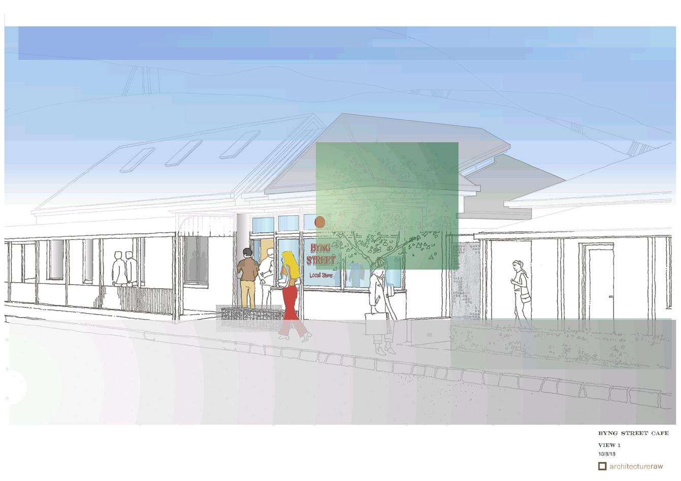
Extraordinary
Planning and Development Committee
17 October 2018
2.1 Development
Application DA 445/2011(4) - 47 Byng Street
Attachment 3 Submissions


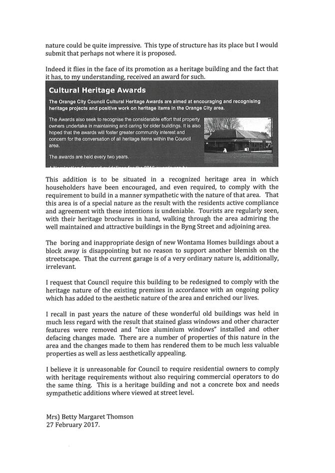
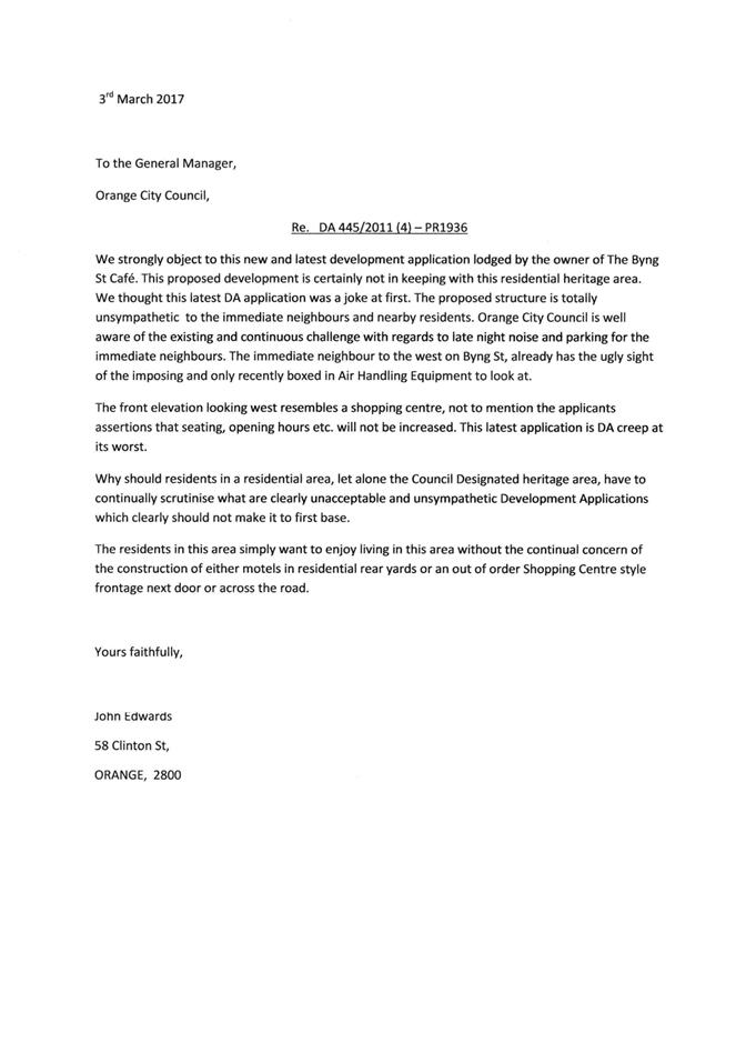
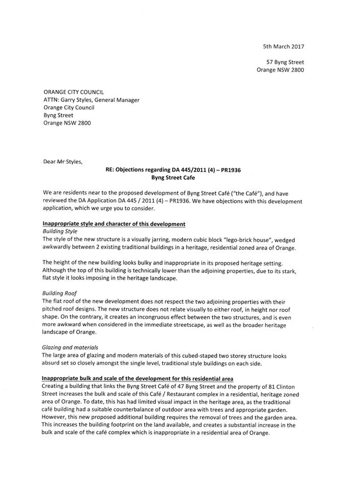

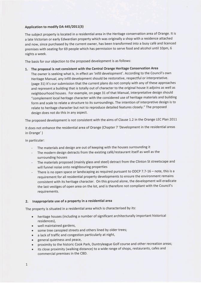
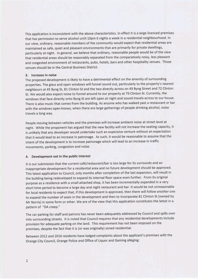
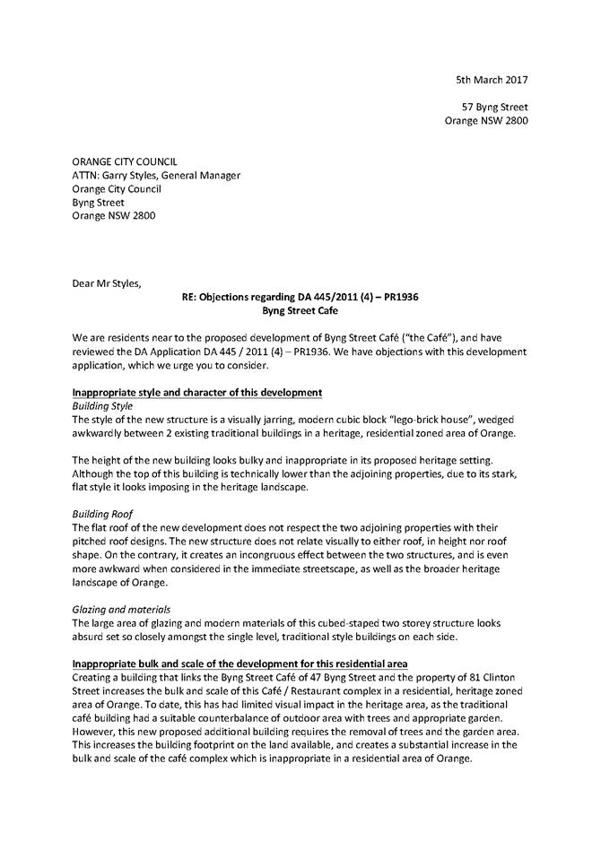
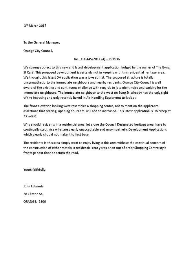
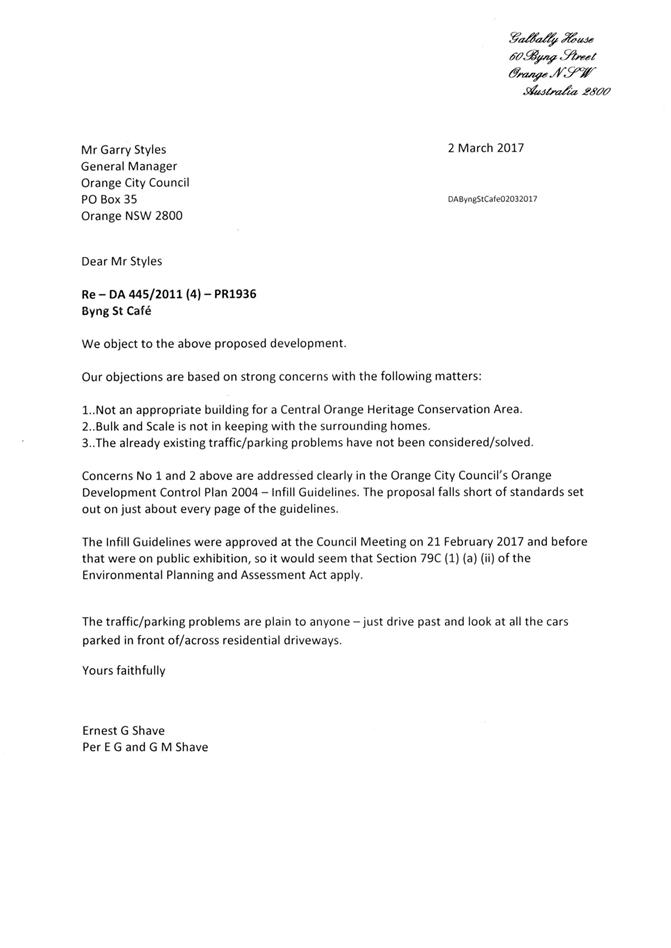


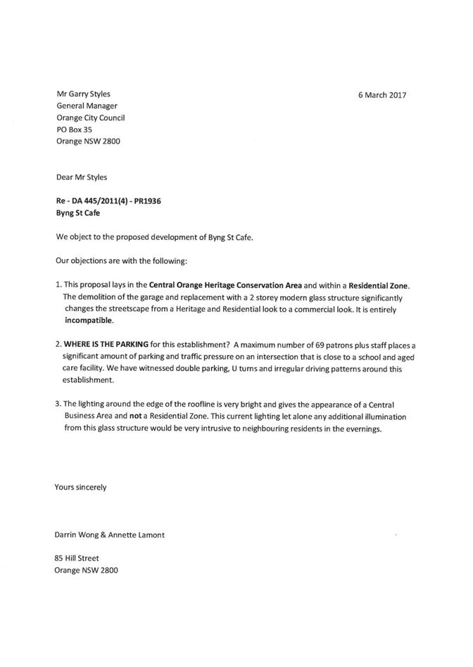
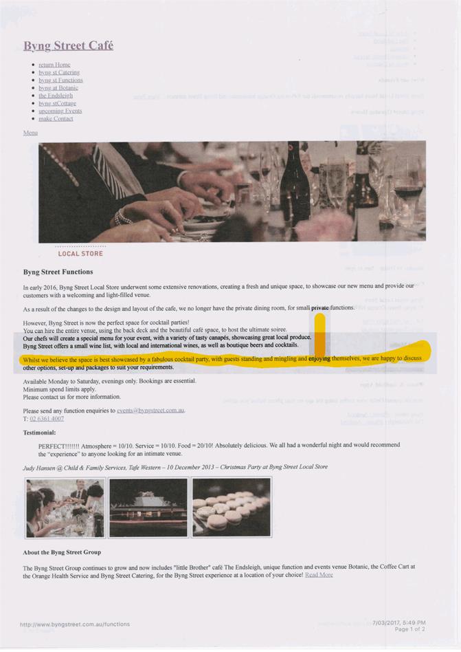
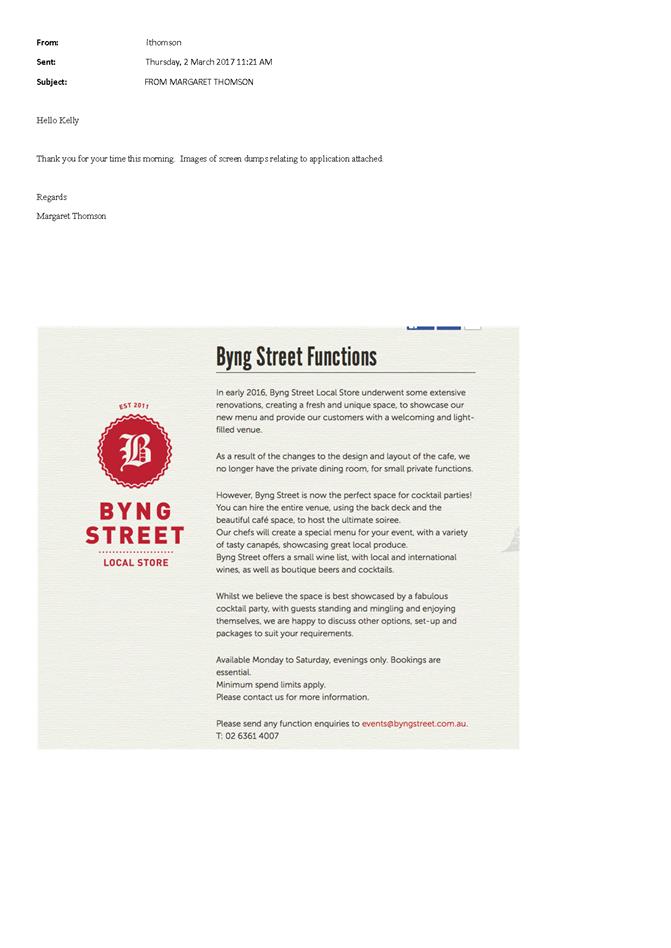
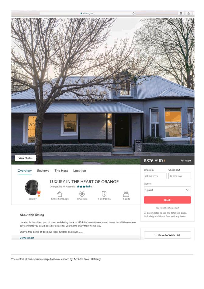

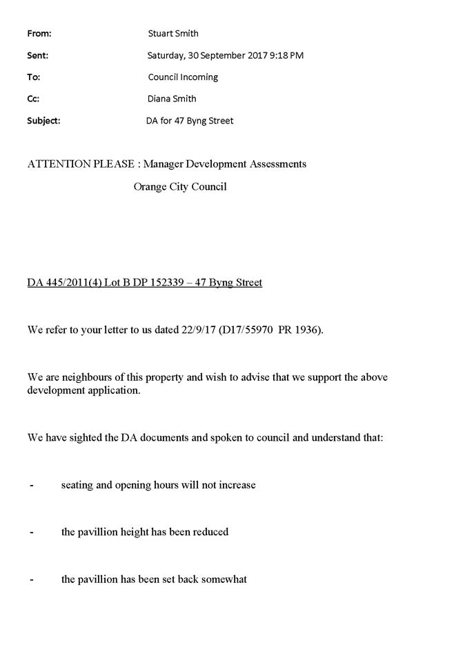

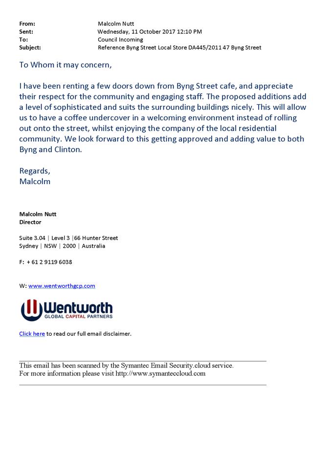
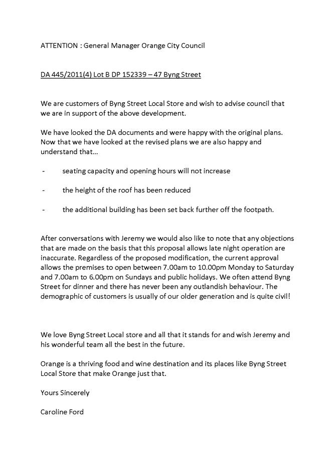
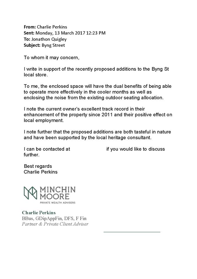


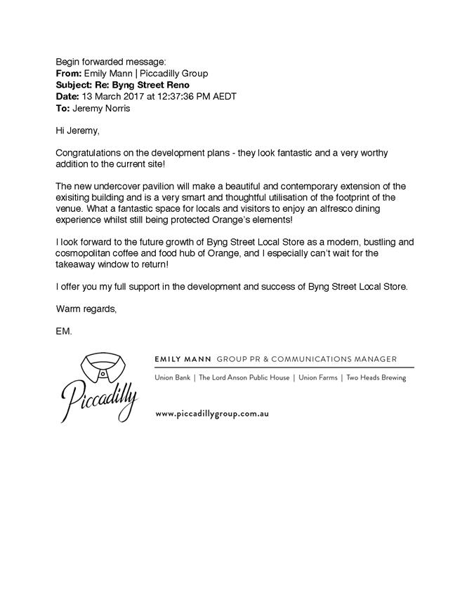
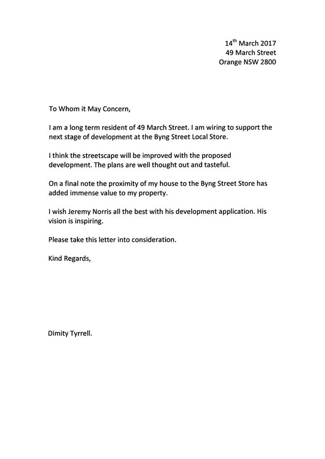
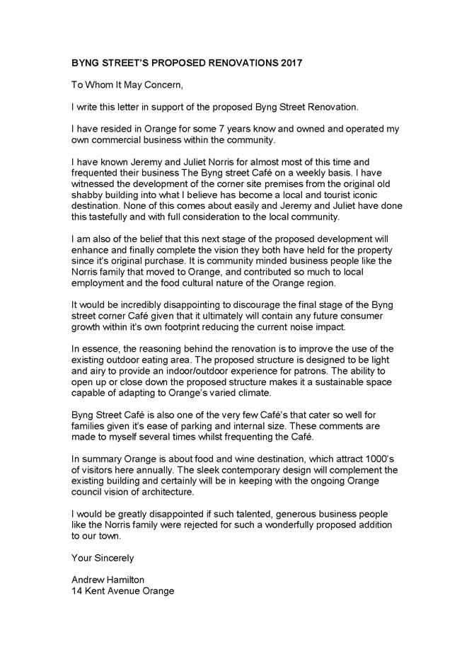
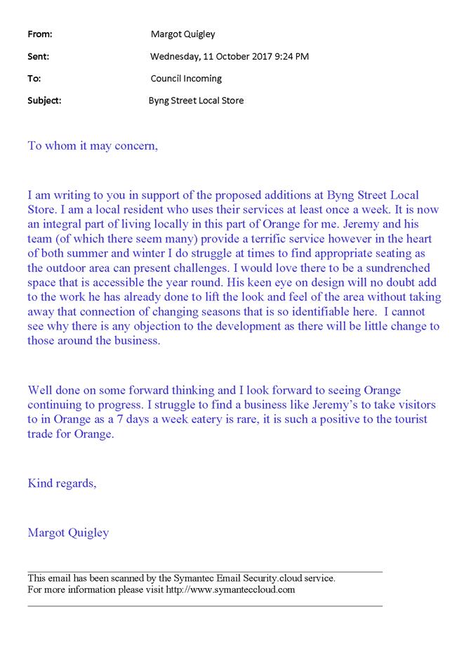

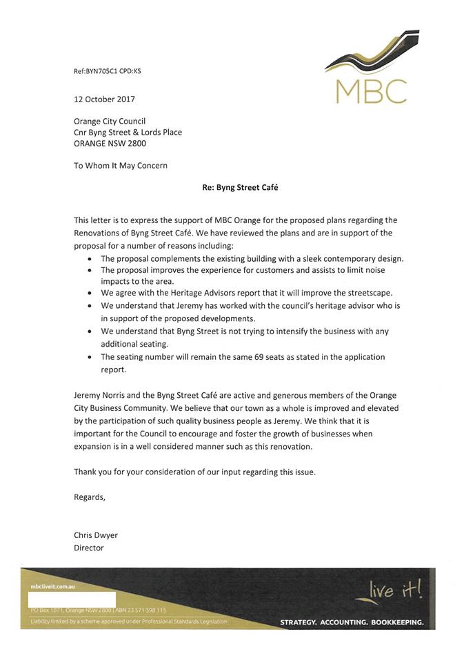
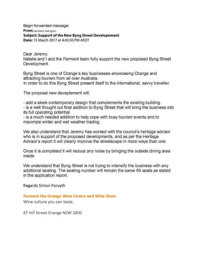
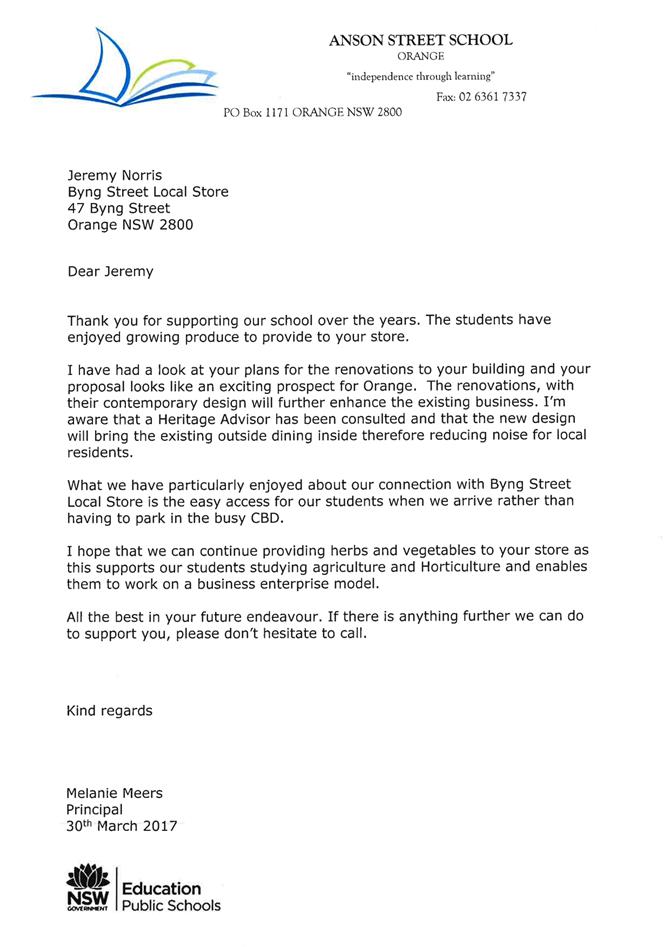
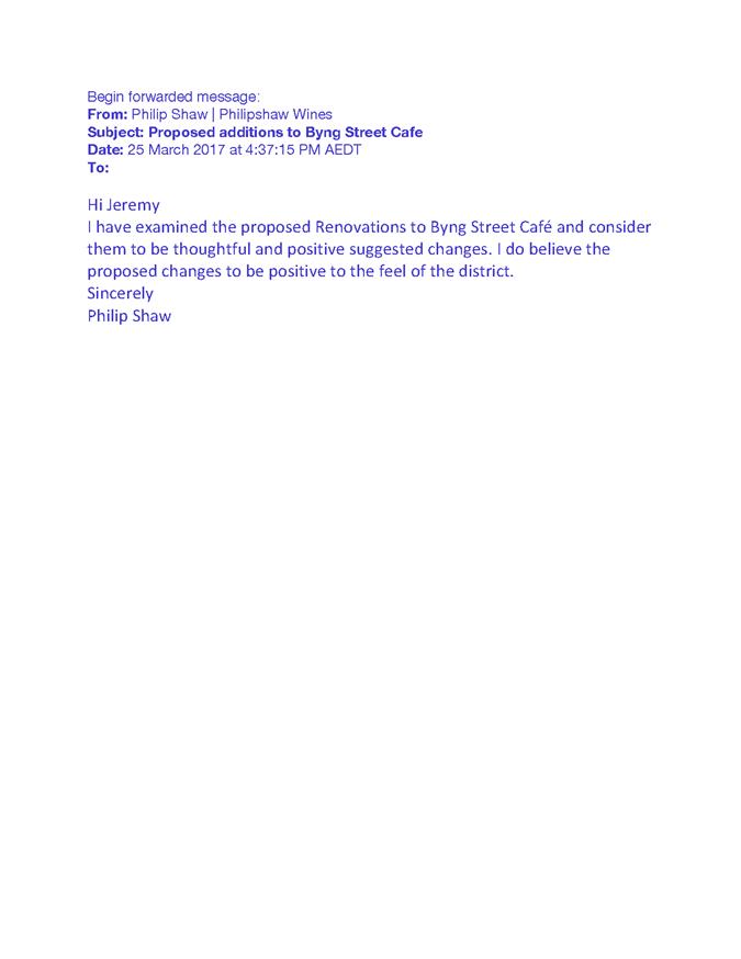
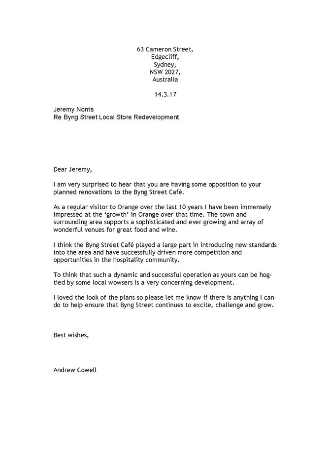
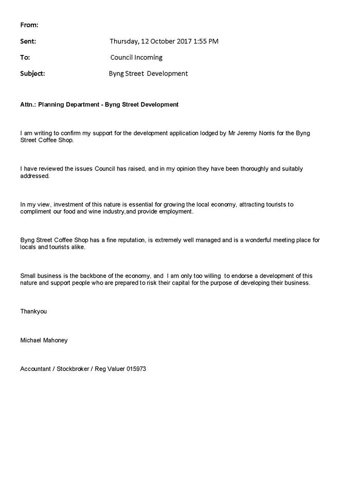
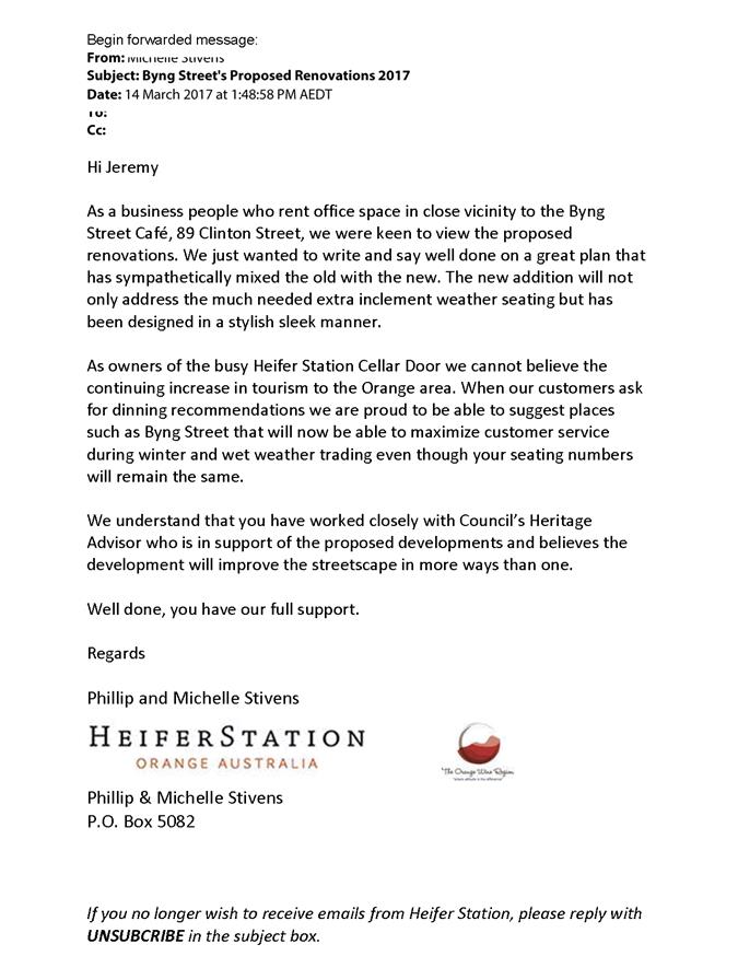


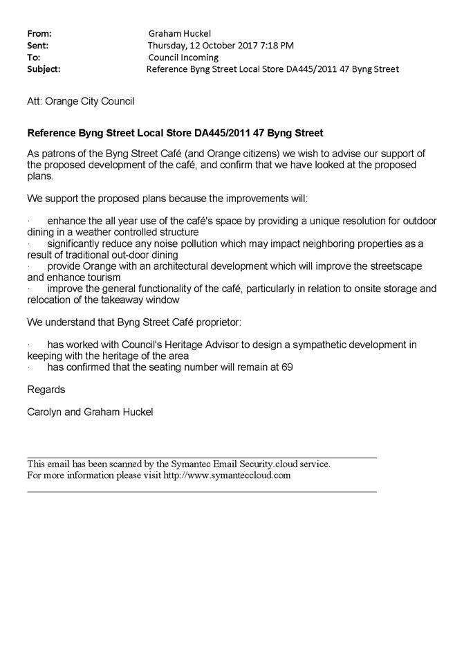
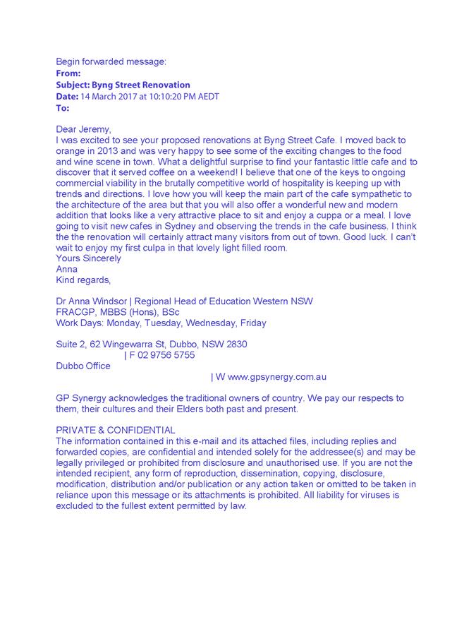
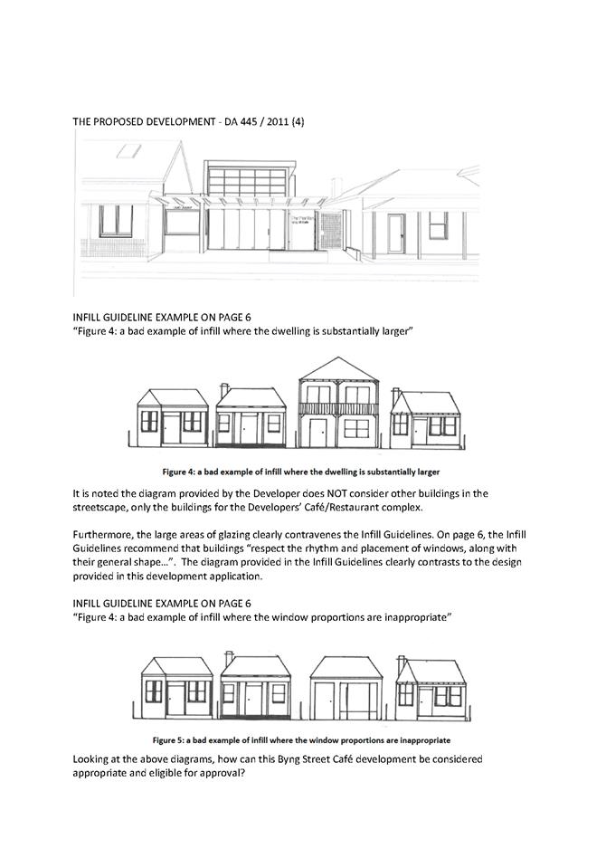

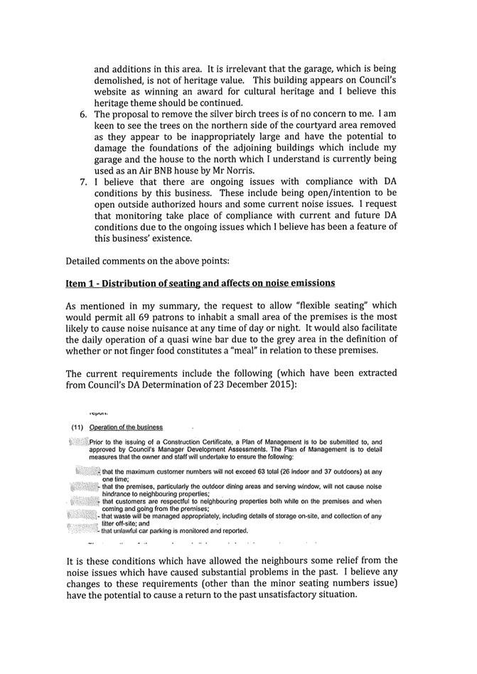
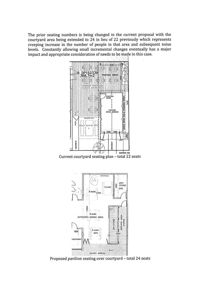
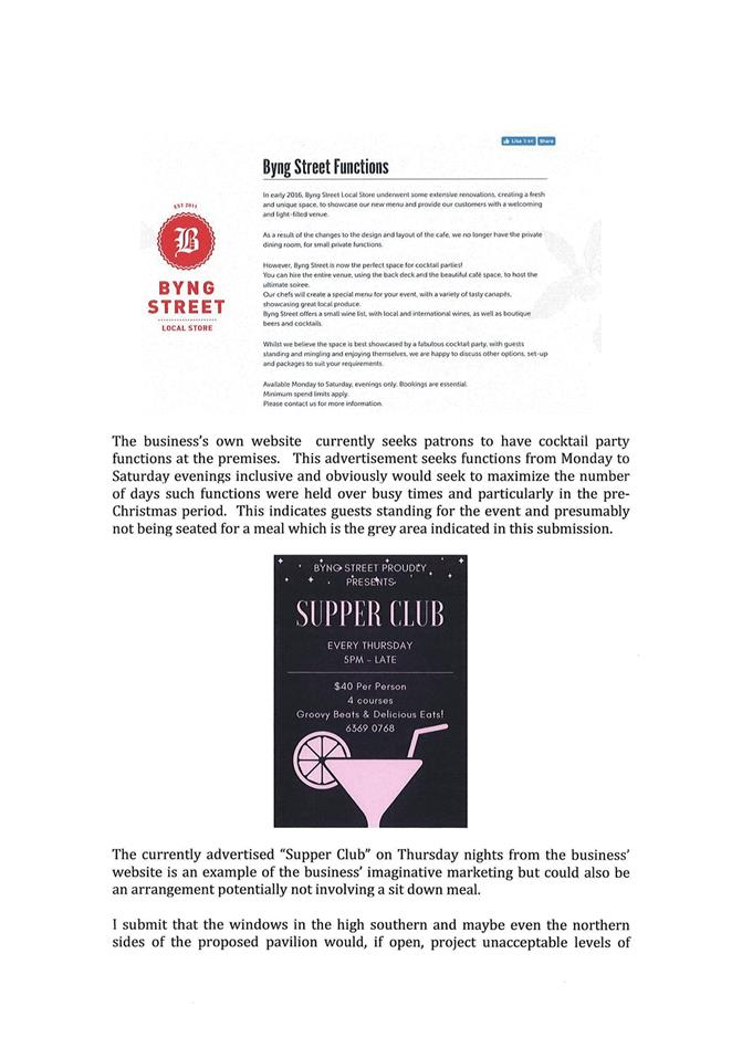
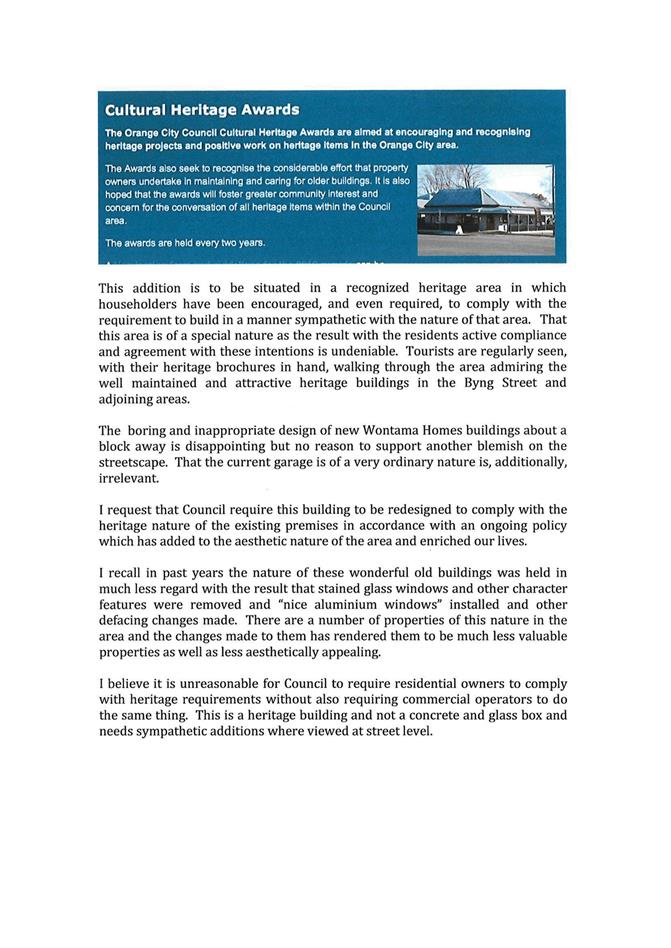
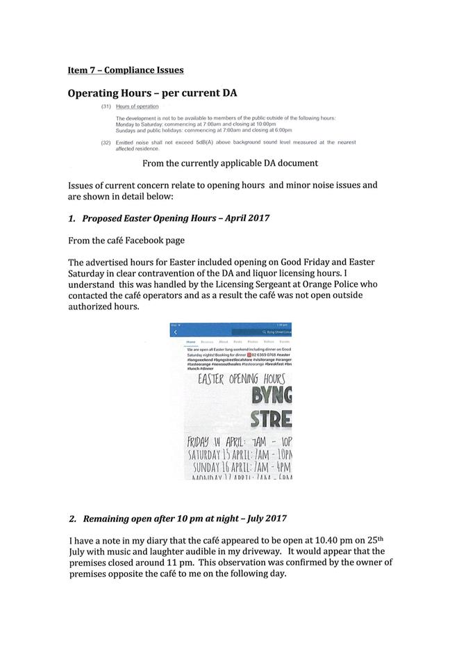
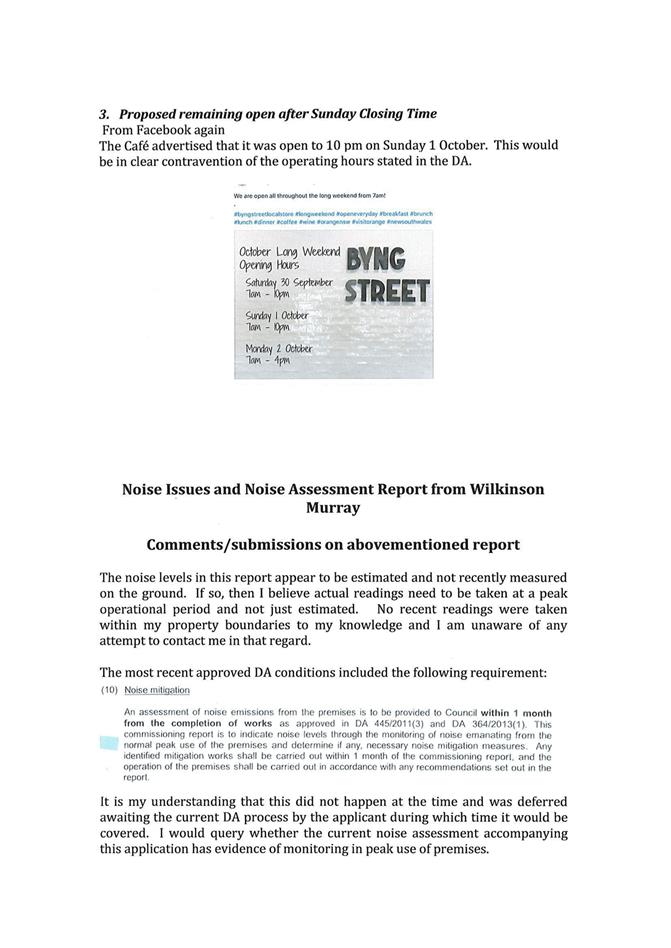
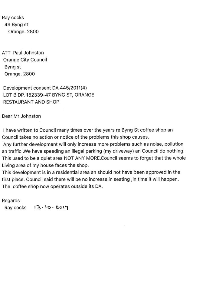
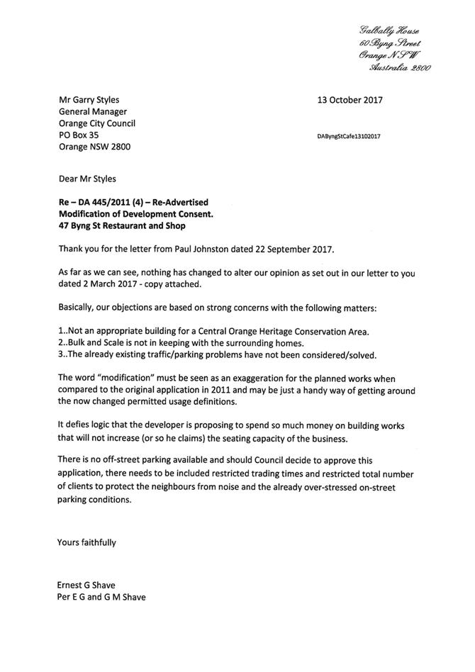
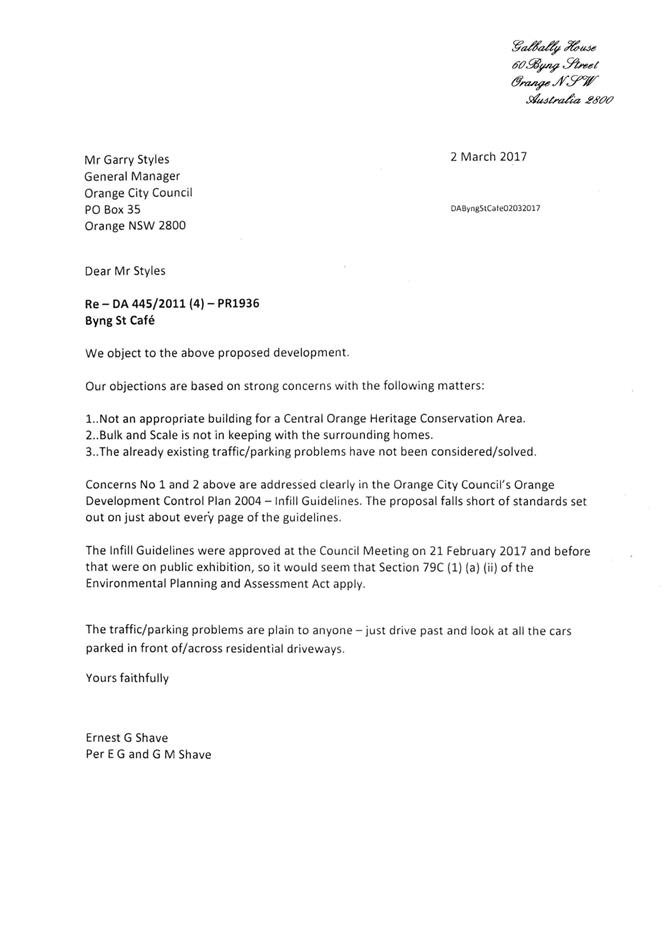
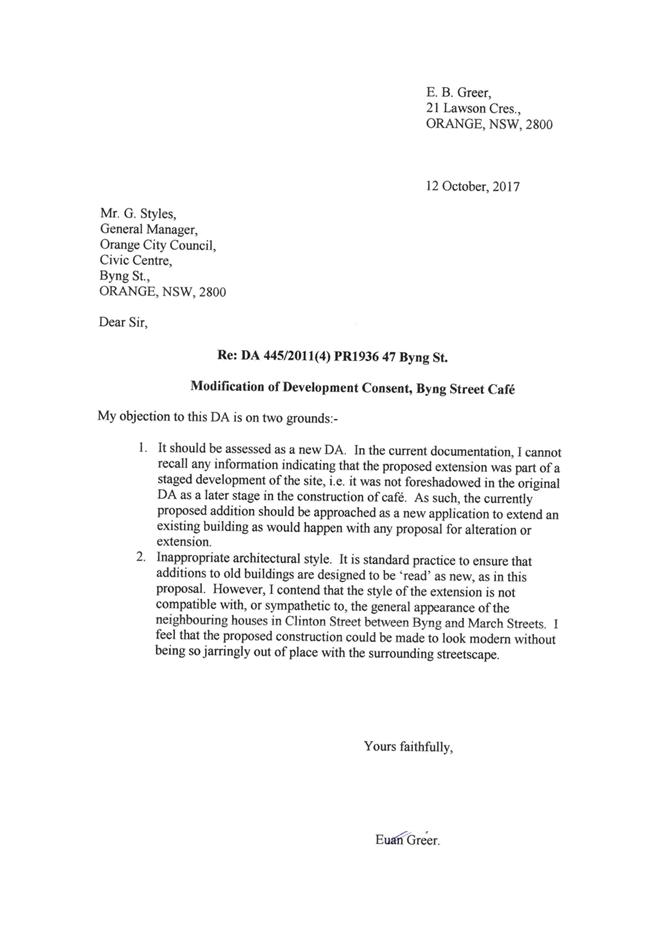
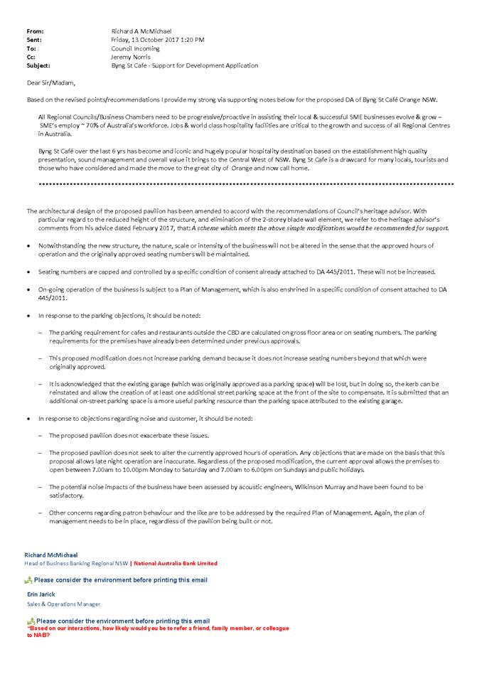

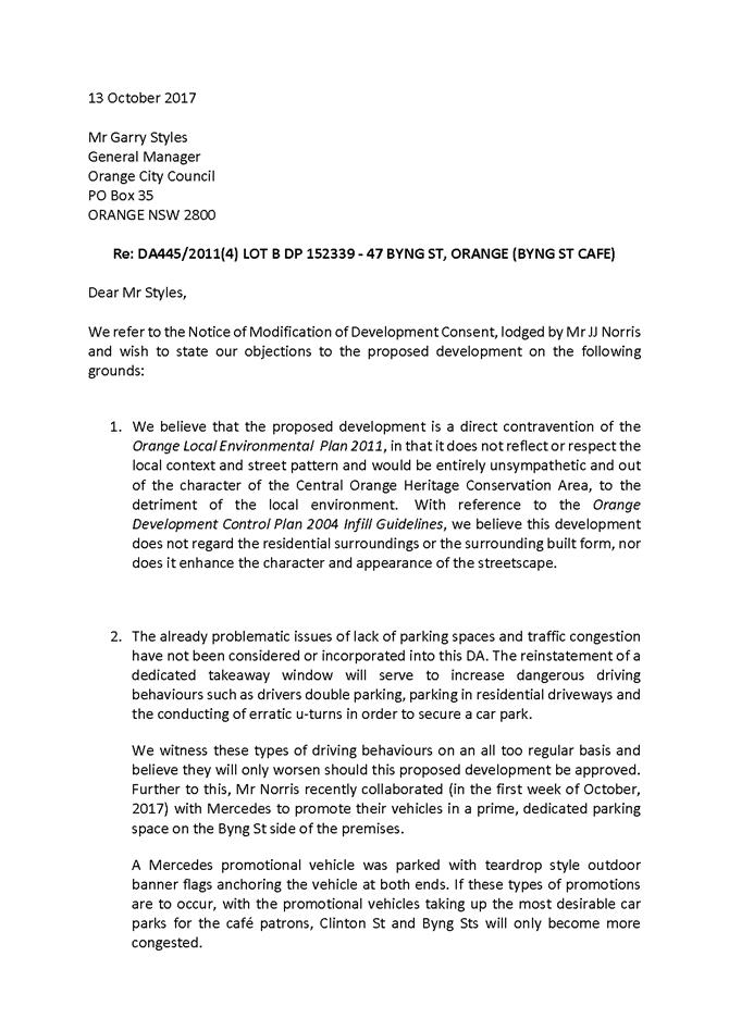
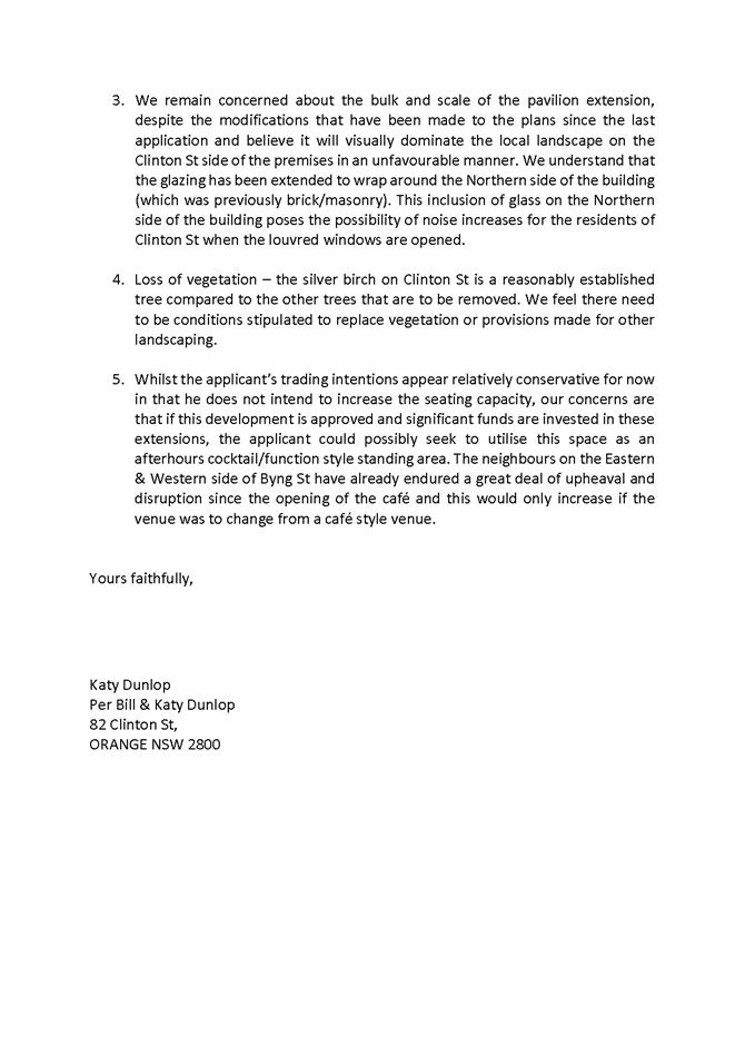
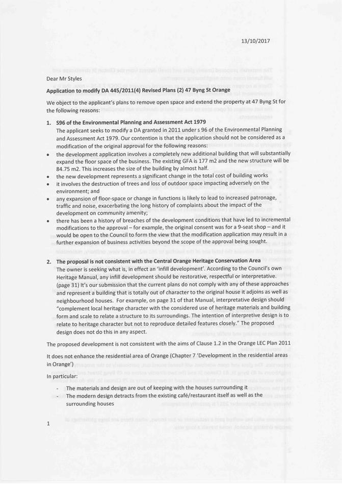
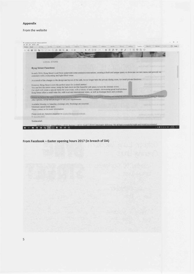
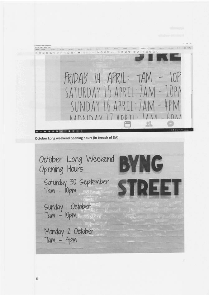
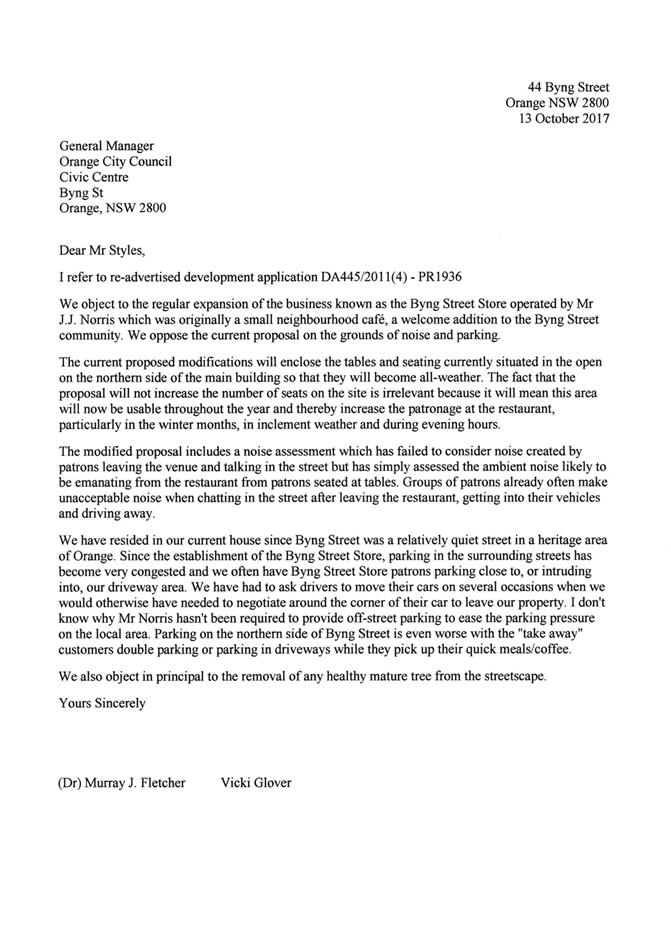
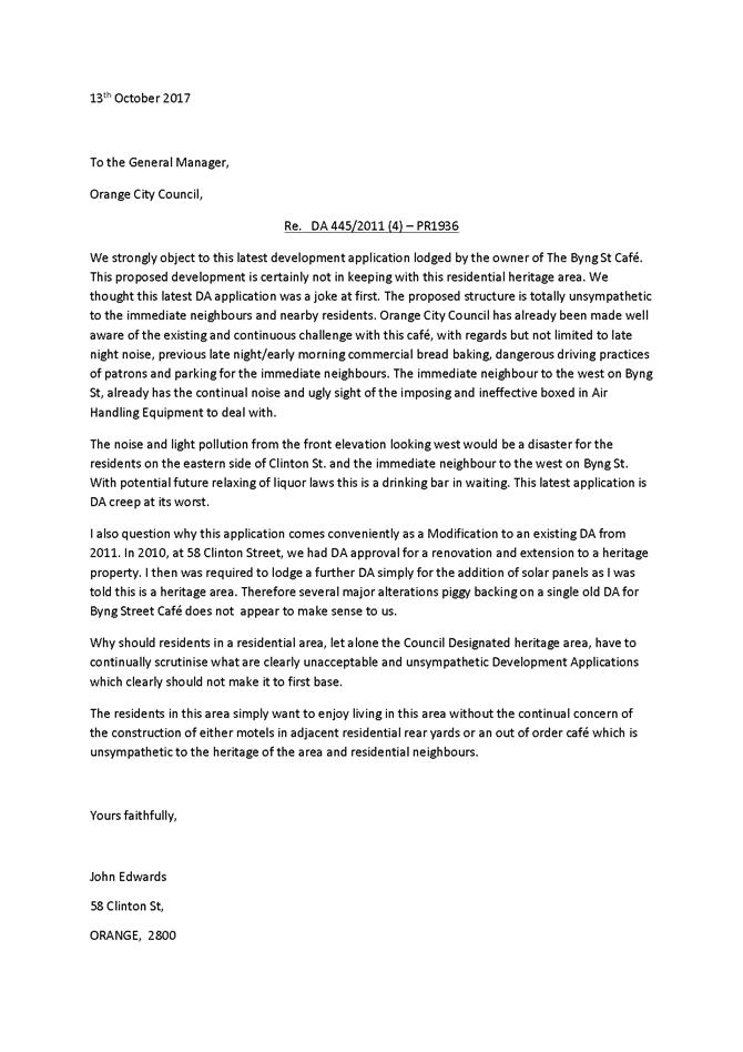
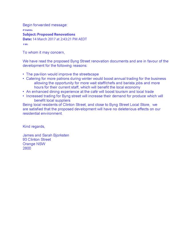


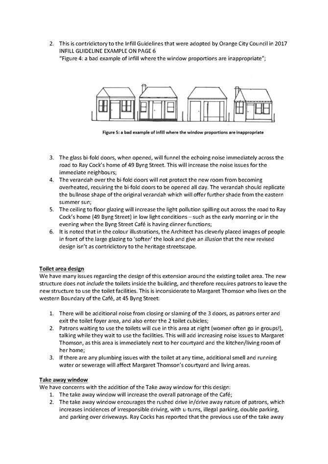
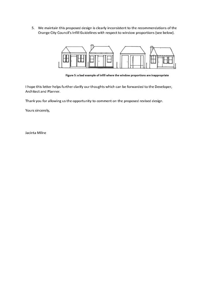
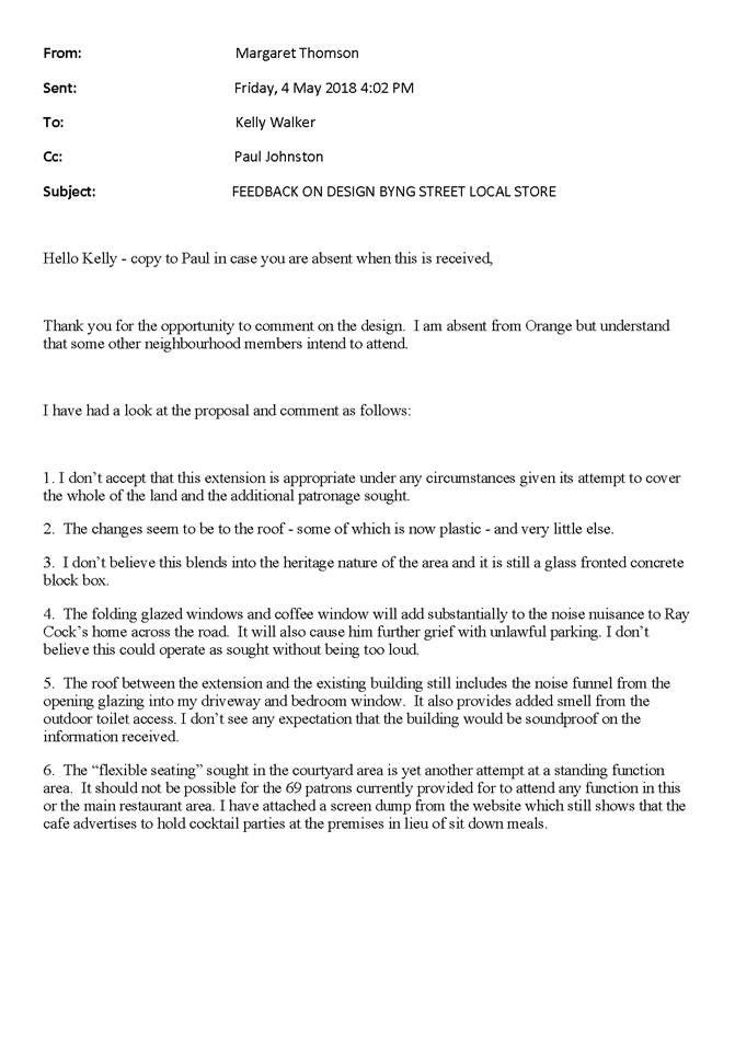

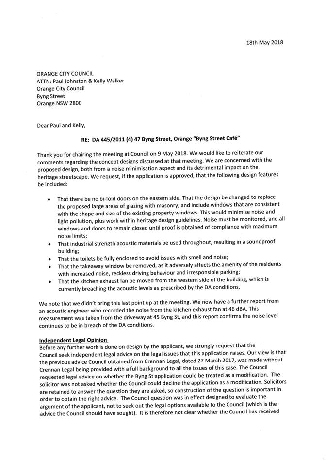

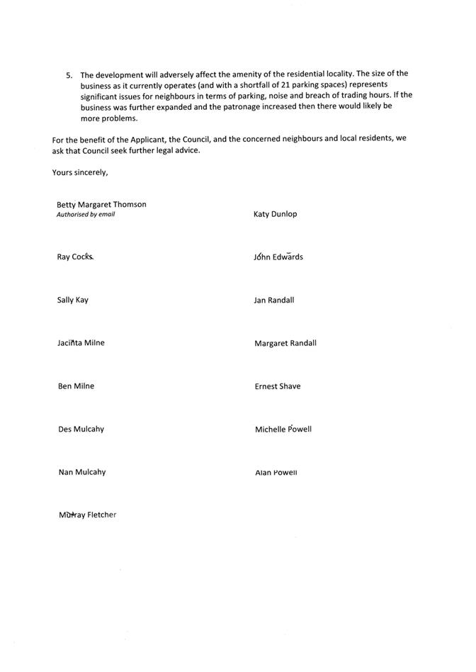
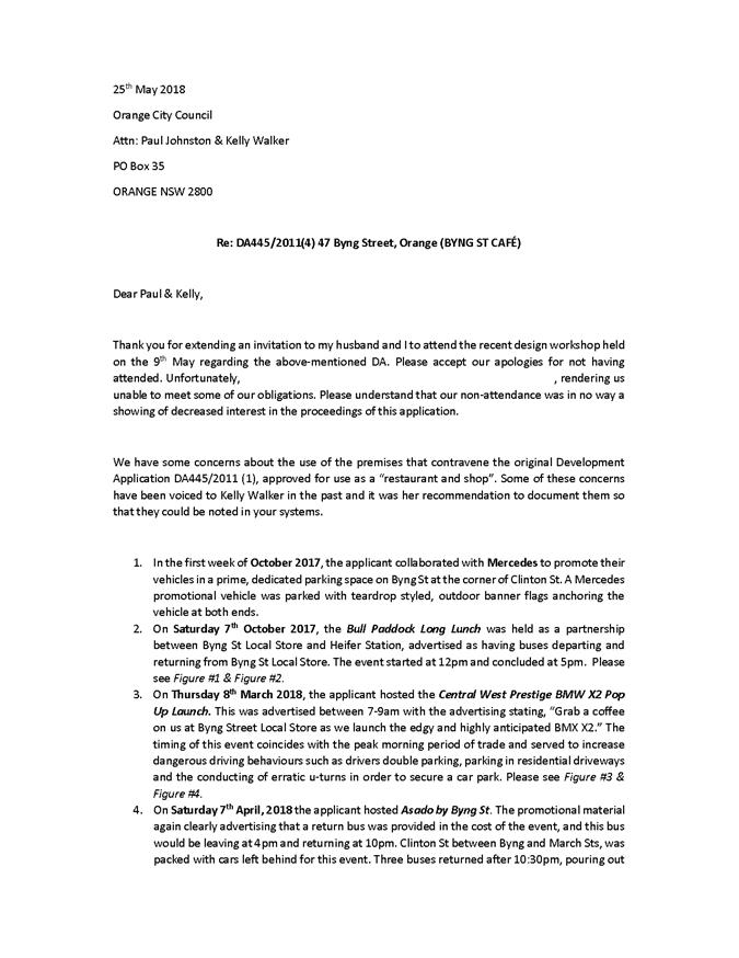
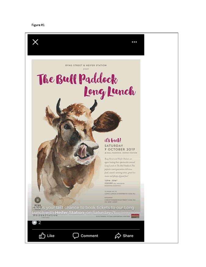
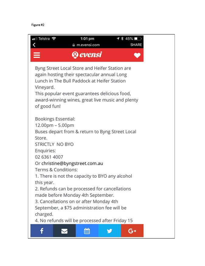


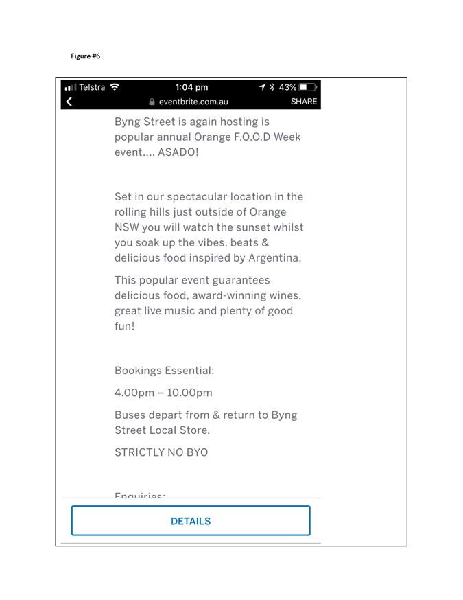

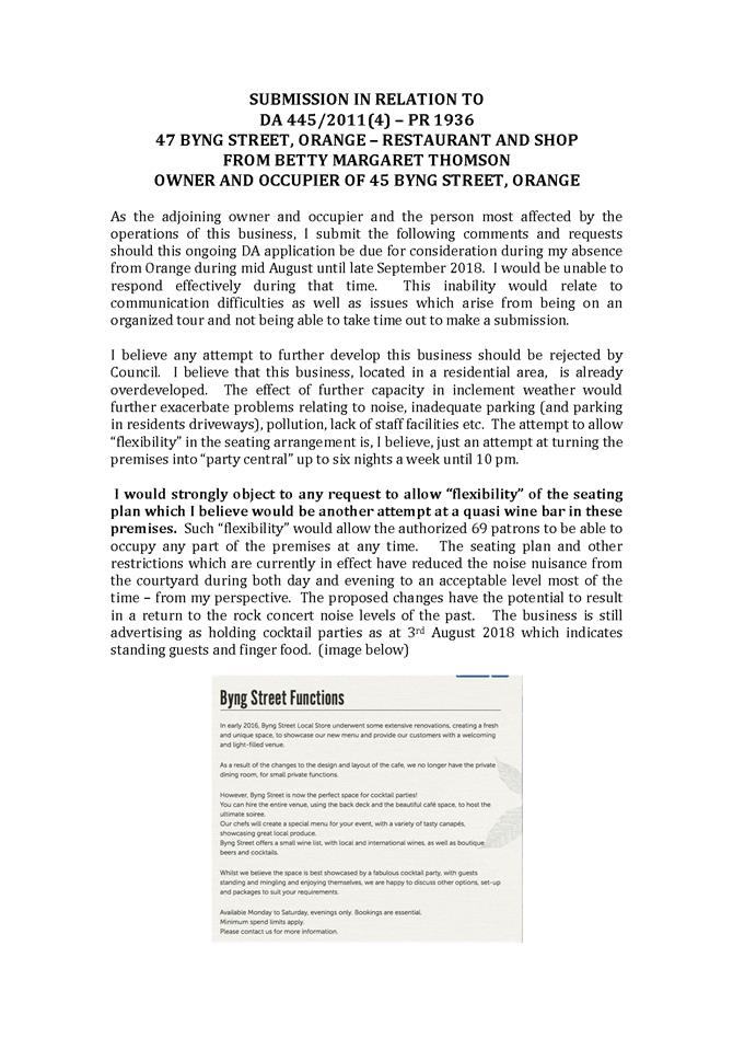
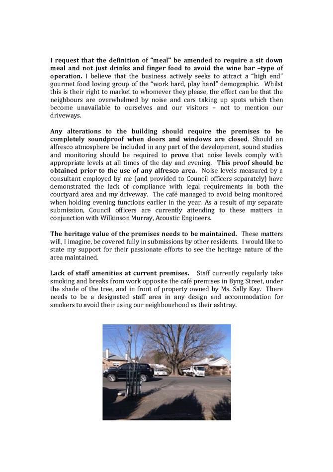
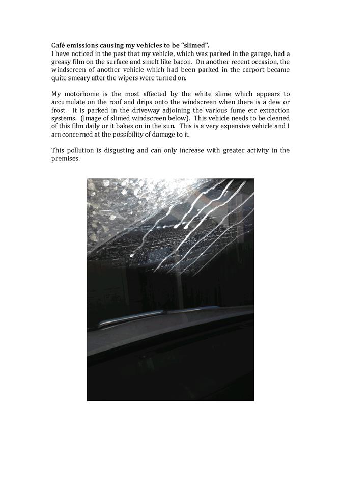
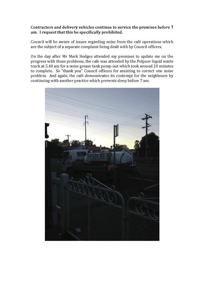
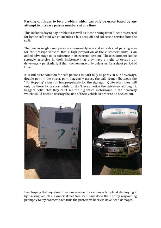
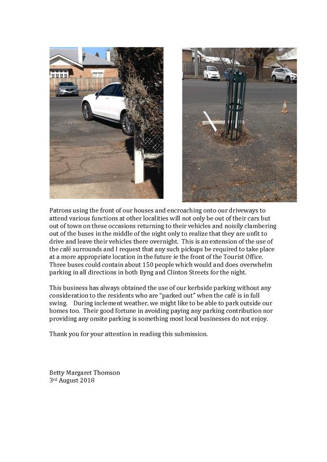
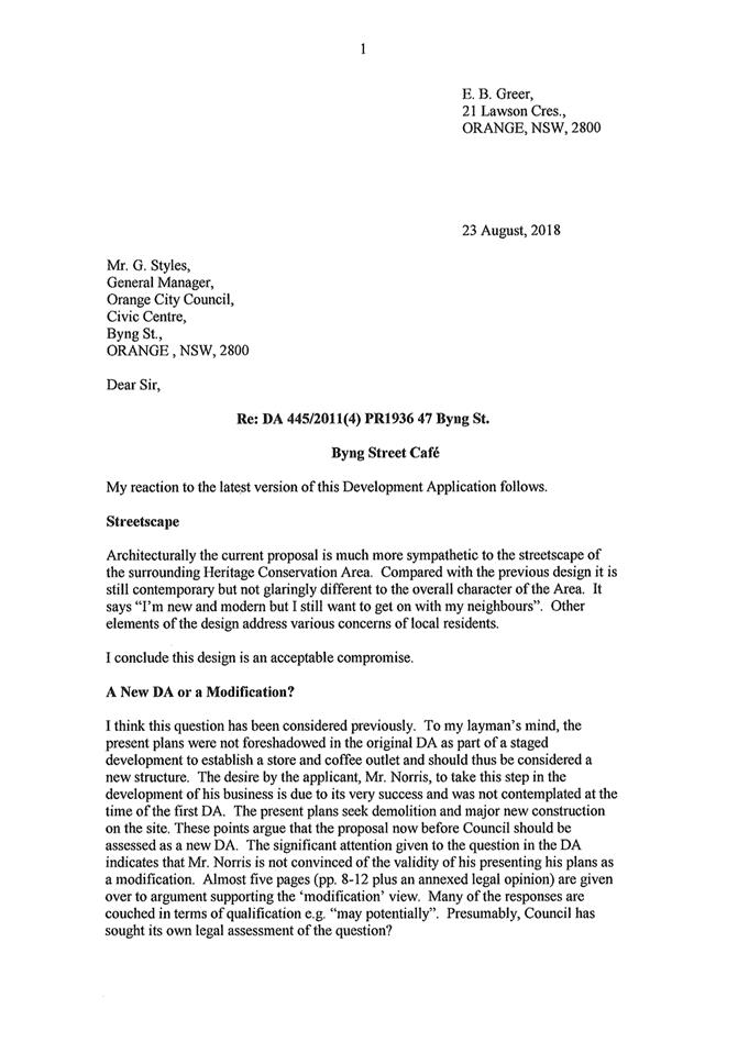
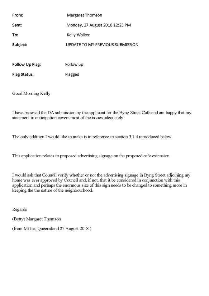
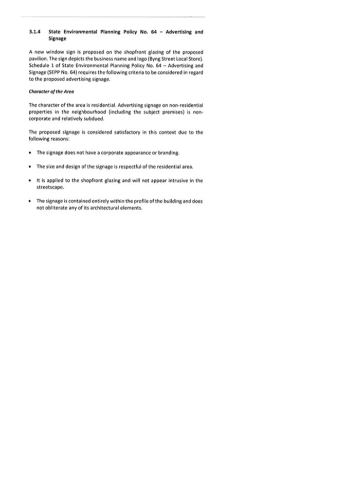
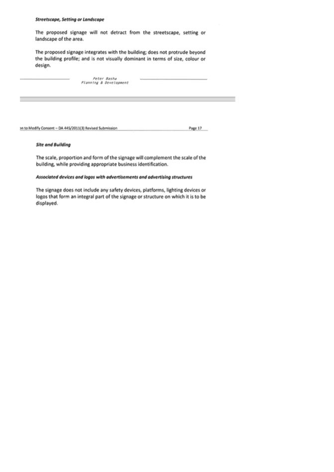
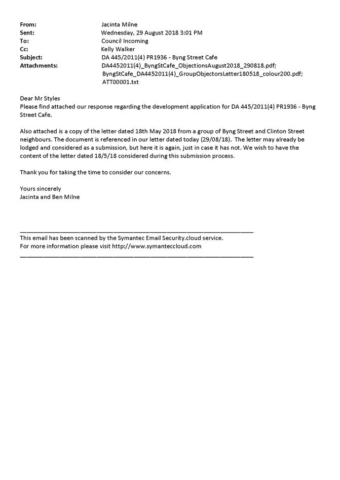
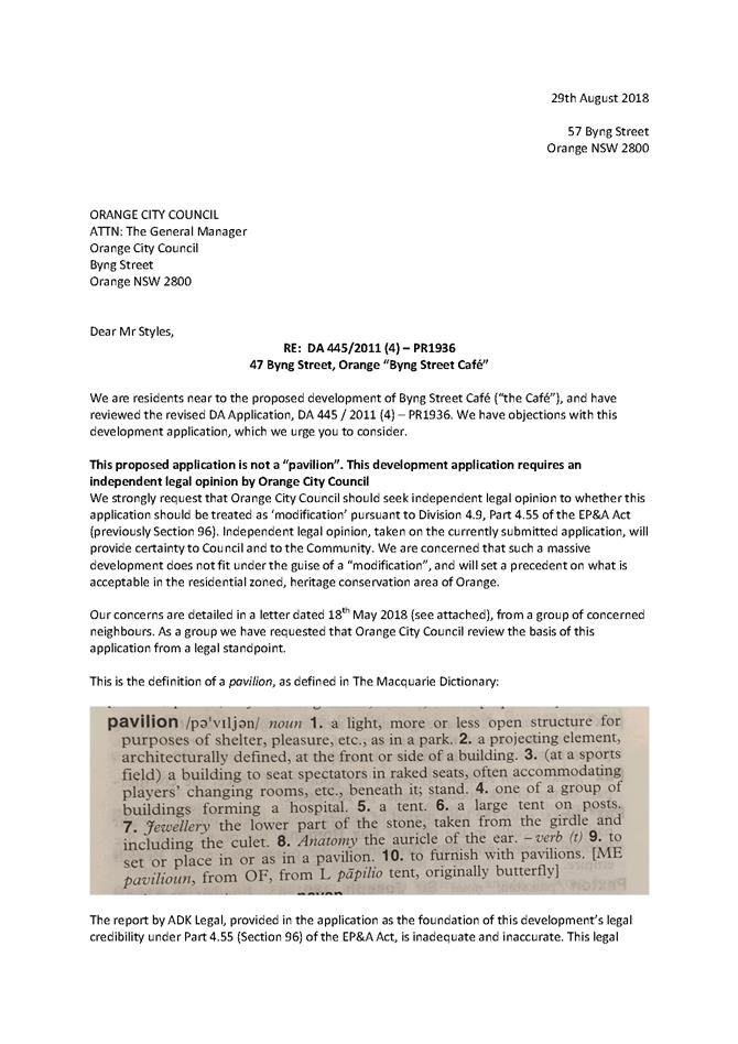

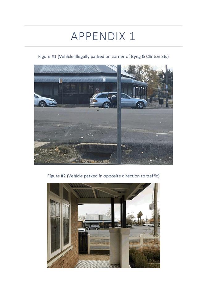
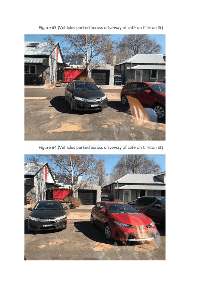
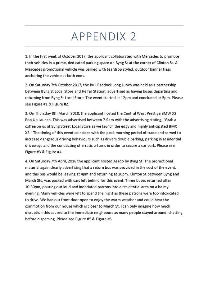
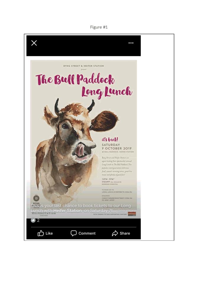
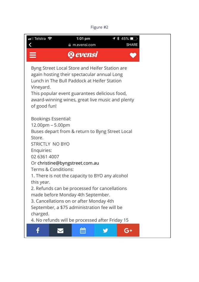


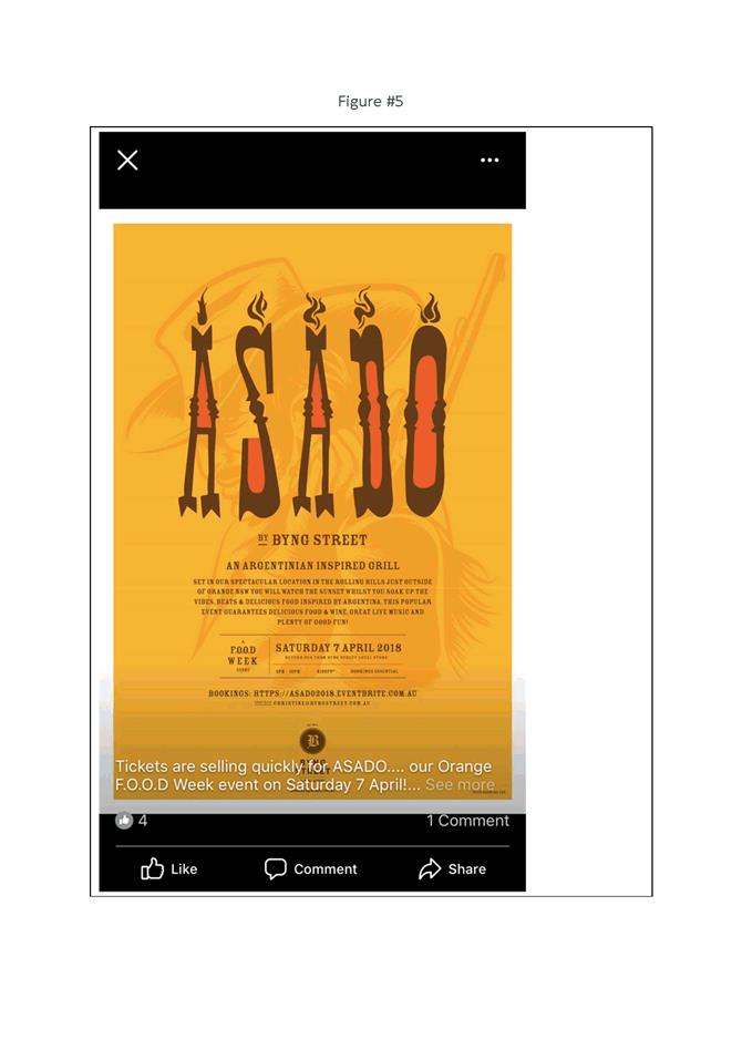
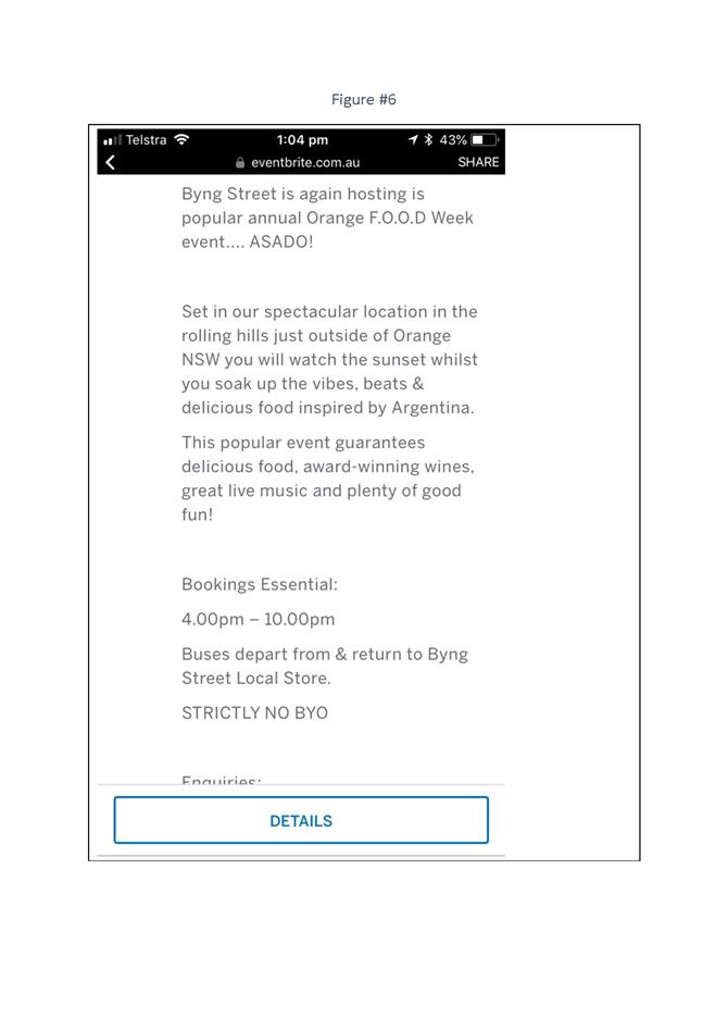

2.2 Development
Application DA 302/2016(1) - 245 Lords Place
RECORD
NUMBER: 2018/2495
AUTHOR: Andrew
Crump, Senior Planner
EXECUTIVE Summary
|
Application lodged
|
5 September 2016
|
|
Applicant
|
Smith Property Group Pty Limited
|
|
Owner
|
Smith Property Group Pty Limited
|
|
Land description
|
Lot 1 DP 784423 - 245 Lords Place
Orange
|
|
Proposed land use
|
Demolition and Hotel or Motel
Accommodation
|
|
Value of proposed development
|
$13,000,000
|
Council's consent is sought for
the demolition of all existing buildings and structures associated with the
existing motel (including the commercial building at the front of the site) and
the construction of a four storey hotel or motel accommodation (for the sake of
brevity hereafter referred to as a “motel” – except where
defined under the LEP). The proposed motel will consist of 105 rooms (or 99
rooms under a dual key or two bedroom unit arrangement) and the typical
ancillary support areas such as reception, restaurant, lounge, bar and function
room. The development is proposed on land described as Lot 1
DP 784423 - known as 245 Lords Place. The location is shown in the figure
below:
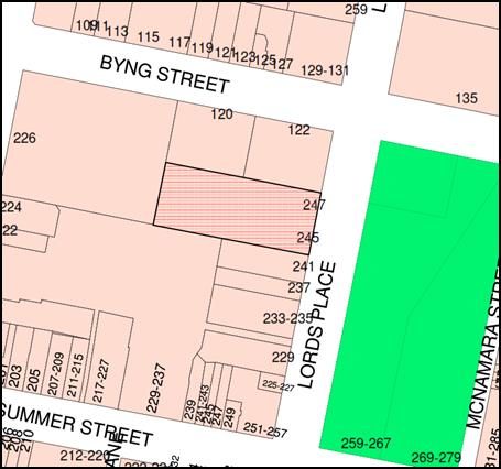
Figure 1 - locality plan
The critical aspects of the assessment of this application
relate to how the building fits within the heritage setting and within the
broader context and setting of the location. The other critical aspect relates
to the total parking demand of the development, taking into account not only
the number of rooms providing accommodation, but also the ancillary components
such as the bar, restaurant and function centre.
A detailed analysis of the car parking has been provided in
the body of the report, which concluded, allowing for factors such as average
occupancy, guest crossover of uses (i.e. guests also using the function
centre or restaurant facilities at the same time), that a deficiency in onsite
parking of 16 spaces would arise as a result of the development. Accordingly, a
monetary contribution is recommended in lieu of the 16 space shortfall in
parking.
The development exceeds the applicable building height
control and as such the applicant has sought a variation to the development
standard which is addressed below under clause 4.6 of the LEP.
The development has been assessed
against Council’s relevant planning provisions and is deemed to be
satisfactory, and accordingly, the development is recommended for approval.
RECENT LEGISLATIVE CHANGES
On 1 March 2018 the Environmental Planning and Assessment
Act 1979 was substantially amended. The most immediate change involves the
restructuring and renumbering of the Act, with other more substantive
changes to be phased in over time. However, for some applications (particularly
where an application was lodged prior to the changes coming into effect) the
supporting documentation may still reference the previous numbering regime. In
the drafting of this report the content and substance of the supporting
material has been considered irrespective of which legislative references were
used.
DECISION FRAMEWORK
Development in Orange is governed by two key documents
Orange Local Environment Plan 2011 and Orange Development Control Plan
2004. In addition the Infill Guidelines are used to guide development,
particularly in the heritage conservation areas and around heritage items.
Orange Local Environment Plan 2011 – The
provisions of the LEP must be considered by the Council in determining the
application. LEPs govern the types of development that are permissible or
prohibited in different parts of the City and also provide some assessment
criteria in specific circumstances. Uses are either permissible or not. The
objectives of each zoning and indeed the aims of the LEP itself are also to be
considered and can be used to guide decision making around appropriateness of
development.
Orange Development Control Plan 2004 – the DCP
provides guidelines for development. In general it is a performance based
document rather than prescriptive in nature. For each planning element there
are often guidelines used. These guidelines indicate ways of achieving the
planning outcomes. It is thus recognised that there may also be other solutions
of merit. All design solutions are considered on merit by planning and building
staff. Applications should clearly demonstrate how the planning outcomes are
being met where alternative design solutions are proposed. The DCP enables
developers and architects to use design to achieve the planning outcomes in
alternative ways.
DIRECTOR’S COMMENT
This is a significant development application which will see
a modern multi-storey motel placed in Lords place at the site of the existing
Mid City Motor Lodge. The development represents a significant opportunity to
fill the gap in the streetscape adjacent to the listed Court House. The
developer is to be commended for working with staff to produce a good outcome.
Whilst parking is an issue and a shortfall in parking will result, staff have
taken the proposed valet parking proposal into consideration in determining the
contribution to be levied for any shortfall.
Link To Delivery/OPerational Plan
The recommendation in this report relates to the
Delivery/Operational Plan strategy “10.1 Preserve - Engage with the
community to ensure plans for growth and development are respectful of our
heritage”.
Financial Implications
Nil
Policy and Governance Implications
Nil
|
Recommendation
That Council consents to
development application DA 302/2016(1)
for Demolition and Hotel or Motel Accommodation at Lot 1 DP 784423 -
245 Lords Place, Orange pursuant to the conditions
of consent in the attached Notice of Approval.
|
further considerations
Consideration has been given to the recommendation’s
impact on Council’s service delivery; image and reputation; political;
environmental; health and safety; employees; stakeholders and project
management; and no further implications or risks have been identified.
SUPPORTING INFORMATION
THE LAND
The land to which the application relates is described as
Lot 1 DP 784423, known as the Mid-City Motor Lodge at 245 Lords Place. The
land adjoins Orange Court House to the north; Orange Central Shopping Centre
(Coles/K-mart) to the rear (west); a number of retail, business and office
premises adjoin on the eastern side of the subject land; and opposite the
subject land is Robertson Park.
THE APPLICATION/PROPOSAL
The development firstly involves the demolition of all
existing buildings, structures and vegetation on the land.
Following demolition, a new four storey building will be
constructed for the purposes of hotel or motel accommodation. The hotel or
motel accommodation will comprise a total of 105 rooms for
accommodation purposes (or 99 rooms under a dual key arrangement) across
Levels 1, 2 and 3. The hotel or motel accommodation will also
provide other support areas such as a lobby/lounge area, reception and coffee
bar on the ground level; and restaurant, function room, lounge bar and terrace
on Level 1. A 97-space car park (or 112 car parking spaces under a
valet arrangement during peak periods) will be provided in the under-croft
space below Level 1 and behind the reception/lobby area on the ground
level. Access to the car park will be provided via a one-way circulation
arrangement from Lords Place. A one-way entry/exit will be provided to the
porte-cochere at the front of the site, accessed from Lords Place also.
EVOLUTION OF THE DESIGN
The overall design of the
subject building has evolved considerably between the pre‑lodgement phase
of the application and the most recent iteration of the plans. The evolving
nature of the design, culminating at the final design which is being assessed
as the proposed building, has been possible because of the proponent’s
cooperation and willingness to work collaboratively with Council staff and
Council’s Heritage Advisor. It is self-evident from the images below
(showing the transformation of the design) that the design has progressed to a
higher quality and more sophisticated design from the starting point as a
direct result of the collaborative process that has occurred.
Figure 2 - prelodgement design
Figure 3 - design as initially submitted to Council
Figure 4 - second iteration of design after initial
submission
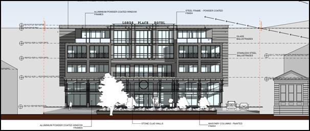
Figure 5 - final design
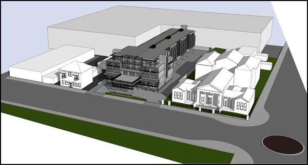
Figure 6 - additional perspective of that shown in the
above figure
As can been seen above, the final
design shown in Figures 5 and 6 presents a building with three distinct and
important architectural parts: a bottom (base), a middle and a top; the various
portions of the building are defined by both materiality, modulation and
articulation in the façade. The, the materiality, modulation and
fine-scale detailing help to reduce the sense of scale and overall bulk of the
development, resulting in a more sympathetic development in the context and
setting. The size and orientation of opens and other architectural features and
detailing of the building have been informed and influenced by those elements
that are evident in buildings in the vicinity, particularly the Orange Court
House.
MATTERS FOR CONSIDERATION
Section 1.7 - Application of
Part 7 of the Biodiversity Conservation Act 2016 and Part 7A of the
Fisheries Management Act 1994
Section 1.7 of the EP&A Act 1979 identifies that Part 7
of the Biodiversity Conservation Act 2016 and Part 7A of the Fisheries
Management Act 1994 have effect in connection with terrestrial and aquatic
environments.
Notwithstanding, Section 28 of the Biodiversity
Conservation (Savings and Transitional) Regulation 2017 states that the
former planning provisions continue to apply to the determination of a pending
planning application, being an application for planning approval made before
the commencement of the new Act but not determined before that commencement.
The relevant provisions are set out at Part 5A of the historical version of the
EP&A Act 1979 dated 24 August 2017.
Having regard to the relevant provisions and based on an
inspection of the subject property, it is considered that the proposed
development is not likely to have a significant effect on any threatened
species, populations or ecological communities or their habitats.
Section 4.15
Section 4.15 of the Environmental Planning and Assessment
Act 1979 requires Council to consider various matters, of which those
pertaining to the application are listed below.
PROVISIONS OF ANY ENVIRONMENTAL
PLANNING INSTRUMENT s4.15(1)(a)(i)
Orange Local Environmental Plan 2011
Part 1 - Preliminary
Clause 1.2 - Aims of Plan
The
broad aims of the LEP are set out under subclause 2. Those relevant to the
application are as follows:
(a) to
encourage development which complements and enhances the unique character of
Orange as a major regional centre boasting a diverse economy and offering an
attractive regional lifestyle,
(b) to
provide for a range of development opportunities that contribute to the social,
economic and environmental resources of Orange in a way that allows present and
future generations to meet their needs by implementing the principles for
ecologically sustainable development,
(c) to
conserve and enhance the water resources on which Orange depends, particularly
water supply catchments,
(f) to
recognise and manage valued environmental heritage, landscape and scenic
features of Orange.
The application is considered to be consistent with aims
(a), (b), (c) and (f) as listed above.
Clause 1.6 - Consent Authority
This clause establishes that, subject to the Act, Council is
the consent authority for applications made under the LEP.
Clause 1.9A - Suspension of
Covenants, Agreements and Instruments
This clause provides that covenants, agreements and other
instruments which seek to restrict the carrying out of development do not apply
with the following exceptions.
· covenants imposed
or required by Council
· prescribed
instruments under Section 183A of the Crown Lands Act 1989
· any conservation
agreement under the National Parks and Wildlife Act 1974
· any trust
agreement under the Nature Conservation Trust Act 2001
· any property
vegetation plan under the Native Vegetation Act 2003
· any biobanking
agreement under Part 7A of the Threatened Species Conservation Act 1995
· any planning
agreement under Division 6 of Part 4 of the Environmental Planning and
Assessment Act 1979.
Council staff are not aware of the
title of the subject property being affected by any of the above.
Mapping
The subject site is identified
on the LEP maps in the following manner:
|
Land
Zoning Map:
|
Land
zoned B3 Commercial Core
|
|
Lot Size
Map:
|
No
Minimum Lot Size
|
|
Heritage
Map:
|
Central
Heritage Conservation Area
|
|
Height of
Buildings Map:
|
Building
height limit - 12m
|
|
Floor
Space Ratio Map:
|
Floor
space limit - 2.0:1
|
|
Terrestrial
Biodiversity Map:
|
No
biodiversity sensitivity on the site
|
|
Groundwater
Vulnerability Map:
|
Ground
water vulnerable
|
|
Drinking
Water Catchment Map:
|
Not
within the drinking water catchment
|
|
Watercourse
Map:
|
Not
within or affecting a defined watercourse
|
|
Urban
Release Area Map:
|
Not
within an urban release area
|
|
Obstacle
Limitation Surface Map:
|
No
restriction on building siting or construction
|
|
Additional
Permitted Uses Map:
|
No
additional permitted use applies
|
Those matters that are of relevance are addressed in detail
in the body of this report.
Part 2 - Permitted or Prohibited Development
Land
Use Zones
The subject site is located within the B3 Commercial Core
zone. The proposed development is defined as hotel or motel accommodation under
OLEP 2011 which means:
hotel or motel accommodation
means a building or place (whether or not licensed premises under the Liquor
Act 2007) that provides temporary or short-term accommodation on a commercial
basis and that:
(a)
comprises rooms or self-contained suites, and
(b) may
provide meals to guests or the general public and facilities for the parking of
guests’ vehicles,
but does not include
backpackers’ accommodation, a boarding house, bed and breakfast
accommodation or farm stay accommodation.
Hotel or motel accommodation is permissible in the B3
Commercial Core zone with the consent of Council. It is noted that the proposed
function room/s are considered ancillary to the dominant use of the land as a
motel; they are a typical and expected support facility for many modern motels
globally.
The initial demolition component of the development is
addressed below under clause 2.7.
Clause 2.3 of
LEP 2011 references the Land Use Table and Objectives for each zone in
LEP 2011. These objectives for land zoned B3 Commercial Core are as
follows:
1 -
Objectives of the B3 Commercial Core Zone
· To provide a wide
range of retail, business, office, entertainment, community and other suitable
land uses that serve the needs of the local and wider community.
· To encourage
appropriate employment opportunities in accessible locations.
· To maximise public
transport patronage and encourage walking and cycling.
· To promote
development that contributes to the role of the Orange CBD as the primary
retail and business centre in the City and region.
The development is not
inconsistent with the objects of the zone. The development represents a
continuation of the longstanding use of the land for the purpose of tourism.
The development is well positioned within the CBD to encourage cycling and
walking and will be well serviced by public transport. The development will
further strengthen Orange’s status as a major regional centre.
Clause 2.7 - Demolition
Requires Development Consent
This clause triggers the need for
development consent in relation to a building or work.
The proposal involves demolition
of all existing buildings and structures within the site as shown on the
attached demolition plan. The applicant is seeking the consent of Council.
The demolition works proposed will
have no significant impact on adjoining lands, streetscape or public realm.
Conditions are imposed in respect of hours of operation, dust suppression and
the need to investigate for, and appropriately manage the presence of any
materials containing asbestos.
Part 3 - Exempt and Complying Development
The application is not exempt or complying development.
Part 4 - Principal Development Standards
Clause
4.3 - Height of Buildings
This clause limits the height of
buildings (HoB) on land identified on the Height of Buildings Map. The subject
land is identified on the Map as having a HoB limit of 12m.
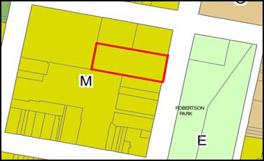
Figure 7 - Height of buildings Map - M=12m (subject
land shown red line)
The applicant submits that the
maximum height of the proposed development at the highest point is 16.5m and
therefore contravenes the height of buildings standard by 4.5m. This point has
been calculated based on existing ground levels at the rear of the site. The
development therefore exceeds the applicable development standard.
The applicant has made
application pursuant to Clause 4.6 of OLEP 2011 to vary the development
standard. The issue is addressed below.
Clause 4.4
- Floor Space Ratio
This
clause limits the floor space ratio (FSR) permitted on land identified on the
Floor Space Ratio Map. Clause 4.5 is associated with this clause and
establishes the rules for calculating the site area and FSR of any proposal.
These rules exclude certain parts of a site and development such as:
· excluding
any part of the site upon which the development is prohibited (ie if the
site is split zoned only the zone in which the development is permissible may
be considered)
· excluding
community land and most public places
· lots
in a Strata scheme wholly or partly above other lots in the scheme do not
increase the site area (ie the site area is the ground level of the scheme
only)
· adjoining
lots in the same ownership do not form part of the site area unless significant
parts of the development are proposed on that land
· the
floor area of existing buildings is to be included in the FSR calculation
· any
covenant restricting floor space on the lot, due to floor space having been
considered as part of the development of another lot, is to be taken into
account.
The subject land is identified
on the Map as having an FSR of 2:1. The site area has been calculated under
clause 4.5 as 4,152m2, meaning the site may have up to 8,304m2
of floor space. The proposal, minus the exclusions detailed in clause 4.5, has
been calculated as having a gross floor area of 4,844.78m2 or
1.17:1, and is therefore consistent with the FSR requirements.
Clause 4.6 - Exceptions to Development Standards
The
objective of this clause is to provide for a degree of flexibility when applying
certain development standards and to achieve better outcomes as a result of the
allowance of flexibility in particular circumstances. The clause allows
development to be granted despite the fact it contravenes a development
standard imposed under Orange LEP 2011, unless such a development is
expressly excluded from the clause.
Subclause
(3) states that before granting consent to allow a variation under this clause,
Council must consider a written request from the applicant that seeks to
justify the contravention of the development standard by demonstrating:
· that compliance with the development standard is
unreasonable or unnecessary in the circumstances of the case, and
· that there are sufficient environmental planning grounds to
justify contravening the development standard.
Subclause
(4) states that Development consent ….. can only be granted, if:
(a) the Council is
satisfied that:
· the applicant’s written request has adequately
addressed the matters required to be demonstrated by subclause (3), and
· the proposed development will be in the public interest
because of:
§ consistency with the objectives of the particular standard,
and
§ consistency with the objectives of the zone applying to the
site.
(b) The concurrence
of the Secretary of the Department of Planning has been obtained[1].
The
applicant has provided a written request to vary the height of buildings
standard pursuant to Orange LEP 2011. As noted above, the building at
the highest point exceeds the height of buildings standard (maximum height 12m)
by 4.5m which equates to a 37.5% exceedance. It is noted that the highest
point relates to the fire egress stairs at the rear of the site.
The applicant has provided a
full assessment of the height exceedances across the site and lists the various
heights as follows:
· Top of main building:
– at
front of site NE Corner (parapet) 15.88 metres
– at
front of site SE Corner (parapet) 15.43 metres
– at
front of site NE Corner (top wall) 15.29 metres
– at
front of site SE Corner (top wall) 14.84 metres
– at
rear of site NW Corner (top wall) 13.97 metres
– at
rear of site SW Corner (top wall) 13.91 metres
The applicant submits the percentage variation to be as
follows:
· Top of front parapet 15.43m
- 15.88m = 20 - 32% variation of 12m control
· Top of main wall 13.91m
- 15.29m = 16 - 27% variation of 12m control
· Top of fire stair 16.5m
= 37.5% variation of 12m control
The request provides
justification that seeks to demonstrate that compliance with the development
standard is unreasonable or unnecessary in the circumstances; and that there
are sufficient environmental planning grounds to justify contravening the
development standard.
The applicant has provided the following justification to
demonstrate that compliance with the development standard is unreasonable or
unnecessary in the circumstances of the case:
A development that strictly
complies with the 12 metre height control is unreasonable or unnecessary in
this circumstance for the following reasons:
· It would result in a
less sympathetic response to the historical court house building that adjoins
the site. In this regard:
- The design intent from the
early planning stages of the development was to provide a building that adopted
a relatively generous setback from the northern boundary and Lords Place
boundary in deference to the court house.
- To achieve a building that
complies with the height control and provides the required number of rooms,
facilities and support areas proposed by this development, would be likely to
require a closer building alignment to Lords Place and a closer setback to the
heritage significant court house building.
- A generous separation
between the new building and the court house building has been provided to
minimise the impacts on its setting and significance. This is supported by the
Heritage Impact Statement by Urbis, submitted with the development application.
· It would be less
likely to hide the dominant back wall of the shopping centre that forms a
relatively uninspiring backdrop to the subject land and the Lords Place
streetscape. In this regard:
- The elevation drawings
submitted with the development application show that the shopping centre wall
has an RL of 875.55 which is essentially equivalent to the wall height of the
proposed building. As such, the proposed building height is likely to achieve
the desired outcome of removing it as an unattractive backdrop element in this
streetscape. The appeal of this outcome is summarised in the Heritage Impact
Statement by Urbis as follows:
The proposed
new building will block views from Lords Place to the Coles Supermarket and
Kmart buildings which are located at the rear of the subject site. The proposed
new building will be an infill construction reflecting the setback alignment of
buildings fronting Lords Place. The proposed new building will complete the
streetscape and provide a more cohesive urban environment.
- Strict adherence to the 12
metre standard would only allow the proposed building to achieve a height of RL
872.79 metres, almost 3 metres lower than the top of the shopping centre wall.
As such it is not expected to block the shopping centre wall as effectively as
the building that is proposed in this application.
· A lower building that
provides equivalent floor space to that proposed in this application will
require a broader footprint. The broader footprint not only has the potential
to impact on the heritage significance of the court house (as suggested above)
but it would also impact on the ability to bring service vehicles onto the site
because it would require closer side and rear boundary setbacks. In this
regard:
- The proposed setback from
the side and rear boundaries provides a driveway route that is clear of an
overhead building and thus not limited by height.
- The site layout as proposed
allows a medium rigid truck; a 12.5 metre bus; and a garbage truck to enter,
exit and move through the site in a forward direction.
- The servicing of the
development by such vehicles can occur on site and not on Lords Place. This is
considered a positive outcome in terms of minimising impacts on traffic flow,
safety and amenity.
· The development adopts a relatively modest FSR of 1.16:1
which is well below the maximum allowed FSR of 2:1 pursuant to Clause 4.4 of
the LEP. In consideration of this particular aspect, it would be unreasonable
to argue that the increased height is due to excessive floor space demands or
overdevelopment of a site. Rather, the increase building height is a response
to the following outcomes:
- Respect for the heritage item
- Removal of the uninspiring
backdrop from the Lords Place streetscape.
- Satisfactory service vehicle
arrangements.
The applicant has provided the
following to demonstrate that there are sufficient environmental planning
grounds to justify contravening the development standard:
In the circumstances of the
case, there are sufficient grounds particular to the site to justify a
variation of the development standard. These are as follows:
· The presence of the court house (State heritage item)
requires a site-specific response to ensure an appropriate setback is provided
between the development and the item. The redistribution of floor space through
increased building height facilitates a building of satisfactory siting, design
and scale that respects the heritage item.
· The proposal satisfies the objectives of the B3 Commercial
Core zone and the objectives of the building height standards.
· As addressed in the Statement of Environmental Effects,
non-compliance with the standard does not contribute to unacceptable impacts in
terms of overshadowing, visual impacts or view loss.
· The scale
of the proposed development does not rise unreasonably above existing building
height along Lords Place or the backdrop to these buildings (refer below and
Drawing DA011).
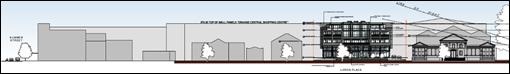
The
proposed building is taller than the court house and commensurate with the
parapet height of the Royal Hotel building. In the context of the Lords Place
streetscape and the heritage significance of the courthouse, the Heritage
Impact Statement that accompanies the DA is supportive as follows:
The proposed new building has
been setback from the northern side boundary adjoining the Orange Court House,
preventing interruption of view to and from the Court House. The Court House is
prominent in the streetscape and occupies a corner site, enhancing its exposure
(Page 29, Heritage Impact Statement – 245 Lords Place, Orange by Urbis, 9
May 2016).
The building is also setback
from the boundary on the southern side boundary, adjoining the two storey late
Victorian building.
The proposed new building will
block views from Lords Place to the Coles Supermarket and Kmart buildings which
are located at the rear of the subject site. The proposed new building will be
an infill construction reflecting the setback alignment of buildings fronting
Lords Place. The proposed new building will complete the streetscape and
provide a more cohesive urban environment.
The proposal provides for the
construction of a contemporary hotel building to replace a modern style, 1950s
motel building. Having regard to the array of architectural styles and building
ages in the existing streetscape, we do not consider that the construction of a
contemporary building will have a detrimental impact on the adjoining heritage
item. (Page 28, Heritage Impact Statement – 245 Lords Place, Orange
by Urbis, 9 May 2016).
Further,
in response to scale, the massing of the proposed hotel is
articulated via modulated façades; steelwork; glazing; and a mix of
materials in order to break down its overall bulk. The top floor has been
recessed to reduce bulk and scale and generous glazing assists to lighten this
element. Stainless steel balustrading is proposed for the balconies on Levels 1
and 2. However, glass balustrading is proposed on the Level 3 balconies
essentially to maintain a glazed, lightweight appearance for the top level.
 · The Height of Buildings Map is gazetted and is an
established instrument in regard to development control. The delineation of the
various building height zones would be based on background information
assembled by Council in its preparation of the LEP. However, it is interesting
to note the pattern of building height zones in the precinct surrounding
Robertson Park (see LEP extract below).
· The Height of Buildings Map is gazetted and is an
established instrument in regard to development control. The delineation of the
various building height zones would be based on background information
assembled by Council in its preparation of the LEP. However, it is interesting
to note the pattern of building height zones in the precinct surrounding
Robertson Park (see LEP extract below).

The
properties opposite Robertson Park to the north, east (except the Parkview
Hotel) and south are all permitted a maximum building height of 16 metres. The
properties opposite Robertson Park to the west (including the subject land) are
permitted a maximum building height of 12 metres.
The
subject land is within a tract of land that is at a similar contour to the land
that lies to the north, east and south of Robertson Park. The slope begins to
rise as one moves west of the subject land.
Given
that the subject land is on a similar contour to the other land around
Robertson Park, a case could be made that the properties on the western side of
Lords Place could also accommodate the 16 metre height control. The Royal Hotel
Building (approximately 15.8 metres) and the Court House (approximately
14.5 metres) already exceed the 12 metre height control. This precinct
represents one of the lower tracts within the CBD. The slope begins to rise
towards the west. A row of taller buildings along the western side of Lords
Place would fit this topography and tie in reasonably with the height of
existing and potential development to the west.
· It is acknowledged that building height as defined in the
LEP Dictionary includes plant and lift/stair overruns. Despite the numeric
reference to their height; the impact of these elements in terms of bulk, scale
and streetscape are considered minor for this particular development. The stair
overrun is located at the rear of the building and would be difficult to detect
in streetscape views at pedestrian and traffic level.
· The proposal has a FSR of 1.16:1 which is well below the
maximum allowed FSR of 2:1 pursuant to Clause 4.4 of the LEP. In consideration
of this particular aspect, it cannot be argued that the increased height is due
to excessive floor space demands or overdevelopment of a site.
· The development is generally compliant with the controls,
or the intent of the controls contained in Orange Development Control Plan
2004.
In response to subclause (4)(i), Council staff are satisfied
that the applicant has adequately addressed the matters required to be
demonstrated by subclause (3).
In response to subclause (4)(ii), the public interest test
of the applicant’s request to vary the development standard is undertaken
below with regard to the application’s level of consistency with the
objectives of the applicable standard and the zone objectives.
The objectives of the height of buildings control are as
follows:
(a) to
provide for taller buildings in the City centre and to enable a transition in building
height in response to varying urban character and function,
The applicant submits the
following in relation to the above objective:
…..
despite being taller, the building as proposed would achieve a
transition in building height because it sits reasonably well in relation to
its streetscape neighbours (a point reflected throughout the Heritage Impact
Statement by Urbis).
The proposed building
transitions reasonably in relation to the shopping centre building at the rear
of the site and will improve urban character. It is sufficiently high enough to
hide the uninspiring backdrop caused by the shopping centre (again a point
reflected throughout the Heritage Impact Statement by Urbis). A building that
complies with the 12 metre standard would be unlikely to achieve the same level
of screening.
The proposed taller building
facilitates the ability to bring service vehicles onto the site rather than
have them operate from the public street. In this sense, the building
contributes to sensible urban function.
Council staff accept the above comments which align with
Council’s Heritage Advisor’s assessment that; the retail
buildings in the vicinity detract from the Conservation Area and screening
these sites will benefit the town centre and heritage significance of the
Conservation Area and moreover, Council’s Heritage Advisor
states; The Court House will continue to visually dominate the setting and
Byng Street corner.
(b) to
protect the amenity of neighbouring properties and public places, with
particular regard to visual bulk, scale, overshadowing, privacy and views.
The applicant submits the
following in relation to the above objective; despite being taller,
the building as proposed does not unreasonably affect the amenity of
neighbouring properties and public places. In this regard:
· A taller building (that must achieve the amount of floor
space as proposed) is able to be setback from the side boundaries, thus
providing reasonable separation in relation to neighbouring properties. If the
12 metre standard was strictly observed, it is likely that the building would
need to spread closer to the side boundaries, thus reducing the separation
between properties. Whilst the building is taller, it is submitted that the
generous side boundary setbacks as proposed would assist to reduce the impacts
of bulk and scale in relation to neighbouring properties, particularly in
comparison to a height compliant building that is sited much closer to a side
boundary.
· The potential impacts pertaining to overshadowing, privacy
and views have been addressed in the Statement of Environmental Effects. In
effect, a building that complies with the 12 metre standard would not
necessarily reduce potential impacts in this regard.
Council staff accept the above comments submitted by the
applicant.
The objectives of the B3
Commercial Core are as follows:
· To provide a wide
range of retail, business, office, entertainment, community and other suitable
land uses that serve the needs of the local and wider community.
The development is consistent with the above objective. The
development will provide for a continuation of the longstanding commercial use
of the land and will provide additional entertainment (restaurant and bar) and
business (function space) to the local community, and tourism accommodation for
the wider community.
· To encourage
appropriate employment opportunities in accessible locations.
The development is located in a CBD location and will
provide additional employment opportunities in a location that is well
connected to public transport.
· To maximise public
transport patronage and encourage walking and cycling.
The development is located in a CBD location and as such is
well serviced by public transport opportunities in the way of a bus service,
and is well positioned to encourage walking and cycling.
· To promote
development that contributes to the role of the Orange CBD as the primary
retail and business centre in the City and region.
The development will not compete with the role of the CBD,
but rather the new motel and the supporting facilities such as the restaurant,
bar and function space will make a positive contribution to the role of the CBD
and further reinforce the City’s role as a major regional centre.
Council, in assuming the concurrence of the Secretary, must
have regard to the matters contained within clause 4.6(5), which requires the
Secretary (or Council in this case) to consider:
· whether the development,
with respect to the variation sought; would raise any matters of significance
for State or regional environmental planning,
· the public benefit of
maintaining the development standard and,
· any other matters required to be taken into consideration by
the Secretary before granting concurrence.
In relation to the above, given
the development’s localised context, Council can be satisfied that the
issuing of (assumed) concurrence will not affect state or regional
environmental planning matters. The variation to the development standard would
have a neutral public benefit, given the justification submitted by the
applicant in support of the exceedance as well as the developments demonstrated
compliance with the objects of both the relevant clause and the applicable
zoning. Finally, Council staff are not aware of any other matter that the
Secretary (and therefore Council in assuming the role) ought to consider before
granting concurrence.
In summary, the variation to the
development standard is considered acceptable. The applicant has made a written
request in which justification is presented as to the reasons why it is
unreasonable or unnecessary to insist upon compliance with the development standard.
Consideration of the variation against the objects of the applicable standard
and the relevant zone indicates that the development is not manifestly
inconsistent with either set of objectives; and consideration of the
concurrence requirements also suggests that the variation is acceptable.
Part 5 - Miscellaneous Provisions
5.10 - Heritage Conservation
Clause 5.10 of the LEP lists the provisions that need to be
considered where an application relates to a heritage setting. The subject land
is not a heritage item under Schedule 5 of the LEP but is located
within the Central Heritage Conservation Area; and the land also immediately
adjoins the Orange Court House, which is a significant heritage item. The land
is also opposite Robertson Park which is also a heritage item. The Royal Hotel
(also a heritage item) bookends the southern end of the City block in which the
subject land is located.
The Heritage Inventory Sheets for the subject land, the
Orange Court House, the Central Heritage Conservation Area and the Royal Hotel
list the respective statements of heritage significance as follows:
Mid-City Motor Lodge
An
historically significant hotel in the City's history, with the Canobolas Hotel
and the Commonwealth Bank, the building forms a key corner grouping complements
the streetscape and contributes to the Conservation Area as a heritage item
Orange Court House
The 1882
Orange Court House is a substantial work by James Barnett, Government Architect
in the Victorian - Civic Classical style on a prominent corner site including
appropriate and sympathetic alterations and additions, complementing the
streetscape and contributing to the Orange Conservation area as an item of
State heritage significance.
Central Heritage Conservation
Area
Consisting
of a range of buildings dating from the latter part of the nineteenth century
and the early part of the twentieth, the conservation area has historical
importance for reflecting the development and prosperity of Orange during this
period.
The
conservation area exhibits several fine examples of different architectural
styles. The building materials used, the mature street trees and the fine
parklands all help to bring the area together as an aesthetically pleasing
whole and as a townscape of importance.
Representing
much of the core of the city, the conservation area has an appreciable level of
social significance for the Orange community.
Royal Hotel
An
historically significant hotel in the City's history, with the Canobolas Hotel
and the Commonwealth Bank, the building forms a key corner grouping complements
the streetscape and contributes to the Conservation Area as a heritage item
(1) Objectives
The
objectives of this clause are as follows:
(a) to
conserve the environmental heritage of Orange,
(b) to
conserve the heritage significance of heritage items and heritage conservation
areas, including associated fabric, settings and views,
(c) to
conserve archaeological sites,
(d) to
conserve Aboriginal objects and Aboriginal places of heritage significance.
The development
is not inconsistent with the objects of the clause.
(2) Requirement
for Consent
Development
consent is required for any of the following:
(a) demolishing
or moving any of the following or altering the exterior of any of the following
(including, in the case of a building, making changes to its detail, fabric,
finish or appearance):
(iii) a
building, work, relic or tree within a heritage conservation area,
(c) disturbing
or excavating an archaeological site while knowing, or having reasonable cause to
suspect, that the disturbance or excavation will or is likely to result in a
relic being discovered, exposed, moved, damaged or destroyed,
(e) erecting
a building on land:
(i) on
which a heritage item is located or that is within a heritage conservation
area, or
The development comprises demolition of a building in
conservation area, as well as the erection of a building in a heritage
conservation area. Additionally, given the land’s long history of
development and its proximity to the Court House, there is the possibility that
relics will be uncovered during the demolition and excavation phase of the
development. Accordingly, Council’s standard condition relating to the
uncovering of a relic or Aboriginal object is attached.
(4) Effect
of Proposed Development on Heritage Significance
The
consent authority must, before granting consent under this clause in respect of
a heritage item or heritage conservation area, consider the effect of the
proposed development on the heritage significance of the item or area
concerned. This subclause applies regardless of whether a heritage management
document is prepared under subclause (5) or a heritage conservation management
plan is submitted under subclause (6).
The nature of the development generates the need to assess
the impact of heritage significance on two fronts: firstly the impacts
associated with demolition of the existing building, and then secondly the
effect of the new building within the heritage setting.
Demolition
of Existing Motel
A heritage impact statement (HIS) has been submitted in
support of the demolition of the existing motel. The HIS describes the
motel’s heritage significance as follows:
The subject
1957 motel at Lords place is an altered example of the post second world war
motel style, with central car parking and manoeuvring court with accommodation
rooms situated along the perimeter of the site.
The motel
does not meet the threshold for listing on any criteria as, although it
represents the time of the expansion of the use of the automobile, it is not
distinguished in any manner and is not of social or associative value to the
community.
Although
not mentioned within the HIS, sources such as a CWD article suggest that the
former Belair Motel (now known as the Mid-City Motor Lodge) was not only the
first motel in Orange, but the first motel in Australia.
The
HIS provides the following conclusions and recommendations:
The subject
1957 motel at Lords place is an altered example of the post second world war
motel style, with central car parking and manoeuvring court with accommodation
rooms situated along the perimeter of the site. The motel does not meet the
threshold for listing on any criteria as, although it represents the time of
the expansion of the use of the automobile, it is not distinguished in any
manner and is not of social or associative value to the community.
Despite
the omission of the possible historical significance of the motel, Council
staff accept the recommendation that an archival recording of the buildings be
undertaken prior to works commencing. Additionally, given the status of the
motel as the first within Orange and arguably the first within Australia, a
detailed heritage interpretation plan is required to be undertaken and
implemented as part of the new motel complex.
Relevant
conditions are attached in relation to the requirement for an archival record
and interpretation plan.
Construction
of New Motel
Council’s Heritage Advisor has undertaken a detailed
assessment of the proposed development and determined that the development will
have acceptable impacts upon the heritage setting, subject to certain
conditions which have been attached.
A detailed assessment of the development against Council
infill guidelines is undertaken below which addresses all relevant issues.
The development is considered acceptable in terms of
heritage impacts.
(5) Heritage
assessment
The
consent authority may, before granting consent to any development:
(a) on
land on which a heritage item is located, or
(b) on
land that is within a heritage conservation area, or
(c) on
land that is within the vicinity of land referred to in paragraph (a) or (b),
require
a heritage management document to be prepared that assesses the extent to which
the carrying out of the proposed development would affect the heritage
significance of the heritage item or heritage conservation area concerned.
A heritage impact statement accompanied the initial
application which was prepared by URBIS and addresses mostly the
demolition, but also addressed the initial design. An architectural design
statement by Architecture Raw was also submitted and detailed the design intent
and the proposed building’s relationship with the Court House.
The subsequent design changes have been accompanied by a
heritage impact statement prepared by the planning consultant, Peter Basha
Planning and Development.
(6) Heritage
Conservation Management Plans
The
consent authority may require, after considering the heritage significance of a
heritage item and the extent of change proposed to it, the submission of a
heritage conservation management plan before granting consent under this
clause.
Given that the buildings on the
land are proposed to be demolished and replaced with a new development, a CMP
is not required for the development.
(7) Archaeological
Sites
The
consent authority must, before granting consent under this clause to the
carrying out of development on an archaeological site (other than land listed
on the State Heritage Register or to which an interim heritage order under the Heritage Act 1977 applies):
(a) notify
the Heritage Council of its intention to grant consent, and
(b) take
into consideration any response received from the Heritage Council within 28
days after the notice is sent.
The site is not a known archaeological site.
(8) Aboriginal
Places of Heritage Significance
The
consent authority must, before granting consent under this clause to the
carrying out of development in an Aboriginal place of heritage significance:
(a) consider
the effect of the proposed development on the heritage significance of the
place and any Aboriginal object known or reasonably likely to be located at the
place by means of an adequate investigation and assessment (which may involve
consideration of a heritage impact statement), and
(b) notify
the local Aboriginal communities, in writing or in such other manner as may be
appropriate, about the application and take into consideration any response
received within 28 days after the notice is sent.
The
site is not a known Aboriginal Place of Heritage Significance. This has been
confirmed by an AHIMS Search.
Part 6 - Urban Release Area
Not relevant to the application. The subject site is not
located in an Urban Release Area.
Part 7 - Additional Local Provisions
7.1
- Earthworks
This
clause establishes a range of matters that must be considered prior to granting
development consent for any application involving earthworks, such as:
(a) the likely disruption of, or any
detrimental effect on, existing drainage patterns and soil stability in the
locality of the development
(b) the effect of the development on the
likely future use or redevelopment of the land
(c) the quality of the fill or the soil to be
excavated, or both
(d) the effect of the development on the
existing and likely amenity of adjoining properties
(e) the source of any fill material and the
destination of any excavated material
(f) the likelihood of disturbing relics
(g) the proximity to and potential for adverse
impacts on any waterway, drinking water catchment or environmentally sensitive
area
(h) any measures proposed to minimise or
mitigate the impacts referred to in paragraph (g).
The earthworks proposed in the
application are limited to the extent of cutting and filling required to
achieve the desired floor levels on the ground floor, as well as achieve the
necessary stormwater drainage to the front of the site. It is noted that the
site has already experienced a considerable amount of excavation as a process
of constructing the existing motel of the land. The excavation required to
achieve the proposed development under this application will only be marginally
greater than the existing level of excavation that has occurred within the
site.
The extent of disruption to the
drainage of the site is considered to be minor and will not detrimentally
affect adjoining properties or receiving waterways.
The extent of the earthworks
will not materially affect the potential future use or redevelopment of the
site that may occur at the end of the proposed development's lifespan.
The site is not known to be
contaminated; however, as mentioned below also, Council’s standard
precautionary condition relating to unexpected finds of contamination is
attached to the consent.
The earthworks will be
appropriately supported onsite, as shown on the long section of the northern
boundary showing the contiguous concrete pile wall which manages the change in
ground level between the adjoining land and the development site. The change in
ground level has the effect of lowering the building in comparison to the
adjoining land, and thereby reducing the impacts upon the amenity of the
adjoining properties.
The site is not known to contain
any Aboriginal, European or archaeological relics. Previous known uses of the
site do not suggest that any relics are likely to be uncovered (notwithstanding
the comments above). However, conditions are imposed to ensure that should site
works uncover a potential relic or artefact, works will be halted to enable
proper investigation by relevant authorities and the proponent required to seek
relevant permits to either destroy or relocate the findings.
The site is not in proximity to
any waterway, drinking water catchment or sensitive area. Notwithstanding this,
conditions are imposed to require a sediment control plan, including silt traps
and other protective measures, to ensure that loose dirt and sediment does not
escape the site boundaries.
7.2 - Flood Planning
This
clause applies to land identified on the Flood Planning Map as a Flood Planning
Area and requires that, before any consent is issued, Council must be satisfied
that the proposal:
(a) is compatible with the flood hazard of the
land, and
(b) is not likely to significantly adversely
affect flood behaviour resulting in detrimental increases in the potential
flood affectation of other development or properties, and
(c) incorporates appropriate measures to
manage risk to life from flood, and
(d) is not likely to significantly adversely
affect the environment or cause avoidable erosion, siltation, destruction of
riparian vegetation or a reduction in the stability of river banks or
watercourses, and
(e) is not likely to result in unsustainable
social and economic costs to the community as a consequence of flooding.
The
property is located within the low flood risk precinct and immediately adjoins
the high-risk flood precinct (Lords Place roadway).
Council’s
Technical Service Division has indicated that:
the building has a proposed ground floor level of 860.79.
The 1% AEP level in Lords Place in front of the property is approximately
860.29m AHD. The ground floor foyer area is a minimum of 500mm above the 1% AEP
level and therefore complies with Councils Blackmans Swamp Creek Floodplain
Risk Management Plan. Car parking areas are all above the 1% AEP level.
The
development is thus considered acceptable in relation to flooding.
7.3 - Stormwater Management
This clause applies to all
industrial, commercial and residential zones and requires that Council be
satisfied that the proposal:
(a) is designed to maximise the use of water permeable
surfaces on the land having regard to the soil characteristics affecting onsite
infiltration of water
(b) includes, where practical, onsite
stormwater retention for use as an alternative supply to mains water,
groundwater or river water; and
(c) avoids any significant impacts of
stormwater runoff on adjoining downstream properties, native bushland and
receiving waters, or if that impact cannot be reasonably avoided, minimises and
mitigates the impact.
Council’s Technical Services
Division has provided the following advice in relation to stormwater:
The applicant will be required to provide on-site
detention to limit post development peak flows to that of pre-development peak
flows. In addition, the development will require the extension of stormwater
drainage to serve the development.
Stormwater detention can be provided in the front setback
area or rear car park area.
Subject
to relevant conditions which are attached, the development is considered
acceptable in relation to stormwater.
7.6 - Groundwater Vulnerability
This
clause seeks to protect hydrological functions of groundwater systems and
protect resources from both depletion and contamination. Orange has a high
water table and large areas of the LGA, including the subject site, are identified
with “Groundwater Vulnerability” on the Groundwater Vulnerability
Map. This requires that Council consider:
(a) whether or not the development (including
any onsite storage or disposal of solid or liquid waste and chemicals) is
likely to cause any groundwater contamination or have any adverse effect on
groundwater dependent ecosystems, and
(b) the cumulative impact (including the
impact on nearby groundwater extraction for potable water supply or stock water
supply) of the development and any other existing development on groundwater.
Furthermore consent may not be granted unless Council is satisfied that:
(a) the development is designed, sited and
will be managed to avoid any significant adverse environmental impact, or
(b) if that impact cannot be reasonably
avoided - the development is designed, sited and will be managed to minimise
that impact,
(c) if that impact cannot be minimised - the
development will be managed to mitigate that impact.
The proposal is not anticipated
to involve the discharge of toxic or noxious substances and is therefore
unlikely to contaminate the groundwater or related ecosystems. The proposal
does not involve extraction of groundwater and will therefore not contribute to
groundwater depletion. The design and siting of the proposal avoids impacts on
groundwater and is therefore considered acceptable.
Clause 7.11 - Essential
Services
Clause 7.11 acts to ensure that all necessary services
either are available or at least will be made available to the subject land at
an appropriate time. The subject land is located within the Central Business
District, and as such all necessary services are available to the land.
STATE ENVIRONMENTAL PLANNING
POLICIES
State Environmental Planning Policy 55 - Remediation of
Land
State Environmental Planning Policy 55 - Remediation of Land
(SEPP 55) requires that a consent authority must not consent to the carrying
out of development of land unless it has considered whether the land is
contaminated, is satisfied that the land is suitable in its contaminated state
for the development that is proposed, and if the land requires remediation to
be made suitable for the proposed development it is satisfied that the land
will be remediated before the land is used for that purpose.
Furthermore, SEPP 55 requires that before determining an
application for consent to carry out development that would involve a change of
use on any of the land specified in subclause (4), the consent authority
must consider a report specifying findings of a preliminary investigation of
the land concerned. It is noted the development does not involve a change of
use.
The land has a long history of being used for commercial
purposes. The land has been used for the purposes of a motel since 1957, and
prior to that date the land was occupied by McLachlan and Campbell as Eldon
Chambers. Accordingly, the past uses of the site are not of a type to indicate
that contamination may be present, and as such a detailed contamination study
is not required. Notwithstanding this, as is standard practice, a precautionary
condition is attached to the consent which stipulates the protocols which need
to be followed in the event contamination is encountered during construction.
State Environmental Planning
Policy (Infrastructure)
State Environmental Planning Policy (Infrastructure) applies
to the subject land, specifically clause 45 which states:
45 Determination
of development applications — other development
(1) This
clause applies to a development application (or an application for modification
of a consent) for development comprising or involving any of the following:
(a) the
penetration of ground within 2m of an underground electricity power line or an
electricity distribution pole or within 10m of any part of an electricity
tower,
(b) development
carried out:
(i) within
or immediately adjacent to an easement for electricity purposes (whether or not
the electricity infrastructure exists), or
An underground power line exists at the rear of the site,
and a separate power line enters the site midway along the southern boundary
and then changes direction at the centre of the site and runs to the front of
the site.
It is understood that the underground power line located in
the front half of the site is redundant and can be removed. The existing power
line at the rear occurs outside of the easement.
The application was referred to Essential Energy for
comment. Essential Energy raised no objections to the development subject to a
condition being imposed that requires the power line at the rear of the site to
be within an easement. A condition is attached requiring this to occur prior to
the issue of an Occupation Certificate. A further condition is attached that
requires all redundant power lines within the site to be appropriately
decommissioned at the source without impacting the supply of nearby properties.
Furthermore, the standard requirements of Essential Energy have been
incorporated into the Notice of Approval.
It is also noted that two existing street lights within the
front of the site would have to be relocated to allow for the proposed vehicle
access and exit point within the street. Relevant conditions are attached in
this regard.
State Environmental Planning
Policy 64 - Advertising and Signage
In terms of proposed signage, the applicant submits that the
signage at the top of the building displaying the name ‘Lords Place
Motel’ is indicative and shown for illustrative purposes only. As such,
it does not form part of this approval, and a separate application for signage
will be required. A condition of consent is recommended to inforce this
requirement.
PROVISIONS OF ANY DRAFT
ENVIRONMENTAL PLANNING INSTRUMENT THAT HAS BEEN PLACED ON EXHIBITION
4.15(1)(a)(ii)
There are no draft environmental planning instruments that
apply to the subject land or proposed development.
DESIGNATED DEVELOPMENT
The proposed development is not designated development.
PROVISIONS OF ANY DEVELOPMENT
CONTROL PLAN s4.15(1)(a)(iii)
Development Control Plan 2004
Development Control Plan 2004 (“the DCP”)
applies to the subject land. Chapters of the DCP relevant to the proposed
use and development include:
· Chapter
0 - Transitional Provisions;
· Chapter
2 - Natural Resource Management;
· Chapter
3 - General Considerations;
· Chapter
4 - Special Environmental Considerations;
· Chapter 5 - General Considerations for Zones and
Development;
· Chapter
8 - Development in Business Zones;
· Chapter
13 - Heritage; and
· Chapter
15 - Car Parking.
CHAPTER 0 - TRANSITIONAL
PROVISIONS
Section 0.2 - General Translation of Zones
Section 0.2 - General Translation of Zones provides that any
reference to a zone under Orange Local Environmental Plan 2000 is to be a
reference to the corresponding zones in the zone conversion table.
The table identifies that the B3 Commercial Core zone corresponds
with the 3a Regional Centre zone for the purposes of the DCP.
Chapter 2 - Natural Resource
Management
Section 2.1 - Water Quality
Section 2.1 - Water Quality identifies that development that
concentrates, redirects flows, increases flow rates or disturbs land in close
proximity to creeks has the potential to affect waterways with associated
erosion, sedimentation and release of nutrients, which combine to affect
downstream water quality. Section 2.1 also identifies that development
involving groundwater extraction and/or onsite wastewater disposal is deemed to
affect groundwater resources.
The relevant matters have previously been addressed in
detail under the headings “7.3 ‑ Stormwater” and
“7.6 - Groundwater Vulnerability”.
It is considered that the requirements of the DCP have been
adequately addressed.
Section 2.2 - Soil Resources
Section 2.2 - Soil Resources identifies that soil
characteristics influence land use and development capability, including the
suitability for building footings, onsite waste disposal, road engineering and
drainage.
Council’s Technical Services Division has recommended
a condition of consent requiring that the development is to be constructed in
accordance with Council’s Development and Subdivision Code.
It is considered that the requirements of the DCP have been
adequately addressed.
CHAPTER 3 - GENERAL
CONSIDERATIONS
Section 3.1 - Cumulative Impacts
Section 3.1 - Cumulative Impacts identifies that Council
will consider not only the direct impacts of a particular development, but also
whether the development, when carried out in conjunction with other development
in the locality, has a more significant environmental impact.
Cumulative impacts of the proposed development are addressed
under the heading “Likely Impacts of the Development”.
Section 3.2 - Scenic, Landscape
and Urban Areas
Section 3.2 -Scenic, Landscape and Urban Areas identifies
that in urban areas consideration should be given to the character of the
locality, whether that locality is recognised as having heritage character with
formal plantings of exotic trees, or whether the locality comprises areas
developed as suburban release areas where informal native planting is common.
The application involves perimeter landscaping on the
western and southern boundaries. Council’s Heritage Advisor has
recommended landscaping at the boundary along both the northern and southern
boundaries with plantings that achieve a mature height of at least 6‑8m.
A detailed landscape plan is required showing this detail as a condition of
consent. The condition also requires the plan to be prepared by a qualified
landscape architect.
Council’s Heritage Advisor has indicated that the
proposed development will complement the heritage significance of the heritage
setting and the streetscape subject to the above required condition.
Section 3.4 - Waste Generation
Section 3.4 - Waste Generation requires that applications
involving demolition indicate measures that will be implemented for reuse and
recycling of waste, and that development involving demolition is carried out in
a manner that optimises reuse and recycling of waste materials consistent with
waste-minimisation principles.
A waste management plan has not been submitted with the
application for the demolition phase of the development; however, this is
addressed via a condition of consent which requires a waste management plan to
be prepared and submitted to Council prior to works commencing onsite.
The management of waste generated by the completed
development on an ongoing basis is addressed below under the heading
“Likely Impacts”.
The development is considered satisfactory with regards to
waste generation.
CHAPTER 4 - SPECIAL
ENVIRONMENTAL CONSIDERATIONS
Section 4.1 - Sewage Disposal
Section 4.1 - Sewage Disposal
identifies that urban development must be connected to a sewerage system
approved by Council prior to occupation. For the purposes of this clause, urban
development includes all development within residential, business and
industrial zones (and associated open space and special use zones).
Council’s Technical Services
Division has advised that:
…..
the development will be
required to connect to Council’s existing sewerage system crossing the
site. The existing east / west sewer serving Kmart will need to be
reconstructed at a lower level. The existing sewer running north / south will
need to be relined from boundary to boundary.
Relevant
conditions are attached in relation sewer.
Section 4.3 - Land Shaping
Section 4.3 - Land Shaping
identifies that substantial land shaping, including filling or excavating land,
has the potential to generate significant environmental impacts; and that land
shaping should not adversely affect land in the vicinity as a result of
drainage, erosion or sedimentation, or as a result of leachate entering surface
or groundwater.
The relevant matters have previously been addressed under
the heading “7.1 ‑ Earthworks”. It is considered
that the requirements of the DCP have been adequately addressed.
Section 4.4 - Contaminated Land
Section 4.4 - Contaminated Land identifies that contaminated
land can pose a risk to human health and the environment. Contaminants can be
released into waterways and humans exposed when contaminated land is disturbed
as a consequence of development.
The relevant matters have previously been addressed under
the heading “State Environmental Planning Policy 55 - Remediation of
Land”.
It is considered that the requirements of the DCP have been
adequately addressed.
CHAPTER 5 - GENERAL
CONSIDERATION FOR ZONES AND DEVELOPMENT
Section 5.3 - Advertised Development
Section 5.3 - Advertised Development identifies that Council
will give written and published notice of applications for advertised
development as required by the Environmental Planning and Assessment
Regulations.
The development is categorised as advertised development
given the demolition of the existing motel in a heritage conservation area.
Accordingly, the development application was advertised on
Thursday, 21 December 2017 and exhibited between Friday, 22 December 2018
and Monday, 15 January 2018. The normal 14 day exhibition period was extended
due to the Christmas holiday period.
At the end of that period two written submissions were
received. A detailed assessment of the issues raised
by the submitters is provided under the heading “Any Submissions Made in
Accordance with the Act”. In addition to the two submissions received
during the exhibition period two subsequent submissions were received after the
exhibition period; one from NSW Police and one from the owner of 237 Lords
Place. A further submission was received prior to the exhibition period and
also prior to the final design being submitted from Source Architects. Thus a
total of five submissions received, all of which are addressed below.
CHAPTER 8 - DEVELOPMENT IN
BUSINESS ZONES
Section 8.1 - Orange CBD
Section 8.1 - Orange CBD outlines planning outcomes for the
Orange Central Business District, with an emphasis on design, character,
parking and loading. The relevant planning outcomes are addressed below.
· Buildings
have a high level of urban design to contribute to the regional status of the
City’s Central Business District with attention given to façade
features, external materials, colour and advertising.
Given the scale of the proposed development, the prominent
location of the subject property within the Orange CBD and the relationship to
nearby heritage items and heritage conservation area, Council staff considered
it appropriate to refer the development application to Councils Heritage for
his assessment and recommendations.
Council’s appointed Heritage Advisor has assessed the
proposed development against Council’s adopted Orange Development
Control Plan 2004 Infill Guidelines. In summary, the Heritage Advisor
considers that the proposed development has provided a suitable response to
each of the applicable design criteria, including character, scale and form,
siting, materials and colours, and detailing.
Based on the advice and recommendations provided by
Council’s Heritage Advisor, it is considered that the proposed
development has been appropriately designed with regard to the site’s
context within the Orange CBD, particularly the development’s
relationship with Orange Court House, subject to meeting the recommended conditions
of consent.
· Urban
design demonstrates a clear reference to the CBD Strategic Action Plan.
The Orange Central Business District Strategic Action
Plan 2003 (the ‘Strategic Action Plan’) seeks to provide
a long-term strategy to address a broad range of issues affecting the CBD.
In general, the Strategic Action
Plan identifies the subject property as forming a secondary street retail area
adjacent to the CBD core (Figure 8). Key themes of the Strategic Action Plan
relevant to the subject property include access and movement, built form and
heritage, and landscape and public domain. The Action Plan also identifies the
subject land as a Key Site within the CBD, stating that the site has the
potential to enhance tourism, employment, and retail opportunities and their
support services to strengthen Orange’s role as a regional commercial and
retail centre.
Figure 8: Orange Central Business District Strategic
Action Plan - Structure Plan (Land Use)
Access and Movement
In terms of access and movement, the proposed development is
considered to be consistent with the Strategic Action Plan. The development
incorporates a circular entry which can accommodate new arrivals as well as
coaches off the street. The development provides 112 parking spaces (in a tandem/valet
arrangement) in an accessible and connected location at the rear of the site.
Traffic throughout the site is managed in a one‑way circulation around
the building, with entry to the north of the building and egress to the south.
The development is located in close proximity to public transport as well as a
major taxi stand opposite the site. The central location allows suitable
pedestrian connectivity to nearby hospitality and retail attractions.
The development is considered acceptable in terms of access
and movement.
Built Form and Heritage
With regard to built form, the proposed development is
considered to be consistent with the Strategic Action Plan insofar as the
ground level will provide an active frontage to Lords Place, with the
combination of materials and architectural features achieving a suitably
articulated façade.
Landscape and Public Domain
The proposed development is consistent with the landscape
and public domain objectives of the Strategic Action Plan. As mentioned above,
a condition requiring a detailed landscape plan providing suitable tree
planting at the site boundary is attached.
· Provision
of adequate fire-safety measures and facilities for disabled persons (according
to the BCA) are addressed at the application stage (relevant for all
development but particularly important where converting residential buildings
for business use).
Council’s Building Surveyor has commented that further
detail would be required at the Construction Certificate stage to determine
compliance with the BCA.
· Land
use complements the role of the CBD as a regional centre for commerce and
services.
The proposed development is considered to be complementary
to the role of the CBD as a regional centre is it will make a substantial
contribution to the existing supply of tourist and visitor accommodation within
Orange.
· The
reinstatement of verandahs on posts over footpaths is encouraged.
Given that the proposal involves the construction of a new
building, the foregoing outcome is not considered applicable.
· Car
parking is provided to meet demand either as onsite parking areas or through
contributions towards public parking in and adjacent to the CBD.
Section 15.4 - Parking Requirements sets out the minimum
parking requirements for specific land uses. A detailed assessment against the
requirements of Section 15.4 is undertaken below.
· Advertising
comprises business identification signs in accordance with SEPP 64.
No advertising signs have been
proposed. The signage shown on the plans at the top of the building is for
illustrative purposes only. It is anticipated that a separate application for
advertising will be lodged once the applicant has entered into an agreement
with a primary tenant for the hotel.
· Loading
areas are provided for developments requiring access by large trucks in a
manner that doesn’t reduce active frontages for important pedestrian
pathways.
The applicant has proposed an
internal loading/service area including waste collection at the rear of the
front portion of the building on the southern side. The application is
accompanied by a plan showing the swept paths of the likely servicing vehicles,
including the typical garbage collection vehicle. Council’s Development
Engineer has indicated that this is an acceptable.
· Where
possible, new buildings or external alterations in the CBD include an element
of landscaping.
Landscaping associated with the proposed development is
limited to the area within the front setback of the building and along the side
boundaries. A condition is attached that requires landscaping to be installed
adjacent to both the northern and southern boundaries in the form of 6-8m
mature height trees. A condition is attached requiring a landscape plan
prepared by a landscape architect showing the required landscaping.
CHAPTER 13 - HERITAGE
Sections 13.1-13.06 of Chapter 13 - Heritage of the DCP
address heritage matters in detail, including heritage objectives, heritage
items and heritage conservation areas, heritage consideration for development,
development in the vicinity of heritage items, heritage proposals as advertised
development, and incentives for heritage conservation.
These matters have previously been addressed in detail under
the heading “Clause 5.10 - Heritage Conservation” or
alternatively below under the consideration of the Infill Guidelines.
It is considered that the requirements of the DCP have been
adequately addressed.
CHAPTER 15 - CAR PARKING
Section 15.1 - Background,
Section 15.2 - Objectives and
Section 15.3 - Relationship Between On-Street and
Off-Street Car Parking
Sections 15.1-15.3 of Chapter 15 - Car Parking set out the
background, objectives and relationship between on-street and off-street car
parking in Orange. In particular, these sections highlight the importance of
making provision for car parking in order that the demand for parking in the
City is met, and ensuring that the design and layout of car parking facilitates
the safe and effective use of off-street parking.
The appropriate assessment of car parking requirements is
undertaken under the following sections.
Section 15.4 - Parking
Requirements
Section 15.4 - Parking Requirements sets out the minimum
parking requirements for specific land uses.
Background
The application when initially lodged with Council comprised
a motel with 103 rooms (later amended to 105), along with the other offerings
such as lobby lounge, bar/restaurant, function centre and gym area. 100
off-street parking spaces were proposed in an under-croft arrangement at the
rear of the site. It was identified that the development would result in a 56
space deficiency based on a strict application of the DCP requirements.
Shortly after the application
was lodged, a report summarising the application and subsequent shortfall in
parking was tabled for the City Of Orange Traffic Development Committee. The
committee at that time recommended the following:
That the City of Orange
Traffic Development Committee supports in principle development application DA
302/2016(1) – 245 Lords Place, Orange but, because of the car parking
spaces shortfall, does not support the proposal in its current form[2].
The provision of off-street car
parking spaces is a key issue for consideration in the assessment of this
application. Notably, during the assessment process the applicant has submitted
two separate car parking plans to address concerns raised by Council staff,
including an original plan for 100 off-street car parking spaces (since
reduced to 97 with the submission of revised layout) and a subsequent plan
showing 112 off-street car parking spaces. The additional 15 spaces are
achieved under a valet arrangement whereby one of the central aisles is
replaced by stacked parking. As shown below.
Figure 9: proposed tandem/valet car parking
arrangement
As can be observed in the above figure,
the tandem / valet arrangement works reasonably well and, at most, only one car
would have to be moved to access a car that is parked in by another car.
Notwithstanding the ease with which the valet arrangement could be managed,
even with the tandem valet arrangement applied, the development still results
in a 43 space shortfall under a strict application of the DCP as detailed
below.
The complex issue with this
arrangement is not how it would work, as it works quite well; but rather under
what circumstances or conditions would this arrangement be required. In other
words, what would be the trigger that enacts the tandem valet
arrangement: 80% occupancy rate, 50% occupancy and a concurrent function
of more than 100 attendees, 100% of the time?
This is an important question in
the consideration of whether or not this arrangement is considered
satisfactory.
While the applicant has been able to make amendments to the
proposed development to increase the number of off-street car parking spaces to
be provided, the current design relies on the use of ‘tandem’ and
‘valet’ style car parking spaces, which would effectively require
motel staff to undertake all parking operations once the hotel reaches a
certain occupancy. If the ‘tandem’ and ‘valet’ style
car parking spaces were to be removed from the current car parking plan, the
number of spaces provided would be reduced to 97.
It is recommended that a condition be attached that requires
the tandem valet arrangement procedure to be activated once the motel occupancy
reaches more than 75% of capacity. This would relate to only times of
above average occupancy rates whilst still allowing capacity for vehicles
associated with the other uses within the facility. A condition is attached in
this regard.
It is open to Council to determine whether or not
‘tandem’ and ‘valet’ style car parking spaces should be
supported with these considerations in mind.
Car Parking Demand
Section 15.4 - Parking Requirements sets out the minimum
parking requirements for hotel or motel accommodation, restaurants and shops
within the Orange Central Business District.
Council staff have calculated the likely demand for
off-street car parking based on the following:
· The proposed motel
comprises 105 one bedroom apartments. However, 12 of the rooms are
arranged whereby each group of two adjoining rooms can be let to a single
reservation as a two-bedroom apartment (six in total). Under this arrangement
the total number of rooms is reduced to 99.
· 44 seats within
the restaurant/bar area. The restaurant/bar area comprises a floor area of
179.69m2.
· 283.48m2 of
function room space.
· 10 staff members.
· 1 resident
manager.
Section 15.4 - Parking Requirements sets out the following
minimum car parking requirements:
Hotel or Motel Accommodation
· 1
space per unit/bedroom/tent or caravan site
· 1
space for every 3 beds (hostel accommodation)
· + 1
space for each resident manager
· + 1
space for every 2 employees
· + 1
space for every 3 seats in the restaurant
· + 1
space per 10m2 of entertainment or function room areas.
Restaurants in the CBD
· 1
space per 40m2 of GFA.
Alternate
rate for function centre
· 1
space per 25m2 of GFA.
Notably, the foregoing provisions
identify that there is a separate car parking requirement for a restaurant
associated with hotel or motel accommodation as opposed to a restaurant in the
CBD which is not associated with another use. Depending on the size of the
restaurant and the number of seats available, this may result in a
substantially different requirement for off-street car parking spaces.
Given that all other recently approved restaurants in the
Orange CBD have been subject to the requirement for 1 space per 40m2
of GFA, it seems logical that the same rate should be applied in this case as
there seems to be no obvious or logical reason to apply the requirement based
on seating numbers. This is the same approach taken under the recently approved
(and partly constructed) Quest development in Kite Street. The same rationale
can be applied to the function area based on the rate for hotels within the
CBD. Notwithstanding, the requirement for off-street car parking spaces
generated under both requirements is presented below:
Hotel or Motel Accommodation
· 105
units = 105 car parking spaces
· 1
resident manager = 1 car parking space
· 10
full time employees = 5 car parking spaces
· 44
restaurant seats = 14.7 (15) car parking spaces*
· 283.48m2
of function room = 28.3 (29)
Restaurants in the CBD – 1
space per 40m2 GFA
· 179.69m2
of GFA = 4.5 (5) car parking spaces*
Alternate
rate for a function centre (adopted from the requirements of a hotel in
the CBD) at 1 space per 25m2
· 283.48m2
of function room = 11.3 (12) car parking spaces*
Equating to a total demand of 155
spaces based on a strict application of the DCP
OR
128 spaces based on the above
alternate rates.
*Indicates
interchangeable car parking requirements
Based on the foregoing, it is
considered that the proposed development would generate a requirement for a
total of 155 off-street car parking spaces if calculating the car parking
requirement for the development based on seating numbers, or 145 off-street car
parking spaces if calculating the car parking requirement for the restaurant
based on GFA. A further 17 space reduction could be applied if relying on
the alternate rate for the function centre equating to a total demand of 128
spaces when applying the reduced rates.
As previously discussed, given that all other recently
approved restaurants in the Orange CBD have been subject to the
requirement for 1 space per 40m2 of GFA, it is recommended that
this rate be applied. It is also recommended that the same rationale be applied
to the alternate function centre rates based on the requirement for hotels in
the CBD. Accordingly it is recommended that the proposed development be
assessed as generating a requirement for 128 car parking spaces. Based on the
112 spaces available under the tandem / valet arrangement the proposed
development would therefore have a shortfall of 16 car parking spaces.
However, if Council were not of a view to support the
proposed ‘tandem’ and ‘valet’ style car parking
arrangement, the proposed development would have a shortfall in the order
of 31 car parking spaces (based on a standard car park of 97 spaces
available).
If Council is willing to support the proposed
‘tandem’ and ‘valet’ style car parking arrangement, it
is considered that the shortfall of 16 off-street car parking spaces could
adequately be addressed via conditions of consent requiring a contribution in
lieu of the physical provision of car parking spaces. In accordance with the Orange
Car Parking Development Contributions Plan 2015, a contribution of
$14,448.30 would be applied to account for each off-street car parking spaces
not provided onsite (ie a total of $231,172.80 to account for 16
car parking spaces).
However, if Council is not willing to accept the proposed
‘tandem’ and ‘valet’ style car parking arrangement, the
whole shortfall of 31 car parking spaces could not simply be rectified via a
condition of consent requiring a contribution in lieu of the physical provision
of car parking spaces. As detailed below, only 23 of the total 31 parking space
deficiency could be addressed by contributions.
It is noted that Orange Car Parking Development
Contributions Plan 2015 precludes car parking contributions being
offered by the developer or required by Council for car parking associated with
tourist or visitor accommodation because Council considers that it is
inappropriate that those using these types of developments should have to park
in public areas physically removed from the development.
As such, a condition of consent could not be applied
requiring that a contribution be required to account for each off-street car
parking space required for the accommodation aspect (being 105 spaces) of the
proposed motel which is not provided onsite. This would amount to a significant
departure from Orange DCP 2004 and likely result in an unacceptable
environmental impact.
As previously stated, it is open to Council to determine
whether or not ‘tandem’ and ‘valet’ style car parking
spaces should be supported in this instance.
Summary
Whilst there are a number of potential options available to
Council in determining the suitability of the parking arrangements; it is
recommended that Council accepts the tandem valet arrangement as it did for the
recent Quest Development in Kite Street. In addition to this, it is also
recommended that Council allow a degree of flexibility (as was the case for the
recent Quest Development in Kite Street) in the assessment of parking demands
and calculate the restaurant/bar and the function area using the more generous
calculations within the DCP (1 space per 40m2 for the restaurant and
bar, and 1 space per 25m2 for the function area) and apply a
contribution accordingly. The applicable contribution being 16 spaces @
$14,448.30 = $231,172.80
The allowance of flexibility within the car parking
requirements reflects the acknowledgement that the development is unlikely to
experience 100% occupancy 100% of the time. Additionally, there is an
acknowledgement that there is shared distribution of uses; that is, that some
people staying at the motel would also be guests at a function or diners in the
restaurant. Finally, there is an acknowledgement that the majority of the
motel’s demand for parking would be generated outside of main business
hours, meaning that the competition for parking spaces within the surrounding
streets would be lower than compared to core business hours.
It is considered that the requirements of the DCP have been
adequately addressed.
Section 15.5 - Parking Area
Design and Layout
Section 15.5 - Parking Design and Layout identifies that the
design and layout of parking areas are to comply with the applicable Australian
Standard.
It is noted that the operation of the proposed car parking
layout would rely on the use of a ‘tandem’ and ‘valet’
style parking system depending on the occupancy of the hotel.
While Council’s Development Engineer has indicated
that the proposed ‘tandem’ and ‘valet’ style car
parking would not meet the applicable Australian Standard, he has confirmed
that such an arrangement is a common method of maximising the capacity of a
private car park and that the design is acceptable. The implications of the
‘tandem’ and ‘valet’ style car parking spaces and
Council’s options have been set out in the foregoing ”Section 15.4
- Parking Requirements”.
Section 15.6 - Parking Area
Construction
Section 15.6 - Off-Street Car Parking sets out the following
planning outcomes:
· Adequate
off-street car parking is provided in accordance with the Table or,
alternatively, according to an assessment that demonstrates peak-parking demand
based on recognised research.
The requirements for off-street
car parking have previously been addressed under “Section 15.4 -
Car Parking Requirements”.
· Car
parking areas are designed according to Australian Standard.
While Council’s
Development Engineer has indicated that the proposed ‘tandem’ and
‘valet’ style car parking would not meet the applicable Australian
Standard, he has confirmed that such an arrangement is a common method of
maximising the capacity of a private car park and that the design is acceptable.
The implications of the ‘tandem’ and
‘valet’ style car parking spaces and Council’s options have
been set out in the foregoing “Section 15.4 - Parking
Requirements”.
· Car
park areas include adequate lighting and landscaping (preferably deciduous
shade trees), which provides for the personal security of users.
All off-street car parking will
be provided internally on the ground level of the proposed development. While
it is likely that a prospective developer would ensure that adequate lighting
is provided, a condition of consent is recommended requiring that lighting be
provided for the personal security of users.
· Bicycle
parking facilities are provided according to the relevant Australian Standard.
No provisions
have been made for bicycle parking. Notwithstanding this, a condition is
attached that requires the provision of a minimum of 6 bicycle parking spaces
within the site without impacting upon vehicle circulation or parking spaces.
· Facilities
for loading and unloading of commercial vehicles are provided according to the
relevant Australian Standard.
Loading and unloading, including
waste collection, will occur via the loading dock on the southern side of the
building.
INFILL GUIDELINES
Council’s Heritage adviser has carried out the
following assessment against Council’s Infill Guidelines.
Character A traditional approach to the
composition ensures that elements on the elevations interpret similar axes and
vertical proportions. The steel screening elements relate to traditional
verandahs, cast iron and the general effect of the trees and landscape within
the Park opposite.
The porte cochere is a typical feature associated with
hospitality venues and interprets traditional details and materials with the
lightweight structure.
Scale and Form
The new element in the streetscape is nominally 3m higher
than the height limit and higher than the adjoining buildings on each side. In
mitigation for the height, the setbacks to the sides and the upper floor ensure
that the proposed height does not dominate the adjoining State listed item or
the context. The height reduces the views from Lords Place to the existing
retail buildings. Colour, material and details also assist in providing the
scale with appropriate transitions between the ground and upper levels.
The proposal has width which is comparable to the Court
House. The centred composition interprets the symmetry of the Court House and
traditional built forms without resorting to replicating elements or details.
The forecourt creates an appropriate setting in front of the main form on the
streetscape. The 3D views illustrate that the form and bulk will be sympathetic
with the more dominant Court House.
Siting
Any proposal in the vicinity of the Court House will need
to respond with both elements of deference, and elements of interpretation and
referral. Vertical and horizontal setbacks followed by colours which are
visually recessive are the key initial aspects. The bulk of the proposal is
behind the Court House building line by some 4m. The light porte cochere
structure is forward at the nominal property line and is consistent with the
southern Lords Place buildings. At the front portion of the site a setback of
7m is provided to the Court House boundary, and the heritage building is some
3m again from its boundary. The first and second floors of the proposal are set
behind balconies framed in masonry, while the central portion of the building
is recessed behind a lightweight steel trellis screen. This combination of
setbacks addresses the primacy of the Court House without over emphasising the
gaps in the streetscape.
Materials and Colour
The key materials are reflective of local items, in
particular the bluestone base and granite cladding on the ground floor. The
steel details in grey will create screens to model the larger elements on the
façade and interpret traditional verandahs and sunscreens
Recommendations:
Glazing to the top floor level to be grey tinted to
remain sympathetic with the reduced bulk and impact.
The wall cladding to the top floor is to be metal
cladding in Woodland Grey or similar to reflect and interpret the roof
character evident within the Conservation Area.
Details
The details are a contemporary interpretation of
traditional elements evident in the Conservation Area.
Recommendations:
All plumbing and services beneath the first floor are
to be fully concealed by a soffit and perimeter bulkhead so as not to detract
for the views to and from the courthouse.
Suitable landscaping is to be provided with
professionally prepared design and documentation. The plan should include
suitable 6-8m trees on both long boundaries for screening and character
From the foregoing assessment of the development against
Council’s infill guidelines it can be concluded that the development will
be appropriate within the heritage setting subject to the detailed conditions
of consent listed above.
SECTION 64 WATER AND SEWER
HEADWORKS
Council Technical Services staff have provided the advice in
relation to water and sewer headworks charges. Water and sewer contributions
are based on Water Directorate rates for motel rooms. Credit for the existing
46 motel rooms and restaurant has been taken into account in these
calculations. The development generates a demand for 20.90 equivalent tenements
for water supply headworks and 29.75 equivalent tenements for sewer headworks.
PROVISIONS PRESCRIBED BY THE
REGULATIONS s4.15(1)(a)(iv)
Demolition of a Building (clause 92)
The proposal involves the demolition of the existing motel
and all associated structures, including the commercial tenancy at the front of
the site. A condition is attached requiring the demolition to be carried out in
accordance with Australian Standard AS2601 - 1991: The Demolition of
Structures.
Fire Safety Considerations
(clause 93)
The proposal does not involve a change of building use for
an existing building.
Buildings to be Upgraded
(clause 94)
The proposal does not involve the rebuilding, alteration,
enlargement or extension of an existing building.
THE LIKELY IMPACTS OF THE
DEVELOPMENT s4.15(1)(b)
Context and Setting
The area surrounding the development site is characterised
as a significant heritage precinct as it includes significant heritage items,
being Orange Court House and Robertson Park; and is located within the Central
Heritage Conservation Area. The other built form within the street comprise
more recent buildings with a mix of one and two storey heights.
Lords Place is a relatively wide street comprising
significant mature trees on the eastern side of Lords Place and semi-mature
trees on the western side. Onsite street parking within Lords Place comprises a
mix of parallel and angled parking.
Traffic is controlled to the south by a signalised
intersection with Summer Street and a roundabout to the north, intersecting
with Byng Street.
The land-uses within Lords Place comprises a significant 2ha
public park opposite the subject land and a mix of commercial uses comprising
primarily offices.
The development is not incongruous with the context and
setting of the subject land.
Visual Impacts
As detailed throughout the report, the development is
considered acceptable in terms of how the development will sit within the
street, particularly the development’s relationship with the Orange Court
House.
The development is considered acceptable in terms of visual
impacts.
Heritage Impacts
Council’s Heritage Advisor has undertaken the
following assessment in relation to heritage impacts:
The following will enhance significance:
· The proposal will enhance the setting on the Park and
reduce the impacts of existing detracting elements;
· The elevations interpret suitable significant features of
the court house and traditional buildings;
· The setbacks provide an appropriate setting on the site
and spaces between the adjoining buildings;
· The character suits a hospitality building in conjunction
with the other accommodation buildings around the Park.
The following aspects could detract from significance:
· The height of the proposal is greater than the height
limit and the adjoining buildings. The mitigating measures including setbacks,
materials and details are sufficient to ensure that the significance of the
Court House and the Conservation Area is not affected.
Additional measures including the glazing, top floor
material cladding and landscape planting are recommended to assist as detailed
above under the considerations of the infill guidelines.
· The views to and from the Court House will be enhanced by
the design;
· The design elements and materials reflect the local
sources and character;
· The use and character supports the hospitality activity
in the precinct;
· The steel trellis design elements are in keeping with the
Park setting;
· The Court House will continue to visually dominate the
setting and Byng Street corner.
The impacts are generally acceptable subject to the
Recommendations proving acceptable.
The recommendations relating to the finish of the upper
level glazing being a grey tint, the exterior material of the uppermost
habitable level (being the fourth storey) consisting of a light weight metal
material similar to standing seam in Colorbond woodland grey or equivalent, and
the boundary landscaping are all attached as conditions of consent.
From the foregoing assessment of the development by
Council’s Heritage Advisor it can be concluded the development will
result in satisfactory impacts upon the heritage setting.
Traffic, Access and Parking
Impacts
Traffic
The subject land has frontage to Lords Place, which is a
north-south orientated town centre access road. It is an undivided two lane
carriage road and intersects at a signalised interaction to the south with the
Mitchell Highway (a distance greater than 90m), and intersects at a roundabout
to the north with Byng Street. Council Technical Services Division has not
raised any objections in relation to the development’s impact upon
traffic within Lords Place and the adjoining road network.
The development is considered acceptable in terms of
traffic.
Access
Council’s
Technical Services department has provided the following in relation to access
for the development:
The
proposed driveway locations and vehicle circulation are considered
satisfactory. The applicant has demonstrated that the driveway has sufficient
width to allow service vehicles to manoeuvre within the site.
A
condition controlling height/transparency of side fencing within 4.0m of the
Lords Place frontage has been included to ensure satisfactory sight distance
for drivers exiting the car park to pedestrians on the footpath.
The
existing driveways will need to be replaced with standard kerb and gutter and
the footpath reinstated as required for the full frontage of the development.
The two existing street lights on the property frontage
will need to be relocated as they are located within proposed driveways.
Accordingly, the development is considered acceptable in
terms of access.
Car Parking
Car parking is addressed above in detail under the heading
Chapter 15 of the DCP, and is considered acceptable subject to a
contribution being paid in lieu of the required physical spaces. The
tandem/valet arrangement proposed by the applicant is considered acceptable
with the procedure to be put in place once the motel exceeds 75% occupancy
rates.
Council’s Technical Services Division has not raised
any objections in relation to the proposed car parking arrangements.
Based on the adoption of the recommendations contained in
the car parking assessment above, it is considered that the development will
have an acceptable impact in terms of parking.
Environmental Impacts
The site does not comprise any significant vegetation. The
development is therefore unlikely to impact upon any endangered ecological
communities, threatened species or habitat.
Waste Generation
The applicant has undertaken an assessment of likely waste
generation for the motel which concludes that there is sufficient capacity to
cater for approximately three nights of waste for the development.
It will be necessary for the applicant to enter into a
private agreement with a waste contractor for the collection of waste.
As indicated above, the application is accompanied by swept
paths that demonstrate the garbage servicing arrangements are satisfactory.
Safety, Security and Crime
Prevention
The applicant has undertaken an assessment of the
development against the recognised Crime Prevention Through Environmental
Design (CPTED) principles and determined that the development is acceptable.
Council staff, however, referred the application to NSW
Police who have undertaken an assessment of the development’s crime risk
and determined that the development falls within the high risk category. As
such the assessment of NSW Police and the recommended conditions therein as
discussed below are incorporated into the consent.
The CPTED principles consist of the following
considerations: surveillance, access control, territorial reinforcement, and
space and activity management; each of which are addressed below.
Surveillance can be achieved by casual surveillance
of the general public or physical monitoring by staff. NSW Police have
recommended a number measures such as the installation of a CCTV network
throughout the public areas of the motel and associated lighting and mirrors
located in secluded corners, all of which have been included as conditions
consent. NSW Police recommend a reorientation of the front-of-house space and
installation of windows addressing the car park. This option has not been
adopted by Council staff as it would significantly alter the operation of the
front-of-house activities. It is considered that an appropriate degree of
surveillance can be achieved via the installation of CCTV.
Access control - can be achieved by physically
restricting access to certain areas within a particular area of the site.
Conditions are attached as recommended by NSW Police in relation to access
control to areas restricted to the public.
Territorial reinforcement – can be achieved by
physical means of separating spaces. In this particular circumstance private
territories external to the development site (particularly the Court House)
will be protected by the retaining walls at the boundary and the fact that the
development site is much lower than adjoining land. Internally within the
development, access to areas within the motel can be restricted to patrons only
during afterhours, for example. The level of territorial reinforcement for the
development is acceptable.
Space and activity management – can be
controlled through the use of clear markings and wayfinding signage to deter
opportunities for loitering. NSW Police have recommended conditions in relation
to wayfinding and directional signage within the development; these are
attached as conditions of consent. NSW Police also recommended angling the fire
egress stairs to avoid an area of seclusion and entrapment.
However, this would considerably alter the visual appearance
of the development and disrupt the positive outcomes achieved in terms of the
building presentation to the street. The concerns of NSW Police can be
overcome by the installation of CCTV and lighting.
With the imposition of the above referenced conditions, the
development is considered satisfactory in terms of safety, security and crime
prevention.
Cumulative Impacts
Cumulative impacts of a development can arise under four
typical scenarios, namely:
· time crowded
effects where individual impacts occur so close in time that the initial impact
is not dispersed before the proceeding occurs
· space crowded
where impacts are felt because they occur so close in space they have a
tendency to overlap
· nibbling effects
occur where small, often minor impacts, act together to erode the environmental
condition of a locality and
· synergistic
effects, where a mix of heterogeneous impacts interact such that the combined
impacts are greater than the sum of the separate effects.
It is anticipated that some of the above scenarios may occur
during the demolition and construction phase of the development, resulting in a
potential noise impact. However, conditions are attached such as the
requirement for a Construction Noise and Vibration Management Plan to be
prepared which is to outline measures to reduce noise and vibration impacts
will assist in reduced the likelihood of unacceptable cumulative impacts
relating to noise.
Once operational, the development is not expected to result
in any undesirable cumulative impacts.
THE SUITABILITY OF THE SITE
s4.15(1)(c)
The proposed development represents a continuation of the
longstanding use of the land for tourism purposes. The site is centrally
located within the CBD, providing accessibility to key commercial services and
within close proximity to public transport.
Additionally, Council staff are not aware of the site being
subject to any natural, physical or technological hazards that would
unreasonably constrain the development. Note comments above in relation to
flooding.
ANY SUBMISSIONS MADE IN
ACCORDANCE WITH THE ACT s4.15(1)(d)
The proposed development is defined as "advertised
development" under the provisions of the Regulations and Council’s
DCP. The application was advertised for the prescribed period of 14 days and at
the end of that period 2 submissions were received during the exhibition
period. A further three submissions were received outside of the exhibition
period, one of which was received well before the exhibition period and prior
to the final design being submitted, and the second was received from NSW
Police which relates to safer by design principles and is addressed separately
above under “Safety, Security and Crime Prevention”.
The third submission received outside the exhibition period
does not raise objections to the development, it is simply submitted so that
the author would be advised directly when the application was to be determined
(this submission is attached but is not referenced separately below).
Submission 1 - Owner of 21
Lawson Crescent
The submitter references the positive heritage and design
outcomes achieved between Council staff and the proponent. The submitter also
references the positive and appropriate siting of the development, particularly
the front and northern (side) setbacks of the development.
Having said that, the submitter conveys two reservations in
relation to the development. The submitters suggests that the height exceedance
and the request to vary the development standard by the amount requested
(essentially an additional storey) would set a dangerous precedent for the
remainder of the zone, with other developers seeking to have the additional
height of buildings applied to other parts of the City.
The submitter’s second reservation relates to the bulk
of the building, and raises the question if consideration has been given to “deleting
the five guest rooms constituting the front of the fourth level, taking the
frontage back to the line of stair wells?” The submitter further
purports that the deletion of aforementioned guest rooms would further reduce
the bulk of the building façade as viewed from Lords Place. The
submitter suggests “deleting the five rooms would possibly not reduce
revenue to an appreciable extent (given lower capital, maintenance and
operating costs). It would also reduce, if not eliminate, the shortfall in car
parking spaces on the site”.
Council Staff Response: whilst the comments of the
submitter are appreciated, as detailed above under the consideration of
Council’s Infill Guidelines, Council’s Heritage Advisor has
provided advice to the effect that the development, subject to certain
conditions, will make a positive contribution to the setting, and the bulk and
scale (inter alia) of the building will not unreasonably impact upon the
heritage significance of the heritage setting, particularly the significance of
the Court House. The development as proposed is considered acceptable in terms
of its height and relationship with the adjoining buildings.
Submission 2 - NSW Department
of Justice - Orange Court House
The submission is from the Registrar of the Orange Court
House (adjoining land to the north). The submission fundamentally raises
concerns in relation to security along the common boundary of the development
site and the Court House. The submission also raises concerns in relation to
noise during the demolition and construction phases of the development, with
concerns that such works may interrupt the day-to-day operations of the Court.
Council Staff Response
The applicant has provided details addressing the security
issue. Essentially, a varied height retaining wall will be required along the
common boundary with the Court House which will have the effect of providing
territorial reinforcement and security between the development site and Court
House.
In relation to the potential noise and vibration impacts a
condition is attached that requires a construction (and Demolition) noise and
vibration management plan to be prepared which is to outline measures which
will reduce noise and vibration impacts upon nearby sensitive receivers.
Submission 3 (received prior to exhibition) - Source
Architects
The submission raises concerns in relation to the bulk,
scale, design and general aesthetic of the development, and how it references
and acknowledges the key elements of the significant adjoining Court House.
Council Staff Response:
Council staff generally agreed with much of what is conveyed
in the submission when it was received, which must be noted was in response to
a much earlier design iteration. Council staff are of the view that with the
extensive dialogue and further iterations of the design (following through to
the final design which is the subject of this assessment), many of the concerns
raised by the submitter have subsequently been addressed or will be addressed
by condition of consent, such as landscaping along the long boundaries.
It is noted that the submitter was advised of the
application when it was placed on formal exhibition. No further submission was
received at that time.
Submission 4 - Central West
Police District/Orange Police Station
This submission by NSW Police provides an assessment of the
development’s adequacy against the recognised Crime Prevention Through
Environmental Design principles, and is addressed in detail above under the
heading Safety, Security and Crime Prevention.
PUBLIC INTEREST
s4.15(1)(e)
The proposed development is considered to be of minor
interest to the wider public due to the relatively localised nature of
potential impacts. The proposal is not inconsistent with any relevant policy
statements, planning studies, guidelines etc that have not been considered in
this assessment.
SUMMARY
The proposed development is permissible with the consent of
Council. The proposed development complies with the relevant aims, objectives
and provisions of the LEP. It is recommended that Council supports the
request to vary the height control applicable to the subject development
pursuant to Clause 4.6 of the LEP. A detailed assessment of matters pertaining
to parking has been provided in the body of the report. A section 4.15
assessment of the development indicates that the development is acceptable in
this instance. Attached is a draft Notice of Approval outlining a range of
conditions considered appropriate to ensure that the development proceeds in an
acceptable manner.
COMMENTS
The requirements of the Environmental Health and Building
Surveyor and the Engineering Development Section are included in the attached
Notice of Approval.
Attachments
1 Notice
of Approval, D18/54231⇩
2 Plans,
D18/54194⇩
3 Submissions,
D18/54062⇩
Extraordinary
Planning and Development Committee
17 October 2018
2.2 Development
Application DA 302/2016(1) - 245 Lords Place
Attachment 1 Notice of Approval
|

|
ORANGE CITY COUNCIL
Development
Application No DA
302/2016(1)
NA18/ Container
PR6948
|
NOTICE OF DETERMINATION
OF A DEVELOPMENT
APPLICATION
issued under the Environmental
Planning and Assessment Act 1979
Section 4.18
|
Development
Application
|
|
|
Applicant
Name:
|
Smith Property Group
Pty Limited
|
|
Applicant
Address:
|
C/- Peter Basha
Planning
PO Box 1827
ORANGE NSW 2800
|
|
Owner’s
Name:
|
Smith Property Group
Pty Limited
|
|
Land
to Be Developed:
|
Lot 1 DP 784423 - 245
Lords Place, Orange
|
|
Proposed
Development:
|
Demolition and Hotel
or Motel Accommodation
|
|
|
|
|
Building Code of
Australia
building
classification:
|
As determined by
Certifier
|
|
|
|
|
Determination made
under
Section 4.16
|
|
|
Made
On:
|
17 October 2018
|
|
Determination:
|
CONSENT GRANTED
SUBJECT TO CONDITIONS DESCRIBED BELOW:
|
|
|
|
|
Consent to Operate
From:
|
18 October 2018
|
|
Consent to Lapse On:
|
18 October 2023
|
Terms
of Approval
The reasons for the imposition of conditions
are:
(1) To ensure a quality
urban design for the development which complements the surrounding environment.
(2) To maintain
neighbourhood amenity and character.
(3) To ensure compliance
with relevant statutory requirements.
(4) To provide adequate
public health and safety measures.
(5) Because the development
will require the provision of, or increase the demand for, public amenities and
services.
(6) To ensure the utility
services are available to the site and adequate for the development.
(7) To prevent the proposed
development having a detrimental effect on adjoining land uses.
(8) To minimise the impact
of development on the environment.
Conditions
(1) The development must be
carried out in accordance with:
(a) Plans by Peter Basha
Planning and Development:
reference 12111DA dated 21 June 2016 sheets 1
and 2 (including aerials) (2 sheets)
Plans by Designs@M:
Job No. 12-106:
DA00; DA01 issue L; DA02 issue L; DA03 issue L;
DA04 issue L; DA05 issue L; DA06 issue L; DA07 issue L; DA08 issue L; DA09
issue L; DA10 issue L; DA11 issue L; DA12 issue L; DA13 issue L; DA14 issue L;
DA15 issue L; DA16 issue L; DA17 issue L
(16 Sheets)
One materials board
(b) statements
of environmental effects or other similar associated documents that form part
of the approval
as amended in
accordance with any conditions of this consent.
(2) All building work must
be carried out in accordance with the provisions of the Building Code of
Australia.
(3) A sign is to be erected
in a prominent position on any site on which building work, subdivision work or
demolition work is being carried out:
(a) showing
the name, address and telephone number of the principal certifying authority
for the work, and
(b) showing
the name of the principal contractor (if any) for any building work and a
telephone number on which that person may be contacted outside working hours,
and
(c) stating
that unauthorised entry to the site is prohibited.
Any such sign is to be maintained while the
building work, subdivision work or demolition work is being carried out.
|
PRIOR TO THE ISSUE OF A CONSTRUCTION
CERTIFICATE
|
(4) A heritage
interpretation plan shall be prepared for the subject site by a suitably
qualified heritage consultant in accordance with NSW Heritage Council
guidelines and standard heritage practices. The heritage interpretation plan
shall provide such things as murals, memory boards and interpretation signs
relating to the historic uses of the land. The heritage interpretation plan
shall be submitted to Council’s Manager Development Assessments for
approval prior to the issue of a Construction Certificate.
(5) As a minimum trees are
to be planted along both the northern and southern boundaries within the
subject land. The tree plantings are to commence at a point 6m from the front
boundary and extend the entire respective boundary to the rear of the site
spaced at approximately 4m centres. The selected tree species shall be of a columnar
shape and have a mature height of at least 6m. A landscape plan showing the
selected landscaping shall be prepared by a suitably qualified landscape
architect. The plan shall be submitted to and approved by Council’s
Manager Development Assessments prior to the issue of a Construction
Certificate.
(6) The
payment of $231,172.80 shall be made to Council
in accordance with Section 7.11 of the Act and Orange
Car Parking Development Contributions Plan 2015 in lieu of the physical
provision of adequate on-site car parking spaces.
PAYMENT MUST BE MADE PRIOR TO THE ISSUE OF ANY
CERTIFICATE under part 4A of the Act.
The contribution shall be indexed quarterly in
accordance with the Orange Car Parking Development Contributions Plan 2015,
which may be inspected at the Orange Civic Centre, Byng Street, Orange.
(7) All glazing on the
uppermost habitable level of the motel shall be installed with a grey tint to
the glazing.
The exterior wall cladding of the uppermost
habitable level of the motel shall be clad in light weight metal cladding such
as standing seam or similar and be coloured Colorbond woodland grey or similar.
Amended plans showing the above detail shall be
submitted to and approved by Council’s Manager Development Assessments
prior to the issue of a Construction Certificate.
(8) All plumbing and
services beneath the first floor (ceiling of ground level) that are visible
from any public place or adjoining property shall be fully concealed by a
soffit and perimeter bulkhead. The height of the soffit / depth of the bulkhead
shall not restrict servicing vehicles from traversing the site. Details showing
the required soffit and perimeter bulkhead shall be shown on the plans
submitted with an application for a Construction Certificate.
(9) An
approval under Section 68 of the Local Government Act is to be sought
from Orange City Council, as the Water and Sewer Authority, for alterations to
water and sewer. No plumbing and drainage is to commence until approval is
granted.
(10) Detailed
plans and specifications are to be provided specifying the proposed fitout of
the food preparation and storage areas in accordance with the requirements of
Australian Standard 4674-2004 "Design and construction and fitout of
food premises" and Standard 3.2.3 "Food Premises and Equipment"
of the Australian New Zealand Food Standards Code.
(11) The applicant is to
submit a waste management plan that describes the nature of wastes to be
removed, the wastes to be recycled and the destination of all wastes. All
wastes from the demolition and construction phases of this project are to be
deposited at a licensed or approved waste disposal site.
(12) Prior
to the issue of a Construction Certificate, the applicant is to obtain an
approval under Section 68 of the Local Government Act for the
temporary closure of any footpath or roadway. A pedestrian/vehicle
management plan is to accompany the application. Details are to be provided of
the protective hoardings, fences and lighting that are to be used during
demolition, excavation and building works in accordance with the requirements
of the Occupational Health & Safety Act 2000, Australian
Standard AS3798-1996 (Guidelines on Earthworks for Commercial and Residential
Developments) and the SafeWork NSW.
Note: On corner
properties particular attention is to be given to the provision of adequate
sight distances.
(13) Engineering plans
providing complete details of the proposed driveway and car parking areas are
to be submitted to Orange City Council or an Accredited Certifier (Categories
B1, C3, C4, C6) upon application for a Construction Certificate. These plans
are to provide details of levels, cross falls of all pavements, proposed
sealing materials, proposed drainage works, line marking and signage and are to
be in accordance with Orange City Council Development and Subdivision Code.
Any side boundary fence within 4.0m of the
Lords Place front boundary shall be either limited in height to 1.0m or
constructed as an open palisade style to provide drivers of vehicles exiting
the carpark with sufficient sight distance to pedestrians on the footpath.
Details of this fencing shall be provided with the carpark plan.
(14) All stormwater from the
site is to be collected and piped to the existing street drainage system in
Lords Place. The existing stormwater drainage pipes in Lords Place shall be
extended to a suitable location on the street frontage and terminating in a
junction pit. Prior to a Construction Certificate being issued engineering
plans for this drainage system are to be submitted to and approved by Orange
City Council.
(15) The existing
150mm-diameter sewer main and sewer manhole on the northern boundary serving
Lot 1 DP 606873 is to be re-constructed for the full length of the line. The
existing sewer main located under the proposed building shall be reconstructed
from the manhole located on the northern boundary of 247 Lords Place to the
manhole located on 241 Lords Place. The proposed building shall connect directly
to the existing sewer manhole on the northern boundary. Prior to a Construction
Certificate being issued engineering plans for this sewerage system are to be
submitted to and approved by Orange City Council.
(16) A Liquid Trade Waste
Application is to be submitted to Orange City Council prior to the issuing of a
Construction Certificate. The application is to be in accordance with Orange
City Council’s Liquid Trade Waste Policy. Engineering plans submitted as
part of the application are to show details of all proposed liquid trade waste
pre-treatment systems and their connection to sewer.
Where applicable, the applicant is to enter
into a Liquid Trade Waste Service Agreement with Orange City Council in
accordance with the Orange City Council Liquid Trade Waste Policy.
(17) Payment
of contributions for water, sewer and drainage works is required to be made
at the contribution rate applicable at the time that the payment is made. The
contributions are based on 20.90 ETs for water supply headworks and 29.75 ETs
for sewerage headworks. A Certificate of Compliance, from Orange City Council
in accordance with the Water Management Act 2000, will be issued upon
payment of the contributions.
This Certificate of Compliance is to be
submitted to the Principal Certifying Authority prior to the issuing of a
Construction Certificate.
(18) A water and soil
erosion control plan is to be submitted to Orange City Council or an Accredited
Certifier (Categories B1, C3, C4, C6) for approval prior to the issuing of a
Construction Certificate. The control plan is to be in accordance with the
Orange City Council Development and Subdivision Code and the Landcom, Managing
Urban Stormwater; Soils and Construction Handbook.
(19) The development’s
stormwater design is to include stormwater detention within the development,
designed to limit peak outflows from the land to the pre-existing natural
outflows up to the 100 year ARI frequency, with sufficient allowance in
overflow spillway design capacity to safely pass flows of lower frequency (that
is, a rarer event) without damage to downstream developments. Where appropriate,
the spillway design capacity is to be determined in accordance with the
requirements of the Dam Safety Committee.
The design of the detention storage is to be
undertaken using the ILSAX/DRAINS rainfall-runoff hydrologic model or an
approved equivalent capable of assessing runoff volumes and their temporal
distribution as well as peak flow rates. The model is to be used to calculate
the flow rates for the existing and post-development conditions. The developed
flows are to be routed through the proposed storage within the model so that
the outflows obtained are no greater than the flows obtained for the
pre-existing natural flows. A report detailing the results of the analysis,
which includes:
· catchment plan showing
sub-catchments under existing and developed conditions;
· schematic diagram of
the catchment model showing sub areas and linkages;
· tabulation detailing
the elevation, storage volume and discharge relationships; and
· tabulation for the
range of frequencies analysed, the inflows, outflows and peak storage levels
for both existing and developed conditions;
together with copies of the data files for the
model and engineering design plans of the required drainage system are to be
submitted to Orange City Council upon application for a Construction
Certificate.
(20) Backflow
Prevention Devices are to be installed to AS3500 and in accordance with Orange
City Council Backflow Protection Guidelines. Details of the Backflow Prevention
Devices are to be submitted to Orange City Council prior to the issuing of a
Construction Certificate.
(21) Prior to the issue of a
Construction Certificate the applicant shall pay Orange City Council to
undertake the following works:
· Reline the existing
150mm diameter sewer line located under the proposed building from the manhole
located on the northern boundary of 247 Lords Place to the manhole located on
241 Lords Place; and
· Construct a new sewer
junction into the manhole on the northern boundary.
Evidence of payment for the above works will be
required to be submitted to the Principal Certifying Authority prior to the
issue of a Construction Certificate.
|
PRIOR TO WORKS COMMENCING
|
(22) A full heritage
archival recording of the existing Mid-city Motor Lodge (former Belair Motel)
shall be undertaken prior to works commencing on the land. The archival
recording of the buildings on the land are to be undertaken for the development
in accordance with the guidelines and standards prepared by the NSW Heritage
Division and Council's "Guidelines for Photographic Recording of
Heritage Buildings and Sites"
(23) Prior
to works commencing on the land a Construction (and Demolition) Noise and
Vibration Management Plan shall be prepared for the development. The
Construction (and Demolition) Noise and Vibration Management Plan shall provide
measures to mitigate noise and vibration levels at nearby receivers during the
demolition and construction phases of the development. The plan shall comply
with the NSW Interim Construction Noise Guidelines. The plan shall also detail
the consultation processes that will be undertaken with adjoining owners and
also provide details of the complaints register protocols.
The Construction (and Demolition) Noise and
Vibration Management Plan shall be submitted to and approved by Council’s
Manager Development Assessments prior to works commencing on the land.
The terms of the Construction (and Demolition)
Noise and Vibration Management Plan shall be adhered to during the entire
demolition and construction phase of the development.
(24) Soil
erosion control measures shall be implemented on the site.
(25) A
Construction Certificate application is required to be submitted to, and issued
by Council/Accredited Certifier prior to any excavation or building works being
carried out onsite.
(26) A
temporary onsite toilet is to be provided and must remain throughout the
project or until an alternative facility meeting Council’s requirements
is available onsite.
(27) A
dilapidation report prepared by a suitably qualified engineer is to be
submitted to Council addressing the current condition of the buildings that are
adjoining the development site, and also the existing building that is to
remain as part of this development.
|
DURING CONSTRUCTION/SITEWORKS
|
(28) If Aboriginal objects,
relics, or other historical items or the like are located during development
works, all works in the area of the identified object, relic or item shall
cease, and the NSW Office of Environment and Heritage (OEH), and
representatives from the Orange Local Aboriginal Land Council shall be
notified. Where required, further archaeological investigation shall be
undertaken. Development works in the area of the find(s) may recommence if and
when outlined by the management strategy, developed in consultation with and
approved by the OEH.
(29) In
the event of an unexpected find during works such as (but not limited to) the
presence of undocumented waste, odorous or stained soil, asbestos, structures
such as underground storage tanks, slabs, or any contaminated or suspect
material, all work on site must cease immediately. The beneficiary of the
consent must discuss with Council the appropriate process that should be
followed therein. Works on site must not resume unless the express permission
of the Director Development Services is obtained in writing.
(30) All
construction/demolition work on the site is to be carried out between the hours
of 7.00 am and 6.00 pm Monday to Friday inclusive, 7.00 am to
5.00 pm Saturdays and 8.00 am to 5.00 pm Sundays and Public
Holidays. Written approval must be obtained from the General Manager of Orange
City Council to vary these hours.
(31) All materials onsite or
being delivered to the site are to be contained within the site. The
requirements of the Protection of the Environment Operations Act 1997
are to be complied with when placing/stockpiling loose material or when
disposing of waste products or during any other activities likely to pollute
drains or watercourses.
(32) Building demolition is
to be carried out in accordance with Australian Standard 2601:2001 - The
Demolition of Structures and the requirements of Safe Work NSW.
(33) Asbestos containing
building materials must be removed in accordance with the provisions of the Work
Health and Safety Act 2011 and any guidelines or Codes of Practice
published by Safe Work NSW, and disposed of at a licenced landfill in accordance
with the requirements of the NSW EPA.
(34) The
fit-out of the food preparation and storage areas are to be installed in
accordance with the requirements of Food Safety Standard 3.2.3 "Food
Premises and Equipment" of the Australian New Zealand Food Standards Code
and Australian Standard 4674-2004 "Design and construction and fit-out of
food premises".
(35) All services (water,
sewer and stormwater) shall be laid outside the easement unless there is a
direct connection to the main within that easement.
(36) Any adjustments to
existing utility services that are made necessary by this development
proceeding are to be at the full cost of the developer.
(37) The provisions and
requirements of the Orange City Council Development and Subdivision Code are to
be applied to this application and all work constructed within the development
is to be in accordance with that Code.
The developer is to be entirely responsible for
the provision of water, sewerage and drainage facilities capable of servicing
all the lots from Council’s existing infrastructure. The developer is to
be responsible for gaining access over adjoining land for services where
necessary and easements are to be created about all water, sewer and drainage
mains within and outside the lots they serve.
(38) All driveway and
parking areas are to be sealed with bitumen, hot mix or concrete and are to be
designed for all expected loading conditions (provided however that the minimum
pavement depth for gravel and flush seal roadways is 200mm) and be in
accordance with the Orange City Council Development and Subdivision Code.
(39) Heavy-duty concrete
kerb and gutter laybacks and footpath crossings are to be constructed for the
entrances to the proposed development. The location and construction of the
laybacks and footpath crossings are to be as required by the Orange City
Council Development and Subdivision Code.
(40) The existing kerb and
gutter laybacks that are not proposed to be used are to be replaced with standard
concrete kerb and gutter and the concrete footpath reinstated to the
requirements in the Orange City Council Development and Subdivision Code.
(41) The existing 150mm
diameter sewer mains that cross the site are to be accurately located. Where
the mains are positioned under or adjacent to any proposed building work,
measures are to be taken in accordance with Orange City Council Policy -
Building over and/or adjacent to sewers ST009.
(42) The water and sewerage
services to the existing building, where they are not proposed to be used as
part of this development, are to be sealed off at their respective Council
mains.
(43) The two (2) street
lights on the Lords Place frontage shall be relocated at least 1.0m clear of
all driveways.
(44) The
finished floor level of the ground floor of the proposed building shall be a
minimum of RL 860.79m on Australian Height Datum.
|
PRIOR TO THE ISSUE OF AN OCCUPATION
CERTIFICATE
|
(45) Off-street car parking
spaces shall be provided upon the site in accordance with the approved plans,
the provisions of Development Control Plan 2004, and be constructed in
accordance with the requirements of Council's Development and Subdivision Code prior
to the issue of an Occupation Certificate.
For the avoidance of doubt the tandem/valet
arrangement is approved for those circumstances where the occupancy of the
motel exceeds 75% of the capacity of the motel.
(46) Mirrors
shall be installed within the rear corners of the car park to allow safe
passage of vehicles and pedestrians. The mirrors shall be installed prior to
the issue of a final Occupation Certificate.
(47) No
person is to use or occupy the building or alteration that is the subject of
this approval without the prior issuing of an Occupation Certificate.
(48) The
owner of the building/s must cause the Council to be given a Final Fire Safety
Certificate on completion of the building in relation to essential fire or
other safety measures included in the schedule attached to this approval.
(49) Where
Orange City Council is not the Principal Certifying Authority, a final
inspection of water connection, sewer and stormwater drainage shall be
undertaken by Orange City Council and a Final Notice of Inspection issued,
prior to the issue of either an interim or a final Occupation Certificate.
(50) Prior to the issue of a
final Occupation Certificate, all necessary arrangements shall be made with
Essential Energy to have the underground electrical supply line at the rear of
the property contained within an easement and the appropriate title documents
for the subject land noting such. The width of the easement shall be in
accordance with Essential Energy’s requirements. At the same time as the easement
is being created all existing redundant underground power lines within the site
should be appropriately decommissioned and if necessary, any superfluous
easements should be extinguished.
(51) A tandem/valet parking
arrangement management plan shall be prepared prior to the issue of a final
Occupation Certificate. The tandem / valet parking arrangement management plan
shall outline the circumstances when the arrangement will be implemented (being
at those times that the motel reaches occupancy levels of 75% or more); and
what procedures will be in place in terms of staffing to park vehicles,
controls to prevent access to the car park of guests, arrangements for guests
to access their vehicles upon departure, etc. The tandem / valet parking
arrangement management plan shall be submitted to Council’s Manager
Development Assessments for approval prior to the issue of a final Occupation
Certificate.
(52) Clear directional
signage within the car park shall be installed which identifies the entry and
exists and states that the ‘car park is strictly motel patrons
only’. Suitable way-finding signage shall be installed within the
development identifying the reception, entry, lift locations etc.
(53) An easement, to drain
sewage and to provide Council access for maintenance of sewerage works, a
minimum of 2.0 metres wide is to be created over the existing sewer mains.
Evidence that the easement has been registered is to be submitted to the
Principal Certifying Authority prior to issuing of an Occupation Certificate.
(54) A Certificate of
Compliance, from a Qualified Engineer, stating that the stormwater detention
basin complies with the approved engineering plans is to be submitted to the
Principal Certifying Authority prior to the issuing of an Occupation Certificate.
(55) Certification from
Orange City Council is required to be submitted to the Principal Certifying
Authority prior to the issue of an Occupation Certificate stating that all
works relating to connection of the development to Council assets, works on
public land, works on public roads, stormwater, sewer and water reticulation
mains and footpaths have been carried out in accordance with the Orange City
Council Development and Subdivision Code and the foregoing conditions, and that
Council will take ownership of the infrastructure assets.
(56) Certificates
for testable Backflow Prevention Devices are to be submitted to Orange City
Council by a plumber with backflow qualifications prior to the issue of an
Occupation Certificate.
(57) The
approved heritage interpretation plan shall be fully implemented prior to the
issue of a final occupation certificate.
(58) A
minimum of 6 bicycle parking spaces shall be provided upon the site in a manner
that does not impact vehicle circulation or parking spaces. The bicycle parking
shall be in accordance with the relevant Australian Standard.
(59) All
of the foregoing conditions are to be at the full cost of the developer and to
the requirements and standards of the Orange City Council Development and
Subdivision Code, unless specifically stated otherwise. All work required by
the foregoing conditions is to be completed prior to the issuing of a final
Occupation Certificate, unless stated otherwise.
|
MATTERS FOR THE ONGOING PERFORMANCE AND
OPERATION OF THE DEVELOPMENT
|
(60) Outdoor lighting must
be in accordance with the Australian Standard 4282-1997 Control of the
obtrusive effects of outdoor lighting.
(61) This approval does not
provide approval for any business identification signage within the site. For
the avoidance of doubt, the signage displayed on top of the building is for
illustrative purposes only and is not approved. A separate application for all signage
that requires consent will be required.
(62) The approved
tandem/valet parking arrangement management plan shall be enacted at times when
the motel occupancy rates are at 75% of capacity or more.
(63) A CCTV network shall be
installed within all public areas of the motel and car park areas and be
appropriately illuminated so as to improve the quality of the images recorded
on the CCTV network. The CCTV network shall be able to be monitored by front of
house staff. The vision captured shall be stored for at least 72 hours and be
capable of being made available to NSW Police if required.
(64) All
access to staff areas or other non-public areas shall be controlled by door
locks with pin code or swipe card access to restrict access to authorised persons
only. However, doing should not conflict with any fire safety measures.
(65) Glare
from internal lighting is not permitted to extend beyond the limits of the
building authorised by this approval.
(66) The
owner is required to provide to Council and to the NSW Fire Commissioner an
Annual Fire Safety Statement in respect of the fire-safety measures, as
required by Clause 177 of the Environmental Planning and Assessment
Regulation 2000.
REQUIREMENTS OF
ESSENTIAL ENERGY
(1) If
the proposed development changes, there may be potential safety risks and it is
recommended that Essential Energy is consulted for further comment.
(2) Any
existing encumbrances in favour of Essential Energy (or its predecessors) noted
on the title of the above property should be complied with.
(3) In
addition, Essential Energy’s records indicate there is electricity
infrastructure located within the property. Any activities within this location
must be undertaken in accordance with the latest industry guideline currently
known as ISSC 20 Guideline for the Management of Activities within Electricity
Easements and Close to Infrastructure. Approval may be required from Essential
Energy should activities within the property encroach on the electricity
infrastructure.
(4) Prior
to carrying out any works, a “Dial Before You Dig” enquiry should
be undertaken in accordance with the requirements of Part 5E (Protection of
Underground Electricity Power Lines) of the Electricity Supply Act 1995 (NSW).
(5) Given
there is electricity infrastructure in the area, it is the responsibility of
the person/s completing any works around powerlines to understand their safety
responsibilities. SafeWork NSW (www.safework.nsw.gov.au) has publications that
provide guidance when working close to electricity infrastructure. These
include the Code of Practice – Work near Overhead Power Lines and Code of
Practice – Work near Underground Assets.
Other
Approvals
(1) Local
Government Act 1993 approvals granted under section 68.
Nil
(2) General
terms of other approvals integrated as part of this consent.
Nil
Right
of Appeal
If you are dissatisfied with this decision,
Section 8.7 of the Environmental Planning and Assessment Act 1979
gives you the right to appeal to the Land and Environment Court. Pursuant to
Section 8.10, an applicant may only appeal within 6 months after the date the
decision is notified.
|
Disability
Discrimination Act 1992:
|
This application has been assessed in
accordance with the Environmental Planning and Assessment Act 1979. No
guarantee is given that the proposal complies with the Disability
Discrimination Act 1992.
The applicant/owner is responsible to ensure
compliance with this and other anti-discrimination legislation.
The Disability Discrimination Act
covers disabilities not catered for in the minimum standards called up in the
Building Code of Australia which references AS1428.1 - "Design for
Access and Mobility". AS1428 Parts 2, 3 and 4 provides the most
comprehensive technical guidance under the Disability Discrimination Act
currently available in Australia.
|
|
|
|
|
Disclaimer
- S88B of the Conveyancing Act 1919 - Restrictions on the Use of
Land:
|
The applicant should note that there could be
covenants in favour of persons other than Council restricting what may be
built or done upon the subject land. The applicant is advised to check the
position before commencing any work.
|
|
|
|
|
Signed:
|
On behalf of the consent authority ORANGE
CITY COUNCIL
|
|
Signature:
|
|
|
Name:
|
PAUL JOHNSTON - MANAGER DEVELOPMENT
ASSESSMENTS
|
|
Date:
|
18 October 2018
|
Extraordinary Planning and
Development Committee
17 October 2018
2.2 Development
Application DA 302/2016(1) - 245 Lords Place
Attachment 2 Plans
Extraordinary
Planning and Development Committee
17 October 2018
2.2 Development
Application DA 302/2016(1) - 245 Lords Place
Attachment 3 Submissions
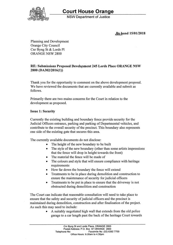
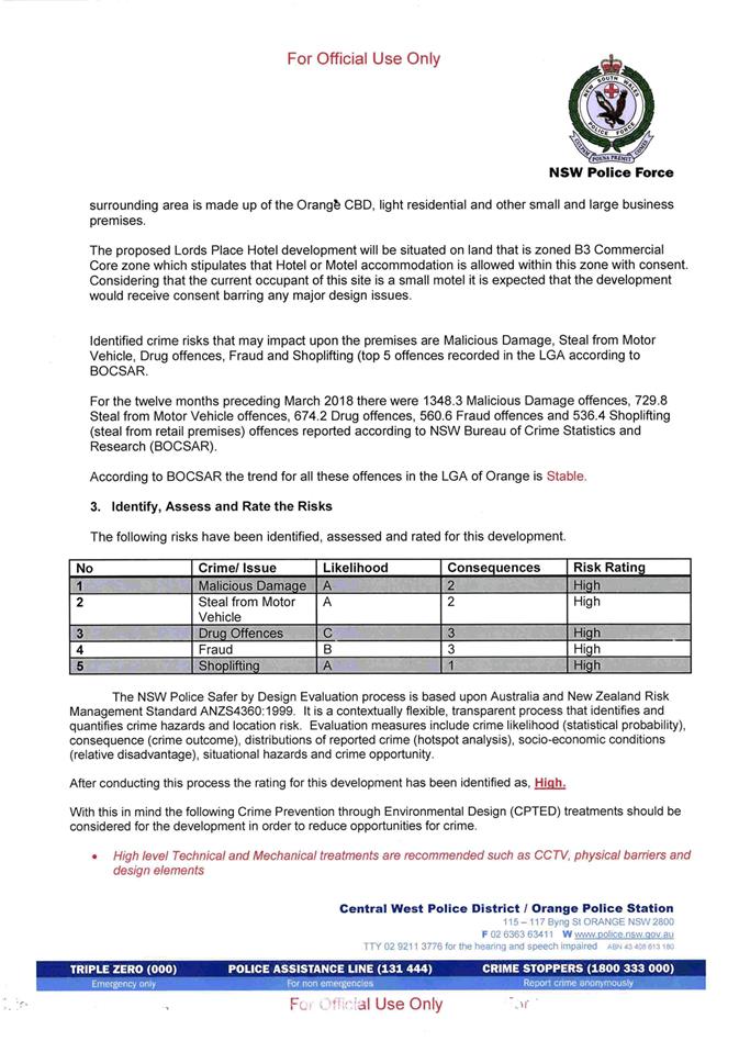
2.3 Development
Application DA 33/2018(1) - 4613 Mitchell Highway, Lucknow
RECORD
NUMBER: 2018/2390
AUTHOR: Michael
Glenn, Senior Planner
EXECUTIVE Summary
|
Application
lodged
|
12
February 2018
|
|
Applicant/s
|
Brothers
Three Pty Ltd
|
|
Owner/s
|
Brothers
Three Pty Ltd
|
|
Land
description
|
Lot 101
DP 1053642 - 4613 Mitchell Highway, Lucknow
|
|
Proposed
land use
|
Demolition
(existing service station), Service Station (includes sales building, fuel
dispensing canopy, underground fuel tanks, 24/7 operation), and Business and
Site Identification Signs
|
|
Value of
proposed development
|
$1,395,000
|
Council's consent is sought for the demolition of an
existing service station and construction of a service station with small
convenience store and signs on the subject property. The application is seeking
approval to operate on a 24 hour basis. The application has been referred
to Council because unresolved submissions have been received for the
application.
This application has been delayed because amendments were
required to address RMS issues, and also to address heritage and
streetscape considerations. The subject property is located on a classified
road, requiring the concurrence of the RMS for the proposal. The RMS has now
provided its concurrence, subject to a vehicle size limit of 12.5m
(equating to a large rigid vehicle) for vehicles other than the delivery
vehicle.
The amended proposal lacks effective landscaping, and there
are also potential conflicts between pedestrians using the footway and vehicles
that tend to park on a concreted verge outside the property. It is reasonable
to require the removal of this concreted verge (which does not meet
Council’s footpath standards and has not been constructed by Council),
and replace it with a footpath that does meet Council’s standards; as
well as provide handrails along the boundary and a landscape strip at the edge
of the verge, which steps down in a cutting to the level of the highway. The
landscaping will assist in maintaining the village character and improving
amenity adjacent to the site.
The application involves the removal of the existing underground
fuel storage tanks and their replacement with new tanks. Whilst soil testing
conducted to this point shows no signs of broad scale contamination of the
site, further tests will be required upon removal of the existing tanks to
determine if contaminants have coagulated underneath them. In the event that
such testing reveals contamination levels that exceed the relevant guidelines
(UPSS guidelines), Category 1 remediation (ie remediation that requires
further development consent) will be required. This arises due to the
environmental sensitivity affecting the subject site, a product of the high
water table and the location of the site within a heritage conservation area
and the water supply catchment. A condition to address this issue is included
in the consent.
Submissions have raised a number of concerns which in
general have not been addressed in the applicant responses. The most important
issue of concern to the local residents is the 24 hour operation of the
development. The applicant has submitted a noise report that suggests a twenty
four operation would be acceptable from a noise amenity point of view, but has
not addressed light glare or how the proposed 24 hour operation might affect
the general village character. It is considered that a twenty four hour
operation has a high probability of causing significant nuisance to the local
residents, and will have difficulty meeting or reinforcing the objectives of
the village zone, where mixed residential and commercial land uses must be
sufficiently benign to achieve reasonable co-existence. It is considered that
24 hour operation would not be reinforcing of that objective. The
applicant has by late submission indicated that they would be prepared to
accept a limit in the hours running from 5am to 12 midnight, but for the
current proposal, the configuration remains a 24 hour operation (they have not
formally amended the proposal to reflect their revised hours). It is on the
basis of a 24 hour operation that this assessment is carried out. However for
either of the applicants suggested hours, the impacts on character and amenity
is considered to be excessively adverse. As a result, the consent includes a
restriction on the hours to 7am to 10pm, seven days per week (which essentially
relate to a daytime use).
It is recommended that Council supports the subject proposal
subject to the conditions included in the attached Notice of Determination.
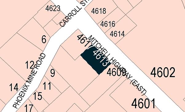
Figure 1 - locality plan
RECENT LEGISLATIVE CHANGES
On 1 March 2018 the Environmental Planning and Assessment
Act 1979 was substantially amended. The most immediate change involves the
restructuring and renumbering of the Act, with other more substantive
changes to be phased in over time. However, for some applications (particularly
where an application was lodged prior to the changes coming into effect) the
supporting documentation may still reference the previous numbering regime. In
the drafting of this report the content and substance of the supporting
material has been considered irrespective of which legislative references were
used.
DECISION FRAMEWORK
Development in Orange is governed by two key documents
Orange Local Environment Plan 2011 and Orange Development Control Plan 2004. In
addition the Infill Guidelines are used to guide development, particularly in
the heritage conservation areas and around heritage items.
Orange Local Environment Plan 2011 – The
provisions of the LEP must be considered by the Council in determining the
application. LEPs govern the types of development that are permissible or prohibited
in different parts of the City and also provide some assessment criteria in
specific circumstances. Uses are either permissible or not. The objectives of
each zoning and indeed the aims of the LEP itself are also to be considered and
can be used to guide decision making around appropriateness of development.
Orange Development Control Plan 2004 – the DCP
provides guidelines for development. In general it is a performance based
document rather than prescriptive in nature. For each planning element there
are often guidelines used. These guidelines indicate ways of achieving the
planning outcomes. It is thus recognised that there may also be other solutions
of merit. All design solutions are considered on merit by planning and building
staff. Applications should clearly demonstrate how the planning outcomes are
being met where alternative design solutions are proposed. The DCP enables
developers and architects to use design to achieve the planning outcomes in
alternative ways.
DIRECTOR’S COMMENT
This development application sees the revamp of the existing
service station in Lucknow. Staff and the Heritage Advisor have worked with the
applicant to lift the building design. Notwithstanding, access issues have been
a concern throughout and are of concern to the neighbouring property owners.
Staff do not support a 24 hour operation as the Village zoning mandates that
development needs to enhance and maintain the unique village character of
Lucknow and Spring Hill. The current operation is not 24 hours. The recommendation
is to allow a 7am to 10pm opening regime.
Link To Delivery/OPerational Plan
The recommendation in this report relates to the
Delivery/Operational Plan strategy “10.1 Preserve - Engage with the
community to ensure plans for growth and development are respectful of our
heritage”.
Financial Implications
Nil
Policy and Governance Implications
Nil
|
Recommendation
That Council resolves to issue a consent to development
application DA 33/2018(1) for Demolition (existing service station),
Service Station (includes sales building, fuel dispensing canopy, underground
fuel tanks), and Business and Site Identification Signs at Lot 101
DP 1053642 - 4613 Mitchell Highway, Lucknow pursuant to the conditions
of consent in the attached Notice of Approval.
|
further considerations
Consideration has been given to the recommendation’s
impact on Council’s service delivery; image and reputation; political;
environmental; health and safety; employees; stakeholders and project
management; and no further implications or risks have been identified.
SUPPORTING INFORMATION
THE APPLICATION/PROPOSAL
Council's consent is sought for the demolition of the
existing service station including the removal of tanks and associated
infrastructure and the construction and operation of a replacement service
station with neighbourhood shop. Business identification signage is also
proposed. The applicant proposes to operate the facility on a 24 hour
basis. To facilitate the development on a level site, it is proposed to
undertake some site regrading and construct retaining walls.
MATTERS FOR CONSIDERATION
Section 1.7 - Application of
Part 7 of the Biodiversity Conservation Act 2016 and Part 7A of the
Fisheries Management Act 1994
Development Applications lodged prior to 25 February 2018
Section 1.7 of the EP&A Act 1979 identifies that Part 7
of the Biodiversity Conservation Act 2016 and Part 7A of the Fisheries
Management Act 1994 have effect in connection with terrestrial and aquatic
environments.
Notwithstanding, Section 28 of the Biodiversity
Conservation (Savings and Transitional) Regulation 2017 states that the
former planning provisions continue to apply to the determination of a pending
planning application, being an application for planning approval made before
the commencement of the new Act but not determined before that commencement.
The relevant provisions are set out at Part 5A of the historical version of the
EP&A Act 1979 dated 24 August 2017.
Having regard to the relevant provisions and based on an
inspection of the subject property, it is considered that the proposed
development is not likely to have a significant effect on any threatened
species, populations or ecological communities or their habitats.
Section 4.15
Section 4.15 of the Environmental Planning and Assessment
Act 1979 requires Council to consider various matters, of which those
pertaining to the application are listed below.
PROVISIONS OF ANY ENVIRONMENTAL
PLANNING INSTRUMENT s4.15(1)(a)(i)
Orange Local Environmental Plan 2011
Part 1 - Preliminary
Clause 1.2 - Aims of Plan
The broad aims of the LEP are
set out under subclause 2. Those relevant to the application are as follows:
(a) to encourage development which complements
and enhances the unique character of Orange as a major regional centre boasting
a diverse economy and offering an attractive regional lifestyle,
(b) to provide for a range of development
opportunities that contribute to the social, economic and environmental
resources of Orange in a way that allows present and future generations to meet
their needs by implementing the principles for ecologically sustainable
development,
(c) to conserve and enhance the water
resources on which Orange depends, particularly water supply catchments,
(f) to recognise and manage valued
environmental heritage, landscape and scenic features of Orange.
The application is considered to be consistent with aims (b)
and (c) as listed above. With respect to (a), changes are required as
recommended by conditions in the consent to ensure the DA has outcomes that are
sympathetic to the achievement of reasonable character. This matter is
discussed in detail later in this report. With regard to (f), conditions are
included regarding the architectural detail, protection of landscape , signage
impact and certain other issues that will result in the responsible management
of the environmental, heritage and scenic landscape setting of the development.
Clause 1.6 - Consent Authority
This clause establishes that, subject to the Act, Council is
the consent authority for applications made under the LEP.
Clause 1.7 - Mapping
The subject site is identified
on the LEP maps in the following manner:
|
Land Zoning Map:
|
Land zoned RU5 Village
|
|
Lot Size Map:
|
Minimum Lot Size 1,000m2
|
|
Heritage Map:
|
Located in a heritage conservation
area
|
|
Height of Buildings Map:
|
No building height limit
|
|
Floor Space Ratio Map:
|
No floor space limit
|
|
Terrestrial Biodiversity Map:
|
No biodiversity sensitivity on the
site
|
|
Groundwater Vulnerability Map:
|
Groundwater vulnerable
|
|
Drinking Water Catchment Map:
|
Within a drinking water catchment
|
|
Watercourse Map:
|
Not within or affecting a defined
watercourse
|
|
Urban Release Area Map:
|
Not within an urban release area
|
|
Obstacle Limitation Surface Map:
|
No restriction on building siting
or construction
|
|
Additional Permitted Uses Map:
|
No additional permitted use applies
|
|
Flood Planning Map:
|
Not within/within a flood planning
area
|
Those matters that are of relevance are addressed in detail
in the body of this report.
Clause 1.9A - Suspension of
Covenants, Agreements and Instruments
This clause provides that covenants, agreements and other
instruments which seek to restrict the carrying out of development do not apply
with the following exceptions.
· covenants imposed
or required by Council
· prescribed
instruments under Section 183A of the Crown Lands Act 1989
· any conservation
agreement under the National Parks and Wildlife Act 1974
· any trust
agreement under the Nature Conservation Trust Act 2001
· any property
vegetation plan under the Native Vegetation Act 2003
· any biobanking
agreement under Part 7A of the Threatened Species Conservation Act 1995
· any planning
agreement under Division 6 of Part 4 of the Environmental Planning and
Assessment Act 1979.
Council staff are not aware of the title of the subject
property being affected by any of the above.
Part 2 -
Permitted or Prohibited Development
Clause 2.1 - Land Use Zones
and Clause 2.3 - Zone Objectives and Land Use Table
The subject site is located within the RU5 Village zone. The
proposed development is defined as a Service Station under OLEP 2011 and is
permitted with consent for this zone. This application is seeking consent.
“Service Station” is defined under the LEP as
“a building or place
used for the sale by retail of fuels and lubricants for motor vehicles, whether
or not the building or place is also used for any one or more of the following:
(a) the
ancillary sale by retail of spare parts and accessories for motor vehicles,
(b) the
cleaning of motor vehicles,
(c) installation
of accessories,
(d) inspecting,
repairing and servicing of motor vehicles (other than body building, panel
beating, spray painting, or chassis restoration),
(e) the
ancillary retail selling or hiring of general merchandise or services or both.
Clause 2.3 of LEP 2011
references the Land Use Table and Objectives for each zone in LEP 2011.
These objectives for land zoned RU5 Village are as follows:
1 -
Objectives of the RU5 Village Zone
· To provide for a
range of land uses, services and facilities that are associated with a rural
village.
· To enhance and
maintain the unique village character of Lucknow and Spring Hill.
In general, the proposed
development is considered to be consistent to the zone objectives. However, the
proposed 24 hour operation would, if carried out, create land use conflicts
with other existing permissible land uses, namely the residential development
within the village. The village zone contains a fairly wide range of
permissible land uses, but this does not mean that inherent conflicts should be
left unconsidered. Whilst the subject development is located on the Mitchell
Highway the 24 hour operation of a development is considered to be inconsistent
with the general village character of Lucknow. Hence, as alluded to elsewhere
in this report it is recommended that the hours of operation be limited to
7.00am to 10.00pm to be more in keeping with the village character in this
case.
Clause 2.7 - Demolition
Requires Development Consent
This clause triggers the need for development consent in
relation to a building or work. This requirement does not apply to any
demolition that is defined as exempt development.
The proposal involves demolition and the applicant is
seeking the consent of council. The demolition works proposed will have no
significant impact on adjoining lands, streetscape or public realm.
Part 3 -
Exempt and Complying Development
The application is not exempt or complying development.
Part 4 -
Principal Development Standards
Clause 4.1 - Minimum
Subdivision Lot Size
There is a minimum lot size
applicable to the subject property, however this control is only relevant to
applications involving subdivision. Subdivision does not form part of the
subject application.
Part 5 -
Miscellaneous Provisions
5.10 - Heritage Conservation
The subject property is located within the Lucknow Heritage
Conservation Area. The original submitted plans called for a flat roofed modern
style building with canopy, as well as standard corporate signage.
Figure 2 - preliminary south-eastern elevation
Figure 3 - preliminary north-eastern elevation
The initial plans were referred to Council’s Heritage
Advisor who provided a generally negative response:
The issues raised in the DCP
to the design of new development – Design of new development should
complement heritage character. This can be achieved in three ways:
· Restoration works
that return the building to its original form and style.
· Respectful Design: A
“low key design approach where heritage building forms, proportions and
materials are applied but reproduction of decorative work and detailing is
avoided the design should demonstrate that it is a contemporary building whilst
respecting the surrounding heritage setting.
· Interpretative
Design: Forms and proportions that relate to but do not reproduce heritage
features. Good modern architecture is favoured that fits in to the heritage
setting
Comment: The
proposal is a standard flat roofed building with glazing to the south eastern
elevation on the hardstand forecourt and a solid light grey clad wall to the
other predominant elevation to the road (the NE elevation). The fascia’s
surrounding the roof are standard corporate colours and graphics. The roof is
zincalume steel which is not supported in conservation areas. There are no
indications on the drawings that the heritage design principals in the form of
respectful design or Interpretative design.
Issues: The
following checklist is the analytical process established under the key
reference document (“Design In context’) and should guide the
preferred form of development in this location.
· Character: While
recent lack of guidance means very limited character, the ethos is traditional
and heritage related with pitched roofs and traditional box built forms with
pitched roofs. Several post buildings utilised skillion roofs. There are
variable setbacks to accord with vehicle related uses.
· Scale: Single storey
buildings with heights that come from traditional roofs
· Form: traditional
forms which are often extended either as extrusions or pavilions.
· Siting: the core area
has closer setbacks near the roads while residential land has garden setbacks.
· Materials and Colour:
There is a predominance of light weight cladding to the core earlier buildings
such as timber and tin/steel and later structures in masonry. Generally the
colours are lighter as opposed to dark. Tree planting relates to larger trees
left over from earlier residential uses and larger lots while commercial uses
have generally seen them removed.
· Detailing:
Traditional detailing predominates including verandahs awnings and chimneys
There are no flat roofed
buildings in the vicinity. The similar buildings such as the skin shop have
skillion roofs while the Fat Ladies and the adjoining hotel have traditional
pitched roofs.
The Lucknow Strategy developed
in 2014 as the Lucknow Scoping Study provides the following guidance for future
development and public works:
1 New
buildings are to be fine grained and relate to the scale of the existing built
forms
2 A
sample palette of contemporary materials and forms includes iron, stone
recycled timber and muted colours with hipped roofs and verandahs
Recommendations
The applicant submitted
amended plans 29 May 2018, along with a written response in support, which are
now the subject of this assessment:
1 The
fuelling canopy be provided with a hipped pitched roof with 25 deg pitch slope
clad in colorbond windspray or basalt and set above the line of the proposed
fascias.
2 The
fascias shall be horizontal metallic colorbond Astro or similar without the
Metro corporate colour
3 The
Metro Corporate sign panel shown on the SE Elevation shall be mounted on a
framed element to interpret a verandah in a contemporary style with a pair of
circular steel columns
4 The
cladding to the NE elevation is run horizontally to interpret the local
vernacular
5 A
full height window is to be inserted into the NE elevation between the cigarette
display and office doors
6 The
Service building/Convenience store be provided with a similar hipped 25
degree pitched roof
7 All
perimeter fencing to be traditional cyclone open mesh type and not colorbond or
solid fencing to allow the landscape to be expressed and visually dominate the
surrounds
8 All
concrete hardstand is to be through coloured using oxide to achieve a dark grey
equal to CCS stallion
9 The
concrete blockwork on the convenience store shall be clad in horizontal colorbond
basalt and not painted to reflect the local vernacular.
10 The
site ID sign shall be limited to a maximum height of 5400mm (planners note:
it has been submitted as a 6m high structure) or equal to the height of the
fuelling canopy to ensure the sign element does not visually dominate the
setting and affect other business identification elements, signs and graphics.
The base of the sign shall be clad in local stone similar to basalt to the
level of the bottom price indicator and replacing the ATM graphic which is
redundant.
11 A
professionally prepared landscape plan is required to specify the planting to
the SW side and northern corner.
12 All
lighting in the soffit of the fuelling canopy and the convenience building is
to be fully recessed to reduce glare
13 Although
internally illuminated graphics are not supported in conservation areas,
subject to agreement with the above, the internal signage components for signs
under this application will be acceptable (planners note; the applicant did
not fully accept all of the heritage advisers recommendations).
Council’s Heritage Advisor provided the following
conceptual sketches which were passed on to the applicant prior to the
submission of their response.
Figure 4 - heritage recommended amendments
The applicant submitted amended plans on 22 May 2018 which
adopted some of the changes sought by the Heritage Advisor and provided
additional information in support of varying, or not applying other elements of
the initial advice. These amended plans are now the subject of this detailed
assessment.
The applicant submitted the following response to the
itemised issues raised by the Heritage Advisor:
Issue 1: “This
request was deemed unreasonable and addressed by a previous email (sent
04/04/2018) where it was advised that a proposed pitched roof would not be seen
when close by on the Mitchell Highway due to the difference in levels and the
original proposal would suffice in this instance without disrupting the local
character that is trying to be achieved within the Lucknow Scoping Study. On
Council’s follow up email on 03/05/2018 it was advised that this would be
acceptable provided the sales building signage was modified to not disrupt the
form of the proposed pitched roof. This is reflected on the revised
Architectural drawings accompanying this application and addressed further
below”.
The applicant’s position is accepted; however the
refusal to provide a canopy with pitched roof has implications on the
assessment of heights for the proposed pylon sign.
Issue 2: “As
discussed in a previous response (sent 04/04/2018) it was seen as an
unreasonable request to remove Metro corporate colours which are featured
throughout all of their service stations Australia wide. We do not believe the
request to remove Metro branding would enhance the local character and would
make navigation more difficult. It is also believed that the inclusion of the
Metro petroleum corporate colours would not detract from the preferred
streetscape the Lucknow Scoping Study is trying to promote.
The Heritage Advisor comments were revised and amended as a
result of this submission and further negotiations with the applicant.
Issue 3:
“This element has been included on the updated Architectural drawings
accompanying this application and provides a sympathetic entry statement and
allows for a good visual navigation element as well as staying in keeping with
the local character the Lucknow Scoping Study has alluded to”.
The Heritage Advisor and the applicant’s architect
have reached agreement with respect to this issue.
Issue 4:
“The proposed façade treatment has been amended to show a
horizontal treatment as requested by Council. The exact nature of this cladding
will form part of a future Construction Certificate application”.
A precautionary condition that ensures this amendment is
implemented is included in the consent.
Issue 5: The
requested full height glazing has been included on the updated Architectural
drawings accompanying this application. Security issues will be looked at as
part of a future Construction Certificate application.
A condition ensuring that this element is included in the
building is attached to the consent.
Issue 6:
“As addressed in previous correspondence (sent 04/04/2018) and also shown
on the updated elevation drawings & 3D views accompanying this application
the service building has been modified to show a Dutch gable roof that is in
keeping with the local character and is sympathetic to the Lucknow Scoping
Study. Council’s follow up email on 03/05/2018 stated the roof pitch
needs to be 30 degrees which is now reflected on the amended Architectural
drawings accompanying this application”.
There is agreement between the two experts on this issue. A
condition specifying a 30 degree pitch is included in the consent.
Issue 7:
“The request of Council for an open mesh fence was deemed as not
acoustically suitable due to potential noise source disturbances for
neighbouring residences. An Acoustic report was undertaken by Rodney Stevens
Acoustics and it was deemed that a 1.8m high solid fence is required for noise
attenuation to neighbouring residences instead of an open mesh fence as
requested by Council. The Acoustic report has been submitted as part of this
application. Council’s follow up email on 03/05/2018 declares that if a
block wall is required, it needs to be planted with a creeper plant specified
by the Landscape Architect. This is depicted on the Landscape Plans
accompanying this application”.
The applicant’s position is accepted, however to
achieve some level of restraint in the visual presentation of the site, it is
considered appropriate to require the Colorbond fencing that faces into the
site to be “Shale Grey” to tie-in better with the canopy and other
elements of the development.
Issue 8:
“As stated in our previous response (sent 04/04/2018) the addition of the
dark grey oxide would be an unreasonable request due to the elevated nature of
the fuelling area, making the area unobservable to all but those using the
facility. The non-oxide concrete will still form a more formal approach to the
fuelling area that will not only enhance the current look but will also be
supportive of the Lucknow Scoping Study. Council’s follow up email on
03/05/2018 deemed this as acceptable”.
The applicant’s response is accepted on the proviso
that the perimeter fencing is finished in a suitably sympathetic colour.
Issue 9: As
depicted on the revised elevation drawings accompanying this application, the
concrete block walls have been amended to show a horizontal Colorbond
‘basalt’ treatment as requested by Council.
Conditions are included in the consent to ensure this
outcome
Issue 10: The
site ID element will remain at 6m in height with the ATM signage removed and
base of sign clad in local stone as part of the amended drawings accompanying
this application. As depicted on the 3D views accompanying this application,
the site ID sign doesn’t visually dominate the site. Council’s
response email on 03/05/2018 deems this solution acceptable.
There is a large sign erected at the boundary of the
property which is approximately 8m high. This sign has no approval from Council
and should not be given a great deal of weight in the assessment as a result.
The subject land is zoned RU5 Village, which is a mixed use zone but one
in which residential development is the dominant land use. The subject property
is located within a designated Heritage Conservation Area.
Council’s DCP 2004 contains chapters with controls
applicable within the Lucknow village, and further a separate chapter with
controls and guidelines for appropriate signage and includes provisions for
advertising with possible effects on residential areas. With respect to the
controls on signage, DCP 2004 (Chapter 14) the following provisions are
applicable:
a) Freestanding
or pylon signs relate to the height of associated buildings in
b) Freestanding
signs in residential areas are at a personal scale (i.e. about 2m high or less)
within a landscaped setting.
Signs within a residential context have further generally
been required to be set back to the building line. The character assessments by
the applicant have not taken these underlying character and land use
observations into account in their signage assessments.
The building heights are considered the more appropriate
surrogate measure to apply in determining the correct sign height. The
convenience store proposes a wall height of 4.2m and is immediately
set behind the proposed sign, whilst the awning proposes a height of 5.4m
but is closer to the street frontage than the store. The proposed pylon sign is
forward of these structures by approximately 4m (from the front of the
convenience store) and 2m (from the front of the awning). It is not practicable
to set the pylon sign further back because of the obstruction caused by the
existing adjoining building to the west of the site.
With a height of 6m and a zero setback from the front
boundary, it can be expected that the sign would be out of scale with the
buildings nearby.
In his initial advice Council’s Heritage Advisor
recommended a height comparable to the proposed awning. Under the circumstances
this would appear the more appropriate standard to apply. It would result in a
10% reduction in height for the sign compared to what the applicant wants, but
should pull the massing and scale of the sign back to a bulk and height that
relates to the associated buildings. Attached is a condition of consent
addressing this issue.
Issue 11:
“A professional landscape design has been undertaken by Taylor Brammer
and is included with this application. It specifies the planting to the SW
& SE boundaries and northern corner. The design enables an easily
maintained natural element to the project. Council’s follow up email on
03/05/2018 declares that if a block wall is required, it needs to be planted
with a creeper plant specified by the Landscape Architect. This is depicted on
the Landscape Plans accompanying this application”.
The applicant has submitted a landscaping plan, but the
densities, planting areas and plant selections are inadequate and/or
inappropriate. The consulting landscape designer is known to have landscaping
experience, but this particular plan is unsuited to the site conditions. The
principal plantings are centred on six trees, of the following species:
Backhousia citriodora (common names lemon myrtle, lemon
scented myrtle, lemon scented ironwood): Two specimens proposed. A
cultivated ornamental plant theoretically capable of a mature height of 6m, but
in practice more usually 3m. It can be grown from tropical to warm temperate
climates, and may handle cooler districts provided it can be protected from
frost when young. It is unsuitable to the local growing conditions because of
this.
Backhousia myrtifolia (common names include carrol,
carrol ironwood, neverbreak, ironwood or grey myrtle, Australian lancewood and Cinnamon
myrtle): Two specimens proposed. This specimen is a rainforest tree species
which grows in subtropical rainforests of Eastern Australia and is known to
reach a mature height of over 30m. It is unsuitable for this site because the
species is not frost tolerant and the expected height cannot be supported on
such a small sized lot.
Melaleuca leucadendra, (common names weeping
paperbark, long-leaved paperbark or white paperbark): Two specimens are
proposed. This is widespread in northern Australia, South East Asia and New
Guinea. It is a tree with an expected mature height in excess
of 20 m. Although it will withstand some frost, it is not recommended
for cold areas such as mountainous regions or Tasmania. It will grow well in
most other areas.
Clearly the species selection is inappropriate. Further, it
is considered appropriate for a landscaping strip to be installed in the
currently concreted verge area to a bed width not less than 1.5m and
incorporating tree plantings that are suited to local climate and growing
conditions, and able to achieve a minimum height of 4m. This landscape strip
shall be provided on the southern side of the pavement, just above the cutting
that steps down to the Mitchel Highway. Attached is a recommended condition of
consent addressing this issue.
Issue 12: All
lighting within the fuel canopy will be fully recessed to reduce glare as
stated in our email response (sent 04/04/2018).
Noted. Conditions to ensure compliance are included in the
consent.
Issue 13: The
majority of requests of Council have been updated on our drawings accompanying
this application and although there is a small amount of internally illuminated
signage we believe they work well within the desires of Council and the Lucknow
Scoping Study in providing easily navigable streetscape and also easily
recognised landmark to the entry of Lucknow.
On planning grounds, it is considered the applicant’s
discussion so as to allow internal illumination whilst the business is trading
is reasonable. However, at times when the business is not trading it is
considered appropriate to require internal lighting, except that needed for
security and safety purposes, to be switched off during the overnight period. A
condition relating to the ongoing performance standards is included to ensure
compliance with this outcome.
Heritage Advisor’s Final
Advice (received 1 June 2018)
“I
have reviewed the current revised drawings and agree on the conditional
approach as they have met or negotiated all of the issues and recommendations
made.
On the conditions, you may be
wise still to write in some of the items which have been agreed but are not
specified on the drawings:
· All blockwork walls
are to be fully concealed on all exposed surfaces by planting in the form of a
creeper specified by the landscape consultant with appropriate planting media,
watering and the means of adhering to the subject walls;
· All lighting to the
soffit of the fuelling canopy is to be fully recessed from the soffit surface;
· The soffit to the
fuelling canopy is to be equal to the Colorbond standard custom orb profile in
Shale Grey
· The colour of the
gable infills is to be Windspray”
The supplementary advice by the Heritage Advisor reinforces
certain issues, but does not eliminate the original concerns. Conditions are
included to address these final heritage matters. In addition to these formal
responses, the Heritage Advisor is strongly supportive of additional
landscaping along the frontage.
Part 7 - Additional
Local Provisions
7.1 - Earthworks
This clause establishes a range
of matters that must be considered prior to granting development consent for
any application involving earthworks, such as:
(a) the likely disruption of, or any
detrimental effect on, existing drainage patterns and soil stability in the
locality of the development
(b) the effect of the development on the
likely future use or redevelopment of the land
(c) the quality of the fill or the soil to be
excavated, or both
(d) the effect of the development on the
existing and likely amenity of adjoining properties
(e) the source of any fill material and the
destination of any excavated material
(f) the likelihood of disturbing relics
(g) the proximity to and potential for adverse
impacts on any waterway, drinking water catchment or environmentally sensitive
area
(h) any measures proposed to minimise or
mitigate the impacts referred to in paragraph (g).
The earthworks proposed within
the application are considered ancillary to the principle development. There
are significant earthworks proposed along the southern shared boundary, with an
existing sloped batter to be replaced by a retaining wall
approximately 1.3m high. Removal of the batter will require excavations at
the base of the batter to approximately 3m past its present position to allow
the retaining wall to be installed at the boundary. This will require
conditions to address the structural adequacy of the retaining wall, as well as
ensuring that such works minimise the damage to the adjoining (southern)
neighbour’s landscaping.
The proposed earthworks also
envisage the removal of the existing underground storage tanks. Other
earthworks proposed in the application relate primarily to the grading and
filling of the site to provide a more level area for vehicles to utilise the
development. The extent of cut/fill required is approximately 300-500mm. The
extent of earthworks and the degree of disruption to the drainage of the site
are considered to be minor and will not detrimentally affect adjoining
properties or receiving waterways.
The site is not known to contain
any Aboriginal objects, or European or archaeological relics. Previous known
uses of the site do not suggest that any object or relics are likely to be
uncovered. The site is not in proximity to any waterway, drinking water
catchment or sensitive area. Notwithstanding this, conditions are imposed that
require a sediment control plan, including silt traps and other protective
measures, to ensure that loose dirt and sediment do not escape the site
boundaries.
7.3 -
Stormwater Management
This clause applies to all
industrial, commercial and residential zones and requires that Council be
satisfied that the proposal:
(a) is designed to maximise the use of water
permeable surfaces on the land having regard to the soil characteristics
affecting onsite infiltration of water
(b) includes, where practical, onsite
stormwater retention for use as an alternative supply to mains water,
groundwater or river water; and
(c) avoids any significant impacts of
stormwater runoff on adjoining downstream properties, native bushland and
receiving waters, or if that impact cannot be reasonably avoided, minimises and
mitigates the impact.
Council’s Technical
Services Division has assessed the development in regards to stormwater.
Relevant conditions are attached to ensure that the post-development run-off
levels do not exceed pre-development levels.
7.6 -
Groundwater Vulnerability
This clause seeks to protect
hydrological functions of groundwater systems and protect resources from both
depletion and contamination. Orange has a high water table and large areas of
the LGA, including the subject site, are identified with “Groundwater
Vulnerability” on the Groundwater Vulnerability Map. This requires that
Council consider:
(a) whether or not the development (including
any onsite storage or disposal of solid or liquid waste and chemicals) is
likely to cause any groundwater contamination or have any adverse effect on
groundwater dependent ecosystems, and
(b) the cumulative impact (including the
impact on nearby groundwater extraction for potable water supply or stock water
supply) of the development and any other existing development on groundwater.
Furthermore consent may not be granted unless Council is satisfied that:
(a) the development is designed, sited and
will be managed to avoid any significant adverse environmental impact, or
(b) if that impact cannot be reasonably
avoided - the development is designed, sited and will be managed to minimise
that impact,
(c) if that impact cannot be minimised - the
development will be managed to mitigate that impact.
The proposal is not anticipated
to involve the discharge of toxic or noxious substances and is therefore
unlikely to contaminate the groundwater or related ecosystems. The proposal
does not involve extraction of groundwater and will therefore not contribute to
groundwater depletion. The design and siting of the proposal avoids impacts on
groundwater and is therefore considered acceptable.
7.7 - Drinking Water
Catchments
(1) The
objective of this clause is to protect drinking water catchments by minimising
the adverse impacts of development on the quality and quantity of water
entering drinking water storages.
(2) This
clause applies to land identified as “Drinking water” on the Drinking
Water Catchment Map.
(3) Before
determining a development application for development on land to which this
clause applies, the consent authority must consider whether or not the
development is likely to have any adverse impact on the quality and quantity of
water entering the drinking water storage, having regard to:
(a) the
distance between the development and any waterway that feeds into the drinking
water storage, and
(b) the
onsite use, storage and disposal of any chemicals on the land, and
(c) the
treatment, storage and disposal of waste water and solid waste generated or
used by the development.
(4) Development
consent must not be granted to development on land to which this clause applies
unless the consent authority is satisfied that:
(a) the
development is designed, sited and will be managed to avoid any significant
adverse impact on water quality and flows, or
(b) if
that impact cannot be reasonably avoided - the development is designed, sited
and will be managed to minimise that impact, or
(c) if
that impact cannot be minimised - the development will be managed to mitigate
that impact.
The subject property is located within the City water supply
catchment, and the discharge or release of contaminated or unsafe runoff to the
catchment tributaries of the town water supply is a matter for concern since
the site is relatively close to such water supply watercourses. It is
considered that the risks posed by contaminants, particulates or bacterial
water can be managed by standard erosion and sediment control, and water
quality control measures, and that such risks as may arise are not excessive.
It is considered that the effects arising from the proposed development do not
pose a significant risk to public health if contained in the manner set out in
the application and the attached consent.
STATE ENVIRONMENTAL PLANNING
POLICIES
State Environmental Planning Policy 55 - Remediation of
Land
State Environmental Planning Policy 55 - Remediation of
Land (SEPP 55) is applicable. Pursuant to Clause 7 Contamination and
remediation to be considered in determining development application:
(1) A consent authority must not consent to
the carrying out of any development on land unless:
(a) it
has considered whether the land is contaminated, and
(b) if
the land is contaminated, it is satisfied that the land is suitable in its
contaminated state (or will be suitable, after remediation) for the purpose for
which the development is proposed to be carried out, and
(c) if
the land requires remediation to be made suitable for the purpose for which the
development is proposed to be carried out, it is satisfied that the land will
be remediated before the land is used for that purpose.
Under Clause 7 of the SEPP, Council must consider whether
the land is contaminated and if the land requires any form of remediation to
render it suitable for the purpose for which it is proposed to be used. The
previous land uses must be considered, along with any visible or tangible evidence
on the site.
The subject property has for many years been used as a
service station and convenience store (it is believed that this use extends
back to 1947), which acts as a trigger for a preliminary contamination
assessment under Council’s draft remediation strategy. The structure of
Council's contamination strategy can be found in the quick reference guide
produced by Contamination Central at the time of the adoption of the draft
policy, and should be used in the assessment of the preliminary site investigation,
which the applicant has completed and submitted as part of the application. The
submitted report is by NEO Consulting).
There is a flowchart that sets out the procedures when
receiving new development applications.
This flow chart is reproduced below:
Figure 5 - development assessment flowchart
Initial Evaluation - matters for consideration
Figure 6 - determining if the property is on the
Contaminated Lands Information System (CLIS)
The subject land is not on
Council’s local CLIS (contaminated lands register). It is not recorded on
the EPA register as being contaminated. The Consultant is silent on whether the
site is on a contamination register.

Figure 7 - checking previous reports
There are no reports on the CLIS
relevant to this matter. The consultant’s report does not mention any
reports or notations on adjoining land.
Figure 8 - site inspections
Site inspections have been carried out by both staff and the
applicant’s consultant. Potential sources of contamination on the site
were identified as the forecourt and the fuel fill spill box. Petroleum
hydrocarbon contamination is possible in delivery, storage and dispensing of
fuel and oil products, spills and overflows at refilling, and leakage of
underground storage tanks due to corrosion and leakages of feeder lines due to
pipe work failures. Contamination is possible from fuel spills and overflows at
the time of refilling and pump dispensing.
Potential contaminants include:
· unleaded petrol -
detected by laboratory analysis of TRH (C6-C40) and BTEX
· leaded petrol -
detected by laboratory analysis of lead TRH (C6-C40) and BTEX
· diesel - detected
by laboratory analysis of TRH (C10-C40) and naphthalene
· movement of
contaminants is possible in the groundwater or underground electricity,
stormwater, sewer and telephone services conduits.
Preliminary test results undertaken by the consultant do not
show any significant signs of site contamination, however it is noted that at
the underground storage tanks have not been removed, rendering it impossible
for the consultant to have tested under the tanks (where contamination hotspots
most usually occur).
To address this shortcoming in the available information, a
condition requiring further soil testing following removal of the tanks with
the results being submitted to Council. In the event that contamination is
found post removal of the tanks it will be necessary to stop work and seek
further consent for Category 1 Remediation given the location of the
development within a heritage conservation area.

Figure 9 - site history
A complete site history is unavailable.
The site has been used as a small service station with
convenience store for many years. The known development history is not fully
known but does include the following:
On 3 August 1989 and application to upgrade and modify the
existing service station was refused. In the report to Council at the time the
site was described as having been used as a service station since at least
1947. It had been proposed to increase the size of the building and also to
increase the number of fuel dispensing points. The application was refused on
the grounds of inadequate parking on the site. There was no mention of possible
contamination of the site at that time.
DA 02/044, an application to modify the subdivision
boundaries, was approved. No mention of possible site contamination was
included in the assessment.
Service stations are included in appendix A as a potential
contaminating land use.
Analytical Results Summary
Soil analytical results are summarized and compared to the
relevant assessment criteria in the consultant’s report as follows:
The reported concentration of
Benzene was less than the laboratory LOR (limit of reporting –detection
limit) to which was less than the adopted assessment criteria. Toluene - The
reported concentration of Toluene was less than the laboratory LOR (limit of
reporting –detection limit) to which was less than the adopted assessment
criteria.
Ethylbenzene - The reported
concentration of Ethylbenzene was less than the laboratory LOR (limit of
reporting –detection limit) to which was less than the adopted assessment
criteria.
Xylene (total) - The reported
concentration of Xylene (total) was less than the laboratory LOR (limit of
reporting –detection limit) to which was less than the adopted assessment
criteria.
TPH (C6-C10) Less BTEX (F1) -
The reported concentration of TPH (C6-C10) Less BTEX (F1) was 110mg/kg, to
which was less than the adopted assessment criteria.
TPH (>C10-C16) Less
Naphthalene (F2) - The reported concentration of TPH (>C10-C16) Less
Naphthalene (F2) was 100mg/kg, to which was less than the adopted assessment
criteria.
TPH (>C16-C34)(F3) - The
reported concentration of TPH (>C16-C34) was less than the laboratory LOR
(limit of reporting –detection limit) to which was less than the adopted
assessment criteria.
TPH (>C34-C40)(F4) - The
reported concentration of TPH (>C34-C40) was less than the laboratory LOR
(limit of reporting –detection limit) to which was less than the adopted
assessment criteria.
Naphthalene - The reported
concentration of Naphthalene was less than the laboratory LOR (limit of
reporting –detection limit) to which was less than the adopted assessment
criteria.
Lead - The reported
concentration of Lead was less than the laboratory LOR (limit of reporting
–detection limit) to which was less than the adopted assessment criteria.
Total PAHs - The reported concentration of Total PAHs was less than the
laboratory LOR (limit of reporting –detection limit) to which was less
than the adopted assessment criteria.
Field observations and
analytical results indicate that there was no hydrocarbon impact in soil at the
site from sample locations above the adopted assessment guidelines
Conclusion on the need to
submit an Environmental Site Assessment
The preliminary site assessment under the Council draft
guidelines indicates a need for an ESA. The applicant has responded to
this by submitting a report that generally complies with the Contaminated
Lands Assessment Guidelines. However, this assessment does not include the
area beneath the underground storage tanks.
A condition is included requiring that further testing is
required following the removal of those tanks. In the event that no
contamination is detected under the tanks, a validation report is required to
be submitted to Council. In the event that contamination levels are found in
the soils under the tanks, further work on the development would need to stop
pending the processing of an application for Category 1 remediation
(remediation requiring further consent), followed only then by a further
validation report. In the event that no contamination is revealed after the
tank removal, the applicant can proceed simply to validation of the site.
State Environmental Planning Policy
33 - Hazardous and Offensive Development
This policy seeks to ensure that the consent authority has
sufficient information to assess whether a development is potentially hazardous
or offensive, and to impose conditions to reduce or minimise any adverse
impacts. The policy sets out the definition of a ‘potentially hazardous
industry’ as follows:
a development for the purposes
of any industry which, if the development were to operate without employing any
measures (including, for example, isolation from existing or likely future
development on other land) to reduce or minimise its impact in the locality or
on the existing or likely future development on other land, would pose a
significant risk in relation to the locality:
(a) to
human health, life or property, or
(b) to
the biophysical environment,
and includes a hazardous
industry and a hazardous storage establishment.
Guidelines titled Applying SEPP 33 Development Application
Guidelines and Multi Level Risk Assessment Guidelines are particularly relevant
to this application, among others. The applicant has prepared a Multi-Level
Risk Assessment and PHA in accordance with these guidelines which concludes
that the proposed development is within the risk thresholds set by the
supporting guidelines.
The multi risk assessment’s principal recommendation
is that all equipment to be installed on the site be installed strictly in
accordance with the manufacturer’s specifications. The following
conditions are included in the consent as a result of that recommendation:
· All
equipment must be installed to manufacturer’s recommendations and must
comply with all the relevant standards listed within.
· Specific
safety features of the site, as set out in the submitted Preliminary Hazard
Analysis (PHA) submitted with the Development Application shall be adhered to
strictly at all times. The applicant shall ensure that safety procedures are
well posted on the site and shall further ensure that all staff are adequately
inducted as to correct safety procedures and protocols as set out in the PHA.
· Prior
to the issuing of an Occupational Certificate, the Applicant shall submit to
Council documentation demonstrating that the following plans and systems have
been developed and implemented:
(a) TRANSPORT OF HAZARDOUS MATERIALS
Arrangements
covering the transport of hazardous materials including details of routes to be
used for the movement of vehicles carrying hazardous materials to or from the
development. The routes selected shall be consistent with the Department of Planning’s
Hazardous Industry Planning Advisory Paper No. 11, ‘Route
Selection’. Suitable routes identified in the study shall be used except
where departures are necessary for local deliveries or emergencies.
(b) EMERGENCY PLAN
A
comprehensive Emergency Plan and detailed emergency procedures for the
development. The plan shall be consistent with the Department of
Planning’s Hazardous Industry Planning Advisory Paper No. 1, ‘Emergency
Planning’.
(c) SAFETY MANAGEMENT SYSTEM
A
comprehensive Safety Management System, covering all on-site operations and
associated transport activities involving hazardous materials. The Safety
Management System shall be consistent with the Department of Planning’s
Hazardous Industry Planning Advisory Paper No. 9, ‘Safety Management’.
Assessment Guidelines Appendix
6 - Ongoing Acceptability
The guidelines state:
"If, following the
assessment of a PHA and other considerations, Council considers that the
proposal can proceed, it should consider imposing relevant hazards-related conditions
as recommended by the Department. This condition will help ensure the ongoing
safety of a potential development."
Not all of the recommended conditions are considered
relevant to this situation. It is recommended that the following condition be included
to address this issue.
· Twelve
(12) months after the commencement of operations of the development, and every
three (3) years thereafter, the Applicant shall carry out a comprehensive
Hazard Audit of the proposed development consistent with the Department of
Planning’s Hazardous Industry Planning Advisory Paper No. 5, ‘Hazard
Audit Guidelines’. The audit shall be carried out by a qualified person
or team, independent of the development. Compliance documentation shall be
submitted to the Council within 28 days from the date of the audit.
State Environmental Planning
Policy (Infrastructure) 2007
Development In Or Adjacent To Road Corridors And Road
Reservations
The provisions of the SEPP place a requirement to obtain RMS
concurrence to this proposal. This was done early in the process, but there
were difficulties in getting the RMS to agree to the proposal until changes
were made to the access and vehicle queuing arrangements, and restrictions were
placed on the size of vehicles fuelling from the site.
By letter dated 28 August 2018, the RMS has granted
conditional concurrence to the proposed development. The conditions are
included in the draft Notice. RMS preamble in their concurrence letter notes
the following main points:
“I refer to an email from
Craig Ridgewell from MCHP Architects on 10 August 2018 referring amended plans
(Reference 17-077-DA07 and 17-077-DA08) to Roads and Maritime Services and
Council for comment. Reference is also made to Roads and Maritime’s
previous submission in relation to this proposal dated 19 June 2018 and a
telephone conversation between Roads and Maritime’s Andrew McIntyre and
Council’s Michael Glenn on 27 August 2018.
Roads and Maritime notes the
amended plans show left and right turn treatments on the Mitchell Highway
servicing the site and, includes an undertaking by the proponent to restrict
access to the site to vehicles 12.5m and below (with one exception, the 19
metre tanker required to refill storage tanks).
Following review of the
amended plans, Roads and Maritime, pursuant to clause 104 of State
Environmental Planning Policy (Infrastructure) 2007, does not object to the
proposed development and provides the following recommendations for
Council’s consideration”:
(the recommendations have been included as conditions in the
consent)
State Environmental Planning
Policy 64 - Advertising and Signage
State Environmental Planning Policy 64 - Advertising and
Signage (SEPP 64) is applicable and states in part:
3 Aims,
Objectives etc
(1) This
Policy aims:
(a) to
ensure that signage (including advertising):
(i) is
compatible with the desired amenity and visual character of an area, and
(ii) provides
effective communication in suitable locations, and
(iii) is
of high quality design and finish, and
(8) Granting
of Consent to Signage
A consent authority must not
grant development consent to an application to display signage unless the
consent authority is satisfied:
(a) that
the signage is consistent with the objectives of this Policy as set out in
clause 3 (1) (a), and
(b) that
the signage the subject of the application satisfies the assessment criteria
specified in Schedule 1.
1 -
Character of the Area
· Is
the proposal compatible with the existing or desired future character of the
area or locality in which it is proposed to be located?
· Is
the proposal consistent with a particular theme for outdoor advertising in the
area or locality?
2 - Special Areas
· Does the
proposal detract from the amenity or visual quality of any environmentally
sensitive areas, heritage areas, natural or other conservation areas, open
space areas, waterways, rural landscapes or residential areas?
3 - Views and Vistas
· Does the
proposal obscure or compromise important views?
· Does the proposal
dominate the skyline and reduce the quality of vistas?
· Does the
proposal respect the viewing rights of other advertisers?
4 - Streetscape, Setting or
Landscape
· Is the scale,
proportion and form of the proposal appropriate for the streetscape, setting or
landscape?
· Does the
proposal contribute to the visual interest of the streetscape, setting or
landscape?
· Does the
proposal reduce clutter by rationalising and simplifying existing advertising?
· Does the
proposal screen unsightliness?
· Does the
proposal protrude above buildings, structures or tree canopies in the area or
locality?
· Does the
proposal require ongoing vegetation management?
5 - Site and Building
· Is the proposal
compatible with the scale, proportion and other characteristics of the site or
building, or both, on which the proposed signage is to be located?
· Does the
proposal respect important features of the site or building, or both?
· Does the
proposal show innovation and imagination in its relationship to the site or building,
or both?
6 - Associated Devices and
Logos With Advertisements and Advertising Structures
· Have any safety
devices, platforms, lighting devices or logos been designed as an integral part
of the signage or structure on which it is to be displayed?
7 - Illumination
· Would
illumination result in unacceptable glare?
· Would
illumination affect safety for pedestrians, vehicles or aircraft?
· Would
illumination detract from the amenity of any residence or other form of
accommodation?
· Can the intensity
of the illumination be adjusted, if necessary?
· Is the
illumination subject to a curfew?
8 - Safety
· Would the
proposal reduce the safety for any public road?
· Would the
proposal reduce the safety for pedestrians or bicyclists?
· Would the
proposal reduce the safety for pedestrians, particularly children, by obscuring
sightlines from public areas?
The proposed signage for the site is limited to two business
identification signs, one being a pylon sign at the front of the site with a
proposed height of 6m and a zero setback from the frontage, and the other being
a flush-mounted wall sign (with some modification following the advice of
Council’s Heritage Advisor). Lucknow is zoned RU5 Village, which is a
mixed use zone intended and geared towards small scale development, with
linkages to rural lands that surround the village. It is neither a
fully-fledged commercial precinct nor a fully urban residential precinct.
Council’s DCP 2004 includes some character observations in
Chapter 7 (Residential Development) for the village of Lucknow, and
Chapter 13 (Outdoor Advertising) that provide some guidance on what
signage can be considered appropriate, taking into account location, heights
and messaging. It is significant and worthwhile to take into consideration the
heritage status of the village as well.
There are competing demands applicable to this site in terms
of land use patterns and objectives or preferred outcomes. Such competing
demands do not suggest or enable a more or less free-hand in signage outcomes.
Compromises are needed to try and serve the competing demands of commercial
exposure, residential amenity, and scale and heritage, with safety also a
matter for consideration. On the one hand the pylon sign is located within a
part of the village identified as predominantly commercial in character; but on
the other hand the site is bounded on two sides by residential development.
There are competing outcomes applicable to each of these “zones”.
In the residential the emphasis is on achieving signage that is at a
“human scale”, suggesting sign height limits of 2m and
setbacks of at least the building line for the signs. However in this case
given the semi-commercial nature of the precinct it is considered appropriate
in these circumstances to limit the pylon sign to 5.4m in height being a
height comparable to the height of the building.
The following diagrams show the
imagery of the signage as proposed, and then with a maximum height of 5.4m and
a setback closer to the shop:
Figure 10 - proposed 6m height
Figure 11 -5.4m recommended height
The signs are proposed to be illuminated, which is generally
considered acceptable in this case provided the illumination is constructed in
a fully recessed receptacle and is switched off when the service station is not
open.
Conditions are included that limit the height of the pylon
sign to 5.4m, require a minimum setback of 3m for the sign from the front
boundary and which require the illumination of the signage to be switched off
for periods that are outside the approved hours of operation.
PROVISIONS OF ANY DRAFT
ENVIRONMENTAL PLANNING INSTRUMENT THAT HAS BEEN PLACED ON EXHIBITION
4.15(1)(a)(ii)
There are no draft environmental planning instruments that
apply to the subject land or proposed development.
DESIGNATED DEVELOPMENT
The proposed development is not designated development.
INTEGRATED DEVELOPMENT
The proposed development is not integrated development.
PROVISIONS OF ANY DEVELOPMENT
CONTROL PLAN s4.15(1)(a)(iii)
Development Control Plan 2004
Development Control Plan 2004 (“the DCP”)
applies to the subject land. An assessment of the proposed development against
the relevant Planning Outcomes will be undertaken below.
Pursuant to Planning Outcome 0.2-1 Interim Planning Outcomes
- Conversion of Zones:
· Throughout this
Plan, any reference to a zone in Orange LEP 2000 is to be taken to be a
reference to the corresponding zone(s) in the zone conversion table.
The corresponding zone to zone 2v (Village) (Orange LEP
2000) is zone RU5 Village (Orange LEP 2011). As such, Orange DCP 2004
–Chapter 7 is relevant to this proposal. Chapters 12, 13, 14
and 15 are also applicable to the assessment.
CHAPTER 7 - DEVELOPMENT IN
RESIDENTIAL AREAS
Shops and Businesses in the
Urban Residential Zone
The LEP provides for a range of non-residential activities
to be carried out in the Urban Residential zone (it is considered the RU-5
Village zone has a certain equivalency to standard residential zones for the
purposes of DCP assessment) provided that the development complements the
residential character and amenity of the area. Shops and businesses that are
permissible in the RU5 zone are listed in the zoning table applicable to the
zone. Business premises permitted in residential areas are restricted to
neighbourhood-shopping centres in the City. In the case of the Lucknow village
there is no neighbourhood shopping area, however the DCP notes that existing
businesses are located within a limited part of the village, essentially the
area adjacent to the highway at the western end of the village.
The DCP states that new commercial development in
residential areas should aim to provide for the convenience-shopping needs of
residents of the locality and should be located within or in association with
existing neighbourhood-shopping areas. Neighbourhood-shopping centres should
complement the predominantly residential character.
Planning Outcomes
· Development
complements the scale of residential development in the area and the
predominant heights and form of residential development in the vicinity.
The heights of the building are comparable to surrounding
development. The height of the proposed pylon sign as submitted is slightly
more than that of the canopy, which is the highest structure otherwise
proposed.
· Business
premises are located in neighbourhood business areas, existing prior to Orange
LEP 2000.
There is no neighbourhood shop area within the village zone,
but the DCP discussion identifies the north-western end of the properties
facing the Mitchell Highway as the area of the village where commercial
development has tended to occur. The proposed development would be located
within this area on a site that is already being used as a service station.
· Neighbourhood-business
centres are small scale to serve the needs of the residents of the locality.
Neighbourhood-business centres have a maximum commercial floor space of
1,000m² for the combined area of adjoining or adjacent shops and
businesses, whether or not the premises are on the same land or adjacent to or
in close proximity to each other.
The proposed development can be expected to provide services
and goods likely to satisfy the local community needs, but also can be expected
to rely on passing trade. Such reliance can be expected to lead to an elevated
amount of commercial activity for the site. It is considered that such elevated
levels of activity are acceptable within the day and early evenings, but would
be likely to lead to land use conflicts with the adjacent residential
development if permitted to operate in the overnight time slot. Attached is a
condition of consent limiting the development to 10.00pm. The adjoining
neighbour has indicated a preference for the development to be limited in terms
of operating hours to 7.00am to 8.00pm.
· New
neighbourhood business centres are located at or near collector intersections,
with the buildings addressing the street frontage and rear parking to provide
quality urban design.
Not relevant to this application.
· Onsite parking
is provided according to Section 15.4 of this Plan.
Refer to the appropriate assessment contained elsewhere in
this report.
· Advertising
signage is limited to exempt development (ie, sign with a maximum area of
1 square metre) for home businesses or businesses in converted dwelling
houses.
This planning outcome is not relevant in this case given
that the development does not comprise a home business or a business in
converted dwelling houses. Attached is a condition of consent limiting the
height of the pylon sign such that the signage will be sufficiently less
intrusive as to be considered compatible with the surroundings.
· Advertising
signage in neighbourhood centres is not intrusive to the character of the
residential locality. No more than 15% of the street façade elevation
area of premises in a neighbourhood centre involves signage.
The revised signage scheme complies with this guideline.
Development in the Village of
Lucknow
Village Character
The village has a number of areas with distinct
characteristics that combine to make up the character of Lucknow. Urban
development on the north-eastern side of the Mitchell Highway centred on a
round hill comprises school and church buildings, with associated residences on
relatively small lots. Commercial development is centrally located fronting the
Highway. Land affected by former mining activity is situated on the fringes of
the village and on steeper slopes. Residential development on larger lots is
located southwest of the Highway, on Beasley and Phoenix Mine Roads, and on
Chapel Hill Lane.
The DCP recommends that commercial development continue to
centre on the Mitchell Highway and Beasley Road intersection. New development
should reflect the historic character and form of the village.
Planning Outcomes
· Development
proposals involving new buildings or works on or near land identified as being
subject to former mine activity include sufficient information to demonstrate
to Council’s satisfaction that the land is suitable for the development.
Particular attention is given to the location of former mine shafts, shallow
drives, mine spoil or mining relics. A geotechnical professional prepares the
information.
The applicant has provided limited information to suitably
demonstrate that the site is suitable for development based on previous mining
activity. Notwithstanding, Council staff have carried out an assessment of the
location of former mine shafts in the general locality together with a review
of assessments carried out on land that immediately adjoins the subject
property. Applications for development on nearby properties (numbers 9, 11 15
and 19 Chapel Hill lane, all located to the rear of the site) have included
geotechnical assessments assessing the risks for mine subsidence and soil
contamination, and all have concluded that the risks as very low.
The applicant has submitted a contamination report
establishing that no significant levels of contamination exist on the site.
Based on the fact that the neighbouring sites are similar in terms of location
and site conditions as the subject property it is considered the site is
appropriate for the proposed development. The intent of these provisions is to
minimise the risk of subsidence due to construction over former mine workings.
There is always some risk of subsidence and mine working contamination for any
development within the village. To minimise the risks from mine subsidence and
contamination on new construction precautionary conditions have been
recommended in the consent. The applicant will be required to submit a
geotechnical report prior to the issue of a Construction Certificate to confirm
that the site is suitable.
· A
professionally-prepared report identifying that the land is suitable for
development after being investigated for potential land contamination is
submitted with a development application for development involving works that
will disturb the land.
An Environmental Site Assessment (ESA) has been submitted
indicating no substantial contamination on the site. However, this ESA does not
include appropriate assessment of the area immediately beneath the underground
storage tanks. A condition of consent has been included in the attached Notice
to address this issue.
· Commercial
development is located within the established business core of the Village
centred on the Mitchell Highway/Phoenix Mine Road intersection. Buildings and
associated signage are designed to relate to the traditional mining character
of the Village to reinforce the mining history of the Village.
The site on which the proposed development is to be located
is within the “commercial precinct” of the village. The specifics
of the submitted design are not ideal, being essentially a compromise between
broad brush heritage and streetscape considerations aiming to soften and
control massing and bulk on the one hand; whilst on the other hand permitting a
scale of commercialisation of the site that will be viable and functional. The
height of signage has been limited to 5.4m.
· Mining relics
on land subject to development proposals are identified, interpreted and
conserved.
There are no mining relics on the land.
· Mine spoil
areas remain undisturbed except for works associated with stabilising the area
to prevent erosion.
There are no mine spoil areas on this site.
· Heritage mine
sites are made available for the interpretation of the Village’s mining
history. Such development includes professional interpretation and conservation
of the site.
The subject property is not an identified heritage site
within the village precinct.
· Residential
lots have a minimum area of 1,000m2. Larger areas are created on land affected
by former mining activity to permit an adequate area for development removed
from disturbed sites.
The subject site is less than 1,000m2 but is also
not a residential use.
· Residential
buildings are designed to relate to traditional building forms of the Village.
Not relevant to this application
· The development
is serviced by the public sewerage and water reticulation system, taking into
account the planned capacity of these systems.
Council’s Environmental Health and Building Surveyor
has reviewed the application and has raised no objection to the connection of
the site to either Council’s reticulated water supply or the reticulated
sewage system.
CHAPTER 12 - RURAL ENVIRONMENT
PROTECTION ZONE
Water-Catchment Considerations
Whilst the land is zoned RU5 Village it is none the less
located within the drinking water catchment for the City. Water supply
catchments are areas that provide for public water supplies to service urban
centres. The water catchment planning provisions apply the precautionary
principle of Ecologically Sustainable Development through a
“prudent-avoidance” approach. This approach includes provisions to
reduce the chance of serious environmental problems, even where it is not certain
when or if such problems will occur
There are no aspects of the proposed development where
likely adverse impacts on water quality within the catchment are likely to
arise. Conditions are included for such items as trade waste and stormwater
management that should lessen the impacts on surface runoff quality to an
acceptable limit.
CHAPTER 13 - HERITAGE
Consideration of Heritage Character
The unique and significant character of the village is
enhanced by the extent of the remaining aboveground mine shaft structures -
particularly the steel head frames of the Wentworth Main and Reform sites,
which are rare survivors both within the region and the state, and give the
village a striking historic immediacy, accessible to all because of their
prominent location on the main road.
The historic significance of the village is enhanced by the
degree to which it has retained elements of its early layout (particularly the
road network) and various early buildings it has retained, which provide
evidence of early residential and associated activities. Several individual
buildings are of high historic and aesthetic significance (including
“Mamhead” and the Anglican Church) while others are valuable
representative examples of early building styles, and provide evidence of early
development patterns in the village. The historic and aesthetic significance of
many early dwellings in the village has been adversely affected by later
alterations and loss of fabric, as well as a more general loss of
early/appropriate architectural context.
The aesthetic significance of the village arises in large
measure from its attractive siting on the Frederick's Valley Creek, surrounded
by low, rolling hills, and the open, largely undeveloped, character of this
setting. The simple linear character of the village itself, with its defined
entry points, generally low scale development and remaining early structures,
assists in maintaining the important early village identity and character,
although this has been notably eroded and adversely impacted upon in recent
years by inappropriate alterations to early buildings and unsympathetic new
developments.
The proposed development is considered an adequate design
response. The proposal, now with a pitched roof and with slightly more
restrained signage scheme, can be expected to at least not demean or challenge
the desirable or valuable character that defines the Lucknow Heritage
Conservation area. The new development cannot be described as significantly
reinforcing of the village character, but it is sufficiently restrained and
limited as to be considered suitable on heritage grounds to the locality.
The imposition of landscaping conditions, the limits placed
on signage (particularly height), and the detail changes specified by the
Heritage Advisor (including the pitched roof for the store component) provide
adequate mitigation to an otherwise uninspired design response to the heritage
challenges of the locality. It is considered fair to describe the more modern
changes to the Lucknow village architecture as not particularly sensitive to
the heritage values of the village, and the current proposal is a continuation
of that trend. However, in the case of this proposal, it is considered that
sufficient respect and deference is worked into the design as to render its impacts
acceptable.
CHAPTER 14 - ADVERTISING
Chapter 14 of the DCP contains the following requirements:
“Controls for advertising seek to ensure that,
where advertising is directed towards or across public places (including roads
and public areas such as parks) to attract the attention of the public, then
the advertising should complement the character of that area. Advertisements
should be designed to relate to the land or building. While advertisers may
wish signs to stand out, in order that signs complement the character of
Lucknow they should fit within the built and landscape environment. It is
recognised that business should be able to present their activity to the public
in an appropriate manner. Business Identification Signs serve this function
Signs should complement the scale of associated
buildings. For signs attached to buildings, the signs should not extend beyond
the outline of a building when viewed at the front elevation. Pylon or
free-standing signs in business areas should have a height consistent with the
height of the main building on the site. In residential areas, free-standing
signs should be located in a landscaped garden setting and should be at a
personal scale (i.e., generally less than 2 metres in height). Proliferation of
signs should be avoided since they detract from the character of the area and
provide confusion for the travelling public”.
Planning Outcomes
· The location,
size, colour and design of advertisement complement the character of the
locality.
The character of the locality is mixed. To the north and
west the predominant character is commercial. It is considered that in terms of
location, size (and height) and design the proposed signs are compatible with
the commercial surroundings. However, there is also a predominantly residential
style of development to the south and east of the site, and in this regard the
signs are not at a scale or of a design that sufficiently respects that
residential scale or character if viewed solely in the context of residential
development. However, the applicable zoning does not restrict development to
just residential development. The village zone permits a range of mixed uses;
and further the DCP identifies that part of the village where the proposed
development is to be located as predominantly a commercial precinct. On that
basis the signs are satisfactory subject to adoption of the recommended
condition of consent.
· Advertisements
on buildings fit within the envelope of the building.
The flush wall sign is consistent with this planning
outcome.
· Freestanding
pole or pylon signs relate to the height of associated buildings in business
and industrial areas.
As proposed the pylon sign would not relate to the height of
the structures proposed for the site. However, a reduction in the height of the
pylon sign of 600mm (10%) required by condition of consent will result in the
sign conforming more to the planning outcome.
· Freestanding
signs in residential areas are at a personal scale (i.e., about 2-metres high
or less) within a landscaped setting.
The proposed signs do not comply with this planning outcome,
and the applicant has not submitted any basis to support the variation to the
DCP that is needed. However, in this case a limited sign inventory and
restrained signage scheme can be justified on the basis that the signs are
within the commercial precinct of the village, and the impacts on the
neighbouring residential lots are about the same as the existing unapproved
signs on the site.
CHAPTER 15 – OFF-STREET
PARKING
The exiting development has no statutory requirement to
provide parking as no consent is known to exist for the building erected
thereon. There is no formal parking area provided onsite, however the
configuration of the site does allow off-street parking for the existing activities
on the site. There is a gravelled area at the rear of the existing shop with
dimensions to accommodate five vehicles. The existing shop has a floor area of
114 m2.
Service stations under the DCP have the following car
parking rates applied to them:
3 spaces for each work bay
plus 1 space per 25m² of gross floor area of shop, convenience store or
payment area
For the proposed development there are no work bays
proposed. The proposed convenience store has 186m2 of gross floor
area, representing a net increase in floor area (compared to the existing shop)
of 72m2.
Adding the previous car parking provision (five spaces) to
the requirements arising from the net increase in gross floor area (72m2),
the net requirement for parking is 7.88 spaces (rounded to eight).
The plans submitted with the application show eight onsite
spaces being provided, which is considered sufficient to meet the demands of
the site.
An alternative method for calculating parking, disregarding existing
floor areas and existing (estimated) parking provision would simply be to
calculate the parking requirements of the new development, without regard to
the floor areas and parking provision of the existing situation. This method
yields a requirement for 7.44 off street spaces (again rounded up to eight
spaces).
The proposed development complies with the off-street
parking requirements of Council’s DCP.
Problems arise, however, for larger sized vehicles. To
address this the RMS requirements include a prohibition on the fuelling of
vehicles larger than 12.5m (the size limit set for a large rigid vehicle).
Mitchell Highway permits vehicles up to 26m semi-articulated vehicles. Further,
it is noted that the delivery vehicle to provide fuel to the site is 19m.
Arrangements in the access and egress geometry make it possible for the
delivery vehicle to deliver fuel safely to the site, however the site is
considered too small to accommodate trucks to receive fuel larger than the
limits specified by the RMS.
INFILL GUIDELINES
The Orange Local Government Area has a number of items and
areas of heritage significance (including the whole of Lucknow village)
pursuant to Orange Local Environmental Plan (OEP) 2011. These areas are
generally valued by the community.
The Burra Charter includes in Article 8 in its section on
"Setting":
"Conservation requires
the retention of an appropriate visual setting and other relationships that
contribute to the cultural significance of the place. New construction,
demolition, intrusions or other changes which would adversely affect the
setting or relationships are not appropriate"
Good quality and sensitive design of infill development in
heritage areas is of paramount importance in retaining the historic character
of precincts within Lucknow. An important aspect of good design is designing in
context and having regard to the site and its surroundings, with particular
consideration to the surrounding built form and significant landscaping.
What is Infill Development?
The NSW Heritage Office and the Royal Australian Institute
of Architects NSW 2005 publication Design in Context defines infill as:
A new building in an
established and valued historic context. Good infill is building that is
sympathetic to the surrounding buildings and historic context and creates new
structures that enhance and complement the existing urban, suburban or rural
character.
Purpose of the Guideline
Commercial infill takes advantage of premier business
locations whilst contributing to active and vibrant streetscapes.
Council’s Development Control Plan 2004 currently requires development to
complement and relate to the relevant features and built form within existing
streetscapes.
Infill should complement and enhance the local character by
relating to the predominant scale, massing, colours and materials of the area.
This does not mean that a developer must recreate the buildings nearby; it is
acceptable to relate to the above factors with a contemporary design, and this
has been expressed through the aims of the guideline.
Prescriptive numerical standards can often be
counterintuitive in the sense that they reduce flexibility and can stifle a
creative design that would otherwise satisfy the fundamental objects and
performance criteria of the applicable provisions through an alternate design
solution. Accordingly, the guidelines do not present numerical standards to
control development in a heritage context per se.
Objectives of Infill Design
· Retention of
appropriate visual setting (Article 8 Burra Charter).
· To ensure new
buildings respond to and enhance the character and appearance of the
streetscapes of the Heritage Conservation Areas.
· To ensure
contributory heritage items retain their prominence and are not dominated by
new development within a Heritage Conservation Area and do not compromise the
heritage values of the existing area.
· To ensure new
buildings do not adversely affect the significance, character or appearance of
the Heritage Conservation Area or heritage items.
· To allow for
reasonable change within a Heritage Conservation Area while ensuring all other
heritage objectives are met.
· To ensure new
development facilitates the retention of significant vegetation that
contributes to the tree canopy, especially within the Central Orange Heritage
Conservation Area.
The proposed development is consistent with the commercial
character of the village, but is less consistent with the residential design
objectives of the guidelines. The subject property is located just inside the
commercial precinct of the village; however it is acknowledged that residential
development adjoins the site to the east and south
Principle of Infill Development
“The guidelines emphasise the context of a place
and respond to it. Consideration should be given to the nature of adjoining and
surrounding heritage items and places, significant vegetation (on the site and
adjoining the site) and the overall significance and character of the heritage
area where it is located.
New development within a conservation area should not
have to replicate the existing built form, but should be compatible and enhance
the existing streetscape. Contemporary designs may be acceptable provided the
design relates to the assessment criteria”.
The proposed development is essentially a contemporary design
with mitigating elements introduced or required by condition into the design,
thereby adhering to the principals of the Infill Guidelines.
PROVISIONS PRESCRIBED BY THE
REGULATIONS s4.15(1)(a)(iv)
Demolition of a Building (clause 92)
A condition is attached requiring the demolition to be
carried out in accordance with Australian Standard AS2601 - 1991: The
Demolition of Structures.
Fire Safety Considerations
(clause 93)
The proposal does not involve a change of building use for
an existing building.
Buildings to be Upgraded
(clause 94)
The proposal does not involve the rebuilding, alteration,
enlargement or extension of an existing building.
BASIX Commitments (clause 97A)
BASIX is not applicable to the proposed development. A
Section J energy efficiency statement will be required with the Construction
Certificate application.
THE LIKELY IMPACTS OF THE
DEVELOPMENT s4.15(1)(b)
The proposed development has likely impacts in the following
subject areas:
· hours of
operation;
· risks from naturally
occurring asbestos
· traffic and
loading;
· hazardous goods;
· noise;
· impacts on
character;
· heritage;
· changes to site
levels; and
· heritage.
Conditions are included in the attached consent to address
each of these issues, which have previously been mentioned and commented upon
in this report (with the exception of naturally occurring asbestos
contamination).
Naturally Occurring Asbestos
Figure 12 (below shows that the subject property is within a
mapped area where naturally occurring asbestos can occur in development where
soil disturbance is proposed.

Figure 12 - potential asbestos affection mapping
Council mapping system also records that naturally occurring
asbestos events have been discovered within a 500m radius of the site.
The information available to Council is predictive
only. It does not necessarily follow that naturally occurring asbestos
will be found on this site, just that the soil conditions and previous survey
mapping suggest a strong possibility. It is considered appropriate in
this situation to apply the precautionary principle and impose the following
condition to the consent:
The site is located within an area identified as
containing serpentinite rock formations, which can contain chrysotile, a
naturally occurring asbestos. Therefore the applicant or person with management
or control of the site shall ensure that a written plan (an Asbestos
Management Plan) for the site is prepared in accordance with the provisions
of the Work Health and Safety Act 2011 and Work Health and Safety
Regulation 2011.
To assist applicants with developing an Asbestos
Management Plan, applicants are encouraged to access the ‘Asbestos
Management Plan for Orange City Council 2014’, which is available on
Council’s website: www.orange.nsw.gov.au
.
Attached to the Notice is a recommended condition of consent
addressing this issue.
THE SUITABILITY OF THE SITE
s4.15(1)(c)
The site is currently used for the purposes of a service
station. The site is considered suitable for the proposed use. It will be
necessary to undertake further contamination testing once the underground
storage tanks are removed, and this may trigger a need for further Category 1
remediation if contamination is found. However, even in this eventuality, the
site can be considered suitable for the proposed development.
The site is located on the interface between the residential
and commercial areas of the village. To achieve a degree of compatibility with
the village character, conditions that limit the hours of operation, the height
of the pylon sign, the times that the premises may be illuminated, the styles
and finishes of the building and landscape treatments to be applied are imposed
as conditions in the consent.
ANY SUBMISSIONS MADE IN
ACCORDANCE WITH THE ACT s4.15(1)(d)
The proposed development is defined as "advertised
development" under the provisions of the LEP. The application was
advertised on two occasions for the prescribed period of 14 days. Two
exhibitions were necessary because the application underwent some significant
amendments in May 2018. At the conclusion of the two exhibitions, seven
submissions had been received from the nearby and surrounding residents.
A summary of the objections raised, and the brief responses
thereto are set out as follows:
Mr and Mrs Peter Campbell (two submissions)
· Object to the
24 hour operation
As discussed in the body of this report the 24 hour
operation of the development is not considered acceptable in this locality. The
applicant has amended the application to operate from 5.00am to 12.00pm.
However given the character of the surrounding locality, the location of the
adjoining residential development and the objectives of the RU5 Village zoning
it is recommended that the hours of operation be limited to 7.00am to 10.00pm
to align with the evening night time noise criteria. Conditions are included
that limit the hours of operation to 7am to 10pm.
· Odour
The objection relates vapours emitted from the vent pipes of
the underground tanks and the odour impacts these vapours have on the
residential amenity of the neighbouring residence. The objector notes
that there are existing vent pipes for the existing tanks which are already
causing odour nuisances from the emissions.
Enquiries with the Environment Protection Authority reveal
that in comparison to the existing equipment installation on the site, which is
essentially obsolete technology with regards to vapour management, there are
now heightened industry standards relative to the standard of equipment already
installed on the site that should lead to improved vapour venting (and hence
odour control) for the subject property.
GB Heinrich
· Objects to the
24 hour operation
As discussed above a condition of consent has been included
that limits the hours of operation to 7am to 10pm.
· 19m vehicles
not suitable for the site
Consistent with the requirements of the RMS conditions of
consent have been recommended in the attached notice of determination that
limit the maximum size of vehicles to 12.5m. A 19m long vehicle is only
permitted on the site to service the subject development.
· No provision
for pedestrian footway
Conditions are included in the consent requiring the removal
of the non-approved concrete slab at the front of the property (which tends to
be used for unauthorised verge parking), with properly constructed footpath and
verge landscaping as well as physical barriers to be installed to prevent the
parking of vehicles on the verge.
· There is no
right turn capability travelling east
The amended plans, following input from the RMS, resulted in
a right capability as well as a slip lane on the southern (westbound) side of
the Mitchell Highway. Attached a range of conditions required by RMS to deal
with access arrangements onto and off the highway.
A and K Anlezark
· Concerned that
the retaining wall proposed along the southern side of the subject land will
result in the loss of landscaping from that neighbours property
The submitted plans show the
installation of a retaining wall along the southern boundary to replace an
existing batter. The batter encroaches approximately 3m to the north of
the shared boundary, tapering down to approximately zero at the top of the
bank. The installation of the retaining wall will require the removal of some
spoil so as to allow the back boundary to be squared off, and if not carried out
carefully this work could result in the demolition or killing of vegetation
that would otherwise require consent for removal, and which if lost is likely
to cause harm to the southern neighbour.
Figure 13 - landscaping of southern neighbour
To address this issue the following condition is included in
the consent:
Prior to the issue of a
Construction Certificate
Structural details, certified
by an engineer are required for the retaining wall to be installed along the
southern boundary. A tree management plan is also required to be submitted
outlining the details of the retaining wall construction, and including tree
protection measures and harm minimisation measures that conform to the
Australian Standards that apply to this situation, including AS 4970 –
Protection Of Trees on Development sites.
Natalie Selwood (two
submissions)
· The Assessment
and Traffic and Parking Implication section of the DA does not deal in full of
the implications of the traffic in the area. It does not mention that there is
no safe access into or out of the site
This submission was made in relation to the original plans
submitted for consideration. The amended plans have addressed the traffic and
access issues and have received concurrence from RMS, subject to conditions.
· Pedestrian
Access
Conditions are included to address the issue of pedestrian
access.
· Contrary to the
village residential character
The village has a significant heritage character, and a
mixed residential and commercial precinct. The subject property is located on
the boundary separating the mainly residential parts of the village from the
mainly commercial parts.
It is considered appropriate, in the interests of
maintaining a village character and reflecting the mixed use zoning provisions
of the village zone, to apply conditions that prevent the full 24 hour
operation of the development. To this end it is recommended that the
development be limited to 7.00am to 10.00pm.
· The proposed
development is a visual eyesore and fails to take into account the historic
significance of the village
The proposed development is infill development, with aspects
in the design that are not ideal to the surroundings in which they are to be
placed. Conversely, changes have been incorporated into the amended plans
following consultation with Council’s Heritage adviser and conditions are
contained in the consent that will reduce these impacts.
Under the circumstances it would be a negative step to
insist on a mock heritage solution. The amended plans and the suite of conditions
included in the consent aim to contain interpretations of the dominant
character of the village, whilst at the same time taking steps to minimise the
dominance that the proposed development might otherwise possess.
Gai Fardell (second
exhibition period only)
· Objects to the
24 hour operation
As discussed above a condition of consent has been included
in the Notice of Determination that limits the hours of operation to 7am to
10.00pm.
· Traffic Safety
See comments above.
PUBLIC INTEREST
s4.15(1)(e)
The proposed development is considered to be of minor
interest to the wider public due to the relatively localised nature of
potential impacts. The proposal is not inconsistent with any relevant policy
statements, planning studies, guidelines etc that have not been considered in
this assessment.
SUMMARY
The proposed development is permissible with the consent of
Council. The proposed development complies with the relevant aims, objectives
and provisions of Orange LEP 2011 (as amended) and DCP 2004. The RMS have
recommended a suite of conditions to ensure that access/egress from the site is
acceptable. A section 4.15 assessment of the development indicates that
the development is acceptable in this instance. Attached is a draft Notice of
Approval outlining a range of conditions considered appropriate to ensure that
the development proceeds in an acceptable manner.
COMMENTS
The requirements of the Environmental Health and Building
Surveyor and the Engineering Development Section are included in the attached
Notice of Approval.
Attachments
1 Notice
of Approval, D18/53453⇩
2 Plans,
D18/53465⇩
3 Submissions,
D18/53502⇩
Extraordinary
Planning and Development Committee
17 October 2018
2.3 Development
Application DA 33/2018(1) - 4613 Mitchell Highway, Lucknow
Attachment 1 Notice of Approval
|

|
ORANGE CITY COUNCIL
Development
Application No DA
33/2018(1)
NA18/ Container
PR18810
|
NOTICE OF DETERMINATION
OF A DEVELOPMENT
APPLICATION
issued under the Environmental
Planning and Assessment Act 1979
Section 4.18
|
Development
Application
|
|
|
Applicant
Name:
|
Brothers Three Pty
Ltd
|
|
Applicant
Address:
|
C/- MCHP Architects
Pty Ltd
Suite 5, 46 Albany
Street
ST LEONARDS
NSW 2065
|
|
Owner’s
Name:
|
Brothers Three Pty
Ltd
|
|
Land
to Be Developed:
|
Lot 101 DP 1053642 -
4613 Mitchell Highway, Lucknow
|
|
Proposed
Development:
|
Demolition (existing
service station), Service Station (includes sales building, fuel dispensing
canopy, underground fuel tanks), and Business and Site Identification Signs
|
|
|
|
|
Building Code of
Australia
building
classification:
|
To be determined by
the PC
|
|
|
|
|
Determination made
under
Section 4.16
|
|
|
Made
On:
|
17 October 2018
|
|
Determination:
|
CONSENT GRANTED
SUBJECT TO CONDITIONS DESCRIBED BELOW:
|
|
|
|
|
Consent to Operate From:
|
18 October 2018
|
|
Consent to Lapse On:
|
18 October 2023
|
Terms
of Approval
The reasons for the imposition of conditions
are:
(1) To ensure a quality
urban design for the development which complements the surrounding environment.
(2) To maintain neighbourhood
amenity and character.
(3) To ensure compliance
with relevant statutory requirements.
(4) To provide adequate
public health and safety measures.
(5) Because the development
will require the provision of, or increase the demand for, public amenities and
services.
(6) To ensure the utility
services are available to the site and adequate for the development.
(7) To prevent the proposed
development having a detrimental effect on adjoining land uses.
(8) To minimise the impact
of development on the environment.
Conditions
(1) The development must be
carried out in accordance with:
(a) Plans
by MCHP Architects:
DA02(REVB), DA03 (REV D), DA05 (REV C)
dated 26.08.2017;
DA07 (REV B) DA08 (REV B), DA09 (REV A)
dated 17-05-2018;
DA07 (REV B – Roadworks sketch), DA08
(REV A – Roadworks Context Plan)
dated 3.08.2018 (8 sheets)
(b) statements
of environmental effects or other similar associated documents that form part
of the approval
as amended in
accordance with any conditions of this consent.
(2) All building work must
be carried out in accordance with the provisions of the Building Code of
Australia.
(3) A sign is to be erected
in a prominent position on any site on which building work, subdivision work or
demolition work is being carried out:
(a) showing
the name, address and telephone number of the principal certifying authority
for the work, and
(b) showing
the name of the principal contractor (if any) for any building work and a
telephone number on which that person may be contacted outside working hours,
and
(c) stating
that unauthorised entry to the site is prohibited.
Any such sign is to be maintained while the
building work, subdivision work or demolition work is being carried out.
(4) Where any excavation
work on the site extends below the level of the base of the footings of a
building on adjoining land, the person having the benefit of the development
consent must, at the person’s own expense:
(a) protect
and support the adjoining premises from possible damage from the excavation,
and
(b) where
necessary, underpin the adjoining premises to prevent any such damage.
Note: This
condition does not apply if the person having the benefit of the development
consent owns the adjoining land or the owner of the adjoining land has given
consent in writing to this condition not applying.
|
PRIOR TO THE ISSUE OF A CONSTRUCTION
CERTIFICATE
|
(5) Full details of
external colours and finishes of external materials are to be submitted and
approved by Councils Manager Development Assessments prior to the issue of a
Construction Certificate.
(6) A
geotechnical report shall be submitted and approved by Council’s Manager
Development Assessments, that certifies that the site is not at risk from mine
subsidence and that the site is suitable for the development having regard to
mine subsidence.
(7) Structural
details, certified by an engineer are required for the retaining wall to be
installed along the southern boundary. A tree management plan is also required
to be submitted outlining the details of the retaining wall construction, and
including tree protection measures and harm minimisation measures that conform
to the Australian Standards that apply to this situation, including AS 4970
– Protection Of Trees on Development sites.
(8) Amended plans are
required that are to the satisfaction of the Manager Development Assessments,
incorporating the following features:
· All blockwork walls are
to be fully concealed on all exposed surfaces by planting in the form of a
creeper specified by the landscape consultant with appropriate planting media,
watering and the means of adhering to the subject walls.
· All lighting to the
soffit of the fuelling canopy is to be fully recessed from the soffit surface.
· The soffit to the
fuelling canopy is to be equal to the Colorbond standard custom orb profile in
“Shale Grey”. The fencing on the side facing the development around
the perimeter shall also be finished in “Shale Grey” or
“Windspray”.
· The cladding to the
north-eastern elevation is run horizontally to interpret the local vernacular.
· A full height window is
to be inserted into the north-eastern elevation between the cigarette display
and office doors.
· The building be
provided with a similar hipped 30 degree pitched roof.
· The colour of the gable
infills is to be “Windspray”.
· The concrete blockwork
on the convenience store shall be clad in horizontal Colorbond
“Basalt” and not painted to reflect the local vernacular.
· The site identification
sign shall be limited to a maximum height of 5.4m above existing ground levels
to ensure the sign element relates to the maximum height of the structures to
be erected on the site and does not visually dominate the setting and affect
other business identification elements, signs and graphics. The base of the
sign shall be clad in local stone similar to basalt to the level of the bottom
price indicator and replacing the ATM graphic which is redundant.
· A revised landscape
plan is required that incorporates species suited to the local climate
(in particular are frost tolerant), and which have mature heights suited
to the growth plots to be provided. Existing species selection in the submitted
plans are inappropriate for those reasons. Further, the landscaping plans shall
be amended to incorporate a landscaping strip in the currently concreted verge
area to a bed width not less than 1.5m and incorporating tree plantings that
are suited to local climate and growing conditions, and able to achieve a
minimum height of 4m. This landscape strip shall be provided on the
southern side of the pavement, just above the cutting that steps down to the
Mitchel Highway.
(9) An
approval under Section 68 of the Local Government Act is to be sought
from Orange City Council, as the Water and Sewer Authority, for alterations to
water and sewer. No plumbing and drainage is to commence until approval is
granted.
(10) The applicant is to
submit a waste management plan that describes the nature of wastes to be
removed, the wastes to be recycled and the destination of all wastes. All
wastes from the demolition and construction phases of this project are to be
deposited at a licensed or approved waste disposal site.
(11) Engineering plans
providing complete details of the proposed driveway and car parking areas are
to be submitted to Orange City Council or an Accredited Certifier (Categories
B1, C3, C4, C6) upon application for a Construction Certificate. These plans
are to provide details of levels, cross falls of all pavements, proposed
sealing materials, proposed drainage works, line marking and signage and are to
be in accordance with Orange City Council Development and Subdivision Code.
The plans shall detail the removal of the
concrete slab between the two driveways and this area reinstated as public
footpath. All signage shall be located within the site boundaries.
(12) Engineering plans,
showing details of all proposed work and adhering to any engineering conditions
of development consent, are to be submitted to, and approved by, Orange City
Council or an Accredited Certifier (Categories B1, C3, C4, C6) prior to the
issuing of a Construction Certificate.
Engineering plans shall include a road pavement
design for widening works and all Roads and Maritime Services requirements as
follows:
· “No
Entry” (R2-4) signs are to be provided on the land at each side of the
exit driveway. The signs are to face the Mitchell Highway to advise motorists
not to enter the site from the Mitchell Highway via the exit driveway.
· “No
Entry” (R2-4) signs are to be erected on the land on each side of the
entry driveway. The signs are to face the site to advise motorists not to exit
onto the Mitchell Highway via the entry driveway.
· Prior to
occupation of the development, signage on the site facing the Mitchell Highway
is to be installed displaying “NO FUELING OF VEHICLES OVER 12.5 METRES
LONG”.
· Adequate
turning circles, storage room and vertical clearance are to be provided within
the site for the largest type of vehicle (19 metre fuel tanker) that will visit
the site operation.
· All
activities including loading and unloading of goods associated with the
development are to be carried out on site in the dedicated areas.
· Landscaping,
signage and fencing are not to impede sight lines of traffic within or when
passing, entering or departing from the site. Safe Intersection Sight Distance
(SISD) requirements outlined in Austroads Guide to Road Design Part 4A
is to be provided in both directions at the intersection of driveways and the
Mitchell Highway.
· Prior to
the occupation of the site, a Channelised Right (Short) [CHR(s)] turn lane
generally in accordance with Figure 7.7 Part 4A Austroads Guide to Road
Design 2017 and relevant Roads and Maritime supplements, is to be provided
in the Mitchell Highway at its intersection with the site entry. The
intersection works are to be designed and constructed for a 60km/h speed zone
and be able to accommodate the largest vehicle accessing the site.
· Prior to
occupation of the site, a Basic Left (BAL) turn treatment as shown in Figure
8.2 Part 4A of the Austroads Guide to Road Design 2017 is to be provided
at the intersection of site access and the Mitchell Highway. The BAL facility
will also need to be sealed and built for a 60km/h environment.
· A formal
agreement in the form of a Works Authorisation Deed (WAD) will be required
between the developer and Roads and Maritime for the developer to undertake
“private financing and construction” of any works on the Mitchell
Highway. This agreement is necessary for works in which Roads and Maritime has
a statutory interest. A WAD is to be executed prior to issuance of a
Construction Certificate.
· Prior to
the commencement of construction works, the proponent is to contact Roads and
Maritime’s Field Traffic Manager to determine if a Road Occupancy Licence
(ROL) is required. In the event that an ROL is required, the proponent is to
obtain the ROL prior to works commencing within three (3) metres of the travel
lanes on the Mitchell Highway.
· All
entry/exit points onto/from the Mitchell Highway, internal vehicular
manoeuvring, parking and loading areas are to be constructed, sealed and
maintained generally in accordance with submitted plans reference no.17-077-DA07
and 17-077-DA08 prior to the issuance of an Occupation Certificate.
· Signage is
to be in accordance with the Department of Planning and Environment’s Transport
Corridor Outdoor Advertising and Signage Guidelines 2017, is not to flash,
move or be objectionably glaring or luminous.
(13) All stormwater from the
site is to be collected and piped to a stormwater treatment system. The design
and construction of the stormwater treatment system for the subject land shall
ensure that the quality of stormwater leaving the developed site achieves the
following stormwater quality targets:
· 90% reduction in the
post development average annual gross pollutant (>5 millimetres) load.
· 85% reduction in the
post development mean annual load of Total Suspended Solids (TSS);
· 65% reduction in the
post development mean annual load of Total Phosphorus (TP);
· 45% reduction in the
post development mean annual load of Total Nitrogen loads (TN);
· No observable
Hydrocarbons present in stormwater discharge (<10ppm).
Orange City Council is to approve engineering
plans for this stormwater system prior to the issuing of a Construction
Certificate. The applicant shall undertake comprehensive water quality
modelling on for the site, using an accredited assessment tool (recommended
using Music™ or other approved assessment tool) and shall include copies
of the electronic data files. Treated stormwater shall be piped to the existing
roadside inlet pit that shall be reconstructed as a surcharge pit with a grated
inlet.
(14) Payment
of contributions for water, sewer and drainage works is required to be made
at the contribution rate applicable at the time that the payment is made. The
contributions are based on 0.6 ETs for water supply headworks and 0.9 ETs for
sewerage headworks. A Certificate of Compliance, from Orange City Council in
accordance with the Water Management Act 2000, will be issued upon
payment of the contributions.
This Certificate of Compliance is to be
submitted to the Principal Certifying Authority prior to the issuing of a
Construction Certificate.
(15) A water and soil
erosion control plan is to be submitted to Orange City Council or an Accredited
Certifier (Categories B1, C3, C4, C6) for approval prior to the issuing of a
Construction Certificate. The control plan is to be in accordance with the Orange
City Council Development and Subdivision Code and the Landcom, Managing Urban
Stormwater; Soils and Construction Handbook.
(16) Backflow
Prevention Devices are to be installed to AS3500 and in accordance with Orange
City Council Backflow Protection Guidelines. Details of the Backflow Prevention
Devices are to be submitted to Orange City Council prior to the issuing of a
Construction Certificate.
|
PRIOR TO WORKS COMMENCING
|
(17) A
Construction Certificate application is required to be submitted to, and issued
by Council/Accredited Certifier prior to any excavation or building works being
carried out onsite.
(18) A
temporary onsite toilet is to be provided and must remain throughout the
project or until an alternative facility meeting Council’s requirements
is available onsite.
(19) Soil
erosion control measures shall be implemented on the site.
|
DURING CONSTRUCTION/SITEWORKS
|
(20) All
construction/demolition work on the site is to be carried out between the hours
of 7.00 am and 6.00 pm Monday to Friday inclusive, 7.00 am to
5.00 pm Saturdays and 8.00 am to 5.00 pm Sundays and Public
Holidays. Written approval must be obtained from the General Manager of Orange
City Council to vary these hours.
(21) After
removal of the underground storage tanks (USTs) from the site, work shall stop
until it has been determined that the area under the USTs is free from
contamination. Further soil testing for the ground under the USTs shall be
completed, with the results also submitted to Council’s Manager Development
Assessments. In the event that contamination under the tanks is discovered,
work shall cease and further development consent shall be sought for that
remediation (note that the remediation of this land must be completed as a
Category 1 remediation under State Environmental Planning Policy 55 –
Remediation of Land, which is remediation that requires development consent.
Work on the site may only recommence on submission and acceptance by Council of
the validation report for the related Remediation action Plan.
(22) A
Registered Surveyor’s certificate identifying the location of the
building on the site must be submitted to the Principal Certifying Authority.
(23) All
construction works are to be strictly in accordance with the Reduced Levels
(RLs) as shown on the approved plans.
(24) All materials onsite or
being delivered to the site are to be contained within the site. The
requirements of the Protection of the Environment Operations Act 1997
are to be complied with when placing/stockpiling loose material or when
disposing of waste products or during any other activities likely to pollute
drains or watercourses.
(25) Building demolition is
to be carried out in accordance with Australian Standard 2601:2001 - The
Demolition of Structures and the requirements of Safe Work NSW.
(26) Asbestos
containing building materials must be removed in accordance with the provisions
of the Work Health and Safety Act 2011 and any guidelines or Codes of
Practice published by Safe Work NSW, and disposed of at a licenced landfill in
accordance with the requirements of the NSW EPA.
(27) Any adjustments to
existing utility services that are made necessary by this development
proceeding are to be at the full cost of the developer.
(28) The provisions and
requirements of the Orange City Council Development and Subdivision Code are to
be applied to this application and all work constructed within the development
is to be in accordance with that Code.
The developer is to be entirely responsible for
the provision of water, sewerage and drainage facilities capable of servicing
the development from Council’s existing infrastructure. The developer is
to be responsible for gaining access over adjoining land for services where
necessary and easements are to be created about all water, sewer and drainage
mains within and outside the lots they serve.
(29) All driveway and
parking areas are to be sealed with bitumen, hot mix or concrete and are to be
designed for all expected loading conditions (provided however that the minimum
pavement depth for gravel and flush seal roadways is 200mm) and be in
accordance with the Orange City Council Development and Subdivision Code.
(30) Heavy-duty concrete
kerb and gutter laybacks and footpath crossings are to be constructed for the
entrances to the proposed development. The location and construction of the
laybacks and footpath crossings shall accommodate the turn path of a 19m
articulated vehicle. The driveway shall be constructed to the standards stated
in the Orange City Council Development and Subdivision Code.
(31) A 1.2m wide concrete
pathway shall be constructed between the 2 driveways on the property frontage.
Pram ramps shall be installed where the path intersects with kerb. The footpath
shall be constructed to the standards stated in the Orange City Council
Development and Subdivision Code.
(32) All services are to be
contained within the allotment that they serve.
(33) The
site is
located within an area identified as containing serpentinite rock formations,
which can contain chrysotile, a naturally occurring asbestos. Therefore the
applicant or person with management or control of the site shall ensure that a
written plan (an Asbestos Management Plan) for the site is
prepared in accordance with the provisions of the Work Health and Safety
Act 2011 and Work Health and Safety Regulation 2011. To
assist applicants with developing an Asbestos Management Plan, applicants are
encouraged to access the ‘Asbestos Management Plan for Orange City
Council 2014’, which is available on Council’s website:
www.orange.nsw.gov.au
|
PRIOR TO THE ISSUE OF AN OCCUPATION
CERTIFICATE
|
(34) All
equipment must be installed to manufacturer’s recommendations and must
comply with all the relevant standards listed within.
(35) Prior
to the issuing of an Occupational Certificate, the Applicant shall submit to
Council documentation demonstrating that the following plans and systems have
been developed and implemented:
(a) TRANSPORT
OF HAZARDOUS MATERIALS
Arrangements covering
the transport of hazardous materials including details of routes to be used for
the movement of vehicles carrying hazardous materials to or from the
development. The routes selected shall be consistent with the Department of
Planning’s Hazardous Industry Planning Advisory Paper No. 11, ‘Route
Selection’. Suitable routes identified in the study shall be used except
where departures are necessary for local deliveries or emergencies.
(b) EMERGENCY
PLAN
A comprehensive
Emergency Plan and detailed emergency procedures for the development. The plan
shall be consistent with the Department of Planning’s Hazardous Industry
Planning Advisory Paper No. 1, ‘Emergency Planning’.
(c) SAFETY
MANAGEMENT SYSTEM
A comprehensive Safety
Management System, covering all on-site operations and associated transport
activities involving hazardous materials. The Safety Management System shall be
consistent with the Department of Planning’s Hazardous Industry Planning
Advisory Paper No. 9, ‘Safety Management’.
(36) Landscaping
shall be installed in accordance with the approved plans and shall be
permanently maintained to the satisfaction of Council's Manager Development
Assessments.
(37) A
total of 8 off-street
car parking spaces shall be provided upon the site in accordance with the
approved plans, the provisions of Development Control Plan 2004, and be
constructed in accordance with the requirements of Council's Development and
Subdivision Code prior to the issue of an Occupation Certificate.
(38) No
person is to use or occupy the building or alteration that is the subject of
this approval without the prior issuing of an Occupation Certificate.
(39) The
owner of the building/s must cause the Council to be given a Final Fire Safety
Certificate on completion of the building in relation to essential fire or
other safety measures included in the schedule attached to this approval.
(40) Where
Orange City Council is not the Principal Certifying Authority, a final inspection
of water connection, sewer and stormwater drainage shall be undertaken by
Orange City Council and a Final Notice of Inspection issued, prior to the issue
of either an interim or a final Occupation Certificate.
(41) A Certificate of
Compliance, from a Qualified Engineer, stating that the stormwater treatment
system complies with the approved engineering plans is to be submitted to the
Principal Certifying Authority prior to the issuing of an Occupation
Certificate.
(42) Certification from
Orange City Council is required to be submitted to the Principal Certifying
Authority prior to the issue of an Occupation Certificate stating that all
works relating to connection of the development to Council assets, works on
public land, works on public roads, stormwater, sewer and water reticulation
mains and footpaths have been carried out in accordance with the Orange City
Council Development and Subdivision Code and the foregoing conditions, and that
Council will take ownership of the infrastructure assets.
(43) Certification
of the installation and commissioning of testable Backflow Prevention Devices
shall be submitted to Orange City Council by a plumber with backflow
qualifications prior to the issue of an Occupation Certificate.
(44) All
of the foregoing conditions are to be at the full cost of the developer and to
the requirements and standards of the Orange City Council Development and
Subdivision Code, unless specifically stated otherwise. All work required by
the foregoing conditions is to be completed prior to the issuing of an
Occupation Certificate, unless stated otherwise.
|
MATTERS FOR THE ONGOING PERFORMANCE AND
OPERATION OF THE DEVELOPMENT
|
(45) Twelve months after the
commencement of operations of the proposed development and every three years
thereafter, the Applicant shall carry out a comprehensive Hazard Audit of the
proposed development consistent with the Department of Planning’s Hazardous
Industry Planning Advisory Paper No. 5, ‘Hazard Audit Guidelines’.
The audit shall be carried out by a qualified person or team, independent of
the development. Compliance
documentation shall be submitted to the Council within 28 days from the date of
the audit.
(46) Specific
safety features of the site, as set out in the submitted Preliminary Hazard
Analysis (PHA) submitted with the Development Application shall be adhered to
strictly at all times. The applicant shall ensure that safety procedures are
well posted on the site and shall further ensure that all staff are adequately
inducted as to correct safety procedures and protocols as set out in the PHA.
(47) Internal
and external illumination of the service station is permitted only during the
approved hours of operation. Outside of the approved hours, all lighting,
except that needed for security and safety purposes shall be switched off.
(48) The hours of operation
of the premises shall not exceed 7am to 10pm seven days per week.
(49) No sandwich boards or
the like are to be placed on Council's footpath.
(50) A
separate development application shall be submitted to and approved by Council
prior to the erection of any advertising structures (including business
identification signs) or signs of a type that do not meet the exempt
development provisions of Orange Local Environmental Plan 2000 (amended) and
Development Control Plan 2004.
(51) Emitted noise shall not exceed 5dB(A) above background
sound level measured at the nearest affected residence.
(52) Any
ancillary light fittings fitted to the exterior of the building are to be
shielded or mounted in a position to minimise glare to adjoining properties.
(53) The
owner is required to provide to Council and to the NSW Fire Commissioner an
Annual Fire Safety Statement in respect of the fire-safety measures, as
required by Clause 177 of the Environmental Planning and Assessment
Regulation 2000.
(54) Copies of
maintenance records for servicing of the approved stormwater treatment system
shall be forwarded to Council on 1 December annually.
(55) POST-STARTUP COMPLIANCE
REPORT
Three months after the
commencement of operation of the development, the Applicant shall submit to
Council, a report verifying that:
(a) transport
routes specified under this consent (generated by the HIPAPS requirements) are
being followed;
(b) the
Emergency Plan required under this consent and generated by the HIPAPs
requirements are effectively in place and that at least one emergency exercise
has been conducted; and
(c) the
Safety Management System required under this consent and brought out by the
HIPAPs requirements have been fully implemented and that records required by
the system are being kept.
(56) HAZARD AUDIT
Twelve months after the
commencement of operations of the proposed development and every three years
thereafter, or at such intervals as Council may agree, the Applicant shall
carry out a comprehensive Hazard Audit of the proposed development and within
one month of each audit submit a report to Council.
The audits shall be
carried out at the Applicant’s expense by a qualified person or team,
independent of the development, prior to commencement of each audit and shall
be consistent with the Department of Planning’s Hazardous Industry
Planning Advisory Paper No. 5, ‘Hazard Audit Guidelines’.
The audit shall be
carried out by a qualified person or team, independent of the development.
Other
Approvals
(1) Local
Government Act 1993 approvals granted under section 68.
Nil
(2) General
terms of other approvals integrated as part of this consent.
Nil
Right
of Appeal
If you are dissatisfied with this decision,
Section 8.7 of the Environmental Planning and Assessment Act 1979
gives you the right to appeal to the Land and Environment Court. Pursuant to
Section 8.10, an applicant may only appeal within 6 months after the date the
decision is notified.
|
Disability
Discrimination Act 1992:
|
This application has been assessed in
accordance with the Environmental Planning and Assessment Act 1979. No
guarantee is given that the proposal complies with the Disability
Discrimination Act 1992.
The applicant/owner is responsible to ensure
compliance with this and other anti-discrimination legislation.
The Disability Discrimination Act
covers disabilities not catered for in the minimum standards called up in the
Building Code of Australia which references AS1428.1 - "Design for
Access and Mobility". AS1428 Parts 2, 3 and 4 provides the most
comprehensive technical guidance under the Disability Discrimination Act
currently available in Australia.
|
|
|
|
|
Disclaimer
- S88B of the Conveyancing Act 1919 - Restrictions on the Use of
Land:
|
The applicant should note that there could be
covenants in favour of persons other than Council restricting what may be built
or done upon the subject land. The applicant is advised to check the position
before commencing any work.
|
|
|
|
|
Signed:
|
On behalf of the consent authority ORANGE
CITY COUNCIL
|
|
Signature:
|
|
|
Name:
|
PAUL JOHNSTON - MANAGER DEVELOPMENT
ASSESSMENTS
|
|
Date:
|
18 October 2018
|
Extraordinary Planning and
Development Committee
17 October 2018
2.3 Development
Application DA 33/2018(1) - 4613 Mitchell Highway, Lucknow
Attachment 2 Plans
Extraordinary
Planning and Development Committee
17 October 2018
2.3 Development
Application DA 33/2018(1) - 4613 Mitchell Highway, Lucknow
Attachment 3 Submissions

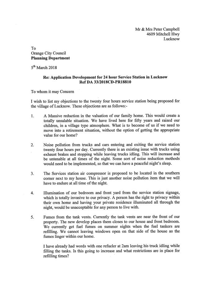
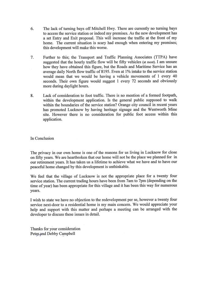
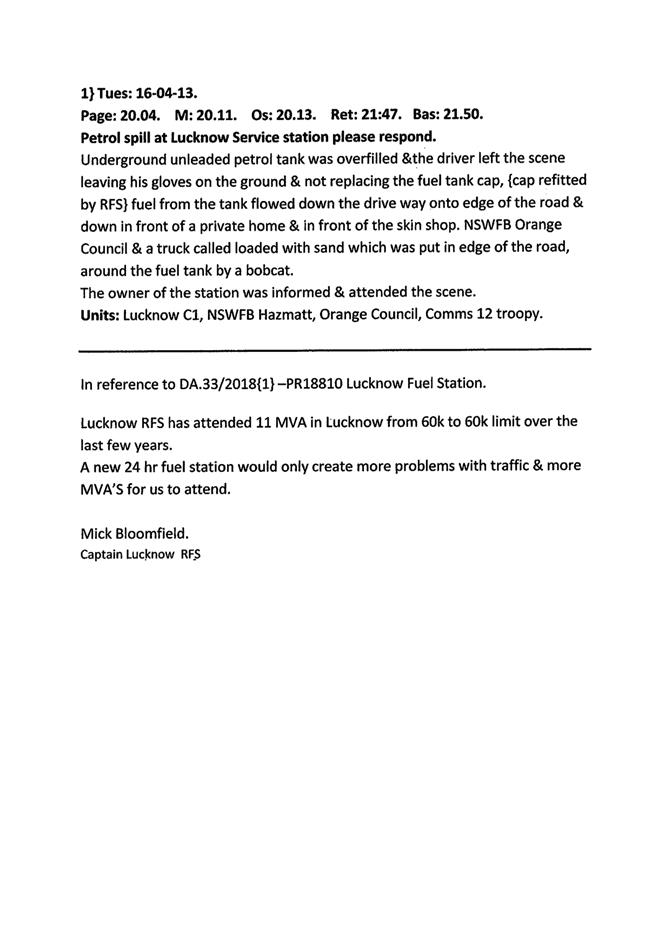
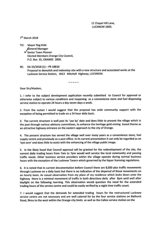


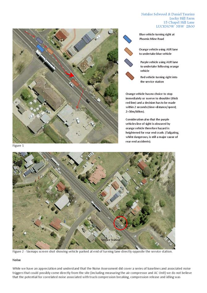
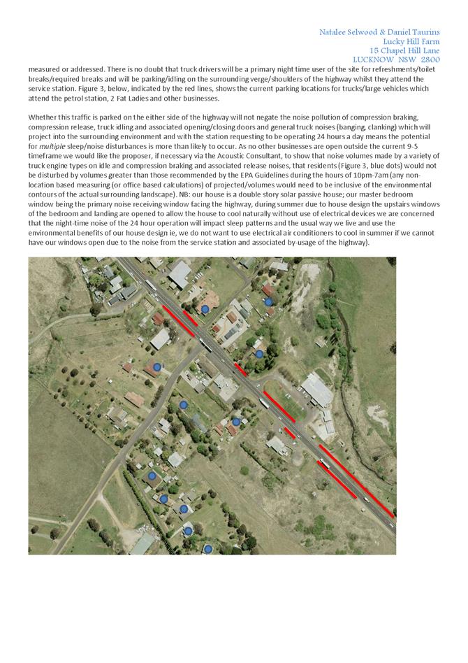
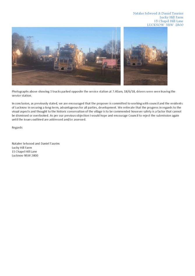
2.4 Development
Application DA 91/2018(1) - 14 Moulder Street
RECORD
NUMBER: 2018/2493
AUTHOR: Michael
Glenn, Senior Planner
EXECUTIVE Summary
|
Application
lodged
|
15 March
2018
|
|
Applicant/s
|
Mr PR
Gunn
|
|
Owner/s
|
Mr PJ,
Mrs CJ, Mr WT and Ms SJ Gunn
|
|
Land
description
|
Lot 1 DP
38296 - 14 Moulder Street Orange
|
|
Proposed
land use
|
Subdivision
(two lot residential), Demolition (existing shed), Dual Occupancy and
Subdivision (three lot Community Title)
|
|
Value of
proposed development
|
$500,000
|
Council’s consent is sought for a subdivision of the
subject land to excise the existing dwelling on proposed Lot 100 and
create a battleaxe lot at the rear of the land known as proposed Lot 101. The
development includes the removal of 16 trees from the site, the construction of
two new dwellings (as a dual occupancy development) on proposed Lot 101
and a Community title subdivision of the dual occupancy following its
construction.
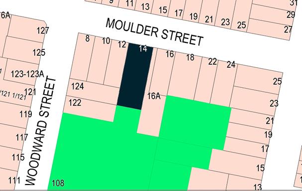
Figure 1 - locality plan
The subject application has attracted a number of public
submissions. It is considered that the concerns raised can be satisfactorily
addressed by conditions of consent.
The most significant issue relates to the flood affectation
for the property, which requires minimum floor levels for the new dwellings so
as to achieve compliant freeboards above the 1:100 predicted flooding
levels. The minimum floor levels will need to be between 800mm and 900mm
above the existing ground levels, effectively 400mm higher than what was
initially proposed. This raising of floor levels will have impacts on privacy,
overshadowing and the visual bulk of the proposed development. Such effects are
considered in more detail within the report, with conditions imposed to address
the matters arising where appropriate.
The application is recommended
for approval, subject to conditions.
RECENT LEGISLATIVE CHANGES
On 1 March 2018 the Environmental Planning and Assessment
Act 1979 was substantially amended. The most immediate change involves the
restructuring and renumbering of the Act, with other more substantive
changes to be phased in over time. However, for some applications (particularly
where an application was lodged prior to the changes coming into effect) the
supporting documentation may still reference the previous numbering regime. In
the drafting of this report the content and substance of the supporting
material has been considered irrespective of which legislative references were
used.
DECISION FRAMEWORK
Development in Orange is governed by two key documents:
Orange Local Environment Plan 2011 and Orange Development Control Plan 2004. In
addition the Infill Guidelines are used to guide development, particularly in
the heritage conservation areas and around heritage items.
Orange Local Environment Plan 2011 – The
provisions of the LEP must be considered by the Council in determining the
application. LEPs govern the types of development that are permissible or
prohibited in different parts of the City and also provide some assessment
criteria in specific circumstances. Uses are either permissible or not. The
objectives of each zoning and indeed the aims of the LEP itself are also to be
considered and can be used to guide decision making around appropriateness of
development.
Orange Development Control Plan 2004 – the DCP
provides guidelines for development. In general it is a performance based
document rather than prescriptive in nature. For each planning element there
are often guidelines used. These guidelines indicate ways of achieving the
planning outcomes. It is thus recognised that there may also be other solutions
of merit. All design solutions are considered on merit by planning and building
staff. Applications should clearly demonstrate how the planning outcomes are
being met where alternative design solutions are proposed. The DCP enables
developers and architects to use design to achieve the planning outcomes in
alternative ways.
DIRECTOR’S COMMENT
The subject land is affected by flooding impacts.
Council’s Technical Services staff have specified minimum floor levels
for the new dwellings so as to achieve compliant freeboards above the 1:100
predicted flooding levels. The raising of floor levels generates impacts on
privacy, overshadowing and the visual bulk of the proposed development. A
detailed assessment of these issues has been provided in the body of this
report by staff. Council’s assessment staff have recommended approval of
the development. Conditions of consent have been included where considered
appropriate to address the above identified issues.
Link To Delivery/OPerational Plan
The recommendation in this report relates to the
Delivery/Operational Plan strategy “10.1 Preserve - Engage with the
community to ensure plans for growth and development are respectful of our
heritage”.
Financial Implications
Nil
Policy and Governance Implications
Nil
|
Recommendation
That Council consents to
development application DA 91/2018(1)
for Subdivision (two lot residential), Demolition (existing shed), Dual
Occupancy and Subdivision (three lot Community Title) at Lot 1
DP 38296 - 14 Moulder Street, Orange pursuant
to the conditions of consent in the attached Notice of Approval.
|
further considerations
Consideration has been given to the recommendation’s
impact on Council’s service delivery; image and reputation; political;
environmental; health and safety; employees; stakeholders and project
management; and no further implications or risks have been identified.
SUPPORTING INFORMATION
THE APPLICATION/PROPOSAL
Council's consent is sought for a staged development
Stage 1: Two lot subdivision to create a separate
vacant development lot and place the existing dwelling on its own lot. It is
proposed to demolish the existing rear shed.
Stage 2: The construction of a dual occupancy on the
newly created vacant lot.
Stage 3: Community title
subdivision to create a lot for each of the new dwellings and a further lot to
contain the communal driveway and shared landscaped areas.
The details of the development
at the completion of this process are summarised below:
|
Stage 1 -
Subdivision
|
|
Lot
|
Area
|
Private open
space
|
Dwelling
|
Gross Floor Area
|
Description
|
|
100
(existing
dwelling)
|
472.8m²
|
94m²
|
existing
|
141m²
|
Single storey, three
bedroom dwelling with carport and separate access (existing)
|
|
101
|
877m²
|
n/a
|
vacant
|
n/a
|
Development Lot
|
|
Stage 2 - Dual
Occupancy
|
|
Lot 101
Unit 1
Unit 2
|
877m²
(283m²)
(335m²)
|
130m²
61m²
69m²
|
Units 1 + 2
Unit 1
Unit 2
|
356.7m²
165.9m²
190.8m²
|
Two bedroom dwelling with double garage
Three bedroom dwelling with double garage
|
|
Stage 3 -
Community Title Subdivision
|
|
1
Unit 1
|
283.8 m²
|
61m²
|
Unit 1
|
Refer Stage 2
|
Two bedroom dwelling with double garage (see Stage 2)
|
|
2
Unit 2
|
335.3m²
|
69m²
|
Unit 2
|
Refer Stage 2
|
Three bedroom dwelling with double garage (see Stage 2)
|
|
3
Community Land
|
257.9m²
|
n/a
|
(common
property)
|
n/a
|
n/a
|
MATTERS FOR CONSIDERATION
Section 1.7 - Application of
Part 7 of the Biodiversity Conservation Act 2016 and Part 7A of the
Fisheries Management Act 1994
Development Applications lodged on or after 25 February
2018
Section 1.7 of the EP&A Act 1979 identifies that Part 7
of the Biodiversity Conservation Act 2016 and Part 7A of the Fisheries
Management Act 1994 have effect in connection with terrestrial and aquatic
environments.
Having regard to the relevant provisions and based on an
inspection of the subject property, it is considered that the proposed
development is not likely to significantly affect a threatened species.
A Biodiversity Development Assessment Report is not required
in this instance.
In this instance, site inspection reveals that the subject
property has no biodiversity or habitat value.
Section 4.15
Section 4.15 of the Environmental Planning and Assessment
Act 1979 requires Council to consider various matters, of which those
pertaining to the application are listed below.
PROVISIONS OF ANY ENVIRONMENTAL
PLANNING INSTRUMENT s4.15(1)(a)(i)
Orange Local Environmental Plan 2011
Part 1 - Preliminary
Clause 1.2 - Aims of Plan
The broad aims of the LEP are
set out under subclause 2. Those relevant to the application are as follows:
(a) to
encourage development which complements and enhances the unique character of
Orange as a major regional centre boasting a diverse economy and offering an
attractive regional lifestyle,
(b) to
provide for a range of development opportunities that contribute to the social,
economic and environmental resources of Orange in a way that allows present and
future generations to meet their needs by implementing the principles for
ecologically sustainable development,
(e) to
provide a range of housing choices in planned urban and rural locations to meet
population growth,
(f) to
recognise and manage valued environmental heritage, landscape and scenic
features of Orange.
The application is considered to be consistent with
objectives (a), (b), (e) and (f), as outlined in this report.
Clause 1.6 - Consent Authority
This clause establishes that, subject to the Act, Council is
the consent authority for applications made under the LEP.
Clause 1.7 - Mapping
This clause establishes that, subject to the Act, Council is
the consent authority for applications made under the LEP.
The subject site is identified
on the LEP maps in the following manner:
|
Land Zoning Map:
|
Land zoned R1 General Residential
|
|
Lot Size Map:
|
No minimum lot size
|
|
Heritage Map:
|
Not a heritage item or conservation
area
|
|
Height of Buildings Map:
|
No building height limit
|
|
Floor Space Ratio Map:
|
No floor space limit
|
|
Terrestrial Biodiversity Map:
|
No biodiversity sensitivity on the
site
|
|
Groundwater Vulnerability Map:
|
Ground water vulnerable
|
|
Drinking Water Catchment Map:
|
Not within the drinking water
catchment
|
|
Watercourse Map:
|
Not within or affecting a defined
watercourse
|
|
Urban Release Area Map:
|
Not within an urban release area
|
|
Obstacle Limitation Surface Map:
|
No restriction on building siting
or construction
|
|
Additional Permitted Uses Map:
|
No additional permitted use applies
|
|
Flood Planning Map:
|
Not a flood planning area (under
the LEP, but see comments in this report)
|
Those matters that are of relevance are addressed in detail
in the body of this report.
Clause 1.9A - Suspension of
Covenants, Agreements and Instruments
This clause provides that covenants, agreements and other
instruments which seek to restrict the carrying out of development do not apply
with the following exceptions.
· covenants imposed
or required by Council
· prescribed
instruments under Section 183A of the Crown Lands Act 1989
· any conservation
agreement under the National Parks and Wildlife Act 1974
· any trust
agreement under the Nature Conservation Trust Act 2001
· any property
vegetation plan under the Native Vegetation Act 2003
· any biobanking
agreement under Part 7A of the Threatened Species Conservation Act 1995
· any planning
agreement under Division 6 of Part 4 of the Environmental Planning and
Assessment Act 1979.
Council staff are not aware of the title of the subject
property being affected by any of the above.
Part 2 - Permitted or Prohibited Development
Clause
2.1 - Land Use Zones and Clause 2.3 - Zone Objectives and Land Use Table
The subject site is located
within the R1 General Residential zone. The proposed development is defined as
a “subdivision” and “dual occupancy”.
Pursuant to Section 4B of the Environmental Planning and
Assessment Act:
Subdivision of land
means the division of land into two or more parts that, after the division,
would be obviously adapted for separate occupation, use or disposition.
Pursuant to the OLEP 2011 Dictionary:
Dual
Occupancy (detached) means 2
detached dwellings on one lot of land, but does not include a secondary
dwelling.
Subdivision and dual occupancy houses are
permitted with consent in the R1 zone.
Clause 2.3 of
LEP 2011 references the Land Use Table and Objectives for each zone in
LEP 2011. These objectives for land zoned R1 General Residential are as
follows:
1 -
Objectives of the R1 General Residential Zone
· To provide for
the housing needs of the community.
· To provide for
a variety of housing types and densities.
· To enable other
land uses that provide facilities or services to meet the day to day needs of
residents.
· To ensure
development is ordered in such a way as to maximise public transport patronage
and encourage walking and cycling in close proximity to settlement.
· To ensure that
development along the Southern Link Road has an alternative access.
In relation to the first objective, the proposed development
would act to provide additional housing stock within the City.
In relation to the second objective, the proposed dwellings
will provide a variation of housing type and density for the City.
In relation to the third objective, the proposed development
has no effect.
In relation to the fourth objective, the subject site is
within close proximity to routes used by public transport and is also in close
proximity to shops and services.
In relation to the last objective, the proposed development has
no effect.
The proposed development is not inconsistent with the
objectives of the zone.
Clause 2.6 - Subdivision -
Consent Requirements
Application has been made for the subdivision of the subject
land. Clause 2.6 of Orange LEP 2011 permits the subdivision of the subject
land only with development consent.
Clause 2.7 - Demolition
Requires Development Consent
This clause triggers the need for development consent in
relation to a building or work. This requirement does not apply to any
demolition that is defined as exempt development.
The proposal involves demolition and the applicant is
seeking the consent of Council. Demolition of a shed in the rear yard is
proposed. The demolition works proposed will have no significant impact on
adjoining lands, streetscape or public realm. Conditions may be imposed in
respect of hours of operation, dust suppression and the need to investigate
for, and appropriately manage the presence of, any materials containing
asbestos.
Part 3 -
Exempt and Complying Development
The application is not exempt or
Complying Development.
Part 4 -
Principal Development Standards
Clause 4.1 - Minimum
Subdivision Lot Size
This
clause establishes the objectives for minimum lot sizes. The objectives of this
clause are as follows:
(a) to ensure that new subdivisions reflect
existing lot sizes and patterns in the surrounding locality,
(b) to
ensure that lot sizes have a practical and efficient layout to meet intended
use,
(c) to ensure that lot sizes do not undermine
the land’s capability to support rural development,
(d) to
prevent the fragmentation of rural lands,
(e) to
provide for a range of lot sizes reflecting the ability of services available
to the area,
(f) to encourage subdivision designs
that promote a high level of pedestrian and cyclist connectivity and
accommodate public transport vehicles.
The proposed subdivision is
considered to general meet the objectives of the clause.
Subclause (2) applies to a
subdivision of any land shown on the Lot size map. It is noted that the subject
property does not appear on the Lot Size Map.
Subclause (3) requires that the
size of any lot resulting from a subdivision of land to which this clause
applies is not to be less than the minimum size shown on the Lot Size Map. As
indicated above this site is not identified on the Lot Size Map.
Subclause (4) establishes that
this clause does not apply in relation to the subdivision of any land by the
registration of a Strata plan or by way of a Community title subdivision.
Clause 4.1B
- Minimum Lot Sizes for Dual Occupancy, Multi Dwelling Housing and Residential
Flat Buildings
This clause establishes the
minimum lot size required for dual occupancies and multi dwelling housing in
the R1, R2 and R3 zones. The development lot to which the dual occupancy
component relates has an area of 877m², thereby meeting the minimum lot
size requirement (800m²) for this development type.
Part 7 - Additional Local Provisions
7.1
- Earthworks
This
clause establishes a range of matters that must be considered prior to granting
development consent for any application involving earthworks, such as:
(a) the likely disruption of, or any
detrimental effect on, existing drainage patterns and soil stability in the
locality of the development
(b) the effect of the development on the likely
future use or redevelopment of the land
(c) the quality of the fill or the soil to be
excavated, or both
(d) the effect of the development on the
existing and likely amenity of adjoining properties
(e) the source of any fill material and the
destination of any excavated material
(f) the likelihood of disturbing relics
(g) the proximity to and potential for adverse
impacts on any waterway, drinking water catchment or environmentally sensitive
area
(h) any measures proposed to minimise or
mitigate the impacts referred to in paragraph (g).
In consideration of this clause,
the proposal is considered to be acceptable. Earthworks are required to create
level building pads for the proposed dual occupancy and private open space
areas. The earthworks will be supported onsite and the change in ground level
is not substantial. Conditions are recommended to address matters pertaining to
overland stormwater flows that traverse the site. The overall disruption to
drainage is considered to be relatively minor and will not detrimentally affect
adjoining properties or receiving waterways. Conditions are recommended in
relation to sediment and erosion control during construction.
7.2 - Flood Planning
This
clause applies to land identified on the Flood Planning Map as a Flood Planning
Area and requires that, before any consent is issued, Council must be satisfied
that the proposal:
(a) is compatible with the flood hazard of the
land, and
(b) is not likely to significantly adversely
affect flood behaviour resulting in detrimental increases in the potential
flood affectation of other development or properties, and
(c) incorporates appropriate measures to
manage risk to life from flood, and
(d) is not likely to significantly adversely
affect the environment or cause avoidable erosion, siltation, destruction of
riparian vegetation or a reduction in the stability of river banks or
watercourses, and
(e) is not likely to result in unsustainable
social and economic costs to the community as a consequence of flooding.
The subject land is not located within a flood planning area
as identified in the LEP mapping. However, the LEP mapping layers only
deal with the major tributaries traversing the City and not the many overland
flow paths that exist throughout the City. Whilst specific LEP controls do not
necessarily apply, Council still has an obligation to consider the likely
impact that the development may have on flooding and stormwater flows in the
locality. Council’s Technical Services Division advises that the site is subject to flooding during most storm
events due to the natural ground being low lying. In addition, stormwater flows
enter the site from the north (overflow from road drainage) and west (natural
overland flows) during large storm events.
The applicant has
provided preliminary engineering plans that demonstrate that the development
can provide onsite stormwater detention and allow for overland flows.
The 2017 draft flood study indicates a stormwater depth of approximately
200-300mm above natural ground levels for a 1% AEP storm event (870.60m 1% AEP
level). Therefore, the minimum floor level of the dwellings is 1% level +400mm
(871m). The garage floor levels are permitted to be at the 1% level (870.60m).
The existing dwelling has
a floor level of 871.24 and is unaffected by flooding.
Attached are conditions
of consent that specify the required floor level to address the flooding issue.
The applicant will also be required to purchase a drainage easement from
Council crossing the parkland for a drainage line to service the development.
7.3 - Stormwater Management
This clause applies to all
industrial, commercial and residential zones and requires that Council be
satisfied that the proposal:
(a) is designed to maximise the use of water
permeable surfaces on the land having regard to the soil characteristics
affecting onsite infiltration of water
(b) includes, where practical, onsite
stormwater retention for use as an alternative supply to mains water,
groundwater or river water; and
(c) avoids any significant impacts of
stormwater runoff on adjoining downstream properties, native bushland and
receiving waters, or if that impact cannot be reasonably avoided, minimises and
mitigates the impact.
In consideration of Clause 7.3,
the proposal is considered to be acceptable. As discussed above the proposed
development will be required to be connected to existing stormwater
infrastructure in the locality. Conditions are recommended in relation to
stormwater management.
7.6 -
Groundwater Vulnerability
This clause seeks to protect
hydrological functions of groundwater systems and protect resources from both
depletion and contamination. Orange has a high water table and large areas of
the LGA, including the subject site, are identified with “Groundwater
Vulnerability” on the Groundwater Vulnerability Map. This requires that
Council consider:
(a) whether or not the development (including
any onsite storage or disposal of solid or liquid waste and chemicals) is
likely to cause any groundwater contamination or have any adverse effect on
groundwater dependent ecosystems, and
(b) the cumulative impact (including the
impact on nearby groundwater extraction for potable water supply or stock water
supply) of the development and any other existing development on groundwater.
Furthermore, consent may not be granted unless Council is satisfied that:
(a) the development is designed, sited and
will be managed to avoid any significant adverse environmental impact, or
(b) if that impact cannot be reasonably
avoided - the development is designed, sited and will be managed to minimise
that impact,
(c) if that impact cannot be minimised - the
development will be managed to mitigate that impact.
The proposal is not anticipated
to involve the discharge of toxic or noxious substances and is therefore
unlikely to contaminate the groundwater or related ecosystems. The proposal
does not involve extraction of groundwater and will therefore not contribute to
groundwater depletion. The design and siting of the proposal avoids impacts on
groundwater and is therefore considered acceptable.
Clause 7.11 - Essential
Services
Clause 7.11 applies and states:
Development consent must not be
granted to development unless the consent authority is satisfied that any of
the following services that are essential for the proposed development are
available or that adequate arrangements have been made to make them available
when required:
(a) the
supply of water,
(b) the
supply of electricity,
(c) the
disposal and management of sewage,
(d) storm
water drainage or on-site conservation,
(e) suitable
road access.
In consideration of this clause,
all utility services are available to the land and adequate for the proposal:
· the subject land
is connected to reticulated water supply
· electricity and
telecommunications are available to the land
· the site is
connected to Council’s reticulated sewerage system.
Conditions
are recommended requiring stormwater management consistent with the Development
and Subdivision Code
STATE ENVIRONMENTAL PLANNING
POLICIES
State Environmental Planning Policy - BASIX
SEPP (Building Sustainability Index BASIX) 2004 applies to
the subject development. A BASIX certificate for the dual occupancy has
been submitted in support of the development. The proposal will satisfy the
provisions of BASIX in respect of water, thermal comfort and energy. The
proposal is consistent with the SEPP. Conditions are recommended requiring the
BASIX commitments to be undertaken during construction works.
State Environmental Planning
Policy 55 - Remediation of Land
SEPP 55 - Remediation of Land is
applicable to the proposed development. Pursuant to Clause 7(1):
(1) A
consent authority must not consent to the carrying out of any development on
land unless:
(a) It
has considered whether the land is contaminated, and
(b) If
the land is contaminated, it is satisfied that the land is suitable in its
contaminated state (or will be suitable, after remediation) for the purpose for
which the development is proposed to be carried out, and
(c) If
the land requires remediation to be made suitable for the purpose for which the
development is proposed to be carried out, it is satisfied that the land will
be remediated before the land is used for that purpose.
In consideration of this clause,
the subject land does not appear to have been used for a purpose listed in
Table 1 of Managing Land Contamination Planning Guidelines SEPP 55-
Remediation of Land. Further, it is clear that the site has a long history
of being used for residential purposes. The land is well established with a dwelling
house, garage and extensive landscaped areas. Further investigation as a
precursor to site remediation is considered unnecessary in conjunction with the
current proposal.
PROVISIONS OF ANY DRAFT
ENVIRONMENTAL PLANNING INSTRUMENT THAT HAS BEEN PLACED ON EXHIBITION
4.15(1)(a)(ii)
There are no draft environmental planning instruments that
apply to the subject land or proposed development.
DESIGNATED DEVELOPMENT
The proposed development is not designated development.
INTEGRATED DEVELOPMENT
The proposed development is not integrated development.
PROVISIONS OF ANY DEVELOPMENT
CONTROL PLAN s4.15(1)(a)(iii)
Development Control Plan 2004
Development Control Plan 2004 (“the DCP”)
applies to the subject land. An assessment of the proposed development against
the relevant Planning Outcomes will be undertaken below.
Pursuant to Planning Outcome 0.2-1 Interim Planning Outcomes
- Conversion of Zones:
· Throughout this
Plan, any reference to a zone in Orange LEP 2000 is to be taken to be a
reference to the corresponding zone(s) in the zone conversion table.
The corresponding zone to zone 2(a) Urban Residential
(Orange LEP 2000) is zoned R1 General Residential (Orange LEP 2011). As
such, Orange DCP 2004-07 - Development in Residential Areas is relevant
to this proposal. The provisions of Part 7 are considered below.
PART 7 - DESIGN ELEMENTS FOR
RESIDENTIAL DEVELOPMENT
SUBDIVISION
Lot Sizes
· Lots below
500m² indicate a mandatory side setback to provide for solar access and
privacy.
The Torrens title component of the development (Stage 1)
proposes the creation of a standard lot (the vacant lot at the rear), and a
“cottage lot’ for the existing dwelling, being lots between
350m² and 500 m².
Special
Requirements for “Battleaxe” Lots
The development lot at the rear is a battleaxe allotment
which the DCP recommends should be a minimum of 650m² excluding the access handle. The
submitted plans indicate that the proposed lot at the rear excluding its access
handle is 721.7m².
The DCP requires that a common driveway to two battleaxe
lots or an access serving two dwellings (dual occupancy) requires a 4.5m wide
driveway within a 6m wide accessway. Unit developments may require a 6m wide
driveway to provide for passing cars.
In this case the corridor width is 5.64m and the driveway is
4.5m. There is a minor non-compliance with the corridor width requirement,
which is considered to be inconsequential in planning terms.
Dual Occupancy Sites
The subject property is not an
identified dual occupancy or multi dwelling site. This has no relevance to the
planning assessment.
General Planning Outcomes
The DCP sets the following (applicable) Planning Outcomes in
regard to urban residential subdivision:
· Subdivision
layouts in areas zoned Urban Residential prior to this plan are generally in
accordance with the applicable plan maps in Appendix 1.
There are no relevant ‘plan maps’ for this
locality.
· Lots are
orientated to optimise energy-efficiency principles.
The proposed dwellings and the associated outdoor spaces and
living areas are designed with complying levels of solar access.
· New roads are
planned according to modified grid layouts with restrained use of cul‑de-sac
roads in new developments according to the UDAS Urban Form principles for
Orange.
There are no new roads contained in the proposed
development.
· Local open
space is provided along creek corridors to create open space linkages for
environmental conservation and social interaction. Release areas removed from
creeks provide for open-space links incorporating substantial stands of native
vegetation.
There are no opportunities presented for public open space
on this site, and no riparian land directly affected by the proposed
development.
· Release areas
indicate trunk cycle and pedestrian ways that link the area to major open space
networks and activity centres (schools, shopping centres and employment areas).
The subject property is not located within an urban release
area.
· Lots below
500m² indicate a mandatory side setback to provide for solar access and
privacy. Lots below 350m² indicate existing or planned house layouts,
which identify how privacy, solar access, vehicular access and private
open-space needs are to be achieved.
See comments above under the heading “Lot
Sizes”.
· Up to 25% of
new subdivisions comprise small lots in dispersed locations.
The proposed lots are generally small in nature.
· Lots are fully
serviced and have direct frontage and access to a public road.
The proposed lots will each have direct street frontage and
legal and practical access to public streets. Access to the rear lot will be
via the battle-axe handle. Council’s Technical Services Division has
advised no objections to the proposed access arrangements.
· Design and
construction complies with the Orange Development and Subdivision Code.
The subdivision design and construction will be required to
comply with the Orange Development and Subdivision Code. Attached is a
condition of consent addressing this issue.
The proposed development has been considered and assessed
against the relevant Planning Outcomes contained in PO 7.2-1 Planning Outcomes
for Urban Residential Subdivision. There are no issues arising from that
assessment.
· Corner lots
provide for a house to front one street.
The proposed subdivision does not relate to a corner
allotment.
· Battleaxe lots
provide an adequate accessway width for the number of dwellings proposed to be
served in order to allow for vehicle and pedestrian access and location of
services.
This planning outcome has been
addressed above under the heading “Special Requirements for
“Battleaxe” Lots”.
· Lots proposed
to be used specifically for dual occupancy or units in new residential areas
are identified on development application plans to inform prospective
purchasers of the mixed residential form of the area and measures are outlined
on how prospective residents are to be informed of these identified sites prior
to purchasing land.
Refer to the above comments under the heading “Dual
Occupancy Sites”.
RESIDENTIAL DWELLINGS
The DCP sets the following Planning Outcomes in regard to
Urban Residential Development.
Residential Design
Objectives
· To
ensure that the development fits into its setting and environmental features of
the locality.
· To
ensure that the appearance of housing is of a high visual quality, enhances the
streetscape and complements good quality surrounding development.
· To
ensure that new development complements places with heritage significance and
their settings in a contemporary way.
· To
develop a sense of place with attractive street frontages.
· To
encourage visually appealing cohesive streetscapes.
· To
create a safe and secure environment.
· To
provide consistent design elements that protect private investment.
In summary, and in reference to the listed design objectives,
the proposed development is considered to have compatible scale and materials.
It is acknowledged that the proposed development is single storey detached
housing, with an identifiable frontage, appropriate setbacks and site coverage.
The proposed dwellings are identifiable to the surrounding neighbourhood
character, albeit in a more compact form. It is considered that there would be
no significant adverse impact on neighbourhood character or safety, and no
appreciable environmental effect resulting from an approval of the proposed
development.
Neighbourhood Character
The DCP sets the following Planning Outcomes in regard to
Neighbourhood Character:
· Site layout and
building design enables the:
- creation
of attractive residential environments with clear character and identity
- use
of site features such as views, aspect, existing vegetation and landmarks
· Buildings are
designed to complement the relevant features and built form that are identified
as part of the desired neighbourhood character.
· The streetscape
is designed to encourage pedestrian access and use.
The character and identity of the development are influenced
by building design that maintains a common theme and consistent use of
materials. This part of Orange is characterised by somewhat older residential
and generally single storey housing using a mix of materials and styles. he
subject property is part of an established precinct. The proposed development
should be considered as infill development within that context.
The proposed dwellings are single storey, with brick front
facades and Colorbond custom orb roofing. The areas of the proposed allotments
are generally smaller than the surrounding subdivision pattern, but as the
assessment in this report suggests, the proposed development to be located on
the allotments is considered to have no significant adverse impacts arising,
and is generally compatible with the surrounding residential context.
Building Appearance
The DCP sets the following Planning Outcomes in regard to
Building Appearance:
· The building
design, detailing and finishes relate to the desired neighbourhood character,
complement the residential scale of the area, and add visual interest to the
street.
· The frontages
of buildings and their entries face the street.
· Garages and car
parks are sited and designed so that they do not dominate the street frontage.
The external finishes are considered appropriate in this
neighbourhood. The building design and detailing will complement recent
dwellings in the locality.
Setbacks
The DCP sets the following Planning Outcomes in regard to
Setbacks:
· Street setbacks
contribute to the desired neighbourhood character, assist with the integration
of new development and make efficient use of the site.
· Street setbacks
create an appropriate scale for the street considering all other streetscape
components.
Relevant Guidelines
· In established
areas (infill) the setback shall be up to the front building line of the
residential part of a building on adjoining (but not adjacent) land.
· A 2m secondary
setback applies to corner allotments.
· Garages shall be
set back 1.5m behind the building line as established above, or at least 5.5m,
whichever is the greater distance. This distance applies to entrances off a
secondary boundary on corner allotments.
The setback of the existing dwelling (facing Moulder Street)
is not proposed to change. The setbacks of the two rear dwellings (side and
rear boundaries) conform with the DCP requirements.
Front Fences and Walls
The DCP sets the following Planning Outcomes in regard to
Fences and Walls:
· Front fences
and walls:
- assist in
highlighting entrances and creating a sense of identity within the streetscape
- are
constructed of materials compatible with associated housing and with fences visible
from the site that positively contribute to the streetscape
- provide for
facilities in the street frontage area such as mail boxes.
The proposal does not involve a front fence. With respect to side and rear fencing, suitable
conditions are included in the consent.
Bulk and Scale Objectives
· To
allow flexibility in siting buildings and to ensure that the bulk and scale of
new development reasonably protects the amenity of neighbouring properties and
maintains appropriate neighbourhood character.
· To allow
adequate daylight, sunlight and ventilation to living areas and private open
spaces of new and neighbouring developments.
· To
encourage the sharing of views, while considering the reasonable development of
the site.
The raising of the minimum floor levels to address flooding
related matters will impact upon the visual bulk of the development. An
assessment of how the development impacts upon the amenity of surrounding areas
has been undertaken below in subsequent sections of this report. The key considerations
relate to privacy, overshadowing and visual impact. Conditions of consent have
been recommended to address matters pertaining to visual privacy. The proposed
development is not located within a significant view corridor as defined under
the provisions of the DCP.
Visual Bulk
The DCP sets the following Planning Outcome in regard to
Visual Bulk:
· Built form
accords with the desired neighbourhood character of the area with:
- side and rear
setbacks progressively increased to reduce bulk and overshadowing
- site coverage
that retains the relatively low density landscaped character of residential
areas
- building
form and siting that relates to landform, with minimal land shaping (cut and
fill)
- building
height at the street frontage that maintains a comparable scale with the
predominant adjacent development form
- building
to the boundary where appropriate.
As discussed above, it will be necessary to require the
minimum floor levels for the buildings to be raised by a further 400mm over and
above those proposed in the submitted plans. This will result in the minimum
floor levels being up to 900mm higher than the existing ground levels in the
case of Dwelling 2 and 800mm higher in the case of Dwelling 1 to
accommodate flooding impacts.
The DCP requires dwellings to be contained within the
prescribed envelopes generated by planes projected at 45o over
the site commencing 2.5m above existing ground level from each side and rear
boundary. After taking into account the requirements needed to meet the minimum
freeboard standards for the flooding issue, the proposed development will not
comply with the vertical building envelopes of the DCP. However, following an
assessment it is considered that the bulk of the new buildings will not have a
significant impact on neighbourhood character by reason of excessive bulk,
mainly because the new buildings are set behind the existing dwelling. As such,
views of the new buildings from Moulder Street will be limited.
When viewed from Elephant Park the elevated bulk and walls
of the new buildings will be masked from view by the structures on
neighbour’s land. The vegetation in Elephant Park immediately at the rear
of the subject property will also provide a certain level of screening to the
height and bulk effects of the development when viewed from the park.
However, it should be acknowledged that the neighbours to
the east of the site will be impacted to a degree from the increased floor
levels of the new dwellings. Whilst the development will be located within the
visual bulk envelopes specified in the DCP along this particular boundary, the
increased height will raise the potential for privacy impacts that will need to
be considered. Matters in relation to privacy have been discussed later in this
report in detail.
With regards to the western neighbour, only the garage of
Dwelling 2 will generate an impact in terms of visual bulk. However in this
case the subject building is located immediately adjacent to an existing garage
that has a similar bulk, hence limiting its impact along this boundary.
The overall site coverage (at completion) complies with the
minimum 50% site coverage requirement contained within the DCP.
Walls and Boundaries
The DCP sets the following Planning Outcome in regard to
Walls and Boundaries:
· Building to the
boundary is undertaken to provide for efficient use of the site taking into
account:
- the privacy of
neighbouring dwellings and private open space
- the access to
daylight reaching adjoining properties
- the impact of
boundary walls on neighbours.
Relevant Guidelines
· There is a side
boundary setback of at least 900mm minimum for walls in accordance with the
above building envelope planes (unless the wall has been built on the
boundary). Eaves and other projections may encroach within this area.
· Adequately
fire-rated walls without windows or other openings may be erected on or
adjacent to boundaries subject to no projections encroaching on adjoining land.
The length of a wall within 900mm of the boundary is a maximum of 15m
or 50% of the side boundary length, whichever is less.
· Encroachments
within the setback demonstrate that privacy and overshadowing will not affect
adjoining land. Council requires evidence that the adjoining owner does not
object to the positioning of the building on or near the boundary.
· The position of
buildings in relation to boundaries addresses existing trees and landscaping
that contribute to the amenity of the locality.
The proposal incorporates side setbacks that comply with the
planning guidelines and outcomes of the DCP.
Daylight and Sunlight
The DCP sets the following Planning Outcome in regard to
Daylight and Sunlight:
· Buildings are
sited and designed to ensure:
- daylight to
habitable rooms in adjacent dwellings is not significantly reduced
- overshadowing
of neighbouring secluded open spaces or main living area windows is not
significantly increased
- consideration
of Council’s Energy Efficiency Code.
Shadow diagrams have been prepared in support of the
proposed development. In consideration of the DCP Guidelines, the proposal is
considered to be satisfactory as outlined below:
Overshadowing of Dwellings
According to the DCP Guidelines and Council’s Energy
Efficiency Code, sunlight to at least 75% of north facing living area
windows within the development and on adjoining land is to be provided for a
minimum of four hours on 21 June, or not further reduced than existing where
already less.
The proposed development provides north facing, full height
sliding doors to the living room spaces in the units that will comply with the
solar access requirements. This assessment takes into account the changes in
height brought on by the need to elevate the floor levels of the new dwellings
due to flooding.
Overshadowing of Private Open
Space
Under the DCP Guidelines and
Council’s Energy Smart Homes Code, complying sunlight access (ie a
minimum of three hours’ access between 9am and 3pm on 22 June) is to
be available to at least 40% of required open space (and the required open
space is at least 50% of the floor area of the dwelling) for dwellings.
The revised diagrams and calculations submitted with the application produce
the following analysis:
|
Dwelling
|
Living
Area (excluding garage, porches, patios etc)
|
Private
Open Space Required by DCP
|
Private
Open Space Provided
|
|
Existing
|
141m²
|
70.5m²
|
94m²
|
|
2
|
165.9m²
|
52.6m²
|
61m²
|
|
3
|
190.8m²
|
60.3m²
|
69m²
|
The applicant’s submission with respect to
overshadowing is as follows:
“The plans submitted
show substantial separation distance to property to the east with the location
of the driveway of 16a Moulder Street and the distance of the dwelling upon 16
Moulder Street over 13 metres away and similarly 10 metres from the dwelling
situated on 12 Moulder Street demonstrating that no overshadowing issues will
be present between 9am and 3pm. The southern dwelling will be situated close to
the southern boundary overlooking Elephant Park. Further sheds are situated at
the rear of 124 Woodward Street and would be situated near the garage of
dwelling two.
The existing dwelling faces
south and has some overshadowing effect on its own yard. There is, however,
sufficient space in the South eastern corner of the dwelling lot 101 that is
not overshadowed from 8am to 1pm providing compliance with the 40% requirement
of the DCP”.
A detailed analysis of the overshadowing and solar access
requirements of the DCP has not been provided by the applicant for the revised
floor levels required by Council’s Development Engineer. The increased
floor height of the development that has been brought about by the need to meet
the requirements of the flood assessment has an effect on the overshadowing of
the outdoor spaces of the subject property, but only limited effects on the
overshadowing of adjoining residential land. However, analysis of the plans
shows that all three dwellings have areas of open space that possess clear
northerly aspects to proportions of their open space that will conform to the
standards of the DCP, notwithstanding the elevated floor levels brought about
by the flooding levels.
Views
The DCP sets the following Planning Outcomes in regard to
Views:
· Building form
and design allow for residents from adjacent properties to share prominent
views where possible.
· Views including
vistas of heritage items or landmarks are not substantially affected by the
bulk and scale of the new development.
The proposed development is single storey and has no
measurable impact on primary views. Site inspection does not reveal any
significant view lines for nearby and adjoining properties.
Visual Privacy
The DCP sets the following Planning Outcome in regard to
Visual Privacy:
· Direct
overlooking of principal living areas and private open spaces of other
dwellings is minimised firstly by:
- building
siting and layout
- location of
windows and balconies
and
secondly by:
- design of
windows or use of screening devices and landscaping.
Relevant Guidelines
(a) Site
and building layout ensures windows do not provide direct and close views into
the windows, balconies or private open spaces of adjoining dwellings.
(b) Habitable
room windows on upper-floor levels (ie floor level greater than 1.5m above
pre-development ground level) within 9m from windows of living areas of
adjacent dwellings:
- are
off-set sufficient distance to limit direct views; or
- include
measures to screen or obscure views between the dwellings (curtains are not
sufficient for screening).
(c) Balconies
of an upper-floor level (as defined above) within 9m of habitable rooms or
private open space are permanently screened to reasonably obscure direct views
to adjacent rooms and private open space.
The adjoining neighbour to the east has raised concerns
about the impacts of privacy resulting from the units at the rear of the site.
The raised floor levels of the two dwellings at the rear will limit the
effectiveness of boundary fencing to preserve privacy for the eastern
neighbours. An assessment of the plans revealed that there is potential for
overlooking of the adjoining property to the east, and also towards the
existing dwelling within the development site to the immediate north, from
within the new dwellings when looking out of their windows and the glazed doors
leading to the alfresco areas. There will also be some mutual privacy issues
arising from the existing elevated deck area of the front dwelling and the
north facing living room of proposed Unit 1. Whilst a privacy impact has been
identified in the assessment, it is considered reasonable to address the
privacy issues by way of suitable conditions of consent. To this end it is considered
necessary to impose the following suite of conditions in Stage 2 of the
development consent (dual occupancy).
Prior to the issue of a Construction Certificate
A detailed plan at a scale of not less than 1:20
professionally drawn by an architect or architectural draftsperson providing
specific construction details of privacy screens required by Conditions (xx)
and (xx) shall be submitted and approved by Council’s Manager
Development Assessments prior to the issue of a Construction Certificate.
Prior to the issue of an Occupation Certificate
Dwelling 1 - Required Privacy Screening
· To provide privacy to
the property owner to the east, a screen shall be erected 300mm from the
eastern boundary and extending for a distance of not less than 5m along this
boundary, measured from the point adjacent to the southern return wall for the
alfresco area and extending north. The required screen shall incorporate a
minimum height of 2,200mm above existing ground levels. The lower edge of the
screen shall be not more than 1.1m above existing ground levels. The screen
shall be constructed in solid timber or metal slats with minimum 200mm width
slats, fixed at 150mm centres and angled upwards at an angle of not less than
25 degrees.
· The kitchen and
laundry windows shall be provided with a privacy screen either on the window or
300mm from the eastern boundary. The screens shall cover the entire glazed
area; or if screens are to be erected adjacent to the boundary, for a distance
extending at least 1m past the outer edges of each window. In either case the
required screen shall incorporate solid timber or metal slats with minimum
200mm width slats, fixed at 150mm centres and angled upwards at an angle of not
less than 25 degrees. In the event that the screens are erected adjacent to the
boundary, these screens shall be a minimum height of 2,200mm above existing
ground levels. The lower edge of the screen shall be not more than 1.1m above
existing ground levels.
· The two north facing
lounge room windows shall be provided with privacy screens covering the entire
glazed area of these windows. The required screens shall incorporate solid
timber or metal slats with minimum 200mm width slats, fixed at 150mm centres
and angled upwards at an angle of not less than 25 degrees.
Dwelling 2 - Required Privacy Screening
· To provide privacy to
the property owner to the east, a screen shall be erected 300mm from the
eastern boundary and extending for a distance of not less than 5m along this
boundary, measured from the point adjacent to the southern return wall for the
alfresco area and extending north. The required screen shall incorporate a
minimum height of 2200mm above existing ground levels. The lower edge of the
screen shall be not more than 1.1m above existing ground levels. The screen
shall be constructed in solid timber or metal slats with minimum 200mm width
slats, fixed at 150mm centres and angled upwards at an angle of not less than
25 degrees.
· The kitchen window
shall be provided with a privacy screen either on the window or 300mm from the
eastern boundary. The screen shall cover the entire glazed area, or if the
screen is to be erected adjacent to the boundary, for a distance extending at
least 1m past the outer edges of the window. The required screen shall
incorporate solid timber or metal slats with minimum 200mm width slats, fixed
at 150mm centres and angled upwards at an angle of not less than 25 degrees. In
the event that the screen is erected adjacent to the boundary, the screen shall
be a minimum height of 2,200mm above existing ground levels. The lower edge of
the screen shall be not more than 1.1m above existing ground levels.
Ongoing Performance
Privacy screens required under this consent shall be
fixed and permanently retained in accordance with this consent.
Acoustic Privacy
The DCP sets the following Planning Outcome in regard to
Acoustic Privacy:
· Site layout and
building design:
- protect
habitable rooms from excessively high levels of external noise
- minimise
the entry of external noise to private open space for dwellings close to major
noise sources
- minimise
transmission of sound through a building to affect other dwellings.
In consideration of the DCP Guidelines the proposal is
considered to be satisfactory. The site is located in an area where ambient
noise levels are expected to be low due to the predominant residential land use
pattern.
Security
The DCP sets the following Planning Outcomes in regard to
Security:
· The site layout
enhances personal safety and minimises the potential for crime, vandalism and
fear.
· The design of
dwellings enables residents to survey streets, communal areas and approaches to
dwelling entrances.
The siting and design of the proposed dwellings are
appropriate to maintain safety and minimise the potential for crime, vandalism
and fear for residents. Habitable room windows will address public roads,
thereby providing opportunities for natural surveillance. The proposed
landscaping and fencing will not restrict sightlines to public areas, and will
provide territorial reinforcement and delineate public and private spaces.
Internal access to the dwellings will be available through
the garages, and proposed fencing will provide territorial reinforcement.
Site Access and Circulation
Objectives
· To
provide convenient and safe access and parking that meets the needs of all
residents and visitors.
· To
encourage the integrated design of access and parking facilities to minimise
visual and environmental impacts.
The development is not inconsistent with the above
objectives as detailed below.
Circulation and Design
The DCP sets the following Planning Outcome in regard to
Circulation and Design:
· Accessways and
parking areas are designed to manage stormwater.
· Accessways,
driveways and open parking areas are suitably landscaped to enhance amenity
while providing security and accessibility to residents and visitors.
· The site layout
allows people with a disability to travel to and within the site between car
parks, buildings and communal open space.
With regard to the first dot point, the proposed development
is configured so as to conform with the requirements of this planning outcome.
With regard to the second dot point, it is noted that there
are two driveways, one leading to the carport for the existing dwelling and the
other being the shared driveway to the two units at the rear. Some provision
for landscaping of the shared driveway is shown on the plans, and it is further
noted that extensive landscaping exists within the front setback area of the
existing dwelling.
With regard to the third dot point, it is noted that the
flat topography of the site makes it possible to convert the units so as to
generally meet the access requirements for people that are mobility impaired.
It is acknowledged that at this time the design does not include provisions
such as tactile surfaces or shower grab rails, but such provision could be
retrofitted into the units if ever the need arose. Outside of the DCP outcome
there is no statutory requirement to make every home or its surrounds capable
of disabled access. It is noted that the flat terrain makes provision or
conversion of the dwellings so as to be wheelchair accessible at least
feasible. With regard to other types of common disabilities (such as providing
for vision impaired people) there is no provision built into the submitted
design, but also no statutory requirement to do so. Similar to the assessment
for mobility impaired persons, it would be possible to make alterations to the
new buildings as required for other types of disabilities as and if the need
arises.
Car Parking
The DCP sets the following Planning Outcomes in regard to
Car Parking:
· Parking
facilities are provided, designed and located to:
- enable
the efficient and convenient use of car spaces and accessways within the site
- reduce
the visual dominance of car parking areas and accessways.
· Car
parking is provided with regard to the:
- the
number and size of proposed dwellings
- requirements
of people with limited mobility or disabilities.
Car Parking Table
|
DWELLING SIZE OR NUMBER OF BEDROOMS
|
AVERAGE CAR PARKING PER DWELLING
|
|
Small
(<75m2) or 1-bedroom unit
|
1.0
spaces per unit
|
|
Medium
(75m2 – 110m2) or 2-bedroom unit
|
1.2
spaces per unit
|
|
Large
(>110m2) or 3+ -bedroom unit
|
1.5
spaces per unit
|
|
Visitor
Parking
|
0.2 spaces
per unit
|
The proposed development seeks approval for the retention of
the existing dwelling (which is currently provided with one off-street parking
space), the construction of one two bedroom dwelling and one three bedroom
dwelling. The net demand for parking under the DCP is 4.3 spaces (rounded up to
5 spaces). The submitted plans show compliance with the DCP requirement in
the form of a single car port and stacked space for the existing dwelling and a
double garage for each of the new dwellings.
Adequate manoeuvring space is provided to allow the vehicles
using the garages at the rear to enter and then leave the site in one turning
manoeuvre.
Private Open Space
The DCP sets the following Planning Outcomes in regard to
Private Open Space:
· Private open
space is clearly defined for private use.
· Private open
space areas are of a size, shape and slope to suit the reasonable requirements
of residents including some outdoor recreational needs and service functions.
· Private open
space is:
- capable
of being an extension of the dwelling for outdoor living, entertainment and
recreation
- accessible
from a living area of the dwelling
- located
to take advantage of outlooks; and to reduce adverse impacts of overshadowing
or privacy from adjoining buildings
- orientated
to optimise year round use.
The following table demonstrates
that each of the proposed dwellings is provided with open space that complies
with the minimum requirement in terms of area.
|
Dwelling
|
Private Open
Space Required by DCP
|
Private Open
Space Provided
|
Compliance
|
|
Existing
|
70.5m²
|
94m²
|
Yes
|
|
2
|
52.6m²
|
61m²
|
Yes
|
|
3
|
60.3m²
|
69m²
|
Yes
|
All private open space is provided behind the front building
line. The site plan confirms that the private open space for each residential
unit will have a minimum dimension of 3m and the yards are able to provide
an area of at least 5m x 5m with access to northern sun, consistent with the
requirements of the DCP.
Open Space and Landscaping
The DCP sets the following Planning Outcomes in regard to
Open Space and Landscaping:
· The site layout
provides open space and landscaped areas which:
- contribute
to the character of the development by providing buildings in a landscaped
setting
- provide
for a range of uses and activities including stormwater management
- allow
cost effective management.
· The landscape
design specifies landscape themes consistent with the desired neighbourhood
character; vegetation types and location, paving and lighting provided for
access and security.
· Major existing
trees are retained and protected in a viable condition whenever practicable
through appropriate siting of buildings, accessways and parking areas.
· Paving is
applied sparingly and integrated in the landscape design.
There are 16 trees proposed to be removed as a result of the
proposed development. The plan provides for the retention of 4 trees in the
front setback area of the existing dwelling with one tree being retained within
the dual occupancy site. However the trees to be removed are considered to be
of limited scenic and environmental value, and cannot be justified for
retention as a result. It is considered appropriate in this case to allow the
removal of the backyard vegetation.
Water and Soil Management
Objectives
· To control and
minimise the impact of stormwater run-off and soil erosion on adjoining land
and downstream.
· To encourage
reduced water wastage by reusing, recycling and harvesting stormwater.
The development is not inconsistent with the above
objectives as detailed below.
Stormwater
The DCP sets the following Planning Outcomes in regard to
Stormwater:
· Onsite drainage
systems are designed to consider:
- downstream
capacity and need for on-site retention, detention and re-use
- scope
for on-site infiltration of water
- safety
and convenience of pedestrians and vehicles
- overland
flow paths.
· Provision is
made for onsite drainage which does not cause damage or nuisance flows to
adjoining properties.
Council’s Technical Services have advised that the
site is affected by an overland flow path that traverses the property. This
issue has been addressed elsewhere within this report Relevant conditions of
consent are attached to the Notice in relation to address stormwater management
of the site.
Erosion and Sedimentation
The DCP sets the following Planning Outcome in regard to
Erosion and Sedimentation:
· Measures
implemented during construction to ensure that the landform is stabilised and
erosion is controlled.
An erosion and sediment control plan will be required to be
prepared as part of the engineering design plans for the development. Attached
is a condition of consent addressing this issue.
SECTION 7.11 - DEVELOPMENT
CONTRIBUTIONS
As previously alluded to in this report, the staging of the
proposed development is for a Torrens subdivision in Stage 1, effectively
adding 1 Equivalent tenement (ET) at that point. At Stage 2 of the
proposed development it is proposed to add a two bedroom and a three bedroom
unit to the yield. The contributions that will be required at Stage 1 will
effectively reduce the applicable contributions at Stage 2 to that which is
applicable to the two bedroom component of the stage. There are no
contributions applicable at Stage 3.
Stage 1 Two Lot Subdivision (net yield one lot)
The payment of $10,545.72 is to
be made to Council in accordance with Section 7.11 of the Act and
Orange Development Contributions Plan 2017 (LGA Remainder) towards the
provision of the following public facilities:
|
Open
Space and Recreation
|
@
$3,922.87 x 1 lot
|
3,922.87
|
|
Community
and Cultural
|
@
$1,137.63 x 1 lot
|
1,137.63
|
|
Roads
and Traffic Management
|
@
$5,178.06 x 1 lot
|
5,178.06
|
|
Plan
Preparation & Administration
|
@
$307.16 x 1 lot
|
307.16
|
|
TOTAL:
|
|
$10,545.72
|
The contribution will be indexed quarterly in accordance
with the Orange Development Contributions Plan 2017 (LGA Remainder).
Section 64 Water and Sewer
Headworks Charges
Section 64 water and sewer headwork charges are also
applicable to the proposal. Such charges are calculated at the time of release
of the Subdivision Certificate for the proposed subdivision. Attached are draft
conditions requiring the payment of the required contributions prior to the
issue of a Subdivision Certificate.
Stage 2 – Dual Occupancy
(net yield adding 1 x two bedroom unit)
The
payment of $6,110.36 is to be made to Council in accordance with Section 7.11
of the Act and Orange Development Contributions Plan 2017 (LGA Remainder)
towards the provision of the following public facilities:
|
Open Space and Recreation
|
@ $2,239.60 x one 2 bedroom dwg
|
2,239.60
|
|
Community and Cultural
|
@ $649.48 x one 2 bedroom dwg
|
649.48
|
|
Roads and Traffic Management
|
@ $3,045.91 x one 2 bedroom dwg
|
3,045.91
|
|
Plan Preparation & Administration
|
@ $175.37 x one 2 bedroom dwg
|
175.37
|
|
TOTAL:
|
|
$6,110.36
|
The contribution will be indexed
quarterly in accordance with the Orange Development Contributions Plan 2017
(LGA Remainder). This Plan can be inspected at the Orange Civic Centre, Byng
Street, Orange.
Section 64 Water and Sewer
Headworks Charges
Section 64 water and sewer headwork charges are also
applicable to the proposal. Such charges are calculated at the time of release
of a Construction Certificate if the buildings are being built first.
PROVISIONS PRESCRIBED BY THE
REGULATIONS s4.15(1)(a)(iv)
The development is not inconsistent with the provisions
prescribed by the Regulations.
BASIX Commitments (clause 97A)
A BASIX Certificate for the dual occupancy has been
submitted in support of the proposed development which demonstrates compliance.
THE LIKELY IMPACTS OF THE
DEVELOPMENT s4.15(1)(b)
Traffic Impacts
The capacity of the road network in the vicinity of the site
is sufficient to accommodate additional localised traffic generated by the
development. Council’s Technical Services Division advises that the
proposed driveway will be appropriately sited so as to prevent vehicle
conflicts. As previously considered (see “DCP
2004”), proposed parking and manoeuvring arrangements will ensure that
vehicles enter and leave the site in a forward direction.
Flooding
Council’s Development
Engineering department provided the following brief comments with respect to
the proposed development:
"On
investigating the engineering detail for the proposed development at 14 Moulder
Street it was found that under Council’s new working draft flood study
the property is now indicated as having an overland flow path passing through
the site from Moulder Street to Elephant Park. This information was not
available to Council until recently when the Consultants gave Council the draft
for review. As a result the developer will have to look at a redesign to allow
for this flow path and especially the effect on proposed unit 2”.
In the final assessment memo
submitted by the Assistant Development Engineer dated 20 September 2018,
and following the submission of amended hydraulic details by the applicant, the
following comments were made;
“The
site is subject to flooding during most storm events due to the natural ground
being low lying. In addition, stormwater flows enter the site from the north
(overflow from road drainage) and west (natural overland flows) during large
storm events.
The
applicant has provided preliminary engineering plans that demonstrate that the
development can provide on-site stormwater detention and allow for overland
flows.
The
2017 flood study indicates a stormwater depth of approximately 200-300mm above
natural ground levels for a 1% AEP storm event (870.60m 1% AEP level).
Therefore the minimum floor level of the dwellings is 1% level +400mm (871m).
The garage floor levels are permitted to be at the 1% level (870.60m).
The
existing dwelling has a floor level of 871.24 and is unaffected by flooding.
The
applicant will also be required to purchase a drainage easement from Council
crossing the parkland for a drainage line to service the development”.
Subject to conditions, Council is
now in a position to finalise this matter.
Neighbourhood Amenity
The proposed dwellings will provide and retain a reasonable
standard of residential amenity for the proposed dwellings and development on
adjoining lands in respect of solar access, privacy etc. The proposed
development will provide for a continuation of residential landuse, albeit in a
more compact form, and will not alter the function of the neighbourhood. The
development will not have adverse impacts on neighbourhood amenity.
Cumulative Impacts
The proposal is considered to be satisfactory in terms of
cumulative impact. The proposal will maintain the pattern of single storey
detached dwellings that characterise this streetscape. The building design and
detailing for the proposed dwellings will generally complement the style of
adjoining established dwellings. The proposal provides for a continuation of
residential land use, albeit in a more compact form.
The proposed development will not reduce the open space,
solar access or privacy afforded to neighbouring properties. Similarly, the
site layout and building design will provide a reasonable standard of
residential amenity for the proposed dwellings in terms of open space, solar
access and privacy.
Impacts on Public Open Space
A small part of Elephant Park to
the south would suffer some additional overshadowing as a result of the
building proposed to be built close to the shared boundary. Such aspects of the
proposed development are likely to have some impact on solar access for the
park, however it is considered that such impacts are not sufficiently serious
as to constitute a likely significant adverse effect.
THE SUITABILITY OF THE SITE
s4.15(1)(c)
Servicing
Council’s Technical Services Division advises that all
utility services are available to the site and adequate for the proposal. The
proposed development will be connected to Council’s sewer, town water and
stormwater reticulations in accordance with normal requirements. Power,
telephone and natural gas services will be connected to the dwellings in
accordance with the requirements of the relevant supply authority. Attached is
a condition of consent addressing this issue.
ANY SUBMISSIONS MADE IN
ACCORDANCE WITH THE ACT s4.15(1)(d)
The proposed development is defined as "advertised
development" under the provisions of the LEP. The application was
advertised for the prescribed period of 14 days, and at the end of that period
three submission had been received. One additional submission (submitted by one
of the original objectors) was received just after the close of the exhibition
period, but did not raise any new or additional issues for consideration.
A summary of the objections received and comments and
responses as appropriate are set out below.
Jane Fuller
· Removing all
vegetation from the property will have a significant visual impact from both
the front and the rear of the property. The tree line seems to fit into the
“tree environment” of the area and most notable the adjoining
public space and area known as Elephant Park. The impact of total removal will
result in a somewhat bland, featureless and blunt delineation of the outdoor
recreation area and the adjoining residential properties.
Comment:
Whilst a significant proportion of the existing landscaping
on the site will be removed as a result of the development, it is misreading
the plans to claim that all vegetation is to be removed. A small remnant in the
form of the trees and landscaping in front of the existing house is proposed to
be retained. This small remnant is considered to be significant as it is this
vegetation forward of the building line that is most important and most
significant to the local amenity and neighbourhood character.
With respect to the rear yard where the majority of tree
removals are to occur and the new infill development to be constructed, there
will be an impact in terms of vegetation loss, however these losses are not
considered to be significant in the context of the neighbourhood character.
With respect to the potential visual impacts arising for the
public spaces that form Elephant Park, the following aerial taken from the NSW
Government’s “Six Maps” series shows the premises is at the
end of a restricted corridor of open space land that in turn tends to limit the
visual impacts when viewed from the rest of the park.
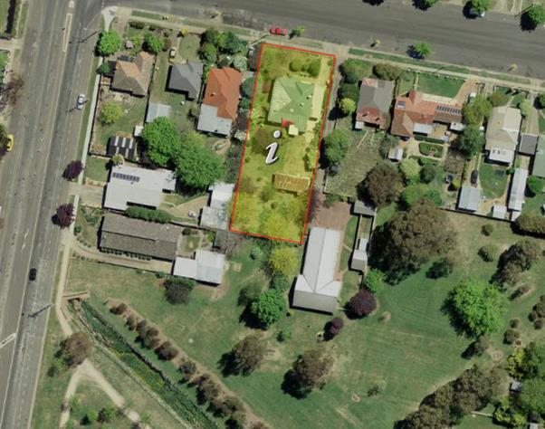
Figure 2 - aerial photograph of subject land
It is considered that the screening effect caused by the
existing vegetation, the configuration of the park (which presents as a small
“alcove” arrangement), and the similarity of other nearby and
surrounding development that also face or share a common boundary with the
park, render the visual intrusion caused by the development on the integrity of
the neighbourhood character, in particular the visual impacts on Elephant Park,
as not significant.
· The impact on
Avian species and other natives such as insects and possums has not been
addressed in the application.
Comment:
The vegetation on the subject land subject land takes the
form of “backyard landscaping”, which is largely unprotected under
current legislation. It cannot be viewed under any reasonable application of
the environmental checks and balances of the current legislation as likely to
offer much, if any, environmental benefit to local species. There is obviously
some benefit to retention of greenspaces, however the value of this landscaping
on both environmental and visual grounds is limited, and far outweighed by the
need to undertake urban consolidation and urban renewal in the existing parts
of the City.
· Whilst infill
development is somewhat reasonable, the proposed additional 5 dwellings (sic
erat scriptum – ‘as written’; by the objector) will provide a
significant impact by way of bulk of the buildings, traffic volume which might
be more hazardous given the proximity of a major intersection at
Moulder/Woodward Street and may impact on the amenity of surrounding landowners
due to the presumed significant increase in residents.
Comment:
The development does not propose five dwellings. The
proposal seeks to retain the existing dwelling and construct a dual occupancy
in the rear section of the parcel. The densities and site coverages for the
proposed development are higher than the surrounding existing development
patterns, but within the limits specified in Council planning controls. In
terms of likely impacts on local amenity, the proposed development is
considered to be reasonable and satisfactory.
· Elephant Park
is a significant open space used by many local groups as well as the general
community. A northern building border without the existing trees and the
proposed additional residential buildings would create significant adverse
interruption of the current view line of trees and fences
Comment:
The amenity of the park is significant, however the impact
of the proposed development on that significance is considered to be quite
minor. The tree coverage on the residential land is not necessary to maintain
the open space benefits of the park; and the impacts arising from the increased
density of the development in terms of built form are about the same as for
other existing built forms that also adjoin the park.
Candice Duesbury
· Unit 1 living space
and outdoor area will be looking straight into our house, deck area and yard.
Obviously we aren’t happy having units built next door but have accepted
there’s not much we can do. We do request that they heighten the fence by
putting screening above the fence for privacy.
Comment:
The elevated floor levels made necessary by the flood
planning requirements generates a need for privacy screens for the windows and
glazed doors that face in that direction (ie the east facing elevation). A
detailed assessment of privacy related matters has been provided above under
the heading “Visual Privacy”. Included in that assessment is a
suite of conditions of consent that have been recommended to address the
privacy issue. In general however, as single storey development it is
considered that the proposed development with the recommended conditions
imposed will have only limited and minor impacts on the privacy of nearby and
surrounding dwellings.
Neil Jones
· The proponent
states that “major existing trees retained...through appropriate siting
of buildings, access ways and parking areas”.
However, An examination of
Fig 1 and Fig 2 show that of the 21 identified trees on the whole site, only 5
in total are being retained, and only 1 of which is in the dual occupancy site.
It would appear that the siting of the dual occupancy houses has paid little
regard to retention of existing trees. The loss of trees is not able to be
compensated by tree plantings in the very limited open space. There is simply
not enough room in the current plans and siting.
I would encourage Council
staff to request a redesign and full landscape plan that facilitates planting
of some medium sized deciduous trees complemented by understory of for example,
native shrubs, that are in keeping with the contemporary design of the 2 new
houses.
The proposed planting of
Camelia and Pittosporum spp might be suitable in front of the existing
dwelling, in association with the retained trees, but they certainly do not
achieve the many benefits of an appropriate mix of deciduous trees and shrubs.
Comment:
There will be a loss of 16 trees from the site if approved,
with little opportunity for replacements to be planted within the dual
occupancy component as proposed. For the existing dwelling some space in the
front setback is available. Importantly this is the only area of the site with
the necessary deep soil zones to enable effective tree planting/retention. It
is not feasible to plant trees in areas where such deep soil conditions are not
available. Given that the trees proposed to be removed are of low environmental
value (in fact may pose an environmental risk due to their non-native
specification), have limited visual significance and amenity, and that the
proposed development is generally consistent with urban renewal and urban
consolidation objectives, it is difficult in this instance to give a great deal
of weight to the tree losses on this site.
PUBLIC INTEREST
s4.15(1)(e)
The proposed development is considered to be of minor
interest to the wider public due to the relatively localised nature of
potential impacts. The proposal is not inconsistent with any relevant policy
statements, planning studies, guidelines etc that have not been considered in
this assessment.
SUMMARY
The proposed development is permissible with the consent of
Council. The proposed development complies with the relevant aims, objectives
and provisions of Orange LEP 2011 (as amended) and DCP 2004. A
section 4.15 assessment of the development indicates that the development
is acceptable in this instance. Attached is a draft Notice of Approval
outlining a range of conditions considered appropriate to ensure that the
development proceeds in an acceptable manner.
COMMENTS
The requirements of the Environmental Health and Building
Surveyor and the Engineering Development Section are included in the attached
Notice of Approval.
Attachments
1 Notice
of Approval, D18/53781⇩
2 Plans,
D18/53769⇩
3 Submissions,
D18/53762⇩
Extraordinary
Planning and Development Committee
17 October 2018
2.4 Development
Application DA 91/2018(1) - 14 Moulder Street
Attachment 1 Notice of Approval
|

|
ORANGE CITY COUNCIL
Development
Application No DA
91/2018(1)
NA18/ Container
PR8832
|
NOTICE OF DETERMINATION
OF A DEVELOPMENT
APPLICATION
issued under the Environmental
Planning and Assessment Act 1979
Section 4.18
|
Development
Application
|
|
|
Applicant
Name:
|
Mr PR Gunn
|
|
Applicant
Address:
|
C/- Saunders &
Staniforth
2/204-206 Lords Place
ORANGE
NSW 2800
|
|
Owner’s
Name:
|
Mr PJ, Mrs CJ, Mr WT and
Ms SJ Gunn
|
|
Land
to Be Developed:
|
Lot 1 DP 38296 - 14
Moulder Street, Orange
|
|
Proposed
Development:
|
Subdivision (two lot
residential), Demolition (existing shed), Dual Occupancy and Subdivision
(three lot Community Title)
|
|
|
|
|
Building Code of
Australia
building
classification:
|
To be determined by
the PC
|
|
|
|
|
Determination made
under
Section 4.16
|
|
|
Made
On:
|
17 October 2018
|
|
Determination:
|
CONSENT GRANTED
SUBJECT TO CONDITIONS DESCRIBED BELOW:
|
|
|
|
|
Consent to Operate
From:
|
18 October 2018
|
|
Consent to Lapse On:
|
18 October 2023
|
Terms
of Approval
The reasons for the imposition of conditions
are:
(1) To ensure a quality
urban design for the development which complements the surrounding environment.
(2) To maintain
neighbourhood amenity and character.
(3) To ensure compliance
with relevant statutory requirements.
(4) To provide adequate
public health and safety measures.
(5) Because the development
will require the provision of, or increase the demand for, public amenities and
services.
(6) To ensure the utility
services are available to the site and adequate for the development.
(7) To prevent the proposed
development having a detrimental effect on adjoining land uses.
(8) To minimise the impact
of development on the environment.
Conditions
(1) The development must be
carried out in accordance with:
(a) Plans by Saunders &
Staniforth referenced 14 Moulder, dated 19.09.2018, sheets 1, 2, 3, 4, 5,
6, 7 and 8; except as amended by the further plans submitted by Heath
Consulting dated 14 September 2018, REV B, sheets 1 and 2 (10 sheets)
(b) statements
of environmental effects or other similar associated documents that form part
of the approval
as amended in
accordance with any conditions of this consent.
(2) All building work must
be carried out in accordance with the provisions of the Building Code of
Australia.
(3) A sign is to be erected
in a prominent position on any site on which building work, subdivision work or
demolition work is being carried out:
(a) showing
the name, address and telephone number of the principal certifying authority
for the work, and
(b) showing
the name of the principal contractor (if any) for any building work and a
telephone number on which that person may be contacted outside working hours,
and
(c) stating
that unauthorised entry to the site is prohibited.
Any such sign is to be maintained while the
building work, subdivision work or demolition work is being carried out.
(4) In
the case of residential building work for which the Home Building Act 1989
requires there to be a contract of insurance in force in accordance with Part 6
of the Act, evidence that such a contract of insurance is in force is to be
provided to the Principal Certifying Authority before any building work authorised
to be carried out by the consent commences.
(5) Residential
building work within the meaning of the Home Building Act 1989 must not
be carried out unless the principal certifying authority for the development to
which the work relates (not being the council) has given the council written
notice of the following information:
(a) in
the case of work for which a principal contractor is required to be appointed:
(i) the
name and the licence number of the principal contractor, and
(ii) the
name of the insurer by which the work is insured under Part 6 of that Act,
(b) in
the case of work to be done by an owner-builder:
(i) the
name of the owner-builder, and
(ii) if
the owner-builder is required to hold an owner-builder permit under that Act,
the number of the owner-builder permit.
If arrangements for doing the residential
building work are changed while the work is in progress so that the information
under this condition becomes out of date, further work must not be carried out
unless the principal certifying authority for the development to which the work
relates (not being the council) has given the council written notice of the
updated information.
(6) Where any excavation
work on the site extends below the level of the base of the footings of a building
on adjoining land, the person having the benefit of the development consent
must, at the person’s own expense:
(a) protect
and support the adjoining premises from possible damage from the excavation,
and
(b) where
necessary, underpin the adjoining premises to prevent any such damage.
Note: This
condition does not apply if the person having the benefit of the development
consent owns the adjoining land or the owner of the adjoining land has given
consent in writing to this condition not applying.
DEMOLITION, TWO LOT SUBDIVISION
|
PRIOR TO THE ISSUE OF A CONSTRUCTION
CERTIFICATE
|
(7) The applicant is to
submit a waste management plan that describes the nature of wastes to be
removed, the wastes to be recycled and the destination of all wastes. All wastes
from the demolition and construction phases of this project are to be deposited
at a licensed or approved waste disposal site.
(8) Proposed Lots 100
and101 are to be provided with interlot stormwater drainage where the surface
of the entire lot cannot be drained to the kerb and gutter at the lot frontage.
A grated concrete stormwater pit is to be constructed within each lot provided
with interlot stormwater drainage. Engineering plans for this drainage system
are to be approved by Orange City Council or an Accredited Certifier
(Categories B1, C3, C4, C6) prior to the issuing of a Construction Certificate.
(9) Where stormwater
crosses Council owned land, an easement is to be created and payment shall be
made to Council in accordance with Councils Management Plan current at the time
of issue of a Construction Certificate. Payment for the storm water easement
shall be made to Orange City Council prior to the issue of a Construction
Certificate.
(10) A 150mm-diameter sewer
main is to be constructed from Council’s existing main to serve the
proposed lots. Prior to a Construction Certificate being issued engineering
plans for this sewerage system are to be submitted to and approved by Orange
City Council.
(11) Application is to be
made for a Construction Certificate for works associated with the proposed
vehicle access serving Lot 101. Engineering plans, showing details of the
proposed location of the vehicle access, construction details, levels and
traffic management works, are to be submitted to Orange City Council or an
Accredited Certifier (Categories B1, C3, C4, C6) upon application for a
Construction Certificate.
|
PRIOR TO WORKS COMMENCING
|
(12) Where any existing
fencing at the perimeter of the site needs to be removed, or is of a type which
does not ensure the occupants of any adjoining residence adequate privacy, new
fencing of the type shown on the approved development application plans, or as
referred to elsewhere in this Notice, shall be erected prior to any building
or construction work being carried out upon this development.
(13) This consent permits
the removal of the trees not shown for retention on the approved development
plans. Those trees to be retained, as shown on the approved plan shall be fully
protected from prior to works commencing to the issue of an Occupation
Certificate, in accordance with AS 4970-2009 – Protection of trees on
Development Sites. The trees to be retained cannot be removed except with the
approval of Council under its Tree protection Permit system.
(14) Soil
erosion control measures shall be implemented on the site.
(15) A
Construction Certificate application for the development including the car port
is required to be submitted to, and issued by Council/Accredited Certifier
prior to any excavation or building works being carried out onsite.
|
DURING CONSTRUCTION/SITEWORKS
|
(16) All
construction/demolition work on the site is to be carried out between the hours
of 7.00 am and 6.00 pm Monday to Friday inclusive, 7.00 am to
5.00 pm Saturdays and 8.00 am to 5.00 pm Sundays and Public
Holidays. Written approval must be obtained from the General Manager of Orange
City Council to vary these hours.
(17) Building demolition is
to be carried out in accordance with Australian Standard 2601:2001 - The
Demolition of Structures and the requirements of Safe Work NSW.
(18) Asbestos containing
building materials must be removed in accordance with the provisions of the Work
Health and Safety Act 2011 and any guidelines or Codes of Practice
published by Safe Work NSW, and disposed of at a licenced landfill in accordance with the
requirements of the NSW EPA.
(19) No existing street
trees shall be removed without Council approval. Where such approval is
granted, the trees shall be replaced at full cost by the applicant with super
advanced trees of a species nominated by Council's relevant officer.
(20) Any adjustments to
existing utility services that are made necessary by this development
proceeding are to be at the full cost of the developer.
(21) The provisions and
requirements of the Orange City Council Development and Subdivision Code are to
be applied to this application and all work constructed within the development
is to be in accordance with that Code.
The developer is to be entirely responsible for
the provision of water, sewerage and drainage facilities capable of servicing
all the lots from Council’s existing infrastructure. The developer is to
be responsible for gaining access over adjoining land for services where
necessary and easements are to be created about all water, sewer and drainage
mains within and outside the lots they serve.
(22) Proposed Lot 101 shall
be provided with a 5.0m wide heavy duty concrete layback and footpath crossing
aligning with the 6.0m access handle on the Moulder Street frontage. All work
shall be to the requirements and standards of the Orange City Council
Development and Subdivision Code.
(23) Water and sewerage
reticulation is to be provided to each lot in the proposed residential
subdivision in accordance with the Orange City Council Development and
Subdivision Code.
(24) Water and sewer
services, including mains construction, easements and all associated materials
and works, are to be provided for the development at the cost of the developer.
|
PRIOR TO THE ISSUE OF A SUBDIVISION
CERTIFICATE
|
(25) The payment of $10,545.72 is to be
made to Council in accordance with Section 7.11 of the Act and Orange
Development Contributions Plan 2017 (LGA Remainder) towards the provision of
the following public facilities:
|
Open Space and Recreation
|
@ $3,922.87 x 1 lot
|
$3,922.87
|
|
Community and Cultural
|
@ $1,137.63 x 1 lot
|
$1,137.63
|
|
Roads and Traffic Management
|
@ $5,178.06 x 1 lot
|
$5,178.06
|
|
Plan Preparation & Administration
|
@ $307.16 x 1 lot
|
$307.16
|
|
TOTAL:
|
|
$10,545.72
|
The contribution will be indexed quarterly in
accordance with the Orange Development Contributions Plan 2017 (LGA Remainder).
This Plan can be inspected at the Orange Civic Centre, Byng Street, Orange.
(26) A Surveyor’s
Certificate or written statement is to be provided to the Principal Certifying
Authority, stating that the buildings within the boundaries of proposed Lot 100
comply in respect of the distances of walls from boundaries and the common wall
construction prior to the issuing of the Subdivision Certificate.
(27) Application
shall be made for a Subdivision Certificate under Section 6.3(1)(d) of the Act.
(28) Payment
of contributions for water, sewer and drainage works is required to be made
at the contribution rate applicable at the time that the payment is made. The
contributions are based on 1.0 ETs for water supply headworks and 1.0 ETs
for sewerage headworks. A Certificate of Compliance, from Orange City Council
in accordance with the Water Management Act 2000, will be issued upon
payment of the contributions.
This Certificate of Compliance is to be
submitted to the Principal Certifying Authority prior to the issuing of a
Subdivision Certificate.
(29) Application is to be
made to Telstra/NBN for infrastructure to be made available to each individual
lot within the development. Either a Telecommunications Infrastructure
Provisioning Confirmation or Certificate of Practical Completion is to be
submitted to the Principal Certifying Authority confirming that the specified
lots have been declared ready for service prior to the issue of a Subdivision
Certificate.
(30) A Notice of Arrangement
from Essential Energy stating arrangements have been made for the provision of
electricity supply to the development, is to be submitted to the Principal
Certifying Authority prior to the issue of a Subdivision Certificate.
(31) An easement to drain
sewage and to provide Council access for maintenance of sewerage works a
minimum of 2.0 metres wide is to be created over any sewer mains located within
the lots. The Principal Certifying Authority is to certify that the easement is
in accordance with the Orange City Council Development and Subdivision Code
prior to the issuing of a Subdivision Certificate.
(32) All services are to be
contained within the allotment that they serve. A Statement of Compliance, from
a Registered Surveyor, is to be submitted to the Principal Certifying Authority
prior to the issuing of a Subdivision Certificate.
(33) Where stormwater
crosses land outside the lot it favours, an easement to drain water is to be
created over the works. A Restriction-as-to-User under section 88B of the NSW
Conveyancing Act 1919 is to be created on the title of the burdened Lots requiring
that no structures are to be placed on the site, or landscaping or site works
carried out on the site, in a manner that affects the continued operation of
the interlot drainage system. The minimum width of the easement is to be as
required in the Orange City Council Development and Subdivision Code.
(34) A 3.0m wide stormwater
easement shall be created along the full length of the eastern boundary of
proposed Lots 100 and 101 to accommodate overland flows from Moulder Street.
(35) Certification from
Orange City Council is required to be submitted to the Principal Certifying
Authority prior to the issue of a Subdivision Certificate stating that all
works relating to connection of the development to Council assets, works on
public land, works on public roads, stormwater, sewer and water reticulation
mains and footpaths have been carried out in accordance with the Orange City
Council Development and Subdivision Code and the foregoing conditions, and that
Council will take ownership of the infrastructure assets.
(36) All
of the foregoing conditions are to be at the full cost of the developer and to
the requirements and standards of the Orange City Council Development and
Subdivision Code, unless specifically stated otherwise. All work required by
the foregoing conditions is to be completed prior to the issuing of an
Occupation or Subdivision Certificate, unless stated otherwise.
|
MATTERS FOR THE ONGOING PERFORMANCE AND
OPERATION OF THE DEVELOPMENT
|
(37) The existing carport on
proposed Lot 100 is subject to flooding and shall not be enclosed on any side,
including the installation of roller doors, without the prior consent of Orange
City Council.
DUAL OCCUPANCY
|
PRIOR TO THE ISSUE OF A CONSTRUCTION
CERTIFICATE
|
(38) A
detailed plan at a scale of not less than 1:20 professionally drawn by an
architect or architectural draftsperson providing specific construction details
of privacy screens required by Conditions (63) and (64) shall be
submitted and approved by Council’s Manager Development Assessments prior
to the issue of a Construction Certificate.
(39) The
payment of $6,110.36 is to be made to Council in accordance with Section 7.11
of the Act and Orange Development Contributions Plan 2017 (LGA Remainder)
towards the provision of the following public facilities:
|
Open Space and Recreation
|
@ $2,239.60 x one 2 bedroom dwg
|
$2,239.60
|
|
Community and Cultural
|
@ $649.48 x one 2 bedroom dwg
|
$649.48
|
|
Roads and Traffic Management
|
@ $3,045.91 x one 2 bedroom dwg
|
$3.045.91
|
|
Plan Preparation &
Administration
|
@ $175.37 x one 2 bedroom dwg
|
$175.37
|
|
TOTAL:
|
|
$6,110.36
|
The contribution will be indexed
quarterly in accordance with the Orange Development Contributions Plan 2017
(LGA Remainder). This Plan can be inspected at the Orange Civic Centre, Byng
Street, Orange.
(40) An
approval under Section 68 of the Local Government Act is to be sought
from Orange City Council, as the Water and Sewer Authority, for water, sewer
and stormwater connection. No plumbing and drainage is to commence until
approval is granted.
(41) Engineering plans,
showing details of all proposed work and adhering to any engineering conditions
of development consent, are to be submitted to, and approved by, Orange City
Council or an Accredited Certifier (Categories B1, C3, C4, C6) prior to the
issuing of a Construction Certificate.
(42) The development’s
stormwater design is to include stormwater detention within the development,
designed to limit peak outflows from the land to the pre-existing natural
outflows up to the 100 year ARI frequency, with sufficient allowance in
overflow spillway design capacity to safely pass flows of lower frequency (that
is, a rarer event) without damage to downstream developments. Where
appropriate, the spillway design capacity is to be determined in accordance
with the requirements of the Dam Safety Committee.
The design of the detention storage is to be
undertaken using the ILSAX/DRAINS rainfall-runoff hydrologic model or an
approved equivalent capable of assessing runoff volumes and their temporal
distribution as well as peak flow rates. The model is to be used to calculate
the flow rates for the existing and post-development conditions. The developed
flows are to be routed through the proposed storage within the model so that
the outflows obtained are no greater than the flows obtained for the
pre-existing natural flows. A report detailing the results of the analysis,
which includes:
· catchment plan showing
sub-catchments under existing and developed conditions;
· schematic diagram of
the catchment model showing sub areas and linkages;
· tabulation detailing
the elevation, storage volume and discharge relationships; and
· tabulation for the
range of frequencies analysed, the inflows, outflows and peak storage levels
for both existing and developed conditions;
together with copies of the data files for the
model and engineering design plans of the required drainage system are to be
submitted to Orange City Council upon application for a Construction
Certificate.
(43) A water and soil
erosion control plan is to be submitted to Orange City Council or an Accredited
Certifier (Categories B1, C3, C4, C6) for approval prior to the issuing of a
Construction Certificate. The control plan is to be in accordance with the
Orange City Council Development and Subdivision Code and the Landcom, Managing
Urban Stormwater; Soils and Construction Handbook.
(44) Engineering plans
providing complete details of the proposed driveway and car parking areas are
to be submitted to Orange City Council or an Accredited Certifier (Categories
B1, C3, C4, C6) upon application for a Construction Certificate. These plans
are to provide details of levels, cross falls of all pavements, proposed
sealing materials and proposed drainage works and are to be in accordance with
Orange City Council Development and Subdivision Code.
(45) Proposed dwellings 1
and 2 shall be provided with interlot stormwater drainage. A grated concrete
stormwater pit is to be constructed for each dwelling. Engineering plans for
this drainage system are to be approved by Orange City Council or an Accredited
Certifier (Categories B1, C3, C4, C6) prior to the issuing of a Construction
Certificate.
(46) A 150mm-diameter sewer
main is to be constructed from Council’s existing main to serve each
dwelling. Prior to a Construction Certificate being issued engineering plans
for this sewerage system are to be submitted to and approved by Orange City
Council.
(47) Payment
of contributions for water, sewer and drainage works is required to be made
at the contribution rate applicable at the time that the payment is made. The contributions are
based on water supply headworks, sewerage headworks and stormwater for a two
bedroom dwelling.
A Certificate of Compliance, from Orange City Council in accordance with the Water
Management Act 2000, will be issued upon payment of the contributions.
This Certificate of Compliance is to be
submitted to the Principal Certifying Authority prior to the issuing of a
Construction Certificate.
(48) Prior to the issue of a
Construction Certificate evidence shall be provided to the Principal
Certifying Authority that
proposed Lot 100 and 101 has been registered with NSW Land and Property
Information.
(49) Prior to the issue of a
Construction Certificate the plans shall be amended as follows:
· the
finished floor level of proposed dwellings 1 and 2 shall be a minimum of RL
871.10m on Australian Height Datum; and
· the garages
shall be a minimum of RL 870.60m on Australian Height Datum; and
· the
garages shall be constructed of flood compatible materials and all electrical
connections are located a minimum of 1.0m above finished floor level.
|
PRIOR TO WORKS COMMENCING
|
(50) A
Construction Certificate application is required to be submitted to, and issued
by Council/Accredited Certifier prior to any excavation or building works being
carried out onsite.
(51) A
temporary onsite toilet is to be provided and must remain throughout the
project or until an alternative facility meeting Council’s requirements
is available onsite.
(52) Soil
erosion control measures shall be implemented on the site.
|
DURING CONSTRUCTION/SITEWORKS
|
(53) No existing street
trees shall be removed without Council approval. Where such approval is
granted, the trees shall be replaced at full cost by the applicant with super
advanced trees of a species nominated by Council's relevant officer.
(54) All
construction/demolition work on the site is to be carried out between the hours
of 7.00 am and 6.00 pm Monday to Friday inclusive, 7.00 am to
5.00 pm Saturdays and 8.00 am to 5.00 pm Sundays and Public
Holidays. Written approval must be obtained from the General Manager of Orange
City Council to vary these hours.
(55) A
Registered Surveyor’s certificate identifying the location of the
building on the site must be submitted to the Principal Certifying Authority
prior to the pouring of the slab or footings.
(56) All materials onsite or
being delivered to the site are to be contained within the site. The
requirements of the Protection of the Environment Operations Act 1997
are to be complied with when placing/stockpiling loose material or when
disposing of waste products or during any other activities likely to pollute
drains or watercourses.
(57) Any adjustments to
existing utility services that are made necessary by this development
proceeding are to be at the full cost of the developer.
(58) The provisions and
requirements of the Orange City Council Development and Subdivision Code are to
be applied to this application and all work constructed within the development
is to be in accordance with that Code.
The developer is to be entirely responsible for
the provision of water, sewerage and drainage facilities capable of servicing
the development from Council’s existing infrastructure. The developer is
to be responsible for gaining access over adjoining land for services where
necessary and easements are to be created about all water, sewer and drainage
mains within and outside the lots they serve.
(59) Proposed dwellings 1
and 2 shall be provided with a concrete driveway constructed to a minimum width
of 4.5 metres within a generally 6.0m wide accessway to the requirements and
standards of the Orange City Council Development and Subdivision Code.
(60) All driveway and
parking areas are to be sealed with bitumen, hot mix or concrete and are to be
designed for all expected loading conditions (provided however that the minimum
pavement depth for gravel and flush seal roadways is 200mm) and be in
accordance with the Orange City Council Development and Subdivision Code.
(61) The existing 150mm
diameter sewer main that crosses the site is to be accurately located. Where
the main is positioned adjacent to any proposed building work, measures are to
be taken in accordance with Orange City Council Policy - Building over and/or
adjacent to sewers ST009.
(62) Water and sewerage
reticulation is to be provided to each dwelling in the proposed dual occupancy
in accordance with the Orange City Council Development and Subdivision Code.
|
PRIOR TO THE ISSUE OF AN OCCUPATION
CERTIFICATE
|
(63) Dwelling 1 - Required
Privacy Screening
· To provide privacy to
the property owner to the east, a screen shall be erected 300mm from the
eastern boundary and extending for a distance of not less than 5m along this
boundary, measured from the point adjacent to the southern return wall for the
alfresco area and extending north. The required screen shall incorporate a
minimum height of 2,200mm above existing ground levels. The lower edge of the
screen shall be not more than 1.1m above existing ground levels. The screen
shall be constructed in solid timber or metal slats with minimum 200mm width
slats, fixed at 150mm centres and angled upwards at an angle of not less than
25 degrees.
· The kitchen and laundry
windows shall be provided with a privacy screen either on the window or 300mm
from the eastern boundary. The screens shall cover the entire glazed area; or
if screens are to be erected adjacent to the boundary, for a distance extending
at least 1m past the outer edges of each window. In either case the required
screen shall incorporate solid timber or metal slats with minimum 200mm width
slats, fixed at 150mm centres and angled upwards at an angle of not less than
25 degrees. In the event that the screens are erected adjacent to the boundary,
these screens shall be a minimum height of 2,200mm above existing ground
levels. The lower edge of the screens shall be not more than 1.1m above
existing ground levels.
· The two north facing
lounge room windows shall be provided with privacy screens covering the entire
glazed area of these windows. The required screens shall incorporate solid
timber or metal slats with minimum 200mm width slats, fixed at 150mm centres
and angled upwards at an angle of not less than 25 degrees.
(64) Dwelling 2 - Required
Privacy Screening
· To provide privacy to
the property owner to the east, a screen shall be erected 300mm from the
eastern boundary and extending for a distance of not less than 5m along this
boundary, measured from the point adjacent to the southern return wall for the
alfresco area and extending north. The required screen shall incorporate a
minimum height of 2200mm above existing ground levels. The lower edge of the
screen shall be not more than 1.1m above existing ground levels. The screen
shall be constructed in solid timber or metal slats with minimum 200mm width
slats, fixed at 150mm centres and angled upwards at an angle of not less
than 25 degrees.
· The kitchen window
shall be provided with a privacy screen either on the window or 300mm from the
eastern boundary. The screen shall cover the entire glazed area, or if the
screen is to be erected adjacent to the boundary, for a distance extending at
least 1m past the outer edges of the window. The required screen shall
incorporate solid timber or metal slats with minimum 200mm width slats,
fixed at 150mm centres and angled upwards at an angle of not less than
25 degrees. In the event that the screen is erected adjacent to the
boundary, the screen shall be a minimum height of 2,200mm above existing ground
levels. The lower edge of the screen shall be not more than 1.1m above existing
ground levels.
(65) A 1.8m high fence shall
be provided around the perimeter of the development excluding the frontage. A
1.5m high fence shall be provided between each unit. The height of the fence
shall be measured from the highest finished ground level adjacent to each part
of that fence.
(66) A total of five (5)
off-street car parking spaces (including at least one space for the existing
dwelling) shall be provided upon the site in accordance with the approved
plans, the provisions of Development Control Plan 2004, and be constructed in
accordance with the requirements of Council's Development and Subdivision Code prior
to the issue of an Occupation Certificate.
(67) No
person is to use or occupy the building or alteration that is the subject of
this approval without the prior issuing of an Occupation Certificate.
(68) Where
Orange City Council is not the Principal Certifying Authority, a final
inspection of water connection, sewer and stormwater drainage shall be
undertaken by Orange City Council and a compliance certificate issued, prior to
the issue of either an interim or a final Occupation Certificate.
(69) A Certificate of
Compliance, from a Qualified Engineer, stating that the stormwater detention
basin complies with the approved engineering plans is to be submitted to the
Principal Certifying Authority prior to the issuing of an Occupation
Certificate.
(70) Certification from
Orange City Council is required to be submitted to the Principal Certifying
Authority prior to the issue of an Occupation Certificate stating that all
works relating to connection of the development to Council assets, works on
public land, works on public roads, stormwater, sewer and water reticulation
mains and footpaths have been carried out in accordance with the Orange City
Council Development and Subdivision Code and the foregoing conditions, and that
Council will take ownership of the infrastructure assets.
(71) All
of the foregoing conditions are to be at the full cost of the developer and to
the requirements and standards of the Orange City Council Development and
Subdivision Code, unless specifically stated otherwise. All work required by
the foregoing conditions is to be completed prior to the issuing of an
Occupation or Subdivision Certificate, unless stated otherwise.
|
MATTERS FOR THE ONGOING PERFORMANCE AND
OPERATION OF THE DEVELOPMENT
|
(72) Privacy
screens required under this consent shall be fixed and permanently retained in
accordance with this consent.
THREE LOT COMMUNITY TITLE SUBDIVISION
|
DURING CONSTRUCTION/SITEWORKS
|
(73) Any adjustments to
existing utility services that are made necessary by this development
proceeding are to be at the full cost of the developer.
|
PRIOR TO THE ISSUE OF A SUBDIVISION
CERTIFICATE
|
(74) A Surveyor’s
Certificate or written statement is to be provided to the Principal Certifying
Authority, stating that the buildings within the boundaries of proposed Lots 1
and 2 comply in respect of the distances of walls from boundaries and the
common wall construction prior to the issuing of the Subdivision Certificate.
(75) Application
shall be made for a Subdivision Certificate under Section 6.3(1)(d) of the Act.
(76) Application is to be
made to Telstra/NBN for infrastructure to be made available to each individual
lot within the development. Either a Telecommunications Infrastructure
Provisioning Confirmation or Certificate of Practical Completion is to be
submitted to the Principal Certifying Authority confirming that the specified
lots have been declared ready for service prior to the issue of a Subdivision
Certificate.
(77) A Notice of Arrangement
from Essential Energy stating arrangements have been made for the provision of
electricity supply to the development, is to be submitted to the Principal
Certifying Authority prior to the issue of a Subdivision Certificate.
(78) An easement to drain
sewage and to provide Council access for maintenance of sewerage works a
minimum of 2.0 metres wide is to be created over the proposed sewerage works.
The Principal Certifying Authority is to certify that the easement is in
accordance with the Orange City Council Development and Subdivision Code prior
to the issuing of a Subdivision Certificate.
(79) All services are to be
contained within the allotment that they serve. A Statement of Compliance, from
a Registered Surveyor, is to be submitted to the Principal Certifying Authority
prior to the issuing of a Subdivision Certificate.
(80) All engineering conditions
of development relating to the servicing of the development shall be completed
prior to the issuing of a Subdivision Certificate.
(81) Certification from
Orange City Council is required to be submitted to the Principal Certifying
Authority prior to the issue of a Subdivision Certificate stating that all
works relating to connection of the development to Council assets, works on
public land, works on public roads, stormwater, sewer and water reticulation
mains and footpaths have been carried out in accordance with the Orange City
Council Development and Subdivision Code and the foregoing conditions, and that
Council will take ownership of the infrastructure assets.
(82) All
of the foregoing conditions are to be at the full cost of the developer and to
the requirements and standards of the Orange City Council Development and
Subdivision Code, unless specifically stated otherwise. All work required by
the foregoing conditions is to be completed prior to the issuing of an
Occupation or Subdivision Certificate, unless stated otherwise.
Other
Approvals
(1) Local
Government Act 1993 approvals granted under section 68.
Nil
(2) General
terms of other approvals integrated as part of this consent.
Nil
Right
of Appeal
If you are dissatisfied with this decision,
Section 8.7 of the Environmental Planning and Assessment Act 1979
gives you the right to appeal to the Land and Environment Court. Pursuant to
Section 8.10, an applicant may only appeal within 6 months after the date the
decision is notified.
|
Disability
Discrimination Act 1992:
|
This application has been assessed in
accordance with the Environmental Planning and Assessment Act 1979. No
guarantee is given that the proposal complies with the Disability Discrimination
Act 1992.
The applicant/owner is responsible to ensure
compliance with this and other anti-discrimination legislation.
The Disability Discrimination Act
covers disabilities not catered for in the minimum standards called up in the
Building Code of Australia which references AS1428.1 - "Design for
Access and Mobility". AS1428 Parts 2, 3 and 4 provides the most
comprehensive technical guidance under the Disability Discrimination Act
currently available in Australia.
|
|
|
|
|
Disclaimer
- S88B of the Conveyancing Act 1919 - Restrictions on the Use of Land:
|
The applicant should note that there could be
covenants in favour of persons other than Council restricting what may be
built or done upon the subject land. The applicant is advised to check the position
before commencing any work.
|
|
|
|
|
Signed:
|
On behalf of the consent authority ORANGE
CITY COUNCIL
|
|
Signature:
|
|
|
Name:
|
PAUL JOHNSTON - MANAGER DEVELOPMENT
ASSESSMENTS
|
|
Date:
|
18 October 2018
|
Extraordinary Planning and
Development Committee
17 October 2018
2.4 Development
Application DA 91/2018(1) - 14 Moulder Street
Attachment 2 Plans

Extraordinary Planning and
Development Committee
17 October 2018
2.4 Development
Application DA 91/2018(1) - 14 Moulder Street
Attachment 3 Submissions
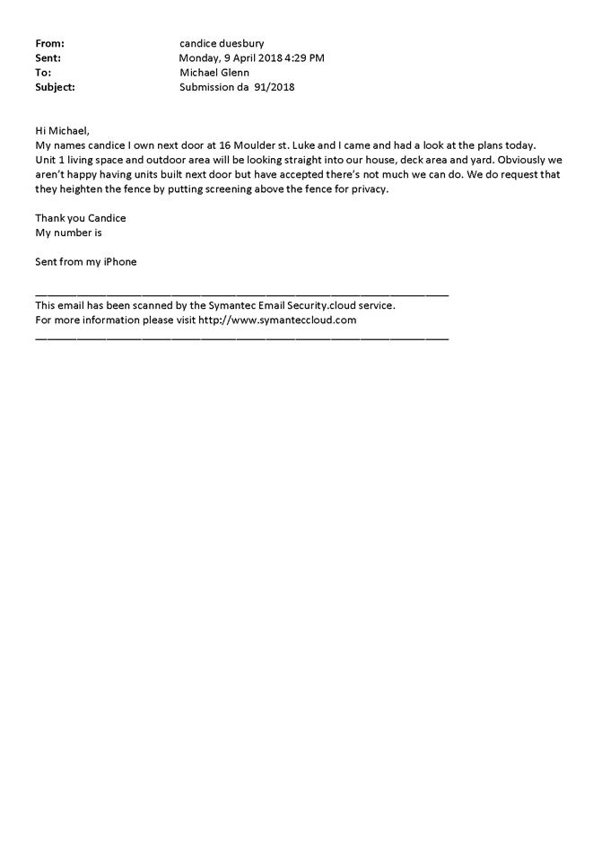


2.5 Development
Application DA 224/2018(1) - 102-110 Autumn Street
RECORD
NUMBER: 2018/2494
AUTHOR: Michael
Glenn, Senior Planner
EXECUTIVE Summary
|
Application
lodged
|
28 June
2018
|
|
Applicant/s
|
Havenhand
& Mather Architects Pty Ltd
|
|
Owner/s
|
United
Protestant Association of NSW Limited
|
|
Land
description
|
Lot 50
DP 1130577 - 102-110 Autumn Street, Orange
|
|
Proposed
land use
|
Demolition
(demolition of 16 existing self-contained dwellings, two carports and removal
of trees), and Seniors Housing (construction of eight self-contained
dwellings)
|
|
Value of
proposed development
|
$3,850,000.00
|
Council's consent is sought to undertake demolition of
existing, obsolete self-care units (totalling 16 in number) and two carports,
and to carry out the removal of trees on the site. It is then proposed to
construct eight self-contained dwellings (seniors housing). The subject land is
described as Lot 50 DP 1130577 - 102-110 Autumn Street, Orange (known as Astill
Court).
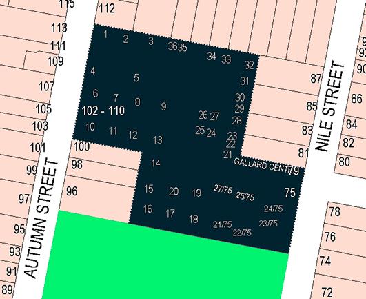
Figure 1 - locality plan
The development comprises a group of four buildings, each
containing two semi-detached units. Each would be provided with its own garage
and outdoor private open space. Two internal roads are proposed, known as North
Road and Green Place. These are not intended to be Council managed assets.
The dwellings are proposed to be configured and fitted out
to a standard suitable for able bodied seniors, but the internal dimensions,
gradients and general characteristics of the proposed dwellings are such that
they could be converted to accommodation suitable for more mobility impaired
occupants if the demand arose. In detail, the proposed units each comprise two
bedrooms, combined living/dining and kitchen areas, ensuite, separate bathroom
laundry and internally accessed single garage.
The development is consistent
with Council’s relevant planning provisions and the Seniors
Housing SEPP, and as such is recommended for approval.
RECENT LEGISLATIVE CHANGES
On 1 March 2018 the Environmental Planning and Assessment
Act 1979 was substantially amended. The most immediate change involves the
restructuring and renumbering of the Act, with other more substantive
changes to be phased in over time. However, for some applications (particularly
where an application was lodged prior to the changes coming into effect) the
supporting documentation may still reference the previous numbering regime. In
the drafting of this report the content and substance of the supporting
material has been considered irrespective of which legislative references were
used.
DECISION FRAMEWORK
Development in Orange is governed
by two key documents Orange Local Environment Plan 2011 and Orange Development
Control Plan 2004. In addition the Infill Guidelines are used to guide
development, particularly in the heritage conservation areas and around
heritage items.
State Environmental Planning
Policy (Housing For Seniors Or People with a Disability 2004)
The provisions of this SEPP set out
the principal controls relating to Seniors Living Housing and in general take
precedence over the Orange Local Environmental Plan 2011, in any situation
where inconsistencies arise between the LEP and the SEPP.
Orange Local Environment Plan
2011 – The provisions of the LEP must be considered by the Council in
determining the application. LEPs govern the types of development that are
permissible or prohibited in different parts of the City and also provide some
assessment criteria in specific circumstances. Uses are either permissible or
not. The objectives of each zoning and indeed the aims of the LEP itself are
also to be considered and can be used to guide decision making around
appropriateness of development.
Orange Development Control Plan
2004 – the DCP provides guidelines for development. In general it is
a performance based document rather than prescriptive in nature. For each
planning element there are often guidelines used. These guidelines indicate
ways of achieving the planning outcomes. It is thus recognised that there may
also be other solutions of merit. All design solutions are considered on merit
by planning and building staff. Applications should clearly demonstrate how the
planning outcomes are being met where alternative design solutions are
proposed. The DCP enables developers and architects to use design to achieve
the planning outcomes in alternative ways.
DIRECTOR’S COMMENT
Astill Court is an established retirement village located in
Autumn Street. Over recent years the UPA has progressively redeveloped the
village in stages. The latest proposal involves the demolition of existing,
obsolete self-care units (totalling 16 in number) in the centre area of the
site to facilitate the construction of eight self-contained new dwellings
(seniors housing). The applicant has suitably demonstrated that the development
complies with Council’s LEP and DCP, together with the
requirements of SEPP (Housing for Seniors or People with a
Disability) 2004. Staff have evaluated the proposal and it is recommended
that Council supports the proposal.
Link To Delivery/OPerational Plan
The recommendation in this report relates to the
Delivery/Operational Plan strategy “10.1 Preserve - Engage with the
community to ensure plans for growth and development are respectful of our
heritage”.
Financial Implications
Nil
Policy and Governance Implications
Nil
|
Recommendation
That Council consents to development application DA
224/2018(1) for Demolition (demolition of 16 existing self-contained
dwellings, two carports and removal of three trees), and Seniors Housing
(construction of eight self-contained dwellings) at Lot 50
DP 1130577 - 102-110 Autumn Street, Orange pursuant to the conditions of
consent in the attached Notice of Approval.
|
further considerations
Consideration has been given to the
recommendation’s impact on Council’s service delivery; image and
reputation; political; environmental; health and safety; employees;
stakeholders and project management; and no further implications or risks have
been identified.
SUPPORTING INFORMATION
THE APPLICATION/PROPOSAL
Council's consent is sought for
demolition (16 existing self-contained dwellings, two carports and removal of
three trees) and the construction of seniors housing (eight self-contained
dwellings). The development comprises seniors housing, being eight
self-contained dwellings suitable for occupation by able bodied persons, but
capable of conversion to suit mobility impaired persons if the need arises.
Each of the proposed units would comprise two bedrooms with ensuite, a separate
bathroom, and garaging for one vehicle with laundry. Each of the dwellings is
proposed to include a combined kitchen/dining/living area. Two toilets for each
unit are proposed - one each in the bathroom and ensuite. The development also
incorporates private open space areas for each of the proposed units.
The proposed development is seniors living residential
accommodation, and as such must either provide essential services on the site,
or be within 400m of accessible public transport (for aged persons or people
with a disability, including gradients and footpath surfaces) that meets the
relevant Australian Standards. It is also critical that, as aged care
accommodation, the proposal provide onsite either a holistic level of care for
both self-reliant retirees and also people with greater levels of dependence
(or demonstrate that the units in the application can be so adapted to meet the
relevant design standards); or alternatively show that such capacity as might
be required is locally available. In this case the applicant has shown that
complying access to public transport is possible within the specified distance,
and further demonstrated that supported care facilities are available within
the locality; as well as incorporating into the design the ability to convert
as many units as might be required in future for occupation by mobility
impaired persons.
MATTERS FOR CONSIDERATION
Section 1.7 - Application of
Part 7 of the Biodiversity Conservation Act 2016 and Part 7A of the
Fisheries Management Act 1994
Development Applications lodged
on or after 25 February 2018
Section 1.7 of the EP&A Act 1979 identifies that Part 7
of the Biodiversity Conservation Act 2016 and Part 7A of the Fisheries
Management Act 1994 have effect in connection with terrestrial and aquatic
environments.
Having regard to the relevant provisions and based on an
inspection of the subject property, it is considered that the proposed
development is not likely to significantly affect a threatened species. A
Biodiversity Development Assessment Report is not required in this instance. A
site inspection reveals that the subject property has no biodiversity or
habitat value.
Section 4.15
Section 4.15 of the Environmental Planning and Assessment
Act 1979 requires Council to consider various matters, of which those
pertaining to the application are listed below.
PROVISIONS OF ANY ENVIRONMENTAL
PLANNING INSTRUMENT s4.15(1)(a)(i)
Orange Local Environmental Plan 2011
Part 1 - Preliminary
Clause 1.2 - Aims of Plan
The broad aims of the LEP are
set out under subclause 2. Those relevant to the application are as follows:
delete those not relevant
(a) to
encourage development which complements and enhances the unique character of
Orange as a major regional centre boasting a diverse economy and offering an
attractive regional lifestyle,
(b) to
provide for a range of development opportunities that contribute to the social,
economic and environmental resources of Orange in a way that allows present and
future generations to meet their needs by implementing the principles for
ecologically sustainable development,
(f) to recognise and manage valued
environmental heritage, landscape and scenic features of Orange.
The application is considered to be consistent with aims
(a), (b) and (f) listed above. It is not inconsistent with any of the other
aims of the plan.
Clause 1.6 - Consent Authority
This clause establishes that, subject to the Act, Council is
the consent authority for applications made under the LEP.
Clause 1.7 - Mapping
The subject site is identified
on the LEP maps in the following manner:
|
Land Zoning Map:
|
Land zoned R1 General Residential
|
|
Lot Size Map:
|
No Minimum Lot Size
|
|
Heritage Map:
|
Not a heritage item or conservation
area
|
|
Height of Buildings Map:
|
No building height limit
|
|
Floor Space Ratio Map:
|
No floor space limit
|
|
Terrestrial Biodiversity Map:
|
No biodiversity sensitivity on the
site
|
|
Groundwater Vulnerability Map:
|
Ground water vulnerable
|
|
Drinking Water Catchment Map:
|
Not within the drinking water
catchment
|
|
Watercourse Map:
|
Not within or affecting a defined watercourse
|
|
Urban Release Area Map:
|
Not within an urban release area
|
|
Obstacle Limitation Surface Map:
|
No restriction on building siting
or construction
|
|
Additional Permitted Uses Map:
|
No additional permitted use applies
|
Those matters that are of relevance
are addressed in detail in the body of this report
Clause 1.9A - Suspension of
Covenants, Agreements and Instruments
This clause provides that covenants, agreements and other
instruments which seek to restrict the carrying out of development do not apply
with the following exceptions.
· covenants imposed
or required by Council
· prescribed
instruments under Section 183A of the Crown Lands Act 1989
· any conservation
agreement under the National Parks and Wildlife Act 1974
· any trust
agreement under the Nature Conservation Trust Act 2001
· any property
vegetation plan under the Native Vegetation Act 2003
· any biobanking
agreement under Part 7A of the Threatened Species Conservation Act 1995
· any planning
agreement under Division 6 of Part 4 of the Environmental Planning and
Assessment Act 1979.
Council staff are not aware of the title of the subject
property being affected by any of the above.
Part 2 -
Permitted or Prohibited Development
Clause 2.1 - Land Use Zones
and Clause 2.3 - Zone Objectives and Land Use Table
The subject site is located within the R1 General
Residential zone. The proposed development comprises self-contained dwellings
proposed as seniors housing. Seniors housing is defined in OLEP 2011 in the
following terms:
seniors
housing means a building or place that is:
(a) a
residential care facility, or
(b) a
hostel within the meaning of clause 12 of State Environmental Planning Policy
(Housing for Seniors or People with a Disability) 2004, or
(c) group
of self-contained dwellings, or
(d) a
combination of any of the buildings or places referred to in paragraphs
(a)–(c),
and that
is, or is intended to be, used permanently for:
(e) seniors
or people who have a disability, or
(f) people
who live in the same household with seniors or people who have a disability, or
(g) staff
employed to assist in the administration of the building or place or in the
provision of services to persons living in the building or place,
but does
not include a hospital.
Note.
Seniors housing is a type of residential accommodation.
Self-contained dwellings are a particular form of seniors
housing. Seniors housing is permitted with consent in this zone. It is noted
that State Environmental Planning Policy (Housing for Seniors of People with a
Disability) is also applicable to the development and that it takes precedence
over the LEP (or any other environmental planning instrument) where any
inconsistency exists. In the case of land use classification there are no
significant differences between the LEP and the SEPP.
Clause 2.3 of LEP 2011
references the Land Use Table and Objectives for each zone in LEP 2011.
These objectives for land zoned R1 General Residential are as follows:
· To provide for
the housing needs of the community.
· To provide for
a variety of housing types and densities.
· To enable other
land uses that provide facilities or services to meet the day to day needs of
residents.
· To ensure
development is ordered in such a way as to maximise public transport patronage
and encourage walking and cycling in close proximity to settlement.
· To ensure that
development along the Southern Link Road has an alternative access.
The proposed development is not inconsistent with the zone
objectives listed above. The application seeks to provide for improved
residential aged care accommodation in a planned and supported environment.
Clause 2.7 - Demolition
Requires Development Consent
This clause triggers the need for development consent in
relation to a building or work. This requirement does not apply to any
demolition that is defined as exempt development.
The proposal involves demolition and the applicant is
seeking the consent of Council. The demolition works proposed will have no
significant impact on adjoining lands, streetscape or public realm.
Part 3 -
Exempt and Complying Development
The application is not exempt or complying development.
Part 4 -
Principal Development Standards
Not applicable.
Part 5 -
Miscellaneous Provisions
Clause 5.10 is applicable and states in part:
(1) The
objectives of this clause are as follows:
(a) to
conserve the environmental heritage of Orange,
(b) to
conserve the heritage significance of heritage items and heritage conservation
areas, including associated fabric, settings and views,
(c) to
conserve archaeological sites,
(d) to
conserve Aboriginal objects and Aboriginal places of heritage significance.
(4) The
consent authority must, before granting consent under this clause in respect of
a heritage item or heritage conservation area, consider the effect of the
proposed development on the heritage significance of the item or area
concerned. This subclause applies regardless of whether a heritage management
document is prepared under subclause (5) or a heritage conservation management
plan is submitted under subclause (6).
The subject land is located in the vicinity of Newman Park
at 197 March Street Newman Park comprises a civic landscaped park of 2
hectares, significant for its exotic trees of more than 100 years in age. The
park was constructed in 1890 and the trees were planted in the 1890s.
The 16 oak trees were added at the end of World War One by servicemen and
pupils of East Orange Public School to commemorate former pupils who had died
in the war. The park complements the streetscape, contributes to the area and
is highly valued by the community. Whilst this item adjoins the subject land,
the development site itself is well separated from the park. The development
will not have an adverse impact upon the park.
Part 6 -
Urban Release Area
Not relevant to the application. The subject site is not
located in an Urban Release Area.
Part 7 -
Additional Local Provisions
7.1 - Earthworks
This clause establishes a range
of matters that must be considered prior to granting development consent for
any application involving earthworks, such as:
(a) the likely disruption of, or any
detrimental effect on, existing drainage patterns and soil stability in the
locality of the development
(b) the effect of the development on the
likely future use or redevelopment of the land
(c) the quality of the fill or the soil to be
excavated, or both
(d) the effect of the development on the
existing and likely amenity of adjoining properties
(e) the source of any fill material and the
destination of any excavated material
(f) the likelihood of disturbing relics
(g) the proximity to and potential for adverse
impacts on any waterway, drinking water catchment or environmentally sensitive
area
(h) any measures proposed to minimise or
mitigate the impacts referred to in paragraph (g).
The earthworks proposed in the
application are limited to the extent of cutting and filling required for the
proposed buildings. The extent of disruption to the drainage of the site is
considered to be minor and will not detrimentally affect adjoining properties
or receiving waterways.
The extent of the earthworks
will not materially affect the potential future use or redevelopment of the
site that may occur at the end of the proposed development's lifespan. The site
is not known to be contaminated.
The earthworks will be
appropriately supported onsite and the change in ground level is not
substantial. The effect on the amenity of adjoining properties is considered to
be minor.
The site is not known to contain
any Aboriginal, European or archaeological relics. Previous known uses of the
site do not suggest that any relics are likely to be uncovered. The site is not
in proximity to any waterway, drinking water catchment or sensitive area.
7.3 -
Stormwater Management
This clause applies to all
industrial, commercial and residential zones and requires that Council be
satisfied that the proposal:
(a) is designed to maximise the use of water
permeable surfaces on the land having regard to the soil characteristics
affecting onsite infiltration of water
(b) includes, where practical, onsite
stormwater retention for use as an alternative supply to mains water,
groundwater or river water; and
(c) avoids any significant impacts of
stormwater runoff on adjoining downstream properties, native bushland and
receiving waters, or if that impact cannot be reasonably avoided, minimises and
mitigates the impact.
The proposal has been designed
to include permeable surfaces and includes onsite retention of stormwater
runoff. Conditions of consent have been recommended to address stormwater
related matters.
7.6 -
Groundwater Vulnerability
This clause seeks to protect
hydrological functions of groundwater systems and protect resources from both
depletion and contamination. Orange has a high water table and large areas of
the LGA, including the subject site, are identified with “Groundwater
Vulnerability” on the Groundwater Vulnerability Map. This requires that
Council consider:
(a) whether or not the development (including
any onsite storage or disposal of solid or liquid waste and chemicals) is
likely to cause any groundwater contamination or have any adverse effect on
groundwater dependent ecosystems, and
(b) the cumulative impact (including the
impact on nearby groundwater extraction for potable water supply or stock water
supply) of the development and any other existing development on groundwater.
Furthermore consent may not be granted unless Council is satisfied that:
(a) the development is designed, sited and
will be managed to avoid any significant adverse environmental impact, or
(b) if that impact cannot be reasonably
avoided - the development is designed, sited and will be managed to minimise
that impact,
(c) if that impact cannot be minimised - the
development will be managed to mitigate that impact.
The proposal is not anticipated
to involve the discharge of toxic or noxious substances and is therefore
unlikely to contaminate the groundwater or related ecosystems. The proposal
does not involve extraction of groundwater and will therefore not contribute to
groundwater depletion. The design and siting of the proposal avoids impacts on
groundwater and is therefore considered acceptable.
Clause 7.11 - Essential Services
Clause 7.11 applies and states:
Development consent must not be
granted to development unless the consent authority is satisfied that any of
the following services that are essential for the proposed development are
available or that adequate arrangements have been made to make them available
when required:
(a) the
supply of water,
(b) the
supply of electricity,
(c) the
disposal and management of sewage,
(d) storm
water drainage or on-site conservation,
(e) suitable
road access.
In consideration of this clause, all utility services are
available to the land and adequate for the proposal.
STATE ENVIRONMENTAL PLANNING
POLICIES
State Environmental Planning Policy 55 - Remediation of
Land
State Environmental Planning Policy
55 - Remediation of Land applies to the subject land,
specifically clause 7 which states:
7 - Contamination and Remediation to be Considered in
Determining Development Application
(1) A
consent authority must not consent to the carrying out of any development on
land unless:
(a) it
has considered whether the land is contaminated, and
(b) if
the land is contaminated, it is satisfied that the land is suitable in its
contaminated state (or will be suitable, after remediation) for the purpose for
which the development is proposed to be carried out, and
(c) if
the land requires remediation to be made suitable for the purpose for which the
development is proposed to be carried out, it is satisfied that the land will
be remediated before the land is used for that purpose.
The development has had a long
history of being used for residential purposes dating back to circa 1950
or earlier. There is nothing to suggest that the site is contaminated; nor is
there any evidence to suggest that the site should not continue to be used for
such purposes.
State Environmental Planning
Policy (Housing for Seniors or People with a Disability) 2004
State Environmental Planning Policy
(Housing for Seniors or People with a Disability) 2004 applies to the
subject development. As such, the following is provided in consideration of the
development.
2 - Aims of Policy
(1) This
Policy aims to encourage the provision of housing (including residential care
facilities) that will:
(a) increase
the supply and diversity of residences that meet the needs of seniors or people
with a disability, and
(b) make
efficient use of existing infrastructure and services, and
(c) be
of good design.
(2) These
aims will be achieved by:
(a) setting
aside local planning controls that would prevent the development of housing for
seniors or people with a disability that meets the development criteria and
standards specified in this Policy, and
(b) setting
out design principles that should be followed to achieve built form that
responds to the characteristics of its site and form, and
(c) ensuring
that applicants provide support services for seniors or people with a
disability for developments on land adjoining land zoned primarily for urban
purposes.
The applicant has suitably
demonstrated that the proposal is consistent with the general aims of the
policy.
4 - Land to Which Policy
Applies
This Policy applies to land within New South Wales that
is land zoned primarily for urban purposes or land that adjoins land zoned
primarily for urban purposes, but only if:
(a) development for the purpose
of any of the following is permitted on the land:
(i) dwelling-houses,
(ii) residential
flat buildings,
(iii) hospitals,
(iv) development
of a kind identified in respect of land zoned as special uses, including (but
not limited to) churches, convents, educational establishments, schools and
seminaries, or
(b) the land is being used for
the purposes of an existing registered club.
The land is zoned R1 General Residential pursuant to Orange
LEP 2011. The objectives of the zone indicate that the land is zoned primarily
for urban purposes and is consistent with the identified purposes listed
in 1(a) above.
8 - Seniors (definition)
In this Policy, seniors are any of the following:
(a) people
aged 55 or more years,
(b) people
who are resident at a facility at which residential care (within the meaning of
the Aged Care Act 1997 of the Commonwealth) is provided,
(c) people
who have been assessed as being eligible to occupy housing for aged persons
provided by a social housing provider.
9 - People with a Disability
(definition)
people with a disability are people of any
age who have, either permanently or for an extended period, one or more
impairments, limitations or activity restrictions that substantially affect
their capacity to participate in everyday life.
With regard to clauses 8 and 9, the Statement of
Environmental Effects submitted with the application specifies that the housing
is intended for seniors and people with a disability as set out in this clause.
Elsewhere the SEPP allows Council the ability to impose as a condition of
consent a Restriction-as-to-User limiting future occupants to seniors or
disabled people, or people married to a senior or person with a disability, or
carers for a senior or person with a disability. Attached is a condition of
consent addressing this issue.
10 - Seniors Housing
(definition)
In this Policy, seniors housing is residential
accommodation that is, or is intended to be, used permanently for seniors or
people with a disability consisting of:
(a) a residential care facility,
or
(b) a hostel, or
(c) a group of self-contained
dwellings, or
(d) a combination of these,
but does not include a hospital.
Note. The
concept of seniors housing is intended to be a shorthand phrase encompassing
both housing for seniors and for people with a disability. This Policy deals
with both kinds of housing.
The proposed development is consistent with 10(c) above of
the seniors housing classification, being a group of self-contained dwellings.
Accommodation provided by seniors housing does not have
to be limited to seniors or people with a disability. Clause 18 provides that
seniors housing may be used for the accommodation of the following:
(a) seniors
or people who have a disability,
(b) people
who live within the same household with seniors or people who have a
disability,
(c) staff
employed to assist in the administration of and provision of services to
housing provided under this Policy.
13 - Self-Contained Dwellings
The proposed development is consistent with 'infill
self-care housing" which under this Policy is:
Seniors housing that consists of self-contained dwellings
where the following services are available on the site: meals, cleaning
services, personal care, nursing care.
14 - Objectives
The objective of this Chapter is to create opportunities
for the development of housing that is located and designed in a manner
particularly suited to both those seniors who are independent, mobile and
active as well as those who are frail, and other people with a disability
regardless of their age.
This clause is a critical assessment issue as Council must
be satisfied that a given development for seniors living can cater to the full
range of housing needs for seniors and people with a disability, or have access
to other facilities able to provide for un-met needs contained in the proposed
development. Social Impact Statements can be a requirement, but are not
considered necessary in this case as the housing proposed meets the criteria
for “adaptable housing” and the UPA already provide more intense
levels of nursing home style care at their nearby Spring Street facility (83
Spring Street).
The facility at 83 Spring Street is designed to cater to
seniors who are more frail, with less mobility than able bodied seniors. It is
considered that this off-site facility will at least partly meet the housing needs
of an increasingly ageing population as it moves though their system. The
applicant in the Statement of Environmental Effects supporting the application
demonstrates that the housing proposed has characteristics (relating to room
sizes, doorway widths, access gradients etc) that could be adapted so as
to comply with AS 1428 and other mobility related Australian Standards.
18 - Restrictions on Occupation
of Seniors Housing
(1) Development
allowed by this Chapter may be carried out for the accommodation of the
following only:
(a) seniors
or people who have a disability,
(b) people
who live within the same household with seniors or people who have a
disability,
(c) staff
employed to assist in the administration of and provision of services to
housing provided under this Policy.
(2) A
consent authority must not consent to a development application made pursuant
to this Chapter unless:
(a) a
condition is imposed by the consent authority to the effect that only the kinds
of people referred to in subclause (1) may occupy any accommodation to which
the application relates, and
(b) the
consent authority is satisfied that a restriction as to user will be registered
against the title of the property on which development is to be carried out, in
accordance with section 88E of the Conveyancing Act, limiting the use of any
accommodation to which the application relates to the kinds of people referred
to in subclause (1).
A condition is included in the consent imposing these
restrictions.
25 - Application for Site Compatibility
Certificate
(3) Nothing
in this clause limits the matters to which a consent authority may or must have
regard (or of which a consent authority must be satisfied under another
provision of this Policy) in determining a development application to which
this clause applies.
A site capability statement is not required for the subject
development. Further matters outside of this clause are considered later within
the report.
26 Location
and Access to Facilities
(1) A
consent authority must not consent to a development application made pursuant
to this Chapter unless the consent authority is satisfied, by written evidence,
that residents of the proposed development will have access that complies with
subclause (2) to:
(a) shops,
bank service providers and other retail and commercial services that residents
may reasonably require, and
(b) community
services and recreation facilities, and
(c) the
practice of a general medical practitioner.
See sub-clause (2). There is no direct access to these
services, however there is access to public transport that in turn leads to
these services, and connecting pedestrian access from the public transport (a
bus stop in Nile Street) to the proposed units.
(2) Access
complies with this clause if:
(a) the
facilities and services referred to in subclause (1) are located at a distance
of not more than 400 metres from the site of the proposed development that is a
distance accessible by means of a suitable access pathway and the overall
average gradient for the pathway is no more than 1:14, although the following
gradients along the pathway are also acceptable:
(i) a
gradient of no more than 1:12 for slopes for a maximum of 15 metres at a time,
(ii) a
gradient of no more than 1:10 for a maximum length of 5 metres at a time,
(iii) a
gradient of no more than 1:8 for distances of no more than 1.5 metres at a
time, or
The proposed development has been shown to comply with this
requirement.
(c) in
the case of a proposed development on land in a local government area that is
not within the Sydney Statistical Division—there is a transport service
available to the residents who will occupy the proposed development:
(i) that
is located at a distance of not more than 400 metres from the site of the
proposed development and the distance is accessible by means of a suitable
access pathway, and
(ii) that
will take those residents to a place that is located at a distance of not more
than 400 metres from the facilities and services referred to in subclause (1),
and
(iii) that
is available both to and from the proposed development during daylight hours at
least once each day from Monday to Friday (both days inclusive),
and the gradient along the
pathway from the site to the public transport services (and from the transport
services to the facilities and services referred to in subclause (1)) complies
with subclause (3).
The submission includes information demonstrating that this
requirement is met.
(4) For
the purposes of subclause (2):
(a) a
suitable access pathway is a path of travel by means of a sealed
footpath or other similar and safe means that is suitable for access by means
of an electric wheelchair, motorised cart or the like, and
(b) distances
that are specified for the purposes of that subclause are to be measured by
reference to the length of any such pathway.
(5) In
this clause:
bank service provider
means any bank, credit union or building society or any post office that
provides banking services.
With respect to the provisions of (4) and (5), the applicant
is relying on existing off-site services to be accessed either by private motor
vehicles; or as the residents age, the potential for seniors to access a bus
service, with a bus stop on the opposite side of Nile Street.
The accessibility guidelines attached or relating to the SEPP
set a maximum distance of 400m or less from the front door of a unit to
the public transport access point, and travel paths in which gradients of the
Australian Standard are met. For this application the applicant has submitted
information that suggests full compliance with the “suitable access
pathway” requirements of the SEPP.
28 - Water and Sewer
(1) A
consent authority must not consent to a development application made pursuant
to this Chapter unless the consent authority is satisfied, by written evidence,
that the housing will be connected to a reticulated water system and have
adequate facilities for the removal or disposal of sewage.
(2) If
the water and sewerage services referred to in subclause (1) will be provided
by a person other than the consent authority, the consent authority must
consider the suitability of the site with regard to the availability of
reticulated water and sewerage infrastructure. In locations where reticulated
services cannot be made available, the consent authority must satisfy all
relevant regulators that the provision of water and sewerage infrastructure,
including environmental and operational considerations, are satisfactory for
the proposed development.
Adequate provisions have been made in terms of water and
sewer. Relevant conditions are attached.
29 - Consent Authority to
Consider Certain Site Compatibility Criteria for Development Applications to
Which Clause 24 Does Not Apply
(1) This
clause applies to a development application made pursuant to this Chapter in respect
of development for the purposes of seniors housing (other than dual occupancy)
to which clause 24 does not apply.
Note. Clause
24 (1) sets out the development applications to which that clause applies.
(2) A
consent authority, in determining a development application to which this
clause applies, must take into consideration the criteria referred to in clause
25(5)(b)(i),(iii) and (v).
An address
of this criteria is provided below
25(5)(b) is
of the opinion that the proposed development is compatible with the surrounding
land uses having regard to (at least) the following criteria:
(i) the
natural environment (including known significant environmental values,
resources or hazards) and the existing uses and approved uses of land in the
vicinity of the proposed development,
(iii) the
services and infrastructure that are or will be available to meet the demands
arising from the proposed development (particularly, retail, community, medical
and transport services having regard to the location and access requirements
set out in clause 26) and any proposed financial arrangements for
infrastructure provision
(v) without
limiting any other criteria, the impact that the bulk, scale, built form and
character of the proposed development is likely to have on the existing uses,
approved uses and future uses of land in the vicinity of the development.
In relation to (i) above, the development site is not
subject to known natural resources, hazards or significant environmental value
in terms of flora and fauna. The development is not considered to have
significant heritage value, although it is noted that the land is beside a
public park that is listed in the heritage inventory. The actual location of
the development within the site is well separated from the heritage item.
The site comprises essentially a different form of seniors
living accommodation, more attune to current market trends and demands, which
is not an invalid approach to seniors living housing. It is considered that the
existing use as seniors living housing (as also configured in the current
proposal) is compatible and non-conflicting with the adjoining residential
uses.
In relation to (iii) above, the application shows that
complying access to public transport, that in turn leads to the specified
services required, is available to the proposed development. It is considered
that the existing infrastructure and services will be adequate to meet the
needs of the development.
In relation to (v) above, this is discussed extensively
under the headings “DCP 2004” and “Likely Impacts of the
Development”, and it is appropriate to do so given
clause 3 above. Appropriate conditions are attached in response to
those considerations.
30 - Site Analysis
(1) A
consent authority must not consent to a development application made pursuant
to this Chapter unless the consent authority is satisfied that the applicant
has taken into account a site analysis prepared by the applicant in accordance
with this clause.
A suitable site analysis plan has been submitted in support
of the application.
32- Design of Residential
Development
Council can be satisfied that the
applicant has given adequate regard in the Statement of Environmental Effects
to the principles set out in Division 2 of the SEPP. Further assessment of this
criteria has provided in the subsequent sections of this report.
33 - Neighbourhood Amenity and
Streetscape
The proposed development should:
(a) recognise
the desirable elements of the location’s current character (or, in the
case of precincts undergoing a transition, where described in local planning
controls, the desired future character) so that new buildings contribute to the
quality and identity of the area, and
The area is characterised as an established residential
precinct. Predominately, the theme of residential development in the locality
is characterised as single storey detached dwellings presenting to the street
with varied front setbacks. The style and period of dwellings in the locality
are also varied; however, in the most part dwellings comprise masonry or
weatherboard exterior walls and hip roofs with corrugated iron or tiles.
The proposed development continues the pattern of single
storey development of a residential scale. The proposed buildings will not
adversely impact upon the quality and identity of the area.
(b) retain,
complement and sensitively harmonise with any Heritage Conservation Areas in
the vicinity and any relevant heritage items that are identified in a local
environmental plan, and
The subject land adjoins a
heritage item, with the dominant element of that item being the mature tree plantings
that come close to the shared boundary. The relationship with the heritage item
and the location of the building works is such that the two are well separated.
(c) maintain
reasonable neighbourhood amenity and appropriate residential character by:
(i) providing
building setbacks to reduce bulk and overshadowing, and
The proposed buildings are separated from other dwellings to
the north and east, and there are no dwellings to the south. The site where the
new works are proposed has no visible frontage, being tucked away from the
frontages of the subject property.
(ii) using
building form and siting that relates to the site’s land form, and
The proposed buildings are compatible with the low density
residential development that characterises this locality. It is considered that
the proposed development would not be out of place with its surrounding
environment and is generally suited to the land form.
(iii) adopting
building heights at the street frontage that are compatible in scale with
adjacent development, and
The development adopts a single storey design, which is
consistent with the prevailing development pattern of the area.
(iv) considering,
where buildings are located on the boundary, the impact of the boundary walls
on neighbours, and
There are no buildings proposed close to any boundaries.
(d) be
designed so that the front building of the development is set back in sympathy
with, but not necessarily the same as, the existing building line, and
The site where the new works are proposed has no visible
frontage, being tucked away from the frontages of the subject property.
Setbacks are considered appropriate.
(e) embody
planting that is in sympathy with, but not necessarily the same as, other
planting in the streetscape, and
A landscape master plan has been submitted in support of the
application showing the extent of both hard and soft landscape areas both
internally within the site and at the site frontage within Spring Street. The
concept plans and accompanying documentation are generally acceptable. A
detailed landscape plan will be required to be submitted prior to the release
of a Construction Certificate that incorporates the landscape strategy
submitted with the application. Relevant conditions are attached.
(f) retain,
wherever reasonable, major existing trees, and
There are no significant trees on the site. A detailed
assessment of the tree removal on the site is discussed later in this report.
(g) be
designed so that no building is constructed in a riparian zone.
The subject land is not in the vicinity of a riparian zone.
34 - Visual and Acoustic
Privacy
The proposed development should consider the visual and
acoustic privacy of neighbours in the vicinity and residents by:
(a) appropriate
site planning, the location and design of windows and balconies, the use of
screening devices and landscaping, and
(b) ensuring
acceptable noise levels in bedrooms of new dwellings by locating them away from
driveways, parking areas and paths.
Note. The
Australian and New Zealand Standard entitled AS/NZS 2107–2000, Acoustics
- Recommended design sound levels and reverberation times for building
interiors and the Australian Standard entitled" AS 3671 - 1989, Acoustics
- Road traffic noise intrusion - Building siting and construction, published by
Standards Australia, should be referred to in establishing acceptable noise
levels.
As discussed below, the development is considered acceptable
in terms of visual privacy. The proposal is single storey and well separated
from adjoining neighbours, and there is some perimeter fencing around the
boundary of the development site. Further discussion in this report relating to
the perimeter fencing indicates that it will be necessary to remove and replace
that fencing due to the proposal incorporating changed ground levels and
retaining works along the boundaries adjacent to the new units.
The development is located in a residential environment away
from busy roads and rail corridors, where background noise levels are typically
quite low. As such, it is not likely that the development will be unreasonably
impacted upon by high noise sources in the locality.
35 - Solar Access and Design
for Climate
The proposed development should:
(a) ensure
adequate daylight to the main living areas of neighbours in the vicinity and
residents and adequate sunlight to substantial areas of private open space, and
(b) involve
site planning, dwelling design and landscaping that reduces energy use and
makes the best practicable use of natural ventilation solar heating and
lighting by locating the windows of living and dining areas in a northerly
direction.
Note. AMCORD:
A National Resource Document for Residential Development, 1995, may be referred
to in establishing adequate solar access and dwelling orientation appropriate
to the climatic conditions.
The design approach includes a significant building axis for
each of the residential pavilions facing north, which maximises the northern
exposure of the development. The private open space areas for each unit are
also located on the Northern side of the buildings hence maximising opportunity
for northern sunlight into these spaces. The landscape concept provides for
shade trees within the areas of private open space.
36 - Stormwater
The proposed development should:
(a) control
and minimise the disturbance and impacts of stormwater runoff on adjoining
properties and receiving waters by, for example, finishing driveway surfaces
with semi-pervious material, minimising the width of paths and minimising paved
areas, and
(b) include,
where practical, on-site stormwater detention or re-use for second quality
water uses.
Suitable arrangements and conditions have been considered
and attached in relation to stormwater.
37 - Crime Prevention
The proposed development should provide personal property
security for residents and visitors and encourage crime prevention by:
(a) site
planning that allows observation of the approaches to a dwelling entry from
inside each dwelling and general observation of public areas, driveways and
streets from a dwelling that adjoins any such area, driveway or street, and
where shared entries are required, providing shared entries that serve a small
number of dwellings and that are able to be locked, and
(c) providing
dwellings designed to allow residents to see who approaches their dwellings
without the need to open the front door.
There are three key principles of crime prevention through
environmental design: territoriality, surveillance and access control.
The applicant submits that the design is acceptable in terms
of crime prevention through:
· Main entry
points to the building are located close to staff areas for surveillance of
access.
· Minimum of high
structures in courtyards and car parks to minimise potential hiding places for
intruders.
· Lighting of car
parks, gardens and pathways at night will be provided.
· Perimeter
garden fence to be provided with secure gates on access control system.
· Access control
and intercom system will provide for night access via external gates and doors.
Council staff agree with the above. The development is
considered satisfactory in terms of Safer by Design principles. External
lighting providing for security within the site needs to be balanced against
not creating nuisance to adjoining sensitive receivers. Relevantly, a condition
is attached that requires external lighting to be consistent with the relevant
Australian Standard.
38 - Accessibility
The proposed development should:
(a) have
obvious and safe pedestrian links from the site that provide access to public
transport services or local facilities, and
(b) provide
attractive, yet safe, environments for pedestrians and motorists with
convenient access and parking for residents and visitors.
As established above, the applicant submits that the
provisions relating to accessibility both inside and outside of the site are
achieved.
39 - Waste Management
The proposed development should be provided with waste
facilities that maximise recycling by the provision of appropriate facilities.
The applicant submits that existing arrangements will be
maintained in terms of the disposal and collection of waste.
40 - Development Standards -
Minimum Sizes and Building Height
(1) - General
A
consent authority must not consent to a development application made pursuant
to this Chapter unless the proposed development complies with the standards
specified in this clause.
(2) - Site Size
The
size of the site must be at least 1,000 square metres.
The subject property on which the proposed development is to
be erected is in excess of the required minimum size.
(3) - Site Frontage
The
site frontage must be at least 20 metres wide measured at the building line.
The land comprises a frontage greater than 20m.
41 - Standards for Hostels and
Self-Contained Dwellings
(1) A
consent authority must not consent to a development application made pursuant
to this Chapter to carry out development for the purpose of a hostel or
self-contained dwelling unless the proposed development complies with the
standards specified in Schedule 3 for such development.
A detailed assessment of the submission lodged in support of
the application indicates compliance with the requirements of schedule 3.
50 - Standards that Cannot be
Used to Refuse Development Consent for Self-Contained Dwellings
A consent authority must not refuse consent to a
development application made pursuant to this Chapter for the carrying out of
development for the purpose of a self-contained dwelling (including in-fill
self-care housing and serviced self-care housing) on any of the following
grounds:
(a) building
height: if all proposed buildings are 8 metres or less in height
(and regardless of any other standard specified by another environmental
planning instrument limiting development to 2 storeys),
The proposed development is for single storey buildings only.
(b) density
and scale: if the density and scale of the buildings when expressed as a
floor space ratio is 0.5:1 or less,
The proposed floor space ratio is 0.38:1, which is well
within the maximum allowable limits.
(c) landscaped
area: if:
(i) in
the case of a development application made by a social housing provider—a
minimum 35 square metres of landscaped area per dwelling is provided, or
(ii) in
any other case - a minimum of 30% of the area of the site is to be landscaped,
The Statement of Environmental Effects submits that over
37.8% of the site would be set aside as landscaped area, and it is clear from
the plans that each unit would be provided with more than 35m2 of
landscaped area as private open space.
(d) Deep
soil zones: if, in relation to that part of the site (being the site, not only
of that particular development, but also of any other associated development to
which this Policy applies) that is not built on, paved or otherwise sealed,
there is soil of a sufficient depth to support the growth of trees and shrubs
on an area of not less than 15% of the area of the site (the deep soil zone).
Two-thirds of the deep soil zone should preferably be located at the rear of
the site and each area forming part of the zone should have a minimum dimension
of 3 metres,
Deep soil zones are provided for each of the proposed units.
There will be space to plant some significant trees should future residents be
inclined to do so.
(e) solar
access: if living rooms and private open spaces for a minimum of 70% of the
dwellings of the development receive a minimum of 3 hours direct sunlight
between 9am and 3pm in mid-winter,
The submission for the proposed development includes solar
access diagrams, indicating compliance with the standards set out in this
clause.
(h) parking:
if at least the following is provided:
(i) 0.5
car spaces for each bedroom where the development application is made by a
person other than a social housing provider, or
(ii) 1
car space for each 5 dwellings where the development application is made by, or
is made by a person jointly with, a social housing provider.
Note. The
provisions of this clause do not impose any limitations on the grounds on which
a consent authority may grant development consent
The proposed development, notwithstanding being submitted on
behalf of a social housing provider within the meaning of the legislation,
provides parking well in excess of either standard, being one space for each of
the proposed dwellings.
PROVISIONS OF ANY DRAFT
ENVIRONMENTAL PLANNING INSTRUMENT THAT HAS BEEN PLACED ON EXHIBITION
4.15(1)(a)(ii)
There are no draft environmental planning instruments that
apply to the subject land or proposed development.
DESIGNATED DEVELOPMENT
The proposed development is not designated development.
INTEGRATED DEVELOPMENT
The proposed development is not integrated development.
PROVISIONS OF ANY DEVELOPMENT
CONTROL PLAN s4.15(1)(a)(iii)
Development Control Plan 2004
Development Control Plan 2004 (“the DCP”)
applies to the subject land. An assessment of the proposed development against
the relevant Planning Outcomes will be undertaken below.
Pursuant to Planning Outcome 0.2-1 Interim Planning Outcomes
- Conversion of Zones:
· Throughout this
Plan, any reference to a zone in Orange LEP 2000 is to be taken to be a reference
to the corresponding zone(s) in the zone conversion table.
PART 7 - DEVELOPMENT IN
RESIDENTIAL AREAS
Design Elements For Residential Development
Streetscape Objectives
· To ensure that
the development fits into its setting and environmental features of the
locality;
· To ensure that
the appearance of housing is of a high visual quality, enhances the streetscape
and complements good quality surrounding development;
· To ensure that
new development complements places with heritage significance and their
settings in a contemporary way.
· To develop a
sense of place with attractive street frontages
· To encourage
visually appealing cohesive streetscapes
· To create a
safe and secure environment
· To provide
consistent design elements that protect private investment
An assessment of how the development responds to the
applicable streetscape objectives is considered below.
Neighbourhood Character and
Building Appearance
The character and identity of a particular area are
influenced by the intricate interrelationship of the public and private realms,
taking into account the qualitative interplay of built form, vegetation and
topographic characteristics - all of which contribute to creating a unique
neighbourhood character.
The subject neighbourhood is characterised by an established
residential precinct considered to be of a reasonable level of residential
amenity. Predominately, the scale of development within the locality comprises
single storey detached dwellings on average sized residential parcels. The
proposed development is consistent with the scale of development.
Setbacks
The DCP requires setbacks in established areas to be
calculated with reference to the setbacks on adjoining land. The proposed
building is sited such that it is not visible from any front boundary of the
site.
Fences and Walls
The stated Planning Outcomes for Fences and Walls are;
· Assist in
highlighting entrances and creating a sense of identity within the streetscape
· Are constructed
of materials compatible with associated housing and with fences visible from
the site that positively contribute to the streetscape
· Provide for
facilities in the street frontage such as mailboxes
The boundaries adjacent to the
new development are not visible from the street, however some fencing is not
adequate to provide suitable privacy, security and safety; and moreover, it is
likely that some fencing will be damaged or removed during the construction
phase. To address this risk, a precautionary condition requiring replacement fencing
where needed is included in the consent.
Bulk and Scale Objectives
· To allow
flexibility in siting buildings and to ensure that the bulk and scale of new
development reasonably protects the amenity of neighbouring properties and
maintains appropriate neighbourhood character.
· To allow
adequate daylight, sunlight and ventilation to living areas and private open
spaces of new and neighbouring developments.
· To encourage
the sharing of views, while considering the reasonable development of the site.
An assessment of how the development responds to the
applicable bulk and scale objectives is considered below.
Visual Bulk
The proposed development is single storey, consistent with
the scale of development within the locality, and well set back from adjoining
neighbours such that the built form will not unreasonably impact upon adjoining
residents. The development is considered satisfactory in relation to visual
bulk.
Daylight and Sunlight Access
The SEPP has overshadowing provisions that are different to those
contained in the DCP. The proposed development complies with the standards
contained in the SEPP, but no assessment has been undertaken with respect
to the DCP solar access standards. The provisions of the SEPP in any event
prevail.
Security
Suitable arrangements are proposed in terms of the security
of the residents within the site. Consideration has been given to the Crime
Prevention through Environmental Design model, and the measures taken are
considered appropriate. This is discussed further in response to the SEPP
provisions above.
Site Access and Circulation
Objectives
· To provide
convenient and safe access and parking that meets the needs of all residents
and visitors.
· To encourage
the integrated design of access and parking facilities to minimise visual and
environmental impacts.
An assessment of how the development responds to the
applicable site access and circulation objectives is considered below.
Public Transport
An assessment of public transport considerations has been
undertaken above pursuant to the requirements of the SEPP (Housing for Seniors
or People with a Disability). Refer to the assessment of the requirements of
that SEPP for public transport.
Circulation Design
An assessment of circulation design has been undertaken
above pursuant to the requirements of the SEPP (Housing for Seniors or People
with a Disability). Refer to the assessment of the requirements of that SEPP
for circulation design.
Car Parking
An assessment of the onsite parking requirements has been
undertaken above pursuant to the requirements of the SEPP (Housing for Seniors
or People with a Disability). Refer to the assessment of the requirements of
that SEPP for onsite parking.
Private Open Space
The DCP has the following Planning Outcomes for Private Open
Space:
· Private Open
Space is clearly defined for private use
· Private Open
Space areas are of a size shape and slope to suit the reasonable requirements
of residents including some outdoor recreational needs and service functions
· Private open
space is
· Capable of
being and extension of the dwelling for outdoor living, entertainment and
recreation
· Accessible from
a living area of the dwelling
· Located to take
advantage of outlooks and to reduce adverse impacts of overshadowing or privacy
from adjoining buildings
· Oriented to
optimise year round use.
The private open space that is proposed is configured so as
to comply with the SEPP requirements rather than the DCP. Both the SEPP
and the DCP have provisions relating to private open space, with the SEPP
having generally lesser standards, but also having pre‑eminence over the
DCP when differences do arise between the Local and State controls.
The principal physical difference arising from this is that
under the SEPP there is no prohibition to providing private open space in the
front setback area of the units. It is considered that the arrangement of the
private open space for the proposed units is in this case acceptable.
Stormwater
Adequate provision for stormwater is proposed. Relevant
draft conditions are attached.
Erosion and Sediment Control
A draft condition is attached requiring a copy of the soil
and water management plan to be kept onsite at all times and made available to
Council officers on request.
PROVISIONS PRESCRIBED BY THE
REGULATIONS s4.15(1)(a)(iv)
Demolition of a Building (clause 92)
The proposal involves the demolition of the existing
residential self care units already on this part of the site. A condition is
attached requiring the demolition to be carried out in accordance with Australian
Standard AS2601 - 1991: The Demolition of Structures.
Fire Safety Considerations
(clause 93)
The proposal does not involve a change of building use for
an existing building.
Buildings to be Upgraded
(clause 94)
The proposal does not involve the rebuilding, alteration,
enlargement or extension of an existing building.
BASIX Commitments (clause 97A)
A BASIX Certificate has been submitted in support of the
proposed development which demonstrates compliance with the State Governments
water and thermal comfort targets
THE LIKELY IMPACTS OF THE
DEVELOPMENT s4.15(1)(b)
Tree Removal and Landscaping
Part of the application seeks approval for the removal of
trees from the site. Some of the trees are protected under DCP 2004 and
permission can be received for their removal as either a stand-alone permit, or
as part of a development application for other works, such as is being sought
in this case.
The proposed tree removals shown on the applicant’s
plans indicate the prospective loss of three trees from the site. However, the
results of an inspection carried out by Council’s Acting Manager City
Presentation indicates that up to seven trees are likely to be removed to
accommodate the planned works. An assessment indicates that it would be
appropriate for all but one of the trees to be removed. It is recommended that
the tree shown as T1 in the sketch in Figure 2 below be retained as research
indicates that this tree has some historical significance to the facility. A
recommended condition of consent has been included to this effect.
The proposed tree removals are shown in Figure 2 below
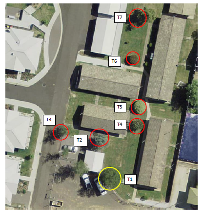
Figure 2 - tree removal
|
Tree
Number
|
Common
Name
|
Botanic
Name
|
Comments
|
|
Tree 1
|
Silver Birch
|
Betula pendula
|
To be retained, TPZ to be
established during building works (TPZ zone of 5m, with a protective fence to
be in place), plaque installed with tree planting to be left in place (see
photo below table).
|
|
Tree 2
|
Atlantic Fir
|
Cedrus atiantica
|
Poorly shaped specimen, not
significant.
|
|
Tree 3
|
Silver Birch
|
Betula pendula
|
Poor example of tree species.
|
|
Tree 4
|
Malus
|
Malus species
|
Flowering deciduous tree –
not significant.
|
|
Tree 5
|
Pittosporum
|
Pittosporum undulatum
|
Large exotic evergreen shrub
– not significant.
|
|
Tree 6
|
Prunus tree
|
Prunus species
|
Small flowering deciduous tree
– not significant.
|
|
Tree 7
|
Protea
|
Protea longifolia
|
Flowering exotic shrub.
|
Figure 3 - tree schedule
A detailed landscape plan has been submitted in support of
the re-development. Council’s Manager City Presentation has carried out
an assessment of the landscape concept for the development and has identified
some concerns with regards to the identified species proposed to be used within
the plan. A condition of consent has been included requiring the submission of
an amended landscaping plan prior to the issue of a Construction Certificate.
Context and Setting
The subject site is located in a well-established
residential precinct. The subject land is bound by Nile Street to the east,
Newman Park to the south and Autumn Street to the west and a series of private
dwellings to the north.
The development represents a continuation of the long
standing residential use of the land and is proposed at a scale that is
commensurate with the predominate scale of the locality.
The development is not antipathetic to the context and
setting of the locality.
Residential Amenity
The applicant is proposing to undertake limited cut and fill
around the edges of the site so as to achieve gradients consistent with the
access and mobility standards of the SEPP. This will result in a step-up
around the outer fence lines. There will be somewhat of an enclosing effect
caused by the 1.8m fencing along the northern and eastern shared boundaries.
However, this form of self-care units for seniors are
popular among able bodied retirees and allow social bonding by association to
occur within these complexes. Provision of a generous amount of parking,
landscaping in excess of the minimum requirements, and site coverages well
within the maximum allowed all suggest development that will provide a high
level of residential amenity.
Visual Impacts
The proposed buildings are residential in scale with
satisfactory external appearance and finishes. As such, the development is not
likely to present any unsatisfactory visual impacts in the locality.
Traffic Impacts
The development is not expected to result in any adverse
traffic impact. Sufficient parking exists onsite and no new access points are
proposed. A new mini-bus drop-off area is available within the existing complex
erected on the remainder of the site.
THE SUITABILITY OF THE SITE
s4.15(1)(c)
The site is located in a residential zone and will continue
to be used for residential purposes. Council staff are not aware of any
physical, natural or technological hazards that may constrain the development
from occurring in a satisfactory manner.
ANY SUBMISSIONS MADE IN
ACCORDANCE WITH THE ACT s4.15(1)(d)
The proposed development is defined as "advertised
development" under the provisions of the LEP. The application was
advertised for the prescribed period of 14 days and at the end of that period
no submissions had been received.
PUBLIC INTEREST
s4.15(1)(e)
The proposed development is considered to be of minor
interest to the wider public due to the relatively localised nature of
potential impacts. The proposal is not inconsistent with any relevant policy
statements, planning studies, and guidelines etc that have not been considered
in this assessment.
SUMMARY
The proposed development is permissible with the consent of
Council. The proposed development complies with the relevant aims, objectives
and provisions of Orange LEP 2011 (as amended) and DCP 2004. A
section 4.15 assessment of the development indicates that the development
is acceptable in this instance. Attached is a draft Notice of Approval outlining
a range of conditions considered appropriate to ensure that the development
proceeds in an acceptable manner.
COMMENTS
The requirements of the Environmental Health and Building
Surveyor and the Engineering Development Section are included in the attached
Notice of Approval.
Attachments
1 Notice
of Approval, D18/53654⇩
2 Plans,
D18/53641⇩
Extraordinary
Planning and Development Committee
17 October 2018
2.5 Development
Application DA 224/2018(1) - 102-110 Autumn Street
Attachment 1 Notice of Approval
|

|
ORANGE CITY COUNCIL
Development
Application No DA
224/2018(1)
NA18/ Container
PR22942
|
NOTICE OF DETERMINATION
OF A DEVELOPMENT
APPLICATION
issued under the Environmental
Planning and Assessment Act 1979
Section 4.18
|
Development
Application
|
|
|
Applicant
Name:
|
Havenhand &
Mather Architects Pty Ltd
|
|
Applicant
Address:
|
PO Box 208
BATHURST
NSW 2795
|
|
Owner’s
Name:
|
United Protestant
Association of NSW Limited
|
|
Land
to Be Developed:
|
Lot 50 DP 1130577 -
102-110 Autumn Street, Orange
|
|
Proposed
Development:
|
Demolition
(demolition of 16 existing self-contained dwellings, two carports and removal
of trees), and Seniors Housing (construction of eight self-contained
dwellings)
|
|
|
|
|
Building Code of
Australia
building
classification:
|
As determined by
Certifier
|
|
|
|
|
Determination made
under
Section 4.16
|
|
|
Made
On:
|
17 October 2018
|
|
Determination:
|
CONSENT GRANTED
SUBJECT TO CONDITIONS DESCRIBED BELOW:
|
|
|
|
|
Consent to Operate
From:
|
18 October 2018
|
|
Consent to Lapse On:
|
18 October 2023
|
Terms
of Approval
The reasons for the imposition of conditions
are:
(1) To ensure a quality
urban design for the development which complements the surrounding environment.
(2) To maintain
neighbourhood amenity and character.
(3) To ensure compliance
with relevant statutory requirements.
(4) To provide adequate
public health and safety measures.
(5) Because the development
will require the provision of, or increase the demand for, public amenities and
services.
(6) To ensure the utility
services are available to the site and adequate for the development.
(7) To prevent the proposed
development having a detrimental effect on adjoining land uses.
(8) To minimise the impact
of development on the environment.
Conditions
(1) The development must be
carried out in accordance with:
(a) Plans
numbered Plans by Havenhand Mather dated 27th June 2018, Job Number 1711 sheets
DA.00, 01, 02, 03, 04, .05,,06, 07, 08, 09, 10; Plans By Heath Consulting
Engineers dated June 2018, job number 18_038 drawings DA01, 02, 03, (REV
A) (14 sheets)
(b) statements
of environmental effects or other similar associated documents that form part
of the approval
as amended in
accordance with any conditions of this consent.
(2) All building work must
be carried out in accordance with the provisions of the Building Code of
Australia.
(3) A sign is to be erected
in a prominent position on any site on which building work, subdivision work or
demolition work is being carried out:
(a) showing
the name, address and telephone number of the principal certifying authority
for the work, and
(b) showing
the name of the principal contractor (if any) for any building work and a
telephone number on which that person may be contacted outside working hours,
and
(c) stating
that unauthorised entry to the site is prohibited.
Any such sign is to be maintained while the
building work, subdivision work or demolition work is being carried out.
(4) Where any excavation
work on the site extends below the level of the base of the footings of a
building on adjoining land, the person having the benefit of the development
consent must, at the person’s own expense:
(a) protect
and support the adjoining premises from possible damage from the excavation,
and
(b) where
necessary, underpin the adjoining premises to prevent any such damage.
Note: This
condition does not apply if the person having the benefit of the development
consent owns the adjoining land or the owner of the adjoining land has given
consent in writing to this condition not applying.
DEMOLITION
|
PRIOR TO WORKS COMMENCING
|
(5) A water and soil
erosion control plan is to be submitted to Orange City Council or an Accredited
Certifier (Categories B1, C3, C4, C6) for approval prior to the issuing of a
Construction Certificate. The control plan is to be in accordance with the
Orange City Council Development and Subdivision Code and the Landcom, Managing
Urban Stormwater; Soils and Construction Handbook.
(6) Prior to works
commencing a waste management plan is to be submitted and approved by Council.
This plan is to describe the nature of waste to be removed, the waste recycled
and the destination of all waste. All waste from the demolition and
construction phase are to be deposited at a licensed or approved waste disposal
site.
(7) The
Betula Pendula (Silver Birch) tree located in the vicinity of the
barbecue area is required to be retained. Council’s investigations of the
site reveal that the tree is a commemorative tree planted in 1972 by Mrs
Andrew Peacock at the opening of the facility. The tree shall be protected at
all times during the construction phase by protective fencing installed a
minimum of 5m from the tree. The tree shall be incorporated and featured as
part of the landscaping plans required under this consent.
|
DURING CONSTRUCTION/SITEWORKS
|
(8) All
construction/demolition work on the site is to be carried out between the hours
of 7.00 am and 6.00 pm Monday to Friday inclusive, 7.00 am to
5.00 pm Saturdays and 8.00 am to 5.00 pm Sundays and Public
Holidays. Written approval must be obtained from the General Manager of Orange
City Council to vary these hours.
(9) Any adjustments to
existing utility services that are made necessary by this development
proceeding are to be at the full cost of the developer.
(10) The existing sewer
connections to the buildings proposed to be removed is to be sealed off at the
sewer main.
(11) The existing water
service connections to the buildings proposed to be removed is to be sealed off
at the primary water main.
(12) All
of the foregoing conditions are to be at the full cost of the developer and to
the requirements and standards of the Orange City Council Development and
Subdivision Code, unless specifically stated otherwise. All work required by
the foregoing conditions is to be completed prior to the issuing of an
Occupation or Subdivision Certificate, unless stated otherwise.
EIGHT SELF-CONTAINED DWELLINGS
|
PRIOR TO THE ISSUE OF A CONSTRUCTION
CERTIFICATE
|
(13) A
revised landscaping plan shall be submitted to and be approved by
Council’s Manager Development Assessments. The plan shall identify tree
species to be planted. The planting schemes for garden beds marked A, B and C
have suggested species that will not grow in the Orange climate. Alternative
species selection are required to be included in the revised landscaping plan
that include species that will withstand the local growing conditions.
(14) An
approval under Section 68 of the Local Government Act is to be sought
from Orange City Council, as the Water and Sewer Authority, for water, sewer
and stormwater connection. No plumbing and drainage is to commence until
approval is granted.
(15) Engineering plans,
showing details of all proposed work and adhering to any engineering conditions
of development consent, are to be submitted to, and approved by, Orange City
Council or an Accredited Certifier (Categories B1, C3, C4, C6) prior to the
issuing of a Construction Certificate.
(16) A water and soil
erosion control plan is to be submitted to Orange City Council or an Accredited
Certifier (Categories B1, C3, C4, C6) for approval prior to the issuing of a
Construction Certificate. The control plan is to be in accordance with the
Orange City Council Development and Subdivision Code and the Landcom, Managing
Urban Stormwater; Soils and Construction Handbook.
(17) The development’s
stormwater design is to include stormwater detention within the development,
designed to limit peak outflows from the land to the pre-existing natural outflows
up to the 100 year ARI frequency, with sufficient allowance in overflow
spillway design capacity to safely pass flows of lower frequency (that is, a
rarer event) without damage to downstream developments. Where appropriate, the
spillway design capacity is to be determined in accordance with the
requirements of the Dam Safety Committee.
The design of the detention storage is to be
undertaken using the ILSAX/DRAINS rainfall-runoff hydrologic model or an
approved equivalent capable of assessing runoff volumes and their temporal
distribution as well as peak flow rates. The model is to be used to calculate
the flow rates for the existing and post-development conditions. The developed
flows are to be routed through the proposed storage within the model so that
the outflows obtained are no greater than the flows obtained for the
pre-existing natural flows.
A report detailing the results of the analysis,
which includes:
· catchment plan showing
sub-catchments under existing and developed conditions;
· schematic diagram of
the catchment model showing sub areas and linkages;
· tabulation detailing
the elevation, storage volume and discharge relationships; and
· tabulation for the
range of frequencies analysed, the inflows, outflows and peak storage levels
for both existing and developed conditions;
together with copies of the data files for the
model and engineering design plans of the required drainage system are to be
submitted to Orange City Council upon application for a Construction
Certificate.
|
PRIOR TO WORKS COMMENCING
|
(18) A
Construction Certificate application is required to be submitted to, and issued
by Council/Accredited Certifier prior to any excavation or building works being
carried out onsite.
(19) A
temporary onsite toilet is to be provided and must remain throughout the
project or until an alternative facility meeting Council’s requirements
is available onsite.
(20) The
location and depth of the sewer junction/connection to Council’s sewerage
system is to be determined to ensure that adequate fall to the sewer is
available.
|
DURING CONSTRUCTION/SITEWORKS
|
(21) All
construction/demolition work on the site is to be carried out between the hours
of 7.00 am and 6.00 pm Monday to Friday inclusive, 7.00 am to
5.00 pm Saturdays and 8.00 am to 5.00 pm Sundays and Public
Holidays. Written approval must be obtained from the General Manager of Orange
City Council to vary these hours.
(22) All
construction works are to be strictly in accordance with the Reduced Levels
(RLs) as shown on the approved plans.
(23) All materials onsite or
being delivered to the site are to be contained within the site. The
requirements of the Protection of the Environment Operations Act 1997
are to be complied with when placing/stockpiling loose material or when disposing
of waste products or during any other activities likely to pollute drains or
watercourses.
(24) No portion of the
building - including footings, eaves, overhang and service pipes - shall
encroach into any easement.
(25) All services (water,
sewer and stormwater) shall be laid outside the easement unless there is a
direct connection to the main within that easement.
(26) Any adjustments to
existing utility services that are made necessary by this development
proceeding are to be at the full cost of the developer.
(27) The provisions and
requirements of the Orange City Council Development and Subdivision Code are to
be applied to this application and all work constructed within the development
is to be in accordance with that Code.
The developer is to be entirely responsible for
the provision of water, sewerage and drainage facilities capable of servicing
all the lots from Council’s existing infrastructure. The developer is to
be responsible for gaining access over adjoining land for services where
necessary and easements are to be created about all water, sewer and drainage
mains within and outside the lots they serve.
(28) All sewage from this
development is to be piped to the existing sewer system within the site. All
construction work is to be at the full cost of the developer.
(29) All stormwater is to be
collected and drained to the existing drainage system within the site.
(30) All driveway and
parking areas are to be sealed with bitumen, hot mix or concrete and are to be
designed for all expected loading conditions (provided however that the minimum
pavement depth for gravel and flush seal roadways is 200mm) and be in
accordance with the Orange City Council Development and Subdivision Code.
|
PRIOR TO THE ISSUE OF AN OCCUPATION
CERTIFICATE
|
(31) Where
any existing fencing at the perimeter of the site immediately adjacent to the
new units needs to be removed, or is of a type which does not ensure the
occupants of any adjoining residence adequate privacy, fencing of a type able
to ensure continued privacy, security and safety with a minimum height at the
boundary of 1.8m of solid construction shall be installed prior to the issue of
an Occupation Certificate.
(32) This
consent limits the use of the development to the following occupants:
(a) seniors
or people who have a disability,
(b) people
who live within the same household with seniors or people who have a
disability,
(c) staff
employed to assist in the administration of and provision of services to
housing provided under this Policy.
Prior to the issuing of an Occupation
Certificate, a Restriction-as-to-User shall be registered against the title of
the property on which development is to be carried out in accordance with
section 88E of the Conveyancing Act limiting the use of any accommodation
to which the application relates to the demographics of people referred to
above.
(33) No
person is to use or occupy the building or alteration that is the subject of
this approval without the prior issuing of an Occupation Certificate.
(34) Finished
ground levels are to be graded away from the buildings and adjoining properties
and must achieve natural drainage. The concentrated flows are to be dispersed
down slope or collected and discharged to the stormwater drainage system.
(35) Where
Orange City Council is not the Principal Certifying Authority, a final
inspection of water connection, sewer and stormwater drainage shall be
undertaken by Orange City Council and a compliance certificate issued, prior to
the issue of either an interim or a final Occupation Certificate.
(36) The cut and fill is to
be retained and/or adequately battered and stabilised (within the allotment)
prior to the issue of an Occupation Certificate.
(37) A Certificate of
Compliance, from a Qualified Engineer, stating that the stormwater detention
basin complies with the approved engineering plans is to be submitted to the
Principal Certifying Authority prior to the issuing of an Occupation
Certificate.
(38) Certification from
Orange City Council is required to be submitted to the Principal Certifying
Authority prior to the issue of an Occupation Certificate stating that all
works relating to connection of the development to Council assets, works on
public land, works on public roads, stormwater, sewer and water reticulation
mains and footpaths have been carried out in accordance with the Orange City
Council Development and Subdivision Code and the foregoing conditions, and that
Council will take ownership of the infrastructure assets.
(39) All
of the foregoing conditions are to be at the full cost of the developer and to
the requirements and standards of the Orange City Council Development and
Subdivision Code, unless specifically stated otherwise. All work required by
the foregoing conditions is to be completed prior to the issuing of a final
Occupation, unless stated otherwise.
|
MATTERS FOR THE ONGOING PERFORMANCE AND
OPERATION OF THE DEVELOPMENT
|
(40) Any
ancillary light fittings fitted to the exterior of the building are to be
shielded or mounted in a position to minimise glare to adjoining properties.
Other
Approvals
(1) Local
Government Act 1993 approvals granted under section 68.
Nil
(2) General
terms of other approvals integrated as part of this consent.
Nil
Right
of Appeal
If you are dissatisfied with this decision,
Section 8.7 of the Environmental Planning and Assessment Act 1979
gives you the right to appeal to the Land and Environment Court. Pursuant to
Section 8.10, an applicant may only appeal within 6 months after the date the
decision is notified.
|
Disability
Discrimination Act 1992:
|
This application has been assessed in
accordance with the Environmental Planning and Assessment Act 1979. No
guarantee is given that the proposal complies with the Disability
Discrimination Act 1992.
The applicant/owner is responsible to ensure
compliance with this and other anti-discrimination legislation.
The Disability Discrimination Act
covers disabilities not catered for in the minimum standards called up in the
Building Code of Australia which references AS1428.1 - "Design for
Access and Mobility". AS1428 Parts 2, 3 and 4 provides the most
comprehensive technical guidance under the Disability Discrimination Act
currently available in Australia.
|
|
|
|
|
Disclaimer
- S88B of the Conveyancing Act 1919 - Restrictions on the Use of Land:
|
The applicant should note that there could be
covenants in favour of persons other than Council restricting what may be
built or done upon the subject land. The applicant is advised to check the
position before commencing any work.
|
|
|
|
|
Signed:
|
On behalf of the consent authority ORANGE
CITY COUNCIL
|
|
Signature:
|
|
|
Name:
|
PAUL JOHNSTON - MANAGER DEVELOPMENT ASSESSMENTS
|
|
Date:
|
18 October 2018
|
Extraordinary Planning and
Development Committee
17 October 2018
2.5 Development
Application DA 224/2018(1) - 102-110 Autumn Street
Attachment 2 Plans
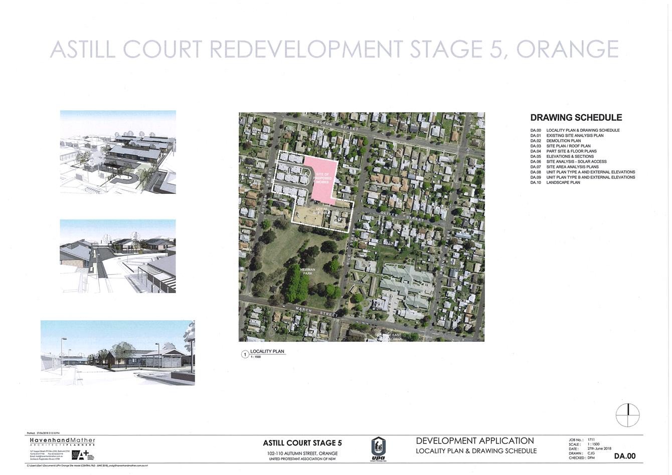
It is noted that the application with the addition of
the below referenced valet arrangement, has not been back before the committee
as the committee has since been disbanded.