Planning and Development
Committee
Agenda
2 October 2018
Notice is hereby given, in
accordance with the provisions of the Local Government Act 1993 that a Planning and Development Committee meeting of ORANGE CITY COUNCIL
will be held in the Council Chamber,
Civic Centre, Byng Street, Orange on Tuesday, 2 October 2018.
Garry
Styles
General Manager
For apologies please
contact Administration on 6393 8218.
1 Introduction
1.1 Declaration
of pecuniary interests, significant non-pecuniary interests and less than
significant non-pecuniary interests
The
provisions of Chapter 14 of the Local Government Act, 1993 (the Act)
regulate the way in which Councillors and designated staff of Council conduct
themselves to ensure that there is no conflict between their private interests
and their public role.
The
Act prescribes that where a member of Council (or a Committee of Council) has a
direct or indirect financial (pecuniary) interest in a matter to be considered
at a meeting of the Council (or Committee), that interest must be disclosed as
soon as practicable after the start of the meeting and the reasons given for
declaring such interest.
As
members are aware, the provisions of the Local Government Act restrict any
member who has declared a pecuniary interest in any matter from participating
in the discussion or voting on that matter, and requires that member to vacate
the Chamber.
Council’s Code of Conduct provides that if members
have a non-pecuniary conflict of interest, the nature of the conflict must be
disclosed. The Code of Conduct also provides for a number of ways in which a
member may manage non pecuniary conflicts of interest.
|
Recommendation
It is recommended that Committee Members now disclose any
conflicts of interest in matters under consideration by the Planning and
Development Committee at this meeting.
|
2 General
Reports
2.1 Items
Approved Under the Delegated Authority of Council
RECORD
NUMBER: 2018/2216
AUTHOR: Paul
Johnston, Manager Development Assessments
EXECUTIVE Summary
Following is a list of development applications approved
under the delegated authority of Council.
Link To Delivery/OPerational Plan
The recommendation in this report relates to the
Delivery/Operational Plan strategy “7.1 Preserve - Engage with the
community to develop plans for growth and development that value the local
environment”.
Financial Implications
Nil
Policy and Governance Implications
Nil
|
Recommendation
That the information provided in the report by the
Manager Development Assessments on Items Approved Under the Delegated
Authority of Council be acknowledged.
|
further considerations
Consideration has been given to the recommendation’s
impact on Council’s service delivery; image and reputation; political;
environmental; health and safety; employees; stakeholders and project
management; and no further implications or risks have been identified.
SUPPORTING INFORMATION
|
Reference:
|
DA 417/2017(2)
|
Determination Date
|
31 August 2018
|
|
PR Number
|
PR27610
|
|
Applicant/s:
|
AMP Pastoral Pty Limited
|
|
Owner/s:
|
AMP Pastoral Pty Limited
|
|
Location:
|
Lot 100 DP 1226302 – Kite
Street, Orange
|
|
Proposal:
|
Modification of development consent
– hotel or motel accommodation (alterations and additions). The
modification involves conversion of first floor accommodation to provide
seven motel rooms with ensuites; five motel rooms; two new kitchenettes and
one new bathroom.
|
|
Value:
|
$215,000
(being $15,000 more than the original development)
|
|
Reference:
|
DA 449/2017(2)
|
Determination Date
|
17 September 2018
|
|
PR Number
|
PR
|
|
Applicant/s:
|
Mr CH and Mrs MJ Boardman
|
|
Owner/s:
|
Mr CH and Mrs MJ Boardman
|
|
Location:
|
Lot 98 DP 1180866 – 26
Colliers Avenue, Orange
|
|
Proposal:
|
Modification of development consent
– vehicle body repair workshop. The modified proposal will amend the
external wall claddings of the approved vehicle repair station, transport
depot and vehicle sales or hire premises.
|
|
Value:
|
$860,000 (being the same value as
the original development)
|
|
Reference:
|
DA 42/2018(2)
|
Determination Date
|
27 August 2018
|
|
PR Number
|
18292
|
|
Applicant/s:
|
Stimson and Baker Planning
|
|
Owner/s:
|
Aldi Foods Pty Limited
|
|
Location:
|
Lot 500 DP 1033145 – 167-177
Peisley Street, Orange
|
|
Proposal:
|
Modification of development consent
- shop (alterations and additions to existing building). The modification
involves minor alterations to the approved car park layout.
|
|
Value:
|
$1,364,000 (being the same value as
the original development)
|
|
Reference:
|
DA 3/2018(1)
|
Determination Date
|
12 September 2018
|
|
PR Number
|
PR23353
|
|
Applicant/s:
|
Hardware Property TC Pty Limited
|
|
Owner/s:
|
Hardware Property TC Pty Limited
|
|
Location:
|
Lot 100 DP 1137137 – 253
McLachlan Street, Orange (Mitre 10)
|
|
Proposal:
|
Hardware and building supplies
(alterations and additions), business identification signage and demolition
|
|
Value:
|
$700,000
|
|
Reference:
|
DA 181/2018(1)
|
Determination Date
|
10 September 2018
|
|
PR Number
|
PR25972
|
|
Applicant/s:
|
Fautari Properties Pty Ltd
|
|
Owner/s:
|
Fautari Properties Pty Ltd
|
|
Location:
|
Lot 100 DP 1180866 – 2
Trappit Place, Orange
|
|
Proposal:
|
Freight transport facility (new
industrial building)
|
|
Value:
|
$525,500
|
|
Reference:
|
DA 218/2018(1)
|
Determination Date
|
3 September 2018
|
|
PR Number
|
PR18416
|
|
Applicant/s:
|
Mr MK Tufail
|
|
Owner/s:
|
Regional NSW Islamic Centre Inc
|
|
Location:
|
Lot 51 DP 1066967 – 344A
Peisley Street, Orange
|
|
Proposal:
|
Place of public worship
(alterations and additions to existing buildings)
|
|
Value:
|
$40,000
|
|
Reference:
|
DA 219/2018(1)
|
Determination Date
|
29 August 2018
|
|
PR Number
|
PR6028
|
|
Applicant/s:
|
Mr CA and Mrs SL Jacques
|
|
Owner/s:
|
Mr CA and Mrs SL Jacques
|
|
Location:
|
Lot 1 DP 998736 – 1 Kenna
Street, Orange
|
|
Proposal:
|
Subdivision (two lot residential),
demolition (existing garage), carport (new construction), subdivision (three lot
residential) and dwellings (three – new construction)
|
|
Value:
|
$590,000
|
|
Reference:
|
DA 229/2018(1)
|
Determination Date
|
27 August 2018
|
|
PR Number
|
PR12664
|
|
Applicant/s:
|
Mr N Gee, Mrs DV Gee and Ms A
Mitchell
|
|
Owner/s:
|
Mr NC Gee, Mrs DV Gee and Ms AL Mitchell
|
|
Location:
|
Lot 1 DP 714681 – 8 William
Street, Orange
|
|
Proposal:
|
Medical centre (change of use from
residential accommodation) and business identification signage
|
|
Value:
|
$80,000
|
|
Reference:
|
DA 241/2018(1)
|
Determination Date
|
31 August 2018
|
|
PR Number
|
PR26011
|
|
Applicant/s:
|
Mr K and Mrs SB Barber
|
|
Owner/s:
|
Mrs SB Barber
|
|
Location:
|
Lot 640 DP 1172022 – 17
Bowman Avenue, Orange
|
|
Proposal:
|
Dual
occupancy (one additional detached dwelling) and subdivision (two lot
residential)
|
|
Value:
|
$340,000
|
|
Reference:
|
DA 246/2018(1)
|
Determination Date
|
18 September 2018
|
|
PR Number
|
PR23045
|
|
Applicant/s:
|
Orange District Softball
Association
|
|
Owner/s:
|
Orange City Council
|
|
Location:
|
Lot 1 DP 1142713 – Sir Jack
Brabham Park – 1610 Forest Road, Orange
|
|
Proposal:
|
Recreation facility
(outdoor)(ancillary building additions)
|
|
Value:
|
$9,500
|
|
Reference:
|
DA 249/2018(1)
|
Determination Date
|
27 August 2018
|
|
PR Number
|
PR26604
|
|
Applicant/s:
|
Gregory J Coleman Pty Ltd
|
|
Owner/s:
|
Ms GL Bristowe
|
|
Location:
|
Lot 27 DP 1200262 – 2 The
Snowy Way, Orange
|
|
Proposal:
|
Exhibition home and business
identification signage
|
|
Value:
|
$330,000
|
|
Reference:
|
DA 254/2018(1)
|
Determination Date
|
12 September 2018
|
|
PR Number
|
PR28037
|
|
Applicant/s:
|
Mr DL Jones
|
|
Owner/s:
|
Mr DL Jones
|
|
Location:
|
Lot 205 DP 1244057 – 50
Catania Street, Orange
|
|
Proposal:
|
Dual occupancy and subdivision (two
lot residential)
|
|
Value:
|
$450,000
|
|
Reference:
|
DA 264/2018(1)
|
Determination Date
|
28 August 2018
|
|
PR Number
|
PR3537
|
|
Applicant/s:
|
Roberts Family Superannuation
|
|
Owner/s:
|
Premium Custody Services Pty
Limited
|
|
Location:
|
Lot 1 DP 150494 – 1 Dora
Street, Orange
|
|
Proposal:
|
Demolition (tree removal)
|
|
Value:
|
$1,000
|
|
Reference:
|
DA 271/2018(1)
|
Determination Date
|
31 August 2018
|
|
PR Number
|
PR19014
|
|
Applicant/s:
|
McKinnon Design
|
|
Owner/s:
|
Mr JH and Mrs HJ Ovenden
|
|
Location:
|
Lot 44 DP 1063083 – 9 Elwin
Drive, Orange
|
|
Proposal:
|
General industry and warehouse (new
industrial building)
|
|
Value:
|
$650,000
|
|
Reference:
|
DA 300/2018(1)
|
Determination Date
|
12 September 2018
|
|
PR Number
|
PR26930
|
|
Applicant/s:
|
Saunders Global
|
|
Owner/s:
|
BMPS 88 Pty Ltd
|
|
Location:
|
Lot 1 DP 1181850 – 54 Hill
Street, Orange
|
|
Proposal:
|
Subdivision (two lot Torrens)
|
|
Value:
|
$0
|
TOTAL NET* VALUE OF ALL
DEVELOPMENTS APPROVED IN THIS PERIOD: $3,731,000.00
*
Net value relates to the value of modifications. If modifications are
the same value as the original DA, then nil is added. If there is a plus/minus
difference, this difference is added or taken out.
2.2 Development
Application DA 307/2013(6) - 3-4/51 Moulder Street
RECORD
NUMBER: 2018/2389
AUTHOR: Summer
Commins, Senior Planner
EXECUTIVE Summary
|
Application
lodged
|
6
September 2018
|
|
Applicant/s
|
Mr SI
Munro
|
|
Owner/s
|
Mr SI
Munro and Mrs V McCourt-Munro
|
|
Land
description
|
Approved
Lot 4 in a subdivision of Lot 7 DP 286647 – 51 Moulder Street,
Orange
(formerly
known as Lot 1 DP 797835 and Lot 201 DP 1175177 - 49 and 51 Moulder
Street, Orange
|
|
Proposed
land use
|
Dwelling
House, Community Title Subdivision (three lot residential), Community Title
Subdivision (four lot residential) and Dwelling Houses (four)
|
|
Value of
proposed development
|
$260,000
|
Application has been made to modify development consent DA
307/2013(5) for proposed residential development and subdivision at 51 Moulder
Street, Orange.
The parent parcels for the original approved development are
Lot 1 DP 797835 and Lot 201 DP 1175177. This modification
application relates to the registered parcel described as Lot 7
DP 286647, and known as 3-4/51 Moulder Street.
The modified proposal involves an amended floor plan for
proposed Unit 4 within Lot 7. A Section 4.15 assessment of the
proposal indicates that the modified development is acceptable. An amended
Notice of Approval is attached.
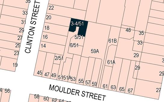
Figure 1 - locality plan
RECENT LEGISLATIVE CHANGES
On 1 March 2018 the Environmental Planning and Assessment
Act 1979 was substantially amended. The most immediate change involves the
restructuring and renumbering of the Act, with other more substantive
changes to be phased in over time. However, for some applications (particularly
where an application was lodged prior to the changes coming into effect) the
supporting documentation may still reference the previous numbering regime. In
the drafting of this report the content and substance of the supporting
material has been considered irrespective of which legislative references were
used.
DECISION FRAMEWORK
Development in Orange is governed by two key documents
Orange Local Environment Plan 2011 and Orange Development Control Plan 2004. In
addition the Infill Guidelines are used to guide development, particularly in
the heritage conservation areas and around heritage items.
Orange Local Environment Plan 2011 – The
provisions of the LEP must be considered by the Council in determining the
application. LEPs govern the types of development that are permissible or
prohibited in different parts of the City and also provide some assessment
criteria in specific circumstances. Uses are either permissible or not. The
objectives of each zoning and indeed the aims of the LEP itself are also to be
considered and can be used to guide decision making around appropriateness of
development.
Orange Development Control Plan 2004 – the DCP
provides guidelines for development. In general it is a performance based
document rather than prescriptive in nature. For each planning element there
are often guidelines used. These guidelines indicate ways of achieving the
planning outcomes. It is thus recognised that there may also be other solutions
of merit. All design solutions are considered on merit by planning and building
staff. Applications should clearly demonstrate how the planning outcomes are
being met where alternative design solutions are proposed. The DCP enables
developers and architects to use design to achieve the planning outcomes in
alternative ways.
DIRECTOR’S COMMENT
This is an innocuous modification brought to Council by
virtue of the applicant being a Councillor.
Link To Delivery/OPerational Plan
The recommendation in this report relates to the
Delivery/Operational Plan strategy “10.1 Preserve - Engage with the
community to ensure plans for growth and development are respectful of our
heritage”.
Financial Implications
Nil
Policy and Governance Implications
Nil
|
Recommendation
That Council modifies
development consent DA 307/2013(5) for Dwelling House, Community Title Subdivision (three
lot residential), Community Title Subdivision (four lot residential) and
Dwelling Houses (four) at approved Lot 4 in a subdivision of Lot 7
DP 286647 - 51 Moulder Street, Orange (formerly known as Lot 1 DP 797835
and Lot 201 DP 1175177 - 49 and 51 Moulder Street, Orange), pursuant to the conditions of consent in the attached
modified Notice of Approval.
|
further considerations
Consideration has been given to the recommendation’s
impact on Council’s service delivery; image and reputation; political; environmental;
health and safety; employees; stakeholders and project management; and no
further implications or risks have been identified.
SUPPORTING INFORMATION
THE APPLICATION/PROPOSAL
Application has been made to
modify development consent DA 307/2013(5) for proposed dwellings and Community
Title subdivision at 51 Moulder Street. The modified proposal involves minor
alterations to the floor plan for proposed Unit 4.
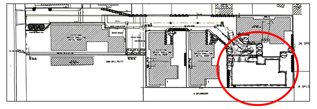
Figure 2 - approved residential development including
Unit 4 circled
The original approved floor plan and building design for
Unit 4 are depicted below:
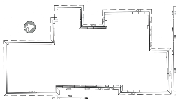
Figure 3 - approved Unit 4 floor plan
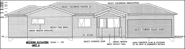
Figure 4 - approved Unit 4 front (western) elevation
The modified proposal involves a western extension to the
double garage in order to provide a workshop space and ensuite bathroom. An
additional window to the ensuite will be provided on the eastern façade.
The modified development will not alter the approved building design or site
layout.
The Unit 4 modified floor plan
is depicted below.
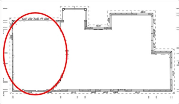
Figure 5 - modified Unit 4 floor plan
MATTERS FOR CONSIDERATION
Section 4.55(1A) and (3) of the Environmental Planning
and Assessment Act 1979 states:
A consent
authority may…modify the consent if:
(a) it
is satisfied that the proposed modification is of minimal environmental impact,
and
(b) it
is satisfied that the development to which the consent as modified relates is
substantially the same development as the development for which the consent was
originally granted and before that consent as originally granted was modified
(if at all), and
(c) it
has notified the application in accordance with:
(i) the
regulations, if the regulations so require, or
(ii) a
development control plan, if the consent authority is a council that has made a
development control plan under Section 72 that requires the notification or
advertising of applications for modification of a development consent, and
(d) it
has considered any submissions made concerning the proposed modification within
any period prescribed by the regulations or provided by the development control
plan, as the case may be.
(3) In
determining an application for modification of a consent under this section,
the consent authority must take into consideration such of the matters referred
to in Section 4.5(1) as are of relevance to the development the subject of
the application.
In consideration of the
requirements of Sections 4.55:
· The development as
modified is substantially the same as the development for which the consent was
originally granted.
· The development as
modified does not effect a condition imposed as a requirement of concurrence by
a Minister, public authority or approval body.
· The modified
development does not comprise advertised development pursuant to
Clause 117 of the Environmental Planning and Assessment
Regulation 2000 or Orange Development Control Plan (DCP) 2004-5.3.
Public notice and exhibition of the modified development were not required.
· No submissions
were received in relation to the development as modified.
· The relevant matters
under Section 4.5(1) are addressed in this report.
PROVISIONS OF ANY ENVIRONMENTAL
PLANNING INSTRUMENT s4.15(1)(a)(i)
Orange Local Environmental Plan 2011 (as amended)
The original development was
assessed pursuant to Orange LEP 2011. The subject land is identified on the LEP
maps as follows:
|
Land Zoning Map:
|
Land zoned R1 General Residential
|
|
Lot Size Map:
|
No minimum lot size
|
|
Heritage Map:
|
Within a heritage conservation area
|
|
Height of Buildings Map:
|
No building height limit
|
|
Floor Space Ratio Map:
|
No floor space limit
|
|
Terrestrial Biodiversity Map:
|
No biodiversity sensitivity on the
site
|
|
Groundwater Vulnerability Map:
|
Ground water vulnerable
|
|
Drinking Water Catchment Map:
|
Not within the drinking water
catchment
|
|
Watercourse Map:
|
Not within or affecting a defined
watercourse
|
|
Urban Release Area Map:
|
Not within an urban release area
|
|
Obstacle Limitation Surface Map:
|
No restriction on building siting
or construction
|
|
Additional Permitted Uses Map:
|
No additional permitted use applies
|
|
Flood Planning Map:
|
Not within a flood planning area
|
The proposed modified development does not alter the
previous assessment under that Plan.
State Environmental Planning
Policy 55 - Remediation of Land
SEPP 55 was applicable to the original development. The
modified development does not alter the previous assessment under the SEPP.
DESIGNATED DEVELOPMENT
The proposed development is not designated development.
INTEGRATED DEVELOPMENT
The proposed development is not integrated development.
PROVISIONS OF ANY DEVELOPMENT
CONTROL PLAN s4.15(1)(a)(iii)
Development Control Plan 2004
The original development was assessed pursuant to the
following chapters in DCP 2004:
· Chapter 7 - Development in Residential
Areas.
· Chapter 13 - Heritage.
The modified development remains consistent with the
relevant Planning Outcomes, as outlined below.
Residential Subdivision
The allotment layout will be retained in the approved form.
The area, dimensions and orientation of approved Lots 3 and 4 will not be
altered.
Neighbourhood Character
Amended Unit 4 will be located internal to the site on a
battleaxe development lot and will not be viewed from Moulder Street. The
building design and detailing for Unit 4 will reasonably relate to the
architectural theme for other units within the approved development, and
complement the built form in the neighbourhood generally.
Building Appearance
The external finishes for the modified dwelling are
appropriate to the development site and broader residential setting.
Setbacks
The modified development will have nil impact on street
setbacks, with Unit 4 located on a battleaxe development lot.
Visual Bulk
Modified Unit 4 will be single-storey, consistent with the
prevailing height in the neighbourhood. Unit 4 as amended will be contained
within the DCP-prescribed visual bulk envelope plane.
Modified Unit 4 will have a building footprint of 182.8m2.
Based on the site area of approved Lot 4 of 311.8m2, the dwelling
will have site coverage of 58.6%, being less than the maximum 60% prescribed
for single dwellings.
Walls and Boundaries
Unit 4 as amended will have a minimum setback of 900mm to
the eastern boundary of the development lot, consistent with the approved
development. Impacts on privacy, shadowing and visual bulk will be consistent
with the original approval.
Daylight and Sunlight
The modified development will not alter the approved
situation for solar access to internal and external habitable spaces of Unit
4. The garage extension is located on the south side of Unit 4, with
indoor and outdoor living spaces located to the north.
In relation to shadow impacts for Unit 5 to the south,
shadow diagrams were not submitted in support of the modified proposal for Unit
4. Notwithstanding, the shadows diagrams submitted with the original
development were extrapolated by Council officers in conjunction with the
proponent’s building designer (McKinnon Design). The modifications
to Unit 4 will not adversely impact on solar access to internal and external habitable
spaces for adjoining Unit 5.
Views
The modified development will not affect important views.
Visual Privacy
The modified development will not present unreasonable
visual privacy impacts within the development or for the opposing dwelling on
the adjoining eastern parcel (at 59A Moulder Street). One (1) additional
ensuite window will be provided to the eastern façade of Unit 4.
Acoustic Privacy
Reasonable acoustic privacy will be provided to modified
Unit 4, consistent with the original approved development.
Security
The modified development will provide acceptable security
for residents.
Circulation Design
Sufficient manoeuvring area will be provided in the adjacent
manoeuvring bay to permit functional reverse egress from the modified double
garage. Vehicles associated with Unit 4 will egress the site in a forward
direction.
Car Parking
The modified design for Unit 4 includes an attached double
garage, consistent with the requirements for three bedroom dwellings. The
applicant has suitably demonstrated that sufficient manoeuvring area remains
available to ensure that all vehicles exit the site in a forward direction.
Private Open Space
Private open space for amended Unit 4 will generally comply
with the DCP guidelines in respect of minimum area (60.5m2 required
and 60.7m2 provided), dimensions (5m x 5m); orientation
(north-facing) and accessibility (adjacent living areas).
Landscaping
The modified development will not alter the conditional
arrangements for landscaping of the development site, pursuant to the original
development.
Heritage
The subject land is located in the Central Orange Heritage
Conservation Area. The design and detailing for modified Unit 4 are appropriate
for the development site and broader residential setting. Notwithstanding, the
development as modified will not be visible from the public realm, and will not
adversely impact on the significance of the conservation area.
INFILL GUIDELINES
The modified development is consistent with the Assessment
Criteria contained in the Infill Guidelines in relation to scale and form,
siting, materials and colour, and detailing.
PROVISIONS PRESCRIBED BY THE
REGULATIONS s4.15(1)(a)(iv)
The proposed development is not inconsistent with any
provisions prescribed by Regulation. A revised and compliant BASIX Certificate
has been submitted in support of amended Unit 4.
THE LIKELY IMPACTS OF THE
DEVELOPMENT s4.15(1)(b)
The impacts of the modified proposal are consistent with
those considered for the original development.
THE SUITABILITY OF THE SITE
s4.15(1)(c)
There are no aspects of the site that are considered
unsuitable for the proposed modified development.
ANY SUBMISSIONS MADE IN
ACCORDANCE WITH THE ACT s4.15(1)(d)
The modified development does not comprise advertised
development pursuant to the Regulations or DCP 2004. Public notice and
exhibition of the modified development were not required. No submissions have
been received in relation to the proposal.
PUBLIC INTEREST
s4.15(1)(e)
The modified proposal is not inconsistent with any relevant
policy statements, planning studies, guidelines etc that have not been
considered in this assessment.
SUMMARY
The development as modified is substantially the same as the
development for which the consent was originally granted. The modified proposal
is consistent with the planning provisions that apply to the subject land and
particular landuse. An amended Notice of Approval is attached.
COMMENTS
The requirements of the Environmental Health and Building
Surveyor and the Engineering Development Section are included in the attached
amended Notice of Approval.
Attachments
1 Modified
Notice of Approval, D18/50575⇩
2 Plans,
IC18/17508⇩
Planning
and Development Committee
2 October 2018
2.2 Development
Application DA 307/2013(6) - 3-4/51 Moulder Street
Attachment 1 Modified Notice of Approval
|

|
ORANGE CITY COUNCIL
Development
Application No DA
307/2013(6)
NA18/ Container
PR27921
|
NOTICE OF DETERMINATION
OF A DEVELOPMENT
APPLICATION
(AS MODIFIED)
issued under the Environmental
Planning and Assessment Act 1979
Section 4.18
|
Development Application
|
|
|
Applicant
Name:
|
Mr SI Munro
|
|
Applicant
Address:
|
“Saddleback”,
27 Rocky Ponds Road
CUMNOCK
NSW 2867
|
|
Owner’s
Name:
|
Mr SI Munro and Mrs V
McCourt-Munro (Lot 7)
|
|
Land
to Be Developed:
|
Approved Lot 4 in the subdivision
of Lot 7 DP 286647 – 51 Moulder Street, Orange
(formerly known as Lot 201 DP 1175177
and Lot 1 DP 797835 - 49 and 51 Moulder Street, Orange)
|
|
Proposed
Development:
|
Dwelling House,
Community Title Subdivision (three lot residential), Community Title
Subdivision (four lot residential) and Dwelling Houses (four)
|
|
|
|
|
Building Code of
Australia
building
classification:
|
To be determined by
PCA
|
|
|
|
|
Determination made
under
Section 4.16
|
|
|
Made
On:
|
2 October 2018
|
|
Determination:
|
CONSENT GRANTED
SUBJECT TO CONDITIONS DESCRIBED BELOW:
|
|
|
|
|
Consent to Operate
From:
|
4 December 2013
|
|
Consent to Lapse On:
|
4 December 2018
|
Terms
of Approval
The reasons for the imposition of conditions
are:
(1) To ensure compliance
with relevant statutory requirements.
(2) To provide adequate
public health and safety measures.
(3) To ensure a quality
urban design for the development which complements the surrounding environment.
(4) To maintain
neighbourhood amenity and character.
(5) Because the development
will require the provision of, or increase the demand for, public amenities and
services.
(6) To ensure the utility
services are available to the site and adequate for the development.
(7) To prevent the proposed
development having a detrimental effect on adjoining land uses.
(8) To minimise the impact
of development on the environment.
Conditions
(1) The development must be
carried out in accordance with:
(a) Plans
numbered:
12052 LOT 2 – C
– site plan and floor plan Lot 2
12052 – C –
site plan entrance
12052 – LOT 2
– C – elevations Lot 2
12052 – LOT 2
– C – shadow 9am June 21
12052 – LOT 2
– C shadow 10am June 21
12052 – LOT 2
– C – shadow 11am June 21
12052 – LOT 2
– C – shadow 12pm June 21
12052 – LOT 2
– C – shadow 1pm June 21
12052 – LOT 2 –
C – shadow 2pm June 21
12052 – LOT 2
– C – shadow 3pm June 21
12052 – G –
existing boundaries and site analysis
12052 – G –
proposed site plan overall, staging and calculations
12052 – G –
proposed site plan part 1 Lots 3-6
12052 – G –
proposed site plan part 1A entrance detail
12052 – G –
preliminary engineering plan – stormwater Lots 3-6
12052 – G –
preliminary engineering plan – sewer Lots 3-6
12052 – G –
proposed landscaping plan – Lots 3-6
12052 – G –
proposed floor plan unit 3
12052 – G –
proposed elevations unit 3
12052 – G –
proposed floor plan unit 4
12052 – G –
proposed elevations unit 4
12052 – G –
proposed floor plan units 5 & 6
12052 – G –
proposed elevations units 5 & 6
12052 – G –
shadow diagram 9am June 21 units 3-6
12052 – G –
shadow diagram 10am June 21 units 3-6
12052 – G –
shadow diagram 11am June 21 units 3-6
12052 – G –
shadow diagram 12 noon June 21 units 3-6
12052 – G –
shadow diagram 1pm June 21 units 3-6
12052 – G –
shadow diagram 2pm June 21 units 3-6
12052 – G –
shadow diagram 3pm June 21 units 3-6
Amending plans numbered: 12052 Lot 2 Rev A (10
sheets)
Amending plans by Geolyse numbered: 01_A02 Rev A; 01_A03
Rev A dated 7.9.2016 (2 sheets).
Amending plans for Unit 5 by Benedict Design
Project No. P056 dated
30/01/2018
Drawing Nos, 1.1, 1.2,
1.3, 2.1, 3.1, 3.2 (6 sheets)
Amending plans for Unit 6 by Adaptive Architects
Project
No. COR01
Sheet
Nos. A02(A), A03(A) (2 sheets)
Amending plans for Unit 4 by McKinnon Design
Job No.
18069 – Dwg Nos. 01-04 (August 2018) (4 sheets)
(b) statements
of environmental effects or other similar associated documents that form part
of the approval
as amended in accordance with any conditions of
this consent.
(2) All building work must
be carried out in accordance with the provisions of the Building Code of
Australia.
(3) A sign is to be erected
in a prominent position on any site on which building work, subdivision work or
demolition work is being carried out:
a. showing
the name, address and telephone number of the principal certifying authority
for the work, and
b. showing
the name of the principal contractor (if any) for any building work and a
telephone number on which that person may be contacted outside working hours,
and
c. stating
that unauthorised entry to the site is prohibited.
Any such sign is to be maintained while the
building work, subdivision work or demolition work is being carried out.
(4) In
the case of residential building work for which the Home Building Act 1989
requires there to be a contract of insurance in force in accordance with Part 6
of the Act, evidence that such a contract of insurance is in force is to be
provided to the Principal Certifying Authority before any building work
authorised to be carried out by the consent commences.
(5) Residential
building work within the meaning of the Home Building Act 1989
must not be carried out unless the principal certifying authority for the
development to which the work relates (not being the council) has given the
council written notice of the following information:
a in the
case of work for which a principal contractor is required to be appointed:
1 the name
of the licence number of the principal contractor, and
2 the name
of the insurer by which the work is insured under Part 6 of that Act,
b in the
case of work to be done by an owner-builder:
1 the name
of the owner-builder, and
2 if the
owner-builder is required to hold an owner-builder permit under that Act, the
number of the owner-builder permit.
If arrangements for doing the residential
building work are changed while the work is in progress so that the information
under this condition becomes out of date, further work must not be carried out
unless the principal certifying authority for the development to which the work
relates (not being the council) has given the council written notice of the
updated information.
(6) Where any excavation
work on the site extends below the level of the base of the footings of a
building on adjoining land, the person having the benefit of the development
consent must, at the person’s own expense:
a protect
and support the adjoining premises from possible damage from the excavation,
and
b where
necessary, underpin the adjoining premises to prevent any such damage.
Note: This
condition does not apply if the person having the benefit of the development
consent owns the adjoining land or the owner of the adjoining land has given
consent in writing to that condition not applying.
STAGE 1 - DWELLING
|
PRIOR TO THE ISSUE OF A CONSTRUCTION
CERTIFICATE
|
(7) A
Construction Certificate application is required to be submitted to, and issued
by, Council/Accredited Certifier prior to any excavation or building works
being carried out on site.
(8) An
amended landscape plan shall be submitted prior to the issue of a construction
certificate. The plan shall show the area from the entrance of the site up to
the rear boundary of lot 2. The plan shall include a row of Camellia Sasanqua
within the landscape bed at the front of the site with mix of ground covers and
a range of ground covers adjacent to the driveway on the western side and
adjacent to lot 2.
(9) An
approval under Section 68 of the Local Government Act is to be sought from
Orange City Council, as the Water and Sewer Authority, for water, sewer and
stormwater connection. Details concerning the proposed backflow prevention
between the nominated water tank supply and the potable system is to be
provided. No plumbing and drainage is to commence until approval is granted.
(10) Prior
to the issue of the Construction Certificate, evidence shall be submitted to
Council/accredited certifier of the lodgement of plans with the Department of
Lands and Property Information for the subdivision approved under DA
190/2013(1).
|
PRIOR TO WORKS COMMENCING
|
(11) A
temporary onsite toilet is to be provided and must remain throughout the
project or until an alternative facility meeting Council’s requirements
is available on-site.
(12) Soil
erosion control measures shall be implemented on the site.
|
DURING CONSTRUCTION/SITEWORKS
|
(13) All
construction/demolition work on the site is to be carried out between the hours
of 7.00 am and 6.00 pm Monday to Friday inclusive, 7.00 am to
5.00 pm Saturdays and 8.00 am to 5.00 pm on Sundays and Public
Holidays. Written approval must be obtained from the General Manager of Orange
City Council to vary these hours.
(14) A
Registered Surveyor’s certificate identifying the location of the
building on the site must be submitted to the Principal Certifying Authority
prior to the pouring of the slab or footings.
(15) All materials onsite or
being delivered to the site are to be contained within the site. The
requirements of the Protection of the Environment Operations Act 1997
are to be complied with when placing/stockpiling loose material or when
disposing of waste products or during any other activities likely to pollute
drains or watercourses.
(16) Storage
of materials including stockpiles is not permitted on the public footpath area
or roadway unless a hoarding is provided and approval granted.
|
PRIOR TO THE ISSUE OF AN OCCUPATION
CERTIFICATE
|
(17) Landscaping
shall be installed in accordance with the approved plan required by
Condition (8) and shall be permanently maintained to the satisfaction of
Council's Manager Development Assessments.
(18) No
person is to use or occupy the building or alteration that is the subject of
this approval without the prior issuing of an Occupation Certificate.
(19) 1.8m
high timber paling fencing shall be provided around the northern, western and
southern boundary of lot 2 and 1.5m high timber paling fence shall be provided
adjacent to the driveway.
(20) Where
Orange City Council is not the Principal Certifying Authority, a final inspection
of water connection, sewer and stormwater drainage shall be undertaken by
Orange City Council and a Final Notice of Inspection issued, prior to the issue
of either an interim or a final Occupation Certificate.
(21) Prior to the issue of
any Occupation Certificate, evidence shall be submitted to Council/Accredited
Certifier of the registration of the subdivision approved under DA 190/2013(1).
(22) All
of the foregoing conditions are to be at the full cost of the developer and to
the requirements and standards of the Orange City Council Development and
Subdivision Code, unless specifically stated otherwise. All work required by
the foregoing conditions is to be completed prior to the issuing of an
Occupation or Subdivision Certificate, unless stated otherwise.
STAGE 2 - THREE LOT COMMUNITY TITLE
SUBDIVISION
|
PRIOR TO THE ISSUE OF A CONSTRUCTION
CERTIFICATE
|
(23) A
Construction Certificate application is required to be submitted to, and issued
by, Council/Accredited Certifier (Categories B1, C3, C4, C6) prior to any excavation or construction works
being carried out on site.
(24) Engineering plans,
showing details of all proposed work and adhering to any engineering conditions
of development consent, are to be submitted to, and approved by, Orange City
Council or an Accredited Certifier (Categories B1, C3, C4, C6) prior to the
issuing of a Construction Certificate.
(25) A water and soil
erosion control plan is to be submitted to Orange City Council or an Accredited
Certifier (Categories B1, C3, C4, C6) for approval prior to the issuing of a
Construction Certificate. The control plan is to be in accordance with the
Orange City Council Development and Subdivision Code and the Landcom, Managing
Urban Stormwater; Soils and Construction Handbook.
(26) The development’s
stormwater design is to include stormwater retention within the development,
designed to limit peak outflows from the land to the pre-existing natural
outflows up to the 100 year ARI frequency, with sufficient allowance in
overflow spillway design capacity to safely pass flows of lower frequency (that
is, a rarer event) without damage to downstream developments. Where
appropriate, the spillway design capacity is to be determined in accordance
with the requirements of the Dam Safety Committee.
The design of the detention storage is to be
undertaken using the ILSAX rainfall-runoff hydrologic model or an approved
equivalent capable of assessing runoff volumes and their temporal distribution
as well as peak flow rates. The model is to be used to calculate the flow rates
for the existing and post-development conditions. The developed flows are to be
routed through the proposed storage within the model so that the outflows
obtained are no greater than the flows obtained for the pre-existing natural
flows. A report detailing the results of the analysis, which includes:
· catchment plan showing
sub-catchments under existing and developed conditions;
· schematic diagram of
the catchment model showing sub areas and linkages;
· tabulation detailing
the elevation, storage volume and discharge relationships; and
· tabulation for the
range of frequencies analysed, the inflows, outflows and peak storage levels
for both existing and developed conditions;
together with copies of the data files for the
model and engineering design plans of the required drainage system are to be
submitted and approved by Orange City Council or an Accredited Certifier
(Categories B1, C3, C4, C6) prior to the issue a Construction Certificate.
(27) Proposed lots are to be
provided with interlot stormwater drainage, including those lots abutting
public land, where the surface of the entire lot cannot be drained to the kerb
and gutter at the lot frontage. A grated stormwater pit is to be constructed
within each lot provided with interlot stormwater drainage. Engineering plans
for this drainage system are to be approved by Orange City Council or an
Accredited Certifier (Categories B1, C3, C4, C6) prior to the issuing a
Construction Certificate.
(28) A 150mm-diameter sewer
main is to be constructed from Council’s existing main to serve proposed
lots 2 and 3. Orange City Council or an Accredited Certifier (Categories B1,
C3, C4, C6), prior to issuing a Construction Certificate, is to approve engineering
plans for this sewerage system.
(29) A water reticulation
analysis by “Watsys” or other Council-approved equivalent
flow-modelling computer program, is to be carried out on any proposed
water-reticulation and fire hydrant systems for the development. A professional
engineer or other Council-approved person is to carry out the analysis. The
analysis is to be submitted to the Principal Certifying Authority for approval
with engineering plans prior to the issuing of a Construction Certificate.
The reticulation system is to be designed to
supply a peak instantaneous demand by gravity of 0.15 L/s/tenement at a minimum
residual head of 200kPa.
|
PRIOR TO WORKS COMMENCING
|
(30) A
temporary onsite toilet is to be provided and must remain throughout the project
or until an alternative facility meeting Council’s requirements is
available onsite.
(31) Soil
erosion control measures shall be implemented on the site.
|
DURING CONSTRUCTION/SITEWORKS
|
(32) All
construction/demolition work on the site is to be carried out between the hours
of 7.00 am and 6.00 pm Monday to Friday inclusive, 7.00 am to
5.00 pm Saturdays and 8.00 am to 5.00 pm on Sundays and Public
Holidays. Written approval must be obtained from the General Manager of Orange
City Council to vary these hours.
(33) All materials onsite or
being delivered to the site are to be contained within the site. The
requirements of the Protection of the Environment Operations Act 1997
are to be complied with when placing/stockpiling loose material or when disposing
of waste products or during any other activities likely to pollute drains or
watercourses.
(34) Storage
of materials including stockpiles is not permitted on the public footpath area
or roadway unless a hoarding is provided and approval granted.
(35) Any adjustments to
existing utility services that are made necessary by this development
proceeding are to be at the full cost of the developer.
(36) The provisions and
requirements of the Orange City Council Development and Subdivision Code are to
be applied to this application and all work constructed within the development
is to be in accordance with that Code.
The developer is to be entirely responsible for
the provision of water, sewerage and drainage facilities capable of servicing
all the lots from Council’s existing infrastructure. The developer is to
be responsible for gaining access over adjoining land for services where
necessary and easements are to be created about all water, sewer and drainage
mains within and outside the lots they serve.
(37) The
common driveway excluding the visitor parking area shall be constructed to the
southern boundary of proposed lot 3. The required driveway and parking areas are to be
sealed with bitumen, hot mix or concrete and are to be designed for all expected
loading conditions (provided however that the minimum pavement depth for gravel
and flush seal roadways is 200mm) and be in accordance with the Orange City
Council Development and Subdivision Code.
The
remaining common driveway and visitor parking areas are to be constructed as a
component of Stage 3.
(38) Water and sewerage
reticulation is to be provided to every lot in the proposed residential
subdivision in accordance with the Orange City Council Development and
Subdivision Code.
|
PRIOR TO THE ISSUE OF A SUBDIVISION
CERTIFICATE
|
(39) Application
shall be made for a Subdivision Certificate under Section 109(1)(d) of the Act.
(40) Prior to the issuing of
the Subdivision Certificate, a Surveyor’s Certificate or written
statement is to be provided to the Principal Certifying Authority, stating that
the buildings within the boundaries of the proposed Lot 2 comply in respect to
the distances of walls from boundaries.
(41) Prior to the issuing of
the Subdivision Certificate, a written statement is to be provided to the
Principal Certifying Authority stating that the existing sewer connection,
stormwater disposal and water supply are all fully contained within the
boundaries of the proposed Lot 2.
(42) A Surveyor’s
Certificate or written statement is to be provided to the Principal Certifying
Authority, stating that the buildings within the boundaries of proposed Lots 2
comply in respect of the distances of walls from boundaries and the common wall
construction prior to the issuing of the Subdivision Certificate.
(43) The
payment of $11,650.30 is to be made to Council in accordance with
section 94 of the Act and the Orange Development Contributions Plan 2012
(Development in Remainder of LGA) towards the provision of the following public
facilities:
|
Open Space and
Recreation
|
@ $4,520.38 x 1
additional lot
|
4,520.38
|
|
Community and
Cultural
|
@ $771.11 x 1
additional lot
|
771.11
|
|
Roads and Cycleways
|
@ $5,586.70 x 1
additional lot
|
5,586.70
|
|
Stormwater Drainage
|
@ $432.78 x 1
additional lot
|
432.78
|
|
Local Area Facilities
|
--
|
--
|
|
Plan Preparation
& Administration
|
@ $339.33 x 1
additional lot
|
339.33
|
|
TOTAL:
|
|
$11,650.30
|
The contributions will be indexed quarterly in
accordance with the Orange Development Contributions Plan 2012 (Development in
Remainder of LGA). This Plan can be inspected at the Orange Civic Centre, Byng
Street, Orange.
(44) Payment
of contributions for water, sewer and drainage works is required to be made
at the contribution rate applicable at the time that the payment is made.
The contributions are based on 1 ET for water supply headworks and 1 ET for
sewerage headworks. A Certificate of Compliance, from Orange City Council
in accordance with the Water Management Act 2000, will be issued upon
payment of the contributions.
This Certificate of Compliance is to be
submitted to the Principal Certifying Authority prior to the issuing of a
Subdivision Certificate.
(45) Certification from
Telstra, stating that telecommunication systems comply with Australian
Standards, is to be submitted to the Principal Certifying Authority prior to
the issuing of a Subdivision Certificate.
(46) Certification from
Country Energy, stating that electricity and street lighting systems comply
with Country Energy’s Networks Division Customer Connection Policy
NP11.1, is to be submitted to the Principal Certifying Authority prior to the
issuing of a Subdivision Certificate.
(47) An easement to drain
sewage and to provide Council access for maintenance of sewerage works a
minimum of 2.0 metres wide is to be created over the proposed sewerage works.
The Principal Certifying Authority is to certify that the easement is in
accordance with the Orange City Council Development and Subdivision Code prior
to the issuing of a Subdivision Certificate.
(48) All services are to be contained
within the allotment that they serve. A Statement of Compliance, from a
Registered Surveyor, is to be submitted to the Principal Certifying Authority
prior to the issuing of a Subdivision Certificate.
(49) A Certificate of
Compliance, from a Qualified Engineer, stating that the stormwater retention
basin comply with the approved engineering plans is to be submitted to the
Principal Certifying Authority prior to the issuing of a Subdivision
Certificate.
(50) Where stormwater
crosses land outside the lot it favours, an easement to drain water is to be
created over the works. A Restriction-as-to-User under section 88B of the NSW
Conveyancing Act 1979 is to be created on the title of the proposed lots
requiring that no structures are to be placed on the site, or landscaping or
site works carried out on the site, in a manner that affects the continued
operation of the interlot drainage system. The minimum width of the easement is
to be as required in the Orange City Council Development and Subdivision Code.
(51) All
of the foregoing conditions are to be at the full cost of the developer and to
the requirements and standards of the Orange City Council Development and
Subdivision Code, unless specifically stated otherwise. All work required by
the foregoing conditions is to be completed prior to the issuing of an
Occupation or Subdivision Certificate, unless stated otherwise.
STAGE 3 - FOUR LOT COMMUNITY TITLE
SUBDIVISION
|
PRIOR TO THE ISSUE OF A CONSTRUCTION
CERTIFICATE
|
(52) A
Construction Certificate application is required to be submitted to, and issued
by, Council/Accredited Certifier (Categories B1, C3, C4, C6) prior to any excavation
or construction works being carried out on site.
(53) Engineering plans,
showing details of all proposed work and adhering to any engineering conditions
of development consent, are to be submitted to, and approved by, Orange City
Council or an Accredited Certifier (Categories B1, C3, C4, C6) prior to the
issuing of a Construction Certificate.
(54) A water and soil
erosion control plan is to be submitted to Orange City Council or an Accredited
Certifier (Categories B1, C3, C4, C6) for approval prior to the issuing of a
Construction Certificate. The control plan is to be in accordance with the
Orange City Council Development and Subdivision Code and the Landcom, Managing
Urban Stormwater; Soils and Construction Handbook.
(55) The development’s
stormwater design is to include stormwater retention within the development,
designed to limit peak outflows from the land to the pre-existing natural
outflows up to the 100 year ARI frequency, with sufficient allowance in
overflow spillway design capacity to safely pass flows of lower frequency (that
is, a rarer event) without damage to downstream developments. Where appropriate,
the spillway design capacity is to be determined in accordance with the
requirements of the Dam Safety Committee.
The design of the detention storage is to be
undertaken using the ILSAX rainfall-runoff hydrologic model or an approved
equivalent capable of assessing runoff volumes and their temporal distribution
as well as peak flow rates. The model is to be used to calculate the flow rates
for the existing and post-development conditions. The developed flows are to be
routed through the proposed storage within the model so that the outflows
obtained are no greater than the flows obtained for the pre-existing natural
flows. A report detailing the results of the analysis, which includes:
· catchment plan showing
sub-catchments under existing and developed conditions;
· schematic diagram of
the catchment model showing sub areas and linkages;
· tabulation detailing
the elevation, storage volume and discharge relationships; and
· tabulation for the
range of frequencies analysed, the inflows, outflows and peak storage levels
for both existing and developed conditions;
together with copies of the data files for the
model and engineering design plans of the required drainage system are to be
submitted and approved by Orange City Council or an Accredited Certifier
(Categories B1, C3, C4, C6) prior to the issue a Construction Certificate.
(56) Proposed lots are to be
provided with interlot stormwater drainage, including those lots abutting
public land, where the surface of the entire lot cannot be drained to the kerb
and gutter at the lot frontage. A grated stormwater pit is to be constructed
within each lot provided with interlot stormwater drainage. Engineering plans
for this drainage system are to be approved by Orange City Council or an
Accredited Certifier (Categories B1, C3, C4, C6) prior to the issuing a
Construction Certificate.
(57) A 150mm-diameter sewer
main is to be constructed from Council’s existing main to serve the
proposed lots. Orange City Council or an Accredited Certifier (Categories B1,
C3, C4, C6), prior to issuing a Construction Certificate, is to approve
engineering plans for this sewerage system.
(58) A water reticulation
analysis by “Watsys” or other Council-approved equivalent
flow-modelling computer program, is to be carried out on any proposed
water-reticulation and fire hydrant systems for the development. A professional
engineer or other Council-approved person is to carry out the analysis. The
analysis is to be submitted to the Principal Certifying Authority for approval
with engineering plans prior to the issuing of a Construction Certificate.
The reticulation system is to be designed to
supply a peak instantaneous demand by gravity of 0.15 L/s/tenement at a minimum
residual head of 200kPa.
|
PRIOR TO WORKS COMMENCING
|
(59) A
temporary onsite toilet is to be provided and must remain throughout the
project or until an alternative facility meeting Council’s requirements
is available onsite.
(60) Soil
erosion control measures shall be implemented on the site.
|
DURING CONSTRUCTION/SITEWORKS
|
(61) All
construction/demolition work on the site is to be carried out between the hours
of 7.00 am and 6.00 pm Monday to Friday inclusive, 7.00 am to
5.00 pm Saturdays and 8.00 am to 5.00 pm on Sundays and Public
Holidays. Written approval must be obtained from the General Manager of Orange
City Council to vary these hours.
(62) All materials onsite or
being delivered to the site are to be contained within the site. The
requirements of the Protection of the Environment Operations Act 1997 are
to be complied with when placing/stockpiling loose material or when disposing
of waste products or during any other activities likely to pollute drains or
watercourses.
(63) Storage
of materials including stockpiles is not permitted on the public footpath area
or roadway unless a hoarding is provided and approval granted.
(64) Any adjustments to
existing utility services that are made necessary by this development
proceeding are to be at the full cost of the developer.
(65) The provisions and requirements
of the Orange City Council Development and Subdivision Code are to be applied
to this application and all work constructed within the development is to be in
accordance with that Code.
The developer is to be entirely responsible for
the provision of water, sewerage and drainage facilities capable of servicing
all the lots from Council’s existing infrastructure. The developer is to
be responsible for gaining access over adjoining land for services where
necessary and easements are to be created about all water, sewer and drainage
mains within and outside the lots they serve.
(66) All driveway and
parking areas are to be sealed with bitumen, hot mix or concrete and are to be
designed for all expected loading conditions (provided however that the minimum
pavement depth for gravel and flush seal roadways is 200mm) and be in
accordance with the Orange City Council Development and Subdivision Code.
(67) Water and sewerage
reticulation is to be provided to every lot in the proposed residential subdivision
in accordance with the Orange City Council Development and Subdivision Code.
|
PRIOR TO THE ISSUE OF A SUBDIVISION
CERTIFICATE
|
(68) Application
shall be made for a Subdivision Certificate under Section 109(1)(d) of the Act.
(69) Prior to the issuing of
the Subdivision Certificate, a written statement is to be provided to the
Principal Certifying Authority stating that the existing sewer connection,
stormwater disposal and water supply are all fully contained within the
boundaries of the proposed Lots 3-6.
(70) The
payment of $34,950.90 is to be made to Council in accordance with
section 94 of the Act and the Orange Development Contributions Plan 2012
(Development in Remainder of LGA) towards the provision of the following public
facilities:
|
Open Space and
Recreation
|
@ $4,520.38 x 3
additional lots
|
13,561.14
|
|
Community and
Cultural
|
@ $771.11 x 3
additional lots
|
2,313.33
|
|
Roads and Cycleways
|
@ $5,586.70 x 3
additional lots
|
16,760.10
|
|
Stormwater Drainage
|
@ $432.78 x 3
additional lots
|
1,298.34
|
|
Local Area Facilities
|
--
|
--
|
|
Plan Preparation
& Administration
|
@ $339.33 x 3
additional lots
|
1,017.99
|
|
TOTAL:
|
|
$34,950.90
|
The contributions will be indexed quarterly in
accordance with the Orange Development Contributions Plan 2012 (Development in
Remainder of LGA). This Plan can be inspected at the Orange Civic Centre,
Byng Street, Orange.
(71) Payment
of contributions for water, sewer and drainage works is required to be made
at the contribution rate applicable at the time that the payment is made. The
contributions are based on 3 ETs for water supply headworks and 3 ETs for
sewerage headworks. A Certificate of Compliance, from Orange City Council in
accordance with the Water Management Act 2000, will be issued upon
payment of the contributions.
This Certificate of Compliance is to be
submitted to the Principal Certifying Authority prior to the issuing of a
Subdivision Certificate.
(72) Evidence
from a registered NATA laboratory is to be submitted prior to the issuing of a
Subdivision Certificate stating that any filling of allotments has been carried
out in accordance with Australian Standard 3798-1990.
(73) Certification from
Telstra, stating that telecommunication systems comply with Australian
Standards, is to be submitted to the Principal Certifying Authority prior to
the issuing of a Subdivision Certificate.
(74) Certification from
Country Energy, stating that electricity and street lighting systems comply
with Country Energy’s Networks Division Customer Connection Policy
NP11.1, is to be submitted to the Principal Certifying Authority prior to the
issuing of a Subdivision Certificate.
(75) An easement to drain
sewage and to provide Council access for maintenance of sewerage works a
minimum of 2.0 metres wide is to be created over the proposed sewerage works.
The Principal Certifying Authority is to certify that the easement is in
accordance with the Orange City Council Development and Subdivision Code prior
to the issuing of a Subdivision Certificate.
(76) All services are to be
contained within the allotment that they serve. A Statement of Compliance, from
a Registered Surveyor, is to be submitted to the Principal Certifying Authority
prior to the issuing of a Subdivision Certificate.
(77) A Certificate of
Compliance, from a Qualified Engineer, stating that the stormwater retention
basin comply with the approved engineering plans is to be submitted to the
Principal Certifying Authority prior to the issuing of a Subdivision
Certificate.
(78) Where stormwater
crosses land outside the lot it favours, an easement to drain water is to be
created over the works. A Restriction-as-to-User under section 88B of the NSW
Conveyancing Act 1979 is to be created on the title of the proposed lots
requiring that no structures are to be placed on the site, or landscaping or
site works carried out on the site, in a manner that affects the continued
operation of the interlot drainage system. The minimum width of the easement is
to be as required in the Orange City Council Development and Subdivision Code.
(79) All engineering
conditions of development consent as required by the approved engineering plans
as it relates to the servicing of the individual lots are to be completed prior
to the issuing of a Subdivision Certificate.
(80) Where staged release of
the subdivision is proposed, all conditions of consent and contributions
relative to the proposed staging of the development shall be complied with
prior to the issue of a Subdivision Certificate.
(81) All
of the foregoing conditions are to be at the full cost of the developer and to
the requirements and standards of the Orange City Council Development and
Subdivision Code, unless specifically stated otherwise. All work required by
the foregoing conditions is to be completed prior to the issuing of an
Occupation or Subdivision Certificate, unless stated otherwise.
STAGE 4 - FOUR DWELLINGS
|
PRIOR TO THE ISSUE OF A CONSTRUCTION
CERTIFICATE
|
(82) A
Construction Certificate application for each dwelling is required to be
submitted to, and issued by, Council/Accredited Certifier prior to any
excavation or building works being carried out on site.
(83) An
approval under Section 68 of the Local Government Act is to be sought from
Orange City Council, as the Water and Sewer Authority, for water, sewer and
stormwater connection. Details concerning the proposed backflow prevention
between the nominated water tank supply and the potable system is to be
provided. No plumbing and drainage is to commence until approval is granted.
(84) Prior
to the issue of the Construction Certificate for each dwelling, evidence shall
be submitted to Council/accredited certifier of the lodgement of plans with the
Department of Lands and Property for the respective lot under community title
subdivision creating Lots 3-6.
(85) Prior to the issue of a
construction certificate for any dwelling evidence shall be provided to
demonstrate that the lot contains water, sewer and stormwater services in
accordance with the approved engineering plans and is serviced by the common
driveway.
(86) The dining room opening
in the eastern façade of Dwelling 5 shall comprise a frosted window with
minimum sill height of 1.6m above finished floor level. The opening shall
be detailed in the Construction Certificate plans.
|
PRIOR TO WORKS COMMENCING
|
(87) A
temporary onsite toilet is to be provided and must remain throughout the
project or until an alternative facility meeting Council’s requirements
is available on-site.
(88) Soil
erosion control measures shall be implemented on the site.
|
DURING CONSTRUCTION/SITEWORKS
|
(89) All
construction/demolition work on the site is to be carried out between the hours
of 7.00 am and 6.00 pm Monday to Friday inclusive, 7.00 am to
5.00 pm Saturdays and 8.00 am to 5.00 pm on Sundays and Public
Holidays. Written approval must be obtained from the General Manager of Orange
City Council to vary these hours.
(90) A
Registered Surveyor’s certificate identifying the location of the
building on the site must be submitted to the Principal Certifying Authority
prior to the pouring of the slab or footings.
(91) All materials on site
or being delivered to the site are to be contained within the site. The
requirements of the Protection of the Environment Operations Act 1997
are to be complied with when placing/stockpiling loose material or when
disposing of waste products or during any other activities likely to pollute
drains or watercourses.
(92) Storage
of materials including stockpiles is not permitted on the public footpath area
or roadway unless a hoarding is provided and approval granted.
(93) Pruning
of Acer negundo (Box Elder) located in the north western corner of
59A Moulder Street may be undertaken to remove branches encroaching
within or over the building footprint for dwelling 3. If any pruning is
undertaken such Pruning work shall be undertaken in consultation with the owner
of property 59A Moulder Street and be approved by Council’s Manager City
Presentation. All pruning shall be undertaken by a qualified arborist in
accordance with the requirements of AS 4373 - 2007 Pruning of Amenity Trees.
The pruning of trees over property boundaries may be permitted under other
legislation.
|
PRIOR TO THE ISSUE OF AN OCCUPATION
CERTIFICATE
|
(94) Landscaping
shall be installed in accordance with the approved plans and shall be
permanently maintained to the satisfaction of Council's Manager Development
Assessments.
(95) A total of 12
off-street car parking spaces shall be provided upon the site in accordance
with the approved plans, the provisions of Development Control Plan 2004, and
be constructed in accordance with the requirements of Council's Development and
Subdivision Code prior to the issue of an Occupation Certificate.
(96) A
1.8m high timber paling fence shall be provided around the perimeter of the
development, excluding the frontage. A 1.8m timber paling fence shall be
provided between each unit. The height of the fence must be measured from the
highest finished ground level adjacent to each part of that fence.
(97) Where
any existing fencing at the perimeter of the site is to be retained, any
additional fencing must be in similar materials and colours, or complementary
colours, to the existing fencing, and shall be erected prior to the issuing of
the Occupation Certificate, to the satisfaction of Council’s Manager
Development Assessments.
(98) No
person is to use or occupy the building or alteration that is the subject of
this approval without the prior issuing of an Occupation Certificate.
(99) Where
Orange City Council is not the Principal Certifying Authority, a final
inspection of water connection, sewer and stormwater drainage shall be
undertaken by Orange City Council and a compliance certificate issued, prior to
the issue of either an interim or a final Occupation Certificate.
(100) Prior to the issue of
any Occupation Certificate, evidence shall be submitted to Council/accredited
certifier of the lodgement of plans with the Department of Lands and Property
for the respective lot under community title subdivision creating Lots 3-6.
(101) All of the
foregoing conditions are to be at the full cost of the developer and to the
requirements and standards of the Orange City Council Development and
Subdivision Code, unless specifically stated otherwise. All work required by
the foregoing conditions is to be completed prior to the issuing of an
Occupation or Subdivision Certificate, unless stated otherwise.
(102) Prior to
issue of an occupation certificate for Dwelling 5, the applicant shall erect
lattice screening on the internal fence between Dwellings 5 and 6 from a point
that is 6m to the east of the western boundary for a distance of 8m.
(103) Landscaping
for each dwelling shall be established in accordance with the stamped approved
plans with the exception of the proposed pittosporums along the northern
boundary of lots 3, 4 and 6 and the southern boundary of Lot 4.
(103a) Additional pittosporum
plantings (3-4m mature height and 500mm hedged mature width) shall be provided
to the eastern boundary of proposed Lot 5, between the northern boundary of Lot
5 and the southern end of the dining room window.
(103b) Additional pittosporum
plantings (3-4m mature height and 500mm hedged mature width) shall be provided
to the eastern boundary of proposed Lot 6, between the northern boundary of Lot
6 and the northern side of the deck.
|
MATTERS FOR THE ONGOING PERFORMANCE AND
OPERATION OF THE DEVELOPMENT
|
(104) The applicant shall
enter into a run-cost agreement for the collection of waste for each dwelling
within the development with Council waste contractor. The agreement with
Council’s waste contractor shall occur in perpetuity.
Other
Approvals
(1) Local
Government Act 1993 approvals granted under Section 68.
Nil
(2) General
terms of other approvals integrated as part of this consent.
Nil
Right
of Appeal
If you are dissatisfied with this decision,
Section 8.7 of the Environmental Planning and Assessment Act 1979
gives you the right to appeal to the Land and Environment Court. Pursuant to
Section 8.10, an applicant may only appeal within 6 months after the date the
decision is notified.
|
Disability
Discrimination Act 1992:
|
This application has been assessed in
accordance with the Environmental Planning and Assessment Act 1979. No
guarantee is given that the proposal complies with the Disability
Discrimination Act 1992.
The applicant/owner is responsible to ensure
compliance with this and other anti-discrimination legislation.
The Disability Discrimination Act
covers disabilities not catered for in the minimum standards called up in the
Building Code of Australia which references AS1428.1 - "Design for
Access and Mobility". AS1428 Parts 2, 3 and 4 provides the most
comprehensive technical guidance under the Disability Discrimination Act
currently available in Australia.
|
|
|
|
|
Disclaimer
- S88B of the Conveyancing Act 1919 - Restrictions on the Use of Land:
|
The applicant should note that there could be
covenants in favour of persons other than Council restricting what may be
built or done upon the subject land. The applicant is advised to check the
position before commencing any work.
|
|
|
|
|
Signed:
|
On behalf of the consent authority ORANGE
CITY COUNCIL
|
|
Signature:
|
|
|
Name:
|
PAUL JOHNSTON – MANAGER DEVELOPMENT
ASSESSMENTS
|
|
Date:
|
3 October 2018
|
Planning and Development Committee
2 October 2018
2.2 Development
Application DA 307/2013(6) - 3-4/51 Moulder Street
Attachment 2 Plans
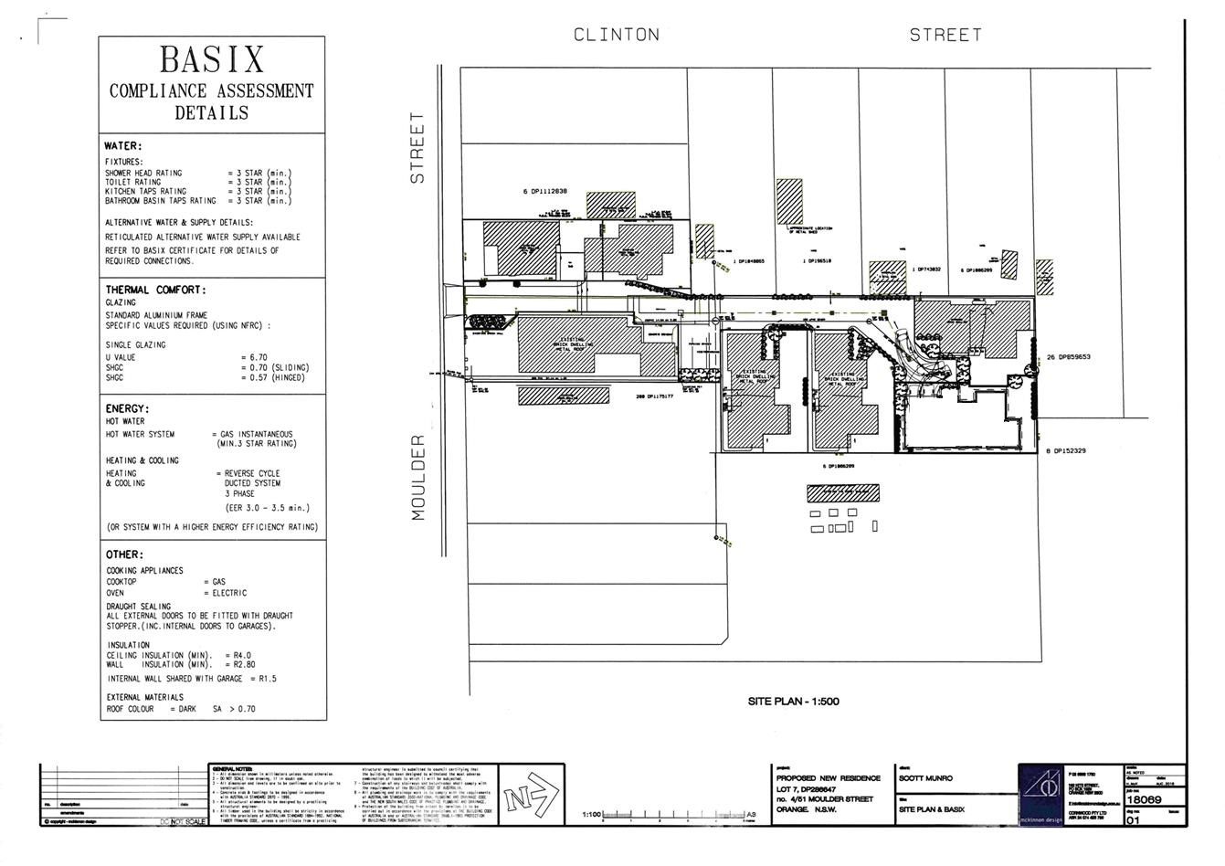
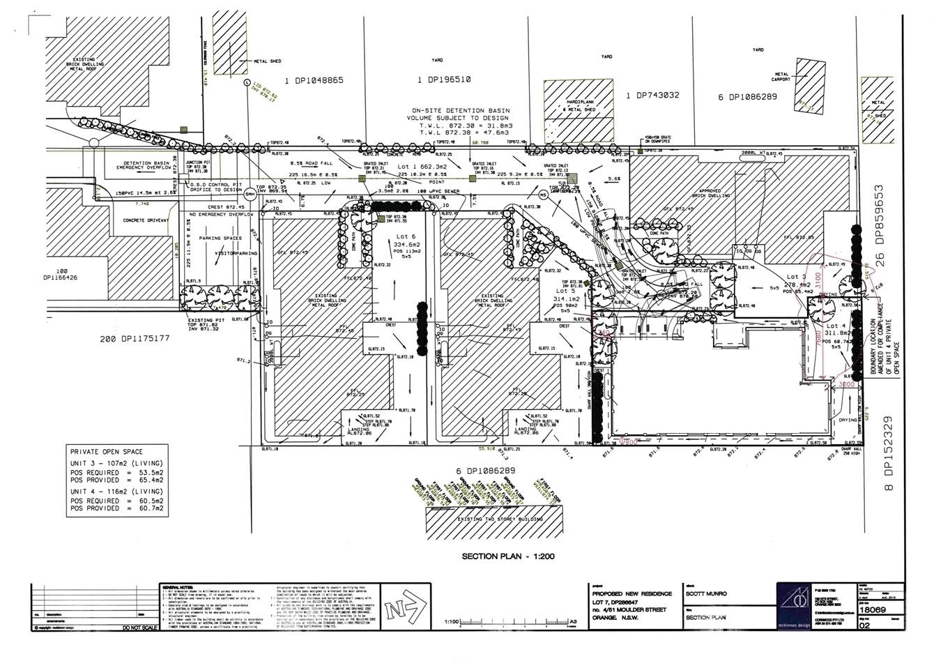
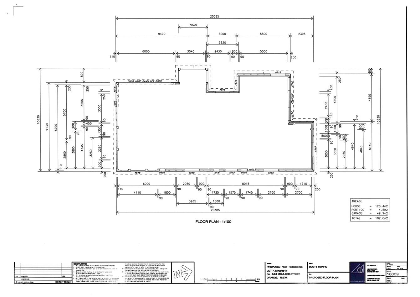
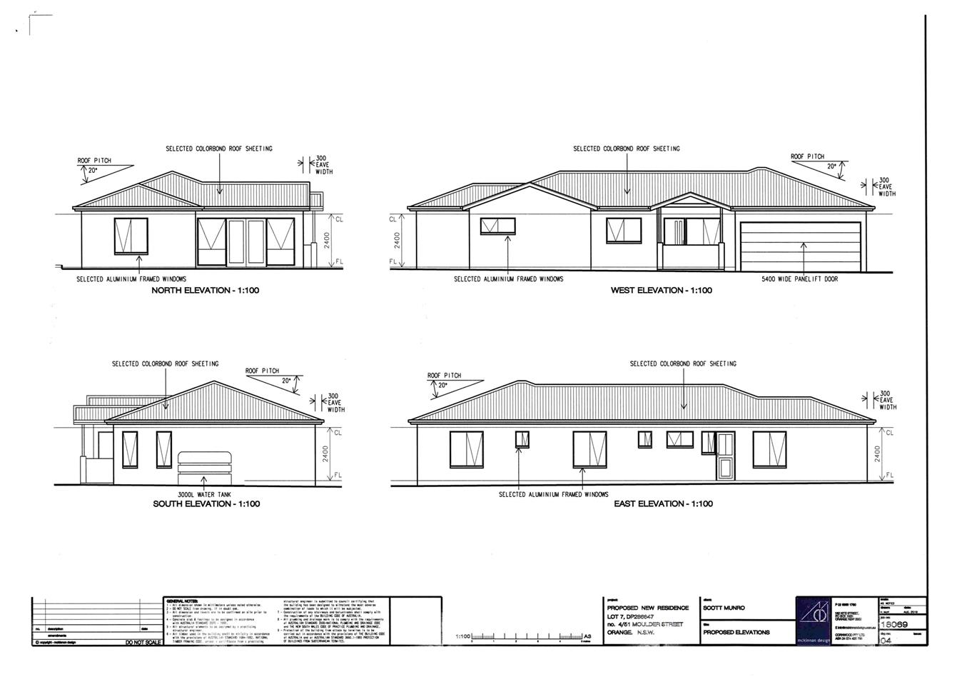
2.3 Development
Application DA 362/2017(1) - Lot 701 Lords Place (Wade Park)
RECORD
NUMBER: 2017/2520
AUTHOR: Kelly
Walker, Senior Planner
EXECUTIVE Summary
|
Application
lodged
|
27
September2017
|
|
Applicant/s
|
Orange
City Council
|
|
Owner/s
|
Orange
City Council
|
|
Land
description
|
Lot 701
DP 1001618 – Wade Park, Lords Place, Orange
|
|
Proposed
land use
|
Recreation
Facility (indoor) in Association with the Existing Recreation Facility
(major) and Demolition
|
|
Value of
proposed development
|
$2,200,000
|
Council's consent is sought for the construction of a new
indoor Cricket Centre at Lot 701 DP 1001618 known as Wade Park, Lords
Place, Orange (see Figure 1).
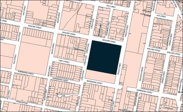
Figure 1 - locality plan
The proposal involves the demolition of the existing
greyhound pavilion and three (3) trees and the construction of a new indoor
Cricket Centre on the western side of the site fronting Lords Place (see Figure
2). The proposed Cricket Centre measures 27.13m by 44.8m, and between 3m and
8.4m in height, and contains graphics of regional cricketers on the
western/Lords Place elevation. It is proposed to formalise the access off Lords
Place and create an informal parking area adjacent to the Centre, as well as a
new driveway and gates. It is also proposed to plant four new trees on the site
and within the street.
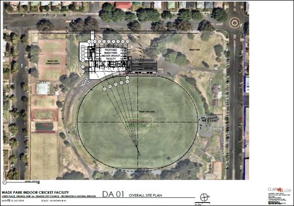
Figure 2 - proposed site plan (submitted Clarke Keller
drawing DA01)
The Cricket Centre will provide a high-performance cricket
area with training lanes for junior and senior cricketers and monitors for
video playback to assist training. The centre will also include reception,
amenities, office space for administrators, canteen, storage and a
multi-purpose community room for classes, meetings, VIP lounge etc. Proposed
operating hours will be 7am to 10pm Mondays to Saturdays, and 8am to 9pm on
Sundays. The peak period for the Centre will be late afternoons and on the
weekends.
The existing grandstand will be retained. The sketched
grandstand extension will incorporate tiered seating adjacent to the Centre,
however is only conceptual at this stage and does not form part of this
application. Likewise, building signage is only indicative at this stage, and
will be assessed under a separate development application.
The original proposal involved the removal of seven (7)
trees, and construction of a larger multi-purpose Centre, including
multi-purpose courts and a sports stand to provide additional grandstand
seating for the main oval. Following an initial exhibition period and
assessment by Council officers and Council’s Urban Design and Heritage
Advisor, concerns were raised in relation to adverse heritage and the
streetscape impacts, visual impacts, traffic and parking impacts,
inconsistencies with the current Masterplan for Wade Park, and potential noise
impacts. These concerns were feedback to the applicant, who sought to suspend
the assessment of the application pending a design review.
Council received an amended application on 10 August 2018
attempting to address the above issues. The amendment reduces the overall
footprint of the building (which results in deletion of two multi-purpose
courts), increases the setback from Lords Place, reduces the building height
and retains the significant trees (removing three trees instead of seven).
Graphics of cricketers on the western/Lords Place elevation have been added to
the amended application. No grandstand seating is proposed in the amended
application. Following the re-exhibition and re-notification of the amended
application two submissions were received. Following the exhibition period 4
late submissions were received. These submissions are discussed in detail later
in this report.
Heritage, parking, traffic and noise are the key
considerations for this application, and as set out in the main body of this
report, adverse impacts are unlikely subject to conditions of consent providing
for minor amendments to the design of the building and landscaping, and the
provision of additional information for further assessment.
As set out in Council’s Declaration of Planning and
Development Assessment Procedures and Protocols (May 2010) the proposal
involves a development application by Council, and the estimated value of the
development exceeds $1.5 million, therefore the determination of this
application falls within the delegation of the Planning and Development
Committee.
The proposed development is permissible with the consent of
Council and complies with the relevant aims, objectives and provisions of Orange
Local Environmental Plan 2011 (the ‘LEP’), and
Council’s Development Control Plan 2004 (the ‘DCP’)
and Infill Guidelines. An Environmental Planning and Assessment Act 1979 (the
‘EP&A Act’) Section 4.15 assessment indicates that the
proposal is acceptable in this instance.
It is therefore recommended that Council supports the
application subject to conditions of consent to ensure that the development
proceeds in an acceptable manner. Attached is a draft Notice of Approval
outlining these conditions.
RECENT LEGISLATIVE CHANGES
On 1 March 2018 the Environmental Planning and Assessment
Act 1979 was substantially amended. The most immediate change involves the
restructuring and renumbering of the Act, with other more substantive
changes to be phased in over time. However, for some applications (particularly
where an application was lodged prior to the changes coming into effect) the
supporting documentation may still reference the previous numbering regime. In
the drafting of this report the content and substance of the supporting
material has been considered irrespective of which legislative references were
used.
DECISION FRAMEWORK
Development in Orange is governed by two key documents Orange
Local Environment Plan 2011 (the ‘LEP’) and Orange
Development Control Plan 2004 (the ‘DCP’). In addition the
Infill Guidelines are used to guide development, particularly in the heritage
conservation areas and around heritage items.
Orange Local Environment Plan 2011 – The
provisions of the LEP must be considered by the Council in determining the
application. LEPs govern the types of development that are permissible or
prohibited in different parts of the City and also provide some assessment criteria
in specific circumstances. Uses are either permissible or not. The objectives
of each zoning and indeed the aims of the LEP itself are also to be considered
and can be used to guide decision making around appropriateness of development.
Orange Development Control Plan 2004 – the DCP
provides guidelines for development. In general it is a performance based
document rather than prescriptive in nature. For each planning element there
are often guidelines used. These guidelines indicate ways of achieving the
planning outcomes. It is thus recognised that there may also be other solutions
of merit. All design solutions are considered on merit by planning and building
staff. Applications should clearly demonstrate how the planning outcomes are
being met where alternative design solutions are proposed. The DCP enables
developers and architects to use design to achieve the planning outcomes in
alternative ways.
DIRECTOR’S COMMENT
The application is more modest than that originally proposed
and is considered to fit well into the Wade Park precinct, itself a heritage
item. Nearby residents have concerns over parking, but the impact of this
facility is not expected to occur at the same time as major events, so the
parking impacts around Lords Place/Moulder Street are expected to be
insignificant.
Link To Delivery/OPerational Plan
The recommendation in this report relates to the
Delivery/Operational Plan strategy “13.4 Our Environment – Monitor
and enforce regulations relating to City amenity”.
Financial Implications
Nil
Policy and Governance Implications
Nil
|
Recommendation
That Council consents to
development application DA 362/2017(1)
for Recreation Facility (indoor) in Association with the Existing
Recreation Facility (major) and Demolition at Lot 701 DP
1001618 – Wade Park, Lords Place, Orange pursuant
to the conditions of consent in the attached Notice of Approval.
|
further considerations
Consideration has been given to the recommendation’s
impact on Council’s service delivery; image and reputation; political; environmental;
health and safety; employees; stakeholders and project management; and no
further implications or risks have been identified.
SUPPORTING INFORMATION
THE APPLICATION
Council's consent is sought for the construction of a new
indoor Cricket Centre at Lot 701 DP 1001618, known as Wade Park,
Lords Place, Orange. The Cricket Centre is to be used in conjunction with the
existing Wade Park sports ground and associated buildings. Demolition of the
existing greyhound pavilion and three (3) trees are required to facilitate the
development.
THE PROPOSAL
The proposal involves the demolition of the existing
greyhound pavilion and three (3) trees, and the construction of a new indoor
Cricket Centre on the western side of the site fronting Lords Place (see Figures
2 and 3).
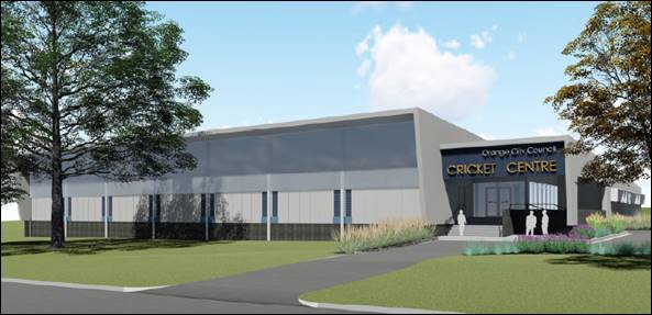
Figure 3 - proposed Cricket Centre artist’s
impression (submitted Clarke Keller drawing DA00)
The proposed Cricket Centre measures 27.13m by 44.8m,
running parallel to Lords Place, set back some 18.7m from the
western/Lords Place boundary, and measuring between 3m and 8.4m in
height (see Figures 3 and 4). It is proposed to install graphics of regional
cricketers on the western/Lords Place elevation. It is also proposed to
formalise the access off Lords Place and create an informal parking area
adjacent to the Centre, as well as a new driveway, driveway crossover and new
gates. The main entry to the building is proposed at the end of this driveway.
It is proposed to plant four new trees to the west and south of the Centre,
along with two new street trees on Lords Place, and scrub and groundcover
plantings to the north of the Centre.
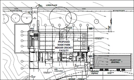
Figure 4 - proposed Cricket Centre (submitted Clarke
Keller drawing DA02)
Proposed materials include
Colorbond sheet cladding, cement sheet cladding, polycarbonate vision panels,
blockwork, external louvres and Colorbond roofing. Colours include pale greys
and blue-greys (see Figure 3). Graphics are proposed along the western/Lords
Place elevation, which will depict significant cricketers from the region, and
as an interpretation of the cultural significance of the site (see Figure 5).
Figure 5 - proposed graphics on western/Lords Place
elevation
The Cricket Centre will provide a high-performance cricket
area with training lanes for junior and senior cricketers, and monitors for
video playback to assist training. The centre will also include reception,
change rooms, male and female toilets, disabled amenities, office space for
administrators, canteen servery and kitchen, storage, and a community room for
multi-purposes such as classes, meetings, VIP lounge etc. Proposed operating
hours will be 7am to 10pm Mondays to Saturdays, and 8am to 9pm
Sundays. The peak period for the Centre will be late afternoons and on the
weekends.
The existing grandstand will be retained. The sketched
grandstand extension will incorporate tiered seating adjacent to the Centre,
however is only conceptual at this stage and does not form part of this
application. Likewise, the building signage is only indicative at this stage. Future
applications will be submitted in regards to those aspects.
BACKGROUND AND PROCEDURE
The original proposal involved the demolition of the
greyhound pavilion, removal of seven (7) trees, and construction of a new
indoor multi-purpose Centre including performance cricket area and nets,
multi-purpose courts, change rooms, amenities, kiosk/canteen, office and store
rooms, and a sports stand providing additional grandstand seating for the main
oval.
Following an initial exhibition period, five (5) submissions
were received raising concerns in regards to heritage, visual, parking and
noise impacts. These submissions are discussed in detail later in this report.
Council officers and Council’s Urban Design and Heritage Advisor also had
concerns, including:
- angled
orientation of the proposed building to Lords Place, proposed materials and
colours, and removal of significant trees from the site having adverse
heritage, streetscape, and visual impacts;
- car
parking and traffic;
- operational
concerns;
- inconsistencies
of the proposal with the current Masterplan for Wade Park; and
- potential
noise impacts.
These concerns were feedback to the applicant, who sought to
suspend the assessment of the application pending a design review.
Design advice was sought from Council’s Heritage
Planner and Urban Design and Heritage Advisor, and Council received an amended
application on 10 August 2018 attempting to address the above issues. The
amendment reduces the overall footprint of the building (which results in the
deletion of two multi-purpose courts), increases the setback from Lords Place,
reduces the building height and retains significant trees (now only removing
three trees instead of seven). Graphics of cricketers on the western/Lords
Place elevation have been added to the amended application. No grandstand
seating is proposed in the amended application. Following a second exhibition
period two (2) submissions were received. These submissions are discussed in
detail later in this report.
As set out in Council’s Declaration of Planning and
Development Assessment Procedures and Protocols (May 2010) the proposal
involves a development application by Council and the estimated value of the
development exceeds $1.5 million, therefore the determination of this application
falls within the delegation of the Planning and Development Committee.
SITE DESCRIPTION AND HISTORY
Wade Park is Orange’s major sporting venue. It is
bounded by four streets - Moulder, Warrendine and Peisley Streets, and Lords
Place. Wade Park is a relatively flat, open site which comprises predominately
turf and exotic trees including pin oaks, elms, plane trees, liquid ambers and
poplars (see Figure 6).
Figure 6 - Wade Park during a National League trial
(from submitted Statement of Environmental Effects, by Ian Rufus of
“Hillcrest”, dated August 2018)
In 1862 the Council applied to the Government for the land
to be used as a cricket pitch and it was set aside for a reserve in the
original village plan of 1846. Wade Park’s namesake is Sir Charles
Gregory Wade, former Judge of the Supreme Court, Attorney General, and Member
of the Legislative Assembly and Minister for Justice. It was first dedicated as
a sportsground for cricket and for use as a showground between 1887
and 1908.
Wade Park was officially opened in 1910 during the Jubilee
celebrations, and improvements have been made over time. In 1925 a new cricket
ground and football oval were established. Greyhound racing at Wade Park began
in the 1930s along with a racing track. Significant facilities did not arrive
until much later; including the 1977 grandstand, the spectator mounds,
electronic scoreboard and judging box; lights in the 1980s; and further minor
works in the 1990s.
The site currently includes:
- sports
oval;
- 1,000
seat grandstand with canteen and dressing rooms on the lower level (west side
of oval);
- former
TAB building adjacent to the grandstand;
- storage
sheds to the rear of the grandstand;
- entry
gates and ticket office at front gate (Moulder Street);
- brick
equipment shed;
- open
metal seating (east side of oval);
- cricket
pitch;
- tennis
courts and tennis complex (south of oval on Lot 702);
- greyhound
structure (currently used for storage);
- caretaker’s
cottages on Moulder Street (see Figure 7), which were built around 1880 in
Victorian Gothic style (one of the cottages retains its use); and
- mature
trees and landscaping; including a mature avenue of mainly elm trees with a
dense hedge below along the eastern boundary, acting as a green screen for
Peisley Street; and a mature avenue of Eucalyptus sp. along the eastern side of
Lords Place, providing good shade coverage, and along with plane trees on the
western side of the street give a strong avenue effect along Lords Place.
Figure 7 – caretaker’s cottage (looking
northeast from Wade Park)
To the west and south of Wade Park are mostly residential
properties on typical sized lots, as well as a school, parks, open spaces and
other recreational areas. The properties to the north are mostly commercial at
the edge of the central business area, although these were originally built as
residential dwellings. To the east of the site are the railway line and
station, as well as some industrial and commercial uses.
MATTERS FOR CONSIDERATION
Section 1.7 - Application of
Part 7 of the Biodiversity Conservation Act 2016 and Part 7A of the
Fisheries Management Act 1994
Section 1.7 of the EP&A Act 1979 identifies that Part 7
of the Biodiversity Conservation Act 2016 and Part 7A of the Fisheries
Management Act 1994 have effect in connection with terrestrial and aquatic
environments.
Notwithstanding, Section 28 of the Biodiversity
Conservation (Savings and Transitional) Regulation 2017 states that the
former planning provisions continue to apply to the determination of a pending
planning application, being an application for planning approval made before
the commencement of the new Act but not determined before that commencement.
The relevant provisions are set out at Part 5A of the historical version of the
EP&A Act dated 24 August 2017.
Having regard to the relevant provisions and based on an
inspection of the subject property, it is considered that the proposed
development is not likely to have a significant effect on any threatened
species, populations or ecological communities or their habitats.
Section 4.15
Section 4.15 of the Environmental Planning and Assessment
Act 1979 requires Council to consider various matters, of which those
pertaining to the application are listed below.
PROVISIONS OF ANY ENVIRONMENTAL
PLANNING INSTRUMENT s4.15(1)(a)(i)
Orange Local Environmental Plan 2011
Part 1 - Preliminary
Clause 1.2 - Aims of Plan
The
broad aims of the LEP are set out under subclause 2. Those relevant to the
application are as follows:
(a) to encourage development which complements
and enhances the unique character of Orange as a major regional centre boasting
a diverse economy and offering an attractive regional lifestyle,
(b) to provide for a range of development
opportunities that contribute to the social, economic and environmental
resources of Orange in a way that allows present and future generations to meet
their needs by implementing the principles for ecologically sustainable
development,
(f) to recognise and manage valued
environmental heritage, landscape and scenic features of Orange.
The application is considered to be consistent with these
aims, as set out throughout this report.
Clause 1.6 - Consent Authority
This clause establishes that, subject to the Act, Council is
the consent authority for applications made under the LEP.
Clause 1.7 - Mapping
The subject site is identified
on the LEP maps in the following manner:
|
Land Zoning Map:
|
Land zoned RE2 Private Recreation
|
|
Lot Size Map:
|
No Minimum Lot Size
|
|
Heritage Map:
|
Listed heritage item but not within
heritage conservation area
|
|
Height of Buildings Map:
|
Building height limit 18m
|
|
Floor Space Ratio Map:
|
Maximum floor space limit 0.2:1
|
|
Terrestrial Biodiversity Map:
|
No biodiversity sensitivity on the
site
|
|
Groundwater Vulnerability Map:
|
Groundwater vulnerable
|
|
Drinking Water Catchment Map:
|
Not within the drinking water
catchment
|
|
Watercourse Map:
|
Not within or affecting a defined
watercourse
|
|
Urban Release Area Map:
|
Not within an urban release area
|
|
Obstacle Limitation Surface Map:
|
No restriction on building siting
or construction
|
|
Additional Permitted Uses Map:
|
No additional permitted use applies
|
|
Flood Planning Map:
|
Not within a flood planning area
|
Those matters that are of relevance are addressed in detail
in the body of this report.
Clause 1.9A - Suspension of
Covenants, Agreements and Instruments
This clause provides that covenants, agreements and other
instruments which seek to restrict the carrying out of development do not apply
with the following exceptions.
· covenants imposed
or required by Council
· prescribed
instruments under Section 183A of the Crown Lands Act 1989
· any conservation
agreement under the National Parks and Wildlife Act 1974
· any trust
agreement under the Nature Conservation Trust Act 2001
· any property
vegetation plan under the Native Vegetation Act 2003
· any biobanking
agreement under Part 7A of the Threatened Species Conservation Act 1995
· any planning
agreement under Division 6 of Part 4 of the Environmental Planning and
Assessment Act 1979.
Council staff are not aware of the title of the subject
property being affected by any of the above.
Part 2 - Permitted or Prohibited
Development
Clause 2.1 - Land Use Zones and
The subject site is located within the RE2 Private
Recreation zone. The proposed development is
defined as ‘recreation facility (indoor)’ under LEP 2011. The
existing use of Wade Park is ‘recreation facility (major)’. The LEP
Dictionary defines these uses as follows:
recreation facility
(indoor) means a building or place used predominantly for
indoor recreation, whether or not operated for the purposes of gain, including
a squash court, indoor swimming pool, gymnasium, table tennis centre, health
studio, bowling alley, ice rink or any other building or place of a like
character used for indoor recreation, but does not include an entertainment
facility, a recreation facility (major) or a registered club.
recreation facility (major)
means a building or place used for large-scale sporting or recreation
activities that are attended by large numbers of people whether regularly or
periodically, and includes theme parks, sports stadiums, showgrounds,
racecourses and motor racing tracks.
Recreational facilities are permitted with consent in the
RE2 zone. This application is seeking consent. Demolition is discussed in more
detail in LEP Clause 2.7 below.
Clause 2.3 - Zone Objectives and Land
Use Table
Clause 2.3 of LEP 2011 references the Land Use
Table and Objectives for each zone in LEP 2011. The objectives for land
zoned RE2
Private Recreation are as
follows:
· To enable land to be
used for private open space or recreational purposes.
· To provide a range of
recreational settings and activities and compatible land uses.
· To protect and
enhance the natural environment for recreational purposes.
· To ensure development
is ordered in such a way as to maximise public transport patronage and
encourage walking and cycling in close proximity to settlement.
· To ensure development
along the Southern Link Road has alternative access.
The proposed Cricket Centre is
consistent with the above objectives for the zone as follows:
· Wade Park will continue
to be used for recreational purposes;
· the proposed development
is compatible with, and will enhance the existing use of the land by providing
for year round, all weather, cricket practise and games, and will fulfil the
needs of the growing community;
· the proposal will
improve the facilities and amenities at the facility, which are in need of
upgrading;
· the proposal protects
and enhances the natural recreational environment, where trees to be removed
are not considered significant and will be replaced with more appropriate
species;
· Wade Park is in easy
walking and cycling distance to residential dwellings, schools, other open
space and recreational areas, and the central business area, and has good
access to public transport; and
· the proposal will not
impact on the Southern Link Road.
Clause 2.7 - Demolition
Requires Development Consent
This clause triggers the need for development consent in
relation to a building or work. The proposal involves demolition of existing
buildings which no longer serve the needs of the site, including the greyhound
pavilion, shed, former TAB building, racing tower, corporate box and storage
shed, all to the southwest of the main grandstand. Three (3) trees also need to
be removed to facilitate the development. The applicant is seeking the consent
of Council for these works.
It is considered that the demolition works proposed will
have no significant impact on adjoining lands, streetscape or public realm,
subject to conditions of consent in respect to hours of operation, dust
suppression, and the need to investigate for and appropriately manage the
presence of any materials containing asbestos. Given the long history of using
the site for recreation, relics are not likely to be found, however a condition
of consent is recommended to manage any finds. This matter is discussed in
greater detail under LEP Clauses 5.10 and 7.1 later in this report. Heritage
and visual impacts of demolition and tree removal are discussed in the LEP
Clause 5.10 and DCP assessments later in this report.
Part 3 - Exempt and Complying
Development
The application is not exempt or complying development.
Part 4 - Principal Development Standards
Clause 4.3 - Height of Buildings
This clause limits the height of
buildings (HoB) on land identified on the Height of Buildings Map. The subject
land is identified on the Map as having two height limits, where the main
recreational fields and grandstand area of Wade Park has a height limit
of 18m (see Figure 8).
Figure 8 - LEP height of buildings map (Key: P=18m,
E=6m, M=12m, J=9m)
The maximum height of the proposed development is 8.4m and
is therefore consistent with the height limits set out by the DCP.
Clause 4.4 - Floor Space Ratio
This clause limits the floor space
ratio (FSR) permitted on land identified on the Floor Space Ratio Map. The
subject land is identified on the Map as having an FSR of 0.2:1.
Clause 4.5 is
associated with this clause and establishes the rules for calculating the site
area and FSR of any proposal. These rules exclude certain parts of a site and
development such as excluding community land and most public places. Pursuant
to the Local Government Act 1993 and Crown Land Management Act
2016 Wade Park is not classified as public, community or operational land,
and as such no part of the site is to be excluded from the FSR
calculations.
The site area (of Lot
710) has been calculated under clause 4.5 as 40,462.5m2, meaning the
site may have up to 8,092.5m2 of floor space. The proposal has a
gross floor area of 1,293.28m2 and the existing buildings on
the site (once the buildings to be demolished have been removed) is
approximately 1,360m2, giving a total floor space area
of 2,653.28m2, which is consistent with the FSR requirements.
Part 5 - Miscellaneous Provisions
5.10 - Heritage Conservation
Clause 5.10(1) sets out objectives
as follows:
(a) to
conserve the environmental heritage of Orange,
(b) to
conserve the heritage significance of heritage items and heritage conservation
areas, including associated fabric, settings and views,
(c) to
conserve archaeological sites,
(d) to
conserve Aboriginal objects and Aboriginal places of heritage significance.
Clauses 5.10(4),
5.10(5) and 5.10(6) state:
(4) Effect
of Proposed Development on Heritage Significance
The
consent authority must, before granting consent under this clause in respect of
a heritage item or heritage conservation area, consider the effect of the
proposed development on the heritage significance of the item or area
concerned. This subclause applies regardless of whether a heritage management
document is prepared under subclause (5) or a heritage conservation management
plan is submitted under subclause (6).
(5) Heritage
Assessment
The
consent authority may, before granting consent to any development:
(a) on
land on which a heritage item is located, or
(b) on
land that is within a heritage conservation area, or
(c) on
land that is within the vicinity of land referred to in paragraph (a) or (b),
require
a heritage management document to be prepared that assesses the extent to which
the carrying out of the proposed development would affect the heritage
significance of the heritage item or heritage conservation area concerned.
(6) Heritage
Conservation Management Plans
The
consent authority may require, after considering the heritage significance of a
heritage item and the extent of change proposed to it, the submission of a
heritage conservation management plan before granting consent under this
clause.
Heritage Significance
Lot 701 of Wade Park is a listed heritage item in the LEP
(Item I77), and is surrounded by other listed buildings and nearby to heritage
conservation areas (see Figure 9). The application involves demolition, removal
of trees and the erection of a building on land on which a heritage item is
located. As such Clause 5.10 applies. An assessment against this clause is
carried out below.
Figure 9 - LEP heritage map (Key: beige= listed items
and red hashing=heritage conservation areas)
Council’s heritage inventory states that ‘Wade
Park’ is important as the first dedicated sports ground utilised for
cricket and for use as a showground between 1887 and 1908. The listing states
that the two cottages fronting Moulder Street, together with mature cultural
planting (elms and planes) and the gates, are evidence of Wade Park as an early
recreation area dating from the 1850s, and the Gothic character and integrity
complement the streetscape and contribute to the Conservation Area as heritage
items worthy of improved conservation. The larger cottage to the west relates
to the caretaking functions of the Park, while the layout and general
appearance of the smaller building would appear to indicate that it was a
public toilet.
The heritage listing notes that Wade Park is significant for
historical, associative, aesthetic and rarity reasons, including being the
first dedicated sports ground utilised for cricket and for use as show ground
between 1887 and 1908; associations with the Cricket, Greyhound and Show
Society organisations; and the site retains the park-like setting and the
structures reflect the various sporting uses and the ad hoc nature of sporting
organisation, including civic structures such as the gates, caretaker's cottage
and amenity buildings. The site is valued by the local community for the
recreational uses and general amenity.
Council’s heritage inventory
make the following Statements of Significance about the surrounding listed heritage
items:
· Cottage group to the
west on Lords Place (numbers 121 to 131 Lords Place) - These six brick cottages
retain their original character and form a substantial and consistent group of
dwellings, complementing the streetscape and contributing to Orange as heritage
items. The group is significant for aesthetic reasons, as well as its rarity
within Orange.
· ‘Kelly’s
Rugby Hotel’ at 133 Lords Place (corner Moulder Street) - A prominent two
storey hotel, the building retains the original bulk and character, complements
the streetscape on this prominent corner and contributes to Orange as a
heritage item. The hotel was established as the ‘Carriers Arms
Hotel’ and the name was changed to the ‘Rugby Hotel’ in 1898.
The present building was erected in the 1890s after the pub had burnt down. The
Hotel is valued by the local community as a meeting place, and is likely to
have historical significance associated with the proximity of Wade Park and
sporting events.
· Orange Railway Precinct
on Peisley Street – The Precinct is of state significance for its
historic, aesthetic and rarity values. The site is very significant as a major
railway complex comprising several rare, representative and significant railway
buildings and structures developed for Orange, marking the extension of the
railway to Orange and completion in 1877. These include the goods shed (1877),
Station Master’s residence (1885), Railway Institute building
(c1921), administration building (c1950), signal box (1938) and the transhipment
shed (c1959). The 1877 two-storey Victorian station building is a fine and rare
combined residence/station building, one of only four similar buildings in the
state. The cast iron footbridge is a rare surviving structure reflecting a
style of construction once similar to other pedestrian bridges and related
structures built during the Whitton era in the late nineteenth century. The
coming of the railway to Orange was a significant date and event, and the
buildings associated with the grand infrastructure remain to dominate the
railway precinct. In addition to the historic and social values, the Station
group complements the streetscape and contributes to the main Orange
Conservation Area as heritage items.
· Dwelling to south at 116
Warrendine Street - The symmetrical inter-war brick residence includes unusual
multi-coloured brickwork and retains the original character, including the
verandah with central porch, complements the streetscape, and contributes to
the Conservation Area.
· Stores (former 1908 Dalton's
Flour Mill) to the east at 84-86 Peisley Street - The large gable ended brick
warehouse is a landmark within the streetscape and indicates the importance of
the railway for freight, and the location of large industries such as the
former Flour Mill on this site, while contributing to the Conservation Area as
a heritage item. The Mill ceased production in 1956 and most of it was torn
down in 1965, however a section still remains. The buildings mark the
importance of the railway for goods traffic, but primarily they are the only
remnants of one of the largest Flour Mills in the Colony in the 1860s onwards.
Minor elements of the machinery remain such as a large flywheel and belt axle
within the ceiling space. The building type is rare within regional NSW. Figure
10 below shows a photograph taken during the Coronation Sports Day at Wade Park
where the flour mill can be seen in the background, with the (remnant) stores
to its left.
Figure 10 - Coronation Sports Day at Wade Park (date
unknown c1910) (from submitted Heritage Impact Statement, by Ian Rufus of
“Hillcrest”, dated August 2018)
Heritage Assessment
Wade Park is considered to be within a significant heritage
setting. The overall site includes buildings, traditional grandstand and a
sports oval, and heritage significant portions of the site include the entry
gates, caretaker’s cottages and the mature trees, which have been well
maintained. The mature trees form a curtilage to the large site, where it
retains its park‑like quality and cultural plantings.
The general layout of the property has changed throughout
the years to suit the needs of the community, however some of the buildings are
unused and underutilised. It is proposed to demolish these buildings, including
the greyhound pavilion and shed, former TAB building, racing tower,
corporate box and storage shed, all to the southwest of the main grandstand.
The original design was referred to Council’s Urban
Design and Heritage Advisor, who had concerns about the angled orientation of
the proposed building to Lords Place, proposed materials and colours and
removal of significant trees from the site having adverse heritage, streetscape
and visual impacts. Following discussions with the applicant, an amended
application was prepared and forwarded to Council’s Urban Design and
Heritage Advisor for further comments, which are summarised below:
· Character - the proposal
utilises traditional shed-type forms which are common in industrial and larger
scale structures. The existing character is established by the outer setting of
traditional housing and the main grandstand at the ground. A key question in
regards to character is what elements of the proposal respond to these
elements? The existing structure is largely without architectural merit and no
major design features exist on the grandstand other than pragmatic elements
related to the engineering design. The general low profile character and
pragmatic response within the profile is therefore consistent and the detailed
considerations evident in the submitted drawings, and are welcomed as
appropriate.
· Landscape – this
is an important aspect of ensuring the design fits into the site and context.
The submitted landscaping drawing is generally inadequate in this regard. It is
recommended that a skilled local Landscape Architect prepare an appropriate
planting and finishes proposal for the site and context towards Lords Place. At
the least, additional trees are required to the street frontage, to the north
side of the new elevation and grasses and groundcovers to the building and
carpark perimeter and pathways.
· Scale - the grandstand
provides a dominant scale for the site, and the proposed approach with skillion
elements is considered appropriate.
· Bulk - the higher part
of the building is set towards Lords Place and the lower element fronts the
grounds/oval. An option could have included the roof of the taller form sloping
up from the lower Lords Place towards the ground. This would have placed the
highlight element on the east elevation instead of the west. The proposal chose
to utilise the low height of the toilet areas to determine the main form. In
view of the proximity and this relationship, the following forms of mitigation
are warranted and recommended if the proposal remains in the current from:
- A
form of grove planting between the building and the Lords Place frontage
sufficient to provide an upper canopy in the 4-8m height zone;
- A
ground level planting of ground covers and native grasses to retain the open
ground plane while producing a level of screening improvement to the setting,
extending from the Tennis Court alignment to the northern alignment of the
grandstand;
- Vertical
elements such as 200mm blades at 6300mm centres within the polycarbonate
sunscreen to add extra scale to this extended element;
- The
use of interpretive photographics on the west elevation is not supported given
that this form of decoration is unsustainable, and draws attention to the bulk
of the building. These may be appropriate internally, or alternatively it is
recommended that the interpretive element is included in the grove
planting/landscaping; and
- The
vertical cladding to the larger form and smaller form to be varied to provide a
Windspray colour to the 01 element, and Shale Grey as proposed to the
02 element. This variation will reduce the apparent visual bulk.
· Materials - are well
chosen and appropriate for the context and setting.
· Colours - variations are
recommended above.
· Details - additional
detail is recommended to the west elevation. The wall cladding to the concourse
area facing the oval is shown as steel sheeting and this is not sustainable to
terms of damage and maintenance and the matching charcoal blockwork is
recommended. The polycarbonate for the west elevation is to be selected and
approved on the basis of a sample. Products such as Danpal are supported while
standard polycarbonate sheeting would not be suitable for this context.
Council staff generally concur with these comments and
recommendations. In terms of the bulk of the building, the higher part has been
designed on the western side instead of the eastern side to allow for a future
grandstand extension to be cantilevered over the amenities part of the Centre
building. The visual bulk impacts are limited by the setback from Lords Place being
sufficient for the height and bulk of the west elevation. Subject to the
recommendations above in relation to colours, materials, detailing, graphics,
and landscaping, the bulk of the building can be adequately mitigated in the
streetscape and will result in adequate visual appearance for the character of
the surrounding neighbourhood.
Overall it is considered that the amended design of the
proposed Cricket Centre is compatible with the heritage setting and nearby
residential areas in terms of design, character, siting, bulk and landscaping,
subject to minor changes by way of conditions of consent discussed above.
Graphics Assessment
The proposed graphics on the western elevation (see Figure 5
earlier in this report) are not considered ‘signage’ pursuant to
the definitions within the LEP or State Environmental Planning Policy 64
– Advertising and Signage. The applicant submits that they are an
interpretation of the historical significance of cricket on the Wade Park site,
depicting photos of important cricketers from the region. Internal signage is
proposed to detail who the people are, why they are important to Wade Park, and
the history of cricket in Orange and the region. They have been proposed to
“break up” the Western Façade of the Cricket Centre and
reflect cricketers and administrators recognised in Council’s Sporting
Hall of Fame. It is proposed that these are adhesive graphics.
It is considered that the proposed graphics are too large in
scale and draw attention to the bulk of the building, therefore would have
adverse impacts on the character of the heritage setting, as well as visual
impacts on nearby residences. Concerns are also raised in regards to the
ongoing maintenance of the graphics impacting on the visual appearance of the
building, site and streetscape.
Thus these graphics are not supported in their current form,
and it is recommended that the elevation is amended as recommended previously
by Council’s Urban Design and Heritage Advisor. A historical
interpretation on the site is generally supported, however is not considered
appropriate on the building, but would be better suited within the landscaped
setting. As such, it is recommended that an interpretation strategy be
developed to include these elements within the landscaping or grove planting.
Demolition and Tree Removal
Demolition and tree removal on a heritage listed site
require consent under Clause 5.10 of the LEP. The demolition of existing
buildings which no longer serve the needs of the site, including the greyhound
pavilion, shed, former TAB building, racing tower, corporate box and storage
shed all to the southwest of the main grandstand, is supported. Although these
structures relate to the history of the site, they were erected much later than
the original activities commenced and have no significant heritage merit.
Three (3) trees also need to be removed to facilitate the
development. The removal of trees from a heritage listed site requires
development consent from Council under Clause 5.10 of the LEP. It is
considered that the amended proposal sufficiently retains the trees on the site
with heritage significance, and those to be removed are not historically
significant and are near the end of their lifespan. Appropriate replacement
planting can be carried out to mitigate the loss of the trees to be removed.
The site is not known to contain any Aboriginal, European or
archaeological relics, however the long-standing history of the use of the site
suggests that relics may be uncovered. Conditions of consent are recommended to
ensure that should site works uncover a potential relic or artefact, works will
be halted to enable proper investigation by relevant authorities and the
proponent required to seek relevant permits to either destroy or relocate the
findings.
Overall the proposal meets the provisions of Clause 5.10 of
the LEP subject to minor changes by way of conditions of consent, including
developing an interpretative strategy for the site in place of the western
elevation graphics.
Part 6 - Urban Release Area
Not relevant to the application. The subject site is not
located in an Urban Release Area.
Part 7 - Additional Local Provisions
7.1 - Earthworks
This clause establishes a range of
matters that must be considered prior to granting development consent for any
application involving earthworks, such as:
(a) the likely disruption of, or any
detrimental effect on, existing drainage patterns and soil stability in the
locality of the development
(b) the effect of the development on the
likely future use or redevelopment of the land
(c) the quality of the fill or the soil to be
excavated, or both
(d) the effect of the development on the
existing and likely amenity of adjoining properties
(e) the source of any fill material and the
destination of any excavated material
(f) the likelihood of disturbing relics
(g) the proximity to and potential for adverse
impacts on any waterway, drinking water catchment or environmentally sensitive
area
(h) any measures proposed to minimise or
mitigate the impacts referred to in paragraph (g).
The earthworks
proposed in the application are limited to the extent of cutting and filling
required for demolition, tree removal and the proposed building. The earthworks
can be appropriately supported onsite and the change in ground level is not substantial.
Therefore the effect on the amenity of adjoining properties is considered to be
minor. The extent of disruption to the drainage of the site is considered to be
minor and will not detrimentally affect adjoining properties or nearby
waterways. The extent of the earthworks will not materially affect the
potential future use or redevelopment of the site that may occur at the end of
the proposed development's lifespan.
The site is not known
to be contaminated. As discussed previously, the site is not known to contain
any Aboriginal, European or archaeological relics, however the long-standing
history of the use of the site suggests that relics may be uncovered. As such,
conditions of consent are recommended to ensure that should site works uncover
a potential relic or artefact, works will be halted to enable proper
investigation by relevant authorities and the proponent required to seek
relevant permits to either destroy or relocate the findings.
Conditions are also
recommended to require a sediment control plan during construction, including
silt traps and other protective measures, to ensure that loose dirt and
sediment does not escape the site boundaries.
7.3 - Stormwater Management
This clause applies
to all industrial, commercial and residential zones and requires that Council
be satisfied that the proposal:
(a) is designed to maximise the use of water
permeable surfaces on the land having regard to the soil characteristics
affecting onsite infiltration of water
(b) includes, where practical, onsite
stormwater retention for use as an alternative supply to mains water,
groundwater or river water; and
(c) avoids any significant impacts of
stormwater runoff on adjoining downstream properties, native bushland and
receiving waters, or if that impact cannot be reasonably avoided, minimises and
mitigates the impact.
Council’s
Development Engineers have reviewed the proposed development in regards to
stormwater management and recommend conditions of consent in relation to design
of the driveway, stormwater drainage lines and onsite stormwater detention to
limit peak outflows from the site to the pre-existing outflows. It is therefore
considered that the post‑development runoff levels will not exceed the
pre-development levels, and the development meets the requirement of this
clause.
7.6 - Groundwater Vulnerability
This clause seeks to protect
hydrological functions of groundwater systems and protect resources from both
depletion and contamination. Orange has a high water table and large areas of
the LGA, including the subject site, are identified with “Groundwater
Vulnerability” on the Groundwater Vulnerability Map. This requires that
Council consider:
(a) whether or not the development (including
any onsite storage or disposal of solid or liquid waste and chemicals) is
likely to cause any groundwater contamination or have any adverse effect on
groundwater dependent ecosystems, and
(b) the cumulative impact (including the
impact on nearby groundwater extraction for potable water supply or stock water
supply) of the development and any other existing development on groundwater.
Furthermore consent may not be granted unless Council is satisfied that:
(a) the development is designed, sited and
will be managed to avoid any significant adverse environmental impact, or
(b) if that impact cannot be reasonably
avoided - the development is designed, sited and will be managed to minimise
that impact,
(c) if that impact cannot be minimised - the
development will be managed to mitigate that impact.
The proposal is not
anticipated to involve the discharge of toxic or noxious substances and is
therefore unlikely to contaminate the groundwater or related ecosystems. A
condition of consent requiring a Trade Waste Application to be submitted to
Council for consideration is recommended, and if applicable a Trade Waste
Agreement will need to be entered into with Council. The proposal does not
involve extraction of groundwater and will therefore not contribute to
groundwater depletion.
The design and siting
of the proposal avoids impacts on groundwater and is therefore considered
acceptable.
Clause 7.11 - Essential
Services
Clause 7.11 applies and states:
Development consent must not be
granted to development unless the consent authority is satisfied that any of
the following services that are essential for the proposed development are
available or that adequate arrangements have been made to make them available
when required:
(a) the
supply of water,
(b) the
supply of electricity,
(c) the
disposal and management of sewage,
(d) storm
water drainage or on-site conservation,
(e) suitable
road access.
In consideration of this clause, all utility services are
available to the land and are adequate or can be made adequate for the
proposal. It is noted that the existing sewer main needs to be relocated clear
of the proposed building and the vehicle access crossover needs to be upgraded
for the purposes of this development. Relevant conditions of consent are
attached.
STATE ENVIRONMENTAL PLANNING
POLICIES
State Environmental Planning Policy (Infrastructure) 2007
Clause 104 - Traffic-generating development
Pursuant to Clause 104 - Traffic-generating development of State
Environmental Planning Policy (Infrastructure) 2007 (the
“Infrastructure SEPP”), recreation facilities with a capacity of
200 or more vehicles need to be referred to Roads and Maritime Services (the
‘RMS’). In this case, the proposed Cricket Centre does not qualify
as a development with relevant size and/or capacity under this clause.
Accordingly, formal referral to the RMS is not necessary.
Notwithstanding this, the original and amended applications
were referred to the RMS as a potentially interested party. The RMS has
commented that they have no objection to the proposal, and recommend a
condition of consent in regards to traffic and parking management plans for
large events. This matter is discussed in greater detail in the DCP
“Chapter 15 – Car Parking” assessment later in this report.
Clauses 85-87 - Development
adjacent to rail corridors
Clauses 85, 86 and 87 of the Infrastructure SEPP deal with
development in or adjacent to rail corridors; excavation in, above, below or
adjacent to rail corridors; and impact of rail noise or vibration on non-rail
development.
Clause 85 states in part:
(1) This
clause applies to development on land that is in or adjacent to a rail
corridor, if the development:
(a) is likely to have an
adverse effect on rail safety, or
(b) involves the placing of a
metal finish on a structure and the rail corridor concerned is used by electric
trains, or
(c) involves the use of a
crane in air space above any rail corridor, or
(d) is located within 5 meters
of an exposed overhead electricity power line that is used for the purpose of
railways or rail infrastructure facilities.
It is considered that the proposal is not likely to have an
adverse effect on rail safety given the separation distance of the proposed
Cricket Centre from the rail corridor (being over 200m away). The development
is also separated by the main oval of Wade Park, Peisley Street, and partly by
buildings between Peisley Street and the rail corridor. The rail corridor does
not use electric trains or overhead electricity power lines. The application
does not discuss whether a crane is required to construct the Centre, however
if one is needed, it is likely to use Lords Place, which is well separated from
the rail corridor. As such, it is considered that Clause 85 does not apply to
the proposed development.
Clause 86 applies to excavation in, above, below or adjacent
to rail corridors, in particular excavation in excess of 2m within 25 m of the
rail corridor. As discussed above, the proposed development is well separated
from the rail corridor, and does not involve such excavation. As such, Clause
87 is not applicable to this application.
Clause 87 looks at the impact of rail noise and vibration on
non-rail development, including residential accommodation, place of public
worship, a hospital, and educational establishments. The proposed development
is not one of these uses that has the potential to be adversely impacted by
rail noise or vibration, as such, this Clause is not applicable to this
application.
John Holland Rail (“JHR”) was consulted as a
neighbouring property to the proposed development and have submitted
recommendations for Council to impose in relation to the proposal and the rail
corridor. As it is considered that the safety of rail corridor will not be
adversely impacted by the proposed development, these recommendations are not
considered reasonable. An advisory note is recommended to the applicant in
regards to the guidelines and Standards raised by JHR.
Notwithstanding the above, the Department of
Planning’s ‘Development Near Rail Corridors and Busy Roads -
Interim Guideline (2008)’ has been taken into account in the
assessment of this application. In particular, it is considered that the
Cricket Centre is not a sensitive use that would be affected by rail or road
noise or vibration, and the proposal encourages the use of public transport,
facilitated through the proximity of the Centre to the bus and train station.
The Guideline also recommends commuter parking to be provided as part of major
developments near to train stations, however this is not considered appropriate
in this case as the land is zoned for recreational purposes and any parking
provided on the site should solely be for the uses of the park and not other
uses.
In conclusion, the proposed development is not inconsistent
with the Infrastructure SEPP or the guideline for development near rail
corridors and busy roads.
State Environmental Planning
Policy 55 - Remediation of Land
State Environmental Planning Policy 55 - Remediation of
Land (SEPP 55) is applicable. Pursuant to Clause 7 Contamination and
remediation to be considered in determining development application:
(1) A consent authority must not consent to
the carrying out of any development on land unless:
(a) it
has considered whether the land is contaminated, and
(b) if
the land is contaminated, it is satisfied that the land is suitable in its
contaminated state (or will be suitable, after remediation) for the purpose for
which the development is proposed to be carried out, and
(c) if
the land requires remediation to be made suitable for the purpose for which the
development is proposed to be carried out, it is satisfied that the land will
be remediated before the land is used for that purpose.
Given the long standing history of the use of Wade Park for
recreation and sporting activities, it is considered that past contaminating
uses of the land is unlikely. A site inspection did not reveal any potential
contamination of the site. On the basis of available
evidence it is considered that the site is suitable for the proposed use and no
further preliminary investigation is required to satisfy the requirements of
the SEPP 55.
PROVISIONS OF ANY DRAFT
ENVIRONMENTAL PLANNING INSTRUMENT THAT HAS BEEN PLACED ON EXHIBITION
4.15(1)(a)(ii)
There are no draft environmental planning instruments that
apply to the subject land or proposed development.
DESIGNATED DEVELOPMENT
The proposed development is not designated development.
INTEGRATED DEVELOPMENT
The proposed development is not integrated development.
PROVISIONS OF ANY DEVELOPMENT
CONTROL PLAN s4.15(1)(a)(iii)
Development Control Plan 2004
Development Control Plan 2004 (“the DCP”)
applies to the subject land. An assessment of the proposed development against
the relevant Planning Outcomes will be undertaken below.
Chapter 0.4-10 Interim Planning
Outcomes - Residential Proximity
The proposed development is in close proximity to
residential dwelling houses and as such the following planning outcomes are
applicable:
· The design of
industrial and commercial development is consistent or compatible with nearby
residential areas in terms of design, siting and landscaping.
· The hours of
operation, traffic and noise generation do not interfere with reasonable
expectations of residential amenity.
· Noise-generating
activities are contained within the building where practicable.
· Industrial air
conditioning compressors are shielded to direct noise away from residential
development.
· Car park and security
lighting is positioned and shielded to prevent direct light spill onto
residential properties.
· Measures to prevent
dust, odour and chemical spray from reaching or affecting residential
properties must be demonstrated.
· The design must
demonstrate how residential privacy and solar access will be maintained.
The amended design of the proposed Cricket Centre is
considered to be compatible with the nearby residential areas in terms of
design, siting and landscaping, as assessed in the LEP Clause 5.10 section
of this report. Given the separation distance of the proposed building from
neighbouring properties, there will be no privacy or daylighting impacts.
The proposal does not involve any mechanical ventilation (ie
compressors), or any activities that will generate dust, odour or chemical
spray. Ventilation is discussed in greater detail below.
In terms of hours of operation and noise, the applicant has
submitted a ‘Noise Impact Assessment’, prepared by Wilkinson Murray
(number 17241 version B, and dated August 2018). The report was conducted
in general accordance with the relevant noise guidelines and policy, and
assessed noise impacts associated with activity inside the stadium as well as
traffic noise in the carpark, and considered natural ventilation by louvers on
the western and northern facades. The report states that the potentially worst
affected receivers are considered to be located on Lords Place, with the
closest receiver directly opposite the site, approximately 50m away. Residences
are also located to the north on Moulder Street approximately 170m away, and to
the south on Warrendine Street approximately 120m away.
The noise assessment carried out monitoring to establish
existing background noise levels at the site. Noise measurements were also
carried out at an existing indoor cricket centre at Five Docks to help
determine predicted operational noise levels at the proposed Centre. During the
Five Docks measurements, there were two games of indoor cricket and two bowling
classes in the batting cages taking place, which is considered similar to the
typical “worst case” scenario for the proposed Centre. Using the
measured levels at Five Docks, noise predictions to properties surrounding Wade
Park have been conducted and have assumed that the Centre is operating with all
cricket nets in use concurrently. Conservatively, it has been assumed that the
vents on the northern and western sides of the building provide no attenuation.
Predicted noise from the informal car parking area adjacent to the Centre was
also assessed, as well as the cumulative predicted noise levels from Centre
operation and car parking within the same period. The results are presented in
Table 3-4 and Figure 3-1 of the report, both copied below, which demonstrates
compliance with the relevant noise criteria during the day and evening. The
proposal does not involve any activities during the night time period (ie 10pm
to 7am).
It is noted that the proposal relies on on-street parking
for much of the parking demand generated by the Cricket Centre. These are
existing marked parking spaces which can be used by the general public as well
as surrounding uses (staff of commercial premises, visitors, residents etc). As
such, noise generated from these spaces is already expected. While it is
acknowledged that these on-street spaces are not currently used to their full
potential and the proposed development will increase their use, it is expected
that as Orange grows in population and the CBD expands, these spaces will be
used more often.
It is also noted that the Centre is to be naturally
ventilated using louvres on the northern and western sides of the building, and
that no significant mechanical plant has been proposed at this stage. The noise
assessment states that if mechanical plant is required at a later stage it
should be designed to comply with the established project specific noise
criteria. Council staff reject the claim that there will not be any mechanical
plant and equipment, as the proposed Centre involves wet rooms (change room,
toilets etc), a kitchen, and offices, which will require mechanical
ventilation and/or heating and cooling. A condition of consent is recommended
to require full details of all mechanical plant and equipment to be submitted
for further assessment. It is also recommended that certification of noise
compliance be provided to Council after completion of the building by way of
condition of consent.
The noise assessment concludes that the predicted noise
levels from activities inside the Centre and in the informal carpark meet the
criteria for the day and evening periods for all nearby receivers, and as such
the proposed development is unlikely to cause any adverse noise impact on
surrounding receivers. Council staff generally concur with these conclusions,
subject to the recommended conditions of consent relating to mechanical plant
and equipment and certification of compliance. The report states that the
Centre opens at 9am, however proposed opening hours are from 7am. As the same
noise criteria applies to the land between 7-9am, the report still demonstrates
that compliance can be achieved.
Traffic and car parking is assessed in detail in DCP Chapter
15 below, where it is concluded that the proposal is acceptable in this regard
and will not adversely impact on the surrounding uses. No formal car park is
proposed, however conditions of consent are recommended in regards to outdoor
lighting not impacting on residential neighbours.
Chapter 2 - Natural Resource
Management
Chapter 2 provides planning outcomes for stormwater quality,
groundwater quality, soil resource management, vegetation management, and flora
and fauna management; all of which have been considered previously in the LEP
and Section 1.7 of the Act assessments.
Chapter 3.4-1 - Waste
Generation
The DCP sets out the following planning outcomes for waste
generation:
· Applications
involving demolition indicate measures that will be implemented for reuse and
recycling of waste materials.
· Development involving
demolition is carried out in a manner that optimises reuse and recycling of
waste materials consistent with waste-minimisation principles.
A waste management plan has not been provided with the
application, however it is considered that demolition can be carried out in
accordance with the above outcomes. A condition of consent is recommended to
this effect.
Chapter 11 - Land Used for Open
Space and Recreation
Pursuant to the Local Government Act 1993 and Crown
Land Management Act 2016 Wade Park is not classified as public,
community or operational land. Accordingly, the land is zoned for
‘private’ recreation. The planning outcome in this chapter relates
to public recreational land and states that the land should be used in
accordance with the relevant adopted plan of management. There is no plan of
management for Wade Park. Thus this chapter and planning outcome of the DCP do
not apply. A Master Plan has been produced for Wade Park, which is addressed
later in this report.
Chapter 13 - Heritage
The DCP sets out the following planning outcomes for
heritage:
· Development relates
to the significant features of heritage buildings on or near the site, as
reflected in inventory sheets.
· Development conforms
with recognised conservation principles.
· The Community is
provided with sufficient information to be able to consider and comment on the
proposed development.
Heritage has been discussed in detail in the LEP Clause 5.10
assessment earlier in this report, where it was concluded that subject to minor
changes in regards to materials and detailing, the amended proposal will not
adversely impact on the heritage significance of the site or other nearby
heritage items, nor adversely impact on the surrounding heritage setting. The
proposed graphics on the western elevation are not supported as discussed
previously, and alternative recommendations have been made in this regard.
Community consultation was carried out in accordance with the DCP, which is
discussed later in this report under “Any Submissions Made in Accordance
with the Act s4.15(1)(d)” below.
Chapter 15 – Car Parking
The DCP sets out the following planning outcomes for car
parking:
· Adequate off-street
car parking is provided in accordance with the Table or, alternatively,
according to an assessment that demonstrates peak-parking demand based on
recognised research.
· Car-parking areas are
designed according to Australian Standard.
· Car-park areas
include adequate lighting and landscaping (preferably deciduous shade trees),
which provides for the personal security of users.
· Bicycle-parking
facilities are provided according to the relevant Australian Standard.
· Facilities for
loading and unloading of commercial vehicles are provided according to the
relevant Australian Standard.
The DCP states that off-street car parking shall be provided
at the applicable rate set out in Table 15.4 of the DCP, however there is
no rate for recreational facilities or sporting uses. For development not
listed in the table, the DCP states that the number of parking spaces required
needs to be determined by Council, taking into account the likely peak-parking
demand that will be generated from the development. In this case, a traffic
report carried out by a suitable professional traffic consultant was required.
The applicant has submitted a ‘Traffic and Parking
Impact Assessment’, prepared by McLaren Traffic Engineering & Road
Traffic Consultants (reference number 18536.01FA and dated 27 August
2018). The report states that the proposal does not include any formalised
onsite parking, with all expected parking utilising the existing on-street,
publicly available parking in the surrounding streets, and the existing
informal parking on various grassed areas within Wade Park.
The report estimates the car parking demand for the Cricket
Centre. For each parking scenario it was assumed that each game/cricket batting
session would run for approximately one hour, and as a worst case scenario that
each player will drive individually to the site. The estimated demand was based
on 100% overlap of arrival and departure times between one game finishing and
the following game starting. The estimated demand is set out in Table 2 of
the report and copied below:
As shown, the worst-case scenario for parking demand is when
four (4) cricket batting cages are in use, plus one (1) indoor cricket game,
which would require approximately 52 car parking spaces. This demand is
based on 26 people playing on the field, each of whom drives to the site individually,
and 26 people arriving before the end of the previous session/game, each of
whom drives individually.
The proposal does not include any formalised off-street
parking spaces, however there are various level areas within Wade Park that are
currently used for informal parking during sports events. In addition, there
are 45-degree angle parking spaces on all roads surrounding Wade Park,
providing a large supply of car parking that is not in high demand from other
nearby land uses, as demonstrated by parking survey carried out by the
consultant.
The report states that to
establish the existing occupancy of parking surrounding the site during the
proposed operating hours of the Centre, parking surveys were undertaken between
the times of 3pm and 7pm on Wednesday, 20 September 2017 within and on the
roads immediately surrounding Wade Park. The results of the parking surveys
during the peak time observed are summarised in Table 1 of the report, copied
below:
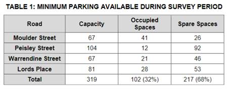
As shown, there is in excess of
300 parking spaces available in the area surrounding the site during weekday
afternoon hours, which is the expected peak operating times for the Centre. The
peak parking demand was observed at 3pm (ie school pick-up time), and the
demand was seen to decrease from that point onwards, as illustrated in
Figure 4 of the report, copied below:
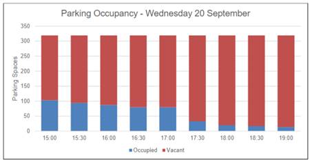
The report goes on to say that some informal parking was
observed in Wade Park during the survey, with a maximum of 10 vehicles observed
for less than 15 minutes. A total of 11 cars were observed parking within
the grounds of Wade Park during the four hour survey period.
Based on the parking surveys, should the worst-case parking
demand of 52 vehicles occur, there will be ample space available on the streets
surrounding Wade Park to accommodate the estimated demand. A total of 166 car
parking spaces would remain available on the streets for other users of the
site and of neighbouring sites. The report notes that this is considered to be
a significant quantum of spare parking, and that the peak parking demand will
likely occur during late afternoon hours when additional parking is available,
rather than the 3pm peak observed during the survey.
The report concludes that considering that the proposed
facility will provide a community benefit and is located in close proximity to
other similar land uses, ample on-street parking, and nearby bus and train
services, even under an extremely worst-case scenario, the use of on-street
parking will be more than adequate to cater for the estimated demand, with
spare parking highly likely to still be available in the surrounds.
Council staff concur with the comments set out in the
submitted report. Although the car parking survey was only carried out during
one afternoon, it is considered that it accurately reflects the peak use of the
surrounding streets on any given day outside of any major events being held at
Wade Park (concerts, large sporting games etc). Concerns were raised about the
availability of parking for the Centre during such events, and the applicant
responded that the Council will control the use of the Cricket Centre, and it
will not be open for practise and games at the same time as large events. The
amenities provided within the Centre (toilets, change rooms, canteen etc) can
be utilised as part of large events to augment existing facilities on the site,
but would not increase the overall parking demand for such events, where
patrons will already be onsite.
It is also noted that the proposal includes the demolition
of existing buildings on the site, which represent a historical car parking
demand. When taking the parking credits that apply to the former use of these
buildings into consideration, the net increase in car parking demand for the
site is not considered significant.
It is further noted that the
site is not located within the Orange Car Parking Contribution Development
Contribution Plan 2015 catchment (see Figure 11), therefore a monetary
contribution cannot be levied against the car parking shortfall.

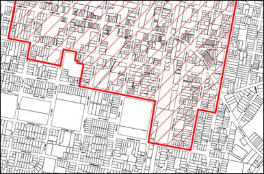
Figure 11 - Car Parking Contribution catchment map
(green = subject site)
Overall it is considered that appropriate car parking is
available in the surrounding area and is suitable for the proposed development.
Notwithstanding this, the DCP and Building Code of Australia (BCA) set out
requirements for bicycle and disabled parking respectively. It is considered
there is ample room available either within the site or on the street adjacent
to the proposed Centre to cater for this type of parking, and their provision
would have an overall benefit to the community. Conditions of consent are
recommended to this effect.
In regards to servicing and loading, the DCP requires that
appropriate loading facilities be provided to all forms of development. The
submitted traffic report states that for its ongoing operation, the Centre is
likely to require the deliveries of food and beverages. It is expected that
these deliveries would be undertaken by a van which has dimensions similar to a
large passenger vehicle. These deliveries can be undertaken from the angled
parking within Lords Place or from within the site. Larger vehicles making
deliveries for events can gain access within the site via the existing paved
internal roadways within Wade Park under the supervision of appropriately
qualified traffic control personnel and event managers’ delegated
servicing personnel. This is considered adequate. Council’s Technical
Services officers have no objection to the proposed arrangements.
As noted earlier in this report, the application does not
need to be referred to the RMS as ‘traffic generating
development’ under State Environmental Planning Policy (Infrastructure) 2007.
The RMS was consulted as an interested party on the original application and
the amended application. They comment that they have no objection to the
proposed development, and offer a recommendation for Councils consideration as
follows:
“Detailed traffic and
parking management plans are to be prepared and implemented prior to and during
large events at Wade Park. The traffic management plans are to consider and
provide a high level of safety for both vehicular and pedestrian traffic. Where
practical and available, public transport should be utilised to minimise demand
on on-street parking”.
Large events and sports games at Wade Park are already
subject to agreements with Council in regards to the use of the land, where
Council’s events, sports and recreation staff carry out risk assessments
for each event, and on a case-by-case basis determine whether traffic and/or
pedestrian management is required. Furthermore, the Cricket Centre proposal is
not directly related to large events on the site other than augmenting existing
amenities, and such a condition could not be tied to this application, as
established in relevant case law.
Infill Guidelines
Development in a heritage setting must be assessed against
Council’s Infill Guidelines. Heritage has been discussed in detail in the
LEP Clause 5.10 assessment earlier in this report, where it was concluded that
the amended proposal will not adversely impact on the heritage significance of
the site or other nearby heritage items, nor adversely impact on the
surrounding heritage setting, subject to change in regards to materials, detailing,
and historical interpretation on the site instead of on the building.
Wade Park Master Plan
Although not an adopted planning instrument, consideration
shall be given to Council’s Wade Park Master Plan 2012. The Master
Plan provides a long term vision for the site, including what it should look
like and how it should function in the future. Issues identified in the Master
Plan include grandstand and seating, provision of player, coach and official
amenities, corporate entertainment facilities, field lighting, ticketing and
entry/exit points, kiosk and catering facilities, dual use of the facility
(cricket and rugby league), maintaining local heritage character, and impact of
drought and water restrictions.
Consultation was undertaken as part of the Master Plan,
which highlighted the need to upgrade the grandstand and canteen, and provide a
multi-functional building to replace sub-standard buildings. It was also
identified that the site is a high quality facility for country cricket,
however clashes with the rugby league season (ie summer).
The vision for the Master Plan is “to create the
premier sporting and community event venue within Orange which is central and
easily accessible”. The concept plan provides for cricket facilities
separate from the main oval, including nets and fields, in the north-western
corner of the site. Although the proposed Centre deviates from this in terms of
location and being an indoor facility, it meets the overall aims of the Master
Plan. It is also noted that the Master Plan provides for grandstand extensions
and upgrades, and formalised car parking within the site, which the applicant
states is the intention in the medium-longer term. These will be subject to
separate future applications.
SECTION 64 WATER AND SEWER
HEADWORKS
Pursuant to Section 64 of the Local Government Act 1993,
water and sewer headworks charges are applicable at a rate of 8.8 ETs for water
and 13.2 ETs for sewer. Relevant conditions of consent requiring payment are
attached.
PROVISIONS PRESCRIBED BY THE
REGULATIONS s4.15(1)(a)(iv)
Demolition of a Building (clause 92)
The proposal involves the demolition of existing buildings
on the site. A condition is attached requiring the demolition to be carried out
in accordance with Australian Standard AS2601 - 1991: The Demolition of
Structures. A waste management plan also needs to be provided, and a
relevant condition of consent is attached.
Fire Safety Considerations
(clause 93) and Buildings to be Upgraded (clause 94)
The proposal is capable of complying with the relevant fire
safety requirements. Relevant conditions of consent are attached.
The proposal involves a new building, therefore the
upgrading provisions are not relevant.
BASIX Commitments (clause 97A)
BASIX is not applicable to the proposed development. A
Section J energy efficiency statement will be required with the Construction
Certificate application.
THE LIKELY IMPACTS OF THE
DEVELOPMENT s4.15(1)(b)
Heritage and Visual Impacts
As discussed in the DCP assessment, the proposed development
will not result in any unreasonable visual impacts in the locality, subject to
minor changes in regards to materials and detailing of the building, and
landscaping. The proposed graphics on the western elevation are not supported
due to their extensive scale having adverse impacts on the streetscape, and it
is recommended that an interpretive strategy is developed for the site in place
of the western elevation graphics.
Overall it is considered that the amended proposal is
acceptable in terms of design, siting and scale, and will not adversely impact
on the visual, residential and heritage setting of the neighbourhood.
Neighbourhood Amenity Impacts
As noted above, visual impacts to nearby residential
dwellings are unlikely. The applicant has submitted a ‘Noise Impact
Assessment’ as discussed in the DCP assessment earlier in this report,
where it was concluded that the proposed Centre would comply with daytime and
evening noise criteria when taking a worst-case scenario into account. Council
staff generally concur with this report, however recommend conditions of
consent in relation to plant and equipment (air conditioning units, kitchen and
bathroom ventilation etc), and the constructed building demonstrating
compliance with the relevant noise criteria. Subject to further assessment and
possible noise attenuation measures being installed, the proposed development
is unlikely to adversely impact on the amenity of surrounding residential
dwellings.
Traffic Impacts
Car parking has been discussed previously in the DCP
assessment, where it was concluded that the estimated parking demand was based
on a worst case scenario (ie four simultaneous cricket batting cages in
use plus one indoor game being played, both occurring within a single hour, and
each person driving individually to the Centre) equating to 52 spaces.
While no formal onsite car parking is proposed as part of the proposal, the
peak parking demand can be absorbed by the existing informal parking in Wade
Park and the supply of on-street parking in the surrounding roads without
adversely impacting on the onsite or surrounding on-street parking network. It
is recommended that disabled and bicycle parking be provided adjacent to the
Centre within the site or on Lords Place.
The submitted traffic report discusses traffic generation
and impacts. It notes that the “RTA Guide to Traffic Generating
Developments” (2002) does not provide estimated traffic generation levels
for the indoor sports facilities, and therefore the traffic generation will be
based on a first principles approach. Under an extremely worst-case assessment
it was assumed that everyone travelling to the site will drive to and from the
site individually. Expected peak operation times will occur in the afternoon
period between 5-8pm on weekdays and 9am–midday on weekends. The
resulting traffic generation is summarised in Table 3 of the report, and
copied below.
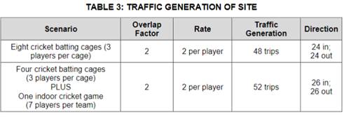
As shown in the table, the peak traffic generated by the
site equates to 52 vehicles trips (26 in and 26 out) in one hour, based
upon a rate of 2 vehicle trips per player. The report goes on to state that it
is expected that a generation of 52 vehicle trips in one hour can be easily
absorbed by the surrounding road network, and will not have a detrimental
effect on the nearby intersection performance or residential amenity. Council
staff concur with these conclusions.
As discussed earlier in this report, the application does
not need to be referred to the RMS as ‘traffic generating
development’ under State Environmental Planning Policy (Infrastructure)
2007. The RMS was consulted as an interested party on the original
application and the amended application, and commented that they have no
objection to the proposed development, and offered a recommendation in regards
to traffic and parking management plans for large events. Large events and
sports games at Wade Park are not relevant to this application, and are already
subject to agreements with Council in regards to the use of the land, which
requires traffic management plans when deemed necessary (assessed on a case by
case basis).
It is considered that the traffic generation of the proposed
development, which is expected to peak on weekday evenings after the typical
commuter peak and on weekends, has been estimated at around 52 trips. While
this level of traffic generation will be noticeable in the immediate vicinity
at peak times, it will otherwise be fairly evenly distributed throughout the
road network, which can sufficiently cater for the increased movements.
Overall it is considered that the proposed development and
will not have an adverse effect on the surrounding road or car parking
networks.
Environmental Impacts
The proposal is unlikely to have adverse impacts on the
natural environment by reason of the emission of noise, dust, odours etc.
Conditions of consent are recommended to protect the natural environment during
construction, as well as ensure ongoing management of stormwater etc.
The removal of trees is supported on the basis that they
will be replaced with suitable species. A condition of consent is recommended
to this effect.
Social and Economic Impacts
The proposed development is unlikely to generate a negative
social or economic impact within the locality. The proposed Centre will enhance
recreational and sporting functions of Wade Park and within the City, providing
an overall community benefit.
Cumulative impacts
The development will contribute to the use of Wade Park as a
premier sporting facility in Orange, and can be constructed and carried out in
a manner that is consistent with the neighbourhood character, subject to
conditions of consent discussed above. Overall, it is considered that
cumulative impacts are unlikely.
THE SUITABILITY OF THE SITE
s4.15(1)(c)
The subject land is considered suitable for the proposed
development due to the following:
· recreational uses
are permitted in the RE2 zone pursuant to the LEP;
· the proposal seeks
to continue using the land for recreational purposes;
· the proposal will
not adversely impact on nearby residential areas, subject to conditions of
consent;
· there is no known
contamination on the land;
· all utility
services are or can be made available and adequate for the proposal;
· the site is not
subject to known natural hazards;
· the subject land
has no biodiversity or habitat value;
· the site is not in
proximity to any waterway, drinking water catchment or sensitive area;
· the site is not
known to contain any Aboriginal, European or archaeological relics; and
· the site has
direct frontage and can provide suitable access to Lords Place, and can be
accessed from within Wade Park from the Moulder Street main access point.
ANY SUBMISSIONS MADE IN
ACCORDANCE WITH THE ACT s4.15(1)(d)
The proposed development is defined as "advertised
development" under the provisions of the DCP. The original
application was advertised in Orange City Life on Thursday, 26 October
2017 and neighbouring properties notified. Exhibition closed on Friday,
8 November 2017. Five (5) submissions were received. The submissions raised
the following points:
· size of the building
unnecessarily large for residentially zoned area, deviates from the Master
Plan, and there is no demand for extra sports other than cricket;
· heritage principles not
met, and proposed colours and tree plantings will not mitigate impacts;
· parking – do not
agree with survey numbers in submitted traffic report, where Moulder Street and
Lords Place are virtually full all day at peak times 8.30am-5.30pm and end of
school times; a request to Council to time limit parking on the western side of
Lords Place has not been resolved to date; and although cricket at Wade Park
does not cause parking issues, object to rugby league crowds which fill the
vicinity; and object to no additional parking being provided for the facility;
and
· noise – building
insulation will not mitigate impacts of vehicular noise.
The RMS also submitted a letter in regards to the proposal,
which has been discussed previously in this report. Neighbours request that the
building size be reduced, that the building be moved to the Peisley Street side
of the site, more parking be provided, and Council undertakes a separate
grandstand extension.
These concerns were feedback to the applicant, and an
amended application was received by Council on 10 August 2018, advertised in
Orange City Life on Thursday, 31 August 2018 and neighbouring properties
notified. Exhibition closed on Friday, 14 September 2018. Two (2)
were submissions received. Those submissions raised the following points:
· heritage impacts to
dwellings opposite site, and inconsistent with listed grandstand;
· parking – object
to additional trees in street, on-street survey rates, increase in on‑street
parking demand, exacerbating existing parking issues (ie CBD parking in
nearby streets, CBD expansion), clash of parking demand with league games which
attract a high attendance, and being verbally abused by nearby commercial staff
that use the on-street parking;
· noise impacts –
excessive hours, building insulation will not mitigate noise from vehicles;
· viability and costs of
the facility; and
· potential reduction in
property values.
Both of these submissions note that the amendment to the
size of the building (ie reduced) is an improvement compared to the
original proposal. John Holland Rail also submitted a letter in regards to the
proposal, which has been discussed previously in this report.
The issues raised above have been addressed in the main body
of the report, with the exception of viability and property values, which are
not considerations under planning legislation and regulations. It is also noted
that the grandstand is not heritage listed as it was added to the site in 1977,
and is not considered of particular merit. Notwithstanding this, the whole of
the site is heritage listed, and impacts to the setting have been considered in
the LEP Clause 5.10 assessment. Noise has been assessed in the
DCP assessment, and it is considered that impacts can be adequately
mitigated.
Car parking has also been addressed in the DCP assessment,
where staff concur with the comments and survey carried out by the
applicant’s traffic consultant. While it is acknowledged that CBD staff
use the surrounding streets for daytime parking, this is considered reasonable
and expected for a thriving town centre. Furthermore, there will be more than
ample available on-street spaces to cater for the worst-case demand for the
Cricket Centre as well as other uses in the area, including after-school
pick-ups and ad‑hoc uses of Wade Park. The applicant states that the
Centre will be closed during major events and games at the park, which will
mitigate potential conflicts in car parking demand.
Neighbours have made requests in regards to the building
being used for football change rooms, provision of more grandstand seating
being provided away from afternoon sun, that the Ophir Car Park be promoted for
CBD staff car parking as it is under-utilized at present, and that on street
parking on the western side of Lords Place be time restricted.
The applicant notes that the proposed Centre will provide
amenities that will supplement those existing on the site, and that an
extension to grandstand seating will be proposed in the future. Submissions
during both exhibition periods bring up existing parking issues in the general
area which are outside the scope of this application, and it is recommended
that these matters be addressed further by the Traffic Committee.
Four (4) late submissions were also made following this
exhibition period, which all state that they have no objections to the amended
size and siting of the building, however remain concerned about car parking
issues. Three of those submissions also reiterate potential noise issues. No
additional issues have been raised that have not already been discussed in
previous submissions above.
PUBLIC INTEREST
s4.15(1)(e)
The potential impacts of the proposed development will be
relatively local in nature, however due to the community benefit of improved
sports facilities at Wade Park, the application is considered to be of interest
to the wider public. The proposal is not inconsistent with any relevant policy
statements, planning studies, guidelines etc that have not been considered
in this assessment. Overall it is considered that local impacts can be
adequately mitigated and the proposed Centre will result in a community
benefit.
SUMMARY
The proposed development is permissible with the consent of
Council. The proposed development complies with the relevant aims, objectives
and provisions of Orange LEP 2011 (as amended) and DCP 2004. A
Section 4.15 assessment of the development indicates that the development
is acceptable in this instance. Attached is a draft Notice of Approval
outlining a range of conditions considered appropriate to ensure that the
development proceeds in an acceptable manner.
COMMENTS
The requirements of Council’s Environmental Health and
Building Surveyor, Engineering Development Section, and Urban Design and
Heritage Advisor are included in the attached Notice of Approval.
Attachments
1 Notice
of Approval, D18/50873⇩
2 Plans,
D18/50243⇩
3 Submissions,
D18/50226⇩
Planning
and Development Committee
2 October 2018
2.3 Development
Application DA 362/2017(1) - Lot 701 Lords Place (Wade Park)
Attachment 1 Notice of Approval
|

|
ORANGE CITY COUNCIL
Development
Application No DA
362/2017(1)
NA18/ Container
PR7095
|
NOTICE OF DETERMINATION
OF A DEVELOPMENT
APPLICATION
issued under the Environmental
Planning and Assessment Act 1979
Section 4.18
|
Development
Application
|
|
|
Applicant
Name:
|
Orange City Council
|
|
Applicant
Address:
|
PO Box 35
ORANGE
NSW 2800
|
|
Owner’s
Name:
|
Orange City Council
|
|
Land
to Be Developed:
|
Lot 701 DP 1001618
– Wade Park, Lords Place, Orange
|
|
Proposed
Development:
|
Recreation Facility
(indoor) in Association with the Existing Recreation Facility (major) and Demolition
|
|
|
|
|
Building Code of
Australia
building
classification:
|
As determined by
Certifier
|
|
|
|
|
Determination made
under
Section 4.16
|
|
|
Made
On:
|
2 October 2018
|
|
Determination:
|
CONSENT GRANTED
SUBJECT TO CONDITIONS DESCRIBED BELOW:
|
|
|
|
|
Consent to Operate
From:
|
3 October 2018
|
|
Consent to Lapse On:
|
3 October 2023
|
Terms
of Approval
The reasons for the imposition of conditions
are:
(1) To ensure a quality
urban design for the development which complements the surrounding environment.
(2) To maintain
neighbourhood amenity and character.
(3) To ensure compliance
with relevant statutory requirements.
(4) To provide adequate
public health and safety measures.
(5) Because the development
will require the provision of, or increase the demand for, public amenities and
services.
(6) To ensure the utility
services are available to the site and adequate for the development.
(7) To prevent the proposed
development having a detrimental effect on adjoining land uses.
(8) To minimise the impact
of development on the environment.
Conditions
(1) The development must be
carried out in accordance with:
(a) Plan/s
numbered DA00-10 Rev P2, prepared by Clarke Keller, dated 31 July 2018
(11 sheets); and Landscape Plan number DA-L1 Rev B, prepared by Sala4D,
dated 07-08-18
(b) statements
of environmental effects or other similar associated documents that form part
of the approval
as amended in
accordance with any conditions of this consent.
(2) All building work must
be carried out in accordance with the provisions of the Building Code of
Australia.
(3) A sign is to be erected
in a prominent position on any site on which building work, subdivision work or
demolition work is being carried out:
(a) showing
the name, address and telephone number of the principal certifying authority
for the work, and
(b) showing
the name of the principal contractor (if any) for any building work and a
telephone number on which that person may be contacted outside working hours,
and
(c) stating
that unauthorised entry to the site is prohibited.
Any such sign is to be maintained while the
building work, subdivision work or demolition work is being carried out.
|
PRIOR TO THE ISSUE OF A CONSTRUCTION
CERTIFICATE
|
(4) Prior to the issue of a
Construction Certificate full amended plans shall be submitted to, and approved by,
Councils Manager Development Assessments to address the following:
- Landscaping
plans providing a form of grove planting and additional trees between the
Cricket Centre building and the Lords Place frontage sufficient to provide an
upper canopy of 4-8m height; and ground level planting (ground covers and
native grasses) allowing for an open ground plane while providing screening
improvement to the setting, extending from the Tennis Court alignment to the
northern alignment of the grandstand;
- Amended
western elevations without graphics, which are not supported, and the addition
of vertical elements such as 200mm blades at 6300mm centres within the
polycarbonate sunscreen to add extra scale to this extended element;
- An
“Interpretation Strategy” to provide for historical interpretation
on the site, instead of on the building, such as within the landscaping;
- The
vertical cladding to the larger 01 form and smaller 02 form to be varied to
provide a Windspray colour to the 01 element, and Shale Grey as proposed to the
02 element to reduce visual bulk;
- Provision
of disabled parking within the site adjacent to the Cricket Centre in
accordance with the Building Code Australia and relevant Standards;
- Provision
of bicycle parking within the site adjacent to the Cricket Centre in accordance
with relevant Standards; and
- Full
details of mechanical plant and equipment required for the Centre (kitchen
ventilation, wet room ventilation, heating, cooling, etc.).
(5) Prior
to the issue of a Construction Certificate a sample of the proposed polycarbonate
sheeting for the western elevation shall be submitted to, and approved by,
Councils Manager Development Assessments.
(6) An
approval under Section 68 of the Local Government Act is to be sought
from Orange City Council, as the Water and Sewer Authority, for alterations to
water and sewer. No plumbing and drainage is to commence until approval is
granted.
(7) The applicant is to submit
a waste management plan that describes the nature of wastes to be removed, the
wastes to be recycled and the destination of all wastes. All wastes from the
demolition and construction phases of this project are to be deposited at a
licensed or approved waste disposal site.
(8) Engineering plans
providing complete details of the proposed driveway and car parking areas are
to be submitted to Orange City Council or an Accredited Certifier (Categories
B1, C3, C4, C6) upon application for a Construction Certificate. These plans
are to provide details of levels, cross falls of all pavements, proposed
sealing materials and proposed drainage works and are to be in accordance with
Orange City Council Development and Subdivision Code.
(9) The existing 375mm diameter
stormwater drainage lines are to be relocated clear of the proposed building.
Engineering plans for this drainage system are to be submitted to and approved
by Orange City Council prior to the issuing of a Construction Certificate.
(10) The existing
150mm-diameter sewer main is to be relocated clear of the proposed building.
Engineering plans for this sewer system are to be submitted to and approved by
Orange City Council prior to the issuing of a Construction Certificate.
(11) A Liquid Trade Waste
Application is to be submitted to Orange City Council prior to the issuing of a
Construction Certificate. The application is to be in accordance with Orange
City Council’s Liquid Trade Waste Policy. Engineering plans submitted as
part of the application are to show details of all proposed liquid trade waste
pre-treatment systems and their connection to sewer.
Where applicable, the applicant is to enter
into a Liquid Trade Waste Service Agreement with Orange City Council in
accordance with the Orange City Council Liquid Trade Waste Policy.
(12) Payment
of contributions for water, sewer and drainage works is required to be made
at the contribution rate applicable at the time that the payment is made. The
contributions are based on 8.8 ETs for water supply headworks and 13.2 ETs for
sewerage headworks. A Certificate of Compliance, from Orange City Council in
accordance with the Water Management Act 2000, will be issued upon
payment of the contributions.
This Certificate of Compliance is to be
submitted to the Principal Certifying Authority prior to the issuing of a
Construction Certificate.
(13) A water and soil
erosion control plan is to be submitted to Orange City Council or an Accredited
Certifier (Categories B1, C3, C4, C6) for approval prior to the issuing of a
Construction Certificate. The control plan is to be in accordance with the
Orange City Council Development and Subdivision Code and the Landcom, Managing
Urban Stormwater; Soils and Construction Handbook.
(14) The development’s
stormwater design is to include stormwater detention within the development,
designed to limit peak outflows from the land to the pre-existing natural
outflows up to the 100 year ARI frequency, with sufficient allowance in
overflow spillway design capacity to safely pass flows of lower frequency (that
is, a rarer event) without damage to downstream developments. Where
appropriate, the spillway design capacity is to be determined in accordance
with the requirements of the Dam Safety Committee.
The design of the detention storage is to be
undertaken using the ILSAX/DRAINS rainfall-runoff hydrologic model or an
approved equivalent capable of assessing runoff volumes and their temporal
distribution as well as peak flow rates. The model is to be used to calculate
the flow rates for the existing and post-development conditions. The developed
flows are to be routed through the proposed storage within the model so that
the outflows obtained are no greater than the flows obtained for the
pre-existing natural flows. A report detailing the results of the analysis,
which includes:
· catchment plan showing
sub-catchments under existing and developed conditions;
· schematic diagram of
the catchment model showing sub areas and linkages;
· tabulation detailing
the elevation, storage volume and discharge relationships; and
· tabulation for the
range of frequencies analysed, the inflows, outflows and peak storage levels
for both existing and developed conditions;
together with copies of the data files for the
model and engineering design plans of the required drainage system are to be
submitted to Orange City Council upon application for a Construction
Certificate.
|
PRIOR TO WORKS COMMENCING
|
(15) A
Construction Certificate application is required to be submitted to, and issued
by Council/Accredited Certifier prior to any excavation or building works being
carried out onsite.
(16) A
temporary onsite toilet is to be provided and must remain throughout the
project or until an alternative facility meeting Council’s requirements
is available onsite.
(17) The
location and depth of the sewer junction/connection to Council’s sewerage
system is to be determined to ensure that adequate fall to the sewer is
available.
|
DURING CONSTRUCTION/SITEWORKS
|
(18) If Aboriginal objects,
relics, or other historical items or the like are located during development
works, all works in the area of the identified object, relic or item shall
cease, and the NSW Office of Environment and Heritage (OEH), and
representatives from the Orange Local Aboriginal Land Council shall be
notified. Where required, further archaeological investigation shall be
undertaken. Development works in the area of the find(s) may recommence if and
when outlined by the management strategy, developed in consultation with and
approved by the OEH.
(19) All
construction/demolition work on the site is to be carried out between the hours
of 7.00 am and 6.00 pm Monday to Friday inclusive, 7.00 am to
5.00 pm Saturdays and 8.00 am to 5.00 pm Sundays and Public
Holidays. Written approval must be obtained from the General Manager of Orange
City Council to vary these hours.
(20) All materials onsite or
being delivered to the site are to be contained within the site. The
requirements of the Protection of the Environment Operations Act 1997
are to be complied with when placing/stockpiling loose material or when
disposing of waste products or during any other activities likely to pollute
drains or watercourses.
(21) Building demolition is
to be carried out in accordance with Australian Standard 2601:2001 - The
Demolition of Structures and the requirements of Safe Work NSW.
(22) The
fit-out of the food preparation and storage areas are to be installed in
accordance with the requirements of Food Safety Standard 3.2.3 "Food
Premises and Equipment" of the Australian New Zealand Food Standards Code
and Australian Standard 4674-2004 "Design and construction and fit-out of
food premises".
(23) No portion of the
building - including footings, eaves, overhang and service pipes - shall
encroach into any easement.
(24) Any adjustments to
existing utility services that are made necessary by this development
proceeding are to be at the full cost of the developer.
(25) The provisions and
requirements of the Orange City Council Development and Subdivision Code are to
be applied to this application and all work constructed within the development
is to be in accordance with that Code.
The developer is to be entirely responsible for
the provision of water, sewerage and drainage facilities capable of servicing
the development from Council’s existing infrastructure. The developer is
to be responsible for gaining access over adjoining land for services where
necessary and easements are to be created about all water, sewer and drainage
mains within and outside the lots they serve.
(26) A heavy-duty concrete
kerb and gutter layback and footpath crossing is to be constructed in the
position shown on the plan submitted with the Construction Certificate
application. The works are to be carried out to the requirements of the Orange
City Council Development and Subdivision Code.
(27) The existing kerb and
gutter layback that is not proposed to be used is to be replaced with standard
concrete kerb and gutter and the adjacent footpath area re‑graded to the
shape and level requirements of footpaths in the Orange City Council
Development and Subdivision Code.
(28) All driveway and
parking areas are to be sealed with bitumen, hot mix or concrete and are to be
designed for all expected loading conditions (provided however that the minimum
pavement depth for gravel and flush seal roadways is 200mm) and be in
accordance with the Orange City Council Development and Subdivision Code.
|
PRIOR TO THE ISSUE OF AN OCCUPATION
CERTIFICATE
|
(29) Prior
to the issuing of an Occupation Certificate, landscaping shall be installed
in accordance with the amended approved plans and shall be permanently
maintained to the satisfaction of Council's Manager Development Assessments.
(30) Prior
to the issuing of an Occupation Certificate, disabled and bicycle parking
shall be installed in accordance with the amended approved plans and shall be
permanently maintained to the satisfaction of Council's Manager Development
Assessments.
(31) Prior
to the issuing of an Occupation Certificate, certification that all
mechanical plant and equipment has been installed in accordance with the
manufacturer’s instructions shall be submitted to and approved to the
satisfaction of Council's Manager Development Assessments.
(32) No
person is to use or occupy the building or alteration that is the subject of
this approval without the prior issuing of an Occupation Certificate.
(33) The
owner of the building/s must cause the Council to be given a Final Fire Safety
Certificate on completion of the building in relation to essential fire or
other safety measures included in the schedule attached to this approval.
(34) Where
Orange City Council is not the Principal Certifying Authority, a final
inspection of water connection, sewer and stormwater drainage shall be undertaken
by Orange City Council and a Final Notice of Inspection issued, prior to the
issue of either an interim or a final Occupation Certificate.
(35) A Certificate of
Compliance, from a Qualified Engineer, stating that the stormwater detention
basin complies with the approved engineering plans is to be submitted to the
Principal Certifying Authority prior to the issuing of an Occupation
Certificate.
(36) Certification from
Orange City Council is required to be submitted to the Principal Certifying
Authority prior to the issue of an Occupation Certificate stating that all
works relating to connection of the development to Council assets, works on
public land, works on public roads, stormwater, sewer and water reticulation
mains and footpaths have been carried out in accordance with the Orange City
Council Development and Subdivision Code and the foregoing conditions, and that
Council will take ownership of the infrastructure assets.
(37) All
of the foregoing conditions are to be at the full cost of the developer and to
the requirements and standards of the Orange City Council Development and
Subdivision Code, unless specifically stated otherwise. All work required by
the foregoing conditions is to be completed prior to the issuing of an
Occupation Certificate, unless stated otherwise.
|
MATTERS FOR THE ONGOING PERFORMANCE AND
OPERATION OF THE DEVELOPMENT
|
(38) The hours of operation
of the premises shall not exceed Monday to Saturday 7.00am to 10.00pm, and
8.00am to 9.00pm Sundays and public holidays.
(39) A
separate development application shall be submitted to and approved by Council
prior to the erection of any external signage on the site, in accordance with
the Orange Local Environmental Plan 2011 and State
Environmental Planning Policy 64 – Advertising and Signage.
(40) Outdoor
lighting must be in accordance with the Australian Standard 4282-1997 Control
of the obtrusive effects of outdoor lighting.
(41) An
assessment of the development in terms of noise shall be verified through
testing at nearby receivers, and be submitted to and approved by
Council’s Manager Building and Environment within three (3) months of the
occupation of the development. If compliance with the relevant noise standards
has not been achieved, noise attenuation measures need to be undertaken in
accordance with recommendations made by a suitably qualified noise engineer,
and to the satisfaction of Council’s Manager Building and Environment.
(42) Emitted
noise shall not exceed 5dB(A) above background sound level measured at the
nearest affected residence.
(43) Glare
from internal lighting is not permitted to extend beyond the limits of the
building authorised by this approval.
(44) Any
light fittings fitted to the exterior of the building or on the site are to be
shielded or mounted in a position to minimise glare to adjoining and nearby
properties, in accordance with the relevant Standards.
(45) The
owner is required to provide to Council and to the NSW Fire Commissioner an
Annual Fire Safety Statement in respect of the fire-safety measures, as
required by Clause 177 of the Environmental Planning and Assessment
Regulation 2000.
(1) Nothing
in this consent allows access to Transport for NSW land (or airspace).
(2) The
applicant is advised of the Department of Planning’s ‘Development
Near Rail Corridors and Busy Roads - Interim Guideline (2008)’, John
Holland Rail Network Rules, and AS 2550 series of Australian Standards (Cranes,
Hoist and Winches), including AS2550 15-1994 Cranes – Safe Use
– Concrete Placing Equipment, which may be applicable to this
development being adjacent to a rail corridor.
Other
Approvals
(1) Local
Government Act 1993 approvals granted under section 68.
Nil
(2) General
terms of other approvals integrated as part of this consent.
Nil
Right
of Appeal
If you are dissatisfied with this decision,
Section 8.7 of the Environmental Planning and Assessment Act 1979
gives you the right to appeal to the Land and Environment Court. Pursuant to
Section 8.10, an applicant may only appeal within 6 months after the date the
decision is notified.
|
Disability
Discrimination Act 1992:
|
This application has been assessed in
accordance with the Environmental Planning and Assessment Act 1979. No
guarantee is given that the proposal complies with the Disability
Discrimination Act 1992.
The applicant/owner is responsible to ensure
compliance with this and other anti-discrimination legislation.
The Disability Discrimination Act
covers disabilities not catered for in the minimum standards called up in the
Building Code of Australia which references AS1428.1 - "Design for
Access and Mobility". AS1428 Parts 2, 3 and 4 provides the most
comprehensive technical guidance under the Disability Discrimination Act
currently available in Australia.
|
|
|
|
|
Disclaimer
- S88B of the Conveyancing Act 1919 - Restrictions on the Use of
Land:
|
The applicant should note that there could be
covenants in favour of persons other than Council restricting what may be
built or done upon the subject land. The applicant is advised to check the
position before commencing any work.
|
|
|
|
|
Signed:
|
On behalf of the consent authority ORANGE
CITY COUNCIL
|
|
Signature:
|
|
|
Name:
|
PAUL JOHNSTON - MANAGER DEVELOPMENT
ASSESSMENTS
|
|
Date:
|
3 October 2018
|
Planning and Development Committee
2 October 2018
2.3 Development
Application DA 362/2017(1) - Lot 701 Lords Place (Wade Park)
Attachment 2 Plans
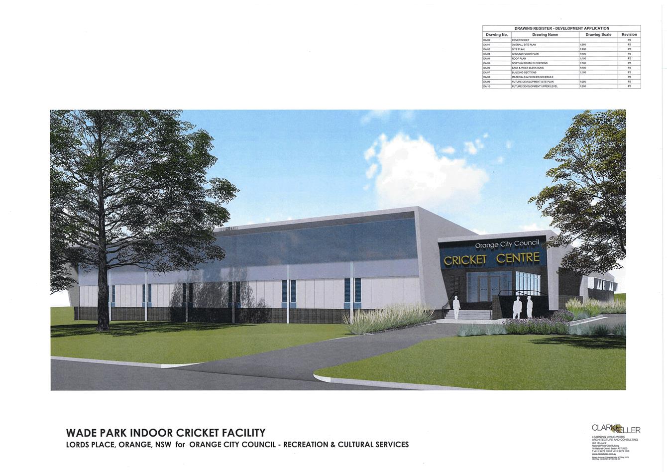
Planning
and Development Committee
2 October 2018
2.3 Development
Application DA 362/2017(1) - Lot 701 Lords Place (Wade Park)
Attachment 3 Submissions

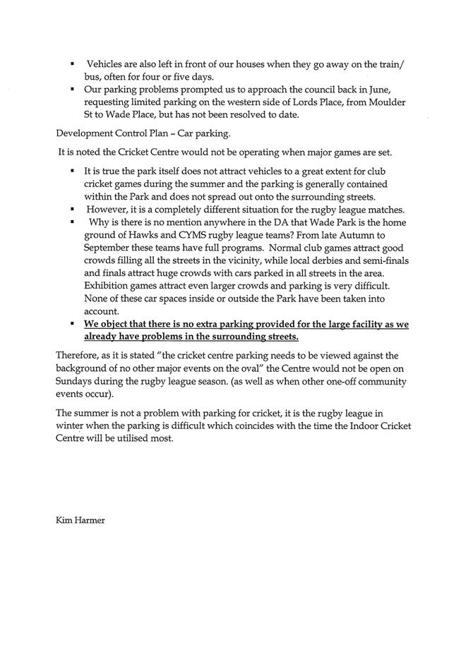
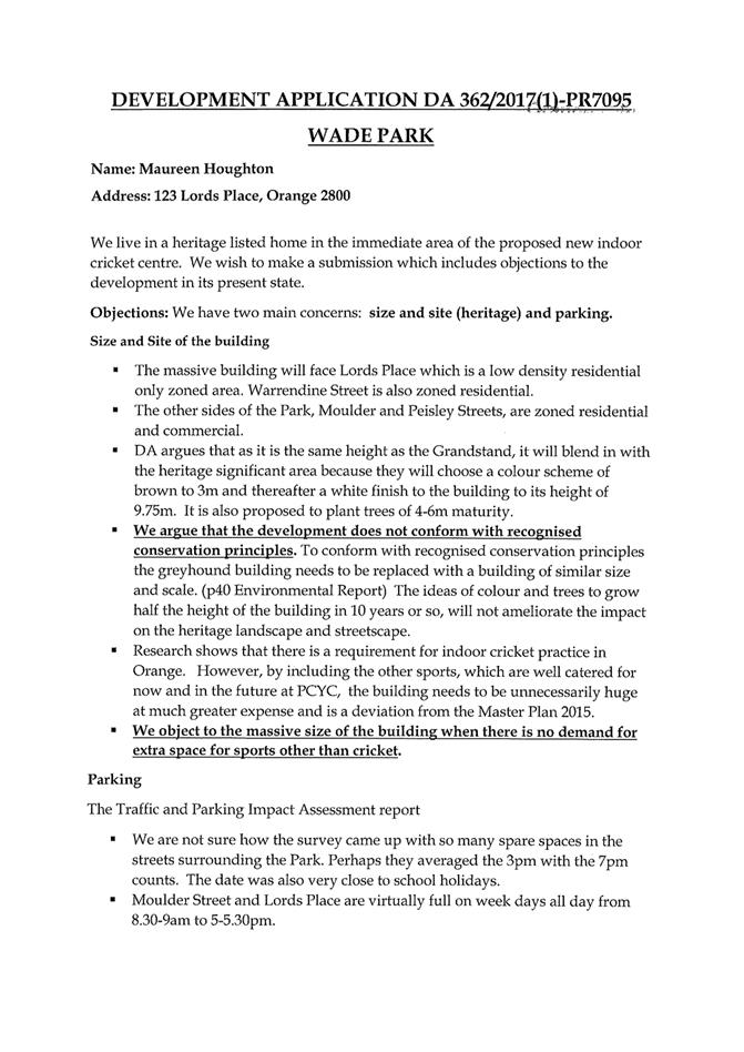
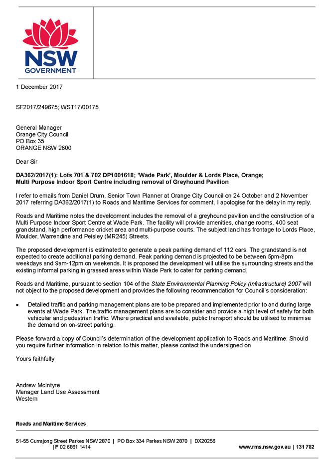


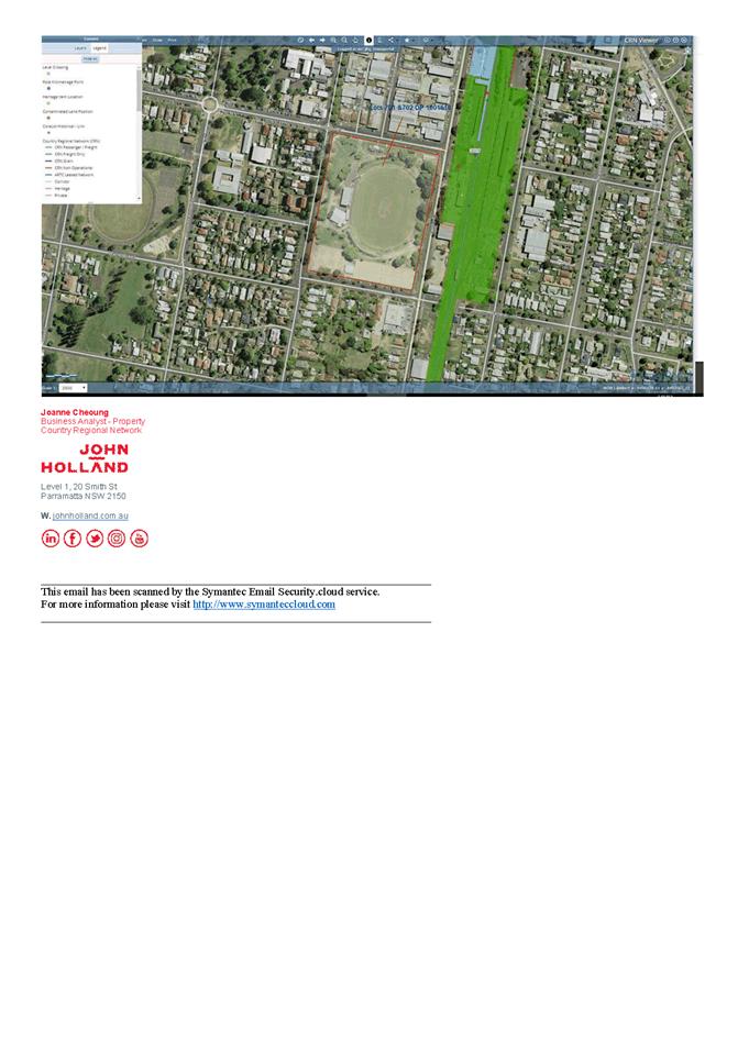
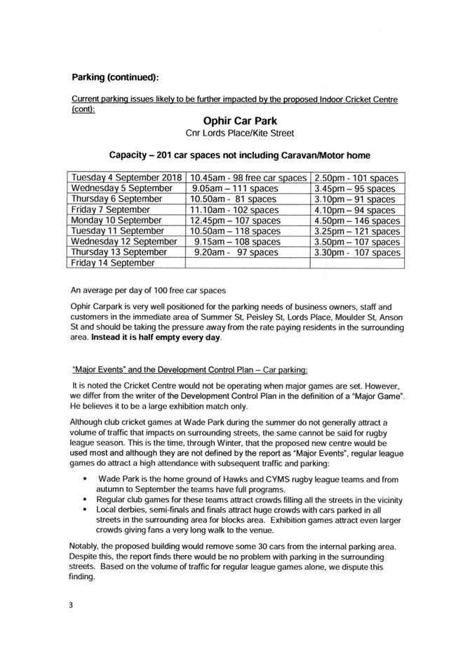
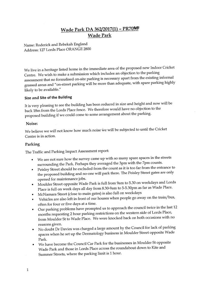
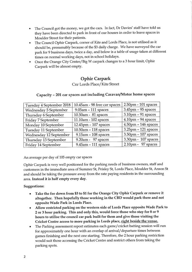
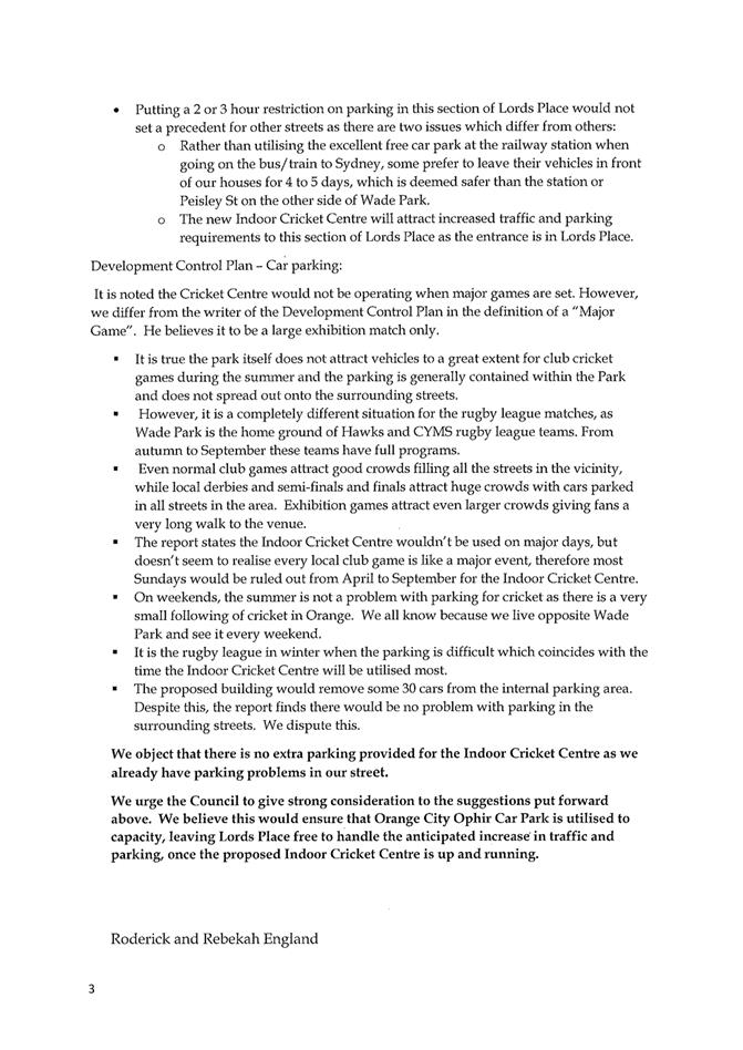
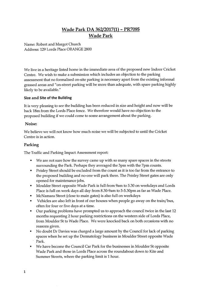

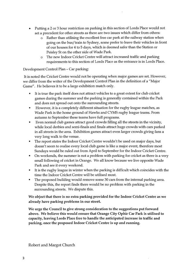
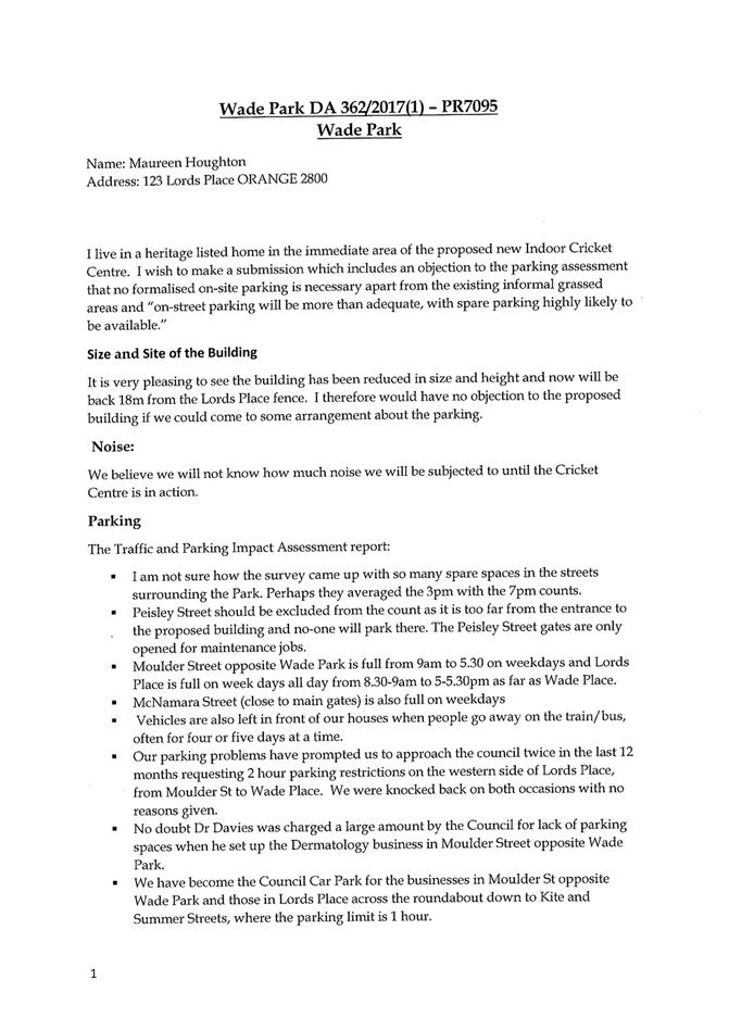
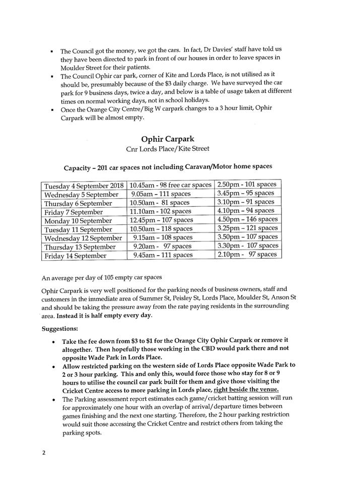
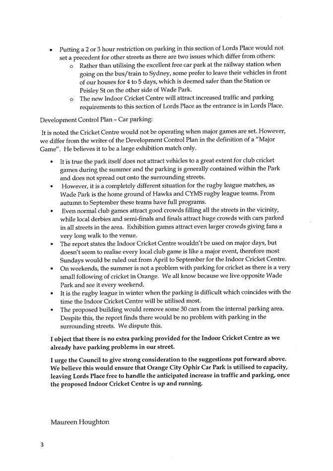
2.4 Development
Application DA 16/2018(1) - 38-40 Rosemary Lane
RECORD
NUMBER: 2018/2398
AUTHOR: Kelly
Walker, Senior Planner
EXECUTIVE Summary
|
Application
lodged
|
23
January 2018
|
|
Applicant/s
|
Mr RM
Pitt
|
|
Owner/s
|
Ms JO
Pitt
|
|
Land
description
|
Lot 100
DP 857135 – 38-40 Rosemary Lane, Orange
|
|
Proposed
land use
|
Subdivision
(two lot residential), Demolition (tree removal), Dwelling and Attached
Garage, and Subdivision (two lot residential)
|
|
Value of
proposed development
|
$200,000
|
Council's consent is sought for
subdivision, tree removal, and construction of a new dwelling with attached
garage at Lot 100 DP 857135, known as 38-40 Rosemary Lane, Orange (see
Figure 1).
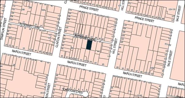
Figure 1 - locality plan
The proposed subdivision involves two stages, the first to
create a new vacant battleaxe lot to the rear (two lot Torrens), and the second
stage seeks to subdivide the existing duplex onto their own lots (two lot
Torrens with party wall). Over both stages, the site will result in three residential
lots. The new dwelling will be constructed on the new battleaxe block and
comprises a single storey, two (2) bedroom dwelling house with attached single
garage. The existing olive tree in the rear garden will need to be removed to
facilitate the development.
The proposal has been formally amended three times to stage
the subdivision, as well as to alter the design of the new dwelling and
proposed landscaping following feedback from Council staff and submissions from
neighbours. Concerns raised included visual privacy impacts, visual bulk
impacts, potential overshadowing of neighbouring properties, inappropriate
visual appearance, heritage impacts, insufficient areas of private open space,
landscaping, and vehicle manoeuvring. The application and its amendments have
been publically exhibited three times.
The applicant has worked with Council in regards to the
issues raised and has reduced the new dwelling to single storey, single garage
and two (2) bedrooms. Proposed landscaping has also been altered. It is
considered that the latest amendment has made a serious attempt to fit the form
of the proposed new dwelling within the building envelope, to use
traditional materials, to model the bulk and scale of neighbouring buildings,
and to minimise impacts on neighbours and the environment.
Overall, the proposed development is permitted with the
consent of Council and is considered to be consistent with the relevant aims,
objectives and planning outcomes of Orange Local Environmental Plan 2011 (LEP)
and Orange Development Control Plan 2004 (DCP). As such, it is
recommended that Council supports the proposed development as amended. Attached
is a draft Notice of Approval.
RECENT LEGISLATIVE CHANGES
On 1 March 2018 the Environmental Planning and Assessment
Act 1979 was substantially amended. The most immediate change involves the
restructuring and renumbering of the Act, with other more substantive
changes to be phased in over time. However, for some applications (particularly
where an application was lodged prior to the changes coming into effect) the
supporting documentation may still reference the previous numbering regime. In
the drafting of this report the content and substance of the supporting
material has been considered irrespective of which legislative references were
used.
DECISION FRAMEWORK
Development in Orange is governed by two key documents:
Orange Local Environment Plan 2011 and Orange Development Control Plan 2004. In
addition the Infill Guidelines are used to guide development, particularly in
the heritage conservation areas and around heritage items.
Orange Local Environment Plan 2011 – The
provisions of the LEP must be considered by the Council in determining the
application. LEPs govern the types of development that are permissible or prohibited
in different parts of the City and also provide some assessment criteria in
specific circumstances. Uses are either permissible or not. The objectives of
each zoning and indeed the aims of the LEP itself are also to be considered and
can be used to guide decision making around appropriateness of development.
Orange Development Control Plan 2004 – the DCP
provides guidelines for development. In general it is a performance based
document rather than prescriptive in nature. For each planning element there
are often guidelines used. These guidelines indicate ways of achieving the
planning outcomes. It is thus recognised that there may also be other solutions
of merit.
All design solutions are considered on merit by planning and
building staff. Applications should clearly demonstrate how the planning
outcomes are being met where alternative design solutions are proposed. The DCP
enables developers and architects to use design to achieve the planning
outcomes in alternative ways.
DIRECTOR’S COMMENT
The proposal has been formally amended three times to stage
the subdivision and reconfigure the proposed new dwelling design. Various
iterations of the earlier development involved the construction of a two storey
dwelling on the proposed battleaxe allotment. The two storey configuration of
the dwelling was not considered appropriate for the locality. Council staff
requested that the applicant reconsider the design following the initial stages
of public consultation. The applicant has worked with Council in regards to the
issues raised and has reduced the new dwelling to single storey, single garage
and two bedrooms. Proposed landscaping has also been altered.
It is considered that the latest amendment has made a
serious attempt to fit the form of the proposed new dwelling within its
surrounds. While the proposed battleaxe lot is substantially smaller than the
recommended 650m² and does not adjoin public open space, the
DCP guidelines indicate ways of achieving the planning outcomes, and
acknowledges that there can be other solutions to meeting the planning outcomes
where each design is considered on its merit.
The intention of the minimum 650m² guideline is to
ensure that adequate residential amenity can be provided while not adversely
impacting on neighbouring amenity, as well as providing adequate servicing to
the site. The applicant has demonstrated that adequate access, servicing, solar
access, privacy and amenity can be provided to the existing, proposed and
neighbouring dwellings in accordance with the DCP. On balance, the planning
outcomes for urban residential development and subdivision can be met,
therefore the proposed development can be supported in this case.
Link To Delivery/OPerational Plan
The recommendation in this report relates to the Delivery/Operational
Plan strategy “10.1 Preserve - Engage with the community to ensure plans
for growth and development are respectful of our heritage”.
Financial Implications
Nil
Policy and Governance Implications
Nil
|
Recommendation
That Council consents to
development application DA 16/2018(1)
for Subdivision (two lot residential), Demolition (tree removal),
Dwelling and Attached Garage, and Subdivision (two lot residential)
at Lot 100 DP 857135 –
38-40 Rosemary Lane, Orange pursuant to the
conditions of consent in the attached Notice of Approval.
|
further considerations
Consideration has been given to the recommendation’s
impact on Council’s service delivery; image and reputation; political;
environmental; health and safety; employees; stakeholders and project
management; and no further implications or risks have been identified.
SUPPORTING INFORMATION
THE PROPOSAL
As amended, the proposal involves two main stages as
follows:
Stage 1: Subdivision
of the existing lot to create a new vacant battleaxe lot to the rear (two lot
Torrens) - proposed Lot 200 measuring 426.9m2.
Stage 2: Subdivision
of the existing duplex on the front lot (two lot Torrens with party wall) -
proposed Lot 201 (eastern duplex) measuring 197.3m2, and proposed
Lot 202 (western duplex), measuring 208.7m2; as well as tree
removal and construction of a new dwelling on the new rear battleaxe block.
The proposed new dwelling is a single storey house
comprising two (2) bedrooms, three (3) bathrooms, combined kitchen and
living room, dining room, study, laundry and attached single garage. Proposed
materials include concrete block walls, galvanised iron gladding, Weathertex
and Hardiplank cladding, Colorbond roofing, timber framed windows on the
front/southern façade, powder-coated aluminium windows on other
elevations, tilt panel garage door with glazed top-lights, and Colorbond and
palisade fencing.
The existing olive tree in the rear garden will need to be
removed to facilitate the development. New landscaping is proposed along both
sides of the new access handle for the battleaxe lot.
PROCEDURE AND BACKGROUND
Original Application
The original application involved a three lot subdivision
(new battleaxe lot and subdivision of existing duplex) and a new two storey
four (4) bedroom house. Shortly after lodgement the application was amended to
carry out the subdivision in two stages.
Following an initial review carried out by Council staff and
the first exhibition period of the application where two (2) submissions were
received, concerns were raised in regards to visual privacy, visual bulk,
overshadowing of neighbouring properties, inappropriate visual appearance,
heritage impacts, and insufficient areas of private open space, landscaping and
vehicle manoeuvring.
Amendments
The applicant worked with Council to address these issues
and amended the design of the new dwelling and landscaping on the site. Namely,
the bulk of the second storey was significantly reduced by utilising a
different roof form, and proposed landscaping species were revised. The amended
proposal was re-exhibited and four (4) submissions were received raising
similar concerns to the original exhibition period.
Following an assessment of the amended application, the
applicant sought to further amend the design of the new dwelling to address
concerns raised in the additional submissions. Namely, the new dwelling has
been reduced to single storey height, two (2) bedrooms and a single
garage. Proposed landscaping between the new dwelling and southern boundary has
been deleted. This further amendment was re-exhibited, and one (1)
submission was received. Submissions from each of the exhibition periods are
addressed in detail later in this report.
MATTERS FOR CONSIDERATION
Section 1.7 - Application of
Part 7 of the Biodiversity Conservation Act 2016 and Part 7A of the
Fisheries Management Act 1994
Section 1.7 of the EP&A Act 1979 identifies that Part 7
of the Biodiversity Conservation Act 2016 and Part 7A of the Fisheries
Management Act 1994 have effect in connection with terrestrial and aquatic
environments.
Notwithstanding, Section 28 of the Biodiversity
Conservation (Savings and Transitional) Regulation 2017 states that the
former planning provisions continue to apply to the determination of a pending
planning application, being an application for planning approval made before
the commencement of the new Act but not determined before that commencement.
The relevant provisions are set out at Part 5A of the historical version of the
EP&A Act 1979 dated 24 August 2017.
Having regard to the relevant provisions and based on an
inspection of the subject property, it is considered that the proposed
development is not likely to have a significant effect on any threatened
species, populations or ecological communities or their habitats.
Section 4.15
Section 4.15 of the Environmental Planning and Assessment
Act 1979 requires Council to consider various matters, of which those
pertaining to the application are listed below.
PROVISIONS OF ANY ENVIRONMENTAL
PLANNING INSTRUMENT s4.15(1)(a)(i)
Orange Local Environmental Plan 2011
Part 1 - Preliminary
Clause 1.2 - Aims of Plan
The broad aims of the LEP are set out under subclause 2.
Those relevant to the application are as follows:
(a) to
encourage development which complements and enhances the unique character of
Orange as a major regional centre boasting a diverse economy and offering an
attractive regional lifestyle,
(b) to provide for a range of development
opportunities that contribute to the social, economic and environmental
resources of Orange in a way that allows present and future generations to meet
their needs by implementing the principles for ecologically sustainable
development,
(e) to provide a range of housing choices in
planned urban and rural locations to meet population growth,
(f) to recognise and manage valued
environmental heritage, landscape and scenic features of Orange.
The application is considered to be generally consistent
with the foregoing aims insofar as it will contribute to housing choices in
proximity to the Orange CBD without detracting from the unique character,
heritage and environmental characteristics of Orange.
Clause 1.6 - Consent Authority
This clause establishes that, subject to the Act, Council is
the consent authority for applications made under the LEP.
Clause 1.7 - Mapping
The subject site is identified
on the LEP maps in the following manner:
|
Land Zoning Map:
|
Land zoned R1 General Residential
|
|
Lot Size Map:
|
No Minimum Lot Size
|
|
Heritage Map:
|
Located in a conservation area, and
near listed buildings
|
|
Height of Buildings Map:
|
No building height limit
|
|
Floor Space Ratio Map:
|
No floor space limit
|
|
Terrestrial Biodiversity Map:
|
No biodiversity sensitivity on the
site
|
|
Groundwater Vulnerability Map:
|
Groundwater vulnerable
|
|
Drinking Water Catchment Map:
|
Not within the drinking water
catchment
|
|
Watercourse Map:
|
Not within or affecting a defined
watercourse
|
|
Urban Release Area Map:
|
Not within an urban release area
|
|
Obstacle Limitation Surface Map:
|
No restriction on building siting
or construction
|
|
Additional Permitted Uses Map:
|
No additional permitted use applies
|
|
Flood Planning Map:
|
Not within a flood planning area
|
The mapped matters of relevance are addressed in detail in
the body of this report.
Clause 1.9A - Suspension of
Covenants, Agreements and Instruments
This clause provides that covenants, agreements and other
instruments which seek to restrict the carrying out of development do not apply
with the following exceptions.
· covenants imposed
or required by Council
· prescribed
instruments under Section 183A of the Crown Lands Act 1989
· any conservation
agreement under the National Parks and Wildlife Act 1974
· any trust
agreement under the Nature Conservation Trust Act 2001
· any property
vegetation plan under the Native Vegetation Act 2003
· any biobanking
agreement under Part 7A of the Threatened Species Conservation Act 1995
· any planning
agreement under Division 6 of Part 4 of the Environmental Planning and
Assessment Act 1979.
Council staff are not aware of the title of the subject
property being affected by any of the above.
Part 2 - Permitted or Prohibited Development
Clause
2.1 - Land Use Zones
The subject site is located within the R1 General
Residential Zone. The proposed development is defined as
‘subdivision’ and ‘dwelling house’ under the LEP.
Pursuant to Section 4B of the Environmental Planning
& Assessment Act subdivision of land means:
the division of land into two
or more parts that, after the division, would be obviously adapted for separate
occupation, use or disposition.
Pursuant to the dictionary contained within the LEP, a
dwelling house means:
a building containing only one
dwelling.
To extend the above definition further, the LEP defines a
dwelling to mean:
a room or suite of rooms
occupied or used or so constructed or adapted as to be capable of being
occupied or used as a separate domicile.
Subdivision, demolition (tree removal), and dwelling houses
are permissible in the R1 zone with the consent of Council.
Clause 2.3 - Zone Objectives
Clause
2.3 of LEP 2011 references the Land Use
Table and Objectives for each zone in LEP 2011. These objectives for land
zoned R1 General Residential are as follows:
· to provide for
the housing needs of the community
· to provide for
a variety of housing types and densities
· to enable other
land uses that provide facilities or services to meet the day to day needs of
residents
· to ensure
development is ordered in such a way as to maximise public transport patronage
and encourage walking and cycling in close proximity to settlement
· to ensure that
development along the Southern Link Road has an alternative access.
The proposed development is
consistent with these zone objectives as follows:
- provides additional housing stock within the City;
- provides a variation of housing type and density for the
City;
- the subject site is within close proximity to routes used
by public transport, and to the CBD, shops and services; and
- the subject site is not in proximity to the Southern Link
Road.
Clause 2.6 - Subdivision -
Consent Requirements
Clause 2.6 requires development consent for the subdivision
of land. This application seeks consent for the subdivision of the subject
land.
Clause 2.7 - Demolition
Requires Development Consent
This clause triggers the need for development consent in
relation to a building or work. This requirement does not apply to any
demolition that is defined as exempt development.
The proposal involves demolition and the applicant is
seeking the consent of Council. The extent of the demolition relates to the
removal of one olive tree at the rear of the site to facilitate further
development on the land. Whilst the removal of the tree will change the
immediate environment the tree removal will have no significant impact on
adjoining lands, the streetscape, or public realm. Relevant conditions of
consent are attached.
Part 3 - Exempt and Complying Development
The application is not exempt or complying development.
Part 4 - Principal Development Standards
Clause
4.1 - Minimum Subdivision Lot Size
This
clause requires the subdivision of land to be equal to or greater than the size
nominated for the land under the Minimum Lot Size Map. In relation to this
site, the LEP maps do not nominate a minimum lot size, therefore this
clause does not apply to this application. An assessment of the proposed
subdivision is carried out in the DCP assessment later in this report.
Clause 4.1B - Minimum Lot Sizes for Dual Occupancy, Multi
Dwelling Housing and Residential Flat Buildings
This
clause sets out a minimum lot size of 1,250m2 for multi dwelling
housing (three or more dwellings on a lot) in the R1 zone. The subject land
measures 832.9m2, which is below this minimum. Notwithstanding this,
although the proposal will result in a total of three dwellings on the land,
the application is not technically considered ‘multi dwelling
housing’, as each dwelling will be on its own lot as ‘single
dwellings’. The proposed staging involves:
- subdivision of the existing
land into two Torrens lots, where there is no minimum lot size in this area as
set out in Clause 4.1 above;
- construction of a single
dwelling house on the new rear battleaxe lot; and
- subdivision of the existing
duplex onto their own lots, resulting in a single dwelling on each lot (two lot
Torrens with party wall).
Due to
the proposal staging, the minimum requirement set out in this clause does not
apply to this application.
Part 5 - Miscellaneous Provisions
5.10 - Heritage Conservation
Clause
5.10 seeks to conserve the environmental heritage of Orange, and the heritage
significance of heritage items and heritage conservation areas.
It
states in part:
(4) Effect
of Proposed Development on Heritage Significance
The consent authority must,
before granting consent under this clause in respect of a heritage item or
heritage conservation area, consider the effect of the proposed development on
the heritage significance of the item or area concerned.
The subject
property is located within the Central Orange Heritage Conservation Area,
nearly adjacent to listed dwelling at 79 March Street and near to a listed
restaurant and listed dwellings at 85 March and 115 Hill Streets (see Figure
2).
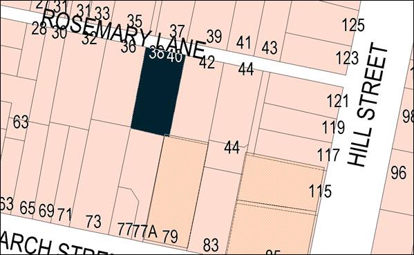
Figure 2 - plan of nearby heritage items (in beige
hashing)
The Orange City Council Heritage Inventory describes the
significance of these listed buildings as follows:
‘Trebanog House’
dwelling (Former Inn) – 79-81 March Street: “The masonry
building with Ashlar moulding, hipped iron roof, brick chimneys and timber
verandah with cast iron brackets is one of the earliest intact Inns,
complements the streetscape and contributes to the Conservation Area as a
heritage item”.
‘1870 Restaurant’
(Former Inn) – 85-87 March Street: “The masonry rendered Inn
dates from 1870 and is one of the earliest intact licensed premises and retains
the original character, complementing the streetscape and contributing to the
Conservation Area as a heritage item”. Previously known as Welcome
Inn, Harrisons, Patmos, French Restaurants, and originally the Welcome
Inn/Family Hotel.
‘Vincent’ dwelling
– 115 Hill Street: “The unusual and rare Colonial styled
residence complements the streetscape and contributes to the Conservation Area
as a Heritage item”.
It is noted that these listed properties are not subject to
Heritage Management Plans, and the proposal does not warrant the preparation of
such a Plan in this case.
The subject site is off a laneway where the
predominant buildings are single storey residential houses, with the setting
including a range of substantial mature trees. The existing building
comprises a traditional pair of attached cottages which retain their
traditional character, with distinctive elements including the pitched
roof with rear skillion, front verandah and painted rendered facade with
detailing to the doors and windows. Generally there are buildings in the
streetscape of a wide range of periods and styles. The subdivision pattern illustrates
a range of buildings erected to address the lane, although despite rear garages,
there are no apparent subdivisions of these earlier lots off the lane.
The application and amendments were referred to
Council’s Heritage and Urban Design Advisor, and the following comments
were made (summarised):
- The
amended design has made a serious attempt to fit the form of the new dwelling
within the building envelope, to use traditional materials, and model the bulk
and scale;
- Views
of the dwelling would be those from down the driveway to the garage when viewed
from the lane and from the adjoining properties;
- The
removal of the substantial mature tree is a major loss. Supplementary planting
is shown on the submitted Landscape Plan and advice has been obtained from a
professional landscape architect, but only relates to linear planting;
- The
proposed siting of the new dwelling has minimal impact upon the existing pair
of cottages, provided their private outdoor open space is sufficient and
compliant;
- The
proposed siting of the new dwelling is consistent with other early examples of
stable type buildings to the rear of houses in the Conservation Area;
- The
property at 77 March Street has been similarly subdivided, with a large house
at 77A backing on to the subject site;
- The
visual impact of the standard roller door is not appropriate given the
size and prominence (original design – this has been amended to meet
recommendations);
- Minimal
setbacks are noted to the three sides;
- While
planting is shown on the plans, this requires verification that it is
appropriate and will endure;
- The
range of materials is broad, and the use of concrete blocks is not consistent with
the general character of the area. A painted render to complement the finish on
the cottages would be more sympathetic, while the steel and fibre-cement boards
are appropriate. No colours are indicated, and will be required; and
- The
verandah and full height doors and windows to the front elevation give
an appropriate scale and character.
With these comments in mind, the
following recommendations have been made:
- Fielders
traditional custom orb galvanised steel (iron) cladding run horizontally;
- Weathertex
classic smooth 200mm boards in Dulux Dune (and shown on drawings);
- Windspray
custom orb Colorbond roofing, traditional rolled flashings, smooth half round
gutters and circular downpipes (and shown on drawings);
- Timber
verandah posts in Cabots Jarrah stain;
- All
windows and doors to the front elevation to be clear finished timber;
- Tilt
panel garage door with glazed toplights; and
- A
revised Landscape Plan specifying numbers and species types, including deep
rooted trees with mature height to mitigate the loss of the large olive tree.
The amended plans demonstrate that the dwelling with
attached garage is appropriately sited within the land and heritage setting.
Council’s Heritage Advisor’s recommendations in regards to
detailing, materials, colours and landscaping are supported by Council staff.
The applicant is not proposing any changes to the exterior of the existing
duplex addressing the street. The majority of the proposed new dwelling will
not be easily observed from the laneway, as discussed above.
Clause 5.10 also requires consent for tree removal in a
heritage conservation area. The applicant has supplied an arboriculture report
supporting the removal of the existing tree, and a letter from a landscape
architect recommending appropriate planting species on the site. The report
states that following in regards to the tree to be removed:
- The
Olive tree (Olea europaea) is 8-10m tall;
- The
tree has two large basal wounds which have allowed rot to enter the trunk and
compromise the stability of the trunk, and may lead to whole tree failure;
- Elsewhere
in the canopy are abscission scars where branches have failed, and previous
pruning practices have led to cavities from the main fork which could meet up
with the basal wounds and cause serious piping in the heartwood, further
affecting stability;
- The
fruit produced by the tree attracts feral Mynah birds, which are a major urban
nuisance and negatively impact on biodiversity; and
- The
evergreen tree overshadows neighbouring properties to the south and was planted
too close to the boundary fence.
Council’s Manager City Presentation has reviewed the
proposal and makes the following comments:
“I have undertaken an
inspection of the subject tree and concur with the Arborists report; there is a
significant amount of decay in the root crown / lower trunk and whilst African
Olives trees with solid timber and compartmentalise soundly the decay between
roots and stem warrant approval for the tree to be removed”.
In regards to the proposed landscaping plan, concerns have
been raised by Council’s Manager City Presentation and Heritage Advisor,
as well as from neighbouring residents, as to the species proposed and their
siting. In particular, the landscape architect’s recommendations only
relate to linear plantings and do not specifically account for the heritage
setting. Previously there was doubt around whether there was sufficient
planting width between the new dwelling and southern boundary for species to
survive due to lack of space and daylight, however the applicant has removed
this element from the proposal, which is discussed in greater detail later in
this report.
In an ideal situation at least one mature tree should be
provided in each of the private open space areas. However, given the
availability of space on the site and the north-south orientation of the
existing dwellings and gardens, there is a need to balance amenity provided by
plantings with the provision of daylighting to windows and open space. It is
considered impractical to provide three mature trees in this case, and from the
point of view of mitigating heritage impacts, the loss of the large olive tree
could be replaced by one large or two smaller trees. Relevant conditions of
consent are recommended to this effect.
Overall, conditions of consent are recommended in relation
to detailing for the new dwelling and landscaping, where further amendments can
be assessed and approved prior to subdivision and construction. Subject to
these recommendations, it is considered that the proposed development will not
detract from the significance of the conservation area and nearby listed
buildings, and is consistent with Clause 5.10 of the LEP.
Part 6 - Urban Release Area
Not relevant to the application. The subject site is not
located in an Urban Release Area.
Part 7 - Additional Local Provisions
7.1
- Earthworks
This
clause establishes a range of matters that must be considered prior to granting
development consent for any application involving earthworks, such as:
(a) the likely disruption of, or any
detrimental effect on, existing drainage patterns and soil stability in the
locality of the development
(b) the effect of the development on the
likely future use or redevelopment of the land
(c) the quality of the fill or the soil to be
excavated, or both
(d) the effect of the development on the
existing and likely amenity of adjoining properties
(e) the source of any fill material and the
destination of any excavated material
(f) the likelihood of disturbing relics
(g) the proximity to and potential for adverse
impacts on any waterway, drinking water catchment or environmentally sensitive
area
(h) any measures proposed to minimise or
mitigate the impacts referred to in paragraph (g).
The earthworks proposed in the
application are limited to the extent of cutting and filling required for the
proposed dwelling and removal of the tree. The extent of disruption to the
drainage of the site is considered to be minor and is unlikely to detrimentally
affect adjoining properties or receiving waterways. The extent of the
earthworks will not materially affect the potential future use or redevelopment
of the site that may occur at the end of the proposed development's lifespan.
The site is not known to be
contaminated. The site is not known to contain any Aboriginal, European or
archaeological relics. Previous known uses of the site do not suggest that any
relics are likely to be uncovered. The site is not in proximity to any
waterway, drinking water catchment or sensitive area. Conditions requiring a
sediment control plan, including silt traps and other protective measures, to
ensure that loose dirt and sediment do not escape the site boundaries are
recommended.
7.3 - Stormwater Management
This clause applies to all
industrial, commercial and residential zones and requires that Council be
satisfied that the proposal:
(a) is designed to maximise the use of water
permeable surfaces on the land having regard to the soil characteristics
affecting onsite infiltration of water
(b) includes, where practical, onsite
stormwater retention for use as an alternative supply to mains water,
groundwater or river water; and
(c) avoids any significant impacts of
stormwater runoff on adjoining downstream properties, native bushland and
receiving waters, or if that impact cannot be reasonably avoided, minimises and
mitigates the impact.
Council’s
Development Engineer has recommended that a condition of consent be applied
requiring that the development’s stormwater design is to include
stormwater detention within the development designed to limit peak outflows
from the land to the pre-existing natural outflows up to the 100 year ARI
frequency, with sufficient allowance in overflow spillway design capacity to
safely pass flows of a lower frequency without damage to downstream
developments. Subject to suitable design, stormwater can be appropriately
managed onsite in accordance with the LEP provisions.
7.6 - Groundwater Vulnerability
This
clause seeks to protect hydrological functions of groundwater systems and
protect resources from both depletion and contamination. Orange has a high
water table and large areas of the LGA, including the subject site, are
identified with “Groundwater Vulnerability” on the Groundwater Vulnerability
Map. This requires that Council consider:
(a) whether or not the development (including
any onsite storage or disposal of solid or liquid waste and chemicals) is
likely to cause any groundwater contamination or have any adverse effect on
groundwater dependent ecosystems, and
(b) the cumulative impact (including the
impact on nearby groundwater extraction for potable water supply or stock water
supply) of the development and any other existing development on groundwater.
Furthermore consent may not be granted unless Council is satisfied that:
(a) the development is designed, sited and
will be managed to avoid any significant adverse environmental impact, or
(b) if that impact cannot be reasonably
avoided - the development is designed, sited and will be managed to minimise
that impact,
(c) if that impact cannot be minimised - the
development will be managed to mitigate that impact.
The proposal is not anticipated
to involve the discharge of toxic or noxious substances and is therefore
unlikely to contaminate the groundwater or related ecosystems. The proposal
does not involve extraction of groundwater and will therefore not contribute to
groundwater depletion. The design and siting of the proposal avoids impacts on
groundwater and is therefore considered acceptable.
Clause 7.11 - Essential
Services
Clause 7.11 applies and states:
Development consent must not be
granted to development unless the consent authority is satisfied that any of
the following services that are essential for the proposed development are
available or that adequate arrangements have been made to make them available
when required:
(a) the
supply of water,
(b) the
supply of electricity,
(c) the
disposal and management of sewage,
(d) storm
water drainage or on-site conservation,
(e) suitable
road access.
In consideration of this clause, all utility services are
available, or can be made available to the land and are adequate for the
proposal. Relevant conditions of consent are attached in regards to servicing
and utilities.
STATE ENVIRONMENTAL PLANNING
POLICIES
State Environmental Planning Policy (Building
Sustainability Index: BASIX) 2004
State Environmental Planning Policy (Building
Sustainability Index: BASIX) 2004 applies to the subject development. The
applicant has submitted a BASIX certificate in support of the development which
demonstrates that the proposed new dwelling complies with the State Government
water and thermal efficiency targets. The application is consistent with
the SEPP.
State Environmental Planning
Policy 55 - Remediation of Land
State Environmental Planning Policy 55 - Remediation of
Land (SEPP 55) is applicable. Pursuant to Clause 7 - Contamination and
remediation to be considered in determining development application:
(1) A consent authority must not consent to
the carrying out of any development on land unless:
(a) it
has considered whether the land is contaminated, and
(b) if
the land is contaminated, it is satisfied that the land is suitable in its
contaminated state (or will be suitable, after remediation) for the purpose for
which the development is proposed to be carried out, and
(c) if
the land requires remediation to be made suitable for the purpose for which the
development is proposed to be carried out, it is satisfied that the land will
be remediated before the land is used for that purpose.
Given that the subject property is currently used for
residential purposes and is located within a long established residential
neighbourhood, it is unlikely that the uses of the land would have resulted in
it being in a contaminated state unsuitable for ongoing residential use.
PROVISIONS OF ANY DRAFT
ENVIRONMENTAL PLANNING INSTRUMENT THAT HAS BEEN PLACED ON EXHIBITION
4.15(1)(a)(ii)
There are no draft environmental planning instruments that
apply to the subject land or proposed development.
DESIGNATED DEVELOPMENT
The proposed development is not designated development.
INTEGRATED DEVELOPMENT
The proposed development is not integrated development.
PROVISIONS OF ANY DEVELOPMENT
CONTROL PLAN s4.15(1)(a)(iii)
Development Control Plan 2004
Development Control Plan 2004 (“the DCP”)
applies to the subject land. An assessment of the proposed development against
the relevant Planning Outcomes will be undertaken below.
CHAPTER 3 - GENERAL
CONSIDERATIONS
Section 3.1 - Cumulative Impacts
“Cumulative Impacts” identifies that Council
will consider not only the direct impacts of a particular development, but also
whether the development, when carried out in conjunction with other development
in the locality, has a more significant environmental impact. Notably, this
section identifies that residential units should be located and designed in a
way that fits in with the predominant low-density character of the City’s
residential area.
Specific planning outcomes for cumulative impacts include:
· applications
for development demonstrate how the development relates to the character and
use of land in the vicinity
· the
introduction of new development into a locality maintains environmental impacts
within existing or community-accepted levels
· water
conservation measures are implemented.
The relevant matters are generally addressed under
‘Section 7.7 - Design Elements for Residential Development’ below
and elsewhere throughout this report.
Based on that assessment it is considered that the proposed
development, subject to minor detailing, materials, and landscaping changes,
adequately relates to the existing character and land use in the area, and
would maintain environmental impacts within existing community accepted levels.
Although it is acknowledged that further infill development in close proximity
to the City centre is likely and will increase the density of the area, the
provisions of the LEP and DCP allow for and encourage this future growth,
subject to meeting various standards and guidelines. The proposed development
meets those guidelines.
CHAPTER 7 - DEVELOPMENT IN
RESIDENTIAL AREAS
Section 7.2 - Residential Subdivision
The DCP sets out the following relevant planning outcomes
for urban residential subdivision:
· Lots are
orientated to optimise energy efficiency principles.
The proposed new dwelling has been designed to incorporate
primary living areas and the area of private open space on the northern side to
optimise solar access. The proposed dwelling also achieves BASIX requirements
as discussed elsewhere in this report. The existing duplex has the private open
space areas to the south, however this is an existing situation. This is
discussed in greater detail in ‘Section 7.7 - Design Elements for
Residential Development’ below.
· Lots below
350m² indicate existing or planned house layouts, which identify how
privacy, solar access, vehicular access and private open-space needs are to be
achieved.
The applicant seeks consent for the construction of the new
dwelling along with the staged subdivision, and as such the application sets
out the intended site layout, existing and proposed dwelling footprints,
private open space areas, parking, manoeuvring, shadow diagrams etc. It is
considered that appropriate solar access, privacy, vehicle access and private
open space outcomes can be achieved, and these aspects are assessed in detail
in ‘Section 7.7 - Design Elements for Residential Development’ below.
· Lots are fully
serviced and have direct frontage/access to a public road.
All services have the capacity to be extended to the proposed
development, and relevant conditions of consent are attached. Each proposed lot
would have direct access to Rosemary Lane.
· Design and
construction complies with the Orange Development and Subdivision Code.
Council’s Development
Engineer has recommended a condition of consent stating that the provisions and
requirements of the Orange Development and Subdivision Code apply to the
proposal.
· Battleaxe lots
provide an adequate accessway width for the number of dwellings proposed to be
served in order to allow for vehicle and pedestrian access and location of
services.
Expanding on this outcome, DCP
Section 7.2 sets out guidelines for battleaxe lots as follows:
- sufficient
size and shape to permit a house and driveway positioned in a way that allows
cars to turn around within the lot;
- accessway
needs to be wide enough to allow for vehicular access and services such as
power, telecommunications, water, and possibly drainage and internal sewer
(3m wide driveway within an access corridor of 4.5m is deemed adequate);
- should
have a minimum area of 650m2, excluding the area of the accessway;
- be
designed to provide for solar access and privacy; and
- where
practicable, should adjoin open space.
Submitted plans demonstrate that
the minimum driveway width can be met and is considered adequate for this
proposal. Turn circles have also been provided which demonstrate compliance
with the relevant standards. It is noted that the original proposal included an
attached double garage for the new dwelling with extremely tight manoeuvring.
Ideally a smaller footprint for the new dwelling would achieve greater
manoeuvring space on the proposed lot, thus resulting in a better development.
However, instead of this the applicant has changed the garage to a single garage,
which is adequate for a two bedroom dwelling as discussed later in
‘Section 7.7 - Design Elements for Residential Development’.
A condition of consent is
recommended to ensure that vehicles enter and leave the battleaxe site in a
forward gear to ensure safe egress as well as pedestrian safety.
The proposed development involves a
two stage subdivision which will ultimately create three residential lots of
197.3m2, 208.7m2 and 426.9m2 in size. The
largest lot comprises the battleaxe lot, and this area includes the access
handle. While the proposed battleaxe lot is substantially smaller than the
recommended 650m2 and does not adjoin public open space, the
DCP guidelines indicate ways of achieving the planning outcomes, and
acknowledges that there can be other solutions to meeting the planning outcomes
where each design shall be considered on its merit.
The intention of the minimum 650m2
guideline is to ensure that adequate residential amenity can be provided while
not adversely impacting on neighbouring amenity, as well as providing adequate
servicing to the site. The applicant has demonstrated that adequate access,
servicing, solar access, privacy and amenity can be provided to the existing,
proposed and neighbouring dwellings in accordance with the DCP. These matters
are addressed in detail in ‘Section 7.7 - Design Elements for Residential
Development’ below, which demonstrates that all relevant outcomes can be
achieved. On balance, the planning outcomes for urban residential subdivision
can be met, therefore the proposed subdivision can be supported in this case.
Section 7.7 - Design Elements
for Residential Development
Section 7.7 sets out objectives and planning outcomes for
residential development design elements. The overall objectives as well as the specific
planning outcomes are relevant and are addressed in detail below.
Streetscape Objectives
· to ensure that
the development fits into its setting and environmental features of the
locality
· to ensure that
the appearance of housing is of a high visual quality, enhances the streetscape
and complements good quality surrounding development
· to ensure that
new development complements places with heritage significance and their
settings in a contemporary way
· to develop a
sense of place with attractive street frontages
· to encourage
visually appealing cohesive streetscapes
· to create a
safe and secure environment
· to provide
consistent design elements that protect private investment.
The proposal meets the DCP streetscape objectives, as
discussed below.
Neighbourhood
Character
The DCP sets the following Planning Outcomes in regard to
Neighbourhood Character:
· site layout and
building design enables the:
- creation
of attractive residential environments with clear character and identity
- use
of site features such as views, aspect, existing vegetation and landmarks
· buildings are
designed to complement the relevant features and built form that are identified
as part of the desired neighbourhood character
· the streetscape
is designed to encourage pedestrian access and use.
The
character and identity of a development are influenced by building design that
maintains a common theme and consistent use of materials. The existing duplex
fronting the street will remain unchanged, and as such streetscape appearance
will remain largely intact. The proposed new dwelling to the rear of the site
needs to be complementary to the surrounding pattern of development and
buildings. The subject site is off a laneway where the predominant
buildings are single storey residential houses in a wide range of periods and
styles, and substantial mature trees. The subdivision pattern illustrates
a range of buildings erected to address the lane, and the addition of rear garages
and sheds in a range of styles and sizes. Infill development is not common in
the immediate surrounds, although the site directly adjacent to the south (77
and 77A March Street) was subdivided into a battleaxe site with new dwelling
(see Figure 3). There are no apparent subdivisions of the earlier lots off the
lane.

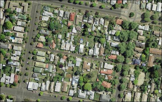
Figure 3 - aerial photograph of subject site (in red)
and surrounding pattern of development on Rosemary Lane (centre - horizontal),
Prince Street (top),
March Street (bottom), Clinton Street (left), and Hill
Street (right)
Whilst the scale of the proposed lots is smaller than
typical residential development in the area, the LEP and DCP encourage a range
of housing types and infill development, particularly in close proximity to the
City centre. When assessing neighbourhood character, both the existing
character and the intended future character of an area needs to be taken into
account. Based on the LEP zoning of the land and no minimum lot sizes for the
area, as well as population trends and forecasts for Orange, it is expected
that the future neighbourhood character will include additional smaller lots
and infill development as the need for smaller dwellings in close proximity to
the centre of Orange increases, thereby increasing the density of housing,
people and traffic in this area.
As discussed in the LEP Heritage assessment earlier in this
report, the building design of the proposed new dwelling requires minor changes
in regards to detailing, materials, colours, landscaping etc. These recommended
changes will ensure that the proposal fits within the locality and streetscape,
has a quality visual appearance, does not impact on surrounding heritage
values, and better complements the existing and future neighbourhood character.
Amended landscaping will provide for integration of the dwellings into the
established streetscape, improve the visual impact of hardstand areas and
mitigate the impacts of the tree removal.
Subject to these minor changes, it is considered that the
proposal will complement the surrounding pattern of development and will
provide for a continuation of residential land use. Overall, the proposed
development will comply with the DCP outcomes for neighbourhood character.
Building Appearance
The DCP sets the following Planning Outcomes in regard to
Building Appearance:
· the building
design, detailing and finishes relate to the desired neighbourhood character,
complement the residential scale of the area, and add visual interest to the
street
· the frontages
of buildings and their entries face the street
· garages and car
parks are sited and designed so that they do not dominate the street frontage.
Subject to the recommended changes
discussed above and in the LEP Heritage assessment, the external finishes,
materials and colours will be appropriate for this neighbourhood. The building
design and detailing will complement historical dwellings and more recently
established dwellings in this locality. It is noted that the proposed new
dwelling, whilst complementing the existing dwellings in the area, will be
largely obscured from view from the lane, behind the existing duplex and new
landscaping. The development is therefore consistent with the planning outcomes
relating to building appearance.
Heritage
The DCP sets the following Planning Outcomes in regard to
Heritage:
· heritage
buildings and structures are efficiently re-used
· new development
complements and enhances the significance of a heritage item or place of
heritage significance listed in the Orange Heritage Study
· significant
landscape features are retained including original period fences and period
gardens.
Heritage considerations have previously been addressed under
the LEP considerations, where it was concluded that subject to conditions of
consent regarding landscaping, materials, colours and detailing, the proposal
is acceptable. The heritage outcomes of the DCP have thus been met.
Setbacks
The DCP sets the following Planning Outcomes in regard to
Setbacks:
· street setbacks
contribute to the desired neighbourhood character, assist with the integration
of new development and make efficient use of the site
· street setbacks
create an appropriate scale for the street considering all other streetscape
components.
Existing front setbacks from Rosemary Lane will not be
altered.
Front Fences and Walls
The DCP sets the following Planning
Outcomes in regard to Fences and Walls:
· Front fences
and walls:
- assist
in highlighting entrances and creating a sense of identity within the
streetscape
- are
constructed of materials compatible with associated housing and with fences
visible from the site that positively contribute to the streetscape
- provide
for facilities in the street frontage area such as mail boxes.
No changes are proposed to the frontage of the existing
site, with the exception of a new driveway to the proposed battleaxe site,
which includes new fencing and landscaping. It is acknowledged that the
addition of the new driveway/access handle has the effect of interrupting the
rhythm of front fences and single driveways within the street. However, this
type of development is recognised as an efficient use of residential land, and
it is difficult to provide for infill development that that does not result in
some level of change to the established streetscape.
Notwithstanding this, the extent of the change is not
unreasonable, and the scale and form of the proposed fencing and landscaping is
appropriate in the frontage (ie 1m high and set back to ensure sightlines
for vehicles coming in and out of driveways). There is sufficient space for an
additional mail box at the frontage. General fencing and landscaping of the
site are discussed in more detail later in this report. Overall, the outcomes
for front fences and walls have been achieved.
Bulk and Scale Objectives
· To allow
flexibility in siting buildings and to ensure that the bulk and scale of new
development reasonably protects the amenity of neighbouring properties and
maintains appropriate neighbourhood character.
· To allow
adequate daylight, sunlight and ventilation to living areas and private open
spaces of new and neighbouring developments.
· To encourage
the sharing of views, while considering the reasonable development of the site.
The development in not inconsistent with the above
objectives as detailed below.
Visual Bulk
The DCP sets the following Planning Outcome in regard to
Visual Bulk:
· Built form
accords with the desired neighbourhood character of the area with:
- side
and rear setbacks progressively increased to reduce bulk and overshadowing
- site
coverage that retains the relatively low density landscaped character of
residential areas
- building
form and siting that relates to landform, with minimal land shaping (cut and
fill)
- building
height at the street frontage that maintains a comparable scale with the
predominant adjacent development form
- building
to the boundary where appropriate.
The DCP requires dwellings to be contained within the
prescribed envelopes generated by planes projected at 45o over the
site commencing 2.5m above existing ground level from each side and rear
boundary.
In its original form the proposed dwelling had a second
storey with an attic style roof with dormer windows, which was considered
unreasonably large and visually dominant, despite meeting the numerical
guidelines set out by the DCP. Landscaping was provided along the southern
boundary in an attempt to screen the bulk, however concerns were raised about
the ability for vegetation to grow given the lack of daylight (southern
orientation) and lack of width, therefore it would be unlikely to mitigate
impacts. Neighbours were also concerned that the proposed landscaping could
cause further impacts such as over-shadowing, and an inability to maintain the
plantings due to lack of access. Council’s Manager City Presentation
concurred with these concerns, and this was feedback to the applicant.
In response to these concerns the applicant amended the
proposal, where the second storey element was significantly reduced in bulk,
with a Dutch-gable form set well back from the edges of the ground floor below
it and from the site boundaries. While that amendment rendered the dwelling
more appropriate in scale and bulk compared with neighbouring properties and
surrounding development, neighbours were still concerned about visual impacts
and potential impacts of the southern vegetation.
The applicant, in response to these reiterated objections,
has further amended the proposal by removing the second storey entirely, as
well as the landscaping along the southern boundary. The submitted drawings
demonstrate that the development will be contained within these planes. This
amendment is considered to be acceptable in scale and form in regards to visual
bulk and neighbourhood character; and given this, it is considered that
landscaping for screening is no longer necessary.
Site coverage is also a
consideration of visual bulk, where the DCP indicates that 60% site coverage
for single dwellings and their outbuildings is appropriate. The table below
sets out that the proposed site coverage meets this requirement:
|
Dwelling
|
Footprint
|
Site
Area
|
Site
Coverage
|
|
Proposed dwelling and garage
– proposed Lot 200
|
172.43m²
|
426.9m²
|
40.4%
|
|
Existing duplex and carport –
proposed Lot 201
|
90m²
|
197.3m²
|
45.6%
|
|
Existing duplex and carport –
proposed Lot 202
|
95.3m²
|
208.7m²
|
45.7%
|
Overall, the amended proposal meets the planning outcomes in
regards to visual bulk.
Walls and Boundaries
The DCP sets the following Planning Outcome in regard to
Walls and Boundaries:
· Building to the
boundary is undertaken to provide for efficient use of the site taking into
account:
- the
privacy of neighbouring dwellings and private open space
- the
access to daylight reaching adjoining properties
- the
impact of boundary walls on neighbours.
The proposed dwelling is reasonably
sited given the constraints of the site. Although situated near to the southern
boundary, a reasonable level of solar access can be provided to the adjacent
southern neighbour’s north facing living areas and private open space
area as discussed below. In respect to the neighbour’s daylighting and privacy,
compliance can be achieved, and these aspects are discussed in detail below.
Overall the wall and boundary outcomes have been achieved.
Daylight and Sunlight
The DCP sets the following Planning Outcome in regard to
Daylight and Sunlight:
· Buildings are
sited and designed to ensure:
- daylight
to habitable rooms in adjacent dwellings is not significantly reduced
- overshadowing
of neighbouring secluded open spaces or main living area windows is not
significantly increased
- consideration
of Council’s Energy Efficiency Code.
Shadow diagrams were prepared in support of the original
second storey proposal, and Council officer calculations demonstrated that
compliance could be achieved. It is noted that revised diagrams have not been
provided based on the amended single storey design, however given a larger and
bulkier design could comply, the single storey design will also comply. In
consideration of the DCP Guidelines, the proposal is considered to be
satisfactory as outlined below.
Overshadowing of Dwellings/Habitable
Rooms
According to the DCP Guidelines and Council’s Energy
Efficiency Code, sunlight to at least 75% of north facing living area
windows within the development and on adjoining land is to be provided for a
minimum of four hours on 21 June; or not further reduced than existing where
already less. Habitable rooms should also include windows that are facing
private open space, courtyard, verandah, patio etc, or are open to the sky and
are at least 1.8 metres from any adjoining building.
The proposed dwelling and all
neighbouring dwellings will receive the required solar access to north facing
windows. Habitable windows generally face areas of open space or the front
verandah, and are more than 1.8m from other dwellings. The existing duplexes do
not receive adequate daylight due to their layout and orientation, however this
is an existing situation, and the proposal does not further reduce their solar
access.
Overshadowing of Private Open
Space
According to the DCP Guidelines and Council’s Energy
Smart Homes Code, sunlight is to be available to at least 40% of required open
space for dwellings within the development and on neighbouring properties for
at least three hours between 9am and 3pm.
Based on the submitted documentation and calculations
carried out by Council staff (some of the submitted diagrams and calculations
were incorrect - where overshadowing was worse than shown at 9am, but areas
receiving sufficient daylight between 11am and 3pm were slightly better than
stated), compliance can be achieved as follows:
- the
revised and reduced private open space area for the existing duplex on proposed
Lot 201 will be located to the south and east of the existing dwelling, and
will achieve a minimum of three hours of winter daylight between 10am and 1pm;
- the
revised and reduced private open space area for the existing duplex on proposed
Lot 202 will be located to the south and east of the existing dwelling, and
will achieve a minimum of three hours of winter daylight between 11am and 2pm;
- the
proposed area of open space for the proposed new dwelling on Lot 200 will be
located to the north of the dwelling, and will achieve a minimum of four hours
of winter daylight between 10am and 2pm;
- the
existing area of open space immediately to the south at number 77A March Street
will receive a minimum of four hours of winter sun between 11am and 3pm; and
- the
existing area of open space and vegetable garden to the southwest at number 73
March Street will receive a minimum of four hours of winter sun between
11am and 3pm.
Overall, the proposed development meets the daylight and
sunlight outcomes.
Views
The DCP sets the following Planning Outcomes in regard to
Views:
· building form
and design allow for residents from adjacent properties to share prominent
views where possible
· views including
vistas of heritage items or landmarks are not substantially affected by the
bulk and scale of the new development.
The subject site is not within an important view corridor.
The proposed dwelling is located to the rear of the existing site and is
moderate in scale and height, therefore will not unreasonably diminish view
corridors of and within the streetscape. View outcomes are therefore achieved.
Privacy and Security
Objective
· To ensure that
the siting and design of buildings provide privacy for residents and neighbours
in their dwellings and principal private open space.
The development is not inconsistent with the above objective
as detailed below.
Visual Privacy
The DCP sets the following Planning Outcome in regard to
Visual Privacy:
· Direct
overlooking of principal living areas and private open spaces of other
dwellings is minimised firstly by:
- building
siting and layout
- location
of windows and balconies
and
secondly by:
- design
of windows or use of screening devices and landscaping.
There is limited ability for the ground floor levels of
dwellings to overlook internal living areas or private open space of an
adjoining dwellings due to the reasonably level site and the provision of 1.8m
high boundary fencing. The second storey has been deleted from the proposal,
therefore eliminating the potential to overlook adjoining properties. Overall the development is appropriately designed and
sited so as to not result in any adverse visual privacy related impacts, and
the privacy outcomes can be achieved.
Acoustic Privacy
The DCP sets the following Planning Outcome in regard to
Acoustic Privacy:
· Site layout and
building design:
- protect
habitable rooms from excessively high levels of external noise
- minimise
the entry of external noise to private open space for dwellings close to major
noise sources
- minimise
transmission of sound through a building to affect other dwellings.
In consideration of the DCP Guidelines the proposal is
considered to be satisfactory. The site is located in an area where ambient
noise levels are expected to be low due to the predominant residential land use
pattern. The dwellings are detached, thus limiting the potential for sound
penetration between them.
It is considered that acoustic privacy outcomes have been
achieved.
Security
The DCP sets the following Planning Outcomes in regard to
Security:
· the site layout
enhances personal safety and minimises the potential for crime, vandalism and
fear
· the design of
dwellings enables residents to survey streets, communal areas and approaches to
dwelling entrances.
The design of the dwelling and site layout is appropriate to
maintain safety and minimise the potential for crime, vandalism, and fear for
residents. Some habitable room windows will address the internal access handle,
thereby providing opportunities for natural surveillance. The proposed
landscaping and fencing will not restrict sightlines to public areas, and will
provide territorial reinforcement and delineate public and private spaces.
Security outcomes have therefore been achieved.
Site Access and Circulation
Objectives
· To provide
convenient and safe access and parking that meets the needs of all residents
and visitors.
· To encourage
the integrated design of access and parking facilities to minimise visual and
environmental impacts.
The development is not inconsistent with the above
objectives as detailed below.
Circulation
and Design
The DCP sets the following Planning Outcome in regard to
Circulation and Design:
· accessways and
parking areas are designed to manage stormwater
· accessways,
driveways and open parking areas are suitably landscaped to enhance amenity
while providing security and accessibility to residents and visitors
· the site layout
allows people with a disability to travel to and within the site between car
parks, buildings and communal open space.
The existing dwellings will retain their direct street
frontage to Rosemary Lane. A new separate access will be provided to the
proposed rear lot via a new vehicle crossing and driveway. Reverse egress will
continue for the existing dwellings, consistent with vehicle manoeuvring
arrangements for single dwellings throughout the City.
Initially neighbours raised issues with very tight
manoeuvring areas to and from the new attached double garage, which although
compliant with the relevant standards, would have been very tight. The
applicant has amended the proposal to a single garage with the same amount of
manoeuvring space in the garage and driveway.
Council’s Technical Services Division has reviewed the
proposed new garage and vehicle circulation of the manoeuvring area and access
and found it to be adequate. The turn paths and widths meet the relevant
Australian Standards, and as such vehicles will be able to enter and leave the
proposed battleaxe site in a forward gear as required by the DCP and
Council’s Development and Subdivision Code. A condition of consent is
recommended to this effect.
Internal access is proposed between the new garage and
dwelling. Landscaping and stormwater are discussed below.
Overall, site circulation and design outcomes have been
achieved.
Car
Parking
The DCP sets the following Planning Outcomes in regard to
Car Parking:
· Parking
facilities are provided, designed and located to:
- enable
the efficient and convenient use of car spaces and accessways within the site
- reduce
the visual dominance of car parking areas and accessways.
· Car parking is
provided with regard to the:
- the
number and size of proposed dwellings
- requirements
of people with limited mobility or disabilities.
According to the car parking table in the DCP, the
development generates a parking requirement of 3 off-street spaces, based on a
minimum of 1 space (but preferably 2 spaces) for each dwelling house. The submitted
plans show provision for three (3) off-street parking spaces in the form of one
carport for each of the existing attached dwellings and a single attached
garage for the proposed new dwelling.
Neighbours have objected on the basis that car parking
should be provided based on the residential unit and dual occupancy rates,
which calculates demand depending on bedroom numbers and provides visitor
parking. However, the proposed development seeks consent for three individual
dwelling houses, each on their own Torrens lot, therefore the ‘dwelling
house’ rate applies.
While it is acknowledged that the lane is narrow and cannot
easily accommodate visitor parking on the street, this is the same situation
for most existing dwellings in the street, which do not provide for visitor
parking either. The proposed arrangement is considered reasonable in this case,
being only one additional two bedroom dwelling.
Overall the proposal is considered
to be satisfactory, meets the DCP provisions, and thus meets the above parking
outcomes.
Open Space and Landscaping
Private Open Space
The DCP sets the following Planning Outcomes in regard to
Private Open Space:
· private open
space is clearly defined for private use
· private open
space areas are of a size, shape and slope to suit the reasonable requirements
of residents including some outdoor recreational needs and service functions
· private open
space is:
- capable
of being an extension of the dwelling for outdoor living, entertainment and
recreation
- accessible
from a living area of the dwelling
- located
to take advantage of outlooks; and to reduce adverse impacts of overshadowing
or privacy from adjoining buildings
- orientated
to optimise year round use.
The following table demonstrates
that each of the dwellings is provided with open space that complies with the
minimum requirement in terms of area:
|
Dwelling
|
Living
Area (excluding garage, verandah, etc)
|
Private
Open Space Required by DCP
|
Private
Open Space Provided
|
|
Proposed
dwelling– proposed Lot 200
|
85.5m²
|
42.75m²
|
61m²
|
|
Existing
duplex – proposed Lot 201
|
66.9m²
|
33.5m²
|
68.3m²
|
|
Existing
duplex– proposed Lot 202
|
74.3m²
|
37.2m²
|
77m²
|
All private open space is provided
behind the front building line, is readily accessed from living room spaces,
and will each have a minimum dimension of 3m. The yards for proposed
Lots 200 and 202 are able to provide an area of at least 5m x 5m with
sufficient solar access as discussed above.
Proposed Lot 201 however, cannot quite contain a 5m x 5m due
to the need to cut off the corner to use for vehicle manoeuvring for proposed
Lot 200 (the new dwelling). This area is proposed at 5m north-south, and
between 3m and 5.98m east-west, meaning the non‑compliance within the
garden area is very minor. It is considered that the space has sufficient
overall area, is private and functional, will meet the needs of residents and
has sufficient solar access as discussed earlier. Despite the numerical
non-compliance with the guideline, the proposal meets the planning outcomes for
private open space listed above.
Overall, it is considered that the proposal is consistent
with the private open space outcomes of the DCP.
Open Space and Landscaping
The DCP sets the following Planning Outcomes in regard to
Open Space and Landscaping:
· the site layout
provides open space and landscaped areas which:
- contribute
to the character of the development by providing buildings in a landscaped
setting
- provide
for a range of uses and activities including stormwater management
- allow
cost effective management.
· the landscape
design specifies landscape themes consistent with the desired neighbourhood
character; vegetation types and location, paving and lighting provided for
access and security
· major existing
trees are retained and protected in a viable condition whenever practicable
through appropriate siting of buildings, accessways and parking areas
· paving is
applied sparingly and integrated in the landscape design.
The original landscaping plan submitted in support of the
proposal has been amended to delete the landscaping along the southern boundary
as discussed in the ‘Visual Bulk’ section of this report. A letter
from a landscape architect recommending appropriate species for the site has
also been provided.
As discussed in the LEP Heritage section of this report,
Council’s Heritage Advisor and Manager City Presentation recommend
additional planting in the form of deep rooted trees to suitably replace the
large tree to be removed, and mitigate visual impacts of the new dwelling and
additional hard standing areas. It is considered impractical to have so many
trees in such a small space, and this would impact on the availability of
outdoor space and daylighting to windows. As such, as previously discussed one
large or two small trees are considered sufficient to replace the existing tree
to be removed. A condition of consent is therefore recommended for an amended
landscaping plan with suitable replacement plantings to be prepared by a
qualified landscape architect to this effect, to be submitted to Council for further
assessment.
Subject to minor amendments, the proposal will include
species that are considered to be suitable to the Orange climate and suitable
to the site. Overall, the development will be consistent with the landscaping
planning outcomes.
Water and Soil Management
Objectives
· To control and
minimise the impact of stormwater run-off and soil erosion on adjoining land
and downstream.
· To encourage
reduced water wastage by reusing, recycling and harvesting stormwater.
The development is not inconsistent with the above
objectives as detailed below.
Stormwater
The DCP sets the following Planning Outcomes in regard to
Stormwater:
· onsite drainage
systems are designed to consider:
- downstream
capacity and need for onsite retention, detention and re-use
- scope
for onsite infiltration of water
- safety
and convenience of pedestrians and vehicles
- overland
flow paths.
· provision is
made for onsite drainage which does not cause damage or nuisance flows to
adjoining properties.
Stormwater was addressed in the LEP assessment earlier in
this report. Relevant conditions of consent are attached in relation to
stormwater management of the site. The stormwater outcomes are thus met.
Erosion and Sedimentation
The DCP sets the following Planning Outcome in regard to
Erosion and Sedimentation:
· Measures
implemented during construction to ensure that the landform is stabilised and
erosion is controlled.
Soil erosion control measures are required to be implemented
onsite prior to works commencing. Attached is a condition of consent addressing
this issue. The proposal meets this outcome.
DCP INFILL GUIDELINES
Development in a heritage setting must be assessed against
Council’s DCP Infill Guidelines. These guidelines seek to ensure that
infill development in heritage areas is of good quality and sensitive design,
and retains historic character. It states that an important aspect of good
design is designing in context and having regard to the site and its
surroundings, with particular consideration to the surrounding built form and
significant landscaping. The objectives for infill design are as follows:
· retention of
appropriate visual setting (Article 8 Burra Charter)
· to ensure new
buildings respond to and enhance the character and appearance of the streetscapes
of the Heritage Conservation Areas
· to ensure
contributory heritage items retain their prominence and are not dominated by
new development within a Heritage Conservation Area and do not compromise the
heritage values of the existing area
· to ensure new
buildings do not adversely affect the significance, character or appearance of
the Heritage Conservation Area or heritage items
· to allow for
reasonable change within a Heritage Conservation Area while ensuring all other
heritage objectives are met
· to ensure new
development facilitates the retention of significant vegetation that
contributes to the tree canopy, especially within the Central Orange Heritage
Conservation Area.
Full consideration of relevant heritage provisions has
previously been assessed in the LEP Heritage assessment, where it is
considered that the amended design is of a suitable scale and form for the
neighbourhood. Minor changes are required to materials and detailing as
recommended by Council’s Heritage Advisor to ensure that the design
complements the surrounding heritage character. Relevant conditions of consent
are attached in regards to the recommended detailing changes and suitable
heritage colours.
A condition of consent also requires an amended landscaping
plan, which was discussed in greater detail earlier in the LEP and DCP
assessments. This will ensure that the tree loss can be sufficiently mitigated
and suitable species are replanted for the layout of the site and heritage
setting.
Overall, it is considered that the development meets the
objectives of the Infill Guidelines.
DEVELOPMENT CONTRIBUTIONS PLAN
2017
The development has been assessed pursuant to Orange
Development Contributions Plan 2017 towards the provision of public
facilities. The proposal involves the development of an additional lot (and two
bedroom dwelling). The existing duplex and its subdivision does not generate
additional population or demand for facilities, therefore does not require the
payment of any further development contributions.
The following payment for one
additional lot (Development in Remainder of LGA) is applicable at the
first subdivision stage as follows:
|
Open Space
and Recreation
|
@ $3,922.87 x 1 additional lot
|
3,922.87
|
|
Community and Cultural
|
@ $1,137.63 x 1 additional lot
|
1,137.63
|
|
Roads and Cycleways
|
@ $5,178.06 x 1 additional lot
|
5,178.06
|
|
Stormwater Drainage
|
-
|
0
|
|
Local Area Facilities
|
-
|
0
|
|
Plan Preparation &
Administration
|
@ $307.16 x 1 additional lot
|
307.16
|
|
TOTAL:
|
|
$10,545.72
|
Water and Sewer Headworks
Charges
Local Government Act 1993 Section 64 water and sewer
headwork charges are also applicable to the proposed new dwelling at 1ET for
sewer and 1ET for water.
The attached Notice contains conditions of consent requiring
the payment of these contributions at the relevant stages of development.
PROVISIONS PRESCRIBED BY THE
REGULATIONS s4.15(1)(a)(iv)
Demolition of a Building (clause 92)
The proposal does not involve the demolition of a building.
Fire Safety Considerations
(clause 93)
A Construction Certificate will be required for a fire wall
to be constructed between the two existing duplex units. The proposed dwelling
will have adequate setbacks and a fire wall (on eastern garage wall) to comply
with the BCA’s fire safety requirements. Relevant conditions are attached.
Buildings to be Upgraded
(clause 94)
Upgrading of the building will be required to ensure that
the existing building is brought into partial or total conformity with the
Building Code of Australia, including a fire wall as discussed above and
hard-wired smoke alarms. Conditions are attached in relation to the required
upgrading works.
BASIX Commitments (clause 97A)
A satisfactory BASIX Certificate has been submitted in
support of the proposed new dwelling.
THE LIKELY IMPACTS OF THE
DEVELOPMENT s4.15(1)(b)
Neighbourhood Amenity, Visual, and Heritage Impacts
Subject to conditions of consent changing minor details of
the proposed new dwelling, including materials, detailing, colours and
landscaping, the proposed development will provide and retain a reasonable
standard of residential amenity for the existing and proposed dwellings,
including development on adjoining lands in respect of solar access,
privacy etc.
The proposed development will provide for a continuation of
residential land use, albeit in a more compact form, and will not alter the
function or character of the neighbourhood. Subject to conditions of consent,
the proposed development will not have adverse impacts on neighbourhood amenity
or heritage values of the conservation area and nearby listed buildings.
Adverse impacts upon the character of the neighbourhood,
amenity of neighbours, and heritage significance of the conservation area are
unlikely, as addressed throughout this report under the relevant LEP and DCP
assessments.
Traffic Impacts
Whilst access is proposed via a narrow road Council’s
Technical Services Department advise that the capacity of the road network in
the vicinity of the site is sufficient to accommodate additional localised
traffic generated by the development. Council’s Technical Services
Division advises that the proposed new driveway, car parking and manoeuvring
areas are sufficient, as previously considered in the DCP assessment.
Conditions of consent are recommended in regards to driveway design, and forward
gear ingress and egress from the battleaxe lot.
Overall, adverse traffic impacts are unlikely.
Environmental Impacts
The subject land has a long history of being used for
residential development, and as a result significant vegetation, threatened
species or ecological endangered communities or their habitats are unlikely.
Stormwater can be adequately dealt with on the site, and relevant conditions of
consent are attached in regards to its design and engineering.
Provided that adequate measures are implemented during the
construction phase, the proposed development would not generate adverse impacts
in terms of soil erosion. Attached are recommended conditions of consent
addressing this issue.
Replacement planting will mitigate the loss of the existing
tree, providing for canopy and habitat in the central City area.
For these reasons the proposed development is unlikely to
impact upon the locality in terms of environmental impacts.
Cumulative Impacts
The proposal will generally maintain the pattern of development
that characterises this neighbourhood. The reduction of the proposed dwelling
to single storey and only two bedrooms, as well as conditions of consent
requiring minor detailing, material, colour and landscaping changes for the new
dwelling, will ensure that the development will generally complement the style
of surrounding dwellings and streetscape.
The proposal provides for a continuation of residential land
use, albeit in a more compact form. Although it is acknowledged that further
infill development in close proximity to the City centre is likely and
will increase the density of the area, the provisions of the LEP
and DCP allow for and encourage this future growth, subject to meeting
various standards and guidelines. The proposed development meets those
guidelines.
The proposed development will not reduce the open space,
solar access or privacy afforded to neighbouring properties. Similarly, the
site layout and building design will provide a reasonable standard of
residential amenity for the existing duplex and proposed dwelling in terms of
open space, solar access and privacy.
Adverse cumulative impacts are therefore considered
unlikely.
THE SUITABILITY OF THE SITE
s4.15(1)(c)
The site is considered suitable for the proposed development
as follows:
· the proposed
subdivision and construction of a new dwelling are permitted with consent in
the zone;
· the proposal
provides for a continuation of residential land use, albeit in a more compact
form;
· heritage and
visual impacts can be mitigated through conditions of consent requiring minor
changes to the proposed dwelling (materials, colours, detailing etc);
· suitable
replacement landscaping can be provided by way of an amended landscaping plan
which mitigates the removal of the mature tree from the site;
· the proposed
battleaxe lot can achieve practical and legal access to Rosemary Lane;
· all utility
services are available to the site and adequate for the proposal;
· the proposed
development will be connected to Council’s sewer, town water and stormwater
reticulations in accordance with normal requirements;
· there are no
physical attributes within the site that would unreasonably constrain the
development; and
· the site is not
known to be contaminated.
ANY SUBMISSIONS MADE IN
ACCORDANCE WITH THE ACT s4.15(1)(d)
The proposed development is defined as "advertised
development" under the provisions of the DCP.
First Exhibition Period
The initial application was advertised for the prescribed
period of 14 days (advertised Thursday, 15 March 2018 - exhibition closed 30
March 2018) and at the end of that period two (2) submissions were received
objecting to the proposal. Based on the original development the following
issues were raised:
· overshadowing and
solar access – impacts to daylighting, especially morning sun for
neighbouring properties (private open space and living room windows), requests
independent review of submitted shadowing diagrams
· visual bulk
impacts from two storey new dwelling, site coverage, and proximity to eastern
boundary – also results in inappropriate neighbourhood character
· visual privacy
impacts – proposed windows overlook neighbours’ gardens and into
habitable windows
· a Heritage
Management document should be submitted in accordance with the LEP to
assess heritage impacts
· parking –
more onsite parking should be provided due to lack of street parking
(1.2 each existing dwelling, 1.5 new dwelling, plus 0.6 visitor = 4.5)
· turning circles
– tight manoeuvring for rear dwelling and garage
· private open space
for proposed Lot 201 does not meet minimum DCP requirements – minimum
5 x 5 area, and not accessed from living rooms
· lack of privacy
between proposed areas of private open space due to proximity to each other
· narrow landscaping
along driveway and to rear of new dwelling unsuitable, and creates further
impacts on solar access/shadowing
· special battleaxe
provisions of DCP not met - size of lot, solar access impacts, privacy impacts
· potential
stormwater impacts due to an increase in impermeable areas on the site
· over-development
of the site – scale and density means the proposal cannot comply with all
DCP requirements, and impacts on neighbours, heritage, and traffic/street.
In response to these issues, Council staff wrote to the
applicant setting out the concerns raised by neighbours and Council officers,
and recommended changes to the proposal to address these matters.
Second Exhibition Period
The applicant revised the proposal a few times, and the
formal amendment (Dutch-gable second storey design) was re‑advertised and
re-notified to neighbours for another period of 14 days (advertised 10 May
2018 - exhibition closed 24 May 2018). At the end of that period four (4)
submissions were received, two of which were further objections from the
original submitters. A summary of the issues raised is as follows:
· visual bulk
impacts - two storey scale, density and site coverage are inconsistent with
neighbourhood character (still raise concerns in regards to this aspect,
despite the change in second storey design/bulk)
· visual appearance,
materials etc not in keeping with surrounding dwellings
· solar access and
daylighting impacts - especially morning sun for neighbouring properties to
south and to the vegetable garden at 75 March Street
· requests an
independent review of submitted shadowing diagrams - Council staff checked the
submitted shadow diagrams and calculations where it was found that some of the
information was incorrect (while 9am shadow lengths will be worse than
indicated, calculations of available daylighting between 11am and 3pm will be
greater than indicated). Despite this error, compliance with the DCP solar
access standards could be achieved
· visual privacy
impacts - proposed windows overlook neighbours’ gardens and into
habitable windows, overlooking from windows on second storey into eastern and
western neighbouring properties’ gardens
· Heritage
Management document should be submitted in accordance with LEP to assess
heritage impacts
· turning circles
– tight manoeuvring for rear dwelling and garage, overhang of car means
only one car can fit/manoeuvre, will not work without hitting fencing etc
· landscaping -
inappropriate species, unable to suitably maintain hedging between fence and
new dwelling, and removal of substantial tree impacts amenity of
neighbours’ gardens
· DCP battleaxe
provisions - special battleaxe provisions of DCP have not been met, including
lot size (minimum area of 650m2), solar access, privacy and impacts
to residential amenity/quality
· stormwater impacts
due to an increase in impermeable areas on the site
· traffic impacts -
Rosemary Lane is a quiet street with narrow width, and the proposal will result
in increased traffic/flows and impacts to neighbourhood character
· precedence -
unwelcome precedence, scale and density are inappropriate.
Third Exhibition Period
Following an assessment of the amended application and
taking into account the above issues, the applicant sought to further amend the
design of the new dwelling to address concerns raised in the additional
submissions (reduced to single storey height, two (2) bedrooms and a
single garage). This amendment was re‑advertised and re-notified to
neighbours for another period of 14 days (advertised 9 August 2018, exhibition
closed 24 August 2018). At the end of that period one (1) submission
was received from a previous submitter. A summary of the issues raised are as
follows:
· The low roof pitch
and wall materials have no relationship to the surrounding residential
development. It will have the appearance of an industrial self-storage unit. A
rendered or face brick wall with a higher pitched roof would be more
appropriate for the locality. The lack of eaves is a direct result of pushing
the building as close as possible to its boundaries, the visual appearance and
quality being compromised as a result.
· There is no
overshadowing detail of the amended design, though have substantial concerns
that the property to the south in March Street will lose substantial sunlight
to their northern courtyard. Council staff need to make a proper shadow
assessment of the impact upon the rear yard of 77A March Street.
· The previous
concerns still exist regarding the turning paths out of the garage. Council
staff cannot be assured that a vehicle parked on the western half of the garage
could leave the site in a forward direction. This is of a concern regarding
traffic safety in a narrow road such as Rosemary Lane.
These issues have been addressed in ‘Section 7.7 -
Design Elements for Residential Development’ and ‘Likely
Impacts’ section of the report. In particular, the design of the amended
roof is considered acceptable in form and bulk, however the proposed materials
require some further changes to make the new dwelling fit within the heritage
setting. This includes the rendering of external walls as suggested in the
submission, and conditions of consent are attached in regards to this matter.
Although further shadowing details have not been provided
for the amended roof form, Council officer calculations for the two storey
design demonstrated compliance, therefore the lower roof form will also comply,
as discussed in ‘Section 7.7 - Design Elements for Residential
Development’. While it is acknowledged that neighbouring properties will
be affected by overshadowing, especially in the mornings, minimum winter
daylight hours in accordance with the DCP can be achieved and adverse impacts
are not expected.
Turn paths comply with the relevant standards, and the
proposal has been amended to a single garage. While the double garage would
have resulted in tight manoeuvring (although compliant), the single garage will
result in much easier movements within the site, as set out in ‘Section
7.7 - Design Elements for Residential Development’.
In terms of previous concerns raised in submissions from the
first and second exhibition periods, it is considered that these have been
addressed in the main body of the report, in particular in the LEP Heritage
assessment, ‘Section 7.7 - Design Elements for Residential
Development’ and ‘Likely Impacts’ sections of the report.
Many of the initially raised issues have been mitigated
through revised design, including reducing the bulk of the new dwelling by
removing the second storey, removing landscaping along the southern boundary
and reducing the garage from double to single capacity to improve manoeuvring.
Visual privacy and overlooking impacts are negated as a result of removing the
second storey element.
Conditions of consent require minor changes to the proposal
to address concerns in regards to the detailing/visual appearance of the new
dwelling. Heritage Management Plans do not exist for the nearby listed
buildings and are not required for the proposed development, therefore are not
relevant in this case.
While the special battleaxe provisions of the DCP have not been
met (minimum area of 650m2), adequate solar access, privacy and
servicing can be provided on the site. While cumulative impacts are likely as
more infill development occurs in the area, these impacts are considered minor
and reasonable, where the LEP and DCP allow for future growth.
Overall, conditions of consent can sufficiently mitigate any
potential impacts, including minor changes to address landscaping, visual
appearance and heritage concerns of the new dwelling.
PUBLIC INTEREST
s4.15(1)(e)
The proposed development is considered to be of minor
interest to the wider public due to the relatively localised nature of
potential impacts. The proposal is not inconsistent with any relevant policy
statements, planning studies, guidelines etc. that have not been considered in
this assessment.
SUMMARY
The proposed development is permissible with the consent of
Council. The proposed development complies with the relevant aims, objectives
and provisions of Orange LEP 2011 (as amended) and DCP 2004. A
Section 4.15 assessment of the development indicates that the development
is acceptable in this instance. Attached is a draft Notice of Approval
outlining a range of conditions considered appropriate to ensure that the
development proceeds in an acceptable manner.
COMMENTS
The requirements of Council’s Environmental Health and
Building Surveyor, Engineering Development Section, Manager City Presentation,
and Heritage Advisor are included in the attached Notice of Approval.
Attachments
1 Notice
of Approval, D18/50836⇩
2 Plans,
D18/50855⇩
3 Submissions,
D18/50806⇩
Planning
and Development Committee
2 October 2018
2.4 Development
Application DA 16/2018(1) - 38-40 Rosemary Lane
Attachment 1 Notice of Approval
|

|
ORANGE CITY COUNCIL
Development
Application No DA
16/2018(1)
NA18/ Container
PR17008
|
NOTICE OF DETERMINATION
OF A DEVELOPMENT
APPLICATION
issued under the Environmental
Planning and Assessment Act 1979
Section 4.18
|
Development
Application
|
|
|
Applicant
Name:
|
Mr R M Pitt
|
|
Applicant
Address:
|
C/ Anthony Daintith
Town Planning
PO Box 1975
ORANGE
NSW 2800
|
|
Owner’s
Name:
|
Ms JO Pitt
|
|
Land
to Be Developed:
|
Lot 100 DP 857135
– 38-40 Rosemary Lane, Orange
|
|
Proposed
Development:
|
Subdivision (two lot
residential), Demolition (tree removal), Dwelling and Attached Garage, and
Subdivision (two lot residential)
|
|
|
|
|
Building Code of
Australia
building
classification:
|
To be determined by
the PC
|
|
|
|
|
Determination made
under
Section 4.16
|
|
|
Made
On:
|
2 October 2018
|
|
Determination:
|
CONSENT GRANTED
SUBJECT TO CONDITIONS DESCRIBED BELOW:
|
|
|
|
|
Consent to Operate
From:
|
3 October 2018
|
|
Consent to Lapse On:
|
3 October 2023
|
Terms
of Approval
The reasons for the imposition of conditions
are:
(1) To ensure a quality
urban design for the development which complements the surrounding environment.
(2) To maintain
neighbourhood amenity and character.
(3) To ensure compliance
with relevant statutory requirements.
(4) To provide adequate
public health and safety measures.
(5) Because the development
will require the provision of, or increase the demand for, public amenities and
services.
(6) To ensure the utility
services are available to the site and adequate for the development.
(7) To prevent the proposed
development having a detrimental effect on adjoining land uses.
(8) To minimise the impact
of development on the environment.
Conditions
(1) The development must be
carried out in accordance with:
(a) Plans
numbered 2018-023DA, prepared by Anthony Daintith Town Planning, and dated
26.07.2018 (6 sheets)
(b) statements
of environmental effects or other similar associated documents that form part
of the approval
as amended in
accordance with any conditions of this consent.
(2) All building work must
be carried out in accordance with the provisions of the Building Code of
Australia.
(3) A sign is to be erected
in a prominent position on any site on which building work, subdivision work or
demolition work is being carried out:
(a) showing
the name, address and telephone number of the principal certifying authority
for the work, and
(b) showing
the name of the principal contractor (if any) for any building work and a
telephone number on which that person may be contacted outside working hours,
and
(c) stating
that unauthorised entry to the site is prohibited.
Any such sign is to be maintained while the
building work, subdivision work or demolition work is being carried out.
(4) In
the case of residential building work for which the Home Building Act 1989
requires there to be a contract of insurance in force in accordance with Part 6
of the Act, evidence that such a contract of insurance is in force is to be
provided to the Principal Certifying Authority before any building work
authorised to be carried out by the consent commences.
(5) Residential
building work within the meaning of the Home Building Act 1989 must not
be carried out unless the principal certifying authority for the development to
which the work relates (not being the council) has given the council written
notice of the following information:
(a) in
the case of work for which a principal contractor is required to be appointed:
(i) the
name and the licence number of the principal contractor, and
(ii) the
name of the insurer by which the work is insured under Part 6 of that Act,
(b) in
the case of work to be done by an owner-builder:
(i) the
name of the owner-builder, and
(ii) if
the owner-builder is required to hold an owner-builder permit under that Act,
the number of the owner-builder permit.
If arrangements for doing the residential
building work are changed while the work is in progress so that the information
under this condition becomes out of date, further work must not be carried out
unless the principal certifying authority for the development to which the work
relates (not being the council) has given the council written notice of the
updated information.
(6) Where any excavation
work on the site extends below the level of the base of the footings of a
building on adjoining land, the person having the benefit of the development
consent must, at the person’s own expense:
(a) protect
and support the adjoining premises from possible damage from the excavation,
and
(b) where
necessary, underpin the adjoining premises to prevent any such damage.
Note: This
condition does not apply if the person having the benefit of the development
consent owns the adjoining land or the owner of the adjoining land has given
consent in writing to this condition not applying.
TWO LOT SUBDIVISION (to create Lot 200)
|
PRIOR TO THE ISSUE OF A CONSTRUCTION
CERTIFICATE
|
(7) Engineering plans,
showing details of all proposed work and adhering to any engineering conditions
of development consent, are to be submitted to, and approved by, Orange City
Council or an Accredited Certifier (Categories B1, C3, C4, C6) prior to the
issuing of a Construction Certificate.
(8) The development’s
stormwater design is to include stormwater detention within the development,
designed to limit peak outflows from the land to the pre-existing natural outflows
up to the 100 year ARI frequency, with sufficient allowance in overflow
spillway design capacity to safely pass flows of lower frequency (that is, a
rarer event) without damage to downstream developments. Where appropriate, the
spillway design capacity is to be determined in accordance with the
requirements of the Dam Safety Committee.
The design of the detention storage is to be
undertaken using the ILSAX/DRAINS rainfall-runoff hydrologic model or an
approved equivalent capable of assessing runoff volumes and their temporal
distribution as well as peak flow rates. The model is to be used to calculate
the flow rates for the existing and post-development conditions. The developed
flows are to be routed through the proposed storage within the model so that
the outflows obtained are no greater than the flows obtained for the
pre-existing natural flows. A report detailing the results of the analysis,
which includes:
· catchment plan showing
sub-catchments under existing and developed conditions;
· schematic diagram of
the catchment model showing sub areas and linkages;
· tabulation detailing
the elevation, storage volume and discharge relationships; and
· tabulation for the
range of frequencies analysed, the inflows, outflows and peak storage levels
for both existing and developed conditions;
together with copies of the data files for the
model and engineering design plans of the required drainage system are to be
submitted to Orange City Council upon application for a Construction
Certificate.
(9) A 150mm-diameter sewer
junction is to be constructed from Council’s existing main to serve
proposed Lot 200. Prior to a Construction Certificate being issued engineering
plans for this sewerage system are to be submitted to and approved by Orange
City Council.
|
PRIOR TO WORKS COMMENCING
|
(10) Soil
erosion control measures shall be implemented on the site.
(11) A
Construction Certificate application is required to be submitted to, and issued
by Council/Accredited Certifier prior to any excavation or building works being
carried out onsite.
|
DURING CONSTRUCTION/SITEWORKS
|
(12) Any adjustments to
existing utility services that are made necessary by this development
proceeding are to be at the full cost of the developer.
(13) The provisions and
requirements of the Orange City Council Development and Subdivision Code are to
be applied to this application and all work constructed within the development
is to be in accordance with that Code.
The developer is to be entirely responsible for
the provision of water, sewerage and drainage facilities capable of servicing
all the lots from Council’s existing infrastructure. The developer is to
be responsible for gaining access over adjoining land for services where
necessary and easements are to be created about all water, sewer and drainage
mains within and outside the lots they serve.
(14) All services are to be
contained within the allotment that they serve.
|
PRIOR TO THE ISSUE OF A SUBDIVISION
CERTIFICATE
|
(15) Prior to the issuing of the first
Subdivision Certificate, the payment of $10,503.71 shall be made to
Council in accordance with the Orange Development Contributions
Plan 2017 for one additional lot as follows:
|
Open Space and Recreation
|
@ $3,922.87 x 1 additional lot
|
3,922.87
|
|
Community and Cultural
|
@ $1,137.63 x 1 additional lot
|
1,137.63
|
|
Roads and Cycleways
|
@ $5,178.06 x 1 additional lot
|
5,178.06
|
|
Stormwater Drainage
|
-
|
0
|
|
Local Area Facilities
|
-
|
0
|
|
Plan Preparation & Administration
|
@ $307.16 x 1 additional lot
|
307.16
|
|
TOTAL:
|
|
$10,545.72
|
The contribution shall be indexed quarterly in
accordance with the Orange Development Contributions Plan 2017, which
may be inspected at Council, or on Council’s website.
(16) Prior to the issuing of
the Subdivision Certificate, a Surveyor’s Certificate or written
statement is to be provided to the Principal Certifying Authority, stating that
the buildings within the boundaries of the proposed lots comply in respect to
the distances of walls from boundaries.
(17) Application
shall be made for a Subdivision Certificate under Section 6.3(1)(d) of the Act.
(18) Payment
of contributions for water, sewer and drainage works is required to be made
at the contribution rate applicable at the time that the payment is made. The
contributions are based on 1.0 ETs for water supply headworks and 1.0 ETs for
sewerage headworks. A Certificate of Compliance, from Orange City Council in
accordance with the Water Management Act 2000, will be issued upon
payment of the contributions.
This Certificate of Compliance is to be
submitted to the Principal Certifying Authority prior to the issuing of a
Subdivision Certificate.
(19) Application is to be
made to Telstra/NBN for infrastructure to be made available to each individual
lot within the development. Either a Telecommunications Infrastructure
Provisioning Confirmation or Certificate of Practical Completion is to be
submitted to the Principal Certifying Authority confirming that the specified
lots have been declared ready for service prior to the issue of a Subdivision
Certificate.
(20) A Notice of Arrangement
from Essential Energy stating arrangements have been made for the provision of
electricity supply to the development, is to be submitted to the Principal
Certifying Authority prior to the issue of a Subdivision Certificate.
(21) All services are to be
contained within the allotment that they serve. A Statement of Compliance, from
a Registered Surveyor, is to be submitted to the Principal Certifying Authority
prior to the issuing of a Subdivision Certificate.
(22) A Certificate of
Compliance, from a Qualified Engineer, stating that the stormwater detention
basin complies with the approved engineering plans is to be submitted to the
Principal Certifying Authority prior to the issuing of a Subdivision
Certificate.
(23) Certification from
Orange City Council is required to be submitted to the Principal Certifying
Authority prior to the issue of a Subdivision Certificate stating that all
works relating to connection of the development to Council assets, works on
public land, works on public roads, stormwater, sewer and water reticulation
mains and footpaths have been carried out in accordance with the Orange City
Council Development and Subdivision Code and the foregoing conditions, and that
Council will take ownership of the infrastructure assets.
(24) All
of the foregoing conditions are to be at the full cost of the developer and to
the requirements and standards of the Orange City Council Development and
Subdivision Code, unless specifically stated otherwise. All work required by
the foregoing conditions is to be completed prior to the issuing of an
Occupation or Subdivision Certificate, unless stated otherwise.
TWO LOT SUBDIVISION (to create Lots 201
and 202) AND FIRE WALL
|
PRIOR TO THE ISSUE OF A CONSTRUCTION
CERTIFICATE
|
(25) A 150mm-diameter sewer
junction is to be constructed from Council’s existing main to serve
proposed Lot 201. Prior to a Construction Certificate being issued engineering
plans for this sewerage system are to be submitted to and approved by Orange
City Council.
|
PRIOR TO WORKS COMMENCING
|
(26) A
Construction Certificate application is required to be submitted to, and issued
by Council/Accredited Certifier prior to any excavation or building works being
carried out onsite.
|
DURING CONSTRUCTION/SITEWORKS
|
(27) All
construction/demolition work on the site is to be carried out between the hours
of 7.00 am and 6.00 pm Monday to Friday inclusive, 7.00 am to
5.00 pm Saturdays and 8.00 am to 5.00 pm Sundays and Public
Holidays. Written approval must be obtained from the General Manager of Orange
City Council to vary these hours.
(28) All materials onsite or
being delivered to the site are to be contained within the site. The
requirements of the Protection of the Environment Operations Act 1997
are to be complied with when placing/stockpiling loose material or when
disposing of waste products or during any other activities likely to pollute
drains or watercourses.
(29) Any adjustments to
existing utility services that are made necessary by this development
proceeding are to be at the full cost of the developer.
|
PRIOR TO THE ISSUE OF AN OCCUPATION
CERTIFICATE
|
(30) No
person is to use or occupy the building or alteration that is the subject of this
approval without the prior issuing of an Occupation Certificate.
|
PRIOR TO THE ISSUE OF A SUBDIVISION
CERTIFICATE
|
(31) A Surveyor’s
Certificate or written statement is to be provided to the Principal Certifying
Authority, stating that the buildings within the boundaries of proposed Lots
201 and 202 comply in respect of the distances of walls from boundaries and the
common wall construction prior to the issuing of the Subdivision Certificate.
(32) Prior
to the issue of a Subdivision Certificate, the applicant is to provide a
written statement that the building complies with the Building Code of
Australia with regard to fire separation and early warning systems (hard wired
smoke detectors).
(33) Application
shall be made for a Subdivision Certificate under Section 6.3(1)(d) of the Act.
(34) Application is to be
made to Telstra/NBN for infrastructure to be made available to each individual
lot within the development. Either a Telecommunications Infrastructure
Provisioning Confirmation or Certificate of Practical Completion is to be
submitted to the Principal Certifying Authority confirming that the specified
lots have been declared ready for service prior to the issue of a Subdivision
Certificate.
(35) A Notice of Arrangement
from Essential Energy stating arrangements have been made for the provision of
electricity supply to the development, is to be submitted to the Principal
Certifying Authority prior to the issue of a Subdivision Certificate.
(36) All services are to be
contained within the allotment that they serve. A Statement of Compliance, from
a Registered Surveyor, is to be submitted to the Principal Certifying Authority
prior to the issuing of a Subdivision Certificate.
(37) The existing dwellings
on proposed Lots 201 and 202 shall be connected to the sewer by individual
sewer junctions. Evidence of the satisfactory completion of such work is to be
provided to the Principle Certifying Authority prior to the issue of a
Subdivision Certificate.
(38) Certification from
Orange City Council is required to be submitted to the Principal Certifying
Authority prior to the issue of a Subdivision Certificate stating that all
works relating to connection of the development to Council assets, works on
public land, works on public roads, stormwater, sewer and water reticulation
mains and footpaths have been carried out in accordance with the Orange City
Council Development and Subdivision Code and the foregoing conditions, and that
Council will take ownership of the infrastructure assets.
(39) All
of the foregoing conditions are to be at the full cost of the developer and to
the requirements and standards of the Orange City Council Development and
Subdivision Code, unless specifically stated otherwise. All work required by
the foregoing conditions is to be completed prior to the issuing of an
Occupation or Subdivision Certificate, unless stated otherwise.
DWELLING ON LOT 200
|
PRIOR TO THE ISSUE OF A CONSTRUCTION
CERTIFICATE
|
(40) Full amended plans for
the new dwelling hereby approved shall be submitted and approved by
Council’s Manager Development Assessments prior to the issue of a
Construction Certificate. The amended plans shall include full details of
external colours and finishes of external materials, and the following
amendments, in consultation with Council officers and Council’s Heritage
Advisor:
· Fielders traditional
custom orb galvanised steel (iron) cladding run horizontally;
· Weathertex classic
smooth 200mm boards in Dulux Dune (or similar);
· Windspray custom orb
Colorbond roofing, traditional rolled flashings, smooth half round gutters and
circular downpipes;
· Timber verandah posts
in Cabots Jarrah stain (or similar);
· All windows and doors
to the front elevation to be clear finished timber;
· Tilt panel garage door
with glazed toplights;
· The attic roof to have
rolled form in place of the three changes in slope;
· The pitch of the lower
roof to be adjusted to 10 degrees and the attic eave to be set back as a fascia
against the walls; and
· The attic windows in
the east and west elevations to be reduced in height and width to a nominal
1200x1500mm to reflect their attic location and character, and to be provided
with traditional propped awnings for shading and weather protection, as well as
to ensure privacy to neighbouring properties.
(41) An amended detailed
landscaping plan prepared by a suitably qualified landscape architect shall be
submitted to and approved by Councils Manager Development Assessments prior
to the issue of a Construction Certificate. The amended plan shall indicate
appropriate plantings, including species that are appropriate for the heritage
setting, locations, planting bed depths, orientations, etc., and shall include
at least one deep rooted tree in each lot, with mature heights comparable to
the height of the dwellings on the site.
(42) An
approval under Section 68 of the Local Government Act is to be sought
from Orange City Council, as the Water and Sewer Authority, for water, sewer
and stormwater connection. No plumbing and drainage is to commence until
approval is granted.
(43) Prior to the issue of a
construction certificate evidence shall be provided to the Principal
Certifying Authority that
proposed Lot 200 has been registered with NSW Land and Property Information.
|
PRIOR TO WORKS COMMENCING
|
(44) A
Construction Certificate application is required to be submitted to, and issued
by Council/Accredited Certifier prior to any excavation or building works being
carried out onsite.
(45) A
temporary onsite toilet is to be provided and must remain throughout the
project or until an alternative facility meeting Council’s requirements
is available onsite.
(46) Soil
erosion control measures shall be implemented on the site.
|
DURING CONSTRUCTION/SITEWORKS
|
(47) All
construction/demolition work on the site is to be carried out between the hours
of 7.00 am and 6.00 pm Monday to Friday inclusive, 7.00 am to
5.00 pm Saturdays and 8.00 am to 5.00 pm Sundays and Public
Holidays. Written approval must be obtained from the General Manager of Orange
City Council to vary these hours.
(48) A
Registered Surveyor’s certificate identifying the location of the
building on the site must be submitted to the Principal Certifying Authority
prior to the pouring of the slab or footings.
(49) All materials onsite or
being delivered to the site are to be contained within the site. The
requirements of the Protection of the Environment Operations Act 1997
are to be complied with when placing/stockpiling loose material or when
disposing of waste products or during any other activities likely to pollute
drains or watercourses.
(50) Any adjustments to
existing utility services that are made necessary by this development
proceeding are to be at the full cost of the developer.
(51) A concrete driveway,
kerb layback and footpath crossing is to be constructed to a minimum width of
3.0 metres for the full length of the battle axe access handle. All work shall
be to the requirements and standards of the Orange City Council Development and
Subdivision Code.
|
PRIOR TO THE ISSUE OF AN OCCUPATION
CERTIFICATE
|
(52) A 1.8m high fence shall
be provided around the perimeter of the development, excluding the frontage. A
1.8m high fence shall be provided between each lot. The height of the fences
shall be measured from the highest finished ground level adjacent to each part
of that fence. Fencing shall not protrude forward of the existing dwellings.
(53) Landscaping
shall be installed in accordance with the approved amended plans and shall be
permanently maintained to the satisfaction of Council's Manager Development
Assessments.
(54) No
person is to use or occupy the building or alteration that is the subject of
this approval without the prior issuing of an Occupation Certificate.
(55) Where
Orange City Council is not the Principal Certifying Authority, a final
inspection of water connection, sewer and stormwater drainage shall be undertaken
by Orange City Council and a compliance certificate issued, prior to the issue
of either an interim or a final Occupation Certificate.
(56) Certification from
Orange City Council is required to be submitted to the Principal Certifying
Authority prior to the issue of an Occupation Certificate stating that all
works relating to connection of the development to Council assets, works on
public land, works on public roads, stormwater, sewer and water reticulation
mains and footpaths have been carried out in accordance with the Orange City
Council Development and Subdivision Code and the foregoing conditions, and that
Council will take ownership of the infrastructure assets.
(57) All
of the foregoing conditions are to be at the full cost of the developer and to
the requirements and standards of the Orange City Council Development and
Subdivision Code, unless specifically stated otherwise. All work required by
the foregoing conditions is to be completed prior to the issuing of an
Occupation or Subdivision Certificate, unless stated otherwise.
|
MATTERS FOR THE ONGOING PERFORMANCE AND
OPERATION OF THE DEVELOPMENT
|
(58) All
vehicles shall enter and leave the premises in a forward direction.
Other
Approvals
(1) Local
Government Act 1993 approvals granted under section 68.
Nil
(2) General
terms of other approvals integrated as part of this consent.
Nil
Right
of Appeal
If you are dissatisfied with this decision,
Section 8.7 of the Environmental Planning and Assessment Act 1979 gives
you the right to appeal to the Land and Environment Court. Pursuant to Section
8.10, an applicant may only appeal within 6 months after the date the decision
is notified.
|
Disability
Discrimination Act 1992:
|
This application has been assessed in
accordance with the Environmental Planning and Assessment Act 1979. No
guarantee is given that the proposal complies with the Disability
Discrimination Act 1992.
The applicant/owner is responsible to ensure
compliance with this and other anti-discrimination legislation.
The Disability Discrimination Act
covers disabilities not catered for in the minimum standards called up in the
Building Code of Australia which references AS1428.1 - "Design for
Access and Mobility". AS1428 Parts 2, 3 and 4 provides the most
comprehensive technical guidance under the Disability Discrimination Act
currently available in Australia.
|
|
|
|
|
Disclaimer
- S88B of the Conveyancing Act 1919 - Restrictions on the Use of Land:
|
The applicant should note that there could be
covenants in favour of persons other than Council restricting what may be
built or done upon the subject land. The applicant is advised to check the
position before commencing any work.
|
|
|
|
|
Signed:
|
On behalf of the consent authority ORANGE
CITY COUNCIL
|
|
Signature:
|
|
|
Name:
|
PAUL JOHNSTON - MANAGER DEVELOPMENT
ASSESSMENTS
|
|
Date:
|
3 October 2018
|
Planning and Development Committee
2 October 2018
2.4 Development
Application DA 16/2018(1) - 38-40 Rosemary Lane
Attachment 2 Plans
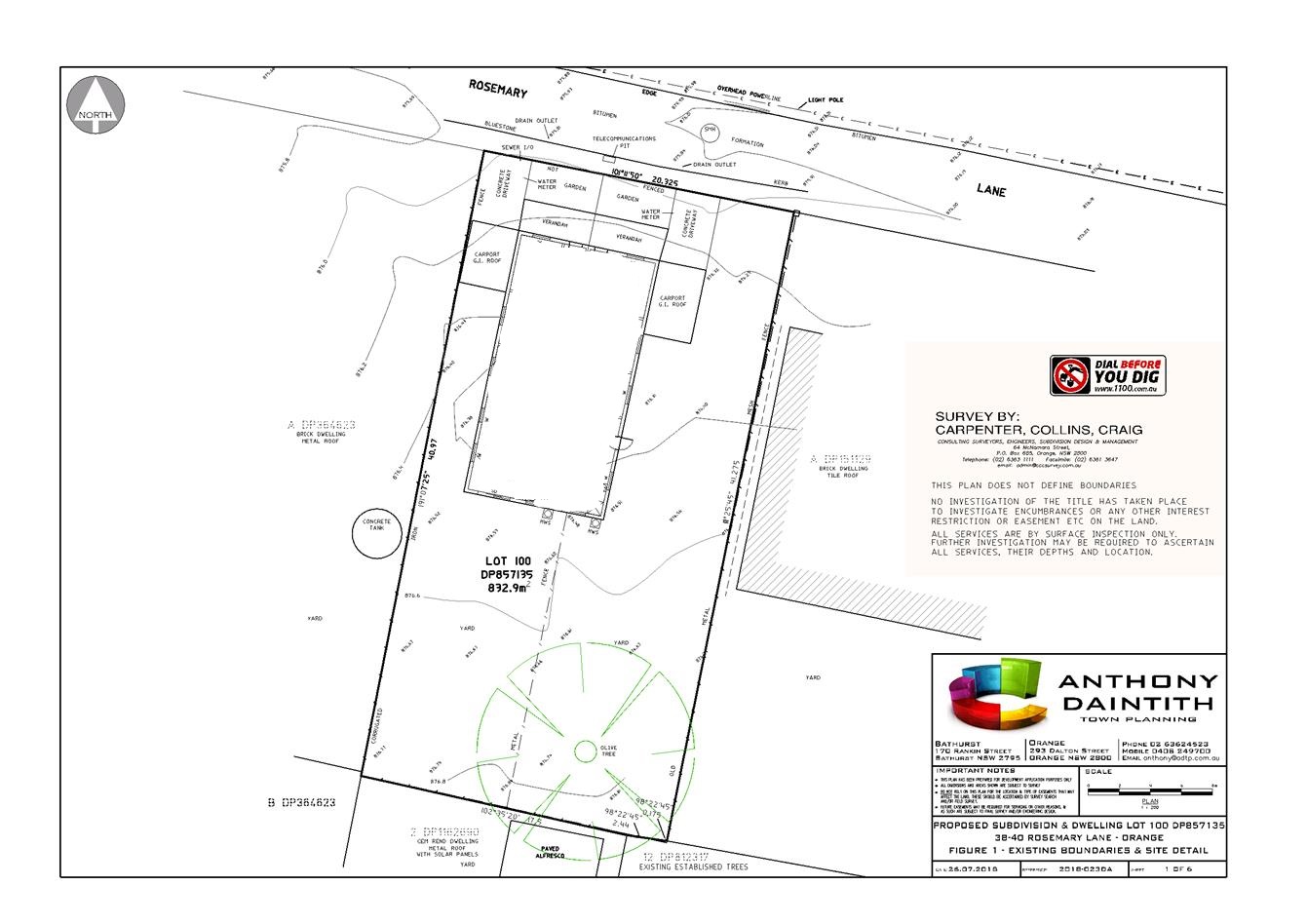
Planning
and Development Committee
2 October 2018
2.4 Development
Application DA 16/2018(1) - 38-40 Rosemary Lane
Attachment 3 Submissions

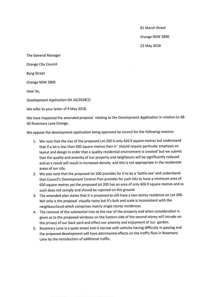

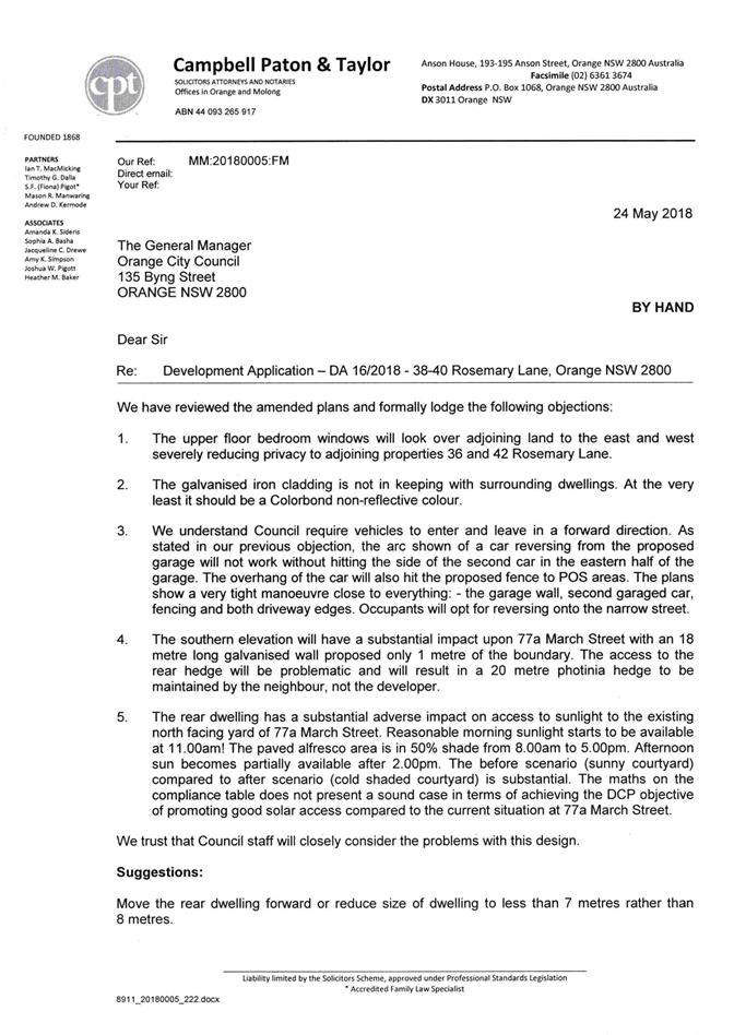
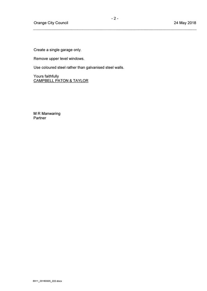
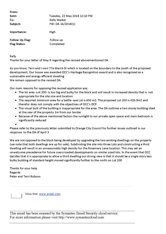
2.5 Development
Application DA 211/2018(1) - 10, 12 and 14 Gateway Crescent
RECORD
NUMBER: 2018/2419
AUTHOR: Summer
Commins, Senior Planner
EXECUTIVE Summary
|
Application
lodged
|
13 June
2018
|
|
Applicant/s
|
Orange
Motor Group
|
|
Owner/s
|
Adtec
Pty Ltd and JA & RA Eastham Pty Ltd
|
|
Land
description
|
Lots 3,
26 and 27 DP 270446
10, 12
and 14 Gateway Crescent, Orange
|
|
Proposed
land use
|
Vehicle
Sales or Hire Premises (alterations and additions) and Business
Identification Signs
|
|
Value of
proposed development
|
$4,000,000
|
Council's consent is sought for alterations and additions to
the site and premises of Orange Motor Group located at 12 and 14 Gateway
Crescent. The proposal involves additions to the existing building to provide
dedicated showrooms for four brands, and enlarged workshop and service
facilities; expansion of vehicle display areas and car parking to
10 Gateway Crescent; and new signage for each of the brands.
The proposed development involves use of adjoining Lot 4 DP
270446 – 8 Gateway Crescent for vehicular access to accommodate the turn
path of vehicle transporters/semi-trailers through the enlarged vehicle sales
premises. An easement for access will be created in conjunction with the
development to legitimise this arrangement.
The proposal is consistent with the planning provisions that
apply to the subject land and particular landuse. No submissions have been
received in relation to the application. The Planning and Development Committee
has delegation to approve the application as the development value exceeds
$1.5m. Approval of the application is recommended.
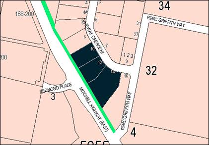
Figure 1 - locality plan
RECENT LEGISLATIVE CHANGES
On 1 March 2018 the Environmental Planning and Assessment
Act 1979 was substantially amended. The most immediate change involves the
restructuring and renumbering of the Act, with other more substantive
changes to be phased in over time. However, for some applications (particularly
where an application was lodged prior to the changes coming into effect) the
supporting documentation may still reference the previous numbering regime. In
the drafting of this report the content and substance of the supporting
material has been considered irrespective of which legislative references were
used.
DECISION FRAMEWORK
Development in Orange is governed by two key documents:
Orange Local Environment Plan 2011 and Orange Development Control Plan 2004. In
addition the Infill Guidelines are used to guide development, particularly in
the heritage conservation areas and around heritage items.
Orange Local Environment Plan 2011 – The
provisions of the LEP must be considered by the Council in determining the
application. LEPs govern the types of development that are permissible or
prohibited in different parts of the City and also provide some assessment
criteria in specific circumstances. Uses are either permissible or not. The
objectives of each zoning and indeed the aims of the LEP itself are also to be
considered and can be used to guide decision making around appropriateness of
development.
Orange Development Control Plan 2004 – the DCP
provides guidelines for development. In general it is a performance based
document rather than prescriptive in nature. For each planning element there
are often guidelines used. These guidelines indicate ways of achieving the
planning outcomes. It is thus recognised that there may also be other solutions
of merit. All design solutions are considered on merit by planning and building
staff. Applications should clearly demonstrate how the planning outcomes are
being met where alternative design solutions are proposed. The DCP enables
developers and architects to use design to achieve the planning outcomes in
alternative ways.
DIRECTOR’S COMMENT
The proposed development involves expansion of the existing
operation in a manner that is largely compliant with the abovementioned
documents. Upgrading of the site and infilling of the adjoining land in the
form proposed is considered to be acceptable for the eastern Gateway entrance
to the City.
Link To Delivery/OPerational Plan
The recommendation in this report relates to the
Delivery/Operational Plan strategy “10.1 Preserve - Engage with the
community to ensure plans for growth and development are respectful of our
heritage”.
Financial Implications
Nil
Policy and Governance Implications
Nil
|
Recommendation
That Council consents to
development application DA 211/2018(1)
for Vehicle Sales or Hire Premises (alterations and additions) and
Business Identification Signs at Lots 3, 26 and 27 DP 270446
– 10, 12 and 14 Gateway Crescent, Orange pursuant to the conditions of
consent in the attached Notice of Approval.
|
further considerations
Consideration has been given to the recommendation’s
impact on Council’s service delivery; image and reputation; political;
environmental; health and safety; employees; stakeholders and project
management; and no further implications or risks have been identified.
SUPPORTING INFORMATION
THE PROPOSAL
Council’s consent is sought for alterations and
additions to the current site and premises of Orange Motor Group located at 12
and 14 Gateway Crescent. The existing site layout is depicted below (refer
Figure 2).
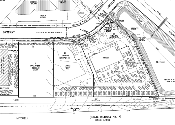
Figure 2 - existing site layout
The proposal involves the following elements:
· A building
extension will be constructed on the northern side of the existing building
within Lot 27 and Lot 3. The completed building will contain new showrooms and
support areas for Holden, Kia, Honda and Audi, and an enlarged workshop/service
facility.
· The site will be
expanded to provide external vehicle display areas and onsite car parking
within Lot 3. Vehicle display will be orientated to the Mitchell Highway, with
customer parking sited along the Gateway Crescent frontage.
· New business
identification signage will be provided for each of the brands. Separate
freestanding pylon signs to 6m in height will be placed at the Highway frontage
adjacent to the respective showrooms. New or replacement fascia signage will
also be installed for each brand on the highway building façade to the
existing and proposed showrooms.
The proposed site layout is depicted below (refer Figure 3).
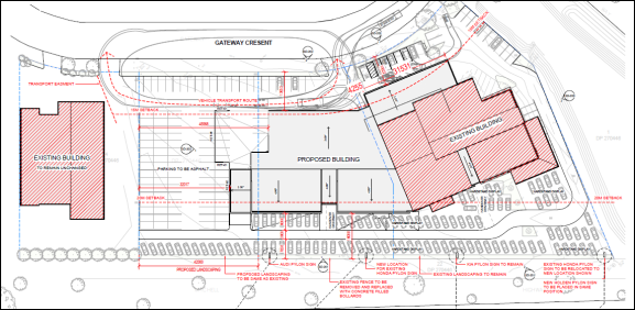
Figure 3 - proposed site layout
MATTERS FOR CONSIDERATION
Section 1.7 - Application of Part
7 of the Biodiversity Conservation Act 2016 and Part 7A of the Fisheries
Management Act 1994
Section 1.7 of the EP&A Act 1979 identifies that Part 7
of the Biodiversity Conservation Act 2016 and Part 7A of the Fisheries
Management Act 1994 have effect in connection with terrestrial and aquatic
environments.
Having regard to the relevant provisions and based on an
inspection of the subject property, it is considered that the proposed
development is unlikely to significantly affect a threatened species. It is
evident that the parcels have been highly modified by commercial subdivision
and development and are unlikely to contain significant habitat or biodiversity
value.
A Biodiversity Development Assessment Report is not required
in support of the proposal.
Section 4.15
Section 4.15 of the Environmental Planning and Assessment
Act 1979 requires Council to consider various matters, of which those
pertaining to the application are listed below.
PROVISIONS OF ANY ENVIRONMENTAL
PLANNING INSTRUMENT s4.15(1)(a)(i)
Orange Local Environmental Plan 2011
Part 1 - Preliminary
Clause 1.2 - Aims of Plan
The
particular aims of the LEP relevant to the application include:
(a) to encourage development which complements
and enhances the unique character of Orange as a major regional centre boasting
a diverse economy and offering an attractive regional lifestyle,
(b) to provide for a range of development
opportunities that contribute to the social, economic and environmental
resources of Orange in a way that allows present and future generations to meet
their needs by implementing the principles for ecologically sustainable
development,
(c) to conserve and enhance the water
resources on which Orange depends, particularly water supply catchments,
(f) to recognise and manage valued
environmental heritage, landscape and scenic features of Orange.
The application is considered to be consistent with the
above aims, as outlined in this report.
Clause 1.6 - Consent Authority
Clause 1.6 is applicable and states:
The consent authority for the
purposes of this Plan is (subject to the Act) the Council.
Clause 1.7 - Mapping
The subject site is identified
on the LEP maps in the following manner:
|
Land Zoning Map:
|
Land zoned B6 Enterprise Corridor
|
|
Lot Size Map:
|
No Minimum Lot Size
|
|
Heritage Map:
|
Not a heritage item or conservation
area
|
|
Height of Buildings Map:
|
No building height limit
|
|
Floor Space Ratio Map:
|
No floor space limit
|
|
Terrestrial Biodiversity Map:
|
No biodiversity sensitivity on the
site
|
|
Groundwater Vulnerability Map:
|
Groundwater vulnerable
|
|
Drinking Water Catchment Map:
|
Within the drinking water catchment
|
|
Watercourse Map:
|
Not within or affecting a defined
watercourse
|
|
Urban Release Area Map:
|
Not within an urban release area
|
|
Obstacle Limitation Surface Map:
|
No restriction on building siting
or construction
|
|
Additional Permitted Uses Map:
|
No additional permitted use applies
|
|
Flood Planning Map:
|
Not within a flood planning area
|
Those matters that are of relevance are addressed in detail
in the body of this report.
Clause 1.9A - Suspension of
Covenants, Agreements and Instruments
Clause 1.9A is applicable and states in part:
(1) For the purpose of enabling
development on land in any zone to be carried out in accordance with this Plan
or with a consent granted under the Act, any agreement, covenant or other
similar instrument that restricts the carrying out of that development does not
apply to the extent necessary to serve that purpose.
(2) This
clause does not apply:
(a) to a covenant
imposed by the Council or that the Council requires to be imposed, or
(b) to
any prescribed instrument within the meaning of section 183A of the Crown Lands
Act 1989, or
(c) to
any conservation agreement within the meaning of the National Parks and
Wildlife Act 1974, or
(d) to
any Trust agreement within the meaning of the Nature Conservation Trust Act
2001, or
(e) to
any property vegetation plan within the meaning of the Native Vegetation Act
2003, or
(f) to
any biobanking agreement within the meaning of Part 7A of the Threatened
Species Conservation Act 1995, or
(g) to
any planning agreement within the meaning of Division 6 of Part 4 of the Act.
Council staff are not aware of the title of the subject
property being affected by any of the foregoing covenants, instruments,
agreements or plans.
Part 2 - Permitted or Prohibited
Development
Clause 2.1 - Land Use Zones
The subject land is zoned B6
Enterprise Corridor. The proposed development is defined as ‘vehicle
sales or hire premises’ and ‘business identification
sign.’ Pursuant to the LEP Dictionary:
Vehicle
sales or hire premises
means a building
or place used for the display, sale or hire of motor vehicles, caravans, boats,
trailers, agricultural machinery and the like, whether or not accessories are
sold or displayed there.
Business identification sign means a sign:
(a) that indicates:
(i) the name
of the person or business, and
(ii) the nature of
the business carried on by the person at the premises or place at which the
sign is displayed, and
(b) that may
include the address of the premises or place and a logo or other symbol that
identifies the business,
but that does not contain any
advertising relating to a person who does not carry on business at the premises
or place.
‘Vehicle sales or hire
premises’ and ‘business
identification signs’ are permitted with consent in the B6 zone.
Clause 2.3 - Zone Objectives and Land
Use Table
The objectives for land zoned B6
Enterprise Corridor are:
· To
promote businesses along main roads and to encourage a mix of compatible uses.
· To
provide a range of employment uses (including business, office, retail and
light industrial uses).
· To
maintain the economic strength of centres by limiting retailing activity.
· To
provide for residential uses, but only as part of a mixed use development.
The proposal satisfies the relevant zone objectives. The
proposed expanded vehicle sales premises is a permitted and complementary land
use in the zone and will contribute to the mix of land uses in this setting.
The proposal comprises an employment use. The development does not involve
retail or residential landuse.
Part 3 - Exempt and Complying
Development
The application is not exempt or complying development.
Part 4 - Principal Development
Standards
The Principal Development Standards do
not apply to the subject land or proposed development.
Part 5 - Miscellaneous Provisions
The Part 5 Provisions are not
applicable.
Part 6 - Urban Release Area
The development site is not located in an Urban Release Area
and Part 6 does not apply.
Part 7 - Additional Local Provisions
Clause 7.3 - Stormwater Management
Clause 7.3 is
applicable. This clause states in part:
(3) Development
consent must not be granted to development on land to which this clause applies
unless the consent authority is satisfied that the development:
(a) is
designed to maximise the use of water permeable surfaces on the land having
regard to the soil characteristics affecting on-site infiltration of water, and
(b) includes,
where practical, on-site stormwater retention for use as an alternative supply
to mains water, groundwater or river water, and
(c) avoids
any significant impacts of stormwater runoff on adjoining downstream
properties, native bushland and receiving waters, or if that impact cannot be
reasonably avoided, minimises and mitigates the impact.
In consideration of
Clause 7.3, a stormwater management plan has been
prepared and implemented for the Gateway Business Park, and including the
subject land. Stormwater
from the development will connect to existing infrastructure in the locality.
Council’s Development Engineer has recommended conditions of consent,
which are included on the attached Notice of Approval, to satisfy the
requirements of Clause 7.3.
Clause 7.6 - Groundwater Vulnerability
The subject land is identified as
Groundwater Vulnerable on the Groundwater Vulnerability Map. Clause 7.6
applies. This clause states in part:
(3) Before
determining a development application for development on land to which this
clause applies, the consent authority must consider:
(a) whether or not the development (including
any onsite storage or disposal of solid or liquid waste and chemicals) is
likely to cause any groundwater contamination or have any adverse effect on
groundwater dependent ecosystems, and
(b) the cumulative impact (including the
impact on nearby groundwater extraction for potable water supply or stock water
supply) of the development and any other existing development on groundwater.
In consideration of
Clause 7.6, the proposed development will not involve processes or activities
that would impact on groundwater resources. Conditions are included on the
attached Notice of Approval requiring the proponent to enter into a Trade Waste
Contract with Council.
Clause 7.7 - Drinking Water Catchments
The subject land is located within the
drinking water catchment on the Drinking Water Catchment Map. Clause 7.7
is applicable and states in part:
(3) Before determining a
development application for development on land to which this clause applies,
the consent authority must consider whether or not the development is likely to
have any adverse impact on the quality and quantity of water entering the
drinking water storage, having regard to:
(a) the distance between the
development and any waterway that feeds into the drinking water storage, and
(b) the on-site use, storage and
disposal of any chemicals on the land, and
(c) the treatment, storage and
disposal of waste water and solid waste generated or used by the development.
In consideration of
this clause, a stormwater
management plan has been prepared and implemented for the Gateway Business
Park, and including the subject land. The stormwater management plan variously
involves:
· minor (pipes) and
major (road and overland flowpaths) drainage systems;
· enviropods in each
stormwater inlet pit to remove gross pollutants from stormwater flows at their
source;
· a
retention/sediment basin to maintain stormwater discharge at predevelopment
flows and to also act as a sediment basin in the construction and operational
phases of the development; and
· a wetland (on the
adjoining eastern parcel (16 Gateway Crescent)) to control stormwater quantity
and quality. It has been designed with a deep water zone that will form a
sedimentation zone followed by a mix of open water and reed beds to form the
nutrient removal and further sediment removal zone.
Stormwater from the
development will connect to existing infrastructure in the locality and thereby
maintain the quality of water entering the catchment. Conditions are included
on the attached Notice of Approval in relation to stormwater management.
Clause 7.11 - Essential Services
Clause 7.11 applies. This clause states:
Development
consent must not be granted to development unless the consent authority is
satisfied that any of the following services that are essential for the
proposed development are available or that adequate arrangements have been made
to make them available when required:
(a) the supply of water,
(b) the supply of electricity,
(c) the disposal and management of
sewage,
(d) stormwater
drainage or on-site conservation,
(e) suitable road access.
In consideration of this clause, all utility services are
available to the site and adequate for the development:
· the
subject land is connected to reticulated water and sewer;
· electricity
and telecommunications are available;
· stormwater
infrastructure is established through the business park;
· the
site has frontage and access to Gateway Crescent.
The proposal involves use of
adjoining Lot 4 DP 270446 – 8 Gateway Crescent for vehicular access to
accommodate the turn path of vehicle transporters (see Figure 4 below).
Conditions are included on the attached Notice of Approval requiring the
creation of a right‑of‑way prior to the issue of an Occupation
Certificate to legitimise this arrangement.
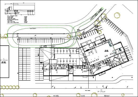
Figure 4 - semi-trailer turn path through the
development site and Lot 4 DP 270448
STATE ENVIRONMENTAL PLANNING
POLICIES
State Environmental Planning Policy 55 - Remediation of
Land
State Environmental Planning Policy 55 - Remediation of Land
(SEPP 55) is applicable. Pursuant to Clause 7 Contamination and remediation
to be considered in determining development application:
(1) A consent authority must not consent to
the carrying out of any development on land unless:
(a) it
has considered whether the land is contaminated, and
(b) if
the land is contaminated, it is satisfied that the land is suitable in its
contaminated state (or will be suitable, after remediation) for the purpose for
which the development is proposed to be carried out, and
(c) if
the land requires remediation to be made suitable for the purpose for which the
development is proposed to be carried out, it is satisfied that the land will
be remediated before the land is used for that purpose.
In consideration of this clause, the potential for
contamination of the site is considered low.
Lots 26 and 27 are well-established as a vehicle sales
premises. The current use does not indicate evidence of potential
contamination.
Lot 3 is presently vacant. The subject land is not contained
within an investigation area, and has not been used for a listed Table 1
purpose to the contained land planning guidelines. Prior to subdivision of the
parent parcel for business development, the subject land had longstanding rural
use (although not orcharding use pursuant to the Orange 1:25,000 Topographic
Map). The land has remained vacant since the subdivision of the business park
in 2003. It is considered that Lot 3 is suitable in its current state for
the proposed intensification of the adjoining vehicle sales use. Contamination
investigation as a precursor to potential site remediation is considered
unnecessary in conjunction with the proposal.
State Environmental Planning
Policy 64 - Advertising and Signage
State Environmental Planning Policy 64 - Advertising and
Signage is applicable and states in part:
3 Aims,
Objectives etc
(1) This
Policy aims:
(a) to
ensure that signage (including advertising):
(i) is
compatible with the desired amenity and visual character of an area, and
(ii) provides
effective communication in suitable locations, and
(iii) is
of high quality design and finish, and
8 Granting
of Consent to Signage
A consent authority must not
grant development consent to an application to display signage unless the
consent authority is satisfied:
(a) that
the signage is consistent with the objectives of this Policy as set out in
clause 3 (1) (a), and
(b) that
the signage the subject of the application satisfies the assessment criteria specified
in Schedule 1.
In consideration of the relevant requirements of the SEPP,
the proposed signage is consistent with the policy objectives and assessment
criteria, as outlined below.
1 -
Character of the Area
· Is
the proposal compatible with the existing or desired future character of the
area or locality in which it is proposed to be located?
· Is
the proposal consistent with a particular theme for outdoor advertising in the
area or locality?
The subject land is contained within the Gateway business
park at the eastern entrance to the City. Advertising in this precinct
comprises a mix of flush wall and fascia building signs, and pylon signs to the
Mitchell Highway. The proposed signage will complement the advertising theme
for the business park and existing signage on the subject land. Signage will be
consistent with the desired visual character for the Gateway precinct.
2 - Special Areas
· Does the
proposal detract from the amenity or visual quality of any environmentally
sensitive areas, heritage areas, natural or other conservation areas, open
space areas, waterways, rural landscapes or residential areas?
The subject land does not contain or adjoin a special area.
3 - Views and Vistas
· Does the
proposal obscure or compromise important views?
· Does the
proposal dominate the skyline and reduce the quality of vistas?
· Does the
proposal respect the viewing rights of other advertisers?
There are no significant views or vistas likely to be
impacted by the proposed signage. The proposed signs will be generally confined
to the building or be wholly located within the subject land, and will not
protrude above the height of the proposed enlarged building. The signage will
not obscure views or compromise viewing rights of other advertisers in this
setting.
4 - Streetscape, Setting or
Landscape
· Is the scale,
proportion and form of the proposal appropriate for the streetscape, setting or
landscape?
· Does the
proposal contribute to the visual interest of the streetscape, setting or
landscape?
· Does the proposal
reduce clutter by rationalising and simplifying existing advertising?
· Does the
proposal screen unsightliness?
· Does the
proposal protrude above buildings, structures or tree canopies in the area or
locality?
· Does the
proposal require ongoing vegetation management?
The proposed signage will have acceptable impacts on the
streetscape and setting, as follows:
- Advertising
is an expected visual element at the Gateway entrance to the City.
- The
proposed advertising theme will complement signage in this setting and on the
subject land.
- The site frontage
and building width may accommodate four pylon signs and four fascia signs
without causing visual cluttering (refer Figure 5). This advertising pattern is
consistent with other motor showrooms in the City, where multiple brands are
accommodated.
- A condition is
included on the attached Notice of Approval prohibiting the display of
advertising banners, flags or the like on the subject land or adjacent public
reserve at the highway frontage.
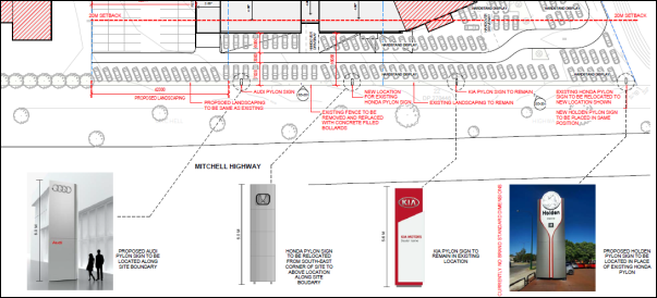
Figure 5 - proposed pylon signs at the site frontage
5 - Site and Building
· Is the proposal
compatible with the scale, proportion and other characteristics of the site or
building, or both, on which the proposed signage is to be located?
· Does the proposal
respect important features of the site or building, or both?
· Does the
proposal show innovation and imagination in its relationship to the site or
building, or both?
The
proposed signage is considered to be appropriate for the site and building. The
fascia signage will be generally contained within the building envelope and
will be of appropriate proportions in relation to the fascia and building
facade (refer images below). The proposed pylon signs will conform to the
building height and not dominate the site frontage.
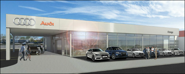
Figure 6 - proposed fascia signage
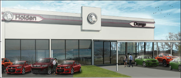
Figure 7 - proposed fascia signage
6 - Associated Devices and
Logos with Advertisements and Advertising Structures
· Have any safety
devices, platforms, lighting devices or logos been designed as an integral part
of the signage or structure on which it is to be displayed?
Safety devices, platforms, lighting devices or logos are not
required for the proposed facia and pylon signs.
7 - Illumination
· Would
illumination result in unacceptable glare?
· Would
illumination affect safety for pedestrians, vehicles or aircraft?
· Would
illumination detract from the amenity of any residence or other form of
accommodation?
· Can the
intensity of the illumination be adjusted, if necessary?
· Is the
illumination subject to a curfew?
The proposed signage will be illuminated. No objection is
raised to illumination due to the high ambient luminance in the
highway/commercial setting.
8 - Safety
· Would the
proposal reduce the safety for any public road?
· Would the proposal
reduce the safety for pedestrians or bicyclists?
· Would the
proposal reduce the safety for pedestrians, particularly children, by obscuring
sightlines from public areas?
The proposed signage complies with the road safety
assessment criteria outlined in the Transport Corridor Advertising and
Signage Guidelines (NSW Department of Planning 2007):
- The
signage will not obstruct views of the highway for motorists, cyclists or
pedestrians.
- The
proposed signs will not obscure information about the road alignment or impact
on stopping sight distances.
- The
signage will be static and will not cause a distraction to motorists.
- The
signs will not create hazardous headlight reflections.
State Environmental Planning
Policy Infrastructure 2007
Clauses 101 and 104 of SEPP Infrastructure 2007 are
applicable to the proposed development.
Clause 101 - Development with Frontage to Classified
Road
(1) The
objectives of this clause are:
(a) to
ensure that new development does not compromise the effective and ongoing
operation and function of classified roads, and
(b) to
prevent or reduce the potential impact of traffic noise and vehicle emission on
development adjacent to classified roads.
(2) The
consent authority must not grant consent to development on land that has a
frontage to a classified road unless it is satisfied that:
(a) where
practicable, vehicular access to the land is provided by a road other than the
classified road, and
(b) the
safety, efficiency and ongoing operation of the classified road will not be
adversely affected by the development as a result of:
(i) the
design of the vehicular access to the land, or
(ii) the
emission of smoke or dust from the development, or
(iii) the
nature, volume or frequency of vehicles using the classified road to gain
access to the land, and
(c) the
development is of a type that is not sensitive to traffic noise or vehicle
emissions, or is appropriately located and designed, or includes measures, to
ameliorate potential traffic noise or vehicle emissions within the site of the
development arising from the adjacent classified road.
In consideration of Clause 101, vehicular access to the
Mitchell Highway (being a classified road) is not available for the subject
land. The development will have nil impact on the safety, efficiency and
ongoing operation of the highway. Commercial landuse is not sensitive to
traffic noise or vehicle emissions.
Clause 104 -
Traffic-Generating Development
(1) This
clause applies to development specified in Column 1 of the Table to Schedule 3
that involves:
(a) new
premises of the relevant size or capacity, or
(b) an
enlargement or extension of existing premises, being an alteration or addition
of the relevant size or capacity.
(3) Before determining a development application
for development to which this clause applies, the consent authority must:
(a) give
written notice of the application to RMS within 7 days after the application is
made, and
(b) take
into consideration:
(i) any submission that RMS provides in
response to that notice within 21 days after the notice was given (unless,
before the 21 days have passed, RMS advises that it will not be making a
submission), and
In consideration of Clause 104, Schedule 2, Column 1
provides that “car parks (whether or not ancillary to other development)”
are traffic generating where:
· 200 or more car
parking spaces are provided on a site with access to a road (Column 2), or
· 50 ore more car
parking spaces are provided on a site with access to a classified road or to a
road that connects to a classified road within 90m (Column 3).
The development involves 133 car parking spaces with access
to Gateway Crescent. The proposal is not traffic generating development as
prescribed in Column 2. The subject land does not have access to a classified
road, nor connect to a classified road within 90m. The proposal is not traffic
generating development as prescribed in Column 3. Referral to the RMS is
not required for the proposed development.
PROVISIONS OF ANY DRAFT
ENVIRONMENTAL PLANNING INSTRUMENT THAT HAS BEEN PLACED ON EXHIBITION
4.15(1)(a)(ii)
There are no draft environmental planning instruments that
apply to the subject land or proposed development.
DESIGNATED DEVELOPMENT
The proposed development is not designated development.
INTEGRATED DEVELOPMENT
The proposed development is not integrated development.
PROVISIONS OF ANY DEVELOPMENT
CONTROL PLAN s4.15(1)(a)(iii)
Development Control Plan 2004
DCP 2004-8 - Development in Business Zones
The Planning Outcomes applicable to Gateway Site Development
(Part 8.5) are considered below.
· Buildings cover
up to 50% of the site area.
The proposed completed building will comprise a building
footprint of 3,243.36m2. Based on consolidated site area of 10,997m2,
the development will have site coverage of 29.49%.
· Buildings are
designed in a manner commensurate with the high profile of the site.
Architectural features are provided to the front building façade to
provide relief using such elements as verandahs, display windows, indented
walls etc.
The subject land has frontage to
Mitchell Highway, and frontage and access to Gateway Crescent. The proposed
showroom addition will address the highway. Contemporary building design is
proposed incorporating a rectilinear form, expansive glazing, modern fascia
treatment, aluminium composite material (ACM) wall cladding and defined entry
portals to each showroom. The proposed showroom addition is depicted in
perspective below (see Figure 8).
The proponent submits that the
building design is ‘commensurate with modern motor dealership
architecture.’ It is considered that the built form presentation to
the highway is appropriate for the Gateway location.
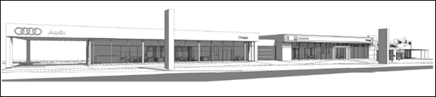
Figure 8 - proposed showrooms - presentation to
Mitchell Highway
The enlarged workshop and
service facility will have frontage to Gateway Crescent. The design and
detailing for this component will relate to the existing workshop facility,
with inclusion of contemporary elements (louvered band and ACM clad feature
wall) to modernise and integrate the new work. A building addition for
‘book-in facility’ will adjoin the workshop on the eastern side,
and complement the architectural detailing of the showrooms. It is considered
that the architectural features to the ‘back of house’ Gateway
Crescent frontage are of a high standard, and will significantly improve the
existing building presentation to the public road. The workshop perspective is
depicted below (see Figure 9).
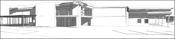
Figure 9 - proposed workshop - presentation to Gateway
Crescent
The proposed building design and detailing are considered
suitable for the streetscape and setting, and will complement the built form
nearby to the site.
· External
materials consist of non-reflective building materials.
External finishes for the proposed building addition will
comprise ACM cladding to walls, Colorbond sheeting to roof, and powdercoated
aluminium glazing to doors and windows. A condition is recommended that
external materials be non-reflective.
· Adequate
parking and onsite manoeuvring are provided.
Sufficient onsite parking will be provided for the expanded
vehicle sales premises, as outlined below (refer DCP 2004-15 Car Parking).
Furthermore, the site layout and building design will accommodate the
functional and forward-direction turn path of a car (4.91m), medium rigid
vehicle (8.8m) and semi-trailer (13.7m). All vehicles associated with the site
will enter and exit in a forward direction.
As outlined previously, the
proposal involves use of adjoining Lot 4 DP 270446 to the west for vehicular
access to accommodate the turn path of semi-trailers/vehicle transporters.
Conditions are included on the attached Notice of Approval requiring the
creation of the necessary right-of-way prior to the issue of an Occupation
Certificate in order to legitimise this arrangement.
· Advertising
involves business identification signs within the front façade and/or by
a pole sign comparable with the relative height of the main building on the
site.
The proposed signage scheme satisfies this planning outcome,
as outlined in the foregoing sections of this report.
· Security
fencing is located or designed in a manner that does not dominate the visual
setting of the area.
The proposal involves removal
of fencing to the Mitchell Highway frontage. Existing palisade fencing to the
Gateway Crescent frontage for Lots 26 and 27 will be extended to include
Lot 3 (refer Figure 10 below). The proposed fencing will be consistent
with fencing to this site and adjoining 8 Gateway Crescent and is considered
suitable. Adjacent landscaping will provide integration and screening of the
fencing.
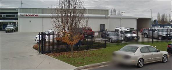
Figure 10 - existing palisade fencing to Gateway
Crescent frontage
· Buildings
achieve the setback prescribed in the DCP provisions.
The DCP prescribes the following applicable setback for the
Gateway business park:
- 20m
from the Mitchell Highway, and
- 15m
from Gateway Crescent.
The proposed showroom addition will be sited a minimum 16m
from the Mitchell Highway, frontage. The departure from the DCP is considered
to be acceptable as follows:
- The
existing showroom building already encroaches within the prescribed setback.
The proposed addition will adopt a consistent building line and setback
encroachment with the existing building.
- The
proposed showroom addition will present a commercial character and quality
aesthetic to the highway frontage. It is noted that the DCP permits a setback
variation for office use and presentation in conjunction with other approved
activity. It is appropriate to apply this discretion in the circumstances.
- The
proposed setback will relate to the highway setback for other adjoining
buildings in this streetscape and reasonably complement the streetscape
building line.
- The
7m wide public reserve between the subject land and highway will afford an
additional visual setback for the proposed building addition.
- The
proposed single-storey and rectilinear built form will assist to minimise
visual encroachment on the highway frontage.
The proposed workshop addition will be sited a minimum 14m
(wall) and 10m (covered awning) from the Gateway Crescent frontage. The wall
encroachment is considered to be minor and within reasonable limit.
Architectural detailing to the façade will reduce the visual bulk of
this element. The encroaching awning structure is of limited visual bulk as it
does not contain walls or posts. The section of building below this awning
(which complies with the DCP setback) has a commercial character due to
extensive shopfront glazing.
Based on the foregoing, the proposed building setbacks are
considered to be acceptable, notwithstanding some departure from the DCP.
· Applications
are accompanied by a detailed landscaped plan.
Existing landscaping at the site frontages to the Mitchell
highway and Gateway Crescent will be largely retained and continued onto the
expanded site. Conditions are included on the attached Notice of Approval
requiring preparation and implementation of a landscape plan for the expanded
vehicle sales premises, consistent with the landscaping provisions at
DCP 2004-8.5.
· Development of
the land is to provide for the integrated and effective management of
stormwater runoff.
A stormwater management plan is in place for the Gateway
Business Park, and including the subject land. Conditions are included on the
attached Notice of Approval requiring stormwater management consistent with
Council’s Development and Subdivision Code.
DCP 2004-15 - Car Parking
· Adequate
off-street car parking is provided in accordance with the Table, or
alternatively, according to an assessment that demonstrates peak parking demand
based on recognised research.
Pursuant to DCP 2004, the minimum parking requirement for
vehicle sales premises (motor showrooms) is 1 space per 100m2 of
site area plus 3 spaces for every work bay for vehicle servicing, with such
spaces exclusive of cars displayed for sale.
The proponent has calculated that the expanded vehicle sales
premises will require 129 onsite parking spaces (refer below).
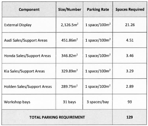
A total of 133 onsite parking spaces will be provided,
comprising 84 standard spaces and 48 tandem spaces (independent or
stacked).
The proposed parking arrangements are considered acceptable
as follows:
- The
sales/display functions will generate parking demand of 36 spaces (based on
sales and support areas of 3,544.82m²). Forty-nine (49) car spaces are
available at the Gateway Crescent site frontage and adjacent to the eastern
boundary.
- The
service/workshop functions will generate parking demand of 93 spaces (based on
31 work bays). Workshop parking demands will be accommodated via
13 surplus spaces above, 51 independent spaces to the north west of the
workshop, and adjacent 32 tandem spaces. Tandem spaces will be managed by
workshop staff and will not be accessible to customers.
- The
expanded vehicle sales premises will provide a drive-through drop-off zone for
vehicle servicing. This arrangement will minimise take-up of customer parking
associated with sales and display.
Based on the foregoing, sufficient onsite parking will be
provided for the expanded vehicle sales premises.
DCP 2004-00 - Transitional
Provisions - Transport Routes
· The development
provides a high standard of visual appeal to motorists, cyclists and
pedestrians as well as adjoining property owners.
· The visual
appearance of the development, including any signage, lighting or other
ancillary element, must not generate a distraction to motorists.
· Any signage
must not be animated whether by movement or flashing lights.
· Where land has
more than one street frontage the street with the lower volume of traffic is to
provide the principal access to the development, subject to safety
considerations.
· Where access is
provided onto an arterial road, distributor road or major collector road, the
access point must have appropriate safe sight distances for the prevailing
speed limit and clear unimpeded entrance / exit signage must be displayed.
· Where on-site
customer parking is provided that is not immediately visible from a public
road, clear and unimpeded directional signage must be displayed.
· Where the
proposal is residential, or another noise sensitive form, appropriate noise
mitigation measures to limit the development from traffic noise must be
demonstrated.
The proposed development satisfies the above relevant
planning outcomes:
- As
outlined in this report, the proposed development will present a commercial
character and quality aesthetic to the highway frontage.
- There
are no visual aspects of the proposal that will generate a distraction to
motorists. As considered previously, the proposed signage will satisfy the road
safety assessment criteria outlined in the Transport Corridor Advertising and
Signage Guidelines (NSW Department of Planning 2007). A condition is included
on the attached Notice of Approval requiring external lighting of the site to
comply with applicable standards, and not cause nuisance glare.
- Existing
site access is via Gateway Crescent. The proposal will not alter this
arrangement.
- Onsite
customer parking will be accessible and visible from the main site entrance on
Gateway Crescent.
PROVISIONS PRESCRIBED BY THE
REGULATIONS s4.15(1)(a)(iv)
Demolition of a Building (clause 92)
The proposal involves partial demolition of the existing
building. Conditions are included on the attached Notice of Approval requiring
demolition works to be carried out consistent with relevant standards and
guidelines.
Fire Safety Considerations
(clause 93)
The development site will be consolidated in order to
satisfy fire safety considerations of the Building Code of Australia (BCA).
Conditions are included on the attached Notice of Approval requiring lodgement
of a consolidation plan prior to the issue of a Construction Certificate.
Buildings to be Upgraded
(clause 94)
Upgrading of the existing building will be required to
ensure the existing building is brought into partial or total conformity with the
BCA. Conditions are included on the attached Notice of Approval in relation to
the upgrading works.
BASIX Commitments (clause 97A)
A Section J energy efficiency statement will be required
with the Construction Certificate application. Conditions are included on the
attached Notice of Approval to this effect.
THE LIKELY IMPACTS OF THE
DEVELOPMENT s4.15(1)(b)
Visual Impacts
As outlined in this report, the proposal will have
acceptable visual impacts for the site and precinct. The proposed development
will present a commercial character and quality aesthetic to the highway
frontage, commensurate with the Gateway location at the eastern entrance to the
City. Mitigation conditions are included on the attached Notice of Approval in
relation to exterior colours, finishes and landscaping.
Traffic Impacts
The proposal will have an acceptable impact on local traffic
amenity due to the following:
· Sufficient onsite
parking will be provided for the expanded vehicle sales premises.
· The site layout
and building design will accommodate the functional and forward-direction turn
path of a car (4.91m), medium rigid vehicle (8.8m) and
semi-trailer (13.7m) through the site. All vehicles associated with the
site will enter and exit in a forward direction. An easement will be created to
legitimise site access for vehicle transporters over adjoining Lot 4 DP 270446.
· The proposal will
not alter existing site accesses via Gateway Crescent or necessitate additional
accesses.
· The capacity of
the local road network is sufficient to accommodate additional traffic as a
consequence of the expanded vehicle sales premises (estimated at
19 additional vehicle trips at the evening peak, pursuant to the Guide to
Traffic Generating Development (Roads and Traffic Authority 2002).
Noise
The ambient noise levels of the locality are typical to a
highway business precinct. The proposal is unlikely to alter the neighbourhood
acoustic setting. The site does not have a direct interface with sensitive
landuses. Workshop openings will be oriented to within the site or adjoining
commercial properties. Core operating hours will be during the daytime period
when background noise levels are typically higher.
Water Quality
As outlined in this report, the proposal development will
not adversely impact on water quality, subject to conditions relating to
sediment and erosion controls during construction, stormwater management
consistent with the Development and Subdivision Code, and a Trade Waste
Agreement being entered into.
Air Quality
The proposed development does not involve any processes or
activities that would affect the locality in terms of dust, odour or other
atmospheric discharges.
Social and Economic Impacts
The proposed development may generate positive social and economic
effects associated with construction, employment, local business expansion and
the contribution of the City as a major regional business centre.
THE SUITABILITY OF THE SITE
s4.15(1)(c)
The subject land is suitable for the proposed development
due to the following:
· The proposal is
permitted in the zone and is a complementary land use in this setting.
· The proposed
development comprises an expansion and intensification of the existing use of
the land for vehicle sales.
· The fire
protection and structural capacity of the enlarged building will be appropriate
subject to upgrading and land consolidation.
· Utility services
are available and adequate.
· The site has legal
and practical access to Gateway Crescent, subject to creation of a new easement.
· The site is of
sufficient area to provide onsite parking to meet the demands of the
development.
· The site has no
particular environmental value.
ANY SUBMISSIONS MADE IN
ACCORDANCE WITH THE ACT s4.15(1)(d)
The proposed development is not defined as advertised
development pursuant to DCP 2004-5.3. No submissions have been received in
relation to this application.
PUBLIC INTEREST
s4.15(1)(e)
The proposal is not inconsistent with any relevant policy
statements, planning studies, guidelines etc that have not been considered
in this assessment. The proposed development is considered to be in the public
interest as it will comprise quality infill development at the eastern gateway
entrance to the City.
SUMMARY
The proposed development is permissible with the consent of
Council. The proposed development complies with the relevant aims, objectives
and provisions of Orange LEP 2011 (as amended) and DCP 2004. A
section 4.15 assessment of the development indicates that the development
is acceptable in this instance. Attached is a draft Notice of Approval
outlining a range of conditions considered appropriate to ensure that the
development proceeds in an acceptable manner.
COMMENTS
The requirements of the Environmental Health and Building
Surveyor and the Engineering Development Section are included in the attached
Notice of Approval.
Attachments
1 Notice
of Approval, D18/50772⇩
2 Plans,
IC18/11447⇩
Planning
and Development Committee
2 October 2018
2.5 Development
Application DA 211/2018(1) - 10, 12 and 14 Gateway Crescent
Attachment 1 Notice of Approval
|
|
ORANGE CITY COUNCIL
Development
Application No DA
211/2018(1)
NA18/ Container
PR20388
|
NOTICE OF DETERMINATION
OF A DEVELOPMENT
APPLICATION
issued under the Environmental
Planning and Assessment Act 1979
Section 4.18
|
Development
Application
|
|
|
Applicant
Name:
|
Orange Motor Group
|
|
Applicant
Address:
|
C/- Peter Basha
Planning & Development
PO Box 1827
ORANGE
NSW 2800
|
|
Owner’s
Name:
|
Adtec Pty Ltd and JA
& RA Eastham Pty Ltd
|
|
Land
to Be Developed:
|
Lots 3, 26 and 27 DP
270446 – 10, 12 and 14 Gateway Crescent, Orange
|
|
Proposed
Development:
|
Vehicle Sales or Hire
Premises (alterations and additions) and Business Identification Signs
|
|
|
|
|
Building Code of
Australia
building
classification:
|
To be determined by
the PC
|
|
|
|
|
Determination made
under
Section 4.16
|
|
|
Made
On:
|
2 October 2018
|
|
Determination:
|
CONSENT GRANTED
SUBJECT TO CONDITIONS DESCRIBED BELOW:
|
|
|
|
|
Consent to Operate
From:
|
3 October 2018
|
|
Consent to Lapse On:
|
3 October 2023
|
Terms
of Approval
The reasons for the imposition of conditions
are:
(1) To ensure a quality
urban design for the development which complements the surrounding environment.
(2) To maintain
neighbourhood amenity and character.
(3) To ensure compliance
with relevant statutory requirements.
(4) To ensure the utility
services are available to the site and adequate for the development.
(5) To prevent the proposed
development having a detrimental effect on adjoining land uses.
(6) To minimise the impact
of development on the environment.
Conditions
(1) The development must be
carried out in accordance with:
(a) Plans by w.i.m
Architects: Drawing Nos. SD-000(L); SD-001(G); SD-002(F); SD-003(F);
SD-101(M); SD-102(K);
SD-102-A(B); SD-103(K); SD-104(K); SD-105(K); SD-106(H);
SD-107(H); SD-108(H);
SD-109(J); SD-110(H); CD-201(A); SD-202(G); CD-203(A);
SD-301(G); SD-302(G);
SD-303(G); SD-304(E); SD-305(D); SD-306(D); SD-307(D);
SD-308(D); SD-801(G);
SD-802(H); SD-803(B); SD-804(B); SD-805(B); SD-807(B); SD-808(I);
SD-809(B); SD-810(C);
SD-811(G) (36 sheets)
(b) statements
of environmental effects or other similar associated documents that form part
of the approval
as amended in
accordance with any conditions of this consent.
(2) All building work must
be carried out in accordance with the provisions of the Building Code of
Australia.
(3) A sign is to be erected
in a prominent position on any site on which building work, subdivision work or
demolition work is being carried out:
(a) showing
the name, address and telephone number of the principal certifying authority
for the work, and
(b) showing
the name of the principal contractor (if any) for any building work and a
telephone number on which that person may be contacted outside working hours, and
(c) stating
that unauthorised entry to the site is prohibited.
Any such sign is to be maintained while the
building work, subdivision work or demolition work is being carried out.
(4) Where any excavation
work on the site extends below the level of the base of the footings of a
building on adjoining land, the person having the benefit of the development
consent must, at the person’s own expense:
(a) protect
and support the adjoining premises from possible damage from the excavation,
and
(b) where
necessary, underpin the adjoining premises to prevent any such damage.
Note: This
condition does not apply if the person having the benefit of the development
consent owns the adjoining land or the owner of the adjoining land has given
consent in writing to this condition not applying.
|
PRIOR TO THE ISSUE OF A CONSTRUCTION
CERTIFICATE
|
(5) A detailed landscaping
plan shall be submitted to and approved by Council’s Manager Development
Assessments prior to issuing of a Construction Certificate. The landscape plan
shall be consistent with landscaping requirements contained in Orange
Development Control Plan 2004-8.5.
(6) An
approval under Section 68 of the Local Government Act is to be sought
from Orange City Council, as the Water and Sewer Authority, for alterations to
water and sewer. No plumbing and drainage is to commence until approval is
granted.
(7) Prior
to the issue of a Construction Certificate, evidence shall be submitted to
Council of the lodgement of plans with Land & Property Information to consolidate
Lots 3, 26 and 27 DP 270446 into one parcel.
(8) Engineering plans
providing complete details of the proposed driveway and car parking areas are
to be submitted to Orange City Council or an Accredited Certifier (Categories
B1, C3, C4, C6) upon application for a Construction Certificate. These plans
are to provide details of levels, cross falls of all pavements, proposed
sealing materials and proposed drainage works and are to be in accordance with
Orange City Council Development and Subdivision Code.
(9) A Liquid Trade Waste
Application is to be submitted to Orange City Council prior to the issuing of a
Construction Certificate. The application is to be in accordance with Orange
City Council’s Liquid Trade Waste Policy. Engineering plans submitted as
part of the application are to show details of all proposed liquid trade waste
pre-treatment systems and their connection to sewer.
Where applicable, the applicant is to enter
into a Liquid Trade Waste Service Agreement with Orange City Council in
accordance with the Orange City Council Liquid Trade Waste Policy.
|
PRIOR TO WORKS COMMENCING
|
(10) A
Construction Certificate application is required to be submitted to, and issued
by Council/Accredited Certifier prior to any excavation or building works being
carried out onsite.
(11) A
temporary onsite toilet is to be provided and must remain throughout the
project or until an alternative facility meeting Council’s requirements
is available onsite.
|
DURING CONSTRUCTION/SITEWORKS
|
(12) External materials
shall consist of non-reflective building materials.
(13) All
construction/demolition work on the site is to be carried out between the hours
of 7.00 am and 6.00 pm Monday to Friday inclusive, 7.00 am to
5.00 pm Saturdays and 8.00 am to 5.00 pm Sundays and Public
Holidays. Written approval must be obtained from the General Manager of Orange
City Council to vary these hours.
(14) A
Registered Surveyor’s certificate identifying the location of the
building on the site must be submitted to the Principal Certifying Authority.
(15) All materials onsite or
being delivered to the site are to be contained within the site. The
requirements of the Protection of the Environment Operations Act 1997
are to be complied with when placing/stockpiling loose material or when
disposing of waste products or during any other activities likely to pollute
drains or watercourses.
(16) Building demolition is
to be carried out in accordance with Australian Standard 2601:2001 - The
Demolition of Structures and the requirements of Safe Work NSW.
(17) No portion of the
building - including footings, eaves, overhang and service pipes - shall
encroach into any easement.
(18) Any adjustments to
existing utility services that are made necessary by this development
proceeding are to be at the full cost of the developer.
(19) All driveway and
parking areas are to be sealed with bitumen, hot mix or concrete and are to be
designed for all expected loading conditions (provided however that the minimum
pavement depth for gravel and flush seal roadways is 200mm) and be in
accordance with the Orange City Council Development and Subdivision Code.
(20) Heavy-duty concrete
kerb and gutter laybacks and footpath crossings are to be constructed for the
entrances to the proposed development to suit the turn paths of a 19m
articulated vehicle. The construction of the laybacks and footpath crossings
are to be as required by the Orange City Council Development and Subdivision
Code.
|
PRIOR TO THE ISSUE OF AN OCCUPATION
CERTIFICATE
|
(21) Landscaping
shall be installed in accordance with the approved plans and shall be
permanently maintained to the satisfaction of Council's Manager Development
Assessments.
(22) Car parking spaces
shall be provided upon the site in accordance with the approved plans, the
provisions of Development Control Plan 2004, and be constructed in accordance
with the requirements of Council's Development and Subdivision Code prior to
the issue of an Occupation Certificate.
(23) No
person is to use or occupy the building or alteration that is the subject of
this approval without the prior issuing of an Occupation Certificate.
(24) The
owner of the building/s must cause the Council to be given a Final Fire Safety
Certificate on completion of the building in relation to essential fire or
other safety measures included in the schedule attached to this approval.
(25) Where
Orange City Council is not the Principal Certifying Authority, a final
inspection of water connection, sewer and stormwater drainage shall be
undertaken by Orange City Council and a Final Notice of Inspection issued,
prior to the issue of either an interim or a final Occupation Certificate.
(26) Prior
to the issue of an occupation certificate, evidence of the completion of the
consolidation from Lands & Property Information is to be provided to
Council.
(27) Prior to the issue of
an Occupation Certificate a right-of-way shall be established over Lot 4
DP 270446 to suit the turn path of a 19m articulated vehicle.
(28) Certification from
Orange City Council is required to be submitted to the Principal Certifying
Authority prior to the issue of an Occupation Certificate stating that all
works relating to connection of the development to Council assets, works on
public land, works on public roads, stormwater, sewer and water reticulation
mains and footpaths have been carried out in accordance with the Orange City
Council Development and Subdivision Code and the foregoing conditions, and that
Council will take ownership of the infrastructure assets.
(29) All
of the foregoing conditions are to be at the full cost of the developer and to
the requirements and standards of the Orange City Council Development and
Subdivision Code, unless specifically stated otherwise. All work required by
the foregoing conditions is to be completed prior to the issuing of an
Occupation Certificate, unless stated otherwise.
|
MATTERS FOR THE ONGOING PERFORMANCE AND
OPERATION OF THE DEVELOPMENT
|
(30) A
separate development application shall be submitted to and approved by Council prior
to the erection of any additional advertising structures or signs of a type
that do not meet the exempt development provisions of State Environmental
Planning Policy (Exempt and Complying Development Codes) 2008.
Advertising
flags, banners or the like shall not be displayed on the subject land or public
reserve at the site frontage adjacent to the highway.
(31) All
vehicles offered for sale shall be wholly located within the display areas
nominated on the approved plans. Vehicle display on public lands at the site
frontages and within nominated car parking spaces is not permitted.
(32) Loading and unloading
of vehicle transporters shall be wholly undertaken within the confines of the
subject land, and not on public roads at any time.
(33) Any
ancillary light fittings fitted to the exterior of the building are to be
shielded or mounted in a position to minimise glare to adjoining properties.
(34) The
owner is required to provide to Council and to the NSW Fire Commissioner an
Annual Fire Safety Statement in respect of the fire-safety measures, as
required by Clause 177 of the Environmental Planning and Assessment
Regulation 2000.
Other
Approvals
(1) Local
Government Act 1993 approvals granted under section 68.
Nil
(2) General
terms of other approvals integrated as part of this consent.
Nil
Right
of Appeal
If you are dissatisfied with this decision,
Section 8.7 of the Environmental Planning and Assessment Act 1979
gives you the right to appeal to the Land and Environment Court. Pursuant to
Section 8.10, an applicant may only appeal within 6 months after the date the
decision is notified.
|
Disability
Discrimination Act 1992:
|
This application has been assessed in
accordance with the Environmental Planning and Assessment Act 1979. No
guarantee is given that the proposal complies with the Disability
Discrimination Act 1992.
The applicant/owner is responsible to ensure
compliance with this and other anti-discrimination legislation.
The Disability Discrimination Act
covers disabilities not catered for in the minimum standards called up in the
Building Code of Australia which references AS1428.1 - "Design for
Access and Mobility". AS1428 Parts 2, 3 and 4 provides the most
comprehensive technical guidance under the Disability Discrimination Act
currently available in Australia.
|
|
|
|
|
Disclaimer
- S88B of the Conveyancing Act 1919 - Restrictions on the Use of
Land:
|
The applicant should note that there could be
covenants in favour of persons other than Council restricting what may be built
or done upon the subject land. The applicant is advised to check the position
before commencing any work.
|
|
|
|
|
Signed:
|
On behalf of the consent authority ORANGE
CITY COUNCIL
|
|
Signature:
|
|
|
Name:
|
PAUL JOHNSTON - MANAGER DEVELOPMENT
ASSESSMENTS
|
|
Date:
|
3 October 2018
|
Planning and Development Committee
2 October 2018
2.5 Development
Application DA 211/2018(1) - 10, 12 and 14 Gateway Crescent
Attachment 2 Plans
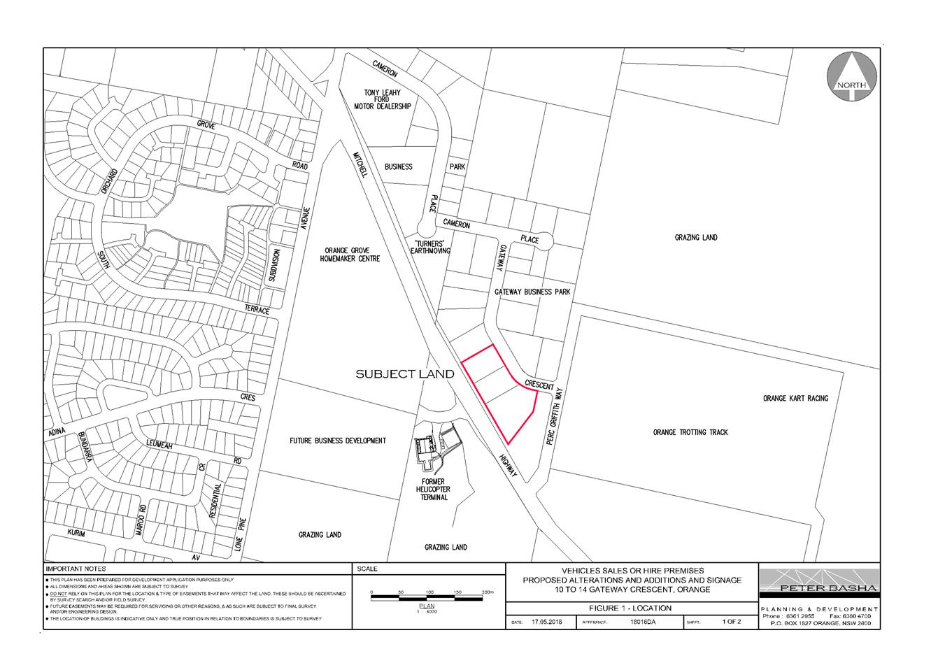
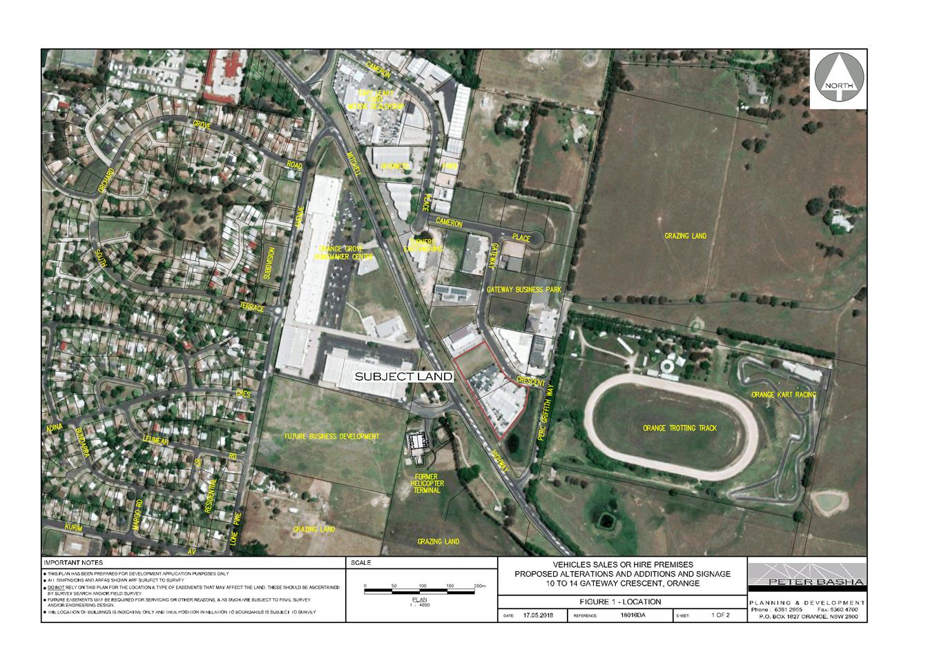
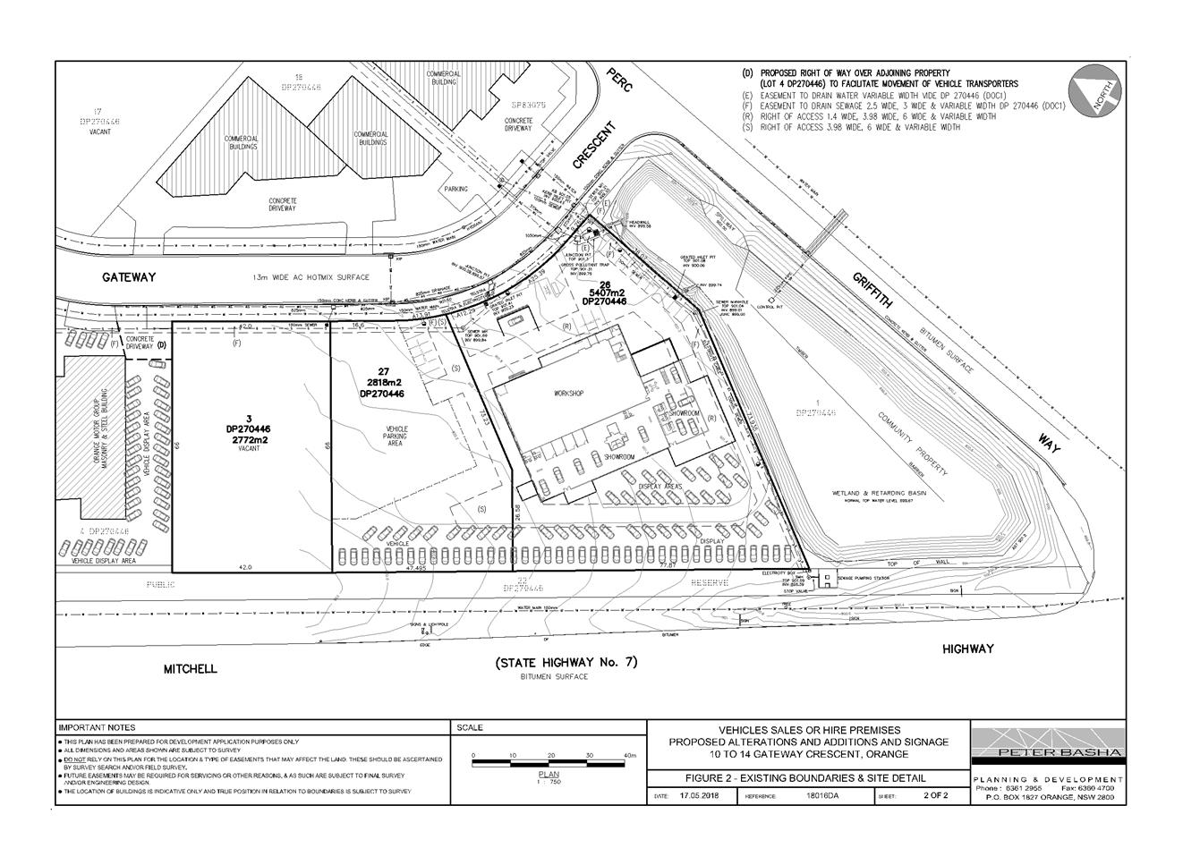
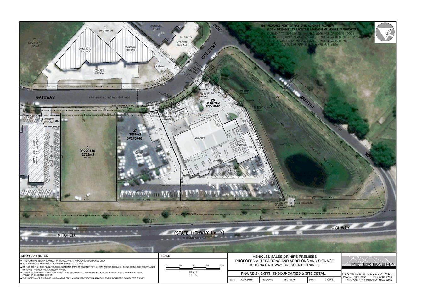
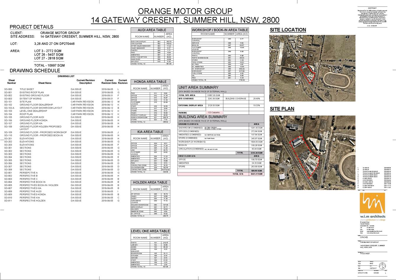
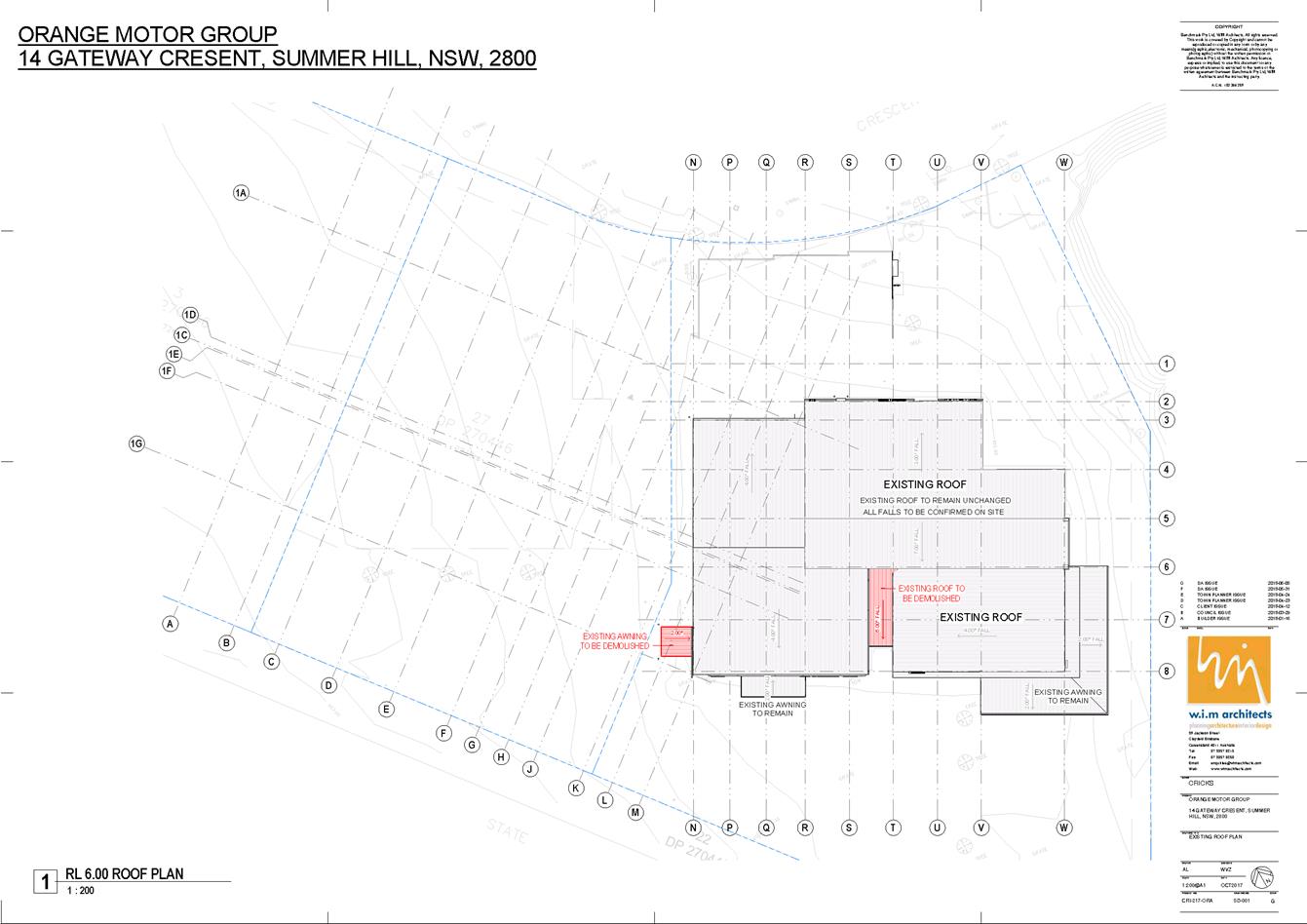
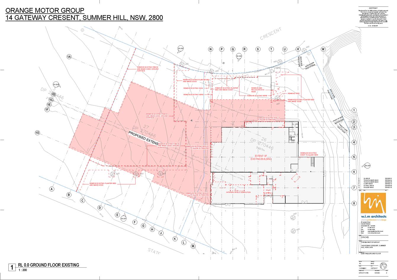
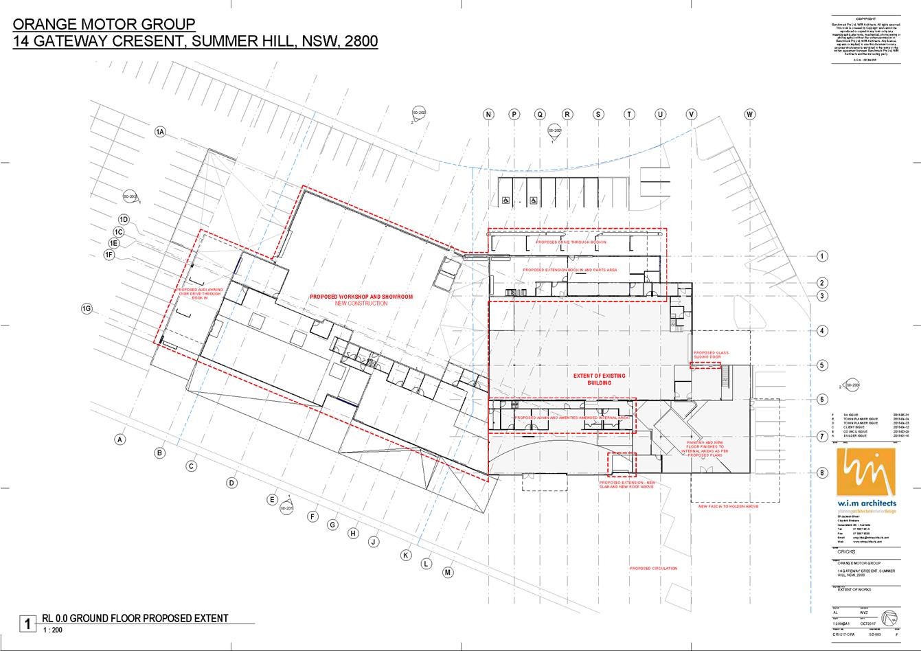
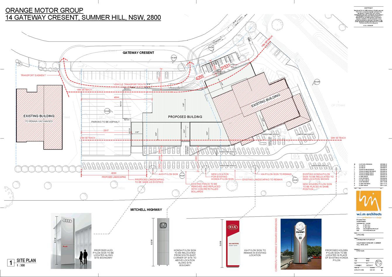
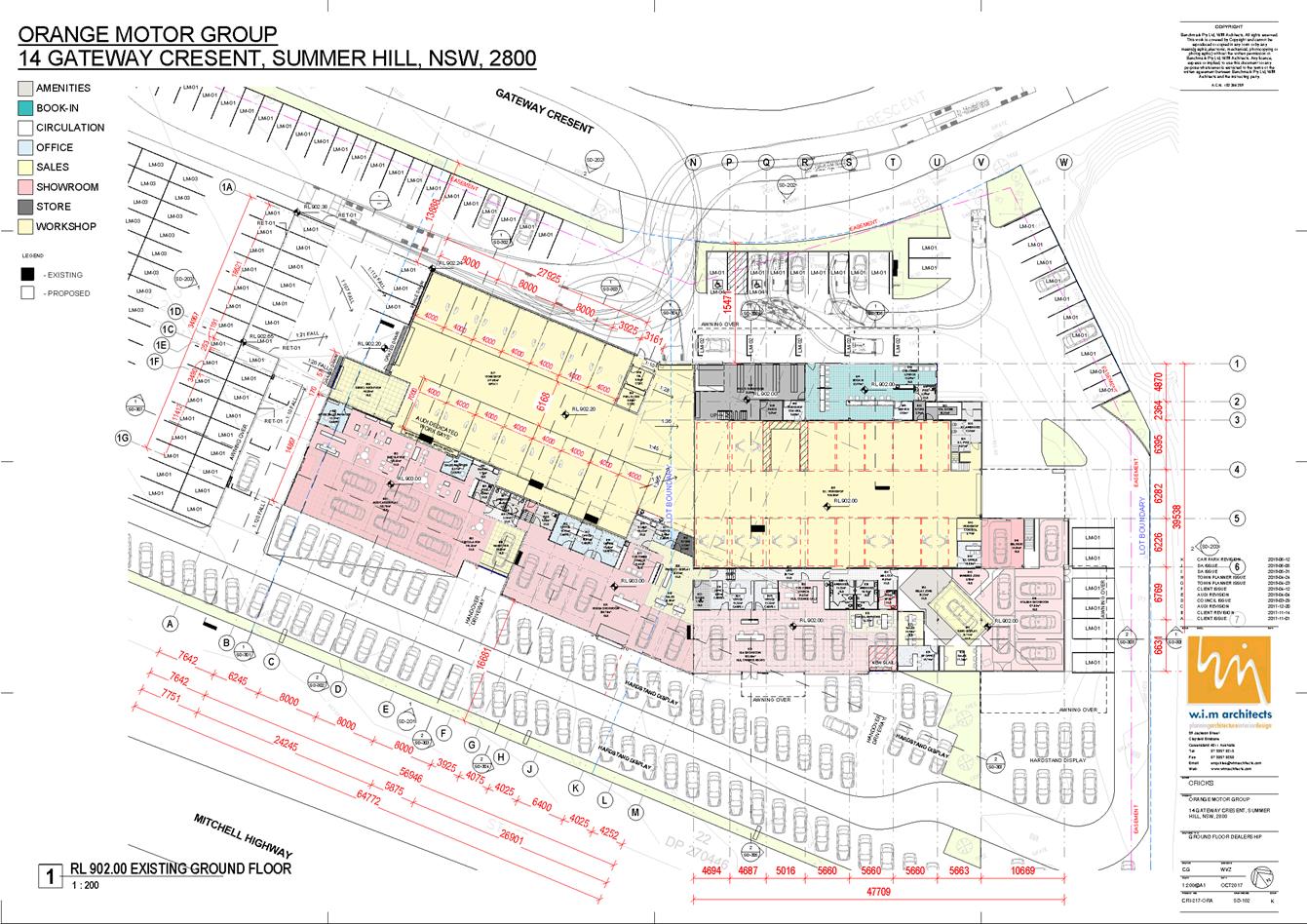
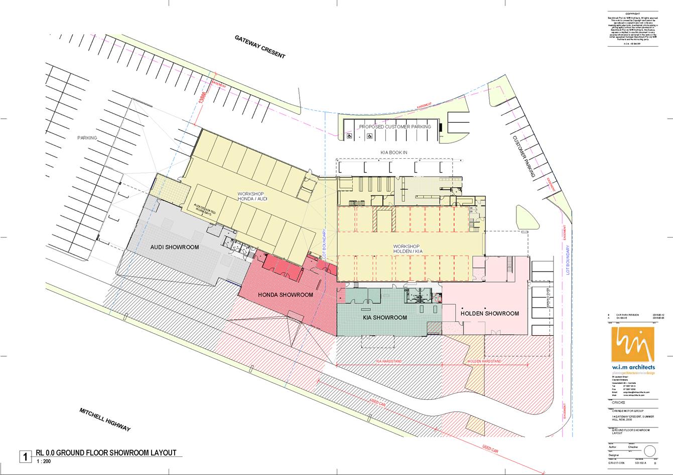
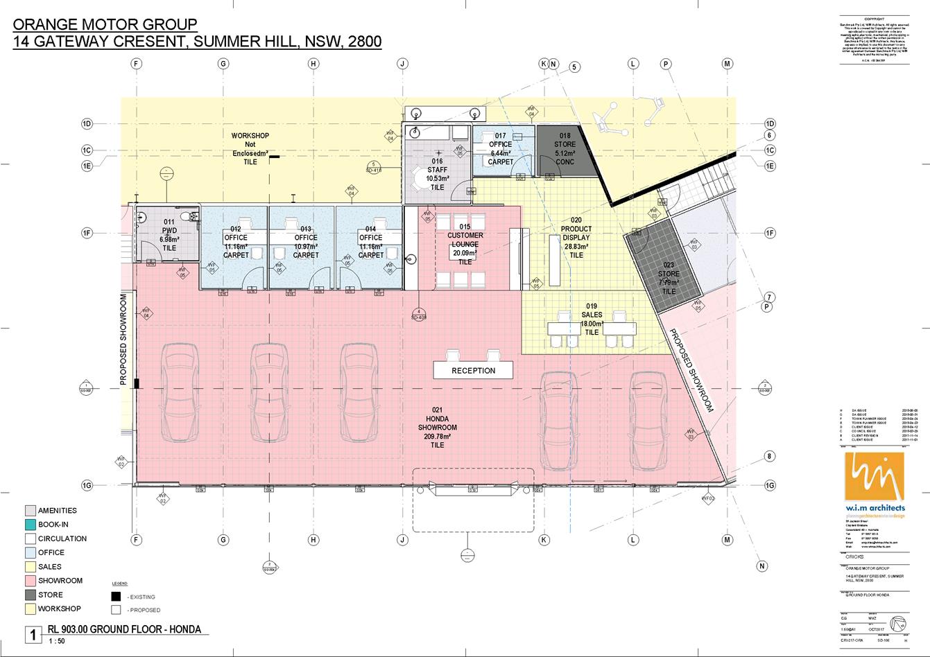
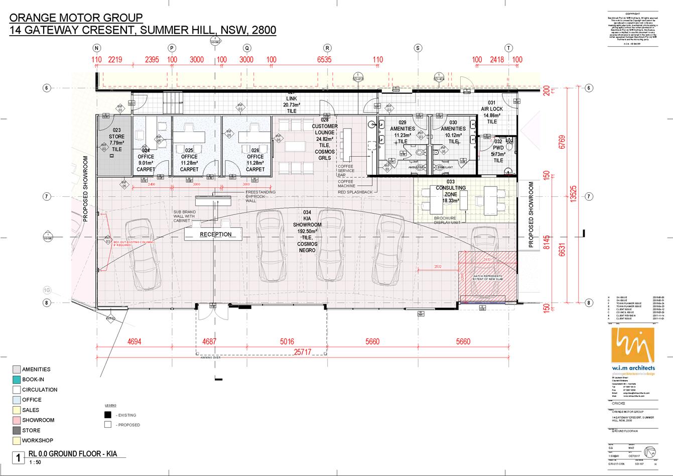
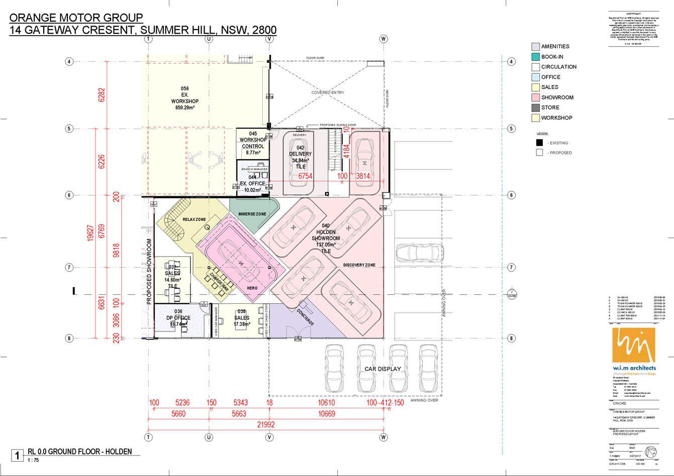
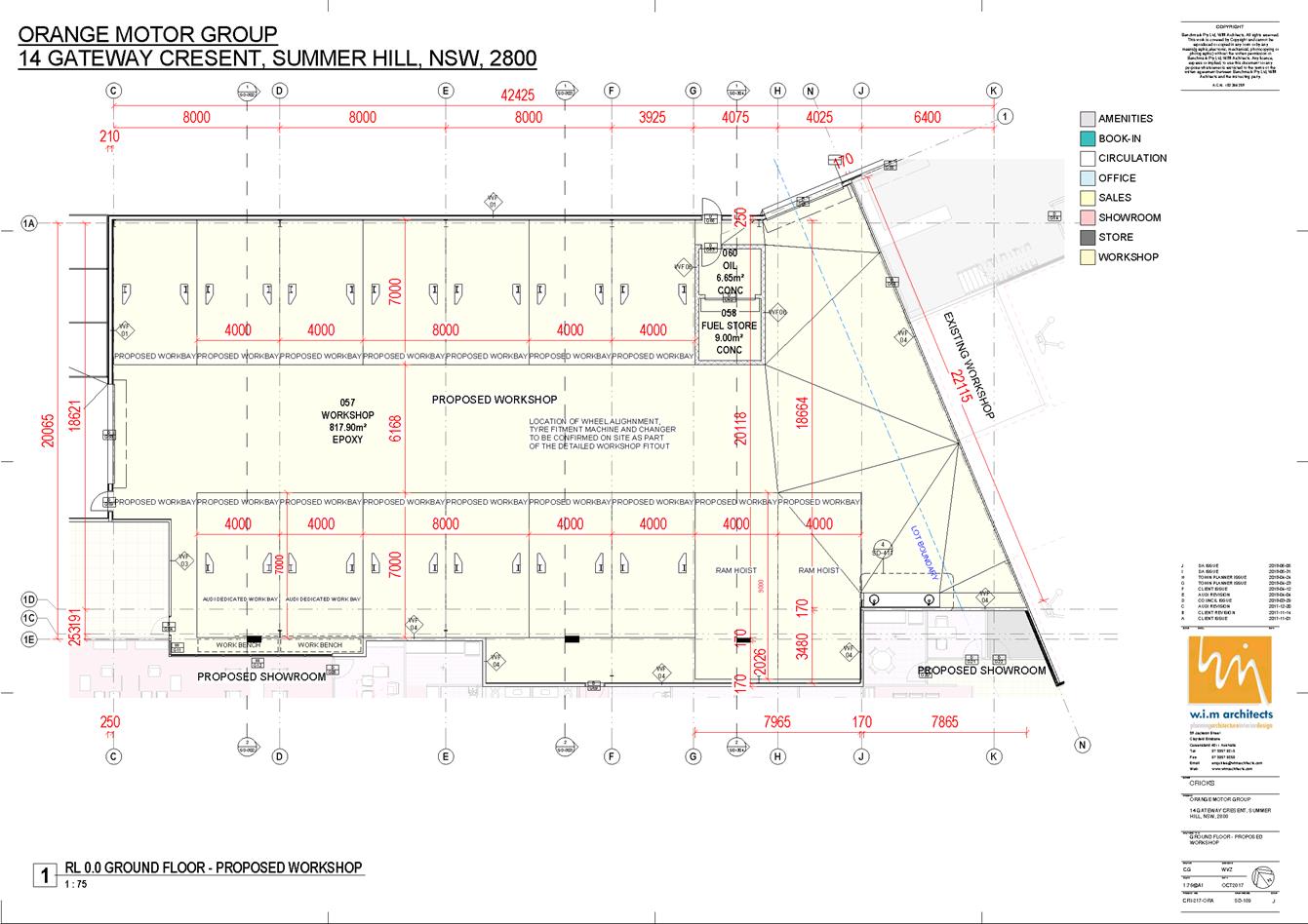
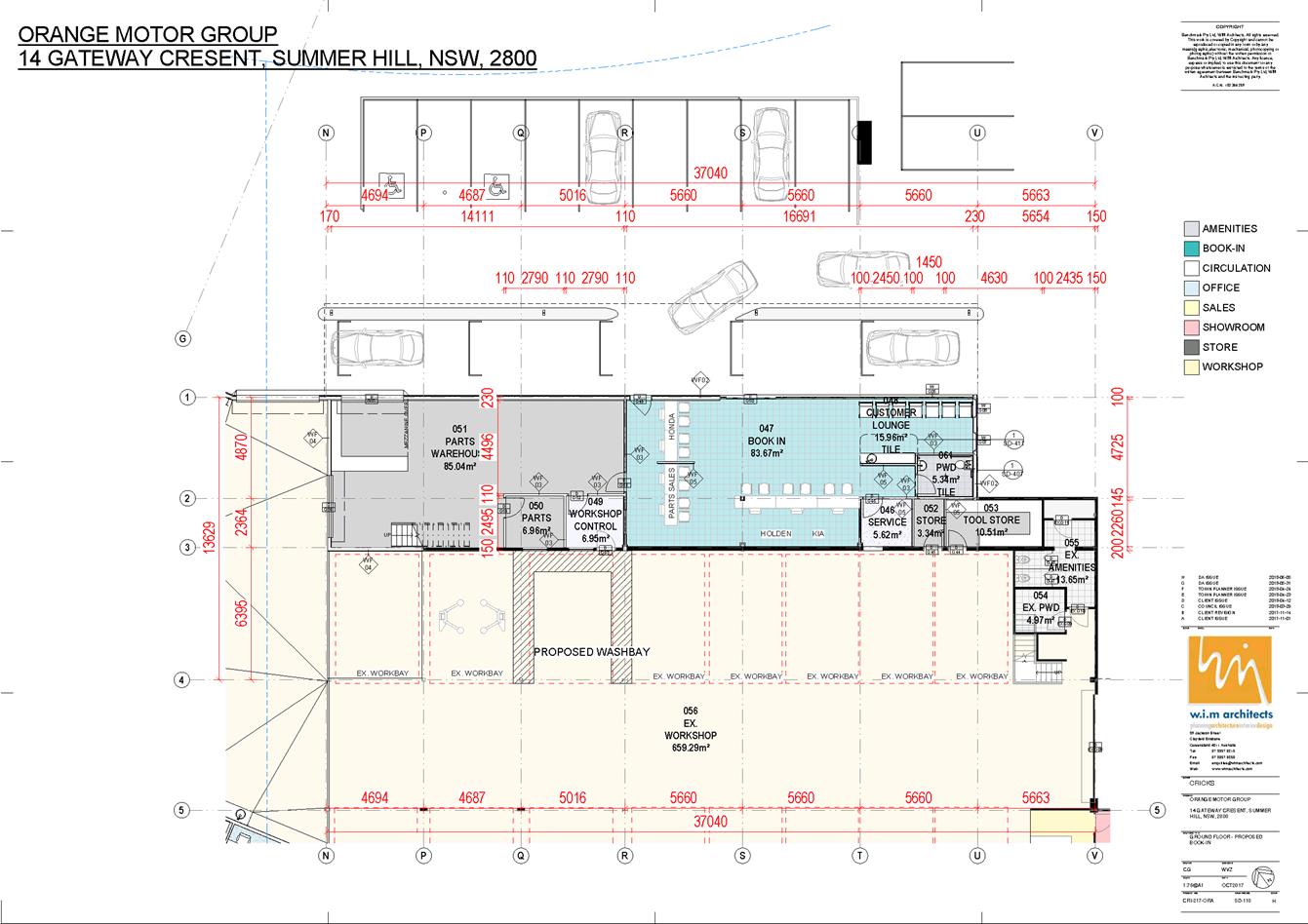
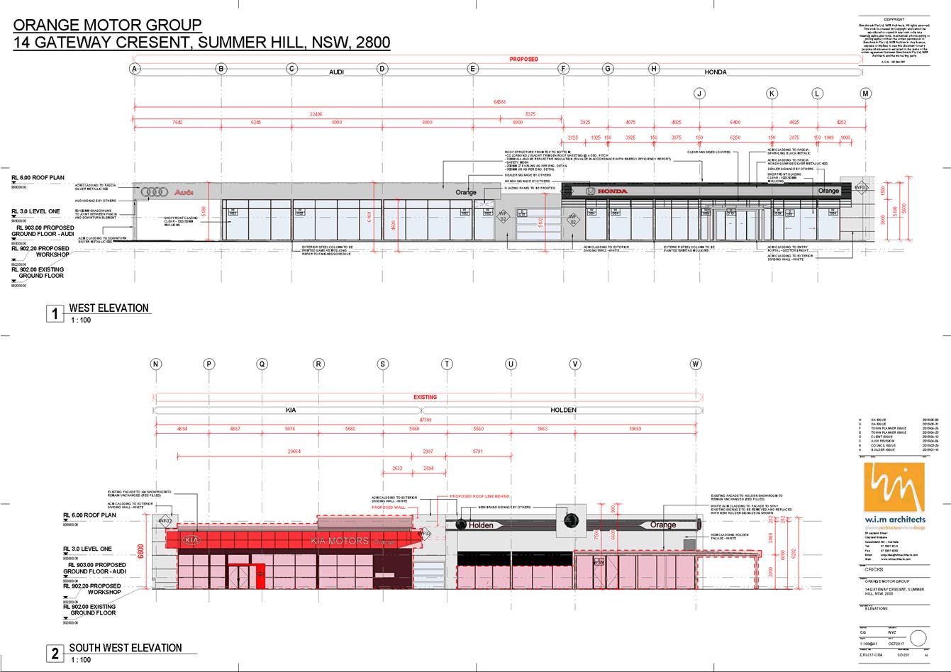
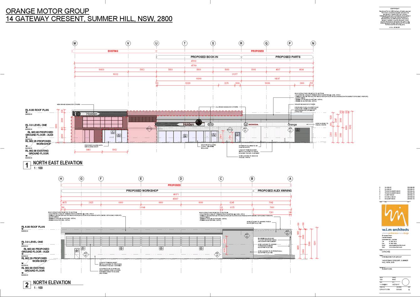
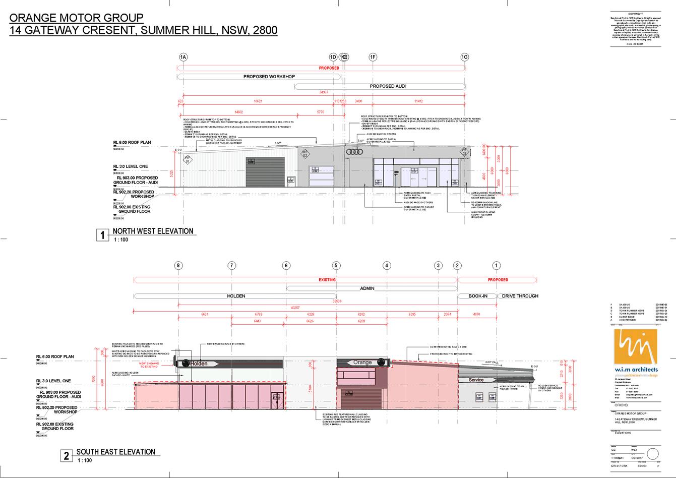
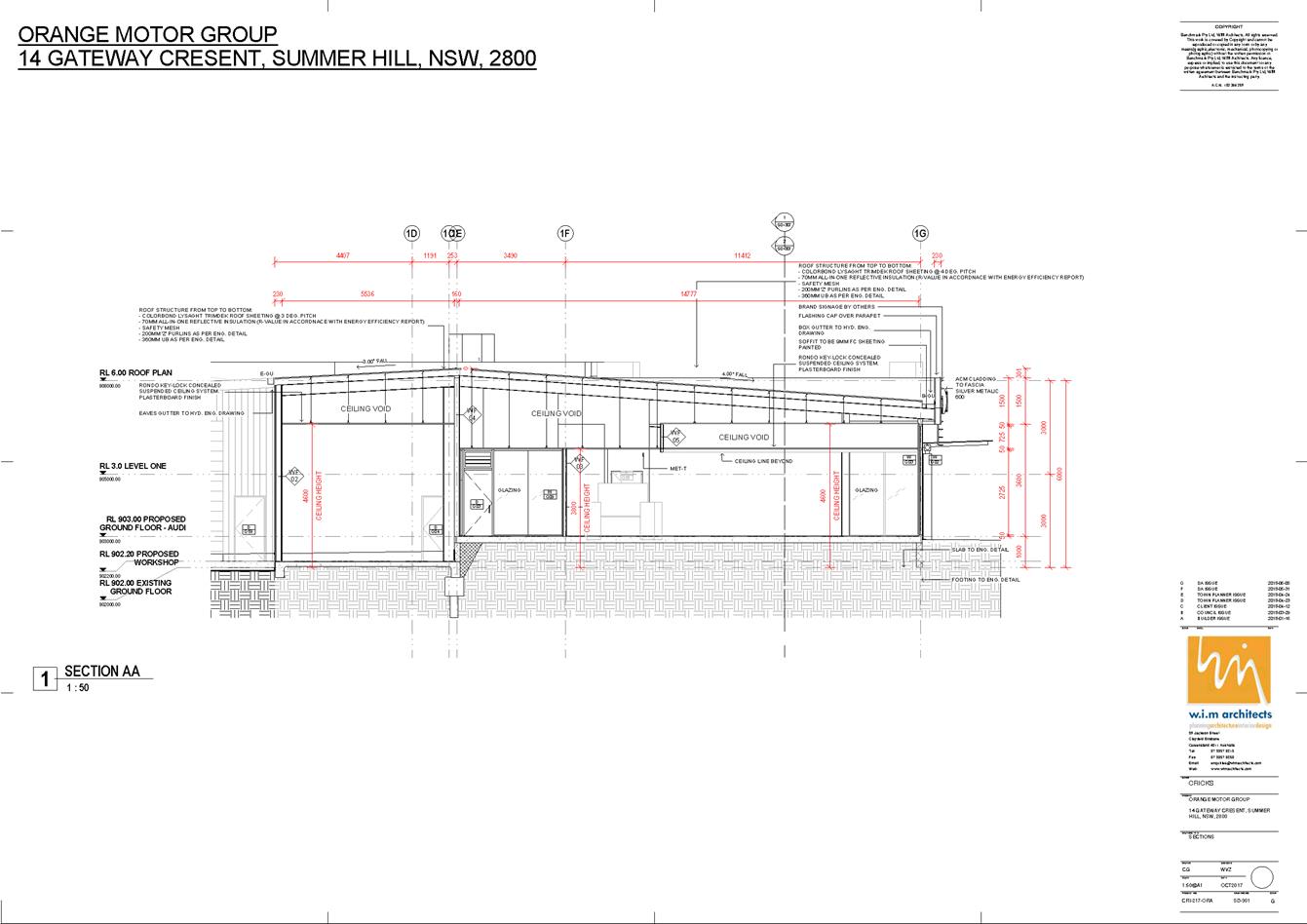
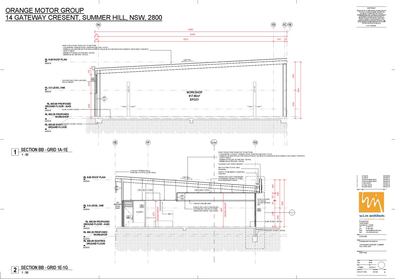
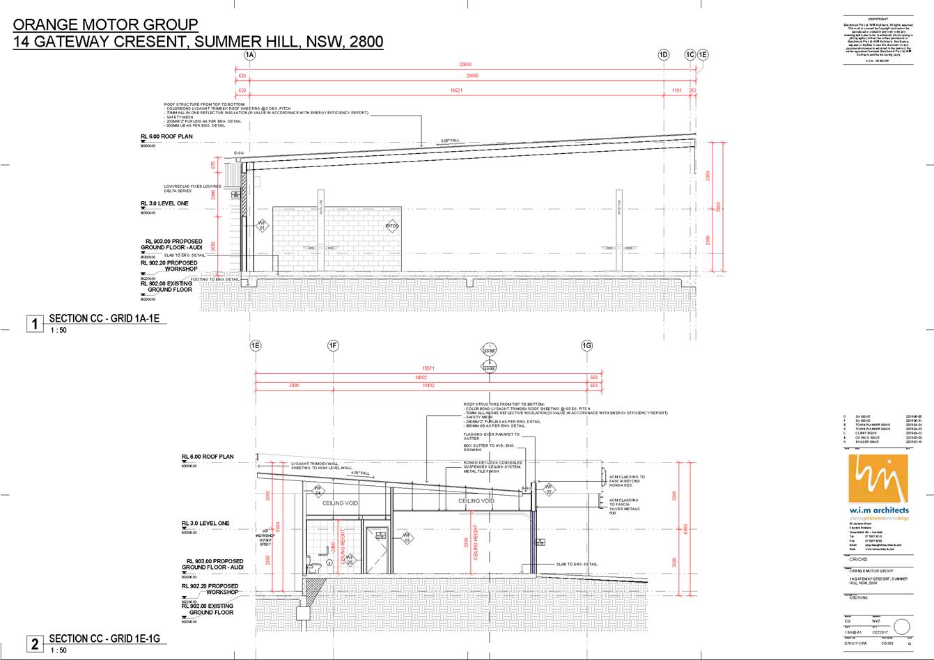
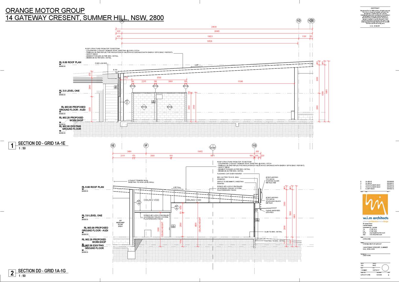
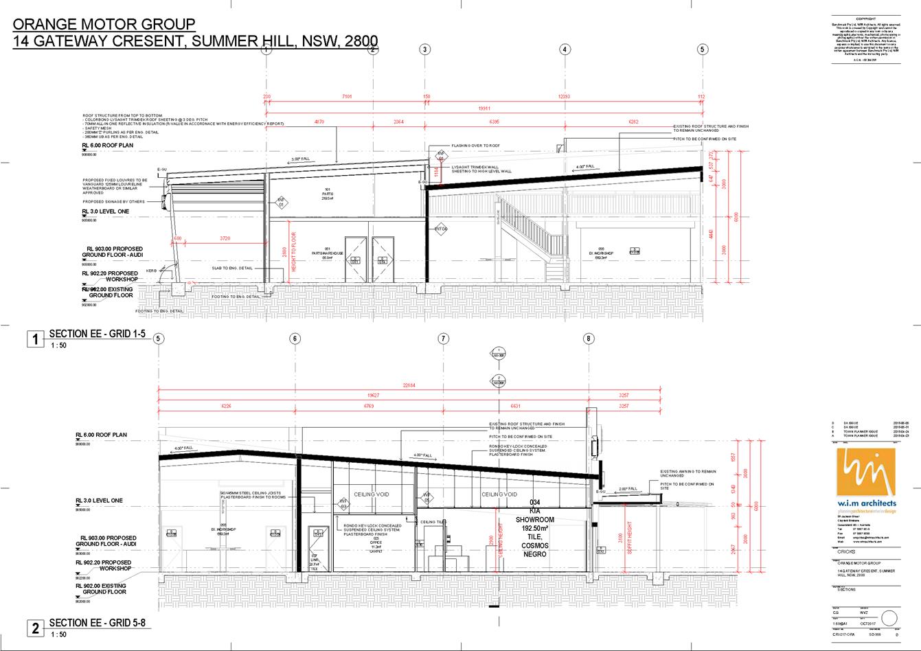
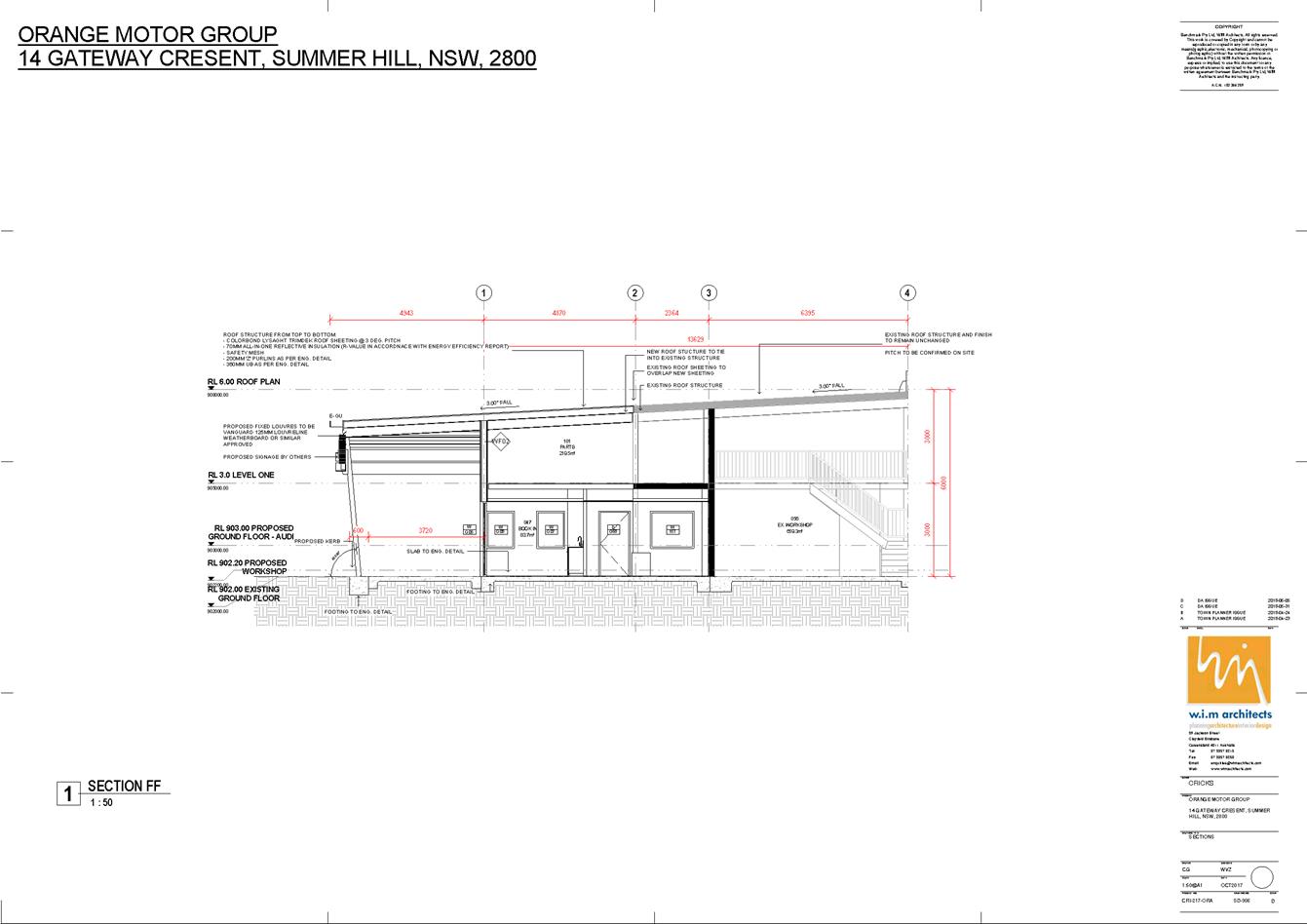
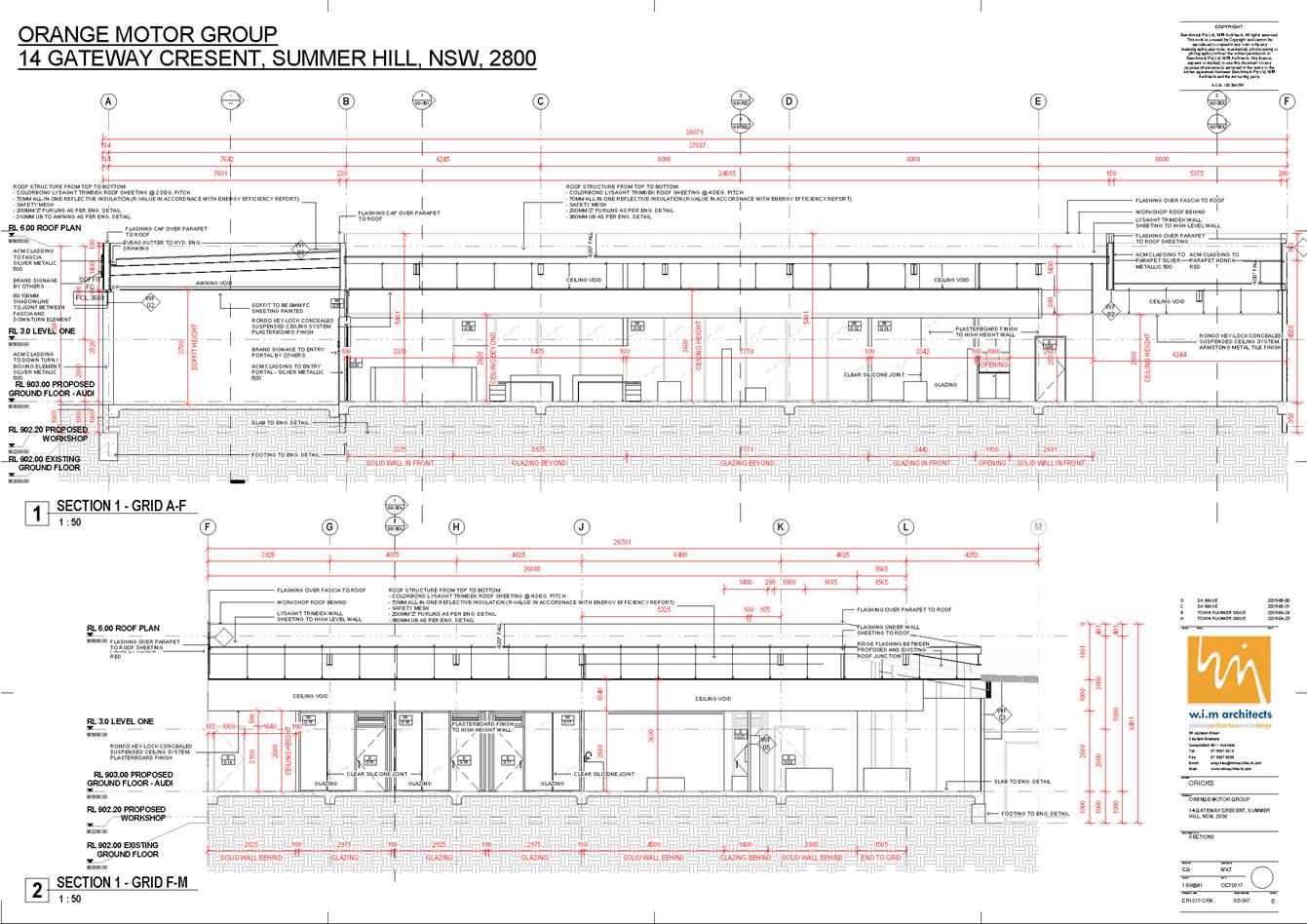
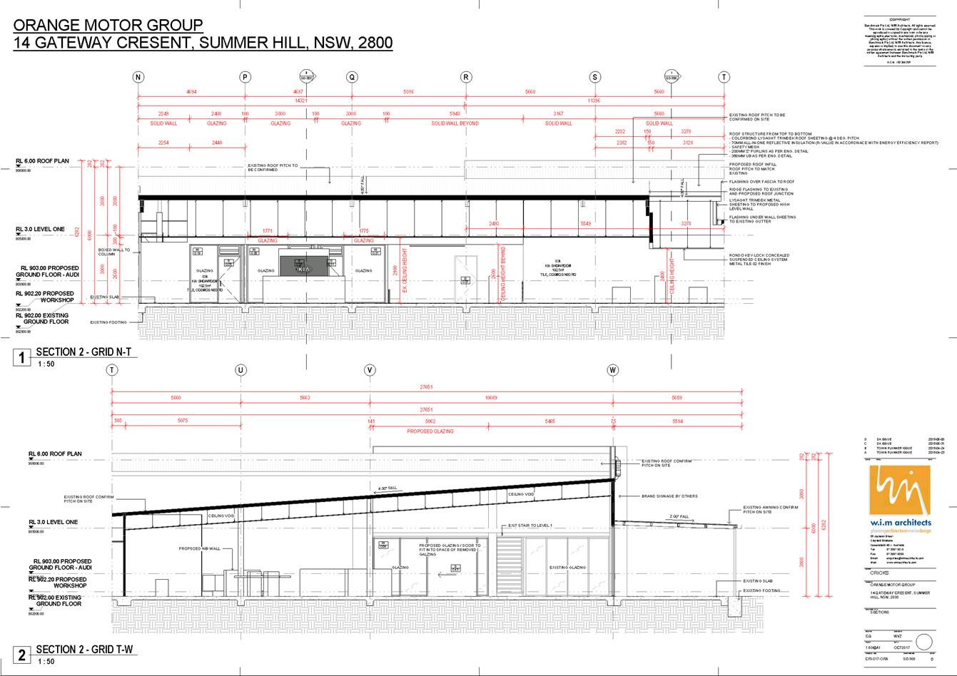
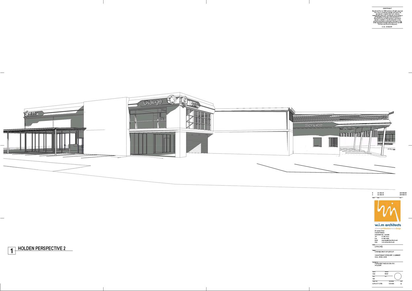
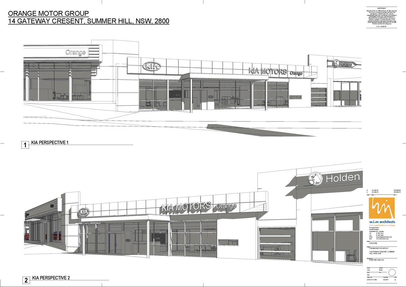
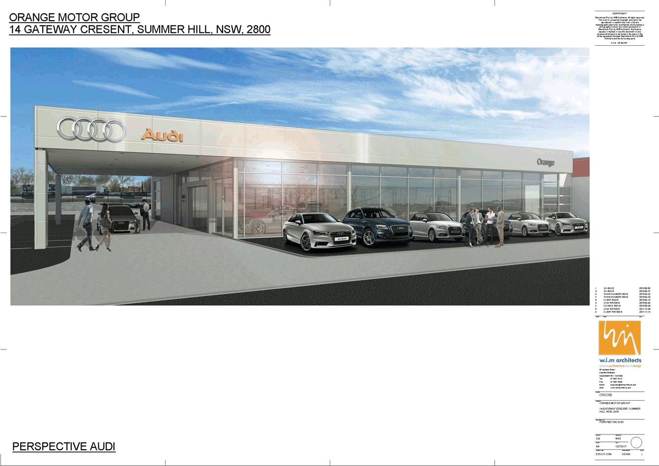
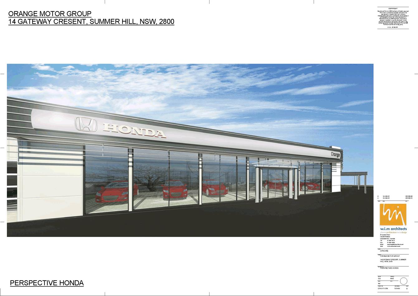
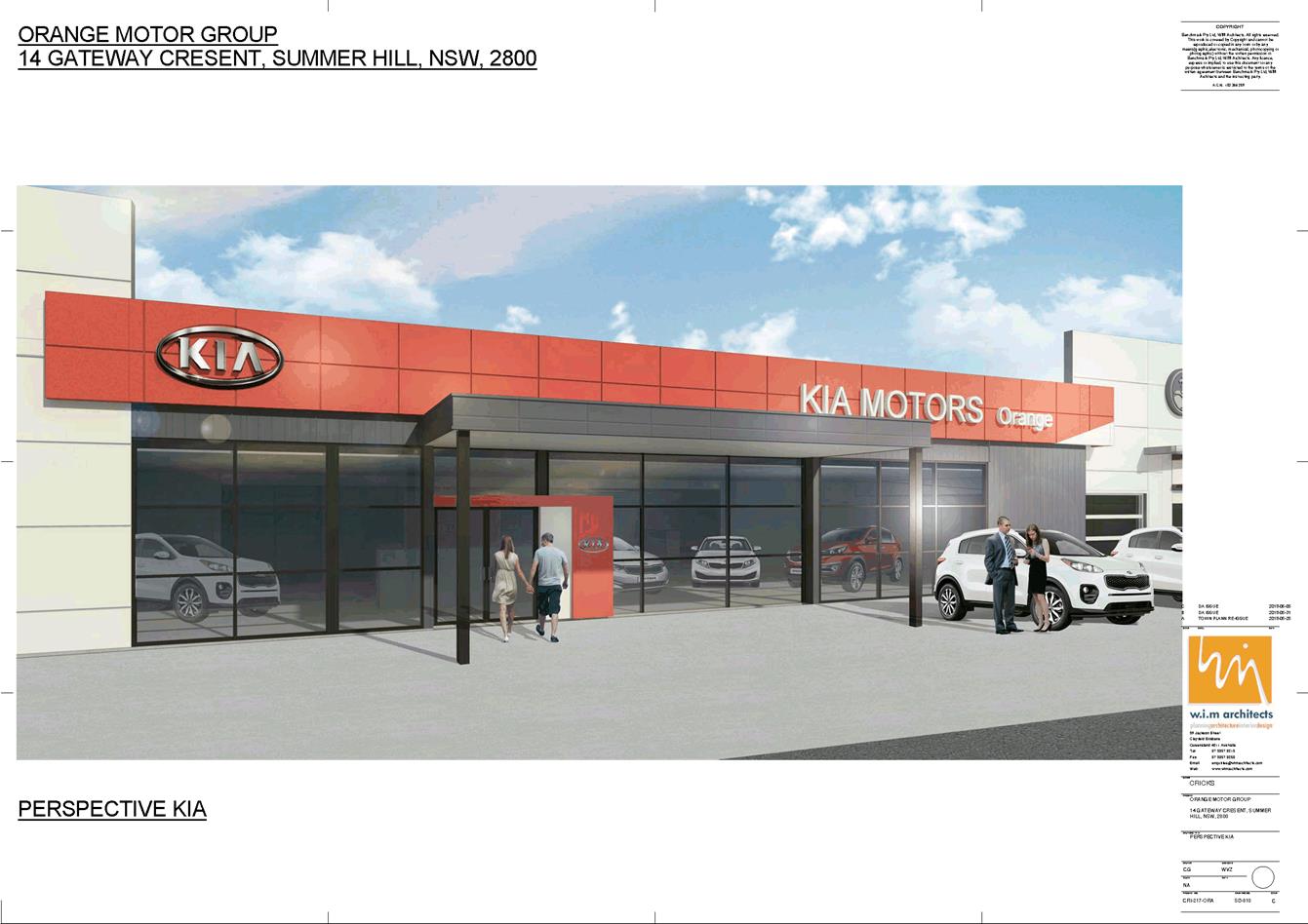
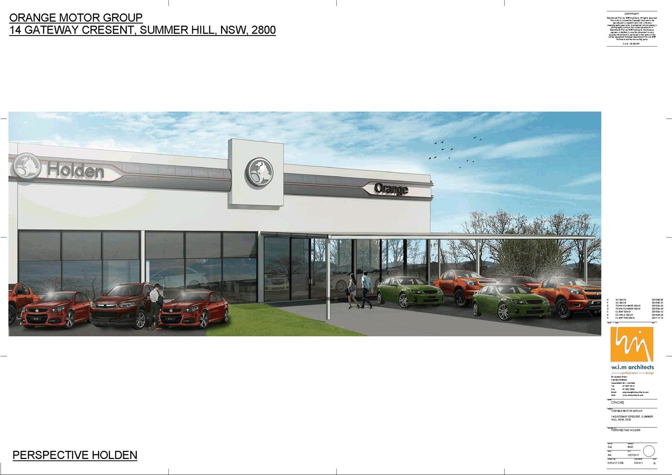
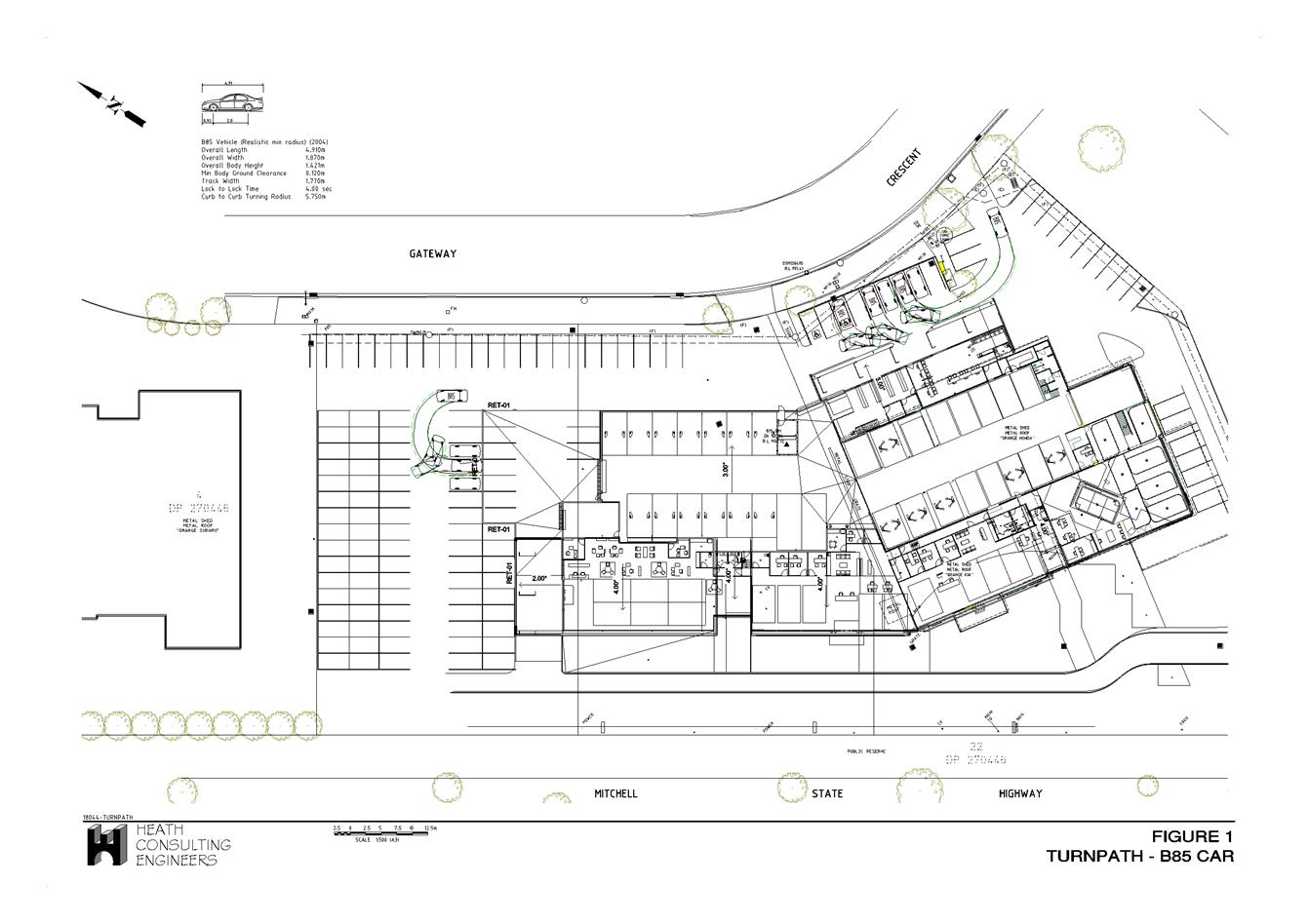
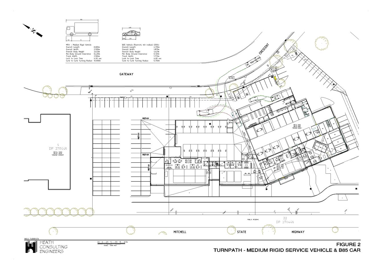
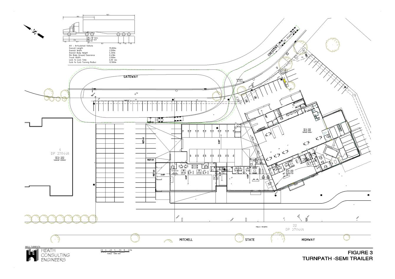
2.6 Development
Application DA 240/2018(1) - 216-238 Peisley Street
RECORD
NUMBER: 2018/2260
AUTHOR: Michael
Glenn, Senior Planner
EXECUTIVE Summary
|
Application
lodged
|
13 July
2018 (amended details 14 August 2018)
|
|
Applicant/s
|
Mr A
Ashcroft
|
|
Owner/s
|
Peisley
Property Holdings Pty Limited
|
|
Land
description
|
Lot 4 DP
626604 - 216-238 Peisley Street, Orange
|
|
Proposed
land use
|
Shop
(alterations and additions to existing building) and Signage
|
|
Value of
proposed development
|
$3,000,000
|
Council's consent is sought for internal alterations and
refurbishment to the existing building, and external facelifts and signage to
the premises.
Referral to PDC for
determination is triggered by the overall cost of the development. Staff
delegations are limited to developments costed to $1.5m or less, whereas this
development has been estimated by the applicant at $3m.
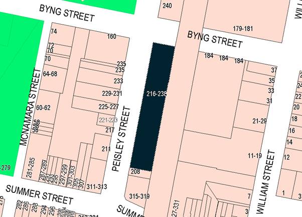
Figure 1 - locality plan
RECENT LEGISLATIVE CHANGES
On 1 March 2018 the Environmental Planning and Assessment
Act 1979 was substantially amended. The most immediate change involves the
restructuring and renumbering of the Act, with other more substantive
changes to be phased in over time. However, for some applications (particularly
where an application was lodged prior to the changes coming into effect) the
supporting documentation may still reference the previous numbering regime. In
the drafting of this report the content and substance of the supporting
material has been considered irrespective of which legislative references were
used.
DECISION FRAMEWORK
Development in Orange is governed by two key documents
Orange Local Environment Plan 2011 and Orange Development Control Plan 2004. In
addition the Infill Guidelines are used to guide development, particularly in
the heritage conservation areas and around heritage items.
Orange Local Environment Plan 2011 – The
provisions of the LEP must be considered by the Council in determining the
application. LEPs govern the types of development that are permissible or
prohibited in different parts of the City and also provide some assessment
criteria in specific circumstances. Uses are either permissible or not. The
objectives of each zoning and indeed the aims of the LEP itself are also to be
considered and can be used to guide decision making around appropriateness of
development.
Orange Development Control Plan 2004 – the DCP
provides guidelines for development. In general it is a performance based
document rather than prescriptive in nature. For each planning element there
are often guidelines used. These guidelines indicate ways of achieving the
planning outcomes. It is thus recognised that there may also be other solutions
of merit. All design solutions are considered on merit by planning and building
staff. Applications should clearly demonstrate how the planning outcomes are
being met where alternative design solutions are proposed. The DCP enables
developers and architects to use design to achieve the planning outcomes in
alternative ways.
DIRECTOR’S COMMENT
This development application is for a significant
refurbishment of the existing Peisley Street IGA supermarket. No issues of
concern have been raised by staff in this report other than signage, which has
been conditioned to comply with State requirements.
Link To Delivery/OPerational Plan
The recommendation in this report relates to the
Delivery/Operational Plan strategy “10.1 Preserve - Engage with the
community to ensure plans for growth and development are respectful of our
heritage”.
Financial Implications
Nil
Policy and Governance Implications
Nil
|
Recommendation
That Council consents to development application DA
240/2018(1) for Shop (alterations and additions to existing building) and
Signage at Lot 4 DP 626604 - 216-238 Peisley Street, Orange pursuant to
the conditions of consent in the attached Notice of Approval.
|
further considerations
Consideration has been given to the recommendation’s
impact on Council’s service delivery; image and reputation; political;
environmental; health and safety; employees; stakeholders and project
management; and no further implications or risks have been identified.
SUPPORTING INFORMATION
THE APPLICATION/PROPOSAL
The proposal involves the internal refurbishment of the
supermarket and the erection of replacement signage, consisting of one wall
mounted general advertisement and replacement business identification
signs. The internal refurbishment involves new shelving aisle positions,
the relocation of the frozen and small goods displays and rearrangement of the
cool stores within the building. No increases in floor area and no changes to
loading and/or parking is proposed.
MATTERS FOR CONSIDERATION
Section 1.7 - Application of
Part 7 of the Biodiversity Conservation Act 2016 and Part 7A of the
Fisheries Management Act 1994
Section 1.7 of the EP&A Act 1979 identifies that Part 7
of the Biodiversity Conservation Act 2016 and Part 7A of the Fisheries
Management Act 1994 have effect in connection with terrestrial and aquatic
environments.
Having regard to the relevant provisions and based on an
inspection of the subject property, it is considered that the proposed
development is not likely to significantly affect a threatened species.
A Biodiversity Development Assessment Report is not required
in this instance.
In this instance, site inspection reveals that the subject
property has no biodiversity or habitat value.
Section 4.15
Section 4.15 of the Environmental Planning and Assessment
Act 1979 requires Council to consider various matters, of which those
pertaining to the application are listed below.
PROVISIONS OF ANY ENVIRONMENTAL
PLANNING INSTRUMENT s4.15(1)(a)(i)
Orange Local Environmental Plan 2011
Part 1 - Preliminary
Clause 1.2 - Aims of Plan
The broad aims of the LEP are
set out under subclause 2. Those relevant to the application are as follows:
(a) to encourage development which complements
and enhances the unique character of Orange as a major regional centre boasting
a diverse economy and offering an attractive regional lifestyle,
(b) to provide for a range of development
opportunities that contribute to the social, economic and environmental
resources of Orange in a way that allows present and future generations to meet
their needs by implementing the principles for ecologically sustainable
development,
(c) to conserve and enhance the water
resources on which Orange depends, particularly water supply catchments,
(d) to manage rural land as an environmental
resource that provides economic and social benefits for Orange,
(e) to provide a range of housing choices in
planned urban and rural locations to meet population growth,
(f) to recognise and manage valued
environmental heritage, landscape and scenic features of Orange.
The application is considered to be consistent with LEP
objectives.
Clause 1.6 - Consent Authority
This clause establishes that, subject to the Act, Council is
the consent authority for applications made under the LEP.
Clause 1.7 - Mapping
The subject site is identified on
the LEP maps in the following manner:
|
Land Zoning Map:
|
Land zoned B3 Commercial Core
|
|
Lot Size Map:
|
No Minimum Lot Size
|
|
Heritage Map:
|
Not a heritage item or conservation
area
|
|
Height of Buildings Map:
|
building height limit 12m
|
|
Floor Space Ratio Map:
|
floor space limit 1.5:1
|
|
Terrestrial Biodiversity Map:
|
No biodiversity sensitivity on the
site
|
|
Groundwater Vulnerability Map:
|
Groundwater vulnerable
|
|
Drinking Water Catchment Map:
|
Not within the drinking water
catchment
|
|
Watercourse Map:
|
Not within or affecting a defined
watercourse
|
|
Urban Release Area Map:
|
Not within an urban release area
|
|
Obstacle Limitation Surface Map:
|
No restriction on building siting
or construction
|
|
Additional Permitted Uses Map:
|
No additional permitted use applies
|
|
Flood Planning Map:
|
Partially within a flood planning
area
|
|
Rail Corridor
|
Adjacent a rail corridor
|
Those matters that are of relevance are addressed in detail
in the body of this report.
Clause 1.9A - Suspension of
Covenants, Agreements and Instruments
This clause provides that covenants, agreements and other
instruments which seek to restrict the carrying out of development do not apply
with the following exceptions.
· covenants imposed
or required by Council
· prescribed instruments
under Section 183A of the Crown Lands Act 1989
· any conservation
agreement under the National Parks and Wildlife Act 1974
· any trust
agreement under the Nature Conservation Trust Act 2001
· any property
vegetation plan under the Native Vegetation Act 2003
· any biobanking
agreement under Part 7A of the Threatened Species Conservation Act 1995
· any planning
agreement under Division 6 of Part 4 of the Environmental Planning and
Assessment Act 1979.
Council staff are not aware of the title of the subject
property being affected by any of the above.
Part 2 - Permitted or
Prohibited Development
Clause 2.1 - Land Use
Zones and Clause 2.3 - Zone Objectives and Land Use Table
The subject site is located within the B3 Commercial Core
zone. The proposed development is defined as a shop and signage
under OLEP 2011 and is permitted with consent in this zone. This application is
seeking consent.
Regulation of signs is controlled principally under State
Environmental Planning Policy 64 – Advertising and Signage, and
consequently the assessment relating to that part of the proposal is undertaken
(within this report) under that legislation. Shop is defined under the
standard instrument as:
… premises that sell
merchandise such as groceries, personal care products, clothing, music,
homewares, stationery, electrical goods or the like or that hire any such
merchandise, and includes a neighbourhood shop, but does not include food and
drink premises or restricted premises.
Shops are a type of retail premises and are
permissible in the zone. Signage is also permissible subject to receiving
development consent.
Clause 2.3 of LEP 2011
references the Land Use Table and Objectives for each zone in LEP 2011.
These objectives for land zoned B3 Commercial Core are as follows:
1 -
Objectives of the B3 Commercial Core Zone
· To provide a wide
range of retail, business, office, entertainment, community and other suitable
land uses that serve the needs of the local and wider community.
· To encourage
appropriate employment opportunities in accessible locations.
· To maximise public
transport patronage and encourage walking and cycling.
· To promote
development that contributes to the role of the Orange CBD as the primary
retail and business centre in the City and region.
The proposed development is
generally consistent with the zone objectives, or those objectives are not
relevant to the assessment of this application.
Part 3 - Exempt and
Complying Development
Under State Environmental Planning Policy (Exempt and
Complying Development) it is possible to alter signage and change the use from
a shop to a range of other land uses, without the need to seek further
development consent from Council. However in this case the proposed works are
not exempt or complying development.
Part 4 - Principal
Development Standards
Clause 4.3 - Height
of Buildings
A maximum height
limit of 12m is applicable, to which the proposed development complies.
Clause 4.4 - Floor Space
Ratio
A maximum FSR of
1.5:1 is applicable, to which both the existing development and the proposed
development complies.
Part 6 - Urban
Release Area
Not relevant to the application. The subject site is not
located in an Urban Release Area.
Part 7 - Additional
Local Provisions
7.2 - Flood Planning
One part of the site
at its northern extremity is within a flood planning area. This establishes
floor levels for buildings within that area, plus a freeboard area for
buildings adjacent that are within a certain height range of the Flood Planning
Level (FPL).
The extent of flood
affectation is shown below:
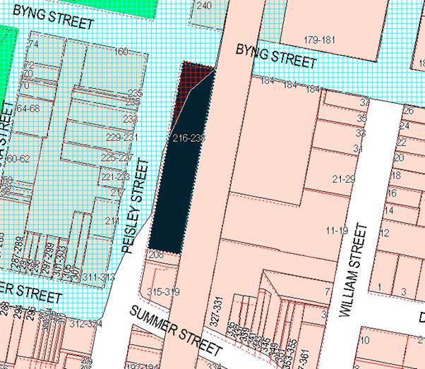
Figure 2 - Orange LEP 2011 - flood planning levels
The proposed
development is a re-use and refurbishment of the existing building, with no
change in floor levels proposed. It is considered acceptable in this instance
to allow the retention of the existing floor area and further allow the
renovations and upgrade to the building.
Council Technical
Services Division has not raised any concerns with respect to flooding.
7.3 - Stormwater
Management
No changes to the
stormwater discharges or disposal arrangements are proposed. There are no
changes to runoff likely to arise from the proposed development.
7.6 - Groundwater
Vulnerability
This clause seeks to
protect hydrological functions of groundwater systems and protect resources
from both depletion and contamination. Orange has a high water table and large
areas of the LGA, including the subject site, are identified with
“Groundwater Vulnerability” on the Groundwater Vulnerability Map.
This requires that
Council consider:
(a) whether or not the development (including
any onsite storage or disposal of solid or liquid waste and chemicals) is
likely to cause any groundwater contamination or have any adverse effect on
groundwater dependent ecosystems, and
(b) the cumulative impact (including the
impact on nearby groundwater extraction for potable water supply or stock water
supply) of the development and any other existing development on groundwater.
Furthermore consent may not be granted unless Council is satisfied that:
(a) the development is designed, sited and
will be managed to avoid any significant adverse environmental impact, or
(b) if that impact cannot be reasonably
avoided - the development is designed, sited and will be managed to minimise
that impact,
(c) if that impact cannot be minimised - the
development will be managed to mitigate that impact.
The proposal is not
anticipated to involve the discharge of toxic or noxious substances and is
therefore unlikely to contaminate the groundwater or related ecosystems. The
proposal does not involve extraction of groundwater and will therefore not
contribute to groundwater depletion.
Clause 7.11 - Essential
Services
Clause 7.11 applies and states:
Development consent must not be
granted to development unless the consent authority is satisfied that any of
the following services that are essential for the proposed development are
available or that adequate arrangements have been made to make them available
when required:
(a) the
supply of water,
(b) the
supply of electricity,
(c) the
disposal and management of sewage,
(d) storm
water drainage or on-site conservation,
(e) suitable
road access.
In consideration of this clause, all utility services are
available to the land and adequate for the proposal.
STATE ENVIRONMENTAL PLANNING
POLICIES
State Environmental Planning Policy 55 Remediation of
Land
State Environmental Planning Policy 55 - Remediation of
Land (SEPP 55) is applicable to the proposed development, but has no effect
as the proposed development does not involve a change of use to the premises.
Pursuant to Clause 7 Contamination and remediation to be
considered in determining development application:
(1) A consent authority must not consent to
the carrying out of any development on land unless:
(a) it
has considered whether the land is contaminated, and
(b) if
the land is contaminated, it is satisfied that the land is suitable in its
contaminated state (or will be suitable, after remediation) for the purpose for
which the development is proposed to be carried out, and
In relation to (a) and (b), the
risk of the site being contaminated has been considered. Such risk is
considered to be low and the development will not result in significant soil
disturbance. As such it is considered the proposed development poses no risk in
terms of disturbing the site and possible contamination on the site. The site
many years ago was used as a gasworks, which carries an inherent risk of
contamination, however it has for many years been used for shops, with a very
low risk of contamination. The site has a building and bitumen sealed car park
erected thereon, which provides an effective cap to the soil located
underneath. The proposed works do not propose any substantial disturbance of
the site.
(c) if
the land requires remediation to be made suitable for the purpose for which the
development is proposed to be carried out, it is satisfied that the land will
be remediated before the land is used for that purpose.
In relation to (c), it is considered that the land does not
require remediation.
(2) Before determining an application for
consent to carry out development that would involve a change of use on any of
the land specified in sub clause (4), the consent authority must consider a
report specifying the findings of a preliminary investigation of the land
concerned carried out in accordance with the contaminated land planning
guidelines.
In relation to (2), the proposed development does not
involve a change of use.
(3) The applicant for development consent
must carry out the investigation required by sub clause (2) and must provide a
report on it to the consent authority. The consent authority may require the
applicant to carry out, and provide a report on, a detailed investigation (as
referred to in the contaminated land planning guidelines) if it considers that
the findings of the preliminary investigation warrant such an investigation.
This part of clause 7 is not relevant.
(4) The land concerned is:
(a) land
that is within an investigation area,
(b) land
on which development for a purpose referred to in Table 1 to the contaminated
land planning guidelines is being, or is known to have been, carried out,
(c) to
the extent to which it is proposed to carry out development on it for
residential, educational, recreational or child care purposes, or for the
purposes of a hospital—land:
(i) in
relation to which there is no knowledge (or incomplete knowledge) as to whether
development for a purpose referred to in Table 1 to the contaminated land
planning guidelines has been carried out, and
(ii) on
which it would have been lawful to carry out such development during any period
in respect of which there is no knowledge (or incomplete knowledge).
Not relevant to the subject
application.
State Environmental Planning
Policy Infrastructure 2007
85 - Development Immediately
Adjacent to Rail Corridors
Clause 85 has provisions relating
to non-metropolitan land adjacent to rail corridors. This clause applies to
development on land that is in or immediately adjacent to a rail corridor, if
the development:
(a) is
likely to have an adverse effect on rail safety, or
(b) involves
the placing of a metal finish on a structure and the rail corridor concerned is
used by electric trains, or
(c) involves
the use of a crane in air space above any rail corridor.
None of the triggers contained in
this clause are applicable to the proposed development. As a result, the
assessment criteria contained in sub clause (2) has no relevance to this
application.
State Environmental Planning
Policy 64 - Advertising and Signage
State Environmental Planning
Policy 64 - Advertising and Signage (SEPP 64) is applicable and states in
part:
3 Aims,
Objectives etc
(1) This
Policy aims:
(a) to
ensure that signage (including advertising):
(i) is
compatible with the desired amenity and visual character of an area, and
(ii) provides
effective communication in suitable locations, and
(iii) is
of high quality design and finish, and
The proposed
development is not inconsistent to the aims and objectives of the policy
(8) Granting
of Consent to Signage
A consent authority must not grant
development consent to an application to display signage unless the consent
authority is satisfied:
(a) that
the signage is consistent with the objectives of this Policy as set out in
clause 3 (1) (a), and
(b) that
the signage the subject of the application satisfies the assessment criteria
specified in Schedule 1.
The proposed signs consist of the following:
1 A
business identification sign (on the Byng Street elevation, facing north) The
proposed sign is a wall sign with wordmark Ashcrofts Supa IGA +Liquor.
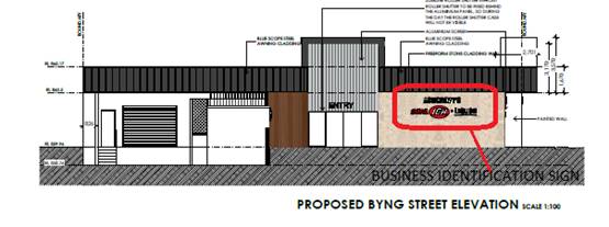 Figure 3 - northern elevation (facing Byng Street)
2 Three
additional business identification signs will be visible from the west (Peisley
Street).
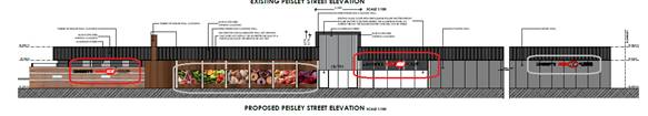
Figure 4 - western elevation (facing Peisley Street)
Advertising Sign Component
The proposed development
incorporates general advertising on the western elevation comprising a sign
panel with a total area of 25.6m2 of sign display area. The size of
the proposed sign triggers a requirement to consider it against the provisions
of clauses 13, 14 and 17 of the SEPP.
Clause 13 - Matter for
consideration
(1) A
consent authority must not grant consent to an application to display an
advertisement to which this Policy applies unless the advertisement or the
advertising structure, as the case requires:
(a) is
consistent with the objectives of this Policy as set out in clause 3 (1) (a), and
(b) has
been assessed by the consent authority in accordance with the assessment
criteria in Schedule 1 and the consent authority is satisfied that the proposal
is acceptable in terms of its impacts, and
(c) satisfies
any other relevant requirements of this Policy.
By reason of its proposed area (in
excess of 20m2), the proposed sign does not meet all the
requirements of the SEPP.
Clause 14 - Duration of
consents
(1) A
consent granted under this Part ceases to be in force:
(a) on
the expiration of 15 years after the date on which the consent becomes
effective and operates in accordance with section 83 of the Act,
The Notice of Determination includes a condition to this
effect
Clause 17 - Advertisements with
display area greater than 20 square metres or higher than 8 metres above ground
(1) This
clause applies to an advertisement:
(a) that
has a display area greater than 20 square metres, or
(b) that
is higher than 8 metres above the ground.
(2) The
display of an advertisement to which this clause applies is advertised
development for the purposes of the Act.
(3) The
consent authority must not grant consent to an application to display an
advertisement to which this clause applies unless:
(a) the
applicant has provided the consent authority with an impact statement that
addresses the assessment criteria in Schedule 1 and the consent authority is
satisfied that the proposal is acceptable in terms of its impacts, and
(b) the
application has been advertised in accordance with section 79A of the Act, and
(c) the
consent authority gave a copy of the application to RMS at the same time as the
application was advertised in accordance with section 79A of the Act if the
application is an application for the display of an advertisement to which
clause 18 applies
As submitted the proposed sign would incorporate an area of
25.6m², which exceeds the threshold contained in this clause. However, the
submission to Council does not include an impact statement as specified in part
(a) of the SEPP. The application as submitted has not been configured so as to
give Council the authority to approve the application where the area of the
sign exceeds 20m². Further, the SEPP requires referral to the RMS and
advertising of the application if the signage was to remain above 20m².
Council staff have carried out an assessment of the impact of such signage and
are of the view that the size of the signage would have an adverse impact upon
the streetscape. In view of the above, a condition of consent is included
requiring a minimum of two of the glazed panels in which the advertising is to
be displayed to be retained as clear glass panels in the same way as other
glazing in this row south of the main entrance is proposed to be treated. This
will reduce the area of the sign to less than 20m² to be in compliance
with the SEPP and address streetscape concerns raised by staff about the extent
of signage proposed.
General Schedule 1 Assessment
Both the business identification signs component and the
general advertising components are subject to general assessment under schedule
1 of the SEPP. The business identification component raises no significant
issues, but the general advertising component does present some issues due to
the expanse of the signage that is proposed.
It is proposed to remove the existing blueboard cladding to
expose these hidden windows and then utilise them for general advertising. The
window glazing to the south of the Peisley Street entry/exit will also be
exposed, and at this point these windows will remain clear to allow views of
the interior of the supermarket and thereby fulfil the function of a
traditional shopfront window. This is considered useful to the promotion and
restoration of this section of Peisley Street to a main street character. For
this reason it is considered appropriate to include the following condition in
the consent:
The clear street glazing as
shown in the approved plans along the Peisley Street frontage south of the
egress point shall remain clear, with no advertising displayed or attached to
either the exterior or interior of this glazing.
For the glazing located on the northern side of the egress
point, the submitted elevations show that these windows would be adorned with
pictures of items like fruit. Viewed essentially as “boxes” on the
building, it is considered that the proposed advertising scheme facing Peisley
Street will have an adverse impact upon the streetscape. As alluded to above, a
condition of consent has been recommended to reduce the extent of advertising
in order to satisfy the requirements of the SEPP and to ensure that the signage
element of the proposal is sufficiently constrained in a manner that is
respectful of the streetscape and character of the locality.
1 -
Character of the Area
· Is
the proposal compatible with the existing or desired future character of the
area or locality in which it is proposed to be located?
· Is
the proposal consistent with a particular theme for outdoor advertising in the
area or locality?
The area is characterised as a mix of commercial, industrial,
rail and communications infrastructure, with a heritage overtone in the
locality. Residential influences are less prevalent and less influential to the
neighbourhood character. The character of the land is further influenced by the
high profile location on the entrance to the business area of the City.
Existing signage in Peisley Street to the north of Summer Street for several
blocks is mixed. There is a greater density of signage as Summer Street is
approached, and less signage further away. Buildings are generally two storeys
on the western side of Peisley Street, and there is a mix of vacant blocks and
one and two storey forms on the eastern side of the street.
The proposed signs subject to the recommended condition of
consent which limit the extent of advertising are considered to be generally
consistent with the existing character of the area, taking into consideration
the overall scheme proposed.
The subject property is located within the CBD, in which the
issue of excessive signage inappropriate to façade treatments applied to
buildings, excessive sign displays, and sign displays that detract from the
ambience and positive built forms in the street, are all identified as
potential threats and detracting elements to the quality of the neighbourhood
character that constitutes the CBD. In this case, it has been recommended that
the advertising be restrained to comply with the requirements of the SEPP and
reduce the overall impact of signage in the streetscape so as to be more in
keeping with the character of the locality.
2 - Special Areas
· Does the
proposal detract from the amenity or visual quality of any environmentally
sensitive areas, heritage areas, natural or other conservation areas, open
space areas, waterways, rural landscapes or residential areas?
Heritage conservation areas are applicable to the western
side of Peisley Street and Summer Street, and a number of individually listed
heritage items are also recorded in this locality. The subject site itself is
not located in a heritage conservation It is considered that the proposed signs
subject to a condition of consent will not have a significant effect on those
special areas.
3 - Views and Vistas
· Does the
proposal obscure or compromise important views?
· Does the
proposal dominate the skyline and reduce the quality of vistas?
· Does the
proposal respect the viewing rights of other advertisers?
The proposed signs are to be contained generally within the
existing building silhouette.
4 - Streetscape, Setting or
Landscape
· Is the scale,
proportion and form of the proposal appropriate for the streetscape, setting or
landscape?
· Does the
proposal contribute to the visual interest of the streetscape, setting or
landscape?
· Does the
proposal reduce clutter by rationalising and simplifying existing advertising?
· Does the
proposal screen unsightliness?
· Does the
proposal protrude above buildings, structures or tree canopies in the area or
locality?
· Does the
proposal require ongoing vegetation management?
It is considered that the proposed signs are generally
reinforcing, or at least neutral, with regard to the provisions of this clause.
In relation to these matters it is recommended that the extent of advertising
content be reduced to comply with the SEPP requirements. The remaining business
identification signs contained in the proposal can be considered to be
generally consistent general building forms and massing evident in the street.
The proposal in terms of messaging and visual impact is not inconsistent with
the intent of the listed planning outcomes.
5 - Site and Building
· Is the proposal
compatible with the scale, proportion and other characteristics of the site or
building, or both, on which the proposed signage is to be located?
· Does the
proposal respect important features of the site or building, or both?
· Does the
proposal show innovation and imagination in its relationship to the site or
building, or both?
The proposed development subject to the recommended
condition of consent is compatible with the scale of the building. The signage
for the development is considered to be a more or less standard design response
for this style and scale of development.
6 - Associated Devices and
Logos With Advertisements and Advertising Structures
· Have any safety
devices, platforms, lighting devices or logos been designed as an integral part
of the signage or structure on which it is to be displayed?
There are no safety devices or logos incorporated into the
proposed advertisements that are likely to be misidentified as safety or
traffic signs.
7 - Illumination
· Would
illumination result in unacceptable glare?
· Would
illumination affect safety for pedestrians, vehicles or aircraft?
· Would
illumination detract from the amenity of any residence or other form of
accommodation?
· Can the
intensity of the illumination be adjusted, if necessary?
· Is the
illumination subject to a curfew?
Illumination of the proposed signs is not shown on the
submitted plans.
8 - Safety
· Would the
proposal reduce the safety for any public road?
· Would the
proposal reduce the safety for pedestrians or bicyclists?
· Would the
proposal reduce the safety for pedestrians, particularly children, by obscuring
sightlines from public areas?
It is considered that the proposed signs would not increase
or place at risk safety in the terms specified in this clause.
PROVISIONS OF ANY DRAFT
ENVIRONMENTAL PLANNING INSTRUMENT THAT HAS BEEN PLACED ON EXHIBITION
4.15(1)(a)(ii)
There are no draft environmental planning instruments that
apply to the subject land or proposed development.
DESIGNATED DEVELOPMENT
The proposed development is not designated development.
INTEGRATED DEVELOPMENT
The proposed development is not integrated development.
PROVISIONS OF ANY DEVELOPMENT
CONTROL PLAN s4.15(1)(a)(iii)
Development Control Plan 2004
Development Control Plan 2004 (“the DCP”)
applies to the subject land Part 8 - Development in Business zones and Part
14 -Advertising) are the principal elements of the DCP applicable to
the proposed development. An assessment of the proposed development against the
relevant Planning Outcomes will be undertaken below.
Pursuant to Planning Outcome 0.2-1 Interim Planning Outcomes
- Conversion of Zones:
· Throughout
this Plan, any reference to a zone in Orange LEP 2000 is to be taken to be a reference
to the corresponding zone(s) in the zone conversion table.
The corresponding zone to zone 3(a) Regional Centre (Orange
LEP 2000) is zone B3 Commercial Core (Orange LEP 2011). As such, Orange
DCP 2004 – Part 8 is relevant to this proposal. The provisions of
Part 8 are considered below.
Chapter 8 - Development in
Business Zones
Design and Character
Part 8 of the DCP stems from the recommendations of the
Structure Plan developed by consultants Dickson Rothschild in 2002/2003. The
CBD Plan identified the following main issues:
· appropriate land
uses
· building type and
form, setbacks
· building facades
and awning treatments
· regard for
heritage values
· lack of active
street frontages and unused entrances
· landscape and
public domain features
· signage
· dilapidated or
unused buildings.
The CBD Plan found that dominance of shopping centres and
driveways to public and private parking areas can reduce streetscape qualities
of CBD streets, which reduces pedestrian amenity. Blank walls and unused shop
entrances reduce pedestrian amenity along important pedestrian-pathways
frontages.
There is a need to create unifying elements along street
facades and to integrate heritage features with new buildings.
Central Business District -
Design Requirements
The subject property is located on the periphery of the
Central Business District (CBD). Part 8.1-1 of the DCP requires that
buildings within the CBD have a high level of urban design to contribute to the
regional status of the CBD as a regional hub, with attention given to
façade features, external materials, colour and advertising.
It is considered that architecturally the proposed
development is compatible with its surroundings. It is noted that buildings in
the vicinity incorporate a diverse range of styles and finishes. There are
significant heritage buildings on the opposite side of Peisley Street
(ie on the street’s western side). There is a significant heritage
precinct to the south in Summer Street and, somewhat further, in the rail
activity related buildings. There are buildings within the civic precinct that
possess a high degree of community importance; whilst not precisely of heritage
importance, these buildings are significant from the perspective of the civic
values of the community.
There are also buildings and sites of contemporary design
with little or no heritage cultural or visual appeal. These include the
plumbing outlet opposite as well as the Jax Tyres building and the carwash
located to the south.
Chapter 14 - Advertising
Advertisements
· The
location, size, colour and design of advertisement complement the character of
the locality.
· Advertisements
on buildings fit within the envelope of the building.
As set out in the SEPP 64 assessment earlier in this report,
the proposed signage subject to a condition restricting the area of
advertisements to ensure compliance with the SEPP at this time will result in a
proposal that is considered to be acceptable for this site and location.
· Freestanding
pole or pylon signs relate to the height of associated buildings in business
and industrial areas.
No freestanding signage is included in the proposal.
High-Profile Areas
· Business
identification signs complement the character of the locality.
As addressed above, the proposed business identification signs
are considered to be acceptable in this locality.
Chapter 15 - Car Parking
There is no substantial increase in floor area proposed and
no changes to the car parking arrangements for the site.
Loading
Deliveries to the site will not change from the existing
arrangements, and these existing arrangements are considered adequate in their
current form.
PROVISIONS PRESCRIBED BY THE
REGULATIONS s4.15(1)(a)(iv)
Demolition of a Building (clause 92)
The proposal does not involve the demolition of a building.
Fire Safety Considerations
(clause 93)
The proposal does not involve a change of building use for
an existing building.
Buildings to be Upgraded
(clause 94)
Upgrading of the building will be required to ensure that
the existing building is brought into partial or total conformity with the
Building Code of Australia. Conditions are attached in relation to the required
upgrading works.
BASIX Commitments (clause 97A)
BASIX is not applicable to the proposed development. A
Section J energy efficiency statement will be required with the Construction
Certificate application.
THE LIKELY IMPACTS OF THE
DEVELOPMENT s4.15(1)(b)
Context and Setting
The context and setting of a particular area are established
by taking into account the surrounding situation, having regard for adjoining
land uses, scenic qualities, scale of surrounding development, previous land
use etc. The locality immediately surrounding the site is characterised by
mixed land uses including hotels, motor vehicle sales premises, restaurants,
speciality shops, the civic precinct, and various service industries like the
carwash to the north. The subject property is identified in the CBD Structure
Plan (forming part of the DCP provisions) as a commercial area of tertiary
significance. The subject property is not itself a heritage item and is not
within a conservation area, but is in proximity to both, and fairly visible as
an element of the streetscape and neighbourhood character.
The proposed development is considered to be consistent with
the concept of a “tertiary commercial” site. The architecture, site
design and land use are generally compatible to achieving the traditional
building forms that are part of the central CBD character; but it also needs to
be acknowledged that this particular locality has similar land uses
(eg the motor vehicle sales yards and service activities) that suggest a
more service or support role of this locality to the primary retailing precinct
in Summer Street. In this regard the placement of a full retail outlet like a supermarket
does create a somewhat disconnected land use pattern, but not to any extent
that generates obvious conflicts or mismatches in the land capability. The
proposed land use is considered acceptable in its context and setting on that
basis, subject to the imposition of conditions (such as limiting the sign
heights and increasing the landscaping).
Noise Impacts
Potential noise impacts of the proposed development have
been considered, but are not considered to be a key matter of consideration in
this instance. There are residential occupancies within the CBD, however the
existing noise levels in this locality are already at an elevated state, except
at night. It is considered that the primary sources of noise in the area are
road traffic and rail related noise. It is further considered that the proposed
development is unlikely to exacerbate those noise generators in any measurable
way.
Traffic Impacts, Access and
Site Design
The subject land is located adjacent to Peisley Street.
There is no proposal to alter the approved access points, car parking, and
loading and manoeuvring arrangements.
Visual Impacts
The development is not likely to present any unreasonable
impacts in terms of visual amenity. The majority of works keeping with other
buildings in the surrounds. The proposed signage subject to a recommended
condition of consent as discussed previously is considered to be compatible
with the building form and massing, and unlikely to generate any significant
issues with regard to compatibility.
Socio-economic Impacts
The development has the potential to present positive
socio-economic impacts. The development will allow additional employment during
both the construction and operational phases of the development.
Cumulative Impacts
With appropriate conditions of consent the development is
not likely to present any unreasonable cumulative impacts within the locality.
The noise impact assessment concludes that the development is acceptable in
terms of noise. Traffic, parking and access are also considered to be acceptable.
Furthermore, the development is considered acceptable in terms of hazard risk,
and will not present any unreasonable environmental impacts within the
locality.
THE SUITABILITY OF THE SITE
s4.15(1)(c)
There are no known physical constraints which would render
the site unsuitable for the proposed development.
ANY SUBMISSIONS MADE IN
ACCORDANCE WITH THE ACT s4.15(1)(d)
The proposed development is not defined as advertised
development under the provisions of the LEP, and as such no formal exhibition
of the application was required. No submissions have been received in relation
to this application.
PUBLIC INTEREST
s4.15(1)(e)
The proposed development is considered to be of minor
interest to the wider public due to the relatively localised nature of potential
impacts. The proposal is not inconsistent with any relevant policy statements,
planning studies, guidelines etc that have not been considered in this
assessment.
SUMMARY
The proposed development is permissible with the consent of
Council. The proposed development complies with the relevant aims, objectives
and provisions of Orange LEP 2011 (as amended) and DCP 2004. A
section 4.15 assessment of the development indicates that the development
is acceptable in this instance. Attached is a draft Notice of Approval
outlining a range of conditions considered appropriate to ensure that the
development proceeds in an acceptable manner.
COMMENTS
The requirements of the Environmental Health and Building
Surveyor and the Engineering Development Section are included in the attached
Notice of Approval.
Attachments
1 Notice
of Approval, D18/50356⇩
2 Plans,
D18/49636⇩
Planning
and Development Committee
2 October 2018
2.6 Development
Application DA 240/2018(1) - 216-238 Peisley Street
Attachment 1 Notice of Approval
|
|
ORANGE CITY COUNCIL
Development
Application No DA
240/2018(1)
NA18/ Container
PR9804
|
NOTICE OF DETERMINATION
OF A DEVELOPMENT
APPLICATION
issued under the Environmental
Planning and Assessment Act 1979
Section 4.18
|
Development
Application
|
|
|
Applicant
Name:
|
Mr A Ashcroft
|
|
Applicant
Address:
|
210 Peisley Street
ORANGE
NSW 2800
|
|
Owner’s
Name:
|
Peisley Property
Holdings Pty Limited
|
|
Land
to Be Developed:
|
Lot 4 DP 626604 -
216-238 Peisley Street, Orange
|
|
Proposed
Development:
|
Shop (alterations and
additions to existing building) and Signage
|
|
|
|
|
Building Code of
Australia
building
classification:
|
To be determined by
the PC
|
|
|
|
|
Determination made
under
Section 4.16
|
|
|
Made
On:
|
2 October 2018
|
|
Determination:
|
CONSENT GRANTED
SUBJECT TO CONDITIONS DESCRIBED BELOW:
|
|
|
|
|
Consent to Operate
From:
|
3 October 2018
|
|
Consent to Lapse On:
|
3 October 2023
|
Terms
of Approval
The reasons for the imposition of conditions
are:
(1) To ensure a quality
urban design for the development which complements the surrounding environment.
(2) To maintain
neighbourhood amenity and character.
(3) To ensure compliance
with relevant statutory requirements.
(4) To provide adequate
public health and safety measures.
(5) Because the development
will require the provision of, or increase the demand for, public amenities and
services.
(6) To ensure the utility
services are available to the site and adequate for the development.
(7) To prevent the proposed
development having a detrimental effect on adjoining land uses.
(8) To minimise the impact
of development on the environment.
Conditions
(1) The development must be
carried out in accordance with:
(a) Plans
by NK Architects dated 13 August 2018; Site Plan and EG Roof Plan; Proposed
Floor Plan; Internal Fit Out Renovation Plan; Street Elevations and Sign
Details. (4 sheets)
(b) statements
of environmental effects or other similar associated documents that form part
of the approval
as amended in
accordance with any conditions of this consent.
(2) All building work must
be carried out in accordance with the provisions of the Building Code of
Australia.
(3) A sign is to be erected
in a prominent position on any site on which building work, subdivision work or
demolition work is being carried out:
(a) showing
the name, address and telephone number of the principal certifying authority
for the work, and
(b) showing
the name of the principal contractor (if any) for any building work and a
telephone number on which that person may be contacted outside working hours,
and
(c) stating
that unauthorised entry to the site is prohibited.
Any such sign is to be maintained while the
building work, subdivision work or demolition work is being carried out.
|
PRIOR TO THE ISSUE OF A CONSTRUCTION
CERTIFICATE
|
(4) An
amended plan is required that reduces the advertising sign shown in the plans
on the western elevation to less than 20m². This shall be achieved by
retaining not less than two of the glazed recesses north of the egress point on
the western elevation of the site as clear glazed panels. Details of the
amended signage plan shall be submitted to the Manager of Development
Assessments for approval.
(5) An
approval under Section 68 of the Local Government Act is to be sought
from Orange City Council, as the Water and Sewer Authority, for alterations to
water and sewer. No plumbing and drainage is to commence until approval is
granted.
(6) Prior
to the issue of a Construction Certificate, the applicant is to obtain an
approval under Section 68 of the Local Government Act for the
temporary closure of any footpath or roadway. A pedestrian/vehicle
management plan is to accompany the application. Details are to be provided of
the protective hoardings, fences and lighting that are to be used during
demolition, excavation and building works in accordance with the requirements
of the Occupational Health & Safety Act 2000, Australian
Standard AS3798-1996 (Guidelines on Earthworks for Commercial and Residential
Developments) and the WorkCover Authority.
Note: On corner properties
particular attention is to be given to the provision of adequate sight
distances.
(7) Detailed
plans and specifications are to be provided specifying the proposed fitout of
the food preparation and storage areas in accordance with the requirements of
Australian Standard 4674-2004 "Design and construction and fitout of
food premises" and Standard 3.2.3 "Food Premises and
Equipment" of the Australian New Zealand Food Standards Code.
(8) Prior to the issue of a
Construction Certificate, amended plans are to be submitted reflecting the
recommendations of the BCA Assessment Report by Brentnall BCA (Report No.
P18307). Where the report recommends the use of an alternative fire engineered
solution, an additional report by a Certified Fire Engineer must be provided
with the amended plans.
(9) A Liquid Trade Waste
Application is to be submitted to Orange City Council prior to the issuing of a
Construction Certificate. The application is to be in accordance with Orange
City Council’s Liquid Trade Waste Policy. Engineering plans submitted as
part of the application are to show details of all proposed liquid trade waste
pre-treatment systems and their connection to sewer.
Where applicable, the applicant is to enter
into a Liquid Trade Waste Service Agreement with Orange City Council in
accordance with the Orange City Council Liquid Trade Waste Policy.
PRIOR TO WORKS COMMENCING
|
(10) A
Construction Certificate application is required to be submitted to, and issued
by Council/Accredited Certifier prior to any excavation or building works being
carried out onsite.
|
DURING CONSTRUCTION/SITEWORKS
|
(11) All
construction/demolition work on the site is to be carried out between the hours
of 7.00 am and 6.00 pm Monday to Friday inclusive, 7.00 am to
5.00 pm Saturdays and 8.00 am to 5.00 pm Sundays and Public
Holidays. Written approval must be obtained from the General Manager of Orange
City Council to vary these hours.
(12) All materials onsite or
being delivered to the site are to be contained within the site. The
requirements of the Protection of the Environment Operations Act 1997
are to be complied with when placing/stockpiling loose material or when
disposing of waste products or during any other activities likely to pollute
drains or watercourses.
(13) Any adjustments to
existing utility services that are made necessary by this development
proceeding are to be at the full cost of the developer.
|
PRIOR TO THE ISSUE OF AN OCCUPATION
CERTIFICATE
|
(14) No
person is to use or occupy the building or alteration that is the subject of
this approval without the prior issuing of an Occupation Certificate.
(15) The
owner of the building/s must cause the Council to be given a Final Fire Safety
Certificate on completion of the building in relation to essential fire or
other safety measures included in the schedule attached to this approval.
(16) Where
Orange City Council is not the Principal Certifying Authority, a final
inspection of water connection, sewer and stormwater drainage shall be
undertaken by Orange City Council and a Final Notice of Inspection issued,
prior to the issue of either an interim or a final Occupation Certificate.
(17) Certification from
Orange City Council is required to be submitted to the Principal Certifying
Authority prior to the issue of an Occupation Certificate stating that all
works relating to connection of the development to Council assets, works on
public land, works on public roads, stormwater, sewer and water reticulation
mains and footpaths have been carried out in accordance with the Orange City
Council Development and Subdivision Code and the foregoing conditions, and that
Council will take ownership of the infrastructure assets.
(18) All
of the foregoing conditions are to be at the full cost of the developer and to
the requirements and standards of the Orange City Council Development and
Subdivision Code, unless specifically stated otherwise. All work required by
the foregoing conditions is to be completed prior to the issuing of an
Occupation Certificate, unless stated otherwise.
|
MATTERS FOR THE ONGOING PERFORMANCE AND
OPERATION OF THE DEVELOPMENT
|
(19) The
consent for the window sign within the western elevation is limited to a period
of 15 years from the date of this consent.
(20) The
clear street glazing as shown in the approved plans along the Peisley street
frontage south of the egress point shall remain clear, with no advertising
displayed or attached to either the exterior or interior of this glazing.
(21) The
owner is required to provide to Council and to the NSW Fire Commissioner an
Annual Fire Safety Statement in respect of the fire-safety measures, as
required by Clause 177 of the Environmental Planning and Assessment
Regulation 2000.
Other
Approvals
(1) Local
Government Act 1993 approvals granted under section 68.
Nil
(2) General
terms of other approvals integrated as part of this consent.
Nil
Right
of Appeal
If you are dissatisfied with this decision,
Section 8.7 of the Environmental Planning and Assessment Act 1979 gives
you the right to appeal to the Land and Environment Court. Pursuant to Section
8.10, an applicant may only appeal within 6 months after the date the decision
is notified.
|
Disability
Discrimination Act 1992:
|
This application has been assessed in
accordance with the Environmental Planning and Assessment Act 1979. No
guarantee is given that the proposal complies with the Disability
Discrimination Act 1992.
The applicant/owner is responsible to ensure
compliance with this and other anti-discrimination legislation.
The Disability Discrimination Act
covers disabilities not catered for in the minimum standards called up in the
Building Code of Australia which references AS1428.1 - "Design for
Access and Mobility". AS1428 Parts 2, 3 and 4 provides the most
comprehensive technical guidance under the Disability Discrimination Act
currently available in Australia.
|
|
|
|
|
Disclaimer
- S88B of the Conveyancing Act 1919 - Restrictions on the Use of
Land:
|
The applicant should note that there could be
covenants in favour of persons other than Council restricting what may be
built or done upon the subject land. The applicant is advised to check the
position before commencing any work.
|
|
|
|
|
Signed:
|
On behalf of the consent authority ORANGE
CITY COUNCIL
|
|
Signature:
|
|
|
Name:
|
PAUL JOHNSTON - MANAGER DEVELOPMENT
ASSESSMENTS
|
|
Date:
|
3 October 2018
|
Planning and Development Committee
2 October 2018
2.6 Development
Application DA 240/2018(1) - 216-238 Peisley Street
Attachment 2 Plans
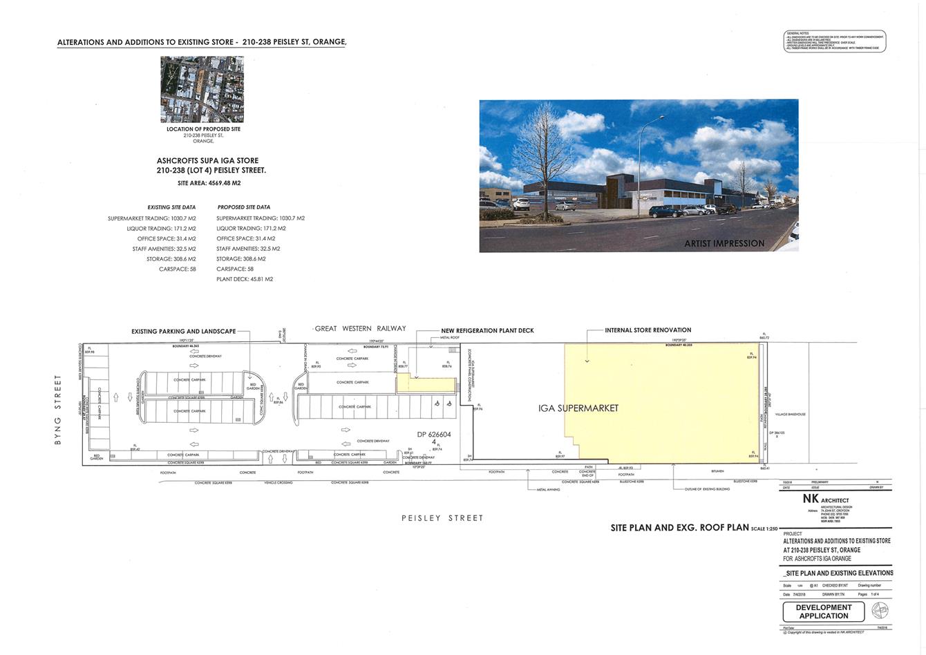
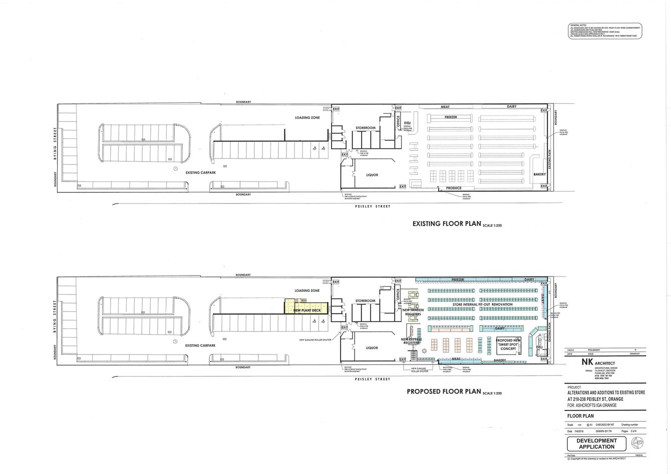
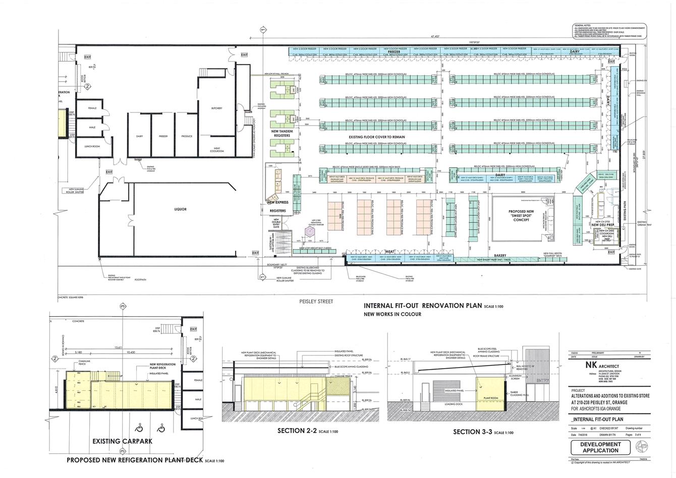
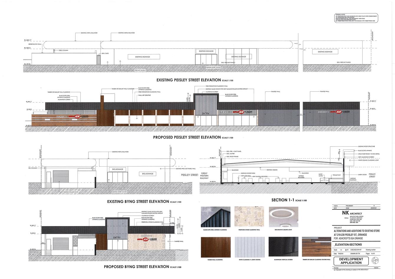
2.7 Development
Application DA 312/2018(1) - 84 Dalton Street and Lot 1 Anson Street
RECORD
NUMBER: 2018/2376
AUTHOR: Paul
Johnston, Manager Development Assessments
EXECUTIVE Summary
|
Application
lodged
|
4
September 2018
|
|
Applicant/s
|
Orange
City Council
|
|
Owner/s
|
Orange
City Council
|
|
Land
description
|
Lots 1
and 2 Section 4 DP 758817 – 84 Dalton Street and Lot 1 Anson
Street, Orange
|
|
Proposed
land use
|
Subdivision
(three lot Torrens)
|
|
Value of
proposed development
|
Not
applicable
|
Council's consent is sought for proposed subdivision of land
at Anson and Dalton Streets, being the site of the former Orange Base Hospital
and Ambulance Station. Demolition of improvements and site remediation works
were recently completed in accordance with DA 251/2016(1) (approved 19
October 2016).
The NSW State Government has recently announced that part of
the site will be developed for the offices of the Department of Industry
(‘the Department’). In order to facilitate the creation of a
development lot for the Department, subdivision is now proposed. The proposed
development involves a three (3) lot Torrens subdivision of the land to create
two vacant development lots and excise the former Ambulance Station building on
a separate parcel. The proposed development is administrative only and will not
necessitate alterations to existing urban utility services over and adjacent to
the site.
The proposal is consistent with the planning provisions that
apply to the subject land and particular landuse. Approval of the application
is recommended.
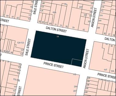
Figure 1 - locality plan
RECENT LEGISLATIVE CHANGES
On 1 March 2018 the Environmental Planning and Assessment
Act 1979 was substantially amended. The most immediate change involves the
restructuring and renumbering of the Act, with other more substantive
changes to be phased in over time. However, for some applications (particularly
where an application was lodged prior to the changes coming into effect) the
supporting documentation may still reference the previous numbering regime. In
the drafting of this report the content and substance of the supporting
material has been considered irrespective of which legislative references were
used.
DECISION FRAMEWORK
Development in Orange is governed by two key documents
Orange Local Environment Plan 2011 and Orange Development Control Plan 2004. In
addition the Infill Guidelines are used to guide development, particularly in
the heritage conservation areas and around heritage items.
Orange Local Environment Plan 2011 – The
provisions of the LEP must be considered by the Council in determining the
application. LEPs govern the types of development that are permissible or
prohibited in different parts of the City and also provide some assessment
criteria in specific circumstances. Uses are either permissible or not. The
objectives of each zoning and indeed the aims of the LEP itself are also to be
considered and can be used to guide decision making around appropriateness of
development.
Orange Development Control Plan 2004 – the DCP
provides guidelines for development. In general it is a performance based
document rather than prescriptive in nature. For each planning element there
are often guidelines used. These guidelines indicate ways of achieving the
planning outcomes. It is thus recognised that there may also be other solutions
of merit. All design solutions are considered on merit by planning and building
staff. Applications should clearly demonstrate how the planning outcomes are
being met where alternative design solutions are proposed. The DCP enables
developers and architects to use design to achieve the planning outcomes in alternative
ways.
DIRECTOR’S COMMENT
This is a simple subdivision application which is being put
to Council for determination as Council is a financial beneficiary of the
subdivision. The subdivision will provide three lots - two of which will be
sold to the Verde property group for the new Department of Industry development
and the refurbishment of the Old Ambulance station on a spare lot. The
remaining lot remains in Orange City Council ownership.
Link To Delivery/OPerational Plan
The recommendation in this report relates to the
Delivery/Operational Plan strategy “10.1 Preserve - Engage with the
community to ensure plans for growth and development are respectful of our
heritage”.
Financial Implications
Nil
Policy and Governance Implications
Nil
|
Recommendation
That Council consents to
development application DA 312/2018(1)
for Subdivision (three lot Torrens) at Lots 1 and 2 Section 4 DP
758817 – 84 Dalton Street and Lot 1 Anson Street, Orange pursuant to
the conditions of consent in the attached Notice of Approval.
|
further considerations
Consideration has been given to the recommendation’s
impact on Council’s service delivery; image and reputation; political;
environmental; health and safety; employees; stakeholders and project
management; and no further implications or risks have been identified.
SUPPORTING INFORMATION
THE PROPOSAL
The proposal involves a three lot Torrens subdivision of the
site to create two vacant development lots (proposed Lots 500 and 501) and
excise the former Ambulance Station on a separate parcel (proposed Lot 502).
The proposed subdivision is depicted below (refer Figure 2).
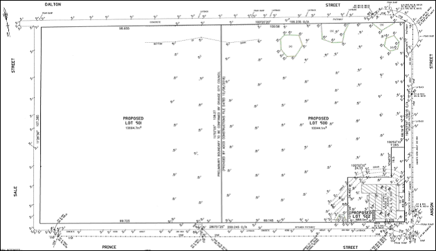
Figure 2 - proposed subdivision
Proposed Lot 500 will be a vacant development lot with site
area of 10,044.1m2. The proposed lot is the subject of recent
Development Application for proposed Commercial Premises and Public
Administration Building (DA 318/2018(1)), which will comprise the offices
of the Department of Industry. The determining authority to DA
318/2048(1) is the Western Region Joint Regional Planning Panel.
Development consent has not been granted at this time.
Proposed Lot 501 will comprise a site area of 10,694.7m2.
The proposed lot will be retained by Council as a development lot in the
interim.
Proposed Lot 502 will comprise the former Ambulance Station
and curtilage, and have site area of 888m2. The proposed lot
incorporates a ‘dog leg’ at the Anson Street frontage, intended for
future onsite car parking associated with adaptive reuse of the building.
The proposed subdivision does not involve new roads or site
accesses, and will not necessitate alterations to existing urban utility
services over the site.
MATTERS FOR CONSIDERATION
Section 1.7 Application of
Part 7 of the Biodiversity Conservation Act 2016 and Part 7A of the
Fisheries Management Act 1994
Section 1.7 of the EP&A Act 1979 identifies that Part 7
of the Biodiversity Conservation Act 2016 and Part 7A of the Fisheries
Management Act 1994 have effect in connection with terrestrial and aquatic
environments.
Having regard to the relevant provisions and based on an
inspection of the subject property, it is considered that the proposed
development is not likely to significantly affect a threatened species. The
subject property has no biodiversity or habitat value. A Biodiversity
Development Assessment Report is not required in this instance.
PROVISIONS OF ANY ENVIRONMENTAL
PLANNING INSTRUMENT s4.15(1)(a)(i)
Orange Local Environmental Plan 2011
Part 1 - Preliminary
Clause 1.2 Aims of Plan
The
particular aims of Orange LEP 2011 relevant to the proposal include:
(a) to encourage development which complements
and enhances the unique character of Orange as a major regional centre boasting
a diverse economy and offering an attractive regional lifestyle,
(b) to provide for a range of development
opportunities that contribute to the social, economic and environmental
resources of Orange in a way that allows present and future generations to meet
their needs by implementing the principles for ecologically sustainable
development,
(e) to provide a range of housing choices in
planned urban and rural locations to meet population growth,
(f) to recognise and manage valued
environmental heritage, landscape and scenic features of Orange.
The proposed subdivision is consistent with the listed aims.
The proposal will create parcels for future residential and commercial
development, and facilitate the future adaptive reuse of a mapped heritage
item. The proposal will contribute to the role of Orange as a major regional
centre.
Clause 1.6 - Consent Authority
Clause 1.6 is applicable and states:
The
consent authority for the purposes of this Plan is (subject to the Act) the
Council.
Clause 1.7 - Mapping
The subject site is identified
on the LEP maps in the following manner:
|
Land Zoning Map:
|
Land zoned B4 Mixed Use, R3 Medium
Density Development and RE1 Public Recreation
|
|
Lot Size Map:
|
No minimum lot size
|
|
Heritage Map:
|
A Local heritage item or adjacent
to heritage conservation area
|
|
Height of Buildings Map:
|
Building height limits 16m, 25m,
26m and 22m
|
|
Floor Space Ratio Map:
|
Floor space limit 1.8
|
|
Terrestrial Biodiversity Map:
|
No biodiversity sensitivity on the
site
|
|
Groundwater Vulnerability Map:
|
Groundwater vulnerable
|
|
Drinking Water Catchment Map:
|
Not within the drinking water
catchment
|
|
Watercourse Map:
|
Not within or affecting a defined
watercourse
|
|
Urban Release Area Map:
|
Not within an urban release area
|
|
Obstacle Limitation Surface Map:
|
No restriction on building siting
or construction
|
|
Additional Permitted Uses Map:
|
No additional permitted use applies
|
|
Flood Planning Map:
|
Not within a flood planning area
|
Those matters that are of relevance are addressed in detail
in the body of this report.
Clause 1.9A - Suspension of
Covenants, Agreements and Instruments
Clause 1.9A is applicable and states in part:
(1) For the purpose of enabling
development on land in any zone to be carried out in accordance with this Plan
or with a consent granted under the Act, any agreement, covenant or other
similar instrument that restricts the carrying out of that development does not
apply to the extent necessary to serve that purpose.
(2) This clause does not apply:
(a) to a covenant
imposed by the Council or that the Council requires to be imposed, or
(b) to
any prescribed instrument within the meaning of section 183A of the Crown Lands
Act 1989, or
(c) to
any conservation agreement within the meaning of the National Parks and
Wildlife Act 1974, or
(d) to
any Trust agreement within the meaning of the Nature Conservation Trust Act
2001, or
(e) to
any property vegetation plan within the meaning of the Native Vegetation Act
2003, or
(f) to
any biobanking agreement within the meaning of Part 7A of the Threatened
Species Conservation Act 1995, or
(g) to
any planning agreement within the meaning of Division 6 of Part 4 of the
Council staff are not aware that
the subject land is affected by any of the above.
Part 2 - Permitted or Prohibited Development
Clause
2.1 Land Use Zones
The subject land is zoned B4 Mixed
Use, R3 Medium Density Development and RE1 Public Recreation (refer Figure
3).
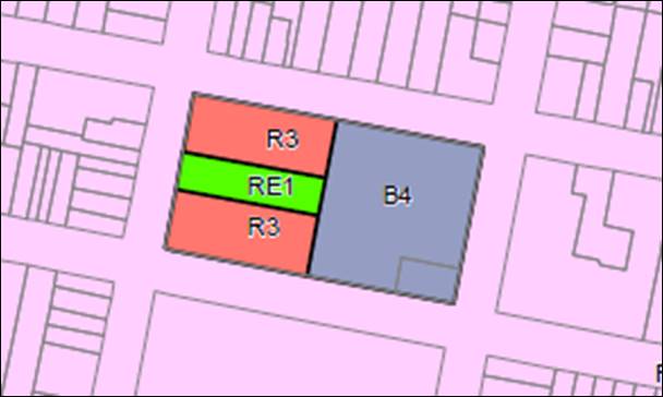
Figure 3 - Orange LEP 2011 Land Zoning Map
The proposed development is defined as subdivision.
Pursuant to Section 6.2 of the Environmental Planning and Assessment Act
1979:
Subdivision of land means the
division of land into two or more parts that, after the division, would be
obviously adapted for separate occupation, use or disposition.
Subdivision is permitted with consent pursuant to Clause 2.6
(refer below).
Clause 2.3 Zone Objectives and Land Use Table
The objectives for land zoned B4
Mixed Use are:
· To
provide a mixture of compatible land uses.
· To
integrate suitable business, office, residential, retail and other development
in accessible locations so as to maximise public transport patronage and encourage
walking and cycling.
· To
promote, where possible, the retention and reuse of heritage items as well as
the retention of established buildings that contribute positively to the
heritage or cultural values of the land in the zone.
· To
promote development that supports the role of Orange CBD as the primary retail
and business centre in the region.
The objectives for land zoned R3
Medium Density Residential are:
· To
provide for the housing needs of the community within a medium density
residential environment.
· To
provide a variety of housing types within a medium density residential
environment.
· To
enable other land uses that provide facilities or services to meet the day to
day needs of residents.
· To
ensure development is ordered in such a way as to maximise public transport
patronage, and encourage walking and cycling, in close proximity to settlement.
The objectives
for land zone RE1 Public Recreation are:
· To
enable land to be used for public open space or recreational purposes.
· To
provide a range of recreational settings and activities and compatible land
uses.
· To
protect and enhance the natural environment for recreational purposes.
· To
ensure development is ordered in such a way as to maximise public transport
patronage and encourage walking and cycling in close proximity to settlement.
· To
ensure development along the Southern Link Road has alternative access.
The
proposed subdivision is not contrary to the stated B4, R3 and RE1 zone
objectives listed in the Land Use Tables. The proposed lots will generally
accord with the existing zone boundaries and will not impact on future
development of the lots consistent with the zoned purpose.
Clause 2.6 Subdivision -
Consent Requirements
Clause 2.6 is applicable and states:
(1) Land
to which this Plan applies may be subdivided but only with development consent.
Consent is sought for Torrens subdivision of the subject
land in accordance with this clause.
Part 3 - Exempt and Complying Development
The application is not exempt or complying development.
Part 4 - Principal Development Standards
Clause
4.1 Minimum Subdivision Lot Size
Clause
4.1 is applicable and states in part:
(3) The size of any
lot resulting from a subdivision of land to which this clause applies is not to
be less than the minimum size shown on the Lot Size Map in relation to that land.
In
consideration of this clause, the subject land is not affected by a minimum lot
size pursuant to the Lot Size Map. The proposed subdivision is not
contrary to Clause 4.1.
Clause 4.3 Height of Buildings
Clause
4.3 applies to the subject land and states in part:
(2) The height of a building on any
land is not to exceed the maximum height shown for the land on the Height of
Buildings Map.
The subject
land is variously affected by building height limits of 16m (O);
25m (T1); 26m (T2); and 22m (R) (refer Figure 4 below). The
proposed subdivision does not involve new buildings. The prescribed height
limits have nil impact for the proposed development.
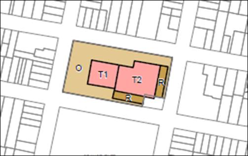
Figure 4 - Orange LEP 2011 Height of Buildings Map
Clause 4.4
Floor Space Ratio
Clause 4.4 applies to the subject
land and states in part:
(2) The maximum floor space ratio
for a building on any land is not to exceed the floor space ratio shown for the
land on the Floor Space Ratio Map.
The
subject land is affected by a floor space limit of 1.8:1 (S2) pursuant to the Floor
Space Ratio Map (refer Figure 5 below). The proposed subdivision does not
involve new buildings. The prescribed floor area limits have nil impact for the
proposed development.
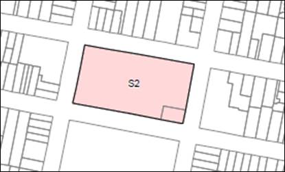
Figure 5 - Orange LEP 2011 Floor Space Ratio Map
Part 5 - Miscellaneous Provisions
Clause 5.10 Heritage Conservation
The subject
land is located opposite the Central Orange Heritage Conservation Area,
contains a mapped Local heritage item (the former Ambulance Station-
Item 254), and is nearby to 10 listed heritage items of Local significance
(refer below).
Figure 6 - Orange LEP 2011 Heritage Map
Clause 5.10 is applicable and states in part:
(4) Effect
of proposed development on heritage significance
The
consent authority must, before granting consent under this clause in respect of
a heritage item or heritage conservation area, consider the effect of the
proposed development on the heritage significance of the item or area
concerned. This subclause applies regardless of whether a heritage management document
is prepared under subclause (5) or a heritage conservation management plan is
submitted under subclause (6).
It is considered that the proposed subdivision will not
adversely affect the significance of the heritage items and setting pursuant to
Clause 5.10(4) due to the following:
- The
proposal involves retention of the former Ambulance Station. The development
will not alter the bulk, massing or profile of the building, and how it relates
within the Anson and Prince Street streetscapes.
- A
reasonable curtilage will be maintained for the former Ambulance Station on
proposed Lot 502. The proposed subdivision layout will not adversely impact on
views of the item. The proposed boundaries are sufficiently removed from the
building as to maintain structural integrity.
- The
proposal involves retention of remaining trees over the site. The proposed
subdivision will not alter the existing landscape setting.
- The
subdivision does not involve new or altered utility services and site accesses,
and will have nil impact on the streetscape presentation of the site.
- The
proposed subdivision will not impact heritage items nearby to the site in terms
of interface, appreciation, integrity or views.
The proposed development was referred to Council’s
Heritage Advisor for consideration. He concurs that the proposed subdivision
will not adversely impact on the conservation significance of the site or
setting, subject to suitable parking and boundary screen planting being
provided on proposed Lot 502.
The Heritage Advisor noted that the nominated parking
‘dog leg’ on Lot 502 may be unsuitable in area and orientation to
accommodate parking demands associated with future adaptive reuse of the former
Ambulance Station Building. The plans submitted with DA318/2018(1) (separate DA
relating to the future Department of Industry development) show that future car
parking on proposed lot 502 will be accessed by the proposed internal driveway
within lot 500. It is recommended in this regard that a Right of Carriageway
pursuant to Section 88B of the NSW Conveyancing Act 1919 be required by
condition of consent over proposed Lot 500 that matches the concept for the DPI
proposal so as to ensure that the practical and meaningful use of this
‘dog leg’ space is provided for in its redevelopment.
Part 6 -
Urban Release Area
Not relevant to the application. The subject site is not
located in an Urban Release Area.
Part 7 - Additional Local Provisions
Clause
7.3 Stormwater Management
Clause 7.3 is applicable. This
clause states in part:
(3) Development
consent must not be granted to development on land to which this clause applies
unless the consent authority is satisfied that the development:
(a) is
designed to maximise the use of water permeable surfaces on the land having
regard to the soil characteristics affecting on-site infiltration of water, and
(b) includes,
where practical, on-site stormwater retention for use as an alternative supply
to mains water, groundwater or river water, and
(c) avoids
any significant impacts of stormwater runoff on adjoining downstream
properties, native bushland and receiving waters, or if that impact cannot be
reasonably avoided, minimises and mitigates the impact.
The development site is
currently serviced by reticulated stormwater. The proposed subdivision will not
alter existing stormwater infrastructure to the proposed lots in accordance
with Clause 7.3. Infrastructure augmentation will be undertaken as required in
conjunction with subsequent development of the proposed lots.
Clause 7.6 Groundwater Vulnerability
The
subject land is identified as Groundwater Vulnerable on the Groundwater
Vulnerability Map and Clause 7.6 applies. This clause states in part:
(3) Before determining a
development application for development on land to which this clause applies,
the consent authority must consider:
(a) whether
or not the development (including any onsite storage or disposal of solid or
liquid waste and chemicals) is likely to cause any groundwater contamination or
have any adverse effect on groundwater dependent ecosystems, and
In consideration of Clause 7.6,
the proposal is considered to be acceptable. The proposed development does not
involve processes or activities that would impact on groundwater resources. The
subject land is connected to Council’s reticulated sewerage system.
Clause 7.11 Essential Services
Clause
7.11 is applicable. This clause states:
Development
consent must not be granted to development unless the consent authority is
satisfied that any of the following services that are essential for the
proposed development are available or that adequate arrangements have been made
to make them available when required:
(a) the
supply of water
(b) the
supply of electricity
(c) the
disposal and management of sewage
(d) storm
water drainage or on-site conservation
(e) suitable
road access.
Urban services are
available to the subject land, including reticulated water, stormwater, and
sewer; electricity and telecommunications, and suitable road access. The
proposed subdivision will not necessitate alteration of the existing services
or provision of new services pursuant to Clause 7.11. Infrastructure
augmentation will be undertaken as required in conjunction with subsequent
development of the proposed lots.
STATE ENVIRONMENTAL PLANNING
POLICIES
State Environmental Planning
Policy 55 Remediation of Land
State Environmental Planning Policy 55 - Remediation of Land
(SEPP 55) is applicable and states in part:
Clause 7 Contamination and remediation to be considered
in determining development application:
(1) A consent authority must not consent to
the carrying out of any development on land unless:
(a) it
has considered whether the land is contaminated, and
(b) if
the land is contaminated, it is satisfied that the land is suitable in its
contaminated state (or will be suitable, after remediation) for the purpose for
which the development is proposed to be carried out, and
(c) if
the land requires remediation to be made suitable for the purpose for which the
development is proposed to be carried out, it is satisfied that the land will
be remediated before the land is used for that purpose.
In consideration of
Clause 7, DA 251/2016(1) involved demolition of improvements and infrastructure
over the site (excluding the former Ambulance Station building) and site remediation
works. Extensive contamination investigation was undertaken and remedial action
plans submitted in support of DA 251/2016(1). In order to ensure the
suitability of the site for residential and complementary landuses, Condition
(26) of the development consent required:
(26) A validation report shall be provided to Council
along with a Summary Document in accordance with Council’s draft
Contaminated Land Management Plan and the notice of completion required under
clause 17(2) of SEPP 55 to confirm that the remediation has been carried out in
accordance with the requirement this consent and SEPP 55. The validation report
must be prepared in accordance with Council’s Contaminated Land Policy,
the Managing Land Contamination Planning Guideline (1998), relevant EPA
Guidelines and the National Environmental Protection (Assessment of Site
Contamination) Measure (1999).
A validation report remains outstanding at present. It is
recommended that a condition of consent be attached to the Notice of
Determination requiring validation clearance pursuant to the requirements of
DA 251/2016(1) prior to the issue of a Subdivision Certificate. Land
comprising proposed Lot 500 is the subject of a current development application
for proposed Commercial Premises and Public Administration Building (DA 318/2018(1)),
which will comprise the offices of the Department of Industry. Assessment and
clearance of contamination issues would also be required to be addressed as a
part of that process.
PROVISIONS OF ANY DRAFT
ENVIRONMENTAL PLANNING INSTRUMENT THAT HAS BEEN PLACED ON EXHIBITION
4.15(1)(a)(ii)
There are no draft environmental planning instruments that
apply to the subject land or proposed development.
DESIGNATED DEVELOPMENT
The proposed development is not designated development.
INTEGRATED DEVELOPMENT
The proposed development is not integrated development.
PROVISIONS OF ANY DEVELOPMENT
CONTROL PLAN s4.15(1)(a)(iii)
Development Control Plan 2004
The Planning Outcomes relevant to the proposed subdivision
are considered below.
DCP 2004 - 4 Special Environmental
Considerations: 4.4 Contaminated Land
Planning Outcomes 4.4-1:
· Land subject to
development is clear from contamination
· Development
complies with the Contaminated Land Management Act 1997
· Applications
for development consent on land used or likely to have been used for
[contaminated landuses] include contamination assessment…
Contamination clearance and site validation is a requirement
of DA 251/2016(1). The proposed subdivision is administrative only and
does not involve civil or construction works. Future development on the
proposed lots shall not proceed without validation clearance pursuant to
DA 251/2016(1).
DCP 2004 - 5 General
Considerations for Zones: 5.7 Subdivision
Planning Outcome 5.7:
· All subdivision
works are designed and undertaken in accordance with Council’s adopted
standards as outlined in the Orange City Development and Subdivision Code.
The proposed development
will satisfy the relevant standards contained in the Development and
Subdivision Code. Conditions are included on the attached Notice of Approval to
this effect.
DCP 2004 - 7 Development in
Residential Areas: 7.2 Residential Subdivision
Planning Outcomes 7.2-1:
· Lots are
oriented to maximise energy efficiency principles
· Lots are fully
serviced and have direct frontage / access to a public road
· Design and
construction complies with the Orange City Development and Subdivision Code
Proposed Lot 501 generally accords with land zoned R3 Medium
Density Housing. Proposed Lot 501 will be of sufficient area, dimension
and orientation to provide a high standard of solar access to future
residential development on the lot. Urban utility services are available to the
proposed lot and will be augmented as required with future development on the
lot. Proposed Lot 501 will have frontage and access to the existing public
roads that bound the development site. The proposed subdivision will satisfy
the relevant standards contained in the Development and Subdivision Code.
DCP 2004 - 8
Development in Business Zones: 8.2 Business Services Areas
The proposed subdivision is not
relevant to the planning outcomes for the particular business zoning.
DCP 2007 – 11 Land Used
for Open Space and Recreation: 11.3 Use of Public Land
Planning Outcome
11.3-1
· Land is used in
accordance with the relevant adopted plan of management
Proposed Lot 501 will include land
zoned RE1 Public Recreation. The proposed subdivision will have nil impact on
the use of RE1 land.
DCP 2004 - 13 Heritage: 13.3
Heritage Consideration for Development and Infill Guidelines
Planning Outcomes 13.3-1:
· Development
relates to the significant features of heritage buildings on or near the site,
as reflected in inventory sheets
· Development
conforms with recognised conservation principles
· Conservation
Management Plans are prepared for development having a significant effect on
heritage items
The proposed subdivision is administrative only and does not
involve civil or construction works. As considered in the foregoing sections of
this report, the proposed subdivision will not adversely impact on the
significance of the setting. Council’s Heritage Advisor concurs with this
finding. Future development of the proposed lots will be subject to heritage
assessment to satisfy DCP 2004-13 and Infill Guidelines.
Development Contributions
Section 4.11 Environmental Planning and Assessment Act
1979
The proposed subdivision involves the creation of 1
additional lot zoned B4 Mixed Use. Section 4.11 development contributions
are not applicable to business zoned lots pursuant to Orange Development
Contribution Plan 2017. The existing credit on the site will apply to that part
of the site zoned R3 Medium Density Housing
Section 64 Local Government
Act 1993
Section 64 contributions for water, sewer and drainage works
are applicable to the proposed subdivision. The contributions are based on 1
additional ET for water supply headworks, and 1 additional ET for sewerage
headworks. A condition is included on the attached Notice of Approval requiring
payment of contributions prior to issue of a Subdivision Certificate.
PROVISIONS PRESCRIBED BY THE
REGULATIONS s4.15(1)(a)(iv)
Demolition of a Building (clause 92)
The proposal does not involve the demolition of a building.
Fire Safety Considerations
(clause 93)
Council’s Environmental Health and Building Surveyor
(EHBS) advises:
‘The existing building
on proposed Lot 502 needs to be at least 3m from the proposed boundaries to
comply with the Building Code of Australia, and to avoid the need for fire
separation. This will be confirmed prior to issue of a Subdivision
Certificate.’
Buildings to be Upgraded
(clause 94)
Council’s EHBS advises:
‘Provided the proposed
boundary is at least 3m from the existing building on proposed Lot 502,
upgrading works will not be required.’
BASIX Commitments (clause 97A)
BASIX is not applicable to the proposal.
THE LIKELY IMPACTS OF THE
DEVELOPMENT s4.15(1)(b)
Visual Amenity
The proposed subdivision will
have nil impact on the existing neighbourhood visual amenity. The proposal does
not involve civil or construction works. Existing trees over the site will be
retained. No buildings or structures are proposed at this time. Future
development on the proposed lots will be subject to separate development
application and assessment, with visual impacts to be considered at that time.
Traffic Impacts
The proposed subdivision is considered satisfactory in terms
of traffic amenity. The proposed lots will have frontage and access to a public
road and new roads are not proposed. New roads or additional/amended vehicle
crossings to the proposed lots will be considered at future development
application stages.
Proposed Lots 500 and 501 are of sufficient area and
dimensions to accommodate onsite parking and satisfactory manoeuvring for
future residential and commercial landuse, subject to further development
application and assessment.
An indicative area is provided within proposed Lot 502 to
accommodate parking demands associated with future adaptive reuse of the former
Ambulance Station building (see below).
Figure 7 - indicative car parking area on proposed Lot
502
As discussed above the plans submitted with DA318/2018(1)
(separate DA relating to the future Department of Industry development) show
that future car parking on proposed lot 502 will be accessed by the proposed
internal driveway within lot 500. It is recommended in this regard that a Right
of Carriageway pursuant to Section 88B of the NSW Conveyancing Act 1919 be
required by condition of consent over proposed Lot 500 that matches the concept
for the DPI proposal so as to ensure that the practical and meaningful use of
this ‘dog leg’ space is provided for in its redevelopment.
The suitability of proposed Lot 502 to accommodate parking
demands will be subject to further development application and assessment. Traffic
generation associated with future development on the proposed lots will be
considered at subsequent DA stage.
Solar Access
The orientation of the proposed lots will provide reasonable
opportunity for solar access to internal and external spaces associated with
future residential and commercial development. The proposed lots are generally
regular shaped, with a generous north-south axis.
Environmental Impacts
The subject land is not identified as “biodiversity
sensitivity” on the OLEP 2011 Terrestrial Biodiversity Map,
and comprises a highly modified and urban site. Previous assessment in
conjunction with DA 251/2016(1) determined that there is no evidence of
endangered ecological flora and fauna on the site. The proposed subdivision is
unlikely to impact on endangered ecological communities.
Cultural Values
The proposed development will not impact on Aboriginal or
European cultural values. The cultural values of the development site were
identified and managed during recent demolition and remediation works pursuant
to DA 251/2016(1).
The development site is subject to an Interpretation
Strategy, pursuant to Condition 27 of DA 251/2016(1). The proposed
subdivision is not contrary to the design recommendations contained in the
Interpretation Strategy. Future development of the proposed lots will accord
with the Strategy findings.
The proposed subdivision does not involve civil or
construction works. Existing trees will be retained and no buildings or
structures are proposed to be removed. The mapped heritage item on the site
(former Ambulance Station) will be retained, with proposed boundaries to afford
a suitable curtilage. As outlined in the foregoing sections of this report, the
proposal will have nil-negligible impact on the conservation values of the site
and setting.
Residential Amenity
The development site is located within an established
residential neighbourhood. The proposed subdivision will not alter existing
residential amenity for dwellings nearby to the site.
Water Quality
There are no aspects of the proposed subdivision that would
present adverse impact on water quality.
Noise
The proposed subdivision will not alter the existing
acoustic setting in this neighbourhood.
Air Quality
There are no aspects of the proposed subdivision that would
unreasonably affect the precinct in terms of dust, odour or atmospheric
emissions.
Social and Economic Effects
The proposed lots will generally accord with the existing
landuse zone boundaries and thus will not diminish the long term potential for
the lots to be used for their zoned purpose. The proposal involves the creation
of parcels for future residential and commercial development, and will
facilitate future adaptive reuse of a mapped heritage item. Future development
of this site in this way will have positive social and economic effects for
the City.
THE SUITABILITY OF THE SITE
s4.15(1)(c)
The subject land is suitable for the proposed subdivision
due to the following:
- Subdivision
as a precursor to future site redevelopment is consistent with the zoning of
the land and zone objectives.
- The
proposed lots will be of suitable areas and dimensions for future development
(subject to further DA).
- The
site will be free from contamination (subject to future validation).
- The
site has no particular environmental values.
- The
site is not subject to natural hazards (bushfire, flooding or subsidence).
- Utility
services are available and suitable subject to augmentation.
- The
land has frontage and access to public roads.
ANY SUBMISSIONS MADE IN ACCORDANCE
WITH THE ACT s4.15(1)(d)
The proposed development is not defined as advertised
development pursuant to DCP 2004-5.3, and as such no formal exhibition of
the application was required. No submissions have been received in relation to
this application.
PUBLIC INTEREST
s4.15(1)(e)
The proposed development is in the public interest as the
development site is owned by Council. Further, proposed Lot 500 comprises the
future site of NSW DPI head offices. The proposal is not inconsistent with any
relevant policy statements, planning studies, guidelines etc that have not
been considered in this assessment.
SUMMARY
The proposed development is permissible with the consent of
Council. The proposed development complies with the relevant aims, objectives
and provisions of Orange LEP 2011 (as amended) and DCP 2004. A
section 4.15 assessment of the development indicates that the development
is acceptable in this instance. Attached is a draft Notice of Approval
outlining a range of conditions considered appropriate to ensure that the
development proceeds in an acceptable manner.
COMMENTS
The requirements of the Environmental Health and Building
Surveyor and the Engineering Development Section are included in the attached
Notice of Approval.
Attachments
1 Notice
of Approval, D18/50367⇩
2 Plan,
IC18/17242⇩
Planning
and Development Committee
2 October 2018
2.7 Development
Application DA 312/2018(1) - 84 Dalton Street and Lot 1 Anson Street
Attachment 1 Notice of Approval
|

|
ORANGE CITY COUNCIL
Development
Application No DA
312/2018(1)
NA18/ Container
PR10203
|
NOTICE OF DETERMINATION
OF A DEVELOPMENT
APPLICATION
issued under the Environmental
Planning and Assessment Act 1979
Section 4.18
|
Development
Application
|
|
|
Applicant
Name:
|
Orange City Council
|
|
Applicant
Address:
|
PO Box 35
ORANGE
NSW 2800
|
|
Owner’s
Name:
|
Orange City Council
|
|
Land
to Be Developed:
|
Lot 1 Sec 4 DP 758817
- Anson Street, Orange
Lot 2 Sec 4 DP 758817
- 84 Dalton Street, Orange
|
|
Proposed
Development:
|
Subdivision (three lot
Torrens)
|
|
|
|
|
Building Code of
Australia
building
classification:
|
Not applicable
|
|
|
|
|
Determination made
under
Section 4.16
|
|
|
Made
On:
|
2 October 2018
|
|
Determination:
|
CONSENT GRANTED
SUBJECT TO CONDITIONS DESCRIBED BELOW:
|
|
|
|
|
Consent to Operate From:
|
3 October 2018
|
|
Consent to Lapse On:
|
3 October 2023
|
Terms
of Approval
The reasons for the imposition of conditions
are:
(1) To ensure compliance
with relevant statutory requirements.
(2) Because the development
will require the provision of, or increase the demand for, public amenities and
services.
(3) To ensure the utility
services are available to the site and adequate for the development.
Conditions
(1) The development must be
carried out in accordance with:
(a) Survey
Plan by Craig Jaques & Associates (Orange) Pty Ltd Reference 1550/18DT
dated 31.08.18 (1 sheet)
(b) statements
of environmental effects or other similar associated documents that form part
of the approval
as amended in
accordance with any conditions of this consent.
(2) All building work must
be carried out in accordance with the provisions of the Building Code of
Australia.
|
DURING CONSTRUCTION/SITEWORKS
|
(3) Any adjustments to
existing utility services that are made necessary by this development
proceeding are to be at the full cost of the developer.
(4) The provisions and
requirements of the Orange City Council Development and Subdivision Code are to
be applied to this application and all work constructed within the development
is to be in accordance with that Code.
The developer is to be entirely responsible for
the provision of water, sewerage and drainage facilities capable of servicing
all the lots from Council’s existing infrastructure. The developer is to
be responsible for gaining access over adjoining land for services where
necessary and easements are to be created about all water, sewer and drainage
mains within and outside the lots they serve.
|
PRIOR TO THE ISSUE OF A SUBDIVISION
CERTIFICATE
|
(5) The
applicant shall submit to Orange City Council a copy of the validation report
required by Condition (26) of DA 251/2016(1) relating to the demolition of
the former Orange Base Hospital.
(6) Prior to the issuing of
the Subdivision Certificate, a Surveyor’s Certificate or written statement
is to be provided to the Principal Certifying Authority, stating that the
buildings within the boundaries of proposed Lot 502 comply in respect to the
distances of walls from boundaries.
(7) Application
shall be made for a Subdivision Certificate under Section 6.3(1)(d) of the Act.
(8) Payment
of contributions for water, sewer and drainage works is required to be made
at the contribution rate applicable at the time that the payment is made.
The contributions are based on 1.0 ETs for water supply headworks and 1.0 ETs
for sewerage headworks. A Certificate of Compliance, from Orange City
Council in accordance with the Water Management Act 2000, will be issued
upon payment of the contributions.
This Certificate of Compliance is to be
submitted to the Principal Certifying Authority prior to the issuing of a
Subdivision Certificate.
(9) A
Notice of Arrangement from Essential Energy stating arrangements have been made
for the provision of electricity supply to the development, is to be submitted
to the Principal Certifying Authority prior to the issue of a Subdivision
Certificate.
(10) A
Restriction as to User under Section 88B of the NSW Conveyancing Act 1919 shall
be created over proposed lot 500 so as to provide legal access to possible
future car parking within proposed lot 502. The Right of Carriageway shall be
designed to provide for access and manoeuvring over lot 500 in a manner
consistent with the concept submitted in support of the proposed redevelopment
of Lot 500 in DA 318/2018(1).
(11) All
of the foregoing conditions are to be at the full cost of the developer and to
the requirements and standards of the Orange City Council Development and
Subdivision Code, unless specifically stated otherwise. All work required by
the foregoing conditions is to be completed prior to the issuing of a
Subdivision Certificate, unless stated otherwise.
Other
Approvals
(1) Local
Government Act 1993 approvals granted under section 68.
Nil
(2) General
terms of other approvals integrated as part of this consent.
Nil
Right
of Appeal
If you are dissatisfied with this decision,
Section 8.7 of the Environmental Planning and Assessment Act 1979
gives you the right to appeal to the Land and Environment Court. Pursuant to
Section 8.10, an applicant may only appeal within 6 months after the date the
decision is notified.
|
Disability
Discrimination Act 1992:
|
This application has been assessed in
accordance with the Environmental Planning and Assessment Act 1979. No
guarantee is given that the proposal complies with the Disability
Discrimination Act 1992.
The applicant/owner is responsible to ensure compliance
with this and other anti-discrimination legislation.
The Disability Discrimination Act
covers disabilities not catered for in the minimum standards called up in the
Building Code of Australia which references AS1428.1 - "Design for
Access and Mobility". AS1428 Parts 2, 3 and 4 provides the most
comprehensive technical guidance under the Disability Discrimination Act
currently available in Australia.
|
|
|
|
|
Disclaimer
- S88B of the Conveyancing Act 1919 - Restrictions on the Use of Land:
|
The applicant should note that there could be
covenants in favour of persons other than Council restricting what may be
built or done upon the subject land. The applicant is advised to check the
position before commencing any work.
|
|
|
|
|
Signed:
|
On behalf of the consent authority ORANGE
CITY COUNCIL
|
|
Signature:
|
|
|
Name:
|
PAUL JOHNSTON - MANAGER DEVELOPMENT
ASSESSMENTS
|
|
Date:
|
3 October 2018
|
Planning and Development Committee
2 October 2018
2.7 Development
Application DA 312/2018(1) - 84 Dalton Street and Lot 1 Anson Street
Attachment 2 Plan
2.8 Orange
City Council Joint Regional Planning Panel Membership
RECORD
NUMBER: 2018/2243
AUTHOR: David
Waddell, Director Development Services
EXECUTIVE Summary
Joint Regional Planning Panels
(JRPPs) were introduced in NSW in 2009 to de-politicise decision making on
regionally significant development. The Panels may also have a role in planning
proposals, to undertake rezoning reviews or to act as the relevant planning
authority (RPA) when directed.
The panel comprises five members,
three appointed by the State and two by the relevant Council. Current State
appointed panellists for Western Region JRPPs are Gordon Kirkby (chair), Ruth
Fagan and Mark Grayson.
The panel take on the role of
‘Relevant Planning Authority’ for larger scale development
applications and matters where Council may have a conflicting interest (as
landowner for example).
In such cases assessment continues
to be undertaken by Council staff, but the report is provided to the JRPP,
rather than Council, for determination.
Membership of the JRPP is open to
both Councillors and the broader community, but at least one council appointee
is required to have expertise in one or more of the following areas: Planning,
Architecture, Heritage, the Environment, Urban Design, Land Economics, Traffic
and Transport, Law, Engineering or Tourism.
At present the only JRPP relevant
matter before Council is the proposed building for the Department of Industry
on the old Base Hospital site; however nomination of Council members expires
after three years. The current Council members Cr Jeff Whitton,
Mr Michael Ryan and Cr Chris Gryllis (alternate) were re-appointed in
October of 2012 and again in October 2016. While there is no limitation on
the number of terms that panellists may serve, it is noted that the current
representatives have effectively been in place since 2009.
Council has the ability to nominate
a total of three people - two preferred members and an alternate member - that
can represent the interests of Council and the community on any matters arising
over the next three years.
Council exhibited an Expression of
Interest (EOI) for members of the community that may wish to participate as a
Council nominated panellist. Exhibition ran from 26 July to 16 August
2018, with three submissions received.
Link To Delivery/OPerational Plan
The recommendation in this report relates to the
Delivery/Operational Plan strategy “7.1 Preserve - Engage with the
community to develop plans for growth and development that value the local
environment”.
Financial Implications
Nil
Policy and Governance Implications
Nil
|
Recommendation
That Council choose its two permanent and one alternate
Joint Regional Planning Panel expert representatives.
|
further considerations
Consideration has been given to the recommendation’s
impact on Council’s service delivery; image and reputation; political;
environmental; health and safety; employees; stakeholders and project
management; and no further implications or risks have been identified.
SUPPORTING INFORMATION
The Joint Regional Planning Panel (Western and when it sits
on an Orange LGA matter) is made up of three State members not related to
Orange Council, and two Council representatives (with a reserve
‘alternate’ representative also nominated in case one of the other
representatives are unavailable). Council’s representatives may be
Councillors or members of the public but at least one of the representatives must
have expertise in a related field.
Michael Ryan was the previous expert member with Jeff
Whitton, and Chris Gryllis as the reserve alternate member.
Permanent non-Council Members
Council is reminded that the current JRPP sitting permanent
non-Council related members are: Mr Gordon Kirkby, Mr Mark Greyson and Mrs Ruth
Fagan.
Council Representatives
Council may select three people to represent the Council and
community, two primary representatives and an alternate. The primary
representatives would be expected to participate in most cases, while the
alternate can be called on should either of the two primary representatives be
unavailable or have a conflict of interest. Nothing prevents a current or
former Councillor or former staff member from being selected, although at least
one representative - who should be a primary representative - must have
appropriate expertise. Equally, there is no requirement for any of the
representatives to be Councillors or Council staff, and they could all be
selected from the community. The primary focus is to ensure that Council is
fairly represented on the panel and can have confidence in its decisions.
Council ‘Expert’
Representative(s)
The JRPP operational procedures require that at least one
council representative must have appropriate qualifications or experience in
one or more of the following fields:
· Planning,
· Architecture,
· Heritage,
· the Environment,
· Urban Design,
· Land Economics,
· Traffic and
Transport,
· Law,
· Engineering, or
· Tourism.
Interest Received
As a result of the exhibition process three expressions of
interest were received:
1 Cr
Reg Kidd;
2 Mr
Alan Renike; and
3 Mr
John Holliday.
The submissions of Cr Kidd, Mr Renike and Mr Holliday are
attached.
Councillor Representatives
As an exercise in bureaucratic oversight, the Director
Development Services had forgotten the relevant section of a resolution from 21
November 2017 indicating that Cr Kidd, Cr Mileto and Cr Whitton were
nominated that night as the Council Representatives on the JRPP. This was
done without research on qualifications so could be challenged as a flawed
process.
RESOLVED
- 17/522 Cr
J Whitton/Cr K Duffy
1 That
Council establish the Community Committee framework for the 2017/2020 term of
Council.
2 That
Council confirm the Chairperson and Councillor members identified for each
Community Committee established (with exception to those that Council determine
will have a community member as the Chairperson).
3 That
Council seek expressions of interest from community members and relevant
agencies/organisations to join a Community Committee, based on the draft
Charter for each Committee.
4 That
Council confirm representation on the following external bodies
a City
of Orange Traffic Committee - Cr Turner Chairperson and Cr Mileto alternate
b Orange
Rail Action Group - Cr McRae
c Joint
Regional Planning Panel - Cr Kidd, Cr Mileto, Cr Whitton
d Business
Enterprise Centre - Cr McRae
e Association
of Mining Related Councils – Membership to be confirmed
f Orange
Business Chamber - Cr Munro
g TDO
Limited - Cr Kidd, Cr Whitton, Cr Hamling, Garry Styles
h CENTROC
- Cr Kidd, Cr McRae
I Central
West Libraries - Cr McRae
j Orange
Regional Arts Foundation - Cr Nugent
k Ronald
McDonald House Board - Cr Hamling
l Orange
Push for Palliative Care - Cr Kidd, Cr Hamling
m Orange
Domestic and Family Violence Roundtable - Cr Hamling, Cr Mileto
In order to untangle this
situation Council now needs to decide on one of the three nominees as
‘expert’, one permanent representative and one alternate representative.
Attachments
1 EOI
- Cr Reg Kidd, D18/50429⇩
2 EOI
- Allan Renike, D18/50430⇩
3 EOI
- John Holliday, D18/50431⇩
Planning
and Development Committee
2 October 2018
2.8 Orange
City Council Joint Regional Planning Panel Membership
Attachment 1 EOI - Cr Reg Kidd
Planning and Development Committee
2 October 2018
2.8 Orange
City Council Joint Regional Planning Panel Membership
Attachment 2 EOI - Allan Renike
Planning
and Development Committee
2 October 2018
2.8 Orange
City Council Joint Regional Planning Panel Membership
Attachment 3 EOI - John Holliday