ORANGE CITY COUNCIL
Planning and Development
Committee
Agenda
6 June 2017
Notice
is hereby given, in accordance with the provisions of the Local Government Act
1993 that a Planning and Development
Committee meeting
of ORANGE CITY COUNCIL will be held in the Council Chamber, Civic Centre, Byng Street, Orange on Tuesday,
6 June 2017.
Garry
Styles
General Manager
For apologies please
contact David Waddell on 6393 8261.
Planning and Development Committee 6
June 2017
1 Introduction
1.1 Declaration
of pecuniary interests, significant non-pecuniary interests and less than
significant non-pecuniary interests
The
provisions of Chapter 14 of the Local Government Act, 1993 (the Act)
regulate the way in which Councillors and designated staff of Council conduct
themselves to ensure that there is no conflict between their private interests
and their public role.
The
Act prescribes that where a member of Council (or a Committee of Council) has a
direct or indirect financial (pecuniary) interest in a matter to be considered
at a meeting of the Council (or Committee), that interest must be disclosed as
soon as practicable after the start of the meeting and the reasons given for
declaring such interest.
As
members are aware, the provisions of the Local Government Act restrict any
member who has declared a pecuniary interest in any matter from participating
in the discussion or voting on that matter, and requires that member to vacate
the Chamber.
Council’s Code of Conduct provides that if members
have a non-pecuniary conflict of interest, the nature of the conflict must be
disclosed. The Code of Conduct also provides for a number of ways in which a
member may manage non pecuniary conflicts of interest.
|
Recommendation
It is recommended that Committee Members now disclose any
conflicts of interest in matters under consideration by the Planning and
Development Committee at this meeting.
|
2 General
Reports
2.1 Items
Approved Under the Delegated Authority of Council
TRIM
REFERENCE: 2017/917
AUTHOR: Paul
Johnston, Manager Development Assessments
EXECUTIVE Summary
Following is a list of development
applications approved under the delegated authority of Council.
Link To Delivery/OPerational Plan
The recommendation in this report relates to the Delivery/Operational
Plan strategy “13.4 Our Environment – Monitor and
enforce regulations relating to City amenity”.
Financial Implications
Nil
Policy and Governance Implications
Nil
|
Recommendation
That the information provided in the
report by the Acting Manager Development Assessments on Items Approved Under
the Delegated Authority of Council be acknowledged.
|
further considerations
Consideration has been given to the
recommendation’s impact on Council’s service delivery; image and
reputation; political; environmental; health and safety; employees;
stakeholders and project management; and no further implications or risks have
been identified.
SUPPORTING INFORMATION
|
Reference:
|
DA 122/2014(2)
|
Determination
Date
|
9 May 2017
|
|
PR Number
|
PR23904
|
|
Applicant/s:
|
Eastern
Developments (NSW) Pty Ltd
|
|
Owner/s:
|
Eastern
Developments (NSW) Pty Ltd
|
|
Location:
|
Lot 101 DP 1147159
– 3 William Maker Drive, Orange
|
|
Proposal:
|
Modification
of development consent – subdivision (41 lot residential). The
modification involves amalgamating approved Lots 41, 42 and 43 into a single
lot for a potential multi-dwelling housing development to occur on the land
under a future development application.
|
|
Value:
|
$0
|
|
Reference:
|
DA 276/2015(2)
|
Determination
Date
|
26 April 2017
|
|
PR Number
|
PR17373
|
|
Applicant/s:
|
MJ and LM Smith Pty Ltd and Orange
City Council
|
|
Owner/s:
|
MJ and LM Smith Pty Ltd
|
|
Location:
|
Lot 101
DP 880908 – 155 Dalton Street, Orange
Lot 300
DP 883628 - McLachlan Street, Orange
|
|
Proposal:
|
Modification
of development consent – subdivision (boundary adjustment), demolition
(existing sheds) and construction of fire rated wall. The modification
involves alterations to the boundary adjustment, the deletion of the
blade wall, and construction of a fire rated wall within the existing
warehouse on proposed Lot 3.
|
|
Value:
|
$0
|
|
Reference:
|
DA 339/2015(2)
|
Determination
Date
|
1 May 2017
|
|
PR Number
|
PR10056
|
|
Applicant/s:
|
Mr W and Mrs KE Vardanega
|
|
Owner/s:
|
Mr D and Mrs JC Vardanega
|
|
Location:
|
Lot 11 DP 628747 -
610 Pinnacle Road, Orange
|
|
Proposal:
|
Modification of development consent - dwelling and attached garage,
and secondary dwelling (change of use of existing dwelling to a secondary
dwelling). The modification involves amendments to
the approved site plan, minor amendments to the approved dwelling floor plan,
amending some of the door and window types, dimensions and locations to
accord with the revised floor plan; addition of a 5kW solar photovoltaic
system and solar hot water unit to the north facing roof plane of the rumpus/garage
building and change of roofing material for Stage 1 (garage wing) to
Zincalume.
|
|
Value:
|
$500,000
(being the same value as the original development)
|
|
Reference:
|
DA 204/2016(1)
|
Determination
Date
|
12 April 2017
|
|
PR Number
|
PR34
|
|
Applicant/s:
|
Mr M O’Carrigan
|
|
Owner/s:
|
Mr MV and Mrs PE
O’Carrigan
|
|
Location:
|
Lot 1 DP 946330
– 4646 Mitchell Highway, Lucknow
|
|
Proposal:
|
Category 1
remediation, dwelling and rainwater tank
|
|
Value:
|
$240,000
|
|
Reference:
|
DA 330/2016(1)
|
Determination
Date
|
28 April 2017
|
|
PR Number
|
PR22380
|
|
Applicant/s:
|
Caltex
Australia Petroleum Pty Ltd
|
|
Owner/s:
|
Ampol
Property (Holdings) Pty Ltd
|
|
Location:
|
Lot 234
DP 1112378 - 184 Byng Street, Orange
|
|
Proposal:
|
Service
station (category 1 remediation - removal of infrastructure (canopy, fuel
pumps, underground tanks and infrastructure, and associated earthworks)
|
|
Value:
|
$200,000
|
|
Reference:
|
DA 218/2016(2)
|
Determination
Date
|
10 May 2017
|
|
PR Number
|
PR1178
|
|
Applicant/s:
|
Bassmann Drafting
Services
|
|
Owner/s:
|
Canobolas Caravan
Park Pty Limited
|
|
Location:
|
Lot 1 DP 218415
– 166-172 Bathurst Road, Orange
|
|
Proposal:
|
Modification
of development consent – vehicle sales or hire premises and vehicle
repair station (alterations and additions, including washbay). The
modification involves increasing the size of the approved washbay from
43.8m² to 86.2m².
|
|
Value:
|
$100,000 (being
the same value as the original development)
|
|
Reference:
|
DA 413/2016(1)
|
Determination
Date
|
1 May 2017
|
|
PR Number
|
PR8807
|
|
Applicant/s:
|
Ms BL
Shallvey
|
|
Owner/s:
|
Ms BL
Shallvey
|
|
Location:
|
Lot 3 DP
37344 - 56 Moulder Street, Orange
|
|
Proposal:
|
Secondary
dwelling
|
|
Value:
|
$53,000
|
|
Reference:
|
DA 21/2017(2)
|
Determination
Date
|
12 April 2017
|
|
PR Number
|
PR809
|
|
Applicant/s:
|
Mrs JL
Pottie
|
|
Owner/s:
|
Mrs JL
Pottie
|
|
Location:
|
Lot 8 SP
17153 - 8/182 Anson Street, Orange
|
|
Proposal:
|
Modification of development consent – serviced apartment (change
of use from commercial premises). The modification involves removing
Conditions in relation to the proposed construction works.
|
|
Value:
|
$0
|
|
Reference:
|
DA 49/2017(1)
|
Determination
Date
|
3 May 2017
|
|
PR Number
|
PR26657
|
|
Applicant/s:
|
Ms J Matthews
|
|
Owner/s:
|
Bruce Kerr Pty
Limited
|
|
Location:
|
Lot 80 DP 1200262
– 36 Winter Street, Orange
|
|
Proposal:
|
Subdivision
(two lot residential) and two dwellings (attached)
|
|
Value:
|
$350,000
|
|
Reference:
|
DA 57/2017(1)
|
Determination
Date
|
28 April 2017
|
|
PR Number
|
PR19022
|
|
Applicant/s:
|
Ms J
O'Gradey
|
|
Owner/s:
|
Mr MP
and Mrs CM Bayada
|
|
Location:
|
Lot 52
DP 1063083 - 10 Elwin Drive, Orange
|
|
Proposal:
|
Recreation
facility (indoor) (children’s play centre)
|
|
Value:
|
$5,000
|
|
Reference:
|
DA 67/2017(1)
|
Determination
Date
|
4 May 2017
|
|
PR Number
|
PR27416
|
|
Applicant/s:
|
Crystal Waters
(Australia) Pty Limited
|
|
Owner/s:
|
Crystal Waters
(Australia) Pty Limited
|
|
Location:
|
Lot 7 DP 1221604
– 143 Diamond Drive, Orange
|
|
Proposal:
|
Dual
occupancy and subdivision (two lot residential)
|
|
Value:
|
$470,000
|
|
Reference:
|
DA 79/2017(1)
|
Determination
Date
|
8 May 2017
|
|
PR Number
|
PR27631
|
|
Applicant/s:
|
Hibbards Pty Ltd
|
|
Owner/s:
|
Hibbards Pty Ltd
|
|
Location:
|
Lot 121 DP 1225229
– 8 Stevenson Way, Orange
|
|
Proposal:
|
Dual
occupancy (detached) and subdivision (two lot residential)
|
|
Value:
|
$378,000
|
|
Reference:
|
DA 85/2017(1)
|
Determination
Date
|
11 May 2017
|
|
PR Number
|
PR18077
|
|
Applicant/s:
|
Fly Corporate
|
|
Owner/s:
|
Orange City
Council
|
|
Location:
|
Lot 2 DP 1031236
– 5255 Mitchell Highway, Orange
|
|
Proposal:
|
Signage
(temporary)
|
|
Value:
|
$1,000
|
|
Reference:
|
DA 86/2017(1)
|
Determination
Date
|
10 May 2017
|
|
PR Number
|
PR19565
|
|
Applicant/s:
|
Mr DM Kent
|
|
Owner/s:
|
Mr DM and Mrs JM
Kent
|
|
Location:
|
Lot 100 DP 1074829
– 45 Nile Street, Orange
|
|
Proposal:
|
Subdivision
(eleven lot community title)
|
|
Value:
|
$0.00
|
|
Reference:
|
DA 103/2017(1)
|
Determination
Date
|
3 May 2017
|
|
PR Number
|
PR27209
|
|
Applicant/s:
|
St
Vincent de Paul
|
|
Owner/s:
|
Mr GE
Gale
|
|
Location:
|
Lot
22 DP 1214297 - 161-165 Peisley Street, Orange
|
|
Proposal:
|
Shop
(change of use) and advertising signage
|
|
Value:
|
$2,000
|
|
Reference:
|
DA 128/2017(1)
|
Determination
Date
|
23 May 2017
|
|
PR Number
|
PR22576
|
|
Applicant/s:
|
Mr JT Marshall
|
|
Owner/s:
|
Mr WJ Marshall, Mr
TW and Mrs SG Gentles and Mr JT Marshall
|
|
Location:
|
Lot 93 DP 1120242,
Lot 80 DP 808637 and Lot 57 DP 816383 – 101-105 and 107 Burrendong Way
and 45 Avondale Drive, Orange
|
|
Proposal:
|
Subdivision
(boundary adjustment)
|
|
Value:
|
$0
|
|
Reference:
|
DA 135/2017(1)
|
Determination
Date
|
8 May 2017
|
|
PR Number
|
PR26516
|
|
Applicant/s:
|
Vision Australia
Limited
|
|
Owner/s:
|
Carewest
Foundation Ltd
|
|
Location:
|
Lot 100 DP 1195304
– 107 Prince Street, Orange
|
|
Proposal:
|
Business
identification signage
|
|
Value:
|
$3,894
|
|
Reference:
|
DA 151/2017(1)
|
Determination
Date
|
15 May 2017
|
|
PR Number
|
PR6950
|
|
Applicant/s:
|
Mr RA Cummins
|
|
Owner/s:
|
Mr RA and Ms JA
Cummins
|
|
Location:
|
Lot 1 DP 195511 -
259 Lords Place, Orange
|
|
Proposal:
|
Signage
(free-standing)
|
|
Value:
|
$400
|
|
Reference:
|
DA 156/2017(1)
|
Determination
Date
|
22 May 2017
|
|
PR Number
|
PR26464
|
|
Applicant/s:
|
Royal Flying
Doctor Service
|
|
Owner/s:
|
Orange City
Council
|
|
Location:
|
Lot 200 DP 1195298
– 136 Aerodrome Road, Huntley
|
|
Proposal:
|
Transport
depot (associated with the Royal Flying Doctor Service)
|
|
Value:
|
$25,000
|
TOTAL
NET* VALUE OF ALL DEVELOPMENTS APPROVED IN THIS PERIOD: $1,728,294
*
Net value relates to the value of modifications. If modifications are
the same value as the original DA, then nil is added. If there is a plus/minus
difference, this difference is added or taken out.
2.2 Development
Application DA 63/2017(1) - 36-40 Turner Crescent
TRIM
REFERENCE: 2017/1000
AUTHOR: Summer
Commins, Town Planner
EXECUTIVE Summary
|
Application
lodged
|
6 March
2017 (additional information submitted 12 May 2017)
|
|
Applicant/s
|
Australian
Childcare Solutions
|
|
Owner/s
|
Hanna
Developments Group Pty Limited
|
|
Land
description
|
Lot 194
DP 1007290 - 36-40 Turner Crescent, Orange
|
|
Proposed
land use
|
Child
Care Centre
|
|
Value of
proposed development
|
$2,625,014.00
|
Council's consent is sought for a proposed child care centre
at 36-40 Turner Crescent, Orange, on land described as Lot 194 DP 1007290. The
proposal involves construction of a purpose-built facility for use as a long
day child care centre; and associated site works including vehicle areas,
external play space and landscaping. The facility will provide 124 child
care places for children aged between 0-6 years, and operate between the hours
of 7.00am to 6.00pm Monday to Friday.
The proposed development comprises "advertised
development" pursuant to Orange Development Control Plan 2004-5.3. The
application was advertised for the prescribed period of 14 days. At the
conclusion of the exhibition period thirty-one (31) submissions had been
received. The issues raised in the submissions generally relate to traffic
generation and management, and impacts on residential amenity. The development
application did not proceed to mediation as the issues raised in the
submissions were considered unlikely to be reasonably capable of negotiation
(pursuant to Council’s Declaration of Planning and Development Assessment
Procedures and Protocols (May 2010)).
The development application was supported by architectural
and engineering drawings and traffic and acoustic assessments. Council officers
concur with the content and findings of the supporting documentation.
Additional information was submitted during the assessment process based on
negotiations with the applicant in relation to traffic arrangements for the
development.
The proposal does not contravene the applicable planning
regime applying to the land. Impacts of the development are considered to be
within reasonable limit; consistent with applicable State and Local standards,
and addressed by appropriate conditions of development consent. Approval of the
application is recommended.
DECISION FRAMEWORK
Development in Orange is governed by two key documents
Orange Local Environment Plan 2011 and Orange Development Control Plan 2004. In
addition the Infill Guidelines are used to guide development, particularly in
the heritage conservation areas and around heritage items.
Orange Local Environment Plan 2011 – the LEP
should be considered by Council to be a definitive document. LEPs govern the
types of development that are permissible or prohibited in different parts of
the City and also provide some assessment criteria in specific circumstances.
Uses are either permissible or not - there are no grey areas in terms of
permissibility. The objectives of each zoning and indeed the aims of the LEP
itself are, however, open to interpretation and can be used to guide decision
making around appropriateness of development.
Orange Development Control Plan 2004 – the DCP
guides development. In general it is a performance based document rather than
prescriptive in nature - its purpose is to guide development. The Land and
Environment Court tends to view it as such. In each area of interest there are
often guidelines used. These guidelines indicate ways of achieving the planning
outcomes. It is thus recognised that there may also be other solutions of
merit. All design solutions are considered on merit by planning and building
staff. Applications should clearly demonstrate how the planning outcomes are
being met where alternative design solutions are proposed. So one can see that
the DCP gives leeway for developers and architects to use design to achieve the
outcome in other ways if they can. Stating that DCP guidelines are
inflexible can be misleading.
This development is permissible within the zone and has been
designed with the high visibility off Molong Road in mind. A significant number
of submissions have been received from the neighbourhood, with concerns raised
particularly around noise and traffic impacts. Council’s Development
Engineering team have analysed the traffic reports provided with the
application and are satisfied that the impacts arising are reasonable.
Similarly, Council’s Manager Building and Environment is satisfied that
the noise impacts will not be significant if the mitigation measures proposed,
such as fencing, are implemented.
Link To Delivery/OPerational Plan
The recommendation in this report relates to the
Delivery/Operational Plan strategy “13.4 Our Environment
– Monitor and enforce regulations relating to City amenity”.
Financial Implications
Nil
Policy and Governance Implications
Nil
|
Recommendation
That Council consents to
development application DA 63/2017(1)
for Child Care Centre at Lot 194 DP 1007290 - 36-40 Turner
Crescent, Orange pursuant to the conditions of
consent in the attached Notice of Approval.
|
further considerations
Consideration has been given to the
recommendation’s impact on Council’s service delivery; image and reputation;
political; environmental; health and safety; employees; stakeholders and
project management; and no further implications or risks have been identified.
SUPPORTING INFORMATION
THE PROPOSAL
The proposal involves construction of a purpose-built child
care centre on the subject land.
The proposed building will
comprise a single-storey structure of large, modern domestic scale and design.
The child care centre building will be generally rectangular, with a footprint
of some 63m x 20m, and total floor area of 971m2. Construction
materials will comprise concrete slab on ground, face brick external walls,
aluminium-framed openings of domestic proportions and 25 degree pitched
Colorbond gable roof form.
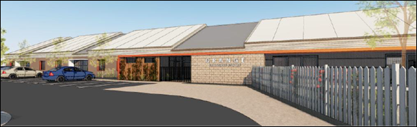
Figure 1 - west (front) façade of proposed
building and car park (view from Turner Crescent)
The proposed building will contain:
· entry foyer with
adjacent reception
· seven (7)
playrooms according to age bracket with adjacent bathrooms, stores and sleep rooms
· kitchen, staff
room, laundry and store rooms.
External play space will be
located at the rear (east) of the building and in the south-western portion of
the site at the Turner Crescent frontage. Onsite parking for 31 vehicles
will be provided at the site frontage, with access via Turner Crescent.
Extensive landscaping will be undertaken of the site perimeter, car park and
external play spaces.
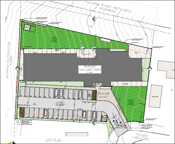
Figure 2 - proposed site plan
The proposed child care centre will provide 124 long day
child care places for children aged between 0-6 years, and operate between the
hours of 7.00am to 6.00pm Monday to Friday. The child care centre will employ
26 staff members (educators, administration, cleaners and cooks).
MATTERS FOR CONSIDERATION
Section 5A Assessment
In the administration of sections 78A, 79B, 79C, 111 and
112, the provisions of Section 5A must be taken into account for every
development application in deciding whether there is likely to be a significant
effect on threatened species, populations or ecological communities or their
habitats. This section includes a requirement to consider any adopted
assessment guidelines, which means assessment guidelines issued and in force
under section 94A of the Threatened Species Conservation Act 1995.
Assessment guidelines are in force (see DECC-W “Threatened Species
Assessment Guidelines - The Assessment of Significance”) which requires
consent authority to adopt the precautionary principle in its assessment.
In this instance, site inspection reveals that the subject
property has no biodiversity or habitat value.
Section 79C
Section 79C of the Environmental Planning and Assessment
Act 1979 requires Council to consider various matters, of which those
pertaining to the application are listed below.
PROVISIONS OF ANY ENVIRONMENTAL
PLANNING INSTRUMENT s79C(1)(a)(i)
Orange Local Environmental Plan 2011
Part 1 - Preliminary
Clause 1.2 - Aims of Plan
The
broad aims of the LEP are set out under subclause 2. Those relevant to the
application are as follows:
(a) to encourage development which complements
and enhances the unique character of Orange as a major regional centre boasting
a diverse economy and offering an attractive regional lifestyle,
(b) to provide for a range of development
opportunities that contribute to the social, economic and environmental
resources of Orange in a way that allows present and future generations to meet
their needs by implementing the principles for ecologically sustainable
development,
(f) to recognise and manage valued
environmental heritage, landscape and scenic features of Orange.
The application is considered to be consistent with the
above objectives, as outlined in this report.
Clause 1.6 - Consent Authority
This clause establishes that, subject to the Act, Council is
the consent authority for applications made under the LEP.
Clause 1.9A - Suspension of
Covenants, Agreements and Instruments
This clause provides that covenants, agreements and other
instruments which seek to restrict the carrying out of development do not apply
with the following exceptions.
· covenants imposed
or required by Council
· prescribed
instruments under Section 183A of the Crown Lands Act 1989
· any conservation
agreement under the National Parks and Wildlife Act 1974
· any trust
agreement under the Nature Conservation Trust Act 2001
· any property
vegetation plan under the Native Vegetation Act 2003
· any biobanking
agreement under Part 7A of the Threatened Species Conservation Act 1995
· any planning
agreement under Division 6 of Part 4 of the Environmental Planning and
Assessment Act 1979.
Council staff are not aware of the title of the subject
property being affected by any of the above.
An easement to drain sewer traverses the front boundary of
the subject land, adjacent to the Turner Crescent frontage. The proposed
development is sited clear of and will not affect the operation of the
easement.
As depicted below, the subject
land comprises a landlocked triangular-shaped parcel situated on the southern
side of the parcel directly to the south of the subject land (known as
159 Molong Road). The proposed development does not involve any works on
this portion of land.
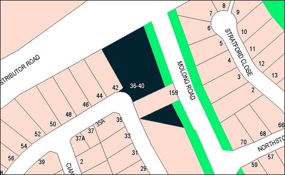
Figure 3 - the development site split by 159 Molong
Road
Mapping
The subject site is identified
on the LEP maps in the following manner:
|
Land Zoning Map:
|
Land zoned R2 Low Density
Residential
|
|
Lot Size Map:
|
No minimum Lot Size
|
|
Heritage Map:
|
Not a heritage item or conservation
area
|
|
Height of Buildings Map:
|
No building height limit
|
|
Floor Space Ratio Map:
|
No floor space limit
|
|
Terrestrial Biodiversity Map:
|
No biodiversity sensitivity on the
site
|
|
Groundwater Vulnerability Map:
|
Ground water vulnerable
|
|
Drinking Water Catchment Map:
|
Not within the drinking water catchment
|
|
Watercourse Map:
|
Not within or affecting a defined
watercourse
|
|
Urban Release Area Map:
|
Not within an urban release area
|
|
Obstacle Limitation Surface Map:
|
No restriction on building siting
or construction
|
|
Additional Permitted Uses Map:
|
No additional permitted use applies
|
Those matters that are of relevance are addressed in detail
in the body of this report.
Part 2 - Permitted or Prohibited Development
Land
Use Zones
The subject site is located within the R2 Low Density
Residential zone. The proposed development is defined as a child care centre
under OLEP 2011 and is permitted with consent for this zone. This application
is seeking consent.
Objectives
The
objectives for land zoned R2 Residential are as follows:
· To
provide for the housing needs of the community.
· To
provide for a variety of housing types and densities.
· To
enable other land uses that provide facilities or services to meet the day to
day needs of residents.
· To
ensure development is ordered in such a way as to maximise public transport
patronage and encourage walking and cycling in close proximity to settlement.
· To
ensure that development along the Southern Link Road has an alternative access.
The proposed development is
consistent with the relevant objectives of the R2 zone. The proposal does not
involve residential landuse. The proposed child care centre will provide a
long-day child care service that will be utilised by local and wider residents.
Child care centres are a permitted and complementary landuse in the R2 zone.
The subject residential precinct is serviced by public transport (Orange
Buslines Route 536). The land does not have frontage or access to the Southern
Link Road.
Part 3 - Exempt and Complying Development
The application is not exempt or complying development.
Part 4 - Principal Development Standards
The
Part 4 Principal Development Standards do not relate to the subject land or
proposed development.
Part 5 - Miscellaneous Provisions
The
Part 5 Miscellaneous Provisions are not applicable to the proposal.
Part 6 - Urban Release Area
The subject site is not located in an Urban Release Area and
Part 6 does not apply.
Part 7 - Additional Local Provisions
7.3 - Stormwater Management
Clause 7.3 is applicable. This
clause states in part:
(3) Development
consent must not be granted to development on land to which this clause applies
unless the consent authority is satisfied that the development:
(a) is
designed to maximise the use of water permeable surfaces on the land having
regard to the soil characteristics affecting on-site infiltration of water, and
(b) includes,
where practical, on-site stormwater retention for use as an alternative supply
to mains water, groundwater or river water, and
(c) avoids
any significant impacts of stormwater runoff on adjoining downstream
properties, native bushland and receiving waters, or if that impact cannot be
reasonably avoided, minimises and mitigates the impact.
In consideration of Clause 7.3,
conditions are recommended in relation to stormwater infrastructure associated
with the proposed child care centre. Stormwater from the site will be connected
to Council’s urban stormwater drainage system. Compliance with conditions
will ensure that stormwater runoff will not adversely impact on adjoining
properties.
7.6
- Groundwater Vulnerability
The
subject land is identified as Groundwater Vulnerable on the Groundwater
Vulnerability Map. Clause 7.6 applies. This clause states in part:
(3) Before
determining a development application for development on land to which this
clause applies, the consent authority must consider:
(a) whether or not the development (including
any onsite storage or disposal of solid or liquid waste and chemicals) is
likely to cause any groundwater contamination or have any adverse effect on
groundwater dependent ecosystems, and
(b) the cumulative impact (including the
impact on nearby groundwater extraction for potable water supply or stock water
supply) of the development and any other existing development on groundwater.
In consideration of Clause 7.6,
the proposal is considered to be acceptable. The proposed child care centre
does not involve processes or activities that would impact on groundwater
resources. The centre will be connected to Council’s reticulated sewerage
system.
Clause 7.11 - Essential
Services
Clause 7.11 applies. This clause states:
Development
consent must not be granted to development unless the consent authority is
satisfied that any of the following services that are essential for the
proposed development are available or that adequate arrangements have been made
to make them available when required:
(a) the
supply of water,
(b) the
supply of electricity,
(c) the
disposal and management of sewage,
(d) stormwater
drainage or on-site conservation,
(e) suitable
road access.
In consideration of this clause, all utility services are
available to the site and adequate for the proposed child care centre, as
follows:
· The land is
connected to reticulated water supply.
· Electricity and
telecommunications are available.
· The land is
serviced by Council’s reticulated sewerage system.
· Stormwater from
the development will be connected to Council’s urban stormwater drainage
system.
· The site has
direct frontage and access to Turner Crescent.
STATE ENVIRONMENTAL PLANNING
POLICIES
State Environmental Planning Policy 55 - Remediation of
Land
SEPP 55 - Remediation of Land applies. Pursuant to Clause 7:
(1) A consent authority
must not consent to the carrying out of any development on land unless:
(a) it has considered whether the
land is contaminated, and
(b) if the land is
contaminated, it is satisfied that the land is suitable in its contaminated
state (or will be suitable, after remediation) for the purpose for which the
development is proposed to be carried out, and
(c) if the land requires
remediation to be made suitable for the purpose for which the development is
proposed to be carried out, it is satisfied that the land will be remediated
before the land is used for that purpose.
The subject residential neighbourhood was historically used
for the purposes of agriculture and orcharding. Based on the current
residential zoning and adjoining residential landuse, the development site is
deemed suitable for the proposed child care centre. Preliminary contamination
investigation as a precursor to site remediation is considered unnecessary for
the proposal.
PROVISIONS OF ANY DRAFT
ENVIRONMENTAL PLANNING INSTRUMENT THAT HAS BEEN PLACED ON EXHIBITION
s79C(1)(a)(ii)
Draft State Environmental Planning Policy (Educational
Establishments and Child Care Facilities) 2017
Draft SEPP (Educational Establishments and Child Care
Facilities) 2017 has recently been exhibited (February-April 2017). The
proposed SEPP will (in part) align physical environmental requirements from the
National Quality Framework for Early Childhood Education and Care Facilities
into the NSW planning system. In the interim, the proposed child care centre is
subject to the National Quality Framework, and is not contrary to the
provisions of the Draft SEPP.
DESIGNATED DEVELOPMENT
The proposed development is not designated development.
INTEGRATED DEVELOPMENT
The proposal is not integrated development.
PROVISIONS OF ANY DEVELOPMENT
CONTROL PLAN s79C(1)(a)(iii)
Development Control Plan 2004 – Part 7 Development
in Residential Zones
Part 7.5 Merit Based Appropriate to Residential
Development in Orange
The following Planning Outcomes are used as a guide in
assessment of the proposed child care centre.
Neighbourhood Character
The DCP sets the following Planning Outcomes in regard to
Neighbourhood Character:
· Site
layout and building design enables the:
- creation of attractive
residential environments with clear character and identity
- use of site features
such as views, aspect, existing vegetation and landmarks
· Buildings
are designed to complement the relevant features and built form that are
identified as part of the desired neighbourhood character.
· The
streetscape is designed to encourage pedestrian access and use.
The Turner Crescent residential precinct is defined by
modern double fronted, single-storey brick veneer dwellings circa 1990, on
separate allotments. The design and detailing of the proposed childcare centre
are considered suitable within the subject residential setting and will
complement the neighbourhood built form due to the following:
· The narrow and
curvilinear site frontage and partial battleaxe configuration of the allotment
departs from neighbouring parcels. As such, the building will be removed from
the built form on adjoining sites. The building will not contribute to a
streetscape built form.
· The building is
provided with a generous setback of some 22m from the front boundary so as to
not appear imposing in the Turner Crescent streetscape.
· The building will
be single storey and of consistent height with adjoining dwellings.
· The hipped roof,
wall height and window fenestration will be reflective of domestic
architectural forms in this streetscape.
· The proposed
external finishes will be compatible with adjoining dwellings.
The development will broaden the function of the
neighbourhood by introducing a non-residential component. Indeed, the proposed
child care centre comprises the only non-residential landuse in the Turner
Crescent/Cianfrano Place residential neighbourhood. Notwithstanding, child care
centres are a permitted use in the R2 zone, and the proposal is considered to
be complementary in this setting.
Building Appearance
The DCP sets the following Planning Outcomes in regard to
Building Appearance:
· The building
design, detailing and finishes relate to the desired neighbourhood character,
complement the residential scale of the area, and add visual interest to the
street.
· The frontages
of buildings and their entries face the street.
· Garages and car
parks are sited and designed so that they do not dominate the street frontage.
As considered above, the design, detailing and finishes for
the proposed child care centre are appropriate in this neighbourhood and will
reasonably complement the built form in the residential setting.
The building footprint and massing is more extensive than
adjoining dwellings, with a footprint of some 63m x 20m. It is considered that
the proposed child care centre whilst large in dimension will not conflict with
adjoining dwellings in terms of scale given the building design features
proposed, the limited site frontage to Turner Crescent and setback from the
front boundary. The building massing will be reduced via recesses in the hipped
roof profile and mix of wall finishes.
The front building elevation will present to Turner Crescent
(notwithstanding the small site frontage and large building setback). The main
front façade will comprise building entrance, verandah treatment and
numerous vertical and horizontal openings of domestic scale.
The proposed car park will be located at the site frontage,
forward of the building. The proposed site layout is consistent with other
child care centres on residential parcels in the City. An enclosed outdoor play
space is also located in the front setback, in the southern portion of the
parcel. Extensive landscaping of site perimeter and building entrance will
provide screening and visual relief of vehicle areas.
Heritage
The DCP sets the following Planning Outcomes in regard to
Heritage:
· Heritage
buildings and structures are efficiently re-used.
· New
development complements and enhances the significance of a heritage item or
place of heritage significance listed in the Orange Heritage Study.
· Significant
landscape features are retained including original period fences and period
gardens.
The subject land does not contain or adjoin a heritage item
and is not located within a heritage conservation area.
Setbacks
The DCP sets the following Planning Outcomes in regard to
Setbacks:
· Street setbacks
contribute to the desired neighbourhood character, assist with the integration
of new development and make efficient use of the site.
· Street setbacks
create an appropriate scale for the street considering all other streetscape
components.
The proposed building will be sited a minimum 22m from the
front boundary to Turner Crescent. The proposed front setback is appropriate to
reduce the visual encroachment of the building mass and footprint in the
streetscape. Perimeter plantings to the carpark at the site frontage will
provide softening and embellishment of vehicle areas in the front setback. Side
and rear setbacks for the proposed building will comply with the Building Code
of Australia.
Front Fences and Walls
The DCP sets the following Planning Outcomes in regard to
Fences and Walls:
· Front fences
and walls:
– assist
in highlighting entrances and creating a sense of identity within the
streetscape.
– are
constructed of materials compatible with associated housing and with fences
visible from the site that positively contribute to the streetscape
– provide
for facilities in the street frontage area such as mail boxes.
A fence will be erected on the part-front boundary to Turner
Crescent in order to enclose the outdoor play area in the southern portion of
the site. Fencing treatment will comprise a stepped part timber and part
blockwork fence atop a retaining wall.
Front fencing does not feature in this streetscape. Notwithstanding,
the form and materials are typical to the residential setting and considered to
be appropriate. Plantings adjacent the front boundary and access driveway will
provide an entry statement to the site and a sense of identity for the child
care centre within the Turner Crescent streetscape.
The northern and eastern boundaries of the site present to
the Northern Distributor Road and Molong Road respectively. These boundaries
will incorporate masonry stepped retaining walls with 1.5m timber fence and extensive
infill landscaping, as depicted below. Fencing and landscaping treatment is of
a high standard, and commensurate with the site’s gateway location.
Attached is a condition of consent requiring the applicant to submit final
details of fencing, landscaping and retaining walls for these boundaries prior
to the issue of a Construction Certificate.
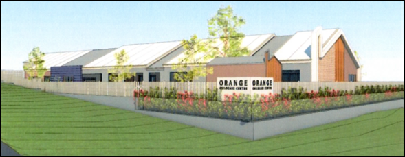
Figure 4 - fencing and landscaping treatment to
Northern Distributor Road and Mitchell Highway
Visual Bulk
The DCP sets the following Planning Outcome in regard to
Visual Bulk:
· Built form
accords with the desired neighbourhood character of the area with:
- side and rear setbacks
progressively increased to reduce bulk and overshadowing
- site coverage that retains
the relatively low density landscaped character of residential areas
- building form and siting
that relates to landform, with minimal land shaping (cut and fill)
- building height at the
street frontage that maintains a comparable scale with the predominant adjacent
development form
- building to the boundary
where appropriate.
The proposed child care centre will be single-storey and of
consistent height with adjoining dwellings in Turner Crescent.
The building footprint and massing will be larger than
adjoining dwellings, with overall dimensions of some 63m x 20m.
Notwithstanding, the site has limited frontage to Turner Crescent and will not
contribute to nor detract from the streetscape built form. As considered above,
the proposed front setback of 22m will reduce the visual encroachment of the building
mass in the streetscape.
The proposed building will be contained within the DCP
prescribed visual bulk envelope plane. The building will comprise a total
building footprint of 1,183m2. Based on a site area of 3,373m2,
the development will have site coverage of 35.1%, in compliance with the
maximum 50% prescribed in the DCP.
Earthworks will be required in conjunction with the
proposal. Substantial site filling will be undertaken to provide level
surfaces, with retention along the part site perimeter. Retaining walls will be
terraced and landscaped to minimise the bulk of the walls.
In order to avoid visual bulk encroachment impacts for the
adjoining western dwelling at 42 Turner Crescent associated with the car
park, a condition is recommended that finished levels in the car park reflect
natural ground level; further, that retaining walls not be erected on the
western site boundary.
The child care centre building will be reasonably removed
from site boundaries to prevent visual encroachment on the adjoining dwellings
at 42 Turner Crescent and 159 Molong Road.
Walls and Boundaries
The DCP sets the following Planning Outcome in regard to
Walls and Boundaries:
· Building to the
boundary is undertaken to provide for efficient use of the site taking into account:
- the privacy of neighbouring
dwellings and private open space
- the access to daylight
reaching adjoining properties
- the impact of boundary walls
on neighbours.
The proposal does not involve the construction of buildings
on the boundary. As outlined in this report, the site layout and building
design will not adversely impact on adjoining dwellings in respect of privacy,
solar access or visual bulk.
Daylight and Sunlight
The DCP sets the following Planning Outcome in regard to
Daylight and Sunlight:
· Buildings are
sited and designed to ensure:
- daylight to habitable rooms
in adjacent dwellings is not significantly reduced
- overshadowing of
neighbouring secluded open spaces or main living area windows is not
significantly increased
- consideration of
Council’s Energy Efficiency Code.
Assessment of shadow impacts by Council staff demonstrates
that the proposal will not unreasonably overshadow the nearest affected
dwellings to the west (42 Turner Crescent) and south (159 Molong Road). Based on
the height and siting of the proposed building and the siting of the adjoining
dwellings, internal and external solar access will be maintained for those
dwellings, consistent with the DCP guidelines.
The proposed site layout and building design will provide
solar access to internal play rooms and outdoor play spaces associated with the
proposed child care centre.
Views
The DCP sets the following Planning Outcomes in regard to
Views:
· Building form
and design allow for residents from adjacent properties to share prominent
views where possible.
· Views including
vistas of heritage items or landmarks are not substantially affected by the
bulk and scale of the new development.
Design and detailing for the proposed building and site
works are of a high standard, and commensurate with the site’s gateway
location within the Mitchell Highway and Northern Distributor Road (NDR) view
corridor. The proposed building will not unreasonably diminish views for other
properties in the vicinity.
Visual Privacy
The DCP sets the following Planning Outcome in regard to
Visual Privacy:
· Direct
overlooking of principal living areas and private open spaces of other
dwellings is minimised firstly by:
- building siting and layout
- location of windows and
balconies
and secondly by:
- design of windows or use of
screening devices and landscaping.
The proposed site layout and building design will provide
acceptable visual privacy for adjoining dwellings:
· Perimeter fencing
of varying heights will be erected on the side boundaries. Fencing adjacent to
the residential properties will be 2.1m in height. Whilst the normal height of
fencing in a residential environment is ordinarily 1.8m, 2.1m high fencing to
mitigate noise impacts is not considered to be unreasonable
· Extensive
landscaping will be provided to the site perimeters.
· South-facing
openings in the proposed child care centre will comprise two windows in
nominated “sleep” rooms. The openings will be located some 4m from
the southern boundary of the site. This separation and use of rooms is
considered suitable to prevent overlooking of the adjoining south dwelling at
159 Molong Road.
· The proposed
building will be sufficiently removed from the western side boundary to prevent
overlooking from within the building of the adjoining western dwelling at
42 Turner Crescent.
· Conditions are
recommended that car park finished levels reflect existing natural ground level
in order to reduce overlooking from the car park towards the adjoining western
dwelling at 42 Turner Crescent.
Acoustic Privacy
The DCP sets the following Planning Outcome in regard to
Acoustic Privacy:
· Site layout and
building design:
- protect habitable rooms from
excessively high levels of external noise
- minimise the entry of
external noise to private open space for dwellings close to major noise sources
- minimise transmission of
sound through a building to affect other dwellings.
A noise assessment has been submitted in support of the
proposed child care centre (Renzo Tonin & Associates February 2017).
Noise associated with the proposal will be generated by
outdoor play, mechanical plant, traffic noise in the carpark, and traffic noise
in local streets generated by vehicles associated with the child care centre. Furthermore
and conversely, the operation of the centre will be affected by traffic noise
from Molong Road and the Northern Distributor Road.
The noise assessment concludes:
Operational noise from the
proposed childcare centre was assessed against the relevant criteria and was
predicted to exceed the applicable criteria at the nearest affected residential
receivers. Thus, physical mitigation and management measures were recommended
to ensure that operational noise would comply with the criteria at the nearest
affected receivers.
Traffic noise from Molong Road
and the Northern Distributor Road impacting on the outdoor play areas of the
proposed child care centre was predicted to exceed the relevant criterion. As a
result, in-principle noise mitigation measures were recommended to reduce traffic
noise impacting on the outdoor play areas to acceptable levels.
The noise assessment recommends installation of solid noise
screens/fencing to the eastern, south-eastern and northern boundaries.
Council's Manager Building and Environment concurs with the findings
and recommendations of the noise assessment. Conditions are recommended to
address the requirements of Council and the submitted noise assessment in
respect of physical and operational mitigation measures.
Security
The DCP sets the following Planning Outcomes in regard to
Security:
· The site layout
enhances personal safety and minimises the potential for crime, vandalism and
fear.
· The design of
dwellings enables residents to survey streets, communal areas and approaches to
dwelling entrances.
The proposal is considered acceptable in
regard to safety and security as follows:
· The front facade to Turner Crescent has numerous windows which will
address the onsite car park and street. The building design will provide
reasonable opportunities for natural surveillance.
· Internal and external CCTV cameras will be provided.
· Internal and external motion-activated security sensor lighting will
be installed.
· The site has acceptable access control due to perimeter fencing and
fully enclosed outdoor play spaces.
· Outdoor play spaces will only be accessible from within the
building.
· The proposed landscape design will not restrict sightlines.
Circulation and Design
The DCP sets the following Planning Outcome in regard to
Circulation and Design:
· Accessways and
parking areas are designed to manage stormwater.
· Accessways,
driveways and open parking areas are suitably landscaped to enhance amenity
while providing security and accessibility to residents and visitors.
· The site layout
allows people with a disability to travel to and within the site between car
parks, buildings and communal open space.
The subject land has direct frontage and access to Turner
Crescent. A 6m vehicle crossing and driveway will be constructed to service the
site. In order that adequate sight distances are provided for vehicles turning
right into the site (ie when travelling north along Turner Crescent), a raised
median and line marking will be provided along Turner Crescent.
The median will be broken to allow entry into the site when
adequate sightlines are achieved. As an additional traffic safety measure, the
intersection area of the carpark entrance with Turner Crescent will be resealed
(as required by condition). The median, line marking and intersection resealing
will reduce the speed of vehicles entering the site, provide adequate reaction
times and improve traffic amenity generally. The proposed access arrangements
were reached in conjunction with Council’s Development Engineer and are
considered suitable to achieve safe access to the development site. Relevant
conditions are recommended in relation to the required works.
Car Parking
The DCP sets the following Planning Outcomes in regard to
Car Parking:
· Parking
facilities are provided, designed and located to:
- enable the efficient and
convenient use of car spaces and accessways within the site
- reduce the visual dominance
of car parking areas and accessways.
· Car parking is
provided with regard to the:
- the number and size of
proposed dwellings
- requirements of people with
limited mobility or disabilities.
Pursuant to DCP 2004, onsite parking is required for child
care centres at a rate of 1 space for every 4 children in attendance. The
proposed child care centre will provide 124 child care places, with 31
parking spaces required. The onsite car park will provide 31 parking spaces,
including 1 space for disabled drivers, in compliance with the DCP.
Onsite car parking for the development is also consistent
with parking requirements pursuant to the Guide to Traffic Generating
Developments (Roads and Traffic Authority 2002) (the RMS Guide). The
RMS Guide also requires 1 space for every 4 children in attendance.
The submitted Traffic and Parking Impact Assessment
(McLaren Traffic Engineering May 2017) provides additional details in
respect of RMS parking requirements as follows:
“RMS commissioned updated
surveys and analysis of child care centres in 2015. While the findings of this
update have not been officially adopted, the following car parking rates were
found, with particular reference given to the centre size:
· Centres
with 70-100 children – 1 space per 6 children.
Based upon application of the
above parking rates, 124 children would result in 21 car parking spaces in
total (based upon a rate of 1 space per 6 children). Hence the provision of 31
car parking spaces for the child care centre is a surplus of 10 spaces above
the minimum requirement.”
The onsite car parking resources are considered suitable for
the proposed child care centre.
In order to improve the functioning of the onsite carpark,
Council’s Development Engineer has recommended that the car park design
be amended (dimensions, aisle widths and turn bay) to the highest user standard
under Australian Standard AS 2890.1:2004 Off-street car parking. It is
considered that there is sufficient space within the subject land to
accommodate the design changes required. Attached is a draft condition of
consent addressing this requirement.
Private Open Space
The DCP sets the following Planning Outcomes in regard to
Private Open Space:
· Private open
space is clearly defined for private use.
· Private open
space areas are of a size, shape and slope to suit the reasonable requirements
of residents including some outdoor recreational needs and service functions.
· Private open
space is:
– capable
of being an extension of the dwelling for outdoor living, entertainment and
recreation
– accessible
from a living area of the dwelling
– located
to take advantage of outlooks; and to reduce adverse impacts of overshadowing
or privacy from adjoining buildings
– Orientated
to optimise year round use.
The Planning Outcomes are not applicable to the proposed
child care centre.
Open Space
and Landscaping
The DCP sets the following Planning Outcomes in regard to
Open Space and Landscaping:
· The site layout
provides open space and landscaped areas which:
– contribute
to the character of the development by providing buildings in a landscaped
setting
– provide
for a range of uses and activities including stormwater management
– allow
cost effective management.
· The landscape
design specifies landscape themes consistent with the desired neighbourhood
character; vegetation types and location, paving and lighting provided for
access and security.
· Major existing
trees are retained and protected in a viable condition whenever practicable
through appropriate siting of buildings, accessways and parking areas.
· Paving is
applied sparingly and integrated in the landscape design.
A Landscape Design Intent has been submitted in support of
the proposal (Larc Collective Landscape Architects). The plan incorporates
extensive plantings to the car park perimeter, outdoor play spaces and public
road frontages.
The landscape plan was referred to Council’s Manager
City Presentation for consideration and comment. He advised as follows:
The suggested list of trees,
palms and shrubs requires review and alternative species selected as many of
the species nominated will either fail or struggle with the Orange climatic
conditions; particularly the cold winters and severe frosts. Many of the
species selected are naturally occurring in temperate rainforests or closed
forests and as such will have little success in Orange. A revised and
appropriate selection of trees, palms and shrubs shall be submitted for
approval.
Conditions are recommended requiring submission and approval
of a revised and locale-specific landscape plan prior to issue of a
Construction Certificate, and installation and ongoing maintenance of the
approved landscaping works.
Stormwater
The DCP sets the following Planning Outcomes in regard to
Stormwater:
· On-site
drainage systems are designed to consider:
– downstream
capacity and need for on-site retention, detention and re-use
– scope
for on-site infiltration of water
– safety
and convenience of pedestrians and vehicles
– overland
flow paths.
· Provision is
made for on-site drainage which does not cause damage or nuisance flows to
adjoining properties.
In order to achieve compliance with the Planning Outcomes,
conditions are recommended in relation to stormwater management of the site.
Erosion and Sedimentation
The DCP sets the following Planning Outcome in regard to
Erosion and Sedimentation:
· Measures
implemented during construction to ensure that the landform is stabilised and
erosion is controlled.
In order to achieve compliance with the Planning Outcomes,
conditions are recommended in relation to erosion and sediment control.
Part 7.9 - Shops and Business
in the Urban Residential Zone
The DCP prescribes the following Planning Outcomes for Shops
and Business in the Urban Residential Zone:
· Development
complements the scale of residential development in the area and the
predominant heights and form of residential development in the vicinity.
· Business
premises are located in neighbourhood business areas existing prior to Orange
LEP 2000.
· Development
applications satisfactorily demonstrate that the development will not adversely
affect the amenity of the residential locality as a consequence of the nature
of the business, loading or unloading requirements, on-street parking, hours of
operation.
· Neighbourhood
business premises are small scale to serve the needs of the residents of the
locality.
· Onsite parking
is provided according to Section 15.4 of this plan.
· Advertising
signage is limited to exempt development for home businesses or businesses in
converted dwelling houses.
· Advertising
signage in neighbourhood centres is not intrusive to the character of the
residential locality.
In consideration of the Planning Outcomes, the proposed
child care centre is satisfactory, as outlined below:
· As considered
earlier in this report, the design, detailing and finishes for the proposed
child care centre are appropriate for this site and neighbourhood. The building
will take a large, modern domestic scale and design, and will reasonably
integrate with adjoining dwellings and the built form in this setting.
· The proposal does
not comprise a business premises or neighbourhood business premises.
· As outlined in
this report, the proposed child care centre will not unreasonably impact on
amenity for adjoining dwellings in respect of visual bulk, solar access,
privacy, noise or traffic congestion. Relevant conditions are recommended to
maintain amenity for adjoining dwellings.
· As considered
earlier in this report, the proposed child care centre will generate demand for
31 onsite parking spaces. Thirty-one (31) onsite car parking spaces will be
provided, including 1 space for disabled drivers, in compliance with DCP 2004
and the RMS Guide.
· An indicative sign
is provided on the retaining wall at the Mitchell Highway/NRD intersection. A
condition is recommended requiring further consent be obtained for advertising
that is not exempt development.
Development Control Plan 2004 -
Part 15 Car Parking
The DCP prescribes the following Planning Outcomes for
Off-Street Car Parking:
· Adequate
off-street car parking is provided in accordance with the table, or
alternatively, according to an assessment that demonstrates peak parking demand
based on recognised research.
· Car parking
areas are designed according to Australian Standard.
· Car parking
areas include adequate lighting and landscaping which provides for the personal
security of users.
· Bicycle parking
facilities are provided according to the relevant Australian Standard.
· Facilities for
loading and unloading of commercial vehicles are provided according to the
relevant Australian Standard.
In consideration of the Planning Outcomes, the proposed
child care centre is satisfactory, as outlined below:
· As outlined
earlier in this report, onsite car parking will be provided for the proposed
child care centre consistent with DCP 2004 and the RMS Guide.
· Conditions are
recommended requiring the submission of engineering plans for the proposed car
park, demonstrating compliance with AS 2890.1-2004 Off-street
car parking (highest user standard) and AS 2890.6:2009 Off-street
car parking for people with disabilities.
· Landscaping (as
amended by conditions to be locale-specific) will be provided to the perimeter of
the proposed car park. The landscaping will provide site beautification and
visual and acoustic relief to vehicle areas.
· Based on the
long-day operation of the proposed child care centre, car park lighting will be
required. A condition is recommended requiring outdoor lighting comply with AS
4282:1997 Control of the obtrusive effects of outdoor lighting.
· The nature of the
landuse is unlikely to necessitate bicycle parking facilities.
· The submitted Traffic
and Parking Impact Assessment (McLaren Traffic Engineering May 2017)
provides the following comments in respect of service/commercial vehicles:
“A B99 utility / courier
van (ie. a Toyata Hiace) is the typical sized vehicle used for deliveries to
child care centres… B99 vehicles can access normal sized car spaces, and
the site will be easily able to accommodate a delivery vehicle on site between
9am and 4pm outside of peak visitor times, when spare visitor parking will be
in abundance…. A B99 will have sufficient manoeuvring area on site and
shall be easily managed due to the small natural of deliveries and low
frequency.”
A condition is recommended that
service vehicles to the site shall not exceed a B99 utility or courier
van.
DEVELOPMENT CONTRIBUTIONS
Development contributions for water, sewer and drainage
works are applicable to the proposed development. The contributions are based
on 6.44 ETs for water supply headworks and 11.4 ETs for sewerage headworks. A
condition is recommended requiring payment of the applicable contributions.
PROVISIONS PRESCRIBED BY THE
REGULATIONS s79C(1)(a)(iv)
Demolition of a Building (clause 92)
The proposal does not involve the demolition of a building.
Fire Safety Considerations
(clause 93)
Fire protection measures will be required appropriate to the
building class. Fire safety considerations will be addressed at Construction
Certificate stage.
Buildings to be Upgraded
(clause 94)
This matter is not relevant as the subject land is vacant.
BASIX Commitments (clause 97A)
BASIX is not applicable to the proposal. A Section J Energy
Efficiency statement will be required at Construction Certificate stage.
THE LIKELY IMPACTS OF THE
DEVELOPMENT s79C(1)(b)
Visual Impacts
As considered earlier in this report, the design, detailing
and finishes for the proposed child care centre are appropriate for this site
and neighbourhood. The building will take a large, modern domestic scale and
design, and will reasonably integrate with adjoining dwellings and the built
form in this setting. The narrow and curvilinear site frontage and partial
battleaxe configuration of the allotment departs from neighbouring parcels. As
such, the building will be removed from the built form on adjoining sites. The
building will not contribute to a streetscape built form.
Traffic Impacts
Traffic Generation and Impact
Pursuant to the submitted
Traffic and Parking Impact Assessment (McLaren Traffic Engineering May
2017), traffic generation associated with the proposed child care centre is
summarised as follows:
|
Time
|
Rate
|
Traffic Generation
|
Direction
|
|
7.00-9.00am
|
0.8 / child
|
99 trips
|
50 in – 49 out
|
|
2.30-4.00pm
|
0.3 / child
|
37 trips
|
19 in – 18 out
|
|
4.00 – 6.00pm
|
0.7 / child
|
87 trips
|
44 in – 43 out
|
*based on traffic generation
rates for child care centres contained in the RMS Guide
As shown above, traffic generation associated with the
development is in the order of 99 vehicle trips in the morning peak
(7am-9am) and 87 vehicle trips in the evening peak (4pm‑6pm).
It is acknowledged that traffic generation associated with
the child care centre will be substantially greater than that pertaining to
residential landuse. Notwithstanding this, the centre has the potential to
generate less than two (2) vehicle trips per minute either approaching or
departing the site (not both) in the peak morning and evening period.
The Traffic and Parking Impact Assessment (McLaren
Traffic Engineering May 2017) considers the impact of traffic volumes
associated with the child care centre on the surrounding road network. In
summary:
· All traffic will
enter and exit the site via the intersection of Mitchell Highway/ Mastronardi
Way.
· The intersection
currently operates at a Level of Service “A.” The increased traffic
load associated with the child care centre will not alter the existing Level of
Service, with minimal additional delays and capacity maintained.
· Existing and
additional two-way peak traffic along Turner Crescent will be well below the
environmental goal of 200 vehicles per hour for local streets, and the maximum
threshold of 300 vehicles per hour for local streets (pursuant to the RTA
Guide).
Council’s Development Engineer concurs with the
McLaren assessment that Turner Crescent and the intersection of Mitchell
Highway/Mastronardi Way are of sufficient capacity to accommodate additional
traffic volumes associated with the child care centre.
Access
and Manoeuvring
The subject land has direct frontage and access to Turner
Crescent. A 6m vehicle crossing and driveway will be constructed to service the
site. In order that adequate sight distances are provided for vehicles turning
right into the site (ie when travelling north along Turner Crescent), a raised
median and line marking will be provided along Turner Crescent.
The median will be broken to allow entry into the site when
adequate sightlines are achieved. As an additional traffic safety measure, the
intersection area of the car park entrance with Turner Crescent will be
resealed (as required by condition). The median, line marking and intersection
resealing will reduce the speed of vehicles entering the site, provide adequate
reaction times, and improve traffic amenity generally. The proposed access
arrangements were reached in conjunction with Council’s Development
Engineer and are considered suitable to achieve safe access to the development
site. Relevant conditions are recommended in relation to the required works.
Car
Parking
As outlined in this report, the
proposed development incorporates a total of 31 off-street car parking
spaces, consistent with the requirements of DCP 2004 and the
RMS Guide. Due to this compliance, overflow on-street car parking is not
anticipated.
Neighbourhood Amenity
Noise
Noise associated with operation of the proposed child care
centre will exceed that pertaining to normal residential landuse. Noise will be
generated by outdoor play, mechanical plant, traffic noise in the carpark, and
traffic noise in local streets generated by vehicles associated with the child
care centre.
Furthermore and conversely, the operation of the centre will
be affected by traffic noise from Molong Road and the Northern Distributor
Road.
As outlined earlier in this report, an acoustic assessment
was submitted in support of the proposal (Renzo Tonin & Associates February
2017). The acoustic assessment confirms that subject to implementation of
mitigation measures (ie solid screens attached to perimeter fencing), noise
emissions from the proposed child care centre will comply with the relevant
criteria. Further, the operation of the child care centre will not be affected
by traffic noise from Molong Road and the Northern Distributor Road.
Conditions are recommended to address the requirements of
Council and the submitted acoustic assessment in respect of physical and
operational mitigation measures. On this basis, noise impacts are considered to
be within reasonable limit.
Light
Based on the long-day operation
of the proposed child care centre, car park lighting and other external
lighting will be required. In order that external lighting will not cause
nuisance glare for adjoining dwellings, a condition is recommended requiring
exterior lighting to be sited and designed to comply with AS 4282-1997
Control of the obtrusive effects of outdoor lighting.
Privacy
Perimeter fencing of varying heights will be erected on the
side boundaries. Fencing treatment and perimeter landscaping will prevent
overlooking of adjoining dwellings from internal and external play spaces and
the car park. Conditions are recommended that car park finished levels reflect
existing natural ground level in order to reduce overlooking from the car park
‘deck’ towards the adjoining western dwelling at 42 Turner
Crescent. The proposal will not adversely impact on privacy for adjoining
dwellings.
Odour
An enclosed waste storage facility is located adjacent to
the front boundary/access driveway. As the bins will be walked to the footpath
on collection day, it is unnecessary that the bin bay be located at the site
frontage. A condition is recommended that the bin bay be located adjacent to
the nominated ‘service area’ adjacent to the northern building
façade. Relocation of the bin bay will overcome potential odour impacts
for the nearest affected dwelling at 42 Turner Crescent. Furthermore,
resiting of the bin bay will provide for additional landscaping at the site
entry, with positive visual impacts on the streetscape.
Visual Bulk
The child care centre building will be reasonably removed
from site boundaries to prevent visual encroachment on the adjoining dwellings
at 42 Turner Crescent and 159 Molong Road. As outlined in this
report, conditions are recommended that finished levels in the car park reflect
natural ground level, in order to avoid visual bulk encroachment impacts for
the adjoining western dwelling at 42 Turner Crescent.
Environmental Impacts
The subject land is contained within an established
residential precinct and comprises vacant, cleared land. Significant
vegetation, threatened species or ecological endangered communities or their
habitats are unlikely to be present. The site is not in proximity to any
waterway, drinking water catchment or sensitive area. Sediment control
measures, as required by conditions, will prevent loose dirt and sediment
escaping the site and polluting downstream waterways.
The proposed child care centre
will not involve processes or activities that would impact on air or water
quality in the locality. Where applicable, the applicant shall enter into a
Trade Waste Contract with Council. Other wastes will be disposed of via
Council's waste collection or recycling services. Adverse environmental impacts
are not anticipated as a result of the proposal.
Social and Economic Impacts
The proposed development is unlikely to generate a negative
social or economic impact within the locality. The proposal will provide
additional child care places within the community, with potential for greater
workforce participation. The development will also generate employment
opportunities.
THE SUITABILITY OF THE SITE
s79C(1)(c)
The subject land is suitable for the proposed child care
centre due to the following:
· The proposed
development is a permitted use in the R2 Low Density Residential zone, being
the zoning of the subject land.
· Urban utility
services are available and suitable subject to augmentation.
· The site has
direct frontage and access to Turner Crescent.
· The local road
network adjacent to the site is of sufficient capacity to accommodate traffic
volumes.
· The site is not
subject to known technological or natural hazards.
· The parcel is
vacant cleared land with no known biodiversity value
ANY SUBMISSIONS MADE IN
ACCORDANCE WITH THE ACT s79C(1)(d)
The proposed development comprises "advertised
development" pursuant to DCP 2004‑5.3. The application was
advertised for the prescribed period of 14 days. At the conclusion of the
exhibition period thirty-one (31) submissions had been received.
The development application did not proceed to mediation as
the issues raised in the submissions were considered unlikely to be reasonably
capable of negotiation (pursuant to Council’s Declaration of Planning and
Development Assessment Procedures and Protocols (May 2010)).
The applicant (and consultants) have responded to the
submissions, as considered below where relevant. The issues raised in the
submissions include:
Traffic Matters
· The
submitted traffic assessment contains anomalies
Comment: A Traffic and Parking Statement (Traffic
Solutions Pty Ltd February 2017) was submitted in support of the development
application. In response to issues raised in the submissions and
Council’s concerns, the applicant was requested to provide additional
traffic details. An alternative traffic consultant was subsequently engaged by
the applicant, namely McLaren Traffic Engineering. The following documents were
submitted by McLaren Traffic Engineering in support of the proposal:
1 Traffic
and Parking Impact Assessment of Child Care Centre at 36-40 Turner Crescent
(12 May 2017); and
2 Response
to Resident Submissions with respect to Proposed Child Care Centre (18 May
2017).
Council’s Development Engineer is satisfied and
concurs with the content and findings of the traffic details submitted by
McLaren Traffic Engineering, subject to conditions of consent.
· The proposal
will result in traffic congestion in surrounding residential streets
Comment: McLaren Traffic Engineering advises as follows in
respect of this matter:
“When the estimated AM
and PM peak period generations [associated with the child care centre] are
added to the current local traffic conditions of Turner Crescent and
Mastronardi Way, the traffic congestion was found to be minimal, with the
existing Level of Service “A” being retained for the worst turning
movements of the intersection of the Mitchell Highway / Mastronardi Way, with
minimal additional details and capacity being maintained. This represents
“GOOD” performance being maintained.
The existing traffic flows
along Turner Crescent in conjunction with the additional traffic generated from
the child care centre provides two-way traffic movements that are below the
environmental goal of 200 vehicles per hour and a maximum 300 vehicles per hour
for local streets as specified in the RMS Guide to Traffic Generating
Developments (2002), as a measure of impact on Residential Amenity.
Hence, the traffic generated
will not have a significant impact on residential amenity and congestion in
surrounding residential streets.”
Council’s Development Engineer concurs with
McLaren’s findings.
· Traffic
congestion will impact on safety for pedestrians (including school children) in
surrounding residential streets
Comment: McLaren Traffic Engineering advises as follows in
respect of this matter:
“The increase of 99 and
87 vehicle trips (equating to less than 2 cars per minute) during the morning
and afternoon peak periods respectively does not considerably increase the
traffic congestion along the local streets and as a result does not increase
the risk to pedestrians that what is already occurring.”
Council’s Development Engineer concurs with
McLaren’s findings and advises:
“The anticipated traffic
volume increase is well within the existing road capacity and will not impact
on pedestrian safety. Existing speed humps are considered adequate traffic
calming devices.”
· The capacity
of Turner Crescent is inadequate to cater for additional traffic volumes
Comment: As outlined above, McLaren Traffic Engineering
advises as follows in respect of this matter:
“The existing traffic
flows along Turner Crescent in conjunction with the additional traffic
generated from the child care centre provides two-way traffic movements that
are below the environmental goal of 200 vehicles per hour and a maximum 300
vehicles per hour for local streets as specified in the RMS Guide to Traffic
Generating Developments (2002), as a measure of impact on Residential
Amenity.”
Council’s Development Engineer concurs with
McLaren’s findings.
· The onsite
carpark is inadequate to meet the parking demands of the child care centre,
with subsequent overflow on-street parking
Comment: As outlined in this report, the proposed development incorporates a total of 31 off-street car
parking spaces, consistent with the requirements of DCP 2004 and the
RMS Guide. Due to this compliance, overflow on-street car parking is not
anticipated.
Council’s Development Engineer advises:
“The required parking
spaces calculated under Orange DCP 2004 (31) have been supplied. The required
spaces calculated under RMS guidelines (21) have been exceeded. [On this basis]
there is not expected to be any overflow on-street parking.”
· There is
insufficient onsite manoeuvring area to accommodate service vehicles
Comment: McLaren Traffic Engineering advises as follows in
respect of this matter:
“A B99 utility / courier
van (ie. a Toyata Hiace) is the typical sized vehicle used for deliveries to
child care centres… B99 vehicles can access normal sized car spaces, and
the site will be easily able to accommodate a delivery vehicle on site between
9am and 4pm outside of peak visitor times, when spare visitor parking will be
in abundance…. A B99 will have sufficient manoeuvring area on site and
shall be easily managed due to the small natural of deliveries and low
frequency.”
Council’s Development Engineer concurs with
McLaren’s findings, subject to conditions of consent requiring that the
car park design be amended (dimensions, aisle widths and turn bay) to the
highest user standard under Australian Standard AS 2890.1:2004 Off-street
car parking; and the maximum service vehicle to enter the site being a B99
utility/courier van.
· No Standing
signs are inappropriate to prevent onstreet congestion and will inconvenience
residents
Comment: The proposal does not involve installation of
‘No Standing’ signs along Turner Crescent.
· There are
inadequate sight distances to permit safe ingress to the site for vehicles
entering the site from the south
Comment: As outlined earlier in this report, in order that
adequate sight distances are provided for vehicles turning right into the site
(ie when travelling north along Turner Crescent), a raised median and line
marking will be provided along Turner Crescent.
The median will be broken to allow entry into the site when
adequate sightlines are achieved. As an additional traffic safety measure, the
intersection area of the carpark entrance with Turner Crescent will be resealed
(as required by condition). The median, line marking and intersection resealing
will reduce the speed of vehicles entering the site, provide adequate reaction
times and improve traffic amenity generally. The proposed access arrangements
were reached in conjunction with Council’s Development Engineer and are
considered suitable to achieve safe access to the development site. Relevant
conditions are recommended in relation to the required works.
· There is
potential for traffic accidents at the Mitchell Highway/Northern Distributor
Road (NDR) intersection to enter the site
Comment: McLaren Traffic Engineering provided the following
comments in relation to this matter:
“The child care centre
will have no vehicle access from Mitchell Highway and the Northern Distribution
Road, all access will be from Turner Crescent.”
The applicant’s planning consultant further advises as
follows in this regard:
“The likelihood of
vehicles involved in any traffic accident at the intersection of the Mitchell
Highway and Northern Distributor Road entering the site is considered low for
the following reasons:
v The intersection of the Mitchell
Highway and NDR is a roundabout intersection at which vehicles would be
anticipated to enter and exit at a relatively low speed (maximum 30km/hr).
v The boundaries of the subject site
are setback substantially from the two intersection roads and roundabout
intersection. A 10m wide public reserve is positioned beside the site’s
eastern side boundary and the Mitchell Highway, with the edge of the
carriageway located some 13m from the site boundary. The edge of the carriageway
of the NDR is located some 26m from the site’s northern boundary.
v A terraced and landscaped retaining
wall with a total height of 2.4m is to be erected along the northern boundary
of the site and partially returning along the eastern side boundary."
Council officers concur that the likelihood of a traffic
accident entering the site via Mitchell Highway/NDR is low based on vehicle
speeds at the intersection, separation of the site from the formed carriageway
and finished levels for the development site. In respect of the Turner Crescent
frontage and access, the median, line marking and intersection resealing as
required by conditions of consent will reduce the speed of vehicles entering
the site and provide adequate reaction times.
· Traffic
noise will adversely impact on residential amenity
Comment: McLaren Traffic Engineering provided the following
comments in relation to this matter:
“The total future
two-way traffic along Turner Crescent is calculated to be 142 and 133 vehicles
during the AM and PM period peaks respectively. These two-way flows are below
the environmental goal of 200 vehicles per hour and the maximum threshold of
300 vehicles per hour for local streets as specified in the RMS Guide.”
Furthermore, the
applicant’s planning consultant advised as follows:
“The Noise Assessment
undertaken by Renzo Tonin & Associates specifically addressed this matter
in section 5.1 of their report and established that based on the proposed 99
vehicle movements during the morning peak period, road traffic noise level on
Turner Crescent due to traffic generated by the child care centre would comply
with the noise criterion of the NSW Road Noise Policy at the most affected
residences along Turner Crescent.”
As such, while the proposed child care centre will alter the
neighbourhood acoustic environment, traffic noise is considered to be within
reasonable limit and in accordance with relevant standards.
· Pedestrian
infrastructure should be provided in the vicinity of the site, including formed
footpaths and a pedestrian crossing
Comment: Council’s Development Engineer advises as
follows in this regard:
“The development does
not meet the warrants for a marked pedestrian crossing. All drop offs are
planning to occur within the site. A concrete footpath is to be constructed for
the full frontage of the development to Turner Crescent [as required by a
condition of consent] to cater for any local residents who may walk to the
centre. Any additional footpaths will be subject to consideration under
Council’s residential footpath construction program.”
· The proposal
will exacerbate the poor condition of the Turner Crescent road surface
Comment: Council’s Development Engineer provided the
following comments in relation to this matter:
Any maintenance issues
identified with the Turner Crescent road surface will be addressed by Council
under the local roads maintenance program.
In order to improve road safety adjacent to the site, a
condition is recommended requiring resealing of the intersection of the car
park entrance with Turner Crescent.
· The proposed
arrangements for waste management (size of bins, frequency of collection,
location of bin storage) are inadequate / unsuitable
Comment: The applicant’s planning consultant advised
as follows in this regard:
“The size of the [waste]
storage facility has been determined based on other similar sized child care
centres and waste generation rates. If the facility requires an additional
regular collection service by Council, this can be arranged by centre
management.”
Council’s Development Engineer raised no objection to
the proposed waste management arrangements. Bins will be placed kerbside on
collection days and returned to the storage area. As outlined in this report, a
condition is recommended requiring relocation of the enclosed waste storage
facility to the service area adjacent to the northern facade of the child care
centre. Relocation will limit potential odour and visual impacts for the
nearest adjoining dwelling at 42 Turner Crescent.
Noise Impacts Associated with the
Child Care Centre
Comment: As outlined earlier in this report, an acoustic
assessment was submitted in support of the proposal (Renzo Tonin &
Associates February 2017). The acoustic assessment confirms that subject to
implementation of mitigation measures (ie perimeter fencing), noise emissions
from the proposed child care centre will comply with the relevant criteria. Council's
Manager Building and Environment concurs with the findings and recommendations
of the noise assessment. Conditions are recommended to address the requirements
of the noise assessment.
The Social Demographics of the
Surrounding Residential Area Do Not Warrant a Child Care Centre
Comment: The applicant’s planning consultant advised
as follows in this regard:
“The applicant has
undertaken appropriate research and determined that there is sufficient
existing and future demand for additional child care places within the
locality.”
This matter is not a relevant consideration in the
assessment of a development application pursuant to the Environmental
Planning and Assessment Act 1979.
PUBLIC INTEREST
s79C(1)(e)
The proposal is not inconsistent with any relevant policy
statements, planning studies, guidelines, etc that have not been considered in
this assessment.
SUMMARY
The proposed development is permissible with the consent of
Council. The development does not contravene the applicable planning regime
applying to the land. Impacts of the development are considered to be within
reasonable limit; consistent with applicable State and Local standards; and
addressed by appropriate conditions of development consent. Approval of the
application is recommended.
COMMENTS
The requirements of the Environmental Health and Building
Surveyor, Development Engineer, Manager Building and Environment and Manager
Development Assessment are included in the attached Notice of Approval.
Attachments
1 Notice
of Approval, D17/31921⇩
2 Plans,
D17/31599⇩
3 Submissions,
D17/31684⇩
|

|
ORANGE
CITY COUNCIL
Development
Application No DA
63/2017(1)
NA17/ Container
PR17415
|
NOTICE OF DETERMINATION
OF A DEVELOPMENT
APPLICATION
issued under the Environmental
Planning and Assessment Act 1979
Section 81(1)
|
Development
Application
|
|
|
Applicant Name:
|
Australian
Childcare Solutions
|
|
Applicant Address:
|
C/-
Compass Planning Pty Ltd
PO Box 11
LAMBTON
NSW 2299
|
|
Owner’s Name:
|
Hanna
Developments Group Pty Limited
|
|
Land to Be Developed:
|
Lot 194 DP
1007290 - 36-40 Turner Crescent, Orange
|
|
Proposed Development:
|
Child Care
Centre
|
|
|
|
|
Building
Code of Australia
building
classification:
|
As
determined by Certifier
|
|
|
|
|
Determination
|
|
|
Made On:
|
6 June
2017
|
|
Determination:
|
CONSENT
GRANTED SUBJECT TO CONDITIONS DESCRIBED BELOW:
|
|
|
|
|
Consent to
Operate From:
|
7 June
2017
|
|
Consent to
Lapse On:
|
7 June
2022
|
Terms of Approval
The reasons for the imposition of
conditions are:
(1) To ensure a quality
urban design for the development which complements the surrounding environment.
(2) To maintain neighbourhood
amenity and character.
(3) To ensure compliance
with relevant statutory requirements.
(4) To provide adequate
public health and safety measures.
(5) Because the development
will require the provision of, or increase the demand for, public amenities and
services.
(6) To ensure the utility
services are available to the site and adequate for the development.
(7) To prevent the proposed
development having a detrimental effect on adjoining land uses.
(8) To minimise the impact
of development on the environment.
Conditions
(1) The
development must be carried out in accordance with:
(a) Plan/s
numbered APMS-16004 - DA-000_G; DA-001_G; DA-100_H; DA-101_H; DA-200_G;
DA-201_G; DA-300_G; DA-400_G; DA-500_G
(b) statements
of environmental effects or other similar associated documents that form part
of the approval
as amended
in accordance with any conditions of this consent.
(2) All building work must
be carried out in accordance with the provisions of the Building Code of
Australia.
(3) A sign is to be erected
in a prominent position on any site on which building work, subdivision work or
demolition work is being carried out:
(a) showing
the name, address and telephone number of the principal certifying authority
for the work, and
(b) showing
the name of the principal contractor (if any) for any building work and a
telephone number on which that person may be contacted outside working hours,
and
(c) stating
that unauthorised entry to the site is prohibited.
Any such sign is to be maintained while the
building work, subdivision work or demolition work is being carried out.
(4) Where any excavation
work on the site extends below the level of the base of the footings of a
building on adjoining land, the person having the benefit of the development
consent must, at the person’s own expense:
(a) protect
and support the adjoining premises from possible damage from the excavation,
and
(b) where
necessary, underpin the adjoining premises to prevent any such damage.
Note: This
condition does not apply if the person having the benefit of the development
consent owns the adjoining land or the owner of the adjoining land has given
consent in writing to this condition not applying.
|
PRIOR TO THE ISSUE OF
A CONSTRUCTION CERTIFICATE
|
(5) Finished levels in the
car park shall match existing natural surface levels. Retaining walls to the
northern and western site boundaries shall be deleted / amended, as required to
achieve natural surface levels.
(6) The enclosed refuse
facility shall be relocated adjacent to the ‘service’ zone
along the northern building façade.
(7) Prior to the issue of a
construction certificate an amended landscape plan shall be submitted for
approval of Council’s Director of Development Services. The landscape
plan shall incorporate details of all retaining walls and fencing proposed
along the boundaries fronting the Northern Distributor Road and the Mitchell
Highway together with a revised and appropriate selection of trees, palms and
shrubs suited to the Orange climatic conditions, with particular emphasis to
the west and south site boundaries and site frontage to Turner Crescent. The
applicant shall liaise with Council’s Manager City Presentation regarding
species selection.
(8) An
approval under Section 68 of the Local Government Act is to be sought
from Orange City Council, as the Water and Sewer Authority, for water, sewer
and stormwater connection. No plumbing and drainage is to commence until
approval is granted.
(9) Prior to the issue of
the Construction Certificate, an acoustic report is to be submitted to the
Principal Certifying Authority and to Council confirming the type and location
of any mechanical plant proposed to be installed. The report shall confirm
that the Leq15min noise level emitted from the cumulative noise
impact of children playing indoors, mechanical plant and traffic on the site
will not exceed the background noise by more than 5 dB(A) at the assessment
location. Where mitigation measures are required in order to achieve this
noise goal, details of these measures are also to be provided within this
report.
(10) A 2.1m high treated
timber paling fence of lapped and capped construction (minimum 35mm overlap of
planks), with three horizontal support rails and no gaps so that it can perform
as an effective noise screen shall be constructed along the southern and
western boundary of the site, adjoining 42 Turner Crescent and 159 Molong
Road. The fence may as an alternative be constructed of masonry, or a
combination of masonry and lapped and capped timber fencing.
The fence must reduce in height above existing
ground level to not more than 1.0m in front of the existing curved building
line created in in Turner Crescent between the front of the house at 42 Turner
Crescent and the garage of 159 Molong Road.
Plans shall be amended to provide details of
the fence prior to the issue of a Construction Certificate.
(11) Engineering plans
providing complete details of the proposed Turner Crescent traffic island, line
marking and pavement resurfacing, Mastronardi Way line marking, childcare
centre driveway and car-parking areas is to be submitted to Orange City Council
upon application for a Construction Certificate. These plans are to provide
details of levels, cross falls of all pavements, proposed sealing materials and
proposed drainage works and be in accordance with the Orange City Council
Development and Subdivision Code. The plans shall also include the following
details:
· Turner Crescent raised
traffic island as per McLaren Traffic Engineering plan 2017-25A-03A from report
17254.01FA dated 12 May 2017 including construction details, line marking and
signage;
· Mastronardi Way line
marking details as per McLaren Traffic Engineering plan 2017-25A-05A from
report 17254.01FA dated 12 May 2017;
· Carpark driveway entry
/ exit raised central splitter island as per McLaren Traffic Engineering plan
2017-25A-03A from report 17254.01FA dated 12 May 2017 including construction
details, line marking and signage;
· A full width reseal in
30mm AC10 asphalt of Turner Crescent for the frontage of the development, as
defined by the kerb tangent points located on the inside of the bend;
· Carpark layout
generally as per drawing number DA-100-G with the following amendments:
o Parking spaces numbered
1 to 11 to be clearly identified by signage or line marking as ‘staff
parking only’;
o Turning bay to be
clearly identified by signage or line marking as ‘turning bay’;
o Turning bay to be
widened to 3.6m by including 1.0m central aisle extension;
o Central aisle and
parking spaces 17 to 30 to be widened to dimensions specified for User Class 3A
in figure 2.2 of AS 2890.1.
(12) A water and soil
erosion control plan is to be submitted to Orange City Council or an Accredited
Certifier (Categories B1, C3, C4, C6) for approval prior to the issuing of a
Construction Certificate. The control plan is to be in accordance with the
Orange City Council Development and Subdivision Code and the Landcom, Managing
Urban Stormwater; Soils and Construction Handbook.
(13) The
development’s stormwater design is to include stormwater detention within
the development, designed to limit peak outflows from the land to the
pre-existing natural outflows up to the 100 year ARI frequency, with sufficient
allowance in overflow spillway design capacity to safely pass flows of lower
frequency (that is, a rarer event) without damage to downstream developments.
Where appropriate, the spillway design capacity is to be determined in
accordance with the requirements of the Dam Safety Committee.
The design of the detention storage is to be
undertaken using the ILSAX/DRAINS rainfall-runoff hydrologic model or an
approved equivalent capable of assessing runoff volumes and their temporal
distribution as well as peak flow rates. The model is to be used to calculate
the flow rates for the existing and post-development conditions. The developed
flows are to be routed through the proposed storage within the model so that
the outflows obtained are no greater than the flows obtained for the
pre-existing natural flows.
A report detailing the results of the analysis,
which includes:
· catchment
plan showing sub-catchments under existing and developed conditions;
· schematic
diagram of the catchment model showing sub areas and linkages;
· tabulation
detailing the elevation, storage volume and discharge relationships; and
· tabulation
for the range of frequencies analysed, the inflows, outflows and peak storage
levels for both existing and developed conditions;
together with copies of the data files for the
model and engineering design plans of the required drainage system are to be
submitted to Orange City Council upon application for a Construction
Certificate.
(14) The existing sewer
manhole on the northern boundary is to be raised to the design finished surface
level. Prior to a Construction Certificate being issued engineering plans for
this work are to be submitted to and approved by Orange City Council.
(15) A Liquid Trade
Waste Application is to be submitted to Orange City Council prior to the
issuing of a Construction Certificate. The application is to be in
accordance with Orange City Council’s Liquid Trade Waste Policy.
Engineering plans submitted as part of the application are to show details of
all proposed liquid trade waste pre-treatment systems and their connection to
sewer.
Where applicable, the applicant is to
enter into a Liquid Trade Waste Service Agreement with Orange City Council in
accordance with the Orange City Council Liquid Trade Waste Policy.
(16) Payment of
contributions for water, sewer and drainage works is required to be made
at the contribution rate applicable at the time that the payment is made.
The contributions are based on 6.44 ETs for water supply headworks and 11.4 ETs
for sewerage headworks. A Certificate of Compliance, from Orange City
Council in accordance with the Water Management Act 2000, will be issued
upon payment of the contributions.
This Certificate of Compliance is to be submitted
to the Principal Certifying Authority prior to the issuing of a Construction
Certificate.
|
PRIOR TO WORKS
COMMENCING
|
(17) Where any existing
fencing at the perimeter of the site needs to be removed, or is of a type which
does not ensure the occupants of any adjoining residence adequate privacy, new
fencing of the type shown on the approved development application plans, or as
referred to elsewhere in this Notice, shall be erected prior to any building
or construction work being carried out upon this development.
(18) A
Construction Certificate application is required to be submitted to, and issued
by Council/Accredited Certifier prior to any excavation or building works being
carried out onsite.
(19) A
temporary onsite toilet is to be provided and must remain throughout the
project or until an alternative facility meeting Council’s requirements
is available onsite.
(20) The
location and depth of the sewer junction/connection to Council’s sewerage
system is to be determined to ensure that adequate fall to the sewer is
available.
(21) Soil erosion control
measures shall be implemented on the site.
|
DURING
CONSTRUCTION/SITEWORKS
|
(22) All
construction/demolition work on the site is to be carried out between the hours
of 7.00 am and 6.00 pm Monday to Friday inclusive, 7.00 am to
5.00 pm Saturdays and 8.00 am to 5.00 pm Sundays and Public
Holidays. Written approval must be obtained from the General Manager of Orange
City Council to vary these hours.
(23) A
Registered Surveyor’s certificate identifying the location of the
building on the site must be submitted to the Principal Certifying Authority.
(24) All
materials onsite or being delivered to the site are to be contained within the
site. The requirements of the Protection of the Environment Operations Act
1997 are to be complied with when placing/stockpiling loose material or
when disposing of waste products or during any other activities likely to
pollute drains or watercourses.
(25) No portion of the
building - including footings, eaves, overhang and service pipes - shall
encroach into any easement.
(26) Any adjustments to
existing utility services that are made necessary by this development
proceeding are to be at the full cost of the developer.
(27) The
provisions and requirements of the Orange City Council Development and
Subdivision Code are to be applied to this application and all work constructed
within the development is to be in accordance with that Code.
The developer is to be entirely responsible for
the provision of water, sewerage and drainage facilities capable of servicing
the development from Council’s existing infrastructure. The developer is
to be responsible for gaining access over adjoining land for services where
necessary and easements are to be created about all water, sewer and drainage
mains within and outside the lots they serve.
(28) All driveway and
parking areas are to be sealed with bitumen, hot mix or concrete and are to be
designed for all expected loading conditions (provided however that the minimum
pavement depth for gravel and flush seal roadways is 200mm) and be in
accordance with the Orange City Council Development and Subdivision Code.
(29) A heavy-duty concrete
kerb and gutter layback and footpath crossing is to be constructed in the
position shown on the plan submitted with the Construction Certificate
application. The works are to be carried out to the requirements of the Orange
City Council Development and Subdivision Code.
(30) A 1.2m wide concrete
footpath is to be constructed for the full frontage of the development to
Turner Crescent. The footpath is to be located and constructed in accordance
with the Orange City Council Development and Subdivision Code.
|
PRIOR TO THE ISSUE OF
AN OCCUPATION CERTIFICATE
|
(31) Landscaping
shall be installed in accordance with the approved amended landscape design and
shall be permanently maintained to the satisfaction of Council's Manager
Development Assessments. Fencing along the boundaries fronting the Northern
Distributor Road and the Mitchell Highway shall be in accordance with the
approved landscape design.
(32) A total of 31
off-street car parking spaces shall be provided upon the site in accordance
with the approved plans, the provisions of Development Control Plan 2004, and
be constructed in accordance with the requirements of Council's Development and
Subdivision Code prior to the issue of an Occupation Certificate.
(33) No
person is to use or occupy the building or alteration that is the subject of
this approval without the prior issuing of an Occupation Certificate.
(34) Finished
ground levels are to be graded away from the buildings and adjoining properties
and must achieve natural drainage. The concentrated flows are to be dispersed
down slope or collected and discharged to the stormwater drainage system.
(35) The
owner of the building/s must cause the Council to be given a Final Fire Safety
Certificate on completion of the building in relation to essential fire or
other safety measures included in the schedule attached to this approval.
(36) Where
Orange City Council is not the Principal Certifying Authority, a final
inspection of water connection, sewer and stormwater drainage shall be
undertaken by Orange City Council and a Final Notice of Inspection issued,
prior to the issue of either an interim or a final Occupation Certificate.
(37) The cut and
fill is to be retained and/or adequately battered and stabilised (within the
allotment) prior to the issue of an Occupation Certificate.
(38) The applicant shall
provide Council with an Operational Management Plan (or a Plan of Management),
to be submitted and approved by Council’s Manager of Development
Assessment, relating to the childcare operations. The Operational Management
Plan shall include measures to mitigate odours and fumes that could be emitted
from the waste storage area. The Operational Management Plan must also include
the frequency of service vehicle types to the site (excluding waste management
services) and should also address the following matters:
(a) hours
of operation.
(b) management
of early/late arrivals.
(c) delivery
times for various components of the operation.
(d) general
client rules.
(e) management
issues such as external lighting, maintenance of the site and the like.
(f) complaints
handling procedures and contact person.
The
Operational Management Plan approved by Orange City Council under this
condition must be complied with at all times. Any proposed amendments to the
Operational Management Plan should be notified to and approved by Orange City
Council.
The
Operational Management Plan must include a Noise Management Plan (NMP) in
accordance with the Association of Australian Acoustical Consultants Technical
Guideline – Childcare Centre Noise Assessment, detailing how the
childcare centre will manage noise from children, vehicles on site and out of
hours drop off/collections. The NMP must demonstrate how operational noise
(including noise from plant; parents and children entering/leaving the site;
waste collection, deliveries and general access is to be managed. The NMP must
detail how acoustic restrictions will be enforced as part of the development.
The NMP approved under this Condition is to be complied with at all times. Any
proposed amendments to the NMP are to be notified to and approved by Orange
City Council.
(39) A Certificate of
Compliance, from a Qualified Engineer, stating that the stormwater detention
basin complies with the approved engineering plans is to be submitted to the
Principal Certifying Authority prior to the issuing of an Occupation
Certificate.
(40) Certification from
Orange City Council is required to be submitted to the Principal Certifying
Authority prior to the issue of an Occupation Certificate stating that all
works relating to connection of the development to Council assets, works on
public land, works on public roads, stormwater, sewer and water reticulation
mains and footpaths have been carried out in accordance with the Orange City
Council Development and Subdivision Code and the foregoing conditions, and that
Council will take ownership of the infrastructure assets.
(41) All
of the foregoing conditions are to be at the full cost of the developer and to
the requirements and standards of the Orange City Council Development and
Subdivision Code, unless specifically stated otherwise. All work required by
the foregoing conditions is to be completed prior to the issuing of an
Occupation Certificate, unless stated otherwise.
|
MATTERS FOR THE
ONGOING PERFORMANCE AND OPERATION OF THE DEVELOPMENT
|
(42) A separate development
application shall be submitted to and approved by Council prior to the erection
of any advertising structures or signs of a type that do not meet the exempt
development provisions of State Environmental Planning Policy (Exempt and
Complying Development Codes) 2008.
(43) External lighting of
the site and building shall be designed and installed to comply with Australian
Standard 4282:1997 Control of the obtrusive effects of outdoor lighting.
(44) Commercial/service
vehicles shall not exceed a B99 utility or courier van. Service vehicle
un/loading activities shall be wholly contained within the subject land.
(45) Emitted
noise shall not exceed 5dB(A) above background sound level measured at the
nearest affected residence.
(46) Any
ancillary light fittings fitted to the exterior of the building are to be shielded
or mounted in a position to minimise glare to adjoining properties.
(47) The
owner is required to provide to Council and to the NSW Fire Commissioner an
Annual Fire Safety Statement in respect of the fire-safety measures, as
required by Clause 177 of the Environmental Planning and Assessment
Regulation 2000.
(48) Hours
of operation of the childcare centre shall be between the hours of 7.00am and
6.00pm, Monday to Friday.
(49) The physical noise
mitigation measures and operational management plans for the childcare centre
shall be maintained for the duration of the development.
(50) The operation of the
development shall be fully in accordance with the approved Operational
Management Plan, Noise Management Plan and the recommendations of the Renzo
Tonin and Associates’ Noise assessment report dated 23 February 2017 and
the additional acoustic report developed relating to the installation of
mechanical plant required by this consent.
(51) The
Leq,15min noise level emitted from the cumulative noise impact of
mechanical plant and traffic on the site shall not exceed the background noise
level by more than 5bB(A) at the assessment location.
(52) The number of children
that may be in the outdoor play area must not exceed 124 at any one time.
(53) Where
the cumulative outdoor
play time of children at the centre does not exceed more than two hours per
day, the Leq,15min noise level emitted
from the outdoor play area(s) shall not exceed the background noise level by
more than 10dB(A) at the assessment location.
(54) Where
the cumulative outdoor
play time of children at the centre exceeds two hours per day, the Leq,15min noise level emitted
from the outdoor play area(s) shall not exceed the background noise level by
more than 5dB(A) at the assessment location.
(55) All windows and doors
shall be closed during the use of indoor areas of the centre.
(56) Signage shall be
erected at appropriate, prominent locations, to advise the following:
(i) That
staff and parents converse at a very low volume;
(ii) That
parents not call out to their children when delivering or collecting their
children; and
(iii) That
gates not be slammed.
(57) The
performance of the development in terms of noise, shall be verified through
testing at nearby receivers (including future receivers on adjoining vacant
residential land) within six (6) months of the occupation of the
building. The applicant shall provide Council with a copy of the
Verification Report and also certification that any additional mitigation works
identified in the report have been completed.
Other Approvals
(1) Local
Government Act 1993 approvals granted under section 68.
Nil
(2) General
terms of other approvals integrated as part of this consent.
Nil
Right of Appeal
If
you are dissatisfied with this decision, section 97 of Environmental
Planning and Assessment Act 1979 gives you the right to appeal to the Land
and Environment Court within 6 months after the date on which you receive this
notice.
*
Section 97 of the Environmental Planning and Assessment Act 1979 does not apply
to the determination of a development application for State significant
development or local designated development that has been the subject of a
Commission of Inquiry.
|
Disability Discrimination Act
1992:
|
This application has been assessed in
accordance with the Environmental Planning and Assessment Act 1979. No
guarantee is given that the proposal complies with the Disability
Discrimination Act 1992.
The applicant/owner is responsible to
ensure compliance with this and other anti-discrimination legislation.
The Disability Discrimination Act
covers disabilities not catered for in the minimum standards called up in the
Building Code of Australia which references AS1428.1 - "Design for
Access and Mobility". AS1428 Parts 2, 3 and 4 provides the most
comprehensive technical guidance under the Disability Discrimination Act
currently available in Australia.
|
|
|
|
|
Disclaimer - S88B Restrictions on the Use of Land:
|
The applicant should note that there
could be covenants in favour of persons other than Council restricting what
may be built or done upon the subject land. The applicant is advised to check
the position before commencing any work.
|
|
|
|
|
Signed:
|
On behalf of the consent authority ORANGE
CITY COUNCIL
|
|
Signature:
|
|
|
Name:
|
DAVID WADDELL - DIRECTOR DEVELOPMENT
SERVICES
|
|
Date:
|
7 June 2017
|
Planning
and Development Committee
6 June 2017
2.2 Development
Application DA 63/2017(1) - 36-40 Turner Crescent
Attachment 2 Plans
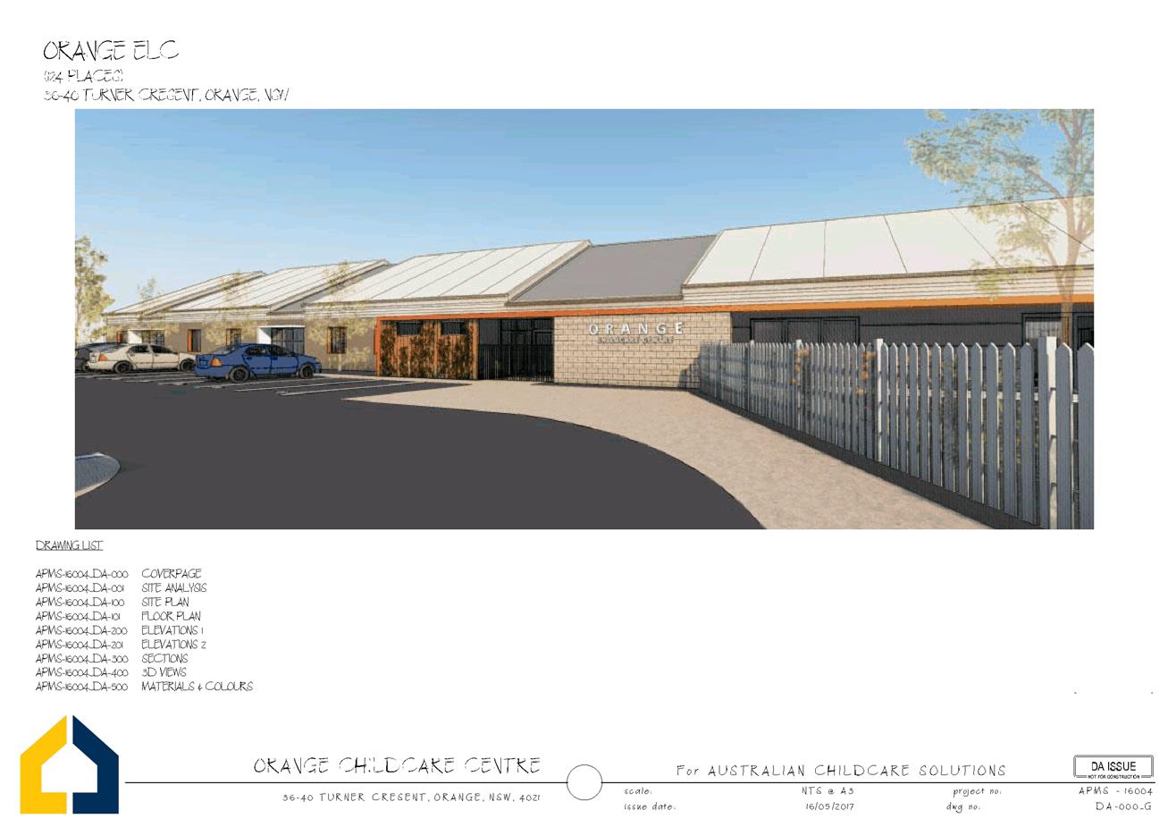
Planning and Development Committee
6 June 2017
2.2 Development
Application DA 63/2017(1) - 36-40 Turner Crescent
Attachment 2 Plans
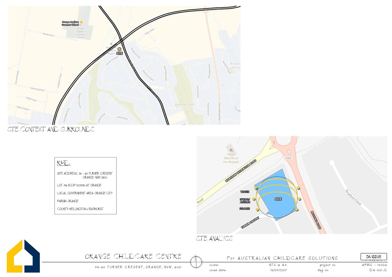
Planning and Development Committee
6 June 2017
2.2 Development
Application DA 63/2017(1) - 36-40 Turner Crescent
Attachment 2 Plans
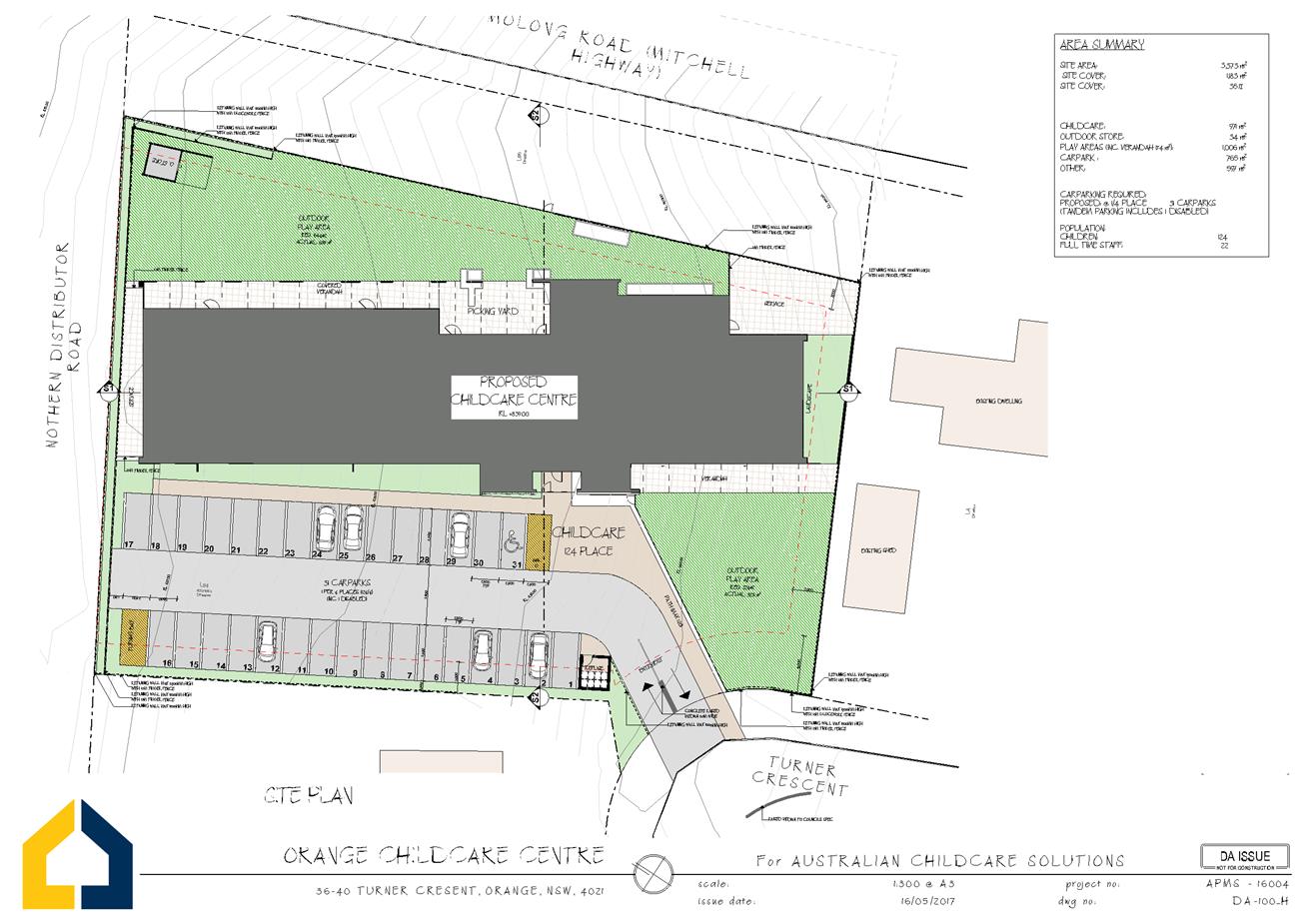
Planning and Development Committee
6 June 2017
2.2 Development
Application DA 63/2017(1) - 36-40 Turner Crescent
Attachment 2 Plans
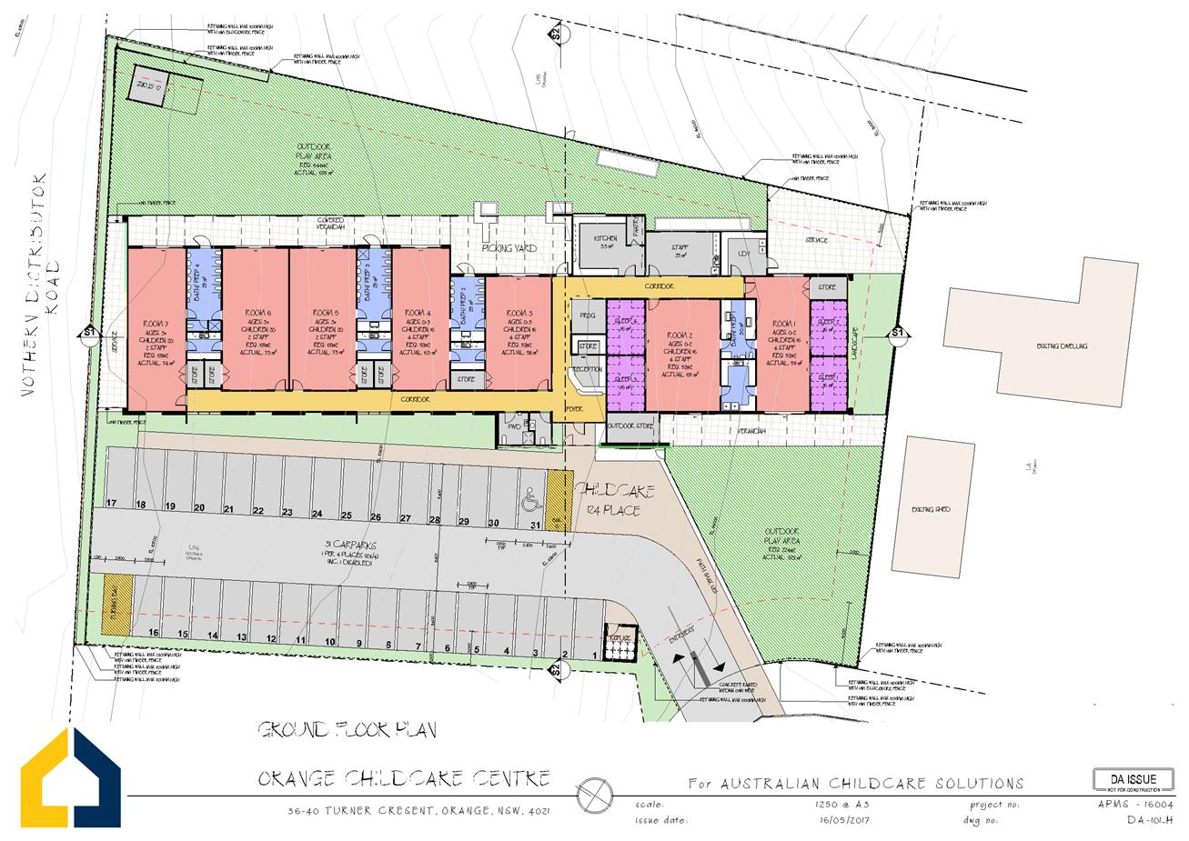
Planning and Development Committee
6 June 2017
2.2 Development
Application DA 63/2017(1) - 36-40 Turner Crescent
Attachment 2 Plans
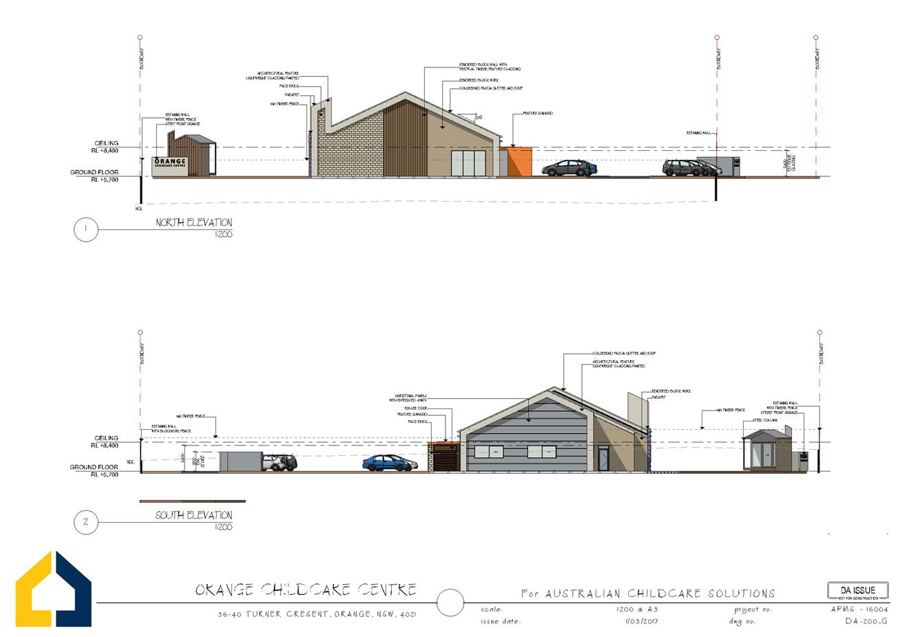
Planning and Development Committee
6 June 2017
2.2 Development
Application DA 63/2017(1) - 36-40 Turner Crescent
Attachment 2 Plans
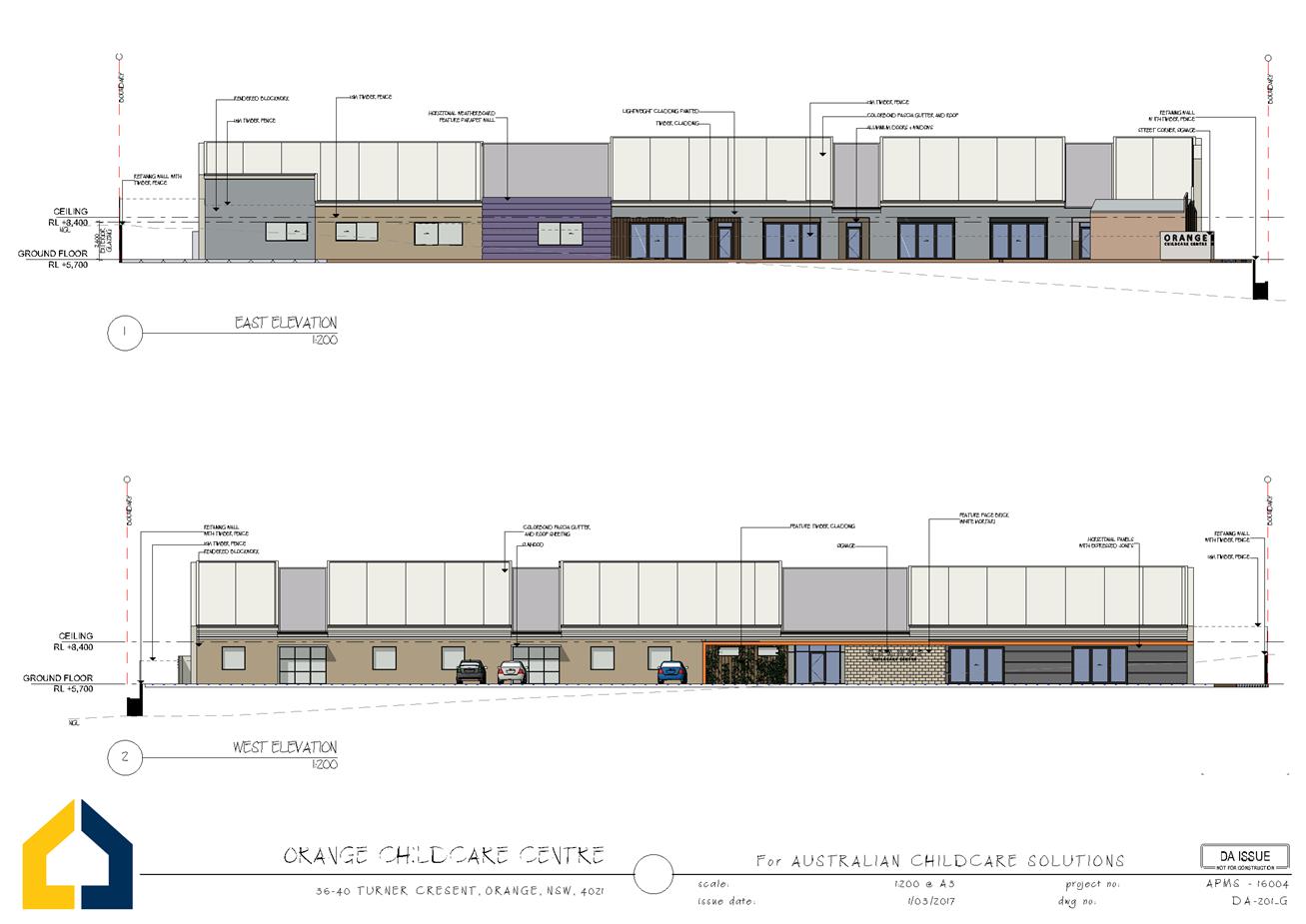
Planning and Development Committee
6 June 2017
2.2 Development
Application DA 63/2017(1) - 36-40 Turner Crescent
Attachment 2 Plans
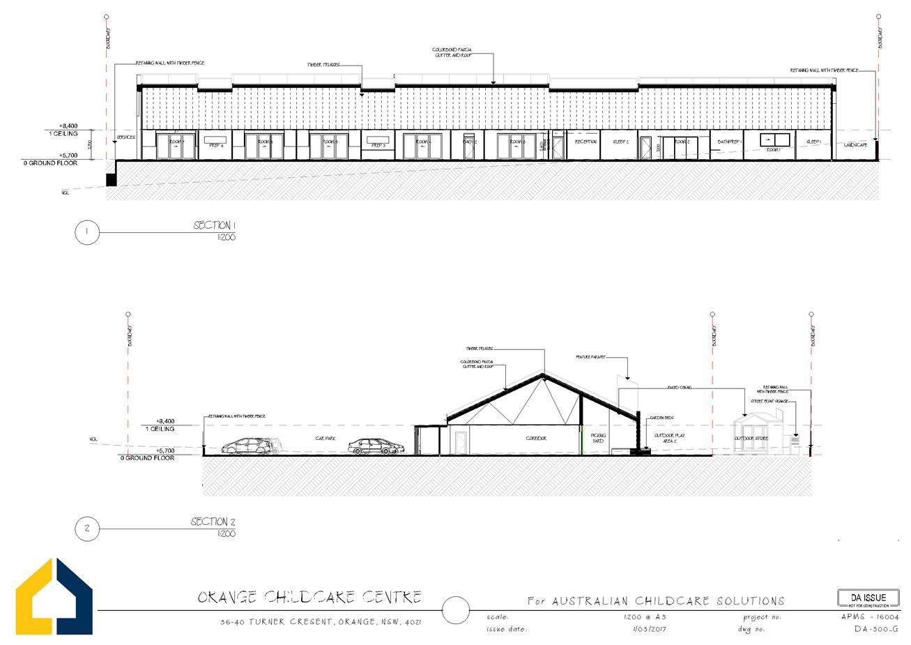
Planning and Development Committee
6 June 2017
2.2 Development
Application DA 63/2017(1) - 36-40 Turner Crescent
Attachment 2 Plans
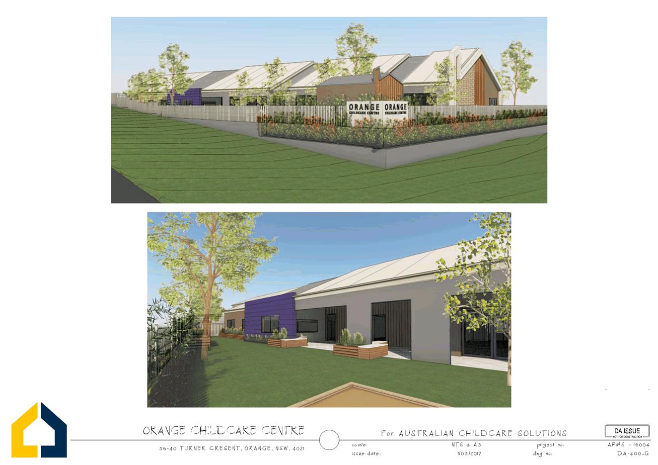
Planning and Development Committee
6 June 2017
2.2 Development
Application DA 63/2017(1) - 36-40 Turner Crescent
Attachment 2 Plans
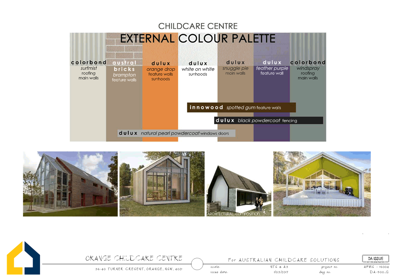
Planning and Development Committee
6 June 2017
2.2 Development
Application DA 63/2017(1) - 36-40 Turner Crescent
Attachment 3 Submissions
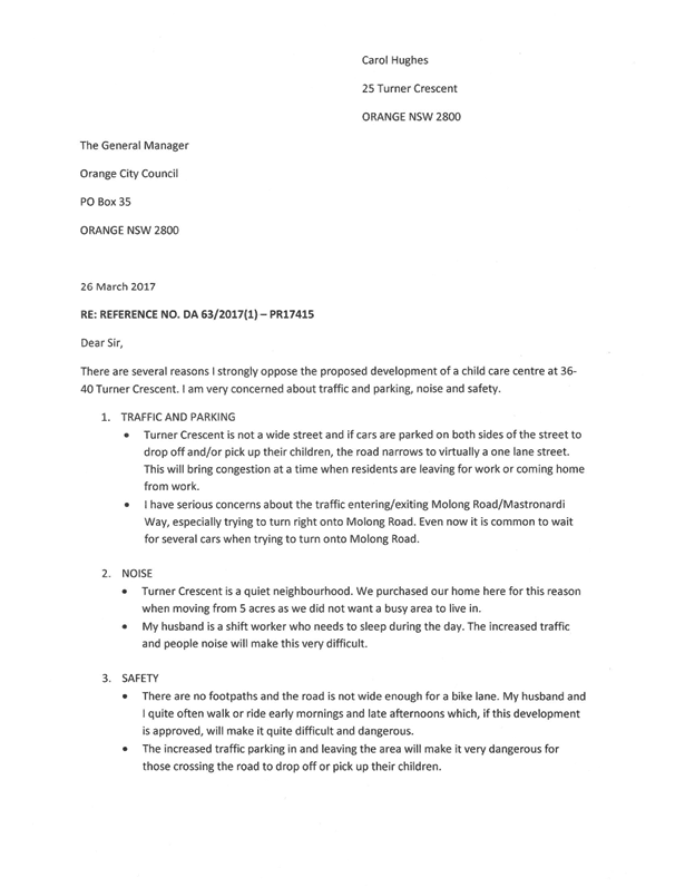

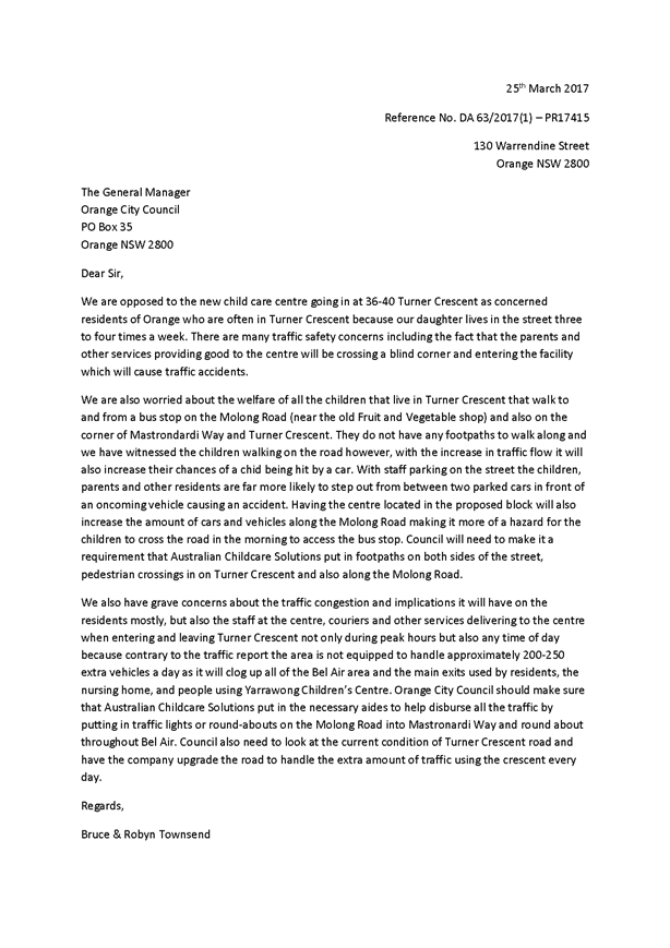
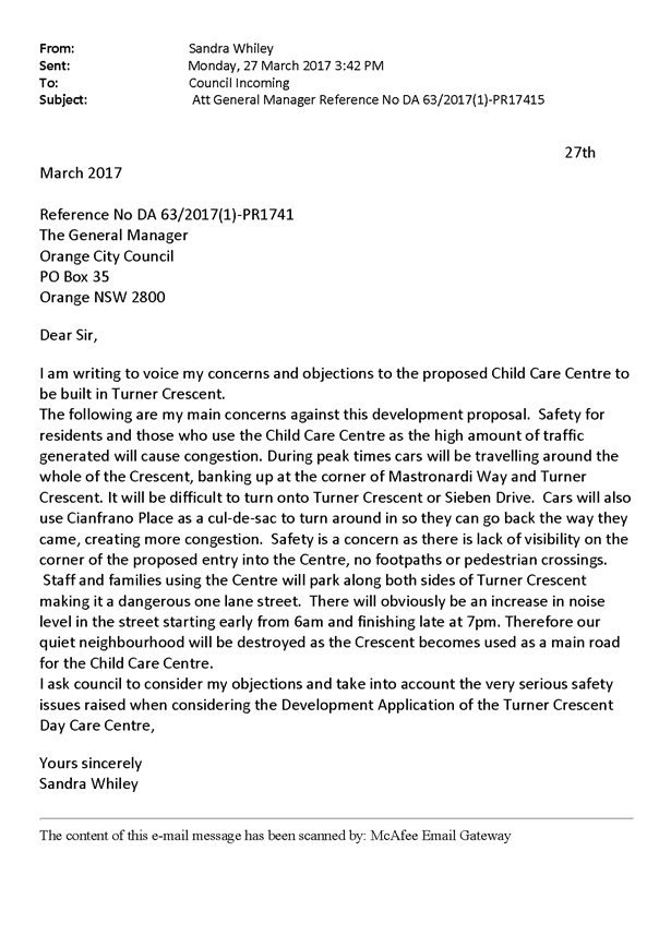
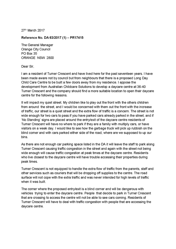

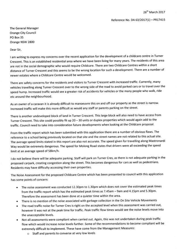

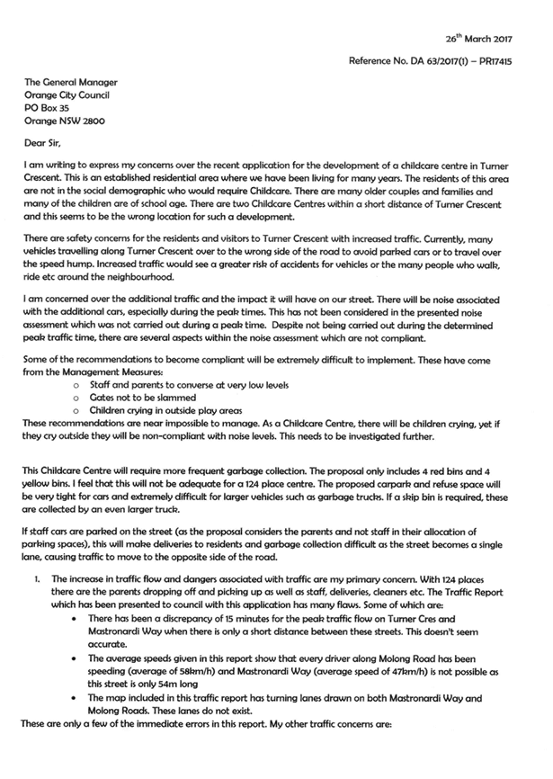
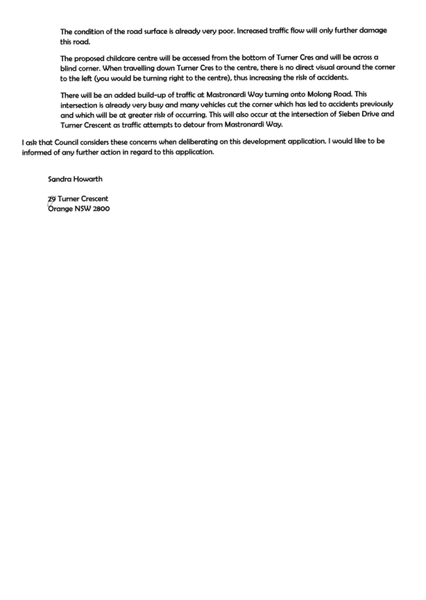
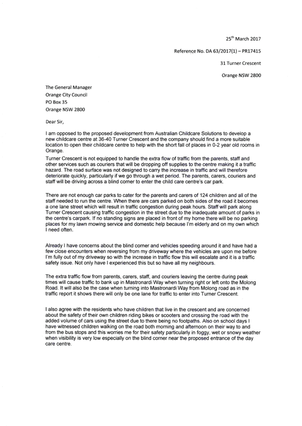

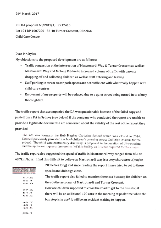
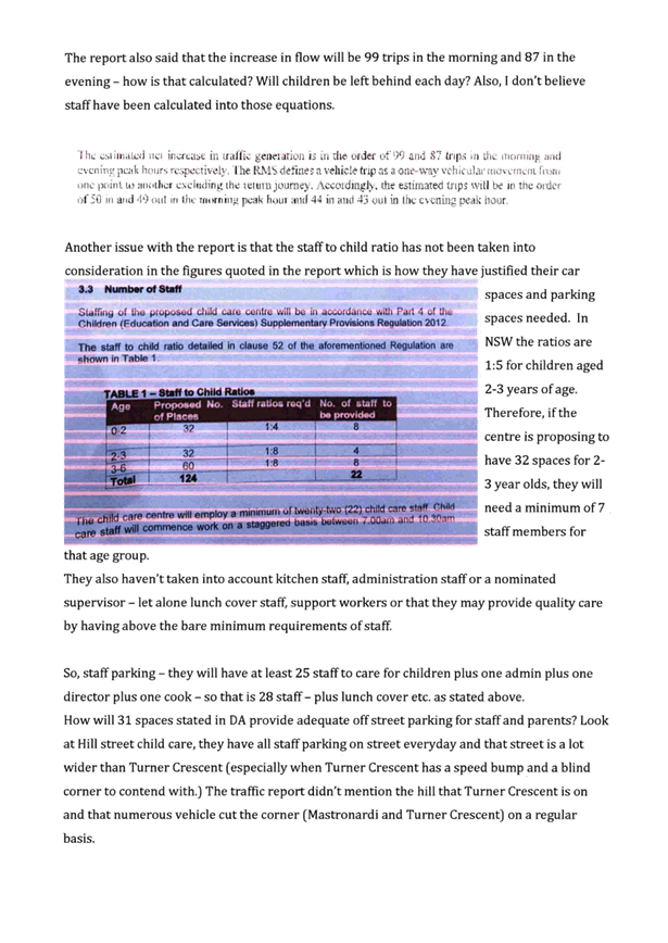
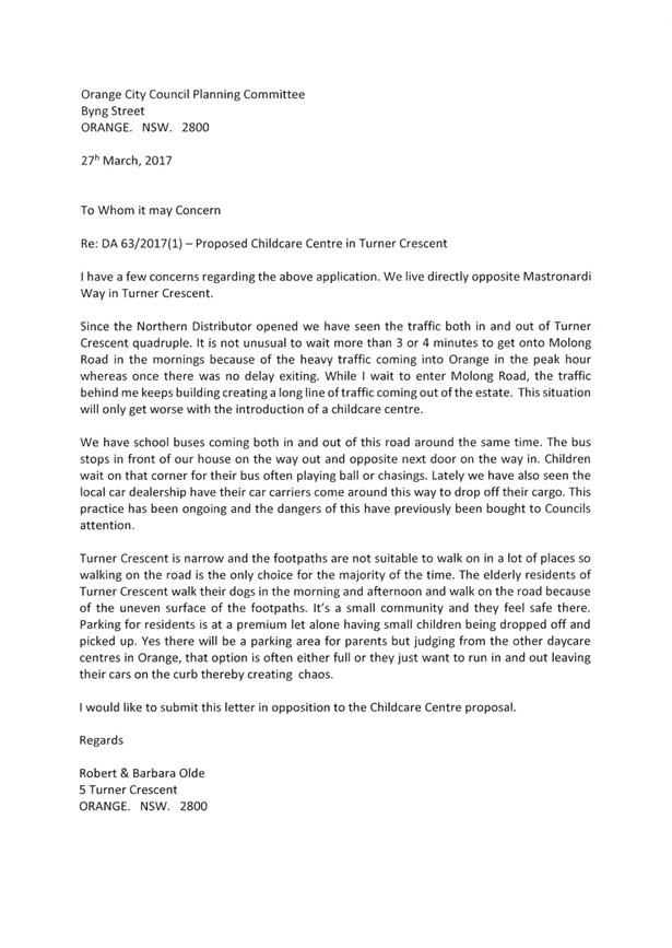
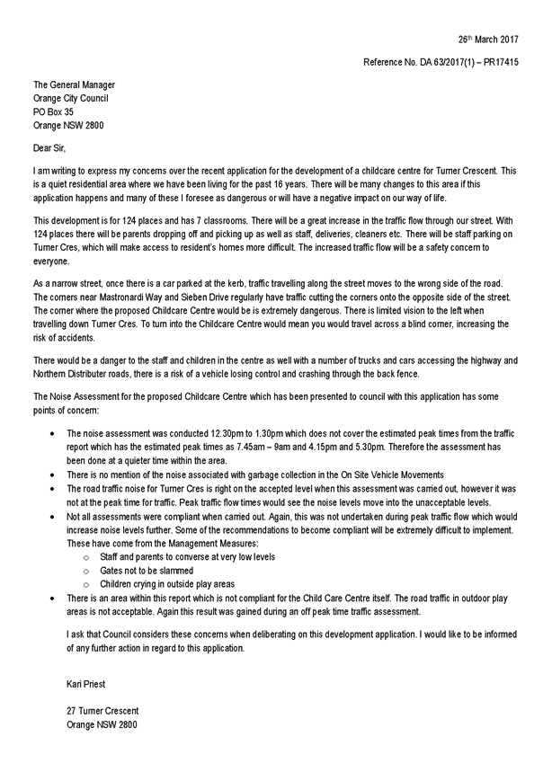
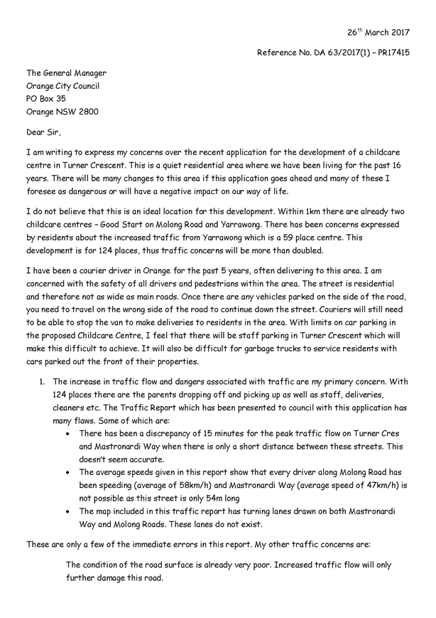
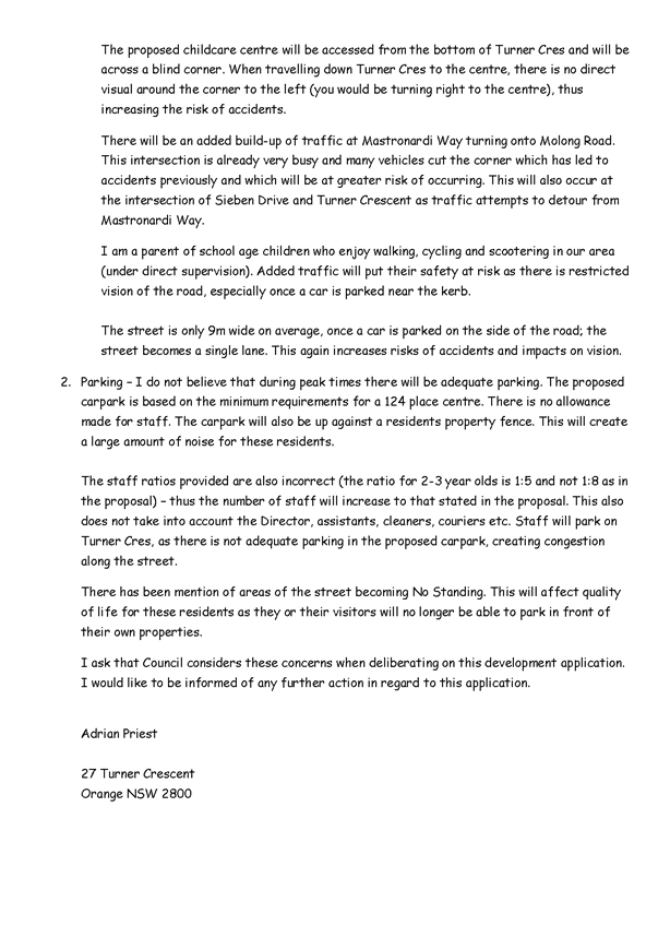
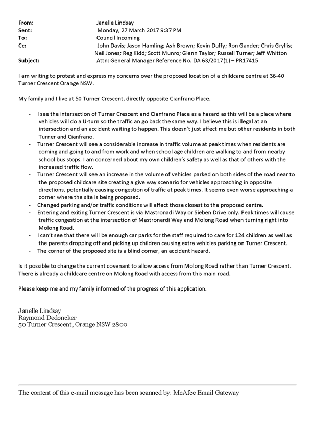
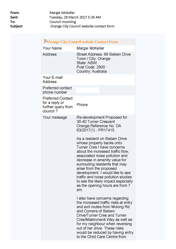
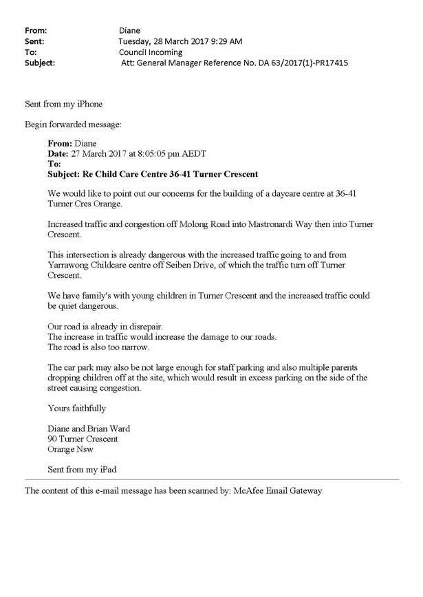
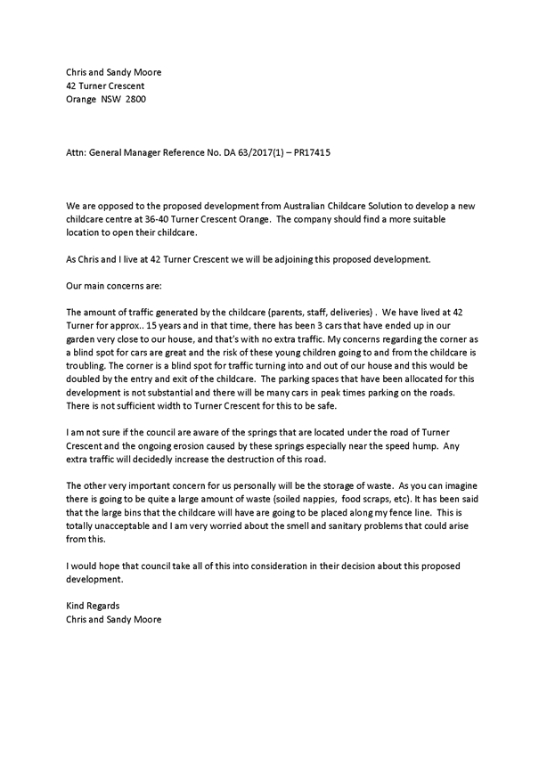
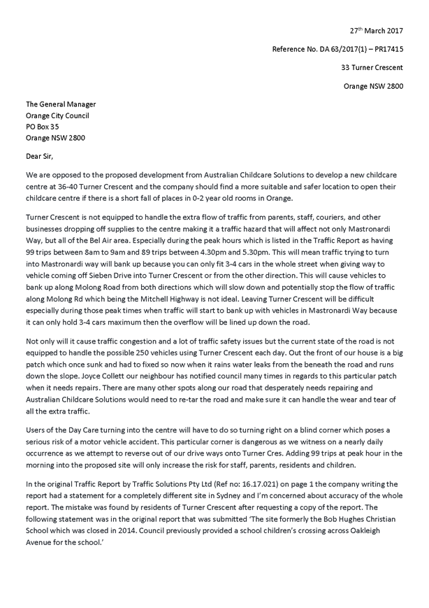
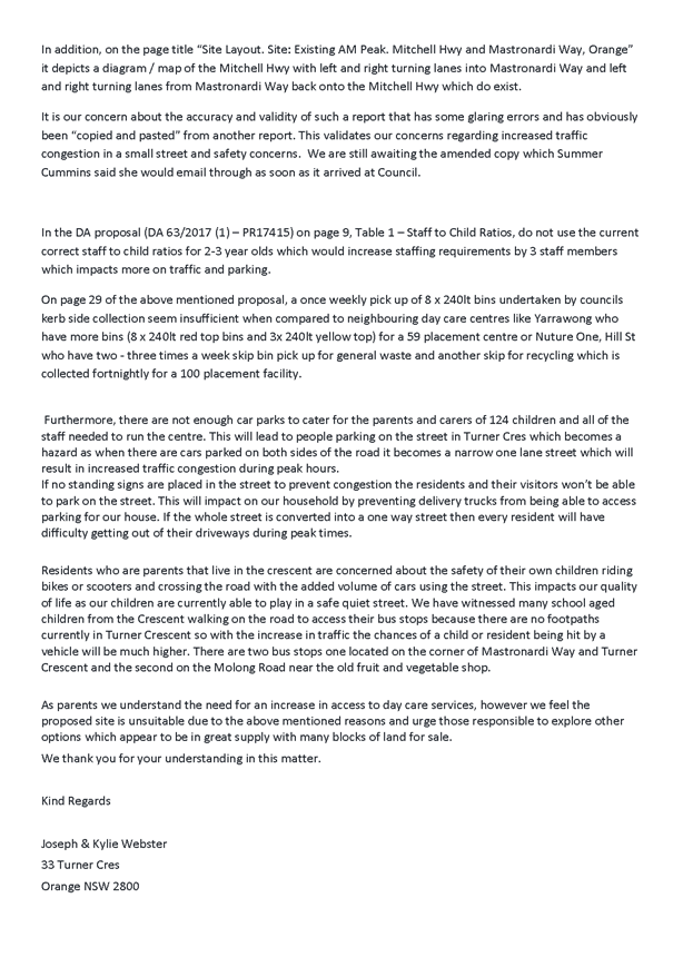
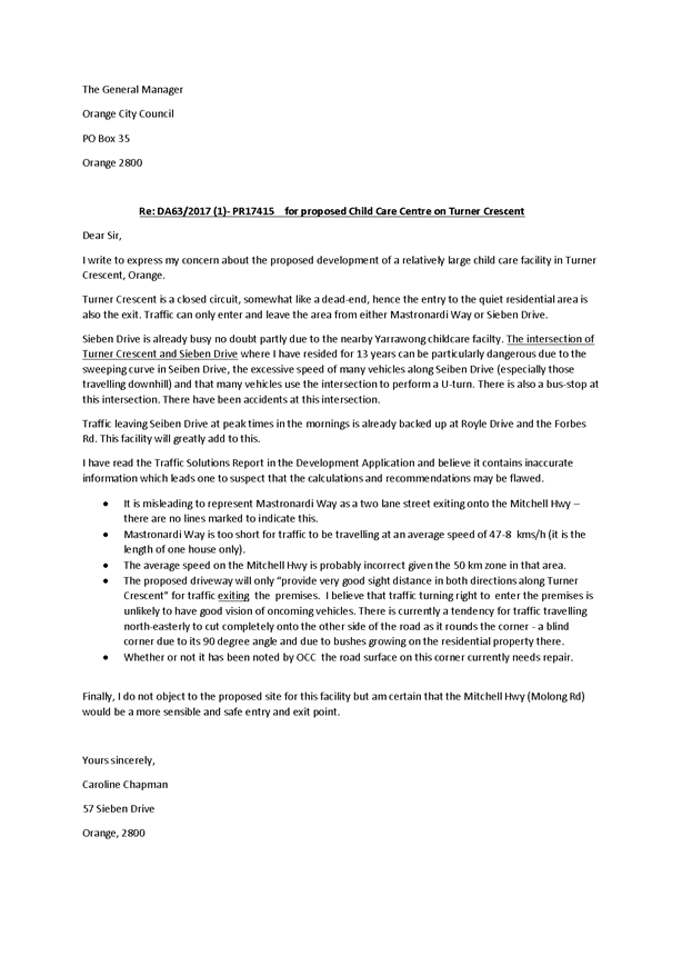
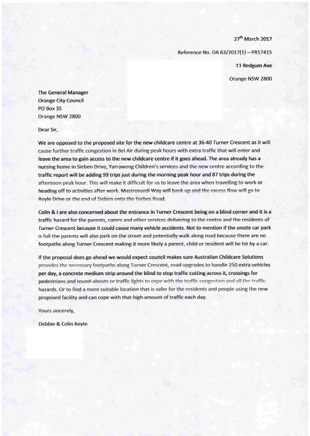
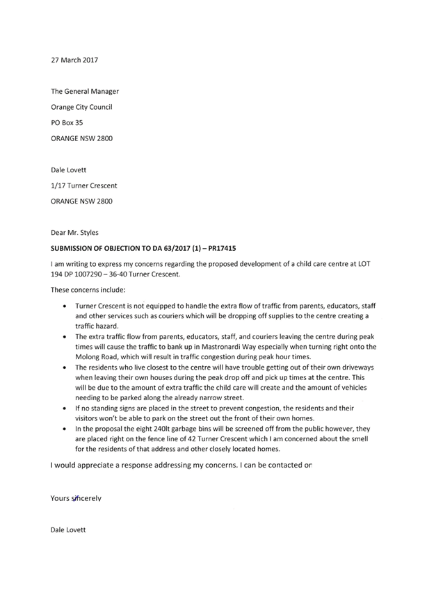
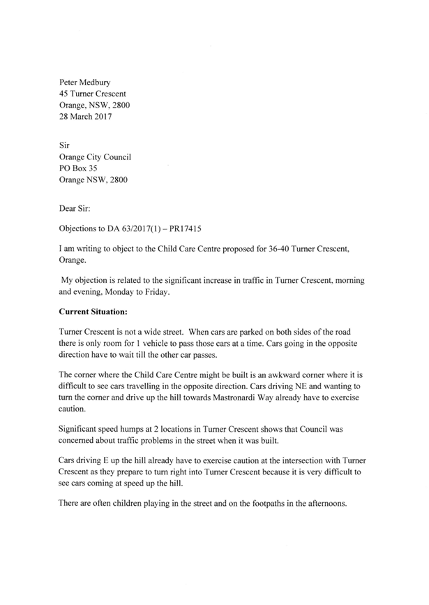
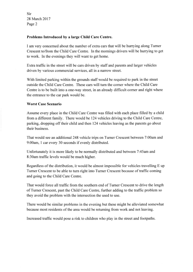
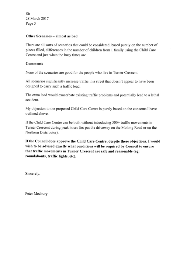
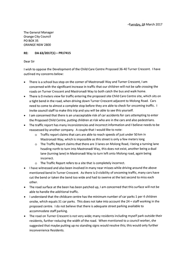

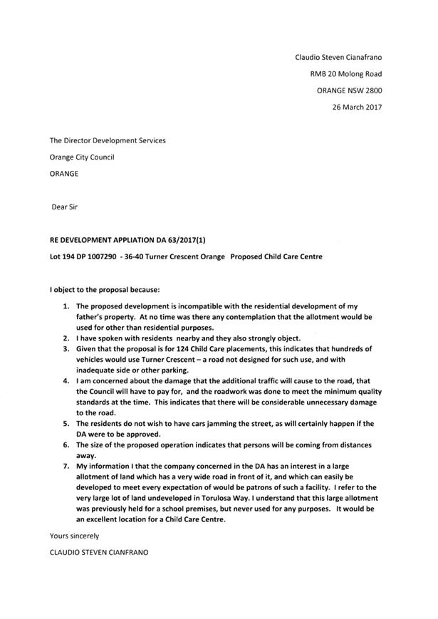
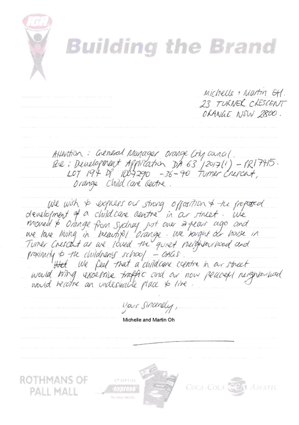

2.3 Development
Application DA 245/2016(1) - 6/175 and 7/175 Dalton Street
TRIM
REFERENCE: 2017/999
AUTHOR: Daniel
Drum, Town Planner
EXECUTIVE Summary
|
Application
lodged
|
20/07/2016
|
|
Applicant/s
|
Mr P
Patel
|
|
Owner/s
|
Orange
Alpine Investments Pty Ltd
|
|
Land
description
|
Lots 6
and 7 SP 33395 - 6/175 and 7/175 Dalton Street, Orange
|
|
Proposed
land use
|
Neighbourhood
Shop (internal alterations) and Advertising Sign
|
|
Value of
proposed development
|
$30,000
|
Council's consent is sought for
the use of a neighbourhood shop at Tenancy 7 of the neighbourhood
shopping complex at 175–181 Dalton Street, Orange. The neighbourhood
shopping complex is known as the Alpine Stores.
In order to facilitate the use of the neighbourhood shop,
Council’s consent is also sought for minor internal building works within
Tenancy 7 and the adjoining Tenancy 6, currently Foodworks Supermarket. The
works would provide for internal customer access between each tenancy and a
modified floor layout and re-arrangement of retail counters. Council’s
consent is also sought for signage.
The key issue for consideration is whether the proposed neighbourhood
shop and sale of packaged liquor will have an acceptable social impact in
the locality.
In summary, it is considered that while the subject property
is generally suitable for the use of a neighbourhood shop, the sale of
packaged liquor will likely have a significant and detrimental social impact,
given that the subject property is located within close proximity of a low
socio-economic area of Orange, and that the increased availability of packaged
liquor within easy walking distance of residents will likely result in an
increase in alcohol related crime. On this basis, it is recommended that
Council refuses the development application.
These matters are addressed in further detail in the body of
this report.
DECISION FRAMEWORK
Development in Orange is governed by two key documents
Orange Local Environment Plan 2011 and Orange Development Control Plan 2004. In
addition the Infill Guidelines are used to guide development, particularly in
the heritage conservation areas and around heritage items.
Orange Local Environment Plan 2011 – the LEP
should be considered by Council to be a definitive document. LEPs govern the
types of development that are permissible or prohibited in different parts of
the City and also provide some assessment criteria in specific circumstances.
Uses are either permissible or not - there are no grey areas in terms of
permissibility. The objectives of each zoning and indeed the aims of the LEP
itself are, however, open to interpretation and can be used to guide decision
making around appropriateness of development.
Orange Development Control Plan 2004 – the DCP
guides development. In general it is a performance based document rather than
prescriptive in nature - its purpose is to guide development. The Land and
Environment Court tends to view it as such. In each area of interest there are
often guidelines used. These guidelines indicate ways of achieving the planning
outcomes. It is thus recognised that there may also be other solutions of
merit. All design solutions are considered on merit by planning and building
staff. Applications should clearly demonstrate how the planning outcomes are
being met where alternative design solutions are proposed. So one can see that
the DCP gives leeway for developers and architects to use design to achieve the
outcome in other ways if they can. Stating that DCP guidelines are
inflexible can be misleading.
This development is recommended for refusal by Council
staff. The basis for refusal is centred on the potential negative social impact
arising from the sale of alcohol in this location. Under Section 79C of the Environmental
Planning & Assessment Act, Council is obliged to assess the likely
impacts of that development, including
environmental impacts
on both the natural and built environments, and
social and economic impacts in the locality.
Link To Delivery/OPerational Plan
The recommendation in this report relates to the
Delivery/Operational Plan strategy “13.4 Our Environment
– Monitor and enforce regulations relating to City amenity”.
Financial Implications
Nil
Policy and Governance Implications
Nil
|
Recommendation
That Council
refuses DA 245/2016(1) for Neighbourhood Shop
(internal alterations) and Advertising Sign at Lots 6 and 7 SP 33395
– 6 and 7/175-181 Dalton Street, Orange.
|
further considerations
Consideration has been given to the
recommendation’s impact on Council’s service delivery; image and
reputation; political; environmental; health and safety; employees;
stakeholders and project management; and no further implications or risks have
been identified.
SUPPORTING INFORMATION
THE APPLICATION/PROPOSAL
Council's consent is sought for the use of a neighbourhood
shop at Tenancy 7 of the neighbourhood shopping complex at 175–181 Dalton
Street, Orange. The neighbourhood shopping complex is known as the Alpine
Stores.
In order to facilitate the use of the neighbourhood shop,
Council’s consent is also sought for minor internal building works within
Tenancy 7 and the adjoining Tenancy 6, currently Foodworks Supermarket. The
works would provide for internal customer access between each tenancy and a
modified floor layout re-arrangement of retail counters. Council’s
consent is also sought for signage.
Use
The proposed neighbourhood shop is intended to be
used for the sale of packaged liquor in association with the existing Foodworks
Supermarket which occupies the adjoining Tenancy 6.
Supporting information submitted with the development
application indicates that the proposed neighbourhood shop is intended
to sell a variety of types of liquor; including beer, wine, cider and spirits.
The proposed hours of operation are Monday to Saturday 9am
to7pm and Sunday 10am to 6.30pm.
Supporting information submitted with the development
application indicates that customers would not be able to enter the neighbourhood
shop outside of the normal operating hours of the adjoining supermarket.
The neighbourhood shop has however been designed to operate separate to the
Foodworks Supermarket so as to satisfy the requirements of Council’s LEP
for neighbourhood shops in the B1 Neighbourhood Centre zone and the
requirements of the Environmental Planning and Assessment Act 1979.
Minor Building Alterations and
Signage
Minor building works would involve the removal of the
existing offices and staircase within the existing Foodworks Supermarket at
Tenancy 6, and creation of a small opening between the supermarket and the
proposed neighbourhood shop at Tenancy 7 to provide for internal
customer access.
The proposed signage includes:
- two
fascia/above awning signs
- two
wall signs, incorporating changeable promotional content.
The existing conditions of the
subject property are demonstrated in Figures 1–2, below.
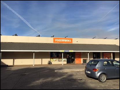
Figure 1 - the subject property - Tenancy 6 shown to
the left
and Tenancy 7 shown to the right
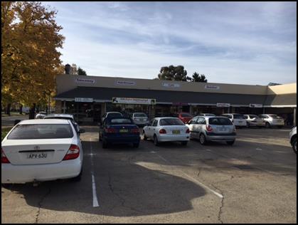
Figure 2 - other tenancies within the
Alpine Stores neighbourhood shopping complex
Surrounding Use and Development
Properties immediately adjoining and proximate to the
subject property can generally be characterised as residential to the east of
McLachlan Street and industrial/commercial to the west of McLachlan Street.
However, it is noted that the land to the immediate south west of the
intersection of Dalton and McLachlan Streets, diagonally opposite the subject
property, has recently been developed for the purpose of a childcare centre.
The land use pattern surrounding the subject property is
illustrated in Figure 3 below.
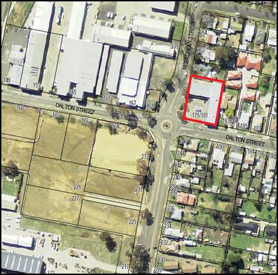
Figure 3 - land use pattern proximate to the subject
property
(Subject property identified by heavy red line)
MATTERS FOR CONSIDERATION
Section 5A Assessment
In the administration of sections 78A, 79B, 79C, 111 and
112, the provisions of Section 5A must be taken into account for every
development application in deciding whether there is likely to be a significant
effect on threatened species, populations or ecological communities or their
habitats. This section includes a requirement to consider any adopted
assessment guidelines, which means assessment guidelines issued and in force under
section 94A of the Threatened Species Conservation Act 1995.
Assessment guidelines are in force (see DECC-W “Threatened Species
Assessment Guidelines - The Assessment of Significance”) which requires
consent authority to adopt the precautionary principle in its assessment.
In this instance, site inspection reveals that the subject
property has no biodiversity or habitat value.
Section 79C - Evaluation
Section 79C of the Environmental Planning and Assessment
Act 1979 requires Council to consider various matters, of which those
pertaining to the application are listed below.
PROVISIONS OF ANY ENVIRONMENTAL
PLANNING INSTRUMENT s79C(1)(a)(i)
Orange Local Environmental Plan 2011
Part 1 - Preliminary
Clause 1.2 - Aims of Plan
The
aims of the Orange Local Environmental Plan 2011 relevant to the application
include:
(a) to encourage development which complements
and enhances the unique character of Orange as a major regional centre boasting
a diverse economy and offering an attractive regional lifestyle
(b) to provide for a range of development
opportunities that contribute to the social, economic and environmental
resources of Orange in a way that allows present and future generations to meet
their needs by implementing the principles for ecologically sustainable
development.
In general, it is considered that the proposed use of a Neighbourhood
Shop would be consistent with the foregoing aims of the Orange LEP 2011.
In particular, a neighbourhood shop would generally
complement and enhance Orange as a major regional centre boasting a diverse
economy and offering an attractive regional lifestyle; and provide for a
development opportunity that contribute to the social, economic and
environmental resources of Orange in a way that allows present and future generations
to meet their needs.
However, while the general use of a neighbourhood shop is
considered to be consistent with the relevant aims of the Orange LEP 2011, it
is considered that the sale of packaged liquor from the proposed neighbourhood
shop is not. In particular, it is considered that the location of the neighbourhood
shop and increased sale of packaged liquor would have an unacceptable
social impact. These matters are discussed in detail in the body of this
report.
Accordingly, it is considered that the proposed development
is not consistent with the aims of the Orange LEP 2011.
Clause 1.6 - Consent Authority
This clause establishes that, subject to the Act, Council is
the consent authority for applications made under the LEP.
Clause 1.9A - Suspension of
Covenants, Agreements and Instruments
This clause provides that covenants, agreements and other
instruments which seek to restrict the carrying out of development do not apply
with the following exceptions.
· covenants imposed
or required by Council
· prescribed
instruments under Section 183A of the Crown Lands Act 1989
· any conservation
agreement under the National Parks and Wildlife Act 1974
· any trust
agreement under the Nature Conservation Trust Act 2001
· any property
vegetation plan under the Native Vegetation Act 2003
· any biobanking
agreement under Part 7A of the Threatened Species Conservation Act 1995
· any planning
agreement under Division 6 of Part 4 of the Environmental Planning and
Assessment Act 1979.
Council staff are not aware of the title of the subject
property being affected by any of the above. However, it is noted that Council
does not hold a Section 88B Instrument for the subject property.
Clause 1.7 - Mapping
The subject site is identified
on the LEP maps in the following manner:
|
Land Zoning Map:
|
Land zoned B1 Neighbourhood Centre
|
|
Lot Size Map:
|
No Minimum Lot Size
|
|
Heritage Map:
|
Not a heritage item or conservation
area
|
|
Height of Buildings Map:
|
No building height limit
|
|
Floor Space Ratio Map:
|
No floor space limit
|
|
Terrestrial Biodiversity Map:
|
No biodiversity sensitivity on the
site
|
|
Groundwater Vulnerability Map:
|
Ground water vulnerable
|
|
Drinking Water Catchment Map:
|
Not within the drinking water
catchment
|
|
Watercourse Map:
|
Not within or affecting a defined watercourse
|
|
Urban Release Area Map:
|
Not within an urban release area
|
|
Obstacle Limitation Surface Map:
|
No restriction on building siting
or construction
|
|
Additional Permitted Uses Map:
|
No additional permitted use applies
|
The relevant matters are addressed in detail in the body of
this report.
Part 2 - Permitted or Prohibited Development
Clause
2.1 - Land Use Zones and Clause 2.3 - Zone Objectives and Land Use Table
The subject property is zoned
B1 Neighbourhood Centre (Figure 4).
Figure 4 -zone context plan (subject property
identified by heavy red line)
The proposed use and development is defined as neighbourhood
shop under the Orange Local Environmental Plan 2011, which means:
“…premises used
for the purposes of selling general merchandise such as foodstuffs, personal
care products, newspapers and the like to provide for the day-to-day needs of
people who live or work in the local area, and may include ancillary services
such as a post office, bank or dry cleaning, but does not include restricted
premises.”
It is to be noted that during the course of the assessment
process, Council staff queried whether the proposed use involving sale of
packaged liquor was correctly characterised as a neighbourhood shop.
In seeking to clarify whether the sale of packaged liquor
was correctly characterised as a neighbourhood shop, Council staff
referred to Altz Pty Limited v Shellharbour City Council [2014] NSWLEC 1228
(Altz), which included discussion on how a neighbourhood shop should be
characterised. Notably, that decision identified that the general approach to
characterisation for planning purposes is best set out in Chamwell Pty
Limited v Strathfield Council (2007) 151 LGERA (Chamwell). Altz summarises
Chamwell succinctly:
“The
general thrust of the findings in Chamwell is that the characterisation must
focus on the purpose of the land. This must be done at a level of generality
and in a common sense and practical way that is sufficient to include the
individual uses that make up the purpose. While there may be a number of
different uses, these different uses may still serve the same purpose.”
Taking into consideration the approach adopted in Altz and
Chamwell, it is considered that the proposed development is correctly characterised
as a neighbourhood shop. In particular, it is considered that that the
sale of packaged liquor from a relatively small floor space within an existing
neighbourhood shopping complex would fall within the ambit of ‘general
merchandise’ which would ‘provide for the day to day needs of
people who live or work in the local area’.
The objectives of the B1 Neighbourhood Centre zone are:
· to provide a
range of small-scale retail, business and community uses that serve the needs
of people who live or work in the surrounding neighbourhood
· to encourage
local employment opportunities in accessible locations
· to ensure
development is ordered in such a way as to maximise public transport patronage,
and encourage walking and cycling, in close proximity to settlement
· to promote
development of a scale that is conducive to the role of the Orange CBD as the
primary retail and business centre in the region
· to ensure
development in the Northern Leeds Parade area is appropriately serviced, of a
scale consistent with the needs of the area and will not detract from the role
of the CBD as the primary business centre within the City.
It is considered that the proposed development is generally
consistent with the objectives of the B1 Neighbourhood Centre Zone.
In particular, it is considered that the proposed
development would contribute to the existing range of small-scale retail and
business uses within the existing neighbourhood shopping centre, and which
serve the needs of people who live and work in the surrounding neighbourhood.
Part 5 - Miscellaneous Provisions
Clause
5.4 - Controls Relating to Miscellaneous Permissible Uses
This
clause contains various development standards that apply to specific types of
development. Relevantly the clause requires:
· neighbourhood shops to be limited to 140 square metres of
gross floor area
In
this regard, it is noted that the floor area of the proposed neighbourhood
shop is in the order of 106m2 and is consistent with this
requirement.
STATE ENVIRONMENTAL PLANNING POLICIES
State Environmental Planning Policy 64 - Advertising and
Signage (SEPP 64)
State Environmental Planning Policy 64 - Advertising and
Signage (SEPP 64) requires that a consent authority must not grant development
consent to an application to display signage unless the consent authority is
satisfied:
· that the signage
is consistent with the objectives of this policy as set out in Clause (1)
(a)
· that the signage
the subject of the application satisfies the assessment criteria specified in
Schedule 1
· satisfies other
relevant requirements of this policy.
The relevant matters requiring assessment are addressed
below.
Objectives of the Policy
Section 3 identifies that SEPP 64 seeks to ensure that
signage is compatible with the desired amenity and visual character of an area;
provides effective communication in suitable locations and is of high quality
design and finish.
In its totality, it is considered that the proposed signage
is not consistent with the objectives of SEPP 64 as it is inconsistent with a
desirable amenity and visual character, and is excessive given the subject
property is only one tenancy within a larger neighbourhood shopping complex.
However, it is considered that if Council were of a view to
approve the proposed development, a condition of consent could be applied to
restrict the extent of advertising and ensure that it is consistent with the
objectives of SEPP 64.
Wall Advertisements
Section 22 identifies that only one wall advertisement may
be displayed per building elevation; that the advertisement does not extend
over a window or other opening; and a business identification sign is not
displayed on the building elevation.
Given these requirements, it is considered that the proposed
wall advertisement could not be approved. However, it is noted that if the
applicant did not wish to proceed with the above awning signing, Council would
have the ability to approve one wall sign which did not extend over an existing
window.
If Council were of a view to approve the proposed development,
Council staff would liaise with the applicant to determine whether it would
prefer the above awning sign or one wall sign and apply a condition of consent
accordingly.
Further to this, it is noted that NSW Police have advised it
would oppose the external advertisement or promotion of liquor products. This
recommendation would be taken into consideration in the event that Council
staff were required to liaise with the applicant regarding the design of a wall
sign.
Schedule 1 Assessment Criteria
Character of the Area
· Is the proposal
compatible with the existing or desired future character of the area or
locality in which it is proposed to be located?
· Is the proposal
consistent with a particular theme for outdoor advertising in the area or
locality?
While advertising signage is a common feature within the
existing neighbourhood shopping complex, it is considered that the extent of
advertising signage proposed is excessive by comparison.
In particular, it is noted that each tenancy is generally
identified by both an above awning sign and fascia sign. The size of the signs
generally correlate with the size of the tenancy (ie the smaller tenancies
are identified by relatively small signs, while the large supermarket tenancy
is identified by a much larger sign (refer Figures 1 and 2, above).
In this regard, it is considered that the existing character
and theme of signage within the neighbourhood shopping complex requires that
the proposed above awning sign be reduced in scale to match that of the other
small tenancies.
In the event that Council were of a view to approve the
proposed development, Council staff would recommend a condition of consent
requiring that the above awning sign be reduced in size.
Further, as previously noted, Section 22 of SEPP 64 identifies
that only one wall advertisement may be displayed per building elevation; that
the advertisement does not extend over a window or other opening; and a
business identification sign is not displayed on the building elevation.
Given these requirements, it is considered that the proposed
wall advertisement could not be approved. However, it is noted that if the
applicant did not wish to proceed with the above awning signing, Council would
have the ability to approve one wall sign.
Special Areas
· Does the
proposal detract from the amenity or visual quality of any environmentally
sensitive areas, heritage areas, natural or other conservation areas, open
spaces areas, waterways, rural landscapes or residential areas?
The subject property is not located within any
environmentally sensitive area, heritage area, natural or other conservation
area, open spaces area, waterway or rural landscape.
While the subject property is located adjacent to a
residential area, it is not considered that the proposed signage would detract
from its amenity or visual quality.
Views and Vistas
· Does the
proposal obscure or compromise important views?
· Does the
proposal dominate the skyline and reduce the quality of vistas?
· Does the
proposal respect the viewing rights of other advertisers?
The proposed signage would not obscure or compromise
important views; dominate the skyline or reduce the quality of a vista.
However given the extent of advertising signage proposed, it
is considered that the proposed signage would be overbearing and detract from
the effectiveness of other advertising signs within the neighbourhood shopping
complex. This issue could be overcome by applying a condition of consent
requiring that the proposed above awning sign be reduced in size and/or the removal
of the proposed wall signs.
Streetscape, Setting or
Landscape
· Is the scale,
proportion and form of the proposal appropriate for the streetscape, setting or
landscape?
· Does the
proposal contribute to the visual interest of the streetscape, setting or
landscape?
· Does the
proposal reduce clutter by rationalising and simplifying existing advertising?
· Does the
proposal screen unsightliness?
· Does the
proposal protrude above buildings, structures or tree canopies in the area or
locality?
· Does the
proposal require ongoing vegetation management.
The scale of the proposed advertising signage is
inappropriate for the streetscape insofar as it is inconsistent with the
existing character and theme of signage within the neighbourhood shopping
complex.
The proposed advertising signage has a neutral impact in
terms of reducing clutter or screening unsightliness.
The proposed advertising signage will not protrude above a
building, structure or tree canopy. The proposed advertising signage will not
require ongoing vegetation management.
Site and Building
· Is the proposal
compatible with the scale, proportion and other characteristics of the site or
building, or both, on which the proposed signage is to be located?
· Does the
proposal respect important features of the site or building, or both?
· Does the
proposal show innovation and imagination in its relationship to the site or
building, or both?
As previously discussed, the scale of the proposed
advertising signage is insofar as it is inconsistent with the existing
character and theme of signage within the neighbourhood shopping complex.
Associated Devices and Logos
with Advertisements and Advertising Structures
· Have any safety
devices, platforms, lighting devices or logos been designed as an integral part
of the signage or structure on which it is to be displayed?
The “Bottle-O” logo
forms an integral part of the proposed advertising signage.
Illumination
· Would
illumination result in unacceptable glare?
· Would
illumination affect safety for pedestrians, vehicles or aircraft?
· Would
illumination detract from the amenity of any residence or other form of
accommodation?
· Can the
intensity of the illumination be adjusted, if necessary?
· Is the
illumination subject to a curfew?
No illumination is proposed.
Safety
· Would the
proposal reduce the safety for any public road?
· Would the
proposal reduce the safety for pedestrians or bicyclists?
· Would the
proposal reduce the safety for pedestrians, particularly children, by obscuring
sightlines from public areas?
The proposed advertising signage is unlikely to reduce the
safety of any public road.
State Environmental Planning
Policy 55 - Remediation of Land (SEPP 55)
State Environmental Planning Policy 55 - Remediation of Land
(SEPP 55) requires that a consent authority must not consent to the carrying
out of development of land unless it has considered whether the land is
contaminated, is satisfied that the land is suitable in its contaminated state
for which the development is proposed, if the land requires remediation to be
made suitable for the proposed development, and it is satisfied that the land
will be remediated before the land is used for that purpose.
Furthermore, SEPP 55 requires that before determining an
application to carry out development that would involve a change of use of land
(specified in subclause 4), the consent authority must consider a preliminary
investigation of the land concerned.
Given that the subject property has historically been used for
a commercial purpose and that no substantial works are proposed, it is
considered unlikely that the subject property would be in a contaminated state
unsuitable for the proposed use.
PROVISIONS OF ANY DRAFT
ENVIRONMENTAL PLANNING INSTRUMENT THAT HAS BEEN PLACED ON EXHIBITION
s79C(1)(a)(ii)
There are no draft environmental planning instruments that
apply to the subject land or proposed development.
DESIGNATED DEVELOPMENT
The proposed development is not designated development.
PROVISIONS OF ANY DEVELOPMENT
CONTROL PLAN s79C(1)(a)(iii)
Development Control Plan 2004
Development Control Plan 2004 (“the DCP”)
applies to the subject land. Chapters of the DCP relevant to the proposed
use include:
· Chapter 0 -
Transitional Provisions
· Chapter 3 -
General Considerations
· Chapter 5 -
General Considerations for Zones and Development
· Chapter 7 -
Development in Residential Areas
· Chapter 8 -
Development in Business Zones
· Chapter 15 - Car
parking.
CHAPTER 0 -TRANSITIONAL
PROVISIONS
Section 0.2 - General Translation of Zones
Section 0.2 - General Translation of Zones, provides that
any reference to a zone under Orange Local Environmental Plan 2000 is to be a
reference to the corresponding zones in the zone conversion table.
The table identifies that the B1 Neighbourhood Centre zone
corresponds with the 2a Urban Residential and 3b Business Service zone for the
purposes of the DCP.
CHAPTER 3 - GENERAL
CONSIDERATIONS
Section 3.1 - Cumulative Impacts
Section 3.1 - Cumulative Impacts identifies that Council
will consider not only the direct impacts of a particular development but also
whether the development, when carried out in conjunction with other development
in the locality, has a more significant environmental impact.
Given the proposed use is consistent with the objectives of
the B1 Neighbourhood Centre zone and existing uses within the immediate
locality of the subject property, it is considered that there would be no
significant cumulative impact associated with the use of a neighbourhood
shop.
CHAPTER 5 - GENERAL
CONSIDERATIONS
Section 5.3 - Advertised Development
Section 5.3 - Advertised Development identifies that Council
will give written and published notice of applications for advertised
development as required by the Environmental Planning and Assessment
Regulations.
While the proposed development is not categorised as
advertised development, Council’s Development Services Division
determined to advertise the development application in the public interest
given the nature of the proposed use.
Accordingly, the development application was advertised on
Saturday, 18 March 2017 and exhibited between Monday, 20 March 2017 and Monday,
3 April 2017. At the end of that period one written submission was received. An
assessment of the issues raised by the submitters is provided under the heading
“Any Submissions Made in Accordance with the Act”.
CHAPTER 7 - GENERAL
CONSIDERATIONS
Section 7.9 - 1 - Shops and Businesses in the Urban
Residential Zone
Section 7.9-1 - Shops and Businesses in the Urban
Residential Zone outlines planning outcomes for the use of shops and businesses
in the former Urban Residential Zone, with an emphasis on ensuring that
neighbourhood shopping centres complement predominately residential character.
· Development
complements the scale of residential development in the area and the
predominant heights and form of residential development in the vicinity.
Not applicable. No new building works are proposed.
· Business
premises are located in neighbourhood business areas, existing prior to Orange
LEP 2000.
The existing neighbourhood shopping complex was approved in
1981.
· Development
applications satisfactorily demonstrate that the development will not adversely
affect the amenity of the residential locality as a consequence of the nature
of the business, loading or unloading requirements, on-street parking, hours of
operation etc.
In summary, it is considered that while the subject property
is generally suitable for the use of a neighbourhood shop, the location
of the Neighbourhood shop and increased sale of packaged liquor would
have an unacceptable social impact. This is discussed in further detail below.
· Neighbourhood-business
centres are small scale to serve the needs of the residents of the locality.
Neighbourhood-business centres have a maximum commercial floor space of 1,000m2
for the combined area of adjoining or adjacent shops and businesses, whether or
not the premises are on the same land or adjacent to or in close proximity to
each other.
Not applicable. The neighbourhood shopping complex is
existing.
· New
neighbourhood business centres are located at or near collector intersections,
with the buildings addressing the street frontage and rear parking to provide
quality urban design.
Not applicable. The neighbourhood shopping complex is
existing.
· On-site parking
is provided according to Section 15.4 of this Plan.
Car parking requirements are addressed in detail below,
under Section 15.4 - Car parking requirements.
· Advertising
signage is limited to exempt development (ie, sign with a maximum area of 1
square metre) for home businesses or businesses in converted dwelling houses.
The proposed advertising signage
is addressed in detail under State Environmental Planning Policy 64 –
Advertising and Signage.
· Advertising
signage in neighbourhood centres is not intrusive to the character of the
residential locality. No more than 15% of the street façade elevation
area of premises in a neighbourhood centre involves signage.
The proposed advertising signage is addressed in detail
under State Environmental Planning Policy 64 - Advertising and Signage.
CHAPTER 8 - DEVELOPMENT IN
BUSINESS ZONES
Section 8.1 - Orange CBD
Section 8.1 - Orange CBD outlines planning outcomes for the
Orange Central Business District with an emphasis on design, character, parking
and loading. The relevant planning outcomes are addressed below:
· Applications
clearly demonstrate that the development will not detract from the role of the
CBD as a regional centre.
The proposed development is not located within the CBD.
Given the relatively small scale of the neighbourhood shop, it is
considered that its location within an existing neighbourhood shopping complex
will not detract from the role of the CBD as the regional centre for commerce
and service.
· Provision of
adequate fire-safety measures and facilities for disabled persons (according to
the BCA) is addressed at the application stage (relevant for all development
but particularly important where converting residential buildings for business
use).
Council’s Building Surveyor has commented that a fire safety certificate has been provided.
· Heritage
streetscapes are conserved and enhanced through adaptive reuse of heritage
buildings, restrained advertising and landscaped gardens.
Not applicable. The subject property is not located within a
heritage conservation area and does not adjoin a heritage item.
· Areas on the
main roads into and out of Orange (such as Molong Road and Bathurst Road)
provide a high level of architectural design to enhance the visual character of
the City entrances.
Not applicable.
· Car parking is
provided to meet demand either as onsite parking areas or through contributions
towards public parking in and adjacent to the CBD.
Car parking is dealt with under Section 15.4 – Car
parking requirements.
· All sites
contain an element of landscaping. Landscaping provided is of a bulk, scale and
height relative to buildings nearest the front property boundary so as to
provide beautification and visual relief to the built form proposed or existing
on the site. The depth of the landscape bed at the site frontage is sufficient
to accommodate the spread of plantings that meet the abovementioned outcomes
but, where practicable, a minimum depth of 3m is provided. Plantings are
designed to provide shade for parking areas, to break up large areas of
bitumen, to enhance building preservation and to screen against noise.
Not applicable.
CHAPTER 15 - CAR PARKING
Section 15.1 - Background, Section 15.2 - Objectives and
Section 15.3 - Relationship Between On-street and Off-street Car Parking
Sections 15.1-15.3 of Chapter 15 - Car Parking set out the
background, objectives and relationship between on street and off street car
parking in Orange. In particular, these sections highlight the importance of
making provision for car parking in order that the demand for parking in the
City is met, and ensuring that the design and layout of car parking facilitates
the safe and effective use of off-street parking.
The appropriate assessment of car parking requirements is
addressed under the following Sections.
Section 15.4 - Parking
Requirements
Section 15.4 - Parking Requirements sets out the minimum
parking requirements for specific land uses.
Given that the development application fundamentally seeks
to reuse the subject property for a use for which it was originally approved,
it is considered that car parking is in equilibrium. No further consideration
of car parking requirements is required.
PROVISIONS PRESCRIBED BY THE
REGULATIONS s79C(1)(a)(iv)
Demolition of a Building (clause 92)
The proposal does not involve the demolition of a building.
Fire Safety Considerations
(clause 93)
If Council is of a view to approve the proposed development,
it is noted that Council’s Environmental Health and Building Surveyor has
recommended a condition of consent requiring that Council be provided with a
Final Fire Safety Certificate in relation to essential fire or other applicable
measures prior to the issue of an Occupation Certificate.
Buildings to be Upgraded
(clause 94)
The proposal does not involve the rebuilding, alteration,
enlargement or extension of an existing building.
BASIX Commitments (clause 97A)
Not applicable.
THE LIKELY IMPACTS OF THE
DEVELOPMENT s79C(1)(b)
The key likely impact of the proposed development has been
identified as a detrimental social impact on residents within the immediate
locality/convenience shopping catchment of the proposed neighbourhood shop.
The likely social impact is addressed below.
Social Impact
During the course of the assessment process, Council’s
Development Services Department identified that the sale of packaged liquor had
the potential to have a detrimental social impact on residents within the
immediate locality (or convenience shopping catchment) of the Alpine Stores
neighbourhood shopping complex.
In addition Council’s Community, Recreation and
Cultural Services Department had previously objected to the issue of a liquor
licence on the basis of negative social impact (see attached).
In particular, the objection identified that the subject
property is located within close proximity of a low socio‑economic
residential area, a day care centre, primary secondary schools and social
housing. Further, the objection highlighted there is strong evidence that the
density, proximity and availability of packaged liquor has a strong nexus with
negative social impact, particularly domestic violence and long term negative
health. The objection also noted that the availability of packaged liquor within
the Orange LGA is signficant.
In the absence of any specific Council planning policy
addressing social impact or the appropriate location of packaged liquor
outlets, Council’s Development Services Department requested that the
applicant provide a copy of the Community Impact Statement prepared to support
the application for a liquor licence. The applicant subsequently provided a
Social Impact Assessment (SIA) prepared specifically to support the development
application.
The SIA was subsequently referred internally to
Council’s Community, Recreation and Cultural Services Department for
review. The Community, Recreation and Cultural Services Department advised
that:
“The Community Impact
Statement has relied on an assessment of Orange City as a whole but fails to
account for the specific location of the proposed Liquor outlet.
The proposed outlet is located
adjacent to residential housing.
There is a strong nexus
between Alcohol and Alcohol related crime. For this reason the NSW Bureau of
Crime Statistics and Research introduced four measures to monitor the impact of
Alcohol in the community. These are:
· Non Domestic
related Violence (i.e. violence related to alcohol which is not DV –
e.g. at a party, event etc.). The rate in Orange is 277 per 100,000
people almost twice the state average of 144 per 100,000 – or 1.9 times
state average
· Alcohol Related
Domestic Violence: The rate in Orange is 188 per 100,000 against state
average of 122 per 100,000 – or 1.5 times state average
· Alcohol related
Offensive behaviour. The rate in Orange is 188 per 100,000 against a state
average of 88 per 100,000 – or 2.1 times state average
· Alcohol Related
Assault police. The rate in Orange is 43 per 100,000 against a state average of
18 – or 2.4 times state average
It is also worth noting that
the most frequent venue for reported assaults in NSW is on residential premises
accounting for 43% of all incidents.
The primary issue with the
proposal is that it seeks to increase the availability of alcohol in a
residential setting as clearly the applicant considers it will sell alcohol to
the immediate community.
The Community Impact Statement
also acknowledges Orange is already well serviced with liquor outlets.
Following further discussion with Council’s Community,
Recreation and Cultural Services Department, a supplementary response was
provided stating:
The proposed introduction of
increased packaged Alcohol within easy walking distance of residences increases
its availability and likely increased consumption.
There is a strong relationship
between alcohol and crime. Articles and research on this subject can be found
at http://www.bocsar.nsw.gov.au/Documents/BB/AB01.pdf.
As detailed in this paper one
of the important findings from this study was that the offences of assault,
malicious damage to property and offensive behaviour were found to be more
common in postcodes that had a higher alcohol sales volume. Furthermore, all
four alcohol types investigated (beer, low-alcohol beer, wine and spirits) were
found to be equally good predictors of crime rates.
This research also indicated
that there was a significant positive correlation between alcohol sales through
off-licences (purchases through liquor stores) and both malicious damage to
property and offensive behaviour incidents. “Stevenson, R.J. 1996, The
Impact of Alcohol Sales on Violent Crime, Property Destruction and Public
Disorder”
Given the proposed location of
the Liquor store and the likely negative impact from increased Liquor sales I
am unable to support the application.”
Based on the foregoing, it is understood that it is likely
that the proposed development, specifically the sale of packaged liquor, will
have a significant and detrimental social impact. In particular, it is noted
that the subject property is located within close proximity of a low
socio-economic area of Orange and that the increased availability of packaged
liquor within easy walking distance of residents will likely result in an
increase in alcohol related crime.
On the basis that Council’s Community, Recreation and
Cultural Services Department has advised that it cannot support the
development, it is considered that the proposed development should be refused.
THE SUITABILITY OF THE SITE
s79C(1)(c)
Based on the foregoing assessment of social impact, it is
considered that while a Neighbourhood shop is likely to be a suitable
use of the subject property, the sale of packaged liquor is likely to have a
significant detrimental impact. Accordingly, it is considered that the subject
property is not suitable for the proposed development.
ANY SUBMISSIONS MADE IN
ACCORDANCE WITH THE ACT s79C(1)(d)
While the proposed development is not defined as advertised
development under the provisions of the LEP, Council’s Development
Services Division determined to advertise the development application in the
public interest, given the nature of the proposed use (ie sale of packaged
liquor) and its proximity to residential properties.
Accordingly,
the development application was advertised on Saturday, 18 March 2017 and
exhibited between Monday, 20 March 2017 and Monday, 3 April 2017. At the end of
that period one written submission was received. The submission was accompanied
by a petition.
The issues raised in the submission include the following:
· the proximity of
the proposed Neighbourhood shop to a child care facility is unacceptable
· the sale of
packaged liquor would have a detrimental impact on nearby residential areas
where assaults, ‘break-ins’ and other anti-social behaviour is
prevalent
· the sale of liquor
would result in an increased likelihood of ‘break-ins’ within the
subject property and surrounding areas
· local residents
would purchase cheap packaged liquor, such as cask wine, rather than providing
food for their family
· the sale of liquor
would result in increased pollution due to people drinking within the
surrounding street network and disposing bottles within house yards and the
street
· the sale of liquor
would result in increased risk of damage to property and assaults due to people
drinking within the local street network, including detrimental impacts on
residents and the local childcare centre.
Notably, a number of issues raised in the submission are
similar, or related, to those outlined by Council’s Community, Recreation
and Cultural Services Department. As the Community, Recreation and Cultural
Services Department has indicated that it cannot support the proposed
development, it is considered that no further detailed discussion is required.
Notwithstanding, this is not to suggest that those other issues raised in the
submission are not legitimate.
Other - NSW Police
Given that the proposed development involves the sale of
packaged liquor, the development application was referred to the NSW Police for
comment in accordance with Council’s requirements to consider the likely
impacts of the proposed development. Comments received are generally taken to
address the principles for minimising crime.
The comments received from the NSW Police included:
“Police attached to the
Canobolas Local Area Command have no objection to the application however would
make the following submission on two aspects.
1 In
relation to external signage - Police would oppose the external advertisement
or promotion of liquor products. As such police would request that
Council consider not approving the Proposed External Signage relating to
promoting products or 'lifestyle' images, limiting external signage to 'Bottle O'
Branding only as per Figure 2 and 3, pages 10 of 32 and 11 of 32 respectively.
2 In
relation to access - Police would request Council consider restricting access
to the premises to 'One entry/exit point' to reduce the risk of theft and
supply of liquor to minors.”
In
relation to proposed signage, it is noted that an amended plan submitted to
Council removed the originally proposed ‘lifestyle’ signage. The
proposed signage still has five separate spaces for promotional content. This
recommendation would be taken into consideration in the event that Council
staff were required to liaise with the applicant regarding the design of a wall
sign.
In relation to access, it is considered if Council were of a
view to approve the proposed development, a condition of consent could be
applied restricting customer access to the car park only. In this regard,
Council staff note that if access to the proposed Neighbourhood shop was
restricted to internal access from the existing Foodworks Supermarket it would
be necessary to reassess whether the proposed use could still be characterised
as a Neighbourhood shop. If the use was no longer able to be
characterised as a Neighbourhood shop, it may potentially be a
prohibited use.
PUBLIC INTEREST
s79C(1)(e)
As discussed in the body of this report, it is considered
that the proposed development is not in the public interest, on the basis that
it is likely to have a significant and detrimental impact.
SUMMARY
Council's consent is sought for the use of a Neighbourhood
Shop at Tenancy 7 of the neighbourhood shopping complex at 175–181
Dalton Street, Orange. The proposed development is permissible with the consent
of Council. A Section 79C assessment of the development indicates that the
development is likely to a significant and detrimental social impact.
The foregoing assessment identifies that the proposed
development should be refused on the following grounds:
1 Unacceptable
social impact and not in the public interest.
1.1 Unacceptable social impact by
reason of the subject property being located in close proximity to residential
housing.
1.2 The sale of packaged liquor
within walking distance of residents likely resulting in an increase in alcohol
related crime.
Attachments
1 Notice
of Refusal, D17/31821⇩
2 Plans,
D17/31051⇩
3 Submission,
D17/31053⇩
Planning and Development Committee
6 June 2017
2.3 Development
Application DA 245/2016(1) - 6/175 and 7/175 Dalton Street
Attachment 1 Notice
of Refusal
|

|
ORANGE
CITY COUNCIL
Development
Application No DA
245/2016(1)
NA17/ Container
PR3426
|
NOTICE OF DETERMINATION
OF A DEVELOPMENT
APPLICATION
issued under the Environmental
Planning and Assessment Act 1979
Section 81(1)
|
Development Application
|
|
|
Applicant Name:
|
Mr P Patel
|
|
Applicant Address:
|
C/-
Anthony Daintith Town Planning
PO Box
1975
ORANGE NSW 2800
|
|
Land to Be Developed:
|
Lots 6 and 7 SP 33395 - 6/175 and
7/175 Dalton Street, Orange
|
|
Proposed Development:
|
Neighbourhood Shop (internal alterations) and
Advertising Sign
|
|
|
|
|
Building Code of Australia
Building Classification:
|
Not applicable
|
|
|
|
|
Determination
|
|
|
Made On:
|
6 June 2017
|
|
Determination:
|
APPLICATION REFUSED
|
|
|
|
|
Reason(s) for Refusal:
|
1 Unacceptable
social impact which is not in the public interest.
1.1 Unacceptable
social impact by reason of the subject property being located in close
proximity of a low socio-economic area of Orange.
1.2 The
sale of packaged liquor within walking distance of residents likely resulting
in an increase in alcohol related crime.
|
|
|
|
|
Right of Appeal:
|
Applicant:
If
you are dissatisfied with this decision, Section 97 of Environmental
Planning and Assessment Act 1979 gives you the right to appeal to the
Land and Environment Court within 6 months after the date on which you
receive this notice.
*
Section 97 of the Environmental Planning and Assessment Act, 1979 does not
apply to the determination of a development application for State significant
development or local designated development that has been the subject of a
Commission of Inquiry.
Objector:
The
Environmental
Planning and Assessment Act 1979 does not give a right of appeal against this
determination to an objector.
|
|
|
|
|
Signed:
|
On behalf of the consent authority:
|
|
Signature:
|
|
|
Name:
|
DAVID WADDELL - DIRECTOR DEVELOPMENT SERVICES
|
|
Date:
|
7 June 2017
|
Planning
and Development Committee
6 June 2017
2.3 Development
Application DA 245/2016(1) - 6/175 and 7/175 Dalton Street
Attachment 2 Plans
Planning and Development Committee
6 June 2017
2.3 Development
Application DA 245/2016(1) - 6/175 and 7/175 Dalton Street
Attachment 2 Plans

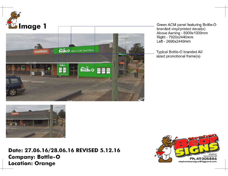
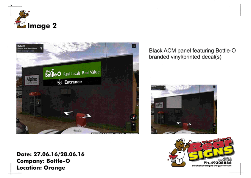
Planning and Development Committee
6 June 2017
2.3 Development
Application DA 245/2016(1) - 6/175 and 7/175 Dalton Street
Attachment 3 Submission
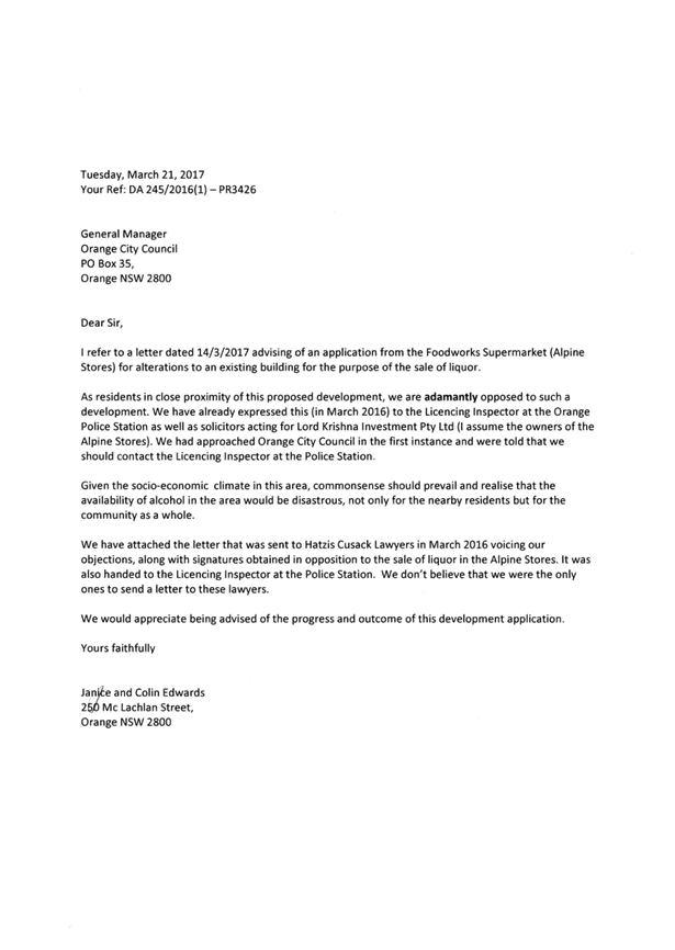
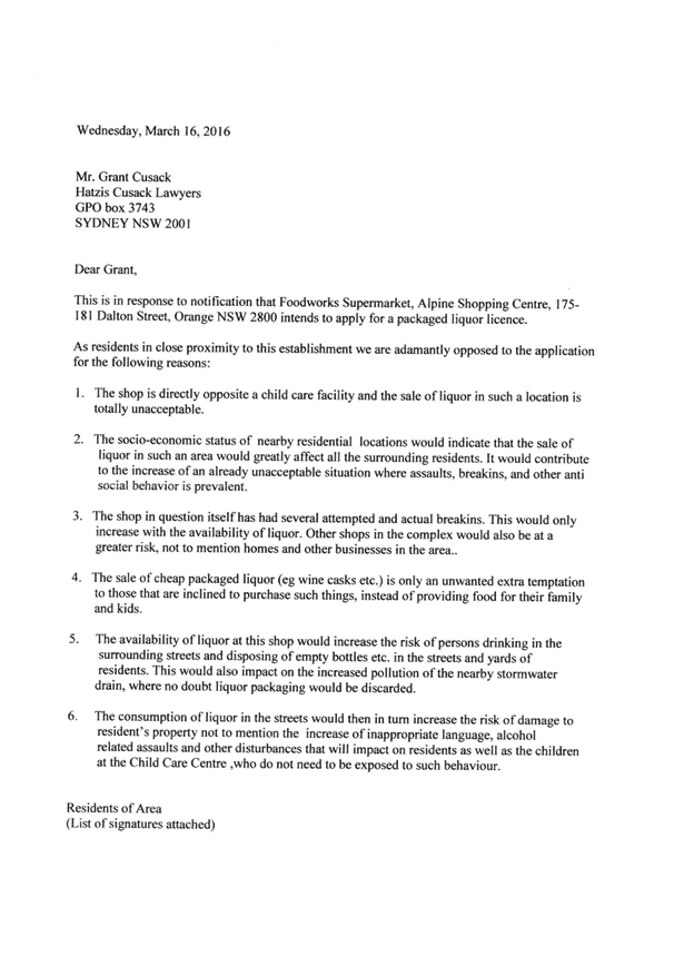

2.4 Development
Application DA 113/2017(1) - 38-44 Bathurst Road
TRIM
REFERENCE: 2017/1001
AUTHOR: Kelly
Walker, Town Planner
EXECUTIVE Summary
|
Application
lodged
|
11 April
2017
|
|
Applicant/s
|
John
Davis Motors
|
|
Owner/s
|
John
Davis Superannuation Fund Pty Ltd
|
|
Land
description
|
Lot 1 DP
507837 - 38-44 Bathurst Road, Orange
|
|
Proposed
land use
|
Vehicle
Sales or Hire Premises (alterations and additions to existing building) and
Signage
|
|
Value of
proposed development
|
$300,000
|
Council's consent is sought to refurbish the existing Volvo
Showroom at John Davis Motors, at Lot 1 DP 507837,
known as 38-44 Bathurst Road, Orange. The proposal involves upgrading the
external appearance of the existing showroom building, and replacing the Volvo
signs on the building and the pylon sign at the site frontage.
The proposal does not alter any other aspects of the
existing operation of John Davis Motors, such as the site layout, display
areas, access and car parking arrangements, operational arrangements etc.
Concerns were initially raised with the applicant in regards
to the proposed 7.14m high pylon sign, which overhung the site boundary above
the footpath, and exceeded the height of other signage on the site and within
the surrounding area. The applicant was requested to consider amending the
plans to address these issues. Revised plans have been submitted which sets the
pylon sign back within the site, and reduces its height to 6.5m. These
amendments ensure that the proposal will not adversely impact on heritage
values of the nearby listed buildings and conservation area, the streetscape,
and visual amenity of the surrounding area. It is recommended that Council
supports the application.
The application comes to the Planning and
Development Committee as the premises is owned by a Councillor.
DECISION FRAMEWORK
Development in Orange is governed by two key documents
Orange Local Environment Plan 2011 and Orange Development Control Plan 2004. In
addition the Infill Guidelines are used to guide development, particularly in
the heritage conservation areas and around heritage items.
Orange Local Environment Plan 2011 – the LEP
should be considered by Council to be a definitive document. LEPs govern the
types of development that are permissible or prohibited in different parts of
the City and also provide some assessment criteria in specific circumstances.
Uses are either permissible or not - there are no grey areas in terms of permissibility.
The objectives of each zoning and indeed the aims of the LEP itself are,
however, open to interpretation and can be used to guide decision making around
appropriateness of development.
Orange Development Control Plan 2004 – the DCP
guides development. In general it is a performance based document rather than
prescriptive in nature - its purpose is to guide development. The Land and
Environment Court tends to view it as such. In each area of interest there are
often guidelines used. These guidelines indicate ways of achieving the planning
outcomes. It is thus recognised that there may also be other solutions of
merit. All design solutions are considered on merit by planning and building
staff. Applications should clearly demonstrate how the planning outcomes are
being met where alternative design solutions are proposed. So one can see that
the DCP gives leeway for developers and architects to use design to achieve the
outcome in other ways if they can. Stating that DCP guidelines are inflexible
can be misleading.
In the case of DA 113/2017(1) there are considered to be no
significant issues. Staff consider the renovations to be an improvement to the
current buildings and that they do not present an impact of significance to any
nearby heritage items. In the case of signage the applicant has amended their
signage in accordance with the recommendations of staff during the process, and
the resultant signage height is considered acceptable.
Link To Delivery/OPerational Plan
The recommendation in this report relates to the
Delivery/Operational Plan strategy “13.4 Our Environment
– Monitor and enforce regulations relating to City amenity”.
Financial Implications
Nil
Policy and Governance Implications
Nil
|
Recommendation
That
Council consents to development application DA 113/2017(1) for Vehicle Sales or Hire Premises (alterations and
additions to existing building) and Signage at Lot 1 DP 507837
- 38-44 Bathurst Road, Orange pursuant to the
conditions of consent in the attached Notice of Approval.
|
further considerations
Consideration has been given to the
recommendation’s impact on Council’s service delivery; image and
reputation; political; environmental; health and safety; employees;
stakeholders and project management; and no further implications or risks have
been identified.
SUPPORTING INFORMATION
THE APPLICATION
Council's consent is sought to refurbish the existing Volvo
Showroom at John Davis Motors, at Lot
1 DP 507837, known as 38-44 Bathurst Road, Orange.
THE PROPOSAL
The proposal involves upgrading the external appearance of
the Volvo showroom building and signage as follows:
· application of
translucent cladding (polycarbonate by ‘Danpalon’) to the external
walls of the building, including setting the cladding forward of the front wall
of the office wing to enclose the existing path between the offices and
showroom, and extend the parapet level of the office wing by 0.785m, and the
showroom wing by 2.685m
· application of timber
cladding around the entry portals
· remove some internal
walls to provide a more open plan layout
· replacement of four
fascia signs, including three ‘Volvo’ signs and one
‘Suzuki’ sign, all internally illuminated
· replacement pylon sign
along site frontage with ‘Volvo’ wordmark/logo and internally
illuminated.
The proposal does not alter any other aspects of the
existing operation of John Davis Motors, such as the site layout,
display areas, access and car parking and operational arrangements etc.
MATTERS FOR CONSIDERATION
Section 5A Assessment
In the administration of Sections 78A, 79B, 79C, 111 and
112, the provisions of Section 5A must be taken into account for every
development application in deciding whether there is likely to be a significant
effect on threatened species, populations or ecological communities or their
habitats. This section includes a requirement to consider any adopted
assessment guidelines, which means assessment guidelines issued and in force
under section 94A of the Threatened Species Conservation Act 1995.
Assessment guidelines are in force (see DECC-W “Threatened Species
Assessment Guidelines - The Assessment of Significance”) which requires
consent authority to adopt the precautionary principle in its assessment.
In this instance, site inspection reveals that the subject
property has no biodiversity or habitat value.
Section 79C
Section 79C of the Environmental Planning and Assessment
Act 1979 requires Council to consider various matters, of which those
pertaining to the application are listed below.
PROVISIONS OF ANY ENVIRONMENTAL
PLANNING INSTRUMENT s79C(1)(a)(i)
Orange Local Environmental Plan 2011
Part 1 - Preliminary
Clause 1.2 - Aims of Plan
The
broad aims of the LEP are set out under subclause 2. Those relevant to the
application are as follows:
(a) to
encourage development which complements and enhances the unique character of
Orange as a major regional centre boasting a diverse economy and offering an
attractive regional lifestyle
(b) to
provide for a range of development opportunities that contribute to the social,
economic and environmental resources of Orange in a way that allows present and
future generations to meet their needs by implementing the principles for ecologically
sustainable development
(f) to
recognise and manage valued environmental heritage, landscape and scenic
features of Orange.
The application is considered to
be consistent with these aims, in particular the proposal seeks to improve the visual
appearance of an existing business that will not adversely impact on the nearby
heritage conservation area.
Clause 1.6 - Consent Authority
This clause establishes that, subject to the Act, Council is
the consent authority for applications made under the LEP.
Clause 1.9A - Suspension of
Covenants, Agreements and Instruments
This clause provides that covenants, agreements and other
instruments which seek to restrict the carrying out of development do not apply
with the following exceptions.
· covenants imposed
or required by Council
· prescribed
instruments under Section 183A of the Crown Lands Act 1989
· any conservation
agreement under the National Parks and Wildlife Act 1974
· any trust
agreement under the Nature Conservation Trust Act 2001
· any property
vegetation plan under the Native Vegetation Act 2003
· any biobanking
agreement under Part 7A of the Threatened Species Conservation Act 1995
· any planning
agreement under Division 6 of Part 4 of the Environmental Planning and
Assessment Act 1979.
Council staff are not aware of the title of the subject
property being affected by any of the above.
Mapping
The subject site is identified
on the LEP maps in the following manner:
|
Land Zoning Map:
|
Land
zoned Zone B6 Enterprise Corridor
|
|
Lot Size Map:
|
No Minimum Lot Size
|
|
Heritage Map:
|
Not a heritage item or conservation
area, but opposite heritage conservation area, and near listed buildings
|
|
Height of Buildings Map:
|
Building height limit 12m
|
|
Floor Space Ratio Map:
|
Floor space limit 1.5:1
|
|
Terrestrial Biodiversity Map:
|
No biodiversity sensitivity on the
site
|
|
Groundwater Vulnerability Map:
|
Ground water vulnerable
|
|
Drinking Water Catchment Map:
|
Not within the drinking water
catchment
|
|
Watercourse Map:
|
Not within or affecting a defined
watercourse
|
|
Urban Release Area Map:
|
Not within an urban release area
|
|
Obstacle Limitation Surface Map:
|
No restriction on building siting
or construction
|
|
Additional Permitted Uses Map:
|
No additional permitted use applies
|
Those matters that are of relevance are addressed in detail
in the body of this report.
Part 2 - Permitted or Prohibited
Development
Land Use Zones
The subject site is located within the B6 Enterprise
Corridor zone. The proposed development is defined as a ‘vehicle sales or
hire premises’ under LEP 2011, which is defined as follows:
vehicle sales or hire premises means a building or place used for the display,
sale or hire of motor vehicles, caravans, boats, trailers, agricultural
machinery and the like, whether or not accessories are sold or displayed there.
A ‘vehicle sales or hire
premises’ and a ‘vehicle repair station’ are
permitted with consent in the B6 Enterprise Corridor zone.
Clause 2.3 of LEP 2011 references the Land Use
Table and Objectives for each zone in LEP 2011. These objectives for land
zoned B6 Enterprise Corridor are as follows:
· to promote
businesses along main roads and to encourage a mix of compatible uses
· to provide a
range of employment uses (including business, office, retail and light
industrial uses)
· to maintain the
economic strength of centres by limiting retailing activity
· to provide for
residential uses, but only as part of
a mixed use development.
The proposed development is considered
to be consistent with the objectives set out for the zone, in particular the
proposal seeks to improve the function of an existing business adjacent to the
main road, and does not detract from the main retail centres in the City, where
the Enterprise Corridor is the ideal location for this type of activity.
Part 3 - Exempt and Complying
Development
The application is not exempt or complying development.
Part 4 - Principal Development
Standards
Clause 4.3 - Height of Buildings
This clause limits the height of
buildings (HoB) on land identified on the Height of Buildings Map. The subject
land is identified
on the Map as having a HoB limit of 12m. The maximum height of the proposed
parapet at its highest point is 6.625m2, and is therefore consistent
with the established height limit.
Clause 4.4 - Floor Space Ratio
This clause limits the floor space
ratio (FSR) permitted on land identified on the Floor Space Ratio Map. The
subject land is identified on the Map as having an FSR of 1.5:1. The site area
has been calculated under clause 4.5 as 1,080m2, meaning the site
may have up to 1,620m2 of floor space. The proposal does not
seek to increase the floor area of the building on site, where the existing
walkway already consists of slab and roof, and an exterior wall will be added
to the eastern side to enclose it. The proposal is therefore consistent with
the FSR requirements.
Part 5 - Miscellaneous Provisions
5.10 - Heritage Conservation
This clause states in part:
(4) Effect
of Proposed Development on Heritage Significance
The
consent authority must, before granting consent under this clause in respect of
a heritage item or heritage conservation area, consider the effect of the
proposed development on the heritage significance of the item or area
concerned. This subclause applies regardless of whether a heritage management
document is prepared under subclause (5) or a heritage conservation management
plan is submitted under subclause (6).
The subject site is within the setting of buildings and a
park which are listed heritage items described in Schedule 5 of the LEP. The
site is also opposite a heritage conservation area, as shown on the LEP Heritage Map. Council’s Heritage Inventory
states the following about the listed buildings and park:
Memory Park – Bathurst
Road, corner Icely Road
“Created by Council out of left over flood affected
lands between two subdivided areas of the City. An important visual and
historic landscape on the main road and one of the key entry points to the
City, the park includes mature tree planting, a watercourse and a range of
civic improvements valued by the local community but poorly managed due to ad
hoc planning and a lack of an overall design”.
Bowen Terrace – numbers
3-25 Bathurst Road
“A substantial rendered brick terrace building and
one of the largest in regional NSW when completed in 1876, the group of 12
terraces by local Architect John Hale for Thomas Bowen, are a landmark on the
Highway entering the City of Orange. The Italianate style building retains the
distinctive features and character, complements the streetscape and contributes
to the Conservation Area as a Heritage item of State significance. The creation
of such a large speculative housing scheme indicates the wealth and prosperity
which supported Orange circa 1900”. Bowen Terrace is also on the
State Heritage Register.
Five Ways Uniting Church
– Bathurst Rd, corner Summer Street East
“The former Congregational Church is believed to be
site of first protestant combined service in Orange, held by a visiting
minister from Carcoar. Later addition of steeple added as soldiers' memorial
and currently the building retains an appropriate appearance, complements the
landmark location and contributes to the Conservation Area as a Heritage Item.
The Church marks the consolidation of the Congregational denomination at one of
the most prominent sites on the Eastern approach to Orange”.
The
proposal involves an upgrade of the building and signs to provide a more modern
appearance to match the other showroom buildings in the John Davis Motors
precinct, and to include recently updated ‘Volvo’ branding. It is
considered that the colours and materials proposed will improve the visual
appearance existing showroom building, and its modern design is considered
appropriate in this setting, where it will not detract from the conservation
area, or the nearby listed buildings.
The
proposed fascia signage are considered to be consistent with the signs which
they are to replace, as well as the theme of business identification signage in
the locality. The replacement pylon sign with an originally proposed height of
7.14m was considerably higher than the existing Volvo pylon sign it
would replace, and higher than other signage in the surrounding area. To ensure
that the proposed sign would not adversely impact on heritage values of the
nearby listed buildings and conservation area, the streetscape, and visual
amenity of the surrounding area, the applicant has reduced the height of the
pylon sign to 6.5m. This matches the highest sign in the John Davis Motors
precinct, and surrounding area, being the Renault sign.
The reduction in height also ensures that the view corridor of the nearby listed
buildings is protected, being Bowen Terrace, which are State significant listed
buildings, and the Five Ways Uniting Church at the end of the terrace. Overall,
the signs will not detract from the amenity and visual quality of the heritage
setting. A full assessment of the signs is discussed later in this
report under the ‘State Environmental Planning Policy 64 - Advertising
and Signage’ Schedule 1 Assessment.
Part 6 - Urban Release Area
Not relevant to the application. The subject site is not
located in an Urban Release Area.
Part 7 - Additional Local Provisions
7.3 - Stormwater Management
This clause applies
to all industrial, commercial and residential zones and requires that Council
be satisfied that the proposal:
(a) is designed to maximise the use of water
permeable surfaces on the land having regard to the soil characteristics
affecting onsite infiltration of water
(b) includes, where practical, onsite
stormwater retention for use as an alternative supply to mains water,
groundwater or river water; and
(c) avoids any significant impacts of
stormwater runoff on adjoining downstream properties, native bushland and
receiving waters, or if that impact cannot be reasonably avoided, minimises and
mitigates the impact.
The proposal does not involve any
increase in impermeable areas on the site, where the total roof area will
remain unchanged. It is therefore considered that the post development runoff
levels will not exceed the predevelopment levels, and the proposal will not adversely
impact on stormwater.
7.6 - Groundwater Vulnerability
This clause seeks to protect
hydrological functions of groundwater systems and protect resources from both
depletion and contamination. Orange has a high water table and large areas of
the LGA, including the subject site, are identified with “Groundwater
Vulnerability” on the Groundwater Vulnerability Map. This requires that
Council consider:
(a) whether or not the development (including
any onsite storage or disposal of solid or liquid waste and chemicals) is
likely to cause any groundwater contamination or have any adverse effect on
groundwater dependent ecosystems, and
(b) the cumulative impact (including the
impact on nearby groundwater extraction for potable water supply or stock water
supply) of the development and any other existing development on groundwater.
Furthermore consent may not be granted unless Council is satisfied that:
(a) the development is designed, sited and
will be managed to avoid any significant adverse environmental impact, or
(b) if that impact cannot be reasonably
avoided - the development is designed, sited and will be managed to minimise
that impact,
(c) if that impact cannot be minimised - the
development will be managed to mitigate that impact.
The proposal is not anticipated to
involve the discharge of toxic or noxious substances and is therefore unlikely
to contaminate the groundwater or related ecosystems. The proposal does not
involve extraction of groundwater and will therefore not contribute to
groundwater depletion. The design and siting of the proposal avoids impacts on
groundwater and is therefore considered acceptable.
Clause 7.11 - Essential
Services
Clause 7.11 applies to this application. This clause states:
Development
consent must not be granted to development unless the consent authority is
satisfied that any of the following services that are essential for the
proposed development are available or that adequate arrangements have been made
to make them available when required:
(a) the supply of water,
(b) the supply of
electricity,
(c) the disposal and
management of sewage,
(d) storm water drainage or
on-site conservation,
(e) suitable road access.
In consideration of this clause, all utility services are
available to the site and adequate for the proposed alterations.
STATE ENVIRONMENTAL PLANNING POLICIES
State Environmental Planning
Policy Infrastructure 2007 – Clause 101 Development with frontage to
classified road
Given that the subject land has
frontage to a classified road (Mitchell Highway), Clause 101 of State
Environmental Planning Policy Infrastructure 2007 (the SEPP) is
applicable and provides as follows:
(1) The
objectives of this clause are:
(a) to
ensure that new development does not compromise the effective and ongoing
operation and function of classified roads, and
(b) to
prevent or reduce the potential impact of traffic noise and vehicle emission on
development adjacent to classified roads.
(2) The
consent authority must not grant consent to development on land that has a
frontage to a classified road unless it is satisfied that:
(a) where
practicable, vehicular access to the land is provided by a road other than the
classified road, and
(b) the
safety, efficiency and ongoing operation of the classified road will not be
adversely affected by the development as a result of:
(i) the design
of the vehicular access to the land, or
(ii) the
emission of smoke or dust from the development, or
(iii) the
nature, volume or frequency of vehicles using the classified road to gain
access to the land, and
(c) the
development is of a type that is not sensitive to traffic noise or vehicle
emissions, or is appropriately located and designed, or includes measures, to
ameliorate potential traffic noise or vehicle emissions within the site of the
development arising from the adjacent classified road.
The proposal does not alter the
exiting access arrangements that serve the site, nor will it alter the
anticipated traffic movements to and from the site, and as such, it consistent
with the requirements of the SEPP.
It is also noted that the
proposal is not considered ‘traffic generating development’ as set
out in Schedule 3 of the SEPP, as it does not involve a motor showroom with
capacity for more than 50 cars, and does not alter the overall John Davis
Motors sites in regards to capacity. As such, the application does not need to
be referred to the RMS (Roads and Maritime). Traffic and parking requirements
were assessed under previous consents to establish the original showrooms (in
1982 and 1983), and carry out subsequent additions, alterations, and
subdivisions. It is not considered necessary to undertake further traffic and
car parking assessments as part of this application, as the proposal does not
seek to alter existing arrangements, nor intensify the use or increase the
demand for car parking. The proposal is consistent with requirements set out in
previous consents.
State Environmental Planning
Policy 55 - Remediation of Land
State Environmental Planning Policy 55 - Remediation of
Land is applicable. Pursuant to Clause 7, Council must consider
whether the land is contaminated and if remediation is required to enable the
proposed development to be carried out. Given the nature of the proposal
involving only cosmetic changes to the existing building and replacement
signage, the land is considered to be suitable in its current state for the
proposed development. Contamination investigation and site remediation are not
required for the proposal.
It is noted that the site contains two decommissioned
underground storage tanks. A Validation Assessment was carried out by
Envirowest Consulting (dated August 2010), which was reviewed by
Council’s Manger Building and Environment, and Environmental Protection
Authority (EPA). It was concluded that there was no records to demonstrate that
the tanks were causing environmental harm; the radar study by Envirowest
Consulting suggested that decommissioning had previously been undertaken to the
standards appropriate at the time; and that it was not necessary to require
removal of the tanks, or carry out any further action.
State Environmental Planning
Policy 64 - Advertising and Signage
State Environmental Planning Policy 64 - Advertising and
Signage applies to the subject land. The applicant is seeking consent for
replacement signs as follows:
- replacement
of two ‘Volvo’ building signs on road and south facing fascia,
using blue translucent cladding (Danpalon, tinted blue) with
‘Volvo’ wordmark/logo, each measuring 3.6m by 4.0m (see Figure 1
below)
- replacement
pylon sign along site frontage with ‘Volvo’ wordmark/logo, where
the ‘Volvo’ projecting part measures 4.78m by 1.2m, and the pylon
measures 2.65m wide by 6.5m in height (see Figure 1 below)
- replacement
of ‘John Davis’ lettering on road facing fascia with ‘Orange
Volvo’ lettering, measuring 3.24m by 0.38m
- replacement of
‘Suzuki’ sign on north facing fascia, measuring 3.6m by 0.9m.
Figure 1 - proposed pylon and fascia signs (Source
Architects, drawing DA03)
All signs will be internally illuminated.
3 -
Aims, objectives etc
(1) This Policy aims:
(a) to
ensure that signage (including advertising):
(i) is
compatible with the desired amenity and visual character of an area, and
(ii) provides
effective communication in suitable locations, and
(iii) is
of high quality design and finish, and
(b) to
regulate signage (but not content) under Part 4 of the Act, and
(c) to
provide time-limited consents for the display of certain advertisements, and
(d) to
regulate the display of advertisements in transport corridors, and
(e) to
ensure that public benefits may be derived from advertising in and adjacent to
transport corridors.
(2) This
Policy does not regulate the content of signage and does not require consent
for a change in the content of signage.
The development is consistent with the aims, objectives etc
of the plan.
4 - Definitions
Pursuant to clause 4 the proposed signage is defined as
business identification signage under LEP 2011.
8 - Granting of Consent to
Signage
A consent authority must not grant development consent to an
application to display signage unless the consent authority is satisfied:
(a) that
the signage is consistent with the objectives of this Policy as set out in
clause 3(1)(a), and
(b) that
the signage the subject of the application satisfies the assessment criteria
specified in Schedule 1.
The signage is consistent with the aims, objectives, etc of
the plan and a Schedule 1 assessment is undertaken below.
Schedule 1 Assessment
Character of the Area
· Is the proposal
compatible with the existing or desired future character of the area or
locality in which it is proposed to be located?
· Is the proposal
consistent with a particular theme for outdoor advertising in the area or
locality?
The
area is characterised through the existing development within the vicinity of
the subject land, which contains a mix of uses including the John Davis Motors
showrooms, residential dwellings, the Department of Primary Industries offices,
food and drink premises, and a few commercial premises.
Most
of the outdoor advertising in the area is contained within the John Davis
Motors site, including freestanding pylon signs, flush wall signs and window
signs. Pizza Hut to the north and Interrelate to the southeast each have a
modest freestanding sign.
The
proposed fascia signage are considered to be consistent with the signs which
they are to replace, as well as the theme of business identification signage in
the locality. A condition of consent is recommended that all other signage
within the subject ‘Volvo’ site are removed to ensure there is no
proliferation of signage.
The
replacement pylon sign with an originally proposed height of 7.14m was
considered to be inconsistent with the theme of signage in the area, being considerably
higher than the existing Volvo pylon sign it is to replace (previously approved
and built at 6.2m), higher than other John Davis Motors pylon signage (being
Suzuki at 6.38m, Mazda at 6.0m, and Renault at 6.5m), and higher than
other signage in the surrounding area. To ensure that the proposed sign would
not adversely impact on heritage values of the nearby listed buildings and
conservation area, the streetscape, and visual amenity of the surrounding area,
which includes residential dwellings, the applicant has reduced the height of
the pylon sign to 6.5m, which matches the highest sign in the John Davis
Motors precinct, and surrounding area, being the Renault sign.
Special
Areas
· Does
the proposal detract from the amenity or visual quality of any environmentally
sensitive areas, heritage areas, natural or other conservation areas, open
space areas, waterways, rural landscapes or residential areas?
The
subject land is considered to be a special area as it within the setting of
listed heritage items of local and State significance, as well as directly
opposite a heritage conservation area and residential dwellings. The proposed
replacement fascia signs and reduced height pylon sign are considered appropriate
within this setting. The reduction in height of the pylon sign ensures that the
view corridor of the nearby listed buildings is protected, being Bowen Terrace,
which are State significant listed buildings, and the Five Ways Uniting Church
at the end of the terrace. Overall, the signs will not detract from the amenity
and visual quality of the area, and are typical of other signage on the subject
site.
Views
and Vistas
· Does the
proposal obscure or compromise important views?
· Does the
proposal dominate the skyline and reduce the quality of vistas?
· Does the
proposal respect the viewing rights of other advertisers?
The
proposed fascia signs will sit adjacent or flush to the external walls of the
refurbished/reclad showroom, and therefore will not impact upon any views or
vistas within the locality, and will respect the viewing rights of other
signage. As mentioned above, the reduced height pylon sign will not compromise
the view corridor towards heritage significant buildings, and at a similar
height to other signage in the area, will not dominate the skyline or impact on
the viewing rights of other advertisers.
Streetscape,
Setting or Landscape
· Is the scale,
proportion and form of the proposal appropriate for the streetscape, setting or
landscape?
· Does the
proposal contribute to the visual interest of the streetscape, setting or
landscape?
· Does the
proposal reduce clutter by rationalising and simplifying existing advertising?
· Does the
proposal screen unsightliness?
· Does the
proposal protrude above buildings, structures or tree canopies in the area or
locality?
· Does the
proposal require ongoing vegetation management?
The
proposed signs will replace signs of similar scale and design, and are
considered to be appropriate within the streetscape and wider landscape. This
signage will appropriately identify the businesses, and update existing signage
to match the recently updated ‘Volvo’ branding. The proposed signs
will not protrude above any buildings, structures or tree canopies, and will
not interfere with any vegetation management required on the site.
Site and Building
· Is the proposal
compatible with the scale, proportion and other characteristics of the site or
building, or both, on which the proposed signage is to be located?
· Does the
proposal respect important features of the site or building, or both?
· Does the
proposal show innovation and imagination in its relationship to the site or
building, or both?
The
fascia signs are considered to be appropriate in terms of scale and proportions
in relation to the existing building, as well as other buildings and signage on
the site. Two of these signs have been designed to be integral to the design of
the proposed refurbishment of the showroom building, where the
‘Volvo’ lettering will sit on a background using the same cladding
as the rest of the building, but tinted blue to create a feature (as shown
previously in Figure 1). The ‘Orange Volvo’ lettering and
replacement ‘Suzuki’ signs can be placed on the new cladding in a
way that it will not impact upon any architectural features of the building.
The
reduced height of the proposed pylon sign is considered to be appropriate in
scale and proportion in comparison to the existing buildings on the site, as
well as the proposed refurbished ‘Volvo’ showroom, which will
increase the parapet height of the building by approximately 500mm than existing.
Overall, the revised signage will be commensurate with other John Davis Motors
showroom signs across the site.
Associated
Devices and Logos with Advertisements and Advertising Structures
· Have
any safety devices, platforms, lighting devices or logos been designed as an
integral part of the signage or structure on which it is to be displayed?
The
proposed signage does not include any safety devices, platforms, or lighting
devices.
Illumination
· Would
illumination result in unacceptable glare?
· Would
illumination affect safety for pedestrians, vehicles or aircraft?
· Would
illumination detract from the amenity of any residence or other form of
accommodation?
· Can the
intensity of the illumination be adjusted, if necessary?
· Is the
illumination subject to a curfew?
The
applicant states that all of the proposed signage will be internally
illuminated. The John Davis Motors sites already have a high ambient light
level due to existing lighting on the site, existing illuminated signs and
street lighting on Bathurst Road, and as such impacts from lighting from the
proposed signage will be negligible. A condition of consent is recommended to
ensure all lighting complies with the relevant standards for outdoor lighting.
Safety
· Would the
proposal reduce the safety for any public road?
· Would the
proposal reduce the safety for pedestrians or bicyclists?
· Would the
proposal reduce the safety for pedestrians, particularly children, by obscuring
sightlines from public areas?
The proposed signs have been
amended to be set back from the road and footpath, and therefore will not
impact upon the safety of traffic, cyclists or pedestrians.
PROVISIONS OF ANY DRAFT
ENVIRONMENTAL PLANNING INSTRUMENT THAT HAS BEEN PLACED ON EXHIBITION
s79C(1)(a)(ii)
There are no draft environmental planning instruments that
apply to the subject land or proposed development.
DESIGNATED DEVELOPMENT
The proposed development is not designated development.
PROVISIONS OF ANY DEVELOPMENT
CONTROL PLAN s79C(1)(a)(iii)
Development Control Plan 2004
Development Control Plan 2004 (“the DCP”)
applies to the subject land. An assessment of the proposed development against
the relevant Planning Outcomes will be undertaken below.
Chapter 8 - Development in
Business Zones
· Applications
clearly demonstrate that the development will not detract from the role of the
CBD as a regional centre.
The proposed development relates to a well-established
commercial operation. The proposal to refurbish the existing showroom and
signage will not detract from the role of the CBD as the primary business
centre in the City, and will improve the visual amenity of the main
entrance corridor to the CBD.
· Provision of
adequate fire safety measures and facilities for disabled persons (according to
the BCA) is addressed at the application stage (relevant for all development
but particularly important where converting residential buildings for business
use).
Council’s Environmental Health and Building Surveyor
notes that the proposed building additions can be facilitated within the
existing fire safety measures, and that the specification of the new cladding
and spread of flames will need to be determined at the Construction Certificate
stage. This is discussed in greater detail later in this report.
· Heritage
streetscapes are conserved and enhanced through adaptive reuse of heritage
buildings, restrained advertising and landscaped gardens.
· Areas on the
main roads into and out of Orange (such as Molong Road, Bathurst Road provide a
high level of architectural design to enhance the visual character of the City
entrances.
The proposal seeks to improve the visual appearance of the
subject site by carrying out cosmetic changes to the external façade of
the existing ‘Volvo’ showroom. Changes include replacement signage,
the application of timber cladding around the entry portals, and the
application of translucent cladding (polycarbonate by ‘Danpalon’)
to the external walls of the building (see Figure 2). This also involves
setting the cladding forward of the front wall of the office wing to enclose
the existing path between the offices and showroom, as well as extend the
parapet level of the office wing by 0.785m, and the showroom wing by 2.685m.
Figure 2 - 3D view of proposed cladding and signs
(Source Architects, drawing DA00)
It is considered that the proposed
refurbishment will improve the visual appearance of the existing building and
site in a way that will not adversely affect the heritage setting or the wider
streetscape, which is the main entrance into the CBD. Visual and heritage
impacts of the proposed signage have been assessed previously in this report, and
the pylon sign has been reduced in scale to ensure an appropriate visual
appearance.
In particular, the modern design of showroom and signs are considered
appropriate in this setting, and the translucent nature and colours of the
proposed materials will ensure that the building is visually recessive and will
not detract from the conservation area or the nearby listed buildings.
· All sites contain an element of landscaping. Landscaping provided is
of a bulk, scale and height relative to buildings nearest the front property
boundary so as to provide beautification and visual relief to the built form
proposed or existing on the site… Plantings are designed to
provide shade for parking areas, to break of bitumen, to enhance building
preservation and to screen against noise.
No changes are proposed to the existing landscaping on the
site, which is considered to be scarce. However, it is not considered
reasonable to require additional landscaping as part of this application, and there
is little opportunity to provide for additional landscaping given the existing
business occupies the majority of the site area.
Chapter 0 Interim Provisions -
Planning Outcome 0.4-11 Transport Routes
· The
development provides a high standard of visual appeal to motorists, cyclists
and pedestrians as well as adjoining property owners.
· The
visual appearance of the development, including any signage, lighting or other
ancillary element, must not generate a distraction to motorists.
· Any
signage must not be animated whether by movement or flashing lights.
· Where
land has more than one street frontage the street with the lower volume of
traffic is to provide the principal access to the development, subject to
safety considerations.
· Where
access is provided onto an arterial road, distributor road or major collector
road, the access point must have appropriate safe sight distances for the
prevailing speed limit and clear and unimpeded entrance/exit signage must be
displayed.
· Where
on-site customer parking is provided that is not immediately visible from a
public road clear and unimpeded directional signage must be displayed.
· Where
the proposal is residential, or another noise sensitive form, appropriate noise
mitigation measures to limit the development from traffic noise must be
demonstrated.
The subject site has frontage to Bathurst Road. The visual
impact of the proposed alterations and signage is appropriate within the view
corridor formed by Bathurst Road as discussed in the LEP and SEPP 64
assessments above. No changes are proposed to the existing car parking and
access arrangements. The siting and design of the proposed signs, as amended by
the applicant, will ensure the safety, efficiency and function of the road is
maintained.
Chapter 10 Special Uses and
Roads Zones - Planning Outcome 10.3 Development Near Major Roads
· Development
on land fronting and visible from a major road or distributor road provides for
quality design on the highway and/or distributor road through landscaping,
building setbacks, façade design, external colours and materials and
siting.
· Direct
access to major roads is limited and is constructed to the requirements of the
relevant roads authority.
· Commercial
buildings adjoining a distributor road are setback from the property boundary
by at least 10m.
· Lighting
and signage visible from a distributor road is not animated and is designed so
as not to distract motorists beyond glance recognition.
These outcomes generally
reiterate those discussed in the previous assessments above. It is noted that
the proposed additions and alterations do not alter the existing building
setbacks on the site.
Chapter 15 - Car Parking
According to Chapter 15 of DCP 2004, the minimum
parking requirement is applicable to the net increase in parking demand
generated by the development. Pursuant to the DCP, onsite parking is to be
provided for motor showrooms at a rate of one space per 100m2
of site area, plus three spaces per work bay for vehicle servicing. Having
regard to the DCP requirement, the submitted plans show that there is no
increase in display or site area, and it is considered that the enclosure of
the walkway does not constitute additional floor area. As such, the proposed
development will not result in a net increase in parking demand. Furthermore, the
proposal is consistent with requirements set out in previous consents.
Development Control Plan
2004 - Infill Guidelines
Development in a heritage setting needs to be assessed
against Council’s Infill Guidelines. This policy is relevant to this
application as the subject site is within a heritage setting, being adjacent to
the heritage conservation area, as well as within the view corridor of State
and locally listed buildings. The proposed additions, alterations, and signage are
considered to be consistent with the guidelines in terms of character, human
scale, form, siting, materials, colours and retaining existing landscaping, as
discussed in the LEP, DCP, and SEPP 64 assessments above.
PROVISIONS PRESCRIBED BY THE
REGULATIONS s79C(1)(a)(iv)
Demolition of a Building (clause 92)
The proposal involves the demolition of internal walls
within the existing building. Relevant conditions of consent in relation to
demolition have been included in the attached draft Notice of Approval.
Fire Safety Considerations
(clause 93)
The proposal does not involve a change of building use for
an existing building, which currently complies with the Building Code of
Australia (BCA). Council’s Environmental Health and Building Surveyor
notes that the proposed building additions can be facilitated within the existing
fire safety measures, and that the specification of the new cladding and spread
of flames will need to be determined at the Construction Certificate stage. Relevant
conditions are attached.
Buildings to be Upgraded
(clause 94)
The proposal involves the rebuilding, alteration,
enlargement or extension of an existing building. Fire safety and access will
need to be determined at the Construction Certificate stage.
THE LIKELY IMPACTS OF THE
DEVELOPMENT s79C(1)(b)
Visual Impacts
As previously addressed, the proposed refurbishment of the
existing ‘Volvo’ building will not dominate nor detract from the
heritage setting of listed buildings, parks and conservation areas, and will
improve the visual appearance of Bathurst Road as the main entrance to the CBD.
The reduction of the proposed pylon sign to 6.5m ensures that the proposed
replacement signage will be similar in design and scale to those that they
replace, as well as other signage on the John Davis Motors sites and wider
area. The proposal has an acceptable level of design to achieve suitable
presentation to the streetscape. The existing motor showroom buildings are a
well-established component in this view corridor, with the proposed refurbished
building satisfactorily integrating with the existing built form of John Davis
Motors.
Traffic Impacts
The existing use of the site for vehicle sales represents a
well-established component of the local traffic regime. The proposed
refurbishment of the existing ‘Volvo’ showroom and signage is
unlikely to alter traffic and car parking demand, as it seeks only to improve
the visual appearance of the building and site. The
proposal retains the existing access and car parking arrangements that serve
the site, and will not conflict with existing vehicle parking, manoeuvring
areas and travel paths through the site.
Furthermore, the proposal is consistent with parking and access requirements
set out in previous development consents for the sites. Therefore, traffic
impacts associated with the development are considered to be acceptable.
Environmental Impacts
The subject land is highly modified and well established,
with no significant vegetation, threatened species or ecological endangered
communities or their habitats. The proposal does not involve processes that
would impact on air or water quality in the locality. Adverse environmental
impacts as a result of the proposal are therefore unlikely.
THE SUITABILITY OF THE SITE
s79C(1)(c)
There are no physical aspects relating to the site that
would unreasonably constrain the proposed development. All utility services are
available to the site and adequate for the proposed development. Any adjustment
of utility services will be undertaken in accordance with the requirements of
the relevant supply authority, and a relevant condition of consent is attached.
ANY SUBMISSIONS MADE IN
ACCORDANCE WITH THE ACT s79C(1)(d)
The proposed development is not defined as advertised
development under the provisions of the LEP and, as such, no formal exhibition
of the application was required. No submissions have been received in relation
to this application.
PUBLIC INTEREST
s79C(1)(e)
The proposed development is considered to be of minor
interest to the wider public due to the relatively localised nature of
potential impacts. The proposal is not inconsistent with any relevant policy
statements, planning studies, guidelines, etc that have not been considered in
this assessment.
SUMMARY
The proposed development is permissible with the consent of
Council. The proposed development complies with the relevant aims, objectives
and provisions of the LEP. A Section 79C assessment of the development
indicates that the development is acceptable in this instance. Attached is a
draft Notice of Approval outlining a range of conditions considered appropriate
to ensure that the development proceeds in an acceptable manner.
COMMENTS
The requirements of the Environmental Health and Building
Surveyor and the Engineering Development Section are included in the attached
Notice of Approval.
Attachments
1 Notice
of Approval, D17/31446⇩
2 Plans,
D17/31098⇩
Planning and Development Committee
6 June 2017
2.4 Development
Application DA 113/2017(1) - 38-44 Bathurst Road
Attachment 1 Notice
of Approval
|

|
ORANGE
CITY COUNCIL
Development
Application No DA
113/2017(1)
NA17/ Container
PR1211
|
NOTICE OF DETERMINATION
OF A DEVELOPMENT
APPLICATION
issued under the Environmental
Planning and Assessment Act 1979
Section 81(1)
|
Development
Application
|
|
|
Applicant Name:
|
John Davis
Motors
|
|
Applicant Address:
|
C/- Peter
Basha Planning and Development
PO Box
1827
ORANGE
NSW 2800
|
|
Owner’s Name:
|
John Davis
Superannuation Fund Pty Ltd
|
|
Land to Be Developed:
|
Lot 1 DP
507837 - 38-44 Bathurst Road, Orange
|
|
Proposed Development:
|
Vehicle
Sales or Hire Premises (alterations and additions to existing building) and
Signage
|
|
|
|
|
Building
Code of Australia
building
classification:
|
As
determined by certifier
|
|
|
|
|
Determination
|
|
|
Made On:
|
6 June
2017
|
|
Determination:
|
CONSENT
GRANTED SUBJECT TO CONDITIONS DESCRIBED BELOW:
|
|
|
|
|
Consent to
Operate From:
|
6 June
2017
|
|
Consent to
Lapse On:
|
6 June
2022
|
Terms of Approval
The reasons for the imposition of
conditions are:
(1) To ensure a quality
urban design for the development which complements the surrounding environment.
(2) To maintain neighbourhood
amenity and character.
(3) To ensure compliance
with relevant statutory requirements.
(4) To prevent the proposed
development having a detrimental effect on adjoining land uses.
(5) To ensure the utility
services are available to the site and adequate for the development.
Conditions
(1) The
development must be carried out in accordance with:
(a) Plan/s
numbered DA00 Rev 4 dated 03.04.17; DA01-02 Rev 6 dated 26.04.17; DA03 Rev 6,
DA04 Rev 4, and DA05 Rev 5 dated 16.05.17, prepared by Source Architects (6
sheets); and Drawing numbers 17001DA, sheets 1-3, dated 30.03.2017,
prepared by Peter Basha Planning and Development (3 sheets)
(b) statements
of environmental effects or other similar associated documents that form part
of the approval
as amended
in accordance with any conditions of this consent.
(2) All building work must
be carried out in accordance with the provisions of the Building Code of
Australia.
(3) A sign is to be erected
in a prominent position on any site on which building work, subdivision work or
demolition work is being carried out:
(a) showing
the name, address and telephone number of the principal certifying authority
for the work, and
(b) showing
the name of the principal contractor (if any) for any building work and a
telephone number on which that person may be contacted outside working hours,
and
(c) stating
that unauthorised entry to the site is prohibited.
Any such sign is to be maintained while the
building work, subdivision work or demolition work is being carried out.
|
PRIOR TO WORKS
COMMENCING
|
(4) A
Construction Certificate application is required to be submitted to, and issued
by Council/Accredited Certifier prior to any excavation or building works being
carried out onsite.
|
DURING
CONSTRUCTION/SITEWORKS
|
(5) All
construction/demolition work on the site is to be carried out between the hours
of 7am and 6pm Monday to Friday inclusive, 7am to 5pm Saturdays and 8am to 5pm
Sundays and Public Holidays. Written approval must be obtained from the General
Manager of Orange City Council to vary these hours.
(6) All
materials on site or being delivered to the site are to be contained within the
site. The requirements of the Protection of the Environment Operations Act
1997 are to be complied with when placing/stockpiling loose material or
when disposing of waste products or during any other activities likely to
pollute drains or watercourses.
(7) Building
demolition is to be carried out in accordance with Australian
Standard 2601:2001 - The Demolition of Structures and the requirements
of the NSW WorkCover Authority.
(8) Any adjustments to
existing utility services that are made necessary by this development
proceeding are to be at the full cost of the developer.
|
PRIOR TO THE ISSUE OF
AN OCCUPATION CERTIFICATE
|
(9) No
person is to use or occupy the building or alteration that is the subject of
this approval without the prior issuing of an Occupation Certificate.
(10) The
owner of the building/s must cause the Council to be given a Final Fire Safety
Certificate on completion of the building in relation to essential fire or other
safety measures included in the schedule attached to this approval.
(11) Prior to the issuing of
an Occupation Certificate, all existing signage on the site must be removed
(having been replaced with the signage hereby approved).
(12) All
of the foregoing conditions are to be at the full cost of the developer and to
the requirements and standards of the Orange City Council Development and
Subdivision Code, unless specifically stated otherwise. All work required by
the foregoing conditions is to be completed prior to the issuing of an
Occupation Certificate, unless stated otherwise.
|
MATTERS FOR THE
ONGOING PERFORMANCE AND OPERATION OF THE DEVELOPMENT
|
(13) Outdoor lighting,
including illumination of signage, must be in accordance with the Australian
Standard 4282-1997 Control of the obtrusive effects of outdoor lighting.
(14) The
owner is required to provide to Council and to the NSW Fire Commissioner an
Annual Fire Safety Statement in respect of the fire-safety measures, as
required by Clause 177 of the Environmental Planning and Assessment
Regulation 2000.
Other Approvals
(1) Local
Government Act 1993 approvals granted under Section 68.
Alterations
to stormwater
(2) General
terms of other approvals integrated as part of this consent.
(1) All
stormwater is to be disposed of in a manner suitable to the site.
Right of Appeal
If
you are dissatisfied with this decision, Section 97 of Environmental
Planning and Assessment Act 1979 gives you the right to appeal to the Land
and Environment Court within 6 months after the date on which you receive this
notice.
*
Section 97 of the Environmental Planning and Assessment Act 1979 does not apply
to the determination of a development application for State significant
development or local designated development that has been the subject of a
Commission of Inquiry.
|
Disability Discrimination Act
1992:
|
This application has been assessed in
accordance with the Environmental Planning and Assessment Act 1979. No
guarantee is given that the proposal complies with the Disability
Discrimination Act 1992.
The applicant/owner is responsible to
ensure compliance with this and other anti-discrimination legislation.
The Disability Discrimination Act
covers disabilities not catered for in the minimum standards called up in the
Building Code of Australia which references AS1428.1 - "Design for
Access and Mobility". AS1428 Parts 2, 3 and 4 provides the most
comprehensive technical guidance under the Disability Discrimination Act
currently available in Australia.
|
|
|
|
|
Disclaimer - S88B Restrictions on the Use of Land:
|
The applicant should note that there
could be covenants in favour of persons other than Council restricting what
may be built or done upon the subject land. The applicant is advised to check
the position before commencing any work.
|
|
|
|
|
Signed:
|
On behalf of the consent authority ORANGE
CITY COUNCIL
|
|
Signature:
|
|
|
Name:
|
DAVID WADDELL - DIRECTOR DEVELOPMENT
SERVICES
|
|
Date:
|
6 June 2017
|
Planning
and Development Committee
6 June 2017
2.4 Development
Application DA 113/2017(1) - 38-44 Bathurst Road
Attachment 2 Plans
2.5 Development
Application DA 123/2017(1) - 136 Aerodrome Road
TRIM
REFERENCE: 2017/1003
AUTHOR: Daniel
Drum, Town Planner
EXECUTIVE Summary
|
Application
lodged
|
18 April
2017
|
|
Applicant/s
|
Tubb
& Associates
|
|
Owner/s
|
Orange
City Council
|
|
Land
description
|
Lot 200
DP 1195298 - 136 Aerodrome Road, Huntley
|
|
Proposed
land use
|
Air
Transport Facility (bulk fuel tank and refuelling facility)
|
|
Value of
proposed development
|
$212,344
|
Council's consent is sought to establish a refuelling
facility in association with the existing NSW Ambulance aeromedical air
transport facility located at 136 Aerodrome Road, Huntley, being Lot 200
DP 1195298 (the ‘subject property’).
The NSW Ambulance aeromedical air transport facility forms
one section of the orange regional airport, which is contained within the
subject property.
It is considered that the proposed refuelling facility is
consistent with the relevant aims and objectives of Orange Local Environmental
Plan 2011 and Orange Development Control Plan 2004. The following
assessment identifies that the proposal could be supported.
DECISION FRAMEWORK
Development in Orange is governed by two key documents
Orange Local Environment Plan 2011 and Orange Development Control Plan 2004. In
addition the Infill Guidelines are used to guide development, particularly in
the heritage conservation areas and around heritage items.
Orange Local Environment Plan 2011 – the LEP
should be considered by Council to be a definitive document. LEPs govern the
types of development that are permissible or prohibited in different parts of
the City and also provide some assessment criteria in specific circumstances.
Uses are either permissible or not - there are no grey areas in terms of
permissibility. The objectives of each zoning and indeed the aims of the LEP
itself are, however, open to interpretation and can be used to guide decision
making around appropriateness of development.
Orange Development Control Plan 2004 – the DCP
guides development. In general it is a performance based document rather than
prescriptive in nature - its purpose is to guide development. The Land and
Environment Court tends to view it as such. In each area of interest there are
often guidelines used. These guidelines indicate ways of achieving the planning
outcomes. It is thus recognised that there may also be other solutions of
merit. All design solutions are considered on merit by planning and building
staff. Applications should clearly demonstrate how the planning outcomes are
being met where alternative design solutions are proposed. So one can see that
the DCP gives leeway for developers and architects to use design to achieve the
outcome in other ways if they can. Stating that DCP guidelines are
inflexible can be misleading.
In the case of DA 127/2017(1) there are considered to be no
significant issues. The development requires the consent of Council rather than
the General Manager as it involves Council land and Council as a landlord. The
key issue of risk associated with the fuel storage has been considered under
SEPP 33 and found to be acceptable. Such a development is to be expected at an airport.
Link To Delivery/OPerational Plan
The recommendation in this report relates to the
Delivery/Operational Plan strategy “13.4 Our Environment
– Monitor and enforce regulations relating to City amenity”.
Financial Implications
Nil
Policy and Governance Implications
Nil
|
Recommendation
That Council consents to
development application DA 123/2017(1)
for Air Transport Facility (bulk fuel tank and refuelling facility) at
Lot 200 DP 1195298 - 136 Aerodrome Road, Huntley pursuant to the conditions of consent in the attached
Notice of Approval.
|
further considerations
Consideration has been given to the
recommendation’s impact on Council’s service delivery; image and
reputation; political; environmental; health and safety; employees;
stakeholders and project management; and no further implications or risks have
been identified.
SUPPORTING INFORMATION
THE APPLICATION/PROPOSAL
Council's consent is sought to establish a refuelling
facility in association with the existing NSW Ambulance aeromedical air
transport facility at the subject property.
The proposed refuelling facility predominately consists of a
22,845L Jet A-1 Fuel Tank which would be located to the east of the helicopter
ramp, adjacent to the hangar.
Other proposed works associated with the refuelling facility
include the installation of two x 200L Jet A-1 and solvent drums, one
x 1000L Waste Jet A-1 storage container and two x 90kg LPG gas
cylinders.
Supporting information submitted with the development
application indicates that refuelling will occur via a hydrant cart connected
to the fuel tank which can be wheeled into a position adjacent to the aircraft.
The recent condition of the
subject property, which includes construction of the NSW Ambulance
aeromedical air transport facility, is demonstrated in Figure 1, below. It is
noted that the facility is now substantially complete.
Figure 1: site context plan
(the NSW Ambulance aeromedical air transport facility
(under construction) is shown in the centre of the picture - the approximate
location of the proposed 22,845L Jet A-1 Fuel Tank is indicated by the red
star)
MATTERS FOR CONSIDERATION
Section 5A Assessment
In the administration of sections 78A, 79B, 79C, 111 and
112, the provisions of Section 5A must be taken into account for every
development application in deciding whether there is likely to be a significant
effect on threatened species, populations or ecological communities or their
habitats. This section includes a requirement to consider any adopted
assessment guidelines, which means assessment guidelines issued and in force
under section 94A of the Threatened Species Conservation Act 1995.
Assessment guidelines are in force (see DECC-W “Threatened Species
Assessment Guidelines - The Assessment of Significance”) which requires
consent authority to adopt the precautionary principle in its assessment.
In this instance, site inspection reveals that the subject
property has no biodiversity or habitat value.
Section 79C - Evaluation
Section 79C of the Environmental Planning and Assessment
Act 1979 requires Council to consider various matters, of which those
pertaining to the application are listed below.
PROVISIONS OF ANY ENVIRONMENTAL
PLANNING INSTRUMENT s79C(1)(a)(i)
Orange Local Environmental Plan 2011
Part 1 - Preliminary
Clause 1.2 - Aims of Plan
The
broad aims of the LEP are set out under subclause 2. Those relevant to the
application are as follows:
(a) to encourage development which complements
and enhances the unique character of Orange as a major regional centre boasting
a diverse economy and offering an attractive regional lifestyle,
(b) to provide for a range of development
opportunities that contribute to the social, economic and environmental
resources of Orange in a way that allows present and future generations to meet
their needs by implementing the principles for ecologically sustainable
development,
(c) to conserve and enhance the water
resources on which Orange depends, particularly water supply catchments,
The application is considered to be consistent with the
foregoing objectives.
Clause 1.6 - Consent Authority
This clause establishes that, subject to the Act, Council is
the consent authority for applications made under the LEP.
Clause 1.9A - Suspension of
Covenants, Agreements and Instruments
This clause provides that covenants, agreements and other
instruments which seek to restrict the carrying out of development do not apply
with the following exceptions.
· covenants imposed
or required by Council
· prescribed
instruments under Section 183A of the Crown Lands Act 1989
· any conservation
agreement under the National Parks and Wildlife Act 1974
· any trust
agreement under the Nature Conservation Trust Act 2001
· any property
vegetation plan under the Native Vegetation Act 2003
· any biobanking
agreement under Part 7A of the Threatened Species Conservation Act 1995
· any planning agreement
under Division 6 of Part 4 of the Environmental Planning and Assessment Act
1979.
DP 1195298 indicates that the
subject property is affected by a right-of-way 6.86m
and 7.7.315m wide, which is to the benefit of an area of land designated
as X (Figure 2). The area designated as X generally corresponds with the
location of the existing NSW Ambulance aeromedical air transport facility.
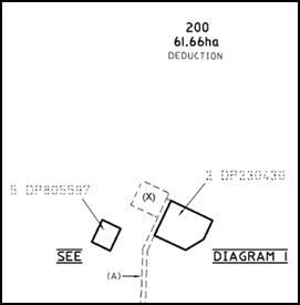
Figure 2: extract from DP 1195298 showing right-of-way (A) and the benefitted area (X)
Notably, Council’s internal mapping system indicates
that the right-of-way shown on DP 1195298 is more extensive. However, this
would not affect the location of the proposed refuelling facility.
Council does not hold a Section 88 B Instrument for the
subject property. Council staff are not aware of the title of the subject
property being affected by any of the above.
Mapping
The subject site is identified
on the LEP maps in the following manner:
|
Land Zoning Map:
|
Land zoned SP2 Infrastructure
|
|
Lot Size Map:
|
No Minimum Lot Size
|
|
Heritage Map:
|
Not a heritage item or conservation
area
|
|
Height of Buildings Map:
|
No building height limit
|
|
Floor Space Ratio Map:
|
No floor space limit
|
|
Terrestrial Biodiversity Map:
|
No biodiversity sensitivity on the
site
|
|
Groundwater Vulnerability Map:
|
Ground water vulnerable
|
|
Drinking Water Catchment Map:
|
Within the drinking water catchment
|
|
Watercourse Map:
|
Not within or affecting a defined
watercourse
|
|
Urban Release Area Map:
|
Not within an urban release area
|
|
Obstacle Limitation Surface Map:
|
Restriction on building siting or
construction
|
|
Additional Permitted Uses Map:
|
No additional permitted use applies
|
Those matters that are of relevance are addressed in detail
in the body of this report.
Part 2 - Permitted or Prohibited
Development
Land Use Zones
The subject site is located within the SP2 Infrastructure
zone (Figure 3). The proposed development is defined as an air transport
facility under OLEP 2011.
The existing air transport facility was approved subject to
DA 362/2013(1) in November 2013, pursuant to the provisions of State
Environmental Planning Policy (Infrastructure) and the SP2 Infrastructure zone.
The officer report accompanying DA 362/2013(1) provided a detailed
overview of the complexity associated with the permissibility of the NSW
Ambulance aeromedical air transport facility in
the SP2 Infrastructure zone.
For the sake of brevity, the
discussion provided in the officer report has not been reproduced. However,
consistent with the approach adopted in the officer report, it is considered
that the proposed refuelling facility is legitimately ancillary to the approved
air transport facility.
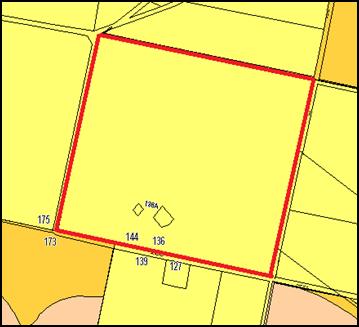
Figure 3: zone context plan
(subject property identified by heavy red line (SP2
Infrastructure))
Clause 2.3 of LEP 2011 references the Land Use
Table and Objectives for each zone in LEP 2011. These objectives for land
zoned SP2
Infrastructure are as
follows:
1 - Objectives of the SP2 Infrastructure
Zone
· To provide for infrastructure and related uses.
· To prevent development that is not compatible with or that may detract
from the provision of infrastructure.
The
proposed development is considered to be consistent with the foregoing
objectives.
Part 7 - Additional Local Provisions
7.1 - Earthworks
This clause establishes a range of
matters that must be considered prior to granting development consent for any
application involving earthworks, such as:
(a) the likely disruption of, or any
detrimental effect on, existing drainage patterns and soil stability in the
locality of the development
(b) the effect of the development on the
likely future use or redevelopment of the land
(c) the quality of the fill or the soil to be
excavated, or both
(d) the effect of the development on the
existing and likely amenity of adjoining properties
(e) the source of any fill material and the
destination of any excavated material
(f) the likelihood of disturbing relics
(g) the proximity to and potential for adverse
impacts on any waterway, drinking water catchment or environmentally sensitive
area
(h) any measures proposed to minimise or
mitigate the impacts referred to in paragraph (g).
Given that the
proposed fuel tank is to be located aboveground on an existing area of
hardstand, it is considered that only minor earthworks would be required. No
further consideration of earthworks is required.
7.6 - Groundwater Vulnerability
This clause seeks to protect
hydrological functions of groundwater systems and protect resources from both
depletion and contamination. Orange has a high water table and large areas of
the LGA, including the subject site, are identified with “Groundwater
Vulnerability” on the Groundwater Vulnerability Map. This requires that
Council consider:
(a) whether or not the development (including
any onsite storage or disposal of solid or liquid waste and chemicals) is
likely to cause any groundwater contamination or have any adverse effect on
groundwater dependent ecosystems, and
(b) the cumulative impact (including the
impact on nearby groundwater extraction for potable water supply or stock water
supply) of the development and any other existing development on groundwater.
Furthermore consent may not be granted unless Council is satisfied that:
(a) the development is designed, sited and
will be managed to avoid any significant adverse environmental impact, or
(b) if that impact cannot be reasonably
avoided - the development is designed, sited and will be managed to minimise
that impact,
(c) if that impact cannot be minimised - the
development will be managed to mitigate that impact.
While the proposed fuel tank presents
an inherent risk of groundwater contamination (ie risk of spill during
refuelling or complete tank failure), it is considered unlikely. In particular,
it is noted that the proposed tank is described as self-bunding (ie dual
wall), effectively eliminating the need for any further containment.
It is noted that the supporting
information submitted with the application indicates that any minor spill which
may occur during refuelling, particularly when hoses are connected and
disconnected, will be contained by a fall within the helicopter ramp area and
treated by the trade waste system. In this regard it is noted that
Council’s Trade Waste Officer has advised that fuel from refuelling areas
must not be discharged to trade waste.
In this regard, Council’s
Environmental Health and Building Surveyor has advised that a condition of
consent should be applied requiring that prior to the issue of a Construction
Certificate, the applicant shall provide details of compliance with
AS1940-2004 The storage and handling of flammable and combustible liquids.
The Environmental Health and Building
Surveyor has advised that by ensuring compliance with AS1940-2004, the
likelihood of a fuel spill will be minimal and that any spill would likely to
be able to be contained without causing any significant environmental impact.
7.7 - Drinking Water
Catchments
(1) The
objective of this clause is to protect drinking water catchments by minimising
the adverse impacts of development on the quality and quantity of water
entering drinking water storages.
(2) This
clause applies to land identified as “Drinking water” on the Drinking
Water Catchment Map.
(3) Before
determining a development application for development on land to which this
clause applies, the consent authority must consider whether or not the
development is likely to have any adverse impact on the quality and quantity of
water entering the drinking water storage, having regard to:
(a) the
distance between the development and any waterway that feeds into the drinking
water storage, and
(b) the
onsite use, storage and disposal of any chemicals on the land, and
(c) the
treatment, storage and disposal of waste water and solid waste generated or
used by the development.
(4) Development
consent must not be granted to development on land to which this clause applies
unless the consent authority is satisfied that:
(a) the
development is designed, sited and will be managed to avoid any significant
adverse impact on water quality and flows, or
(b) if
that impact cannot be reasonably avoided - the development is designed, sited
and will be managed to minimise that impact, or
(c) if
that impact cannot be minimised - the development will be managed to mitigate
that impact.
Consistent with the foregoing assessment addressing ground
water, it considered that compliance with AS1940-2004 The storage and
handling of flammable and combustible liquids would ensure that the
likelihood of a fuel spill will be minimal and that any spill would likely be
able to be contained without causing any significant environmental impact.
7.9 - Airspace Operations
(1) The
objectives of this clause are as follows:
(a) to
provide for the effective and ongoing operation of the Orange Airport by
ensuring that such operation is not compromised by proposed development that
penetrates the Limitation or Operations Surface for that airport,
(b) to
protect the community from undue risk from that operation.
(2) If
a development application is received and the consent authority is satisfied
that the proposed development will penetrate the Limitation or Operations
Surface, the consent authority must not grant development consent unless it has
consulted with the relevant Commonwealth body about the application.
(3) The
consent authority may grant development consent for the development if the
relevant Commonwealth body advises that:
(a) the
development will penetrate the Limitation or Operations Surface but it has no
objection to its construction, or
(b) the
development will not penetrate the Limitation or Operations Surface.
(4) The
consent authority must not grant development consent for the development if the
relevant Commonwealth body advises that the development will penetrate the
Limitation or Operations Surface and should not be constructed.
In the absence of Council’s Commercial and Emergency
Services Manager, Council’s Transport Asset Engineer has advised that the
proposed fuel tank will not penetrate the Limitation or Operations Surface.
STATE ENVIRONMENTAL PLANNING
POLICIES
State Planning Policy 33 - Hazardous and Offensive
Development
State Environmental Planning Policy 33 - Hazardous and
Offensive Development (SEPP 33) identifies that in determining whether a
development is a hazardous storage establishment, hazardous industry or other
potentially hazardous industry; or an offensive storage establishment,
offensive industry or other potentially offensive industry, consideration must
be given to current circulars or guidelines published by the Department of
Planning relating to hazardous or offensive development. The applicable
guideline is the Hazardous and Offensive Development Application Guidelines
Applying SEPP 33 (SEPP 33 Guidelines).
The SEPP 33 Guidelines set out a risk screening method for
potentially hazardous industry which principally requires consideration of all
hazardous materials on the site; classification of each material; mode of
storage; distance of the stored material from the site boundary; and the
average number of annual and weekly road movements of hazardous material to and
from the facility, including typical quantities of each load.
The development application indicates that the proposed
refuelling facility will comprise a22,845L Jet A-1 fuel tank, two x 200L Jet
A-1 and solvent drums, and one x 1000L Waste Jet A-1 storage container, being
Class 3 Packing Group 3 and Class 3 Packing Group 2 goods respectively. The
proposal also includes two x 90kg LPG gas cylinders, being Packing
Group 2.1.
Notably, the supporting information indicates that the
operator of the site has advised that no other hazardous materials are stored
within adjacent locations within the maintenance and refuelling facility.
Supporting information submitted with the development
application provides a detailed assessment against the applicable provisions of
the SEPP 33 Guidelines. That assessment identifies that the total expected
quantity of Class 3 Packing Group 3 materials (ie 24,245L = 20.4
tonne) is required to be 6m from the property boundary or 8m from a sensitive
use. Plans submitted with the development application indicate that all
proposed Packing Group 2 and 3 materials would be located well in excess
of 6m from the property boundary.
In addition, the supporting information submitted with the
development application identifies that the proposed 22,845L fuel tank will
generate a requirement for one delivery per week (two vehicle movements); the
1000L waste storage container will generate a requirement for 0.5 deliveries
per week (one vehicle movement); the 200L drums will generate a requirement for
0.5 vehicle movements per week (one vehicle movement); and the LPG gas
cylinders would generate a requirement for 0.33 deliveries per week
(0.66 vehicle movements). The anticipated number of vehicle movements is
well below the threshold for potential hazards associated with transportation.
Based on this assessment it is considered that the proposed
development is not potentially hazardous. Notwithstanding, it is recommended
that a condition of consent be applied requiring that that the operator of the
facility not alter the types or quantities of potentially hazardous materials
onsite without preparing a revised assessment against the SEPP 33
Guidelines and consulting with Council.
State Planning Policy 55 -
Remediation of Land
State Environmental Planning
Policy 55 - Remediation of Land (SEPP 55) requires that a consent
authority must not consent to the carrying out of development of land unless it
has considered whether the land is contaminated; if the land is contaminated,
it is satisfied that the land is suitable in its contaminated state (or will be
suitable, after remediation) for the purpose for which the development is
proposed to be carried out; and if the land requires remediation to be made
suitable for the purpose for which the development is proposed to be carried
out, it is satisfied that the land will be remediated before the land is used
for that purpose.
While SEPP 55 is a relevant consideration, it is noted that
the proposed refuelling facility will operate in association with the recently
constructed NSW Ambulance aeromedical air transport facility.
PROVISIONS OF ANY DRAFT
ENVIRONMENTAL PLANNING INSTRUMENT THAT HAS BEEN PLACED ON EXHIBITION
s79C(1)(a)(ii)
There are no draft environmental planning instruments that
apply to the subject land or proposed development.
DESIGNATED DEVELOPMENT
The proposed refuelling facility is not identified as
designated development.
Notwithstanding, it is noted that the Environmental Planning
and Assessment Regulation 2000 (the ‘Regulations’) identify
that the types of development generally identified as designated development
are not designated development if they are ancillary to other development and
are not proposed to be carried out independently of that other development.
It is considered that the proposed development is ancillary
to the existing NSW Ambulance aeromedical air transport facility and the
broader Orange Regional Airport.
PROVISIONS OF ANY DEVELOPMENT
CONTROL PLAN s79C(1)(a)(iii)
Development Control Plan 2004
Development Control Plan 2004 (“the DCP”)
applies to the subject property. Specific planning controls relating to the
Orange Airport are contained within Chapter 0 - Transitional Provisions,
Section 0.4-12 Interim Planning Outcomes - Airport.
Chapter 0 - Transitional
Provisions
Section 0.4-12 Interim Planning Outcomes - Airport
· Proposals must
demonstrate that adequate utility services are available to provide for the
development.
The proposed refuelling facility does not require any
utility services.
· Proposals must
not compromise the current or future operations of the Airport, including establishment
or expansion of public facilities such as the terminal building and car
parking.
The proposed refuelling facility will complement the
recently constructed NSW Ambulance aeromedical air transport facility.
· Water run off
must be managed and treated to predevelopment quality or better and pre
development quantities or less.
The operator of recently constructed NSW Ambulance
aeromedical air transport facility has indicated that all minor fuel spills
will be captured within the helicopter ramp area and treated by the trade waste
system. However, Council’s Trade Waste Officer has advised that the Trade
Waste Regulation Guidelines preclude fuel from refuelling areas entering a
trade waste system.
In this regard, Council’s Environmental Health and Building
Surveyor has advised that a condition of consent should be applied requiring
that prior to the issue of a Construction Certificate, the applicant shall
provide details of compliance with AS1940-2004 The storage and handling of
flammable and combustible liquids.
The Environmental Health and Building Surveyor has advised
that by ensuring compliance with AS1940-2004, the likelihood of a fuel spill
will be minimal and that any spill would be likely to be able to be contained
without causing any significant environmental impact.
PROVISIONS PRESCRIBED BY THE
REGULATIONS s79C(1)(a)(iv)
Demolition of a Building (clause 92)
The proposal does not involve the demolition of a building.
Fire Safety Considerations
(clause 93)
Council’s Environmental Health and Building Surveyor
has advised that a 9kg dry powder and a 9kg foam fire extinguisher will be
provided on the refuelling cart and that the proposed refuelling facility will
be located far enough away from the existing adjacent building to not require
any fire separation.
Buildings to be Upgraded
(clause 94)
The proposal does not involve the rebuilding, alteration,
enlargement or extension of an existing building.
BASIX Commitments (clause 97A)
Not applicable.
THE LIKELY IMPACTS OF THE
DEVELOPMENT s79C(1)(b)
The likely impacts of the proposed development have been
addressed in the body of this report. In particular, emphasis has been placed
on possible hazards associated with the storage of fuel, solvents and LPG, and
possible impacts of fuel spills on the drinking water catchment.
In both instances, the foregoing assessment identifies that
it is unlikely that the proposed refuelling facility would have a significant
or detrimental impact.
THE SUITABILITY OF THE SITE
s79C(1)(c)
The foregoing assessment demonstrates that the subject
property is suitable for the use of a refuelling facility is association with
the recently constructed NSW Ambulance aeromedical air transport facility.
ANY SUBMISSIONS MADE IN
ACCORDANCE WITH THE ACT s79C(1)(d)
The proposed development is not defined as advertised
development under the provisions of the LEP, and as such no formal exhibition
of the application was required. No submissions have been received in relation
to this application.
PUBLIC INTEREST
s79C(1)(e)
The proposed development is considered to be of minor
interest to the wider public due to the relatively localised nature of
potential impacts. The proposal is not inconsistent with any relevant policy
statements, planning studies, guidelines etc that have not been considered in
this assessment.
SUMMARY
The proposed development is permissible with the consent of
Council. The proposed development complies with the relevant aims, objectives
and provisions of the LEP. A section 79C assessment of the
development indicates that the development is acceptable in this instance.
Attached is a draft Notice of Approval outlining a range of conditions
considered appropriate to ensure that the development proceeds in an acceptable
manner.
COMMENTS
The requirements of the Environmental Health and Building
Surveyor and the Engineering Development Section are included in the attached
Notice of Approval.
Attachments
1 Notice
of Approval, D17/31395⇩
2 Plans,
D17/31101⇩
Planning and Development Committee
6 June 2017
2.5 Development
Application DA 123/2017(1) - 136 Aerodrome Road
Attachment 1 Notice
of Approval
|

|
ORANGE
CITY COUNCIL
Development
Application No DA
123/2017(1)
NA17/ Container
PR26464
|
NOTICE OF DETERMINATION
OF A DEVELOPMENT
APPLICATION
issued under the Environmental
Planning and Assessment Act 1979
Section 81(1)
|
Development
Application
|
|
|
Applicant Name:
|
Tubb &
Associates
|
|
Applicant Address:
|
22 The
High Road
BLAXLAND
NSW 2744
|
|
Owner’s Name:
|
Orange
City Council
|
|
Land to Be Developed:
|
Lot 200 DP
1195298 - 136 Aerodrome Road, Huntley
|
|
Proposed Development:
|
Air
Transport Facility (bulk fuel tank and refuelling facility)
|
|
|
|
|
Building
Code of Australia
building
classification:
|
To be
determined by the PCA
|
|
|
|
|
Determination
|
|
|
Made On:
|
22 May
2017
|
|
Determination:
|
CONSENT
GRANTED SUBJECT TO CONDITIONS DESCRIBED BELOW:
|
|
|
|
|
Consent to
Operate From:
|
22 May
2017
|
|
Consent to
Lapse On:
|
22 May
2022
|
Terms of Approval
The reasons for the imposition of
conditions are:
(1) To
ensure compliance with relevant statutory requirements.
(2) To
provide adequate public health and safety measures.
(3) To ensure the utility
services are available to the site and adequate for the development.
(4) To prevent
the proposed development having a detrimental effect on adjoining land uses.
(5) To minimise
the impact of development on the environment.
Conditions
(1) The
development must be carried out in accordance with:
(a) Plan/s
numbered: one
unnumbered plan, plan numbered WD01 E Revision E dated 10/4/15, plan numbered
000921GA Revision B dated 11/12/13, plan numbered 001203GA(B) Revision A dated
7/2/17, plan numbered 001203GA(B) Revision A dated 7/2/17, plan numbered
001203GA(B) Revision A dated 7/2/17 (6 sheets)
(b) statements
of environmental effects or other similar associated documents that form part
of the approval
as amended
in accordance with any conditions of this consent.
(2) All building work must
be carried out in accordance with the provisions of the Building Code of
Australia.
(3) A sign is to be erected
in a prominent position on any site on which building work, subdivision work or
demolition work is being carried out:
(a) showing
the name, address and telephone number of the principal certifying authority
for the work, and
(b) showing
the name of the principal contractor (if any) for any building work and a
telephone number on which that person may be contacted outside working hours,
and
(c) stating
that unauthorised entry to the site is prohibited.
Any such sign is to be maintained while the
building work, subdivision work or demolition work is being carried out.
|
PRIOR TO THE ISSUE OF
A CONSTRUCTION CERTIFICATE
|
(4) Prior to the issue of
the Construction Certificate, details showing how compliance will be achieved
with the Australian Standard AS1940-2004 “The storage and handling of
flammable and combustible liquids”, including the provision of bunding,
containing spills and fire protection to the proposed tanks, are to be
submitted to Council/accredited certifier for assessment.
|
PRIOR TO WORKS
COMMENCING
|
(5) A
Construction Certificate application is required to be submitted to, and issued
by Council/Accredited Certifier prior to any excavation or building works being
carried out onsite.
(6) Soil erosion control
measures shall be implemented on the site.
|
DURING
CONSTRUCTION/SITEWORKS
|
(7) All
construction/demolition work on the site is to be carried out between the hours
of 7.00 am and 6.00 pm Monday to Friday inclusive, 7.00 am to
5.00 pm Saturdays and 8.00 am to 5.00 pm Sundays and Public
Holidays. Written approval must be obtained from the General Manager of Orange
City Council to vary these hours.
(8) All
materials onsite or being delivered to the site are to be contained within the
site. The requirements of the Protection of the Environment Operations Act
1997 are to be complied with when placing/stockpiling loose material or
when disposing of waste products or during any other activities likely to
pollute drains or watercourses.
(9) Any adjustments to
existing utility services that are made necessary by this development
proceeding are to be at the full cost of the developer.
|
PRIOR TO THE ISSUE OF
AN OCCUPATION CERTIFICATE
|
(10) No
person is to use or occupy the building or alteration that is the subject of
this approval without the prior issuing of an Occupation Certificate.
(11) The
owner of the building/s must cause the Council to be given a Final Fire Safety
Certificate on completion of the building in relation to essential fire or
other safety measures included in the schedule attached to this approval.
(12) All
of the foregoing conditions are to be at the full cost of the developer and to
the requirements and standards of the Orange City Council Development and
Subdivision Code, unless specifically stated otherwise. All work required by
the foregoing conditions is to be completed prior to the issuing of an
Occupation Certificate, unless stated otherwise.
|
MATTERS FOR THE
ONGOING PERFORMANCE AND OPERATION OF THE DEVELOPMENT
|
(13) The types and
quantities of potentially hazardous materials stored as part of the NSW
Ambulance aeromedical air transport facility must not be altered or increased
without the preparation of a revised assessment against the Hazardous and
Offensive Development Application Guidelines and the written agreement of
Council’s Manager of Development Assessments.
(14) The
owner is required to provide to Council and to the NSW Fire Commissioner an
Annual Fire Safety Statement in respect of the fire-safety measures, as
required by Clause 177 of the Environmental Planning and Assessment
Regulation 2000.
(15) The ongoing operation
of the proposed fuel facility shall be in compliance with the requirements of
the Work, Health and Safety Regulation 2011 at all times.
Other Approvals
(1) Local
Government Act 1993 approvals granted under section 68.
Nil
(2) General
terms of other approvals integrated as part of this consent.
Nil
Right of Appeal
If
you are dissatisfied with this decision, section 97 of Environmental
Planning and Assessment Act 1979 gives you the right to appeal to the Land
and Environment Court within 6 months after the date on which you receive this
notice.
*
Section 97 of the Environmental Planning and Assessment Act 1979 does not apply
to the determination of a development application for State significant
development or local designated development that has been the subject of a
Commission of Inquiry.
|
Disability Discrimination Act
1992:
|
This application has been assessed in
accordance with the Environmental Planning and Assessment Act 1979. No
guarantee is given that the proposal complies with the Disability
Discrimination Act 1992.
The applicant/owner is responsible to
ensure compliance with this and other anti-discrimination legislation.
The Disability Discrimination Act
covers disabilities not catered for in the minimum standards called up in the
Building Code of Australia which references AS1428.1 - "Design for
Access and Mobility". AS1428 Parts 2, 3 and 4 provides the most
comprehensive technical guidance under the Disability Discrimination Act
currently available in Australia.
|
|
|
|
|
Disclaimer - S88B Restrictions on the Use of Land:
|
The applicant should note that there
could be covenants in favour of persons other than Council restricting what
may be built or done upon the subject land. The applicant is advised to check
the position before commencing any work.
|
|
|
|
|
Signed:
|
On behalf of the consent authority ORANGE
CITY COUNCIL
|
|
Signature:
|
|
|
Name:
|
DAVID WADDELL - DIRECTOR DEVELOPMENT
SERVICES
|
|
Date:
|
22 May 2017
|
Planning
and Development Committee
6 June 2017
2.5 Development
Application DA 123/2017(1) - 136 Aerodrome Road
Attachment 2 Plans
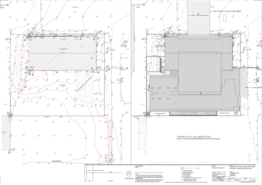
Planning and Development Committee
6 June 2017
2.5 Development
Application DA 123/2017(1) - 136 Aerodrome Road
Attachment 2 Plans
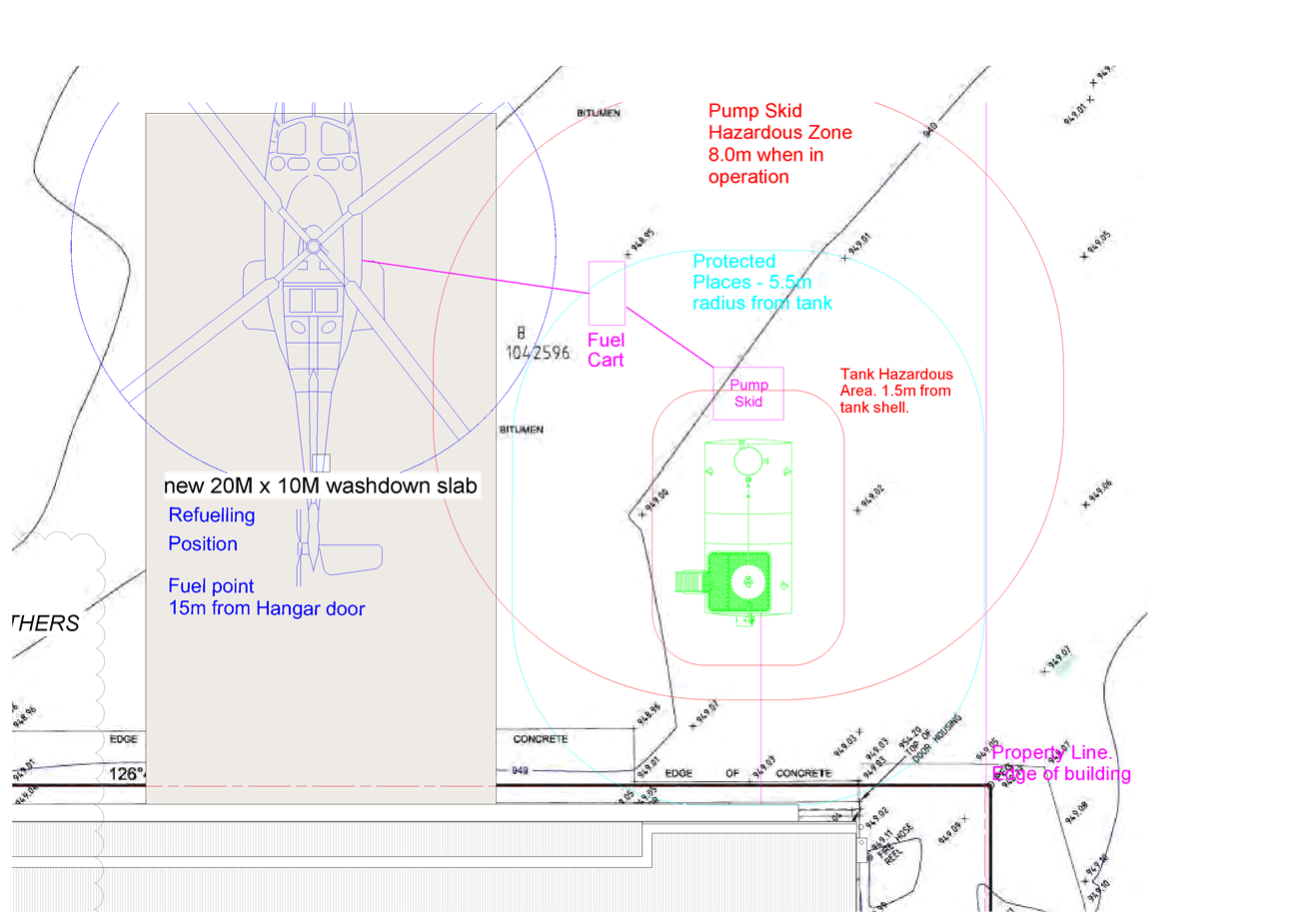
Planning and Development Committee
6 June 2017
2.5 Development
Application DA 123/2017(1) - 136 Aerodrome Road
Attachment 2 Plans
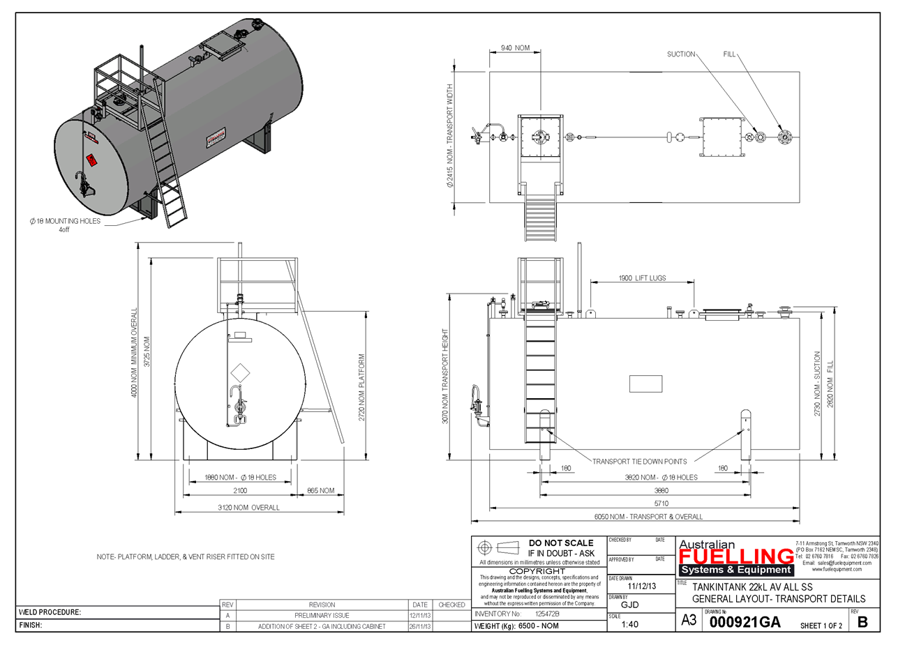
Planning and Development Committee
6 June 2017
2.5 Development
Application DA 123/2017(1) - 136 Aerodrome Road
Attachment 2 Plans
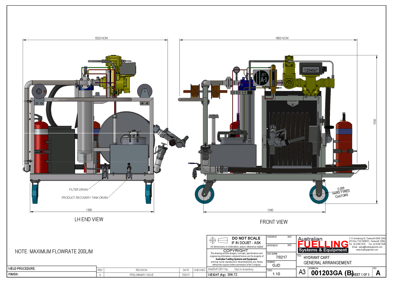
Planning and Development Committee
6 June 2017
2.5 Development
Application DA 123/2017(1) - 136 Aerodrome Road
Attachment 2 Plans
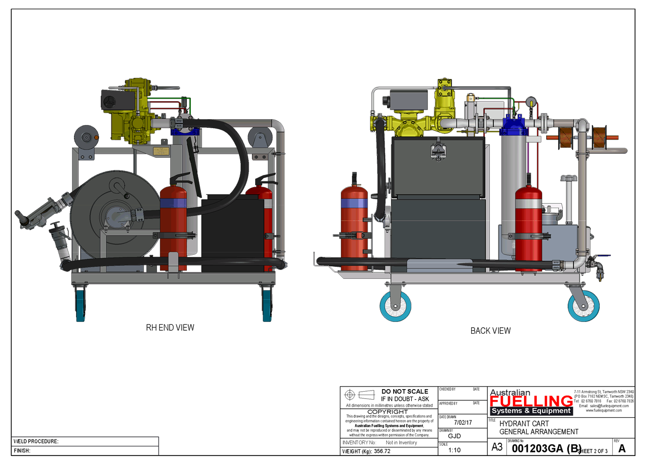
Planning and Development Committee
6 June 2017
2.5 Development
Application DA 123/2017(1) - 136 Aerodrome Road
Attachment 2 Plans
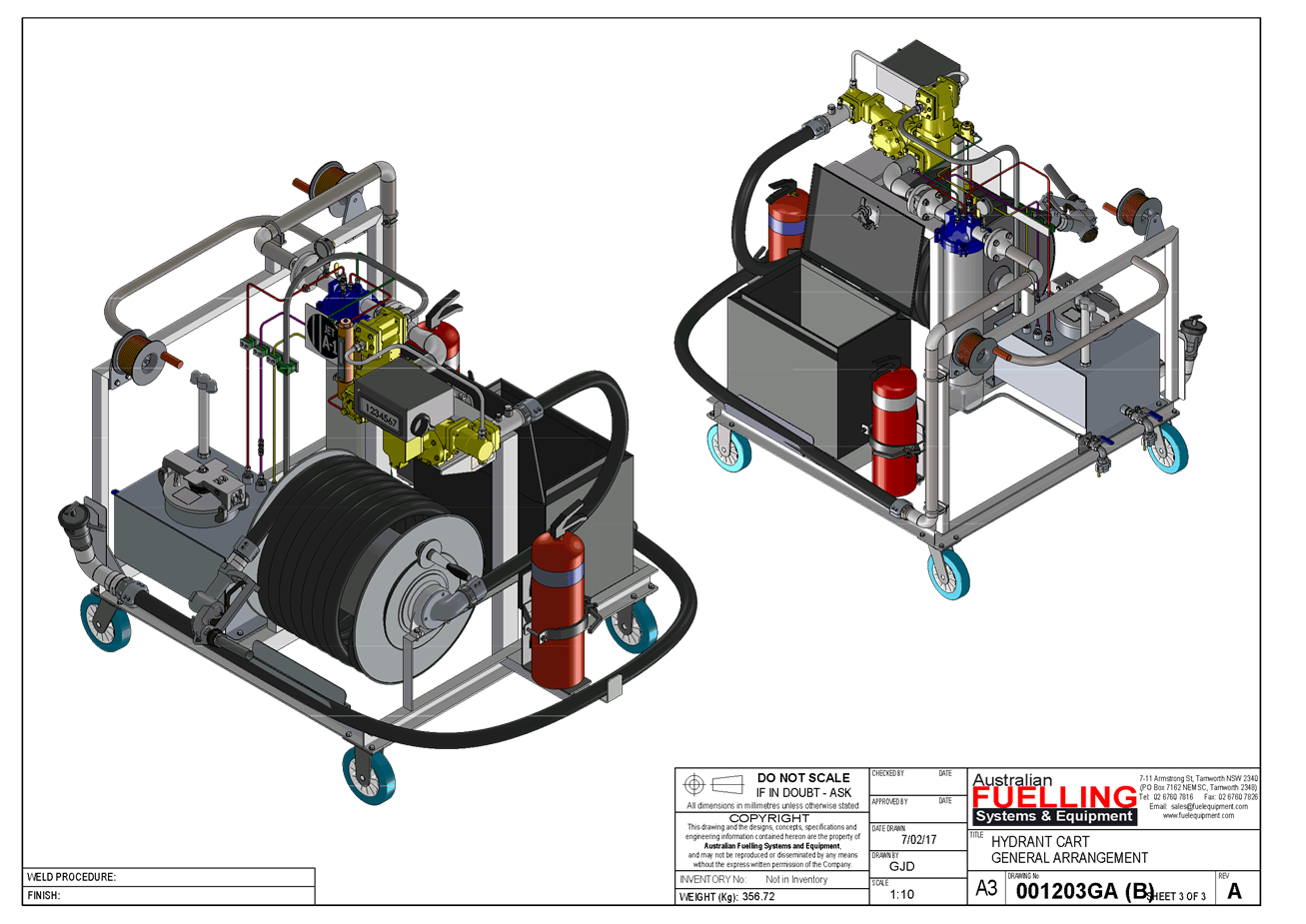
2.6 Planning
Proposal Old Hospital Site
TRIM
REFERENCE: 2017/1063
AUTHOR: Craig
Mortell, Senior Planner
EXECUTIVE Summary
The former Orange Base Hospital site (bounded by Anson
Street, Dalton Street, Sale Street and Prince Street) was zoned under the LEP
as R3 Medium Density Residential, with building height limits and floor space
controls intended to facilitate a successful redevelopment of the site.
Subsequently, a master planning exercise was conducted in
2012/13 to explore the potential of the site and articulate appropriate urban
design outcomes. The preferred option of the master plan was a mix of adaptive
re-use, residential, mixed use and recreation.
A number of master plan concepts were assessed, with the
preferred option from the Health Infrastructure/Allen Jack+Cottier Architects
(AJ+C) plan recommending splitting the zoning of the site into three areas. The
western Sale Street end was recommended to provide a strip of RE1 Public
Recreation zone to facilitate a park, the central area to remain R3 Medium
Density Residential, and the eastern Anson Street end was recommended to become
B4 Mixed Use to encourage the clustering of commercial activity into a coherent
precinct.
Another master planning exercise was undertaken in 2016 by
John Andrews, TAD Design and LADesign as part of packaging the prospectus of
the site to prepare to go to Expression of Interest. This version considered
placing an east-west corridor of open space through the middle of the site
rather than a north-south strip. It augmented and built on the AJ+C
masterplan completed by Health Infrastructure.
To meet the master plan requirements, an adjustment to the
zoning is required.
More recently, the State government has announced that they
are seeking an appropriate location within Orange to provide approximately
8,500m2 of office space for the Department of Primary Industries.
Property NSW called for Expressions of Interest outlining a range of criteria
that any successful site would need to provide. It is understood that a number
of bids were lodged and are being evaluated by the State government.
One of the bids is from a developer that had made an
unsolicited offer to Council, and upon which the parties have agreed to enter
into an option agreement for a portion of the former base hospital site. To
satisfy the Property NSW requirements, the site would require an adjustment to
the current zones and height limits, the configuration of which differs from
the Health Infrastructure/AJ+C plan – noting that retention of the main
hospital building is no longer intended.
In order to proceed, a draft planning proposal has been
prepared that seeks to rezone part of the site and amend building height limits
to enable the master plan principles to be maintained toward the western end of
the block, with the requirements of the bid to provide office premises for the
DPI toward the eastern end of the block. Parkland is retained in a range of
potential locations under the rezoning.
Due to both the capital investment value (CIV) of the
possible DPI development being likely to well exceed $20m and the level of
Council involvement, being current owners of the land, it is assumed that the
Department of Planning and Environment (DPE) will not delegate the final
decision to Council. Alternatively, Council could request determination by DPE
in the event that DPE did not voluntarily decide to determine the rezoning.
Furthermore, any subsequent DA for the DPI development would be determined by
the Joint Regional Planning Panel, not Orange City Council, given the CIV
level.
Link To Delivery/OPerational Plan
The recommendation in this report relates to the
Delivery/Operational Plan strategy “1.2 Our City -
Information and advice provided for the decision-making process will be
succinct, reasoned, accurate, timely and balanced”.
Financial Implications
Nil
Policy and Governance Implications
Nil
|
Recommendation
1 That
staff prepare a planning proposal comprising draft height of building and
land use zone maps that would zone the eastern side of the site as B4 Mixed
Use.
2 That
the draft planning proposal retain the western side of the site as
R3 Medium Density Residential and RE1 Public Recreation zone.
3 That
Council forward the planning proposal to the Department of Planning and
Environment to seek a Gateway determination.
4 That
subject to any conditions of a Gateway determination, the matter be placed on
public exhibition for a period of 28 days.
|
further considerations
Consideration has been given to the
recommendation’s impact on Council’s service delivery; image and
reputation; political; environmental; health and safety; employees;
stakeholders and project management; and no further implications or risks have
been identified.
SUPPORTING INFORMATION
Following the opening of the new Health Service on Forest
Road, the former Orange Base Hospital site bounded by Dalton Street, Anson
Street, Prince Street and Sale Street was closed and has remained vacant
pending its demolition and ultimate redevelopment.
With an area of approximately 2 hectares and full street
frontages to all sides, the site presents a unique opportunity in central
Orange – further enhanced by the relationship to various surrounding land
uses, such as the TAFE campus to the south and a variety of adjoining mixed
uses including a number of medical and ancillary consulting rooms and community
health uses.
Recognising the significance of the site Council acquired it
from the State Government to facilitate redevelopment and ensure the community
would have an influence over the future of this site. A master plan was
developed by Health Infrastructure to showcase the potential of the site for a
range of uses, showcasing a number of development options.
The master plan was presented to Council as part of the
acquisition. Council was briefed on the matter on several occasions, with the
consultancy who prepared the master plan giving a full presentation to Council
to inform Council’s decision for the acquisition. Councillors have been
provided with a masterplan summary document (given the size of the full
document) and this document has been publicly available, provided to members of
the public and has appeared in numerous media articles.
The conceptual vision in the master plan was not linked to a
firm proposal, but instead intended to demonstrate the potential of the site.
The master plan requires an amendment to the Local Environmental Plan to
confirm the uses, height limits and floor space ratio.
Council’s promotion of its activities on the site,
including the recent site demolition development application, has attracted
early interest in the site.
The purpose of this report is to initiate the investigation
and preparatory documents so that Council can progress a partial mixed use zone
for the site as well as other appropriate zonings including medium density
residential and recreation/open space. The conditional unsolicited offer
warrants exploration in the opinion of the author of this report.
The objectives of this planning proposal are:
· To provide for a
mixed range of education, administration, office and business premises with
supporting retail and open space areas in addition to residential
accommodation.
· To amend the land
zoning map to provide for mixed use development on the site of the former base
hospital.
· To amend the
height of buildings map to provide flexibility in the placement of building
forms and densities on the site of the former base hospital.
· To amend the floor
space ratio map to provide flexibility in the location and siting of built form
on the site of the former base hospital.
The following images provide an overview of the current and
proposed height limits and land use zones, and illustrate the potential
relationship between a public administration building with medium density
residential development. These are conceptual designs only that have been
explored to ensure that height limits and zone boundaries are established that
can allow sufficient flexibility at the Development Application stage while
seeking to retain the mix of uses and densities established under the master plan.
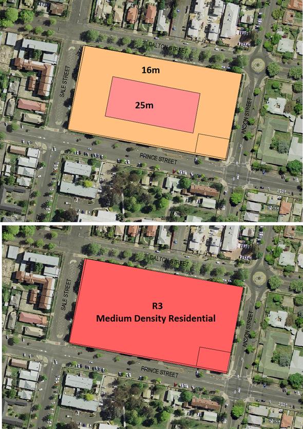
The current height limits and land use zone for the
old hospital site
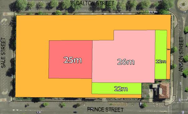
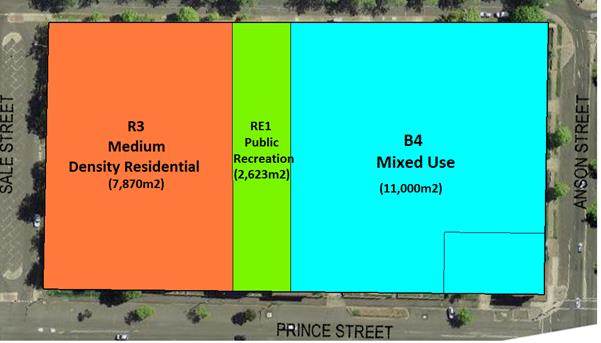 The Proposed height limits and land use zones for the
hospital site
The Proposed height limits and land use zones for the
hospital site
Zoning pattern consistent with a modified version of
the Health Infrastructure KJC master plan
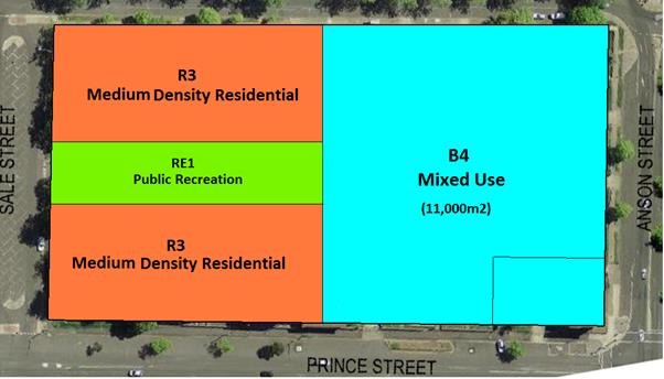
An alternative zoning pattern consistent with a
modified version of the master plan
to enhance the development of the site
Due to the desire to provide flexibility in responding
to the Property NSW EOI process, the areas shown are approximations only, intended
to illustrate the concept for the site and gauge community reaction. Final
dimensions and areas will be confirmed following public exhibition. This will
enable community consultation and development needs to be evaluated in tandem.
The intent is to balance R3 (Medium Density Residential) land use and enable a
successful B4 (Mixed Use) land use (including car park, retention of ambulance
station and use of a public park).
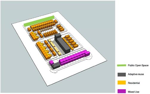
The concept from the Health Infrastructure/AJ+C master
planning exercise of 2012/13
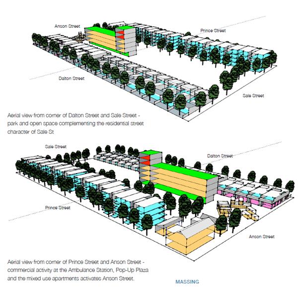
An enhancement of the master plan as commissioned by
Council
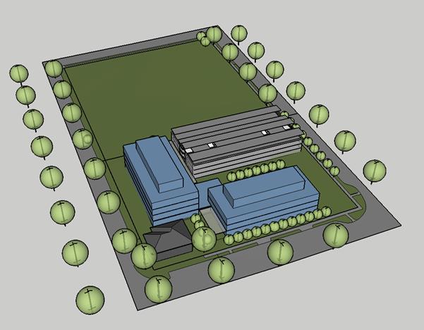
A conceptual model approximating the main structural
elements of a public administration
building and multi-deck car park consistent with the
State Government requirements for
new DPI headquarters.
(note retention of the heritage listed Ambulance
building on the Prince and
Anson Streets intersection.
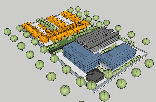
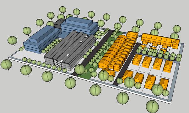
Conceptual models illustrating options to combine the
master plan and DPI headquarters
Attachments
1 Preliminary
draft planning proposal to rezone and amend height limts, D17/32051⇩
Planning and Development Committee
6 June 2017
2.6 Planning
Proposal Old Hospital Site
Attachment 1 Preliminary
draft planning proposal to rezone and amend height limts
 PUBLIC EXHIBITION
Saturday, XX Month to Monday, XX Month
YEAR
Optional emblematic
photo or concept drawing
Proposal to Amend Orange Local Environmental Plan 2011
Amendment 22 “Former Hospital Site”
WHAT IS ON EXHIBITION?
Council has placed on exhibition a proposal to amend Orange Local
Environmental Plan 2011 in respect of the former base hospital site, being land
bounded by Sale Street, Anson Street, Dalton Street and Prince Street. The
proposed changes include adjustments to the Height of Buildings Map and the
Land Zoning Map. The intention is to facilitate potential redevelopment of the
site upon demolition and site clearance of the old hospital and associated
buildings.
Council previously undertook a conceptual master planning exercise to
investigate appropriate urban design outcomes for the site. At the time this
was predicated on a belief that the main building could potentially be
adaptively re-used. Subsequent testing of the market and site conditions has
altered this view.
Additionally, in April 2017, Property NSW issued a ‘call for
expressions of interest’ to provide suburban A-Grade office accommodation
to house the Department of Primary Industries in Orange. A developer has
approached Council to purchase part of the old hospital site in order to meet
Property NSW’s requirements.
This planning proposal outlines how the LEP may be amended to accommodate
the requirements of Property NSW and retain the overall vision of the previous
masterplan.
EXHIBITION MATERIALS
The planning proposal is also comprised of the following supplemental
documents:
|
Gateway Determination
Draft Height of Buildings Map
|
Draft Land Zone Map
Property NSW EOI
|
‘Old’ Orange Base
Hospital masterplan
|
WHERE CAN I SEE IT?
The exhibition
materials can be inspected by any interested person during business hours at
Orange City Council Civic Centre, ground floor, 135 Byng Street (Cnr of Lords
Place), Orange. All materials are also available on Councils website www.orange.nsw.gov.au under the “Planning & Development”
section.
SUBMISSIONS
Written comments on the draft amendments are welcome.
All submissions received by Council will be considered before final decisions
are made. Any submission received may be made publicly available and may
include the name(s), address, signature and contact details provided.
All submissions are to be received by close of
business Monday XX Month YEAR.
Submissions on the proposal can be sent to:
General Manager
Orange City Council
P.O. Box 35
Orange NSW 2800
Attention: Craig Mortell –
Senior Planner
Alternatively submissions may also be
emailed to Council@orange.nsw.gov.au
For further information please contact
Council on (02) 6393 8000
The following pages contain information required by the Department of
Planning’s Guide to Preparing a Planning Proposal. The information is
unavoidably technical, as it seeks to address a range of legislative
requirements. Clarification may be sought from Councils planning staff during
the exhibition period.
Planning and Development Committee
6 June 2017
2.6 Planning
Proposal Old Hospital Site
Attachment 1 Preliminary
draft planning proposal to rezone and amend height limts
Planning Proposal – Orange
Local Environmental Plan 2011 – Amendment 22
Introduction
The purpose of this document is to describe a planning proposal for an
amendment of the Orange Local Environmental Plan 2011, to be known as amendment
22. The preparation of a planning proposal is the first step in preparing an
LEP (or an amendment to an LEP).
Note: Throughout the course of preparing the proposed LEP, the planning
proposal evolves. This is particularly the case for complex proposals in which
the initial gateway determination will confirm the technical studies and
consultation required to justify the proposal.
As the studies and consultation are undertaken, relevant parts of the
planning proposal will be updated, amended and embellished. Therefore,
particularly when viewed at an early stage, the level of detail in a planning
proposal may appear to be limited in one or more respects.
This planning proposal has been prepared in accordance with the
Department of Planning and Infrastructure’s document A guide to
preparing planning proposals and is comprised of four parts;
Part 1 Objectives and Intended
Outcomes
This part comprises a brief statement outlining the objectives and
intended outcomes of the proposed amendment.
Part 2 Explanation of the Provisions
This part comprises a plain English explanation of the provisions and
changes that are to be included in the amendment.
Part 3 Justification
This part establishes the justification for the objectives, outcomes and
provisions and the process for their implementation.
Part 4 Community Consultation
This part details the level and methods of community consultation that is
to be undertaken on the planning proposal.
Part 5 Project Timeline
This part consists of a table that sets out the key project milestones
and anticipated commencement and completion dates for each milestone. The dates
shown are indicative only and subject to review as the project progresses.
Part 1 Objectives and Intended Outcomes
The objectives of this planning
proposal are:
To provide for public administration buildings, recognising the
significant role and value of such developments to the local community and
economy, while also responding to recommendations contained within a master
plan previously prepared for the site, and
To amend the Height of Buildings map to allow the site to accommodate
appropriately dimensioned built form in relevant parts of the site, and
To amend the Land Zone map to enable part of the site to be developed for
Public Administration Buildings as well as Restaurant or Café Premises
and a mix of other non-residential uses and to guide where such developments
are to be focussed, and
Part 2 Explanation of the Provisions
|
Item No.
|
Description
|
Proposed Change
|
|
1
|
Plain English
|
Amendment of the Height of Buildings Map in
accordance with the proposed Draft Height of Buildings Map shown at
attachment 1
|
|
2
|
Plain English
|
Amendment of the Land Zone Map in accordance with
the proposed Draft Land Zone Map shown at attachment 2
|
Part 3 Justification
Section A – Need for the planning proposal
1. Is
the planning proposal a result of any strategic study or report?
Yes. The
Orange City Council previously undertook a master plan of the old base hospital
site in 2012/13. This ‘preferred option’ of the master plan was
predicated on the view then held that the main building could be retained and
adaptively re-used. A range of factors including the buildings condition,
presence of asbestos materials and testing of market interest in retaining the
building has indicated that this aspect of the plan is not viable –
however the overall vision of the master plan remains appropriate with some
adaptation.
2. Is
the planning proposal the best means of achieving the objectives or intended
outcomes, or is there a better way?
The planning proposal is the best known means of achieving
the intended outcomes. In reaching this conclusion the following alternative
approach was considered:
· Amending Schedule 1 to provide
additional permitted uses on the site, for public administration buildings
however this would unduly limit the long term future occupancy of such
buildings to public authorities only. This would also leave building height
limits at the current levels resulting in a broader physical footprint with a
corresponding reduction in site area able to be kept for the master plan
concept.
3. Is
there a net community benefit?
Yes.
· The result of the planning proposal
will assist in retaining an important source of employment in Orange.
· Proximity of the site to the Orange
CBD ensures the continued economic and trading stimulus to established
commercial precincts
· The potential relocation of
Department of Primary Industries will alleviate localised parking and traffic
issues in Kite Street / Endsleigh Avenue / Edward Street. Provision of
substantial on-site parking minimises the potential for such issues to be
repeated at the subject site.
Section B – Relationship to strategic planning
framework
4. Is
the planning proposal consistent with the objectives and actions contained
within the applicable regional or sub-regional strategy?
Not relevant.
5. Is
the planning proposal consistent with the local council’s Community
Strategic Plan, or other local strategic plan?
Yes. The Orange Community Strategic
Plan promotes the provision of employment opportunities, quality urban design
and seeks to maintain the trading performance of the CBD.
6. Is
the planning proposal consistent with applicable state environmental planning
policies?
Yes. A review of relevant SEPPs is
attached.
7. Is
the planning proposal consistent with applicable Ministerial Directions (s.117 directions)?
Yes.
Direction 1.1 Business and Industrial
Zones objectives include:
(a) encourage employment
growth in suitable locations,
(b) protect employment land
in business and industrial zones, and
(c) support the viability of
identified strategic centres.
The direction requires that planning
proposals must give effect to the objectives, retain existing business and
industrial zones, not reduce total potential floor space for employment and
related public services in business zones and industrial uses in industrial
zones and ensure that proposed new employment areas are in accordance with a
strategy that is approved by the Director General of the Department of
Planning.
Relevantly the proposal will support
the viability of the Orange CBD, which is identified in the Central West and
Orange Regional Plan as a strategic centre. The proposal does not reduce floor
space potential and the additional commercial potential generated by adopting a
B4 zone over part of the site further enhances the CBD.
Direction 3.1 Residential Zones
objectives include:
(a) to encourage a variety
and choice of housing types to provide for existing and future
housing needs,
(b) to make efficient use
of existing infrastructure and services and ensure that new housing
has appropriate access to
infrastructure and services, and
(c) to minimise the impact of
residential development on the environment and resource lands.
The direction
requires that a planning proposal must encourage the provision of housing that
will:
(a) broaden the choice of
building types and locations available in the housing market, and
(b) make more efficient use
of existing infrastructure and services, and
(c) reduce the consumption
of land for housing and associated urban development on the
urban fringe, and
(d) be of good design.
Additionally
the direction requires that a planning proposal must:
(a) contain a requirement
that residential development is not permitted until land is adequately serviced
(or arrangements satisfactory to the council, or other appropriate authority,
have
been made to service it),
and
(b) not contain provisions
which will reduce the permissible residential density of land.
The R3 portion of the site will
continue to provide additional choice in terms of building types and forms to
the local housing market. The density permitted ensures an efficient use of
land, infrastructure and services. The master plan demonstrates how good design
can ensure development maintains and positively contributes to the public realm
and streetscapes of the area. The LEP already contains provisions in relation
to adequate services.
Section C – Environmental, social and economic impact
8. Is
there any likelihood that critical habitat or threatened species, populations
or ecological communities, or their habitats, will be adversely affected as a
result of the proposal?
No. The site is within the existing
urban area and past development and landscaping has essentially removed any
ecological values
9. Are
there any other likely environmental effects as a result of the planning
proposal and how are they proposed to be managed?
None envisaged.
10. How
has the planning proposal adequately addressed any social and economic effects?
The proposal is anticipated to
provide positive social and economic effects. Providing local employment
opportunities and economic stimulus to the surrounding area and CBD. Provision
of substantial off-street parking minimised disruption to surrounding areas.
Section D – State and Commonwealth interests
11. Is
there adequate public infrastructure for the planning proposal?
Yes. The site was previously developed and used as the Orange
Base Hospital. Utility services in the area were therefore sized accordingly
and local road network adaptations already implemented. Further consideration
of infrastructure requirements would be evaluated at the DA stage.
12. What
are the views of State and Commonwealth public authorities consulted in
accordance with the gateway determination?
Not applicable, the planning proposal
is at the pre-gateway stage.
Part 4 Community Consultation
Community consultation will be
undertaken in accordance with the requirements of the gateway determination. It
is anticipated that this proposal will not be deemed to be a low impact
proposal. Accordingly an exhibition period of 28 days is expected.
This will commence by giving notice
of the public exhibition of the planning proposal via:
· an advertisement in the Central Western Daily;
· a notification on the Orange City Council website www.orange.nsw.gov.au; and
· written advice direct to adjoining landowners.
All forms of the notice shall
include:
· a brief description of the objectives and intended outcomes
of the planning proposal;
· an indication of the land affected by the planning proposal;
· the location and dates where the planning proposal may be
inspected;
· the contact name and address at Orange City Council where
submissions may be directed; and
· the closing date of the submission process.
During the exhibition period, the
following materials will be made freely available for public inspection:
· The planning proposal, in the form approved for community
consultation by the Director-General of Planning;
· The gateway determination; and
· All studies and supporting material relied upon by the
planning proposal.
Following the exhibition period, a report will be prepared analysing any
submissions received and making recommendations as to any appropriate changes
or adjustments to the planning proposal, for the consideration of Orange City
Council.
Where contact details have been provided all persons and organisations
making a submission will be advised of the date and time of the relevant
council (or committee) meeting where the report is to be considered, and
subsequently advised of the determination.
Planning and Development Committee
6 June 2017
2.6 Planning
Proposal Old Hospital Site
Attachment 1 Preliminary
draft planning proposal to rezone and amend height limts
Part 5 Project Timeline
The following table provides an
overview of the intended project timeline for this Planning Proposal.
|
Project stage
|
Commencement
|
Completion
|
|
Gateway Determination
|
Late June 2017
|
|
Government Agency consultation
|
July 2017
|
Late July 2017
|
|
Public Exhibition Period
|
Mid July 2017
|
Mid August 2017
|
|
Public Hearing
|
Not anticipated to be required
|
|
Consideration of Submissions
|
Late August 2017
|
Mid September 2017
|
|
Consideration of post exhibition proposals
(Report to Council)
|
September 2017
|
|
Seeking and obtaining legal opinion from
Parliamentary Counsels Office
|
October 2017
|
Late October 2017
|
|
Submission to the Department of Planning and
Infrastructure to finalise
|
Dependent on PCO
|
|
Anticipated date the plan will be forwarded to the
Department for notification
|
Dependent on PCO
|
2.7 Planning
Proposal - Totally Local
TRIM
REFERENCE: 2017/1075
AUTHOR: Craig
Mortell, Senior Planner
EXECUTIVE Summary
Council has received a draft planning proposal to amend
Orange Local Environmental Plan 2011 in relation to land at 426 Mitchell
Highway (Lot 209 DP 1018862) commonly known as the Totally Local site.
The proposal seeks to confirm the site as a local food and
produce hub complemented by a modest amount of tourist accommodation. The site
is currently zoned R5 Large Lot Residential and was previously granted an
Additional Permitted Use (APU) listing in Schedule 1 of Orange Local
Environmental Plan 2011.
The APU listing contained a sunset clause that expired in
2014. The proponent states that the lapsing of the APU limited their ability to
develop a comprehensive vision for the site, which has evolved over time. The
proposal in effect seeks to ‘reactivate’ the former APU and
include some additional uses to complement and support the overall function of
the site.
Totally Local is an established local food and produce
focused complex that provides a significant opportunity and outlet for local
fare and assists with building Orange’s food and wine reputation to
visiting tourists. The flow-on benefit to the local economy from the operation
is therefore likely to be somewhat greater than a conventional retail centre.
The proposal seeks to further enhance the site in the
proponent's words:
‘so as to create a hub
that showcases locally grown or produced food, wines and beverages, as well as
associated items such as arts and crafts. The aim is to support and promote
local farmers and food and drink producers and provide an outlet for local
fare, essentially as an “everyday farmers market”.’
Link To Delivery/OPerational Plan
The recommendation in this report relates to the
Delivery/Operational Plan strategy “1.2 Our City -
Information and advice provided for the decision-making process will be
succinct, reasoned, accurate, timely and balanced”.
Financial Implications
Nil
Policy and Governance Implications
Nil
|
Recommendation
1 That
Council notes the attached planning proposal and resolves to support amending
the Orange Local Environmental Plan 2011 to enable the additional uses being
sought on the land.
2 That
Council forwards the planning proposal to the Department of Planning and
Environment to seek a Gateway determination.
3 That,
subject to any Gateway determination conditions, Council proceed to place the
planning proposal on public exhibition for a period of 28 days.
|
further considerations
Consideration has been given to the
recommendation’s impact on Council’s service delivery; image and
reputation; political; environmental; health and safety; employees;
stakeholders and project management; and no further implications or risks have
been identified.
SUPPORTING INFORMATION
Council has received a draft planning proposal to amend
Orange Local Environmental Plan 2011 in relation to land at 426 Mitchell
Highway (Lot 209 DP 1018862) commonly known as the Totally Local site.
The proposal would enable, by way of an Additional Permitted
Use (APU) listing in Schedule 1 of the LEP, consideration of a development
application for several forms of development not currently allowed under the R5
Large Lot Residential zone.
The additional uses being sought include:
· Food and Drink
Premises,
· Agricultural
Produce Industries,
· Light Industry,
· Function Centres,
and
· Hotel or Motel
Accommodation.
The proposal is backed by a conceptual design that seeks to
create a local food and produce hub complemented by a modest amount of tourist
accommodation.
Both Food and Drink Premises and Agricultural Produce
Industries were previously enabled on the site under an APU listing that
expired due to a sunset clause on 24 February 2014. That APU enabled the
site to develop into a local food and produce complex comprising a produce
shop, wine cellar, café, cheesemaker, craft brewery and food transport
business.
The proposal states that the overall vision for the site was
still evolving during the time of the original APU, which limited the ability
to secure potential participants in the complex. The owners have since refined
the vision and intended theme for the site and are now confident with regard to
the long term mix of uses considered appropriate to the project.
Reactivating the food and drink premises and agricultural
produce industry uses would ensure that current operators will be able to
evolve and grow over time and also ensure that any closures can be replaced
with similar operations.
Introduction of the light industry use would enable a
smallgoods manufacturer, commercial bakery, expansion of the brewery and other
food related light industrial operations.
The function centre use would enable the site to cater for
larger groups, conferences and weddings, that would coincidentally promote
local food, wines and produce to attendees by virtue of being on the same site
as the other uses.
The hotel or motel accommodation would enable a number of
cabins in one section of the site to provide accommodation to both general
visitors and attendees of the various functions. This again would passively
expose guests to the local food and produce of the other uses on the site,
further boosting awareness and brand recognition of local produce.
Traffic
The site has direct access onto the Mitchell Highway. While
traffic volumes for individual aspects of the proposal are likely to be minor,
the overall combination may warrant referral to Roads and Maritime Services for
comment on appropriate access arrangements - notably the current northern
access is not wholly aligned with the Murphy Lane T intersection on the other
side of the highway. It is likely that any gateway determination will require
referral to the RMS for consideration. This would also be likely for any
subsequent Development Application.
Impact on Residential Land Supply
The site is currently zoned R5 Large Lot Residential.
However the minimum lot size for subdivision is 2ha and this is the approximate
site area, meaning that no further subdivision is currently permissible. As
such, the reduction of residentially zoned land arising from this proposal is
at most one lot, however even this is negated by the current developments on
the site.
Zone Interface
Land to the north, east and south of the site is also zoned
R5 Large Lot Residential. Land on the other side of Ploughmans Creek is zoned
R2 Low Density Residential and has recently been the subject of another
planning proposal seeking to increase the density of the site. On the western
side of the highway land is zoned R5 south of Murphy Lane and RU1 Primary
Production north of Murphy Lane.
There is some potential that intensification of this site
may raise or contribute to the expectations of surrounding landowners for
rezoning and development potential of their own sites.
In this regard the concept plan illustrates a design that
seeks to keep activities centred within the block and afford opportunity for
boundary landscaping buffers to help screen visually and audibly neighbouring
lands. Frontage to the highway also argues against further fragmentation of
surrounding lands, at least to the extent of minimising the number of access
points.
Relationship to Central Business District
A core element of Orange’s Business Centres Strategy
is to maintain and protect the trading performance of the CBD. In this regard,
out-of-centre commercial districts have been limited in scale and/or the range
of commercial activities. In this regard the proposal does seek to allow
additional commercial uses on the site.
However, the nature and scale of the main components are
generally unlikely to emerge in the CBD due to operational requirements and not
relying upon passing foot traffic. Other supportive uses such as bakeries and
motel accommodation are considered to be an appropriate adjunct to the site as
they will essentially reduce vehicle trip generation from visitors to the other
components.
Easements
The site is subject to three easements, two for electricity
and one for access to the otherwise landlocked eastern neighbour. The concept
plans confirm that ongoing access to the eastern neighbour can be maintained.
There is ample space on the site to design around the electricity easements,
and thus a future DA will be expected to respond to them.
Floor Space Ratio
The site is not currently subject to any floor space
limitations. Given the overall scope of the project relative to the site area,
it is considered that the overall bulk and scale of built form is likely to
remain within a visually acceptable level. However, given the issues of traffic
access onto the Mitchell Highway and concern to limit out-of-centre competition
with the CBD, it may be appropriate to establish a floor space ratio (FSR)
limit over the site. It is considered that any FSR should only be related to
development forms enabled under an APU as this would more clearly address
the CBD fragmentation issue.
Amenity Issues
Potential for noise, visual impacts, headlight glare and
neighbour privacy conflicts is acknowledged. However, at 2ha in size the site
area is sufficient to enable a wide range of adaptive measures to be
incorporated at the DA stage. The concept plan illustrates how the main focus
of activity can be centralised within the site, with ample setbacks to all
boundaries (albeit with car parking in such setbacks).
Water Quality and Stormwater
Similar to the above, it is considered that the site area
provides ample opportunity to address groundwater and stormwater management
concerns. Any industrial or similar DA will need to demonstrate
appropriate safeguards against pollution, while the overall site layout will be
expected to incorporate appropriate stormwater management options, especially
given the proximity of Ploughmans Creek. Again, the concept plan in the
proposal retains generous setbacks to the creek line sufficient to include
detention basins. Details of which would be required at the DA stage.
State Environmental Planning
Policies and Section 117 Ministerial Directions
Annexures C and D of the planning proposal provide an
overview of how the project relates to SEPPs and Ministerial Directions.
The comments within the proposal have been reviewed and are generally
supported. The Department of Planning and Environment will further review the
responses when considering the matter for a Gateway determination.
Attachments
1 Planning
Proposal, D17/31945⇩
2 Planning
Proposal - Annexure A - Land Plans, D17/31948⇩
3 Planning
Proposal - Annexure B - Concept Plans 01, D17/31949⇩
4 Planning
Proposal - Annexure B - Concept Plans 02, D17/31951⇩
5 Planning
Proposal - Annexure B - Concept Plans 03, D17/31952⇩
6 Planning
Proposal - Annexure B - Concept Plans 04, D17/31953⇩
7 Planning
Proposal - Annexure B - Concept Plans 05, D17/31954⇩
8 Planning
Proposal - Annexure B - Concept Plans 06, D17/31955⇩
9 Planning
Proposal - Annexure B - Concept Plans 07, D17/31956⇩
10 Planning
Proposal - Annexure B - Concept Plans 08, D17/31957⇩
11 Planning
Proposal - Annexure B - Concept Plans 09, D17/31958⇩
12 Planning
Proposal - Annexure B - Concept Plans 10, D17/31960⇩
13 Planning
Proposal - Annexure B - Concept Plans 11, D17/31961⇩
14 Planning
Proposal - Annexure C - SEPP Schedule, D17/31963⇩
15 Planning
Proposal - Annexure D - S117 Ministerial Directions, D17/31965⇩
Planning and Development Committee
6 June 2017
2.7 Planning
Proposal - Totally Local
Attachment 1 Planning
Proposal
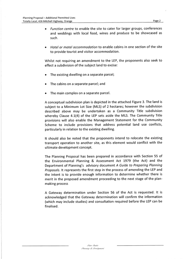
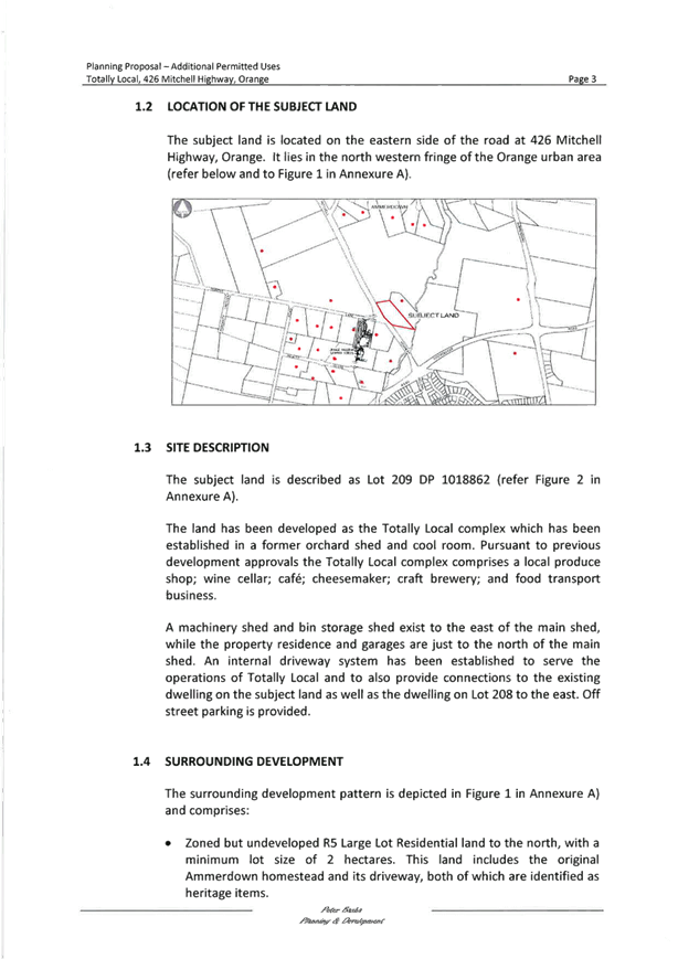
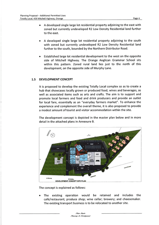
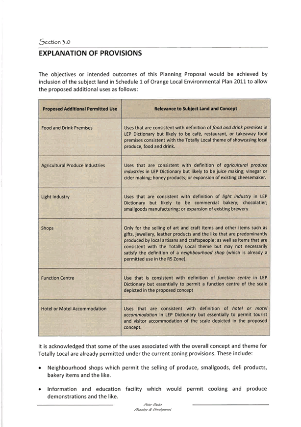
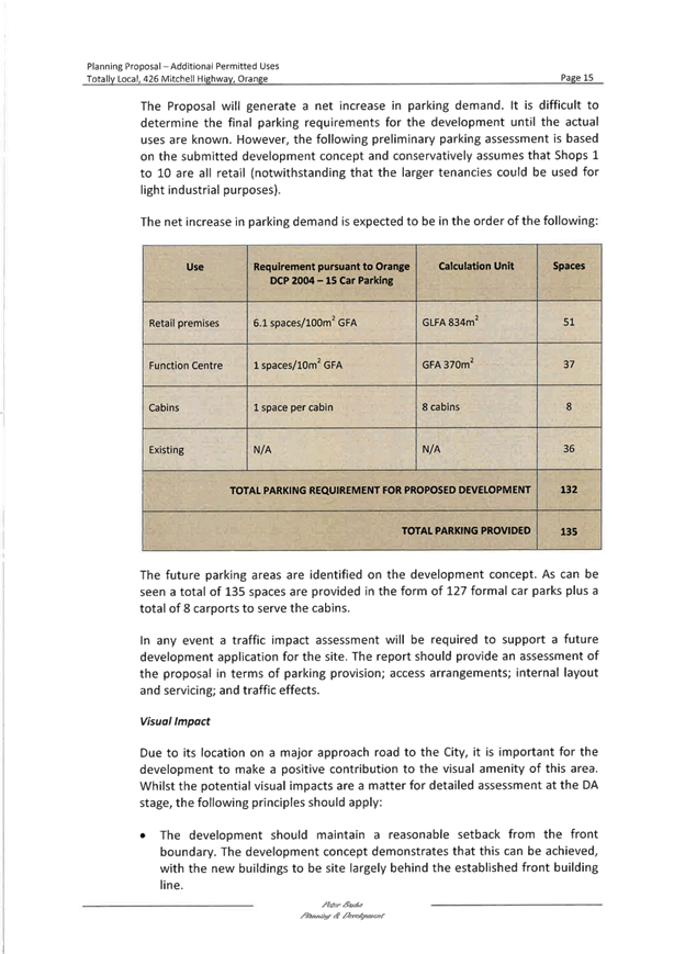


Planning
and Development Committee
6 June 2017
2.7 Planning
Proposal - Totally Local
Attachment 2 Planning
Proposal - Annexure A - Land Plans
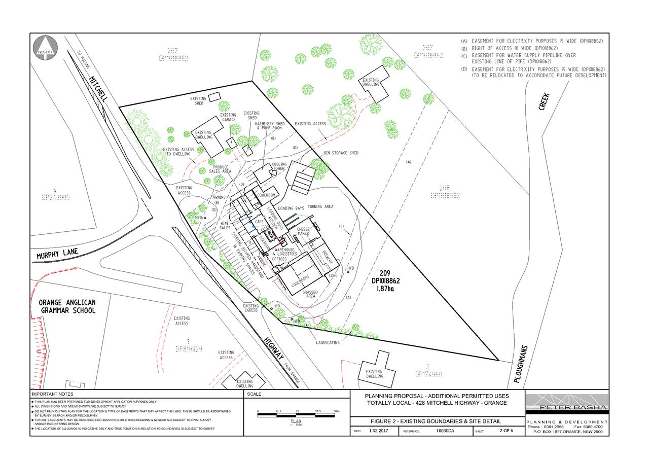
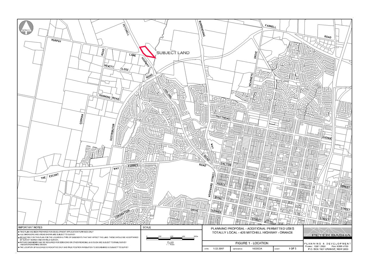
Planning and Development Committee
6 June 2017
2.7 Planning
Proposal - Totally Local
Attachment 2 Planning
Proposal - Annexure A - Land Plans
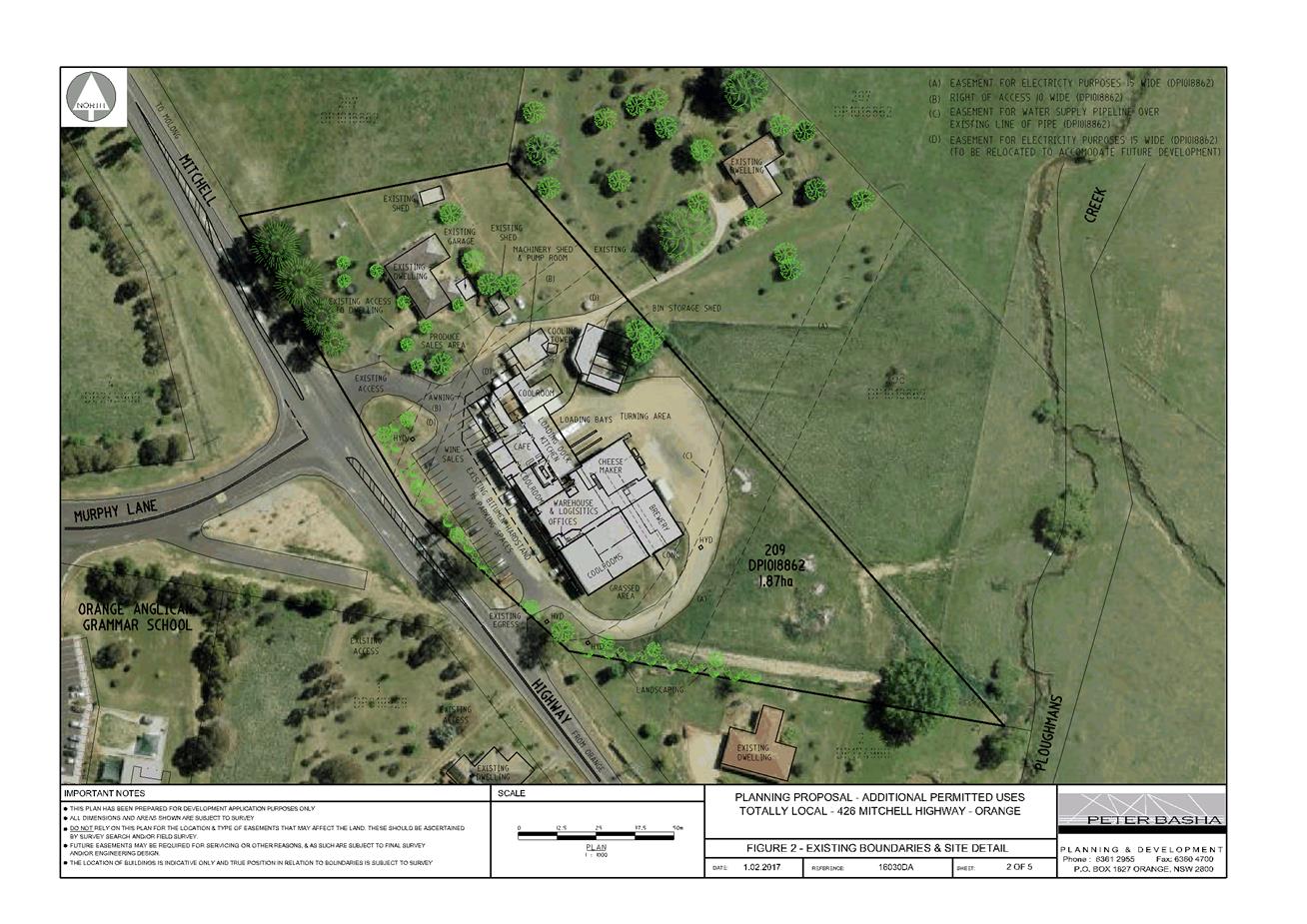
Planning and Development Committee
6 June 2017
2.7 Planning
Proposal - Totally Local
Attachment 2 Planning
Proposal - Annexure A - Land Plans
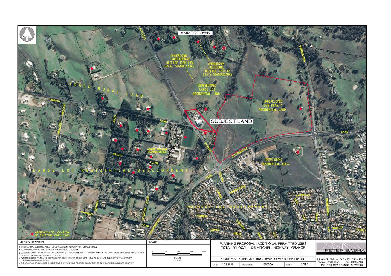
Planning and Development Committee
6 June 2017
2.7 Planning
Proposal - Totally Local
Attachment 2 Planning
Proposal - Annexure A - Land Plans
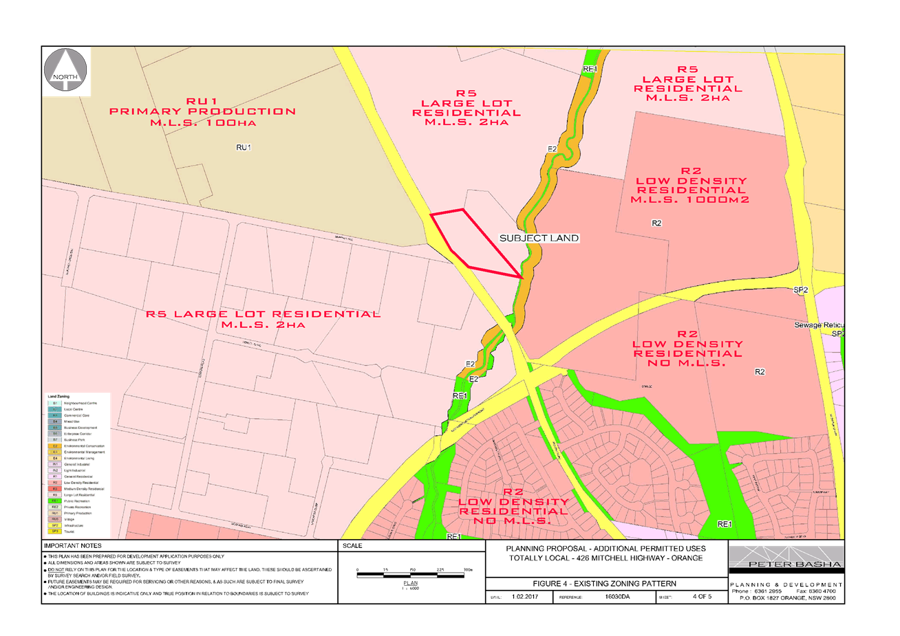
Planning and Development Committee
6 June 2017
2.7 Planning
Proposal - Totally Local
Attachment 2 Planning
Proposal - Annexure A - Land Plans
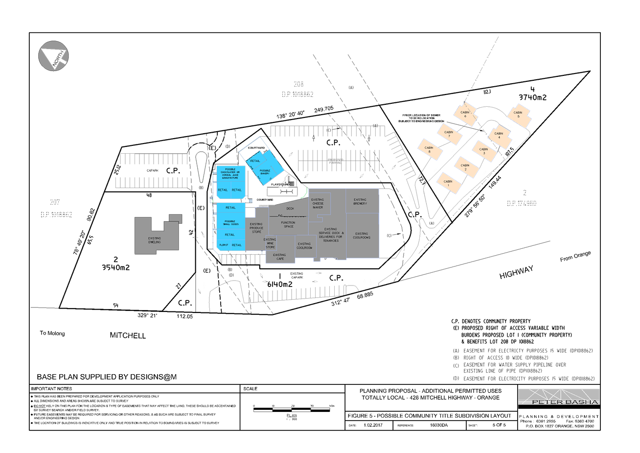
Planning and Development Committee
6 June 2017
2.7 Planning
Proposal - Totally Local
Attachment 3 Planning
Proposal - Annexure B - Concept Plans 01
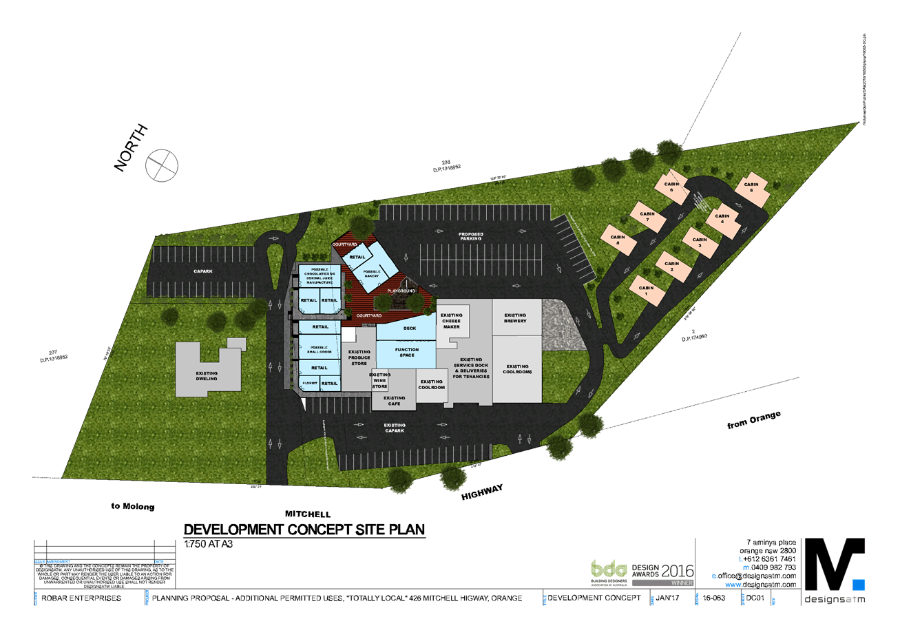
Planning
and Development Committee
6 June 2017
2.7 Planning
Proposal - Totally Local
Attachment 4 Planning
Proposal - Annexure B - Concept Plans 02
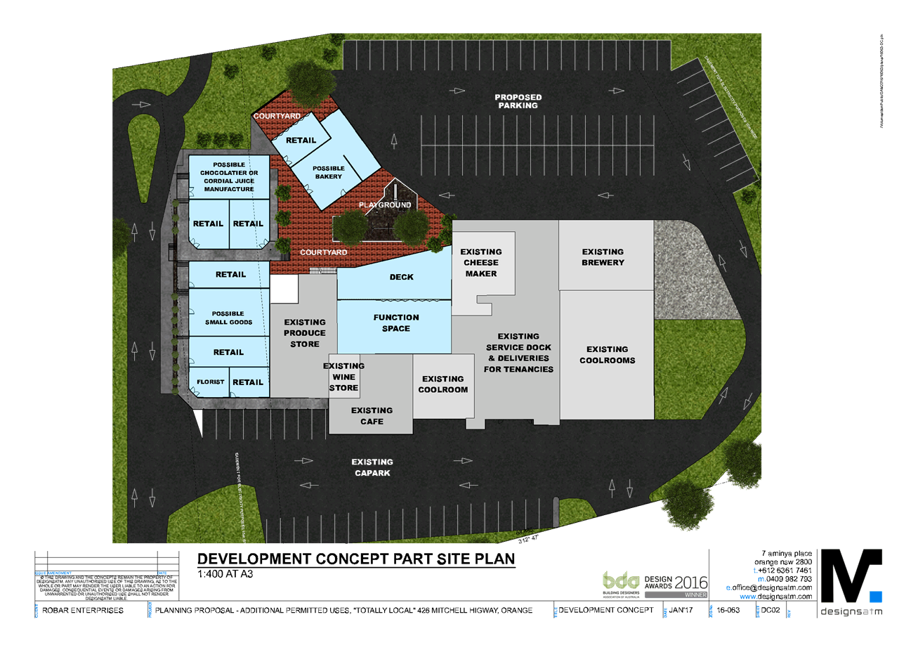
Planning
and Development Committee
6 June 2017
2.7 Planning
Proposal - Totally Local
Attachment 5 Planning
Proposal - Annexure B - Concept Plans 03
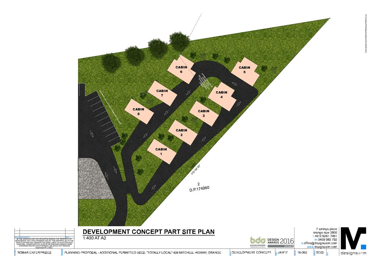
Planning
and Development Committee
6 June 2017
2.7 Planning
Proposal - Totally Local
Attachment 6 Planning
Proposal - Annexure B - Concept Plans 04
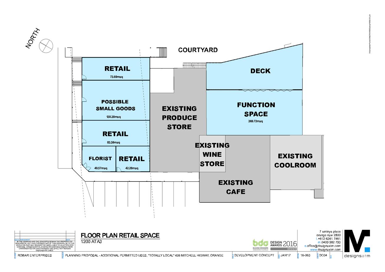
Planning
and Development Committee
6 June 2017
2.7 Planning
Proposal - Totally Local
Attachment 7 Planning
Proposal - Annexure B - Concept Plans 05
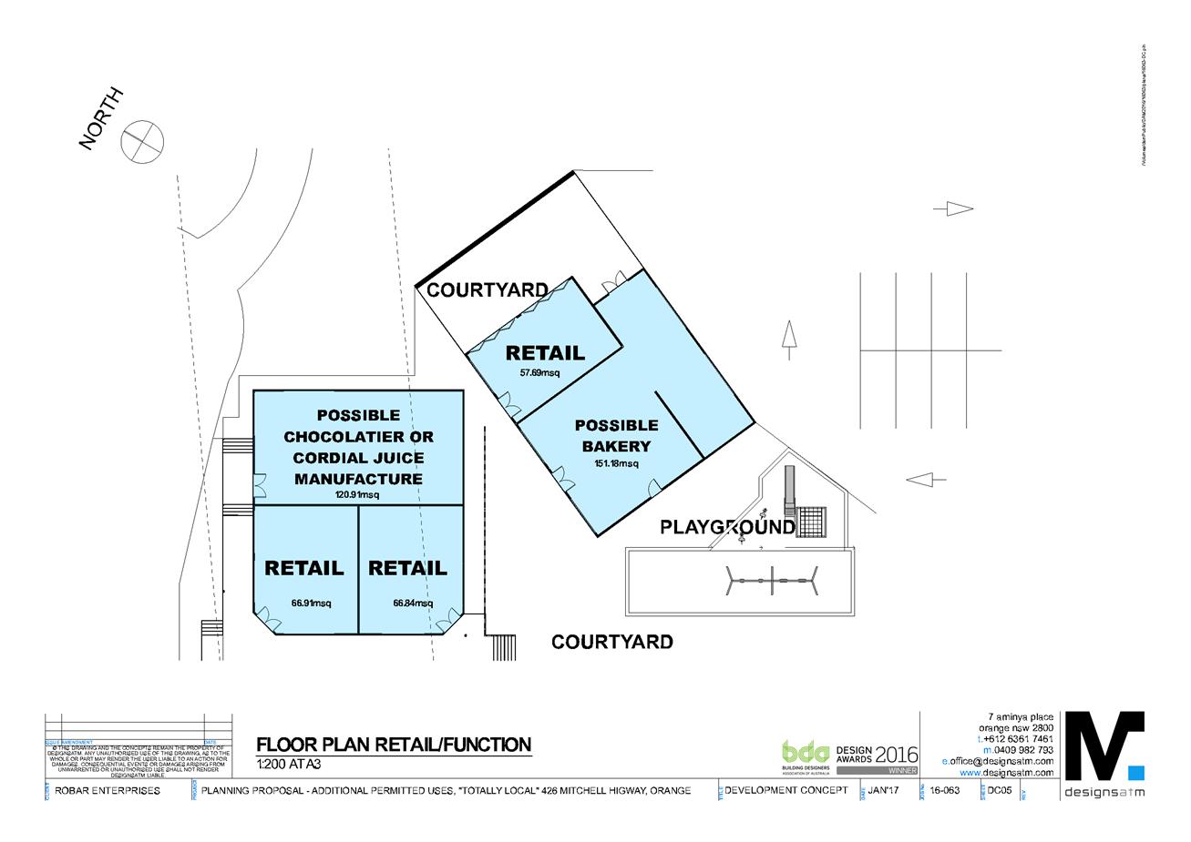
Planning
and Development Committee
6 June 2017
2.7 Planning
Proposal - Totally Local
Attachment 8 Planning
Proposal - Annexure B - Concept Plans 06
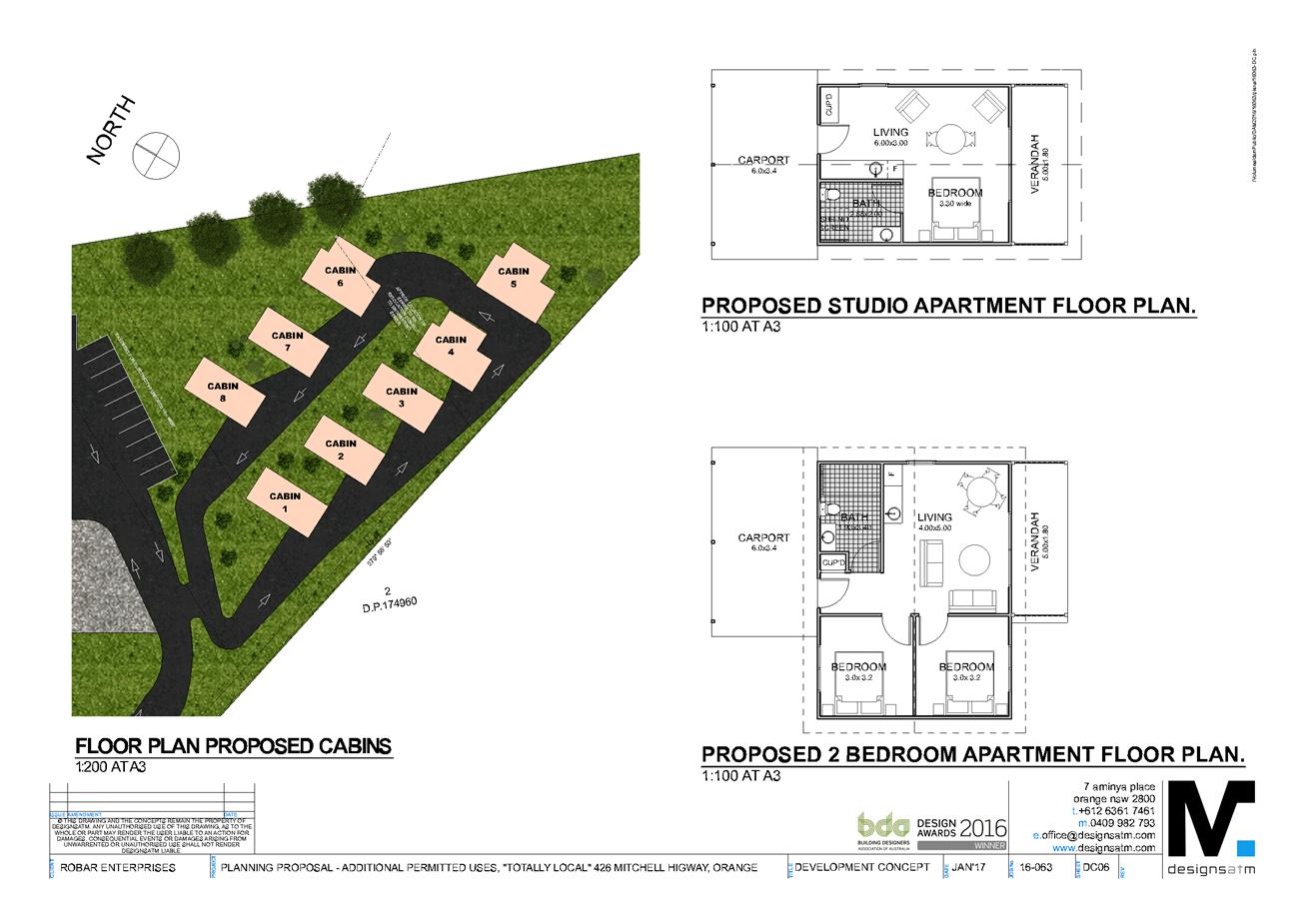
Planning
and Development Committee
6 June 2017
2.7 Planning
Proposal - Totally Local
Attachment 9 Planning
Proposal - Annexure B - Concept Plans 07
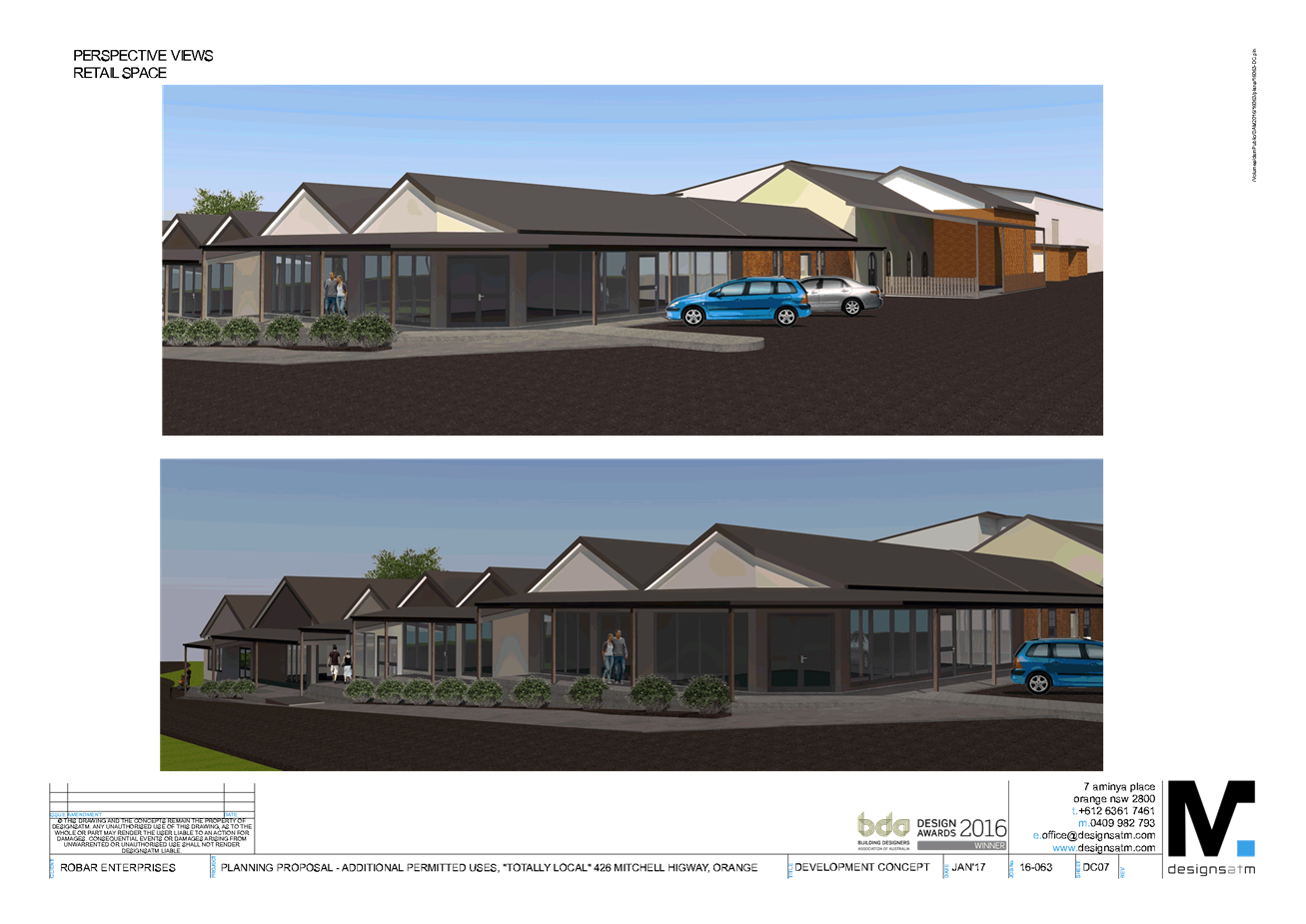
Planning
and Development Committee
6 June 2017
2.7 Planning
Proposal - Totally Local
Attachment 10 Planning Proposal
- Annexure B - Concept Plans 08
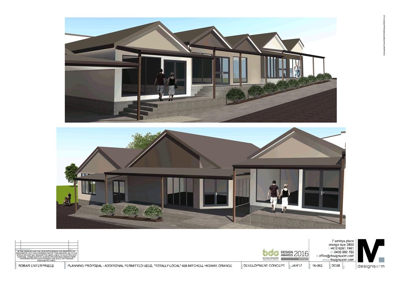
Planning
and Development Committee
6 June 2017
2.7 Planning
Proposal - Totally Local
Attachment 11 Planning Proposal
- Annexure B - Concept Plans 09
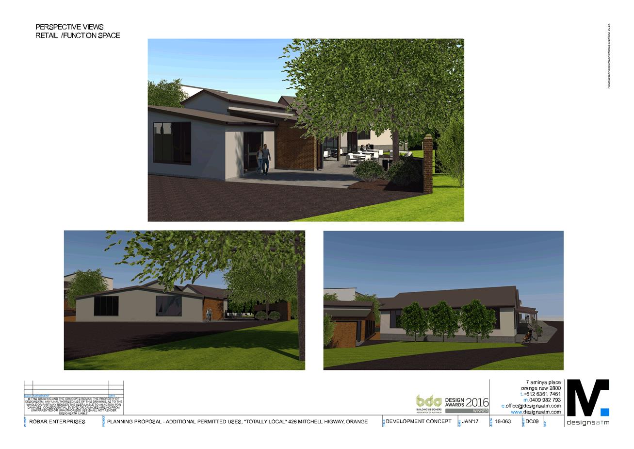
Planning
and Development Committee
6 June 2017
2.7 Planning
Proposal - Totally Local
Attachment 12 Planning Proposal
- Annexure B - Concept Plans 10
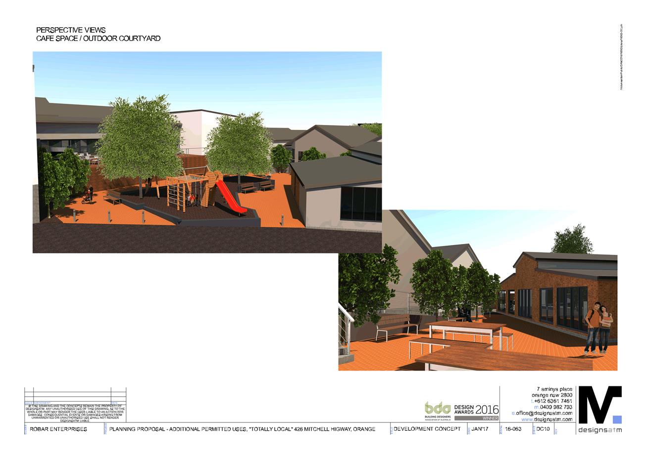
Planning
and Development Committee
6 June 2017
2.7 Planning
Proposal - Totally Local
Attachment 13 Planning Proposal
- Annexure B - Concept Plans 11
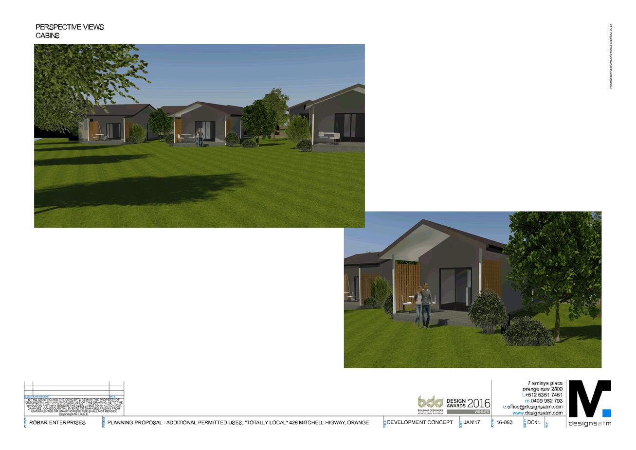
Planning
and Development Committee
6 June 2017
2.7 Planning
Proposal - Totally Local
Attachment 14 Planning Proposal
- Annexure C - SEPP Schedule
Planning
and Development Committee
6 June 2017
2.7 Planning
Proposal - Totally Local
Attachment 15 Planning Proposal
- Annexure D - S117 Ministerial Directions