ORANGE CITY COUNCIL
Planning and Development
Committee
Agenda
5 July 2016
Notice
is hereby given, in accordance with the provisions of the Local Government Act
1993 that a Planning and Development
Committee meeting
of ORANGE CITY COUNCIL will be held in the Council Chamber, Civic Centre, Byng Street, Orange on Tuesday,
5 July 2016.
Garry
Styles
General Manager
For apologies please
contact David Waddell on 6393 8261.
1 Introduction
1.1 Declaration
of pecuniary interests, significant non-pecuniary interests and less than
significant non-pecuniary interests
The
provisions of Chapter 14 of the Local Government Act, 1993 (the Act)
regulate the way in which Councillors and designated staff of Council conduct
themselves to ensure that there is no conflict between their private interests
and their public role.
The
Act prescribes that where a member of Council (or a Committee of Council) has a
direct or indirect financial (pecuniary) interest in a matter to be considered
at a meeting of the Council (or Committee), that interest must be disclosed as
soon as practicable after the start of the meeting and the reasons given for
declaring such interest.
As
members are aware, the provisions of the Local Government Act restrict any
member who has declared a pecuniary interest in any matter from participating
in the discussion or voting on that matter, and requires that member to vacate
the Chamber.
Council’s Code of Conduct provides that if members
have a non-pecuniary conflict of interest, the nature of the conflict must be
disclosed. The Code of Conduct also provides for a number of ways in which a
member may manage non pecuniary conflicts of interest.
|
Recommendation
It is recommended that Committee Members now disclose any
conflicts of interest in matters under consideration by the Planning and
Development Committee at this meeting.
|
2 General
Reports
2.1 Items
Approved Under the Delegated Authority of Council
TRIM
REFERENCE: 2016/1266
AUTHOR: Paul
Johnston, Planning Team Leader
EXECUTIVE Summary
Following is a list of development
applications approved under the delegated authority of Council.
Link To Delivery/OPerational Plan
The recommendation in this report relates to the Delivery/Operational
Plan strategy “13.4 Our Environment – Monitor and
enforce regulations relating to City amenity”.
Financial Implications
Council has been advised that as a council included in the
NSW Government’s merger proposals under consideration by the Office of
Local Government since referral on 6 January 2016, Council must comply with the
merger proposal period guidelines issued under S23A of the Local Government Act
1993.
The guidelines instruct Council it should expend money in
accordance with the detailed budget adopted for the purposes of implementing
the Delivery/Operational Plan for the 2015/16 year.
Any expenditure outside the adopted budget requires the
identification of clear and compelling grounds and must be approved by Council
at a meeting that is open to the public. The guidelines indicate the resolution
of Council for increased expenditure must specify the reasons why the
expenditure is required and warranted.
If increased expenditure is greater than $250,000 or 1% of
the Council’s revenue from rates in
the preceding year, whichever is the greater, Council
is required to exhibit the increase to the budget and consider comments
received.
Council must also avoid entering into contracts or
undertakings were expenditure or revenue is greater than $250,000 or 1% of the Council’s revenue from rates in the
preceding year, whichever is the greater, unless the contract or undertaking is
as a result of a decision or procurement process commenced prior to the merger
proposal period or where entering into a contract or undertaking is reasonably
necessary for the purposes of meeting the ongoing service delivery commitments
of the Council or was previously approved in the Council’s
Delivery/Operational Plan.
Policy and Governance Implications
Nil
|
Recommendation
That the information provided in the
report by the Planning Team Leader on Items Approved Under the Delegated
Authority of Council be acknowledged.
|
further considerations
Consideration has been given to the
recommendation’s impact on Council’s service delivery; image and
reputation; political; environmental; health and safety; employees;
stakeholders and project management; and no further implications or risks have
been identified.
SUPPORTING INFORMATION
|
Reference:
|
DA 404/2008(5)
|
Determination
Date
|
2 June 2016
|
|
PR Number
|
PR19361
|
|
Applicant/s:
|
Fenlor Group Pty
Ltd
|
|
Owner/s:
|
Fenlor Group Pty
Ltd
|
|
Location:
|
Lot 158 DP 1207987
– Tilston Way, Orange (previously part of Lots 7 and 8 DP 1065578 - 384
and 386 Molong Road, Orange)
|
|
Proposal:
|
Modification
of development consent – subdivision (78 lot residential, one residue
lot). The modification involves an amended layout and eliminates from the
plan two areas approved along the eastern side of the site as Community Title
private open space areas.
|
|
Value:
|
$0
|
|
Reference:
|
DA 203/2013(3)
|
Determination
Date
|
9 June 2016
|
|
PR Number
|
PR6596
|
|
Applicant/s:
|
Bunnings
Properties Pty Ltd
|
|
Owner/s:
|
Bunnings
Properties Pty Ltd
|
|
Location:
|
Lot 3 DP
1185665 and Lot 8 DP 7214 - 235 and 237 Leeds Parade, Orange
|
|
Proposal:
|
Modification of development consent
- hardware and building supplies (construction of a new store), subdivision
(consolidation of land), demolition (existing dwelling and associated
outbuildings), signage and subdivision (two lot industrial). The modification
involves altering the Notice of Determination for development application
DA 203/2013(2) by amending and deleting various conditions. The
development as modified will enable the issue of an Interim Occupation
Certificate prior to finalisation of engineering, servicing and landscaping
requirements for the development.
|
|
Value:
|
$16,500,000 (being
the same value as the original development)
|
|
Reference:
|
DA 418/2015(1)
|
Determination
Date
|
14 June 2016
|
|
PR Number
|
PR27089
|
|
Applicant/s:
|
Willowdene Constructions
Pty Ltd
|
|
Owner/s:
|
Mulgoa
Corporations Pty Ltd
|
|
Location:
|
Lot 401 DP 1210576
– 96 William Maker Drive, Orange
|
|
Proposal:
|
Subdivision
(two lot residential) and two dwellings
|
|
Value:
|
$460,000
|
|
Reference:
|
DA 452/2015(1)
|
Determination
Date
|
3 June 2016
|
|
PR Number
|
PR19670
|
|
Applicant/s:
|
Mrs DV Gee
|
|
Owner/s:
|
Mrs DV Gee
|
|
Location:
|
Lot 10 DP 1070599
– 4601 Mitchell Highway, Lucknow
|
|
Proposal:
|
Shop
(alterations and additions to existing premises) and demolition (tree
removal)
|
|
Value:
|
$65,000
|
|
Reference:
|
DA 38/2016(1)
|
Determination
Date
|
8 June 2016
|
|
PR Number
|
PR23189
|
|
Applicant/s:
|
Housing Plus
|
|
Owner/s:
|
Tohach Pty Ltd
|
|
Location:
|
Lot 102 DP 1142436
- 9 Albert Street, Orange
|
|
Proposal:
|
Self-contained
dwellings (four)
|
|
Value:
|
$1,380,000
|
|
Reference:
|
DA 68/2016(1)
|
Determination
Date
|
10 June 2016
|
|
PR Number
|
PR25411
|
|
Applicant/s:
|
DFT Australia Pty
Ltd
|
|
Owner/s:
|
DFT Australia Pty
Ltd
|
|
Location:
|
Lot 82 DP 1167633
– 78 Astill Drive, Orange
|
|
Proposal:
|
Vehicle
repair station/vehicle sales or hire premises (mixed use development)
|
|
Value:
|
$400,000
|
|
Reference:
|
DA 117/2016(1)
|
Determination
Date
|
15 June 2016
|
|
PR Number
|
PR10201
|
|
Applicant/s:
|
Mr JM Gibson
|
|
Owner/s:
|
Mr JM and Mrs KE
Gibson
|
|
Location:
|
Lots 3 and 4 DP
129339 - 97 Prince Street, Orange
|
|
Proposal:
|
Demolition
(existing laundry and bathroom), and dwelling alterations and additions
(includes carport and alfresco area)
|
|
Value:
|
$120,000
|
|
Reference:
|
DA 126/2016(1)
|
Determination
Date
|
30 May 2016
|
|
PR Number
|
PR2109
|
|
Applicant/s:
|
Ms BJ Gray
|
|
Owner/s:
|
As above
|
|
Location:
|
Lot 1 DP 522647 -
66 Byng Street, Orange
|
|
Proposal:
|
Demolition
(tree removal)
|
|
Value:
|
$800
|
|
Reference:
|
DA 130/2016(1)
|
Determination
Date
|
3 June 2016
|
|
PR Number
|
PR5109
|
|
Applicant/s:
|
Mr FP and Mrs SDM
Johnson
|
|
Owner/s:
|
Mrs SDM Johnson
|
|
Location:
|
Lot 122 DP 581317
– 73 Hill Street, Orange
|
|
Proposal:
|
Demolition
(tree removal)
|
|
Value:
|
$0
|
|
Reference:
|
DA 146/2016(1)
|
Determination
Date
|
8 June 2016
|
|
PR Number
|
PR22051
|
|
Applicant/s:
|
Lot 231 DP 1105371
– 21 Emerald Street, Orange
|
|
Owner/s:
|
Pinnacle Building
Contractors
|
|
Location:
|
Mr P and Mrs M
Montagliani
|
|
Proposal:
|
Home
business
|
|
Value:
|
$66,000
|
|
Reference:
|
DA 173/2016(1)
|
Determination
Date
|
15 June 2016
|
|
PR Number
|
PR25385
|
|
Applicant/s:
|
Hotel Canobolas
Pty Limited
|
|
Owner/s:
|
Hotel Canobolas Pty
Limited
|
|
Location:
|
Lot 18 SP 82891
– 18/266 Summer Street, Orange
|
|
Proposal:
|
Food and
drink premises (pub) (internal reconfiguration)
|
|
Value:
|
$50,000
|
TOTAL
NET* VALUE OF ALL DEVELOPMENTS APPROVED IN THIS PERIOD: $2,541,800
*
Net value relates to the value of modifications. If modifications are
the same value as the original DA, then nil is added. If there is a plus/minus
difference, this difference is added or taken out.
2.2 Development
Application DA 287/2015(1) - 538 Ophir Road
TRIM
REFERENCE: 2016/1379
AUTHOR: Kelly
Walker, Town Planner
EXECUTIVE Summary
|
Application
lodged
|
1
September 2015
|
|
Applicant/s
|
Mr SJ
and Mrs GL Cudars
|
|
Owner/s
|
Mr NC
and Mrs LM Calton
|
|
Land
description
|
Lot 510
DP 263991 - 538 Ophir Road, Orange
|
|
Proposed
land use
|
Subdivision
(two lot residential)
|
|
Value of
proposed development
|
$0
|
Council's consent is sought for a two lot residential
subdivision of Lot 510 DP 263991, known as 538 Ophir Road, Orange.
The proposal involves the subdivision of the existing 5.203ha lot into two
residential lots, as set out in the table below:
|
Proposed Lot
|
Area
|
Containing
|
|
1
|
2.2ha
|
Existing dwelling, outbuildings,
and driveway
|
|
2
|
3.003ha
|
Proposed building envelope
measuring 35m x 45m, and 10m wide accessway along the northern boundary
|
The proposal does not involve a
dwelling house or onsite effluent system, which will no doubt be subject to a
separate future application.
One issue of note is the suitability of providing additional
housing in a location that has the potential to be greatly affected by flooding
should the Suma Park Dam wall fail in an extreme event, such as during an
earthquake. Suma Park Dam has been recently upgraded by raising the Full Supply
Level by 1.0m and upgrading the spillway to meet the standards set by the NSW
Dam Safety Committee (NSW DSC) and the Australian National Committee on Large
Dams (ANCOLD). However, the upgrade was based on the existing infrastructure
and population downstream of the dam to meet the societal life safety risk
‘negligible’ threshold.
Council has sought technical advice from specialist dam and
water consultant, Entura, in regards to this proposal, which is discussed in
detail in the main part of this report. Based on this advice it is considered
that the proposed additional residential lot and future dwelling are acceptable
in this case, as the ‘negligible’ threshold will still be able to
be met, provided that the future dwelling has a flood warning alarm systems
installed as with the other existing dwellings downstream of the dam. A
condition of consent is therefore recommended that a Section 88b Instrument be
registered on the titles of the proposed lots to ensure that alarms are
installed in all dwellings, as is the case with the existing dwellings
similarly affected.
It is recommended that Council supports this application. It
is noted, however, that should the population downstream of the dam increase
further by way of additional development, the ‘negligible risk’
threshold may no longer be met. As such, it is recommended that Council amends Orange
Local Environmental Plan 2011 in terms of flood risk or minimum lot sizes
downstream of Suma Park Dam to restrict the potential to increase the number of
lots and dwellings in the extreme event flooding area. This matter will be
addressed under separate cover in the near future.
Link To Delivery/OPerational Plan
The recommendation in this report relates to the
Delivery/Operational Plan strategy “13.4 Our Environment
– Monitor and enforce regulations relating to City amenity”.
Financial Implications
Council has been advised that as a council included in the
NSW Government’s merger proposals under consideration by the Office of
Local Government since referral on 6 January 2016, Council must comply with the
merger proposal period guidelines issued under S23A of the Local Government Act
1993.
The guidelines instruct Council it should expend money in accordance
with the detailed budget adopted for the purposes of implementing the
Delivery/Operational Plan for the 2015/16 year.
Any expenditure outside the adopted budget requires the
identification of clear and compelling grounds and must be approved by Council
at a meeting that is open to the public. The guidelines indicate the resolution
of Council for increased expenditure must specify the reasons why the
expenditure is required and warranted.
If increased expenditure is greater than $250,000 or 1% of
the Council’s revenue from rates in
the preceding year, whichever is the greater, Council
is required to exhibit the increase to the budget and consider comments
received.
Council must also avoid entering into contracts or
undertakings where expenditure or revenue is greater than $250,000 or 1% of the
Council’s revenue from rates in the
preceding year, whichever is the greater, unless the contract or undertaking is
as a result of a decision or procurement process commenced prior to the merger
proposal period or where entering into a contract or undertaking is reasonably
necessary for the purposes of meeting the ongoing service delivery commitments
of the Council or was previously approved in the Council’s
Delivery/Operational Plan.
Policy and Governance Implications
As noted previously, it is recommended that Council amends Orange
Local Environmental Plan 2011 in terms of flood risk or minimum lot
sizes downstream of Suma Park Dam to restrict the potential to increase the
number of lots and dwellings in the extreme event flooding area. Should the
potential not be restricted, Council may incur financial implications of having
to further upgrade the dam. This matter will be addressed under separate cover.
|
Recommendation
That Council consents to
development application DA 287/2015(1)
for Subdivision (two lot residential) at Lot 510 DP 263991 -
538 Ophir Road, Orange pursuant to the conditions
of consent in the attached Notice of Approval.
|
further considerations
Consideration has been given to the
recommendation’s impact on Council’s service delivery; image and
reputation; political; environmental; health and safety; employees;
stakeholders and project management; and no further implications or risks have
been identified.
SUPPORTING INFORMATION
THE APPLICATION/PROPOSAL
Council's consent is sought for a two lot residential
subdivision at Lot 510 DP 263991, known as 538 Ophir Road, Orange.
The proposal involves the
subdivision of the existing 5.203ha lot into two residential lots, as set out
in the table below:
|
Proposed Lot
|
Area
|
Containing
|
|
1
|
2.2ha
|
Existing dwelling, outbuildings,
and driveway
|
|
2
|
3.003ha
|
Proposed building envelope
measuring 35m x 45m, and 10m wide accessway along the northern boundary
|
The proposal does not involve a dwelling house or onsite
effluent system, which will be subject to a separate future application.
MATTERS FOR CONSIDERATION
Section 5A Assessment
In the administration of sections 78A, 79B, 79C, 111 and
112, the provisions of Section 5A must be taken into account for every
development application in deciding whether there is likely to be a significant
effect on threatened species, populations or ecological communities or their
habitats. This section includes a requirement to consider any adopted
assessment guidelines, which means assessment guidelines issued and in force
under section 94A of the Threatened Species Conservation Act 1995.
Assessment guidelines are in force (see DECC-W “Threatened Species
Assessment Guidelines - The Assessment of Significance”) which requires
consent authority to adopt the precautionary principle in its assessment.
In this instance, site inspection reveals that the subject
property has no biodiversity or habitat value.
Section 79C
Section 79C of the Environmental Planning and Assessment
Act 1979 requires Council to consider various matters, of which those
pertaining to the application are listed below.
PROVISIONS OF ANY ENVIRONMENTAL
PLANNING INSTRUMENT s79C(1)(a)(i)
Orange Local Environmental Plan 2011
Part 1 - Preliminary
Clause 1.2 - Aims of Plan
The
broad aims of the LEP are set out under subclause 2. Those relevant to the
application are as follows:
(a) to encourage development which complements
and enhances the unique character of Orange as a major regional centre boasting
a diverse economy and offering an attractive regional lifestyle,
(e) to provide a range of housing choices in
planned urban and rural locations to meet population growth.
While it is considered that the proposed additional
residential lot and future dwelling are acceptable in this particular case, the
development is not generally consistent with the aims above given the concerns
about providing additional housing in a location that has the potential to be
greatly affected by flooding. As such, this site is not considered to be a
suitable or planned location to provide for population growth, and this
application should not serve to set a precedent for any further additional lots
or dwellings downstream of the dam in the flooding area.
Clause 1.6 - Consent Authority
This clause establishes that, subject to the Act, Council is
the consent authority for applications made under the LEP.
Clause 1.9A - Suspension of
Covenants, Agreements and Instruments
This clause provides that covenants, agreements and other
instruments which seek to restrict the carrying out of development do not apply
with the following exceptions.
· covenants
imposed or required by Council
· prescribed
instruments under Section 183A of the Crown Lands Act 1989
· any
conservation agreement under the National Parks and Wildlife Act 1974
· any trust
agreement under the Nature Conservation Trust Act 2001
· any property
vegetation plan under the Native Vegetation Act 2003
· any
biobanking agreement under Part 7A of the Threatened Species Conservation
Act 1995
· any planning
agreement under Division 6 of Part 4 of the Environmental Planning and
Assessment Act 1979.
As can be seen in Figure 1
below, the subject site has easements along the northern boundary and through
the site (coloured bright blue). These easements have been taken into account
in the design and layout of the proposed subdivision and the accessway, and
therefore they will not be affected by the proposed development.
Figure 1: easement map of subject site
The site is also restricted by covenants, however these are
not affected by the proposed subdivision. Council staff are not aware of the
title of the subject property being affected by any of the other above
instruments.
Mapping
The subject site is identified
on the LEP maps in the following manner:
|
Land Zoning Map:
|
Land zoned R5 Large Lot Residential
|
|
Lot Size Map:
|
Minimum Lot Size 2 ha
|
|
Heritage Map:
|
Not a heritage item or conservation
area
|
|
Height of Buildings Map:
|
No building height limit
|
|
Floor Space Ratio Map:
|
No floor space limit
|
|
Terrestrial Biodiversity Map:
|
No biodiversity sensitivity on the
site
|
|
Groundwater Vulnerability Map:
|
Ground water vulnerable
|
|
Drinking Water Catchment Map:
|
Not within the drinking water
catchment
|
|
Watercourse Map:
|
Not within or affecting a defined
watercourse, but nearby to a sensitive waterway
|
|
Urban Release Area Map:
|
Not within an urban release area
|
|
Obstacle Limitation Surface Map:
|
No restriction on building siting
or construction
|
|
Additional Permitted Uses Map:
|
No additional permitted use applies
|
Those matters that are of relevance are addressed in detail
in the body of this report.
Part 2 - Permitted or Prohibited
Development
Land Use Zones
The subject site is located within the R5 Large Lot
Residential zone. The proposed development is defined as
‘subdivision’. Section 4B - Subdivision of Land of the Environmental
Planning and Assessment Act 1979 identifies that the subdivision of land
means:
the division of land into two
or more parts that, after the division, would be obviously used for separate
occupation, use or disposition.
Subdivision is permitted with consent for this zone. This
application is seeking consent.
Clause 2.3 of LEP 2011 references the Land Use
Table and Objectives for each zone in LEP 2011. These objectives for land
zoned R5
Large Lot Residential are
as follows:
· To provide
residential housing in a rural setting while preserving, and minimising impacts
on, environmentally sensitive locations and scenic quality.
· To ensure that large
residential lots do not hinder the proper and orderly development of urban
areas in the future.
· To ensure that
development in the area does not unreasonably increase the demand for public
services or public facilities.
· To minimise conflict
between land uses within this zone and land uses within adjoining zones.
· To provide for student
housing in close proximity to the Charles Sturt University.
· To ensure development
is ordered in such a way as to maximise public transport patronage, and
encourage walking and cycling, in close proximity to settlement.
· To ensure development
along the Southern Link Road has an alternative access.
As noted previously,
concerns have been raised
in regards
to providing additional housing in a location that has the potential to be greatly affected by flooding. Due
to the increased risk resulting from the proposed additional infrastructure and
population, the proposal will increase the demand of emergency services should
there be an extreme flood event.
The proposed development also has the
potential to set a precedent for additional development and an increase in
population, which may cause conflict between this zone and the nearby
Infrastructure (Water Supply) zone for Suma Park Dam. An increase in population
will ultimately increase the risk threshold for the dam, and increase the need
for further upgrades to the dam. As this site is not considered to be a
suitable or planned location to provide for population growth, this application
should not serve to set a precedent for any further additional lots or
dwellings downstream of the dam in the flooding area; and appropriate controls
to restrict further development are recommended, as discussed previously in
this report.
The proposal is generally consistent
with the other objectives for the zone.
Clause 2.6 - Subdivision -
Consent Requirements
This clause triggers the need for development consent for
the subdivision of land. Additionally, the clause prohibits subdivision of land
on which a secondary dwelling is situated if the subdivision would result in
the principal and secondary dwellings being located on separate lots if either
of those lots are below the minimum lot size applying to the land.
The proposal does not involve a secondary dwelling. The
proposed subdivision meets the minimum allotment requirements.
Part 3 - Exempt and Complying
Development
The application is not exempt or complying development.
Part 4 - Principal Development
Standards
Clause 4.1 - Minimum Subdivision Lot
Size
This clause requires the subdivision
of land to be equal to or greater than the size nominated for the land under
the Minimum Lot Size Map.
In relation to this site, the map
nominates a minimum
lot size of 2ha. The smallest lot proposed by the application is 2ha, and
therefore meets this clause.
Part 5 - Miscellaneous Provisions
Not relevant to the application.
Part 6 - Urban Release Area
Not relevant to the application. The subject site is not
located in an Urban Release Area.
Part 7 - Additional Local Provisions
7.2 - Flood Planning
This clause applies to land identified
on the Flood Planning Map as a Flood Planning Area and requires that, before
any consent is issued, Council must be satisfied that the proposal:
(a) is compatible with the flood hazard of the
land, and
(b) is not likely to significantly adversely
affect flood behaviour resulting in detrimental increases in the potential
flood affectation of other development or properties, and
(c) incorporates appropriate measures to
manage risk to life from flood, and
(d) is not likely to significantly adversely
affect the environment or cause avoidable erosion, siltation, destruction of
riparian vegetation or a reduction in the stability of river banks or
watercourses, and
(e) is not likely to result in unsustainable
social and economic costs to the community as a consequence of flooding.
The
site is not identified on the LEP Flood Map, however is mapped on
Council’s overland flow mapping, as shown in Figure 2 below. The proposed
additional lot will be affected by this overland flowpath, however the proposed
building envelope for the future dwelling is outside of this flooding area.
Figure 2: flooding map of subject site (overland flow)
The
site is also identified on the inundation mapping carried out by
Council’s specialist
dam and water consultant, Entura, as shown in Figure 3 below. This map shows
the extent of flooding should there be sunny day flood (orange line), a dam
crest flood without failure (pink line), and dam crest flood with failure (blue
line). The existing dwelling on the subject site will be completely inundated
in all of these scenarios, as will the proposed future dwelling.

Figure 3: Suma Park Reservoir inundation map
(partial extract, from Sheet 2 of 4, by Entura, ©
2011) (subject site located in black oval)
It is important to note that the
flood mapping set out in the LEP generally determines flood extents based on 1:100
ARI flood events, with the consideration of a 0.5m freeboard. The Design Flood
Frequency used in Entura’s mapping and the design of the dam upgrade was
a 1,000,000 AEP. Planning controls do not normally take into account
extremely rare catastrophic events such as dam failure.
As set out in the Technical Memo
prepared by Entura, dated 7 April 2016:
“the
upgrade of Suma Park Dam should not increase the potential for flood during a
1:100 ARI event. What the upgrade has done, is increase the storage capacity of
the dam and improve the structural integrity of the dam. Unless the dam is at
full capacity at the time of a 1:100 ARI event, the amount of inundation
downstream should actually decrease. The inundation scenario
identified in the dam upgrade was based on a flood frequency of 1,000,000
AEP which is far beyond the 100 AEP event normally provided for within planning
schemes”.
Previously it was noted that the dam
standards are based on Societal Risk thresholds. Entura makes the following
comments in regards to risk and the thresholds:
- The application of these standards require the Societal
Risk to be assessed which is a consideration of the Dam’s Probability of
Failure versus the Number of Fatalities. The Number of Fatalities value is
derived, in part, from the calculation of a Population At Risk (PAR) value.
- The development of the upgrade options took into account
a PAR value. Potentially, any increase in this value may change the assessment
of Societal Risk against a tolerable limit set under ANCOLD standards.
- While it is unlikely that a minor increase in development
potential would have a significant impact it is noted that, in the case of Suma
Park Dam, the three identified scenarios
impact on an Urban Release Area.
It is considered that the minor increase
in population resulting from the additional residential lot proposed in this
application will increase the societal risk, however is unlikely to increase
the risk above the ‘negligible’ threshold. As such, the proposal is
acceptable in this case providing that adequate flood warning alarm systems are
put in place. Council’s Manager Strategic Water and Sewer advises that
the existing affected properties have alarms in place, however the applicant
notes that the existing subject dwelling does not have an alarm. It is assumed
that the current or a previous owner has removed this, and as such the
recommended condition of consent needs to ensure that both the existing and future
dwellings have alarm systems installed. It is also recommended that Council
checks that other affected properties have retained and adequately maintained
their alarms, and that they and are in good working order.
Concerns have been raised that
any other additional development downstream of the dam will exponentially
increase the risk threshold for the dam, where the ‘negligible
risk’ threshold may no longer be met as the population increases. Advice
received from Council’s dam consultant, who recommends that planning
controls are amended to restrict further development downstream of the dam.
Entura makes the following
comments in this regard:
- While development of this land in the future would be
required to take into account potential environmental constraints, the concern
is that any development may impact upon the outcomes of a future Dam Safety Review and may require further
upgrade works to the dam.
- A sensitivity analysis of these scenarios, or a review of
the Societal Risk of the dam, would be necessary to quantify this risk. Council
has provided additional information on the potential for development downstream
of the dam (refer Attachment A) which indicates that there are approximately 31
additional land titles that fall within the potential inundation extent that
are likely be subject to development in the future. This would represent an
approximate increase in the Population at Risk (PAR) of 78 for flood failure,
representing a 62% increase in the current estimate.
- A detailed risk assessment has not been completed for the
dam, however, the effect of an additional 31 houses downstream on the Societal
Risk has been indicated in Figure 1 (see report Figure 4 below). This shows that the risk
posed by the dam will increase over time, however, it will be close to the NSW
Dam Safety Committee’s negligible risk line even with the additional
development. The increase in risk can be minimised through the extension of the
current flood warning system to all new developments
in the potential inundation zone and effective emergency planning.
- Another aspect of the Suma
Park Dam upgrade is that some of the extreme flood flows will be diverted
through the saddle to the west of the main arch dam and then flow down a minor
gully back into Summer Hill Creek downstream of the main dam. As a result of
this, dangerous flood flows will be directed across Bulgas Road and down the
gully under extreme flood events (AEP<1:500). The planning
scheme will need to be modified to prevent development within the full extent
of this modified flood zone;
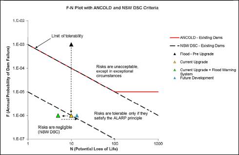
Figure 4: Societal Life Safety Risk (from
‘Technical Memo’, by Entura, 7 April 2016)
As such, it is recommended that Council amends the LEP in
terms of flood risk or minimum lot sizes downstream of Suma Park Dam to
restrict the potential to increase the number of lots and dwellings in the
extreme event flooding area. This matter will be addressed under separate
cover.
The following recommendations have been made by Entura and
Council’s Strategic Manager Water and Sewer:
· The
Infrastructure (Water Supply) zone be increased to encompass the increased
potential impoundment area of the dam at full supply level, although this is
not urgent given the constraints of the current zone.
· The zone
downstream of the new auxiliary spillway should be changed to prevent
incompatible development (ie no buildings or infrastructure).
· All new
dwellings within the potential dambreak inundation extent should be required to
install a flood warning system consistent with that of the existing residents.
· Prior to any
changes in land use zoning that would increase potential residential
development density within the dambreak inundation extent, the risk posed by
Suma Park Dam should be reviewed in detail, so as not to require further work
on the dam to maintain a suitable PAR value.
· Appropriate
emergency planning and preparation should continue to be undertaken to minimise
the dam safety risks posed by Suma Park dam.
Those of relevance to this application
have been included as conditions of consent in the attached notice. Those
recommendations relating to restricting further development will be dealt with
under separate cover.
7.3 - Stormwater Management
This clause applies
to all industrial, commercial and residential zones and requires that Council
be satisfied that the proposal:
(a) is designed to maximise the use of water
permeable surfaces on the land having regard to the soil characteristics
affecting onsite infiltration of water
(b) includes, where practical, onsite
stormwater retention for use as an alternative supply to mains water,
groundwater or river water; and
(c) avoids any significant impacts of
stormwater runoff on adjoining downstream properties, native bushland and
receiving waters, or if that impact cannot be reasonably avoided, minimises and
mitigates the impact.
The proposal does not include details
of stormwater management, where post- development runoff levels will
not exceed the
pre-development levels at subdivision stage. Stormwater will be dealt with in
detail in the future application for a new dwelling house.
7.5 - Riparian Land and Watercourses
This clause seeks to preserve both
water quality and riparian ecological health. The clause applies to land
identified as a “Sensitive Waterway” on the Watercourse Map. The
subject land contains such a waterway and therefore Council must consider
whether or not the proposal:
(a) is likely to have any adverse impact on
the following:
(i) the water quality and flows within a
watercourse
(ii) aquatic and riparian species, habitats
and ecosystems of the watercourse
(iii) the stability of the bed and banks of the
watercourse
(iv) the free passage of fish and other aquatic
organisms within or along the watercourse
(v) any future rehabilitation of the watercourse
and its riparian areas, and
(b) is
likely to increase water extraction from the watercourse.
Additionally, consent may not be
granted until Council is satisfied that:
(a) the development is designed, sited and
will be managed to avoid any significant adverse environmental impact, or
(b) if that impact cannot be reasonably
avoided - the development is designed, sited and will be managed to minimise
that impact, or
(c) if that impact cannot be minimised - the
development will be managed to mitigate that impact.
While the
subject site does not contain a sensitive waterway, the site is located nearby
to a sensitive waterway and key fish habitat, as shown in Figure 5 below. The
proposal has been designed to site the building envelope a sufficient distance
from the rear boundary and the waterway to manage the post-development
runoff. A condition of consent is recommended to ensure that an onsite
effluent system is appropriately sited. It is noted that there will always
remain a risk to the waterway under extreme circumstances such as record
storms, dam flood/failure etc, however the risk of adverse impact can be
appropriately managed to an acceptable level of risk. This matter will be dealt
with in greater detail in the future application for a new dwelling house.
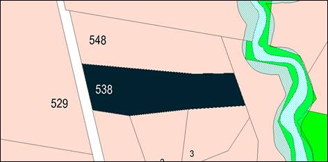
Figure 5: sensitive waterway map of subject site
(Orange LEP 2011)
7.6 - Groundwater Vulnerability
This clause seeks to protect
hydrological functions of groundwater systems and protect resources from both
depletion and contamination. Orange has a high water table and large areas of
the LGA, including the subject site, are identified with “Groundwater
Vulnerability” on the Groundwater Vulnerability Map. This requires that
Council consider:
(a) whether or not the development (including
any onsite storage or disposal of solid or liquid waste and chemicals) is
likely to cause any groundwater contamination or have any adverse effect on
groundwater dependent ecosystems, and
(b) the cumulative impact (including the
impact on nearby groundwater extraction for potable water supply or stock water
supply) of the development and any other existing development on groundwater.
Furthermore consent may not be granted unless Council is satisfied that:
(a) the development is designed, sited and
will be managed to avoid any significant adverse environmental impact, or
(b) if that impact cannot be reasonably
avoided - the development is designed, sited and will be managed to minimise
that impact,
(c) if that impact cannot be minimised - the
development will be managed to mitigate that impact.
The site is not
connected to town sewer, and an onsite sewage/effluent management system will
have to be installed. No details have been provided with the application, and
as such a condition of consent is recommended to ensure that an appropriate
system can be installed without impacting on groundwater or the neighbouring
sites. Notwithstanding this, the proposal is not anticipated to involve the
discharge of toxic or noxious substances and is therefore unlikely to
contaminate the groundwater or related ecosystems. The proposal does not
involve extraction of groundwater and will therefore not contribute to
groundwater depletion. Subject to an appropriate onsite sewage management
system being installed, the design and siting of the proposal avoids impacts on
groundwater and is therefore considered acceptable.
7.11 - Essential Services
Development consent must not be granted to development
unless the consent authority is satisfied that any of the following services
that are essential for the proposed development are available, or that adequate
arrangements have been made to make them available when required:
(a) the
supply of water,
(b) the
supply of electricity,
(c) the
disposal and management of sewage,
(d) stormwater
drainage or onsite conservation,
(e) suitable
road access.
The application for the proposed subdivision does not
address all of the requirements of this clause, in particular the supply of water
and disposal of sewage. Conditions of consent are recommended to ensure that
adequate services are provided in relation to water, electricity, onsite
effluent disposal, stormwater, telecommunications, and access prior to the
issue of a Subdivision Certificate.
STATE ENVIRONMENTAL PLANNING
POLICIES
State Environmental
Planning Policy 55 - Remediation of Land
State Environmental Planning Policy 55 Remediation of
Land applies to the subject development. Clause 7(1) of the Policy states
that Council must not consent to the carrying out of any development on land
unless:
(a) it
has considered whether the land is contaminated, and
(b) if
the land is contaminated, it is satisfied that the land is suitable in its
contaminated state (or will be suitable, after remediation) for the purpose for
which the development is proposed to be carried out, and
(c) if
the land requires remediation to be made suitable for the purpose for which the
development is proposed to be carried out, it is satisfied that the land will
be remediated before the land is used for that purpose.
The site is not known to be contaminated, and a search of
Council’s records demonstrates that there are no previous uses of the
site which may have caused contamination. It is noted, however, that the
historical use of the site prior to its subdivision in 1982 is likely to have
been agriculture, such as grazing, with the potential for chemical residue to
be present on the site. As such, a condition of consent is recommended for soil
sampling to be carried out prior to the issue of a Subdivision Certificate to
ensure that the proposed lots are suitable for residential use.
State
Environmental Planning Policy (Infrastructure) 2007
State Environmental Planning Policy (Infrastructure) 2007
applies to the subject development; specifically clause 45(1)(b) which states:
(1) This
clause applies to a development application (or an application for modification
of a consent) for development comprising or involving any of the following:
(b) development
carried out:
(i) within
or immediately adjacent to an easement for electricity purposes (whether or not
the electricity infrastructure exists), or
(ii) immediately
adjacent to an electricity substation, or
(iii) within
5m of an exposed overhead electricity power line.
Before determining an application to which this clause
applies, the consent authority must notify the electricity supply authority and
take into consideration any response.
Essential Energy were notified of the application, where the
application proposes a new access to proposed Lot 2 within 5m of an overhead
electricity power line, which is located on the north-western corner of the site.
Essential Energy responded to note that they have no objection to the proposal
providing the applicant meets the requirements set out in their letter dated 17
September 2015. These requirements include the creation of easements,
maintaining access, gaining approvals etc, and have been included as conditions
of consent on the attached Notice.
PROVISIONS OF ANY DRAFT
ENVIRONMENTAL PLANNING INSTRUMENT THAT HAS BEEN PLACED ON EXHIBITION
s79C(1)(a)(ii)
There are no draft environmental planning instruments that
apply to the subject land or proposed development.
DESIGNATED DEVELOPMENT
The proposed development is not designated development.
PROVISIONS OF ANY DEVELOPMENT
CONTROL PLAN s79C(1)(a)(iii)
Development Control Plan 2004
Development Control Plan 2004 (“the DCP”)
applies to the subject land. Chapters of the DCP relevant to the proposed
subdivision include:
· Chapter 2 -
Natural Resource Management;
· Chapter 3 -
General Considerations;
· Chapter 4 -
Special Environmental Considerations;
· Chapter 5 - General
Considerations for Zones and Development; and
· Chapter 6 - Rural
Development.
The relevant sections, objectives and planning outcomes of
each chapter are addressed below.
Chapter 2 - Natural Resource
Management: 2.1 - Water Quality
Section 2.1 - Water Quality identifies that development that
concentrates, redirects flows, increases flow rates or disturbs land in close
proximity to creeks, has the potential to affect waterways with associated
erosion, sedimentation and release of nutrients, which combine to affect
downstream water quality. Section 2.1 also identifies that development
involving groundwater extraction and/or onsite wastewater disposal is deemed to
have the potential to affect groundwater resources.
Stormwater and groundwater quality have previously been
addressed under the headings “7.3 - Stormwater Management” and
“7.6 - Groundwater Vulnerability”.
The proposed subdivision is not anticipated to have a
detrimental impact on stormwater or groundwater quality, subject to a suitable
onsite sewage treatment system being installed on the site. A condition of
consent is included on the attached Notice in regards to this issue.
Chapter 3 - General
Considerations: 3.1 - Cumulative Impacts
Section 3.1 - Cumulative Impacts identifies that Council will
consider not only the direct impacts of a particular development but also
whether the development, when carried out in conjunction with other development
in the locality, has a more significant environmental impact.
The development application is for the subdivision of a
rural residential lot adjacent to an established residential estate.
Subdivision pattern within the vicinity consists of a range of lot sizes, from
approximately 2ha to 5ha. As assessed under the heading Chapter 6.6 - Rural
Residential Subdivision, the proposed development is consistent with the
subdivision pattern of the locality in conjunction with the minimum allotment
size permitted by the LEP. It is likely that the proposed additional lot
will have an adequate area for the disposal of wastewater, and can be serviced
with regard to water supply, electricity and telecommunications.
As noted previously in this report, concerns have been
raised in regards to the increased societal risk should the population
downstream of the Suma Park Dam increase. While this proposed development is
unlikely to increase the risk to above the ‘negligible’ threshold,
further development of this nature is likely to increase the risk and have a
cumulative impact. As such, it is recommended that the LEP is amended to
restrict further development, which is addressed under separate cover.
Chapter 4 - Special
Environmental Considerations: 4.1 - Sewage Disposal
Details of onsite effluent disposal have not been submitted
with this application. A condition of consent is recommended to ensure that a
system can be designed and implemented in accordance with the relevant
guidelines for onsite sewage management systems.
Chapter 5 - General
Consideration for Zones and Development: 5.7 - Subdivision
Section 5.7 - Subdivision identifies that subdivision works
are to be designed and undertaken in accordance with Council’s adopted
standards as outlined in the Orange City Development and Subdivision Code.
Council’s Technical Services Division has recommended a condition of
consent requiring that the provisions and requirements of the Code are to be
applied and all work constructed in accordance with the Code.
Chapter 6.6 - Rural Residential
Subdivision
· Subdivision
layout addresses topography, heritage, water resources and vegetation features.
The proposed subdivision addresses topography with regard to
building envelope location. The chosen site is relatively flat, elevated, and
well drained, and clear of existing vegetation. Significant earthworks will not
be required to establish a dwelling in the future. The site is sufficiently
separated from nearby identified watercourses.
· Subdivision
layout complies with bushfire-planning principles.
The land is not identified as bushfire prone land.
· Large lots
created in planned estates such as Clifton Grove and Ammerdown are retained to
provide for a range of lot sizes.
The applicant makes the
following comments in regards to this Planning Outcome:
- the proposal complies with the minimum lot
size in the LEP;
- the proposed lots are larger/compatible in
size to the neighbouring lots in Kennett Place;
- there is a range of lots between 1.275 to
3.489ha in this street and the proposal will add to the diversity of lot sizes;
- the proposed lots can be adequately
serviced;
- the proposed building envelope will not
impact on the amenity of neighbouring residential properties;
- there will be no impact on the nearby
creek; and
- there will be no impact on the neighbouring
rural lands.
Given the minimum allotment size permitted in the LEP, and
the merits of the case considering existing subdivision pattern, suitability of
the site and environmental considerations, the proposal is supported in this
instance.
· Large lots
created in subdivision under LEP 2000 due to environmental limitations or due
to average lot-size provisions are identified as being restricted from further
subdivision.
The subdivision was not created under LEP 2000, where the
Deposited Plan identifies the creation of the existing Lot in 1982.
· A suitable area
for buildings and sewage management systems is identified on subdivision plans
as a “building envelope” with such area located for privacy and
separation between dwellings on other sites and other rural activities in the
locality.
· Lots are serviced
by an appropriate onsite sewage management system.
A building envelope has been identified on the plan and will
achieve sufficient privacy and separation between dwellings and adjoining land
uses. The onsite sewage management system will need to be provided within this
envelope, and a condition of consent requires that this be investigated further
before the Subdivision Certificate is issued.
· Development and
associated activities are to be kept clear of environmentally-sensitive land.
The site does not comprise environmentally sensitive land.
· Development
does not increase the number of entrances to a main road (land prior to
development is deemed to have a single opening onto a main road).
The proposed additional lot proposed a new access along the
northern boundary of the site. Given the constraints of the site, namely the
existing vegetation on the southern part of the site, it is not considered
reasonable to use the same access point as the existing dwelling and proposed
Lot 1.
It is noted that the proposed access already exists, but has
not been formalised. Council’s Development Engineers have assessed the
principle of the new accessway and deem it to be acceptable in this case.
· Driveways
accessing a lot have sufficient site distance at the entrance to a public road.
Development is constructed to the standard required under the Development and
Subdivision Code.
The new entrance will be provided in accordance with
Council’s normal requirements for driveway access. A condition of consent
will be attached to this effect.
· Boundaries to
agricultural land are adequately fenced.
The perimeter boundary fencing will be retained and is
adequate in this regard.
DEVELOPMENT CONTRIBUTIONS PLAN
2015
Section 94 Development Contributions
The development has been
assessed pursuant to Orange Development Contributions Plan 2015. The
payment of $9,712.30 is to be made to Council in accordance with
Section 94 of the Act and the Orange Development Contributions Plan 2015
(remainder of LGA) towards the provision of the following public facilities:
|
Open
Space and Recreation
|
@
$3,314.19 x 1 subdivided lot
|
3,314.19
|
|
Community
and Cultural
|
@ $667.50
x 1 subdivided lot
|
667.50
|
|
Roads
and Cycleways
|
@ $5,137.60
x 1 subdivided lot
|
5,137.60
|
|
Stormwater
Drainage
|
@ $310.15
x 1 subdivided lot
|
310.15
|
|
Local
Area Facilities
|
Not
required in this area
|
0
|
|
Plan
Preparation & Administration
|
@
$282.86 x 1 subdivided lot
|
282.86
|
|
TOTAL:
|
|
$9,712.30
|
The contribution must be paid prior to the issuing of a
Subdivision Certificate, and will be indexed quarterly in accordance with the
Orange Development Contributions Plan 2015. This Plan can be inspected at
the Orange Civic Centre, Byng Street, Orange.
Section 64 Water and Sewer
Headworks Charges
Section 64 water and sewer headwork charges are also
applicable to the proposal. Such charges are calculated at the time of release
of a Subdivision Certificate for the proposed development. Attached are the
relevant conditions of consent.
PROVISIONS PRESCRIBED BY THE
REGULATIONS s79C(1)(a)(iv)
Demolition of a Building (clause 92)
The proposal does not involve the demolition of a building.
Fire Safety Considerations
(clause 93)
The proposal does not involve a change of building use for
an existing building.
Buildings to be Upgraded
(clause 94)
The proposal does not involve the rebuilding, alteration,
enlargement or extension of an existing building.
BASIX Commitments (clause 97A)
BASIX does not apply at subdivision stage.
THE LIKELY IMPACTS OF THE
DEVELOPMENT s79C(1)(b)
Neighbourhood Amenity
The proposed development will provide and retain a
reasonable standard of residential amenity for the existing dwelling and
development on adjoining lands in respect of solar access, privacy etc. The
proposed development will provide for a continuation of residential landuse,
albeit in a more compact form, and will not alter the function of the
neighbourhood. The details of the future dwelling will be subject to a full
assessment in a separate development application.
Environmental Impacts
The proposed additional lot is clear of any significant
vegetation, and therefore threatened species or ecological endangered
communities or their habitats are unlikely. A condition of consent is
recommended to ensure that an adequate onsite effluent system can be achieved
within the proposed building envelope. A condition of consent is also
recommended to ensure that the site is free from contamination, or in a state
that is suitable for residential use.
Cumulative Impacts
As noted previously in this report, concerns have been
raised in regards to the increased societal risk should the population
downstream of Suma Park Dam increase. While this proposed development is
unlikely to increase the risk to above the ‘negligible’ threshold,
further development of this nature is likely to increase the risk and have a
cumulative impact. As such, it is recommended that the LEP is amended to
restrict further development, which will be addressed under separate cover.
It is noted that this site is not considered to be a
suitable or planned location to provide for population growth, and this
application should not serve to set a precedent for any further additional lots
or dwellings downstream of the dam in the flooding area.
THE SUITABILITY OF THE SITE
s79C(1)(c)
The site is within an area identified as containing
serpentinite rock formations, which can contain chrysotile, a form of naturally
occurring asbestos. As such, a condition of consent is recommended to ensure a
written plan is prepared for the site, in accordance with the relevant
Regulations.
While there are physical attributes within the site that
constrain the development, in particular groundwater vulnerability, asbestos,
and flooding, the subject site is considered to be suitable for the proposed
development subject to conditions of consent relating to contamination, onsite
effluent treatment, flood warning alarms, etc.
ANY SUBMISSIONS MADE IN
ACCORDANCE WITH THE ACT s79C(1)(d)
The proposed development is not defined as advertised
development under the provisions of the LEP, and as such, no formal
exhibition of the application was required. Neighbouring properties were
notified of the application, and one submission has been received, which raises
concerns about the loss of privacy and amenity from the proposed accessway. The
submission seeks an amendment to the proposal, to relocate the accessway along
the southern boundary of the site, or widened to include a landscape buffer
along the shared boundary.
As noted in the DCP section of this report, there are issues
with locating the access to the south, and it is not considered a suitable
location in this case. It is considered that the proposed 10m accessway is more
than ample to provide an adequate buffer and vehicular access. A condition of
consent is recommended that a landscape buffer be provided along the accessway
adjacent to the neighbouring dwelling and its area of private open space, with
a species that will maintain privacy between the properties. It is not
considered reasonable or necessary to provide a buffer along the entire
accessway.
PUBLIC INTEREST
s79C(1)(e)
The proposed development is considered to be of minor
interest to the wider public due to the relatively localised nature of
potential impacts. The proposal is not inconsistent with any relevant policy
statements, planning studies, guidelines, etc that have not been considered in
this assessment.
SUMMARY
The proposed development is permissible with the consent of
Council. The proposed development complies with the relevant aims, objectives
and provisions of the LEP. A section 79C assessment of the
development indicates that the development is acceptable in this instance.
Attached is a draft Notice of Approval outlining a range of conditions
considered appropriate to ensure that the development proceeds in an acceptable
manner.
COMMENTS
The requirements of the Environmental Health and Building
Surveyor, Water and Sewer Strategic Manager, and the Engineering Development
Section are included in the attached Notice of Approval.
Attachments
1 Notice
of Approval, D16/27116⇩
2 Plans,
D16/27039⇩
3 Submissions,
D16/27042⇩
Planning and Development Committee
5 July 2016
2.2 Development
Application DA 287/2015(1) - 538 Ophir Road
Attachment 1 Notice
of Approval
|

|
ORANGE
CITY COUNCIL
Development
Application No DA
287/2015(1)
NA16/ Container
PR9404
|
NOTICE OF DETERMINATION
OF A DEVELOPMENT
APPLICATION
issued under the Environmental
Planning and Assessment Act 1979
Section 81(1)
|
Development
Application
|
|
|
Applicant Name:
|
Mr SJ and
Mrs GL Cudars
|
|
Applicant Address:
|
29 Sophie
Drive
ORANGE
NSW 2800
|
|
Owner’s Name:
|
Mr NC and
Mrs LM Calton
|
|
Land to Be Developed:
|
Lot 510
DP: 263991 - 538 Ophir Road, Orange
|
|
Proposed Development:
|
Subdivision
(two lot residential)
|
|
|
|
|
Building
Code of Australia
building classification:
|
Not applicable
|
|
|
|
|
Determination
|
|
|
Made On:
|
5 July
2016
|
|
Determination:
|
CONSENT
GRANTED SUBJECT TO CONDITIONS DESCRIBED BELOW:
|
|
|
|
|
Consent to
Operate From:
|
6 July
2016
|
|
Consent to
Lapse On:
|
6 July
2021
|
Terms of Approval
The reasons for the imposition of conditions
are:
(1) To maintain
neighbourhood amenity and character.
(2) To ensure compliance
with relevant statutory requirements.
(3) To provide adequate
public health and safety measures.
(4) Because the development
will require the provision of, or increase the demand for, public amenities and
services.
(5) To ensure the utility
services are available to the site and adequate for the development.
(6) To prevent the proposed
development having a detrimental effect on adjoining land uses.
(7) To minimise the impact
of development on the environment.
Conditions
(1) The
development must be carried out in accordance with:
(a) Plan/s
numbered A01-A04, labelled 'Proposed 2 Lot Subdivision at 538 Ophir Road,
CLIFTON GROVE' and dated 26 August 2015 (4 sheets)
(b) statements
of environmental effects or other similar associated documents that form part
of the approval
as amended
in accordance with any conditions of this consent.
|
PRIOR TO THE ISSUE OF
A CONSTRUCTION CERTIFICATE
|
(2) Application is to be
made for a Construction Certificate for works associated with the proposed
vehicle access onto Ophir Road. Engineering plans, showing details of the
proposed location of the vehicle access and traffic management works, are to be
submitted to Orange City Council or an Accredited Certifier (Categories B1, C3,
C4, C6) upon application for a Construction Certificate.
(3) A
detailed plan showing a landscape buffer along the proposed access way is to be
submitted to, and approved by, Council’s Manager Development Assessments
prior to the issuing of a Subdivision Certificate. The landscape buffer shall
be located along the northern boundary and extend an appropriate distance to
provide privacy screening between the site and the neighbouring dwelling and its
area of private open space to the north. The landscape plan should include
details of the proposed species, as well as the proposed planting schedule.
|
DURING
CONSTRUCTION/SITEWORKS
|
(4) Any adjustments to
existing utility services that are made necessary by this development
proceeding are to be at the full cost of the developer.
(5) A 3.0m wide bitumen
sealed driveway is to be constructed for the full length of the 10.0m wide
access way. The driveway may also be constructed in hot mix asphalt or concrete
and is to be designed for all expected loading conditions (provided however
that the minimum pavement depth for gravel and flush seal roadways is 200mm)
and be in accordance with the Orange City Council Development and Subdivision
Code.
(6) A bitumen
sealed vehicular entrance with minimum 200mm thick gravel incorporating the
existing pipe culvert is to be constructed to provide access to the proposed
Lot 2.
The construction is to be as per the
requirements of the Orange City Council Development and Subdivision Code.
(7) All services
are to be contained within the allotment that they serve.
(8) The existing water
service connection and meter to proposed Lot 1 is to be relocated inside the
property boundary of Lot 1.
(9) The
site is located within an area identified as containing serpentinite rock
formations, which can contain chrysotile, a naturally occurring asbestos.
Therefore the applicant or person with management or control of the site shall
ensure that a written plan (an Asbestos Management Plan) for the
site is prepared in accordance with the provisions of the Work Health and
Safety Act 2011 and Work Health and Safety Regulation 2011.
To assist applicants with developing an
Asbestos Management Plan, applicants are encouraged to access the “Asbestos
Management Plan for Orange City Council” 2014, which is available on
Council’s website: www.orange.nsw.gov.au.
|
PRIOR TO THE ISSUE OF
A SUBDIVISION CERTIFICATE
|
(10) Application shall be
made for a Subdivision Certificate under Section 109(C)(1)(d) of the Act.
(11) The development has
been assessed pursuant to Orange Development Contributions Plan 2015. The
payment of $9,712.30 is to be made to Council in accordance with
Section 94 of the Act and the Orange Development Contributions Plan 2015
(remainder of LGA) towards the provision of the following public facilities:
|
Open
Space and Recreation
|
@
$3,314.19 x 1 subdivided lot
|
3,314.19
|
|
Community
and Cultural
|
@
$667.50
x 1 subdivided lot
|
667.50
|
|
Roads
and Cycleways
|
@
$5,137.60
x 1 subdivided lot
|
5,137.60
|
|
Stormwater
Drainage
|
@
$310.15
x 1 subdivided lot
|
310.15
|
|
Local
Area Facilities
|
Not
required in this area
|
0
|
|
Plan
Preparation & Administration
|
@
$282.86 x 1 subdivided lot
|
282.86
|
|
TOTAL:
|
|
$9,712.30
|
The contribution must be paid prior to the
issuing of a Subdivision Certificate, and will be indexed quarterly in
accordance with the Orange Development Contributions Plan 2015. This Plan
can be inspected at the Orange Civic Centre, Byng Street, Orange.
(12) The landscaping
approved by Condition (3) shall be established prior to the issuing of the
Subdivision Certificate, and be permanently maintained thereafter to the
satisfaction of Council’s Manager Development Assessments.
(13) A Restriction as to
User under Section 88B of the NSW Conveyancing Act 1979 shall be created on the
title of both proposed Lots 1 and 2 to ensure that the existing dwelling and
any future dwelling created on the lots install and permanently maintain a
flood warning system, to the satisfaction of Council’s Strategic Manager
Water and Sewer.
(14) Prior to the issuing of
the Subdivision Certificate, a written statement is to be provided to the
Principal Certifying Authority stating that the existing wastewater disposal
system/sewer connection, stormwater disposal and water supply are all fully
contained within the boundaries of the proposed Lots 1 and 2.
(15) Soil
sampling for analysing chemical residue is to be carried out within the
proposed Lots in a manner and frequency as determined by an appropriately
qualified and experienced consultant giving consideration to previous specific
uses and on-site characteristics of the site. A NATA registered laboratory
is to carry out such testing. Reference is to be made to the Contaminated
Land Management Act 1997 and State Environmental Planning Policy No 55
- “Remediation of Land”. The results of the testing are to be
provided to the Principal Certifying Authority and are to demonstrate that the
land is suitable for residential use, to enable a Subdivision Certificate to be
issued.
(16) No assurance can be
given by Council that an onsite sewage management system will be permitted on
proposed Lot 2, until full details of the proposed system have been provided and
examined. Assessment of the site and soil profile, recommended location
and proposed method of on-site disposal of domestic wastes are to be carried
out in accordance with the Environment and Health Protection Guidelines for
On-Site Sewage Management for Single Households. All assessments are to be
carried out within the proposed building envelopes. This report is to be
provided to the Principal Certifying Authority prior to the issuing of the
Subdivision Certificate.
(17) Payment of
contributions for water, sewer and drainage works is required to be made
at the contribution rate applicable at the time that the payment is made.
The contributions are based on 1 ET for water supply headworks. A
Certificate of Compliance, from Orange City Council in accordance with the Water
Management Act 2000, will be issued upon payment of the contributions.
This Certificate of Compliance is to be
submitted to the Principal Certifying Authority prior to the issuing of a
Subdivision Certificate.
(18) Certification from
Telstra, stating that telecommunication systems comply with Australian
Standards, is to be submitted to the Principal Certifying Authority prior to
the issuing of a Subdivision Certificate.
(19) Certification from
Essential Energy, stating that electricity and street lighting systems comply
with Essential Energy’s Networks Division Customer Connection Policy
NP11.1, is to be submitted to the Principal Certifying Authority prior to the
issuing of a Subdivision Certificate.
(20) An easement for water and
to provide Council access for maintenance of water mains a minimum of 2.0
metres wide is to be created over the water main serving proposed Lot 1. The
Principal Certifying Authority is to certify that the easement is in accordance
with the Orange City Council Development and Subdivision Code prior to the
issuing of a Subdivision Certificate.
(21) All services are to be
contained within the allotment that they serve. A Statement of Compliance, from
a Registered Surveyor, is to be submitted to the Principal Certifying Authority
prior to the issuing of a Subdivision Certificate.
(22) All
of the foregoing conditions are to be at the full cost of the developer and to
the requirements and standards of the Orange City Council Development and
Subdivision Code, unless specifically stated otherwise. All work required by
the foregoing conditions is to be completed prior to the issuing of a
Subdivision Certificate, unless stated otherwise.
|
REQUIREMENTS FROM
ESSENTIAL ENERGY
|
Essential
Energy’s requirements are as follows:
(a) A
5m wide easement is to be created for the existing stay wire on the Property;
(b) Uninterrupted
access to be maintained to electricity infrastructure;
(c) Any
earth grid systems be confirmed and not compromised;
(d) Obtain
approval from Essential Energy prior to any excavation within 10m of
electricity infrastructure;
(e) Standard
safety clearances from powerlines are maintained;
(f) Electricity
structures are adequately protected from vehicle impact;
(g) Roads
and driveways required for access to electrical infrastructure must be capable
of carrying a 30 tonne truck;
(h) Any
required electricity asset relocation be at the developer’s expense; and
(i) It
is the responsibility of the person/s completing any works around powerlines to
understand their safety responsibilities (see WorkCover NSW guidelines,
including the Code of Practice – Work near Overhead Power Lines).
Other Approvals
(1) Local
Government Act 1993 approvals granted under section 68.
Nil
(2) General
terms of other approvals integrated as part of this consent.
Nil
Right of Appeal
If
you are dissatisfied with this decision, section 97 of Environmental
Planning and Assessment Act 1979 gives you the right to appeal to the Land
and Environment Court within 6 months after the date on which you receive this
notice.
*
Section 97 of the Environmental Planning and Assessment Act 1979 does not apply
to the determination of a development application for State significant
development or local designated development that has been the subject of a
Commission of Inquiry.
|
Disability Discrimination Act
1992:
|
This application has been assessed in
accordance with the Environmental Planning and Assessment Act 1979. No
guarantee is given that the proposal complies with the Disability
Discrimination Act 1992.
The applicant/owner is responsible to
ensure compliance with this and other anti-discrimination legislation.
The Disability Discrimination Act
covers disabilities not catered for in the minimum standards called up in the
Building Code of Australia which references AS1428.1 - "Design for
Access and Mobility". AS1428 Parts 2, 3 and 4 provides the most
comprehensive technical guidance under the Disability Discrimination Act
currently available in Australia.
|
|
|
|
|
Disclaimer - S88B Restrictions on the Use of Land:
|
The applicant should note that there
could be covenants in favour of persons other than Council restricting what
may be built or done upon the subject land. The applicant is advised to check
the position before commencing any work.
|
|
|
|
|
Signed:
|
On behalf of the consent authority ORANGE
CITY COUNCIL
|
|
Signature:
|
|
|
Name:
|
DAVID WADDELL - DIRECTOR DEVELOPMENT
SERVICES
|
|
Date:
|
6 July 2016
|
Planning
and Development Committee
5 July 2016
2.2 Development
Application DA 287/2015(1) - 538 Ophir Road
Attachment 2 Plans
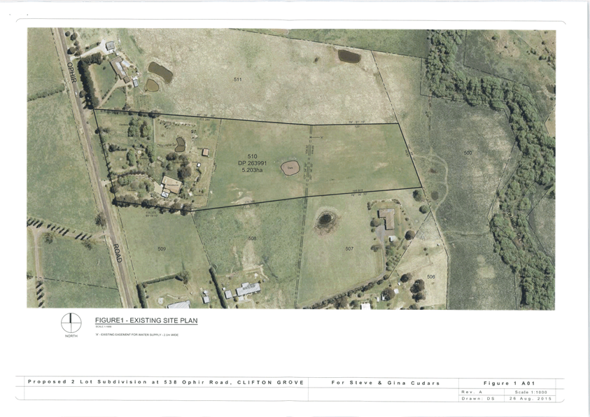
Planning and Development Committee
5 July 2016
2.2 Development
Application DA 287/2015(1) - 538 Ophir Road
Attachment 2 Plans
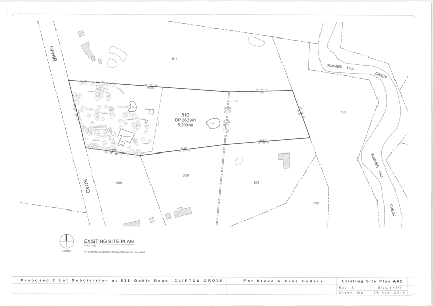
Planning and Development Committee
5 July 2016
2.2 Development
Application DA 287/2015(1) - 538 Ophir Road
Attachment 2 Plans
Planning and Development Committee
5 July 2016
2.2 Development
Application DA 287/2015(1) - 538 Ophir Road
Attachment 2 Plans
Planning and Development Committee
5 July 2016
2.2 Development
Application DA 287/2015(1) - 538 Ophir Road
Attachment 3 Submissions
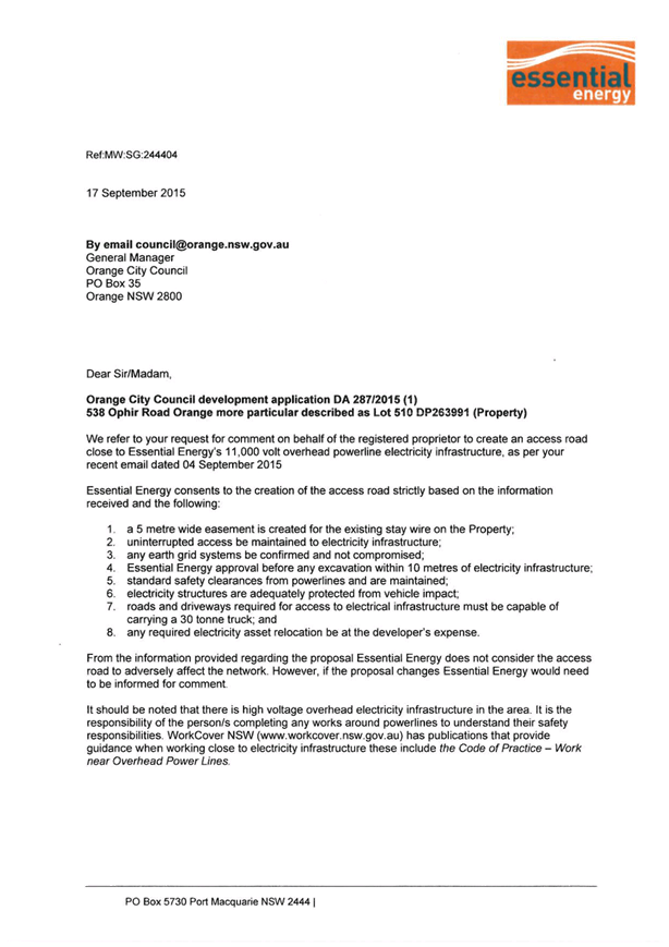

2.3 Development
Application DA 92/2016(1) - 238 and 238A McLachlan Street
TRIM
REFERENCE: 2016/1380
AUTHOR: Michael
Glenn, Senior Planner
EXECUTIVE Summary
|
Application
lodged
|
17 March
2016
|
|
Applicant/s
|
Fast
Track Property Investment
|
|
Owner/s
|
Mr D A
Sills
|
|
Land
description
|
Lots 100
and 101 DP 1218969 - 238 and 238A McLachlan Street, Orange
|
|
Proposed
land use
|
Multi
Dwelling Housing (three dwellings) and Subdivision (three lot strata)
|
|
Value of
proposed development
|
$420,000
|
Council's consent is sought for the erection of a multi
dwelling development consisting of three dwellings and subdivision on Lot 101
at the rear of the site. Stormwater management for the proposed development is
proposed to be undertaken on the adjoining Lot 100, located adjacent to McLachlan
Street.
The proposed development does not comply with the minimum
site area requirements as outlined in Clause 4.1B of the LEP which
requires the site to have a minimum area of 1250m². The subject land to which
the residential unit development relates comprises an area of 1140.2m².
Further, there are amenity impacts arising for both the existing dwelling on
238 McLachlan Street (the effective loss of useable private open space as
the yard will be set aside for the rear site's drainage detention) and also for
the proposed new units on Lot 101 (the issues for the new dwellings being
related to overshadowing, insufficient and poorly positioned private open space
areas. and an overall lack of landscaping on the site.)
The areas of non-compliance relate to both the Development
Control Plan (DCP) and the Local Environmental Plan (LEP). DCP standards may be
varied at the discretion of Council, since a DCP is essentially a Council
policy statement. Seeking a variation from the LEP standard is a more
formal process requiring the submission of a more formal request for variation
under Clause 4.6 of the LEP, that in turn must be set out according to the
planning principles set out in Department of Planning and Land & Environment
Court formal procedures. The applicant has not adequately addressed the Clause
4.6 variation and has not assessed the amenity implications under the DCP in an
adequate fashion.
Despite these obvious shortcomings it is considered that the
basic proposal is able to be approved subject to conditions and the Clause 4.6
variation able to be supported, although not for the reasons set out in the
applicant's submission. The reason that it is considered reasonable to allow a
variation in this case relates to the proximity of the site to the CBD,
along with the similarly scaled developments in the locality.
Link To Delivery/OPerational Plan
The recommendation in this report relates to the
Delivery/Operational Plan strategy “13.4 Our Environment
– Monitor and enforce regulations relating to City amenity”.
Financial Implications
Council has been advised that as a council included in the
NSW Government’s merger proposals under consideration by the Office of
Local Government since referral on 6 January 2016, Council must comply with the
merger proposal period guidelines issued under S23A of the Local Government Act
1993.
The guidelines instruct Council it should expend money in
accordance with the detailed budget adopted for the purposes of implementing
the Delivery/Operational Plan for the 2015/16 year.
Any expenditure outside the adopted budget requires the
identification of clear and compelling grounds and must be approved by Council
at a meeting that is open to the public. The guidelines indicate the resolution
of Council for increased expenditure must specify the reasons why the
expenditure is required and warranted.
If increased expenditure is greater than $250,000 or 1% of
the Council’s revenue from rates in
the preceding year, whichever is the greater, Council
is required to exhibit the increase to the budget and consider comments
received.
Council must also avoid entering into contracts or
undertakings where expenditure or revenue is greater than $250,000 or 1% of the
Council’s revenue from rates in the
preceding year, whichever is the greater, unless the contract or undertaking is
as a result of a decision or procurement process commenced prior to the merger
proposal period or where entering into a contract or undertaking is reasonably
necessary for the purposes of meeting the ongoing service delivery commitments
of the Council or was previously approved in the Council’s
Delivery/Operational Plan.
Policy and Governance Implications
Nil
|
Recommendation
That Council consents to development application DA 92/2016(1)
for Multi Dwelling Housing (three dwellings) and Subdivision (three lot
strata) at Lots 100 and 101 DP 1218969 - 238 and 238A
McLachlan Street, Orange pursuant to the conditions of consent in the
attached Notice of Approval.
|
further considerations
Consideration has been given to the
recommendation’s impact on Council’s service delivery; image and
reputation; political; environmental; health and safety; employees;
stakeholders and project management; and no further implications or risks have
been identified.
SUPPORTING INFORMATION
THE APPLICATION
Council's consent is sought for multi dwelling housing
(three dwellings) and subdivision (three lot strata) at Lots 100 and 101 DP
1218969 - 238 and 238A McLachlan Street, Orange.
THE PROPOSAL
The proposal involves the construction of three units on the
site, consisting of 2 x two bedroom units and a 1 x three bedroom unit. Each of
the proposed units would be a freestanding dwelling with separately delineated
open space and parking for each of the units. The proposed units are single
storey.
MATTERS FOR CONSIDERATION
Section 5A Assessment
In the administration of sections 78A, 79B, 79C, 111 and
112, the provisions of Section 5A must be taken into account for every
development application, in deciding whether there is likely to be a
significant effect on threatened species, populations or ecological communities
or their habitats. This section includes a requirement to consider any adopted
assessment guidelines, which means assessment guidelines issued and in force
under section 94A of the Threatened Species Conservation Act 1995.
Assessment guidelines are in force (see DECC-W “Threatened Species
Assessment Guidelines - The Assessment of Significance”) which requires
consent authority to adopt the precautionary principle in its assessment.
In this instance, site inspection reveals that the subject
property has no biodiversity or habitat value.
Section 79C
Section 79C of the Environmental Planning and Assessment
Act 1979 requires Council to consider various matters, of which those
pertaining to the application are listed below.
PROVISIONS OF ANY ENVIRONMENTAL
PLANNING INSTRUMENT s79C(1)(a)(i)
Orange Local Environmental Plan 2011
Part 1 - Preliminary
Clause 1.2 - Aims of Plan
The broad aims of the LEP are
set out under subclause 2. Those relevant to the application are as follows:
(a) to encourage development which complements
and enhances the unique character of Orange as a major regional centre boasting
a diverse economy and offering an attractive regional lifestyle,
(b) to provide for a range of development
opportunities that contribute to the social, economic and environmental
resources of Orange in a way that allows present and future generations to meet
their needs by implementing the principles for ecologically sustainable
development,
(c) to conserve and enhance the water
resources on which Orange depends, particularly water supply catchments,
(e) to provide a range of housing choices in
planned urban and rural locations to meet population growth,
The application is not inconsistent with the relevant aims.
Clause 1.6 - Consent Authority
This Clause establishes that, subject to the Act, Council is
the consent authority for applications made under the LEP.
Clause 1.9A - Suspension of
Covenants, Agreements and Instruments
This Clause provides that covenants, agreements and other
instruments which seek to restrict the carrying out of development do not apply
with the following exceptions.
· covenants imposed
or required by Council
· prescribed
instruments under Section 183A of the Crown Lands Act 1989
· any conservation
agreement under the National Parks and Wildlife Act 1974
· any trust
agreement under the Nature Conservation Trust Act 2001
· any property
vegetation plan under the Native Vegetation Act 2003
· any biobanking
agreement under Part 7A of the Threatened Species Conservation Act 1995
· any planning
agreement under Division 6 of Part 4 of the Environmental Planning and
Assessment Act 1979.
There are easements for sewer and water supply in which
Council is a named benefitting party. There are no direct impacts on those
restrictions to user as a result of this proposed development.
Mapping
The subject site is identified
on the LEP maps in the following manner:
|
Land Zoning Map:
|
Land zoned R1 General Residential
|
|
Lot Size Map:
|
No Minimum Lot Size
|
|
Heritage Map:
|
Not a heritage item or conservation
area
|
|
Height of Buildings Map:
|
No building height limit
|
|
Floor Space Ratio Map:
|
No floor space limit
|
|
Terrestrial Biodiversity Map:
|
No biodiversity sensitivity on the
site
|
|
Groundwater Vulnerability Map:
|
Not ground water vulnerable
|
|
Drinking Water Catchment Map:
|
Not within the drinking water
catchment
|
|
Watercourse Map:
|
Not within or affecting a defined
watercourse
|
|
Urban Release Area Map:
|
Not within an urban release area
|
|
Obstacle Limitation Surface Map:
|
No restriction on building siting
or construction
|
|
Additional Permitted Uses Map:
|
No additional permitted use applies
|
Those matters that are of relevance are addressed in detail
in the body of this report.
Part 2 -
Permitted or Prohibited Development
Land Use Zones
The subject site is located within the R1 General
Residential zone. The proposed development is defined as "multi dwelling
housing" under OLEP 2011.
Pursuant to the dictionary contain within OLEP 2011 multi
dwelling housing means:
3 or more dwellings (whether attached or detached) on one lot of land,
each with access at ground level, but does not include a residential flat
building.
Note. Multi
dwelling housing is a type of residential accommodation—see the
definition of that term in this Dictionary.
Multi dwelling housing is
permissible with consent in the R1 General Residential zone with the consent of
Council. However, Clause 4.1(B) has minimum area requirements that this
development does not meet for this site. The applicant has submitted a request
for a variation to this LEP requirement pursuant to Clause 4.6 of the LEP.
Clause 2.3 of LEP 2011
references the Land Use Table and Objectives for each zone in LEP 2011.
These objectives for land zoned R1 General Residential are as follows:
1 - Objectives of the R1
General Residential Zone
· To
provide for the housing needs of the community.
· To
provide for a variety of housing types and densities.
· To
enable other land uses that provide facilities or services to meet the day to
day needs of residents.
· To
ensure development is ordered in such a way as to maximise public transport
patronage and encourage walking and cycling in close proximity to settlement.
· To
ensure that development along the Southern Link Road has an alternative access.
In relation to the first
objective, the proposed development would act to provide additional housing
stock within the City. In relation to the second objective, the proposed
dwellings will provide a variation of housing type and density for the City. In
relation to the third objective, the proposed development has no effect. In
relation to the fourth objective, the subject site is within close proximity to
routes used by public transport and is also in close proximity to shops and
services. In relation to the last objective, the proposed development has no
effect.
The proposed development is not
inconsistent with the objectives of the zone.
Clause 2.6 - Subdivision -
Consent Requirements
The applicant is seeking consent for subdivision in
accordance with this Clause.
Part 4 -
Principal Development Standards
Clause 4.1B - Minimum Lot
Sizes for Dual Occupancy, Multi Dwelling Housing and Residential Flat Buildings
This Clause establishes the
minimum lot size required for dual occupancies and multi dwelling housing in
the R1, R2 and R3 zones. The proposed multi dwelling housing project is
situated on land within the R1 General Residential zone that is not identified
on the Minimum Lot Size Map. Accordingly, this clause requires the site to have
a minimum area of 1,250m2.
The area of the subject land is
1140.2m2, which does not meet the requirements of the clause. A
request to allow a variation to this development standard as is permitted under
Clause 4.6 of the LEP has been submitted.
Clause 4.6
- Exceptions to Development Standards
This Clause is applicable as the
multi dwelling housing component of the proposed development would be located
on an allotment that is smaller than the required minimum size.
Clause 4.1B sets out minimum lot size requirements for multi dwelling housing
development, which relevantly states:
Development consent may be granted to development on a lot in a
zone shown in Column 2 of the Table to this Clause for a purpose shown in
Column 1 of the Table opposite that zone, if the area of the lot is equal to or
greater than the area specified for that purpose and shown in Column 3 of the
Table.
The table then specifies a
minimum allotment size of 1250m2, which the medium density housing
component of this development does not meet. It is noted that the total area of
the two lots nominated in the application do add up to an area greater than the
specified minimum but there is no "lot" with the required area to
satisfy the clause; and the applicant does not propose under this application
to rectify that problem via a consolidation or boundary adjustment with Lot 100
(on which the drainage component of the development is to be located). It is
open for Council to require such adjustments to boundaries if it considers it
appropriate. However for the reasons outlined below in the assessment of
stormwater drainage issues a boundary adjustment to accommodate drainage wholly
within the actual development site is not supported in this case given the
amenity impacts upon the existing dwelling.
Notwithstanding the above it should
be noted that the subdivision that created Lots 100 and 101 is of relatively
recent creation, in which easements to allow the discharge of drainage onto
Lot 100 from Lot 101 are permitted (and preserved by way of a Section
88b Restriction-as-to-User). This is not considered ideal as a solution to the
drainage issue, as effectively that part of Lot 100, which is supposed to
provide a private open space area for the existing front dwelling, will not be
able to effectively meet that function.
To address the shortfall in lot
size, the applicant has lodged a request for variation to this standard under
the provisions of Clause 4.6 of the LEP. Clause 4.6 has, in many respects,
replaced the older State Environmental Planning Policy One (SEPP 1) objections
to development standards, and allows Council the ability to permit such
variations on a limited basis where exceptional circumstances can be shown to
exist or apply to a given site.
There are set procedures
outlined in guidelines published by the NSW Department of Planning encapsulated
in a circular published in 2008, and quite strongly supported and upheld in the
Land & Environment Court. For obvious reasons the Department advise all
Councils to allow variations only where exceptional circumstances exist and
where certain other criteria can be shown be achieved. The applicant’s
submission submitted with the application generally does not achieve those
outcomes and the procedures outlined in the Department’s circulars; and
the principals established by the Courts are not even mentioned and certainly
not followed in the applicant's submission.
The submission is considered
unsatisfactory because it fails to observe recommended procedures and at its
core seeks to establish that the standard across the LGA is unreasonable and
unnecessary. This is an approach specifically not recommended by the Department
of Planning. It has obvious threats to the authority and validity of the LEP,
and should Council approve the application, it should be on the basis of
reasoning other than what is outlined in the consultant's report. It is
acknowledged at this point that Council could validly refuse, or seek amendment
of the application, simply on the shortcomings of the supporting information
submitted with the application. These elements of the proposed development as
submitted provide Council with grounds for refusal if it so chooses.
However, it is considered that
notwithstanding these serious shortcomings in the consultant's report, the
basic proposal does have merit; and grounds to support the variation can be
found without effectively tearing up the LEP. If Council is of a mind to
approve the variation to the development standard, it should not do so on the
basis of endorsing the applicant's submission if it wants to retain the
integrity and authority of the LEP.
The extent of the variation
being sought, known as an "exception to the standards" contained in
Clause 4.1b, is seeking an 8.7% variation.
The objectives of
Clause 4.6 are as follows:
(a) to provide an appropriate
degree of flexibility in applying certain development standards to particular
development,
(b) to achieve better outcomes
for and from development by allowing flexibility in particular circumstances
Council must take into account
these objectives.
There is no issue with respect
to (a), but with respect to (b) it is important for Council to be able to show
in its thinking that a particular and special case or circumstance exists to
allow the variation. The applicant’s Statement of Environmental Effects
is deficient in this respect in that it fails to effectively draw out the
unique circumstances that may apply with respect allowing the variation.
The NSW Department of Planning
and Environment have planning circulars that set out criteria that are
recommended for Clause 4.6 variation matters. The circulars have been generally
applied in the Land & Environment Court. For proponents the circulars
require that proponents establish the following:
Matters to
Address in an Application
When applicants lodge
development applications and associated requests to vary a development
standard, they must give grounds of objection to the development standard.
Variation of a development standard may be justified where it is consistent
with the objectives that the relevant environmental planning instrument is
attempting to achieve.
The application must address:
(i) whether strict compliance with the
standard, in the particular case, would be unreasonable or unnecessary and why,
and;
(ii) demonstrate that there are sufficient
environmental planning grounds to justify contravening the development standard
The Statement of Environmental
Effects falls well short of reaching the minimum expectations of the
guidelines. It argues that the proposed development fully complies with
the DCP, and hence it is not necessary to insist on full compliance with
the development standard in terms of achieving minimum amenity standards. The
submission made in conjunction with the application is built around some questionable
assertions, mostly stating that the minimum lot size provisions are
counter-productive to the economic use of the site.
Written applications to vary
development standards need to not only address the above matters but may also
address matters set out in the ‘five part test’ established by the
NSW Land and Environment Court. The NSW Department of Planning strongly
advises councils to apply the Five Part Test in their assessments of Clause 4.6
matters.
The Five
Part Test
The Five Part Test is rooted in
Land and Environment Court Planning Principles. The Department of Planning
recommend that consent authorities to apply the test in their assessment of
Clause 4.6 variations. The five part test embodies the following:
1 the objectives of the
standard are achieved notwithstanding noncompliance with the standard;
2 the underlying objective
or purpose of the standard is not relevant to the development and therefore
compliance is unnecessary;
3 the underlying object or
purpose would be defeated or thwarted if compliance was required and therefore
compliance is unreasonable;
4 the development standard
has been virtually abandoned or destroyed by the council’s own actions in
granting consents departing from the standard and hence compliance with the
standard is unnecessary and unreasonable;
5 the compliance with
development standard is unreasonable or inappropriate due to existing use of
land and current environmental character of the particular parcel of land. That
is, the particular parcel of land should not have been included in the zone.
With regard to point (1), the
stated objectives of Clause 4.1(B) is to:
achieve
planned residential density in certain zones.
Secondarily it should be
inferred from the basic objective that allowable densities are set by
Clause 4.1(B), whilst at the same time requiring standards with respect to
minimum lot size so as to allow the provision of adequate amenity for each of
the proposed units.
Whether "planned
residential densities" are being achieved can be measured in a surrogate
fashion by considering the DCP development standards relevant to the
development, and the general densities and patterns of development that exist
in the locality (ie is the scale and form of development about the same as
those that prevail within the locality).
If the development meets, or
substantially meets the DCP performance standards and the general density of
development is more or less the same as that contained in the proposal, it can
be argued that full compliance with the density controls of Clause 4.1(B)
is not required for that special case. In this case, there are some departures
from the DCP assessment criteria, but there is a significant similarity
between the proposed development and the general scale and form of other nearby
and surrounding medium density development.
With regard to point (2), it is
considered that the underlying purpose of the standard for which variation is
being sought is relevant to the development. Minimum lot size requirements are
a blunt assessment tool aimed at achieving good design outcomes whilst at the
same time making efficient use of the land at densities likely to achieve a
reasonable return for the development; and at the same time ensuring
neighbourhood character and amenity is not excessively compromised. The applicant
has argued in his submission that the standard is unreasonable and unreasonably
impedes the economic and efficient use of land as a resource. This is
effectively an attack on the purpose of the clause itself, and as an argument
garnered to try and enlist support for the development, is considered a totally
untenable position to take. It is in effect an attack on that part of the LEP
in its entirety, which is specifically to be avoided according to the
Department of Planning guidelines.
The applicant's supporting
argument is not considered a valid response in terms of the Department of
Planning's guidelines, and further it is considered that the density clauses
are relevant to the development. It is considered that justification for the
variation can be found in the proximity of the site to the CBD. Further, the
overall density of development is comparable to other medium density
developments in the locality, which generally are on similar sized blocks to
the subject property, and in many instances incorporate scales of development
very similar to that contained in this proposal.
With regard to point (3), it is
considered that the underlying purpose of Clause 4.1(B) can be achieved either
with the minor non-compliance contained in the proposed development as now
configured, or if the development were made to fully comply.
With regard to point (4),
Council has not demonstrated a general abandonment of this clause in its
previous decisions for medium density development under OLEP 2011. There
are medium density developments in the vicinity that would not now meet the
minimum lot size requirements of the LEP if they were new developments.
However, these earlier developments were not approved under the current LEP.
They do not establish a precedent with respect to the LEP, but they do
establish a precedent regarding development patterns within the locality.
It is considered that Council
can approve the development, but not on the basis of the proponent’s
submission. It must be satisfied that the form and scale of development is
appropriate to the area notwithstanding the non-compliance to the numerical
standard, and that special circumstances exist for this site to support such a
variation.
It is considered that the
proposed development is similar in form and density to other nearby and
surrounding medium density developments, and that the proximity to the CBD does
allow, or suggest, that support for medium density development close to town is
appropriate.
With regard to point (5),
because of the scale and densities evident in other similar development and the
proximity of the site to the CBD, together with generally satisfactory outcomes
in terms of amenity and character (although not fully compliant with
the DCP as is suggested in the applicant’s submission) it is
considered that an insistence on full compliance with Clause 4.1B for this site
is not reasonable, and that it is unnecessary to require full compliance to the
standard in this case.
Clause 4.6 establishes the
process by which development standards may, in exceptional circumstances, be
varied. Before granting a variation under this clause Council must consider a
written request from the applicant that seeks to justify the contravention of
the development standard by demonstrating:
· that
compliance with the development standard is unreasonable or unnecessary in the
circumstances of the case, and
· that
there are sufficient environmental planning grounds to justify contravening the
development standard.
As indicated above, the written
statement submitted with the application falls well short of those criteria and
Council is advised not to rely on the submission as it would be contrary to
elements of the Department’s five part test to do so and weakens the
ability to apply the clause for future similar applications should Council
begin to receive similar requests for variation in the future. However, the
plans themselves also form a manifest part of the proposed development, and
suggest a development consistent with surrounding development scales and densities.
By relying solely on the plans and the comments contained in this report, and
excluding the positions taken in the written Statement of Environmental
Effects, Council can reach appropriate conclusions and support approval without
excessive damage to the validity of Clause 4.1(B).
Council may grant consent only
if the concurrence of the Director General of the Department of Planning and
Infrastructure has been obtained and Council is satisfied that
· the
written request has adequately addressed the above, and
· the
proposed development will be in the public interest because of:
- consistency with
the objectives of the particular standard, and
- consistency with
the objectives of the zone applying to the site.
The written request does not
adequately address the variation criteria of the clause for reasons previously
discussed. At the heart of the criticism of the written submission is that it
is essentially a full assault on the validity and sensibilities of Clause
4.1(B) and fails to adequately point out special circumstances that may apply
to the subject property. The applicant was, from an early stage in the process,
requested to address this serious shortcoming in the submission but has elected
not to do so.
The erroneous written assessment
is a serious weakness in the submission, but does not work to automatically
require Council's refusal as Council is only required under Clause 4.6 to consider
the submission. It is, however, a reasonable approach for Council to consider
refusal of the application should the Council be of the view that the variation
to the development standard and the reasons outlined in this report were
unacceptable.
Council may still consider
approval provided it can, by its own assessment, be satisfied that special
circumstances exist for this site. This approach is the recommended outcome of
this report. It should be viewed as an amber light approval (Council should
proceed very cautiously in its determination) but as a process it is considered
to be valid.
Circular B1 as updated 9 May
2008 gives Council the assumed concurrence of the Director. This was recently
confirmed by Senior Planner Nita Scott from the Department of Planning Western
Region Office:
your SI
LEP automatically gives you the ability to vary the development standard (after
consideration etc), with the ‘rural’ and
‘environmental’ exceptions to this spelt out in 4.6.6.
Council does have quarterly
reporting obligations as to the number of times it has used Clause 4.6 and
for what purposes. The department wants to keep check on the over use of
Clause 4.6 to discourage inappropriate use of the clause.
There are some circumstances
where Clause 4.6 is prohibited from being used, but this particular situation
is not one of those circumstances.
The land is located within the
R1 zone, which has the following objectives:
· To provide for the housing needs of the community.
· To provide for a variety of housing types and densities.
· To enable other land uses that provide facilities or services to meet
the day to day needs of residents.
· To ensure development is ordered in such a way as to maximise public
transport patronage and encourage walking and cycling in close proximity to
settlement.
· To ensure that development along the Southern Link Road has an
alternative access.
The proposed development with
its non-compliance to Clause 4.1(B) is not contrary to any of the objectives
for the zone; although the non-compliance with certain planning outcomes of the
DCP marginalises conformity to the first two objectives. Conversely, the
relative proximity to the CBD reinforces the fourth dot point objective.
Overall it is considered that the proposed development has a neutral or
slightly harmful effect with respect to achieving the objectives of the zone,
although such negative impacts could not be considered significant in their
effect.
It is considered in an overall
and general sense that the proposal, including the variation sought, is consistent
with the above objectives.
Part 5 -
Miscellaneous Provisions
5.9 - Preservation of Trees or Vegetation
The application states that
there are no significant trees on the site, which is not corroborated by site
inspection. There are, in fact, trees on the site, including one tree covered
by this clause of the LEP. The tree is a eucalypt estimated to be
12-14m high located at the rear of the site.

Figure 1: significant tree on the site requiring
consent to remove
The issue of this tree was referred to Council's Manager
City Presentation for comment with respect to its proposed removal.
I have inspected 238 McLachlan
Street in relation to the scanned copies of plans provided below in your email.
The proposed development will impact upon the Eucalyptus tree on the eastern
boundary, plus two Lombardy Poplars on the southern boundary and within the
subject property, plus a Pinus radiata (Monterey Pine – Plantation pine
tree) located upon 236 McLachlan Street.
Should there be a desire to
retain the Eucalyptus tree (Eucalyptus viminalis) located on the subject
property no construction works/earth works shall be undertaken within the
Structural Root Zone, an area in radius from the centre of the trunk of 3.65
metres as a minimum; the TPZ is in the order of 7.7 metres. The subject tree is
not deemed to be a significant specimen or one of sound health and structure.
The specimen exhibits codominance leaders at the first and second branch
junctions. Codominant branch structure has a higher than normal tendency for branch
failure to occur. Staining of the bark is evident at the second codominance, an
indication that the branch junction is affected by trauma. The subject tree is
not of normal form and shape for the species and as such I would not
recommended its retention.
There is no issue with the
removal of the Lombardy Poplars, as these trees are inappropriate for a smaller
urban land holding due to suckering growth amongst other aspects.
Protection of the vegetation on neighbouring
properties requires consideration; at this subject site the main tree likely to
be impacted by the proposal is a Monterey Pine (Pinus radiata) located
approximately 58 metres from the McLachlan Street front boundary and close to
the common shared boundary between #238 and #236 and located wholly within the
property #236. The tree is located some 2 metres (to centre of trunk) from the
property boundary and has a SRZ of 3.4 and a TPZ of 8.4metres radius.
Figure 2: Pinus Radiata on adjoining property
likely to be affected by proposed development
To reduce the impact of the
proposed development on vegetation on adjoining properties, no built
infrastructure, including excavation, trenching for services or the like shall
occur within 1.5 metres of the southern property boundary.
It is considered that insufficient justification exists for
the retention of the E Viminalis on the site due to its poor structure and
evidence of structural weaknesses. It is agreed that the Poplars on the site
are not worth retaining either.
With regard to the Pinus Radiata, the form of the
development is such that it is not possible to avoid building activity within
the root zone of the tree in question. The following condition is
included in the consent for the protection of this tree for the neighbour:
"Protection of the Pinus Radiata (Monterey Pine)
on the southern property adjoining (236 McLachlan Street) is required. The
tree is located some 2 metres (to centre of trunk) from the property boundary.
The tree has an estimated Structural Root Zone (SRZ) of 3.4 and a Tree
Protection Zone (TPZ) of 8.4 metres radius.
To maximise the survival and ongoing health of this tree,
all works constituting built infrastructure, including excavation, trenching
for services or the like that occur within 1.5 metres of the southern property
boundary shall, prior to any work being approved (in a Construction
Certificate) be submitted with a report from a qualified arborist
outlining the management measures to be taken for construction within that
zone. The arborists report shall unequivocally certify that the tree to
be protected will be retained and will not suffer any adverse effects to its
health as a result of the work to be carried out.
All work within the 1.5m buffer shall be carried out
strictly in accordance with AS 4970-2009 (Protection of Trees on Development
Sites). Should any roots greater than 50mm diameter be encountered, all work
with machinery is to cease whilst the roots are pruned in accordance with
Australian Standard 4373-2007".
Part 7 -
Additional Local Provisions
7.2 - Flood Planning
This clause applies to land
identified on the Flood Planning Map as a Flood Planning Area, but is not
applicable to the subject site as the land is outside designated flood areas.
7.3 -
Stormwater Management
This clause applies to all
industrial, commercial and residential zones and requires that Council be
satisfied that the proposal:
(a) is designed to maximise the use of water
permeable surfaces on the land having regard to the soil characteristics
affecting onsite infiltration of water
(b) includes, where practical, onsite
stormwater retention for use as an alternative supply to mains water,
groundwater or river water; and
(c) avoids any significant impacts of
stormwater runoff on adjoining downstream properties, native bushland and
receiving waters, or if that impact cannot be reasonably avoided, minimises and
mitigates the impact.
The proposal has been designed to include permeable surfaces
and includes onsite retention of stormwater to be undertaken principally from
Lot 100 at the rear of that site. Restrictions-as-to-User are in place that
burden Lot 100 and benefit Lot 101 for the purposes of stormwater management.
Whilst there is no fundamental objection to the provision of stormwater
drainage pipes and the like through this easement to support the development,
the provision of a more formal detention basin in this locality has the
potential to significantly affect the amenity of the existing dwelling on that
lot.
The design of a detention basin within Lot 100 (the front
dwelling) for the development on Lot 101 would generate the need for a
raft of conditions from Council’s Technical Services Division that would
effectively eliminate the private open space for the existing dwelling and have
a significant adverse impact on its amenity. The conditions that would need to
be included relate to fencing off of the detention area, hard engineering the
basin and conditions that would severely restrict the use of this area as
passive open space. Council’s Technical Services Division advises that
there is no physical constraint that would prevent detention systems being
designed wholly within Lot 101, probably taking the form of a basin within the
driveway.
To this end, in order to protect the amenity of the existing
dwelling and eliminate future maintenance issues with a detention system on a
separate piece of land, it is recommended that Council supports the development
subject to a condition of development consent which requires stormwater
retention to be provided wholly within Lot 101.
7.6 -
Groundwater Vulnerability
This Clause seeks to protect
hydrological functions of groundwater systems and protect resources from both
depletion and contamination. Orange has a high water table and large areas of
the LGA, including the subject site, are identified with “Groundwater
Vulnerability” on the Groundwater Vulnerability Map. This requires that
Council consider:
(a) whether or not the development (including
any onsite storage or disposal of solid or liquid waste and chemicals) is
likely to cause any groundwater contamination or have any adverse effect on
groundwater dependent ecosystems, and
(b) the cumulative impact (including the
impact on nearby groundwater extraction for potable water supply or stock water
supply) of the development and any other existing development on groundwater.
Furthermore consent may not be granted unless Council is satisfied that:
(a) the development is designed, sited and
will be managed to avoid any significant adverse environmental impact, or
(b) if that impact cannot be reasonably
avoided - the development is designed, sited and will be managed to minimise
that impact,
(c) if that impact cannot be minimised - the
development will be managed to mitigate that impact.
The proposal is not anticipated
to involve the discharge of toxic or noxious substances and is therefore
unlikely to contaminate the groundwater or related ecosystems. The proposal
does not involve extraction of groundwater and will therefore not contribute to
groundwater depletion. The design and siting of the proposal avoids impacts on
groundwater and is therefore considered acceptable.
STATE ENVIRONMENTAL PLANNING
POLICIES
State Environmental Planning Policy 55 - Remediation of
Land applies to the subject development. SEPP 55 states that a consent
authority must not consent to the carrying out of any development unless:
(a) it has considered whether the land is
contaminated, and
(b) if the land is contaminated, it is
satisfied that the land is suitable in its contaminated state (or will be
suitable, after remediation) for the purpose for which the development is
proposed to be carried out, and
(c) if the land requires remediation to be made
suitable for the purpose for which the development is proposed to be carried
out, it is satisfied that the land will be remediated before the land is used
for that purpose.
The site is not known to be contaminated, and a search of
Council records demonstrates that there are no previous known uses of the site
which may have caused contamination. As such, no further enquiry is warranted.
PROVISIONS OF ANY DRAFT
ENVIRONMENTAL PLANNING INSTRUMENT THAT HAS BEEN PLACED ON EXHIBITION
s79C(1)(a)(ii)
There are no draft environmental planning instruments that
apply to the subject land or proposed development.
DESIGNATED DEVELOPMENT
The proposed development is not designated development.
PROVISIONS OF ANY DEVELOPMENT
CONTROL PLAN s79C(1)(a)(iii)
Development Control Plan 2004
Orange Development Control Plan 2004 is applicable to the
proposed development.
Pursuant to Planning Outcome 0.2-1 Interim Planning Outcomes
– Conversion of Zones:
· Throughout this
Plan, any reference to a zone in Orange LEP 2000 is to be taken to be a
reference to the corresponding zone(s) in the zone conversion table.
The corresponding zone to zone 2(a) Urban Residential
(Orange LEP 2000) is zone R1 General Residential (Orange LEP 2011). As
such, Orange DCP 2004-07 - Development in Residential Areas is relevant
to this proposal. The provisions of Part 7 are considered below.
PART 7.2 - SUBDIVISION
There is a single element to the proposed subdivision, being
a Strata to create three lots, one for each of the proposed units, plus a
common property lot for the driveways and other common property elements.
The subdivision is effectively the second stage of the
overall development, intended to follow once the construction of the units is
complete.
There are no issues arising from the proposed subdivision.
PART 7.7 - DESIGN ELEMENTS FOR
RESIDENTIAL DEVELOPMENT STREETSCAPE
Neighbourhood Character
The DCP sets the following Planning Outcomes in regard to
Neighbourhood Character:
· Site layout and
building design enables the:
- creation
of attractive residential environments with clear character and identity
- use
of site features such as views, aspect, existing vegetation and landmarks
· Buildings are
designed to complement the relevant features and built form that are identified
as part of the desired neighbourhood character.
· The streetscape
is designed to encourage pedestrian access and use.
The DCP requires that buildings are
designed in a fashion that complements the relevant features and built form
that are identified as part of the desired neighbourhood character. The
proposed development comprises two detached dwellings at the frontage, each
single storey with an identifiable entry and garaging set behind the principal
building line. General form and massing of these dwellings is considered to be
similar to those that already exist in the street.
The residential units are generally smaller
scale units, but of traditional forms and single storey heights. The buildings
are adequately spaced so that building bulk will tend to be satisfactory by
allowing glimpses past the buildings and adequate spacing between each of the
dwellings.
The general form and character of the
street is as single storey detached housing, using a plethora of styles and
finishes.
It is
considered that the proposed development is compatible to the general
neighbourhood character of the locality. The character of the
neighbourhood is defined by detached dwellings that are orientated to the
street on the eastern side of McLachlan Street, and vacant Industrial land on
the western side.
Figure 3: typical development for the surrounding residential
area
There are some other examples of medium density housing
development, the most notable being at 228 McLachlan Street located to the
south of the subject property and shown below:
Figure 4: similar development at 228 McLachlan Street
Front yards are landscaped and
external finishes include face brick, and painted and clad walls. The finishes
of the units are considered appropriate in this neighbourhood. The function of
the neighbourhood will not be unreasonably affected by the development. Infill
residential development is an acceptable component of established residential
areas.
The proposed dwellings located at the rear will not have a
streetscape presence in that they will not be significantly visible from the
street. Nevertheless, the building design and detailing for these dwellings
relate to the bulk, scale and finishes of adjoining established dwellings. The
proposed buildings will not have an adverse impact upon the neighbourhood
character.
Building
Appearance
The DCP sets the following Planning Outcomes in regard to
Building Appearance:
· The building
design, detailing and finishes relate to the desired neighbourhood character,
complement the residential scale of the area, and add visual interest to the
street.
· The frontages
of buildings and their entries face the street.
· Garages and car
parks are sited and designed so that they do not dominate the street frontage.
The external finishes of the proposed dwellings are
considered appropriate in this neighbourhood. The single storey dwelling
character is consistent with the surrounding low scale development, with brick
facades, standard hipped roofs, and simple articulation and variation in
building materials. Whilst the buildings will be of a modern appearance, this
is considered acceptable for modern infill development within the surrounding
area. The proposed dwellings all have clear entrances/openings to the internal
driveway, including a front door and dining room window for surveillance. The
Landscape Concept Plan provides areas for some minor landscaping, although this
in no way replaces the vegetation to be removed. Landscaping will be further
addressed below.
Setbacks
The DCP sets the following Planning Outcomes in regard to
Setbacks:
· Street setbacks
contribute to the desired neighbourhood character, assist with the integration
of new development and make efficient use of the site.
· Street setbacks
create an appropriate scale for the street considering all other streetscape
components.
The subject land comprises a rectilinear
shaped development block. The site has been substantially cleared. The proposed
location of the dwelling houses when viewed from McLachlan Street will present
differently from existing surrounding development, but in an acceptable way. No
significant changes to setbacks are proposed.
Fences and
Walls
The DCP sets the following Planning Outcomes in regard to
Fences and Walls:
· Assist in
highlighting entrances and creating a sense of identity within the streetscape.
· Are constructed
of materials compatible with associated housing and with fences visible from
the sites that positively contribute to the streetscape.
The applicant is not proposing front
fencing as part of this application. Fencing around the perimeter will
generally be standard Colorbond fencing. In this case it is considered
appropriate for this style of boundary fencing to be applied.
Visual Bulk
The DCP sets the following Planning Outcome in regard to
Visual Bulk:
· Built form
accords with the desired neighbourhood character of the area with:
- side
and rear setbacks progressively increased to reduce bulk and overshadowing
- site
coverage that retains the relatively low density landscaped character of
residential areas
- building
form and siting that relates to landform, with minimal land shaping (cut and
fill)
- building
height at the street frontage that maintains a comparable scale with the
predominant adjacent development form
- building
to the boundary where appropriate.
The proposed development complies with the
visual bulk provisions
Walls and Boundaries
The DCP sets the following Planning Outcome in regard to
Walls and Boundaries:
· Building to the
boundary is undertaken to provide for efficient use of the site taking into
account:
- the
privacy of neighbouring dwellings and private open space
- the
access to daylight reaching adjoining properties
- the
impact of boundary walls on neighbours.
The proposal does not involve building to the boundary. It
does propose dwellings that are set at the standard 900mm setback. These
arrangements have no significant effect on privacy or overshadowing in
themselves. There are no walls on boundaries. The locations of
the proposed dwellings are consistent with the requirements of the Building
Code of Australia (BCA).
Daylight and
Sunlight, and Required Private Open Space
The DCP sets the following Planning Outcome in regard to
Daylight and Sunlight:
· Buildings are
sited and designed to ensure:
- daylight
to habitable rooms in adjacent dwellings is not significantly reduced
- overshadowing
of neighbouring secluded open spaces or main living area windows is not
significantly increased
- consideration
of Council’s Energy Efficiency Code.
To this must be added an assessment of the
impacts on neighbours’ properties. In this regard the proposed
development has no significant impact.
North-Facing
Windows
With regard to internal access, the DCP
performance standard is that solar access be provided to at least 75% of
north-facing living area windows for a minimum of four hours in midwinter. The
proposed development is compliant with this standard.
Solar Access
for Private Open Space
With regard to solar access to private open
space areas, the specified performance standard is solar access to at least 40%
of the main area of private open space. "Main area" is not well
defined in the DCP; however, it is considered to be taken as 40% of the 5m x 5m
area requirement for private open space.
The proposed development is slightly deficient in the amount
of private open space for Unit 3, and Units 1 and 2 do not comply with
respect to solar access to the main areas of the private open space. The
detailed analysis is set out in the tables below:
Required POS and overshadowing
assessment:
|
|
Unit 1 (81.1 m2)
|
Unit 2 (81.1 m2)
|
Unit 3 (105.3 m2)
|
|
Required POS
|
40.6 m2
|
40.6 m2
|
52.6 m2
|
|
Provided POS
|
52.8 m2
(excludes water tank)
|
52.8 m2
(excludes water tank)
|
51.2 m2
(excludes water tank)
|
|
Does POS comply
|
Yes
|
Yes
|
No
|
|
minimum complying unshaded area (40% of Main area,
main area is the 5m x 5m component)
|
see below
(No)
|
see below
(No)
|
see below
(Yes)
|
|
5m x 5m main area
|
Yes
|
Yes
|
No
must exclude water tank)
|
|
main area directly accessible to living areas
|
No
|
No
|
No
|
|
|
9am
|
10am
|
11 am
|
12am
|
1pm
|
2pm
|
3pm
|
Compliance
|
|
Unit 1
(10m2)
|
7.5 m2
(No)
|
16m2
(Yes)
|
25 m2
(Yes)
|
23 m2
(Yes)
|
12 m2
(Yes)
|
<1 m2
(No)
|
<1 m2
(No)
|
No
|
|
Unit 2
(10m2)
|
8.2 m2
(No)
|
16 m2
(Yes)
|
25 m2
(Yes)
|
23 m2
(Yes)
|
12 m2
(Yes)
|
<1 m2
(No)
|
<1 m2
(No)
|
No
|
|
Unit 3
(10m2)
|
<10 m2
((No)
|
>10 m2
(Yes)
|
>10 m2
(Yes)
|
>10 m2
(Yes)
|
16 m2
(Yes)
|
26 m2
(Yes)
|
13 m2
(Yes)
|
Yes
|
As can be seen from the above
tabular analysis, there are a number of areas of non-compliance with respect to
both private open space and solar access. The private open space has some minor
elements of non-compliance relating to the amounts of open space proposed for
Units 1 and 2, but these areas of non-compliance are relatively minor and not
of great concern. The main area of non-compliance and of more concern is the
shape of the private open space area. The DCP requires the 5m x 5m "main
area" to be directly accessible from the living area of the unit, which
for each of the three units is not the case. This will have the effect of
lessening the functionality of the outdoor private open space of each unit.
In terms of overshadowing, the applicant has produced
overshadowing assessments that show that, overall, the private open space for
each of the units complies. However, the DCP requires that solar access
relate to the "main area” of each open space area, being the
5m x 5m area set up in the DCP. In this respect proposed Units 1 and
2 do not meet the relevant Planning Outcome. The extent of non-compliance for
solar access is small (about 30 minutes per day). Whilst the amount of
sunlight available to the “main area” of private open space is
compromised to a degree by the design there is nonetheless suitable opportunity
for reasonable solar access for future residents within the remainder of the
private areas proposed. It is recommended that Council in this case accepts a
degree of non-compliance.
Views
The DCP states the following in terms of
views
· Building form and design allow for residents from adjacent
properties to share prominent views where possible.
· Views including vistas of heritage items or landmarks, are not
substantially affected by the bulk and scale of new development.
The subject site is not within an important view corridor.
The proposed dwellings will not unreasonably diminish views for other
properties in the vicinity
Visual Privacy
The DCP sets the following Planning Outcome in regard to
Visual Privacy:
· Direct
overlooking of principal living areas and private open spaces of other
dwellings is minimised firstly by:
- building
siting and layout
- location
of windows and balconies
and
secondly by:
- design
of windows or use of screening devices and landscaping.
The proposed development is not likely to
present any issues in relation to visual privacy or overlooking internally or
for neighbours.
Acoustic
Privacy
The DCP sets the following Planning Outcome in regard to
Acoustic Privacy:
· Site layout and
building design:
- protect
habitable rooms from excessively high levels of external noise
- minimise
the entry of external noise to private open space for dwellings close to major
noise sources
- minimise
transmission of sound through a building to affect other dwellings.
The subject site is located within a
residential area and will not be subject to high noise sources. The proposed
development will not have a significant effect on the acoustic privacy of the
locality.
Security
The DCP sets the following Planning Outcomes in regard to
Security:
· The site layout
enhances personal safety and minimises the potential for crime, vandalism and
fear.
· The design of
dwellings enables residents to survey streets, communal areas and approaches to
dwelling entrances.
The siting and design of the dwellings are
appropriate to maintain safety and minimise the potential for crime, vandalism
and fear for residents. Habitable room windows will address the common
property, thereby providing opportunities for natural surveillance. The
proposed landscaping and fencing will not restrict sightlines to public areas
and will delineate communal and private spaces. Internal access to the
dwellings will be available through the garages.
The development is consistent with the
above planning outcomes.
Car Parking
The DCP sets the following Planning Outcomes in regard to
Car Parking:
· Parking
facilities are provided, designed and located to:
- enable the
efficient and convenient use of car spaces and access ways within the site
- reduce the
visual dominance of car parking areas and access ways.
· Car
parking is provided with regard to the:
- the number and
size of proposed dwellings
- requirements of
people with limited mobility or disabilities.
|
DWELLING SIZE OR NUMBER OF BEDROOMS
|
AVERAGE CAR PARKING PER DWELLING
|
|
Small (<75m2) or 1-bedroom unit
|
1.0 spaces per unit
|
|
Medium (75m2 – 110m2) or 2-bedroom unit
|
1.2 spaces per unit
|
|
Large (>110m2) or 3+ -bedroom unit
|
1.5 spaces per unit
|
|
Visitor Parking
|
0.2 spaces per unit
|
The development
comprises one large and two medium dwellings. This generates a parking demand
of 4.5 onsite parking spaces (rounded up to five spaces). The development
provides five spaces in the form of three x single garages and two x visitor
spaces.
Open Space and
Landscaping
The DCP sets the following Planning Outcomes in regard to
Open Space and Landscaping:
· The site layout
provides open space and landscaped areas which:
- contribute
to the character of the development by providing buildings in a landscaped
setting
- provide
for a range of uses and activities including stormwater management
- allow
cost effective management.
· The landscape
design specifies landscape themes consistent with the desired neighbourhood
character; vegetation types and location, paving and lighting provided for
access and security.
· Major existing
trees are retained and protected in a viable condition whenever practicable
through appropriate siting of buildings, access ways and parking areas.
· Paving is
applied sparingly and integrated in the landscape design.
At this point the applicant has a basic
landscape concept plan; however there is adequate open space to allow some
landscaping to be provided.
Despite the site’s obvious area
constraints, the landscape plan suggests that it is possible to provide a level
of softening and improved amenity to the proposed development through effective
landscaping. Careful selection of planting is required and adequate care will
need to be exercised in order for the landscaping to grow and provide effective
relief to the built forms of the development. To this end, the consent includes
a condition requiring the completion of the landscaping in accordance with the
approved plans.
DEVELOPMENT CONTRIBUTIONS PLAN
2015
The development has been assessed pursuant to Orange
Development Contributions Plan 2015. The following table itemises the
contributions payable for the development. A condition is attached to
reflect the following requirements
The payment of $11,367.56 is to
be made to Council in accordance with Section 94 of the Act and the Orange
Development Contributions Plan 2015 (LGA Remainder) towards the provision of
the following public facilities:
|
Open
Space and Recreation
|
@
$1,928.27 x 2 additional medium dwgs
|
3,856.54
|
|
Community
and Cultural
|
@
$388.37 x 2 additional medium dwgs
|
776.74
|
|
Roads
and Cycleways
|
@
$3,022.11 x 2 additional medium dwgs
|
6,044.22
|
|
Stormwater
Drainage
|
@
$180.45 x 2 additional medium dwgs
|
360.90
|
|
Local
Area Facilities
|
Not
applicable
|
---
|
|
Plan Preparation & Administration
|
@
$164.58 x 2 additional medium dwgs
|
329.16
|
|
TOTAL:
|
|
$11,367.56
|
The contribution will be indexed quarterly in accordance
with the Orange Development Contributions Plan 2015 (LGA Remainder).
Section 64 Water and Sewer
Headworks Charges
Section 64 water and sewer headwork charges are also
applicable to the proposal. Such charges are calculated at the time of release
of a Construction Certificate for the proposed development. Attached are draft
conditions requiring the payment of the required contributions prior to the
issue of a Construction Certificate.
PROVISIONS PRESCRIBED BY THE
REGULATIONS s79C(1)(a)(iv)
The development is not inconsistent with the provisions
prescribed by the regulations.
THE LIKELY IMPACTS OF THE
DEVELOPMENT s79C(1)(b)
Traffic Impacts
The capacity of the road network in the vicinity of the site
is sufficient to accommodate additional localised traffic generated by the
development. Council’s Technical Services Division advises that the
proposed driveways will be appropriately sited so as to prevent vehicle
conflicts.
Neighbourhood Amenity
In general, it is considered the proposed development will
not have an excessive or unsatisfactory impact on neighbourhood amenity.
Cumulative Impacts
This locality is a new subdivision with an emerging
contemporary character. Many of the lots in the subdivision have been built
upon, and of these about half have been approved for or are developed for dual
occupancy, multi dwelling residential, or further subdivision. These are all
forms of residential development with higher than anticipated densities
concentrated in a relatively small area. Such proliferation of higher density
development does have a cumulative impact on the nature of the locality, and
not all of that impact can be regarded as beneficial.
THE SUITABILITY OF THE SITE
s79C(1)(c)
The site is considered to be generally suitable for the
proposed development, though it is conceded there are obvious constraints
impacting the site suitability that have previously been identified and
discussed within the report.
ANY SUBMISSIONS MADE IN ACCORDANCE
WITH THE ACT s79C(1)(d)
The proposed development is defined as "advertised
development" under the provisions of the LEP. The application was
advertised for the prescribed period of 14 days and at the end of that period
one submission had been received from the tenant of the front property. A
summary of the issues raised in the submission is provided below.
Property Access
The objection relates to the possible conflicts in the
driveway access for the dwelling the objector occupies on Lot 100. However,
satisfactory cross easements exist to ensure continuing shared access for both
properties.
Stormwater
The tenant strongly objects to this aspect of the proposed
development, correctly pointing out that the use of the rear yard area of Lot
100 as a detention basin will restrict its use as a grassed area of private
open space. Matters in relation to stormwater drainage have been addressed in
the body of this report relating to Stormwater Drainage.
Privacy and Enjoyment of
Property
The objector is concerned that as an occupant of a nearby
rental property, two windows in Unit 1 will affect her privacy. At the
present time there is no fencing, however a condition of consent is included
that will require the provision of fencing around the perimeter of Lot 101.
This will reduce the ability of the development on Lot 101 to cause privacy
issues.
Increased Traffic Flow and
Noise
The objector is concerned that the development if approved
will increase the intrusion of noise into her dwelling. It is considered that
the proposed development is likely to increase noise intrusion, however it is
unlikely to be excessive in terms applicable noise assessment standards.
PUBLIC INTEREST
s79C(1)(e)
The proposed development is considered to be potentially of
some public interest because of the potential risks that approval this
development poses to the dependability of Clause 4.1(B) of the LEP.
Overall however, it is considered that the development would be of minor
interest to the wider public due to the relatively localised nature of
potential impacts. The proposal is inconsistent with the LEP provisions,
however it is considered that grounds do exist to allow a small variation for
this development.
SUMMARY
The proposed development is permissible with the consent of
Council only with recourse to Clause 4.6 Development Standards. The applicant
requests Council to support a variation to the minimum lot size requirements
outlined in Clause 4.1(B) of LEP 2011. This is further complicated by
the form of request for variation contained within the written statement
submitted with the application. Council ought not allow the variation on the
basis of the applicant's written statement if it wishes to complete its
Clause 4.6 assessment in a manner that protects the LEP for future similar
situations; and also undertake its assessment in accordance with Land &
Environment Court principles and in accordance with the Department of Planning
Five Part Test guidelines.
Council is only obligated to consider the written submission
and may also undertake its assessment in accordance with the known locality
characteristics and the form of the development shown on the plans. Whilst the
applicant has placed themselves, and Council, in a position far from
satisfactory, the basic development proposal is considered to be sound, and
able to be approved. The basic problem confronting this assessment is
essentially a legal interpretation of the density provisions, and not any
inherent problem to do with the design.
A section 79C assessment of the development indicates that
the development is acceptable in this instance. Attached is a draft Notice of
Approval outlining a range of conditions considered appropriate to ensure that
the development proceeds in an acceptable manner.
COMMENTS
The requirements of the Environmental Health and Building
Surveyor and the Engineering Development Section are included in the attached
Notice of Approval.
Attachments
1 Notice
of Approval, D16/27073⇩
2 Plans,
D16/27065⇩
3 Submission,
D16/27066⇩
Planning and Development Committee
5 July 2016
2.3 Development
Application DA 92/2016(1) - 238 and 238A McLachlan Street
Attachment 1 Notice
of Approval
|

|
ORANGE
CITY COUNCIL
Development
Application No DA
92/2016(1)
NA16/ Container
PR8204
|
NOTICE OF DETERMINATION
OF A DEVELOPMENT
APPLICATION
issued under the Environmental
Planning and Assessment Act 1979
Section 81(1)
|
Development
Application
|
|
|
Applicant Name:
|
Fast Track
Property Investment
|
|
Applicant Address:
|
C/-
Anthony Daintith Town Planning
PO Box
1975
ORANGE
NSW 2800
|
|
Owner’s Name:
|
Mr D A
Sills
|
|
Land to Be Developed:
|
Lots 100
and 101 DP 1218969 – 238 and 238A McLachlan Street, Orange
|
|
Proposed Development:
|
Multi
Dwelling Housing (three dwellings) and Subdivision (three lot strata)
|
|
|
|
|
Building
Code of Australia
building classification:
|
As
determined by Certifier
|
|
|
|
|
Determination
|
|
|
Made On:
|
5 July
2016
|
|
Determination:
|
CONSENT
GRANTED SUBJECT TO CONDITIONS DESCRIBED BELOW:
|
|
|
|
|
Consent to
Operate From:
|
6 July
2016
|
|
Consent to
Lapse On:
|
6 July
2021
|
Terms of Approval
The reasons for the imposition of
conditions are:
(1) To ensure a quality
urban design for the development which complements the surrounding environment.
(2) To maintain
neighbourhood amenity and character.
(3) To ensure compliance
with relevant statutory requirements.
(4) To provide adequate
public health and safety measures.
(5) Because the development
will require the provision of, or increase the demand for, public amenities and
services.
(6) To ensure the utility
services are available to the site and adequate for the development.
(7) To prevent the proposed
development having a detrimental effect on adjoining land uses.
(8) To minimise the impact
of development on the environment.
Conditions
(1) The
development must be carried out in accordance with:
(a) Plans
numbered Plans by Anthony Daintith Town Planning (ADTP) referenced 2015-052DA
dated 11.08.2015, sheets 2-7 (inclusive) (6 sheets)
(b) statements
of environmental effects or other similar associated documents that form part
of the approval
as amended
in accordance with any conditions of this consent.
(2) All building work must
be carried out in accordance with the provisions of the Building Code of
Australia.
(3) A sign is to be erected
in a prominent position on any site on which building work, subdivision work or
demolition work is being carried out:
(a) showing
the name, address and telephone number of the principal certifying authority
for the work, and
(b) showing
the name of the principal contractor (if any) for any building work and a
telephone number on which that person may be contacted outside working hours,
and
(c) stating
that unauthorised entry to the site is prohibited.
Any such sign is to be maintained while the
building work, subdivision work or demolition work is being carried out.
(4) In the case
of residential building work for which the Home Building Act 1989
requires there to be a contract of insurance in force in accordance with Part 6
of the Act, evidence that such a contract of insurance is in force is to be
provided to the Principal Certifying Authority before any building work
authorised to be carried out by the consent commences.
(5) Residential
building work within the meaning of the Home Building Act 1989 must not
be carried out unless the principal certifying authority for the development to
which the work relates (not being the council) has given the council written
notice of the following information:
(a) in
the case of work for which a principal contractor is required to be appointed:
(i) the
name and the licence number of the principal contractor, and
(ii) the
name of the insurer by which the work is insured under Part 6 of that Act,
(b) in
the case of work to be done by an owner-builder:
(i) the
name of the owner-builder, and
(ii) if
the owner-builder is required to hold an owner-builder permit under that Act,
the number of the owner-builder permit.
If arrangements for doing the
residential building work are changed while the work is in progress so that the
information under this condition becomes out of date, further work must not be
carried out unless the principal certifying authority for the development to
which the work relates (not being the
(6) Where any excavation
work on the site extends below the level of the base of the footings of a
building on adjoining land, the person having the benefit of the development
consent must, at the person’s own expense:
(a) protect
and support the adjoining premises from possible damage from the excavation,
and
(b) where
necessary, underpin the adjoining premises to prevent any such damage.
Note: This
condition does not apply if the person having the benefit of the development
consent owns the adjoining land or the owner of the adjoining land has given consent
in writing to that condition not applying.
THREE DWELLINGS
|
PRIOR TO THE ISSUE OF
A CONSTRUCTION CERTIFICATE
|
(7) Full details of
external colours and finishes of external materials are to be submitted and
approved by Councils Manager Development Assessments prior to the issue of a
Construction Certificate.
(8) The payment of $11,367.56
is to be made to Council in accordance with Section 94 of the Act and the
Orange Development Contributions Plan 2015 (LGA Remainder) towards the
provision of the following public facilities:
|
Open Space and
Recreation
|
@ $1,928.27 x 2
additional medium dwgs
|
3,856.54
|
|
Community and Cultural
|
@ $388.37 x 2 additional
medium dwgs
|
776.74
|
|
Roads and Cycleways
|
@ $3,022.11 x 2
additional medium dwgs
|
6,044.22
|
|
Stormwater Drainage
|
@ $180.45 x 2
additional medium dwgs
|
360.90
|
|
Local Area Facilities
|
(N/A)
|
(N/A)
|
|
Plan Preparation
& Administration
|
@ $164.58 x 2
additional medium dwgs
|
329.16
|
|
TOTAL:
|
|
$11,367.56
|
The
contribution will be indexed quarterly in accordance with the Orange
Development Contributions Plan 2012 (LGA Remainder).
(9) Protection of the Pinus
Radiata (Monterey Pine) on the southern property adjoining (236 McLachlan
Street) is required. The tree is located some 2 metres (to centre of trunk)
from the property boundary. The tree has an estimated Structural Root
Zone (SRZ) of 3.4 and a Tree Protection Zone (TPZ) of 8.4 metres radius. To
maximise the survival and ongoing health of this tree, all works constituting
built infrastructure, including excavation, trenching for services or the like
that occur within 1.5 metres of the southern property boundary shall,
prior to any work being approved (in a Construction Certificate) be
submitted with a report from a qualified arborist outlining the management
measures to be taken for construction within that zone. The arborists
report shall unequivocally certify that the tree to be protected will be
retained and will not suffer any adverse effects to its health as a result of
the work to be carried out.
All
work within the 1.5m buffer shall be carried out strictly in accordance with AS
4970-2009 (Protection Of Trees On Development Sites). Should any roots greater
than 50mm diameter be encountered, all work with machinery is to cease whilst
the roots are pruned in accordance with Australian Standard 4373-2007.
(10) An
approval under Section 68 of the Local Government Act is to be sought
from Orange City Council, as the Water and Sewer Authority, for water, sewer
and stormwater connection. Details concerning the proposed backflow prevention
between the nominated water tank supply and the potable system are to be provided.
No plumbing and drainage is to commence until approval is granted.
(11) Engineering plans,
showing details of all proposed work and adhering to any engineering conditions
of development consent, are to be submitted to, and approved by, Orange City
Council or an Accredited Certifier (Categories B1, C3, C4, C6) prior to the
issuing of a Construction Certificate.
(12) A water and soil
erosion control plan is to be submitted to Orange City Council or an Accredited
Certifier (Categories B1, C3, C4, C6) for approval prior to the issuing of a
Construction Certificate. The control plan is to be in accordance with the
Orange City Council Development and Subdivision Code and the Landcom, Managing
Urban Stormwater; Soils and Construction Handbook.
(13) The
development’s stormwater design is to include stormwater detention
contained wholly within Lot 101, designed to limit peak outflows from the land
to the pre-existing natural outflows up to the 100 year ARI frequency, with
sufficient allowance in overflow spillway design capacity to safely pass flows
of lower frequency (that is, a rarer event) without damage to downstream
developments. Where appropriate, the spillway design capacity is to be
determined in accordance with the requirements of the Dam Safety Committee.
The design of the detention storage is to be
undertaken using the ILSAX rainfall-runoff hydrologic model or an approved
equivalent capable of assessing runoff volumes and their temporal distribution
as well as peak flow rates. The model is to be used to calculate the flow rates
for the existing and post-development conditions. The developed flows are to be
routed through the proposed storage within the model so that the outflows
obtained are no greater than the flows obtained for the pre-existing natural
flows. A report detailing the results of the analysis, which includes:
· catchment
plan showing sub-catchments under existing and developed conditions;
· schematic
diagram of the catchment model showing sub areas and linkages;
· tabulation
detailing the elevation, storage volume and discharge relationships; and
· tabulation
for the range of frequencies analysed, the inflows, outflows and peak storage
levels for both existing and developed conditions;
together with copies of the data files for the
model and engineering design plans of the required drainage system are to be
submitted and approved by Orange City Council prior to the issue of a
Construction Certificate.
(14) Proposed
dwellings 1 to 3 are to be provided with interlot stormwater drainage where the
surface of the entire lot cannot be drained to the kerb and gutter at the lot
frontage. A concrete grated stormwater pit is to be constructed within each lot
provided with interlot stormwater drainage. Engineering plans for this drainage
system are to be approved by Orange City Council or an Accredited Certifier
(Categories B1, C3, C4, C6) prior to the issuing a Construction Certificate.
(15) A 150mm-diameter sewer
main is to be constructed from Council’s existing main to serve the
proposed dwellings. Prior to issuing a Construction Certificate engineering
plans are to be submitted to and approved by Orange City Council for this
sewerage system.
(16) Payment of
contributions for water, sewer and drainage works is required to be made
at the contribution rate applicable at the time that the payment is made.
The contributions are based on 1.33 ETs for water supply headworks and 1.33 ETs
for sewerage headworks. A Certificate of Compliance, from Orange City Council
in accordance with the Water Management Act 2000, will be issued upon
payment of the contributions.
This Certificate of Compliance is to be
submitted to the Principal Certifying Authority prior to the issuing of a
Construction Certificate.
(17) A fire
hydrant and domestic water services are to be located in the common driveway
area. Engineering plans are to be submitted to Orange City Council for approval
prior to the issuing of a Construction Certificate.
|
PRIOR TO WORKS
COMMENCING
|
(18) A
Construction Certificate application is required to be submitted to, and issued
by Council/Accredited Certifier prior to any excavation or building works being
carried out onsite.
(19) A
temporary onsite toilet is to be provided and must remain throughout the
project or until an alternative facility meeting Council’s requirements
is available onsite.
(20) The
location and depth of the sewer junction/connection to Council’s sewerage
system is to be determined to ensure that adequate fall to the sewer is available.
|
DURING
CONSTRUCTION/SITEWORKS
|
(21) All
construction/demolition work on the site is to be carried out between the hours
of 7.00 am and 6.00 pm Monday to Friday inclusive, 7.00 am to
5.00 pm Saturdays and 8.00 am to 5.00 pm Sundays and Public Holidays.
Written approval must be obtained from the General Manager of Orange City
Council to vary these hours.
(22) All
materials onsite or being delivered to the site are to be contained within the
site. The requirements of the Protection of the Environment Operations Act
1997 are to be complied with when placing/stockpiling loose material or
when disposing of waste products or during any other activities likely to
pollute drains or watercourses.
(23) All services (water,
sewer and stormwater) shall be laid outside the easement unless there is a
direct connection to the main within that easement.
(24) Any adjustments to
existing utility services that are made necessary by this development
proceeding are to be at the full cost of the developer.
(25) The
provisions and requirements of the Orange City Council Development and
Subdivision Code are to be applied to this application and all work constructed
within the development is to be in accordance with that Code.
The developer is to be entirely responsible for
the provision of water, sewerage and drainage facilities capable of servicing
all the dwellings from Council’s existing infrastructure. The developer
is to be responsible for gaining access over adjoining land for services where
necessary and easements are to be created about all water, sewer and drainage
mains within and outside the lots they serve.
(26) All driveway and
parking areas are to be sealed with bitumen, hot mix or concrete and are to be
designed for all expected loading conditions (provided however that the minimum
pavement depth for gravel and flush seal roadways is 200mm) and be in
accordance with the Orange City Council Development and Subdivision Code.
(27) The existing 150mm
diameter sewer main that crosses the site is to be accurately located. Where
the main is positioned adjacent to dwelling 3, measures are to be taken in
accordance with Orange City Council Policy - Building over and/or adjacent to
sewers ST009.
(28) Water and sewerage
reticulation is to be provided to every dwelling in the proposed development in
accordance with the Orange City Council Development and Subdivision Code.
|
PRIOR TO THE ISSUE OF
AN OCCUPATION CERTIFICATE
|
(29) A 1.8m high fence shall
be provided around the perimeter of the development excluding the frontage. A
1.5m high fence shall be provided between each unit. The height of the fence
shall be measured from the highest finished ground level adjacent to each part
of that fence.
(30) A total of 5 off-street
car parking spaces shall be provided upon the site in accordance with the
approved plans, the provisions of Development Control Plan 2004, and be
constructed in accordance with the requirements of Council's Development and
Subdivision Code prior to the issue of an Occupation Certificate.
(31) Landscaping
shall be installed in accordance with the approved plans and shall be
permanently maintained to the satisfaction of Council's Manager Development
Assessments.
(32) Where
Orange City Council is not the Principal Certifying Authority, a final
inspection of water connection, sewer and stormwater drainage shall be
undertaken by Orange City Council and a Final Notice of Inspection issued,
prior to the issue of either an interim or a final Occupation Certificate.
(33) No
person is to use or occupy the building or alteration that is the subject of
this approval without the prior issuing of an Occupation Certificate.
(34) A Certificate of
Compliance, from a Qualified Engineer, stating that the stormwater detention
basin complies with the approved engineering plans is to be submitted to the
Principal Certifying Authority prior to the issuing of an Occupation
Certificate.
(35) Certification from
Orange City Council is required to be submitted to the Principal Certifying
Authority prior to the issue of an Occupation Certificate stating that all
works relating to connection of the development to Council assets, works on
Public Land, stormwater, sewer and water reticulation mains and footpaths have
been carried out in accordance with the Orange City Council Development and
Subdivision Code and the foregoing conditions.
(36) All
of the foregoing conditions are to be at the full cost of the developer and to
the requirements and standards of the Orange City Council Development and
Subdivision Code, unless specifically stated otherwise. All work required by
the foregoing conditions is to be completed prior to the issuing of an
Occupation or Subdivision Certificate, unless stated otherwise.
THREE LOT STRATA SUBDIVISION
|
DURING
CONSTRUCTION/SITEWORKS
|
(37) Any adjustments to
existing utility services that are made necessary by this development
proceeding are to be at the full cost of the developer.
|
PRIOR TO THE ISSUE OF
A SUBDIVISION CERTIFICATE
|
(38) Application shall be
made for a Subdivision Certificate under Section 109(C)(1)(d) of the Act.
(39) Prior to the
issuing of the Subdivision Certificate, a Surveyor’s Certificate or
written statement is to be provided to the Principal Certifying Authority,
stating that the buildings within the boundaries of the proposed Lots comply in
respect to the distances of walls from boundaries.
(40) Certification from
Telstra/NBN, stating that telecommunication systems comply with Australian
Standards, is to be submitted to the Principal Certifying Authority prior to
the issuing of a Subdivision Certificate.
(41) Certification from
Essential Energy, stating that electricity and street lighting systems comply
with Essential Energy’s Networks Division Customer Connection Policy
NP11.1, is to be submitted to the Principal Certifying Authority prior to the
issuing of a Subdivision Certificate.
(42) An easement to drain
sewage and to provide Council access for maintenance of sewerage works a
minimum of 2.0 metres wide is to be created over the proposed sewerage works.
The Principal Certifying Authority is to certify that the easement is in
accordance with the Orange City Council Development and Subdivision Code prior
to the issuing of a Subdivision Certificate.
(43) All services are to be
contained within the allotment that they serve. A Statement of Compliance, from
a Registered Surveyor, is to be submitted to the Principal Certifying Authority
prior to the issuing of a Subdivision Certificate.
(44) Where
stormwater crosses land outside the lot it favours, an easement to drain water
is to be created over the works. A Restriction-as-to-User under section 88B of
the NSW Conveyancing Act 1979 is to be created on the title of the proposed
Lots requiring that no structures are to be placed on the site, or landscaping
or site works carried out on the site, in a manner that affects the continued
operation of the interlot drainage system. The minimum width of the easement is
to be as required in the Orange City Council Development and Subdivision Code.
(45) All engineering
conditions of development as required by this development consent as it relates
to the servicing of the 3 dwellings are to be completed prior to the issuing of
a Subdivision Certificate.
(46) All
of the foregoing conditions are to be at the full cost of the developer and to
the requirements and standards of the Orange City Council Development and
Subdivision Code, unless specifically stated otherwise. All work required by
the foregoing conditions is to be completed prior to the issuing of an
Occupation or Subdivision Certificate, unless stated otherwise.
Other Approvals
(1) Local
Government Act 1993 approvals granted under section 68.
Nil
(2) General
terms of other approvals integrated as part of this consent.
Nil
Right of Appeal
If
you are dissatisfied with this decision, section 97 of Environmental
Planning and Assessment Act 1979 gives you the right to appeal to the Land
and Environment Court within 6 months after the date on which you receive this
notice.
*
Section 97 of the Environmental Planning and Assessment Act 1979 does not apply
to the determination of a development application for State significant
development or local designated development that has been the subject of a
Commission of Inquiry.
|
Disability Discrimination Act
1992:
|
This application has been assessed in
accordance with the Environmental Planning and Assessment Act 1979. No
guarantee is given that the proposal complies with the Disability
Discrimination Act 1992.
The applicant/owner is responsible to
ensure compliance with this and other anti-discrimination legislation.
The Disability Discrimination Act
covers disabilities not catered for in the minimum standards called up in the
Building Code of Australia which references AS1428.1 - "Design for
Access and Mobility". AS1428 Parts 2, 3 and 4 provides the most
comprehensive technical guidance under the Disability Discrimination Act
currently available in Australia.
|
|
|
|
|
Disclaimer - S88B Restrictions on the Use of Land:
|
The applicant should note that there
could be covenants in favour of persons other than Council restricting what
may be built or done upon the subject land. The applicant is advised to check
the position before commencing any work.
|
|
|
|
|
Signed:
|
On behalf of the consent authority ORANGE
CITY COUNCIL
|
|
Signature:
|
|
|
Name:
|
DAVID WADDELL - DIRECTOR DEVELOPMENT
SERVICES
|
|
Date:
|
6 July 2016
|
Planning
and Development Committee
5 July 2016
2.3 Development
Application DA 92/2016(1) - 238 and 238A McLachlan Street
Attachment 2 Plans
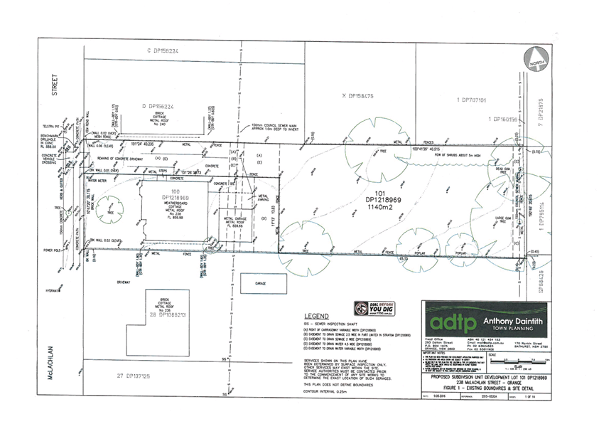
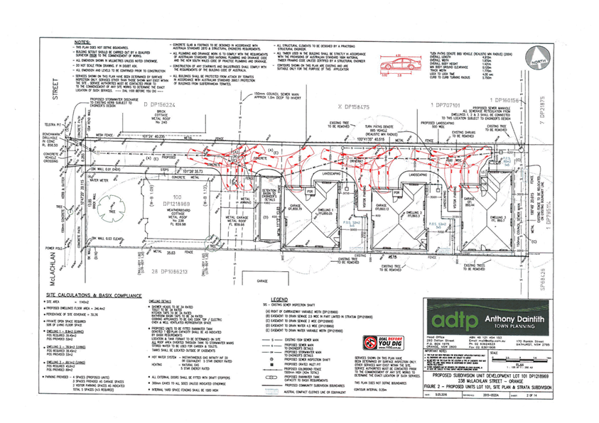
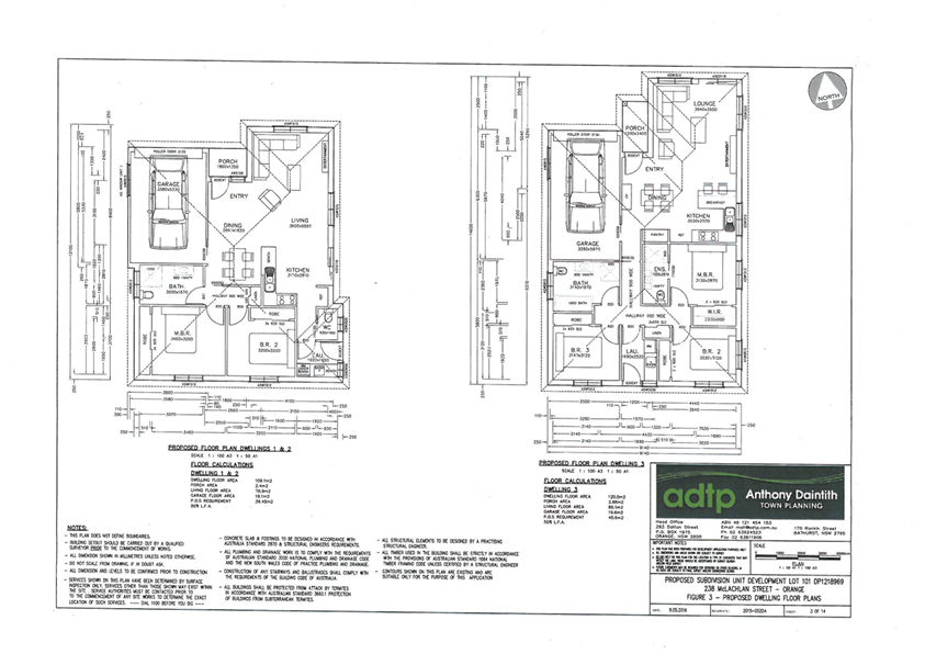
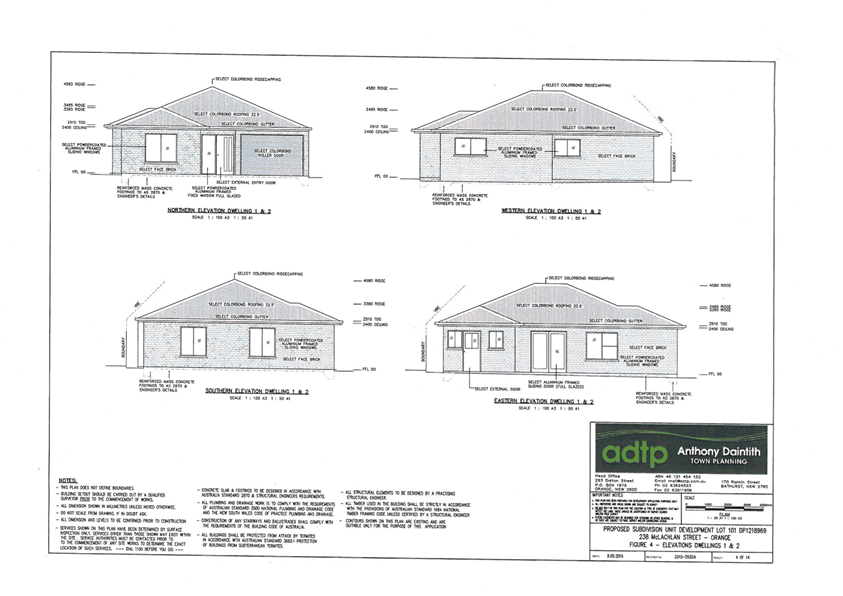
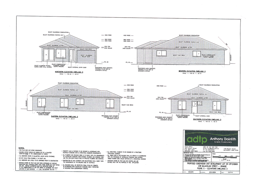
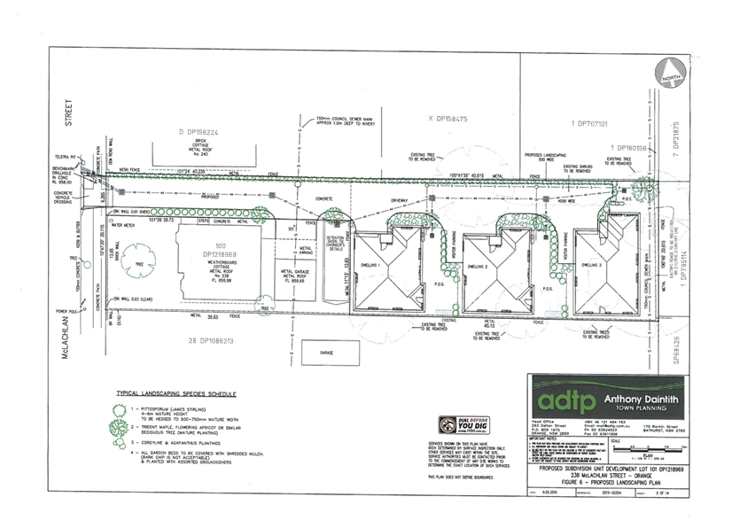
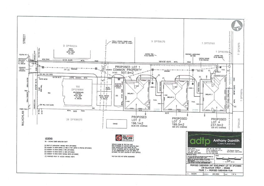
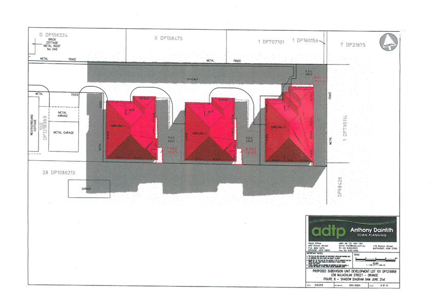
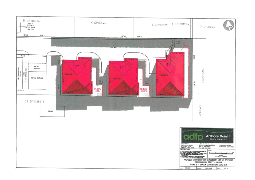
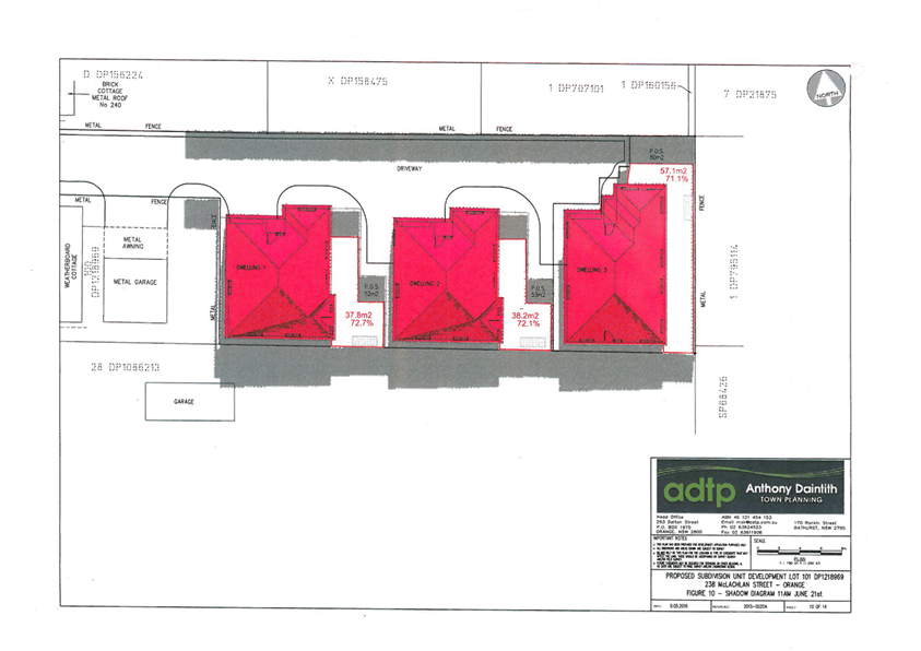
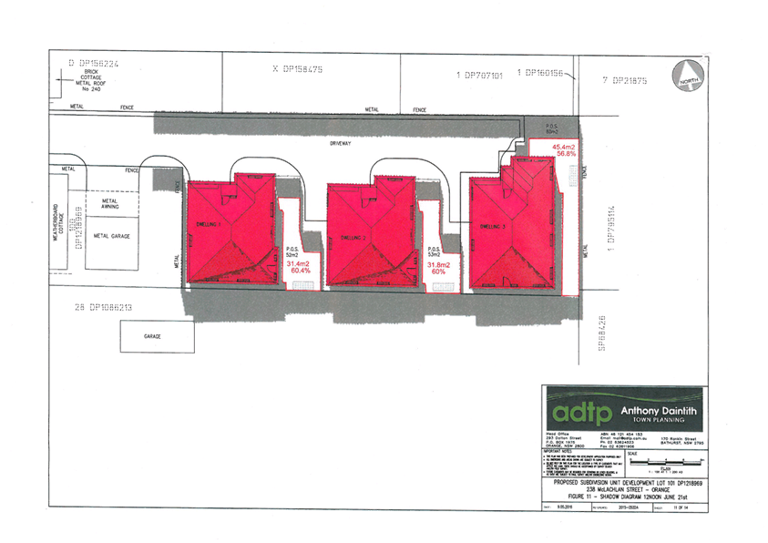
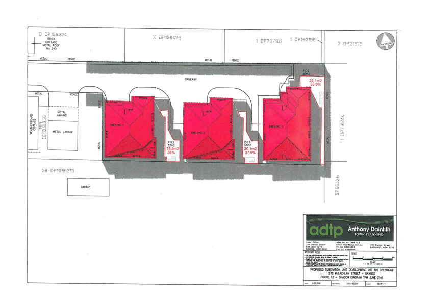
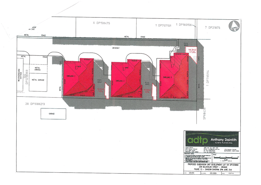
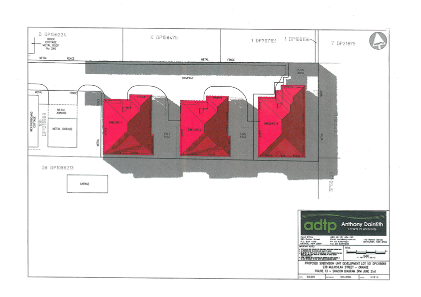
Planning
and Development Committee
5 July 2016
2.3 Development
Application DA 92/2016(1) - 238 and 238A McLachlan Street
Attachment 3 Submission
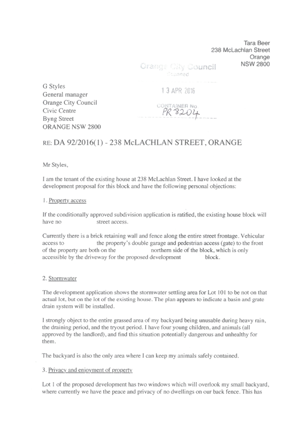

2.4 Development
Application DA 129/2016(1) - 261 Ophir Road
TRIM
REFERENCE: 2016/1387
AUTHOR: Andrew
Crump, Senior Planner
EXECUTIVE Summary
|
Application
lodged
|
20/04/2016
|
|
Applicant/s
|
Orange
City Council
|
|
Owner/s
|
Orange
City Council
|
|
Land
description
|
Lot 112
DP 1170567 - 261 Ophir Road, Orange
|
|
Proposed
land use
|
Waste
Disposal Facility (community recycling centre)
|
|
Value of
proposed development
|
$246,400
|
Council's consent is sought to construct a purpose built
waste disposal facility for the purposes of a community recycling centre as
part of the NSW Environment Protection Agency Community Recycling Program. The
program is intended to make it easier for households to safely dispose of
materials that can be hazardous to the environment or public health. The
application also involves the installation of a 10,000L rain water tank and upgrade
of a section of internal road.
Council staff requested that the applicant provide volumes
of waste as part of this development to ascertain if the development would
exceed the integrated development thresholds or the designated development
thresholds. This is further discussed below.
The development meets Council’s relevant planning
requirements and is recommended for approval.
Link To Delivery/OPerational Plan
The recommendation in this report relates to the
Delivery/Operational Plan strategy “13.4 Our Environment
– Monitor and enforce regulations relating to City amenity”.
Financial Implications
Council has been advised that as a council included in the
NSW Government’s merger proposals under consideration by the Office of
Local Government since referral on 6 January 2016, Council must comply with the
merger proposal period guidelines issued under S23A of the Local Government Act
1993.
The guidelines instruct Council it should expend money in
accordance with the detailed budget adopted for the purposes of implementing
the Delivery/Operational Plan for the 2015/16 year.
Any expenditure outside the adopted budget requires the
identification of clear and compelling grounds and must be approved by Council
at a meeting that is open to the public. The guidelines indicate the resolution
of Council for increased expenditure must specify the reasons why the
expenditure is required and warranted.
If increased expenditure is greater than $250,000 or 1% of
the Council’s revenue from rates in
the preceding year, whichever is the greater, Council
is required to exhibit the increase to the budget and consider comments
received.
Council must also avoid entering into contracts or
undertakings where expenditure or revenue is greater than $250,000 or 1% of the
Council’s revenue from rates in the
preceding year, whichever is the greater, unless the contract or undertaking is
as a result of a decision or procurement process commenced prior to the merger
proposal period or where entering into a contract or undertaking is reasonably
necessary for the purposes of meeting the ongoing service delivery commitments
of the Council or was previously approved in the Council’s
Delivery/Operational Plan.
Policy and Governance Implications
Nil
|
Recommendation
That Council consents to
development application DA 129/2016(1)
for Waste or Resource
Transfer Station (community
recycling centre) at Lot 112 DP
1170567 - 261 Ophir Road, Orange
pursuant to the conditions of consent in the attached Notice of Approval.
|
further considerations
Consideration has been given to the
recommendation’s impact on Council’s service delivery; image and
reputation; political; environmental; health and safety; employees;
stakeholders and project management; and no further implications or risks have
been identified.
SUPPORTING INFORMATION
THE APPLICATION
Council's consent is sought to construct a purpose built waste or resource transfer station on land
described as Lot 112 DP 1170567 known as 261 Ophir Road, Orange (known as the
Orange Resource Recovery Centre). The purpose of the development is to
establish a community recycling centre as part of the NSW Environment
Protection Agency Community Recycling Program. The program is intended to make
it easier for households to safely dispose of materials that can be hazardous
to the environment or public health. The application also includes a 10,000L
water tank to collect roof water and the upgrade of an internal road.
THE PROPOSAL
The proposal involves the construction of a 24m by 18m covered
structure which will house a drive-through lane diagonally through the
building, with individual storage areas for separate waste types including:
· gas bottles
· fire extinguishers
· smoke alarms
· fluorescent tubes
· paints
· batteries
The development will also
incorporate an undercover recycling shop.
MATTERS FOR CONSIDERATION
Section 5A Assessment
In the administration of sections 78A, 79B, 79C, 111 and
112, the provisions of Section 5A must be taken into account for every
development application in deciding whether there is likely to be a significant
effect on threatened species, populations or ecological communities or their
habitats. This section includes a requirement to consider any adopted
assessment guidelines, which means assessment guidelines issued and in force
under section 94A of the Threatened Species Conservation Act 1995.
Assessment guidelines are in force (see DECC-W “Threatened Species
Assessment Guidelines - The Assessment of Significance”) which requires
consent authority to adopt the precautionary principle in its assessment.
The site is currently being used for waste disposal purposes
and is highly disturbed. An inspection reveals that the subject property has no
biodiversity or habitat value.
Section 79C
Section 79C of the Environmental Planning and Assessment
Act 1979 requires Council to consider various matters, of which those
pertaining to the application are listed below.
Section 91
Integrated Development - Protection of the Environment
Operations Act
Council staff wrote to the applicant and requested annual
processing volumes to be provided so as to be able to glean if the application
ought to be treated as a nominated integrated development application. The
applicant responded with the following:
The proposed
community recycling centre (CRC) represents an opportunity to better manage
waste at the Ophir Road Resource Recovery Facility (ORRRC). It provides a means
of separating existing waste streams and to better minimise the potential for
impact or harm to the environment. The waste being targeted for collection via
the CRC is otherwise delivered to the existing ORRRC site either by residents,
who deliver to the current recovery facility, or is waste received at the site
as a result of kerbside collection. The CRC application proposes to
better manage and direct waste from these sources and divert this from ending
up in landfill. As such, there is no additional waste received at the facility.
The proponent operates under an existing scheduled activity
licence from the NSW Environment Protection Agency (see below excerpt from the
Part 3A Application documentation):
Environment Protection Licence
(EPL) No. 5956 is held by the Proponent for its Ophir Road RRC, under the Protection
of the Environment Operations Act, 1997. This licence, which is renewed in
July each year, is due for its next review on 26 Nov 2013.
The licence covers two
schedules activities - Contaminated Soil Treatment and Waste Disposal
(application to land), and also applies to other activities carried out on the
site, including Waste Processing (non-thermal treatment) and Waste Storage.
In light of the above comments from the applicant, the
development was not treated as integrated development. Notwithstanding this,
the applicant should be cognisant of their licence obligations and make
representations to the EPA to ascertain if an amended licence will be required.
A condition is attached to this effect obligating the proponent to obtain any
relevant licences or amendments to existing licences.
PROVISIONS OF ANY ENVIRONMENTAL
PLANNING INSTRUMENT s79C(1)(a)(i)
Orange Local Environmental Plan 2011
Part 1 - Preliminary
Clause 1.2 - Aims of Plan
The
broad aims of the LEP are set out under subclause 2. Those relevant to the
application are as follows:
(a) to encourage development which complements
and enhances the unique character of Orange as a major regional centre boasting
a diverse economy and offering an attractive regional lifestyle,
(b) to provide for a range of development
opportunities that contribute to the social, economic and environmental
resources of Orange in a way that allows present and future generations to meet
their needs by implementing the principles for ecologically sustainable
development,
The application is considered to be consistent with aims (a)
and (b) listed above.
Clause 1.6 - Consent Authority
This clause establishes that, subject to the Act, Council is
the consent authority for applications made under the LEP.
Clause 1.9A - Suspension of
Covenants, Agreements and Instruments
This clause provides that covenants, agreements and other
instruments which seek to restrict the carrying out of development do not apply
with the following exceptions.
· covenants imposed
or required by Council
· prescribed
instruments under Section 183A of the Crown Lands Act 1989
· any conservation
agreement under the National Parks and Wildlife Act 1974
· any trust
agreement under the Nature Conservation Trust Act 2001
· any property
vegetation plan under the Native Vegetation Act 2003
· any biobanking
agreement under Part 7A of the Threatened Species Conservation Act 1995
· any planning
agreement under Division 6 of Part 4 of the Environmental Planning and
Assessment Act 1979.
Council staff are not aware of the title of the subject
property being affected by any of the above.
Mapping
The subject site is identified
on the LEP maps in the following manner:
|
Land Zoning Map:
|
Land zoned SP2 Infrastructure
|
|
Lot Size Map:
|
No Minimum Lot Size
|
|
Heritage Map:
|
Not a heritage item or conservation
area
|
|
Height of Buildings Map:
|
No building height limit
|
|
Floor Space Ratio Map:
|
No floor space limit
|
|
Terrestrial Biodiversity Map:
|
High biodiversity sensitivity on
the site north eastern boundary
|
|
Groundwater Vulnerability Map:
|
Ground water vulnerable
|
|
Drinking Water Catchment Map:
|
Not within the drinking water
catchment
|
|
Watercourse Map:
|
Not within or affecting a defined
watercourse
|
|
Urban Release Area Map:
|
Not within an urban release area
|
|
Obstacle Limitation Surface Map:
|
No restriction on building siting
or construction
|
|
Additional Permitted Uses Map:
|
No additional permitted use applies
|
Those matters that are of relevance are addressed in detail
in the body of this report.
Part 2 - Permitted or
Prohibited Development
Land
Use Zones
The subject site is located within the SP2 Infrastructure
zone (Resource Recovery Centre). The proposed development is defined as a waste or resource transfer station under
OLEP 2011, which means:
a building or place used for the collection and transfer of
waste material or resources, including the receipt, sorting, compacting,
temporary storage and distribution of waste or resources and the loading or
unloading of waste or resources onto or from road or rail transport.
The
development is considered to be for a purpose consistent with the land-use
shown on the relevant zoning Map, i.e. resource recovery centre. The
development is not incompatible with the infrastructure use of the land;
moreover, the facility will improve the existing management of the nominated
waste streams that already enter the existing facility.
The
development is permissible in the zone with the consent of Council.
Clause
2.3 of LEP 2011 references the Objectives
for each zone in LEP 2011. These objectives for land zoned SP2
Infrastructure (Resource Recovery Centre) are as
follows:
1 - Objectives
of zone
· To provide for infrastructure and related uses.
· To prevent development that is not compatible with
or that may detract from the provision of infrastructure.
The development is not inconsistent with the objectives of
the SP2 Infrastructure Zone (Resource Recovery Centre). The development
represents a continuation of the well-established resource recovery centre use
of the land and will not create any conflicts with the existing infrastructure
use of the land.
Part 3 - Exempt and Complying Development
The application is not exempt or complying development.
Part 6 - Urban Release Area
Not relevant to the application. The subject site is not
located in an Urban Release Area.
Part 7 - Additional Local Provisions
7.3
- Stormwater Management
This clause applies to all
industrial, commercial and residential zones and requires that Council be
satisfied that the proposal:
(a) is designed to maximise the use of water
permeable surfaces on the land having regard to the soil characteristics
affecting onsite infiltration of water
(b) includes, where practical, onsite stormwater
retention for use as an alternative supply to mains water, groundwater or river
water; and
(c) avoids any significant impacts of
stormwater runoff on adjoining downstream properties, native bushland and
receiving waters, or if that impact cannot be reasonably avoided, minimises and
mitigates the impact.
The proposal has been designed
to include permeable surfaces and includes onsite retention of stormwater
through the use of a 10,000L rainwater tank. It is therefore considered that
the post-development runoff levels will not unreasonably exceed the
pre-development levels.
7.4 - Terrestrial Biodiversity
This
clause seeks to maintain terrestrial biodiversity and requires that consent
must not be issued unless the application demonstrates whether or not the
proposal:
(a) is likely to have any adverse impact on
the condition, ecological value and significance of the fauna and flora on the
land
(b) is likely to have any adverse impact on
the importance of the vegetation on the land to the habitat and survival of
native fauna
(c) has any potential to fragment, disturb or
diminish the biodiversity structure, function and composition of the land, and
(d) is likely to have any adverse impact on
the habitat elements providing connectivity on the land.
Additionally this clause
prevents consent being granted unless Council is satisfied that:
(a) the development is designed, sited and
will be managed to avoid any significant adverse environmental impact, or
(b) if that impact cannot be reasonably
avoided - the development is designed, sited and will be managed to minimise
that impact, or
(c) if that impact cannot be minimised - the
development will be managed to mitigate that impact.
A small amount of high
biodiversity is identified along the north-eastern boundary that appears to be
windbreak plantings with limited or no biodiversity value. In any event, the
development is well separated from the area identified as high biodiversity.
7.6 - Groundwater Vulnerability
This
clause seeks to protect hydrological functions of groundwater systems and
protect resources from both depletion and contamination. Orange has a high
water table and large areas of the LGA, including the subject site, are
identified with “Groundwater Vulnerability” on the Groundwater
Vulnerability Map. This requires that Council consider:
(a) whether or not the development (including
any onsite storage or disposal of solid or liquid waste and chemicals) is
likely to cause any groundwater contamination or have any adverse effect on
groundwater dependent ecosystems, and
(b) the cumulative impact (including the
impact on nearby groundwater extraction for potable water supply or stock water
supply) of the development and any other existing development on groundwater.
Furthermore consent may not be granted unless Council is satisfied that:
(a) the development is designed, sited and
will be managed to avoid any significant adverse environmental impact, or
(b) if that impact cannot be reasonably
avoided - the development is designed, sited and will be managed to minimise
that impact,
(c) if that impact cannot be minimised - the
development will be managed to mitigate that impact.
The proposal is not anticipated
to involve the discharge of toxic or noxious substances and is therefore
unlikely to contaminate the groundwater or related ecosystems. The proposal
does not involve extraction of groundwater and will therefore not contribute to
groundwater depletion. The design and siting of the proposal avoids impacts on
groundwater and is therefore considered acceptable.
Clause 7.11 Essential Services
Clause7.11 applies. This clause states:
Development consent must not be granted to development
unless the consent authority is satisfied that any of the following
services that are essential for the proposed development are available or that
adequate arrangements have been made to make them available when required:
(a) The
supply of water,
(b) The
supply of electricity,
(c) The
disposal and management of sewage,
(d) Storm
water drainage or onsite conservation,
(e) Suitable
road access.
All
utility services are available to the site and adequate for the proposal, in
accordance with Clause 7.11.
STATE ENVIRONMENTAL PLANNING
POLICIES
State Environmental Planning Policy 55 - Remediation of
Land
State Environmental Planning Policy 55 - Remediation of Land
applies to the subject development, specifically Clause 7 which states:
7 - Contamination
and remediation to be considered in determining development application
(1) A consent authority must not consent to the
carrying out of any development on land unless:
(a) it has considered whether the land is
contaminated, and
(b) if the land is contaminated, it is
satisfied that the land is suitable in its contaminated state (or will be
suitable, after remediation) for the purpose for which the development is
proposed to be carried out, and
(c) if the land requires remediation to be made
suitable for the purpose for which the development is proposed to be carried
out, it is satisfied that the land will be remediated before the land is used
for that purpose.
The subject land has a long history of being used as a
landfill site, and as such it is likely that the site has some level of
contamination. As the proposal relates to a continuation of the approved use of
the site, it is considered reasonable to not require remediation of the land at
this time. Remediating the area of concern under this development application
only will derive little benefit given the likely wider spread of contamination
within the land.
Additionally, it is noted that annual auditing occurs of
leachates as part of the site’s land use as a landfill site.
The development is not a change of use to a more sensitive
land use, and as such the site is likely to be contaminated; however it is
considered suitable in its contaminated state.
Suitable conditions are attached that require excavated
material to be disposed of at a licenced landfill site and a further condition
is attached that requires a construction management plan to be prepared for the
duration of the construction period that deals with amongst other matters,
construction works within the contaminated site.
State Environmental Planning
Policy (Infrastructure)
State Environmental Planning Policy (Infrastructure) applies
to the subject development, specifically clause 104 which states:
104 - Traffic-generating development
(1) This
clause applies to development specified in Column 1 of the Table to
Schedule 3 that involves:
(a) new
premises of the relevant size or capacity, or
(b) an
enlargement or extension of existing premises, being an alteration or addition
of the relevant size or capacity.
(2) In
this clause, relevant size or capacity means:
(a) in
relation to development on a site that has direct vehicular or pedestrian
access to any road—the size or capacity specified opposite that
development in Column 2 of the Table to Schedule 3, or
(b) in
relation to development on a site that has direct vehicular or pedestrian
access to a classified road or to a road that connects to a classified road
where the access (measured along the alignment of the connecting road) is
within 90m of the connection—the size or capacity specified opposite that
development in Column 3 of the Table to Schedule 3.
(3) Before
determining a development application for development to which this clause
applies, the consent authority must:
(a) give
written notice of the application to the RTA within 7 days after the
application is made, and
(b) take
into consideration:
(i) any
submission that the RTA provides in response to that notice within 21 days
after the notice was given (unless, before the 21 days have passed, the RTA
advises that it will not be making a submission), and
(ii) the
accessibility of the site concerned, including:
(A) the
efficiency of movement of people and freight to and from the site and the
extent of multi-purpose trips, and
(B) the
potential to minimise the need for travel by car and to maximise movement of
freight in containers or bulk freight by rail, and
(iii) any
potential traffic safety, road congestion or parking implications of the
development.
(4) The
consent authority must give the RTA a copy of the determination of the
application within 7 days after the determination is made.
The Roads and Maritime Service have
provided advice to the effect that the development will not alter the existing
situation, and therefore they make no submission in relation to the
development.
State Environmental Planning
Policy 64 - Advertising and Signage
State Environmental Planning Policy 64 - Advertising and
Signage is relevant to the assessment of the application insofar as the
applicant is proposing a 4.5m long by 1.2m high sign on the western
elevation displaying the words “community recycling centre”
and a logo. Pursuant to Clause 6 of the SEPP, given that the sign is displayed
inwardly within the site and is not visible from a public space, the SEPP is
not applicable. Council staff raise no objections to the proposed sign.
PROVISIONS OF ANY DRAFT ENVIRONMENTAL
PLANNING INSTRUMENT THAT HAS BEEN PLACED ON EXHIBITION s79C(1)(a)(ii)
There are no draft environmental planning instruments that
apply to the subject land or proposed development.
DESIGNATED DEVELOPMENT
The applicant was requested to provide waste volumes to
establish if the development would exceed any of the thresholds for designated
development. The applicant responded with the following:
The proposed community
recycling centre (CRC) represents an opportunity to better manage waste at the
Ophir Road Resource Recovery Facility (ORRRC). It provides a means of
separating existing waste streams and to better minimise the potential for
impact or harm to the environment. The waste being targeted for collection via
the CRC is otherwise delivered to the existing ORRRC site either by residents,
who deliver to the current recovery facility, or is waste received at the site
as a result of kerbside collection. The CRC application proposes to
better manage and direct waste from these sources and divert this from ending
up in landfill. As such, there is no additional waste received at the facility
and therefore no likelihood that the development would be independently
categorised as designated development.
Additionally, the proposed
development represents a continuation of the currently approved use, via Part
3A Project Approval MP 09_0025, being an improvement to an existing component
of the approved Orange Waste Project. The Orange Waste Project demonstrated the
inclusion of an existing recovery and storage shop area (Figure B1-5 of the GHD
EIS, 2009) and this application represents a re-organisation and improvement of
that arrangement.
In essence therefore, the
current application seeks consent for the physical erection of buildings and
the carrying out of works to land, to facilitate provision of the necessary
infrastructure. The application does not propose or seek consent for any change
of use. As the use of the site remains unchanged, the question as to the
designation of the use does not arise.
Alternatively, if the above
position is not accepted, the development could logically be categorised as
being an addition or alteration to the existing designated development
currently approved at the site (by virtue of Part 3A Project Approval MP
09_0025), pursuant to clause 35 of Schedule 3 of the Environmental Planning and
Assessment Regulations 2000. Clause 35 states:
Development involving alterations or additions to development
(whether existing or approved) is not designated development if, in the opinion
of the consent authority, the alterations or additions do not significantly
increase the environmental impacts of the total development (that is the development
together with the additions or alterations) compared with the existing or
approved development.
Pursuant to clause 36 of Schedule 3, there are a
number of factors to be taken into consideration in making determination,
discussed in the below Table:
|
Are
alterations and additions designated development
|
|
|
Clause 36 Provisions
|
Response
|
|
(a) the impact of the
existing development having regard to factors including:
(i) previous
environmental management performance, including compliance with the
conditions of any consents, licences, leases or authorisations by a public
authority and compliance with any relevant codes of practice, and
(ii) rehabilitation or
restoration of any disturbed land, and
(iii) the number and nature
of all past changes and their cumulative effects, and
|
(i) Since
operations began the applicant has exhibited a strong environmental
management performance with ongoing compliance with all conditions of consent
and notably, no known complaints from any surrounding land owners or members
of the public. The facility represents a best practice arrangement. The
applicant continues to comply with the relevant conditions of consent and EPL
licence conditions.
(ii) The
site is the subject of ongoing and continual rehabilitation in accordance
with the measures set down in the 2009 GHD EIS and reflected via the
conditions of the Project Approval (specifically conditions 15, 18, 31 and
the statement of commitments)
(iii) The project
approval of the site has been the subject of one modification which sought to
reorganise the physical arrangement of the site and internal management,
including consolidation of a number of key site operations into one building.
The modification made no change to the volumes of waste being received at the
site or to the volume of vehicles visiting the site. No other changes to the
site have occurred since. The cumulative impact of the development has been
positive as it provides a regional waste management resource utilizing best
practice management techniques. The current application is a further example
of the ways in which the applicant is committed to reducing waste to
landfill.
|
|
(b) the likely impact of the proposed
alterations or additions having regard to factors including:
(i) the scale,
character or nature of the proposal in relation to the development, and
(ii) the existing
vegetation, air, noise and water quality, scenic character and special
features of the land on which the development is or is to be carried out and
the surrounding locality, and
(iii) the degree to which the
potential environmental impacts can be predicted with adequate certainty, and
(iv) the capacity of the
receiving environment to accommodate changes in environmental impacts, and
|
(i) As stated, the volume of
waste being received at the site will remain unchanged; the application
simply provides an improved mechanism to manage existing waste streams.
(ii) The existing environment is
described in Section 5 of the SEE. As an existing approved waste
management facility, the site is well suited to hosting the proposed CRC.
There would be no additional impact to the environment as a result of the
physical works and the long term impacts would be positive due to diverting
several specific waste types from landfill. This is in line with Council’s
strategic targets. In this regard, the proposed CRC will be regularly
serviced by the EPA nominated and contracted service provider
“Toxfree” with inventory control of collected waste products
regularly measured and reviewed in a live format over the web by Toxfree.
(iii) As the operation improves management of existing waste there is
confidence that impacts can be adequately determined.
(iv) As waste volumes remain unchanged and the application improves site
management, it is considered that the environment has the capacity to
accommodate the proposed increased extraction level.
|
|
(c) any proposals:
(i) to mitigate
the environmental impacts and manage any residual risk, and
(ii) to facilitate
compliance with relevant standards, codes of practice or guidelines published
by the Department or other public authorities.
|
(i) The applicant intends to continue to work
closely with Council and the Environment Protection Agency to ensure that all
required consent and licence conditions are met and all residual impacts are
appropriately mitigated
(ii) The site would continue to be operated in accordance
with Orange Waste Project Operational Environmental Management Plan.
|
By virtue of the above, it is
considered that the development can legitimately be considered additions and
alterations to an existing approved operation and therefore that the
development is not designated development.
Council staff accept the above contentions insofar as the
development repents a minor expansion of an existing development; an expansion
that, in itself, would not result in a significant increase in the
environmental impacts of the total development. As such, the development
application currently before Council need not be treated as designated
development.
PROVISIONS OF ANY DEVELOPMENT
CONTROL PLAN s79C(1)(a)(iii)
Development Control Plan 2004
Development Control Plan 2004 (“the DCP”)
applies to the subject land (Chapter 0 - LEP 2011, and Chapter 10 - Special
Uses and Roads Zone). An assessment of the proposed development against the
relevant Planning Outcomes will be undertaken below.
Pursuant to Planning Outcome 0.2-1 Interim Planning Outcomes
- Conversion of Zones:
· Throughout this
Plan, any reference to a zone in Orange LEP 2000 is to be taken to be a
reference to the corresponding zone(s) in the zone conversion table.
The corresponding zone to zone 5(a) Public Purpose zone (Orange LEP 2000) is zone
SP2 Infrastructure (Resource Recovery Centre) (Orange LEP 2011). As such, Orange
DCP 2004 - Chapter 10 Special Uses and Roads Zone is of primary
relevance to this proposal. The relevant provisions of Chapter 10 are
considered below.
PO 0.4-13 INTERIM PLANNING OUTCOMES - MAJOR INDUSTRY
AND UTILITY BUFFER.
· Development
in the vicinity of major industry and utility installations is sited as far as
practicable from the industry or installation.
· Development
demonstrates that between 10.00pm and 7.00am internal noise levels will be
below Laeq 35dB(A) in all bedrooms and less than Laeq 40dB(A) in all other
rooms (excluding garages, kitchens, bathrooms or hallways).
The subject land is located in the Major Industry and
Utility Buffer Map 2 (see below). The clause seeks to ensure the protection of
ongoing operations of major utilities and to prevent incompatible development
from occurring in close proximity to a major utility that would jeopardise the
operations of that utility.
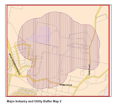
In this case the proposed development relates to a minor
expansion to the existing facility, and as such the proposed development will
not unreasonably impact upon those operations and is not considered
incompatible.
Chapter 10 - Special Uses and
Roads Zone
Chapter 10 - Special Uses and Roads Zone applies to the
subject land and proposed development. The DCP prescribes the following
applicable Planning Outcome:
· Development
proposals demonstrate how potential impact on adjoining land will be addressed.
The proposal will not have adverse
impact on adjoining land due to the following:
· The proposal is
essentially an expansion to the existing and longstanding use of the land for
waste management. The development will not dramatically alter the current
operation nor generate land use conflicts over and above the existing situation.
· Existing access
and internal circulation will be maintained, with the internal access road east
of the facility being upgraded.
· Traffic associated
with the site is an accepted and longstanding component of the neighbourhood.
Additional traffic as a consequence of the proposal will reasonably integrate
with existing volumes and arrangements.
· Potential
emissions associated with the development (eg odour or noise) will be contained
within the site building and be typical of the existing land use.
Chapter 15 - Car Parking
The development will not generate the requirement for
additional parking as there is no material increase in parking demand due to
the transient nature of the drive-through arrangement and the fact that the
area is currently being used as an outdoor recycling area. There are a number
of existing parking spaces within close proximity to the facility.
PROVISIONS PRESCRIBED BY THE
REGULATIONS s79C(1)(a)(iv)
The development is not inconsistent with the provisions
prescribed by the regulations.
THE LIKELY IMPACTS OF THE
DEVELOPMENT s79C(1)(b)
Context and Setting
The subject land is located to the northeast of the urban
area and adjoins an industrial estate and other major utilities. The subject
land has a long history of being used for the purposes of a waste facility. The
proposed development will be commensurate with that long standing land use, and
as such is appropriate in the context and setting.
Traffic Impacts
The existing access arrangements to Ophir Road will be
maintained, and as the volumes of the nominated waste type will not change
(only changing the way in which the waste will be managed) the development is
not likely to result in any unreasonable traffic impacts.
Vehicles utilising the facility will be able to enter and
leave the site in a forward direction through the drive-through arrangement,
exiting via the internal road (to be upgraded).
Visual Impacts
The development is unlikely to result in any unreasonable
visual impacts. The proposed building will be well set back form Ophir Road and
will be partially screened by the existing vegetation. The building will be
visible some distance away near the Clifton Grove entrance, but due to the
extensive separation the building will be far from objectionable. The site and
the siting of the building benefit from a rising landscaping, an embankment and
existing vegetation, which all assist in screening the development on both
northerly and southerly approaches on Ophir Road, save for a small glimpse of
the building at the site entrance.
Environmental Impact
The construction of the development will not unreasonably
impact upon any significant trees or habitat area. The operation of the
development is likely to contribute positively to the environment due to the
more appropriate way of dealing with these types of wastes in concert with the
EPA.
Construction Impacts
The development is proposed to be constructed over an area
of landfill. The geotechnical report from Envirowest concluded that:
the fill material contains
inadequate allowable bearing capacity for foundations.
Further details will be required at the Construction
Certificate stage.
Pedestrian/Vehicle Conflicts
There is the potential for vehicle and pedestrian conflicts,
with vehicles reversing into the waste bays, people perusing the recycling shop
and vehicles using this facility. Notwithstanding this, the area experiences
typically low vehicle speeds, and vehicles using the facility proposed under
this application will maintain a forward direction at all times. Ultimately,
the development relates to a waste facility, and people using the facility
should be cognisant of vehicles and pedestrians whilst at the facility.
It is expected that the management of the facility will
implement suitable arrangements to ensure the safe operations of the facility.
Notwithstanding this, a condition is attached that requires suitable warning
signage to be installed to raise awareness of the risks associated with
vehicles and pedestrians in the area.
Cumulative Impact
Cumulative impacts of a development can arise under four
typical scenarios, namely:
· time crowded effects
where individual impacts occur so close in time that the initial impact is not
dispersed before the proceeding occurs
· space crowded where
impacts are felt because they occur so close in space they have a tendency to
overlap
· nibbling effects occur
where small, often minor impacts, act together to erode the environmental
conditions of a locality and
· synergistic effects,
where a mix of heterogeneous impacts interact such that the combined impacts
are greater than the sum of the separate effects.
As this development represents a minor expansion to the
facility as a means of better managing a type of waste that already occurs at
the site with no increase in volumes and capacities, the likelihood of
cumulative impacts occurring as a result are low. The development is considered
acceptable in terms of cumulative impacts.
THE SUITABILITY OF THE SITE
s79C(1)(c)
The development will be an appropriate fit in the locality
given the commensurate land-uses. Council staff are not aware of any physical,
natural or technological hazards that may constrain the development from
occurring in a satisfactory manner.
ANY SUBMISSIONS MADE IN
ACCORDANCE WITH THE ACT s79C(1)(d)
The proposed development is not defined as advertised
development under the provisions of the LEP, and as such, no formal exhibition
of the application was required. No submissions have been received in relation
to this application.
PUBLIC INTEREST
s79C(1)(e)
The proposed development is considered to be of moderate
interest to the wider public due to the public infrastructure nature of the
development. The proposal is not inconsistent with any relevant policy
statements, planning studies, guidelines, etc that have not been considered in
this assessment.
SUMMARY
The proposed development is permissible with the consent of
Council. The proposed development complies with the relevant aims, objectives
and provisions of the LEP. A section 79C assessment of the
development indicates that the development is acceptable. Attached is a draft
Notice of Approval outlining a range of conditions considered appropriate to
ensure that the development proceeds in an acceptable manner.
COMMENTS
The requirements of the Environmental Health and Building
Surveyor and the Engineering Development Section are included in the attached
Notice of Approval.
Attachments
1 Notice
of Approval, D16/27134⇩
2 Plans,
D16/27051⇩
Planning and Development Committee
5 July 2016
2.4 Development
Application DA 129/2016(1) - 261 Ophir Road
Attachment 1 Notice
of Approval
|

|
ORANGE
CITY COUNCIL
Development
Application No DA
129/2016(1)
NA16/ Container
PR25658
|
NOTICE OF DETERMINATION
OF A DEVELOPMENT
APPLICATION
issued under the Environmental
Planning and Assessment Act 1979
Section 81(1)
|
Development
Application
|
|
|
Applicant Name:
|
Orange
City Council C/- Geolyse
|
|
Applicant Address:
|
C/-
Geolyse
PO Box
1963
ORANGE
NSW 2800
|
|
Owner’s Name:
|
Orange
City Council
|
|
Land to Be Developed:
|
Lot 112 DP
1170567 - 261 Ophir Road, Orange
|
|
Proposed Development:
|
Waste or
Resource Transfer Station (community recycling centre)
|
|
|
|
|
Building
Code of Australia
building classification:
|
To be
determined by the PCA
|
|
|
|
|
Determination
|
|
|
Made On:
|
5 July
2016
|
|
Determination:
|
CONSENT
GRANTED SUBJECT TO CONDITIONS DESCRIBED BELOW:
|
|
|
|
|
Consent to
Operate From:
|
6 July
2016
|
|
Consent to
Lapse On:
|
6 July
2021
|
Terms of Approval
The reasons for the imposition of
conditions are:
(1) To ensure compliance
with relevant statutory requirements.
(2) To provide adequate
public health and safety measures.
(3) To ensure a quality
urban design for the development which complements the surrounding environment.
(4) To maintain
neighbourhood amenity and character.
(5) To ensure the utility
services are available to the site and adequate for the development.
(6) To prevent the proposed
development having a detrimental effect on adjoining land uses.
(7) To minimise the impact
of development on the environment.
Conditions
(1) The
development must be carried out in accordance with:
(a) Plan/s
numbered Plans by Geolyse - project no. 216096 Drawing nos. 01_A01 Revision B;
01_A02 Revision B; 01_A03 Revision B; 01_A04 Revision B; 01_A05 Revision B -
all dated 15/04/2016 (5 sheets)
(b) statements
of environmental effects or other similar associated documents that form part
of the approval
as amended
in accordance with any conditions of this consent.
(2) All building work must
be carried out in accordance with the provisions of the Building Code of
Australia.
(3) A sign is to be erected
in a prominent position on any site on which building work, subdivision work or
demolition work is being carried out:
(a) showing
the name, address and telephone number of the principal certifying authority
for the work, and
(b) showing
the name of the principal contractor (if any) for any building work and a
telephone number on which that person may be contacted outside working hours,
and
(c) stating
that unauthorised entry to the site is prohibited.
Any such sign is to be maintained while the
building work, subdivision work or demolition work is being carried out.
|
PRIOR TO WORKS
COMMENCING
|
(4) Prior
to works commencing a construction management plan shall be prepared that
details how noise, dust, odour, access, unexpected finds, contaminated soil and
the like is to be managed during construction. The construction management plan
shall be implemented for the entire construction phase of the development.
(5) A
Construction Certificate application is required to be submitted to, and issued
by Council/Accredited Certifier prior to any excavation or building works being
carried out onsite.
(6) A
temporary onsite toilet is to be provided and must remain throughout the
project or until an alternative facility meeting Council’s requirements
is available onsite.
(7) Soil erosion control
measures shall be implemented on the site.
|
DURING CONSTRUCTION/SITEWORKS
|
(8) Any
material removed from the site shall be disposed of at a licenced landfill site
given the likely contaminated state of the excavated material.
(9) All
construction/demolition work on the site is to be carried out between the hours
of 7.00 am and 6.00 pm Monday to Friday inclusive, 7.00 am to
5.00 pm Saturdays and 8.00 am to 5.00 pm Sundays and Public
Holidays. Written approval must be obtained from the General Manager of Orange
City Council to vary these hours.
(10) All
materials onsite or being delivered to the site are to be contained within the
site. The requirements of the Protection of the Environment Operations Act
1997 are to be complied with when placing/stockpiling loose material or
when disposing of waste products or during any other activities likely to
pollute drains or watercourses.
(11) Any adjustments to
existing utility services that are made necessary by this development
proceeding are to be at the full cost of the developer.
(12) All driveway and
parking areas are to be sealed with bitumen, hot mix or concrete and are to be
designed for all expected loading conditions (provided however that the minimum
pavement depth for gravel and flush seal roadways is 200mm) and be in
accordance with the Orange City Council Development and Subdivision Code.
|
PRIOR TO THE ISSUE OF
AN OCCUPATION CERTIFICATE
|
(13) Appropriate
signage shall be installed in suitable locations that warn users of the
facility about the risk of reversing vehicles and the likelihood of pedestrians
in the area. The signage shall be installed prior to the issue of an occupation
certificate.
(14) No
person is to use or occupy the building or alteration that is the subject of
this approval without the prior issuing of an Occupation Certificate.
(15) The
owner of the building/s must cause the Council to be given a Final Fire Safety
Certificate on completion of the building in relation to essential fire or
other safety measures included in the schedule attached to this approval.
(16) The applicant shall
make representations to the NSW Environment Protection Agency to establish if
the development triggers the need for a scheduled activity licence under the
Protection of the Environment Operations Act or an amendment to any current
licences; and if so, the applicant must obtain any necessary licences under the
aforementioned Act prior to the issue of an Occupation Certificate.
(17) All
of the foregoing conditions are to be at the full cost of the developer and to
the requirements and standards of the Orange City Council Development and
Subdivision Code, unless specifically stated otherwise. All work required by
the foregoing conditions is to be completed prior to the issuing of an
Occupation Certificate, unless stated otherwise.
|
MATTERS FOR THE
ONGOING PERFORMANCE AND OPERATION OF THE DEVELOPMENT
|
(18) The
owner is required to provide to Council and to the NSW Fire Commissioner an
Annual Fire Safety Statement in respect of the fire-safety measures, as
required by Clause 177 of the Environmental Planning and Assessment
Regulation 2000.
Other Approvals
(1) Local
Government Act 1993 approvals granted under section 68.
Stormwater
(2) General
terms of other approvals integrated as part of this consent.
(1) All
stormwater is to be disposed of in a manner suitable to the site.
Right of Appeal
If
you are dissatisfied with this decision, section 97 of Environmental
Planning and Assessment Act 1979 gives you the right to appeal to the Land
and Environment Court within 6 months after the date on which you receive this
notice.
*
Section 97 of the Environmental Planning and Assessment Act 1979 does not apply
to the determination of a development application for State significant
development or local designated development that has been the subject of a
Commission of Inquiry.
|
Disability Discrimination Act
1992:
|
This application has been assessed in
accordance with the Environmental Planning and Assessment Act 1979. No
guarantee is given that the proposal complies with the Disability
Discrimination Act 1992.
The applicant/owner is responsible to
ensure compliance with this and other anti-discrimination legislation.
The Disability Discrimination Act
covers disabilities not catered for in the minimum standards called up in the
Building Code of Australia which references AS1428.1 - "Design for
Access and Mobility". AS1428 Parts 2, 3 and 4 provides the most
comprehensive technical guidance under the Disability Discrimination Act
currently available in Australia.
|
|
|
|
|
Disclaimer - S88B Restrictions on the Use of Land:
|
The applicant should note that there
could be covenants in favour of persons other than Council restricting what
may be built or done upon the subject land. The applicant is advised to check
the position before commencing any work.
|
|
|
|
|
Signed:
|
On behalf of the consent authority ORANGE
CITY COUNCIL
|
|
Signature:
|
|
|
Name:
|
DAVID WADDELL - DIRECTOR DEVELOPMENT
SERVICES
|
|
Date:
|
6 July 2016
|
Planning
and Development Committee
5 July 2016
2.4 Development
Application DA 129/2016(1) - 261 Ophir Road
Attachment 2 Plans
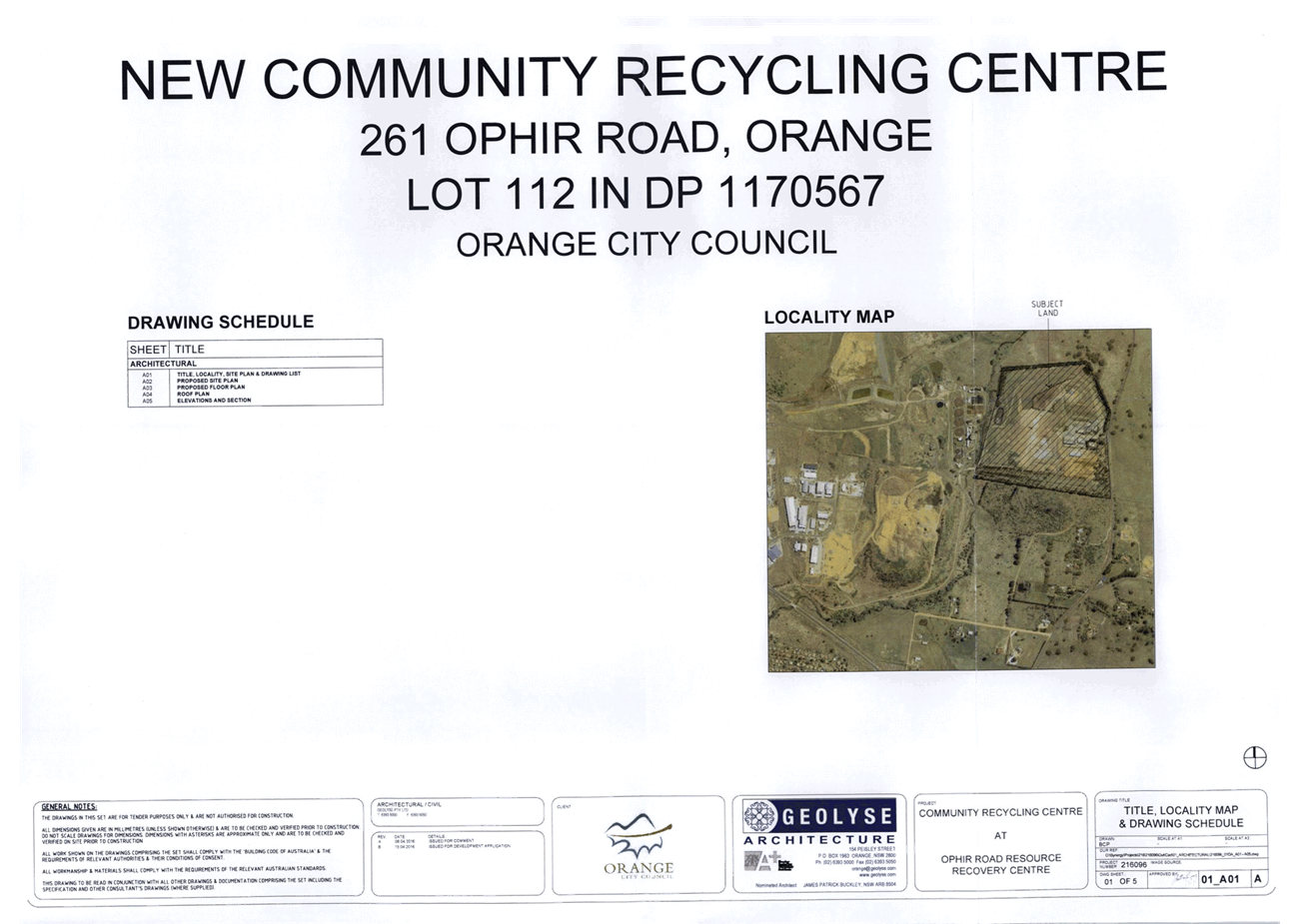
Planning and Development Committee
5 July 2016
2.4 Development
Application DA 129/2016(1) - 261 Ophir Road
Attachment 2 Plans
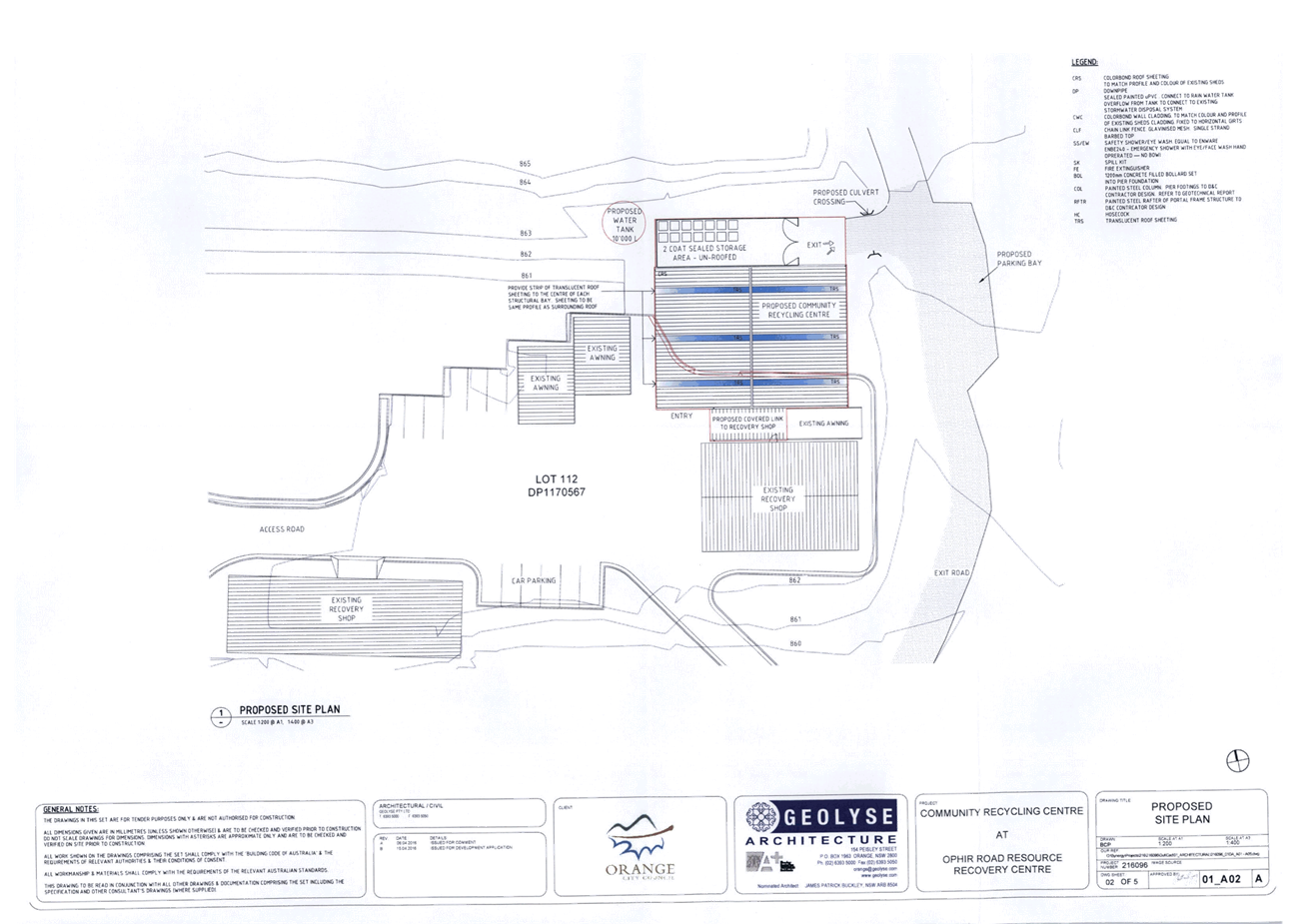
Planning and Development Committee
5 July 2016
2.4 Development
Application DA 129/2016(1) - 261 Ophir Road
Attachment 2 Plans
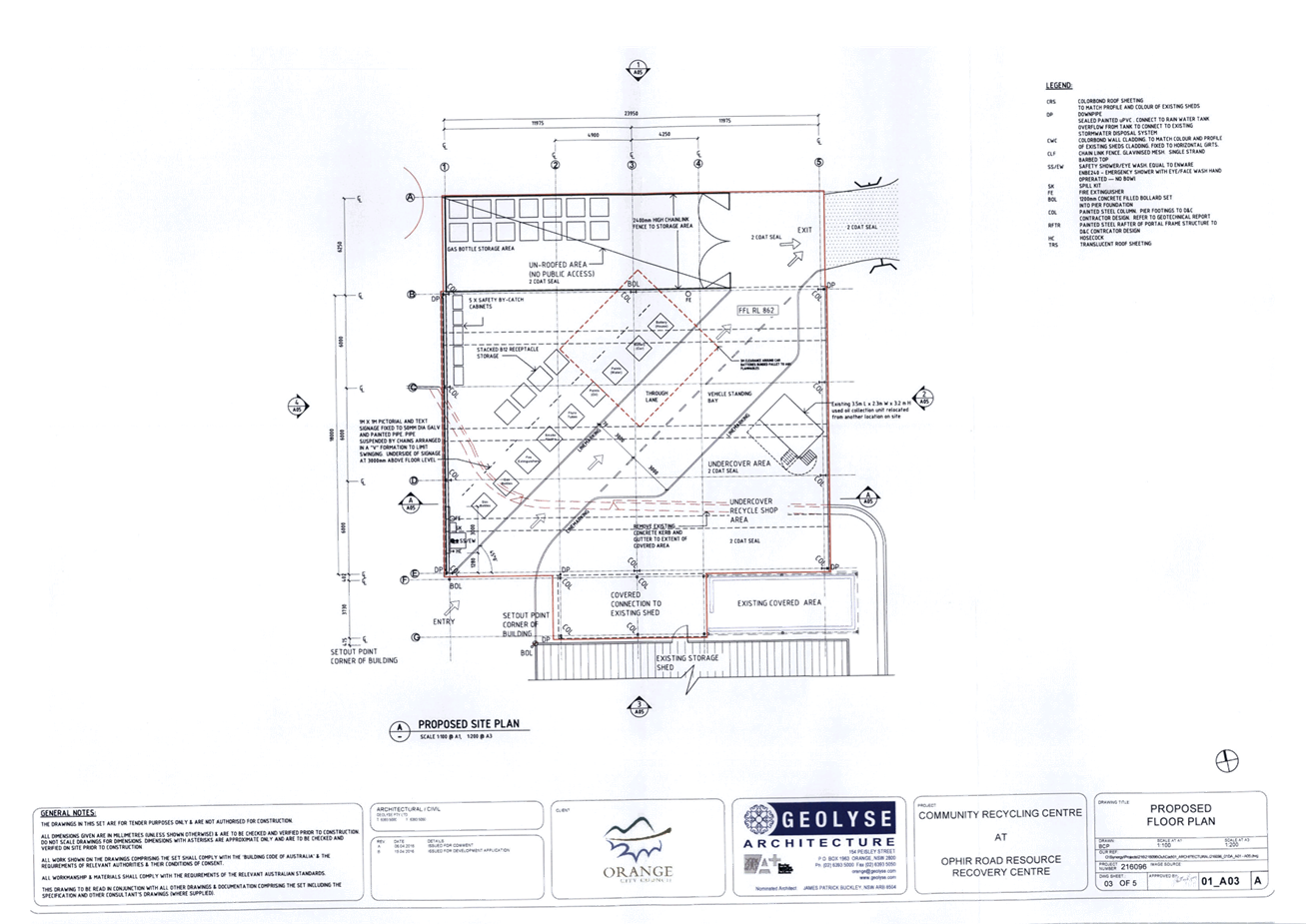
Planning and Development Committee
5 July 2016
2.4 Development
Application DA 129/2016(1) - 261 Ophir Road
Attachment 2 Plans
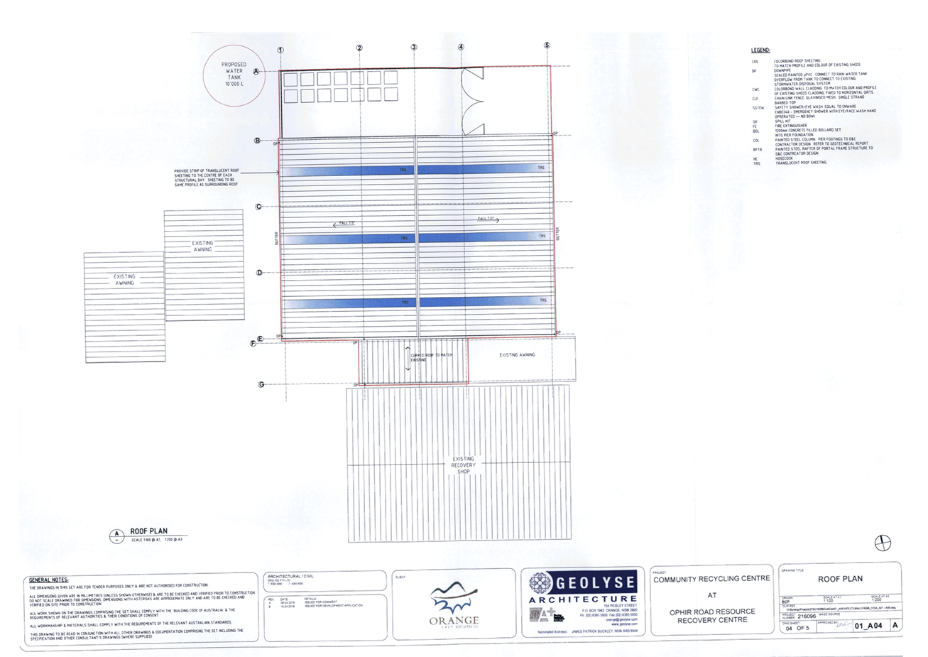
Planning and Development Committee
5 July 2016
2.4 Development
Application DA 129/2016(1) - 261 Ophir Road
Attachment 2 Plans
2.5 Development
Application DA 101/2016(1) - 1 and 3 Carwoola Drive
TRIM
REFERENCE: 2016/1393
AUTHOR: Andrew
Crump, Senior Planner
EXECUTIVE Summary
|
Application
lodged
|
22 March
2016
|
|
Applicant/s
|
Mr C and
Mrs C Bailey, and Mr J Maurice
|
|
Owner/s
|
Mrs BJ
Maurice
|
|
Land
description
|
Lots 1
and 2 DP 715252 – 1 and 3 Carwoola Drive, Orange
|
|
Proposed
land use
|
Subdivision
(21 lot residential)
|
|
Value of
proposed development
|
$0
|
Council's consent is sought to undertake a 21 lot
residential subdivision of land described as Lots 1 and 2 DP 715252, known
as 1 and 3 Carwoola Drive, Orange.
The proposed subdivision is at variance with the Minimum
Lots Size Map pursuant to Orange Local Environmental Plan 2011 (LEP) and the
relevant development standard. As such, the applicant has sought a variation to
the development standard via clause 4.6 of the LEP.
The development is considered satisfactory and is
recommended for approval.
Link To Delivery/OPerational Plan
The recommendation in this report relates to the
Delivery/Operational Plan strategy “13.4 Our Environment
– Monitor and enforce regulations relating to City amenity”.
Financial Implications
Council has been advised that as a council included in the
NSW Government’s merger proposals under consideration by the Office of
Local Government since referral on 6 January 2016, Council must comply with the
merger proposal period guidelines issued under S23A of the Local Government Act
1993.
The guidelines instruct Council it should expend money in
accordance with the detailed budget adopted for the purposes of implementing
the Delivery/Operational Plan for the 2015/16 year.
Any expenditure outside the adopted budget requires the
identification of clear and compelling grounds and must be approved by Council
at a meeting that is open to the public. The guidelines indicate the resolution
of Council for increased expenditure must specify the reasons why the
expenditure is required and warranted.
If increased expenditure is greater than $250,000 or 1% of
the Council’s revenue from rates in
the preceding year, whichever is the greater, Council
is required to exhibit the increase to the budget and consider comments
received.
Council must also avoid entering into contracts or
undertakings where expenditure or revenue is greater than $250,000 or 1% of the
Council’s revenue from rates in the
preceding year, whichever is the greater, unless the contract or undertaking is
as a result of a decision or procurement process commenced prior to the merger
proposal period or where entering into a contract or undertaking is reasonably
necessary for the purposes of meeting the ongoing service delivery commitments
of the Council or was previously approved in the Council’s Delivery/Operational
Plan.
Policy and Governance Implications
Nil
|
Recommendation
That Council consents to
development application DA 101/2016(1)
for Subdivision (21 lot residential) at Lots 1 and 2 DP 715252 –
1 and 3 Carwoola Drive, Orange pursuant to the
conditions of consent in the attached Notice of Approval.
|
further considerations
Consideration has been given to the
recommendation’s impact on Council’s service delivery; image and
reputation; political; environmental; health and safety; employees;
stakeholders and project management; and no further implications or risks have
been identified.
SUPPORTING INFORMATION
THE APPLICATION/PROPOSAL
Council's consent is sought to undertake a 21 lot
residential subdivision of land described as Lots 1 and 2 DP 715252, known
as 1 and 3 Carwoola Drive, Orange.
The development consists of five lots of 2000m2 or
more fronting Cargo Road; a new road connecting with Carwoola Drive running
east-west; and the balance of lots, save for Lots 15 and 21, provided with
frontage to either Carwoola Drive or the proposed new road. Lot 15 will be
a battleaxe lot with access to Carwoola Drive and Lot 21 will also be a
battleaxe lot with access to the proposed road.
MATTERS FOR CONSIDERATION
Section 138 - Roads Act
The development requires the concurrence of the NSW Roads
and Maritime Service (RMS) due to the new access points onto Cargo Road for
Lots 1-4. The RMS has issued their concurrence subject two conditions relating
to access, which are attached as conditions of consent to the Notice.
Section 5A Assessment
In the administration of sections 78A, 79B, 79C, 111 and
112, the provisions of Section 5A must be taken into account for every
development application in deciding whether there is likely to be a significant
effect on threatened species, populations or ecological communities or their
habitats.
This section includes a requirement to consider any adopted
assessment guidelines, which means assessment guidelines issued and in force
under section 94A of the Threatened Species Conservation Act 1995.
Assessment guidelines are in force (see DECC-W “Threatened Species
Assessment Guidelines - The Assessment of Significance”) which requires
consent authority to adopt the precautionary principle in its assessment.
The plans have identified three native trees within the
subject land that are being retained. A site inspection reveals that the
subject property has no biodiversity or habitat value, save for the three trees
that are being retained. It is noted that the three native trees are quite
immature and present limited significance. The development will not result in a
significant impact.
Section 79C
Section 79C of the Environmental Planning and Assessment
Act 1979 requires Council to consider various matters, of which those
pertaining to the application are listed below.
PROVISIONS OF ANY ENVIRONMENTAL
PLANNING INSTRUMENT s79C(1)(a)(i)
Orange Local Environmental Plan 2011
Part 1 - Preliminary
Clause 1.2 - Aims of Plan
The
broad aims of the LEP are set out under subclause 2. Those relevant to the
application are as follows:
(a) to encourage development which complements
and enhances the unique character of Orange as a major regional centre boasting
a diverse economy and offering an attractive regional lifestyle,
(b) to provide for a range of development
opportunities that contribute to the social, economic and environmental
resources of Orange in a way that allows present and future generations to meet
their needs by implementing the principles for ecologically sustainable
development,
(e) to provide a range of housing choices in
planned urban and rural locations to meet population growth,
(f) to recognise and manage valued
environmental heritage, landscape and scenic features of Orange.
The application is considered to be consistent with aims
(a), (b), (e) and (f) as listed above.
Clause 1.6 - Consent Authority
This clause establishes that, subject to the Act, Council is
the consent authority for applications made under the LEP.
Clause 1.9A - Suspension of
Covenants, Agreements and Instruments
This clause provides that covenants, agreements and other
instruments which seek to restrict the carrying out of development do not apply
with the following exceptions.
· covenants imposed
or required by Council
· prescribed instruments
under Section 183A of the Crown Lands Act 1989
· any conservation
agreement under the National Parks and Wildlife Act 1974
· any trust
agreement under the Nature Conservation Trust Act 2001
· any property
vegetation plan under the Native Vegetation Act 2003
· any biobanking
agreement under Part 7A of the Threatened Species Conservation Act 1995
· any planning
agreement under Division 6 of Part 4 of the Environmental Planning and
Assessment Act 1979.
Council staff are not aware of the title of the subject
property being affected by any of the above.
Mapping
The subject site is identified
on the LEP maps in the following manner:
|
Land Zoning Map:
|
Land zoned R2 Low Density
Residential
|
|
Lot Size Map:
|
Minimum Lot Size 2000m2 and
850m2
|
|
Heritage Map:
|
Not a heritage item or conservation
area
|
|
Height of Buildings Map:
|
No building height limit
|
|
Floor Space Ratio Map:
|
No floor space limit
|
|
Terrestrial Biodiversity Map:
|
No biodiversity sensitivity on the
site
|
|
Groundwater Vulnerability Map:
|
Not ground water vulnerable
|
|
Drinking Water Catchment Map:
|
Not within the drinking water
catchment
|
|
Watercourse Map:
|
Not within or affecting a defined
watercourse
|
|
Urban Release Area Map:
|
Not within an urban release area
|
|
Obstacle Limitation Surface Map:
|
No restriction on building siting
or construction
|
|
Additional Permitted Uses Map:
|
No additional permitted use applies
|
Those matters that are of relevance are addressed in detail
in the body of this report.
Part 2 - Permitted or Prohibited Development
Land
Use Zones
The subject site is located within the R2 Low Density
Residential zone. The proposed development is defined as subdivision of land.
Section 4B of the Environment Planning and Assessment Act
defines subdivision of land as
the division of land into two or more parts that,
after the division, would be obviously adapted for separate occupation, use or
disposition.
Subdivision
is permitted with the consent of Council in the R2 Low Density Residential
zone.
Clause 2.3 of LEP 2011 references the Objectives
for each zone in LEP 2011. These objectives for land zoned R2 Low Density
Residential are as follows:
Zone R2 Low Density Residential
1 - Objectives
of zone
· To provide for the housing needs of the community
within a low density residential environment.
· To enable other land uses that provide facilities
or services to meet the day to day needs of residents.
· To ensure development is ordered in such a way as
to maximise public transport patronage and encourage walking and cycling in
close proximity to settlement.
· To ensure that development along the Southern Link
Road has an alternative access.
The
development is not inconsistent with the objectives of the R2 Low Density
Residential zone. The subdivision will provide for additional housing stock in
a manner that is consistent with the low density zoning. The development will
have a neutral effect on the other three points.
Clause 2.6 - Subdivision -
Consent Requirements
This clause triggers the need for development consent for
the subdivision of land, which the applicant has applied for.
Part 3 - Exempt and Complying
Development
The application is not exempt or complying development.
Part 4 - Principal Development
Standards
Clause
4.1 - Minimum Subdivision Lot Size
This
clause requires the subdivision of land to be equal to or greater than the size
nominated for the land under the Minimum Lot Size Map. In relation to this
site, the map nominates a minimum lot size of 2000m2 for the five
lots adjoining Cargo Road and 850m2 for the
balance of land.
The
applicant submits that there is a minor conflict between the minimum lot size
map and the DCP lot layout. As a result, Lots 10 and 11, and to a lesser extent
Lot 9, will be partly located in the area comprising a 2000m2 minimum
lot size. As such, those lots will not meet the development standard, and the
applicant is seeking recourse through Clause 4.6 - Exception to Development
standards to overcome this.
Clause 4.6 - Exceptions to Development Standards
This clause allows development consent to be granted for development
which contravenes a development standard imposed by the LEP. It requires a
written request from the applicant that seeks to justify the contravention by
demonstrating:
(a) that
compliance with the development standard is unreasonable or unnecessary in the
circumstances of the case, and
(b) that
there are sufficient environmental planning grounds to justify contravening the
development standard.
The applicant submits the following justification in support
of the contention that compliance with the minimum lot size development
standard is unreasonable and unnecessary in the circumstances:
We have attempted to provide a
design concept that relate to the general principles of the Ploughmans Valley
Strategy and the DCP.
With respect, the DCP lacks detail
and accuracy with regard to lot size, shape and regard to the two existing
dwellings. We have corresponded to the major performance criteria and planning
outcomes regarding road position, access points, setbacks and lot size.
With these matters in mind we
also note a discrepancy in the LEP Lot size Map and the DCP road
positioning. It is very difficult to have both comply without designing an
internal road with frontage only on its northern side. Lots 10 and 11 would
effectively be squeezed out between the 2000 square metre area delineation.
The intent of the Lot size map
is to allow 2000 square metre lots along Cargo Road and similar 850 square
metre lots in the interior areas that do not front Main Roads ..... The crude
splay outline is relatively simplistic, designed to ensure larger lots along
the frontage of Cargo Road.
The lot Size Map and the DCP
road positioning however create some practical design problems to achieve the
correct internal road location whilst allowing suitable smaller lots on both
sides of this internal road. As a result the location of Lots 10 and 11 and to
a minimal degree, lot 9, are required to be slightly situated within the 2000
square metre lot size area.
In this situation, given that
the planning outcomes have still been achieved regarding lot size and the need
to comply with the DCP road positioning, the variance to the slightly crude Lot
Size Map is considered appropriate and justified.
Relevantly, the applicable objectives of clause 4.1A -
Minimum Subdivision lot size are:
(a) to
ensure that new subdivisions reflect existing lot sizes and patterns in the
surrounding locality,
(b) to
ensure that lot sizes have a practical and efficient layout to meet intended
use.
It is considered that the contravention is acceptable in
this case as the proposed development is consistent with the objectives of the
minimum lot size standard as intended in the LEP and in the DCP, despite
the anomaly with the Minimum Lot Size Map. The intention of the two different
lot sizes in this area was to ensure larger lots fronting Cargo Road to act as
a buffer between the road and the residential area to the north; and the
internal lots were consistent with the remainder of that part of the Ploughmans
Valley. Furthermore the development is consistent with the objectives for
development within the R2 zone.
On this basis Council can be satisfied that the development
is not antipathetic to the relevant objections of Clause 4.1 to the extent that
approval of the application will not undermine the minimum lot size provisions
relating to Ploughmans Valley. Nor will it create a situation where the lots
are impractical or inefficient for the intended residential purposes.
Therefore, compliance with the applicable development
standard would be unreasonable or unnecessary in the circumstance and the
variation of the development standard should be supported.
Clause 4.6 of the LEP requires
Council to obtain concurrence from the Director General of the Department of
Planning and Infrastructure, unless the subject variation is within the scope
of delegations issued to Council by the Director General. Council is in receipt
of an email from the Regional Department of Planning with regards to a similar
proposal (DA 346/2012(1) - 1 Elberta Street) advising that Council has
delegation to determine applications of this type and that the concurrence of
the Director General of the Department of Planning and Infrastructure is not
required.
Part 5 -
Miscellaneous Provisions
Clause 5.9 - Preservation of Trees or Vegetation
This
clause seeks to preserve the amenity of an area through the preservation of
tress and other vegetation and requires consent or permit to removed certain
types of trees as identified in Council’s DCP.
(1) The
objective of this clause is to preserve the amenity of the area, including
biodiversity values, through the preservation of trees and other vegetation.
(2) This
clause applies to species or kinds of trees or other vegetation that are
prescribed for the purposes of this clause by a development control plan made
by the Council.
Note. A development control plan may
prescribe the trees or other vegetation to which this clause applies by
reference to species, size, location or other manner.
(3) A person
must not ringbark, cut down, top, lop, remove, injure or willfully destroy any
tree or other vegetation to which any such development control plan applies
without the authority conferred by:
(a) development
consent, or
(b) a permit
granted by the Council.
The
applicant is proposing to remove a large number of mature trees located along
the southern and eastern boundaries of the subject land as depicted on the
submitted plans (sheet 3). As mentioned below, Council’s Manager City
Presentation has reviewed the subject trees and provided an assessment of as to the appropriateness of their removal. The referral
from the Manager City Presentation identified the majority of trees along the
two respective boundaries as Radiata Pines (Pinus
radiata). These species are exempt from the provisions of the above clause
and can be removed without consent or permit.
A
number of other trees are proposed to be removed which are scattered across the
site also shown on the abovementioned plan. These trees do require permit or
approval under the above clause and the applicant has sought the consent of
Council as part of this application. None of the trees that requiring consent
for their removal are identified as native trees.
Council
staff raise no objections to the proposed trees to be removed.
5.10 - Heritage
Conservation
The
subject land is not listed as a heritage item, nor is it located in one of
Council’s Heritage Conservation Areas. The land does, however, comprise a
right-of-way which is a driveway to the original Carwoola Homestead, which is a
heritage item. For the avoidance of doubt the right-of-way is not heritage
listed. As such, it remains appropriate to assess the level of impact upon the
heritage significance of the item.
(1) Objectives
The
objectives of this clause are as follows:
(a) to
conserve the environmental heritage of Orange,
(b) to
conserve the heritage significance of heritage items and heritage conservation
areas, including associated fabric, settings and views,
(c) to
conserve archaeological sites,
(d) to
conserve Aboriginal objects and Aboriginal places of heritage significance.
(3) When
Consent Not Required
However,
development consent under this clause is not required if:
(a) the
applicant has notified the consent authority of the proposed development and
the consent authority has advised the applicant in writing before any work is
carried out that it is satisfied that the proposed development:
(i) is
of a minor nature or is for the maintenance of the heritage item, Aboriginal object,
Aboriginal place of heritage significance or archaeological site or a building,
work, relic, tree or place within the heritage conservation area, and
(ii) would
not adversely affect the heritage significance of the heritage item, Aboriginal
object, Aboriginal place, archaeological site or heritage conservation area, or
(b) the
development is in a cemetery or burial ground and the proposed development:
(i) is
the creation of a new grave or monument, or excavation or disturbance of land
for the purpose of conserving or repairing monuments or grave markers, and
(ii) would
not cause disturbance to human remains, relics, Aboriginal objects in the form
of grave goods, or to an Aboriginal place of heritage significance, or
(c) the
development is limited to the removal of a tree or other vegetation that the
Council is satisfied is a risk to human life or property, or
(d) the
development is exempt development.
(4) Effect
of Proposed Development on Heritage Significance
The
consent authority must, before granting consent under this clause in respect of
a heritage item or heritage conservation area, consider the effect of the
proposed development on the heritage significance of the item or area
concerned. This subclause applies regardless of whether a heritage management
document is prepared under subclause (5) or a heritage conservation management
plan is submitted under subclause (6).
(5) Heritage
Assessment
The
consent authority may, before granting consent to any development:
(a) on
land on which a heritage item is located, or
(b) on
land that is within a heritage conservation area, or
(c) on
land that is within the vicinity of land referred to in paragraph (a) or (b),
require
a heritage management document to be prepared that assesses the extent to which
the carrying out of the proposed development would affect the heritage
significance of the heritage item or heritage conservation area concerned.
(6) Heritage
Conservation Management Plans
The
consent authority may require, after considering the heritage significance of a
heritage item and the extent of change proposed to it, the submission of a
heritage conservation management plan before granting consent under this
clause.
The
development does not warrant a heritage impact statement or heritage management
plan to be prepared for the development. Whilst the development will change the
historic access arrangements of the dwelling, the heritage significance of the
accessway itself has diminished somewhat over time with the intensified
residential development pattern that has occurred throughout the precinct. It
is further noted that the inventory sheet for Carwoola dwelling does not
identify the accessway as comprising any level of significance. Access to
Carwoola dwelling will eventually occur via the internal proposed road. The
proposed development is considered satisfactory in regards to the new access
arrangements and the resultant effect upon the heritage significance of the
dwelling. The access point will be maintained and used for proposed Lot 5.
Furthermore, conditions are attached that require the right of carriage way to
be removed from lots 5 and 6 upon satisfactory alternate access being provided.
Part 6 - Urban Release Area
Not relevant to the application. The subject site is not
located in an Urban Release Area.
7.3 - Stormwater Management
This clause applies to all
industrial, commercial and residential zones and requires that Council be
satisfied that the proposal:
(a) is designed to maximise the use of water
permeable surfaces on the land having regard to the soil characteristics
affecting onsite infiltration of water
(b) includes, where practical, onsite
stormwater retention for use as an alternative supply to mains water,
groundwater or river water; and
(c) avoids any significant
impacts of stormwater runoff on adjoining downstream properties, native
bushland and receiving waters, or if that impact cannot be reasonably avoided,
minimises and mitigates the impact.
Consideration
has been given to the effect of additional permeable surfaces resultant from
the proposal and to the management of stormwater such that post-development
runoffs do not exceed pre-development levels. Relevant conditions are attached
in this regard. Additionally, the application will be required to pay a
contribution to an off-site stormwater retention facility. Additionally, the
stormwater is required to discharge into the wetlands system. A licence will be
required to be required from the appropriate authority prior to the works
occurring. This development could have been treated as integrated development
however the applicant has opted not to apply for an integrated development
route. Relevant conditions are attached to require the relevant licence.
7.6 - Groundwater Vulnerability
This
clause seeks to protect hydrological functions of groundwater systems and
protect resources from both depletion and contamination. Orange has a high
water table and large areas of the LGA, including the subject site, are
identified with “Groundwater Vulnerability” on the Groundwater
Vulnerability Map. This requires that Council consider:
(a) whether or not the development (including
any onsite storage or disposal of solid or liquid waste and chemicals) is
likely to cause any groundwater contamination or have any adverse effect on
groundwater dependent ecosystems, and
(b) the cumulative impact (including the
impact on nearby groundwater extraction for potable water supply or stock water
supply) of the development and any other existing development on groundwater.
Furthermore consent may not be granted unless Council is satisfied that:
(a) the development is designed, sited and
will be managed to avoid any significant adverse environmental impact, or
(b) if that impact cannot be reasonably
avoided - the development is designed, sited and will be managed to minimise
that impact,
(c) if that impact cannot be minimised - the
development will be managed to mitigate that impact.
The proposal is not anticipated
to involve the discharge of toxic or noxious substances and is therefore
unlikely to contaminate the groundwater or related ecosystems. The proposal
does not involve extraction of groundwater and will therefore not contribute to
groundwater depletion. The design of the proposal avoids impacts on groundwater
and is therefore considered acceptable.
STATE ENVIRONMENTAL PLANNING
POLICIES
State Environmental Planning Policy 55 - Remediation of
Land
State Environmental Planning Policy 55 - Remediation of Land
applies to the subject development, particularly Clause 7.
Relevantly Clause 7 states:
7 - Contamination and remediation to be
considered in determining development application
(1) A consent authority must not consent to the
carrying out of any development on land unless:
(a) it has considered whether the land is
contaminated, and
(b) if the land is contaminated, it is
satisfied that the land is suitable in its contaminated state (or will be
suitable, after remediation) for the purpose for which the development is proposed
to be carried out, and
(c) if the land requires remediation to be made
suitable for the purpose for which the development is proposed to be carried
out, it is satisfied that the land will be remediated before the land is used
for that purpose.
The subject land and several other surrounding parcels were
up-zoned from rural land to rural residential land in circa late 1970’s.
Subdivision approval was granted in December 1983 to subdivide those rezoned
parcels (including the land the subject of this application) into 2 hectare
rural residential parcels and subsequently dwellings were erected on those
parcels created at that time. During the assessment of the 1983 subdivision it
was suggested that part of the land in question under that application contained
an orchard. It is not entirely clear where that orchard was located; as such it
is considered necessary to complete chemical residue testing over the proposed
lots under this application. It is highly likely that the land, if
contaminated, could be suitably remediated. As such, relevant conditions are
attached.
State Environmental Planning
Policy (Infrastructure)
State Environmental Planning Policy (Infrastructure) applies
to the subject land to the extent that Clause 101 of the SEPP is relevant to
the consideration of the application. Relevantly Clause 101 states:
101 - Development
with Frontage to Classified Road
(1) The objectives
of this clause are:
(a) to ensure that new development does not
compromise the effective and ongoing operation and function of classified
roads, and
(b) to prevent or reduce the potential impact
of traffic noise and vehicle emission on development adjacent to classified
roads.
The development is not antipathetic to
objectives of the clause. Relevant consideration is given to the objectives
when addressing the below clauses.
(2) The consent authority must not grant
consent to development on land that has a frontage to a classified road unless
it is satisfied that:
(a) where practicable, vehicular access to the
land is provided by a road other than the classified road, and
(b) the safety, efficiency and ongoing
operation of the classified road will not be adversely affected by the development
as a result of:
(i) the design of the vehicular access to
the land, or
(ii) the emission of smoke or dust from the
development, or
(iii) the nature, volume or frequency of vehicles
using the classified road to gain access to the land, and
In response to (a) above, it is not possible
to provide access to Lots 1-5 other than via the classified road in the absence
of an amendment to the approved concept plan under the DCP.
In response to (b)(i), (ii) and (iii) above,
the development is considered appropriate in regards to access and will not
compromise the ongoing operations of the classified road. The access points are
acceptable and will have reasonable sight distances, particularly with the
prevailing speed limit of the road. The development is unlikely to result in
any smoke or dust given the residential zoning. Also, again, given the
residential zoning and the likelihood of single dwellings occurring on the
land, the volume and frequency of traffic movements are not expected to be
excessive.
(c) the development is of a type that is not
sensitive to traffic noise or vehicle emissions, or is appropriately located
and designed, or includes measures, to ameliorate potential traffic noise or
vehicle emissions within the site of the development arising from the adjacent
classified road.
The large 2000m2 lots fronting Cargo
Road are intended to provide suitable opportunities for additional setbacks
over and above the 15m setback mandated under the DCP, and additionally
act as a buffer between the road and the smaller lots to the north.
It is noted that Cargo Road is not a road that requires
acoustic assessment under Clause 102 of the SEPP (Infrastructure) due to
the road’s daily carrying capacity as stated under the Department of
Planning’s Development Near Rail Corridors and Busy Roads - Interim
Guideline.
Notwithstanding the above, consideration should be given to
the design of future dwellings upon Lots 1-5 so as to ensure that the
orientation of habitable rooms and the location of garages can act as means of
mitigating noise associated with Cargo Road.
PROVISIONS OF ANY DRAFT
ENVIRONMENTAL PLANNING INSTRUMENT THAT HAS BEEN PLACED ON EXHIBITION
s79C(1)(a)(ii)
There are no draft environmental planning instruments that
apply to the subject land or proposed development.
DESIGNATED DEVELOPMENT
The proposed development is not designated development.
PROVISIONS OF ANY DEVELOPMENT
CONTROL PLAN s79C(1)(a)(iii)
Development Control Plan 2004
Development Control Plan 2004 (“the DCP”)
applies to the subject land (Part 0 - Local Environmental Plan 2010 and
Part 7 - Development in Residential Areas). An assessment of the proposed
development against the relevant Planning Outcomes will be undertaken below.
PART 0 - LOCAL ENVIRONMENTAL
PLAN 2010
Part 0.2 of Orange DCP 2004
establishes a conversation table for old zones (under OLEP 2000) to new
zones under LEP 2011, and in turn provides which chapters of the DCP are
applicable in instances of new zonings under LEP 2011. This is pertinent given
the subject land's new zoning, being R2 Low Density Residential. Part 0.2
provides that Part 7 of Orange DCP 2004 is applicable to this zone.
PART 7 - DEVELOPMENT IN
RESIDENTIAL AREAS
Planning Outcomes - Residential Subdivision in Ploughmans
Valley
Those Planning Outcomes relevant to this application are:
· The allotment
layout is generally in accordance with the Conceptual Subdivision Layout at
Appendix 16.7.
The DCP Layout (see below) indicates a yield of 16 lots for
the subject land. The proposed development presents an alternate layout to that
envisaged under the DCP.
The applicant has requested a departure to the DCP
conceptual layout for residential subdivision for the following reasons:
Extensive pre lodgement
consultation has resulted in a concept that respects the planning outcomes of
the Ploughmans Valley Strategy with large lots along Cargo Road and respects
the east west road orientation. The proposal has regard to further road design
and subdivision opportunities on adjoining land.
The DCP concept has a somewhat
indicative layout with some lots showing no road frontage and poor regard to
the existing dwelling location upon 3 Carwoola Drive (Lot 2) The DCP
concept shows a lot yield of 16 lots with a large lot over the existing
lot 1 dwelling. This appears excessive given the minimum lot size criteria
and given that this large lot does not front Cargo Road. With regard to the
design criteria and the planning outcomes for Ploughmans Valley – Area 3,
we consider the lot yield of 21 lots is reasonable and consistent with the planning
objectives.
Further as requested the size and shape of
proposed lot 19 has been altered to illustrate that a substantial dwelling can
easily fit on the land. The shape of this allotment also complements the
position of the existing dwelling, landform and orientation upon the adjoining
lot 18 whilst still allowing the road position to be complaint with the DCP. An
allotment size of 1230 square metres for lot 19 is well above the minimum lot
size for the area.
Concept Plan DCP 2004

Proposed Subdivision
The departure to the DCP as
proposed by this subdivision has no significant impact upon the subdivision
potential of adjoining properties. The proposal does not adversely affect the
adjoining land to the west in terms of its subdivision potential, nor will it
affect the approved subdivision to the north. It is unclear why the concept
plan proposed such a large lot around the existing house south of the proposed
internal road. It is also unclear why under the concept plan two lots along the
northern boundary of the subject land would be provided without road frontage.
Council’s Technical Services division has advised of
no objection to the additional lot yield.
Council staff raise no objections to the alternate lot
layout.
· Subdivision
design and construction complies with the Orange City Development and
Subdivision Code.
Relevant conditions are attached to the Notice of Approval
requiring the development to be carried out in accordance with the Orange City
Development and Subdivision Code.
· The allotment
layout provides for transitional development of the Valley:
· The
allotment layout provides a high standard of residential amenity:
- in Areas 2, 3 and 4, lots have a minimum allotment
size of 850m2;
The subject land is located within Area 3. The proposed lots
easily comply with the minimum allotment size of 850m2 that applies
to this area under the DCP. Whilst the layout of the development is contrary to
the adopted DCP conceptual layout for this site, the applicant has suitably
demonstrated that the development is acceptable in this case. The proposed
development will enhance the low density landscaped character of the area
envisaged by the current zoning of the land. There are no objections to the
proposed subdivision design.
· The
allotment layout maximises energy-efficiency principles. Where practicable,
lots are rectangular rather than splay shaped and oriented to provide the long
axis within the range N200W to N300E or E200N
to E300S.
The proposed lots are a mix of regular and irregular shaped
lots. Notwithstanding this, the majority of lots comprise long axes within the
acceptable orientation range to facilitate effective solar access. There are no
objections to the proposed size and shape of each lot proposed within the subdivision.
Lot 19, whilst irregular in shape, will still allow an appropriate level of
residential amenity for a future dwelling.
· Subdivision
design retains significant landscape features and minimises disturbance to
natural vegetation, landform and overland flowpaths.
The applicant seeks to remove
the row of Radiata Pines along Cargo Road and Carwoola Drive. These trees are
significant in the landscape and their removal will certainly change the visual
appearance of this locality. Council’s Manager City Presentation has
carried out an assessment of the significance in the trees in question and has
provided reasons as to why their removal could be accepted by Council.
The analysis/referral from
Council’s Manager City Presentation has been provided later in this
report as a component of the relevant DCP considerations. There is limited
natural vegetation within the subject land, all native trees have been
identified and are being retained. There will be no significant change to the
natural landform, nor have any overland flows been identified. The development
is satisfactory in regards to the above planning outcome.
· The
road layout comprises a modified grid layout with restrained use of
cul-de-sacs, generally in accordance with the Conceptual Subdivision Layout.
The development is consistent with this planning outcome.
· Future
road connections to adjoining land are provided and located generally in
accordance with the Conceptual Subdivision Layout.
Whilst the lot yield and layout
vary from the DCP concept plan, the location of the proposed road remains
consistent with the DCP. As such, the development is consistent with the above
planning outcome (refer to above comparison of DCP and proposed subdivision
plan).
· Lots
have direct frontage or access to a public road.
All lots, save for Lots 15 and 21, will have direct frontage
to a public road. Lots 15 and 21 will be served by an access handles
from Carwoola Drive and the proposed road respectively.
· Stormwater
runoff from the site is consistent with pre-development stormwater patterns.
The applicant will be required
to pay a contribution under section 94 pursuant to Council’s Development
Contributions Plan for a contribution to an off-site stormwater system.
Relevant conditions are attached that require all stormwater to be piped to
Ploughmans Creek, where a control activity licence will be required from the
Department of Planning Infrastructure and Natural Resources for works within
the prescribed distance of a watercourse.
· Drainage
systems are designed to consider catchment and downstream capacities, onsite
retention and reuse and overland flow- paths.
Appropriate stormwater
conditions are attached to the Notice of Approval.
· All
utility services are provided to the proposed lots.
Appropriate conditions in relation
to the provision of utility services are attached to the Notice of Approval.
All relevant servicing requirements will need to be satisfied prior to the
issue of a Subdivision Certificate.
· Public
open space linkages are provided across the subdivision. Approximately 1ha of
public open spaces for each development area is provided in the form of local
parks, drainage paths and creek corridors. Public open space provides
opportunities for passive and active recreation.
The proposal does not impact upon the public open space
areas identified in the DCP Layout. On this basis, there is no requirement
for the provision of open space.
· Allotments
intended for dual occupancies are identified on development application plans.
Dual occupancy lots range in area between 1,200m² and 1,450m².
Lot 12 is nominated as a dual occupancy lot. More detailed
assessment as to the appropriateness of this lot being used for the purposes of
a dual occupancy in the future will be required should development consent be
sought at a later stage.
· Development
proposals shall demonstrate the appropriate retention of existing trees in
order to protect the visual backdrop of the City.
The applicant seeks to remove a
large number of advanced Radiata Pines along both Carwoola Drive and Cargo Road
and other tress spread across various proposed lots. Council’s Manager
City Presentation provided the following referral in relation to the proposed
subdivision:
A site inspection of the
abovementioned properties was undertaken on Wednesday 6 April 2016 to
assess existing vegetation in relation to the subdivision proposal.
Whilst there will be a
significant visual impact with the intention of the proposal to remove trees on
the Cargo Road and Carwoola Drive frontages, the trees, Radiata Pines (Pinus
radiata) are in the order of 80 to 100 years of age and are an unsuitable
specimen in an urban residential development.
A careful inspection of each
tree would identify faults, eg codominance, structural defects, senescing
examples, torn or damage limb. In such a situation where these trees have
evolved dependent upon each other, removal of individual specimens and
retention of others is not considered an option due to the canopy protection
and support each tree offers to another.
The remaining trees identified
on Figure 3 Vegetation Management Plan as being removed, whilst in general are
healthy and suitable specimens for urban residential blocks, they are
semi-mature specimens in the order of between 15 to 30 years of age. Some of
the vegetation identified on the abovementioned plan consists of shrubs eg
Nerium oleander for which there are no implications on the removal.
It should be noted that
removal of some vegetation has been recently undertaken on 1 Carwoola Drive,
including vegetation in the south east corner (proposed parcel #1). From a
desktop review using Google Earth Street View the vegetation appears to be
native species such as Casuarina sp. of an immature age class. There has also
been the removal of some semi-mature eucalyptus trees identified as occurring
on the proposed parcels 2 and 5.
Street Trees along both Cargo
Road (Pyrus sp) and Carwoola Drive (Alnus sp) shall be retained during the
subdivision phase of the land use conversion of the subject land from rural
residential to residential. Each street tree shall be assessed when development
applications are received for the construction of dwellings upon each parcel of
land.
The Pryus sp. along Cargo Road
are evenly space trees forming an avenue and entrance approach to the Colour
City. Removal of individual trees at dwelling DA consent stage may be
considered.
The Alnus sp. in Carwoola
Drive are broadly spaced and dwelling DAs should account for the retention of
each of these specimens. Ie none of these trees should be required to be
removed to permit vehicle access (driveways or the like) to be constructed.
A considered approach as to where garages are to be built to ensure the
retention of the street trees shall be implemented.
Relevant conditions are attached in relation to protection
of the existing street trees during construction of the subdivision. The
development will have a significant effect on the visual appearance of this
entrance into the City; however, for the reasons outlined above, Council staff
raise no objections to the proposed tree removal. Based on the recommendations
of Council’s Manager City Presentation it is recommended Council supports
the proposed tree removal.
· Dual
occupancy development within Ploughmans Valley may be subdivided, upon
completion of building works, to create two separate allotments with areas less
than 850m2.
This Planning Outcome is not relevant to the proposal.
ORANGE DEVELOPMENT
CONTRIBUTIONS PLAN 2015
The development generates the requirement for development
contributions pursuant to Council’s Development Contributions Plan 2015
to be paid on the basis of 19 additional residential lots in the Ploughmans
Valley urban release area. To this end the following condition is attached to
the Notice:
The payment of $369,763.94
is to be made to Council in accordance with section 94 of the Act and the
Orange Development Contributions Plan 2015 (Ploughmans Valley urban release
area) towards the provision of the following public facilities:
|
Open
Space and Recreation
|
@
$3,314.19 x 19 additional lots
|
62,969.61
|
|
Community
and Cultural
|
@
$667.50 x 19 additional lots
|
12,682.50
|
|
Roads
and Cycleways
|
@
$5,137.60 x 19 additional lots
|
97,614.40
|
|
Stormwater
Drainage
|
@
$310.15 x 19 additional lots
|
5,892.85
|
|
Local
Area Facilities
|
@
$9,465.09 x 19 additional lots
|
179,836.71
|
|
Plan
Preparation & Administration
|
@
$566.73 x 19 additional lots
|
10,767.87
|
|
TOTAL:
|
|
$369,763.94
|
Section 64 Water and Sewer
Headworks
Water and Sewer Headworks Charges are also applicable to the
development based on 19 equivalent tenements for water (due to the two
existing lots already on the Council reticulated water supply) and 21
equivalent tenements for sewer headworks. Relevant conditions are attached.
PROVISIONS PRESCRIBED BY THE
REGULATIONS s79C(1)(a)(iv)
The development is not inconsistent with the provisions
prescribed by the regulations.
THE LIKELY IMPACTS OF THE
DEVELOPMENT s79C(1)(b)
Setting and Context
The subject land is located on the periphery of the
urbanised area and will provide additional opportunities for residential
development at a greater density than currently exists, and will act as an
extension to the residential area along the western edge of the urban area. The
development is consistent with the predominant development pattern that has
occurred recently and is not incongruous with the setting and context of the
area.
Size, Shape and Slope of
Proposed Lots
The proposed lots will all be of a size, shape and slope
capable of providing a reasonable standard of residential amenity for future
occupants. The land comprises approximately 10% - 15% slope over the land which
future dwellings will easily combat, particularly given the lots sizes of 2000m2
and 850m2. All lots, save for Lot 19, are regular in shape.
The applicant has demonstrated that a dwelling can be designed to fit on Lot
19. The subdivision has been designed appropriately.
Traffic Impacts
It is acknowledged that all development will generate some
level of traffic. Levels of traffic are dependent on the type, location and
scale of a particular development. It important when assessing the traffic
impacts to ensure the development does not cause the adjacent roads to be
forced into performing as a de facto higher road classification (RMS 2002).
The development will result in additional traffic in the
locality given the increases in residential density at the completion of the
subdivision. Notwithstanding this, the surrounding street network will be
capable of serving the additional traffic load. The additional traffic load on
Cargo Road will not be unreasonable. The prevailing speed limit of Cargo Road
where the subdivision is proposed is 60km/h, which will allow for safe vehicle
ingress and egress for Lots 1-5.
The RMS has provided their concurrence for the development
subject to conditions of consent relating to access standards and sight
distances. These are attached as conditions of consent.
A long standing right-of-carriage way burdens the subject
land and the adjoining land to the north and benefits lot 2 DP 578668. To
ensure suitable access is maintained to Lot 2 DP 578668 relevant conditions are
attached to the consent that restricts the release of Lots 5 and 6 until such
time as suitable access is provided via the public road. The condition also
requires evidence that the right-of-carriage-way will be extinguished at the
time of registration of those lots. Additionally, lot 20 is required to be
amended such that it is clear of the easement. Lot 21 will continue to have the
easement until such time as the approved subdivision on adjoining land to the
north is constructed and a new alternate access is provided within that land.
The development is considered satisfactory in regards to
traffic impacts.
Environmental Impacts
A number of trees are proposed to be removed as part of the
application - none of which have been identified as comprising Endangered
Ecological Communities, or habitat of threatened species. The trees proposed to
be removed are not considered significant. Council’s Manager City Presentation
has raised no objections to the extent of trees proposed to be removed.
Noise Impacts
Some level of noise is to be expected from Cargo Road. A
well-considered dwelling design should occur for dwellings on Lots 1-5 - such
things as location of garages and the arrangement and location of habitable
rooms, particularly bedrooms, afford reasonable noise attenuation from road
noise.
Vegetation Impacts/Visual
Impacts
The removal of the vegetation within the subject land will
undoubtedly change visual appearance and landscape within this important
entrance into the City. Notwithstanding this, for the reasons outlined above
from Council’s Manager City Presentation, it is accepted that it is
appropriate for the subject Radiata Pines to be removed. Additionally, there is
no objection to the other identified trees to be removed.
The visual appearance of Cargo Road will remain acceptable
due to the existence of an avenue of trees planted in the road reserve. These
trees are spaced reasonably close together and form an avenue of trees into the
City. Given their spacing and the need for access to Lots 2-4, it is likely
that some trees may need to be removed to facilitate the access to those lots.
A condition is attached that requires tree protection zones
to be created around the subject street trees so as to protect them during the
construction phase of the subdivision.
The rationale behind the larger lots fronting Cargo Road was
to provide for a greater setback for residential development to provide a more
open and attractive entrance into the City.
The DCP prescribes a 15m setback for residential development
fronting Cargo Road. As such, it is appropriate to attach a condition requiring
a Restriction-as-to-User on the title of proposed Lots 1-5 precluding any
dwelling or associated structures from being built within the 15m setback from
Cargo Road. A similar requirement exists for lots fronting Carwoola Drive; a 6m
setback applies to Lots 1 and 11-14. Relevant condition attached.
Cumulative impacts
Cumulative impacts of a development can arise under four
typical scenarios, namely:
· time crowded
effects where individual impacts occur so close in time that the initial impact
is not dispersed before the proceeding occurs
· space crowded
where impacts are felt because they occur so close in space they have a
tendency to overlap
· nibbling effects
occur where small, often minor impacts, act together to erode the environmental
conditions of a locality and
· synergistic
effects, where a mix of heterogeneous impacts interact such that the combined
impacts are greater than the sum of the separate effects.
Due to the nature of the development, being only
subdivision, it is unlikely that any of the above conditions would be
experienced in the locality. The only likely impact that could result in a
cumulative impacts sense relates to traffic; however, the traffic levels are
expected to be modest in scale and the development will be well catered for by
the existing road network.
The development is considered to be acceptable in terms of cumulative
effects.
THE SUITABILITY OF THE SITE
s79C(1)(c)
The site is considered suitable for the proposed
development. Council staff are not aware of any natural, physical or
technological hazards that may constrain the development from occurring in a satisfactory
manner. Additionally, the development represents a continuation of residential
development in this central part of the Ploughmans Valley precinct and will
increase the capacity for adjoining land to be further subdivided; also with
the necessary provision of services to land the subject of this application.
ANY SUBMISSIONS MADE IN
ACCORDANCE WITH THE ACT s79C(1)(d)
The proposed development is not defined as advertised
development under the provisions of the LEP, and as such no formal exhibition
of the application was required. No submissions have been received in relation
to this application.
PUBLIC INTEREST
s79C(1)(e)
The proposed development is considered to be of minor
interest to the wider public due to the relatively localised nature of potential
impacts. The proposal is not inconsistent with any relevant policy statements,
planning studies, guidelines etc that have not been considered in this
assessment.
SUMMARY
The proposed development is permissible with the consent of
Council. The proposed development complies with the relevant aims, objectives
and provisions of the LEP, save for the confliction with the minimum lot
size provisions under the LEP for which the applicant has sought recourse
through Clause 4.6 of the LEP, which has been accepted.
A section 79C assessment of the development indicates that
the development is acceptable in this instance. Attached is a draft Notice of
Approval outlining a range of conditions considered appropriate to ensure that
the development proceeds in an acceptable manner.
COMMENTS
The requirements of the Environmental Health and Building
Surveyor and the Engineering Development Section are included in the attached
Notice of Approval.
Attachments
1 Notice
of Approval, D16/26989⇩
2 Plans,
D16/26992⇩
Planning and Development Committee
5 July 2016
2.5 Development
Application DA 101/2016(1) - 1 and 3 Carwoola Drive
Attachment 1 Notice
of Approval
|

|
ORANGE
CITY COUNCIL
Development
Application No DA
101/2016(1)
NA16/ Container
PR2313
|
NOTICE OF DETERMINATION
OF A DEVELOPMENT APPLICATION
issued under the Environmental
Planning and Assessment Act 1979
Section 81(1)
|
Development
Application
|
|
|
Applicant Name:
|
Mr J
Maurice, Mrs C Bailey and Mr C Bailey
|
|
Applicant Address:
|
C/-Saunders
& Staniforth
2/204-206
Lords Place
ORANGE
NSW 2800
|
|
Owner’s Name:
|
Mrs BJ
Maurice, and Mr CA and Mrs CE Bailey
|
|
Land to Be Developed:
|
Lots 1 and
2 DP 715252 – 1 and 3 Carwoola Drive, Orange
|
|
Proposed Development:
|
Subdivision
(21 lot residential)
|
|
|
|
|
Building
Code of Australia
building classification:
|
Not
applicable
|
|
|
|
|
Determination
|
|
|
Made On:
|
5 July
2016
|
|
Determination:
|
CONSENT
GRANTED SUBJECT TO CONDITIONS DESCRIBED BELOW:
|
|
|
|
|
Consent to
Operate From:
|
6 July
2016
|
|
Consent to
Lapse On:
|
6 July
2021
|
Terms of Approval
The reasons for the imposition of
conditions are:
(1) To ensure a quality
urban design for the development which complements the surrounding environment.
(2) To maintain
neighbourhood amenity and character.
(3) To ensure compliance
with relevant statutory requirements.
(4) To provide adequate
public health and safety measures.
(5) Because the development
will require the provision of, or increase the demand for, public amenities and
services.
(6) To ensure the utility
services are available to the site and adequate for the development.
(7) To prevent the proposed
development having a detrimental effect on adjoining land uses.
(8) To minimise the impact
of development on the environment.
Conditions
(1) The
development must be carried out in accordance with:
(a) Plans prepared by
Andrew Saunders Property and Planning Consultants:
Reference:
Carwoola Dated 16.02.2016 Sheets 1 to 3 (inclusive of aerials) (5 sheets)
(b) statements
of environmental effects or other similar associated documents that form part
of the approval
as amended
in accordance with any conditions of this consent.
(2) All building work must
be carried out in accordance with the provisions of the Building Code of
Australia.
(3) A sign is to be erected
in a prominent position on any site on which building work, subdivision work or
demolition work is being carried out:
a. showing
the name, address and telephone number of the principal certifying authority
for the work, and
b. showing
the name of the principal contractor (if any) for any building work and a
telephone number on which that person may be contacted outside working hours,
and
c. stating
that unauthorised entry to the site is prohibited.
Any such sign is to be maintained while the
building work, subdivision work or demolition work is being carried out.
|
PRIOR TO THE ISSUE OF
A CONSTRUCTION CERTIFICATE
|
(4) Engineering plans,
showing details of all proposed work and adhering to any engineering conditions
of development consent, are to be submitted to, and approved by, Orange City
Council or an Accredited Certifier (Categories B1, C3, C4, C6) prior to the
issuing of a Construction Certificate.
(5) A water and soil
erosion control plan is to be submitted to Orange City Council or an Accredited
Certifier (Categories B1, C3, C4, C6) for approval prior to the issuing of a
Construction Certificate. The control plan is to be in accordance with the
Orange City Council Development and Subdivision Code and the Landcom, Managing
Urban Stormwater; Soils and Construction Handbook.
(6) Proposed
lots are to be provided with interlot stormwater drainage, including those lots
abutting public land, where the surface of the entire lot cannot be drained to
the kerb and gutter at the lot frontage. A grated stormwater pit is to be
constructed within each lot provided with interlot stormwater drainage.
Engineering plans for this drainage system are to be approved by Orange City
Council or an Accredited Certifier (Categories B1, C3, C4, C6) prior to the
issuing a Construction Certificate.
(7) Stormwater from the
site is to be piped to Ploughman’s Creek, where it is to be discharged
through a headwall with appropriate scour protection and energy dissipation
measures. Engineering plans of this required drainage system are to be approved
by Orange City Council and a licence from the Department of Planning
Infrastructure and Natural Resources for work within 20 metres of the
watercourse is to be submitted prior to the issuing of a Construction
Certificate.
(8) A 150mm-diameter sewer
main is to be constructed from Council’s existing main to serve the
proposed lots. Engineering plans are to be submitted to Orange City
Council for approval prior to the issuing of a Construction Certificate.
(9) A water
reticulation analysis is to be carried out by Orange City Council on any
proposed water-reticulation system for the development. Engineering plans are
to be submitted to Orange City Council for approval prior to the issuing of a
Construction Certificate. The reticulation system is to be designed to
supply a peak instantaneous demand by gravity of 0.15 L/s/tenement at a minimum
residual head of 200kPa.
(10) Roads and Maritimes
conditions of concurrence are as follows:
· The vehicular accesses
from the proposed lots to Cargo Road (3) are to be constructed (proposed lots
2-4) and upgraded (proposed lot 5) in accordance with Austroads Guide to
Road Design: Part 4 Figure 7.2 ‘rural property access’ and any
relevant Roads and Maritime Supplement. The vehicular access is to be sealed a
minimum of 10m from the edge of the travel lane in Cargo Road, match existing
road levels and not interfere with existing road drainage.
· Safe Intersection Sight
Distance (SISD) is to be provided and maintained at each vehicular access
servicing the subdivision.
|
PRIOR TO WORKS
COMMENCING
|
(11) A
Construction Certificate application is required to be submitted to, and issued
by, Council/Accredited Certifier prior to any excavation or building works
being carried out onsite.
(12) Soil erosion control
measures shall be implemented on the site.
|
DURING
CONSTRUCTION/SITEWORKS
|
(13) Tree Protection Zones
as defined by the relevant Australian Standard shall be established around all
street trees that are located within the immediate frontage of the subject
land. The TPZs are to be installed for the duration of the construction phase
for the proposed subdivision.
(14) This
consent approves the removal of only those trees identified for removal on the
approved plans. Removal of further trees from the subject land may require a
permit to remove pursuant to Orange LEP 2011 and Orange DCP 2004.
(15) All
construction/demolition work on the site is to be carried out between the hours
of 7.00 am and 6.00 pm Monday to Friday inclusive, 7.00 am to
5.00 pm Saturdays and 8.00 am to 5.00 pm on Sundays and Public
Holidays. Written approval must be obtained from the General Manager of Orange
City Council to vary these hours.
(16) Any adjustments to
existing utility services that are made necessary by this development
proceeding are to be at the full cost of the developer.
(17) The
provisions and requirements of the Orange City Council Development and
Subdivision Code are to be applied to this application and all work constructed
within the development is to be in accordance with that Code.
The developer is to be entirely responsible for
the provision of water, sewerage and drainage facilities capable of servicing
all the lots from Council’s existing infrastructure. The developer is to
be responsible for gaining access over adjoining land for services where
necessary and easements are to be created about all water, sewer and drainage
mains within and outside the lots they serve.
(18) Carwoola Drive is to be
constructed half road width for the full frontage of the proposed development
and to the edge of travel lane in Cargo Road. This work is to include road
pavement and pavement surfacing to the centreline, kerb and gutter construction
and earth-formed footpath on the development side of the road. The 18m wide road
is to be constructed as full urban construction including kerb and gutter and
footpaths. Cargo Road frontage shall have longitudinal stormwater drainage
installed underneath the open table drain. Surface water is to be collected by
grated surcharge surface inlet pits.
(19) For all dual-access
battle-axe blocks, a heavy duty concrete driveway, kerb layback and footpath
crossing is to be constructed to a minimum width of 4.5 metres and to the
requirements and standards of the Orange City Council Development and
Subdivision Code.
(20) For all single access
battle-axe blocks, a heavy duty concrete driveway, kerb layback and footpath
crossing is to be constructed to a minimum width of 3.0 metres and to the
requirements and standards of the Orange City Council Development and
Subdivision Code.
(21) Heavy-duty concrete
kerb and gutter laybacks and footpath crossings are to be constructed for the
entrances to the existing dwellings. The location and construction of the
laybacks and footpath crossings are to be as required by the Orange City
Council Development and Subdivision Code.
(22) Dual water and sewerage
reticulation is to be provided to every lot in the proposed residential
subdivision in accordance with the Orange City Council Development and
Subdivision Code.
The
2 existing dwellings are to be connected to dual water, sewer and stormwater.
(23) The water services to
the existing dwellings, where they are not proposed to be used as part of this
development, are to be sealed off at their respective Council mains.
(24) A bitumen
sealed vehicular entrance incorporating minimum 200mm thick gravel and a pipe
culvert is to be constructed to provide access to proposed Lots 2, 3, 4, and 5.
Access to Lots 3 and 4 shall be constructed as a dual access.
The pipe culvert is to consist of minimum 375mm
diameter stormwater pipes and 2 concrete headwalls and be a minimum 5 metres
long. Where it is not possible to construct a pipe culvert, due to shallow
depth of table drain or the entrance being located on a crest, a 6 metre long
by 2 metre wide by 100mm deep concrete dish drain may replace the pipe culvert.
The location of this entrance and selection of
pipe culvert or dish drain are to be as directed by Orange City Council. The
entrance is to be constructed in accordance with the Roads and Maritime (RMS)
requirements. The construction is to be as per the requirements of the Orange
City Council Development and Subdivision Code and the RMS.
Where Cargo Road frontage has kerb and gutter,
the vehicular entrances shall be constructed as heavy duty concrete kerb and
gutter laybacks and footpath crossings.
(25) Concrete footpaths, a
minimum of 1.2 metres wide, are to be constructed on the development side of
Cargo Road and Carwoola Drive and one side of the 18m wide road.
Construction work is to be to the requirements
and standards of the Orange City Council Development and Subdivision Code.
|
PRIOR TO THE ISSUE OF
A SUBDIVISION CERTIFICATE
|
(26) Application shall be
made for a Subdivision Certificate under Section 109(C)(1)(d) of the Act.
(27) The payment of $369,763.94
is to be made to Council in accordance with section 94 of the Act and the
Orange Development Contributions Plan 2015 (Ploughmans Valley urban release
area) towards the provision of the following public facilities:
|
Open Space and
Recreation
|
@ $3,314.19 x 19
additional lots
|
62,969.61
|
|
Community and
Cultural
|
@ $667.50 x 19
additional lots
|
12,682.50
|
|
Roads and Cycleways
|
@ $5,137.60 x 19
additional lots
|
97,614.40
|
|
Stormwater Drainage
|
@ $310.15 x 19
additional lots
|
5,892.85
|
|
Local Area Facilities
|
@ $9,465.09 x 19
additional lots
|
179,836.71
|
|
Plan Preparation
& Administration
|
@ $566.73 x 19
additional lots
|
10,767.87
|
|
TOTAL:
|
|
$369,763.94
|
The contribution will be indexed quarterly in
accordance with the Orange Development Contributions Plan 2015 (Ploughmans Valley
urban release area). This Plan can be inspected at the Orange Civic Centre,
Byng Street, Orange.
(28) A
Restriction-as-to-User under Section 88B of the NSW Conveyancing Act 1979 shall
be created on the titles of proposed lots 1-5 prohibiting the erection of a
building within 15m from the front boundary of those parcels. An additional
restriction shall be placed on the titles of proposed lots 1, and 11 to 14
specifying a 6m building setback from the boundary that has frontage to
Carwoola Drive.
(29) Prior to the
issuing of the Subdivision Certificate, a Surveyor’s Certificate or
written statement is to be provided to the Principal Certifying Authority,
stating that the buildings within the boundaries of the proposed Lot 3, 8 and
18 comply in respect to the distances of walls from boundaries.
(30) The
contents of the existing septic tank are to be removed by a licensed contractor
for disposal into Council’s sewer system. The septic tank is to be
excavated and disposed of at a licensed landfill and the absorption trench is
to be drained and the voids limed and backfilled with clean compacted material.
Evidence of such work is to be provided
to the Principal Certifying Authority prior to the issuing of a Subdivision
Certificate.
(31) Payment of contributions
for water, sewer and drainage works is required to be made at the contribution
rate applicable at the time that the payment is made. The contributions
are based on 19 ETs for water supply headworks and 21 ETs for sewerage
headworks. A Certificate of Compliance, from Orange City Council in
accordance with the Water Management Act 2000, will be issued upon
payment of the contributions.
This Certificate of Compliance is to be
submitted to the Principal Certifying Authority prior to the issuing of a
Subdivision Certificate.
(32) Evidence from a
registered NATA laboratory is to be submitted prior to the issuing of a
Subdivision Certificate stating that the filling of all dams and low-lying
areas has been carried out in accordance with Australian Standard 3798-2007.
(33) Soil
sampling for analysing chemical residue is to be carried out within the
proposed Lots in a manner and frequency as determined by an appropriately
qualified and experienced consultant giving consideration to previous specific
uses and on-site characteristics of the site. A NATA registered laboratory
is to carry out such testing. Reference is to be made to the Contaminated
Land Management Act 1997 and State Environmental Planning Policy No 55
- “Remediation of Land”. The results of the testing are to be
provided to the Principal Certifying Authority and are to demonstrate that the
land is suitable for residential use, to enable a Subdivision Certificate to be
issued.
(34) Certification from
Telstra / NBN, stating that telecommunication systems comply with Australian
Standards, is to be submitted to the Principal Certifying Authority prior to
the issuing of a Subdivision Certificate.
(35) Certification from
Essential Energy, stating that electricity and street lighting systems comply
with Essential Energy’s Networks Division Customer Connection Policy
NP11.1, is to be submitted to the Principal Certifying Authority prior to the
issuing of a Subdivision Certificate.
(36) A
Restriction-as-to-User under section 88B of the NSW Conveyancing Act is
to be registered on the Deed of Title on Lot 1 where vehicular access is to be
denied to Cargo Road.
(37) An easement to drain
sewage and to provide Council access for maintenance of sewerage works a
minimum of 2.0 metres wide is to be created over the proposed sewerage works.
The Principal Certifying Authority is to certify that the easement is in
accordance with the Orange City Council Development and Subdivision Code prior
to the issuing of a Subdivision Certificate.
(38) A
Maintenance Security Deposit, in accordance with the provisions and
requirements of the Orange City Council Development and Subdivision Code, is to
be provided to Orange City Council prior to the issuing of a Subdivision
Certificate.
A Certificate of
Compliance, from Orange City Council, certifying that the maintenance security
deposit has been paid, is to be submitted to the Principal Certifying Authority
prior to the issuing of a Subdivision Certificate.
(39) All services are to be
contained within the allotment that they serve. A Statement of Compliance, from
a Registered Surveyor, is to be submitted to the Principal Certifying Authority
prior to the issuing of a Subdivision Certificate.
(40) Where
stormwater crosses land outside the lot it favours, an easement to drain water
is to be created over the works. A Restriction-as-to-User under section 88B of
the NSW Conveyancing Act 1979 is to be created on the title of the
proposed Lots requiring that no structures are to be placed on the site, or
landscaping or site works carried out on the site, in a manner that affects the
continued operation of the interlot drainage system. The minimum width of the
easement is to be as required in the Orange City Council Development and
Subdivision Code.
(41) Prior to the issuing of
a Subdivision Certificate, a Road Naming Application form is to be completed
and submitted with a plan of the whole development defining the stage being
released - including future road extensions.
(42) A
Subdivision Certificate with respect to proposed Lots 5 and 6 shall not be
released until such time as appropriate alternate access is provided to Lot 2
DP 578668 via the proposed public road; and legal documentation providing for
the extinguishment of the Right of Carriageway within lots 5 and 6 is submitted
to Orange City Council.
(43) The
western boundary of proposed lot 20 shall be amended such that it is clear of
the easement for access (ie moved further east).
(44) All
of the foregoing conditions are to be at the full cost of the developer and to
the requirements and standards of the Orange City Council Development and
Subdivision Code, unless specifically stated otherwise. All work required by
the foregoing conditions is to be completed prior to the issuing of a
Subdivision Certificate, unless stated otherwise.
Other Approvals
(1) Local
Government Act 1993 approvals granted under section 68.
Nil
(2) General
terms of other approvals integrated as part of this consent.
Nil
Right of Appeal
If
you are dissatisfied with this decision, section 97 of Environmental
Planning and Assessment Act 1979 gives you the right to appeal to the Land
and Environment Court within 6 months after the date on which you receive this
notice.
*
Section 97 of the Environmental Planning and Assessment Act 1979 does not apply
to the determination of a development application for State significant
development or local designated development that has been the subject of a
Commission of Inquiry.
|
Disability Discrimination Act
1992:
|
This application has been assessed in
accordance with the Environmental Planning and Assessment Act 1979. No
guarantee is given that the proposal complies with the Disability
Discrimination Act 1992.
The applicant/owner is responsible to
ensure compliance with this and other anti-discrimination legislation.
The Disability Discrimination Act
covers disabilities not catered for in the minimum standards called up in the
Building Code of Australia which references AS1428.1 - "Design for Access
and Mobility". AS1428 Parts 2, 3 and 4 provides the most comprehensive
technical guidance under the Disability Discrimination Act currently
available in Australia.
|
|
|
|
|
Disclaimer - S88B Restrictions on the Use of Land:
|
The applicant should note that there
could be covenants in favour of persons other than Council restricting what
may be built or done upon the subject land. The applicant is advised to check
the position before commencing any work.
|
|
|
|
|
Signed:
|
On behalf of the consent authority ORANGE
CITY COUNCIL
|
|
Signature:
|
|
|
Name:
|
DAVID WADDELL - DIRECTOR DEVELOPMENT
SERVICES
|
|
Date:
|
6 July 2016
|
Planning
and Development Committee
5 July 2016
2.5 Development
Application DA 101/2016(1) - 1 and 3 Carwoola Drive
Attachment 2 Plans
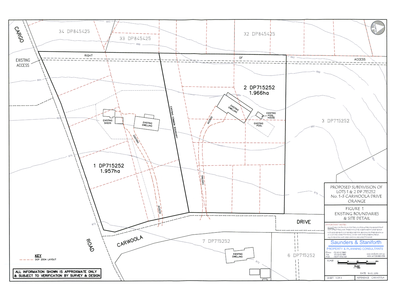
Planning and Development Committee
5 July 2016
2.5 Development
Application DA 101/2016(1) - 1 and 3 Carwoola Drive
Attachment 2 Plans
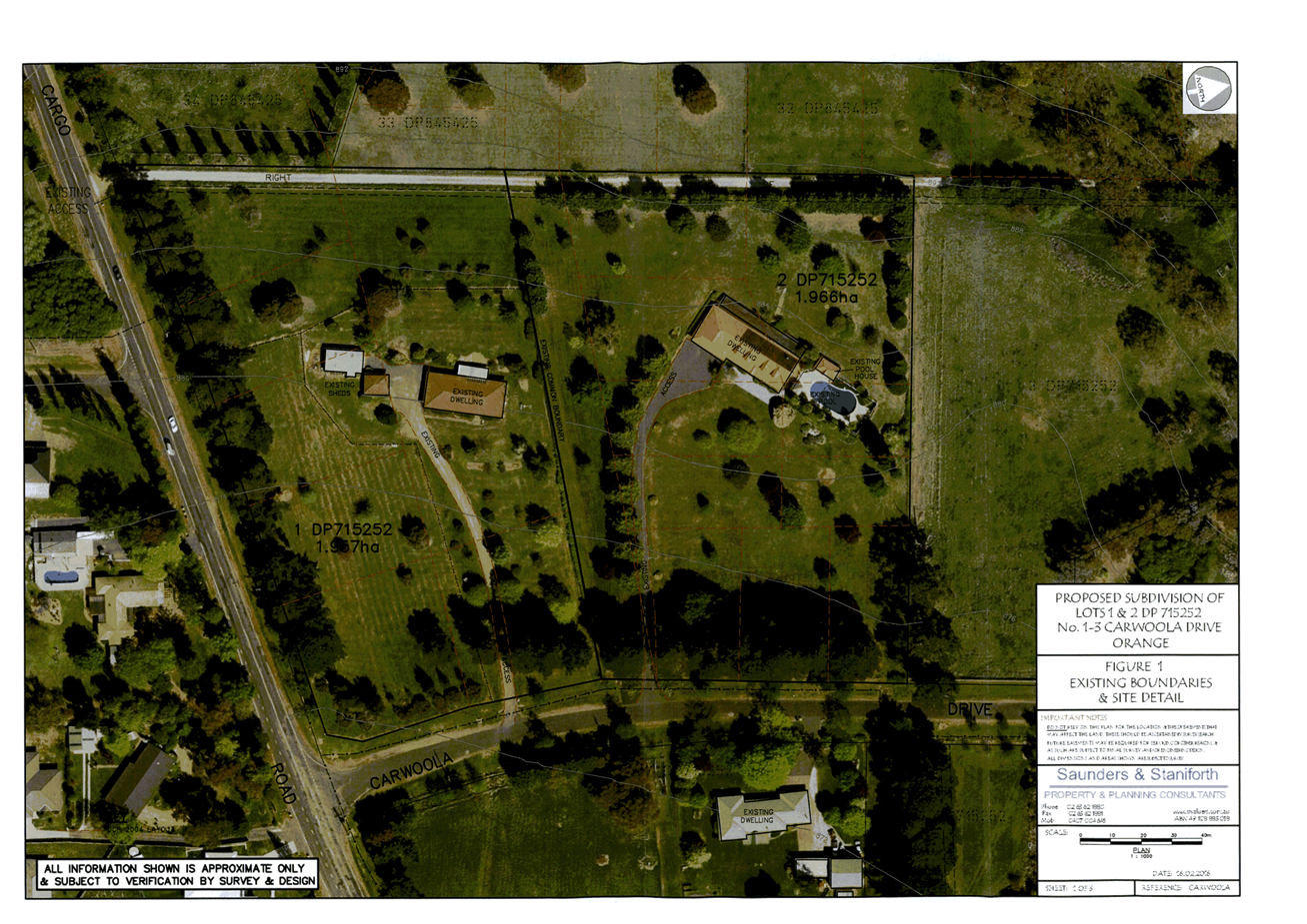
Planning and Development Committee
5 July 2016
2.5 Development
Application DA 101/2016(1) - 1 and 3 Carwoola Drive
Attachment 2 Plans
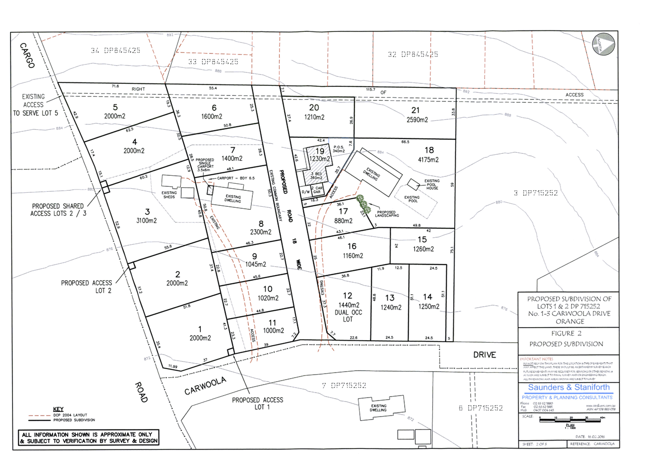
Planning and Development Committee
5 July 2016
2.5 Development
Application DA 101/2016(1) - 1 and 3 Carwoola Drive
Attachment 2 Plans
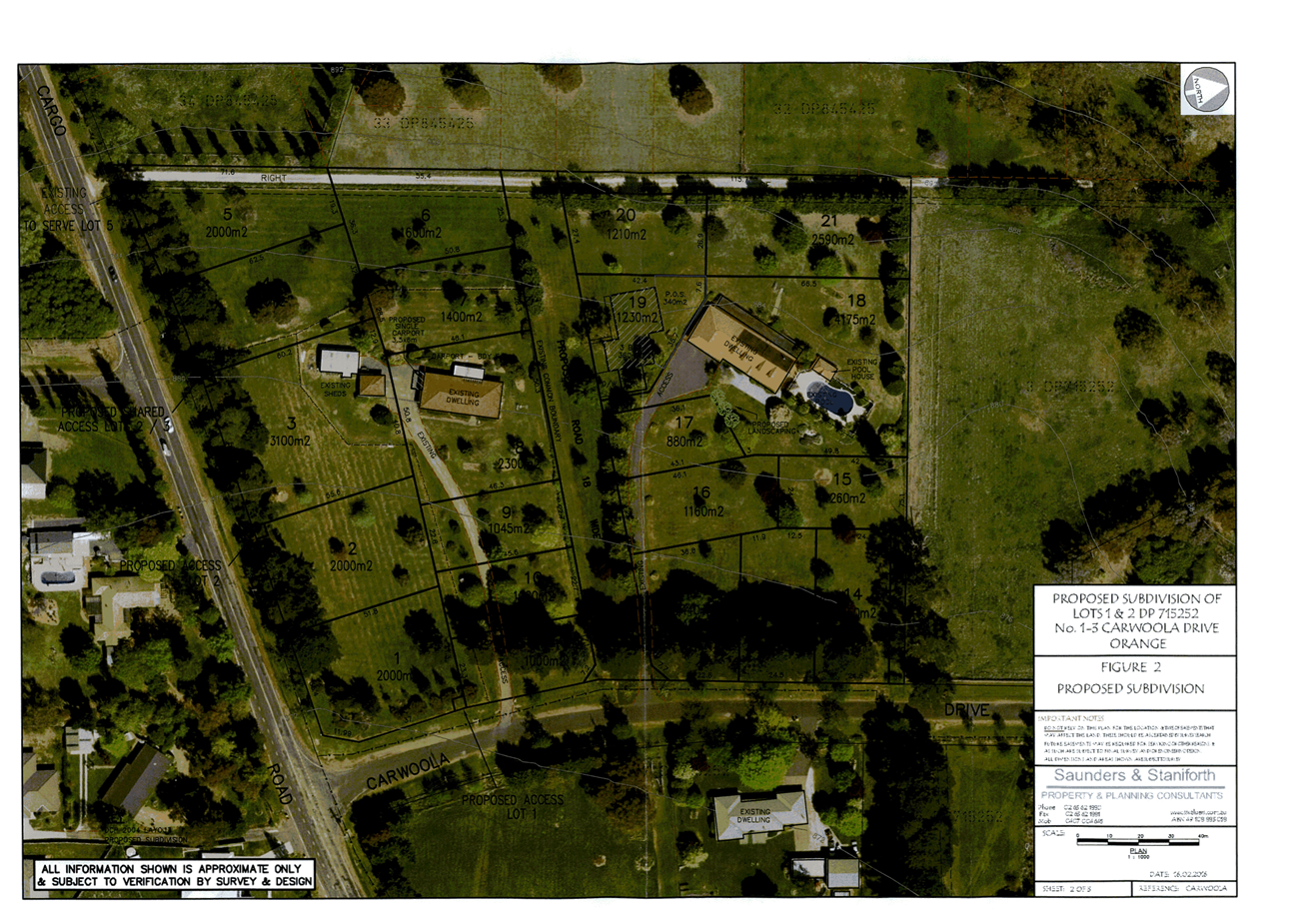
Planning and Development Committee
5 July 2016
2.5 Development
Application DA 101/2016(1) - 1 and 3 Carwoola Drive
Attachment 2 Plans
2.6 Development
Application DA 314/2008(6) - 7 Murphy Lane
TRIM
REFERENCE: 2016/1409
AUTHOR: Rishelle
Kent, Senior Planner
EXECUTIVE Summary
|
Application
lodged
|
18/02/2016
|
|
Applicant/s
|
Orange
Anglican Grammar School
|
|
Owner/s
|
Anglican
Schools Corporation
|
|
Land
description
|
Lot 100
DP 1174806 - 7 Murphy Lane, Orange
|
|
Proposed
land use
|
Educational
Establishment (Stage 1) and Advertisements
|
|
Value of
proposed development
|
$0
|
Council's consent is sought to modify Condition (52) of
development consent DA 314/2008(5) to permit pedestrian and bicycle access
to and from the Orange Anglican Grammar School via Hewitt Close. The modified
proposal would allow rear access to the school for students and staff via an
existing gate towards the eastern end of Hewitt Close. The proponent suggests
that approximately 17 current students would benefit from the proposed
pedestrian and bicycle access from Hewitt Close. Prohibition of pedestrian and
bicycle access via Murphy Lane will remain. The amended OAGS School Travel
Policy reflects the above proposal, in conjunction with prohibiting students
from being dropped off via private vehicle in Hewitt Close.

Council has
maintained the importance of providing pedestrian access to the school since
pre-DA lodgement discussions dating back to 2007, and as such a condition of
consent was imposed in 2008 that pedestrian access be provided to the site to
the satisfaction of Council and the RMS.
The condition allowed for
deferment until a suitable plan was designed, approved and constructed by
February 2011, or further approval of any subsequent stage, whichever occurred
first. Whilst further expansion of the OAGS has progressed, an agreed
pedestrian solution has been unsuccessful to date.
Pedestrian access along Gorman
Road and Hewitt Close, especially for school-aged children, is not an ideal
situation. The road reserves are not conducive to pedestrian traffic and
suitable footpaths are not available. These public roads are, however, suitable
for the rural residential locality which they service. A recent opportunity has
developed for the school to connect to Council’s Active Travel Plan
within the Molong Road network for the provision of a suitable pedestrian and
bicycle link to the main access to the school, at 7 Murphy Lane. The proponent
has provided an undertaking that they will commence discussions with Council’s
Technical Services Division in this regard.
The RMS does not object to this modification. Given their
approval, the future plans to connect the school to the Active Travel Plan and
the current Plan of Management satisfactorily enforced by the proponent, it is
considered reasonable to allow a 12 month trial to allow school students
and staff to walk or ride to the OAGS along Hewitt Close. It is recommended
that Council approves the subject proposal for a 12 month trial, in accordance
with the attached conditions of consent.
Council has consistently
maintained the importance of providing pedestrian access to the school site
since pre-DA lodgement meetings conducted in 2007. At the time of
lodgement of the original DA in 2008, OAGS had a limited timeframe to commence
operations, therefore Council and the RMS agreed to allow the deferment of the
provision of pedestrian access due to the limited number of students. This
deferment was conditioned to cease in February 2011 or prior to the further
approval of any subsequent stage, whichever occurred first (Condition (23))
with a written agreement by OAGS to undertake pedestrian design and
construction (Condition (51)). Alternative arrangements could be made via a
Plan of Management due to the limited number of students, however this would
not be suitable for any larger number.
An application to modify Condition
(23) was sought in 2009 to amend the timing of the construction of the
pedestrian footpath from prior to approval of subsequent stages to prior to
occupation of subsequent stages. This was to allow the construction of a media
centre for which OAGS had received Federal funding. The media centre was not
permitted to be occupied until the pedestrian access had been completed.
In conjunction with the 2009
application to modify, a pedestrian access design was submitted showing a 2m
wide concrete footpath along the southern road reserve of Mitchell Highway and
Murphy Lane. The proposed design was not to the satisfaction of the RMS.
A further application to modify the
pedestrian access condition (Condition (52)) was submitted in 2013 (DA
314/2008(5)). The condition was amended to read:
All access to the OAGS shall
be by bus or private vehicle. All pedestrian and bicycle access to the school
is prohibited for students, staff and teachers in accordance with the School
Travel Policy.
Pedestrian and bicycle access
will only be permitted after Orange City Council and the RMS have approved a
suitable design solution and the approved works have been carried out by the
OAGS.
As opportunities for
pedestrian access are identified by OCC, the OAGS shall undertake design work
in consultation with OCC and the RMS.
It is now proposed to amend this condition to read as
follows:
That access
to the main entrance of OAGS off Murphy Lane is to be by bus or private vehicle
only (no pedestrian or bicycle access).
Pedestrian and bicycle access
to the rear entrance of OAGS off Hewitt Close is permitted.
All access to the school is to
be in accordance with the OAGS Travel Policy (February 2016).
Link To Delivery/OPerational Plan
The recommendation in this report relates to the
Delivery/Operational Plan strategy “13.4 Our Environment
– Monitor and enforce regulations relating to City amenity”.
Financial Implications
Council has been advised that as a council included in the
NSW Government’s merger proposals under consideration by the Office of
Local Government since referral on 6 January 2016, Council must comply with the
merger proposal period guidelines issued under S23A of the Local Government Act
1993.
The guidelines instruct Council it should expend money in
accordance with the detailed budget adopted for the purposes of implementing
the Delivery/Operational Plan for the 2015/16 year.
Any expenditure outside the adopted budget requires the
identification of clear and compelling grounds and must be approved by Council
at a meeting that is open to the public. The guidelines indicate the resolution
of Council for increased expenditure must specify the reasons why the
expenditure is required and warranted.
If increased expenditure is greater than $250,000 or 1% of
the Council’s revenue from rates in
the preceding year, whichever is the greater, Council
is required to exhibit the increase to the budget and consider comments
received.
Council must also avoid entering into contracts or
undertakings where expenditure or revenue is greater than $250,000 or 1% of the
Council’s revenue from rates in the
preceding year, whichever is the greater, unless the contract or undertaking is
as a result of a decision or procurement process commenced prior to the merger
proposal period or where entering into a contract or undertaking is reasonably
necessary for the purposes of meeting the ongoing service delivery commitments
of the Council or was previously approved in the Council’s
Delivery/Operational Plan.
Policy and Governance Implications
Nil
|
Recommendation
That Council consents to
development application DA 314/2008(6)
for Educational Establishment (Stage 1) and Advertisements at Lot 100
DP 1174806 - 7 Murphy Lane, Orange pursuant
to the conditions of consent in the attached Notice of Approval.
|
further considerations
Consideration has been given to the
recommendation’s impact on Council’s service delivery; image and
reputation; political; environmental; health and safety; employees;
stakeholders and project management; and no further implications or risks have
been identified.
SUPPORTING INFORMATION
THE APPLICATION
Council's consent is sought to modify DA 314/2008(5) to
permit pedestrian and bicycle access to the Orange Anglican Grammar School from
Hewitt Close only. The land is described as Lot 100 DP 1174806 and is known as
7 Murphy Lane, Orange.
MATTERS FOR CONSIDERATION
Section 96(1A) of the Environmental
Planning and Assessment Act 1979 (EPAA) states:
A consent authority may…modify the consent if:
(a) it is satisfied that the proposed
modification is of minimal environmental impact, and
(b) it is satisfied that the development to
which the consent as modified relates is substantially the same development as
the development for which the consent was originally granted and before that
consent as originally granted was modified (if at all), and
(c) it has notified the application in
accordance with:
(i) the regulations, if the
regulations so require, or
(ii) a development control plan, if the
consent authority is a council that has made a development control plan under
section 72 that requires the notification or advertising of applications for
modification of a development consent, and
(d) it has considered any submissions made
concerning the proposed modification within any period prescribed by the
regulations or provided by the development control plan, as the case may be.
With regard to (a), the proposed modification
will not have any significant environmental effect. With regard to (b), it is
considered that the proposed development as modified is substantially the same
development to that originally approved. With regard to (c), the
modification is not defined as advertised development. It was, however,
notified to neighbours along Hewitt Close and within close proximity to the
subject site. With regard to (d), submissions were received and have been
considered during the assessment of this modification.
The relevant matters are considered below.
Section 5A Assessment
There is not likely to be a significant effect on threatened
species, populations or ecological communities or their habitats as a result of
this development.
Section 79C
Section 79C of the Environmental Planning and Assessment
Act 1979 requires Council to consider various matters, of which those
pertaining to the application are listed below.
PROVISIONS OF ANY ENVIRONMENTAL
PLANNING INSTRUMENT s79C(1)(a)(i)
Orange Local Environmental Plan 2011
Clause 1.2 - Aims of Plan
The
broad aims of the LEP are set out under subclause 2. Those relevant to the
application are as follows:
(a) to encourage development which complements
and enhances the unique character of Orange as a major regional centre boasting
a diverse economy and offering an attractive regional lifestyle,
(b) to provide for a range of development
opportunities that contribute to the social, economic and environmental
resources of Orange in a way that allows present and future generations to meet
their needs by implementing the principles for ecologically sustainable
development,
(f) to recognise and manage valued
environmental heritage, landscape and scenic features of Orange.
The application is considered to be consistent with the aims
of the plan as listed above.
Clause 1.9A - Suspension of
Covenants, Agreements and Instruments
This clause provides that covenants, agreements and other
instruments which seek to restrict the carrying out of development do not apply
with the following exceptions.
· covenants imposed
or required by Council
· prescribed
instruments under Section 183A of the Crown Lands Act 1989
· any conservation
agreement under the National Parks and Wildlife Act 1974
· any trust
agreement under the Nature Conservation Trust Act 2001
· any property
vegetation plan under the Native Vegetation Act 2003
· any biobanking
agreement under Part 7A of the Threatened Species Conservation Act 1995
· any planning
agreement under Division 6 of Part 4 of the Environmental Planning and
Assessment Act 1979.
The title of the subject property is affected by easements
for sewer, drainage and electricity. The development as modified will not
impact upon these restrictions.
Mapping
The subject site is identified
on the LEP maps in the following manner:
|
Land Zoning Map:
|
Land zoned R5 Large Lot
|
|
Lot Size Map:
|
Minimum Lot Size 2ha
|
|
Heritage Map:
|
Not a heritage item or conservation
area
|
|
Height of Buildings Map:
|
No building height limit
|
|
Floor Space Ratio Map:
|
No floor space limit
|
|
Terrestrial Biodiversity Map:
|
No biodiversity sensitivity on the
site
|
|
Groundwater Vulnerability Map:
|
Ground water vulnerable
|
|
Drinking Water Catchment Map:
|
Not within the drinking water
catchment
|
|
Watercourse Map:
|
Not within or affecting a defined
watercourse
|
|
Urban Release Area Map:
|
Not within an urban release area
|
|
Obstacle Limitation Surface Map:
|
No restriction on building siting
or construction
|
|
Additional Permitted Uses Map:
|
No additional permitted use applies
|
Those matters that are of
relevance are addressed in detail in the body of this report.
Part 2 - Permitted or Prohibited Development
Land
Use Zones
The subject site is located within the R5 Large Lot
Residential zone. The proposed development is defined as a school under OLEP
2011, and is permitted with consent pursuant to clause 28(1) of SEPP (Infrastructure)
2007 and clause 2.7 of OLEP 2011. A school is prohibited in the R5
Large Lot Residential zone pursuant to the Land Use Table. The SEPP
overrides the provisions of OLEP 2011 to the extent where there is an
inconsistency. A school is therefore permissible.
The relevant objectives of the R5 zone include:
· To
ensure that large residential lots do not hinder the proper and orderly
development of urban areas in the future.
· To
ensure that development in the area does not unreasonably increase the demand
for public services or public facilities.
· To
ensure development is ordered in such a way as to maximise public transport
patronage, and encourage walking and cycling, in close proximity to settlement.
The proposed development is not inconsistent with the
relevant provisions of the zone. The proposed alteration to Condition (52) will
not unreasonably increase the demand for public services or public facilities.
Condition (52) of the consent currently restricts students
or employees walking to the school site due to the location of the school on
the Mitchell Highway and the Northern Distributor Road, and the lack of
pedestrian access (or ability to construct such) to the school. As such, a Plan
of Management exists that requires all students and employees to travel to and
from the school via passenger vehicle or school bus. The proposed modification
to allow students and employees to utilise Hewitt Close for pedestrian and
bicycle access meets the objectives to encourage walking and cycling.
7.6 - Groundwater Vulnerability
This
clause seeks to protect hydrological functions of groundwater systems and
protect resources from both depletion and contamination.
The proposal is not anticipated
to involve the discharge of toxic or noxious substances and is therefore
unlikely to contaminate the groundwater or related ecosystems. The proposal
does not involve extraction of groundwater and will therefore not contribute to
groundwater depletion.
STATE ENVIRONMENTAL PLANNING
POLICIES
State Environmental Planning Policy (Infrastructure) 2007
State Environmental Planning Policy (Infrastructure) 2007
applies to the subject development.
As previously discussed, the proposed development is permissible
within the R5 zone (being a prescribed zone) pursuant to clause 28(1) of the
SEPP, being:
(1) Development
for the purpose of educational establishments may be carried out by any person
with consent on land in a prescribed zone.
Pursuant to Clause 32 of the SEPP, before determining a
development application for development for the purposes of a school, the
consent authority must take into consideration all relevant standards in the
following State Government publications (as in force on the commencement of
this Policy):
(a) School Facilities
Standards—Landscape Standard—Version 22 (March 2002),
(b) Schools Facilities
Standards—Design Standard (Version 1/09/2006),
(c) Schools Facilities
Standards—Specification Standard (Version 01/11/2008).
If there is an inconsistency between a standard referred to
in Subclause (2) and a provision of a Development Control Plan, the standard
prevails to the extent of the inconsistency. These standards relate to aspects
such as site investigation, clearance and preparation, earthworks and level
changes, ESD principles, landscaping, pavements, water conservation and the
like.
The applicant has not addressed the requirements of the SEPP
in the submitted Statement of Environmental Effects. A condition of consent has
been previously imposed requiring the development to comply with the relevant
standards where applicable as listed in Clause 32 of the SEPP.
PROVISIONS OF ANY DRAFT
ENVIRONMENTAL PLANNING INSTRUMENT THAT HAS BEEN PLACED ON EXHIBITION
s79C(1)(a)(ii)
There are no draft environmental planning instruments that
apply to the subject land or proposed development.
PROVISIONS OF ANY DEVELOPMENT
CONTROL PLAN s79C(1)(a)(iii)
Development Control Plan 2004
Part 0.4-1 - Interim Planning Outcomes - Scenic Areas
The site falls within the scenic area to the west of Orange.
The impact on the scenic area was previously considered under DA 314/2008(1),
and will not be affected as a result of the modified development.
Part 0.4-4 - Interim Planning
Outcomes - Murphy Lane and Gorman Road
The relevant Planning Outcomes for Part 0.4-4 include:
· Development of
the land within the area comprises rural style fencing and does not comprise
coloured metal fencing.
· Development of
land within the area is accompanied by a landscape plan that demonstrates how
the building will be blended into the landscape.
The development as modified does not impact upon the fencing
or landscaping of the site.
Part 3.2-1 - Scenic, Landscape
and Urban Areas
These matters have been previously addressed above.
Part 3.1-1 - Cumulative Impact
· Applications for development demonstrate how the development relates to the character and
use of land in the vicinity.
The Orange Anglican Grammar School is a fairly recent
established land use within this precinct. Construction commenced in 2008 and
the school has exhibited ongoing expansion since. Allowing pedestrian and
bicycle access to Hewitt Close will not negatively impact upon the character of
this area, nor will it impact upon the use of land within the vicinity.
PROVISIONS PRESCRIBED BY THE
REGULATIONS s79C(1)(a)(iv)
The development as
modified is not inconsistent within the provisions as prescribed by the
Regulations.
THE LIKELY IMPACTS OF THE
DEVELOPMENT s79C(1)(b)
An investigation into
the likely impacts of the development was carried out as part of the assessment
of DA 314/2008(1) and subsequent modifications. The proposed modification
seeks to allow students and staff to walk or ride to the school via Hewitt
Close. The likely impacts resulting from the proposed travel arrangements are
discussed below.
Context and Setting
The proposed development is situated in a rural residential
area, approximately 3.7km northwest of the CBD of the City of Orange. The
site is surrounded by larger dwellings on approximately 2ha allotments. The
proposed development has had an impact upon the scenic qualities and features
of the landscape by removing a number of mature trees, placing a concentration
of buildings adjacent to the eastern boundary and constructing internal road
works, car parking spaces and designated bus bays.
However; it is considered that these works have been offset
by the provision of landscaping to screen the proposed development.
The establishment of an educational facility has altered the
character and amenity of the locality by introducing an urban element into the
rural residential nature of the locality. Whilst landscaping and noise
attenuation measures have been implemented to reduce the impacts, the amenity
of the area has been altered (particularly during school hours) which has
affected the enjoyment of the neighbouring land to some extent. However, it
will not restrict neighbouring properties from being used for rural residential
use. To permit students and staff to utilise Hewitt Close for pedestrian and
bicycle use for a trial period of 12 months is not considered to give rise
to a substantial detrimental impact upon the context and setting of the
locality. Further consideration of any impacts which may arise will be
determined at the end of the trial period.
Access, Traffic and Transport
Access to the proposed development is principally from
Murphy Lane, a local sealed road which connects to Molong Road and Gorman Road.
The development has substantially increased the demand of traffic to the site,
and as such upgrading of carriageways and the Murphy Lane access has been
carried out to cater for this.
The internal roads have been designed to accommodate all
expected vehicles including buses, and service and delivery vehicles. The
approved road, car parking and drop-off layouts are satisfactory. Council has
previously concluded that a satisfactory number of car parking areas and bus
bays have been provided on the site.
Pedestrian access is required to be
provided to the site. However, until such time that a suitable design can be
approved and constructed (to the requirements of Council and the RMS), a
Plan of Management has been in place restricting all pedestrian and bicycle
access to the site. The proponent and Council’s
Technical Services Division both advise that numerous options have been
investigated, however none have been deemed acceptable to the RMS to date.
As stated previously, recent developments
regarding Council’s Active Travel Plan have given rise to the opportunity
for the proponent to facilitate the provision of a suitable pedestrian/bicycle
link to the main entrance to the school. As such, the proponent has requested
that Hewitt Close be available to children and staff within close proximity for
pedestrian and bicycle access only. Drop-offs/pick-ups will be prohibited in
Hewitt Close.
The application was referred to the RMS
given the site history, with the following response being received:
The proposed
modifications are to remove preclusions on students, staff and visitors from
walking or riding to Orange Anglican Grammar School. The modifications are designed
to allow students and staff who live near the school to walk and ride to the
school. Under the modifications, pedestrian and cyclist access to the school
would be from Hewitt Close only.
The
modifications to DA 314/2008 and DA 341/2009 have been referred to Roads and
Maritime in accordance with clause 104 State
Environmental Planning Policy (Infrastructure) 2007. In accordance with that
policy, Roads and Maritime does not object to the proposed modifications.
Roads and
Maritime notes Orange Anglican Grammar School and Orange City Council have
committed to discussing measures to improve safety for staff, students and
visitors accessing the school by foot or bicycle. Roads and Maritime is
supportive of this commitment, and in particular, encourages Council to explore
options for providing safe pedestrian facilities to safely cross the Northern
Distributor Road.
Given the
commitments made in the OAGS draft Travel Policy which accompanied the
application, the approval of the RMS, the possibility of connecting to
Council’s Active Travel Plan, and in light of other designs being deemed
unsuitable, it is considered reasonable that a 12 month trial period be
granted, with a review to be undertaken following the trial period to assess
any extension to this timeframe.
It is therefore recommended that
Condition (52) be amended as follows:
(52) All access to the main entrance of Orange
Anglican Grammar School off Murphy Lane shall be by bus or private vehicle.
Pedestrian and bicycle access (for all students, staff and teachers) is
prohibited for the main entrance. Pedestrian and bicycle access for students,
staff and teachers is permitted to and from the Hewitt Close access. Drop-off
and pick-up by private vehicle in Hewitt Close is prohibited.
These
access arrangements shall be identified in the Orange Anglican Grammar School
Travel Policy, and submitted to Council for approval prior to the use of Hewitt
Close for pedestrian and bicycle access. As opportunities for pedestrian access are identified by Orange City
Council, the Orange Anglican Grammar School shall undertake design and construction work in
consultation with Orange City Council and the RMS.
These
arrangements are subject to a trial period of 12 months, commencing on
6 July 2016. A modification application may be lodged to extend these
arrangements beyond the 12 month trial period. If the modification
application is lodged at least two months before the expiry of the trial
period, the applicant will be permitted to continue with the pedestrian and bicycle
access from Hewitt Close until the modification application has been determined
by the Council. If the modification application is not lodged before the expiry
of the trial period, then the pedestrian and bicycle access to the school will
be prohibited.
The recommended wording will place the onus on the school to
provide pedestrian facilities to the school when and if Council identifies
suitable opportunities to provide such facilities over time. The amended
condition also places the responsibility on the Orange Anglican Grammar School
to carry out any necessary design and construction work for these facilities.
In light of the above, the proposed modification will not
give cause to a detrimental impact upon the locality in terms of access,
traffic and transport.
THE SUITABILITY OF THE SITE
s79C(1)(c)
The location of the educational establishment has never been
ideal, with two major arterial roads intersecting the general urban catchment
to which it serves. The site is situated within a large lot residential area
where quiet enjoyment of the land is highly valued by the existing residents.
The development of an educational establishment in this
locality has undoubtedly altered the amenity of the existing area. An arterial
road (being the Mitchell Highway) and the Northern Distributor Road are located
in close proximity (and in parts adjacent to) the east and south of the
properties. Given the lay of the land and design of the surrounding road
network, pedestrian access is not readily available to the school grounds.
Condition (52) of consent currently restricts students
or employees walking to the school site due to the location of the school on
the Mitchell Highway and the Northern Distributor Road, and the lack of
pedestrian access (or ability to construct such) to the school. As such, a Plan
of Management exists requiring that all students and employees travel to and
from the school via passenger vehicle or school bus. As opportunities for pedestrian access are identified by Orange City
Council, the Orange Anglican Grammar School will be required to undertake design and
construction work in consultation with Orange City Council and the RMS.
Condition (52) of the consent has been amended accordingly.
Despite the issues raised in relation to pedestrian access,
the site allows for an adequate area of land to ensure that all car parking and
manoeuvring is adequately contained within the school grounds. The development
offers a purpose built environment for students with the ability to expand
enrolment numbers from preschool through to Year 12 students. The site was not
found to be contaminated, and suitable replanting of trees has been undertaken
to maintain the vista of the locality and to screen the built form of the
school.
The site maintains its suitability for the proposed
development.
ANY SUBMISSIONS MADE IN
ACCORDANCE WITH THE ACT s79C(1)(d)
A referral was made to the NSW RMS given the nature of the
proposal and previous history of the site. In effect, the RMS did not object to
the proposed modification of access arrangements as described in the
application.
The proposed development is not defined as advertised
development under the provisions of the DCP, and as such no formal
exhibition of the application was required. However, given the nature of the
development, residents along Hewitt Close and those surrounding the subject
site were provided with written notification of the application. Following the
14 day exhibition period, two submissions were received by Council. Both
of these submissions are from residents of Hewitt Close, and both were
principally concerned with the safety of children and staff using Hewitt Close
for pedestrian and bicycle access to the School. Further the submissions raise
concerns that Hewitt Close will become a de facto kiss-and-drop area.
It is acknowledged that Hewitt Close, and more so Gorman
Road, are not ideal for pedestrian or bicycle use, especially by children. That
said, these roads are public roads and are permitted for such use by members of
the public. The determined safety of these roads for children to walk or ride
to school ultimately comes down to parental choice. Pedestrian and bicycle
access has always been denied for the school in light of the schools location
in relation to the Mitchell Highway, and as such has been consistently
conditioned.
The applicant has prepared a draft travel policy which
accompanied the application which demonstrates how the school will manage
pedestrian and cycle access to the school. Given the previous inability to
resolve the pedestrian issue with the RMS, and the current opportunity
available with Council’s Active Travel Plan, a 12 month trial is
considered a reasonable outcome in this respect.
PUBLIC INTEREST
s79C(1)(e)
The proposed development is considered to be of minor interest
to the wider public due to the relatively localised nature of potential
impacts. The proposal is not inconsistent with any relevant policy statements,
planning studies, guidelines, etc that have not been considered in this
assessment.
SUMMARY
The proposed development is permissible with the consent of
Council. The proposed development complies with the relevant aims, objectives
and provisions of the LEP. A section 79C assessment of the
development indicates that the development is acceptable in this instance.
Attached is a draft Notice of Approval outlining a range of conditions
considered appropriate to ensure that the development proceeds in an acceptable
manner.
COMMENTS
The requirements of the Environmental Health and Building
Surveyor and the Engineering Development Section are included in the attached
Notice of Approval.
Attachments
1 Notice
of Approval, D16/27275⇩
2 Submissions,
D16/27172⇩
Planning and Development Committee
5 July 2016
2.6 Development
Application DA 314/2008(6) - 7 Murphy Lane
Attachment 1 Notice
of Approval
|
|
ORANGE
CITY COUNCIL
Development
Application No DA
314/2008(6)
NA16/ Container
PR13743
|
NOTICE OF DETERMINATION
OF A DEVELOPMENT
APPLICATION
(AS MODIFIED)
issued under the Environmental
Planning and Assessment Act 1979
Section 81(1)
|
Development
Application
|
|
|
Applicant Name:
|
Orange
Anglican Grammar School
|
|
Applicant Address:
|
C/-
Anthony Daintith Town Planning
PO Box
1975
ORANGE
NSW 2800
|
|
Owner’s Name:
|
Anglican
Schools Corporation
|
|
Land to Be Developed:
|
Lot 100 DP
1174806 - 7 Murphy Lane, Orange
|
|
Proposed Development:
|
Educational
Establishment (Stage 1) and Advertisements
|
|
|
|
|
Building
Code of Australia
building classification:
|
Class 5
(office), Class 9b (school) and Class 10a (proprietary shelter)
|
|
|
|
|
Determination
|
|
|
Made On:
|
5 July 2016
|
|
Determination:
|
CONSENT
GRANTED SUBJECT TO CONDITIONS DESCRIBED BELOW:
|
|
|
|
|
Consent to
Operate From:
|
18
November 2008
|
|
Consent to
Lapse On:
|
18
November 2013
|
Terms of Approval
The reasons for the imposition of
conditions are:
(1) To ensure a quality
urban design for the development which complements the surrounding environment.
(2) To maintain
neighbourhood amenity and character.
(3) To ensure
compliance with relevant statutory requirements.
(4) To provide
adequate public health and safety measures.
(5) Because the
development will require the provision of, or increase the demand for, public
amenities and services.
(6) To ensure
the utility services are available to the site and adequate for the
development.
(7) To prevent
the proposed development having a detrimental effect on adjoining land uses.
(8) To minimise
the impact of development on the environment.
Conditions
(1) The
development is to be carried out generally in accordance with:
(a) Plan/s
numbered DA01; DA02; DA03; DA04; 080629-01 Rev B; 080629-02 Rev A; 080629-03
Rev A; WC-035; 0820 as modified by A.03 Site Plan 1; A.03
Site Plan 2; 081236 - 01 to 081236 - 08 (10 sheets)
b) statements
of environmental effects or other similar associated documents that form part
of the approval
as amended
in accordance with any conditions of this consent.
(2) All building
work must be carried out in accordance with the provisions of the Building Code
of Australia.
(3) A sign is to
be erected in a prominent position on any site on which building work,
subdivision work or demolition work is being carried out:
(a) showing
the name, address and telephone number of the principal certifying authority
for the work, and
(b) showing
the name of the principal contractor (if any) for any building work and a
telephone number on which that person may be contacted outside working hours,
and
(c) stating
that unauthorised entry to the site is prohibited.
Any such sign is to be maintained while
the building work, subdivision work or demolition work is being carried out,
but must be removed when the work has been completed.
|
PRIOR TO THE ISSUE OF
A CONSTRUCTION CERTIFICATE
|
(4) Engineering
plans, showing details of all proposed work and adhering to any conditions of
development consent, are to be submitted to, and approved by, Orange City
Council or an Accredited Certifier prior to the issuing of a Construction
Certificate.
(5) A water and
soil erosion control plan is to be submitted to Orange City Council or an
Accredited Certifier for approval prior to the issuing of a Construction
Certificate. The control plan is to be in accordance with the Orange City
Council Development and Subdivision Code and the Landcom, Managing Urban
Stormwater; Soils and Construction Handbook.
(6) A
Certificate of Compliance, from Orange City Council in accordance with the Water
Management Act 2000, is to be submitted to the Principal Certifying
Authority prior to the issuing of a Construction Certificate and as specified
following.
The Certificate of Compliance will be
issued subject to the payment of contributions for water, sewer and drainage
works - at the level of contribution applicable at that time. The contributions
are based on 6 ET’s for water supply headworks and 7 ET’s for
sewerage headworks and payments are to be made to Council on the following
schedule:
|
Prior to issue of Construction
Certificate
|
4 ET’s for water supply
headworks
|
5 ET’s for sewerage headworks
|
|
Prior to 1 October 2009
|
1 ET for water supply headworks
|
1 ET for sewerage headworks
|
|
Prior to 1 February 2010
|
1 ET for water supply headworks
|
1 ET for sewerage headworks
|
(7) The
development’s stormwater design is to include stormwater retention within
the development, designed to limit peak outflows from the land to the
pre-existing natural outflows up to the 100 year ARI frequency, with sufficient
allowance in overflow spillway design capacity to safely pass flows of lower
frequency (that is, a rarer event) without damage to downstream developments.
Where appropriate, the spillway design capacity is to be determined in
accordance with the requirements of the Dam Safety Committee.
The design of the detention storage is
to be undertaken using the ILSAX rainfall-runoff hydrologic model or an
approved equivalent capable of assessing runoff volumes and their temporal
distribution as well as peak flow rates. The model is to be used to calculate
the flow rates for the existing and post-development conditions. The developed
flows are to be routed through the proposed storage within the model so that
the outflows obtained are no greater than the flows obtained for the
pre-existing natural flows. A report detailing the results of the analysis, which
includes:
· catchment
plan showing sub-catchments under existing and developed conditions;
· schematic
diagram of the catchment model showing sub areas and linkages;
· tabulation
detailing the elevation, storage volume and discharge relationships; and
· tabulation
for the range of frequencies analysed, the inflows, outflows and peak storage
levels for both existing and developed conditions;
together with copies of the data files
for the model and engineering design plans of the required drainage system are
to be submitted to Orange City Council or an Accredited Certifier upon
application for a Construction Certificate.
(8) All
stormwater from the site is to be collected and piped to Council’s
existing stormwater system. Orange City Council or an Accredited Certifier,
prior to issuing a Construction Certificate, is to approve engineering plans
for this drainage system.
(9) A Liquid
Trade Waste Application is to be submitted to Orange City Council prior to the
issuing of a Construction (or Occupation) Certificate. The application is
to be in accordance with Orange City Council’s Liquid Trade Waste
Policy. Engineering plans submitted as part of the application are to
show details of all proposed liquid trade waste pre-treatment systems and their
connection to sewer.
Where applicable, the applicant is to
enter into a Liquid Trade Waste Service Agreement with Orange City Council in
accordance with the Orange City Council Liquid Trade Waste Policy.
(10) A water
reticulation analysis by “Watsys” or other Council-approved
equivalent flow-modelling computer program, is to be carried out on any
proposed water-reticulation system for the development. A professional engineer
or other Council-approved person is to carry out the analysis. The analysis is
to be submitted to the Principal Certifying Authority for approval with
engineering plans prior to the issuing of a Construction Certificate.
The reticulation system is to be
designed to supply a peak instantaneous demand by gravity of 0.15 L/s/tenement
at a minimum residual head of 200kPa.
(11) Application is to be made for a Construction Certificate
for civil works associated with the proposed school development. Engineering
plans, showing details of the proposed internal and external roadworks, sewer,
water, stormwater and traffic management works, are to be submitted to Orange
City Council or an Accredited Certifier upon application for a Construction
Certificate.
(12) Engineering plans, showing details and condition of all
trees to be removed, are to be submitted to, and approved by, Orange City
Council or an Accredited Certifier prior to the issuing of a Construction
Certificate.
(13) The
intersection of Murphy Lane and school access road is to be designed to
accommodate both present and future demands for the development. The
intersection shall be designed in accordance with the RTA Road Design Guide and
shall incorporate “AUR/AUL” widening on Murphy Lane.
The
proposed storage bays on Murphy Lane are to be designed to accommodate a
minimum of two (2) school buses.
Any
alterations to existing services in Murphy Lane that are necessary to
accommodate the proposed intersection are to be at the full cost of the
developer.
Engineering
plans, showing details of all proposed work and adhering to any conditions of
development approval, shall be submitted to Orange City Council or an
Accredited Certifier upon application for a Construction Certificate. The engineering
plans shall be approved by Orange City Council prior to the issue of a
Construction Certificate.
(14) Details of
the required barrier or solid fence between the internal road and the dwelling
at 9 Murphy Lane is to be submitted and approved by Council prior to the issue
of a Construction Certificate. Details are to include the location,
dimensions and materials of the proposed fence. The design must be
certified by an accredited acoustic engineer as meeting the noise standards
established in the Noise Assessment submitted with the development engineer.
(15) A
Construction Certificate application is required to be submitted to, and issued
by, Council/Accredited Certifier prior to any excavation or building works
being carried out on site.
(16) A
list which details the Fire Safety Measures that are existing within the
building premises and those which are proposed, shall be submitted to the
Certifying Authority with the Construction Certificate application, in
accordance with Part 9 Clause 168 of the Environmental Planning and
Assessment Regulation 2000. Note: A Construction Certificate cannot
be issued until a list of fire safety measures is received.
(17) Structural
engineering details are to be submitted with the application for a Construction
Certificate for all proposed footings and slabs to be constructed as part of
this development.
(18) Parking
facilities for people with disabilities are to comply with
clause NSW D3.5 of the Building Code of Australia and the
requirements of Australian Standard 2890.1:1993 - “Parking
Facilities - Off-Street Parking”.
(19) All wastes
from the demolition and construction phases of this project are to be deposited
at a licensed or approved waste disposal site. The project manager is to submit
a waste management plan that describes the nature of wastes to be removed, the
wastes to be recycled, the destination of all wastes and the route to be taken
by vehicles transporting wastes to disposal sites. This information is to be
supplied to Council prior to the issuing of a Construction Certificate.
(20) Where a
facility is to be constructed primarily for use by children, access and
facilities are to be designed in accordance with Australian Standard 1428.3
– Design for Access and Mobility – Requirements for Children and
Adolescents With Physical Disabilities.
(21) Prior to the
issue of the Construction Certificate, an application under Section 68 of the
Local Government Act is to be made to Orange City Council, as the water and
sewer authority, for the water, sewer and stormwater connections/works.
(22) Prior to the
issue of the Construction Certificate, a report prepared by a suitably
qualified person detailing how compliance with Section J “Energy
Efficiency” of the BCA, will be achieved for the proposed Junior and
Transition School buildings, is to be submitted to Council/accredited certifier
for approval.
|
PRIOR TO WORKS
COMMENCING
|
(23) The approved
water and soil erosion control plan is to be implemented prior to construction
work commencing.
|
DURING
CONSTRUCTION/SITEWORKS
|
(24) Any
adjustments to existing utility services that are made necessary by this
development proceeding are to be at the full cost of the developer.
(25) The
provisions and requirements of the Orange City Council Development and
Subdivision Code are to be applied to this application and all work constructed
within the development is to be in accordance with that Code.
The developer is to be entirely
responsible for the provision of water, sewerage and drainage facilities
capable of servicing the development from Council’s existing infrastructure.
The developer is to be responsible for gaining access over adjoining land for
services where necessary and easements are to be created about all water, sewer
and drainage mains within and outside the lots they serve.
(26) All driveway
and parking areas are to be sealed with bitumen, hot mix or concrete and are to
be designed for all expected loading conditions (provided however that the
minimum pavement depth for gravel and flush seal roadways is 200mm) and be in
accordance with the Orange City Council Development and Subdivision Code.
(27) Where
stormwater crosses land outside the lot it favours, an easement to drain water
is to be created over the works. A Restriction-as-to-User under section 88B of
the NSW Conveyancing Act 1979 is to be created on the title of the
proposed lots requiring that no structures are to be placed on the site, or
landscaping or site works carried out on the site, in a manner that affects the
continued operation of the interlot drainage system. The minimum width of the
easement is to be as required in the Orange City Council Development and
Subdivision Code.
(28) Water
and sewerage reticulation is to be provided to the proposed school development
in accordance with the Orange City Council Development and Subdivision Code.
(29) Water and
sewer services, including mains construction, pumping station construction,
easements and all associated materials and works, are to be provided for the
development at the cost of the developer.
(30) All
construction vehicles are required to utilise the Murphy Lane entrance to the
site.
(31) A Registered
Surveyor’s certificate identifying the location of the building on the
site must be submitted to the Principal Certifying Authority upon completion of
the foundations and prior to the placement of the buildings on site.
(32) All
construction works are to be strictly in accordance with the Reduced Levels
(RLs) as shown on the approved plans.
(33) All plumbing
and drainage (water supply, sanitary plumbing and drainage, stormwater drainage
and hot water supply) is to comply with the Local Government (General)
Regulation 2005, the NSW Code of Practice – Plumbing &
Drainage and Australian Standard AS3500 - National Plumbing and
Drainage Code. Such work is to be installed by a licensed plumber and is to be
inspected and approved by Council prior to concealment.
(34) All
materials on site or being delivered to the site are to be contained within the
site. The requirements of the Protection of the Environment Operations Act
1997 are to be complied with when placing/stockpiling loose material or
when disposing of waste products or during any other activities likely to
pollute drains or watercourses.
(35) All
excavated material is to be removed from the site in an approved manner and
disposed of lawfully to an authorised disposal area.
(36) Building
demolition is to be carried out in accordance with Australian Standard
2601:2001 - The Demolition of Structures, and the requirements of the NSW
WorkCover Authority.
(37) All construction/demolition
work on the site is to be carried out between the hours of 7.00 am and
6.00 pm Monday to Friday inclusive, 7.00 am to 5.00 pm Saturdays
and 8.00 am to 5.00 pm on Sundays and Public Holidays. Written
approval must be obtained from the General Manager of Orange City Council to
vary these hours.
(38) Where
Orange City Council is appointed as the Principal Certifying Authority, the
following inspections will be required to be carried out by Council:
· at
commencement of building work
· footings
excavation
· slab
reinforcement
· frame
inspection
· wet areas
· stormwater
drainage
· internal
sewer/sanitary drainage
· external
sewer/sanitary drainage
· hot and cold
water plumbing
· final
inspection
Should any of the above mandatory inspections
not be carried out by Council an Occupation Certificate will not be issued on
the completed structure.
|
PRIOR TO THE ISSUE OF
AN OCCUPATION CERTIFICATE
|
(39) A
Certificate of Compliance, from a Qualified Engineer, stating that the
stormwater retention basin complies with the approved engineering plans is to
be submitted to the Principal Certifying Authority prior to the issuing of an
Occupation Certificate.
(40) Certification
from Orange City Council is required to be submitted to the Principal
Certifying Authority prior to the issue of an Occupation Certificate stating
that all works relating to connection of the development Council assets, works
on Public Land, stormwater, sewer and water reticulation mains and footpaths
have been carried out in accordance with the Orange City Council Development
and Subdivision Code and the foregoing conditions.
(41) The
existing residence is to be connected to the proposed reticulated sewer. The
existing tank is to be accurately located and indicated on the submitted
engineering plans. The septic tank is to be excavated and disposed of at a
licensed landfill and the absorption trench is to be drained and the voids
limed and backfilled with clean compacted material.
Evidence of such work is to
be provided to the Principal Certifying Authority prior to the issuing of an
Occupation Certificate.
(42) The intersection of Murphy Lane and The Mitchell Highway is
to be upgraded prior to the issue of an Occupation Certificate unless suitable
alternative traffic arrangements are made to the satisfaction of the RTA and
Orange City Council.
(43) An easement to drain sewage and to provide Council access
for maintenance of sewerage works a minimum of 2.0 metres wide is to be created
over all sewer mains within Lots 67, 68, 70 & 71 in DP 1004166 and Lot
2 in DP 819929. Evidence that the easement has been registered is to be
submitted to the Principal Certifying Authority prior to the issuing of an
Occupation Certificate.
(44) A
Right of Carriageway is to be created about the proposed roundabout within Lot
67 in 1004166 in favour of Lot 2 in DP 819929. Evidence that the Right of
Carriageway has been registered is to be submitted to the Principal Certifying
Authority prior to the issuing of an Occupation Certificate.
(45) The Plan of Management for travel to the proposed school by
students, teachers and staff is to be approved by Orange City Council prior to
the issue of an Occupation Certificate.
(46) A written agreement to undertake the pedestrian design,
approval and construction, in accordance with condition 52, is to be provided
to Orange City Council prior to the issue of an Occupation Certificate for the
school.
(47) The
landscaped area shown on the plan submitted with the application shall be the
subject of a detailed working plan by a suitably qualified person. The
landscape plan is to be submitted to, and endorsed by Council, prior to the
issue of an Occupation Certificate.
This detailed plan should be drawn to
scale and include the location of tree and shrub species, height and spread at
maturity and elevation of landscaped areas. Dense plantings are to be
situated within the Scenic Protection Area, along the eastern boundary of Lot 2
DP 819929 between the proposed buildings and the property boundary, and along
the entire western boundary of Lot 67 DP 1004166. These areas are to be
planted prior to the issue of an Occupation Certificate for Stage One.
Development consent does not relate to the removal of any vegetation outside of
the works for Stage One.
(48) The owner of
the building/s must cause the Council to be given a Final Fire Safety
Certificate on completion of the building in relation to essential fire or
other safety measures included in the schedule attached to this approval.
(49) No person is
to use or occupy the building or alteration that is the subject of this
approval without the prior issuing of an Occupation Certificate.
(50) Certification
from Orange City Council, stating that liquid trade waste measures implemented
comply with Orange City Council’s Liquid Trade Waste approval, is to be
submitted to the Principal Certifying Authority prior to the issuing of an
Occupation Certificate.
(51) All
of the foregoing conditions are to be at the full cost of the developer and to
the requirements and standards of the Orange City Council Development and
Subdivision Code, unless specifically stated otherwise. All work required by
the foregoing conditions is to be completed prior to the issuing of an
Occupation Certificate, unless stated otherwise.
(52) All
access to the main entrance of Orange Anglican Grammar School off Murphy Lane
shall be by bus or private vehicle. Pedestrian and bicycle access (for all
students, staff and teachers) is prohibited for the main entrance. Pedestrian
and bicycle access for students, staff and teachers is permitted to and from
the Hewitt Close access. Drop-off and pick-up by private vehicle in Hewitt
Close is prohibited.
These
access arrangements shall be identified in the Orange Anglican Grammar School
Travel Policy, and submitted to Council for approval prior to the use of Hewitt
Close for pedestrian and bicycle access. As opportunities for
pedestrian access are identified by Orange City Council, the Orange
Anglican Grammar School shall undertake design and construction work in
consultation with Orange City Council and the RMS.
These
arrangements are subject to a trial period of 12 months, commencing on 6 July
2016. A modification application may be lodged to extend these arrangements
beyond the 12 month trial period. If the modification application is
lodged at least two months before the expiry of the trial period, the applicant
will be permitted to continue with the pedestrian and bicycle access from
Hewitt Close until the modification application has been determined by the
Council. If the modification application is not lodged before the expiry of the
trial period, then the pedestrian and bicycle access to the school will be
prohibited.
MATTERS FOR THE
ONGOING PERFORMANCE AND OPERATION OF THE DEVELOPMENT
|
(53) This
approval is for Stage 1 (175 pupils) only. Any further development will
require the consent of Council. Additional civil engineering works and
water and sewer augmentation charges will be required for the future stages of
this development.
(54) Vehicular access off Hewitt Close in future stages will be
limited to emergency and domestic traffic only. Electronic control of a gate
off Hewitt Close will be required.
(55) The height
of the sign shall be limited to a maximum height of 2m. Illumination in
the form of an LED message board will be permitted during daylight hours only.
(56) The sign
shall be permitted to be displayed for a maximum of 15 years, after which time
further approval may be required.
(57) The colour
scheme of the proposed buildings is limited to Colorbond Dune, Bushland and
Woodland Grey.
(58) The findings
of the Noise Impact Assessment prepared by Indigo Consultants dated 27 October
2008 are to be implemented at all times during the life of the development.
(59) The
perimeter fencing shall be of a type and height comparable to that used within
rural localities to maintain the character of the area. Any variation to
this provision will require the concurrence of Council.
(60) The
transportable buildings have been granted consent until 17 December 2018, after
which time permanent structures are to be erected with Council’s consent.
(61) Any
ancillary light fittings fitted to the exterior of the building are to be
shielded or mounted in a position to minimise glare to adjoining properties.
(62) The owner is
required to provide to Council and to the NSW Fire Commissioner an annual Fire
Safety Certificate in respect of the fire-safety measures, as required by
Clause 177 of the Environmental Planning and Assessment Regulation 2000.
(63) The
development shall comply with the relevant provisions of:
(a) School
Facilities Standards – Landscape Standard – (Version 22 March 2002)
(b) School
Facilities Standards – Design Standard – (Version 1/09/2006)
(c) School
Facilities Standards – Specification Standard (Version 1/11/2008)
Other Approvals
(1) Local
Government Act 1993 approvals granted under section 68.
Not applicable
(2) General
terms of other approvals integrated as part of this consent.
See attached conditions
Right of Appeal
If
you are dissatisfied with this decision, section 97 of Environmental
Planning and Assessment Act 1979 gives you the right to appeal to the Land
and Environment Court within 6 months after the date on which you receive this
notice.
*
Section 97 of the Environmental Planning and Assessment Act 1979 does not apply
to the determination of a development application for State significant
development or local designated development that has been the subject of a
Commission of Inquiry.
|
Disability Discrimination Act
1992:
|
This application has been assessed in
accordance with the Environmental Planning and Assessment Act 1979. No
guarantee is given that the proposal complies with the Disability
Discrimination Act 1992.
The applicant/owner is responsible to
ensure compliance with this and other anti-discrimination legislation.
The Disability Discrimination Act
covers disabilities not catered for in the minimum standards called up in the
Building Code of Australia which references AS1428.1 - "Design for
Access and Mobility". AS1428 Parts 2, 3 and 4 provides the most
comprehensive technical guidance under the Disability Discrimination Act
currently available in Australia.
|
|
|
|
|
Disclaimer - S88B Restrictions on the Use of Land:
|
The applicant should note that there
could be covenants in favour of persons other than Council restricting what
may be built or done upon the subject land. The applicant is advised to check
the position before commencing any work.
|
|
|
|
|
Signed:
|
On behalf of the consent authority ORANGE
CITY COUNCIL
|
|
Signature:
|
|
|
Name:
|
DAVID WADDELL - DIRECTOR DEVELOPMENT
SERVICES
|
|
Date:
|
6 July 2016
|
Planning
and Development Committee
5 July 2016
2.6 Development
Application DA 314/2008(6) - 7 Murphy Lane
Attachment 2 Submissions
2.7 Development
Application DA 341/2009(2) - 7 Murphy Lane
TRIM
REFERENCE: 2016/1410
AUTHOR: Rishelle
Kent, Senior Planner
EXECUTIVE Summary
|
Application
lodged
|
18 February
2016
|
|
Applicant/s
|
Orange
Anglican Grammar School
|
|
Owner/s
|
Anglican
Schools Corporation
|
|
Land
description
|
Lot 100
DP 1174806 - 7 Murphy Lane Orange
|
|
Proposed
land use
|
Educational
Establishment (Stage 2)
|
|
Value of
proposed development
|
Not
applicable
|
Council's consent is sought to modify Condition (26) of
development consent DA 341/2009(1) to permit pedestrian and bicycle access
to and from the Orange Anglican Grammar School via Hewitt Close. The modified
proposal would allow rear access to the school for students and staff via an
existing gate towards the eastern end of Hewitt Close. The proponent suggests
that approximately 17 current students would benefit from the proposed
pedestrian and bicycle access from Hewitt Close. Prohibition of pedestrian and
bicycle access via Murphy Lane will remain. The amended OAGS School Travel
Policy reflects the above proposal, in conjunction with prohibiting students
from being dropped off via private vehicle in Hewitt Close.
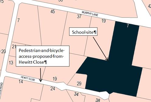
Council has
maintained the importance of providing pedestrian access to the school since
pre-DA lodgement discussions dating back to 2007, and as such a condition of
consent was imposed in 2008 that pedestrian access be provided to the site to
the satisfaction of Council and the RMS.
The condition allowed for
deferment until a suitable plan was designed, approved and constructed by
February 2011, or further approval of any subsequent stage, whichever occurred
first. Whilst further expansion of the OAGS has progressed, an agreed pedestrian
solution has been unsuccessful to date.
Pedestrian access along Gorman
Road and Hewitt Close, especially for school-aged children, is not an ideal
situation. The road reserves are not conducive to pedestrian traffic and
suitable footpaths are not available. These public roads are, however, suitable
for the rural residential locality which they service. A recent opportunity has
developed for the school to connect to Council’s Active Travel Plan
within the Molong Road network for the provision of a suitable pedestrian and
bicycle link to the main access to the school, at 7 Murphy Lane. The proponent
has provided an undertaking that they will commence discussions with
Council’s Technical Services Division in this regard.
The RMS does not object to this modification. Given their
approval, the future plans to connect the school to the Active Travel Plan and
the current Plan of Management satisfactorily enforced by the proponent, it is
considered reasonable to allow a 12 month trial to allow school students
and staff to walk or ride to the OAGS along Hewitt Close. It is recommended
that Council approves the subject proposal for a 12 month trial, in accordance
with the attached conditions of consent.
Council has consistently
maintained the importance of providing pedestrian access to the school site
since pre-DA lodgement meetings conducted in 2007. At the time of
lodgement of the original DA in 2008 (DA 314/2008), OAGS had a limited
timeframe to commence operations, therefore Council and the RMS agreed to allow
the deferment of the provision of pedestrian access due to the limited number
of students. This deferment was conditioned to cease in February 2011 or prior
to the further approval of any subsequent stage, whichever occurred first
(Condition (23)) with a written agreement by OAGS to undertake pedestrian
design and construction (Condition (51)). Alternative arrangements could be
made via a Plan of Management due to the limited number of students, however
this would not be suitable for any larger number.
An application to modify Condition
(23) was sought in 2009 to amend the timing of the construction of the
pedestrian footpath from prior to approval of subsequent stages to prior to
occupation of subsequent stages. This was to allow the construction of a media centre
for which OAGS had received Federal funding. The media centre was not permitted
to be occupied until the pedestrian access had been completed.
In conjunction with the 2009
application to modify, a pedestrian access design was submitted showing a 2m wide
concrete footpath along the southern road reserve of Mitchell Highway and
Murphy Lane. The proposed design was not to the satisfaction of the RMS.
A further application to modify
the pedestrian access condition (Condition (52)) was submitted in 2013 (DA
314/2008(5)). The condition was amended to read:
All access to the OAGS shall
be by bus or private vehicle. All pedestrian and bicycle access to the school
is prohibited for students, staff and teachers in accordance with the School
Travel Policy.
Pedestrian and bicycle access
will only be permitted after Orange City Council and the RMS have approved a
suitable design solution and the approved works have been carried out by the
OAGS.
As opportunities for
pedestrian access are identified by OCC, the OAGS shall undertake design work
in consultation with OCC and the RMS.
It is now proposed to amend this condition to read as
follows:
That access
to the main entrance of OAGS off Murphy Lane is to be by bus or private vehicle
only (no pedestrian or bicycle access).
Pedestrian and bicycle access
to the rear entrance of OAGS off Hewitt Close is permitted.
All access to the school is to
be in accordance with the OAGS Travel Policy (February 2016).
Link To Delivery/OPerational Plan
The recommendation in this report relates to the
Delivery/Operational Plan strategy “13.4 Our Environment
– Monitor and enforce regulations relating to City amenity”.
Financial Implications
Council has been advised that as a council included in the
NSW Government’s merger proposals under consideration by the Office of
Local Government since referral on 6 January 2016, Council must comply with the
merger proposal period guidelines issued under S23A of the Local Government Act
1993.
The guidelines instruct Council it should expend money in accordance
with the detailed budget adopted for the purposes of implementing the
Delivery/Operational Plan for the 2015/16 year.
Any expenditure outside the adopted budget requires the
identification of clear and compelling grounds and must be approved by Council
at a meeting that is open to the public. The guidelines indicate the resolution
of Council for increased expenditure must specify the reasons why the
expenditure is required and warranted.
If increased expenditure is greater than $250,000 or 1% of
the Council’s revenue from rates in
the preceding year, whichever is the greater, Council
is required to exhibit the increase to the budget and consider comments
received.
Council must also avoid entering into contracts or
undertakings were expenditure or revenue is greater than $250,000 or 1% of the Council’s revenue from rates in the
preceding year, whichever is the greater, unless the contract or undertaking is
as a result of a decision or procurement process commenced prior to the merger
proposal period or where entering into a contract or undertaking is reasonably
necessary for the purposes of meeting the ongoing service delivery commitments
of the Council or was previously approved in the Council’s
Delivery/Operational Plan.
Policy and Governance Implications
Nil
|
Recommendation
That Council consents to
development application DA 341/2009(1)
for Educational Establishment (Stage 2) at Lot 100 DP 1174806 -
7 Murphy Lane, Orange pursuant to the conditions of
consent in the attached Notice of Approval.
|
further considerations
Consideration has been given to the
recommendation’s impact on Council’s service delivery; image and
reputation; political; environmental; health and safety; employees;
stakeholders and project management; and no further implications or risks have
been identified.
SUPPORTING INFORMATION
THE APPLICATION
Council's consent is sought to modify DA 341/2009(1) to
permit pedestrian and bicycle access to the Orange Anglican Grammar School from
Hewitt Close only. The land is described as Lot 100 DP 1174806 and is known as
7 Murphy Lane, Orange.
MATTERS FOR CONSIDERATION
Section 96(1A) of the Environmental
Planning and Assessment Act 1979 (EPAA) states:
A consent authority may…modify the consent if:
(a) it is satisfied that the proposed modification
is of minimal environmental impact, and
(b) it is satisfied that the development to
which the consent as modified relates is substantially the same development as
the development for which the consent was originally granted and before that
consent as originally granted was modified (if at all), and
(c) it has notified the application in
accordance with:
(i) the regulations, if the
regulations so require, or
(ii) a development control plan, if the
consent authority is a council that has made a development control plan under
section 72 that requires the notification or advertising of applications for
modification of a development consent, and
(d) it has considered any submissions made
concerning the proposed modification within any period prescribed by the
regulations or provided by the development control plan, as the case may be.
With regard to (a), the proposed
modification will not have any significant environmental effect. With regard to
(b), it is considered that the proposed development as modified is
substantially the same development to that originally approved. With regard
to (c), the modification is not defined as advertised development. It was,
however, notified to neighbours along Hewitt Close and within close proximity
to the subject site. With regard to (d), submissions were received and
have been considered during the assessment of this modification.
The relevant matters are considered below.
Section 5A Assessment
There is not likely to be a significant effect on threatened
species, populations or ecological communities or their habitats as a result of
this development.
Section 79C
Section 79C of the Environmental Planning and Assessment
Act 1979 requires Council to consider various matters, of which those
pertaining to the application are listed below.
PROVISIONS OF ANY ENVIRONMENTAL
PLANNING INSTRUMENT s79C(1)(a)(i)
Orange Local Environmental Plan 2011
Clause 1.2 - Aims of Plan
The
broad aims of the LEP are set out under subclause 2. Those relevant to the
application are as follows:
(a) to encourage development which complements
and enhances the unique character of Orange as a major regional centre boasting
a diverse economy and offering an attractive regional lifestyle,
(b) to provide for a range of development
opportunities that contribute to the social, economic and environmental
resources of Orange in a way that allows present and future generations to meet
their needs by implementing the principles for ecologically sustainable
development,
(f) to recognise and manage valued
environmental heritage, landscape and scenic features of Orange.
The application is considered to be consistent with the aims
of the plan as listed above.
Clause 1.9A - Suspension of
Covenants, Agreements and Instruments
This clause provides that covenants, agreements and other
instruments which seek to restrict the carrying out of development do not apply
with the following exceptions.
· covenants imposed
or required by Council
· prescribed
instruments under Section 183A of the Crown Lands Act 1989
· any conservation
agreement under the National Parks and Wildlife Act 1974
· any trust
agreement under the Nature Conservation Trust Act 2001
· any property
vegetation plan under the Native Vegetation Act 2003
· any biobanking
agreement under Part 7A of the Threatened Species Conservation Act 1995
· any planning
agreement under Division 6 of Part 4 of the Environmental Planning and
Assessment Act 1979.
The title of the subject property is affected by easements for
sewer, drainage and electricity. The development as modified will not impact
upon these restrictions.
Mapping
The subject site is identified
on the LEP maps in the following manner:
|
Land Zoning Map:
|
Land zoned R5 Large Lot
|
|
Lot Size Map:
|
Minimum Lot Size 2ha
|
|
Heritage Map:
|
Not a heritage item or conservation
area
|
|
Height of Buildings Map:
|
No building height limit
|
|
Floor Space Ratio Map:
|
No floor space limit
|
|
Terrestrial Biodiversity Map:
|
No biodiversity sensitivity on the
site
|
|
Groundwater Vulnerability Map:
|
Ground water vulnerable
|
|
Drinking Water Catchment Map:
|
Not within the drinking water
catchment
|
|
Watercourse Map:
|
Not within or affecting a defined
watercourse
|
|
Urban Release Area Map:
|
Not within an urban release area
|
|
Obstacle Limitation Surface Map:
|
No restriction on building siting
or construction
|
|
Additional Permitted Uses Map:
|
No additional permitted use applies
|
Those matters that are of
relevance are addressed in detail in the body of this report.
Part 2 - Permitted or Prohibited
Development
Land
Use Zones
The subject site is located within the R5 Large Lot
Residential zone. The proposed development is defined as a school under OLEP
2011, and is permitted with consent pursuant to clause 28(1) of SEPP (Infrastructure)
2007 and clause 2.7 of OLEP 2011. A school is prohibited in the R5
Large Lot Residential zone pursuant to the Land Use Table. The SEPP
overrides the provisions of OLEP 2011 to the extent where there is an
inconsistency. A school is therefore permissible.
The relevant objectives of the R5 zone include:
· To
ensure that large residential lots do not hinder the proper and orderly
development of urban areas in the future.
· To
ensure that development in the area does not unreasonably increase the demand
for public services or public facilities.
· To
ensure development is ordered in such a way as to maximise public transport
patronage, and encourage walking and cycling, in close proximity to settlement.
The proposed development is not inconsistent with the
relevant provisions of the zone. The proposed alteration to Condition (26) will
not unreasonably increase the demand for public services or public facilities.
Condition (26) of the consent currently restricts students
or employees walking to the school site due to the location of the school on
the Mitchell Highway and the Northern Distributor Road, and the lack of
pedestrian access (or ability to construct such) to the school. As such, a Plan
of Management exists that requires all students and employees to travel to and
from the school via passenger vehicle or school bus. The proposed modification
to allow students and employees to utilise Hewitt Close for pedestrian and
bicycle access meets the objectives to encourage walking and cycling.
7.6 - Groundwater Vulnerability
This clause seeks to protect
hydrological functions of groundwater systems and protect resources from both
depletion and contamination.
The proposal is not anticipated
to involve the discharge of toxic or noxious substances and is therefore
unlikely to contaminate the groundwater or related ecosystems. The proposal
does not involve extraction of groundwater and will therefore not contribute to
groundwater depletion.
STATE ENVIRONMENTAL PLANNING
POLICIES
State Environmental Planning Policy (Infrastructure) 2007
State Environmental Planning Policy (Infrastructure) 2007
applies to the subject development.
As previously discussed, the proposed development is permissible
within the R5 zone (being a prescribed zone) pursuant to clause 28(1) of the
SEPP, being:
(1) Development
for the purpose of educational establishments may be carried out by any person
with consent on land in a prescribed zone.
Pursuant to Clause 32 of the SEPP, before determining a
development application for development for the purposes of a school, the
consent authority must take into consideration all relevant standards in the
following State Government publications (as in force on the commencement of
this Policy):
(a) School Facilities
Standards—Landscape Standard—Version 22 (March 2002),
(b) Schools Facilities
Standards—Design Standard (Version 1/09/2006),
(c) Schools Facilities
Standards—Specification Standard (Version 01/11/2008).
If there is an inconsistency between a standard referred to
in Subclause (2) and a provision of a Development Control Plan, the standard
prevails to the extent of the inconsistency. These standards relate to aspects
such as site investigation, clearance and preparation, earthworks and level
changes, ESD principles, landscaping, pavements, water conservation and the
like.
The applicant has not addressed the requirements of the SEPP
in the submitted Statement of Environmental Effects. A condition of consent has
been previously imposed requiring the development to comply with the relevant
standards where applicable as listed in Clause 32 of the SEPP.
PROVISIONS OF ANY DRAFT
ENVIRONMENTAL PLANNING INSTRUMENT THAT HAS BEEN PLACED ON EXHIBITION
s79C(1)(a)(ii)
There are no draft environmental planning instruments that
apply to the subject land or proposed development.
PROVISIONS OF ANY DEVELOPMENT
CONTROL PLAN s79C(1)(a)(iii)
Development Control Plan 2004
Part 0.4-1 - Interim Planning Outcomes - Scenic Areas
The site falls within the scenic area to the west of Orange.
The impact on the scenic area was previously considered under DA 341/2009(1),
and will not be affected as a result of the modified development.
Part 0.4-4 - Interim Planning
Outcomes - Murphy Lane and Gorman Road
The relevant Planning Outcomes for Part 0.4-4 include:
· Development of
the land within the area comprises rural style fencing and does not comprise
coloured metal fencing.
· Development of
land within the area is accompanied by a landscape plan that demonstrates how
the building will be blended into the landscape.
The development as modified does not impact upon the fencing
or landscaping of the site.
Part 3.2-1 - Scenic, Landscape
and Urban Areas
These matters have been previously addressed above.
Part 3.1-1 - Cumulative Impact
· Applications for development demonstrate how the development relates to the character and
use of land in the vicinity.
The Orange Anglican Grammar School is a fairly recent
established land use within this precinct. Construction commenced in 2008 and
the school has exhibited ongoing expansion since. Allowing pedestrian and
bicycle access to Hewitt Close will not negatively impact upon the character of
this area, nor will it impact upon the use of land within the vicinity.
PROVISIONS PRESCRIBED BY THE
REGULATIONS s79C(1)(a)(iv)
The development as
modified is not inconsistent within the provisions as prescribed by the
Regulations.
THE LIKELY IMPACTS OF THE
DEVELOPMENT s79C(1)(b)
An investigation into
the likely impacts of the development was carried out as part of the assessment
of DA 341/2009(1). The proposed modification seeks to allow students and
staff to walk or ride to the school via Hewitt Close. The likely impacts
resulting from the proposed travel arrangements are discussed below.
Context and Setting
The proposed development is situated in a rural residential
area, approximately 3.7km northwest of the CBD of the City of Orange. The
site is surrounded by larger dwellings on approximately 2ha allotments.
The proposed development has had an impact upon the scenic
qualities and features of the landscape by removing a number of mature trees,
placing a concentration of buildings adjacent to the eastern boundary and
constructing internal road works, car parking spaces and designated bus bays.
However; it is considered that these works have been offset by the provision of
landscaping to screen the proposed development.
The establishment of an educational facility has altered the
character and amenity of the locality by introducing an urban element into the
rural residential nature of the locality. Whilst landscaping and noise
attenuation measures have been implemented to reduce the impacts, the amenity
of the area has been altered (particularly during school hours) which has
affected the enjoyment of the neighbouring land to some extent. However, it
will not restrict neighbouring properties from being used for rural residential
use. To permit students and staff to utilise Hewitt Close for pedestrian and
bicycle use for a trial period of 12 months is not considered to give rise
to a substantial detrimental impact upon the context and setting of the
locality. Further consideration of any impacts which may arise will be
determined at the end of the trial period.
Access, Traffic and Transport
Access to the proposed development is principally from
Murphy Lane, a local sealed road which connects to Molong Road and Gorman Road.
The development has substantially increased the demand of traffic to the site,
and as such upgrading of carriageways and the Murphy Lane access has been
carried out to cater for this.
The internal roads have been designed to accommodate all
expected vehicles including buses, and service and delivery vehicles. The
approved road, car parking and drop-off layouts are satisfactory. Council has
previously concluded that a satisfactory number of car parking areas and bus
bays have been provided on the site.
Pedestrian access is required to be
provided to the site. However, until such time that a suitable design can be
approved and constructed (to the requirements of Council and the RMS), a
Plan of Management has been in place restricting all pedestrian and bicycle
access to the site. The proponent and Council’s
Technical Services Division both advise that numerous options have been
investigated, however none have been deemed acceptable to the RMS to date.
As stated previously, recent developments
regarding Council’s Active Travel Plan have given rise to the opportunity
for the proponent to facilitate the provision of a suitable pedestrian/bicycle
link to the main entrance to the school. As such, the proponent has requested
that Hewitt Close be available to children and staff within close proximity for
pedestrian and bicycle access only. Drop-offs/pick-ups will be prohibited in
Hewitt Close.
The application was referred to the RMS
given the site history, with the following response being received:
The proposed
modifications are to remove preclusions on students, staff and visitors from
walking or riding to Orange Anglican Grammar School. The modifications are
designed to allow students and staff who live near the school to walk and ride
to the school. Under the modifications, pedestrian and cyclist access to the
school would be from Hewitt Close only.
The modifications
to DA 314/2008 and DA 341/2009 have been referred to Roads and Maritime in
accordance with clause 104 State Environmental
Planning Policy (Infrastructure) 2007. In accordance with that policy, Roads
and Maritime does not object to the proposed modifications.
Roads and
Maritime notes Orange Anglican Grammar School and Orange City Council have
committed to discussing measures to improve safety for staff, students and
visitors accessing the school by foot or bicycle. Roads and Maritime is
supportive of this commitment, and in particular, encourages Council to explore
options for providing safe pedestrian facilities to safely cross the Northern
Distributor Road.
Given the
approval of the RMS, the contents of the draft AOGS Travel Policy, the
possibility of connecting to Council’s Active Travel Plan, and in light
of other designs being deemed unsuitable, it is considered reasonable that a
12 month trial period be granted, with a review to be undertaken following
the trial period to assess any extension to this timeframe.
It is therefore recommended that
Condition (26) be amended as follows:
(26) All access to the main entrance of Orange
Anglican Grammar School off Murphy Lane shall be by bus or private vehicle.
Pedestrian and bicycle access (for all students, staff and teachers) is
prohibited for the main entrance. Pedestrian and bicycle access for students,
staff and teachers is permitted to and from the Hewitt Close access. Drop-off
and pick-up by private vehicle in Hewitt Close is prohibited.
These
access arrangements shall be identified in the Orange Anglican Grammar School
Travel Policy, and submitted to Council for approval prior to the use of Hewitt
Close for pedestrian and bicycle access. As opportunities for pedestrian access are identified by Orange City
Council, the Orange Anglican Grammar School shall undertake design and construction work in
consultation with Orange City Council and the RMS.
These
arrangements are subject to a trial period of 12 months, commencing on
6 July 2016. A modification application may be lodged to extend these
arrangements beyond the 12 month trial period. If the modification
application is lodged at least two months before the expiry of the trial
period, the applicant will be permitted to continue with the pedestrian and
bicycle access from Hewitt Close until the modification application has been
determined by the Council. If the modification application is not lodged before
the expiry of the trial period, then the pedestrian and bicycle access to the
school will be prohibited.
The recommended wording will place the onus on the school to
provide pedestrian facilities to the school when and if Council identifies
suitable opportunities to provide such facilities over time. The amended
condition also places the responsibility on the Orange Anglican Grammar School
to carry out any necessary design and construction work for these facilities
and implements its draft Travel Policy which was submitted in support of the
application.
In light of the above, the proposed modification will not
give cause to a detrimental impact upon the locality in terms of access,
traffic and transport.
THE SUITABILITY OF THE SITE
s79C(1)(c)
The location of the educational establishment has never been
ideal, with two major arterial roads intersecting the general urban catchment
to which it serves. The site is situated within a large lot residential area
where quiet enjoyment of the land is highly valued by the existing residents.
The development of an educational establishment in this locality has
undoubtedly altered the amenity of the existing area. An arterial road (being
the Mitchell Highway) and the Northern Distributor Road are located in close
proximity (and in parts adjacent to) the east and south of the properties.
Given the lay of the land and design of the surrounding road network,
pedestrian access is not readily available to the school grounds.
Condition (26) of consent currently restricts students
or employees walking to the school site due to the location of the school on
the Mitchell Highway and the Northern Distributor Road, and the lack of
pedestrian access (or ability to construct such) to the school. As such, a Plan
of Management exists requiring that all students and employees travel to and
from the school via passenger vehicle or school bus. As opportunities for pedestrian access are identified by Orange City
Council, the Orange Anglican Grammar School will be required to undertake design and
construction work in consultation with Orange City Council and the RMS.
Condition (26) of the consent has been amended accordingly.
Despite the issues raised in relation to pedestrian access,
the site allows for an adequate area of land to ensure that all car parking and
manoeuvring is adequately contained within the school grounds. The development
offers a purpose built environment for students with the ability to expand
enrolment numbers from preschool through to Year 12 students. The site was not
found to be contaminated, and suitable replanting of trees has been undertaken
to maintain the vista of the locality and to screen the built form of the
school.
The site maintains its suitability for the proposed
development.
ANY SUBMISSIONS MADE IN
ACCORDANCE WITH THE ACT s79C(1)(d)
A referral was made to the NSW RMS given the nature of the
proposal and previous history of the site. In effect, the RMS did not object to
the proposed modification of access arrangements as described in the
application.
The proposed development is not defined as advertised
development under the provisions of the DCP, and as such no formal exhibition
of the application was required. However, given the nature of the development,
residents along Hewitt Close and those surrounding the subject site were
provided with written notification of the application. Following the
14 day exhibition period, two submissions were received by Council. Both
of these submissions are from residents of the same property in Hewitt Close.
Issues raised in these submissions have been outlined below.
· The amenity of
my property will be affected by substantially increasing vehicle traffic in
Hewitt Close
There will be no increase in vehicular traffic in Hewitt
Close as a result of this proposal. The application seeks consent for
pedestrian and bicycle access, with drop-offs and pick-ups in Hewitt Close
prohibited. This will be reflected in the Plan of Management to the
satisfaction of Council prior to the operation of the 12 month trial period.
· The proposal
lacks the infrastructure necessary for the safety of children
It is acknowledged that Hewitt Close, and more so Gorman
Road, are not ideal for pedestrian or bicycle use, especially by children. That
said, these roads are nonetheless public roads and are permitted for such use
by members of the public. The determined safety of these roads for children to
walk or ride to school ultimately comes down to parental choice. Given the fact
that the RMS do not object the proposed arrangements, the current opportunity
available within Council’s Active Travel Plan and the commitments made by
the applicant in their draft Travel Policy submitted in support of the
application a 12 month trial is considered a reasonable outcome in this
respect. The applicants will be required to formally submit a further
application towards the end of the trial period so that this arrangement can be
further evaluated.
PUBLIC INTEREST
s79C(1)(e)
The proposed development is considered to be of minor
interest to the wider public due to the relatively localised nature of
potential impacts. The proposal is not inconsistent with any relevant policy
statements, planning studies, guidelines, etc that have not been considered in
this assessment.
SUMMARY
The proposed development is permissible with the consent of
Council. The proposed development complies with the relevant aims, objectives
and provisions of the LEP. A section 79C assessment of the
development indicates that the development is acceptable in this instance.
Attached is a draft Notice of Approval outlining a range of conditions
considered appropriate to ensure that the development proceeds in an acceptable
manner.
COMMENTS
The requirements of the Environmental Health and Building
Surveyor and the Engineering Development Section are included in the attached
Notice of Approval.
Attachments
1 Notice
of Approval, D16/27354⇩
2 Submissions,
D16/27173⇩
Planning and Development Committee
5 July 2016
2.7 Development
Application DA 341/2009(2) - 7 Murphy Lane
Attachment 1 Notice
of Approval
|

|
ORANGE
CITY COUNCIL
Development
Application No DA
341/2009(2)
NA16/ Container
PR23406
|
NOTICE OF DETERMINATION
OF A DEVELOPMENT
APPLICATION
(AS MODIFIED)
issued under the Environmental
Planning and Assessment Act 1979
Section 81(1)
|
Development
Application
|
|
|
Applicant Name:
|
Orange
Anglican Grammar School
|
|
Applicant Address:
|
C/-
Anthony Daintith Town Planning
PO Box
1975
ORANGE
NSW 2800
|
|
Owner’s Name:
|
Anglican
Schools Corporation
|
|
Land to Be Developed:
|
Lot 100 DP
1174806 - 7 Murphy Lane, Orange
|
|
Proposed Development:
|
Educational
Establishment (Stage 2)
|
|
|
|
|
Building
Code of Australia
building classification:
|
Class 9b
|
|
|
|
|
Determination
|
|
|
Made On:
|
5 July
2016
|
|
Determination:
|
CONSENT
GRANTED SUBJECT TO CONDITIONS DESCRIBED BELOW:
|
|
|
|
|
Consent to
Operate From:
|
2 December
2009
|
|
Consent to
Lapse On:
|
2 December
2014
|
Terms of Approval
The reasons for the imposition of
conditions are:
(1) To ensure compliance
with relevant statutory requirements.
(2) To provide adequate
public health and safety measures.
(3) To ensure a quality
urban design for the development which complements the surrounding environment.
(4) To maintain
neighbourhood amenity and character.
(5) Because the development
will require the provision of, or increase the demand for, public amenities and
services.
(6) To ensure the utility
services are available to the site and adequate for the development.
(7) To prevent the proposed
development having a detrimental effect on adjoining land uses.
(8) To minimise the impact
of development on the environment.
Conditions
(1) The
development is to be carried out generally in accordance with:
(a) Plan/s
numbered Site plan; Floor plan Wilpour house; 07_052 3/6 to 6/6 inclusive
(b) statements
of environmental effects or other similar associated documents that form part
of the approval
as amended
in accordance with any conditions of this consent.
(2) All building work must
be carried out in accordance with the provisions of the Building Code of
Australia.
(3) A sign is to be erected
in a prominent position on any site on which building work, subdivision work or
demolition work is being carried out:
a. showing
the name, address and telephone number of the principal certifying authority
for the work, and
b. showing
the name of the principal contractor (if any) for any building work and a
telephone number on which that person may be contacted outside working hours,
and
c. stating
that unauthorised entry to the site is prohibited.
Any such sign is to be maintained while the
building work, subdivision work or demolition work is being carried out.
|
PRIOR TO THE ISSUE OF
A CONSTRUCTION CERTIFICATE
|
(4) A detailed plan showing
landscaping adjacent to the car park shall be submitted to and approved by
Council's Manager Development Assessments prior to the issue of a
Construction Certificate.
(5) A
Fire Safety Schedule specifying the fire-safety measures (both current and/or
proposed) to be implemented in the building is to be submitted with the
Construction Certificate application, in accordance with Part 9 Clause 168 of
the Environmental Planning and Assessment Regulation 2000.
(6) Council/Accredited
Certifier is to be provided with a Fire Safety Upgrade Report prepared by a
suitably qualified person. The report is to specify upgrade works proposed in
order to bring the existing building into compliance with the Building Code of
Australia. Where the report recommends the use of an alternative fire
engineered solution, specific design details must be provided to
Council/Accredited Certifier with the report. Please note that an alternative
solution must be carried out by a certified Fire Engineer.
(7) Detailed
plans indicating the layout of all sanitary and access facilities for people
with disabilities is to be submitted. These designs must be in accordance with
Part D3 of the Building Code of Australia, Australian Standard 1428.1:2001 -
Design for Access and Mobility: General Requirements for Access - New Building
Work.
(8) A
Waste Management Plan is to be submitted to, and approved by Council/Accredited
Certifier, prior to the issuing of a Construction Certificate.
(9) Engineering plans,
showing details of all proposed work and adhering to any conditions of
development consent, are to be submitted to, and approved by, Orange City
Council or an Accredited Certifier prior to the issuing of a Construction
Certificate.
(10) A water and soil
erosion control plan is to be submitted to Orange City Council or an Accredited
Certifier for approval prior to the issuing of a Construction Certificate. The
control plan is to be in accordance with the Orange City Council Development
and Subdivision Code and the Landcom, Managing Urban Stormwater; Soils and
Construction Handbook.
(11) The
development’s stormwater design is to include stormwater retention within
the development, designed to limit peak outflows from the land to the
pre-existing natural outflows up to the 100 year ARI frequency, with sufficient
allowance in overflow spillway design capacity to safely pass flows of lower
frequency (that is, a rarer event) without damage to downstream developments.
Where appropriate, the spillway design capacity is to be determined in
accordance with the requirements of the Dam Safety Committee.
The design of the detention storage is to be
undertaken using the ILSAX rainfall-runoff hydrologic model or an approved
equivalent capable of assessing runoff volumes and their temporal distribution
as well as peak flow rates. The model is to be used to calculate the flow rates
for the existing and post-development conditions. The developed flows are to be
routed through the proposed storage within the model so that the outflows
obtained are no greater than the flows obtained for the pre-existing natural
flows. A report detailing the results of the analysis, which includes:
· catchment
plan showing sub-catchments under existing and developed conditions;
· schematic
diagram of the catchment model showing sub areas and linkages;
· tabulation
detailing the elevation, storage volume and discharge relationships; and
· tabulation
for the range of frequencies analysed, the inflows, outflows and peak storage
levels for both existing and developed conditions;
together with copies of the data files for the
model and engineering design plans of the required drainage system are to be
submitted and approved by Orange City Council or an Accredited Certifier prior
to the issue a Construction Certificate.
(12) A Certificate of
Compliance, from Orange City Council in accordance with the Water Management
Act 2000, is to be submitted to the Principal Certifying Authority prior to
the issuing of a Construction Certificate.
The Certificate of Compliance will be issued
subject to the payment of contributions for water, sewer and drainage works -
at the level of contribution applicable at that time. The contributions are
based on 3 ET’s for water supply headworks and 3 ET’s for sewerage
headworks.
(13) Application
is to be made for a Construction Certificate for civil works associated with
the proposed school development. Engineering plans, showing details of the
proposed roadworks, sewer, water and stormwater, are to be submitted to Orange
City Council or an Accredited Certifier upon application for a Construction
Certificate.
|
PRIOR TO WORKS
COMMENCING
|
(14) Soil erosion control measures
shall be implemented on the site.
|
DURING
CONSTRUCTION/SITEWORKS
|
(15) All
construction/demolition work on the site is to be carried out between the hours
of 7.00 am and 6.00 pm Monday to Friday inclusive, 7.00 am to
5.00 pm Saturdays and 8.00 am to 5.00 pm on Sundays and Public
Holidays. Written approval must be obtained from the General Manager of Orange
City Council to vary these hours.
(16) Where Orange
City
Council is appointed as the Principal Certifying Authority, the following
inspections will be required to be carried out by Council:
- at
commencement of building work
- frame
inspection
- wet
area waterproofing
- stormwater
drainage
- internal
sewer/sanitary drainage
- external/sanitary
drainage
- hot
and cold water plumbing
- recycled
water and rainwater plumbing
- final
inspection
Should any of the above mandatory
inspections not be carried out by Council, an Occupation Certificate will not
be issued on the complete structure.
(17) The
following inspections will be required to be carried out by Council as the
Water and Sewer Authority:
- internal
sewer
- hot
and cold water installation
- external
sewer
- stormwater
drainage
- final
on water, sewer and stormwater drainage and Council services.
(18) All
plumbing and drainage (water supply, sanitary plumbing and drainage, stormwater
drainage and hot water supply) is to comply with the Local Government
(Water, Sewerage and Drainage) Regulation 1998, the NSW Code of Practice
- Plumbing & Drainage and Australian Standard AS3500 - National Plumbing
and Drainage Code. Such work is to be installed by a licensed plumber and is to
be inspected and approved by Council prior to concealment.
(19) The
floor surfaces of bathrooms, shower rooms, laundries and WC compartments are to
be of an approved impervious material properly graded and drained and
waterproofed in accordance with AS3740. Certification is to be provided to the
Principal Certifying Authority from a licensed applicator prior to the fixing
of any wall or floor tiles.
(20) Tactile
ground surface indicators are to be provided for the orientation of people with
vision impairment in accordance with the provisions of Australian Standard 1428
Part 4.
(21) All
materials onsite or being delivered to the site are to be contained within the
site. The requirements of the Protection of the Environment Operations Act
1997 are to be complied with when placing/stockpiling loose material or
when disposing of waste products or during any other activities likely to
pollute drains or watercourses.
(22) Any adjustments to
existing utility services that are made necessary by this development
proceeding are to be at the full cost of the developer. All works
associated with the development are to be at no cost to Orange City Council and
the RTA.
(23) The provisions
and requirements of the Orange City Council Development and Subdivision Code
are to be applied to this application and all work constructed within the
development is to be in accordance with that Code.
The developer is to be entirely responsible for
the provision of water, sewerage and drainage facilities capable of servicing
the development from Council’s existing infrastructure. The developer is
to be responsible for gaining access over adjoining land for services where
necessary and easements are to be created about all water, sewer and drainage
mains within and outside the lots they serve.
(24) A copy of the Soil and
Water Management Plan must be kept on site at all times and made available to
Council officers on request.
(25) All driveway and
parking areas are to be sealed with bitumen, hot mix or concrete and are to be
designed for all expected loading conditions (provided however that the minimum
pavement depth for gravel and flush seal roadways is 200mm) and be in
accordance with the Orange City Council Development and Subdivision Code.
(26) All
access to the main entrance of Orange Anglican Grammar School off Murphy Lane
shall be by bus or private vehicle. Pedestrian and bicycle access (for all
students, staff and teachers) is prohibited for the main entrance. Pedestrian
and bicycle access for students, staff and teachers is permitted to and from
the Hewitt Close access. Drop-off and pick-up by private vehicle in Hewitt
Close is prohibited.
These
access arrangements shall be identified in the Orange Anglican Grammar School
Travel Policy, and submitted to Council for approval prior to the use of Hewitt
Close for pedestrian and bicycle access. As opportunities for
pedestrian access are identified by Orange City Council, the Orange
Anglican Grammar School shall undertake design and construction work in
consultation with Orange City Council and the RMS.
These
arrangements are subject to a trial period of 12 months, commencing on
6 July 2016. A modification application may be lodged to extend these
arrangements beyond the 12 month trial period. If the modification
application is lodged at least two months before the expiry of the trial
period, the applicant will be permitted to continue with the pedestrian and
bicycle access from Hewitt Close until the modification application has been
determined by the Council. If the modification application is not lodged before
the expiry of the trial period, then the pedestrian and bicycle access to the
school will be prohibited.
|
PRIOR TO THE ISSUE OF
AN OCCUPATION CERTIFICATE
|
(27) Landscaping
shall be installed in accordance with the approved plans and shall be
permanently maintained to the satisfaction of Council's Manager Development
Assessments. Landscaping required as part of Stage One which has not been
planted and/or adequately maintained is to be completed prior to the issue of
the Occupation Certificate.
(28) All construction waste
is to be removed from the site prior to the issue of an Occupation Certificate.
(29) No
person is to use or occupy the building or alteration that is the subject of
this approval without the prior issuing of an Occupation Certificate.
(30) The
owner of the building/s must cause the Council to be given a Final Fire Safety
Certificate on completion of the building in relation to essential fire or
other safety measures included in the schedule attached to this approval.
(31) Where
Orange City Council is not the Principal Certifying Authority, a final
inspection of water connection, sewer and stormwater drainage shall be
undertaken by Orange City Council and a compliance certificate issued, prior to
the issue of an Occupation Certificate.
(32) A Certificate of
Compliance, from a Qualified Engineer, stating that the stormwater retention
basin complies with the approved engineering plans is to be submitted to the
Principal Certifying Authority prior to the issuing of an Occupation
Certificate.
(33) Certification from
Orange City Council is required to be submitted to the Principal Certifying
Authority prior to the issue of an Occupation Certificate stating that all
works relating to connection of the development Council assets, works on Public
Land, stormwater, sewer and water reticulation mains and footpaths have been
carried out in accordance with the Orange City Council Development and
Subdivision Code and the foregoing conditions.
(34) The Plan of
Management for travel to the Orange Anglican Grammar School by students,
teachers and staff is to be approved by Orange City Council and the RTA prior
to the issue of an Occupation Certificate.
(35) All
of the foregoing conditions are to be at the full cost of the developer and to
the requirements and standards of the Orange City Council Development and
Subdivision Code, unless specifically stated otherwise. All work required by
the foregoing conditions is to be completed prior to the issuing of an
Occupation Certificate, unless stated otherwise.
|
MATTERS FOR THE
ONGOING PERFORMANCE AND OPERATION OF THE DEVELOPMENT
|
(36) The
owner is required to provide to Council and to the NSW Fire Commissioner an
Annual Fire Safety Statement in respect of the fire-safety measures, as
required by Clause 177 of the Environmental Planning and Assessment
Regulation 2000.
(37) This
approval is for a maximum of 250 pupils. Any further development will require
the consent of Orange City Council. Additional civil engineering works and
water and sewer augmentation charges will be required for the future stages of
this development.
(38) All
vehicular access to the Orange Anglican Grammar School is to be from Murphy
Lane. Vehicular access off Hewitt Close is to be limited to emergency and
domestic traffic only. Electronic control of a gate off Hewitt Close will be
required for future stages.
Other Approvals
(1) Local
Government Act 1993 approvals granted under section 68.
Nil
(2) General
terms of other approvals integrated as part of this consent.
Nil
Right of Appeal
If
you are dissatisfied with this decision, section 97 of Environmental
Planning and Assessment Act 1979 gives you the right to appeal to the Land
and Environment Court within 6 months after the date on which you receive this
notice.
*
Section 97 of the Environmental Planning and Assessment Act 1979 does not apply
to the determination of a development application for State significant
development or local designated development that has been the subject of a
Commission of Inquiry.
|
Disability Discrimination Act
1992:
|
This application has been assessed in
accordance with the Environmental Planning and Assessment Act 1979. No
guarantee is given that the proposal complies with the Disability
Discrimination Act 1992.
The applicant/owner is responsible to ensure
compliance with this and other anti-discrimination legislation.
The Disability Discrimination Act
covers disabilities not catered for in the minimum standards called up in the
Building Code of Australia which references AS1428.1 - "Design for Access
and Mobility". AS1428 Parts 2, 3 and 4 provides the most comprehensive
technical guidance under the Disability Discrimination Act currently
available in Australia.
|
|
|
|
|
Disclaimer - S88B Restrictions on the Use of Land:
|
The applicant should note that there
could be covenants in favour of persons other than Council restricting what
may be built or done upon the subject land. The applicant is advised to check
the position before commencing any work.
|
|
|
|
|
Signed:
|
On behalf of the consent authority ORANGE
CITY COUNCIL
|
|
Signature:
|
|
|
Name:
|
DAVID WADDELL - DIRECTOR DEVELOPMENT
SERVICES
|
|
Date:
|
6 July 2016
|
Planning
and Development Committee
5 July 2016
2.7 Development
Application DA 341/2009(2) - 7 Murphy Lane
Attachment 2 Submissions

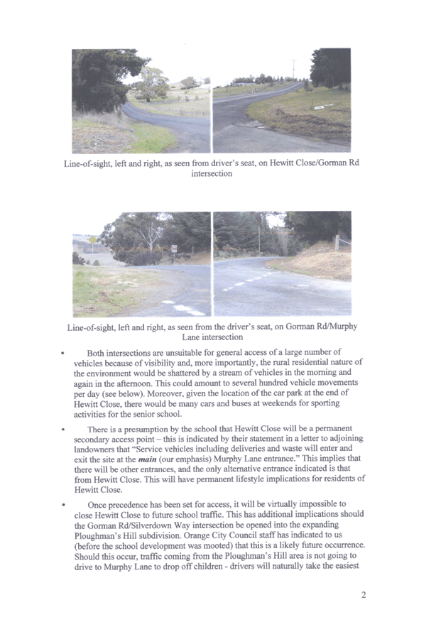
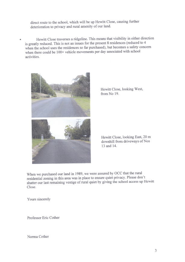
2.8 Development
Application DA 179/2016(1) - 40 Priest Lane
TRIM
REFERENCE: 2016/1442
AUTHOR: Summer
Commins, Town Planner
EXECUTIVE Summary
|
Application
lodged
|
2 June
2016
|
|
Applicant/s
|
Orange
City Council
|
|
Owner/s
|
Mr MD
and Mrs CL Williams
|
|
Land
description
|
Lot 33
DP 1012682 - 40 Priest Lane, Orange
|
|
Proposed
land use
|
Subdivision
(two lot) (pursuant to Amendment No 12 to Orange Local Environmental
Plan 2011)
|
|
Value of
proposed development
|
Not
applicable
|
Council's consent is sought for a two lot Torrens
subdivision of land at 40 Priest Lane, Orange, described as Lot 33 DP
1012682.
Proposed Lot 100 will excise the existing dwelling and
ancillary structures on a parcel of 7.876 hectares. Proposed Lot 101 will
be created with an area of 44.4 hectares. Proposed Lot 101 will comprise
vacant land which has been identified as the site for a proposed future
sporting and recreational complex (subject to separate development
application).
The site was the subject of Amendment No 12 to Orange Local
Environmental Plan 2011. The amendment involved part rezoning of the
subject land from E3 Environmental Management to RE1 Public Recreation;
and amendment to the Lot Size Map to permit the subdivision of the parcel to
reflect the revised zone boundaries. Amendment No. 12 was recently
gazetted and commenced on 20 May 2016.
Link To Delivery/OPerational Plan
The recommendation in this report relates to the
Delivery/Operational Plan strategy “13.4 Our Environment
– Monitor and enforce regulations relating to City amenity”.
Financial Implications
Council has been advised that as a council included in the
NSW Government’s merger proposals under consideration by the Office of
Local Government since referral on 6 January 2016, Council must comply with the
merger proposal period guidelines issued under S23A of the Local Government Act
1993.
The guidelines instruct Council it should expend money in
accordance with the detailed budget adopted for the purposes of implementing
the Delivery/Operational Plan for the 2015/16 year.
Any expenditure outside the adopted budget requires the
identification of clear and compelling grounds and must be approved by Council
at a meeting that is open to the public. The guidelines indicate the resolution
of Council for increased expenditure must specify the reasons why the
expenditure is required and warranted.
If increased expenditure is greater than $250,000 or 1% of
the Council’s revenue from rates in
the preceding year, whichever is the greater, Council
is required to exhibit the increase to the budget and consider comments
received.
Council must also avoid entering into contracts or
undertakings were expenditure or revenue is greater than $250,000 or 1% of the Council’s revenue from rates in the
preceding year, whichever is the greater, unless the contract or undertaking is
as a result of a decision or procurement process commenced prior to the merger
proposal period or where entering into a contract or undertaking is reasonably
necessary for the purposes of meeting the ongoing service delivery commitments
of the Council or was previously approved in the Council’s Delivery/Operational
Plan.
Policy and Governance Implications
Nil
|
Recommendation
That Council consents to
development application DA 179/2016(1)
for Subdivision (two lot) (pursuant to Amendment No 12 to Orange Local
Environmental Plan 2011) at Lot 33 DP 1012682 - 40
Priest Lane, Orange pursuant to the conditions of
consent in the attached Notice of Approval.
|
further considerations
Consideration has been given to the
recommendation’s impact on Council’s service delivery; image and reputation;
political; environmental; health and safety; employees; stakeholders and
project management; and no further implications or risks have been identified.
SUPPORTING INFORMATION
THE PROPOSAL
The proposal involves a two lot
Torrens subdivision of the subject land to create the following parcels:
|
Lot
|
Area
|
Improvements
|
Access
|
|
100
|
7.876ha
|
Dwelling, outbuildings, swimming
pool
|
Priest
Lane
|
|
101
|
44.4ha
|
Vacant – future site for
sporting and recreation complex
|
Northern
Distributor Road
|
Proposed Lot 100 will excise the existing dwelling and
ancillary structures on a parcel of 7.876 hectares. Proposed Lot 101 would
be created with an area of 44.4 hectares. Proposed Lot 101 will
comprise vacant land which has been identified as the site for a proposed future
sporting and recreational complex (subject to separate development
application).
Access to the existing dwelling on proposed Lot 100 will be
provided via Priest Lane. Access to proposed Lot 101 will be via the Northern
Distributor Road.
The proposed subdivision is
depicted below.
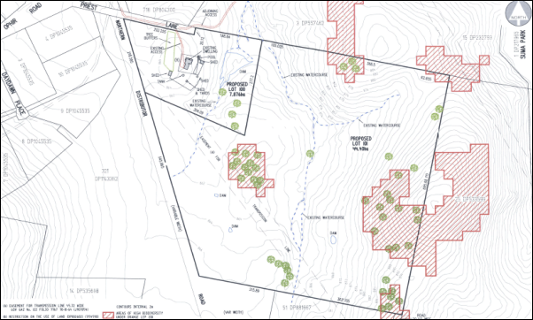
Proposed subdivision of Lot 33 DP 1012682 - 40 Priest
Lane, Orange
HISTORY/BACKGROUND
The development site was the subject of Amendment No 12 to
Orange Local Environmental Plan 2011. The amendment involved:
· part rezoning of
the subject land from E3 Environmental Management to RE1 Public Recreation
· amendment to the
Lot Size Map to permit the subdivision of the parcel into two lots to reflect
the revised zone boundaries.
Amendment No. 12 was recently gazetted and commenced on 20
May 2016.
MATTERS FOR CONSIDERATION
Section 5A Assessment
In the administration of sections 78A, 79B, 79C, 111 and
112, the provisions of Section 5A must be taken into account for every
development application in deciding whether there is likely to be a significant
effect on threatened species, populations or ecological communities or their
habitats.
This section includes a requirement to consider any adopted
assessment guidelines, which means assessment guidelines issued and in force
under section 94A of the Threatened Species Conservation Act 1995.
Assessment guidelines are in force (see DECC-W “Threatened Species
Assessment Guidelines - The Assessment of Significance”) which requires
consent authority to adopt the precautionary principle in its assessment.
The
subject land contains areas of “High Biodiversity Sensitivity” on
the Orange LEP 2011 Terrestrial Biodiversity Map. As outlined in this
report, the proposed subdivision will not impact upon ecological values of the
site.
Integrated Development
The
land is affected by two north flowing non-perennial watercourses and a
west-flowing tributary. Pursuant to Section 91 of the Environmental Planning
and Assessment Ac 1979, approval is required under the Water
Management Act 2000 for activities in, on or under waterfront land.
Pursuant
to the Clause 37 of the Water Management (General) Regulation 2011, a
public authority is exempt from obtaining a controlled activity approval
from the NSW Department of Primary Industries (Office of Water) for works that
it carries out in, on or under waterfront land.
As
such, separate approval under the Water Management Act 2000 is not
required. The proposal is not integrated development.
Section 79C
Section 79C of the Environmental Planning and Assessment
Act 1979 requires Council to consider various matters, of which those
pertaining to the application are listed below.
PROVISIONS OF ANY ENVIRONMENTAL
PLANNING INSTRUMENT s79C(1)(a)(i)
Orange Local Environmental Plan 2011
Part 1 - Preliminary
Clause 1.2 - Aims of Plan
The
broad aims of the LEP are set out under subclause 2. Those relevant to the
application are as follows:
(a) to encourage development which complements
and enhances the unique character of Orange as a major regional centre boasting
a diverse economy and offering an attractive regional lifestyle,
(b) to provide for a range of development
opportunities that contribute to the social, economic and environmental
resources of Orange in a way that allows present and future generations to meet
their needs by implementing the principles for ecologically sustainable
development,
(c) to conserve and enhance the water
resources on which Orange depends, particularly water supply catchments,
(d) to manage rural land as an environmental
resource that provides economic and social benefits for Orange,
(f) to recognise and manage valued
environmental heritage, landscape and scenic features of Orange.
The application is considered to be consistent with the
above objectives, as outlined in this report.
Clause 1.6 - Consent Authority
This clause establishes that, subject to the Act, Council is
the consent authority for applications made under the LEP.
Clause 1.9A - Suspension of
Covenants, Agreements and Instruments
This clause provides that covenants, agreements and other
instruments which seek to restrict the carrying out of development do not apply
with the following exceptions.
· covenants imposed
or required by Council
· prescribed
instruments under Section 183A of the Crown Lands Act 1989
· any conservation
agreement under the National Parks and Wildlife Act 1974
· any trust
agreement under the Nature Conservation Trust Act 2001
· any property
vegetation plan under the Native Vegetation Act 2003
· any biobanking
agreement under Part 7A of the Threatened Species Conservation Act 1995
· any planning
agreement under Division 6 of Part 4 of the Environmental Planning and
Assessment Act 1979.
Council staff are not aware of the title of the subject
property being affected by any of the above.
Mapping
The subject site is identified
on the LEP maps in the following manner:
|
Land Zoning Map:
|
Land zoned part E3 Environmental
Management and RE1 Public Recreation
|
|
Lot Size Map:
|
Minimum Lot Size 7ha (Amendment No.
12)
|
|
Heritage Map:
|
Not a heritage item or conservation
area
|
|
Height of Buildings Map:
|
No building height limit
|
|
Floor Space Ratio Map:
|
No floor space limit
|
|
Terrestrial Biodiversity Map:
|
High biodiversity sensitivity on
the site
|
|
Groundwater Vulnerability Map:
|
Ground water vulnerable
|
|
Drinking Water Catchment Map:
|
Within the drinking water catchment
|
|
Watercourse Map:
|
Not within
or affecting a defined watercourse
|
|
Urban Release Area Map:
|
Not within an urban release area
|
|
Obstacle Limitation Surface Map:
|
No restriction
on building siting or construction
|
|
Additional Permitted Uses Map:
|
No additional permitted use applies
|
Those matters that are of relevance are addressed in detail
in the body of this report.
Part 2 - Permitted or Prohibited Development
Land
Use Zones
The subject site is zoned part E3 Environmental Management
and part RE1 Public Recreation. The proposal is defined as
“subdivision.” Pursuant to Section 4B of the Environmental
Planning and Assessment Act 1979:
Subdivision of land means the
division of land into two or more parts that, after the division, would be
obviously adapted for separate occupation, use or disposition.
Subdivision is permitted with consent in the E3 and RE1
zones.
Clause 2.3 of LEP 2011
references the Land Use Table and Objectives for each zone in LEP 2011.
The
objectives for land zoned E3 Environmental Management are as follows:
· To protect, manage and restore areas with special
ecological, scientific, cultural or aesthetic values.
· To provide for a limited range of development that
does not have an adverse effect on those values.
· To manage development within water supply catchment
lands to conserve and enhance the city and district’s water resources.
· To maintain the rural function and primary
production values of the area.
· To ensure development along the Southern Link Road
has alternative access.
The
proposal is not contrary to the objectives of the E3 zone as follows:
- The proposed subdivision
will not adversely affect any area of special ecological, scientific, cultural
or aesthetic value.
- The subdivision does
not involve works or activities that would impact on drinking water resources.
- The rural function
and primary production values of the area will not be affected by the proposal.
- The land does not
have access or frontage to the Southern Link Road.
The objectives for land zoned RE1 Public Recreation are as
follows:
· To enable land to be used for public open space or
recreational purposes.
· To provide a range of recreational settings and
activities and compatible land uses.
· To protect and enhance the natural environment for
recreational purposes.
· To ensure development is ordered in such a way as
to maximise public transport patronage and encourage walking and cycling in
close proximity to settlement.
· To ensure development along the Southern Link Road has
alternative access.
The
proposal is not contrary to the objectives of the RE1 zone as follows:
- The proposed subdivision
will make land available for future recreational purposes.
- The subdivision will not
adversely affect the natural environment, as outlined in this report.
- Recreational land (proposed
Lot 101) will be accessible via public transport.
- The land does not have
access or frontage to the Southern Link Road.
2.6 - Subdivision - Consent
Requirements
Clause 2.6 is applicable and states:
(1) Land
to which this Plan applies may be subdivided but only with development consent.
Consent is sought for subdivision of the land to reflect the
zone boundaries in accordance with this clause.
Part 3 - Exempt and Complying Development
The application is not exempt or complying development.
Part 4 - Principal Development Standards
Clause
4.1 - Minimum Subdivision Lot Size
Clause
4.1 is applicable. This clause states in part:
(3) The size of any
lot resulting from a subdivision of land to which this clause applies is not to
be less than the minimum size shown on the Lot Size Map in relation to that
land.
In consideration of this clause,
the proposal is acceptable. The Lot Size Map prescribes a minimum lot size of
7ha for that part of the land zoned E3 Environmental Management (proposed
Lot 100). There is no minimum lot size for that part of the land zoned
RE1 Public Recreation (proposed Lot 101). Proposed Lot 100 comprises
an area of 7.87ha, in compliance with this clause.
Part 5 - Miscellaneous Provisions
The
Part 5 Miscellaneous Provisions are not relevant to the proposed development
Part 6 - Urban Release Area
Not relevant to the application. The subject site is not
located in an Urban Release Area.
Part 7 - Additional Local Provisions
7.4
- Terrestrial Biodiversity
The
subject land contains areas of “High Biodiversity Sensitivity” on
the Terrestrial Biodiversity Map. Clause 7.4 applies. This clause states in
part:
(3) Before
determining a development application for development on land to which this
clause applies, the consent authority must consider whether or not the
development:
(a) is
likely to have any adverse impact on the condition, ecological value and
significance of the fauna and flora on the land, and
(b) is
likely to have any adverse impact on the importance of the vegetation on the land
to the habitat and survival of native fauna, and
(c) has
any potential to fragment, disturb or diminish the biodiversity structure,
function and composition of the land, and
(d) is
likely to have any adverse impact on the habitat elements providing connectivity
on the land.
In
consideration of this clause, the proposal is acceptable due to the following:
- The subject land contains
areas of “High Biodiversity Sensitivity” on the Terrestrial
Biodiversity Map.
- The proposed subdivision
will not impact upon ecological values of the site. The proposed subdivision
does not involve works or activities within the identified areas of high
biodiversity. The proposed subdivision boundaries and site accesses will be
sited clear of the identified areas of biodiversity.
- The land was the subject of
a preliminary flora and fauna assessment (Envirowest Consulting - November
2014) in conjunction with Amendment No 12 to Orange LEP 2011. No
threatened or endangered floral and faunal species or ecological communities were
identified within the subject land.
- Future development of
proposed Lot 101 for sporting and recreational facilities will be subject to
further ecological assessment.
7.6 - Groundwater Vulnerability
The
subject land is identified as Groundwater Vulnerable on the Groundwater
Vulnerability Map. Clause 7.6 applies. This clause states in part:
(3) Before
determining a development application for development on land to which this
clause applies, the consent authority must consider:
(a) whether or not the development (including
any onsite storage or disposal of solid or liquid waste and chemicals) is
likely to cause any groundwater contamination or have any adverse effect on
groundwater dependent ecosystems
In consideration of Clause 7.6,
the proposal is acceptable. There are no aspects of the proposed subdivision
that would cause adverse impacts on groundwater resources.
7.7 - Drinking Water Catchments
The
subject land is contained within the drinking water catchment pursuant to the
Drinking Water Catchment Map. Clause 7.7 applies. This clause states in part:
(3) Before determining a
development application for development on land to which this clause applies,
the consent authority must consider whether or not the development is likely to
have any adverse impact on the quality and quantity of water entering the
drinking water storage, having regard to:
(a) the distance between
the development and any waterway that feeds into the drinking water storage,
and
(b) the onsite use, storage
and disposal of any chemicals on the land, and
(c) the treatment, storage
and disposal of waste water and solid waste generated or used by the
development.
In consideration of Clause 7.7,
the proposal is acceptable. The proposed subdivision does not involve works or
activities that would impact on drinking water resources. The subdivision will
not alter existing arrangements for onsite effluent disposal associated with
the existing dwelling house on proposed Lot 100.
7.11 - Essential Services
Clause
7.11 applies. This clause states:
Development
consent must not be granted to development unless the consent authority is
satisfied that any of the following services that are essential for the
proposed development are available or that adequate arrangements have been made
to make them available when required:
(a) the supply of water,
(b) the supply of
electricity,
(c) the disposal and
management of sewage,
(d) stormwater drainage or
onsite conservation,
(e) suitable road access.
In
consideration of this clause, the proposal is satisfactory.
The
existing servicing arrangements for the dwelling on proposed Lot 100 will
be maintained. Proposed Lot 100 will include the water supply, onsite effluent
disposal system, rural stormwater drainage system and telephone and electricity
connections associated with the existing dwelling.
In
order that utility services are available to proposed Lot 101, Council’s
Assistant Development Engineer has recommended the following (part) condition
of consent:
A
Restriction-as-to-User under section 88B of the NSW Conveyancing Act is to be
created on the title of proposed Lot 101 which states that:
Proposed Lot 101 may not be
subdivided or further developed and may not be used for recreational purposes
unless the following works are carried out to the satisfaction of Orange City
Council:
· All
infrastructure services (water, sewer, stormwater drainage, gas, electricity,
phone lines) as required by the Orange City Development and Subdivision Code
are provided to Lot 101; and
· The
developer of proposed Lot 101 is responsible for gaining access over adjoining
land for services as necessary. Easements are to be created about all service
mains within and outside the lots they serve; and
· Water and
Sewer charges are paid as required by Orange City Council in accordance with
Division 5 of Part 2 of Chapter 6 of the Water Management act 2000.
STATE ENVIRONMENTAL PLANNING
POLICIES
State Environmental Planning Policy (Infrastructure) 2007
The subject land is affected by a transmission line easement
(45m wide) and SEPP Infrastructure 2007 - Division 5 Electricity
Transmission or Distribution applies. Pursuant to Clause 45,
development carried out within or adjacent to an easement for electricity
purposes must be referred to the electricity supply authority.
The proposed subdivision does not involve any works or
structures within the easement. Further development of proposed Lot 101
for sporting and recreational use will be referred to the electricity supply
authority for consideration and comment.
State Environmental Planning
Policy No. 55 - Remediation of Land
State Environmental Planning Policy 55 - Remediation of Land
is applicable. Pursuant to Clause 7, Council must consider whether the
land is contaminated and if remediation is required to enable the proposed
development to be carried out.
The subject land has longstanding use for
agriculture/livestock grazing, and may contain areas of contamination.
Notwithstanding, the land is suitable in its current state for the proposed
subdivision. Further contamination assessment will be required prior to
development of proposed Lot 101 for sporting and recreational use. A condition
is recommended requiring the creation of a Restriction-as-to-User preventing
further development of proposed Lot 101 prior to chemical residue tests
being undertaken, as a precursor to remediation as required.
PROVISIONS OF ANY DRAFT
ENVIRONMENTAL PLANNING INSTRUMENT THAT HAS BEEN PLACED ON EXHIBITION
s79C(1)(a)(ii)
There are no draft environmental planning instruments that
apply to the subject land or proposed development.
DESIGNATED DEVELOPMENT
The proposed development is not designated development.
PROVISIONS OF ANY DEVELOPMENT
CONTROL PLAN s79C(1)(a)(iii)
Development Control Plan 2004
DCP 2004 - 00 Transitional Provisions - Transport Routes
The land has frontage to the Northern Distributor Road,
identified as a transport route in the DCP. The following Planning
Outcomes for Development along Transport Routes are applicable:
· The development
provides a high standard of visual appeal to motorists, cyclists and
pedestrians as well as adjoining property owners.
The proposed subdivision will not generate visual impacts.
· The visual
appearance of the development, including any signage, lighting or other
ancillary element, must not generate a distraction to motorists.
The proposed subdivision will not generate visual impacts.
· Any signage
must not be animated whether by movement of flashing lights.
The proposal does not involve signage.
· Where land has
more than one street frontage the street with the lower volume of traffic is to
provide the principal access to the development, subject to safety
considerations.
The subject land has frontage to Priest Lane and the
Northern Distributor Road. Priest Lane is subject to the lower volume of
traffic. Consistent with the existing situation, access to the existing
dwelling on proposed Lot 100 will be provided via Priest Lane.
Future access to proposed Lot 101 will be via the Northern
Distributor Road. The applicant submits that this arrangement is necessary as
follows:
- Future
sporting and recreational use of proposed Lot 101 will be in the southern and
central portions of this lot. The Northern Distributor Road provides the most
direct access to this part of the site.
- Future
sporting and recreational use of proposed Lot 101 will generate high traffic
volumes. The Northern Distributor Road is of sufficient capacity to cater for
such volumes. Should access be required via Priest Lane, extensive intersection
upgrading of Priest Lane and Ophir Road would be required to accommodate
traffic volumes. Intersection upgrading would be constrained by its proximity
to the existing roundabout on the Northern Distributor Road.
- An
eastern extension to the Priest Lane road reserve to provide access to proposed
Lot 101 is impractical due to creek crossings and steep landform.
Council’s Assistant Development Engineer raised no
objection to the proposed access via the Northern Distributor Road.
· Where access is
provided onto an arterial road, distributor road or major collector road, the
access point must have appropriate safe sight distances for the prevailing
speed limit and clear and unimpeded entrance/exit signage must be displayed.
The access design for the future sporting and recreational
use of proposed Lot 101 will be the subject of detailed traffic impact
assessment at future DA stage. In the interim, Council’s Assistant
Development Engineer raised no objection to the provision of rural access
(bitumen sealed vehicular access with pipe culvert) to proposed Lot 101.
Conditions are recommended in relation to short term access arrangements.
In respect of long term access arrangements, a condition is
recommend requiring the creation of a Restriction-as-to-User, preventing
further development of proposed Lot 101 without the construction of
satisfactory access/intersection treatment from the Northern Distributor Road.
· Where onsite
customer parking is provided that is not immediately visible from a public road,
clear and unimpeded direction signage must be displayed.
Onsite customer parking will not be required in conjunction
with the proposed subdivision. Parking associated with the future sporting and
recreational use of proposed Lot 101 will be the subject of further
development application and assessment.
· Where the
proposal is residential, or another noise sensitive form, appropriate noise
mitigation measures to limit the development from traffic noise must be
demonstrated.
The proposed subdivision does not represent noise sensitive
development.
DCP 2004 - 6 - Rural
Development
The proposed subdivision will create a rural parcel that
will contain a dwelling house. The DCP prescribes the following applicable
outcomes for Rural House Sites:
· House sites are
located in a manner that will not inhibit normal farming practice either on the
land or on land in the vicinity, in order to minimise potential
agricultural/residential conflicts.
Based on the site area, proposed Lot 100 has limited
potential for normal farming practice. The subdivision will excise the existing
dwelling and associated improvements on a small rural parcel, with reduced
potential for agricultural/residential landuse conflicts.
· Houses are
oriented in a manner that optimises solar orientation and provides protection
from prevailing winter winds
The proposal will not alter existing arrangements for solar
access to the dwelling house on proposed Lot 100.
· General farming
lots and associated location of dwelling houses should be undertaken in a
manner that optimises the potential for economic use of the most productive
land
Proposed Lot 100 does not comprise a general farming lot.
Based on the lot size of 7.8ha, the rural parcel will comprise a hobby
farm or lifestyle block, with limited potential for economic use.
· Houses are
located to facilitate access to a public road and power supply
Proposed Lot 100 has direct frontage and access to Priest
Lane and is connected to electricity supply.
· House sites are
located outside water supply catchment areas
This planning outcome is not relevant as the existing
dwelling is located in the drinking water catchment.
Orange Development
Contributions Plan 2015
Development contributions are not applicable to the proposed
subdivision, pursuant to the Orange Development Contributions Plan 2015.
PROVISIONS PRESCRIBED BY THE
REGULATIONS s79C(1)(a)(iv)
The proposal is not inconsistent with any provision
prescribed by the Regulation.
THE LIKELY IMPACTS OF THE
DEVELOPMENT s79C(1)(b)
Visual Impacts
The proposed subdivision does not involve works, activities
or structures that will alter existing visual amenity.
Traffic Impacts
As outlined in this report, traffic arrangements for the
proposed subdivision are appropriate. Consistent with the existing situation, access
to the existing dwelling on proposed Lot 100 will be provided via Priest
Lane. Conditions are recommended in relation to access requirements for
proposed Lot 101 via the Northern Distributor Road. Traffic impacts
associated with future sporting and recreational use of proposed Lot 101
will be the subject of detailed traffic impact assessment at future DA stage.
Environmental Impacts
The subject land contains areas of “High Biodiversity
Sensitivity” pursuant to Orange LEP 2011. The proposed subdivision
will not impact upon ecological values of the site. The proposed subdivision
does not involve works or activities within the identified areas of high
biodiversity. The proposed subdivision boundaries and site accesses will be
sited clear of the identified areas of biodiversity.
The
land was the subject of a preliminary flora and fauna assessment (Envirowest
Consulting - November 2014) in conjunction with Amendment No 12 to Orange
LEP 2011. No threatened or endangered floral and faunal species or
ecological communities were identified within the subject land.
Cultural Values
The proposed subdivision is unlikely to impact upon
Aboriginal archaeology or European cultural heritage. An aboriginal
archaeological site investigation was undertaken in conjunction with proposed
Amendment No 12 to Orange LEP 2011. No records of Aboriginal sites or places
are recorded on or near the subject land.
The subject land is not identified as having European
heritage value. Suma Park Dam, located to the east (but not adjoining) the
subject land, is listed as a Local heritage item. The visual relationship
between Suma Park Dam and the subject land is virtually non-existent. The
proposed subdivision will not alter the significance of the heritage item in
the vicinity.
Cumulative Impacts
The proposal is considered to be satisfactory in terms of
cumulative impact. The proposed subdivision layout wholly accords with the land
zoning and lot sizes pursuant to Amendment No 12 to Orange LEP 2011. The
proposal will have nil impact on the potential for proposed Lots 100 and 101 to
be developed for their zoned purposes.
THE SUITABILITY OF THE SITE
s79C(1)(c)
Naturally Occurring Asbestos
The subject land is located within an area that is affected
by naturally occurring asbestos. A condition is recommended requiring
preparation and implementation of an Asbestos Management Plan for any
subdivision works that may disturb the site.
Utility Services
The
existing servicing arrangements for the dwelling on proposed Lot 100 will be
maintained. Proposed Lot 100 will include the water supply, onsite effluent
disposal system, rural stormwater drainage system and telephone and electricity
connections associated with the existing dwelling. Conditions are recommended
in relation to the provision of utility services to proposed Lot 101.
Amendment No 12 to Orange LEP
2011
The proposed subdivision layout wholly accords with the land
zoning and lot sizes pursuant to Amendment No. 12 to Orange LEP 2011. The
proposal will facilitate future use of the proposed lots consistent with
Amendment No. 12.
ANY SUBMISSIONS MADE IN
ACCORDANCE WITH THE ACT s79C(1)(d)
The proposed development is not defined as "advertised
development" under the provisions of the LEP but was advertised in the
public interest. The application was advertised for the prescribed period of 14
days, and at the end of that period no submissions were received.
PUBLIC INTEREST
s79C(1)(e)
The proposal is considered to be in the public interest. The
proposal will facilitate future use of the proposed lots consistent with Orange
LEP Amendment No. 12; and provide land for future public recreation and a
sporting complex.
The proposal is not inconsistent with any relevant policy
statements, planning studies, guidelines etc that have not been considered in
this assessment.
SUMMARY
The proposed development is permissible with the consent of
Council. The proposed development complies with the relevant aims, objectives
and provisions of the LEP. A section 79C assessment of the
development indicates that the development is acceptable in this instance.
Attached is a draft Notice of Approval outlining a range of conditions
considered appropriate to ensure that the development proceeds in an acceptable
manner.
COMMENTS
The requirements of the Environmental Health and Building
Surveyor and the Engineering Development Section are included in the attached
Notice of Approval.
Attachments
1 Notice
of Approval, D16/27828⇩
2 Plans,
D16/27726⇩
Planning and Development Committee
5 July 2016
2.8 Development
Application DA 179/2016(1) - 40 Priest Lane
Attachment 1 Notice
of Approval
|
|
ORANGE
CITY COUNCIL
Development
Application No DA
179/2016(1)
NA16/ Container
PR17645
|
NOTICE OF DETERMINATION
OF A DEVELOPMENT
APPLICATION
issued under the Environmental
Planning and Assessment Act 1979
Section 81(1)
|
Development
Application
|
|
|
Applicant Name:
|
Orange
City Council
|
|
Applicant Address:
|
Attention
Ms M Catlin
PO Box 35
ORANGE
NSW 2800
|
|
Owner’s Name:
|
Mr MD AND
Mrs CL Williams
|
|
Land to Be Developed:
|
LOT 33 DP
1012682 - 40 Priest Lane, Orange
|
|
Proposed Development:
|
Subdivision
(two lot) (pursuant to Amendment No 12 to Orange Local Environmental Plan
2011)
|
|
|
|
|
Building
Code of Australia
building classification:
|
Not
applicable
|
|
|
|
|
Determination
|
|
|
Made On:
|
5 July
2016
|
|
Determination:
|
CONSENT
GRANTED SUBJECT TO CONDITIONS DESCRIBED BELOW:
|
|
|
|
|
Consent to
Operate From:
|
6 July
2016
|
|
Consent to
Lapse On:
|
6 July
2021
|
Terms of Approval
The reasons for the imposition of
conditions are:
(1) To
ensure a quality urban design for the development which complements the
surrounding environment.
(2) To
maintain neighbourhood amenity and character.
(3) To
ensure compliance with relevant statutory requirements.
(4) To
provide adequate public health and safety measures.
(5) To ensure the utility
services are available to the site and adequate for the development.
(6) To prevent
the proposed development having a detrimental effect on adjoining land uses.
(7) To minimise
the impact of development on the environment.
Conditions
(1) The development
must be carried out in accordance with:
(a) Plan/s
numbered Plans by Peter Basha Planning and Development: Ref 16020DA - sheets
1-4 (4 sheets)
(b) statements
of environmental effects or other similar associated documents that form part
of the approval
as amended
in accordance with any conditions of this consent.
(2) All building work must
be carried out in accordance with the provisions of the Building Code of
Australia.
|
PRIOR TO THE ISSUE OF
A CONSTRUCTION CERTIFICATE
|
(3) Application is to be
made for a Construction Certificate for works associated with the proposed
vehicle access. Engineering plans, showing details of the proposed location of
the vehicle access and traffic management works, are to be submitted to Orange City
Council or an Accredited Certifier (Categories B1, C3, C4, C6) upon
application for a Construction Certificate.
|
PRIOR TO WORKS
COMMENCING
|
(4) A
Construction Certificate application is required to be submitted to, and issued
by Council/Accredited Certifier prior to any excavation or building works being
carried out onsite.
|
DURING
CONSTRUCTION/SITEWORKS
|
(5) All
construction/demolition work on the site is to be carried out between the hours
of 7.00 am and 6.00 pm Monday to Friday inclusive, 7.00 am to
5.00 pm Saturdays and 8.00 am to 5.00 pm Sundays and Public
Holidays. Written approval must be obtained from the General Manager of Orange
City Council to vary these hours.
(6) The
site is located within an area identified as containing serpentinite rock
formations, which can contain chrysotile, a naturally occurring asbestos.
Therefore the applicant or person with management or control of the site shall
ensure that a written plan (an Asbestos Management Plan) for the
site is prepared in accordance with the provisions of the Work Health and
Safety Act 2011 and Work Health and Safety Regulation 2011.
To assist applicants with developing an
Asbestos Management Plan, applicants are encouraged to access the “Asbestos
Management Plan for Orange City Council” 2014, which is available on
Council’s website: www.orange.nsw.gov.au.
(7) Any adjustments to
existing utility services that are made necessary by this development
proceeding are to be at the full cost of the developer.
(8) A bitumen
sealed vehicular entrance incorporating minimum 200mm thick gravel and a pipe
culvert is to be constructed to provide access to proposed Lot 101 from the
Northern Distributor Road.
The pipe culvert is to consist of minimum 375mm
diameter stormwater pipes and 2 concrete headwalls and be a minimum 5 metres
long. Where it is not possible to construct a pipe culvert, due to shallow
depth of table drain or the entrance being located on a crest, a 6 metre long
by 2 metre wide by 100mm deep concrete dish drain may replace the pipe culvert.
The location of this entrance and selection of
pipe culvert or dish drain are to be as directed by Orange City Council. The
entrance is to be constructed in accordance with the RTA Guidelines for
Intersections at Grade Figure 4.9.7 Rural Property Access with Indented Access.
The construction is to be as per the requirements of the Orange City Council
Development and Subdivision Code.
|
PRIOR TO THE ISSUE OF
A SUBDIVISION CERTIFICATE
|
(9) Application shall be
made for a Subdivision Certificate under Section 109(C)(1)(d) of the Act.
(10) A
Restriction-as-to-User under section 88B of the NSW Conveyancing Act is
to be created on the title of proposed Lot 101 which states that:
Proposed Lot 101 may not be subdivided or
further developed and may not be used for recreational purposes unless the
following works are carried out to the satisfaction of Orange City Council:
· All infrastructure
services (water, sewer, stormwater drainage, gas, electricity, phone lines) as
required by the Orange City Council Development and Subdivision Code are
provided to Lot 101; and
· The developer of
proposed Lot 101 is responsible for gaining access over adjoining land for
services as necessary. Easements are to be created about all service mains
within and outside the lots they serve; and
· Water and sewer charges
are paid as required by Orange City Council in accordance with Division 5
of Part 2 of Chapter 6 of the Water Management Act 2000; and
· Chemical residue tests
are undertaken; and
· Construction of a
satisfactory access/intersection treatment direct from the Northern Distributor
Road to proposed Lot 101.
(11) All conditions of
development as required by this development consent as it relates to the
construction of the bitumen sealed vehicular entrance to proposed Lot 101 are
to be completed prior to the issuing of a Subdivision Certificate.
(12) All
of the foregoing conditions are to be at the full cost of the developer and to
the requirements and standards of the Orange City Council Development and
Subdivision Code, unless specifically stated otherwise. All work required by
the foregoing conditions is to be completed prior to the issuing of a
Subdivision Certificate, unless stated otherwise.
Other Approvals
(1) Local
Government Act 1993 approvals granted under section 68.
Nil
(2) General
terms of other approvals integrated as part of this consent.
Nil
Right of Appeal
If
you are dissatisfied with this decision, section 97 of Environmental
Planning and Assessment Act 1979 gives you the right to appeal to the Land
and Environment Court within 6 months after the date on which you receive this
notice.
*
Section 97 of the Environmental Planning and Assessment Act 1979 does not apply
to the determination of a development application for State significant
development or local designated development that has been the subject of a
Commission of Inquiry.
|
Disability Discrimination Act
1992:
|
This application has been assessed in
accordance with the Environmental Planning and Assessment Act 1979. No
guarantee is given that the proposal complies with the Disability
Discrimination Act 1992.
The applicant/owner is responsible to
ensure compliance with this and other anti-discrimination legislation.
The Disability Discrimination Act
covers disabilities not catered for in the minimum standards called up in the
Building Code of Australia which references AS1428.1 - "Design for
Access and Mobility". AS1428 Parts 2, 3 and 4 provides the most
comprehensive technical guidance under the Disability Discrimination Act
currently available in Australia.
|
|
|
|
|
Disclaimer - S88B Restrictions on the Use of Land:
|
The applicant should note that there
could be covenants in favour of persons other than Council restricting what
may be built or done upon the subject land. The applicant is advised to check
the position before commencing any work.
|
|
|
|
|
Signed:
|
On behalf of the consent authority ORANGE
CITY COUNCIL
|
|
Signature:
|
|
|
Name:
|
DAVID WADDELL - DIRECTOR DEVELOPMENT
SERVICES
|
|
Date:
|
6 July 2016
|
Planning
and Development Committee
5 July 2016
2.8 Development
Application DA 179/2016(1) - 40 Priest Lane
Attachment 2 Plans
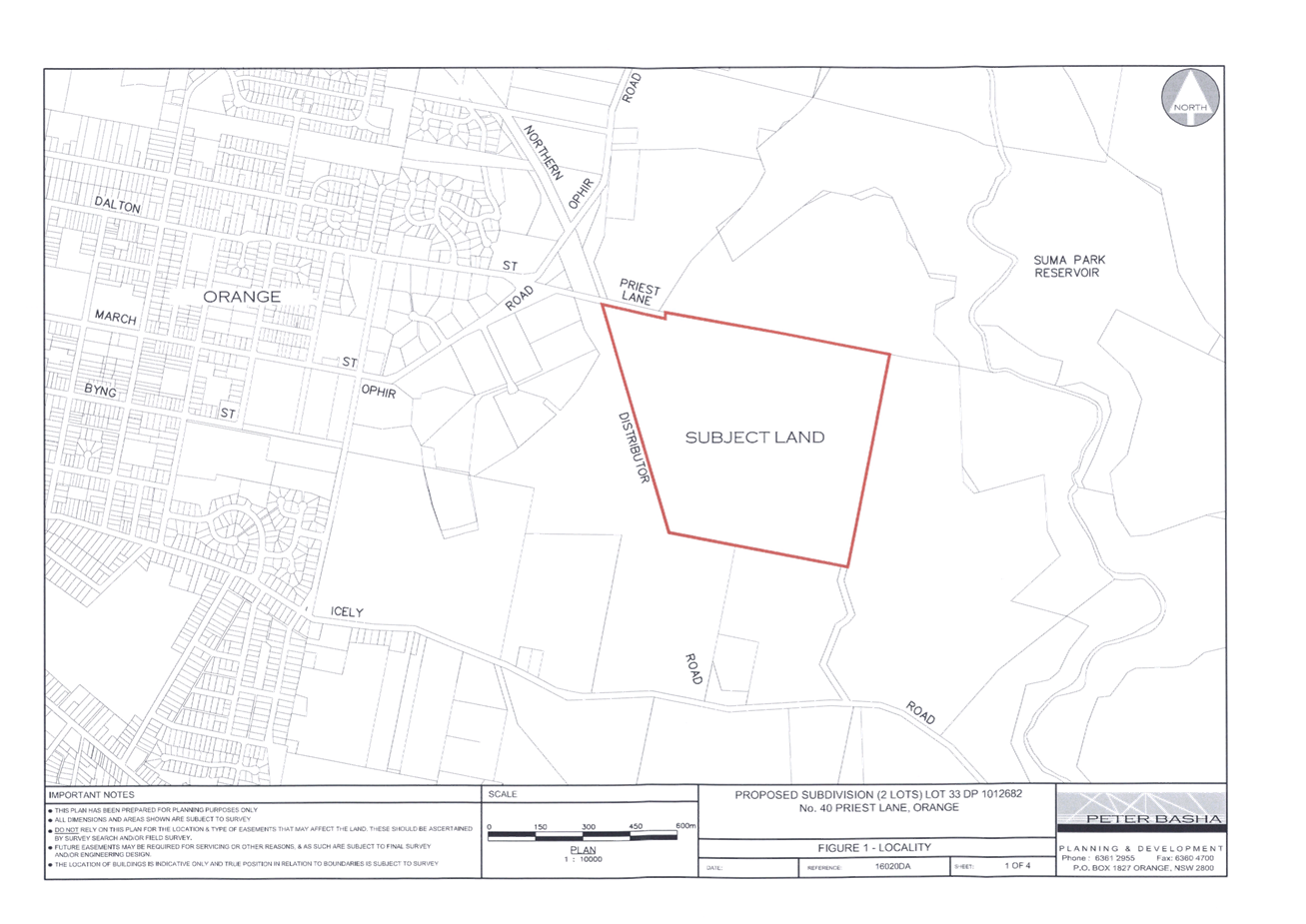
Planning and Development Committee
5 July 2016
2.8 Development
Application DA 179/2016(1) - 40 Priest Lane
Attachment 2 Plans
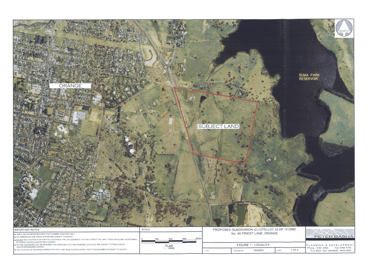
Planning and Development Committee
5 July 2016
2.8 Development
Application DA 179/2016(1) - 40 Priest Lane
Attachment 2 Plans
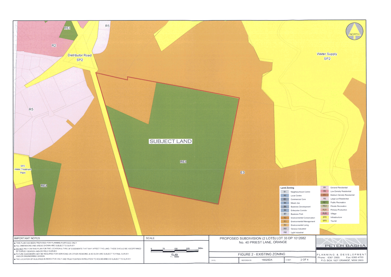
Planning and Development Committee
5 July 2016
2.8 Development
Application DA 179/2016(1) - 40 Priest Lane
Attachment 2 Plans
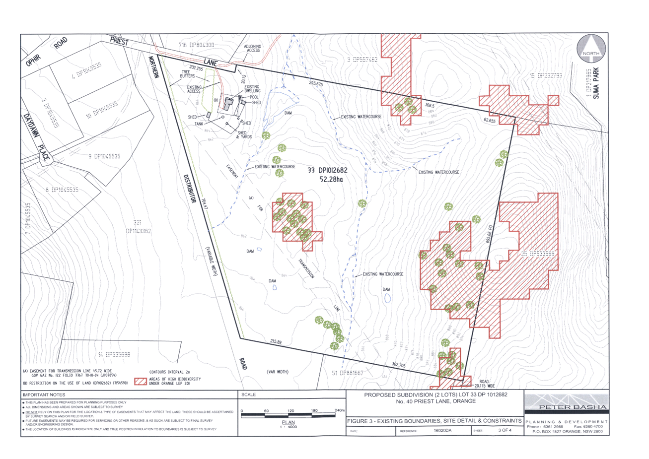
Planning and Development Committee
5 July 2016
2.8 Development
Application DA 179/2016(1) - 40 Priest Lane
Attachment 2 Plans
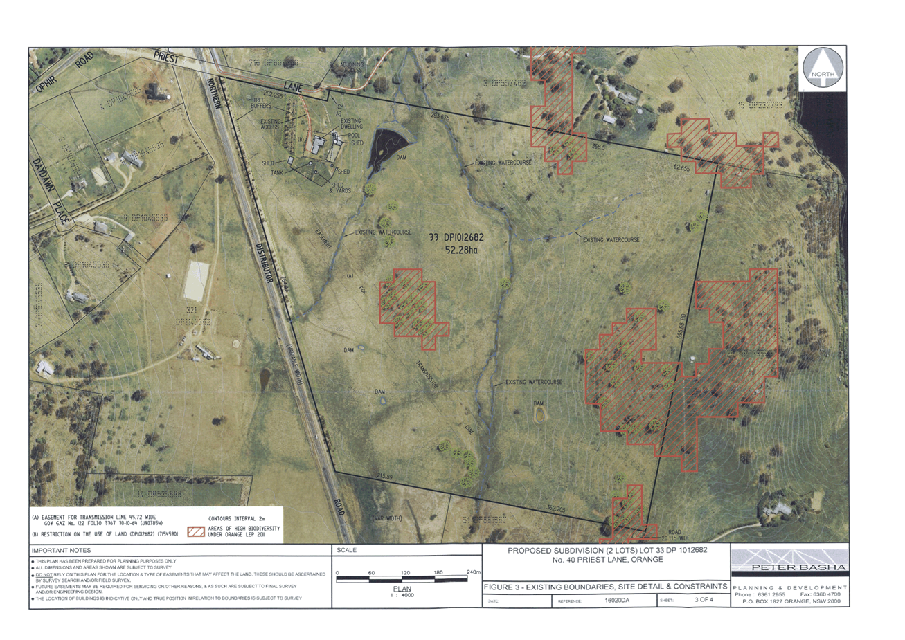
Planning and Development Committee
5 July 2016
2.8 Development
Application DA 179/2016(1) - 40 Priest Lane
Attachment 2 Plans
Planning and Development Committee
5 July 2016
2.8 Development
Application DA 179/2016(1) - 40 Priest Lane
Attachment 2 Plans