
Planning and Development
Committee
Agenda
4 December 2018
Notice is hereby given, in
accordance with the provisions of the Local Government Act 1993 that a Planning and Development Committee meeting of ORANGE CITY COUNCIL
will be held in the Council Chamber,
Civic Centre, Byng Street, Orange on Tuesday, 4 December
2018.
Garry
Styles
General Manager
For apologies please
contact Administration on 6393 8218.
1 Introduction
1.1 Declaration
of pecuniary interests, significant non-pecuniary interests and less than
significant non-pecuniary interests
The
provisions of Chapter 14 of the Local Government Act, 1993 (the Act)
regulate the way in which Councillors and designated staff of Council conduct
themselves to ensure that there is no conflict between their private interests
and their public role.
The
Act prescribes that where a member of Council (or a Committee of Council) has a
direct or indirect financial (pecuniary) interest in a matter to be considered
at a meeting of the Council (or Committee), that interest must be disclosed as
soon as practicable after the start of the meeting and the reasons given for
declaring such interest.
As
members are aware, the provisions of the Local Government Act restrict any
member who has declared a pecuniary interest in any matter from participating
in the discussion or voting on that matter, and requires that member to vacate
the Chamber.
Council’s Code of Conduct provides that if members
have a non-pecuniary conflict of interest, the nature of the conflict must be
disclosed. The Code of Conduct also provides for a number of ways in which a
member may manage non pecuniary conflicts of interest.
|
Recommendation
It is recommended that Committee Members now disclose any
conflicts of interest in matters under consideration by the Planning and
Development Committee at this meeting.
|
2 General
Reports
2.1 Items
Approved Under the Delegated Authority of Council
RECORD
NUMBER: 2018/2707
AUTHOR: Paul
Johnston, Manager Development Assessments
EXECUTIVE Summary
Following is a list of development applications approved
under the delegated authority of Council.
Link To Delivery/OPerational Plan
The recommendation in this report relates to the
Delivery/Operational Plan strategy “7.1 Preserve - Engage with the
community to develop plans for growth and development that value the local
environment”.
Financial Implications
Nil
Policy and Governance Implications
Nil
|
Recommendation
That Council resolves to acknowledge the information
provided in the report by the Manager Development Assessments on Items
Approved Under the Delegated Authority of Council.
|
further considerations
Consideration has been given to the recommendation’s
impact on Council’s service delivery; image and reputation; political;
environmental; health and safety; employees; stakeholders and project
management; and no further implications or risks have been identified.
SUPPORTING INFORMATION
|
Reference:
|
DA 259/2017(3)
|
Determination Date
|
26 October 2018
|
|
PR Number
|
PR1974
|
|
Applicant/s:
|
Saran Holdings Pty Ltd
|
|
Owner/s:
|
Saran Holdings Pty Ltd
|
|
Location:
|
Lot 3 DP 150391 – 129-131
Byng Street, Orange
|
|
Proposal:
|
Modification of development consent
– office premises (change of use from pub, alterations and additions to
existing building, and verandah reinstatement) and demolition (ancillary
buildings and tree removal). The modification involves amending the wording
of a specific condition to allow the issuance of an interim Occupation
Certificate and also provide an additional car parking space.
|
|
Value:
|
$1,900,000 (being the same value as
the original development)
|
|
Reference:
|
DA 259/2017(4)
|
Determination Date
|
1 November 2018
|
|
PR Number
|
PR1974
|
|
Applicant/s:
|
Saran Holdings Pty Ltd
|
|
Owner/s:
|
Saran Holdings Pty Ltd
|
|
Location:
|
Lot 3 DP 150391 – 129-131
Byng Street, Orange
|
|
Proposal:
|
Modification of development consent
– office premises (change of use from pub, alterations and additions to
existing building, and verandah reinstatement) and demolition (ancillary
buildings and tree removal). The modification involves the correction of a
very minor error in the consent issued under the previous modification
application.
|
|
Value:
|
$1,900,000 (being the same value as
the original development)
|
|
Reference:
|
DA 172/2018(1)
|
Determination Date
|
8 November 2018
|
|
PR Number
|
PR1946
|
|
Applicant/s:
|
Bassman Drafting Services
|
|
Owner/s:
|
Daissie Investments Pty Ltd and
Keltan Investments
|
|
Location:
|
Lot 1 DP 737869 – 67 Byng
Street, Orange
|
|
Proposal:
|
Multi dwelling housing (alterations
and additions)
|
|
Value:
|
$180,000
|
|
Reference:
|
DA 225/2018(1)
|
Determination Date
|
30 October 2018
|
|
PR Number
|
PR16490
|
|
Applicant/s:
|
Mr B and Mrs LA Parianos
|
|
Owner/s:
|
Mr BA and Mrs LA Parianos
|
|
Location:
|
Lot 1 DP 779142 – 18-20
McNamara Street, Orange
|
|
Proposal:
|
Shop (new building) and office
premises (existing building)
|
|
Value:
|
$700,000
|
|
Reference:
|
DA 272/2018(1)
|
Determination Date
|
14 November 2018
|
|
PR Number
|
PR4118
|
|
Applicant/s:
|
Mr SG Jenner
|
|
Owner/s:
|
Mr K and Mrs AM Harris
|
|
Location:
|
Lot 2 DP 580636 – 1674 Forest
Road, Orange
|
|
Proposal:
|
Vehicle repair station (change of
use from vehicle body repair workshop)
|
|
Value:
|
$0
|
|
Reference:
|
DA 286/2018(1)
|
Determination Date
|
31 October 2018
|
|
PR Number
|
PR28057
|
|
Applicant/s:
|
Divlist Pty Ltd and Mikell
Investments Pty Ltd
|
|
Owner/s:
|
Divlist Pty Ltd and Mikell Investments
Pty Ltd
|
|
Location:
|
Lot 225 DP 1244057 – 1
Catania Street, Orange
|
|
Proposal:
|
Dual occupancy and subdivision (two
lot Torrens)
|
|
Value:
|
$540,000
|
|
Reference:
|
DA 295/2018(1)
|
Determination Date
|
5 November 2018
|
|
PR Number
|
PR1584
|
|
Applicant/s:
|
Mr LF Gotch
|
|
Owner/s:
|
Mr LF and Mrs AL Gotch
|
|
Location:
|
Lot 2 DP 600453 – 629 Huntley
Road, Huntley
|
|
Proposal:
|
Conversion of outbuilding to
detached studio (external addition to dwelling house)
|
|
Value:
|
$0
|
|
Reference:
|
DA 311/2018(1)
|
Determination Date
|
7 November 2018
|
|
PR Number
|
PR4988
|
|
Applicant/s:
|
Mr BK Jackson
|
|
Owner/s:
|
Mr BK Jackson and Ms EJ French
|
|
Location:
|
Lot 51 DP 258474 – 16
Havachat Place, Orange
|
|
Proposal:
|
Home business (food manufacture)
|
|
Value:
|
$2,000
|
|
Reference:
|
DA 327/2018(1)
|
Determination Date
|
5 November 2018
|
|
PR Number
|
PR2319
|
|
Applicant/s:
|
Saran Homes Pty Ltd
|
|
Owner/s:
|
Mr DA and Mrs AM Hughes
|
|
Location:
|
Lot 7 DP 715252 – 2 Carwoola
Drive, Orange
|
|
Proposal:
|
Subdivision (two lot residential)
|
|
Value:
|
$0
|
|
Reference:
|
DA 391/2018(1)
|
Determination Date
|
14 November 2018
|
|
PR Number
|
PR7559
|
|
Applicant/s:
|
Easy Eaves
|
|
Owner/s:
|
Rossi Orchards Pty Ltd
|
|
Location:
|
Lot 20 DP 792560 – 176 March
Street, Orange
|
|
Proposal:
|
Business identification signage
|
|
Value:
|
$3,000
|
TOTAL NET* VALUE OF ALL DEVELOPMENTS
APPROVED IN THIS PERIOD: $1,425,000
*
Net value relates to the value of modifications. If modifications are
the same value as the original DA, then nil is added. If there is a plus/minus
difference, this difference is added or taken out.
2.2 Outstanding
Development Applications
RECORD
NUMBER: 2018/2645
AUTHOR: David
Waddell, Director Development Services
EXECUTIVE Summary
At the Planning and Development Committee meeting of 19 June
2018 as a matter arising, Cr Duffy requested information on the number of
Development Applications currently on hand and the time they have been with
Council.
Link To Delivery/OPerational Plan
The recommendation in this report relates to the
Delivery/Operational Plan strategy “14.3 Collaborate -
Provide opportunities for widespread and quality engagement, and where
appropriate, shared decision-making.”.
Financial Implications
Nil
Policy and Governance Implications
Nil
|
Recommendation
That the report by the Director Development Services on
outstanding development applications be noted.
|
further considerations
Consideration has been given to the
recommendation’s impact on Council’s service delivery; image and
reputation; political; environmental; health and safety; employees;
stakeholders and project management; and no further implications or risks have
been identified.
SUPPORTING INFORMATION
The attached spreadsheet addresses this matter.
Attachments
1 Outstanding
Development Applications as at 21 November 2018, D18/64529
RECORD
NUMBER: 2018/2966
AUTHOR: David
Waddell, Director Development Services
EXECUTIVE Summary
The Enforcement Policy is brought back to Council for
adoption following a public exhibition process which gained no submissions.
Some minor amendments have been made for legibility.
Link To Delivery/OPerational Plan
The recommendation in this report relates to the
Delivery/Operational Plan strategy “17.1 Collaborate -
Provide representative, responsible and accountable community governance”.
Financial Implications
The financial implications will depend on the approach
adopted by the Council. It is estimated that a strict liability approach to
enforcement will result in the need for a significant increase in
ratepayer’s fund to be applied to prosecution and enforcement of breaches
and a reduction in development application processing times. A risk-based
approach, as set out in this draft, is expected to maintain expenditure at
levels broadly consistent with the current approach and with marginal impacts
on development application processing. However, expenditure may increase in
some years where serious non-compliance increases or if Council changes its
risk tolerance. It is anticipated that the new approach, if approved, will be
supported by a series of Factsheets on the website to educate developers and
the community about the Council’s approach, and will contribute over time
to a reduction in non-compliance issues and community concern.
Policy and Governance Implications
The adopted Policy will be placed on Council’s website
and used by staff in managing offences across the LGA.
|
Recommendation
That Council resolves to adopt the attached Enforcement
Policy
|
further considerations
Consideration has been given to the
recommendation’s impact on Council’s service delivery; image and
reputation; political; environmental; health and safety; employees;
stakeholders and project management; and no further implications or risks have
been identified.
SUPPORTING INFORMATION
The Council is responsible for defining the overall policy approach
to development and enforcement on behalf of the community. When a new Council
is elected, policies are systemically reviewed to determine if they continue to
reflect the collective view of elected Councillors and the best interests of
the community and economic development.
The Council’s approach to enforcement over the last
number of years has been to work with developers where mistakes or
errors have been made with respect to developments to seek to resolve the
issues cost-effectively, rather than commence legal action as a first option. The
aim of the approach has been to ensure both compliance and that ratepayer’s
money is not expended unnecessarily on costly litigation and enforcement action
where a reasonable outcome can be obtained for the community through a negotiated
approach. This approach has been consistent with the positive view towards
development taken by previous Councils which aimed to ensure that Orange is
seen as an attractive and supportive place to invest in the economic growth and
development of the City.
Where necessary, Council does commence enforcement action
against developers in Orange under the Protection of the Environment
Operations Act and Environmental Planning and Assessment Act,
particularly for serious or continued breaches. Examples include illegal
earthworks in the Hill Street area, illegal earth shaping in the Gorman Road
area, illegal works in the Occidental Hotel and Hotel Orange, illegal works on
the Officeworks site (by the developer), and 47 Byng Street (Byng Street Café)
for operations outside the consent. Fines are usually levied after numerous
warnings have been issued and gone unheeded.
A good example of Council’s historical and current
approach can be seen in the Royal Hotel case of 2007 where the glass
heritage tiles were removed from the Hotel without consent. Whilst the loss of
the heritage tiles was irreversible, rather than prosecute the owner Council
resolved to allow the matter to be resolved via a development application and a
level of restoration, with no penalty applied. In some Local Government Areas
this would have resulted in instant fines or Court action.
The Kurim shops issue is one with a long history. Council
issued demolition orders which were resisted by the landowner. Given this
resistance and the significant works required by the Orders, Council eventually
sought and gained demolition orders from the Land and Environment Court to
protect Council's interests – the demolition was completed after ten
years of process.
Subsequent to DA 222/2015(1) for a Chemist’s Warehouse
in Summer Street, the applicant has carried out illegal signage works,
resulting in signage significantly different to that approved. Two sets of
orders and warnings were issued without adequate response until finally the
owner complied.
Prior to the approval of DA 259/2017(1), the owner of the
Carrington Hotel in Byng Street carried out works to render the building safe
and to stop further decay. In addition, other works were carried out that might
be interpreted as premature and thus without consent.
Prior to lodgement of the development application, the new
owner and developer of 62 Byng Street, Orange carried out works to render
the house safe and to stop further decay. Again, other works were carried out
that might be interpreted as premature and without consent.
Highland Heritage has carried out significant building works
without consent as part of its expansion plans. These illegal works were
stopped as soon as they came to the attention of staff.
Two development applications were recently before Council
for potential illegal occupation of business premises. Both were given approval
retrospectively by Council without business discontinuity or fines.
The current activity around the old RMS site in Leewood is
another example of illegal development, including tree removal. Staff attempts
to work with the developer have only recently been heeded, with a development
application being received, then withdrawn and the site cleared.
In general terms, illegal development including demolition
is often undertaken in ignorance or for reasons thought time-critical by
developers/builders onsite. In most cases the impact on heritage items or
streetscape is minimal, however in some cases the impact has been significant
and irreversible.
A new Enforcement Policy has been prepared for
Council’s consideration and public exhibition. The intent of the Policy
is to:
1 Establish
a new risk-based decision making framework to inform enforcement (eg applying
enforcement processes where there is an imminent risk to public safety,
compared for example to a more negotiated approach to lower risk issues such as
when a resident constructs an addition that would otherwise comply with
development controls but has failed to follow the process properly).
2 Educate
the community and developers about the Council’s approach to reduce
instances of non-conformance.
The approach aims to balance the Council’s
responsibility to ensure compliance with the law, with the Council’s
obligation to manage ratepayers’ money sustainably and for the benefit of
the community as a whole consistent with the Local Government Act.
This policy aligns with the Environment Planning and
Assessment Act, the Protection of the Environment Operations Act
and other guidance documents.
Attachments
1 Draft
Enforcement Policy, D18/64388
2.4 Orange
Local Environmental Plan 2011 - Planning Proposal for an Administrative
Amendment
RECORD
NUMBER: 2018/2893
AUTHOR: Craig
Mortell, Senior Planner
EXECUTIVE Summary
Orange Local Environmental Plan 2011 came into effect in
February 2012. Amendment 1 to the LEP was an administrative or
‘housekeeping’ amendment, which dealt with a range of issues that
had not been able to be resolved within the timeframe required of the principle LEP
project. Subsequently a range of largely proponent driven amendments, typically
spot re-zonings, have been conducted.
The Department of Planning and Environment requires that
councils undertake a review of their LEPs on a regular basis, ideally on a five
yearly basis. Amendment 1 was gazetted in March 2014, accordingly it is
appropriate to consider a new administrative housekeeping amendment.
During the last five years staff have identified a range of
minor matters that could be improved and anomalies that need to be rectified.
Additionally, several landowners have approached Council seeking to change the
status of their land in various minor ways that would not, on their own,
justify the time and expense to both the landowner and Council required to
proceed with standalone amendments.
This report outlines a range of matters that are recommended
to be addressed via a Planning Proposal for a housekeeping amendment to the
LEP, including:
· heritage
corrections
· expansion of local
exempt development provisions
· land use table
updates
· cadastre map
updates
· clause changes
· additional
permitted uses
· minor rezonings
· other map updates
(flooding and airport obstacle limitation surface).
These matters introduced in this report are more fully
outlined in the attached draft Planning Proposal document, which would also
serve as the basis for the amendment and public exhibition process. Formal LEP
maps, where relevant, will be prepared prior to public exhibition.
Due to the diverse range of matters identified in this
Planning Proposal, it is possible that the Department of Planning and
Environment, at the Gateway stage, may require specific matters or sites to be
dealt with separately - such as if a particular site needs a traffic study or similar.
In this situation it is anticipated that the remaining matters of the Planning
Proposal could still proceed and that the excluded matter could then be
considered at a later time.
Link To Delivery/OPerational Plan
The recommendation in this report relates to the
Delivery/Operational Plan strategy “7.1 Preserve -
Engage with the community to develop plans for growth and development that
value the local environment”.
Financial Implications
Nil
Policy and Governance Implications
Nil
|
Recommendation
That
Council resolves:
1 To
endorse the attached scope of the next administrative housekeeping amendment
to Orange Local Environmental Plan 2011.
2 That
staff prepare a formal Planning Proposal in accordance with the attached
scope.
3 To
send the Planning Proposal to the NSW Department of Planning and Environment
seeking a Gateway Determination.
4 That
staff proceed to address any conditions or requirements of the Gateway
Determination and then place the draft Planning Proposal on public exhibition
for 28 days (or as required by the Gateway Determination).
|
further considerations
Consideration has been given to the
recommendation’s impact on Council’s service delivery; image and
reputation; political; environmental; health and safety; employees;
stakeholders and project management; and no further implications or risks have
been identified.
SUPPORTING INFORMATION
1 Heritage
Corrections
The
following table outlines a range of issues that have been identified in
relation to existing heritage items and one heritage conservation area. In some
cases the item has been listed in Schedule 5 but is not reflected in the
heritage map; in others an item on the map has either not been listed or has
been mis‑described in the schedule. This has potential to confuse the
public and open the door for debate on the heritage significance of the
relevant item. The response column details the proposed course of action to
rectify these issues.
|
Property
Affected
|
Issue
|
Response
|
|
26 Caroline Street
|
Heritage Item I268 is shown on the maps but not
listed in the schedule
|
Listing to be added to the schedule
|
|
34 Telopea Way “Emmaville Cottage”
|
Emmaville Cottage has been relocated
|
Existing site to be removed from the schedule and
map
|
|
106 and 106A Franklin Road
|
Heritage Item I75 straddles both lots, but 106A
Franklin Road was not mapped
|
106A Franklin Road to be mapped as part of heritage
Item I75
|
|
154 Peisley Street
|
The Geolyse building has been included within the
mapping of the railway station – it should be mapped and listed as
separate item to reflect that it is legally and functionally a different
property
|
Listing to be added to the schedule and mapped
independently of the railway station
|
|
65 Dalton Street
|
The property is listed as Item I89 covering two
lots but has not been mapped as such
|
Heritage map to be updated with Item I89 shown on
both relevant lots
|
|
Summer Street
|
Brass footpath inlays in the pavement of Summer
Street, mapped as Byng Street road reserve
|
Heritage map to be updated removing the item from
Byng Street and mapped onto the Summer Street road reserve
|
|
26 Kinghorne Lane
|
Shown as heritage Item I282 on the map but has not
been listed in the schedule
|
Add entry to schedule for Item I282.
|
|
170, 172 and 174 Moulder Street
|
Three properties mapped as heritage Item I110 but
not listed in the schedule
|
Add entry to schedule for Item I110
|
|
166 Edward Street
|
Now part of 85-89 McLachlan Street. The heritage
conservation area was originally mapped to include cottages in Edward Street.
This property was converted to parking area for a motor dealership. The
legacy heritage conservation area status may hinder future (re)development of
the motor dealership in McLachlan Street
|
Amend the extent of Heritage Conservation Area C3 to
exclude the entirety of the motor dealership
|
|
Former Ambulance Station
|
Currently mapped as a heritage item but the schedule
description relates to the adjoining property
|
Amend the schedule entry for Item I254 to
relate to the former Ambulance station
|
|
3 Spring Street, Spring Hill
|
Schedule lists Lot 2 Section 8 DP 758921,
however the correct property is Lot 3 Section 8 DP 758921
|
Amend the schedule entry for Item I303 to be
Lot 3
|
|
282-294 Summer Street
|
Item I158 is listed as 286 Summer Street and should
be 282 Summer Street.
Item I159 is listed as 288-294 Summer Street and
should be 286-294 Summer Street
|
Amend listing in schedule with correct street
address and lot/DP numbers
|
|
107 Prince Street
|
Currently listed in the schedule but has not been
properly mapped
|
Amend heritage map to include the item
|
|
C6 Heritage Conservation Area
|
The duration cottages HCA are mapped but not listed
in the Schedule
|
Amend the Schedule to include the C6 Heritage
Conservation Area.
|
2 Additional
Exempt Development
Schedule 2 of the LEP
provides a mechanism for councils to list types and forms of development that
can be undertaken as exempt development. Generally, exempt development is
suited to small scale benign developments and activities where the potential
for adverse consequences is negligible. Adding matters to schedule 2, with
appropriate standards and default conditions, ensures that Council staff time
is not diverted to their assessment. This also provides the community with
guidance on how to undertake minor projects in a manner that should not unduly
impact on neighbours or the broader environment.
The first section of
proposed additions involves a range of advertising signs, as such it is
proposed to include a “general requirements” section that all
exempt signs would need to comply with (rather than repeating the same matters
in each listing).
· signage - general requirements
· amend advertising signage (business
identification signs in zones IN1 and IN2)
· amend advertising signage (other signs)
· signage - A-framed signs on private land
· signage (sports field advertising)
· signage - sponsorship signs (corporate
sponsorship of a community or sporting use)
· bee keeping in zones RU1, RU5, R1, R2, R5,
E2, E3 and E4
· change of use - exhibition home to
dwelling
· emergency services facilities
· balconies, decks, patios, pergolas, terraces
and verandahs on large lots
· community use of educational
establishments, places of public worship and centre-based child care facilities
· farm dams
· fences (swimming pool safety fences)
· hail protection structure in zones RU1 and
E3
· subdivision
· security grills, screens or shutters -
commercial purposes
· re-stumping an existing building
· scaffolding, hoardings and temporary
construction site fences (being development to which State Environmental Planning Policy
(Exempt and Complying Development Codes) 2008 does not apply)
· grain silos and grain bunkers in zone E3
Environmental Management
· temporary structures (other than temporary
builders’ structures)
· demolition
· tennis courts (private and non-commercial)
· truck parking areas in zones RU1, RU2,
RU4, E3 and E4)
· boundary adjustment in zones RU1 and E3
· casual leasing areas.
3 Land
Use Table Updates
The following items are proposed
to be added to the land use table of the zones indicated.
(a) Bee
Keeping is proposed to be added as permitted with consent in the R1,
R2, R5 and RU5 zones. This use is proposed to be allowed as exempt development
subject to a limitation on the number of hives. People seeking more hives would
need to seek development consent. Consequently, by adding the use to the land
use tables this would enable consideration of development applications and the
ability to impose appropriate conditions, if merited.
(b) Extensive
Agriculture is proposed to be added as permitted with consent in the R5 zone.
This reflects the larger lot sizes typical of the zone and would enable some
basic forms of agriculture such as grazing. Many home owners on larger lots may
already keep animals as a combination of pets and grass control. However,
should the number of animals increase there is the potential for Council to
receive complaints, which currently would need to be evaluated as deemed to be
either the keeping of domestic pets, which would be exempt, or undertaking an
agricultural activity, which would currently be prohibited. By adding the use
to the land use table this would enable consideration of development
applications and the ability to impose appropriate conditions, if merited.
(c) Secondary
Dwellings are proposed to be added as permitted with consent in the R2 Low
Density Residential zone. Currently
secondary dwellings in this zone can only be considered under the provisions of
State Environmental Planning Policy (Affordable Rental Housing) 2009,
which has the effect of limiting the floor space to 60m2.
Secondary dwellings in other zones are limited in size to the greater of 60m2
or 50% of the floor space of the principle dwelling. By adding this use to the
land use table secondary dwellings in the R2 zone would also be able to access
the 50% rule.
4 Cadastre
Map Updates
Geographical Information
Systems (GIS) involve mapping, or projecting, spatial information onto a model
of the real world. Because the earth is not a perfect sphere it is represented
by a geoid, which is a hypothetical solid figure whose surface corresponds to
mean sea level and its imagined extension under (or over) land areas. In other
words, the geoid model accounts for bulges and depressions in the overall shape
of the earth. Two-dimensional data, such as cadastral property boundaries are
then projected onto this model by the GIS program.
Therefore when the State
updates the official geoid (as it did in 2015) it can appear to shift the
position of features that were mapped to the previous version relative to the
new maps. Since all new LEP maps are required to be based on the current geoid
an issue has emerged where some polygons used for things like zones and minimum
lot sizes can appear to be out of alignment with the cadastral property
boundaries leading to the false impression that, when viewed through the GIS
system, some land appears to be slightly split zoned or otherwise affected by
changes.
The two figures below demonstrate how these anomalies
can occur. The figure on the top is the official legal LEP map, while the
figure on the bottom is what may be seen through the GIS system.
5 Clause
Changes
· Multi Dwelling
Housing in Ploughmans Valley
Clause 4.1C(2)(b)(ii)
includes the phrase “multi dwelling housing” when in practice it
only relates to dual occupancy development. This may create a false impression
of what the clause enables. In practice, multi dwelling housing (which
comprises three or more dwellings) is unlikely to be able to satisfy the DCP
design requirements on lots of only 600m², and this form of development is
more intensive than was intended for the Ploughmans Valley area.
It is therefore proposed
to delete the phrase from the clause.
· Split Zoned and
Split Sized Land
Amendments to the LEP can
result in some parcels of land, particularly on the edge of project areas,
being given two or more zones or lot sizes in order to deliver the intention of
the relevant project. This raises a technical issue in that to subdivide land,
all resultant lots need to be compliant with the appropriate controls. However,
where land is partially within a project area the residue of land outside the
project area may not meet the minimum lot size, obstructing the orderly
attainment of the project. Additionally, where land is subject to more than one
zone it can create confusion as to what forms of development are permissible on
the land and how such developments are to be designed and sited.
It is proposed to enable
land in such situations to be subdivided consistent with the zone or lot size
boundaries in order to reflect the intent of the LEP and facilitate more
orderly management of land. It should be noted that this is not intended to
create additional development potential (such as dwelling entitlements) over
and above the existing situation.
· Clustered Dual
Occupancies in E3 and RU1 Zones
Prior to adoption of
Orange LEP 2011, dual occupancy developments in rural areas (when permissible)
were required to be “clustered” in close proximity. This was
intended to preserve as much of the land as possible for primary production and
to discourage the fragmentation of rural land into lifestyle residential
developments. The clustering concept was not accommodated in the standard
template for LEPs, and as such Orange LEP 2011 relied upon use of the
“Attached Dual Occupancy” definition.
In practice, requiring
dual occupancy development to be physically attached in a rural context has
been found to be unduly restrictive, but the alternative of allowing detached
dual occupancies (without any means to require clustering) may undermine the
intention of protecting primary production.
· Rural
Subdivisions, Boundary Adjustments and Farm Paddock Transfers
Clause 4.2 allows rural
subdivision of any size that does not create a dwelling entitlement, allowing
farmers to adjust the size of their enterprise through trading land with other
farmers without creating dwelling entitlements. However, this clause does not
apply to the E3 zone, greatly restricting the amount of land within Orange that
can benefit.
It is proposed to insert
zone E3 Environmental Management into the clause as a zone to which the clause
applies.
6 Additional
Permitted Use
· Restoration of
Dwelling Entitlement at 120 Calton Road
When Orange LEP 2011 was
adopted in February of 2012 it sought to extinguish a range of ‘existing
holding’ dwelling entitlements but provided affected landowners a period
of time, expiring on 31 December 2012. A number of these landowners lodged
Development Applications in the days leading up to the cut-off date. Several of
these applications had issues with the level of documentation required but were
ultimately resolved. The owner of 120 Calton Road lodged documentation;
however, due to staff leave around the Christmas break the application was
overlooked. Staff support this Additional Permitted Use.
7 Minor
Rezonings and Associated Map Changes
· Residue land in
Narrambla is currently split zoned, to be corrected so that industrial land can
be appropriately developed without compromising the buffer area of the Sewage
Treatment Works.
· Correct the alignment of
the Teamsters Walkway in the area of Crinoline Street, Anson Street, Hargraves
Crescent and Heatherbrae Parade.
· 1385 Forest Road to
clarify that the SP2 zone is intended to be used for Emergency Services
Facilities.
· Part rezoning of 1
Barrett Street to enable surplus industrial land to be consolidated with
adjoining residential unit development.
· Jack Brabham Park
– change to RE1 Public Recreation instead of RE2 Private Recreation to
reflect the general public accessibility and intent of the site.
· Function centre rezoning
to facilitate further development and/or adaptation of the site.
· Eastern extension of the
B3 zone and creation of an eastern B4 zone.
· Shiralee update to
reflect approved subdivision layouts.
· East Orange
neighbourhood shops.
· Minimum lot size on the
caravan park site to be removed.
8 Other
Mapping Updates
· Flood mapping and
controls
Council has been
undertaking a review of the Blackmans Swamp Creek Floodplain Risk Management
Study and Plan, as well as developing a similar study and plan for Ploughmans
Creek. This matter is the subject of a separate report before Council, but has
implications for Orange LEP 2011.
Within the LEP, flood
planning controls are currently implemented through a combination of a clause
that makes reference to a Flood Planning Map in the LEP. This effects
advice provided to the public through Section 10.7 Planning Certificates
when properties are bought and sold. Information provided on these certificates
needs to be as accurate as possible as it may affect mortgage applications and
insurance premiums. Unfortunately, amending an LEP map is not a simple process
and can result in a delay of many months between the time that Council has
updated its floodplain risk management plan and that updated advice being
reflected in planning certificates.
Due to this issue, the
recommended approach set out in the Floodplain Risk Management Study and Plan (FRMS&P)
is to remove the flood map from the LEP. Instead, the current LEP clause
would be amended to apply to land at or below the flood planning level, this
would then be defined to reference any adopted floodplain risk management plan.
This would effectively update flood planning controls dynamically as and when
updated studies are adopted.
The proposal is to amend
clause 7.2 of Orange LEP 2011 by removing the reference to the LEP flood map in
subclause (2), meaning that the clause will only apply to land at or below the
flood planning level, and to amend the definition of flood planning level to
read:
Flood
planning level means the level of a 1% AEP
(annual exceedance probability) flood event plus 0.5 metre freeboard, or other
freeboard as determined by any floodplain risk management plan adopted by the
Council in accordance with the Floodplain Development Manual.
In addition the term
‘Floodplain Development Manual’ will be defined to mean:
Floodplain
Development Manual means Floodplain Development
Manual (ISBN 0 7347 5476 0) published by the NSW Government in April 2005.
Another recommendation
from the FRMS&P is to include a new floodplain risk management clause in
relation to developments which may require particular evacuation or other
emergency responses. The clause discourages such uses from land between the
flood planning level and the probable maximum flood and provides additional
matters for consideration where such a development is nonetheless pursued. This
would assist emergency response agencies to be able to focus their resources on
the particular event rather than needing to divert personnel to assist in
evacuations.
Such a clause would also
be supported by the inclusion of the following definition in the Dictionary:
Probable maximum flood means the largest flood that could
conceivably occur at a particular location, usually estimated from probable
maximum precipitation.
· Airport Obstacle
Limitation Surface update
The Orange regional
airport runway was extended in 2015 and the obstacle limitation surface (OLS) has
not yet been updated in the LEP. The OLS does not prohibit any particular form
of development but does trigger the need to consider the appropriate siting and
design of structures that might be proposed under the flightpaths of the
airport. This administrative amendment is therefore an opportunity to bring the
LEP up-to-date and better reflect the extent of the OLS given the
extension of the runway.
Attachments
1 Planning
Proposal - LEP Amendment 24, D18/64309
2.5 Development
Application DA 329/2015(3) - 62 Byng Street and 77 Hill Street
RECORD
NUMBER: 2018/2918
AUTHOR: Andrew
Crump, Senior Planner
EXECUTIVE Summary
|
Application
lodged
|
26
October 2018
|
|
Applicant/s
|
Mayoh
Architects Pty Ltd - PD Mayoh Pty Ltd
|
|
Owner/s
|
Denoc
Holdings Pty Ltd
|
|
Land
description
|
Lot 3
Sec 21 DP 758817, Lot 4 DP 1085463 and Lot 1 DP 956418 - 62 Byng Street and
77 Hill Street, Orange
|
|
Proposed
land use
|
Hotel or
Motel Accommodation (alterations to an existing heritage mansion to provide
boutique hotel accommodation, conference room, kitchen and dining facilities,
onsite car parking and landscaping)
|
|
Value of
proposed development
|
$6,200,000
|
Application has been made to modify development consent DA
329/2015(2) which was initially issued by the Land and Environment Court (and
subsequently modified previously). The development consent relates to a
boutique hotel accommodation on land described as Lot 3 Sec 21 DP 758817,
Lot 4 DP 1085463 and Lot 1 DP 956418; known as 62 Byng Street and 77 Hill
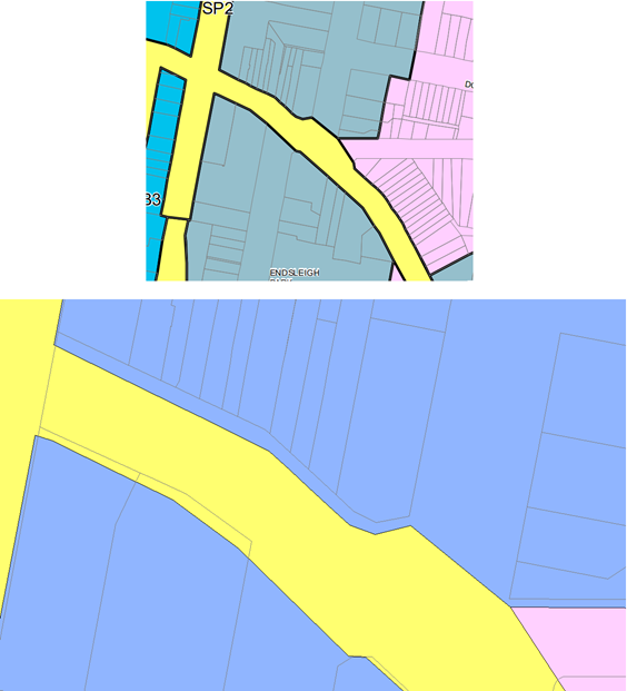
Street, Orange. The land is shown in the below figure.
Figure 1 - locality plan
The modification effectively
comprises three parts as follows:
· an adjustment to the
louvre screens on the west facing ground level guest room windows;
· deletion of a condition
that required windows in the western elevation to be fixed pane glazing to
address potential noise impacts; and
· a request to revisit the
condition requiring the western boundary fence to be constructed from hardwood.
Council staff have assessed the proposed modification and
concluded the following:
· An amended condition is
attached in relation to the proposed privacy screens.
· An acoustic report has
been submitted to support the proposition to allow the west facing guest room windows
to be operable. Council staff concur with the report and confirm that the
development complies in this regard, and accordingly the condition has been
deleted.
· The previous position of
the Court, and most recently the Council, is maintained and the condition
requiring a hardwood fence continues to apply.
The development is recommended for approval subject to the
recommended changes to the amended Notice of Approval.
RECENT LEGISLATIVE CHANGES
On 1 March 2018 the Environmental Planning and Assessment
Act 1979 was substantially amended. The most immediate change involves the
restructuring and renumbering of the Act, with other more substantive
changes to be phased in over time. However, for some applications (particularly
where an application was lodged prior to the changes coming into effect) the
supporting documentation may still reference the previous numbering regime. In
the drafting of this report the content and substance of the supporting
material has been considered irrespective of which legislative references were
used.
DECISION FRAMEWORK
Development in Orange is governed by two key documents
Orange Local Environment Plan 2011 and Orange Development Control Plan 2004. In
addition the Infill Guidelines are used to guide development, particularly in
the heritage conservation areas and around heritage items.
Orange Local Environment Plan 2011 – The
provisions of the LEP must be considered by the Council in determining the
application. LEPs govern the types of development that are permissible or
prohibited in different parts of the City and also provide some assessment
criteria in specific circumstances. Uses are either permissible or not. The
objectives of each zoning and indeed the aims of the LEP itself are also to be
considered and can be used to guide decision making around appropriateness of
development.
Orange Development Control Plan 2004 – the DCP
provides guidelines for development. In general it is a performance based
document rather than prescriptive in nature. For each planning element there
are often guidelines used. These guidelines indicate ways of achieving the
planning outcomes. It is thus recognised that there may also be other solutions
of merit. All design solutions are considered on merit by planning and building
staff. Applications should clearly demonstrate how the planning outcomes are
being met where alternative design solutions are proposed. The DCP enables
developers and architects to use design to achieve the planning outcomes in
alternative ways.
DIRECTOR’S COMMENT
This modification seeks to change three conditions on the
court approved 62 Byng Street ‘boutique’ hotel. Altered louvres and
fixed windows are not disputed by neighbours or staff, and will add positively
to the outcomes required. The applicant wishes to maintain the fence on the
western side which has been constructed contra to Court conditions which sought
a hardwood fence. Based on the deteriorating condition of the constructed fence,
the neighbour now objects to the condition being modified, rather seeks that
the Court ordered hardwood fence be constructed.
Link To Delivery/OPerational Plan
The recommendation in this report relates to the
Delivery/Operational Plan strategy “10.1 Preserve -
Engage with the community to ensure plans for growth and development are
respectful of our heritage”.
Financial Implications
Nil
Policy and Governance Implications
Nil
|
Recommendation
That Council resolves to
modify development application DA 329/2015(2) for alterations to an existing heritage mansion to
provide boutique hotel accommodation, conference room, kitchen and dining
facilities, on-site car parking and landscaping and demolition
(tree removal) at Lot 3 Sec 21 DP
758817, Lot 4 DP 1085463 and Lot 1 DP 956418 – 62 Byng
Street and 77 Hill Street, Orange pursuant to the
conditions of consent in the attached amended Notice of Approval.
|
further considerations
Consideration has been given to the
recommendation’s impact on Council’s service delivery; image and
reputation; political; environmental; health and safety; employees;
stakeholders and project management; and no further implications or risks have
been identified.
SUPPORTING INFORMATION
THE LAND
The land is legally described as Lot 3 Sec 21 DP 758817, Lot
4 DP 1085463 Lot 1 DP 956418, known as 62 Byng Street and 77 Hill Street,
Orange. The land is located within a residential area in close proximity to the
fringe of the CBD. The land is one of a cluster of listed heritage items.
THE APPLICATION/PROPOSAL
The proposal involves a modification of the consent and can
be simply summarised into the following three parts:
· amendment to the
previously conditioned privacy screens/louvres attached to the west facing
guest room windows on the ground and first floor;
· a request to delete the
condition imposed in relation the western facing windows being non-operable;
and
· a request to revisit the
materials used in the construction of the western boundary fence.
MATTERS FOR CONSIDERATION
Section 1.7 - Application of
Part 7 of the Biodiversity Conservation Act 2016 and Part 7A of the
Fisheries Management Act 1994
Section 1.7 of the EP&A Act 1979 identifies that Part 7
of the Biodiversity Conservation Act 2016 and Part 7A of the Fisheries
Management Act 1994 have effect in connection with terrestrial and aquatic
environments.
Having regard to the relevant provisions and based on an
inspection of the subject property, it is considered that the proposed
development is not likely to significantly affect a threatened species.
A Biodiversity Development Assessment Report is not required
in this instance.
In this instance, site inspection reveals that the subject
property has no biodiversity or habitat value.
Section 4.56 - Modification by
consent authorities of consents granted by the Court
(1) A
consent authority may, on application being made by the applicant or any other
person entitled to act on a consent granted by the Court and subject to and in
accordance with the regulations, modify the development consent if:
(a) it
is satisfied that the development to which the consent as modified relates is
substantially the same development as the development for which the consent was
originally granted and before that consent as originally granted was modified
(if at all), and
(b) it
has notified the application in accordance with:
(i) the
regulations, if the regulations so require, and
(ii) a
development control plan, if the consent authority is a council that has made a
development control plan that requires the notification or advertising of
applications for modification of a development consent, and
(c) it
has notified, or made reasonable attempts to notify, each person who made a
submission in respect of the relevant development application of the proposed
modification by sending written notice to the last address known to the consent
authority of the objector or other person, and
(d) it
has considered any submissions made concerning the proposed modification within
any period prescribed by the regulations or provided by the development control
plan, as the case may be.
In respect to the above, Council staff consider the
application to be substantially the same development as the development for
which consent was originally granted by the Court. The overall use does not
change, and the overall scale of the development in terms of the number or
rooms, types of facilities, number of staff and the like does not change from
the original approval. In a qualitative sense, only relatively minor changes
are proposed to the development, save for the issue of the western boundary
fence.
In relation to the above listed notification requirements,
Council has advertised and notified the application in accordance with the
Regulations and made all reasonable attempts to notify those persons who made a
submission previously.
All submissions received have been addressed below.
(1A) In
determining an application for modification of a consent under this section, the
consent authority must take into consideration such of the matters referred to
in section 4.15 (1) as are of relevance to the development the subject of the
application. The consent authority must also take into consideration the
reasons given by the consent authority for the grant of the consent that is
sought to be modified.
Consideration
of the relevant parts of Section 4.15(1) are detailed below.
Section 4.15
Section 4.15 of the Environmental Planning and Assessment
Act 1979 requires Council to consider various matters, of which those
pertaining to the application are listed below.
PROVISIONS OF ANY ENVIRONMENTAL
PLANNING INSTRUMENT s4.15(1)(a)(i)
Orange Local Environmental Plan 2011
Part 1 - Preliminary
Clause 1.2 - Aims of Plan
The
broad aims of the LEP are set out under subclause 2. Those relevant to the
application are as follows:
(a) to encourage development which complements
and enhances the unique character of Orange as a major regional centre boasting
a diverse economy and offering an attractive regional lifestyle,
(b) to provide for a range of development
opportunities that contribute to the social, economic and environmental
resources of Orange in a way that allows present and future generations to meet
their needs by implementing the principles for ecologically sustainable
development,
(c) to conserve and enhance the water
resources on which Orange depends, particularly water supply catchments,
(f) to recognise and manage valued
environmental heritage, landscape and scenic features of Orange.
The application is considered to be consistent with aims
(a), (b), (c) and (f) as listed above.
Clause 1.6 - Consent Authority
This clause establishes that, subject to the Act, Council is
the consent authority for applications made under the LEP.
Clause 1.7 - Mapping
The subject site is identified
on the LEP maps in the following manner:
|
Land Zoning Map:
|
Land zoned R1 General Residential
|
|
Lot Size Map:
|
No Minimum Lot Size
|
|
Heritage Map:
|
Heritage item and conservation area
|
|
Height of Buildings Map:
|
No building height limit
|
|
Floor Space Ratio Map:
|
No floor space limit
|
|
Terrestrial Biodiversity Map:
|
No biodiversity sensitivity on the
site
|
|
Groundwater Vulnerability Map:
|
Groundwater vulnerable
|
|
Drinking Water Catchment Map:
|
Not within the drinking water
catchment
|
|
Watercourse Map:
|
Not within or affecting a defined
watercourse
|
|
Urban Release Area Map:
|
Not within an urban release area
|
|
Obstacle Limitation Surface Map:
|
No restriction on building siting
or construction
|
|
Additional Permitted Uses Map:
|
No additional permitted use applies
|
|
Flood Planning Map:
|
Not within a flood planning area
|
Those matters that are of relevance are addressed in detail
in the body of this report.
Clause 1.9A - Suspension of
Covenants, Agreements and Instruments
This clause provides that covenants, agreements and other
instruments which seek to restrict the carrying out of development do not apply
with the following exceptions.
· covenants imposed
or required by Council
· prescribed
instruments under Section 183A of the Crown Lands Act 1989
· any conservation
agreement under the National Parks and Wildlife Act 1974
· any trust
agreement under the Nature Conservation Trust Act 2001
· any property
vegetation plan under the Native Vegetation Act 2003
· any biobanking
agreement under Part 7A of the Threatened Species Conservation Act 1995
· any planning
agreement under Division 6 of Part 4 of the Environmental Planning and
Assessment Act 1979.
Council staff are not aware of the title of the subject
property being affected by any of the above.
Part 2 - Permitted or Prohibited
Development
Clause
2.1 - Land Use Zones and Clause 2.3 - Zone Objectives and Land Use Table
The subject site is located within
the R1 General Residential zone. The proposed development continues to be
characterised as hotel or motel accommodation which remains permissible
in the zone with consent.
Clause
2.3 of LEP 2011 references the Land Use
Table and Objectives for each zone in LEP 2011. These objectives for land
zoned R1 General Residential are as follows:
1 -
Objectives of the R1 General Residential Zone
· To provide for the
housing needs of the community.
· To provide for a
variety of housing types and densities.
· To enable other land
uses that provide facilities or services to meet the day to day needs of
residents.
· To ensure development
is ordered in such a way as to maximise public transport patronage and
encourage walking and cycling in close proximity to settlement.
· To ensure that development
along the Southern Link Road has an alternative access.
There are no aspects of the development as modified that
would create an inconsistency with the zone objectives.
Part 5 - Miscellaneous Provisions
5.10 - Heritage Conservation
The land is identified as a heritage item pursuant to
schedule 5 of the LEP and is located within the Central Heritage Conservation
Area. The land is also within the vicinity of a number of other heritage items.
Two of the three aspects of the modification require heritage
assessment. Those being the appearance of the screening structures and the
materials used in the construction of the fence (on the western boundary).
Whether the windows are operable or not does not impact upon the heritage
significance of the place. The following therefore relates to those two aspects
as detailed above.
(1) Objectives
The
objectives of this clause are as follows:
(a) to
conserve the environmental heritage of Orange,
(b) to
conserve the heritage significance of heritage items and heritage conservation
areas, including associated fabric, settings and views,
(c) to
conserve archaeological sites,
(d) to
conserve Aboriginal objects and Aboriginal places of heritage significance.
The proposed modifications will
not result in a modified development that is fundamentally averse to the
objects of the clause.
(2) Requirement
for Consent
Development
consent is required for any of the following:
(b) altering
a heritage item that is a building by making structural changes to its interior
or by making changes to anything inside the item that is specified in Schedule
5 in relation to the item,
(e) erecting
a building on land:
(i) on
which a heritage item is located or that is within a heritage conservation
area, or
(ii) on
which an Aboriginal object is located or that is within an Aboriginal place of
heritage significance,
The development as modified
involves works as described above, and as such consent is required.
(4) Effect
of Proposed Development on Heritage Significance
The
consent authority must, before granting consent under this clause in respect of
a heritage item or heritage conservation area, consider the effect of the
proposed development on the heritage significance of the item or area
concerned. This subclause applies regardless of whether a heritage management
document is prepared under subclause (5) or a heritage conservation management
plan is submitted under subclause (6).
The operability of windows does
not alter the level of heritage compatibility the development has within the
setting, and as such the following assessment relates only to the privacy
screening and the material of the western boundary fence.
Privacy
Screens
The privacy screens will be integrated as part of the
building and have been previously nominated to be Colorbond
“Monument” in colour, which is a dark grey colour so they are
recessive. There are no objections the screens from a heritage point of view.
Western
Boundary Fence
Background
The Court required a particular style of boundary fence as
part of the Court issued consent.
The western boundary fence was required to be constructed
using hardwood timber. The fence has subsequently been constructed using
treated pine timber as opposed to hardwood.
The applicant, as part of the last application to modify the
consent, sought to regularise the inconsistency with the consent requirements,
requesting that Council agree to amend the condition to allow the western
boundary fence as constructed (ie in treated pine).
As part of Council’s assessment on the adequacy of the
fence, Council staff received a submission from the adjoining neighbour which
identified a number of inadequacies with the way in which the fence was
constructed.
The adjoining neighbour at the time of the assessment
somewhat begrudgingly agreed that the fence was acceptable as constructed,
provided certain rectification works occurred to the fence. These were included
as conditions of consent in the draft Notice of Approval (amended) that went
before the Planning and Development Committee.
At the time of determining the application, the Committee
determined that the Court imposed condition should remain as this was the will
of the Court, and as such the condition requiring the fence to be constructed
with hard wood timber remained in place.
The applicant is asking Council to reconsider the fence
materials stating that:
Condition (47) was previously
approved with the requirements as mentioned above. A treated pine fence has
been constructed on the common boundary between 60 and 62 Byng Street on the
North/South axis. It was requested that this condition be amended to allow the
fence to be ‘treated pine’ rather than ‘hard wood’. We
note that the Council Officers report supported this amendment and it also was
accepted by the neighbour in principle.
Our submission was supported
by our Heritage Consultant:
‘It is considered that
the treated pine fence will have the same effect in Heritage terms as the
original approval, given that it is a ‘like for like replacement’,
as stated in the letter prepared by the Heritage Architect. There is no mention
of hard wood fencing in the Judgement of the Court or in the Joint Heritage
Witness Statement prepared as part of the Court proceedings. It is therefore
considered that the treated pine fencing will have no further environmental or
heritage effect than the original consent’.
We therefore request this
condition be amended to reflect our previous submission.
Council staff at the time recommended that the fence as
erected be allowed to remain, but only on the proviso that certain works be
undertaken to the fence to address its poor construction and its deteriorating
condition. The position staff took on this matter previously was predicated on
the agreement brokered between the parties that share the common boundary (ie the
developer and the owner of the adjoining property 60 Byng Street); and the
terms of that agreement were enshrined as a draft Condition of Consent. But
this condition was superfluous based on the Council resolution and was
subsequently removed from the issued Notice of Approval (amended).
In the intervening period between Council’s
determination of the first modification and this point in time, the adjoining
owners have withdrawn their agreement on the boundary fence, and as such
Council staff recommend that the status quo remain in this case (that the fence
be constructed as per the Court issued consent) as this was the will of the
Court and, subsequently, the will of Council. The condition therefore remains
in place. The applicant has requested Council reconsider this issue.
(5) Heritage
Assessment
The
consent authority may, before granting consent to any development:
(a) on
land on which a heritage item is located, or
(b) on
land that is within a heritage conservation area, or
(c) on
land that is within the vicinity of land referred to in paragraph (a) or (b),
require
a heritage management document to be prepared that assesses the extent to which
the carrying out of the proposed development would affect the heritage
significance of the heritage item or heritage conservation area concerned.
Given the relatively minor nature of the proposed
modification, a heritage management document is not considered warranted.
However, a brief heritage impact statement from John Oultram Heritage and
Design was submitted in support of the previous modification; an excerpt of
which is submitted with this application in support of the request to
reconsider the western boundary fence.
(6) Heritage
Conservation Management Plans
The
consent authority may require, after considering the heritage significance of a
heritage item and the extent of change proposed to it, the submission of a
heritage conservation management plan before granting consent under this
clause.
A conservation management plan was not required by the
Court, and there is nothing within this application to modify the Court issued
consent that would require one to be prepared now.
(7) Archaeological
Sites
The
consent authority must, before granting consent under this clause to the
carrying out of development on an archaeological site (other than land listed
on the State Heritage Register or to which an interim heritage order under the Heritage Act 1977 applies):
(a) notify
the Heritage Council of its intention to grant consent, and
(b) take
into consideration any response received from the Heritage Council within 28
days after the notice is sent.
The Court did not identify the subject land as being an
archaeological site.
(8) Aboriginal
Places of Heritage Significance
The
consent authority must, before granting consent under this clause to the carrying
out of development in an Aboriginal place of heritage significance:
(a) consider
the effect of the proposed development on the heritage significance of the
place and any Aboriginal object known or reasonably likely to be located at the
place by means of an adequate investigation and assessment (which may involve
consideration of a heritage impact statement), and
(b) notify
the local Aboriginal communities, in writing or in such other manner as may be
appropriate, about the application and take into consideration any response
received within 28 days after the notice is sent.
The Court did
not identify the land as being an Aboriginal Place of Heritage Significance.
(9) Demolition
of Nominated State Heritage Items
The
consent authority must, before granting consent under this clause for the
demolition of a nominated State heritage item:
(a) notify
the Heritage Council about the application, and
(b) take
into consideration any response received from the Heritage Council within
28 days after the notice is sent.
The land is not identified as a Nominated State Heritage
Item
Part 6 - Urban Release Area
Not relevant to the application. The subject site is not
located in an Urban Release Area.
STATE ENVIRONMENTAL PLANNING
POLICIES
There are no State Environmental
Planning Policies that are of relevance to the assessment of the application to
modify the consent.
PROVISIONS OF ANY DRAFT
ENVIRONMENTAL PLANNING INSTRUMENT THAT HAS BEEN PLACED ON EXHIBITION 4.15(1)(a)(ii)
There are no draft environmental planning instruments that
apply to the subject land or proposed development.
DESIGNATED DEVELOPMENT
The proposed development is not designated development.
INTEGRATED DEVELOPMENT
The proposed development is not integrated development.
PROVISIONS OF ANY DEVELOPMENT
CONTROL PLAN s4.15(1)(a)(iii)
Development Control Plan 2004
Development Control Plan 2004 (“the DCP”)
applies to the subject land. Chapters of the DCP relevant to the proposed
use and development include:
· Chapter 0 -
Transitional Provisions;
· Chapter 2 -
Natural Resource Management;
· Chapter 3 -
General Considerations;
· Chapter 4 -
Special Environmental Considerations;
· Chapter 5 -
General Considerations for Zones and Development;
· Chapter 7 -
Development in Residential Areas;
· Chapter 13 -
Heritage
and have been previously considered by the Court.
Those matters that are of relevance to the modification
relate primarily to visual privacy and heritage considerations, and are
addressed below.
Visual Privacy
The DCP sets the following planning outcome in regard to
visual privacy:
· Direct
overlooking of principal living areas and private open spaces of other
dwellings is minimised firstly by:
- building
siting and layout
- location
of windows and balconies
and
secondly by:
- design
of windows or use of screening devices and landscaping.
The consent issued by the Court required visual privacy
screening to all upper level west facing windows and rooms 9-12 on the ground
floor (noting that these rooms had a balcony when the court considered the DA).
As previously considered under the last modification, with
the benefit now of understanding the finished floor levels, the full extent of
the visual privacy can now be observed.
Since the determination of the Court the applicant has
sought additional privacy screening to all guest rooms with west facing windows
(both ground and first level rooms) within the new addition. This is considered
to be a much more positive outcome for all parties than what would have been
achieved by the Court imposed requirements.
The proposed screening comprises
eleven 150mm deep horizontally fixed blades, spaced 25mm apart. The
screening is to commence 1.2m from the finished floor level and up to a height
of 1.6m above finished floor level. The details of the screening are shown
below.
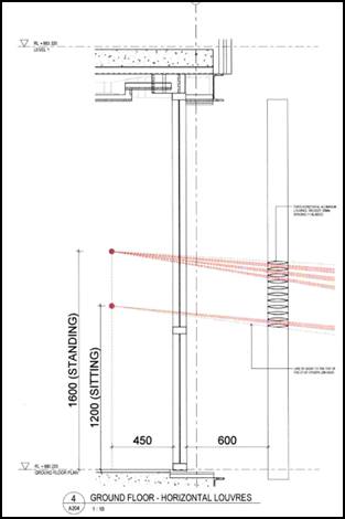
Figure 2 - section of the proposed louvres
The applicant invited Council staff and the adjoining owner
to observe a prototype of the proposed screening structure. The prototype was
not an exact match of the screen proposed. The prototype was further off the
ground than proposed and positioned on the inside face of the building rather
than the location on the outside of the building.
Having observed the prototype, Council staff are of the view
that in order to provide sufficient privacy to the western neighbour, the depth
of the individual fixed blades should be increased from the proposed 150mm to a
depth of 250mm. This will further prevent the potential for the observer from
being able to look down into the backyard of the adjoining owner.
With the above described change, the development is
considered acceptable in relation to privacy. The relevant condition has been
amended accordingly.
The development as modified is considered acceptable in
terms of visual privacy. Acoustic privacy is addressed below under the heading
“Noise Impacts”.
Heritage
The DCP sets the following planning outcomes in regard to
heritage:
· Heritage
buildings and structures are efficiently re-used.
· New
development complements and enhances the significance of a heritage item or
place of heritage significance listed in the Orange Heritage Study.
· Significant
landscape features are retained including original period fences and period
gardens.
Heritage has previously been addressed in detail under the
heading “5.10 - Heritage Conservation”. The proposed development
has been designed in accordance with the outcomes for heritage and is
considered acceptable.
INFILL GUIDELINES
As established under the Heading “5.10 - Heritage
Conservation”, there are no aspects of the application to modify the
consent that would result in unsatisfactory impacts upon the heritage
significance of the place.
The development as modified will not be incongruous with the
character of the locality.
The development as modified will not dramatically alter the
previously approved scale and form of the development.
The previously approved siting of the development does not
change as a result of the development as modified.
The materials and colours, and the detailing of the modified
design are appropriate save for the western boundary fence as described above.
The development as modified is not inconsistent with the
relevant heads of consideration under the Infill Guidelines and remains
consistent with the intent of the Court approved development.
PROVISIONS PRESCRIBED BY THE
REGULATIONS s4.15(1)(a)(iv)
The development as modified is not inconsistent with the
provisions prescribed by the regulations.
THE LIKELY IMPACTS OF THE
DEVELOPMENT s4.15(1)(b)
Residential Amenity
Visual Privacy
The impacts associated with the visual privacy of the
development with consideration to the revised privacy screens are addressed
above under the DCP considerations.
Noise Impacts
The consideration of noise impacts relates only to the
condition Council previously imposed that required windows on the western
elevation to be fixed pane and non-operable windows. The intent was to manage
noise associated with the deletion of balconies. At the time of previously
considering this issue the applicant did not provide sufficient information to
satisfy Council staff that operable windows would be satisfactory thus the
condition was imposed.
The applicant has now submitted in support of this
application, an acoustic report which demonstrates that the development can
operate with operable windows across all rooms within the western elevation.
The Manager of Building and Environment has assessed the report and agreed that
the development will be acceptable with operable windows.
It is recommended that the relevant condition be deleted.
The development will not give rise to unacceptable impacts
as a result of noise associated with guest rooms.
Heritage
Heritage considerations are addressed above under the
heading “Clause 5.10 - Heritage Conservation” under the LEP
consideration.
THE SUITABILITY OF THE SITE
s4.15(1)(c)
The site continues to remain suitable for the development as
modified.
ANY SUBMISSIONS MADE IN
ACCORDANCE WITH THE ACT s4.15(1)(d)
The proposed development is defined as "advertised
development" under the provisions of the Act. The application was
advertised for the prescribed period of 14 days and at the end of that period eight
submissions had been received.
Submissions 1 and 2 - Resident
of 60 Byng Street
Submission 1
In relation to the louvres, the submitter indicates that
they have no objection to the louvres being fixed and horizontal rather than
being angled, but the submitter states that “the position of the
louvres, distance from the windows and widths of the louvres will have a
bearing on whether they are appropriate”.
In relation to the treated pine timber fence along the
boundary, the submitter articulates their version of what has transpired
between themselves and the adjoining owner. The submitter concludes that as no
further work has been carried out to the fence which was the basis for the
agreed position previously, and that the fence condition has deteriorated
further since the initial agreement. The submitter has indicated that their
previous conditional agreement is thus withdrawn.
In relation to the operable windows, the submitter indicates
no objection provided that the acoustic considerations have been assessed by
Council staff.
Submission 2
Submission 2 is a subsequent submission from the adjoining
owner. The submission details what the adjoining owner indicated at the site
meeting to observe the prototype privacy screening. The submitter confirmed
that he agreed to the proposed method of privacy screening and also that he had
no objections to the operable windows given that Council staff has reviewed the
submitted acoustic report and it was deemed satisfactory.
Council staff response
Submissions 1 and 2 are authored by the same person and are
addressed below.
In relation to the above, despite the agreement of the
adjoining owner in relation to privacy, Council staff have assessed the level
of privacy and consider it appropriate to increase the depth of the louvres as
detailed above. This will ensure an even greater level of privacy for the
adjoining property and a better outcome. This is addressed above.
In relation to the boundary fence, the position of Council
staff on this matter is detailed above. It is recommended that the status quo
of the consent remain (ie that being the position initially held by the Court
and subsequently by Council) and the request to allow the treated pine fence
not be supported.
In relation to the operable windows, as mentioned above the
applicant has submitted an acoustic report in support of the development which
indicates that the development with operable windows would be acceptable. This
has been reviewed by the Manager Building and Environment and confirmed as
acceptable.
Submission 3 - Resident of 75
Hill Street
The submission raises concerns in relation to the western
boundary fence in terms of its adequacy in its construction and the materials
it has been constructed from.
Council staff response
In relation to the boundary fence, the position of Council
staff on this matter is detailed above. It is recommended that the status quo
of the consent remain (ie that being the position initially held by the Court
and subsequently by Council) and the request to allow the treated pine fence
not be supported.
Submission 4 - Resident of 82
Clinton Street
The submitter raises concerns in relation to the operable
western windows and the fencing materials.
Council staff response
The allowance of operable windows is addressed in detail
above. The applicant has submitted an acoustic report in support of allowing
the operable windows and this is considered to be acceptable.
In relation to the boundary fence, the position of Council
staff on this matter is detailed above. It is recommended that the status quo
of the consent remain (ie that being the position initially held by the Court
and subsequently by Council) and the request to allow the treated pine fence
not be supported.
Submission 5 - Residents of 59
Byng Street
The submitter raises concerns in relation to the western
boundary in respect of its adequacy and the materials used in breach of the
consent condition.
Council staff response
In relation to the boundary fence, the position of Council
staff on this matter is detailed above. It is recommended that the status quo
of the consent remain (ie that being the position initially held by the Court
and subsequently by Council) and the request to allow the treated pine fence
not be supported.
Submission 6 - 57 Byng Street
The submitter raises concerns in relation to the operable
windows and the western boundary fence in terms of the material used, which was
contrary to the consent. The submitter also mentions the illegal developments
that have allegedly occur at the property, citing discussions at a Council
meeting in 2016, and requests that the developer be penalised.
Council staff response
The allowance of operable windows is addressed in detail
above. The applicant has submitted an acoustic report in support of allowing
the operable windows and this is considered to be acceptable.
In relation to the boundary fence, the position of Council
staff on this matter is detailed above. It is recommended that the status quo
of the consent remain (ie that being the position initially held by the Court
and subsequently by Council) and the request to allow the treated pine fence
not be supported.
In relation to the illegal works, this a separate matter
which has been reported to Council previously.
Submission 7 - owners of 85
Hill Street
The submitters raise concerns in relation to the
applicant’s request to amend the screening and seek to allow operable
windows. The submitters have also referenced the western boundary fence stating
“it looks flimsy and in poor condition” and suggest that the
fence should be replaced as per the Court imposed condition.
Council staff response
The privacy considerations are addressed above and it has
been determined that the fixed louvres should be increased in depth to allow a
greater level of privacy.
In relation to the operable windows, as indicated above the
applicant has submitted an acoustic report in support of the operable windows
which is considered to be acceptable.
In relation to the boundary fence, the position of Council
staff on this matter is detailed above. It is recommended that the status quo
of the consent remain (ie that being the position initially held by the Court
and subsequently by Council) and the request to allow the treated pine fence
not be supported.
Submission 8 - Resident of 234
March Street
The submission objects to the request to allow the
constructed pine fence to remain. The author of the submission outlines various
technical construction factors that they allege the applicant has not considered
when constructing the fence - stating these for the reasons that the fence is
in a poor condition.
Council staff response
In relation to the boundary fence, the position of Council
staff on this matter is detailed above. It is recommended that the status quo
of the consent remain (ie that being the position initially held by the Court
and subsequently by Council) and the request to allow the treated pine fence
not be supported.
PUBLIC INTEREST s4.15(1)(e)
The proposed development is considered to be of minor
interest to the wider public due to the relatively localised nature of
potential impacts. The proposal is not inconsistent with any relevant policy
statements, planning studies, guidelines etc that have not been considered in
this assessment.
SUMMARY
The development as modified remains permissible with the
consent of Council. The proposed development is not inconsistent with the
relevant aims, objectives and provisions of Orange
LEP 2011 (as amended) and DCP 2004. A section 4.15
assessment of the development indicates that the development is acceptable save
for the matter pertaining to the materials used for the western boundary fence.
The applicant has requested that Council give further consideration to allowing
the treated pine fence that has been recently constructed along the western
boundary as opposed to the current requirement for the fence to be a timber
hardwood fence. It is open for Council to reconsider its position of this
matter. Attached is a draft amended Notice of Approval outlining a range of
conditions considered appropriate to ensure that the development proceeds in an
acceptable manner.
COMMENTS
The requirements of the Environmental Health and Building
Surveyor and the Engineering Development Section are included in the attached amended
Notice of Approval.
Attachments
1 Modified
Notice of Approval, D18/64465
2 Plan,
D18/64451
3 Submissions,
D18/64194
2.6 Development
Application DA 136/2018(1) - 100 Bathurst Road
RECORD
NUMBER: 2018/2919
AUTHOR: Andrew
Crump, Senior Planner
EXECUTIVE Summary
|
Application lodged
|
19 April 2018
|
|
Applicant/s
|
McDonald's Australia Limited
|
|
Owner/s
|
McDonalds Properties (Aust) Pty
Limited
|
|
Land description
|
Lot 4 DP 778409 - 100 Bathurst Road
Orange
|
|
Proposed land use
|
Take Away Food and Drink Premises,
Restaurant or Cafe, Demolition (existing building and tree removal) and
Business Identification Signage
|
|
Value of proposed development
|
$3,997,452
|
Council's consent is sought to redevelop the existing
McDonalds restaurant on Bathurst Road. The application essentially involves
demolishing the existing building and constructing a new McDonald’s
restaurant on the site closer to Bathurst Road.
The subject land is described as Lot 4 DP 778409, known as
100 Bathurst Road and is shown in the below locality plan.
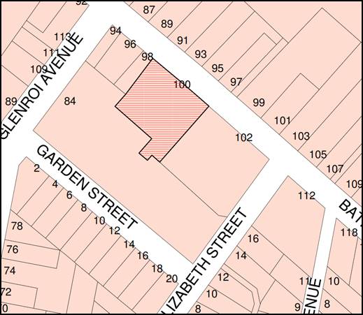
Figure 1 - locality plan
In order to continue trading during the construction period,
the applicant is proposing to stage the development such that the existing
restaurant can still function during the construction phase of the development.
The critical element in the assessment of this application
relates to traffic matters given the subject land has frontage to Bathurst Road
which is the Mitchell Highway. Accordingly, the RMS has been consulted.
The development is considered satisfactory and is
recommended for approval.
RECENT LEGISLATIVE CHANGES
On 1 March 2018 the Environmental Planning and Assessment
Act 1979 was substantially amended. The most immediate change involves the
restructuring and renumbering of the Act, with other more substantive
changes to be phased in over time. However, for some applications (particularly
where an application was lodged prior to the changes coming into effect) the
supporting documentation may still reference the previous numbering regime. In
the drafting of this report the content and substance of the supporting
material has been considered irrespective of which legislative references were
used.
DECISION FRAMEWORK
Development in Orange is governed by two key documents
Orange Local Environment Plan 2011 and Orange Development Control Plan 2004. In
addition, the Infill Guidelines are used to guide development, particularly in
the heritage conservation areas and around heritage items.
Orange Local Environment Plan 2011 – The
provisions of the LEP must be considered by the Council in determining the
application. LEPs govern the types of development that are permissible or
prohibited in different parts of the City and also provide some assessment
criteria in specific circumstances. Uses are either permissible or not. The
objectives of each zoning and indeed the aims of the LEP itself are also to be
considered and can be used to guide decision making around appropriateness of
development.
Orange Development Control Plan 2004 – the DCP
provides guidelines for development. In general it is a performance based
document rather than prescriptive in nature. For each planning element there
are often guidelines used. These guidelines indicate ways of achieving the
planning outcomes. It is thus recognised that there may also be other solutions
of merit. All design solutions are considered on merit by planning and building
staff. Applications should clearly demonstrate how the planning outcomes are
being met where alternative design solutions are proposed. The DCP enables
developers and architects to use design to achieve the planning outcomes in
alternative ways.
DIRECTOR’S COMMENT
This development application involves a revamp of the highly
successful Bathurst Road McDonald’s. The development is supported by
staff, however conditions of consent have been included to avoid impacts
associated with the simultaneous construction and restaurant operation as it
would result in inappropriate conflict.
Link To Delivery/OPerational Plan
The recommendation in this report relates to the
Delivery/Operational Plan strategy “10.1 Preserve -
Engage with the community to ensure plans for growth and development are
respectful of our heritage”.
Financial Implications
Nil
Policy and Governance Implications
Nil
|
Recommendation
That Council resolves to
consent to development application DA 136/2018(1) for Take Away Food and Drink Premises, Restaurant or
Cafe, Demolition (existing building and tree removal) and Business
Identification Signage at Lot 4 DP 778409 - 100 Bathurst Road,
Orange pursuant to the conditions of consent in the
attached Notice of Approval.
|
further considerations
Consideration has been given to the recommendation’s
impact on Council’s service delivery; image and reputation; political;
environmental; health and safety; employees; stakeholders and project
management; and no further implications or risks have been identified.
SUPPORTING INFORMATION
THE LAND
The land is described as Lot 4 DP 778409, known as 100
Bathurst Road. The land has frontage to Bathurst Road which is also the
Mitchell Highway (RMS road). The land is situated mid-way between Glenroi
Avenue and Elizabeth Street; it adjoins Red Rooster to the north-west, a motel
to the south-east, the Ophir Tavern to the south-west and residential
properties are located opposite the site.
THE APPLICATION/THE PROPOSAL
Council's consent is sought to demolish the existing
restaurant on the land and construct a new restaurant. The new restaurant will
be sited closer to Bathurst Road in the location of the existing car park, with
new car parking primarily provided to the rear of the proposed building.
The new building will be a
contemporary, rectilinear building with flat, mono-pitched roof concealed by
parapet wall and suspended awning. The presentation of the proposed building is
shown in the below figure.
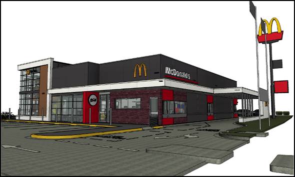
Figure 2 - isometric view of proposed building looking
southwest
A dual lane drive-through facility is proposed with order
points on the western side of the building, with the collection point at the
front of the building. The restaurant will provide for 80 seats
(internally – no external seating is proposed), party room, kids play ground
and amenities.
33 car parking spaces are proposed, as well as bicycle
parking.
Extensive landscaping is proposed, including large trees
within the Bathurst Road frontage.
It will be necessary to remove the large Picea mariana
(common name Black Spruce) within the existing car park.
Signage proposed as part of the development comprises
McDonald’s standard branding and corporate livery, typical of similar
developments throughout the State.
As part of the development, the applicant is proposing to
stage the decommissioning and demolition of the existing restaurant such that
the existing restaurant can continue to trade, albeit at a reduced capacity
(drive-through only), during the construction phase of the development.
The development is proposed to operate 24 hours a day, 7
days a week.
MATTERS FOR CONSIDERATION
Section 1.7 - Application of
Part 7 of the Biodiversity Conservation Act 2016 and Part 7A of the
Fisheries Management Act 1994
Section 1.7 of the EP&A Act 1979 identifies that Part 7
of the Biodiversity Conservation Act 2016 and Part 7A of the Fisheries
Management Act 1994 have effect in connection with terrestrial and aquatic
environments.
Having regard to the relevant provisions and based on an
inspection of the subject property, it is considered that the proposed
development is not likely to significantly affect a threatened species.
A Biodiversity Development Assessment Report is not required
in this instance.
The site is a highly disturbed urban environment, and as
such the subject property has no biodiversity or habitat value.
Section 4.15
Section 4.15 of the Environmental Planning and Assessment
Act 1979 requires Council to consider various matters, of which those
pertaining to the application are listed below.
PROVISIONS OF ANY ENVIRONMENTAL
PLANNING INSTRUMENT s4.15(1)(a)(i)
Orange Local Environmental Plan 2011
Part 1 - Preliminary
Clause 1.2 - Aims of Plan
The
broad aims of the LEP are set out under subclause 2. Those relevant to the
application are as follows:
(a) to encourage development which complements
and enhances the unique character of Orange as a major regional centre boasting
a diverse economy and offering an attractive regional lifestyle,
(b) to provide for a range of development
opportunities that contribute to the social, economic and environmental
resources of Orange in a way that allows present and future generations to meet
their needs by implementing the principles for ecologically sustainable
development,
(c) to conserve and enhance the water
resources on which Orange depends, particularly water supply catchments,
The application is considered to be consistent with aims
(a), (b) and (c) as listed above.
Clause 1.6 - Consent Authority
This clause establishes that, subject to the Act, Council is
the consent authority for applications made under the LEP.
Clause 1.7 - Mapping
The subject site is identified
on the LEP maps in the following manner:
|
Land Zoning Map:
|
Land zoned B6 Enterprise Corridor
|
|
Lot Size Map:
|
No Minimum Lot Size
|
|
Heritage Map:
|
Not a heritage item or conservation
area
|
|
Height of Buildings Map:
|
No building height limit
|
|
Floor Space Ratio Map:
|
No floor space limit
|
|
Terrestrial Biodiversity Map:
|
No biodiversity sensitivity on the
site
|
|
Groundwater Vulnerability Map:
|
Groundwater vulnerable
|
|
Drinking Water Catchment Map:
|
Not within the drinking water
catchment
|
|
Watercourse Map:
|
Not within or affecting a defined
watercourse
|
|
Urban Release Area Map:
|
Not within an urban release area
|
|
Obstacle Limitation Surface Map:
|
No restriction on building siting
or construction
|
|
Additional Permitted Uses Map:
|
No additional permitted use applies
|
|
Flood Planning Map:
|
Not within a flood planning area
|
Those matters that are of relevance are addressed in detail
in the body of this report.
Clause 1.9A - Suspension of
Covenants, Agreements and Instruments
This clause provides that covenants, agreements and other
instruments which seek to restrict the carrying out of development do not apply
with the following exceptions.
· covenants imposed
or required by Council
· prescribed
instruments under Section 183A of the Crown Lands Act 1989
· any conservation
agreement under the National Parks and Wildlife Act 1974
· any trust
agreement under the Nature Conservation Trust Act 2001
· any property
vegetation plan under the Native Vegetation Act 2003
· any biobanking
agreement under Part 7A of the Threatened Species Conservation Act 1995
· any planning
agreement under Division 6 of Part 4 of the Environmental Planning and
Assessment Act 1979.
Council staff are not aware of the title of the subject
property being affected by any of the above.
Part 2 - Permitted or Prohibited Development
Clause
2.1 - Land Use Zones and Clause 2.3 - Zone Objectives and Land Use Table
The subject site is located within the B6 Enterprise
Corridor zone. The proposed development is categorised as a take away food and
drink premises[1],
restaurant or café2, business identification signage and
demolition under OLEP 2011. The above land-uses are defined within the LEP as
follows:
take away
food and drink premises means premises that are
predominantly used for the preparation and retail sale of food or drink (or
both) for immediate consumption away from the premises.
restaurant or
cafe means a building or place the principal
purpose of which is the preparation and serving, on a retail basis, of food and
drink to people for consumption on the premises, whether or not liquor, take
away meals and drinks or entertainment are also provided.
business
identification sign means a sign:
(a) that indicates:
(i) the name of the person or business,
and
(ii) the nature of the business carried on by
the person at the premises or place at which the sign is displayed, and
(b) that may include the address of the
premises or place and a logo or other symbol that identifies the business,
but that does
not contain any advertising relating to a person who does not carry on business
at the premises or place.
Demolition
is addressed below under the heading Clause 2.7 - Demolition.
Take
away food and drink premises, restaurant or cafes and business identification
signage are permissible land-uses within the zone subject to receiving
development consent.
Clause 2.3 of LEP 2011
references the Land Use Table and Objectives for each zone in LEP 2011.
These objectives for land zoned B6 Enterprise Corridor are as follows:
1
- Objectives of zone
· To promote businesses along main roads and to
encourage a mix of compatible uses.
· To provide a range of employment uses (including
business, office, retail and light industrial uses).
· To maintain the economic strength of centres by
limiting retailing activity.
· To provide for residential uses, but only as part
of a mixed-use development.
The development is not inconsistent with the objectives of
the zone. The development will continue the longstanding commercial use of the
land and continue to provide positive levels of employment within the
community. Given the existing and longstanding use of the site as a
McDonald’s restaurant and the fact that this will continue as a result of
the development, the development is expected to have a neutral impact on the
role of the CBD as the primary retail centre. The last object is not
relevant to the proposal.
Clause 2.7 - Demolition
Requires Development Consent
This clause triggers the need for
development consent in relation to a building or work, which the applicant has
sought as part of this application.
The applicant is proposing to
demolish the existing building and all associated structures and vegetation within
the site, save for the large pylon sign within the site frontage.
There are no objections to the
demolition proposed. The building on the land is considered to have exhausted
its lifecycle and there is no real benefit to insisting on its retention. The
demolition works proposed will have no significant impact on adjoining lands,
streetscape or public realm. Appropriate conditions are attached to the Notice
of Approval in relation to the proposed demolition.
Part 3 - Exempt and Complying Development
The application is not exempt or complying development.
Part 7 - Additional Local Provisions
7.1
- Earthworks
This
clause establishes a range of matters that must be considered prior to granting
development consent for any application involving earthworks, such as:
(a) the likely disruption of, or any
detrimental effect on, existing drainage patterns and soil stability in the
locality of the development
(b) the effect of the development on the
likely future use or redevelopment of the land
(c) the quality of the fill or the soil to be
excavated, or both
(d) the effect of the development on the
existing and likely amenity of adjoining properties
(e) the source of any fill material and the
destination of any excavated material
(f) the likelihood of disturbing relics
(g) the proximity to and potential for adverse
impacts on any waterway, drinking water catchment or environmentally sensitive
area
(h) any measures proposed to minimise or
mitigate the impacts referred to in paragraph (g).
The earthworks proposed in the
application are limited to the extent of cutting and filling required for the
proposed building, which are expected to be minimal given the relatively level
site. The extent of disruption to the drainage of the site is considered to be
minor and will not detrimentally affect adjoining properties or receiving
waterways.
The extent of the earthworks
will not materially affect the potential future use or redevelopment of the
site that may occur at the end of the proposed development's lifespan.
The site is not known to be
contaminated, however relevant conditions are attached in relation to the event
of an unexpected find in relation to contamination.
The earthworks will be
appropriately supported onsite and the change in ground level is not substantial.
Therefore, the effect on the amenity of adjoining properties is considered to
be minor.
The site is not known to contain
any Aboriginal, European or archaeological relics. Previous known uses of the
site do not suggest that any relics are likely to be uncovered. However,
conditions are imposed to ensure that should site works uncover a potential
relic or artefact, works will be halted to enable proper investigation by
relevant authorities and the proponent required to seek relevant permits to either
destroy or relocate the findings.
The site is not in proximity to
any waterway, drinking water catchment or sensitive area. However, conditions
are imposed to ensure measures are implemented to control sediment and prevent
it from leaving the site.
7.3 - Stormwater Management
This clause applies to all
industrial, commercial and residential zones and requires that Council be
satisfied that the proposal:
(a) is designed to maximise the use of water
permeable surfaces on the land having regard to the soil characteristics
affecting onsite infiltration of water
(b) includes, where practical, onsite
stormwater retention for use as an alternative supply to mains water,
groundwater or river water; and
(c) avoids any significant impacts of
stormwater runoff on adjoining downstream properties, native bushland and
receiving waters, or if that impact cannot be reasonably avoided, minimises and
mitigates the impact.
The
site is affected by an overland stormwater flow from the 1% Annual Exceedance
Probability which enters the site from the adjoining property to the south. A
condition is attached that ensures the overland flow is not impeded or
redirected as a result of the development.
Council’s
standard conditions relating to stormwater are attached to the consent. The
objective of the conditions is to ensure that post development runoff levels do
not exceed pre-development levels. A further condition is attached to ensure an
appropriate level of water quality of stormwater before it leaves the site.
7.6 - Groundwater Vulnerability
This
clause seeks to protect hydrological functions of groundwater systems and
protect resources from both depletion and contamination. Orange has a high
water table and large areas of the LGA, including the subject site, are
identified with “Groundwater Vulnerability” on the Groundwater
Vulnerability Map. This requires that Council consider:
(a) whether or not the development (including
any onsite storage or disposal of solid or liquid waste and chemicals) is
likely to cause any groundwater contamination or have any adverse effect on
groundwater dependent ecosystems, and
(b) the cumulative impact (including the
impact on nearby groundwater extraction for potable water supply or stock water
supply) of the development and any other existing development on groundwater.
Furthermore consent may not be granted unless Council is satisfied that:
(a) the development is designed, sited and
will be managed to avoid any significant adverse environmental impact, or
(b) if that impact cannot be reasonably avoided
- the development is designed, sited and will be managed to minimise that
impact,
(c) if that impact cannot be minimised - the
development will be managed to mitigate that impact.
The proposal is not anticipated
to involve the discharge of toxic or noxious substances and is therefore
unlikely to contaminate the groundwater or related ecosystems. The proposal
does not involve extraction of groundwater and will therefore not contribute to
groundwater depletion. The design and siting of the proposal avoids impacts on
groundwater and is therefore considered acceptable.
Clause 7.11 - Essential
Services
Clause 7.11 applies and states:
Development
consent must not be granted to development unless the consent authority is
satisfied that any of the following services that are essential for the
proposed development are available or that adequate arrangements have been made
to make them available when required:
(a) the supply of water,
(b) the supply of electricity,
(c) the disposal and management of sewage,
(d) storm water drainage or on-site
conservation,
(e) suitable road access.
In consideration of this clause, all utility services are
available to the land and adequate for the proposal.
STATE ENVIRONMENTAL PLANNING
POLICIES
State Environmental Planning Policy (Infrastructure)
State Environmental Planning Policy (Infrastructure) is
applicable to the application given the development’s frontage to a
classified road, and therefore the development is classed as a traffic
generating development. Additionally, there is electricity infrastructure in
the vicinity and therefore a referral to the relevant supply authority is
required. The applicable clauses are 101 – Development with frontage
to a classified road, 104 – Traffic Generating Development, and 45
– determination of development applications – other development
respectively.
Clause 101 states:
101 Development with frontage to classified road
(1) The objectives of this clause are:
(a) to ensure that new development does not
compromise the effective and ongoing operation and function of classified
roads, and
(b) to prevent or reduce the potential impact
of traffic noise and vehicle emission on development adjacent to classified
roads.
(2) The consent authority must not grant
consent to development on land that has a frontage to a classified road unless
it is satisfied that:
(a) where practicable and safe, vehicular
access to the land is provided by a road other than the classified road, and
(b) the safety, efficiency and ongoing
operation of the classified road will not be adversely affected by the
development as a result of:
(i) the design of the vehicular access to
the land, or
(ii) the emission of smoke or dust from the
development, or
(iii) the nature, volume or frequency of vehicles
using the classified road to gain access to the land, and
(c) the development is of a type that is not
sensitive to traffic noise or vehicle emissions, or is appropriately located
and designed, or includes measures, to ameliorate potential traffic noise or
vehicle emissions within the site of the development arising from the adjacent
classified road.
In response to the above, the development is considered
acceptable in terms of its impacts upon the effectiveness and ongoing operation
and function of the Mitchell Highway. As addressed below under clause 104
considerations, advice from the RMS has been obtained indicating no objections
to the development subject to conditions. The development adopts the existing
and longstanding access arrangements for the site, save for the proposed exit
from the site in a left only manoeuvre onto the highway. The existing egress
over a right of carriage way within the Ophir Tavern land onto Glenroi Avenue
remains.
As mentioned above, the existing access to the site will
continue to be used from Bathurst Road. Delivery vehicles which currently enter
the site from Bathurst Road will, as a result of the proposed development,
enter from Glenroi Avenue. Passenger vehicles can also enter from Glenroi
Avenue.
The development is not expected to impact upon the
classified road by way of dust or smoke generation. All trafficable surfaces
within the site are intended to be fully sealed, thus preventing dust. The
extraction systems and cooking facilities are not expected to generate any
smoke at levels that would impact the roadway.
The development is not a type that is sensitive to noise or
vehicle emissions, and therefore the ongoing operation of the highway will not
conflict with the development in this regard.
The development is thus considered acceptable in relation to
clause 101 of the SEPP (Infrastructure)
Clause 104 states:
104 Traffic-generating
development
(1) This clause applies to development
specified in Column 1 of the Table to Schedule 3 that involves:
(a) new premises of the relevant size or
capacity, or
(b) an enlargement or extension of existing
premises, being an alteration or addition of the relevant size or capacity.
(2) In this clause, relevant size or capacity
means:
(a) in relation to development on a site that
has direct vehicular or pedestrian access to any road (except as provided by
paragraph (b))—the size or capacity specified opposite that development
in Column 2 of the Table to Schedule 3, or
(b) in relation to development on a site that
has direct vehicular or pedestrian access to a classified road or to a road
that connects to a classified road where the access (measured along the
alignment of the connecting road) is within 90m of the connection—the
size or capacity specified opposite that development in Column 3 of the Table
to Schedule 3.
(3) Before determining a development
application for development to which this clause applies, the consent authority
must:
(a) give written notice of the application to
RMS within 7 days after the application is made, and
(b) take into consideration:
(i) any submission that RMS provides in
response to that notice within 21 days after the notice was given (unless,
before the 21 days have passed, RMS advises that it will not be making a
submission), and
(ii) the accessibility of the site concerned, including:
(A) the efficiency of movement of people and
freight to and from the site and the extent of multi-purpose trips, and
(B) the potential to minimise the need for
travel by car and to maximise movement of freight in containers or bulk freight
by rail, and
(iii) any potential traffic safety, road congestion
or parking implications of the development.
(4) The consent authority must give RMS a copy
of the determination of the application within 7 days after the determination
is made.
The development is characterised as a take away food or
drink premises with drive-through facilities as categorised under schedule 3 of
the SEPP, and thus is a type of traffic generating development as defined.
The development was referred to the RMS in the first
instance. When initially submitted, the application contemplated a right turn
out of the development site onto Bathurst Road. The RMS objected to the
development on this basis. The applicant subsequently amended the application
to delete the right turn out onto Bathurst Road, limiting the egress to left
only after exiting the drive-through facility.
All other vehicles not utilising the drive-through facility
will be required to exit the site via Glenroi Avenue.
The RMS also undertook detailed modelling of the performance
of the intersection of Glenroi Avenue and the highway, which confirmed the
assessment within the submitted traffic report that the intersection operates
at a level of service “A” (which is the highest rating). This
modelling was carried out because at the time of assessing the nearby 7‑Eleven development,
the same intersection was identified as having a level of service much lower
than the level “A” service identified as part of this application.
As it transpired, the volume of traffic within the highway has significantly
reduced since the 7-Eleven was determined some three years ago. Anecdotally,
this is likely to be a result of an increase in the use of the Northern
Distributor Road.
Accordingly, the RMS has issued advice to Council indicating
no objections to the development subject to certain works being undertaken
within the travel lanes of the highway (fundamentally to prevent a right turn
onto the highway from the subject land), and the access point to the site which
is required to be carried-out as part of a Works Authorisation Deed (WAD) with
the RMS. Other requirements relate to the maintaining of sight distances and
the maximum size of vehicles entering the site.
The requirements of the RMS have been included as conditions
of the consent within the Notice of Approval.
45 Determination of development
applications—other development
(1) This clause applies to a development
application (or an application for modification of a consent) for development
comprising or involving any of the following:
(b) development carried out:
(i) within or immediately adjacent to an
easement for electricity purposes (whether or not the electricity
infrastructure exists), or
(ii) immediately adjacent to an electricity
substation, or
(iii) within 5m of an exposed overhead electricity
power line,
(2) Before determining a development
application (or an application for modification of a consent) for development
to which this clause applies, the consent authority must:
(a) give written notice to the electricity
supply authority for the area in which the development is to be carried out,
inviting comments about potential safety risks, and
(b) take into consideration any response to the
notice that is received within 21 days after the notice is given.
The subject land contains an underground electricity supply
that links with the substation on the adjoining land. Accordingly, the
application was referred to Essential Energy for comment. Essential Energy
responded indicating no objections to the development, but did include several
standard conditions which have been included in the Notice of Approval.
State Environmental Planning
Policy 55 - Remediation of Land
State Environmental Planning Policy 55 - Remediation of Land
(SEPP 55) is applicable and requires that a consent authority must not consent
to the carrying out of development of land unless it has considered whether the
land is contaminated, is satisfied that the land is suitable in its
contaminated state for the development that is proposed, and if the land
requires remediation to be made suitable for the proposed development it is
satisfied that the land will be remediated before the land is used for that
purpose.
Furthermore, SEPP 55 requires that before determining an
application for consent to carry out development that would involve a change of
use on any of the land specified in subclause (4), the consent authority
must consider a report specifying findings of a preliminary investigation of
the land concerned. The development does not involve a change of use.
The subject land has a long history of being used for
commercial purposes, and prior to the current use the land was used for the
purposes of residential accommodation. Glenroi House once occupied the site
until it was demolished on the 1970s to allow the construction of the current
restaurant. The former Glenroi House was used as a private residence and later
as a boarding house for Wolaroi College students; and then finally as a
restaurant prior to its demolition. Accordingly, Council staff are not aware of
the site being used for a purpose that would cause
the land to be contaminated. Notwithstanding this, Council’s standard
precautionary unexpected finds condition is attached as a condition of consent.
State
Environmental Planning Policy 64 - Advertising and Signage
State Environmental Planning
Policy 64 - Advertising and Signage (SEPP
64) is applicable to the application as the applicant is proposing the
following signs:
· 1 x McDonald’s sign above the entrance;
· “M” Logo affixed to the walls on the north-eastern
(front elevation), north-western elevation, and south-eastern elevation;
· 1 x McCafe wall sign on the front elevation;
· 2 x internally illuminated “play place” hanging
signs – on the north-eastern and south‑western elevations;
· 2 x internally illuminated “McDonald’s”
wall signs affixed to the north-eastern and south-western elevations;
· 2 x height clearance signs; and
· various directional signage and drive-through direction
signage.
It is noted that the menu boards
associated with the drive-through facility at the ordering point will be
position whereby they are not visible from a public place, and thereby
the SEPP does not apply.
It is
also noteworthy that the application when initially submitted include a large
blade wall sign that extended well above the height of the building (refer
figure below). Council staff as part of their initial appraisal identified the
blade wall sign as being inappropriate and unnecessary, adding to the
proliferation of signage within the site, particularly accounting for the large
existing pylon sign adjacent to the road reserve.
Figure 3 - excerpt of superseded plan showing blade
wall sign
Council
staff did suggest that the proposed blade wall could be considered if the large
pylon sign was removed, but both signs within the site would not be an
acceptable outcome.
The applicant responded by
deleting the blade wall sign and advising that there was no intention to remove
the existing pylon. The deletion of the blade wall sign is considered a
positive outcome as it improves the visual presentation of the development.
The RMS questioned whether the existing flag poles were
being relocated as they may impede sightlines if they are. The applicant has
indicated as part of a response to a request for additional information that
they do not form part of the application. Accordingly, a condition is attached
indicating that a separate approval would be required to relocate them.
The SEPP states in part:
3 Aims,
Objectives etc
(1) This Policy aims:
(a) to
ensure that signage (including advertising):
(i) is compatible with the
desired amenity and visual character of an area, and
(ii) provides effective
communication in suitable locations, and
(iii) is of high quality design and
finish, and
The
development is not inconsistent with the Aims, objects, etc. of the policy. The
proposed signage scheme is similar to the existing situation and provides an
appropriate level of communication and will be of an acceptable architectural
standard.
(8) Granting
of Consent to Signage
A
consent authority must not grant development consent to an application to
display signage unless the consent authority is satisfied:
(a) that the signage is consistent
with the objectives of this Policy as set out in
clause 3 (1) (a), and
(b) that the signage the subject of
the application satisfies the assessment criteria specified in Schedule 1.
As mentioned above, the
development is consistent with clause 3 of the SEPP, and the following
assessment indicates that the development satisfies the relevant assessment
criteria contained within schedule 1 of the SEPP.
1 - Character of the Area
· Is the proposal compatible with the existing or desired
future character of the area or locality in which it is proposed to be located?
· Is the proposal consistent with a particular theme for
outdoor advertising in the area or locality?
The area is characterised by the
high-profile location on the entrance into the City and the highway frontage,
the residential dwelling houses on the north-eastern side of Bathurst Road, and
a mix of commercial developments on the south-western side of the road,
including Red Rooster, a 7-Eleven service station, Glenroi shops, Ophir Tavern
and Orange Motor Lodge. The commercial premises (including the existing
McDonald’s restaurant) include a mix of advertising signage, including
wall mounted signage, awning signage, window signage and various sized
freestanding pylon signs.
The proposed signage is
commensurate with the longstanding commercial use of the land and is not
inconsistent with other similar examples of signage within the locality such
as KFC and the 7-Eleven. Accordingly, the proposed signage is not
incongruous with the character of the area.
2 -
Special Areas
· Does the proposal detract from the amenity or visual
quality of any environmentally sensitive areas, heritage areas, natural or
other conservation areas, open space areas, waterways, rural landscapes or residential areas?
The location is considered to be a
moderately sensitive area given the proximity of the site to the residential
area, notwithstanding the commercial zoning of the land. However, as noted
above the proposed signage is not fundamentally incongruous with the theme of
signage within the immediate commercial precinct, and the signage is limited to
business identification signage.
3 -
Views and Vistas
· Does the proposal obscure or compromise important views?
· Does the proposal dominate the skyline and reduce the
quality of vistas?
· Does the proposal respect the viewing rights of other
advertisers?
The signage is primarily affixed
to the building and as such will not impact upon views or vistas within the
locality, nor will it interrupt the skyline or impede viewing rights of signage
on other land.
4 -
Streetscape, Setting or Landscape
· Is the scale, proportion and form of the proposal
appropriate for the streetscape, setting or landscape?
· Does the proposal contribute to the visual interest of the
streetscape, setting or landscape?
· Does the proposal reduce clutter by rationalising and
simplifying existing advertising?
· Does the proposal screen unsightliness?
· Does the proposal protrude above buildings, structures or
tree canopies in the area or locality?
· Does the proposal require ongoing vegetation management?
The proposed signage will have an
acceptable level of streetscape compatibility. The proposed signage scheme is
commensurate with the level and style of signage within the surrounding
commercial precinct. The signage will not present negatively in terms of visual
interest within the street and setting. The proposed signage does not
rationalise existing signage as the signs will be primarily fixed to a new host
building or be associated with a new drive-through facility.
As mentioned above, Council staff
indicated that the initially proposed blade wall sign was not appropriate, and
it was subsequently deleted. As a result, none of the proposed signage
protrudes above the height of the building.
No vegetation management is
required as a result of the proposed signage.
5 -
Site and Building
· Is the proposal compatible with the scale, proportion and
other characteristics of the site or building, or both, on which the proposed
signage is to be located?
· Does the proposal respect important features of the site or
building, or both?
· Does the proposal show innovation and imagination in its
relationship to the site or building, or both?
The proposed signage relates to
the proportions of the building and will not interrupt any important
architectural elements or features of the building. The signage does not
present a great degree of innovation or imagination, but rather focuses on the
objective of corporate brand identification in a manner similar to all other
McDonald’s developments throughout the state.
6 -
Associated Devices and Logos With Advertisements and Advertising Structures
· Have any safety devices, platforms, lighting devices or
logos been designed as an integral part of the signage or structure on which it
is to be displayed?
The McDonald’s
“M” logo features as part of the signage strategy; however, the
logos are not designed as part of the structure and they are simply wall
mounted.
7 -
Illumination
· Would illumination result in unacceptable glare?
· Would illumination affect safety for pedestrians, vehicles
or aircraft?
· Would illumination detract from the amenity of any
residence or other form of accommodation?
· Can the intensity of the illumination be adjusted, if
necessary?
· Is the illumination subject to a curfew?
The signage will be illuminated,
however the levels of light emitted are not expected to impact nearby
properties or the function of the highway. To ensure that this is the case, a
condition is attached which requires the development to be designed and
operated in a manner that is consistent with the Australian Standard which
controls the obtrusive effects of outdoor lighting.
8 -
Safety
· Would the proposal reduce the safety for any public road?
· Would the proposal reduce the safety for pedestrians or
bicyclists?
· Would the proposal reduce the safety for pedestrians,
particularly children, by obscuring sightlines from public areas?
The proposed signage is mostly
affixed to the host building, and the signage that is freestanding will be
located appropriately within the site in manner that will not reduce public safety
for road users and pedestrians.
State Environmental Planning
Policy (Vegetation in Non-Rural Areas) 2017
The applicant is proposing to remove a large picea
mariana Black Spruce from the front of the site, and as such SEPP
(Vegetation in Non-Rural Areas) applies to the development.
Part 3 of the SEPP applies to vegetation in any non-rural
area of the State that is declared by a Development Control Plan to be
vegetation that Council can issue a permit to a landholder to be cleared.
Clause 26 of the SEPP outlines that a Development Control Plan (DCP) that is in
force on the commencement of this Policy can establish the process, such as
requiring a permit or development consent, for the clearing of vegetation.
Chapter 0 Transitional Provisions of the Orange DCP 2004
(the DCP) prescribes the kinds of trees and other vegetation that are subject
to Clause 10 of the SEPP. The vegetation that would be impacted by the proposed
demolition is of a size that would trigger the requirements outlined in these
provisions.
This application is requesting consent to remove this
vegetation. It is therefore considered that the requirements of the SEPP have
been met and the proposal is consistent with the provisions as outlined in the
Policy and the DCP.
PROVISIONS OF ANY DRAFT
ENVIRONMENTAL PLANNING INSTRUMENT THAT HAS BEEN PLACED ON EXHIBITION
4.15(1)(a)(ii)
There are no draft environmental planning instruments that
apply to the subject land or proposed development.
DESIGNATED DEVELOPMENT
The proposed development is not designated development.
INTEGRATED DEVELOPMENT
The proposed development is not integrated development.
PROVISIONS OF ANY DEVELOPMENT
CONTROL PLAN s4.15(1)(a)(iii)
Development Control Plan 2004
Development Control Plan 2004 (“the DCP”)
applies to the subject land:
· Chapter 0 - LEP
2011;
· Chapter 2 -
Natural Resource Management;
· Chapter 3 -
General considerations;
· Chapter 8 -
Development in Business Zones;
· Chapter 14 -
Advertisements; and
· Chapter 15 - Car
Parking).
An assessment of the proposed development against the
relevant Planning Outcomes will be undertaken below.
Pursuant to Planning Outcome 0.2-1 Interim Planning Outcomes
- Conversion of Zones:
· Throughout this
Plan, any reference to a zone in Orange LEP 2000 is to be taken to be a reference
to the corresponding zone(s) in the zone conversion table.
The corresponding zone to zone 3b Business Services (Orange
LEP 2000) is zone B6 Enterprise Corridor (Orange LEP 2011). As such, Orange
DCP 2004 - Chapter 8 is of primary relevance to the assessment, along with
the other relevant chapters addressed below.
Chapter 0 - LEP 2011
PO 0.4-11 INTERIM PLANNING OUTCOMES -
TRANSPORT ROUTES
· The development provides a high standard of visual appeal to
motorists, cyclists and pedestrians as well as adjoining property owners.
The architectural style and design, the
adopted materiality and the extent of landscaping for the development will
result in a development with an acceptable level of streetscape compatibility
and a reasonable standard of visual appeal.
· The visual appearance of the development, including any signage,
lighting or other ancillary element, must not generate a distraction to
motorists.
There are no aspects of the development
that would cause distraction for motorists. Relevant conditions are attached
that require outdoor lighting to be in accordance with the Australian Standard
which controls the obtrusive effects of lighting.
· Any signage must not be animated whether by movement or flashing
lights.
As above.
· Where land has more than one street frontage the street with the
lower volume of traffic is to provide the principal access to the development,
subject to safety considerations.
The development essentially adopts the
existing access points to the site, those being the main entrance off Bathurst
Road and the other onto Glenroi Avenue via a right of carriage way on the
adjoining Ophir Tavern land.
As detailed above under the considerations
of the SEPP (Infrastructure), the RMS has reviewed the proposal and issued
their support for the development subject to conditions, which includes
conditions that require the necessary road treatment within the Mitchell
Highway (Bathurst Road) and other requirements.
· Where access is provided onto an arterial road, distributor road or
major collector road, the access point must have appropriate safe sight
distances for the prevailing speed limit and clear and unimpeded entrance/exit
signage must be displayed.
As detailed above, the RMS has reviewed the
proposal and issued their conditional support of the development, which
includes conditions that require the necessary road treatment within the
Mitchell Highway (Bathurst Road) and other requirements, as well as
requirements on maintaining adequate sight distances.
· Where onsite customer parking is provided that is not immediately
visible from a public road clear and unimpeded directional signage must be
displayed.
The car parking is proposed to be located
to the side (eastern side of the building) and rear of the proposed building.
The car parking at the side of the building will be visible from the highway,
as well as some of the parking allocation at the rear of the site. This will be
sufficient to direct customers into the site and funnel them through to the
balance of the car parking at the rear of the site.
Appropriate directional signage is proposed
as part of the development to direct customers using the business.
The development is considered acceptable in
relation to directional signage.
· Where the proposal is residential, or another noise sensitive form,
appropriate noise mitigation measures to limit the development from traffic
noise must be demonstrated.
Not applicable.
Chapter 0 -
Tree Preservation
The Chapter 0 – Tree Preservation
planning outcomes require approval for certain trees, which the applicant has
sought as part of this application for the removal of the picea
mariana (Black Spruce) at the front of the site. The DCP requires an arborist report to be submitted which
outlines the following information:
· The location, size,
species and condition (ie diseased, healthy etc).
· A statement
that details any anticipated impacts on vegetation that may have derived from
endangered ecological communities and/or that may be habitat for threatened
species.
· The purpose of
removal and whether the pruning of the tree would be a more practical and
desirable alternative.
· Whether a
replacement tree or trees should be planted.
· The location,
size and species of any trees proposed to replace those intended for removal.
· The
owner’s consent to the application being lodged.
· Any other
relevant information regarding the tree to be removed (ie photographs).
An arborist report has been submitted in support of the
application which addresses the above matters. A detailed landscape plan has
been submitted in support of the development which provides a number of
suitably sized replacement trees at the front of the site.
Detailed considerations on the removal of the subject tree
have been addressed in detail under the heading ‘’Likely impacts of
the development”.
Chapter 2 - Natural Resource
Management
Chapter 2 - Natural Resource Management
provides planning outcomes for stormwater quality, groundwater quality, soil
resource management, vegetation management, and flora and fauna management, all
of which have been considered above under the heading Orange LEP 2011
(stormwater, groundwater) or the above biodiversity considerations.
Chapter 3 - General
Considerations
Chapter 3 provides planning outcomes of a
general nature. Those of relevance to this assessment relate to cumulative
impacts, urban areas and energy efficiency. These are all addressed elsewhere
within this report. Cumulative impacts and urban areas (in terms of such things
as visual quality, traffic impacts etc) are addressed below under the heading
“Likely Impacts”. Energy efficiency is addressed through a
condition that requires a report addressing Section J of the Building Code
of Australia to be submitted.
Chapter 8 – Development
in Business Zones
PO 8.2-1 PLANNING OUTCOMES - BUSINESS
SERVICES AREAS
· Applications clearly demonstrate that the development will not
detract from the role of the CBD as a regional centre.
The proposed development will have a
neutral effect on the primacy of the CBD. The proposed development will
provide a service to the travelling public and residents within the area.
Moreover, the scale of the retailing component is controlled by a development
standard.
· Provision of adequate fire-safety measures and facilities for
disabled persons (according to the BCA) is addressed at the application stage
(relevant for all development but particularly important where converting
residential buildings for business use).
Relevant conditions are attached which
address this requirement.
· Heritage streetscapes are conserved and enhanced through adaptive
reuse of heritage buildings, restrained advertising and landscaped gardens.
Not applicable.
· Areas on the main roads into and out of Orange (such as Molong Road
and Bathurst Road) provide a high level of architectural design to enhance the
visual character of the City entrances.
The development presents to the street with
a high level of architectural appeal through the use of varied materials,
modulation and articulation of the front and side elevations, and an
appropriate level of meaningful landscaping. Additionally, as discussed further
below under the likely impacts section, the siting of the new building further
towards the street has the effect of filling the existing gap in the
streetscape, leading to a more uniform and consistent streetscape.
The development is considered acceptable in
terms of how it presents within the high-profile location.
· All sites contain an element of landscaping. Landscaping provided is
of a bulk, scale and height relative to buildings nearest the front property
boundary so as to provide beautification and visual relief to the built form
proposed or existing on the site. The depth of the landscape bed at the site
frontage is sufficient to accommodate the spread of plantings that meet the
abovementioned outcomes but, where practicable, a minimum depth of 3m is
provided. Plantings are designed to provide shade for parking areas, to break
up large areas of bitumen, to enhance building preservation and to screen
against noise.
A detailed landscape has been submitted in
support of the application and includes a mix of large deciduous trees and a
variety of shrubs and groundcovers. In terms of the large trees, the landscape
concept includes eight claret ashes (four of which are in the front setback),
one pistachio also within the front setback and two Chinese elms also within
the front setback area.
The heavily landscaped front setback is
considered an essential level of mitigation to off-set the adopted front
setback, as well as mitigate the loss of the large black spruce.
The south-eastern boundary where the site
adjoins the motel development is heavily landscaped with sweet viburnum.
The landscape concept is considered
acceptable and will help to integrate the development within the setting, as
well as soften the extent of hard surfaces and partially screen the development
from the highway.
The RMS has provided comment in relation to
the plant selection adjacent to the Bathurst access point and have recommended
a condition in relation to maintaining sight distances. This recommendation is
attached as a condition of consent.
Chapter 14 - Advertisements
An assessment of proposed signage has been
addressed under SEPP 64 above.
Chapter 15 – Car Parking
Despite the characterisation of the development
under the LEP comprising two separate and equally dominate land-uses (being a
take away food and drink premises and restaurant or café), the DCP for
the purposes of car parking includes a car parking rate for a fast food outlet
which includes a drive-through and a restaurant that provides internal seating
only, which is essentially exactly what this development comprises. The rate
for such a development is 1 space per 2 seats.
The DCP also recommends capacity for 5-12 queuing spaces
associated with the drive-through facility.
The submitted plans show the provision of
80 seats internally within the building (no external seating is proposed)
meaning that a total of 40 off-street parking spaces are required.
The submitted plans shows the provision of
33 parking space within the site, including 1 accessible space.
The subject plans demonstrate that the
arrangement of the internal operations of the development and the location of
the drive-through mean that a total of around 16 vehicles (not including
the two waiting bays) are able to que within the dual drive-through facility
without impacting upon the function of the car park. It is noted that over half
of the queuing spaces are available prior to the ordering points.
An area for bicycle parking is also
provided within the site.
The development therefore results in a
parking deficiency of 7 spaces under the DCP requirements, but an
oversupply in the requisite queuing capacity within the drive-through facility.
It should be noted that the subject land
falls outside of the car parking contributions catchment area, and as such
Council does not have the ability to levy a monetary contribution in lieu of
the shortfall in parking.
The traffic and parking study submitted
with the application firstly points out, inter alia, that the existing
McDonald’s restaurant provides 98 internal seats, 24 external seats and
29 parking spaces.
The traffic report provides a comparison
between the DCP requirements and parking surveys of the existing development
and found that McDonald’s has a peak parking demand of 28 spaces in
the peak afternoon period, equating to 1 spaces for per 3.5 seats. If this rate
were to be adopted in lieu of the DCP rate, it would mean that based on 80
seats, 23 parking spaces would be required, and thereby with the provision
of 33 spaces well exceeds the demand. It should also be noted that the
applicant estimates that around 75% of the total trade at the development
occurs through the drive-through facility.
Based on the foregoing parking assessment
Council effectively has two options: either accept the submitted parking study
and agree to the identified parking deficiencies when assessed against the DCP,
OR, impose a condition that reduces the number of seats internally by 14 seats
and thereby bring the development into line with the DCP.
Council staff recommend that the findings
of the parking study be accepted and the development be agreed to on that
basis.
SECTION 64 WATER AND SEWER
HEADWORKS CHARGES
The proposed development is 60m²
larger than the existing development on the land, and as such a net increase
arises in terms of water and sewer headworks as a result. Accordingly,
Council’s Technical Services Division has imposed a condition that
requires the payment of Section 64 charges based on 1.8 equivalent
tenements for water and 2.88 equivalent tenements for sewer.
PROVISIONS PRESCRIBED BY THE
REGULATIONS s4.15(1)(a)(iv)
The development is not inconsistent with the provisions
prescribed by the Regulations.
THE LIKELY IMPACTS OF THE
DEVELOPMENT s4.15(1)(b)
Context and Setting
The land is located on the eastern entrance to the City and
is situated within a cluster of commercial uses such as other fast food
outlets, service stations and a pub. The land is also opposite residential
properties.
The development effectively represents a continuation of the
longstanding use of the land, just in a different configuration and with a more
contemporary presentation to the street.
The development is considered to be acceptable within the
context and setting of the locality.
Traffic Impacts
The applicant is proposing to utilise the existing access
points to the site which have been in place since the existing restaurant open
in the 1970s, albeit now with the addition of the left out on to Bathurst Road
from the drive-through facility.
Council’s Technical Services Division has assessed the
development in terms of traffic generation, impacts upon local roads and
traffic circulation within the site, and has deemed the development acceptable
subject to conditions.
The development allows passenger vehicles to enter and leave
the site in a forward gear.
The nominated delivery vehicle, being a 14.5m articulated
vehicle, can enter and exit the site in a forward gear. The delivery vehicle
can also enter the dedicated loading bay without impacting greatly upon the
operations of the site. It is noted that the drive-through will be disrupted
while a delivery vehicle reverses into the loading area. To address this, a
condition requiring a delivery and garbage collection management plan. The
management plan is to list the measures that will be put in place during
deliveries and garbage collection times to ensure the safety of customers and
staff using the facility. Additionally, the RMS has recommended a
condition of consent that obligates the beneficiary of the consent to conduct
all loading and unloading activities wholly within the site. A further
condition is attached limiting the size of delivery vehicle that is able to
enter the site to a 14.5m vehicle.
Council Technical Services Division has not raised any
objections to the access arrangements of the delivery vehicle entering and
exiting the site onto/from Glenroi Avenue. Technical Services has also
indicated that there is sufficient width within the right of carriage way to
allow two-way traffic over the right of way onto/from Glenroi Avenue.
As detailed above, the RMS has considered the development in
terms of the impacts upon the highway, both directly at the site and the
nearest intersection (being the Glenroi Avenue intersection) and has indicated
no objections to the development, subject to conditions of consent (detailed
under the SEPP (Infrastructure) considerations above), which have been included
in the Notice of Approval.
Pedestrian connectivity to the site and circulation within
the site are considered to be acceptable, with limited opportunities for
pedestrian and vehicle conflicts to occur. The circular painted roundabout in
the south-eastern corner of the site will act as a traffic calming device to
slow vehicles as they approach the drive-through, and thereby reduce the risk
of conflict between a vehicle and customers making their way on foot to or from
their car if they were to be parked in those spaces adjacent to the rear
boundary.
The pedestrian link from Bathurst Road is located at a point
at the end of the drive-through facility, just before the drive-through exit
onto Bathurst Road. It is recommended that a pedestrian crossing be installed
across the drive-through lane at the point where the pedestrian access links
with the Bathurst Road footpath.
From the foregoing assessment, subject to certain conditions
being imposed as detailed above, it can be concluded that the development is
acceptable in terms of traffic impacts.
Visual Impacts
The development will not present any unsatisfactory visual
impacts within the locality. Currently, the building sits toward the rear of
the site and the parking is located at the front of the site. The applicant is
proposing as part of the development to reverse this current arrangement. This
effectively means that the proposed building proper will be positioned in line
with, or slightly behind the adjoining Red Rooster building, forward of the
adjoining motel development and similar to the setback of the KFC development.
The applicant is also proposing an awning over the
drive-through collection point to provide for weather protection. This element
will project further in the front setback area and sit in front of the building
line of the Red Rooster development.
Council staff wrote to the applicant on this issue
requesting the following:
The statement indicates that the setbacks of adjoining
development have been achieved. This is not actually correct. The adjoining
development to the south east (102 Bathurst Road) has a much larger setback
then the setback adopted for the proposed building. It is requested that
further consideration be given to increasing the setback of the proposed
building.
Council staff forwarded the application to Council’s
Heritage Advisor who also is contracted to provide urban design advice.
Council’s Heritage Advisor also identified similar issues in relation to
the siting of the development.
The applicant responded to the above request for additional
information with the following additional commentary:
The setback to the adjoining development to the north east
(94 Bathurst Road) has been achieved. The proposed set back is considered
appropriate as it allows for sufficient car parking and access to the rear of
the site. It is also considered that the location of the proposed
McDonald’s operation will create unified streetscape with an active
frontage. The McDonald’s will provide a high level of architectural
design to the Bathurst Road frontage which will enhance the visual character of
the city entrance.
Additionally, landscaping proposed on the Bathurst Street
setback is of a high standard and, as such enhances the overall amenity of the
site, which is considered appropriate for the entry into the City. The proposed
landscaping includes a number of plantings, some with a mature height equal to
the height of the proposed McDonald’s, further providing visual
relief.
Council staff accept the siting of the building. Whilst the
building will sit forward of the adjoining developments, Bathurst Road (at
least relating to the commercial developments) presents with a varied setback
and visual quality to the street. It is noted that there are many examples
along Bathurst Road where a minimal setback is provided. These include the
premises adjacent to the 7-Eleven occupied by Thermal Air and Asisi Interiors,
the adjoining furniture shop, and the D’Aquino’s stores.
The development will present with a high quality
architectural aesthetic, with varied materiality and a heavily landscaped front
setback area, resulting in a development that sits appropriately within the
street.
The loss of the large black spruce is a notable change to
the existing visual catchment and streetscape of the area. The application was
accompanied by an arborist’s report which recommended the tree’s
removal. Council staff initially wrote to the applicant indicating strong
opposition to the tree’s removal and cited the tree’s possible
links to the former Glenroi House.
The applicant responded with a further report from the
consultant arborist indicating that the tree is between 70-80 years old, and
based on when Glenroi house was constructed in 1876 the tree is likely to
have been planted a minimum of 62 years after the construction of Glenroi
House. The arborist concludes that it would be beneficial to remove the subject
tree.
It is noted that the land is not identified as a heritage
item, nor is the land within a heritage conservation area. Additionally, the
subject tree is not identified on any significant tree register. Whilst the subject
tree contributes to the tree canopy of Orange and the streetscape of Bathurst
Road in general Council has limited protection over the tree’s removal.
Noise Impacts
An acoustic report has been submitted in support of the
development which concludes that the development is acceptable in terms of
noise impacts provided certain works are undertaken as part of the development,
including a 1.8m high noise barrier fence along the south-eastern and
south-western boundaries, a 2.8m solid barrier around the perimeter of the
loading bay (excluding the access to the loading bay) and screening around the
roof mounted mechanical plant.
As part of the internal referral process, Council’s
Technical Services Division attached a condition that required an existing overland
flowpath that extends from the adjoining Ophir Tavern and enters the
McDonald’s land at the rear boundary to be maintained and to be
unimpeded. This requirement was in conflict with the recommendations of the
acoustic report that required a noise barrier along the subject boundary.
Council staff raised this issue with the applicant to
address. The applicant responded with advice from their acoustic consultant as
follows:
Muller
Acoustic Consulting Pty Ltd (MAC) has updated the historic 3D noise model for
the McDonald’s Operation Redevelopment, 100 Bathurst Road, Orange NSW.
The update incorporated proposed modifications to a portion of the south
western boundary fence required for water drainage. Revised modelling
incorporating the changes to the fence identified that operational noise
emissions from the project satisfied relevant criteria at all assessed
receivers.
Noise impacts have been accounted for during the
construction phase of the development, with the recommendations including such
measures as the installation of temporary hoarding as a noise barrier, limiting
over-reving of plant, toolbox and induction of personnel on noise reduction
techniques and letter box drops.
Council’s Environmental Health and Building Surveyor
has reviewed the amended submitted material in relation to noise and advised of
no objections subject to a number of conditions. The relevant noise conditions
include a requirement to implement the measures identified in the submitted
noise report, the preparation of an operational management plan and a
post-occupation (three months after occupation) commissioning report.
From the foregoing assessment it can be concluded that the
development is satisfactory in terms of noise impacts.
Residential Amenity
As mentioned above, there are residential properties
opposite the subject land and residential properties behind the Ophir Tavern.
The amenity of residential properties within the locality will be maintained to
acceptable levels. The development will not give rise to any overshadowing,
visual bulk impacts, noise impacts etc. The development is considered
acceptable in this regard.
Safety, Security and Crime
Prevention
A detailed plan of management (PoM) has been submitted in
support of the development application which outlines Crime Prevention Through
Environmental Design principles. The PoM outlines such things as CCTV, intruder
alarm, lighting, restricted areas, hold-up procedure and managing theft and
incidents of weapons being brought onto the premises. A condition is attached that
requires the development to be carried out in accordance with the PoM.
Environmental Impacts
The subject land is a highly disturbed urban parcel of land,
and as such comprises no significant native vegetation. Accordingly, the
development is not likely to impact upon any endangered ecological communities,
endangered species or their habitat. The development is considered satisfactory
in terms of environmental impacts.
Odour
The applicant has submitted a detailed odour assessment in
support of the development application. Council’s Environmental Health
and Building Surveyor has reviewed the odour assessment and concluded that the
proposed development will have a diminution in terms of odour given the newer
and more modern equipment, coupled with the enclosed waste area proposed which
is considered an improvement on the current situation.
The principle recommendations outlined within the odour
assessment have been carried over in the submitted Plan of Management. A
condition is attached that requires the development to be carried out in
accordance with the Plan of Management.
Waste Management
A detailed Waste Management Plan has been submitted with the
application in relation to the demolition of the building.
Waste generated by the operations of the development will be
manages via a dedicated corral area which links directly with the loading area
- meaning that garbage collection vehicles will be able to enter the site in a
forward gear, collect the waste from the corral area and then leave the site in
a forward gear.
The arrangements for waste management generated by the
development are considered acceptable.
The applicant has submitted a Plan of Management which deals
with the management of litter. There is also a specific Waste Management Plan
that deals with litter management in a holistic way, including education,
packaging and daily litter patrols. The applicant’s proposed management
of litter is considered satisfactory. A condition is imposed that obligates the
beneficiary of the consent to operate the development in accordance with the
Plan of Management and the Waste Management Plan.
Staging of Development
The demolition and construction of the development is
proposed in a staged arrangement such that the existing restaurant can continue
to operate whilst the proposed new building is being constructed.
The submitted staging plan outlines the staging as follows:
· Stage 1 - demolition of
playland, party room, terrace and front car park. Existing building and
drive-through operational.
· Stage 2 - construct new
building. Existing building and drive-through operational.
· Stage 3 - demolish old
building and drive-through. New building and drive-through operational.
· Stage 4 - construction
of new car park. New building and drive-through operational.
· Stage 5a - construct
final part of car park. New building and drive-through operational.
· Stage 5b - construct
final elements of drive-through. New building operational, drive-through
closed.
The proposed staged arrangement of the construction phase
and the phased decommissioning of the existing restaurant have the potential to
give rise to impacts within the locality by way of traffic, parking,
loading/unloading etc, leading to general nuisance and some degree of
inconvenience in the locality. Accordingly, it is crucial to limit the extent
of trading during this period such that unsatisfactory impacts do not occur,
acknowledging the fact that these will be limited short-term impacts only,
being the time taken to construct the development.
As such, a condition is attached that prevents customer
access internally within the existing building, limiting the extent of trade to
the drive-through facility only. The reason for this restriction is due to the
fact that the onsite parking will be significantly reduced at this point,
limited to the six spaces in the south-eastern corner of the site.
Under Stages 3, 4 and 5A a condition is attached that limits
the trade of the development to the new drive-through only and prohibits
customers from entering the restaurant. This is due to the fact that not all of
the requisite parking will be provided at these stages and issues around
pedestrian safety on an active construction site. There are no objections to
the restaurant being fully operational under stage 5B.
A further condition is attached that requires a detailed
construction management plan to be prepared for development that outlines such
measures as staff parking, directional signage, signage indicating
drive-through only, loading and unloading for both the restaurant and the
construction site, safety measures for staff using the facility etc.
The RMS has not objected to the proposed staging of the
development, nor have Council’s Technical Services Division or
Council’s Environmental Health and Building Surveyor.
The staging and the use of buildings will be dependent on
the Principle Certifying Authority issuing Occupation Certificates at the
relevant times.
Cumulative Impacts
Cumulative impacts of a development can arise under four
typical scenarios, namely:
· time crowded
effects where individual impacts occur so close in time that the initial impact
is not dispersed before the proceeding occurs
· space crowded
where impacts are felt because they occur so close in space they have a
tendency to overlap
· nibbling effects
occur where small, often minor impacts act together to erode the environmental
condition of a locality and
· synergistic
effects, where a mix of heterogeneous impacts interact such that the combined
impacts are greater than the sum of the separate effects.
The construction phase of the development could potentially
create one or more of the above scenarios, however appropriate conditions are
attached to ensure that the development occurs in a satisfactory manner, such
as the construction management plan and the requirements around noise.
The development, once operational,
is not expected to result in any of the above scenarios that would lead to
unsatisfactory environmental impacts. This is due to the design, operation and
relevant conditions of consent.
The development is considered acceptable in terms of
cumulative impacts.
THE SUITABILITY OF THE SITE
s4.15(1)(c)
The site is considered suitable for the proposed
development. The site will continue to be used for commercial purposes,
commensurate with the current and longstanding use of the land.
Council staff are not aware of site being affected by any
physical, natural or technological hazards that may constrain the development
from occurring in a satisfactory manner.
ANY SUBMISSIONS MADE IN ACCORDANCE
WITH THE ACT s4.15(1)(d)
The proposed development is defined as "advertised
development" under the provisions of the Act. The application was
advertised for the prescribed period of 14 days and at the end of that period 2
submissions were received.
Submission 1 – resident
of 87 Bathurst Road
The submission raises concerns in relation to noise and
lighting impacts during both construction phase and then the ongoing operation
of the development, and raises the following questions:
1 How
will after hours noise be managed during construction?
2 How
will noise be managed on weekends and public holiday?
3 How
will lighting from the restaurant be managed?
4 How
will the drive-through noise (in particular the speaker used to communicate the
drive-through order) be managed?
Council staff response
To respond to the submission the following is provided;
In response to questions 1 and 2, Council’s standard
condition is attached to the Notice of Approval outlining the times of the day
(including requirements for Sundays and public holidays) during which
construction or demolition works can occur. Working outside of these times
would be a breach of the consent and Council could take regulatory action
against the developer.
In response to question 3, a condition is attached that
requires all external lighting to be designed and installed in a manner whereby
it is consistent with AS 4282-1997 Control of the obtrusive effects of outdoor
lighting.
In response to the final question relating to noise, and in
particular the noise associated with the ordering point of the drive-through
facility; an acoustic report has been submitted in support of the development
which found that the development is satisfactory in relation to noise. The
report has been reviewed by Council’s Environmental Health and Building
Surveyor who has determined that the development is satisfactory. Recommended
conditions are attached to the Notice of Determination.
Submission 2 – resident
of 10 Garden Street
The submission raises concerns in relation to the following:
· traffic
congestion within Glenroi Avenue and the Highway;
· truck movements
and delivery times;
· the proposed 24
hour operation;
· the kids play
ground in terms of noise and light spill;
· the landscape
scheme is not sufficient for the development; and
· waste
management.
Council staff response
In response to the submission from the resident of 10 Garden
Street the following is provided:
· The traffic
arrangements have been examined in detail by both the RMS and Council’s
Technical Services Division, and subject to certain conditions of consent the
development is deemed acceptable in relation to traffic.
· Truck movements
and deliveries and garbage collection will need to occur outside of peak
periods, but also at times that will not cause a noise impact. As such, a
condition is attached that requires the applicant to prepare and then implement
a Plan of Management that, inter alia, provides measures to mitigate noise as a
result of deliveries and waste collection.
· The 24 hour
operation is effectively a continuation of what occurs at the site currently.
The noise assessment has considered the operation of the development and
determined that it is acceptable. Council’s Environmental Health and
Building Surveyor has not raised any objections to the proposed 24 hour
operation.
· In terms of the
kids’ playground, the applicant’s acoustic consultant has
considered noise associated with the playground and determined that it is
acceptable. Council’s Environmental Health and Building Surveyor has not
raised any objections to the proposed playground. In terms of light spill, a
condition is attached that requires all external light to be in accordance with
the relevant Australian Standard.
· A detailed
landscape plan has been submitted in support of the development and provides
for seven large trees at the front of the site as well as dense hedging and
groundcovers. The submitted landscape plan is considered to be satisfactory.
· In terms of waste
management (and specifically litter management), the applicant has submitted a
Plan of Management as well as a Waste Management Plan, both of which address
litter management. A condition is imposed that obligates the beneficiary of the
consent to implement the measures contained in those plans in perpetuity.
PUBLIC INTEREST
s4.15(1)(e)
The proposed development is considered to be of minor
interest to the wider public due to the relatively localised nature of
potential impacts. The proposal is not inconsistent with any relevant policy
statements, planning studies, guidelines etc that have not been considered in
this assessment.
SUMMARY
The proposed development is permissible with the consent of
Council. The proposed development complies with the relevant aims, objectives
and provisions of Orange LEP 2011 (as amended) and DCP
2004. A section 4.15 assessment of the development indicates that
the development is acceptable in this instance. Attached is a draft Notice of
Approval outlining a range of conditions considered appropriate to ensure that
the development proceeds in an acceptable manner.
COMMENTS
The requirements of the Environmental Health and Building
Surveyor and the Engineering Development Section are included in the attached
Notice of Approval.
Attachments
1 Notice
of Approval, D18/64569
2 Plans,
D18/64182
3 Submissions,
D18/64183
2.7 Development
Application DA 313/2018(1) - 26 Prince Street
RECORD
NUMBER: 2018/2819
AUTHOR: Ella
Wilkinson, Senior Planner
EXECUTIVE Summary
|
Application
lodged
|
6
September 2018
|
|
Applicant
|
Straney
Building Design
|
|
Owners
|
Mr RP
and Mrs AM Straney
|
|
Land
description
|
Lot 1
Sec 33 DP 155632 - 26 Prince Street, Orange
|
|
Proposed
land use
|
Demolition
(existing dwelling, ancillary structures and vegetation), Subdivision (two
lot residential) and Dwelling Houses (construction of two new dwelling
houses)
|
|
Value of
proposed development
|
$420,000
|
Council's consent is sought for the demolition of the
existing dwelling, ancillary structures and all vegetation to facilitate a two
lot subdivision and development of two, three bedroom dwellings on Lot 1 DP155632 - 26 Prince Street, Orange, one on
each of the proposed lot. The subject site is situated on the north eastern
corner of the Central Orange Heritage Conservation Area. This is an established
urban area within the Orange Local Government Area, and the site is an
established residential site with an existing dwelling.
The proposal requests consent to stage the development as
follows:
Stage 1:
· demolition of
existing dwelling, garages and ancillary structures
· removal
(demolition) of all vegetation within the site
· subdivision to
create two separate lots.
Stage 2:
· construction of a
new dwelling on each of the proposed Lots 1 and 2.
The subject land is located in
the Central Heritage Conservation Area, and accordingly Council’s Infill
Guidelines apply to the assessment of the dwelling. This development
involves the replacement of an older style house, albeit not of very high
quality, with a newer style of development that will stand out in the
streetscape due to its contemporary nature. The proposal was referred to
Council’s Heritage Adviser who has made various recommendations in regard
to materials and finishes of the proposed Dwellings, to ensure the proposal
integrates with the existing heritage streetscape that surrounds the subject
site.
However, whilst the proposal has
incorporated many of the recommendations of Council’s Heritage Adviser to
ensure the proposal is sympathetic to the area, it will be noticeably
contemporary in comparison to the existing dwellings within Prince and
Sampson Streets. A critical part of the rationale behind the staff
approval recommendation is the premise that whilst the proposal is located
within a Heritage Conservation Area, it is on the periphery of the Heritage
Conservation Area.
The peripheral parts of the Heritage Conservation Areas are
generally more tolerant to newer, more contemporary development styles. In
addition, the heritage value of this particular precinct needs to be
acknowledged as being of a lower level of significance, as detailed in the
proceeding sections of the report. Further, the proposed subdivision pattern is
not dissimilar to the existing subdivision pattern that is currently
established in surrounding sites. Council has previously adopted this rationale
in the assessment of 108 Hill Street.
Finally, conditions of consent
have been included to protect the health of an existing street tree located to
the east of the subject site. Minor amendments in regard to the driveway layout
of Dwelling 2 and landscaping of Dwelling 1 and Dwelling 2 have been
recommended as a result of the protection of the street tree.
It is therefore recommended that
the application be approved, subject to the conditions as outlined in the
conditions of consent.
Figure 1 - locality plan
RECENT LEGISLATIVE CHANGES
On 1 March 2018 the Environmental Planning and Assessment
Act 1979 was substantially amended. The most immediate change involves the
restructuring and renumbering of the Act, with other more substantive
changes to be phased in over time. However, for some applications (particularly
where an application was lodged prior to the changes coming into effect) the supporting
documentation may still reference the previous numbering regime. In the
drafting of this report the content and substance of the supporting material
has been considered irrespective of which legislative references were used.
DECISION FRAMEWORK
Development in Orange is governed by two key documents
Orange Local Environment Plan 2011 and Orange Development Control Plan 2004. In
addition the Infill Guidelines are used to guide development, particularly in
the heritage conservation areas and around heritage items.
Orange Local Environment Plan 2011
– The provisions of the LEP must be considered by the Council in
determining the application. LEPs govern the types of development that are
permissible or prohibited in different parts of the City and also provide some
assessment criteria in specific circumstances. Uses are either permissible or
not. The objectives of each zoning and indeed the aims of the LEP itself are
also to be considered and can be used to guide decision making around
appropriateness of development.
Orange Development Control Plan 2004 – the DCP
provides guidelines for development. In general it is a performance based
document rather than prescriptive in nature. For each planning element there
are often guidelines used. These guidelines indicate ways of achieving the
planning outcomes. It is thus recognised that there may also be other solutions
of merit. All design solutions are considered on merit by planning and building
staff. Applications should clearly demonstrate how the planning outcomes are
being met where alternative design solutions are proposed. The DCP enables
developers and architects to use design to achieve the planning outcomes in
alternative ways.
DIRECTOR’S COMMENT
This Development Application involves demolition of a
cottage in the Heritage area, albeit not a heritage item or a valuable asset to
the Heritage area, to enable to the construction of a modern two villa
complex. The DA is brought to Council as a precedent may lead from this
determination.
Link To Delivery/OPerational Plan
The recommendation in this report relates to the
Delivery/Operational Plan strategy “10.1 Preserve -
Engage with the community to ensure plans for growth and development are
respectful of our heritage”.
Financial Implications
Nil
Policy and Governance Implications
Nil
|
Recommendation
That Council resolves to
consent to development application DA 313/2018(1) for Demolition (existing dwelling, ancillary
structures and vegetation), Subdivision (two lot residential) and Dwelling
Houses (construction of two new dwelling houses) at Lot 1 Sec 33
DP 155632 – 26 Prince Street, Orange pursuant to the conditions of consent in the attached
Notice of Approval.
|
further considerations
Consideration has been given to the
recommendation’s impact on Council’s service delivery; image and
reputation; political; environmental; health and safety; employees;
stakeholders and project management; and no further implications or risks have
been identified.
SUPPORTING INFORMATION
Council's consent is sought for the demolition of the
existing dwelling, ancillary structures and vegetation on the subject site. The
proposal outlines the intent to subdivide the subject site into two separate
lots and develop a three bedroom dwelling on each of the resultant lots. The
subject land is described as Lot 1 DP155632
-26 Prince Street, Orange.
THE PROPOSAL
The proposal requests consent to stage the development as
follows:
Stage 1:
· demolition of
existing dwelling, garages and ancillary structures
· removal
(demolition) of all vegetation within the site
· subdivision to
create two separate lots of the sizes identified in Table 1 (on the following
page).
Stage 2:
· construction
of a new dwelling on each of the proposed Lots 1 and 2. The size of each
dwelling is identified in Table 1.
Proposed
Lot
|
Area
m2 subject to survey
|
Purpose
|
Area
m2 of proposed Dwelling
|
|
1
|
383.5m2
|
Development
site for proposed Dwelling 1
|
161.8m2
|
|
2
|
343.7m2
|
Development
site for proposed Dwelling 2
|
171.8m2
|
Each dwelling will comprise:
· three bedrooms
with ensuite to main
· open plan
kitchen/dining/living room
· main bathroom
· separate laundry
· attached double
garage.
Both dwellings are proposed to be provided private open
space accessible from the proposed open plan kitchen/dining/living rooms.
The proposal outlines that the external finishes of the
proposed dwellings will comprise:
· face brick walls
in ‘Namoi Valley’ silver grey colour
· Colorbond custom
orb roof sheeting in shale grey
· powder coated
aluminium window frames in colour surf mist
· powder coated
steel garage doors (panel lift style with highlight glazing) in shale grey
colour.
As 26 Prince Street retains a corner
lot, proposed Lot 1 is intended to obtain vehicle access via Prince Street at
its north-western corner (being the location of the existing access that serves
the subject land currently). Proposed Lot 2 is intended to obtain vehicle
access via Sampson Street at its south-eastern corner and will require
construction.
Finally, the proposal outlines the intent to:
· construct a new
fence along the front yards of both dwellings with frontages to Sampson and
Prince Street, which will comprise timber posts and rails with woven wire
infill panels
· construct a new
timber paling fence along the Sampson Street frontage of the private open space
for Dwelling 1
· retain the
existing Colorbond fence along the southern and western boundaries
(if possible). If this is not possible, the relevant sections of the fence
will be replaced with 1.8m high Colorbond in an appropriate tone.
MATTERS FOR CONSIDERATION
Section 1.7 - Application of
Part 7 of the Biodiversity Conservation Act 2016 and Part 7A of the
Fisheries Management Act 1994
Development Applications lodged on or after 25 February
2018
Section 1.7 of the EP&A Act 1979 identifies that Part 7
of the Biodiversity Conservation Act 2016 and Part 7A of the Fisheries
Management Act 1994 have effect in connection with terrestrial and aquatic
environments.
Having regard to the relevant provisions and based on an inspection
of the subject property, it is considered that the proposed development is not
likely to significantly affect a threatened species.
A Biodiversity Development Assessment Report is not required
in this instance.
In this instance, site inspection reveals that the subject
property has no biodiversity or habitat value.
Section 4.15
Section 4.15 of the Environmental Planning and Assessment
Act 1979 requires Council to consider various matters, of which those
pertaining to the application are listed below.
PROVISIONS OF ANY ENVIRONMENTAL
PLANNING INSTRUMENT s4.15(1)(a)(i)
Orange Local Environmental Plan 2011
Part 1 - Preliminary
Clause 1.2 - Aims of Plan
The
broad aims of the LEP are set out under subclause 2. Those relevant to the
application are as follows:
(a) to
encourage development which complements and enhances the unique character of
Orange as a major regional centre boasting a diverse economy and offering an
attractive regional lifestyle,
(b) to
provide for a range of development opportunities that contribute to the social,
economic and environmental resources of Orange in a way that allows present and
future generations to meet their needs by implementing the principles for
ecologically sustainable development,
(e) to
provide a range of housing choices in planned urban and rural locations to meet
population growth,
(f) to
recognise and manage valued environmental heritage, landscape and scenic
features of Orange.
The application is considered to be broadly consistent with
these aims. Specific information relating to the aims outlined above are
discussed in the proceeding document.
Clause 1.6 - Consent Authority
This clause establishes that, subject to the Act, Council is
the consent authority for applications made under the LEP.
Clause 1.7 - Mapping
The subject site is identified
on the LEP maps in the following manner:
|
Land Zoning Map:
|
Land zoned R1 General Residential
|
|
Lot Size Map:
|
No Minimum Lot Size
|
|
Heritage Map:
|
Heritage Conservation Area
|
|
Height of Buildings Map:
|
No building height limit
|
|
Floor Space Ratio Map:
|
No floor space limit
|
|
Terrestrial Biodiversity Map:
|
No biodiversity sensitivity on the
site
|
|
Groundwater Vulnerability Map:
|
Groundwater vulnerable
|
|
Drinking Water Catchment Map:
|
Not within the drinking water
catchment
|
|
Watercourse Map:
|
Not within or affecting a defined
watercourse
|
|
Urban Release Area Map:
|
Not within an urban release area
|
|
Obstacle Limitation Surface Map:
|
No restriction on building siting
or construction
|
|
Additional Permitted Uses Map:
|
No additional permitted use applies
|
|
Flood Planning Map:
|
Not within a flood planning area
|
Those matters that are of relevance are addressed in detail
in the body of this report.
Clause 1.9A - Suspension of
Covenants, Agreements and Instruments
This clause provides that covenants, agreements and other
instruments which seek to restrict the carrying out of development do not apply
with the following exceptions:
· covenants imposed
or required by Council
· prescribed
instruments under Section 183A of the Crown Lands Act 1989
· any conservation
agreement under the National Parks and Wildlife Act 1974
· any trust
agreement under the Nature Conservation Trust Act 2001
· any property
vegetation plan under the Native Vegetation Act 2003
· any biobanking
agreement under Part 7A of the Threatened Species Conservation Act 1995
· any planning
agreement under Division 6 of Part 4 of the Environmental Planning and
Assessment Act 1979.
Council staff are not aware of the title of the subject
property being affected by any of the above.
Part 2 - Permitted or Prohibited Development
Clause 2.1 - Land Use Zones
and Clause 2.3 - Zone Objectives and Land Use Table
The subject site is located within the R1 General
Residential zone. The proposed development is defined as a “dwelling
house” under the parent term “residential accommodation”
under OLEP 2011. Both uses are permitted with consent for this zone and this
application is seeking consent.
Clause 2.3 of LEP 2011
references the Land Use Table and Objectives for each zone in LEP 2011.
These objectives for land zoned R1 General Residential are as follows:
1 -
Objectives of the R1 General Residential Zone
· To provide for
the housing needs of the community.
· To provide for
a variety of housing types and densities.
· To enable other
land uses that provide facilities or services to meet the day to day needs of
residents.
· To ensure
development is ordered in such a way as to maximise public transport patronage
and encourage walking and cycling in close proximity to settlement.
· To ensure that
development along the Southern Link Road has an alternative access.
In relation to the first objective, the proposed development
would act to provide additional housing stock within the City.
In relation to the second objective, the proposed dwellings
will provide a variation of housing type and density for the City.
In relation to the third objective, the proposed development
has no effect.
In relation to the fourth objective, the subject site is
within close proximity to routes used by public transport and is also in close
proximity to shops and services.
In relation to the last objective, the proposed development
has no effect.
The proposed development is not inconsistent with the
objectives of the zone.
Clause 2.6 - Subdivision -
Consent Requirements
Application has been made for the subdivision of the subject
land. Clause 2.6 of Orange LEP 2011 permits the subdivision of the subject land
only with development consent.
Clause 2.7 - Demolition Requires
Development Consent
This clause triggers the need for development consent in
relation to a building or work. This requirement does not apply to any
demolition that is defined as exempt development.
Clause 2.7 - Demolition
Requires Development Consent (cont)
The proposal involves demolition and the applicant is
seeking the consent of Council. The demolition works proposed will have no
significant impact on adjoining lands, streetscape or public realm. Conditions
have been imposed in respect of hours of operation, dust suppression and the
need to investigate for, and appropriate manage the presence of, any materials
containing asbestos.
Part 3 -
Exempt and Complying Development
The
application is not exempt or Complying Development.
Part 4 - Principal Development Standards
Clause
4.1 - Minimum Subdivision Lot Size
This
clause requires the subdivision of land to be equal to or greater than the size
nominated for the land under the Minimum Lot Size Map. There is no minimum lot
size applied to the site.
Part 5 – Miscellaneous Provisions
5.10 - Heritage Conservation
Note: Heritage items (if any) are listed and
described in Schedule 5. Heritage Conservation Areas (if any) are shown on the Heritage Map as well as being
described in Schedule 5.
(1) Objectives
The
objectives of this clause are as follows:
(a) to
conserve the environmental heritage of Orange,
(b) to
conserve the heritage significance of heritage items and Heritage Conservation
Areas, including associated fabric, settings and views,
(c) to
conserve archaeological sites,
(d) to
conserve Aboriginal objects and Aboriginal places of heritage significance.
The provisions of this clause are relevant to the proposal
as development consent is required for demolishing or moving a building, work,
relic or tree within a Heritage Conservation Area. The proposal is located
within an identified Heritage Conservation Area.
(4) Effect
of Proposed Development on Heritage Significance
The consent authority must, before granting consent under
this clause in respect of a heritage item or Heritage Conservation Area,
consider the effect of the proposed development on the heritage significance of
the item or area concerned. This subclause applies regardless of whether a
heritage management document is prepared under Subclause (5) or a heritage
conservation management plan is submitted under Subclause (6).
The requirements of Subclause (4)
were taken into consideration during the assessment of this proposal and the
request for demolition in a Heritage Conservation Area. It was considered that
peripheral parts of the Heritage Conservation Areas are generally more tolerant
to newer, more contemporary development styles. In this case, whilst the
proposal is located within a Heritage Conservation Area, it is on the periphery
of the Heritage Conservation Area. Development immediately surrounding the
subject site is not characterised by heritage items of significance which would
be unduly impacted by the proposal. Further, the proposed subdivision pattern
is not dissimilar to the existing subdivision pattern that is currently
established in surrounding sites.
A formal referral was provided to Council’s Heritage
Adviser, who was requested to provide any comments or recommendations in
relation to the proposal. The Heritage Adviser confirmed that demolition is
acceptable in this case as the existing building retains no significance that
would warrant the retention of the building.
However, the location of the proposal within an existing
Heritage Conservation Area requires that future development be in keeping with
the existing streetscape and character of the surrounding neighbourhood. The
heritage referral outlined that the proposed hipped forms and brick walls of
the proposed dwellings were sympathetic to and appropriate for addressing and
integrating with the existing character of the Heritage Conservation Area.
The setbacks proposed on the corner block, while slightly
more forward of other surrounding dwellings, were considered acceptable as they
were proposed to step back from the corner. This is particularly in the case of
the attached garage, which on both dwellings are designed to have a greater
setback then the proposed living areas of the dwelling. However,
Council’s Heritage Officer did make the following comments in relation to
the proposed design of the dwellings, requesting the following recommendations
to achieve better integration with the associated fabric, settings and views of
the Heritage Conservation Area:
· provide an extra
window with traditional awning on the east elevation of Dwelling 1, to
further develop this elevation presenting to the street and interpret the
prominence of the corner dwelling
· provide a base on both
dwellings in black or dark grey brick (to interpret basalt) provide
articulation and integration to the existing streetscape
· install timber
windows on the north elevation of Dwelling 1 and the east elevation of Dwelling
2 to improve presentation to the Heritage Conservation Area and existing
streetscape
· construct Dwelling
1 with a lighter brick and lighter roof than Dwelling 2 to achieve separation
and articulation between the two dwellings
· match the fence
post colour (including posts of the woven wire fence and paling fence) to the
verandah posts of both Dwelling 1 and Dwelling 2
· provide
traditional rolled flashings and smooth quad gutters and circular downpipes on
both Dwelling 1 and Dwelling 2.
Further discussion in relation to these aspects are outlined
in the “Provisions of any Development Control Plan S4.15(1)(A)(Iii)”
section of this report.
Part 7 - Additional Local Provisions
7.1
- Earthworks
This
clause establishes a range of matters that must be considered prior to granting
development consent for any application involving earthworks, such as:
(a) the likely disruption of, or any
detrimental effect on, existing drainage patterns and soil stability in the
locality of the development
(b) the effect of the development on the likely
future use or redevelopment of the land
(c) the quality of the fill or the soil to be
excavated, or both
(d) the effect of the development on the
existing and likely amenity of adjoining properties
(e) the source of any fill material and the
destination of any excavated material
(f) the likelihood of disturbing relics
(g) the proximity to and potential for adverse
impacts on any waterway, drinking water catchment or environmentally sensitive
area
(h) any measures proposed to minimise or
mitigate the impacts referred to in paragraph (g).
The earthworks proposed in the
application are limited to the extent of cutting and filling required for the
dwellings. The extent of disruption to the drainage of the site is considered
to be minor and will not detrimentally affect adjoining properties or receiving
waterways.
The extent of the earthworks
will not materially affect the potential future use or redevelopment of the
site that may occur at the end of the proposed development's lifespan.
The site is not known to be
contaminated, nor is the site known to contain any Aboriginal, European or
Archaeological relics. Previous known uses of the site do not suggest that any
relics are likely to be uncovered. However, conditions are imposed to ensure
that should site works uncover a potential relic or artefact, works will be
halted to enable proper investigation by relevant authorities and the proponent
required to seek relevant permits to either destroy or relocate the findings.
The earthworks will be
appropriately supported onsite and the change in ground level is not
substantial. Therefore the effect on the amenity of adjoining properties is
considered to be minor.
The site is not in proximity to
any waterway, drinking water catchment or sensitive area. Conditions are
imposed that require sediment control measures to be implemented on-site prior
to works commencing. Such measures must ensure loose dirt and sediment does not
escape the site boundaries.
7.2 - Flood Planning
The
provisions of clause 7.2 Flood Planning are not relevant to this proposal.
7.3 -
Stormwater Management
This clause applies to all
industrial, commercial and residential zones and requires that Council be
satisfied that the proposal:
(a) is designed to maximise the use of water
permeable surfaces on the land having regard to the soil characteristics
affecting onsite infiltration of water
(b) includes, where practical, onsite
stormwater retention for use as an alternative supply to mains water,
groundwater or river water; and
(c) avoids any significant impacts of
stormwater runoff on adjoining downstream properties, native bushland and
receiving waters, or if that impact cannot be reasonably avoided, minimises and
mitigates the impact.
The proposal has been designed
to include permeable surfaces and includes onsite retention of stormwater
through the use of rainwater tanks included as part of the proposal for both
dwellings (western elevation for Dwelling 1 and southern elevation for Dwelling
2). It is therefore considered that the post development runoff levels will not
exceed the predevelopment levels.
7.6 - Groundwater Vulnerability
This
clause seeks to protect hydrological functions of groundwater systems and
protect resources from both depletion and contamination. Orange has a high
water table and large areas of the LGA, including the subject site, are
identified with “Groundwater Vulnerability” on the Groundwater
Vulnerability Map. This requires that Council consider:
(a) whether or not the development (including
any onsite storage or disposal of solid or liquid waste and chemicals) is
likely to cause any groundwater contamination or have any adverse effect on
groundwater dependent ecosystems, and
(b) the cumulative impact (including the
impact on nearby groundwater extraction for potable water supply or stock water
supply) of the development and any other existing development on groundwater.
Furthermore, consent may not be granted unless Council is satisfied that:
(a) the development is designed, sited and
will be managed to avoid any significant adverse environmental impact, or
(b) if that impact cannot be reasonably
avoided - the development is designed, sited and will be managed to minimise
that impact,
(c) if that impact cannot be minimised - the
development will be managed to mitigate that impact.
The proposal is not anticipated
to involve the discharge of toxic or noxious substances and is therefore
unlikely to contaminate the groundwater or related ecosystems. The proposal
does not involve extraction of groundwater and will therefore not contribute to
groundwater depletion. The design and siting of the proposal avoids impacts on
groundwater and is therefore considered acceptable.
Clause 7.11 - Essential Services
Clause 7.11 applies and states:
Development
consent must not be granted to development unless the consent authority is
satisfied that any of the following services that are essential for the
proposed development are available or that adequate arrangements have been made
to make them available when required:
(a) the supply of water,
(b) the supply of electricity,
(c) the disposal and management of sewage,
(d) storm water drainage or on-site
conservation,
(e) suitable road access.
In consideration of this clause, all utility services are
available to the land and adequate for the proposal.
STATE ENVIRONMENTAL PLANNING
POLICIES
State Environmental Planning Policy (Building
Sustainability Index BASIX)
State Environmental Planning Policy (Building Sustainability
Index BASIX) applies to the subject development. The applicant has submitted a
BASIX certificate in support of the development which demonstrates compliance
with the state Government Water and Thermal efficiency targets. The application
is consistent with the SEPP.
State Environmental Planning Policy (Vegetation in
Non-Rural Areas) 2017
State Environmental Planning Policy (Vegetation in Non-Rural
Areas) 2017 applies to the subject development as the proposal requests consent
to remove the site of all existing vegetation. Part 3 applies to vegetation in
any non-rural area of the State that is declared by a development control plan
to be vegetation that Council can issue a permit to a landholder to be cleared.
Clause 26 of the SEPP (Vegetation in Non-Rural Areas) 2017 outlines that a
development control plan (DCP) that is in force on the commencement of this
Policy can establish the process, such as requiring a permit or development
consent, for the clearing of vegetation.
Chapter 0 Transitional Provisions of the Orange DCP 2004
(the DCP) prescribes the kinds of trees and other vegetation that are subject
to Clause 10 of the SEPP (Vegetation in Non‑Rural Areas) 2017. The
subject site contains no trees of a size or species that would trigger the
requirements outlined in these provisions. The plantings are all shrubs and
hedges, with an average height of between 1-1.8m. It is considered that the
vegetation that forms part of the request for removal is not identified by
these provisions and therefore the requirements of the SEPP (Vegetation in
Non-Rural Areas) 2017 have been met and the proposal is consistent with the
provisions as outlined in the Policy and the DCP.
Notwithstanding, two established street trees are located to
the east of the subject site, lining Sampson Street (see Figure 2). A referral
was made to Council’s Manager City Presentation. The response indicated
that the proposed dual car driveway for Dwelling 2 would be a major
encroachment within the Tree Protection Zone, and close to the edge of the
Structural Root Zone, of the southern street tree, closest to the proposed
driveway for Dwelling 2.
The proposed building is setback
900mm from the southern boundary. Presuming that the south-eastern corner
pillar of the garage is approximately 350mm, the southern edge of the concrete
driveway is approximately 1250mm from the southern boundary. The double
driveway, which is close to 6m in width, would put the northern edge of the
driveway within approximately 3300mm from the centre of the southern Box Elder
(Acer negundo). The referral indicated that subject tree is sound health
with some minor deadwood and would be expected to have 20+ safe useful life
expectancy (SULE) should the conditions surrounding the tree not be altered.
The tree has a Structural Root Zone (SRZ) of 2.98m and a
Tree Protection Zone (Zone above and below ground and at given distance from
the trunk set aside for the protection of the trees root and crown to provide
viability and stability of a tree). When soil disturbance, the
‘encroachment’, (excavation, fill, trenching) is greater than 10% of
the TPZ or inside the SRZ there is cause for concern about the future vigour
and stability of a tree.
Therefore, the proposed dual car driveway is considered a
major encroachment within the TPZ and is close to the edge of the SRZ. As such,
a project arborist would be required to demonstrate that the tree will remain
viable or the proposed driveway be redesigned to be constructed with less than
a 10% encroachment into the TPZ.
Following the receipt of this referral, an option to reduce
the width of the driveway for Dwelling 2, from the proposed approximate 6m to a
width of no more than 3m leading to the double car garage, was proposed to
Council’s Technical Services Division. The Technical Services Division
raised no objection to the reduction to a 3m width of the vehicle crossover
located within the road reserve for Dwelling 2. There was also no objection to
maintaining the proposed double car garage for Dwelling 2.
Therefore, to maintain the health of the southern street
tree located on the frontage of Sampson Street to the east of the subject site,
a condition of consent has been included requiring the proposed site plan be
amended prior to the issuing of a Construction Certificate, to amend to the
width of the driveway to 3m wide within the road reserve and located 1250mm off
the southern boundary. The amended plan is to be submitted to the Manager
Development Services for approval.
Further, a condition requiring the protection of the street
trees in line with AS4970-2009 Protection of trees on development sites Section
4-4.3 Protective Fencing and works, has been included to further maintain the
health of the trees during demolition and construction.
State Environmental Planning Policy (Infrastructure) 2007
The provisions of State Environmental Planning Policy
(Infrastructure) 2007 apply to the proposal as the development application
involves development carried out within 5m of an exposed overhead electricity
power line.
As per the requirements of the SEPP (Infrastructure) 2007,
the proposal was referred to Essential Energy inviting any comments about
potential safety risks. Essential Energy raised no comments in relation to
potential safety risks arising from the proposed development.
The following comments were made
generally in regard to the proposal and have been included in the “Other
Approvals” section of the consent:
· As part of the
subdivision, an easement/s are/is created for any existing electrical
infrastructure. The easement/s is/are to be created using Essential
Energy’s standard easement terms current at the time of registration of
the plan of subdivision.
· If the proposed
development changes, there may be potential safety risks and it is recommended
that Essential Energy is consulted for further comment.
· Any existing
encumbrances in favour of Essential Energy (or its predecessors) noted on the
title of the above property should be complied with.
· Council should
ensure that a Notification of Arrangement (confirming satisfactory arrangements
have been made for the provision of power) is issued by Essential Energy
with respect to all proposed lots which will form part of the subdivision,
prior to Council releasing the Subdivision Certificate. It is the
Applicant’s responsibility to make the appropriate application with
Essential Energy for the supply of electricity to the subdivision, which may
include the payment of fees and contributions.
· In addition,
Essential Energy’s records indicate there is electricity infrastructure
located within the property. Any activities within this location must be
undertaken in accordance with the latest industry guideline currently known as ISSC
20 Guideline for the Management of Activities within Electricity Easements and
Close to Infrastructure.
· Prior to carrying
out any works, a “Dial Before You Dig” enquiry should be undertaken
in accordance with the requirements of Part 5E (Protection of Underground
Electricity Power Lines) of the Electricity Supply Act 1995 (NSW).
· Given there is
electricity infrastructure in the area, it is the responsibility of the
person/s completing any works around powerlines to understand their safety
responsibilities. SafeWork NSW (www.safework.nsw.gov.au)
has publications that provide guidance when working close to electricity
infrastructure. These include the Code of Practice – Work near
Overhead Power Lines and Code of Practice – Work near Underground Assets.
General conditions have been included by Council’s
Engineering Officer in the consent that require the applicant to acquire a
Notice of Arrangement from Essential Energy stating arrangements have been made
for the provision of electricity supply to the development and submitted to the
Principal Certifying Authority prior to the issue of a Subdivision Certificate.
Therefore, it is considered that the provisions of the SEPP (Infrastructure)
2007 have been addressed.
State Environmental Planning Policy 55 - Remediation of
Land
State Environmental Planning Policy 55 - Remediation of
Land (SEPP 55) is applicable. Pursuant to Clause 7 Contamination
and remediation to be considered in determining development application:
(1) A consent authority must
not consent to the carrying out of any development on land unless:
(a) it
has considered whether the land is contaminated, and
(b) if the land is contaminated, it is
satisfied that the land is suitable in its contaminated state (or will be
suitable, after remediation) for the purpose for which the development is
proposed to be carried out, and
(c) if the land requires remediation to be made
suitable for the purpose for which the development is proposed to be carried
out, it is satisfied that the land will be remediated before the land is used
for that purpose.
Assessing the
requirements outlined above, it is considered that the subject site is highly
unlikely to be contaminated. The site is an existing residential property in an
established urban area in an existing Heritage Conservation Area. Residential
dwellings are not a use that is identified in Table 1 of Managing
Land Contamination Planning Guidelines SEPP 55 – Remediation of Land.
In January 2018, the Department of
Planning and Environment released an Explanation of Intended Effect and draft
Guidelines outlining the intent to review SEPP 55. The draft Guidelines
state that when undertaking an initial evaluation of contamination, a planning
authority should consider whether there is any known or potential contamination
on nearby or neighbouring properties, or in nearby groundwater, and whether
that contamination needs to be considered in the assessment and decision making
process.
There are no properties
surrounding the site that are identified as potentially contaminated on
Council’s contamination register. The closest potentially contaminated
site is just over 500m to the south east of the subject site (see Figure 3). As
outlined in Figure 3, the site itself is also not identified as being
potentially contaminated and no identified site immediately adjoins the subject
site.


Figure 3 – proximity to contaminated lands of
the subject site
(red star denotes location of subject site)
As a result, potential for
contamination from the site history is considered to be very low and the site
is considered to be suitable for the proposed use. No further preliminary
investigation is required to satisfy the requirements of SEPP 55, the draft
Explanation of Intended Effect or the draft Guidelines.
However, as a precautionary measure a condition has been
imposed that any unexpected finds during works such as (but
not limited to) the presence of undocumented waste, odorous or stained soil,
asbestos, structures such as underground storage tanks, slabs, or any
contaminated or suspect material, all work onsite must cease immediately.
The beneficiary of the consent must discuss with Council the appropriate
process that should be followed therein. Works on site must not resume unless
the express permission of the Director Development Services is obtained in
writing.
Finally, the site is identified as having
low asbestos potential on Council’s mapping. A condition of consent
has been included requiring the removal of asbestos containing materials in
accordance with the provisions of Work Health and Safety Act 2011.
PROVISIONS OF ANY DRAFT
ENVIRONMENTAL PLANNING INSTRUMENT THAT HAS BEEN PLACED ON EXHIBITION
4.15(1)(a)(ii)
There are no draft environmental planning instruments that
apply to the subject land or proposed development.
DESIGNATED DEVELOPMENT
The proposed development is not designated development.
INTEGRATED DEVELOPMENT
The proposed development is not integrated development.
PROVISIONS OF ANY DEVELOPMENT
CONTROL PLAN s4.15(1)(a)(iii)
Development Control Plan 2004
Development Control Plan 2004 (“the DCP”)
applies to the subject land (Part 0 - LEP 2011 and Part - 7
Development in Residential Areas). An assessment of the proposed
development against the relevant Planning Outcomes will be undertaken below.
Pursuant to Planning Outcome 0.2-1 Interim Planning Outcomes
- Conversion of Zones:
· Throughout this
Plan, any reference to a zone in Orange LEP 2000 is to be taken to be a
reference to the corresponding zone(s) in the zone conversion table.
The corresponding zone to zone 2(a) Urban Residential
(Orange LEP 2000) is zone R1 General Residential (Orange LEP 2011). As such, Orange
DCP 2004-07 - Development in Residential Areas is relevant to this
proposal. The provisions of Part 7 are considered below. The nature of the
development also has relevancy to Chapter 0 - Transitional Provisions and
Chapter 15 - Car Parking.
PART 7 - DESIGN ELEMENTS FOR
RESIDENTIAL DEVELOPMENT
The DCP sets the following Planning Outcomes in regard to
Urban Residential Development.
Residential Design
Objectives
· To
ensure that the development fits into its setting and environmental features of
the locality.
· To
ensure that the appearance of housing is of a high visual quality, enhances the
streetscape and complements good quality surrounding development.
· To
ensure that new development complements places with heritage significance and
their settings in a contemporary way.
· To
develop a sense of place with attractive street frontages.
· To
encourage visually appealing cohesive streetscapes.
· To
create a safe and secure environment.
· To provide
consistent design elements that protect private investment.
As mentioned under “5.10
Heritage conservation” section of this report, the subject site is
located within the bounds of the Central Orange Heritage Conservation Area.
This Heritage Conservation Area concludes at Prince Street, with properties on
the northern side of Prince Street and to the north of the subject site
not included within the Heritage Conservation Area (see Figure 4).
Council’s DCP 2004
(the DCP) outlines that, throughout this Heritage Conservation Area, residential
areas are characterised by a spread of Victorian buildings and many buildings
from the turn of the Century with late-Victorian and Edwardian features. Some
significant Federation-style houses exist, a high proportion of which are
located on corner blocks. The Bungalow style gradually became dominant over the
next decade and bungalows of the twenties and thirties make up a major element
in the housing stock of this area. Despite the mix of architectural styles,
there are common design features that have been utilised across the housing
stock of the Orange Central Heritage Conservation Area. These features include “buff
brown or oatmeal brick” and use of corrugated iron roofs and the
inclusion of a front-verandah. It is also noted that a number of dwellings
retain the original style in regard to front fences and gardens, reinforcing
the identity of the periods.
In consideration of the Residential Design Objectives as
well as the description of the Heritage Conservation Area above, it is
considered that the development is not antipathetic to the relevant objectives
of this section of the DCP. However, some recommendations have been made
to improve the design to assist the development to better integrate with the
surrounding Heritage Conservation Area. These elements have been discussed in
the following sections of this report.
Figure 4 – location of subject site within the
Heritage Conservation Area
(red outline and hashing denotes Heritage Conservation
Area)
Neighbourhood Character
The DCP sets the following Planning Outcomes in regard to
Neighbourhood Character:
· Site
layout and building design enables the:
- creation
of attractive residential environments with clear character and identity
- use of
site features such as views, aspect, existing vegetation and landmarks
· Buildings
are designed to complement the relevant features and built form that are
identified as part of the desired neighbourhood character.
· The
streetscape is designed to encourage pedestrian access and use.
In
considering the above planning outcomes against the proposed development, the
following comments are made:
· The
layout of the site has been designed to ensure the proposed dwellings are
sympathetic to the role each dwelling plays on a corner lot in a Heritage
Conservation Area. Both dwellings have been designed to have frontage and
appropriate presentation to the streetscape, with Dwelling 1 fronting
Prince Street and Dwelling 2 fronting Sampson Street.
· The
proposed subdivision pattern is not dissimilar to the subdivision pattern
reflected in surrounding subdivision patterns. The properties adjoining each
corner of Prince and Sampson Streets at this locality all currently present to
the street in a similar subdivision pattern to that proposed by this
development (Figure 5).
· The
driveways and proposed garages are setback appropriately from the road, with
the attached Dwelling 1 garage situated 6.52m from Prince Street and the
attached Dwelling 2 garage situated 5.81m from Sampson Street. In comparison,
the front of the habitable section of Dwelling 1 is situated 4.9m from Prince
Street, and the front of the habitable section of Dwelling 2 is situated 4.51m
from Sampson Street. This provides a variation in setback from the
streetscape and ensures the garage does not present directly to the street,
which is in keeping with other surrounding development (see Figures 6, 7 and
8).
· The
design of the buildings in regard to neighbourhood character is discussed in
detail throughout later sections of this report.
· The proposed
additional driveway, which will be developed over the existing footpath, will
amend the existing pedestrian access. However, the residential location of the
proposal and the relatively low density proposed on the site in relation to
Dwelling 2, will not result in a major impact on the pedestrian access. Further
discussion in relation to this driveway is discussed in greater detail in
proceeding sections of this report.
Figure 6 – example
of adjoining subdivision pattern in the immediate locality of the subject site
Figure 6 – example of attached garage at
adjoining property located at 24 Prince Street
Figure 7 – example of attached garage
at property located at 108 Sampson Street
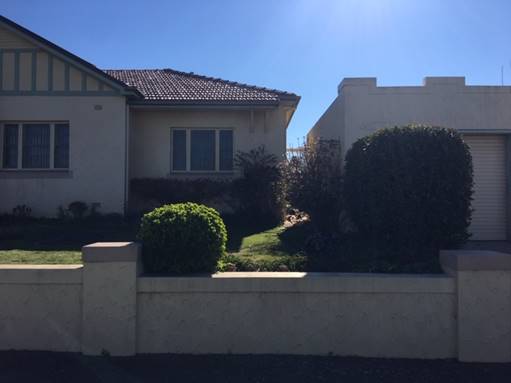
Figure 8 – example of attached garage at
property located at 107 Sampson Street
Building Appearance
The DCP sets the following Planning Outcomes in regard to
Building Appearance:
· The building
design, detailing and finishes relate to the desired neighbourhood character,
complement the residential scale of the area, and add visual interest to the
street.
· The frontages
of buildings and their entries face the street.
· Garages and car
parks are sited and designed so that they do not dominate the street frontage.
Due to the location of the proposal
in an identified Heritage Conservation Area, the proposal was referred to
Council’s Heritage Adviser. The Heritage referral outlined that the
proposed hipped forms and brick walls of the proposed dwellings were sympathetic
to and appropriate for addressing and integrating with the existing character
of the Heritage Conservation Area. The setbacks proposed on the corner block,
while slightly more forward of other surrounding dwellings, were considered
acceptable as they were proposed to step back from the corner. This is
particularly so in the case of the attached garage, which on both dwellings are
designed to have a greater setback then the proposed living areas of the
dwelling. However, Council’s Heritage Officer did make the following
comments in relation to the proposed design of the dwellings, requesting the
following recommendations to achieve better integration with the associated
fabric, settings and views of the Heritage Conservation Area:
· Provide an extra
window with traditional awning on the east elevation of Dwelling 1, to
further develop this elevation presenting to the street and interpret the
prominence of the corner dwelling.
· Provide a base on
both dwellings in black or dark grey brick (to interpret basalt) to provide
articulation and integration of the building to the existing streetscape.
· Install timber
windows on the north elevation of Dwelling 1 and the east elevation of Dwelling
2 to improve presentation to the Heritage Conservation Area and existing
streetscape.
· Construct Dwelling
1 with a lighter brick and lighter roof than Dwelling 2 to achieve separation
and articulation between the two dwellings. It is suggested that
Dwelling 1 be constructed from the proposed Namoi Silver Grey (see Figure
9) and Dwelling 2 be constructed from Namoi Federation Blue (see Figure 10).
· Match the fence
post colour (including posts of the woven wire fence and paling fence) to the
verandah posts of both Dwelling 1 and Dwelling 2.
· Provide
traditional rolled flashings and smooth quad gutters and circular downpipes on
both Dwelling 1 and Dwelling 2.

Figure 9 – Namoi Silver Grey Brick (proposed
Dwelling 1 material)

Figure 10 – Namoi Federation Blue Brick
(requested Dwelling 2 material)
All requests are considered
appropriate, except for the request to include an additional window with
traditional awning on the east elevation of Dwelling 1. The inclusion of an
additional window on the eastern elevation would have an undue impact on the
amenity of the master bedroom of Dwelling 1. The 1.98cm setback from the
boundary of the lot would mean that an additional window on this elevation
would cause the proposed bedroom to project unnecessarily onto the streetscape
along Sampson Street, and impact on the privacy of the dwelling.
Whilst the comments from the Heritage Adviser are accepted
in regard to interpreting the prominence of the dwelling to the corner lot, it
is considered the impact of an additional window to the amenity of the
dwelling, as well as to the existing footpath that runs adjacent to the subject
site, outweighs this requirement.
The frontage of Dwelling 1 facing Prince Street provides
adequate prominence to the streetscape that is sympathetic to the heritage
character of the area. The elevation fronting Sampson Street is a secondary
frontage and is not the primary façade. Therefore, in this instance, the
inclusion of a second window with traditional awning is not considered
appropriate in this instance.
Consideration was given to other options to provide
prominence to this wall, which included a vegetation buffer along the wall, or
the fence, or a decorative wall treatment to break up the façade of the
eastern elevation. In making an appropriate decision in relation to
establishing the prominence of the corner dwelling, other precedents set by
existing housing stock in close proximity to the dwelling were taken into
account. The dwelling directly to the north (111 Sampson Street – see
Figure 11) demonstrated a viable option to break up the secondary frontage and
also provide additional privacy to occupants of Dwelling 2 when using the
private open space.
A vegetation buffer of hedging
along the inside of the proposed eastern boundary fence line would reduce the
impact of the proposed east elevation, but still provide a prominence to the
streetscape. The positive impact resulting from the inclusion of this
landscaping treatment in the design in relation to private open space is
discussed later in this report, under the sections “Front Fences and
Walls” and “Private Open Space”.
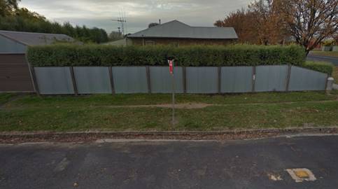
Figure 11 – example of a corner block
located at 111 Sampson Street to the north of the
subject site
In relation to the wider
recommendations regarding the proposed heritage sympathetic details and
finishes of the proposed dwellings, the combination of the external finishes
are considered appropriate in this neighbourhood. The requirement for a
contrast in brick materials between the two dwellings provides a sense of
separation and independence between Dwelling 1 and 2, despite the close
proximity of the dwellings.
This is particularly important given both dwellings are to
be subdivided and maintained as separate dwellings and is more in keeping with
the surrounding built form for separate dwelling houses. The inclusion of a varied
base along the facade, that interprets the basalt heritage of Orange, as well
as the timber windows on the north elevation of Dwelling 1 and the eastern
elevation of Dwelling 2, will complement existing dwellings constructed in this
locality. Finally, smaller details in relation to matching the colour of the
fence and verandah posts as well as provision of traditional rolled flashings,
smooth quad gutters and circular downpipes will assist to integrate the
proposed dwellings with the existing built form.
Therefore, conditions have been included that request all
recommendations of the Heritage referral, except for the requirement of the
additional window and traditional awning.
Landscaping of the frontage of both dwellings is proposed as
indicated in the site plan. This is deemed acceptable in relation to the wider
heritage streetscape. However, the proposed hedging along the eastern boundary
fence line is to be incorporated in an updated landscaping plan, submitted
prior to the application of a construction certificate. In addition, the
reduction of the proposed driveway for Dwelling 2, to limit this to a maximum
of 3m, will require a small amendment to the proposed plantings for Dwelling 2.
It can be assumed that as the driveway changes from a single lane (maximum 3m)
in the vehicle crossover located within the road reserve to the wider
approximately 6m driveway on the site, a sweeping, more fluid layout of the
driveway will be the result. Therefore, it is requested that the landscape plan
is amended to be updated to incorporate:
· the proposed
hedging along the eastern boundary fence line, commencing from behind the
building line of Dwelling 1 and concluding at the shared internal fence between
Dwelling 1 and Dwelling 2
· the Rhaphiolepis
Indica “Snow Maiden” plantings be redesigned to complement the
change in driveway width between the 3m width within the road reserve and
approximate 6m width proposed onsite.
The updated landscape plan is to be submitted to and
approved by Council’s Manager Development Assessments, prior to the
issuing of a Construction Certificate.
A further condition will be included requiring that prior to
the issuing of an Occupation Certificate, landscaping is to be installed in
accordance with the updated approved plan and shall be permanently maintained
to the satisfaction of Council’s Manager Development Assessments.
The attached double garages for both Dwelling 1 and 2 will
be set back slightly behind the main front dwelling façade, which is
satisfactory. The garages will comprise less than 50% of the dwellings’
frontages, in compliance with the DCP requirements. The amended single car
driveway (maximum width of 3m) is also considered to be a positive outcome in
regard to the heritage streetscape along Sampson Street.
Heritage
The DCP sets the following Planning Outcomes in regard to
Heritage:
· Heritage
buildings and structures are efficiently re-used.
· New
development complements and enhances the significance of a heritage item or
place of heritage significance listed in the Orange Heritage Study.
· Significant
landscape features are retained including original period fences and period
gardens.
Heritage has been discussed extensively in “5.10
Heritage conservation” and “Building Appearance” sections
of this report. As demonstrated, it is considered the proposal addresses the
relevant Planning Outcomes outlined above. Therefore, no further assessment is
considered necessary.
Setbacks
The DCP sets the following Planning Outcomes in regard to
Setbacks:
· Street setbacks
contribute to the desired neighbourhood character, assist with the integration
of new development and make efficient use of the site.
· Street setbacks
create an appropriate scale for the street considering all other streetscape
components.
Guidelines established for the planning outcomes relating to
setbacks outline “in established areas (infill) the setback shall be
up to the front building line of the residential part of a building on
adjoining land”.
The setbacks in relation to the proposed dwellings are slightly
forward of the existing building line established by the adjoining residential
dwellings to the west of Dwelling 1 and the south of Dwelling 2. Dwelling 1
sits forward between 0.5m (at the garage) and 2m (at the verandah and
master bedroom). Dwelling 2 sits behind the existing building line (at the
garage) and forward approximately 0.5m (verandah and master bedroom) of the
existing building line.
The proposal outlines that strict application of the DCP is
considered unreasonable in this case as:
· there is a variety
of setbacks seen along Prince Street that are commensurate with the setback of
Dwelling 1
· the front setback
line of the master bedroom and verandah of Dwelling 2 to the neighbouring 109
Sampson Street is only slightly forward (approximately 0.5m), with the garage
set behind the front building line of the neighbouring dwelling
· the 2m setback of
Dwelling 1 to Sampson Street is consistent with examples in the existing
neighbourhood where a corner dwelling sits within 1-2m of the secondary
boundary
· the proposed
development achieves activation of Sampson Street by removing the existing
Colorbond fence and the construction of Dwelling 2 which faces the street with
a landscaped yard and fencing that is sympathetic to the existing heritage
character of the area.
The proposal was referred to
Council’s Heritage Adviser who outlined that the variations towards the
corner, while slightly forward, are appropriate in this instance as they step
back to the main dwelling.
It is considered that the proposed development contributes
to the desired character by providing a design that is sympathetic to the
heritage character of the wider neighbourhood. The proposed design of the
buildings, including the materials will integrate the dwellings with the
surrounding Heritage Conservation Area. Whilst the setbacks are slightly
forward of the building line, efforts have been made to soften the impact of
this through landscaping as well as treatments, such as installation of
appropriate, heritage sympathetic fencing; window awnings presenting to the
street from the main façade; timber windows and more traditional forms
of practical infrastructure such as rolled flashings; smooth quad gutters and
circular downpipes.
It is considered that the inclusion of these elements will
soften the impact of the development to the streetscape and for this reason,
the proposed setbacks are appropriate in this instance.
Front
Fences and Walls
The DCP sets the following Planning Outcomes in regard to
Fences and Walls:
· Front fences
and walls:
- assist
in highlighting entrances and creating a sense of identity within the
streetscape.
- are
constructed of materials compatible with associated housing and with fences
visible from the site that positively contribute to the streetscape
- provide
for facilities in the street frontage area such as mail boxes.
The installation of a woven wire fence (see Figure 9) is
proposed along the frontage of both dwellings. The proposed front fences for
both dwellings have a maximum height of 1.4m. Whilst this is not consistent
with the guidelines established by the DCP, only the timber post is proposed to
be a height of 1.4m, the bulk of the fence, the woven wire section will
maintain a height of 1.2m. Therefore, the inconsistency is considered to be
minor.
A 1.5m high timber paling fence is proposed along the
eastern boundary of proposed Lot 1, which commences at the eastern building
line of Dwelling 2 (in line with the master bedroom) and concludes at the
shared boundary with Lot 2. The DCP outlines that “side fences on
corner lots fronting a street are to have a maximum height of 1.8m behind the
front building line of the dwelling” and be “compatible
materials used in the locality”. The proposed timber paling fence is
compatible with these requirements. The hedging requested above will further
provide articulation to the streetscape and privacy to the private open space
of Dwelling 1.
The proposal further requests to construct an internal 1.5m
fence between Dwellings 1 and 2, which is considered acceptable.
Finally, it is proposed to retain (where possible) the
existing Colorbond fence on the southern and western boundaries. If not
possible, this will be replaced with 1.8m high Colorbond in appropriate tone.
The above is considered to be
acceptable in regard to the proposal. Notwithstanding the acceptance of the
overall design, the reduction in the width of the driveway for Dwelling 2 will
require an extension of the woven wire fence along the frontage of Dwelling 2,
to conclude in line with the reduced driveway. A condition of consent has been
included requiring this amendment be incorporated in an updated site plan,
submitted prior to the application of a Construction Certificate.
A further condition, requiring all fencing to be provided in
line with the approved plans, and requiring replacement of the existing fence,
if necessary, has been included at the Occupation Certificate stage.
Bulk and Scale Objectives
· To
allow flexibility in siting buildings and to ensure that the bulk and scale of
new development reasonably protects the amenity of neighbouring properties and
maintains appropriate neighbourhood character.
· To
allow adequate daylight, sunlight and ventilation to living areas and private
open spaces of new and neighbouring developments.
· To
encourage the sharing of views, while considering the reasonable development of
the site.
The development in not inconsistent with the above
objectives as detailed below.
Visual Bulk
The DCP sets the following Planning Outcome in regard to
Visual Bulk:
· Built form
accords with the desired neighbourhood character of the area with:
- side
and rear setbacks progressively increased to reduce bulk and overshadowing
- site
coverage that retains the relatively low density landscaped character of residential
areas
- building
form and siting that relates to landform, with minimal land shaping (cut and
fill)
- building
height at the street frontage that maintains a comparable scale with the
predominant adjacent development form
- building
to the boundary where appropriate.
In consideration of the DCP Guidelines, the proposal is
considered to be satisfactory. The proposed dual occupancy will be single
storey, which is consistent with the existing development forms surrounding the
subject site.
The DCP requires dwellings to be contained
within the prescribed envelopes generated by planes projected at 45o
over the site commencing 2.5m above existing ground level from each side and
rear boundary. In regard to this planning outcome the following comments
are made:
Dwelling 1:
As demonstrated by Figure 12,
the roof/gutter on the western elevation slightly overhangs the prescribed
visual bulk envelope. However, this is only minor, with the remainder of the
dwelling contained within the visual bulk envelope.

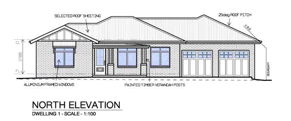
Figure 12 – Dwelling 1 visual bulk envelope
overhang
(demonstrated within red box) on the western elevation
Dwelling 2:
Similarly in as demonstrated by
Figure 13, the roof/gutter on the northern elevation of Dwelling 2 slightly
overhangs the prescribed visual bulk envelope. However, the overhang is
considered to be minor, with the remainder of the dwelling contained within the
visual bulk envelope.
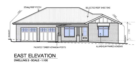
Figure 13 – Dwelling 2 visual bulk envelope
overhang
(demonstrated within red box) on the northern
elevation
Site Coverage
|
Dwelling
|
Footprint
|
Site
Area
|
Site
Coverage
|
|
1
|
161.8m²
|
383.5m²
|
42.2%
|
|
2
|
171.8m²
|
343.7m²
|
50%
|
The proposed development is consistent with the 60% site
coverage requirement for single dwellings.
Walls and Boundaries
The DCP sets the following Planning Outcome in regard to
Walls and Boundaries:
· Building to the
boundary is undertaken to provide for efficient use of the site taking into
account:
- the
privacy of neighbouring dwellings and private open space
- the
access to daylight reaching adjoining properties
- the
impact of boundary walls on neighbours.
The proposal does not involve the construction of
buildings on the boundary. However, as explained in the Daylight and
Sunlight section of this report, the proposed dwellings would not
unreasonably reduce the amount of daylight that reaches adjoining properties.
Daylight
and Sunlight
The DCP sets the following Planning Outcome in regard to
Daylight and Sunlight:
· Buildings are
sited and designed to ensure:
- daylight
to habitable rooms in adjacent dwellings is not significantly reduced
- overshadowing
of neighbouring secluded open spaces or main living area windows is not
significantly increased
- consideration
of Council’s Energy Efficiency Code.
Shadow diagrams have been prepared in support of the
proposed development. In consideration of the DCP Guidelines, the proposal is
considered to be satisfactory as outlined below:
Overshadowing of Dwellings
According to the DCP Guidelines and Council’s Energy
Efficiency Code, sunlight to at least 75% of north-facing living area
windows within the development and on adjoining land is to be provided for a
minimum of four hours on 21 June; or not further reduced than existing where
already less.
Shadow diagrams prepared to support
the proposed development demonstrate that the north facing living room windows
of proposed Dwelling 2 achieve the required amount of direct sunlight.
In relation to impacts on
neighbouring properties, one north facing window exists on the neighbouring
property to the south of the subject site (109 Sampson Street – see
Figure 14). The shadow caused by proposed Dwelling 2 extends to the base
of the wall of the neighbouring dwelling to the south. The window on the
neighbouring property has a sill height of 1.4m. Therefore, overshadowing
impacts from the proposed Dwelling 2 will not affect the window.
The private open space of 109
Sampson Street is provided at the rear of the building to the south west. The
private open space for this dwelling is accommodated directly behind
24 Prince Street, the site adjoining the subject site to the west. There
is an approximate 3.2m setback to the dwelling from the southern boundary of
109 Sampson Street, which accommodates an approximately 23m long driveway. A
large majority of the overshadowing impact is absorbed by this driveway.
Therefore, as demonstrated by the shadow diagrams provided to support the
proposal, Dwelling 2 will cause minor impact to the overshadowing on the
private open space of the neighbouring property.

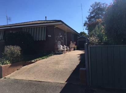
Figure 14 – location of north facing window on
neighbouring property (shown in red square)
Overshadowing of Private Open
Space
According to the DCP Guidelines and Council’s Energy
Smart Homes Code, sunlight is to be available to at least 40% of required open
space for dwellings within the development and on neighbouring properties for
at least three hours between 9am and 3pm.
Shadow diagrams prepared to
support the proposal show the following outcomes in regard to requirement
outlined above:
|
|
Dwelling 1
|
Dwelling 2
|
|
10am
|
41%
|
38% (Non-Compliant)
|
|
11am
|
46%
|
57%
|
|
12pm
|
44%
|
47%
|
|
1pm
|
23% (Non-Compliant)
|
36% (Non-Compliant)
|
|
2pm
|
Non-Compliant
|
Non-Compliant
|
Dwelling 1 achieves adequate amount
of sunlight for required open space between the hours of 10am and 12pm.
Dwelling 2 achieves adequate amount of sunlight for required open space between
11am and 12pm, however falls fractionally short of the 3 hours of the required
duration. There is a shortfall of 0.3m2 at 10am. This is considered
to be a minor departure from the requirements of the DCP 2004 and is considered
to be satisfactory in this instance.
Views
The DCP sets the following Planning Outcomes in regard to
Views:
· Building form
and design allow for residents from adjacent properties to share prominent
views where possible.
· Views including
vistas of heritage items or landmarks are not substantially affected by the
bulk and scale of the new development.
The subject site is not within an important view corridor,
however as previously mentioned, is located within a Heritage Conservation
Area. The proposed dwellings will not unreasonably diminish views for other
properties in the vicinity, and the minor amendments to the design of the
dwellings to ensure they remain in keeping with the existing character of the surrounding
neighbourhood.
Privacy and Security Objective
· To
ensure that the siting and design of buildings provide privacy for residents
and neighbours in their dwellings and principal private open space.
The development is not inconsistent with the above objective
as detailed below.
· The proposed 1.8m
high fence along the western and southern boundaries will limit the potential
for overlooking between properties.
· The finished floor
levels of the proposed dwellings remain consistent with existing ground level
and are below the DCP guideline of 1.5m above natural ground level.
· There are no
principal living room windows in the southern or western walls of Dwelling 2,
nearest the respective boundary.
· There are no
principal living room windows in the western wall of Dwelling 1.
· A 1.8m high fence
exists between the proposed private open space for Dwelling 2 and the existing
dwelling to the west.
Visual
Privacy
The DCP sets the following Planning Outcome in regard to
Visual Privacy:
· Direct overlooking
of principal living areas and private open spaces of other dwellings is
minimised firstly by:
- building
siting and layout
- location
of windows and balconies
and
secondly by:
- design
of windows or use of screening devices and landscaping.
The development is not inconsistent
with the above objective as detailed below:
· The southern
elevation of Dwelling 1 that is set back 900mm from the proposed boundary fence
and is occupied by Bedroom 2 and 3 of Dwelling 1, and proposes no windows on
this southern elevation. This provides additional privacy to the living areas
of Dwelling 2.
· Only one small
window is proposed for the ensuite bathroom, which is accommodated on the
northern elevation of Dwelling 2, affording privacy to the living areas of
Dwelling 1.
· Only one small
window is proposed for the ensuite bathroom, which is accommodated on the east
elevation of Dwelling 1, affording privacy to the living occupants of Dwelling
from Sampson Street.
· The single window
accommodated on the southern elevation of Dwelling 2 for Bedroom 3 has a sill
height of 0.9m above constructed ground level. The top of the window sits at
approximately 2.4m above constructed ground level. The 1.8m Colorbond fence
proposed for the southern and western boundary covers approximately 75 per cent
of the window. Further, the 3.2m setback on the neighbouring property, coupled
with the slightly lower constructed ground levels on the subject site will
reduce the overlooking impacts to the neighbouring property to the south.
Acoustic Privacy
The DCP sets the following Planning Outcome in regard to
Acoustic Privacy:
· Site layout and
building design:
- protect
habitable rooms from excessively high levels of external noise
- minimise
the entry of external noise to private open space for dwellings close to major
noise sources
- minimise
transmission of sound through a building to affect other dwellings.
In consideration of the DCP
Guidelines the proposal is considered to be satisfactory. The site is located
in an area where ambient noise levels are expected to be low due to the
predominant residential land use pattern. The dwellings are detached, thus
limiting the potential for sound penetration between them.
Security
The DCP sets the following Planning Outcomes in regard to
Security:
· The site layout
enhances personal safety and minimises the potential for crime, vandalism and
fear.
· The design of
dwellings enables residents to survey streets, communal areas and approaches to
dwelling entrances.
The siting and
design of both dwellings is appropriate to maintain safety and minimise the
potential for crime, vandalism and fear for residents. Habitable room windows
will address public roads, thereby providing opportunities for natural
surveillance. The proposed landscaping and fencing will not restrict sightlines
to public areas and will provide territorial reinforcement and delineate public
and private spaces. Internal access to the dwellings will be available through
the garages and proposed fencing will provide territorial reinforcement.
Site Access and Circulation
Objectives
· To
provide convenient and safe access and parking that meets the needs of all
residents and visitors.
· To
encourage the integrated design of access and parking facilities to minimise
visual and environmental impacts.
The development is not inconsistent with
the above objectives as detailed below.
Circulation and Design
The DCP sets the following Planning Outcome in regard to
Circulation and Design:
· Accessways and
parking areas are designed to manage stormwater.
· Accessways,
driveways and open parking areas are suitably landscaped to enhance amenity
while providing security and accessibility to residents and visitors.
· The site layout
allows people with a disability to travel to and within the site between car parks,
buildings and communal open space.
Dwellings 1 and 2 have direct street frontages to Prince and
Sampson Streets respectively. Separate access will be provided to the proposed
lots via vehicle crossings and driveways. A new driveway will be developed
to provide access to Dwelling 2. The proposed driveways are well separated from
the intersection of Prince and Sampson Street. Reverse egress will be required
for both dwellings, consistent with vehicle manoeuvring arrangements for single
dwellings throughout the City.
Car Parking
The DCP sets the following Planning Outcomes in regard to
Car Parking:
· Parking
facilities are provided, designed and located to:
- enable
the efficient and convenient use of car spaces and accessways within the site
- reduce
the visual dominance of car parking areas and accessways.
· Car parking is
provided with regard to the:
- the
number and size of proposed dwellings
- requirements
of people with limited mobility or disabilities.
In consideration of the DCP Guidelines, the proposal is
considered to be satisfactory. According to the car parking table in the DCP,
the development generates a parking requirement of three off-street spaces
(based on 1.5 spaces for each three bedroom dwelling).
The submitted plans show provision for four off-street
parking spaces for both dwellings in the form of an attached double garage for
each dwelling and two tandem spaces in front of the garage of each Dwelling, an
excess of two spaces per dwelling.
Notwithstanding the above, the requirement to reduce the
vehicle crossover located within the road reserve to a standard single width
driveway for Dwelling 2, will impact slightly on the width of the part of the
driveway that is situated on the site and can accommodate two tandem car
spaces.
Due to the required maximum width of
the driveway (3m) and the location of the driveway, 1250mm off the southern
boundary, required to maintain the health of the street tree adjacent to the
proposed driveway, a small reduction may be required on the site in regard to
the amount of space available for car parking, due to the amended design.
Notwithstanding, even with a reduction, it can be assumed that the driveway
within the lot boundary of Dwelling 2 will still be wide enough to accommodate
at least one car in front of the double garage, equating to three spaces
provide on the site. This an excess of 1.5 spaces for Dwelling 2. As previously
mentioned, Council’s Technical Services Division raised no objection to
the proposed single car width driveway within the road reserve, leading to the
proposed double car garage. Therefore, the proposed parking arrangements meet
the requirements of the DCP 2004 and are therefore considered acceptable.
Private Open Space
The DCP sets the following Planning Outcomes in regard to
Private Open Space:
· Private open
space is clearly defined for private use.
· Private open
space areas are of a size, shape and slope to suit the reasonable requirements
of residents including some outdoor recreational needs and service functions.
· Private open
space is:
- capable
of being an extension of the dwelling for outdoor living, entertainment and
recreation
- accessible
from a living area of the dwelling
- located
to take advantage of outlooks; and to reduce adverse impacts of overshadowing
or privacy from adjoining buildings
- orientated
to optimise year round use.
The following table demonstrates
that each of the proposed dwellings is provided with open space that complies
with the minimum requirement in terms of area.
|
Dwelling
|
Living
Area (ex. Garage, porches, patios etc)
|
Private
Open Space Required by DCP
|
Private
Open Space Provided
|
|
1
|
107.9m²
|
53.95m²
|
78.7m²
|
|
2
|
114.4m²
|
57.2m²
|
62.1m²
|
All private open space is provided
behind the front building line. The site plan confirms that the private open
space for each residential unit will have a minimum dimension of 3m and the
yards are able to provide an area of at least 5m x 5m with access to northern
sun, consistent with the requirements of the DCP.
The internal living area for each dwelling
will connect to its respective area of private open space via glass sliding
doors that open out onto an alfresco area. Each private open space area will be
enclosed by fencing. The addition of the hedging along Sampson Street will
ensure the privacy of the occupants accessing the private open space of
Dwelling 1 will be maintained and not open to pedestrians accessing the
footpath that runs adjacent to Sampson Street.
The applicant has
adequately demonstrated compliance with the Planning Outcomes for private open
space.
Open
Space and Landscaping
The DCP sets the following Planning Outcomes in regard to
Open Space and Landscaping:
· The site layout
provides open space and landscaped areas which:
- contribute
to the character of the development by providing buildings in a landscaped
setting
- provide
for a range of uses and activities including stormwater management
- allow
cost effective management.
· The landscape
design specifies landscape themes consistent with the desired neighbourhood
character; vegetation types and location, paving and lighting provided for
access and security.
· Major existing
trees are retained and protected in a viable condition whenever practicable
through appropriate siting of buildings, accessways and parking areas.
· Paving is applied
sparingly and integrated in the landscape design.
A landscape plan has been submitted in support of the
proposal, which includes plant species that will provide integration of the
dwellings and driveways within the site. The proposed landscaping will include
species that are considered to be suitable to the Orange area, in particular
native shrubs and ground covers, as well as hedging and trees. The development
is consistent with the above planning outcome.
However, as previously mentioned, minor amendments are
requested to the existing landscape plan which include the incorporation of:
· the proposed
hedging along the eastern boundary fence line, commencing from behind the
building line of Dwelling 1 and concluding at the shared internal fence between
Dwelling 1 and Dwelling 2
· the Rhaphiolepis
Indica “Snow Maiden” plantings be redesigned to complement the
change in driveway width between the 3m width within the road reserve and
approximate 6m width proposed on site.
A condition will be included requiring the submission of an
updated landscape plan for approval by Council, prior to the issuing of a
Construction Certificate. A further condition will be included requiring that
prior to the issuing of an Occupation Certificate, landscaping is to be installed
in accordance with the updated approved plan and shall be permanently
maintained to the satisfaction of Council’s Manager Development Services.
Water and Soil Management Objectives
· To control and
minimise the impact of stormwater run-off and soil erosion on adjoining land
and downstream.
· To encourage
reduced water wastage by reusing, recycling and harvesting stormwater.
The development is not inconsistent with the above
objectives as detailed below.
Stormwater
The DCP sets the following Planning Outcomes in regard to
Stormwater:
· Onsite drainage
systems are designed to consider:
- downstream
capacity and need for on-site retention, detention and re-use
- scope
for on-site infiltration of water
- safety
and convenience of pedestrians and vehicles
- overland
flowpaths.
· Provision is
made for onsite drainage which does not cause damage or nuisance flows to
adjoining properties.
Relevant conditions of consent are attached to the notice in
relation to stormwater management of the site.
Erosion and Sedimentation
The DCP sets the following Planning Outcome in regard to
Erosion and Sedimentation:
· Measures
implemented during construction to ensure that the landform is stabilised and
erosion is controlled.
A condition of consent has been included requiring soil
erosion control measures be implemented on the site.
INFILL GUIDELINES
Council’s Infill Guidelines (the Guidelines) outline
design guidance for carrying out work in a Heritage Conservation Area or
adjacent to a heritage item, to ensure new development integrates with the
character of the neighbourhood.
The Guidelines are applicable to the proposal as they apply
to any new development (including residential and commercial) requiring
development consent to remove significant trees plus other significant changes
to the landscape within a Heritage Conservation Area or on/adjacent to a
heritage item listed in Schedule 5 of the OLEP 2011.
Character
The surrounding residential neighbourhood is characterised
by single storey dwellings with relatively consistent street setbacks. There
are some older style cottages within the vicinity of the subject land, which
date from the early-mid 20th century. Some mid to late 20th century
dwellings are interspersed through the neighbourhood. Reflective of the older
style of buildings, roof pitch is generally steeper than typical modern
building forms. Front fences are constructed of mostly sympathetic styles.
It is considered that the recommended heritage treatments
will assist in integrating the proposal with this surrounding heritage
character.
Scale and Form
The proposed dwellings adopt a sympathetic architectural
form, bulk, height and finish which contributes to the new developments
integration with the surrounding neighbourhood.
Siting
Despite the minor variation in setback (as discussed above),
the proposal is considered to be forward, but step back from the corner and
hence acceptable.
Materials and Colour
As indicated in previous sections of this report, the use of
varying brick to differentiate the two dwellings is considered acceptable in
this setting.
Detailing
Similarly, the proposed additional finishes will assist in
integrating the dwelling with the existing streetscape. The increased roof
pitch, additional external finishes previously discussed and the window
proportions are considered complimentary to the heritage area.
Site Analysis
The proposal is in keeping with adjacent development and the
setting will achieve integration with the heritage character of the area as:
· the use is in
keeping with surrounding development and existing Heritage Conservation Area
· the street
boundary setbacks are reasonably in keeping with existing setbacks
· the proposal will
provide appropriate design elements, which will assist the development to
integrate with the surrounding area
· the overshadowing
and privacy impacts of the proposed development have been assessed and are
considered acceptable in this instance
· the development
maintains a single storey scale, in keeping with surrounding heights.
SUBDIVISION
The DCP sets the following (applicable) Planning Outcomes in
regard to urban residential subdivision:
· Lots below
500m² indicate a mandatory side setback to provide for solar access and
privacy.
The proposed lots will comprise areas of 383.5m² and 343.7m² respectively.
Both lots are defined as “Town House” lots, being an allotment with
an area between 350m² and 500m².
The size and shape of the proposed lots will achieve
reasonable residential amenity in terms of privacy and solar access. A detailed
assessment of the proposed dwelling design for each lot has been carried out as
part of the assessment in preceding sections of this report.
· Lots are fully
serviced and have direct frontage and access to a public road.
The proposed lots will each have direct street frontage and
legal and practical access to Prince and Sampson Streets. Separate access will
be provided to the proposed lots via vehicle crossings and driveways.
Council’s Technical Services Division have advised of no objections to
the proposed access arrangements.
· Design and
construction complies with the Orange Development and Subdivision Code.
The subdivision design and construction will be required to
comply with the Orange Development and Subdivision Code. Attached is a
condition of consent addressing this issue.
DEVELOPMENT CONTRIBUTIONS PLAN
2012
The development has been assessed pursuant to Orange
Development Contributions Plan 2017. The following table itemises the
contributions payable for the development. A condition is attached to reflect
the following requirements.
Section 7.11 Development Contributions
The payment of $10,545.72 is to
be made to Council in accordance with Section 7.11 of the Act and Orange
Development Contributions Plan 2017 (Development in remainder of LGA) towards
the provision of the following public facilities:
|
Open Space and Recreation
|
1 additional lot @ $3,922.87
|
3,922.87
|
|
Community and Cultural
|
1 additional lot @ $1,137.63
|
1,137.63
|
|
Roads and Traffic Management
|
1 additional lot @ $5,178.06
|
5,178.06
|
|
Local Area Facilities
|
1 additional lot @ $ -
|
-
|
|
Plan Preparation &
Administration
|
1 additional lot @ $111.70
|
307.16
|
|
TOTAL:
|
|
$10,545.72
|
The contribution will be indexed quarterly in accordance
with the Orange Development Contributions Plan 2017 Development in remainder of
LGA. This Plan can be inspected at the Orange Civic Centre, Byng Street,
Orange.
Section 64 Water and Sewer
Headworks Charges
Section 64 water and sewer headwork charges are also
applicable to the proposal. Such charges are calculated at the time of release
of a Subdivision Certificate for the proposed subdivision. Attached are draft conditions requiring the payment
of the required contributions prior to the issue of a Construction Certificate.
PROVISIONS PRESCRIBED BY THE
REGULATIONS s4.15(1)(a)(iv)
The development is not inconsistent with the provisions
prescribed by the Regulations.
BASIX Commitments (clause 97A)
A BASIX Certificate has been
submitted in support of the proposed development which demonstrates compliance
with water, thermal comfort and energy requirements for both dwellings.
|
Dwelling
|
Water
|
Thermal
Comfort
|
Energy
|
|
1
|
45 (target 40)
|
Pass (target Pass)
|
38 (target 35)
|
|
2
|
47 (target 40)
|
Pass (target Pass)
|
36 (target 35)
|
THE LIKELY IMPACTS OF THE
DEVELOPMENT s4.15(1)(b)
Traffic Impacts
The capacity of the road network in the vicinity of the site
is sufficient to accommodate additional localised traffic generated by the
development. Council’s Technical Services Division advises that the
proposed driveway will be appropriately sited so as to prevent vehicle
conflicts. Adequate parking is proposed on site, and both dwellings are
equipped with a double garage and tandem spaces.
Neighbourhood Amenity
The proposed dwellings will provide and retain a reasonable
standard of residential amenity for the proposed dwellings and development on
adjoining lands in respect of solar access, privacy etc. The proposed
development will provide for a continuation of residential landuse, albeit in a
more compact form, and will not alter the function of the neighbourhood. The
development will not have adverse impacts on neighbourhood amenity.
The addition of the hedging along the eastern fence line of
Dwelling 1 will provide additional privacy to the occupants of the dwelling,
while interpreting the prominence of the corner lot and providing articulation
to users of the road network and the public footpath that runs adjacent to the
eastern boundary of the subject site.
The reduction in the width of the proposed driveway for
Dwelling 2, accommodated in the vehicle crossover located within the road
reserve will ensure the health of the existing street tree is maintained and be
more in keeping with existing access arrangements on surrounding sites and
therefore the character of the Heritage Conservation Area.
Cumulative Impacts
The proposal is considered to be satisfactory in terms of
cumulative impact. The proposal will maintain the pattern of single storey
detached dwellings that characterise this streetscape. The building design and
detailing for the proposed dwellings will generally complement the style of
adjoining established dwellings. The proposal provides for a continuation of
residential land use, albeit in a more compact form.
The proposed development will not reduce the open space,
solar access or privacy afforded to neighbouring properties. Similarly, the
site layout and building design will provide a reasonable standard of
residential amenity for the proposed dwellings in terms of open space, solar
access and privacy.
Environmental Impacts
The subject land has been located within an existing urban
area for a number of years, evidenced by the sites location within a Heritage
Conservation Area. As a result, significant vegetation, threatened species or
ecological endangered communities or their habitats are unlikely. The proposed
development will not impact upon the locality in terms of environmental
impacts.
A condition requiring the protection of the street trees in
line with AS4970-2009 Protection of trees on development sites Section 4-4.3 Protective
Fencing and works have been included to further maintain the health of the
street trees, located in close proximity to the subject site, during demolition
and construction.
In regard to environmental impacts
relating to heritage, the proposal, as demonstrated is considered acceptable in
this instance. It is accepted that the proposed development will be of a more
contemporary development style in an established Heritage Conservation Area.
However, the location of the subject site on the periphery of the Heritage
Conservation Area, coupled with the fact that the existing dwelling on the site
is considered to be of limited quality, means it is considered that the
demolition of the existing dwelling is acceptable in this instance The proposed
subdivision pattern is not dissimilar to the existing subdivision pattern that
is currently established in surrounding sites. Further, finishes and materials,
as well as landscaping and fencing proposed has been designed to integrate with
the surrounding streetscape and compliment the wider Heritage Conservation
Area.
Existing and Future Amenity of the Neighbourhood
The potential impact upon the amenity of the neighbourhood
is considered satisfactory and has been addressed above in the relevant
considerations under DCP 2004.
Soil Erosion
Provided that adequate measures are implemented during the
construction phase, the proposed development would not generate adverse impacts
in terms of soil erosion. Attached are recommended conditions of consent
addressing this issue.
THE SUITABILITY OF THE SITE
s4.15(1)(c)
Servicing
Council’s Technical Services Division advises that all
utility services are available to the site and adequate for the proposal. The
proposed development will be connected to Council’s sewer, town water and
stormwater reticulations in accordance with normal requirements. Power,
telephone and natural gas services will be connected to the dwellings in
accordance with the requirements of the relevant supply authority. Attached is
a condition of consent addressing this issue.
Physical Attributes
The subject site is considered to be suitable for the
proposed development. There are no physical attributes within the site that
would unreasonably constrain the development.
ANY SUBMISSIONS MADE IN
ACCORDANCE WITH THE ACT s4.15(1)(d)
The proposed development is defined as "advertised
development" under the provisions of the LEP. The application was
advertised for the prescribed period of 14 days and at the end of that period
no submissions were received.
PUBLIC INTEREST
s4.15(1)(e)
The proposed development is considered to be of minor
interest to the wider public due to the relatively localised nature of
potential impacts.
SUMMARY
The proposed development is permissible with the consent of
Council. The proposed development complies with the relevant aims, objectives
and provisions of Orange LEP 2011 (as amended) and
DCP 2004.
A Section 4.15 assessment of the
development indicates that the development is acceptable in this instance.
Attached is a draft Notice of Approval outlining a range of conditions
considered appropriate to ensure that the development proceeds in an acceptable
manner.
COMMENTS
The requirements of the Environmental Health and Building
Surveyor and the Engineering Development Section are included in the attached
Notice of Approval.
Attachments
1 Notice
of Approval, D18/61748
2 Plans,
D18/63042
2.8 Development
Application DA 349/2018(1) - 59-67 and 99 Bathurst Road
RECORD
NUMBER: 2018/2685
AUTHOR: Ella
Wilkinson, Senior Planner
EXECUTIVE Summary
|
Application
lodged
|
26
September 2018
|
|
Applicant/s
|
Mr G
Barrett
|
|
Owner/s
|
Mr GC
Barrett
|
|
Land
description
|
Lot 40
DP 810916 and Lot 30 DP 1190518 – 99 Bathurst Road and 59-67
Bathurst Road, Orange
|
|
Proposed
land use
|
Demolition
(tree removal)
|
|
Value of
proposed development
|
$12,000
|
Council's consent is sought to remove thirteen English Elm
trees (species Ulmus Procera) that are currently located on the boundary
between 99 Bathurst Road and Kinross Wolaroi School (59-67 Bathurst Road).
Eleven trees are proposed to be removed on the western boundary of 99 Bathurst
Road, which is shared with Kinross Wolaroi School. A further two trees are
proposed to be removed on the northern boundary of 99 Bathurst Road, which is
also shared with Kinross Wolaroi School. The proposal outlines the intent to
replace the trees on the western boundary with red bottlebrush, which would
grow to a maximum of 12m in height. It should be noted that the two trees
located on the northern boundary that are proposed for removal are not proposed
for replacement.
A plan of the subject properties has been prepared by Craig
Jaques and Associates (Orange) that shows the site boundary in relation to
the existing fence and trees. Whilst it is difficult to determine from that
plan the exact land to which the trees are located on, it is widely accepted
that the eleven trees on the western boundary form the boundary line, and the
two trees on the northern boundary are within the bounds of
Kinross Wolaroi School (59‑67 Bathurst Road).
The removal of the trees has been requested as the proposal
outlines the trees pose a safety risk to the workers, sub-contractors and
future residents of 99 Bathurst Road, as well as to students, parents and
teachers at Kinross Wolaroi School.
It is noted that there is a variation between the amount of
trees that have been requested to be removed and the number of trees
recommended as part of the supporting arborist report. Additional information
was sought from the applicant in relation to the removal of all thirteen trees.
Further information was provided to support this request in the letter from
McPhee Kelshaw Solicitors and Conveyancers dated 12 October 2018.
A development application for the construction of seven town
house units (five new detached units and conversion of existing dwelling into
two units) on the 99 Bathurst Road site was approved in 2007. The location
of the trees on the boundary has resulted in several of the trees structural
root zones protruding into the development area. The owner of 99 Bathurst
Road has commenced work on the conversion of the existing dwelling, but is
unable to commence on the remaining five detached units due to the potential
impact this may have on the health of the trees.
Kinross Wolaroi School is listed as
an item of local heritage significance and as such, the impact of the removal
of these trees and proposed replacement plantings has been considered in
further detail later in this report.
The proposal is recommended for
approval, subject to various conditions in relation to the proposed replanting
and maintenance of the trees.
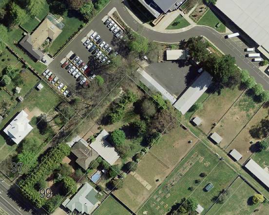
Figure 1 - locality plan
RECENT LEGISLATIVE CHANGES
On 1 March 2018 the Environmental Planning and Assessment
Act 1979 was substantially amended. The most immediate change involves the
restructuring and renumbering of the Act, with other more substantive
changes to be phased in over time. However, for some applications (particularly
where an application was lodged prior to the changes coming into effect) the
supporting documentation may still reference the previous numbering regime. In
the drafting of this report the content and substance of the supporting
material has been considered irrespective of which legislative references were
used.
DECISION FRAMEWORK
Development in Orange is governed by two key documents
Orange Local Environment Plan 2011 and Orange Development Control Plan 2004. In
addition the Infill Guidelines are used to guide development, particularly in
the heritage conservation areas and around heritage items.
Orange Local Environment Plan 2011
– The provisions of the LEP must be considered by the Council in determining
the application. LEPs govern the types of development that are permissible or
prohibited in different parts of the City and also provide some assessment
criteria in specific circumstances. Uses are either permissible or not. The
objectives of each zoning and indeed the aims of the LEP itself are also to be
considered and can be used to guide decision making around appropriateness of
development.
Orange Development Control Plan 2004 – the DCP
provides guidelines for development. In general it is a performance based
document rather than prescriptive in nature. For each planning element there
are often guidelines used. These guidelines indicate ways of achieving the
planning outcomes. It is thus recognised that there may also be other solutions
of merit. All design solutions are considered on merit by planning and building
staff. Applications should clearly demonstrate how the planning outcomes are
being met where alternative design solutions are proposed. The DCP enables
developers and architects to use design to achieve the planning outcomes in
alternative ways.
Link To Delivery/OPerational Plan
The recommendation in this report relates to the
Delivery/Operational Plan strategy “10.1 Preserve -
Engage with the community to ensure plans for growth and development are
respectful of our heritage”.
Financial Implications
Nil
Policy and Governance Implications
Nil
|
Recommendation
That Council resolves to
consent to development application DA 349/2018(1) for Demolition (tree removal) at Lot 40 DP
810916 and Lot 30 DP 1190518 - 99 Bathurst Road and 59‑67 Bathurst
Road, Orange pursuant to the conditions of consent
in the attached Notice of Approval.
|
further considerations
Consideration has been given to the recommendation’s
impact on Council’s service delivery; image and reputation; political;
environmental; health and safety; employees; stakeholders and project
management; and no further implications or risks have been identified.
SUPPORTING INFORMATION
Council's consent is sought for the removal of thirteen
trees located on the common (northern and western) boundary of a property
located at 99 Bathurst Road, shared with Kinross Wolaroi School. The proposal
outlines the intent to replace the trees on the common (western) boundary,
adjoining Kinross Wolaroi School.
A plan of the subject properties has been prepared by Craig
Jaques and Associates (Orange) that shows the site boundary in relation to
the existing fence and trees. Whilst it is difficult to determine from that
plan the exact land to which the trees are located on it is widely accepted
that the eleven trees on the western boundary form the boundary line, and the
two trees on the northern boundary are within the bounds of
Kinross Wolaroi School (59‑67 Bathurst Road). To this end both
properties have been included on the development application as comprising the
subject land.
Kinross Wolaroi is an item of local significance listed in
Schedule 5 of the Orange Local Environmental Plan. Matters in relation to the
significance of the trees to the heritage item, “Wolaroi” former
mansion (main school building), are discussed in further detail within the body
of this report.
THE PROPOSAL
The proposal involves the removal of thirteen trees on the
common (northern and western) boundary of 99 Bathurst Road, which is shared
with Kinross Wolaroi School.
The proposal outlines that the trees on the western boundary
are to be replaced with red bottlebrush, which would grow to a maximum of 12m
in height, forming a screen between 99 Bathurst Road and Kinross Wolaroi
School.
It is noted that there is a variation between the amount of
trees that have been requested to be removed and the number of trees
recommended as part of the supporting arborist report. Additional information
was sought from the applicant in relation to the removal of all thirteen trees.
Further information was provided to support this request in the letter from
McPhee Kelshaw Solicitors and Conveyancers dated 12 October 2018. As noted
above, the two trees located on the northern boundary are not proposed for
replacement. This is discussed in greater detail throughout the body of the
report.
MATTERS FOR CONSIDERATION
Section 1.7 - Application of
Part 7 of the Biodiversity Conservation Act 2016 and Part 7A of the
Fisheries Management Act 1994
Section 1.7 of the EP&A Act 1979 identifies that Part 7
of the Biodiversity Conservation Act 2016 and Part 7A of the Fisheries
Management Act 1994 have effect in connection with terrestrial and aquatic
environments.
Having regard to the relevant provisions and based on an
inspection of the subject property, it is considered that the proposed
development is not likely to significantly affect a threatened species.
The subject site is located in an R1 General Residential
area and has been utilised for urban purposes and is not shown on the Orange
Local Environmental Plan 2011 maps as an area with moderate or high
biodiversity significance.
While the trees proposed for removal
are mature trees, between the ages of approximately 15 to 120 years, the trees,
which are an English Elm (species Ulmus Procera) are not a species listed in
Schedule 1 or 2 of the Biodiversity Conservation Act 2016.
Therefore, a Biodiversity Development Assessment Report is
not required in this instance.
Section 4.15
Section 4.15 of the Environmental Planning and Assessment
Act 1979 requires Council to consider various matters, of which those
pertaining to the application are listed below.
PROVISIONS OF ANY ENVIRONMENTAL
PLANNING INSTRUMENT s4.15(1)(a)(i)
Orange Local Environmental Plan
2011
Part 1 - Preliminary
Clause 1.2 - Aims of Plan
The
broad aims of the LEP are set out under Subclause 2. Those relevant to the
application are as follows:
(f) to recognise and manage valued
environmental heritage, landscape and scenic features of Orange.
The application is considered to be broadly consistent with
this aim.
Clause 1.6 - Consent Authority
This clause establishes that, subject to the Act, Council is
the consent authority for applications made under the LEP.
Clause 1.7 - Mapping
The subject site is identified
on the LEP maps in the following manner:
|
Land Zoning Map:
|
Land zoned R1 General Residential
|
|
Lot Size Map:
|
No Minimum Lot Size
|
|
Heritage Map:
|
Heritage item
|
|
Height of Buildings Map:
|
No building height limit
|
|
Floor Space Ratio Map:
|
No floor space limit
|
|
Terrestrial Biodiversity Map:
|
No biodiversity sensitivity on the
site
|
|
Groundwater Vulnerability Map:
|
Groundwater vulnerable
|
|
Drinking Water Catchment Map:
|
Not within the drinking water
catchment
|
|
Watercourse Map:
|
Not within or affecting a defined
watercourse
|
|
Urban Release Area Map:
|
Not within an urban release area
|
|
Obstacle Limitation Surface Map:
|
No restriction on building siting
or construction
|
|
Additional Permitted Uses Map:
|
No additional permitted use applies
|
|
Flood Planning Map:
|
Not within a flood planning area
|
Those matters that are of relevance are addressed in detail
in the body of this report.
Clause 1.9A - Suspension of
Covenants, Agreements and Instruments
This clause provides that covenants, agreements and other
instruments which seek to restrict the carrying out of development do not apply
with the following exceptions:
· covenants imposed
or required by Council
· prescribed
instruments under Section 183A of the Crown Lands Act 1989
· any conservation
agreement under the National Parks and Wildlife Act 1974
· any trust
agreement under the Nature Conservation Trust Act 2001
· any property
vegetation plan under the Native Vegetation Act 2003
· any biobanking
agreement under Part 7A of the Threatened Species Conservation Act 1995
· any planning
agreement under Division 6 of Part 4 of the Environmental Planning and
Assessment Act 1979.
· Council staff are
not aware of the title of the subject property being affected by any of the
above.
· Lot
50 DP 1117270 that adjoins 99 Bathurst Road and a small section of 59‑67 Bathurst
Road currently maintains an easement for access and sewer, however this does
not impact either site (see Figure 2).
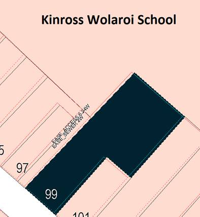
Figure 2 – location of existing easements on
adjoining lot
Part
2 - Permitted or Prohibited Development
Clause 2.1 - Land Use Zones and Clause
2.3 - Zone Objectives and Land Use Table
The subject site is located within the R1 General
Residential zone. The proposed development is
defined as “demolition” under OLEP 2011 and is permitted
with consent. This application is seeking consent.
Clause 2.3 of LEP 2011 references the Land Use
Table and Objectives for each zone in LEP 2011. These objectives for land
zoned R1 General Residential are as follows:
1 -
Objectives of the R1 General Residential Zone
· To provide for
the housing needs of the community.
· To provide for
a variety of housing types and densities.
· To enable other
land uses that provide facilities or services to meet the day to day needs of
residents.
· To ensure
development is ordered in such a way as to maximise public transport patronage
and encourage walking and cycling in close proximity to settlement.
· To ensure that
development along the Southern Link Road has an alternative access.
Clause 2.6 - Subdivision -
Consent Requirements
The provisions of Clause 2.6 do
not apply, as no subdivision if proposed as part of the proposal.
Clause 2.7 - Demolition
Requires Development Consent
This clause triggers the need for development consent in
relation to a building or work. This requirement does not apply to any
demolition that is defined as exempt development.
The proposal involves demolition (tree removal) and the
applicant is seeking the consent of council. Conditions have been included in
the consent requiring appropriate removal and rehabilitation of the soil,
including stump grinding and removal of saw dust generated from the stump
grinding process.
A further condition has also been included to require the
removal of the trees to be conducted in accordance with Australian Standard
4373-2007 – Pruning of Amenity Trees.
Clause 2.8 - Temporary Use of
Land
The provisions of Clause 2.8 do not apply, as a temporary
use of land is not proposed.
Part 3 - Exempt and Complying
Development
The application is not exempt or complying development.
Part 4 - Principal Development
Standards
Clause 4.1 - Minimum Subdivision Lot
Size
The provisions of Clause 4.1 do not
apply, as a subdivision of the site is not proposed.
Clause
4.1AA - Minimum Subdivision Lot Size for Community Title Schemes
The provisions of Clause 4.1 do not
apply, as a subdivision of the site is not proposed.
Clause 4.1B - Minimum Lot Sizes for
Dual Occupancy, Multi Dwelling Housing and Residential Flat Buildings
The provisions of Clause 4.1 do not
apply, as a subdivision of the site is not proposed.
Clause 4.2 - Rural Subdivision
The provisions of Clause 4.1 do not
apply, as a subdivision of the site is not proposed.
Clause 4.2A - Erection of Dwelling
Houses on Land in Certain Rural and Environmental Protection Zones
The provisions of Clause 4.2A do not
apply, as the proposal does not request to erect a dwelling house on land in
certain rural and environmental protection zones.
Clause 4.2B - Strata Subdivisions in
Certain Rural Zones
The provisions of Clause 4.2B do not
apply, as the proposal does not request consent for a strata subdivision in RU1
Primary Production or E3 Environmental Management.
Clause 4.3 - Height of Buildings
The provisions of Clause 4.3 do not
apply, as there is no restriction applied to either site in relation to the
maximum height of buildings permissible.
Clause 4.4 - Floor Space Ratio
The provisions of Clause 4.4 do not
apply, as there is no restriction applied to either site in relation to the
maximum floor space permissible for a building on the subject site.
Clause 4.6 - Exceptions to Development
Standards
The provisions of Clause 4.6 do not
apply, as there is no variance proposed to a development standard as part of
this proposal.
Part 5 - Miscellaneous Provisions
Clause 5.1 - Relevant Acquisition
Authority
The provisions of Clause 5.1 do not
apply, as the land is not reserved for use exclusively for certain public
purposes.
Clause 5.4 - Controls Relating to
Miscellaneous Permissible Uses
The provisions of Clause 5.4 do not
apply, as the proposal does not involve a miscellaneous permissible use.
5.10 - Heritage
Conservation
Note: Heritage
items (if any) are listed and described in Schedule 5. Heritage conservation
areas (if any) are shown on the Heritage Map as well as being
described in Schedule 5.
(1) Objectives
The
objectives of this clause are as follows:
(a) to
conserve the environmental heritage of Orange,
(b) to
conserve the heritage significance of heritage items and heritage conservation
areas, including associated fabric, settings and views,
(c) to
conserve archaeological sites,
(d) to
conserve Aboriginal objects and Aboriginal places of heritage significance.
(2) Requirement
for Consent
Development
consent is required for any of the following:
(a) demolishing
or moving any of the following or altering the exterior of any of the following
(including, in the case of a building, making changes to its detail, fabric,
finish or appearance):
(i) a
heritage item,
(ii) an
Aboriginal object,
(iii) a
building, work, relic or tree within a heritage conservation area,
(b) altering
a heritage item that is a building by making structural changes to its interior
or by making changes to anything inside the item that is specified in Schedule
5 in relation to the item,
(c) disturbing
or excavating an archaeological site while knowing, or having reasonable cause
to suspect, that the disturbance or excavation will or is likely to result in a
relic being discovered, exposed, moved, damaged or destroyed,
(d) disturbing
or excavating an Aboriginal place of heritage significance,
(e) erecting
a building on land:
(i) on
which a heritage item is located or that is within a heritage conservation
area, or
(ii) on
which an Aboriginal object is located or that is within an Aboriginal place of
heritage significance,
(f) subdividing
land:
(i) on
which a heritage item is located or that is within a heritage conservation
area, or
(ii) on
which an Aboriginal object is located or that is within an Aboriginal place of
heritage significance.
(3) When
Consent not required
However,
development consent under this clause is not required if:
(a) the
applicant has notified the consent authority of the proposed development and the
consent authority has advised the applicant in writing before any work is
carried out that it is satisfied that the proposed development:
(i) is
of a minor nature or is for the maintenance of the heritage item, Aboriginal
object, Aboriginal place of heritage significance or archaeological site or a
building, work, relic, tree or place within the heritage conservation area, and
(ii) would
not adversely affect the heritage significance of the heritage item, Aboriginal
object, Aboriginal place, archaeological site or heritage conservation area, or
(b) the
development is in a cemetery or burial ground and the proposed development:
(i) is
the creation of a new grave or monument, or excavation or disturbance of land
for the purpose of conserving or repairing monuments or grave markers, and
(ii) would
not cause disturbance to human remains, relics, Aboriginal objects in the form
of grave goods, or to an Aboriginal place of heritage significance, or
(c) the
development is limited to the removal of a tree or other vegetation that the
Council is satisfied is a risk to human life or property, or
(d) the
development is exempt development.
This clause is applicable to the proposal as the trees are
located on the common boundary between 99 Bathurst Road and Kinross Wolaroi
School (59-67 Bathurst Road). Kinross Wolaroi School is listed as an item
of local heritage significance in Schedule 5 of the Orange LEP 2011.
The proposal was not considered to be applicable to the
provisions of Clause 5.10 (3) as the removal of the trees was not considered to
be of minor significance.
(4) Effect
of Proposed Development on Heritage Significance
The
consent authority must, before granting consent under this clause in respect of
a heritage item or heritage conservation area, consider the effect of the
proposed development on the heritage significance of the item or area
concerned. This subclause applies regardless of whether a heritage management
document is prepared under Subclause (5) or a heritage conservation management
plan is submitted under Subclause (6).
The item listing is number I9 and is known as
“Wolaroi” former mansion (High School building).
The physical description of the item outlines that the item
is:
“An ornate
Victorian Italianate style building of two storeys with tower. The southern and
western sides remain relatively intact, except verandah infill. Projecting
octagonal two storey bay on south corner, contrasts with long verandahs to
remainder of south and to west elevations. Windows are arched, with emphasis on
red and cream brick arches.
The octagonal bay is decorated
with sandstone inset columns. The fluted Corinthian verandah columns sit on
cement moulded pedestals. The gable face of the brick tower walls is surmounted
by an unusual timber and glass lantern top and copper sheet. Cream brick
corbelling supports the eaves all around. The chimneys are in multi-chrome
brick with corbelling.
Old fir and pine trees exist
in the grounds.”
It is specifically noted that the physical description of
the item outlines the presence of old fir and pine trees in the grounds, but
does not mention the presence or significance of English Elm trees.
The proposal was referred to Council’s Heritage
Adviser who outlined that the reasons for removal outlined in the Arborist
report as well as the photos provided taken as part of a site visit (in lieu of
a physical site visit by the Heritage Adviser), were sufficient to warrant the
removal of the trees.
The additional information provided by McPhee Kelshaw
Solicitors and Conveyancers outlined that the trees, and as such the heritage
item, were not visible from Bathurst Road. However, the Heritage Adviser
concluded that the visual contribution of the trees is worthy of note, with the
trees visible from Bathurst Road (see Figure 3) and the “Wolaroi”
school building (see Figure 4). However, this did not affect their removal only
that the visibility of the trees would mean an appropriate replacement is
required.
Council’s Heritage Adviser outlined that the proposed
red bottlebrush is not considered an appropriate replacement as the species is
not similar to the scale, type (native/deciduous) or character of the trees
being replaced and is not a species common to the area as noted by the general
Australian mapping of the species.
It was recommended that a
deciduous species, which will thrive in the local conditions and have a similar
height in the range 7-12m, be provided to offset the removal of the trees and
cause minor impact to the heritage item. Further discussion in relation to the
appropriate species is discussed in further detail under the Provisions of
any Development Control Plan S4.15(1)(A)(Iii) section of this
report.
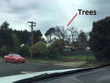
Figure 3 – view to the heritage
item from Bathurst Road
Figure 4 – view from the heritage item to the
trees
Part 6 - Urban
Release Area
The provisions of Part 6 are not
applicable to the proposal as the subject site is not located in an Urban Release Area.
Part 7 - Additional Local Provisions
7.1 - Earthworks
The provisions of Clause 7.1 are not applicable to the
proposal as no earthworks are proposed as part of the proposal. However, if any
unexpected find in relation to Aboriginal objects, relics, or other historical
items or the like are located during the removal and rehabilitation of the
soil, including stump grinding and removal of saw dust generated from the stump
grinding process, all works will be required to cease and the Office of
Environment and Heritage and representatives from the Orange Local Aboriginal Land
Council shall be notified.
7.2 - Flood Planning
This clause applies to land identified
on the Flood Planning Map as a Flood Planning Area and requires that, before
any consent is issued, Council must be satisfied that the proposal:
(a) is compatible with the flood hazard of the
land, and
(b) is not likely to significantly adversely
affect flood behaviour resulting in detrimental increases in the potential
flood affectation of other development or properties, and
(c) incorporates appropriate measures to
manage risk to life from flood, and
(d) is not likely to significantly adversely
affect the environment or cause avoidable erosion, siltation, destruction of
riparian vegetation or a reduction in the stability of river banks or
watercourses, and
(e) is not likely to result in unsustainable
social and economic costs to the community as a consequence of flooding.
A
small section of the Kinross Wolaroi School site is mapped as Flood Planning
Area on the Flood Planning Map. The area is approximately 208m to the north of
the proposed tree removal site (see Figure 5).
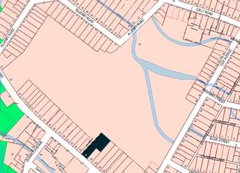
Figure 5 –
Flood Planning Area in proximity to the subject site
(99 Bathurst Road
shown in black)
A small section
of Kinross Wolaroi School is also mapped as being impacted by a Probable
Maximum Flood Event. Again, this is located approximately 316m from the
proposed tree removal site (see Figure 6).
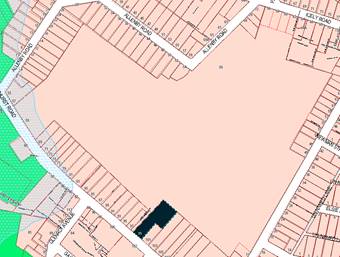
Figure 6 –
Probable Maximum Flood event in proximity to the subject site
(99 Bathurst Road
shown in black)
It
is therefore considered that the provisions of this clause are not applicable
to the proposal.
7.3
- Stormwater Management
The provisions of
Clause 7.3 do not apply to the proposal as the development is not considered to
impact on the urban stormwater system as the proposal outlines the removal, and
replacement of trees and will not cause a major impact to the existing
arrangements already onsite.
7.4 - Terrestrial Biodiversity
This clause seeks to maintain
terrestrial biodiversity and requires that consent must not be issued unless
the application demonstrates whether or not the proposal:
(a) is likely to have any adverse impact on
the condition, ecological value and significance of the fauna and flora on the
land
(b) is likely to have any adverse impact on
the importance of the vegetation on the land to the habitat and survival of
native fauna
(c) has any potential to fragment, disturb or
diminish the biodiversity structure, function and composition of the land, and
(d) is likely to have any adverse impact on
the habitat elements providing connectivity on the land.
Additionally, this clause
prevents consent being granted unless Council is satisfied that:
(a) the development is designed, sited and
will be managed to avoid any significant adverse environmental impact, or
(b) if that impact cannot be reasonably
avoided - the development is designed, sited and will be managed to minimise
that impact, or
(c) if that impact cannot be minimised - the
development will be managed to mitigate that impact.
The proposal is not located on
land identified as having high or moderate biodiversity value. It is therefore
considered that the provisions of this clause are not applicable to the
proposal.
7.5 - Riparian Land and Watercourses
This clause seeks to preserve both
water quality and riparian ecological health. The clause applies to land
identified as a “Sensitive Waterway” on the Watercourse Map. The
subject land contains such a waterway and therefore Council must consider
whether or not the proposal:
(a) is likely to have any adverse impact on
the following:
(i) the water quality and flows within a
watercourse
(ii) aquatic and riparian species, habitats
and ecosystems of the watercourse
(iii) the stability of the bed and banks of the
watercourse
(iv) the free passage of fish and other aquatic
organisms within or along the watercourse
(v) any future rehabilitation of the
watercourse and its riparian areas, and
(b) is
likely to increase water extraction from the watercourse.
Additionally, consent may not be
granted until Council is satisfied that:
(a) the development is designed, sited and
will be managed to avoid any significant adverse environmental impact, or
(b) if that impact cannot be reasonably
avoided - the development is designed, sited and will be managed to minimise
that impact, or
(c) if that impact cannot be minimised - the
development will be managed to mitigate that impact.
The proposal is not located on
land identified as a “Sensitive Waterway, and is also not located within
40m of the top of the bank of a “Sensitive Waterway”. It is
therefore considered that the provisions of this clause are not applicable to
the proposal.
7.6 - Groundwater Vulnerability
This clause seeks to protect
hydrological functions of groundwater systems and protect resources from both
depletion and contamination. Orange has a high water table and large areas of
the LGA, including the subject site, are identified with “Groundwater
Vulnerability” on the Groundwater Vulnerability Map. This requires that
Council consider:
(a) whether or not the development (including
any onsite storage or disposal of solid or liquid waste and chemicals) is
likely to cause any groundwater contamination or have any adverse effect on
groundwater dependent ecosystems, and
(b) the cumulative impact (including the
impact on nearby groundwater extraction for potable water supply or stock water
supply) of the development and any other existing development on groundwater.
Furthermore, consent may not be granted unless Council is satisfied that:
(a) the development is designed, sited and
will be managed to avoid any significant adverse environmental impact, or
(b) if that impact cannot be reasonably
avoided - the development is designed, sited and will be managed to minimise
that impact,
(c) if that impact cannot be minimised - the
development will be managed to mitigate that impact.
The proposal is not
anticipated to involve the discharge of toxic or noxious substances and is
therefore unlikely to contaminate the groundwater or related ecosystems. The
proposal does not involve extraction of groundwater and will therefore not
contribute to groundwater depletion.
7.7 - Drinking Water
Catchments
The proposal is not located on land identified as
“Drinking Water” on the Drinking Water Catchment Map. It is
therefore considered that the provisions of Clause 7.7 do not apply to this
proposal.
7.9 - Airspace Operations
It is considered that the provisions of Clause 7.9 are not
applicable to this proposal as the development will not penetrate the
Limitations of Operations Surface of the Orange Airport.
Clause 7.11 - Essential
Services
Clause 7.11 applies and states:
Development
consent must not be granted to development unless the consent authority is
satisfied that any of the following services that are essential for the
proposed development are available or that adequate arrangements have been made
to make them available when required:
(a) the supply of water,
(b) the supply of electricity,
(c) the disposal and management of sewage,
(d) storm water drainage or on-site
conservation,
(e) suitable road access.
In consideration of this clause,
all utility services are available to the land and adequate for the proposal.
However, it is not considered that the services listed above are essential to
carry out the proposed development.
STATE ENVIRONMENTAL PLANNING
POLICIES
State Environmental Planning Policy (Vegetation in
Non-Rural Areas) 2017
The provisions of State Environmental Planning Policy
(Vegetation in Non-Rural Areas) 2017 is applicable to the subject development
as the proposal requests consent to demolish (remove) trees in non-rural areas
of the State.
Part 3 of the SEPP applies to vegetation in any non-rural
area of the State that is declared by a Development Control Plan to be
vegetation that Council can issue a permit to a landholder to be cleared.
Clause 26 of the SEPP (Vegetation in Non-Rural Areas) 2017 outlines that a
Development Control Plan (DCP) that is in force on the commencement of this
Policy can establish the process, such as requiring a permit or development
consent, for the clearing of vegetation.
Chapter 0 Transitional Provisions of the Orange DCP 2004
(the DCP) prescribes the kinds of trees and other vegetation that are subject
to Clause 10 of the SEPP (Vegetation in Non‑Rural Areas) 2017. The
vegetation that would be impacted by the proposed demolition is of a size that
would trigger the requirements outlined in these provisions.
This application is requesting consent to remove this
vegetation. It is therefore considered that the requirements of the SEPP
(Vegetation in Non-Rural Areas) 2017 have been met and the proposal is
consistent with the provisions as outlined in the Policy and the DCP, provided
the demolition (removal) is carried out in line with the conditions of consent.
State Environmental Planning
Policy 55 Remediation of Land
State Environmental Planning Policy 55 - Remediation of
Land (SEPP 55) is applicable. Pursuant to Clause 7 Contamination
and remediation to be considered in determining development application:
(1) A consent authority must not consent to the
carrying out of any development on land unless:
(a) it
has considered whether the land is contaminated, and
(b) if the land is contaminated, it is
satisfied that the land is suitable in its contaminated state (or will be
suitable, after remediation) for the purpose for which the development is
proposed to be carried out, and
(c) if the land requires remediation to be made
suitable for the purpose for which the development is proposed to be carried
out, it is satisfied that the land will be remediated before the land is used
for that purpose.
Assessing the requirements outlined above, it
is considered that the subject site is highly unlikely to be contaminated. Both
99 Bathurst Road and Kinross Wolaroi School have been used for urban purposes
for a number of years. 99 Bathurst Road has been utilised for
residential accommodation, and Kinross Wolaroi School has been located at the
current site since 1893. Neither uses are listed in Table 1 of Managing
Land Contamination Planning Guidelines SEPP 55 – Remediation of Land.
In January 2018, the Department of
Planning and Environment released an Explanation of Intended Effect and draft
Guidelines outlining the intent to review SEPP 55. The draft Guidelines
state that when undertaking an initial evaluation of contamination, a planning
authority should consider whether there is any known or potential contamination
on nearby or neighbouring properties, or in nearby groundwater, and whether
that contamination needs to be considered in the assessment and decision making
process.
As shown in Figure 7, there is a cluster of suspected
properties to the south west of the site that are identified as potentially
contaminated on Council’s contamination register. However, the site
itself is not identified as being potentially contaminated and no identified
site immediately adjoins the subject site. Both potentially contaminated sites
are located approximately 178m to the north-west of the subject site.
While the potential for
contamination of the site is considered to be unlikely, a condition of consent
has been included requiring, in the event of an unexpected
find during works, such as (but not limited to) the presence of undocumented
waste, odorous or stained soil, asbestos, structures such as underground
storage tanks, slabs, or any contaminated or suspect material, all work onsite
must cease immediately.
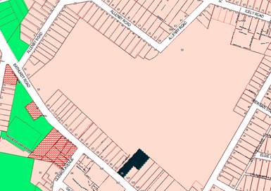
Figure 7 – location of potentially contaminated
land on surrounding sites
PROVISIONS OF ANY DRAFT
ENVIRONMENTAL PLANNING INSTRUMENT THAT HAS BEEN PLACED ON EXHIBITION 4.15(1)(a)(ii)
There are no draft environmental planning instruments that
apply to the subject land or proposed development.
DESIGNATED DEVELOPMENT
The proposed development is not designated development.
INTEGRATED DEVELOPMENT
The proposed development is not integrated development.
PROVISIONS OF ANY DEVELOPMENT
CONTROL PLAN s4.15(1)(a)(iii)
Development Control Plan 2004
Development Control Plan 2004 (“the DCP”)
applies to the subject land (Part 0). An assessment of the proposed
development against the relevant Planning Outcomes will be undertaken below.
Pursuant to Planning Outcome 0.2-1 Interim Planning Outcomes
- Conversion of Zones:
· Throughout this
Plan, any reference to a zone in Orange LEP 2000 is to be taken to be a
reference to the corresponding zone(s) in the zone conversion table.
The corresponding zone to zone 2a Urban Residential and 2d
Urban Transition Zone (Orange LEP 2000) is zone R1 General Residential (Orange
LEP 2011). As such, Orange DCP 2004 – Chapter 7 is relevant to
this proposal. However, a large majority of the provisions of Chapter 7 relate
to the development of residential accommodation and not applicable to this
proposal as it outlines the demolition (removal) of trees. It is therefore
considered that the provisions of Chapter 0, specifically page 0.4 Tree
Preservation are also applicable. Further, given the location of the trees
on a shared boundary with Kinross Wolaroi School, Heritage Item I9, the
provisions of Chapter 13 are considered below.
Chapter 0 – Tree
Preservation
As mentioned above, the provisions of Chapter 0 – Tree
Preservation are applicable to the proposal, due to the provisions included in
SEPP (Vegetation in Non-Rural Areas) 2017 under Clause 26.
The provisions outline that trees, native or exotic, with a
trunk diameter equal to or greater than 300mm at breast height, require
approval to be ringbarked, cut down, topped, lopped or wilfully destroyed
without the Council’s approval and landowners consent.
Given that some of the subject trees are located along the
common boundary between 99 Bathurst Road and Kinross Wolaroi School both lots
are required to provide landowners consent for the removal of the trees.
This application is seeking consent for the removal of the
trees and it is therefore considered that the provisions of this clause have
been met.
Chapter 7 – PO 7.7-3
Planning Outcomes – Heritage
New development complements and enhances the significance
of a heritage item or place of heritage significance listed in the Orange
Heritage Study.
Given the proposal outlines the removal of trees and has
relevance to both this outcome and the outcome outlined below, the impacts to
both outcomes are considered in further detail under the heading below.
Significant landscape features
are retained including original period fences and period gardens.
The proposal requests consent to remove thirteen trees on
the northern and western boundary of 99 Bathurst Road adjoining Kinross Wolaroi
School.
As previously mentioned the arborist report outlines the
removal of eleven of these trees, with two trees (numbers twelve and thirteen
identified in the arborist report) to be retained (see Figure 5 and 6). The
arborist report outlines that:
· tree twelve is of
moderate retention value, but is immature and has an unbalanced east canopy
· tree thirteen is
of moderate retention value, but is immature and has an unbalanced east canopy
and suckers present.
A request was made for additional information regarding the
request to remove the additional trees. A letter, received from McPhee Kelshaw
Lawyers and Conveyancers outlined that the reasons for the removal of the
additional trees outline that:
· the arborist
report lists these trees as having only moderate value
· given this species
of tree is prone to sending suckers, it would be appropriate to remove all the
trees at once, to avoid any future problems with new growth
· to provide
uniformity, it would be appropriate to remove all the trees and replace with a
single replacement species.
A site visit concluded that the two
trees on the northern boundary are located behind an existing shed, which is
situated on the Kinross Wolaroi School side of the fence, as the northern
boundary is not currently in dispute. It is considered that the removal of
these trees in conjunction with the points raised above is acceptable. It is
noted, however, that the two trees on the northern boundary are not proposed to
be replaced by this proposal, which is contrary to what is outlined by the
third point outlined in the additional information above.
It is considered that
requiring a replacement for the two trees on the northern boundary is not
necessary as:
· the trees are not
visible from Bathurst Road or the Wolaroi Mansion as they are not of a height
or a location that is visible from these locations
· while the
significance of these trees has been established to be important in relation to
the Wolaroi mansion, they are not discussed as part of the “cultural
plantings” identified by the Statement of Significance for the item,
which include fir and pine trees
· the replanting of
trees along the northern boundary on the Kinross Wolaroi School side would have
a neutral impact in regard to providing a screen for the heritage item, as the
plantings would be blocked by the existing shed.
The proposal was referred to the Manager City Presentation
for comment and recommendation. The following comments were received in
relation to the health of the trees.
· the arborist
report identifies structural issues with the trees
· these structural
issues are attributed to the close proximity of growth. The juvenile and
semi-mature examples are all growth from the root system of the three mature
and original plantings
· this growth is
generally referred to as suckering growth as it emanates from a node on the
trees root system when the root system appears at ground level, through soil
disturbance or when the root system impacts on a solid object
· the close
proximity of excavation and construction of hard surfaces on the
99 Bathurst Road site will affect all trees within 2m of the common
boundary with a decline in health, loss of vigour and compromising their
structural integrity where they will become a risk of failure (limb drop or
toppling over).
The referral requested from the Manager City Presentation
outlined the removal of all trees on the common boundary would be supported
provided that, a row of eight (minimum) suitably selected heritage derived
trees, maturing to a minimum height of 12m be planted on the Kinross Wolaroi
School side of the common boundary between 99 Bathurst Road and Kinross Wolaroi
School; following the appropriate removal and rehabilitation of the soil ie
stump grinding and removal of saw dust generated from the stump grinding
process and soil amelioration undertaken to provide suitable growing conditions
for new trees. The new trees shall be a minimum container size of 75 litres and
the species shall be agreed to with Kinross Wolaroi School and approved by
Council.
As mentioned, it is not considered
that planting on the northern boundary is necessary in this instance, for the
reasons outline above. Further, it was considered that, as the landowners are
representative of two separate parties, that a species be recommended for
inclusion in the consent to prevent any confusion or issues arising with the
decision of the species of replacement trees. Council’s Manager City
Presentation recommended that the one species from the following list be
planted along the common (western) boundary as a replacement:
Appropriate replacement species include:
· Red Ash (Fraxinus
pennsylvanica)
· White Ash
(Fraxinus Americana)
· Chinese Elm (Ulmus
Pavifolia).
· Chinese Pistachio
(Pistacia chinensis)
These species are to be provided
with spacing of 6m centres and are to be planted within six months of the
removal of the English Elm trees to allow for soil restoration. The replanting
is to be undertaken in accordance with established tree planting guidelines,
such as those outlined in the Shiralee Development Control Plan 2015, page 57
Figure 55 (see Figure 8)
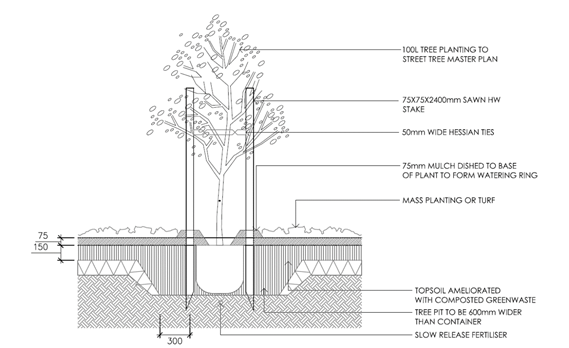
Figure 8 - Tree Planting Guidelines as outlined in
Shiralee Development Control Plan 2015
(page 57, Figure 55)
Further recommendations outlined as part of the Manager City
Presentation recommendation include:
· a minimum
maintenance period of 24 months, during which time they shall be appropriately
watered, fertilised and mulched by a qualified horticulturalist and should any
example become deceased during this period it shall be replaced at the expense
of the developer of 99 Bathurst Road
· placing a bond on
the developer of 99 Bathurst Road that is refundable after the 24 month
maintenance period of $1,000 per tree, a minimum total of $8,000.
However, it is considered as there are two landowners, both
have a different set of responsibilities in relation to the proposal.
The proposal to remove the trees has been brought to
Council’s attention by the owner of 99 Bathurst Road, due to safety
concerns. The owner of 99 Bathurst Road has committed to pay for the removal
and replacement of these trees, to facilitate the next stage of development on
the 99 Bathurst Road site. Therefore, the owner of 99 Bathurst Road is
responsible for the supply, installation and planting of the replacement trees
as outlined in the conditions of consent.
Kinross Wolaroi School, as a consenting landowner, will benefit
from the replanting, as the replacement trees are to be replanted on the
Kinross Wolaroi School side of the boundary fence, in the space previously
occupied by the English Elms to be removed. Kinross Wolaroi School are
currently responsible for the maintenance of all vegetation within the grounds,
including the English Elm trees proposed to be removed. It must therefore be
assumed that, the growth of the replacement trees will be supported in line
with the current maintenance provided onsite.
As the owner of 99
Bathurst Road has agreed to remove the trees and replace them at his own
expense, it is considered his requirements for the replacement of the trees on
Kinross Wolaroi School site will be met once the trees are planted.
Therefore, in line with the current responsibility for the maintenance of
vegetation on the Kinross Wolaroi School site, it is expected that Kinross
Wolaroi School will also maintain the replacement species in line with current
maintenance practices.
Therefore, conditions have been included in the consent
which outline requirements that address the responsibilities of the separate
landowners in relation to the proposal and appropriate removal of the English
Elm trees and planting and management of an appropriate species.
Chapter 13 – Heritage
It is considered the requirements and provisions identified
in this chapter have been extensively covered in preceding sections of this
report. It is therefore considered that no further assessment is required in
relation to the provisions of this chapter.
INFILL GUIDELINES
Council’s Infill Guidelines (the Guidelines) outline
design guidance for carrying out work in a Heritage Conservation Area or
adjacent to a heritage item, to ensure new development integrates with the
character of the neighbourhood.
The Guidelines are applicable to the proposal as they apply
to any new development (including residential and commercial) requiring
development consent to remove significant trees plus other significant changes
to the landscape within a Heritage Conservation Area or on/adjacent to a
heritage item listed in Schedule 5 of the OLEP 2011.
The proposal requests consent to
remove thirteen trees that are located on the common (western) boundary,
between 99 Bathurst Road and Kinross Wolaroi School (59‑67 Bathurst Road).
The trees are distinctive in the landscape as they are visible from the Wolaroi
mansion and from Bathurst Road.
Notwithstanding the trees
significance, the arborist report, which has been reviewed by Orange City
Council Manager City Presentation and Heritage Adviser, outlines structural
issues with the trees. The removal of these trees is supported, provided an
appropriate species is replanted to replace these trees.
Conditions have been included that
ensure the appropriate species of an appropriate scale and size is planted to
replace the trees that are proposed to be removed. These species will ensure
the historic character of the site is maintained and the species are conducive
to the surrounding environment and will not compromise this character.
The trees will be planted adjacent
to the common (western) boundary of 99 Bathurst Road and Kinross Wolaroi School
(59-67 Bathurst Road) to provide a buffer between the heritage item and the
residential development approved on 99 Bathurst Road.
PROVISIONS PRESCRIBED BY THE
REGULATIONS s4.15(1)(a)(iv)
Demolition of a Building (Clause
92)
The proposal does not involve the demolition of a building.
Fire Safety Considerations
(Clause 93)
The proposal does not involve a
change of building use for an existing building.
Buildings to be Upgraded
(Clause 94)
The proposal does not involve the
rebuilding, alteration, enlargement or extension of an existing building.
BASIX Commitments (Clause 97A)
BASIX is not applicable to the
proposed development.
THE LIKELY IMPACTS OF THE
DEVELOPMENT s4.15(1)(b)
The main impact of the development
will be the removal of thirteen trees on the common (northern and western)
boundary of 99 Bathurst Road which is shared with Kinross Wolaroi School.
The trees, which have an established
heritage significance due to the location of the trees within the Kinross
Wolaroi School grounds, are supported for removal due to safety concerns with
the trees and the structural root zone of these trees protruding into the
development site at 99 Bathurst Road.
The owner of 99 Bathurst Road has
committed to remove eleven trees on the common (western) boundary shared with
Kinross Wolaroi School and two trees on the common (northern) boundary shared
with Kinross Wolaroi School and replace the eleven trees on the common
(western) boundary with an appropriate species. The proposal has been referred
to Orange City Council’s Heritage Adviser and Manager City Presentation.
Conditions have been adopted that were informed by these referrals that will ensure
an appropriate species is planted that is sympathetic to the heritage item.
Should the conditions of consent be
followed appropriately, the likely impacts of the development will be managed.
THE SUITABILITY OF THE SITE
s4.15(1)(c)
The site is suitable for the
removal of eleven trees on the common (western) boundary shared with Kinross
Wolaroi School and two trees on the common (northern) boundary shared with
Kinross Wolaroi School, as the trees have structural defects that affect the
safety of the trees. The four replacement species, which both landowners are to
choose from as a replacement species and have been recommended by both the
Manager City Presentation and Orange City Council’s Heritage Adviser are
suitable to the site. These species have been recommended as they are
sympathetic to the character of the heritage item and will provide an
appropriate screen to the residential use on the 99 Bathurst Road site.
ANY SUBMISSIONS MADE IN
ACCORDANCE WITH THE ACT s4.15(1)(d)
The proposed development is defined
as "advertised development" under the provisions of the LEP. The
application was advertised for the prescribed period of 14 days and at the end
of that period no submissions were received. A number of enquiries were made
through Council’s Customer Service desk, however these were general in
nature with no opposition raised in regard to the proposal.
PUBLIC INTEREST
s4.15(1)(e)
The proposed development is considered to be of minor
interest to the wider public due to the relatively localised nature of
potential impacts. The proposal is not inconsistent with any relevant policy
statements, planning studies, and guidelines etc that have not been considered
in this assessment.
SUMMARY
The proposed development is permissible with the consent of
Council. The proposed development complies with the relevant aims, objectives
and provisions of Orange LEP 2011 (as amended) and DCP
2004. A Section 4.15 assessment of the development indicates that
the development is acceptable in this instance. Attached is a draft Notice of
Approval outlining a range of conditions considered appropriate to ensure that
the development proceeds in an acceptable manner.
COMMENTS
The proposal was not deemed to be required for referral to
the Environmental Health and Building Surveyor and the Engineering Development
Section. Therefore there are requirements in relation to these sections
required as part of the Notice of Approval.
Attachments
1 Notice
of Approval, D18/63547
2 Plan,
D18/63509
2.9 Development
Application DA 329/2018(1) - 269-279 Summer Street (Robertson Park)
RECORD
NUMBER: 2018/2901
AUTHOR: Kelly
Walker, Senior Planner
EXECUTIVE Summary
|
Application
lodged
|
13
September 2018
|
|
Applicant/s
|
Orange
City Council
|
|
Owner/s
|
Orange
City Council
|
|
Land
description
|
Lot 702
DP 1002273 - 269-279 Summer Street, Orange
|
|
Proposed
land use
|
Recreation
Area - Amenities Block and Demolition (tree removal)
|
|
Value of
proposed development
|
$350,000
|
Council's consent is sought to
erect an amenities facility on the eastern side of Robertson Park, near to
McNamara Street, comprising a small toilet building constructed in brick with
Colorbond roof, and a pergola. The building will include female, male, and
accessible toilets, and a service cupboard. One tree needs to be removed to
facilitate the proposed development.

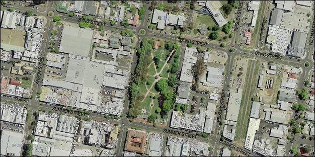
Figure 1 - locality plan
Robertson Park is a listed heritage item, which
includes the landscaping, trees, bandstand, war memorial, fountain, and CWA
Hall. The site is also within the Heritage Conservation Area. Development consent
is required for the removal of the tree, as well as the construction of the new
building.
The application was advertised for
the prescribed period of 14 days and at the end of that period ten (10)
submissions were received objecting to the proposal. The concerns raised
include matters pertaining to inappropriate site selection, building design and
safety concerns. A detailed assessment of the issues raised in the submissions
has been included in the main body of this report.
Council’s Heritage Advisor
has reviewed the plans in consultation with Council staff. Recommendations to
address concerns raised in submissions in relation to the building design have
been provided in the main body of this report for Council’s
consideration. The recommendations are aimed at further improving and enhancing
the visual presentation of the development as designed to date so as to
minimise visual and heritage impacts of the development on the locality, conservation area, streetscape
and neighbouring properties.
The applicant has advised that the
layout and design of the facility were determined by Council following design
sessions. Council staff recommend a condition of consent amending the design of
the pergola to wrap around the building to mitigate heritage and visual
impacts, and to provide landscaping and lighting details for further assessment
to address both visual and safety concerns raised in submissions.
Overall, a Section 4.15 assessment of the development
indicates that the proposed development can be acceptable, subject to the
conditions of consent altering the building design and providing landscaping and
lighting as discussed in the main body of this report. On this basis, it is
recommended that Council supports the subject proposal. A draft Notice of
Approval is attached.
LEGISLATIVE CHANGES
On 1 March 2018 the Environmental Planning and Assessment
Act 1979 was substantially amended. The most immediate change involves the
restructuring and renumbering of the Act, with other more substantive
changes to be phased in over time. However, for some applications (particularly
where an application was lodged prior to the changes coming into effect) the
supporting documentation may still reference the previous numbering regime. In
the drafting of this report the content and substance of the supporting
material has been considered irrespective of which legislative references were
used.
DECISION FRAMEWORK
Development in Orange is governed by two key documents Orange
Local Environment Plan 2011 (the “LEP”) and Orange
Development Control Plan 2004 (the “DCP”). In addition the
Infill Guidelines are used to guide development, particularly in the heritage
conservation areas and around heritage items.
Orange Local Environment Plan 2011 – The
provisions of the LEP must be considered by the Council in determining the
application. LEPs govern the types of development that are permissible or
prohibited in different parts of the City and also provide some assessment
criteria in specific circumstances. Uses are either permissible or not. The
objectives of each zoning and indeed the aims of the LEP itself are also to be
considered and can be used to guide decision making around appropriateness of
development.
Orange Development Control Plan 2004 – the DCP
provides guidelines for development. In general it is a performance based
document rather than prescriptive in nature. For each planning element there
are often guidelines used. These guidelines indicate ways of achieving the
planning outcomes. It is thus recognised that there may also be other solutions
of merit. All design solutions are considered on merit by planning and building
staff. Applications should clearly demonstrate how the planning outcomes are
being met where alternative design solutions are proposed. The DCP enables
developers and architects to use design to achieve the planning outcomes in
alternative ways.
DIRECTOR’S COMMENT
Conditions have been recommended by planning staff and
Council’s Heritage Advisor to address some of the concerns raised in
submissions.
Link To Delivery/OPerational Plan
The recommendation in this report relates to the
Delivery/Operational Plan strategy “10.1 Preserve -
Engage with the community to ensure plans for growth and development are
respectful of our heritage”.
Financial Implications
Nil
Policy and Governance Implications
Nil
|
Recommendation
That Council consents to
development application DA 329/2018(1)
for Recreation Area - Amenities Block and Demolition (tree removal) at
Lot 702 DP 1002273 - 269-279 Summer Street, Orange pursuant to the conditions of consent in the attached
Notice of Approval.
|
further considerations
Consideration has been given to the
recommendation’s impact on Council’s service delivery; image and
reputation; political; environmental; health and safety; employees;
stakeholders and project management; and no further implications or risks have
been identified.
SUPPORTING INFORMATION
THE PROPOSAL
The proposal involves the
construction of a new amenities facility on the eastern side of Robertson Park,
near to McNamara Street, comprising a small toilet building constructed in
brick with Colorbond roof (see Figure 2). The building will measure
approximately 11m by 4.5m, with a height of 4.5m. The building will comprise
female, male, and accessible toilets, with an ambulant cubicle in each of the
male and female toilets. The toilets will face into the park (west). A service
cupboard is proposed on the eastern elevation. A pergola is proposed on the
western elevation, measuring around 3.9m by 18m (see Figure 2).
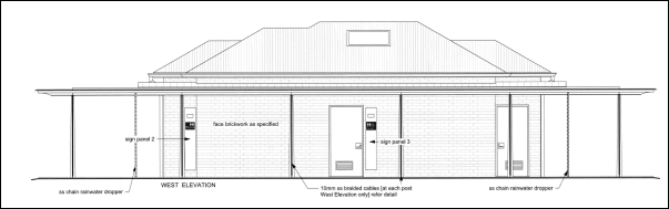
Figure 2 - proposed western elevation
(from submitted drawing number CC 04 A, prepared by
Architecture Raw, and dated 14/8/2018)
One tree needs to be removed to facilitate the proposed
development. It is proposed to replace the tree, as well as grow vegetation on
the proposed pergola.
MATTERS FOR CONSIDERATION
Section 1.7 - Application of
Part 7 of the Biodiversity Conservation Act 2016 and Part 7A of the
Fisheries Management Act 1994
Section 1.7 of the EP&A Act 1979 identifies that Part 7
of the Biodiversity Conservation Act 2016 and Part 7A of the Fisheries
Management Act 1994 have effect in connection with terrestrial and aquatic
environments.
In this instance, site inspection reveals that the subject
property has no biodiversity or habitat value. Having regard to the relevant
provisions and inspection, it is considered that the proposed development is
not likely to significantly affect a threatened species. A Biodiversity
Development Assessment Report is not required in this instance.
Section 4.15
Section 4.15 of the Environmental Planning and Assessment
Act 1979 requires Council to consider various matters, of which those
pertaining to the application are listed below.
PROVISIONS OF ANY ENVIRONMENTAL
PLANNING INSTRUMENT s4.15(1)(a)(i)
Orange Local Environmental Plan 2011
Part 1 - Preliminary
Clause 1.2 - Aims of Plan
The
broad aims of the LEP are set out under subclause 2. Those relevant to the
application are as follows:
(a) to encourage development which complements
and enhances the unique character of Orange as a major regional centre boasting
a diverse economy and offering an attractive regional lifestyle,
(b) to provide for a range of development
opportunities that contribute to the social, economic and environmental
resources of Orange in a way that allows present and future generations to meet
their needs by implementing the principles for ecologically sustainable
development,
(f) to recognise and manage valued
environmental heritage, landscape and scenic features of Orange.
The application is considered to be consistent
with these aims, as set out in this report.
Clause 1.6 - Consent Authority
This clause establishes that, subject to the Act, Council is
the consent authority for applications made under the LEP.
Clause 1.7 - Mapping
The subject site is identified
on the LEP maps in the following manner:
|
Land Zoning Map:
|
Land zoned RE1
Public Recreation
|
|
Lot Size Map:
|
No Minimum Lot Size
|
|
Heritage Map:
|
A listed heritage
item and within a heritage conservation area
|
|
Height of Buildings Map:
|
Building height
limit 6m
|
|
Floor Space Ratio Map:
|
Floor space limit
0.2:1
|
|
Terrestrial Biodiversity Map:
|
No biodiversity
sensitivity on the site
|
|
Groundwater Vulnerability Map:
|
Groundwater vulnerable
|
|
Drinking Water Catchment Map:
|
Not within the drinking water
catchment
|
|
Watercourse Map:
|
Within a sensitive
waterway
|
|
Urban Release Area Map:
|
Not within an urban release area
|
|
Obstacle Limitation Surface Map:
|
No restriction on building siting
or construction
|
|
Additional Permitted Uses Map:
|
No additional permitted use applies
|
|
Flood Planning Map:
|
Within a flood planning area
|
Those matters that are of relevance are addressed in detail
in the body of this report.
Clause 1.9A - Suspension of
Covenants, Agreements and Instruments
This clause provides that covenants, agreements and other
instruments which seek to restrict the carrying out of development do not apply
with the following exceptions:
· covenants imposed
or required by Council
· prescribed
instruments under Section 183A of the Crown Lands Act 1989
· any conservation
agreement under the National Parks and Wildlife Act 1974
· any trust
agreement under the Nature Conservation Trust Act 2001
· any property
vegetation plan under the Native Vegetation Act 2003
· any biobanking
agreement under Part 7A of the Threatened Species Conservation Act 1995
· any planning
agreement under Division 6 of Part 4 of the Environmental Planning and
Assessment Act 1979.
Council staff are not aware of the title of the subject
property being affected by any of the above.
Part 2 - Permitted or Prohibited
Development
Clause 2.1 - Land Use Zones
The subject site is located within the RE1
Public Recreation zone. The
proposed development is defined as a ‘recreation area’ under the
LEP as follows:
recreation
area means a place used for outdoor recreation
that is normally open to the public, and includes:
(a) a children’s playground, or
(b) an area used for community sporting
activities, or
(c) a public park, reserve or garden or the
like,
and any
ancillary buildings, but does not include a recreation facility (indoor), recreation
facility (major) or recreation facility (outdoor).
The proposed toilet building is considered to be ancillary
to the public park, and recreation areas are permitted with consent in this
zone. This application is seeking consent.
Clause 2.3 - Zone Objectives and Land
Use Table
Clause 2.3 of LEP 2011 references the Land Use
Table and Objectives for each zone in LEP 2011. These objectives for land
zoned RE1
Public Recreation are as
follows:
· To enable land
to be used for public open space or recreational purposes.
· To provide a
range of recreational settings and activities and compatible land uses.
· To protect and
enhance the natural environment for recreational purposes.
· To ensure
development is ordered in such a way as to maximise public transport patronage
and encourage walking and cycling in close proximity to settlement.
· To ensure
development along the Southern Link Road has alternative access.
The proposal is
generally consistent with the objectives for the zone in that it provides a
public facility which enhances the use of the land for community and
recreational use, encourages walking and cycling, and does not impact on the
natural environment.
Clause 2.7 - Demolition
Requires Development Consent
This clause triggers the need for development consent in
relation to a building or work. This requirement does not apply to any
demolition that is defined as exempt development.
The proposal involves demolition/removal of one (1) tree and
the applicant is seeking the consent of council. The demolition works proposed
are unlikely to have significant impacts on adjoining lands, the streetscape,
or the public realm. The building demolition conditions are not relevant and
therefore are not required in this instance. The removal
of a tree in a heritage conversation area and on a listed heritage item is discussed
in greater detail later in this report.
Part 3 - Exempt and Complying
Development
The application is not exempt or complying development.
Part 4 - Principal Development
Standards
Clause 4.3 - Height of Buildings
This clause limits the height of
buildings (HoB) on land identified on the Height of Buildings Map. The subject
land is identified on the Map as having a HoB limit of 6m. The
maximum height of the proposed building is 4.6m and is therefore consistent
with the established height limit.
Clause 4.4 - Floor Space Ratio
This clause limits the floor space
ratio (FSR) permitted on land identified on the Floor Space Ratio Map. The
subject land is identified on the Map as having an FSR of 0.2:1. Robertson Park
is considered to be community land, and its site area has been calculated under
Clause 4.5 as 17,941.2m2, meaning the site may have up to
3,588.2m2 of floor space. The existing CWA Hall and proposed toilet
building will be well under this, consistent with the FSR clause.
Part 5 - Miscellaneous Provisions
5.10 - Heritage Conservation
Clause 5.10
applies and states in part:
(1) Objectives
The
objectives of this clause are as follows:
(a) to
conserve the environmental heritage of Orange,
(b) to
conserve the heritage significance of heritage items and heritage conservation
areas, including associated fabric, settings and views,
(c) to
conserve archaeological sites,
(d) to
conserve Aboriginal objects and Aboriginal places of heritage significance.
(4) Effect
of Proposed Development on Heritage Significance
The
consent authority must, before granting consent under this clause in respect of
a heritage item or heritage conservation area, consider the effect of the
proposed development on the heritage significance of the item or area
concerned. This subclause applies regardless of whether a heritage management
document is prepared under subclause (5) or a heritage conservation management
plan is submitted under subclause (6).
Robertson Park is a listed heritage item,
which includes the landscaping, trees, bandstand, war memorial, fountain, and
CWA Hall. The site is also within the Heritage Conservation Area. The Orange
Heritage database provides the following statement of significance:
“The
park occupies 2 hectares, has an important central location in the city, and
has considerable cultural significance in the town's history. Elements of
significance which have retained their character include the diagonal layout,
trees, bandstand, war memorial, fountain, Boer war memorial lamp post, and CWA
Hall”.
Furthermore, the listing notes:
“This
park is notable for its mature exotic trees - plains and elms on the west and
ash and pin oaks on the east. A formal arrangement of paths, made of decomposed
granite gravel with concrete edges, runs throughout, with focal points, which
include the marble fountain. There is a timber and bluestone bandstand of 1915,
with slate roof, an entrance arbour and a monument to the war dead. The grass
is predominantly kikuyu. A country Women's Building occupies the north-west
corner of the park”.
The park and its features are considered to
be in good condition, mark the development of civic design in relation to
landscaped amenity and recreational space, and have high level streetscape
value. The site is highly valued by the community. Council’s
Heritage Study identifies key elements in the conservation of this important
public place, namely the retention and replacement of the significant
vegetation, the respect and deference to the significant buildings and
structures, and future development that respects the pronounced, traditional
layout of the park with the central position of the rotunda and pathways that
define the space.
As an amenities facility, the proposed
structure is a building consistent with the use of the site as an area of open
space. The architecture and style of the proposed building are different to the
other elements of architecture in the park, but the separation of the building
ensures that it does not challenge or significantly detract from the existing features
identified as having heritage significance within the park, such as the
bandstand.
Notwithstanding
the above, it is considered that the current design of the proposed building
could be improved so as to lessen the visual impact of the development when
viewed from McNamara Street and its surrounds. The building appears to have
been designed with its frontage towards the park, and ‘back of
house’ towards McNamara Street (see Figure 3). However, it is
considered that all elevations are ‘frontages’ given the park is
surrounded on all sides by streets and commercial buildings. Views and vistas
into and around the park are also considered important. As such, each of the
elevations need to be designed with a suitable visual appearance.
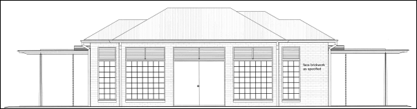
Figure 3 - proposed eastern elevation
(from submitted drawing number CC 04 A, prepared by
Architecture Raw, and dated 14/8/2018)
Council’s heritage advisor and
staff have recommended changes to the design of the building as follows:
- make the building
symmetrical (i.e. building footprint, cubicles, and openings)
- provide a steel
plate to complete the perimeter and to screen the slope of the polycarbonate
roofing, which is out of character with the otherwise well resolved pergola,
- screen the
polycarbonate pergola material with a timber batten screen beneath given the
tendency of this material to yellow, get dirty, and to weather, and
- reduce the length
of the pergola, which extends considerably beyond the built form without a
pragmatic rationale, and wrap the element around the corners and whole building
to screen the building.
The applicant has responded that they
do not wish to make any changes to the design of the proposed building, stating
that the layout was settled on by Council following design sessions, the costs
would exceed the available budget, that current polycarbonate products do not
yellow, and that extending the pergola will cause more impacts given it will
increase the scale of the building and impact on the security of patrons.
Ideally, amending the symmetry of the
footprint and openings of the building would assist in providing a better
appearance and may assist Council in addressing submissions. However,
considering that the applicant has indicated a preference not alter the layout
of the building, it is recommended that a wrap-around style pergola, with
landscaping growing up and over it, could assist in blending the proposed
building into the park surrounds and provide visual interest to the
streetscape. This is considered to be a suitable compromised position between
the applicant’s needs, staff recommendations, and the concerns of
submitters and could adequately mitigate heritage and visual impacts. Although
extending the pergola will add bulk to the building, it will be spread around
each elevation and will not be visible in its whole expanse from any viewpoint
other than from above. The applicant could also reduce the width of the pergola
(as recommended) to achieve this, which would reduce building costs. As such, a
condition of consent is recommended to amend the plans, altering the pergola to
wrap around the building and for landscaping details to be provided for further
assessment. It is considered that the proposed materials and colours are
appropriate.
While one tree is to be removed to
facilitate the development, it is a small young tree and does not have heritage
significance. The proposal seeks to provide additional plantings on the pergola
structure, which will assist in blending the building into the park, and offset
the loss of tree canopy. The landscaping plan required by the condition of
consent recommended above will ensure the tree loss is mitigated, as well as
mitigate heritage impacts. It is noted that the proposed building will be
constructed very close to two existing mature trees on the site (see Figure 4).
A condition of consent is recommended to set up a tree protection zone
(‘TPZ’) around these trees to ensure their protection during
construction.
It is considered that a possibility
exists for archaeological material to exist under this site, given the park's
position near the heart of the first settlement of the township in the early
20th Century. As a precaution, a condition of consent is recommended to address
potential archaeology on the site.
It is considered that a heritage management document and
heritage management plan are not required in this case.
Overall, subject to the recommended changes to the
pergola and adequate plantings being installed, heritage and visual impacts can
be adequately mitigated, and the proposal meets the objectives of LEP Clause
5.10.
Part 6 - Urban Release Area
Not relevant to the application. The subject site is not
located in an Urban Release Area.
Part 7 - Additional Local Provisions
7.1 - Earthworks
This clause establishes a range of
matters that must be considered prior to granting development consent for any
application involving earthworks, such as:
(a) the likely disruption of, or any
detrimental effect on, existing drainage patterns and soil stability in the
locality of the development
(b) the effect of the development on the
likely future use or redevelopment of the land
(c) the quality of the fill or the soil to be
excavated, or both
(d) the effect of the development on the
existing and likely amenity of adjoining properties
(e) the source of any fill material and the
destination of any excavated material
(f) the likelihood of disturbing relics
(g) the proximity to and potential for adverse
impacts on any waterway, drinking water catchment or environmentally sensitive
area
(h) any measures proposed to minimise or
mitigate the impacts referred to in paragraph (g).
The earthworks
proposed in the application are limited to the extent of cutting and filling
required for the removal of the tree, and the construction of the proposed
building. The earthworks can be appropriately supported onsite, and the change
in ground level is not substantial. The extent of disruption to the drainage of
the site is considered to be minor and will not detrimentally affect adjoining
properties or receiving waterways. The extent of the earthworks will not
materially affect the potential future use or redevelopment of the site that
may occur at the end of the proposed development's lifespan.
The site is not known
to be contaminated. The site is not known to contain any Aboriginal, European
or Archaeological relics. Previous known uses of the site do not suggest that
any relics are likely to be uncovered. However, conditions are recommended to
ensure that should site works uncover a potential relic or artefact, works will
be halted to enable proper investigation by relevant authorities and the
proponent required to seek relevant permits to either destroy or relocate the
findings.
Conditions are also
recommended to require a sediment control plan, including silt traps and other
protective measures, to ensure that loose dirt and sediment does not escape the
site boundaries during construction.
7.2 - Flood Planning
This clause applies to land identified
on the Flood Planning Map as a Flood Planning Area and requires that, before
any consent is issued, Council must be satisfied that the proposal:
(a) is compatible with the flood hazard of the
land, and
(b) is not likely to significantly adversely
affect flood behaviour resulting in detrimental increases in the potential
flood affectation of other development or properties, and
(c) incorporates appropriate measures to
manage risk to life from flood, and
(d) is not likely to significantly adversely
affect the environment or cause avoidable erosion, siltation, destruction of
riparian vegetation or a reduction in the stability of river banks or
watercourses, and
(e) is not likely to result in unsustainable
social and economic costs to the community as a consequence of flooding.
In this regard the
proposed development is unlikely to change flooding regimes on or off the site
and would be unlikely to cause or contribute to erosion, siltation or reduce
riparian vegetation, and is therefore unlikely to create a cost burden on the
community or neighbours. Notwithstanding the above, a condition of consent is
recommended relating to the use of flood compatible materials, and the location
of electrical outlets as a precautionary measure.
7.3 - Stormwater Management
This clause applies
to all industrial, commercial and residential zones and requires that Council
be satisfied that the proposal:
(a) is designed to maximise the use of water
permeable surfaces on the land having regard to the soil characteristics
affecting onsite infiltration of water
(b) includes, where practical, onsite
stormwater retention for use as an alternative supply to mains water,
groundwater or river water; and
(c) avoids any significant impacts of
stormwater runoff on adjoining downstream properties, native bushland and
receiving waters, or if that impact cannot be reasonably avoided, minimises and
mitigates the impact.
The proposed building is modest in
size and a substantial portion of the park will be retained as permeable
surfaces, therefore post development runoff levels are unlikely to exceed the predevelopment levels. The proposal will be
connected to the existing stormwater system, and monetary contributions towards
water, sewer and drainage will be required.
7.5 - Riparian Land and Watercourses
This clause seeks to preserve both
water quality and riparian ecological health. The clause applies to land
identified as a “Sensitive Waterway” on the Watercourse Map. The subject
land contains such a waterway and therefore Council must consider whether or
not the proposal:
(a) is likely to have any adverse impact on
the following:
(i) the water quality and flows within a
watercourse
(ii) aquatic and riparian species, habitats
and ecosystems of the watercourse
(iii) the stability of the bed and banks of the
watercourse
(iv) the free passage of fish and other aquatic
organisms within or along the watercourse
(v) any future rehabilitation of the
watercourse and its riparian areas, and
(b) is
likely to increase water extraction from the watercourse.
Additionally, consent may not be
granted until Council is satisfied that:
(a) the development is designed, sited and
will be managed to avoid any significant adverse environmental impact, or
(b) if that impact cannot be reasonably
avoided - the development is designed, sited and will be managed to minimise
that impact, or
(c) if that impact cannot be minimised - the
development will be managed to mitigate that impact.
While the subject
site contains a sensitive waterway and key fish habitat, the waterway runs
underground, under the park. The proposed development seeks to construct a
small building, which will result in negligible difference in stormwater runoff
for the overall site. Additionally, stormwater and sewer will be connected to
the existing systems.
Overall, while
there will always remain a risk to the waterway under extreme circumstances
such as record storms and the like, it is considered that the risk of adverse
impact can be appropriately managed to an acceptable level of risk.
7.6 - Groundwater Vulnerability
This clause seeks to protect
hydrological functions of groundwater systems and protect resources from both
depletion and contamination. Orange has a high water table and large areas of
the LGA, including the subject site, are identified with “Groundwater
Vulnerability” on the Groundwater Vulnerability Map. This requires that
Council consider:
(a) whether or not the development (including
any onsite storage or disposal of solid or liquid waste and chemicals) is
likely to cause any groundwater contamination or have any adverse effect on
groundwater dependent ecosystems, and
(b) the cumulative impact (including the
impact on nearby groundwater extraction for potable water supply or stock water
supply) of the development and any other existing development on groundwater.
Furthermore, consent may not be granted unless Council is satisfied that:
(a) the development is designed, sited and
will be managed to avoid any significant adverse environmental impact, or
(b) if that impact cannot be reasonably
avoided - the development is designed, sited and will be managed to minimise
that impact,
(c) if that impact cannot be minimised - the
development will be managed to mitigate that impact.
The proposal is not
anticipated to involve the discharge of toxic or noxious substances and is
therefore unlikely to contaminate the groundwater or related ecosystems. The
proposal does not involve extraction of groundwater and will therefore not
contribute to groundwater depletion. The proposal will be connected to the
existing sewer system, and monetary contributions towards water, sewer and
drainage will be required. Overall, the design and siting of the proposal
avoids impacts on groundwater and is therefore considered acceptable.
Clause 7.11 - Essential
Services
Clause 7.11 applies and states:
Development
consent must not be granted to development unless the consent authority is
satisfied that any of the following services that are essential for the
proposed development are available or that adequate arrangements have been made
to make them available when required:
(a) the supply of water,
(b) the supply of electricity,
(c) the disposal and management of sewage,
(d) storm water drainage or on-site
conservation,
(e) suitable road access.
In consideration of this clause, all utility services are
available to the land and adequate for the proposal. A condition of consent
requires monetary contributions towards water, sewer and drainage works given
the increased demand the proposal will place on these services (i.e. new
toilets and hand basins).
STATE ENVIRONMENTAL PLANNING
POLICIES
State Environmental Planning Policy 55 - Remediation of
Land
State Environmental Planning Policy 55 - Remediation of
Land (SEPP 55) is applicable. Pursuant to Clause 7(1):
A consent
authority must not consent to the carrying out of any development on land
unless:
(a) it
has considered whether the land is contaminated, and
(b) if the land is contaminated, it is
satisfied that the land is suitable in its contaminated state (or will be
suitable, after remediation) for the purpose for which the development is
proposed to be carried out, and
(c) if the land requires remediation to be made
suitable for the purpose for which the development is proposed to be carried
out, it is satisfied that the land will be remediated before the land is used
for that purpose.
In this case, Council has no records that indicate the land
was used for any purpose that was likely to have caused contamination of the
site. The potential for contamination of the site is considered to be very low,
where it has a long standing history of being used for open space and
recreation, and the proposal does not seek to change this use. On the basis of
available evidence, it is considered that the site is suitable for the proposed
use and no further preliminary investigation is required to satisfy the
requirements of the SEPP.
PROVISIONS OF ANY DRAFT
ENVIRONMENTAL PLANNING INSTRUMENT THAT HAS BEEN PLACED ON EXHIBITION 4.15(1)(a)(ii)
There are no draft environmental planning instruments that
apply to the subject land or proposed development.
DESIGNATED DEVELOPMENT
The proposed development is not designated development.
INTEGRATED DEVELOPMENT
The proposed development is not integrated development.
PROVISIONS OF ANY DEVELOPMENT
CONTROL PLAN s4.15(1)(a)(iii)
Development Control Plan 2004
Development Control Plan 2004 (“the DCP”)
applies to the subject land. An assessment of the proposed development against
the relevant Planning Outcomes will be undertaken below.
Chapter 11 - Land Used for Open Space
and Recreation
The planning outcome for this chapter of
the DCP states that development should be carried out in accordance with the
relevant adopted plan of management.
Robertson Park is considered to be public
and community land, with the registered owner being the Crown, with
care, control and management being vested in Orange City Council. As Crown land
there is no necessity for a plan of management for the site. Council has, however,
previously resolved to apply the provisions of its generic "Plan Of
Management for Local And Neighbourhood Parks" (the
‘Plan’), to all its reserves and open space areas.
The Plan contains over-arching “core objectives”
that should be considered in this assessment, as follows:
1 To
encourage and facilitate recreational, cultural social or educational pastimes
or activities.
2 Provide
for passive recreational activities or pastimes and for the casual playing of
games
3 Improve
the land in such a way as to promote and facilitate its use to achieve the
other core objectives for its management.
The Plan details provisions about how these objectives might
be achieved, principally with landscape preservation, protection of native
vegetation, equipment, access, neighbourhood amenity, and risk management. The
Plan allows for public amenities buildings where appropriately sited on land
generically reserved as public space or local open space. Such appropriateness
needs to be determined on a case-by-case basis. The following additional
criteria needs to be considered:
· The need for
the proposed development on that land.
· The impact of
the proposed development on the existing or likely future use of the land.
· How any
proposed building complements the use of the land as open space.
· Whether public
use of, and access to, the site will be affected and to what extent.
It is considered that the proposed development is consistent
with the above criteria and core objectives of the Plan, where it supports the
use of the public open space for recreational, cultural and social activities;
provides necessary amenity (toilet) facilities for the park; will not impact on
ongoing or future use of the land; does not interfere with the flood
characteristics of the area; and public use and access to and within the park
will not be affected.
Overall, the proposed development is consistent with the
relevant Plan and Chapter 11 of the DCP.
Chapter 13 - Heritage
Robertson Park is part of the Central Orange Conservation
Area and is identified as a Heritage Item of local significance. The
significance and impacts on the heritage setting have previously been addressed
in the LEP Clause 5.10 assessment earlier in this report, where it was
concluded that the design of the proposed building needs amending, and adequate
landscaping needs to be installed, to ensure the proposed development will not
significantly impact on the heritage character of the locality and conservation
area.
Chapter 15 -
Car Parking
The DCP does not set out car parking rates
for areas of public open space. As the proposed development only seeks to
improve the park and public amenities, it is not expected that the proposed development
will increase the demand for car parking. It is noted that some travellers will
stop at the park specifically to use the toilets, however, most patrons will
already be utilising the park or surrounding areas, and therefore the demand
has already been accounted for. It is considered that there is ample on-street
car parking surrounding the park for users of the park, toilets, and
neighbouring businesses. Most of the on-street parking is time restricted
during peak hours, allowing for a greater availability and high turnover. Overall,
the application is considered acceptable in this regard.
Infill Guidelines
Development in a heritage setting must be assessed against
Council’s Infill Guidelines. Heritage matters have already been addressed
in the LEP Clause 5.10 assessment earlier in this report. Subject to design
amendments of the pergola and landscaping to improve the appearance of the
proposed building, the proposal will meet the objectives of the Guidelines.
Section 64 Water and Sewer
Headworks Charges
Pursuant to Section 64 of the Local Government Act 1993
water and sewer headwork charges are applicable to the proposal due to the
increased demand on Council’s existing water and sewer systems (i.e.
additional toilets and hand basins). The contributions for water, sewer and
drainage works are based on 1 additional ET for water supply headworks and
1 ET for sewerage headworks. Conditions are recommended requiring payment of
contributions prior to issuing of a Construction Certificate.
PROVISIONS PRESCRIBED BY THE
REGULATIONS s4.15(1)(a)(iv)
Demolition of a Building (clause 92)
The proposal involves the demolition of a tree, however, as
noted earlier, the Regulation provisions are not relevant to tree removal, and
therefore demolition conditions are not required in this instance.
Fire Safety Considerations
(clause 93)
Council’s Environmental Health and Building Surveyors
comment that the proposed building will be a Class 10a building and will be
well separated from other buildings, therefore there will be no fire separation
issues. Furthermore, they note that the building is relatively small, with only
a short distance to exit from within it. The submitted Statement says that the
building will be secured remotely via an electronically controlled system,
which could be problematic depending on how the system works and if people
become accidentally trapped. The applicant will need to address how people who
are inadvertently locked into the building can escape at Construction
Certificate stage. Relevant conditions of consent are attached.
Buildings to be Upgraded
(clause 94)
The proposal does not involve the rebuilding, alteration,
enlargement or extension of an existing building.
BASIX Commitments (clause 97A)
BASIX is not applicable to the proposed development.
THE LIKELY IMPACTS OF THE
DEVELOPMENT s4.15(1)(b)
Visual and Heritage Impacts
As set out in the heritage assessment
earlier in this report, the proposed building in its current form will have
adverse visual and heritage impacts on the surrounding locality, conservation
area, streetscape, and neighbouring properties. Conditions of consent are
recommended to amend the pergola to wrap-around the building, and for
landscaping to be planted up and over the pergola to mitigate impacts and
assist in blending the building into the surrounds. A landscaping plan will
need to be submitted for further assessment in this regard, and to support the
loss of the tree to be removed. Tree protection zones need to be set up around
the nearby trees to protect them during construction and works.
Based on support for the recommended
conditions of consent and changes to the proposed development, the visual
impacts to the streetscape, neighbouring properties, heritage and landscape
values of the park, and heritage conservation area would be considered
acceptable.
Traffic
Impacts
It is not expected that the proposed
development will increase the demand for car parking, or trip
generation/traffic movements. While it is noted that some travellers will stop
at the park specifically to use the toilets, most patrons will already be
utilising the park or surrounding areas, and therefore the parking demand and
traffic movements have already been accounted for. It is considered that there
is ample on-street car parking surrounding the park for users of the park,
toilets, and neighbouring businesses. Most of the on-street parking is time
restricted during peak hours, allowing for a greater availability and high
turnover. Overall, it is considered that adverse traffic impacts are unlikely.
Safety and Security Impacts
The NSW Department of Planning "Crime Prevention and
the Assessment of Development Applications”, referred to as Crime
Prevention Through Environmental Design (‘CPTED’), sets out
preferred methodologies for both assessing and minimising the security risks
posed by development. The broad considerations in relation to this proposal are
as follows:
Surveillance
Good surveillance means that people can see what others are
doing. People feel safe in public areas when they can easily see and interact
with others. Would be offenders are often deterred from committing crime in
areas with high levels of surveillance.. ‘deterrence’ can be
achieved by:
· clear
sightlines between public and private places
· effective
lighting of public places
· landscaping
that makes places attractive, but does not provide offenders with a place to
hide or entrap victims.
In general, the proposed development is consistent with the
surveillance principals. There are no details shown with regard to lighting,
however, this can be achieved and addressed by a condition of consent. The
sightlines of the premises are considered satisfactory and landscaping can be
further assessed to ensure compliance with the principals of the code.
Access Control
Effective access control can be achieved by creating:
· landscapes and
physical locations that channel and group pedestrians into target areas
· public spaces
which attract, rather than discourage people from gathering
· restricted
access to internal areas or high-risk areas (like car parks or other rarely
visited areas). This is often achieved through the use of physical barriers.
As an amenities facility, the male and female toilet areas
will be clearly marked, and the cubicles clearly delineated inside the
building, to achieve area classification consistent with the access control
provisions. People that make a habit of loitering around the toilets will
almost certainly be noticed in this prominent location, and this in itself will
act as a deterrent to undesirable gathering. Details in regards to opening
times have not been provided with the application, however, it is considered
that the applicant will be able to monitor and manage this issue.
Territorial Reinforcement
Community ownership of public space sends positive
signals. People often feel comfortable in, and are more likely to visit, places
which feel owned and cared for. Well used places also reduce opportunities for
crime and increase risk to criminals. If people feel that they have some
ownership of public space, they are more likely to gather and to enjoy that
space. Community ownership also increases the likelihood that people who
witness crime will respond by quickly reporting it or by attempting to prevent
it.
Territorial reinforcement can be achieved through:
· design that
encourages people to gather in public space and to feel some responsibility for
its use and condition
· design with
clear transitions and boundaries between public and private space
· clear design
cues on who is to use space and what it is to be used for. Care is needed to
ensure that territorial reinforcement is not achieved by making public spaces
private spaces, through gates and enclosures.
The proposed amenities facility will be located within
Robertson Park, which is an area traditionally having a high sense of community
ownership and use. Signage, doors and landscaping delineate the different
public spaces.
Concerns have been raised about safety and security late at
night from neighbouring businesses, which reflects a common sense observation
that the provision of a public toilet in a public space carries with it
inherent risk from the standpoint of security. The question should not,
however, be whether there is a risk arising due to security, rather, whether
there is a significant or excessive risk arising. It is considered that the
risks can be minimised through design, as discussed above, adequate lighting,
setting and monitoring appropriate open and closed/locked times, as well as
having regular but unscheduled cleaning and maintenance checks.
Submitters also note that the proposed location of the
building is isolated and that it should be alternatively located within the
park. Robertson Park is located in the central business district, which cannot
be characterised as "isolated". Criminality occurs in Summer Street,
but the causes are not precisely known. It is likely that such events arise
from Summer Street being a social hub for Orange night life, rather than
being a place for criminals, or criminal behaviour. These issues exist
regardless of where the toilets are located within the park, and it is not
considered that providing toilets within the park will significantly increase
or alter the existing situation.
Overall, it is considered that the location of the proposed
facility is consistent with the CPTED guidelines, and is unlikely to result in
adverse safety and security impacts subject to appropriate management of the
facility and installation of security lighting.
Environmental
Impacts
As set out in the assessment earlier in
this report, impacts in terms of flooding, sensitive waterways, key fish
habitat, soil erosion, and groundwater are unlikely, and can be adequately
mitigated through conditions of consent, design, and engineering.
THE SUITABILITY OF THE SITE
s4.15(1)(c)
The subject land is considered suitable for the proposed
development due to the following:
· recreation areas
are permitted in the RE1 zone pursuant to the LEP
· the proposal seeks
to continue to use the land for recreational purposes
· the proposal will
not adversely impact on the existing use of the park or surrounding land uses
· there is no known
contamination on the land
· all utility
services are or can be made available and adequate
· the site is
subject to flooding, however, potential impacts can be minimised through design
and materials
· the site is not
subject to other known natural hazards
· the subject land
has no biodiversity or habitat value
· the site is in
proximity to a sensitive waterway, however, potential impacts can be avoided
through appropriate design and engineering
· the proposal will
not impact on public access in or around the park.
ANY SUBMISSIONS MADE IN
ACCORDANCE WITH THE ACT s4.15(1)(d)
The proposed development is defined as "advertised
development" under the provisions of the DCP, and the Act. The
application was advertised for the prescribed period of 14 days and at the end
of that period ten (10) submissions were received objecting to the proposal. A
summary of issues raised by objectors is outlined below.
Heritage and Amenity Impacts
The following concerns were raised:
- loss
of tree unnecessary, should choose a location where no trees need to be removed
- the
pergola has not been included in the submitted paperwork and should be made
available
- poor
design will impact on the park, heritage values, and on neighbouring businesses
- scale
too large for site and heritage listed items in the park
- materials
inappropriate for heritage setting
- heritage
significance of the park has not addressed in submitted documentation
- will
block light into the Paraway offices during the day and obstruct views to the
park (business on McNamara Street)
- adverse
impacts on amenity of the park which will discourage park use, such as odour,
safety, etc.
- the
isolated location will not benefit patrons leaving nearby pubs, meaning public
urination on trees will continue
- previous
toilets were demolished to improve the amenity and safety of the park,
therefore Council should not be putting in toilets again.
The issues in regards to visual appearance and heritage
impacts have been addressed in the main body of the report, where concerns have
been raised by Council staff and Council’s heritage advisor in regards to
adverse impacts to the conservation area, streetscape and neighbouring
properties. It is recommended that a condition of consent alters the
design of the building to wrap the pergola around all sides of the building,
with plantings up the posts to achieve an improved visual appearance. This
design change will sufficiently mitigate visual and heritage impacts.
In terms of daylighting and views from the neighbouring
business on McNamara Street, the proposed building is sufficiently separated
and orientated to not have any adverse impacts to daylighting or views. The
suggested design changes will improve both the visual appearance of the
building and vistas to the park from these properties and the surrounding
streets.
It is not considered that the proposed development will adversely
impact on the amenity of the park, where toilet/amenity blocks are common in
public places and areas of open space. Safety is addressed below.
Traffic and Parking Impacts
Concerns that there will be increased traffic and parking
demand in McNamara Street.
As discussed in the main body of this report, it is not expected that the proposed development will increase the demand
for car parking, or trip generation. While it is noted that some travellers
will stop at the park specifically to use the toilets, most patrons will
already be utilising the park or surrounding areas, and therefore the parking demand
and traffic movements have already been accounted for. It is considered that
there is ample on-street car parking surrounding the park for users of the
park, toilets, and neighbouring businesses.
Flooding Impacts
Concerns that flooding was not assessed in the submitted
documentation.
It is acknowledged that the applicant did not address
flooding in the submitted application documentation, however, Council’s
development engineers have assessed the application in regards to this matter
as discussed in the main body of this report.
Poor Location
The majority of submissions note that the toilets should be
located in an alternative location. Suggestions include at CWA hall; adjacent
to the taxi rank on Lords Place; further away from existing toilets at the
Civic Centre precinct; western side of the park in general; in a more populated
area; where travellers can see them; in closer proximity to sewer line; near to
existing services (water, power, walls, floor, roof, etc.); adjacent to the
“Zonta” garden in Summer Street; and somewhere with better
visibility, etc. It was also noted that the isolated location would not benefit
key users, such as ANZAC Day ceremony attendees, and patrons leaving nearby
pubs.
The matter of alternatives is not a consideration for a
development application of this scale, and therefore is outside of the scope of
this assessment. It is noted that this application follows previous development
applications proposing amenities facilities in the park, varying in size and
location. The most recent approval was to attach the facility to the exiting
CWA building, however, budget constraints meant the project was not viable.
The alternative comments have been passed onto the applicant
for their consideration. The applicant notes that the proposed location is
adjacent to existing water and sewer services, which was a determining factor
in selecting this location, and that the culvert that runs under the park also
needed to be considered in the site selection process. Locating the facility on
the western side of the park would require new sewer and water pipes to be
laid, with a great deal of disturbance to the significant existing vegetation
within the park, and at greater expense.
General amenity and servicing has been considered in the
main body of this report, where the proposal is considered acceptable.
Safety
Concerns include unsafe location at night; no surveillance
in this location at night; isolated location; lack of lighting; anti-social
behaviour; vandalism at night; loitering; drug use; crime; graffiti; public
urination; drunks, etc., and that no details of opening hours have been
provided, where opening and closing times should be set in this location.
As discussed previously in the main body of this report,
facilities such as this can attract antisocial behaviour, however, it is
considered that the proposed location and the design that has been submitted
are generally consistent with the CPTED guidelines, which provide a solid
framework on which to base an assessment of security and safety. In relation to
the suggestions of locating the building on the eastern side of the park,
rather than the western side, there is no evidence to suggest that this would
be a better option from a security perspective. It is difficult to accept that
the building would, in itself, generate security issues.
Misuse of Public Funds
Many submissions note that it is unnecessary to construct
toilets, that sufficient alternatives exist, and that portable toilets can be
provided for events. Some suggestions note that the toilets should be located near
to existing services (water, power, walls, floor, roof, sewer, etc.) to lower
costs and conserve public funds.
This matter is not a planning consideration, and it is
outside the scope of this assessment. The comments have been passed onto the
applicant for their consideration.
Value of Neighbouring
Businesses
Concerns have been raised of the impacts to value and
desirability of offices and business on McNamara Street.
This matter is not a planning consideration, therefore does
not form part of this assessment. General amenity impacts have been considered
above and in the main body of this report.
PUBLIC INTEREST s4.15(1)(e)
The proposed development is considered to be of minor
interest to the wider public due to the relatively localised nature of potential
impacts. The proposal is not inconsistent with any relevant policy statements,
planning studies, guidelines, etc. that have not been considered in this
assessment.
SUMMARY
The proposed development is permissible with the consent of
Council. The proposed development complies with the relevant aims, objectives
and provisions of the LEP and DCP. A Section 4.15
assessment of the development indicates that the development is acceptable in
this instance subject to the adoption of the recommended conditions of consent.
Attached is a draft Notice of Approval outlining a range of conditions
considered appropriate to ensure that the development proceeds in an acceptable
manner.
COMMENTS
The requirements of the Environmental Health and Building
Surveyor and the Engineering Development Section are included in the attached
Notice of Approval.
Attachments
1 Notice
of Approval, D18/64166
2 Plans,
D18/63095
3 Submissions,
D18/63714
2.10 Development
Application DA 348/2018(1) - 5 Hanrahan Place
RECORD
NUMBER: 2018/2900
AUTHOR: Kelly
Walker, Senior Planner
EXECUTIVE Summary
|
Application
lodged
|
24
September 2018
|
|
Applicant/s
|
RCI
Group
|
|
Owner/s
|
Pearl
Investment (Aust) Pty Ltd
|
|
Land
description
|
Lot 85
DP 1167633 - 5 Hanrahan Place, Orange
|
|
Proposed
land use
|
Highway
Service Centre and Business Identification Signage
|
|
Value of
proposed development
|
$3,300,000
|
Council's consent is sought for the
construction of a ‘highway service centre’ and associated signage
on land at 5 Hanrahan Place, described as Lot 85 DP 1167633 (see Figure
1).
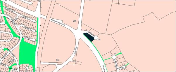
Figure 1 - locality plan
The proposal comprises two stages. The
first stage involves the construction of a new service station including
convenience store building, underground fuel tanks, fuel dispensers with
overhead canopy, three new vehicle crossings from Hanrahan Place, 23 car
parking spaces, two freestanding signs, underground stormwater quality
management system, business identification signs on the canopy and convenience
store, landscaping, waste storage area and loading zone.
The second stage involves the construction of a new food and
drink premises comprising 50 seats and a drive-through facility,
additional parking area for a further eleven car parking spaces, business
identification signs on the building, waste storage area and loading zone.
The service station will operate 24 hours a day, seven days
week and employ two staff for day shift and one staff member for night shift.
The takeaway food and drink premises will operate from 11am to 11pm, seven days
week and employ approximately 5-7 staff at any one time.
Council in determining this matter has satisfied itself that
the proposed development can be defined as a ‘highway service
centre’. Being a “potentially hazardous” development, the application
is defined as advertised development pursuant to the
provisions of State Environmental Planning Policy 33 - Hazardous and Offensive Development and was advertised for
the prescribed period of 14 days. One submission was received, which is
discussed in detail later in this report.
Concerns were raised in regards to the original signage
proposed for the takeaway food and drink premises, which projected up above the
roof line of the building and which would adversely impact on the visual
appearance of the development and the surrounding streetscape. The applicant
has amended the drawings to reduce the height of this signage to be in line
with the roofline.
Concerns have also been raised in regards to the height of
one of the proposed pylon signs. The proposed pylon sign on Hanrahan Place has
a proposed height of 6.0m, but the other proposed pylon sign on the corner of
the Northern Distributor Road (NDR) is proposed at 8.63m in height. Given two
pylon signs are proposed, and the site is visually prominent at the
intersection between Hanrahan Place, the NDR and Leeds Parade, it is
recommended that a condition of consent restricts this sign to a maximum height
of 6.0m. This height is more consistent with the scale of the buildings
proposed on the site, and with adjoining buildings and pylon signs.
Overall, a Section 4.15 assessment of the development
indicates that the proposed development as amended is acceptable, and it is
recommended that Council supports the subject proposal.
LEGISLATIVE CHANGES
On 1 March 2018 the Environmental Planning and Assessment
Act 1979 was substantially amended. The most immediate change involves the
restructuring and renumbering of the Act, with other more substantive
changes to be phased in over time. However, for some applications (particularly
where an application was lodged prior to the changes coming into effect) the
supporting documentation may still reference the previous numbering regime. In
the drafting of this report the content and substance of the supporting
material has been considered irrespective of which legislative references were
used.
DECISION FRAMEWORK
Development in Orange is governed by two key documents
Orange Local Environment Plan 2011 and Orange Development Control Plan 2004. In
addition the Infill Guidelines are used to guide development, particularly in
the heritage conservation areas and around heritage items.
Orange Local Environment Plan 2011 – The
provisions of the LEP must be considered by the Council in determining the
application. LEPs govern the types of development that are permissible or
prohibited in different parts of the City and also provide some assessment
criteria in specific circumstances. Uses are either permissible or not. The
objectives of each zoning and indeed the aims of the LEP itself are also to be
considered and can be used to guide decision making around appropriateness of
development.
Orange Development Control Plan 2004 – the DCP
provides guidelines for development. In general it is a performance based
document rather than prescriptive in nature. For each planning element there
are often guidelines used. These guidelines indicate ways of achieving the
planning outcomes. It is thus recognised that there may also be other solutions
of merit. All design solutions are considered on merit by planning and building
staff. Applications should clearly demonstrate how the planning outcomes are
being met where alternative design solutions are proposed. The DCP enables
developers and architects to use design to achieve the planning outcomes in
alternative ways.
DIRECTOR’S COMMENT
As discussed in the main body of this report, the proposed
development is considered to be consistent with the existing and proposed uses
of land in the vicinity of the site. The subject land is zoned SP3 Tourist
under the LEP, which promotes a variety of tourist-oriented developments and
related uses which essentially cater for the needs of the travelling public.
The proposed highway service centre is considered to be consistent with the
zone objectives and will generally complement the emerging character of the
locality. With appropriate management of the development and recommended
conditions of consent, the development is not likely to present any
unreasonable impacts within the locality. It is recommended that Council
supports the development subject to the adoption of the attached Notice of
Determination.
Link To Delivery/OPerational Plan
The recommendation in this report relates to the
Delivery/Operational Plan strategy “10.1 Preserve -
Engage with the community to ensure plans for growth and development are
respectful of our heritage”.
Financial Implications
Nil
Policy and Governance Implications
Nil
|
Recommendation
That Council resolves to
consent to development application DA 348/2018(1) for Highway Service Centre and Business
Identification Signage at Lot 85 DP 1167633 - 5 Hanrahan Place,
Orange pursuant to the conditions of consent in the
attached Notice of Approval.
|
further considerations
Consideration has been given to the
recommendation’s impact on Council’s service delivery; image and
reputation; political; environmental; health and safety; employees;
stakeholders and project management; and no further implications or risks have
been identified.
SUPPORTING INFORMATION
THE PROPOSAL
Council's consent is sought for the
construction of a ‘highway service centre’ and associated signage
on land at 5 Hanrahan Place, described as Lot 85 DP 1167633. The
proposal comprises two stages as follows:
Stage 1
• construction
of a new service station, including a 200m2 convenience store
building containing customer service counter, retail floor space, office, store
room, cool room, amenities, and service yard;
• installation
of underground fuel tanks (one x 90,000 litre diesel, three x 30,000 litre Ethanol 10
and Premium Unleaded, one x 50,000 litre Unleaded, one x 10,000 litre
Ad Blue) and their related infrastructure;
• installation
of two double sided and three single sided bunded fuel dispensers and overhead
canopy;
• construction
of three new vehicle crossings from Hanrahan Place;
• construction
of 23 car parking spaces, including one accessible space;
• installation
of two freestanding (8.63m and 6m high) illuminated pylon signs in the
north-western corner of the site and Hanrahan Place entry;
• construction
of underground Puraceptor, Ecoceptor and Hydrosystem for stormwater quality
management;
• installation
of illuminated business identification signs on the fuel canopy and convenience
store;
• planting
of landscaping around the perimeter of the highway service centre and adjacent
to the proposed building;
• screened
waste storage area capable of accommodating 2 x 1,200 litre bulk waste bins;
• loading
zone adjacent to waste storage area; and
• minor excavations to accommodate vehicle
accesses/exits.
The Stage 1 service station component is depicted in Figures
2 and 3 below. The service station will operate 24 hours a day, seven days
week, and employ two staff for day shift and one staff member for night shift.
Figure 2 - artist’s impression of service
station
(from submitted drawing number 01 prepared by RCI
Group, dated 15.11.18)
Stage 2
• development
of a takeaway food and drink premises comprising 200m² of gross floor area
(GFA) (50 seats) and a drive-through facility;
• new
hardstand and parking area for an additional eleven car parking spaces,
including one accessible space (note 14 spaces for Stage 2 provided within
Stage 1);
• installation
of business identification signs on the takeaway food and drink building;
• screened
waste storage area capable of accommodating two x 1,200 litre bulk waste bins;
• loading
zone adjacent to waste storage area; and
• minor
excavations to accommodate vehicle accesses/exits.
The Stage 2 takeaway food and drink premises component is
depicted in the site staging plan in Figure 3 below. The takeaway food and
drink premises will operate from 11am to 11pm, seven days week and employ
approximately 5-7 staff at any one time.
Figure 3 - Site Plan Stage 1 and 2
(from submitted drawing number 02, prepared by RCI
Group, dated 15.11.18)
The proposed development will cater for 25m long B-Double
fuel tankers for fuel deliveries, medium rigid vehicles (MRV) for other
deliveries and waste collection, and light vehicles for other deliveries,
staff, and patrons.
BACKGROUND
Council issued development consent DA 233/2017(1) on 2
November 2017 for a highway service centre and signage. The applicant seeks to
include a takeaway food and drink premises on the site in association with the
service station (where both components are considered a ‘highway service
centre’). However, alterations are required to the approved service
station to facilitate the takeaway food and drink premises, along with suitable
access, parking and manoeuvring arrangements. Instead of modifying the approved
consent and applying for further consent for the takeaway food and drink
premises, the applicant has lodged a new application for the whole of the
development, in accordance with recommendations from staff.
Thus, in assessing this application, the principle of the
use of the land for a highway service centre and the service station component
have been previously established. Notwithstanding this, all components are
fully assessed in the following report.
MATTERS FOR CONSIDERATION
Section 1.7 - Application of
Part 7 of the Biodiversity Conservation Act 2016 and Part 7A of the
Fisheries Management Act 1994
Section 1.7 of the EP&A Act 1979 identifies that Part 7
of the Biodiversity Conservation Act 2016 and Part 7A of the Fisheries
Management Act 1994 have effect in connection with terrestrial and aquatic
environments.
In this instance, site inspection reveals that the subject
property has no biodiversity or habitat value. Having regard to the relevant
provisions and based on an inspection of the subject property, it is considered
that the proposed development is not likely to significantly affect a
threatened species. A Biodiversity Development Assessment Report is not
required in this instance.
Section 4.15
Section 4.15 of the Environmental Planning and Assessment
Act 1979 requires Council to consider various matters, of which those
pertaining to the application are listed below.
PROVISIONS OF ANY ENVIRONMENTAL
PLANNING INSTRUMENT s4.15(1)(a)(i)
Orange Local Environmental Plan 2011
Part 1 - Preliminary
Clause 1.2 - Aims of Plan
The
broad aims of the LEP are set out under subclause 2. Those relevant to the
application are as follows:
(a) to encourage development which complements
and enhances the unique character of Orange as a major regional centre boasting
a diverse economy and offering an attractive regional lifestyle,
(b) to provide for a range of development
opportunities that contribute to the social, economic and environmental
resources of Orange in a way that allows present and future generations to meet
their needs by implementing the principles for ecologically sustainable
development.
The application is considered to be generally consistent
with these aims, as set out in the body of this report.
Clause 1.6 - Consent Authority
This clause establishes that, subject to the Act, Council is
the consent authority for applications made under the LEP.
Clause 1.7 - Mapping
The subject site is identified
on the LEP maps in the following manner:
|
Land Zoning Map:
|
Land
zoned Zone SP3 Tourist
|
|
Lot Size Map:
|
Minimum Lot Size 2,000m2
|
|
Heritage Map:
|
Not a heritage item or conservation
area
|
|
Height of Buildings Map:
|
No building height limit
|
|
Floor Space Ratio Map:
|
No floor space limit
|
|
Terrestrial Biodiversity Map:
|
No biodiversity sensitivity on the
site
|
|
Groundwater Vulnerability Map:
|
Ground water vulnerable
|
|
Drinking Water Catchment Map:
|
Not within the drinking water
catchment
|
|
Watercourse Map:
|
Not within or affecting a defined
watercourse
|
|
Urban Release Area Map:
|
Not within an urban release area
|
|
Obstacle Limitation Surface Map:
|
No restriction on building siting
or construction
|
|
Additional Permitted Uses Map:
|
No additional permitted use applies
|
|
Flood Planning Map:
|
Not within a flood planning area
|
Those matters that are of relevance are addressed in detail
in the body of this report.
Clause 1.9A - Suspension of
Covenants, Agreements and Instruments
This clause provides that covenants, agreements and other
instruments which seek to restrict the carrying out of development do not apply
with the following exceptions.
· covenants imposed
or required by Council
· prescribed
instruments under Section 183A of the Crown Lands Act 1989
· any conservation
agreement under the National Parks and Wildlife Act 1974
· any trust agreement
under the Nature Conservation Trust Act 2001
· any property
vegetation plan under the Native Vegetation Act 2003
· any biobanking
agreement under Part 7A of the Threatened Species Conservation Act 1995
· any planning
agreement under Division 6 of Part 4 of the Environmental Planning and
Assessment Act 1979.
The property is affected by easements along the
south-eastern boundary, including an easement to drain water 4m wide, an
easement of underground powerlines 2m wide, and an easement for multi-purpose
electrical installation 4.2m wide. The application was referred to Essential
Energy for comments, and this is addressed in detail in the ‘State
Environmental Planning Policy’ section of this report. Council staff are
not aware of the title of the subject property being affected by any of the
other above instruments.
Part 2 - Permitted or Prohibited Development
Clause
2.1 - Land Use Zones
The subject site is located within the SP3 Tourist zone. The
applicant has defined the proposal as a ‘highway service centre’
and ‘business identification sign’ under Orange LEP 2011 as
follows:
highway service centre
means a building or place used to provide refreshments and vehicle services to
highway users. It may include any one or more of the following:
(a) a
restaurant or cafe,
(b) take
away food and drink premises,
(c) service
stations and facilities for emergency vehicle towing and repairs,
(d) parking
for vehicles,
(e) rest
areas and public amenities.
business
identification sign means a sign:
(a) that indicates:
(i) the name of the person or business,
and
(ii) the nature of the business carried on by
the person at the premises or place at which the sign is displayed, and
(b) that may include the address of the
premises or place and a logo or other symbol that identifies the business,
but that does
not contain any advertising relating to a person who does not carry on business
at the premises or place.
Highway service centres and business identification signage
are permitted in this zone with consent. Council in determining this matter is
required to be satisfied that the proposed development can be defined as a
‘highway service centre’. As with the previous approval for a
highway service centre on this land, the proposed convenience store is seen to
provide “refreshments” and “public amenities” in a
service station, and parking for vehicles as set out in the definition. This
proposal also includes a takeaway food and drink premises, also in accordance
with the definition.
This leaves the question of “highway users”.
There is no definition of “highway” within the LEP, and a
review of relevant case law provides little guidance in determining what weight
should be given to the term. The Roads Act 1993 defines
“highway” as “a road that is declared to be
a highway by an order in force under Section 47.” The Northern Distributor Road (NDR) is not a “highway” in
this sense, but does connect directly to the Mitchell Highway at either end of
its route. However, the test is not the classification of the road providing
immediate access to the site. Many highway service centres are positioned
off-highway and accessed via a service road or connecting local roads. To be
considered “serving highway users” (note: the definition does not
exclude serving other users) Council needs to be confident that a significant
proportion of customers are only pausing momentarily while otherwise travelling
long distance on the State highway network.
In this regard, much of the Mitchell Highway
traffic in either direction uses the NDR as a bypass of the City centre, before
reconnecting with the highway on the edge of the City. Such people most likely
consider themselves to be engaged in a single trip primarily over the State
highway network, and happen to pause briefly for refreshments and services via
the NDR, before resuming the journey back onto the State highway. These
people can be considered “highway users”, and are likely to provide
a significant proportion of customers to the development. It is therefore
considered that the proposed development meets the ‘highway service
centre’ definition in the LEP, and can be assessed as such.
Clause 2.3 - Zone Objectives and Land Use Table
Clause
2.3 of LEP 2011 references the Land Use
Table and Objectives for each zone in LEP 2011. The LEP objectives for the
SP3 Tourist zone are as follows:
· To
provide for a variety of tourist-oriented development and related uses.
· To
cater for the needs of the travelling public.
The
term “travelling public” is also undefined, but in this context can
be taken to refer to non-local traffic. In this regard “highway
users” and “tourists” share many characteristics.
A highway service centre positioned adjacent to the NDR can reasonably be
characterised as serving the needs of the travelling public, that is, highway
users.
Furthermore,
given the limited application of the SP3 Tourist zone within Orange, and that
this is the only zone where highway service centres are explicitly permitted
with consent, it is evident that the zone clearly intended for this form of
development to be provided to travellers along the NDR.
Overall,
the proposed development is considered to be consistent with the objectives for
the zone.
Part 3 - Exempt and Complying Development
The application is not exempt or complying development.
Part 4 - Principal Development Standards
Not applicable to this
application.
Part 5 - Miscellaneous Provisions
Not applicable to this
application.
Part 6 - Urban Release Area
Not relevant to the application. The subject site is not
located in an Urban Release Area.
Part 7 - Additional Local Provisions
7.1
- Earthworks
This
clause establishes a range of matters that must be considered prior to granting
development consent for any application involving earthworks, such as:
(a) the likely disruption of, or any
detrimental effect on, existing drainage patterns and soil stability in the
locality of the development
(b) the effect of the development on the
likely future use or redevelopment of the land
(c) the quality of the fill or the soil to be
excavated, or both
(d) the effect of the development on the
existing and likely amenity of adjoining properties
(e) the source of any fill material and the
destination of any excavated material
(f) the likelihood of disturbing relics
(g) the proximity to and potential for adverse
impacts on any waterway, drinking water catchment or environmentally sensitive
area
(h) any measures proposed to minimise or
mitigate the impacts referred to in paragraph (g).
The earthworks proposed in the application
are limited to the extent of cutting and filling required for the underground
fuel storage tanks and stormwater quality management system, the new buildings,
car parking and manoeuvring areas, and landscaping. The extent of disruption to
the drainage of the site is considered to be minor and will not detrimentally
affect adjoining properties or receiving waterways. Conditions of consent are
recommended to require a sediment control plan, including silt traps and other
protective measures, to ensure that loose dirt and sediment does not escape the
site boundaries during works.
The
earthworks can be appropriately supported onsite and the change in ground level
is not substantial. Therefore the effect on the amenity of adjoining properties
is considered to be minor. The extent of the earthworks will not materially
affect the potential future use or redevelopment of the site that may occur at
the end of the proposed development's lifespan. The site is not known to
contain any Aboriginal, European or archaeological relics. The site is
not known to be contaminated. Previous known uses of
the site do not suggest that any relics or contamination are likely to be
uncovered.
7.3 - Stormwater Management
This clause applies to all
industrial, commercial and residential zones and requires that Council be
satisfied that the proposal:
(a) is designed to maximise the use of water
permeable surfaces on the land having regard to the soil characteristics
affecting onsite infiltration of water
(b) includes, where practical, onsite
stormwater retention for use as an alternative supply to mains water,
groundwater or river water; and
(c) avoids any significant impacts of
stormwater runoff on adjoining downstream properties, native bushland and
receiving waters, or if that impact cannot be reasonably avoided, minimises and
mitigates the impact.
The
proposal has been designed to include permeable surfaces through landscaping,
and includes stormwater treatment through the use of an underground Puraceptor, Ecoceptor and Hydrosystem for stormwater
quality management. Council’s Development Engineers are satisfied with
the proposed management of stormwater, subject to recommended conditions of
consent in regards to stormwater design and treatment.
7.6 - Groundwater Vulnerability
This
clause seeks to protect hydrological functions of groundwater systems and
protect resources from both depletion and contamination. Orange has a high
water table and large areas of the LGA, including the subject site, are
identified with “Groundwater Vulnerability” on the Groundwater
Vulnerability Map. This requires that Council consider:
(a) whether or not the development (including
any onsite storage or disposal of solid or liquid waste and chemicals) is
likely to cause any groundwater contamination or have any adverse effect on
groundwater dependent ecosystems, and
(b) the cumulative impact (including the
impact on nearby groundwater extraction for potable water supply or stock water
supply) of the development and any other existing development on groundwater.
Furthermore consent may not be granted unless Council is satisfied that:
(a) the development is designed, sited and
will be managed to avoid any significant adverse environmental impact, or
(b) if that impact cannot be reasonably
avoided - the development is designed, sited and will be managed to minimise
that impact,
(c) if that impact cannot be minimised - the
development will be managed to mitigate that impact.
The
proposal does not involve extraction of groundwater and will therefore not
contribute to groundwater depletion. The proposal has the potential to involve
the discharge of toxic or noxious substances through accidental spillages,
particularly through leaking of underground tanks and pipes, and therefore may
contaminate the groundwater or related ecosystems. The design and siting of the
proposal avoids impacts on groundwater through the use of onsite stormwater management and treatment, and
hazard prevention equipment and procedures, as
set out in the submitted ‘Water Cycle Management Plan’, prepared by
Eclipse Consulting Engineers and dated 31 July 2018; and ‘Multi-Level
Risk Assessment’ and ‘Preliminary Hazard Analysis and
Summary’ (PHA), prepared by Myros Design and dated 17 September 2018.
Overall, the proposal is considered acceptable in terms of groundwater
vulnerability.
Clause 7.11 - Essential
Services
Clause 7.11 applies and states:
Development
consent must not be granted to development unless the consent authority is
satisfied that any of the following services that are essential for the
proposed development are available or that adequate arrangements have been made
to make them available when required:
(a) the supply of water,
(b) the supply of electricity,
(c) the disposal and management of sewage,
(d) storm water drainage or on-site
conservation,
(e) suitable road access.
In consideration of this clause, all utility services are
available or can be made available to the land, and are adequate for the
proposal.
STATE ENVIRONMENTAL PLANNING
POLICIES
State Environmental Planning Policy (Infrastructure) 2007
State Environmental Planning
Policy (Infrastructure) 2007 (the “Infrastructure SEPP”)
applies as set out below.
Clause
45 – Development likely to affect an electricity transmission or
distribution network
This clause applies to development carried out within 2m of
an underground electricity power line or distribution pole, or within or
immediately adjacent to an easement for electricity purposes, immediately
adjacent to an electricity substation, or within 5m of an exposed overhead
electricity power line. Before determining an application, the consent
authority must give notice to the electricity supply authority and take into
consideration their comments about potential safety risks.
Council has notified Essential Energy, who responded that
they have no comments to make as to potential safety risks arising from the
proposed development. However, they make general comments in regards to
satisfying encumbrances and following relevant guidelines, safe work practices etc.
Where relevant, these notes have been included in the draft Notice of Approval.
Clause
104 - Traffic-generating development
This clause identifies certain development being of a relevant size or
capacity as development requiring the concurrence of Roads and Maritime Service
(RMS) as traffic generating development. As set out in Schedule 3 of the
Infrastructure SEPP the following uses need to be referred to RMS:
|
Column
1
|
Column
2
|
Column
3
|
|
Purpose
of development
|
Size
or capacity - site with access to a road (generally)
|
Size
or capacity - site with access to classified road or to road that connects to
classified road
|
|
Service
stations without heavy vehicle refuelling or maintenance services
|
|
Any
size or capacity
|
|
Take
away food and drink premises with drive-through facilities
|
200 or
more motor vehicles per hour
|
Any
size or capacity
|
The proposal
involves a service station without heavy vehicle refuelling or maintenance
services, and a takeaway food and drink premises with drive-through facilities
on a road that is not classified, or connected to a classified road. As such,
Column 2 applies. As set out in the submitted ‘Traffic Assessment
Report’, prepared by BJ Bradley & Associates and dated
7 September 2018, it is estimated that the proposed service station will
generate up to 136 peak afternoon trips, and the takeaway food and drink
premises will generate up to 100 vehicles per hour (evening peak). As
such, the proposal does not exceed the thresholds for referral to RMS.
State
Environmental Planning Policy 33 - Hazardous and Offensive Development
State Environmental Planning Policy 33 - Hazardous and
Offensive Development (SEPP 33) is applicable to the assessment of
this application. The principle purpose of the SEPP is to determine
whether or not a development is potentially hazardous or potentially offensive;
and in the event of such, to assess what measures will be implemented to reduce
the likely risks and minimise any adverse impacts.
The SEPP relies on a series of guidelines and other papers
to determine whether a development is potentially hazardous or potentially
offensive. The guidelines adopt a threshold test based on the particular
characteristics of a particular development and its setting and context (ie
types of goods being stored, dispensed and transported, quantities, distances
of fill points and dispensers from boundaries etc.).
The applicant has submitted a ‘Multi-Level Risk
Assessment’ and ‘Preliminary Hazard Analysis and Summary’
(PHA), prepared by Myros Design and dated 17 September 2018 in support of the
application. In this case, the relevant screening criteria are the quantities
of hazardous materials proposed (onsite and to be transported) and the buffer
distances to nearby boundaries. The assessment found that for a screening
quantity of 46kL, the minimum separation distance from the remote filling
and dispenser points to the site boundary is 8.1m. As there are site
boundaries within this separation distance (northern boundary at 6.71m), the
proposal does not pass initial screening.
As such, further analysis was undertaken, which concluded
that the societal risk of the proposal is negligible, providing that measures
are undertaken by the occupier to ensure that the level of risk is kept to a
minimum, as set out in the appendices of the Myros report.
From the foregoing assessment it can be concluded that the
development is acceptable in terms of the requirements of SEPP 33. Relevant
conditions of consent for the development to be carried out in accordance with
the Myros report are attached.
State Environmental Planning
Policy 55 - Remediation of Land
State Environmental Planning Policy 55 - Remediation of
Land (SEPP 55) is applicable. Pursuant to Clause 7(1):
A consent authority must not consent to the carrying
out of any development on land unless:
(a) it has considered whether
the land is contaminated, and
(b) if the land is
contaminated, it is satisfied that the land is suitable in its contaminated
state (or will be suitable, after remediation) for the purpose for which the
development is proposed to be carried out, and
(c) if the land requires
remediation to be made suitable for the purpose for which the development is
proposed to be carried out, it is satisfied that the land will be remediated
before the land is used for that purpose.
The subject site is currently undeveloped but forms part of
a recently completed subdivision into several allotments. The approved
subdivision includes the creation of the allotment of land at 4 Hanrahan Place
which is now developed as a transport logistics facility (Ron Finemore
Transport Logistics). Council, in determining the development application in
relation to the subdivision of the land which created the subject title, was
satisfied that the land was free of contamination.
Furthermore, a preliminary site assessment was carried out
in relation to the previous consent (DA 233/2017(1)) which did not identify any
past and present potentially contaminating activities requiring further sampling
and analysis.
As such, it is considered that the land is suitable in its
current state for the purposes of the highway service centre, and no further
investigation or remediation is required for this use.
State Environmental Planning
Policy 64 - Advertising and Signage
State Environmental Planning Policy 64 - Advertising and
Signage (SEPP 64) is applicable. The application involves business
identification signage as follows:
· 8.63m high by 2.1m wide
pylon sign in the south-western corner of the site (ie near the roundabout
and NDR), displaying business identification signage, fuel products and fuel
prices;
· 6m high by 2.1m wide
pylon sign at the Hanrahan Place entry to identify the service station,
displaying business identification signage, fuel products and fuel prices;
· two (2) illuminated
business identification signs on the western elevation of the convenience store
building (Stage 1);
· three (3) illuminated
business identification signs on the northern, eastern, and western elevations
of the refuelling canopy (Stage 1);
· two (2) illuminated
business identification signs on each of the eastern and western elevations of
the takeaway food and drink premises (Stage 2); and
· one (1) illuminated
business identification sign on the canopy over the drive-through collection
area.
SEPP 64 states in part:
3 - Aims, Objectives etc.
(1) This
Policy aims:
(a) to
ensure that signage (including advertising):
(i) is
compatible with the desired amenity and visual character of an area, and
(ii) provides
effective communication in suitable locations, and
(iii) is
of high quality design and finish, and
(b) to
regulate signage (but not content) under Part 4 of the Act, and
(c) to
provide time-limited consents for the display of certain advertisements, and
(d) to
regulate the display of advertisements in transport corridors, and
(e) to ensure that public benefits may be
derived from advertising in and adjacent to transport corridors.
The development is not inconsistent with the aims,
objectives etc of the plan. Where an inconsistency exists, a relevant condition
is attached to ensure consistency with the plan, as discussed in the Schedule 1
assessment below.
4
- Definitions
The proposed signage can be defined as ‘business
identification signs’ pursuant to Clause 4 of SEPP 64. It is
noted that the proposed pylon signs will display fuel prices, which although
not technically considered ‘business identification signage’, is
required by NSW Fair Trading pursuant to the following:
All NSW petrol
station operators are required to display the price of regular unleaded petrol.
The sign must:
· be positioned and lit
so that any price it displays can be readily seen by motorists approaching the
petrol station when the station is open; and
· display a price that
must be a price per litre of petrol.
The size of the
sign should be determined by what is reasonable in the circumstances, given the
criteria outlined above.
Petrol station
operators will not have to display signs if the erection of a price sign is
inconsistent with local council planning restrictions (NSW Fair Trading).
This matter is addressed in detail in the Schedule 1
assessment below.
8 - Granting of
Consent to Signage
A consent authority must not grant development consent to
an application to display signage unless the consent authority is satisfied:
(a) that
the signage is consistent with the objectives of this Policy as set out in
clause 3 (1) (a), and
(b) that
the signage the subject of the application satisfies the assessment criteria
specified in Schedule 1.
The signage is consistent with the aims, objectives etc of
the plan and a Schedule 1 assessment is undertaken below.
Schedule 1 Assessment
1 -
Character of the Area
· Is
the proposal compatible with the existing or desired future character of the
area or locality in which it is proposed to be located?
· Is
the proposal consistent with a particular theme for outdoor advertising in the
area or locality?
The subject land forms part of an emerging precinct with a
mix of industrial uses and building forms. Surrounding signage comprises mainly
flush wall signs and freestanding signs, some of which are illuminated. The
elevation and canopy signs are considered to be generally consistent with
surrounding signage and the character of the area, and are acceptable.
Following an initial appraisal of the proposed signage for the takeaway food
and drink premises, concerns were raised in regards to the signage projecting
above the roof of the building, which was inconsistent with the theme of
signage in the area (this issue was also raised in pre-lodgement discussions).
Council staff recommended that this signage be revised to be in line with the
roof of the building, and the applicant has submitted amended and acceptable
plans to this effect.
The applicant proposes two free-standing signs for the
service station, which is usually considered more than necessary for one
tenancy. However, given the orientation of the site to the NDR and Hanrahan
Place, it is considered reasonable in this instance to firstly identify the
business to passing vehicles on the NDR, and then to identify the entry point
to the service station on entering Hanrahan Place. Consideration was given to
whether both signs needed to display the full information of business name and
fuel products and prices, however it is considered reasonable taking into
account the requirements by NSW Fair Trading, and given that there is
another service station located in Hanrahan Place. Furthermore, both pylon
signs will not be readily visible at the same time from most view-points.
Notwithstanding these points, one of the pylon signs is
proposed to be 8.63m in height, which is considered excessive in this location,
particularly when accounting for the higher ground level at that part of the
site, the height of other pylon signs in the locality (4.5m approved pylon
sign for number 2 Hanrahan Place, 6m high pylon Caltex/Woolworths sign at
number 1 Hanrahan Place, and no pylon signs at Ron Finemore Transport at
numbers 3-4 Hanrahan Place), and the proximity of residentially zoned land
to the south of the site. While it is acknowledged that the Bunnings sign is
higher than the proposed sign and other signs in the locality, the site
circumstances differ from the subject land and subject proposal. The Bunnings
site and building are significantly larger, where it can be argued that their
sign is of a comparable height and scale to their building, and is set within a
large landscaped area. Subsequently, it is considered that the larger of the
proposed pylon signs should be limited to a height of 6m, being the same as the
second proposed pylon sign, to achieve consistency with the theme of signage in
the surrounding area and to maintain the residential amenity for future
residential properties to the south/southwest of the site.
Subject to a condition of consent restricting the height of
pylon signs to 6m, it is considered that the proposed signage will be
compatible with the surrounding area and existing theme of signage.
2 - Special Areas
· Does the
proposal detract from the amenity or visual quality of any environmentally
sensitive areas, heritage areas, natural or other conservation areas, open
space areas, waterways, rural landscapes or residential areas?
Whilst the development is located in an emerging residential
and industrial area, the location is not considered to be a sensitive area
given the separation of the future residential area by the NDR. Subject to the
recommended condition of consent limiting the pylon signs to 6m in height, the
proposal will not detract from the amenity or visual quality of the future
residential area, and is considered to be consistent with adjacent development
in the precinct.
3 - Views and Vistas
· Does the
proposal obscure or compromise important views?
· Does the
proposal dominate the skyline and reduce the quality of vistas?
· Does the
proposal respect the viewing rights of other advertisers?
The proposed building and canopy signage will be set flush
against walls and fascia, and set back from the road, and as such will not
obscure views, dominate the skyline, or impact the viewing rights of other
signs in the area. The recommended height restriction of pylon signs to 6m will
ensure that they are sited in a manner that will not impact upon views,
dominate the skyline, reduce the quality of view corridors, or affect the
viewing rights of other advertisers.
4 - Streetscape, Setting or
Landscape
· Is the scale,
proportion and form of the proposal appropriate for the streetscape, setting or
landscape?
· Does the
proposal contribute to the visual interest of the streetscape, setting or
landscape?
· Does the
proposal reduce clutter by rationalising and simplifying existing advertising?
· Does the
proposal screen unsightliness?
· Does the
proposal protrude above buildings, structures or tree canopies in the area or
locality?
· Does the
proposal require ongoing vegetation management?
Subject to the recommended condition of consent limiting the
pylon signs to 6m in height, the scale,
proportion and form of the proposed signage will be appropriate within the
context of the setting. Whilst the signage may not contribute to the visual
interest of the nearby future residential area, it can be designed in such a
way to be compatible with the locality by way of scale and siting; and it is
important in identifying the business on the site. The display of fuel prices
on the proposed pylon sign is considered to be compatible with other signage in
this locality, given the proximity to the NDR and the requirements set out by
NSW Fair Trading.
As discussed earlier, most signage will be flush against
walls and fascia, and the takeaway food and drink premises signage has been
reduced to sit in line with the roof line of the building in accordance with
Council staff recommendations and this clause. Landscaping on the site has been
designed as part of the overall proposal, and low maintenance species will be
used.
5 - Site and Building
· Is the proposal
compatible with the scale, proportion and other characteristics of the site or
building, or both, on which the proposed signage is to be located?
· Does the
proposal respect important features of the site or building, or both?
· Does the
proposal show innovation and imagination in its relationship to the site or
building, or both?
The proposed signage has been designed as an integral part
of the proposed development, and will be compatible with the scale, proportion
and other characteristics of the site and proposed buildings on the land.
Subject to the recommended condition of consent limiting pylon signage to 6m,
the proposed signage will be of a height commensurate with the heights of the
proposed buildings on the land and adjacent properties as discussed previously.
6 - Associated Devices and
Logos With Advertisements and Advertising Structures
· Have any safety
devices, platforms, lighting devices or logos been designed as an integral part
of the signage or structure on which it is to be displayed?
The proposed signage does not include any safety devices,
platforms or lighting devices.
7 - Illumination
· Would
illumination result in unacceptable glare?
· Would
illumination affect safety for pedestrians, vehicles or aircraft?
· Would
illumination detract from the amenity of any residence or other form of
accommodation?
· Can the
intensity of the illumination be adjusted, if necessary?
· Is the
illumination subject to a curfew?
Most of the proposed signage will be illuminated. Specific
lighting details have not been submitted with the application, although the
applicant notes that the lighting will be “low impact”. Given the
proximity of the development to future residential development, a condition of
consent is recommended which requires all lighting and illuminated signage to
be designed in accordance with AS 4282 1997 - "Control of the Obtrusive
Effects of Outdoor Lighting". It is noted that the building and the
forecourt areas of the site will also be illuminated, as will the other highway
service centre opposite at number 1 Hanrahan Place, creating background light
levels on the site in the surrounds. Overall, impacts from the illuminated
signage are likely to be negligible.
8 - Safety
· Would the
proposal reduce the safety for any public road?
· Would the
proposal reduce the safety for pedestrians or bicyclists?
· Would the
proposal reduce the safety for pedestrians, particularly children, by obscuring
sightlines from public areas?
The proposed signage is wholly located within the envelope
of the building and boundaries of the subject property, and has been suitably
sited so as to not cause safety concerns to vehicles, pedestrians or
bicyclists; nor reduce safety through obscuring sightlines.
PROVISIONS OF ANY DRAFT
ENVIRONMENTAL PLANNING INSTRUMENT THAT HAS BEEN PLACED ON EXHIBITION
4.15(1)(a)(ii)
There are no draft environmental planning instruments that
apply to the subject land or proposed development.
DESIGNATED DEVELOPMENT
The proposed development is not designated development.
INTEGRATED DEVELOPMENT
It is noted that there is a prescribed
stream located nearby to the site. The provisions of the Environmental
Planning and Assessment Act 1979 and the Water Management
Act 2000 classify development within 40m of a prescribed stream to be
“Nominated Integrated” development. The proposed development is
located at least 75m to the south of a prescribed stream, and therefore the
application is not integrated development, and does not require the concurrence
of, or referral to, the NSW Office of Water.
The proposed development is not integrated development.
PROVISIONS OF ANY DEVELOPMENT
CONTROL PLAN s4.15(1)(a)(iii)
Development Control Plan 2004
Development Control Plan 2004 (“the DCP”)
applies to the subject land. An assessment of the proposed development against
the relevant Planning Outcomes will be undertaken below.
Chapter 0 - Local Environmental
Plan
The Part 0.4-11 Planning Outcomes for Transport Routes are
applicable as follows:
· The development
provides a high standard of visual appeal to motorists, cyclists and
pedestrians as well as adjoining property owners.
· The visual
appearance of the development, including any signage, lighting or other
ancillary element, must not generate a distraction to motorists.
· Any signage
must not be animated whether by movement or flashing lights.
The site is a prominent site adjacent to the NDR, and as
such the architectural design of the development is of high importance. It is
considered that the proposed development will provide a reasonable standard of
visual appeal for motorists, cyclists and pedestrians, as well as adjoining
properties. The proposed buildings are modern and simple in form, and are
consistent with the design of other service stations and takeaway food and
drink premises, both in the immediate area and the wider region. The proposed
style, materials and detailing of the buildings, fuel canopy and amended
building signage are considered appropriate for the site and surrounding area.
The setbacks and building height of the development have been designed so as to
maintain a pedestrian-friendly scale.
As noted previously in this report, the height of the pylon
signs need to be restricted to 6m by condition of consent to ensure that they
are not overly dominant in the streetscape. Relevant conditions are also
recommended to ensure that lighting associated with the development is
appropriately sited or shielded so as to not cause unreasonable glare or
distraction to motorists.
· Where land has
more than one street frontage the street with the lower volume of traffic is to
provide the principal access to the development, subject to safety
considerations.
· Where access is
provided onto an arterial road, distributor road or major collector road, the
access point must have appropriate safe sight distances for the prevailing
speed limit and clear and unimpeded entrance/exit signage must be displayed.
· Where onsite
customer parking is provided that is not immediately visible from a public road
clear and unimpeded directional signage must be displayed.
The subject land only has frontage to Hanrahan Place, where
there is a buffer of land between the site and the NDR. As such, there is no
direct frontage or access to or from the Distributer Road. Customer parking
will be easily identifiable from both the NDR and Hanrahan Place, and
directional signage will be installed on the site. Council’s Development
Engineers have recommended conditions of consent in relation to the standard of
access/egress required for the development. A detailed assessment of traffic
impacts has been provided later in this report under the heading “Likely
Impacts.
· Where the
proposal is residential, or another noise sensitive form, appropriate noise
mitigation measures to limit the development from traffic noise must be
demonstrated.
Not applicable, as the proposed development
is not residential or another noise sensitive use. Potential noise impacts to
nearby residential zones is addressed later in this report under the
heading “Likely Impacts.
Chapter 2 – Natural
Resource Management
Chapter 2 of the DCP provides planning outcomes for
stormwater quality, groundwater quality, soil resource management, vegetation
management, and flora and fauna management; all of which have been previously
considered in the LEP and biodiversity assessments.
Chapter 3 - General
Considerations
Chapter 3 of the DCP provides planning outcomes of a general
nature. Those of relevance to this assessment relate to cumulative impacts,
scenic landscape, urban areas and energy efficiency. These are all addressed
elsewhere within this report. Cumulative impacts are addressed later in this
report under the heading “Likely Impacts”. Energy efficiency is
addressed through a condition that requires a report addressing Section J of
the Building Code of Australia to be submitted.
Chapter 10 - Special Uses and
Roads Zones
The Part 10.3-1 Panning Outcomes for Development Near Major
Roads are applicable as follows:
· Development on
land fronting and visible from a major road or distributor road provides for
quality design on the highway and/or distributor road through landscaping,
building setbacks façade design, external colours and materials and
siting.
Whilst the proposed development does not directly front a
major road, the location of the subject site is prominent when viewed from the
NDR and its roundabout intersection with Leeds Parade. As discussed previously
in this report, the proposed development has been designed to present modern
commercial buildings of reasonable architectural standard, and proposed signage
on the takeaway food and drink premises has been amended to be in line with the
roof line of the building in accordance with SEPP 64, which results in a better
design for this prominent location.
A detailed landscape plan prepared by Site
Image Landscape Architects has been submitted in support of the proposal. It
incorporates turf, groundcover and grasses, shrubs and trees around the service
station elevations fronting the NDR, around the car parking areas near to the
NDR, around the drive-through, and along the Hanrahan Place frontage. While it
would be ideal to have more trees on the site, the desire to soften the
buildings and hardstanding areas into the surrounds needs to be balanced with
the necessity to provide some visual appearance of the business/services to
passing travellers, as well as passive onsite surveillance for increased
safety.
Overall it is considered that the
amended design and proposed landscaping provides a reasonable architectural
standard, in keeping with the existing and future “desired
character” of the surrounding area and zone.
· Lighting and
signage visible from a distributor road is not animated and is designed so as
not to distract motorists beyond glance recognition.
A condition of consent is recommended to ensure that the
lighting of the premises and signage will be carried out in accordance with AS
4282‑1997 - Control of the Obtrusive Effects of Outdoor Lighting. A
detailed discussion of signage has been carried out previously in the
SEPP 64 assessment. Overall, the design of the highway service centre and
its signage will not unreasonably distract motorists travelling along the NDR.
Chapter 14 – Advertising
An assessment of the relevant Chapter 14 planning outcomes
is provided below:
· The location,
size, colour and design of advertisement complement the character of the
locality.
· Advertisements
on buildings fit within the envelope of the building.
· Freestanding
pole or pylon signs relate to the height of associated buildings in business
and industrial areas.
· High-Profile
Areas - Business identification signs complement the character of the locality.
As set out in the SEPP 64 assessment earlier in this report,
a condition of consent is recommended restricting the height of the proposed
pylon signs to 6m to ensure that they are consistent with the scale of the
development and other signage within the vicinity, and to maintain residential
amenity to the residentially zoned land to the south/southwest of the site. In
addition the requirement to reduce the height of the pylon sign will ensure a
consistent approach to advertising along the NDR. Subject to this
change/condition, the proposed signs meet the requirements of SEPP 64 and
the advertising planning outcomes of the DCP.
Chapter 15 - Car Parking
Part 15.6-1 Planning Outcomes for Off-Street Car Parking
apply as follows:
· Adequate
off-street car parking is provided in accordance with the Table or,
alternatively, according to an assessment that demonstrates peak-parking demand
based on recognised research.
· Car-parking
areas are designed according to Australian Standard.
· Car-park areas
include adequate lighting and landscaping (preferably deciduous shade trees),
which provide for the personal security of users.
· Bicycle parking
facilities are provided according to the relevant Australian Standard.
· Facilities for
loading and unloading of commercial vehicles are .provided according to the
relevant Australian Standard.
The DCP sets out the minimum car parking requirements for a
service station, which are 3 spaces for each workbay and 1 space per 25m2
of gross floor area (GFA) of shop, convenience store or payment area. Fast food
outlets with drive-through facilities require the greater of 1 space per 2
seats (internal seating) or 1 space per 3 seats (both internal and external
seating), plus an extension area for queuing of cars for a drive-through
facility (queue length of 5 to 12 cars measured from pick-up point). There
should be a minimum of 4 car spaces for cars queued from the ordering
point.
The applicant has submitted a ‘Traffic Assessment
Report’, prepared by BJ Bradley & Associates and dated 7 September
2018 which has assessed the car parking requirement against the DCP as follows:
Council concurs with the assessment of the Stage 1 service
station component of the proposal, where 200m2 of GFA generates a
demand of 8 car parking spaces in accordance with the DCP.
However, the Stage 2 takeaway food and drink premises is
considered to generate a demand of 25 spaces based on 50 seats (rate of 1 space
per 2 seats). The submitted application and plans do not differentiate between
internal and external seating, but given the floor and site layouts proposed,
most, it not all, of the seating is likely to be internal.
If using the parking rate for internal and external seating
of 1 space per 3 seats, the proposal would generate a demand of 16.6 spaces as
set out in the applicant’s traffic assessment above. The greater demand
is calculated at 25 spaces, and it is considered this should be applied to the
proposed development. This gives a total demand as follows:
Service station, no
workbays, GFA 200m2 = 8 spaces
Takeaway food and
drink premises, with drive-through, 50 seats = 25 spaces
TOTAL = 33
spaces
The proposal involves the construction of 23 car parking
spaces within Stage 1 (9 spaces for the service station, and 14
spaces for the future takeaway food and drink premises), and a further
11 car parking spaces within Stage 2, giving a total of 34 spaces on the
site (including 2 accessible spaces, one adjacent to the service station
and the other adjacent to the takeaway food and drink premises (fast food outlet).
One of these spaces is for air pump and water facilities and has not been
included in the overall number of car parking spaces. The proposed development
will provide an excess of the required number of spaces for the site; that is,
33 spaces are required and 34 spaces are proposed.
The majority of the parking demand comes from the takeaway
food and drink premises, however much of its parking is provided on the
opposite side of the site; that is, adjacent/near to the service station. It is
considered that this layout is necessary given the shape and slope constraints
of the site; however, during earlier stages of the design and pre-lodgement
discussions pedestrian safety was raised as an issue. To address this matter
the applicant proposes an internal pedestrian path network within the
landscaped setbacks of the site to ensure that fast food outlet customers can
access additional parking without having to walk across the refuelling and
traffic flow areas. Council’s Development Engineers have reviewed that
proposal and consider this arrangement to be adequate. It is noted that
Council’s Technical Services Division also requires the developer to
install pedestrian footpaths within the Council road reserve area of Hanrahan
Place to the NDR, from at least the fast food outlet, but preferably from the
service station. The applicant has shown a footpath from the service station on
submitted drawings (see Figure 3 and Drawing numbers 02 and 08).
The queuing length for the proposed drive-through from
pick-up point will be approximately 72m long, sufficient for at least 12
cars in compliance with the DCP. The queue distance to the ordering point
will be approximately 30m, sufficient for queueing of 5 cars, in excess of
the DCP requirements. Two (2) waiting bays will also be provided just past the
collection point, and these bays are not included in the above parking numbers.
The Traffic Assessment Report confirms that the car parking
areas have been designed in accordance with the relevant car parking standards,
including bay widths, aisle widths and accessible spaces.
As noted previously, a condition of consent is recommended
ensuring that all lighting is designed and installed in accordance with AS 4282
1997 “Control of the Obtrusive Effects of Outdoor Lighting.” The
lighting of the premises is unlikely to create an adverse impact for users of
the NDR. Landscaping is considered to be adequate as discussed previously. It
is not considered that bicycle parking is necessary for the proposed
development.
The proposed development will provide vehicular access to
Hanrahan Place via two separated entry and exit driveways with a third
exit-only driveway between the other driveways. They have been designed to
cater up to 25m long B-Doubles for fuel deliveries, as well as light vehicles, which
will make up the majority of traffic movements. A loading/servicing bay will be
provided adjacent to the convenience store, designed to be accessed by medium
rigid vehicles (MRV) to provide for delivery of consumables, and which will
also provide access to a bin area for waste collection. There will be a
separate loading/service area adjacent to the drive-through that will enable
MRV’s to access and service the takeaway food and drink premises.
Concerns were raised with the applicant in regards to the separation between
the bin store and loading bay from the building. The applicant responded that
there are no alternative locations on the site where this can be provided in a
way that it, and the rest of the site, can be fully functional and achieve the required
number of parking spaces, manoeuvring, landscaping etc. Given that servicing is
likely to occur during off-peak times of the takeaway food and drink premises,
and also taking into account the site constraints, this arrangement is
considered acceptable.
The available road width on Hanrahan Place will enable
access by articulated tankers as shown on the architectural drawings to access
the fill points for the proposed service station and for access to the truck
pumps. MRV's will also be able to access the site via the proposed driveways on
Hanrahan Place. Driveway and access points, widths, grades, pedestrian
sightlines etc have been assessed by the applicant’s traffic engineer and
Council’s Development Engineers, and are considered acceptable. Conditions
of consent are recommended in relation to the standard of design and
construction.
Overall it is considered that the proposed development meets
the planning outcomes for car parking and loading. Wider traffic impacts are
considered in greater detail below under the heading “Likely
Impacts”.
SECTION 64 WATER AND SEWER
HEADWORKS CHARGES
The service station and takeaway food and drink premises are
both development types that require the levying of water and sewer headworks
charges pursuant to Section 64 of the Local Government Act. Relevant
conditions of consent are attached in relation to these payments.
PROVISIONS PRESCRIBED BY THE
REGULATIONS s4.15(1)(a)(iv)
Demolition of a Building (clause 92)
The proposal does not involve the demolition of a building.
Fire Safety Considerations
(clause 93)
Council’s Environmental Health and Building officer
has reviewed the proposal, and states that it can comply with the Building Code
of Australia’s fire safety requirements, and that the setbacks from
boundaries are satisfactory. More detail will be required at the Construction
Certificate stage, and relevant conditions of consent are attached.
Buildings to be Upgraded
(clause 94)
Not applicable as the proposal involves new buildings.
BASIX Commitments (clause 97A)
BASIX is not applicable to the proposed development. A
Section J energy efficiency statement will be required with the Construction
Certificate application.
THE LIKELY IMPACTS OF THE
DEVELOPMENT s4.15(1)(b)
Neighbourhood Amenity
The context and setting of a
particular area is established by taking into account the surrounding situation
having regard for adjoining land uses, scenic qualities, scale of surrounding
development etc. The locality immediately surrounding the site is characterised
by a mix of emerging industrial, commercial, tourist and residential land uses,
set around the NDR and Leeds Parade.
The design of the proposed highway
service centre is consistent with the desired future character of the site and
locality in the SP3 Tourist zone. The proposed development has been designed
having regard to the characteristics, topography and orientation of the site
and its relationship to neighbouring land. The proposed buildings, canopy and
amended signage (including the condition to limit the height of the pylon signs
to 6m) will be commensurate with the scale of buildings and signage on
adjoining properties.
As discussed in the main body of
this report, conditions of consent are recommended to ensure that lighting
glare from the proposed development and signage does not adversely impact on
the neighbourhood, in particular the nearby residential zone to the
south/southwest, and the safety of the adjacent roads. Noise impacts are
discussed below.
Visual Impacts
The subject site is located in a
prominent location at the intersection of the NDR, Leeds parade and Hanrahan
Place. The proposal has been designed to present modern commercial buildings of
reasonable architectural standard, in keeping with the existing and future
“desired character” of the surrounding area. Subject to height
limits for the pylon signs as discussed previously, the scale, bulk and height
of the proposed highway service centre is compatible with the building heights
of other buildings in close proximity, and is consistent with the expectations
in the zone. The proposed landscaping will assist in mitigating the overall visual
impact of the development by softening the buildings and hardstand areas into
the surrounds, and providing some screening between the development and
residentially zoned land to the south.
Overall, it is considered that the
proposed development provides an appropriate visual appearance along Hanrahan
Place and the NDR, including appropriate signage (as amended and conditioned),
landscaping, and clearly legible vehicle access points in accordance with
the DCP, and therefore is not likely to present any unreasonable impacts
in terms of visual amenity.
Noise Impacts
The proponent
seeks to operate the service station 24 hours a day, and operate the
takeaway food and drink premises until 11pm at night. As the proposed
development is directly opposite residentially zoned land to the south and
southwest (although not yet developed with dwelling houses), consideration must
be given to residential amenity and potential noise impacts.
A ‘Noise Impact Assessment’ prepared by Reverb
Acoustics and dated July 2018 has been submitted in support of the development.
Simply put, the report analyses background noise levels, predicts the noise
levels of the development (including road traffic noise, site activities, and
mechanical plant), and then recommends controls to ensure that the development
will be acceptable and not cause unsatisfactory noise impacts in the locality.
The report assumes that only 1 fuel delivery will occur in a
single day, with perhaps 3-4 smaller trucks or vans to deliver fresh foods, dry
goods, drinks etc, which may occur at any time, but generally from 7am to 6pm.
On occasion deliveries may occur in the evening up until say 10 pm. Based on
these assumptions, 4-5 trucks may enter and leave the site each day, being 8-10
movements, which may equate to 1 truck or 2 movements during the busiest 1 hour
period. It has also assumed up to 196 vehicle movements per hour during peak
period as set out in the Traffic Assessment Report prepared for the proposal.
The Noise Impact Assessment concludes that the site is
suitable for the intended purpose (and for 24 hour operation) providing the
following recommendations are incorporated into the design and management of
the development:
- Fuel
tanker deliveries should generally be restricted to daytime periods (7am-6pm);
- Produce
deliveries may occur during the day and evening periods (7am-10pm);
- No
deliveries are to occur at night (10pm-7am);
- No
acoustic barriers are required adjacent to roof-top air conditioning or
refrigeration plant providing noise emissions from individual items are above
the following limits:
|
-
Item
|
-
Max SPL at a Dist of 1m
|
-
Lw
|
|
-
Air Conditioning Condenser
|
-
66dB(A)
|
-
74dB(A)
|
|
-
Refrigeration Condenser
|
-
66dB(A)
|
-
74dB(A)
|
If noise levels of plant are
above the limits specified above, acoustic barriers equal in height to the
highest plant item must be erected between the plant and residences to the
south. Barrier construction is to consist of Colorbond, FC sheeting, 25mm
construction plywood, Hebel Powerpanel, or similar materials. Alternatively,
plant is to be located in a shielded location on the north side of buildings at
ground level.
- The
air compressor is to be located in the store room. Alternatively, a Retail
Forecourt lnflator (FRP) may be used.
- The
contractor responsible for supplying and installing mechanical plant must
provide evidence that installed plant meets this noise emission limit, or that
noise control included with the plant is effective in reducing the sound level
to the specified limit.
- Once
the plant layout has been finalised, details should be forwarded to the
acoustic consultant for approval.
- We
strongly recommend that waste collection be restricted to weekdays 7am to 6pm.
- Any
proposed or future exhaust plant that produces a sound pressure level (SPL) in
excess of 65dB(A) at a distance of 1 metre must have acoustic barriers
constructed at the fan discharge. The barriers must fully enclose at least
three sides towards any residence. In our experience, a more efficient and
structurally secure barrier is one that encloses all four sides. The barrier
must extend at least 600mm above and below the fan centre and/or the highest
point of the discharge outlet. The barrier must be no closer than 500mm and no
further than 1200mm from the edges of the exhaust. Barrier construction should
consist of an outer layer of one sheet of 12mm fibre cement sheeting
(Villaboard, Hardiflex), or 19mm marine plywood. The inside (plant side) is to
be lined with absorbent material such as Woodtex. Alternatively, Acoustisorb
panels may be used. Note that variations to barrier construction or alternate
materials are not permitted without approval from the acoustical consultant.
Barrier construction is based solely on acoustic issues. Visual, wind load
issues must be considered and designed by appropriately qualified engineers.
- Construction
Certificate documentation must be forwarded to Reverb Acoustics to ensure all
recommendations within this report have been incorporated into the design of
the site.
- The
speaker boxes associated with the restaurant drive-thru should be orientated so
they face towards the north east and away from residences.
Subject to the above recommendations, the development will
remain within acceptable limits and not present an unreasonable environmental
impact in relation to noise. Council’s Environment Health and Building
Surveyor has reviewed the submitted noise assessment, concurs with the
recommendations and suggests conditions of consent requiring the development to
be carried out in accordance with the report, including the recommended waste
collection hours.
Notwithstanding the above comments, the proposal does not
include any plant or equipment erected on the roofs of the buildings, therefore
potential visual impacts of such structures have not been assessed in this
report. As such, Council staff do not concur with the acoustician’s
recommendation that roof-top plant can be installed subject to meeting the
noise criteria or being shielded. It is recommended that the conditions of
consent to comply with the noise assessment’s recommendations excludes
the erection of any roof-top plant. If the applicant/developer seeks to erect
roof-top plant, a further application would need to be submitted to Council for
assessment.
Overall, subject to the above, it is considered
that adverse noise impacts are unlikely.
Traffic Impacts
Car parking and servicing were assessed in the DCP section
of this report, where it was concluded that the proposal provides an excess in
the required number of spaces, and the layout and access arrangements are
acceptable.
In terms of traffic generation, the submitted ‘Traffic
Assessment Report’, prepared by BJ Bradley & Associates, and
dated 7 September 2018 makes the following conclusions:
- The
proposed Service Station / Convenience Store I Take-away Food Outlet on Lot 85,
· DP 1167633 is estimated to generate approximately 196 trips during the
evening peak, of which approximately 59 are estimated be additional trips, and
representing a negligible increase in traffic on Northern Distributor Road in
the weekday evening peak period.
- It
is expected that a significant proportion of traffic generated from the
development in the afternoon peak period will be from passing traffic - assumed
to be approximately 70% as typical for similar developments.
- The
development will provide 34 off-street parking spaces when both stages are
completed which exceeds Council's DCP 2004 - Section 15.0 – Car Parking
requirement by 1 space. There will also be 2 waiting bays near the fast-food
outlet and a water / air bay near the service station that are not included in
the 34 spaces.
Council staff concur with these conclusions. As discussed previously in this report,
Council’s Development Engineers are satisfied that the site layout can
provide sufficient arrangements on the site. Furthermore, the proposed access
driveways are clear of other driveways in Hanrahan Place and sufficiently
separated from the intersection.
Overall, it is considered that the site is appropriately
designed to ensure that access points, car parking, loading/servicing,
pedestrian and manoeuvring arrangements are sufficient for the proposed highway
service centre, and will not adversely impact on the surrounding road network
or on neighbouring properties.
Environmental Impacts
The subject land does not contain any vegetation, therefore
the development is not likely to contain any threatened species, their
habitats, or any endangered ecological communities. A landscape plan has been
submitted in support of the development which provides for plantings that are
suitable for the proposed development and do not impede overland flows through
the site (eastern easement).
As set out in the SEPP 33 analysis of this report, there is
some risk to the environment through potential leaking of underground tanks and
pipes. The guidelines state that where the risk criteria has been found to be
acceptable to people, then the environmental risk could also be tolerated. The
proposed stormwater quality management system on the site is considered to be
acceptable. Furthermore, the service station and takeaway food and drink
premises will need to enter into Trade Waste Agreements with Council, which
will ensure suitable discharge to Council’s sewer system.
Subject to conditions of consent, environmental impacts are
unlikely, and the proposed development is considered acceptable in this regard.
Safety, Security and Crime
Prevention
Typically, crime prevention is achieved by delineating
public and private areas, providing physical barriers (territoriality), and
surveillance opportunities (both natural surveillance and closed circuit
television recordings (CCTV)).
The application was referred to the NSW Police Force for
comments in regards to crime risk, who have assessed the proposed risk for
crime to be “high”. As such, Crime Prevention Through Environmental
Design (CPTED) treatments should be considered for the development in order to
reduce opportunities for crime, including high level technical and mechanical
treatments for high level target hardening. They make the following
recommendations:
- Good
quality CCTV system installed with multiple cameras positioned in locations
that allow the capture of quality images. In particular, a camera should be
positioned upon entry to the store that faces out to capture a quality image of
the customer's face.
- CCTV
should be recorded appropriately (preferably digital) and staff should be
trained in the operation of the system Recordings should be kept for at least
28 days.
- CCTV
should cover forecourt area, inside store and rear of building.
- Lighting
should be sufficient and placed appropriately in order to support images
obtained from CCTV.
- CCTV
must be able to be viewed on site, preferably out of the view of the public.
- Light
switches should be located in a secure area.
- Entry
and exit points should be adequately lit.
- Promotional
material must not block surveillance in or out of the store area.
- Entry
and exit points should be clearly defined by signage.
- Waste
bins must be locked away or secured in a way that prevents them being moved or
accessed without authorisation.
- Signage
should be placed at rear of building to advise CCTV in operation.
- Way
of travel markers should be marked on the ground to ensure pedestrians and
vehicles both have clear and safe passage.
- Smoke
alarms should be fitted and a fire evacuation plan visible in the store.
The above recommendations are noted and have been
incorporated into conditions of consent where considered appropriate and within
the scope of the Environmental Planning and Assessment Act 1979.
The public and private spaces are considered to be well
demarcated and the orientation and openness of the site and landscaping will
allow reasonable opportunities for natural surveillance. The submitted ‘Multi-Level
Risk Assessment’ and PHA also include safety measures for the site.
Overall, it is considered that the proposed development is
acceptable in regards to crime prevention.
Social and Economic Impacts
In a planning sense, social impacts are generally measured
against changes that occur as a result of a development in three areas of
society, namely life, culture and community. This effectively relates to
changes to:
· peoples' way of life -
how they live, work, play and interact with one another,
· their culture - shared
values, customs and beliefs,
· their community - its
cohesion, stability, character, services and facilities.
The subject development is unlikely to directly result in
any significant changes to the way people live, nor is it likely to have a
direct effect on societal values or beliefs, nor destabilise the community or
disrupt the existing level of community cohesion. This is primarily due to the
land's geographical proximity from residentially zoned land, particularly
residential areas of social disadvantage. Also, the functions and operational
measures intended to be employed will reduce the likelihood of social impacts.
The proposed development is likely to have a positive
economic impact through the generation of employment during construction and
operation. The construction of a highway service centre will provide a
convenient and efficient service for the travelling public. Council raises no
objections to the development on economic grounds, and the proposed development
is unlikely to result in unacceptable social impacts.
Cumulative Impacts
Cumulative impacts of a development can arise under four
typical scenarios, namely:
· time crowded effects
where individual impacts occur so close in time that the initial impact is not
dispersed before the proceeding occurs,
· space crowded where
impacts are felt because they occur so close in space they have a tendency to
overlap,
· nibbling effects occur
where small, often minor impacts, act together to erode the environmental
condition of a locality, and
· synergistic effects,
where a mix of heterogeneous impacts interact such that the combined impacts
are greater than the sum of the separate effects.
This development has the potential to generate a number of
the above scenarios, such as a circumstance where car parking spaces and
queuing areas for both the service station and takeaway food and drink premises
are at full capacity at the same time during busy periods. That being said,
with appropriate management of the development and recommended conditions of
consent, the development is not likely to present any unreasonable cumulative
impacts within the locality. The noise impact assessment concludes that the
development is acceptable in terms of noise. Traffic, parking and access are
also considered to be acceptable. Furthermore, the development is considered
acceptable in terms of hazard risk, and will not present any unreasonable
environmental impacts within the locality.
Overall, as discussed in the main body of this report, the
proposed development is considered to be consistent with the existing and
proposed uses of land in the vicinity of the site. The subject land is zoned
SP3 Tourist under the LEP, which promotes a variety of tourist-oriented
developments and related uses which essentially cater for the needs of the
travelling public. The proposed highway service centre is considered to be
consistent with the zone objectives and will generally complement the emerging
character of the locality.
THE SUITABILITY OF THE SITE
s4.15(1)(c)
The site is considered suitable for the proposed
development. The proposed highway service centre landuse is permissible in the
zone and, as set out in the main body of this report, the development is
considered to be consistent with the objectives of the zone. Moreover, Council
staff are not aware of any natural, physical or technological hazards within
the site that would unreasonably constrain the development form occurring in a
satisfactory manner.
It is noted that Council is aware that land located in close
proximity to the subject land is affected by naturally occurring asbestos, and
given its proximity this site may also be affected by naturally occurring
asbestos. A condition of consent is recommended requiring all work carried out
on the land to be in accordance with an appropriate Asbestos Management Plan.
ANY SUBMISSIONS MADE IN
ACCORDANCE WITH THE ACT s4.15(1)(d)
The proposed development is defined as "advertised
development" pursuant to State Environmental Planning
Policy 33 - Hazardous and Offensive Development.
The application was advertised for the prescribed period of 14 days, and at the
end of that period one submission was received, which raises the following
concerns:
- The
proposal is totally unsuitable for that area;
- The
intersection is only just coping with current traffic flows from existing
businesses;
- The
area will become over-serviced with two service stations;
- Increased
traffic numbers and traffic accidents will be a real concern, as would the
safety of the public;
- Measures
should be implemented to improve the traffic flow at the roundabout and improve
safety;
- Tree/shrubs
should be planted along our boundary (i.e. Leeds parade and the NDR) to provide
privacy and reduce noise; and
- Impacts
from lighting and billboards interfering with our properties (i.e. neighbouring
residential dwellings).
Council staff comments
A highway service centre, including service station and
takeaway food and drink premises components, is a permitted use in the SP3
Tourist zone, and the proposed development meets the aims and objectives set
out in the LEP and DCP in this regard.
The potential noise, lighting, landscaping, amenity and
traffic impacts are addressed in detail within the main body of the report,
where the proposed development is considered unlikely to impact on nearby
residential amenity subject to conditions of consent. Billboards are not
proposed in the application, and are not generally allowed under SEPP 64,
therefore it can be assumed they will not be installed in the near future in
accordance with the SEPP 64 policy.
The surrounding road network and roundabout have been
designed to cater for the expected traffic generation from recently created and
future subdivisions and land uses. Furthermore, the submitted Traffic
Assessment Report confirms that there will not be a significant increase in
traffic generation resulting from the proposed development. The proposal also
includes new pedestrian footpaths on Hanrahan Place from the service station to
the NDR, as required by Council. While there is always a risk of traffic
accidents occurring where there are high traffic numbers, this is outside of
the scope of this assessment, and is not a reason to prevent development of
this site.
PUBLIC INTEREST
s4.15(1)(e)
The proposed development is considered to be of minor
interest to the wider public due to the relatively localised nature of
potential impacts. The proposal is not inconsistent with any relevant policy
statements, planning studies, guidelines etc. that have not been considered in
this assessment.
SUMMARY
The proposed development is permissible with the consent of
Council. The proposed development complies with the relevant aims, objectives
and provisions of the relevant Acts, Orange LEP 2011, DCP
2004, SEPP 33, and SEPP 55. A Section 4.15 assessment of the development
indicates that the development is acceptable in this instance. Attached is a
draft Notice of Approval outlining a range of conditions considered appropriate
to ensure that the development proceeds in an acceptable manner.
COMMENTS
The requirements of the Environmental Health and Building
Surveyor and the Engineering Development Section are included in the attached
Notice of Approval.
Attachments
1 Notice
of Approval, D18/64139
2 Plans,
D18/63464
3 Submission,
D18/63429