Planning and Development
Committee
Agenda
14 August 2018
Notice is hereby given, in
accordance with the provisions of the Local Government Act 1993 that a Planning and Development Committee meeting of ORANGE CITY COUNCIL
will be held in the Council Chamber,
Civic Centre, Byng Street, Orange on Tuesday, 14 August 2018.
Garry
Styles
General Manager
For apologies please
contact Administration on 6393 8218.
1.1 Apologies
and Leave of Absence
1.2 LIVESTREAMING
AND RECORDING
This Council Meeting is being livestreamed
and recorded. By speaking at the Council Meeting you agree to being
livestreamed and recorded. Please ensure that if and when you speak at this
Council Meeting that you ensure you are respectful to others and use
appropriate language at all times. Orange City Council accepts no liability for
any defamatory or offensive remarks or gestures made during the course of this
Council Meeting. A recording will be made for administrative purposes and will
be available to Councillors.
1.3 Acknowledgement
of Country
I would like to acknowledge the
Wiradjuri people who are the Traditional Custodians of the Land. I would also
like to pay respect to the Elders both past and present of the Wiradjuri Nation
and extend that respect to other Aboriginal Australians who are present.
1.4 Declaration
of pecuniary interests, significant non-pecuniary interests and less than
significant non-pecuniary interests
The
provisions of Chapter 14 of the Local Government Act, 1993 (the Act)
regulate the way in which Councillors and designated staff of Council conduct
themselves to ensure that there is no conflict between their private interests
and their public role.
The
Act prescribes that where a member of Council (or a Committee of Council) has a
direct or indirect financial (pecuniary) interest in a matter to be considered
at a meeting of the Council (or Committee), that interest must be disclosed as
soon as practicable after the start of the meeting and the reasons given for
declaring such interest.
As
members are aware, the provisions of the Local Government Act restrict any
member who has declared a pecuniary interest
in any matter from participating in the discussion or voting on that matter,
and requires that member to vacate the Chamber.
Council’s Code of Conduct provides that if members
have a non-pecuniary conflict of interest, the nature of the conflict must be disclosed.
The Code of Conduct also provides for a number of ways in which a member may
manage non pecuniary conflicts of interest.
|
Recommendation
It is recommended that Committee Members now disclose any
conflicts of interest in matters under consideration by the Planning and
Development Committee at this meeting.
|
1 General
Reports
2.1 Items
Approved Under the Delegated Authority of Council
RECORD
NUMBER: 2018/1640
AUTHOR: Paul
Johnston, Manager Development Assessments
EXECUTIVE Summary
Following is a list of development applications approved
under the delegated authority of Council.
Link To Delivery/OPerational Plan
The recommendation in this report relates to the
Delivery/Operational Plan strategy “7.1 Preserve - Engage with the
community to develop plans for growth and development that value the local
environment”.
Financial Implications
Nil
Policy and Governance Implications
Nil
|
Recommendation
That the information provided in the report by the
Manager Development Assessments on Items Approved Under the Delegated
Authority of Council be acknowledged.
|
further considerations
Consideration has been given to the recommendation’s
impact on Council’s service delivery; image and reputation; political;
environmental; health and safety; employees; stakeholders and project
management; and no further implications or risks have been identified.
SUPPORTING INFORMATION
|
Reference:
|
DA 412/2017(2)
|
Determination Date
|
18 July 2018
|
|
PR Number
|
PR27051
|
|
Applicant/s:
|
Mr PJ and Mrs JB Plasto
|
|
Owner/s:
|
Mr PJ and Mrs JB Plasto
|
|
Location:
|
Lot 101 DP 1207360 – 53
Silverdown Way, Orange
|
|
Proposal:
|
Modification of development consent
- dwelling house, and bed and breakfast accommodation. The modified proposal
will alter the proposal from a part two storey building to a single storey
building to be constructed in stages. The ground floor component has been
slightly altered so that the bedroom previously shown in the upper floor is
now relocated to the ground floor.
|
|
Value:
|
$580,000 (being the same value as
the original development)
|
|
Reference:
|
DA 56/2018(2)
|
Determination Date
|
19 July 2018
|
|
PR Number
|
PR22400
|
|
Applicant/s:
|
Landorange Partnership
|
|
Owner/s:
|
Mr BJ Hutchinson
|
|
Location:
|
Lot 44 DP 1116123 – 5 William
Maker Drive, Orange
|
|
Proposal:
|
Modification of development consent - subdivision (16 lot
residential)(2 stage). The modified proposal will alter the staging so that
more lots will be created in Stage 1 and less lots in Stage 2. The
overall lot yield and subdivision layout will not change.
|
|
Value:
|
$0 (being the same value as the
original development)
|
|
Reference:
|
DA 125/2018(1)
|
Determination Date
|
27 June 2018
|
|
PR Number
|
PR27961
|
|
Applicant/s:
|
Mustac Enterprises Pty Limited
|
|
Owner/s:
|
Mustac Enterprises Pty Limited
|
|
Location:
|
Lot 223 DP 1238394 – 19
Stevenson Way, Orange
|
|
Proposal:
|
Dual occupancy and subdivision (two
lot residential)
|
|
Value:
|
$460,000
|
|
Reference:
|
DA 130/2018(1)
|
Determination Date
|
2 July 2018
|
|
PR Number
|
PR6405
|
|
Applicant/s:
|
Hi Tech Austwide Pty Limited
|
|
Owner/s:
|
Hi Tech Austwide Pty Limited
|
|
Location:
|
Lot 144 DP 252687 – 67 Kurim
Avenue, Orange
|
|
Proposal:
|
Subdivision (two lot subdivision)
and dwelling houses (two)
|
|
Value:
|
$336,360
|
|
Reference:
|
DA 132/2018(1)
|
Determination Date
|
9 July 2018
|
|
PR Number
|
PR7466
|
|
Applicant/s:
|
Mr PG and Mrs PL McDonell
|
|
Owner/s:
|
Mrs PL McDonell
|
|
Location:
|
Lot 1 DP 150197 – 107 March
Street, Orange
|
|
Proposal:
|
Dwelling alterations and additions,
and demolition (garage and tree removal)
|
|
Value:
|
$475,000
|
|
Reference:
|
DA 139/2018(1)
|
Determination Date
|
5 July 2018
|
|
PR Number
|
PR14007
|
|
Applicant/s:
|
Mr GE Hannelly (on behalf of Orange
CYMS Cricket Club)
|
|
Owner/s:
|
The Trustees of the Roman Catholic
Church for the Diocese of Bathurst
|
|
Location:
|
Lot 16 DP 9756 – Anson
Street, Orange
|
|
Proposal:
|
Recreation facility (outdoor)
|
|
Value:
|
$275,000
|
|
Reference:
|
DA 161/2018(1)
|
Determination Date
|
16 July 2018
|
|
PR Number
|
PR27944
|
|
Applicant/s:
|
Mr IY Zhang
|
|
Owner/s:
|
Zhang Building and Development Pty
Ltd
|
|
Location:
|
Lot 206 DP 1238394 -25 William
Maker Drive, Orange
|
|
Proposal:
|
Dual occupancy and subdivision (two
lot residential)
|
|
Value:
|
$300,000
|
|
Reference:
|
DA 162/2018(1)
|
Determination Date
|
16 July 2018
|
|
PR Number
|
PR27943
|
|
Applicant/s:
|
Mr IY Zhang
|
|
Owner/s:
|
Mr IY and Mrs JM Zhang
|
|
Location:
|
Lot 205 DP 1238394 – 23
William Maker Drive, Orange
|
|
Proposal:
|
Dual occupancy and subdivision (two
lot residential)
|
|
Value:
|
$300,000
|
|
Reference:
|
DA 169/2018(1)
|
Determination Date
|
1 August 2018
|
|
PR Number
|
PR19021
|
|
Applicant/s:
|
Mrs JM Flowers, Mr BT Flowers, Mr
TJ Flowers and SL Flowers
|
|
Owner/s:
|
Mrs JM Flowers, Mr BT Flowers, Mr
TJ Flowers and SL Flowers
|
|
Location:
|
Lot 51 DP 1063083 – 12 Elwin
Drive, Orange
|
|
Proposal:
|
Additions and alterations
(warehouse) and subdivision (four lot industrial strata)
|
|
Value:
|
$5,000
|
|
Reference:
|
DA 176/2018(1)
|
Determination Date
|
10 July 2018
|
|
PR Number
|
PR11581
|
|
Applicant/s:
|
LendLease Building Pty Ltd
|
|
Owner/s:
|
Wentworth Barton (Holdings) Pty
Limited
|
|
Location:
|
Lot 1 DP 88726 and Lot 1 DP 75588
– 208-210 Summer Street, Orange
|
|
Proposal:
|
Business premises (shopfront
alterations) and business identification signage
|
|
Value:
|
$36,042
|
|
Reference:
|
DA 177/2018(1)
|
Determination Date
|
21 June 2018
|
|
PR Number
|
PR17480
|
|
Applicant/s:
|
Mr P Melchiorsen
|
|
Owner/s:
|
Perpetual Limited
|
|
Location:
|
Lot 87 DP 1005548 – 229-237
Summer Street, Orange
|
|
Proposal:
|
Kiosk
|
|
Value:
|
$45,000
|
|
Reference:
|
DA 182/2018(1)
|
Determination Date
|
28 June 2018
|
|
PR Number
|
PR12170
|
|
Applicant/s:
|
Mrs HF Smith
|
|
Owner/s:
|
Mr HC and Mrs HF Smith
|
|
Location:
|
Lot 8 DP 243505 – 8 Trinity
Place, Orange
|
|
Proposal:
|
Demolition (tree removal)
|
|
Value:
|
$0
|
|
Reference:
|
DA 192/2018(1)
|
Determination Date
|
25 July 2018
|
|
PR Number
|
PR18443
|
|
Applicant/s:
|
Mr JA Harris
|
|
Owner/s:
|
Mr JA Harris
|
|
Location:
|
Lot 2 DP 1038981 – 125 Dalton
Street and Lot 2 DP 1052133 – 320 Peisley Street
|
|
Proposal:
|
Subdivision (two lot boundary
adjustment)
|
|
Value:
|
$0
|
|
Reference:
|
DA 195/2018(1)
|
Determination Date
|
12 July 2018
|
|
PR Number
|
PR27882
|
|
Applicant/s:
|
Bell River Homes Pty Ltd
|
|
Owner/s:
|
Mr MJ and Mrs RJ Flood
|
|
Location:
|
Lot 120 DP 1237871 – 19
Scarborough Street, Orange
|
|
Proposal:
|
Dual occupancy
|
|
Value:
|
$500,000
|
|
Reference:
|
DA 208/2018(1)
|
Determination Date
|
20 July 2018
|
|
PR Number
|
PR22400
|
|
Applicant/s:
|
Landorange Partnership
|
|
Owner/s:
|
Mr BJ Hutchinson
|
|
Location:
|
Lot 44 DP 1116123 – 5 William
Maker Drive, Orange
|
|
Proposal:
|
Outbuilding
|
|
Value:
|
$40,000
|
TOTAL NET* VALUE OF ALL DEVELOPMENTS
APPROVED IN THIS PERIOD: $2,772,402
*
Net value relates to the value of modifications. If modifications are
the same value as the original DA, then nil is added. If there is a plus/minus
difference, this difference is added or taken out.
2.2 Development
Application DA 86/2018(1) - 194A March Street
RECORD
NUMBER: 2018/1891
AUTHOR: Kelly
Walker, Senior Planner
EXECUTIVE Summary
|
Application
lodged
|
14 March
2018
|
|
Applicant/s
|
Bassmann
Drafting Services
|
|
Owner/s
|
Rusty
Man Pty Ltd & 2 Pursue Mt Hay Pty Ltd & DR 8 Pty Ltd
|
|
Land
description
|
Lot 222
DP 1239110 - 194A March Street, Orange
|
|
Proposed
land use
|
Boarding
House (three boarding houses) and Subdivision (three lot Strata)
|
|
Value of
proposed development
|
$1,940,000
|
Council’s consent is
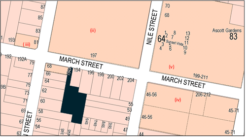
sought for development of land at 194A March Street, Orange (Figure 1) for
the purpose of boarding houses. The subject site was recently created by a
subdivision pursuant to DA 158/2017(2) (amended) to excise the historic cottage
at the site frontage, demolish the shed on the site and create a vacant
battle-axe development lot.
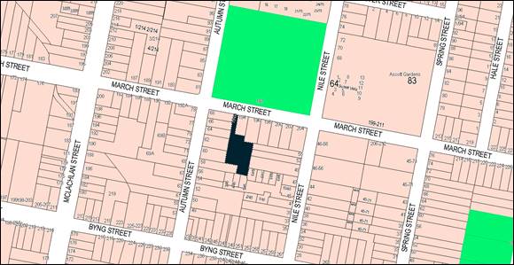
Figure 1: locality plan
The proposal involves construction of three two-storey
boarding house buildings, each containing eight self-contained rooms. Each
building contains four single rooms, four double rooms and a shared common room
with kitchen. Shared outdoor open space areas will be provided for each building.
One of the double rooms (in building ‘B’) will be a
manager’s room which has a private courtyard. Onsite vehicle parking will
be available comprising 24 car parking spaces, six motorcycle parking spaces,
and bicycle racking. The boarding houses will provide residential accommodation
for lodgers for three months or more. The applicant states that the boarding
houses will be used by medical staff and professionals. A three lot Strata
subdivision is also proposed to excise each building/ boarding house onto a
separate Strata lot.
The proposal comprises ‘boarding houses’
pursuant to State Environmental Planning Policy (SEPP) (Affordable
Rental Housing) 2009 (hereafter referred to as the ‘Affordable
Housing SEPP’). Boarding houses provide a form of low cost,
self-contained, rental accommodation for a wide range of tenants, including
singles, retirees, students, and young couples. The Affordable Housing SEPP
contains clear standards for the design and construction of boarding houses in
order to increase the supply and diversity of affordable rental housing
throughout NSW.
The proposal comprises advertised development pursuant to Orange
Development Control Plan 2004 (the ‘DCP’). At the completion of
the exhibition period 43 submissions were received in opposition to the
development from a total of 31 persons. A petition opposing the development was
also submitted, containing 173 signatures. The submissions generally relate to
the proposal not fitting in with the character of the area, heritage impacts,
and the potential for adverse social, traffic, noise, visual, privacy and
amenity impacts on the neighbourhood. One late submission was received in
support of the application from the Australian Housing Initiative. All
submissions were considered in preparing this report.
The subject land is located in East Orange and adjacent to
and opposite locally listed heritage items. Council staff and Council’s
Urban Design and Heritage Advisor do not support the proposal on the grounds
that that the site layout and building design have minimal elements which
relate to the traditional character and pattern of development of the
surrounding area, and insufficient landscaping can be provided. On this basis
it is considered that the proposal will not harmonise with the character of the
local area and will adversely impact on neighbourhood character, the heritage
significance of the setting, and neighbouring amenity pursuant to Section 4.15(1)(b)
of the Environmental Planning and Assessment Act 1979, Clause 30A
of the Affordable Housing SEPP, Clause 5.10(4) of Orange Local
Environment Plan 2011 (the ‘LEP’), Chapters 7 and 13 of
Council’s DCP, and Council’s Infill Guidelines.
It is noted that unlike traditional boarding houses, which
provide temporary lodger accommodation and shared facilities, the “new
generation” boarding houses allow for self-contained studios with their
own kitchenettes and bathrooms. The term ‘boarding house’ can be
misconceived, with images of run down accommodation and social housing, and can
be met with opposition, as demonstrated in this case. The proposal could be
significantly improved through better site layout, improved building design,
and the use of extensive landscaping; which would improve the amenity of the
site and neighbourhood, and mitigate impacts on the neighbourhood, including
traditional bad connotations around ‘boarding houses’. By utilising
landscaping as a major design outcome, the proposal could achieve greater
livability, detract from the small nature of the living spaces, mitigate
impacts on neighbouring properties, and assist in harmonising the development
into the surrounding heritage setting and neighbourhood.
Ongoing discussions have been carried out with applicant,
and these concerns have been passed onto the applicant for further
consideration. The applicant, however, appears reluctant to make changes to the
site layout as it would reduce the number of boarding rooms and car parking
spaces onsite and this would not be economically viable. Council’s senior
staff have indicated on many occasions that the proposal in its current form is
not capable of support.
As such, it is recommended that Council does not support the
proposal in its current form, and refuses the application. Attached is a draft
Notice of Refusal.
RECENT LEGISLATIVE CHANGES
On 1 March 2018 the Environmental Planning and Assessment
Act 1979 was substantially amended. The most immediate change involves the
restructuring and renumbering of the Act, with other more substantive
changes to be phased in over time. However, for some applications (particularly
where an application was lodged prior to the changes coming into effect) the
supporting documentation may still reference the previous numbering regime. In
the drafting of this report the content and substance of the supporting
material has been considered irrespective of which legislative references were
used.
DECISION FRAMEWORK
Development in Orange is governed by two key documents
Orange Local Environment Plan 2011 and Orange Development Control Plan 2004. In
addition the Infill Guidelines are used to guide development, particularly in
the heritage conservation areas and around heritage items.
Orange Local Environment Plan 2011 – The
provisions of the LEP must be considered by the Council in determining the
application. LEPs govern the types of development that are permissible or
prohibited in different parts of the City and also provide some assessment
criteria in specific circumstances. Uses are either permissible or not. The
objectives of each zoning and indeed the aims of the LEP itself are also to be
considered and can be used to guide decision making around appropriateness of
development.
Orange Development Control Plan 2004 – the DCP
provides guidelines for development. In general it is a performance based
document rather than prescriptive in nature. For each planning element there
are often guidelines used. These guidelines indicate ways of achieving the
planning outcomes. It is thus recognised that there may also be other solutions
of merit. All design solutions are considered on merit by planning and building
staff. Applications should clearly demonstrate how the planning outcomes are
being met where alternative design solutions are proposed. The DCP enables
developers and architects to use design to achieve the planning outcomes in
alternative ways.
DIRECTOR’S COMMENT
This development application involves ‘new
generation’ boarding houses. State Environmental Planning Policy (SEPP
Affordable Housing) stipulates numerous standards that a Council cannot
overrule. The State has created the SEPP to ensure there is an adequate supply
of this type of housing across NSW. According to the SEPP, however, a consent
authority must not consent to a development unless it has taken into
consideration whether the design of the development is compatible with the
character of the local area. It is the opinion of staff that, due to the nature
of the surrounding locality and the potential overdevelopment of the site as
proposed, Council is in a position to refuse the development on the grounds
that it is, indeed, not compatible with the character of the local area. This
is also the opinion of the numerous surrounding residential objectors in the
precinct. A draft Notice of Refusal is attached to this report should Council
concur. Should Council wish to approve the development then staff will bring
back a draft Notice of Approval to a subsequent meeting of Council for
consideration.
Link To Delivery/OPerational Plan
The recommendation in this report relates to the
Delivery/Operational Plan strategy “10.1 Preserve - Engage with the
community to ensure plans for growth and development are respectful of our
heritage”.
Financial Implications
Nil
Policy and Governance Implications
Nil
|
Recommendation
That Council refuses
development application DA 86/2018(1)
for Boarding House (three boarding houses) and Subdivision (three lot
Strata) at Lot 222 DP 1239110 - 194A March Street, Orange pursuant to the reasons in the attached Notice of
Refusal.
|
further considerations
Consideration has been given to the recommendation’s
impact on Council’s service delivery; image and reputation; political;
environmental; health and safety; employees; stakeholders and project
management; and no further implications or risks have been identified.
SUPPORTING INFORMATION
THE PROPOSAL
Council’s consent is sought for development of land at
194A March Street, Orange for the purpose of ‘boarding houses’.
The proposal involves construction of three two-storey
boarding house buildings, each containing eight self-contained rooms. Each
building contains four single rooms, four double rooms and a shared common room
with kitchen. Shared outdoor open space areas will be provided for each
building. One of the double rooms (in building ‘B’) will be a
manager’s room which has a private courtyard. Onsite vehicle parking will
be available comprising 24 car parking spaces, six motorcycle parking spaces,
and bicycle racking for eight bicycles. A three lot Strata subdivision is also
proposed to excise each building/ boarding house onto a separate Strata lot.
The boarding houses will provide furnished residential
accommodation for lodgers for three months or more. The applicant states that
the boarding houses will be aimed at medical staff and professions, and are
“new generation” as they are all self-contained. Each room provides
a bedroom, bathroom and small kitchen. A washing machine is provided in each
room, either within its own laundry, within the bathroom, or within the
kitchen. The double rooms contain a lounge room area. Each room is allocated an
onsite car parking space and each building is allocated two motorcycle parking
spaces. Bin storage areas are proposed along the driveway to the west of each
building.
Each building can contain up to twelve residents, resulting
in a total maximum occupancy of 36 persons onsite. Lodgers are responsible
for their own meals, laundry and cleaning of their own room. The manager or a
professional contractor will clean the common areas, maintain the grounds, and
put out and bring in the bins on collection day.
PROCEDURE AND BACKGROUND
Pre-Lodgement
Pre-lodgement advice was provided on numerous occasions in
2017 based on draft plans for the site. Overall, it was considered that the
proposal was inconsistent with the character of the area, and that it needed to
be comply with the LEP, DCP, Infill Guidelines, and the Affordable Housing
SEPP. The finer details and requirements of the proposal were also discussed,
such as car parking, driveway widths, number of waste bins required, types of
trees that would be appropriate etc. Formal advice from Council’s Urban
Design and Heritage Advisor was provided to the applicant in August 2017, where
it was considered that the proposed scale, form, siting, detailing,
landscaping, hardstand areas and spacing between buildings were inconsistent
with the character of the surrounding area and heritage setting, and
inconsistent with Council’s DCP and Infill Policy. It was recommended
that, being a two-storey development, a visual study from surrounding streets
would need to be undertaken. This advice highlighted fundamental issues which
needed to be addressed through an amended site layout and building design. It
is understood that discussions also took place between the applicant and
Council’s Technical Services Division in regards to servicing
requirements.
Lodgement
The applicant lodged this subject application in March 2018,
and a preliminary assessment found that the application was lacking in the
necessary information required to carry out a planning assessment. In
particular, Council required Strata subdivision plans, an amended noise report
(as the submitted report failed to take into account the immediate neighbouring
property to the north), amended shadow diagrams (as those submitted failed to
take all shadows into account) and manoeuvring details for parking spaces. A
site meeting was held with the applicant, Council staff, and Manager
Development Assessments. The applicant provided the necessary information with
the exception of amended shadow diagrams.
Although no merit assessment is made at the lodgement stage
of the application, issues of landscaping, trees, hardstand areas, parking and
waste storage were reiterated in the request for further information in
accordance with previous advice. The applicant amended the waste storage areas
and added one additional tree at the end of the driveway area. The application
was accepted for lodgement and placed on public exhibition for the prescribed
period.
Following Exhibition
Following exhibition 43 submissions were received in
opposition to the development from 31 persons, as well as a petition opposing
the development containing 173 signatures. The applicant was provided with a
summary of submissions, and issues raised by Council staff and NSW Police. A
copy of all submissions was also provided.
Issues raised in the submissions included:
· the proposal being
inconsistent with neighbourhood character
· impacts to
heritage setting and listed heritage items
· visual impacts
· overshadowing
impacts
· overlooking and
privacy impacts
· noise impacts
· excessive
hardstand areas
· lack of trees and
landscaping
· stormwater impacts
· excessive density
· traffic impacts
· parking and
pedestrian impacts
· amenity impacts
· crime and security
impacts
· socio-economic
impacts
· subdivision
· waste impacts
· servicing loads
· cumulative
impacts; and
· property values.
The applicant and applicant’s planning consultant
responded to the submissions and Council’s letter of issues as follows:
· “Two-storey
height - … zoning permits a wide range of residential uses and various
other non-residential supporting uses. These include uses which by definition,
are two-storeys (residential flat buildings and shop top housing)… The
objective [for the zone] would clearly be defeated if all new
development was restricted to single storey... The SEE noted that there are
examples of two storey development in the area… these are compatible in
the local area and form part of its established character… The two-storey
height of the development has been moderated by the design of the upper floor
as an attic with dormer windows rather than a full height level. We therefore
consider that the height of the development is appropriate and there is no
sound basis to restrict development on this site to single storey… The
design is indeed sympathetic to the area and location. The site layout and car
parking is also the best use to ensure all objectives are met in terms of
location, solar and providing more than the required parking.
· Density - SEPP
(Affordable Rental Housing) 2009 (ARHSEPP) provides that a boarding house
cannot be refused on the grounds of density if the floor space ratio (FSR)
complies with that prescribed in the LEP or DCP for any form of development in
that zone… The site is within a General Residential zone which
anticipates developments with a higher density than those in a Low Density
zone, consistent with the zone objective “To provide for a variety of
housing types and densities”. We therefore consider that the overall
density of the development (in terms of the gross floor area, the number of boarding
rooms and the number of residents) is appropriate for a boarding house within
the General Residential zone.
· Compatibility with
local character - The local character test (Clause 30A of ARHSEPP) was
addressed in detail in the SEE, applying the tests set out in Project Venture,
the LEC Planning Principle case for compatibility of a proposal with
surrounding development…. The bulk and scale of the development has been
broken up by arranging the development into three buildings, each with the bulk
and scale of a typical group of townhouses. This avoids the monolithic
appearance which would result from one or two larger buildings. The setbacks of
the buildings from side and rear boundaries are generous and exceed those
typically provided in other battleaxe developments in the area… it is
considered that the proposal will be compatible with the character of the local
area in the required legal sense of “capable of existing in
harmony”.
· Parking - The
development provides 24 parking spaces (1 per boarding room). This high level
of provision was considered appropriate given the position of the boarding
houses in the centre of a large battleaxe block, a considerable distance from
kerbside parking. The proposed parking exceeds the standard of 0.4 spaces per boarding
room required by ARHSEPP and this ensures that the development will not impose
a burden on local street parking… Street is wide and provides plenty of parking for visitors and
servicing, if required.
· Landscaping - The
applicant is open to discussions with Council of opportunities to rationalise
driveways to further reduce hardstand and provide additional space for trees
and landscaping. However it is noted that there are no significant trees on
site at present and the trees proposed will significantly improve the existing
situation… Consultation during design with council led to the sufficient
outdoor open space and we fully comply with the Affordable Housing SEPP
(AHSEPP) in this regard; There are ‘no trees’ noted on the site.
The landscaping design was and is in keeping with the overall site and area and
sufficiently covers the landscaping needs and requirements as well as privacy
screening.
· Heritage - It is
concluded from the above points that the fundamental parameters of the
development - height, density, bulk and scale - are appropriate…
Following extensive consultation with Council officers, a modern interpretation
of the Federation style was adopted for the development and it is considered
that this is an appropriate response to the nearby heritage items and period
homes. However, the owner and applicant are open to meeting with Council
planning and development management to discuss possible improvements to the
development.
· Visual appearance
– The design has been done sympathetic to the area and specific location.
The comment of poor design, materials and colours (colours listed in Legend are
selected from Heritage approved colours) is again unsupported and is a specific
limited point of view; The site location and street setback is 43 metres and
other boundary setbacks are substantial and have been implemented to address
potential concerns with neighbouring properties.
· Overshadowing –
The design has been developed with specific regards to the fencing and the
shadow diagrams are reflective. There is no impact of overshadowing to
residences as the neighbour rear yards are not in question.
· Overlooking –
There are greater than required setbacks e.g. varies from 3.3 up to 8, 12 or 19
metres in certain areas, from any neighbour’s boundaries and windows.
This has been addressed by positioning the buildings / windows and windows
heights which meet DCP guidelines and address any concerns of overlooking and
privacy to neighbours.
· Excessive hardscaping
areas – Specifics needed for impact to
trees and stormwater / overflow. Our designer has worked with Technical
Services to ensure compliance and suitability which has been met; The newly
provision rear stormwater is also being used accordingly and engineering will
be compliant for onsite detention requirements.
· Noise Impacts –
The site is compliant with Affordable Housing SEPP, DCP and LEP; the number of
people is in line with those policies as is the number bikes and cars, going
above and beyond to ensure each suite room has their own car space, if
required. The room management rules/policies are a strict guide to living there
and are in place to ensure harmonious living by all parties.
· Increased traffic
movements - This is a wide street which is capable of handling any potential
increase in usage; Understand the point of visitors – however, street
parking is more than sufficient; Waste collection and emergency vehicles are
already considered, and the access handle is suited to cater for these
requirements Technical Services provided; The school is a full 350m away and
would pose no further risk than anything else possibly could.
· Pedestrian Safety -
These demographics [school children and elderly] are not impacted by
this development. It [sic] possible that we could have the elderly living
in the development as well. There is a clear line of sight along the driveway
and up and down the street for both forward entry and departure from the site
by vehicles.
· Poor amenity –
The specifics of the Affordable Housing SEPP have been met (exceeded) and are
relative to the suite rooms being provided; solar access has been met and the
term ‘small room’ is relative to the individual – there is
evidence and policy that this is sufficient for 1 or 2 occupants and provides
cost effective living; Outdoor space also meets SEPP guidelines and
acoustically we have demonstrated compliance.
· Crime and
Security/Safety – CCTV and lighting requirements will be compliant to
ensure appropriate monitoring and very minimal disturbance, given the noted
neighbour boundary locations, during the construction design. This development
would not increase crime and impact on safety as our target market are medical
/ professionals / services staff and is also supported by the overall site
design layout and features. A lockable entrance gate was not favoured by
Council during pre-discussions due to noise impacts to neighbours with its
operation and was also deemed unnecessary. The proposal currently caters
sufficiently for emergency access and all fire safety requirements will be
compliant from the construction design. The onsite manager room is not actually
required as per the AHSEPP, but the development has provisioned one in a
central and optimum location to ensure effectiveness.
· Socio-economic
impacts - This New Generation Boarding House (NGBH) housing accommodation is
targeting the services staff, Medical Staff… plus other Professional
Services staff… We know there is strong requirement for this type of
accommodation given the number of nurses and other medical staff currently
renting by the bedroom in shared housing throughout Orange, as one example. Our
accommodation provides self-contained suite rooms. There are also additional
requirements for mature aged people, particularly 55 years plus women who may
be widowed or separated and require accommodation, so they are able to get
access to safe and affordable housing solutions. It should also be noted that
we are providing Accessible suite rooms housing for the disabled within the
community. “This is NOT social housing”.
· Subdivision - …
we are NOT sub-dividing the individual buildings just the overall development.
· Increased load on
services - The engagement of technical services and our plan has been
considered with Civil Engineering; The electricity and emergency services
relevant here has already been considered.
· Waste - … there
is sufficient waste storage securely located away from neighbours and the
general public, whilst located close to the individual buildings. It is also in
compliance with the number of bins needed, with an allowance already made for
added bin capacity, if required. A separate collection point has been
provisioned in the access handle for weekly collection by waste management
services.
· Several other issues
raised in submissions are not relevant matters for consideration… these
include:
- Speculation
regarding the nature, behaviour and character of the future residents and
enforcement of Plan of Management. The Plan of Management is an appropriate
method to ensure social impacts are appropriately managed. This has been upheld
in many LEC cases such as Eminent Constructions v Hurstville City Council
[2011] NSWLEC 1358 where it was held that: There is also no evidence to suggest
increased criminal or anti-social behaviour associated with what is described
as a "new generation" boarding house. Furthermore, a Management Plan
is a proposed condition of approval and deals with matters such as security,
resident amenity and resident conduct matters.
- Characterisation
as a commercial-type use: See The Hills Shire Council v Sales Search Pty Ltd
[2013] NSWLEC 103 which confirms that a boarding house is a form of residential
accommodation and it is the use by the occupants which is relevant, not its use
by the owner to derive rent.
- Impact
on property values: This has consistently been rejected as a relevant factor in
planning matters.
- No
need for boarding houses in this area: Boarding house is a permissible use in
the zone and is consistent with the zone objective “To provide for a
variety of housing types and densities.” The site is within walking
distance (800m) from Orange CBD and the development is proposed in response to
high demand for affordable, compact, flexible accommodation with good access to
employment, services and facilities.
- Engineering,
service connection and stormwater matters which are more appropriately
addressed at Construction Certificate stage.”
As addressed in the main body of this report, Council staff
do not generally accept the applicant’s comments and justification.
Although the proposed use of the land as boarding houses is permitted with
consent in the R1 General Residential zone, the site layout and building design
are incompatible with the character of the surrounding area and heritage
setting, as set out in Council’s pre-lodgement advice. The applicant
notes that reducing the proposed development from 30 rooms and car parking
spaces (pre-lodgement number) down to 24 (proposed number) and amending the
building design elements (materials, windows, colours etc) has adequately
addressed the pre-lodgement issues raised. However, Council staff and
Council’s Urban Design and Heritage Advisor consider that the proposed
development formally lodged with Council has not adequately addressed the
issues raised, particularly in regards to character, heritage and amenity
impacts.
The main court case relied upon by the applicant is
applicable to the proposed development, however as it predates the Affordable
Housing SEPP, subsequent Case Law has expanded the criteria relevant to this
application. This is discussed in greater detail in the “LEP”
assessment section later in this report.
It is also noted that submitted shadow diagrams do not
accurately reflect the proposal, despite the applicant’s claims that they
do. Although a ‘streetscape perspective’ drawing was submitted in
support of the proposal, it only shows a cross section of the site and does not
show the proposed development in the context of the surrounding buildings,
streets or neighbourhood.
Ongoing Discussions
Council’s Manager Development Assessments and Director
Development Services have written to the applicant numerous times setting out
the issues and concerns with the proposal, firmly recommending redesign. The
applicant has only responded in so far as to further justify the current
proposal. Although the applicant states that he is willing to work with Council
to make amendments, significant changes to the site layout and building design
are required to render the proposal more acceptable. The applicant has not made
any serious attempt to make such changes where he believes he has adequately
addressed all matters, and that any further reduction in number of rooms and/or
car parking would result in a commercially unviable project.
Council’s Planning Procedures and Protocols policy
sets out how community notification is to be carried out (in addition to
legislative requirements), and that states Council undertakes:
“that, upon receipt of
at least five submissions objecting to a development application and where
those issues are considered by Council to be reasonably capable of negotiation,
a meeting will be offered to all parties in an attempt to resolve issues and
find compromise prior to the matter being determined by the relevant
authority”.
As noted above, the proposed development poses many
fundamental issues, and significant improvements need to be made to the
building design and site layout. Given the applicant’s response to
Council staff and submitter’s concerns to date, Council’s Director
Development Services has declared that a meeting to negotiate between parties
in accordance with this policy would be unproductive.
MATTERS FOR CONSIDERATION
Section 1.7 - Application of
Part 7 of the Biodiversity Conservation Act 2016 and Part 7A of the
Fisheries Management Act 1994
Section 1.7 of the EP&A Act 1979 identifies that Part 7
of the Biodiversity Conservation Act 2016 and Part 7A of the Fisheries
Management Act 1994 have effect in connection with terrestrial and aquatic
environments.
Having regard to the relevant provisions and based on an
inspection of the subject property, it is considered that the proposed
development is not likely to significantly affect a threatened species. A
Biodiversity Development Assessment Report is not required in this instance.
The site inspection of the subject property indicated that
there is no biodiversity or habitat value.
Section 4.15
Section 4.15 of the Environmental Planning and Assessment
Act 1979 requires Council to consider various matters, of which those
pertaining to the application are listed below.
PROVISIONS OF ANY ENVIRONMENTAL
PLANNING INSTRUMENT s4.15(1)(a)(i)
Orange Local Environmental Plan 2011
Part 1 - Preliminary
Clause 1.2 - Aims of Plan
The
broad aims of the LEP are set out under subclause 2. Those relevant to the application
are as follows:
(a) to encourage development which complements
and enhances the unique character of Orange as a major regional centre boasting
a diverse economy and offering an attractive regional lifestyle,
(b) to provide for a range of development
opportunities that contribute to the social, economic and environmental
resources of Orange in a way that allows present and future generations to meet
their needs by implementing the principles for ecologically sustainable
development,
(e) to provide a range of housing choices in
planned urban and rural locations to meet population growth,
(f) to recognise and manage valued
environmental heritage, landscape and scenic features of Orange.
The application is considered to be consistent with aims (b)
and (e) above where it provides for affordable housing choices, but is
inconsistent with aims (a) and (f). The following assessment demonstrates that
the site layout and built form of the proposed development are inconsistent
with the character of the surrounding area and listed heritage items. Matters
pertaining to the development’s compatibility with the local character of
the area, and the relevant planning controls relating to the built form and
heritage, have been addressed in the body of this report.
Clause 1.6 - Consent Authority
This clause establishes that, subject to the Act, Council is
the consent authority for applications made under the LEP.
Clause 1.7 - Mapping
The subject site is identified
on the LEP maps in the following manner:
|
Land Zoning Map:
|
Land zoned R1 General Residential
|
|
Lot Size Map:
|
No minimum lot size
|
|
Heritage Map:
|
Not a heritage item or conservation
area; but adjoining a local heritage item
|
|
Height of Buildings Map:
|
No building height limit
|
|
Floor Space Ratio Map:
|
No floor space limit
|
|
Terrestrial Biodiversity Map:
|
No biodiversity sensitivity on the
site
|
|
Groundwater Vulnerability Map:
|
Ground water vulnerable
|
|
Drinking Water Catchment Map:
|
Not within the drinking water
catchment
|
|
Watercourse Map:
|
Not within or affecting a defined
watercourse
|
|
Urban Release Area Map:
|
Not within an urban release area
|
|
Obstacle Limitation Surface Map:
|
No restriction on building siting
or construction
|
|
Additional Permitted Uses Map:
|
No additional permitted use applies
|
|
Flood Planning Map:
|
Not a flood planning area
|
Those matters that are of relevance to the subject property
are addressed in detail in the body of this report.
Clause 1.9A - Suspension of
Covenants, Agreements and Instruments
This clause provides that covenants, agreements and other
instruments which seek to restrict the carrying out of development do not apply
with the following exceptions:
· covenants imposed
or required by Council
· prescribed
instruments under Section 183A of the Crown Lands Act 1989
· any conservation
agreement under the National Parks and Wildlife Act 1974
· any trust
agreement under the Nature Conservation Trust Act 2001
· any property
vegetation plan under the Native Vegetation Act 2003
· any biobanking
agreement under Part 7A of the Threatened Species Conservation Act 1995
· any planning
agreement under Division 6 of Part 4 of the Environmental Planning and
Assessment Act 1979.
The property has numerous easements in relation to sewerage and
water drainage extending into neighbouring lots to the north and south. The
proposed site layout takes these easements into account to ensure they will not
be adversely affected. Council staff are not aware of the title of the subject
property being affected by any of the other instruments listed above.
Part 2 - Permitted or Prohibited Development
Clause
2.1 - Land Use Zones and Clause 2.3 - Zone Objectives and Land Use Table
The subject site is located within the R1 General
Residential zone. The proposed development is defined as “boarding
houses” and “subdivision”. Pursuant to the
LEP Dictionary:
Boarding house
means a building that:
(a) is
wholly or partly let in lodgings, and
(b) provides
lodgers with a principal place of residence for 3 months or more, and
(c) may
have shared facilities, such as a communal living room, bathroom, kitchen or
laundry, and
(d) has
rooms, some or all of which may have private kitchen and bathroom facilities,
that accommodate one or more lodgers
Boarding houses are permitted with consent in the R1 zone.
Pursuant to Section 4B of the Environmental Planning and
Assessment Act:
Subdivision of
land means the division of land into two or more parts that, after the
division, would be obviously adapted for separate occupation, use or
disposition.
Subdivision is permitted with consent pursuant to Clause 2.6
of the LEP (see below).
Clause 2.3 - Zone Objectives
The objectives for land zoned R1 General Residential are as
follows:
· To provide for the
housing needs of the community.
· To provide for a
variety of housing types and densities.
· To enable other land
uses that provide facilities or services to meet the day to day needs of
residents.
· To ensure development
is ordered in such a way as to maximise public transport patronage and
encourage walking and cycling in close proximity to settlement.
· To ensure that
development along the Southern Link Road has an alternative access.
The proposal is consistent with
the relevant zone objectives as considered below:
- The proposal will provide an affordable rental
housing option to supplement housing needs in the community;
- The proposed boarding houses will contribute to the
variety of housing types and densities in the neighbourhood;
- The subject land is located in proximity to local and
neighbourhood shops, and accessible via public transport; and
- The subject land is not within proximity to the
Southern Link Road.
Clause 2.6
- Subdivision - Consent Requirements
Clause 2.6 is applicable and states:
(1) Land to which this Plan
applies may be subdivided but only with development consent.
Consent is sought for a three lot Strata subdivision of the
development in accordance with this clause.
Part 3 - Exempt and Complying Development
The application is not exempt or complying development.
Part 4 - Principal Development Standards
The Part 4 - Principal Development Standards are not
applicable to the proposal.
Part 5 - Miscellaneous Provisions
5.10 - Heritage Conservation
Clause 5.10 is applicable and states in part:
(1) The
objectives of this clause are as follows:
(a) to
conserve the environmental heritage of Orange,
(b) to
conserve the heritage significance of heritage items and heritage conservation
areas, including associated fabric, settings and views,
(c) to
conserve archaeological sites,
(d) to
conserve Aboriginal objects and Aboriginal places of heritage significance.
(4) The
consent authority must, before granting consent under this clause in respect of
a heritage item or heritage conservation area, consider the effect of the proposed
development on the heritage significance of the item or area concerned. This
subclause applies regardless of whether a heritage management document is
prepared under subclause (5) or a heritage conservation management plan is
submitted under subclause (6).
The subject land is located in the vicinity of the following
Heritage Items (see Figure 2):
(i) Dwelling
at 68 Autumn Street (corner of March Street) - the residence retains the
distinctive features from the original art deco style, including the external
character with distinctive rendered masonry walls, semi-circular rooms and a
sympathetic garden setting. It complements the streetscape and is one of a
significant group of the same style and builder (Crossman), contributing as a
Heritage Item.
(ii) ‘Newman
Park’ at 197 March Street - a civic landscaped park of 2 hectares,
significant for its exotic trees of more than 100 years in age. The park was
constructed in 1890 and the trees were planted in the 1890s. The 16 Oak
trees were added at the end of World War One by servicemen and pupils of East
Orange Public School to commemorate former pupils who had died in the war. The
park complements the streetscape and contributes to the area, and is highly
valued by the community.
(iii) ‘Rowena
House’ at 81 Autumn Street - the late Victorian buff brick residence with
hipped roof and brick chimneys has retained the distinctive original features,
including the bullnose return verandah with cast iron brackets, and a cottage
garden, which complements the streetscape and contributes to Orange as a
Heritage Item.
(iv) ‘East
Orange Public School’ at 45-71 Spring Street, 206-212 March Street and 46‑56 Nile
Street - the school precinct is of social significance to the local community,
historically marking the mature growth of East Orange and the early buildings,
including the 1925 classical block. Mature trees with cultural landscape
significance exist in the grounds. Orange East Public school was established
in 1890, and enrolments increased in the 1950s when the United Protestant
Association opened ‘Buena Vista Boys’ Home’ immediately
opposite. The school complements the streetscape and contributes to Orange as a
Heritage Item, and is highly valued by the community.
(v) ‘Buena
Vista Boys' Home’ at 199-211 March Street (corner Nile Street) - a fine
rendered and painted masonry residence in the Gothic style which has retained
the distinctive original features, including the verandah, slate roof, chimneys
and decorative mouldings. It is a rare building type and style, and complements
the streetscape and contributes to Orange as a Heritage Item.
Figure 2: listed buildings and items (in beige
hashing)
The
subject land is considered to be within a “heritage setting” given
the character of the surrounding area, and the proximity to numerous heritage
items as set out above. It is noted that the subject land is not within a
Heritage Conservation Area. Heritage settings are highly valued by the
community, and the Council is committed to conserving their character while
supporting sympathetic infill development.
Character of the Local Area
In
order to consider the effect the proposal has on the significance of the
heritage setting pursuant to Clause 5.10(4) of the LEP, an assessment of
character needs to be undertaken. A character assessment also aids
Council’s consideration of the proposed development in relation to Clause
30A of State Environmental Planning Policy (Affordable Rental
Housing) 2009, Chapters 7.7, 13.1, 13.3, and 13.4 of Orange
Development Control Plan 2004, as well as Council’s Infill
Guidelines.
In
defining the relevant character of the local area, reference tools include the
Orange LEP, Orange DCP, Council’s Infill Guidelines, the Burra
Charter, ‘Design in Context: Guidelines for
Infill Development in the Historic Environment’ (NSW Heritage
Office and Royal Australian Institute of Architects, 2005), relevant Case Law
in regards to character, and comments from Council’s Urban Design and
Heritage Advisor.
The
NSW Heritage Office states that character is defined by the combination of the
particular characteristics or qualities of a place (‘Design in
Context’, 2005). The character and identity of a particular area is
influenced by the intricate interrelationship of the public and private realms,
taking into account the qualitative interplay of many factors which contribute
to creating a unique neighbourhood character. These factors include:
· the underlying natural landform and topographic
characteristics;
· distinctive landscape elements and vegetation, especially
trees and other significant foliage;
· the date and style of the buildings, including materials,
colours, building techniques, detailing etc;
· the scale and form of the buildings, including proportions
of openings;
· street and subdivision patterns, including setbacks,
building to space pattern of buildings, curtilage, fencing, landscaping,
servicing etc;
· fabric; and
· views, vistas, and skylines.
The character of this particular precinct and streetscape
has been examined by Council staff and Council’s Urban Design and
Heritage Advisor, and is considered to be made up of the following elements:
· Generally level topography, with Blackmans Swamp Creek
nearby to the southeast;
· Significant mature vegetation in wide tree lined streets,
established public and private landscaped gardens, and areas of public open
space;
· The property immediately in front of the subject site (194
March Street) contains a single storey, brick dwelling with hipped roof,
rendered chimneys and return verandah;
· Adjacent heritage listed house at 68 Autumn Street
comprises an art deco building, which differs from surrounding buildings but
maintains the scale and pattern of surrounding development, and is set within
landscaped gardens with mature trees;
· Surrounding suburban area has a historic context comprising
a generally unified pattern of development and character of traditional,
detached single-storey dwellings, incorporating:
- modelled roofs with hips
and gables, chimneys, and verandahs
- a mix of external finishes
- generous side setbacks and
dwelling curtilages with view corridors to rear
- generous front setbacks and
landscaped front and rear gardens;
· Intact original Bungalows in the Autumn Street streetscape,
which back on to the site where the boarding houses are proposed;
· Heritage listed school nearby, comprising early buildings,
open space, and significant mature trees;
· Heritage listed Newman Park opposite the site comprising
generous public open space and significant mature trees; and
· Other heritage listed buildings in the vicinity comprising
distinctive original architectural features set within landscaped gardens.
Departures
from the established built character include:
· A two-storey mixed use building at 49 Nile Street (Simply
Nile café and residence) which backs onto the subject site, and
comprises established landscaping and trees;
· Recent unit developments to the rear of the subject site at
45 Nile Street, which comprise smaller lot sizes and single storey contemporary
dwellings;
· Recent seniors housing to the north and east of Newman Park
on Nile Street, comprising single storey contemporary dwellings/units; and
· Ascott Gardens aged care facility which is located on a
very large lot at 199‑211 March Street, 83 Spring Street and 64 Nile
Street, which comprises multiple large buildings, small units, established
landscaping, and areas of open space.
Character as Applied by the Court
The
authorities show that while there are accepted elements of character, as set
out above, the list of defining elements of character have been expanding over
time. In relation to how ‘compatible with the character of the local
area’ has been applied by the Court, Stebbing & Anor v Byron Shire
Council [2012] NSWLEC 1129 (hereafter referred to as ‘Stebbing’)
provides authority that a development can be refused where the bulk and scale
of a building, its siting on the land and appearance are a discordant element
in the local area, and where a development is an exception to the predominant
character of the local area. This case also introduces adverse amenity impacts
as an element of character, in terms of noise and overlooking neighbours.
Pingola
Pty Ltd and Anor v Parramatta City Council
[2012] NSWLEC 1270 provides authority that the design of the development should
respond to the desirable elements of the character of the area and that
undesirable elements should not be emulated. This is a consideration in relation
to the discordant elements in the surrounding area.
The
applicant states in the submitted Statement of Environmental Effects that the
proposed design “minimises impacts and has a scale and appearance
consistent with development in the locality”. The applicant relies on
the principle established in Project Venture Developments v Pittwater
Council [2005] NSWLEC 191 (hereafter referred to as ‘Project
Venture’), that the compatibility of a proposal with surrounding
developments means that the proposal is capable of existing together in
‘harmony’, not ‘sameness’ with surrounding
developments.
Project
Venture identifies four elements of
character: building height, setbacks, landscaping and in special areas, such as
heritage areas, architectural style and materials. It is important to note that
Project Venture predates the Affordable Housing SEPP. The list of
defining elements of character based on the authorities since Project
Venture shows that the elements of character have been expanding over time.
Commissioner
Morris in Stebbing takes a broader approach to the interpretation of
character than that taken in Project Venture by including the
consideration of bulk, siting, scale, appearance and amenity impacts on the
adjoining residential properties, including noise and overlooking. The factual
circumstances in Stebbing are similar to the current proposal (although Stebbing
involved the conversion of an existing two story indoor sports facility to a
boarding house).
Commissioner
Morris, having regard to the planning principle in Project Venture,
accepted that to be compatible does not mean a development has to be the same;
however, having considered whether the proposal's physical impacts on
surrounding development were acceptable, and if the proposal's appearance was
in harmony with the buildings around it, Commissioner Morris found that the
proposal was not. Accordingly, it was considered that the design of the
proposed development was not compatible with the local area, where Commissioner
Morris held that:
(i) [The] two
buildings are exceptions to the predominant character [low density residential]
and, because of their bulk, siting, scale and appearance are a discordant
element in the local area. Where dual occupancy and multi-unit housing had
occurred [in the local area], the scale, setbacks and siting of those buildings
is consistent with the adjacent buildings and landscaped areas are provided
around the units with adequate side setbacks provided to reduce the impacts of
those buildings on adjoining properties [40].
(ii) The [proposed
development] also introduce elements such as balconies, which…have
adverse amenity impacts on the adjoining residential
property…particularly in terms of noise and overlooking [41].
(iii) [T]he extent of
landscaping proposed and the location of the structure are not consistent with
the siting of development in the local area [41].
Character and Heritage Assessment
Good
quality and sensitive design of infill development is of paramount importance
in retaining the historic character of precincts within Orange. An important
aspect of good design is designing in context and having regard to the site and
its surroundings, with particular consideration to the character of the area
and valued heritage setting.
In
particular, the relationships between a building and its setting contribute to
that place’s special character, and depending on its design and position,
a new building can have a beneficial or detrimental effect on its setting and
on adjacent valued buildings. Infill buildings should aim to provide continuity
in the built form, and make reference to the established and valued setting by
responding to its historic context through an understanding and informed
analysis of its character and quality, including elements such as its grain,
existing patterns of development, important views, scale, materials and
building methods. ‘Design in Context’ states that to achieve
a successful infill design the following design criteria applies:
· character - new buildings must harmonise with their
surroundings
· scale - size in relation to surrounding buildings or
landscape
· form - overall shape and volume, and the arrangement of its
parts
· siting - should add sympathetically to the local
streetscape and the grain of the area
· materials and colour - should recognise characteristic
materials, textures and colours used locally and in adjacent buildings; and
· detailing - common details that contribute to the special
character of an area should be identified, and inform or inspire design.
In
their current form, it is considered that the proposed boarding houses are not
consistent with the established character of the local area for the following
reasons:
- setbacks, scale, form, bulk
and siting in relation to the boundaries are inconsistent with the surrounding
built form, landscape, and character
- the spacing between the
three proposed buildings does not relate to the pattern of the surrounding
area, where 3m is substantially less than the established spacing in the area
- proposed open space and
landscaping does not add sympathetically to the area, and is significantly
lacking in comparison to the surrounding open nature and mature landscaping
which characterises the area
- proposed siting and hard
surface coverage (buildings, car parking areas, driveways etc) is
excessive compared to the surrounding pattern of development and grain of the
area. It has been questioned whether such a high rate of car parking needs to
be provided for this proposal
- proposed buildings, materials,
detailing, roof form and fenestrations do not suitably recognise or interpret
the characteristic and traditional elements of the surrounding built form,
resulting in a visual appearance which would be discordant with the buildings
around it
- the proposed two storey configuration of the boarding house
buildings will be visible from the wider streetscape, viewed from March, Autumn
and Nile Streets between and over the existing dwelling houses, and down the
wide subject site driveway/access handle, exacerbating impacts to the
streetscape and neighbourhood character; and
- amenity impacts on surrounding
neighbours.
Council’s
Urban Design and Heritage Advisor has commented on the proposed development in
terms of local character as follows:
- The current proposal produces
a character which is not consistent with the character of the immediate context
and setting.
- It is recommended that an
alternate design or amendment of the existing design be prepared to produce a
built form which has a reduced bulk through varied roof forms and details,
varied setbacks to reduce the scale and presentation of the closely spaced
blocks, and suitable treatment of the unbuilt areas which allows for additional
trees sufficient to complement the character of the landscape in the setting.
- Overall, the current
proposal is not capable of support in relation to the character of the design
being incompatible with the character of the context.
All
submissions and petitions received objecting to the proposed development raise
the issues of neighbourhood character, heritage impacts and amenity impacts.
Neighbours consider aspects such as visual appearance, scale, density, noise,
parking and traffic to be considerations of ‘character’.
Adopting
Commissioner Morris’s broad approach to the interpretation of character,
the current proposal is considered discordant with the character of the local
area when bulk, siting, scale, appearance, and amenity impacts on the adjoining
residential properties are considered. Amenity impacts of the proposed
development are considered in detail later in this report under the sections
“Development Control Plan 2004” and “Likely Impacts”.
Overall,
the current proposal has not adequately considered the character of the area,
and is inconsistent with the immediate context and heritage setting. In its
current form the proposal has little opportunity to improve setbacks, bulk,
spacing and the soft/permeable landscape to hardstand/impermeable ratio. As established in relevant Case Law, undesirable elements
in the surrounding area should not be emulated, or used to justify further
impacts on local character. This not only relates to built form, but also
extends to siting and landscaping. Council staff recommended that an alternate
site layout and design, or amendment of the existing proposal, be prepared
which addresses these issues. The applicant was not amenable to an alternative
site layout as this would reduce the number of boarding rooms and parking
spaces on the site and would not be economically viable.
Given
that the proposal disregards the historical context and character of the area,
it would have a detrimental effect on the heritage setting and would detract
from the significance of the surrounding listed items, contrary to the
objectives of LEP Clause 5.10(1). Further discussion as to how character
relates to the requirements of the Affordable Housing SEPP, and
Council’s DCP and Infill Guidelines is addressed later in this report.
It is
noted that Clause 5.10(5)(c) states that Council may “require a
heritage management document to be prepared that assesses the extent to which
the carrying out of the proposed development would affect the heritage
significance of the heritage item or heritage conservation area
concerned”. In this case, a heritage management document was not
required. In retrospection, and given that the applicant has not appropriately
taken the heritage setting into account, it is recommended that a formal
‘Heritage Impact Statement’ be prepared and submitted for any amendments
to the current proposal, or any further proposals/applications on the site.
Such a document can assist in identifying the character of the area and identify
the common elements that can be used to inform the design and site layout for
the subject land and proposed boarding houses.
Part 6 - Urban Release Area
Not relevant to the application. The subject site is not
located in an Urban Release Area.
Part 7 - Additional Local Provisions
7.1
- Earthworks
Clause
7.1 of the LEP
applies. This clause states in part:
(3) Before granting development
consent for earthworks, the consent authority must consider the following
matters:
(a) The likely disruption of, or any
detrimental effect on, existing drainage patterns and soil stability in the
locality of the development
(b) The effect of the development
on the likely future use or redevelopment of the land
(c) The quality of the fill or the
soil to be excavated, or both
(d) The effect of the development
on the existing and likely amenity of adjoining properties
(e) The source of any fill material
and the destination of any excavated material
(f) The likelihood of
disturbing relics
(g) The proximity to and potential
for adverse impacts on any waterway, drinking water catchment or
environmentally sensitive area
(h) Any measures proposed to
minimise or mitigate the impacts referred to in paragraph (g).
In
consideration of this clause, the development will necessitate earthworks to
create level pads for buildings A, B, and C, car parking and manoeuvring
areas, and open space areas. The earthworks can be supported onsite and the
change in ground level is not substantial. A ramp is proposed to the
southern section of the site/car parking area, which takes advantage on the
natural slope of the site and reduces the need to carry out extensive
earthworks. Disruption to drainage is considered to be minor, and subject to
using soil and erosion control measures, would not detrimentally affect
adjoining properties or receiving waterways.
7.3 - Stormwater Management
Clause 7.3 of the LEP is
applicable. This clause states in part:
(3) Development
consent must not be granted to development on land to which this clause applies
unless the consent authority is satisfied that the development:
(a) is designed to
maximise the use of water permeable surfaces on the land having regard to the
soil characteristics affecting onsite infiltration of water
(b) includes, where
practical, onsite stormwater retention for use as an alternative supply to
mains water, groundwater or river water
(c) avoids any
significant impacts of stormwater runoff on adjoining downstream properties,
native bushland and receiving waters, or if that impact cannot be reasonably
avoided, minimises and mitigates the impact.
Subject
to engineering design, stormwater from the development would be directed to the
existing interlot drainage infrastructure at the rear of the site. Onsite
stormwater detention would be required, designed to limit peak outflows from
the subject site to the pre-existing natural outflows up to the 100 year ARI
frequency, with sufficient allowance in overflow spillway design capacity to
safely pass flows of lower frequency (that is, a rarer event) without damage to
downstream developments.
7.6 - Groundwater Vulnerability
Clause
7.6 of the LEP seeks to protect hydrological functions of groundwater systems
and protect resources from both depletion and contamination. Orange has a high
water table and large areas of the LGA, including the subject site, are
identified with “Groundwater Vulnerability” on the Groundwater
Vulnerability Map.
This
requires that Council consider:
(a) whether or not the development (including
any onsite storage or disposal of solid or liquid waste and chemicals) is
likely to cause any groundwater contamination or have any adverse effect on
groundwater dependent ecosystems, and
(b) the cumulative impact (including the
impact on nearby groundwater extraction for potable water supply or stock water
supply) of the development and any other existing development on groundwater.
Furthermore consent must not be granted unless Council is satisfied that:
(a) the development is designed, sited and
will be managed to avoid any significant adverse environmental impact, or
(b) if that impact cannot be reasonably
avoided - the development is designed, sited and will be managed to minimise
that impact,
(c) if that impact cannot be minimised - the
development will be managed to mitigate that impact.
The proposal is not anticipated
to involve the discharge of toxic or noxious substances and is therefore
unlikely to contaminate the groundwater or related ecosystems. The proposal
does not involve extraction of groundwater and will therefore not contribute to
groundwater depletion. The design and siting of the proposal avoids impacts on
groundwater and is therefore considered acceptable.
Clause 7.11 - Essential
Services
Clause 7.11 of the LEP applies and states:
Development consent must not be
granted to development unless the consent authority is satisfied that any of
the following services that are essential for the proposed development are
available or that adequate arrangements have been made to make them available
when required:
(a) the
supply of water,
(b) the
supply of electricity,
(c) the
disposal and management of sewage,
(d) storm
water drainage or on-site conservation,
(e) suitable
road access.
In consideration of this clause, all utility services are
available to the subject land and are adequate for the proposal as follows:
· the subject land is
connected to reticulated water supply and an additional water meter can be
installed in the driveway;
· electricity and
telecommunications are available to the land;
· the site is connected to
Council’s reticulated sewerage system;
· subject to a suitable
engineered design, stormwater management for the subject land would be
suitable; and
· the site has direct
frontage and access to March Street.
STATE ENVIRONMENTAL PLANNING
POLICIES
State Environmental Planning Policy (Affordable Rental
Housing) 2009
The Affordable Housing SEPP is applicable. An assessment of
the development against the requirements of the Affordable Housing SEPP is
outlined below.
Clause 3 - Aims of Policy
The aims of the Affordable Housing SEPP are as follows:
(a) to
provide a consistent planning regime for the provision of affordable rental
housing,
(b) to
facilitate the effective delivery of new affordable rental housing by providing
incentives by way of expanded zoning permissibility, floor space ratio bonuses
and non-discretionary development standards,
(c) to
facilitate the retention and mitigate the loss of existing affordable rental
housing,
(d) to
employ a balanced approach between obligations for retaining and mitigating the
loss of existing affordable rental housing, and incentives for the development
of new affordable rental housing,
(e) to
facilitate an expanded role for not-for-profit-providers of affordable rental
housing,
(f) to
support local business centres by providing affordable rental housing for
workers close to places of work,
(g) to
facilitate the development of housing for the homeless and other disadvantaged
people who may require support services, including group homes and supportive
accommodation.
The proposal is generally consistent with the relevant aims
in that new affordable rental housing will be provided in reasonable proximity
to employment and businesses.
Clause 4 – Interpretation
- general
The Affordable Housing SEPP adopts
the standard instrument definition for “boarding house” pursuant to
Clause 4(2), and the proposed development satisfies this definition.
Division 3 - Boarding houses
Boarding houses are permitted with consent in the R1 General
Residential zone, pursuant to Clauses 26 and 28 of the Affordable Housing SEPP.
Clause 29 - Standards that
cannot be used to refuse consent
An assessment of the standards
for boarding houses as set out in Clause 29 “Standards that
cannot be used to refuse consent” is carried out below.
|
Clause
|
Standard
|
Proposal
|
Complies?
|
|
29(1)
|
FSR:
maximum
floor space ratio
|
Not
applicable - no floor space limit for the subject land pursuant to LEP or
DCP.
|
N/A
|
|
29(2)(a)
|
Building
height:
maximum
building height
|
Not
applicable - no building height limit for the subject land pursuant to LEP or
DCP.
|
N/A
|
|
29(2)(b)
|
Landscaped
area:
landscape
treatment of the front setback is compatible with the streetscape
|
Not
applicable - the subject land and proposed development does not have frontage
to March Street (except for the access driveway).
|
N/A
|
|
29(2)(c)
|
Solar
access:
communal
living room to receive three hours direct sunlight between 9am and 3pm
mid-winter
|
The
communal living rooms in each boarding house building have glazing on the
northern facade. Submitted shadowing diagrams demonstrate that solar access
to communal living rooms in Buildings A and B will receive direct sunlight,
however the communal living room for Building C will be partially
overshadowed. However, the submitted shadow diagrams do not accurately demonstrate
shadows, therefore cannot be relied on to demonstrate compliance.
It is unlikely that the
communal living rooms will receive sufficient sunlight due to the close
spacing between each building, new boundary fencing required to achieve
privacy and noise attenuation, and existing boundary vegetation (also see
notes following table).
|
No
|
|
Clause
|
Standard
|
Proposal
|
Complies?
|
|
29(2)(d)
|
Private
open space:
minimum
20m2 with 3m dimension for each boarding house; and minimum 8m2
with 2.5m dimension for manager adjacent to manager’s
accommodation
|
Each
boarding house will be provided with an adjacent communal open space area
with minimum dimension of 5m, and areas as follows:
Building
A = 62.25m2
Building
B = 66.14m2
Building
C = 66.14m2
It is noted that the
submitted Statement uses alternative numbers for these areas
(ie rounded-up and not exact), however the above areas have been
confirmed by the applicant.
A private courtyard off
the manager’s room measures 24m2 with minimum dimension
of 3.5m.
|
Yes
|
|
29(2)(e)
|
Parking
(ii) development not carried out by social housing provider:
at least
0.5 spaces for each boarding room; and
Parking (iii) in the
case of any development:
not more
than 1 space provided for each person employed in connection with development
and who is resident onsite
|
24 rooms
are proposed, generating a minimum demand of 12 spaces onsite. Not more
than 37 spaces should be provided on the site (up to 35 residents,
1 manager, and 1 cleaning/ maintenance contractor). 24 onsite car
parking spaces are proposed, meeting both aspects of this standard (also see
notes following table).
|
Yes
|
|
29(2)(f)
|
Accommodation
size:
minimum
gross floor area (excluding kitchen and bathroom facilities)
single:
12m2
double/other:
16 m2
|
Each
single boarding room measures 16m2 and each double room measures
20.6m2 (excluding kitchen and bathroom).
|
Yes
|
As indicated in the table above, the proposal is unlikely to
achieve sufficient daylighting to the communal living rooms during the winter
months. Council has requested amended shadow diagrams from the applicant,
however the applicant states that the submitted diagrams are correct. An
assessment by Council staff shows that this is not the case, where the
submitted shadow diagrams do not accurately demonstrate shadow angles and
lengths, and omit shadows created by roofed carports and balconies, as well as
boundary fence shadows.
Notwithstanding this, the Affordable Housing SEPP notes that
these standards cannot be used to refuse development consent, and therefore
this non-compliance is not considered significant.
It is noted that on 1 June 2018 the Affordable Housing SEPP
was amended, whereby a new clause was inserted requiring that in the case of
development not carried out for social housing, at least 0.5 car parking spaces
are to be provided for each lodger. The application was lodged prior to this
amendment, where the previous rate required 0.4 spaces for each lodger.
However, the Affordable Housing SEPP does not contain any savings and
transitional provisions in regards to this amendment, therefore the amended
rate applies to this application, being at least 0.5 spaces for each lodger.
Regardless, the proposal provides 24 car parking spaces, which is well in
excess of both the previous rate and amended rate. Further assessment of car
parking is carried out later in this report.
Clause 30 – Standards for
boarding houses
Clause 30 of the Affordable
Housing SEPP sets out “Standards for boarding houses”, and Council
must not consent to development unless it satisfies all the standards set out
in this clause. As assessment against these standards is carried out below:
|
Clause
|
Standard
which must be met
|
Proposal
|
Complies?
|
|
30(1)(a)
|
At least
one communal living room is required for 5+ boarding rooms
|
Each
boarding house will comprise 8 boarding rooms, a shared communal room with
kitchen.
|
Yes
|
|
30(1)(b)
|
Boarding
rooms to have maximum GFA (excluding kitchen and bathroom) of 25m2
|
The
maximum room size is 20.6m2 (excluding kitchen and bathroom).
|
Yes
|
|
30(1)(c)
|
Maximum
occupancy is limited to 2 adult lodgers
|
Single
rooms will accommodate a maximum of 1 lodger, and double rooms will
accommodate a maximum of 2 lodgers.
|
Yes
|
|
30(1)(d)
|
Bathroom
and kitchen facilities are available for each lodger
|
Each
boarding room will be self-contained with bathroom and kitchen facilities.
Kitchen facilities are also provided in the communal rooms for shared use.
|
Yes
|
|
30(1)(e)
|
Manager’s
room or dwelling required onsite for boarding house with 20+ lodgers
|
Each
boarding house will accommodate up to 12 lodgers, giving a maximum
capacity of 36 persons. Notwithstanding this, the development will
function as a single facility, and a manager’s room will be provided in
Building B.
|
Yes
|
|
Clause
|
Standard
which must be met
|
Proposal
|
Complies?
|
|
30(1)(g)
|
In
commercial zones, residential purposes not permitted on ground floor that
fronts the street
|
This
control is not applicable as the subject land is located in the
R1 General Residential zone.
|
N/A
|
|
30(1)(h)
|
At least
1 bicycle space and 1 motorcycle space required for every 5 boarding
rooms
|
A total
of 24 rooms are proposed, generating a demand for at least 5 bicycle spaces,
and 5 motorcycle spaces. It is proposed to provide 8 bicycle spaces and 6 motorcycle
spaces onsite.
|
Yes
|
The proposal complies with all the standards that must be
met under Clause 30 of the SEPP as demonstrated above.
Clause 30A - Character of local
area
Clause 30A of the Affordable Housing SEPP provides that the
consent authority:
“must not consent to
development to which this Division applies unless it has taken into
consideration whether the design of the development is compatible with the
character of the local area”.
As discussed in detail in the Character Assessment earlier
in this report, the site layout and building design for the proposed boarding
houses are considered to be incompatible with the character of the local area.
As established by relevant Case Law, a proposed development is considered to be
compatible where physical impacts on the surrounds are acceptable and its
visual appearance is in harmony with the buildings around it. In this case the
proposed development fails to harmonise with the surrounding pattern of
development, built form, heritage significance and open landscaped nature of
the neighbourhood. Furthermore, the proposal would result in adverse amenity
impacts to the heritage setting and neighbouring properties. Relevant Case Law
also establishes that incompatibility with the character of the local area in
relation to this clause is grounds for refusing a proposed development.
Clause 52 - No subdivision of
boarding houses
Clause 52 of the Affordable Housing SEPP provides that a
consent authority:
“must not grant consent
to the strata subdivision or community title subdivision of a boarding
house”.
The intent of this prohibition is to prevent separate titles
being created for each boarding room, as this would enable rooms to be
owner-occupied and therefore no longer ‘let in lodgings’ which is a
defining characteristic of a boarding house.
Strata subdivision is proposed in order to excise each
boarding house building onto a separate Strata lot. Vehicle parking and open
spaces within the development will be allocated to corresponding Strata lots. The
remainder of the site, including driveways, pedestrian areas and landscaped
spaces will comprise common property available for shared use by all boarding
house lodgers.
In Council’s opinion, and consistent with the approach
taken for other boarding house determinations in Orange, the Strata subdivision
of individual boarding houses is not contrary to the requirements of Clause 52.
State Environmental Planning
Policy 55 - Remediation of Land
State Environmental Planning Policy 55 - Remediation of
Land is applicable. Pursuant to Clause 7, a consent authority must not
consent to the carrying out of any development on land unless:
(a) it has considered whether the land is
contaminated, and
(b) if the land is contaminated, it is
satisfied that the land is suitable in its contaminated state (or will be
suitable, after remediation) for the purpose for which the development is
proposed to be carried out, and
(c) if the land requires remediation to be
made suitable for the purpose for which the development is proposed to be
carried out, it is satisfied that the land will be remediated before the land
is used for that purpose.
In consideration of this clause, the potential for
contamination of the site is considered to be low. The subject land is well
established for residential use. The site is not known to have been used for a
Table 1 activity that may cause contamination as identified in the
SEPP 55 –Remediation of Land Planning Guidelines. Investigation
of the site for any potential land contamination is considered unnecessary for
the proposed development.
State Environmental Planning
Policy (Building Sustainability Index: BASIX) 2004
The BASIX SEPP is applicable to this proposal as boarding
houses are a form of residential accommodation. The applicant has submitted a
multi-dwelling/residential flat building BASIX Certificate which
demonstrates that the proposal meets the NSW Government’s requirements
for sustainability (water, thermal comfort and energy).
PROVISIONS OF ANY DRAFT
ENVIRONMENTAL PLANNING INSTRUMENT THAT HAS BEEN PLACED ON EXHIBITION
4.15(1)(a)(ii)
There are no draft environmental planning instruments that
apply to the subject land or proposed development.
DESIGNATED DEVELOPMENT
The proposed development is not designated development.
INTEGRATED DEVELOPMENT
The proposed development is not integrated development.
PROVISIONS OF ANY DEVELOPMENT
CONTROL PLAN s4.15(1)(a)(iii)
Development Control Plan 2004
Development Control Plan 2004 (“the DCP”)
applies to the subject land. An assessment of the proposed development against
the relevant Planning Outcomes will be undertaken below.
CHAPTER 7 - DEVELOPMENT IN
RESIDENTIAL AREAS
The following Chapter 7 Planning Outcomes are considered
relevant to the proposal as the boarding houses are new residential accommodation:
Neighbourhood Character
The DCP sets the following Planning Outcomes in regard to
Neighbourhood Character (PO 7.7-1):
· Site layout and
building design enables the:
- creation
of attractive residential environments with clear character and identity
- use
of site features such as views, aspect, existing vegetation and landmarks.
· Buildings are
designed to complement the relevant features and built form that are identified
as part of the desired neighbourhood character.
· The streetscape
is designed to encourage pedestrian access and use.
In terms of neighbourhood function, the proposed development
will provide for a continuation of residential landuse by providing an
affordable rental housing option to supplement housing needs in the community,
and contribute to the variety of housing types and densities in the
neighbourhood.
As considered in the LEP Heritage, Character Assessment, and
Affordable Housing SEPP sections earlier in this report, the site layout
and building design of the proposed boarding houses are considered to be
incompatible with the character of the local area. The neighbourhood character
is generally made up of single storey residential dwellings of historical
context, with consistent scales and setbacks, within an open landscaped
setting. The proposal fails to take this setting into consideration, where elements
such as existing pattern of development, grain, view corridors, scale,
relationship between buildings and areas of open space etc would be
altered to such an extent that it would result in detrimental impacts to the
area’s special character, and on adjacent and nearby valued heritage
buildings and items. Furthermore, the proposed buildings have not adequately
used the traditional built and historical context form to inform design.
Overall it is considered that the proposal does not meet the
planning outcomes in relation to neighbourhood character. As discussed
previously, it is recommended that the applicant redesign the current
development to ensure a design which is compatible with, and complements the
relevant features and built form that are identified as part of the desired
neighbourhood character for this locality.
Building Appearance
The DCP sets the following Planning Outcomes in regard to
Building Appearance (PO 7.7-2):
· The building
design, detailing and finishes relate to the desired neighbourhood character,
complement the residential scale of the area, and add visual interest to the
street.
· The frontages of
buildings and their entries face the street.
· Garages and car
parks are sited and designed so that they do not dominate the street frontage.
As considered in the Character Assessment earlier in this
report, the building design for the proposed boarding houses is incompatible
with the character of the local area. The general design, materials selection,
detailing, form, scale and fenestration are contemporary, and have minimal
elements which relate to the traditional character of the surrounding area. It
is noted that a new/infill building should not attempt to replicate buildings
within a historical setting, however the common elements found in the setting
should be identified and used to inform or inspire design.
Being a battle-axe parcel, the site has limited visibility
in the March Street view corridor (ie when travelling along the public
road). Notwithstanding this, expansive views of the site are available at the
frontage due to the wide driveway/access handle. Furthermore, as the proposal
is two storeys in height, the buildings will be visible from the streetscape in
the wider area. Most of the vehicle parking areas will not have a street
presence, being tucked around corners and behind the buildings.
Overall, it is considered that the building appearance of
the current proposal is inadequate and will result in adverse impacts on the
neighbourhood, contrary to these planning outcomes.
Heritage
The DCP sets the following Planning Outcomes in regard to
Heritage (PO 7.7-3):
· Heritage
buildings and structures are efficiently re-used.
· New development
complements and enhances the significance of a heritage item or place of
heritage significance listed in the Orange Heritage Study.
· Significant
landscape features are retained including original period fences and period
gardens.
As considered in the LEP heritage assessment above, it is
considered that the proposed development will not complement or enhance the
heritage setting, and will adversely impact on the character of the area, and
on adjacent and nearby listed heritage items. As established in relevant Case
Law, nearby buildings that are inconsistent with the character of the area should
not be emulated, or used to justify further impacts on local character.
Overall, it is considered that the proposal does not meet the DCP planning
outcomes for heritage.
Setbacks
The DCP sets the following Planning Outcomes in regard to
Setbacks (PO 7.7-4):
· Street setbacks
contribute to the desired neighbourhood character, assist with the integration
of new development and make efficient use of the site.
· Street setbacks
create an appropriate scale for the street considering all other streetscape
components.
Being a battle-axe parcel, the proposed development will not
impact on streetscape setbacks.
Front Fences and Walls
The DCP sets the following Planning Outcomes in regard to
Fences and Walls (PO 7.7-5):
· Front fences
and walls:
- assist
in highlighting entrances and creating a sense of identity within the
streetscape
- are
constructed of materials compatible with associated housing and with fences
visible from the site that positively contribute to the streetscape
- provide
for facilities in the street frontage area such as mail boxes.
The proposal does not involve front fencing to March Street.
Perimeter fencing is proposed and is required to be 1.8m in height to mitigate
noise impacts to neighbouring residential properties. Noise impacts are
discussed in detail in the “Likely Impacts” section later in this
report. Mailboxes are proposed on the western side of the access driveway at
the site frontage.
Visual Bulk
The DCP sets the following Planning Outcome in regard to
Visual Bulk (PO 7.7-6):
· Built form
accords with the desired neighbourhood character of the area with:
- side
and rear setbacks progressively increased to reduce bulk and overshadowing
- site
coverage that retains the relatively low density landscaped character of
residential areas
- building
form and siting that relates to landform, with minimal land shaping (cut and
fill)
- building
height at the street frontage that maintains a comparable scale with the
predominant adjacent development form
- building
to the boundary where appropriate.
The following comments are made in relation to these
planning outcomes:
- setbacks, scale, form and
siting of bulk in relation to the boundaries are inconsistent with the
surrounding built form;
- the spacing between the
proposed boarding house buildings does not relate to the pattern of the
surrounding area;
- although compliant with the
numerical guidelines for site coverage, the proposed site coverage by hardstand
areas (car parking, driveway etc) is markedly larger than adjoining lands, and
proposed areas of open space and landscaping are lacking compared with adjoining
lands; therefore the proposal does not retain the low density landscaped
character of the area;
- the development does not
directly front the street, being a battle-axe lot; however the building height
and bulk when viewed from the surrounding streets is inconsistent with the
surrounding built form where the predominant building height in this
neighbourhood is single-storey;
- the proposed buildings will
be contained within the DCP prescribed visual bulk envelope plane; and
- minimal land shaping is required
given that the site is relatively level.
As discussed in the character assessment earlier in this
report, the visual bulk of the proposal is inconsistent with the character of
the local area, resulting in amenity impacts to neighbouring properties and to
the wider surrounding area. Overall, it is considered that the visual impacts
in terms of bulk are contrary to the above DCP planning outcomes.
Walls and Boundaries
The DCP sets the following Planning Outcome in regard to
Walls and Boundaries (PO 7.7-7):
· Building to the
boundary is undertaken to provide for efficient use of the site taking into
account:
- the
privacy of neighbouring dwellings and private open space
- the
access to daylight reaching adjoining properties
- the
impact of boundary walls on neighbours.
The proposal does not involve the construction of buildings
on the boundary. Perimeter fencing is proposed at 1.8m, which is considered to
be the usual height in residential areas to ensure adequate privacy.
Daylight and Sunlight
The DCP sets the following Planning Outcome in regard to
Daylight and Sunlight (PO 7.7-8):
· Buildings are
sited and designed to ensure:
- daylight
to habitable rooms in adjacent dwellings is not significantly reduced
- overshadowing
of neighbouring secluded open spaces or main living area windows is not
significantly increased
- consideration
of Council’s Energy Efficiency Code.
Shadow diagrams have been submitted in support of the
proposal. However, as discussed in the Affordable Housing SEPP assessment
earlier in this report, the submitted shadow diagrams do not accurately
demonstrate shadow angles and lengths, and omit shadows created by roofed
carports, balconies, and boundary fencing. Therefore the shadow diagrams cannot
be relied on to demonstrate compliance.
As noted previously, it is unlikely that the boarding house
communal living rooms will receive sufficient sunlight due to the close spacing
between each building, proposed new boundary fencing and existing boundary
vegetation. However, the solar access standards set out in the Affordable
Housing SEPP cannot be used to refuse consent, therefore this non-compliance is
not considered significant. Furthermore, the Affordable Housing SEPP does
not require the boarding house rooms or areas of private open space to receive
solar access, therefore these particular amenity aspects have not been
considered as part of the DCP assessment.
Notwithstanding this, an assessment of shadowing impacts to
neighbouring properties is relevant under the DCP, as well as the Affordable
Housing SEPP. The DCP provides that new development should not adversely impact
on daylighting to northern habitable windows or areas of private open space of
adjacent neighbouring residential properties.
Overshadowing impacts are considered to be negligible due to
the following:
- the orientation of the subject
lot and the setbacks of the boarding houses to the boundaries means that most
of the overshadowing impacts are contained within the subject lot rather than
neighbouring lots
- neighbours to the south have the
most potential to be affected from overshadowing, however the winter
overshadowing to 58 Autumn Street only impacts rear outbuildings (which are not
habitable spaces that require solar access) and a small portion of the garden
space (which will receive afternoon sun) and is considered acceptable. Units 3,
4 and 5 of 45 Nile Street are not impacted due to the proposed car parking area
separating the boarding houses and the boundary
- neighbours to the west (Nile
Street) will have some winter afternoon overshadowing; however due to their
generous lot sizes, large gardens, and dwelling houses being well separated
from the rear boundaries, overshadowing impacts are negligible
- neighbours to the east (Autumn
Street) have minimal winter morning overshadowing to rear outbuildings and
small portions of their garden areas, which is considered acceptable; and
- the neighbour to the north at
194 March Street will not be impacted due to orientation (shadows from the
development fall to the east, south and west).
Overall, neighbouring areas of private open space and
habitable north‑facing windows will receive adequate daylighting on the
winter solstice in accordance with the DCP requirements.
Views
The DCP sets the following Planning Outcomes in regard to
Views (PO 7.7-9):
· Building form
and design allow for residents from adjacent properties to share prominent
views where possible
· Views including
vistas of heritage items or landmarks are not substantially affected by the
bulk and scale of the new development.
Notwithstanding the battle-axe configuration of the subject
site, views of the site are available from the March Street frontage due to the
wide driveway/access handle. The proposed two storey configuration of the
boarding house buildings will be visible from the wider streetscape, where it
could be viewed from March, Autumn and Nile Streets between and over the
existing dwelling houses. This adversely impacts on the streetscape,
neighbourhood character, and views and vistas within the heritage setting,
particularly the adjacent heritage listed dwelling and the listed park opposite
the subject site. As discussed previously, the building design and detailing
should complement the neighbourhood character, and in its current form the
proposal is incompatible with the character of the local area.
Visual Privacy
The DCP sets the following Planning Outcome in regard to
Visual Privacy (PO 7.7-4):
· Direct
overlooking of principal living areas and private open spaces of other
dwellings is minimised firstly by:
- building
siting and layout
- location
of windows and balconies
and secondly by:
- design
of windows or use of screening devices and landscaping.
The boarding houses are sited close to each other with only
3m, which will result in overlooking from upper access balconies down into
opposing Building B and C boarding rooms. Upper floor windows will
comprise dormer windows only, with high sill heights of 1.7m, preventing
direct overlooking (by most people). Notwithstanding this, the Affordable Housing
SEPP does not afford any particular privacy to be achieved between boarding
rooms/buildings, and as such the DCP provision is only considered to apply to
privacy for neighbouring dwellings. As the proposal involves a two-storey
development, there is the potential for overlooking into neighbouring
residential properties from upper level windows, access balconies and patios.
Some neighbours have objected on the grounds of adverse visual privacy and
overlooking impacts. The following comments are made in regards to visual
privacy:
- Ground floor windows and communal
areas - perimeter fencing 1.8m in height will be installed on the subject
site, which will prevent direct views into neighbouring properties from ground
floor windows, communal living room windows, areas of private open space and
car parking areas;
- Upper northern windows -
Buildings B and C only oppose Buildings A and B. Building A will
oppose dwelling houses on the adjoining land at 194 and 196 March Street,
however upper floor windows will comprise dormer windows only, with high sill
heights of 1.7m, preventing direct overlooking;
- Upper southern windows -
Buildings A and B only oppose Buildings B
and C. Building C opposes adjoining land at 58 Autumn Street, and
Units 3, 4 and 5/45 Nile Street, where access balconies and upper level
stairwell windows directly overlook these properties. However, the distance
between the windows and the neighbouring units in Nile Street exceeds the
DCP-prescribed separation distance of 9m, and boundary fencing will
provide adequate privacy to the windows and areas of private open space to
these units given the small lot sizes. In the case of 58 Autumn Street, the
proposed development only overlooks a small area of rear garden for limited
periods of time (coming and going from two of the boarding rooms), and is too
far separated from this neighbour’s windows to cause a noticeable impact;
- Upper western windows -
Buildings A, B and C oppose adjoining land at 60 and 62 Autumn
Street. These windows and the ends of the access balconies are well separated
from neighbouring dwellings, exceeding the DCP-prescribed distance of 9m,
therefore privacy impacts are unlikely. Furthermore, half of the western facing
windows are bathroom windows, and therefore obscured glazing will be used,
preventing any overlooking from three of the six western windows. The western
ends of the access balconies will be used for a limited period of time, and by
only one western end room for each boarding house;
- Eastern elevation - there are no
eastern facing windows on the proposed buildings, however the manager’s
room comprises a private outdoor patio on the upper level of the eastern
elevation of Building B. Privacy screens are proposed at 1.7m in height around
the premier of this patio area to prevent direct overlooking within the subject
site and to neighbours. The eastern ends of the access balconies will be used
for limited periods of time, and by only one eastern end room for
Buildings A and C, where a privacy screen is proposed for Building B.
Overall, the proposed site layout and building design will
provide reasonable visual privacy for the proposed development and adjoining
dwellings. Privacy screens could be used at the end of the upper level access
balconies to afford improved privacy to neighbours to the east and west.
Acoustic Privacy
The DCP sets the following Planning Outcome in regard to
Acoustic Privacy (PO 7.7-11):
· Site layout and
building design:
- protect
habitable rooms from excessively high levels of external noise
- minimise
the entry of external noise to private open space for dwellings close to major
noise sources
- minimise
transmission of sound through a building to affect other dwellings.
An ‘Acoustic Assessment’ by Blackett Acoustics
(report number BA171202, Version B, dated April 2018) was submitted in
support of the proposal. This report revised the original submitted assessment,
which failed to take into consideration the neighbouring property to the
immediate north (194 March Street) as it previously formed part of the subject
site. The revised assessment took into account noise impacts associated with
the development, including movement of vehicles in the car park and mechanical
plant.
The assessment recommends that a 1.8m high perimeter
boundary fence is needed to ensure that noise emissions from the proposed
development comply with the Noise Policy for Industry. The assessment
identified some minor non-compliances, however indicates that the potential
noise events (car park vehicle movements) would be unlikely to trigger
awakening reactions during the night as there was limited potential for such
events to occur. Council’s Environmental Health and Building Officer has
reviewed this report and concurs with the comments and recommendations.
It is noted that the NSW Police recommend that the
development be gated to ensure security (discussed further below), which
generates potential noise emissions which have not been taken into account in
the submitted report. It is considered that an adequate (ie quiet and
automated) gate can be installed that will not impact on the amenity of
neighbours.
Submitters have raised that noise will be an issue due to
the proposed density of the development, and that this will adversely affect
the quiet nature of the area. It is acknowledged that there is the potential
for future occupants of the boarding houses to disturb the neighbours,
particularly from the outdoor spaces and the manager’s outdoor patio
area. The (amended) acoustic report submitted with the application did not specifically
consider noise impacts from lodgers using these areas. Having said that, it is
considered unlikely that the common open space areas would be used by lodgers
at the same time, or in a manner that would create a noise issue. Time
restrictions could be applied to address this matter. In regards to the
manager’s private outdoor patio area, this is accessed from the
manager’s room, and it is considered unlikely that this area would be
used by numbers of people large enough to result in adverse noise issues to
neighbours.
This potential for disturbance is not reason alone to
disallow the proposal, although in its current form the development is
inconsistent with the character of the local area and will impact on the
general amenity of the area.
Noise receivers accounted for in the submitted acoustic
report are limited to neighbouring properties, and the future occupants of the
boarding houses were not considered. The Affordable Housing SEPP does not
require any specific acoustic privacy to be achieved between boarding rooms,
and as such this has not been considered in this assessment. This is a matter
to be considered at Construction Certificate stage, where compliance with
relevant BCA requirements can be taken into account.
Overall it is considered that the acoustic privacy planning
outcomes can be achieved subject to the recommendations set out in the
submitted acoustic assessment by Blackett Acoustics, along with time
restrictions in the open space areas.
Security
The DCP sets the following Planning Outcomes in regard to
Security (PO 7.7-12):
· The site layout
enhances personal safety and minimises the potential for crime, vandalism and
fear.
· The design of
dwellings enables residents to survey streets, communal areas and approaches to
dwelling entrances.
The NSW Police have carried out a Crime Risk Assessment for
the proposed development. Using the ‘International Standard - Risk
Management Standard ISO: 31000’, the analysis of crime
statistics and site opportunity assessment information, the ‘Overall
Crime Risk Rating’ has been assessed as “High”.
A number of recommendations have been made to reduce
opportunities for criminal and anti-social behaviour, including access to be
controlled by a lockable gate in periods of darkness; driveway and parking areas
to be lit; stairwells to be lit, ideally with movement sensor activation;
mailbox access to be controlled by lock; and CCTV installed. It is also
recommended that the onsite manager’s room be relocated to a position
that is centrally located in order to perform adequately as a ‘Formal
Guardian’ for the site.
The applicant responded that CCTV and lighting would comply,
but that a gate is not a preferred option; and that the manager’s room is
suitably located in the current proposal. Council staff do not agree with these
points. It is current form, the proposal does not meet the planning outcomes in
relation to security, and the above recommendations by NSW Police and the
principles of Crime Prevention through Environmental Design need to be
given further consideration. In particular, surveillance, access control,
territorial enforcement and space management are required in order to reduce
the potential crime risks associated with the proposal.
Circulation Design
The DCP sets the following Planning Outcome in regard to
Circulation Design (PO 7.7-14):
· Accessways and
parking areas are designed to manage stormwater.
· Accessways,
driveways and open parking areas are suitably landscaped to enhance amenity
while providing security and accessibility to residents and visitors.
· The site layout
allows people with a disability to travel to and within the site between car
parks, buildings and communal open space.
Subject to engineering design, stormwater from the
development (including the access driveway and parking areas) will be directed
to the existing drainage system at the rear of the site. Onsite stormwater
detention will be required to limit post-development peak flows to pre‑development
levels.
The subject land has vehicular access via March Street. The
existing vehicle crossing and proposed formed driveway will exceed the minimum
width of 6m to ensure safe and convenient vehicle access to the site with
forward entry and exit. The proposed car park layout will comply with AS
2860.1-2004 - Off Street Parking. The site layout and building design will
facilitate the movement of people with a disability between accessible parking
areas and adjacent accessible rooms on the ground floor of each building.
Landscaping is proposed around the car parking area perimeter
and adjacent to the access driveway. This landscaping is considered to be
inadequate, where planting beds are too narrow to achieve sufficient
substantial plantings or enhance amenity. As discussed previously, it is
considered that the ratio of hardstand/built areas to soft landscaped areas is
inappropriate for this locality, and will adversely impact on amenity and
neighbourhood character.
Overall it is considered that the proposed development does
not meet the planning outcomes with regards to circulation design.
Car Parking
The DCP sets the following Planning Outcomes in regard to
Car Parking (PO 7.7-15):
· Parking
facilities are provided, designed and located to:
- enable
the efficient and convenient use of car spaces and accessways within the site
- reduce
the visual dominance of car parking areas and accessways.
· Car parking is
provided with regard to the:
- the
number and size of proposed dwellings
- requirements
of people with limited mobility or disabilities.
As outlined previously, car parking will be provided for the
development in compliance with the amended Affordable Housing SEPP (Clause
29(2)(e)(iia)). At least 12 car parking spaces are required, and 24 are
proposed to be provided, exceeding the standard. Bicycle and motorcycle parking
is also to be provided in compliance with the Affordable Housing SEPP. The
proposal is also consistent with the nearest equivalent car parking requirement
of the DCP, which requires one space per bedroom, giving a total
requirement of 24 spaces.
However, given the concerns raised about the ratio of
hardstand/built areas to soft landscaped areas, Council staff have questioned
whether such a high rate of car parking needs to be provided on the site given
it compromises amenity, and considering the Affordable Housing SEPP only
requires half this amount of parking. This question was put to the applicant,
who responded that the proposed parking meets the needs of the site and is
required given the distance of the boarding houses to the street (being a
battle-axe lot).
A reduction of parking, and subsequently a reduction of
hardstand areas, on the site would allow for much improved open space areas,
and more substantial plantings and soft landscaping to be installed. This would
result in many benefits, including improving amenity for future occupants and
neighbouring properties, mitigate some of the visual bulk and privacy impacts
of the boarding house buildings and car parking areas, and assist in ensuring
that the proposed development harmonises with the character of the local area
and heritage setting.
On the other hand, a reduction of parking on the site may
result in the need for some of the future occupants to rely on on-street
parking. Ample parking is available along both sides of March Street, which
could handle the overflow parking needs of the proposed development. However,
this in itself would alter the character of the area, and many submissions
object to the principle of such an arrangement. It is considered that a balance
needs to be found between providing an improved handstand to landscaped ratio
on the site and allowing some of the parking needs to be accommodated on the
street.
While the proposed development exceeds the minimum number of
required parking spaces set out in the DCP and Affordable Housing SEPP, it does
not meet the overall planning outcomes in regards to car parking with regards
to visual dominance of car parking areas and accessways. Open space and
landscaping are discussed in greater detail below.
Private Open Space
The DCP sets the following Planning Outcomes in regard to
Private Open Space (PO 7.7-16):
· Private open
space is clearly defined for private use.
· Private open
space areas are of a size, shape and slope to suit the reasonable requirements
of residents including some outdoor recreational needs and service functions.
· Private open
space is:
- capable
of being an extension of the dwelling for outdoor living, entertainment and
recreation
- accessible
from a living area of the dwelling
- located
to take advantage of outlooks; and to reduce adverse impacts of overshadowing
or privacy from adjoining buildings
- Orientated
to optimise year round use.
These DCP provisions do not apply to boarding houses. As
outlined earlier in this report, private open space will be provided for the
development in compliance with the Affordable Housing SEPP (Clause
29(2)(d)).
Open Space and Landscaping
The DCP sets the following Planning Outcomes in regard to
Open Space and Landscaping (PO 7.7-17):
· The site layout
provides open space and landscaped areas which:
- contribute
to the character of the development by providing buildings in a landscaped
setting
- provide
for a range of uses and activities including stormwater management
- allow
cost effective management.
· The landscape
design specifies landscape themes consistent with the desired neighbourhood
character; vegetation types and location, paving and lighting provided for
access and security.
· Major existing
trees are retained and protected in a viable condition whenever practicable
through appropriate siting of buildings, accessways and parking areas.
· Paving is
applied sparingly and integrated in the landscape design.
A landscape plan has been submitted with proposal.
Council’s Manager City Presentation provided the following advice in
relation to the plan:
“The proposal does not offer any significant soft
landscape areas, with much of the proposed soft landscaping in narrow beds
along the property boundaries (which appear to be less than 500mm wide),
apart from the occasional wider section where small Eucalypts are proposed.
There is a lack of opportunity for vegetation, ie trees of moderate height and
form to be established (maximum height of the proposed Eucalypt is 8 metres).
Trees with a minimum mature height of 12 metres would make a more significant
and appropriate contribution to the landscape for an urban development. The
proposal in its current form has little opportunity to improve the
soft/permeable landscape vs hardstand/impermeable ratio.”
As
discussed previously, soft landscaping needs to be increased, which will enable
a greater representation and suitable species of trees to be planted, as well
as improve the visual quality of the site and soften the visual impacts of the
proposed buildings and hardstand areas. Council’s
Manager City Presentation also questions whether the proposed development
requires such a high rate of car parking to be provided, and recommends that
some car parking spaces are converted into landscaped areas and the driveway
provides for more landscaping.
The
applicant amended the driveway to provide a slightly wider section at the end
of the eastern bed, which provides for one mature tree. This is not considered
sufficient to address all the issues, in particular those relating to the
development being inconsistent with the character of the local area. As noted
in the Car Parking assessment above, a balance
needs to be found between providing an improved handstand to landscaped ratio
on the site.
Overall,
the planning outcomes relating to open space and landscaping have not been
achieved.
Stormwater
The DCP sets the following Planning Outcomes in regard to
Stormwater (PO 7.7-18):
· Onsite drainage
systems are designed to consider:
- downstream
capacity and need for onsite retention, detention and re-use
- scope
for onsite infiltration of water
- safety
and convenience of pedestrians and vehicles
- overland
flow paths.
· Provision is
made for onsite drainage which does not cause damage or nuisance flows to
adjoining properties.
Subject to engineering design, stormwater from the
development will be directed to the existing system at the rear of the site.
Onsite stormwater detention will be required to limit post-development peak
flows to pre-development levels. These planning outcomes can thus be achieved.
Erosion and Sedimentation
The DCP sets the following Planning Outcome in regard to
Erosion and Sedimentation (PO 7.7-19):
· Measures
implemented during construction to ensure that the landform is stabilised and
erosion is controlled.
Adequate sediment and erosion control could be implemented
during construction, in accordance with this planning outcome.
SUBDIVISION
The DCP sets the following relevant Planning Outcomes in
regard to urban residential subdivision (PO 7.2-1):
· Lots are fully
serviced and have direct frontage/access to a public road.
· Design and
construction complies with the Orange Development and Subdivision Code.
The proposal involves Strata subdivision of the development
to excise each boarding house and associated parking spaces onto separate
Strata lots. Vehicle parking and open spaces within the development will be
allocated to corresponding Strata lots. The remainder of the site, including
driveways, pedestrian areas and landscaped space will comprise common property
available for shared use by all boarding house lodgers. The proposed Strata
subdivision is not contrary to these planning outcomes, nor the provisions of
the Affordable Housing SEPP (Clause 52).
CHAPTER 13 - HERITAGE
Given the heritage setting of the subject proposal, the Chapter
13 Heritage planning outcomes are relevant to the proposal. As previously
considered in the LEP, Character, Affordable Housing SEPP, and DCP Chapter 7
assessments of this report, the proposed development is inconsistent with the
character of the local area, and would adversely impact on the setting and the
adjacent and nearby heritage listed buildings and items. The proposal has not
adequately taken the surrounding context into account, and therefore does not
meet these DCP planning outcomes
DCP INFILL GUIDELINES
The DCP Infill Guidelines are relevant to the
proposal as new infill development in a heritage setting. The objectives of
these guidelines are as follows:
· Retention of
appropriate visual setting (Article 8 Burra Charter).
· To ensure new
buildings respond to and enhance the character and appearance of the
streetscapes of the Heritage Conservation Areas.
· To ensure
contributory heritage items retain their prominence and are not dominated by
new development within a Heritage Conservation Area and do not compromise the
heritage values of the existing area.
· To ensure new
buildings do not adversely affect the significance, character or appearance of
the Heritage Conservation Area or heritage items.
· To allow for
reasonable change within a Heritage Conservation Area while ensuring all other
heritage objectives are met.
· To ensure new
development facilitates the retention of significant vegetation that
contributes to the tree canopy, especially within the Central Orange Heritage
Conservation Area.
The proposed development does not meet these objectives,
where the visual setting will be adversely altered, the proposed buildings will
not respond to or enhance the character of the local area, and adjacent and
nearby heritage items will be adversely affected, thereby compromising the
heritage setting.
As considered previously in this report, the proposed
development is inconsistent with the character of the local area. In particular
the proposed boarding houses depart from the assessment criteria contained in
the Infill Guidelines as follows:
Scale and Form: the proposal is inconsistent with the
prevailing residential form, profile, spacing and height. The one example of a
two-storey building adjoining the subject site to the west is not consistent
with the character of the area, and should not be used to justify further
impacts on local character.
Siting: development on the battle-axe parcel will not
affect the established streetscape building line. Notwithstanding this, views
of the site are available between and over existing dwellings on March, Autumn
and Nile Streets. The spacing between buildings and lack of landscaping is
inconsistent with the surrounding pattern of development.
Materials and colour: the current building design has
not adequately taken the surrounding context into account, and the external
colours and materials do not complement the neighbourhood character or mitigate
the contemporary building design.
Detailing: the general design, materials selection
and fenestration are contemporary and have minimal elements which relate to the
traditional context of the area.
As discussed earlier in this report, infill buildings should
aim to provide continuity in the built form, and make reference to the
established and valued setting by responding to its historic context through an
understanding and informed analysis of its character and quality, including
elements such as its grain, existing patterns of development, important views,
scale, materials and building methods. The proposed development fails to
achieve this as set out above.
DEVELOPMENT CONTRIBUTIONS
Orange Development Contributions Plan 2017
Orange Development Contributions
Plan provides for the levying of development contributions for residential
accommodation, which includes boarding houses. Based on 24 boarding
rooms, less 1 credit for the existing residential lot, in the remainder of
LGA contributions area development contributions are applicable as
follows:
|
Open Space and Recreation
|
24
additional 1 bedroom boarding rooms @ $1,648.15
less
1 standard lot @ $3,907.24
|
35,648.36
|
|
Community and Cultural
|
24
additional 1 bedroom boarding rooms @ $477.96
less
1 standard lot @ $1,133.10
|
10,337.94
|
|
Roads and Traffic Management
|
24
additional 1 bedroom boarding rooms @ $2,427.02
less
1 standard lot @ $5,157.43
|
53,091.05
|
|
Plan Preparation & Administration
|
24
additional 1 bedroom boarding rooms @ $129.05
less
1 standard lot @ $305.94
|
2,791.26
|
|
TOTAL:
|
|
$101,868.61
|
WATER AND SEWER HEADWORKS
CHARGES
Water and sewer headwork charges pursuant to Section 64 of
the Local Government Act 1993 are applicable to the proposed
development. The contributions for water and sewer are based on 0.33 water ET
and 0.5 sewer ET per boarding room, pursuant to the NSW Water Directorate
Guidelines for a boarding house. One ET credit applies for the existing
residential lot.
PROVISIONS PRESCRIBED BY ENVIRONMENTAL
PLANNING AND ASSESSMENT ACT 1979
Environmental Planning and Assessment Regulation 2000
(S4.15(1)(A)(Iv))
Demolition of a Building (clause 92)
The proposal does not involve the demolition of a building.
Fire Safety Considerations
(clause 93)
Fire Safety details would be required at the construction
stage of the development to ensure that fire safety separation provisions of
the BCA can be met.
Buildings to be Upgraded
(clause 94)
The proposal does not involve the rebuilding, alteration,
enlargement or extension of an existing building.
BASIX Commitments (clause 97A)
As discussed earlier in this report, a BASIX Certificate has
been submitted in support of the proposed development which demonstrates
compliance with the NSW Government’s requirements for sustainability in
terms of water, thermal comfort and energy.
THE LIKELY IMPACTS OF THE
DEVELOPMENT (s4.15(1)(b))
Impacts on Character and Heritage Setting
As considered in the assessment above, the site layout and
building design for the proposed boarding houses are incompatible with the
character of the local area. It is considered that the proposed development in
its current form would have an adverse effect on the significance of the
setting, and adjacent and nearby listed buildings and items, contrary to
Clause 30A of the Affordable Housing SEPP, Clause 5.10 of the Orange LEP,
Chapters 7 and 13 of the Orange DCP and Council’s Infill
Guidelines. Mitigation of these impacts is not possible based on the current
design of the proposal.
Visual Impacts
As outlined in the foregoing assessment, visual impacts of
the proposal are considered unacceptable as the general design does not relate
to the neighbourhood built form and heritage context. Adverse visual impacts
associated with siting, spacing, massing, form, detailing and landscaping will
impact on neighbourhood character and on neighbouring residential properties,
and cannot be adequately mitigated based on the current design of the proposal.
Residential Amenity
A reasonable standard of residential amenity can be provided
to lodgers of the proposed boarding house in accordance with the Affordable
Housing SEPP. It is noted that the proposal is unlikely to achieve adequate
solar access/daylight to communal living areas as set out by the Affordable
Housing SEPP, however this standard cannot be used to refuse development
consent.
Impacts of the development on the amenity of adjoining
dwellings in terms of acoustic privacy, visual privacy, and solar access are
considered to be within reasonable limit. Visual bulk impacts, however, will be
adverse as discussed above, and cannot be mitigated based on the current site
layout and building form of the proposal.
Crime and Safety Impacts
The NSW Police have made numerous recommendations to reduce
opportunities for criminal and anti-social behaviour, including access to be
controlled by a lockable gate in periods of darkness, driveway and parking
areas to be lit, stairwells to be lit (ideally with movement sensor
activation), mailbox access to be controlled by lock, provision of CCTV,
and relocation of the onsite manager’s room to a central position in
order to perform adequately as a ‘Formal Guardian’ for the
site. Whilst the applicant is willing to take on some of the recommendations,
he is opposed to providing a gate or relocating the manager’s room. Thus,
crime and security impacts cannot be adequately mitigated based on the current
proposal, and adverse impacts are likely.
Traffic Impacts
The proposal is considered to be satisfactory in terms of
traffic impacts due to the following:
· The capacity of
the local road network is sufficient to accommodate additional localised traffic
generated by the boarding houses;
· Onsite vehicle
parking resources (cars, bicycles and motorcycles) are consistent with the
requirements of the Affordable Housing SEPP;
· On-street car
parking along March Street can accommodate any reasonable overflow parking
associated with the boarding houses. On-street parking is suitably removed from
intersections, has reasonable sightlines and is unlikely to generate traffic
conflicts;
· The car parking
layout and design will comply with AS 2890.1-2004 - Off-street car parking;
· The access
driveway is sufficiently designed to accommodate the traffic associated with
the proposal and has reasonable sightlines; and
· Adequate
manoeuvring, albeit tight, can be accommodated on the site, and will ensure
that vehicles can enter and leave the site in forward gear.
Waste Impacts
The application was reviewed by Council’s Director
Technical Services who makes the following comments:
· It is assumed that
predominantly there will only be one guest per boarding room for the majority
of time;
· Three complexes
(boarding house buildings) and three bin bays are proposed;
· Based on the
proposed layout the minimum bin numbers will be:
- 6
garbage
- 6
recycling
- 3
organic;
· This will equate
to 2 garbage, 2 recycling and 1 organic bin in each bin bay;
· It is noted that
these are minimum numbers. Once the properties are occupied, the bin numbers
can be reassessed and increased if the waste generation of the property exceeds
these recommended numbers; and
· Additional bin
capacity needs to be allowed for in the bin bays to accommodate future bin
needs, and additional fees and changes will apply if additional bins are
required.
No additional capacity has been provided for within the
proposed bin bays, however ample space is available on the site to provide for
this recommendation. One bin bay near to each boarding house building is
considered reasonable.
The proposed bin bays will have visual, noise and odour
impacts on neighbouring properties to the west, where they have been located up
against the boundary fence and adjacent to the rear gardens of numbers 60 and
62 Autumn Street. It is considered that mitigation measures need to be put in
place to minimise these impacts.
The bins need to be taken to and from the collection area to
the side of the driveway near the frontage of the property each collection day,
which is adjacent to numbers 66 and 68 Autumn Street. This will also
generate visual, noise and odour impacts. That said, it is considered that
these impacts are within reasonable limits, where collection is likely to be
limited to one day a week, the same as other surrounding development. Although
the boarding houses need a much higher number of bins compared to a single
dwelling house, a residential unit development could be located on the subject
land which would involve similar numbers of bins needing to be collected from
the end of the driveway each week.
Environmental Impacts
The subject land is contained within an established
residential precinct and comprises cleared vacant land. Significant vegetation,
threatened species or ecological endangered communities or their habitats are
unlikely to be present. The site is not in proximity to any waterway, drinking
water catchment or sensitive area. Onsite stormwater detention will be required
to limit post‑development peak flows to those of pre‑development
peak flows. Consideration needs to be given to the engineering design of the
proposed driveway, car parking areas, landscaping and natural outflows (up to
100 year ARI frequency). Overall, environmental impacts can be adequately
mitigated and are therefore unlikely.
THE SUITABILITY OF THE SITE
(s4.15(1)(c))
The subject land is suitable for certain aspects of the
proposal as follows:
· boarding houses
are a permitted landuse in the R1 zone;
· the site has
direct frontage and access to March Street;
· sufficient onsite
vehicle parking can be provided;
· there is no known
contamination on the land;
· the subject land
is located in proximity to the Central Business District, and is accessible via
public transport;
· all utility
services are available and adequate subject to augmentation;
· the subject land
has no known biodiversity or habitat value; and
· the site is not
known to contain any Aboriginal, European or archaeological relics.
Notwithstanding the above, the site is not suitable for the
proposed development in its current form for the following reasons:
· the proposed site
layout and building design do not fit within the character of the area;
· the proposal will
adversely impact on the heritage setting, including adjacent and nearby listed
buildings;
· the proposal will
adversely impact on neighbouring residential amenity, and mitigation is not
possible based on the current site layout and building design; and
· the excessive
hardstand/built areas and lack of landscaping are an indication that the site
is not of sufficient area and dimensions to accommodate the density of the
proposed development.
ANY SUBMISSIONS MADE IN
ACCORDANCE WITH THE ACT (s4.15(1)(d))
The proposed development is defined as "advertised
development" pursuant to DCP 2004 ‑ 5.3. The
application was advertised for the prescribed period of 14 days and at the end
of that period 43 submissions were received in opposition to the development
from 31 persons. Petitions opposing the development were also submitted,
containing 173 signatures, and many of the signees included general
comments. One late submission was received in support of the application. The
issues raised in the submissions and petitions are considered below.
Character
· Not in keeping
with neighbourhood character, including inappropriate height (ie two
storey proposed when surrounds are single storey);
· Inappropriate
scale, bulk and massing;
· The design,
materials, colours and fencing do not complement the setting;
· Inappropriate
site layout and car parking layout;
· Lack of
landscaping/trees;
· Excessive hardstand;
· No
consideration given to heritage setting and existing local neighbourhood;
· Transient
occupants will alter character of the neighbourhood; and
· Commercial type
of use rather than residential.
Comment: These matters have been addressed throughout the
body of this report. It is considered that the proposed site layout and built
form are unsuitable in this setting, and will adversely impact on the character
of the local area and the amenity of surrounding residents. It is noted that
the proposal meets the definition of a ‘boarding house’ as set out
in the LEP and Affordable Housing SEPP, which are permitted with consent. The
proposal is not commercial in nature, as no person will be carrying out their
occupation, profession or trade within the buildings. Whilst the boarding
houses will be built for the purpose of returning a profit, the primary purpose
is to provide short term residential accommodation to boarders. As established
in the Courts, just because a project is capable of returning a profit does not
mean that it is a building that is used for commercial purposes.
Heritage
· Adverse impacts
on heritage setting, including neighbouring listed dwellings, significance of
listed park and war memorials, and listed school;
· Proposal alters
fabric of surrounds; and
· Inconsistent
with Council’s Infill Policy for heritage settings.
Comment: This matter has been addressed in the LEP, DCP, and
“Likely Impacts” sections of this report. It is considered that the
proposed site layout and built form do not adequately take into account the
heritage setting, adversely impacting on the character of the area, and the
significance of the adjacent and nearby heritage listed buildings and items.
Visual Appearance
· Adverse visual
impacts due to inappropriate height, scale, bulk and massing;
· Poor design,
materials and colours;
· Colorbond
fencing inconsistent with surrounds;
· Poor outlook
from neighbouring properties to development; and
· Excessive
hardstand areas, not enough landscaping.
Comment: This matter has been addressed throughout the body
of this report. It is considered that the proposed built form is unsuitable in
this setting, adversely impacting on the character of the area, the
significance of the heritage setting and the amenity of neighbouring residents.
Overshadowing
· Shadow diagrams
do not take into account 1.8m perimeter fencing, and do not show context of
surrounding sites (ie neighbouring areas of private open space and northern
windows); and
· Concerns that
compliance to neighbours and within the site/boarding houses cannot be met.
Comment: As outlined in the Affordable House SEPP and DCP
assessments, submitted shadow diagrams do not accurately reflect all the
shadows created by the proposed development. In particular, shadowing from perimeter
fencing, carports and access balconies has not been included. Notwithstanding
this, most of the shadowing created by the development impacts the subject site
and boarding houses rather than neighbouring properties. Impacts to neighbours
are minimal and within reasonable limits. That said, there is room for
improvement in this regard through amended site layout and building design.
Overlooking and Privacy
· Second storey
windows and balconies overlook neighbouring back gardens and windows.
Comment: As outlined in the DCP assessment, privacy and
overlooking impacts are minor and within reasonable limits. That said, there is
room for improvement, where further privacy screening could be used in an
amended design.
Lack of Landscaped Areas
· Poor outdoor open
space;
· Lack of
impermeable areas, trees, landscaping;
· Removal of
existing trees;
· Impacts of
hardstand areas on existing trees;
· Inappropriate
landscaping/vegetation species (eg water dependent, need maintenance, drop
leaves, invasive roots, insufficient privacy screening); and
· Character
impacts.
Comment: These matters have been addressed throughout the
body of this report. It is considered that the proposed site layout and lack of
open space and landscaping are inconsistent with the character of the local
area, and adversely impact on neighbourhood character, the significance of the
heritage setting and the amenity of neighbouring residents. There is
considerable room for improvement in this regard through amended site layout
and landscaping.
Noise Impacts
· Density of site
means too many people;
· High number of
cars and motorbikes onsite;
· Vehicles coming
and going;
· Car parking
spaces directly adjacent to boundaries;
· Waste storage
and collection noise;
· Night comings
and goings from shift workers; and
· Concerns that
occupants will not adhere to the rules and management will not enforce the
rules.
Comment: This matter has been assessed in the DCP assessment
and “Likely Impacts” section of the report, where it is considered
that noise impacts can be adequately mitigated by perimeter fencing, and noise
impacts from waste storage and collection are within reasonable limits.
Drainage, Flooding and
Stormwater
· Already
insufficient capacity in area, with concerns that the development will increase
existing problems; and
· Excessive
hardstand areas.
Comment: As discussed in the LEP, DCP and “Likely
Impacts” section of the report, these matters can be adequately dealt
with through an engineered design to manage water on the site. That said, the
hardstand areas are considered excessive and there is room for improvement in
this regard through amended site layout and amended landscaping.
Excessive Density
· Too much
development on the site (people, rooms, vehicles, building bulk, car
parking etc) leading to impacts mentioned above and below.
Comment: Considering that the proposed development fails to
provide an adequate hardstand/built area to soft/landscaping ratio, it could be
argued that the developer is trying to fit too much onto the site. There is
significant room for improvement in this regard, as discussed in the main body
of this report.
Parking and Traffic
· Safety impacts
of vehicles coming and going;
· No parking or
loading areas for couriers, visitors, waste collection, emergency vehicles etc.
impacting on-street parking and causing onsite parking/manoeuvring conflicts;
· Increased
traffic on quiet residential street, and close to primary school; and
· Pedestrian
safety, especially for school children and the elderly.
Comment: As outlined in this report, onsite vehicle parking
resources are consistent with the requirements of Affordable Housing SEPP.
Overflow on-street parking is available in the vicinity of the site. That said,
the proposal could be significantly improved by reducing car parking on the
site and increasing landscaped areas. A balance needs to be found between
providing some parking on-site, and relying on some on-street parking.
Poor Amenity
· Poor amenity
for the future occupants of the boarding houses, including lack of daylighting
to rooms and communal areas, overshadowing of outdoor areas, small rooms, poor
site layout, poor room layouts, lack of outdoor space, and poor acoustic
privacy - not in accordance with the SEPP.
Comment: Amenity for future occupants of the boarding houses
is not ideal, however the Affordable Housing SEPP only requires moderate
quality. This policy aims to provide affordable rental housing by compromising
on the expected usual level of residential amenity. That said, there is room
for improvement in this regard through amended site layout and building design.
Crime and Security
· The need for
CCTV and lighting will adversely impact on neighbours;
· Unsafe site
layout, should have more than a single entrance, increase in crime to site and
neighbours;
· Will make park
unsafe;
· Emergency
access insufficient; and
· Fire safety
concerns.
Comment: As discussed in the DCP and “Likely
Impacts” sections of this report, concerns have been raised in regards to
crime and security. NSW Police have made reasonable recommendations which
should be incorporated into an amended site layout and building design. The
proposal is capable of complying with emergency access and fire safety
standards. Park safety is discussed below.
Socio-Economic Impacts
· Anti-social
behaviour from likely occupants;
· Will
attract/cause concentration of low-socio economic/disadvantaged occupants;
· Will not meet
the requirements for medical staff, therefore unlikely to be occupied by this
type of professional; and
· Nominated health
professionals are unlikely to utilise or require low cost rental accommodation.
Comment: The applicant intends that the boarding houses will
be occupied by medical professionals. Intended lodgers is not a matter for
Council in consideration of the proposal, and Council does not have the ability
to impose or enforce conditions of consent placing limitations on lodgers,
other than minimum lodging timeframes. Council officers concur that ongoing
occupation of the boarding houses may not be by medical professionals;
however, this is not a planning matter. The traditional term ‘boarding
house’ can be misconceived, with images of run down accommodation with
poor shared facilities, used by disadvantaged persons and for social housing.
As demonstrated in this case, these traditional boarding houses can be met with
opposition from surrounding residents.
The proposed development comprises “new
generation” boarding houses which provide a form of low cost,
self-contained, rental accommodation with their own bathrooms, laundries and
kitchens; which cater for a wide range of tenants, including singles, retirees,
students and young couples. The Affordable Housing SEPP contains clear
standards for the design and construction of boarding houses in order to
increase the supply and diversity of affordable rental housing throughout NSW.
Adverse social impacts in the neighbourhood are not anticipated as a
consequence of the use of the subject land as self-contained boarding houses,
due to the following:
- The
proposal complies with or exceeds the development standards contained in the
Affordable Housing SEPP, with the exception of solar access to communal living
rooms, which is not a standard Council can use to refuse consent; and
- Operation
and management of the boarding houses will be governed by relevant legislation
(Boarding Houses Act 2012 and the Boarding Houses
Regulation 2013).
That said, prevention of crime has not been adequately
addressed through site layout and building design, and there is room for
improvement in this regard as discussed above. While Council staff do not
object to the use of the subject land for boarding houses, being a permitted
use under the LEP and Affordable Housing SEPP in this zone, improved site
layout and the use of extensive landscaping could improve the amenity of the
site and neighbourhood, and mitigate traditional bad connotations around
boarding houses. By utilising landscaping as a major design outcome, the
proposal could achieve greater livability, detract from the small nature of the
living spaces, mitigate impacts on neighbours, and assist in harmonising the
development within the neighbourhood and heritage setting. However, the
applicant has failed to achieve a good design outcome, and Council officers
cannot support the application in its current form.
Subdivision
· The SEPP does
not allow for Strata subdivision
· Concerns that
onsite management will not be effective if subdivided into separate boarding
houses.
Comment: As discussed in this report, Strata subdivision as
proposed is not contrary to the requirements of the Affordable Housing SEPP.
There are no planning objections to the proposed Strata subdivision.
Increased Load on Services
· Increased load
on drainage, stormwater, electricity and emergency services.
Comment: This matter has been discussed above, where
adequate connections can be made to services, and the proposal is capable of
complying with all requirements in this regard.
Waste
· Inadequate
provision for storage onsite;
· Inadequate and
unsafe collection arrangements and access;
· Noisy
collection; and
· Odour to
neighbours.
Comment: As discussed in the “Likely Impacts”
section of this report, the proposed development would generate amenity impacts
as a result of waste storage and collection. Some of these impacts can be
mitigated through amended design, while the other impacts are considered to be
within reasonable limits.
Cumulative impacts
· Sets an
inappropriate precedent;
· Density too
high;
· Parking impacts
on surrounding streets;
· Changes the
character of the area;
· Concentration
of disadvantaged occupants in the area;
· Saturation of
boarding houses in Orange;
· No need for
boarding houses in Orange/this area; and
· Location
inappropriate for boarding house due to distance from CBD.
Comment: The number of boarding houses in an area is not a
planning consideration, it is whether a particular zone allows for such a use.
In this case, boarding houses in the R1 zone are permitted with consent by
the LEP and the Affordable Housing SEPP. The proposal is consistent with the
relevant R1 zone objectives insofar as the proposal will provide a rental
housing option to supplement housing needs in the community, and contribute to
the variety of housing types and densities in the neighbourhood. While it is
considered that boarding houses can suitably integrate in the neighbourhood in
respect of landuse and function, in this case the proposed development does not
fit in with the character of the local area; and there is the potential for an
undesirable precedent to be set in terms of site layout and building design,
which will adversely impact on the neighbourhood and heritage setting. Parking
impacts and future occupants have already been addressed above, and are
considered within reasonable limits.
Property values
· Will decrease
property values in the area.
Comment: Property values are not a planning consideration,
therefore this matter has not been addressed in this assessment.
Letter of Support
One late submission was received in support of the
application from the Australian Housing Initiative, who raises the following
points:
· Many people
choose to visit, live, work and retire in popular towns like Orange. Increasing
density supports an area to create a sense of place and quality of life that
people desire. This particular development creates affordable accommodation for
a resident of Orange. And is essentially creating a resident that will stay in
the community for life.
· People’s
misguided and ill-informed perceptions of those residing in these dwellings
usually include criminals, bikies, drug users and generally those considered
the most anti-social members of society. This could not be further from the
truth. More than ever, a growing variety of demographic groups are unable to
access affordable housing either at all, or in their preferred location,
meaning they often have to leave their community of families, friends and
support networks, to find somewhere they can afford to live. Surprisingly the
most significant occupant of New Generation Boarding House are females in the
mid 40’s and older that choose this accommodation for their safety, and
more importantly, amenity to their family.
· Census figures
(for Orange) show that essentially 86% of new dwellings were 4 or 5 bedrooms
but it was single and 2 person households that made up 81% of the market. This
reflects a common problem around the country where developments are not
providing appropriate accommodation or addressing the market demand for access
to smaller and more affordable housing.
· Housing options
in growth areas such as Orange, need to consist of different sizes and prices,
a mix between ownership and rentals, and a harmonious blend of styles that
address the demand and appeal to a large cross-section of people (singles,
young families, retirees, etc) reduce housing stress, and encourage an
inclusive community.
· With this
proposed development, Orange has the opportunity to support it’s
continued development of positive economic, social and environmental growth,
fundamental to creating a vibrant and inclusive area.
· The consent
authority must not blindly accept the subjective fears and concerns expressed
in the public submission, but approve it on its planning merits.
Comment: Council staff generally concur with these points in
that a boarding house will provide affordable rental housing for Orange which
the market does not currently provide for. A significant proportion of recent
residential developments in Orange are three or more bedroom dwelling houses,
catering for a different type of market and population to boarding houses.
Whilst Council supports the provision of affordable rental housing, it must be
undertaken in a manner that is sympathetic with the character of the local area
for which it is proposed. In this case, it is considered that there is
significant room to improve the site layout and building design of the proposed
development to provide for better onsite amenity, mitigate impacts to
neighbours, and harmonise with the surrounding neighbourhood character and
heritage setting.
Overall, it is considered that the applicant has not
adequately addressed concerns of neighbouring properties, and the proposal will
adversely impact on neighbourhood character and amenity.
PUBLIC INTEREST
(s4.15(1)(e))
The proposal is not inconsistent with the planning regime
that applies to the particular use of the subject land for boarding houses,
however the current site layout and design of the proposal is contrary to the
LEP, Affordable Housing SEPP, DCP and Infill Guidelines in regards to heritage,
character and amenity, as discussed in this report. The proposed landuse is
considered to be in the public interest by increasing the supply and diversity
of affordable rental housing. However, the proposed site layout and building
design are considered unsuitable in this particular setting. Overall, approval
of the application in the form submitted would not be in the public interest.
SUMMARY
Council’s consent is sought for development of land at
194A March Street, Orange, for the purpose of boarding houses, pursuant to the
Affordable Housing SEPP. ‘Boarding houses’ provide a form of low
cost, self-contained, rental accommodation for a wide range of tenants,
including singles, retirees, students and young couples. The Affordable
Housing SEPP contains clear standards for the design and construction of
boarding houses in order to increase the supply and diversity of affordable
rental housing throughout NSW.
The subject land is located in East Orange and adjacent to
and opposite locally listed heritage items. Council staff and Council’s
Urban Design and Heritage Advisor do not support the proposal on the grounds
that that the site layout and building design have minimal elements which
relate to the traditional character of the local area. On this basis, it is
considered that the proposal will adversely impact on character of the area,
the heritage significance of the setting, and neighbouring amenity pursuant to
Clause 5.10(4) of Orange LEP 2011, Chapters 7 and 13 of
Council’s DCP, and Council’s Infill Guidelines; and is incompatible
with the character of the local area pursuant to Clause 30A of the
Affordable Housing SEPP.
It is recommended that Council does not support the proposal
in its current form and refuses the application. Attached is a draft Notice of
Refusal.
Attachments
1 Notice
of Refusal, D18/40085⇨
2 Plans,
D18/39580⇨
3 Submissions,
D18/39579⇨
2.3 Orange
Local Environmental Plan 2011 - Amendment 21 'Totally Local' - Post Exhibition
Report
RECORD
NUMBER: 2018/1622
AUTHOR: Craig
Mortell, Senior Planner
EXECUTIVE Summary
On 6 June 2017 Council resolved to proceed with a draft
planning proposal to amend Orange Local Environmental Plan 2011 in
relation to land at 426 Mitchell Highway (Lot 209 DP 1018862)
commonly known as the Totally Local site.
The proposal seeks to confirm the site as a local food and
produce hub complemented by a modest amount of tourist accommodation. The site
is currently zoned R5 Large Lot Residential and was previously granted an
Additional Permitted Use (APU) listing in Schedule 1 of Orange Local
Environmental Plan 2011.
The APU listing contained a sunset clause that expired in
2014. The proponent states that the lapsing of the APU limited their ability to
develop a comprehensive vision for the site, which has evolved over time. The
proposal seeks to ‘reactivate’ the former APU and include some
additional uses to complement and support the overall function of the site.
Totally Local is an established local food and produce
focused complex that provides a significant opportunity and outlet for local
fare and assists with building Orange’s food and wine reputation to
visiting tourists. The flow-on benefit to the local economy from the operation
is therefore likely to be somewhat greater than a conventional retail centre.
The proposal seeks to further enhance the site in the
proponent's words:
‘so as to create a hub
that showcases locally grown or produced food, wines and beverages, as well as
associated items such as arts and crafts. The aim is to support and promote
local farmers and food and drink producers and provide an outlet for local
fare, essentially as an “everyday farmers market”.’
A gateway determination was duly received that required
consultation with Roads and Maritime Service and NSW Office of Environment and
Heritage (due to the proximity of the site to the Ammerdown heritage item).
The planning proposal was publicly exhibited from 8 December
2017 to 12 January 2018 and a total of three submissions, one public and two
from the government agencies mentioned, were received. Additionally, prior to
the formal exhibition period a letter from Philip Donato MP on behalf of a
constituent was received raising concerns with the proposal. This letter has
been included in the assessment of the planning proposal as a further
submission.
Initial concerns raised by the Heritage Office were resolved
through clarifying the contextual relationship of the site to Ammerdown house
and the associated carriageway, namely that the proposal has negligible
interaction with, or impact upon the items and their respective curtilages.
Link To Delivery/OPerational Plan
The recommendation in this report relates to the
Delivery/Operational Plan strategy “7.1 Preserve - Engage with the
community to develop plans for growth and development that value the local
environment”.
Financial Implications
Nil
Policy and Governance Implications
Nil
|
Recommendation
1 That
Council resolve to proceed with the amendment to Orange Local Environmental
Plan 2011 and authorise the General Manager to make the plan under
delegation.
2 That
Council advise the applicant of the probable need for any future development
application to incorporate access upgrade works and an appropriate heritage
impact statement in relation to Ammerdown House and Carriageway.
|
further considerations
Consideration has been given to the recommendation’s
impact on Council’s service delivery; image and reputation; political;
environmental; health and safety; employees; stakeholders and project
management; and no further implications or risks have been identified.
SUPPORTING INFORMATION
The proposal would enable, by way of an Additional Permitted
Use (APU) listing in Schedule 1 of the LEP, consideration of a development
application for several forms of development not currently allowed under the R5
Large Lot Residential zone.
The additional uses being sought include:
· Food and Drink
Premises,
· Agricultural
Produce Industries,
· Light Industry,
· Function Centres,
and
· Hotel or Motel
Accommodation.
The proposal is backed by a conceptual design that seeks to
create a local food and produce hub complemented by a modest amount of tourist
accommodation.
Both food and drink premises and agricultural
produce industries were previously enabled on the site under an APU listing
that expired due to a sunset clause on 24 February 2014. That APU enabled
the site to develop into a local food and produce complex comprising a produce shop,
wine cellar, café, cheesemaker, craft brewery and food transport
business.
The proposal states that the overall vision for the site was
still evolving during the time of the original APU, which limited the ability
to secure potential participants in the complex. The owners have since refined
the vision and intended theme for the site and are now confident with regard to
the long term mix of uses considered appropriate to the project.
Reactivating the food and drink premises and agricultural
produce industry uses would ensure that current operators will be able to
evolve and grow over time, and also ensure that any closures can be replaced
with similar operations.
Introduction of the light industry use would enable a
smallgoods manufacturer, commercial bakery, expansion of the brewery and other
food related light industrial operations.
The function centre use would enable the site to
cater for larger groups, conferences and weddings that would coincidentally
promote local food, wines and produce to attendees by virtue of being on the
same site as the other uses.
The hotel or motel accommodation would enable a
number of cabins in one section of the site to provide accommodation to both
general visitors and attendees of the various functions. This again would
passively expose guests to the local food and produce of the other uses on the
site, further boosting awareness and brand recognition of local produce.
SUBMISSIONS
Agency Submissions
Roads and Maritime Service
The RMS reviewed the proposal and advised that the land has
access from the Mitchell Highway, which at this location is a sign posted
50km/h speed zone carrying over 4,000 vehicles per day. The RMS did not
object to the proposal but advised that vehicular access arrangements between
the site and the Mitchell Highway will need to be upgraded and potentially
altered to ensure a high level of road safety and traffic efficiency into the
future.
In essence, the submission can be regarded as primarily
informative and flagging matters that will need to be addressed at the DA
stage.
Office of Environment and
Heritage
Initial informal responses from OEH were guarded due to
concern for the neighbouring heritage items of Ammerdown Homestead and
Carriageway. While the site does adjoin land containing the carriageway, all
access and the focus of the development are oriented away from the heritage
sites.
OEH were initially critical of the proposal as not providing
a Heritage Impact Statement prepared in accordance with the NSW Heritage Manual
“Statements of Heritage Impact” and associated guidelines. The
heritage items and appropriate curtilage were ultimately found to be
sufficiently protected by a combination of the distance separating them from
the proposal and topography of the area largely shielding Ammerdown Homestead
from direct view.
The loss of vegetation along
the Ammerdown Carriageway was noted as reducing the visual buffer between the
site and Ammerdown House. OEH have advised that Council will need to be
satisfied that any impacts on the curtilage of Ammerdown House can be
adequately managed at the development application stage, or alternatively seek
an appropriate Heritage Impact Statement prior to finalising the planning
proposal.
Public Submissions
One member of the public made a submission referencing the
NSW Governments “Greener Places” discussion paper and Water
Sensitive Urban Design (WSUD) principles. The submission notes that, for
development applications, the Act requires consideration of any draft
environmental planning instrument (EPI) and suggests that the proposed
LEP amendment should therefore be required to respond to the Greener
Places document.
While draft EPI’s do need to be considered during the
assessment of development applications, the proposed amendment to the LEP is
not a development application, nor is the “Greener Places” document
a draft EPI. Rather it is in the form of a guidance policy from the Government
Architects Office that may lead to further policy work in the form of design
standards and manuals, infrastructure frameworks and guidelines for open space
networks in the future.
Member for Orange
Philip Donato MP wrote to Council prior to the formal
exhibition period to advise of concerns that a constituent, who neighbours the
proposal, raised with him. Concerns expressed include:
· traffic safety in
relation to the site access configuration - the likelihood of increased traffic
movements, particularly trucks, into and out of the site having the potential
to increase the perceived risks;
· potential increase
in dust from the development and ongoing activities at the site; and
· extra noise from
functions that will impact the surrounding area, including the neighbour as a
resident.
It should be acknowledged that the planning proposal will
lead to an intensification of the site’s use and this will nominally
increase the amount of associated traffic movements. Additional uses of the
site may increase noise associated with the activities proposed. These matters,
together with dust suppression, are likely to be within the scope of matters
that can be resolved through development consent conditions and appropriate
design responses at the development application stage.
The traffic implications have been noted by the RMS
submission and give a clear indication to the proponent that further
development on the site may require appropriate access upgrade works.
Traffic
The site has direct access onto the Mitchell Highway. While
traffic volumes for individual aspects of the proposal are likely to be minor,
the overall combination may warrant referral to Roads and Maritime Services for
comment on appropriate access arrangements - notably the current northern
access is not wholly aligned with the Murphy Lane T intersection on the other
side of the highway. Any Development Application process will require referral
to the RMS for consideration and Council’s traffic committee.
Impact on Residential Land Supply
The site is currently zoned R5 Large Lot Residential.
However, the minimum lot size for subdivision is 2ha and this is the approximate
site area, meaning that no further subdivision is currently permissible. As
such, the reduction of residentially zoned land arising from this proposal is
at most one lot; however even this is negated by the current developments on
the site.
Zone Interface
Land to the north, east and south of the site is also zoned
R5 Large Lot Residential. Land on the other side of Ploughmans Creek is zoned
R2 Low Density Residential and has recently been the subject of another
planning proposal seeking to increase the density of the site. Land on the
western side of the highway is zoned R5 south of Murphy Lane and
RU1 Primary Production north of Murphy Lane.
There is some potential that intensification of this site
may raise or contribute to the expectations of surrounding landowners for
rezoning and development potential of their own sites.
In this regard the concept plan illustrates a design that
seeks to keep activities centred within the block and afford opportunity for
boundary landscaping buffers to help screen visually and audibly neighbouring
lands. Frontage to the highway also argues against further fragmentation of
surrounding lands, at least to the extent of minimising the number of access
points.
Relationship to Central
Business District
A core element of Orange’s Business Centres Strategy
is to maintain and protect the trading performance of the CBD. In this regard,
out-of-centre commercial districts have been limited in scale and/or the range
of commercial activities. In this regard the proposal does seek to allow
additional commercial uses on the site.
However, the nature and scale of the main components are
generally unlikely to emerge in the CBD due to operational requirements and not
relying upon passing foot traffic. Other supportive uses such as bakeries and
motel accommodation are considered to be an appropriate adjunct to the site as
they will essentially reduce vehicle trip generation from visitors to the other
components.
Easements
The site is subject to three easements, two for electricity
and one for access to the otherwise landlocked eastern neighbour. The concept
plans confirm that ongoing access to the eastern neighbour can be maintained.
There is ample space on the site to design around the electricity easements,
and thus a future development application will be expected to respond to them.
Floor Space Ratio
The site is not currently subject to any floor space
limitations. Given the overall scope of the project relative to the site area,
it is considered that the overall bulk and scale of built form is likely to
remain within a visually acceptable level. However, given the issues of traffic
access onto the Mitchell Highway and concern to limit out-of-centre competition
with the CBD, it may be appropriate to establish a floor space ratio (FSR)
limit over the site. It is considered that any FSR should only be related to
development forms enabled under an APU as this would more clearly address
the CBD fragmentation issue.
Amenity Issues
Potential for noise, visual impacts, headlight glare and neighbour
privacy conflicts is acknowledged. However, at 2ha in size the site area is
sufficient to enable a wide range of adaptive measures to be incorporated at
the development application stage. The concept plan illustrates how the main
focus of activity can be centralised within the site, with ample setbacks to
all boundaries (albeit with car parking in such setbacks).
Water Quality and Stormwater
Similar to the above, it is considered that the site area
provides ample opportunity to address groundwater and stormwater management
concerns. Any industrial or similar development application will need to
demonstrate appropriate safeguards against pollution, while the overall site
layout will be expected to incorporate appropriate stormwater management
options, especially given the proximity of Ploughmans Creek. Again, the concept
plan in the proposal retains generous setbacks to the creek line sufficient to
include detention basins. Details of such would be required at the development
application stage.
State Environmental Planning
Policies and Section 117 Ministerial Directions
Annexures C and D of the planning proposal provide an
overview of how the project relates to SEPPs and Ministerial Directions.
The comments within the proposal have been reviewed and are generally
supported. The Department of Planning and Environment will further review the
responses when considering the matter for a Gateway determination.
Attachments
1 Submissions,
D18/40003⇨
2 Planning
Proposal, D17/31945⇨
3 Planning
Proposal - Annexure A Land Plans, D17/31948⇨
4 Planning
Proposal - Annexure B - Concept Plans 01, D17/31949⇨
5 Planning
Proposal - Annexure B - Concept Plans 02, D17/31951⇨
6 Planning
Proposal - Annexure B - Concept Plans 03, D17/31952⇨
7 Planning
Proposal - Annexure B - Concept Plans 04, D17/31953⇨
8 Planning
Proposal - Annexure B - Concept Plans 05, D17/31954⇨
9 Planning
Proposal - Annexure B - Concept Plans 06, D17/31955⇨
10 Planning
Proposal - Annexure B - Concept Plans 07, D17/31956⇨
11 Planning
Proposal - Annexure B - Concept Plans 08, D17/31957⇨
12 Planning
Proposal - Annexure B - Concept Plans 09, D17/31958⇨
13 Planning
Proposal - Annexure B - Concept Plans 10, D17/31960⇨
14 Planning
Proposal - Annexure B - Concept Plans 11, D17/31961⇨
15 Planning
Proposal - Annexure C - SEPP Schedule, D17/31963⇨
16 Planning
Proposal - Annexure D - Ministerial Directions, D17/31965⇨
2.4 Development
Application DA 3/2013(1) - 806 Huntley Road and Gander Road
RECORD
NUMBER: 2018/968
AUTHOR: Andrew
Crump, Senior Planner
EXECUTIVE Summary
|
Application
lodged
|
21
December 2012
|
|
Applicant/s
|
Mr GG
Howarth
|
|
Owner/s
|
Mr GG
Howarth
|
|
Land
description
|
Lots 18
and 19 DP 750387 – 806 Huntley Road, Huntley and Lots 29 and 30 DP
750387 - Gander Road, Spring Terrace
|
|
Proposed
land use
|
Dwelling
House
|
|
Value of
proposed development
|
$100,000
|
An incomplete application was lodged on 21 December 2012 for
a dwelling on a rural parcel at 806 Huntley Road, legally described as
Lot 19 DP 750387 (refer below Figure 1).
Figure 1: locality plan of land which the application
initially related to
At the Planning and Development Committee meeting of 6
September 2016 a report was considered which recommended refusal of the
application for the following reasons:
1 Insufficient
information has been submitted with the application to allow a detailed and rigorous
assessment pursuant to Section 79C of the Environmental Planning and Assessment
Act 1979.
2 The
applicant did not include documents that are required to accompany a
development application as detailed in schedule 1 of the Environmental Planning
and Assessment Regulation 2000.
3 The
land to which this application relates does not constitute the whole of an
existing holding as defined by clause 4.2A(6) of Orange Local Environmental
Plan 2011.
At that meeting it was resolved:
That
Council defer determination of development application DA 3/2013(1) for
Dwelling House at Lot 19 DP 750387 - 806 Huntley Road, Huntley, and that the
Mayor and staff meet with the applicant to discuss the application.
Council staff have since held a number of meetings with the
proponent. Since this time the applicant has amended the application pursuant
to Clause 55 of the Regulations to include all of the lots that make up the
existing holding. As such, item (3) listed above as a reason for refusal is no
longer an applicable reason for refusal. (refer below figure 2).
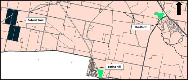
Figure 2: locality plan showing the whole of the
existing holding
The land to which the application relates is now described
as Lots 18, 19, 29 and 30 DP 750387.
As for the other two reasons, no formal documentation
relating to the application has been received since those meetings.
During the meetings with the applicant and Council staff
that followed the 6 September Planning and Development Committee meeting,
it became apparent that the uncertainty surrounding the rezoning of land around
Orange Airport was the main motive for the proponent’s reluctance to
finalise his application.
As the rezoning of land around Orange Airport is not
proceeding and some time has passed since that rezoning proposal was withdrawn,
Council staff wrote to the applicant on 22 March 2018 requesting that the
necessary documentation outstanding since 2012 be submitted. In the interests
of ensuring active development applications do not sit continually in abeyance,
the applicant was advised that if a complete application was not received by
Monday, 2 April 2018 a report would be tabled for the Planning and Development
Committee with a recommendation for refusal. No correspondence has been
received to date.
Council has an obligation to determine development
applications in a reasonable time period. This application has remained
incomplete for five and a half years. Council staff did a final letter drop to
Mr Howarth on 11 July 2018 that included a handwritten note requesting that Mr
Howarth ring David Waddell (Director Development Services) urgently on his
mobile.
Mr Waddell has since tried phoning Mr Howarth on a regular
basis in an attempt to arrange a final meeting with staff and the Mayor to
discuss the proposal, with no response. As such, given the lack of response and
repeated requests for additional information with no response, it is
recommended that Council determine this application.
The application remains deficient. No plans or environmental
reports (i.e. contamination, suitability for onsite effluent or impact
from aircraft noise etc.) have been submitted to Council.
As such, Council staff are not able to complete the
assessment of the application; and relevantly, the application is recommended
for refusal for the following reasons:
1 Insufficient
information has been submitted with the application to allow a detailed and
rigorous assessment pursuant to Section 4.15 of the Environmental Planning and
Assessment Act 1979.
2 The
applicant did not include documents that are required to accompany a
development application as detailed in schedule 1 of the Environmental Planning
and Assessment Regulation 2000.
Council staff have provided the applicant with a number of
opportunities via both formal correspondence and phone conversations to provide
the necessary information, to no avail.
The consequences of the refusal of this application is that
the land to which the application relates would lose its ability to have a
dwelling house erected on it under the current planning scheme.
RECENT LEGISLATIVE CHANGES
On 1 March 2018 the Environmental Planning and Assessment
Act 1979 was substantially amended. The most immediate change involves the
restructuring and renumbering of the Act, with other more substantive
changes to be phased in over time. However, for some applications (particularly
where an application was lodged prior to the changes coming into effect) the
supporting documentation may still reference the previous numbering regime. In
the drafting of this report the content and substance of the supporting
material has been considered irrespective of which legislative references were
used.
DECISION FRAMEWORK
Development in Orange is governed by two key documents
Orange Local Environment Plan 2011 and Orange Development Control Plan 2004.
In addition the Infill Guidelines are used to guide development, particularly
in the heritage conservation areas and around heritage items.
Orange Local Environment Plan 2011 – The
provisions of the LEP must be considered by the Council in determining the
application. LEPs govern the types of development that are permissible or
prohibited in different parts of the City and also provide some assessment
criteria in specific circumstances. Uses are either permissible or not. The
objectives of each zoning and indeed the aims of the LEP itself are also to be
considered and can be used to guide decision making around appropriateness of
development.
Orange Development Control Plan 2004 – the DCP
provides guidelines for development. In general it is a performance based
document rather than prescriptive in nature. For each planning element there
are often guidelines used. These guidelines indicate ways of achieving the
planning outcomes. It is thus recognised that there may also be other solutions
of merit. All design solutions are considered on merit by planning and building
staff. Applications should clearly demonstrate how the planning outcomes are
being met where alternative design solutions are proposed. The DCP enables
developers and architects to use design to achieve the planning outcomes in
alternative ways.
DIRECTOR’S COMMENT
The development application is incomplete. The applicant has
been requested many times to provide the required information to complete a
competent application. This information has not been forthcoming since December
2012. Council has no option but to refuse this application based on a lack of
information.
Link To Delivery/OPerational Plan
The recommendation in this report relates to the
Delivery/Operational Plan strategy “10.1 Preserve - Engage with the
community to ensure plans for growth and development are respectful of our
heritage”.
Financial Implications
Nil
Policy and Governance Implications
Nil
|
Recommendation
That Council refuses development application
DA 3/2013(1) for Dwelling House at Lots 18 and 19
DP 750387 – 806 Huntley Road, Huntley and Lots 29 and 30 DP 750387
- Gander Road, Spring Terrace pursuant to the reasons provided in the
attached Notice of Refusal.
|
further considerations
Consideration has been given to the recommendation’s
impact on Council’s service delivery; image and reputation; political;
environmental; health and safety; employees; stakeholders and project
management; and no further implications or risks have been identified.
SUPPORTING INFORMATION
THE APPLICATION/PROPOSAL
Council's consent is sought for the erection of a dwelling
house on land described as Lots 18 and 19 DP 750387 – 806
Huntley Road, Huntley and Lots 29 and 30 DP 750387 - Gander Road, Spring
Terrace. It is not clear as to exactly what is proposed as part of the
application, other than to state that the application form describes a ‘four
bedroom residence with detached double garage’. The location, size,
appearance etc. of the dwelling are not known from the information provided.
CHRONOLOGY OF THE APPLICATION
The application was lodged on 21 December 2012. Council
wrote to the applicant on 14 January 2013 requesting additional
information necessary to complete assessment. The applicant responded to this
request seeking an extension to the 28 day timeframe stipulated in that letter
on 10 February 2013. A further letter was received from the applicant on 15
February 2013 requesting that the dwelling entitlement be retained.
Council again wrote to the applicant on 13 May 2013
requesting additional information, and again on 13 August 2014. The applicant
again requested an extension of time to provide the additional information.
This letter provided a commitment to provision of the plans by 1 August
2015. An extension of time was agreed to by Council staff in a letter dated
10 September 2014.
Council staff wrote a letter on 9 August 2016 providing the
applicant with 14 days to respond to the request for information, and
advising the applicant that if the necessary information had not been received
by the date provided in the letter, the application would be finalised with a
recommendation for refusal. No response was received to this request.
Consequently a report for refusal was considered by the Planning and
Development Committee on 6 September 2016.
At the Planning and Development Committee meeting of 6
September 2016 a report was considered which recommended refusal of the
application for the following reasons:
1 Insufficient
information has been submitted with the application to allow a detailed and
rigorous assessment pursuant to Section 79C of the Environmental Planning and
Assessment Act 1979.
2 The
applicant did not include documents that are required to accompany a
development application as detailed in schedule 1 of the Environmental Planning
and Assessment Regulation 2000.
3 The
land to which this application relates does not constitute the whole of an
existing holding as defined by clause 4.2A(6) of Orange Local Environmental
Plan 2011.
At that meeting it was resolved:
That
Council defer determination of development application DA 3/2013(1) for
Dwelling House at Lot 19 DP 750387 - 806 Huntley Road, Huntley, and that the
Mayor and staff meet with the applicant to discuss the application.
Council staff have since held a number of meetings with the
proponent. Since this time the applicant has amended the application to include
all of the lots that make up the existing holding. As such, item (3) listed
above as a reason for refusal is no longer an applicable reason for refusal.
As for the other two reasons for refusal, no formal
documentation relating to the application has been received since those
meetings.
During the meetings with the applicant and Council staff
that followed the 6 September Planning and Development Committee meeting
it became apparent that the uncertainty surrounding the rezoning of land around
Orange Airport was the main motive for the proponent’s reluctance to
finalise his application.
Following Council’s decision not to proceed with the
Airport rezoning, Council staff wrote to the applicant on 22 March 2018
advising them that as this DA has been outstanding since December 2012 and
that if a complete application was not received by Monday, 2 April 2018 a
report would be tabled for the Planning and Development Committee in May with a
recommendation for refusal. No correspondence has been received to date.
Council has an obligation to determine development
applications in a reasonable time period. This application has remained
incomplete for five and a half years. Council staff did a final letter drop to
Mr Howarth on 11 July 2018 that included a handwritten note requesting that Mr
Howarth ring David Waddell (Director Development Services) urgently on his
mobile. Mr Waddell has since tried phoning Mr Howarth on a regular basis in an
attempt to arrange a final meeting with staff and the Mayor to discuss the
proposal, with no response. As such, given the lack of response and repeated
requests for additional information with no response, it is recommended that
Council determine this application.
The application remains deficient. No plans or environmental
reports (ie contamination, suitability for onsite effluent or impact from
aircraft noise etc) have been submitted to Council.
As such, Council staff are not able to complete the
assessment of the application; and relevantly, the application is recommended
for refusal for the following reasons:
1 Insufficient
information has been submitted with the application to allow a detailed and
rigorous assessment pursuant to Section 4.15 of the Environmental Planning and
Assessment Act 1979.
2 The
applicant did not include documents that are required to accompany a
development application as detailed in schedule 1 of the Environmental Planning
and Assessment Regulation 2000.
Council staff have provided the applicant with a number of
opportunities via both formal correspondence and phone conversations to provide
the necessary information, to no avail.
MATTERS FOR CONSIDERATION
Section 1.7 - Application of
Part 7 of the Biodiversity Conservation Act 2016 and Part 7A of the
Fisheries Management Act 1994
Development Applications lodged prior to 25 February 2018
Section 1.7 of the EP&A Act 1979 identifies that Part 7
of the Biodiversity Conservation Act 2016 and Part 7A of the Fisheries
Management Act 1994 have effect in connection with terrestrial and aquatic
environments.
Notwithstanding, Section 28 of the Biodiversity
Conservation (Savings and Transitional) Regulation 2017 states that the
former planning provisions continue to apply to the determination of a pending
planning application, being an application for planning approval made before
the commencement of the new Act but not determined before that commencement.
The relevant provisions are set out at Part 5A of the historical version of the
EP&A Act 1979 dated 24 August 2017.
In this instance there is significant biodiversity or
habitat value identified in the north-eastern quadrant of the subject land. It
is not possible to complete an assessment pursuant to Section 1.7 of the Act as
it is not known from the information provided where the proposed house is to be
located, and as such what impact that may have on the identified biodiversity
and habitat value.
Section 4.15
Section 4.15 of the Environmental Planning and Assessment
Act 1979 requires Council to consider various matters, of which those
pertaining to the application are listed below.
PROVISIONS OF ANY ENVIRONMENTAL
PLANNING INSTRUMENT s4.15(1)(a)(i)
Orange Local Environmental Plan 2011
Part 1 - Preliminary
Clause 1.2 - Aims of Plan
The broad aims of the LEP are
set out under subclause 2. Those relevant to the application are as follows:
(a) to encourage development which complements
and enhances the unique character of Orange as a major regional centre boasting
a diverse economy and offering an attractive regional lifestyle,
(b) to provide for a range of development
opportunities that contribute to the social, economic and environmental
resources of Orange in a way that allows present and future generations to meet
their needs by implementing the principles for ecologically sustainable
development,
(c) to conserve and enhance the water
resources on which Orange depends, particularly water supply catchments,
(d) to manage rural land as an environmental
resource that provides economic and social benefits for Orange,
(e) to provide a range of housing choices in
planned urban and rural locations to meet population growth,
(f) to recognise and manage valued
environmental heritage, landscape and scenic features of Orange.
It is not possible to conclusively ascertain from the
information provided whether or not the application is consistent with the
above listed aims of the plan.
Clause 1.6 - Consent Authority
This clause establishes that, subject to the Act, Council is
the consent authority for applications made under the LEP.
Clause 1.7 - Mapping
The subject site is identified
on the LEP maps in the following manner:
|
Land Zoning Map:
|
Land zoned E3 Environmental
Management
|
|
Lot Size Map:
|
Minimum Lot Size 100ha
|
|
Heritage Map:
|
Not a heritage item or conservation
area (located opposite a heritage item)
|
|
Height of Buildings Map:
|
No building height limit
|
|
Floor Space Ratio Map:
|
No floor space limit
|
|
Terrestrial Biodiversity Map:
|
High biodiversity sensitivity on
the site
|
|
Groundwater Vulnerability Map:
|
Ground water vulnerable
|
|
Drinking Water Catchment Map:
|
Within the drinking water catchment
|
|
Watercourse Map:
|
Not within or affecting a defined
watercourse
|
|
Urban Release Area Map:
|
Not within an urban release area
|
|
Obstacle Limitation Surface Map:
|
No restriction on building siting
or construction
|
|
Additional Permitted Uses Map:
|
No additional permitted use applies
|
Those matters that are of relevance are addressed in detail
in the body of this report.
Clause 1.9A - Suspension of
Covenants, Agreements and Instruments
This clause provides that covenants, agreements and other
instruments which seek to restrict the carrying out of development do not apply
with the following exceptions.
· covenants imposed
or required by Council
· prescribed
instruments under Section 183A of the Crown Lands Act 1989
· any conservation
agreement under the National Parks and Wildlife Act 1974
· any trust
agreement under the Nature Conservation Trust Act 2001
· any property
vegetation plan under the Native Vegetation Act 2003
· any biobanking
agreement under Part 7A of the Threatened Species Conservation Act 1995
· any planning
agreement under Division 6 of Part 4 of the Environmental Planning and
Assessment Act 1979.
Council staff are not aware of the title of the subject
property being affected by any of the above.
Part 2 - Permitted or
Prohibited Development
Land Use Zones
The subject site is located within the E3 Environmental
Management zone. The proposed development is defined as a dwelling house under
OLEP 2011 which means:
a building containing only one
dwelling.
To extend this definition further:
dwelling means a room
or suite of rooms occupied or used or so constructed or adapted as to be
capable of being occupied or used as a separate domicile.
Dwelling houses are permissible in the E3 Environmental
Management zone with the consent of Council.
Clause 2.3 of LEP 2011
references the Objectives for each zone in LEP 2011. These objectives for
land zoned E3 Environmental Management are as follows:
1 -
Objectives of the E3 Environmental Management Zone
· To protect, manage
and restore areas with special ecological, scientific, cultural or aesthetic
values.
· To provide for a
limited range of development that does not have an adverse effect on those
values.
· To manage development
within water supply catchment lands to conserve and enhance the city and
district’s water resources.
· To maintain the rural
function and primary production values of the area.
· To ensure development
along the Southern Link Road has alternative access.
It is not possible to complete an assessment of the
appropriateness of the development against the above listed objectives of the
zone given the deficiencies with the application.
Part 3 - Exempt and
Complying Development
The application is not exempt or complying development.
Part 4 - Principal
Development Standards
Clause 4.2A -
Erection of Dwelling Houses on Land in Certain Rural and Environmental
Protection Zones
This clause prevents
the erection of dwelling Houses on land zoned RU1, E2, E3 or E4 unless the
following provisions can be met:
(1) The
objectives of this clause are as follows:
(a) to
minimise unplanned rural residential development,
(b) to
enable the replacement of lawfully erected dwelling houses in rural and
environmental protection zones.
It is not possible to
conclusively determine if the proposed dwelling is consistent with the above
objectives given the identified deficiencies with the application.
(3) Development
consent must not be granted for the erection of a dwelling house on land in a
zone to which this clause applies, and on which no dwelling house has been
erected, unless the land is:
(a) a
lot that is at least the minimum lot size specified for that land by the Lot
Size Map, or
(b) a
lot created before this Plan commenced and on which the erection of a dwelling
house was permissible immediately before that commencement, or
(c) a
lot resulting from a subdivision for which development consent (or equivalent)
was granted before this Plan commenced and on which the erection of a dwelling
house would have been permissible if the plan of subdivision had been
registered before that commencement, or
(d) an
existing holding.
Note. A
dwelling cannot be erected on a lot created under clause 9 of State
Environmental Planning Policy (Rural Lands) 2008 or clause 4.2.
(4) Land
ceases to be an existing holding for the purposes of subclause (3) (d) if an
application for development consent referred to in that subclause is not made
in relation to that land before 31 December 2012.
A search of Council’s records indicates that the land
comprises the whole of an existing holding as defined under Orange Local
Environmental Plan 2011.
OLEP 2011 defines an existing holding as
land that:
(a) was
a holding on 24 January 1964, and
(b) is
a holding at the time the application for development consent referred to in
subclause (3) is lodged,
whether or not there has been
a change in the ownership of the holding since 24 January 1964, and includes
any other land adjoining that land acquired by the owner since 24 January 1964.
Pursuant to clause 4.2A(4) of Orange Local Environmental
Plan 2011 land ceases to be an existing holding for the purposes of subclause
(3)(d) if an application for development consent referred to in that subclause
is not made in relation to that land before 31 December 2012.
Whilst it is unclear from the information submitted with the
application as to which provision of the LEP the applicant is relying upon,
Council staff can confirm that a development application (of limited
information) for a dwelling was lodged on 21 December 2012.
The consequences for the applicant if the application is
refused is that it will not be possible to seek consent for a dwelling on the
subject land under the current planning provisions.
This scenario will occur as the relevant sunset clause
within the LEP will come into effect and the land will lose its existing
holding status. In order for Council to have the legal ability to approve a
dwelling on the land, the land would need to comprise an area of at
least 100ha. The land the subject of this application comprises 71.5ha. It
is understood that the applicant does have interests in other adjoining land.
Should a refusal be determined, the applicant could consolidate additional land
to create a parcel of 100ha or more and seek consent for a dwelling house on
that 100ha (or more) parcel.
Part 5 -
Miscellaneous Provisions
5.10 - Heritage Conservation
The subject land is not identified as a heritage item, nor
is it located in a conservation area. It is, however, opposite a heritage item,
and therefore the below provisions apply by virtue of subclause (c).
(1) Objectives
The
objectives of this clause are as follows:
(a) to
conserve the environmental heritage of Orange,
(b) to
conserve the heritage significance of heritage items and heritage conservation
areas, including associated fabric, settings and views,
(c) to
conserve archaeological sites,
(d) to
conserve Aboriginal objects and Aboriginal places of heritage significance.
(2) Requirement
for Consent
Development
consent is required for any of the following:
(a) demolishing
or moving any of the following or altering the exterior of any of the following
(including, in the case of a building, making changes to its detail, fabric,
finish or appearance):
(i) a
heritage item,
(ii) an
Aboriginal object,
(iii) a
building, work, relic or tree within a heritage conservation area,
(b) altering
a heritage item that is a building by making structural changes to its interior
or by making changes to anything inside the item that is specified in Schedule
5 in relation to the item,
(c) disturbing
or excavating an archaeological site while knowing, or having reasonable cause
to suspect, that the disturbance or excavation will or is likely to result in a
relic being discovered, exposed, moved, damaged or destroyed,
(d) disturbing
or excavating an Aboriginal place of heritage significance,
(e) erecting
a building on land:
(i) on
which a heritage item is located or that is within a heritage conservation
area, or
(ii) on
which an Aboriginal object is located or that is within an Aboriginal place of
heritage significance,
(f) subdividing
land:
(i) on
which a heritage item is located or that is within a heritage conservation
area, or
(ii) on
which an Aboriginal object is located or that is within an Aboriginal place of
heritage significance.
(4) Effect
of Proposed Development on Heritage Significance
The
consent authority must, before granting consent under this clause in respect of
a heritage item or heritage conservation area, consider the effect of the
proposed development on the heritage significance of the item or area
concerned. This subclause applies regardless of whether a heritage management
document is prepared under subclause (5) or a heritage conservation management
plan is submitted under subclause (6).
(5) Heritage
assessment
The
consent authority may, before granting consent to any development:
(a) on
land on which a heritage item is located, or
(b) on
land that is within a heritage conservation area, or
(c) on
land that is within the vicinity of land referred to in paragraph (a) or (b),
require
a heritage management document to be prepared that assesses the extent to which
the carrying out of the proposed development would affect the heritage
significance of the heritage item or heritage conservation area concerned.
It is not possible to adequately complete a heritage
assessment of the heritage item in the vicinity of the subject land due to the
limited information provided.
Part 6 - Urban
Release Area
Not relevant to the application. The subject site is not
located in an Urban Release Area.
Part 7 - Additional
Local Provisions
7.1 - Earthworks
This clause establishes
a range of matters that must be considered prior to granting development
consent for any application involving earthworks, such as:
(a) the likely disruption of, or any
detrimental effect on, existing drainage patterns and soil stability in the
locality of the development
(b) the effect of the development on the
likely future use or redevelopment of the land
(c) the quality of the fill or the soil to be
excavated, or both
(d) the effect of the development on the
existing and likely amenity of adjoining properties
(e) the source of any fill material and the
destination of any excavated material
(f) the likelihood of disturbing relics
(g) the proximity to and potential for adverse
impacts on any waterway, drinking water catchment or environmentally sensitive
area
(h) any measures proposed to minimise or
mitigate the impacts referred to in paragraph (g).
It is not clear from
the information provided if earthworks are required; and therefore it is not
possible to assess the development against the above provisions.
7.3 - Stormwater
Management
This clause applies
to all industrial, commercial and residential zones and requires that Council
be satisfied that the proposal:
(a) is designed to maximise the use of water
permeable surfaces on the land having regard to the soil characteristics
affecting onsite infiltration of water
(b) includes, where practical, onsite
stormwater retention for use as an alternative supply to mains water,
groundwater or river water; and
(c) avoids any significant impacts of stormwater
runoff on adjoining downstream properties, native bushland and receiving
waters, or if that impact cannot be reasonably avoided, minimises and mitigates
the impact.
It is not clear from
the information provided how stormwater will be managed, and therefore it is
not possible to assess the development against the above provisions.
Notwithstanding this, given the size of the land it is likely that
post-development run off levels will not exceed pre-development levels.
7.4 - Terrestrial
Biodiversity
This clause seeks to
maintain terrestrial biodiversity and requires that consent must not be issued
unless the application demonstrates whether or not the proposal:
(a) is likely to have any adverse impact on
the condition, ecological value and significance of the fauna and flora on the
land
(b) is likely to have any adverse impact on
the importance of the vegetation on the land to the habitat and survival of
native fauna
(c) has any potential to fragment, disturb or
diminish the biodiversity structure, function and composition of the land, and
(d) is likely to have any adverse impact on
the habitat elements providing connectivity on the land.
Additionally this clause
prevents consent being granted unless Council is satisfied that:
(a) the development is designed, sited and
will be managed to avoid any significant adverse environmental impact, or
(b) if that impact cannot be reasonably
avoided - the development is designed, sited and will be managed to minimise
that impact, or
(c) if that impact cannot be minimised - the
development will be managed to mitigate that impact.
The subject
land comprises areas identified as high biodiversity as shown below:
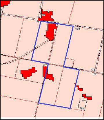
Figure
3: high biodiversity on the subject land
As it is not known
where the dwelling is proposed, Council staff are not able to complete an
assessment against the above provisions and conclusively determine the level of
impact likely upon the areas of high biodiversity.
7.6 - Groundwater
Vulnerability
This clause seeks to
protect hydrological functions of groundwater systems and protect resources
from both depletion and contamination. Orange has a high water table and large
areas of the LGA, including the subject site, are identified with
“Groundwater Vulnerability” on the Groundwater Vulnerability Map.
This requires that Council consider:
(a) whether or not the development (including
any onsite storage or disposal of solid or liquid waste and chemicals) is
likely to cause any groundwater contamination or have any adverse effect on
groundwater dependent ecosystems, and
(b) the cumulative impact (including the
impact on nearby groundwater extraction for potable water supply or stock water
supply) of the development and any other existing development on groundwater.
Furthermore consent may not be granted unless Council is satisfied that:
(a) the development is designed, sited and
will be managed to avoid any significant adverse environmental impact, or
(b) if that impact cannot be reasonably
avoided - the development is designed, sited and will be managed to minimise
that impact,
(c) if that impact cannot be minimised - the
development will be managed to mitigate that impact.
The proposal is not
anticipated to involve the discharge of toxic or noxious substances and is
therefore unlikely to contaminate the groundwater or related ecosystems. The
proposal does not appear to involve extraction of groundwater and will
therefore not contribute to groundwater depletion. However, given the
deficiencies in the application it is not possible to determine if the design
and siting of a dwelling (including the provision of an onsite effluent
management system) would avoid impact on groundwater; and therefore, it is not
possible to conclude if the development is acceptable or not in relation to
groundwater.
7.7 - Drinking Water
Catchments
This clause seeks to protect the quality of Council’s
drink water catchment and requires the following provisions to be met.
(1) The
objective of this clause is to protect drinking water catchments by minimising
the adverse impacts of development on the quality and quantity of water
entering drinking water storages.
(2) This
clause applies to land identified as “Drinking water” on the Drinking
Water Catchment Map.
(3) Before
determining a development application for development on land to which this
clause applies, the consent authority must consider whether or not the
development is likely to have any adverse impact on the quality and quantity of
water entering the drinking water storage, having regard to:
(a) the
distance between the development and any waterway that feeds into the drinking
water storage, and
(b) the
onsite use, storage and disposal of any chemicals on the land, and
(c) the
treatment, storage and disposal of waste water and solid waste generated or
used by the development.
(4) Development
consent must not be granted to development on land to which this clause applies
unless the consent authority is satisfied that:
(a) the
development is designed, sited and will be managed to avoid any significant
adverse impact on water quality and flows, or
(b) if
that impact cannot be reasonably avoided - the development is designed, sited
and will be managed to minimise that impact, or
(c) if
that impact cannot be minimised - the development will be managed to mitigate
that impact.
No information has been provided to adequately address the
above provisions, in particular matters in relation to the treatment of onsite
effluent. Therefore, Council staff cannot conclusively determine that the
development will not impact on the drinking water catchment.
7.9 - Airspace Operations
This clause seeks to protect the continued safe operation of
the Orange Regional Airport and obligates Council to consider development
within the area mapped obstacle limitation and have regard to the following provisions.
(1) The
objectives of this clause are as follows:
(a) to
provide for the effective and ongoing operation of the Orange Airport by
ensuring that such operation is not compromised by proposed development that
penetrates the Limitation or Operations Surface for that airport,
(b) to
protect the community from undue risk from that operation.
(2) If
a development application is received and the consent authority is satisfied
that the proposed development will penetrate the Limitation or Operations
Surface, the consent authority must not grant development consent unless it has
consulted with the relevant Commonwealth body about the application.
(3) The
consent authority may grant development consent for the development if the
relevant Commonwealth body advises that:
(a) the
development will penetrate the Limitation or Operations Surface but it has no
objection to its construction, or
(b) the
development will not penetrate the Limitation or Operations Surface.
(4) The
consent authority must not grant development consent for the development if the
relevant Commonwealth body advises that the development will penetrate the
Limitation or Operations Surface and should not be constructed.
Parts of the subject land are identified as falling within
the mapped obstacle limitation on the obstacle limitations map, and as such it
is essential for assessment staff to understand any proposed building’s
relationship to the existing landform, and thus its effect on the operations of
the airport. Again, as no plans have been submitted it is not possible to
undertake this task.
7.10 - Development in
Areas Subject to Aircraft Noise
This clause requires
Council to have regard to developments that will result in additional dwellings
or people within the vicinity of the airport and ensure that new development
will not unreasonably conflict with the continued operations of the airport.
(1) This
clause applies to development that:
(a) is
on land that:
(i) is
near an airport, and
(ii) is
in an ANEF contour of 20 or greater, and
(b) the
consent authority considers is likely to be adversely affected by aircraft
noise.
(2) Before
determining a development application for development to which this clause
applies, the consent authority:
(a) must
consider whether the development will result in an increase in the number of
dwellings or people affected by aircraft noise, and
(b) must
consider the location of the development in relation to the criteria set out in
Table 2.1 (Building Site Acceptability Based on ANEF Zones) in AS
2021—2000, Acoustics—Aircraft noise intrusion—Building siting
and construction, and
(c) must
be satisfied that the development will meet AS 2021—2000,
Acoustics—Aircraft noise intrusion—Building siting and construction
with respect to interior noise levels for the purposes of:
(i) if
the development will be in an ANEF contour of 20 or greater—child care
centres, educational establishments, entertainment facilities, hospitals,
places of public worship, public administration buildings or residential
accommodation, and
(ii) if
the development will be in an ANEF contour of 25 or greater—business
premises, hostels, hotel or motel accommodation, office premises or retail
premises.
The applicant has not
provided any information in relation to compliance with the above clause. As such,
it would be ultra vires for Council to consent to the application.
7.11 - Essential
services
The following clause requires Council to give regard to the
essential services necessary to accommodate a particular development on the
land, and whether those services are able to be made available for the
development.
Development consent must not be granted to development
unless the consent authority is satisfied that any of the following services
that are essential for the proposed development are available or that adequate
arrangements have been made to make them available when required:
(a) the
supply of water,
(b) the
supply of electricity,
(c) the
disposal and management of sewage,
(d) stormwater
drainage or on-site conservation,
(e) suitable
road access.
It is not possible to adequately assess the availability of
services given the lack of information - no information has been provided on
such things as management of sewage, access, water arrangements etc.
STATE ENVIRONMENTAL PLANNING
POLICIES
State Environmental Planning Policy (Building Sustainability
Index BASIX) applies to the subject development. However, the applicant has not
submitted a BASIX certificate with the application.
State Environmental Planning Policy 55 - Remediation of Land
applies to the subject land, specifically clause 7 which states:
7 Contamination
and remediation to be considered in determining development application
(1) A
consent authority must not consent to the carrying out of any development on
land unless:
(a) it
has considered whether the land is contaminated, and
(b) if
the land is contaminated, it is satisfied that the land is suitable in its
contaminated state (or will be suitable, after remediation) for the purpose for
which the development is proposed to be carried out, and
(c) if
the land requires remediation to be made suitable for the purpose for which the
development is proposed to be carried out, it is satisfied that the land will
be remediated before the land is used for that purpose.
The land has been previously used for agricultural purposes,
and as such there is the likelihood of some form of contamination being present
on the land. The applicant has not submitted sufficient information to
demonstrate to Council staff that the land is suitable for the purposes of a
residential land-use. As such it would not be within Council’s power to
approve the application in its current form.
PROVISIONS OF ANY DRAFT
ENVIRONMENTAL PLANNING INSTRUMENT THAT HAS BEEN PLACED ON EXHIBITION
s4.15(1)(a)(ii)
There are no draft environmental planning instruments that
apply to the subject land or proposed development.
DESIGNATED DEVELOPMENT
The proposed development is not designated development.
PROVISIONS OF ANY DEVELOPMENT
CONTROL PLAN s4.15(1)(a)(iii)
Development Control Plan 2004
Development Control Plan 2004 (“the DCP”)
applies to the subject land. An assessment of the proposed development against
the relevant Planning Outcomes will be undertaken below.
Pursuant to Planning Outcome 0.2-1 Interim Planning Outcomes
- Conversion of Zones:
· Throughout this
Plan, any reference to a zone in Orange LEP 2000 is to be taken to be a
reference to the corresponding zone(s) in the zone conversion table.
The corresponding zone to zone 7 Water Supply Catchment
(Orange LEP 2000) is zone E3 Environmental management (Orange LEP 2011).
As such, Orange DCP 2004 – Chapter 6 is of primary relevance
to the assessment of this proposal. The relevant provisions are considered
below.
PO 2.3-1 PLANNING OUTCOMES -
VEGETATION MANAGEMENT
· Compliance
with the Native Vegetation Conservation Act 1997.
· Development
is designed and constructed in a way that minimises the impact on existing
vegetation.
· Particular
attention is given to the effect of rural or urban residential release
development on existing vegetation and scenic areas.
· Development
applications indicate on plans the location of all significant trees affected
by or in the vicinity of development.
· Applications
demonstrate to Council’s satisfaction that all practical measures have
been made to retain trees that contribute to and embellish the Orange
landscape.
It is not possible to complete an assessment of the above
planning outcomes due to the deficiencies in information with the application.
PLANNING
OUTCOMES FOR DWELLINGS IN PROXIMITY TO AGRICULTURE AND OTHER RURAL ACTIVITIES
· Dwelling
houses should be located to minimise conflicts with the operation of activities
associated with primary production.
· Where
a dwelling is proposed to be located within 150 metres of land where spraying
of chemicals is likely to occur, an adequate biological buffer is to be
established between the dwelling and that agricultural land.
It is not possible to complete
an assessment of the above planning outcomes due to the deficiencies in
information with the application.
PLANNING OUTCOMES FOR RURAL DWELLING HOUSES
· The
dwelling house complies with Council’s Energy Smart Homes Code.
· The
dwelling house is sited on land identified as being suitable for construction
and free from contamination, flooding and bushfire risk.
· Privacy
and views of neighbouring houses are retained.
· A suitable
area is available for perpetual on-site disposal of wastes.
· Substantial
remnant vegetation is protected from disturbance.
· An
adequate water supply is provided.
· All-weather
access to a public road is provided.
· Entry
gateways are set back sufficiently from the front boundary to allow vehicles to
pull up off the public road carriageway.
· A buffer
area is established in the vicinity of agricultural operations.
· Outbuildings
are located in proximity of and to the rear of the main dwelling house when
viewed from the nearest road.
It is not possible to complete an assessment of the above
planning outcomes due to the deficiencies in information with the application.
PLANNING OUTCOMES –
DEVELOPMENT IN THE VICINITY OF THE AIRPORT
· Noise-sensitive
development is located outside the airport-noise zone.
· Where
there is no alternative location, development occurs within the hatched area
around the Orange airport in full compliance with Australian Standard AS 2021-
1994 Acoustics- Aircraft Noise Intrusion - Building Siting and Construction.
· Development
in the vicinity of the airport complies with the Obstacle Limitation Surfaces
Plan for Orange.
It is not possible to complete an assessment of the above
planning outcomes due to the deficiencies in information with the application.
PROVISIONS PRESCRIBED BY THE
REGULATIONS s4.15(1)(a)(iv)
The applicant has not suitably demonstrated that the
development is consistent with the provisions prescribed by the regulations.
THE LIKELY IMPACTS OF THE
DEVELOPMENT s4.15(1)(b)
The application is deficient in so far as the information
provided is not adequate to enable a complete and rigorous assessment of the
likely impacts as required by s4.15(1)(b).
THE SUITABILITY OF THE SITE
s4.15(1)(c)
The application is deficient in so far as the information
provided is not adequate to enable a complete and rigorous assessment of the
suitability of the site as required by s4.15(1)(c).
ANY SUBMISSIONS MADE IN
ACCORDANCE WITH THE ACT s4.15(1)(d)
The proposed development is not defined as advertised
development under the provisions of the LEP, and as such no formal exhibition
of the application was required. No submissions have been received in relation
to this application.
PUBLIC INTEREST
s4.15(1)(e)
Whilst the proposed development is likely to be of minor
interest to the wider public due to the relatively localised nature of
potential impacts, given the deficiencies with the application it not
considered to be in the public interest to consent to the application.
SUMMARY
The application is deficient in so far as the information
provided is not adequate to enable a complete and rigorous assessment pursuant
to Council’s obligations under the Environmental Planning and
Assessment Act. Council staff have provided the applicant with a number of
opportunities via both formal correspondence and phone conversations to provide
the necessary information, but to no avail. As such, the development
application is recommended for refusal.
COMMENTS
The requirements of the Environmental Health and Building
Surveyor and the Engineering Development Section have not been sought due to
the absence of information.
Attachments
1 Notice
of Refusal, D18/39071⇨
2.5 Development
Application DA 329/2015(2) - 62 Byng Street and 77 Hill Street
RECORD
NUMBER: 2018/1892
AUTHOR: Andrew
Crump, Senior Planner
EXECUTIVE Summary
|
Application lodged
|
4 June 2018
|
|
Applicant/s
|
Mayoh Architects Pty Ltd - PD Mayoh
Pty Ltd
|
|
Owner/s
|
Denoc Holdings Pty Ltd
|
|
Land description
|
Lot 3 Sec 21 DP 758817, Lot 4 DP
1085463 and Lot 1 DP 956418 - 62 Byng Street and 77 Hill Street, Orange
|
|
Proposed land use
|
Alterations and extension to an
existing heritage mansion to provide boutique hotel accommodation, conference
room, kitchen and dining facilities, on-site car parking and landscaping, and
demolition (tree removal)
|
|
Value of proposed development
|
$6,200,000.00
|
Link To Delivery/OPerational Plan
The recommendation in this report relates to the
Delivery/Operational Plan strategy “10.1 Preserve - Engage with the
community to ensure plans for growth and development are respectful of our
heritage”.
Financial Implications
Application has been made to modify development consent DA
329/2015(1) which was issued by the Court. The development consent relates to a
boutique hotel accommodation on land described as Lot 3 Sec 21 DP 758817,
Lot 4 DP 1085463 and Lot 1 DP 956418; known as 62 Byng Street and 77 Hill
Street, Orange. The land is shown in the below figure.
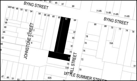
Figure 1: locality plan (subject land blacked out)
The application to modify the consent
involves a number of matters as detailed in this report. Council’s
Heritage Advisor and the applicant have worked collaboratively to address many
of the issues that relate to heritage conservation. The primary issues that
remained unresolved at the conclusion of those discussions relate to the
location of the proposed pad-mount substation at the front of the site and the
means of attachment of the proposed privacy screens to rooms 1-4 and 9-12.
These two matters are discussed in detail below.
Section 4.56 obligates Council to be satisfied that the
application to modify the consent issued by the Court is substantially the same
development for which consent was previously granted, which Council staff
consider to be the case. Following this determination, a section 4.15
evaluation of the application is required which is detailed below.
The below Section 4.15 assessment of the development
indicates that the development as modified is acceptable. Attached is an
amended Notice of Approval for Council’s consideration.
It is recommended that Council supports the subject
proposal.
RECENT LEGISLATIVE CHANGES
On 1 March 2018 the Environmental Planning and Assessment
Act 1979 was substantially amended. The most immediate change involves the
restructuring and renumbering of the Act, with other more substantive
changes to be phased in over time. However, for some applications (particularly
where an application was lodged prior to the changes coming into effect) the
supporting documentation may still reference the previous numbering regime. In
the drafting of this report the content and substance of the supporting
material has been considered irrespective of which legislative references were
used.
DECISION FRAMEWORK
Development in Orange is governed by two key documents
Orange Local Environment Plan 2011 and Orange Development Control Plan 2004. In
addition the Infill Guidelines are used to guide development, particularly in
the heritage conservation areas and around heritage items.
Orange Local Environment Plan 2011 – The
provisions of the LEP must be considered by the Council in determining the application.
LEPs govern the types of development that are permissible or prohibited in
different parts of the City and also provide some assessment criteria in
specific circumstances. Uses are either permissible or not. The objectives of
each zoning and indeed the aims of the LEP itself are also to be considered and
can be used to guide decision making around appropriateness of development.
Orange Development Control Plan
2004 – the DCP provides guidelines for development. In general it is
a performance based document rather than prescriptive in nature. For each
planning element there are often guidelines used. These guidelines indicate
ways of achieving the planning outcomes. It is thus recognised that there may
also be other solutions of merit. All design solutions are considered on merit
by planning and building staff. Applications should clearly demonstrate how the
planning outcomes are being met where alternative design solutions are
proposed. The DCP enables developers and architects to use design to achieve
the planning outcomes in alternative ways.
DIRECTOR’S COMMENT
This modification application firstly passes the
modification test that it must be ‘substantially the same
development’. The modifications proposed are supported by staff for the
fact that most result in a lesser environmental impact than previously
proposed. Many of the modifications requested are also supported or not
objected to by neighbours.
There has been an issue, initially raised by neighbours,
that the Construction Certificate plans differ from the Court approved DA
plans. The changes are not considered significant by staff. Staff have
investigated this matter and have concluded that Council is in a position to
approve this modification, particularly since the changes are considered minor
and likely to improve the environmental impact of the overall development.
The issue of whether the private certifier has erred is a
separate matter that will be followed up by staff.
Policy and Governance Implications
Nil
|
Recommendation
That Council modifies
development consent DA 329/2015(1)
for Alterations and extension to an existing heritage mansion to provide
boutique hotel accommodation, conference room, kitchen and dining facilities,
on-site car parking and landscaping, and demolition (tree removal) at Lot
3 Sec 21 DP 758817, Lot 4 DP 1085463 and Lot 1 DP 956418 –
62 Byng Street and 77 Hill Street, Orange
pursuant to the conditions of consent in the attached modified Notice of
Approval.
|
further considerations
Consideration has been given to the recommendation’s
impact on Council’s service delivery; image and reputation; political;
environmental; health and safety; employees; stakeholders and project
management; and no further implications or risks have been identified.
SUPPORTING INFORMATION
The application to modify the development consent involves
the following[1]:
1 Removal
of balconies for guest rooms 1-4, 9-12 and the conference room balcony, and
replace with additional enclosed floor area by moving the line of the windows
out. It is also proposed to affix fixed louvres to the windows of rooms 1-12.
2 Modification
of the northern boundary fence and hedge.
3 Modification
of other boundary fencing, including substituting hardwood timber fencing with
treated pine along the western boundary and adding additional palings to the
common boundary with 60 Byng Street (at the rear of 60 Byng Street).
4 Modification
to the height of Level 1 guest rooms (increase of 360mm in height) and
a 265mm increase in the height of the lift overrun.
5 Addition
of an electrical substation in the north-western corner of the site.
6 Modification
to southern elevation.
7 Minor
modifications to the western elevation to accommodate items 1 and 4 listed
above.
8 Addition
of air conditioning and temporary bin enclosure timber screen with timber
structure at the western side of former dwelling; and new path at the front of
former dwelling.
9 Change
of material of light spill screen to parking spaces 14, 15 and 16 from
perforated metal to timber lattice.
10 Reduction
in the size of the timber deck located to the west of the entry lounge.
11 Increase
the footprint of the lower ground floor to accommodate bin storage, accessible
staff toilet and shower, and fire hydrant pump room.
12 Additional
skylight above southern egress stairs.
13 Addition
of a fibre cement solid screen clad in roofing material on all four sides
around kitchen exhaust cowl.
14 Internal
changes to the proposed building on the ground and first floors.
15 Addition
of a fire booster valve located on the eastern side of the driveway.
16 Removal
of a tree on the western boundary.
17 Request
to delete or substitute various conditions of consent to accommodate the
proposed amendments.
18 Other
changes as shown within the submitted documentation.
LIST OF REQUESTED CONDITIONS TO BE
ALTERED or DELETED
Condition
24B – proposed to be deleted
The
condition currently states:
(24B) Details
of the time delay lighting to be fitted the balconies for rooms 1-4 and 9-12 is
to be provided to Orange City Council for approval prior to the issue of a
Construction Certificate. Details of the time delay locks and other means of
preventing access to the balconies between the hours of 10pm and 7am to be
fitted to the doors to the balconies for rooms 9-12 are to be provided to
Orange City Council for approval prior to the issue of a Construction
Certificate.
This
condition is requested to be deleted.
No
objection. This condition is superfluous given the balconies are proposed to be
removed.
Condition 24D – proposed to be amended
The
condition currently states:
(24D) Steel screens
or louvres are to be fixed to the upper level windows on the western elevation
of the approved extension, except for the western glazing to the main entry
foyer. Louvre screening is to be affixed to the edge of the balconies to rooms
9-12 (the upper level western facing balconies on the western façade)
and are to be angled to allow light and ventilation into the balcony area. The
steel screen or louvres must prevent direct overlooking of the adjoining
property at 60 Byng Street. Details of the steel screen or louvres are to be
provided with the application for a Construction Certificate and noted on the
plans to be submitted with the application for a Construction Certificate.
This
condition is proposed to be amended to the following (new text underlined,
deleted text struck out):
(24D) Steel screens
or louvres are to be fixed to the ground floor windows of
guest rooms 1-12, and the upper level windows on the western elevation of the
approved extension, except for the western glazing to the main entry foyer. Louvre
screening is to be affixed to the edge of the balconies to rooms 9-12 (the
upper level western facing balconies on the western façade) and are to
be angled to allow light and ventilation into the balcony area. The steel
screen or louvres must prevent direct overlooking of the adjoining property at
60 Byng Street. Details of the steel screen or louvres to
the upper level windows on the western elevation of the approved extension are to be provided
with the application for a Construction Certificate and noted on the plans to
be submitted with the application for a Construction Certificate.
As
detailed below under the consideration of visual privacy impacts, the addition
of privacy screening to all guest room windows on the ground floor is
considered a positive outcome for all parties as it will afford a greater level
of privacy than what was agreed to by the Court. However, Council staff do not
accept the deletion of the requirements for the louvres to be angled to allow
light into the room (ventilation no longer required as the windows are not
operable) whilst preventing direct overlooking of the adjoining property at
60 Byng Street.
In addition to the above and as detailed below, the recommendations
of Council’s Heritage Advisor for the louvres associated with rooms 1-4
and 9-12 to be separate from the window system has also been included in the
amended condition.
The
recommended condition of Council Staff therefore is:
Louvres screens are to be fixed to the ground floor windows
of guest rooms 1-12, and the upper level windows on the western elevation of
the approved extension, except for the western glazing to the main entry foyer.
The louvres attached to rooms 1 – 4 and 9 - 12 shall be attached to the
building in a manner whereby the louvres are horizontally separated at least
600mm from the face of the respective window glazing.
The louvres attached to all windows shall be angled to
allow light into the respective guest room whilst preventing direct overlooking
of the adjoining property at 60 Byng Street. Details of the louvres to all
required windows on the western elevation of the approved extension are to be
provided with the application for a Construction Certificate and noted on the plans
to be submitted with the application for a Construction Certificate.
Condition 24E – proposed to be amended
The
condition currently states:
(24E) A screen
is to be constructed and is to remain at the rear of the three easternmost
spaces (car spaces 14, 15 and 16) in front (north) of the proposed landscaping
to act as a barrier to light spill in addition to the boundary fencing and
landscaping. This screen is to be in the form of a perforated metal screen to a
height of 3 metres. The colour and material of the screen is to be provided to
Orange City Council for approval prior to the issue of a Construction
Certificate. Details of the screen are to be noted on the plans submitted with
a Construction Certificate.
The applicant has requested the
above condition be amended as follows (new text
underlined, deleted text struck out):
(24E) A screen
is to be constructed and is to remain at the rear of the three easternmost
spaces (car spaces 14, 15 and 16) in front (north) of the proposed landscaping
to act as a barrier to light spill in addition to the boundary fencing and
landscaping. This screen is to be in the form of a perforated metal timber
lattice screen to a height of 3 metres. The colour and material of
the screen is to be provided to Orange City Council for approval prior to the
issue of a Construction Certificate. Details of the screen are to be noted on
the plans submitted with a Construction Certificate.
As mentioned below, Council
staff are not in support of this request for the reasons outlined below. It is
recommended that the condition remain as is.
Condition 24I – proposed to be amended
The
condition currently states:
(24I) Full
details of the restoration or rebuilding of the front fence and gate to 62 Byng
Street must be submitted to Orange City Council prior to the issue of a
Construction Certificate.
Details of the condition of the existing fence and gate
must be provided to Council. Where it can be demonstrated to the satisfaction
of Council’s Manager of Developments Assessments that the existing
materials are incapable of restoration, the existing fence must be replaced by
a timber round top picket/ paling fence consistent with the heritage character
of the subject property and Central Orange Heritage Conservation Area. If the
fence is to be removed a Landscape plan with details of replacement of the
hedge is to be provided.
It is requested
to modify the condition as follows (new text
underlined, deleted text struck out):
(24i) Full
details of the restoration or rebuilding of the front fence and gate to 62 Byng
Street must be submitted to Orange City Council prior to the issue of a
Construction Certificate.
Details of the condition of the existing fence and gate
must be provided to Council. Where it can be demonstrated to the satisfaction
of Council’s Manager of Developments Assessments that the existing
materials are incapable of restoration, the existing fence must be replaced by
a timber round top picket/ paling fence to match the
original fence style of chain wire and timber posts, consistent with the heritage character of the subject property and
Central Orange Heritage Conservation Area. If the fence is to be removed
a Landscape plan with details of replacement of the hedge is to be provided.
The selected hedge plants behind the fence are to be advanced plants.
As detailed below, there are no objections to the alternate
front fence detail and modified condition. The above condition aligns with the
submitted detail and is supported. However, the submitted detail now proposed,
the second last sentence in the above described condition is superfluous and
should also be deleted (shown bold text). Additional text has also been added
which requires the plants selected for the Laurel hedge to be advanced
varieties of the plant.
Condition
24K – proposed to be deleted
The
condition currently states:
(24K) The timber deck off
the main lounge is to be constructed at existing ground level. Plans demonstrating compliance with this condition must be
submitted with an application for a Construction Certificate.
As
detailed below Council staff raise no objection to this condition being
deleted. It is not clear from the judgement as to why the condition was
imposed. Council’s Heritage Advisor has accepted the reduced depth of the
deck at the same level as the internal floor level of the lounge room.
Condition
47 – proposed to be modified
The
condition currently states:
(47) A
2m high lapped and capped hard wood timber fence must be constructed around the
perimeter of the development, excluding the frontages to 62 Byng Street and 77
Hill Street, the common boundary to 75 Hill Street and the common boundary
between 77 Hill Street and 79 Hill Street prior to the issue of an Occupation
Certificate.
Along the eastern boundary of 62 Byng Street, the fence
must taper to a maximum height of 1.8m forward of the front building line of
the building at 64 Byng Street.
Along the western boundary of 62 Byng Street, the fence
must taper to a maximum height of 1.8m forward of the front building line of
the building at 62 Byng Street. The height of the fence must be taken from the
highest Finished Surface Level adjacent to each part of that fence.
It is
requested to modify the condition as follows (new text underlined, deleted text
struck out):
(47) A
2m high lapped and capped hardwood timber fence must be constructed around the
perimeter of the development, excluding the frontages to 62 Byng Street
and 77 Hill Street, the common boundary to 60 Byng
Street, the common boundary to 75 Hill Street, the common
boundary between 77 Hill Street and 60 Byng Street
and the common boundary between 77 Hill Street and 79 Hill Street prior to the
issue of an Occupation Certificate.
Along
the common boundary to 60 Byng Street, the fence is to be constructed of
treated pine. Along the common boundary between 77 Hill Street and 60 Byng
Street, the existing fence must be retained.
Along the eastern boundary of 62 Byng Street, the fence must taper to a maximum
height of 1.8m forward of the front building line of the building at 64
Byng Street.
Along the
western boundary of 62 Byng Street, the fence must taper to a maximum height of
1.8m forward of the front building line of the building at 62 Byng
Street. The height of the fence must be taken from the highest Finished
Surface Level adjacent to each part of that fence.
As mentioned below, there are no
objections to the condition as proposed by the applicant.
Condition 48A – proposed to be modified
This condition appears to be a
duplicate of condition 24E and the same applies as stated above. The material
is to remain as approved.
Condition 83 – proposed to be deleted.
The
condition currently states:
(83) The
use of all balconies adjoining guest rooms or common areas is to be restricted
to use between the hours of 7am and 10pm only. The balconies to rooms 1-4 and
9-12 are to be fitted with time delay lighting and are not to receive light
between the hours of 10pm and 7am. The doors adjoining the balconies for rooms
9-12 are to be fitted with time delay locks to restrict the use of the
balconies to the hours of 7am-10pm only. Details of the time delay lighting and
time delay locks are required to be provided to the Council for
approval prior to the issue of a Construction Certificate.
Given the balconies are being
deleted, this condition is superfluous and as such there is no objection to the
condition being deleted.
BACKGROUND
ISSUANCE OF CONSTRUCTION CERTIFICATE
A Construction Certificate (CC)
was issued by a private certifier on 1 March 2018.
It was noted shortly after the
time of lodgement of this application to modify the consent that the submitted
plans differed from those that were approved by the Court more so than what was
being sought to be modified. Upon further investigation it was determined that
the plans submitted with the application to modify aligned with the plans that
were issued with the CC. This was also separately raised with Council staff by
an adjoining owner.
Essentially what this means is
that there are works that have commenced on the lower ground level that are in
accordance with the CC (issued by the private certifier), but the CC has
not been issued in a manner that is consistent with the Court approval. At the
time of inspection by Council staff the site works had not yet commenced on the
upper ground level and first level, so these amendments to the floor plan can
simply form part of this application to modify the consent. It should however
be noted the applicant (Mayoh Architects) suggest that the inconsistency
between the CC approved plans and the development consent is minor and does not
impact negatively on the environment and in their view are consistent in terms
of the legislation.
Regularising the works that have
already commenced is a little more complicated; however, there is a precedent
set by the Court to address this issue. The Court has held that section 96
(now referred to as section 4.55) of the Environmental Planning and
Assessment Act 1979 (the EPA Act) can operate retrospectively for
work that has already been carried out not in accordance with a consent (Austcorp
No. 459 Pty Limited v Baulkham Hills Shire Council (2002) 122 LGERA 205 (Austcorp
No. 459) at [18] – [22]). Austcorp No. 459 relied on the
findings of Windy Dropdown Pty Ltd v Warringah Council [2000] NSWLEC 240
where Talbot J held that “the broad construction of s 96 [now section
4.55] leads to a practical result that enables a consent authority to deal with
unexpected contingencies as they arise during the course of construction of
development or even subsequently, provided of course that the development to
which the consent as modified relates is substantially the same development”
(our emphasis).. His Honour stated [at 27] “the language of section
96 … itself does not mandate against retrospective development”.
His Honour subsequently approved the development on its merits.
It should be noted that recent
legislative amendments have resulted in the renumbering of the sections of the
EPA Act. Section 4.55 is the previous section 96. This modification
application has been made pursuant to section 4.56 (previously section
96AA) of the EPA Act. The language used in section 4.56(1)(a) is similar to the
language used in section 4.55(2)(a). Therefore for our purposes Austcorp No.
459 is the applicable law.
In summary, the above commentary
indicates that the works that have been undertaken to date that diverge from
the Court approved plans can be rendered lawful under this modification on the
basis that the works are substantially the same as the original consent. As
detailed above, Council staff are satisfied that the application to modify the
consent (including the works that have already commenced) is substantially the
same development as the development to which consent was granted by the Court.
Council’s
course of action in relation to what Council staff consider to be an
inappropriately issued Construction Certificate is a separate matter. As to
what regulatory action is available to Council, this has been established in Burwood
Council v Ralan Burwood Pty Ltd [2014] NSWCA 404 (Ralan). This
case related to the construction of a high rise building containing 3 towers,
commercial uses, and 233 residential units. What was approved by the certifier
and constructed was significantly different to the development consent granted
by the Court.
The Court of Appeal did not make a
ruling on whether the CCs were inconsistent with the development consent,
rather the Court held that even if it the CCs were inconsistent with the
development consent the CCs were nonetheless valid. The Court also held that
the approved plans and specifications issued with respect to the CCs formed
part of the development consent.
The Court of Appeal’s view
was that given the current legislative regime (the EPA Act and the Building
Professionals Act 2005), the matter should be dealt with as a disciplinary
matter relating to the accredited certifier rather than rendering a CC void. As
a consequence, developers will not be adversely affected where they have relied
in good faith on such certificates held out by a certifier to be lawfully
issued. Of note, one of the accredited certifiers in Ralan had his
accreditation cancelled and was disqualified from acting as an accredited
certifier for a period of five years, however there is no suggestion that his
disqualification related to his conduct in issuing CCs for Ralan's project.
In summary, the works that have
been undertaken to date that deviate from the Court approved plans can be
rendered lawful pursuant to section 4.56 of the EPA Act. The CC, despite
diverging from the Court approved plans, is not likely to be found void by the
Court notwithstanding the requirements of clause 145 of the Regulations; and
finally, Council or a member of the public could pursue disciplinary action
against the accredited certifier via the state regulatory body (the NSW
Building Professionals Board). It should be noted that the inconsistency
identified in this application relates mostly to the basement and a slight
increase in footprint. Certainly the inconsistencies are much less than that
considered by the Court in the Ralan case.
MATTERS FOR CONSIDERATION
Section 1.7 - Application of
Part 7 of the Biodiversity Conservation Act 2016 and Part 7A of the
Fisheries Management Act 1994
Development Applications lodged on or after 25 February 2018
Section 1.7 of the EP&A Act 1979 identifies that Part 7
of the Biodiversity Conservation Act 2016 and Part 7A of the Fisheries
Management Act 1994 have effect in connection with terrestrial and aquatic
environments.
Having regard to the relevant provisions and based on an
inspection of the subject property, it is considered that the proposed
development is not likely to significantly affect a threatened species.
A Biodiversity Development Assessment Report is not required
in this instance.
In this instance, site inspection reveals that the subject
property has no biodiversity or habitat value.
Section 4.56 - Modification by
consent authorities of consents granted by the Court
(1) A
consent authority may, on application being made by the applicant or any other
person entitled to act on a consent granted by the Court and subject to and in
accordance with the regulations, modify the development consent if:
(a) it
is satisfied that the development to which the consent as modified relates is
substantially the same development as the development for which the consent was
originally granted and before that consent as originally granted was modified
(if at all), and
(b) it
has notified the application in accordance with:
(i) the
regulations, if the regulations so require, and
(ii) a
development control plan, if the consent authority is a council that has made a
development control plan that requires the notification or advertising of
applications for modification of a development consent, and
(c) it
has notified, or made reasonable attempts to notify, each person who made a
submission in respect of the relevant development application of the proposed
modification by sending written notice to the last address known to the consent
authority of the objector or other person, and
(d) it
has considered any submissions made concerning the proposed modification within
any period prescribed by the regulations or provided by the development control
plan, as the case may be.
In respect to the above, Council staff considers the
application to be substantially the same development as the development for
which consent was originally granted by the Court. The overall use does not
change, and the overall scale of the development in terms of the number or
rooms, types of facilities, number of staff and the like does not change from
the original approval. In a qualitative sense, only relatively minor changes
are proposed to the development, many of which will result in a diminution of
impacts which are viewed by staff as positive contributions.
Other changes relate to addressing conditions of consent
such as the noise cowling around the kitchen exhaust, or access requirements
addressing the standard BCA compliance requirements.
In relation to the above listed notification requirements,
Council has advertised and notified the application in accordance with the
Regulations and made all reasonable attempts to notify those persons that made
a submission previously.
All submissions received have been addressed below.
(1A) In
determining an application for modification of a consent under this section,
the consent authority must take into consideration such of the matters referred
to in section 4.15 (1) as are of relevance to the development the subject of the
application. The consent authority must also take into consideration the
reasons given by the consent authority for the grant of the consent that is
sought to be modified.
Consideration
of the relevant parts of Section 4.15(1) are detailed below.
Section 4.15 - Evaluation
Section 4.15 of the Environmental
Planning and Assessment Act 1979 requires Council to consider various
matters, of which those pertaining to the application are listed below.
PROVISIONS OF ANY ENVIRONMENTAL
PLANNING INSTRUMENT s4.15(1)(a)(i)
Orange Local Environmental Plan
2011
Part 1 - Preliminary
Clause 1.2 - Aims of Plan
The
broad aims of the LEP are set out under subclause 2. Those relevant to the
application are as follows:
(a) to
encourage development which complements and enhances the unique character of
Orange as a major regional centre boasting a diverse economy and offering an
attractive regional lifestyle,
(b) to
provide for a range of development opportunities that contribute to the social,
economic and environmental resources of Orange in a way that allows present and
future generations to meet their needs by implementing the principles for
ecologically sustainable development,
(c) to
conserve and enhance the water resources on which Orange depends, particularly
water supply catchments,
(f) to
recognise and manage valued environmental heritage, landscape and scenic
features of Orange.
The
development as modified remains consistent with the above listed aims of
the plan.
Clause 1.6 - Consent Authority
This clause establishes that,
subject to the Act, Council is the consent authority for applications made
under the LEP.
Clause 1.7 - Mapping
The subject site is identified on the LEP maps in the
following manner:
|
Land
Zoning Map:
|
Land
zoned R1 General Residential
|
|
Lot Size
Map:
|
No
Minimum Lot Size
|
|
Heritage
Map:
|
Heritage
item and conservation area
|
|
Height of
Buildings Map:
|
No
building height limit
|
|
Floor
Space Ratio Map:
|
No floor
space limit
|
|
Terrestrial
Biodiversity Map:
|
No
biodiversity sensitivity on the site
|
|
Groundwater
Vulnerability Map:
|
Groundwater
vulnerable
|
|
Drinking
Water Catchment Map:
|
Not
within the drinking water catchment
|
|
Watercourse
Map:
|
Not
within or affecting a defined watercourse
|
|
Urban
Release Area Map:
|
Not
within an urban release area
|
|
Obstacle
Limitation Surface Map:
|
No
restriction on building siting or construction
|
|
Additional
Permitted Uses Map:
|
No
additional permitted use applies
|
|
Flood
Planning Map:
|
Not
within a flood planning area
|
Those matters that are of relevance
are addressed in detail in the body of this report.
Clause 1.9A - Suspension of
Covenants, Agreements and Instruments
This clause provides that covenants, agreements and other
instruments which seek to restrict the carrying out of development do not apply
with the following exceptions:
· covenants imposed
or required by Council
· prescribed
instruments under Section 183A of the Crown Lands Act 1989
· any conservation
agreement under the National Parks and Wildlife Act 1974
· any trust
agreement under the Nature Conservation Trust Act 2001
· any property
vegetation plan under the Native Vegetation Act 2003
· any biobanking
agreement under Part 7A of the Threatened Species Conservation Act 1995
· any planning
agreement under Division 6 of Part 4 of the Environmental Planning and
Assessment Act 1979.
Council staff are not aware of the title of the subject
property being affected by any of the above.
Part 2 - Permitted or Prohibited Development
Clause
2.1 - Land Use Zones and Clause 2.3 - Zone Objectives and Land Use Table
The subject site is located within
the R1 General Residential zone. The proposed development continues to be
characterised as hotel or motel accommodation which remains permissible
in the zone with consent.
Clause
2.3 of LEP 2011 references the Land Use
Table and Objectives for each zone in LEP 2011. These objectives for land
zoned R1 General Residential are as follows:
1 -
Objectives of the R1 General Residential Zone
· To provide for the
housing needs of the community.
· To provide for a
variety of housing types and densities.
· To enable other land
uses that provide facilities or services to meet the day to day needs of
residents.
· To ensure development
is ordered in such a way as to maximise public transport patronage and encourage
walking and cycling in close proximity to settlement.
· To ensure that
development along the Southern Link Road has an alternative access.
There are no aspects of the development as modified that
would create an inconsistency with the zone objectives.
Clause 2.7 - Demolition
Requires Development Consent
This clause triggers the need for development consent in
relation to a building or work.
The development as modified seeks
to remove a 6m high Ulmus procera (common name: English Elm) which has a
trunk of 240mm DBH.
The removal
of a tree on a listed Heritage Item is considered “demolition” by
definition pursuant to the LEP, and as such development consent is required,
which the applicant is seeking via this application.
Part 3 - Exempt and Complying Development
The application is not exempt or complying development.
Part 5 - Miscellaneous Provisions
5.10 - Heritage
Conservation
(1) Objectives
The
objectives of this clause are as follows:
(a) to
conserve the environmental heritage of Orange,
(b) to
conserve the heritage significance of heritage items and heritage conservation
areas, including associated fabric, settings and views,
(c) to
conserve archaeological sites,
(d) to
conserve Aboriginal objects and Aboriginal places of heritage significance.
As mentioned above, the applicant and Council’s
Heritage Advisor have worked collaboratively in addressing the fine grain
design detail to ensure that the development as modified is acceptable from a
heritage conservation point of view. This process is detailed below. Following
this process only a handful of matters remain in contention, which are
addressed via conditions of consent. With this in mind, the development as
modified is considered to be consistent with the objects of clause 5.10.
(2) Requirement
for Consent
Development
consent is required for any of the following:
(a) demolishing
or moving any of the following or altering the exterior of any of the following
(including, in the case of a building, making changes to its detail, fabric,
finish or appearance):
(i) a
heritage item,
(ii) an
Aboriginal object,
(iii) a
building, work, relic or tree within a heritage conservation area,
(b) altering
a heritage item that is a building by making structural changes to its interior
or by making changes to anything inside the item that is specified in Schedule
5 in relation to the item,
(e) erecting
a building on land:
(i) on
which a heritage item is located or that is within a heritage conservation
area.
The development as modified involves the above, and as such
consent is required.
(4) Effect
of Proposed Development on Heritage Significance
The
consent authority must, before granting consent under this clause in respect of
a heritage item or heritage conservation area, consider the effect of the
proposed development on the heritage significance of the item or area
concerned. This subclause applies regardless of whether a heritage management
document is prepared under subclause (5) or a heritage conservation management
plan is submitted under subclause (6).
The following heritage assessment relates to the fundamental
changes proposed under this application.
1 Removal
of balconies for rooms 1-4, 9-12 and the conference room balcony and replace
with additional enclosed floor area. It is also proposed to affix fixed louvres
to the windows of rooms 1-12
Council’s Heritage Advisor raises no objections to the
deletion of the balconies and the additional floor area, provided the screening
detail (which also addresses the privacy) is designed in a way whereby the louvres
read as an integrated part of the building and as an interpretation of a
traditional verandah, rather than an adjunct to the window system. This is
required for rooms 1-4 and 9-12. Rooms 5-8 do not require the separated
screening and can be attached where proposed.
To ensure that this recommendation of Council’s
Heritage Advisor is achieved, a condition is attached that requires the
external edge/face of the louvres attached to rooms 1‑4 and 9‑12
to be a minimum of 600mm from the face of the window glazing.
With the inclusion of the above noted condition, this aspect
of the application to modify the consent is acceptable in terms of impacts upon
heritage significance.
2 Modification
of northern boundary fence and hedge
The consent includes a condition that either requires the
existing fence to be restored or, if restoration is not practicable, a
replacement timber picket fence is to be installed.
Since the application has been determined, the applicant has
found a historic photograph (below) providing sufficient detail of the original
fence. It is now proposed to modify the relevant condition to allow for the
fence as now proposed as part of this application to modify.
Figure 2: historic photograph of Yallungah showing the
original front fence
The proposed front fence comprises
timber posts and rails with chain wire. A new cherry laurel hedge is proposed
behind. This is effectively a reconstruction of the historic fencing that has
been in place for many years. The proposed gates at the western end of the
frontage are addressed separately below at point 5 as they relate to the
mitigation of the proposed substation. The fence also includes a splay on the
western side of the driveway to improve the safety of vehicles exiting the
site.
Council’s Heritage Advisor has endorsed the amended
front fence design.
To ensure that the design intent of the hedge softening the
visual appearance of the fence occurs as soon as possible, a condition is
attached that requires advanced plants to be used for the hedge.
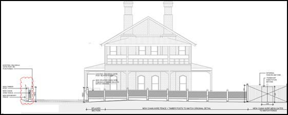
Figure 3: proposed timber post and rail fence with
chain wire infills
3 Modification
of other boundary fencing including substituting hardwood timber fencing with
treated pine along the western boundary and adding additional palings to the
common (rear boundary) with 60 Byng Street
The fence has been constructed using treated pine palings
affixed to a predominately metal frame. The consent specifically required the
fence to be constructed from hardwood, rather than a soft wood such as treated
pine.
An inspection of the fence identified that there are a
number of issues with the way the fence has been constructed. These are mostly
civil matters between the beneficiary of the consent and the adjoining property
owner, and are addressed in detail below.
The fence is to be painted a charcoal colour on the
development side of the fence.
Ideally, the fence ought to have been constructed in
accordance with the consent, primarily to ensure the longevity of the fence.
From a heritage perspective, the use of treated pine will not fundamentally
cause an impact upon the significance of the two heritage items on either side
of the fence.
Should Council be of the view that the subject fence be
constructed from hardwood, it will be necessary to attach a condition that
requires the already installed treated pine palings to be removed and hardwood
palings installed in accordance with the condition.
It is recommended that the condition requiring that the
fence be hardwood be amended to allow for (the already constructed) treated pine.
It is noted that, subject to certain
conditions relating to rectifying the existing build quality of the fence, the
adjoining owners at 60 Byng Street have accepted the treated pine material.
4 Modification
to the height of level 1 guest rooms (increase of 360mm in height) and a 265mm
increase in the height of the lift overrun
The approved headroom within rooms 13 to 19 is proposed to
be increased by raising the height of the dormer windows (increasing ceiling
height) by 360mm. This increase in height will not increase the overall height
or bulk of the already approved building. The windows will remain lower than
the main ridgeline of the building.
As part of the negotiations between Council’s Heritage
Advisor and the applicant, it has been agreed that modified surrounds to all
three sides of all the dormer windows are installed, providing for a 350mm
metal facing; the intent of which is to reduce the extent of the glazing and
window framed areas on the roofline and the vertical sides of each window.
The plans have been amended to include this detail.
The increase in height of the lift overrun will not result
in any unsatisfactory impacts in terms of heritage. Even with the additional
height, the lift overrun will still sit below the ridgelines of the new
building and will still sit well below the main ridge line of Yallungah.
The additional detail showing the proposed mitigation
measures is acceptable and Council staff raise no objections to the proposed
changes to the height of the dormer windows and the lift overrun.
5 Addition
of an electrical padmount substation in the north-western corner of site
During the detailed design it has become apparent that the
existing connection to the subject land and network supporting that connection
are insufficient for the power supply required by the development.
The proposed solution is the installation of a pad-mount
substation in the north-western corner of the site. The substation will have
dimensions of 1.37m wide, 3.05m deep and 1.67m in height. The
substation will be within an easement in favour of the electricity supply
authority.
Council’s Heritage Advisor recommended that the
applicant, as part of a standard heritage impact assessment process, provide
evidence to Council that all feasible options have been explored and the
reasons for which they have been discounted.
It is noted that the advice from the applicant’s
heritage consultant did not appear to go through this process. The advice from
the applicant’s heritage consultant simply concludes:
The substation
itself is a small, low structure and will have a very limited impact on the
presentation of the house to the street and the installation has been handled
in a best fit manner to mitigate the visual impact.
Following the request of
Council’s Heritage Advisor to demonstrate that alternatives have been
explored, the following additional commentary has been submitted:
Prior to awarding the Contract, a Design Information Pack
was received from Essential Energy, outlining a connection plan that involved
the installation of several new underground cables and the redirection of
several existing underground cables to an existing padmount substation at St
Joseph’s Catholic Church on Hill Street.
Once the Contract had been awarded a new consultant was
engaged to submit a new application for connection with Essential Energy. A
revised Design Information Pack was received from Essential Energy that
involved a padmount substation which was required to be located within a 7m x
4m easement accessible from the street frontage. Given the size of the easement
the only option was to locate the substation on the Byng Street frontage.
Council
staff in undertaking their assessment of heritage impacts of the substation in
the proposed location held discussions with Essential Energy’s
Contestable Works Department. At the conclusion of those discussions it became
apparent that the only feasible alternative (being an alternative that would
not result in impacts to surrounding customers’ electricity supply and also
provide sufficient and reliable supply to the development) was to explore
alternate locations within the site.
An
alternative location of the substation within the rear carpark was put to
Essential Energy; however Essential Energy indicated that this location was not
acceptable as sufficient width was not available within the driveway for
vehicles and equipment to be able to repair or replace the unit.
This
process of exploring alternatives concludes that the proposed location is
realistically the most logical location.
On
this basis Council’s Heritage Advisor and the applicant have agreed on
additional refined detail of the mitigation measures employed to effectively
conceal the substation.
The
additional detail shown on drawing nos. S4.56_A212 P6 and S4.56_A214 P2 is
considered satisfactory, and the addition of the proposed padmount substation
is considered acceptable.
6 Modification
to southern elevation
The changes to the southern elevation involve the addition
of the covered bin store on the lower ground level. The additional built form
in the southern end of the building is minor and at the rear of the site, and
thus will not result in any adverse impacts.
7 Minor
modifications to the western elevation to accommodate items 1 and 4 listed
above
This is addressed above under points 1 and 4. With
consideration of the additional detail and imposed conditions of consent,
Council staff raise no objections to the changes to the western elevation that
are a consequence of the proposed design changes.
8 Addition
of air conditioning and temporary bin enclosure timber screen with timber
structure at the western side of former dwelling; and new path at front of
former dwelling
It is proposed to place air conditioning condensers and a
temporary bin related to the kitchen behind an unroofed timber screened
enclosure on the western side of Yallungah. It is also proposed to install a
new path at the front of Yallungah in the same material as the driveway.
Council’s Heritage Advisor and the applicant have
reached agreement on an alternate design. The new design reduces the width of
the enclosure to the west and alters the design such that it now displays a
greater level of continuity with the front fencing elements. The structure will
be painted deep bronze green, which is a very dark (almost black) green colour.
It is noted that an acoustic report has been prepared which
specifies the design of the enclosure to ensure acceptable noise levels, this
is addressed below.
It is also noted that the temporary bin, should it not be
managed appropriately, would have the potential to cause an odour issue. As
such, a condition is attached which stipulates that the bin must be returned to
the dedicated bin storage area at the end of each day. This requirement must
also be enshrined within the operational management plan that is required by
condition under the original consent.
This component of the modification is considered acceptable.
9 Change
of material of light spill screen to parking spaces 14, 15 and 16 from
perforated metal to timber lattice
This aspect of the application to modify is not supported.
The applicant has not supplied Council with a valid reason for the change in
material. The material approved by the Court (being the perforated metal
screen) will have a much lengthier lifecycle compared with treated pine
lattice, and will be far more congruous with the character of the conservation
area. For these reasons it is recommended that the condition remain unaltered.
10 Reduce
the size of the timber deck located to the west of the entry lounge
It was initially proposed to reduce the size of the timber
deck and replace half the width with stairs. Council’s Heritage Advisor
considered this amendment to significantly alter the space between the original
mansion and the new building. Following discussions between Council’s
Heritage Advisor and the applicant, the proposal has been paired back to line
up with the western kitchen wall within Yallungah.
Council’s Heritage Advisor raises no objections to the
proposed reduction to the depth of the deck adjacent to the lounge.
It is noted that a condition is attached that requires the
subject deck to be installed at existing ground level (condition 24K). It is
not clear from the judgement what the purpose or intent of this condition was.
It may have been to do with heritage impacts or possibly privacy; in any event
it is not entirely apparent.
The differential between the finished
floor level of the lounge room and the finished ground level at the point
immediately external to the lounge room window is approximately 650mm. It
is therefore difficult to understand how the deck could be built at ground
level and allow access to the lounge from the approved external door.
Council staff see no reason why condition 24K should be
retained. The condition is deleted and the modified deck considered acceptable.
11 Increase
the footprint of the lower ground floor to accommodate bin storage, accessible
staff toilet and shower, and fire hydrant pump room
The increase footprint essentially occurs within a basement
level. The changes to the lower ground level do not alter the height or bulk of
the building, nor do they result in any fundamental changes to the previously
approved visual appearance of the building. As such, there are no objections to
the increase footprint of the lower ground level in terms of heritage
significance.
12 Additional
skylight above southern egress stairs
Council’s Heritage Advisor raises no objection to the
additional skylight above the southern egress stairs. The additional skylight
will be inconsequential in terms of heritage impacts.
13 Addition
of a fibre cement solid screen clad in roofing materials on all four sides
around kitchen exhaust cowl
The noise screen around the kitchen exhaust cowl was
initially proposed in an ‘L’ shape on the southern and western
sides of the exhaust. Following discussions between Council’s Heritage
Advisor and the applicant, the subject screen has been amended to now enclose
the exhaust cowl on all four sides, and the external face is now proposed to be
clad in the same metal sheeting as the roof. This will interpret the
traditional roof projections in a contemporary way, and the external cladding
will result in the acoustic screen blending into the roof form.
14 Internal
changes to the proposed building on ground and first floors
The changes are minor and relate mostly to adjusting the
bathroom layout and the common circulation space. The internal changes are
considered minor and will not result in any adverse impacts upon the heritage
significance of the place.
15 Addition
of a fire booster valve located on the eastern side of the driveway
The fire booster valve assembly is a critical piece of
infrastructure for a development of this type. There are also limitations based
on Australian Standards as to where the unit can go. In the circumstances, the
location is considered appropriate. It will be located at the front of the site
in an easily identifiable location, but at the same time will be somewhat
discrete as it is located behind a small section of front fence. It is also
noted that the assembly is outside the structural root zone of the tree on the
western side of the driveway entry.
Additionally, the 2.1m high masonry fire wall behind the
assembly will be only marginally higher than the required 2m fence along the
eastern boundary.
The fire booster valve assembly is considered acceptable in
terms of heritage impacts.
16 Removal
of a tree on the western boundary
The tree in question is a 6m tall Ulmus procera (common name
English Elm) with a 240mm diameter at breast height (DBH) trunk. Advice
submitted with the application from The Tree Surgeon suggests that the tree is
likely to be a sucker related to the parent tree on 60 Byng Street.
It is understood that the tree is directly in line with where
critical services are required to be installed and the tree is unlikely to
survive.
The submitted report from the Tree Surgeon suggests the
following in support of the tree’s removal:
· It has a Diameter at
Breast Height of less than 300mm.
· It is a sucker rather
than a planted tree.
· It will suffer root
severance and possible instability.
· The landscape plan
for the site will compensate for the loss of this sapling.
The tree is not a great specimen, with a slender truck and
relatively small canopy. The tree makes only a very minor contribution to the
overall tree canopy in the wider locality. The approval did not identify the
tree as being retained (in actual fact the tree does not appear to be
identified at all). The approval is predicated on services such as stormwater
being installed to discharge to the rear. Based on the foregoing assessment,
Council staff raise no objections to its removal.
17 Request
to delete or substitute various conditions of consent to accommodate the
proposed amendments
The relevant conditions required to be amended is addressed
above.
(5) Heritage
Assessment
The
consent authority may, before granting consent to any development:
(a) on
land on which a heritage item is located, or
(b) on
land that is within a heritage conservation area, or
(c) on
land that is within the vicinity of land referred to in paragraph (a) or (b),
require
a heritage management document to be prepared that assesses the extent to which
the carrying out of the proposed development would affect the heritage
significance of the heritage item or heritage conservation area concerned.
A brief heritage impact statement from John Oultram Heritage
and Design has been submitted in support of the proposed modifications.
(6) Heritage
Conservation Management Plans
The
consent authority may require, after considering the heritage significance of a
heritage item and the extent of change proposed to it, the submission of a
heritage conservation management plan before granting consent under this
clause.
A conservation management plan was
not required by the Court, and there is nothing within this application to
modify the Court issued consent that would require one to be prepared now.
(7) Archaeological
Sites
The
consent authority must, before granting consent under this clause to the
carrying out of development on an archaeological site (other than land listed
on the State Heritage Register or to which an interim heritage order under the Heritage Act 1977 applies):
(a) notify
the Heritage Council of its intention to grant consent, and
(b) take
into consideration any response received from the Heritage Council within 28
days after the notice is sent.
The Court did not identify the subject land being an
archaeological site.
(8) Aboriginal
Places of Heritage Significance
The
consent authority must, before granting consent under this clause to the
carrying out of development in an Aboriginal place of heritage significance:
(a) consider
the effect of the proposed development on the heritage significance of the
place and any Aboriginal object known or reasonably likely to be located at the
place by means of an adequate investigation and assessment (which may involve
consideration of a heritage impact statement), and
(b) notify
the local Aboriginal communities, in writing or in such other manner as may be
appropriate, about the application and take into consideration any response
received within 28 days after the notice is sent.
The Court did
not identify the land as being an Aboriginal Place of Heritage Significance.
(9) Demolition
of Nominated State Heritage Items
The
consent authority must, before granting consent under this clause for the
demolition of a nominated State heritage item:
(a) notify
the Heritage Council about the application, and
(b) take
into consideration any response received from the Heritage Council within
28 days after the notice is sent.
The land is not identified as a Nominated State heritage
Item
Part 6 - Urban Release Area
Not relevant to the application. The subject site is not
located in an Urban Release Area.
Part 7 - Additional Local Provisions
7.1
- Earthworks
This
clause establishes a range of matters that must be considered prior to granting
development consent for any application involving earthworks, such as:
(a) the likely disruption of, or any
detrimental effect on, existing drainage patterns and soil stability in the
locality of the development
(b) the effect of the development on the
likely future use or redevelopment of the land
(c) the quality of the fill or the soil to be
excavated, or both
(d) the effect of the development on the
existing and likely amenity of adjoining properties
(e) the source of any fill material and the
destination of any excavated material
(f) the likelihood of disturbing relics
(g) the proximity to and potential for adverse
impacts on any waterway, drinking water catchment or environmentally sensitive
area
(h) any measures proposed to minimise or
mitigate the impacts referred to in paragraph (g).
Additional earthworks were
undertaken to achieve the additional floor area at the lower ground floor
level. The extent of the earthworks undertaken have not affected the potential
future use or redevelopment of the site that may occur at the end of the
proposed development's lifespan.
The site was not considered
likely to be contaminated at the time of the original assessment owing to the
long standing residential use of the land.
The additional earthworks
underneath the footprint of the building have been appropriately supported
onsite and the change in ground level is not substantial. Therefore the effect
on the amenity of adjoining properties is considered to be minor.
The site is not known to contain
any Aboriginal, European or archaeological relics. Previous known uses of the
site do not suggest that any relics are likely to be uncovered. The Court was
satisfied on this matter and no conditions were previously attached in relation
to an unexpected find; and given that the majority of the earthworks are now
complete, to impose the condition now would be superfluous.
The site is not in proximity to
any waterway, drinking water catchment or sensitive area. Conditions have
already been imposed to require a sediment control plan, including silt traps
and other protective measures, to ensure that loose dirt and sediment does not
escape the site boundaries.
Clause 7.11 - Essential
Services
Clause 7.11 applies and states:
Development consent must not be
granted to development unless the consent authority is satisfied that any of
the following services that are essential for the proposed development are
available or that adequate arrangements have been made to make them available
when required:
(a) the
supply of water,
(b) the
supply of electricity,
(c) the
disposal and management of sewage,
(d) storm
water drainage or on-site conservation,
(e) suitable
road access.
In consideration
of the above clause, the subject land is serviced by Council’s
reticulated water, sewage and stormwater drainage systems and benefits from
suitable access.
In terms of electrical supply,
the land currently has an electrical supply which has been the case for many
years; however, it has transpired during the detailed design phase of the
development that the existing supply network in the locality is not sufficient
without additional capacity being added into the network. Accordingly, a
pad-mount substation is proposed in the north-western (Byng Street frontage)
corner of the site. This is acceptable in terms of addressing the above clause.
However, the infrastructure creates a potential issue in terms of impacting
upon the setting of the heritage item, and as such an assessment of the
appropriateness of the location of the substation is undertaken below.
STATE ENVIRONMENTAL PLANNING
POLICIES
There are no State Environmental
Planning Polices that relevant to the assessment of the application to modify
the consent.
PROVISIONS OF ANY DRAFT
ENVIRONMENTAL PLANNING INSTRUMENT THAT HAS BEEN PLACED ON EXHIBITION
4.15(1)(a)(ii)
There are no draft environmental planning instruments that
apply to the subject land or proposed development.
DESIGNATED DEVELOPMENT
The proposed development is not designated development.
INTEGRATED DEVELOPMENT
The proposed development is not integrated development.
PROVISIONS OF ANY DEVELOPMENT
CONTROL PLAN s4.15(1)(a)(iii)
Development Control Plan 2004
Development Control Plan 2004 (“the DCP”)
applies to the subject land. Chapters of the DCP relevant to the proposed use
and development include:
· Chapter 0 -
Transitional Provisions;
· Chapter 2 -
Natural Resource Management;
· Chapter 3 -
General Considerations;
· Chapter 4 -
Special Environmental Considerations;
· Chapter 5 -
General Considerations for Zones and Development;
· Chapter 7 -
Development in Residential Areas;
· Chapter 13 -
Heritage
and have been previously considered by the Court.
Those matters that are of relevance to the modification
relate primarily to visual privacy and heritage considerations and are
addressed below.
Visual Privacy
The DCP sets the following planning outcome in regard to
visual privacy:
· Direct
overlooking of principal living areas and private open spaces of other
dwellings is minimised firstly by:
- building
siting and layout
- location
of windows and balconies
and
secondly by:
- design
of windows or use of screening devices and landscaping.
The consent issued by the Court required visual privacy
screening to all upper level west facing windows and rooms 9-12 on the ground
floor.
With the benefit now of understanding the finished floor
levels, the full extent of the visual privacy can now be observed.
The applicant is now seeking privacy screening to all guest
rooms with west facing windows (both ground and first level rooms). This is
considered to be a much more positive outcome for all parties than what would
have been achieved by the Court imposed requirements.
Notwithstanding the above, the
submitted detail indicates that the louvres are to be placed in a horizontal
plane and the depth of each louvre will be approximately equivalent to the
width of the cutter (refer below).
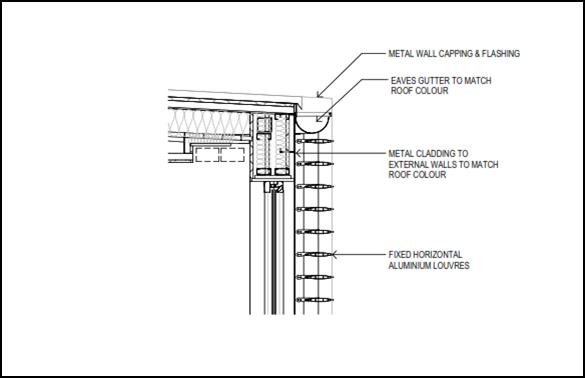
Figure 4: section detail of proposed louvres
The depth of the louvres and the
positioning in the horizontal plane will not afford the necessary level of
privacy for the adjoining neighbour to the west.
To address this and as detailed above
under the conditions to be amended section, the objective of the condition
issued by the Court relating to the louvres being angled to allow sunlight but
at the same time prevent overlooking to the west, has been retained in the
condition.
With the imposition of the condition requiring the louvres
to be angled, the visual privacy outcomes achieved under this modified proposal
will be much better for all parties than the requirements of the consent issued
by the Court, a position which is supported by the owner of the property at 60
Byng Street.
The development as modified is considered acceptable in
terms of visual privacy. Acoustic privacy is addressed below under the heading
“Noise Impacts”.
Heritage
The DCP sets the following planning outcomes in regard to
heritage:
· Heritage
buildings and structures are efficiently re-used.
· New
development complements and enhances the significance of a heritage item or
place of heritage significance listed in the Orange Heritage Study.
· Significant
landscape features are retained including original period fences and period
gardens.
Heritage has previously been addressed in detail under the
heading “5.10 - Heritage Conservation”. The proposed development
has been designed in accordance with the outcomes for heritage and is considered
acceptable.
INFILL GUIDELINES
As established under the Heading “5.10 –
Heritage Conservation”, there are no aspects of the application to modify
the consent that would result in an unsatisfactory impact upon the heritage
significance of the place. Where there is the potential for an impact to occur,
conditions of consent are imposed to ameliorate the impact to an acceptable
level.
The development as modified will not be incongruous with the
character of the locality.
The development as modified will not dramatically alter the
previously approved scale and form of the development.
The previously approved siting of the development does not
change as a result of the development as modified.
The materials and colours, and the detailing of the modified
design have either been agreed to by Council’s Heritage Advisor and the
applicant and amended detail submitted (ie the acoustic screen around the
kitchen exhaust cowl); or addressed via a new condition of consent (ie
attachment of louvres to guest rooms 1-4 and 9-12).
The removal of the Englished Elm at the western boundary has
been addressed above and is considered acceptable.
The development as modified is not inconsistent with the
relevant heads of consideration under the Infill Guidelines and remains
consistent with the intent of the Court approved development.
PROVISIONS PRESCRIBED BY THE
REGULATIONS s4.15(1)(a)(iv)
The development as modified is not inconsistent with the
provisions prescribed by the regulations.
THE LIKELY IMPACTS OF THE
DEVELOPMENT s4.15(1)(b)
The Court previously considered the likely impacts of the
development to be within acceptable levels. The development as modified gives
rise to the further consideration of the following likely impacts.
Heritage Impacts
The impacts of the development as modified upon the heritage
significance of the place have been addressed above in detail and found to be
acceptable.
Noise Impacts
The deletion of balconies is seen to improve the likely
noise impacts of the development as the development no longer allows people to
congregate on balconies in close proximity to the adjoining land.
The potential for noise would still occur under the
development as modified if the windows in the western elevation were able to be
opened. The submitted plans do not suggest they are able to be opened; however,
to ensure that this is the case a condition is attached that requires all west
facing windows within all guest rooms to be fixed panel windows.
In terms of the noise associated with the proposed air
conditioning condensers and temporary bin arrangement on the western side of
the kitchen, Council’s Manager Building and Environment has provided the
following:
I confirm that I have no
objection to this proposal given that the area would be provided with an
acoustic and visual screening (being a 25mm lapped fenced area) I note that it
does not have a roof over it. I do not consider that this would adversely
impact on neighbours in terms of impacts assessed against the NSW Noise Policy
For Industry (measured over a 15 minute period) and is unlikely to be in excess
of BGL +15dbA (for sleep arousal – particularly if a condition is
included that the area must not be used after 10pm). That is, provided the
area would not be used into the night time period of the NSW NPI (10pm to 7am),
I am satisfied that the storage area would be ok. Plan of Management to also
reference regular cleaning the management of odours. Also condition the fence
is to be in accordance with the acoustic report prepared by Tom Harper of
Acoustik.
In light of the above and with the relevant conditions
attached, the development as modified is considered acceptable in terms of
noise impacts.
Odour Impacts
The proposed temporary bin associated with the kitchen has
the potential to cause odour impacts if not managed appropriately. This can be
easily addressed by attaching a condition that requires the temporary bin to be
returned to the main bin storage area when the kitchen closes each day. This is
also to be enshrined in the operational management plan required by condition
(85) of the existing consent.
The foregoing assessment has
determined that the likely impacts resultant from the development as modified
will be within acceptable levels; or where an impact would otherwise result,
additional conditions of consent have been imposed or existing conditions
remain in place. On this basis, the application to modify the development
consent is considered acceptable in terms of likely impacts.
THE SUITABILITY OF THE SITE
s4.15(1)(c)
The site continues to remain suitable for the development as
modified.
ANY SUBMISSIONS MADE IN
ACCORDANCE WITH THE ACT s4.15(1)(d)
The application to modify the development consent issued by
the Court is defined as "advertised development" under the provisions
of the Environmental Planning and Assessment Regulations. The
application was advertised for the prescribed period of 14 days and at the
end of that period five submissions were received.
Submission 1 - owners of 60
Byng Street
The submission raises the following matters:
· concerns have been
raised in relation to privacy given that the proposal when it was first lodged
sought to address the privacy at the interface with the submitters’
property by installing lattice onto of the boundary fence for a height of 2m.
· concerns in
relation to the way the 2m high treated pine fence has been constructed;
· concerns in
relation to the proposed bin and air conditioning condensers enclosure, citing
the prospect for noise and odour impacts;
· concerns in
relation to the proposed substation, and requesting information as to whether
the substation will generate noise and whether the concrete pad extends all the
way to the fence to prevent weeds etc;
· stating that the
works to the lower ground floor have commenced not in accordance with the Court
issued plans; and
· concerns in
relation to the removal of the English Elm tree on the western boundary.
Council staff comment
In relation to the submitters’ concerns regarding the
deletion of the balconies and the possibility of new privacy impacts, as
detailed above the outcomes achieved under this modification in relation to
privacy are considered to be much more positive for all parties than what was
achieved under the Court issued consent.
It is understood that the applicant/owner and the property
owner at 60 Byng Street have had further discussions around the privacy issue,
with the applicant providing a copy of the amended plans. Following these
discussions Council received a subsequent email from the submitter indicating:
I understand that fixed
shutters will be on all ground floor rooms so that people in rooms can see out
and up but not down.
If this is the proposal, then
we are happy with that. Thank you for your consideration.
As discussed in the body of this
report, permanent fixed louvres have now been proposed on all of the ground
floor level guest room windows, and recommended conditions of consent have been
included to ensure that the louvre design achieves the required privacy
outcome. Privacy impacts in this regard are considered to be an improvement
from the Court imposed requirements and acceptable in this case.
In relation to the build quality of the treated pine fence
on the western boundary, the applicant has made the following assurances in
relation to rectifying the fence which are attached as conditions of consent.
We will repair the work where
it is of substandard.
We will stabilise the fence
where necessary using Metal props on our side of the fence.
We will place a bottom rail on
the fence to prevent the timber from warping. This will be done in conjunction
with the Landscaper.
We will lap the southern
boundary using hard wood palings.
Ultimately these matters are civil matters between the two
parties, however attaching the above as a condition of consent will ensure that
the required fencing is of an agreed satisfactory standard for all parties.
In relation to the bin and air conditioning condenser
enclosure and firstly to noise, Council’s Manager Building and
Environment has reviewed the development as modified and has advised that, with
the relevant conditions attached (as described above under the likely impacts
section), the screening will be satisfactory in terms of noise.
In relation to odour, also detailed above, conditions are
attached that require the temporary bin to be returned to the main bin storage
area at the same time that the kitchen closes each day. This is also required
to be detailed in the required operational management plan.
In relation to the proposed substation, from discussions
with Essential Energy it is understood that substations do generate a quiet
humming noise, however the noise is unlikely to be audible by the adjoining
owner given the required fence and the separation of the substation to the
dwelling on the adjoining land.
The pad location is considered acceptable and will be
adjacent to the boundary fence which will provide a physical separation been
the substation and the neighbour.
The issue of the lower ground floor works having commenced
not in accordance with the Court issued consent is addressed in detail above.
In relation to the removal of the English Elm, whilst its
removal is unfortunate, the approved development requires services to be
installed along the western boundary and the subject tree will be in the way of
those services. For the reasons outlined above, it is considered acceptable for
the subject tree to be removed.
Submission 2 - owners of 85
Hill Street
The submission raises the following matters:
· concerns in
relation to the condition requiring perimeter fencing to be installed and the
effect that may have on the submitters’ existing fence;
· requests that
Council staff confirm that the development as modified will not increase the
level of overshading on their property; and
· concerns in
relation to the location of the proposed fire booster and fire sprinkler valves
within the driveway.
Council staff comment
The comments regarding the submitters’ existing fence
are noted. This matter is, however, a civil matter between the two property
owners. However, Council staff would not object to the fence being located just
inside the boundary of the development site to allow retention of the existing
fence and construction of the new fence required by condition of consent.
In relation to the concerns regarding overshadowing, Council
staff can confirm that the minor increase to the height of the lift overrun and
the additional ceiling height in the first floor rooms will not result in any
additional adverse impacts resulting from overshadowing for the following
reasons.
The orientation of the land is north-south meaning, that the
majority of shadow is cast to the rear of the land (save for the late
afternoon) rather than to the east - being the direction of the
submitters’ property. Secondly, the location of the dormer windows are on
the western side of the building and sit below the ridgeline of the new
building. This means that the additional height will not overshadow more than
is currently the case under the Court issued consent. Finally, in relation to
the lift overrun, the lift is located almost in line with the submitters’
southern boundary, meaning that the additional height, even if it were to
increase the amount of overshadowing, would not impact upon the
submitters’ property in any meaningful way.
In relation to the location of the fire booster and
sprinkler valve assembly located on the eastern side of the driveway, this
infrastructure is essential and required to be sited somewhere that is in a
safe location, is easily identifiable and is near the entrance to the land. The
selected location is considered the most logical. The selected location is at
the main entrance, is outside the structural root zone of the tree on the
western side of the driveway and is somewhat obscured from view of a casual
observer behind the front fence posts. The masonry wall behind the assembly
which is required under the relevant standard will extend only 100mm above the
height of the required timber fencing, meaning it will not be overly visually
intrusive for the occupants of the neighbouring property which it abuts.
Submission 3 - owner of 243
March Street
The submission raises the following matters:
· brings to
Council’s attention the inappropriateness of the use of lattice from a
general appearance perspective and its limited longevity in the Orange climate;
· highlights the
impacts that would arise with the previously proposed lattice screen on the
western boundary;
· provides
commentary around the augmentation of rooms with deleted balconies and
increased floor area, and provides some suggestions as to how the privacy could
be addressed with the installation of metal screens;
· is critical of the
proposed pad-mount substation and questions why the electricity supply
requirements were not considered earlier; and
· opposes the temporary
bin enclosure on odour grounds, and questions why the internal changes are
necessary and were not considered earlier in the design phase.
Council staff comment
Council staff agree with the submitter’s comments in
relation to the use of lattice. Accordingly, as detailed above Council staff
and Council’s Heritage Advisor have not supported the request to change
the material used for the light spill screen - the condition remains unchanged.
In response to the lattice screen along parts of the western
boundary to address privacy that was proposed at the time of exhibition, the
applicant has re-evaluated the appropriateness of the screen in consultation
with Council’s Heritage Advisor and has opted to delete the screen. The
amended proposal now seeks to address the privacy impact at the source by way
of fixed louvres. This is in line with the suggestions within the submission.
(NB: the efficacy of the proposed horizontally positioned
louvres is addressed above).
In relation to the proposed substation, it is typical that
the detailed design phase follows the development application process. The
discovery that the existing electricity network is insufficient to adequately
service the development is unfortunate from everyone’s perspective
(additional cost to the applicant, and additional impacts upon the setting of
the heritage item and conservation area). However, such infrastructure is a
necessary requirement of the development. There are a multitude of competing
factors as to where the structure can go, which have been explored and
discounted for the various reasons provided above. Based on all these
considerations and on balance, the substation is appropriate in the proposed
location with the additional mitigation measures agreed to between Council’s
Heritage Advisor and the applicant.
In relation to the odour comment, conditions are attached
that obligate the beneficiary of the consent to remove the garbage bin to the
main waste storage area at the end of each day. This is also to be included in
the operational management plan.
In relation to the internal changes, it is not uncommon for
design amendments to occur at various stages of a project of this scale. As
outlined above, the Court has made it quite clear that changes are to be
expected, provided the development remains substantially the same. Further
assessment of this issue has been provided in the body of this report.
Submission 4 - Orange Heritage
Group
Submissions 3 and 4 have been penned by the same person,
however submission 4 is under the letterhead of the Orange Heritage Group.
The submission raises the following matters:
· endorses the
amended front fence design, provided it is “built correctly and the
plants used adjacent to it are at the advanced stage”;
· raises similar
concerns to submission 3 regarding the 2m privacy screen and the use of
lattice generally; and
· states that some
of the group’s members indicated that they have experienced traffic
confusion in the mornings with construction vehicles entering the site, and
feel similar experiences may be felt with cars leaving the development.
Council staff comment
The comments regarding the front fence are noted and a
condition is recommended that requires advanced hedging plants to be used for
the front fence hedge.
The concerns regarding both the 2m screen and the use of
lattice generally are acknowledged and have been addressed above.
The traffic comments are noted, however this modification
application will not affect the previously approved traffic arrangements.
Submission 5 – owner of
75 Hill Street
The submission raises the following matters:
· raises concerns in
relation to the quality of the construction of the dividing fence along the
common boundary with 60 Byng Street; and
· the submission is
mostly concerned with the proposed replacement material of the car park light
spill screen.
Council staff comment
The comments regarding the western boundary fence are noted
and are addressed above in response to the matters raised in submission 1.
Secondly, as mentioned above, Council staff have not
supported the change of material for the subject light spill screen. The
condition requiring the perforated metal screen is recommended to remain on the
consent as applied by the Court.
PUBLIC INTEREST
s4.15(1)(e)
The proposed development is considered to be of minor
interest to the wider public due to the relatively localised nature of
potential impacts. The proposal is not inconsistent with any relevant policy
statements, planning studies, guidelines etc that have not been considered in
this assessment.
SUMMARY
The proposed development is permissible with the consent of
Council. The proposed development complies with the relevant aims, objectives
and provisions of Orange LEP 2011 (as amended) and DCP 2004. A
Section 4.15 assessment of the development indicates that the development
is acceptable in this instance. Attached is a draft amended Notice of Approval
outlining a range of conditions considered appropriate to ensure that the
development proceeds in an acceptable manner.
COMMENTS
The requirements of the Environmental Health and Building
Surveyor and the Engineering Development Section are included in the attached
Notice of Approval.
Attachments
1 Notice
of Approval, D18/40961⇨
2 Plans,
D18/40773⇨
3 Submissions,
D18/40935⇨
2.6 Development
Application DA 305/2016(1) - 168 Shiralee Road
RECORD
NUMBER: 2018/1894
AUTHOR: Michael
Glenn, Senior Planner
EXECUTIVE Summary
|
Application
lodged
|
8
September 2016
|
|
Applicant/s
|
Byng
Administration Services Pty Ltd
|
|
Owner/s
|
Byng
Administration Services Pty Limited
|
|
Land
description
|
Lots 90
and 100 DP 750401 – 168 Shiralee Road, Orange
|
|
Proposed
land use
|
Subdivision
(17 lot residential)
|
|
Value of
proposed development
|
Not
applicable
|
Council's consent is sought for subdivision of the subject
land so as to create 17 urban residential lots and new public roads.
The Planning and Development Committee at its meeting of 3
July 2018 considered a planning report on the proposed development. At that
meeting the Committee resolved to defer determination of the application until
a meeting and inspection was held. In accordance with the Committee resolution a
site inspection of the property was carried out on 30 July 2018 to discuss the
proposal with adjoining residents. In addition to the meeting, the Director
Development Services met with objectors to discuss issues raised in the
submissions. The applicant also met with some residents to further discuss the
proposal. Council staff were not a party to those discussions. The development
application submitted is unchanged despite these interactions.
At the meeting of July 3 2018, objectors also raised
questions regarding the legalities of this proposal and whether or not Council
had the ability to determine this application without the owner’s consent
of the adjoining property owners given that it would be necessary for the
applicant to obtain easements over adjoining land to allow the development to
proceed. In accordance with the provisions of the Environmental Planning and
Assessment Act 1979 the applicant is only required to provide owners consent
for the land to be developed. There is no requirement for the applicant at this
stage to obtain owners consent of the adjoining property owners where a future
easement for services may be required. The attached draft Notice of
Determination contains a series of conditions that prevents the release of a
Subdivision certificate for certain lots until such time that all necessary
easements and infrastructure have been provided. It is ultimately up to the
applicant or any other person entitled to act upon the consent to make
arrangements with any landowners upon which easements for stormwater, sewage,
water or roads is required should they decide to take up the benefits of the
consent. Failure to obtain the necessary agreements from adjoining property
owners post consent will impact upon the ability of the applicant to comply
with the recommended conditions of consent.
To put into effect the subdivision, it will be necessary to
negotiate with adjoining landowners for access to Lots 7-17. To avoid the
possibility of conflicts with the purchasers of Lots 7-17, release of the Subdivision
Certificates for these lots will be deferred until such time as the indicated
access points have been provided. In the interim, the land relating to these
lots will remain part of Lot 5 (containing the approved dwelling under
DA 42/2016) for the purposes of care control and management effectively as
a development lot. Similar restrictions are considered appropriate with respect
to securing the water and sewer easements needed across adjoining owners’
land.
The proposed subdivision is subject to the provisions of
Orange LEP 2011 as amended and the Shiralee Development Control Plan 2015.
The proposed subdivision requires a variation of the LEP
Minimum Lot Size (MLS) and the Shiralee DCP Masterplan. The applicant’s
consultant has provided a justification to support the proposed variation of
these planning controls. Given that the overall yields within the subdivision
are consistent with the DCP master planning and the density controls of
the LEP, and that the lot designs are logical and unlikely to cause
significant harm to neighbourhood character and amenity, the variation in this
case is considered justifiable. It is considered that under the circumstances
it is unreasonable and unnecessary to apply the standards fully as written in
this case.
The proposed development is unlikely to generate adverse
impacts on nearby development or the amenity of the area. It is consistent with
the zoning of the land and considered to be appropriate development in the
context of the planned land use pattern as articulated in the DCP.
This report provides an assessment of the proposed
development as required under Section 4.15 of the Environmental
Planning and Assessment Act, 1979.
Attached is Notice of Determination recommending approval of
the subject development.
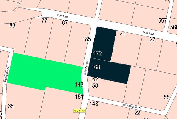
Figure 1: locality plan
RECENT LEGISLATIVE CHANGES
On 1 March 2018 the Environmental Planning and Assessment
Act 1979 was substantially amended. The most immediate change involves the
restructuring and renumbering of the Act, with other more substantive
changes to be phased in over time. However, for some applications (particularly
where an application was lodged prior to the changes coming into effect) the
supporting documentation may still reference the previous numbering regime. In
the drafting of this report the content and substance of the supporting
material has been considered irrespective of which legislative references were
used.
DECISION FRAMEWORK
Development in Orange is governed by two key documents
Orange Local Environment Plan 2011 and Orange Development Control Plan 2004. In
addition the Infill Guidelines are used to guide development, particularly in
the heritage conservation areas and around heritage items.
Orange Local Environment Plan 2011 – The
provisions of the LEP must be considered by the Council in determining the
application. LEPs govern the types of development that are permissible or
prohibited in different parts of the City and also provide some assessment
criteria in specific circumstances. Uses are either permissible or not. The
objectives of each zoning and indeed the aims of the LEP itself are also to be
considered and can be used to guide decision making around appropriateness of
development.
Orange Development Control Plan 2004 – the DCP
provides guidelines for development. In general it is a performance based
document rather than prescriptive in nature. For each planning element there
are often guidelines used. These guidelines indicate ways of achieving the
planning outcomes. It is thus recognised that there may also be other solutions
of merit. All design solutions are considered on merit by planning and building
staff. Applications should clearly demonstrate how the planning outcomes are
being met where alternative design solutions are proposed. The DCP enables
developers and architects to use design to achieve the planning outcomes in
alternative ways.
DIRECTOR’S COMMENT
The subject property is located within the developing
Shiralee urban village. Development in the Shiralee urban village is generally
required to be developed in accordance with the Shiralee Development Control
Plan (Shiralee DCP), including the Shiralee Masterplan. The applicant seeks a
departure from Council’s adopted DCP as well as a variation to
the LEP minimum Lot size controls that relate to this site (discussed in
detail in the body of this report).
While variations from the Shiralee DCP are generally not
supported, Council staff recognise that the characteristics of the subject
property are unique, and the consultant has put forward a detailed
justification as part of the application.
The planning assessment demonstrates that the proposed
variations are acceptable in this case. It is recommended that Council supports
the subject development application.
Link To Delivery/OPerational Plan
The recommendation in this report relates to the
Delivery/Operational Plan strategy “10.1 Preserve - Engage with the
community to ensure plans for growth and development are respectful of our
heritage”.
Financial Implications
Nil
Policy and Governance Implications
Nil
|
Recommendation
That Council consents to development application DA
305/2016(1) for Subdivision (17 lot residential) at Lots 90 and 100 DP
750401 - 168 Shiralee Road, Orange pursuant to the conditions of consent in
the attached Notice of Approval.
|
further considerations
Consideration has been given to the recommendation’s
impact on Council’s service delivery; image and reputation; political;
environmental; health and safety; employees; stakeholders and project
management; and no further implications or risks have been identified.
SUPPORTING INFORMATION
THE APPLICATION/PROPOSAL
Council's consent is sought for Subdivision (17 lot
residential) at Lot 90 DP 750401 and Lot 100 DP 750401 - 168 Shiralee
Road, Orange.
The proposal involves a subdivision of the subject land to
create 17 urban residential allotments and new public roads.
Proposed Lots 1 to 4 and 6 to 17 are vacant, and each would
be created for urban residential purposes pursuant to the relevant clauses of
Orange LEP 2011. Proposed Lot 5 will excise the existing dwelling (which
is to be demolished and replaced by a new dwelling pursuant to an approval granted
under DA 42/2016).
The urban residential subdivision of the site would involve
the following:
· creation of vacant
lots ranging in area from 340m² to just over 3,000m²; the existing
(and replacement) dwelling will be created on a lot of approximately
9,400m²
· construction of
new roads in accordance with Council requirements outlined in Shiralee
Engineering Requirements and additional information
· connection of each
lot to reticulated sewer
· connection of each
lot to the town water supply
· provision of an inter-allotment
stormwater drainage system.
The orientation and configuration of the proposed vacant
lots is such that a future dwelling can be designed without unreasonable
constraint to optimise solar penetration to internal and external living areas.
Land shaping and finished levels will be subject to final
civil engineering design.
The applicant has indicated that the subdivision will
proceed in stages subject to demand and provision of services. An indicative
staging plan is as follows:
· Stage 1 – proposed
Lots 1 to 5
· Stage 2 –
proposed Lots 10 to 17
· Stage 3 –
proposed Lots 6 to 9.
It should be noted that proposed Lots 7-17 will require the
provision of services and access through adjoining lands. These lots will not
be able to be released until such time that those services have been provided
to the land or alternative arrangements to those contemplated in this
application are sought.
MATTERS FOR CONSIDERATION
Section 1.7 - Application of
Part 7 of the Biodiversity Conservation Act 2016 and Part 7A of the
Fisheries Management Act 1994
Development Applications lodged prior to 25 February 2018
Section 1.7 of the EP&A Act 1979 identifies that Part 7
of the Biodiversity Conservation Act 2016 and Part 7A of the Fisheries
Management Act 1994 have effect in connection with terrestrial and aquatic
environments.
Notwithstanding, Section 28 of the Biodiversity
Conservation (Savings and Transitional) Regulation 2017 states that the
former planning provisions continue to apply to the determination of a pending
planning application, being an application for planning approval made before
the commencement of the new Act but not determined before that commencement.
The relevant provisions are set out at Part 5A of the historical version of the
EP&A Act 1979 dated 24 August 2017.
Having regard to the relevant provisions and based on an
inspection of the subject property, it is considered that the proposed
development is not likely to have a significant effect on any threatened
species, populations or ecological communities or their habitats.
Section 4.15
Section 4.15 of the Environmental Planning and Assessment
Act 1979 requires Council to consider various matters, of which those
pertaining to the application are listed below.
PROVISIONS OF ANY ENVIRONMENTAL
PLANNING INSTRUMENT s4.15(1)(a)(i)
Orange Local Environmental Plan 2011
Part 1 - Preliminary
Clause 1.2 - Aims of Plan
The aims of the Orange Local
Environmental Plan 2011 (‘OLEP 2011’) relevant to the application
include:
(a) to encourage development which complements
and enhances the unique character of Orange as a major regional centre boasting
a diverse economy and offering an attractive regional lifestyle
(b) to provide for a range of development
opportunities that contribute to the social, economic and environmental
resources of Orange in a way that allows present and future generations to meet
their needs by implementing the principles for ecologically sustainable
development
(e) to provide a range of housing choices in
planned urban and rural locations to meet population growth
(f) to recognise and manage valued
environmental heritage, landscape and scenic features of Orange.
The proposed development is
considered to be consistent with the relevant aims of Orange LEP 2011. The
relevant matters are addressed in the body of this report.
Clause 1.6 - Consent Authority
This clause establishes that, subject to the Act, Council is
the consent authority for applications made under the LEP.
Clause 1.7 - Mapping
The subject site is identified
on the LEP maps in the following manner:
|
Land Zoning Map:
|
R2 Low Density Residential zone and
R1 General Residential
|
|
Lot Size Map:
|
Minimum Lot Size a combination of
200m2(Area B) 3000m2 (Area W1) and 9,000m2 (Area
X3)
|
|
Heritage Map:
|
Contains a heritage item under Schedule
5 of the LEP
|
|
Height of Buildings Map:
|
No building height limit
|
|
Floor Space Ratio Map:
|
No floor space limit
|
|
Terrestrial Biodiversity Map:
|
No biodiversity sensitivity on the
site
|
|
Groundwater Vulnerability Map:
|
Ground water vulnerable
|
|
Drinking Water Catchment Map:
|
Not within the drinking water
catchment
|
|
Watercourse Map:
|
Not within or affecting a defined
watercourse
|
|
Urban Release Area Map:
|
Not within an urban release area
|
|
Obstacle Limitation Surface Map:
|
No restriction on building siting
or construction
|
|
Additional Permitted Uses Map:
|
No additional permitted use applies
|
Those matters that are of relevance are addressed in detail
in the body of this report.
Minimum Lot Sizes
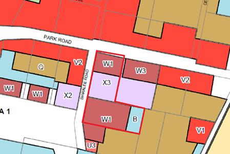
Figure 2: Minimum Lot Size map
W1: 3,000m² minimum
X3: 9,000m² minimum
B: 200m² minimum
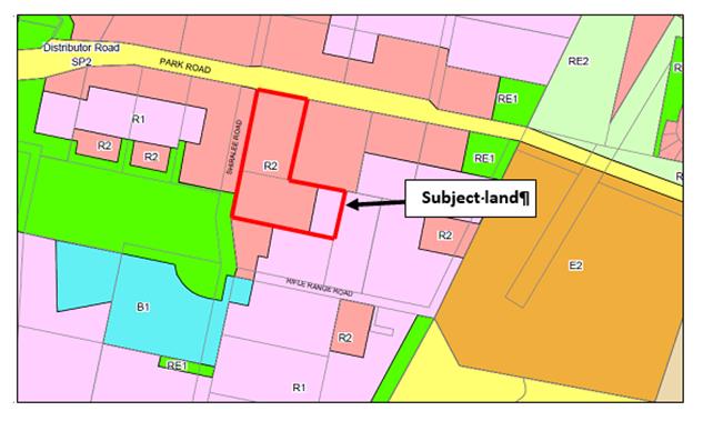
Figure 3:- zoning
Part 2 - Permitted or
Prohibited Development
Land Use Zones
The subject site is zoned part R1 General Residential and
part R2 Low Density Residential, as indicated in the above map extract.
Section 4B of the Environmental Planning and Assessment
Act 1979 identifies that subdivision of land means:
… the division of land
into two or more parts that, after the division, would be obviously adapted for
separate occupation, use or disposition.
The objectives for land zoned R1 General Residential are:
· to provide for
the housing needs of the community
· to provide for
a variety of housing types and densities
· to enable other
land uses that provide facilities or services to meet the day to day needs of
residents
· to ensure
development is ordered in such a way as to maximise public transport patronage
and encourage walking and cycling in close proximity to settlement
· to ensure that
development along the Southern Link Road has an alternative access.
The objectives for land zoned R2
Low Density Residential are:
· to provide for
the housing needs of the community within a low density residential environment
· to enable other
land uses that provide facilities or services to meet the day to day needs of
residents
· to ensure
development is ordered in such a way as to maximise public transport patronage
and encourage walking and cycling in close proximity to settlement
· to ensure that
development along the Southern Link Road has an alternative access.
The proposed residential subdivision is considered to be
consistent with the foregoing objectives. The relevant matters are addressed in
the body of this report.
Clause 1.9A - Suspension of
Covenants, Agreements and Instruments
This clause provides that covenants, agreements and other
instruments which seek to restrict the carrying out of development do not apply
with the following exceptions:
· covenants imposed
or required by Council
· prescribed
instruments under Section 183A of the Crown Lands Act 1989
· any conservation
agreement under the National Parks and Wildlife Act 1974
· any trust
agreement under the Nature Conservation Trust Act 2001
· any property
vegetation plan under the Native Vegetation Act 2003
· any biobanking
agreement under Part 7A of the Threatened Species Conservation Act 1995
· any planning
agreement under Division 6 of Part 4 of the Environmental Planning and
Assessment Act 1979.
This clause does not affect the rights or interests of any
public authority under any registered instrument.
A search of Council’s records identifies that the
subject property is not affected by any of the foregoing covenants,
instruments, agreements or plans.
Clause 2.6 - Subdivision -
Consent Requirements
Clause 2.6 Subdivision - Consent Requirements identifies
that land may be subdivided, but only with development consent.
Part 4 -
Principal Development Standards
Clause 4.1 - Minimum
Subdivision Lot Size (MLS)
With reference to Figure 2 above
(minimum lot size), the subject land is subject to three separate minimum
allotment sizes as follows:
· 3,000m² in
the section of land identified as W1
· 9,000m² in
the section of land identified as X3
· 200m² in the
section of land identified as B.
The proposed subdivision
involves the creation of two lots (being Lots 1 and 4) that do not satisfy the
relevant MLS of 9,000m2 (see map below). Therefore a variation of
the MLS is sought pursuant to LEP Clause 4.6 Exceptions to Development
Standards (see below).
All other
lots comply with the MLS requirements. It should be noted that proposed
Lot 9 will be partly within land denoted as “W1”
(3,000m²) and partly within land denoted
as “B” (200m²). The majority of the subject lot is
located on that part of the land requiring a lot size of 3,000m² with a
smaller amount being located on that part of the land requiring 200m²
lots (see map below). There are no objections to this arrangement as it will
facilitate the proposed compact lots meeting the required width-to-depth ratios
as contemplated by the DCP Masterplan.
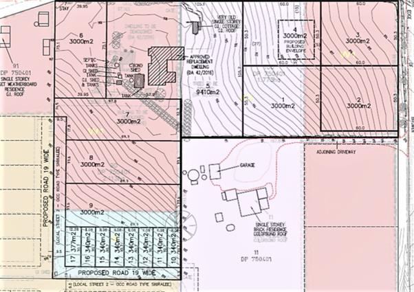
Figure 4: Clause 4.6 - exceptions to development
standards
Clause 4.6 (Exceptions to
Development Standards) provides that development consent may, subject to this
clause, be granted for development even though the development would contravene
a development standard imposed by this or any other environmental planning
instrument (other than a development standard expressly excluded from the
operation of the clause).
Clause 4.1 sets out minimum
lot size requirements applicable in certain zones which relevantly states the
following controls, objectives and considerations for subdivision:
(1) The objectives of this clause are as
follows:
(a) to ensure that new subdivisions reflect
existing lot sizes and patterns in the surrounding locality,
(b) to ensure that lot sizes have a practical
and efficient layout to meet intended use,
(c) to ensure that lot sizes do not undermine
the land’s capability to support rural development
(d) to prevent the fragmentation of rural
lands
(e) to provide for a range of lot sizes reflecting
the ability of services available to the area
(f) to encourage subdivision designs
that promote a high level of pedestrian and cyclist connectivity and
accommodate public transport vehicles.
(2) This clause applies to a subdivision of
any land shown on the Lot Size Map that requires development consent and that
is carried out after the commencement of this Plan.
(3) The size of any lot resulting from a
subdivision of land to which this clause applies is not to be less than the
minimum size shown on the Lot Size Map in relation to that land.
(4) This clause does not apply in relation to
the subdivision of any land:
(a) by the registration of a strata plan or
strata plan of subdivision under the Strata Schemes Development Act 2015
(b) by any kind of subdivision under the
Community Land Development Act 1989.
The lot size map for the
Shiralee precinct has a montage of differing lot sizes that in large measure
are intended to facilitate the lot yields, density and outcomes specified in
the Shiralee DCP. The LEP remains the skeletal strategic document,
designed to achieve residential living densities able to meet the aims and
objectives of the zones and the LEP generally. It is noted that for this
proposed subdivision, the yields contained in the proposal, as well as the
placement of various lot classifications, are more or less consistent with the
outcomes of the DCP.
Pursuant to Clause 4.1(3) of the
LEP, the size of any lot resulting from a subdivision of land to which this
clause applies is not to be less than the minimum size shown on the Lot Size
Map in relation to that land.
As indicated in the diagram
above (Figure 2), subdivision of the subject land is subject to three separate
minimum lot sizes as follows:
· 3,000m² in
the section of the land identified as W1
· 9,000m² in
the section of the land identified as X3
· 200m² in the
section of the land identified as B.
With reference to the submitted
plans, the proposed subdivision involves the creation of proposed Lots 1 and 4
which do not satisfy the MLS of 9,000m2. It is proposed to create
these lots each with an area of 3,000m2.
The objectives of Clause 4.6 are
as follows:
(a) to
provide an appropriate degree of flexibility in applying certain development
standards to particular development
(b) to
achieve better outcomes for and from development by allowing flexibility in
particular circumstances.
Council must take into account
these objectives.
There is no issue with respect
to (a), but with respect to (b) it is important for Council to be able to show
in its thinking that a particular and special case or circumstance exists to
allow the variation. It is noted that the applicant’s Statement of
Environmental Effects puts forward a number of reasons to support the
variation. However, at the heart of the variation in this case is the desire to
retain the heritage item on the same lot as the approved dwelling under
DA 42/2016. This will maximise the chances of this building being retained
and re-purposed. In doing so the applicant has successfully maintained the
overall lot yield in this case.
There are set procedures
outlined in guidelines published by the NSW Department of Planning encapsulated
in a circular published in 2008, and quite strongly supported and upheld in the
Land and Environment Court. For obvious reasons the Department advises all
councils to allow variations only where exceptional circumstances exist and
where certain other criteria can be shown to be achieved.
When applicants lodge
development applications and associated requests to vary a development
standard, they must give grounds of objection to the development standard.
Variation of a development standard may be justified where it is consistent
with the objectives that the relevant environmental planning instrument is
attempting to achieve.
The applicant has provided
written justification for the variation sought. The proposed subdivision is
considered to be consistent with the minimum lot size requirements with the
exception of proposed Lots 1 and 4. These lots are generally located in an area
identified as having a minimum lot size of 9,000m2. The submitted
plans show that proposed Lots 1 and 4 each have an area of 3,000m2.
. It is noted that proposed Lot 5 (on which the dwelling
approved under DA 42/2016 would be located) incorporates a proposed site
area exceeding 9,000m2 and, further, the overall lot yield
remains the same as is prescribed in the relevant masterplan.
The application must address:
(i) whether
strict compliance with the standard, in the particular case, would be unreasonable
or unnecessary and why
(ii) demonstrate
that there are sufficient environmental planning grounds to justify
contravening the development standard.
In order to address the
requirements of Clause 4.6(3) the following assessment is provided. The MLS Map
in the LEP is an established instrument in regard to the control of lot sizes.
The delineation of the various MLS zones has been largely informed by the
Shiralee DCP Masterplan. As such, it can be argued that there is an
inter-relationship between the DCP and the MLS provisions. The DCP refers
to the potential to vary lot sizes and types (Section 1.8 Exceptional
Circumstances). If a variation to lot size and type can be justified under
the DCP, it follows that a variation of the MLS may also be contemplated.
In this case the applicant
submits that the resultant lot yield is entirely the same as is called for
under the Masterplan, and the variation is simply taking advantage of the
existing consent granted for a new dwelling that was recently approved under DA
42/2016.
The site of proposed Lots 1 to 5 is identified in the DCP
Masterplan as a scenic hill which, in conjunction with the existing heritage
item, represents an important setting, particularly when viewed from the north.
To maintain these values the DCP encourages a lower density of development on
this part of the site; hence the MLS of 9,000m². It is submitted that
a MLS of 9,000m2 is not required to maintain these scenic and
heritage values.
Given that overall yields as specified in the Masterplan are
adhered to and the integrity of the heritage item located on the site is
maximised by retaining it within the same lot as the approved replacement
dwelling, it is considered reasonable and justified in this case to support the
variation. It is considered that the scenic vistas of the Shiralee hill are not
affected by the variation, and suitable conditions of consent have been
recommended to protect the curtilage of the heritage item.
In assessing the appropriateness
of a proposal to vary a development standard, Council should also satisfy
itself that the development is acceptable having reference to the matters set
out in the ‘five part test’ established by the NSW Land and
Environment Court. The NSW Department of Planning strongly advises
councils to apply the Five Part Test in their assessments of Clause 4.6
matters. The five part test embodies the following:
1 the objectives of the
standard are achieved notwithstanding noncompliance with the standard
2 the underlying objective
or purpose of the standard is not relevant to the development and therefore
compliance is unnecessary
3 the underlying object or
purpose would be defeated or thwarted if compliance was required and therefore
compliance is unreasonable
4 the development standard
has been virtually abandoned or destroyed by the council’s own actions in
granting consents departing from the standard and hence compliance with the
standard is unnecessary and unreasonable
5 the compliance with
development standard is unreasonable or inappropriate due to existing use of
land and current environmental character of the particular parcel of land. That
is, the particular parcel of land should not have been included in the zone.
An assessment of the five part
test is provided below.
1 the objectives of the standard
are achieved notwithstanding non-compliance with the standard;
Applicant’s Response
Strict compliance with the
9,000m2 MLS would potentially result in a subdivision that does not provide
for a range of lot sizes reflecting the ability of services available to the
area as encouraged by objective (e) of Clause 4.1. In this sense, this
objective of the development standard may be thwarted if compliance with the
MLS was required. The proposal is considered to be consistent with the other
objectives of the development standard as explained (elsewhere in the
statement).
Comment:
In this case the objectives of
the standard relate to achieving viable residential yields whilst at the same time
taking adequate steps to protect the heritage significance of the site, the
semi-rural character, whilst not interfering to the transition to residential,
and also to protecting the vista opportunities presented by the hill leading
off to the north. It is considered that the proposed variation refines and
improves the broad planning outcomes enunciated in the LEP and DCP, and the
variation results in an improved outcome with respect to those underlying
intents.
2 the underlying objective
or purpose of the standard is not relevant to the development and therefore
compliance is unnecessary;
Applicant’s Response
The applicant has not directly
addressed this planning principle.
Comment:
It is considered that the
underlying purpose of the standard is to achieve compatible densities
(compatible to the preservation of neighbourhood and desired future character,
as well as in terms of servicing), whilst at the same time ensuring that
constraints such as vistas, heritage, water quality and the like are not placed
under threat. In this case, the lot yields as set out in the Masterplan are
met, and the overall subdivision layout is respectful to existing character
whilst also achieving the strategic goals of the DCP.
3 the underlying object or
purpose would be defeated or thwarted if compliance was required and therefore
compliance is unreasonable;
Applicant’s Response
See applicant’s response
to (1) above.
Comment:
An insistence on full compliance
with the standard would result in a slightly less satisfactory subdivision
pattern, in that the Masterplan would result in the heritage building being
located on a vacant lot and the dwelling approved under DA 42/2016 would be
unlikely to be built without modification.
4 the development standard
has been virtually abandoned or destroyed by the Council’s own actions in
granting consents departing from the standard and hence compliance with the
standard is unnecessary and unreasonable;
Applicant’s Response
The development standard cannot
be said to be abandoned, particularly as development of the Shiralee area is in
its preliminary stages and the pattern of development is yet to emerge.
Comment:
The applicant’s comment is
supported.
5 the compliance with
development standard is unreasonable or inappropriate due to existing use of
land and current environmental character of the particular parcel of land. That
is, the particular parcel of land should not have been included in the zone.
Applicant’s Response
Variation of the development
standard is justified in this case because it can be demonstrated that the
proposal satisfies the objectives of the R2 Low Density Residential zone and
the objectives of the MLS. The proposal does not introduce lot sizes that
cannot be found elsewhere within the R2 zone for the Shiralee area. In this
case, the appropriateness of lot size is more to do with the physical
characteristics of the site and its relationship to the surrounding area, as
expressed in the Shiralee DCP.
The overall lot yields as called
up in the Masterplan are not exceeded by the proposal.
The inter-relationship between
the MLS and the Shiralee DCP cannot be dismissed. Despite the non-compliance
with the MLS, the subdivision is acceptable in terms of the more specific
provisions of the Shiralee DCP. In this regard, the creation of proposed
Lots 1 and 4 can be demonstrated to uphold the aims and principles of
the Shiralee DCP pertaining to the protection of landscape and scenic values.
The proposed building envelope and height restriction pursuant to Section 88B
of the Conveyancing Act will assist in this regard.
Comment:
As indicated elsewhere in this
report, it is considered that full compliance is not warranted in this case.
The yields achieved in the application correlate to those specified in the
Masterplan, the location of the heritage items and the approval already granted
for the replacement dwelling on the main lot suggest a need for justification
in this case.
General observations
The underlying purpose of the
standard for which variation is being sought is relevant to the development.
Minimum lot size requirements are a blunt assessment tool aimed at achieving
good design outcomes whilst at the same time making efficient use of the land
at densities likely to achieve a reasonable return for the development; and at
the same time ensuring neighbourhood character and amenity is not excessively
compromised. Variations based on a wholesale objection to a standard where
special circumstances do not exist should be avoided as they weaken the ability
to apply the standard at some point for other applications. In this case
special circumstances are considered to be evident and support for a variation
in this case would not establish an undesirable precedent.
The proposed development with
its non-compliance to Clause 4 is not contrary to any of the objectives for the
zone. It is also noted that the proposed subdivision has close similarities
with the outcomes sought in the DCP. Overall, it is considered that the
proposed development has a neutral or slightly beneficial effect with respect
to achieving the objectives of the zone.
It is considered in an overall
and general sense that the proposal, including the variation sought, is
consistent with the above objectives.
Part 5 -
Miscellaneous Provisions
5.10 - Heritage Conservation
According to Orange LEP Schedule
5, the former residence/packing shed within the subject land which lies to the
northwest of the main group of existing buildings is listed as a Heritage Item
of Local significance. The building occupies an exposed slope that is prominent
in views from the north towards the subject land and the Shiralee area.
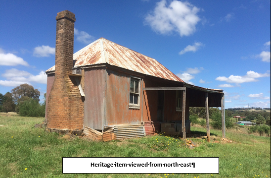
Figure 5: heritage item - northeast view
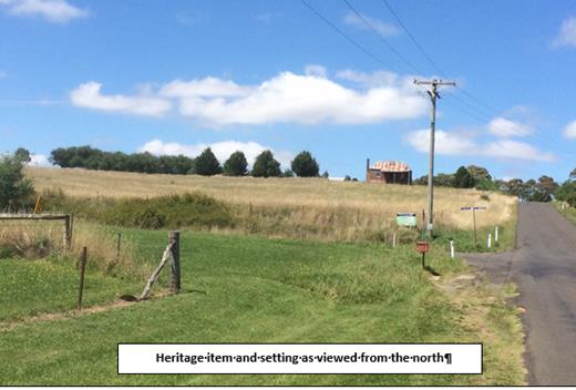
Figure 6: heritage item - north view
Relevant to the identified Heritage Item, the Shiralee DCP
Master Plan seeks to:
· conserve historic
items and their settings
· conserve,
maintain, and enhance existing views and vistas to buildings and places of
historic and aesthetic significance.
The applicant has provided the following consideration in
response to the NSW Heritage Office publication Statement of Heritage Impact
Guidelines (Table 7 – Relevant HIS Questions).
The proposal respects the heritage significance of the
item as follows:
· Consistent with
the approval granted via DA 42/2016, the heritage item and the replacement dwelling
will remain together on the same lot (i.e. proposed Lot 5). The boundary of
proposed Lot 5 maintains a generous curtilage for the item, particularly noting
that the northern boundary of this lot coincides with the line of the boundary
adjustment that was also approved in DA 42/2016.
· The inclusion
of both buildings on the one lot maintains the important relationship between
the replacement dwelling and the heritage item due to the following:
- the
replacement dwelling will be sufficiently set back from the item so as to not
encroach on its curtilage or setting. The separation between the proposed
dwelling and item is such that there would be minimal potential to undermine or
cause physical damage to the item
- the
replacement dwelling is set to the south of the item. The item remains forward
in the important views from the north looking south towards Shiralee and to the
item itself. As such, the proposed dwelling will not diminish any key views to
or from the heritage item, or public appreciation of the item
- the
proposed subdivision does not involve any works that have the potential to
damage the item. In this regard, there is ample opportunity to locate utility
service mains well away from the item, and thus not disturb it with excavations
or vibration. Further, the proposal does not involve the construction of new
roads in close proximity to the item
- compared
to the DCP Masterplan, it is acknowledged that proposed Lot 4 in the
subdivision creates the potential for one additional dwelling immediately to
the north of the heritage item. However, it is considered that the views from
the north towards the item can be respected. A building envelope is proposed
within Lot 4 to reduce the potential for a future dwelling to unreasonably
obstruct sightlines to the heritage item
- the
ground level in the proposed envelope ranges from approximately 897.5m AHD at
its northern end to 901m AHD at its southern end. The ground level in the
vicinity of the heritage item is in the order of 907m. As such, the ground level
at the heritage items is some 7 to 10m higher than the ground level within the
building envelope
- the
difference in ground levels should limit the potential for a future dwelling in
proposed Lot 4 to unreasonably obstruct views to or ruin the silhouette of the
heritage item. However, to further safeguard against such an impact, the
applicant proposes to apply a Section 88B Restriction that requires any future
dwelling in Lot 4 to be single storey. This can be imposed or reinforced as a
condition of approval in the notice of determination.
The
applicant has suitably demonstrated in the assessment above that the proposal
has minimal potential to adversely affect the heritage item. Building envelopes
and height restrictions for proposed Lots 3 and 4 are recommended in the
attached Notice of Approval to ensure that the view corridor from Shiralee Road
towards the item is not adversely compromised. Proposed Lot 5 has been designed
to accommodate the heritage item itself and new replacement dwelling under DA
42/2016. This allotment will comprise an area of in excess of 9,000m² to
provide a suitable curtilage to the heritage item and its surrounds. In
this case the resultant lot yield is entirely the same as is called for under
the Masterplan, and the variation is simply accommodating the existing consent
granted for a new dwelling that was recently approved under DA 42/2016, which
ultimately seeks to provide a greater level of protection for the listed item
of heritage contained within.
It is agreed that any dwelling within proposed Lots 3 and 4
would sit lower in the view corridor than the existing dwelling and shed that
are on the adjoining property to the east. The proposed subdivision would
create only one additional lot/dwelling opportunity in this section of the site
(compared to the layout in the DCP Masterplan), which is considered to be
acceptable subject to the recommended conditions. Impacts upon the Heritage
Item are considered to be acceptable.
Part 7 -
Additional Local Provisions
7.1 - Earthworks
This clause establishes a range
of matters that must be considered prior to granting development consent for
any application involving earthworks, such as:
(a) the likely disruption of, or any
detrimental effect on, existing drainage patterns and soil stability in the
locality of the development
(b) the effect of the development on the
likely future use or redevelopment of the land
(c) the quality of the fill or the soil to be
excavated, or both
(d) the effect of the development on the
existing and likely amenity of adjoining properties
(e) the source of any fill material and the
destination of any excavated material
(f) the likelihood of disturbing relics
(g) the proximity to and potential for adverse
impacts on any waterway, drinking water catchment or environmentally sensitive
area
(h) any measures proposed to minimise or
mitigate the impacts referred to in paragraph (g).
No significant earthworks or
details relating thereto have been submitted with the application. Clearly
there will be earthworks needed in the road construction and provision of
utilities, but there are no indications in the submitted material to undertake
bulk earthworks for preparation of the individual lots. In this case it is
considered that some benefit is derived from the existing amphitheatre effect
of the topography when viewed from the south.
Consequently, the following
condition is included in the consent:
(17) Earthworks
for all stages of the development shall be limited to those required for roads,
footpaths and the provision of utility services. No approval is granted for
bulk earthworks to be undertaken on the site with respect to levelling or
cut/filling otherwise, except with the further consent of Council, as the
details of such works are not shown in the development proposal submitted to
Council for approval.
7.3 -
Stormwater Management
This clause applies to all
industrial, commercial and residential zones and requires that Council be
satisfied that the proposal:
(a) is designed to maximise the use of water
permeable surfaces on the land having regard to the soil characteristics
affecting onsite infiltration of water
(b) includes, where practical, onsite
stormwater retention for use as an alternative supply to mains water,
groundwater or river water
(c) avoids any significant impacts of
stormwater runoff on adjoining downstream properties, native bushland and
receiving waters, or if that impact cannot be reasonably avoided, minimises and
mitigates the impact.
The applicant will be required
to contribute to the provision of an off-site stormwater detention system for
the development. Drainage for Lots 5-17 requires drainage easements over
adjoining land prior to the commencement of works. Council is in receipt of
submissions in relation to this issue. There is no obligation on an adjoining
property owner to provide easements over their land if they choose not to
develop at this time.
Conditions are included in the
consent to achieve these outcomes.
7.6 -
Groundwater Vulnerability
This clause seeks to protect
hydrological functions of groundwater systems and protect resources from both
depletion and contamination. Orange has a high water table and large areas of
the LGA, including the subject site, are identified with “Groundwater
Vulnerability” on the Groundwater Vulnerability Map. This requires that
Council consider:
(a) whether or not the development (including
any onsite storage or disposal of solid or liquid waste and chemicals) is
likely to cause any groundwater contamination or have any adverse effect on
groundwater dependent ecosystems, and
(b) the cumulative impact (including the
impact on nearby groundwater extraction for potable water supply or stock water
supply) of the development and any other existing development on groundwater.
Furthermore, consent may not be granted unless Council is satisfied that:
(a) the development is designed, sited and
will be managed to avoid any significant adverse environmental impact, or
(b) if that impact cannot be reasonably
avoided - the development is designed, sited and will be managed to minimise
that impact,
(c) if that impact cannot be minimised - the
development will be managed to mitigate that impact.
Given that the
proposed development is not anticipated to involve the discharge of toxic or
noxious substances, it is considered unlikely to contaminate the groundwater or
related ecosystems. Similarly, the proposed development is not anticipated to
involve the extraction of groundwater and therefore would not contribute to
groundwater depletion.
Clause 7.11 - Essential Services
Clause 7.11 -
Essential Services provides that development consent must not be granted to
development unless the consent authority is satisfied that any of the services
which are essential for the proposed development are available, or that adequate
arrangements have been made to make them available when required. Essential
services include the supply of water and electricity; the disposal and
management of sewage, stormwater drainage or onsite conservation, and suitable
road access.
The applicant has
indicated that all services have the capacity to be extended to the site.
Council’s Technical Services Division has recommended a condition of
consent to ensure that arrangements can be made for all necessary essential
services to be provided to the subject property.
STATE ENVIRONMENTAL PLANNING
POLICIES
State Environmental Planning
Policy 55 - Remediation of Land
State Environmental Planning Policy
55 - Remediation of Land (SEPP 55) requires that a consent authority must not
consent to the carrying out of development of land unless it has considered
whether the land is contaminated, is satisfied that the land is suitable in its
contaminated state for the development that is proposed, and if the land
requires remediation to be made suitable for the proposed development it is
satisfied that the land will be remediated before the land is used for that
purpose.
Furthermore, SEPP 55 requires that
before determining an application to carry out development that would involve a
change of use of land (specified in Subclause 4), the consent authority must
consider a preliminary investigation of the land concerned.
Given that the subject property has
a history of use for the purpose of horticulture, a Preliminary Contamination
Investigation (PCI) was submitted with the development application. Based on
soil and laboratory analysis, the PCI concluded that the soil sampling program
did not detect elevated levels of analysed metals and organochlorine
pesticides, and that levels of all substances evaluated were near background
environmental levels and below the EPA investigation threshold for residential
land use.
Notwithstanding, Council’s Building Surveyor has
recommended a precautionary condition of consent requiring that chemical
testing of each lot is to be undertaken to demonstrate that the land is
suitable for residential use prior to the issue of a Subdivision Certificate.
PROVISIONS OF ANY DRAFT
ENVIRONMENTAL PLANNING INSTRUMENT THAT HAS BEEN PLACED ON EXHIBITION
4.15(1)(a)(ii)
There are no draft environmental planning instruments that
apply to the subject land or proposed development.
DESIGNATED DEVELOPMENT
The proposed development is not designated development.
INTEGRATED DEVELOPMENT
The proposed development is not integrated development.
PROVISIONS OF ANY DEVELOPMENT
CONTROL PLAN s4.15(1)(a)(iii)
Development Control Plan 2004
The Orange Development Control Plan 2004 (“the
DCP”) applies to the subject land. Chapters of the DCP relevant to the
proposed subdivision include:
· Chapter 0 -
Transitional Provisions
· Chapter 2 -
Natural Resource Management
· Chapter 3 -
General Considerations
· Chapter 4 -
Special Environmental Considerations
Chapter 0 - Transitional
Provisions
Section 0.2 - General
Translation of Zones
Section 0.2 provides that any
reference to a zone under Orange Local Environmental Plan 2000 is to be a
reference to the corresponding zones in the zone conversion table.
The table identifies that R1 General Residential zone and R2
Low Density Residential zone correspond with the 2a Urban Residential and 2d
Urban Transitional zones.
Chapter 2 - Natural Resource
Management
Section 2.1 - Water Quality
Section 2.1 - Water Quality
identifies that development which concentrates, redirects flows, increases flow
rates or disturbs land in close proximity to creeks, has the potential to
affect waterways with associated erosion, sedimentation and release of
nutrients, which combine to affect downstream water quality. Section 2.1 also
identifies that development involving groundwater extraction and/or onsite
wastewater disposal is deemed to have the potential to affect groundwater
resources.
Stormwater and groundwater quality issues have previously
been addressed under “7.3 ‑ Stormwater Management”
and “7.6 - Groundwater Vulnerability”, respectively. In summary,
it is considered that the proposed development is unlikely to have a
detrimental impact on stormwater and groundwater quality.
Section 2.3 - Vegetation and
Section 2.4 - Flora, Fauna and Biodiversity
Section 2.3 - Vegetation and
Section 2.4 – Flora, Fauna and Biodiversity identify that the natural
environment of the Orange LGA has been heavily modified as a consequence of
land clearing for various uses, including agriculture, plantation forests,
mining and urban development; and that clearing of native vegetation has
significantly affected native habitats.
Based on inspection of the subject property, it is evident
that it has been highly modified by past agricultural practices and is unlikely
to contain significant habitat or biodiversity value.
Chapter 3 - General
Considerations
Section 3.1 - Cumulative
Impacts
Section 3.1 - Cumulative Impacts
identifies that Council will consider not only the direct impacts of a
particular development but also whether the development, when carried out in conjunction
with other development in the locality, has a more significant environmental
impact.
The proposed subdivision is generally consistent with the
intended future use of the land for residential purposes. Any likely
environmental impact will be within community accepted levels.
Chapter 4 - Special
Environmental Considerations
Section 4.3 - Land Shaping
Section 4.3 - Land Shaping
identifies that substantial land shaping, including filling or excavating land,
has the potential to generate significant environmental impacts, and that land
shaping should not adversely affect land in the vicinity as a result of
drainage, erosion or sedimentation, or as a result of leachate entering surface
or groundwater.
Land shaping has previously been addressed under “Section
7.1 - Earthworks”. In summary, it is considered that the applicant has
not proposed earthworks as part of the development application.
Notwithstanding, it is expected that some minor earthworks are likely to be
limited to the extent of cut and fill required to construct new internal roads
and provide utility services to the newly created lots. It is accepted that the
required earthworks for these services are unlikely to disrupt or have a
detrimental effect on the existing drainage patterns and soil stability of the
area, detrimentally affect a future use or redevelopment of the land,
detrimentally affect the amenity of adjoining properties, or disturb any
relics.
Section 4.4 - Contaminated Land
Section 4.4 - Contaminated Land
identifies that contaminated land can pose a risk to human health and the
environment. Contaminants can be released into waterways and humans exposed
when contaminated land is disturbed as a consequence of development.
Land contamination has previously been addressed under
“State Environmental Planning Policy 55 - Remediation of
Land”.
SHIRALEE DEVELOPMENT CONTROL
PLAN 2015
The Shiralee Development Control
Plan (Shiralee DCP) seeks to guide urban expansion south of the existing Orange
urban area, promote a high quality urban environment with a diversity of
housing and recreation opportunities, encourage alternative modes of transport
and healthy lifestyles, and reduce traffic congestion providing for the
day-to-day needs of residents within the precinct.
These objectives are given
effect by a series of development controls which generally deal with issues
such as desired future character, local infrastructure, the village centre,
residential buildings, private and public domains, the environment, and
movement networks. There are Masterplans that deal with individual parts of the
residential precinct, of which the subject site is a part. It is located within
Shiralee Masterplan Area E, shown below:
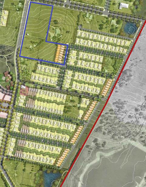
Figure 7: Shiralee Area E Masterplan
The general intent of the development controls for the
future development of the Shiralee area is contained in the Shiralee
Masterplan.
While the development controls are often written in a
prescriptive manner, Section 1.8 of the Shiralee DCP provides that in
exceptional circumstances Council may consider some variation in lot sizes and
types. Any variation from the DCP is to be considered on a case‑by‑case
basis and subject to Council’s satisfaction that the proposal meets or
exceeds the aims and principles of the DCP. The relevant controls of the
Shiralee DCP are addressed below.
2.0 - Desired Future Character
2.4 - Subdivision
Section 2.4 Subdivision includes the following controls:
· Subdivision is
to be consistent generally in accordance with the Masterplan design and intent
per the DCP. Legislative requirements and DCP written controls take precedence
over the Masterplan.
The
control identifies that subdivision must be ‘consistent generally in
accordance with the Masterplan’. The proposal is considered to be
generally consistent with the adopted DCP. The applicant has sought a
variation to the minimum allotment sizes or certain lots within the proposal. In
this case the resultant lot yield is entirely the same as is called for under
the Masterplan, and the variation is simply accommodating the existing consent
granted for a new dwelling that was recently approved under DA 42/2016, which
ultimately seeks to provide a greater level of protection for the listed item
of heritage contained within.
· Lot sizes are
to be consistent with or greater than the adopted minimum lot size for the land
under the LEP zoning map.
Two of the lots are smaller than recommended in the
Masterplan document, whilst one is significantly larger. Overall, for this site
the lot yields remain consistent, and the heritage constraints adequately
addressed and respected by the solution offered.
It is noted that this control requires lot sizes to be
consistent with or greater than the adopted minimum lot size for the land under
the LEP. The applicant has submitted a Clause 4.6 variation that
establishes that it is unreasonable and/or unnecessary to achieve full
compliance with the LEP requirements in this case (see assessment above for
detail). This has the effect that the lot layout complies with the intent of
the LEP (and hence the DCP) and is reasonable in terms of the outcomes the
subdivision is likely to generate.
· Where an
oversized lot is proposed (substantially greater than the adopted minimum lot
size), plans are to nominate a building envelope.
Lot 1 is proposed to be 9,000m2, whereas the
Masterplan only requires an area of 3,000m2. However, a
building envelope is not considered necessary in this case as an existing
approval for a replacement dwelling is already in place for this site. The
applicant has suitably demonstrated that the size and shape of this lot have
been designed to accommodate the new dwelling and respect the listed Heritage
Item.
· Building
envelopes on oversized lots are to be positioned in a manner that clearly
enables future subdivision of the lot to a pattern consistent with the
Masterplan layout and adopted minimum lot size for the land.
Refer to assessment above.
· Except for
corner lots and where indicated otherwise on the Large Lot Classification
Table, all residential lots are to have a width to depth ratio of between 1:4
and 1:2.5 to allow more opportunity for the subsequent dwelling to address both
frontages.
Proposed Lots 3 and 17 are corner lots for the purposes of
this assessment criteria. Proposed Lot 17 has a width-to-depth ratio of 1.2.5
and complies, whilst proposed Lot 3 has a proposed width-to-depth ratio of
1.2:1 (on the assumption that the primary frontage of this lot will be Shiralee
Road). It is considered that notwithstanding the non-compliance with the
standard, it will still be possible to meet its intent in future applications
for development of the site.
2.5 - Lot Typologies
The explanatory notes of this section include a requirement
for the imposition of a building envelope where a lot is proposed that exceeds
the lot sizes prescribed in the Masterplan. This appears to be intended to
ensure development potential of the larger lot
more in accordance with the Masterplan at some point in the future so as to maintain
overall lot yields and thereby maintain viability of the Masterplan.
In this case the lot yield for the subject land is achieved
in the subdivision and therefore a need for a restrictive building envelope
does not appear warranted.
The Masterplan imposes restrictions on future development of
the lots in terms of maximum site coverages. As future developments are likely
to be processed as exempt or complying development, in which the application of
the DCP is not well known, it is considered appropriate to apply these
restrictions as Section 88B Restrictions-as-to-User (so as to inform future
landowners).
The restriction will be:
“Site coverage ratio is
the ratio between the overall site area and the combined footprint of all
buildings on the property. The maximum site coverage ratio allowed for each
type of lot is:
· 60% for compact lots
· 45% for medium lots
· 35% for standard lots
· 25% for large Lots
Appropriate restrictions to
user shall be applied to each of the proposed lots to reflect these requirements
of the Shiralee Masterplan”.
The lot typology provisions of the
DCP include the following:
· all lots must
have a direct street frontage to ensure good access and property amenity. Lots
3,000m² and larger are excepted
· lots without a
street frontage are to have a minimum size of 3000m² providing that
boundary landscaping is provided.
The submitted layout complies with these requirements,
although Lots 7-17 will not be able to physically comply until such time as the
physical link to Rifle Range Road has been established. It needs to be
acknowledged that the adjoining landowners are not agreeable to the formation
of that link at this time. It is further noted that the road construction
through adjoining land does not form part of the proposed development.
Nevertheless, a condition deferring the release of Lots 7‑17 is
included in the consent.
The proposed lots comply with the solar access guidelines of
the DCP.
It is noted that the compact lots located at the eastern end
of existing Lot 90 do not fully occupy the minimum lot size area contained in
the LEP, and are configured generally so as to generally achieve the lot sizes
applicable to compact lots and width-to-depth ratio as set out in Appendix B of
the DCP. Whilst there is a general correlation between the LEP and
the DCP, the area set aside for compact lots under the LEP is too large
compared to the DCP. Were all the area for compact lots as shown in the
LEP used for that purpose, the resulting lots would no longer comply with the
definition of a “compact lot’ (ie the size of the lots would exceed
400m²which is the upper limit specified in the DCP for this
categorisation). If this were to arise, the layout would not comply with the
DCP and issues like width-to-depth, site coverage and setbacks would be
affected.
As a consequence, the submitted plans ensure that the
compact lots are compliant with the DCP requirements, but this in turn
means that some of the high density land has been folded over into the
adjoining proposed Lot 9 of the development. There are no objections to this
arrangement.
3.1 - Infrastructure Provisions
Controls:
· Clause 7.11 of
the Orange Local Environmental Plan 2011 establishes that development is
required to be provided with essential services including:
- the
supply of water
- the
supply of electricity
- the
supply of gas
- the
supply of telecommunications infrastructure
- the
disposal and management of sewage
- stormwater
drainage or on-site conservation, and
· Suitable road
access.
· Provision of
essential local infrastructure is at the developers cost and in line with the
Shiralee Contributions Development Plan.
· The design and
placement of local infrastructure is to be in accordance with the relevant
authorities requirements.
· All power lines
are to be located underground.
It is possible for the proposed development to gain access
to these services, although it is acknowledged that water, drainage and sewer
access easements with downstream properties will be required; and for road
access, agreement with adjoining land owners is still needed. The proposed
development does not actually include those services within the physical
confines of the site, and therefore such arrangements are not directly relevant
to the assessment of the application. The application is consistent with the
master planning for the locality and therefore no impediment exists from the
perspective of infrastructure provision under the DCP.
3.2 - Ground Levels and
Excavation
All forms of development are to respond to the local
topography. Excessive cutting and filling of a site is an indication of poor
design and is likely to adversely impact streetscapes, alter site drainage,
hinder solar access and limit view sharing opportunities.
The application does not show any earthworks beyond those
necessary for the provision of roads and utilities. Conditions of consent have
been included to address this issue.
3.4 - Staging
The DCP has a broad brush staging plan. The proposed
development is not contrary to the staging requirements of the DCP, notwithstanding
some of the obvious difficulties presented in achieving road and services
access for parts of the proposed development.
4.0 - Neighbourhood Centre
Not directly relevant to this subdivision; however, there
are no aspects of the proposed development that would adversely impact on the
implementation of the neighbourhood centre provisions of the plan.
5.0 - Residential Buildings
No residential buildings are proposed in this application.
The proposed subdivision will create residential lots for the future, and there
are no elements of the subdivision likely to generate conflicts with the
desired future character of the locality.
6.0 - Private Domain Landscape
Not relevant to this application.
7.0 - Public Domain
There are no public open spaces proposed or required for the
subject land under the DCP.
7.4 - Street Tree Strategy
Controls:
· A minimum of
one tree per lot for compact lots, two street trees for standard lots and three
trees for larger lots, at even spacing along the street
· Street tree plantings
are to be consistent with the Street Tree Strategy Diagram, Species List and
Planting Detail and as approved by Council
· Residential
street verges are to be turfed with Council approved species except where
Council requires groundcover planting.
Conditions are included in the consent for those sections of
public road proposed on the subject land. The condition does not apply to the
connections outside the subject land to Rifle Range Road.
8.0 - Environmental Management
8.3 - Stormwater and Water Sensitive Urban Design (WSUD)
Section 8.3 - Stormwater and Water Sensitive Urban Design
(WSUD) includes the following controls:
· a comprehensive
site-wide WSUD strategy is implemented for Shiralee
· streets and
public spaces incorporate best practice WSUD elements including swales rain
gardens and detention/retention basins
· WSUD elements
are to incorporate native planting.
Council’s Technical Services Division has commented
that Council will install Water Sensitive Urban Design techniques.
8.4 - Environmental Hazards
Section 8.4
- Environmental Hazards includes the following controls:
· Bushfire,
flooding and other environmental hazards are to be assessed for each
development site to ensure safety and compliance with all relevant codes,
regulations and laws.
The subject property is not identified as a bushfire risk
area and is not affected by the 100 ARI flood. Council staff are not aware
of any other significant environmental hazards which may affect the subject
property.
9.0 - Movement Networks
9.2 - Pedestrian
and Bicycle Network and Associated Facilities
Section 9.2 - Pedestrian and Bicycle Network and Associated
Facilities includes the following controls:
· A cycle network
is to be implemented in accordance with Figure 64. Cycle Network and be
designed in accordance with Austroads Standards and RMS Guidelines.
· Footpaths to be
provided on both sides of the street consistent with the street sections in
Appendix C.
· Safe road
crossings (e.g. marked crossings) are to be provided according to 9.4 Street
Network Access Controls. Also refer indicative intersection treatments, Figures
75 and 76.
· Universal
access to be provided throughout the precinct in accordance to AS.1428.1.
· On-road cycle
routes are to be clearly line marked and sign posted.
· Any development
that is assessed as requiring an on-site parking area or at least 5 spaces
shall also be required to provide bicycle parking.
· Bicycle parking
is to be provided at the ratio of 1 bicycle space per 15 car parking spaces (or
part thereof).
· All bicycle
spaces are to be provided with a fixed rack or other feature to facilitate
chain locking the bicycle.
· Bicycle spaces
are to be positioned so as to avoid conflict with car and service vehicle
circulation.
· Bicycle spaces
are to be clearly delineated from other parking areas by means of lane marking
and/or signage.
Technical
Services Comments
Internal Roads
The proposed road layout is
satisfactory and is generally in accordance with the Shiralee DCP, however,
proposed Lots 7-17 require adjoining land to be developed and/or the
construction of roads to serve the lots.
Park Road and Shiralee Road
Shiralee Road may need to be
widened by 2.5m along the western frontage of the development (as part of
roundabout design). Shiralee Road frontage is required to be constructed with
an earth footpath to suit future road design/levels (s94 contributions fund
construction of roadway from kerb to kerb).
The applicant will be required
to construct Park Road (SFR) with kerb and gutter, footpaths and bitumen sealed
parking lane for the full frontage of the development. (s94 contributions fund
construction of travel lanes).
Bike Path and Footpaths
The applicant will be required
to build bike paths and footpaths in accordance with the Shiralee DCP and
Council requirements”.
9.3 - Public Transport Network
Section 9.3 - Public Transport Network and Associated
Facilities includes the following controls:
· Bus routes and
stops are to be positioned in accordance with Figure 67 - Bus Network.
· All bus stops
must have a shelter that includes: seating with arm rests and lighting.
· Bus shelters
are to be positioned on either side of the street at all stops indicated on
Figure 67 - Bus Network.
· Pedestrian
crossings must be provided within 30m of all stops.
· Continuous accessible
paving must be provided from the shelter to pedestrian crossing.21.
Council’s Technical Services Division has commented
that that the proposed road layout is satisfactory and that detailed design
will be addressed via a condition of consent requiring detailed engineering
plans prior to the issue of a Construction Certificate. Conditions of consent
are also recommended to require roads and paths to be built in accordance with
the Shiralee engineering requirements.
9.4 - Street Network and Access
Section 9.4 -
Street Network and Access includes the following controls:
· Other than
where specified in the Masterplan there are to be no cul-de-sacs or no‑thru
roads.
· Where new roads
are aligned along existing property boundaries the first property to develop is
to include stage one of the shared road including any central median reserve.
· All streets
indicated on the Masterplan are to be designed and constructed in accordance
with the relevant street typology diagram.
· Intersections
are to be designed to maximise ease of movement for pedestrians and cyclists
and to slow vehicular traffic. Indicative intersection treatments for four way
and ‘T’ intersections are shown in Figure 75 and 76. Indicative
Intersection Treatments.
· Traffic calming
measures will be implemented in suitable locations to reduce vehicle speeds.
Traffic calming measures include passive measures such as intersection
narrowing, minimising width of road pavements, designation of slow speed
streets and use of rumble strips at pedestrian crossing points and
intersections.
· The principles
of water sensitive urban design are to be incorporated in the road network for
any new streets.
· Driveway
crossovers are to be a maximum of 3m wide and are not to be constructed within
6m of an intersection. Crossover pavement is to match the adjacent footpath
material.
· Garages and
carports on corner lots are to be accessed from the longer street frontage and
the crossover is to be aligned adjacent to the boundary furthest from the
intersection.
· Marked
Crossings, Refuge Islands and/or traffic signals are to be provided at street
intersections on:
-
collector Streets
- the
Southern Feeder Road, and
- intersections
of the ‘off road shared cycle and pedestrian path’.
Two
stage roads
· On development of
the first stage of a two stage road, the design shall include a buffer strip
alongside the neighbours existing boundary. This strip is to be created as a
Torrens lot and vested with Council to ensure Council can maintain control over
access arrangements.
Council’s Technical Services Division has commented
that the proposed road layout is satisfactory and that detailed design will be
addressed via a condition of consent requiring detailed engineering plans prior
to the issue of a Construction Certificate. Conditions of consent are also
recommended to require roads and paths to be built in accordance with the
Shiralee engineering requirements.
9.5 - Traffic Management
Section 9.5 - Traffic Management includes the following
controls:
· Key
intersections shown on the management plan are to be designed to
Council’s requirements.
· Intersections
along nominated bus routes are to be designed to accommodate the turning arc of
coach buses.
· Marked
crossings, refuge islands and/or traffic signals are to be provided at street
intersections on: Collector streets, the Southern Feeder Road and intersections
of the off road shared cycle and pedestrian path. This will improve pedestrian
and bicycle safety.
· All streets
except for Collectors and the Southern Feeder Road are to have a maximum 40km
per hour speed limit.
· All street
kerbs are to be upright not roll kerbs. Broken upright kerbs should be used
where required for WSUD function.
Council’s Technical Services Division has commented
that that the proposed road layout is satisfactory and that detailed design
will be addressed via a condition of consent requiring detailed engineering
plans prior to the issue of a Construction Certificate. Conditions of consent
are also recommended to require roads and paths to be built in accordance with
the Shiralee engineering requirements.
INFILL GUIDELINES
The proposed development is generally consistent with the
infill guidelines.
PROVISIONS PRESCRIBED BY THE
REGULATIONS s4.15(1)(a)(iv)
Demolition of a Building (clause 92)
The proposal does not involve the demolition of a building.
Fire Safety Considerations
(clause 93)
The proposal does not involve a change of building use for
an existing building.
Buildings to be Upgraded
(clause 94)
The proposal does not involve the rebuilding, alteration,
enlargement or extension of an existing building.
BASIX Commitments (clause 97A)
Not applicable
PART 7 - INFRASTRUCTURE
CONTRIBUTIONS AND FINANCE
In accordance with Section 7.11
of the Act and Orange Development Contributions Plan 2017 (Shiralee
Release Area) a contribution towards the provision of the following public
facilities is required:
|
Open
Space and Recreation
|
@
$2,682.73 x 17 lots
|
45,606.41
|
|
Community
and Cultural
|
@
$777.99 x 17 lots
|
13,225.83
|
|
Roads
and Traffic Management
|
@
$3,541.11 x 17 lots
|
60,198.87
|
|
Local
Area Facilities
|
@
$12,415.64 x 17 lots
|
211,065.88
|
|
Plan
Preparation & Administration
|
@
@582.53 x 17 lots
|
9,903.01
|
|
Sub
Total
|
(17
lots)
|
340,000.00
|
|
Credit
for existing allotments
|
@
$20,000.00 x 2 lots
|
-40,000.00
|
|
Net
Total
|
(subtotal
less credits)
|
$300,000.00
|
The contribution will be indexed
quarterly in accordance with the Orange Development Contributions Plan 2017
(Shiralee Release Area). Attached are conditions requiring the payment of the
required contributions prior to the issue of a Subdivision Certificate.
SECTION 64 (LOCAL GOVT ACT) -
WATER AND SEWER HEADWORKS CHARGES
Section 64 water and sewer headworks charges are also
applicable to the proposal. Such charges are calculated at the time of release
of a Subdivision Certificate for the development. Attached are conditions
requiring the payment of the required contributions prior to the issue of a
Subdivision Certificate.
THE LIKELY IMPACTS OF THE
DEVELOPMENT s4.15(1)(b)
The proposed subdivision has been assessed against the
relevant aims, objectives, planning outcomes and controls of Orange LEP 2011,
Orange DCP 2004 and Shiralee DCP 2015.
The assessment demonstrates that while the proposed
subdivision does not meet some of the specific development controls of the
Shiralee DCP, it is generally in accordance with the intent of the document.
Generally, any variation from the Shiralee DCP is due to the previous approval
granted for a dwelling under DA 42/2016 and the desire to protect the
identified Heritage Item on a larger parcel of land.
The subdivision will have the effect of transforming former
farming land to new residential estate. The likely impacts associated with
transformation are clearly extensive and will range from obvious impacts such
as visual impact on the existing landscape, through to less obvious impacts
such as increased stormwater flows from impermeable surfaces.
Notwithstanding, given the intent of the Shiralee DCP, it is
considered that the likely impacts of the proposed development are acceptable
and can be adequately managed via the recommended conditions of consent.
THE SUITABILITY OF THE SITE
s79C(1)(c)
The foregoing assessment demonstrates that the subject
property is suitable for the proposed development.
ANY SUBMISSIONS MADE IN
ACCORDANCE WITH THE ACT s79C(1)(d)
The proposed development is not defined as "advertised
development" under the provisions of the LEP or DCP. The application was
received in 2016 and although not advertised development at the time, attracted
three submissions from nearby and surrounding residents. These earlier
submissions were made by persons who have since made submissions to the current
amended proposal, raising very similar issues to those set out in the following
summary. The amended proposal is a subdivision that generally conforms to the
provisions of the Masterplan, both in terms of layout and also in terms of lot
yield. Notwithstanding the fact that advertising was not required, Council
staff determined as a result of the earlier submissions that the development
application would be advertised and notified. During the exhibition period
submissions have been received from the following persons:
Liz and Glen Saunders - 158
Shiralee Road
· Access to Lots
7-17 of the proposed subdivision would potentially require us (and our
neighbour) to trigger development on our land by agreeing to roadways, water
lines and sewer lines being built within our boundaries.
The Masterplan does call for road and sewer connections that
will affect neighbours at some point in the future. However, there is no
compunction for the objectors, or any other third party to do anything with
their land in relation to the proposed development. If the objector does not
want road access to be constructed across their land, or water/sewer
connections to be provided, they are not compelled to do so by a consent for
this application.
Michael John MacMahon - 11
Park Road
· Sewer Main -
the planning proposes that a sewer main be placed 1m inside the boundary of my
property along Park Road. The gardens on our Land have been established over 40
years and we do not wish them to be destroyed by the installation of a sewer
main.
The subdivision plans show that the intent is to provide
road extensions to Rifle Range Road, water mains to be located within this
future road reserve, an access drive running along the western boundaries of
Lots 7-9 and 17, and other services that at some point will require negotiation
and agreements to be reached with those nearby and adjoining affected landowners.
There is no compunction on the part of those affected neighbours to agree to
their land being used for these purposes.
The layouts and service provisions for the proposed
subdivision are consistent with the Masterplan layouts, but until and unless
agreements are reached with the neighbours affected, those lots dependant on
such arrangements cannot proceed. There are recommended conditions in the
consent presented to Council to ensure that this outcome is achieved and
neighbours’ rights fully protected. Should at any point in the future the
applicant and adjoining residents wish to pursue an alternative proposal, it
would be necessary for a separate application to be submitted for Council
consideration and for that application to be accompanied with sufficient
justification against the DCP controls.
· Stormwater
Discharge - the proposed development will drastically increase the amount of
hard stand areas which will greatly increase stormwater discharges. Current
planning proposal states that the stormwater is to discharge to the natural low
point but that will force the increased stormwater runoffs onto my property
potentially causing considerable damage.
There are no substantial increases in hardstand areas
contained in this actual proposal, although some increase would arise from the
roadworks proposed. Clearly the likely future development of the lots for
residential purposes will increase the amount of surface runoff, and hence a
need for enhanced stormwater management will arise at some point. It is normal
practice for residential subdivisions in urban areas, to make allowance in the
engineering details for stormwater management, and this can often require
negotiation with downstream property owners for the establishment of
appropriate drainage reserves. There will not be any increase in terms of
ponded or unmanaged runoff onto neighbours’ land. Conditions are included
in the draft consent that require stormwater systems to be designed and
installed prior to the release of the subdivision stages.
Council’s Technical Services Division has provided the
following comments with regard to the proposed development’s implications
for stormwater management:
“The applicant will be
required to contribute to the provision of an off-site stormwater detention
system for the development (through s94 contributions). Drainage for Lots 5-17
requires drainage easements over adjoining land prior to the commencement of
works”.
· Roadways/Access
- the development relies on the creation of a number of roadways so that access
be granted to Sites 7–17. Until these roadways are put in I cannot see
how the development could possibly be approved as there will be no access to
these sites.
Until and unless the road connections can be provided, a
significant number of the lots cannot be registered. There are conditions
recommended in the consent to address this issue.
Gary Coulson - 23 Park Road
· Raises no
objection to the reduced block sizes and configuration departures from the
Masterplan.
This is noted; however, such departures are supported on the
basis that unique circumstances are at play for the subject property. Future
variations would need to establish special circumstances in the same way as the
subject application.
· Has concerns
over the proposed sewerage main in Park Road. With the mains traversing
private property, what are the implications for affected landowners with regard
to liability and what easements will be involved to service and maintain the
main?
Landowners who reach agreement on the positioning of the
sewer main will generally not be permitted to build over the main or its zone
of influence. Typically this will be a two or three metre wide strip of land
extending over the location of the pipeline. Conversely, the costs of
installing such mains generally falls to the development that initially
generates the need for such services, which should be seen as a benefit for
nearby and surrounding landowners contemplating future subdivisions. Those
landowners able to gain access to the mains can generally tap into the main
after it has been installed
· What will be
the compensation to the landowner as it will detract from the land value. Who
will cover the cost of for replacement fencing, vegetation and ongoing
rehabilitation of sites in which the main is laid?
Compensation is a matter for negotiation between the
developer who installs the mains and the landowner. With respect to
rehabilitation costs like replacement of fencing, this is normally either done
or covered by the developer. It is a matter of negotiation between the
developer and the landowner, however.
· Will the
contributions for stormwater management be sufficient in years to come. Why
isn’t suitable Storm Water Drainage being installed as the subdivision
develops to alleviate the 1:100 year events, instead of a contribution to
Orange City Council, and why can’t stormwater be discharged directly onto
adjoining properties
The solution for stormwater management of the site requires
a mix of reticulation works to be undertaken on the site and in the surrounding
environs, and some investment in capital works for the overall build-up of
local capacities. This is to allow the collection and disposal of excess
runoff. There is a basic legal presumption that places an onus on developers to
ensure that pre- and post-development flows do not substantially change, and
that such runoff is eventually discharged to a natural watercourse. Detention
works are required as a capital work (which is where the contributions are
applicable and will be expended) to facilitate capacity building in the form of
such measures as increased detention basin capacity and other strategic
capabilities.
· SEPP-55 - wants
soil testing to be carried out.
The site contamination report indicates that some onsite
soil testing has been carried out, and the results of this testing are that
there is no significant threat from contamination on the site. As a
precautionary measure, Council’s EHBS has recommended a condition for
further testing to be undertaken by way of a condition of consent.
The objector points out that the site was used in the 1950s
and 1960s for orcharding purposes, and that the chemicals used in these
processes were dangerous to human health and wellbeing. This is acknowledged,
and has been investigated as part of the site contamination report.
Jenny and Chris Roberts (on
behalf of Peter Sharkey) - 55 Rifle Range Road
· The impact on
our amenity/views, serenity, sense of place and historical sense of place as
mentioned in Clause 5.10 Heritage conservation- fabric, settings and views,
will be greatly affected.
The submission is not specific as to how this development
will adversely affect the objector in the way described. It appears the
objections raised are more to do with the overall transition of the locality
from a rural environment to a residential village. It is considered that the
proposed subdivision, whilst possessing some differences to the
DCP Masterplan layout, is substantially the same nevertheless, and at the
same lot yield overall. The proposed lot layout respects the listed Heritage
Item on the subject land.
· Clause 2.10 -
variation by 66.6% on block size for Lot 1 and 4, would set a massive precedent
for the Shiralee DCP.
It is considered that special circumstances exist and are at
work on the subject site that render the proposed variation unique and non-transferrable
to other sites. The variation arises because of a desire to utilise an existing
development consent that includes retention of a listed heritage building.
Overall the lot yields remain the same, and in terms of general layout the
proposed development is consistent with the DCP Masterplan as it relates to
this site. Matters in relation to heritage impacts of the development have been
separately addressed in the body of this report.
· [The objectors]
have no desire to develop nor subdivide in the near future.
This is not relevant as a planning consideration to the
subject application. The subject application has no impact or in no way forces
the objector to subdivide their land. As discussed above there is no
compunction for the objectors, or any other third party to do anything with
their land in relation to the proposed development. If the objector does not
want road access to be constructed across their land, or water/sewer
connections to be provided, they are not compelled to do so by a consent for
this application.
Obviously, as the character of the locality changes
residents may choose to voluntarily seek to have their land subdivided;
however, such future subdivisions should be consistent with the master planning
set out in the new DCP.
· Our views
towards the west will be impacted and detract from our sunset viewing and photo
taking.
Whilst the subdivision itself will not have an adverse
impact upon views, it is acknowledged that the construction of future buildings
within the new subdivision will have some effect on the objector’s views
from the juxtaposition of simply being there. It is considered that the
implementation of the Shiralee Masterplan will have some effect. However, it is
not considered that the proposed development will have an excessive effect on
view loss and that substantial proportions of existing views would be retained
after the development is carried out.
The following mapping extract
shows the position of the objector, the position of the proposed development
and the primary view line in the direction of Mount Canobolas and the Pinnacle.
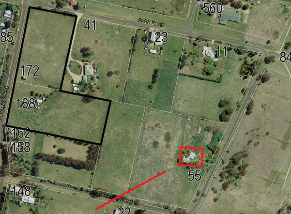
Figure 8: view analysis for 55 Rifle Range Road
As can be seen from the attached basic view analysis, the
primary view lines for the objector as identified in the DCP are of Mt Canobolas.
The proposed development does not affect those primary views. The views enjoyed
by the objector in other directions cannot be considered the primary views for
that person. Moreover, with the larger lot to be located on 168 Shiralee
Road and the compact lots lower in elevation relative to the crest at
Shiralee Road, it is considered that views in the westerly direction for
the objector will not be significantly affected.
The Land and Environment Court has ‘planning
principles” with regard to view loss assessments. The value of views are
linked to whether the thing being viewed is iconic or essential to the inherent
value of the property benefitting from that view. Where views are of a more
general or panoramic value the Land and Environment Court “planning
principles” promote the idea of view sharing. In this case it is obvious
that the proposed development will not completely eradicate the objector of all
their views, and will not affect at all the primary viewing lines that may be
open to the objector.
· Proposals to
encroach on the northern boundary of 55 Rifle Range Road for stormwater
drainage, sewage and future roads will clearly impact on mature white gums, a
highly functioning and vital underground bore for our potable water and
agricultural land.
The positioning and design of stormwater drainage lines will
require discussions and agreement with the relevant landowner/s. Stormwater
flows may not be simply discharged onto neighbours’ land, and an approval
for the subject application does not remove or impinge upon the private
property rights of other landowners to withhold their agreement to the
positioning of stormwater lines or other infrastructure across or over their
land. The issues of concern that have been raised would need to be considered
in detail if and only when a decision was made by those persons to further
develop their land for residential purposes. The status quo would remain if a
decision was made to not development that land at this time.
· Groundwater
vulnerability is rated as high. We request further investigation in this area
especially in regards to the proximity of bores and adjoining downstream
properties which are vulnerable to contamination.
It is considered that the proposed subdivision possesses
little risk to groundwater quality or the quality of water extracted from the
aquifers in the locality.
· Groundwater
vulnerability.
The subject property is mapped as having groundwater
vulnerability. This arises principally because of the relatively high water
table across much of Orange, including the subject site. It is considered that
the subject property is under no greater risk than other properties with
similar ground water vulnerability issues. It is further considered that, given
that surface runoff and effluent disposal will both be managed principally by
removal via articulated networks linking back to Council infrastructure, the
risks to water quality are very low.
· Clause 7.11 -
Essential services- e) Suitable road access
It is noted that this objector has similar concerns as
expressed by other residents with respect to access for Lots 7-17. These have
been previously commented upon.
C
Smith
· Objects to the
compact lots.
The compact lots are consistent with the Masterplan
contained in the Shiralee DCP.
· Roads and access.
Mr Smith is concerned about safety arising from the
increased road usage. However, the road layout on which the subdivision is
based is a direct facsimile of the DCP requirements.
· Stormwater -
stormwater system be designed for the 1 in 10 year storm event.
Council’s stormwater standards that are applicable to
the proposed development are generally to a higher standard than the 1 in 10
year event. Notwithstanding, a detailed engineering drawing will be required to
be prepared for approval adhering to Council’s Subdivision and
Development Code prior to works commencing.
· Location
– slope and elevation creates a highly visible development.
The subject property is particularly visible from the north,
with the views of the Heritage Item located on the site of particular interest.
To address this issue and minimise the impacts of both the existing development
and future development of the new lots, conditions are included in the attached
schedule to limit the extent of earthworks, height restrictions where
appropriate and setbacks for the compact lots that are proposed.
· Landscaping
– some arrangement for revegetation should be included in the proposal.
Conditions are included in the consent for the provision of
landscaping as specified in the DCP.
· Remediation of
land.
A site contamination report submitted with the application
indicates that the site is not contaminated and is suitable for use as
residential land.
Laurie and Graeme Dwyer
– “Hillview” Park Road
· Blocks 1, 4, 6,
7, 8 and 9 do not comply with the street frontage requirements for a large lot
classification.
There are some variations in relation to the DCP Masterplan,
however this arises due to the existing approval granted for DA 42/2016. In
terms of general layout and lot yield, the proposed subdivision is consistent
with the DCP. Clause 1.8 does allow for certain variations to the DCP where the
outcomes remains remain generally acceptable and underlying objectives are
being achieved.
· Request that
driveway access for Lots 2, 3, 4 and 6 be identified.
It is standard for Council to determine the location of
driveways at dwelling application stage.
· Objects to the
location of the sewer main and stormwater lines on their property. Same
objection for proposed road access.
As owners of that land, the objectors can refuse sewer mains
(and/or stormwater lines) being installed on their land. Those lots requiring
sewer and/or stormwater access across the objectors’ land may not be
developed until such access is provided, but the objectors are under no
obligation to allow such access. The same conclusions can be drawn with respect
to road access. It is noted that the proposed development, with respect to
water, sewer, stormwater and roads, is consistent with the LEP as well as the
DCP Masterplan. Issues relating to the provision of water, sewer and road
connections are not directly relevant to the assessment of the development
application, and will be the subject of separate negotiations between the
developer and the affected landowners.
· Compact lots
will require excessive cut and fill.
The compact lots are consistent with the Masterplan layout
of the DCP in terms of size, shape and location. There are no bulk earthworks
proposed for the sites under this application.
The most appropriate time to assess whether future
development complies with the cut and fill requirements is if and when cut and
fill is actually part of the site works, ie when applications for
buildings are received. The overall cross fall from northwest to southeast for
the compact lots is in the order of 10m, which equates to an average drop for
each of the proposed compact lots of 1.25m. Depending on the style of
construction used and whether or not split level buildings are adopted, the cut
for future dwellings can be expected to be under 1m. This is not
considered excessive.
· Fencing.
The objection points out that larger lots require open rural
style fencing with high visual permeability. The objectors are concerned that
the large lots with open style permeable fencing will not achieve adequate
privacy for them. At the same time they point out that they run cattle on their
holding, suggesting that residential opaque fencing like Colorbond or palings
would not prevent their cattle pushing the fencing over.
The DCP is, in fact, concerned with trying to manage the
transition of the locality from a semi‑rural environment to a residential
environment. The land has been rezoned generally to residential purposes, and
the Masterplan manages this transition. However, it is noted that with a
residential zoning, the use of the properties for any form of extensive
agriculture is no longer permissible under the LEP. Existing use rights would,
however, apply in circumstances where the activity has been continuous.
There are no details of any fencing to be provided on the
site, which indicates that no new fencing is at this stage proposed. Future
applications for dwellings on the sites can be assessed as to their impacts on
privacy versus the impacts of solid fencing on neighbourhood character. In
future, devices and techniques such as screen planting/landscaping, positioning
and orientation of buildings and the like are possible so as to minimise
privacy impact. These can be assessed on their merits.
For this application it is considered appropriate to impose
the following condition:
(x) For
all stages of the development and any future development on the new lots, where
any existing fencing at the perimeter of the site needs to be removed, or is of
a type which does not ensure the occupants of any adjoining residence adequate
privacy, new fencing that is compliant to the requirements the Section 6.2 of
the Shiralee DCP shall be provided, and where necessary shall include
arrangements for screening landscaping or privacy devices as necessary to suit
the style of development and its constraints at that time.
· Tree Removal.
The objectors raise concern about the loss of one gum tree
from the site. This tree is not proposed to be removed under this application.
It appears that approval to remove the significant vegetation from the site was
granted under DA 42/2016. The vegetation existing on the site is not
significant from a biodiversity management perspective.
· This DA should
include soil testing.
A site and soil analysis was submitted with the application
by Envirowest Consulting.
· Future
development.
The objectors’ land holding is affected by the
reservations for roads and services as set out in the DCP, which the proposed
subdivision is entirely consistent with. Since the adoption of the DCP the
objectors’ land has been subject to those land acquisitions for roads and
services in the areas so shown in the Masterplan. As such, the parts of the
objectors’ holding affected by road and services acquisition has no real
potential for any substantive alternative development. The land owner has a
choice to basically keep using the land as they are, or to develop their
holding as set out in the DCP. The proposed development currently before
Council does not interfere with that choice.
· Compact Lots are
not in keeping with the Desired Future Character of the locality.
The compact lots as proposed in this application reflect
closely the layouts contained in the DCP Masterplan for this locality, as shown in the following Figures 9 and 10.
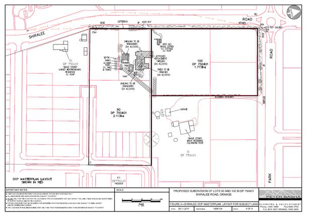
Figure 9: DCP Masterplan (drawing by applicant)
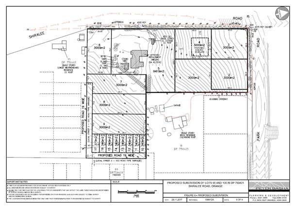
Figure 10: proposed subdivision layout
PUBLIC INTEREST
s4.15(1)(e)
The proposed development is considered to be of minor
interest to the wider public due to the relatively localised nature of
potential impacts. The proposal is not inconsistent with any relevant policy
statements, planning studies, guidelines etc that have not been considered in
this assessment.
SUMMARY
The proposed development is permissible with the consent of
Council. The proposed development complies with the relevant aims, objectives
and provisions of Orange LEP 2011 (as amended) and DCP 2004. The applicant
has sought a variation to the minimum allotment size controls pursuant to
Clause 4.6 of the LEP. A Section 4.15 assessment of the development indicates
that the development is acceptable in this instance. Attached is a draft Notice
of Approval outlining a range of conditions considered appropriate to ensure
that the development proceeds in an acceptable manner.
COMMENTS
The requirements of the Environmental Health and Building
Surveyor and the Engineering Development Section are included in the attached
Notice of Approval.
Attachments
1 Notice
of Approval, D18/40155⇨
2 Plans,
D18/40152⇨
3 Submissions,
D18/40153⇨
2.7 Development
Application DA 350/2016(1) - 47-49 Hill Street
RECORD
NUMBER: 2018/1532
AUTHOR: Andrew
Crump, Senior Planner
EXECUTIVE Summary
|
Application
lodged
|
14
October 2016
|
|
Applicant/s
|
Newstead
Property Nominees Pty Ltd
|
|
Owner/s
|
Newstead
Property Nominees Pty Ltd
|
|
Land
description
|
Lots 1,
2 and 3 DP 1127220, Lot 19 DP 1158710 and Lots 17 and 18 Sec 22 DP
758817- 47-49 Hill Street, Orange
|
|
Proposed
land use
|
Demolition
(ancillary structures), Subdivision (Torrens Title - four lot residential),
Dwellings (two dwellings), Multi Dwelling Housing (seven dwellings) and
Subdivision (Community Title - eight lot residential)
|
|
Value of
proposed development
|
$3,550,000
|
Council's consent is sought to undertake a residential
redevelopment of the former Newstead Bowling Club site. The location is shown
below.

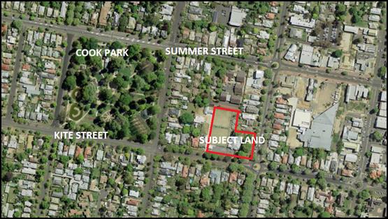
Figure 1: locality plan - subject land shown red
outline
The setting and context of the subject land is characterised
as being situated within an area of the City which displays exceptional
heritage value owing to the cluster of intact heritage items such as Mena (50
Kite Street), Sir Charles and Lady Cutler's former residence (52 Kite
Street) (both opposite the subject land in Kite Street) and the Newstead
Bowling Club (former mansion) which is situated on the land the subject of the
application. The avenue of large mature plane trees within Kite Street is a
notable feature within the Central Heritage Conservation Area and the Cook Park
tree canopy forms an important back drop to the west.
The proposal firstly involves a four lot Torrens title
subdivision. The intent of the subdivision is to excise the Newstead building
(former mansion) onto a separate lot, create two separate lots with frontage to
Kite Street (and vehicular access over Lot 100) and create a battle-axe lot as
a development lot. Demolition of the shed and other ancillary items (water
tanks) will occur at the time of the subdivision. The applicant then seeks to
construct nine (9) dwelling houses; one dwelling on each of the two lots
fronting Kite Street and seven (7) dwellings as a multi-dwelling housing
development on the battle-axe lot. Finally, the applicant is seeking to undertake
an eight (8) lot Community title subdivision (seven house lots and
one community lot (access)) over the multi-dwelling housing development within
the battle-axe lot. As part of the development a new vehicle crossover will be
provided within the street, changing the existing arrangement within the
footpath. The development also involves new front fencing, landscaping and
visitor parking spaces.
A planning report was tabled for the consideration of the
Planning and Development Committee on 7 December 2017 with a recommendation for
refusal based on the following:
· The design and
siting of Dwellings 1 and 2; particularly the attached double garages
presenting visually to the street, and the siting of Dwelling 2 being
forward of the significant heritage item on the land will result in an
unacceptable detrimental impact upon the significance of the heritage item on
the land known as the Newstead building, as well as the significance of the
Central Heritage Conservation Area and a number significant heritage items
within the vicinity of the subject land.
· The development
is inconsistent with the objects of Clause 5.10 - Heritage Conservation
pursuant to Orange Local Environmental Plan 2011.
· The development
is inconsistent with the residential design objectives listed under
Chapter 7 of Orange Development Control Plan 2004, particularly
neighbourhood character, building appearance, heritage and streetscape.
· The development
is in direct conflict with planning outcome PO 7.7-3 (2) - Heritage
which seeks to ensure that new development complements and enhances the
significance of a heritage item or place of heritage significance listed in the
Orange Heritage Study.
· The development
is fundamentally inconsistent with Council’s Infill Guidelines.
· Compliance with
the infill guidelines and the other relevant aspects of Council’s
planning provisions could be achieved if not for the number, size, design and
layout of the proposed dwellings. Accordingly, the development is considered to
be an over development of the site.
· The proposed
stormwater design will result in unsatisfactory impacts upon the residential
amenity of Dwellings 6 and 9. An alternative solution that improves the amenity
of those dwellings would have unacceptable impacts upon the large mature Deodar
Cedar (Cedrus deodara) on the northern side of the Newstead building (former
mansion).
At that meeting, the Committee resolved:
That Council defer DA
350/2016(1) – 47-49 Hill Street, Orange, to allow for further discussion
with the applicant and objectors.
Since that time the applicant has amended the subject
application to address the matters raised in the abovementioned planning
report, as well as those raised within submissions. The fundamental change to
the application relates to the number of driveways, which have been
consolidated to a single driveway. This allows the garages for Dwellings 1
and 2 to have garage openings orientated in a way whereby they are not
visually prominent within the street.
The amended application was publicly notified, at the end of
which three (3) submissions were received.
The amended design represents a marked improvement on the
presentation to Kite Street, and subject to a number of conditions relating
primarily to heritage matters, the proposal is acceptable. Accordingly, the
amended development application is recommended for approval.
RECENT LEGISLATIVE CHANGES
On 1 March 2018 the Environmental Planning and Assessment
Act 1979 was substantially amended. The most immediate change involves the
restructuring and renumbering of the Act, with other more substantive
changes to be phased in over time. However, for some applications (particularly
where an application was lodged prior to the changes coming into effect) the
supporting documentation may still reference the previous numbering regime. In
the drafting of this report the content and substance of the supporting
material has been considered irrespective of which legislative references were
used.
DECISION FRAMEWORK
Development in Orange is governed by two key documents Orange
Local Environment Plan 2011 and Orange Development Control Plan 2004. In
addition the Infill Guidelines are used to guide development, particularly in
the heritage conservation areas and around heritage items.
Orange Local Environment Plan 2011 – The provisions
of the LEP must be considered by the Council in determining the application.
LEPs govern the types of development that are permissible or prohibited in
different parts of the City and also provide some assessment criteria in
specific circumstances. Uses are either permissible or not. The objectives of
each zoning and indeed the aims of the LEP itself are also to be considered and
can be used to guide decision making around appropriateness of development.
Orange Development Control Plan 2004 – the DCP
provides guidelines for development. In general it is a performance based
document rather than prescriptive in nature. For each planning element there
are often guidelines used. These guidelines indicate ways of achieving the
planning outcomes. It is thus recognised that there may also be other solutions
of merit. All design solutions are considered on merit by planning and building
staff. Applications should clearly demonstrate how the planning outcomes are
being met where alternative design solutions are proposed. The DCP enables
developers and architects to use design to achieve the planning outcomes in
alternative ways.
DIRECTOR’S COMMENT
Council’s insistence on the redesign of the unit
development has resulted in a more sympathetic development within one of
Orange’s key heritage zones.
Link To Delivery/OPerational Plan
The recommendation in this report relates to the
Delivery/Operational Plan strategy “10.1 Preserve - Engage with the
community to ensure plans for growth and development are respectful of our
heritage”.
Financial Implications
Nil
Policy and Governance Implications
Nil
|
Recommendation
That Council consents to
development application DA 350/2016(1)
for Demolition (ancillary structures), Subdivision (Torrens Title - four
lot residential), Dwellings (two dwellings), Multi Dwelling Housing (seven
dwellings) and Subdivision (Community Title - eight lot residential) at Lots
1, 2 and 3 DP 1127220, Lot 19 DP 1158710, and Lots 17 and 18
Sec 22 DP 758817 - 47-49 Hill Street, Orange pursuant to the conditions of consent in the attached
Notice of Approval.
|
further considerations
Consideration has been given to the recommendation’s
impact on Council’s service delivery; image and reputation; political;
environmental; health and safety; employees; stakeholders and project
management; and no further implications or risks have been identified.
SUPPORTING INFORMATION
THE APPLICATION/PROPOSAL
Council's consent is sought to undertake a residential
redevelopment of the former Newstead Bowling Club site which is situated on
land described as Lots 1, 2 and 3 DP 1127220, Lot 19
DP 1158710, and Lots 17 and 18 Sec 22 DP 758817. The land is known as
47-49 Hill Street, Orange (also known as the Newstead Bowling Club, Kite
Street, Orange).
The development is proposed in a number of stages to achieve
the intended outcome. The following is an outline of the various stages:
Stage 1
Stage 1 involves the demolition
of ancillary structures within the land such as the greenkeeper's shed, storage
shed and water tanks. This stage also involves undertaking a four lot
subdivision as summarised in the table below.
|
Lot
|
Size (m2)
|
Frontage
|
Further Development
|
|
100
|
3,647.8
|
Kite Street via access handle of
battle-axe lot
|
Multi dwelling housing (seven
dwellings) and Community title subdivision
|
|
101
|
3,528.7
|
Corner lot, frontage to both Kite
and Hill Streets. The existing mansion primarily addresses Hill Street
|
No further development proposed as
part of this application. A separate development application for future uses
required
|
|
102
|
577.3
|
Kite Street (vehicle access to
garage via access handle of Lot 100)
|
Single dwelling
|
|
103
|
568
|
Kite Street (vehicle access to
garage via access handle of Lot 100)
|
Single dwelling
|
Table 1: summary of subdivision
The size of the lots and the
location of new boundaries is depicted in the below excerpt from the submitted
plans.
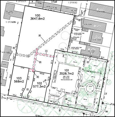
Figure 2: excerpt from submitted plans showing subdivision
layout
Stage 2
Construction of a dwelling on each of the resultant Lots 102
and 103 (created under Stage 1) and construction of seven dwellings as a
multi dwelling housing development on the resultant battle-axe development Lot
100 (created under Stage 1).
All proposed dwellings are single storey with attached
double garages, three bedrooms, two bathrooms, open plan kitchen/dining/living
and some with separate lounge rooms. Roof forms will primarily comprise hip
roofs, with some gables. The external materials for all dwellings will comprise
face brick, Colorbond roof sheeting, aluminium windows (save for the front
elevation of dwellings 1 and 2 which will be timber), circular profile
downpipes and quad profile gutters. Hard landscaping will comprise coloured
concrete driveways and paths. Trees, hedges and shrubs are proposed as shown on
the submitted landscape plan.
Stage 3
The final stage comprises an eight lot Community Title
subdivision to excise the seven dwellings (multi-dwelling housing) constructed
under Stage 2 onto separate Community Title lots. The subdivision will comprise
seven house lots and a community (access) lot.
The Community Title subdivision
is summarised as follows:
|
Lot
|
Size (m2)
|
Resultant Improvement
|
|
1
|
737.7
|
Community lot/vehicular access
|
|
2
|
388.0
|
Dwelling 3
|
|
3
|
385.8
|
Dwelling 4
|
|
4
|
403.7
|
Dwelling 5
|
|
5
|
500.2
|
Dwelling 6
|
|
6
|
446.6
|
Dwelling 7
|
|
7
|
384.3
|
Dwelling 8
|
|
8
|
477.9
|
Dwelling 9
|
Table 2: summary of Community Title subdivision
The size of the lots and the
location of new boundaries is depicted in the below excerpt from the submitted
plans.
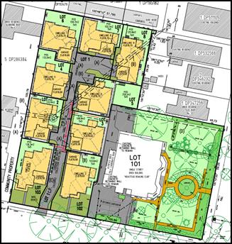
Figure 3: excerpt from submitted plans showing
Community Title subdivision layout
BACKGROUND/CHRONOLOGY OF
APPLICATION
The following is a chronology of key dates, with an
explanation of amendments to the application and elucidation of each of the
four exhibition periods.
August 2016
The applicant attempted to lodge the application, however it
was not accepted at this time due to insufficient information. The development
was, for all intents and purposes, the same design as what is currently before
Council. Dwellings 1 and 2 comprised attached garages presenting to
Kite Street. Council staff at this time procured advice from Council’s
Heritage Advisor, who recommended that the two garages that orientate to the
street be redesigned such that vehicular access to these garages was achieved
internally from the common driveway, thus not being visually dominant within
the streetscape.
Additionally, it was recommended that Dwelling 2 be set back
further from Kite Street so as to provide a more appropriate setback transition
between the new development and the heritage item on the land, and allow the
primacy of the heritage item to be more obvious within the street.
This advice was provided to the applicant.
14 October 2016
Application lodged with Council. When the application was
formally lodged with Council, the orientation of Dwelling 1 was amended such
that the garage door faced west (away from Kite Street) and was accessed from
the common property driveway. Dwelling 2 remained unchanged from when the
applicant first attempted to lodge the application in terms of both garage
location/orientation and front setback.
27 October 2016
Council staff provided the applicant with an additional
information request which included inter alia a request to redesign
Dwelling 2 such that the attached garage was not visually dominating
within the streetscape, and also requested re-siting of the same dwelling such
that a greater setback was provided. Noting that at this time Dwelling 1
had an attached garage that orientated the opening internally (facing west)
within the site.
2 November 2016
Application advertised and notified.
11 April 2017
Additional information provided to Council which included
amended plans, with Dwelling 1 redesigned such that the garage door
re-orientated 90 degrees to visually present to the street and Dwelling 2
remained essentially unchanged, with a slight setback increase of
nominally 0.7m. Other minor changes included reduced roof pitch, privacy
treatment to Dwelling 9, materials schedule, minor floor plan changes etc.
Essentially the design returned to the same design that was originally rejected
by Council staff in August 2016, save for the minor changes mentioned
above.
27 April 2017
Application re-advertised and notified based on
inconsistency in the application's formal description/order of the development.
The application was also required to be readvertised due to the substantial
change to the design of Dwelling 1.
11 May 2017
At the completion of the second exhibition period, it became
apparent from some of the submissions received during that period that the
material that was placed on public exhibition led to confusion within the
community. The confusion centred on the exact design of Dwelling 1. The
cause of the confusion related to the information that was resubmitted from
URBIS dated 26 August 2016 that indicated “Dwelling 1 has been
redesigned so that the entry to the garage is from the side of the dwelling
…”. This information was contradictory to the plans and other
material accompanying the application. As such, Council staff were left with no
option other than to request clarification from the applicant and re-advertise
the application for the third time to address the confusion.
At this point, the applicant requested that they be allowed
time to prepare a complete new heritage impact statement from URBIS. This was
agreed to by Council staff and Council awaited the submission of new material
so that exhibition could occur for the third time.
14 August 2017
Revised development application material submitted which
included a revised Statement of Environmental Effects and a new heritage impact
statement prepared by URBIS.
31 August 2017
Development application advertised and notified for the
third time.
7 December 2017
Report tabled for the Planning and Development Committee
with a recommendation for refusal. Council resolved to defer DA 350/2016(1)
– 47-49 Hill Street, Orange, to allow for further discussion with the
applicant and objectors.
9 May 2018
Amended application lodged.
24 May 2018
Amended application advertised and notified.
PLANNING PROPOSAL
As a separate matter, the owners of the land lodged a
planning proposal with Council which sought to rezone the former Mansion and
the curtilage around it (approximate area shown blue outline below) to B4 Mixed
Use. This has since been completed. The recent amendment effectively completes
a contiguous row of B4 Mixed Use zoned properties on the western side of Hill
Street from Summer Street through to Kite Street (see below).
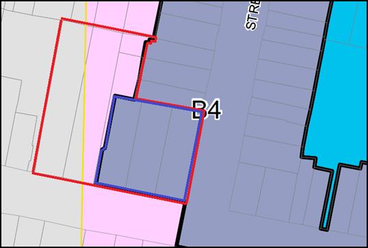
Figure 4: area of land rezoned to B4 Mixed Use (shown
blue outline)
(red outline relates to the subject land)
The completed planning proposal (area within the blue
outline above) also sought to apply a 9m Height of Buildings limit and a
0.5:1 Floor Space Ratio; as well as a reduction in the mapped extent of the
heritage items to relate to just Lots 1, 2 and 3 DP 1127220. All these changes
to the LEP came into effect upon the date of Gazettal, being 22 June 2018.
The amendment to the LEP as described above will not affect
the assessment of this application in any material way. There is no development
other than subdivision proposed on the land now zoned B4, and in terms of the
reduced area of mapping associated with the heritage item, the land remains
within the Central Heritage Conservation Area and the proposed dwellings adjoin
a heritage item (being the former mansion), therefore the level of assessment
remains the same post amendment as it did when the application was first
lodged.
MATTERS FOR CONSIDERATION
Section 1.7 - Application of
Part 7 of the Biodiversity Conservation Act 2016 and Part 7A of the
Fisheries Management Act 1994
Development Applications lodged prior to 25 February 2018
Section 1.7 of the EP&A Act 1979 identifies that Part 7
of the Biodiversity Conservation Act 2016 and Part 7A of the Fisheries
Management Act 1994 have effect in connection with terrestrial and aquatic
environments.
Notwithstanding, Section 28 of the Biodiversity
Conservation (Savings and Transitional) Regulation 2017 states that the
former planning provisions continue to apply to the determination of a pending planning
application, being an application for planning approval made before the
commencement of the new Act but not determined before that commencement. The
relevant provisions are set out at Part 5A of the historical version of the
EP&A Act 1979 dated 24 August 2017.
Having regard to the relevant provisions and based on an
inspection of the subject property, it is considered that the proposed
development is not likely to have a significant effect on any threatened
species, populations or ecological communities or their habitats.
Section 4.15
Section 4.15 of the Environmental Planning and Assessment
Act 1979 requires Council to consider various matters, of which those
pertaining to the application are listed below.
PROVISIONS OF ANY ENVIRONMENTAL
PLANNING INSTRUMENT s4.15(1)(a)(i)
Orange Local Environmental Plan 2011
Part 1 - Preliminary
Clause 1.2 - Aims of Plan
The
broad aims of the LEP are set out under subclause 2. Those relevant to the
application are as follows:
(a) to encourage development which complements
and enhances the unique character of Orange as a major regional centre boasting
a diverse economy and offering an attractive regional lifestyle,
(b) to provide for a range of development
opportunities that contribute to the social, economic and environmental
resources of Orange in a way that allows present and future generations to meet
their needs by implementing the principles for ecologically sustainable
development,
(c) to conserve and enhance the water
resources on which Orange depends, particularly water supply catchments,
(e) to provide a range of housing choices in
planned urban and rural locations to meet population growth,
(f) to recognise and manage valued
environmental heritage, landscape and scenic features of Orange.
The application is not inconsistent with the aims of the
plan, particularly aims (a), (b), (c), (e) and (f) as listed above.
Clause 1.6 - Consent Authority
This clause establishes that, subject to the Act, Council is
the consent authority for applications made under the LEP.
Clause 1.7 - Mapping
The subject site is identified
on the LEP maps in the following manner:
|
Land Zoning Map:
|
Land zoned R1 General Residential
and B4 Mixed Use
|
|
Lot Size Map:
|
No Minimum Lot Size
|
|
Heritage Map:
|
Partly a Heritage item and heritage
conservation area
|
|
Height of Buildings Map:
|
No building height limit on R1
Land; 9m limit over the B4 land
|
|
Floor Space Ratio Map:
|
0.5:1 floor space limit to B4 Land
|
|
Terrestrial Biodiversity Map:
|
No biodiversity sensitivity on the
site
|
|
Groundwater Vulnerability Map:
|
Groundwater vulnerable
|
|
Drinking Water Catchment Map:
|
Not within the drinking water
catchment
|
|
Watercourse Map:
|
Not within or affecting a defined
watercourse
|
|
Urban Release Area Map:
|
Not within an urban release area
|
|
Obstacle Limitation Surface Map:
|
No restriction on building siting
or construction
|
|
Additional Permitted Uses Map:
|
No additional permitted use applies
|
|
Flood Planning Map:
|
Not within a flood planning area
|
Those matters that are of relevance are addressed in detail
in the body of this report.
Clause 1.9A - Suspension of
Covenants, Agreements and Instruments
This clause provides that covenants, agreements and other
instruments which seek to restrict the carrying out of development do not apply
with the following exceptions.
· covenants imposed
or required by Council
· prescribed
instruments under Section 183A of the Crown Lands Act 1989
· any conservation
agreement under the National Parks and Wildlife Act 1974
· any trust
agreement under the Nature Conservation Trust Act 2001
· any property
vegetation plan under the Native Vegetation Act 2003
· any biobanking
agreement under Part 7A of the Threatened Species Conservation Act 1995
· any planning
agreement under Division 6 of Part 4 of the Environmental Planning and
Assessment Act 1979.
Council staff are not aware of the title of the subject
property being affected by any of the above.
Part 2 - Permitted or Prohibited Development
Clause
2.1 - Land Use Zones and Clause 2.3 - Zone Objectives and Land Use Table
The subject site is located within the R1 General
Residential zone and B4 Mixed Use Zone. The proposed development is defined as
a subdivision of land, demolition, dwelling houses and multi dwelling housing
(Community Title subdivision has the same meaning as a Torrens Title
subdivision) under OLEP 2011.
The Environmental Planning and Assessment Act
(Section 6.2) defines subdivision of land as:
the division of land into two
or more parts that, after the division, would be obviously adapted for separate
occupation, use or disposition.
Dwelling houses are defined by
the LEP to mean:
a building containing only one
dwelling.
The LEP provides further
guidance around the meaning of a dwelling which means:
a room or suite of rooms
occupied or used or so constructed or adapted as to be capable of being
occupied or used as a separate domicile.
Multi dwelling housing is
defined as:
3 or more dwellings (whether
attached or detached) on one lot of land, each with access at ground level, but
does not include a residential flat building.
Subdivision (including the
Community Title subdivision under the final stage) is permissible in the zones
with consent pursuant to clause 2.6 of the LEP. Demolition is permissible in
the zones with consent pursuant to clause 2.7 of the LEP. Dwelling Houses and
multi dwelling housing are permissible in the R1 General Residential zone and
B4 Mix Use zone with the consent of Council.
This application does not deal
with the use of the former Newstead club building (former Mansion). It will be
necessary for a separate development application to be lodged with Council that
seeks consent for an appropriate use of that land in the future.
Clause 2.3 of LEP 2011
references the Land Use Table and Objectives for each zone in LEP 2011.
These objectives for land zoned R1 General Residential and B4 Mixed Use are as
follows:
1 -
Objectives of the R1 General Residential Zone
· To provide for the
housing needs of the community.
· To provide for a
variety of housing types and densities.
· To enable other land
uses that provide facilities or services to meet the day to day needs of
residents.
· To ensure development
is ordered in such a way as to maximise public transport patronage and
encourage walking and cycling in close proximity to settlement.
· To ensure that
development along the Southern Link Road has an alternative access.
The development is not inconsistent with the objects of the
R1 General Residential zone. The development will provide housing and increase
the variety of housing types that are close to the CBD, which will allow for a
variety of transportation modes. The development will have a neutral effect on
the last listed objective.
It is noted
that there is a small area of land (approximately 3.4m²) (shown in the
below figure) in the far north-eastern corner if the site. It is unclear from
the gazetted zoning maps precisely what the zoning of this small area of land
is. Council’s mapping system shows the land as being B4. It is likely to
be a small area of B4 land that was mistakenly zoned as such, being included
with the same zoning as the adjoining B4 zoned properties within Hill Street.

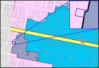
Figure 5 (and insert): approximate location of Lot 19
showing part of the land zoned B4 Mixed Use
This identified zoning anomaly
has zero effect on the permissibility and appropriateness of the development;
the proposed land uses remain permissible and the development is consistent
with the B4 zone objectives.
1 - Objectives of the B4 Mixed Use Zone
· To provide a mixture of compatible land uses.
· To integrate suitable business, office, residential, retail
and other development in accessible locations so as to maximise public
transport patronage and encourage walking and cycling.
· To promote, where possible, the retention and reuse of
heritage items as well as the retention of established buildings that
contribute positively to the heritage or cultural values of the land in the
zone.
· To promote development that supports the role of Orange CBD
as the primary retail and business centre in the region.
The development is not inconsistent with the objects of the
B4 zone. It should be noted however, that this application does not seek a
land-use of the former mansion (being that portion of the development site that
is zoned B4 Mixed Use) at this time. It will be necessary for an application to
be made for any future use of proposed Lot 101, at which time Council will
have the opportunity to consider, inter alia, whether or not the
proposed land use is consistent with the zone objectives.
Clause 2.6 - Subdivision -
Consent Requirements
This clause triggers the need for development consent for
the subdivision of land. The applicant has sought consent via this application.
Clause 2.7 - Demolition
Requires Development Consent
This clause triggers the need for development consent in
relation to a building or work, which the applicant has sought through this
application. The proposed structures to be demolished include the bowling
greens, the greenkeeper's shed, and front fence and retaining wall, as well as
the two aboveground rain water tanks and storage shed in the north-eastern
corner of the site. There are no objections to the proposed demolition.
Part 3 - Exempt and Complying Development
The application is not exempt or complying development.
Part 4 - Principal Development Standards
Clause
4.1B - Minimum Lot Sizes for Dual Occupancy, Multi Dwelling Housing and
Residential Flat Buildings
This clause establishes the
minimum lot size required for dual occupancies and multi dwelling housing in
the R1, R2 and R3 zones. The proposed multi dwelling housing is situated on
land within the R1 General Residential zone, which is not identified on the
Minimum Lot Size Map as having a minimum lot size. This clause requires the
site to have a minimum area of 1,250m² to support multi dwelling housing.
This subject land/proposed lot
(being proposed Lot 100) will be (once created under Stage 1)
3,647.8m² and therefore consistent with this clause.
Clause 4.3
- Height of Buildings
This clause limits the height of
buildings (HoB) on land identified on the Height of Buildings Map. The subject
land (being only that portion of the development that is identified as proposed
Lot 101) is identified on the Map as having a HoB limit of 9m. The applicant
does not seek to alter the height of the existing building on the land.
Clause 4.4 - Floor Space Ratio
This
clause limits the floor space ratio (FSR) permitted on land identified on the
Floor Space Ratio Map. Clause 4.5 is associated with this clause and
establishes the rules for calculating the site area and FSR of any proposal.
These rules exclude certain parts of a site and development such as:
· excluding
any part of the site upon which the development is prohibited (ie if the
site is split zoned only the zone in which the development is permissible may
be considered)
· excluding
community land and most public places
· lots
in a Strata scheme wholly or partly above other lots in the scheme do not
increase the site area (ie the site area is the ground level of the scheme only)
· adjoining
lots in the same ownership do not form part of the site area unless significant
parts of the development are proposed on that land
· the
floor area of existing buildings is to be included in the FSR calculation
· any
covenant restricting floor space on the lot, due to floor space having been
considered as part of the development of another lot, is to be taken into
account.
As mentioned above, proposed Lot
101 now comprises a FSR development standard of 0.5:1. The proposed lot is
3,528.7m2. The existing former mansion comprises a gross floor area
of 584.7m2. At the completion of the subdivision the land concerned
will comprise an FSR of 0.17:1, well below the development standard.
Part 5 -
Miscellaneous Provisions
5.10 - Heritage Conservation
The subject land is identified as a heritage item listed
within schedule 5 of Orange LEP 2011. The land is also located within the
Central Heritage Conservation Area as defined by the heritage maps contained
within the Orange LEP 2011.
The subject land is also located opposite, adjoins, or is in
close proximity to the following heritage items as shown on the below figure.
· I6 –
"Mena" dwelling – 50 Kite Street (opposite subject land)
· I146 –
dwelling (former residence of the late Sir Charles and Lady Cutler) –
52 Kite Street (opposite subject land)
· I44 –
dwelling – 56 Kite Street (opposite subject land)
· I179 –
dwelling – 50 Hill Street (opposite subject land)
· I41 –
Heritage House "Gortnessy" – 58 Summer Street (adjoins the
subject land at the north-western corner)
· I144 –
"The Channings" dwelling – 39 Kite Street (in proximity of
subject land)
· I143 –
dwelling – 37 Kite Street (in proximity of the subject land).
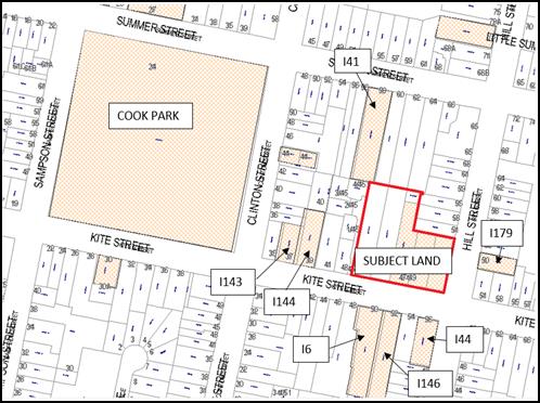
Figure 6: the geographical relationship of the subject
land with surrounding heritage items
The relevant heritage inventory sheets describe the Heritage
Significance of the above properties and Central Heritage Conservation Area as
follows:
Newstead (former mansion)
Newstead was built in 1890 by John Douglas for Mr. &
Mrs. De Vries Pilcher as a double octagonal bay residence including a roof
mounted widows walk, considerable stained glass in the front door, its
surrounding sidelights and fanlight. The dominating Indian Cedar tree was
planted shortly after the house was built and is one of several significant
cultural plantings in the formal garden. It was purchased and adapted to
provide a Bowling Club in 1955.
Central Heritage Conservation
Area
Consisting of a range of buildings dating from the latter
part of the nineteenth century and the early part of the twentieth, the
conservation area has historical importance for reflecting the development and
prosperity of Orange during this period.
The conservation area exhibits several fine examples of
different architectural styles. The building materials used, the mature street
trees and the fine parklands all help to bring the area together as an
aesthetically pleasing whole and as a townscape of importance.
Representing much of the core of the city, the
conservation area has an appreciable level of social significance for the
Orange community.
50 Kite
Street "Mena"
This symmetrical masonry residence with curved return
verandah was built for Thomas Dalton by his father James, and is a significant
example of the Irish legacy and a manifestation of their confident outlook
while complementing the streetscape and contributing to the Conservation Area
within the city as a heritage item.
52 Kite
Street
An attractive Victorian-style residence which has
retained the original character and distinctive details, including mouldings,
verandah and barge boards, the property was the home of Sir Charles and Lady
Cutler. Sir Charles was leader of the Country Party, Minister for Education,
and Deputy Premier of NSW.
50 Hill
Street
The unusual early Inter war face brick house with hipped
and vented iron roof includes a distinctive arched central porch and the
building complements the streetscape and contributes to the Conservation Area
as a heritage item.
58 Summer
Street – Heritage House "Gortnessy"
An outstanding and representative example of an Edwardian
residence in garden setting and original piered and steel palisade fencing, the
building retains all the distinctive features from the original 1900 design and
complements to the streetscape and contributes to the Conservation Area as a
heritage item.
39
Kite Street – "The Channings"
The late Victorian two storey residence dominates the
streetscape and has historical value as a guest house, the site contributes to
the Conservation Area as a heritage item
37 Kite
Street
The late Victorian residence retains the original
character including the verandah, complements the streetscape and as a rare
example of the type is also intact and in a sound condition, contributes to the
Conservation Area as a heritage item
(1) Objectives
The
objectives of this clause are as follows:
(a) to
conserve the environmental heritage of Orange,
(b) to
conserve the heritage significance of heritage items and heritage conservation
areas, including associated fabric, settings and views,
(c) to
conserve archaeological sites,
(d) to
conserve Aboriginal objects and Aboriginal places of heritage significance.
The objects of the above clause centre on the conservation
of heritage places. Of particular relevance to this application are objectives
(a) and (b). Objectives (c) and (d) are less relevant to the application as the
site is not a known archaeological site or a site likely to contain Aboriginal
objects; nor is the land a known Aboriginal Place of Heritage Significance.
Notwithstanding this, precautionary conditions relating to these two objectives
are recommended to be attached as conditions of consent.
In terms of determining whether the development is
consistent or inconsistent with the above objectives, it is necessary to understand
what is meant by the terms ‘conservation’ or ‘to
conserve’. The Burra Charter defines conservation to mean all the
processes of looking after a place so as to retain its cultural significance.
In this case the places referred to in the aforementioned definition include
the heritage item on the land, the Central Heritage Conservation Area and the
heritage items within the vicinity of the development; and reference to the
expression ‘the process’ includes the assessment of the potential
impacts a development may have on those places.
Council staff and Council’s Heritage Advisor are of
the view that the amended design with the garages associated with
Dwellings 1 and 2 designed in a way so as not to dominate the
setting, coupled with the stepped (articulated) arrangement of the built form
of Dwelling 2, will result in a development that is compatible with the
setting and one that will integrate sympathetically within the context and
setting.
The amended design, subject to certain details being
addressed via conditions of consent as established below, is consistent with
the objects of the clause.
(2) Requirement
for Consent
Development
consent is required for any of the following:
(a) demolishing
or moving any of the following or altering the exterior of any of the following
(including, in the case of a building, making changes to its detail, fabric,
finish or appearance):
(iii) a
building, work, relic or tree within a heritage conservation area,
(e) erecting
a building on land:
(i) on
which a heritage item is located or that is within a heritage conservation
area, or
(f) subdividing
land:
(i) on
which a heritage item is located or that is within a heritage conservation
area,
The development requires consent due to the foregoing
clause, which the applicant has sought by way of this development application.
(4) Effect
of Proposed Development on Heritage Significance
The
consent authority must, before granting consent under this clause in respect of
a heritage item or heritage conservation area, consider the effect of the
proposed development on the heritage significance of the item or area
concerned. This subclause applies regardless of whether a heritage management
document is prepared under subclause (5) or a heritage conservation management
plan is submitted under subclause (6).
As established throughout this report, the recent amendments
to the design that previously went before Council are viewed by Council staff
to have made a positive contribution to the development’s overall level
of acceptability. The application is now considered satisfactory in terms of
the impacts upon the heritage significance of the setting.
A more detailed consideration of the development is provided
below under the Infill Guideline considerations.
(5) Heritage
Assessment
The
consent authority may, before granting consent to any development:
(a) on
land on which a heritage item is located, or
(b) on
land that is within a heritage conservation area, or
(c) on
land that is within the vicinity of land referred to in paragraph (a) or (b),
require
a heritage management document to be prepared that assesses the extent to which
the carrying out of the proposed development would affect the heritage
significance of the heritage item or heritage conservation area concerned.
The applicant has submitted a
heritage impact statement to accompany the amended design which concludes that
the design is acceptable on heritage grounds.
(6) Heritage
Conservation Management Plans
The
consent authority may require, after considering the heritage significance of a
heritage item and the extent of change proposed to it, the submission of a
heritage conservation management plan before granting consent under this
clause.
The heritage inventory sheet for the Newstead Bowling Club
identifies the level of heritage significance of the place as being at State
level. This is an elevated level of significance within the heritage
conservation framework from the regular Local level of significance.
Effectively, it is a way of further grading the heritage value of a property
based on its significance to the local community. This is notwithstanding the
fact that the relevant listing within schedule 5 of the LEP lists the land as
being of Local significance – this appears to be an anomaly as this
status is established as part of the preparation of the heritage inventory
sheets, which list Newstead as a State item. This anomaly should be addressed
as part of a house keeping amendment to the LEP. It is worth noting that
Newstead was recognised as being important at a State level under the
former LEP.
When a development is contemplated on a State significant
local heritage item (not being on the State Heritage Register administered
under the Heritage Act) it presents as an ideal opportunity to require a
Heritage Conservation Management Plan (CMP) to be prepared for the property.
(It is noted that there are only a dozen or so properties listed under
the LEP as being of State significance.)
A Heritage Conservation Plan is a document prepared in
accordance with guidelines prepared by the Public Service agency responsible to
the Minister administering the Heritage Act 1977 that documents the
heritage significance of an item, place or heritage conservation area, and
identifies conservation policies and management mechanisms that are appropriate
to enable that significance to be retained.
It is considered appropriate to have a mechanism in place
that deals with the ongoing management of the former mansion, particularly when
it is highly likely that some form of adaptive re-use will occur to it in the
future (particularly given the new zone). As such, it is recommended that a
condition be imposed that requires a CMP for the former mansion and its
curtilage to be prepared and implemented as part of the ongoing management of
the property into the future. This is not considered an overly onerous task as
a lot of the lead work will have been completed as part of the preparation of
the Heritage Impact Statement. A relevant condition is attached in this regard.
(7) Archaeological
Sites
The
consent authority must, before granting consent under this clause to the
carrying out of development on an archaeological site (other than land listed
on the State Heritage Register or to which an interim heritage order under the Heritage Act 1977 applies):
(a) notify
the Heritage Council of its intention to grant consent, and
(b) take
into consideration any response received from the Heritage Council within 28
days after the notice is sent.
The site is not an identified archaeological site. Notwithstanding
this, should Council be of a view to approve the application it will be
necessary, as it is standard practice, to impose a precautionary condition that
establishes protocols in the event that a European relic or artefact is
discovered during construction.
(8) Aboriginal
Places of Heritage Significance
The
consent authority must, before granting consent under this clause to the
carrying out of development in an Aboriginal place of heritage significance:
(a) consider
the effect of the proposed development on the heritage significance of the
place and any Aboriginal object known or reasonably likely to be located at the
place by means of an adequate investigation and assessment (which may involve
consideration of a heritage impact statement), and
(b) notify
the local Aboriginal communities, in writing or in such other manner as may be
appropriate, about the application and take into consideration any response
received within 28 days after the notice is sent.
An AHIMS search confirms that the land is not an identified
Aboriginal Place of Heritage Significance. Notwithstanding this, should Council
be of a view to approve the application it will be necessary, as it is standard
practice, to impose a precautionary condition that establishes protocols in the
event that an Aboriginal object is discovered during construction.
Part 6 - Urban Release Area
Not relevant to the application. The subject site is not
located in an Urban Release Area.
Part 7 - Additional Local Provisions
7.1
- Earthworks
This clause
establishes a range of matters that must be considered prior to granting
development consent for any application involving earthworks, such as:
(a) the likely disruption of, or any
detrimental effect on, existing drainage patterns and soil stability in the
locality of the development
(b) the effect of the development on the
likely future use or redevelopment of the land
(c) the quality of the fill or the soil to be
excavated, or both
(d) the effect of the development on the
existing and likely amenity of adjoining properties
(e) the source of any fill material and the
destination of any excavated material
(f) the likelihood of disturbing relics
(g) the proximity to and potential for adverse
impacts on any waterway, drinking water catchment or environmentally sensitive
area
(h) any measures proposed to minimise or
mitigate the impacts referred to in paragraph (g).
The earthworks proposed in the
application are limited to the extent of cutting and filling required for the
proposed dwellings. This primarily relates to the front of the site.
Approximately 0.9m will be removed from the front western corner.
Dwellings 3-9 relate (approximately) to the level of the existing level of
the bowling greens. The extent of disruption to the drainage of the site is
considered to be minor and will not detrimentally affect adjoining properties
or receiving waterways.
The extent of the earthworks
will not materially affect the potential future use or redevelopment of the
site that may occur at the end of the proposed development's lifespan.
As described in detail below,
the site is not known to be contaminated. Notwithstanding this, Council’s
standard precautionary conditions are attached in relation to an unexpected
find.
The earthworks will be
appropriately supported onsite and the change to the existing ground level is
not substantial. Therefore the effect on the amenity of adjoining properties is
considered to be minor.
The site is not known to contain
any Aboriginal, European or archaeological relics. Previous known uses of the
site do not suggest that any relics are likely to be uncovered. However, a
standard precautionary condition is imposed to ensure that should site works
uncover a potential relic or artefact, works will be halted to enable proper
investigation by relevant authorities and the proponent required to seek
relevant permits to either destroy or relocate the findings.
The site is not in proximity to
any waterway, drinking water catchment or sensitive area (no major earthworks
are proposed in the location of the existing water bore in the north-eastern
corner of the site). Conditions are imposed which require sediment control.
7.3 - Stormwater Management
This clause applies to all
industrial, commercial and residential zones and requires that Council be
satisfied that the proposal:
(a) is designed to maximise the use of water
permeable surfaces on the land having regard to the soil characteristics
affecting onsite infiltration of water
(b) includes, where practical, onsite
stormwater retention for use as an alternative supply to mains water,
groundwater or river water; and
(c) avoids any significant impacts of
stormwater runoff on adjoining downstream properties, native bushland and
receiving waters, or if that impact cannot be reasonably avoided, minimises and
mitigates the impact.
The proposal has been designed
to include permeable surfaces and includes onsite retention of stormwater
through the use of detention basins within the rear yards of Dwellings 6
and 9 which are connected to a discharge point in Hill Street. The
proposed stormwater arrangement will require the installation of pipes in
proximity to a large deodar tree within the curtilage of the heritage item.
Council Technical Services Division advises:
The proposed stormwater
detention basin almost fully comprises the private open space of dwellings 6
and 9. Due to the limits on maximum discharge rate of stormwater to the kerb
and gutter (20 L/sec) the stormwater basin will fill to a depth of at least
300mm 1-2 times per year thereby making the area of inundation useless for
private purposes. The applicant has the option of creating a series of smaller
basins spread throughout the development or connecting the drainage to the
existing underground stormwater system at the Hill St / Kite St roundabout.
This option potentially has more impact on the large tree as larger diameter
outlet pipe/s will be used.
Whilst the proposed way of addressing the stormwater is not
ideal, Council has allowed similar arrangements in the past; and given that the
other option of connecting to the existing stormwater system at the Hill
Street/Kite Street roundabout could have a far greater impact upon the
significant deodar tree on the northern boundary, the proposed private open
space detention system is the more appropriate on balance.
So as to make this arrangement of stormwater detention fully
known to prospective purchasers, the following Restriction-as-to-User will be
placed on the Titles of the properties:
A Restriction-as-to-User under
section 88B of the NSW Conveyancing Act 1919 will be required to be created
identifying the proposed retention basins and restricting any structures or
landscaping that would affect the designed operation of the basins and require
no more than 50% impervious area in the retention basin area.
As mentioned above, the private open space detention basins
system will still require a trench for a 150mm diameter pipe in close proximity
to the subject deodar. Doing so has the potential to impact upon the structural
root zone of the subject tree.
Council’s Manager City Presentation inspected the
subject tree and provided the following advice in relation to the necessary
works proposed adjacent to the subject tree:
The subject tree, a Deodar
Cedar (Cedrus deodara), is a mature specimen with a diameter at breast height
(400mm above ground level) of 1000mm and at the root buttress of approximately
1140mm. A tree having a root buttress of 1.14m has a Structural Root Zone (SRZ)
of 3.77mm in radius from the centre of the stem. In the conceptual layout
for servicing the proposed stormwater main is proposed to be constructed within
3 metres of the centre of the stem of the Deodar Cedar. The Tree Protection
Zone (TPZ) for this tree is in the order of 12 metres in radius from the centre
of the stem. The proposed trench is considered to be a major encroachment
within the TPZ as all root activity to support a healthy and vigorous tree will
be severed by open trenching 3 metres to the north of the stem.
As there is a major encroachment
within the TPZ a review of the SRZ is also required. As mentioned above the SRZ
is 3.77m in radius from the centre of the stem. The SRZ is the area required
for the stability of the tree. The proposed trench is well within the limit of
the SRZ and as such may influence the stability of the tree as structural roots
are highly likely to be encountered and possibly severed.
It is therefore recommended
that the proposed stormwater system:
A Either
be redesigned to enable stormwater to flow directly to the south to the Kite
Street frontage
OR
B It
be conditioned that the stormwater system be installed by directional boring
from 12 metres in radius form the centre of the stem of the Deodar Cedar ie
from outside the canopy drip zone on the western side of the tree to the
eastern side of the tree. The directional bore shall be a minimum of 1200mm
below the existing ground surface and be no closer than 5 metres to the centre
of the stem of the Deodar Cedar.
The option identified as ‘B’ is the preferred option.
Option A would be difficult to achieve, if not impossible. There is a third
option, which would be to connect directly with the piped stormwater system at
the Hill/Kite Streets roundabout; however this would require a larger diameter
pipe, resulting in potentially greater damage to the subject tree.
As such, Option B is realistically the only viable option to
manage stormwater within the site.
Advice from Council’s Technical Services Division
indicates that the above condition (option B above) is not possible to achieve
for the following reasons:
· There is insufficient
room between the subject tree and the boundary to achieve the recommended 5m
separation. It is noted also that there would be insufficient room on the
adjoining land to achieve the recommended separation.
· The engineering design
levels would not allow the subject pipe to 1.2m below finished surface level.
The design level requires the subject pipe to be approximately 700mm at
the western side of the subject tree and approximately 900mm at the street.
As such, notwithstanding the above recommendation from
Council’s Manager City Presentation, it is considered appropriate to
attach a condition that requires directional boring or hydrovac method of
installation for all pipes/services within a 12m radius of the subject deodar
stem (trunk), that the subject pipe be repositioned as close as practicable to
the northern boundary of the subject land, and that all works occurring within
a 12m radius of the subject deodar tree be undertaken under the direct
supervision of a qualified arborist.
It should be noted that the stormwater is required to leave
the site somehow, and if this method is considered unsatisfactory by Council it
will be necessary to require an alternate engineering design.
7.6 - Groundwater Vulnerability
This
clause seeks to protect hydrological functions of groundwater systems and
protect resources from both depletion and contamination. Orange has a high
water table and large areas of the LGA, including the subject site, are identified
with “Groundwater Vulnerability” on the Groundwater Vulnerability
Map.
This
requires that Council consider:
(a) whether or not the development (including
any onsite storage or disposal of solid or liquid waste and chemicals) is
likely to cause any groundwater contamination or have any adverse effect on
groundwater dependent ecosystems, and
(b) the cumulative impact (including the
impact on nearby groundwater extraction for potable water supply or stock water
supply) of the development and any other existing development on groundwater.
Furthermore consent may not be granted unless Council is satisfied that:
(a) the development is designed, sited and
will be managed to avoid any significant adverse environmental impact, or
(b) if that impact cannot be reasonably
avoided - the development is designed, sited and will be managed to minimise
that impact,
(c) if that impact cannot be minimised - the
development will be managed to mitigate that impact.
It is noted that an existing
bore is located in the far north-eastern corner of the site. This bore is
likely to have been established as part of the irrigation system to maintain
the bowling greens and the landscaped setting around the former mansion.
The bore would be located within
the rear yard of Dwelling 9 in the north-eastern corner of the proposed
lot. Council staff were not able to obtain any licencing details for the
subject bore. However, it is likely that the developer or future occupants of
Dwelling 9 would need to speak with the NSW Water Regulator to establish
if the licence needs to be reclassified in the event the bore is intended to be
maintained.
From a planning point of view,
there will be an obvious diminution of water usage as a result of the bore
transferring to a domestic scale of use, and as such there would be no
objections to the bore being retained and used for domestic purposes only. The
beneficiary of the bore would be responsible for ensuing appropriate licences
are in place and that the pump used to extract the water was managed to limit
noise impacts if used.
There are no other aspects of
the development that would have a detrimental impact on the existing ground
water within the City.
Clause 7.11 - Essential
Services
Clause 7.11 has the effect of
ensuring that all necessary services are, or will be available for a particular
development.
The subject land is serviced by
Council’s water, sewer and stormwater systems. Other services such as
electricity, gas and telecommunications are also available to the land.
The amended driveway design will allow a firefighting
appliance to service the rearmost dwelling in the event of fire as required by Fire
and Rescue NSWs Fire Safety Guidelines: Fire hydrants for minor residential
development Version 02.
The development is satisfactory in terms of essential
services.
STATE ENVIRONMENTAL PLANNING
POLICIES
State Environmental Planning Policy 55 Remediation of
Land
State Environmental Planning
Policy 55 - Remediation of Land (SEPP 55) requires that a consent
authority must not consent to the carrying out of development of land unless it
has considered whether the land is contaminated, is satisfied that the land is
suitable in its contaminated state for the development that is proposed, and if
the land requires remediation to be made suitable for the proposed development
it is satisfied that the land will be remediated before the land is used for
that purpose.
Furthermore, SEPP 55 requires
that before determining an application for consent to carry out development
that would involve a change of use on any of the land specified in
subclause (4), the consent authority must consider a report specifying
findings of a preliminary investigation of the land concerned. Notably,
subclause (4) refers to ‘residential purposes’.
The land has a long history,
being used for recreational purposes as a bowling club dating back to 1955,
with two bowling greens in the location of the proposed residential
development. As such, given the change of use to a residential use,
subclause (2) requires a preliminary investigation to be submitted with
the application. Envirowest Consulting (report ref. R7443c2) has completed
a preliminary contamination investigation which acknowledges the use of
pesticides and herbicides over the bowling greens as part of the day-to-day
maintenance of the greens. The report’s author tested the site (including
greenkeeper's shed, car park and storage areas) for heavy metals and
organochlorine pesticides. The report concluded that no further investigation
is necessary and the site is suitable for residential development.
Notwithstanding this, it is
recommended that Council's standard precautionary condition that deals with the
unlikely event of unexpected contamination being encountered be attached as a
condition to the Notice of Determination.
State Environmental Planning
Policy (Infrastructure)
State Environmental Planning Policy (Infrastructure) is
applicable to the development, specifically clause 45. This clause applies
when there is electricity infrastructure within or adjacent to a development site
and gives the supply authority the opportunity to comment on the development
from a safety point of view.
In this case there is a low voltage connection line that
crosses Kite Street from in front of 52 Kite Street and connects to a pole
in the footpath on the northern side of Kite Street. The line also provides
street lighting.
Essential Energy (being the
relevant supply authority) has advised of no objections to the development
provided the following requirement (amongst others) is met:
The
existing low voltage overhead power line connection to Lot 1 and Lot 2 in
DP1127220 may need to be disconnected and/or relocated – refer to
Essential Energy’s Contestable Works Team for requirements. The Applicant
should engage the services of an Accredited Service Provider who will guide
them through this process.
The above requirement and the other standard requirements
from Essential Energy are incorporated into the Notice of Determination.
PROVISIONS OF ANY DRAFT
ENVIRONMENTAL PLANNING INSTRUMENT THAT HAS BEEN PLACED ON EXHIBITION
4.15(1)(a)(ii)
There are no draft environmental planning instruments that
apply to the subject land or proposed development.
DESIGNATED DEVELOPMENT
The proposed development is not designated development.
INTEGRATED DEVELOPMENT
The proposed development is not integrated development.
PROVISIONS OF ANY DEVELOPMENT
CONTROL PLAN s4.15(1)(a)(iii)
Development Control Plan 2004
Development Control Plan 2004 (“the DCP”)
applies to the subject land. Chapters of the DCP relevant to the proposed
use and development include:
· Chapter 0 -
Transitional Provisions;
· Chapter 2 -
Natural Resource Management;
· Chapter 3 -
General Considerations;
· Chapter 4 -
Special Environmental Considerations;
· Chapter 5 -
General Considerations for Zones and Development;
· Chapter 7 -
Development in Residential Zones;
· Chapter 13 -
Heritage; and
· Chapter 15 - Car
Parking.
CHAPTER 0 - TRANSITIONAL
PROVISIONS
Section 0.2 - General Translation of Zones
Section 0.2 - General Translation of Zones provides that any
reference to a zone under Orange Local Environmental Plan 2000 is to be a
reference to the corresponding zone/s in the zone conversion table.
The table identifies that the R1 General Residential zone
corresponds with the 2a Urban Residential zone for the purposes of the
DCP. Accordingly, Chapter 7 is of primary relevance to the assessment of
the residential development.
As acknowledged above, a 3.4m2 area of land in
the far north-eastern corner of the site is identified as B4 Mixed Use zoned
land. This part of the site relates to the private open space of
Dwelling 9. There are no aspects of the DCP that conflict with this small
area of land, and there is no essential or practical requirement to assess the
small area of land under a separate section of the DCP or as a separate
consideration.
CHAPTER 2 - NATURAL RESOURCE
MANAGEMENT
Section 2.1 - Water Quality
Section 2.1 - Water Quality identifies that development that
concentrates, redirects flows, increases flow rates or disturbs land in close
proximity to creeks has the potential to affect waterways with associated
erosion, sedimentation and release of nutrients, which combine to affect
downstream water quality. Section 2.1 also identifies that development
involving groundwater extraction and/or onsite wastewater disposal is deemed to
affect groundwater resources.
The relevant matters have previously been addressed in
detail under the headings “7.3 ‑ Stormwater” and
“7.6 - Groundwater Vulnerability”.
It is considered that the requirements of the DCP have been
adequately addressed.
Section 2.2 - Soil Resources
Section 2.2 - Soil Resources identifies that soil
characteristics influence land use and development capability, including the
suitability for building footings, onsite waste disposal, road engineering and
drainage.
Council’s Technical Services Division has recommended
a condition of consent requiring that the development is to be constructed in
accordance with Council’s Development and Subdivision Code. Relevant
conditions are attached.
It is considered that the requirements of the DCP have been
adequately addressed.
CHAPTER 3 – GENERAL
CONSIDERATIONS
Section 3.1 - Cumulative Impacts
Section 3.1 - Cumulative Impacts identifies that Council
will consider not only the direct impacts of a particular development, but also
whether the development, when carried out in conjunction with other development
in the locality, has a more significant environmental impact.
Cumulative impacts of the proposed development are addressed
under the heading “Likely Impacts of the Development”.
Section 3.2 - Scenic, Landscape
and Urban Areas
Section 3.2 - Scenic, Landscape and Urban Areas identifies
that in urban areas consideration should be given to the character of the
locality, whether that locality is recognised as having heritage character with
formal plantings of exotic trees, or whether the locality comprises areas
developed as suburban release areas where informal native planting is common.
The area is a significant and important heritage precinct.
For the sake of avoiding repetition these considerations are addressed below
under the considerations of the Infill Guidelines.
Section 3.4 - Waste Generation
Section 3.4 - Waste Generation requires that applications
involving demolition include proposed measures that will be implemented for
reuse and recycling of waste, and that development involving demolition is
carried out in a manner that optimises reuse and recycling of waste materials
consistent with waste-minimisation principles.
The application involves minor demolition in the form of
buildings and structures ancillary to the bowling greens.
Council’s Building Surveyor has recommended relevant
conditions that relate to the demolition component of the development which are
attached to the Notice of Determination.
Addressed separately below are comments that relate to
garbage collection.
CHAPTER 4 - SPECIAL
ENVIRONMENTAL CONSIDERATIONS
Section 4.1 - Sewage Disposal
Section 4.1 - Sewage Disposal identifies that urban
development must be connected to a sewerage system approved by Council prior to
occupation. For the purposes of this clause, urban development includes all
development within residential, business and industrial zones (and associated
open space and special use zones).
It is noted that an existing Council sewer main traverses
the site. It will be necessary for the existing sewer to be relined, and
construction of new sewer mains to connect to Council’s existing sewerage
system will also be necessary. Relevant conditions are attached in this regard.
Section 4.3 - Land Shaping
Section 4.3 - Land Shaping identifies that substantial land
shaping, including filling or excavating land, has the potential to generate
significant environmental impacts; and that land shaping should not adversely
affect land in the vicinity as a result of drainage, erosion or sedimentation,
or as a result of leachate entering surface or groundwater.
The relevant matters have previously been addressed under
the heading “7.1 ‑ Earthworks”.
It is considered that the requirements of the DCP have been
adequately addressed.
Section 4.4 - Contaminated Land
Section 4.4 - Contaminated Land identifies that contaminated
land can pose a risk to human health and the environment. Contaminants can be
released into waterways and humans exposed when contaminated land is disturbed
as a consequence of development.
The relevant matters have previously been addressed under
the heading State “Environmental Planning Policy 55 - Remediation of
Land”.
It is considered that the requirements of the DCP have been
adequately addressed.
CHAPTER 5 - GENERAL
CONSIDERATION FOR ZONES AND DEVELOPMENT
Section 5.3 - Advertised Development
Section 5.3 - Advertised Development identifies that Council
will give written and published notice of applications for advertised
development as required by the Environmental Planning and Assessment
Regulations.
The development is a kind that requires formal advertising
and notification. As outlined above, Council staff undertook advertising and
notification on four separate occasions due to substantial changes to the
design and confusion arising out of the exhibition material.
At the end of those periods a total of 29 written
submissions were received (broken down as 6 during the first exhibition
period, 13 during the second exhibition period, 7 during the third
exhibition period and 3 during the fourth exhibition). It is noted that a
number of submitters furnished submissions during the first three exhibition
periods - of those, some made new submissions, while others reiterated previous
comments. The final exhibition period saw two re-submissions and a new
submission. A detailed assessment of the issues raised by the submitters is
provided below under the heading “Any Submissions Made in Accordance with
the Act”.
CHAPTER 7 - DESIGN ELEMENTS
FOR RESIDENTIAL DEVELOPMENT
The development is essentially three stages (or three
separate developments within the one application (which the EP&A Act allows
for)); being a four lot Torrens Title subdivision, construction of nine
dwellings (two dwelling houses and seven dwellings as part of the multi
dwelling housing component) and finally, a Community Title subdivision over the
multi dwelling housing component. The following DCP assessment addresses the
relevant DCP provisions in the order of staging of the development.
STAGE 1 - FOUR LOT TORRENS
TITLE SUBDIVISION
The DCP sets the following (applicable) Planning Outcomes in
regard to urban residential subdivision:
· Lots
are orientated to optimise energy-efficiency principles.
The subject lots, particularly Lots 102 and 103, will have a
north-south orientation, and being located on the northern side of Kite Street
provide for the design of future dwellings to have north orientated private
open space and rear living rooms with northerly aspects. The battle-axe lot
will result in the same orientation and potential for appropriately orientated
open space areas of future dwellings. Orientation of Lot 101 (containing
the former mansion) is appropriate, however is less important given the
B4 Mixed Use zoning. Notwithstanding this, should the mansion be returned
to a dwelling use, then the orientation is appropriate and the proposed lot
would allow for private open space with a northerly aspect.
The development is consistent with the above planning
outcome
· Lots
are fully serviced and have direct frontage and access to a public road.
The proposed lots will each have direct street frontage and
legal and practical access to Kite Street. It is noted that Lots 102 and 103
have the potential to be created and sold as vacant lots prior to the next
stage (dwellings) being commenced. If this were to occur it may be proposed for
these lots to have their own separate driveway (which would diverge away from
the design intent demonstrated in this application). To avoid this scenario,
and also to make potential buyers aware of the access restriction (should the
lots be sold as vacant parcels); it is recommended that a Restriction-as-to-User
under section 88B of the NSW Conveyancing Act 1919 be placed over
the subject lots that prohibits direct vehicle access to Kite Street and that
all vehicle access to the public road for Lots 102 and 103 must be via the
rights-of-way shown on Lot 100. A condition is attached to this effect.
It is acknowledged that the amendments to the previous plans
that went before Council have made a positive contribution to the presentation
of the development within Kite Street and significantly reduce the adverse
impacts upon the heritage significance of the locality.
It is also acknowledged that the current design with a
single driveway retains more on‑street parking than the previous design
(which proposed three separate driveways), which is also seen as an improvement
on the previous design.
· Design
and construction complies with the Orange Development and Subdivision Code.
The subdivision design and construction will be required to
comply with the Orange Development and Subdivision Code. Relevant conditions
are attached that require the development to be consistent with that Code.
· Battle-axe
lots provide an adequate access way width for the number of dwellings proposed
to be served in order to allow for vehicle and pedestrian access and location
of services.
The battle-axe lot is proposed with a 6m wide access handle
at the street frontage and a driveway within the battle-axe handle which will
be provided to service the future multi-dwelling housing. The circulation of
vehicles within the site is considered under Stage 2 of the development
below.
An area on the western side of the driveway has been dedicated
for 21 x 240L waste bins (three bins for each dwelling within the future
multi-dwelling development). Relevant conditions are attached in relation to
garbage collection under the final Community Title stage.
Council’s Technical Services staff raise no objections
to the proposed access way width planned as part of the subdivision.
The size of the battle-axe lot is well above the DCP's
requirement of 650m² for battle-axe lots.
Generally speaking, the size and shape of the lots and the
existing topography of the land will result in lots that will provide suitable
residential amenity to occupants of future dwellings upon the proposed lots.
Thus, the development is consistent with the above planning outcome.
Car Parking
A car parking assessment is not a typical consideration at
subdivision stage as car parking rates are attributed to a land use. However,
the scenario proposed by the applicant, whereby an area of parking attributed
to the former club is being subdivided and replaced by dwellings, makes it a
necessary consideration at the subdivision stage.
In order to fully appreciate the car parking situation that
occurs as a result of the proposed subdivision, the number of existing spaces
being lost needs to be established, along with establishing the practical
number of spaces that can fit within Lot 101.
A hand drawn plan (dated Nov. 2004) on Council’s file
shows the provision of seven spaces at the front of the site in the area where
Dwellings 1 and 2 (Lots 102 and 103) are proposed.
It needs to be acknowledged that these spaces are being
removed and there is only a certain amount of area within the curtilage of the
heritage item on proposed Lot 101 where parking can be provided without
impacting upon the setting of the heritage item.
It also needs to be acknowledged that the submitted plans
show the provision of seven spaces to the south of the heritage item. These
spaces are highly constrained in terms of vehicles being able to practically
enter and exit these spaces. For example, the isle width for spaces 1-3
measures less than 5m, which does not meet the applicable Australian Standard.
Based on this assessment it estimated that the likely
maximum number of physical spaces able to be practically provided on the lot
containing the Newstead building (Lot 101) without impacting upon the
setting would be three or possibly four spaces.
In any event, the applicant has not nominated a specific
land use for the Newstead building at this time; and with the completion of the
recent rezoning to B4 Mixed Use, the array of permissible uses in that zone
varies from returning the building back to a substantial single dwelling,
retail shops, restaurants or cafes, or some form of tourist accommodation, for
example.
All Council staff can possibly do at this stage is assess
the availability of parking as a result of the subdivision and flag that any
future development will need to accord with Council’s DCP to avoid
an unacceptable environmental impact in the locality.
It should be noted that the site falls within the car parking
contributions catchment area. This means that, subject to an acceptable level
of environmental impact, a shortfall in off‑street parking under a future
development application for the use of the former club could theoretically be
addressed via a monetary contribution in lieu of the physical spaces on the
land.
Based on the possibility that the development could
theoretically be returned to a dwelling house (at which point the level of car
parking would be acceptable, notwithstanding the absence of a covered parking
space), it is not reasonable (in the Newbury sense) for the development to be
refused on car parking grounds as part of this application.
Finally, in light of the unsatisfactory car park design
within the Kite Street frontage of the former mansion, for the avoidance of
doubt or ambiguity in the future, a condition is recommended that clearly
indicates that those spaces are not approved.
On a separate but related matter, as noted above, the
amended design which adopts a single driveway reduces the loss of on-street
parking spaces, which is considered an improvement on the previous design.
Heritage
Subdivision of land has the ability to have a long lasting
effect on a particular place or precinct, particularly so when excising a
heritage item is involved. As such, careful consideration needs to be given to
the effect proposed boundaries will have on the heritage significance of the
item, and more importantly the curtilage around the heritage item. The proposed
lot that will contain the heritage item (Lot 101) is considered to be
reasonable. The provided curtilage will include the landscape setting that
forms part of the mansion's heritage significance.
Additionally, the existing curved retaining wall that
manages the change in ground level between the mansion and the bowling greens
has been included within the curtilage of the heritage item as an
interpretation and recognition or reminder of the lands former recreational
use.
Council staff raise no objections to the proposed four lot
Torrens Title subdivision from a heritage conservation perspective.
STAGE 2 - DWELLINGS HOUSES
(TWO) AND MULTI DWELLING HOUSING
Residential Design Objectives
· To
ensure that the development fits into its setting and environmental features of
the locality.
· To
ensure that the appearance of housing is of a high visual quality, enhances the
streetscape and complements good quality surrounding development.
· To
ensure that new development complements places with heritage significance and
their settings in a contemporary way.
· To
develop a sense of place with attractive street frontages.
· To
encourage visually appealing cohesive streetscapes.
· To
create a safe and secure environment.
· To provide
consistent design elements that protect private investment.
As further outlined below, the amended design is not
fundamentally inconsistent with the above objectives, and subject to a number
of conditions of consent the development is considered satisfactory.
Heritage
The DCP sets the following Planning Outcomes in regard to
Heritage:
· Heritage
buildings and structures are efficiently re-used.
· New
development complements and enhances the significance of a heritage item or
place of heritage significance listed in the Orange Heritage Study.
· Significant
landscape features are retained including original period fences and period
gardens.
NOTE - In heritage settings these criteria override other
criteria in this Plan [emphasis added]
The above note indicates that in a heritage setting, the
heritage provisions contained within the DCP are a higher level of
importance in the assessment of a development than any other provision, to the
extent that they override other provisions contained in the plan. Accordingly,
the following DCP assessment places a focus on the heritage provisions. It also
makes sense to address the Infill Guidelines at this point to consolidate the
relevant heritage consideration to one section of the report. When addressing
the “other criteria” below, if that criteria has been addressed
earlier in the report under this (heritage) section, it is noted as being the
case.
As mentioned throughout the report and as outlined in detail
below under the considerations of the Infill Guidelines, the amended design of
the driveway system (which now removes the dominance of garages for Dwellings 1
and 2), along with the siting and articulation of Dwelling 2, will have
acceptable impacts upon the significance of the heritage item on the land, the
significance of the Central Heritage Conservation Area and the significance of
heritage items within the vicinity of the subject land.
INFILL GUIDELINES
Council’s Infill Guidelines have been prepared to
provide an assessment framework for developments located in heritage settings
to ensure good quality and sensitive design outcomes. The framework is
structured to guide development in heritage settings under five key heads of
consideration, namely:
· Character
· Scale and Form
· Siting
· Materials and
Colour
· Detailing
As noted above, the subject land is identified as a heritage
item listed within Schedule 5 of Orange LEP 2011. The land is also
located within the Central Heritage Conservation Area as defined by the
heritage maps contained within Orange LEP 2011.
The subject land is also located opposite, adjoins or is in
close proximity to the following heritage items as shown on the above Figure 6:
· I6 –
"Mena" dwelling – 50 Kite Street (opposite subject land)
· I146 –
dwelling (former residence of the late Sir Charles and Lady Cutler) –
52 Kite Street (opposite subject land)
· I44 –
dwelling – 56 Kite Street (opposite subject land)
· I179 –
dwelling – 50 Hill Street (opposite subject land)
· I41 –
Heritage House - "Gortnessy" – 58 Summer Street (adjoins the
subject land at the north-western corner)
· I144 –
"The Channings" dwelling – 39 Kite Street (in proximity of
subject land)
· I143 –
dwelling – 37 Kite Street (in proximity of the subject land).
Objectives of Infill Design
The development is not inconsistent with the objects of the
infill guidelines, specifically those listed below:
· To
ensure new buildings respond to and enhance the character and appearance of the
streetscapes of the Heritage Conservation Areas.
· To
ensure contributory heritage items retain their prominence and are not
dominated by new development within a Heritage Conservation Area and do not
compromise the heritage values of the existing area.
· To
ensure new buildings do not adversely affect the significance, character or
appearance of the Heritage Conservation Area or heritage items.
· To
allow for reasonable change within a Heritage Conservation Area while ensuring
all other heritage objectives are met.
Character
The submitted Statement of Environmental Effects provides a
good assessment of the character of the location. The statement indicates that:
Kite Street, particularly in
the vicinity of the subject land and the proposed new dwellings is recognised
as an important streetscape that is characterised by the following:
· Intact rows of mostly
single storey dwellings with relatively consistent setbacks.
· Older style
buildings. The buildings, particularly in the vicinity of the subject land,
date from the late 19th century to the early-mid 20th
century. The property immediately adjacent to the western boundary of the
subject land comprises a relatively later 20th century dwelling
(circa 1960s) which faces Kite Street.
· Dwellings that
present to the street with a 2 to 3 room wide façade/ reflective of
older style buildings, roof pitch is generally steeper than typical modern
building forms and window proportions have a vertical emphasis.
· Narrow driveways
alongside dwellings that lead to garages at the rear. Whilst the neighbourhood
is characterised by garages that are set to the rear of residential properties
(largely out of view), there are some instances where the garages are evident
in streetscape views [our emphasis].
· Dwellings that
generally relate to the existing landform consistently and without obvious cut
or fill earthworks. The subject land itself rises more than others above the
road and footpath. This is evident by the retaining wall and fill at the front
of the site.
· Important
contributory vegetation attributed to:
o Landscaped front yards, many of
which contain larger ornamental deciduous trees.
o Well established large deciduous
street trees which are planted in the road reserve between the traffic and the
kerb.
o The established trees sit within
the northern, eastern and south eastern curtilage of the Newstead building
within a well landscaped yard.
o Cook Park vegetation which forms
an important backdrop.
· Front fences in a
range of (mostly sympathetic) styles.
· Occasional infill
development that occurs behind the older established homes. In particular, an
infill development of relatively new single dwellings (circa 2005 to 2015) is
adjacent to the western boundary of the subject land.
· Various local
landmarks including:
o Cook park
o “Mena”, a heritage
item of state significance
o The “Newstead”
building itself.
Council staff agree with the above character assessment. The
area concerned is one of the most significant precincts within the City.
Garages in the immediate streetscape are an uncommon element. Those few that are
present in the immediate area are listed and described below:
· 48 Kite Street
– detached double garage located in generous landscaped front setback
area. The garage is designed in a way whereby it does not present to the
street. Additionally, the site is constrained in terms of where a suitable
garage could be provided elsewhere within the site.
· 46 Kite Street
– brick wall in line with the front building line. Arched single vehicle
opening and metal gates.
· 39 Kite Street
“The Channings” – double garage located approximately 18.5m
from front boundary. This was identified within the URBIS HIS as being an
example of similar garages within the locality. Council staff disagree that
this is a comparable example. The garage has been integrated into the site in a
way whereby it appears that the garage is detached from and located to the rear
as a subservient ancillary building, whilst ensuring that the prominence of the
heritage item is retained from all vantage points.
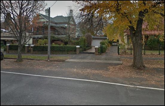
Figure 7: 39 Kite Street “The Channings” -
example of an acceptable garage integration
39 Kite Street noted above serves as an example of how a
garage could be successfully integrated into a heritage context.
The amended design which eliminates the garages presenting
to the street results in a development that is now far more consistent with the
character of the area. Additionally, as identified in the above character
assessment by the applicant, the character of the area is enhanced by the
existing landscaped setting/tree canopy within the locality. To enhance this
and to mitigate the additional hard surfaces, a condition is attached that
requires the landscape plan to be amended to include an additional deciduous
tree planting within the private open space area of each dwelling. The tree shall
be a capital pear or similar.
Subject to the above requirements and several other
conditions outlined below relating to detailing and the like; the development
will result in an acceptable level of compatibility with the existing character
of the area.
Scale and Form
Scale
The scale of a building is essentially its size in relation
to buildings in the area. The size of the dwellings will be single storey, with
9 foot ceilings and 27 degree pitch roofs. The scale of the development is not
incompatible with the immediate area. Council’s Heritage Advisor has not
raised the scale of the development as being unsatisfactory as there are
examples in the area of dwellings similar in size or larger, such as the two
storey dwelling at 39 Kite Street.
The amended design with a single driveway has resulted in
finished floor levels that will be higher than the previous design with
individual driveways. Dwelling 1’s finished floor level will now be 350mm
higher and Dwelling 2’s will be 750mm higher. The increased heights of
finished floor levels occur as a result of the driveway grade and general
engineering design. The increase in heights will not unreasonably impact upon
the heritage setting. Council’s Heritage Advisor has indicated that:
The heights are acceptable and
the roofs consistent with the context.
The development is considered acceptable in terms of scale.
Form
Form relates to a building's overall shape and volume and
the arrangement of its parts.
The form of the two dwellings at the front of the site with attached
double garages now orientated internally (which has the effect of reducing the
visual dominance of garages within the street) is a marked improvement on the
previous design that went before Council. The development as it presents to the
street is now consistent with the prevailing form of dwellings in the locality,
which comprise single storey pitched roof cottages, with habitable rooms with
windows presenting to the street, and front verandahs and other architectural
detailing also presenting to the street.
The form of buildings within the development, particularly
Dwellings 1 and 2 are not inconsistent with Council’s Infill
Guidelines.
Siting
Appropriate siting of infill development - how and where
development is positioned in relation to the road, front and side boundaries
and built form on adjoining land - is crucial in ensuring a harmonious,
cohesive and compatible development outcome in a heritage setting. The
Guidelines further state that development should retain the building-to-space theme
predominant in the area, including driveway widths.
In terms of siting, the main considerations of the
development therefore relate to front setbacks, the space between dwellings
(particularly relating to Dwellings 1 and 2 given they have street
frontage) and the width of the driveway.
In terms of front setbacks, proposed Dwelling 1 will
have a front setback of 7m to the front line of the verandah and 8.2m to the
building proper. Proposed Dwelling 2 will have a front setback of 7.7m to the
front building line.
The front setbacks of Dwellings 1 and 2 more or less retain
the same distance as was presented in the previous design that went before
Council. However, what has changed is the footprint and layout of the two front
dwellings, particularly Dwelling 2.
Dwelling 2 now comprises the projecting parts to the western
side of the dwelling and progressively steps back to the east. This gives the
appearance of a much greater separation of the new dwellings and the former
mansion, which has the effect of significantly reducing the crowding effect of
the new development upon the heritage item. The effect of the change is clearly
demonstrated in the two figures below.
The development is acceptable in
terms of siting, particularly with respect to Dwelling 2 and its spatial
relationship with the former mansion.

Figure 8: previous siting and design of Dwelling 2
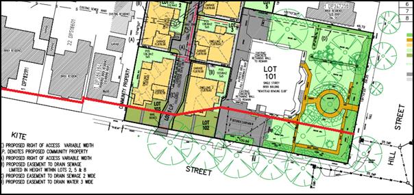
Figure 9: amended siting and design of Dwelling 2
Materials and Colour
A detailed external materials: Colours and Finishes schedule
has been submitted with the application. The materials comprise:
· face brick
alternating between PGH Opaline Garnet (Dwellings 1, 4, 5 and 8) and
PGH Opaline Tourmaline (Dwellings 2, 3, 6, 7 and 9), with foundation
courses comprising rendered commons in a basalt colour (this is an
interpretation of the vernacular architecture within the conservation area
which comprises traditional blue stone foundations)
· Colorbond roof
sheeting - colour alternating between dwellings with either Basalt
(Dwelling 1 for example) or Shale Grey (Dwelling 2 for example)
· quad gutters
· timber fascia
· circular downpipes
· basalt coloured
panel lift garage doors
· fenestration
comprises vertically proportioned timber windows for the street facing
elevations of Dwellings 1 and 2 and aluminium windows elsewhere within the
development.
It is noted that the submitted materials schedule specifies
the proposed material and then notes “or similar”. To ensure the
appropriate level of certainty with the final design outcomes, particularly given
the context and setting, a condition is attached that requires the materials
schedules to be amended to delete the “or similar” references where
listed.
The proposed materials and colours are acceptable, however
to ensure that the development presents acceptably within its context, achieves
an acceptable level of character and complements the conservation area, the
following additional requirements are recommended.
Council’s Heritage Advisor
recommends that the brickwork consist of oxide tinted ‘Brown’
mortar and that the pointing of the mortar be flush finished mortar (as shown
in the below figure) consistent with the brickwork within the conservation
area.
Figure 10: recommended pointing style (source:
Brixmakers)
Relevant conditions are attached.
The temporary bin collection point within the driveway is to
be screened from view from the street. A condition is attached that requires
the southern end of the bin enclosure to be screened with a 1.5m lapped and
capped fence in the space between the eastern boundary fence of Dwelling 1 and
the driveway. A relevant condition is attached.
It is noted that the submitted plans indicate the perimeter
and internal fencing to be timber paling. To ensure longevity of the fence, it
is recommended that all new timber lapped and capped fencing consist of hard
wood timber. Further to the timber fencing, Council’s Heritage Advisor
recommends that the fencing be painted in Dulux Timbercolour
‘Basalt’. It will be up to the beneficiary of the consent to
discuss with the respective neighbouring property owners as to whether their
side of the fence will be painted also. A relevant condition is attached.
Detailing
The key consideration concerning detailing comes with
ensuring that important features common to the area are carried over and
interpreted in a contemporary (but balanced with being sympathetic) way within
the infill development - this could be chimneys, verandahs, window
awnings etc.
The detailing adopted within the design, particularly
Dwellings 1 and 2 will comprise verandahs, gable ends for
Dwelling 2 and simple windows. Except as required to be amended elsewhere,
the detailing adopted within the design is acceptable.
The amended application includes a landscape plan that has
been prepared by Living Edge Design in support of the proposal which shows the
provision of soft landscaping in the form of four specimen trees (cornus
florida ‘Alba’ or Magnolia soulangeana), hedging behind
front fencing, accent plants, groundcovers and turf within each of the
frontages of Dwellings 1 and 2; and rows of hedges or groundcovers
adjacent to driveways. Additionally, specimen trees to the rear of the site are
also proposed in the form of ‘flowering plums’ and a ‘crimson
wave’ Hard landscaping consists of the driveway and a central path from
the footpath to the front verandahs of Dwellings 1 and 2. The hard
landscaping is intended to be Boral Colori - “Graphite” coloured
concrete.
To ensure that the development has an acceptable fit within
the context and setting, the following requirements relating to details of the
design as recommended by Council’s Heritage Advisor are incorporated as
conditions of consent:
· Vertical batons on gable
ends of all dwelling with gables are to be 50mm x 35mm batons, with
the 35mm face of the baton to be against the face of the gable. This is
required to accentuate the contemporary nature of the detailing in place of
replicating a bungalow. The batons are to be painted Dulux Timbercolour
‘Braid’ to reflect the brickwork, enhance the character and avoid
the bungalow repetition.
· The
replicated curved decorative elements under the verandah beams for
Dwellings 1, 3 and 8 are to be replaced with 150mm square grid pattern
using 35mm x 35mm framing to better interpret the contemporary
character.
Figure 11: example of recommended verandah detailing
(source: not known)
· All timber verandah
posts to be not larger than 150mm x 150mm without traditional chamfers, again
to interpret the contemporary character.
· At the street frontage
it is more appropriate to adopt a traditional interpretation of front fencing
rather than a contemporary one. To this end, the design of the front fence is
to be amended such that the four intermediate brick piers are to be replaced
with steel posts the same as the steel post shown on plan DA43 dated
Apr’18 – these four intermediate piers being:
o the pier between the western
corner pier and the western pier at the Dwelling 1 access gate
o the pier between the eastern
access gate pier (dwelling 1) and the western driveway pier
o the pier between the eastern
driveway pier and the western access gate pier for Dwelling 2 and
o the pier between the eastern
access gate pier for Dwelling 2 and the easternmost pier.
The fence is also to return down
the driveway (on both sides of the driveway) for one bay for visual continuity.
From the foregoing assessment and with consideration to the
required conditions of consent, the development is considered acceptable in
terms detailing within the context and setting.
Landscape Detail
Despite the context and setting of the land lending itself
to a more elaborate or sophisticated landscape scheme commensurate with the
level of landscaping evident within the front setbacks of properties in the
immediate vicinity (particularly the mansion’s setting), what has been
proposed and required by condition (as detailed under the heading
“Character”) will achieve the baseline objectives of softening hard
edges, breaking up the front elevations and include trees that will (albeit
confined in a localised way due to their mature heights) add to the tree canopy
and foliage of the conservation area.
The proposed landscaping is considered satisfactory.
Neighbourhood Character
The DCP sets the following Planning Outcomes in regard to
Neighbourhood Character:
· Site layout
and building design enables the:
- creation of attractive
residential environments with clear character and identity
- use of site features
such as views, aspect, existing vegetation and landmarks.
· Buildings
are designed to complement the relevant features and built form that are
identified as part of the desired neighbourhood character.
· The
streetscape is designed to encourage pedestrian access and use.
The character and identity of a particular area is
influenced by the intricate interrelationship of the public and private realms,
taking into account the qualitative interplay of built form, vegetation and
topographic characteristics; all of which contribute to creating a unique
neighbourhood character.
It is often difficult to distinguish or separate a
neighbourhood character assessment from a heritage character assessment, as the
one intrinsically influences the other to a certain extent.
Notwithstanding this, for the sake of brevity and to avoid
duplication, the character of the area is addressed above under “Infill
Guidelines” and is considered to be acceptable.
Building Appearance
The DCP sets the following Planning Outcomes in regard to
Building Appearance:
· The building
design, detailing and finishes relate to the desired neighbourhood character,
complement the residential scale of the area, and add visual interest to the
street.
· The frontages
of buildings and their entries face the street.
· Garages and car
parks are sited and designed so that they do not dominate the street frontage.
The design, detailing and finishes (particularly the
composition/presentation of Dwellings 1 and 2 with presentation to
Kite Street) have been addressed in detail above under "Infill
Guidelines" and considered to be acceptable.
Setbacks
The DCP sets the following Planning Outcomes in regard to
Setbacks:
· Street setbacks
contribute to the desired neighbourhood character, assist with the integration
of new development and make efficient use of the site.
· Street setbacks
create an appropriate scale for the street considering all other streetscape
components.
Setback considerations have been addressed under the siting
considerations within “Infill Guidelines” above and considered to
be acceptable.
Front Fences and Walls
The DCP sets the following Planning Outcomes in regard to
Fences and Walls:
· Front fences
and walls:
– assist
in highlighting entrances and creating a sense of identity within the
streetscape
– are
constructed of materials compatible with associated housing and with fences
visible from the site that positively contribute to the streetscape
– provide
for facilities in the street frontage area such as mail boxes.
The design and detailing of the proposed front fence is
considered above under “Infill Guidelines”. Mail boxes are proposed
at the front of the site on the western side of the driveway. There is no
objection to their location. It will be necessary for the mailboxes to be
integrated into the fence that returns down the driveway (as required by
condition of consent).
Bulk and Scale Objectives
· To
allow flexibility in siting buildings and to ensure that the bulk and scale of
new development reasonably protects the amenity of neighbouring properties and
maintains appropriate neighbourhood character.
· To
allow adequate daylight, sunlight and ventilation to living areas and private
open spaces of new and neighbouring developments.
· To
encourage the sharing of views, while considering the reasonable development of
the site.
The development in not inconsistent with the above
objectives as detailed below.
Visual Bulk
The DCP sets the following Planning Outcome in regard to
Visual Bulk:
· Built form
accords with the desired neighbourhood character of the area with:
- side and rear setbacks
progressively increased to reduce bulk and overshadowing
- site coverage that retains
the relatively low density landscaped character of residential areas
- building form and siting
that relates to landform, with minimal land shaping (cut and fill)
- building height at the
street frontage that maintains a comparable scale with the predominant adjacent
development form
- building to the boundary
where appropriate.
In consideration of the DCP Guidelines, the proposal is
considered to be satisfactory. The proposed dwellings will be single storey,
consistent with the majority of established form of residential development in
the locality.
The DCP requires dwellings to be contained within the
prescribed envelopes generated by planes projected at 45o over
the site commencing 2.5m above existing ground level from each side and rear
boundary. The development is assessed at this point based on the boundaries
that will exist at the time of the construction of the dwellings. A further
assessment is required under the final subdivision stage (Community Title subdivision)
to determine if the proposed boundary positions and their relationship with the
new built form are satisfactory with respect to the visual bulk considerations.
The proposed dwellings will all fit within the prescribed
envelopes in respect to boundaries created under Stage 1 (Torrens Title
subdivision). It is noted, however, that Dwelling 9 although complying
with the visual bulk envelope, will present as a large mass given the elevated
floor level and extensive roof form. The overall massing of Dwelling 9
could be reduced simply by reducing the pitch of the roof from 27 degrees to 24
degrees; effectively reducing the overall height of the dwelling by around
0.6m. However, the benefits derived from reducing the overall height by what is
realistically likely to be an indiscernible amount, would be outweighed by the
change to the overall proportions of the dwelling, and a dwelling that is
inconsistent with the overall design rationale. Therefore changing the roof
pitch of Dwelling 9 is not recommended.
The development is acceptable with regards to visual bulk
considerations.
Site Coverage
The DCP requires site coverage
for single dwellings to be not more than 60%, and in circumstances where
there is more than one dwelling on the land the allowable site coverage
is 50%.
|
Dwelling
|
Footprint
|
Site Area
|
Site Coverage
|
|
1 (Lot 103)
|
252.54m²
|
568m²
|
44.5% (60% maximum)
|
|
2 (Lot 102)
|
238.79m²
|
577.3m²
|
41.4% (60% maximum)
|
|
3-9
|
1,540.12m²
(aggregate footprint)
|
3,647.8m2
|
42.2% (50% maximum)
|
The proposed development is consistent with the site
coverage requirements for single dwellings and multi dwelling housing.
Walls and Boundaries
The DCP sets the following Planning Outcome in regard to
walls and boundaries:
· Building to the
boundary is undertaken to provide for efficient use of the site taking into
account:
- the privacy of
neighbouring dwellings and private open space
- the access to daylight
reaching adjoining properties
- the
impact of boundary walls on neighbours.
The subject dwellings are appropriately positioned within
the site so as to achieve an acceptable level of visual privacy and solar
access to neighbouring properties. The positioning of proposed walls will not
result in any unsatisfactory amenity impacts to adjoining residential
properties.
Daylight and Sunlight
The DCP sets the following Planning Outcome in regard to
Daylight and Sunlight:
· Buildings are
sited and designed to ensure:
- daylight to habitable rooms
in adjacent dwellings is not significantly reduced
- overshadowing of
neighbouring secluded open spaces or main living area windows is not
significantly increased
- consideration of
Council’s Energy Efficiency Code.
Solar Access to Dwellings
According to the DCP Guidelines and Council’s Energy
Efficiency Code, sunlight to at least 75% of north-facing living area
windows within the development and on adjoining land is to be provided for a
minimum of four hours on 21 June, or not further reduced than existing where
already less.
The internal design of proposed
dwelling are all well considered in terms of sustainability with north
orientated living areas. Shadow diagrams, including shadow diagrams in
elevation, demonstrate that the development complies with the planning outcomes
under the DCP.
The orientation of the land will
mean that the development does not create any overshadowing impacts upon
adjoining land.
Solar Access to Private Open
Space
According to the DCP Guidelines and Council’s Energy
Smart Homes Code, sunlight is to be available to at least 40% of required open
space for dwellings within the development.
Shadow diagrams have been prepared in support of the
proposed development. In consideration of the DCP Guidelines, the proposal is
considered to be satisfactory as outlined below.
The orientation of the subject land and its location on the
northern side of Kite Street means that the development will not result in any
unsatisfactory impacts as a result of overshadowing. The closest external
property (4/45 Kite Street) will not be unreasonably affected by the proposed
development. This is principally due to the orientation of the land and the
design of 4/45 Kite Street, where a garage and storage area adjoin the
eastern boundary (which is also the western boundary of the subject land).
In terms of assessing the level of solar access available to
the dwellings within the development site; based on the submitted shadow
diagrams, the development complies with the minimum requirements for solar
access to private open space areas. It is noted that the proposed internal
fencing that was previously nominated at 1.8m in height has been reduced to
1.5m to improve the level of solar access into the private open space areas of
the dwellings. There is no objection to this reduction in fence height. It is
considered that there are limited reasons from a privacy point of view, or any
other planning reason, to require internal fencing at 1.8m in height. The
relationship of floor levels between proposed dwellings and the positioning of
opposing private open space areas is not such that 1.8m high fencing would
be warranted.
The development is considered satisfactory with regards to
daylight and sunlight.
Views
The DCP sets the following Planning Outcomes in regard to
Views:
· Building form
and design allow for residents from adjacent properties to share prominent
views where possible.
· Views including
vistas of heritage items or landmarks are not substantially affected by the
bulk and scale of the new development.
The subject site is not within an important view corridor.
The amended siting of Dwelling 2 will mean that the
view corridor towards the former mansion has improved such that significant
features of the heritage item (such as the widow's walk element within the
roof) will be more easily viewed from the footpath when standing to the west of
the subject land looking toward the Newstead building. The development is
considered to be consistent with the above planning outcomes.
Privacy and Security
Objective
· To
ensure that the siting and design of buildings provide privacy for residents and
neighbours in their dwellings and principal private open space.
The development is not inconsistent with the above objective
as detailed below.
Visual Privacy
The DCP sets the following Planning Outcome in regard to
Visual Privacy:
· Direct
overlooking of principal living areas and private open spaces of other
dwellings is minimised firstly by:
- building siting and layout
- location of windows and
balconies
and
secondly by:
- design of windows or use of
screening devices and landscaping.
The level of visual privacy is acceptable both within the
development and external to the development. This will be achieved with
appropriate fencing treatment and finished floor levels that relate to the
existing situation, save for Dwelling 9.
With respect to Dwelling 9, its floor level has been
set at the same level as the surrounding dwellings within the development
(FL878.70). However, the land steps to the east at the point of the existing
retaining wall, and as such the floor level at the eastern elevation is approximately
1.7m above natural ground level at the most extreme point. The proposed
elevated floor level has the potential to overlook the rear private open space
areas of adjoining properties within Hill Street. To ameliorate the potential
visual privacy impacts, the submitted plans show privacy screening
(1.7m above FFL) to occupiable elevated outdoor areas, high-light windows
to bedrooms and frosted bathroom room widows. The proposed mitigation solutions
employed in the design of Dwelling 9 are acceptable. In addition to these
fixed means of addressing the potential privacy impacts, hedging is proposed
along the eastern boundary of Dwelling 9 in the form of callistemon viminalis,
which will grow to a mature height of 3m. This will assist to an extent, but would
not negate the need for fixed screening.
The design of the dwellings and
particularly the mechanism to control visual privacy related to dwelling 9, is
appropriate. The development is considered satisfactory with regards to
privacy.
Acoustic Privacy
The DCP sets the following Planning Outcome in regard to
Acoustic Privacy:
· Site layout and
building design:
- protect habitable rooms from
excessively high levels of external noise
- minimise the entry of
external noise to private open space for dwellings close to major noise sources
- minimise transmission of
sound through a building to affect other dwellings.
In consideration of the DCP Guidelines the proposal is
considered to be satisfactory. The site is located in an area where ambient
noise levels are expected to be low due to the predominant residential land use
pattern. The dwellings are detached, thus limiting the potential for sound
penetration between them.
Applications contemplating future uses of the former mansion
(ie a restaurant for instance) will need to have regard to noise impacts at
that point.
Security
The DCP sets the following Planning Outcomes in regard to
Security:
· The site layout
enhances personal safety and minimises the potential for crime, vandalism and
fear.
· The design of
dwellings enables residents to survey streets, communal areas and approaches to
dwelling entrances.
The siting and design of all nine dwellings is appropriate
to maintain safety and minimise the potential for crime, vandalism and fear for
residents. Habitable room windows will address either the public road or the
common property, thereby providing opportunities for natural surveillance. The
proposed landscaping and fencing will not restrict sightlines to public areas
and will provide territorial reinforcement and delineate public and private
spaces. Internal access to the dwellings will be available through the garages.
Site Access and Circulation
Objectives
· To
provide convenient and safe access and parking that meets the needs of all
residents and visitors.
· To
encourage the integrated design of access and parking facilities to minimise
visual and environmental impacts.
The development is not inconsistent with the above
objectives as detailed below.
Circulation and Design
The DCP sets the following Planning Outcome in regard to
Circulation and Design:
· Accessways and
parking areas are designed to manage stormwater.
· Accessways,
driveways and open parking areas are suitably landscaped to enhance amenity
while providing security and accessibility to residents and visitors.
· The site layout
allows people with a disability to travel to and within the site between car
parks, buildings and communal open space.
Stormwater is addressed above under the LEP considerations.
The submitted longitudinal section of the site shows a 10%
grade of the first 25% of the driveway and then not more than +/- 2% through
the remainder. As such the driveway system will be accessible to people with a
disability.
Dwellings 1 and 2 have direct street frontage to Kite
Street, with direct pedestrian linkage to the existing footpath within Kite
Street. The front paths for dwellings 1 and 2 will have similar grades to the
driveway at the front of the site.
The design of the driveway and positioning of garages will
mean that all vehicle movements to and from the site will be capable of being
in a forward gear.
The plans also demonstrate that an 8.8m medium rigid vehicle
is able to enter and exit the site in a forward gear.
The previous design with the three driveways did not allow
for a firefighting appliance to enter the site and have sufficient hose length
to extinguish a fire in the furthermost corner of the site. The amended design
will now allow a firefighting appliance to service all parts of the site in the
event of a fire.
The development is satisfactory with regards to circulation
and design.
Car Parking
The DCP sets the following Planning Outcomes in regard to
Car Parking:
· Parking
facilities are provided, designed and located to:
- enable the efficient and
convenient use of car spaces and access ways within the site
- reduce the visual dominance
of car parking areas and access ways.
· Car parking is
provided with regard to the:
- the number and size of
proposed dwellings
- requirements of people with limited
mobility or disabilities.
The two separate dwellings at the front of the site will
accommodate two vehicles off the street based on the provision of double
garages, thus complying with the DCP requirement for single dwellings of one
space, preferably two.
In consideration of the DCP Guidelines for off-street
parking for the multi-dwelling housing component, the proposal is considered to
be satisfactory. According to the car parking table in the DCP, the development
generates a parking requirement of 10.5 + 1.4 (visitor spaces) off-street
spaces (based on 1.5 spaces for each 3 bedroom dwelling + 0.2 per dwelling in
visitor parking).
The submitted plans show provision for 16 off-street spaces
in total - 14 off-street parking spaces in the form of attached double garages
for each dwelling and two dedicated visitor spaces.
The proposed dwellings (two single dwellings and seven
dwellings as part of the multi-dwelling housing) are considered satisfactory
with regard to the allocation of off‑street parking.
Private Open Space
The DCP sets the following Planning Outcomes in regard to
Private Open Space:
· Private open
space is clearly defined for private use.
· Private open
space areas are of a size, shape and slope to suit the reasonable requirements
of residents including some outdoor recreational needs and service functions.
· Private open
space is:
– capable
of being an extension of the dwelling for outdoor living, entertainment and
recreation
– accessible
from a living area of the dwelling
– located
to take advantage of outlooks; and to reduce adverse impacts of overshadowing
or privacy from adjoining buildings
– Orientated
to optimise year round use.
The following table
demonstrates that each of the proposed dwellings is provided with open space
that complies with the minimum requirement in terms of area.
|
Dwelling
|
Living
Area (excluding garage/porches/patios etc) (m2)
|
Private
Open Space Required by DCP (m2)
|
Private
Open Space Provided (m2)
|
|
1
|
181.45
|
90.73
|
136.3
|
|
2
|
187.45
|
93.73
|
103.6
|
|
3
|
157.61
|
78.8
|
110.4
|
|
4
|
161.06
|
80.53
|
108.9
|
|
5
|
161.06
|
80.53
|
133.5
|
|
6
|
161.06
|
80.53
|
218.1
|
|
7
|
169.80
|
84.9
|
159.7
|
|
8
|
154.82
|
77.41
|
102.1
|
|
9
|
177.57
|
88.79
|
125.8
|
Table 3: assessment of private open space requirements
The areas of private open space for Dwellings 1
and 2 are provided behind the front building lines. The site plan confirms
that the private open space (as calculated off the plan) for each dwelling will
have a minimum dimension of 3m and the yards are able to provide an area of at
least 5m x 5m with access to northern sun directly accessible from internal
living spaces, consistent with the requirements of the DCP, save for
Dwellings 6 and 9. With respect to Dwelling 6 a suitable area of
4m x 9m will be provided at the higher level of the yard, with the balance of
the open space provided on the lower level accessed via stairs on the northern
side of the yard. With respect to Dwelling 9 the private open space will
be accessed via stairs off the elevated alfresco. This arrangement is
considered satisfactory as the covered alfresco area directly connects with the
indoor living space and provides a usable outdoor space and also a practical
transition from the indoor space to the lower outdoor space.
The internal living area for each dwelling will connect to
its respective area of private open space via French doors that open out onto a
covered alfresco area. Each private open space area will be enclosed by 1.5m
high lapped and capped timber fencing. Perimeter fencing will be 1.8m lapped
and capped timber fencing. A condition is attached that the timber used in the
construction of the fencing be hardwood rather than a soft wood such as treated
pine.
The applicant has adequately demonstrated compliance with
the Planning Outcomes for private open space.
Open Space and Landscaping
The DCP sets the following Planning Outcomes in regard to
Open Space and Landscaping:
· The site layout
provides open space and landscaped areas which:
– contribute
to the character of the development by providing buildings in a landscaped
setting
– provide
for a range of uses and activities including stormwater management
– allow
cost effective management.
· The landscape
design specifies landscape themes consistent with the desired neighbourhood
character; vegetation types and location, paving and lighting provided for
access and security.
· Major existing
trees are retained and protected in a viable condition whenever practicable
through appropriate siting of buildings, access ways and parking areas.
· Paving is
applied sparingly and integrated in the landscape design.
Landscaping considerations are addressed above under the
considerations of the Infill Guidelines.
Water and Soil Management
Objectives
· To control and
minimise the impact of stormwater run-off and soil erosion on adjoining land
and downstream.
· To encourage
reduced water wastage by reusing, recycling and harvesting stormwater.
The development is not inconsistent with the above
objectives as detailed below.
Stormwater
The DCP sets the following Planning Outcomes in regard to
Stormwater:
· Onsite drainage
systems are designed to consider:
– downstream
capacity and need for on-site retention, detention and re-use
– scope
for on-site infiltration of water
– safety
and convenience of pedestrians and vehicles
– overland
flowpaths.
· Provision is made
for onsite drainage which does not cause damage or nuisance flows to adjoining
properties.
Refer to above assessment of the proposed stormwater design
solution under the LEP considerations.
Erosion and Sedimentation
The DCP sets the following Planning Outcome in regard to
Erosion and Sedimentation:
· Measures
implemented during construction to ensure that the landform is stabilised and
erosion is controlled.
Relevant conditions are attached to ensure that appropriate
measures are employed onsite to prevent sediment leaving the site and also
ensure soils are appropriately stabilised.
STAGE 3 - SUBDIVISION -
EIGHT LOT COMMUNITY TITLE
The DCP sets the following (applicable) Planning Outcomes in
regard to urban residential subdivision:
· Lots below
500m² indicate a mandatory side setback to provide for solar access and
privacy.
Not relevant as the design and siting of dwellings to be
subdivided under this stage have been established under an earlier stage.
· Lots are fully
serviced and have direct frontage and access to a public road.
The proposed lots will all have direct vehicular access to
the common property which has direct legal access to Kite Street. The lots will
also be connected to relevant utility services (ie water, sewer,
electricity and the like).
Relevant conditions are attached prior to the release of the
Community Title subdivision that address the garbage collection. This
arrangement will require the occupants of Dwellings 3‑9 moving their
bins to the temporary collection point in the driveway on collection day.
Following this, at some point during collection day the waste service will
arrive and convey each bin to the truck and return the bin to the collection
bay. At the end of the day the occupants of the dwellings will collect their bins
and return them to their property until the next collection day.
This is Council’s standard procedure for addressing
waste collection for multi dwelling housing developments. Relevant conditions
are attached to the consent under the various stages of the consent.
· Design and
construction complies with the Orange Development and Subdivision Code.
The subdivision design and construction will be required to
comply with the Orange Development and Subdivision Code. Relevant conditions
are attached in this regard.
The location of boundaries and the size and shape of the
proposed lots as part of the Community Title subdivision are acceptable. The
subject dwellings will be contained within the prescribed visual bulk
envelopes, save for a small section of gable roof above the alfresco area of
Dwelling 6 and a small section of upper wall and gutter of the southern
elevation of Dwelling 9.
These non-compliances are considered acceptable based on the
following:
· The encroachment
outside of the visual bulk envelope relates to vehicle circulation space and
visitor parking within the development, resulting in very limited adverse
impacts. It is noted that the design could comply with a flatter roof, however
the high pitched vaulted alfresco roof has been adopted to comply with solar
access requirements to north facing windows.
· The encroachment
relating to Dwelling 9 is identified as upper wall and eave. The point of the
encroachment relates to the lower rear portion of open space for
Dwelling 6. The impacts experienced by the future occupants of
Dwelling 6 will not be so unreasonable as to be unacceptable.
The site coverage within all resultant lots will be below
the 60% site coverage allowable for single dwellings.
The development is considered satisfactory with regards to
the position of proposed boundaries under the community title stage.
DEVELOPMENT CONTRIBUTIONS PLAN
2017
The development has been assessed pursuant to Orange
Development Contributions Plan 2017. The following tables itemise the
contributions payable for the development. Conditions are imposed requiring the
payment of the requisite monetary contribution at the appropriate time.
NB: the land benefits from a historic equivalent tenement or
the whole of one contribution based on Newstead’s original use as a
dwelling.
Based on the configuration of the development, the
contributions are calculated based on three additional lots under Stage 1
– prior to the issue of a subdivision certificate and six additional
three bedroom dwellings under Stage 2 – prior to the issue of a
construction certificate. There are no requirements for contributions as part
of the Community Title subdivision.
Stage 1 - Three Additional Lots
The payment of $31,511.13
is to be made to Council in accordance with section 7.11 of the Act
and the Orange Development Contributions Plan 2017 (remainder of LGA) towards
the provision of the following public facilities:
|
Open Space and Recreation
|
@ $3,907.24 x three additional lots
|
11,721.72
|
|
Community and Cultural
|
@ $1,133.10 x three additional lots
|
3,399.30
|
|
Roads and Traffic Management
|
@ $5,157.43 x three additional lots
|
15,472.29
|
|
Local Area Facilities
|
-
|
-
|
|
Plan Preparation and Administration
|
@ $305.94 x three additional lots
|
917.82
|
|
TOTAL:
|
|
$31,511.13
|
The contribution will be indexed quarterly in accordance
with the Orange Development Contributions Plan 2017 (remainder LGA). This Plan
can be inspected at the Orange Civic Centre, Byng Street, Orange.
Stage 2 - Six Additional Three
Bedroom Dwellings (accounting for the credit paid under Stage 1)
The payment of $63,022.26
is to be made to Council in accordance with section 7.11 of the Act and the
Orange Development Contributions Plan 2017 (remainder of LGA) towards the
provision of the following public facilities:
|
Open
Space and Recreation
|
@ $3,907.24 x six add. 3 bed dwellings
|
23,443.44
|
|
Community
and Cultural
|
@ $1,133.10 x six add. 3 bed dwellings
|
6,798.60
|
|
Roads
and Traffic Management
|
@ $5,157.43 x six add. 3 bed dwellings
|
30,944.58
|
|
Local
Area Facilities
|
-
|
--
|
|
Plan
Preparation & Administration
|
@ $305.94 x six add. 3 bed dwellings
|
1,835.64
|
|
TOTAL:
|
|
$63,022.26
|
The contribution will be indexed quarterly in accordance
with the Orange Development Contributions Plan 2017 (remainder of LGA). This
Plan can be inspected at the Orange Civic Centre, Byng Street, Orange.
Section 64 Water and Sewer
Headworks Charges
Section 64 water and sewer headwork charges are also
applicable to the proposal. Such charges are calculated at the time of release
of either a Subdivision Certificate for the proposed subdivision or a
Construction Certificate for the proposed multi dwelling housing. For the
proposed development, three equivalent tenements for water and sewer are
required to be paid prior to the issue of a Subdivision Certificate for Stage 1
and six equivalent tenements for water and sewer are required to be paid prior
to the issued of a Construction Certificate for Stage 2.
Relevant conditions are attached in this regard.
PROVISIONS PRESCRIBED BY THE
REGULATIONS s4.15(1)(a)(iv)
Demolition of a Building (clause 92)
The proposal involves the demolition of ancillary buildings,
water tanks and front retaining wall and fence. A condition is attached
requiring the demolition to be carried out in accordance with Australian
Standard AS2601 - 1991: The Demolition of Structures.
Fire Safety Considerations
(clause 93)
The proposal does not involve a change of building use for
an existing building. It will be necessary to lodge a separate development
application for the future use of the former Newstead club (former mansion).
Buildings to be Upgraded
(clause 94)
The proposal does not involve the rebuilding, alteration,
enlargement or extension of an existing building.
BASIX Commitments (clause 97A)
BASIX and NatHERS Certificates have been submitted with the
application which demonstrate that the development complies with the NSW
Government's energy efficiency targets.
THE LIKELY IMPACTS OF THE
DEVELOPMENT s4.15(1)(b)
Context and Setting
The subject land is described as a unique series of parcels
of land, collectively large in size and relatively undeveloped over a large
portion of it (owing to its long history of being used as a bowling club). The
land is located on the periphery of the Central Business District, adjoining a
transitional commercial area to the east and non-residential uses (but
residentially zoned land) to the north (motel).
The land to the west and opposite to the south consists of
residentially zoned land. Housing within the area comprises many intact period
dwellings. Some, such as "Mena", are of exceptional quality and high
significance. Whilst there are dwellings representative of many of the past
architectural periods common to the City of Orange, there are other more recent
examples irregularly dispersed within the broader precinct. There is a recent
infill development immediately to the west of the subject land. Kite Street
itself contains a number of mature trees planted road side; and many
properties, including the Newstead setting, have established formal gardens
reflective of the period of dwelling on the land.
The subject land is located in an important heritage
precinct. As outline elsewhere within the report, the proposal with the most
recent amendments results in a development that is now considered congruous
with its context and setting.
Heritage Impacts
The heritage impacts of the development have been considered
extensively throughout the report, and upon completing the various assessments
it has been concluded that the development will have an acceptable impact upon
the heritage setting.
Visual Impacts
As mentioned above, the amended design, with particular
reference to Dwelling 2, will result in a development that has acceptable
visual impacts and one that does not unreasonably interrupt important
streetscape views of the heritage item on the land. The development is
considered acceptable with regards to visual impacts.
Access, Traffic and Parking
Council’s Technical Services staff have not raised
objections in relation to the proposed development in terms of access, traffic
and parking impacts. It is expected that the nine dwellings will generate an
approximate average of 67 vehicle trips per day (RMS Guide to Traffic
Generating Development). This does not account for future traffic movements
associated with the use of the Newstead building.
Kite Street is a local road and is capable of catering for
the additional traffic movements. The access point is appropriate from a
traffic point of view in terms of its width and separation from the nearest
intersection (Kite/Hill Streets roundabout).
Council’s Technical Services Division has advised
that:
[t]he proposed driveway and
gutter bridge location is considered satisfactory. The community title
allotment driveway has sufficient width to allow vehicles to pass and turn
around inside the site. A right of carriageway will be required to be created
to allow access to proposed lots 102 & 103 from the battle-axe driveway in
lot 100. The existing railing will be removed at the proposed footpath crossing
and the footpath will be required to be replaced with a 1.5m wide concrete
footpath for the full frontage of Lots 100, 102 & 103.
A condition requiring the
removal of the retaining wall, front and side boundary fences forward of the
building line is necessary to provide satisfactory sight distance from vehicles
exiting the site to pedestrians using the footpath.
Parking associated with the proposed residential development
is acceptable and is in line with Council's parking requirements under Orange Development
Control Plan 2004.
As mentioned above, the design of the car parking area
located on proposed Lot 101 is inadequate and relevant conditions have
been mentioned elsewhere. Also mentioned elsewhere is the challenge faced when
determining the suitability of the subdivision in terms of the resultant car
parking outcomes. The absence of a known future land-use of the Newstead
building is the reason for the complexity. All Council staff can do at this
stage is make Councillors aware of the issue.
Street Trees
The presence of the large mature street trees is
acknowledged. It is also noted that the amended design with a single driveway
arrangement will negate the requirement to remove the immature street tree
within Kite Street. The application was referred to Council’s Manager
City Presentation for comment (the response was received from the Acting
Manager City Presentation).
The Acting Manager City Presentation provided the following
comments:
The placement of the suggested
driveway will impact on the advanced Elm street tree located on Kite Street. To
minimise the impact of the driveway construction, suggestions previously given
by the Manager City presentation (previously provided based on the three
driveway design) should be undertaken
· Elm Street Trees on
the Kite Street frontage to be retained shall have Tree Protection Zones
established. A TPZ of a minimum 1.5 metres radius from the centre of each
tree’s trunk shall be established using temporary construction fencing.
Fencing shall remain in place for the period of construction.
· During construction
of the driveway tree roots encountered when excavating the road profile to
establish the vehicle access point shall be pruned in accordance with
AS4373.2007; that is a clean sharp cut across the smallest diameter of the
root.
The above recommended conditions are attached.
Existing Vegetation
As mentioned above, the alternate stormwater design has the
potential to impact upon the health of the large mature tree on the northern
side of the Newstead building. Relevant conditions are attached in terms of
addressing this issue so as to reduce the likelihood of unacceptable harm upon
the subject tree.
The subject land does not comprise any native vegetation.
The development will not result in any unacceptable impacts upon any endangered
ecological communities, endangered species or habitat.
Waste Management
The submitted plans show the ability for 21 x 240L waste
receptacles to be stored within the common property lot. The bins are to be
stored in this location on collection days only. As mentioned above, a
condition is imposed to ensure that the beneficiary of the consent has made
arrangements to enter into a contract with a waste contractor to have the bins
collected from the temporary storage area, emptied into the garbage collection
vehicle and then the bins returned to the storage area. This is Council’s
standard procedure for dealing with garbage bins for residential developments
that have limited street frontage.
Public Domain
The existing footpath in the frontage of the residential
component of the development is unusual in that it comprises a handrail and
steep slope from the outside edge of the footpath down to the gutter.
Council’s Technical Services Division has made recommendations in relation
to the developer being required to augment the levels within the footpath such
that a reasonable grade is provided; at which point a handrail becomes
redundant. Relevant conditions are imposed in relation to this matter.
Safer by Design
The development is satisfactory in terms of Crime Prevention
Through Environmental Design principles. The proposed dwellings will have
reasonable vantage points to allow natural surveillance of common areas or the
public street (for Dwellings 1 and 2) and public and private areas
will be clearly delineated by fencing. There are no objections to the
development from a Safer by Design perspective.
THE SUITABILITY OF THE SITE
s4.15(1)(c)
The subject land is considered suitable for being
redeveloped for residential purposes. As mentioned above the land is
underutilised and in close proximity to the centre of town, and as such is
considered prime land for an appropriate residential development.
In terms of the development's fit within the locality, the
foregoing assessment indicates that the development is suitable in the
locality, with the amended design now being consistent with Council’s
adopted planning provisions.
Council staff are not aware of any natural, physical or
technological hazards that may otherwise constrain a residential development
from occurring on the land in a satisfactory manner.
ANY SUBMISSIONS MADE IN
ACCORDANCE WITH THE ACT s4.15(1)(d)
As outlined in detail above, the application has been
advertised on four separate occasions, the most recent as a result of the
amended design following the previous iteration going before the Planning and
Development Committee. The previous submissions are addressed as well as those
received during the most recent exhibition period.
The proposed development is defined as "advertised
development" under the provisions of the Environmental Planning
and Assessment Regulations and Council’s Development Control Plan.
The amended application was advertised for the prescribed period of 14 days and
at the end of that period two submissions were received during the exhibition
period and one submission was received outside of the exhibition period.
Submissions Received During the
Fourth Exhibition Period.
Submission 1 - Orange Resident
The submission raises concerns in relation to parking
provision and added on-street parking demands, site coverage of the development
and the increase in stormwater run-off.
Council Response
Council’s DCP is the applicable document that provides
controls around parking and site coverage. As detailed above under the heading
“Development Control Plan 2004”, the development complies with both
the car parking requirement and site coverage requirements.
In terms of stormwater, Council’s Technical Services
Division has attached conditions of consent to ensure that post-development
run-off levels do not exceed pre-development levels. It is noted that each
dwelling will be provided with a 3,000L rain water tank.
Submission 2 - Resident of 57
Byng Street
The submitter reiterates their previous concerns namely
that:
· Insufficient
off-street car parking provisions (including accessible spaces) associated with
the former mansion (Lot 101).
· Density of
dwellings upon Lots 102, 103 and the Community title subdivision.
· Circulation of
vehicles within the Community Title subdivision for Lots 3, 4 and 5.
· Access for
emergency service vehicles.
· Inadequate
landscape area with no allowance for large deciduous tree plantings.
Council Response
In relation to the car parking associated with the now B4
zoned Lot 101 containing the former mansion, an assessment of parking and the
complexities arising has been addressed in detail above.
In response to the comment regarding the density of the
development; as detailed above under the DCP considerations the development
complies with respect to site coverage planning outcomes (this has been
determined to be the case under both Stage 2 and Stage 3 of the
development).
As detailed above, Council’s Technical Services
Division has reviewed the development and advised that it is acceptable in
terms of traffic.
In terms of access for emergency service vehicles, a police
vehicle and ambulance is able to enter and leave the site in a forward gear.
The plans also demonstrate that a medium rigid vehicle can enter and leave the
site in a forward gear.
It is noted that the amended design allows a firefighting
appliance to service the furthest reaching parts of the site. The likelihood
and frequency of a firefighting appliance entering the site would be low and
infrequent such that if a reverse egress was required this could be managed on
the odd occasion that it may occur without adversely impacting upon Kite
Street.
In response to the concern regarding insufficient garden
area, Council’s Heritage advisor has recommended that a deciduous tree
(capital pear or similar) be planted in the rear yards of each dwelling. A
condition is attached in this regard.
Submission 3 - Resident of 21
Lawson Crescent
The submitter indicates that the amended design “is an
immense improvement” on the previous design, particularly how the
dwellings address Kite Street.
The submitter does however suggest that the amended design
continues to represent an over‑development and raises two matters in
particular that remain of concern: namely the siting and composition of Dwelling
2 and its relationship with the former Newstead mansion and the substitution of
the foundation brickwork from a dark blue face brick to rendered and painted
brick work.
Council Response
In relation to the two specific matters raised in the
submission, Council’s Heritage Advisor has reviewed the amended design
and advised the following directly in relation to the above listed concerns of
the submitter.
The setbacks are acceptable in
terms of the impacts on the adjoining item and the Conservation Area.
The rendered base in place of
the Grey face brick is acceptable although not recommended as it will devalue
the properties in the medium term and require extra maintenance.
While the property value and maintenance schedule are
appreciated, the comments do not relate to heritage assessment. The assessment
of the development in the first part of the sentence from Council’s
Heritage Advisor indicates that the development is acceptable.
Earlier Submissions –
based on the previous designs
At the end of the third exhibition period a total of 26
submissions were received. All submissions have been taken into consideration
in the assessment of the application (based on the amended design).
It is noted that some concerns raised during the first
exhibition period, such as visual privacy impacts created by the elevated floor
level of Dwelling 9, have been addressed. Also, the roof pitches of the
proposed dwellings have been identified as a concern in a number of
submissions. It is acknowledged that the applicant has amended the plans to
reduce the pitch from 30 degrees to 27 degrees. Despite this amendment to the
design, the pitch of roofs remains a contention with some objectors.
The fundamental planning matters raised within the earlier
submissions can be broadly summarised as follows:
· Heritage -
concerns that:
o The development contravenes
Council’s heritage related planning provisions (LEP, DCP and Infill
Guidelines).
o The design and siting of proposed
dwellings fronting Kite Street will have a detrimental impact upon the Newstead
building (former mansion), the Central Heritage Conservation Area, heritage
items in the vicinity and the streetscape generally.
o The proposed subdivision (extent
of curtilage) will have a detrimental impact upon the Newstead building (former
mansion).
o The development will potentially
impact on street trees.
o The density of the development,
including the size and number of dwellings, is inconsistent with the
established development pattern within the area.
o There is limited opportunity for
soft landscaping.
o The extent of access points
within Kite Street will impact upon the heritage streetscape.
· Traffic and
parking - concerns that:
o The development will lead to
traffic congestion and be dangerous for vehicles entering and leaving the
respective driveways.
o The design of the community
access will result in the potential for vehicle/ pedestrian conflicts.
o The area for manoeuvring of
vehicles entering and existing the development is constrained.
o The access will not allow emergency
services vehicles to enter the site.
o Inadequate number of visitor
parking spaces associated with the multi dwelling housing are proposed.
o Insufficient off-street parking
allocation for the future use of the Newstead building has been provided.
· General -
concerns that:
o The development will impact upon
Council's tourism objectives and reduce the attractiveness of the heritage
walking trails within the City, reducing participation numbers.
o The Community Title lots are
below the requirements.
Council staff provide the following response to the above
matters raised within the three earlier submission periods.
Heritage Matters
Council staff generally agree with the above matters raised
during the first three exhibition periods; and this was the basis for the
refusal recommendation of the previous report that went before Council. Since
that report went before Council, the application has been amended to address
the above concerns.
However, on a point of clarification, one matter raised
within the submissions that Council staff are not in agreement with is the
extent of curtilage around the former mansion. Council’s Heritage Advisor
has accepted the adopted curtilage as being reasonable in the circumstances.
It should also be noted that in relation to the pitch of the
roofs (at the proposed 27 degrees) Council’s Heritage Advisor notes
that
the heights are acceptable and
the roofs consistent with the context.
Traffic and Parking Matters
In terms of the traffic safety concerns, Council’s
Technical Services Division has advised that the amended driveway and gutter
bridge location is satisfactory from a traffic point of view, and no objections
have been raised by that Division in relation to unacceptable traffic
congestion or issues with vehicles entering or leaving the site.
Additionally, Council’s Technical Services staff have
assessed the submitted swept paths for passenger vehicles entering and exiting
the garages, along with a medium rigid vehicle negotiating the site, and have
advised that the development is acceptable.
The amended design addresses the issue identified previously
in relation to the inability for a firefighting appliance to enter the site.
In terms of car parking, Councils DCP requires visitor
parking at the rate of 0.2 spaces per dwelling within a multi dwelling
housing development. Seven (7) dwellings equate to 1.4 spaces attributed
to visitor parking. The development provides 2 spaces, and is thus
compliant with the subject provision. It is noted that the DCP does not
require visitor spaces for single dwellings (ie Dwellings 1 and 2). In any
event, the development still complies in terms of visitor parking if all nine
dwellings are accounted for.
The parking associated with the former Newstead building has
been addressed in the report. Putting to one side the fact that the parking
shown within the Kite Street frontage on the submitted plans is not supported
(whether four spaces are provided or seven spaces are provided), the challenge
remains for Council with assessing this aspect of the development in the
absence of knowing what the use of the Newstead building might be in future.
The recommendation for an approval of the development
proposed will not remove the need for someone to lodge a subsequent development
application for the use of the Newstead building at some point in the future.
At that point, Council would be required to assess the suitability of the
proposed parking arrangements.
A detailed assessment of the environmental impacts of any
onsite parking deficiencies would also be required. The subject site is located
within Council’s Car Parking Contributions Plan catchment area. The
appropriateness of a monetary contribution for any shortfall in parking would
be determined at that time.
Whilst assessing the relevant development application in the
future it may transpire that the intended use at that time will be deemed to
result in an unacceptable environmental impact (despite any offers by the
proponent to pay a contribution in lieu of physical spaces), and the application
may not be supported by Council staff.
As it stands, the approved use of the Newstead building
itself is defunct. The land would have been operating under LEP 2011 (prior to
activities on the land stopping) as a lawful existing use as a registered club
pursuant to the continuance use provisions under the Act (as registered
clubs are prohibited in the R1 General Residential zone under
LEP 2011). Accordingly, in the opinion of Council staff, since activities
associated with the registered club have ceased on the land for a period of
more than 12 months and this proposal seeks to use some of the land previously
used for recreation and parking in association with that use for residential
development; the previous existing use to operate a registered club has ceased.
As there is no approved use applying to the Newstead
building, it is not possible to complete any meaningful form of parking
assessment at this stage as it would just be speculative. Council staff
acknowledge the issue, however Council’s hands are tied in terms of
resolving the issue at this point in time.
General Matters
In terms of the development's effect on tourism and the
attractiveness for tourists wanting to complete the heritage trail, whilst
appreciating the importance of tourism within the City, the extent to which the
development may impact on these matters is not quantifiable, and as such is not
considered a planning matter. This is not dissimilar to common statements
within submissions relating to decreases in property value directly resulting
from a development, which are not considered planning matters either.
In terms of the Community Title component of the development
not meeting the relevant planning provisions, although this was based on a
previous design, it is confirmed that the amended design complies with the DCP
in respect to site coverage, visual bulk, open space and the like.
PUBLIC INTEREST
s4.15(1)(e)
The proposed development is considered to be of minor
interest to the wider public due to the relatively localised nature of
potential impacts. The proposal is not inconsistent with any relevant policy
statements, planning studies, guidelines etc that have not been considered in
this assessment.
SUMMARY
The proposed development is permissible with the consent of
Council. The proposed development complies with the relevant aims, objectives
and provisions of Orange LEP 2011 (as amended) and DCP 2004. A
section 4.15 assessment of the development indicates that the development
is acceptable in this instance. Attached is a draft Notice of Approval
outlining a range of conditions considered appropriate to ensure that the
development proceeds in an acceptable manner.
The amended design with a single driveway and garages
orientated internally is a marked improvement upon the design that previously
went before Council.
COMMENTS
The requirements of the Environmental Health and Building
Surveyor and the Engineering Development Section are included in the attached
Notice of Approval.
Attachments
1 Notice
of Approval, D18/39449⇨
2 Plans,
D18/38096⇨
3 Submissions,
D18/31996⇨
2.8 Development
Application DA 66/2018(1) - 136 Aerodrome Road
RECORD
NUMBER: 2018/1677
AUTHOR: Summer
Commins, Senior Planner
EXECUTIVE Summary
|
Application
lodged
|
27
February 2018
|
|
Applicant/s
|
Fuel
Suite Pty Ltd
|
|
Owner/s
|
Orange
City Council
|
|
Land
description
|
Lot 200
DP 1195298 - 136 Aerodrome Road, Huntley
|
|
Proposed
land use
|
Airport
(bulk fuel tank and refuelling facility)
|
|
Value of
proposed development
|
$250,000
|
Council’s consent is sought for a proposed aviation
fuel storage and refuelling facility at Orange Airport, located at Lot 200 DP
1195298 – 136 Aerodrome Road, Orange (refer Figure 1). The
facility will comprise an aboveground and self-bunded 55,000L Jet A1 fuel
storage tank and associated infrastructure.
The proposal has been assessed as ‘potentially
hazardous development’ pursuant to State Environmental Planning Policy
No. 33 – Hazardous and Offensive Development (SEPP 33). A Preliminary
Hazard Analysis (PHA) was submitted in support of the application. The PHA
concludes the risks associated with the proposed development are within an
acceptable limit for this particular site.
The proposal comprises advertised development pursuant to
SEPP 33. At the completion of the public notice and exhibition period, no
submissions had been received in relation to the application. One (1) late
submission was received, which expressed concerns in relation to the impact of
the development on localised soil and water quality.
The proposal is legitimately ancillary to Orange Airport.
The proposed location for the refuelling facility will not adversely impact on current
and future airport operations. The development will provide ancillary
infrastructure that may improve the function and operation of the airport site.
The proposal is consistent with
the planning provisions that apply to the subject land and particular land use.
Impacts of the development are considered to be within reasonable limit,
subject to conditions. Approval of the application is recommended.
Figure 1: locality plan
RECENT LEGISLATIVE CHANGES
On 1 March 2018 the Environmental Planning and Assessment
Act 1979 was substantially amended. The most immediate change involves the
restructuring and renumbering of the Act, with other more substantive
changes to be phased in over time. However, for some applications (particularly
where an application was lodged prior to the changes coming into effect) the
supporting documentation may still reference the previous numbering regime. In
the drafting of this report the content and substance of the supporting
material has been considered irrespective of which legislative references were
used.
DECISION FRAMEWORK
Development in Orange is governed by two key documents
Orange Local Environment Plan 2011 and Orange Development Control Plan 2004. In
addition the Infill Guidelines are used to guide development, particularly in
the heritage conservation areas and around heritage items.
Orange Local Environment Plan 2011 – The
provisions of the LEP must be considered by the Council in determining the
application. LEPs govern the types of development that are permissible or
prohibited in different parts of the City and also provide some assessment
criteria in specific circumstances. Uses are either permissible or not. The
objectives of each zoning and indeed the aims of the LEP itself are also to be
considered and can be used to guide decision making around appropriateness of
development.
Orange Development Control Plan 2004 – the DCP
provides guidelines for development. In general it is a performance based
document rather than prescriptive in nature. For each planning element there are
often guidelines used. These guidelines indicate ways of achieving the planning
outcomes. It is thus recognised that there may also be other solutions of
merit. All design solutions are considered on merit by planning and building
staff. Applications should clearly demonstrate how the planning outcomes are
being met where alternative design solutions are proposed. The DCP enables
developers and architects to use design to achieve the planning outcomes in
alternative ways.
DIRECTOR’S COMMENT
The key issues around this Development Application centre on
the safety of storage of a significant amount of aviation fuel at Orange
Airport. The assessment has conducted the requisite studies to provide
comfort to Council with respect to safety. The development is permissible
as an ancillary activity to airport operations.
FINANCIAL IMPLICATIONS
Nil
Link To Delivery/OPerational Plan
The recommendation in this report relates to the
Delivery/Operational Plan strategy “10.1 Preserve - Engage with the
community to ensure plans for growth and development are respectful of our
heritage”.
Financial Implications
Nil
Policy and Governance Implications
Nil
|
Recommendation
That Council consents to
development application DA 66/2018(1)
for Air Transport Facility (bulk fuel tank and refuelling facility) at
Lot 200 DP 1195298 - 136 Aerodrome Road, Huntley pursuant to the conditions of consent in the attached
Notice of Approval.
|
further considerations
Consideration has been given to the recommendation’s
impact on Council’s service delivery; image and reputation; political;
environmental; health and safety; employees; stakeholders and project
management; and no further implications or risks have been identified.
SUPPORTING INFORMATION
The proposal involves an
aviation fuel storage and refuelling facility at Orange Airport. The
development will be located within Lease Area Q (refer aerial photos below),
located in the building group of aircraft hangars to the west of the main
terminal building.
Figure 2: Orange Airport and location of Lease Area Q
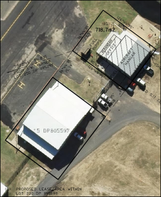
Figure 3: Lease Area Q
The proposed fuel facility will
consist of:
· aboveground and
self-bunded 55,000L Jet A1 fuel storage tank in the northern portion of the
lease area
· tank bay with
transfer pump and filter for bulk delivery
· fuel pump and
filtration system for refuelling
· concrete slab with
bunding around unloading area
· fuel dispenser on
concrete slab
· aboveground
pipework on supports between fuel tank and dispenser
The site facility layout within
the lease area is depicted below.
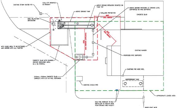
Figure 4: site facility layout
Jet fuel will be transported to the airport via approved
Petroleum Products Road Tankers, with 1-2 deliveries expected per week. Access
to the fuel storage and refuelling facility will be via existing internal
airport roads.
HISTORY/BACKGROUND
Lease area Q contains an existing 55,000L underground AVGAS
fuel tank and dispenser, approved pursuant to DA 234/1993 (20 January 1994) (as
shown on the above aerial image and proposed site facility layout). The
proponent advises the existing approved fuel facility is in use, and will be
retained in conjunction with the proposed Jet A1 fuel facility.
The fuel tank and dispenser approved under DA 234/1993
require internal tank cleaning and integrity inspection every three years,
pursuant to the approved Maintenance Schedule submitted in support of the
application. Council does not have any record that tank cleaning and integrity
inspection have ever been undertaken. In recent years, Council has requested
the lessee to undertake the required maintenance activities, to no avail. It is
the lessee’s submission that integrity testing is not required.
Council has sought advice from
Envirowest Consulting in order to clarify this matter. They have advised that
environmental regulations only require tank cleaning and integrity inspection
where evidence of product loss is detected; furthermore, integrity testing is
likely a recommendation of the tank manufacturer.
In order to resolve this matter, it is the position of
Council’s Airport Manager that Council continue to pursue the lessee to
undertake the required maintenance activities on the existing fuel tank. This
matter will be handled under separate cover, independent of the proposed DA.
MATTERS FOR CONSIDERATION
Section 1.7 - Application of
Part 7 of the Biodiversity Conservation Act 2016 and Part 7A of the
Fisheries Management Act 1994
Section 1.7 of the EP&A Act 1979 identifies that Part 7
of the Biodiversity Conservation Act 2016 and Part 7A of the Fisheries
Management Act 1994 have effect in connection with terrestrial and aquatic
environments.
Having regard to the relevant provisions and based on an
inspection of the subject property, it is considered that the proposed
development is not likely to significantly affect a threatened species. In this
instance, the subject property has no biodiversity or habitat value. A
Biodiversity Development Assessment Report is not required in this instance.
Section 4.15
Section 4.15 of the Environmental Planning and Assessment
Act 1979 requires Council to consider various matters, of which those
pertaining to the application are listed below.
PROVISIONS OF ANY ENVIRONMENTAL
PLANNING INSTRUMENT s4.15(1)(a)(i)
Orange Local Environmental Plan 2011
Part 1 - Preliminary
Clause 1.2 - Aims of Plan
The particular
aims of Orange LEP 2011 relevant to the proposal include:
(a) to encourage development which complements
and enhances the unique character of Orange as a major regional centre boasting
a diverse economy and offering an attractive regional lifestyle,
(b) to provide for a range of development
opportunities that contribute to the social, economic and environmental
resources of Orange in a way that allows present and future generations to meet
their needs by implementing the principles for ecologically sustainable
development,
(c) to conserve and enhance the water
resources on which Orange depends, particularly water supply catchments,
The application is considered to be consistent with the
foregoing objectives, as outlined in this report.
Clause 1.6 - Consent Authority
Clause 1.6 is applicable and states:
The consent authority for the
purposes of this Plan is (subject to the Act) the Council.
Clause 1.7 - Mapping
The subject site is identified
on the LEP maps in the following manner:
|
Land Zoning Map:
|
Land zoned SP2 Infrastructure
|
|
Lot Size Map:
|
No minimum lot size
|
|
Heritage Map:
|
Not a heritage item or conservation
area
|
|
Height of Buildings Map:
|
No building height limit
|
|
Floor Space Ratio Map:
|
No floor space limit
|
|
Terrestrial Biodiversity Map:
|
No biodiversity sensitivity on the
site
|
|
Groundwater Vulnerability Map:
|
Ground water vulnerable
|
|
Drinking Water Catchment Map:
|
Within the drinking water catchment
|
|
Watercourse Map:
|
Not within or affecting a defined watercourse
|
|
Urban Release Area Map:
|
Not within an urban release area
|
|
Obstacle Limitation Surface Map:
|
Restriction on building siting or
construction
|
|
Additional Permitted Uses Map:
|
No additional permitted use applies
|
|
Flood Planning Map
|
Not a flood planning area
|
Clause 1.9A - Suspension of
Covenants, Agreements and Instruments
Clause 1.9A is applicable and states in part:
(1) For the purpose of enabling
development on land in any zone to be carried out in accordance with this Plan
or with a consent granted under the Act, any agreement, covenant or other
similar instrument that restricts the carrying out of that development does not
apply to the extent necessary to serve that purpose.
(2) This clause does not apply:
(a) to a covenant
imposed by the Council or that the Council requires to be imposed, or
(b) to
any prescribed instrument within the meaning of section 183A of the Crown Lands
Act 1989, or
(c) to
any conservation agreement within the meaning of the National Parks and
Wildlife Act 1974, or
(d) to
any Trust agreement within the meaning of the Nature Conservation Trust Act
2001, or
(e) to
any property vegetation plan within the meaning of the Native Vegetation Act
2003, or
(f) to
any biobanking agreement within the meaning of Part 7A of the Threatened
Species Conservation Act 1995, or
(g) to
any planning agreement within the meaning of Division 6 of Part 4 of the Act.
In consideration of this clause, Council staff are not aware
that the land is affected by the restrictions listed in Subclause (2) above.
The land is affected by easements for access (refer Figure 5 below). The
proposed fuel storage and refuelling facility is sited clear of, and will have
nil impact on the operation of the easements.

Figure 5: easements in the vicinity of the proposed
development
Part 2 - Permitted or Prohibited
Development
Clause 2.1 - Land Use Zones
The subject site is located within the SP2 Infrastructure
zone. The proposed development is defined as an ‘airport.’ Pursuant
to the Dictionary:
Airport means
‘a place that is used for the land, taking off, parking, maintenance or
repair of aeroplanes, and includes associated buildings, installations,
facilities and movement areas and any heliport that is part of the
airport.’
The proposed fuel tank and refuelling facility will be
located on the site of Orange Airport. The proposal is legitimately ancillary
to the existing and approved airport.
Clause 2.3 - Zone Objectives and Land
Use Table
The objectives for land zoned SP2 are
as follows:
· To provide for
infrastructure and related uses.
· To prevent
development that is not compatible with or that may detract from the provision
of infrastructure.
The
proposed development is considered to be consistent with the foregoing
objectives.
Part
3 - Exempt and Complying Development
The application is not exempt or complying development.
Part 4 - Principal Development
Standards
The Part 4 standards are not
applicable to the proposal.
Part 5 - Miscellaneous Provisions
The provisions of Part 5 are not
applicable to the proposal.
Part 6 - Urban Release Area
Not relevant to the application. The subject site is not
located in an Urban Release Area.
Part 7 - Additional Local Provisions
7.1 - Earthworks
Clause 7.1 applies. This clause states
in part:
(3) Before granting development
consent for earthworks, the consent authority must consider the following
matters:
(a) The likely disruption of, or
any detrimental effect on, existing drainage patterns and soil stability in the
locality of the development
(b) The effect of the development
on the likely future use or redevelopment of the land
(c) The quality of the fill or the
soil to be excavated, or both
(d) The effect of the development
on the existing and likely amenity of adjoining properties
(e) The source of any fill material
and the destination of any excavated material
(f) The likelihood of
disturbing relics
(g) The proximity to and potential
for adverse impacts on any waterway, drinking water catchment or
environmentally sensitive area
(h) Any measures proposed to minimise
or mitigate the impacts referred to in paragraph (g).
In consideration of this clause, the
proposal is suitable. The proposed development will necessitate minor earthworks for
footings and concrete slab. The works will have nil impact on drainage patterns,
soil stability, neighbourhood amenity or sensitive areas.
7.6 - Groundwater Vulnerability
The subject land is identified as
Groundwater Vulnerable on the Groundwater Vulnerability Map. Clause 7.6
applies. This clause states in part:
(3) Before
determining a development application for development on land to which this
clause applies, the consent authority must consider:
(a) whether or not the development (including
any onsite storage or disposal of solid or liquid waste and chemicals) is
likely to cause any groundwater contamination or have any adverse effect on
groundwater dependent ecosystems, and
(b) the
cumulative impact (including the impact on nearby groundwater extraction for
potable water supply or stock water supply) of the development and any other
existing development on groundwater.
In consideration of this clause, a
condition is recommended requiring the facility comply with Australian
Standard AS1940-2004 The storage and handling of flammable and combustible
liquids. Council’s Environmental Health and Building Inspector
advises that compliance with the AS will render fuel spill unlikely; and the
suitable containment of any spill without causing significant environmental
impact.
7.7 - Drinking Water
Catchments
The subject land is identified as Drinking Water on the Drinking
Water Catchment Map. Clause 7.7 is applicable and states in part:
(3) Before
determining a development application for development on land to which this
clause applies, the consent authority must consider whether or not the
development is likely to have any adverse impact on the quality and quantity of
water entering the drinking water storage, having regard to:
(a) the
distance between the development and any waterway that feeds into the drinking
water storage, and
(b) the
onsite use, storage and disposal of any chemicals on the land, and
(c) the
treatment, storage and disposal of waste water and solid waste generated or
used by the development.
In consideration of this clause, all stormwater from the
refuelling area will be collected and piped to a stormwater treatment system.
The design and construction of the treatment system shall ensure stormwater
leaving the site will have no observable hydrocarbons present in the discharge.
Council’s Development Engineer has imposed conditions of consent to this
effect.
The assessment under Clause 7.6 above also applies in
consideration of potential impacts on the drinking water catchment.
7.9 - Airspace Operations
The subject land comprises the site of Orange Airport.
Clause 7.9 is applicable and states in part:
(1) The
objectives of this clause are as follows:
(a) to
provide for the effective and ongoing operation of the Orange Airport by
ensuring that such operation is not compromised by proposed development that
penetrates the Limitation or Operations Surface for that airport,
(b) to
protect the community from undue risk from that operation.
(2) If
a development application is received and the consent authority is satisfied
that the proposed development will penetrate the Limitation or Operations
Surface, the consent authority must not grant development consent unless it has
consulted with the relevant Commonwealth body about the application.
(3) The
consent authority may grant development consent for the development if the
relevant Commonwealth body advises that:
(a) the
development will penetrate the Limitation or Operations Surface but it has no
objection to its construction, or
(b) the
development will not penetrate the Limitation or Operations Surface.
(4) The
consent authority must not grant development consent for the development if the
relevant Commonwealth body advises that the development will penetrate the
Limitation or Operations Surface and should not be constructed.
In consideration of this clause, Council’s Airport
Manager has advised that the proposed fuel tank will not penetrate the
Limitation or Operations Surface. Furthermore, the development will not
encroach on the taxiway and will have nil impact on the operation of the taxiway.
STATE ENVIRONMENTAL PLANNING
POLICIES
State Environmental Planning Policy 33 - Hazardous and
Offensive Development
The proposal has been assessed as a ‘potentially
hazardous development’ pursuant to SEPP 33 - Hazardous and Offensive
Development. Part 3 of the SEPP applies, and provides as follows:
12 Preparation
of preliminary hazard analysis
A
person who proposes to make a development application to carry out development
for the purposes of a potentially hazardous industry must prepare (or cause to
be prepared) a preliminary hazard analysis in accordance with the current
circulars or guidelines published by the Department of Planning and submit the
analysis with the development application.
13 Matters for consideration by consent
authorities
In determining
an application to carry out development to which this Part applies, the consent
authority must consider (in addition to any other matters specified in the Act
or in an environmental planning instrument applying to the development):
(a) current circulars or guidelines
published by the Department of Planning relating to hazardous or offensive
development, and
(b) whether any public authority
should be consulted concerning any environmental and land use safety
requirements with which the development should comply, and
(c) in the case of development for
the purpose of a potentially hazardous industry—a preliminary hazard
analysis prepared by or on behalf of the applicant, and
(d) any feasible alternatives to
the carrying out of the development and the reasons for choosing the
development the subject of the application (including any feasible alternatives
for the location of the development and the reasons for choosing the location
the subject of the application), and
(e) any likely future use of the land
surrounding the development.
14 Advertising of
applications
Pursuant
to … the Act, the provisions … apply to and in respect of
development to which this Part applies in the same way as those provisions
apply to and in respect of designated development.
In consideration of the relevant
clauses of the SEPP, the following comments are provided:
· The proposed
development exceeds the risk screening threshold limits for quantity stored and
boundary proximity, pursuant to Hazardous and Offensive Development Application
Guidelines - Applying SEPP 33 (SEPP 33 Guidelines) (Department of Planning
2011). The risk screening method requires consideration of all hazardous
materials within the proposed development and other hazardous materials
on the site in proximity to the proposed development:
- The
proposal involves the storage of 55kL of Jet A1 fuel (3 PG III) within 2m of
the lease boundary.
- An
existing fuel storage facility containing 55kL of Avgas fuel (3 PH II) is
located within Leave Area Q, in proximity to the proposed fuel facility, and
with a zero lease boundary setback.
Consequently, the proposal
comprises a potentially hazardous development and SEPP 33 applies to the
development.
· The proposal is
not contrary to listed circulars or guidelines cited in the SEPP 33
Guidelines, pursuant to Clause 13(a). Where relevant, conditions are included
on the attached Notice of Approval to reflect the requirements of the
applicable circulars and guidelines.
· Consultation with
public authorities (Department of Planning and Environment, SafeWork NSW or
Roads and Maritime Services) was not undertaken based upon the location of the
proposed development and circumstances of the proposal (pursuant to Clause
13(b)). Conditions of consent are recommended to address the particular
requirements of the Protection of the Environment Operations Act 1997 and
Work Health and Safety Regulation 2011.
· A PHA was
submitted in support of the proposal (FuelSuite Pty Ltd May 2018), pursuant to
Clauses 12 and 13(c), and prepared in accordance with the SEPP 33
Guideline. The PHA adopted a Level l (Qualitative) multi-level risk assessment,
including site risks and control measures. The PHA concludes ‘…the
design is acceptable for this site.’
· Conditions are
included on the attached Notice of Approval, consistent with Hazardous Industry
Advisory Paper No. 12 Hazards-Related Conditions of Consent (NSW Department of
Planning 2011) for Low Hazard Potentially Hazardous Development.
· The proposed
refuelling facility will be located on the site of Orange Airport. The proposal
is legitimately ancillary to the existing and approved airport. The proposal
may be located elsewhere on the airport site, as a feasible alternative
(Clause 13(d). Notwithstanding, the proposed location for the refuelling
facility will not adversely impact on current and future airport operations
(Clause 13(e)).
· The proposed
development was advertised for the prescribed period, pursuant to Clause 14. At
the completion of the public notice and exhibition period, no submissions had
been received in relation to the application. One (1) late submission was
received, which expressed concerns in relation to the impact of the development
on localised soil and water quality. Subject to compliance with conditions on
the attached Notice of Approval, the development will not adversely impact on
the natural environment.
State Environmental Planning
Policy 55 - Remediation of Land
SEPP 55 is applicable and states in part:
7 Contamination
and remediation to be considered in determining development application
(1) A consent authority must not
consent to the carrying out of any development on land unless:
(a) it has considered whether the
land is contaminated, and
(b) if the land is contaminated, it
is satisfied that the land is suitable in its contaminated state (or will be
suitable, after remediation) for the purpose for which the development is
proposed to be carried out, and
(c) if the land requires
remediation to be made suitable for the purpose for which the development is
proposed to be carried out, it is satisfied that the land will be remediated
before the land is used for that purpose.
In consideration of this clause, the subject land is
suitable for the proposed development. Other similar fuel facilities are
located nearby to the proposed tank and refuelling facility. The proposal
comprises an intensification of the existing use of the land for related air
transport infrastructure.
As outlined previously, Council is separately pursuing the
lessee/proponent in relation to tank cleaning and integrity inspection
associated with the existing fuel facility approved under DA 234/1994.
PROVISIONS OF ANY DRAFT
ENVIRONMENTAL PLANNING INSTRUMENT THAT HAS BEEN PLACED ON EXHIBITION
4.15(1)(a)(ii)
There are no draft environmental planning instruments that
apply to the subject land or proposed development.
DESIGNATED DEVELOPMENT
The proposal comprises
‘petroleum works’ pursuant to Environmental Planning and Assessment
Regulation 2000, Part 1, Schedule 3 What is designated development? The
proposed stored petroleum products of 55 tonnes is substantially below the
threshold of 2,000 tonnes nominated in the Regulations. On this basis, the
proposal is not designated development.
Notwithstanding, the subject petroleum works are exempted
from designated development, as they are ancillary to other development (ie.
Orange Airport) and not proposed to be carried out independently of that
development (Clause 37A).
INTEGRATED DEVELOPMENT
The proposed development is not
integrated development pursuant to Section 4.46 of the Environmental Planning
and Assessment Act 1979.
PROVISIONS OF ANY DEVELOPMENT
CONTROL PLAN s4.15(1)(a)(iii)
Development Control Plan 2004
DCP2004-0.4-12 Interim Planning
Outcomes - Airport
· Proposals must
demonstrate that adequate utility services are available to provide for the
development.
Existing utility services on the
airport site are suitable for the proposed development.
· Proposals must
not compromise the current or future operations of the Airport, including
establishment or expansion of public facilities such as the terminal building
and car parking.
The proposed development will have
nil impact on current or future airport operations. The proposed fuel facility
will be located nearby to other similar facilities and aircraft hangars and
will be removed from public areas. Council’s Airport Manager advised that
the development will not encroach on the taxiway and will have nil impact on
the operation of the taxiway.
In order that the development will
not adversely impact on airport operations, conditions are recommended
requiring:
- the
proponent enter into a lease agreement with Council for the proposed facility
on Council land
- all
services for the proposed facility be wholly contained within the lease area
- separate
approval be obtained for access and construction work on airside operating
areas.
· Water runoff
must be managed and treated to pre-development quality or better and
pre-development quantities or less.
A condition is recommended requiring
the facility comply with Australian Standard AS1940‑2004 The storage
and handling of flammable and combustible liquids. Council’s
Environmental Health and Building Inspector advises that compliance with the AS
will render fuel spill unlikely; and the suitable containment of any spill
without causing significant environmental impact.
PROVISIONS PRESCRIBED BY THE
REGULATIONS s4.15(1)(a)(iv)
Demolition of a Building (clause 92)
The proposal does not involve the demolition of a building.
Fire Safety Considerations
(clause 93)
Council’s Environmental Health and Building Surveyor
advises:
The proposed refuelling
facility will be located far enough away from the existing adjacent building to
not require any fire separation. Fire extinguishers and a hydrant are shown on
the plan.
Buildings to be Upgraded
(clause 94)
The proposal will not necessitate the upgrade of any building.
BASIX Commitments (clause 97A)
Not applicable.
THE LIKELY IMPACTS OF THE
DEVELOPMENT s4.15(1)(b)
Airport Operations
The proposal will have nil impact on current and future
airport operations. Council’s Airport Manager raised no objection to the proposal
in terms of siting or design.
Context and Setting
The development will be sited nearby to other similar fuel
facilities and aircraft hangars. This part of the site is removed from public
access areas.
Visual Impacts
The proposed fuel facility is considered to be an accepted
visual element for the airport site generally, and will complement other
similar infrastructure and improvements in the vicinity.
Hazards and Environmental
Impacts
A condition is recommended requiring
the facility comply with Australian Standard AS1940‑2004 The storage
and handling of flammable and combustible liquids. Council’s
Environmental Health and Building Inspector advises that compliance with the AS
will render fuel spill unlikely; and the suitable containment of any spill
without causing significant environmental impact.
Traffic Matters
Existing access arrangements to the airport site are
suitable for the proposal. The capacity of the road network is sufficient to
accommodate fuel tanker deliveries. Service vehicle travel paths will utilise
existing internal roads, and not conflict with nearby improvements or the
taxiway. A condition is recommended requiring approval be obtained for access
and construction work on airside operating areas.
Cumulative Impacts
The Orange Airport site contains
other existing and proposed bulk fuel storage facilities, as depicted below.

Figure 5: bulk fuel storage at Orange Airport
It is considered that the cumulative impacts of the proposal
are addressed via the assessment regime contained in SEPP 33. The proposed
development exceeds the risk screening thresholds for quantity stored and
(lease) boundary proximity pursuant to the SEPP 33 Guidelines. Consequently, Level
1 preliminary hazard analysis was undertaken for the proposal; and
prescribed Low Hazard conditions of consent are included on the attached
notice of approval.
By virtue that the SEPP 33 risk
screening thresholds relate to lease boundaries, rather than the
boundaries of the airport site, there is greater propensity for
screening thresholds to be exceeded. Consequently, the assessment rigours for
the proposal are more exhaustive, as are conditions of development consent.
Other fuel facilities on the site were subject to the same assessment process
OR did not exceed SEPP 33 thresholds.
The proposal is legitimately
ancillary to the existing and approved airport. The proposed location for the
refuelling facility will not adversely impact on current and future airport
operations. The development will provide ancillary infrastructure that may
improve the function and operation of the airport site. The cumulative impacts of
the proposal are considered to be within reasonable limit.
THE SUITABILITY OF THE SITE
s4.15(1)(c)
The proposed development is considered suitable for the
subject land due to the following:
· the proposal is
permitted on the subject land zoning
· the development is
ancillary to the existing airport use of the site
· utility services
are available and suitable
· existing site
access and internal vehicles areas are suitable
· the water
catchment will not be impacted due to mitigation measures.
ANY SUBMISSIONS MADE IN
ACCORDANCE WITH THE ACT s4.15(1)(d)
The proposed development is defined as advertised
development pursuant to SEPP 33 (Clause 14). Public notice and exhibition
of the application was undertaken consistent with the provisions prescribed in
the SEPP 33 Guidelines. At the completion of the exhibition period, no
submissions had been received in relation to the application.
One (1) late submission was received, which expressed
concerns in relation to the impact of the development on localised soil and
water quality. Subject to compliance with conditions of Council and the NSW
Department of Planning on the attached Notice of Approval, the development will
not adversely impact on the natural environment.
PUBLIC INTEREST
s4.15(1)(e)
The proposal is not inconsistent with any relevant policy
statements, planning studies, guidelines etc that have not been considered in
this assessment.
SUMMARY
The proposed development is permissible with the consent of
Council. The proposed development complies with the relevant aims, objectives
and provisions of Orange LEP 2011 (as amended) and DCP 2004. A
Section 4.15 assessment of the development indicates that the development
is acceptable in this instance. Attached is a draft Notice of Approval
outlining a range of conditions considered appropriate to ensure that the
development proceeds in an acceptable manner.
COMMENTS
The requirements of the Environmental Health and Building
Surveyor and the Engineering Development Section are included in the attached
Notice of Approval.
Attachments
1 Notice
of Approval, D18/39178⇨
2 Plans,
D18/34774⇨
3 Submission,
D18/34957⇨
2.9 Development
Application DA 77/2018(1) - 136 Aerodrome Road
RECORD
NUMBER: 2018/1678
AUTHOR: Summer
Commins, Senior Planner
EXECUTIVE Summary
|
Application
lodged
|
7 March
2018
|
|
Applicant/s
|
Aero
Refuellers
|
|
Owner/s
|
Orange
City Council
|
|
Land
description
|
Lot 200
DP 1195298 - 136 Aerodrome Road, Huntley
|
|
Proposed
land use
|
Airport
(bulk fuel tanks (2) and refuelling facility))
|
|
Value of
proposed development
|
$450,000
|
Council’s consent is sought for a proposed aviation
fuel storage and refuelling facility at Orange Airport, located at Lot 200 DP
1195298 – 136 Aerodrome Road, Huntley (refer Figure 1). The
facility will comprise an aboveground and self-bunded 68,000L Jet-A1 fuel
storage tank; 55,000L AVGAS fuel storage tank; and associated infrastructure.
The proposal has been assessed as ‘potentially
hazardous development’ pursuant to State Environmental Planning Policy
No. 33 – Hazardous and Offensive Development (SEPP 33). A Preliminary
Hazard Analysis (PHA) was submitted in support of the application. The PHA
concludes the risks associated with the proposed development are acceptable
based on all current definitions of the tolerability of risk.
The proposal comprises advertised development pursuant to
SEPP 33. At the completion of the public notice and exhibition period, no
submissions had been received in relation to the application.
The proposal is legitimately ancillary to the existing and
approved airport. The proposed location for the refuelling facility will not
adversely impact on current and future airport operations. The development will
provide ancillary infrastructure that may improve the function and operation of
the airport site.
The proposal is consistent with
the planning provisions that apply to the subject land and particular land use.
Impacts of the development are considered to be within reasonable limit,
subject to mitigation conditions. Approval of the application is recommended.

Figure 1: locality plan
RECENT LEGISLATIVE CHANGES
On 1 March 2018 the Environmental Planning and Assessment
Act 1979 was substantially amended. The most immediate change involves the
restructuring and renumbering of the Act, with other more substantive
changes to be phased in over time. However, for some applications (particularly
where an application was lodged prior to the changes coming into effect) the
supporting documentation may still reference the previous numbering regime. In
the drafting of this report the content and substance of the supporting
material has been considered irrespective of which legislative references were
used.
DECISION FRAMEWORK
Development in Orange is governed by two key documents
Orange Local Environment Plan 2011 and Orange Development Control Plan 2004. In
addition the Infill Guidelines are used to guide development, particularly in
the heritage conservation areas and around heritage items.
Orange Local Environment Plan 2011 – The
provisions of the LEP must be considered by the Council in determining the
application. LEPs govern the types of development that are permissible or
prohibited in different parts of the City and also provide some assessment
criteria in specific circumstances. Uses are either permissible or not. The
objectives of each zoning and indeed the aims of the LEP itself are also to be
considered and can be used to guide decision making around appropriateness of
development.
Orange Development Control Plan 2004 – the DCP
provides guidelines for development. In general it is a performance based
document rather than prescriptive in nature. For each planning element there
are often guidelines used. These guidelines indicate ways of achieving the
planning outcomes. It is thus recognised that there may also be other solutions
of merit. All design solutions are considered on merit by planning and building
staff. Applications should clearly demonstrate how the planning outcomes are
being met where alternative design solutions are proposed. The DCP enables
developers and architects to use design to achieve the planning outcomes in
alternative ways.
DIRECTOR’S COMMENT
The key issues around this Development Application centre on
the safety of storage of a significant amount of aviation fuel at Orange
Airport. The assessment has conducted the requisite studies to provide comfort
to Council with respect to safety. The development is permissible as an
ancillary activity to airport operations.
Link To Delivery/OPerational Plan
The recommendation in this report relates to the
Delivery/Operational Plan strategy “10.1 Preserve - Engage with the
community to ensure plans for growth and development are respectful of our
heritage”.
Financial Implications
Nil
Policy and Governance Implications
Nil
|
Recommendation
That Council consents to
development application DA 77/2018(1)
for Airport (bulk fuel tanks (2) and refuelling facility) at Lot 200
DP 1195298 - 136 Aerodrome Road, Huntley
pursuant to the conditions of consent in the attached Notice of Approval.
|
further considerations
Consideration has been given to the recommendation’s
impact on Council’s service delivery; image and reputation; political;
environmental; health and safety; employees; stakeholders and project
management; and no further implications or risks have been identified.
SUPPORTING INFORMATION
The proposal involves an
aviation fuel storage and refuelling facility at Orange Airport. The refuelling
facility will be located at the north-west of the building group on the airport
site (see location at Figure 2).
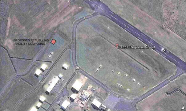
Figure 2: siting of proposed fuel storage and
refuelling facility
The facility will consist of:
· a concrete paved
area, 35m x 27m enclosed by chain wire fencing
· aboveground and
self-bunded 68,000L Jet-A1 fuel storage tank, and 55,000L AVGAS fuel storage
tank in the centre of the compound
· bunded tanker
delivery area and remote fill point to the north of the compound
· ‘self-serve’
fuel dispensing pumps within a canopied area to the south of the compound
· underground
pipework consisting of transfer lines between tanker delivery area and storage
tanks; and storage tanks and dispensers
· associated
amenities including eye wash and shower, fuels testing lab and fire protection.
The site facility layout is
depicted below (refer Figure 3).
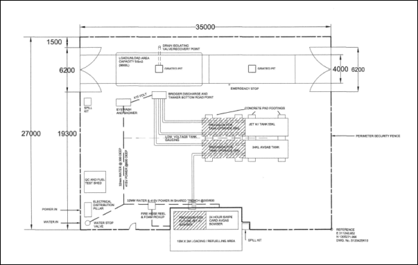
Figure 3: site facility layout
Access to the fuel storage and refuelling facility will be
via existing internal airport roads. The fuel facility will be un-manned, and
available for use on a continual basis.
MATTERS FOR CONSIDERATION
Section 1.7 - Application of
Part 7 of the Biodiversity Conservation Act 2016 and Part 7A of the
Fisheries Management Act 1994
Section 1.7 of the EP&A Act 1979 identifies that Part 7
of the Biodiversity Conservation Act 2016 and Part 7A of the Fisheries
Management Act 1994 have effect in connection with terrestrial and aquatic
environments.
Having regard to the relevant provisions and based on an
inspection of the subject property, it is considered that the proposed
development is not likely to significantly affect a threatened species. In this
instance, the subject property has no biodiversity or habitat value. A
Biodiversity Development Assessment Report is not required in this instance.
Section 4.15
Section 4.15 of the Environmental Planning and Assessment
Act 1979 requires Council to consider various matters, of which those
pertaining to the application are listed below.
PROVISIONS OF ANY ENVIRONMENTAL
PLANNING INSTRUMENT s4.15(1)(a)(i)
Orange Local Environmental Plan 2011
Part 1 - Preliminary
Clause 1.2 - Aims of Plan
The
particular aims of Orange LEP 2011 relevant to the proposal include:
(a) to encourage development which complements
and enhances the unique character of Orange as a major regional centre boasting
a diverse economy and offering an attractive regional lifestyle,
(b) to provide for a range of development
opportunities that contribute to the social, economic and environmental resources
of Orange in a way that allows present and future generations to meet their
needs by implementing the principles for ecologically sustainable development,
(c) to conserve and enhance the water
resources on which Orange depends, particularly water supply catchments,
The application is considered to be consistent with the
foregoing objectives, as outlined in this report.
Clause 1.6 - Consent Authority
Clause 1.6 is applicable and states:
The consent authority for the
purposes of this Plan is (subject to the Act) the Council.
Clause 1.7 – Mapping
The subject site is identified
on the LEP maps in the following manner:
|
Land Zoning Map:
|
Land zoned SP2 Infrastructure
|
|
Lot Size Map:
|
No minimum lot size
|
|
Heritage Map:
|
Not a heritage item or conservation
area
|
|
Height of Buildings Map:
|
No building height limit
|
|
Floor Space Ratio Map:
|
No floor space limit
|
|
Terrestrial Biodiversity Map:
|
No biodiversity sensitivity on the
site
|
|
Groundwater Vulnerability Map:
|
Ground water vulnerable
|
|
Drinking Water Catchment Map:
|
Within the drinking water catchment
|
|
Watercourse Map:
|
Not within or affecting a defined
watercourse
|
|
Urban Release Area Map:
|
Not within an urban release area
|
|
Obstacle Limitation Surface Map:
|
Restriction on building siting or
construction
|
|
Additional Permitted Uses Map:
|
No additional permitted use applies
|
|
Flood Planning Map
|
Not a flood planning area
|
Clause 1.9A - Suspension of
Covenants, Agreements and Instruments
Clause 1.9A is applicable and states in part:
(1) For the purpose of enabling
development on land in any zone to be carried out in accordance with this Plan
or with a consent granted under the Act, any agreement, covenant or other
similar instrument that restricts the carrying out of that development does not
apply to the extent necessary to serve that purpose.
(2) This clause does not apply:
(a) to a covenant
imposed by the Council or that the Council requires to be imposed, or
(b) to
any prescribed instrument within the meaning of section 183A of the Crown Lands
Act 1989, or
(c) to
any conservation agreement within the meaning of the National Parks and
Wildlife Act 1974, or
(d) to
any Trust agreement within the meaning of the Nature Conservation Trust Act
2001, or
(e) to
any property vegetation plan within the meaning of the Native Vegetation Act
2003, or
(f) to
any biobanking agreement within the meaning of Part 7A of the Threatened
Species Conservation Act 1995, or
(g) to
any planning agreement within the meaning of Division 6 of Part 4 of the Act.
In consideration of this clause,
Council staff are not aware that the land is affected by the restrictions
listed in Subclause (2) above. The land is affected by easements for access
(refer Figure 4 below). The proposed fuel storage and refuelling facility is
sited clear of, and will have nil impact on the operation of the easements.
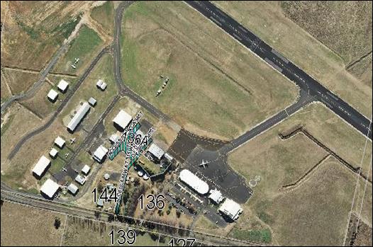
Figure 4: easements in the vicinity of the proposed
development
Part
2 - Permitted or Prohibited Development
Clause 2.1 - Land Use Zones
The subject site is located within the SP2 Infrastructure
zone. The proposed development is defined as an ‘airport.’ Pursuant
to the Dictionary:
Airport means
‘a place that is used for the land, taking off, parking, maintenance or
repair of aeroplanes, and includes associated buildings, installations,
facilities and movement areas and any heliport that is part of the
airport.’
The proposed fuel tanks and refuelling facility will be
located on the site of Orange Airport. The proposal is legitimately ancillary
to the existing and approved airport.
Clause 2.3 - Zone Objectives and Land
Use Table
The objectives for land zoned SP2
Infrastructure are as follows:
· to provide for
infrastructure and related uses
· to prevent
development that is not compatible with or that may detract from the provision
of infrastructure.
The
proposed development is considered to be consistent with the foregoing
objectives.
Part 3 - Exempt and Complying
Development
The application is not exempt or complying development.
Part 4 - Principal Development
Standards
The Part 4 standards are not
applicable to the proposal.
Part 5 - Miscellaneous Provisions
The provisions of Part 5 are not
applicable to the proposal.
Part 6 - Urban Release Area
Not relevant to the application. The subject site is not
located in an Urban Release Area.
Part 7 - Additional Local Provisions
7.1 - Earthworks
Clause 7.1 applies. This clause states
in part:
(3) Before granting development
consent for earthworks, the consent authority must consider the following
matters:
(a) the likely disruption of, or any
detrimental effect on, existing drainage patterns and soil stability in the
locality of the development
(b) the effect of the development
on the likely future use or redevelopment of the land
(c) the quality of the fill or the
soil to be excavated, or both
(d) the effect of the development
on the existing and likely amenity of adjoining properties
(e) the source of any fill material
and the destination of any excavated material
(f) the likelihood of
disturbing relics
(g) the proximity to and potential
for adverse impacts on any waterway, drinking water catchment or
environmentally sensitive area
(h) any measures proposed to
minimise or mitigate the impacts referred to in paragraph (g).
In consideration of this clause, the
proposal is suitable. The proposed development will necessitate minor earthworks for
footings and concrete slab. The works will have nil impact on drainage
patterns, soil stability, neighbourhood amenity or sensitive areas.
7.6 - Groundwater Vulnerability
The subject land is identified as
Groundwater Vulnerable on the Groundwater Vulnerability Map. Clause 7.6
applies. This clause states in part:
(3) Before
determining a development application for development on land to which this
clause applies, the consent authority must consider:
(a) whether or not the development (including
any onsite storage or disposal of solid or liquid waste and chemicals) is
likely to cause any groundwater contamination or have any adverse effect on
groundwater dependent ecosystems, and
(b) the cumulative impact (including the
impact on nearby groundwater extraction for potable water supply or stock water
supply) of the development and any other existing development on groundwater.
In consideration of this clause, a
condition is recommended requiring the facility comply with Australian
Standard AS1940-2004 - The storage and handling of flammable and combustible
liquids. Council’s Environmental Health and Building Inspector
advises that compliance with the AS will render fuel spill unlikely; and the
suitable containment of any spill without causing significant environmental
impact.
7.7 - Drinking Water
Catchments
The subject land is identified as Drinking Water on the Drinking
Water Catchment Map. Clause 7.7 is applicable and states in part:
(3) Before
determining a development application for development on land to which this
clause applies, the consent authority must consider whether or not the
development is likely to have any adverse impact on the quality and quantity of
water entering the drinking water storage, having regard to:
(a) the
distance between the development and any waterway that feeds into the drinking
water storage
(b) the
onsite use, storage and disposal of any chemicals on the land
(c) the
treatment, storage and disposal of waste water and solid waste generated or
used by the development.
In consideration of this clause, all
stormwater from the refuelling area will be collected and piped to a stormwater
treatment system. The design and construction of the treatment system shall
ensure stormwater leaving the site will have no observable hydrocarbons present
in the discharge. Council’s Development Engineer has imposed conditions
of consent to this effect.
The assessment under Clause 7.6 above also applies in
consideration of potential impacts on the drinking water catchment.
7.9 - Airspace Operations
The subject land comprises the site of Orange Airport.
Clause 7.9 is applicable and states in part:
(1) The
objectives of this clause are as follows:
(a) to
provide for the effective and ongoing operation of the Orange Airport by
ensuring that such operation is not compromised by proposed development that
penetrates the Limitation or Operations Surface for that airport,
(b) to
protect the community from undue risk from that operation.
(2) If
a development application is received and the consent authority is satisfied
that the proposed development will penetrate the Limitation or Operations
Surface, the consent authority must not grant development consent unless it has
consulted with the relevant Commonwealth body about the application.
(3) The
consent authority may grant development consent for the development if the
relevant Commonwealth body advises that:
(a) the
development will penetrate the Limitation or Operations Surface but it has no
objection to its construction, or
(b) the
development will not penetrate the Limitation or Operations Surface.
(4) The
consent authority must not grant development consent for the development if the
relevant Commonwealth body advises that the development will penetrate the
Limitation or Operations Surface and should not be constructed.
In consideration of this clause, Council’s Development
Engineer advises:
The proposed refuelling
facility location is subject to final positioning subject to clearances from runways
and clear of the OLS.
STATE ENVIRONMENTAL PLANNING
POLICIES
State Environmental Planning Policy 33 - Hazardous and
Offensive Development
The proposal has been assessed as a ‘potentially
hazardous development’ pursuant to SEPP 33 - Hazardous and Offensive
Development. Part 3 of the SEPP applies, and provides as follows:
12 Preparation of preliminary hazard analysis
A person who proposes to make a development application to carry
out development for the purposes of a potentially hazardous industry must
prepare (or cause to be prepared) a preliminary hazard analysis in accordance
with the current circulars or guidelines published by the Department of
Planning and submit the analysis with the development application.
13 Matters for consideration by consent
authorities
In determining an application to carry out development to
which this Part applies, the consent authority must consider (in addition to
any other matters specified in the Act or in an environmental planning
instrument applying to the development):
(a) current circulars or guidelines
published by the Department of Planning relating to hazardous or offensive
development, and
(b) whether any public authority
should be consulted concerning any environmental and land use safety
requirements with which the development should comply, and
(c) in the case of development for
the purpose of a potentially hazardous industry—a preliminary hazard
analysis prepared by or on behalf of the applicant, and
(d) any feasible alternatives to
the carrying out of the development and the reasons for choosing the
development the subject of the application (including any feasible alternatives
for the location of the development and the reasons for choosing the location
the subject of the application), and
(e) any likely future use of the
land surrounding the development.
14 Advertising of
applications
Pursuant
to … the Act, the provisions … apply to and in respect of
development to which this Part applies in the same way as those provisions
apply to and in respect of designated development.
In consideration of the relevant clauses of the SEPP, the
following comments are provided:
· The proposed
development exceeds the risk screening threshold limits for quantity stored and
boundary proximity, pursuant to Hazardous and Offensive Development Application
Guidelines - Applying SEPP 33 (SEPP 33 Guidelines) (Department of Planning
2011). The fuels are classified as Class 3 Packing Group II fuels. A total
quantity of 90 tonnes will be stored and handled within 6m of the facility
boundary. Consequently the proposal comprises a potentially hazardous
development and SEPP 33 applies to the development.
· The proposal is
not contrary to listed circulars or guidelines cited in the SEPP 33
Guidelines, pursuant to Clause 13(a). Where relevant, conditions are included
on the attached Notice of Approval to reflect the requirements of the
applicable circulars and guidelines.
· Consultation with
public authorities (Department of Planning and Environment, SafeWork NSW or
Roads and Maritime Services) was not undertaken based upon the location of the
proposed development and circumstances of the proposal (pursuant to Clause
13(b)). Conditions of consent are recommended to address the particular
requirements of the Protection of the Environment Operations Act 1997 and Work
Health and Safety Regulation 2011.
· A PHA was
submitted in support of the proposal (JBS&G Australia Pty Ltd April 2018),
pursuant to Clauses 12 and 13(c), and prepared in accordance with the
SEPP 33 Guideline. The PHA adopted a Level 2 (Partially Quantitative)
multi-level risk assessment, which incorporates hazard analysis, consequence
analysis and frequency analysis. The PHA concludes ‘the risks associated
with the proposed development of the refuelling facility within the Orange
Airport are acceptable based on all current definitions of the tolerability of
risk. Specifically, the proposed operation of the facility is well within the
criteria for risk of fatality appropriate to the surrounding area.’
· The PHA recommends
the following to ensure the level of potential hazard associated with the
development is managed at acceptable levels:
1. Construction
and operation to all relevant standards and guidelines including:
- AS1940
‘The storage and handling of flammable and combustible liquids’
- AIP
CP26 ‘Design and operation of low pressure liquid hydrocarbon
pipelines,’ and
- AIP
650 ‘Welded steel tanks for oil storage.
2. Preparation
of a Hazard and Operability Study prior to construction.
Conditions are included on the
attached Notice to reflect the recommendations of the PHA. Additional
conditions are also included, consistent with Hazardous Industry Advisory
Paper No. 12 Hazards-Related Conditions of Consent (NSW Department of
Planning 2011) for Medium Hazard Potentially Hazardous Development.
· The proposed
refuelling facility will be located on the site of Orange Airport. The proposal
is legitimately ancillary to the existing and approved air transport facility.
The proposal may be located elsewhere on the airport site, as a feasible
alternative (Clause 13(d). Notwithstanding, the proposed location for the
refuelling facility will not adversely impact on current and future airport
operations (Clause 13(e). A condition is recommended requiring the fuel
facility location, refuelling apron, taxiway and access road configuration to
accord with the requirements of Civil Aviation Safety Authority (CASA), and
clear of any runway obstacle limitation surface.
· The proposed
development was advertised for the prescribed period, pursuant to Clause 14. At
the completion of the public notice and exhibition period, no submissions had
been received in relation to the application.
Based on the foregoing assessment,
the proposal development satisfies the requirements of SEPP 33.
State Environmental Planning
Policy 55 - Remediation of Land
SEPP 55 is applicable and states in part:
7 Contamination
and remediation to be considered in determining development application
(1) A consent authority must not
consent to the carrying out of any development on land unless:
(a) it has considered whether the
land is contaminated, and
(b) if the land is contaminated, it
is satisfied that the land is suitable in its contaminated state (or will be
suitable, after remediation) for the purpose for which the development is
proposed to be carried out, and
(c) if the land requires
remediation to be made suitable for the purpose for which the development is
proposed to be carried out, it is satisfied that the land will be remediated
before the land is used for that purpose.
In consideration of this clause, the subject land is
suitable for the proposed development. Other similar fuel facilities are
located nearby to the proposed tank and refuelling facility. The proposal
comprises an intensification of the existing use of the land for related air
transport infrastructure.
PROVISIONS OF ANY DRAFT
ENVIRONMENTAL PLANNING INSTRUMENT THAT HAS BEEN PLACED ON EXHIBITION
4.15(1)(a)(ii)
There are no draft environmental planning instruments that
apply to the subject land or proposed development.
DESIGNATED DEVELOPMENT
The proposal comprises ‘petroleum works’
pursuant to Environmental Planning and Assessment Regulation 2000, Part 1,
Schedule 3 What is designated development? The proposed sum of stored
petroleum products of 123kL (equivalent to approximately 90 tonnes) is
substantially below the threshold nominated in the Regulations. On this basis,
the proposal is not designated development.
Furthermore, the subject petroleum works are exempted from
designated development, as they are ancillary to other development (ie. Orange
Airport) and not proposed to be carried out independently of that development
(Clause 37A).
INTEGRATED DEVELOPMENT
The proposed development is not integrated development
pursuant to Section 4.46 of the Environmental Planning and Assessment Act 1979.
PROVISIONS OF ANY DEVELOPMENT
CONTROL PLAN s4.15(1)(a)(iii)
Development Control Plan 2004
DCP2004-0.4-12 Interim Planning Outcomes - Airport
· Proposals must
demonstrate that adequate utility services are available to provide for the
development.
Existing utility services on the airport site are suitable
for the proposed development.
· Proposals must
not compromise the current or future operations of the Airport, including
establishment or expansion of public facilities such as the terminal building
and car parking.
A condition is recommended requiring the fuel facility
location, refuelling apron, taxiway and access road configuration to accord
with the requirements of CASA, and be sited clear of any runway obstacle
limitation surface.
· Water run off
must be managed and treated to predevelopment quality or better and pre
development quantities or less.
A condition is recommended requiring
the facility comply with Australian Standard AS1940‑2004 - The storage
and handling of flammable and combustible liquids. Council’s
Environmental Health and Building Inspector advises that compliance with the AS
will render fuel spill unlikely; and the suitable containment of any spill
without causing significant environmental impact.
PROVISIONS PRESCRIBED BY THE
REGULATIONS
s4.15(1)(a)(iv)
Demolition of a Building (clause 92)
The proposal does not involve the demolition of a building.
Fire Safety Considerations
(clause 93)
Council’s Environmental Health and Building Surveyor
advises:
The proposed refuelling
facility will be located far enough away from the existing adjacent building to
not require any fire separation. A fire hose reel with foam pickup is shown on
the plans.
Buildings to be Upgraded
(clause 94)
The proposal will not necessitate the upgrade of any
building.
BASIX Commitments (clause 97A)
Not applicable.
THE LIKELY IMPACTS OF THE
DEVELOPMENT s4.15(1)(b)
Airport Operations
The proposal will not adversely impact on current and future
airport operations.
A condition is recommended requiring the fuel facility
location, refuelling apron, taxiway and access road configuration to accord
with the requirements of CASA, and be sited clear of any runway obstacle
limitation surface.
Context and Setting
The development will be sited nearby to other similar fuel
facilities and aircraft hangers. This part of the site is removed from public
access areas and runway areas.
Visual Impacts
The proposed fuel facility is considered to be an accepted
visual element for the airport site generally, and will complement other
similar infrastructure and improvements in the vicinity.
Hazards Impacts
Hazards associated with the development include major
mechanical failure or leak; pipe failure; spillage of petroleum during
transfer; road tanker drive-away incident; and leak at dispensing pumps. The
submitted PHA demonstrates potential hazards associated with the development
may be managed at acceptable levels, subject to compliance with mitigation
conditions.
Traffic Matters
Existing access arrangements to the airport site are
suitable for the proposal. The capacity of the road network is sufficient to
accommodate fuel tanker deliveries. Service vehicle travel paths will utilise
existing internal roads, and not conflict with nearby improvements or the
taxiway. A condition is recommended requiring approval be obtained for access
and construction work on airside operating areas.
Cumulative Impacts
The Orange Airport site contains
other existing and proposed bulk fuel storage facilities, as depicted below.
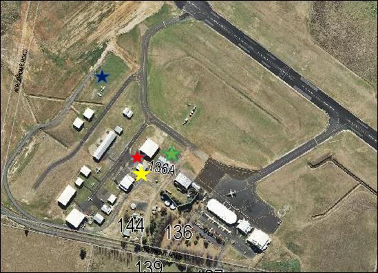
Figure 5: bulk fuel storage at Orange Airport
It is considered that the cumulative
impacts of the proposal are addressed via the assessment regime contained in
SEPP 33. The proposed development exceeds the risk screening thresholds for
quantity stored and (lease) boundary proximity pursuant to the SEPP 33
Guidelines. Consequently, Level 2 preliminary hazard analysis was
undertaken for the proposal; and prescribed Medium Hazard conditions of
consent are included on the attached notice of approval.
By virtue that the SEPP 33 risk screening thresholds relate
to (proposed) lease boundaries, rather than the boundaries of the airport
site, there is greater propensity for screening thresholds to be exceeded.
Consequently, the assessment rigours for the proposal are more exhaustive, as
are conditions of development consent. Other fuel facilities on the site were
subject to the same assessment process OR did not exceed SEPP 33 thresholds.
The proposal is legitimately ancillary to the existing and
approved airport. The proposed location for the refuelling facility will not
adversely impact on current and future airport operations. The development will
provide ancillary infrastructure that may improve the function and operation of
the airport site. The cumulative impacts of the proposal are considered to be
within reasonable limit.
THE SUITABILITY OF THE SITE
s4.15(1)(c)
The proposed development is considered suitable for the
subject land due to the following:
· the proposal is
permitted on the subject land zoning
· the development is
ancillary to the existing airport use of the site
· utility services
are available and suitable
· existing site
access and internal vehicles areas are suitable in their current form
· the water
catchment will not be impacted due to mitigation measures.
ANY SUBMISSIONS MADE IN ACCORDANCE
WITH THE ACT s4.15(1)(d)
The proposed development is defined as advertised
development pursuant to SEPP 33 (Clause 14). Public notice and exhibition
of the application was undertaken consistent with the provisions prescribed in
the SEPP 33 Guidelines. At the completion of the exhibition period, no
submissions had been received in relation to the application.
PUBLIC INTEREST
s4.15(1)(e)
The proposal is not inconsistent with any relevant policy
statements, planning studies, guidelines etc. that have not been considered in
this assessment.
SUMMARY
The proposed development is permissible with the consent of
Council. The proposed development complies with the relevant aims, objectives
and provisions of Orange LEP 2011 (as amended) and DCP 2004. A
Section 4.15 assessment of the development indicates that the development
is acceptable in this instance. Attached is a draft Notice of Approval
outlining a range of conditions considered appropriate to ensure that the
development proceeds in an acceptable manner.
COMMENTS
The requirements of the Environmental Health and Building
Surveyor and the Engineering Development Section are included in the attached
Notice of Approval.
Attachments
1 Notice
of Approval, D18/39211⇨
2 Plans,
D18/34690⇨
2.10 Orange
Local Environmental Plan 2011 - Amendment 17 'Towac Equine Precinct'
RECORD
NUMBER: 2018/1922
AUTHOR: Craig
Mortell, Senior Planner
EXECUTIVE Summary
At its meeting of 3 April 2018
Council considered a planning proposal to establish an Equine Precinct on land
in the vicinity of Towac Racecourse. The intention is to enable development of
the subject land as an ‘Equine Precinct’ that would allow creation
of mainly 2ha+ lifestyle lots, with four lots proposed below 2ha that are
located on the eastern end of the subject land. The nominated site also
includes seven existing residential properties on the western side of Ploughmans
Lane and another on the southern side of James Road that are already below the
2ha benchmark.
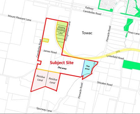
The estate is principally intended
for horse owners and enthusiasts, and seeks to leverage the proximity of Towac
Park. This has the support of Racing Orange, which views the concept as
consistent with their efforts to diversify Towac Park into a multi-purpose
equine use facility.
Initially the proposal lacked detail on how to ensure the
lots would be taken up by horse owners rather than generic large lot
residential development. Additionally, the route of the Southern Feeder Road
(SFR) needed to be better considered, with appropriate means to segregate horse
and vehicular traffic. Council resolved to provide in principle support,
subject to these matters being addressed and returned to Council for further
consideration.
Link To Delivery/OPerational Plan
The recommendation in this report relates to the
Delivery/Operational Plan strategy “7.1 Preserve - Engage with the
community to develop plans for growth and development that value the local
environment”.
Financial Implications
Nil
Policy and Governance Implications
Nil
|
Recommendation
1 That
Council support sending the planning proposal to the NSW Department of
Planning and Environment for a Gateway determination, subject to the proposed
1ha area being amended so as to also be set at 2ha.
2 That,
subject to any Gateway condition requirements, Council place the planning
proposal on public exhibition for a period of 28 days.
3 That
Council include the draft Development Control Plan provisions relating to
Animal Boarding or Training Establishments with any public exhibition of the
planning proposal.
4 That
subsequent to the public exhibition process, Council consider whether to
exclude any specific properties from the planning proposal.
|
further considerations
The recommendation of this
report has been assessed against Council’s other key risk categories and
the following comments are provided:
|
Political
|
The Southern Feeder Road (and the
Northern Distributor Road) were originally conceived of as forming a ring
road around Orange. This was later modified when a section of the route
parallel to Ploughmans Lane was abandoned, due in part to significant
resident objection. In more recent times Council has considered and rejected
relocation of the Orange Showground to Towac as part of a combined facility
model.
|
|
Environmental
|
The proposed lot sizes of 2ha do
not typically require provision of reticulated sewer/water. However, the
vision of an equine precinct suggests that generation, management and
disposal of horse manure could become significant.
|
|
Health and Safety
|
Creation of an equine estate
straddling the Southern Feeder Road requires separation of horse and
vehicular traffic for the safety of both horse riders and motorists.
Additionally, race meetings will continue to draw traffic from beyond the
immediate area. Clear messaging to alert such motorists to the presence of
horse riders will be needed in order to help calm traffic and reduce the risk
of alarming horses.
|
|
Stakeholders
|
Racing Orange was formed in 2011
after discussions between Racing NSW and Orange City Council aimed at
reinvigorating the sport at Towac Park. Additional horse owners in the
vicinity are likely to reinforce this objective. Managing expectations
between horse owning residents and the broader racing community will be
important.
Some landowners along Ploughmans
Lane within the nominated area have expressed a desire to be excluded from
the proposal and allowed to remain as they currently are.
|
|
Projects
|
The route of the Southern Feeder
Road traverses the precinct. Potential conflict between traffic
volumes/speeds and horse movements to and from Towac Racecourse needs to be
carefully managed. Potential solutions such as forming an underpass or
similar are likely to be required - a preliminary design and costing for this
option has now been provided.
|
SUPPORTING INFORMATION
Popular in the United States since they emerged in the
1970s, an Equine Precinct concept (also known as an equestrian community or
horse community) is a planned community where people live with horses on their
property within a rural or suburban context. Typically such a community would
have access to a range of facilities, such as shared trails and bridal paths
for pleasure riding through to equestrian arenas, and veterinary hospitals on
or near the site. Shared communal stables are sometimes provided, particularly
for estates with smaller lot sizes. While there are fewer examples in Australia
(such as Mornington in Victoria and Kembla Grange in Wollongong), a local
landowner has expressed interest in exploring the concept, particularly given
the proximity of their land to the Towac Park racecourse.
The landowner has also gained the support of some
surrounding residents in response to a staff request for this to occur.
However, some landowners (shown below) in Ploughmans Lane, whose land is
already of a size that would preclude any subdivision potential, have expressed
a desire to be excluded from the proposal. These landowners wish to remain in
their current zoning so as to avoid creating a perception in the market that
their homes can only be bought or sold by horse owning households.
Exclusion of the relevant section of Ploughmans Lane can be
achieved and would not undermine the equine precinct concept. A final decision
on whether to include or exclude all properties within the subject land can be
reserved until after a Gateway determination and formal public exhibition
period. This would ensure that all landowners have the opportunity to review
the full concept and seek independent advice. Ultimately, even if some or all
of the Ploughmans Lane properties were to be removed from the proposal, some
additional attention to buffer areas may be appropriate, but it would not be
fatal to the concept.
The proposal before Council has not indicated any particular
horse related embellishments within the estate other than provision of a shared
vehicle/bridal laneway that is intended to bring horse riders to a single underpass
crossing point with the Southern Feeder Road (SFR) route. Beyond this, the
proposal relies upon facilities at Towac Park to provide the attraction to
horse owners. The support of Racing Orange is therefore a key endorsement for
the viability of the concept.
The nominated lot sizes of 2ha would be sufficient for
property owners to erect modest stables and some room to graze. However, with
the proximity to the urban area of Orange consideration needs to be given to
how such an estate can successfully avoid a potential land use conflict between
horse owning residents and more generic ‘lifestyle’ residents who
may seek to buy into the estate and find some horse related odours
objectionable.
Supply and Demand
Rural residential sales data supplied by the proponent
indicates that the market share of large lot residential blocks has risen from
approximately 5% to as much as 25% in recent years (2014-April 2017). The
proposal notes that the available supply of such lots is tightening, with
limited supply remaining at Silverdown Way, Clifton Grove, Mullion Creek or
Windera.
The proposal includes an indicative layout for a total of 34
lots. This includes 13 existing dwellings, leaving a prospective yield of
21 new lots. This equates to approximately 2/3 of the number sold in 2016
and less than 1/2 of the number sold in 2015. However, it should be noted that
most large lot residences in Orange are not held by horse owners. Therefore the
estate is likely to represent a greater supply level if limited to the equine subsector.
Southern Feeder Road
In the 1980s Council planning established a route for a ring
road all the way around the City, however development in Ploughmans Valley
later resulted in part of the route along the western side of the City being
deleted. The remaining sections of the route became known as the Northern
Distributor Road (NDR) and the Southern Feeder Road (SFR). Of the two,
the NDR is intended to provide the primary route for through-traffic,
while both roads also provide a major route for moving local traffic around the
City. Location of the new hospital in Forest Road and the growing medical
precinct in that area will increase the significance of the SFR for both
internal and external traffic.
The current zoning for the SFR route (shown in yellow below)
ends at the southern end of Ploughmans Lane.

The unformed James Road covers part of the route, while the
western end of James Road may provide a connection further west to Canobolas
Road. This planning proposal requires consideration of the long term future of
the SFR and its role in the local traffic planning.
Presently the zoned route terminates where it meets
Ploughmans Lane. This implies that traffic from the western side of the City is
likely to use Ploughmans Lane as a connection through to the hospital/medical
precinct on Forest Road. It would also be possible to extend the corridor
through James Road to Canobolas Road, after which a further route could be
investigated to ultimately link with Cargo Road.
SFR Traffic Noise
Creation of an underpass for horse traffic to and from Towac
would involve installation of a box culvert across the route, with the SFR to
be ramped up and over the culvert. This would elevate SFR traffic for a short
section compared to natural ground level. Therefore design of this section of
the SFR may, dependent on anticipated traffic volumes, require a noise barrier
along one or both sides to limit acoustic impacts.
Traffic Generation Generally
The creation of 21 additional lots is unlikely to generate
significant volumes of localised traffic. The equine aspect of the proposal may
result in some additional movements for delivery of feed and transport of
horses, but this is still expected to be well within the capacity of the local
road network, especially given that the site will connect directly to
the SFR corridor.
The concern with the development as proposed is the conflict
between traffic and equine activities needing to cross the SFR corridor, either
on Ploughmans Road or James Road. In order to ensure public safety for both
activities, a suitable equine crossing, such as a cut and cover tunnel, would
be required as part of the development conditions.
Water Supply and Sewerage
Servicing
The proponent initially suggested connecting wastewater from
the estate to a package sewage treatment plant within Towac Park that could
then use the treated effluent to irrigate the racecourse area. Council’s
Water and Sewerage Strategic Manager did not support this concept for a number
of reasons:
· increased
operational maintenance costs associated with owning the asset;
· ongoing compliance
requirements associated with potential water quality and odour issues when
operating such a treatment system;
· public health and
environmental risks associated with using treated effluent for irrigation
purposes at the racecourse; and
· the availability
of other, more efficient servicing options.
The proposal was then amended from that originally proposed
and seeks a minimum lot size of 2ha for most of the land. Council’s
policy is that large lots of 2ha and above do not require reticulated sewer or
water and are generally suitable for onsite waste management.
A small portion to the eastern end of James Road was
proposed to be set at 1ha in size. Council’s ability to service these
lots would be limited in the short to medium term until such time as the
Shiralee area is more fully developed. Diverting resources to enable a one
property owner to achieve three extra lots is not considered to be a reasonable
use of public funds. Therefore it is recommended that Councils support for the
proposal be contingent upon all of the rezoned area (other than the residue
area to the south) being designated as a 2ha minimum lot size.
This can be revisited in the future once development of the
Shiralee area is more progressed which may create opportunities for services to
reach this area in a more efficient manner.
Social and Economic Impacts
The provision of a precinct aimed specifically at one
demographic may be regarded by some as exclusionary. However, Council has
periodically received enquiries and applications related to being able to keep
horses domestically on large lots in other estates such as Clifton Grove and
Silverdown Way. Providing a dedicated estate for the horse owning community
would reduce the risk of horse related complaints from non-horse owners -
admittedly such complaints have been minimal.
The proponent has now included a set of draft DCP provisions
for horse related Animal Boarding or Training Establishments. If adopted these
provisions will enable Council to provide consistent guidance to all horse
owners within the LGA, not just those within a dedicated equine precinct, to
reduce and manage potential impacts to neighbours.
Ecological
Impacts
The subject land is not identified as possessing any
significant ecological features or remnant habitat. As such, there are not
expected to be any negative impacts. DCP provisions have been drafted and
include a requirement for a minimum of one shade tree. Along with optional
windbreaks this may enhance the level of vegetation and provide some incidental
benefit to birdlife and small invertebrates.
Management of Waste (horse
manure)
The number of horses that would be anticipated is unlikely
to be significant. As an example, the Wollongong DCP governs the development of
Kembla Grange. It suggests that horse paddocks of 2,000m2 per horse
in area are generally sufficient to avoid over grazing - especially where
supplemental feeding is provided. Any excessive horse manure production,
although unlikely, could be sold into the local gardening market. Towac Park
accommodates a significant number of horses during race meetings and for
training - disposal of manure from Towac has not emerged as an issue.
Stormwater
By establishing an appropriate maximum stocking rate, horse
paddocks should not experience overgrazing, and therefore runoff water quantity
and quality should not be impacted. DCP provisions can also be prepared to
provide for settling ponds to further limit any contamination risk.
Preliminary Contamination
Investigation
Envirowest Consulting on behalf of the proponent undertook a
preliminary contamination investigation of the subject land dated 26 July 2017.
The investigation was limited to a desktop study, site walkover and review of
available history. No sampling or analysis was performed. The conclusion of the
investigation was that past orchard and cropping activities are likely to have
used pesticides over the area and that a soil sampling program should be
undertaken, particularly in relation to proposed building envelopes. It is
anticipated that a Gateway determination may require this analysis to be
undertaken prior to public exhibition. Should contamination be found,
remediation of affected land could be required during any subdivision process.
LEP Options
The proposal examined several possible methods of amending
Orange LEP 2011, these include:
· Extending the R5
Large Lot Residential zone – presumably with an appropriate minimum lot
size of 2ha.
· Amending the land
use table for both the R5 Large Lot Residential and RU1 Primary Production
zones to ensure that stables and supporting functions are permissible –
again presumably with an appropriate minimum lot size.
· Rezoning the site
to RU4 Primary Production – Small Lots zone. This zone has so far not
been adopted within the Orange LEP, and as such would allow Council to tailor
the zone objectives and range of uses permissible. This would help to reinforce
the intended role of the estate as an equine precinct and reduce the likelihood
of land use conflicts.
Additionally, a local clause could also be considered in
relation to domestic horse keeping. This issue has occasionally arisen on other
large lots around Orange, with prospective buyers wanting certainty about being
able to construct stables and/or what Council’s requirements would be.
These considerations will be determined through discussions with
NSW Planning and Environment.
STRATEGIC FRAMEWORK
Orange Sustainable Settlement Strategy (OSSS)
The site is identified as part of LU9 in the OSSS, which
nominates the area for urban development but was not anticipated to be required
in the life of the plan. In essence, the strategy views this and other land
units to the south and west as an overflow area that can be considered if the
demand for land is greater than had been anticipated. The supply and demand
figures provided in the planning proposal, while not extensive, can be regarded
as indicative of the overall level of activity, and do suggest that demand has
been stronger than the OSSS predicted.
Central West Orana Regional
Plan 2036
The regional plan contains a number of objectives and
strategies that are intended to guide the development of the region within the
State population forecasts. As a member council within the region, Council is
required to consider the intent and directions of the regional plan when
evaluating planning proposals.
In this respect the proposal notionally supports tourism
(Direction 4) by fostering development of horse related activities in a defined
precinct. Any increase to the local horse owning community will help to
underpin local equine events that may, in turn, attract visitors from beyond
the immediate area.
The proposal similarly supports equine related education and
training opportunities (Direction 6). An amendment to the LEP with
supporting DCP provisions would also foster greater land use compatibility
(Direction 12), in particular providing greater certainty of land use
(Direction 12.4) and provide guidance on sympathetic land use to reduce
land use conflicts (Direction 12.5).
The proposal also responds favourably to managing rural
residential development (Direction 28) in that the site is located close
to existing urban settlements, enabling efficient use of roads and social and
community infrastructure; and it is considered that horse owners are less
likely to conflict with agricultural land uses south and west of the site.
Section 9.1 Directions by the
Minister (formerly Section 117 Directions)
The planning proposal has examined all directions and given
specific responses to directions:
1.2 Rural
Zones
1.3 Mining
Petroleum Production and Extractive Industries
1.5 Rural
Lands
2.3 Heritage
Conservation
3.1 Residential
Zones
3.2 Caravan
Parks and Manufactured Home Estates
3.4 Integrating
Land Use and Transport
5.10 Implementation
of Regional Plans
6.1 Approval
and Referral Requirements
6.2 Reserving
Land for Public Purposes
6.3 Site
specific Provisions
The rationale outlined in each response has been reviewed
and is considered to be satisfactory and supportable.
Development Control Plan
If the proposal proceeds, it is considered that the Orange
DCP as it applies to this area will need to be amended as well to provide at
least the following:
· a 20m setback for
all buildings from both James Road and Ploughmans Lane. This will help to
preserve design options for the long term future of the SFR;
· provision for a
future horse underpass to link Towac Park with the equine precinct at the
developer’s expense;
· a horse friendly
laneway network designed to enable all horse riders to move between the
allotments and Towac Park without conflicting with the SFR or other local
traffic;
· a requirement that
the site design of all homes and outbuildings must retain the ability to locate
stables and yard sufficient to maintain at least one horse; and
· additional
requirements for the location of stables and horse yards, maximum stocking
rates and any other animal welfare issues.
The Wollongong DCP example contains provisions for Animal
Boarding or Training Establishments – Horse Breeding or Training that
sets out a range of factors that could be adapted to conditions in Orange.
These include:
· minimum 2,000m2
paddock size per horse, with a preference for 1ha or more
· setbacks for
stable buildings to preserve amenity
· minimum dimensions
for stables
· material
requirements for masonry construction to 1.2m in height – lighter
materials being more susceptible to damage from horse kicks
· impervious
flooring materials to facilitate cleaning
· conveyance of
stormwater runoff into drainage systems and/or water troughs
· height and
placement of feeder and water troughs to reduce fouling
· shade trees in
horse paddocks and appropriate horse standard fencing to be of post and rail
construction; and
· liquid and solid
waste collection and treatment requirements.
Preliminary Underpass Costing
At the 3 April 2018 meeting Council required that a
preliminary costing of the proposed underpass solution be provided. The
intention for this request was to ascertain whether the cost of such works
would be feasible given the relatively minor lot yield from the precinct across
which the cost could be spread. The preliminary figures provided indicates a
total cost of $177,136.41 (inclusive of GST but excluding any contingency
amount). Assuming a yield of 21 additional lots, as indicated in the conceptual
layout, this equates to a cost burden of $8,435.07 per additional lot. A recent
search of land prices for 2ha blocks near Orange indicates a price range from
$300,000 and above. The proximity of the site to Orange suggests that the
underpass costs can be reasonably borne by the proposed estate.
Due to the fragmented ownership pattern of the site it is
unlikely to be developed by a single developer. Cost sharing mechanisms will
need to be considered, potentially including an update to the Development
Contributions Plan, voluntary planning agreements, or similar. This issue can
be further investigated while seeking a Gateway determination and during any
public exhibition process.
Conclusion
The concept outlined in the planning proposal is regarded as
having merit and is located in an appropriate location, particularly given the
relation of Towac Park. At the 3 April 2018 meeting Council requested
additional material be provided before further consideration would be
undertaken. The proponent has now supplied additional information (attached to
this report).
In the interim, three landowners within the subject site
area as defined by the proponent have contacted Council requesting to be
excluded from the proposal. Concerns expressed include a view that the proposal
may hinder the marketability or resale potential of existing homes by creating
a perception that only horse owners are allowed to buy properties in the
precinct.
This is not correct, once a title exists it may be freely
traded and Council has no involvement in the sale process. Additionally, even
if Council attempted to impose such a restriction, any existing dwelling would
automatically accrue existing use rights, enabling it to be maintained in
perpetuity. However, it is acknowledged that the properties concerned do not
stand to materially benefit from the planning proposal as they are already at
or below the 2ha size and will therefore not obtain any subdivision
potential. It may therefore be appropriate to consider amending the precinct
area after the exhibition process.
Attachments
1 Submissions,
D18/40476⇨
2 Concept
Plans, D18/40477⇨
3 Preliminary
Contamination Investigation - Envirowest, D18/40238⇨
4 Proposed
Amendments to Orange LEP 2011 written instrument, D18/40253⇨
5 Planning
Proposal - supporting information, D18/40259⇨
6 Planning
Proposal - formal draft, D18/40256⇨
7 Draft
Development Control Plan - equine keeping provisions, D18/40311⇨
8 Preliminary
Underpass Costing, D18/40313⇨
2.11 Draft
Enforcement Policy
RECORD
NUMBER: 2018/710
AUTHOR: David
Waddell, Director Development Services
EXECUTIVE Summary
Council staff have prepared a Draft Enforcement Policy for
Council’s consideration and public exhibition. This policy aligns with
the Environment Planning and Assessment Act, the Protection of the
Environment Operations Act and other guidance documents.
The attached Draft Enforcement Policy as drafted will guide
staff, Council and developers in enforcement across Orange.
Link To Delivery/OPerational Plan
The recommendation in this report relates to the
Delivery/Operational Plan strategy “17.1 Collaborate - Provide
representative, responsible and accountable community governance”.
Financial Implications
The financial implications will depend on the approach
adopted by the Council. It is estimated that a strict liability approach to
enforcement will result in the need for a significant increase in
ratepayer’s fund to be applied to prosecution and enforcement of breaches
and a reduction in development application processing times. A risk-based
approach, as set out in this draft, is expected to maintain expenditure at
levels broadly consistent with the current approach and with marginal impacts
on development application processing. However, expenditure may increase
in some years where serious non-compliance increases or if Council changes its
risk tolerance. It is anticipated that the new approach, if approved,
will be supported by a series of Factsheets on the web site to educate
developers and the community about the Council’s approach and will
contribute over time to a reduction in non-compliance issues and community
concern.
Policy and Governance Implications
Staff will publically exhibit the attached Draft Enforcement
Policy then bring a report and amended policy back to Council depending on the
nature of submissions received.
|
Recommendation
That Council endorses the attached Draft Enforcement
Policy for public exhibition for a period of 28 days.
|
further considerations
Consideration has been given to the recommendation’s
impact on Council’s service delivery; image and reputation; political;
environmental; health and safety; employees; stakeholders and project
management; and no further implications or risks have been identified.
Dependent on the approach adopted by Council there are
resourcing implications within the Development Service Division, which may
include the need to increase processing times of development applications.
SUPPORTING INFORMATION
The Council is responsible for defining the overall policy approach
to development and enforcement on behalf of the community. When a new
Council is elected, policies are systemically reviewed to determine if they
continue to reflect the collective view of elected Councillors and the best
interests of the community and economic development.
The Council’s approach to enforcement over the last
number of years has been to work with developers where mistakes or
errors have been made with respect to developments to seek to resolve the
issues cost-effectively, rather than commence legal action as a first
option. The aim of the approach has been to ensure both compliance and
that ratepayer’s money is not expended unnecessarily on costly litigation
and enforcement action where a reasonable outcome can be obtained for the community
through a negotiated approach. This approach has been consistent with the
positive view towards development taken by previous Councils which aimed to
ensure that Orange is seen as an attractive and supportive place to invest in the
economic growth and development of the City.
Where necessary, Council does commence enforcement action
against developers in Orange under the Protection of the Environment
Operations Act and Environmental Planning and Assessment Act,
particularly for serious or continued breaches. Examples include illegal
earthworks in the Hill Street area, illegal earth shaping in the Gorman Road
area, illegal works in the Occidental Hotel and Hotel Orange, illegal works on
the Officeworks site (by the developer), and 47 Byng Street (Byng Street
Café) for operations outside the consent. Fines are usually levied after
numerous warnings have been issued and gone unheeded.
A good example of Council’s historical and current
approach can be seen in the Royal Hotel case of 2007 where the glass
heritage tiles were removed from the Hotel without consent. Whilst the loss of
the heritage tiles was irreversible, rather than prosecute the owner Council
resolved to allow the matter to be resolved via a development application and a
level of restoration, with no penalty applied. In some Local Government Areas
this would have resulted in instant fines or Court action.
The Kurim shops issue is one with a long history. Council
issued demolition orders which were resisted by the landowner. Given this resistance
and the significant works required by the Orders, Council eventually sought and
gained demolition orders from the Land and Environment Court to protect
Council's interests – the demolition was completed after ten years of
process.
Subsequent to DA 222/2015(1) for a Chemist’s Warehouse
in Summer Street, the applicant has carried out illegal signage works,
resulting in signage significantly different to that approved. Two sets of
orders and warnings were issued without adequate response until finally the
owner complied.
Prior to the approval of DA 259/2017(1), the owner of the
Carrington Hotel in Byng Street carried out works to render the building safe
and to stop further decay. In addition, other works were carried out that might
be interpreted as premature and thus without consent.
Prior to lodgement of the development application, the new
owner and developer of 62 Byng Street, Orange carried out works to render
the house safe and to stop further decay. Again, other works were carried out
that might be interpreted as premature and without consent.
Highland Heritage has carried out significant building works
without consent as part of its expansion plans. These illegal works were
stopped as soon as they came to the attention of staff.
Two development applications were recently before Council
for potential illegal occupation of business premises. Both were given approval
retrospectively by Council without business discontinuity or fines.
The current activity around the old RMS site in Leewood is
another example of illegal development, including tree removal. Staff attempts
to work with the developer have only recently been heeded, with a development
application now received.
In general terms, illegal development including demolition
is often undertaken in ignorance or for reasons thought time-critical by
developers/builders onsite. In most cases the impact on heritage items or
streetscape is minimal, however in some cases the impact has been significant
and irreversible.
A new Draft Enforcement Policy has been prepared for
Council’s consideration and public exhibition. The intent of the Policy
is to:
1. Establish
a new risk-based decision making framework to inform enforcement (e.g. applying
enforcement processes where there is an imminent risk to public safety compared
for example to a more negotiated approach to lower risk issues such as when a
resident constructs an addition that would otherwise comply with development
controls but has failed to follow the process properly);
2. Educate
the community and developers about the Council’s approach to reduce
instances of non-conformance.
The approach aims to balance the Council’s
responsibility to ensure compliance with the law, with the Council’s
obligation to manage ratepayers’ money sustainably and for the benefit of
the community as a whole consistent with the Local Government Act.
This policy aligns with the Environment Planning and
Assessment Act, the Protection of the Environment Operations Act
and other guidance documents.
Attachments
1 Draft
Enforcement Policy, D18/40744⇨
2.12 Applications
to Burn Vegetation
RECORD
NUMBER: 2018/1945
AUTHOR: Mark
Hodges, Manager Building and Environment
EXECUTIVE Summary
Council is in receipt of 3 applications to burn piles of
vegetation on the edges of the City. Since 2002, the burning of
vegetation within the Orange City Council area has been prohibited under NSW
Legislation (Protection of the Environment Operations (Clean Air) Regulation).
In practice, staff have consistently implemented this
legislation with an interest in protecting the air quality of the City.
Approvals have been granted over the years for burning of vegetation where the
material is legitimately linked to agricultural activities or where there is an
environmental health risk arising from the vegetation. This consistent
approach has affectively restricted the burning vegetation within the urban
areas of the City.
This approach has ensured that residents of the City are not
exposed to excessive quantities of smoke that can cause health and safety
issues (particularly to those residents with breathing issues) or to road
users.
Applications have been received from:
1. S
& V Conran of 36 Witton Place;
2. J
Bale of Wentworth Golf Club; and
3. J
Livingstone 136 Kearneys Drive (adjacent to the NDR)
36 Witton Place has two piles of pine tree waste following
the removal of radiata pines whilst developing the site 12 years ago; Wentworth
Golf Club has a number of large piles of vegetation from trimmings associated
with maintaining trees on the golf club site; and 136 Kearneys Drive relates to
a request for consideration of an option for disposal of an existing stand of
pine trees as part of the development of the land.
Link To Delivery/OPerational Plan
The recommendation in this report relates to the
Delivery/Operational Plan strategy “8.2 Preserve - Develop and promote
initiatives to reduce water, energy and waste in consultation with the
community”.
Financial Implications
Nil to Council.
Policy and Governance Implications
No real Policy implications, as this issue has simply been
managed using the State legislation, rather than utilising a local
policy. Departure from the consistent approach may cause confusion and
set a precedent.
|
Recommendation
That the applications to burn vegetation be refused and
the applicants be advised to consider alternative approaches, including
ongoing measures, to manage the vegetation stored on their sites.
|
further considerations
Consideration has been given to the recommendation’s
impact on Council’s service delivery; image and reputation; political;
environmental; health and safety; employees; stakeholders and project
management; and no further implications or risks have been identified, beyond
those detailed in the Supporting Information section of this report.
SUPPORTING INFORMATION
The burning of vegetation within the
Orange City Council area is prohibited under the Protection of the Environment
Operations (Clean Air) Regulation 2010. This prohibition has been in
place in Orange since 2002.
Exemptions and approvals to burn
vegetation have been issued in this time in areas outside the urban development
areas where it was considered smoke would not adversely impact upon residents,
whether that be through health issues (such as asthma) or nuisance (such as
smoke filling houses or impacting on washing etc.). These approvals and
exemptions have centred on agricultural activities. A consistent approach
has been taken to refusing requests of developers wishing to burn cleared
vegetation, as the driver here is mainly financial. In these cases,
advice has been given to find other avenues of reusing or removing the
vegetation such as chipping or reuse of logs for native fauna refuges.
A long history has been had with the
three golf clubs in the City, who invariably due to their size, collect
vegetation as part of their normal maintenance activities. All three
clubs over the years have been requested to find alternatives (such as regular
chipping) rather than storing the material. It is understood the costs of
chipping for the clubs is significant. The application from Wentworth
Golf Club has indeed indicated that the costs of chipping would be
prohibitive. A number of fires have occurred illegally over the years in
piles of vegetation, including on some of the golf club sites. When such
fires occur, this results in the need for the fire brigade(s) to respond and
extinguish the illegal fires, thus impacting on their resources.
With the growth of the City, it has
become very difficult to consider the burning of vegetation as an appropriate
option of disposal of green waste material. Indeed the consistent
approach by staff, would suggest that staff can and should only recommend to
Council that the three applications should be refused.
It is noted that one of the three
golf clubs (Orange Golf Club) has taken on board the requests in the past to
utilise alternative solutions. It is understood that that Club reuse the
material elsewhere. The other two clubs in town have continued to store
the green waste material and currently have large quantities stored onsite.
From discussing the matter with the
Rural Fire Service, whilst the staff recommendation remains that the
applications should be refused, specific climatic conditions and constant
onsite management, impacts of one off burns could be somewhat minimised, should
Council be of the mind to approve the applications.
However should Council approve the
applications, this may set a precedent and result in other applications to burn
material in town or in close proximity to sensitive sites (such as the
Hospital). Such a precedent would undermine the consistent approach
applied since 2002.
To this end, whilst Council has not
received an application, the RFS was recently contacted by Spotless, who
maintain the Hospital grounds requesting permission to burn some vegetation in
that area. Additionally whilst an application has not been received
for the Ex Services Golf Club, as mentioned above there is a reasonable amount
of material stored on the site that may be the subject of future requests.
In accordance with the Environment
Operations (Clean Air) Regulation 2010, any approval must give consideration
to:
a) The
impact on regional air quality and amenity,
b) The
impact on local air quality and amenity,
c) The
feasibility of re-use, recycling or other alternative means of disposal, and
d) Any
opinions of the sector of the public likely to be affected by the proposed
approval.
Planning and
Development Committee 14
August 2018
2 Closed Meeting
– See Closed Agenda
The General Manager will advise the Planning and Development
Committee if any written submissions have been received relating to any item
advertised for consideration by a closed meeting of Planning and Development
Committee.
The Chairperson will extend an invitation to any member of
the public present at the meeting to make a representation to Planning and
Development Committee as to whether the meeting should be closed for a
particular item.
In accordance with the Local Government Act 1993, and the
Local Government (General) Regulation 2005, in the opinion of the General
Manager, the following business is of a kind as referred to in Section 10A(2)
of the Act, and should be dealt with in a Confidential Session of the Planning
and Development Committee meeting closed to the press and public.
|
Recommendation
That Planning and Development Committee adjourn into a
Closed Meeting and members of the press and public be excluded from the
Closed Meeting, and access to the correspondence and reports relating to the
items considered during the course of the Closed Meeting be withheld unless
declassified by separate resolution. This action is taken in accordance with
Section 10A(2) of the Local Government Act, 1993 as the items listed come
within the following provisions:
3.1 DA
Legal Cost Award Update (Strictly Confidential and Privileged)
This item is classified CONFIDENTIAL under the
provisions of Section 10A(2) of the Local Government Act 1993, which permits
the meeting to be closed to the public for business relating to (e)
information that would, if disclosed, prejudice the maintenance of the law
and (g) advice concerning litigation, or advice that would otherwise be
privileged from production in legal proceedings on the ground of legal
professional privilege.
|
Planning and
Development Committee 14
August 2018
3.1 DA
Legal Cost Award Update (Strictly Confidential and Privileged)
RECORD
NUMBER: 2018/1815
AUTHOR: David
Waddell, Director Development Services
Reason for
Confidentiality
This item is classified CONFIDENTIAL
under the provisions of Section 10A(2) of the Local Government Act 1993, which
permits the meeting to be closed to the public for business relating to (e)
information that would, if disclosed, prejudice the maintenance of the law and (g)
advice concerning litigation, or advice that would otherwise be privileged from
production in legal proceedings on the ground of legal professional privilege.