Planning and Development
Committee
Agenda
7 November 2019
Notice is hereby given, in
accordance with the provisions of the Local Government Act 1993 that a Planning and Development Committee meeting of ORANGE CITY COUNCIL
will be held in the Council Chamber,
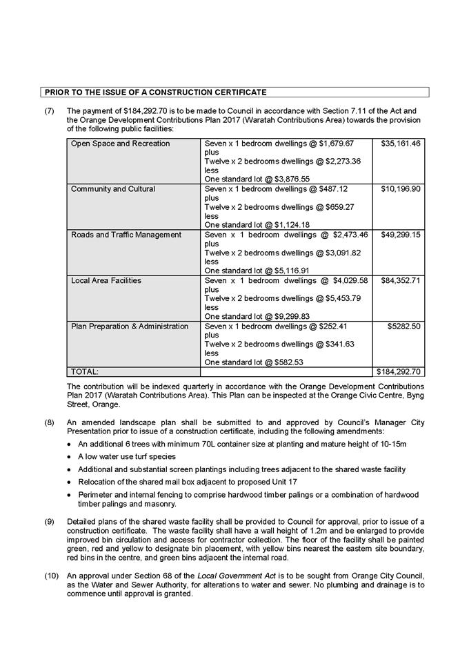
Civic Centre, Byng Street, Orange on Thursday, 7 November
2019.
David
Waddell
Chief Executive Officer
For apologies please
contact Administration on 6393 8218.
1 Introduction
1.1 Declaration
of pecuniary interests, significant non-pecuniary interests and less than
significant non-pecuniary interests
The
provisions of Chapter 14 of the Local Government Act, 1993 (the Act)
regulate the way in which Councillors and designated staff of Council conduct
themselves to ensure that there is no conflict between their private interests
and their public role.
The
Act prescribes that where a member of Council (or a Committee of Council) has a
direct or indirect financial (pecuniary) interest in a matter to be considered
at a meeting of the Council (or Committee), that interest must be disclosed as
soon as practicable after the start of the meeting and the reasons given for
declaring such interest.
As
members are aware, the provisions of the Local Government Act restrict any
member who has declared a pecuniary interest in any matter from participating
in the discussion or voting on that matter, and requires that member to vacate
the Chamber.
Council’s Code of Conduct provides that if members
have a non-pecuniary conflict of interest, the nature of the conflict must be
disclosed. The Code of Conduct also provides for a number of ways in which a
member may manage non pecuniary conflicts of interest.
|
Recommendation
It is recommended that Committee Members now disclose any
conflicts of interest in matters under consideration by the Planning and
Development Committee at this meeting.
|
2 General
Reports
2.1 Items
Approved Under the Delegated Authority of Council
RECORD
NUMBER: 2019/2111
AUTHOR: Paul
Johnston, Manager Development Assessments
EXECUTIVE Summary
Following is a list of development applications approved
under the delegated authority of Council.
Link To Delivery/OPerational Plan
The recommendation in this report relates to the
Delivery/Operational Plan strategy “7.1 Preserve - Engage with the
community to develop plans for growth and development that value the local
environment”.
Financial Implications
Nil
Policy and Governance Implications
Nil
|
Recommendation
That Council resolves to acknowledge the information
provided in the report by the Manager Development Assessments on Items
Approved Under the Delegated Authority of Council.
|
further considerations
Consideration has been given to the
recommendation’s impact on Council’s service delivery; image and
reputation; political; environmental; health and safety; employees;
stakeholders and project management; and no further implications or risks have
been identified.
|
Reference:
|
DA 277/2013(3)
|
Determination Date
|
14 October 2019
|
|
PR Number
|
PR126464
|
|
Applicant/s:
|
Mr D M
Brus
|
|
Owner/s:
|
Orange City Council
|
|
Location:
|
Lot 200 DP 1195298 - 136 Aerodrome
Road, Huntley
|
|
Proposal:
|
Modification to development consent
- air transport facility (hangar). The modification seeks to increase the
footprint and height of the hangar as well as alterations to the previously
approved eastern elevation and internal layout, and constructing the approved
skillion during Stage 1 rather than Stage 2.
|
|
Value:
|
$48,000 (being the same value as
the original development)
|
|
Reference:
|
DA 233/2015(2)
|
Determination Date
|
6 October 2019
|
|
PR Number
|
PR4763
|
|
Applicant/s:
|
Eastern Developments (NSW) Pty Ltd
|
|
Owner/s:
|
Eastern Developments (NSW) Pty Ltd
|
|
Location:
|
Lot 1 DP 581736 - 98 Gorman Road,
Orange
|
|
Proposal:
|
Modification to development consent
- subdivision (37 lot residential plus public open space and drainage
reserves). The modified proposal seeks to address anomalies that have arisen
due to the conflict in the stamped DA plans; and replace building envelope
requirements with maximum site coverage requirements for some lots. The
development remains substantially the same for which consent was granted and
will not generate additional impacts above those considered for the original
development.
|
|
Value:
|
$0 (being the same value as the
original development)
|
|
Reference:
|
DA 47/2018(3)
|
Determination Date
|
10 October 2019
|
|
PR Number
|
PR18108
|
|
Applicant/s:
|
Hort Enterprises
|
|
Owner/s:
|
Hort Family Properties Pty Ltd
|
|
Location:
|
Lot 20 DP 1022526 - 258 Clergate
Road, Orange
|
|
Proposal:
|
Modification to development consent
- general Industry (alterations and additions to existing building). The
modified proposal is to reorientate the previously approved office building
by 90o and change the position of the concrete ramp which connects
the office building to the existing factory. The repositioned office building
will retain the same footprint, and the internal layout will remain unchanged
from what was previously approved.
|
|
Value:
|
$0
|
|
Reference:
|
DA 178/2018(3)
|
Determination Date
|
2 October 2019
|
|
PR Number
|
PR26723
|
|
Applicant/s:
|
MAAS
Group Properties Westwinds Pty Limited
|
|
Owner/s:
|
MAAS
Group Properties Westwinds Pty Limited
|
|
Location:
|
Lot 81 DP 1202584, Lot 6 DP 1065578
- 386 Molong Road Orange, Northern Distributor Road, Orange.
|
|
Proposal:
|
Modification to development consent
- subdivision (102 lots, comprising 94 residential lots, 6 open space lots,
and 2 residue lot). The modification seeks to remove staging from the
consent; remove the need for the creation of super-lots; decrease residential
lot yield by two (2); introduce an additional residual non-development lot;
vary the intersection layout with the NDR; alter some lot shapes and sizes
and vary fencing requirements along the creek land.
|
|
Value:
|
$0 (being the same value as the
original development)
|
|
Reference:
|
DA 413/2018(2)
|
Determination Date
|
30 September 2019
|
|
PR Number
|
PR28340
|
|
Applicant/s:
|
Mr I Y Zhang
|
|
Owner/s:
|
I J Zhang Pty Limited
|
|
Location:
|
Lot 300
DP 1248942 – 31A and 31B Clem McFawn Place and 87 Kearneys Drive,
Orange (formerly known as Lot 300 DP 1248942 – 31 Clem McFawn Place and
87 Kearneys Drive, Orange)
|
|
Proposal:
|
Modification to development consent
- multi dwelling housing (one existing dwelling and two new dwellings) and
subdivision (three lot residential Torrens). The two dwellings subject of the
original application have been constructed as three-bed dwellings, where they
were approved as two-bed dwellings. Some internal changes to the dwellings
have also been made to facilitate this change, and Dwelling 1 has an
additional window on the southern elevation.
|
|
Value:
|
$280,000 (being the same value as
the original development)
|
|
Reference:
|
DA 1/2019(2)
|
Determination Date
|
30 September 2019
|
|
PR Number
|
PR27987
|
|
Applicant/s:
|
Orange City Council
|
|
Owner/s:
|
Orange City Council
|
|
Location:
|
Lot 804 DP 1240445 - 36 Astill
Drive, Orange
|
|
Proposal:
|
Modification to development consent
- animal shelter. The modification seeks to alter the position of the
previously approved building on the allotment.
|
|
Value:
|
$1,400,000 (being the same value as
the original development)
|
|
Reference:
|
DA 150/2019(2)
|
Determination Date
|
26 September 2019
|
|
PR Number
|
PR25812
|
|
Applicant/s:
|
Mr I A K and Mrs L J Shilling
|
|
Owner/s:
|
Mr I A K and Mrs L J Shilling
|
|
Location:
|
Lot 8 DP 1176470 - 1 Atlas Place,
Orange
|
|
Proposal:
|
Modification to development consent
- vehicle repair station (additions to existing building). The modification
seeks to amend the design of the retaining wall so that it is clear of the
both the stormwater and sewer easements on the site.
|
|
Value:
|
$100,000 (being the same value as
the original development)
|
|
Reference:
|
DA 164/2019(1)
|
Determination Date
|
27 September 2019
|
|
PR Number
|
PR5693
|
|
Applicant/s:
|
Mr B A and Mrs R R Westgeest
|
|
Owner/s:
|
Mr B A and Mrs R R Westgeest
|
|
Location:
|
Lot 22 DP 511742 - 7 Johnstone
Street, Orange
|
|
Proposal:
|
Demolition and dwelling alterations
and additions
|
|
Value:
|
$360,000
|
|
Reference:
|
DA 208/2019(1)
|
Determination Date
|
20 September 2019
|
|
PR Number
|
PR11580
|
|
Applicant/s:
|
CPRAM
Investments Pty Ltd
|
|
Owner/s:
|
Alceon Group Pty Limited
|
|
Location:
|
Lot
564 DP 776383 - 212-220 Summer Street and Lot 1 DP 1246899 -
220A Summer Street, Orange
|
|
Proposal:
|
Restaurant
or café (first use and fit-out) and business identification signage
(tenancy 41)
|
|
Value:
|
$600,000
|
|
Reference:
|
DA 224/2019(1)
|
Determination Date
|
26 September 2019
|
|
PR Number
|
PR19433
|
|
Applicant/s:
|
Don’t
Tell Jo Pty Ltd
|
|
Owner/s:
|
Messrs
N J and P N and Mrs J F Farrell
|
|
Location:
|
Lot 104
DP 1067744 - 5 Ralston Drive, Orange
|
|
Proposal:
|
General
industry (3 industrial buildings containing 18 units) and subdivision
(18 lot Strata)
|
|
Value:
|
$1,430,000
|
|
Reference:
|
DA 227/2019(1)
|
Determination Date
|
24 September 2019
|
|
PR Number
|
PR10852
|
|
Applicant/s:
|
D and T
Brown
|
|
Owner/s:
|
GTKC
Holdings Pty Ltd
|
|
Location:
|
Lot 1 DP
16593 - 116 Sampson Street, Orange
|
|
Proposal:
|
Health
consulting rooms (change of use and site works) and business identification
sign (pylon sign)
|
|
Value:
|
$100,000
|
|
Reference:
|
DA 228/2019(1)
|
Determination Date
|
30 September 2019
|
|
PR Number
|
PR8135
|
|
Applicant/s:
|
Mr T D and Mrs S A Watson
|
|
Owner/s:
|
Mr T D and Mrs S A Watson
|
|
Location:
|
Lot 1 DP 780993 - 39 McLachlan
Street, Orange
|
|
Proposal:
|
Demolition (part dwelling and tree
removal), dwelling (alterations and additions) and secondary dwelling
|
|
Value:
|
$185,000
|
|
Reference:
|
DA 233/2019(1)
|
Determination Date
|
30 September 2019
|
|
PR Number
|
PR15084
|
|
Applicant/s:
|
Appledale Processors Co-Operative
Pty Limited
|
|
Owner/s:
|
Appledale Processors Co-Operative
Pty Limited
|
|
Location:
|
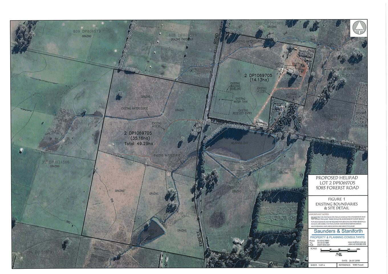
Lot 137 DP 750387 – Hiney
Road, Orange
|
|
Proposal:
|
Intensive plant agriculture
|
|
Value:
|
$120,000
|
|
Reference:
|
DA 234/2019(1)
|
Determination Date
|
20 September 2019
|
|
PR Number
|
PR13284
|
|
Applicant/s:
|
Mr R and Mrs J Sinclair
|
|
Owner/s:
|
Mr R T Sinclair and Miss J M
Fardell
|
|
Location:
|
Lot 1 DP 826200 - 166 Murphy Lane,
Orange
|
|
Proposal:
|
Dwelling, attached garage and
secondary dwelling
|
|
Value:
|
$550,000
|
|
Reference:
|
DA 240/2019(1)
|
Determination Date
|
15 October 2019
|
|
PR Number
|
PR10126
|
|
Applicant/s:
|
Wentworth Golf Club
|
|
Owner/s:
|
Wentworth Golf Club
|
|
Location:
|
Lot 199 DP 756899, Lot 181 DP
1154782 – 130 Ploughmans Lane, Orange
|
|
Proposal:
|
Registered club (ancillary
buildings), recreation facility (outdoor)
|
|
Value:
|
$150,000
|
|
Reference:
|
DA 242/2019(2)
|
Determination Date
|
15 October 2019
|
|
PR Number
|
PR20379
|
|
Applicant/s:
|
Mrs E A Hopwood
|
|
Owner/s:
|
Orange City Council
|
|
Location:
|
Lot 102 DP 1072260 – 142-148
March Street, Orange
|
|
Proposal:
|
Modification of development consent
- community facility (change of use from office). The modification seeks to
alter Condition (18) relating to the hours and days of operation of the food
collection and distribution component of the community facility.
|
|
Value:
|
$0 (being the same value as the
original development)
|
|
Reference:
|
DA 271/2019(1)
|
Determination Date
|
30 September 2019
|
|
PR Number
|
PR12946
|
|
Applicant/s:
|
designs@m
|
|
Owner/s:
|
Orange City Council
|
|
Location:
|
Lot 54 DP 812701 - 2-4 Yarrawong
Place, Orange
|
|
Proposal:
|
Centre based child care facility
(alterations and additions to existing building)
|
|
Value:
|
$110,000
|
|
Reference:
|
DA 284/2019(1)
|
Determination Date
|
15 October 2019
|
|
PR Number
|
PR18279
|
|
Applicant/s:
|
Mr P Layton
|
|
Owner/s:
|
Astill Pty Ltd
|
|
Location:
|
Lot 31 DP 1035913 - 25 Astill
Drive, Orange
|
|
Proposal:
|
Warehouse or distribution centre
|
|
Value:
|
$800,000
|
|
Reference:
|
DA 292/2019(1)
|
Determination Date
|
9 October 2019
|
|
PR Number
|
PR14058
|
|
Applicant/s:
|
A-Tech Extrusion Systems Pty Ltd
|
|
Owner/s:
|
JCI Group Pty Ltd
|
|
Location:
|
Lot 2 DP 544083, Lot 501 DP 1122616
and, Lot 11 DP 575694 - 5-17 and 46‑60 Edward Street, Orange
|
|
Proposal:
|
Warehousing and storage, and
general industry (excavation, additions and alterations for existing
buildings 1 and 2)
|
|
Value:
|
$200,000
|
|
Reference:
|
DA 296/2019(1)
|
Determination Date
|
3 October 2019
|
|
PR Number
|
PR11580
|
|
Applicant/s:
|
JNS Project Solution Pty Ltd
|
|
Owner/s:
|
Alceon Group Pty Limited
|
|
Location:
|
Lot 564 DP 776383 - 212-220 Summer
Street, Orange (tenancy 39 – Angus and Coote)
|
|
Proposal:
|
Shop (first use and fit-out) and
business identification signage
|
|
Value:
|
$150,000
|
|
Reference:
|
DA 297/2019(1)
|
Determination Date
|
26 September 2019
|
|
PR Number
|
PR11580
|
|
Applicant/s:
|
Mr J Lin
|
|
Owner/s:
|
Alceon Group Pty Limited
|
|
Location:
|
Lot 564 DP 776383 and Lot 1 DP
1246899 - 212-220 and 220A Summer Street, Orange (tenancy 40 – Yoshi
Sushi)
|
|
Proposal:
|
Restaurant or café (first
use fit-out) and business identification signage
|
|
Value:
|
$200,000
|
|
Reference:
|
DA 311/2019(2)
|
Determination Date
|
22 October 2019
|
|
PR Number
|
PR11580
|
|
Applicant/s:
|
Alceon Group Pty Limited
|
|
Owner/s:
|
Alceon Group Pty Limited
|
|
Location:
|
Lot 564 DP 776383 - 212-220 Summer
Street, Orange (tenancy 35 – Barber Industries).
|
|
Proposal:
|
Modification of development consent
- business premises (first use and fit‑out) and business identification
signage The modified proposal seeks to modify the shopfront and remove the
rear shampoo chair.
|
|
Value:
|
$0
|
|
Reference:
|
DA 320/2019(1)
|
Determination Date
|
25 September 2019
|
|
PR Number
|
PR11580
|
|
Applicant/s:
|
Mr L G Bargwanna
|
|
Owner/s:
|
Alceon Group Pty Limited
|
|
Location:
|
Lot 564 DP 776383 - 212-220 Summer
Street, Orange (tenancy K1- The Alley)
|
|
Proposal:
|
Restaurant or cafe (change of use
and fit-out) and business identification signage
|
|
Value:
|
$91,256
|
|
Reference:
|
DA 328/2019(1)
|
Determination Date
|
27 September 2019
|
|
PR Number
|
PR11580
|
|
Applicant/s:
|
Australian Professional Shopfitters
|
|
Owner/s:
|
Alceon Group Pty Limited
|
|
Location:
|
Lot 564 DP 776383 - 212-220 Summer
Street, Orange (tenancy 31 - Adairs)
|
|
Proposal:
|
Shop (first use and fit-out) and
business identification signage
|
|
Value:
|
$95,000
|
|
Reference:
|
DA 350/2019(1)
|
Determination Date
|
21 October 2019
|
|
PR Number
|
PR27531
|
|
Applicant/s:
|
Mrs K L Blacklow
|
|
Owner/s:
|
Eastern Developments Pty Ltd
|
|
Location:
|
Lot 200 DP 1225088 - Lease Area 2a
- 132 Kite Street, Orange
|
|
Proposal:
|
Shop (first use and fit-out)
|
|
Value:
|
$0
|
TOTAL NET* VALUE OF ALL
DEVELOPMENTS APPROVED UNDER DELEGATED AUTHORITY IN THIS PERIOD: $5,141,256.00
*
Net value relates to the value of modifications. If modifications are
the same value as the original DA, then nil is added. If there is a plus/minus
difference, this difference is added or taken out.
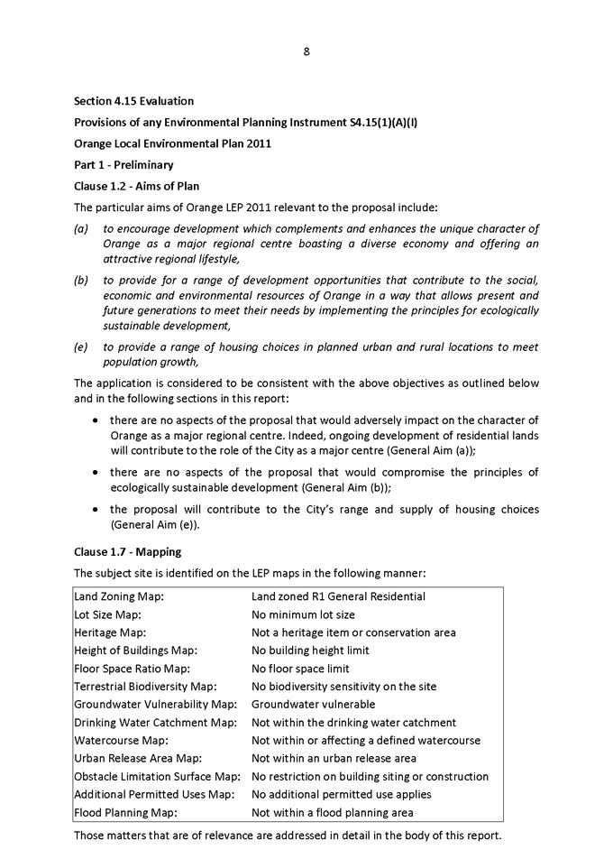
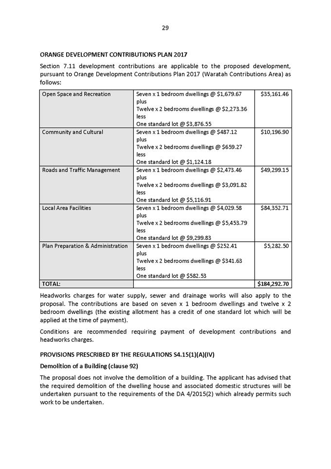
2.2 Development
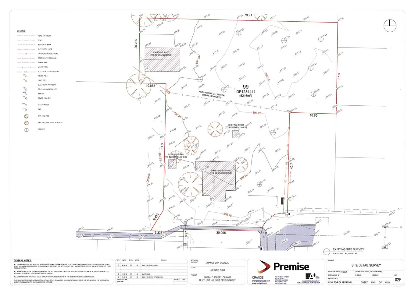
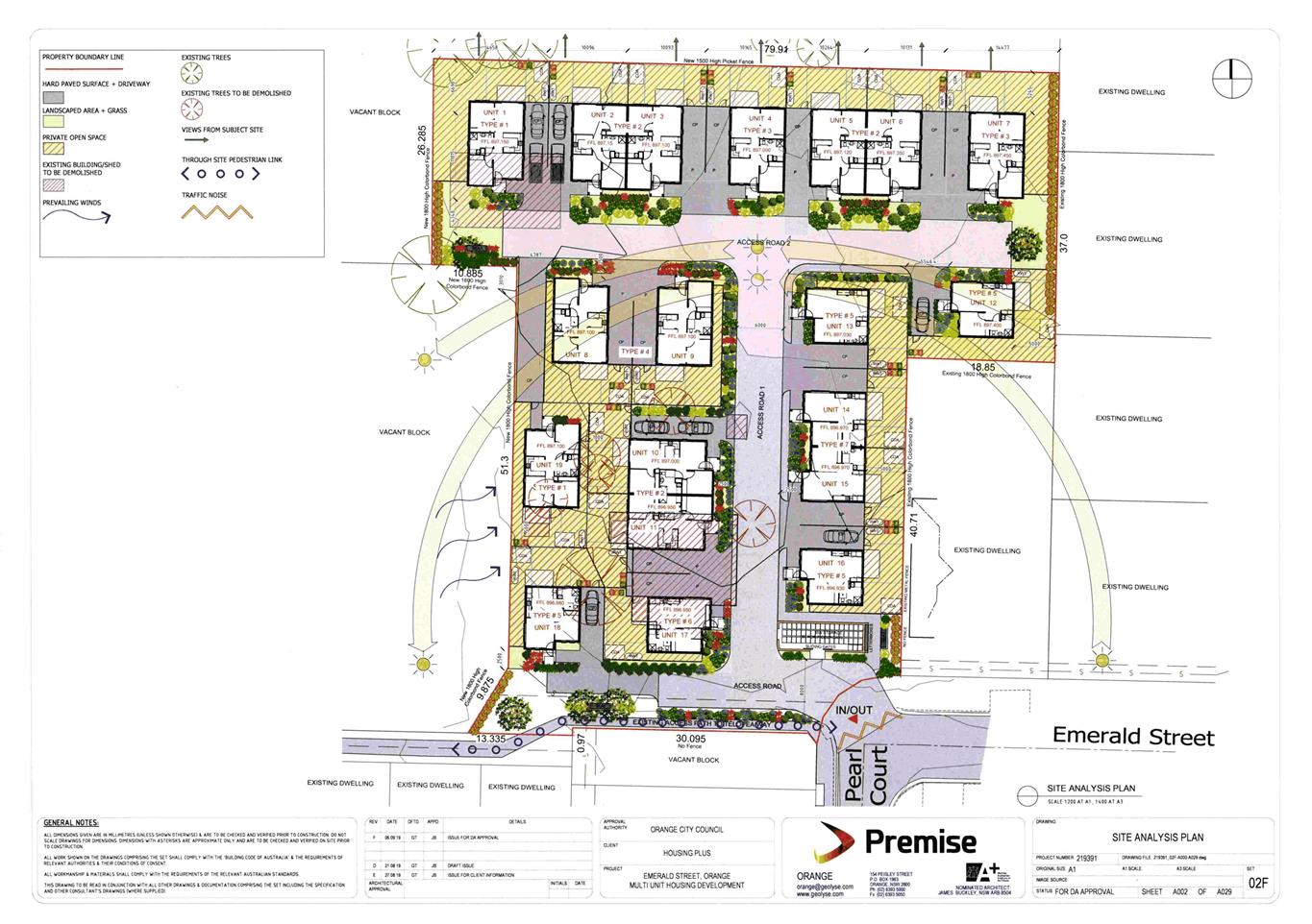
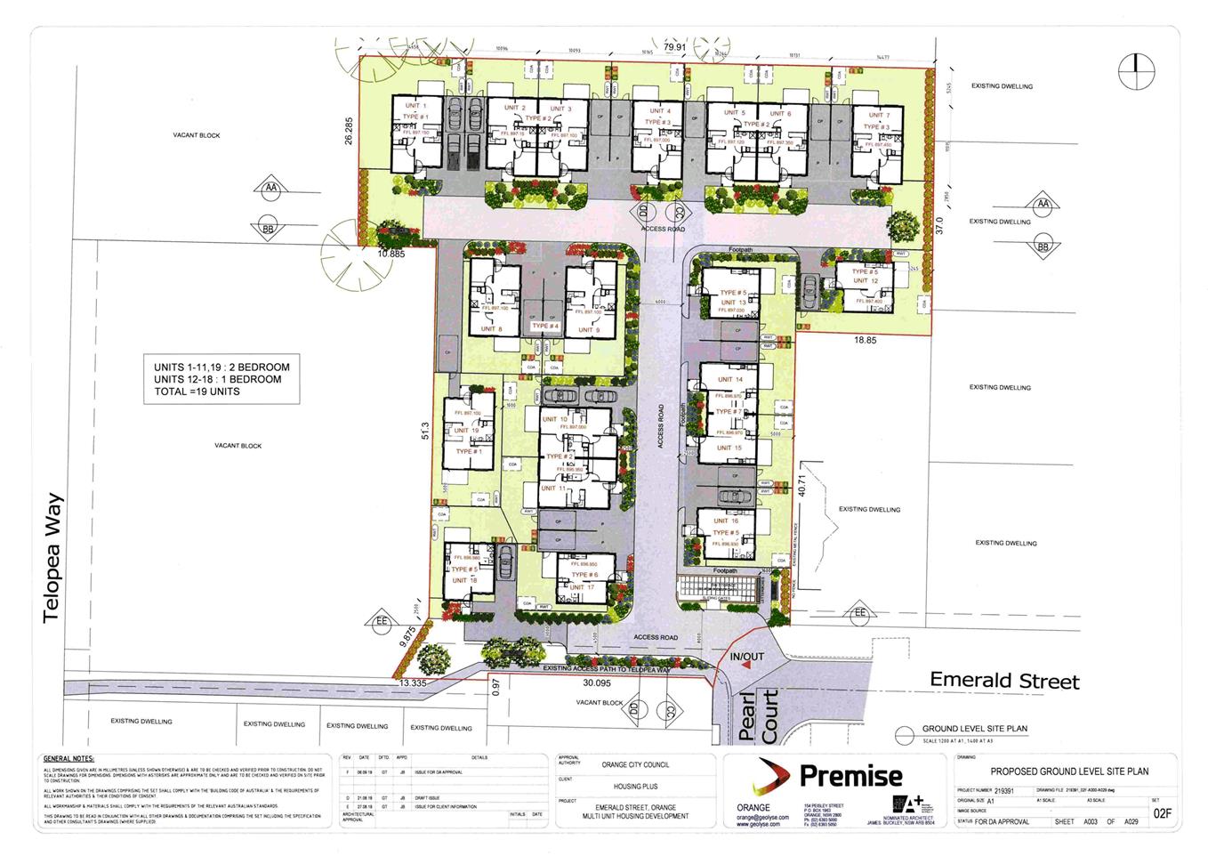
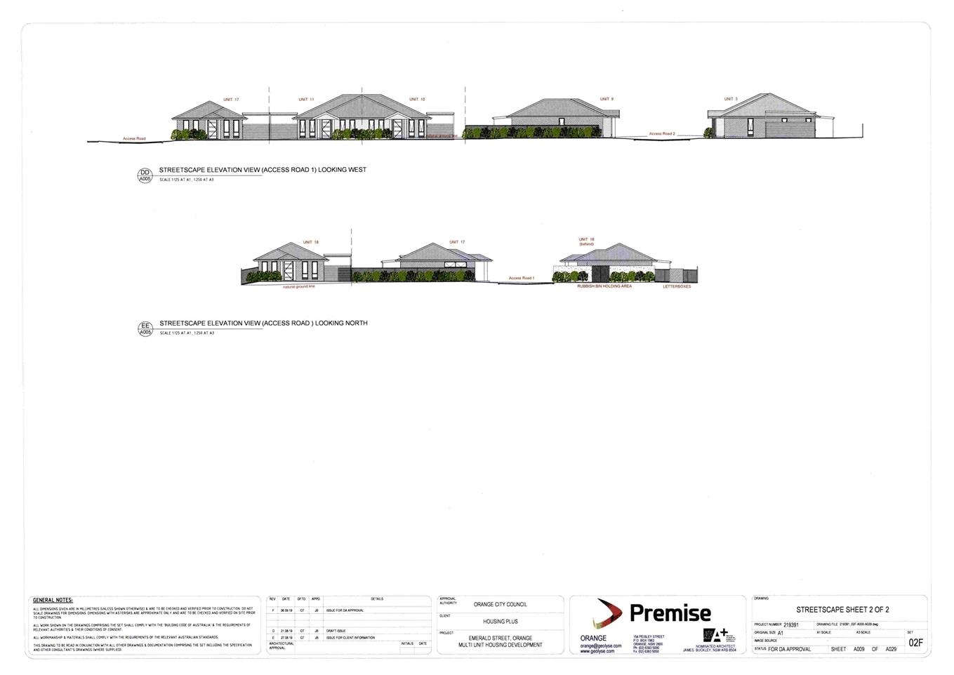
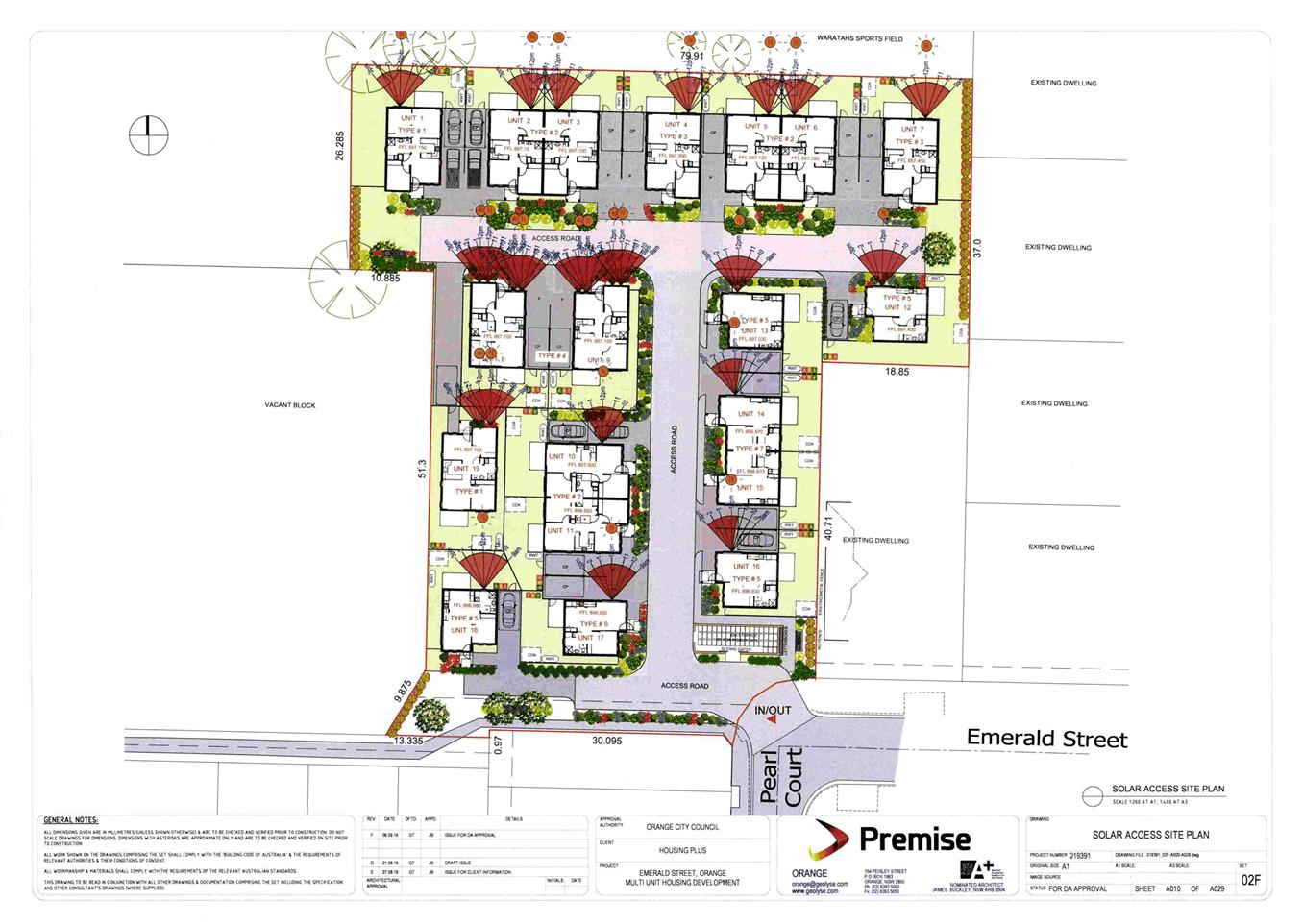
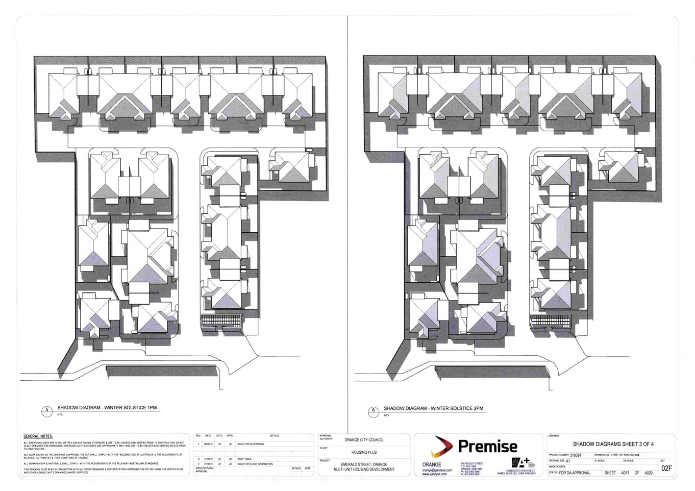
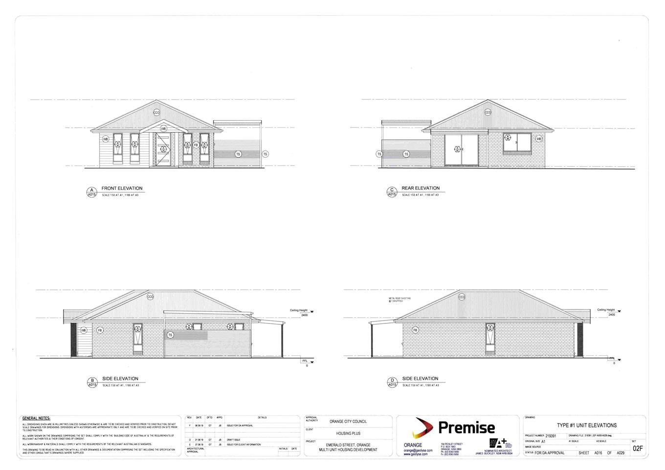
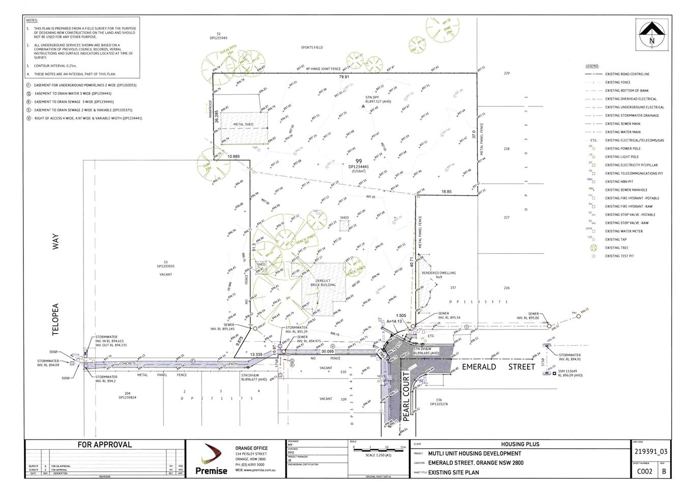
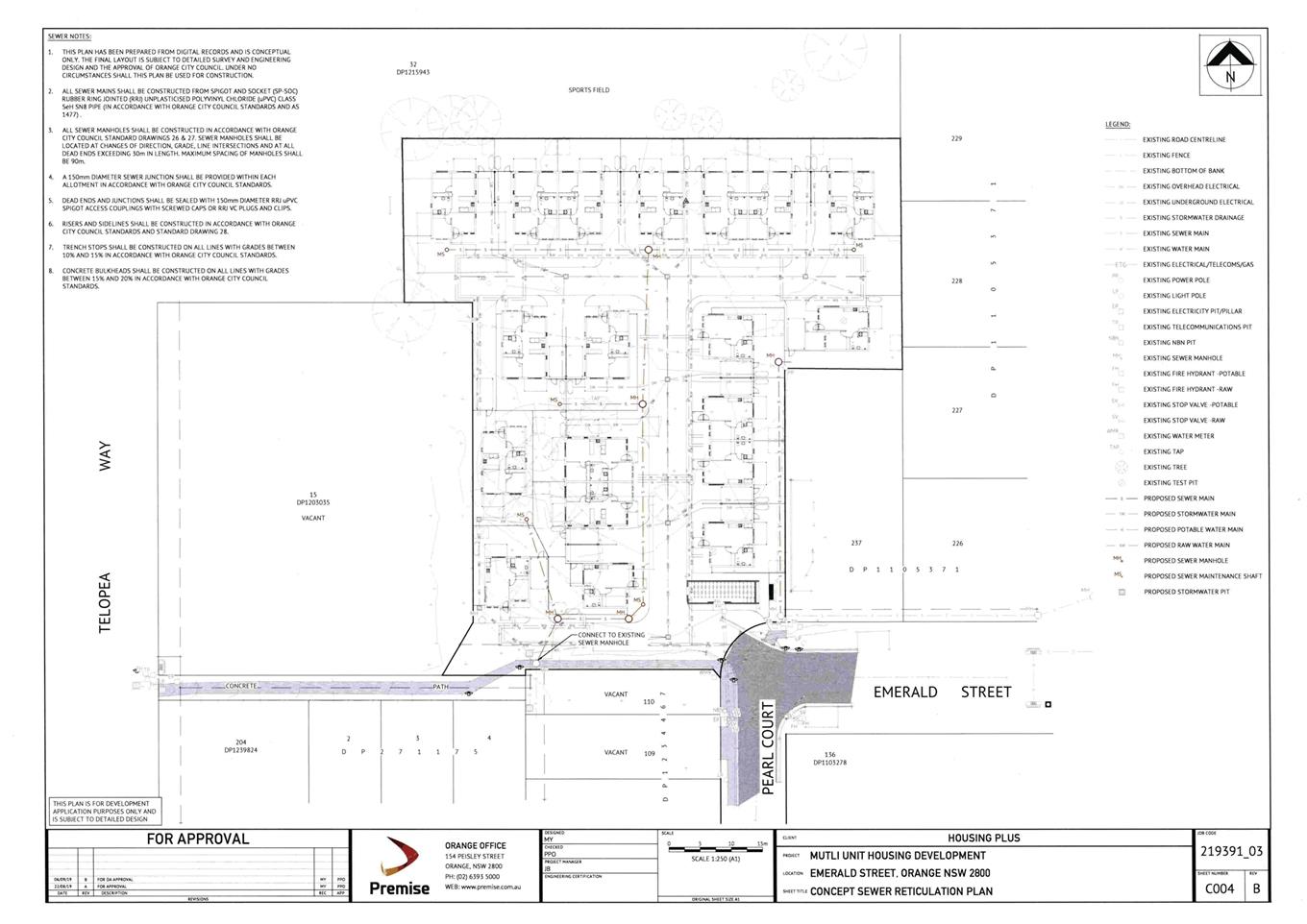
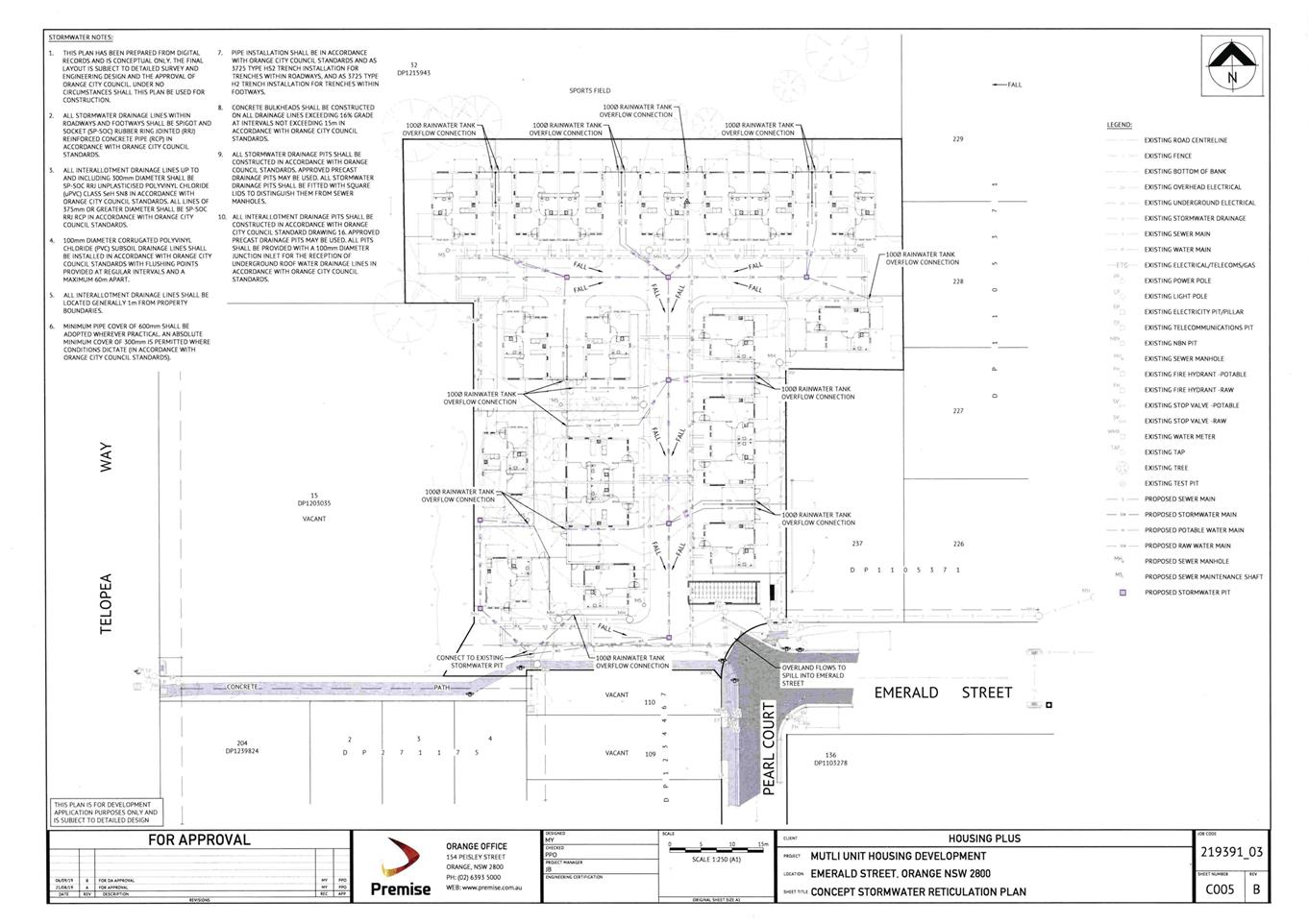
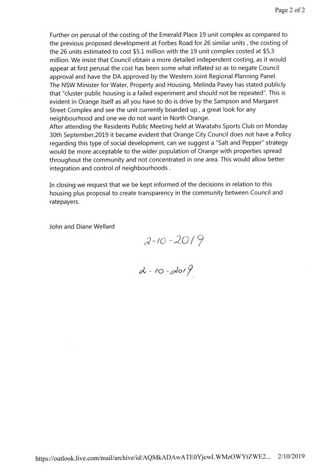
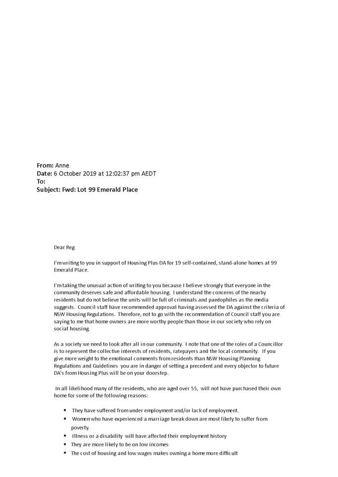
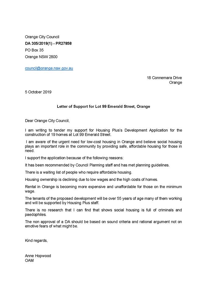
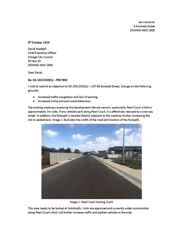
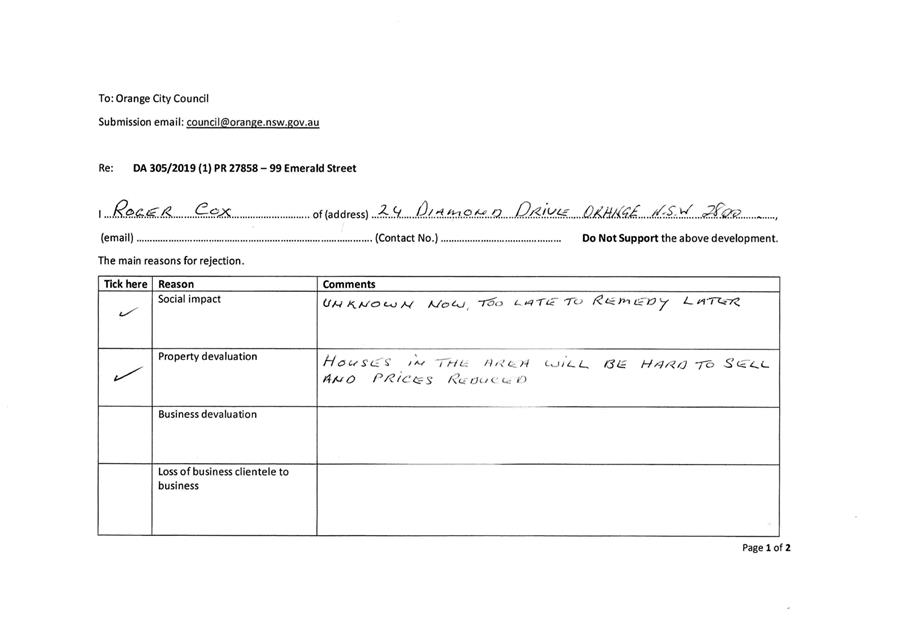
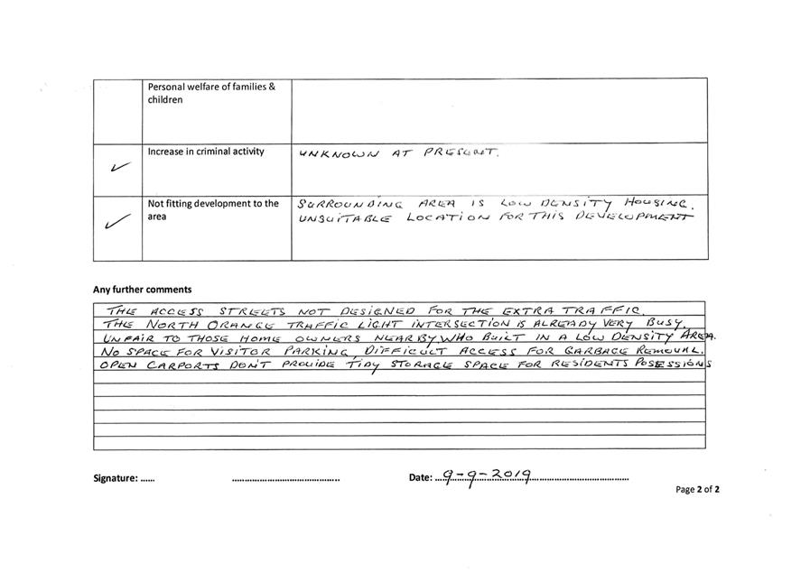
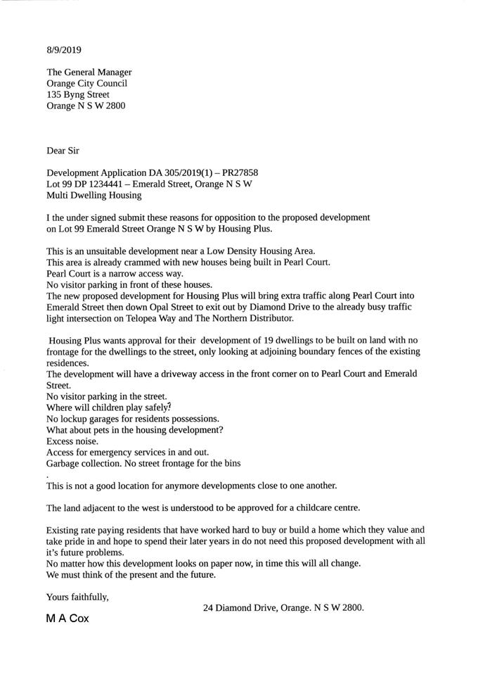
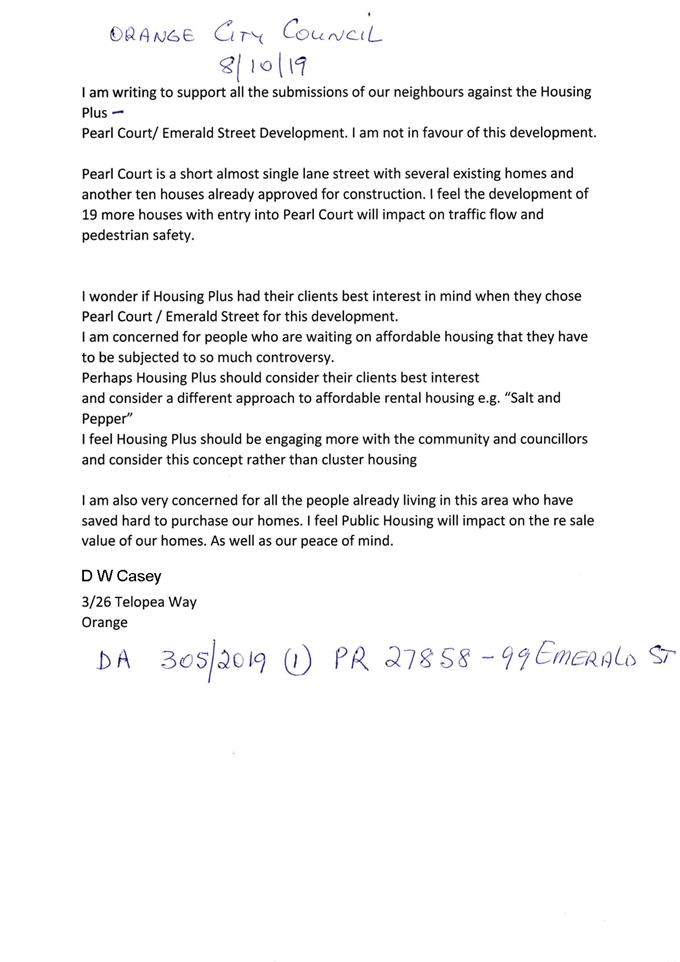
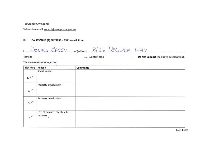
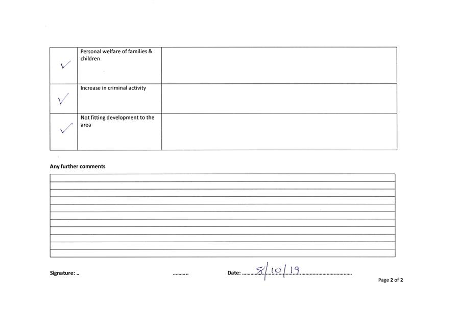
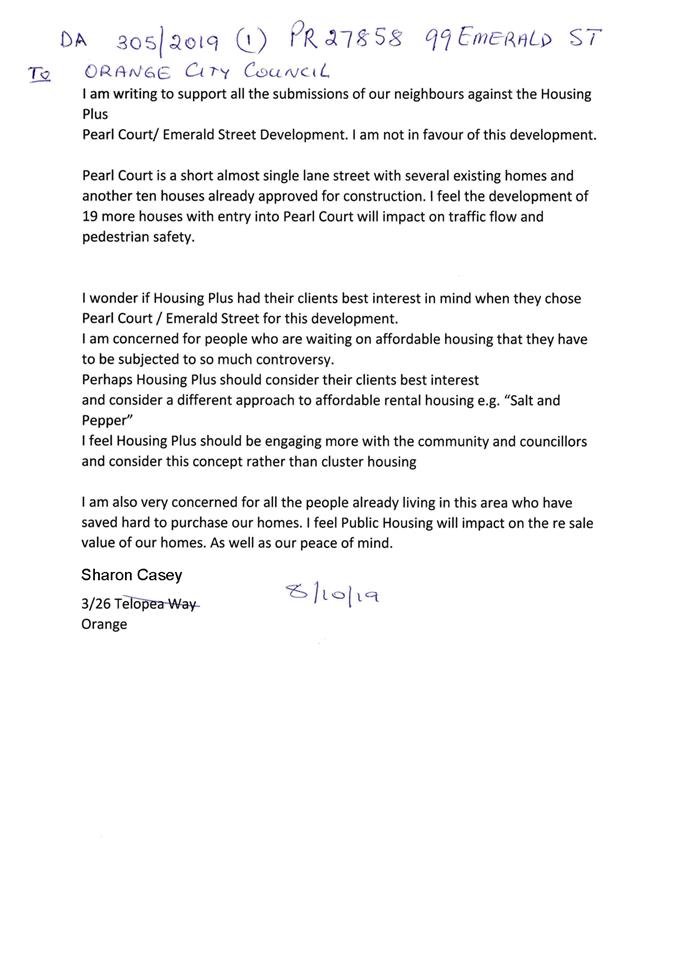
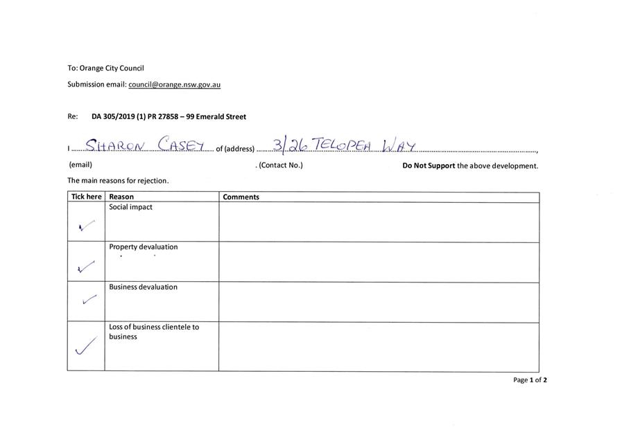
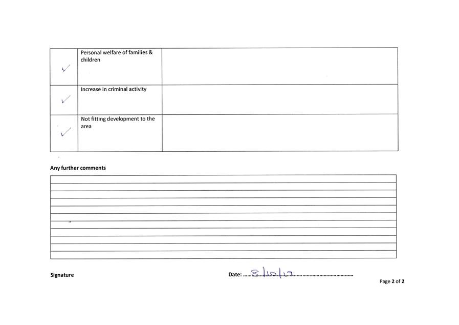
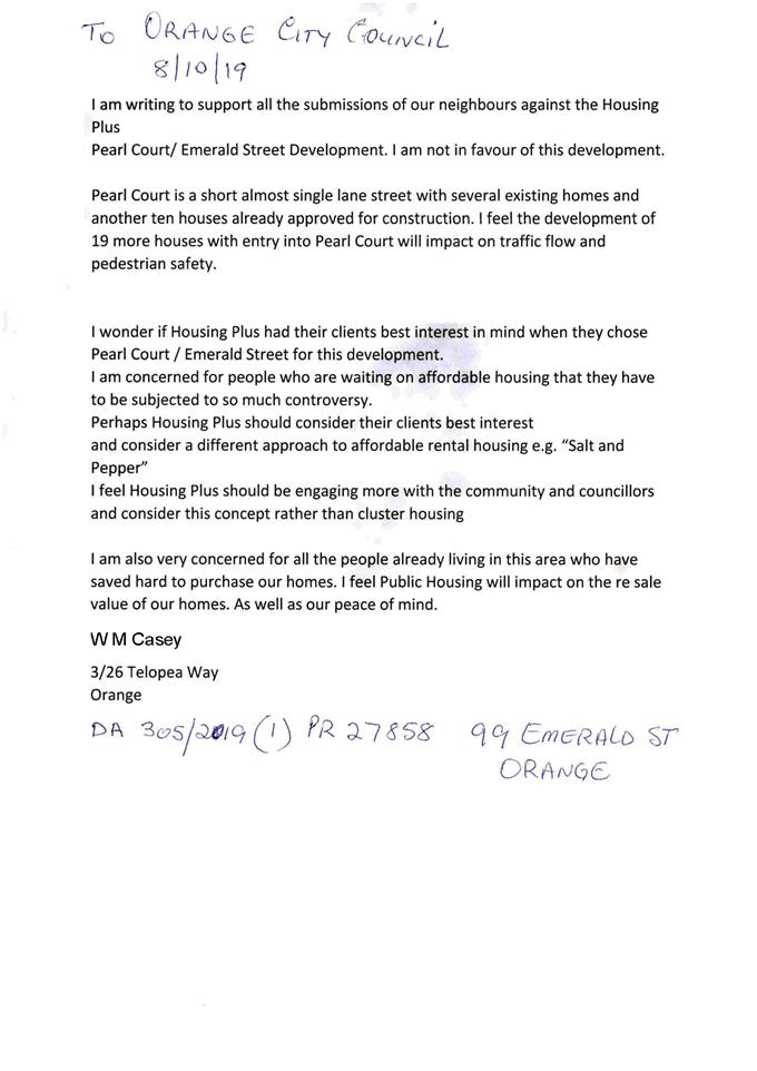
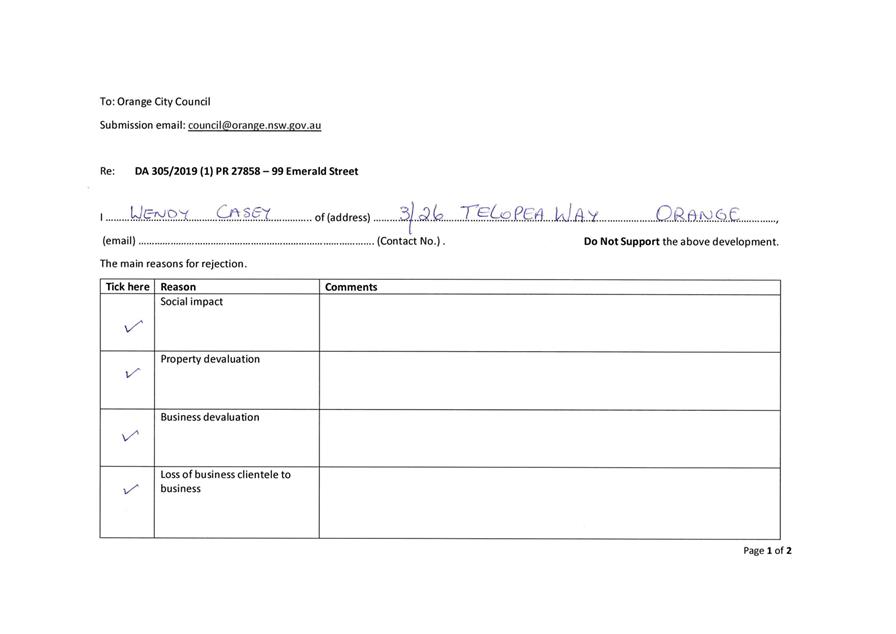
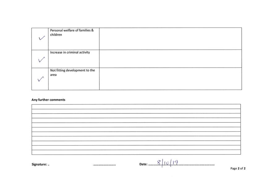
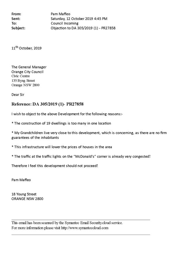
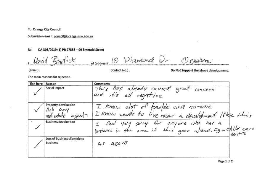
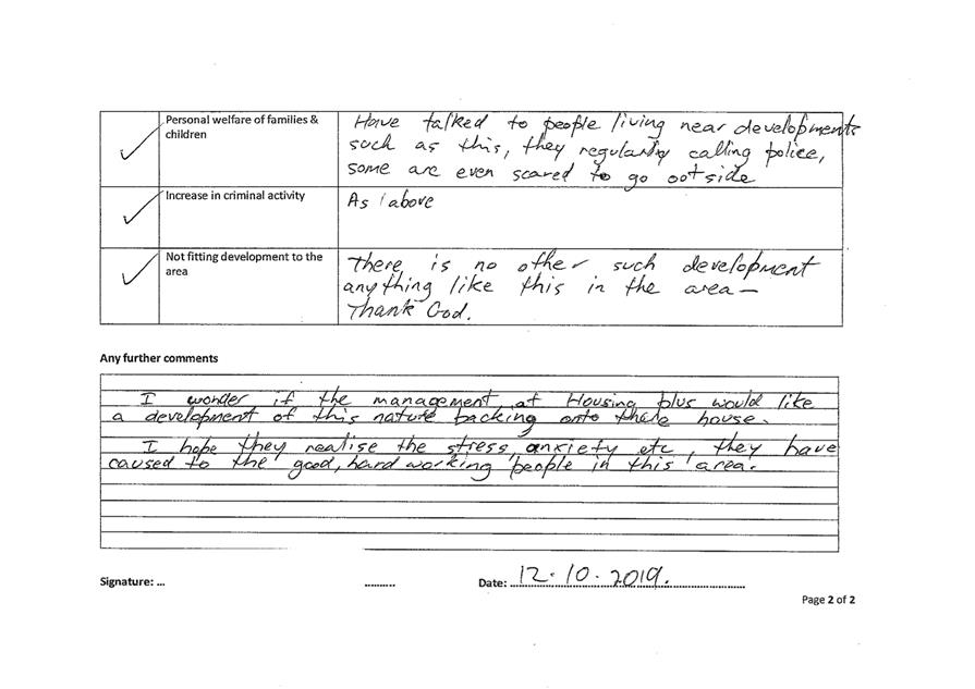
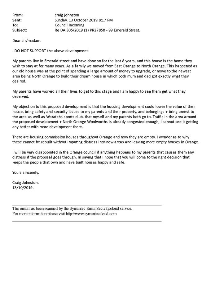
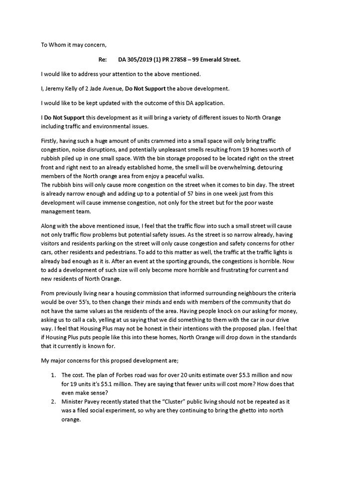
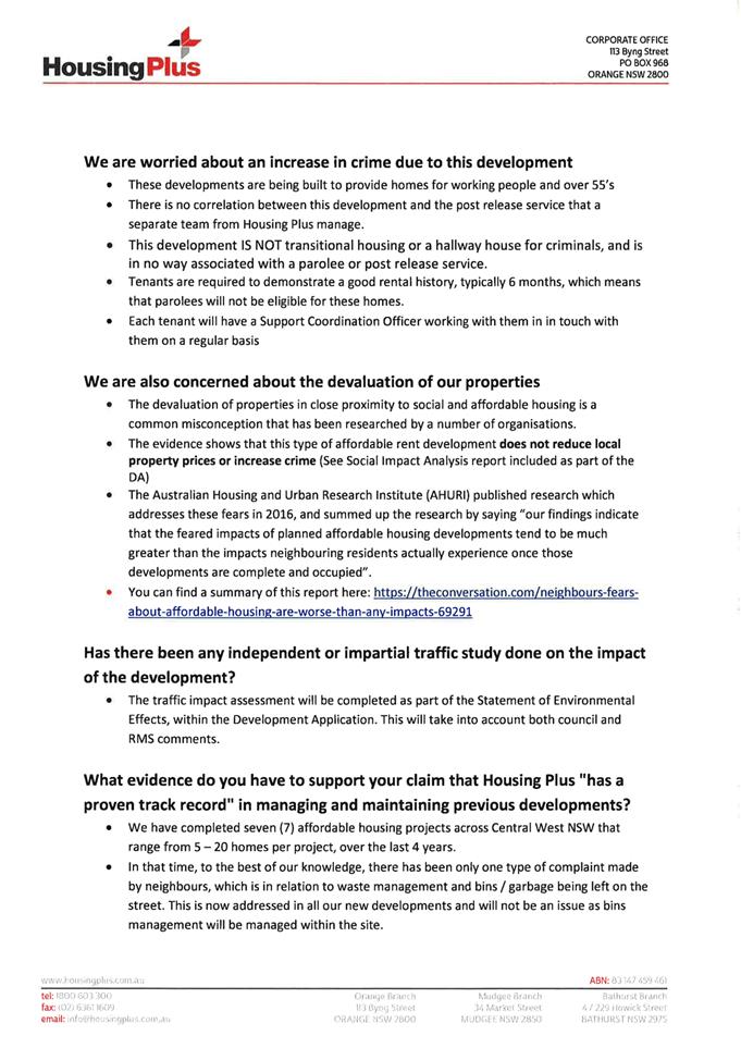
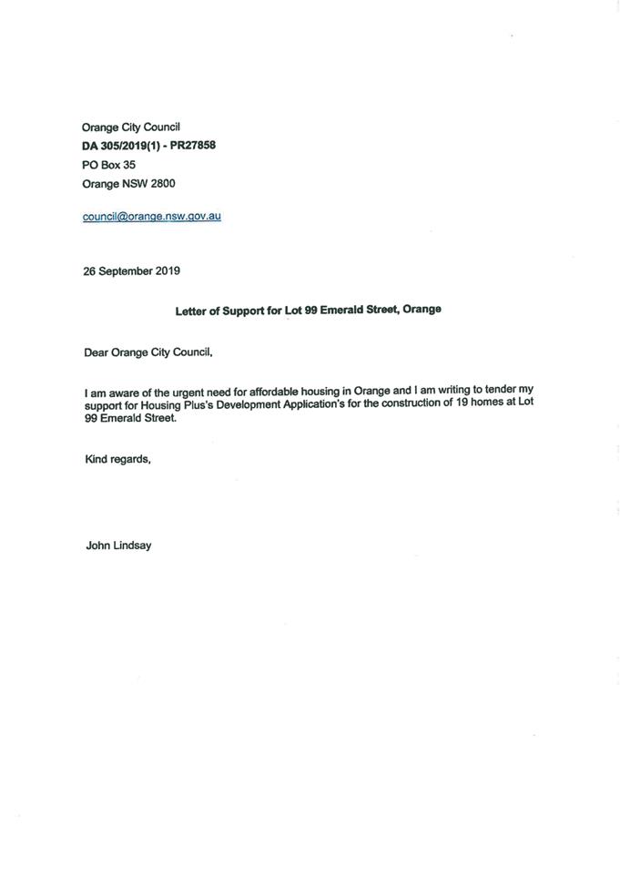
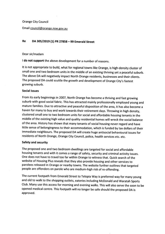
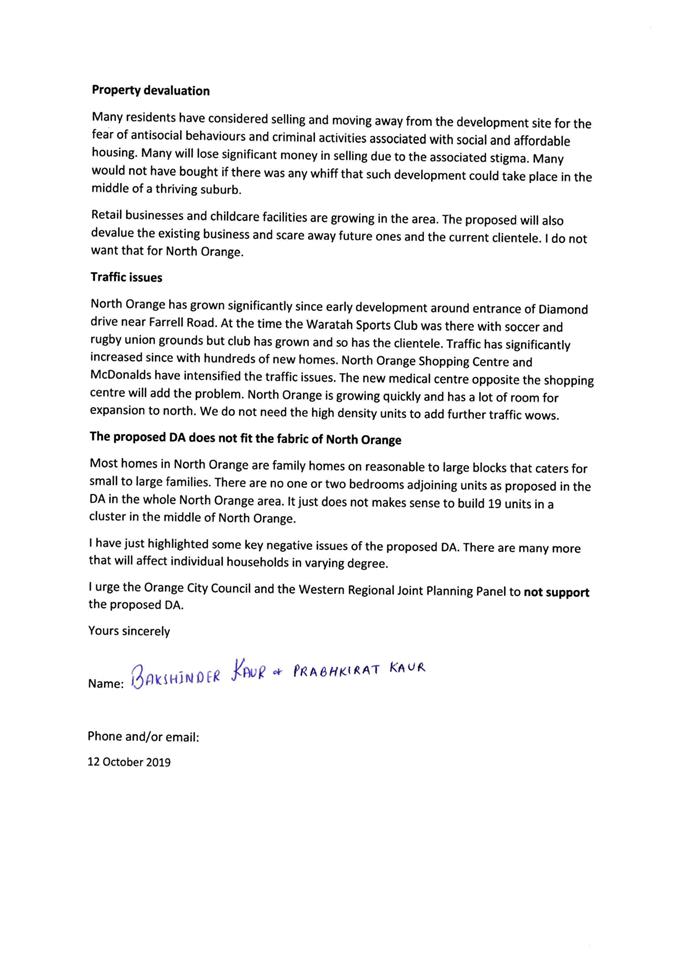
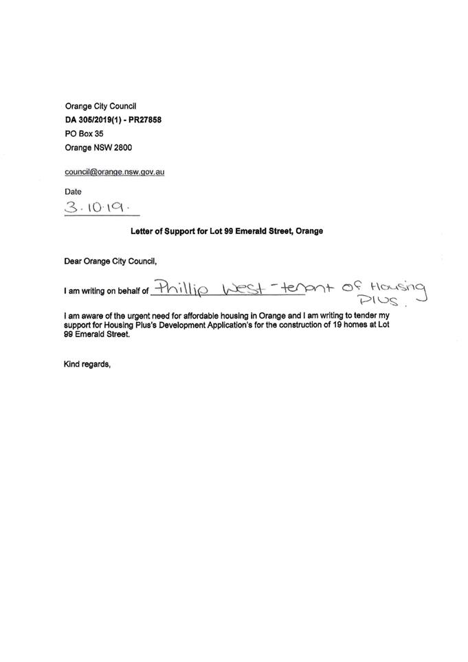
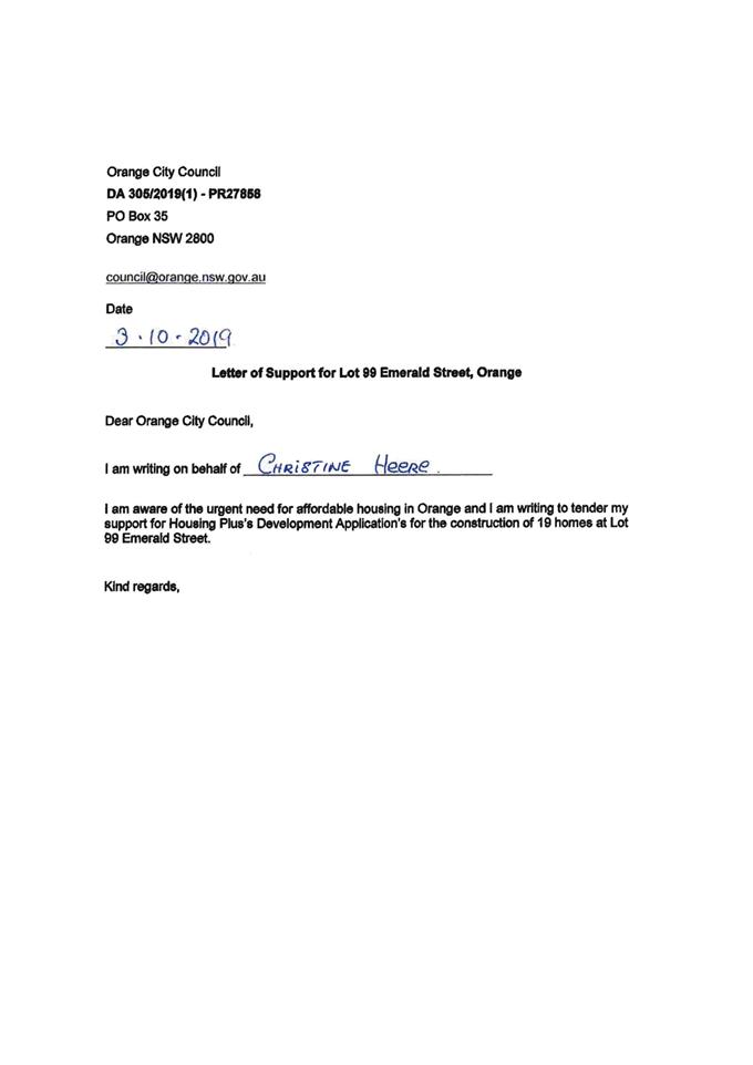
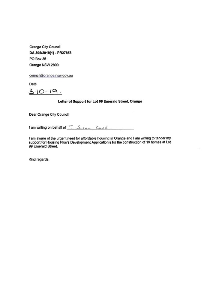
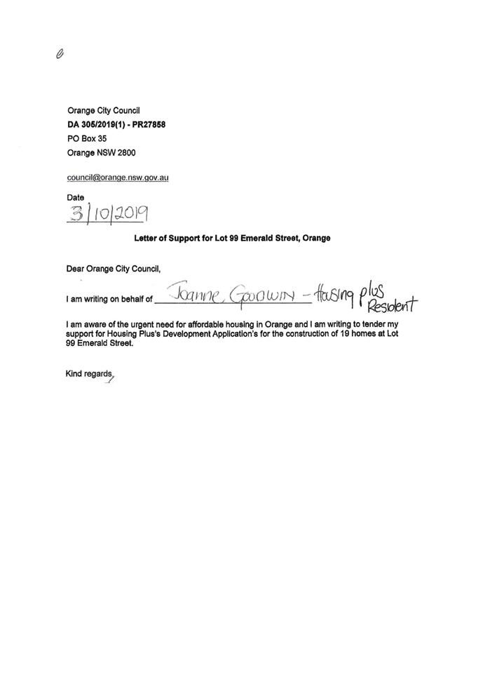
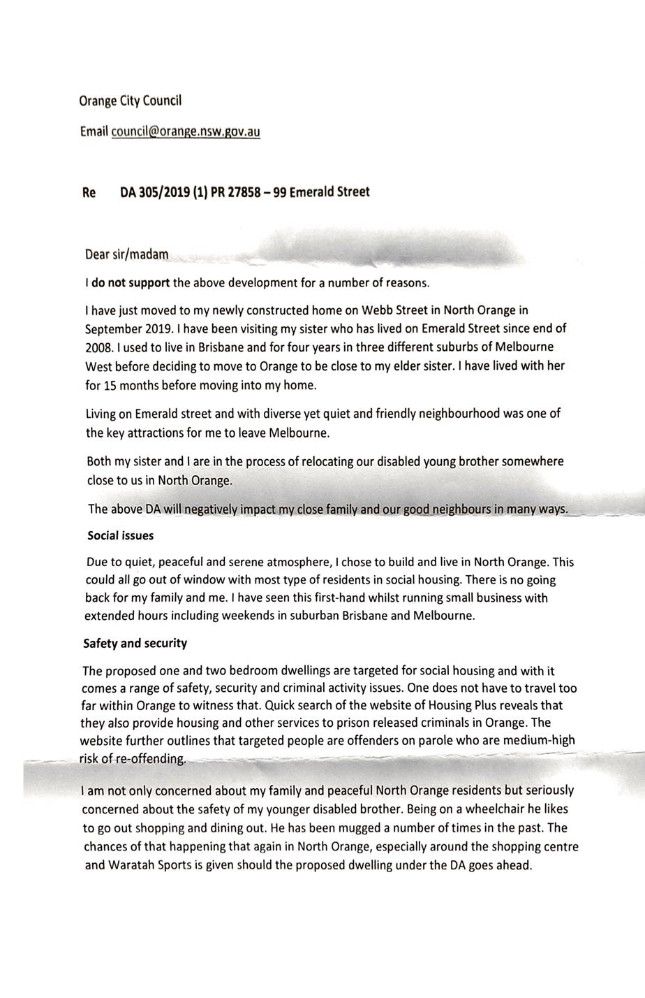
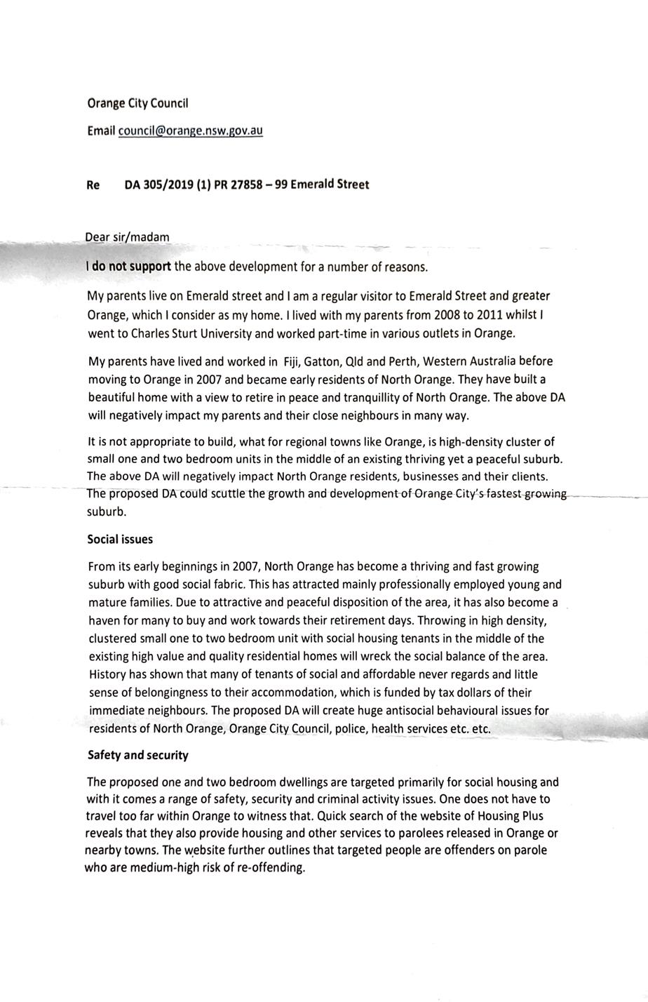
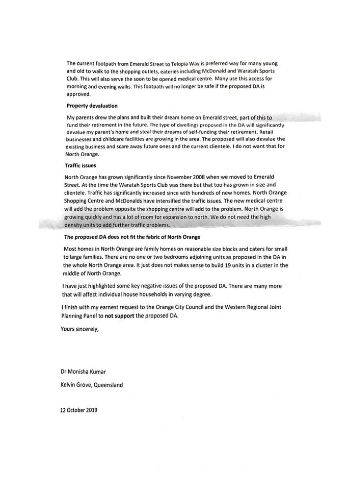
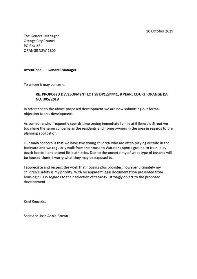
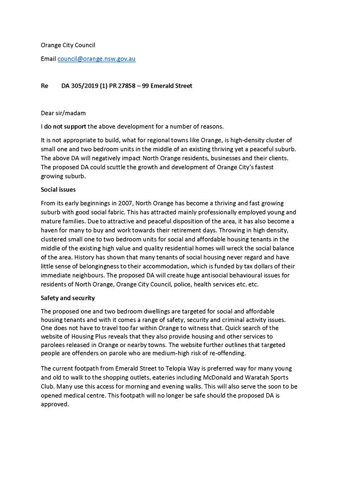
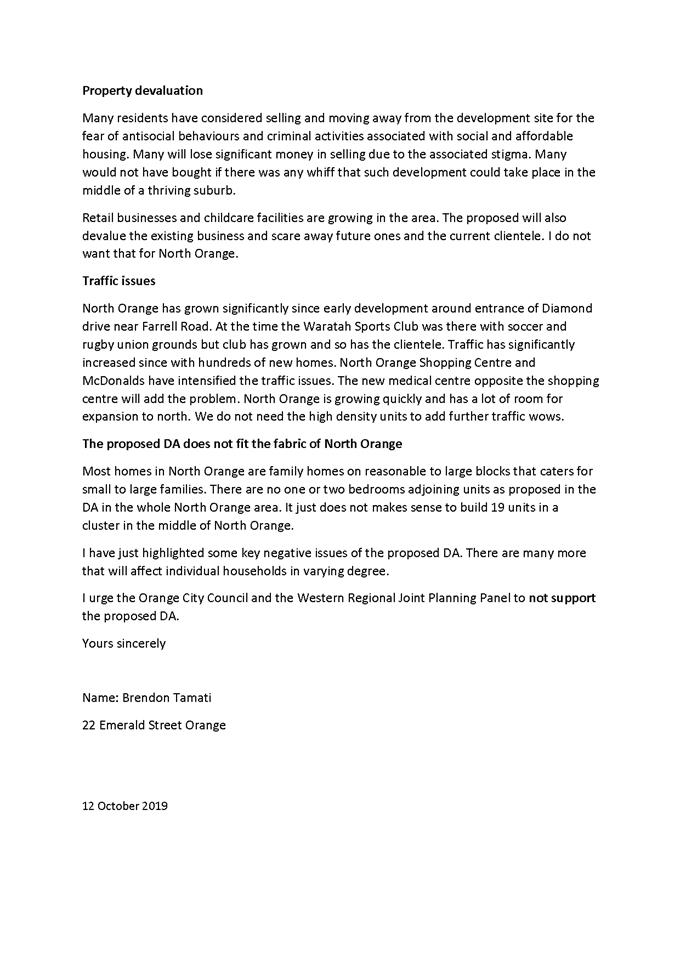
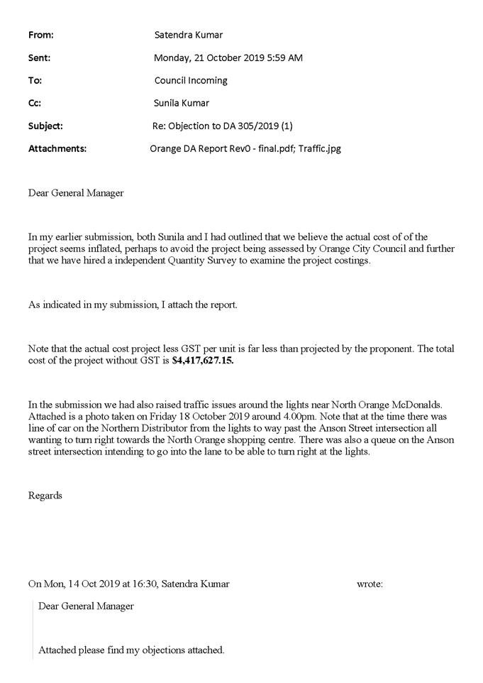
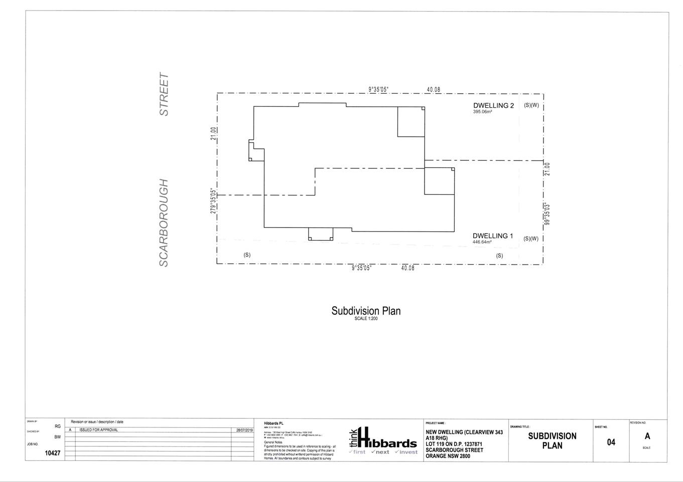
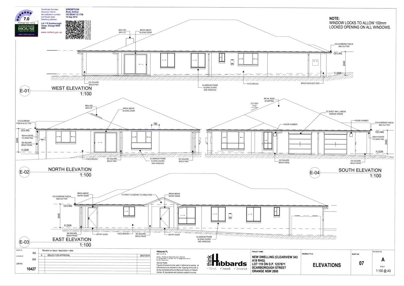
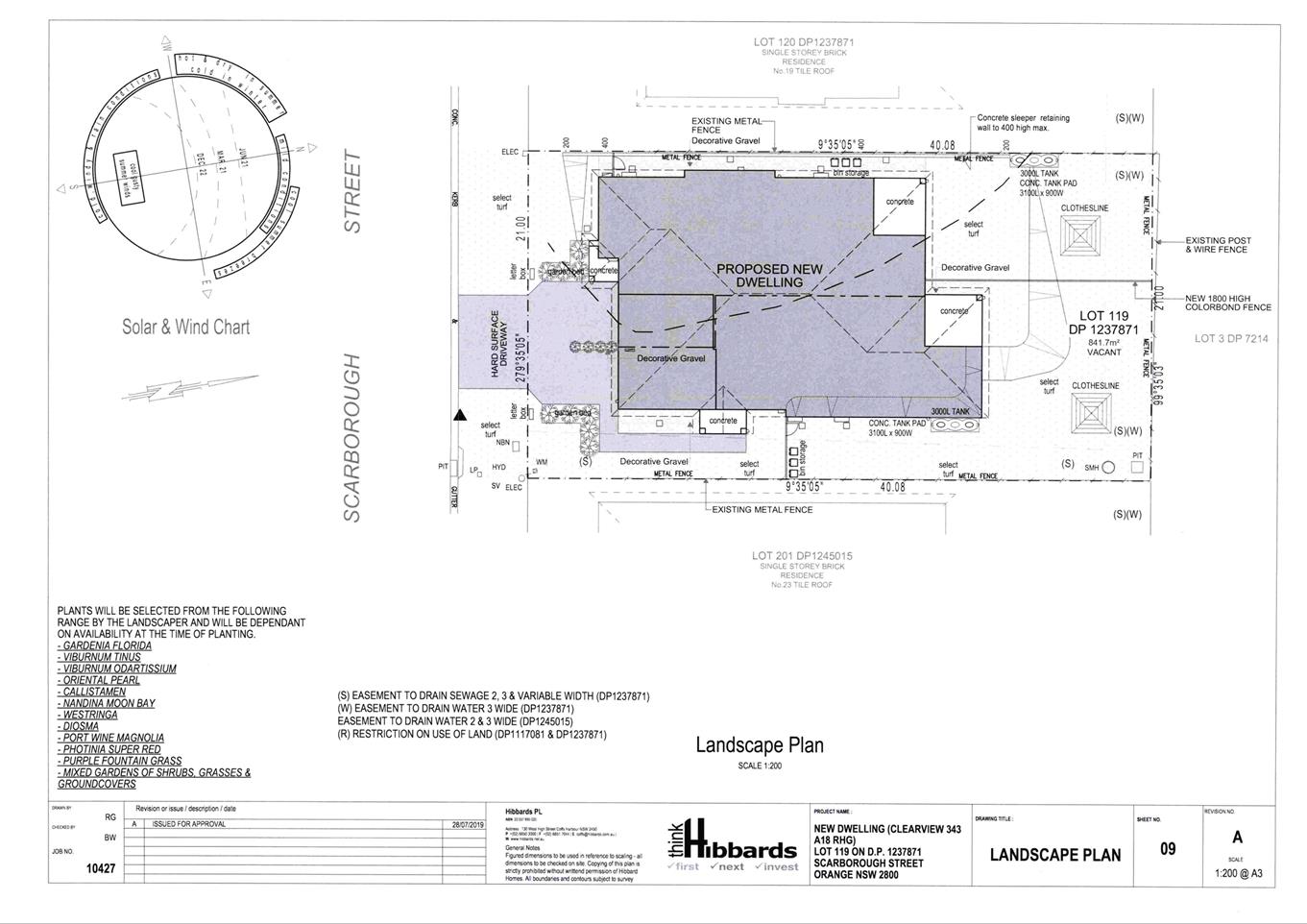
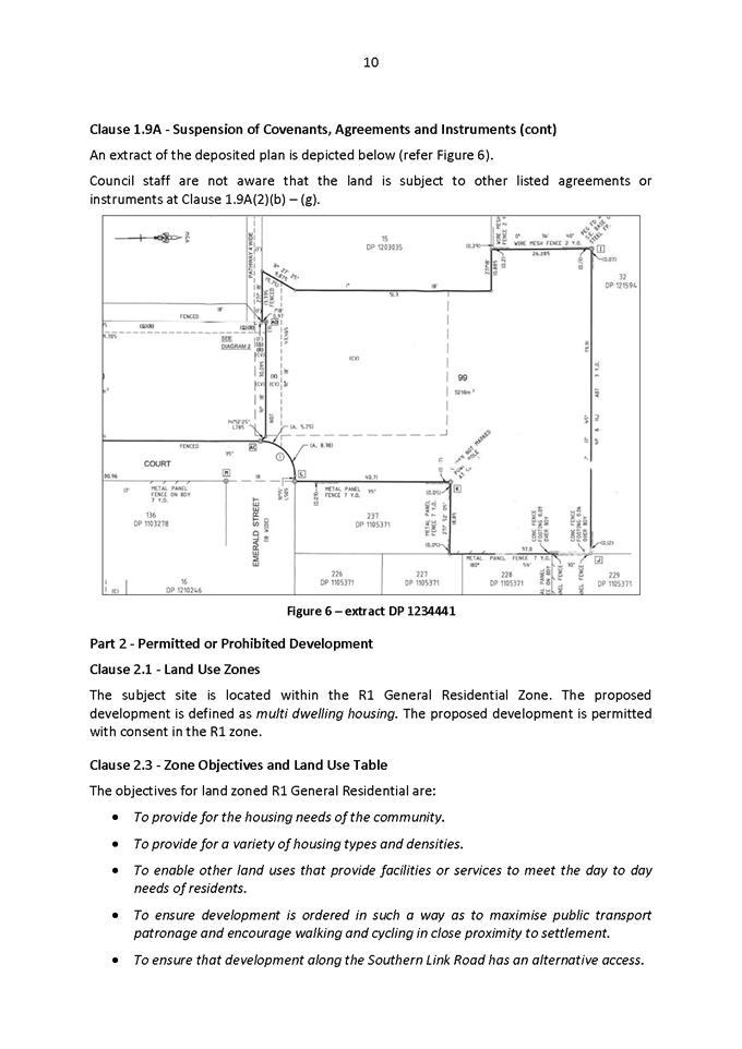
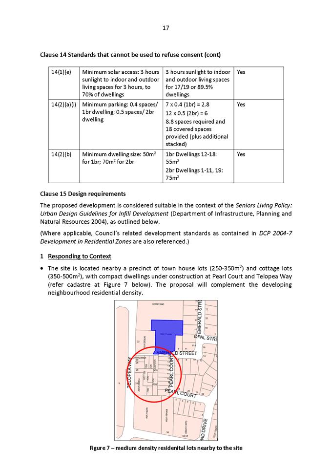
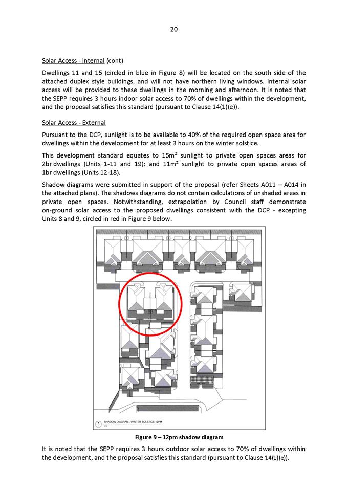
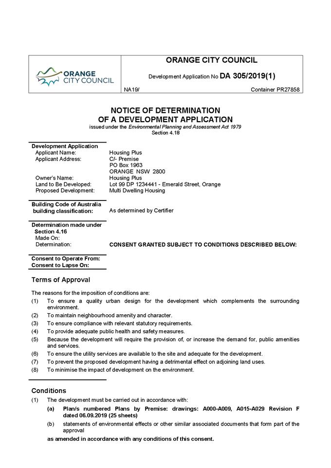
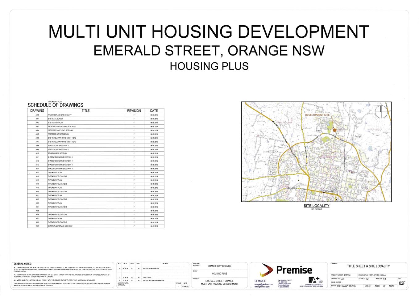
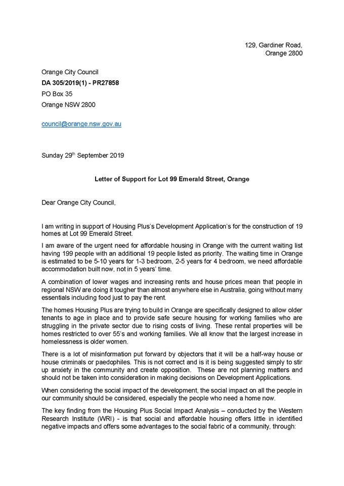
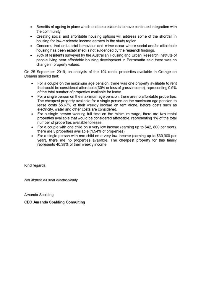
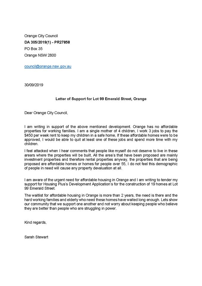
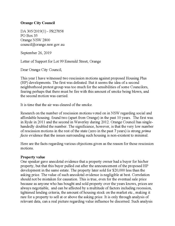
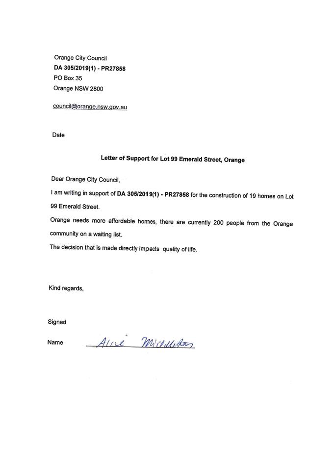
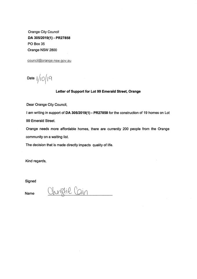
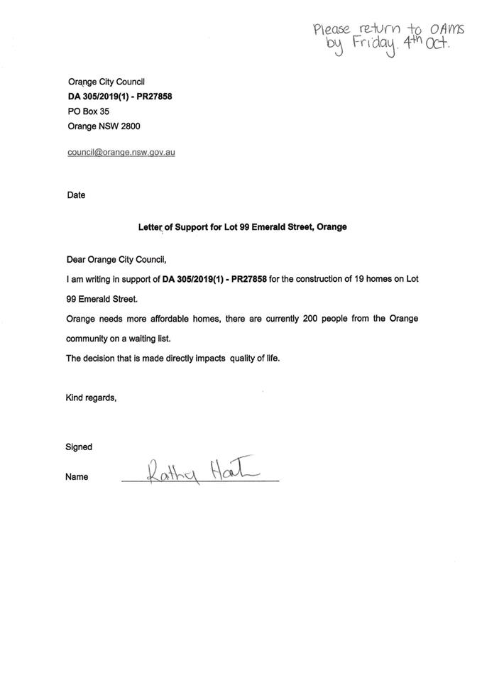
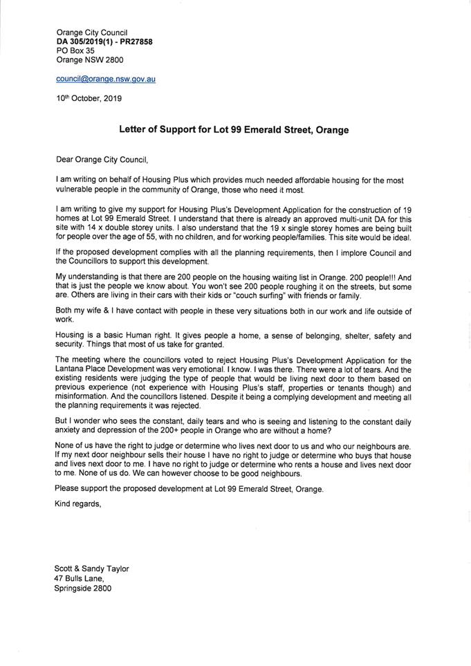
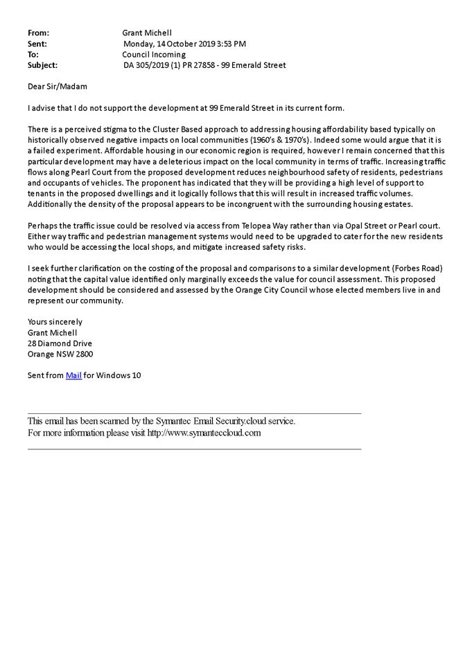
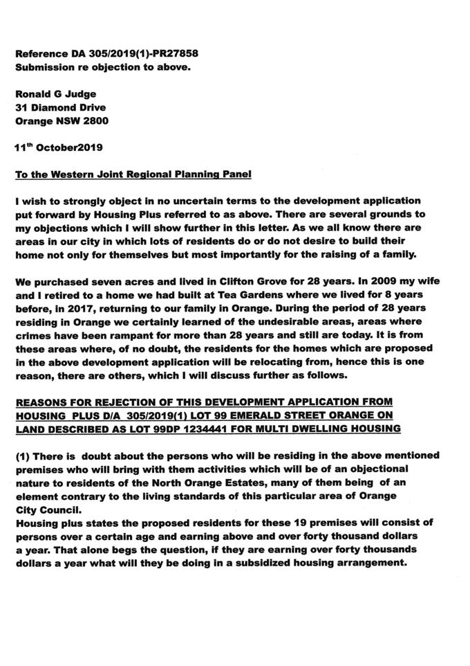
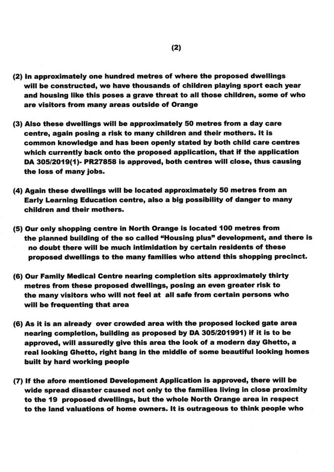
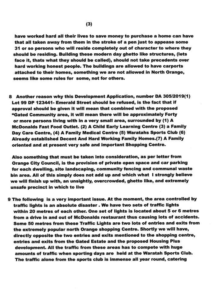
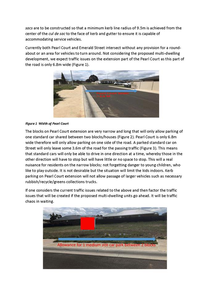
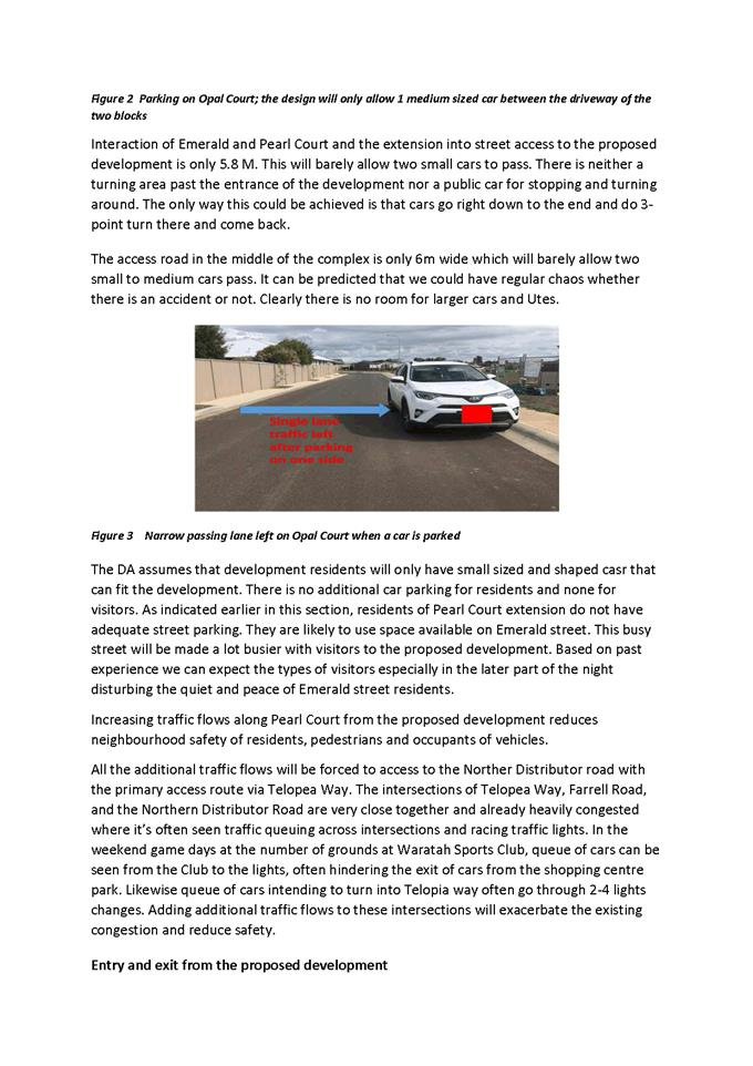
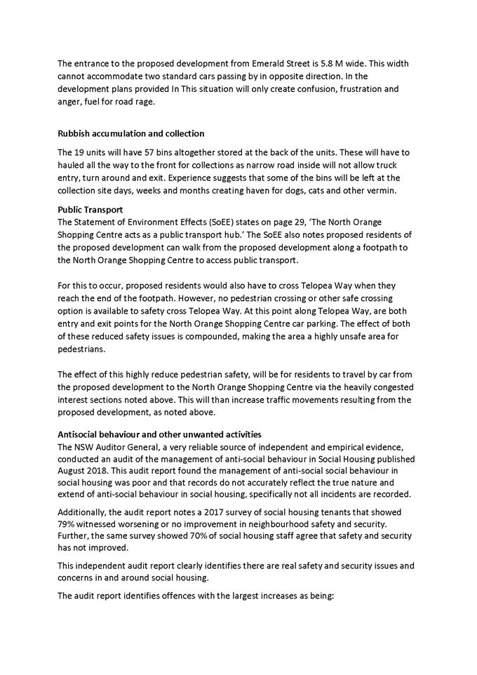
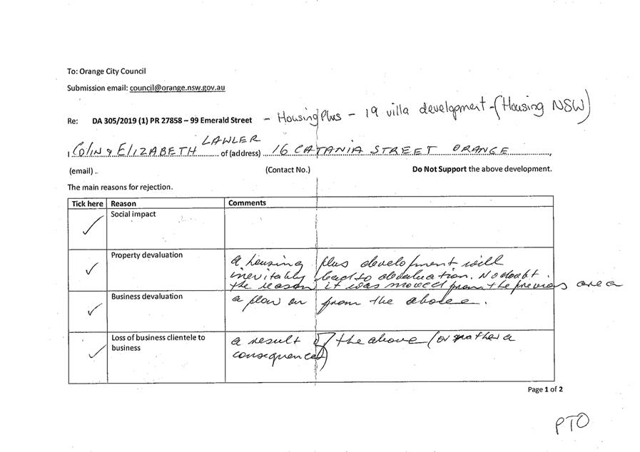
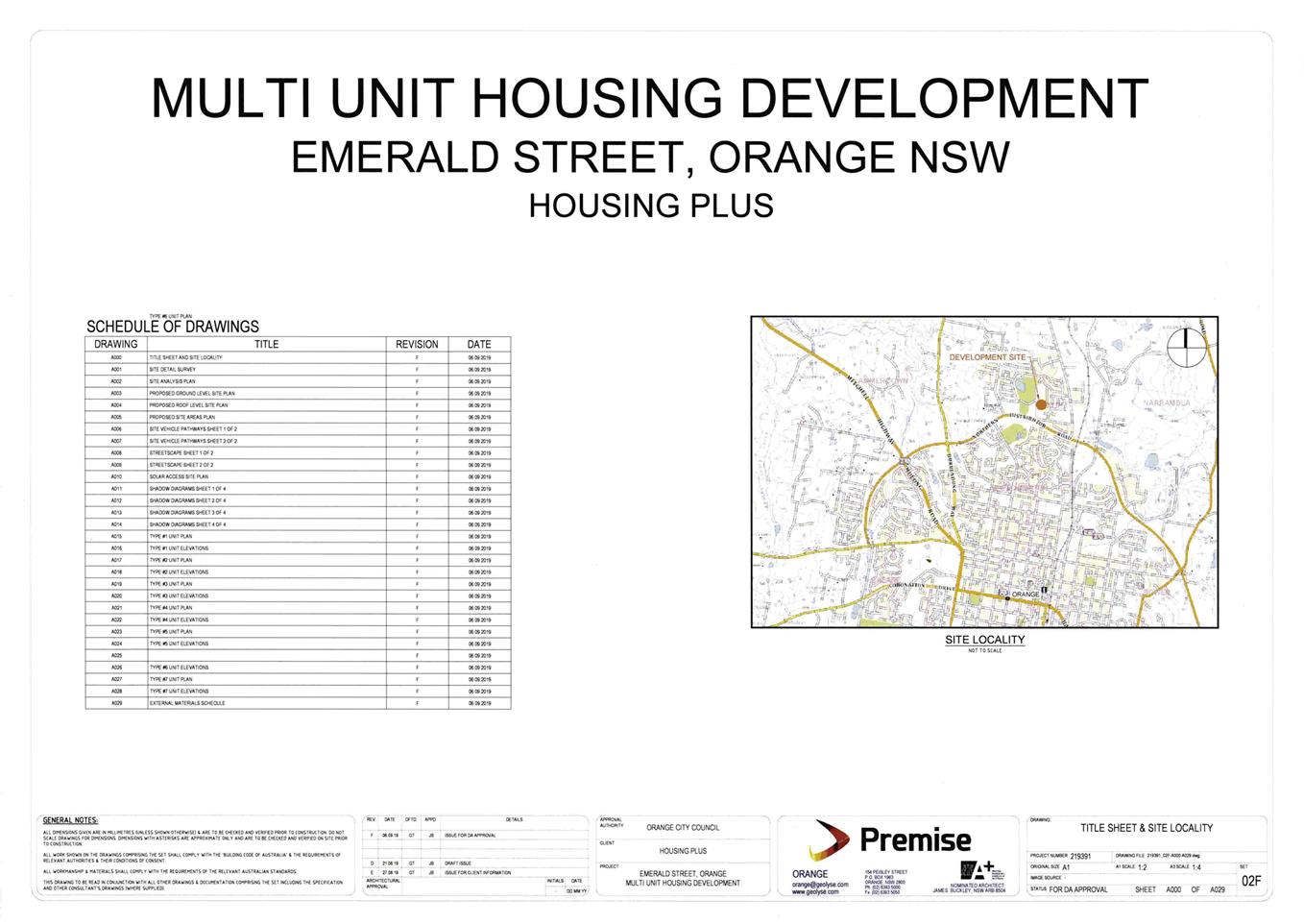
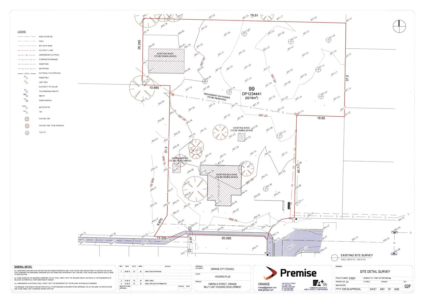
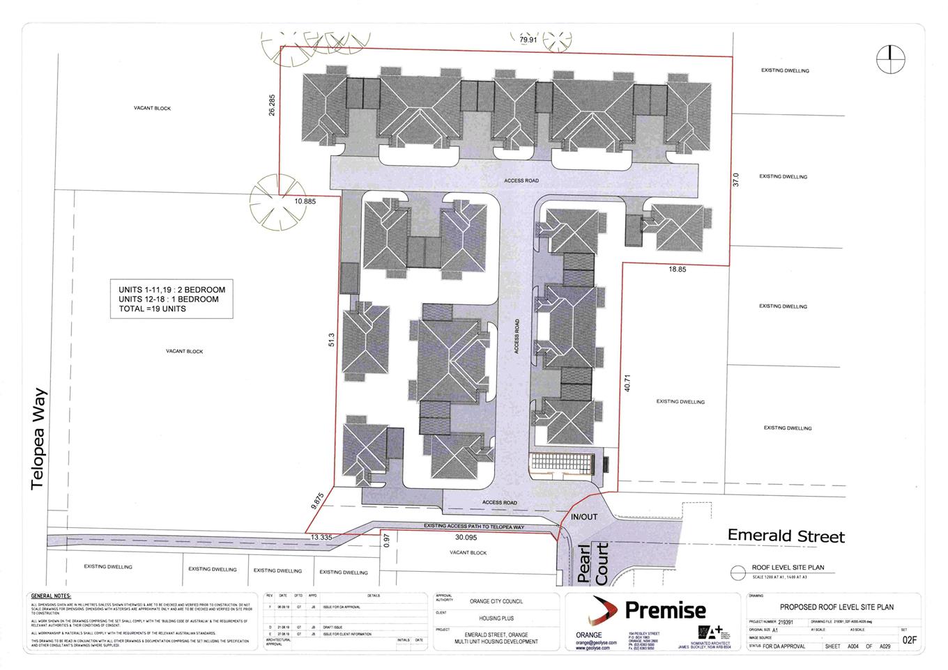
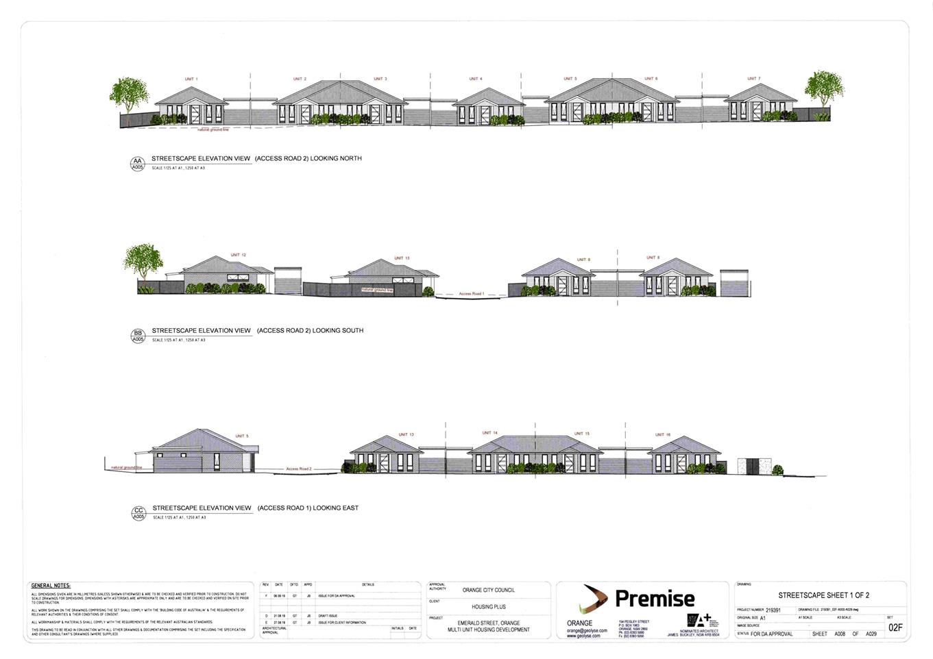
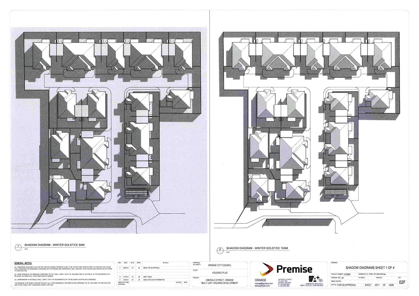
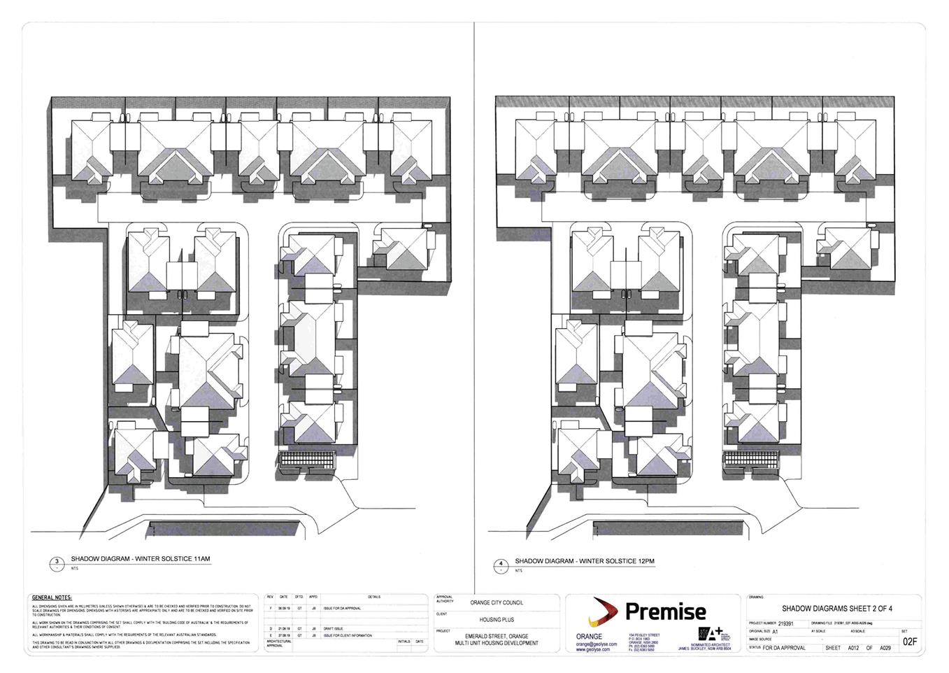
Application DA 305/2019(1) - Lot 99 Emerald Street
RECORD
NUMBER: 2019/2288
AUTHOR: Summer
Commins, Senior Planner
EXECUTIVE Summary
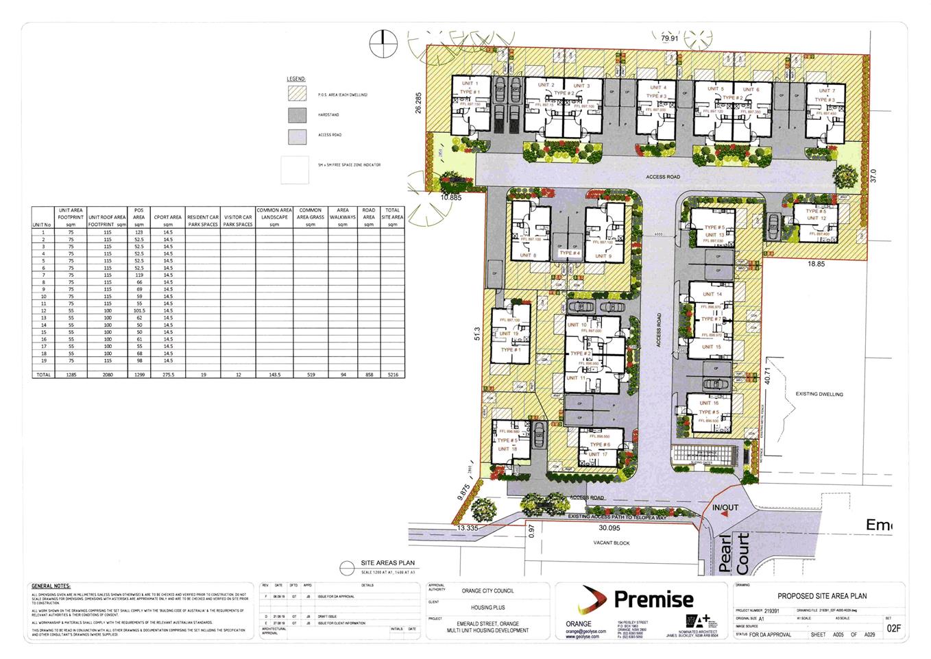
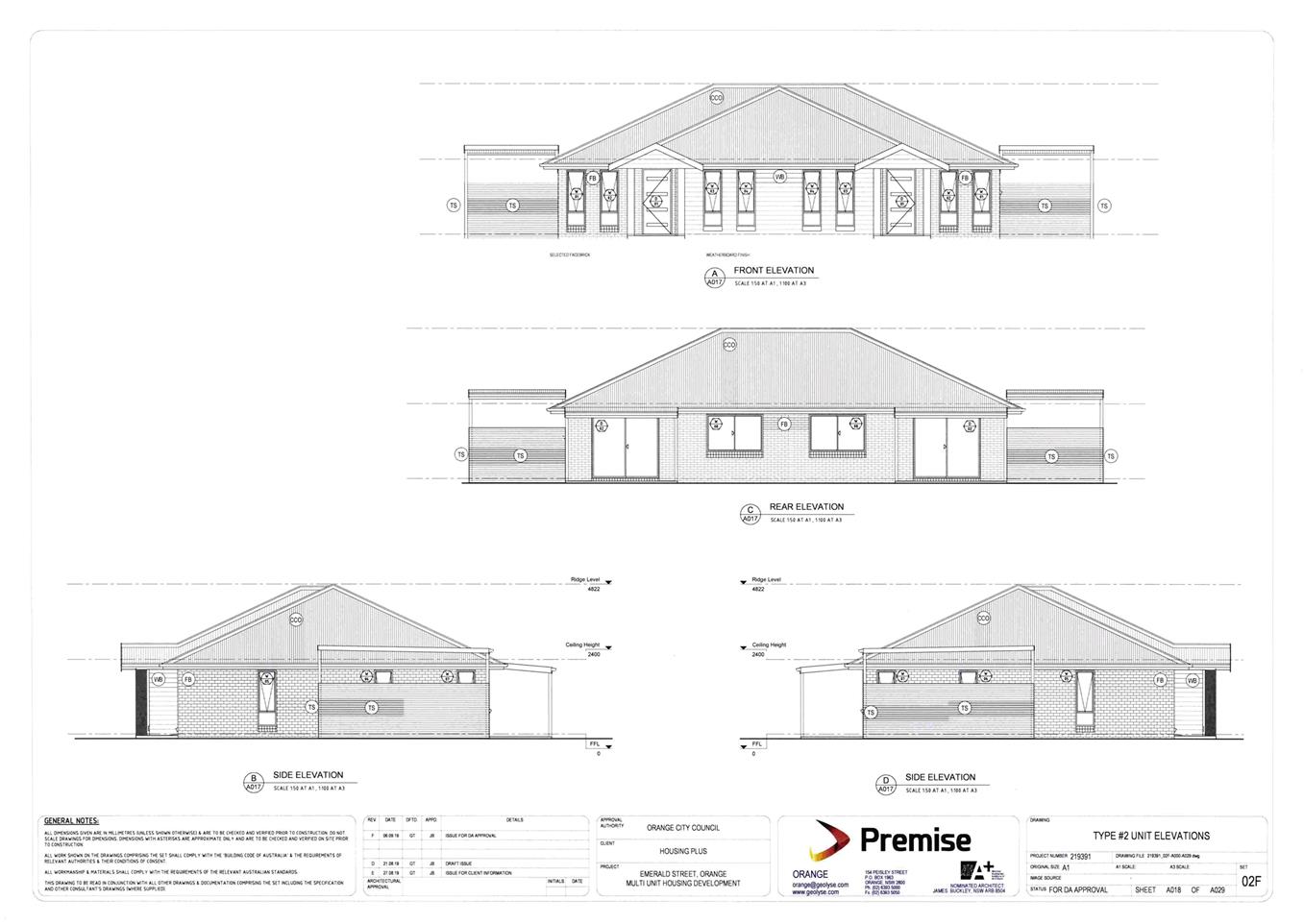
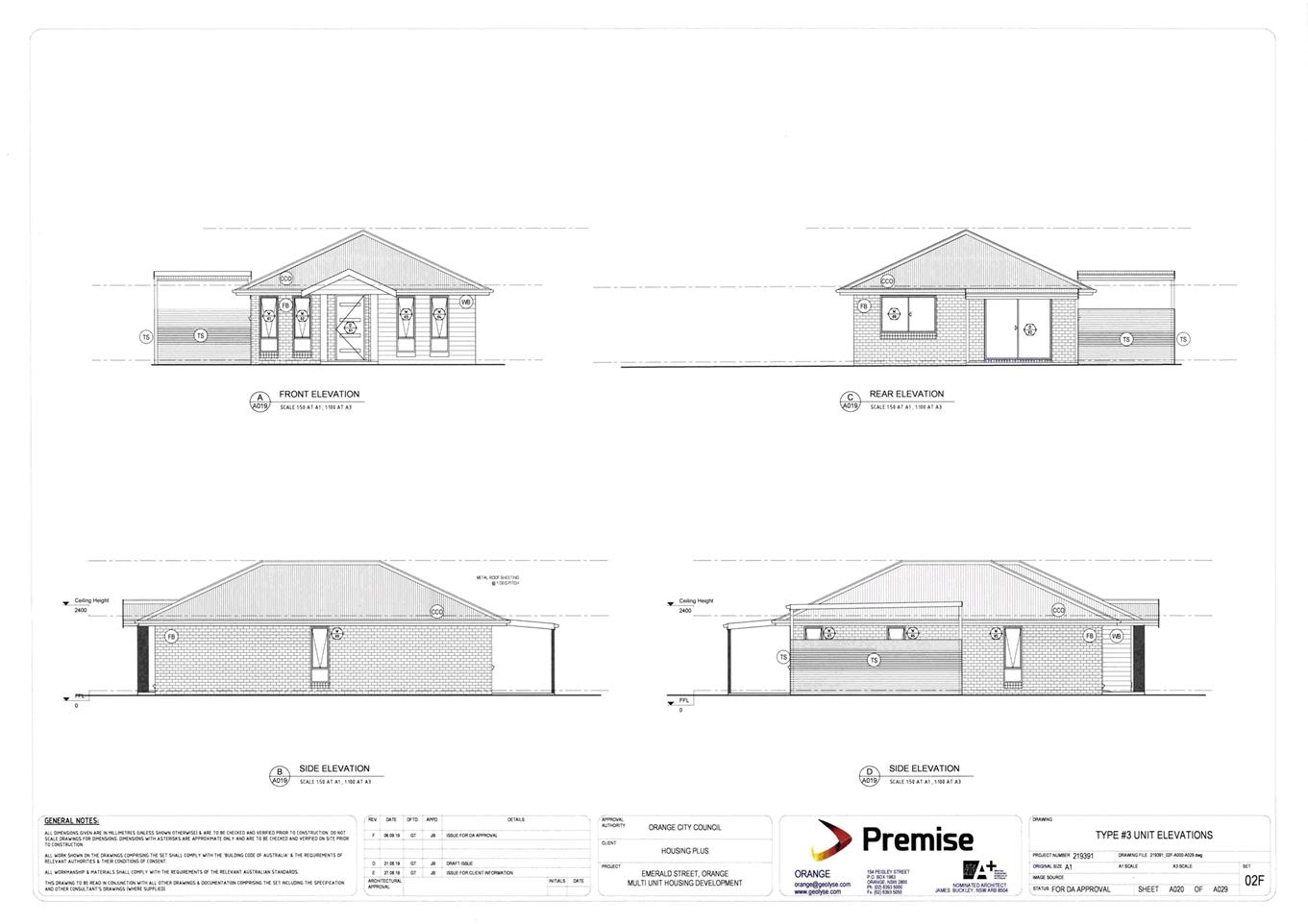
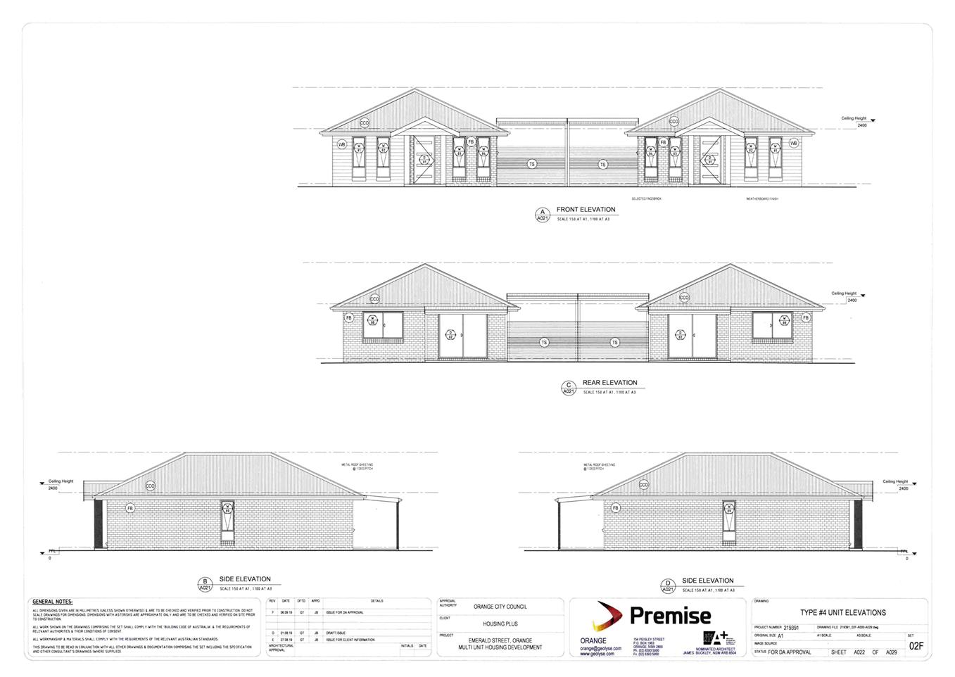
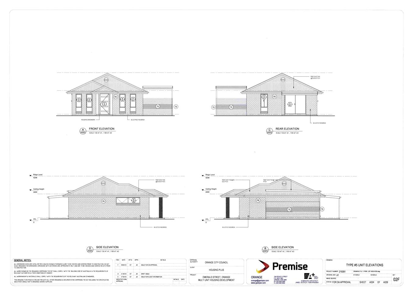
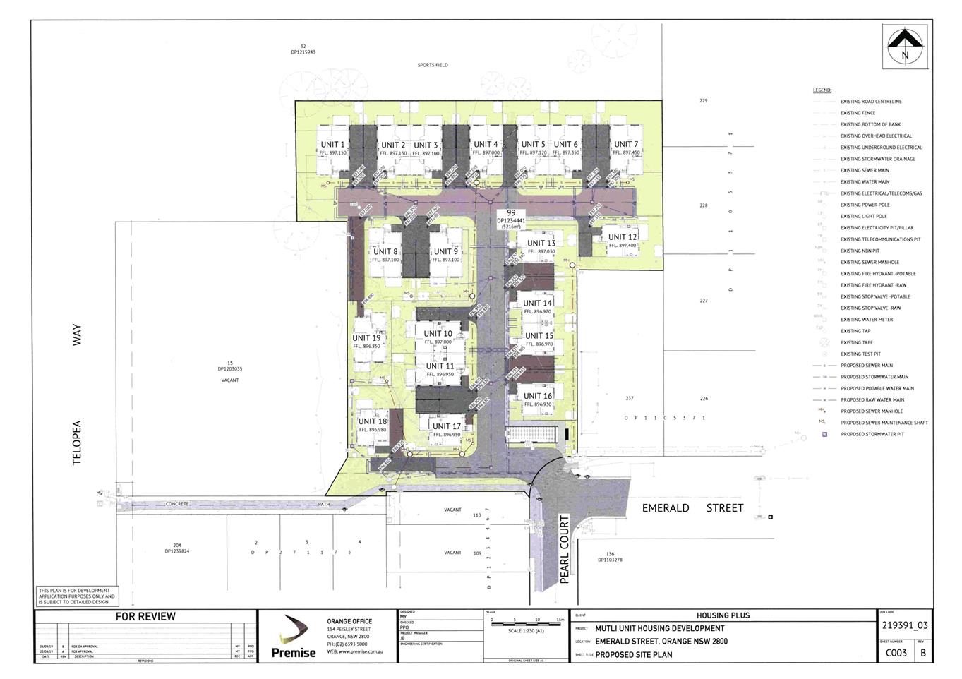
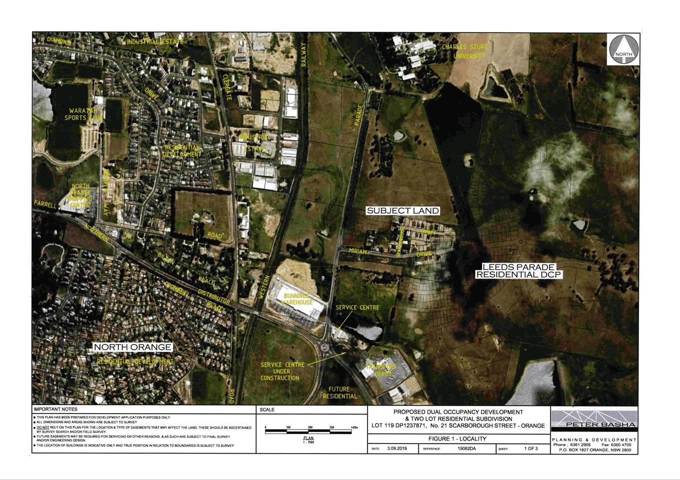
Council is in receipt of a development application for multi
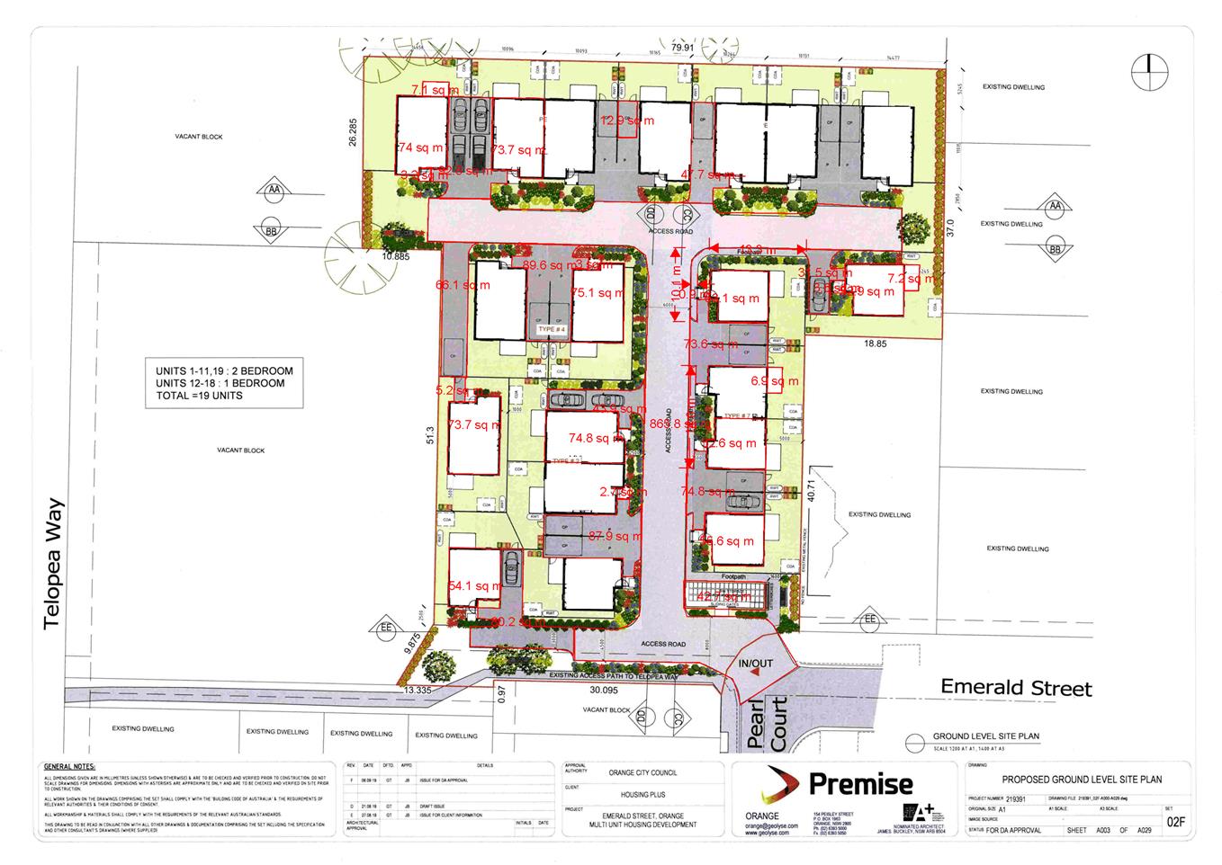
dwelling housing (19 dwellings) at Lot 99 Emerald Street, Orange (refer
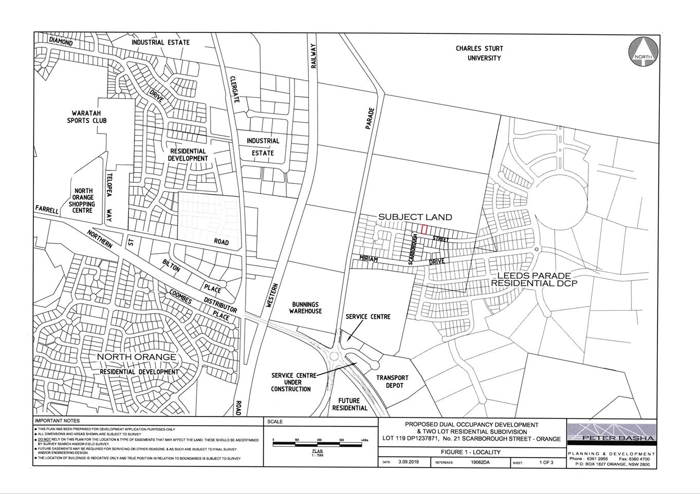
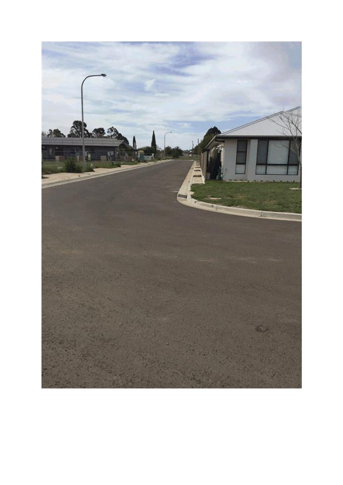
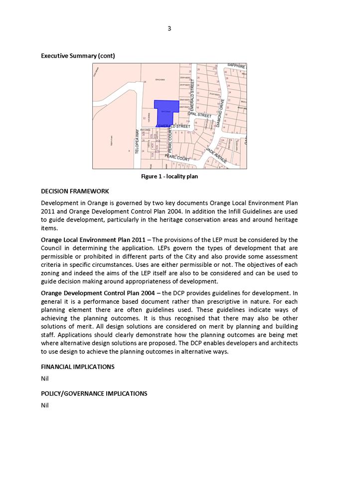
locality at Figure 1).
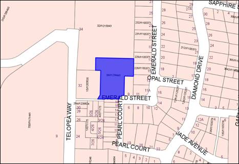
Figure
1 - locality plan
The proposed dwellings will be used and managed for the
purposes of affordable housing. The development will be undertaken by Housing
Plus, a registered community housing provider, under the
NSW Government’s Social and Affordable Housing Fund.
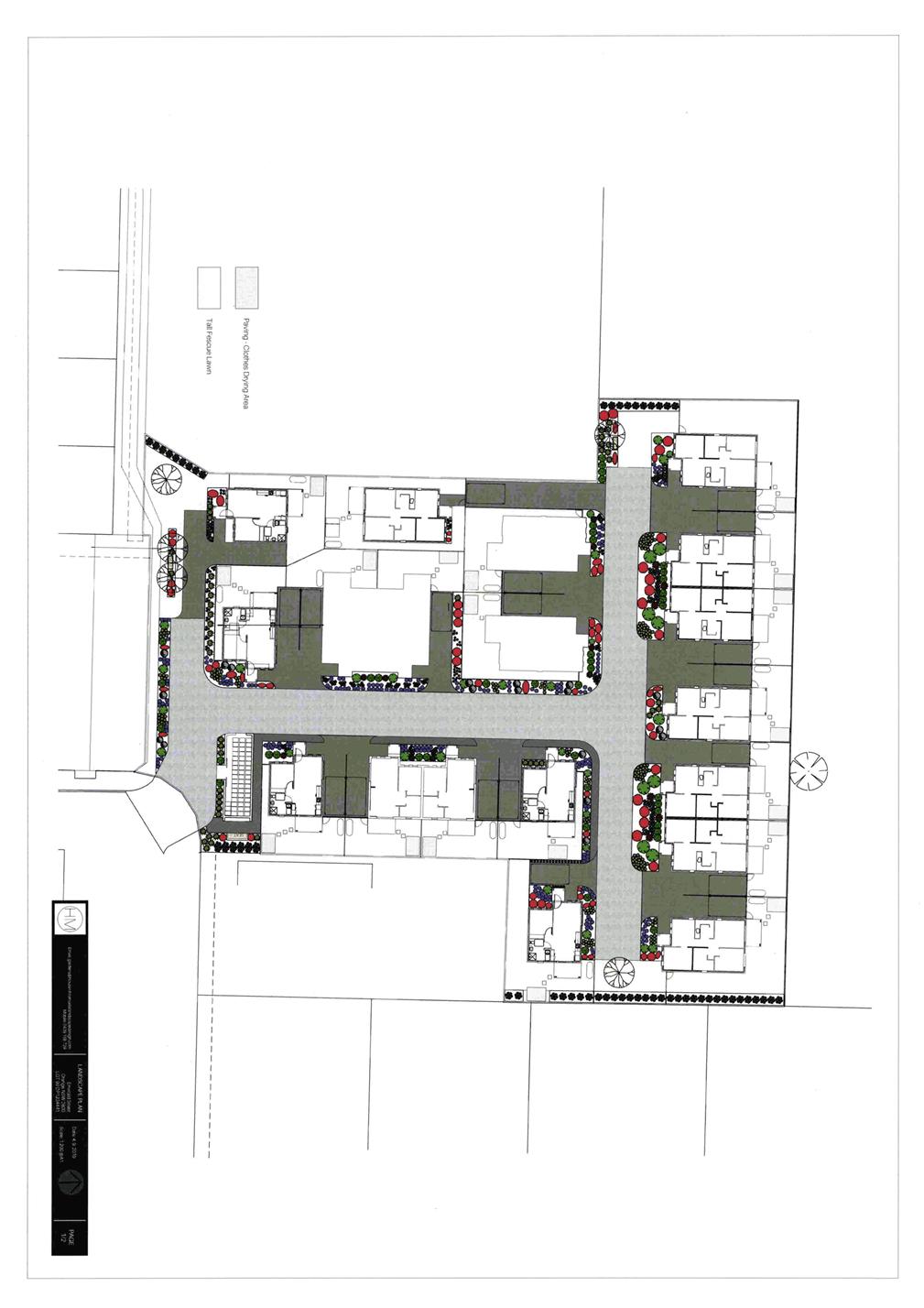
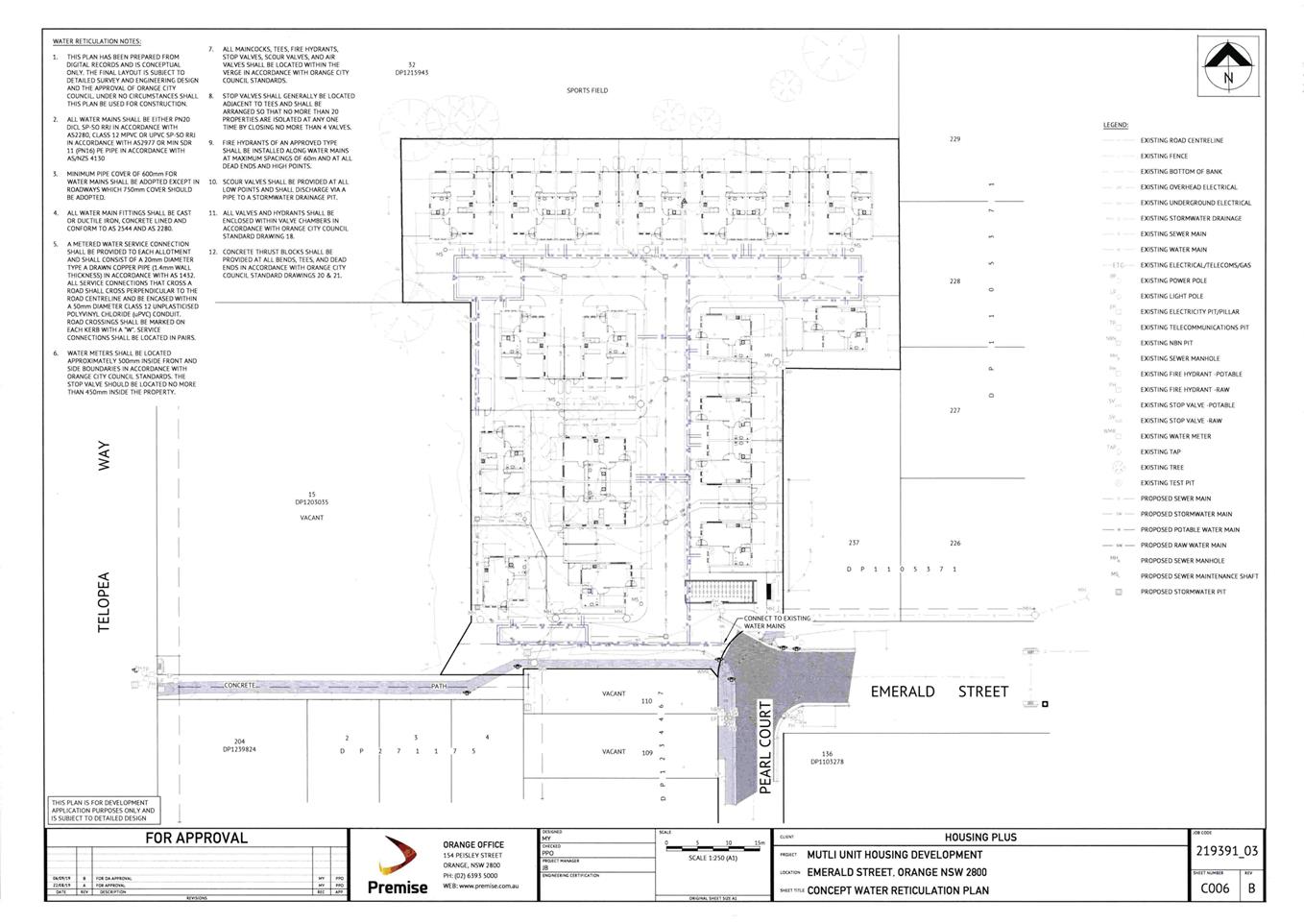
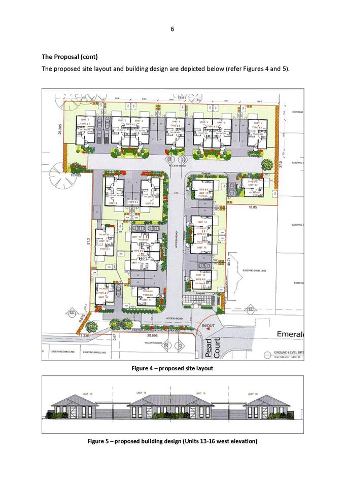
The development involves the following works:
· Demolition of the
existing dwelling house and associated domestic structures (these works have
been previously approved under a former development application).
· Construction of
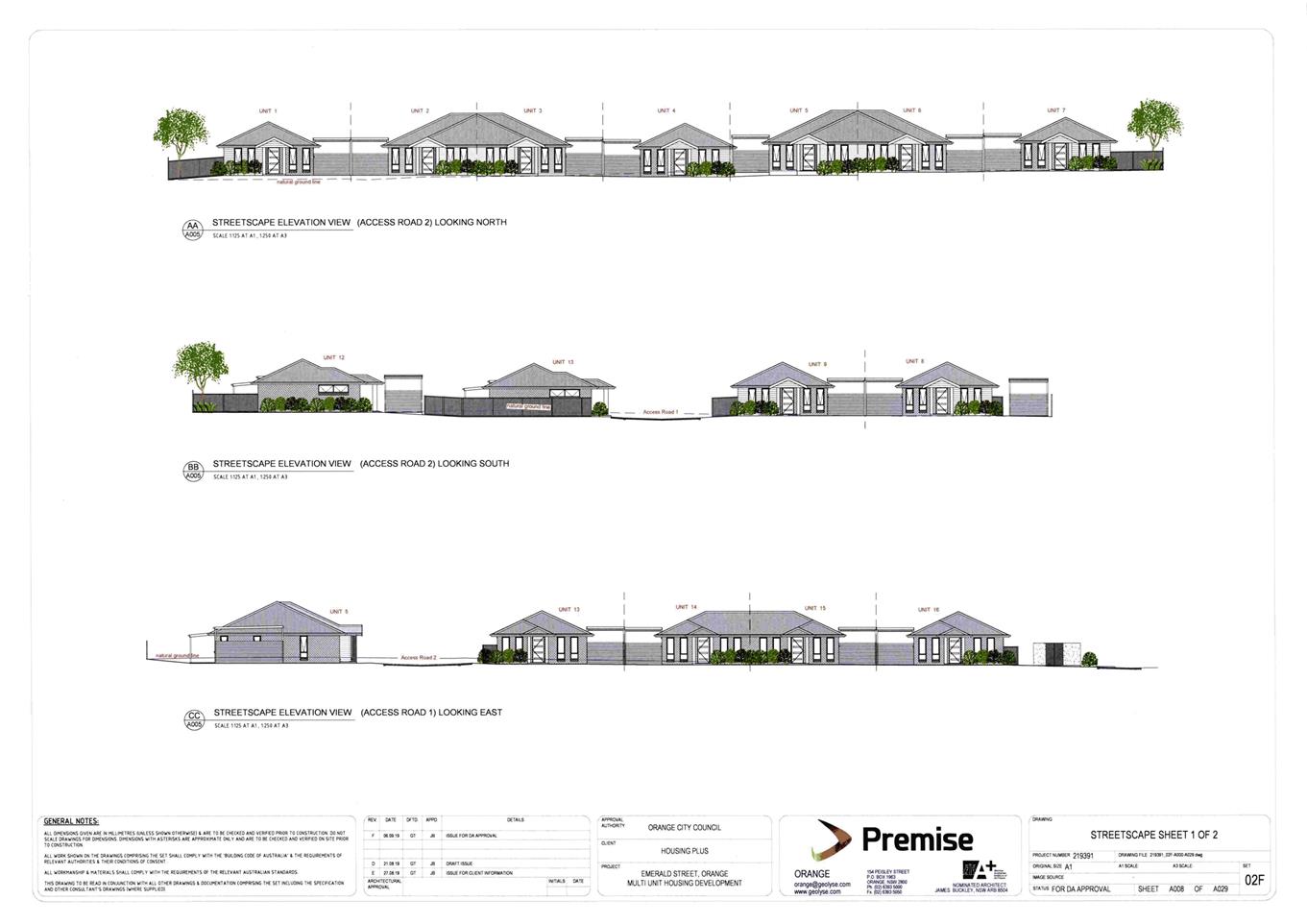
19 single-storey and self-contained dwellings (comprising
7 x one bedroom dwellings and 12 x two bedroom dwellings).
· Provision of
private open space and undercover car parking for each dwelling.
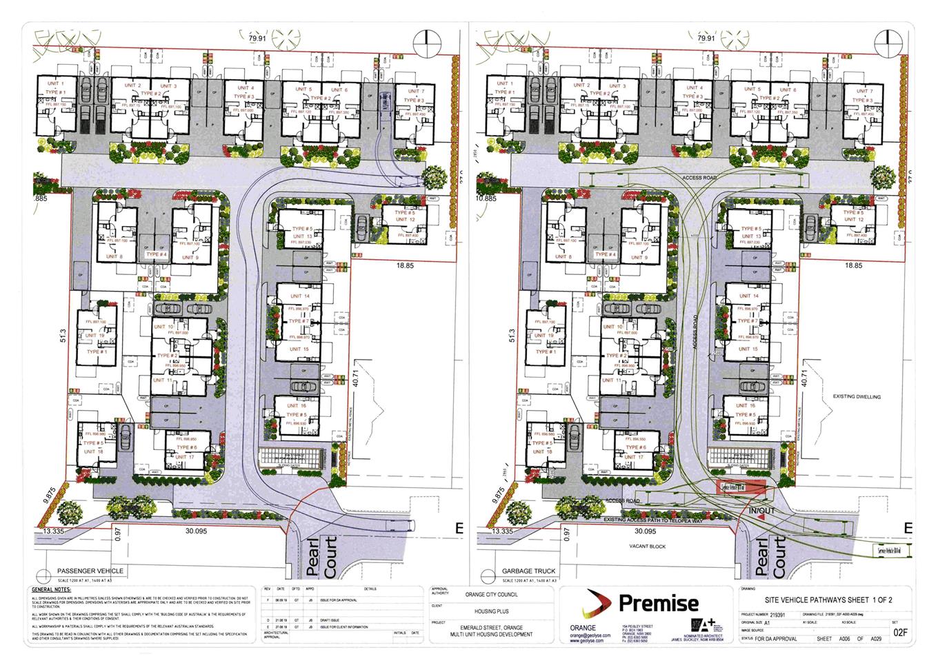
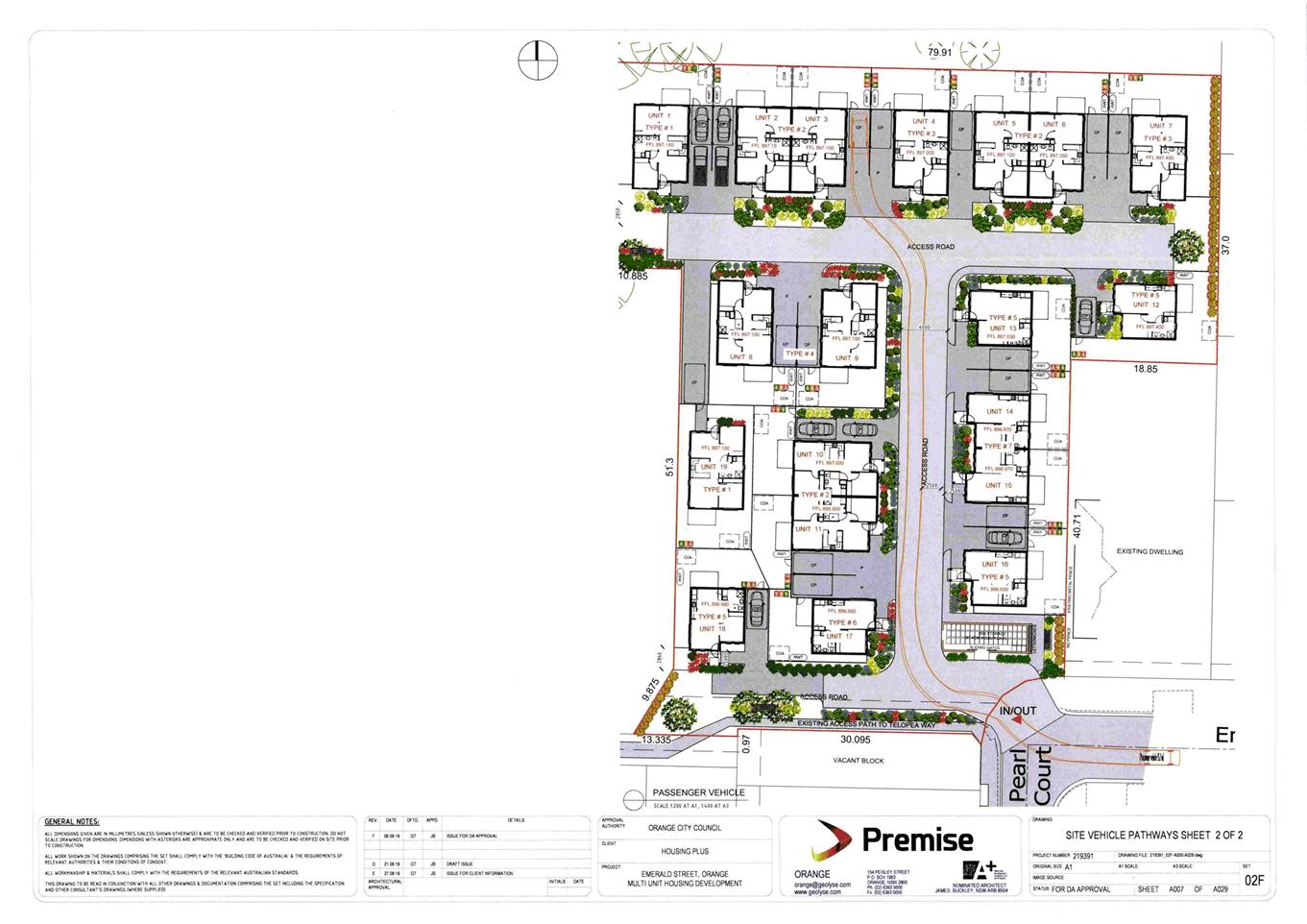
· Driveway access
via Pearl Court and shared internal roads.
· Site landscaping,
perimeter fencing and communal waste bin storage area.
The capital investment value of the proposed development
exceeds $5million, and consequently pursuant to the requirements of State
Environmental Planning Policy (State and Regional Development) 2011, the
proposal comprises regionally significant development. The Western Regional
Planning Panel is the consent authority for regionally significant development.
This report is provided to Council for information only.
The purpose of this report is to
make Council aware that the abovementioned development application is being
tabled for the determination of the Western Regional Planning Panel and to make
the recommendation that the report be acknowledged. The report also specifies
the protocols to be followed should Council wish to provide a written
submission relating to the attached report to the Western Regional Planning
Panel. The assessment report, draft Notice of Determination, plans and
submissions are attached for Council’s reference.
The proposal comprises advertised development pursuant to
Orange Development Control Plan (DCP) 2004-5.3. At the completion of the
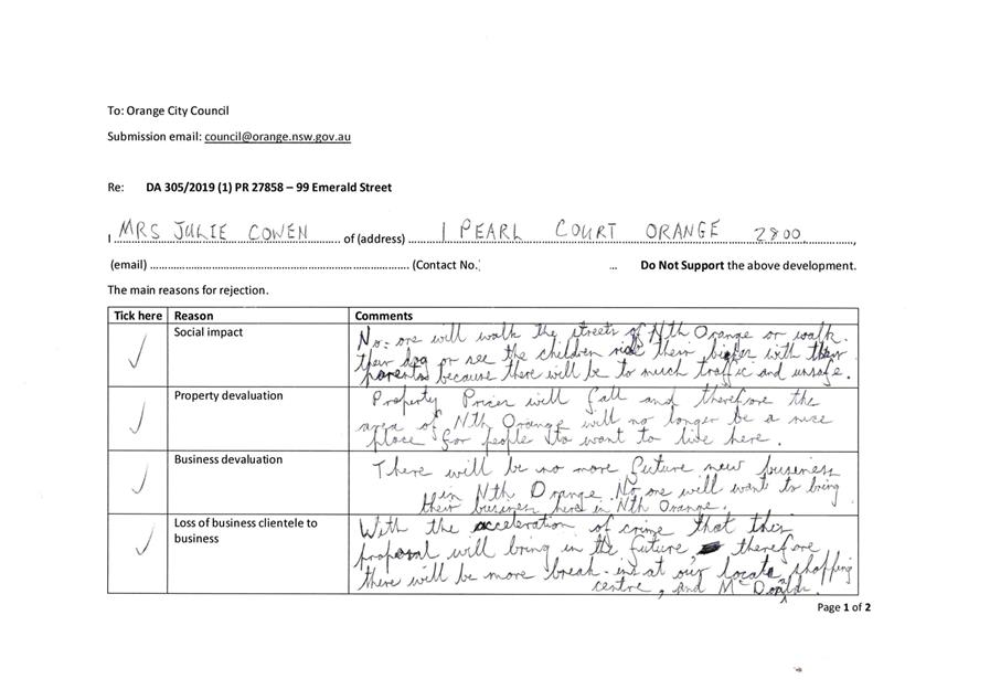
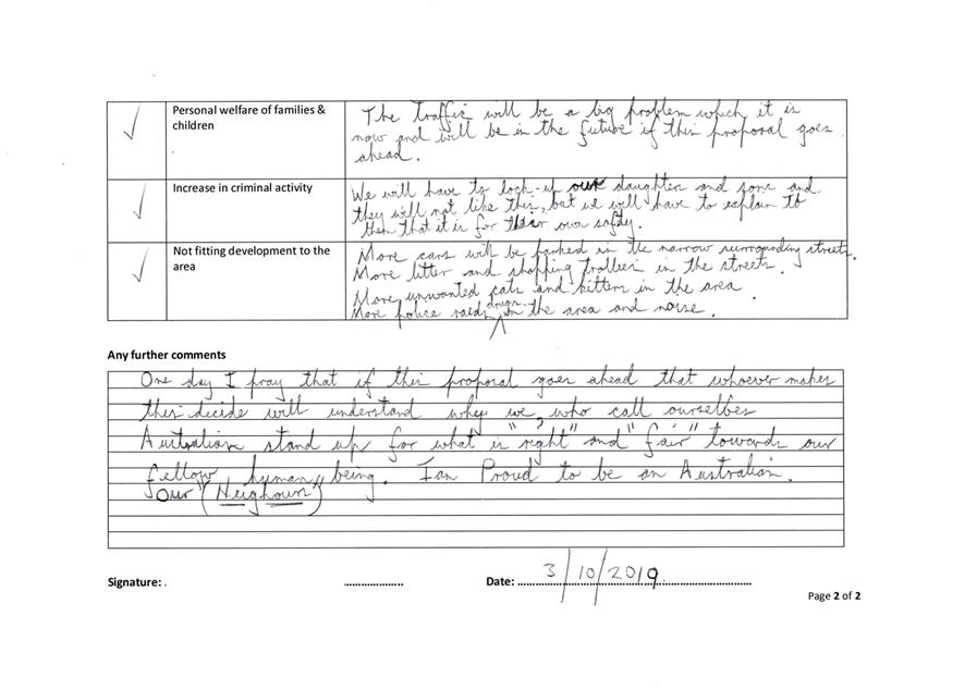
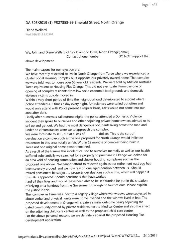
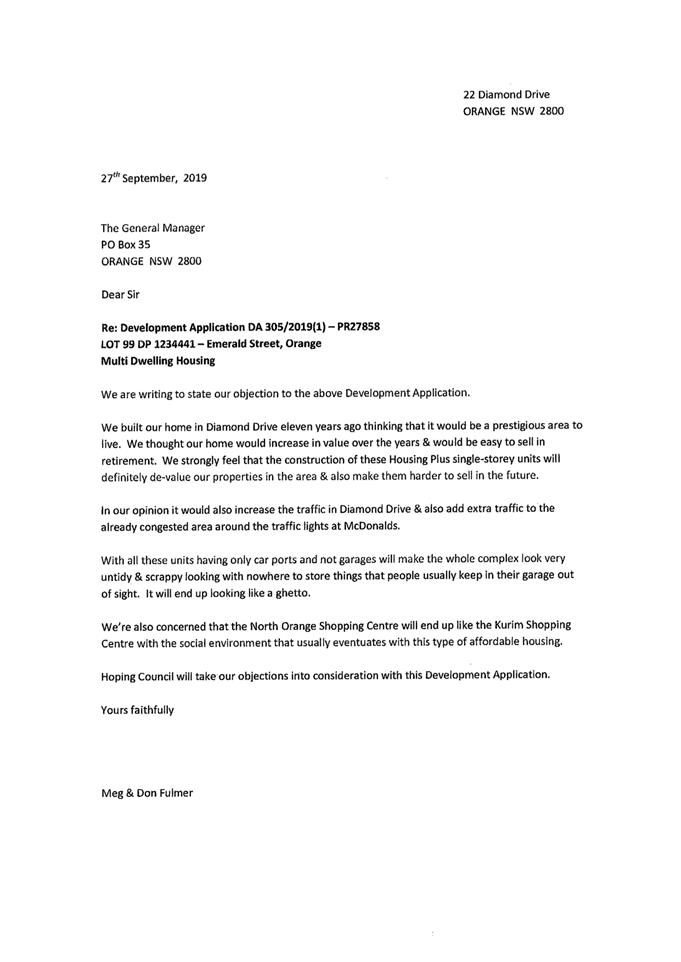
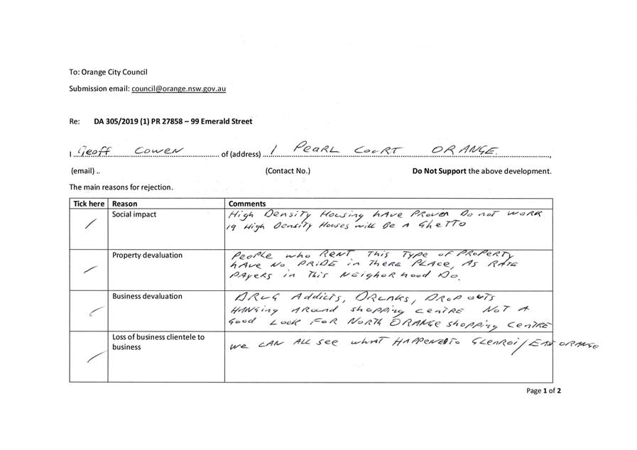
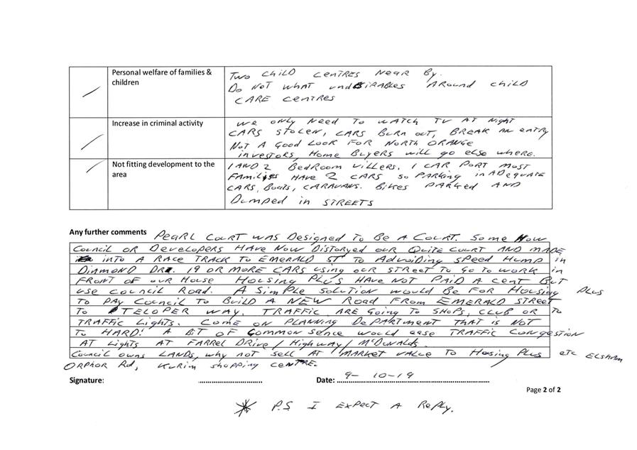
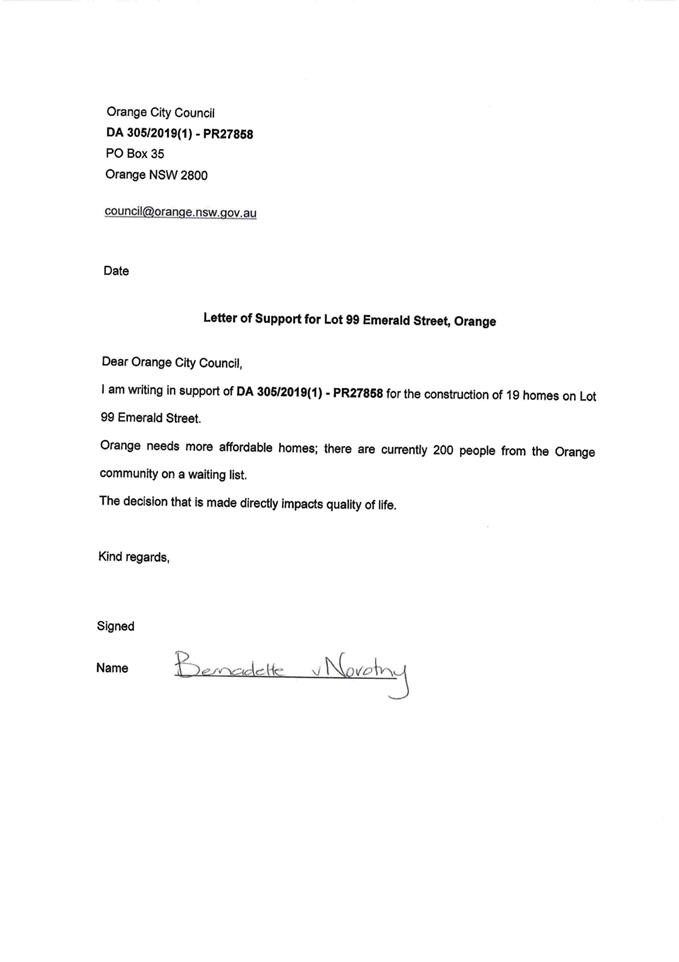
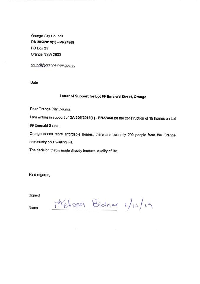
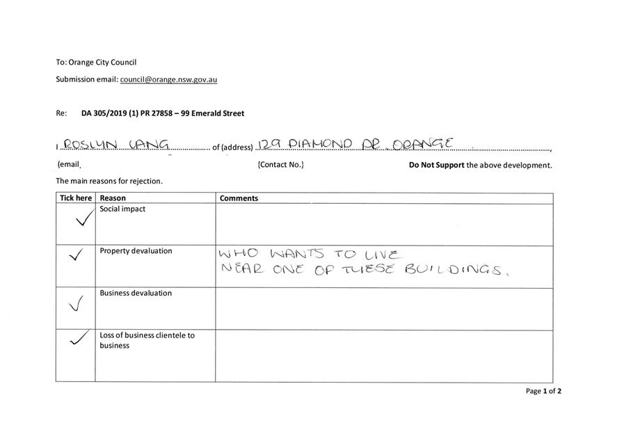
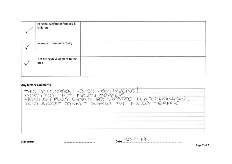
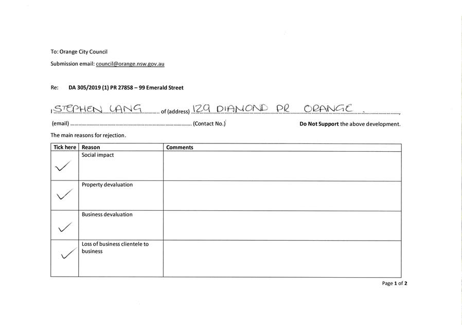
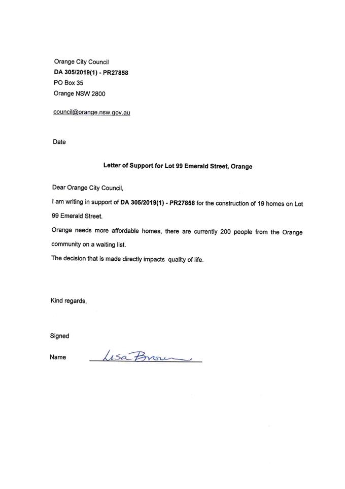
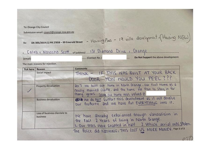
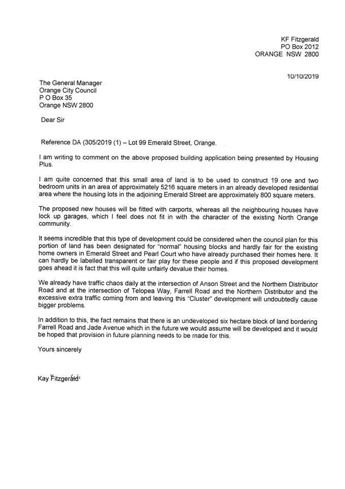
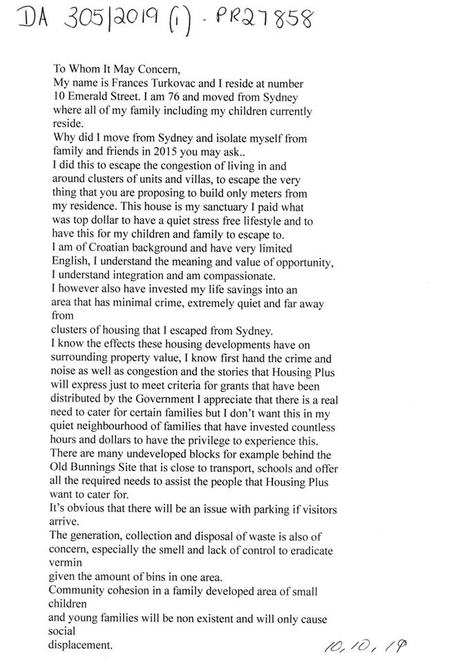
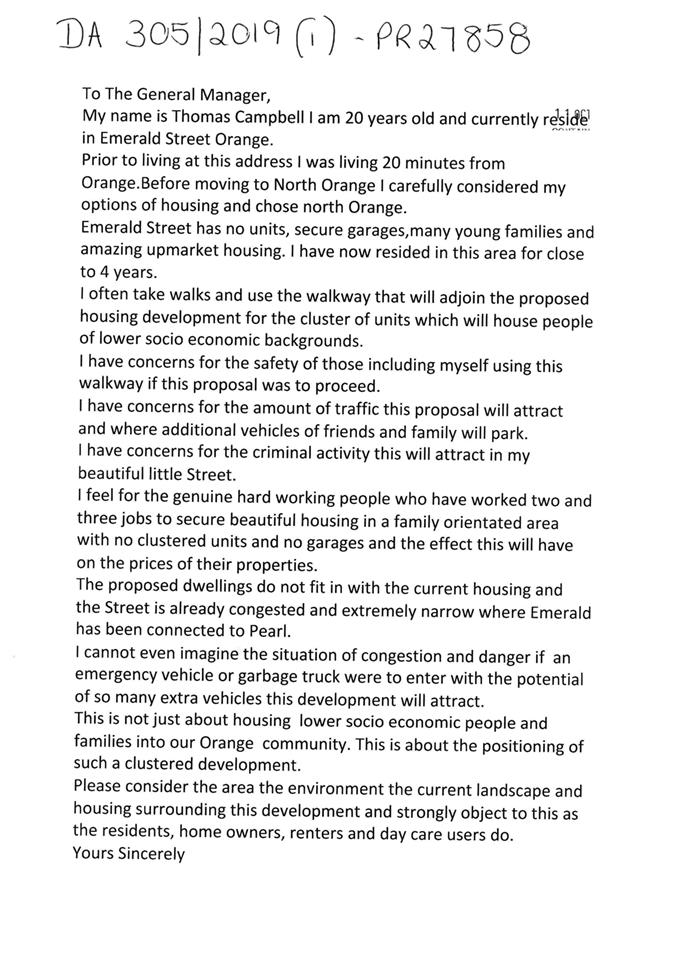
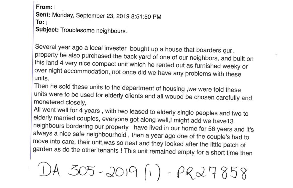
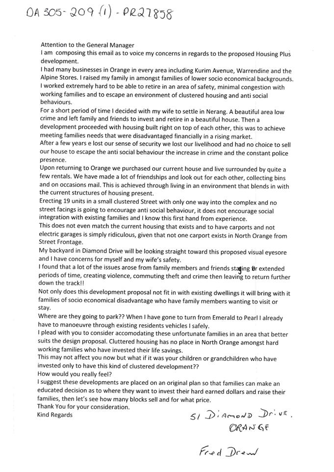
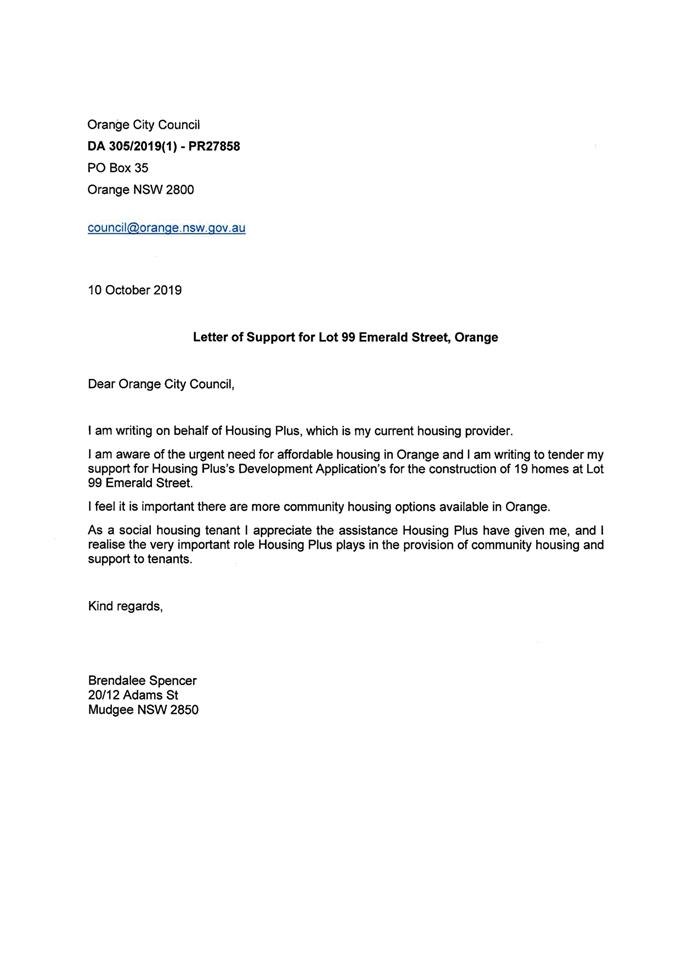
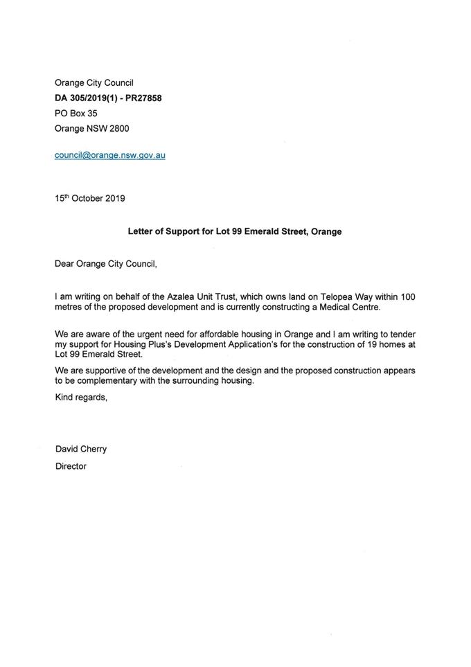
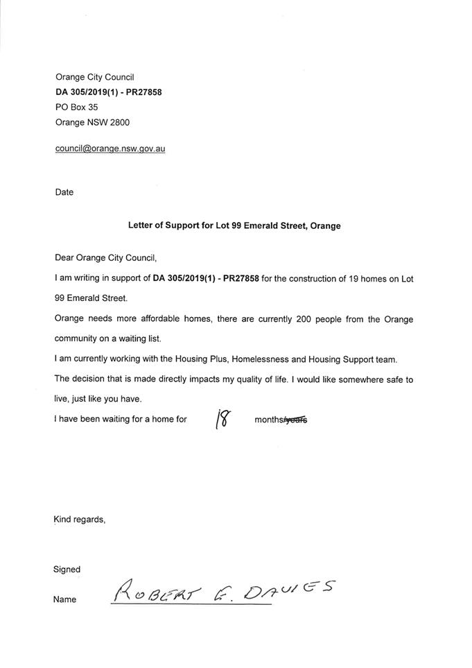
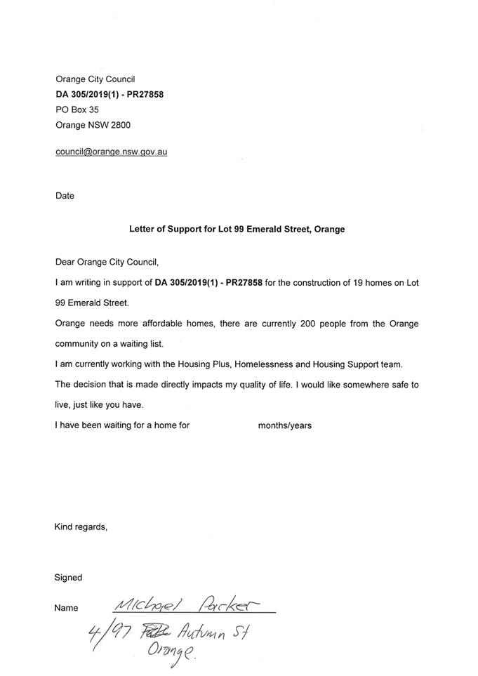
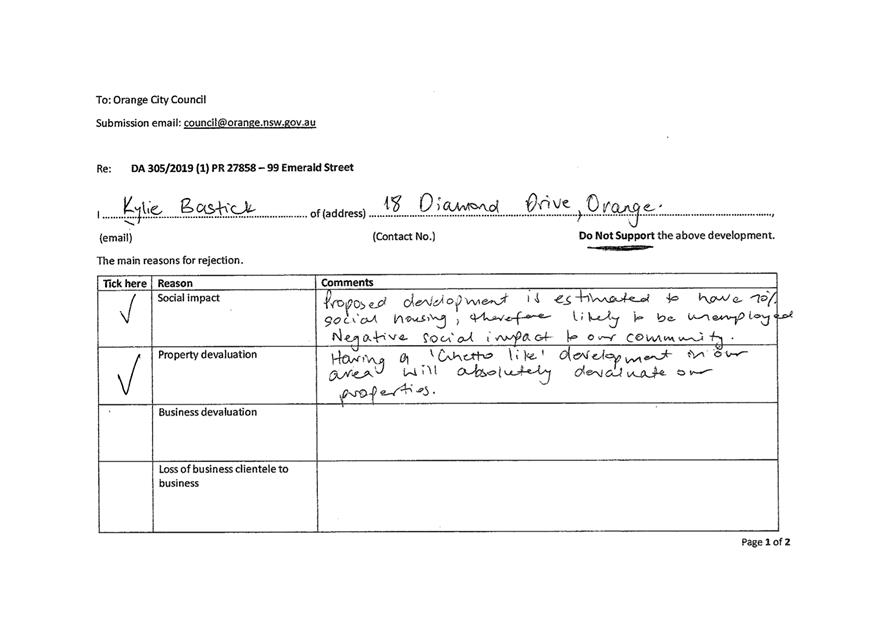
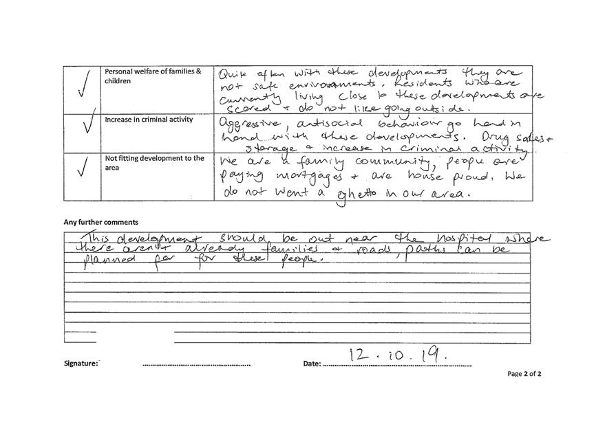
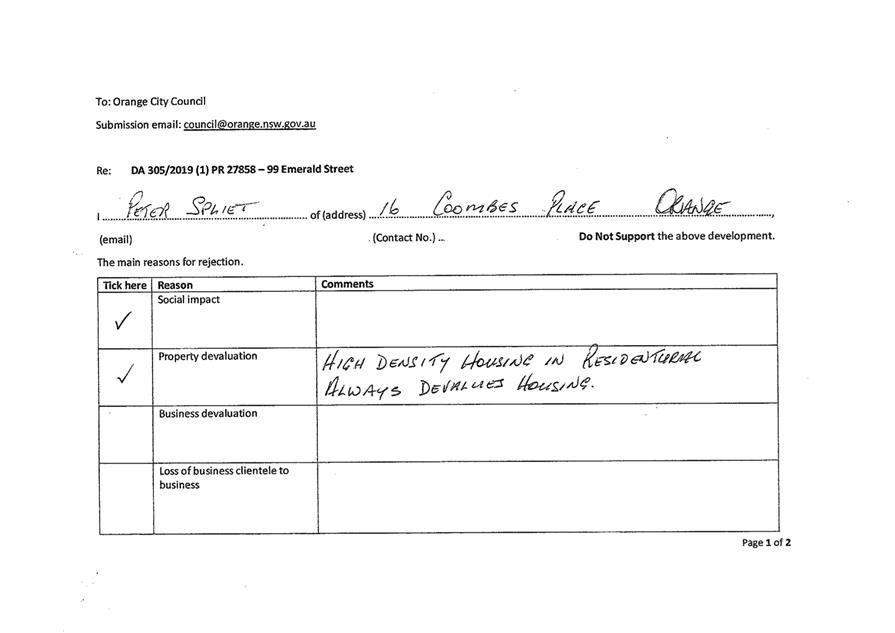
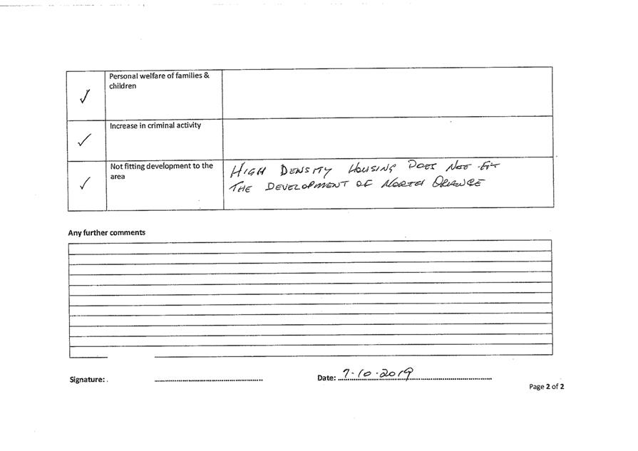
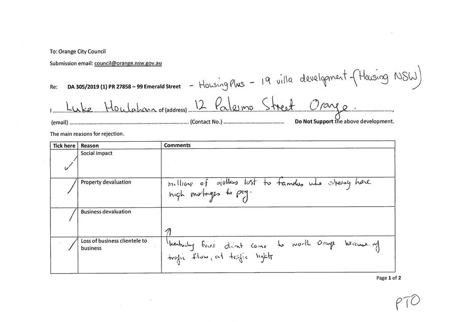
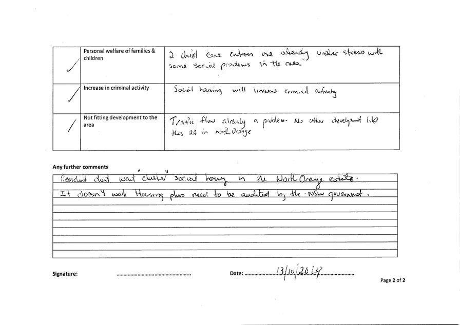
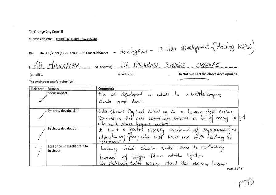
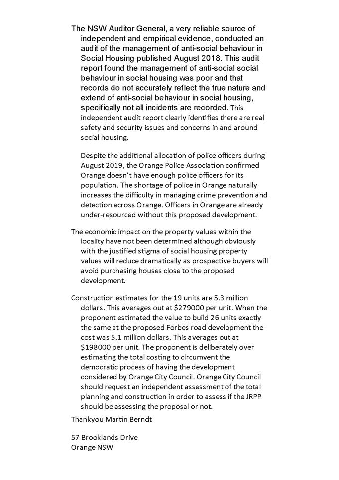
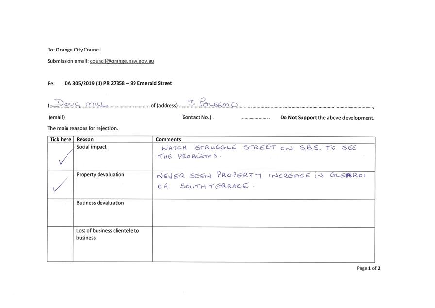
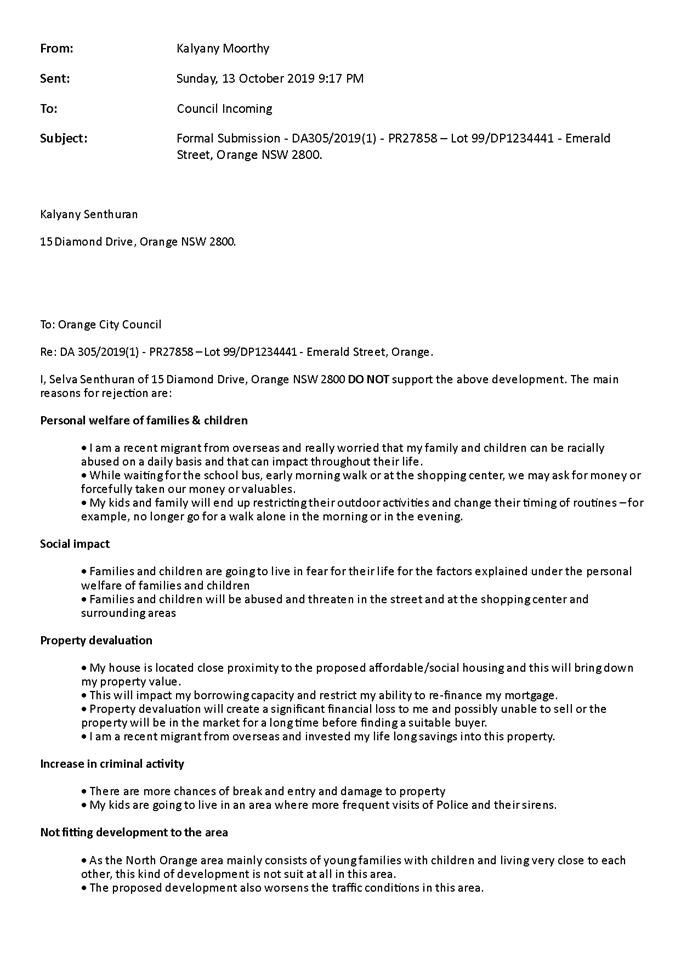
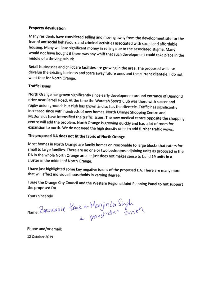
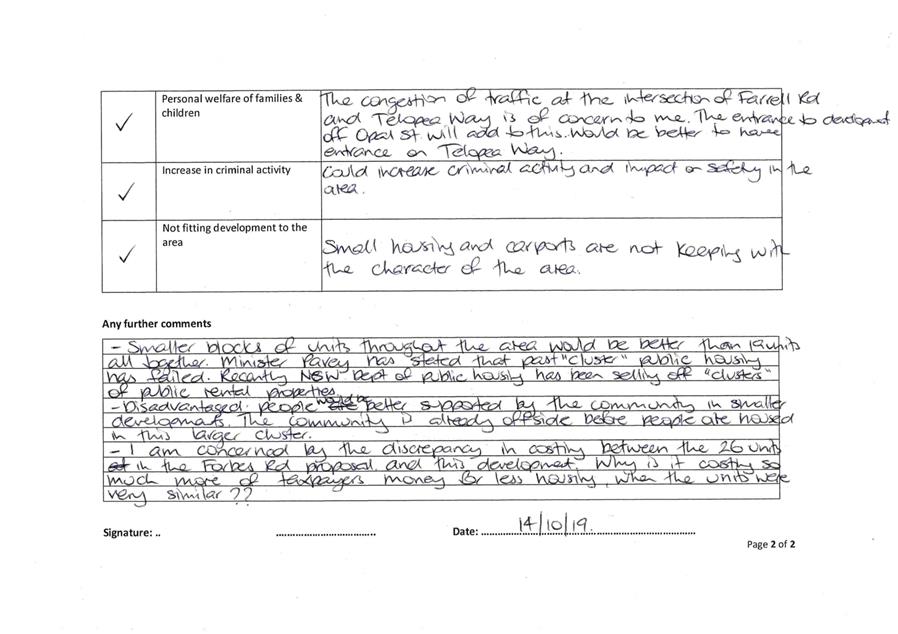
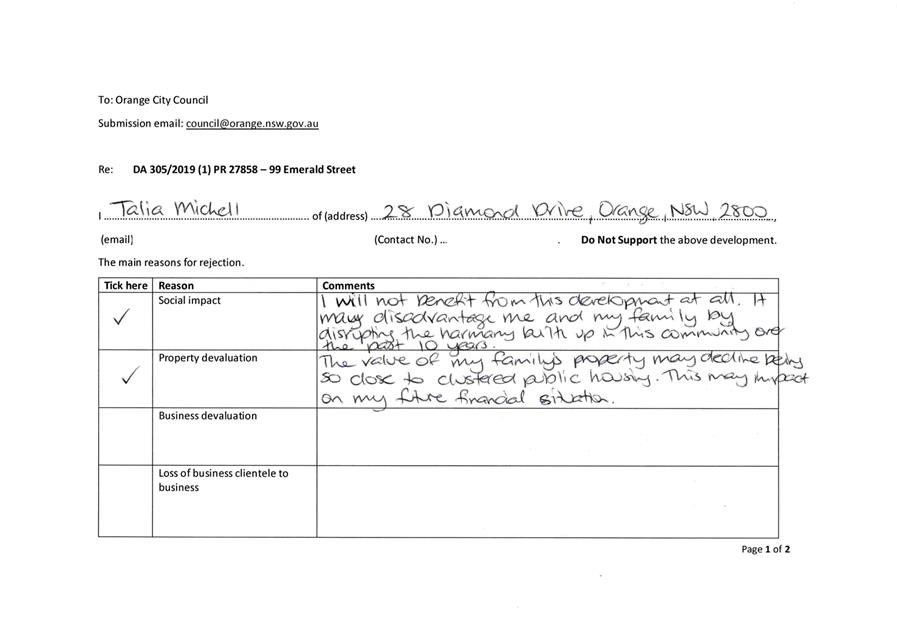
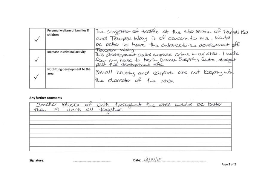
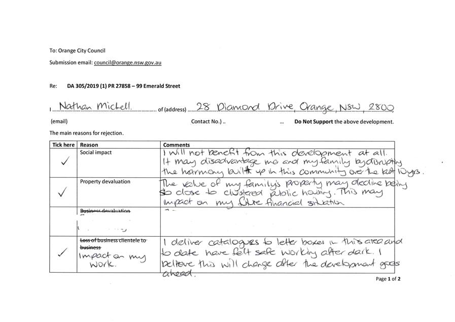
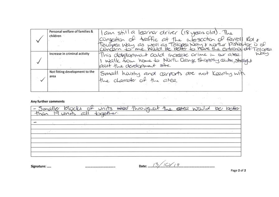
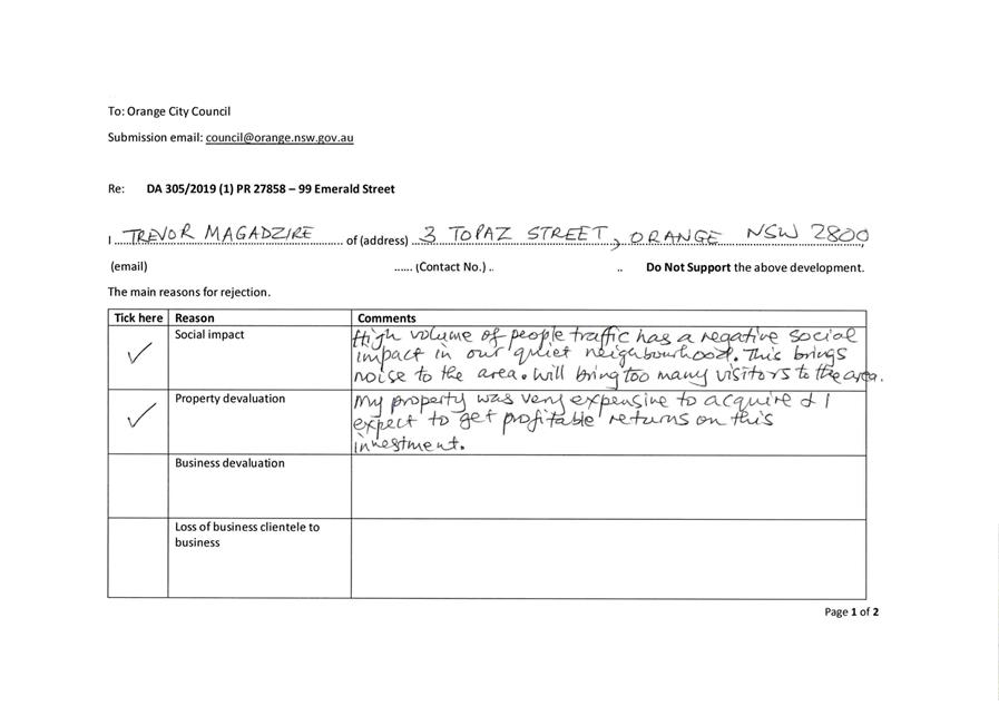
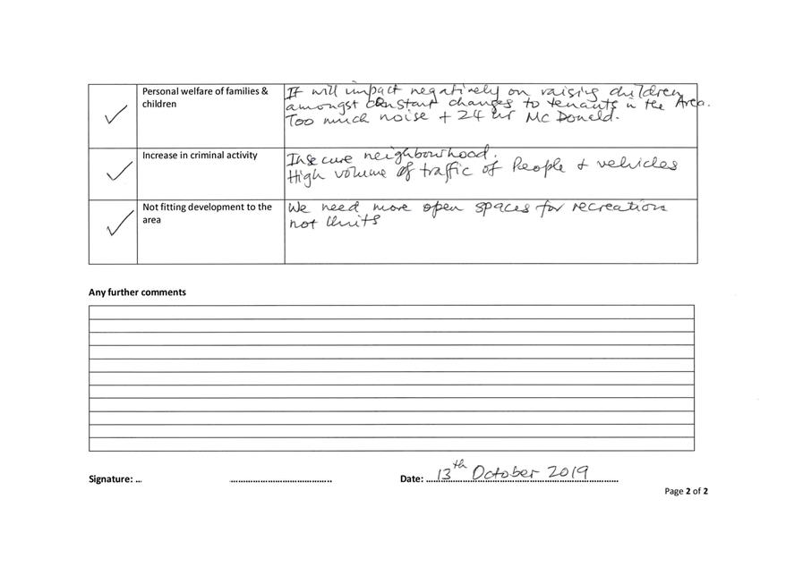
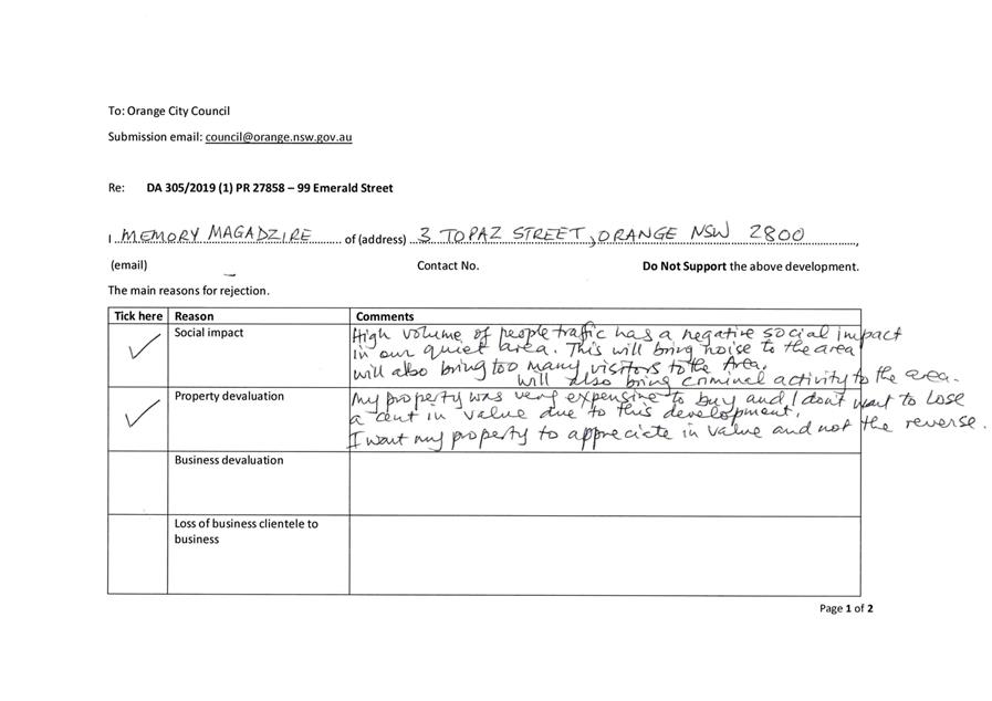
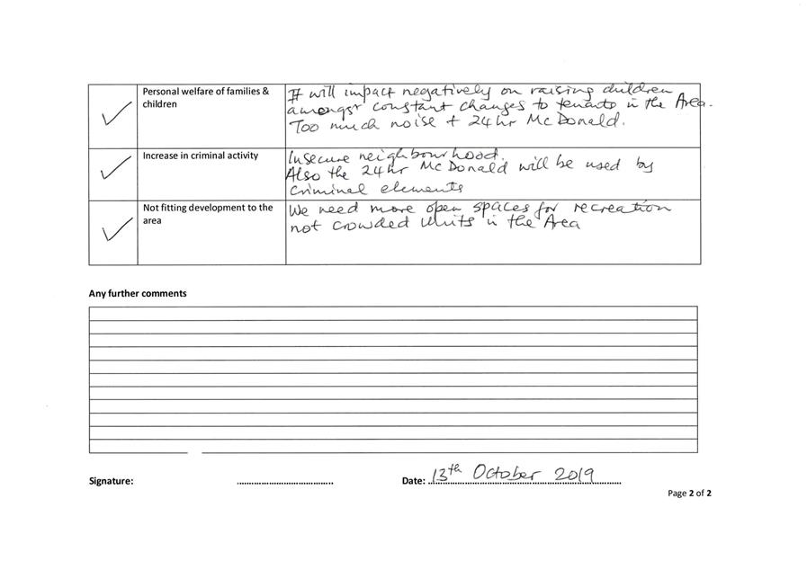
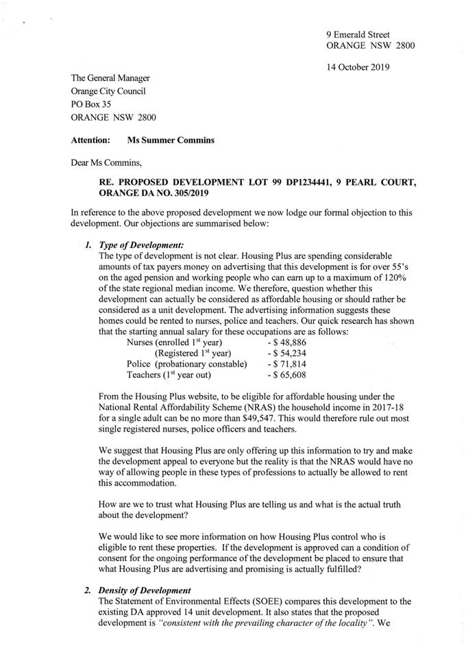
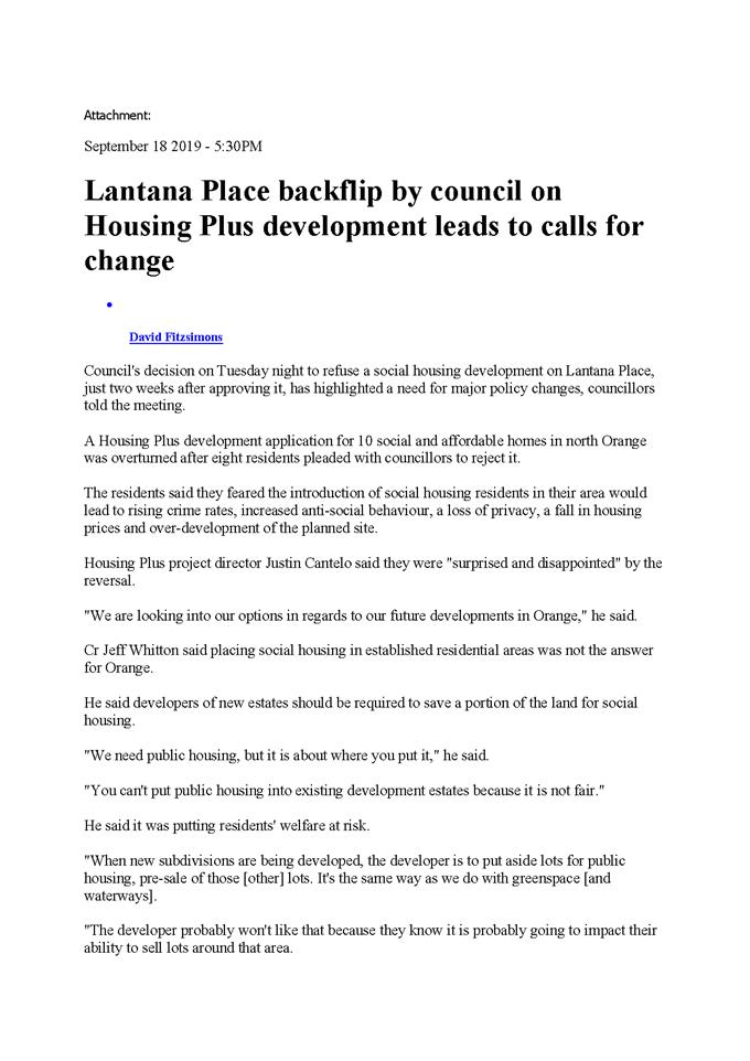
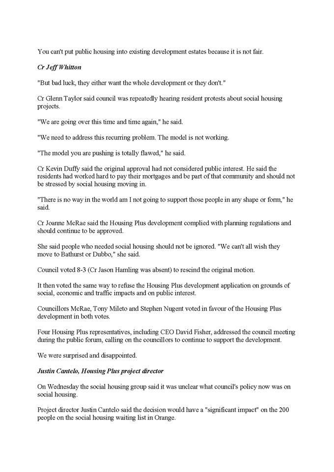
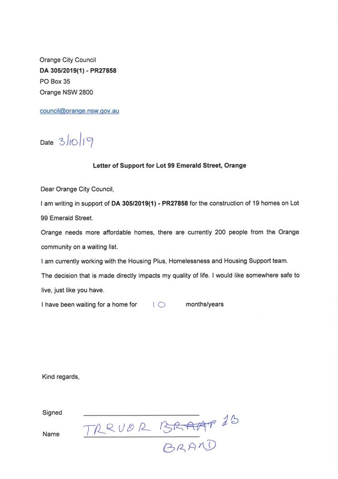
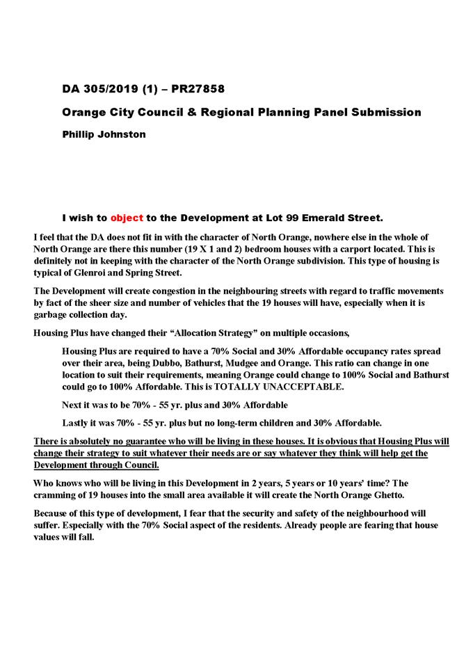
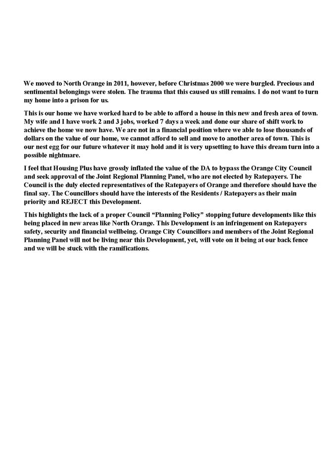
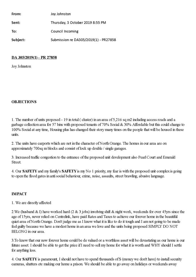
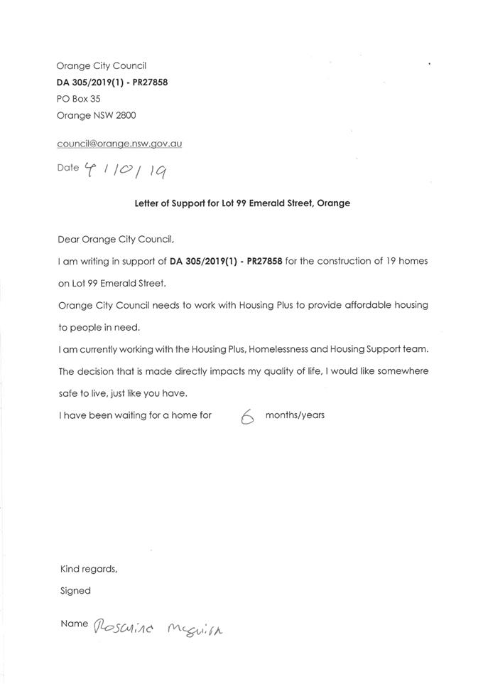
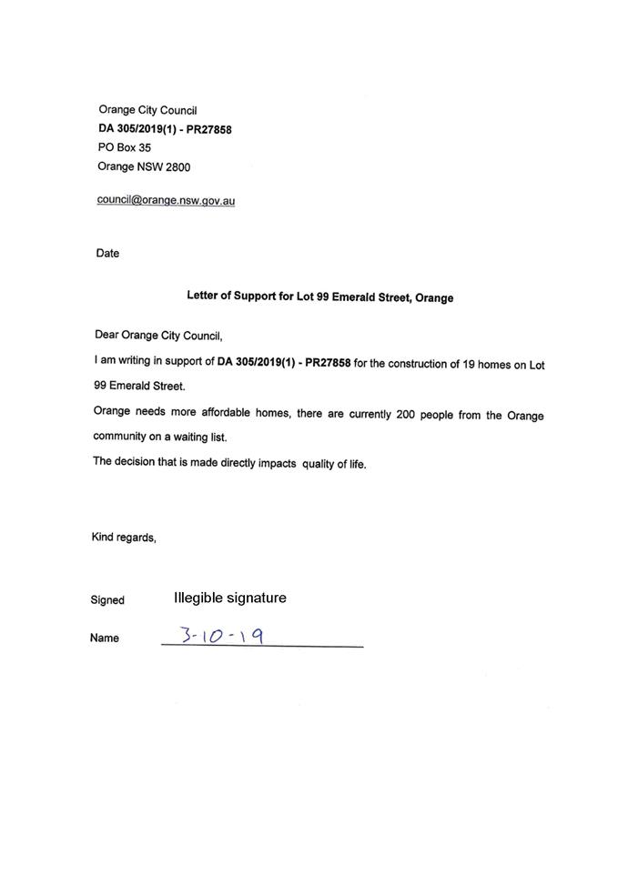
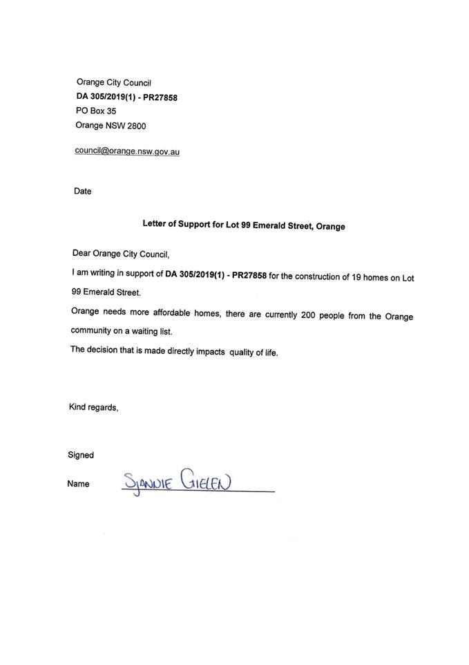
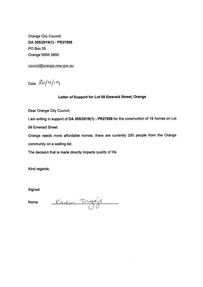
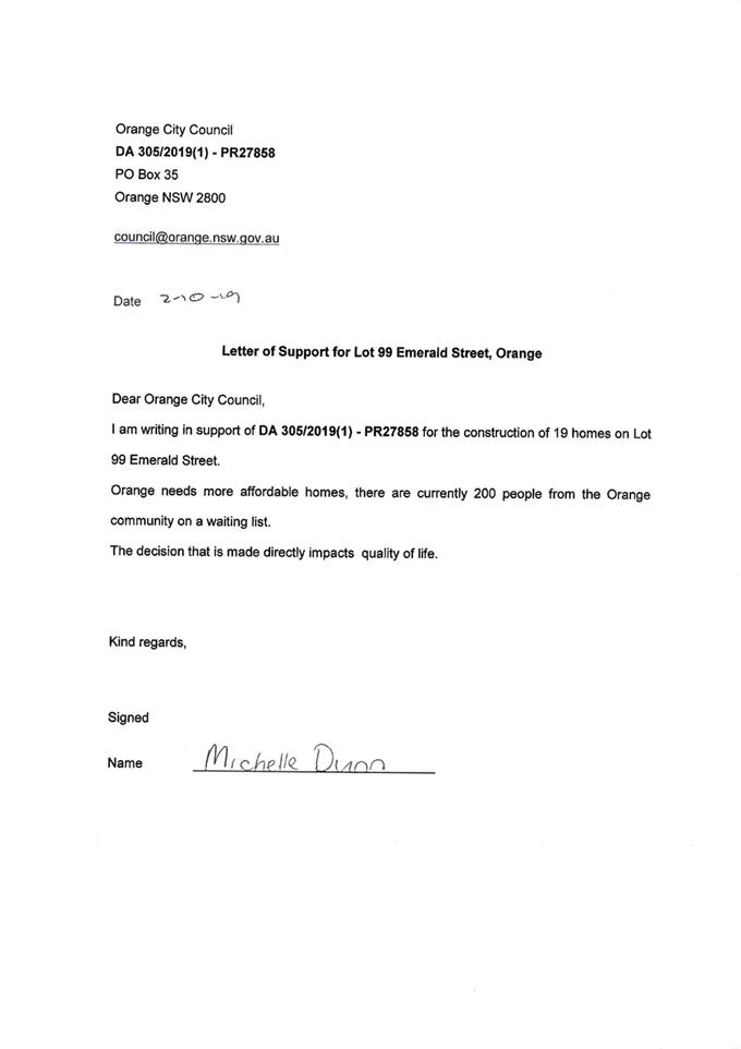
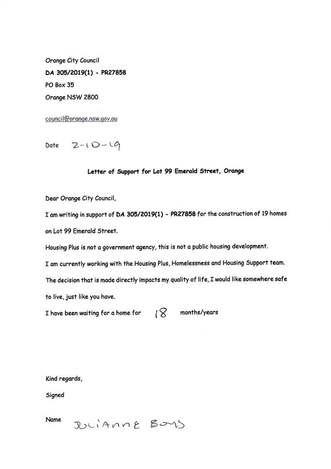
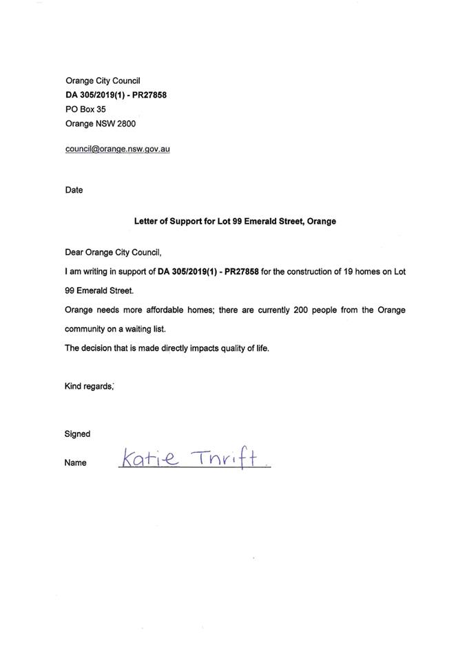
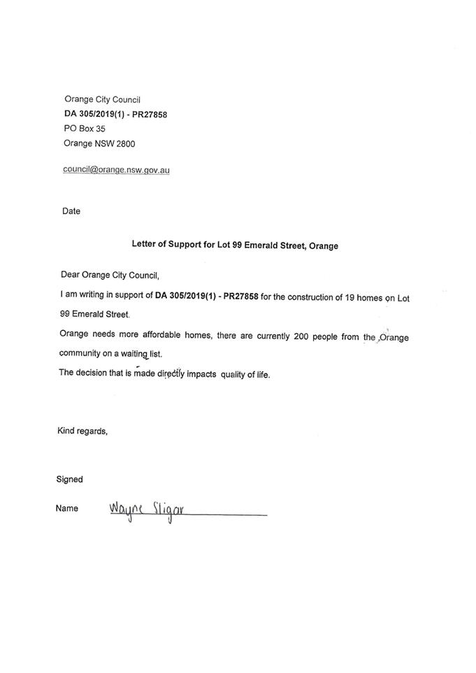
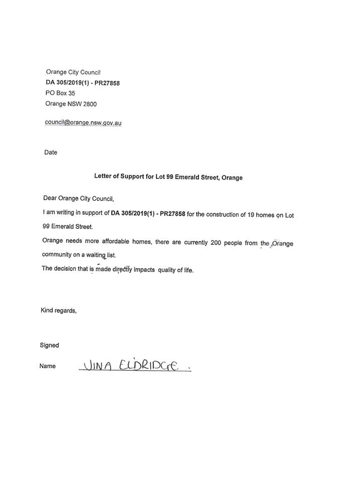
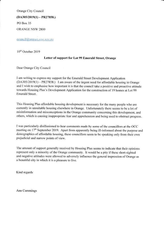
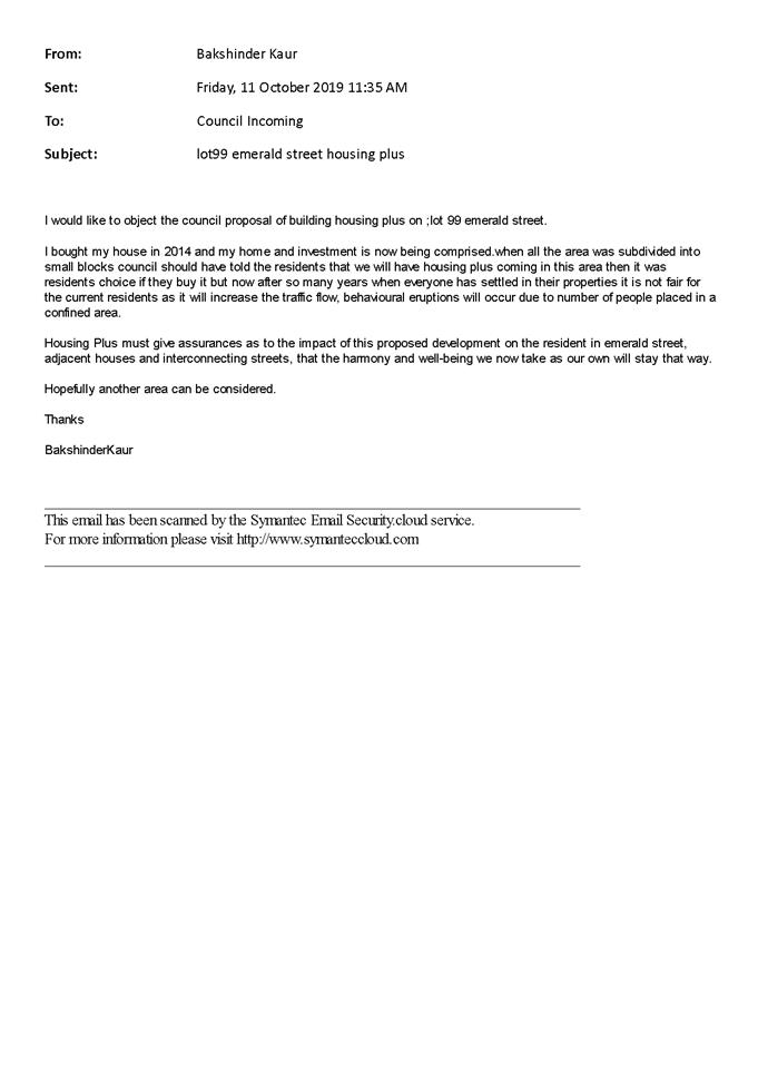
written notice and public exhibition period, 267 submissions had been received
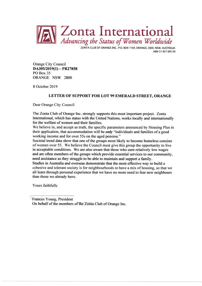
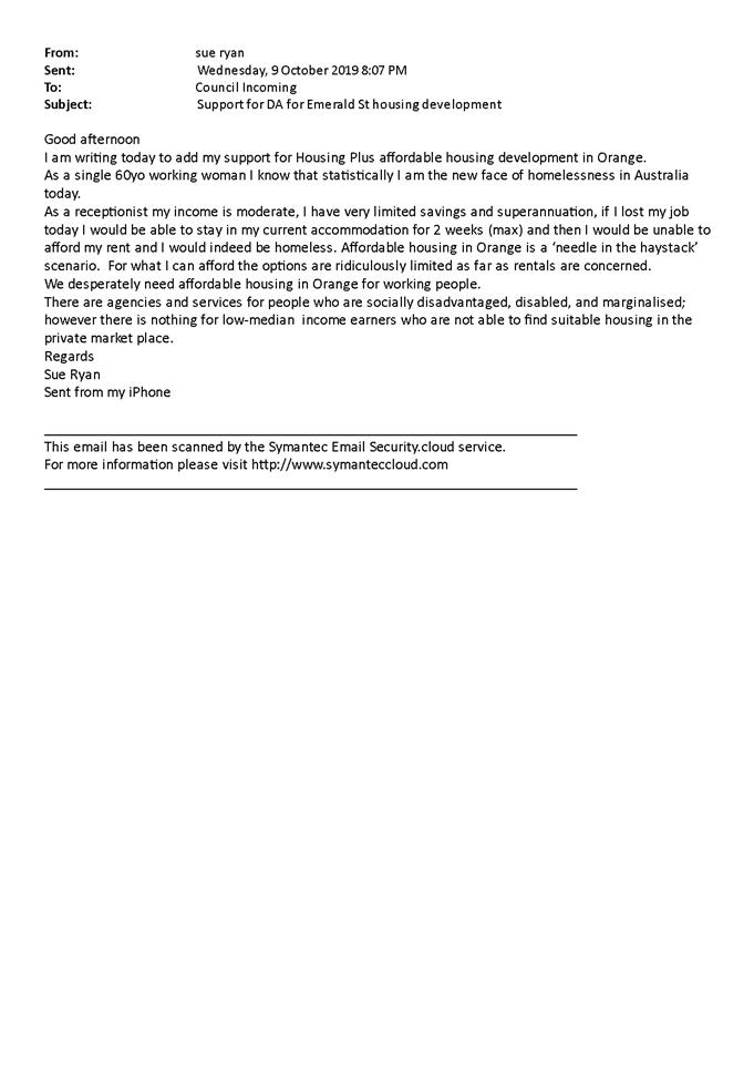
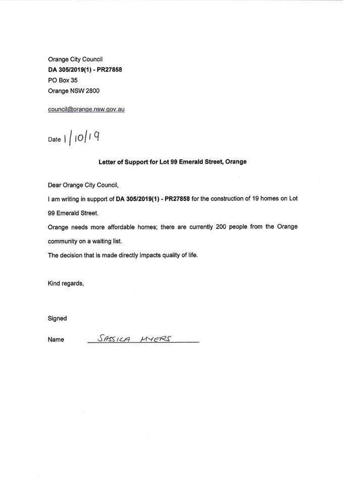
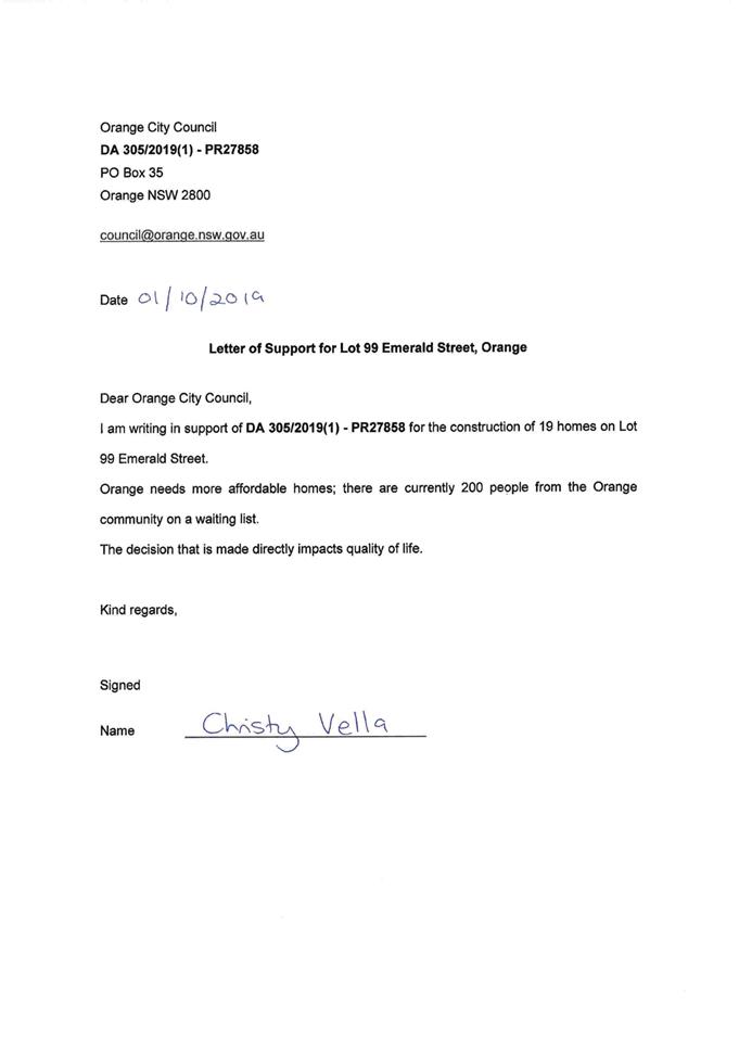
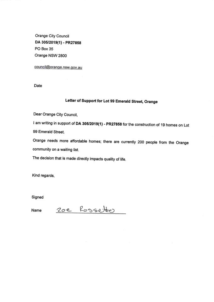
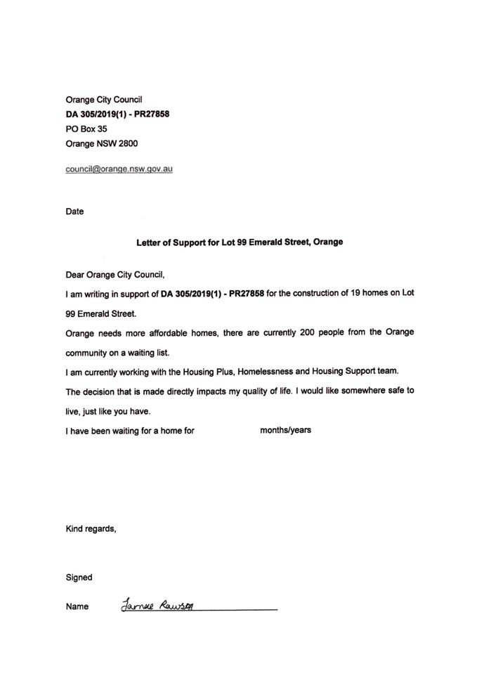
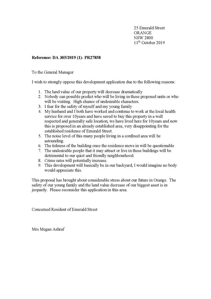
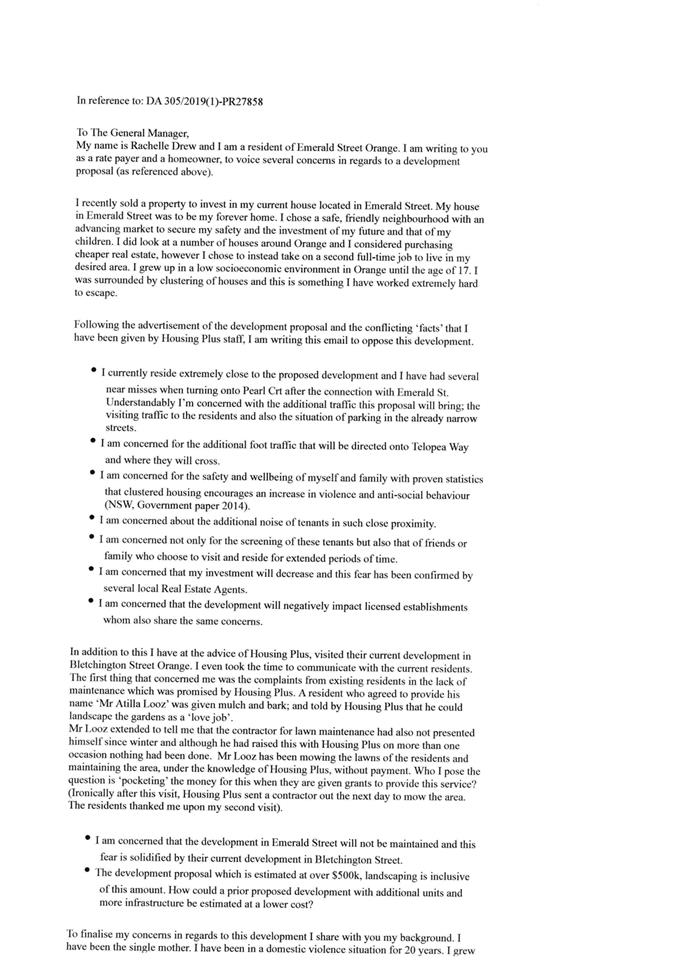
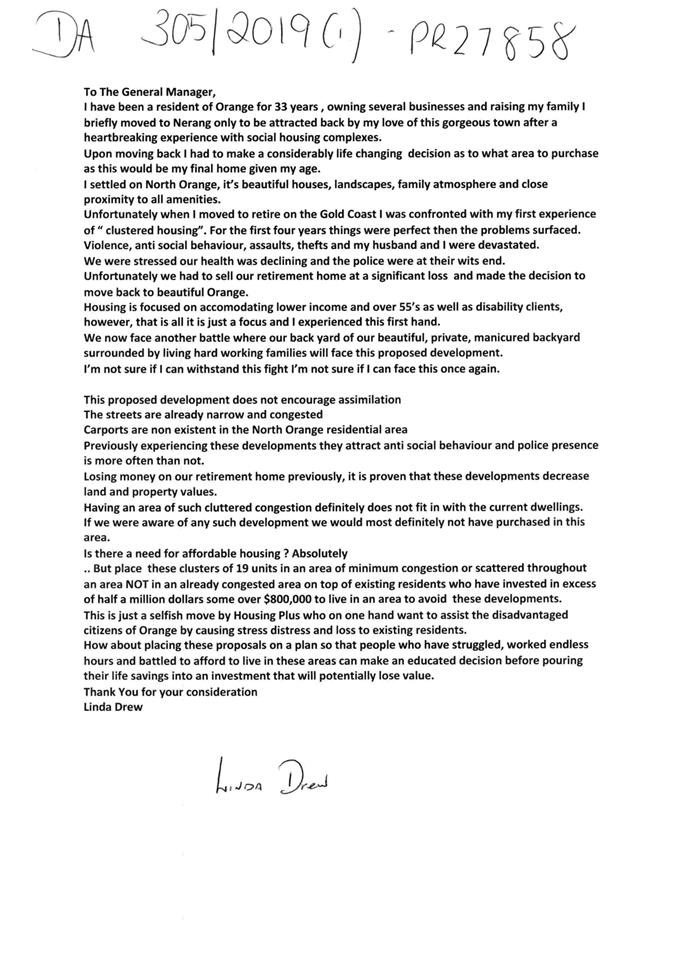
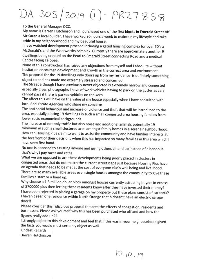
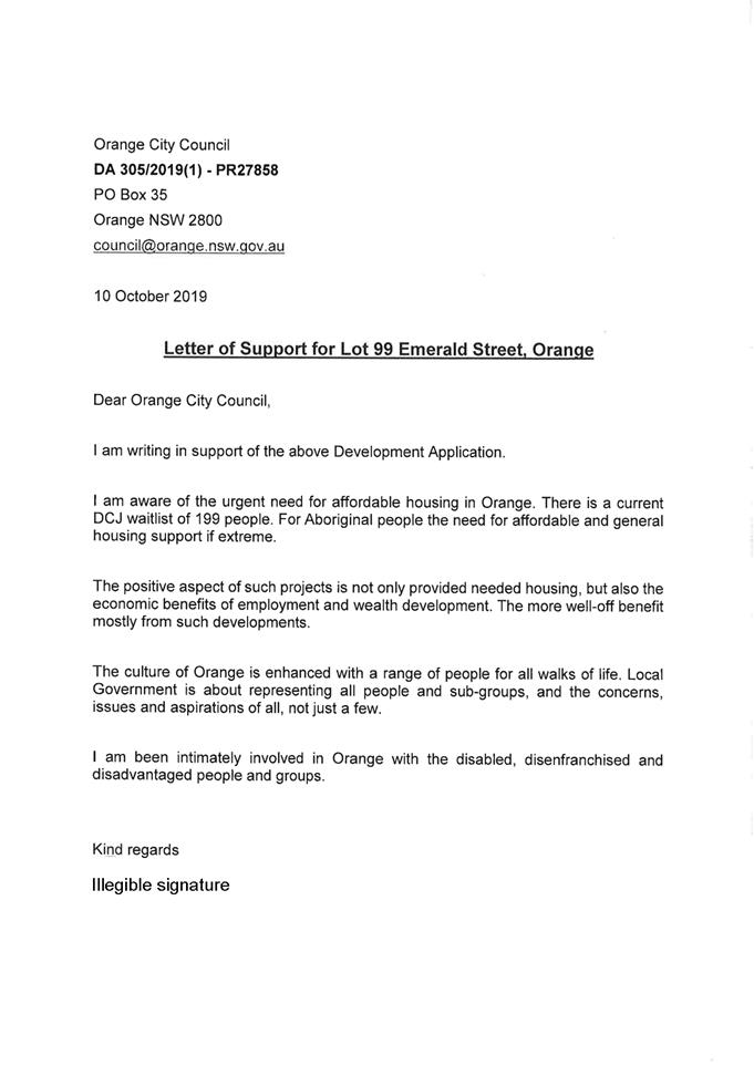
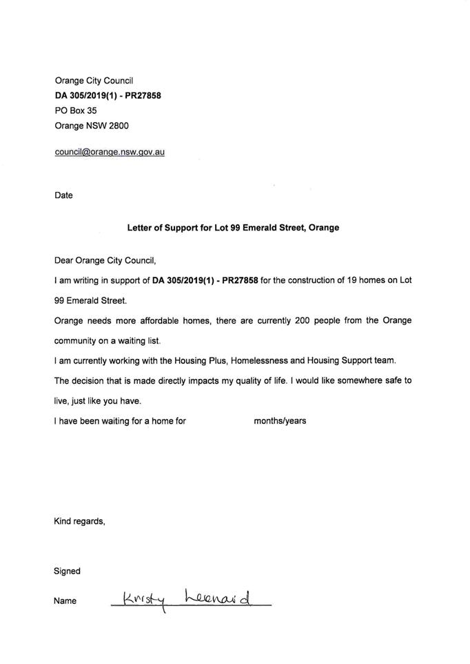
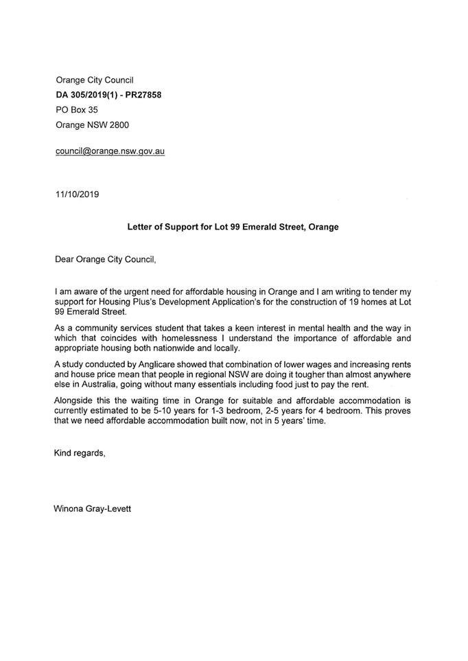
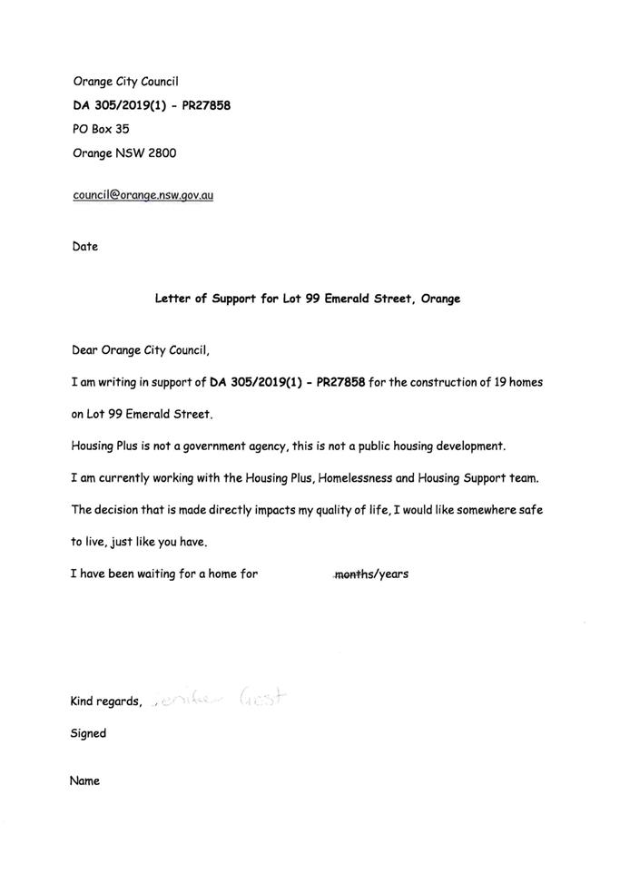
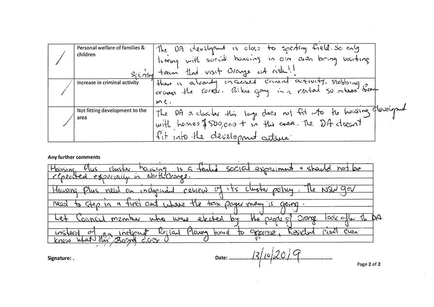
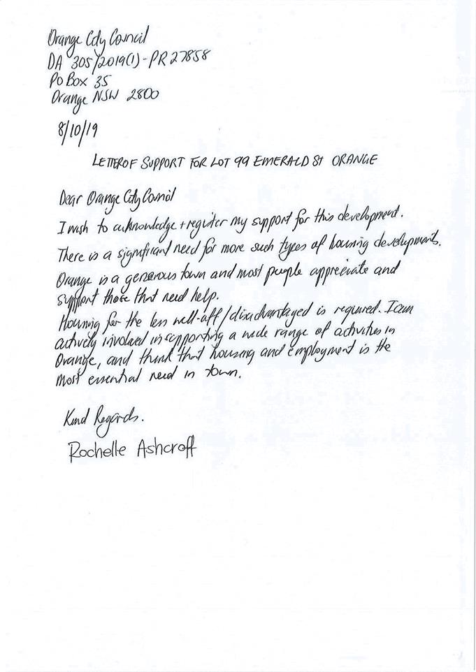
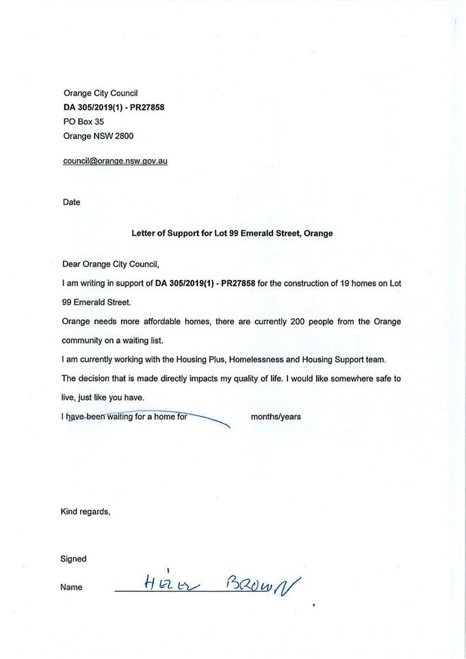
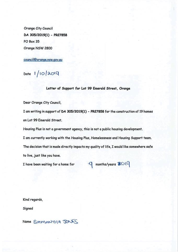
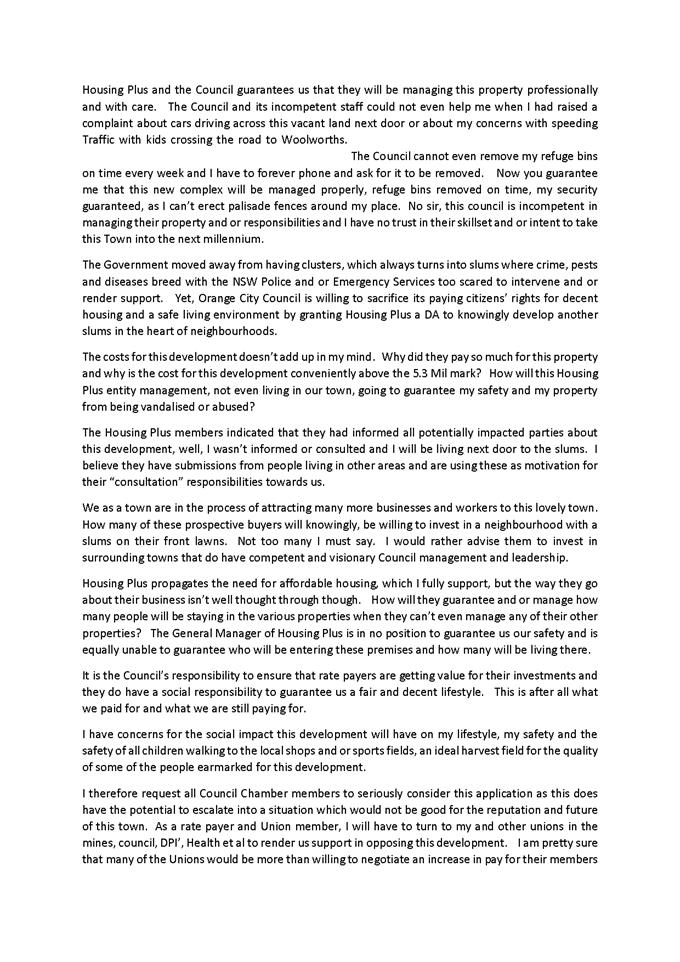
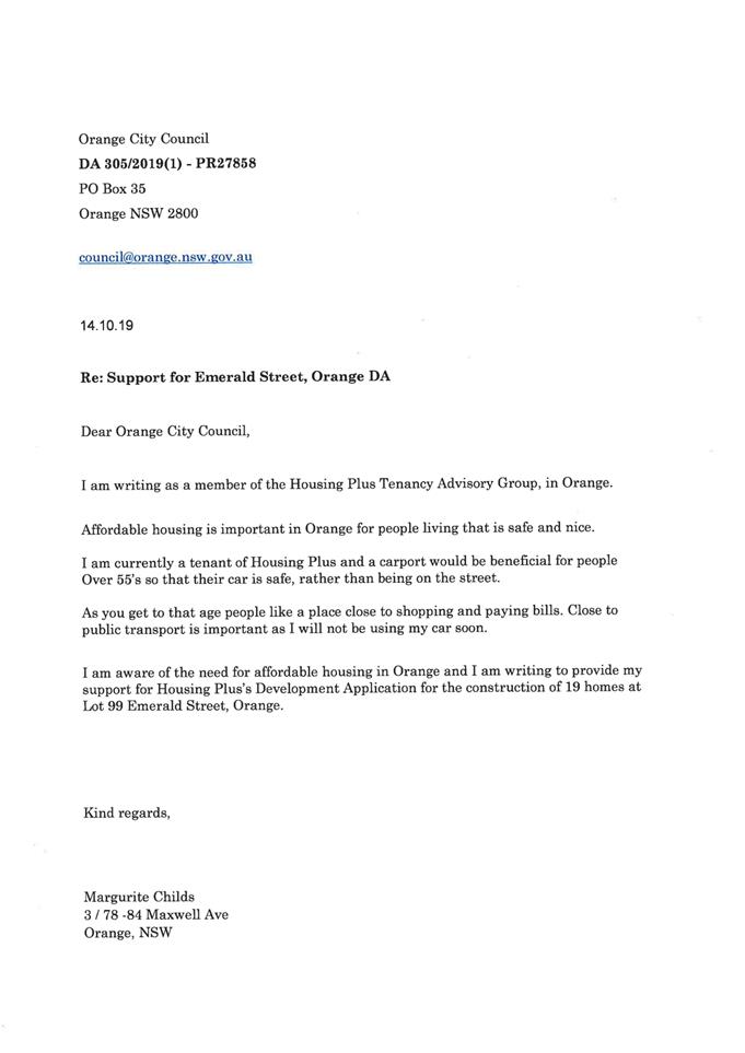
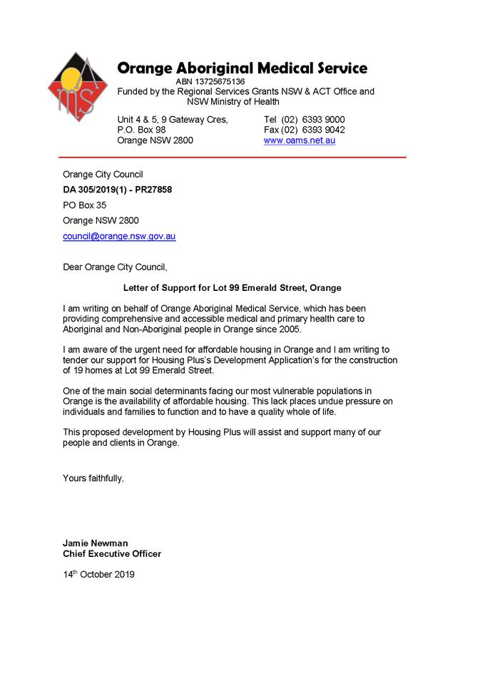
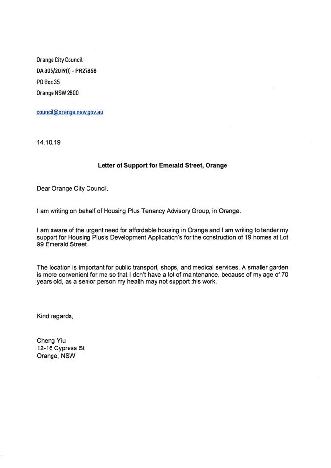
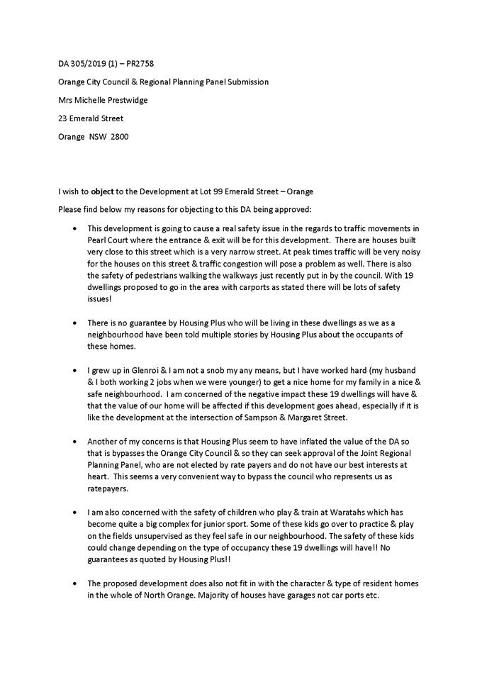
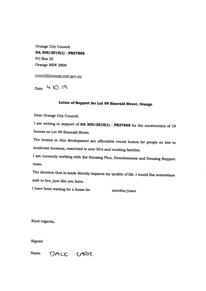
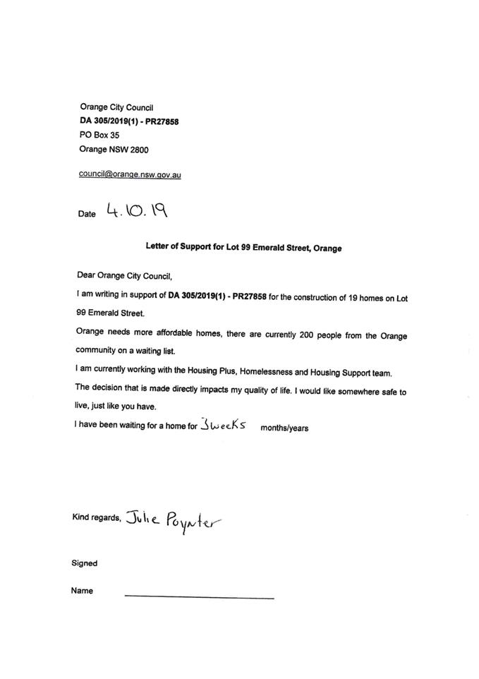
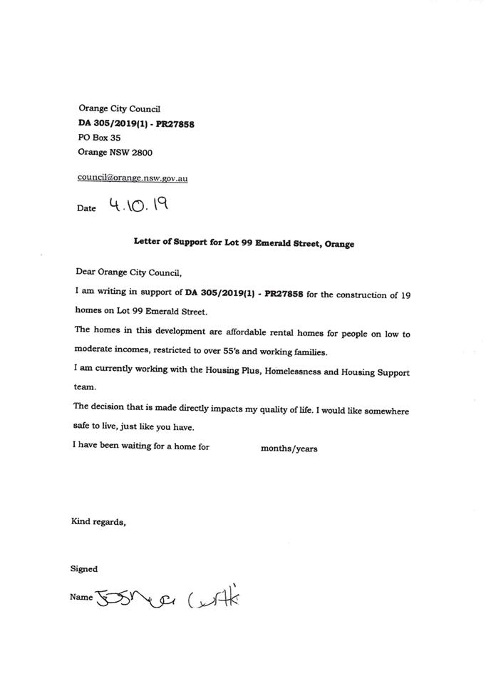
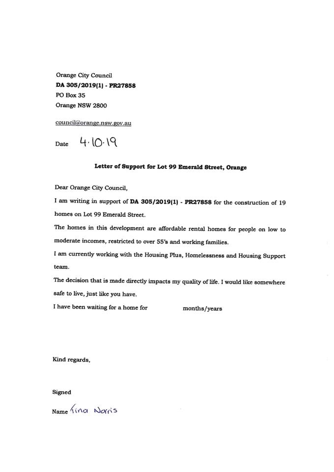
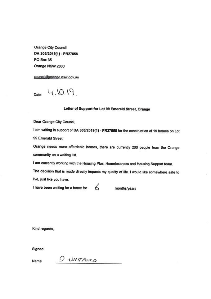
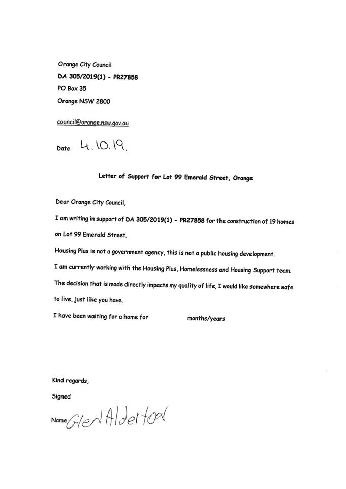
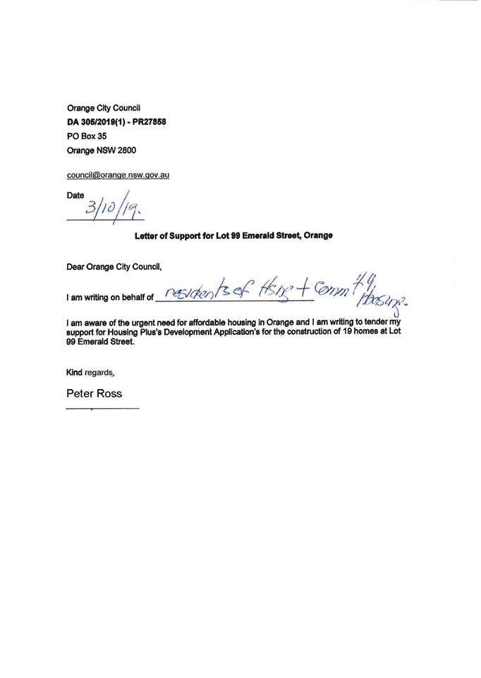
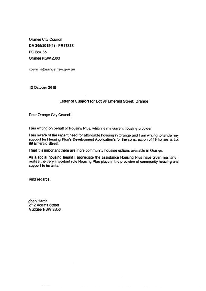
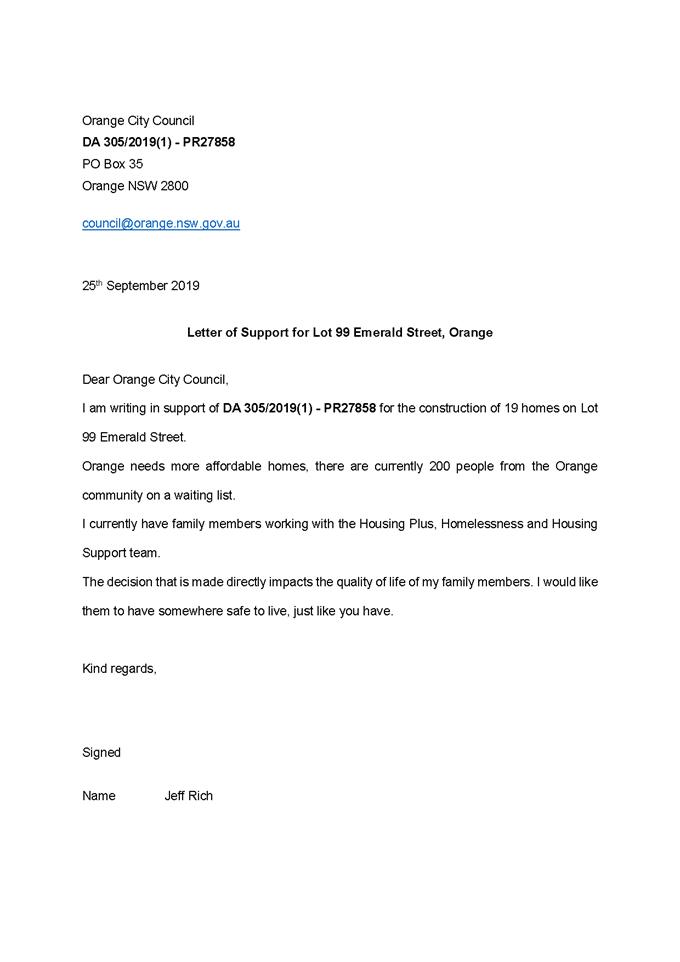
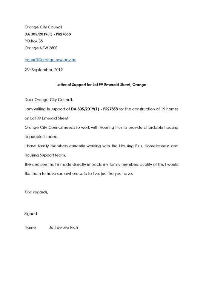
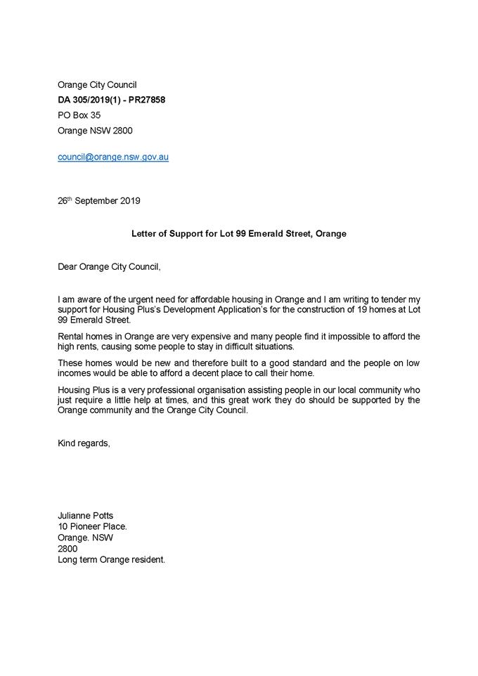
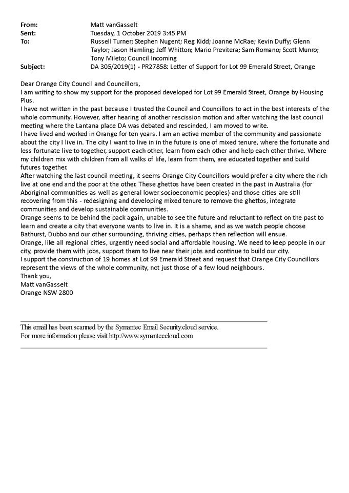
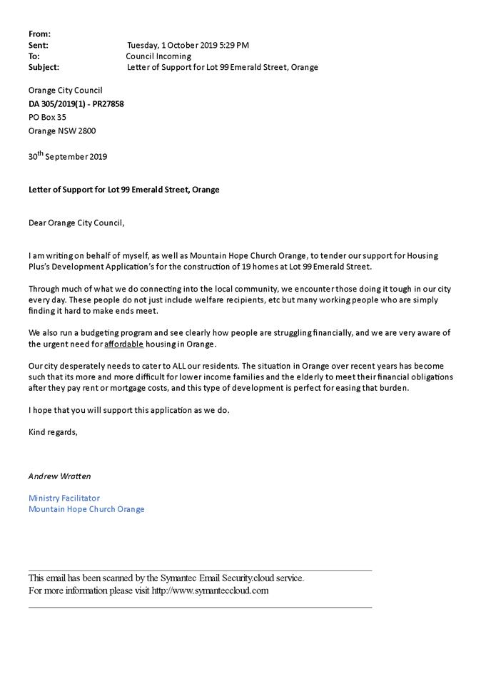
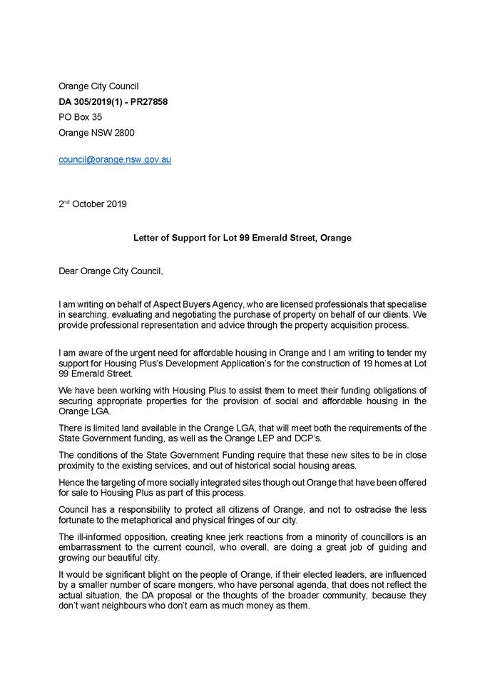
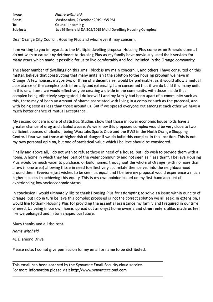
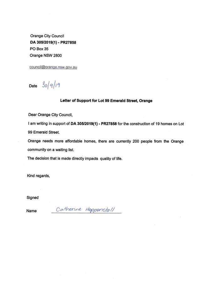
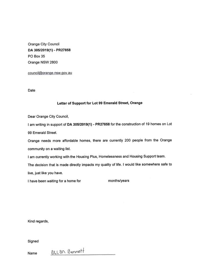
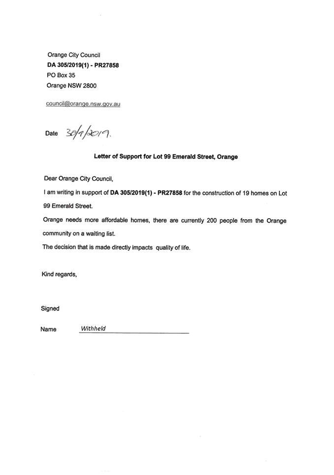
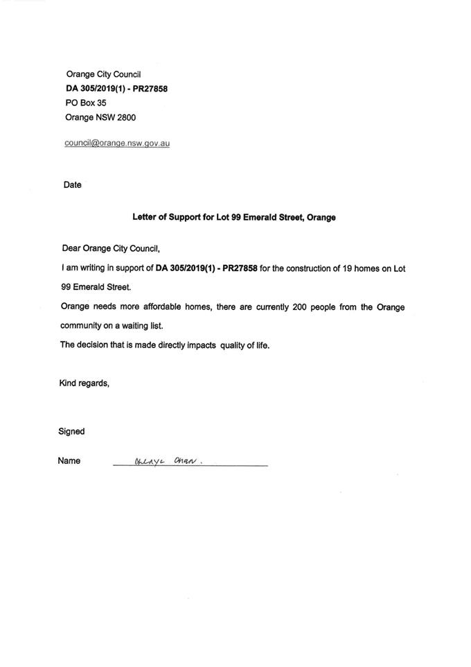
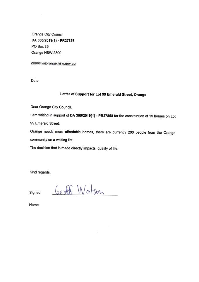
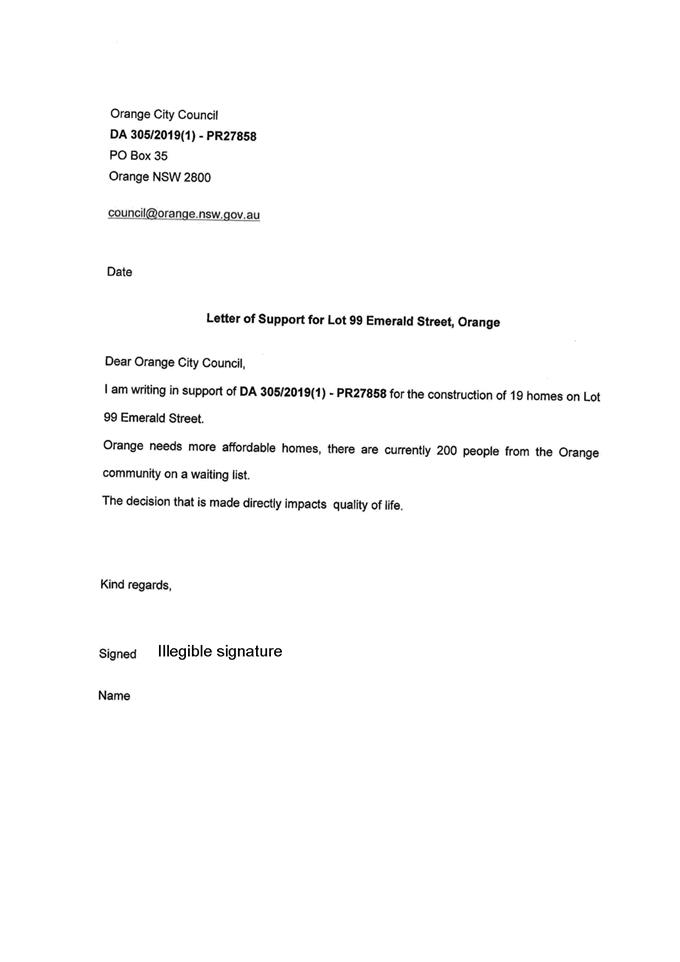
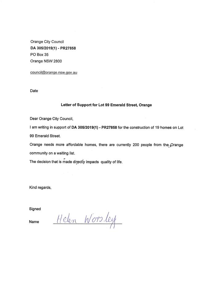
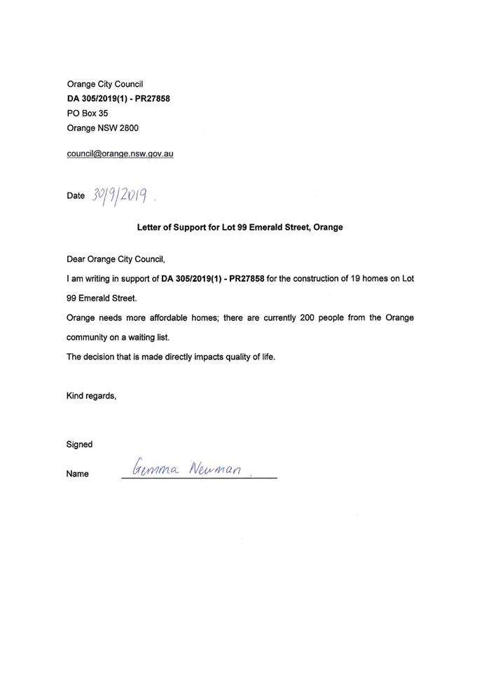
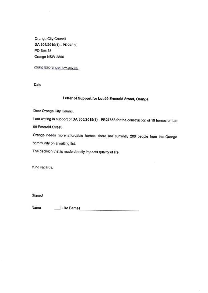
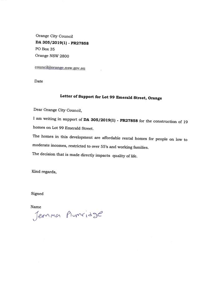
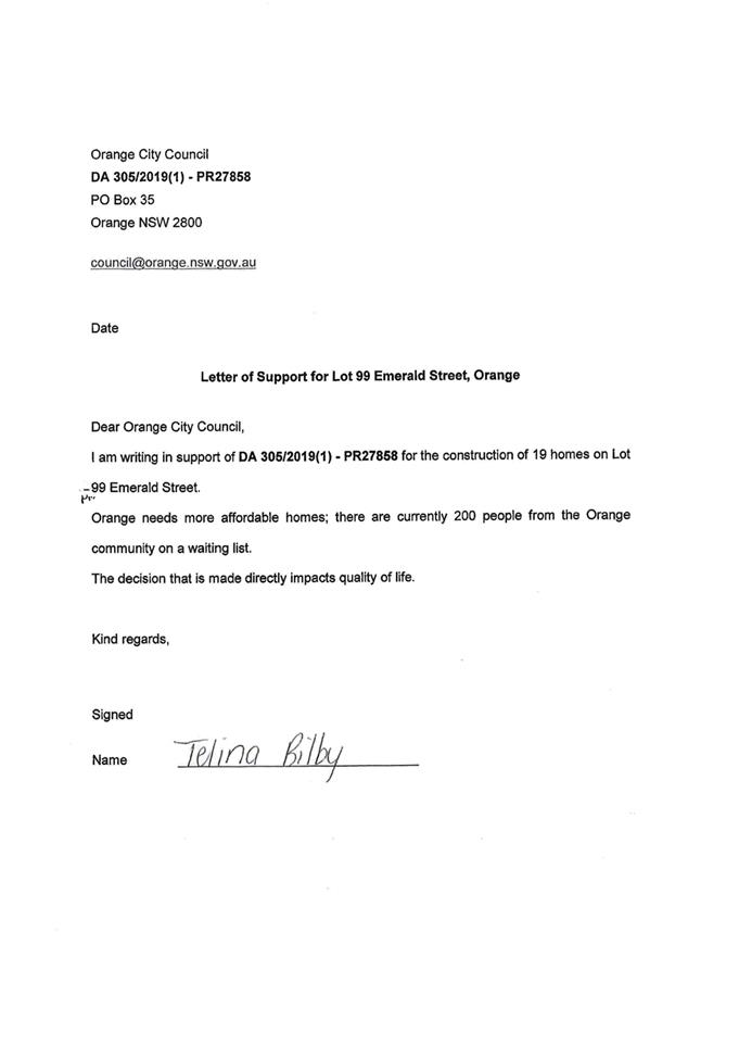
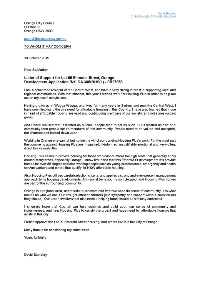
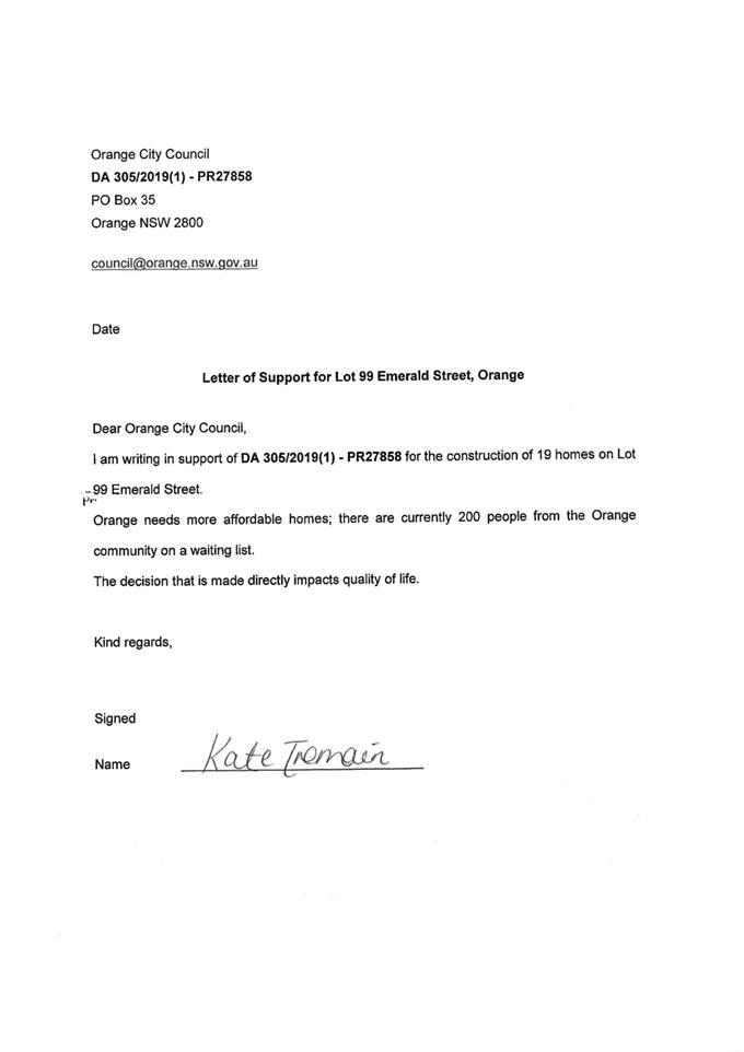
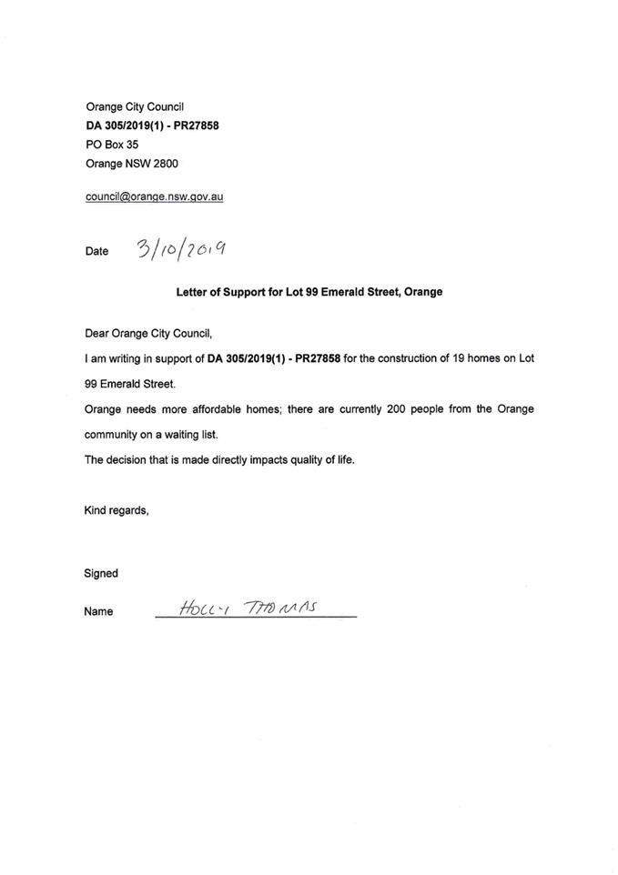
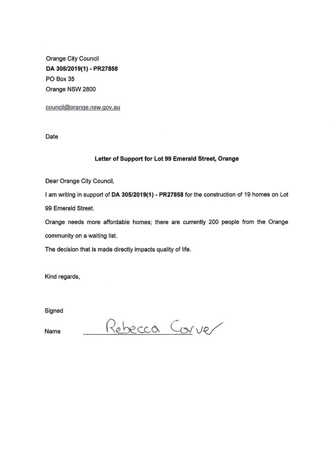
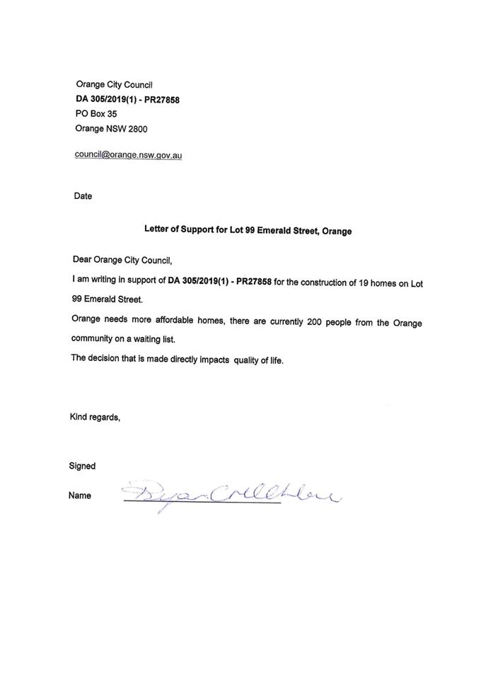
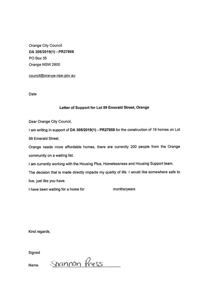
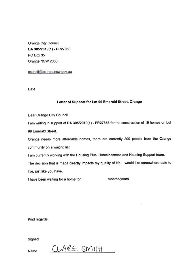
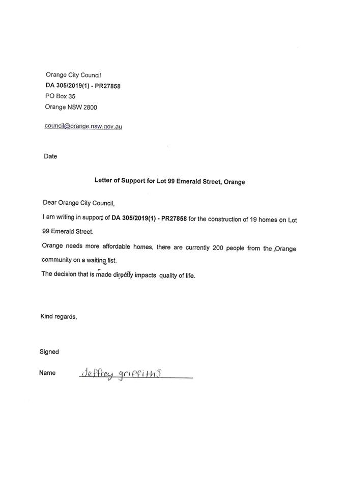
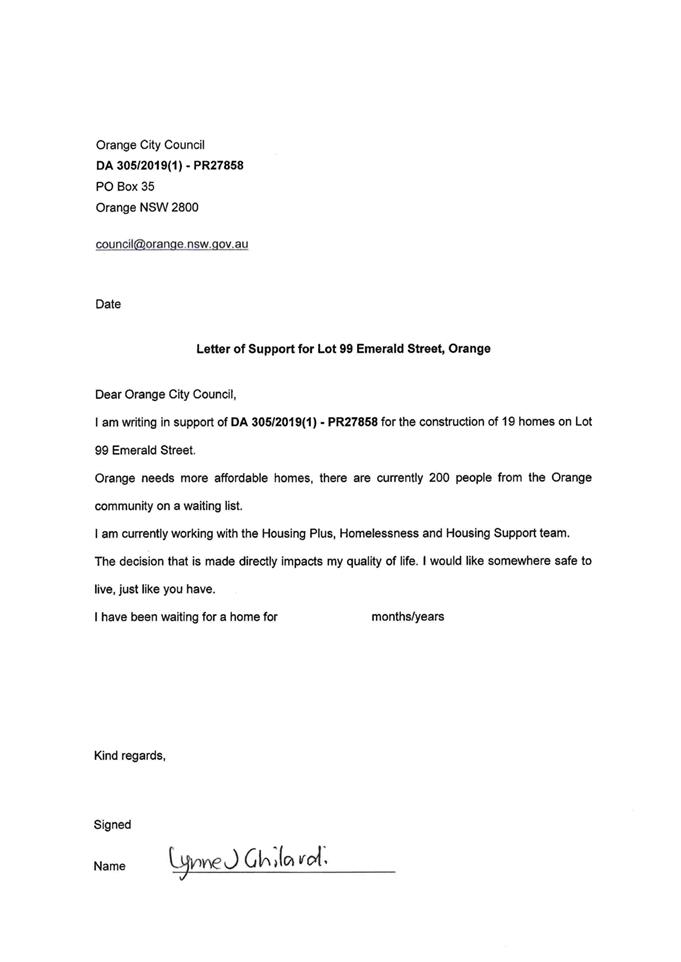
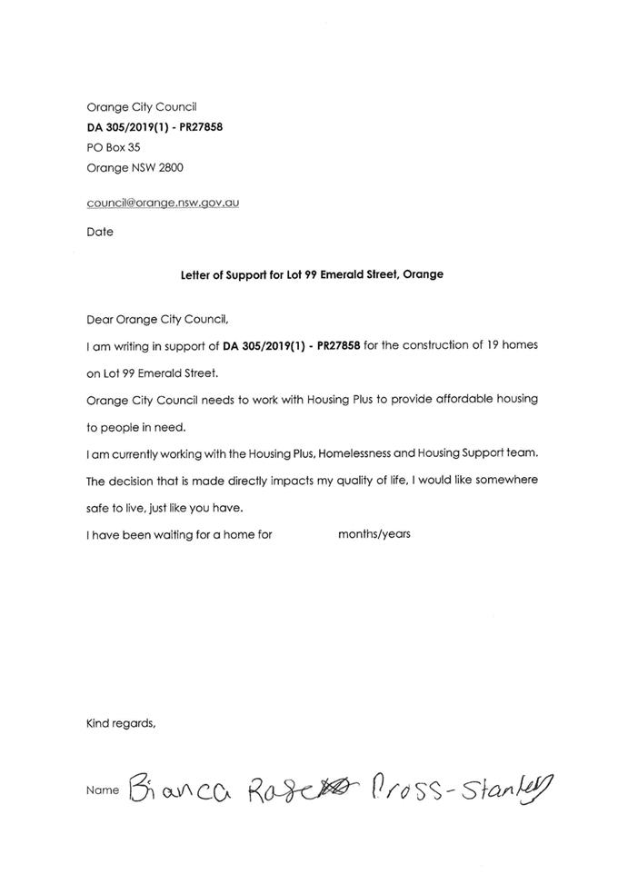
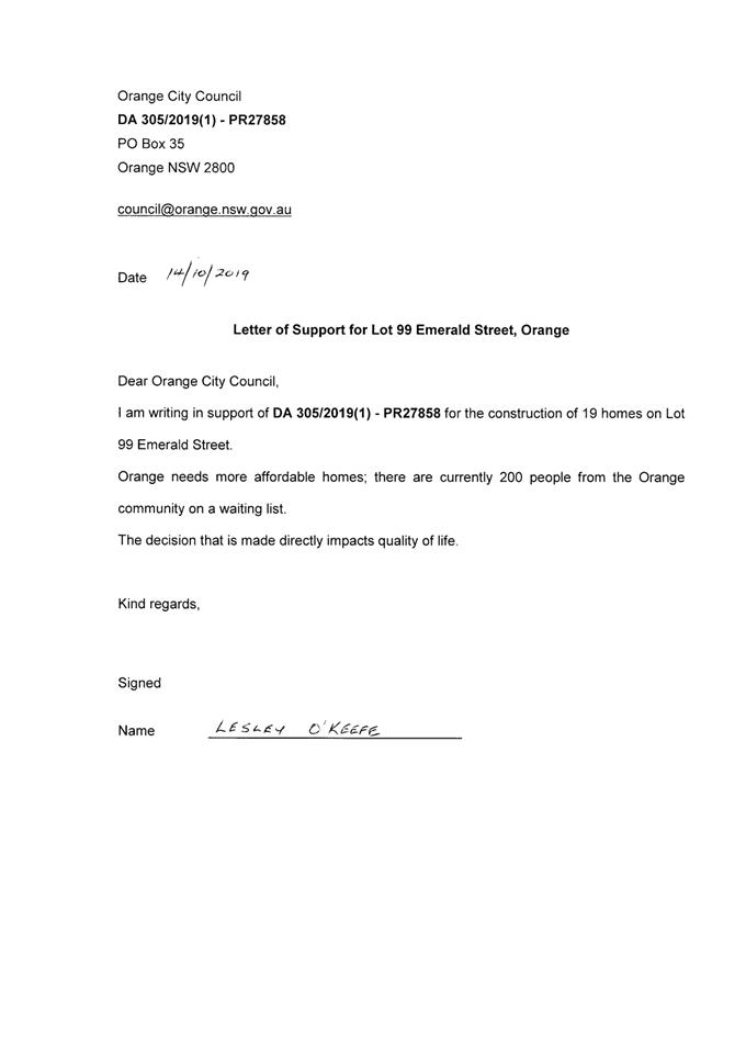
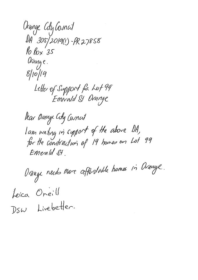
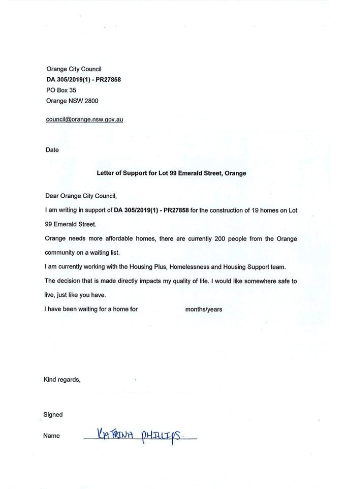
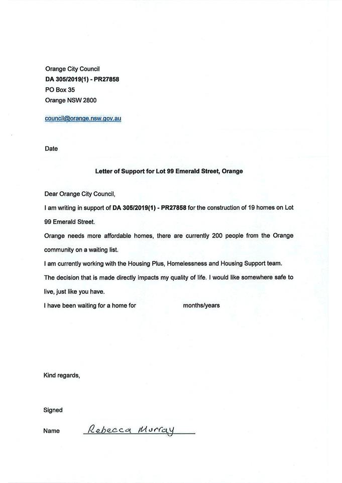
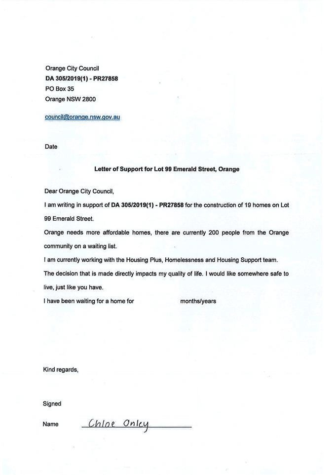
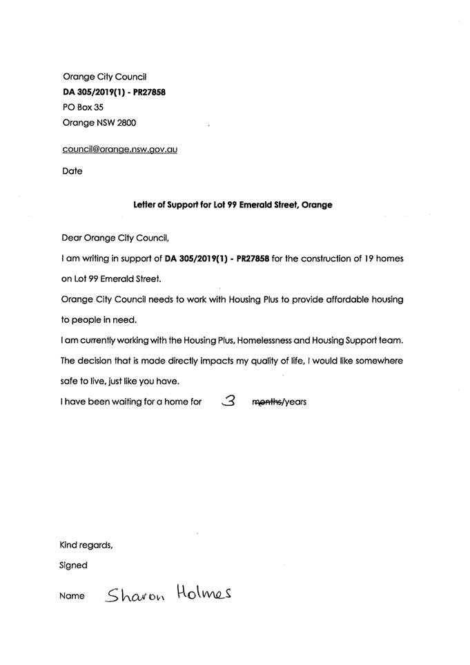
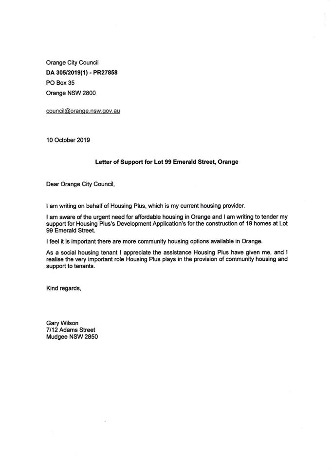
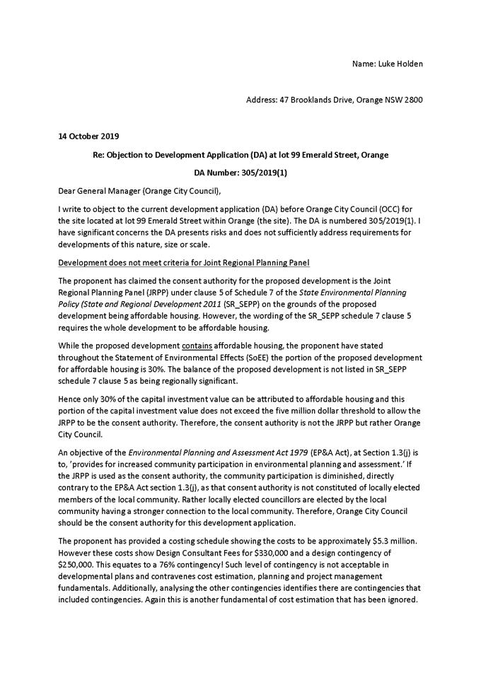
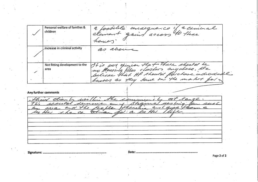
in relation to the proposed development. Of these submissions, 192 support the
proposal and 75 oppose the development. An additional 2 submissions were
received after completion of the exhibition period (at the time of writing).
The late submissions were opposed to the proposed development.
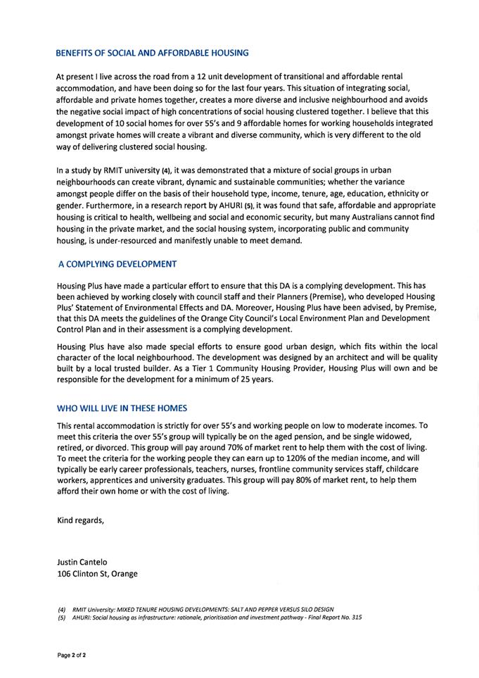
The supporting submissions outline the need for affordable
rental housing in the City, and the associated community benefits associated
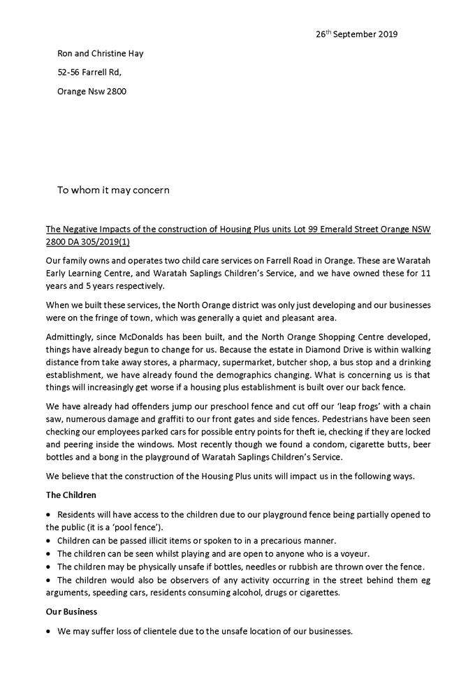
with the provision of affordable housing. The issues raised in the opposing
submissions generally relate to the adverse impacts on neighbourhood character
and function.
The proposal does not contravene
the planning regime that applies to the land. Impacts of the development are
considered to be within reasonable limit, consistent with applicable standards
and addressed by appropriate conditions of development consent. Approval of the
application is recommended.
Link To Delivery/OPerational Plan
The recommendation in this report relates to the
Delivery/Operational Plan strategy “10.1 Preserve - Engage with the
community to ensure plans for growth and development are respectful of our
heritage”.
Financial Implications
Nil
Policy and Governance Implications
Nil
|
Recommendation
That Council resolves:
1 That the information
contained in the report for development application DA 305/2019(1) -
proposed Multi Dwelling Housing (Affordable Housing) – Lot 99
DP 1234441 - Emerald Street, Orange be acknowledged.
2 That
Council determine whether or not it makes a submission upon this application
to the Western Regional Planning Panel.
|
further considerations
Consideration has been given to the recommendation’s
impact on Council’s service delivery; image and reputation; political;
environmental; health and safety; employees; stakeholders and project
management; and no further implications or risks have been identified.
DIRECTORS NOTE
This report
provides as an attachment the assessment report of staff to the Western
Regional Planning Panel for the assessment of the multi-dwelling housing
proposal by Housing Plus, pertaining the construction of 19 dwellings at Lot 99
Emerald Street. The determining authority for this development is the
Western Regional Planning Panel, not Council. Council’s role in this
matter is to review the assessment report and determine whether or not it
wishes to prepare a written submission to the Western Regional Planning Panel
regarding the development.
In
accordance with the approach previously taken by Council regarding development
proposals considered by the Western Regional Planning Panel, if Council wishes
to make a submission to the Panel on this proposal, they will need to advise of
the specific planning issues that they want raised in the submission and
Council staff, that have had no involvement in the assessment of the
Development Application would then draft the submission to the Regional
Planning Panel detailing the matters identified by Council.
SUPPORTING INFORMATION
Reference is made to the
abovementioned development application. The proposal involves
development of the subject land for multi dwelling housing. Proposed works
include:
· Demolition of the
existing dwelling house and associated domestic structures (these works were
approved under previous DA 4/2015(2)).
· Construction of
19 dwellings, comprising 7 x one bedroom dwellings and
12 x two bedroom dwellings. The dwellings will be single-storey, with
building forms to comprise a mix of single dwellings and duplex style attached
dwellings.
The proposed dwellings will be fully self-contained,
each with open plan living zones, 1 or 2 bedrooms, and 1 bathroom
with laundry facilities. An attached single carport will be provided for each
dwelling, with additional tandem parking spaces available for some of the
dwellings. An enclosed private open space area will be provided at the rear of
each dwelling.
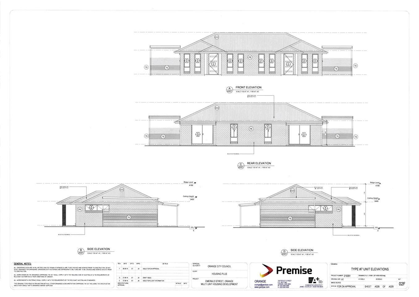
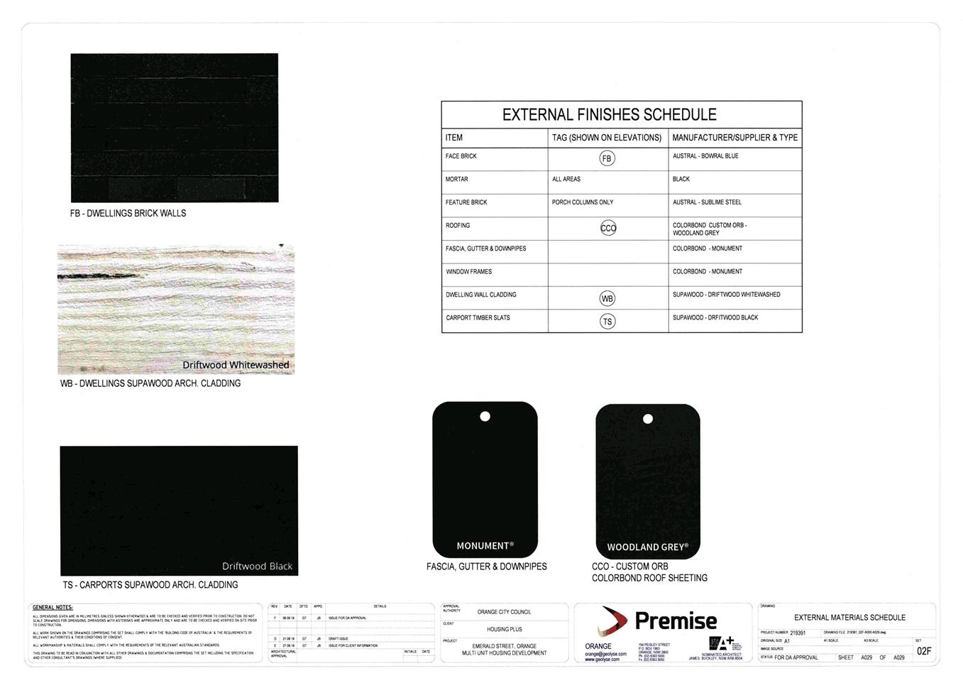
The design of the dwellings will be reflective of
modern domestic architecture, with hip and gable roof profiles and front
elevation articulation via symmetrical openings and portico elements.
· Vehicular access
to the site will be via the curved road formation at the intersection of Pearl
Court and Emerald Street. Internal roads will be no-through and private access
roads to service the proposed dwellings only. Internal access roads will have a
minimum width of 6m.
· Site landscaping
will be established at the site frontage and common areas. Perimeter fencing
(1.5-1.8m high) and fencing between the dwellings will be erected.
· A communal bin
storage area will be provided at the site frontage for the placement of bins on
collection days.
The proposed dwellings will be used and managed for the
purposes of affordable housing. The development will be undertaken by Housing
Plus, a registered community housing provider, under the
NSW Government’s Social and Affordable Housing Fund.
The Western Regional Planning
Panel is the relevant consent authority for the application given the capital
investment value of the development. A copy of the
planning assessment report and draft Notice of Approval have been forwarded to the Panel Secretariat of the Western
Regional Planning Panel. The Panel Secretariat has advised that the application
is listed for consideration by the Western Regional Planning Panel. At the time
of writing, a meeting date has yet to be confirmed.
Attached for Council’s
information is a copy of the planning assessment report, accompanying plans, draft
Notice of Approval and submissions for the subject application. The planning
report outlines an assessment of the extent of the environmental impacts, with
recommendations presented within the report for the Western Regional Planning
Panel’s consideration.
Council
may make a submission on the development application that is to be determined
by a Regional Panel during and up until seven days before the Panel meeting. In
the event that Council chooses to make a written submission in relation to the
subject application, the submission is required to be prepared by a consultant
or another Council officer who has not been involved in the initial assessment
of the application.
Attachments
1 Planning
Report, D19/65038⇩
2 Notice
of Approval, D19/65041⇩
3 Plans,
D19/62448⇩
4 Submissions
part 1, D19/64683⇩
5 Submissions
part 2, D19/64684⇩
6 Submissions
part 3, D19/64685⇩
7 Submissions
part 4, D19/64686⇩
8 Submissions
part 5, D19/64687⇩
9 Submissions
part 6, D19/64689⇩
Attachment 1 Planning
Report

Planning and Development Committee
7 November 2019
Attachment 2 Notice
of Approval
Planning and Development Committee
7 November 2019
Planning
and Development Committee
7 November 2019
Attachment 4 Submissions
part 1


Planning and Development Committee
7 November 2019
Attachment 5 Submissions
part 2


Planning and Development Committee
7 November 2019
Attachment 6 Submissions
part 3


Planning and Development Committee
7 November 2019
Attachment 7 Submissions
part 4
Planning and Development Committee
7 November 2019
Attachment 8 Submissions
part 5


Planning and Development Committee
7 November 2019
Attachment 9 Submissions
part 6


2.3 Planning
and Development: Community Participation Plan 2019 - post-exhibition and
finalisation
RECORD
NUMBER: 2019/2305
AUTHOR: Kayla
Clanchy, Town Planner
EXECUTIVE Summary
In line with statutory requirements to do so by 1 December
2019, the Development Services team has put together a Community Participation
Plan (‘the Plan’) that seeks to outline how Council will engage
with the community on matters of environmental and land-use planning. Before
the Community Participation Plan can be finalised, it must be exhibited to the
public and endorsed by Council. Exhibition of the draft Plan and associated
documents occurred for 28 days, from 13 September to 11 October 2019.
During the exhibition period, four (4) written submissions
were received from the public. A survey accompanied the exhibition period
through Council’s YourSay website, and twenty‑three (23)
respondents engaged with the survey questions.
Many of the submissions were appreciative of the intent of
the draft Plan, and reiterated the fact that the draft Plan is only as strong
as its consistent use by staff and Council, particularly when making planning
and development determinations. Broadly, it seems respondents are keen to learn
more about how the NSW planning system as a whole works, and how/when community
views fit within the system.
Based on the submissions received and responses to the
YourSay survey, some tweaks are proposed to the draft Plan and associated
documents. Accordingly, the Development Services Team are recommending the
final form of the Plan and associated documents be adopted by Council.
Link To Delivery/OPerational Plan
The recommendation in this report relates to the
Delivery/Operational Plan Strategy “14.3 Collaborate - Provide
opportunities for widespread and quality engagement, and where appropriate,
shared decision-making.”
Financial Implications
Implementation of the Plan requires more administrative
measures to be introduced in order to provide well-rounded community
participation opportunities.
Policy and Governance Implications
The Environmental Planning and Assessment Act 1979 (‘the
Planning Act’) requires Council to have a Community Participation Plan
finalised and accessible online through the NSW Planning Portal, by 1 December
2019.
The provisions of the Development Control Plan 2004 (‘the
DCP’) that relate to exhibition of development applications will
be superseded by the Community Participation Plan.
The attachment to Council’s Strategic Policy No 24
(‘ST024’) known as Declaration of Planning and Development
Assessment Procedures and Protocols will be updated from Version 4 (6 May
2010) to Version 5 in order to align with the Community Participation Plan.
Other pragmatic alterations to
administration and delegation procedures have been proposed in Version 5 of the
attachment to ST024. Advice has been received from the Corporate Services
division of Council that updating delegations in line with the changes proposed
in the Version 5 attachment is possible subject to Council adopting the Version
5 attachment, and no other underlying arrangements need to be made.
All of the above documents were exhibited for 28 days, per
statutory requirements to do so. Council has an obligation to consider
submissions received during the exhibition process.
Council resolved (19/431) at its 3 September 2019 meeting:
1 To
amend Development Control Plan 2004 (Chapter 5) by removing provisions for
exhibition of development applications, and reference instead the Planning and
Development: Community Participation Plan 2019.
2 To
update the attachment to ST024 being the Declaration of Planning and
Development Assessment Procedures and Protocols from Version 4 to Version 5.
3 To
update ST024 to ensure the Policy references the correct attachment (being
Version 5 attachment).
4 To
update delegations in accordance with Version 5 of the attachment to
Declaration of Planning and
Development Assessment Procedures and Protocols.
5 To
place the draft Planning and Development: Community Participation Plan 2019,
the draft Version 5 attachment to ST024, and draft amendment to Development
Control Plan 2004 (Chapter 5) on public exhibition for a period of 28 days.
Obviously, points 1, 2, 3, and 4
could only be realised once point number 5 was actioned and completed. Some
tweaks to documents associated with points 1, 2, 3, and 4 are required as a
result of the exhibition process. Therefore, the following recommendation is
intended to follow-on from and reiterate Council’s earlier resolution
(19/431).
|
Recommendation
That Council resolves:
1 To
adopt the Planning and Development: Community Participation Plan 2019.
2 To
amend Development Control Plan 2004 (Chapter 5) by removing provisions for exhibition
of development applications, and reference instead the Planning and Development:
Community Participation Plan 2019.
3 To
update the attachment to ST024 being the Declaration of Planning and Development
Assessment Procedures and Protocols from Version 4 to Version 5.
4 To
update ST024 to ensure the Policy references the correct attachment (being Version
5 attachment).
5 To
update delegations in accordance with Version 5 of the attachment to Declaration
of Planning and Development Assessment Procedures and Protocols.
|
further considerations
Consideration has been given to the recommendation’s
impact on Council’s service delivery; image and reputation; political;
environmental; health and safety; employees; stakeholders and project management;
and no further implications or risks have been identified.
DIRECTOR’S NOTE
During exhibition of the draft Community Participation Plan,
a total of 4 formal written submissions were received. The plan was also
linked to an online survey with 23 people completing a survey through
Council’s “Your Say” site. It is pleasing see public
interest in a key strategic document of Council. Consideration has been
given to the issues raised in the submissions. Some amendments were made
to the Plan in order to clarify some queries. The amendments are minor
and do not require readvertising. The Plan is therefore recommended for
approval and will meet the Department of Planning’s December deadline.
SUPPORTING INFORMATION
The Planning and Development: Community Participation
Plan 2019 (‘the Plan’) is a strategic document that sets the
parameters for community participation in the environmental and land-use
planning framework of the Orange Local Government Area (‘LGA’).
The NSW Department of Planning, Industry & Environment
(‘DPIE’) requires a Plan to be in place for each LGA and finalised
by 1 December 2019, in line with the Act reforms.
The Plan must:
· outline when and
how it applies to planning functions,
· incorporate
statutory community participation objectives, and
· identify
legislated minimum exhibition timeframes.
In order to make the Plan a one-stop-doc, local provisions
have been incorporated where possible. For example, the Plan defines the types
of development applications that will routinely be ‘advertised’,
‘neighbour notified’, or subject to no exhibition. The Plan also
includes clear instructions on how and when submissions can be considered for
changes to strategic plans, proposed development, and major Council activities.
More importantly, however, the Plan signals a shift in focus from trying to
resolve community expectations at the development application stage to
focussing engagement efforts more acutely at the strategic plan-making stage.
To accommodate the Plan and the shift in focus for community
engagement, Council’s planning and development procedures need to be
updated. ST024 is known as the Declaration of Planning and Development
Assessment Procedures and Protocols. Attached to ST024 is Version 4 of Declaration
of Planning and Development Assessment Procedures and Protocols (‘the
Declaration’). It is proposed to attach a Version 5 Declaration to ST024
instead. The scope of changes to the Declaration between Version 4 and 5
generally include:
· Community
engagement methods which are to be drawn from, particularly when undertaking
research for (and formulating) strategic plans.
· Creation of a
streamlined scheme for applicants who have demonstrated meaningful
pre-lodgement community consultation with community members who are likely to be
impacted by a development.
· Alterations and
clarifications to the delegation schedule for determination of development
applications, including increasing the monetary threshold from $1.5m to $2.5m
for when DAs will – as a default – be considered by Council at a
Council meeting.
· Other
administrative tweaks, such as ensuring the Declaration references the Plan.
ST024 itself will need to be amended
to ensure the correct attachment is being referred to (i.e. Version 5 and not
Version 4). As for altering delegations, these changes can be ratified through
the appropriate channels, per advice from Corporate Services.
Another corollary to the
introduction of the Plan will be the need to remove portions of Chapter 5 of
the DCP which relate to the types of proposals that will be advertised or
neighbour notified during assessment of a development application. These
provisions have all been reviewed and adapted for insertion into the Plan. It
is therefore proposed to delete those parts of Chapter 5 of the DCP that will
no longer apply as a result of the Plan being endorsed, and insert instead
wording to the effect that the reader shall refer to the Community
Participation Plan for guidance on exhibition procedures for development
applications.
Post-exhibition comments
All of the abovementioned documents
were exhibited for 28 days, from 13 September to 11 October 2019. During
the exhibition period, four (4) written submissions were received from the
public. A survey accompanied the exhibition period through Council’s
YourSay website, and twenty-three (23) respondents engaged with the survey
questions. All of these submissions and responses are attached to this report.
For convenience, the key points of submissions are summarised below.
Submission 1 raises concerns mostly to do with
the Plan not being followed in terms of decisions being made that are not based
on planning matters. The submission goes on to recommend that more development
application decisions should be delegated away from Councillors.
Our response:
· The Plan itself
does highlight how submissions will be considered for individual development
applications and proposed land-use plans and strategies.
· Guidance is
provided in the Plan on what are/are not planning matters to primarily help the
community in making well-rounded submissions on planning projects.
· Some clarification
and tweaks to thresholds are proposed in the updated Version 5 attachment
to the Declaration, but delegations have not been substantially altered.
Submission 2 is from the same submitter who
made Submission 1. This submission goes into more detail than Submission 1.
Specifically, Submission 2 references the planning processes used in
determining Housing Plus development applications. The submission requests that
the Plan set out precisely what Council’s expectation is for development
in the city, how Council will act consistently and fairly in assessing and
determining any development applications, and that these procedural matters be
outlined in the Plan.
In response the above points:
· Strategic planning
and “expectations for development in the city” arise from
particular plans and strategies such as the forthcoming Local Housing Strategy
and Local Strategic Planning Statement, and existing instruments/plans such as
the Local Environmental Plan and Development Control Plan. All of these plans
are required to fulfil requirements of the Planning Act. Use of the Community
Participation Plan to outline “expectations for development in the
city” is therefore inappropriate and not legally possible.
· Minor updates to
procedural and assessment matters are outlined in the Version 5 attachment
to the Declaration, which was exhibited alongside the Community Participation
Plan.
Submission 3 recommended Council draw from
other draft Plans in other local government areas, in particular, the addition
of a clarifying introduction to the Plan as modelled off the Northern Beaches
Council draft Plan. The submitter also recommends procedural matters for
determination be addressed in the Plan, rather than a separate document. The
definition of ‘neighbour notification’ should be clarified, and
Council needs to ‘close the loop’ in letting interested community
members know how a determination is tracking and how their submissions were
considered. Finally, the submitter sees value in nominating a review period of
the Plan, and seeking feedback from the community on planning matters through
Customer Satisfaction Surveys.
The following dot points respond to key matters raised in
Submission 3:
· Our draft Plan
contains a ‘Foreword’ which seeks to set the tone for the Plan and
its context. Many other councils’ draft Community Participation Plans
were referred to during the creation of the Plan and the Department of
Planning, Industry & Environment has confirmed that our Plan meets all of
its obligations under the Planning Act.
· The Version 5
attachment to the Declaration outlines procedural matters for determination.
Council maintains that the Community Participation Plan shall focus only on our
participation methods and obligations (per statutory requirements), and
operational/assessment procedures be kept separate so as to not create an
overly complex participation document.
· A succinct
definition of ‘neighbour notification’ is provided on page 17 of
the Plan. It has been updated in light of this submission to outline what
‘adjoining’ means.
· Council
‘closes the loop’ by notifying submitters that their submissions
have been received, and when a determination is made, submitters are sent
notices of determination (see page 15 of the Plan). Additionally, the Plan
requires all notices of determination to include a ‘statement of
reasons’ highlighting how community views were taken into consideration
during the assessment process, per the statutory requirements. Submitters are
also advised on when a proposal will be going to Council for determination, so
that submitters may attend the relevant meeting.
· The Plan is now
proposed to face its first review in synchronisation with when a Community
Engagement Strategy is being created/amended (as required by the Local
Government Act 1993).
· Suggestion on
contents of future Customer Satisfaction Surveys has been forwarded to the
Communications Team of Council.
Submission 4 describes the fact that the Plan is only
as strong as its consistent use by members of the community. In this regard,
the submitter would like to see the Plan circulated widely and made highly
accessible. ‘Neighbour notification’ should be better defined, and
the scope for ‘neighbour’ should be expanded beyond the immediate
surrounds of a subject site. Lastly, the submitter recommends more parameters
be set up for pre-lodgement consultation scenarios.
In response:
· The Plan will be
available online with all of our other plans, policies, and guides.
Arrangements can be made for hard copies of the Plan to be available in the
foyer of the Civic Administration building.
· The Plan has been
amended to define ‘neighbour notification’ better. There is now an
explicit part in the Plan for Council staff to have some latitude in doing
neighbour notification at a broader radius, in certain circumstances. For
consistency though, ‘neighbour notification’ routinely refers to
adjoining/adjacent neighbours even if these neighbours are separated by an
intervening creek, road, or similar.
· “Pre-DA
community participation” is referenced in the Plan on Page 9, and again
under the heading of “Pre-lodgement consultation with the
community” in the Version 5 attachment to the Declaration on Page 12. The
details in the Version 5 attachment are considered sufficient for staff to
use when checking information for lodgement, and when querying the
developer/applicant on the community engagement process of pre-lodgement that
they purportedly undertook.
The trends of survey responses are summarised below. The
survey helped affirm praxis that underpinned The Plan and the Version 5
attachment to the Declaration.
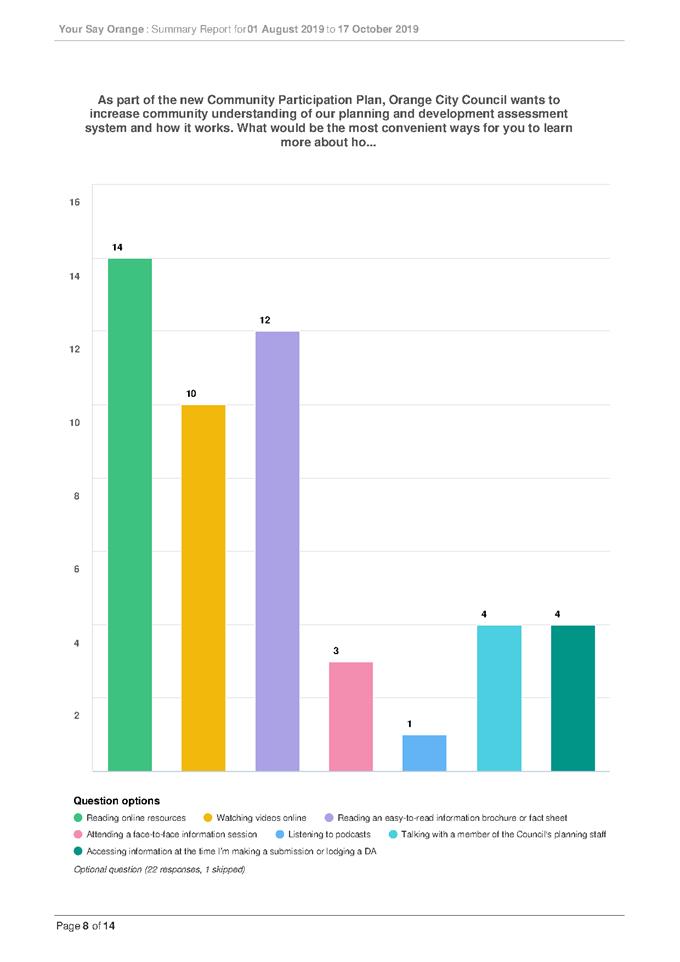
Survey response theme 1 – Wanting to know more
about the planning system
It was unanimous across all respondents that they would like
to gain more understanding of the planning system and that this should
predominantly happen through the availability of online resources.
COMMENT: Development Services and the Communications
team are working on producing more materials for people to engage with in
understanding the planning system. The Plan and the Version 5 attachment to the
Declaration also include key engagement methods that shall be used when
undertaking research for strategic plan-making decisions.
Survey response theme 2 –
Wanting more convenient access to resources
There was a desire for resources to be available online
(including fact sheets), particularly for those respondents who did not express
a confident understanding of the planning system. Most respondents stated that
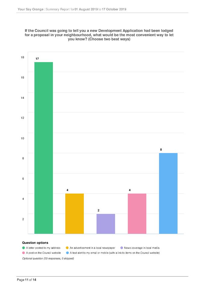
they would like to receive letters in the mail on development proposed in
proximity to them.
COMMENT: Development Services and the Communications
team are working on producing more materials for people to engage with in
understanding the planning system. A series of fact sheets are being produced
on planning topics. Development Services has trialled a “heritage
development exemption” factsheet, which has been successful in responding
to minor heritage enquiries.
Survey response theme 3 –
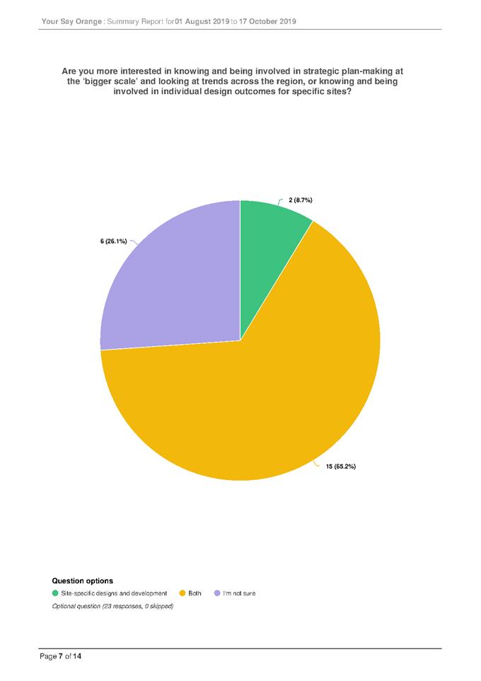
Wanting to be more involved in shaping planning outcomes
Overwhelmingly, respondents would like to be involved in
both strategic plan-making decisions and individual, site-specific development
decisions. At least one respondent did make it known, however, that people were
more likely to be interested in individual, site-specific development decisions
because strategic-plan making matters can be somewhat abstract and difficult to
visualise.
COMMENT: The Plan acknowledges
that it can be difficult to properly communicate the intent and vision for
strategic plans. It is therefore recommended in the Plan for materials such as
diagrams, maps, and flowcharts to accompany exhibition of all strategic plans
(wherever possible). The Plan itself was exhibited alongside a
‘visualisation’ schematic of where different plans (required by the
Planning Act) figuratively sit in relation to each other.
Attachments
1 Planning
and Development Community Participation Plan 2019 - final version 7 November
2019, D19/63109⇩
2 ST024
- including attachment Version 5 Declaration of Planning and Development
Assessment - Procedures and Protocols, D19/62947⇩
3 DCP
2004 Chapter 5 - edited to refer to Community Participation Plan, D19/63102⇩
4 YourSay
site - survey responses with graphs, D19/63069⇩
5 YourSay
site - Individual survey results, D19/63070⇩
6 Submissions,
D19/63679⇩
Planning
and Development Committee
7 November 2019
Attachment 1 Planning
and Development Community Participation Plan 2019 - final version 7 November
2019
Planning and Development: Community
Participation Plan 2019
7 November 2019
Contents
Foreword: Community
participation in the planning system.. 4
Chapter 1: What is the
Plan and how will it be used?. 5
1.1 What is the Plan
and why is it being made now?. 5
1.2 In what circumstances does the Plan apply?. 5
1.3 How to use the
Plan. 6
1.4 Community
participation objectives. 6
Chapter 2: Strategic
planning, plan-making and early engagement 8
Chapter 3: Development
Applications and community views. 9
Chapter 4: Major Council
activities and transparency. 10
Chapter 5: Feedback and
making submissions. 10
5.1 Can I make a submission?. 10
5.2
When can I make my submission?. 10
5.3
What does my submission need to include?. 10
5.4
Before making a submission. 11
5.5
Where to send my submission?. 12
5.6
Acknowledgement of submissions received. 13
5.7
How are submissions considered?. 13
Chapter 6:
Post-determination. 15
6.1 Notices of
determination. 15
Strategic
planning and plan-making. 15
Development
Applications. 15
Council
activities. 15
Chapter 7: Details
– Exhibition procedures and timeframes. 16
7.1 What is meant by
exhibition types ‘advertised’ and ‘neighbour notified’?. 16
7.2 Advertised proposals. 18
7.3
Neighbour notified proposals. 21
7.4
Other proposals – no exhibition. 22
7.5 Timeframes –
advertised and neighbour notified exhibition. 23
Questions?. 24
Links of interest 25
Glossary. 26
List
of Tables
Table 1. What functions
does the Plan apply to?............................................................................
5
Table 2. Community
participation objectives and
directions.......................................................... 7
Table 3. Proposals
– advertised exhibition......................................................................................
19
Table 4. Proposals
– neighbour notified
exhibition.........................................................................
21
Table 5. Minimum
exhibition timeframes.......................................................................................
23
Foreword:
Community participation in the planning system
Orange City Council recognises
community participation throughout the planning system is not only a civic
right, but that it also delivers better planning results for the city of
Orange.
Ultimately, our responsibility
is to deliver on the objectives of various environmental planning documents and
legislation, including the Environmental Planning and Assessment Act 1979 (‘the
Act’), Orange Local Environmental Plan (‘the LEP’), Central
West and Orana Regional Plan 2036, and the forthcoming Local Strategic Planning
Statement. The Planning and Development: Community Participation Plan 2019
(‘the Plan’) is intended to be consistent with the principles of
any in-force Community Engagement Strategy required under the Local
Government Act 1993.
|
Lost already?
The Glossary section contains some quick
definitions for terms commonly used throughout this Plan. Refer to page 26.
|
The planning system of
NSW is shifting focus to enable more meaningful community participation earlier
in the planning process. Because of this, the Plan places greater emphasis and
weight on strategic planning and plan-making phases when trying to gauge community
views on how land and natural resources will be used and protected into the
future.
The Plan also consolidates and
updates advertising and notification requirements for some types of development
proposals, as previously found in Development Control Plans
(‘DCPs’). Council’s policy for planning and development
assessment procedures has been brought into alignment with the Plan.
In terms of engagement with the
community when Council is proposing to undertake major activities or
infrastructure projects, the Plan sets out when we will broadcast proposals for
those types of activities, to ensure greater transparency in our role as a
public authority.
The underpinning community
participation objectives of the Plan can be found in Chapter 1: What is the Plan and how will it be used?. Throughout the Plan, references to the three
major planning functions (strategic planning and plan-making; development
assessment; and Council activities) are made. More information on these three
planning functions is embedded in Chapter 1.
The level and extent of
community participation will vary depending on the planning function, the scope
of the proposal under consideration, and the potential impact of the decision.
The Orange community is dynamic and diverse, so community participation needs
to involve any individuals, groups, or businesses who are likely to be
interested in or affected by planning decisions.
|
Why is community participation
important?
· It builds community confidence in
the planning system
· Community participation creates a
shared sense of purpose, direction, and understanding of the need to balance
environmental changes against amenity considerations
· It provides decision-makers access
to community knowledge, expectations, ideas, and expertise.
|
Chapter 1: What is the Plan and how will it be used?
1.1 What is the Plan and why is it
being made now?
The Planning and
Development: Community Participation Plan 2019 is a strategic
document that sets the parameters for community participation in the
environmental and land-use planning framework of the Orange Local Government
Area (‘LGA’).
The NSW Department of Planning, Industry & Environment
(‘DPIE’) requires a Plan to be in place for each LGA and finalised
by 1 December 2019, in line with the Act reforms.
The Plan must incorporate statutory community participation
objectives, which we will use to guide our approach to community engagement.
1.2 In what circumstances does the Plan apply?
This Plan is a requirement of the Act (see Division 2.6 and
Schedule 1) and applies to the exercise of planning functions by certain
authorities. A break-down of the type of functions that the Plan applies to is
delineated in Table 1:
|
Table 1. What functions
does the Plan apply to?
|
|
Plan-making
|
Strategic planning is an
essential aspect of Council’s planning functions, where the strategic
direction for environmental planning and development is set. This involves
planning for communities which integrates social, environmental, and economic
considerations.
Examples of this work include
amendments to or the creation of the LEP, development control plans,
contribution plans, specific land use strategies, and the like.
|
|
Development Applications
|
The Regional Planning Panel,
the Council, the CEO of the Council, and delegated officers all make planning
decisions on a range of developments (Development Applications). When making
decisions on these developments, consideration is given to whether land use
proposals are in accordance with the strategic priorities of Council, the NSW
Government, relevant legislation, and the public interest.
Proposals assessed may be in
relation to residential, industrial/commercial, rural, and physical or social
infrastructure developments. In these proposals, the planning assessment
phase is just one aspect of the overall project lifecycle. At other phases of
the project, separate community engagement may be undertaken by
proponents/developers, or other government agencies.
Note that this Plan does not
apply to “Complying Development”. Complying Development
provisions are administered by DPIE and these types of development are not
subject to local requirements for exhibition periods, and submissions cannot
be considered on proposed Complying Development.
|
|
Activities
|
Council is oftentimes the
determining authority for its own activities which relate to Council’s
role as a “public authority”, e.g. Council could be the
determining authority and the proponent when undertaking works in a public
park.
Sometimes, these activities
are of such a scale that before the works can occur, an Environmental Impact
Statement (‘EIS’) is required to be prepared in accordance with
DPIE requirements. These EISs are subject to scrutiny from the public, and so
this Plan applies to these types of scenarios.
|
The Plan will be reviewed on a periodic basis to make
sure it is fit for purpose. The Plan is likely to face its first review in
synchronisation with when a Community Engagement Strategy is being
created/amended (as required under the Local Government Act 1993). It
should be noted that the Plan has been prepared with reference to current
requirements in the Act and Environmental Planning and Assessment Regulation
2000 (‘the Regulation’), and that the parent
requirements found in that Act and Regulation may change from time to time. We
will endeavour to keep the Plan as up-to-date and relevant as possible in light
of these broader, State-led changes. Nevertheless, the reader is encouraged to
refer to the current legislation – please see Links
of interest section of this Plan.
1.3 How
to use the Plan
This Plan will be consulted by Council staff who undertake
certain planning functions. The Plan is likely to help inform staff when
analysing:
· What
approaches should be taken in engaging the community,
· The
level of emphasis that should be placed on community participation, relative to
the planning function,
· At
what point in time community participation is of most use to the community and
to Council, and
· The
method and duration of engagement and exhibition.
It is also envisaged that the Plan will be used by the
community to help guide their expectations for when they are likely to be
engaged – and why – in relation to certain planning functions. As a
result, it is anticipated that the Plan will help community members:
· Feel
empowered in understanding the different planning functions that they may be
consulted on,
· Engage
better and more meaningfully with the planning system,
· Understand
how they can use their voice in the planning system, and
· Keep
informed of the planning decisions being made in their area.
1.4 Community participation
objectives
Table 2 on the following page illustrates the community
participation objectives that underpin this Plan, as adapted from the Act. Some
directions have been attributed to each objective.
These objectives have helped inform our approach to community
engagement and will help inform future revisions of this Plan and our policy
for planning and development assessment procedures, especially when analysing
if our community engagement approaches are fit for purpose.
|
Table 2. Community
participation objectives and directions
|
|
Objectives
|
Directions
|
|
Community participation is open and inclusive
|
· Encourage community participation by keeping the community informed,
promoting participation opportunities, and seeking community input.
· Build strong partnerships with the community.
· Ensure community engagement accurately captures the relevant views of
the community.
· Conduct community engagement opportunities in a safe environment.
|
|
Community participation is easy
|
· Clearly set out the purpose of any engagement and how and when the
community can participate in respect of a planning function.
· Prepare information for the community that is relevant, concise,
written in Plain English and easy to understand.
· Use visual representations to make it easier to understand the
possible impacts of a proposal.
· Ensure information is accessible in order to attract input from
groups who may find it difficult to participate in standard engagement
activities (e.g. young and older people; people with disabilities; Aboriginal
and Torres Strait Islander people; people from a culturally and
linguistically diverse background).
|
|
Community participation is relevant
|
· Clearly establish the purpose for engagement and tailor engagement
activities to match the context (e.g. location; type of application; stage of
the assessment process; previous engagement undertaken), scale and nature of
the proposal and its impacts, level of community interest, and
community’s preference about how they would like to participate.
· Adjust engagement activities (if necessary and/or appropriate) in
response to community input.
|
|
Community participation is timely
|
· Start community engagement as early as possible (subject to proper
documentation being available), and continue this engagement for an
appropriate period.
· Ensure the community has reasonable time to provide input on
proposals.
|
|
Community participation is meaningful
|
· Explain how community input was taken into consideration, and ensure
the response to community input is relevant and proportionate.
· Give genuine and proper consideration to community input.
· Keep accurate records of engagement activities and community input.
· Regularly review the effectiveness of community engagement.
· Integrate community input into the evaluation process.
· Comply with any statutory obligations.
· Protect privacy and respect confidentiality.
|
Chapter 2:
Strategic planning, plan-making and early engagement
Council must create and implement strategic plans for the LGA,
under both the Environmental Planning and Assessment Act 1979 and the Local
Government Act 1993. These plans are informed by overarching State and
Federal strategic plans, policies, and legislation, Census data, spatial and
temporal trends, specialist studies, and local needs and expectations. For the
remainder of this Chapter and the Plan, strategic plans that are referred to do
not include strategic plans required by the Local Government Act 1993.
|
Strategic plans set the
vision for our City into the future – how we will grow and change
(spatially or otherwise), what we will preserve and value, what we need to
provide for our residents, what our land and resource capabilities are, and
how we can use these resources responsibly…
|
Some proponents for creation and implementation of
strategic plans are private actors. For example, amendments to the LEP can be
floated by bodies other than Council, despite Council being the Planning
Proposal Authority. In these instances, proponents are encouraged to look more
broadly at a locality and its development and cohesion. This helps prevent
“spot rezonings” and encourages precinct planning for more
predictable, and less ad-hoc outcomes across the Orange LGA.
In formulating some major strategic plans and particularly
when undertaking research to help inform strategic plans, early engagement with
communities that are likely to be impacted now and into the future is required.
This could involve:
· Neighbourhood
surveys,
· Focus
groups,
· Open-invite
night forums,
· Creation
of podcast series,
· Seeking
specific feedback from community groups and organisations.
How and when these methods might be used are at the discretion
of Council, and will largely depend on the scale, complexity, and nature of the
strategic plan being formulated or amended. Further guidance on this matter is
contained in our policy for planning and development assessment procedures.
When a strategic plan has been drafted, the plan in its
entirety will be exhibited to the public and submissions will be able to be
made on the draft. Because most strategic plans can be somewhat abstract, we
will endeavour during the exhibition process to make available diagrams,
flowcharts, maps, and other visual guides to aid the community in understanding
the plan. Council staff will also be available to answer questions on the
intent of the proposal.
For more information on exhibition procedures and timeframes,
see Chapter 7: Details – Exhibition
procedures and timeframes. For more information on making a
submission, see Chapter 5: Feedback and making
submissions.
Chapter 3: Development Applications and community views
Development Applications (‘DAs’) can be made for
land-uses and development types that are ‘permissible with consent’
in an environmental planning instrument, such as Council’s LEP. For more
information on this point, refer to Table 1 earlier in the Plan under Chapter
1: What is the Plan and how will it be used?.
|
Pre-DA community participation – the
proponent’s role
We are exploring options
on how to incentivise proponents to hold community consultation sessions
prior to lodging DAs. This could involve a streamlined scheme – meaning
that where genuine consultation with a locality has occurred before lodging a
DA, that DA may be given priority status in assessment. The proponent would
need to submit evidence of the method for engaging the community, and how
outcomes of the consultation were considered and implemented into the
development’s design. More guidance on this matter is contained in our
policy for planning and development assessment procedures
|
In assessing DAs, assessing staff must have regard to
underpinning land-use plans, policies, and other strategic documents. This is
why the strategic planning and plan-making phase is so important in the
planning process. See Chapter 2: Strategic
planning, plan-making and early engagement
for details on how Council hopes to enhance community participation in
our strategic planning functions.
Assessment of DAs must also take into account community views,
particularly those views expressed in a formal submission to Council during an
exhibition phase for a Development Application. Not all DAs will be exhibited
for public comment, but proposals which are likely to be of interest to the
community and to nearby neighbours (mostly due to potential impacts) will usually
be exhibited. Refer to Chapter 7: Details
– Exhibition procedures and timeframes for guidance on the
types of proposals that will be exhibited, how they will be exhibited, and for
how long.
|
Community expectations
Where a lot of groundwork
has gone into strategic plan(s), the community should have practical
expectations about the types of individual development proposals that might
follow from the making of those plans. If we can get the strategic planning
framework right – and get as much input in this early phase as possible
– we hope that resultant Development Applications will be mostly
understood and accepted by the community.
In particular, our
Development Control Plans are higher order plans which usually sets the
criteria for individual development proposals with respect to built-form,
operational matters, design, and the like. Sometimes, local planning
provisions are overridden by State policies and plans.
It is important that
submitters understand the planning context that applies to each and every
Development Application, so that their expectations for a certain outcome are
realistic and able to be communicated effectively to the assessing officer.
|
If you have not had the chance to
have your say during the strategic planning phase, you may be more inclined to
make submissions on individual DAs during their exhibition. Before making a
submission on a DA, you should be familiar with what the submissions process
involves – see Chapter 5: Feedback and
making submissions.
Chapter 4: Major Council activities and transparency
Council, in undertaking its functions as a public authority,
may from time-to-time propose to do activities or provide infrastructure that
could have significant environmental impacts. More information on this point
can be found under Chapter 1: What is the Plan
and how will it be used?
If an Environmental Impact Statement (‘EIS’) is
required to be prepared before the activity can occur, the EIS will generally
be placed on exhibition. See Chapter 7: Details
– Exhibition procedures and timeframes
for a break-down on what the exhibition phase involves and how long
exhibition is likely to occur.
The EIS will outline what the activity is, what key
environmental impacts need to be considered, the magnitude and likelihood of
those impacts occurring as a result of the proposed activity, and how the
activity is proposed to occur in such a way that mitigates or minimises those
impacts.
The public can query, make submissions, and generally
scrutinise the EIS during its exhibition. For information on how to make a
submission on an EIS for Council activities, see Chapter
5: Feedback and making submissions below.
Chapter 5:
Feedback and making submissions
If you have received a letter in the
mail, or have become aware of a proposal through the local newspaper or
Council’s website, you may wish to make a submission.
5.1 Can I make a
submission?
For proposals undergoing exhibition, anyone can make comments
on these proposals through a written submission addressed to the CEO of
Council. We can give no assurances that submissions received for non-exhibited
proposals will be considered as part of the proposal’s assessment. For a
break-down of the differences between exhibition types and how things will be
exhibited – or what proposals will not be exhibited – see Chapter 7: Details – Exhibition procedures and
timeframes.
5.2 When can I make my
submission?
The exhibition period is also the submissions period for a
proposal. Any submissions received before or after this period may not
necessarily be considered in the making of a decision. If early/late submissions
are considered, they may not be explicitly mentioned in an assessment report.
5.3 What does my
submission need to include?
Your submission must include the following:
· The
reference numbers and address of the proposal to make it clear which proposal
you are commenting on. These are the numbers that have prefixes such as
‘DA’ or ‘PR’ or ‘F’ in the exhibition
material. The address of the subject site can be found in the exhibition
material.
· A
nominated contact person (you, or someone you trust). This contact person must
be clearly defined with details such as NAME, POSTAL ADDRESS, TELEPHONE NUMBER,
and EMAIL (if applicable). This is so Council can advise the contact person of
the progress and outcome of the application.
Anonymous submissions or submissions using aliases may not be
considered when assessing the proposal, as there is no accountability on the
part of the submitter. Meaning that, the submitter cannot be asked for
information to verify the contents of their submission nor be asked to attend a
Council meeting, should a proposal end up being subject to a Council meeting.
5.4 Before making a submission
A submission may support a proposal, oppose it, request that
amendments be made, or that conditions be imposed. If the matter is complex,
you may engage a consultant to prepare and make a submission on your behalf.
You are not obliged to lodge a submission simply because you have been alerted
of a proposal as a neighbouring property owner.
Please be aware of the following before making a submission:
· In
the context of making a submission, any information provided to, or collected
by, Orange City Council is for the purpose of assessing a proposal.
· The
information supplied to Council in a submission will be made publicly
available.
· The
intended recipients of the information are Council staff, the proponent, the
public, and Councillors.
· The
submitter’s name and general address may be made publicly available.
· Notwithstanding
the above, signatures, personal contact details, personal financial
information, personal medical information, photographs depicting persons, and
other sensitive information will not be made publicly available.
· The
making of any submission is entirely voluntary.
· The
person providing the information has a right to access the information to
correct any personal information supplied.
· The
submission will be placed in Council’s file and a redacted version may
appear on Council’s website during the consideration of the proposal.
· Council’s
file on the proposal may be accessed by any person, subject to an information
request being received and agreed to by Council.
· Comments
of an abusive or offensive nature should be avoided.
Other parties may view comments within a submission as
potentially offensive, slanderous, libellous, or defamatory. In this regard:
· The
views expressed in submissions remain those of the submitter only and do not
reflect the views or position of Council, or of any Councillor, staff member,
or contractor.
· Submitters
should not rely upon Council’s redaction procedures.
· Council
accepts no liability for, or responsibility to defend or protect the authors
of, submissions in respect of any legal proceedings that may arise from the
publication of submissions.
If in doubt, ask a friend or advisor to review your comments
before making a submission.
If you decide to make a submission and object to the proposal,
the reasons for your objection must be included in your submission. Your
reasons should be based on planning matters relating to the impact on your
amenity and environmental outcomes, and not irrelevant considerations. Council
acknowledges that there may be peripheral concerns from neighbours to do with a
proposal, but assessing officers are limited to considering ‘planning
matters’. For example, speculation on devaluation of property or private
market fluctuations are not relevant planning matters; however, concerns about
noise, visual privacy, view loss or other environmental impacts are relevant
planning matters and if raised in your submission, can be considered by
assessing officers.
|
What are ‘planning matters’?
Council’s LEP sets the legislative framework
for a lot of land use objectives and development standards. More fine-grain
planning outcomes for particular types of development are contained in our
Development Control Plans. If a proposal is also relying on the provisions of
a State Environmental Planning Policy to justify the proposal, certain
objectives and development standards in those State policies may override
local plans and policies.
It is important to read the proponent’s own
planning report for cues as to what is a ‘planning matter’ that
you can comment on. The following are all examples of planning matters, and
using these topics to guide your submission is recommended:
· Air/odour impacts
· Biodiversity/ecological impacts
· Infrastructure (access to goods and services)
impacts
· Land/soil suitability and capability
· Noise/vibration impacts
· Privacy impacts
· Solar access impacts
· Traffic impacts
· Visual/streetscape impacts
· Waste impacts
· Water (surface and ground) impacts.
|
What are not ‘planning matters’?
Anyone wishing to make a submission on a proposal
should be familiar with what is/is not a planning matter. The following are not
planning matters, and cannot be given weight by assessing officers in their
decision-making role:
· Speculation on devaluation of property or private
market fluctuations
· Character assessments of the developer, future
neighbours, or anyone else
· Hearsay as to what other neighbours would or would
not be concerned about
· Assumed bad faith or non-compliance with road rules
or other laws.
|
5.5 Where to send my
submission?
There are three ways you can send your submission in to
Council:
1. Mail a copy of your
written submission to:
CEO/General Manager
Orange City Council
PO Box 35
ORANGE NSW 2800
2. Bring a printed version
of your written submission to the Customer Service Counter at 135 Byng Street
(being the corner of Byng Street and Lords Place, opposite Robertson Park),
Orange, with “Attention: CEO or General Manager” included in the
title of the submission.
3. Email a copy of your
written submission to council@orange.nsw.gov.au, making sure
to quote the reference number for the proposal and “Attention: CEO or
General Manager” in the subject heading or in the title of the submission
attachment.
|
Engagement with Councillors
Correspondence with Councillors or other elected
representatives regarding your concerns on a proposal is not a
submission. This is because Councillors are not required to forward
correspondence to the assessing officer and may have a variety of reasons for
opting not to.
|
Note that if a submission is not received in any of the
above three (3) modes, the submission is not considered a formal, written
submission for the purposes of the Act and may not be taken into consideration
in the assessment of a proposal. In particular, ‘make a comment’ or
‘leave a reply’ functions on Council’s website or on
Council’s social media platforms such as Facebook page do not constitute
formal, written submissions for the purposes of the Act.
|
How far away are we from accepting submissions online?
We are exploring ways to
receive online submissions, such as through Council’s website or the
NSW Planning Portal. Setting up online receipt of submissions will be subject
to an endorsed works program, and budget/staffing allocations. Until then, however,
submissions can only be made in the above modes.
|
5.6 Acknowledgement of
submissions received
Council will confirm submissions have been received at the end
of the exhibition period, by sending out an acknowledgement letter to the
nominated contact person (submitter). If you are a signatory to a petition, but
not the nominated contact person, you will not receive an
acknowledgement letter.
The acknowledgement letter will not express any opinion on
either the submission or the subject proposal. If further clarification is
sought from a submitter on the content of their submission, the assessing
officer will be in touch separately.
5.7 How are
submissions considered?
Council must balance several heads of consideration when
making a planning decision. One of these heads of consideration is the need to
consider submissions received in relation to a proposal. As noted earlier in
this Chapter, there is a distinction between relevant and irrelevant issues
which may be raised in submissions. Assessing officers’ will turn their
mind to and give greater consideration to relevant issues raised in
submissions.
The number of submissions (or number of signatures attached to
a submission) received in response to a proposal has no bearing on the outcome
of the application. Rather, the quality and content of individual submissions
will be considered.
|
Petitions and duplicate submissions
Adding a signature to a
petition does not fortify the status of a submission. For example, a petition
with pre-amble outlining only 3 planning issues, will be considered 1
submission containing 3 planning issues, regardless of the number of
signatures attached.
Copy and paste submission
letters outlining the same 2 planning issues will be considered duplicate
submissions with duplicate planning issues. We will consider the merits and
significance of the planning issues raised with the same regard, no matter
how many duplications exist.
The content, individual
perspective, and scope of planning issues raised in submissions will be what
the assessing officers’ turn their mind to in considering submissions.
Therefore, different perspectives on the same issue are more likely to
benefit the assessment process than duplication of the same perspective.
|
In the case of strategic planning and plan-making functions,
if many and varied issues are raised through submissions, further consultation
through working groups or forums may occur. The proposed plan may be revised,
amended, postponed, or made as is, depending on the outcome of any further
community consultation and the recommendations of Councillors through a Council
meeting and any relevant advice from DPIE. Submitters may be invited to speak
or make representations at a Council meeting (usually Council’s Planning
& Development Committee meeting), prior to determining whether or not the
plan should be finalised.
For Development Applications, if relevant issues are raised
through submissions and those issues have merit that could reasonably be
negotiated with the proponent, Council will act as neutral negotiator in an
attempt to resolve issues or to find a compromise prior to recommending any
sort of determination on the proposal. In some circumstances and as outlined in
our policy for planning and development assessment procedures, we may offer to
undertake formal mediation sessions with interested parties and the proponent.
Where many and varied relevant issues are raised through
submissions – and negotiation has been exhausted – the proposal
will be assessed and either determined by the General Manager under delegation
or referred to Council depending upon the issues (usually Council’s
Planning & Development Committee meeting) for determination by the
Councillors. If the matter is to be determined by Council’s Planning and
Development Committee the determination recommendation could be either
‘approval’ or ‘refusal’, depending on other factors,
such as whether or not the proposal as a whole complies with the legislation, strategic
plans, and policies.
In the case of Council activities that are subject to
advertisement (e.g. where an EIS is required), if many and varied issues are
raised through submissions, the proposed activity may be revised, amended,
postponed, or sent to a separate determining authority for their consideration.
|
Objecting to proposals
Community expectations
should be realistic when objecting to proposals. If you make a submission on
a proposal objecting to it in principle, this position needs to be clearly
articulated why – see earlier points about “community
expectations” (page 9) and “what are/are not planning
matters” (page 12).
We encourage submitters to
identify what their ideal result would be in relation to a proposal, but to
also list other acceptable middle-ground results in case their ideal result
cannot eventuate.
|
Chapter 6: Post-determination
Following a determination being made on a proposal, several
different parties will be notified. Detailed post-determination notification to
submitters will take place when proposals have attracted submissions during
their exhibition.
6.1 Notices of determination
Strategic
planning and plan-making
If Council determines that a plan should be made/amended,
submitters will be advised in writing by letter that the plan has been
made/amended.
In most circumstances, a media release will accompany the
making of a plan or an amendment to a plan and these releases will be uploaded
to https://www.orange.nsw.gov.au/category/media-releases/
or, for matters relating specifically to the LEP, updates will be posted to https://www.orange.nsw.gov.au/planning-directions-and-policies/local-environmental-plan/ .
Development
Applications
Broadly, all DAs that have been determined will be listed as a
monthly summary in a local newspaper. A ‘notice of determination’
will be sent to the proponent, as well as any submitters that commented on the
DA. This notice will be sent to submitters in writing by letter.
The notice of determination will also be uploaded to the NSW
Planning Portal website, which can be accessed by anyone through https://www.planningportal.nsw.gov.au/
or, if uploads to the Planning Portal is not available, the notice of
determination will be uploaded to Council’s own website. See Links of Interest later in this Plan.
The notice of determination will set out:
· The
result of the determination
· The
reason for the determination (also known as ‘Statement of Reasons’)
· The
reason for imposition of conditions (if the determination is an approval).
The Statement of Reasons will detail how community views were
taken into account in making the decision, as well as touching on the statutory
requirements that applied to making the decision.
Council
activities
If Council determines that an activity – being an
activity subject to an EIS – should be undertaken, submitters will be
advised in writing by letter that the activity will be undertaken. Public
notice of the determination must also occur, and that notice must include:
· The
result of the determination
· The
reason for the determination (also known as ‘Statement of Reasons’)
· The
reason for imposition of conditions (if any apply).
The Statement of Reasons will detail how community views were
taken into account in making the decision, as well as touching on the statutory
requirements that applied to making the decision.
In most circumstances, public notice will occur by way of a
media release through Council’s website https://www.orange.nsw.gov.au/category/media-releases/
.
Chapter 7: Details – Exhibition procedures and timeframes
We encourage open, inclusive, easy, relevant, timely, and
meaningful opportunities for community participation in the planning system.
Proponents for development are encouraged to carry out their own consultation
with the community, prior to lodging a development application, as recommended
by Division 2.6 of the Act – see comments under Chapter 3: Development Applications and community views.
The most common method for involving the community in the
planning system is through inviting feedback on proposals during exhibition
periods for:
· the
preparation of a strategy or plan, such as an amendment to the LEP,
· the
assessment phase of Development Applications, and
· the
determination of certain Council activities.
The community will be invited to view documents and plans
associated with proposals that are on exhibition. If clarification is needed on
any of the exhibited material, Council staff will be available to answer
enquiries in a prompt manner, usually face-to-face, over the phone, or by
email. It should be noted, however, that Council staff are not proponents and
so will not defend/advocate the proposal.
By routinely applying the below exhibition approaches for
‘advertised’ and ‘neighbour notified’ proposals, there
can be acknowledgement that a process was fair with proper and genuine
consideration given to community views and concerns, even where there may not
be community-wide consensus on a decision or outcomes.
|
Safety
To achieve the best
planning results, Council must ensure everyone can participate in a safe and
open manner. All community members, stakeholders, and our staff have the
right to participate in a respectful environment and behave in a manner that
supports everyone’s right to present their point of view.
|
7.1 What is meant by exhibition types
‘advertised’ and ‘neighbour notified’?
The two key exhibition streams for
proposals are advertisement, and neighbour notification. For advertised
proposals, details will be:
· Advertised
in a local newspaper of the region,
· Included
in letters sent out to properties adjoining or forming the land to which the
proposal relates (copies of the proposal documents themselves will not be
included in the letter),
· Available
online through Council’s website, meaning plans and supporting material
will be uploaded to www.orange.nsw.gov.au/development-applications-in-progress/development-applications-on-exhibition/ and
· Available
in hard copy for viewing at the Civic Administration Building located at 135
Byng Street, Orange (being the corner of Byng Street and Lords Place, opposite
Robertson Park).
|
Social media coverage
Council’s
Communications Team may, from time-to-time, broadcast proposals of interest
through social media channels, such as Council’s Facebook page. This
type of broadcasting does not mean that a proposal is
‘advertised’ in accordance with this Plan. Whilst social media
has developed to be a significant communication platform in society, please
be aware that commenting on social media posts is not an acceptable format
for making a formal, written submission. Comments on a social media post are
just that – social commentary. If you would like to make a formal
submission to Council on a proposal so that it comes to the attention of the
CEO, please see Chapter
5: Feedback and making submissions earlier in this
Plan.
|
The other exhibition mechanism for engaging the
community is discretionary neighbour notification of proposals by
Council. This approach is used mostly for some types of Development
Applications.
Neighbour notification of proposals is considered
discretionary, as adjoining and adjacent neighbours of a proposed development
may be alerted by a letter or other written notification that a proposal is
with Council for assessment. More clarification on when this discretion will be
exercised is contained later in this Chapter under section 7.3 Neighbour notified proposals.
Neighbour notification involves the following elements:
· Letters
being sent out to properties adjoining the land to which the proposal relates
(copies of the proposal documents themselves will not be included in the
letter),
· Proposal
documents being available online through Council’s website, meaning plans
and supporting material will be uploaded to www.orange.nsw.gov.au/development-applications-in-progress/development-applications-on-exhibition/
and
· Ability
to view proposal documents in hard copy at the Civic Administration Building
located at 135 Byng Street, Orange (being the corner of Byng Street and Lords
Place, opposite Robertson Park).
For neighbour notified proposals, the details of the proposal
will not be advertised in a local newspaper.
|
Which neighbours are notified?
Only those properties that
adjoin the site to which the proposal relates will receive a written
notification of the proposal during the exhibition period, unless Council
staff are of the opinion that the notification radius should be broadened due
to extenuating circumstances. ‘Adjoin’ in this context means
‘sharing a common boundary’ and includes any properties that
would adjoin the site, if it were not for an intervening road, creek, or the
like.
Neighbour notification
letters – for both ‘advertised’ and ‘neighbour
notified’ proposals – will only be sent to the postal address
that Council has for the identified property, i.e. wherever the rates notice
for the property are sent to is where neighbour notification letters will
also be sent.
|
Inherent to the exhibition phase is the ability for
anyone to make a submission on the proposal. More information on how to make a
submission is contained under Chapter 5:
Feedback and making submissions.
7.2 Advertised proposals
Table 3 on the following page describes the types of proposals
that will routinely be advertised. The rationale for inclusion of certain types
of proposals in the below Table is embedded in public interest principles, i.e:
· What
would broadly be of interest to the community?
· What
types of proposals would have a notable impact on the dynamics of the local
economy, environment, or social fabric?
· Is
advertisement in the public interest, when considering the need to balance
timely decision-making and planning outcomes against the ability for the
community to have their say?
Council reserves the right to advertise any other type of
proposal, even if the proposal is not listed in Table 3. The decision to do
this would be based on the scale and nature of the proposal, and whether it is
our view that it serves the public interest to advertise the proposal.
Please note that Table 3 has been compiled mostly using
definitions found in the LEP Dictionary.
|
Table 3. Proposals
– advertised exhibition
|
|
Occurring in all land zones
|
Occurring in residential land zones only
|
Heritage (all zones)
|
|
Consent sought for the purposes of*:
|
|
Airstrip
Air transport facility
Attached dwelling
Backpacker’s accommodation
Boarding house
Caravan park
Correctional centre
Development in relation to clause 4.6 of the LEP,
where variation from a standard exceeds 10%
Development in relation to ‘existing use
rights’
Eco-tourist facility
Educational establishment
Extractive industry
Freight transport facility
Group home
Health services facility
Helipad
Hostel
Hotel or motel accommodation
Mine/Mining
Multi dwelling housing
Place of public worship
Recreation facility (major)
Residential flat building
Seniors housing
Sex services premises
Torrens subdivision which would create three
or more additional lots than what has been planned for, per a prior endorsed
subdivision concept plan (in a DCP)
|
Camping ground
Centre-based child care facility
Community facility
Crematorium
Emergency services facility
Entertainment facility
Function centre
Information and education facility
Neighbourhood supermarket
Oyster aquaculture
Pond-based aquaculture
Recreation facility (indoor)
Recreation facility (outdoor)
Respite day care centre
Shop top housing
Tank-based aquaculture
Veterinary hospital
|
Advertising structure (not building or business identification
signage) in/on heritage item or heritage conservation area
Conservation works which would otherwise be prohibited (clause
5.10(10) of LEP)
Demolition (whole or part) of a building or object, and that building
or object contributes to the significance of a heritage item
Tree removal for tree that is or forms part of a heritage item, being
a tree of significance or with trunk diameter greater than 300mm at breast
height
|
|
Modifications to consent, made under s4.55(2) or
s4.56 of the EP&A Act, are to be exhibited in the same manner that the
original development application was exhibited.
|
|
*Generally excludes consent sought for modest
alterations/additions or other works to an already approved land use, except
in the case of development relating to ‘existing use rights’.
|
There may be other types of proposals that need to be
advertised, per overarching legislation that we do not administer.
Council wishes to advise that legislation is dynamic, and the requirements for
exhibition/advertising are dynamic. That is to say, the below list is
indicative of the types of proposals that – at the time of writing
– would be required to be advertised:
· Designated
development. The method of exhibiting designated development is contained
in the Act and Regulation. Broadly, more in-depth reports from the proponent
must accompany a Development Application of this type and these reports are
subject to public scrutiny.
· Nominated
integrated development. This refers to certain development types that
require other approvals under different Acts or from different government
bodies. In particular, some approvals that need to be obtained under the Heritage
Act 1977, the Water Management Act 2000, and the Protection of
the Environment Operations Act 1997 are considered ‘nominated
integrated development’.
· Threatened
species development. This is development which is likely to significantly
affect threatened species under the Biodiversity Conservation Act 2016
or Fisheries Management Act 1994. Broadly, more in-depth reports from
the proponent must accompany a Development Application of this type and these
reports are subject to public scrutiny.
· Other
‘advertised development’ as nominated in a State Environmental
Planning Policy. The relevant State Environmental Planning Policy will
generally set the parameters for exhibition of those types of development.
· Strategic Plans
to be made or amended, such as:
Ø the LEP,
Ø contributions plans,
Ø DCPs,
Ø the Local Strategic Planning
Statement, and
Ø the Community Participation Plan
(this Plan).
· Certain
public authority (Council) activities which require an Environmental Impact
Statement (EIS) to be prepared in accordance with Part 5 activities under the
Act. The method of exhibiting an EIS is contained in the Act and Regulation.
Broadly, EISs are in-depth reports from the proponent that must accompany a
proposal, and these reports are subject to public scrutiny.
The Local Government Act 1993 governs how other types
of proposals and plans will be exhibited – such as Community Strategic
Plans, Delivery and Operational plans, Annual Budgets, Plans of Management (for
community land), and so on. To avoid confusion, it is a recognised action for
future versions of the Planning and Development: Community Participation
Plan to be merged with a Community Engagement Strategy required under the Local
Government Act 1993.
Information on exhibition timeframes for the public to view
proposals and make submissions is contained under section 7.5 Timeframes – advertised and neighbour
notification exhibition of this Chapter.
7.3 Neighbour notified proposals
When considering public interest principles and community
participation objectives, the types of development applications that will
routinely be neighbour notified are per Table 4 below.
|
Table 4. Proposals
– neighbour notified exhibition
|
|
Occurring in all land zones
|
Occurring in residential land zones only
|
Heritage (all zones)
|
|
Consent sought for the
purposes of*:
|
|
Artisan food and drink industry
Cellar door premises
Dual occupancy, whether or not subdivision will
occur first and result in two dwellings being located on separate lots
Exhibition home
Exhibition village
Highway service centre
Innominate use
Plant nursery
Pub
Recreation
area
Registered club
Restricted premises
Semi-detached dwelling
Service station
Small bar
Temporary use of land, if the use would
ordinarily be prohibited on that land
|
Bed and breakfast accommodation
Environmental facility
Home business
Home industries
Home occupation (sex services)
Kiosk
Neighbourhood shop
Secondary dwelling
Serviced apartments
Short-term rental accommodation**
|
Building identification sign in/on heritage item
Business identification sign in/on heritage item
Demolition (whole) of a building or object, and that building or
object contributes positively to a heritage conservation area
Major alterations/additions to a heritage item or building in a
heritage conservation area
Tree removal in a heritage conservation area, being a tree with trunk
diameter greater than 300mm at breast height
|
|
Modifications to consent,
made under s4.55(2) or s4.56 of the EP&A Act, are to be exhibited in the
same manner that the original development application was exhibited.
|
|
*Generally excludes
consent sought for modest alterations/additions or other works to an already
approved land use.
|
|
**Refer to DPIE proposed
new land-use definition through the NSW Planning Portal.
|
Other types of development applications could be neighbour
notified, depending on the assessing officer’s initial view as to the
potential impacts of the development. When Council staff are considering
whether or not to neighbour notify a proposal during the assessment phase, the
following factors are likely to be considered:
· Is
the proposed development ‘out of character’ for the neighbourhood?
· Is
the proposed development inconsistent to a notable degree with local plans,
such as the LEP or Development Control Plans? In particular, would there be
issues in terms of privacy, overshadowing, visual bulk, noise, traffic
generation, or other environmental matters that neighbouring properties are
likely to want advanced notice on?
· Is
it anticipated that the development would require the enforcement of stringent
conditions and restrictions, in order to mitigate impacts that would otherwise
be likely to occur as a result of the development?
· Is
it in the public interest to notify the development, when balancing the likely
impacts of the development against timely decision-making obligations under the
Act?
Council may elect to elevate a proposal’s exhibition
status from simply being “neighbour notified” to “advertised
development”. The decision to do this would be based on the scale and
nature of the proposal, and whether it is our view that it serves the public
interest to advertise the proposal instead of simply undertaking neighbour
notification.
Information on exhibition timeframes for the public to view
proposals and make submissions is contained under 7.5
Timeframes – advertised and neighbour notified exhibition.
7.4
Other proposals – no exhibition
Proposals that fall out of the above two categories will
generally not be exhibited for public comment. These proposals will be assessed
by staff, having regard to statutory assessment requirements.
|
Did you know…?
Council
lists all of its incoming Development Applications as a weekly summary in a
local newspaper (excluding “advertised” and
“designated” Development Applications that will be formally
advertised at a later time). Also, you can do a status search through our
website of applications lodged, under assessment, or determined for
particular properties, using the DA Tracking Portal: https://www.orange.nsw.gov.au/lodging-a-development-application/track-your-da/
|
Council staff are available during office hours to help
clarify the details of any type of proposal. Contact details are contained
under the Questions? section of this
Plan.
7.5 Timeframes – advertised and neighbour
notified exhibition
Mandatory minimum timeframes for certain proposals are
contained in Schedule 1 of the Act. There may be other mandatory minimum
timeframes in the Regulation and State Environmental Planning Policies.
We will always exhibit a proposal in accordance with mandatory
minimum timeframes, but may elect to extend exhibition timeframes beyond the
mandatory minimum when having regard to public interest principles and
Council’s policy for planning and development assessment procedures.
Table 5 highlights the minimum exhibition timeframes as
formulated by Council or otherwise in accordance with the Act and Regulation
(current at the time of writing). This Table does not reference any State
Environmental Planning Policies, some of which may include their own minimum
requirements for exhibition.
|
Table 5. Minimum
exhibition timeframes
|
|
Plan-making
|
|
Draft community participation plan
|
28 days
|
|
Draft local strategic planning statement
|
28 days
|
|
Planning proposals for Local Environmental Plan
(amendments or new LEP), subject to a Gateway Determination
|
28 days, or any other period specified in the Gateway Determination
|
|
Re-exhibition of any of the above, which is required
due to substantial changes being put forward in revised plans/documents
received during the processing phase
|
14 days
|
|
Development Applications
|
|
Development Application, being advertised
|
14 days
|
|
Development Application, being neighbour notified
|
14 days
|
|
Development Application, being designated
development
|
28 days
|
|
Development Application, being nominated integrated
development
|
28 days
|
|
Threatened species development
|
28 days
|
|
Modification of a Development Application, made
under s4.55(2) or s4.56 of the EP&A Act
|
However long the original development application was exhibited for,
but not exceeding 14 days
|
|
Re-exhibition of any of the above, which is required
due to substantial changes being put forward in revised plans/documents
received during the assessment phase
|
14 days
|
|
Activities
|
|
Environment Impact Statement (including a Fauna
Impact Statement, or Species Impact Statement) pursuant to Part 5 activities
under the EP&A Act
|
28 days
|
Key points to note about exhibition include the following:
· The
exhibition dates will be outlined in the local newspaper ad (for advertised
proposals) and in neighbour notification letters. The closing time for an
exhibition period will always be “close of business (5pm)”
· Timeframes
are in calendar days and include weekends and public holidays
· The
exhibition period will always be due to close on a weekday
· If
the closing day is a weekday but that weekday is a public holiday, Council may
extend the exhibition period to finish on the first available work day
· The
period between 20 December and 10 January (inclusive) is not included in the
calculation of a period of public exhibition. This means that extra days (at
least 22 calendar days) will be added to the exhibition period if a proposal is
exhibited at any point during the Christmas/New Year phase of 20 December to 10
January
· All
exhibited material will exclude sensitive or private information, such as floor
plans for residential accommodation, and proponent details such as phone
numbers and signatures
· Determination
of plans, applications, or activities will not be finalised until after the
exhibition period has closed, and all relevant submissions have been
considered, per statutory obligations.
There may be other aspects of exhibition that are not touched
on in the above dot points. In this regard, the reader is encouraged to refer
to the current legislation – please see the Links
of interest section of this Plan.
Questions?
If you have questions regarding anything to do with the Planning
and Development: Community Participation Plan 2019, please contact Council
through any of the following channels:
Phone: 02
6393 8000
Email: council@orange.nsw.gov.au
Street address: Civic Centre
135
Byng Street
Orange
NSW 2800
In person: Customer
Service, 9am to 5pm, Monday to Friday
Postal address: Orange City Council
PO
Box 35
Orange
NSW 2800
Website: https://www.orange.nsw.gov.au/contact/
Links of interest
Throughout this Plan, reference is made to legislation and
webpages. These resources can be found through the following links, or by
typing into a search engine some key words:
‘Environmental
Planning and Assessment Act 1979’
https://www.legislation.nsw.gov.au/#/view/act/1979/203/full
‘Environmental
Planning and Assessment Regulation 2000’ https://www.legislation.nsw.gov.au/#/view/regulation/2000/557/full
‘Local Government
Act 1993’
https://www.legislation.nsw.gov.au/#/view/act/1993/30/full
‘Orange Local
Environmental Plan’
https://www.legislation.nsw.gov.au/#/view/EPI/2012/55/full
‘Orange Development
Control Plans’
https://www.orange.nsw.gov.au/planning-directions-and-policies/development-control-plan/
‘Orange City Council
Development Applications tracking’
https://www.orange.nsw.gov.au/lodging-a-development-application/track-your-da/
‘Orange City Council
LEP updates’
https://www.orange.nsw.gov.au/planning-directions-and-policies/local-environmental-plan/
‘Orange City Council
media releases’
https://www.orange.nsw.gov.au/category/media-releases/
‘NSW Planning
Portal’
https://www.planningportal.nsw.gov.au/
‘Central West and
Orana Regional Plan 2036’
https://www.planning.nsw.gov.au/Plans-for-your-area/Regional-Plans/Central-West-and-Orana/Plan
Glossary
Complying Development. Some types of development which
require consent are not subject to a merits assessment, provided they meet a
pre-determined checklist which is usually set by NSW Department of Planning,
Industry & Environment in State Environmental Planning Policies. Private
certifiers or Council can verify that development is Complying Development.
Contribution plans. Plans developed by councils for the
purpose of gaining financial contributions from new development towards the
cost of new and upgraded public amenities and/or services required to
accommodate the new development.
Designated development. Proposed development that
– due to its scale, nature, or likely impacts – will require a
higher standard of reporting to be undertaken by a proponent, in accordance
with Secretarial requirements of the NSW Department of Planning, Industry &
Environment (see ‘Environmental Impact Statement’ below).
Determining authority. When Council proposes to
undertake an activity as a public authority, it may also be the determining
authority. The determining authority could be another government agency,
however, such as NSW Office of Environment and Heritage, depending on the type
of the activity and associated impacts.
Development Application. When a land-use or development
requires consent under the Act (and its associated environmental planning
instruments), one way to obtain this consent is through lodging a Development
Application. The Development Application is assessed on its merits and
considered against any statutory assessment requirements.
Development control plans (‘DCP’). These
are plans that provide detailed planning and design guidelines to support the
planning controls and objectives in a Local Environmental Plan.
Environmental Impact Statement. A statement prepared
for a proposal, where the statement must meet Secretarial requirements of the
NSW Department of Planning, Industry & Environment
Environmental Planning and Assessment Act 1979. The
principal piece of legislation within which all planning functions exist.
Referred to as ‘the Act’ throughout this Plan.
Local Environmental Plan (‘LEP’).
This is an environmental planning instrument development by councils. An LEP
sets the planning framework for a Local Government Area.
Local Government Act 1993. This Act oversees how
councils operate and what their obligations are, as a local government agency.
Community engagement principles for certain council functions are stipulated in
that Act and its regulations.
Planning proposal authority. Councils are generally the
planning proposal authority wherever changes/amendments are being sought to the
LEP.
Proponent. The applicant or person/group facilitating
the plan to be made, development to be undertaken, or activity to be completed.
Proposal. Generally, wherever ‘proposal’ is
used throughout this Plan, reference is being made to a plan-making proposal,
development proposal, or activity proposal. See Table 1 for a break-down of
these planning functions.
Public authority. Council, in some of its functions, is
a public authority.
Planning and Development Committee
7 November 2019
Attachment 2 ST024 -
including attachment Version 5 Declaration of Planning and Development
Assessment - Procedures and Protocols
 DECLARATION OF PLANNING AND DEVELOPMENT ASSESSMENT PROCEDURES AND
PROTOCOLS
DECLARATION OF PLANNING AND DEVELOPMENT ASSESSMENT PROCEDURES AND
PROTOCOLS
ST024 F22
ObjectiveS
To
inform the community of Council’s governance role and practices in
planning and development assessment.
Applicability
Council
members, staff and community members participating in planning and development
assessment.
GENERAL
Outlines practices and procedures relating to Council’s
implementation of the planning system.
pROCEDURE
The
Declaration is followed when undertaking responsibilities associated with planning
and development assessment.
Related Policies/Documents
Declaration
of Planning and Development Assessment Procedures and Protocols Version
5(attached)
RESPONSIBLE AREA – Development Services
|
REVISION
|
|
|
DATE
|
RESOLUTION
|
|
DATE
|
RESOLUTION
|
|
1
|
January 2006
|
06/685
|
6
|
|
|
|
2
|
January 2007
|
07/207
|
7
|
|
|
|
3
|
January 2008
|
-
|
8
|
|
|
|
4
|
January 2009
|
09/453
|
9
|
|
|
|
5
|
November 2019
|
|
|
|
|
|
All policies can be reviewed or
revoked by resolution of Council, at any time.
|
SUMMARY OF AMENDMENTS
|
Amendment Date
|
Section/Reference and Amendment
|
|
November 2019
|
Update
to Declaration attachment to include:
· Community engagement methods which are to be drawn
from, particularly when undertaking research for (and formulating) strategic
plans,
· Creation of a streamlined scheme for applicants who
have demonstrated meaningful pre-lodgement community consultation with
community members who are likely to be impacted by a development,
· Alterations and clarifications to the delegation
schedule for determination of development applications, including increasing
the monetary threshold from $1.5m to $2.5m for when DAs will – as a
default – be considered by Council at a Council meeting, and
· Other administrative tweaks, such as ensuring the
Declaration references the Planning and Development: Community
Participation Plan 2019.
|
|
|
|
Strategic Policy
Declaration of Planning
and Development Assessment Procedures and Protocols
Version 5
Dated 7 November 2019

Contents
1 INTRODUCTION.. 5
2 THE
PLANNING AND DEVELOPMENT SYSTEM... 5
2.1 Introduction. 5
2.2 The
System.. 5
3 PREPARING
PLANS. 6
3.1 Strategic
Plans. 7
3.2 Statutory
Plan Making. 9
3.3 Delegations. 10
3.4 Guidelines. 10
4 DEVELOPMENT
ASSESSMENT. 11
4.1 Issues. 11
4.2 Development
System.. 11
4.3 Assessment
System.. 12
4.4 Pre-Application
Guidance. 12
4.4.1 .. Pre-lodgement
consultation with the community. 12
4.5 Heritage
Advisor. 13
4.6 Lobbying/Preliminary
Meetings etc. 13
4.7 Lodgement 14
4.8 Exhibition
of development applications. 15
4.9 Application
Evaluation. 17
4.10 Delegations
- Decision Making. 19
4.11 Determination
of Applications. 23
5 COMPLAINT
HANDLING PROCEDURES. 24
1 INTRODUCTION
This document is provided in
accordance with Council’s obligation under the Local Government Act
(LG Act) to inform the community of its operations. Council acknowledges
that frustration may arise from both prospective developers and affected
community members where misunderstanding of the system occurs. There is a need
to provide clear information about the complex planning system. Transparency
and accountability in the decision making process is a commonly expressed
objective.
Orange City Council undertakes to
apply the following procedures and protocols when implementing its planning and
development responsibilities derived from the Environmental Planning and
Assessment Act 1979 (EP&A Act). The declaration includes
complaint-handling procedures in the event that unreasonable non-compliance
with procedures is alleged.
2 THE PLANNING AND DEVELOPMENT SYSTEM
2.1 Introduction
Development in NSW is principally
regulated through two related documents prepared for each Council area - Local
Environmental Plans (LEPs) and Development Control Plans (DCPs).
LEPs govern the types of development that are permissible or prohibited in
different parts of the City, and also provided some assessment criteria in
specific circumstances. DCPs provide detail on design requirements and
particular issues that need to be addressed.
A number of overlapping and
sometimes complicated planning controls at a State level also apply.
This document seeks to outline the
Council commitments to the community in carrying out proper planning assessment
of development proposals.
Planning is
essentially about the quality of life and the environment in which we live,
work and play. Planning is about deciding, or helping elected representatives
make decisions on the best use of resources, including land and natural
resources, to maximise amenity for all people. It is also about protecting, and
where possible, enhancing the biophysical environment (Development
Assessment Forum: Agreed Principles of Leading Practice).
2.2 The System
The planning system comprises the
following main elements listed generally in sequence from developing a planning
framework, to assessing a specific development within that planning framework,
and finally certifying that the development is constructed to the required
standard:
· Broad-based
strategic planning involving strategies, studies and plans (structure plans or
master plans) that give direction to policy but which may not be subject to
statutory procedures.
· Statutory
planning establishes development controls over specific areas and provides the
legal framework for the way development proposals are assessed. Statutory
planning affects private development rights for the public good. Development
controls in plans are the primary means of implementing strategic planning
objectives.
· Development
assessment involves the practical implementation of the statutory planning
system whereby an organisation is given responsibility through legislation to
assess and determine applications in accordance with established criteria.
· Certification
(for building approvals or subdivision releases) provides a mechanism for determining
that particular works carried out in accordance with a consent or criteria
established under the statutory planning system meet approved standards.
The detail of the investigation
increases as the process moves from strategic planning to assessment and
certification. Therefore, issues may arise or more information may need to be
sought as a proposal moves through the planning process.
A statutory plan may vary in some
respects from strategic planning following consultation, but a development application
must be consistent with the relevant statutory plan.
3 PREPARING PLANS
Council acknowledges that the
purpose of local planning in Orange is to provide quality, sustainable
environmental outcomes which are consistently applied through transparent and
accountable decision making, and which provide for appropriate community
involvement.
In preparing all Plans (and in
making any planning or development decision), the principles of ecologically
sustainable development must be at the fore. The following are principles
of ecologically sustainable development:
(a) decision‑making
processes should effectively integrate both long‑term
and short‑term
economic, environmental, social and equitable considerations;
(b) if there are threats of serious or irreversible environmental damage,
lack of full scientific certainty should not be used as a reason for postponing
measures to prevent environmental degradation;
(c) the principle of inter‑generational
equity—that the present generation should ensure that the health,
diversity and productivity of the environment is maintained or enhanced for the
benefit of future generations;
(d) the conservation of biological diversity and ecological integrity
should be a fundamental consideration in decision‑making;
(e) improved valuation, pricing and incentive mechanisms should be
promoted.
3.1 Strategic Plans
Strategic planning at its simplest can
be described as a planning process comprising three main elements:
“survey – analysis – plan”. This simple description
relates to the collection of information (which may include detailed
environmental investigations), analysis of the information to determine
development options and the creation of planning policy consistent with the
analysed information. Each phase may involve community consultation and liaison
with government agencies with specific planning and environmental
responsibilities.
Strategic planning in this case may
include the preparation of an environmental study which may be required under
the Act, and as such has some statutory elements too. The EP&A Act requires
that an environmental study be prepared for Local Environmental Plans (LEPs).
LEPs, however, may be prepared on the basis of former environmental studies,
and accordingly a new environmental study may not be required for each new
plan.
In formulating some strategic plans
and particularly when undertaking research to help inform strategic plans,
early engagement with communities that are likely to be impacted now and into
the future is required. This means, where necessary, seeking community views on
major strategic planning initiatives prior to a draft strategic plan
being placed on exhibition. Per Council’s endorsed Planning and
Development: Community Participation Plan (‘PDCPP’), the
following combination of methods will be drawn from for early engagement:
• Community
surveys,
• Focus
groups,
• Open-invite
night forums,
• Creation
of podcast series,
• Seeking
specific feedback from community groups and organisations.
A combination of the above methods
will be used, dependent on the type of strategic plan being formulated and the
resources available to Council. How and when these methods should be
implemented are described below:
a) For community surveys, affected community members should
be posted surveys in the mail or invited to partake in online surveys. The
ability to fill out surveys should occur over a reasonable time period (i.e. 14
to 28 calendar days). Outcomes of the surveys will be considered by Council
staff when moving forward in preparing strategic plan(s).
b) For focus groups, randomly selected persons and/or
community representatives from groups likely to be affected will be invited to
attend periodic focus groups to discuss matters relating to the strategic plan
being formulated. These focus groups may be held in locations such as
Council’s Civic Administration Building, the Library, or through online
interactive platforms. Written feedback as a result of these focus groups will
be considered by Council staff when moving forward in preparing strategic
plan(s).
c) For open-invite night forums, a media release by Council
will call for anyone interested to register and attend Council’s Civic
Administration Building or Library. The media release will be made public at
least 14 days before the planned night forum, and the Communications Team of
Council will be encouraged to duplicate the media release on Council’s
Facebook page. The intent of holding these forums at night is to make sure that
people who may not usually be able to make it to an event during daylight hours
of a weekday have the ability to partake in the strategic planning process. The
forum will be steered by Council staff and points of discussion between staff
and attendees will be focussed on particular matters relating to the strategic
plan(s). Recurring themes and questions raised by attendees will be considered
by Council staff when moving forward in preparing strategic plan(s).
d) For podcast series, Council staff will investigate what
opportunities there are for uploading pre-recorded audio sessions to
Council’s website or a subsidiary platform. These audio sessions will be
approximately 10-20 minutes per session and will be scripted to be
conversational in nature, to ensure that planning matters are communicated in
plain English. The public will then be able to access these recordings, and
provide written feedback or ask questions on matters covered. Feedback and
questions may be able to be received online through a comment function, or
otherwise through regular avenues such as by email, post, or phoning through to
the Planning section of Council. Written feedback and questions will be considered
by Council staff when moving forward in preparing strategic plan(s).
e) For specific feedback being sought from community groups
and organisations, Council staff will make targeted verbal or written contact
with key groups and organisations that are likely to be affected by or
interested in the strategic plan(s) being formulated. Written feedback will be
considered by Council staff when moving forward in preparing strategic plan(s).
Note that when a draft
strategic plan has been prepared, the opportunity will still exist for further
community participation during the relevant exhibition period of the draft
plan. Refer to Council’s endorsed PDCPP for further guidance on
exhibition periods and timeframes.
|
DECLARATIONS
FOR STRATEGIC PLANNING
|
|
Council
undertakes:
· To prepare
strategic plans where a significant shift in existing planning policy is
proposed with potential impacts on the function and form of the City, whether
or not such strategies may be required by a State Government Directive.
· That strategic
planning will be carried out objectively and impartially, taking into account
the objectives of the Act and planning principles that relate to the
capabilities of the City’s resources. To ensure objectivity, Council
may utilise professional consultants.
· To establish and
articulate the scope of strategic investigations.
· That the
principles of ESD will be applied in strategic plans.
· That community
representation will be encouraged in the formulation of major strategic plans
utilising appropriate modes and methods as derived from the endorsed Planning
and Development: Community Participation Plan and points a) to e) in
section 3.1.
· That, where
practicable, community views will be incorporated into strategic plans. It is
acknowledged, however, that community opinions may vary and that some local
interests may be inconsistent with recognised planning and ESD principles.
|
3.2 Statutory Plan Making
The Orange Local Government Area is
covered by Orange Local Environmental Plan 2011 (OLEP 2011) prepared in
accordance with the EP&A Act. This plan has legal status and, within a
broad framework, governs what type of development may occur, in what form and
where.
OLEP 2011 is supplemented by a
number of State Environmental Planning Policies (SEPPs), Ministerial
Directions (s117 of the EP&A Act) and DCPs. While there are currently no
regional strategies or plans affecting Orange, the City’s planning may
also need to relate to these in the future.
Some proponents for creation and
implementation of strategic plans are private actors. For example, amendments
to the LEP can be floated by bodies other than Council, despite Council being
the Planning Proposal Authority. In these instances, proponents are encouraged
to look more broadly at a locality and its development and cohesion. This helps
prevent “spot rezonings” and encourages precinct planning for more
predictable, and less ad-hoc outcomes across the Orange LGA.
Otherwise Council may decide to
prepare amendments based on community interest as a consequence of monitoring
planning/development issues and trends associated with assessment of
development proposals or growth trends.
Council will apply charges for
considering submissions to amend LEPs relating to site-specific changes (spot
rezonings) where such amendments are beyond the terms of strategic plans or
where further environmental investigation is required before plan amendments
can be considered.
In accordance with section 57 of
the EP&A Act, Council is able to seek contributions from the proponent
towards the cost of undertaking an environmental study. To eliminate potential
probity issues where a developer contributes to the preparation of the study,
such agreement shall be sought on the basis that there are no guarantees that
the environmental study will be supported, and that the developer will not
attempt to influence the outcome of the study beyond the opportunities provided
through the defined community consultation phase, in the same way as any
community member may participate in meetings and make formal submissions.
The LEP
process is quite lengthy and normally involves:
· early engagement
with communities that are likely to be impacted (where relevant and giving
consideration to Council’s endorsed PDCPP)
· notification to
the Department of Planning, Industry & Environment (‘DPIE’) of
Council’s decision via the Gateway process
· consultation with
State agencies
· preparation of the
draft plan, taking into account agency requirements
· certification that
the plan is consistent with State and regional policies, plans and directions
· public exhibition
· referral to
Parliamentary Counsel to ensure that the draft plan meets legal drafting
requirements
· adoption of the
draft plan by Council
· reporting to the
Minister on the draft plan
· making of the plan
by the Minister
· gazettal of the
plan.
For highly controversial matters,
Council may determine that a Commission of Inquiry should be held on the whole
or part of the draft plan; or that the draft plan be considered by the Joint
Regional Planning Panel.
3.3 Delegations
As shown above, Council has certain
responsibilities in the preparation of local plans, but the process involves a
partnership between Council, the community and the State Government. Certain
statutory functions can be delegated to allow Council to make the plan and
prepare a report to the Minister.
3.4 Guidelines
Council has a
number of functions, including owning land and preparing draft plans which may
affect Council land. LEPs that have the effect of bestowing particular benefits
on Council land are prone to perceptions of unfair advantage. Because of the
situation where Council has potentially conflicting interests, guidelines have
been prepared to outline appropriate procedures. The 1997 LEPs and Council
Land - Best Practice Guidelines prepared by the former Department of Urban
Affairs and Planning currently applies.
|
DECLARATIONS FOR STATUTORY PLANNING
|
|
Council
undertakes:
· To
prepare statutory plans which are generally consistent with relevant
strategic plans and will provide information that explains any variation
following additional inquiry and consultation. The ability to proceed with
statutory plan amendments may be delayed while strategic planning is
undertaken.
· To
prepare LEPs affecting Council land in accordance with any guidelines,
regulations and directions applicable at the time to ensure planning
decisions are open and transparent, and free from claims of bias.
· To
encourage innovation in development through application of a
performance-based approach to regulation.
· To
regularly review existing provisions as outlined in Council’s
operational plans. Council will attempt to provide for a single annual review
of the LEP within the capacity of Council’s resources. Accordingly,
some proposals may be held-over pending receipt of others to justify
preparing a draft plan. Only where there is a public interest imperative will
site-specific LEP amendments be prepared as a single plan.
· To
seek contribution from developers to the cost of preparing Planning
Proposals/ Environmental Studies which relate to proposals on specific land
and are otherwise not part of a strategic review. The payment of funds
towards studies will not necessarily provide for an outcome favourable to the
proponent. Payment is at the full risk of the proponent.
· To
charge for LEP amendments for site-specific proposals or proposals beyond the
terms of an adopted strategic plan in accordance with Council’s
Management Plan effective at the time of applications.
|
4 DEVELOPMENT ASSESSMENT
4.1 Issues
The development assessment system
directly affects property rights, and accordingly must be based on legislation
(refer DAF Agreed Principles of Leading Practice in Development Assessment).
The way that
the development assessment process is managed within councils or State agencies
can affect the speed under which determinations are made and the quality of
outcomes (Local Development Taskforce - “Bird Inquiry”: 60).
The
development assessment system involves complex legislation and a host of
complicated planning instruments. The roles that councillors and staff are
obliged to fulfil are not always well understood by those involved in the
system (ICAC discussion paper - Taking the Devil Out of Development: 10).
4.2 Development
System
There are many views on the
expectations of the development assessment system, but it is commonly agreed
that the system should:
· focus on achieving
high quality sustainable outcomes
· be cost effective,
streamlined, simple and accessible
· promote
transparency and accountability in administration
· incorporate
performance measurement and evaluation
· promote continuous
improvement
· provide for
appropriate community involvement in decision making.
To achieve this requires
appropriate systems and policies, appropriate delegation arrangements, clearly
defined and articulated roles and responsibilities at various stages of the
development assessment process, improved knowledge of the system and awareness
of proposals and consistent application of development rules, dispute resolution
techniques and monitoring mechanisms.
4.3 Assessment
System
The
assessment system comprises the following stages:
· pre-application
information gathering
· lodgement
· notification/consultation
· assessment and
reporting
· decision making
· appeals and
dispute management
· enforcement/compliance.
4.4 Pre-Application
Guidance
Council provides, through the
Development Coordinating Committee (DCC), the opportunity for to
developers to engage with Council staff so that staff are able to advise on
possible issues that may affect a development proposal. The DCC comprises
staff with skills and experience in the fields of planning, engineering and
building control, and meets on a daily basis. Appointments to discuss proposals
with the DCC can be made through Council’s Customer Service Team to
a Committee member. The DCC is a free service. Opportunity exists for
future versions of Council’s Fees and Charges to introduce a pro rata
charge for accessing the DCC service, particularly in circumstances where the
DCC service has been requested on more than one occasion by the same proponent
for the same site.
2.3 4.4.1 Pre-lodgement
consultation with the community
In accordance
with the endorsed PDCPP, proponents are encouraged to undertake consultation
with community members who may be affected by the proposed development prior to
lodging a Development Application with Council. For those development designs
that have been subject to community consultation at the pre-lodgement stage
Council will determine if the matter can be channelled into a more streamlined
assessment procedure. This will however depend upon the complexity of the
proposed development and the nature of identified issues. If the application is
of a proposal type that would need to be exhibited per the PDCPP, the DA will
still be exhibited during the assessment process.
The proponent
would need to submit evidence for engagement with the community, and how
outcomes of the consultation were considered and implemented into the
development’s design. Evidence to be submitted would include:
· The
timeframe for active engagement with community members engaged in the pre-DA
consultation (‘the consultation group’),
· An
indication as to the members or households in the consultation group and their
nexus to the proposed development,
· Draft
plans and documents viewed and commented upon by the consultation group,
· Log of
meeting dates and correspondence with the consultation group, and
· Details
on how feedback from the consultation group influenced the final proposal.
The proponent
should be aware that in the making of a Development Application, false or
misleading information which is supplied to and then used by a consent authority
(such as Council) when coming to a decision may result in that decision being
invalid.
The streamlined
scheme will occur on a trial basis initially, beginning 1 December 2019 and up
for review by 1 June 2020 via the Director of Development Services.
4.5 Heritage
Advisor
Council also has an appointed
Heritage Advisor available to provide pre-DA advice on both heritage and urban
design issues. Appointments with the Heritage Advisor can be arranged with
Council staff.
4.6 Lobbying/Preliminary
Meetings etc
Council has
adopted a Code of Conduct that applies to all staff and councillors. The Code
of Conduct applies in interactions with Council officials. Of particular
significance are the Code’s requirements in respect to conflict of
interest, gifts and bribery, improper or undue influence and conduct of Council
officials, including interactions between councillors and staff.
DECLARATIONS FOR DEVELOPMENT ASSESSMENT-
PRE LODGEMENT
|
Council
undertakes:
· To encourage
proponents to perform pre-DA lodgement consultation with community members
through implementation of section 4.4.1.
· To make a panel
of relevant staff (currently known as the Development Coordinating Committee
or DCC ) freely available for up to 1 hour of staff time to discuss
issues and outline aspects of development that may require particular
attention according to the panel’s understanding of the site and
development.
· That the advice
from the panel is provided in good faith to inform, but the panel is not to
be construed as an agent for the proponent; and as such applicants need to
make their own independent decisions of how issues may affect their
development, and must solely rely on their own investigations and
independently utilise or consider advice from their agents and consultants.
· That a Code of
Conduct applies in all interactions with staff and councillors, and that
proponents may need to be advised of aspects of the Code where circumstances
require.
· That a written
record of any conversation be attached to the relevant property or subject
container in Council's electronic records system.
|
4.7 Lodgement
In receiving
development applications Council is obliged to record certain information.
Development application information is recorded on electronic systems. These
systems are also used to provide support to the subsequent processing and
assessment of the application, including preparation of reports and
correspondence, and defining responsibilities and performance through
workflows.
Council has
also established computer-equipped interview rooms to allow for convenient
perusal of applications at the time of lodgement. Not all areas of compliance
are likely to be able to be determined at this point until a thorough review of
the application has been undertaken.
The Act also lists the information
that is required to accompany an application. In particular and in accordance
with Council resolution 19/381, a schedule shall be submitted with all
development applications that involve physical works outlining estimated cost
of works:
a) For development up to $500,000, the estimated cost be
estimated by the applicant or a suitably qualified person (such as a licenced
builder, architect, accredited building designer, registered quantity surveyor,
or a licenced person with suitable experience), with the methodology used to
calculate that cost submitted with the DA.
b) For development between $500,000 and $3 million, a
suitably qualified person (such as a licenced builder, architect, accredited
building designer, registered quantity surveyor) should prepare the cost
estimate and submit it, along with the methodology, with the DA.
c) For development more than $3 million, a detailed cost
report prepared by a registered quantity surveyor verifying the cost of the
development should be submitted with the DA.
The Planning System Circular PS13-002
Calculating the genuine estimated cost of development dated 14 March
2013 (or later replacement version), issued by the NSW Government is to be
consulted in this regard. In particular, Attachment A to PS13-002 shall
be used by applicants when providing a breakdown of estimated costs.
|
DECLARATIONS
FOR DEVELOPMENT ASSESSMENT -
LODGEMENT
|
|
Council
undertakes:
· To
screen applications for lodgement pursuant to the Act and Regulation. If
incomplete applications are rejected, staff will provide information to the
applicant on what is required for lodgement and work with the applicant to
ensure their applications are fit for lodgement.
· To accept
complete applications and process these as soon as practicable. A Statement
of Environmental Effects is required to accompany all applications.
Such statements are consistent with a performance-based approach to
regulation where the applicant demonstrates how the development proposal
meets the expected outcomes.
· To only request
additional information necessary to reasonably consider the environmental
impacts of the development and the suitability of the site for the proposal,
in accordance with Council’s obligations as a consent authority. A
Statement of Environmental Effects is a mandatory requirement under the Act.
· That, where a
more detailed review of the application reveals that more information or
clarification is required, Council will endeavour to notify the applicant as
soon as possible of the nature of the information required for the
application to proceed.
· That a Code of
Conduct applies in all interactions with staff and councillors and that
proponents may need to be advised of aspects of the Code where circumstances
require. In this respect, Council staff will not guarantee a timeframe for
determination or be induced to facilitate the progress of an application.
|
4.8 Exhibition
of development applications
The Local Government and Shires
Associations (LGSA) has held the view that:
“community
control of development assessment is the foundation of local democracy”.
ICAC has acknowledged that:
“many complaints are
received each year of councils approving developments where people who feel
they are affected by the decision say they did not receive notification of the
proposed development. Invariably, allegations are made that the failure to
notify them is indicative of some maladministration or corrupt behaviour
– the public suspects information is being deliberately concealed. When
this occurs, considerable resources can be consumed in assessing and responding
to such complaints".
Some years ago, the Land and
Environment Court held that notification and consideration of unsolicited
submissions beyond the requirements of a planning instrument could raise
expectations of rights that were not supported by the legal process; and where
objections were taken into account, that councils could be seen to be considering
irrelevant matters. This view has since shifted in line with community
expectations and legislative reforms.
A right to make a submission does
not necessarily extend to the right to appeal a decision on its merits unless
specifically provided for in the Act. Third party appeals (ie appeals by
someone other than the consent authority or applicant) on the merits of a
development are limited to Designated Development. There are no appeals on the
merits of a development for “advertised” or “neighbour notified”
development. In those cases, submissions assist the consent authority in making
a decision by taking into account community views. Council is not, however,
bound by those opinions.
The Act provides procedures for
“advertised development” and other forms of exhibition as defined
in an LEP and other environmental planning instruments In addition,
Council commits to a weekly notification in a local newspaper outlining a list
of incoming development applications lodged during the preceding week. This list
does not include those development applications that fall under the category of
"advertised” development.
The Act provides specific
procedures for “advertised development” and “designated
development”. See the PDCPP for more details on exhibition and notification
procedures.
|
DECLARATIONS
FOR DEVELOPMENT ASSESSMENT -
COMMUNITY NOTIFICATION
|
|
Council
undertakes:
· To publish each
week in a local newspaper circulating in the region and on Council’s
website (www.orange.nsw.gov.au) a list of all incoming development
applications lodged and registered up until and including the previous
Friday.
· That exhibition
occurs in accordance with PDCPP.
· That
applications for “advertised development” shall be notified in a
separate notice in a local newspaper circulating in the region.
· To act as
neutral negotiator on applications where relevant issues have been raised
through submissions and those issues have merit and a compromise could
reasonably be negotiated with the proponent.
· To offer a
mediation meeting to all parties where Council receives submissions by at
least ten (10) different submitters, and those submitters have expressed
objections to or concerns with a proposed development and the issues raised
are considered by Council able to be reasonably capable of negotiation. A
mediation session may also be offered at the discretion of the Director of
Development Services where at least five (5) submitters have responded with
an interest and willingness to participate in a mediation session with the
applicant and Council, and those submitters have outlined what issues they
are willing to negotiate on in the mediation session.
· That where the
PDCPP and this document indicate that the application is required to be
considered by the Planning & Development Committee/Council, submitters
will have the opportunity to address a Council meeting. The DA tracking
system on the web enables residents to follow the progress of an application.
Otherwise people can make direct contact with the Development Services staff
to determine when an application is expected to be determined.
· That, as part of
the planning review and monitoring system, submissions raising issues of
planning policy may be used in future reference in considering if amendments
are required to planning instruments or policies.
· To provide
electronic tracking of the progress of all development applications
accessible by all interested people on the web through Council’s e‑services
system.
· To extend
exhibition timeframes beyond the PDCPP minimum timeframes, at the discretion
of the Director of Development Services.
|
4.9 Application
Evaluation
Council is charged with the
responsibility as the consent authority for determining applications that can
only be carried out with development consent. The Act outlines the criteria
that Council must consider when determining an application as stipulated
generally in section 4.15. Section 4.15 reads in part as follows:
SECTION 4.15 Evaluation
(1) Matters for consideration – general
In determining a development
application, a consent authority is to take into consideration such of the
following matters as are of relevance to the development the subject of the
development application:
(a) the provisions of:
(i) any environmental planning
instrument, and
(ii) any proposed instrument that is or has
been the subject of public consultation under this Act and that has been
notified to the consent authority (unless the Secretary has notified the
consent authority that the making of the proposed instrument has been deferred
indefinitely or has not been approved), and
(iii) any development control plan, and
(iiia) any planning agreement that has been entered into under
section 7.4, or any draft planning agreement that a developer has offered to
enter into under section 7.4, and
(iv) the regulations (to the extent that they
prescribe matters for the purposes of this paragraph), and
(v) any coastal zone management plan (within
the meaning of the Coastal Protection Act 1979),
that apply to
the land to which the development application relates,
(b) the likely impacts of that development,
including environmental impacts on both the natural and built environments, and
social and economic impacts in the locality,
(c) the suitability of the site for the development,
(d) any submissions made in accordance with
this Act or the regulations,
(e) the public interest.
In 1997 the former Department of
Urban Affairs and Planning (DUAP) released a paper outlining how matters should
be considered under (then) section 79C – now section 4.15. Despite some
changes to the law since, this Table may still be referred to for guidance, as
will case law from the NSW Land and Environment Court (LEC) and higher
courts of review. The Land and Environment Court displays planning principals
on its website:
http://www.lawlink.nsw.gov.au/lawlink/lec/ll_lec.nsf/pages/LEC_planningprinciples
The requirements of s4.15 are
mandatory factors and failure to consider any of the mandated factors in a
reasonable manner “where relevant” may result in the determination
being declared invalid by a Court. Although s4.15 requires that the listed
considerations be taken into account in determining an application, the
relevance of each of those factors needs to be determined by the consent
authority. Section s4.15 does not require that any particular weight be applied
to these factors; however they have to be reasonably considered (Bates, 2002:
para 11.7 pp 259-260). Because the provisions of a planning instrument
(such as an LEP) are statutory, the first test for Council is to be satisfied
that the development the subject of an application may be approved.
Reports by Council’s
professional assessment staff are therefore prepared by listing the relevant
heads of consideration under s4.15 to ensure that the decision making body has
information before it relevant to the application.
The ICAC has expressed concern that
Council officers can be subject to significant pressure when undertaking their
responsibilities in development assessment. Council’s Code of Conduct
outlines appropriate interactions between staff and Councillors.
The following section from the Local
Government Act also addresses issues relating to appropriate interactions
between councillors and staff.
352 Independence of staff for
certain purposes
(1) A member of staff of a council is not
subject to direction by the council or by a councillor as to the content of any
advice or recommendation made by the member.
(2) This
section does not prevent the council or the mayor from directing the general
manager of the council to provide advice or a recommendation.
|
DECLARATIONS
FOR DEVELOPMENT ASSESSMENT -
APPLICATION EVALUATION
|
|
Council
undertakes:
· To prepare and
consider reports for applications in accordance with the section 4.15
criteria. Reports will include consideration under headings relating to the
relevant prescribed matters.
· That, where
relevant, applications will be considered in accordance with practice notes
and guidelines from DoP and planning principals of the Land and Environment
Court
(http://www.lawlink.nsw.gov.au/lawlink/lec/ll_lec.nsf/pages/LEC_planningprinciples).
· To have reports
prepared by staff in the least possible time taking into account the
complexity of the development, need for referrals, community submissions,
existing workloads and priorities.
· To provide
reports to applicants (and to other interested persons upon a specific
request) following preparation of the meeting agenda. All other information
shall be provided in accordance with section 12 of the Local Government
Act and the relevant provisions of the Privacy Act.
· That
impartiality of staff (or consultant) recommendations are respected and
maintained in accordance with the Act and Council’s Code of Conduct.
· That
Council’s adopted Code of Conduct applies in all respects to
Councillors and staff in performing their respective responsibilities in
evaluating and determining development applications.
· That, for
potentially controversial development applications affecting Council land,
the evaluation may be referred to an independent assessor for recommendation
to Council.
|
4.10 Delegations
- Decision Making
Councillor’s
Role
Like the assessment system, there
are many opinions on the role of Council in development assessment. While some
believe that Councillors should only be involved in setting of policy through
strategic and statutory planning, others see the Councillor’s role in a
political setting of representing community aspirations. The ICAC has
encouraged delegations to an appropriate level. Issues of transparency and
accountability remain.
The ICAC has held the view that:
The Council
in Chamber is expected to act as a “board” overseeing policy development
and regularly monitoring operational decisions. It is the responsibility of the
council to have internal control systems in respect of delegations.
Internal control mechanisms
include:
· a risk management
approach that, where public or political concerns may arise, consideration
should be given to referring the matter to a more senior body
· use of delegations
when there is no conflict of interest
· appropriate
separation of responsibilities between evaluating staff and decision making.
The risk management approach is
achieved where applications are reviewed in the first instance by the staff
panel of the Development Coordinating Committee (DCC), secondly by Planning
Management peer review, and thirdly by the General Manager via any determining
panel that he may establish. Management may also be required to review
determinations by staff based on receipt of community submissions. With the
involvement of the DCC and the abovementioned review procedure, the
ICAC’s concerns for potential probity issues are lessened.
A
hierarchy of delegations operates based on the level of assessment and
potential for community involvement (submissions) in the determination.
This hierarchy is identified according to the following list,
with number 1 being the highest level of authority:
|
Decision-making
Authority
|
Delegated
to
|
|
1 Council in Chamber as
the consent authority
|
No
delegation
|
|
2 Planning &
Development Committee
|
Councillors
only
|
|
3 General Manager
|
General
Manager and senior staff
|
|
4 Staff delegation
report prepared for review
|
Staff
supervisor/Manager/Director
|
|
5 Staff delegation
(minor development)
|
Staff to
assess and issue consent
|
Delegations are based on the type of development and potential issues
that are likely to arise from the development – refer to
“Declarations for Development Assessment – Delegation”
beginning on page 17. Certification is delegated in the following way:
|
CERTIFICATION
|
(Sub) delegation
|
|
Construction (and occupation) Certificate for Class 1
and 10 buildings (dwelling houses and associated outbuildings, swimming
pools, garages, garden sheds, patios and pergolas)
|
General Manager sub-delegated to EHBS - mostly received as
a joint DA/CC
|
|
Construction (and occupation) Certificate for Class 2-9
buildings
|
Manager Building and Environment
|
|
Construction Certificate - subdivision works
|
Director Technical Services
|
|
Subdivision Certificate
|
Director Development Services
|
In exercising
their delegated authority, the General Manager may establish a determination
panel to assist in the decision-making process. The General Manager, usually at
the recommendation of Council staff, reviews DAs received to establish whether
the determination of the application should be delegated to the General Manager
or to the Planning & Development Committee (‘PDC’). The
General Manager and other “lower-level” delegations can only grant
consent subject to conditions.
Other delegates may advise
applicants that applications are incomplete and cannot be determined. In
circumstances where a development application remains incomplete after
90 days, despite the request of staff for the submission of additional
information to enable the assessment to be formally undertaken, the General
Manager may refuse the development application. Council is not in a position to
hold applications in abeyance indefinitely.
The DLG Model Code (2004) includes
a specific section on “development decisions” as follows:
5.7 It is your duty to ensure that development
decisions are properly made and that parties involved in the development
process are dealt with fairly. You must avoid impropriety. You must also
avoid any occasion for suspicion and any appearance of improper conduct.
5.8 In
determining development applications, it is essential that you are highly
conscious of the potential for even the slightest impropriety to lead to
suspicion of misconduct. This means you must ensure that no action,
statement or communication between yourself and applicants or objectors conveys
any suggestion of willingness to provide concessions or preferential treatment.
|
DECLARATIONS FOR DEVELOPMENT
ASSESSMENT - DELEGATION
|
|
Council
undertakes:
· To delegate
development assessment decisions to the appropriate level of decision making
in order to facilitate efficient development assessment systems:
|
Proposal type
|
(Sub) Delegation
|
|
1 - BCA
Class 1 and 10 buildings (dwelling houses and associated outbuildings,
swimming pools, garages, garden sheds, patios, pergolas, and the like)
often as combined DA/CC and for many of these proposal they could have been
dealt with as Complying Development if it were not for one or two minor
factors. This shall also include an application to modify a development
consent for development of this type.
|
Environmental
Health & Building Surveyor Team or fast-track Planner
|
|
2 All
development and subdivision types, subject to 3(a), 3(b), 4, 5(b), 7, 8,
9(a), 10, 11(a), 11(b), 12, 13, 14, 15,
and 16 below
|
General
Manager
|
|
3(a) In
residential zones – Torrens subdivision which would result in eleven
(11) or more Lots being created without an existing DCP or prior endorsed
subdivision concept plan
|
Council/PDC
|
|
3(b) In
business, commercial, recreation, or infrastructure zones – Torrens
subdivision which would result in six (6) or more Lots being created
without an existing DCP or prior endorsed subdivision concept plan
|
Council/PDC
|
|
4 Designated
development
|
Council/PDC
|
|
5(a)
Development that meets the performance outcomes of clause 4.6 of LEP and
results in a less than 10% variation to the Development Standard being
varied
|
General
Manager
|
|
5(b) Development
that meets the performance outcomes of clause 4.6 of LEP but results
in more than 10% variation to the Development Standard being varied
|
Council/PDC
|
|
6 Modifications to development consent
|
General Manager
|
|
7
Development prevented from delegation by statute (some specified
development on community land)
|
Council/PDC
|
|
8 Development
specifically resolved by Council/PDC to be determined solely by it
|
Council/PDC
|
|
9(a)
Where an application is recommended for refusal by Council staff
|
Council/PDC
|
|
9(b)
Where an application is recommended for refusal by Council staff on the
grounds that the application remains incomplete following the request for
the supply of additional information
|
General
Manager
|
|
10 Any
DA with a value exceeding $2.5 million
|
Council/PDC
|
|
11(a) Where
there is a request to waive development contributions exceeding $20,000
|
Council/PDC
|
|
11(b) Where
there is a request to waive more than half the application lodgement fees
|
Council/PDC
|
|
12 Any
DA with a “significant public interest”
|
Council/PDC
|
|
13 Any
significant Council development where Council will be financial beneficiary
|
Council/PDC
|
|
14 Any
DA lodged by, or on behalf of, or benefitting a Councillor or
management/director level staff
|
Council/PDC
|
|
15 Where
three (3) Councillors have formally approached the General Manager with
reasons in writing, and the General Manager, Mayor, and the Chairman of the
PDC have agreed to forward the DA to PDC
|
Council/PDC
|
The
above hierarchy depends on the delegate exercising the authority. Where
issues arise for the delegate, the matter will be referred to the next higher
level (ie from 3 to 2, 2 to 1 etc).
· To operate
formal systems of review applying a risk management approach.
· That
Council’s adopted Code of Conduct applies to all delegates in
performing their respective responsibilities in determining development
applications.
· To review
delegations according to the requirements of the Local Government Act.
|
Significant public interest cannot be defined
precisely. As a guide in determining significant public interest, consideration
will be given to:
· the number and
variety of public submissions received but, more particularly, greater weight
will be given to the planning issues raised in those submissions that cannot be
addressed through negotiation or by conditions of consent, and
· development that
falls short of many objectives and development standards of environmental
planning instruments, and planning outcomes of DCPs.
Where three Councillors have
formally approached the General Manager to request that a development
application be referred to PDC for determination, the reasons in writing should
not indicate a position on the merit of the application, but should demonstrate
why it is considered that the application is not one that should be determined
under delegation, having regard to the provisions of the relevant delegation.
Where an application is scheduled
to be determined by the Planning & Development Committee (PDC) or Council,
arrangements can be made for any person to make representation at the relevant
meeting. Potential speakers need to complete a Speaker Registration Form and
comply with the requirements set out on that form. The form is available on
Council’s website at www.orange.nsw.gov.au or from Council’s
Customer Service Team at the Civic Centre from 9am to 5pm Monday to Friday.
Fully completed forms must be received by Council staff prior to 6.50pm prior
to the meeting.
4.11 Determination of Applications
Broadly, all DAs that have been
determined will be listed as a monthly summary in a local newspaper. A
‘notice of determination’ will be sent to the proponent, as well as
any submitters that commented on the DA. This notice will be sent to submitters
in writing by letter.
The notice of determination will
also be uploaded to the NSW Department of Planning, Industry &
Environment’s Planning Portal website, which can be accessed by anyone
through https://www.planningportal.nsw.gov.au/ or, if the Planning Portal is
not available for uploads, the notice of determination will be uploaded to
Council’s own website.
The notice of determination will
set out:
• The
result of the determination
• The
reason for the determination (also known as ‘Statement of Reasons’)
• The
reason for imposition of conditions (if the determination is an approval).
The Statement of Reasons will
detail how community views were taken into account in making the decision, as
well as touching on the statutory requirements that applied to making the
decision.
A development consent becomes
effective from the date indicated on the Notice of Determination. Council
generally provides a five (5) year period to formally act upon the consent.
|
DECLARATIONS
FOR DEVELOPMENT ASSESSMENT -
NOTIFICATION OF DETERMINATIONS
|
|
Council
undertakes:
· To notify
applicants, owners and people who have made a submission of the outcome of
the decision on the application as soon as practicable after the
determination has been made by the appropriate authority.
· That Councillors
will be advised in reports to the Planning & Development Committee of
decisions made under delegation.
· To keep a
register in electronic format in accordance with section 4.58 of the Act.
· To notify
determination of all consents in accordance with the Act and Regulation.
|
5 COMPLAINT HANDLING PROCEDURES
The ICAC
has expressed the view that:
A decision
that represents a ‘loss’ in a development control dispute under a
system where the applicant or objector feel that they have not had a
‘fair go’ can lead to an assumption that undue influence or bias
may have played a part in the decision making.
Complaints are occasionally
received by Council regarding development decisions.
Council has adopted the following
policies/procedures that may be applied in relation to allegations of staff
performance in the handling of development applications:
· Customer
Service Guarantee Policy
· Disciplinary
Procedures Policy
· Civic Square
Enterprise Agreement
Council has adopted a Code of
Conduct that applies to Councillors and staff in undertaking their
responsibilities.
Where Council receives written (and
signed) allegations of staff non-compliance with accepted standards of
performance, then the matter will be investigated according to the above
policies and subject to the following summarised actions.
The allegation will be referred to
the staff supervisor. The staff member the subject of allegations will be
requested to respond to the allegations and a letter of response will be
provided to the complainant from the staff member’s supervisor, Director
or the General Manager depending on the seriousness of the allegation. In
accordance with the disciplinary policy, an investigation of the allegations
may be carried out.
Investigations may also be carried
out by other organisations such as the Department of Local Government under the
terms of the Local Government Act, the ICAC, the Ombudsman or the
Police.
Procedures for addressing
allegations against Councillors are specifically addressed under
Division 3 (Misbehaviour) of Chapter 14 of the Local Government Act
- Honesty and Disclosure of Interests.
Chapter 14 also applies in
respect to disclosure of interests and corrupt conduct of staff and
Councillors.
The Protected Disclosures Act
1994 provides for facilitating disclosures with protection from reprisal to
be made by Council employees for the purpose of reporting allegations of
corrupt conduct or maladministration as defined.
All
letters of complaint regarding staff or Councillors should be addressed to:
The General Manager
Orange City Council
PO Box 35
ORANGE NSW 2800
Respondents
must be responsible in making complaints and be aware of any implications of
the Defamation Act 1974. It is important to express views objectively
and accurately.
|
DECLARATIONS
FOR DEVELOPMENT ASSESSMENT -
COMPLAINT HANDLING
|
|
Council
undertakes:
· To address all
reasonable complaints according to Council policies, procedures and legal
requirements.
· To respond in
writing within a reasonable time to written complaints about staff after the
staff member has been given an opportunity to respond to any allegations made
and following any formal investigation deemed necessary as a consequence of
the complaint.
|
Originally adopted by Council on 29 August 2005
(resolution number 05/406).
Version 5 adopted on 7 November 2019
(resolution number xx/xxx)
GLOSSARY OF TERMS
DAF Development
Assessment Forum
DCC Development
Coordinating Committee
DCP Development
Control Plan
DDS Director
Development Services
DLG NSW
Department of Local Government
DP&E Department
of Planning & Environment
EP&A Act Environmental
Planning and Assessment Act
GM General
Manager
ICAC Independent
Commission Against Corruption (NSW)
LEC Land
and Environment Court
LEP Local
Environmental Plan
LGSA Local
Government and Shires Association (NSW)
MBE Manager
Building and Environment
MDA Manager
Development Assessments
PDC Planning
and Development Committee
PDCPP Planning
and Development: Community Participation Plan
Attachment 3 DCP
2004 Chapter 5 - edited to refer to Community Participation Plan
Contents
5. GENERAL CONSIDERATION
FOR ZONES AND DEVELOPMENT. 5.1
5.1 EXEMPT DEVELOPMENT. 5.1
5.2 COMPLYING DEVELOPMENT. 5.2
WHERE COMPLYING
DEVELOPMENT DOES NOT APPLY. 5.2
STANDARD CONDITIONS.. 5.2
5.3 ADVERTISED DEVELOPMENT. 5.3
ADVERTISED DEVELOPMENT. 5.3
Table 5.3 - Advertised
Development 5.3
NOTIFICATION OF OTHER
DEVELOPMENT. 5.4
SUFFICIENT WRITTEN
NOTICE.. 5.4
NOTIFICATION OF
DEVELOPMENT APPLICATIONS OTHER THAN “ADVERTISED DEVELOPMENT” 5.4
5.4 ANCILLARY DEVELOPMENT. 5.5
PO 5.4-1 PLANNING
OUTCOMES FOR ANCILLARY DEVELOPMENT. 5.5
5.5 ZONE BOUNDARIES.. 5.5
PO 5.5-1 PLANNING
OUTCOMES FOR DEVELOPMENT AT ZONE BOUNDARIES.. 5.6
5.6 UNZONED LAND.. 5.6
PO 5.6-1 PLANNING
OUTCOMES FOR UNZONED LAND.. 5.7
5.7 SUBDIVISION.. 5.7
GENERAL. 5.7
QUALITY ASSURANCE
PROCEDURES FOR CONSTRUCTION CERTIFICATES.. 5.7
PO 5.7-1 PLANNING
OUTCOMES FOR CERTIFYING SUBDIVISION.. 5.8
5. GENERAL CONSIDERATION FOR ZONES
AND DEVELOPMENT
5.1 EXEMPT DEVELOPMENT
Exempt development is considered to
involve minor proposals that have minimal environmental impact. Exempt
development will not require development consent. Exempt development is
subject to established standards and criteria to ensure that it has minimal
environmental impact.
Section 76(2) of the Environmental
Planning and Assessment Act (“the Act”) states that an
environmental planning instrument may provide that development of a specified
class or description that is of minimal environmental impact is exempt
development.
Orange Local Environmental Plan 2000
(“the LEP”) species exempt in Clause 20. Clause 20 references
exempt development criteria in Schedule 1 of this Development Control Plan
(“the DCP”).
A development application or an
application for a complying development certificate may need to be made for
development that does not meet the exempt development criteria under the LEP or
this DCP.
If development is undertaken without
approval and if that development does not meet the exempt development criteria,
then Council may require that an application be lodged. Council may also
take action by giving orders or by instituting legal proceedings to rectify any
breaches according to the Act.
5.2 COMPLYING DEVELOPMENT
The
complying development category recognises that some development that is subject
to established criteria does not require detailed assessment. The
complying development category provides for “fast tracking” of
standard or routine development.
A complying development certificate
can be issued either by Council or by an accredited certifier within seven days
of application where the development complies with established standards and
criteria in all respects.
Section 76A(5) of the Environmental
Planning and Assessment Act 1979 states that an environmental planning
instrument may provide that local development that can be addressed by
predetermined development is complying development. Subsection 6 provides
a number of restrictions on applying complying development.
Clause 22 of Orange Local
Environmental Plan 2000 (“the LEP”) provides for complying
development and outlines the circumstances in which complying development may
be used. The LEP also references the development criteria for complying
development in Appendix 2 of this Development Control Plan (“the
DCP”).
WHERE
COMPLYING DEVELOPMENT DOES NOT APPLY
Section
76A(6) provides that complying development does not apply to:
· State significant development;
· Designated development;
· Development that requires concurrence;
· Land that is critical habitat (with the meaning of the
Threatened Species Conservation Act 1995);
· Land affected by or within a wilderness area (within
the meaning of the Wilderness Act 1987);
· An item of environmental heritage (either subject to a
conservation order under the Heritage Act 1977 or listed in Schedule 8
of Local Environmental Plan 2000 (as amended);
· Land identified as an environmentally-sensitive area.
Orange Local Environmental 2000
identifies the following land as environmentally sensitive:
· Land indicated by diagonal red hatching, being land
that is in the vicinity of major industries or utility installations;
· Land within the Scenic Area adjacent to Orange Botanic
Gardens;
· Land within the Water Supply Quality Protection Area
in the vicinity of creeks and water storages within the City’s water
supply catchment;
· Within the Lucknow Village and adjacent areas affected
by mining operations.
Because these areas define various
potential environmental impacts, complying development is not considered
appropriate.
STANDARD
CONDITIONS
· Standard conditions that will be applied by Council or
the accredited certifier to a complying development certificate other than for
subdivision are listed in Schedule 3.1.
· Standard conditions that will be applied by Council or
the accredited certifier to a complying development certificate for strata
subdivision are listed in Schedule 3.6.
· Standard conditions that will be applied by Council or
the accredited certifier to a complying development certificate for subdivision
creating residential lots in Spring Hill Village are listed in Schedule 3.5.
· Standard conditions that will be applied by Council or
the accredited certifier to a complying development certificate for subdivision
of residential lots in the urban residential zone are listed in Schedule 3.4.
· Standard conditions that will be applied by Council or
the accredited certifier to a complying development certificate for rural
subdivision are listed in Schedule 3.3.
· Standard conditions that will be applied by Council or
the accredited certifier to a complying development certificate for dual
occupancies in residential zones, consulting rooms, industrial and warehouse
buildings are listed in Schedules 3.1 and 3.2.
5.3 ADVERTISED AND
NEIGHBOUR NOTIFIED DEVELOPMENT
Council’s Planning and
Development: Community Participation Plan (current edition) is to be
referred to for guidance on “advertised” and “neighbour
notified” development.
5.4 ANCILLARY DEVELOPMENT
Clause 25 of LEP 2000 outlines where
development may be prohibited under Orange LEP 2000. Subclause 25(2) of
LEP 2000 identifies uses that are considered not to be ancillary to a
dwelling. The LEP otherwise does not outline ancillary use. This
section is intended to assist in determining ancillary use issues.
Some development may comprise more
than one use. In the event that a development comprises more than one
specific purpose (ie, an industry, showroom and office), then consideration may
be given to the development even where one purpose may normally be prohibited
in the zone if that purpose is reasonably considered to be ancillary,
dependent, incidental or subordinate to a permissible use.
For the purposes of this Plan, the
following principles are applied in considering if a use may be ancillary
development:
· The subordinate, dependent, incidental or ancillary
purpose is on the same land as the dominant one;
· Building(s) erected and/or used for ancillary
development are necessary for the dominant use to operate effectively;
· The area required for the subordinate, dependent,
incidental or ancillary purposes is substantially less than the area used for
the dominant use;
· The number of employees involved in the subordinate,
dependent, incidental or ancillary use are less than the number engaged in the
dominant use.
Where
one or more of the above principles cannot be achieved, an applicant must be
able to demonstrate to the satisfaction of Council that the use is subordinate,
ancillary or incidental to or dependent on the dominant use and is not an
independent use.
|
PO 5.4-1 PLANNING OUTCOMES FOR
ANCILLARY DEVELOPMENT
|
|
1 Development
comprising more than one purpose including a purpose that would normally be
prohibited in that zone operates in a manner where any ancillary purpose is
subordinate, dependent or incidental or ancillary to the primary purpose of
the development according to the ancillary development principles.
|
RELATED
INFORMATION – ANCILLARY DEVELOPMENT
1 Farrier, David, 1993 The
Environmental Law Handbook: Planning and Land Use in New South Wales,
Second Edition (p:116). Redfern Legal Centre Publishing, Sydney
2 Grainger, Chris. 1993
“The Doctrine of Ancillary Use” in Environmental and Planning
Law Journal. Vol 10 pp:267-277. Law Book Company, Sydney
5.5 ZONE BOUNDARIES
Zones are used in LEP 2000 to broadly
define areas that are considered appropriate for various forms of development
subject to more detailed site-specific considerations.
Zones provide for a range of uses
within an area while excluding others. As a consequence, some areas may have
a number of different uses being undertaken that generate the character of the
locality. This variety in character occurs particularly where different
zones meet at a zone boundary, often referred to as “transitional
areas”. In specific cases, there may be justification to provide
some development flexibility adjacent to a zone boundary provided that the
planning principles underlying the zone are maintained.
This provision does not allow
additional development in a water-supply catchment, since the water-catchment
zone boundary is based on topographical limits for the purposes of restricting
development that could potentially impact on water quality in the
water-catchment area.
Formerly, LEP amendments were
required to allow development on land that could otherwise only be carried out
on land in the adjoining zone. In those cases, submissions were required
to substantiate a change to the LEP. Similarly, a proposal to undertake
development under clause 26 of LEP 2000 adjacent to a zone boundary must be
substantiated.
The following considerations are
required to substantiate development in accordance with clause 26 of LEP
2000:
· Description of the existing land use pattern
· Suitability of the land (services, character of
adjoining development, etc) to provide for the proposed development
· Evaluation of alternative opportunities within the
adjoining zone
· Review of the development potential for the site,
taking into account site-specific opportunities and constraints for development
and associated environmental impacts
· Conclusions on the potential impacts of the
development on the character of the area and the extent to which the
development is compatible with the character of the area
|
PO 5.5-1 PLANNING OUTCOMES FOR DEVELOPMENT AT ZONE
BOUNDARIES
|
|
1 Applications
for development under clause 26 of LEP 2000 demonstrate to the satisfaction
of Council that the land is suitable for the proposed use and is compatible
with the character and amenity of the area in accordance with this DCP.
|
|
2 The
development complements the character of the area.
|
5.6 UNZONED LAND
Under
LEP 2000, railway land, roads and some creeks have been left unzoned.
Under clause 27, unzoned land may be used for a purpose permitted in the
adjoining zone. Development for road and railway purposes undertaken by
the relevant transport authorities may be carried out without consent on
unzoned roads and railway land respectively.
Where an unzoned road or railway land
forms a boundary between two zones, development permitted under clause 27 of
LEP 2000 must take into account the character of surrounding land.
Development of unzoned land
comprising a public road also requires the consent of the relevant Roads
Authority under section 138 of the Roads Act.
Section 138 of the Roads Act 1993
relates to:
a erecting
a structure or carrying out a work in, on or over a public road; or
b digging
up or disturbing the surface of a public road, or
c removing
or interfering with a structure, work or tree on a public road, or
d pumping
water into a public road from any land adjoining the road, or
e connecting
a road (whether public or private) to a classified road.
Applications for development
involving any of the matters listed in section 138 affecting a
“classified road” (such as a main road or State Highway as
indicated with a red line on the LEP map) will be referred to the Roads and
Traffic Authority.
Where development involves works on a
road that is the responsibility of the adjoining Shire Council (Cabonne or
Blayney), the development will be integrated development.
The Council will consider all matters
relating to section 138(a) to (e) of the Roads Act affecting local roads
under Council’s control.
|
PO 5.6-1 PLANNING OUTCOMES FOR UNZONED LAND
|
|
1 Development
applications on unzoned land demonstrate that the development is consistent
with the nearest adjoining zone or predominant development in the area
permitted by an adjoining zone.
|
|
2 Applications
for development on Main Roads meet the requirements of the Roads and Traffic
Authority.
|
|
3 Applications
affecting roads under another local roads authority (such as Cabonne or
Blayney Councils) meet the requirements of the relevant council.
|
RELATED INFORMATION
– UNZONED LAND
Roads Act 1993
5.7 SUBDIVISION
GENERAL
The Orange
City Development and Subdivision Code (in Four Volumes), referred to below
as “The Code”, is deemed to form part of this Plan.
QUALITY ASSURANCE PROCEDURES FOR
CONSTRUCTION CERTIFICATES
Quality assurance procedures for construction works that are
required to be approved by Council under clause 28 of Orange LEP 2000 refer to
the:
1 Quality
Manual under section CQS-6 of Volume 4 of the Orange City Development and
Subdivision Code (“The Code”) and
2 the
Quality Plan under section CQS-7 of Volume 4 of the Orange City Development
and Subdivision Code,
For clause 28 to apply, the Principal
Certifying Authority must be satisfied that all job-specific requirements
and quality-control procedures have been implemented in accordance with
section CQS of Volume 4 of The Code.
Works carried out in accordance with
the above quality assurance procedures to the standards required in the Orange
City Development and Subdivision Code must be completed, or security
arrangements made with Council for the completion of works, prior to a
Certificate of Compliance under the Water Supplies Authorities Act and a
Construction Certificate under the Act being issued.
|
PO 5.7-1 PLANNING OUTCOMES FOR CERTIFYING SUBDIVISION
|
|
1 All
subdivision works are designed and undertaken in accordance with
Council’s adopted standards as outlined in the Orange City
Development and Subdivision Code.
|
NOTE At
the time of the adoption of this (draft) Plan, the Development and Subdivision
Code was under review. For the purposes of this Plan, any reference to
the Development and Subdivision Code relates to the Code as adopted by Council
that applies at the time of issue of a construction certificate for either buildings or subdivision
works.
Planning and Development Committee
7 November 2019
Attachment 5 YourSay
site - Individual survey results

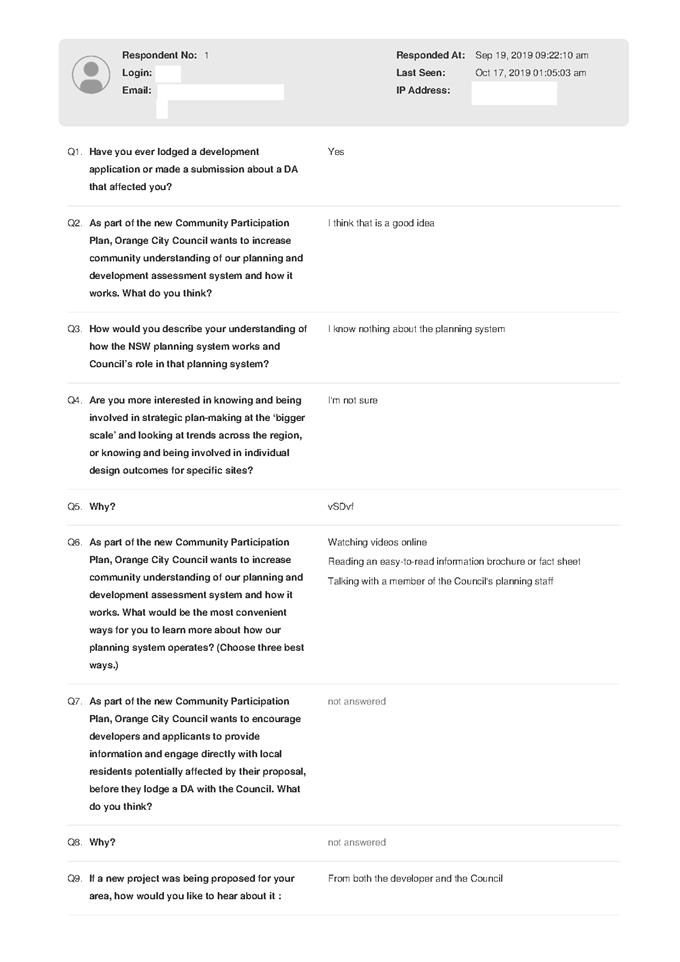

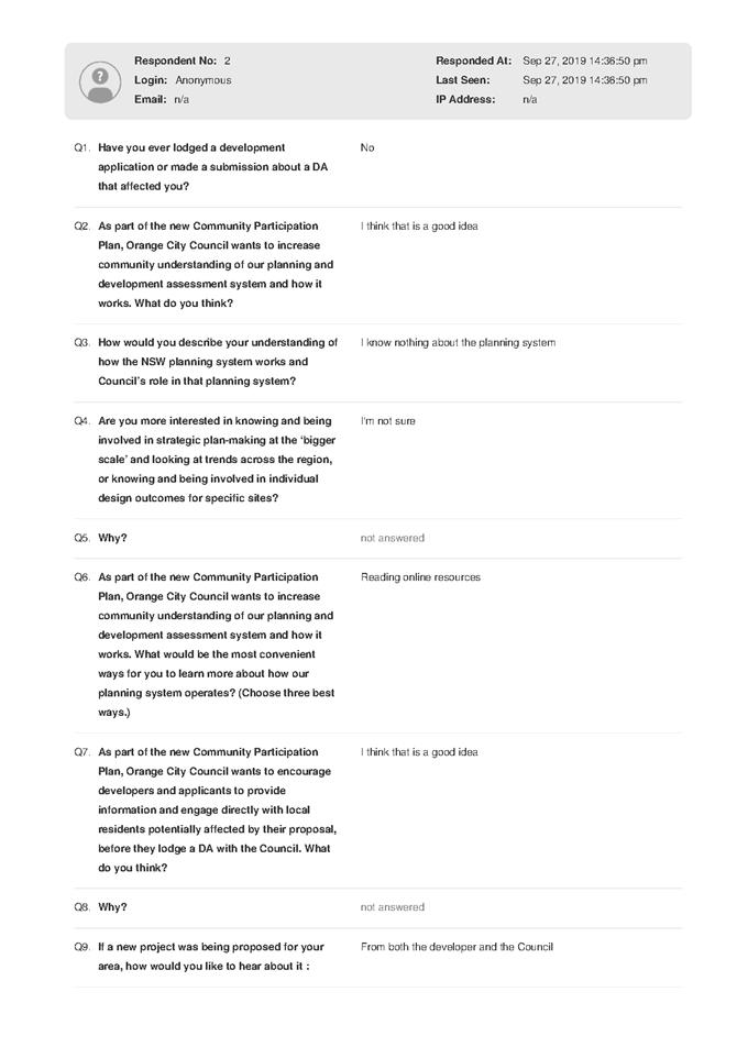

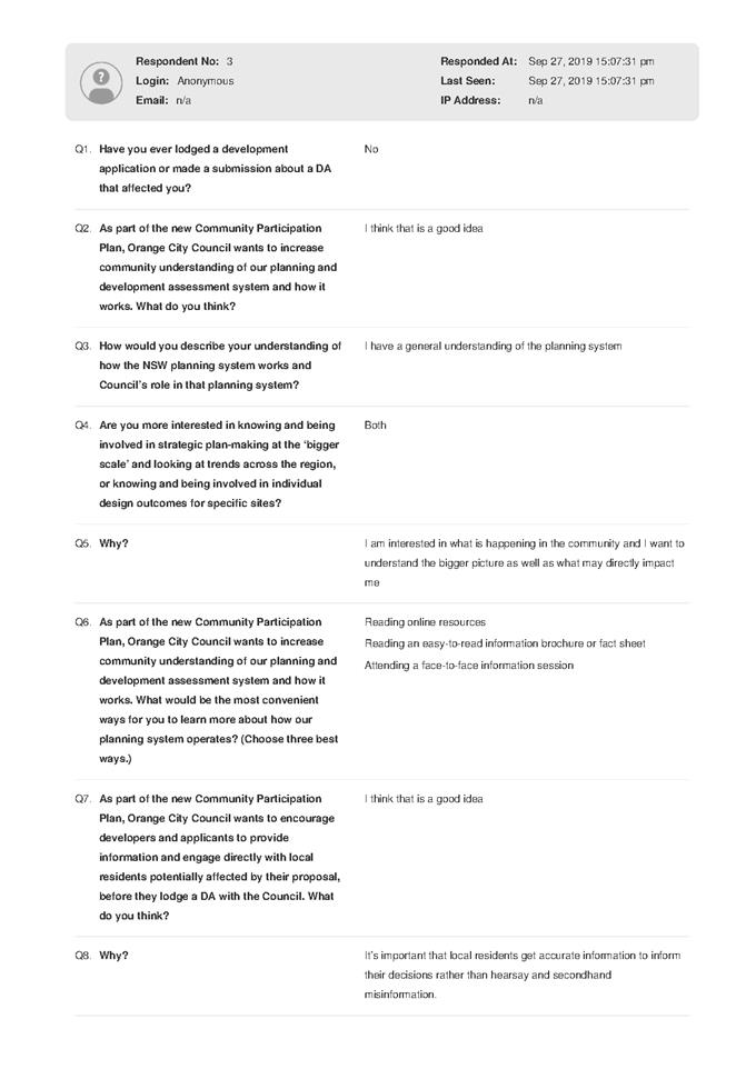

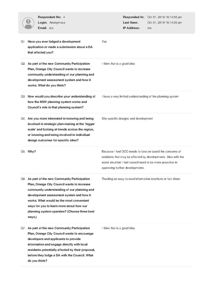
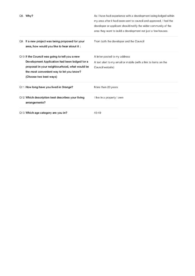
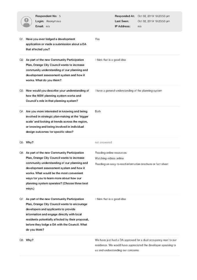

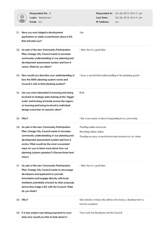


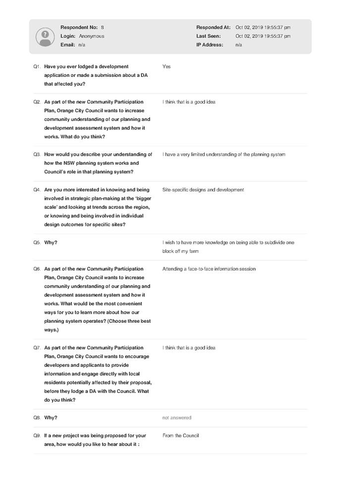


Planning and Development Committee
7 November 2019
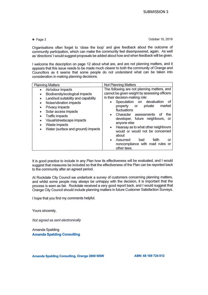
2.4 Development
Application DA 232/2018(1) - helipad - 1083 Forest Road
RECORD
NUMBER: 2019/186
AUTHOR: Summer
Commins, Senior Planner
EXECUTIVE Summary
|
Application
lodged
|
3 July
2018; additional details submitted 23 October 2019
|
|
Applicant/s
|
Mr DM
and Mrs JM Brus
|
|
Owner/s
|
Mr DM
and Mrs JM Brus
|
|
Land
description
|
Lot 2 DP
1069705 - 1083 Forest Road, Spring Creek
|
|
Proposed
land use
|
Helipad
|
|
Value of
proposed development
|
$10,000.00
|
The proposal involves the establishment of a helipad at 1083
Forest Road, Spring Creek (refer locality below – Figure 1).
A helipad means ‘a place not open to the public
used for the taking off and landing of helicopters’ (Orange Local
Environmental Plan (LEP) 2011). Seven (7) flights per week are proposed between
7am and 10pm. A concrete landing pad, 18m x 18m will be constructed. An
existing rural shed will be used for the storage of helicopters.
The key issues for consideration include the suitability of
the proposal in the water catchment; operational noise emissions; and impacts
on the rural character and setting.
The proposal comprises advertised development. At the
completion of the public notice and exhibition period, 16 submissions were
received.
The proposal is not contrary to
the planning provisions that apply to the subject land and particular land use.
Subject to compliance with conditions of consent on the attached Notice of Approval,
it is considered that the potential impacts of the proposed helipad can be
appropriately managed, and are unlikely to have a significant impact on the
surrounding environment.
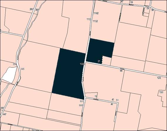
Figure 1 - locality plan
DECISION FRAMEWORK
Development in Orange is governed by two key documents
Orange Local Environment Plan 2011 and Orange Development Control Plan 2004. In
addition the Infill Guidelines are used to guide development, particularly in
the heritage conservation areas and around heritage items.
Orange Local Environment Plan 2011 – The
provisions of the LEP must be considered by the Council in determining the
application. LEPs govern the types of development that are permissible or
prohibited in different parts of the City and also provide some assessment
criteria in specific circumstances. Uses are either permissible or not. The
objectives of each zoning and indeed the aims of the LEP itself are also to be
considered and can be used to guide decision making around appropriateness of
development.
Orange Development Control Plan 2004 – the DCP
provides guidelines for development. In general it is a performance based
document rather than prescriptive in nature. For each planning element there
are often guidelines used. These guidelines indicate ways of achieving the
planning outcomes. It is thus recognised that there may also be other solutions
of merit. All design solutions are considered on merit by planning and building
staff. Applications should clearly demonstrate how the planning outcomes are
being met where alternative design solutions are proposed. The DCP enables
developers and architects to use design to achieve the planning outcomes in
alternative ways.
DIRECTOR’S COMMENT
This application relates to the
construction and operation of a helipad. A helipad by definition is
restricted to 7 movements per week (take off is one, landing is two
etc.). The use is therefore relatively minor in intensity and would like
into alternative facilities the operator has and will further construct at the
Orange Airport. Similar development in the LGA has not caused adverse
impacts. I consider the proposal is reasonable and the recommendation of
approval is supported.
Link To Delivery/OPerational Plan
The recommendation in this report relates to the
Delivery/Operational Plan strategy “10.1 Preserve - Engage with the
community to ensure plans for growth and development are respectful of our
heritage”.
Financial Implications
Nil
Policy and Governance Implications
Nil
|
Recommendation
That Council consents to
development application DA 232/2018(1)
for Helipad at Lot 2 DP 1069705 - 1083 Forest Road,
Spring Creek pursuant to the conditions of consent
in the attached Notice of Approval.
|
further considerations
Consideration has been given to the recommendation’s
impact on Council’s service delivery; image and reputation; political;
environmental; health and safety; employees; stakeholders and project
management; and no further implications or risks have been identified.
SUPPORTING INFORMATION
The proposal involves the establishment of a helipad at 1083
Forest Road, Spring Creek for Orange Helicopters.
The helipad will be used for taking off and landing of
helicopters by the owner or employee of the business.
Two (2) helicopters will utilise the helipad, comprising a Bell 206
Jet Ranger and a Bell 212 specialist firefighting helicopter. Seven (7)
flights per week are proposed between the hours of 7am and 10pm.
The helicopters will be used for charter, utility and
emergency flights. By definition, the helipad will not be open to the public.
As such, passengers will be collected offsite for all flights that involve
passengers. The facility will provide a venue for the storage of helicopters
(and associated flight movements) used in the operation of the subject
business.
A concrete landing pad, 18m x
18m will be constructed. An existing rural shed to the south of the landing pad
will be utilised as an aircraft hangar when the helicopters are not in use.
Aircraft will be manoeuvred into and out of the hangar via a tow cart. The
proposed site layout is depicted below (refer Figure 2).

Figure 2 - proposed site layout
Helicopter approach and
departure paths are nominated for the westerly and easterly directions, as
shown below (refer Figure 3). The flightpaths provide an obstacle free gradient
from Final Approach and Take Off area (FATO) to the prescribed 500 feet
(including dwellings on adjoining parcels). In the event that weather
conditions do not permit use of the nominated flightpaths, Orange Airport will
provide an alternative landing site.
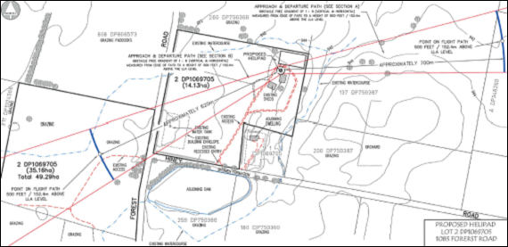
Figure 3 – approach and departure flightpaths
(shown in red)
Refuelling
of helicopters will occur onsite via a mobile fuel truck. Refuelling will be
undertaken on the concrete landing pad. At other times, the mobile fuel truck
will be stored in the helicopter hangar.
History/Background
The subject land has development consent for a resource
recovery facility (storage and processing of timber railway sleepers)
pursuant to DA 421/2016(1) (7 December 2017). The proposed helipad will have
nil impact on the existing operation of the resource recovery facility.
MATTERS FOR CONSIDERATION UNDER
THE ENVIRONMETNAL PLANNING AND ASSESSMENT ACT 1979
Section 1.7 Application of
Part 7 of the Biodiversity Conservation Act 2016 and Part 7A of the
Fisheries Management Act 1994
Section 1.7 of the EP&A Act identifies that Part 7 of
the Biodiversity Conservation Act 2016 (BC Act) and Part 7A of the
Fisheries Management Act 1994 have effect in connection with terrestrial and
aquatic environments.
There are four triggers known to insert a development into
the Biodiversity Offset Scheme (ie the need for a BDAR to be submitted
with a DA):
· Trigger 1:
development occurs in land mapped on the Biodiversity Values Map (OEH)
(clause 7.1 of BC Regulation 2017);
· Trigger 2:
development involves clearing/disturbance of native vegetation above a certain
area threshold (clauses 7.1 and 7.2 of BC Regulation 2017); or
· Trigger 3:
development is otherwise likely to significantly affect threatened species
(clauses 7.2 and 7.3 of BC Act 2016).
The fourth trigger (development proposed to occur in an Area
of Outstanding Biodiversity Value (clause 7.2 of BC Act 2016) is generally not
applicable to the Orange LGA; as no such areas are known to occur in the LGA.
No further comments will be made against the fourth trigger.
Trigger 1
The subject land is not identified as biodiversity sensitive
on the Orange LEP 2011 Terrestrial Biodiversity Map.
Trigger 2
The prescribed clearing threshold for the site is 1ha (based
on minimum lot size for the subject land of 40-1000ha ((Cl. 7.2 Biodiversity
Conservation Regulation 2017). The proposal does not involve clearing or
disturbance of native vegetation.
Trigger 3
The subject land is cleared and currently developed for a
resource recovery facility. The site does not contain or adjoin mapped
biodiversity sensitive lands and is not in proximity to a woodland vegetation
community that would provide habitat for significant native fauna species. The
proposal does not involve vegetation removal. It is considered that the
proposed development will not adversely affect a threatened species.
Based on the foregoing consideration,
a BDAR is not required and the proposal suitably satisfies the relevant matters
at Clause 1.7 EPAA 1979.
Section 4.15 Evaluation
Provisions of any Environmental Planning Instrument
S4.15(1)(A)(I)
Orange Local Environmental Plan 2011
Part 1 - Preliminary
Clause 1.2 - Aims of Plan
(a) to encourage development which complements
and enhances the unique character of Orange as a major regional centre boasting
a diverse economy and offering an attractive regional lifestyle,
(b) to provide for a range of development
opportunities that contribute to the social, economic and environmental
resources of Orange in a way that allows present and future generations to meet
their needs by implementing the principles for ecologically sustainable
development,
(c) to conserve and enhance the water
resources on which Orange depends, particularly water supply catchments,
(d) to manage rural land as an environmental
resource that provides economic and social benefits for Orange,
The application is considered to be consistent with the
above objectives, as outlined in this report and as follows:
- The
proposal comprises an extension to an existing local business which will
contribute to the local economy.
- There
are no aspects of the proposal that are contrary to the principles of
ecologically sustainable development.
- The
subject land is located in the City’s water catchment. In order to
maintain the quality of surface and groundwater, conditions of consent are
included on the attached Notice of Approval in relation to management of
helicopter refuelling activities; and prohibition of helicopter maintenance
works.
- The
proposal will not alter the existing primary production values of the subject
land. This portion of the site is development for a resource recovery facility
(DA 421/2016(1)) and is not utilised for agricultural activities. Furthermore,
there is no evidence to suggest that an aircraft facility of this scale would
adversely impact on adjoining rural farming land or livestock.
Clause 1.6 - Consent Authority
Clause 1.6 is applicable and states:
The consent authority for the
purposes of this Plan is (subject to the Act) the Council.
Clause 1.7 - Mapping
The subject site is identified
on the LEP maps in the following manner:
|
Land Zoning Map:
|
Land zoned E3 Environmental
Management
|
|
Lot Size Map:
|
Minimum lot size 100ha
|
|
Heritage Map:
|
Not a heritage item or conservation
area; adjacent to heritage items
|
|
Height of Buildings Map:
|
No building height limit
|
|
Floor Space Ratio Map:
|
No floor space limit
|
|
Terrestrial Biodiversity Map:
|
No biodiversity sensitivity on the
site
|
|
Groundwater Vulnerability Map:
|
Groundwater vulnerable
|
|
Drinking Water Catchment Map:
|
Within the drinking water catchment
|
|
Watercourse Map:
|
Not within or affecting a defined
watercourse
|
|
Urban Release Area Map:
|
Not within an urban release area
|
|
Obstacle Limitation Surface Map:
|
No restriction on building siting
or construction
|
|
Additional Permitted Uses Map:
|
No additional permitted use applies
|
|
Flood Planning Map:
|
Not within a flood planning area
|
Those matters that are of relevance are addressed in detail
in the body of this report.
Clause 1.9A - Suspension of
Covenants, Agreements and Instruments
Clause 1.9A is applicable and states in part:
(1) For the purpose of enabling
development on land in any zone to be carried out in accordance with this Plan
or with a consent granted under the Act, any agreement, covenant or other
similar instrument that restricts the carrying out of that development does not
apply to the extent necessary to serve that purpose.
(2) This clause does not apply:
(a) to a covenant
imposed by the Council or that the Council requires to be imposed, or
(b) to
any prescribed instrument within the meaning of section 183A of the Crown Lands Act 1989, or
(c) to
any conservation agreement within the meaning of the National Parks and Wildlife Act 1974,
or
(d) to
any Trust agreement within the meaning of the Nature Conservation Trust Act 2001, or
(e) to
any property vegetation plan within the meaning of the Native Vegetation Act 2003, or
(f) to
any biobanking agreement within the meaning of Part 7A of the Threatened Species Conservation Act 1995,
or
(g) to
any planning agreement within the meaning of Division 6 of Part 4 of the Act.
In
consideration of this clause, Council staff are not aware of the title of the
subject property being affected by any of the above.
Part 2 Permitted or Prohibited Development
Clause
2.1 - Land Use Zones
The subject
land is zoned E3 Environmental Management.
The
proposed development is defined as a ‘helipad’ which means:
A place not open to the public used for the taking off and
landing of helicopters.
Helipads
are permitted with Council’s consent in the E3 zone. The storage of
helicopters within the existing rural farm shed is considered to be ancillary
component to the overall use of a helipad on the land and is therefore
permissible with the consent of Council.
Clause 2.3 - Zone Objectives and Land Use Table
The
objectives of the E3 Environmental Management Zone are:
· To protect,
manage and restore areas with special ecological, scientific, cultural or
aesthetic values.
· To provide for
a limited range of development that does not have an adverse effect on those
values.
· To manage
development within water supply catchment lands to conserve and enhance the
city and district’s water resources.
· To maintain the
rural function and primary production values of the area.
· To ensure
development along the Southern Link Road has alternative access.
The application is considered to be consistent with the
above objectives, as outlined in this report and as follows:
- The subject land does not have particular
ecological, scientific, cultural or aesthetic value. This portion of the site
is developed for a resource recovery facility (DA 421/2016(1)). The
proposed helipad will relate to that existing use in character and function.
- The
subject land is located in the City’s water catchment. In order to
maintain the quality of surface and groundwater, conditions of consent are
included on the attached Notice of Approval in relation to management of
helicopter refuelling activities; and prohibition of helicopter maintenance
works. Compliance with the conditions will protect water resources.
- The
proposal will not alter the existing primary production values of the subject
land. This portion of the site is development for a resource recovery facility
(DA 421/2016(1)) and is not utilised for agricultural activities. Furthermore,
there is no evidence to suggest that an aircraft facility of this scale would
adversely impact on adjoining rural farming land or livestock.
Subject to compliance with
conditions of consent on the attached Notice of Approval, the proposed
development is considered to be consistent with the foregoing objectives. The
relevant matters are outlined in the following sections of this report.
Part 3 Exempt and Complying Development
The application is not exempt or complying development.
Part 4 Principal Development Standards
The Principal Development Standards at Part 4 are not
applicable to the proposal.
Part 5 Miscellaneous Provisions
Clause 5.10 - Heritage Conservation
The subject land is located nearby
to heritage items of Local significance, as follows:
· Item I138 –
‘Bayoud’ former inn at 365 Cadia Road
· Item I17 –
‘Glenfield’ country inn at 1007 Forest Road
· Item
I292 – Failford homestead at 45 Failford Lane.
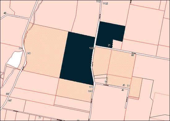
Figure 4 – heritage items nearby to the site
(shown in red hatching)
Clause 5.10(4) is applicable and states in part:
The consent authority must,
before granting consent under this clause in respect of a heritage item or
heritage conservation area, consider the effect of the proposed development on
the heritage significance of the item or area concerned.
In consideration of this clause,
the proposal will not adversely impact on the significance of heritage items
nearby to the site. The proposal does not involve any works that relate to the
adjacent items or their curtilages. Furthermore, the proposed development does
not involve improvements that will dominate the adjoining items, or impact on
views to or from the items. The proposed helipad is well-removed from the
heritage items by the road reserves and rural landholdings.
Part 6 - Urban Release Area
Not relevant to the application. The subject site is not
located in an Urban Release Area.
Part 7 - Additional Local Provisions
Clause
7.6 - Groundwater Vulnerability
The
subject land is identified as Groundwater Vulnerable on the Groundwater
Vulnerability Map. Clause 7.6 applies. This clause states in part:
(3) Before
determining a development application for development on land to which this
clause applies, the consent authority must consider:
(a) whether or not the development (including
any onsite storage or disposal of solid or liquid waste and chemicals) is
likely to cause any groundwater contamination or have any adverse effect on
groundwater dependent ecosystems, and
(b) the cumulative impact (including the
impact on nearby groundwater extraction for potable water supply or stock water
supply) of the development and any other existing development on groundwater.
In consideration of Clause 7.6,
helicopters will be refuelled by a mobile fuel truck. The mobile facility will
does permit bunding of the fuel filling area or truck storage/parking areas. A
condition is included on the attached Notice of Approval that a fuel spill kit
be provided onsite and utilised in the event of fuel spill.
Clause 7.7 - Drinking Water
Catchments
The subject land is identified as “Drinking
Water” on the Drinking Water Catchment Map. Clause 7.7 is
applicable and states in part:
(3) Before
determining a development application for development on land to which this
clause applies, the consent authority must consider whether or not the
development is likely to have any adverse impact on the quality and quantity of
water entering the drinking water storage, having regard to:
(a) the
distance between the development and any waterway that feeds into the drinking
water storage, and
(b) the
onsite use, storage and disposal of any chemicals on the land, and
(c) the
treatment, storage and disposal of waste water and solid waste generated or
used by the development.
In consideration of Clause 7.7, the proposed helipad is
unlikely to impact on water quality within the drinking water catchment. The
subject land does not contain a waterway (subclause (3)(a)); and the
development will not generate waste water or solid waste (subclause (3)(c)). As
outlined above, a condition is included on the attached Notice of Approval
requiring a spill kit to be located on the subject land and utilised in the
event of a fuel spill. It is further required by conditions of consent that
helicopter maintenance / servicing activities other than emergency maintenance
shall not be carried out on the subject land.
Clause 7.11 - Essential Services
Clause 7.11 applies and states:
Development consent must not be
granted to development unless the consent authority is satisfied that any of
the following services that are essential for the proposed development are
available or that adequate arrangements have been made to make them available
when required:
(a) the
supply of water,
(b) the
supply of electricity,
(c) the
disposal and management of sewage,
(d) storm
water drainage or on-site conservation,
(e) suitable
road access.
In consideration of Clause 7.11, utility services required
for the proposed helipad are available to the land and adequate for the
proposal. Conditions are included on the attached Notice of Approval requiring
upgrading of the existing vehicular access from Hiney Road.
STATE ENVIRONMENTAL PLANNING
POLICIES
State Environmental Planning Policy 55 - Remediation of
Land
SEPP 55 is applicable. Pursuant to Clause 7 Contamination
and remediation to be considered in determining development application:
(1) A
consent authority must not consent to the carrying out of any development on
land unless:
(a) it
has considered whether the land is contaminated, and
(b) if
the land is contaminated, it is satisfied that the land is suitable in its
contaminated state (or will be suitable, after remediation) for the purpose for
which the development is proposed to be carried out, and
(c) if
the land requires remediation to be made suitable for the purpose for which the
development is proposed to be carried out, it is satisfied that the land will
be remediated before the land is used for that purpose.
In consideration of this clause, a Preliminary Contamination
Investigation was submitted in support of previous DA 421/2016(1) for a
proposed resource recovery facility (Envirowest Consulting 2017).
The investigation identified heavy metal contaminants over
the site associated with past agricultural use of the subject property and more
recent use for the storage and processing of railway sleepers. The
Investigation confirmed that:
‘The levels of all
substances analysed in samples collected from the site were at environmental
background levels and less than the assessment criteria for commercial landuse
thresholds.’
The subject site is considered suitable in its current form
for use as a helipad.
State Environmental Planning
Policy 33 - Hazardous and Offensive Development
SEPP 33 is applicable by virtue of the mobile fuel truck to
be stored on the subject land. Pursuant to Clause 8 Consideration of
Departmental Guidelines:
In determining whether a development is:
(a) a hazardous
storage establishment, hazardous industry or other potentially hazardous
industry, or
(b) an offensive
storage establishment, offensive industry or other potentially offensive
industry,
consideration must be given to current circulars or
guidelines published by the Department of Planning relating to hazardous or
offensive development.
In accordance with Clause 8, consideration was given to
Hazardous and Offensive Development Application Guidelines – Applying
SEPP 33 (Department of Planning, January 2011) (SEPP 33 Guideline).
The proposed development does not exceed the Risk
Screening threshold limits for quantity stored and boundary proximity, pursuant
to the SEPP 33 Guideline. The fuel is classified as Class 3 Packing Group
II fuel. A total quantity of 8 tonnes will be stored and handled within 60m
of the facility boundary. Consequently, the proposal is not considered to be
potentially hazardous.
Part 3 of the SEPP prescribes matters for consideration in
determining an application for potentially hazardous or offensive development.
This Part is not applicable to the proposal.
Provisions of any Draft
Environmental Planning Instrument That Has Been Placed On Exhibition
4.15(1)(A)(Ii)
Draft Remediation of Land State Environmental Planning
Policy
Draft Remediation of Land SEPP is applicable. The Draft SEPP
requires in part that consideration be given to potential contamination on
nearby or neighbouring properties and groundwater. Residential land and public
open space adjoining the site is not identified or considered to be
contaminated.
Draft Orange Local Environmental
Plan 2011 (Amendment 24)
Draft Orange LEP Amendment 24
has recently completed public exhibition (26 July‑26 August
2019). The Draft plan involves various administrative amendments to the LEP,
including updated maps and new and amended clauses. Amendment 24 has no effect
for the proposed development.
DESIGNATED DEVELOPMENT
Pursuant to Part 1 of Schedule 3 of the Environmental
Planning and Assessment Regulation 2000, ‘aircraft facilities’
are designated development in the following circumstances:
Aircraft facilities (including terminals, buildings for the
parking, servicing or maintenance of aircraft, installations or movement areas)
for the landing, taking-off or parking of aeroplanes, seaplanes or helicopters:
(a) in the case of
seaplane or aeroplane facilities:
(i) that
cause a significant environmental impact or significantly increase the
environmental impacts as a result of the number of flight movements (including
taking-off or landing) or the maximum take-off weight of aircraft capable of
using the facilities, and
(ii) that are
located so that the whole or part of a residential zone, a school or hospital
is within the 20 ANEF contour map approved by the Civil Aviation Authority of
Australia, or within 5 kilometres of the facilities if no ANEF contour map has
been approved, or
(b) in the case of helicopter
facilities (other than facilities used exclusively for emergency
aeromedical evacuation, retrieval or rescue):
(i) that have
an intended use of more than seven (7) helicopter flight movements per week
(including taking-off or landing), and
(ii) that are
located within 1 kilometre of a dwelling not associated with the facilities, or
(c) in any case,
that are located:
(i) so as to
disturb more than 20 hectares of native vegetation by clearing, or
(ii) within 40
metres of an environmentally sensitive area, or
(iii) within 40 metres of
a natural waterbody (if other than seaplane or helicopter facilities).
The proposed development is not
designated development. Whilst the development is located within 1km of a
dwelling house the proposal is limited to a maximum of seven (7) helicopters
movements per week. For clarification, a helicopter movement comprise one up OR
one down. The proposal does not involve native vegetation clearing, and the
subject land is not located within 40m of an environmentally sensitive area or
natural waterbody.
In order that the land use is not
designated development, a condition of consent is included on the attached
Notice of Approval that helicopter flight movements shall not exceed
seven (7) movements per week without the further consent of Council.
INTEGRATED DEVELOPMENT
Pursuant to Clause 43 and Schedule
1 of the Protection of the Environment Operations Act 1997, an environmental
protection licence is required for helicopter-related activities in the
following circumstances:
20 Helicopter-related
activities
(1) This clause
applies to a helicopter-related activity, meaning the landing, taking-off or
parking of helicopters (including the use of terminals and the use of buildings
for the parking, servicing or maintenance of helicopters), being an activity:
(a) that has an
intended use of more than 30 flight movements per week (where take-off and
landing are separate flight movements), and
(b) that is
conducted within 1 kilometre of a dwelling not associated with the landing,
taking-off or parking of helicopters,
but not including an activity that is carried out
exclusively for the purposes of emergency aeromedical evacuation, retrieval or
rescue.
The proposed development is not
integrated development. The proposed helipad will not exceed the prescribed 30
flight movements per week. An environmental protection licence is not required.
Provisions of any
Development Control Plan S4.15(1)(A)(Iii)
Development Control Plan 2004
DCP 2004-12 Rural Environment Protection Zone
Part 12.1 General Controls for the Water Supply
Catchment Zone
DCP 2004-12.1 prescribes the following planning outcomes for
General Controls in Water Supply Catchments:
· Development
proposal clearly demonstrate measures that are to be instituted to minimise
impacts on the quality and availability of water resources for public water
supply use.
Part 12.2 Water Quality
Protection Area
DCP 2004-12.2 prescribes the following planning outcomes for
Water Quality Protection Areas:
· Effluent is
treated outside the defined protection area.
· Adjacent
waterways, including native riparian vegetation zones, are protected and
conserved.
· Soil and water
management measures are incorporated in the development.
As outlined above, the proposed helipad is unlikely to have
adverse impact on the quality of groundwater or surface water entering the
drinking water catchment. The potential water quality impacts associated with
operation of the helipad will be consistent with those associated with
operation of other farming machinery and equipment.
The fuel truck used for helicopter refuelling is subject to
vehicle and operator licences issued by the Environment Protection Authority.
Helicopter refuelling will be undertaken on the concrete landing pad and a
spill kit will be kept onsite. Helicopter maintenance/servicing activities
other than emergency maintenance will not be undertaken onsite. Conditions are
included on the attached Notice of Approval to enforce these arrangements.
Provisions Prescribed by the
Regulations S4.15(1)(A)(Iv)
Demolition of a Building (clause 92)
The proposal does not involve the demolition of a building.
Fire Safety Considerations
(clause 93)
Council’s EHBS advises:
‘The helipad is unlikely to generate any fire
safety issues.’
Buildings to be Upgraded (clause
94)
Council’s EHBS advises:
‘The helipad is well separated from other buildings
on the site and no upgrades should be needed.’
BASIX Commitments (clause 97A)
Not applicable.
The Likely Impacts of the
Development S4.15(1)(B)
Noise Impacts
Council in determining this proposal is required to be
satisfied that the noise impacts generated by the development are acceptable.
The nearest affected dwelling is located approximately 230m (Receiver 1) from
the proposed helipad. A Noise Impact Assessment was submitted in support of the
proposal (Wilkinson Murray October 2018 Report No. 17258 Version B). The
assessment concludes:
Based on the proposed number
of operations and the type of aircraft to be used:
· Noise will
comply with the ANEF noise criterion proposed at all receivers.
· Ground
operations such as maintenance could result in exceedances of the Noise Policy
for Industry 2017 by a small margin, but due to the infrequency of the events
would cause negligible noise impact. Ground operations should occur during
daytime only and in a located shielded from Receiver 1 where possible.
· No vibration
impacts due to the proposal are predicted.
· Night time
flights will not occur, so sleep disturbance need not be assessed.
· If the proposed
flight paths are not useable due to meteorological conditions, the helipad will
not be used for landing or take off.
Council’s Acting Director Development Services concurs
with the findings of the submitted Noise Impact Assessment. He advises:
‘I confirm that I have
no objection to the proposal as detailed in the application. I am satisfied
that the proposal will comply with relevant noise standards relating to such
developments. Additionally, I am satisfied that the proposal considers matters
that were raised in the recent Land and Environment Court Case (Nessdee Pty Ltd
v OCC [2017] NSWLEC 158), albeit that the Nessdee development related to the
development of a heliport, not the much smaller helipad as this development application
relates.
I am satisfied that the
operations proposed, including hours of operations, flight numbers, flight
paths and alternative landing sites would ensure that the development does not
adversely impact on the surrounding environment and neighbours.
I do not consider that there
is a need to restrict the size of aircraft permissible at the site, as the SoEE
and noise report details the aircraft considered and proposed. Moreover, the
amended Wilkinson Murray Noise Assessment (17258 Version B) concludes that
noise from the larger Bell 212 would still comply, although the application
only proposes to store the Bell 212 outside the bushfire season (so is limited
when it would be onsite – and would not be regularly used from the site).
I confirm that I propose no
additional conditions for the development proposal, as the application proposes
appropriate controls for the development.’
Based on the foregoing, it is
considered that the proposed development will not have unreasonable acoustic
impacts in the rural setting.
Visual Impacts
The proposed helipad will have negligible visual impacts in
the rural setting. The landing pad will be imperceptible from adjoining
properties, and the site frontages to Forest Road and Hiney Road. An existing
rural shed will be utilised as an aircraft hangar. The subject land is located
in proximity to Orange Airport, and aircraft are a recurring and accepted
visual element in the skyscape.
Environmental Impacts
Impacts on the natural environment associated with the
proposed helipad are considered to be within reasonable limit. The proposal
does not involve vegetation clearing and the subject land is not affected by a
waterbody. As outlined above, the potential impacts on the water catchment
associated with operation of the helipad will be consistent with those
associated with operation of other farming machinery and equipment in this
rural setting. Conditions are included on the attached Notice of Approval to
ensure helicopter refuelling activities will be managed to avoid adverse
impacts on the water catchment.
Traffic Impacts
Traffic impacts associated with the proposed helipad will be
neutral. The facility will not be open to the public, and traffic generation
will be nil-negligible. Vehicular access to the subject land via Hiney Road
will be maintained, albeit upgraded, as required by conditions on the attached
Notice of Approval. Onsite vehicle arrangements for parking and manoeuvring
associated with the proposed helipad and existing resource recovery facility
will be managed by the common operator/proponent.
Impacts on Rural Character
The proposed helipad is a permitted use on the subject land.
It is the position of Council staff that based on the operations proposed,
including hours of operation, flight numbers and flight paths, alternative
landing sites and compliance with noise guidelines, the proposed helipad will
not adversely impact on the rural character and setting.
Impacts on Orange Airport
The proposed development was referred to Air Services
Australia and the Civil Aviation Safety Authority (CASA) for consideration and
comment. CASA requested an aeronautical assessment be prepared, in order to
demonstrate the suitability of the helipad operations in the vicinity of Orange
Airport.
The aeronautical assessment was prepared by Avipro (October
2019). The assessment concludes:
The siting of the helicopter
landing site albeit under the extended centre line of an active runway in a
common traffic advisory frequency environment should be easily managed with
… standard procedures and broadcasts.
The helicopter landing site will be
a low use location and the proponent will comply with the required standard
procedures and broadcasts at all times, therefore minimising any situational
awareness risk.
The proponent will also operate
into / from the helicopter landing site by day only in a manner that avoids
confliction with other traffic. As an experienced local operator, the proponent
remains mindful of working with the aviation community and users of the Orange
Airport.
Stakeholders were engaged
during assessment and they support the operations of helicopters into/from the
proposed helicopter landing site. They also expect appropriate application of
the procedures and broadcasts necessary to maintain separation and removed the
risk of confliction.
Given the above factors and the
mitigation strategy attached at Appendix 2 … the risks to other aircraft
are no different to the risks that exist with the conduct of operations
into/from Orange Airport. The development of standard approach / departure
paths into and from the proposed HLS will further reduce the risk of
confliction.
CASA provided the following comments in relation to the
aeronautical assessment:
CASA has reviewed the
aeronautical assessment developed by Avipro … and I am advised that the
identified risks and proposed mitigation to ensure an acceptable level of
safety for aircraft in the vicinity of the helicopter landing site as presented
in the report is appropriate. CASA also considers that the consultant’s level
of consultation with industry was adequate.
Council staff are satisfied that the proposed development
will not impact on the existing operation of Orange Airport. A condition is
included on the attached notice of approval requiring operation of the proposed
helipad consistent with the risk mitigation strategy contained in the Avipro
aeronautical assessment at Appendix 2.
The Suitability of the Site
S4.15(1)(C)
· the proposal is
permitted on the subject zoning
· nominated
flightpaths are clear of improvements on the subject and adjoining sites to the
prescribed aircraft height limit
· the site has
direct frontage and access to Hiney Road
· the land is
suitable from a contamination perspective for the proposed land use
· required utility
services are available and adequate, subject to access upgrading
· the site is not
subject to natural hazards
· the subject land
has no particular biodiversity or habitat value
· the site is not
known to contain any Aboriginal, European or archaeological relics.
Any Submissions Made in
Accordance with the Act S4.15(1)(D)
The proposed development comprises advertised development.
The application was advertised for the prescribed period of 14 days and at the
end of that period 16 submissions had been received. The issues raised in the
submissions are outlined below.
Orange Airport is located nearby
to the site and should be utilised as an alternative to the proposed helipad
Consideration of alternatives is not a matter for evaluation
in the assessment of a development application pursuant to the EPAA 1979. It is
noted that Orange Airport will provide an alternative landing site should
weather conditions not permit use of the nominated flight paths. The proponent
has operative development consent for an aircraft hangar at Orange Airport that
will accommodate the helicopters proposed in this application.
Flightpaths for the proposed helipad will conflict with
flightpaths for Orange Airport, with associated safety impacts
This matter was considered in the foregoing assessment. The
submitted aeronautical assessment demonstrates that the proposed helipad will
not compromise protected airspace associated with Orange Airport; will not
compromise instrument or visual protected areas; and can safely operate subject
to compliance with a risk mitigation strategy. A condition is included on the
attached Notice of Approval requiring compliance with the mitigation strategy.
The proposed helipad will have
adverse noise impacts in the rural setting; up to 25 dwellings will be
impacted
As outlined in foregoing sections of this report, the
submitted Noise Impact Assessment concludes that noise generated by the
proposed helipad will comply with prescribed noise criteria for all nearby
residential receivers. Council’s Acting Director Development Services concurred
with the findings and recommendations of the Noise Impact Assessment.
Proposed flight numbers of
seven (7) movements per week are likely to increase
Conditions are included on the attached Notice of Approval
that the proposed helipad shall not exceed 7 flight movements per week. Any
proposal to increase the number of flights above 7 movements will be subject to
separate development consent of Council. The Designated Development provisions
under the EPAA 1979 will apply in this circumstance, with associated rigorous
environmental assessment and public exhibition.
The proposed helipad will
result in devaluation of adjoining properties
The impact of a development on the
value of adjoining properties is not a matter for evaluation in the assessment
of a development application pursuant to the EPAA 1979.
The proponent is already
landing the helicopter on the subject land without development consent being
granted
Use of the subject land as a helipad prior to the granting
of development consent is a breach of the EPAA 1979. Consistent with Council
policy and practice, the proponent will be requested to provide details of the
alleged breach. At the time of finalising this report a formal position on this
issue has not been reached. Council staff will follow the procedures outlined
in Council’s recently adopted Enforcement Policy in resolving this
matter.
The proponent is failing to comply
with conditions of development consent as they relate to the resource recovery
facility (DA 421/2016(1))
The conditions relating to DA 421/2016(1) are not relevant
in the assessment and determination of the subject application. Council
officers will carry out a separate compliance review of DA 421/2016(1).
The nominated easterly
flightpath will be directly overhead a future dwelling on the adjoining eastern
parcel (Lot 137 DP 750387)
Development consent has been granted for a dwelling and shed
on the adjoining land to the east, described as Lots 137 and 200 DP 750387 and
Lot B DP 346260 (pursuant to DA 18/2012(1). The approved dwelling is
located in the southern portion of the site (refer red star below) and removed
from the easterly flightpath for the proposed helipad (see figure).
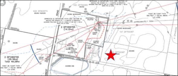
Figure 4 – location of approved dwelling house
on the adjoining eastern parcel
The proposed hours of operation
(7am to 10pm) are excessive and will adversely impact on residential amenity
The proposed hours of operation (7am to 10pm) comprise
‘daytime hours’ pursuant to the Noise Policy for Industry 2017, and
are accepted and adopted operating hours for industrial and commercial land
use. Council’s Acting Director of Development Services concurred that the
hours are suitable. A condition is included on the attached Notice of Approval
restricting helipad operating hours to 7am to 10pm which includes all warm up
and warm down procedures.
Consent is sought for ‘occasional’ and emergency
use of the Bell 212 helicopter outside of the proposed hours of operation. It
is not possible to quantify ‘occasional use’ and indeed was not
considered in the submitted Noise Impact Assessment. The applicant confirmed in
the SEE accompanying the application that there would be no flights in the
night time period after 10pm. The proposed hours of operation will apply, and
be enforced by a condition of consent.
Helicopters in flight will impact
on livestock and horse welfare
Council’s experience for other helipads and heliports
in the city suggest that helicopters in flight do not harm animals.
Furthermore, there is no literature or research available which demonstrates
that the operation of a helicopter based on seven (7) movements per week would
have an adverse impact on livestock enterprises.
Helicopters in flight may cause
damage to adjoining intensive agriculture operations
There is no evidence to suggest that the operation of the
helipad will impact on adjoining agricultural activities. Dust suppression as
required by conditions in the attached Notice of Approval (see following
sections of this report) will prevent air pollution and potential impacts on
nearby agricultural operations.
The proposed helipad is
inconsistent with the rural character and setting
The proposed helipad is a permitted use on the subject land.
It is the position of Council staff that based on the operations proposed,
including hours of operation, flight numbers and flight paths, alternative
landing sites and compliance with noise guidelines, the proposed helipad will
not adversely impact on the rural character and setting of the locality. In
terms of visual character, the proposed helipad will have negligible impacts in
the rural setting. The landing pad will be imperceptible from adjoining
properties, and the site frontages to Forest Road and Hiney Road.
Where will the helicopters be
stored to avoid breaching seven (7) movements per week?
This is an operational matter for the proponent. It is noted
that Orange Airport will provide an alternative landing site if necessitated by
restrictions on flight numbers or weather conditions. The proponent has
operative development consent for an aircraft hangar at Orange Airport that
will accommodate the helicopters proposed in this application.
The proposed helipad will
generate nuisance dust, with associated air pollution and damage to surrounding
vegetation
Potential dust nuisance associated with the helipad
operations is acknowledged. In order to minimise dust impacts, a condition is
included on the attached Notice of Approval requiring installation and
maintenance of a lawn area adjacent to the Ground Effect Area (surrounding the
helipad).
Lighting of helipad and
helicopters will impact on localised fauna and neighbouring dwellings
A condition is included on the attached Notice of Approval
requiring exterior lighting of the helipad and hangar comply with Australian
Standard AS 4282-1997 Control of the obtrusive effects of outdoor lighting.
Onsite fuel storage and filling
could impact on the natural environment
As outlined in the foregoing sections of this report, the
proposed arrangements for onsite fuel storage and refuelling of helicopters are
considered suitable within the water catchment. The truck and operator are
subject to various licences issued by the Environment Protection Authority.
A condition is included on the
attached Notice of Approval requiring a spill kit to be located on the subject
land and utilised in the event of a fuel spill. It is further required by
conditions of consent that helicopter maintenance / servicing activities other
than emergency repairs shall not be carried out on the subject land.
Firefighting equipment should
be provided on the site
A condition is included on the attached Notice of Approval
requiring details of fire safety measures for the proposed helipad (and
existing hangar) be provided prior to issue of a Construction Certificate.
Existing site access via Hiney
Road is unsuitable for traffic to be generated by the helipad
The proposed helipad is not accessible to the public and
will not generate additional localised traffic. Notwithstanding,
Council’s Development Engineer has included a condition on the attached
Notice of Approval requiring upgrading of the existing site access to
Hiney Road.
Helicopters in flight could
generate a distraction for motorists
The subject land is located in proximity to Orange Airport,
and aircraft are a recurring and accepted visual element in the skyscape. The
proposed seven (7) additional flight movements per week are unlikely to
exacerbate the existing situation relating to motorist distraction and traffic
conflicts.
The proposed commercial use of
the subject land is contrary to the rural zoning
Helipads are a permitted use in the E3 Environmental
Management zone, subject to receiving development consent. The application is
seeking consent.
The proposed hours of operation
are unsatisfactory and lack definition
An assessment of hours of operation and the impacts in
relation to noise have been considered in the foregoing assessment. A condition
is included on the attached Notice of Approval restricting helipad operating
hours to 7am to 10pm (inclusive of all warm up and warm down procedures).
The intersection of Forest Road
and Hiney Road is dangerous and should be upgraded for additional traffic
The proposed helipad is not accessible to the public and
will not generate additional localised traffic. Road upgrading in conjunction
with the proposed development will not be required. Any request for road
upgrading should be made via Council’s Technical Services Division.
Further details are requested
on anticipated flight schedules
Flight schedules are a matter for the proponent and not
required for evaluation of the development. As outlined in the foregoing
sections of this report, conditions are included on the attached Notice of
Approval in relation to operating hours and flight numbers.
How will flight numbers and paths
be monitored and enforced?
Conditions are included on the attached Notice of Approval that
helicopter flight movements shall not exceed seven (7) movements per week
without the further consent of Council; additionally, flights shall be
recorded/logged and details provided to Council upon request.
More details are requested in
relation to flightpaths
Flightpaths are nominated in the application as outlined in
foregoing sections of this report. Conditions are included on the attached
Notice of Approval that helicopters shall utilise approved flight paths only;
further, that if weather conditions do not permit, Orange Airport shall be
utilised as an alternative landing site.
The proposal may threaten
localised flora and fauna
Council’s Manager City Presentation advised that the
proposal is unlikely to impact on localised flora and fauna. The subject land
is cleared and currently developed for a resource recovery facility. The
proposal will not require vegetation removal. The development site is not in
proximity to a woodland vegetation community that would provide habitat for
significant native fauna species. Bird life and native macropods (kangaroos and
wallabies) will become accustomed to aircraft in flight, and will be less
exposed to aircraft due to their crepuscular movements (ie. in the twilight
hours between dawn and dusk).
Support is given to the
proposed helipad; the operator complies with conditions for approved helipad at
Lysterfield Road
Support for the proposed development- based on operation of
the proponent’s helipad at 158 Lysterfield Road (DA 307/2009(2)) - is
noted.
The approved resource recovery
facility does not comply with conditions of development consent; same is
anticipated for this development
Any future breach of conditions of development consent relating
to the proposed helipad will be addressed via compliance and enforcement
provisions contained in the EPAA 1979. Council’s Enforcement Policy will
apply to any breaches.
The Touch Down and Lift Off
Area (TLOF) and Final Approach and Take Off Area (FATO) should be designed to
accommodate the largest aircraft (Bell 212) to use the helipad
The helipad will be designed to
accommodate use by the nominated aircraft, consistent with the flight manuals.
Helicopter approach and departure paths are nominated for the westerly and
easterly directions, as shown below (refer Figure 3). The flightpaths provide
an obstacle free gradient from Final Approach and Take Off area (FATO) to the
prescribed 500 feet (including dwellings on adjoining parcels). In the event that
weather conditions do not permit use of the nominated flightpaths, Orange
Airport will provide an alternative landing site. The pilot for the aircraft
will be responsible for the safe operation of the facility.
The submitted noise report should
consider noise impacts associated with the largest aircraft (Bell 212) to use
the helipad
A revised Noise Impact Assessment was submitted following
receipt of this submission (Wilkinson Murray October 2018 Report No. 17258
Version B), and considers noise impacts for both helicopters (Bell 206 and Bell
212). The Noise Assessment concludes the proposed helipad will comply with
prescribed noise criteria for all nearby residential receivers. Council’s
Acting Director of Development Services concurred with the findings and
recommendations of the Noise Impact Assessment.
The proposed helipad should
comply with aviation regulations relating to compliance with aircraft flight
manuals
The operation of the helicopter will be the responsibility
of the pilot. A condition is included on the attached Notice of Approval
requiring use of the helipad in a manner consistent with the flight manuals for
the specified aircraft. In the event that weather conditions do not permit use
of the nominated flightpaths, Orange Airport will provide an alternative
landing site.
A number of submissions expressed concern regarding the
safety implications associated with the operation of the helipad. The safe
operation of a heliport in Class G air space (uncontrolled) is typically
governed by the requirements of CAAP 92-2(2), which sets out guidelines that
may be used to determine the suitability of the place for the landing and
taking-off of helicopters when the place does not meet the Standards and
Recommended Practices (SARPs) for Helicopters.
However, in some circumstances, Government agencies and
authorities may require that additional measures be implemented to ensure the
safe operation of a facility, such as CASA’s requirement that the
proposed heliport be designed in accordance with International Civil
Aviation Organisation (ICAO) Annex 14 and the ICAO Heliport Manual.
A copy of the development application has been provided to
all relevant emergency service providers for comment. While it is accepted that
there is an inherent level of risk associated with the operation of the any
heliport, it is considered that those risks would be most appropriately
mitigated by the operator of the facility and safe operation of helicopter
pilots.
Clarification is required on
the number of flight movements in order to determine whether the proposal
comprises designated development
Conditions are included on the attached Notice of Approval that
helicopter flight movements shall not exceed seven (7) movements per week
without the further consent of Council; additionally, flights shall be
recorded/logged and details provided to Council on request. Subject to
compliance with conditions, the proposed helipad does not comprise designated
development.
A condition of development
consent relating to aircraft weight limit (as was imposed for Nessdee
Pty Ltd v OCC [2017] NSWLEC 158) may preclude use of the helipad by the Bell
212
The proposal involves use of the proposed helipad by a Bell
206 and Bell 212 helicopter. As outlined in the foregoing sections of this
report, the amended noise assessment considered the noise impacts associated
with both aircraft.
Council’s Acting Director
Development Services concurs with the findings of the submitted Noise Impact
Assessment. A condition of consent is included on the attached Notice of
Approval restricting use of the proposed helipad to the Bell 206 and the Bell
212 helicopters only.
It is noted that the requirement for a weight limit was
specified in the Nessdee case because that facility had the potential for
un-tested (in terms of noise) types of helicopter aircraft landing and taking
off from the site. The expert witness in the court case for that development
suitably demonstrated that the acoustic analysis allowed for a single engine
helicopter with a maximum take-off weight of 3000kg to be acceptable. This
avoided the need to specifically nominate the various models of helicopters
that could operate from the site.
Helipad use should not involve
public access
By definition, helipads are not open to the public. A
condition is included on the attached Notice of Approval to this effect.
PUBLIC INTEREST
s4.15(1)(e)
The proposal is not inconsistent with any relevant policy
statements, planning studies, guidelines etc that have not been considered in
this assessment.
SUMMARY
The proposed development is permissible with the consent of
Council. The proposal is not contrary to the planning provisions that apply to
the subject land and particular land use. A Section 4.15 assessment
of the development indicates that the development is acceptable in this
instance. Subject to compliance with conditions of consent on the attached
Notice of Approval, it is considered that the potential impacts of the proposed
helipad can be appropriately managed, and are unlikely to have a significant
impact on the surrounding environment.
COMMENTS
The requirements of the Environmental Health and Building
Surveyor and the Engineering Development Section are included in the attached
Notice of Approval.
Attachments
1 Notice
of Approval, D19/64433⇩
2 Plans,
D19/6673⇩
3 Submissions,
D19/6670⇩
Planning
and Development Committee
7 November 2019
Attachment 1 Notice
of Approval
|

|
ORANGE CITY COUNCIL
Development
Application No DA
232/2018(1)
NA19/ Container
PR20260
|
NOTICE OF DETERMINATION
OF A DEVELOPMENT
APPLICATION
issued under the Environmental
Planning and Assessment Act 1979
Section 4.18
|
Development
Application
|
|
|
Applicant
Name:
|
Mr DM and Mrs JM Brus
|
|
Applicant
Address:
|
158 Lysterfield Road
ORANGE
NSW 2800
|
|
Owner’s
Name:
|
Mr DM and Mrs JM Brus
|
|
Land
to Be Developed:
|
Lot 2 DP 1069705 -
1083 Forest Road, Spring Creek
|
|
Proposed
Development:
|
Helipad
|
|
|
|
|
Building Code of
Australia
building
classification:
|
Class to be
determined by the PC
|
|
|
|
|
Determination made
under
Section 4.16
|
|
|
Made
On:
|
7 November 2019
|
|
Determination:
|
CONSENT GRANTED
SUBJECT TO CONDITIONS DESCRIBED BELOW:
|
|
|
|
|
Consent to Operate
From:
|
8 November 2019
|
|
Consent to Lapse On:
|
8 November 2019
|
Terms
of Approval
The reasons for the imposition of conditions
are:
(1) To maintain
neighbourhood amenity and character.
(2) To ensure compliance
with relevant statutory requirements.
(3) To prevent the proposed
development having a detrimental effect on adjoining land uses.
(4) To minimise the impact
of development on the environment.
Conditions
(1) The development must be
carried out in accordance with:
(a) Drawings
by Saunders and Staniforth Ref. 1083 Forest – Figures 2, 3 and 4
dated 26.07.2018 (3 sheets)
(b) statements
of environmental effects or other similar associated documents that form part
of the approval including the Acoustic Report prepared by Wilkinson Murray
Report No 17358 Version B October 2018; and Aeronautical Assessment prepared by
Avipro V1.2.
as amended in
accordance with any conditions of this consent.
(2) All building work must
be carried out in accordance with the provisions of the Building Code of
Australia.
(3) A sign is to be erected
in a prominent position on any site on which building work, subdivision work or
demolition work is being carried out:
(a) showing
the name, address and telephone number of the principal certifying authority
for the work, and
(b) showing
the name of the principal contractor (if any) for any building work and a
telephone number on which that person may be contacted outside working hours,
and
(c) stating
that unauthorised entry to the site is prohibited.
Any such sign is to be maintained while the
building work, subdivision work or demolition work is being carried out.
|
PRIOR TO THE ISSUE OF A CONSTRUCTION
CERTIFICATE
|
(4) The
existing vehicle entrance providing access from Hiney Road shall be upgraded to
a bitumen sealed standard with minimum 200mm thick gravel incorporating a pipe
culvert.
The pipe
culvert is to consist of minimum 375mm diameter stormwater pipes and 2 concrete
headwalls. Where it is not possible to construct a pipe culvert, due to shallow
depth of table drain or the entrance being located on a crest, a 2 metre wide
by 100mm deep concrete dish drain may replace the pipe culvert.
The
entrance is to be constructed in accordance with the RTA Guidelines for
Intersections at Grade Figure 4.9.7 Rural Property Access with Indented Access
and designed to accommodate a 19m semi-trailer. The construction is to be as
per the requirements of the Orange City Council Development and Subdivision
Code.
Engineering plans, showing details of the
vehicle access and traffic management works, are to be submitted to Orange City
Council or an Accredited Certifier (Categories B1, C3, C4, C6) upon application
for a Construction Certificate.
(5) A
Road Opening Permit in accordance with Section 138 of the Roads Act 1993
must be approved by Council prior to a Construction Certificate being issued
or any intrusive works being carried out within the public road or footpath
reserve.
(6) Details
of fire safety measures (including equipment for firefighting) for the proposed
helipad and existing hangar) shall be provided prior to issue of a Construction
Certificate.
(7) A written statement
demonstrating how the proposed helipad achieves the requirements of Civil
Aviation Advisory Publication (CAAP) 92-2(2) Guidelines for the Establishment
and Operation of Onshore Helicopter Landing Sites must be submitted to, and
approved by, Council’s Manager Development Assessments prior to the issue
of a Construction Certificate. The helipad shall be designed to satisfy this
criteria.
|
PRIOR TO WORKS COMMENCING
|
(8) A
Construction Certificate application is required to be submitted to, and issued
by Council/Accredited Certifier prior to any excavation or building works being
carried out onsite.
(9) Soil
erosion control measures shall be implemented on the site.
|
DURING CONSTRUCTION/SITEWORKS
|
(10) Any
adjustments to existing utility services that are made necessary by this
development proceeding are to be at the fill cost of the developer.
(11) All
construction/demolition work on the site is to be carried out between the hours
of 7.00 am and 6.00 pm Monday to Friday inclusive, 7.00 am to
5.00 pm Saturdays and 8.00 am to 5.00 pm Sundays and Public
Holidays. Written approval must be obtained from the General Manager of Orange
City Council to vary these hours.
(12) All materials on site
or being delivered to the site are to be contained within the site. The
requirements of the Protection of the Environment Operations Act 1997
are to be complied with when placing/stockpiling loose material or when
disposing of waste products or during any other activities likely to pollute
drains or watercourses.
|
PRIOR TO THE ISSUE OF AN OCCUPATION
CERTIFICATE
|
(13) Certification from
Orange City Council is required to be submitted to the Principal Certifying
Authority prior to the issue of an Occupation Certificate stating that all
works relating to connection of the development to Council assets, works on
public land, works on public roads, stormwater, sewer and water reticulation
mains and footpaths have been carried out in accordance with the Orange City
Council Development and Subdivision Code and the foregoing conditions, and that
Council will take ownership of the infrastructure assets.
(14) A
Road Opening Permit Certificate of Compliance is to be issued for the works by
Council prior to any Occupation/Final Certificate being issued for the
development.
(15) No
person is to use or occupy the building or alteration that is the subject of
this approval without the prior issuing of an Occupation Certificate.
(16) Approved fire safety
measures (including equipment for firefighting) shall be installed prior to
issue of an Occupation Certificate.
(17) In
order to minimise the impact of nuisance dust a lawn area shall be established and
maintained adjacent to the Ground Effect Area of the helipad.
(18) All of the foregoing
conditions are to be at the full cost of the developer and to the requirements and
standards of the Orange City Council Development and Subdivision Code, unless
specifically stated otherwise. All work required by the foregoing conditions is
to be completed prior to the issuing of an Occupation Certificate, unless
stated otherwise.
|
MATTERS FOR THE ONGOING PERFORMANCE AND
OPERATION OF THE DEVELOPMENT
|
(19) The
helipad shall not be open to the public. Private helicopter charters shall not
take off or land on the subject land.
(20) Operation of the
helipad shall comply with the Risk Mitigation Strategies contained in Appendix
2 of “Aeronautical assessment on the suitability of operations
into/from a private helicopter landing site 3MN NW of Orange Airport-
V1.2” (Avipro October 2019).
(21) Helicopter
flight movements shall not exceed a maximum seven (7) movements per week
(counted from Sunday to Saturday). Aircraft movements are calculated as a
take-off or a landing (ie 2 movements per return trip). Flights shall be
recorded / logged and details provided to Council’s Manager Development
Assessment upon request.
(22) No
aircraft shall be permitted to land or take off except between the hours of 7am
to 10pm (inclusive of all warm up and warm down procedures).
(23) Use
of the helipad shall be limited to a Bell 206 Jet Ranger helicopter and a Bell
212 specialist firefighting helicopter.
(24) There
shall be no servicing or maintenance of the helicopters onsite other than
emergency repairs.
(25) All
helicopter movements to and from the subject site shall be limited to the
approach and departure flight paths shown on the approved plans. If
weather conditions do not permit use of the approved flight paths having regard
to any relevant flight manuals that apply, an alternative and approved landing
site (eg. Orange Airport) shall be utilised.
(26) Mobile
refuelling of helicopters shall be in accordance with requirements of and
licences issued by the NSW Environmental Protection Authority.
(27) A
fuel spill kit shall be provided onsite at all times, and utilised in the event
of fuel spill.
(28) A
lawn area shall be maintained adjacent to the Ground Effect Area of the helipad
to minimise dust nuisance.
(29) Exterior
lighting of the helipad and hangar shall comply with Australian Standard AS
4282-1997 Control of the obtrusive effects of outdoor lighting.
(30) Operation
of the helipad shall accord with the relevant provisions of the Civil Aviation
Act 1988, Civil Aviation Safety Regulations 1998 and Civil Aviation Regulations
1988.
Other
Approvals
(1) Local
Government Act 1993 approvals granted under Section 68.
Nil
(2) General
terms of other approvals integrated as part of this consent.
Nil
Right
of Appeal
If you are dissatisfied with this decision,
Section 8.7 of the Environmental Planning and Assessment Act 1979
gives you the right to appeal to the Land and Environment Court. Pursuant to
Section 8.10, an applicant may only appeal within 6 months after the date the
decision is notified.
|
Disability
Discrimination Act 1992:
|
This application has been assessed in
accordance with the Environmental Planning and Assessment Act 1979. No
guarantee is given that the proposal complies with the Disability Discrimination
Act 1992.
The applicant/owner is responsible to ensure
compliance with this and other anti-discrimination legislation.
The Disability Discrimination Act
covers disabilities not catered for in the minimum standards called up in the
Building Code of Australia which references AS1428.1 - "Design for
Access and Mobility". AS1428 Parts 2, 3 and 4 provides the most
comprehensive technical guidance under the Disability Discrimination Act
currently available in Australia.
|
|
|
|
|
Disclaimer
- S88B of the Conveyancing Act 1919 - Restrictions on the Use of
Land:
|
The applicant should note that there could be
covenants in favour of persons other than Council restricting what may be
built or done upon the subject land. The applicant is advised to check the
position before commencing any work.
|
|
|
|
|
Signed:
|
On behalf of the consent authority ORANGE
CITY COUNCIL
|
|
Signature:
|
|
|
Name:
|
PAUL JOHNSTON - MANAGER DEVELOPMENT
ASSESSMENTS
|
|
Date:
|
8 November 2019
|
Planning and Development Committee
7 November 2019
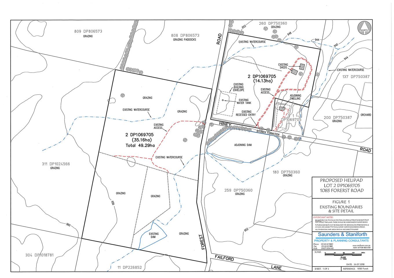
Planning
and Development Committee
7 November 2019
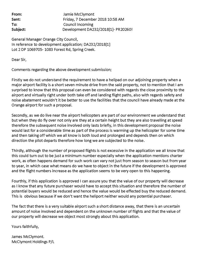

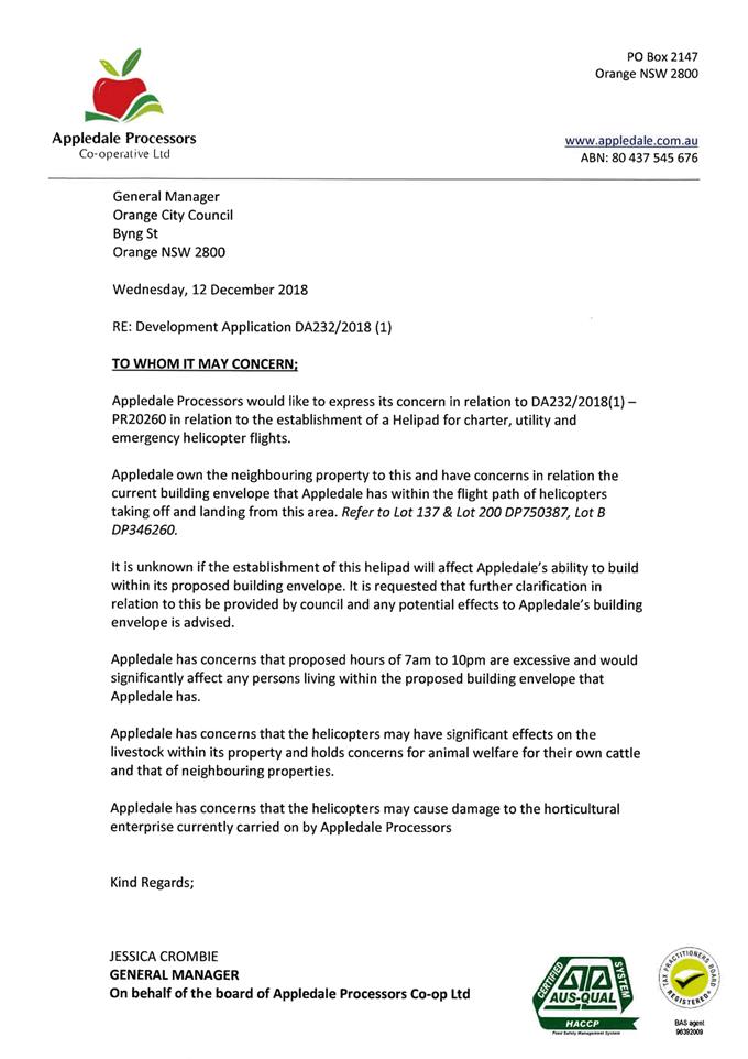
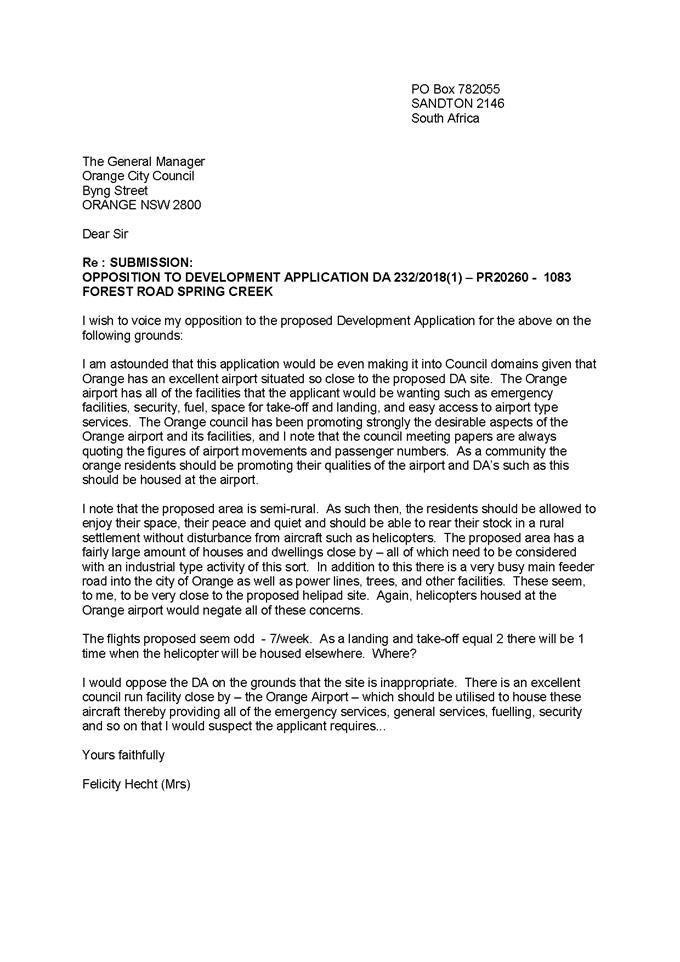
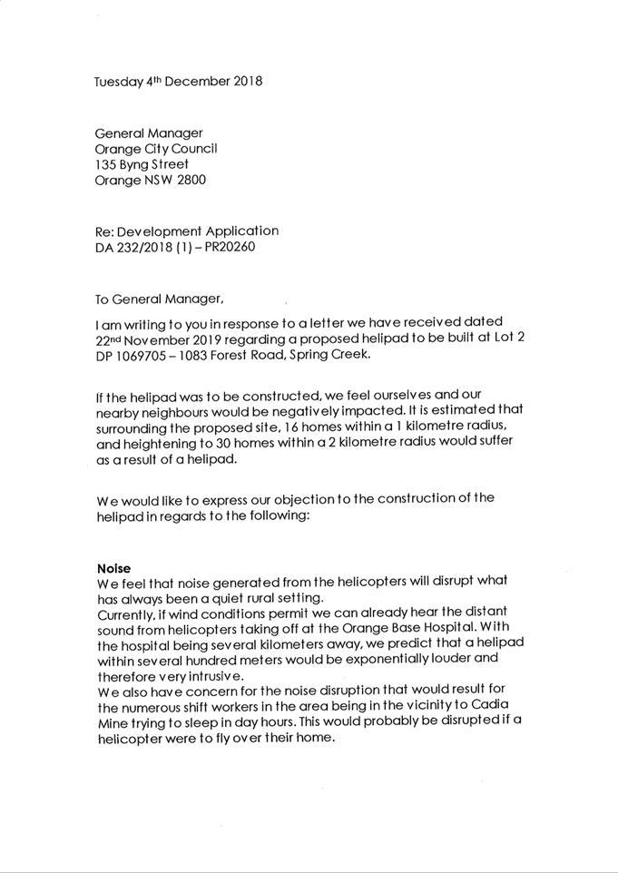
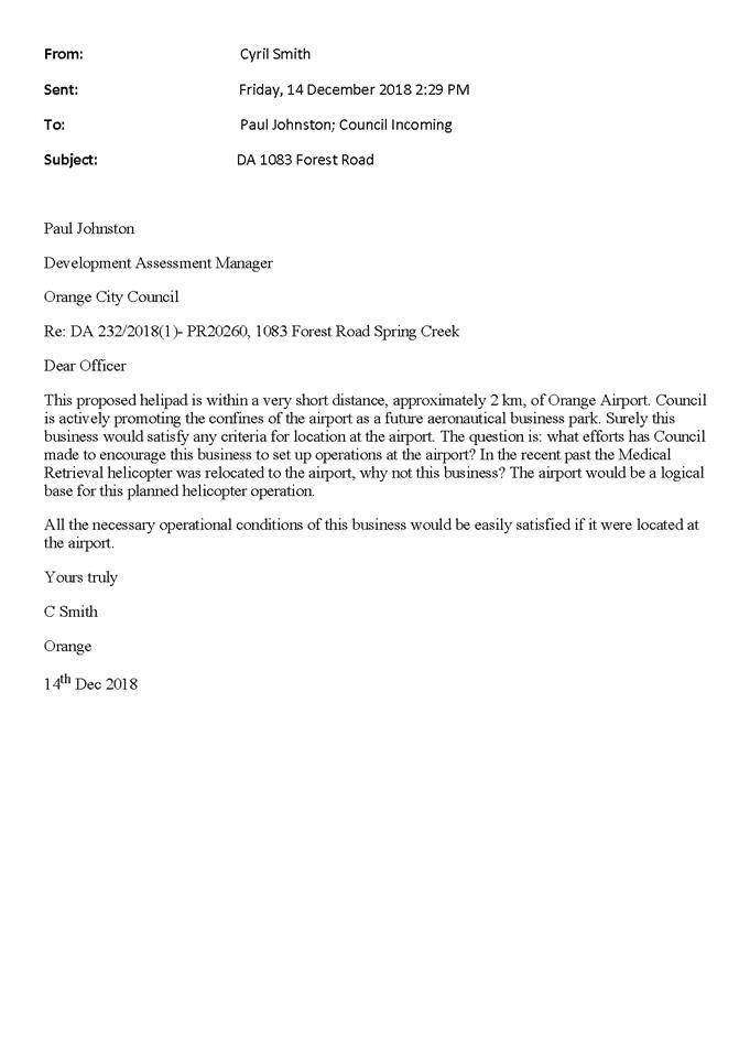
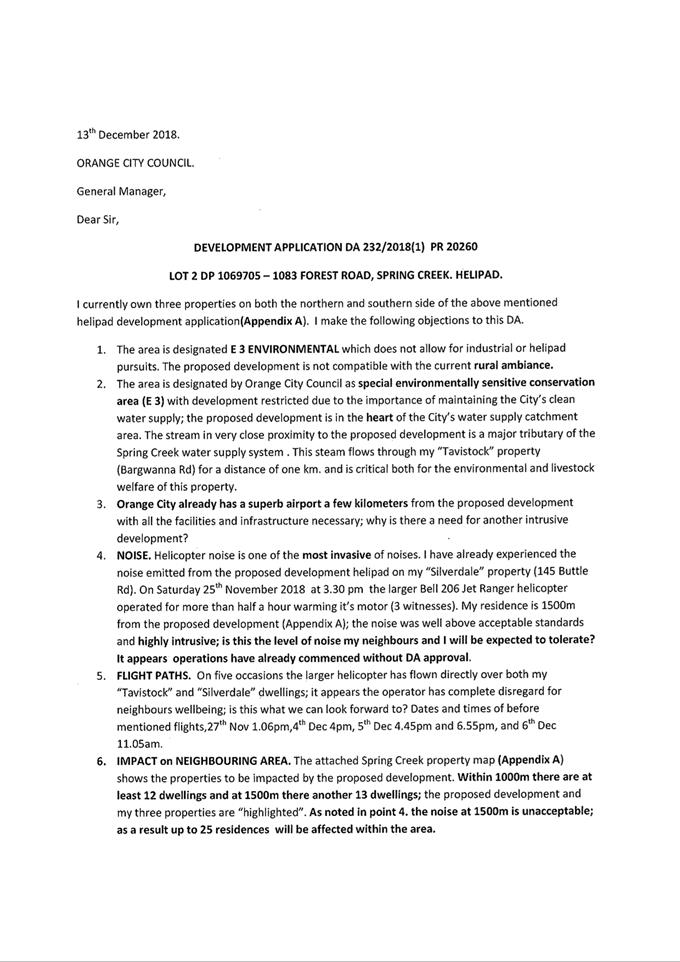
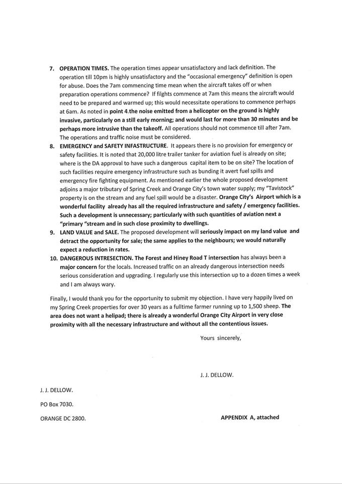
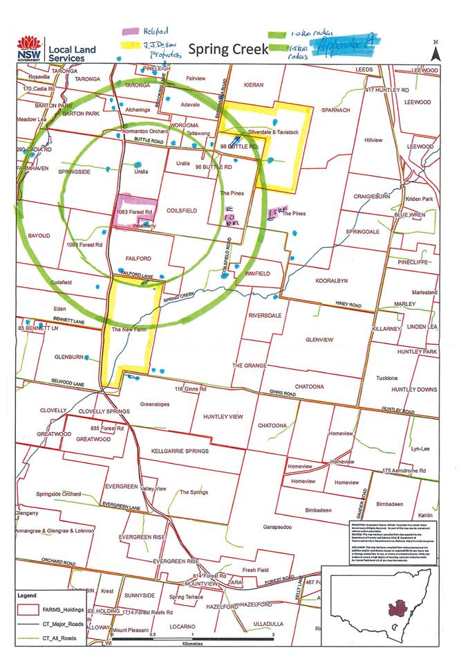
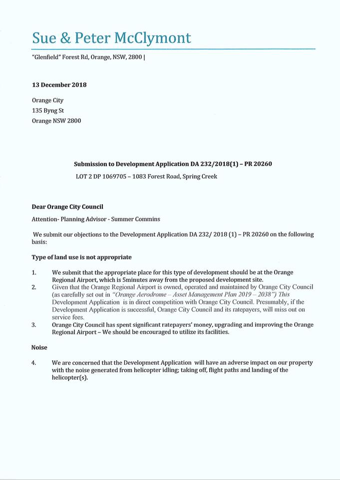
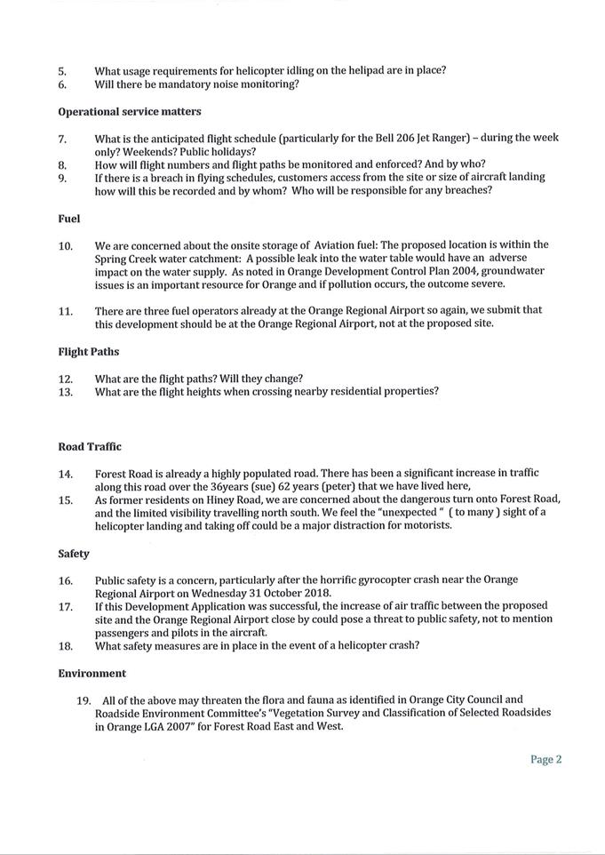

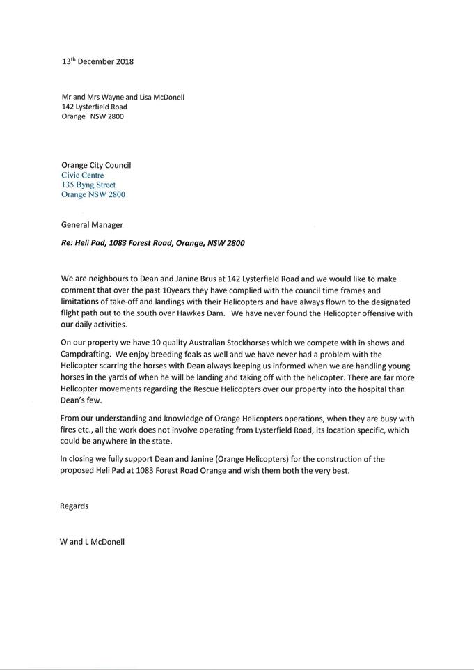
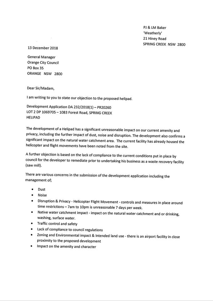

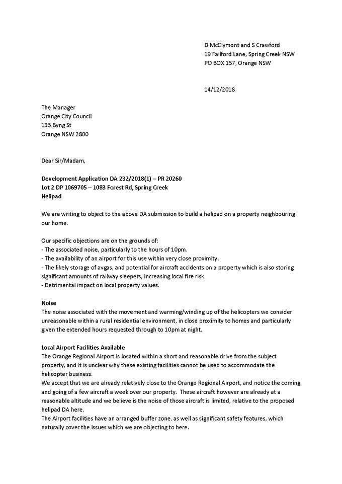
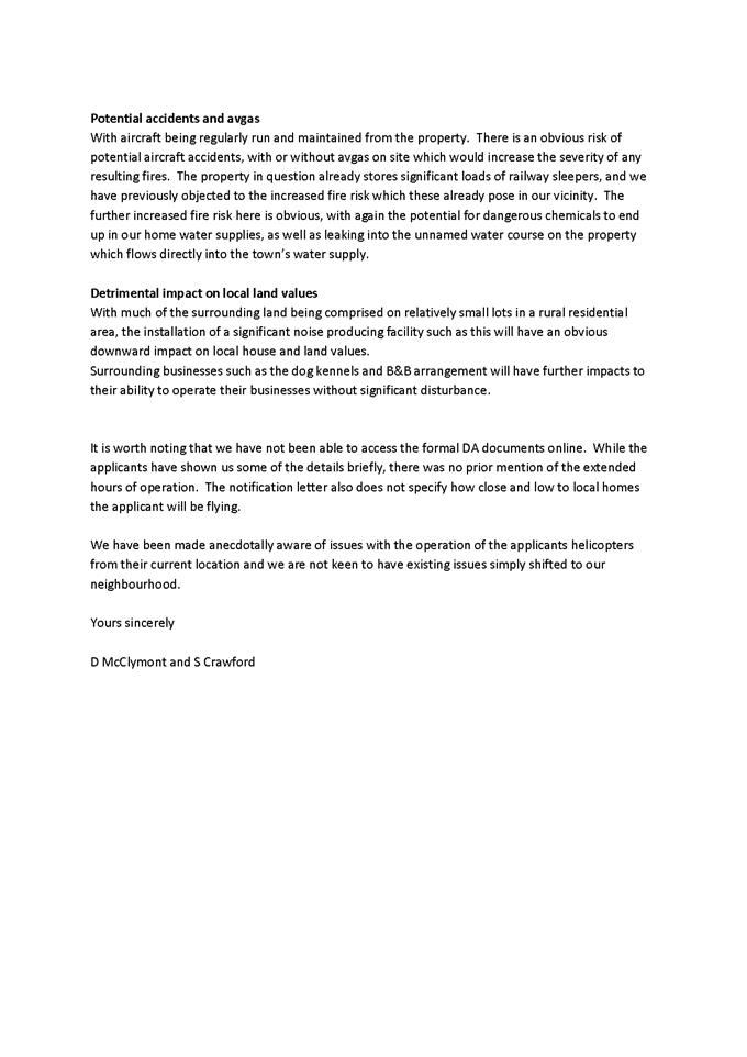

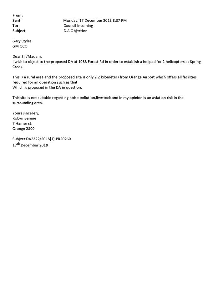
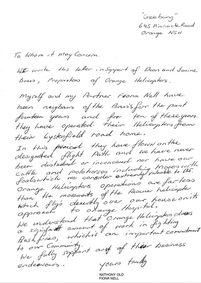
2.5 Development
Application DA71/2019(1) - 118 Bloomfield Road
RECORD
NUMBER: 2019/2296
AUTHOR: Andrew
Crump, Senior Planner
EXECUTIVE Summary
|
Application
lodged
|
15 March
2019
|
|
Applicant/s
|
Orange
Cycle & Triathlon Club
|
|
Owner/s
|
Orange
City Council
|
|
Land
description
|
Lots 50
and 58 DP 750401, Lots 3 and 4 DP 216843, - 118 Bloomfield Road and
2 Bloomfield Road, Orange
|
|
Proposed
land use
|
Recreation
Area (Gosling Creek Cycle Path)
|
|
Value of
proposed development
|
$400,000.00
|
Council's consent is sought to
increase the width of part of the existing pathway network on the north side of
the Gosling Creek Reserve. The subject section of pathway is currently
approximately 3m wide; it is proposed to widen the path to not more than 6m.
The section of pathway to be widened is shown in the below figure.
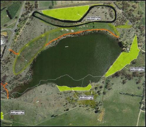
Figure 1 –
location of track widening shown heavy black outline
(extract
from draft Plan of Management)
The primary purpose of the track widening is to facilitate
triathlon events, criterium racing and HPV (human powered vehicle)
races/events.
The path widening will require
clearing of native vegetation to facilitate the increased width.
In addition, the proposal seeks
consent to construct a 1.2m wide gravel footpath that will provide an access
track when activities are being undertaken that would restrict the
accessibility to the normal track (refer below).
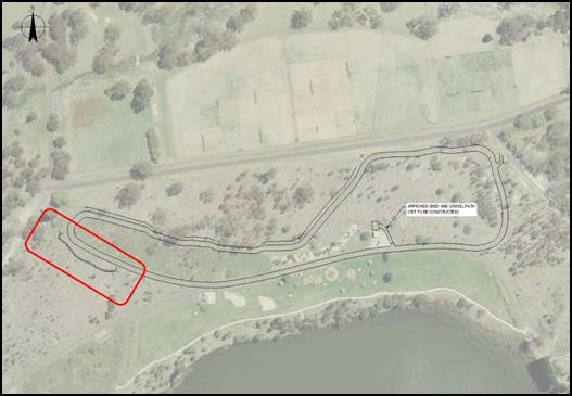
Figure 2 - location of additional gravel bypass
pathway
In addition to the physical works
required to widen the track, the works will also require the removal/relocation
of existing infrastructure such as signage, bins, park run markers, fencing
etc.
Principally there are two critical aspects of the assessment
of this application; namely the impact upon biodiversity as a result of the
track widening and secondly; the externalities upon the existing passive
recreation area as a direct consequence of providing a pathway suitable for
triathlon, track cycling/criterium events. These matters are discussed in
detail in the body of the report.
In summary, firstly, the impact upon terrestrial
biodiversity as a direct result of the proposed track widening is considered
acceptable. Secondly, in order for this development to achieve minimum public
safety standards, careful consideration needs to be given to how the public
recreation space will be managed outside of sanctioned/organised events to
prevent conflict between passive recreation users (current users) and groups of
cyclists/HPV’s using the purpose built track at high speed.
Upon implementation of the recommendations detailed below in
relation to addressing the potential conflict between user groups, the
application is considered satisfactory and is recommended for approval.
RECENT LEGISLATIVE CHANGES
On 1 March 2018 the Environmental Planning and Assessment
Act 1979 was substantially amended. The most immediate change involves the
restructuring and renumbering of the Act, with other more substantive
changes to be phased in over time. However, for some applications (particularly
where an application was lodged prior to the changes coming into effect) the
supporting documentation may still reference the previous numbering regime. In
the drafting of this report the content and substance of the supporting
material has been considered irrespective of which legislative references were
used.
DECISION FRAMEWORK
Development in Orange is governed by two key documents
Orange Local Environment Plan 2011 and Orange Development Control Plan 2004. In
addition the Infill Guidelines are used to guide development, particularly in
the heritage conservation areas and around heritage items.
Orange Local Environment Plan 2011 – The
provisions of the LEP must be considered by the Council in determining the
application. LEPs govern the types of development that are permissible or
prohibited in different parts of the City and also provide some assessment
criteria in specific circumstances. Uses are either permissible or not. The
objectives of each zoning and indeed the aims of the LEP itself are also to be
considered and can be used to guide decision making around appropriateness of
development.
Orange Development Control Plan 2004 – the DCP
provides guidelines for development. In general it is a performance based
document rather than prescriptive in nature. For each planning element there
are often guidelines used. These guidelines indicate ways of achieving the
planning outcomes. It is thus recognised that there may also be other solutions
of merit. All design solutions are considered on merit by planning and building
staff. Applications should clearly demonstrate how the planning outcomes are
being met where alternative design solutions are proposed. The DCP enables
developers and architects to use design to achieve the planning outcomes in
alternative ways.
DIRECTOR’S COMMENT
This proposal relates to development of an enlarged cycle
path around the Gosling Creek Reserve. The project recently was
successful in receiving significant State Government Funding. Delays have
occurred with this application due to complexities of the new Biodiversity
Legislation and the need for the applicant to confirm compliance of the
proposal through a biodiversity assessment, which was eventually
achieved. This is an interesting application and shows that community space
evolves over time. It is considered that the proposal will achieve a
reasonable balance and provide great opportunities for the community into the
future of both passive and active recreation.
After further discussion with the applicant, I accept that the
inclusion of gates and sign posts can be problematic for riders and may well
result in significant safety issues. I recommend that consideration be
given to alter draft Condition (4) that requires the gates across the path to
slow riders. The alteration suggestion would be to provide an additional
option of compliance for extensive line marking around high pedestrian areas of
the track to warn both riders and pedestrians of hazards in lieu of the
installation of hard physical barriers. This condition could be to the
satisfaction of the Director of Development Services.
Link To Delivery/OPerational Plan
The recommendation in this report relates to the
Delivery/Operational Plan strategy “10.1 Preserve - Engage with the
community to ensure plans for growth and development are respectful of our
heritage”.
Financial Implications
Nil
Policy and
Governance Implications
Nil
|
Recommendation
That Council consents to
development application DA 71/2019(1)
for Recreation Area (Gosling Creek Cycle Path) at Lots 50 and 58 DP
750401, and Lots 3 and 4 DP 216843 - 118 Bloomfield Road and 2
Bloomfield Road, Orange pursuant to the conditions
of consent in the attached Notice of Approval.
|
further considerations
Consideration has been given to the recommendation’s
impact on Council’s service delivery; image and reputation; political;
environmental; health and safety; employees; stakeholders and project
management; and no further implications or risks have been identified.
SUPPORTING INFORMATION
THE LAND
Gosling Creek Reserve is an identified nature reserve,
located to the south of Orange, on the urban fringe of the town. The site was
originally set aside to protect Orange’s town water supply following the
damning of Gosling Creek in 1890, however, the reserve is no longer used as
town water supply.
The various lots that make up the reserve are a combination
of Crown and Community land, which is managed by Orange City Council. As such,
a Plan of Management has been prepared to guide the management of the reserve.
The reserve itself supports a range of recreational activities, including both
formal and informal sporting events and is home to various native flora and
fauna species.
Gosling Creek is known as Lots 3 and 4 DP 216843 and Lot 58
DP 750401.
It should be noted that the Application Form includes an
additional lot, Lot 50 DP 750401. This lot relates to Bloomfield
Reserve. Throughout the course of the assessment of this proposal, the
applicant was asked to amend the application to relate only to Lot 58 DP 750401
as this is the lot that the proposed works will be carried out on. However, the
application was not amended in line with this request.
THE APPLICATION/PROPOSAL
The proposal involves the following:
· widening a section
of the existing (approximately) 3m wide walking /cycle track for a total length
of 1200m to a maximum width of 6m
· the removal of
trees and shrubs
· installation of 4%
crossfall at various locations to facilitate drainage and provide suitable
camber for cyclists and other users
· installation
of under-path drainage to permit transfer of stormwater without adverse impact
on the path or users
· relocation and
removal of the existing path in the vicinity of existing mature trees to
prevent ongoing damage to root systems and adverse impacts on those trees
· relocation of the
existing north-eastern access to the Reserve, including signage and rubbish
bins, to remove safety risks for cyclists and other users
· relocation of
existing infrastructure, including fencing, rubbish bins, signage and
Park Run markers
· the construction
of an approximately 1.2m wide gravel path to provide alternative access/bypass
linking path when the widened cycle path is in use.
The SEE outlines that the widened path could accommodate
triathlon events, cycle training and coaching, criterium racing, junior racing
or similar, Human Powered Vehicles events, training and racing, and other
community events.
MATTERS FOR CONSIDERATION
CROWN LAND MANAGEMENT ACT 2016
The subject land is a Crown Reserve within the Brandy Corner
Reserve Trust (Reserve No. 1000246). Council is the Crown Land Manager.
Pursuant to Section 3.21 of the Crown Land Management Act 2016, Council is
authorised to classify and manage the Crown Reserve as if it were public land
within the meaning of the Local Government Act. This is different to the
previous requirements under the previous Act (Crown Lands Act 1989 - repealed)
which gave Council the discretion to either prepare or not prepare a PoM for
Council Managed Crown Land.
Accordingly, under the Local Government Act, Council is
obligated to have in place a plan of management (PoM) for the reserve.
PoM’s are a strategic tool that provide strategic planning and governance
for the management and use of community land.
The current Plan of Management (PoM) for the land was
prepared in August 2017 (original PoM was prepared in 1996). The PoM identifies
the reserve as being a highly valued recreation area originally set aside to
protect the water quality of the drinking supply in Orange following the
damming of Gosling Creek. PoM goes on to state that the reserve and its
surrounds of remanent woodland remains a habitat for native wildlife and is
also valued as a place for passive recreation and a refuge from the urban
development of Orange and the Bloomfield Hospital complex to the north.
The PoM was recently updated to include provision for the
proposed track widening. The amended PoM is silent on the management of the
subject track in terms of user safety. Accordingly, this is considered in
detail below.
The draft PoM has been adopted by Council, however, given
the change from the established passive recreation use to more active
recreation use, given the purpose of the track widening, the PoM needs to be
ratified by the relevant minister. This has not occurred at this point.
The Minister’s office has
been provided with a copy of the Council adopted PoM and it is expected that
the Minister will endorse the plan in the near future.
ENVIRONMENTAL
PLANNING AND ASSESSMENT ACT 1979
Section 1.7 - Application of
Part 7 of the Biodiversity Conservation Act 2016 and Part 7A of the
Fisheries Management Act 1994
Section 1.7 of the EP&A Act identifies that Part 7 of
the Biodiversity Conservation Act 2016 (BC Act) and Part 7A of the
Fisheries Management Act 1994 have effect in connection with terrestrial and
aquatic environments.
There are four triggers known to insert a development into
the Biodiversity Offset Scheme (ie the need for a BDAR to be submitted
with a DA):
· Trigger 1:
development occurs on land mapped on the Biodiversity Values Map (OEH)
(clause 7.1 of BC Regulation 2017);
· Trigger 2:
development involves clearing/disturbance of native vegetation above a certain
area threshold (clauses 7.1 and 7.2 of BC Regulation 2017); or
· Trigger 3:
development is otherwise likely to significantly affect threatened species
(clauses 7.2 and 7.3 of BC Act 2016).
The fourth trigger (development proposed to occur in an Area
of Outstanding Biodiversity Value (clause 7.2 of BC Act 2016) is generally not
applicable to the Orange LGA, as no such areas are known to occur in the LGA.
No further comments will be made against the fourth trigger.
Trigger 1The subject land is not identified on
the biodiversity values map. Refer below.
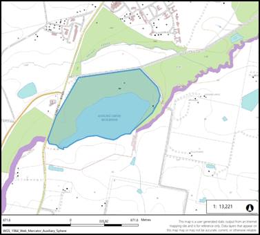
Figure 3 - except from OEH Biodiversity Values Mapping
Trigger 2
In relation to the second trigger, the subject land does not
comprise a minimum lot size. Accordingly, the area of clearing must not exceed
the allowable amount corresponding with the actual lot size unless a BDAR is
prepared. In this case the subject lot is less than 40 hectares and more
than 1 hectare, therefore no more than 0.5 hectares can be cleared before a
BDAR is required. The applicant submits the area of clearing for the
development including construction impacts equates to 0.98 hectares and as such
a BDAR is triggered.
A BDAR or Biodiversity Development Assessment Report is a
relatively new assessment tool that was created through the Government’s
recent overhaul of biodiversity legislation and the way in which biodiversity
is managed through the development assessment process.
A BDAR is required to be prepared in accordance with the
legislated Biodiversity Assessment Method and the reports are required to be
prepared by an accredited assessor that has been endorsed by the NSW Office of
Environment and Heritage.
The BDAR comprises primarily two parts (NB there is a third
section of a BDAR but only if the off-set thresholds are triggered which is not
the case for this report); part 1 assesses the biodiversity values of the land,
and part 2 comprises an assessment of the impacts resultant from the
development on the established biodiversity values (part 1).
The purpose of the Biodiversity Assessment Method is to
provide for a repeatable and transparent assessment of terrestrial
biodiversity values on land in order to:
(a) identify
the biodiversity values on land subject to proposed development, clearing, or
land in a biodiversity certification assessment area, or land proposed as a
biodiversity stewardship site
(b) determine
the impacts of proposed development, or clearing or biodiversity certification
on biodiversity values
(c) quantify
and describe the biodiversity credits required to offset the residual impacts
of proposed development or clearing or conferral of biodiversity certification
on biodiversity values
(d) quantify
and describe the biodiversity credits that can be created at a biodiversity
stewardship site from the improvement in biodiversity values from management
actions undertaken at the site
The applicant has provided a summary
of the methodology used in the BDAR as follows:
The BAM
calculates the number of ecosystem credits and species credits for assessment
and the corresponding biodiversity offset requirement for the Proposal. The
assessment included an initial desktop study and field surveys. The desktop
study involved searches of online databases and review of various other
information sources to identify the likely biodiversity values, vegetation
types, threatened species and threatened ecological communities that may occur
within the Reserve. An initial (non-BAM) field inspection was undertaken on 6
December 2018, with a subsequent BAM-compliant survey undertaken on 29 June
2019.
The June
2019 field assessment included establishment of two BAM-compliant plots. The
BAM
required one plot only. In addition, incidental observations and data collected
during the December 2018 and June 2019 field surveys were used to inform the
assessment. AREA (2019) state that the assessment methodology is consistent
with that identified in Chapters 5 and 6 of the BAM, Guidelines for Threatened
Biodiversity Survey and Assessment (DEC, 2004) and NSW Guide to Surveying for
Threatened Plants (OEH, 2016).
The BDAR classed the vegetation as Plant Community Type
(PCT) 1101 – Ribbon Gum – Snow Gum grassy open forest on flats and
undulating hills of the eastern tablelands, South Eastern Highlands Bioregions.
The BDAR describes PCT 1101 as:
· Open eucalypt
forest with sparse shrubs and dense grassy groundcover.
· Occurs on flat
to gently undulating terrain from 600m AHD to 1 150m AHD.
· Occurs largely
on granite or acid volcanic soils.
· Upper stratum
species typically include Ribbon Gum, Snow Gum, Narrow-leaved Peppermint and
Black Sallee.
· Mid stratum
species typically include Silver Wattle.
The submitted material states that the vegetation within
the Reserve does not provide a specific link between areas of vulnerable
habitat.
The BDAR identified the following threatened Flora Species
that are recorded by the OEH threatened specifies Database within 10km of the
Reserve:
· Silky
Swainson-pea.
· Black Gum.
· Silver-Leaf
Candlebark.
The BDAR identified the
following threatened Fauna Species that are recorded by the OEH threatened
species database within 10km if the reserve. In addition to the below list,
based on the observations and experience of the assessor, the BDAR also
included the Squirrel Glider:
· Blue-billed
Duck.
· Dusky
Woodswallow.
· Eastern
Bentwing-bat.
· Freckled Duck.
· Fork-tailed
Swift.
· Little Eagle.
· Latham's Snipe.
· Little Lorikeet.
· Superb Parrot.
· Rainbow
Bee-eater.
· Speckled
Warbler.
· Pied
Honeyeater.
· Varied
Sittella.
· Scarlet Robin.
· Flame Robin.
· Diamond
Firetail.
· Yellow-bellied
Glider.
· Greater Glider.
· Squirrel Glider
· Grey-headed
Flying-fox.
· Yellow-bellied
Sheathtail-bat.
The submitted material provided
the following summary of the Vegetation Communities as part of the field
assessment:
AREA (2019) completed two
BAM-compliant plots. The location of these plots are shown in
Figure 11, with outer plot size
modified from the standard 20m x 50m to 3m x 133m to reflect the elongate
nature of the Proposed development. The data collected during the assessment of
each plot is presented in Appendix 1 of AREA (2019). In summary, AREA (2019)
determined that all vegetation within the proposed areas of disturbance may be
classified as PCT1101. The community is described as a mix of native and
non-native ground cover with a cover of more than 90% exotic ground cover
species. There are also groups of planted native trees and shrubs including
Eucalyptus, Acacia, Banksia species.
AREA (2019) determined that the
vegetation that would be disturbed by the Proposal has a Vegetation Integrity Score
of 4.2. As discussed in Section 6.2.6, the threshold for biodiversity offsetting
within an Endangered Ecological Community is a Vegetation Integrity Score of
15.
The submitted material provides a summary of the Threatened
Species identified as part of field assessment:
AREA (2019) states that BAM
assessment tool identified 15 threatened species known to use the area within
and surrounding the Reserve. No surveys were required to confirm presence of
these species.
The following ecosystem
credit species were identified by the BAM assessment tool as requiring
assessment. None were excluded from this assessment.
· Regent
Honeyeater (Foraging).
· Hooded Robin
(south-eastern form).
· Gang-gang
Cockatoo (Foraging).
· Eastern
Bentwing-bat (Foraging).
· Speckled
Warbler.
· Varied
Sittella.
· Spotted-tailed
Quoll.
· Little
Lorikeet.
· Little Eagle
(Foraging).
· Square-tailed
Kite (Foraging).
· Barking Owl
(Foraging).
· Scarlet Robin.
· Flame Robin.
· Koala
(Foraging).
· Diamond
Firetail.
In addition, the BAM
assessment tool identified 16 candidate species credits species with potential
to use the proposed areas of disturbance, with an additional species, the
Squirrel Glider, added to this list based on the experience of Mr Cameron. A
number of species were excluded because they were either were not present, were
unlikely to present or do not have suitable habitat present. The following
species were assessed.
· Regent
Honeyeater (Breeding).
· Gang-gang
Cockatoo (Breeding).
· Square-tailed
Kite (Breeding).
· Eastern
Bentwing-bat (Breeding).
· Squirrel
Glider.
· Koala
(Breeding).
· Black Gum.
· Little Eagle
(Breeding).
Justification for exclusion
of species from further assessment is provided by AREA (2019).
However, that report states
that Black Gum is not present within the areas to be disturbed and that the
areas to be disturbed do not include breeding habitat for any of the other
species identified. Targeted searches for listed species did not identify any
as present, with the exception of Squirrel Glider for which suspected feeding
scars on trees adjacent to the proposed widened path were observed.
The BDAR provides an assessment of impact type, frequency,
intensity, duration and consequence of impact. The BDAR concludes that no
Serious and irreversible Impacts will occur as a result of the development.
Pursuant to Clause 6.7 of the Biodiversity Conservation Regulations Council can
be satisfied that the development is unlikely to contribute significantly to
the risk of the identified threatened species and EEC becoming extinct.
A summary table is provided within the BDAR.
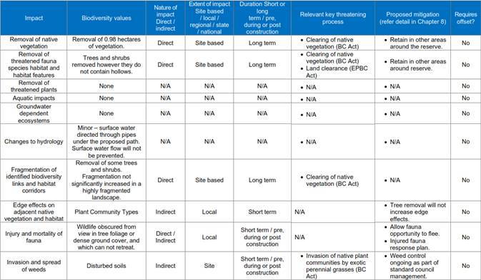

Figure
4 - summary of impacts tabled in the BDAR
The BDAR provides a section on
mitigate measures and a table of recommended conditions, which is provided
below:
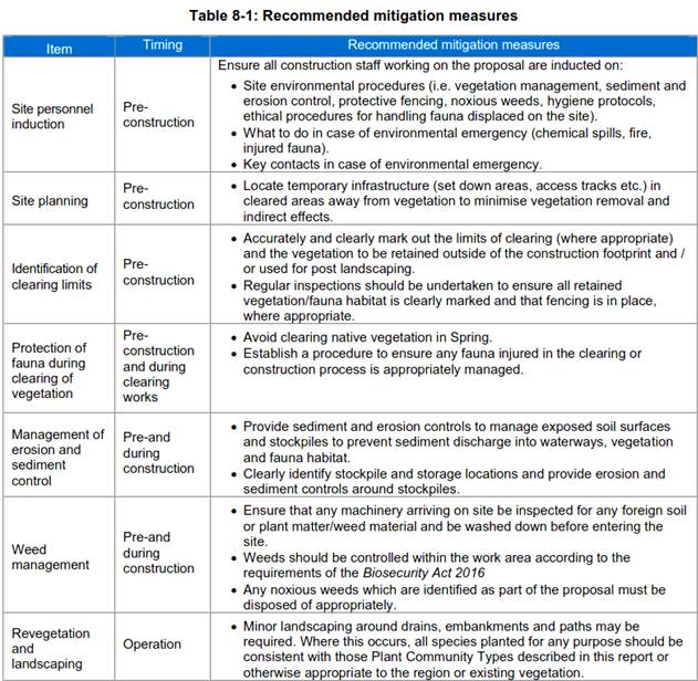
Figure 5 - table of recommended conditions
The above recommended conditions
from the BDAR report have been included in the attached notice of approval.
Finally, the BDAR considers the
need for offsetting. Based on the Vegetation Integrity Score arrived at under
Stages 1 and 2 of the BDAR and the calculations within Biodiversity Assessment
Method Credit Calculator; the development does not require any offsets to be
provided as Ecosystem Credits or as Species Credits.
Upon receiving the BDAR, Council staff requested OEH assist
with the preliminary review of the BDAR. OEH requested that certain matters be
further addressed. The matters raised by OEh primarily related to
administrative type matter which were addressed/clarified by the applicant. In
addition, Council staff critically analysed the findings and recommendations
made in the BDAR and subsequently requested further clarification or further
consideration of certain matters. A summary of this dialogue is provided below:
|
Comment from Orange Council
– Summary of points raised
|
Response from AREA
|
|
The Gosling Creek Reserve Plan of Management (PoM) is
specific about ‘high conservation value’ of the area between
existing northern most bitumen pathway and Bloomfield Road, noting it is
floristically diverse.
|
The PoM provides a map of the areas of ‘high
conservation value’ in Gosling Creek Reserve (See figure below). Our
response separates the areas mapped as ‘high conservation value’
from other areas and public spaces in the reserve.
· The
proposal does not include clearing in ‘high conservation value’
areas. The clearing only occurs on the reservoir side of the fence that
bounds this mapped area of ‘high conservation value’.
· The
proposal does include relocation of the fence which will not result in the
removal of native vegetation.
· Biodiversity
values in the ‘high conservation value’ areas will not be
impacted.
· The
proposal will not prevent revegetation and restoration activities from
occurring in the ‘high conservation value’ areas or elsewhere in
the reserve.
<image004.jpg>
|
|
Adequacy of floristic survey
Presence of other species (shrubs) in the impact footprint
|
We recognise ‘adequacy’ depends the
perspective i.e. Councils City presentation department’s use of the
word had a different measure than when used in our trade. As the proposal is
seeking a planning approval, for the purposes of this response
‘adequacy’ relates to the requirement of impact assessments under
the Biodiversity Conservation Act 2016.
The Biodiversity Assessment Method (2017) (BAM) has been
applied to assess the vegetation in the development site
· Vegetation
plots have been used to the required density as per BAM.
· Vegetation
plots have been used in areas occupied by trees and shrubs as well as in
areas where there are no trees or shrubs
· Floristic
assessment of surrounding vegetation, or to record every species in the
development site is not required by the BAM. The designated number of plots
are designed to capture enough data to be representative of the vegetation in
the development site.
· Ground
cover in the development site is mostly already managed for recreation and
mown regularly.
The BAM has been followed; therefore, the floristic
assessment has been adequate for this proposal. Should Council have an issue
with the BAM please contact the NSW DPIE to express your concerns.
|
|
Comment from Orange Council – Summary of points
raised
|
Response
from AREA
|
|
Reference to 1500 metre area of
known Plant Community Types
|
This method is consistent with the
Biodiversity Assessment Method (2017) (BAM)
· The
BAM requires reference to a 1500m meter buffer around the development site.
· The
vegetation map used to consider this is issued by the NSW Government.
|
|
Application of the
‘avoid’ principle
|
The proponent has avoided and
minimised impact to native vegetation by
· largely
positioning the proposal over the footprint of the existing path. This equates
to reducing the impact to native vegetation by approximately 28%.
· positioning
the proposal in an area where the vegetation integrity score is below the
threshold which would require offsetting in under the Biodiversity Offsetting
Scheme (avoiding areas mapped as high conservation value and other areas
which may have a higher vegetation integrity score).
|
|
Identification of the plant
community according to Bower 2012.
|
Bower (2012) appears to be
considering the plant community separately from the existing Plant Community
Type identification framework:
· The
BAM assessor is required to allocate a Plant Community Type (PCT) described
by the NSW government which best describes the vegetation at the development
site based on the official and current descriptions and definitions of the
PCTs. These can be accessed through the BioNet Vegetation Classification
website.
· Other
descriptions of plant community strictly cannot be used.
· The
process to determine the PCT is described in the BDAR.
|
|
Bower 2012 suggests the community
at the site would warrant listing under the NSW BC Act
|
The BDAR describes the plant
community type as representative of an Endangered Ecological Community under
the BC Act:
· Tablelands
Snow Gum, Black Sallee, Candlebark and Ribbon Gum Grassy Woodland in the
South Eastern Highlands, Sydney Basin, South East Corner and NSW South
Western Slopes Bioregions (Part) wholly subset of;
· Tableland
Basalt Forest in the Sydney Basin and South Eastern Highlands Bioregions
(Part) likely relates;
This classification
· is
consistent with the Gosling Creek Reserve PoM.
· is
captured in the BAM Calculator
This is the process in the
Biodiversity Assessment Method for recognising the values associated with an
Endangered Ecological Community and it has been applied to Gosling Creek
Reserve.
|
|
Comment from Orange Council – Summary of points
raised
|
Response
from AREA
|
|
Barrier created by a six metre
pathway
|
The assessors do not consider a
six metre wide pathway would pose an insurmountable barrier to woodland
species.
|
|
Presence of two specimens of Banksia
marginata
|
Banksia marginata is not a
threatened species nor does it have a preliminary listing, an individual or
endangered population listing described in the schedules of the Biodiversity
Conservation Act 2016 and therefore is not considered separately from the
plant community under the Biodiversity Assessment Method. Presence of plants
such as this are captured within the ecosystem credit calculation.
|
|
Offsets
|
Offset to impact to the
vegetation and associated ecosystem credit species is not required under the
Biodiversity Offsetting Scheme as the vegetation integrity score is less than
15.
Offset is not required for
species credit species for reasons discussed in the BDAR. In the case of
Squirrel Glider (see comment below) offsetting was not triggered.
|
|
The BDAR doesn’t address the
occurrence of the Squirrel Glider; which is known to occur from survey work
undertaken within the precinct.
|
The BDAR does acknowledge
and address the occurrence of Squirrel Glider:
· The
Biodiversity Assessment Method Calculator did not automatically include
Squirrel Glider as a candidate species credit species. AREA manually added
the Squirrel Glider into the Biodiversity Assessment Method Calculator.
· By
doing this, a known local occurrence of this species was considered under the
Biodiversity Offset Strategy
· Given
the small area of impact to Squirrel Glider habitat, the BAMC determined no
offsetting is required for this species.
· This
has been completed in accordance with the NSW Biodiversity Offset Scheme.
|
Figure 6 – applicant’s response to Council
request for clarifying matters in relation the BDAR
Council staff are satisfied that
the submitted BDAR has been prepared in accordance with the BAM and the likely
impacts upon threatened species, endangered ecological communities and the
habitats of threated species is within acceptable levels.
Trigger 3
With regard to the third trigger, the test for determining
whether proposed development is otherwise likely to significantly affect
threatened species is listed in the BC Act 2016, under s7.3:
(a) in
the case of a threatened species, whether the proposed development or activity
is likely to have an adverse effect on the life cycle of the species such that
a viable local population of the species is likely to be placed at risk of
extinction,
(b) in
the case of an endangered ecological community or critically endangered
ecological community, whether the proposed development or activity:
(i) is
likely to have an adverse effect on the extent of the ecological community such
that its local occurrence is likely to be placed at risk of extinction, or
(ii) is
likely to substantially and adversely modify the composition of the ecological
community such that its local occurrence is likely to be placed at risk of
extinction,
(c) in
relation to the habitat of a threatened species or ecological community:
(i) the
extent to which habitat is likely to be removed or modified as a result of the
proposed development or activity, and
(ii) whether
an area of habitat is likely to become fragmented or isolated from other areas
of habitat as a result of the proposed development or activity, and
(iii) the
importance of the habitat to be removed, modified, fragmented or isolated to
the long-term survival of the species or ecological community in the locality,
(d) whether
the proposed development or activity is likely to have an adverse effect on any
declared area of outstanding biodiversity value (either directly or
indirectly),
(e) whether
the proposed development or activity is or is part of a key threatening process
or is likely to increase the impact of a key threatening process.
In relation to the third trigger, when the application was
first lodged Council staff raised concerns regarding the developments potential
to significantly impact upon threatened species and accordingly Council staff
requested that a Biodiversity Development Assessment Report (BDAR) be prepared
in the support of the application.
A BDAR was subsequently prepared for the development and the
veracity of the BDAR is addressed above. Based on the foregoing assessment
provided by the BDAR, the development is not considered to significantly affect
threatened species.
Section 4.15
Section 4.15 of the Environmental Planning and Assessment
Act 1979 requires Council to consider various matters, of which those
pertaining to the application are listed below.
PROVISIONS OF ANY ENVIRONMENTAL
PLANNING INSTRUMENT s4.15(1)(a)(i)
Orange Local Environmental Plan 2011
Part 1 - Preliminary
Clause 1.2 - Aims of Plan
The
broad aims of the LEP are set out under Subclause 2. Those relevant to the
application are as follows:
(a) to
encourage development which complements and enhances the unique character of
Orange as a major regional centre boasting a diverse economy and offering an
attractive regional lifestyle,
(b) to provide for a range of development
opportunities that contribute to the social, economic and environmental
resources of Orange in a way that allows present and future generations to meet
their needs by implementing the principles for ecologically sustainable
development,
(c) to conserve and enhance the water
resources on which Orange depends, particularly water supply catchments,
(f) to recognise and manage valued
environmental heritage, landscape and scenic features of Orange.
The development is not inconsistent with the aims of the
plan as listed above.
Clause 1.6 - Consent Authority
This clause establishes that, subject to the Act, Council is
the consent authority for applications made under the LEP.
Clause 1.7 - Mapping
The subject site is identified
on the LEP maps in the following manner:
|
Land Zoning Map:
|
Land zoned RE1 Public Recreation
|
|
Lot Size Map:
|
No Minimum Lot Size
|
|
Heritage Map:
|
Heritage item (dam wall)
|
|
Height of Buildings Map:
|
No building height limit
|
|
Floor Space Ratio Map:
|
No floor space limit
|
|
Terrestrial Biodiversity Map:
|
High biodiversity sensitivity on
the site
|
|
Groundwater Vulnerability Map:
|
Groundwater vulnerable
|
|
Drinking Water Catchment Map:
|
Not within the drinking water
catchment
|
|
Watercourse Map:
|
Not within or affecting a defined
watercourse
|
|
Urban Release Area Map:
|
Not within an urban release area
|
|
Obstacle Limitation Surface Map:
|
No restriction on building siting
or construction
|
|
Additional Permitted Uses Map:
|
No additional permitted use applies
|
|
Flood Planning Map:
|
Not within a flood planning area
|
Those matters that are of relevance are addressed in detail
in the body of this report.
Clause 1.9A - Suspension of
Covenants, Agreements and Instruments
This clause provides that covenants, agreements and other
instruments which seek to restrict the carrying out of development do not apply
with the following exceptions:
· covenants imposed
or required by Council
· prescribed
instruments under Section 183A of the Crown Lands Act 1989
· any conservation
agreement under the National Parks and Wildlife Act 1974
· any trust
agreement under the Nature Conservation Trust Act 2001
· any property
vegetation plan under the Native Vegetation Act 2003
· any biobanking
agreement under Part 7A of the Threatened Species Conservation Act 1995
· any planning
agreement under Division 6 of Part 4 of the Environmental Planning and
Assessment Act 1979.
Council staff are not aware of the title of the subject
property being affected by any of the above.
Part 2 -
Permitted or Prohibited Development
Clause 2.1 - Land Use Zones
and Clause 2.3 - Zone Objectives and Land Use Table
The subject site is located within the RE1 Public Recreation
zone. The proposed development is characterised as a Recreation Area under OLEP
2011 which means:
a place
used for outdoor recreation that is normally open to the public, and includes:
(a) a
children’s playground, or
(b) an
area used for community sporting activities, or
(c) a
public park, reserve or garden or the like,
and any ancillary buildings,
but does not include a recreation facility (indoor), recreation facility
(major) or recreation facility (outdoor).
A recreation area is permissible with consent in the RE1
– Public Recreation zone.
Clause 2.3 of LEP 2011
references the Land Use Table and Objectives for each zone in LEP 2011.
These objectives for land zoned RE 1 Public Recreation are as follows:
1 -
Objectives of the RE1 Public Recreation Zone
· To enable land
to be used for public open space or recreational purposes.
· To provide a
range of recreational settings and activities and compatible land uses.
· To protect and
enhance the natural environment for recreational purposes.
· To ensure
development is ordered in such a way as to maximise public transport patronage
and encourage walking and cycling in close proximity to settlement.
· To ensure
development along the Southern Link Road has alternative access.
The proposed development is not
fundamentally inconsistent with the objects of the RE1 Public Recreation zone.
The proposed pathway widening will provide opportunity for a wider range of
recreational uses, uses that commensurate with draft PoM such as triathlons,
criterium racing and human powered vehicles; and relevantly, the management of
possible conflicts between the user groups of the upgraded pathway system has
been detailed in the body of the report.
Additionally, the assessment that has been undertaken has
had a central focus on the natural environmental aspects of the reserve to
ensure the terrestrial biodiversity is protected in line with the Biodiversity
Conservation Act.
Clause 2.7 - Demolition
Requires Development Consent
This clause triggers the need for development consent in
relation to a building or work. Given the heritage status of the land the
removal of trees is characterised as demolition. The applicant has sought
consent for the removal of the trees.
Part 3 - Exempt and Complying Development
The application is not exempt or complying development.
Part 5 - Miscellaneous Provisions
5.10 - Heritage Conservation
The subject land is identified as a heritage item listed in
schedule 5 of Orange LEP. The relevant inventory sheet provides the following
statement of significance for the land:
The historic site marks the initial development of
urban utilities - water supply, for the growth of Orange and it retains an
appropriate character and setting and contributes as a prominent heritage item.
Figure 7 - dam wall valve opening 2016 (image source:
PoM)
Figure 8 - dam wall 2016 (image source: PoM)
(1) Objectives
The
objectives of this clause are as follows:
(a) to
conserve the environmental heritage of Orange,
(b) to
conserve the heritage significance of heritage items and heritage conservation
areas, including associated fabric, settings and views,
(c) to
conserve archaeological sites,
(d) to
conserve Aboriginal objects and Aboriginal places of heritage significance.
The development
is not inconsistent with the objects of this clause.
(2) Requirement
for Consent
Development
consent is required for any of the following:
(a) demolishing
or moving any of the following or altering the exterior of any of the following
(including, in the case of a building, making changes to its detail, fabric,
finish or appearance):
(i) a
heritage item,
(ii) an
Aboriginal object,
(iii) a
building, work, relic or tree within a heritage conservation area,
The application involves demolition of trees and shrubs
within a heritage item and also alters the exterior of the heritage item by
increasing the width of the existing path within the heritage item. As such,
this clause applies and the development requires consent which the applicant
has sought as part of this application.
(4) Effect
of Proposed Development on Heritage Significance
The
consent authority must, before granting consent under this clause in respect of
a heritage item or heritage conservation area, consider the effect of the
proposed development on the heritage significance of the item or area
concerned. This subclause applies regardless of whether a heritage management
document is prepared under Subclause (5) or a heritage conservation management
plan is submitted under Subclause (6).
In respect of the above subclause, the effect of the
proposed development on the heritage significance of the heritage item is
considered minor. The area to be development is a considerable distance from
the body of water being the listed reservoir. Moreover, the significant fabric
of the C.1890s dam wall is on the opposite (southern) side of the reservoir and
thus sufficiently separated so as to have little to no impact on the heritage
significance of that part of the item.
The development is considered satisfactory in terms of the
effect on the significance of the heritage item.
(5) Heritage
Assessment
The
consent authority may, before granting consent to any development:
(a) on
land on which a heritage item is located, or
(b) on
land that is within a heritage conservation area, or
(c) on
land that is within the vicinity of land referred to in paragraph (a) or (b),
require
a heritage management document to be prepared that assesses the extent to which
the carrying out of the proposed development would affect the heritage
significance of the heritage item or heritage conservation area concerned.
A detailed heritage management document is not required for
the reasons detailed under Subclause (4) above.
(6) Heritage
Conservation Management Plans
The
consent authority may require, after considering the heritage significance of a
heritage item and the extent of change proposed to it, the submission of a
heritage conservation management plan before granting consent under this
clause.
As detailed above, given the location of the development
being well separated from the C.1890s dam wall, the proposed development is not
one that warrants the preparation of a Heritage Conservation Management Plan.
(7) Archaeological
Sites
The
consent authority must, before granting consent under this clause to the
carrying out of development on an archaeological site (other than land listed
on the State Heritage Register or to which an interim heritage order under the Heritage Act 1977
applies):
(a) notify
the Heritage Council of its intention to grant consent, and
(b) take
into consideration any response received from the Heritage Council within 28
days after the notice is sent.
The subject land is not a known Archaeological site.
(8) Aboriginal
Places of Heritage Significance
The
consent authority must, before granting consent under this clause to the
carrying out of development in an Aboriginal place of heritage significance:
(a) consider
the effect of the proposed development on the heritage significance of the
place and any Aboriginal object known or reasonably likely to be located at the
place by means of an adequate investigation and assessment (which may involve
consideration of a heritage impact statement), and
(b) notify
the local Aboriginal communities, in writing or in such other manner as may be
appropriate, about the application and take into consideration any response
received within 28 days after the notice is sent.
An AHIMS search indicates that the site is not a known
Aboriginal Place of Heritage Significance.
(9) Demolition
of Nominated State Heritage Items
The
consent authority must, before granting consent under this clause for the
demolition of a nominated State heritage item:
(a) notify
the Heritage Council about the application, and
(b) take
into consideration any response received from the Heritage Council within
28 days after the notice is sent.
The above clause is not relevant to the assessment of this
application.
Part 6 - Urban Release Area
Not relevant to the application. The subject site is not
located in an Urban Release Area.
Part 7 - Additional Local Provisions
7.1
- Earthworks
This
clause establishes a range of matters that must be considered prior to granting
development consent for any application involving earthworks, such as:
(a) the likely disruption of, or any
detrimental effect on, existing drainage patterns and soil stability in the
locality of the development
(b) the effect of the development on the
likely future use or redevelopment of the land
(c) the quality of the fill or the soil to be
excavated, or both
(d) the effect of the development on the
existing and likely amenity of adjoining properties
(e) the source of any fill material and the
destination of any excavated material
(f) the likelihood of disturbing relics
(g) the proximity to and potential for adverse
impacts on any waterway, drinking water catchment or environmentally sensitive
area
(h) any measures proposed to minimise or
mitigate the impacts referred to in paragraph (g).
The earthworks
proposed in the application are limited to the extent necessary for the
construction of the widened pathway. This includes removal of topsoil and
removal of unsuitable material below the topsoil to allow for subbase and
compacted base material to be installed. Additionally, excavation will also be
required for the installation of surface drainage infrastructure. The extent of
disruption to the drainage of the site is considered to be minor and will not
detrimentally affect adjoining properties or receiving waterways.
The extent of the earthworks
will not materially affect the potential future use or redevelopment of the
site that may occur at the end of the proposed development's lifespan.
The site is not known to be
contaminated. However, standard cautionary conditions of consent have been
attached in the event of an unexpected find. Excavated materials will be reused
onsite as far as practicable.
The earthworks will be
appropriately supported onsite and the change in ground level is not
substantial.
The site is not known to contain
any Aboriginal, European or Archaeological relics. Previous known uses of the
site do not suggest that any relics are likely to be uncovered. However,
conditions may be imposed to ensure that should site works uncover a potential
relic or artefact, works will be halted to enable proper investigation by
relevant authorities and the proponent required to seek relevant permits to
either destroy or relocate the findings.
The site is located in proximity
to Gosling Creek Reservoir and Gosling Creek; the land is also located in the
water catchment and as such conditions are attached that require erosion and
sediment control.
7.3 - Stormwater Management
This clause applies to all
industrial, commercial and residential zones and requires that Council be
satisfied that the proposal:
(a) is designed to maximise the use of water
permeable surfaces on the land having regard to the soil characteristics
affecting onsite infiltration of water
(b) includes, where practical, onsite
stormwater retention for use as an alternative supply to mains water,
groundwater or river water; and
(c) avoids any significant impacts of
stormwater runoff on adjoining downstream properties, native bushland and
receiving waters, or if that impact cannot be reasonably avoided, minimises and
mitigates the impact.
The
extent of disruption to the drainage of the site is considered to be minor. The
applicant proposes to include two piped drainage lines to improve the
conveyance of surface water within the site.
Relevant
conditions are attached in relation to stormwater management of the site.
7.4 - Terrestrial Biodiversity
This
clause seeks to maintain terrestrial biodiversity and requires that consent
must not be issued unless the application demonstrates whether or not the
proposal:
(a) is likely to have any adverse impact on
the condition, ecological value and significance of the fauna and flora on the
land
(b) is likely to have any adverse impact on
the importance of the vegetation on the land to the habitat and survival of
native fauna
(c) has any potential to fragment, disturb or
diminish the biodiversity structure, function and composition of the land, and
(d) is likely to have any adverse impact on
the habitat elements providing connectivity on the land.
Additionally, this clause
prevents consent being granted unless Council is satisfied that:
(a) the development is designed, sited and
will be managed to avoid any significant adverse environmental impact, or
(b) if that impact cannot be reasonably
avoided - the development is designed, sited and will be managed to minimise
that impact, or
(c) if that impact cannot be minimised - the
development will be managed to mitigate that impact.
Only a
small portion of the site is identified as being an area of high biodiversity
as shown on the maps. Notwithstanding this, ground truthing the accuracy of the
maps is an essential exercise in any assessment, and in this case Council staff
have identified that the site contains areas of unmapped endangered ecological
communities. In accordance with the Biodiversity Conservation Act, the
applicant was obligated to undertake a BDAR to determine the extent of impact
upon this locality. A detailed assessment of the terrestrial biodiversity
present on the land; and the subsequent impacts on the biodiversity as a result
of the development has been assessed in the foregoing assessment.
7.5 - Riparian Land and Watercourses
This
clause seeks to preserve both water quality and riparian ecological health. The
clause applies to land identified as a “Sensitive Waterway” on the Watercourse
Map. The subject land contains such a waterway and therefore Council must
consider whether or not the proposal:
(a) is likely to have any adverse impact on
the following:
(i) the water quality and flows within a
watercourse
(ii) aquatic and riparian species, habitats
and ecosystems of the watercourse
(iii) the stability of the bed and banks of the
watercourse
(iv) the free passage of fish and other aquatic
organisms within or along the watercourse
(v) any future rehabilitation of the
watercourse and its riparian areas, and
(b) is likely to increase water extraction
from the watercourse.
Additionally,
consent may not be granted until Council is satisfied that:
(a) the development is designed, sited and
will be managed to avoid any significant adverse environmental impact, or
(b) if that impact cannot be reasonably
avoided - the development is designed, sited and will be managed to minimise
that impact, or
(c) if
that impact cannot be minimised - the development will be managed to mitigate
that impact.
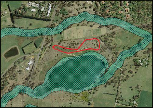
Figure 9 - except of sensitive waterways mapping
– development site shown heavy red outline
While the subject site does
contain a sensitive waterway, the proposal is considered satisfactory. The
extent of impact upon the waterway as a result of the track widening will be
neutral. The pathway will be used in a similar manner to the current path,
there is no new use proposed that would give rise to possible pollution events
or the like. There is the possibility of sediment to escape the development
site and impact upon the waterway, however this can easily be addressed by
conditions requiring sediment control measures to be implemented during the
construction phase of the development.
The development is considered
satisfactory.
7.6 - Groundwater Vulnerability
This
clause seeks to protect hydrological functions of groundwater systems and
protect resources from both depletion and contamination. Orange has a high
water table and large areas of the LGA, including the subject site, are
identified with “Groundwater Vulnerability” on the Groundwater
Vulnerability Map. This requires that Council consider:
(a) whether or not the development (including
any onsite storage or disposal of solid or liquid waste and chemicals) is
likely to cause any groundwater contamination or have any adverse effect on
groundwater dependent ecosystems, and
(b) the cumulative impact (including the
impact on nearby groundwater extraction for potable water supply or stock water
supply) of the development and any other existing development on groundwater.
Furthermore, consent may not be granted unless Council is satisfied that:
(a) the development is designed, sited and
will be managed to avoid any significant adverse environmental impact, or
(b) if that impact cannot be reasonably
avoided - the development is designed, sited and will be managed to minimise
that impact,
(c) if that impact cannot be minimised - the
development will be managed to mitigate that impact.
The proposal does involve the
discharge of toxic or noxious substances and is therefore unlikely to
contaminate the groundwater or related ecosystems. The proposal does not
involve extraction of groundwater and will therefore not contribute to
groundwater depletion. The development is considered acceptable in relation impacts
upon ground water.
7.7 - Drinking Water
Catchments
(1) The
objective of this clause is to protect drinking water catchments by minimising
the adverse impacts of development on the quality and quantity of water
entering drinking water storages.
(2) This
clause applies to land identified as “Drinking water” on the Drinking Water Catchment Map.
(3) Before
determining a development application for development on land to which this
clause applies, the consent authority must consider whether or not the
development is likely to have any adverse impact on the quality and quantity of
water entering the drinking water storage, having regard to:
(a) the
distance between the development and any waterway that feeds into the drinking
water storage, and
(b) the
onsite use, storage and disposal of any chemicals on the land, and
(c) the
treatment, storage and disposal of waste water and solid waste generated or
used by the development.
(4) Development
consent must not be granted to development on land to which this clause applies
unless the consent authority is satisfied that:
(a) the
development is designed, sited and will be managed to avoid any significant
adverse impact on water quality and flows, or
(b) if
that impact cannot be reasonably avoided - the development is designed, sited
and will be managed to minimise that impact, or
(c) if
that impact cannot be minimised - the development will be managed to mitigate
that impact.
The subject land is located within
the drinking water catchment. As mentioned above, the development being the
widening of the subject portion of existing track is not likely to impact upon
the quality of drinking water entering the waterway. The increase in the width
of the track will not directly impact the water supply. Notwithstanding, as
noted above soil and erosion control measures are required to manage the
development. Indirectly, there is the possibility of pollution to occur through
littering or the like during an organised triathlon event for example; or to a
lesser extent a private gathering for a child’s birth party.
However, these two examples are able
to occur within the reserve at present, and there is nothing to suggest this
would increase as direct consequence of the widened track.
The development
is considered satisfactory in relation to the drinking water catchment.
STATE ENVIRONMENTAL PLANNING
POLICIES
State Environmental Planning Policy 55 - Remediation of
Land
State Environmental Planning Policy 55 - Remediation of
Land (SEPP 55) is applicable. Pursuant to Clause 7 Contamination and
remediation to be considered in determining development application:
(1) A
consent authority must not consent to the carrying out of any development on
land unless:
(a) it
has considered whether the land is contaminated, and
(b) if
the land is contaminated, it is satisfied that the land is suitable in its
contaminated state (or will be suitable, after remediation) for the purpose for
which the development is proposed to be carried out, and
(c) if
the land requires remediation to be made suitable for the purpose for which the
development is proposed to be carried out, it is satisfied that the land will
be remediated before the land is used for that purpose.
The subject land has a long history of being used for a
public purpose. Prior to the current use of the land as public recreation, the
land was pine plantation. Accordingly, there is no historical evidence to
suggest that the land has been used for a purpose likely to cause contamination
in the past and as such, the development is considered satisfactory in relation
to the above.
PROVISIONS OF ANY DRAFT
ENVIRONMENTAL PLANNING INSTRUMENT THAT HAS BEEN PLACED ON EXHIBITION
4.15(1)(a)(ii)
From 31 January to13 April 2018 the Department of Planning
and Environment publically exhibited an Explanation of Intended Effect (EIE)
and Draft Planning Guidelines for the proposed Remediation of Land SEPP, which
will repeal and replace State Environmental Planning Policy 55 –
Remediation of Land (SEPP 55). Of particular note, the Draft Planning
Guidelines state:
“In undertaking an
initial evaluation, a planning authority should consider whether there is any
known or potential contamination on nearby or neighbouring properties, or in
nearby groundwater, and whether that contamination needs to be considered in
the assessment and decision making process.”
“If the planning
authority knows that contamination of nearby land is present but has not yet
been investigated, it may require further information from the applicant to
demonstrate that the contamination on nearby land will not adversely affect the
subject land having regard to the proposed use.” (Proposed
Remediation of Lands SEPP - Draft Planning Guidelines, Page 10).
The relevant provisions of the inforce SEPP are addressed
above. Council staff are not aware of any nearby properties that may be
contaminated and thereby impact upon the subject land. Accordingly, the
development is considered satisfactory in respect to the draft SEPP provisions
referenced above.
Draft Orange Local
Environmental Plan - Amendment 24
Draft Amendment 24 of the Orange LEP 2011 was formally
placed on exhibition from Friday, 26 July 2019, for a period of 28 days.
The Amendment contains various changes. In reviewing the
proposed changes, it is considered that no changes contained in this Amendment
have effect in regard to this development application.
DESIGNATED DEVELOPMENT
The proposed development is not designated development.
INTEGRATED DEVELOPMENT
The applicant has not sought to have the application treated
as an integrated development. It is not expected that any separate approvals
are required; however the onus is on the beneficiary of the consent to ensure
all approvals are in place.
PROVISIONS OF ANY DEVELOPMENT
CONTROL PLAN s4.15(1)(a)(iii)
Development Control Plan 2004
Development Control Plan 2004 (“the DCP”)
applies to the subject land (Chapters 0, 11 and 13). An assessment of
the proposed development against the relevant Planning Outcomes will be
undertaken below.
Pursuant to Planning Outcome 0.2-1 Interim Planning Outcomes
- Conversion of Zones:
· Throughout this
Plan, any reference to a zone in Orange LEP 2000 is to be taken to be a
reference to the corresponding zone(s) in the zone conversion table.
The corresponding zone to zone 6 Open Space (Orange LEP
2000) is zone RE2 Private Recreational (Orange LEP 2011). As such, Orange
DCP 2004 – Chapter 11 – Land used for open space and recreation is
relevant to this proposal and considered below along with other relevant
chapters of the DCP.
Chapter 11 – Land used
for open space and recreation
The subject land is a Crown Reserve and Council is the Crown
Land Manager. As detailed above, a PoM is in place for the land, however, it
precluded the removal of vegetation as a consequence of any path widening.
Accordingly, the PoM has been updated in draft form which requires any track
widening that also requires removal of vegetation to be undertaken in
accordance with the Biodiversity Conservation Act 2016.
Accordingly, the development is consistent with the draft
PoM.
There are no other aspects of Chapter 11 that are of
relevance to this assessment.
Chapter 13 – Heritage
The subject land is identified as a heritage item.
Assessment of the development impact upon the significance of the heritage item
is detailed above.
INFILL GUIDELINES
The development site is located on land identified as a
heritage item and therefore, the infill guidelines are relevant to the
assessment. However, owing to the nature of the development and the separation
distance between the development site and the more significant portions of the
site, the infill guidelines are not relevant to the assessment of this
application.
PROVISIONS PRESCRIBED BY THE
REGULATIONS s4.15(1)(a)(iv)
The development is not inconsistent with provisions
prescribed by the legislation.
THE LIKELY IMPACTS OF THE
DEVELOPMENT s4.15(1)(b)
Context and Setting
The subject land is a large public reserve located on the
southern side of the city. The reserve is bounded by Bloomfield Road to the
north, Bargwanna Road to the East, Gosling Creek to the south and Forest
Road to the west.
The reserve comprises an existing network of sealed pathways
that are either bitumen sealed or crushed gavel located on the northern side of
the reservoir. The reservoir which formally provided drinking water to Orange
occupies the majority of the site. The original c1890s dam wall remains intact
on the southern side of the reservoir.
The network of pathways link with the leash-free dog
exercise area to the north east which connect with pathways that circumnavigate
the Bloomfield precinct and link with Lysterfield Reserve through an
underpass under Forest Road.
The site has a long history being used as public reserve,
prior to which there was Radiata Pine Plantation in the area that is now
cleared parkland on the northern side of the reservoir. This area was cleared
in 1999.
There are identified areas of moderate to high biodiversity
areas consisting of remnants of a Box Gum Woodland/Tableland Snow Gum, Black
Sallee, Candlebark and Ribbon Gum Grassy Woodland Endangered Ecological
Communities as detailed in the PoM.
The proposed development, being an increase to the width of
a portion of existing pathway, is not incongruous with the context and setting
save for the safety/conflicts with various user groups as detailed below.
Environmental Impacts
The extent of environment impacts is addressed in detail
above under the considerations of the Biodiversity Conservation Act.
Access, Transport and traffic
The development is not expected to directly result in any
additional traffic. It is acknowledged that increases in traffic would occur
for planned events such as a triathlon events, however, these occur already and
there is nothing to suggest the pathway widening would directly increase the
number of athletes competing in planned sporting events at the reserve.
Existing access/parking arrangements will be maintained.
Public Safety – potential
conflict with various user groups
Casual observations and personal usage of the public reserve
suggests that patronage levels of the reserve outside of existing organised
events (i.e. parkrun and triathlons) are quite high and the range of user
varies. Primarily, observations identified more passive recreation activities
such as families with children on push bikes, scooters, and balance bikes etc.
parents pushing prams, novice bike riders, joggers/runners and walkers alike
utilising the existing network of pathways. As well as the observed users of
the pathways, the central area is heavily used for private gatherings such as
picnics, parties, BBQs etc. with children playing on the playground.
The installation of a purpose built criterium cycle track
that meets Cycling Australia requirements (save for the requirement of a 200m
section of track before the finish line that is required to be 8m wide) will
encourage cyclists of all skill levels to ride the track outside of
planned/sanctioned events. Whilst the pathways are utilised by cyclists at
present, the existing pathway is not purpose built for cycling and as such the
lure of track cycling at the reserve will be far greater upon the purpose built
pathway being constructed.
Council staff are certainly encouraging of creating public
recreation spaces that are appealing for the most diverse range of user groups,
the potential for this development to add a new user group (cyclists using the
criterium track for example), and for those new users to conflict with the
users engaging in activities more in line with the historic use of the site for
passive recreation needs consideration.
The applicant has offered line marking of the track
indicating a shared pathway with cycling on one side (4m width) and
walking/running on the other side (2m width). Give way/hold points at the
intersecting pathways with the 6m wide track and appropriate signage. These
measures are considered important in the management of the pathway and thus
supported by Council staff, however, the author is of the view that more
physical means of traffic calming should be considered for this development,
particularly in relation to the area in an around the amenities building, BBQ
area, picnic shelters and playground equipment. There are many options that
could be considered in arriving at a suitable solution.
One such solution requires the installation of cycle gates
(image provided below – noting in the example below the positioning of
the gates are too close together – more judicious arrangement/placing of
the gates is required at the detailed design stage) at strategic locations
within 6m pathway so as to control speed and thus deter the pathway being used
by bunch cyclists outside of sanctioned events. The gates could be
designed/engineered in a way whereby they can be opened for events such as parkrun
or fully removed similarly to a removable bollard and placed out of the way
during planned cycle events.
In order to avoid a scenario where, for example a child
unexpectedly runs across the pathway from the BBQ/playground area in front of a
group of cyclist travelling at around 40km/h, it is recommended that two sets
of cycle gates be installed, one set of gates installed approximately in line
with western most BBQ shelter located in the central playground area, and the
second set of gates in line with the eastern wall of the amenities building on
the northern side of the subject pathway.
Attached is a recommended
condition of consent requiring the traffic calming device be installed in
specified locations. The detailed design of the required devices will be
subject to further sign-off by relevant Council staff.

Figure 10 - example of cycle gates – noting the
inappropriate positioning of gates in the image – provided only for
illustrative purposes only
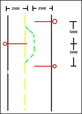
Figure 11 – schematic layout of bollards and gates
It is noted that the arrangement of
gates will shepherd pedestrians into the cycle lane. To combat this, an
adjustment of the line marking will be necessary to make the pedestrian lane go
out and around the gate on the pedestrian lane side of the pathway. This is
shown in the above image as green line markings.
Visual impacts
The increase width of the subject portion of track will
undoubtedly change the visual appearance of the part of the site where the
track is proposed. By way of comparison the width of the proposed path will be
comparable to the width of Bloomfield Road.
To ameliorate this visual impact and resultant modification
of the existing landscape setting, a condition is recommended that requires a
detailed landscape plan showing the placement of suitable endemic species
adjacent to the proposed pathway. The plan shall be developed in consultation
with relevant Council staff and is to be to the satisfaction of Council’s
Director Development Services. The landscaping shall be installed prior to occupation/use
of the pathway or given the current drought conditions (acknowledging the
reserve is currently watered using the reservoir), a bond may be taken as
security for the work to be undertaken at a more appropriate time i.e. more
favourable weather conditions.
Council’s Manager City Presentation notes that within
the proposed footprint of the widened pathway are at least two Silver Banksia (Banksia
marginata) that have been grown from seed propagated from one of six known
naturally occurring specimens within the Orange Local Government area. This
species naturally occurs within the Orange LGA and is at its most westerly
extent. The closest recorded population of this species is at Yetholme east of
Bathurst. Of the six individual plants known to naturally occur in Berrilee
Road, two are on public land and the remaining four are on two separate sites
under private ownership. Gosling Creek Reserve is a repository site for the Banksia
marginata with less than a handful of specimens of around 15 years of age.
To ameliorate the loss of the above referenced Silver
Banksia, ideally the condition requiring additional landscaping should also
require propagules from the Berrilee Road specimen. However, it is acknowledged
that propagules will take considerable time before the plants able to be
planted and doing so would unreasonably hold up the completion of the proposal.
As such, as Council is the manager of the reserve, it is recommended that a
program to increase the number of appropriately sourced Silver Banksia within
the reserve should be explored separate to this application.
Heritage Impacts
The impact of the development upon the heritage significance
of the heritage item have been addressed above under the LEP considerations.
Cumulative Impacts
Cumulative impacts of a development can arise under four
typical scenarios, namely:
· time crowded
effects where individual impacts occur so close in time that the initial impact
is not dispersed before the proceeding occurs
· space crowded
where impacts are felt because they occur so close in space they have a
tendency to overlap
· nibbling effects
occur where small, often minor impacts, act together to erode the environmental
condition of a locality and
· synergistic
effects, where a mix of heterogeneous impacts interact such that the combined
impacts are greater than the sum of the separate effects.
The development is not likely to
result in any unacceptable cumulative impacts such as two events occurring at
the one time given Council is responsible for the management/booking of events.
THE SUITABILITY OF THE SITE
s4.15(1)(c)
The subject land has a long history of being used as a
public reserve with more intensive recreation uses occurring in more recent
years (triathlon events commencing in 2017 onwards, Parkrun, etc.) and as such
the site is suitable for the proposed development subject to certain measures
to ensure public safety of all users.
It is noted that the BDAR concludes that the development
does not require off-sets and that the development is acceptable in terms of
the impacts upon terrestrial biodiversity.
It is also noted that the development is consistent with the
recently adopted PoM for Gosling Creek Reserve.
Council staff are not aware of any physical, natural or
technological hazards that may constrain the development from occurring in a
satisfactory manner.
ANY SUBMISSIONS MADE IN
ACCORDANCE WITH THE ACT s4.15(1)(d)
The proposed development is defined as "advertised
development" under the provisions of the Environmental Planning and
Assessment Act. The application was advertised for the prescribed period of 28
days and at the end of that period 10 submissions were received all of which
were in support of the development application.
The submissions in support of the development cite primarily
that the proposal will; provide a safe place for people of all ages to learn to
ride a bicycle, improve the quality of the existing portion of pathway which
current has some damage caused by adjacent trees, and will improve health
outcomes for the wider population through the likely increase usage of the
Gosling Creek Reserve as a consequence of the proposed development.
Additionally, several of the submissions cite the improved connectivity with
other pathway networks which currently link with Gosling Creek Reserve and the
positive externalities such a facility could bring to the region if the site is
used for a major HPV event or the like.
PUBLIC INTEREST
s4.15(1)(e)
The proposed development is considered to be of minor
interest to the wider public due to the relatively localised nature of
potential impacts. The proposal is not inconsistent with any relevant policy
statements, planning studies, guidelines etc that have not been considered in
this assessment.
SUMMARY
The proposed development is permissible with the consent of
Council. The proposed development complies with the relevant aims, objectives
and provisions of Orange LEP 2011 (as amended) and DCP 2004. The
development is consistent with the recently adopted Plan of Management for
Gosling Creek. The development triggered the need for a BDAR to be prepared and
one was prepared and submitted as an amendment to the application. As detailed
above, the BDAR is considered to be consistent with the Biodiversity Assessment
Method and Council staff are satisfied that the development is not likely to
significantly affect the identified endangered ecological, any threatened
species or the habitat of any threatened species. A Section 4.15
assessment of the development indicates that the development is acceptable.
Attached is a draft Notice of Approval outlining a range of conditions
considered appropriate to ensure that the development proceeds in an acceptable
manner.
COMMENTS
The requirements of the Environmental Health and Building
Surveyor and the Engineering Development Section are included in the attached
Notice of Approval.
Attachments
1 Notice
of Approval, D19/64886⇩
2 Plans,
D19/64845⇩
3 Submissions,
D19/64693⇩
Planning
and Development Committee
7 November 2019
Attachment 1 Notice
of Approval
|
|
ORANGE CITY COUNCIL
Development
Application No DA
71/2019(1)
NA19/ Container
PR13676
|
NOTICE OF DETERMINATION
OF A DEVELOPMENT
APPLICATION
issued under the Environmental
Planning and Assessment Act 1979
Section 4.18
|
Development
Application
|
|
|
Applicant
Name:
|
Orange Cycle and
Triathlon Club
|
|
Applicant
Address:
|
62 Hill Street
ORANGE
NSW 2800
|
|
Owner’s
Name:
|
Orange City Council
|
|
Land
to Be Developed:
|
Lots 50 and 58 DP
750401, Lots 3 and 4 DP 216843, - 118 Bloomfield Road and 2 Bloomfield
Road, Orange
|
|
Proposed
Development:
|
Recreation Area
(Gosling Creek Cycle Path)
|
|
|
|
|
Building Code of
Australia
building
classification:
|
Class to be
determined by the PC
|
|
|
|
|
Determination made
under
Section 4.16
|
|
|
Made
On:
|
7 November 2019
|
|
Determination:
|
CONSENT GRANTED
SUBJECT TO CONDITIONS DESCRIBED BELOW:
|
|
|
|
|
Consent to Operate
From:
|
8 November 2019
|
|
Consent to Lapse On:
|
8 November 2024
|
Terms
of Approval
The reasons for the imposition of conditions
are:
(1) To ensure a quality
urban design for the development which complements the surrounding environment.
(2) To maintain
neighbourhood amenity and character.
(3) To ensure compliance
with relevant statutory requirements.
(4) To provide adequate
public health and safety measures.
(5) To ensure the utility
services are available to the site and adequate for the development.
(6) To prevent the proposed
development having a detrimental effect on adjoining land uses.
(7) To minimise the impact
of development on the environment.
Conditions
(1) The development must be
carried out in accordance with:
(a) Plans by GHD drawing
nos. 22-19696-C001 Rev A; 22-19696-C002 Rev A; 22-19696-C005 Rev B;
22-19696-C010 Rev A; 22-19696-C011 Rev B; 22-19696-C012 Rev B;
Biodiversity Development Assessment Report:
Gosling Creek Reserve path widening dated August 2019 prepared by AREA
environmental consultants and communication.
(b) statements
of environmental effects or other similar associated documents that form part
of the approval
as amended in
accordance with any conditions of this consent.
(2) All building work must
be carried out in accordance with the provisions of the Building Code of
Australia.
(3) A sign is to be erected
in a prominent position on any site on which building work, subdivision work or
demolition work is being carried out:
(a) showing
the name, address and telephone number of the principal certifying authority
for the work, and
(b) showing
the name of the principal contractor (if any) for any building work and a
telephone number on which that person may be contacted outside working hours,
and
(c) stating
that unauthorised entry to the site is prohibited.
Any such sign is to be maintained while the
building work, subdivision work or demolition work is being carried out.
|
PRIOR TO THE ISSUE OF A CONSTRUCTION
CERTIFICATE
|
(4) The applicant shall
install a series of gates attached to bollards as a means of calming bicycle
traffic using the pathway. Each set of gates shall include as a minimum three
bollards not more than 1.2m in height with an attached gate / arm that is a
minimum of 2.5m in length that projects towards the centre of the pathway. The
bollards shall be positioned at the edge of sealed surface of the pathway and
the three bollards within each set of gates shall be positioned in a triangular
pattern (two bollards and gates on one side (the bicycle lane side) of the path
and the other bollard and gates assembly on the opposite side of the path
(pedestrian side)) so as to achieve a chicane within the 6m path. The
positioning of each bollard within the respective set of gates shall be at 5m
centres along the pathway.
As a minimum, two sets of gates shall be
installed on the stretch of track to the north of the playground/BBQ area, one
set of gates shall be positioned in line with the western most covered picnic
table structure. The second set of gates shall be positioned on the same
stretch of pathway and in line with the eastern wall of the amenities block
located on the northern side of the track. The positioning of the gates in
these locations is approximate.
The gates shall be engineered/designed in a way
whereby the arm / gate section is able to be opened or positioned away from the
track for running events or the like; and the whole device including the
bollard can be removed during events involving bicycles or human powered
vehicles.
Details of the gates and their locations shall
be clearly shown on the plans submitted with the application for a construction
certificate.
For the avoidance of doubt, one set of gates
consists of three bollards with gates / arms attached to each bollard arranged
in a triangular pattern.
(5) A landscape plan
identifying at least 200 large shrubs and trees (60/40 split) endemic to
Gosling Creek Reserve Ecologically Endangered Vegetation Community to
ameliorate the visual impacts caused by the additional hard surfaces of the widened
pathway, shall be submitted to, and approved by, Council Acting Director
Development Services. Species selection shall be undertaken in
consultation with Council’s Manager City Presentation.
The landscape plan shall identify an
establishment period of 12 months where the proponent shall plant and care for
these species, in conjunction with replacing any plants that fail due to
neglect, vandalism or environmental conditions.
(6) Engineering plans,
showing details of all proposed work and adhering to any engineering conditions
of development consent, are to be submitted to, and approved by, Orange City
Council prior to the issuing of a Construction Certificate.
(7) A water and soil
erosion control plan is to be submitted to Orange City Council or an Accredited
Certifier (Categories B1, C3, C4, C6) for approval prior to the issuing of a
Construction Certificate. The control plan is to be in accordance with the
Orange City Council Development and Subdivision Code and the Landcom, Managing
Urban Stormwater; Soils and Construction Handbook.
(8) Appropriate line
marking and stencilling shall be installed directly upon the proposed pathway.
The plans submitted with the application for a construction certificate shall
clearly show the line marking and stencilling to be installed. Additionally,
appropriate signage providing suitable warning and directions shall be
installed in appropriate locations such as all pathways intersecting with the
6m wide pathway. Details of the signage including content and location shall be
provided prior to the issue of the construction certificate.
|
PRIOR TO WORKS COMMENCING
|
(9) Prior to works
commencing, all temporary infrastructure (set down areas, access tracks, etc.)
shall be located in cleared areas away from vegetation to minimise vegetation
removal and indirect effects.
(10) Prior to works
commencing, a suitably qualified person shall accurately and clearly mark out
the limits of clearing as well as clearly marking the vegetation to be retained
outside of the construction footprint.
Regular inspections of the site occurring at
least once a fortnight during the construction phase shall be undertaken by a
suitable qualified person to ensure all retained vegetation / fauna habitat is
clearly marked and that fencing is in place, where required.
(11) Prior to works
commencing, all stockpile and storage locations shall be clearly identified in
already cleared areas away from significant vegetation and fauna habitat. All
stockpile areas shall have adequate erosion and sediment control in place
during the construction phase of the development.
(12) Prior to works
commencing, a construction management plan shall be prepared for the
construction of the pathway. The construction management plan shall, as a
minimum; provide measures for the control of weeds and foreign soil being
brought on to the site by machinery and vehicles associated with the
construction of the pathway (this is to be done through regular inspections of
vehicles / machinery prior to site entry; and where necessary vehicles and
machinery are washed prior to entering the site at an appropriate facility),
establish a procedure to ensure any fauna injured during the clearing and
construction phase of the development are appropriately managed, procedures for
the management of noxious weeds identified within the development footprint
during construction, the control of airborne dust, etc.
(13) All clearing associated
with the development shall occur outside of Spring time.
(14) Prior
to works commencing, Tree Protection Zones (TPZs) in accordance with Australian
Standard AS 4970 – 2007 – Protection of Trees on development
Sites shall be established around all trees that are to be retained that;
i) have a truck measuring 300mm DBH or greater, and ii) that have a structural
root zone (SRZ) within 5m of the development / construction area.
(15) Prior
to the issue of a Construction Certificate, the applicant is to obtain an
approval under Section 68 of the Local Government Act for the
temporary closure of any footpath or roadway. A pedestrian/vehicle
management plan is to accompany the application. Details are to be provided of
the protective hoardings, fences and lighting that are to be used during
demolition, excavation and building works in accordance with the requirements
of the Occupational Health & Safety Act 2000, Australian
Standard AS3798-1996 (Guidelines on Earthworks for Commercial and Residential
Developments) and the WorkCover Authority.
Note: On corner
properties particular attention is to be given to the provision of adequate
sight distances.
(16) A
Construction Certificate application is required to be submitted to, and issued
by Council/Accredited Certifier prior to any excavation or building works being
carried out onsite.
|
DURING CONSTRUCTION/SITEWORKS
|
(17) Approval
is granted only for those trees and shrubs identified as being removed on the
approved plans.
(18) All signage is to be
located in a position along the pathway so as not to impede the use of the
pathway.
(19) If Aboriginal objects,
relics, or other historical items or the like are located during development
works, all works in the area of the identified object, relic or item shall
cease, and the NSW Office of Environment and Heritage (OEH), and
representatives from the Orange Local Aboriginal Land Council shall be
notified. Where required, further archaeological investigation shall be
undertaken. Development works in the area of the find(s) may recommence if and
when outlined by the management strategy, developed in consultation with and approved
by the OEH.
(20) In
the event of an unexpected find during works such as (but not limited to) the
presence of undocumented waste, odorous or stained soil, asbestos, structures
such as underground storage tanks, slabs, or any contaminated or suspect
material, all work on site must cease immediately. The beneficiary of the
consent must discuss with Council the appropriate process that should be
followed therein. Works on site must not resume unless the express permission
of the Director Development Services is obtained in writing.
(21) In
accordance with section 3 of AS4970 – 2007 – Protection of Trees
on development Sites all construction works (either the removal of the existing
pathway or works associated with the construction of the widened/new pathway)
that encroach within the TPZ of any (retained) tree shall be undertaken in
direct supervision of a qualified arborist, or another suitably qualified
person.
(22) All
construction/demolition work on the site is to be carried out between the hours
of 7.00 am and 6.00 pm Monday to Friday inclusive, 7.00 am to
5.00 pm Saturdays and 8.00 am to 5.00 pm Sundays and Public
Holidays. Written approval must be obtained from the General Manager of Orange
City Council to vary these hours.
(23) The
finished surface is to have a suitable non slip resistance surface in wet and
dry conditions allowing traction for a person using a wheelchair.
(24) All materials on site
or being delivered to the site are to be contained within the site. The
requirements of the Protection of the Environment Operations Act 1997
are to be complied with when placing/stockpiling loose material or when
disposing of waste products or during any other activities likely to pollute
drains or watercourses.
(25) Any adjustments to
existing utility services that are made necessary by this development
proceeding are to be at the full cost of the developer.
|
PRIOR TO THE ISSUE OF AN OCCUPATION
CERTIFICATE
|
(26) Landscaping
shall be installed in accordance with the approved plan, with maintenance
carried out for an establishment period of 12 months; replacing any plants that
fail due to neglect, vandalism or environmental conditions.
(27) Certification from
Orange City Council is required to be submitted to the Principal Certifying Authority
prior to the issue of an Occupation Certificate stating that all works relating
to connection of the development to Council assets, works on public land, works
on public roads, stormwater, sewer and water reticulation mains and footpaths
have been carried out in accordance with the Orange City Council Development
and Subdivision Code and the foregoing conditions, and that Council will take
ownership of the infrastructure assets.
(28) All
of the foregoing conditions are to be at the full cost of the developer and to
the requirements and standards of the Orange City Council Development and
Subdivision Code, unless specifically stated otherwise. All work required by
the foregoing conditions is to be completed prior to the issuing of an
Occupation Certificate, unless stated otherwise.
(29) All
traffic calming devices, line marking, signage, etc. shall be installed prior
to the issue of an Occupation Certificate.
|
MATTERS FOR THE ONGOING PERFORMANCE AND
OPERATION OF THE DEVELOPMENT
|
(30) The
traffic calming bollards / gates shall be maintained in their closed position
at all times except for planned events.
Other
Approvals
(1) Local
Government Act 1993 approvals granted under Section 68.
S68
required for pedestrian safety while work underway.
(2) General
terms of other approvals integrated as part of this consent.
Nil
Right
of Appeal
If you are dissatisfied with this decision,
Section 8.7 of the Environmental Planning and Assessment Act 1979
gives you the right to appeal to the Land and Environment Court. Pursuant to
Section 8.10, an applicant may only appeal within 6 months after the date the
decision is notified.
|
Disability
Discrimination Act 1992:
|
This application has been assessed in
accordance with the Environmental Planning and Assessment Act 1979. No
guarantee is given that the proposal complies with the Disability
Discrimination Act 1992.
The applicant/owner is responsible to ensure
compliance with this and other anti-discrimination legislation.
The Disability Discrimination Act
covers disabilities not catered for in the minimum standards called up in the
Building Code of Australia which references AS1428.1 - "Design for
Access and Mobility". AS1428 Parts 2, 3 and 4 provides the most
comprehensive technical guidance under the Disability Discrimination Act
currently available in Australia.
|
|
|
|
|
Disclaimer
- S88B of the Conveyancing Act 1919 - Restrictions on the Use of
Land:
|
The applicant should note that there could be
covenants in favour of persons other than Council restricting what may be
built or done upon the subject land. The applicant is advised to check the
position before commencing any work.
|
|
|
|
|
Signed:
|
On behalf of the consent authority ORANGE
CITY COUNCIL
|
|
Signature:
|
|
|
Name:
|
PAUL JOHNSTON - MANAGER DEVELOPMENT
ASSESSMENTS
|
|
Date:
|
8 November 2019
|
Planning and Development Committee
7 November 2019
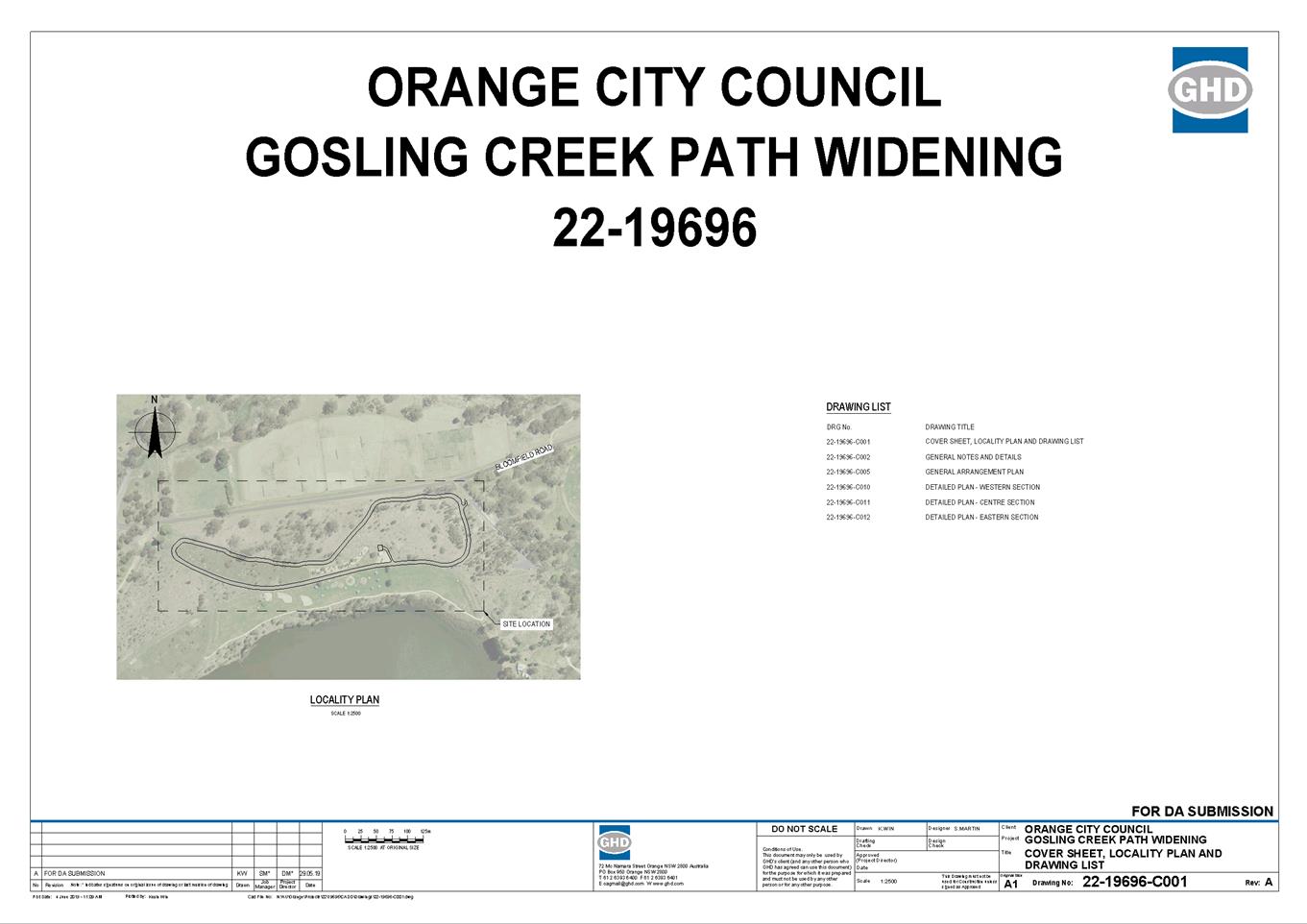
Planning
and Development Committee
7 November 2019


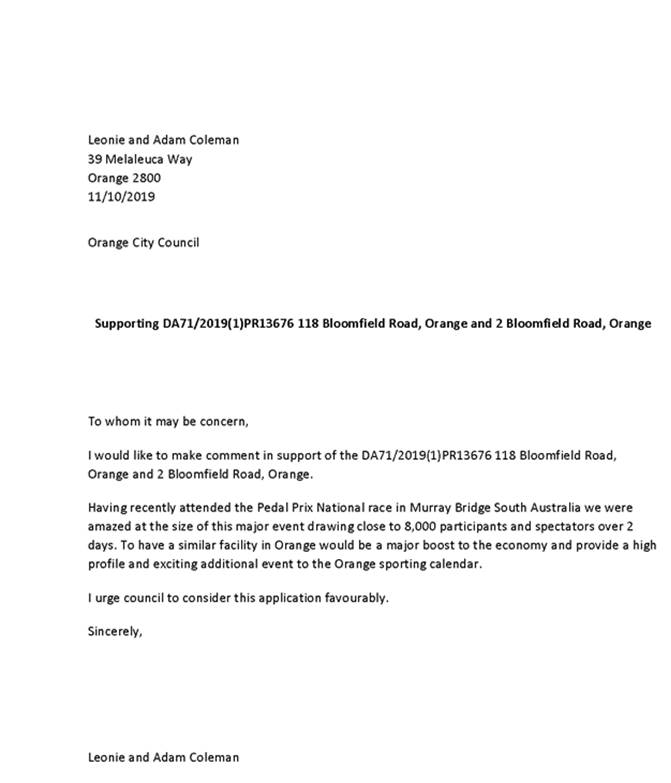
2.6 Development
Application DA 258/2019(1) - 1 Scarborough Street
RECORD
NUMBER: 2019/2318
AUTHOR: Rishelle
Kent, Senior Planner
EXECUTIVE Summary
|
Application
lodged
|
16
August 2019
|
|
Applicant/s
|
Mr G
Thornberry
|
|
Owner/s
|
Mr GJ
Thornberry
|
|
Land
description
|
Lot 129
DP 1237871 - 1 Scarborough Street, Orange
|
|
Proposed
land use
|
Dual
Occupancy and Subdivision (two lot residential)
|
|
Value of
proposed development
|
$460,000.00
|
Council's consent is sought for a dual occupancy and two lot
subdivision at 1 Scarborough Street, Orange, described as Lot 129 DP 1237871.
The proposal comprises:
· construction of
two single storey dwellings on the subject land
· subdivision of the
land to create two lots.
The proposed subdivision relies
on a variation to the Minimum Lot Size of 500m2 which applies to the
subject land. A formal request to vary this development standard pursuant to
Clause 4.6 of Orange LEP is provided.
A Section 4.15 evaluation of
the application has been undertaken which indicates that the development is
acceptable. Attached is a Notice of Determination for Council’s
consideration. It is recommended that Council supports the proposed
development.
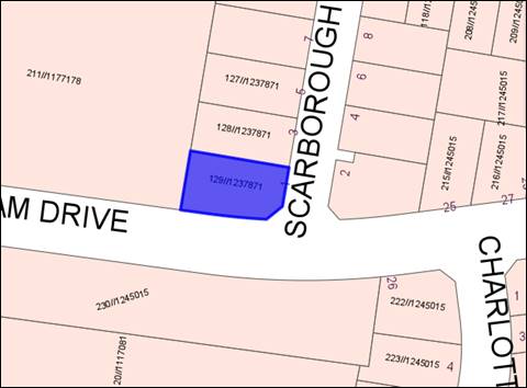
Figure 1 - locality plan
DECISION FRAMEWORK
Development in Orange is governed by two key documents
Orange Local Environment Plan 2011 and Orange Development Control Plan 2004.
Orange Local Environment Plan 2011 – The
provisions of the LEP must be considered by the Council in determining the
application. LEPs govern the types of development that are permissible or
prohibited in different parts of the City and also provide some assessment criteria
in specific circumstances. Uses are either permissible or not. The objectives
of each zoning and indeed the aims of the LEP itself are also to be considered
and can be used to guide decision making around appropriateness of development.
Orange Development Control Plan 2004 – the DCP
provides guidelines for development. In general it is a performance based
document rather than prescriptive in nature. For each planning element there
are often guidelines used. These guidelines indicate ways of achieving the
planning outcomes. It is thus recognised that there may also be other solutions
of merit. All design solutions are considered on merit by planning and building
staff. Applications should clearly demonstrate how the planning outcomes are
being met where alternative design solutions are proposed. The DCP enables
developers and architects to use design to achieve the planning outcomes in
alternative ways.
DIRECTOR’S COMMENT
The application comes before Council due to a departure from
the minimum lot size for dual occupancy. The site is amongst a new
subdivision and not significantly dissimilar to other developments in the
area. The articulation of the elevations fronting the streets and the
floor plan of the dwellings results in this being a reasonable development
despite the smaller allotment size. No submissions from neighbours were
received. Approval is recommended.
Link To Delivery/OPerational Plan
The recommendation in this report relates to the
Delivery/Operational Plan strategy “10.1 Preserve - Engage with the
community to ensure plans for growth and development are respectful of our
heritage”.
Financial Implications
Nil
Policy and Governance Implications
Nil
|
Recommendation
That Council consents to
development application DA 258/2019(1)
for Dual Occupancy and Subdivision (two lot residential) at Lot 129 DP
1237871 - 1 Scarborough Street, Orange
pursuant to the conditions of consent in the attached Notice of Approval.
|
further considerations
Consideration has been given to the recommendation’s impact
on Council’s service delivery; image and reputation; political;
environmental; health and safety; employees; stakeholders and project
management; and no further implications or risks have been identified.
SUPPORTING INFORMATION
The proposal involves development in two stages.
1. Proposed
Dual Occupancy
It is proposed to construct two (2) single storey detached
dwellings on the subject land. Each dwelling will contain three (3) bedrooms,
two (2) bathrooms, open plan kitchen/dining/living zone, media room, main
bathroom, laundry, alfresco area and attached double garage.
The external finishes of the proposed dwellings will
comprise:
· face brick walls
with timber cladding features
· iron roof sheeting
at 27 degree pitch
· powder coated
aluminium framed windows
· panel lift garage
doors.
The proposed dwellings are very similar in appearance,
however, they have been designed to each face a different street, with Dwelling
1 fronting Scarborough Street and Dwelling 2 fronting Miriam Drive (refer
to Figure 2 below).
The site will be landscaped, and areas for lawn will be
established. Private open space with reasonable solar access will be provided.
Concrete driveways will be constructed to each dwelling.
Metal fencing, 1.8m high, will
be established along the northern boundary of the site and between the proposed
dwellings (existing fencing is evident along part of the northern boundary and
the western boundary). Retaining walls will be established where indicated.
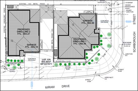
Figure 2 - site plan
2. Proposed Subdivision
It is proposed to subdivide the
subject land to create two (2) urban residential lots as follows:
|
LOT
|
AREA
(m2) subject to survey
|
|
1291
|
477.51m2
|
|
1292
|
428.23m2
|
|
Total
|
852.4m2
|
Proposed Lot 1 will comprise Dwelling 1 with vehicular
access via Scarborough Street. Proposed Lot 2 will comprise Dwelling 2
with vehicular access from Miriam Drive.
Each of the proposed lots/dwellings will be connected to
urban utility services in accordance with the requirements of the relevant
supply authority.
It is proposed that the
Subdivision Certificate to create proposed Lots 1 and 2 be released at the
completion of slabs and service connections for proposed Dwellings 1 and 2.
MATTERS FOR CONSIDERATION
Section 1.7 - Application of Part
7 of the Biodiversity Conservation Act 2016 and Part 7A of the Fisheries
Management Act 1994
Section 1.7 of the EP&A Act 1979 identifies that Part 7
of the Biodiversity Conservation Act 2016 (BC Act) and Part
7A of the Fisheries Management Act 1994 have effect in connection with
terrestrial and aquatic environments.
Having regard to the relevant provisions and based on an
inspection of the subject property, it is considered that the proposed
development is not likely to significantly affect a threatened species. The
subject property has no biodiversity or habitat value. A Biodiversity
Development Assessment Report is not required in this instance.
Section 4.15
Section 4.15 of the Environmental Planning and Assessment
Act 1979 requires Council to consider various matters, of which those
pertaining to the application are listed below.
PROVISIONS OF ANY ENVIRONMENTAL
PLANNING INSTRUMENT s4.15(1)(a)(i)
Orange Local Environmental Plan
2011
Clause 1.2 - Aims of Plan
The
broad aims of the LEP are set out under Subclause 2. Those relevant to the
application are as follows:
(a) to
encourage development which complements and enhances the unique character of
Orange as a major regional centre boasting a diverse economy and offering an attractive
regional lifestyle,
(e) to
provide a range of housing choices in planned urban and rural locations to meet
population growth,
(f) to
recognise and manage valued environmental heritage, landscape and scenic
features of Orange.
The application is considered to be consistent with the
above objectives, as outlined in this report.
Clause 1.6 - Consent Authority
This clause establishes that, subject to the Act, Council is
the consent authority for applications made under the LEP.
Clause 1.7 - Mapping
The subject site is identified
on the LEP maps in the following manner:
|
Land Zoning Map:
|
Land zoned R1 General
Residential
|
|
Lot Size Map:
|
Minimum Lot Size 500m2
|
|
Heritage Map:
|
Not a heritage item or conservation
area
|
|
Height of Buildings Map:
|
No building height limit
|
|
Floor Space Ratio Map:
|
No floor space limit
|
|
Terrestrial Biodiversity Map:
|
No biodiversity sensitivity on the
site
|
|
Groundwater Vulnerability Map:
|
Groundwater vulnerable
|
|
Drinking Water Catchment Map:
|
Not within the drinking water
catchment
|
|
Watercourse Map:
|
Not within or affecting a defined
watercourse
|
|
Urban Release Area Map:
|
Not within an urban release area
|
|
Obstacle Limitation Surface Map:
|
No restriction on building siting
or construction
|
|
Additional Permitted Uses Map:
|
No additional permitted use applies
|
|
Flood Planning Map:
|
Not within a flood planning area
|
Those matters that are of relevance are addressed in detail
in the body of this report.
Clause 1.9A - Suspension of
Covenants, Agreements and Instruments
This clause provides that covenants, agreements and other
instruments which seek to restrict the carrying out of development do not apply
with the following exceptions:
· covenants imposed
or required by Council
· prescribed instruments
under Section 183A of the Crown Lands Act 1989
· any conservation
agreement under the National Parks and Wildlife Act 1974
· any trust
agreement under the Nature Conservation Trust Act 2001
· any property
vegetation plan under the Native Vegetation Act 2003
· any biobanking
agreement under Part 7A of the Threatened Species Conservation Act 1995
· any
planning agreement under Division 6 of Part 4 of the Environmental Planning
and Assessment Act 1979.
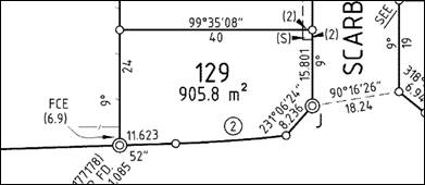
Figure 3 - locality plan
An easement to drain sewer burdens the lot in the north
eastern corner, where indicated in Figure 2. The building footprint is clear of
the easement.
An 88B instrument exists for the subject property, with a
number of restrictions regarding building materials, fence heights and
materials, and the like. Furthermore, the 88b identifies Lot 129 for dual
occupancy development, and permits further subdivision of this lot.
However, it is acknowledged that Clause 1.9A of the LEP has
the power to override the subject covenant.
Part 2 - Permitted or Prohibited Development
Clause
2.1 - Land Use Zones and Clause 2.3 - Zone Objectives and Land Use Table
The subject site is located within the R1 General
Residential zone. The proposed development is defined as “dual
occupancy (detached)” and “subdivision of land.”
Pursuant to the OLEP Dictionary:
Dual
occupancy (detached) means two detached dwellings on one lot of land, but does
not include a secondary dwelling.
[Nb.
Dwelling means a room or suite of rooms occupied or used or so constructed or
adapted as to be capable of being occupied or used as a separate domicile.]
Pursuant
to Section 6.2 of the Environmental Planning and Assessment Act 1979:
Subdivision
of land means the division of land into two or more parts that, after the
division, would be obviously adapted for separate occupation, use of
disposition.
Dual occupancy is a permitted land use in the R1 zone.
Subdivision is permitted with consent pursuant to Clause 2.6 (see below).
Clause
2.3 - Zone Objectives
These
objectives for land zoned R1 General Residential are as follows:
· To provide for
the housing needs of the community.
· To provide for
a variety of housing types and densities.
· To enable other
land uses that provide facilities or services to meet the day to day needs of
residents.
· To ensure
development is ordered in such a way as to maximise public transport patronage
and encourage walking and cycling in close proximity to settlement.
· To ensure that
development along the Southern Link Road has an alternative access.
The proposal is consistent with
the zone objectives as follows:
· The proposal would
have a positive effect on the housing needs of the community by creating
additional residential accommodation.
· The proposal
contributes to the variety of housing types and densities.
· The subject land
is within an establishing residential area that is serviced by public bus
routes and footpath along Leeds Parade.
· The site does not
have frontage or access to the Southern Link Road.
Clause 2.6 - Subdivision -
Consent Requirements
Clause 2.6 is applicable and states:
(1) Land to which this plan applies
may be subdivided, but only with development consent.
Consent is sought for a two lot Torrens subdivision of the
proposed dual occupancy in accordance with this clause.
Part 4 - Principal Development Standards
Clause
4.1 - Minimum Subdivision Lot Size
This
clause requires the subdivision of land to be equal to or greater than the size
nominated for the land under the Minimum Lot Size Map.
In
relation to this site, the map nominates a minimum lot size of
500m². The proposed lots have site areas of
477.5m² and 428.2m². The proposed lots do not satisfy the MLS and a variation
is sought pursuant to LEP Clause 4.6 Exceptions to Development Standards.
Proposed
Lot 1 with an area of 477.5m2 seeks to vary the MLS by 4.5%.
Proposed Lot 2, with an area of 428.2m2, seeks to vary the MLS by
14.35%.
Clause 4.1B - Minimum Lot Sizes for Dual Occupancy, Multi
Dwelling Housing and Residential Flat Buildings
Clause
4.1B applies and states in part:
(2) Development
consent may be granted to development on a lot in a zone shown in Column 2 of
the Table to this clause for a purpose shown in Column 1 of the Table opposite
that zone, if the area of the lot is equal to or greater that the area
specified for that purpose and shown in Column 3 of the Table.
Column 1 Column
2 Column
3
Dual occupancy Zone
R1 800m2
The
proposed dual occupancy is situated on land zoned R1 General Residential. The
subject land comprises a site area of 905.8m2, and exceeds the
minimum area of 800m2 required for a dual occupancy. The proposal is
consistent with this clause.
Clause 4.6 - Exceptions to Development Standards
This clause is applicable as the
subdivision component of the proposed development is less than the required
minimum lot size of 500m² pursuant to Clause 4.1 of the LEP. The
proposed lots have site areas of 477.51m² and 428.23m², representing
a variation of 4.5% and 14.35% respectively.
It is noted that the total area
of the subject property complies with Clause 4.1B addressing the minimum lot
sizes for dual occupancies. The subject land comprises a site area of 905.8m2,
and thus exceeds the minimum area of 800m2 required for a dual
occupancy within the R1 General Residential zone.
Clause 4.6 is intended to
achieve the following objectives:
(a) provide an appropriate degree of flexibility
in applying certain development standards
(b) achieve better outcomes for and from
development by allowing flexibility in particular circumstances.
At its core, a Clause 4.6
variation may be supported where it can be shown that the objectives of the
standard are unreasonable and/or unnecessary to apply in this particular case,
and where it can be shown that the objectives of both the plan and the clause
to be varied are achieved notwithstanding the non-compliance with the numerical
value of the standard.
The Clause 4.6 variation
submitted with the application generally achieves the outcomes and procedures
outlined in the Department’s circular and guideline; and the principals
established by the Courts. The main basis for justification advanced in the
submission is that the degree of variation is very small (22.49m2
and 71.77m2- representing a 4.5% and 14.35% variation respectively),
and that the proposed dual occupancy is entirely compatible with the expected
residential land use pattern in this area. Council has supported similar
requests within this particular precinct in the past.
Matters to
address in an application
Variation of a development
standard may be justified where it is consistent with the objectives that the
relevant environmental planning instrument is attempting to achieve.
The application must address:
(i) whether strict compliance with the
standard, in the particular case, would be unreasonable or unnecessary and why,
and
(ii) demonstrate that there are sufficient
environmental planning grounds to justify contravening the development standard
The
applicant has argued that the minimum lot size is unnecessary and unreasonable
in this instance for the reasons explained below:
· The subject
land satisfies the minimum lot size to permit a dual occupancy pursuant to
Clause 4.1B of Orange LEP 2011.
· The
proposed dual occupancy satisfies the relevant Planning Outcomes for dual
occupancy development pursuant to Orange DCP 2004 – 07 Development in
Residential Areas.
· The subdivision
of each dwelling onto a separate lot is a reasonable planning outcome and
expectation for a dual occupancy development that is demonstrated to satisfy
the relevant LEP and DCP provisions.
· Subdivision of
the proposed dual occupancy can actually occur via Clause 4.1(4) of Orange LEP
2011 either as strata subdivision or as community title subdivision because
these forms of subdivision are not subject to a MLS. However, the proposed
subdivision layout, comprising regular lots each with direct street frontage
and access is not conducive to strata or community subdivision.
It should be noted that the 88b
applying to the land identifies the site for dual occupancy development, and
subdivision of such. This was identified at the time of the overarching
subdivision of the site.
There are sufficient environmental
planning grounds cited to support the variation. These are as follows:
· A variation
of the development standard is justified in this case because it can be demonstrated
that the proposal satisfies the objectives of the R1 General Residential zone
and the objectives of the MLS.
· The proposed
lots are demonstrated to accommodate each dwelling in a dual occupancy
development that is entirely compliant with the relevant LEP and DCP
provisions.
· As previously
mentioned, Clause 4.1(4) of the LEP would actually permit the subdivision
either as a community title or strata subdivision. However, it is considered
that a subdivision of the land as proposed by this application is more
appropriate given that each lot has direct road frontage and does not rely on
common or shared elements that typify community or strata schemes.
· The proposed
dual occupancy is entirely compatible with the expected residential land use
pattern in this area. A variation of the MLS to allow each proposed dwelling to
be excised on a conventional allotment (as opposed to a strata or community
lot) does not diminish this aspect of the development.
· It is
demonstrated that non-compliance with the MLS development standard does not
generate unacceptable impacts in the locality.
Written applications to vary
development standards need to not only address the above matters, but may also
address matters set out in the ‘five part test’ established by the
NSW Land and Environment Court. The NSW Department of Planning strongly
advises Councils to apply the Five Part Test in their assessments of Clause 4.6
matters.
The Five
Part Test
Written applications to vary
development standards should also address matters set out in the ‘five
part test’ established by the NSW Land and Environment Court. The
five part test embodies the following:
1 the
objectives of the standard are achieved notwithstanding noncompliance with the
standard
2 the
underlying objective or purpose of the standard is not relevant to the
development and therefore compliance is unnecessary
3 the
underlying object or purpose would be defeated or thwarted if compliance was
required and therefore compliance is unreasonable
4 the development standard
has been virtually abandoned or destroyed by the council’s own actions in
granting consents departing from the standard and hence compliance with the
standard is unnecessary and unreasonable
5 the compliance with
development standard is unreasonable or inappropriate due to existing use of
land and current environmental character of the particular parcel of land. That
is, the particular parcel of land should not have been included in the zone.
The applicant states that the proposal, including the
proposed variation to the MLS, would uphold the objectives of the MLS standard
due to the following:
The proposal, including the
proposed variation to the MLS would uphold the objectives of the development
standard due to the following.
(a) To
ensure that new subdivisions reflect existing lot sizes and patterns in the
surrounding locality
The
proposed lots may not necessarily reflect the majority of existing lot sizes in
this precinct. However, once the dual occupancy is completed, the two dwellings
will become part of the development pattern. The creation of proposed Lots 1291
and 1292 to excise each of these dwellings would indeed reflect this element of
the development pattern.
(b) To
ensure that lot sizes have a practical and efficient layout to meet intended
use
The
proposed variation of the MLS remains consistent with this objective. Each lot
is intended to excise the proposed dwellings in a dual occupancy development,
both of which are demonstrated to satisfy the relevant LEP and DCP provisions.
The proposed lots logically recognise each proposed dwelling and its associated
private open space, access, and servicing requirements.
(c) To
ensure that lot sizes do not undermine the land’s capability to support
rural development
This objective is not
relevant as the subject land is not within a rural zone.
(d) To
prevent the fragmentation of rural lands
This objective is not
relevant as the subject land is not within a rural zone.
(e) To
provide for a range of lot sizes reflecting the ability of services available
to the area
The proposed subdivision is
consistent with this objective as the servicing arrangements for each of the
proposed lots are readily available.
(f) To
encourage subdivision designs that promote a high level of pedestrian and
cyclist connectivity and accommodate public transport vehicles.
There are no aspects of the
proposed MLS variation that would be adverse to this objective.
The applicant
makes the following additional comments in regards to the five part test and
the requirements of Clause 4.6:
· Strict
compliance with the 500m2 MLS would not necessarily defeat or thwart
the underlying objective or purpose of the development standard. However, the
proposal is considered to be consistent with the objectives of the development
standard.
· The development
standard cannot be said to be abandoned. However, the Leeds Parade Conceptual
Subdivision Layout appears to depict several lots that are less than 500m2.
Further the development standard becomes irrelevant if the subdivision was to
be undertaken as strata or community title.
· The zoning of
the land is reasonable and appropriate for the site.
· The proposal
including the proposed variation of the MLS remains consistent with the
objectives of the R1 General Residential Zone.
· The
contravention of the development standard does not raise an issue of State or
regional planning significance as it relates to local and contextual
conditions.
· Public benefit
would not suffer as a result of the variation to the development standard. The
public would benefit from an increase in the choice of residential
accommodation.
· The creation of
the proposed lots would not compromise the broader aims and principles of
Orange LEP 2011; or the relevant Planning Outcomes of Orange DCP 2004 –
07 Development in Residential Areas.
Department Of
Planning’s Circular
This Circular sets out the
circumstance and criteria for applying Council’s assumed concurrence to
the determination of development standards under Clause 4.6.
In
the event that the variation sought does not exceed 10% of the development
standard, the concurrence issued by the Department may extend to a
delegate of the Council. The Secretary’s concurrence does not extend to a
delegate if the development contravenes a numerical standard by greater than
10%. In this instance, the variation must be considered by Council to be
subject to a “greater level of public scrutiny” than decisions made
by Council staff under delegation.
In this instance the variation
sought is 4.5% and 14.35% and therefore must be determined by Council.
Summary
The LEP MLS requirement is an
assessment tool aimed at achieving good design outcomes, making efficient use
of land, and ensuring that neighbourhood character and amenity is not
compromised. The subject land allows for dual occupancies pursuant to the LEP,
and the fact that the proposal seeks to excise the dwellings via subdivision
would be largely indiscernible in terms of impact and public perception of the
development. Staff generally concur with the applicant, in that if the
development strictly complies with the development standard (i.e. remains a
dual occupancy on one lot), it is unlikely to result in a better planning
outcome. Furthermore, the MLS does not apply to Community or Strata
subdivisions, and as such, subdivision could occur in a different arrangement
than the proposed Torrens title, however, the site layout does not lend itself
to these other types of subdivision.
Council may grant
consent only if the concurrence of the Director General of the Department of
Planning has been obtained (i.e. is assumed, as discussed above) and Council is
satisfied that:
· the written
request has adequately addressed the above, and
· the proposed
development will be in the public interest because of:
- consistency with the objectives of the
particular standard, and
- consistency with the objectives of the
zone applying to the site.
It is considered that the
written request adequately addresses the variation criteria of the clause, the
Department of Planning guidelines, and the principals and test established by
the Court. In particular, the proposed development is not contrary to any of
the objectives for the zone or the MLS Clause; or contravene
the DCP’s planning outcomes (addressed later in this report).
Overall, it is considered that
the proposed variation is unlikely to result in any significant adverse impact
on the operation of the LEP or the DCP, and that the proposed development is
generally consistent with all relevant objectives and would not result in any
significant adverse impact.
It is considered that the proposal,
including the variation sought, is consistent with the above objectives.
Part
6 - Urban Release Area
The subject land is contained
within an Urban Release Area on the Urban Release Area Map. The
provisions in Part 6 of the LEP generally relate to servicing of the land in
conjunction with subdivision. The development site was a lot created pursuant
to DA 431/2012 (amended) for proposed 88 lot residential subdivision, approved
26 March 2013. The subdivision is reflective of the Leeds Parade
DCP/Masterplan for the parent parcel and adjoining lands. Part 6 has no effect
for the proposed dual occupancy on a child parcel in the original subdivision.
Part
7 - Additional Local Provisions
7.1
- Earthworks
In consideration of this clause,
the proposal is acceptable. Minor earthworks will be required to create level
building pads for the proposed dwellings and associated outdoor spaces. The
earthworks will be supported onsite and the change in ground level is not
substantial. Retaining walls will be constructed within the Miriam Drive
frontage to a maximum height of 0.8m and 1.2m, where indicated on the plan.
This will result in the finished floor levels of the dwellings being lower than
the street, and therefore only a small percentage of the retaining wall will be
visible from Miriam Drive. Landscaping in front of these retaining walls will
assist with integration to the site.
Disruption to drainage is
considered to be minor and will not detrimentally affect adjoining properties
or receiving waterways. The site is not known to be contaminated, nor is the
site known to contain any Aboriginal, European or archaeological relics. The
site is not in proximity to any waterway, drinking water catchment or sensitive
area. Conditions are recommended that require sediment control measures to be
implemented onsite prior to works commencing to ensure that loose dirt and
sediment does not escape the site boundaries.
7.3 - Stormwater Management
The proposed development will be
connected to the existing stormwater mains in accordance with Council’s
standard requirements. Conditions are recommended in relation to stormwater
management to satisfy the requirements of Clause 7.3.
7.6 - Groundwater Vulnerability
In consideration
of Clause 7.6, the proposal is acceptable. The proposed development does not
involve processes or activities that would impact on groundwater resources. The
subject land is serviced by reticulated sewer.
Clause 7.11 - Essential
Services
In
consideration of this clause, all utility services are available to the land
and adequate for the proposal:
· the subject land
is connected to reticulated water supply
· electricity and
telecommunications are available to the land
· the site is
connected to Council’s reticulated sewerage system
· the proposed
development will connect to existing stormwater infrastructure in the road
reserve
· the site has
direct frontage and access to Scarborough Street and Miriam Drive.
STATE ENVIRONMENTAL PLANNING
POLICIES
State Environmental Planning Policy 55 Remediation of
Land
State Environmental Planning Policy 55 - Remediation of
Land (SEPP 55) is applicable. Pursuant to Clause 7 Contamination and
remediation to be considered in determining development application:
(1) A consent authority must not consent to
the carrying out of any development on land unless:
(a) it
has considered whether the land is contaminated, and
(b) if
the land is contaminated, it is satisfied that the land is suitable in its
contaminated state (or will be suitable, after remediation) for the purpose for
which the development is proposed to be carried out, and
(c) if
the land requires remediation to be made suitable for the purpose for which the
development is proposed to be carried out, it is satisfied that the land will
be remediated before the land is used for that purpose.
In terms of potential soil contamination, a contamination
assessment was undertaken as part of the subdivision requirements that applied
in relation to the creation of the subject land (DA 431/2012 amended). Since
its creation as a residential allotment, the subject land has remained vacant.
On this basis, Council will not require further assessment
in regard to potential site contamination.
PROVISIONS OF ANY DRAFT
ENVIRONMENTAL PLANNING INSTRUMENT THAT HAS BEEN PLACED ON EXHIBITION
4.15(1)(a)(ii)
From 31 January to 13 April 2018 the Department of Planning
and Environment publically exhibited an Explanation of Intended Effect (EIE)
and Draft Planning Guidelines for the proposed Remediation of Land SEPP, which
will repeal and replace State Environmental Planning Policy 55 –
Remediation of Land (SEPP 55). Of particular note, the Draft Planning
Guidelines state:
“In undertaking an
initial evaluation, a planning authority should consider whether there is any
known or potential contamination on nearby or neighbouring properties, or in
nearby groundwater, and whether that contamination needs to be considered in
the assessment and decision making process.”
“If the planning
authority knows that contamination of nearby land is present but has not yet been
investigated, it may require further information from the applicant to
demonstrate that the contamination on nearby land will not adversely affect the
subject land having regard to the proposed use.” (Proposed
Remediation of Lands SEPP - Draft Planning Guidelines, Page 10).
Land
adjoining the site is not identified or considered to be contaminated. As such,
the provisions of the draft EPI are considered to have been addressed.
Draft Orange Local
Environmental Plan 2011 (Amendment 24)
Draft Orange LEP Amendment 24
was on public exhibition from 26 July to 26 August 2019. Draft Amendment 24 has
no effect for the subject land or proposed development.
DESIGNATED DEVELOPMENT
The proposed development is not designated development.
INTEGRATED DEVELOPMENT
The proposed development is not integrated development.
PROVISIONS OF ANY DEVELOPMENT
CONTROL PLAN s4.15(1)(a)(iii)
Development Control Plan 2004
DCP 2004-7.1 Urban Residential
Subdivision
The DCP sets the following applicable Planning Outcomes for
Urban Residential Subdivision:
· Lots below
500m² indicate a mandatory side setback to provide for solar access and
privacy.
· Lots are fully
serviced and have direct frontage and access to a public road.
· Design and
construction complies with the Orange Development and Subdivision Code.
This proposal satisfies the above Planning Outcomes due to
the following:
· Proposed Lots 1
and 2 depict the boundary setbacks for the proposed dwelling in each. As
demonstrated in this report, the proposed lots will be of sufficient area to
provide a satisfactory standard of residential amenity to the proposed
dwellings in respect of solar access and privacy.
· The proposed
development will be connected to Council’s sewer, town water and
stormwater reticulations in accordance with normal requirements. Power,
telephone and natural gas services are available to the development in
accordance with the requirements of the relevant supply authority.
· The subdivision
design and construction will comply with the Orange Development and Subdivision
Code.
DCP 2004-7.7 Design Elements
for Residential Development
The DCP sets the following Planning Outcomes at Part 7.7:
Neighbourhood Character
Site layout and building design enables the:
· creation of
attractive residential environments with clear character and identity
· use of site
features such as views, aspect, existing vegetation and landmarks
· buildings are
designed to complement the relevant features and built form that are identified
as part of the desired neighbourhood character
· the
streetscape is designed to encourage pedestrian access and use.
The proposal satisfies the above Planning Outcomes due to
the following:
· The site layout
and building design is intended to create an attractive residential
environment. In this regard:
- the
neighbourhood character in this release area is expected to comprise mostly
contemporary, detached single storey dwellings with landscaped front yards and
individual driveways. The proposed development displays similar attributes and therefore
remains consistent with the expected character of the neighbourhood
- the
proposed development is not influenced or constrained by important views,
vegetation or landmarks
- the
development has been designed to provide internal living areas and private open
space areas with reasonable solar access.
· The dwellings
adopt a building form and finish that is considered typical of residential
development in the City’s newer northern residential areas. In
particular, the proposed dwellings comprise the following elements to remain
consistent with the expected development form:
- detached
configuration
- hipped
roof lines
- face
brick external walls with timber cladding on front façade
- front
door facing the street
garage door facing the street
- bulk
and sale commensurate with other dwellings
- landscaped
front yards
- separate
driveways.
· Notwithstanding
the modest increase in traffic movements (due to one additional dwelling), the
proposal will not adversely impact on pedestrian access associated with the
streetscape, due to the following:
- pedestrian
movements are expected to be modest in this neighbourhood
- the
reverse egress arrangements for the proposed dwellings will be consistent with
those for single dwellings in this neighbourhood and throughout the City
generally
- adequate
driver and pedestrian sight lines will be achieved so that vehicles entering
and exiting the site are visible to pedestrians and vice versa.
Building Appearance
The DCP sets the following Planning Outcomes in regard to
Building Appearance:
· The building
design, detailing and finishes relate to the desired neighbourhood character,
complement the residential scale of the area, and add visual interest to the
street.
· The frontages
of buildings and their entries face the street.
· Garages
and car parks are sited and designed so that they do not dominate the street
frontage.
This proposal can be demonstrated to be satisfactory in this
regard due to the following:
· The external
finishes (face brickwork walls; iron roofing; and powder coated garage doors
and window frames) are considered appropriate in this developing residential
neighbourhood.
· Each of the
dwellings will address the street with a contemporary façade comprising
windows, front entry door and porch. Landscaping is proposed as indicated in
the landscape plan.
· The garages will
not unreasonably dominate the respective street frontage due to the following:
- each
garage is recessed in the front elevation of the respective dwelling
- the
width of the garage door opening in each dwelling is less than 50% of the front
elevation of the respective dwelling
- the
garages are setback a minimum of 5.5m from the street boundary as encouraged by
the DCP
- the
frontage for each dwelling is to be landscaped.
Setbacks
The DCP sets the following Planning Outcomes in regard to
Setbacks:
· Street setbacks
contribute to the desired neighbourhood character, assist with the integration
of new development and make efficient use of the site.
· Street setbacks
create an appropriate scale for the street considering all other streetscape
components.
As required by the DCP, the front
boundary setback for each of the proposed dwellings will be a minimum of 4.5m.
The DCP allows corner allotments to adopt a 2m setback for
the secondary boundary. Given that the proposed design of Dwelling 1 provides a
front door and garage that face Scarborough Street, it is submitted that
Miriam Drive and the splay would represent the secondary boundary in relation
to Dwelling 1. In accordance with the DCP, Dwelling 1 is sited a minimum of 2m
from the secondary boundary.
The garage for each dwelling complies with the minimum
setback of 5.5m required by the DCP.
Front Fences and Walls
The DCP sets the following Planning Outcomes in regard to
Fences and Walls:
· Front fences
and walls:
- assist in highlighting entrances and creating a
sense of identity within the streetscape
- are constructed of materials compatible with
associated housing and with fences visible from the site that positively
contribute to the streetscape
- provide for facilities in the street frontage area
such as mail boxes.
The development proposes to
provide 1.8m high aluminium fencing between the two dwellings, with existing
1.8m high metal fencing and unknown height hinge joint fence to the northern
and western boundaries respectively. A condition will be attached requiring
1.8m high metal fencing along the northern and western boundaries to provide
privacy and security to residents.
Visual Bulk
The DCP sets the following Planning Outcome in regard to
Visual Bulk:
· Built form
accords with the desired neighbourhood character of the area with:
- side and rear setbacks progressively increased to
reduce bulk and overshadowing
- site coverage that retains the relatively low
density landscaped character of residential areas
- building form and siting that relates to landform,
with minimal land shaping (cut and fill).
In consideration of the DCP
Guidelines, the proposal is considered to be satisfactory due to the following:
· The proposed dwellings
are well set back from the site boundaries to ensure that they will be
contained within the visual bulk envelope (VBE) generated by planes projected
at 45° over the site, commencing
2.5m above existing ground level from each side and rear boundary.
· Whilst Dwelling 1
is closer to the southern boundary, it will be sited in cut (at a lower ground
level) and will therefore be contained within the VBE which applies to that
boundary.
· The proposed dual
occupancy will comprise a total building area of 414.88m2. Based on
the site area of 905.8m2 the development will have a site coverage
of just under 46% to comply with the maximum of 50% prescribed in the DCP.
· The slope of the
land will require earthworks and retaining structures along the proposed common
boundary and part of the western boundary adjoining Lot 211
DP 1177178. Landscaping will be incorporated into the retaining walls to
soften the visual bulk.
· The proposed
finished floor levels of Dwellings 1 and 2 relate reasonably to existing ground
levels and are not expected to generate adverse impacts in respect of visual
bulk, solar access or privacy.
Walls and Boundaries
The DCP sets the following Planning Outcome in regard to
Walls and Boundaries:
· Building to the
boundary is undertaken to provide for efficient use of the site taking into
account:
- the privacy of neighbouring dwellings
and private open space
- the access to daylight reaching
adjoining properties
- the impact of boundary walls on
neighbours.
Building to the boundary is
considered unnecessary in this case. As explained later in this report, the
proposed dwellings would not unreasonably reduce to amount of daylight that
reaches adjoining properties or unreasonably impact upon their privacy.
Daylight and Sunlight
The DCP sets the following Planning Outcome in regard to
Daylight and Sunlight:
· Buildings are
sited and designed to ensure:
- daylight to habitable rooms in adjacent dwellings
is not significantly reduced
- overshadowing of neighbouring secluded open spaces
or main living area windows is not significantly increased
- consideration of Council’s Energy Efficiency
Code.
Overshadowing
of Dwellings
According to the DCP Guidelines
and Council’s Energy Efficiency Code, sunlight to at least 75% of
north-facing living area windows within the development and on adjoining land
is to be provided for a minimum of 4 hours on 21 June; or not further reduced
than existing where already less.
The proposed development
satisfies this aspect of the DCP. The shadow diagrams indicate that:
· the north facing
living area windows in each of the proposed dwellings will achieve the required
amount of direct sunlight on the winter solstice
· the shadow
diagrams indicate that shadowing on the adjoining property to the west occurs
at the greatest effect only in the morning period (9am to 10am). As such, the
development would meet the DCP requirements in regard to maintaining solar
access to the private open space on adjoining land
· the majority of
the overshadowing is toward the south, being the roadways and therefore no
impact upon adjoining residential properties.
Overshadowing of Private Open
Space
According to the DCP Guidelines
and Council’s Energy Smart Homes Code, sunlight is to be available to at
least 40% of required open space for dwellings within the development and on
neighbouring properties for at least 3 hours between 9am and 3pm.
The proposed development
satisfies this aspect of the DCP as follows:
· Overshadowing of
private open space within the development itself is compliant with the DCP. As
indicated in the site calculation table:
- Dwelling 1 has a floor area of 147.5sqm
(excluding garage, porch and alfresco) and thus requires a private open space
area of 73.75m2. 40% of the required open space area is 29.5m2.
The shadow diagrams indicate that the area of direct sunlight will range from
29.51m2 to 39.98m2 between 11am and 2pm on 21 June.
- Dwelling 2 has a floor area of 132m2
(excluding garage, porch and alfresco) and thus requires a private open space
area of 66m2. 40% of the required open space area is 26.4m2.
The shadow diagrams indicate that the area of direct sunlight will range from
26.2m2 to 61.5m2 between 9am and 2pm on 21 June.
· The development
would meet the DCP requirements in regard to maintaining reasonable solar
access to the private open space of surrounding properties due to the
following:
- the shadow diagrams indicate that no
shadowing impact will occur to the adjoining property to the north
- the shadow diagrams indicate that
shadowing impact on the adjoining property to the west would be mostly gone by
11am so unlikely to affect any future development on the property.
Energy Performance Statement
BASIX/NatHERS certificates have
been prepared. The dual occupancy will comply with the relevant provisions in
respect of water, thermal, comfort and energy.
The proposed development is
considered satisfactory in terms of Council’s Energy Efficiency Code due
to the following:
· energy efficient
influences in the design include northerly orientation of living areas; slab on
ground; and only necessary glazing along the southern and western sides of the
dwellings
· the appropriate
star rated water saving devices will be installed
· the hot water
system for each dwelling will be of a type that achieves the star rating
recommended in the BASIX certificate for each dwelling.
Views
The DCP sets the following Planning Outcomes in regard to
Views:
· building form
and design allow for residents from adjacent properties to share prominent
views where possible
· views,
including vistas of heritage items or landmarks, are not substantially affected
by the bulk and scale of the new development.
Being single storey and with finished floor levels
reasonably commensurate with existing ground level, the proposed dwellings
would not unreasonably diminish views for other properties in the vicinity.
Visual Privacy
The DCP sets the following Planning Outcome in regard to
Visual Privacy:
· Direct
overlooking of principal living areas and private open spaces of other
dwellings is minimised firstly by:
- building siting and layout
- location of windows and balconies
and
secondly by:
- design of windows or use of screening devices and
landscaping.
In consideration of the DCP
Guidelines, it is considered that the applicant has suitably demonstrated that
the proposal is satisfactory based on the following:
Privacy
within the Development
· The principal living
room windows for proposed Dwellings 1 and 2 will overlook their respective
private open space area and will not directly oppose each other.
· The proposed site
levels assist to maintain privacy. Generally, the finished floor levels of the
dwellings are reasonably commensurate with the existing ground level and well
below the DCP Guideline of 1.5m above natural ground level at which point
additional privacy measures should be implemented.
· The front door and
garage for each dwelling are orientated so as to ensure that occupants achieve
reasonable privacy when entering or exiting their residence.
· The retaining wall
and proposed 1.8m Colorbond fence will visually obstruct overlooking between
the proposed common boundary.
Privacy in
relation to Neighbours
· Privacy in
relation to the property to the west will be achieved as follows:
- the dwelling on the property to the west
is set back more than 30m from the common boundary and is visibly screened by
the existing shed and established vegetation
- the primary living areas for Dwelling 2
are orientated to the north east and away from the property to the west.
· Privacy in
relation to the property to the north will be achieved as follows:
- the existing 1.8m Colorbond fence along
the northern boundary will break direct line of sight between the two
properties and will have a height similar to the proposed eave height of
Dwelling 2
- proposed Dwelling 2 will be set at a
lower finished ground level
- whilst the alfresco area and glass
sliding door for the living area of Dwelling 2 faces north east, these
elements are well set back from the eastern boundary. Further, these do not
oppose any similar elements associated with the dwelling on the neighbouring
property.
Acoustic Privacy
The DCP sets the following Planning Outcome in regard to
Acoustic Privacy:
· Site layout and
building design:
- protect habitable rooms from excessively high
levels of external noise
- minimise the entry of external noise to private
open space for dwellings close to major noise sources
- minimise transmission of sound through a building
to affect other dwellings.
In consideration of the DCP
Guidelines, the proposal is considered to be satisfactory given that the site is
in an area where ambient noise levels are expected to be low due to the
predominant residential land use pattern and the dwellings are detached, thus
limiting the potential for sound penetration between them.
Security
The DCP sets the following Planning Outcomes in regard to
Security:
· the site layout
enhances personal safety and minimises the potential for crime, vandalism and
fear
· the design of
dwellings enables residents to survey streets, communal areas and approaches to
dwelling entrances.
In consideration of the DCP
Guidelines, the applicants submit that proposal is satisfactory due to the
following:
· the proposed
building design will offer reasonable opportunities for surveillance. The
dwellings will have a front door and living room windows that address their
respective street frontage, thereby providing effective passive surveillance
from the dwelling to public areas
· the site has
reasonable access control. The lock-up garages with internal access will
enhance security. The private open space areas will be fenced so as to provide
a physical barrier for intruders
· the proposed
landscaping limits the opportunity for potential offenders to conceal
themselves.
It is agreed that the planning
outcomes for safety have been adequately addressed.
Public
Transport
The DCP sets the following Planning Outcomes in regard to
Public Transport:
· Residential
unit development is accessible to public transport.
The proposal is considered to be satisfactory in this
regard. The subject land is located within an establishing urban residential
area that is to be serviced by public bus routes.
Circulation and Design
The DCP sets the following Planning Outcome in regard to
Circulation and Design:
· accessways and
parking areas are designed to manage stormwater
· accessways,
driveways and open parking areas are suitably landscaped to enhance amenity
while providing security and accessibility to residents and visitors.
The proposal is considered to be satisfactory in this
regard, due to the following:
· a reverse exit
will be required for each dwelling as is the case for the majority of new
estate residential development throughout this City
· the driveways will
be located a sufficient distance from the intersection to avoid vehicle
conflicts.
Car Parking
The DCP sets the following Planning Outcomes in regard to
Car Parking:
· Parking
facilities are provided, designed and located to:
- enable the efficient and convenient use of car
spaces and access ways within the site
- reduce the visual dominance of car parking areas
and access ways.
· Car parking is
provided with regard to the:
- number and size of proposed dwellings
- requirements of people with limited mobility or
disabilities.
The proposal meets the DCP
requirements. According to the car parking table in the DCP, 3.4 (4) spaces
will be required for the dual occupancy (based on 1.5 spaces per 3-bedroom
dwelling and 0.2 visitor spaces per unit).
As indicated in the site plan,
eight (8) off-street car spaces will be provided for the development,
comprising a double garage and two (2) tandem spaces for each proposed
dwelling.
Private Open Space
The DCP sets the following Planning Outcomes in regard to
Private Open Space:
· Private open
space is clearly defined for private use.
· Private open
space areas are of a size, shape and slope to suit the reasonable requirements
of residents including some outdoor recreational needs and service functions.
· Private open
space is:
- capable of being an extension of the dwelling for
outdoor living, entertainment and recreation
- accessible from a living area of the dwelling
- located to take advantage of outlooks; and to
reduce adverse impacts of overshadowing or privacy from adjoining buildings
- orientated to optimise year round use.
The DCP Guidelines require open
space to:
· be provided at a
rate of at least 50% of the gross floor space of each dwelling
· have a minimum
dimension of 3m
· include at least
one area with minimum dimensions of 5m x 5m directly accessible to a living
area preferably orientated to the north or east of the dwelling
· be adjacent to
dwellings and located behind the primary front wall of the dwelling
· be allocated to
individual dwellings where practicable to minimise the need for management and
maintenance of communal open space.
The following table demonstrates
that each of the proposed dwellings is provided with open space that complies
with the minimum requirement in terms of area.
|
Dwelling
|
Living
Area (ex. garage, porches, patios etc.)
(m2)
|
Private
Open Space Required by DCP
(m2)
|
Private
Open Space Provided
(m2)
|
|
1
|
147.5m2
|
73.75m2
|
102.68m2
|
|
2
|
132.01m2
|
66.01m2
|
112.68m2
|
The site plan confirms that the private open space for each
dwelling will have a minimum dimension of 3m and each yard will be able to
provide an area of 5m x 5m.
As previously outlined, the solar access to each area of
private open space on the winter solstice is considered satisfactory.
The internal living area for each dwelling will connect to
its respective area of private open space via glass sliding doors and an
alfresco area. Each private open space area will be enclosed by fencing.
The private open space for each dwelling will be located
behind the primary front wall.
Open Space and Landscaping
The DCP sets the following Planning Outcomes in regard to
Open Space and Landscaping:
· The site layout
provides open space and landscaped areas which:
- contribute to the character of the development by
providing buildings in a landscaped setting
- provide for a range of uses and activities
including stormwater management
- allow cost effective management.
· The landscape
design specifies landscape themes consistent with the desired neighbourhood
character; vegetation types and location, paving and lighting provided for
access and security.
· Major existing
trees are retained and protected in a viable condition whenever practicable
through appropriate siting of buildings, access ways and parking areas.
· Paving is
applied sparingly and integrated in the landscape design.
In consideration of the DCP Guidelines, the proposal is
considered to be unsatisfactory due to specific species not being identified,
and thus not being able to identify whether the species are suitable to the
Orange area, if plantings are of appropriate foliage and of intermediate and
taller height to maximise screening and aesthetic appeal. As such, a condition
has been attached requiring the submission of a competent landscaping plan.
Stormwater
The DCP sets the following Planning Outcomes in regard to
Stormwater:
· Onsite drainage
systems are designed to consider:
- downstream capacity and need for onsite retention,
detention and re-use
- scope for onsite infiltration of water
- safety and convenience of pedestrians and vehicles
- overland flow paths.
· Provision is
made for onsite drainage which does not cause damage or nuisance flows to
adjoining properties.
In consideration of the DCP Guidelines, the proposal is
considered to be satisfactory due to the following:
· the submitted
landscape plan provides for garden beds and lawn areas which will assist with
onsite infiltration
· preliminary
engineering investigations indicate that easements to drain water over
adjoining land will not be required
· stormwater from
the development will be directed to existing drainage infrastructure.
Erosion and Sedimentation
The DCP sets the following Planning Outcome in regard to
Erosion and Sedimentation:
· Measures
implemented during construction to ensure that the landform is stabilised and
erosion is controlled.
In consideration of the DCP Guidelines, the proposal is
considered to be satisfactory due to the following:
· an erosion and
sediment control plan will be prepared as part of the engineering design plans
for the development.
DEVELOPMENT CONTRIBUTIONS PLAN
2017
Development contributions are
applicable to the proposed dual occupancy (one additional dwelling), pursuant
to Orange Development Contributions Plan 2017 (Remainder of LGA), as
follows:
|
Open
Space and Recreation
|
1
additional 3 bed dwelling @ 3,982.01
|
3,982.01
|
|
Community
and Cultural
|
1
additional 3 bed dwelling @ 1,154.78
|
1,154.78
|
|
Roads
and Traffic Management
|
1 additional 3 bed dwelling
@5,256.12-
|
5,256.12
|
|
Local
Area Facilities
|
-
|
-
|
|
Plan
Preparation and Administration
|
1
additional 3 bed dwelling @ 311.79
|
311.79
|
|
TOTAL:
|
|
$10,704.70
|
A condition is recommended requiring payment of
contributions prior to issue of a Construction Certificate for the proposed
dual occupancy.
Section 64 Water and Sewer Headworks Charges
Section 64 water and sewer headwork charges are applicable
to the proposed development. The contributions for water, sewer and drainage
works are based on one additional ET for water supply headworks and one
additional ET for sewerage headworks. Conditions are recommended requiring
payment of contributions prior to issue of a construction certificate.
PROVISIONS PRESCRIBED BY THE
REGULATIONS s4.15(1)(a)(iv)
Demolition of a Building (clause
92)
The proposal does not involve the demolition of a building.
Fire Safety Considerations
(clause 93)
The proposal does not involve a change of building use for
an existing building.
Buildings to be Upgraded
(clause 94)
The proposal does not involve the rebuilding, alteration,
enlargement or extension of an existing building.
BASIX Commitments (clause 97A)
A BASIX Certificate has been submitted in support of the
proposed development which demonstrates compliance with respect of water,
thermal comfort and energy targets.
THE LIKELY IMPACTS OF THE
DEVELOPMENT s4.15(1)(b)
Visual Impacts
The visual impacts of the proposal are considered
acceptable, as outlined in the foregoing sections of this report. The proposed
dual occupancy will complement the developing neighbourhood character and
streetscape built form in respect of building design, external finishes, height
and site layout.
Traffic Impacts
The proposal is considered to be satisfactory in terms of
traffic impacts. The capacity of the local road network is sufficient to
accommodate additional localised traffic generated by the development. The
proposed access, parking and manoeuvring arrangements for the development are
appropriate.
Cumulative Impacts
The proposal is considered to be satisfactory in terms of
cumulative impact. The proposed dwellings will complement the neighbourhood built
form in respect of bulk, form, design features and external finishes. The
proposed development will not reduce the open space, solar access or privacy
afforded to future dwellings. Similarly, the site layout and building design
will provide a reasonable standard of residential amenity for the proposed
dwellings in terms of open space, solar access and privacy. The development
will contribute to the diversity of housing forms in the precinct in a manner that is consistent with the developing
neighbourhood character.
Environmental Impacts
The subject land is contained within a developing
residential precinct and comprises vacant, cleared land. Significant
vegetation, threatened species or ecological endangered communities or their
habitats are unlikely to be present. The site is not in proximity to any
waterway, drinking water catchment or sensitive area. Sediment control
measures, as required by conditions, will prevent loose dirt and sediment
escaping the site and polluting downstream waterways.
THE SUITABILITY OF THE SITE
s4.15(1)(c)
The subject land is suitable for the development due to the
following:
· the land is zoned
R1 General Residential. The proposal is permitted with consent
· the site is of
sufficient area and dimensions to accommodate the proposed dual occupancy and
provide a high standard of residential amenity
· the site has
direct frontage and access to Scarborough Street and Miriam Drive
· there is no known
contamination on the land
· all utility
services are available and adequate
· the site is not
subject to natural hazards
· the subject land
has no biodiversity or habitat value
· the site is not in
proximity to any waterway, drinking water catchment or sensitive area.
ANY SUBMISSIONS MADE IN
ACCORDANCE WITH THE ACT s4.15(1)(d)
The proposed development is defined as "advertised
development" under the provisions of the DCP. The application was
advertised and at the end of that period no submissions had been received.
PUBLIC INTEREST s4.15(1)(e)
The proposed development is considered to be of minor
interest to the wider public due to the relatively localised nature of
potential impacts. The proposal is not inconsistent with any relevant policy
statements, planning studies, guidelines etc that have not been considered in
this assessment.
SUMMARY
The proposed development is permissible with the consent of
Council. The proposed development is mostly compliant with the relevant aims,
objectives and provisions of Orange LEP 2011 (as amended) and DCP 2004. A
Section 4.15 assessment of the development indicates that the development
is acceptable in this instance. Attached is a draft Notice of Approval
outlining a range of conditions considered appropriate to ensure that the
development proceeds in an acceptable manner.
COMMENTS
The requirements of the Environmental Health and Building
Surveyor and the Engineering Development Section are included in the attached
Notice of Approval.
Attachments
1 Plans,
D19/63653⇩
2 Notice
of Approval, D19/63999⇩
Planning
and Development Committee
7 November 2019
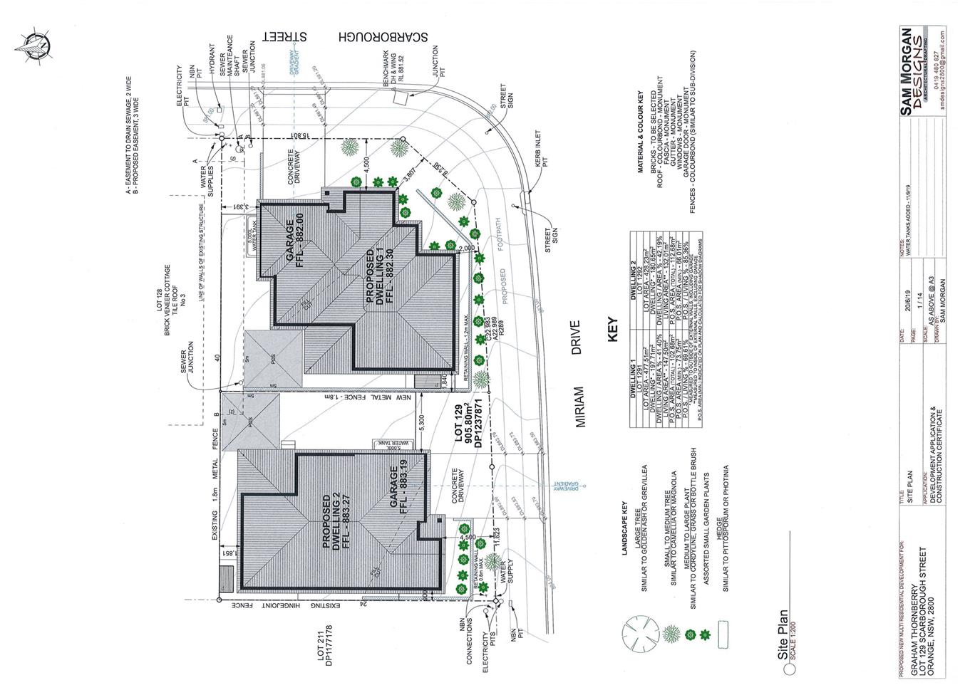
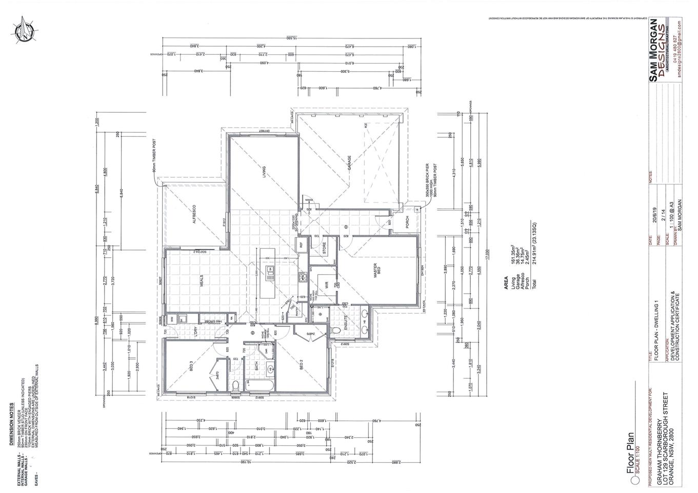
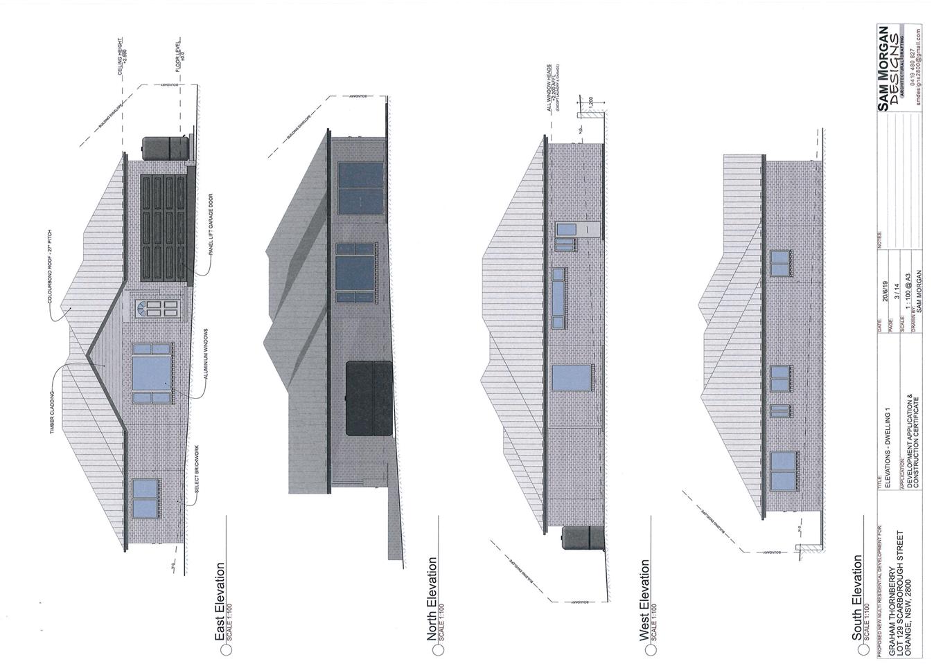
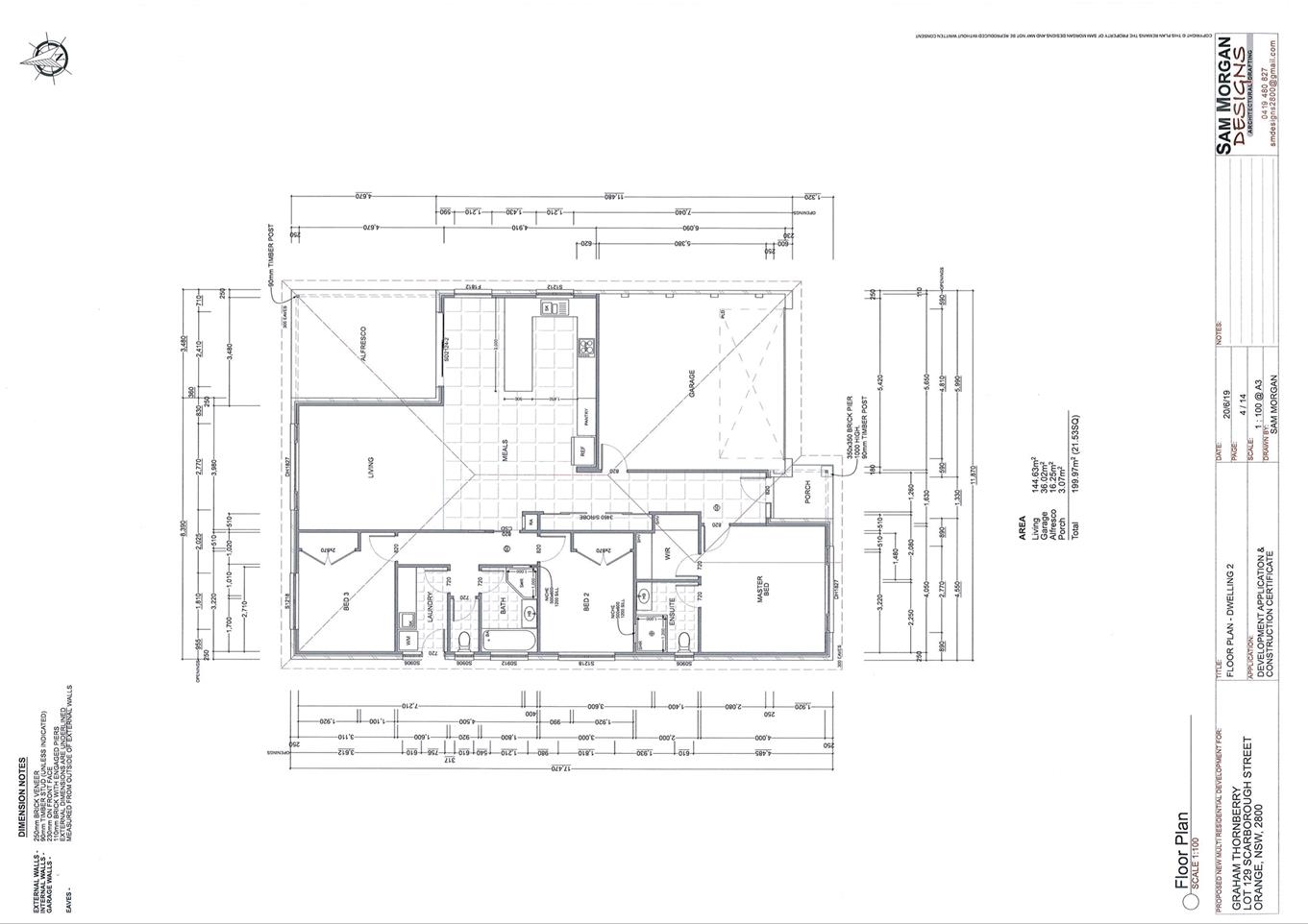
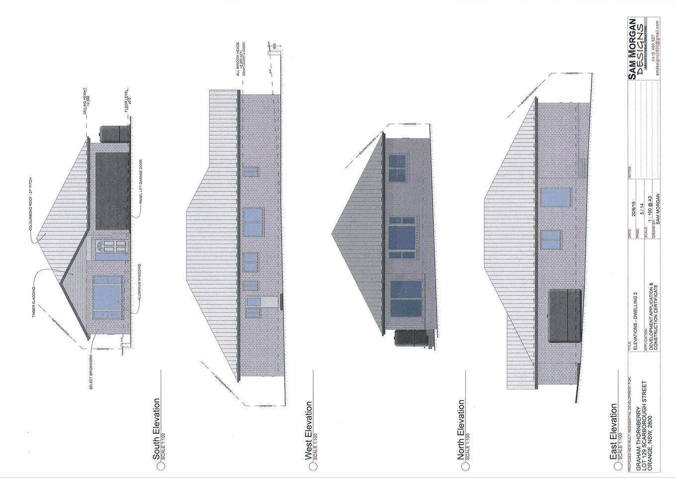
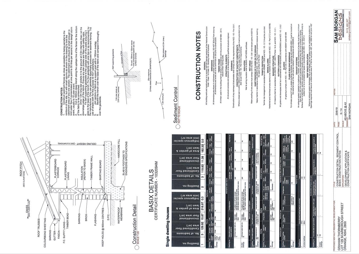
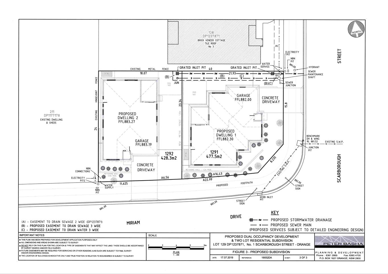
Planning
and Development Committee
7 November 2019
Attachment 2 Notice
of Approval
|

|
ORANGE CITY COUNCIL
Development
Application No DA
258/2019(1)
NA19/ Container
PR27891
|
NOTICE OF DETERMINATION
OF A DEVELOPMENT
APPLICATION
issued under the Environmental
Planning and Assessment Act 1979
Section 4.18
|
Development
Application
|
|
|
Applicant
Name:
|
Mr G Thornberry
|
|
Applicant
Address:
|
C/- Peter Basha
Planning and Development
PO Box 1827
ORANGE
NSW 2800
|
|
Owner’s
Name:
|
Mr GJ Thornberry
|
|
Land
to Be Developed:
|
Lot 129 DP 1237871 -
1 Scarborough Street, Orange
|
|
Proposed
Development:
|
Dual Occupancy and
Subdivision (two lot residential)
|
|
|
|
|
Building Code of
Australia
building
classification:
|
Class to be
determined by the PC
|
|
|
|
|
Determination made
under
Section 4.16
|
|
|
Made
On:
|
7 November 2019
|
|
Determination:
|
CONSENT GRANTED
SUBJECT TO CONDITIONS DESCRIBED BELOW:
|
|
|
|
|
Consent to Operate
From:
|
8 November 2019
|
|
Consent to Lapse On:
|
8 November 2024
|
Terms
of Approval
The reasons for the imposition of conditions
are:
(1) To ensure a quality
urban design for the development which complements the surrounding environment.
(2) To maintain
neighbourhood amenity and character.
(3) To ensure compliance
with relevant statutory requirements.
(4) To provide adequate
public health and safety measures.
(5) Because the development
will require the provision of, or increase the demand for, public amenities and
services.
(6) To ensure the utility
services are available to the site and adequate for the development.
(7) To prevent the proposed
development having a detrimental effect on adjoining land uses.
(8) To minimise the impact
of development on the environment.
Conditions
(1) The development must be
carried out in accordance with:
(a) Plans
numbered: Peter Basha Planning and Development 19052DA Figure 3;
Sam Morgan Designs dated 20.6.2019 Pages 1/14,
2/14, 3/14, 4/14, 5/16, 6/14 (7 sheets)
BASIX Certificate 1032094M
(b) statements
of environmental effects or other similar associated documents that form part
of the approval
as amended in
accordance with any conditions of this consent.
(2) All building work must
be carried out in accordance with the provisions of the Building Code of
Australia.
(3) A sign is to be erected
in a prominent position on any site on which building work, subdivision work or
demolition work is being carried out:
(a) showing
the name, address and telephone number of the principal certifying authority
for the work, and
(b) showing
the name of the principal contractor (if any) for any building work and a
telephone number on which that person may be contacted outside working hours,
and
(c) stating
that unauthorised entry to the site is prohibited.
Any such sign is to be maintained while the
building work, subdivision work or demolition work is being carried out.
(4) In
the case of residential building work for which the Home Building Act 1989
requires there to be a contract of insurance in force in accordance with Part 6
of the Act, evidence that such a contract of insurance is in force is to be
provided to the Principal Certifying Authority before any building work
authorised to be carried out by the consent commences.
(5) Residential
building work within the meaning of the Home Building Act 1989 must not
be carried out unless the principal certifying authority for the development to
which the work relates (not being the council) has given the council written
notice of the following information:
(a) in
the case of work for which a principal contractor is required to be appointed:
(i) the
name and the licence number of the principal contractor, and
(ii) the
name of the insurer by which the work is insured under Part 6 of that Act,
(b) in
the case of work to be done by an owner-builder:
(i) the
name of the owner-builder, and
(ii) if
the owner-builder is required to hold an owner-builder permit under that Act,
the number of the owner-builder permit.
If arrangements for doing the residential
building work are changed while the work is in progress so that the information
under this condition becomes out of date, further work must not be carried out
unless the principal certifying authority for the development to which the work
relates (not being the council) has given the council written notice of the
updated information.
(6) Where any excavation
work on the site extends below the level of the base of the footings of a
building on adjoining land, the person having the benefit of the development
consent must, at the person’s own expense:
(a) protect
and support the adjoining premises from possible damage from the excavation,
and
(b) where
necessary, underpin the adjoining premises to prevent any such damage.
Note: This
condition does not apply if the person having the benefit of the development
consent owns the adjoining land or the owner of the adjoining land has given
consent in writing to this condition not applying.
DUAL
OCCUPANCY
|
PRIOR TO THE ISSUE OF A CONSTRUCTION
CERTIFICATE
|
(7) A detailed landscaping
plan shall be submitted to and approved by Council’s Manager Development
Assessments prior to the issue of a Construction Certificate. The
landscape plan shall identify species suitable to the Orange climate, height
and spread at maturity, and of appropriate foliage and intermediate and taller
height to maximise screening and aesthetic appeal.
(8) The payment of
$10,704.70 is to be made to Council in accordance with section 94 of the Act
and the Orange Development Contributions Plan 2017 (Remainder of LGA) towards
the provision of the following public facilities:
|
Open Space and
Recreation
|
1 additional 3 bed
dwelling @ 3,982.01
|
3,982.01
|
|
Community and
Cultural
|
1 additional 3 bed
dwelling @ 1,154.78
|
1,154.78
|
|
Roads and Traffic
Management
|
1 additional 3 bed dwelling @ 5,256.12
|
5,256.12
|
|
Local Area Facilities
|
-
|
-
|
|
Plan Preparation and
Administration
|
1 additional 3 bed
dwelling @ 311.79
|
311.79
|
|
TOTAL:
|
|
$10,704.70
|
The contribution will be indexed quarterly in
accordance with the Orange Development Contributions Plan 2017 (Remainder of
LGA). This Plan can be inspected at the Orange Civic Centre, Byng Street,
Orange.
(9) An
approval under Section 68 of the Local Government Act is to be sought
from Orange City Council, as the Water and Sewer Authority, for alterations to
water and sewer. No plumbing and drainage is to commence until approval is
granted.
(10) Engineering plans,
showing details of all proposed work and adhering to any engineering conditions
of development consent, are to be submitted to, and approved by, Orange City
Council or an Accredited Certifier (Categories B1, C3, C4, C6) prior to the
issuing of a Construction Certificate.
(11) A water and soil
erosion control plan is to be submitted to Orange City Council or an Accredited
Certifier (Categories B1, C3, C4, C6) for approval prior to the issuing of a
Construction Certificate. The control plan is to be in accordance with the
Orange City Council Development and Subdivision Code and the Landcom, Managing
Urban Stormwater; Soils and Construction Handbook.
(12) Dwelling 2 is to be
provided with interlot stormwater drainage including a grated concrete
stormwater pit. Engineering plans for this drainage system are to be approved
by Orange City Council or an Accredited Certifier (Categories B1, C3, C4, C6)
prior to the issuing of a Construction Certificate.
(13) A
150mm-diameter sewer main is to be constructed from Council’s existing
main to serve dwelling 2. Prior to a Construction Certificate being issued
engineering plans for this sewerage system are to be submitted to and approved
by Orange City Council.
(14) Payment
of contributions for water, sewer and drainage works is required to be made at
the contribution rate applicable at the time that the payment is made.
The contributions are based on 1.0 ETs for water supply headworks and 1.0 ETs
for sewerage headworks. A Certificate of Compliance, from Orange City
Council in accordance with the Water Management Act 2000, will be issued upon
payment of the contributions.
This Certificate of Compliance is to be
submitted to the Principal Certifying Authority prior to the issuing of a
Construction Certificate.
(15) A
Road Opening Permit in accordance with Section 138 of the Roads Act 1993
must be approved by Council prior to a Construction Certificate being issued
or any intrusive works being carried out within the public road or footpath
reserve.
|
PRIOR TO WORKS COMMENCING
|
(16) Where
any existing fencing at the perimeter of the site needs to be removed, or is of
a type which does not ensure the occupants of any adjoining residence adequate
privacy, new fencing 1.8m in height shall be erected prior to any building or
construction work being carried out upon this development.
(17) A
Construction Certificate application is required to be submitted to, and issued
by Council/Accredited Certifier prior to any excavation or building works being
carried out onsite.
(18) A
temporary onsite toilet is to be provided and must remain throughout the
project or until an alternative facility meeting Council’s requirements
is available onsite.
(19) Soil
erosion control measures shall be implemented on the site.
|
DURING CONSTRUCTION/SITEWORKS
|
(20) All
construction/demolition work on the site is to be carried out between the hours
of 7.00 am and 6.00 pm Monday to Friday inclusive, 7.00 am to
5.00 pm Saturdays and 8.00 am to 5.00 pm Sundays and Public
Holidays. Written approval must be obtained from the General Manager of Orange
City Council to vary these hours.
(21) A
Registered Surveyor’s certificate identifying the location of the
building on the site must be submitted to the Principal Certifying Authority.
(22) All materials on site
or being delivered to the site are to be contained within the site. The
requirements of the Protection of the Environment Operations Act 1997
are to be complied with when placing/stockpiling loose material or when
disposing of waste products or during any other activities likely to pollute
drains or watercourses.
(23) Any adjustments to
existing utility services that are made necessary by this development
proceeding are to be at the full cost of the developer.
(24) The provisions and
requirements of the Orange City Council Development and Subdivision Code are to
be applied to this application and all work constructed within the development
is to be in accordance with that Code.
The developer is to be entirely responsible for
the provision of water, sewerage and drainage facilities capable of servicing
the development from Council’s existing infrastructure. The developer is
to be responsible for gaining access over adjoining land for services where
necessary and easements are to be created about all water, sewer and drainage
mains within and outside the lots they serve.
(25) All driveway and
parking areas are to be sealed with bitumen, hot mix or concrete and are to be
designed for all expected loading conditions (provided however that the minimum
pavement depth for gravel and flush seal roadways is 200mm) and be in accordance
with the Orange City Council Development and Subdivision Code.
(26) A heavy-duty concrete
kerb and gutter layback and footpath crossing shall be constructed for each
dwelling. The location and construction of the laybacks and footpath crossings
are to be as required by the Orange City Council Development and Subdivision
Code and Road Opening Permit.
(27) Water and sewerage
reticulation is to be provided to both dwellings in accordance with the Orange
City Council Development and Subdivision Code.
|
PRIOR TO THE ISSUE OF AN OCCUPATION
CERTIFICATE
|
(28) A 1.8m high fence shall
be provided around the perimeter of the development excluding the frontages. A
1.8m high fence shall be provided between each unit. The height of the fence
shall be measured from the highest finished ground level adjacent to each part
of that fence.
(29) Landscaping
shall be installed in accordance with the approved plans prior to the issue of
the Occupation Certificate and shall be permanently maintained.
(30) No
person is to use or occupy the building or alteration that is the subject of
this approval without the prior issuing of an Occupation Certificate.
(31) Where
Orange City Council is not the Principal Certifying Authority, a final
inspection of water connection, sewer and stormwater drainage shall be
undertaken by Orange City Council and a Final Notice of Inspection issued,
prior to the issue of either an interim or a final Occupation Certificate.
(32) Certification from
Orange City Council is required to be submitted to the Principal Certifying
Authority prior to the issue of an Occupation Certificate stating that all
works relating to connection of the development to Council assets, works on
public land, works on public roads, stormwater, sewer and water reticulation
mains and footpaths have been carried out in accordance with the Orange City
Council Development and Subdivision Code and the foregoing conditions, and that
Council will take ownership of the infrastructure assets.
(33) A
Road Opening Permit Certificate of Compliance is to be issued for the works by
Council prior to any Occupation/Final Certificate being issued for the
development.
(34) All
of the foregoing conditions are to be at the full cost of the developer and to
the requirements and standards of the Orange City Council Development and
Subdivision Code, unless specifically stated otherwise. All work required by
the foregoing conditions is to be completed prior to the issuing of an
Occupation or Subdivision Certificate, unless stated otherwise.
TWO LOT SUBDIVISION
|
DURING CONSTRUCTION/SITEWORKS
|
(35) Any adjustments to
existing utility services that are made necessary by this development
proceeding are to be at the full cost of the developer.
|
PRIOR TO THE ISSUE OF A SUBDIVISION CERTIFICATE
|
(36) Prior to the issuing of
the Subdivision Certificate, a Surveyor’s Certificate or written
statement is to be provided to the Principal Certifying Authority, stating that
the buildings within the boundaries of the proposed Lots comply in respect to
the distances of walls from boundaries.
(37) Application
shall be made for a Subdivision Certificate under Section 6.3(1)(d) of the Act.
(38) Application is to be
made to Telstra/NBN for infrastructure to be made available to each individual
lot within the development. Either a Telecommunications Infrastructure
Provisioning Confirmation or Certificate of Practical Completion is to be
submitted to the Principal Certifying Authority confirming that the specified
lots have been declared ready for service prior to the issue of a Subdivision
Certificate.
(39) A Notice of Arrangement
from Essential Energy stating arrangements have been made for the provision of
electricity supply to the development, is to be submitted to the Principal
Certifying Authority prior to the issue of a Subdivision Certificate.
(40) An easement to drain
sewage and to provide Council access for maintenance of sewerage works a
minimum of 2.0 metres wide is to be created over the proposed sewerage works.
The Principal Certifying Authority is to certify that the easement is in
accordance with the Orange City Council Development and Subdivision Code prior
to the issuing of a Subdivision Certificate.
(41) All services are to be
contained within the allotment that they serve. A Statement of Compliance, from
a Registered Surveyor, is to be submitted to the Principal Certifying Authority
prior to the issuing of a Subdivision Certificate.
(42) Where stormwater
crosses land outside the lot it favours, an easement to drain water is to be
created over the works. A Restriction-as-to-User under section 88B of the NSW
Conveyancing Act 1979 is to be created on the title of the burdened Lot
requiring that no structures are to be placed on the site, or landscaping or
site works carried out on the site, in a manner that affects the continued
operation of the interlot drainage system. The minimum width of the easement is
to be as required in the Orange City Council Development and Subdivision Code.
(43) Certification from
Orange City Council is required to be submitted to the Principal Certifying
Authority prior to the issue of a Subdivision Certificate stating that all
works relating to connection of the development to Council assets, works on
public land, works on public roads, stormwater, sewer and water reticulation
mains and footpaths have been carried out in accordance with the Orange City
Council Development and Subdivision Code and the foregoing conditions, and that
Council will take ownership of the infrastructure assets.
(44) All
engineering conditions of this development consent relating to the servicing of
each dwelling are to be completed prior to the issuing of a Subdivision
Certificate.
(45) All
of the foregoing conditions are to be at the full cost of the developer and to the
requirements and standards of the Orange City Council Development and
Subdivision Code, unless specifically stated otherwise. All work required by
the foregoing conditions is to be completed prior to the issuing of an
Occupation or Subdivision Certificate, unless stated otherwise.
Other
Approvals
(1) Local
Government Act 1993 approvals granted under Section 68.
Nil
(2) General
terms of other approvals integrated as part of this consent.
Nil
Right
of Appeal
If you are dissatisfied with this decision,
Section 8.7 of the Environmental Planning and Assessment Act 1979
gives you the right to appeal to the Land and Environment Court. Pursuant to
Section 8.10, an applicant may only appeal within 6 months after the date the
decision is notified.
|
Disability
Discrimination Act 1992:
|
This application has been assessed in
accordance with the Environmental Planning and Assessment Act 1979. No
guarantee is given that the proposal complies with the Disability
Discrimination Act 1992.
The applicant/owner is responsible to ensure
compliance with this and other anti-discrimination legislation.
The Disability Discrimination Act
covers disabilities not catered for in the minimum standards called up in the
Building Code of Australia which references AS1428.1 - "Design for
Access and Mobility". AS1428 Parts 2, 3 and 4 provides the most
comprehensive technical guidance under the Disability Discrimination Act
currently available in Australia.
|
|
|
|
|
Disclaimer
- S88B of the Conveyancing Act 1919 - Restrictions on the Use of Land:
|
The applicant should note that there could be
covenants in favour of persons other than Council restricting what may be
built or done upon the subject land. The applicant is advised to check the
position before commencing any work.
|
|
|
|
|
Signed:
|
On behalf of the consent authority ORANGE
CITY COUNCIL
|
|
Signature:
|
|
|
Name:
|
PAUL JOHNSTON - MANAGER DEVELOPMENT
ASSESSMENTS
|
|
Date:
|
8 November 2019
|
2.7 Development
Application DA 310/2019(1) - 21 Scarborough Street
RECORD
NUMBER: 2019/2319
AUTHOR: Kelly
Walker, Senior Planner
EXECUTIVE Summary
|
Application
lodged
|
13
September 2019
|
|
Applicant/s
|
Hibbards
Pty Ltd
|
|
Owner/s
|
Enterprise
Four Pty Ltd
|
|
Land
description
|
Lot 119
DP 1237871 - 21 Scarborough Street, Orange
|
|
Proposed
land use
|
Dual
Occupancy (attached) and Subdivision (two lot residential)
|
|
Value of
proposed development
|
$385,000
|
Council's consent is sought for
an attached dual occupancy and two lot subdivision at 21 Scarborough
Street, Orange, described as Lot 119 DP 1237871 (see Figure 1).
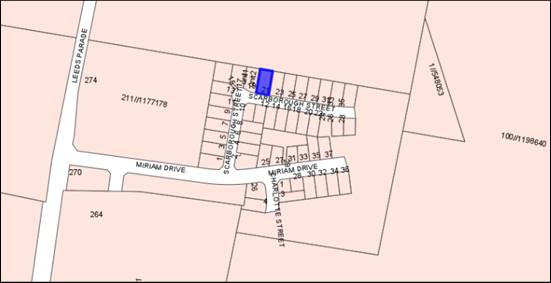
Figure 1 - locality plan
The proposal comprises:
· Stage 1 -
construction of two single storey attached dwellings on the subject land
· Stage 2 -
subdivision of the land to create two residential Torrens lots.
The attached dual occupancy will comprise one three
(3)-bedroom dwelling and one four (4) bedroom, constructed of select face
brick, cement cladding, metal roofing, and panel lift single garage doors.
Proposed Dwelling 2 has a porch and front door fronting Scarborough Street,
while proposed Dwelling 1 has a porch and front door on the side elevation.
Both dwellings compromise an attached single garage, fronting the street.
The proposed subdivision relies on a variation to the Orange
Local Environmental Plan 2011 (LEP) Minimum Lot Size of 500m2
which applies to the subject land. A formal request to vary this development
standard pursuant to Clause 4.6 of Orange LEP is provided.
A Section 4.15 evaluation of the
application has been undertaken. Overall, despite some departures from the
planning guidelines of the DCP, the departures are not considered to be adverse
enough to warrant refusal of the application, particularly having regard to the
fact that the proposal is almost identical to other developments in the vicinity.
As such, approval of the application is recommended.
DECISION FRAMEWORK
Development in Orange is governed by two key documents
Orange Local Environment Plan 2011 (LEP) and Orange Development Control Plan
2004 (DCP). In addition the Infill Guidelines are used to guide development,
particularly in the heritage conservation areas and around heritage items.
Orange Local Environment Plan 2011 – The
provisions of the LEP must be considered by the Council in determining the
application. LEPs govern the types of development that are permissible or
prohibited in different parts of the City and also provide some assessment
criteria in specific circumstances. Uses are either permissible or not. The
objectives of each zoning and indeed the aims of the LEP itself are also to be
considered and can be used to guide decision making around appropriateness of
development.
Orange Development Control Plan 2004 – the DCP
provides guidelines for development. In general it is a performance based
document rather than prescriptive in nature. For each planning element there
are often guidelines used. These guidelines indicate ways of achieving the
planning outcomes. It is thus recognised that there may also be other solutions
of merit. All design solutions are considered on merit by planning and building
staff. Applications should clearly demonstrate how the planning outcomes are
being met where alternative design solutions are proposed. The DCP enables
developers and architects to use design to achieve the planning outcomes in alternative
ways.
DIRECTOR’S COMMENT
This application relates to a dual occupancy. The
design of the building is somewhat basic and the subdivision would result in
result in the allotments being smaller than the minimum lot size.
Notwithstanding this, the building presents to street with the look of a single
dwelling. Apart from the minimum allotment size departure, the
development provides reasonable north facing open space and would not adversely
impact on the adjoining neighbours. Therefore the recommendation of
approval is supported.
Link To Delivery/OPerational Plan
The recommendation in this report relates to the
Delivery/Operational Plan Strategy “10.1 Preserve - Engage with the
community to ensure plans for growth and development are respectful of our
heritage”.
Financial Implications
Nil
Policy and Governance Implications
Nil
|
Recommendation
That Council consents to
development application DA 310/2019(1)
for Dual Occupancy (attached) and Subdivision (two lot residential) at
Lot 119 DP 1237871 - 21 Scarborough Street, Orange pursuant to the conditions of consent in the attached
Notice of Approval.
|
further considerations
Consideration has been given to the recommendation’s
impact on Council’s service delivery; image and reputation; political;
environmental; health and safety; employees; stakeholders and project
management; and no further implications or risks have been identified.
SUPPORTING INFORMATION
The proposal involves development in two stages as follows:
Stage 1 - Proposed Attached Dual Occupancy
It is proposed to construct two (2) single storey attached
dwellings on the subject land. Proposed Dwelling 1 will comprise three (3)
bedrooms, two (2) bathrooms, open plan kitchen/family room, living room,
laundry, alfresco area, and attached single garage. Proposed Dwelling 2 will
comprise four (4) bedrooms, two (2) bathrooms, open plan kitchen/family room,
living room, laundry, alfresco area and attached single garage.
The external finishes of the proposed dwellings will
comprise:
· face brick walls
with cement cladding features
· metal roof
sheeting with skylights
· powder coated
aluminium-framed windows
· panel lift garage
doors.
As shown in the Site Plan (see
Figure 2), proposed Dwelling 2 has a porch and front door fronting Scarborough
Street, while proposed Dwelling 1 has a porch and front door on the side
elevation. It is proposed to landscape the site, and areas for lawn will be
established. A central concrete driveway will be constructed to the
garages, as well as a path to the side porch (Dwelling 1). New 1.8m high
Colorbond fencing will be established between the proposed rear areas of
private open space, as well as retaining walls along part of the northern
boundary.
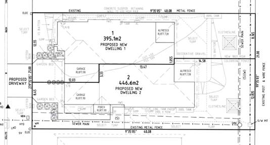
Figure 2 - site plan (from submitted drawings by Peter
Basha Planning and Development)
Stage 2 - Proposed Subdivision
It is proposed to subdivide the
subject land to create two (2) urban residential lots as follows:
|
Proposed
Lot
|
Area
(m2)
|
|
1
|
395.1m2
|
|
2
|
446.6m2
|
|
Total
|
841.7m2
|
Proposed Lot 1 will comprise
proposed Dwelling 2 with vehicular access via Scarborough Street. Proposed
Lot 2 will comprise proposed Dwelling 1, also with vehicular access from
Scarborough Street.
MATTERS FOR CONSIDERATION
Section 1.7 - Application of
Part 7 of the Biodiversity Conservation Act 2016 and Part 7A of the
Fisheries Management Act 1994
Section 1.7 of the EP&A Act identifies that Part 7 of
the Biodiversity Conservation Act 2016 (BC Act) and Part 7A of the
Fisheries Management Act 1994 have effect in connection with terrestrial and aquatic
environments.
There are four triggers known to insert a development into
the Biodiversity Offset Scheme (ie the need for a BDAR to be submitted
with a DA):
· Trigger 1:
development occurs in land mapped on the Biodiversity Values Map (OEH)
(clause 7.1 of BC Regulation 2017);
· Trigger 2:
development involves clearing/disturbance of native vegetation above a certain
area threshold (clauses 7.1 and 7.2 of BC Regulation 2017); or
· Trigger 3:
development is otherwise likely to significantly affect threatened species
(clauses 7.2 and 7.3 of BC Act 2016).
The fourth trigger (development
proposed to occur in an Area of Outstanding Biodiversity Value (clause 7.2 of
BC Act 2016) is generally not applicable to the Orange LGA; as no such areas
are known to occur in the LGA. No further comments will be made against the
fourth trigger.
Trigger 1
The subject site is not mapped on the Biodiversity Values
Map.
Trigger 2
The proposed development does not involve the clearing of
native vegetation in excess of the thresholds for the existing or proposed lot
sizes, as set out in Clause 7.2 of the Biodiversity Conservation Regulation
2017.
Trigger 3
With regard to the third trigger, the test for determining
whether proposed development is otherwise likely to significantly affect
threatened species is listed in the BC Act 2016, under s7.3:
(a) in
the case of a threatened species, whether the proposed development or activity
is likely to have an adverse effect on the life cycle of the species such that
a viable local population of the species is likely to be placed at risk of
extinction,
(b) in
the case of an endangered ecological community or critically endangered
ecological community, whether the proposed development or activity:
(i) is
likely to have an adverse effect on the extent of the ecological community such
that its local occurrence is likely to be placed at risk of extinction, or
(ii) is
likely to substantially and adversely modify the composition of the ecological
community such that its local occurrence is likely to be placed at risk of
extinction,
(c) in
relation to the habitat of a threatened species or ecological community:
(i) the
extent to which habitat is likely to be removed or modified as a result of the
proposed development or activity, and
(ii) whether
an area of habitat is likely to become fragmented or isolated from other areas
of habitat as a result of the proposed development or activity, and
(iii) the
importance of the habitat to be removed, modified, fragmented or isolated to
the long-term survival of the species or ecological community in the locality,
(d) whether
the proposed development or activity is likely to have an adverse effect on any
declared area of outstanding biodiversity value (either directly or
indirectly),
(e) whether
the proposed development or activity is or is part of a key threatening process
or is likely to increase the impact of a key threatening process.
The subject site is a vacant lot which has been previously
cleared to facilitate the subdivision of the area and provide services for
future dwellings.
The subject site is covered in grass
not known to be native, and a site visit carried out did not discover any
likely habitats. Although further subdivision of land is considered to be a key
threatening process, there are no known endangered or threatened species or
ecological communities on the land, nor is it likely to contain any habitat for
such species or communities. It is considered that a Biodiversity Development Assessment Report (BDAR) is not required to be
submitted with this application.
Section 4.15
Section 4.15 of the Environmental
Planning and Assessment Act 1979 requires Council to consider various
matters, of which those pertaining to the application are listed below.
PROVISIONS OF ANY ENVIRONMENTAL
PLANNING INSTRUMENT s4.15(1)(a)(i)
Orange Local Environmental Plan
2011
Part 1 - Preliminary
Clause 1.2 - Aims of Plan
The
broad aims of the LEP are set out under Subclause 2. Those relevant to the
application are as follows:
(a) to
encourage development which complements and enhances the unique character of
Orange as a major regional centre boasting a diverse economy and offering an
attractive regional lifestyle,
(e) to
provide a range of housing choices in planned urban and rural locations to meet
population growth,
The application is considered to be
consistent with the above objectives, as outlined in this report.
Clause 1.6 - Consent Authority
This clause establishes that,
subject to the Act, Council is the consent authority for applications made
under the LEP.
Clause 1.7 - Mapping
The subject site is identified on the LEP maps in the
following manner:
|
Land
Zoning Map:
|
Land
zoned R1 General Residential
|
|
Lot
Size Map:
|
Minimum
Lot Size 500m2
|
|
Heritage
Map:
|
Not
a heritage item or conservation area
|
|
Height
of Buildings Map:
|
No
building height limit
|
|
Floor
Space Ratio Map:
|
No
floor space limit
|
|
Terrestrial
Biodiversity Map:
|
No
biodiversity sensitivity on the site
|
|
Groundwater
Vulnerability Map:
|
Groundwater
vulnerable
|
|
Drinking
Water Catchment Map:
|
Not
within the drinking water catchment
|
|
Watercourse
Map:
|
Not
within or affecting a defined watercourse
|
|
Urban
Release Area Map:
|
Not
within an urban release area
|
|
Obstacle
Limitation Surface Map:
|
No
restriction on building siting or construction
|
|
Additional
Permitted Uses Map:
|
No
additional permitted use applies
|
|
Flood
Planning Map:
|
Not
within a flood planning area
|
Those matters that are of relevance
are addressed in detail in the body of this report.
Clause 1.9A - Suspension of
Covenants, Agreements and Instruments
This clause provides that covenants, agreements and other
instruments which seek to restrict the carrying out of development do not apply
with the following exceptions:
· covenants imposed
or required by Council
· prescribed
instruments under Section 183A of the Crown Lands Act 1989
· any conservation
agreement under the National Parks and Wildlife Act 1974
· any trust
agreement under the Nature Conservation Trust Act 2001
· any property
vegetation plan under the Native Vegetation Act 2003
· any biobanking
agreement under Part 7A of the Threatened Species Conservation Act 1995
· any planning
agreement under Division 6 of Part 4 of the Environmental Planning and
Assessment Act 1979.
An easement to drain sewer burdens the lot along the eastern
boundary, and the proposed building footprint is located clear of the easement.
An 88B instrument exists for the subject property, with a
number of restrictions regarding building materials, fence heights and
materials, and the like. Furthermore, the 88B identifies Lot 119 for dual
occupancy development, and permits further subdivision of this lot. However, it
is acknowledged that Clause 1.9A of the LEP has the power to override the
subject covenant.
Council staff are not aware of the title of the subject
property being affected by any of the other above instruments.
Part 2 - Permitted or Prohibited Development
Clause
2.1 - Land Use Zones
The subject site is located within the R1 General Residential
zone. The proposed development is defined as “dual occupancy
(attached)” and “subdivision of land.”
Pursuant to the LEP Dictionary:
Dual
occupancy (attached) means 2 dwellings on one lot of land that are attached to
each other, but does not include a secondary dwelling.
[Note.
Dwelling means a room or suite of rooms occupied or used or so
constructed or adapted as to be capable of being occupied or used as a separate
domicile.]
Pursuant
to Section 6.2 of the Environmental Planning and Assessment Act 1979:
Subdivision
of land means the division of land into two or more parts that, after the
division, would be obviously adapted for separate occupation, use of
disposition.
Dual occupancy is a permitted land use in the R1 zone.
Subdivision is permitted with consent pursuant to Clause 2.6 (see below).
Clause 2.3 - Zone Objectives and Land Use Table
Clause
2.3 of LEP 2011 references the Land Use
Table and Objectives for each zone in LEP 2011. These objectives for land zoned
R1 General Residential are as follows:
· To provide for
the housing needs of the community.
· To provide for
a variety of housing types and densities.
· To enable other
land uses that provide facilities or services to meet the day to day needs of
residents.
· To ensure
development is ordered in such a way as to maximise public transport patronage
and encourage walking and cycling in close proximity to settlement.
· To ensure that
development along the Southern Link Road has an alternative access.
The proposal is consistent with
the zone objectives as follows:
· The proposal would
have a positive effect on the housing needs of the community by creating
additional residential accommodation.
· The proposal
contributes to the variety of housing types and densities.
· The subject land
is within an establishing residential area that is serviced by public bus
routes and footpath along Leeds Parade.
· The site does not
have frontage or access to the Southern Link Road.
Clause 2.6 - Subdivision -
Consent Requirements
Clause 2.6 is applicable and states:
(1) Land to which this plan applies
may be subdivided, but only with development consent.
Consent is sought for a two lot Torrens subdivision of the
proposed dual occupancy in accordance with this clause.
Part 3 - Exempt and Complying Development
The application is not exempt or complying development.
Part 4 - Principal Development Standards
Clause
4.1 - Minimum Subdivision Lot Size
LEP Clause 4.1 sets out
minimum subdivision lot sizes, which relevantly states:
(1) The objectives of this clause are as follows:
(a) to ensure that new
subdivisions reflect existing lot sizes and patterns in the surrounding
locality,
(b) to ensure that lot sizes
have a practical and efficient layout to meet intended use,
(c) to ensure that lot sizes
do not undermine the land’s capability to support rural development,
(d) to prevent the
fragmentation of rural lands,
(e) to provide for a range
of lot sizes reflecting the ability of services available to the area,
(f) to encourage subdivision
designs that promote a high level of pedestrian and cyclist connectivity and
accommodate public transport vehicles.
(2) This clause applies to a subdivision of any land shown
on the Lot Size Map that requires development consent and that is carried out
after the commencement of this Plan.
(3) The size of any lot resulting from a subdivision of
land to which this clause applies is not to be less than the minimum size shown
on the Lot Size Map in relation to that land.
(4) This clause does not apply in relation to the
subdivision of individual lots in a strata plan or community title scheme.
In
relation to this site, the map nominates a minimum lot size
(‘MLS’) of 500m². The proposed lots
have site areas of 395.1m² and 446.6m². The proposed lots do not satisfy the MLS. The applicant
has requested a variation to this standard, to LEP Clause 4.6 Exceptions to
Development Standards, which is addressed below.
Clause 4.1B - Minimum Lot Sizes for Dual Occupancy, Multi
Dwelling Housing and Residential Flat Buildings
Clause
4.1B applies and states in part:
(2) Development
consent may be granted to development on a lot in a zone shown in Column 2 of
the Table to this clause for a purpose shown in Column 1 of the Table opposite
that zone, if the area of the lot is equal to or greater that the area
specified for that purpose and shown in Column 3 of the Table.
Column 1 Column
2 Column
3
Dual occupancy Zone
R1 800m2
The
proposed dual occupancy is situated on land zoned R1 General Residential. The
subject land comprises a site area of 841.7m2, and thus exceeds
the minimum area of 800m2 required for a dual occupancy. The
proposal is consistent with this clause.
Clause 4.6 - Exceptions to Development Standards
This clause is applicable as the
proposed subdivision is less than the required minimum lot size of 500m2
pursuant to Clause 4.1 of the LEP. The proposed lots have site areas of
395.1m² and 446.64m², representing a variation of 20.98% and 10.68%
respectively.
It is noted that the total area
of the subject property complies with Clause 4.1B addressing the minimum lot
sizes for dual occupancies. The subject land comprises a site area of 841.7m2,
and thus exceeds the minimum area of 800m2 required for a dual
occupancy within the zone.
Clause 4.6 sets out the
following objectives:
(a) provide an appropriate degree of
flexibility in applying certain development standards
(b) achieve better outcomes for and from
development by allowing flexibility in particular circumstances
At its core, a
Clause 4.6 variation may be supported where it can be shown that the objectives
of the standard are unreasonable and/or unnecessary to apply in this particular
case, and where it can be shown that the objectives of both the Plan and the
Clause to be varied are achieved notwithstanding the non-compliance with the
numerical value of the standard.
The Clause 4.6 variation
submitted with the application generally achieves the outcomes and procedures
outlined in the NSW Department of Planning’s guideline; and the
principles established by the Courts. The main basis for justification advanced
in the submission is that the proposed dual occupancy is entirely compatible
with the expected residential land use pattern in this area.
Matters to be addressed in an
application
Variation of a development
standard may be justified where it is consistent with the objectives that the
relevant environmental planning instrument is attempting to achieve.
The application must address:
(i) whether strict compliance with the
standard, in the particular case, would be unreasonable or unnecessary and why,
and
(ii) demonstrate that there are sufficient
environmental planning grounds to justify contravening the development standard
The
applicant has argued that the minimum lot size is unnecessary and
unreasonable in this instance for the reasons below:
· A clear aim of
Clause 4.6 is for flexibility in the application of a planning control where it
can be demonstrated that strict compliance is unreasonable and unnecessary.
This proposal relies on such flexibility to have the development approved at
the lot sizes proposed in the DA.
· The subject
land satisfies the minimum lot size to permit a dual occupancy pursuant to
Clause 4.1B of Orange LEP 2011.
· As indicated in
the Statement of Environmental Effects, the proposed dual occupancy satisfies
the relevant Planning Outcomes for dual occupancy development pursuant to
Orange DCP 2004 – 07 Development in Residential Areas.
· The subdivision
of each dwelling onto a separate lot is a reasonable planning outcome and
expectation for a dual occupancy development that is demonstrated to satisfy
the relevant LEP and DCP provisions.
· Subdivision of
the proposed dual occupancy can actually occur via Clause 4.1(4) of Orange LEP
2011 either as strata subdivision or as community title subdivision because
these forms of subdivision are not subject to a MLS.
· However, the
proposed subdivision layout, comprising regular lots each with direct street
frontage and access is not conducive to strata or community subdivision.
It should be noted that the 88B
instrument applying to the land identifies the site for dual occupancy
development, and subdivision of such. This was identified at the time of the
overarching subdivision of the land.
The applicant
goes on to state that there are sufficient environmental planning grounds
cited to support the variation as follows:
· A variation of
the development standard is justified in this case because it can be
demonstrated that the proposal satisfies the objectives of the R1 General
Residential Zone and the objectives of the MLS.
· The proposed
lots are demonstrated to accommodate each dwelling in a dual occupancy
development that is entirely compliant with the relevant LEP and DCP provisions.
· As mentioned
previously, Clause 4.1(4) of the LEP would actually permit the subdivision
either as a community title or strata subdivision. However, it is considered
that a subdivision of the land as proposed by this application is more appropriate
given that each lot has direct road frontage and does not rely on common or
shared elements that typify community or strata schemes.
· As indicated
throughout the SoEE, the proposed dual occupancy is entirely compatible with
the expected residential land use pattern in this area. A variation of the MLS
to allow each proposed dwelling to be excised on a conventional allotment (as
opposed to a strata or community lot) does not diminish this aspect of the
development.
· The Statement
of Environmental Effects demonstrates that non-compliance with the MLS
development standard does not generate unacceptable impacts in the locality.
The Five Part Test
Written applications to vary
development standards should also address matters set out in the ‘five
part test’ established by the NSW Land and Environment Court. The
five part test embodies the following:
1 the objectives of the standard are achieved
notwithstanding noncompliance with the standard
2 the underlying objective or purpose of the standard is
not relevant to the development and therefore compliance is unnecessary
3 the underlying object or purpose would be defeated or
thwarted if compliance was required and therefore compliance is unreasonable
4 the development standard has been virtually abandoned or
destroyed by the council’s own actions in granting consents departing
from the standard and hence compliance with the standard is unnecessary and
unreasonable
5 the compliance with development standard is unreasonable
or inappropriate due to existing use of land and current environmental
character of the particular parcel of land. That is, the particular parcel of
land should not have been included in the zone.
The applicant states that the proposal, including the
proposed variation to the MLS, would uphold the objectives of the MLS standard
for the following reasons:
The proposal, including the
proposed variation to the MLS would uphold the objectives of the development
standard due to the following.
(a) To ensure
that new subdivisions reflect existing lot sizes and patterns in the
surrounding locality
The
proposed lots may not necessarily reflect the majority of existing lot sizes in
this precinct. However, once the dual occupancy is completed, the two dwellings
will become part of the development pattern. The creation of proposed Lots 1
and 2 to excise each of these dwellings would indeed reflect this element of
the development pattern.
(b) To
ensure that lot sizes have a practical and efficient layout to meet intended
use
The
proposed variation of the MLS remains consistent with this objective. Each lot
is intended to excise the proposed dwellings in a dual occupancy development,
both of which are demonstrated to satisfy the relevant LEP and DCP provisions.
The proposed lots logically recognise each proposed dwelling and its associated
private open space, access, and servicing requirements.
(c) To
ensure that lot sizes do not undermine the land’s capability to support
rural development
This objective is not
relevant as the subject land is not within a rural zone.
(d) To
prevent the fragmentation of rural lands,
This objective is not
relevant as the subject land is not within a rural zone.
(e) To
provide for a range of lot sizes reflecting the ability of services available
to the area
The proposed subdivision is
consistent with this objective as the servicing arrangements for each of the
proposed lots are readily available
(f) To
encourage subdivision designs that promote a high level of pedestrian and
cyclist connectivity and accommodate public transport vehicles
There
are no aspects of the proposed MLS variation that would be adverse to this
objective.
The applicant makes the
following additional comments in regards to the five part test and the
requirements of Clause 4.6:
· Strict
compliance with the 500m2 MLS would not necessarily defeat or thwart
the underlying objective or purpose of the development standard. However, the
proposal is considered to be consistent with the objectives of the development
standard.
· The development
standard cannot be said to be abandoned. However, the Leeds Parade Conceptual
Subdivision Layout appears to depict several lots that are less than 500m2.
Further the development standard becomes irrelevant if the subdivision was to
be undertaken as strata or community title.
· The zoning of
the land is reasonable and appropriate for the site.
· The proposal
including the proposed variation of the MLS remains consistent with the
objectives of the R1 General Residential Zone.
· The
contravention of the development standard does not raise an issue of State or
regional planning significance as it relates to local and contextual
conditions.
· Public benefit
would not suffer as a result of the variation to the development standard. The
public would benefit from an increase in the choice of residential
accommodation.
· The creation of
proposed Lots 1 and 2 would not compromise the broader aims and principles of
Orange LEP 2011; or the relevant Planning Outcomes of Orange DCP 2004 –
07 Development in Residential Areas.
Concurrence
The Planning Circular sets out
the circumstances and criteria for applying Council’s assumed concurrence
to the determination of development standards under Clause 4.6. The
Secretary’s concurrence does not extend to a delegate of the Council if
the development contravenes a numerical standard by greater than 10%, and the
variation must be considered by Council, and subject to a “greater level
of public scrutiny” than decisions made by Council staff under
delegation. In this instance the variation sought is 10.68% and 20.98%
respectively and therefore must be determined by Council.
Summary
The LEP MLS requirement is an
assessment tool aimed at achieving good design outcomes, making efficient use
of land, and ensuring that neighbourhood character and amenity is not
compromised. The subject land allows for dual occupancies pursuant to the LEP,
and the fact that the proposal seeks to excise the dwellings via subdivision
would be largely indiscernible in terms of impact and public perception of the
development. Staff generally concur with the applicant, in that if the
development strictly complies with the development standard (i.e. remains a
dual occupancy on one lot), it is unlikely to result in better planning
outcomes. Furthermore, the MLS does not apply to Community or Strata
subdivisions, and as such, subdivision could occur in a different arrangement
than the proposed Torrens title, however the site layout does not lend itself
to these other types of subdivision.
Council may grant consent only
if the concurrence of the Director General of the Department of Planning has
been obtained (i.e. is assumed, as discussed above) and Council is satisfied
that:
· the
written request has adequately addressed the above, and
· the
proposed development will be in the public interest because of:
- consistency
with the objectives of the particular standard, and
- consistency
with the objectives of the zone applying to the site.
It is considered that the
written request adequately addresses the variation criteria of the clause, the
Department of Planning guidelines, and the principles and test established by
the Courts. In particular the proposed development is not contrary to any of
the objectives for the zone or the MLS Clause; and can achieve all of the
relevant DCP planning outcomes (addressed later in this report).
Overall, it is
considered that the proposed variation is unlikely to
result in any significant adverse impact on the operation of the LEP or the
DCP, and that the proposed development is generally consistent with all
relevant objectives and would not result in any significant adverse impacts on
the neighbourhood, land or environment.
Part 5 - Miscellaneous Provisions
Not relevant to the subject land or application.
Part 6 - Urban Release Area
The subject land is contained
within an Urban Release Area on the Urban Release Area Map. The
provisions in Part 6 of the LEP generally relate to servicing of the land in
conjunction with subdivision. The development site was a lot created pursuant
to DA 431/2012 (amended) for proposed ‘88 lot residential
subdivision’, approved 26 March 2013. The subdivision is
reflective of the Leeds Parade DCP/Masterplan for the parent parcel and
adjoining lands. Part 6 has no effect for the proposed dual occupancy on a
child parcel in the original subdivision.
Part 7 - Additional Local Provisions
7.1
- Earthworks
This
clause establishes a range of matters that must be considered prior to granting
development consent for any application involving earthworks, such as:
(a) the likely disruption of, or any
detrimental effect on, existing drainage patterns and soil stability in the
locality of the development
(b) the effect of the development on the
likely future use or redevelopment of the land
(c) the quality of the fill or the soil to be
excavated, or both
(d) the effect of the development on the
existing and likely amenity of adjoining properties
(e) the source of any fill material and the
destination of any excavated material
(f) the likelihood of disturbing relics
(g) the proximity to and potential for adverse
impacts on any waterway, drinking water catchment or environmentally sensitive
area
(h) any measures proposed to minimise or
mitigate the impacts referred to in paragraph (g).
In consideration of this clause,
the proposal is acceptable. Minor earthworks will be required to create level
building pads for the proposed dwellings, driveways, and associated outdoor
spaces. The earthworks will be supported onsite and the change in ground level
is not substantial.
Disruption to drainage is
considered to be minor and will not detrimentally affect adjoining properties
or receiving waterways. The site is not known to be contaminated, nor is the
site known to contain any Aboriginal, European or archaeological relics. The
site is not in proximity to any waterway, drinking water catchment or sensitive
area. Conditions are recommended that require sediment control measures to be
implemented onsite prior to works commencing to ensure that loose dirt and
sediment does not escape the site boundaries.
7.3 - Stormwater Management
This clause
applies to all industrial, commercial and residential zones and requires that
Council be satisfied that the proposal:
(a) is designed to maximise the use of water
permeable surfaces on the land having regard to the soil characteristics
affecting onsite infiltration of water
(b) includes, where practical, onsite
stormwater retention for use as an alternative supply to mains water,
groundwater or river water; and
(c) avoids any significant impacts of stormwater
runoff on adjoining downstream properties, native bushland and receiving
waters, or if that impact cannot be reasonably avoided, minimises and mitigates
the impact.
The proposed development will be
connected to the existing stormwater mains in accordance with Council’s
standard requirements. Conditions are recommended in relation to stormwater
management to satisfy the requirements of Clause 7.3.
7.6
- Groundwater Vulnerability
This clause seeks to protect hydrological functions of
groundwater systems and protect resources from both depletion and
contamination. Orange has a high water table and large areas of the LGA,
including the subject site, are identified with “Groundwater
Vulnerability” on the Groundwater Vulnerability Map. This requires that
Council consider:
(a) whether or not the development (including
any onsite storage or disposal of solid or liquid waste and chemicals) is
likely to cause any groundwater contamination or have any adverse effect on
groundwater dependent ecosystems, and
(b) the cumulative impact (including the
impact on nearby groundwater extraction for potable water supply or stock water
supply) of the development and any other existing development on groundwater.
Furthermore, consent may not be granted unless Council is satisfied that:
(a) the development is designed, sited and
will be managed to avoid any significant adverse environmental impact, or
(b) if that impact cannot be reasonably
avoided - the development is designed, sited and will be managed to minimise
that impact,
(c) if that impact cannot be minimised - the
development will be managed to mitigate that impact.
In
consideration of Clause 7.6, the proposal is acceptable. The proposed
development does not involve processes or activities that would impact on
groundwater resources. The subject land is serviced by reticulated sewer.
Clause 7.11 - Essential Services
Clause 7.11 applies and states:
Development
consent must not be granted to development unless the consent authority is
satisfied that any of the following services that are essential for the
proposed development are available or that adequate arrangements have been made
to make them available when required:
(a) the
supply of water,
(b) the
supply of electricity,
(c) the
disposal and management of sewage,
(d) storm
water drainage or onsite conservation,
(e) suitable
road access.
In consideration of this clause, all utility services are
available to the land and adequate for the proposal.
STATE ENVIRONMENTAL PLANNING
POLICIES
State Environmental Planning Policy 55 - Remediation of
Land
State Environmental Planning Policy 55 - Remediation of
Land (SEPP 55) is applicable. Pursuant to Clause 7 Contamination and
remediation to be considered in determining development application:
(1) A consent authority must not consent to
the carrying out of any development on land unless:
(a) it
has considered whether the land is contaminated, and
(b) if
the land is contaminated, it is satisfied that the land is suitable in its
contaminated state (or will be suitable, after remediation) for the purpose for
which the development is proposed to be carried out, and
(c) if
the land requires remediation to be made suitable for the purpose for which the
development is proposed to be carried out, it is satisfied that the land will
be remediated before the land is used for that purpose.
In terms of potential soil contamination, a contamination
assessment was undertaken as part of the subdivision requirements that applied
in relation to the creation of the subject land (DA 431/2012 amended). Since
its creation as a residential allotment, the subject land has remained vacant.
On this basis, Council will not require further assessment in regard to
potential site contamination.
PROVISIONS OF ANY DRAFT
ENVIRONMENTAL PLANNING INSTRUMENT THAT HAS BEEN PLACED ON EXHIBITION
4.15(1)(a)(ii)
From 31 January to13 April 2018 the Department of Planning
and Environment publically exhibited an Explanation of Intended Effect (EIE)
and Draft Planning Guidelines for the proposed Remediation of Land SEPP, which
will repeal and replace State Environmental Planning Policy 55 –
Remediation of Land (SEPP 55). Of particular note, the Draft Planning
Guidelines state:
“In undertaking an
initial evaluation, a planning authority should consider whether there is any
known or potential contamination on nearby or neighbouring properties, or in
nearby groundwater, and whether that contamination needs to be considered in
the assessment and decision making process.”
“If the planning
authority knows that contamination of nearby land is present but has not yet
been investigated, it may require further information from the applicant to
demonstrate that the contamination on nearby land will not adversely affect the
subject land having regard to the proposed use.” (Proposed
Remediation of Lands SEPP - Draft Planning Guidelines, Page 10).
The land to the north of the subject
site has been flagged as being previously used for a potentially contaminating
activity (former agricultural land). A planning proposal sought to rezone the
subject and surrounding land, comprising a number of different zones, including
business, business park, tourist, residential, and recreational. It is
considered that the previous contamination reporting carried out for the
initial subdivision of the subject land (DA 431/2012 amended) is sufficient to
determine if that it is suitable for its intended residential use.
DESIGNATED DEVELOPMENT
The proposed development is not designated development.
INTEGRATED DEVELOPMENT
The proposed development is not integrated development.
PROVISIONS OF ANY DEVELOPMENT
CONTROL PLAN s4.15(1)(a)(iii)
Development Control Plan 2004
Development Control Plan 2004 (“the DCP”)
applies to the subject land. An assessment of the proposed development against
the relevant Planning Outcomes will be undertaken below.
DCP 2004-7.1 Urban Residential Subdivision
The DCP sets the following applicable Planning Outcomes for
Urban Residential Subdivision:
· Lots are
orientated to optimise energy-efficiency principles.
· Lots below
500m² indicate a mandatory side setback to provide for solar access and
privacy.
· Lots are fully
serviced and have direct frontage and access to a public road.
· Design and
construction complies with the Orange Development and Subdivision Code.
This proposal satisfies the above Planning Outcomes due to
the following:
· Proposed Lots 1
and 2 depict the boundary setbacks and the proposed dwelling in each lot. As
demonstrated in this report, the proposed lots will be of sufficient area to
provide a satisfactory standard of residential amenity to the proposed
dwellings in respect of solar access, energy efficiency, and privacy.
· The proposed
development will be connected to Council’s sewer, town water and
stormwater reticulations in accordance with normal requirements. Power, telephone
and natural gas services are available to the development in accordance with
the requirements of the relevant supply authority.
· The subdivision
design and construction can comply with the Orange Development and
Subdivision Code, and conditions of consent are recommended to this effect.
DCP 2004-7.7 Design Elements
for Residential Development
The DCP sets the following relevant Planning Outcomes at
Part 7.7:
Neighbourhood Character
Site layout and building design enables the:
· creation of
attractive residential environments with clear character and identity
· use of site
features such as views, aspect, existing vegetation and landmarks
· buildings are
designed to complement the relevant features and built form that are identified
as part of the desired neighbourhood character
· the
streetscape is designed to encourage pedestrian access and use.
The site layout and building design is intended to create an
attractive residential environment. The neighbourhood character in this release
area is expected to comprise mostly contemporary, detached, single storey
dwellings with attached garages and landscaped front yards. Although the
proposal seeks an attached dual occupancy rather than detached dwellings, the
proposed development displays similar attributes and will be consistent with
the expected character of the neighbourhood. The proposed development is not
influenced or constrained by important views, vegetation or landmarks. The
development has been designed to provide internal living areas and private open
space areas to the north with adequate solar access.
The proposed dwellings adopt a
building form and finish that is considered typical of residential development
in the City’s newer northern residential areas. In particular, the
proposed dwellings comprise the following elements to remain consistent with
the expected development form as follows:
- attached
configuration designed to look like one large dwelling
- hipped
roof lines
- face
brick external walls with cement cladding on front and side facades
- front
door of proposed Dwelling 2 facing the street, and porch to proposed
Dwelling 1 facing the street
- both
garage doors facing the street
- bulk
and sale commensurate with other dwellings
- landscaped
front yards
- double
width driveway separated into two by way of landscaping.
Notwithstanding the comments above, it is considered that
the proposed landscaping, comprising three small landscape beds, will not
adequately soften the building and driveway areas into the streetscape. The
design and appearance of the dwellings (discussed in greater detail below) are
not adequate in their own right to ensure an attractive streetscape. It is
expected that at least one tree is planted in the front garden area for each of
the dwellings, and greater detail is provided in terms of species, pot sizes,
etc. to ensure sufficient neighbourhood character and an attractive residential
streetscape is achieved. A condition of consent is recommended that a revised
landscaping scheme is provided to Council for further assessment prior to the
construction stage of the development.
Notwithstanding the modest increase
in traffic movements (due to one additional dwelling), the proposal will not
adversely impact on pedestrian access associated with the streetscape, as pedestrian
movements are expected to be modest in this neighbourhood, reverse egress
arrangements for the proposed dwellings will be consistent with those for
single dwellings in this neighbourhood and throughout the City generally, and
adequate driver and pedestrian sight lines will be achieved so that vehicles
entering and exiting the site are visible to pedestrians and vice versa.
Overall, subject to improved landscaping, the proposal is
capable of achieving the neighbourhood character planning outcomes.
Building Appearance
The DCP sets the following Planning Outcomes in regard to
Building Appearance:
· The building
design, detailing and finishes relate to the desired neighbourhood character,
complement the residential scale of the area, and add visual interest to the
street.
· The frontages
of buildings and their entries face the street.
· Garages
and car parks are sited and designed so that they do not dominate the street
frontage.
As discussed above, the scale and
siting of the proposed attached dwellings are generally consistent with the
desired neighbourhood character. It appears that the design has attempted to
make the proposed development look like a single dwelling to be consistent with
the surrounding land, however, poor choice of detailing, materials,
fenestrations, landscaping, and garage door positioning results in a building
appearance that is below average. Rather than require redesign of the dwellings
to make for a more attractive site and streetscape, improved landscaping could
be used to soften the dwellings into the setting, particularly the wide
driveway and spaced garage doors, which are both fairly dominant in their
current form.
Only proposed Dwelling 2 will
directly address the street with a contemporary façade comprising a living
room window, front entry door, and porch. Proposed Dwelling 1 only has its
garage directly facing the street, where the front door and living room window
are to the side elevation (east). In an attempt to address this planning
outcome, a porch has been located over the side door to demonstrate where the
entry is when looking from the frontage, as well as house numbering on the
front elevation of the building. Whilst this arrangement is less than desirable
it is considered reasonable in this case given the circumstances and
constraints of the site. Both garages are set back a minimum of 5.5m from the
street boundary as encouraged by the DCP.
Overall, subject to improved landscaping, the building
appearance of the proposed development could be accepted in this form.
Setbacks
The DCP sets the following Planning Outcomes in regard to
Setbacks:
· Street setbacks
contribute to the desired neighbourhood character, assist with the integration
of new development and make efficient use of the site.
· Street
setbacks create an appropriate scale for the street considering all other
streetscape components.
As required by the DCP, the front
boundary setback for each of the proposed dwellings will be a minimum of 4.5m,
and garages a minimum of 5.5m. It is noted that the front porch of proposed
Dwelling 2 is set forward of this setback requirement, being only 3.9m from the
front boundary. There appears no impediment to require the setback to be 4.5m
in this case as the proposed open space area of each unit will maintain sufficient
dimension to comply with the DCP. It is recommended that Council attaches a
condition of consent requiring the building to have a minimum setback of 4.5m.
Front Fences and Walls
The DCP sets the following Planning Outcomes in regard to
Fences and Walls:
· Front fences
and walls:
- assist in highlighting entrances and creating a
sense of identity within the streetscape
- are constructed of materials compatible with
associated housing and with fences visible from the site that positively
contribute to the streetscape
- provide for facilities in the street frontage area
such as mail boxes.
No front fences or walls are
proposed. The frontage of the site will be limited to landscaping, driveways,
paths, and mail boxes, which is acceptable, subject to improved landscaping.
Visual Bulk
The DCP sets the following Planning Outcome in regard to
Visual Bulk:
· Built form
accords with the desired neighbourhood character of the area with:
- side and rear setbacks progressively increased to
reduce bulk and overshadowing
- site coverage that retains the relatively low
density landscaped character of residential areas
- building form and siting that relates to landform,
with minimal land shaping (cut and fill).
In consideration of the DCP
Guidelines, the proposal is considered to be satisfactory due to the following:
· The proposed
dwellings are well set back from the site boundaries to ensure that they will
be contained within the visual bulk envelope (VBE) generated by planes
projected at 45° over the site,
commencing 2.5m above existing ground level from each side and rear boundary.
· Whilst proposed
Dwelling 2 is closer to the western boundary, it will be sited in cut (at a
lower ground level) and will therefore be contained within the VBE which
applies to that boundary.
· The proposed dual
occupancy will comprise a total building area of 344.06m2. Based on
the site area of 841.7m2 the development will have a site coverage
of just under 41% to comply with the maximum of 50% prescribed in the DCP.
· The slope of the
land will require minor earthworks and modest retaining structures along the
boundary and part of the western boundary.
· The proposed
finished floor levels of proposed Dwellings 1 and 2 relate reasonably to
existing ground levels and are not expected to generate adverse impacts in
respect of visual bulk, solar access, or privacy.
Walls and Boundaries
The DCP sets the following Planning Outcome in regard to
Walls and Boundaries:
· Building to the
boundary is undertaken to provide for efficient use of the site taking into
account:
- the privacy of neighbouring dwellings
and private open space
- the access to daylight reaching
adjoining properties
- the impact of boundary walls on
neighbours.
Building to the boundary is
considered unnecessary in this case. As explained later in this report, the
proposed dwellings would not unreasonably reduce the amount of daylight that
reaches adjoining properties or unreasonably impact upon their privacy.
Daylight and Sunlight
The DCP sets the following Planning Outcome in regard to
Daylight and Sunlight:
· Buildings are
sited and designed to ensure:
- daylight to habitable rooms in adjacent dwellings
is not significantly reduced
- overshadowing of neighbouring secluded open spaces
or main living area windows is not significantly increased
- consideration of Council’s Energy Efficiency
Code.
Overshadowing of Dwellings
According to the DCP Guidelines
and Council’s Energy Efficiency Code, sunlight to at least 75% of
north-facing living area windows within the development and on adjoining land
is to be provided for a minimum of 4 hours on 21 June; or not further reduced
than existing where already less.
The applicant’s submitted
Statement and shadow diagrams indicate that:
· the north facing
living area windows for proposed Dwelling 2 will achieve the required amount of
direct sunlight on the winter solstice
· as the north
facing living room window for proposed Dwelling 1 is under the covered alfresco
roof, this window will not achieve the required amount of direct sunlight on
the winter solstice, and the applicant requests that this arrangement be
accepted for the following reasons:
- A 1200mm x 800mm skylight is proposed
above the internal living area. The DCP does not make a distinction between
windows in a wall and windows in a roof. In this case the skylight (roof
window) will deliver direct sunlight to the internal living area and thus meet
the general intent of the DCP Planning Outcomes pertaining to Daylight and
Sunlight.
- In any event, the proposed alfresco
should not be discounted as a living area. In effect, it represents an
extension of the internal living area to provide residents with improved
residential amenity. To remove the alfresco simply to meet the numeric
requirements of the DCP would diminish the amenity of the dwelling in other
respects. The alfresco provides an outdoor living opportunity that will enhance
residential amenity by providing shade in summer, shelter in winter, and
weather protection in general.
· As the subject
land is orientated north-south, most shadow impacts on the adjoining properties
to the east and west are attributed mostly to boundary fencing, and are
unlikely to impact adversely on northern windows given bulk, siting, and rear
setbacks are similar to neighbouring dwellings.
It is considered that the applicant’s arguments for
proposed Dwelling 1 are acceptable, in that solar access would be reasonable
via the proposed skylight. Furthermore, sufficient outlook can still be
achieved through doors to the alfresco. Overall, the development can meet the
DCP requirements in regard to maintaining reasonable solar access to dwellings.
Overshadowing of Private Open
Space
According to the DCP Guidelines
and Council’s Energy Smart Homes Code, sunlight is to be available to at
least 40% of required open space for dwellings within the development and on
neighbouring properties for at least 3 hours between 9am and 3pm.
The proposed development
satisfies this aspect of the DCP as follows:
· Overshadowing of
private open space within the development itself is compliant with the DCP. As
indicated in the site calculation table:
- Dwelling 1 has a floor area of 134.39m2
(excluding garage, porch and alfresco) and thus requires a private open space
area of 67.2m2. 40% of the required open space area is 26.9m2.
The shadow diagrams indicate that the area of direct sunlight will range from
55.6m2 to 96.66m2 between 9.00am and 3.00pm on 21 June.
- Dwelling 2 has a floor area of 136.03m2
(excluding garage, porch and alfresco) and thus requires a private open space
area of 68.02m2. 40% of the required open space area is 27.21m2.
The shadow diagrams indicate that the area of direct sunlight will range from
44.5m2 to 89.8m2 between 9.00am and 3.00pm on 21 June.
· The shadow
diagrams indicate that shadow impact on the adjoining properties to the east
and west are attributed mostly to boundary fencing, where the impact on the
property to the west occurs in the morning period with no impact from midday,
and the impact on the property to the east occurs in the afternoon period, with
impacts after midday. As such, the development would meet the DCP requirements
in regard to maintaining solar access for at least 3 hours to the private open
space on adjoining land.
As discussed earlier, it is recommended that the setbacks
for the development be slightly increased to comply and hence will impact upon
the amount of open space in sunlight Overall, the development would still meet
the DCP requirements in regard to maintaining reasonable solar access to the
private open space areas.
Energy
Performance Statement
BASIX and NatHERS certificates
have been prepared and submitted with the applicant. The dual occupancy will
comply with the relevant provisions in respect of water, thermal, comfort and
energy. Thus the proposed development is considered satisfactory in terms of Council’s
Energy Efficiency Code due to the following:
· energy efficient
influences in the design include northerly orientation of living areas; slab on
ground; and only necessary glazing along the southern and western sides of the
dwellings
· the appropriate
star rated water saving devices will be installed
· the hot water
system for each dwelling will be of a type that achieves the star rating
recommended in the BASIX certificate for each dwelling.
Views
The DCP sets the following Planning Outcomes in regard to
Views:
· Building form
and design allow for residents from adjacent properties to share prominent
views where possible.
· Views,
including vistas of heritage items or landmarks, are not substantially affected
by the bulk and scale of the new development.
Being single storey and with finished floor levels
reasonably commensurate with existing ground level, the proposed dwellings
would not unreasonably diminish views, vistas or outlook for other properties
in the vicinity.
Visual Privacy
The DCP sets the following Planning Outcome in regard to
Visual Privacy:
· Direct
overlooking of principal living areas and private open spaces of other
dwellings is minimised firstly by:
- building siting and layout
- location of windows and balconies
and secondly
by:
- design of windows or use of screening devices and
landscaping.
In consideration of the DCP
Guidelines, it is considered that the applicant has suitably demonstrated that
the proposal is satisfactory based on the following:
Privacy within the
development
· The principal
living room windows for proposed Dwellings 1 and 2 will overlook their
respective private open space area and will not directly oppose each other.
Furthermore, given the attached arrangement of the proposed dwellings, there
will be minimal active interface between them.
· The proposed site
levels will assist to maintain privacy. Generally, the finished floor levels of
the dwellings are reasonably commensurate with the existing ground level and
well below the DCP Guideline of 1.5m above natural ground level at which point
additional privacy measures should be implemented.
· The front door and
garage for each dwelling are orientated so as to ensure that occupants achieve
reasonable privacy when entering or exiting their residence.
· The proposed 1.8m
high Colorbond fence will prevent overlooking of each of areas of private open
space between the proposed common boundary.
Privacy in relation to
neighbours
· Privacy in
relation to the property to the west will be achieved as follows:
- the existing Colorbond 1.8m fence along
the western boundary will break direct line-of-sight between the two properties
- proposed Dwelling 2 will be set at a
lower finished ground level than the finished ground level of the adjoining
property to the west
- the primary living areas for proposed
Dwelling 2 are orientated to the north and south, and away from the property to
the west.
· Privacy in
relation to the property to the east will be achieved as follows:
- the existing 1.8m Colorbond fence along
the eastern boundary will break direct line-of-sight between the two properties
- proposed Dwelling 1 has a setback of 3m
to the eastern boundary providing greater separation between dwellings
- the alfresco area and glass sliding door
for the living area of proposed Dwelling 1 faces north, orientated away
from the neighbouring dwelling to the east and its respective private open
space.
Acoustic Privacy
The DCP sets the following Planning Outcome in regard to
Acoustic Privacy:
· Site layout and
building design:
- protect habitable rooms from excessively high
levels of external noise
- minimise the entry of external noise to private
open space for dwellings close to major noise sources
- minimise transmission of sound through a building
to affect other dwellings.
In consideration of the DCP
Guidelines, the proposal is considered to be satisfactory given that the site is
in an area where ambient noise levels are expected to be low due to the
predominant residential land use pattern. The proposed dwellings are attached,
however will be constructed to meet the requirements of the BCA, thus limiting
the potential for sound penetration between them.
Security
The DCP sets the following Planning Outcomes in regard to
Security:
· the site layout
enhances personal safety and minimises the potential for crime, vandalism and
fear
· the design of
dwellings enables residents to survey streets, communal areas and approaches to
dwelling entrances.
In consideration
of the DCP Guidelines, the applicants submit that the proposal is satisfactory
due to the following:
· the proposed
building design will offer reasonable opportunities for surveillance, the
dwellings have been designed to encourage effective passive surveillance from
the dwellings to public areas
· the site has
reasonable access control, the lock-up garages with internal access will
enhance security, and the private open space areas will be fenced to provide a
physical barrier from public areas
· the proposed
landscaping limits the opportunity for potential offenders to conceal
themselves.
Council staff concur with these comments, and it is
considered that the planning outcomes for security have been adequately
addressed.
Public
Transport
The DCP sets the following Planning Outcomes in regard to
Public Transport:
· Residential
unit development is accessible to public transport.
The proposal is considered to be satisfactory in this
regard. The subject land is located within an establishing urban residential
area that is to be serviced by public bus routes.
Circulation and Design
The DCP sets the following Planning Outcome in regard to
Circulation and Design:
· Accessways and
parking areas are designed to manage stormwater.
· Accessways,
driveways and open parking areas are suitably landscaped to enhance amenity
while providing security and accessibility to residents and visitors.
The proposal is considered to be satisfactory in this
regard, due to the following:
· a reverse exit
will be required for each dwelling as is the case for the majority of new
estate residential development throughout this City
· the driveways will
be located a sufficient distance from the intersection to avoid vehicle
conflicts
· Council’s
Development Engineers recommend conditions of consent in regards to stormwater
and driveway design.
Car Parking
The DCP sets the following Planning Outcomes in regard to
Car Parking:
· Parking
facilities are provided, designed and located to:
- enable the efficient and convenient use of car
spaces and access ways within the site
- reduce the visual dominance of car parking areas
and access ways.
· Car parking is
provided with regard to the:
- the number and size of proposed dwellings
- requirements of people with limited mobility or
disabilities.
According to the
car parking table in the DCP, 3.4 (4) spaces will be required for the dual
occupancy, based on 1.5 spaces per 3+ bedroom dwelling and 0.2 visitor spaces
per unit.
As indicated in the site plan,
four (4) off-street car spaces will be provided for the development, comprising
a single garage and one (1) tandem space for each proposed dwelling. As such,
the proposal meets the DCP requirements in regards to car parking.
Private Open Space
The DCP sets the following Planning Outcomes in regard to
Private Open Space:
· Private open
space is clearly defined for private use.
· Private open
space areas are of a size, shape and slope to suit the reasonable requirements
of residents including some outdoor recreational needs and service functions.
· Private open
space is:
- capable of being an extension of the dwelling for
outdoor living, entertainment and recreation
- accessible from a living area of the dwelling
- located to take advantage of outlooks; and to
reduce adverse impacts of overshadowing or privacy from adjoining buildings
- orientated to optimise year round use.
The following table demonstrates
that each of the proposed dwellings is provided with open space that complies
with the minimum requirement in terms of area (i.e. at least 50% of the gross
floor space of each dwelling):
|
Proposed
Dwelling
|
Living
Area (excl. garage, porches, patios etc.)
|
Private
Open Space Required by DCP
|
Private
Open Space Provided
|
|
1
|
134.39m2
|
67.2m2
|
126m2
|
|
2
|
136.03m2
|
68.05m2
|
112m2
|
The site plan confirms that the private open space for each
dwelling will have a minimum dimension of 3m, provides an area of 5m x 5m
directly accessible from the main living areas, and located behind the primary
front wall of the dwellings, and are orientated north for solar access. The
proposed setbacks do no not comply with the DCP requirements. A condition of
consent is attached requiring the setback to be increased. The revised setback
will not adversely affect the private open space requirements. As previously
outlined, the solar access to each area of private open space on the winter
solstice is considered satisfactory.
Open Space and Landscaping
The DCP sets the following Planning Outcomes in regard to
Open Space and Landscaping:
· The site layout
provides open space and landscaped areas which:
- contribute to the character of the development by providing
buildings in a landscaped setting
- provide for a range of uses and activities
including stormwater management
- allow cost effective management.
The
landscape design specifies landscape themes consistent with the desired
neighbourhood character; vegetation types and location, paving and lighting
provided for access and security.
· Major existing
trees are retained and protected in a viable condition whenever practicable
through appropriate siting of buildings, access ways and parking areas.
· Paving is
applied sparingly and integrated in the landscape design.
In consideration of the DCP Guidelines, the proposal is
considered to be unsatisfactory due to vegetation species not being identified
(only a list of examples has been provided), and thus not being able to
identify whether the species are suitable to the Orange area, are water
efficient, if plantings are of appropriate foliage and of sufficient height to
maximise screening and aesthetic appeal, etc. As discussed previously, three
small garden beds are unlikely to achieve adequate landscaping or soften the
development into the streetscape, and as such, it is recommended that an
amended landscaping plan be submitted for further assessment prior to the
construction stage of the development. As well as detailing proposed species,
pot sizes, etc., the amended plan shall provide at least two trees in the font
garden area, one for each dwelling.
Overall, it is considered that the proposal is capable of
achieving the landscaping planning outcomes, subject to improved landscaping
and further scrutiny.
Stormwater
The DCP sets the following Planning Outcomes in regard to
Stormwater:
· Onsite drainage
systems are designed to consider:
- downstream capacity and need for onsite retention,
detention and re-use
- scope for onsite infiltration of water
- safety and convenience of pedestrians and vehicles
- overland flow paths.
· Provision is
made for onsite drainage which does not cause damage or nuisance flows to
adjoining properties.
In consideration of the DCP Guidelines, the proposal is
considered to be satisfactory due to the following:
· an amended
landscape plan can provide for suitable vegetation and lawn areas which will
assist with onsite infiltration
· stormwater from
the development can be directed to existing drainage infrastructure using an
interlot drainage design, and relevant conditions of consent are recommended to
this effect.
Erosion and Sedimentation
The DCP sets the following Planning Outcome in regard to
Erosion and Sedimentation:
· Measures
implemented during construction to ensure that the landform is stabilised and
erosion is controlled.
In consideration of the DCP Guidelines, the proposal is
considered to be satisfactory as an erosion and sediment control plan will be
prepared as part of the engineering design plans for the development, as
required by recommended conditions of consent.
DEVELOPMENT CONTRIBUTIONS PLAN
2017
Development contributions are
applicable to the proposed dual occupancy (one additional dwelling), pursuant
to Orange Development Contributions Plan 2017 (Remainder of LGA),
as follows:
|
Open
Space and Recreation
|
1
additional lot/3-bed dwelling @ $3,982.01
|
3,982.01
|
|
Community
and Cultural
|
1
additional lot/3-bed dwelling @ $1,154.78
|
1,154.78
|
|
Roads
and Traffic Management
|
1 additional
lot/3-bed dwelling @ $5256.12
|
5256.12
|
|
Local
Area Facilities
|
-
|
-
|
|
Plan
Preparation and Administration
|
1
additional lot/3-bed dwelling @ $311.79
|
311.79
|
|
TOTAL:
|
|
$10,704.70
|
A condition is recommended requiring payment of
contributions prior to issuing of a Construction Certificate for the proposed
dual occupancy.
Section 64 Water and Sewer
Headworks Charges
Section 64 water and sewer headwork charges are applicable
to the proposed development. The contributions for water, sewer and drainage
works are based on one additional ET for water supply headworks and one
additional ET for sewerage headworks. Conditions are recommended requiring
payment of contributions prior to issuing of a Construction Certificate.
PROVISIONS PRESCRIBED BY THE
REGULATIONS s4.15(1)(a)(iv)
Demolition of a Building (clause 92)
The proposal does not involve the demolition of a building.
Fire Safety Considerations
(clause 93)
Council’s Environmental Health and Building Surveyor
comments that fire safety compliance can be achieved and will be assessed at Construction
Certificate stage.
Buildings to be Upgraded
(clause 94)
The proposal does not involve the rebuilding, alteration,
enlargement or extension of an existing building.
BASIX Commitments (clause 97A)
A BASIX Certificate has been submitted in support of the
proposed development which demonstrates compliance with respect of water,
thermal comfort, and energy targets.
THE LIKELY IMPACTS OF THE
DEVELOPMENT s4.15(1)(b)
Visual Impacts
As discussed in the DCP assessment section of this report,
the proposed building design and landscaping are not considered adequate in
their current form, and as such are likely to result in adverse visual impacts
to the streetscape, neighbouring dwellings, and the overall desired
neighbourhood character of the area. In particular it is considered that three
small garden beds are not sufficient to soften the development into the
surrounds, building detailing and fenestration is lacking, and the garage and
driveway design is dominant on the streetscape. Rather than redesign the
proposed development, landscaping can be improved to mitigate these adverse
impacts. It is recommended that an amended landscaping plan be submitted to
Council for further assessment, detailing species, pot sizes, etc. as well as
include at least two (2) trees in the front garden area, one for each of the
proposed dwellings. Further scrutiny of landscaping can ensure that the
proposed dual occupancy will complement the developing neighbourhood character,
and sufficiently mitigate these adverse visual impacts.
Traffic Impacts
The proposal is considered to be satisfactory in terms of
traffic impacts. The capacity of the local road network is sufficient to
accommodate additional localised traffic generated by the development. The
proposed access, parking and manoeuvring arrangements for the development are
appropriate.
Environmental Impacts
The subject land is contained within a developing
residential precinct and comprises vacant, cleared land. Significant
vegetation, threatened species or ecological endangered communities or their
habitats are unlikely to be present. The site is not in proximity to any
waterway, drinking water catchment, or environmentally sensitive area. Sediment
control measures, as required by recommended conditions of consent, will
prevent loose dirt and sediment escaping the site and polluting downstream
waterways or groundwater. Thus adverse environmental impacts are unlikely.
Cumulative Impacts
Subject to improved landscaping, the proposal will be
reasonably consistent with the neighbourhood built form in respect of bulk,
form, and siting. The proposed development will not reduce the open space,
solar access, or privacy afforded to neighbouring dwellings, and will provide a
reasonable standard of residential amenity for the proposed dwellings. Although
the proposal does not meet the minimum lot size requirement set out in the LEP,
dual occupancies are permitted on the land, and the proposed subdivision around
the attached dual occupancy is unlikely to have discernible impacts to
neighbours of the public. The Clause 4.6 variation to this minimum lot size
standard can be met, as set out in the LEP assessment section of this report.
The development will contribute to the diversity of housing forms in the
precinct in a manner that is consistent with the developing neighbourhood
character. Overall, adverse cumulative impacts are considered unlikely.
THE SUITABILITY OF THE SITE
s4.15(1)(c)
The subject land is considered suitable for the development
due to the following:
· the land is zoned
R1 General Residential
· the proposed
attached dual occupancy and subdivision are permitted with consent
· the site is of sufficient
area and dimensions to accommodate the proposed dual occupancy and provide a
reasonable standard of residential amenity (subject to amended landscaping as
discussed above)
· the site has
direct frontage and legal access to Scarborough Street
· there is no known
contamination on the land
· all utility
services are or can be made available and adequate
· the site is not
subject to natural hazards
· the subject land
has no known biodiversity or habitat value
· the site is not in
proximity to any waterway, drinking water catchment, or environmentally
sensitive area.
ANY SUBMISSIONS MADE IN
ACCORDANCE WITH THE ACT s4.15(1)(d)
The proposed development is defined as "advertised
development" under the provisions of the DCP. The application was
advertised and at the end of that period no submissions had been received.
PUBLIC INTEREST
s4.15(1)(e)
The proposed development is considered to be of minor
interest to the wider public due to the relatively localised nature of
potential impacts. The proposal is not inconsistent with any relevant policy
statements, planning studies, guidelines, etc. that have not been considered in
this assessment.
SUMMARY
The proposed development is permissible with the consent of
Council. The proposed development complies with the relevant aims, objectives
and provisions of Orange LEP 2011 (as amended) and DCP 2004. A
Section 4.15 assessment of the development indicates that the development
is acceptable in this instance. Attached is a draft Notice of Approval
outlining a range of conditions considered appropriate to ensure that the
development proceeds in an acceptable manner.
COMMENTS
The requirements of the Environmental Health and Building
Surveyor and the Engineering Development Section are included in the attached
Notice of Approval.
Attachments
1 Notice
of Approval, D19/64455⇩
2 Plans,
D19/64486⇩
Planning
and Development Committee
7 November 2019
Attachment 1 Notice
of Approval
|
|
ORANGE CITY COUNCIL
Development
Application No DA
310/2019(1)
NA19/ Container
PR27881
|
NOTICE OF DETERMINATION
OF A DEVELOPMENT
APPLICATION
issued under the Environmental
Planning and Assessment Act 1979
Section 4.18
|
Development
Application
|
|
|
Applicant
Name:
|
Hibbards Pty Ltd
|
|
Applicant
Address:
|
C/- Peter Basha
Planning and Development
PO Box 1827
ORANGE
NSW 2800
|
|
Owner’s
Name:
|
Enterprise Four Pty
Ltd
|
|
Land
to Be Developed:
|
Lot 119 DP 1237871 -
21 Scarborough Street, Orange
|
|
Proposed
Development:
|
Dual Occupancy
(attached) and Subdivision (two lot residential)
|
|
|
|
|
Building Code of
Australia
building
classification:
|
Class to be
determined by the PC
|
|
|
|
|
Determination made
under
Section 4.16
|
|
|
Made
On:
|
7 November 2019
|
|
Determination:
|
CONSENT GRANTED
SUBJECT TO CONDITIONS DESCRIBED BELOW:
|
|
|
|
|
Consent to Operate
From:
|
8 November 2019
|
|
Consent to Lapse On:
|
8 November 2024
|
Terms
of Approval
The
reasons for the imposition of conditions are:
(1) To ensure a quality
urban design for the development which complements the surrounding environment.
(2) To maintain
neighbourhood amenity and character.
(3) To ensure compliance
with relevant statutory requirements.
(4) To provide adequate
public health and safety measures.
(5) Because the development
will require the provision of, or increase the demand for, public amenities and
services.
(6) To ensure the utility
services are available to the site and adequate for the development.
(7) To prevent the proposed
development having a detrimental effect on adjoining land uses.
(8) To minimise the impact
of development on the environment.
Conditions
(1) The development must be
carried out in accordance with:
(a) Plans
numbered Reference
19062DA, prepared by Peter Basha Planning and Development, and dated 3.09.2019
(3 sheets); and
Job No. 10427, prepared by Hibbards, and dated
28/07/2019 (15 sheets)
(b) statements
of environmental effects or other similar associated documents that form part
of the approval
as amended in
accordance with any conditions of this consent.
(2) All building work must
be carried out in accordance with the provisions of the Building Code of
Australia.
(3) A sign is to be erected
in a prominent position on any site on which building work, subdivision work or
demolition work is being carried out:
(a) showing
the name, address and telephone number of the principal certifying authority
for the work, and
(b) showing
the name of the principal contractor (if any) for any building work and a
telephone number on which that person may be contacted outside working hours,
and
(c) stating
that unauthorised entry to the site is prohibited.
Any such sign is to be maintained while the
building work, subdivision work or demolition work is being carried out.
(4) In
the case of residential building work for which the Home Building Act 1989
requires there to be a contract of insurance in force in accordance with Part 6
of the Act, evidence that such a contract of insurance is in force is to be
provided to the Principal Certifying Authority before any building work
authorised to be carried out by the consent commences.
(5) Residential
building work within the meaning of the Home Building Act 1989 must not
be carried out unless the principal certifying authority for the development to
which the work relates (not being the council) has given the council written
notice of the following information:
(a) in
the case of work for which a principal contractor is required to be appointed:
(i) the
name and the licence number of the principal contractor, and
(ii) the
name of the insurer by which the work is insured under Part 6 of that Act,
(b) in
the case of work to be done by an owner-builder:
(i) the
name of the owner-builder, and
(ii) if
the owner-builder is required to hold an owner-builder permit under that Act,
the number of the owner-builder permit.
If arrangements for doing the residential
building work are changed while the work is in progress so that the information
under this condition becomes out of date, further work must not be carried out
unless the principal certifying authority for the development to which the work
relates (not being the council) has given the council written notice of the
updated information.
(6) Where any excavation
work on the site extends below the level of the base of the footings of a
building on adjoining land, the person having the benefit of the development
consent must, at the person’s own expense:
(a) protect
and support the adjoining premises from possible damage from the excavation,
and
(b) where
necessary, underpin the adjoining premises to prevent any such damage.
Note: This
condition does not apply if the person having the benefit of the development
consent owns the adjoining land or the owner of the adjoining land has given
consent in writing to this condition not applying.
DUAL OCCUPANCY (CONSTRUCTION OF TWO
DWELLINGS)
|
PRIOR TO THE ISSUE OF A CONSTRUCTION
CERTIFICATE
|
(7) An
amended detailed landscaping plan shall be submitted to, and approved by,
Council’s Manager Development Assessments prior to the issue of a
Construction Certificate. The amended landscape plan shall include at least two
trees within the front garden of the site (one for each dwelling) to achieve appropriate
foliage and height to maximise screening and aesthetic appeal. The Landscaping
Plan shall also identify species suitable to the Orange climate, pot sizes to
be planted, and height and spread at maturity for each species.
(8) Amended plans shall be
submitted with the application for a Construction Certificate that show a
minimum setback of the proposed building to be 4.5m from the front property
boundary.
(9) Prior to the issuing of a
Construction Certificate, the payment of $10,704.70 is to be made to Council in
accordance with Section 7.11 of the Environmental Planning and Assessment
Act 1979 and the Orange Development Contributions Plan 2017
(Remainder of LGA) towards the provision of the following public facilities:
|
Open Space and
Recreation
|
1 additional lot/3
bed dwelling @ 3,982.01
|
3,982.01
|
|
Community and
Cultural
|
1 additional lot/3
bed dwelling @ 1,154.78
|
1,154.78
|
|
Roads and Traffic
Management
|
1 additional lot/3
bed dwelling @ 5,256.12
|
5,256.12
|
|
Local Area Facilities
|
-
|
-
|
|
Plan Preparation and
Administration
|
1 additional lot/ 3
bed dwelling @ 311.79
|
311.79
|
|
TOTAL:
|
|
$10,704.70
|
The contribution will be indexed quarterly in
accordance with the Orange Development Contributions Plan 2017
(Remainder of LGA). This Plan can be inspected on Council’s website or at
the Orange Civic Centre, Byng Street, Orange.
(10) An
approval under Section 68 of the Local Government Act is to be sought
from Orange City Council, as the Water and Sewer Authority, for alterations to
water and sewer. No plumbing and drainage is to commence until approval is
granted.
(11) Engineering plans,
showing details of all proposed work and adhering to any engineering conditions
of development consent, are to be submitted to, and approved by, Orange City
Council or an Accredited Certifier (Categories B1, C3, C4, C6) prior to the
issuing of a Construction Certificate.
(12) A water and soil
erosion control plan is to be submitted to Orange City Council or an Accredited
Certifier (Categories B1, C3, C4, C6) for approval prior to the issuing of a
Construction Certificate. The control plan is to be in accordance with the
Orange City Council Development and Subdivision Code and the Landcom, Managing
Urban Stormwater; Soils and Construction Handbook.
(13) A 150mm-diameter sewer
junction is to be constructed from Council’s existing main to serve
proposed Dwelling 1. Prior to a Construction Certificate being issued
engineering plans for this sewerage system are to be submitted to and approved
by Orange City Council.
(14) Proposed Dwelling 1
shall be provided with a grated concrete interlot stormwater pit. Engineering
plans for this drainage system are to be approved by Orange City Council or an
Accredited Certifier (Categories B1, C3, C4, C6) prior to the issuing of a
Construction Certificate.
(15) Payment
of contributions for water, sewer and drainage works is required to be made
at the contribution rate applicable at the time that the payment is made.
The contributions are based on 1.0 ETs for water supply headworks and 1.0 ETs
for sewerage headworks. A Certificate of Compliance, from Orange City
Council in accordance with the Water Management Act 2000, will be issued
upon payment of the contributions.
This Certificate of Compliance is to be
submitted to the Principal Certifying Authority prior to the issuing of a
Construction Certificate.
(16) A
Road Opening Permit in accordance with Section 138 of the Roads Act 1993
must be approved by Council prior to a Construction Certificate being issued
or any intrusive works being carried out within the public road or footpath
reserve.
|
PRIOR TO WORKS COMMENCING
|
(17) Where
any existing fencing at the perimeter of the site needs to be removed, or is of
a type which does not ensure the occupants of any adjoining residence adequate
privacy, new fencing 1.8m in height shall be erected prior to any building or
construction work being carried out upon this development. The height of the
fence shall be measured from the highest finished ground level adjacent to each
part of that fence.
(18) A
Construction Certificate application is required to be submitted to, and issued
by Council/Accredited Certifier prior to any excavation or building works being
carried out onsite.
(19) Soil
erosion control measures shall be implemented on the site.
(20) A
temporary onsite toilet is to be provided and must remain throughout the
project or until an alternative facility meeting Council’s requirements
is available onsite.
|
DURING CONSTRUCTION/SITEWORKS
|
(21) All
construction/demolition work on the site is to be carried out between the hours
of 7.00 am and 6.00 pm Monday to Friday inclusive, 7.00 am to
5.00 pm Saturdays and 8.00 am to 5.00 pm Sundays and Public
Holidays. Written approval must be obtained from the General Manager of Orange
City Council to vary these hours.
(22) All materials on site
or being delivered to the site are to be contained within the site. The
requirements of the Protection of the Environment Operations Act 1997
are to be complied with when placing/stockpiling loose material or when
disposing of waste products or during any other activities likely to pollute
drains or watercourses.
(23) All
construction works are to be strictly in accordance with the Reduced Levels
(RLs) as shown on the approved plans.
(24) A
Registered Surveyor’s certificate identifying the location of the
building on the site must be submitted to the Principal Certifying Authority.
(25) Any adjustments to
existing utility services that are made necessary by this development
proceeding are to be at the full cost of the developer.
(26) The provisions and
requirements of the Orange City Council Development and Subdivision Code are to
be applied to this application and all work constructed within the development
is to be in accordance with that Code.
The developer is to be entirely responsible for
the provision of water, sewerage and drainage facilities capable of servicing
the development from Council’s existing infrastructure. The developer is
to be responsible for gaining access over adjoining land for services where
necessary and easements are to be created about all water, sewer and drainage
mains within and outside the lots they serve.
(27) All driveway and
parking areas are to be sealed with bitumen, hot mix or concrete and are to be
designed for all expected loading conditions (provided however that the minimum
pavement depth for gravel and flush seal roadways is 200mm) and be in
accordance with the Orange City Council Development and Subdivision Code.
(28) A heavy-duty concrete
kerb and gutter layback and footpath crossing is to be constructed in the
position shown on the plan submitted with the Construction Certificate
application. The works are to be carried out to the requirements of the Orange
City Council Development and Subdivision Code and Road Opening Permit.
(29) The existing 150mm
diameter sewer mains that cross the site are to be accurately located. Where a
main is positioned adjacent to any proposed building work, measures are to be
taken in accordance with Orange City Council Policy - Building over and/or
adjacent to sewers ST009.
(30) A separate water
service and sewer junction is to be provided to each dwelling in accordance
with the Orange City Council Development and Subdivision Code.
(31) All services are to be
contained within the allotment that they serve.
|
PRIOR TO THE ISSUE OF AN OCCUPATION
CERTIFICATE
|
(32) Prior
to the issuing of any Occupation Certificate, 1.8m high fence shall be provided
around the perimeter of the development, excluding the frontages. A 1.8m high
fence shall be provided between each of the approved dwellings in the rear
garden area. The height of the fence shall be measured from the highest
finished ground level adjacent to each part of that fence.
(33) Prior
to the issuing of any Occupation Certificate, landscaping shall be installed in
accordance with the amended approved plans, and shall be permanently maintained
thereafter to the satisfaction of Council’s Manager Development
Assessments.
(34) No
person is to use or occupy the building or alteration that is the subject of
this approval without the prior issuing of an Occupation Certificate.
(35) The cut and fill is to
be retained and/or adequately battered and stabilised (within the allotment)
prior to the issue of an Occupation Certificate.
(36) Where
Orange City Council is not the Principal Certifying Authority, a final
inspection of water connection, sewer and stormwater drainage shall be
undertaken by Orange City Council and a Final Notice of Inspection issued,
prior to the issue of either an interim or a final Occupation Certificate.
(37) Finished
ground levels are to be graded away from the buildings and adjoining properties
and must achieve natural drainage. The concentrated flows are to be dispersed
down slope or collected and discharged to the stormwater drainage system.
(38) Certification from
Orange City Council is required to be submitted to the Principal Certifying
Authority prior to the issue of an Occupation Certificate stating that all
works relating to connection of the development to Council assets, works on
public land, works on public roads, stormwater, sewer and water reticulation
mains and footpaths have been carried out in accordance with the Orange City
Council Development and Subdivision Code and the foregoing conditions, and that
Council will take ownership of the infrastructure assets.
(39) A
Road Opening Permit Certificate of Compliance is to be issued for the works by
Council prior to any Occupation/Final Certificate being issued for the
development.
(40) All
of the foregoing conditions are to be at the full cost of the developer and to
the requirements and standards of the Orange City Council Development and
Subdivision Code, unless specifically stated otherwise. All work required by
the foregoing conditions is to be completed prior to the issuing of an
Occupation or Subdivision Certificate, unless stated otherwise.
TWO LOT SUBDIVISION
|
DURING CONSTRUCTION/SITEWORKS
|
(41) Any adjustments to
existing utility services that are made necessary by this development
proceeding are to be at the full cost of the developer.
|
PRIOR TO THE ISSUE OF A SUBDIVISION
CERTIFICATE
|
(42) A Surveyor’s
Certificate or written statement is to be provided to the Principal Certifying
Authority, stating that the buildings within the boundaries of proposed Lots 1
and 2 comply in respect of the distances of walls from boundaries and the
common wall construction prior to the issuing of the Subdivision Certificate.
(43) Application
shall be made for a Subdivision Certificate under Section 6.3(1)(d) of the Act.
(44) Prior to the issue of a
subdivision certificate evidence shall be provided of the payment of water and
sewer headworks charges and s711 contributions for the dual occupancy.
(45) Application is to be
made to Telstra/NBN for infrastructure to be made available to each individual
lot within the development. Either a Telecommunications Infrastructure
Provisioning Confirmation or Certificate of Practical Completion is to be
submitted to the Principal Certifying Authority confirming that the specified
lots have been declared ready for service prior to the issue of a Subdivision
Certificate.
(46) A Notice of Arrangement
from Essential Energy stating arrangements have been made for the provision of
electricity supply to the development, is to be submitted to the Principal
Certifying Authority prior to the issue of a Subdivision Certificate.
(47) All services are to be
contained within the allotment that they serve. A Statement of Compliance, from
a Registered Surveyor, is to be submitted to the Principal Certifying Authority
prior to the issuing of a Subdivision Certificate.
(48) Certification from
Orange City Council is required to be submitted to the Principal Certifying
Authority prior to the issue of a Subdivision Certificate stating that all
works relating to connection of the development to Council assets, works on
public land, works on public roads, stormwater, sewer and water reticulation
mains and footpaths have been carried out in accordance with the Orange City
Council Development and Subdivision Code and the foregoing conditions, and that
Council will take ownership of the infrastructure assets.
(49) All
of the foregoing conditions are to be at the full cost of the developer and to
the requirements and standards of the Orange City Council Development and
Subdivision Code, unless specifically stated otherwise. All work required by
the foregoing conditions is to be completed prior to the issuing of an
Occupation or Subdivision Certificate, unless stated otherwise.
Other
Approvals
(1) Local
Government Act 1993 approvals granted under Section 68.
Nil
(2) General
terms of other approvals integrated as part of this consent.
Nil
Right
of Appeal
If you are dissatisfied with this decision,
Section 8.7 of the Environmental Planning and Assessment Act 1979
gives you the right to appeal to the Land and Environment Court. Pursuant to
Section 8.10, an applicant may only appeal within 6 months after the date the
decision is notified.
|
Disability
Discrimination Act 1992:
|
This application has been assessed in
accordance with the Environmental Planning and Assessment Act 1979. No
guarantee is given that the proposal complies with the Disability Discrimination
Act 1992.
The applicant/owner is responsible to ensure
compliance with this and other anti-discrimination legislation.
The Disability Discrimination Act
covers disabilities not catered for in the minimum standards called up in the
Building Code of Australia which references AS1428.1 - "Design for
Access and Mobility". AS1428 Parts 2, 3 and 4 provides the most
comprehensive technical guidance under the Disability Discrimination Act
currently available in Australia.
|
|
|
|
|
Disclaimer
- S88B of the Conveyancing Act 1919 - Restrictions on the Use of Land:
|
The applicant should note that there could be
covenants in favour of persons other than Council restricting what may be
built or done upon the subject land. The applicant is advised to check the position
before commencing any work.
|
|
|
|
|
Signed:
|
On behalf of the consent authority ORANGE
CITY COUNCIL
|
|
Signature:
|
|
|
Name:
|
PAUL JOHNSTON - MANAGER DEVELOPMENT
ASSESSMENTS
|
|
Date:
|
8 November 2019
|
Planning and Development Committee
7 November 2019